(for Color Plates, see pages 27– 46) 152 Participants 155 ...
(for Color Plates, see pages 27– 46) 152 Participants 155 ...
(for Color Plates, see pages 27– 46) 152 Participants 155 ...

You also want an ePaper? Increase the reach of your titles
YUMPU automatically turns print PDFs into web optimized ePapers that Google loves.
EnGLISH COnTEnTS<br />
(<strong>for</strong> <strong>Color</strong> <strong>Plates</strong>, <strong>see</strong> <strong>pages</strong> <strong>27–</strong> <strong>46</strong>)<br />
<strong>152</strong> <strong>Participants</strong><br />
<strong>155</strong> Institutional Profiles<br />
160 Acknowledgments<br />
162 Mission and Approach<br />
163 Report at a Glance<br />
170 Special Report: Ecuador<br />
172 Special Report: Peru<br />
174 Why Cuyabeno-Güeppí?<br />
175 Conservation in Cuyabeno-Güeppí<br />
175 Conservation Targets<br />
179 Threats<br />
181 Conservation Assets and Strengths<br />
183 Recommendations<br />
187 Technical Report<br />
187 Regional Overview and Inventory Sites<br />
Biological Inventory<br />
193 Geology, Hydrology, and Soils<br />
202 Flora and Vegetation<br />
209 Fishes<br />
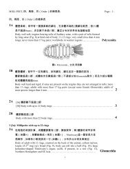
215 Amphibians and Reptiles<br />
222 Birds<br />
229 Mammals<br />
Social Inventory<br />
234 Human Communities Visited<br />
245 Regional History of the Cofan<br />
253 Appendices<br />
254 (1) Soils<br />
258 (2) Water<br />
262 (3) Vascular Plants<br />
293 (4) Sampling Stations <strong>for</strong> Fishes<br />
294 (5) Fishes<br />
308 (6) Amphibians and Reptiles<br />
314 (7) Regional Amphibian and Reptile Inventories<br />
324 (8) Birds<br />
352 (9) Large- and Medium-sized Mammals<br />
360 (10) Bats<br />
362 (11) Human Demography<br />
364 (12) Human Natural Resource Use<br />
366 (13) Parque Nacional Natural La Paya (Spanish only)<br />
372 Literature Cited<br />
376 Published Reports<br />
ECUADOR, PERú: CUyAbEnO-GüEPPí JULIO/JULY 2008 151
PARTICIPAnTS<br />
FIELD TEAM<br />
Roberto Aguinda L. (field logistics)<br />
Fundación para la Sobrevivencia del Pueblo Cofan (FSC)<br />
Federación Indígena de la Nacionalidad Cofan<br />
del Ecuador (FEINCE)<br />
Quito and Dureno, Ecuador<br />
robertotsampi@yahoo.com<br />
William S. Alverson (plants)<br />
Environmental and Conservation Programs<br />
The Field Museum, Chicago, IL, USA<br />
walverson@fieldmuseum.org<br />
Randall borman A. (large mammals)<br />
Fundación para la Sobrevivencia del Pueblo Cofan (FSC)<br />
Federación Indígena de la Nacionalidad Cofan<br />
del Ecuador (FEINCE)<br />
Quito and Dureno, Ecuador<br />
randy@cofan.org<br />
Adriana bravo (mammals)<br />
Louisiana State University<br />
Baton Rouge, LA, USA<br />
abravo1@lsu.edu<br />
Daniel brinkmeier (communications)<br />
Environmental and Conservation Programs<br />
The Field Museum, Chicago, IL, USA<br />
dbrinkmeier@fieldmuseum.org<br />
nállarett Dávila (plants)<br />
Universidad Nacional de la Amazonía Peruana<br />
Iquitos, Peru<br />
arijuna15@hotmail.com<br />
Álvaro del Campo (field logistics, photography, video)<br />
Environmental and Conservation Programs<br />
The Field Museum, Chicago, IL, USA<br />
adelcampo@fieldmuseum.org<br />
<strong>152</strong> RAPID bIOLOGICAL AnD SOCIAL InVEnTORIES INFORME/REPORT NO. 20<br />
Sebastián Descanse U. (plants)<br />
Comunidad Cofan Chandia Na’e<br />
Sucumbíos, Ecuador<br />
Robin b. Foster (plants)<br />
Environmental and Conservation Programs<br />
The Field Museum, Chicago, IL, USA<br />
rfoster@fieldmuseum.org<br />
Max H. Hidalgo (fishes)<br />
Museo de Historia Natural Universidad Nacional Mayor<br />
de San Marcos<br />
Lima, Peru<br />
maxhhidalgo@yahoo.com<br />
Guillermo Knell (field logistics)<br />
Universidad Ricardo Palma<br />
Lima, Peru<br />
kchemo@yahoo.com<br />
Jill López (plants)<br />
Universidad Nacional de la Amazonía Peruana<br />
Iquitos, Peru<br />
jillsita02@yahoo.com.mx<br />
bolívar Lucitante (cook)<br />
Comunidad Cofan Zábalo<br />
Sucumbíos, Ecuador<br />
Laura Cristina Lucitante C. (plants)<br />
Comunidad Cofan Chandia Na’e<br />
Sucumbíos, Ecuador<br />
Alfredo Meléndez (field logistics, cook)<br />
Comunidad Tres Fronteras<br />
Loreto, Peru<br />
Patricio Mena Valenzuela (birds)<br />
Museo Ecuatoriano de Ciencias Naturales<br />
Quito, Ecuador<br />
pmenavalenzuela@yahoo.es
norma Mendúa (cook)<br />
Comunidad Cofan Zábalo<br />
Sucumbíos, Ecuador<br />
Italo Mesones (field logistics)<br />
Universidad Nacional de la Amazonía Peruana<br />
Iquitos, Peru<br />
italoacuy@yahoo.es<br />
Debra K. Moskovits (coordination, birds)<br />
Environmental, Culture, and Conservation<br />
The Field Museum, Chicago, IL, USA<br />
dmoskovits@fieldmuseum.org<br />
Rodrigo Pacaya Levi (translation)<br />
Organización Indígena Secoya del Perú (OISPE)<br />
Bellavista, Loreto, Peru<br />
Walter Palacios (plants)<br />
Universidad Técnica del Norte, Ibarra<br />
Quito, Ecuador<br />
walterpalacios@uio.satnet.net<br />
Mario Pariona (social inventory)<br />
Environmental and Conservation Programs<br />
The Field Museum, Chicago, IL, USA<br />
mpariona@fieldmuseum.org<br />
Amelia Quenamá Q. (natural history)<br />
Fundación para la Sobrevivencia del Pueblo Cofan (FSC)<br />
Federación Indígena de la Nacionalidad Cofan<br />
del Ecuador (FEINCE)<br />
Quito and Dureno, Ecuador<br />
Dora Ramírez Dávila (social inventory)<br />
Consultant<br />
Iquitos, Peru<br />
ramirezdora2005@yahoo.com.ar<br />
Juan Francisco Rivadeneira R. (fishes)<br />
Museo Ecuatoriano de Ciencias Naturales<br />
Quito, Ecuador<br />
jf.rivadeneira@mecn.gov.ec<br />
Anselmo Sandoval Estrella (social inventory)<br />
Organización Indígena Secoya del Perú (OISPE)<br />
Bellavista, Loreto, Peru<br />
Guido Sandoval Estrella (field logistics, boat pilot)<br />
Organización Indígena Secoya del Perú (OISPE)<br />
Bellavista, Loreto, Peru<br />
Sara Sandoval Levi (cooking)<br />
Comunidad Secoya Nuevo Belén<br />
Loreto, Peru<br />
Thomas J. Saunders (geology, soils and water)<br />
University of Florida<br />
Gainesville, FL, USA<br />
tsaunders@fieldmuseum.org<br />
Douglas F. Stotz (birds)<br />
Environmental and Conservation Programs<br />
The Field Museum, Chicago, IL, USA<br />
dstotz@fieldmuseum.org<br />
Teófilo Torres (social inventory)<br />
Jefatura, Zona Reservada Güeppí<br />
Iquitos, Peru<br />
teofilotorres@yahoo.com<br />
Oscar Vásquez Macanilla (plants)<br />
Comunidad Secoya Guajoya<br />
Loreto, Peru<br />
Pablo J. Venegas (amphibians and reptiles)<br />
Centro de Ornitología y Biodiversidad (CORBIDI)<br />
Lima, Peru<br />
sancarranca@yahoo.es<br />
ECUADOR, PERú: CUyAbEnO-GüEPPí JULIO/JULY 2008 153
<strong>Participants</strong> (continued)<br />
Corine Vriesendorp (plants)<br />
Environmental and Conservation Programs<br />
The Field Museum, Chicago, IL, USA<br />
cvriesendorp@fieldmuseum.org<br />
Tyana Wachter (general logistics)<br />
Environmental and Conservation Programs<br />
The Field Museum, Chicago, IL, USA<br />
twachter@fieldmuseum.org<br />
Alaka Wali (social inventory)<br />
Center <strong>for</strong> Cultural Understanding and Change<br />
The Field Museum, Chicago, IL, USA<br />
awali@fieldmuseum.org<br />
Mario yánez-Muñoz (amphibians and reptiles)<br />
Museo Ecuatoriano de Ciencias Naturales<br />
Quito, Ecuador<br />
m.yanez@mecn.gov.ec<br />
COLLABORATORS<br />
Luis borbor<br />
Reserva de Producción Faunística Cuyabeno<br />
Miryan García<br />
INRENA, Lima<br />
Asociación Interétnica de Desarrollo de la<br />
Selva Peruana (AIDESEP)<br />
Lima, Peru<br />
Comunidad Huitoto (Murui ) Santa Teresita<br />
Peru<br />
Comunidades Cabo Pantoja y Tres Fronteras<br />
Peru<br />
Comunidades Cofan Chandia na’e, Dureno y Zábalo<br />
Sucumbíos, Ecuador<br />
154 RAPID bIOLOGICAL AnD SOCIAL InVEnTORIES INFORME/REPORT NO. 20<br />
Comunidades Kichwa (Naporuna) Angoteros,<br />
Miraflores y Torres Causana<br />
Peru<br />
Comunidades Secoya (Airo Pai ) bellavista, Guajoya (Vencedor),<br />
Mañoko Daripë (Puerto Estrella), Martín de Porres, Mashunta,<br />
nuevo belén, Santa Rita y Zambelín de yaricaya<br />
Peru<br />
Ejército Ecuatoriano<br />
Ejército Peruano<br />
Federación Indígena de la<br />
nacionalidad Cofan del Ecuador (FEInCE)<br />
Lago Agrio, Ecuador<br />
Fuerza Aérea del Perú (FAP)<br />
Iquitos, Peru<br />
Herbario nacional del Ecuador (QCnE)<br />
Quito, Ecuador<br />
Hotel Doral Inn<br />
Iquitos, Peru<br />
Instituto de Investigaciones de la Amazonía Peruana (IIAP)<br />
Iquitos, Peru<br />
Instituto nacional de Recursos naturales (InREnA)<br />
Lima, Peru<br />
Ministerio del Ambiente del Ecuador<br />
Quito, Ecuador<br />
Ministerio de Relaciones Exteriores<br />
Lima, Peru
InSTITUTIOnAL PROFILES<br />
The Field Museum<br />
The Field Museum is a collections-based research and<br />
educational institution devoted to natural and cultural diversity.<br />
Combining the fields of Anthropology, Botany, Geology, Zoology,<br />
and Conservation Biology, museum scientists research issues<br />
in evolution, environmental biology, and cultural anthropology.<br />
One division of the Museum—Environment, Culture, and<br />
Conservation (ECCo)—through its two departments,<br />
Environmental and Conservation Programs (ECP) and the<br />
Center <strong>for</strong> Cultural Understanding and Change (CCUC),<br />
is dedicated to translating science into action that creates and<br />
supports lasting conservation of biological and cultural diversity.<br />
ECCo works closely with local communities to ensure their<br />
involvement in conservation through their existing cultural values<br />
and organizational strengths. With losses of natural diversity<br />
accelerating worldwide, ECCo’s mission is to direct the Museum’s<br />
resources—scientific expertise, worldwide collections, innovative<br />
education programs—to the immediate needs of conservation<br />
at local, national, and international levels.<br />
The Field Museum<br />
1400 South Lake Shore Drive<br />
Chicago, Illinois 60605-2496, USA<br />
312.922.9410 tel<br />
www.fieldmuseum.org<br />
InREnA, Zona Reservada Güeppí<br />
As a legacy <strong>for</strong> future generations, the Instituto Nacional de<br />
Recursos Naturales (INRENA) is responsible <strong>for</strong> managing the<br />
nationally protected areas, with the goal of conserving biological<br />
diversity and ecological services that contribue to the country’s<br />
sustainable development.<br />
The 625,971-hectare Zona Reservada Güeppí was created in<br />
1997, and it harbors great biodiversity. After a long process of<br />
participative planning with local stakeholders, the area now has<br />
a consensus with a concerted proposal <strong>for</strong> categorization that<br />
includes the creation of two communal reserves (Airo Pai and<br />
Huimeki), as well as a national park (Parque Nacional Güeppí).<br />
INRENA, Zona Reservada Güeppí<br />
Calle Pevas No. 339, Iquitos, Peru<br />
51.65.223.<strong>46</strong>0 tel<br />
zrgueppi@yahoo.es<br />
ECUADOR, PERú: CUyAbEnO-GüEPPí JULIO/JULY 2008 <strong>155</strong>
Institutional Profiles (continued)<br />
Ministerio del Ambiente del Ecuador<br />
The Ministerio del Ambiente del Ecuador (MAE) is the national<br />
environmental agency responsible <strong>for</strong> the sustainable development<br />
and environmental quality of the country. It is the highest<br />
authority <strong>for</strong> issuance and coordination of national policies, rules,<br />
and regulations, including basic guidelines <strong>for</strong> organizing and<br />
implementing environmental management.<br />
MAE develops environmental policies and coordinates strategies,<br />
projects, and programs <strong>for</strong> the protection of ecosystems and <strong>for</strong><br />
sustainable use of natural resources. MAE sets regulations<br />
necessary <strong>for</strong> environmental quality associated with conservationbased<br />
development and the appropriate use of natural resources.<br />
Ministerio del Ambiente, República del Ecuador<br />
Avenida Eloy Alfaro y Amazonas<br />
Quito, Ecuador<br />
593.22.563.429, 593.22.563.430 tel<br />
www.ambiente.gov.ec<br />
mma@ambiente.gov.ec<br />
156 RAPID bIOLOGICAL AnD SOCIAL InVEnTORIES INFORME/REPORT NO. 20<br />
Fundación para la Sobrevivencia del Pueblo Cofan<br />
The Fundación para la Sobrevivencia del Pueblo Cofan is a<br />
non-profit organization dedicated to conserving the Cofan<br />
indigenous peoples, their culture, and the Amazonian <strong>for</strong>ests that<br />
sustain them. Together with its international counterpart, the<br />
Cofan Survival Fund, the foundation supports conservation and<br />
development programs in seven Cofan communities in eastern<br />
Ecuador. Programs focus on biodiversity conservation and<br />
research, protecting and titling Cofan ancestral territories,<br />
developing economic and ecological alternatives, and educational<br />
opportunities <strong>for</strong> young Cofan.<br />
Fundación para la Sobrevivencia del Pueblo Cofan<br />
Casilla 17-11-6089<br />
Quito, Ecuador<br />
593.22.470.9<strong>46</strong> tel/fax<br />
www.cofan.org
Organización Indígena Secoya del Perú<br />
The Organización Indígena Secoya del Perú (OISPE), is a nonprofit<br />
indigenous organization founded 22 November 2003 and<br />
registered in the Oficina Registral de Loreto, in Iquitos. Its<br />
headquarters are located in the native community of San Martin,<br />
Anexo Bellavista. OISPE’s board members include the President,<br />
Vice President, and Secretary of Official Documents and Archives.<br />
It has jurisdiction over eight communities in the Napo and<br />
Putumayo watersheds, Districts of Teniente Manuel Clavero and<br />
Torres Causana, Maynas Province, Loreto.<br />
OISPE’s mission is to obtain land titling and legal consolidation<br />
of Secoya territory, work toward integrated and sustainable<br />
development, and secure Secoya legal rights and autonomy.<br />
At present, OISPE is negotiating land expansion and titling <strong>for</strong><br />
their communal territories, as well requesting recognition of the<br />
proposals to establish the Airo Pai and Huitoto-Mestizo-Kichua<br />
(HUIMEKI) communal reserves, and the “SEKIME National Park”<br />
(Parque Nacional Güeppí), within the Zona Reservada Güeppí.<br />
OISPE<br />
Comunidad Nativa San Martín, Anexo Bellavista<br />
Río Yubineto, Distrito de Teniente Clavero<br />
Putumayo, Peru<br />
Radiotelephone frequency 6245<br />
Organización Kichwaruna Wangurina del Alto napo<br />
The Organización Kichwaruna Wangurina del Alto Napo<br />
(ORKIWAN) is a non-profit indigenous institution created in 1984<br />
and registered in 1986 in the Oficina Registral de Loreto, Iquitos.<br />
Its headquarters are located in the native community of Angotero.<br />
The governing board includes a President, Vice President,<br />
Secretary, Treasurer, Secretary <strong>for</strong> Indigenous Women, and<br />
Advisor of the Organziation. ORKIWAN’s jurisdiction extends<br />
throughout the watershed of the Napo River. It includes 26<br />
communities, of which 17 sit in the district of Torres Causana,<br />
and 9 in Napo, all in Maynas Province of Loreto.<br />
The mission of ORKIWAN is to over<strong>see</strong> and encourage the<br />
financial and legal consolidation of Kichwaruna territory in<br />
support of integrated, sustainable development, and the free<br />
exercise of indigenous culture, language, and identity. It also <strong>see</strong>ks<br />
to strengthen the capacity <strong>for</strong> self-governance based on federal<br />
rights in support of intercultural development. ORKIWAN<br />
promotes bilingual education in its territories and the titling of<br />
communal lands.<br />
ORKIWAN<br />
Comunidad Nativa Angotero, Napo River<br />
District of Torres Causana<br />
Maynas, Loreto, Peru<br />
(also, Apartado 216, Iquitos, Peru)<br />
Radiophone frequency 7020<br />
Rural communal telephone 812042<br />
ECUADOR, PERú: CUyAbEnO-GüEPPí JULIO/JULY 2008 157
Institutional Profiles (continued)<br />
Organización Regional de Pueblos Indígenas del Oriente<br />
The Organización Regional de Pueblos Indígenas del Oriente<br />
(ORPIO, previously ORAI) is an institution with legal status,<br />
registered in the Oficina Registral de Loreto, in Iquitos. It includes<br />
13 indigenous federations, composed of 16 ethnolinguistic<br />
settlements, along the Putumayo, Algodón, Ampiyacu, Amazon,<br />
Nanay, Tigre, Corrientes, Marañon, Samiria, Ucayali, Yavarí, and<br />
Tapiche rivers, all in the Loreto Region.<br />
ORPIO is a regional indigenous organization represented by<br />
an executive council of five members, each with a three-year term.<br />
It has autonomy of decision-making in a regional context.<br />
ORPIO’s mission is to work in support of indigenous rights, access<br />
to lands, and autonomous economic development based on the<br />
values and traditional knowledge of each indigenous community.<br />
The organization promotes communication that enables its<br />
members to make in<strong>for</strong>med decisions. It encourages the<br />
participation of women in community organization, and works<br />
with titling of indigenous lands. ORPIO participates broadly as a<br />
consultant, and in working groups with federal and other civil<br />
officials, <strong>for</strong> the development and conservation of the environment<br />
in the Loreto Region.<br />
ORPIO<br />
Av. del Ejército 1718<br />
Iquitos, Peru<br />
51.65.227345 tel<br />
orpio_aidesep@yahoo.es<br />
158 RAPID bIOLOGICAL AnD SOCIAL InVEnTORIES INFORME/REPORT NO. 20<br />
Herbario Amazonense de la Universidad nacional<br />
de la Amazonía Peruana<br />
The Herbario Amazonense (AMAZ) is located in Iquitos, Peru,<br />
and <strong>for</strong>ms part of the Universidad Nacional de la Amazonía<br />
Peruana (UNAP). It was founded in 1972 as an educational and<br />
research institution focused on the flora of the Peruvian Amazon.<br />
The bulk of the collections showcase representative specimens of<br />
the Amazonian flora of Peru, considered one of the most diverse<br />
floras on the planet; the herbarium also houses collections made in<br />
other countries. These collections serve as a valuable resource <strong>for</strong><br />
understanding the classification, distribution, phenology, and<br />
habitat preferences of plants in the Pteridophyta, Gymnospermae,<br />
and Angiospermae. Local and international students, docents,<br />
and researchers use these collections to teach, study, identify, and<br />
research the flora. In this way, the Herbario Amazonense<br />
contributes to the conservation of the diverse Amazonian flora.<br />
Herbarium Amazonense (AMAZ)<br />
Esquina Pevas con Nanay s/n<br />
Iquitos, Peru<br />
51.65.222649 tel<br />
herbarium@dnet.com
Museo Ecuatoriano de Ciencias naturales<br />
The Museo Ecuatoriano de Ciencias Naturales (MECN) is a<br />
public entity established on 18 August 1977 by government decree<br />
1777-C, in Quito, as a technical, scientific, and public institution.<br />
The MECN represents the only state institution whose objectives<br />
are to inventory, classify, conserve, exhibit, and disseminate<br />
understanding of the country’s biodiversity. The institution offers<br />
assistance, cooperation, and guidance to scientific institutions,<br />
educational organizations, and state offices on issues related to<br />
conservation research, natural resource conservation, and<br />
Ecuador’s biodiversity. It also contributes technical support <strong>for</strong><br />
designing and establishing national protected areas.<br />
Museo Ecuatoriano de Ciencias Naturales<br />
Rumipamba 341 y Av. De los Shyris<br />
Casilla Postal 17-07-8976<br />
Quito, Ecuador<br />
593.22.449.825 tel/fax<br />
Museo de Historia natural de la Universidad nacional<br />
Mayor de San Marcos<br />
Founded in 1918, the Museo de Historia Natural is the<br />
principal source of in<strong>for</strong>mation on the Peruvian flora and fauna.<br />
Its permanent exhibits are visited each year by 50,000 students,<br />
while its scientific collections —housing 1.5 million plant, bird,<br />
mammal, fish, amphibian, reptile, fossil, and mineral specimens—<br />
are an invaluable resource <strong>for</strong> hundreds of Peruvian and <strong>for</strong>eign<br />
researchers. The museum’s mission is to be a center of conservation,<br />
education, and research on Peru’s biodiversity, highlighting the<br />
fact that Peru is one of the most biologically diverse countries on<br />
the planet, and that its economic progress depends on the<br />
conservation and sustainable use of its natural riches. The museum<br />
is part of the Universidad Nacional Mayor de San Marcos,<br />
founded in <strong>155</strong>1.<br />
Museo de Historia Natural de la<br />
Universidad Nacional Mayor de San Marcos<br />
Avenida Arenales 1256<br />
Lince, Lima 11, Peru<br />
51.1.471.0117 tel<br />
www.museohn.unmsm.edu.pe<br />
ECUADOR, PERú: CUyAbEnO-GüEPPí JULIO/JULY 2008 159
ACKnOWLEDGMEnTS<br />
This inventory of the biologically and culturally rich region where<br />
Ecuador, Peru, and Colombia intersect was suggested years ago by<br />
Randy Borman, Cofan leader. Last year, when we were approached by<br />
INRENA-Güeppí, and eventually the Secoya Federation (OISPE), we<br />
realized the stage was set <strong>for</strong> an incredible collaboration. The inventory<br />
would not have been possible without the deep knowledge and strong<br />
organizational skills of local indigenous communities, as well as the<br />
support of regional military personnel, collaborating local and national<br />
institutions, and other local residents. To all, we offer our sincere<br />
thanks along with a huge sigh of relief that together we were able to<br />
carry out the long and complicated field itinerary and the subsequent<br />
in-country presentations and preparations <strong>for</strong> the written report.<br />
The Airo Pai (Secoya) communities of Bellavista, San Martín,<br />
Santa Rita, Nuevo Belén (on the Yubineto River), Mashunta (Angusilla<br />
River), Zambelín (Yaricaya River), Guajoya (Santa María River),<br />
and Puerto Estrella (Lagartococha River) helped us immensely with<br />
field logistics and provided valuable in<strong>for</strong>mation to the biological<br />
and social teams. In particular, we are grateful <strong>for</strong> the help provided<br />
by Gustavo Cabrera, Leonel Cabrera, Ricardo Chota, Segundo<br />
Coquinche, Wilder Coquinche, Wilson Coquinche, Gamariel Estrella<br />
(Jaguarcito), Javier Estrella, Rita Estrella, Luis Garcés, Andrés Levy,<br />
Ceferino Levy, Aner Macanilla, Elizabeth Macanilla, John Macanilla,<br />
Olivio Macanilla, Mauricio Magallanes, Cecilio Pacaya,<br />
Francisco Pacaya, Rodrigo Pacaya, Venancio Payaguaje, Roger Rojas,<br />
Anselmo Sandoval, Guido Sandoval, Marcelino Sandoval y familia,<br />
Marcos Sandoval, Moisés Sandoval, Véliz Sandoval, Oscar Vásquez,<br />
Germán Vílchez, Jorge Vílchez, Nilda Vílchez, and Roldán Yapedatze.<br />
The Cofan community of Zábalo (on the Aguarico River)<br />
was the hub of the biological inventory of the first three sites.<br />
The biological team camped at Zábalo the first night in the field<br />
and then spun east and north to the first three field camps with the<br />
invaluable help of our Cofan collaborators. The following individuals<br />
from Zábalo, and from the Cofan communities of Dureno and<br />
Chandia Na’e, played central roles in the inventory: Alba Criollo,<br />
Braulio Criollo, Delfín Criollo, Floresto Criollo, Maura Criollo,<br />
Natasha Criollo, Oswaldo Criollo, Orlando Huitca, Arturo Lucitante,<br />
Bolívar Lucitante and family, Elio Lucitante, Alex Machoa, Francisco<br />
Machoa, Lucía Machoa, Valerio Machoa, Andrés Mendúa, Luis<br />
Mendúa and family, Mauricio Mendúa, Linda Ortiz, Daniel Quenamá,<br />
Carlos Yiyoguaje, Debica Yiyoguaje, and Jose Yiyoguaje.<br />
The biological and social teams are grateful <strong>for</strong> the help<br />
and in<strong>for</strong>mation shared by the Murui (Huitoto) community of<br />
160 RAPID bIOLOGICAL AnD SOCIAL InVEnTORIES INFORME/REPORT NO. 20<br />
Santa Teresita (on the Peneya River), and by the Naporuna<br />
(Kichwa) communities of Miraflores (Putumayo River),<br />
Torres Causana, Santa María de Angotero (Napo River),<br />
and Zancudo (Aguarico River).<br />
We also thank members of the mestizo communities of<br />
Tres Fronteras (Putumayo River) and Angoteros (Napo River),<br />
who played important roles in the work of the biological and<br />
social teams. We also thank Tres Fronteras residents Julián Ajón,<br />
Alejandro Arimuya, Nemesio Arimuya, Jorge Luis Chávez,<br />
Wilmer Chávez, Mario Chumbe, Pablo Cruz, Oclives Garcés,<br />
Luis Gonzáles, Adalberto Hernández, Elvis Imunda, José Manuyama,<br />
Julia Manuyama, José Mayorani, Alfredo Meléndez, Luis Miranda,<br />
Darío Noteno, Juan Wilson Noteno, Hernando Noteno, Jairo Orozco,<br />
Eloy Papa, Joel Papa, Manuel Pizango, Deiner Ramírez, Alex Saboya,<br />
Alejandro Sánchez, César Sánchez, Deiner Sánchez, Jaime Sánchez,<br />
José Luis Sánchez, Elvis Tapullima, and Jorge Vargas.<br />
The inventory would not have been a success without<br />
permission and support <strong>for</strong> work in the region from several<br />
indigenous organizations. These organizations will be central players<br />
in the ef<strong>for</strong>ts to translate the recommendations of this report into<br />
action: Organización Indígena Secoya del Perú (OISPE), Federación<br />
Indígena de la Nacionalidad Cofan del Ecuador (FEINCE),<br />
Organización Kichwaruna del Alto Napo (ORKIWAN), and the<br />
Organización Regional de Pueblos Indigenas del Oriente (ORPIO).<br />
Personnel at regional military bases gave us permission to<br />
travel in sometimes difficult border areas, offered useful advice,<br />
and showed a surprising degree of interest in our work. These<br />
individuals were stationed at several military bases in Peru: Cabo<br />
Pantoja (Napo River), Güeppí (Putumayo River), Aguas Negras<br />
(Lagartococha River); and in Ecuador: Zancudo (Aguarico River),<br />
Lagartococha, Patria (Lagartococha River), and Panupali (Güeppí<br />
River). Pilots of the Fuerza Aérea del Perú (FAP)-Iquitos skillfully<br />
extracted the field teams and their mountain of gear at the close of<br />
the inventory. Capitán Carlos Vargas Serna and Orlando Soplín<br />
were key to these operations from their base in Iquitos.<br />
Other national and regional organizations provided crucial help<br />
and advice, including the Ministerio del Ambiente (L. Altamirano,<br />
G. Montoya) and Herbario Nacional (QCNE) in Ecuador; and in<br />
Peru, the Asociación Interétnica de Desarrollo de la Selva Peruana<br />
(AIDESEP), Ministerio de Relaciones Exteriores-Cancillería del Perú<br />
(Pablo Cisneros), Instituto Nacional de Recursos Naturales<br />
(INRENA)-Lima (Jorge Ugaz, Miryan García, Jorge Lozada,
Carmen Jaimes), Instituto de Investigaciones de la Amazonía Peruana<br />
(IIAP)-Iquitos, Hotel Doral Inn-Iquitos, Vicariato Apostólico de Iquitos,<br />
Kantu Tours-Lima, Hotel Señorial-Lima, and Alas del Oriente-Iquitos.<br />
As usual, our advance teams overcame many challenges.<br />
Guillermo Knell and Italo Mesones, leaders of the two advance field<br />
teams, were responsible <strong>for</strong> the establishment of inventory camps 3,<br />
4, and 5, and their respective trail systems. Through great ef<strong>for</strong>t, and<br />
with time against them, they were able to complete all of their tasks<br />
be<strong>for</strong>e the inventory began. Their ef<strong>for</strong>ts allowed the biological<br />
inventory team to be successful in its work, and we are grateful to<br />
them. Other Peruvian friends and colleagues at the Centro de<br />
Conservación, Investigación y Manejo de Áreas Naturales (CIMA)<br />
provided excellent logistical support in the field, in Iquitos, and in<br />
Lima during our trip. We thank Jorge Aliaga, Lotti Castro, Alberto<br />
Asín, Manuel Álvarez, Tatiana Pequeño, Jorge Luis Martínez,<br />
Yessenia Huamán, Lucía Ruiz, Wacho Aguirre, and Techy Marina.<br />
Likewise, several individuals were stellar in the organization and<br />
management of logistics in Ecuador. Roberto Aguinda orchestrated the<br />
supply of food and additional equipment <strong>for</strong> the advance team in camps<br />
1 and 2, as well as <strong>for</strong> all five camps during the inventory proper. Freddy<br />
Espinosa and his wife, Maria Luisa López, ensured coordination of<br />
ef<strong>for</strong>ts from their base in Quito. Sadie Siviter, Hugo Lucitante, Mateo<br />
Espinosa, Juan Carlos González, Carlos Menéndez, Víctor Andrango,<br />
and Lorena Sánchez provided fast and efficent logistical aid from the<br />
offices of the Fundación Sobrevivencia Cofan, in Quito, be<strong>for</strong>e,<br />
during, and after the inventory; Elena Arroba did the same from the<br />
FSC office in Lago Agrio. John Lucitante drew the graphic of the<br />
giant river otter that we printed on T-shirts <strong>for</strong> participants.<br />
Special thanks go to our cooks, Sara Sandoval (camps 1 and 2),<br />
Bolívar Lucitante y Norma Mendúa (Zábalo subsite and camp 3),<br />
and Alfredo Meléndez (camps 4 and 5); and to our boatmen, Guido<br />
Sandoval (advance and social teams), Aner Macanilla, Oscar Vásquez<br />
(advance), George Pérez, Stalin Vílchez (social), Bolívar Lucitante<br />
(advance), Luis Mendúa (advance, biological team camps 1 and 2),<br />
Isidro Lucitante (camps 1 and 2), Miguel Ortiz, Román Criollo,<br />
Venancio Criollo, Pablo Criollo (camps 3 and 4), and Alejandro<br />
Sánchez (camps 4 and 5).<br />
Other friends and colleagues provided help or insights with<br />
specific, critical elements of the inventory. For this, we offer our thanks<br />
to Coronel PNP Dario “Apache” Hurtado Cárdenas, Luis Narvaez,<br />
César Larraín Tafur, Carlos Carrera, Aldo Villanueva, Carolina de la<br />
Rosa, Maria Luisa Belaunde, Pepe Álvarez, Cindy Mesones, Daniel<br />
Schuur, Rodolfo Cruz Miñán, Milagritos Reátegui, and Yolanda<br />
Guerra. The herpetological team thanks Karl-Hainz Jungfer <strong>for</strong> his<br />
valuable help in determining the species of Osteocephalus; William<br />
Lamar <strong>for</strong> his useful comments about the diversity of the herpetofauna<br />
of Iquitos; Walter Schargel <strong>for</strong> his determination of the species of<br />
Atractus; Diego F. Cisneros-Heredia, <strong>for</strong> sharing his knowledge of<br />
the Tiputini region; Lily O. Rodríguez, who generously shared her<br />
in<strong>for</strong>mation about her collections made at Aguas Negras, Peru, in<br />
1994; L. Cecilia Tobar and Paúl Meza-Ramos, who from Quito<br />
made available literature held in the Museo Ecuatoriano de Ciencias<br />
Naturales (MECN); and Carlos Carrera <strong>for</strong> his constant help and<br />
support in the care of collections at MECN. For their invaluable<br />
guidance and help in the exporting process <strong>for</strong> the plant collections,<br />
the botany team is profoundly grateful to the Ministerio del Ambiente<br />
(MAE). In particular, we recognize the key support of Gabriela<br />
Montoya, Unidad de Vida Silvestre; Wilson Rojas, Director Nacional<br />
de Biodiversidad; and Fausto Gonzales, Director Regional de<br />
Sucumbíos. Similarly, we thank Elva Díaz and Francisco Quizana <strong>for</strong><br />
their help in obtaining collecting and export permits.<br />
We also thank Marcela Galvis, Adriana Rojas Suárez, and Rafael<br />
Sánchez (Parques Nacionales Naturales de Colombia) <strong>for</strong> supplying<br />
up-to-date in<strong>for</strong>mation on P.N.N. La Paya.<br />
From our home base in Chicago, we received invaluable help<br />
from these individuals: Jonathan Markel prepared excellent maps using<br />
digitalized satellite images, both <strong>for</strong> the advance team and the later<br />
biological inventory team. Dan Brinkmeier quickly produced visual<br />
materials extremely useful <strong>for</strong> in-country presentations, and developed<br />
graphics <strong>for</strong> extension ef<strong>for</strong>ts in local communities, all of which<br />
explained the results of our inventory. Tyana Wachter was critically<br />
important <strong>for</strong> the inventory, from Chicago to Lima, Iquitos, and Quito.<br />
She, together with Chicago-based Rob McMillan and Brandy Pawlak,<br />
wove their magic to make problems disappear as they arose.<br />
Brandy and Tyana also carefully proofread the report. We thank<br />
Wilber H. Gantz <strong>for</strong> a critical upgrade of our GPS-navigation system.<br />
Bil Alverson thanks Drs. Joaquin Brieva, John P. Flaherty and George<br />
Mejicano, and the kind staff of the Infusion Center of University of<br />
Wisconsin-Madison Hospitals, <strong>for</strong> expert treatment of leishmaniasis.<br />
Finally, Jim Costello and staff of Costello Communications continued<br />
to help us streamline and perfect the editing and production of printed<br />
and on-line reports, and showed remarkable patience in the process.<br />
Funds <strong>for</strong> this inventory were provided by The Hamill Family<br />
Foundation and The Field Museum.<br />
ECUADOR, PERú: CUyAbEnO-GüEPPí JULIO/JULY 2008 161
MISSIOn<br />
The goal of rapid inventories—biological and social—<br />
is to catalyze effective action <strong>for</strong> conservation in threatened<br />
regions of high biological diversity and uniqueness.<br />
Approach<br />
During rapid biological inventories, scientific teams focus<br />
primarily on groups of organisms that indicate habitat type and<br />
condition and that can be surveyed quickly and accurately. These<br />
inventories do not attempt to produce an exhaustive list of species<br />
or higher taxa. Rather, the rapid surveys (1) identify the important<br />
biological communities in the site or region of interest, and (2)<br />
determine whether these communities are of outstanding quality<br />
and significance in a regional or global context.<br />
During social asset inventories, scientists and local<br />
communities collaborate to identify patterns of social organization<br />
and opportunities <strong>for</strong> capacity building. The teams use participant<br />
observation and semi-structured interviews to evaluate quickly<br />
the assets of these communities that can serve as points<br />
of engagement <strong>for</strong> long-term participation in conservation.<br />
162 RAPID bIOLOGICAL AnD SOCIAL InVEnTORIES INFORME/REPORT NO. 20<br />
In-country scientists are central to the field teams.<br />
The experience of local experts is crucial <strong>for</strong> understanding<br />
areas with little or no history of scientific exploration. After the<br />
inventories, protection of natural communities and engagement<br />
of social networks rely on initiatives from host-country scientists<br />
and conservationists.<br />
Once these rapid inventories have been completed (typically<br />
within a month), the teams relay the survey in<strong>for</strong>mation to local and<br />
international decisionmakers who set priorities and guide<br />
conservation action in the host country.
REPORT AT A GLAnCE<br />
Dates of field work Biological team: 4–30 October 2007<br />
Social team: 13–29 October 2007<br />
Region Three protected areas cover a huge expanse of the interfluvium of the Napo and Putumayo<br />
rivers along the borders of Ecuador, Peru, and Colombia: Reserva de Producción<br />
Faunística Cuyabeno (Ecuador), Zona Reservada Güeppí (Peru), and Parque Nacional<br />
Natural La Paya (Colombia). Together, the areas <strong>for</strong>m a conservation corridor with the<br />
potential to be managed as an integrated unit by the three countries.<br />
Puerto<br />
Carmen<br />
E C U A D OR<br />
Frontera internacional/<br />
International boundary<br />
50 km<br />
G ü e p p í<br />
R.P.F. Cuyabeno<br />
(603,380 ha)<br />
A g u a r i c o<br />
N a p o<br />
P.N.N. La Paya<br />
(422,000 ha)<br />
L a g a r t o c o c h a<br />
C O L O MBI A<br />
Z.R. Güeppí<br />
(625,971 ha)<br />
Cabo<br />
Pantoja<br />
Napo<br />
Puerto<br />
Leguízamo<br />
P E R Ú<br />
Pu t u m a y o<br />
ECUADOR, PERú: CUyAbEnO-GüEPPí JULIO/JULY 2008 163
REPORT AT A GLAnCE<br />
Sites inventoried The biological team visited five sites (two in Ecuador and three in Peru), in the watersheds<br />
of the Napo and Putumayo rivers (Figs. 2A, 2C). We did not visit any sites in Colombia.<br />
napo: Garzacocha, Ecuador, 5–9 October 2007<br />
Redondococha, Peru, 9–14 October 2007<br />
Putumayo: Güeppicillo, Ecuador, 15–21 October 2007<br />
Güeppí, Peru, 21–25 October 2007<br />
Aguas Negras, Peru, 25–29 October 2007<br />
The social team worked exclusively in Peru, visiting 13 communities in the Napo and<br />
Putumayo watersheds (Fig. 2A).<br />
164 RAPID bIOLOGICAL AnD SOCIAL InVEnTORIES INFORME/REPORT NO. 20<br />
napo: Guajoya, Cabo Pantoja, Torres Causana, Angoteros, 13–21 October 2007<br />
Putumayo: Bella Vista, San Martín, Santa Rita, Nuevo Belén, Mashunta,<br />
Zambelín de Yaricaya, Santa Teresita, Miraflores, Tres Fronteras,<br />
21–29 October 2007<br />
In addition to these 13 communities, the social team briefly visited Soplín Vargas,<br />
capital of the Teniente Manuel Clavero district (in Peru), and Puerto Leguízamo,<br />
a Colombian town that is the largest settlement in this part of the Putumayo River.<br />
Álvaro del Campo, logistics coordinator <strong>for</strong> the inventory, visited Mañoko Daripë,<br />
in Peru (also known as Puerto Estrella), a Secoya community on the Lagartococha<br />
River, in the Napo watershed, on 11 October.<br />
biological focus Soils and hydrology, plants, fishes, reptiles and amphibians, birds, large and medium<br />
mammals, and bats<br />
Social focus Social and cultural strengths, natural resource use, and community management practices<br />
Principal<br />
biological results<br />
Zona Reservada Güeppí and Reserva de Producción Faunística Cuyabeno lie in the most<br />
diverse <strong>for</strong>ests in the world, and the diversity in all groups we sampled is spectacular.<br />
Below we summarize our findings.<br />
Garzacocha Redondococha Güeppicillo Güeppí Aguas negras Species Recorded Regional Estimate<br />
Plants 400 700 600 500 400 1,400 3,000–4,000<br />
Fishes 76 87 70 65 37 184 260–300<br />
Amphibians 19 21 <strong>46</strong> 25 27 59 90<br />
Reptiles 18 23 18 16 17 48 60<br />
Birds 255 284 262 251 247 437 550<br />
Medium and large mammals* 25 31 36 26 24 <strong>46</strong> 56<br />
* Bats not included here (9 species observed in the first two sites).
Soils and hydrology: Clay soils dominate the region. Hundreds of meters of clay<br />
were deposited approximately 8–13 million years ago within a mosaic of lakes and<br />
meandering rivers. With the uplift of the Andes, sands and gravels were introduced into<br />
the area by fast-flowing rivers, and over time the landscape was sculpted into blackwater<br />
lakes, entrenched streams, erosive gullies, terraces, rounded hills, and low-lying valleys<br />
that characterize the study area. The clay soils are not easily penetrated by water,<br />
causing rain to flow overland from hilltops to clearwater streams or stagnate in lowerlying<br />
valleys and swamps. There are very few available minerals in the soils;<br />
the majority of nutrients are retained in the <strong>for</strong>ests themselves and in the soil organic<br />
matter. Intensive logging or agriculture would quickly drain soil nutrient reserves,<br />
leaving behind infertile lands.<br />
Plants: Botanists documented a rich plant community (1,400 species) representing<br />
a mix of the floras of eastern Ecuador and northern Peru. We estimate 3,000–4,000<br />
species occur in the region. Our greatest discovery was a tree with large fruits that<br />
represents a new genus of Violaceae. In addition, we recorded a handful of new genera<br />
<strong>for</strong> Ecuador (Chaunochiton, Thyrsodium, Condylocarpon, Neoptychocarpus) and Peru<br />
(Ammandra, Clathrotropis) and up to 14 species we suspect are new to science. There are<br />
timber populations in the floodplains of the major rivers, including cedro (Cedrela odorata)<br />
and tornillo (Cedrelinga cateni<strong>for</strong>mis), and scattered evidence of small-scale logging.<br />
Fishes: The ichthyologists recorded a rich fish community (184 species) representing<br />
38% and 61% of the known diversity <strong>for</strong> the Napo and Putumayo rivers, respectively.<br />
Twenty-three species are new records <strong>for</strong> Peru or Ecuador, and three appear to be new to<br />
science. The Napo-Putumayo interfluvium is a little-studied area that harbors abundant<br />
populations of commercially important species such as paiche, arahuana, and tucunaré,<br />
all easily observed in the lakes, streams, and rivers. Aquatic habitats range from mixed<br />
environments of black waters and clear waters, headwater streams and drainage divides,<br />
flooded areas, and a hydrological system influenced by the white waters of the Putumayo<br />
and Napo rivers; this great variation in aquatic habitats promotes high fish diversity.<br />
Some habitats provide reproductive sites <strong>for</strong> various species, including species <strong>for</strong><br />
human consumption. We estimate 260 to 300 species occur in the region.<br />
Amphibians and reptiles: The herpetologists recorded 107 species (59 amphibians,<br />
48 reptiles) and estimate that 150 species (90 amphibians, 60 reptiles) occur in<br />
the area. Our inventory revealed 19 new records <strong>for</strong> the R.P.F. Cuyabeno. The frog<br />
Allobates insperatus, previously known from Ecuador, was recorded in Peru, and the<br />
frog Pristimantis delius, previously known from Peru, was recorded in Ecuador. Our<br />
record of the frog Osteocephalus fuscifacies represents only the second locality in the<br />
Peruvian Amazon. In our two Peruvian sites adjacent to Ecuador, we found a species<br />
potentially new to science (a frog in the genus Rhinella). Commercially important and<br />
threatened species are well-represented in our inventory sites, especially black caiman<br />
ECUADOR, PERú: CUyAbEnO-GüEPPí JULIO/JULY 2008 165
REPORT AT A GLAnCE<br />
Principal<br />
biological results<br />
(continued)<br />
Principal<br />
social results<br />
166 RAPID bIOLOGICAL AnD SOCIAL InVEnTORIES INFORME/REPORT NO. 20<br />
(Melanosuchus niger), white caiman (Caiman crocodilus), river turtle (Podocnemis<br />
unifilis), yellow-footed tortoise (Chelonoidis denticulata), and tree boa (Corallus<br />
hortulanus), all listed by the IUCN and CITES.<br />
birds: The ornithologists recorded 437 species of birds during the inventory, and<br />
estimate that 550 species occur in the region. The bird community includes a rich<br />
<strong>for</strong>est avifauna, and an impressive diversity of aquatic birds along the Lagartococha<br />
River, especially herons, kingfishers, and sungrebes. We documented ten notable range<br />
extensions to the north; two rare waterbirds, Azure Gallinule (Porphyrio flavirostris)<br />
and Ash-throated Crake (Porzana albicollis); an unexpected migrant (Canada Warbler,<br />
Wilsonia canadensis); and nine species endemic to northwestern Amazonia. We did<br />
not encounter the Cocha Antshrike (Thamnophilus praecox), endemic to northeastern<br />
Ecuador. North American migrants were present, with small numbers of <strong>for</strong>est-using<br />
landbirds, moderate numbers of swallows and shorebirds, and good numbers of Eastern<br />
Kingbirds (Tyrannus tyrannus). Game birds are notably abundant and parrot populations<br />
are considerable, including large macaws.<br />
Mammals: The mammalogists documented a high diversity of medium and large<br />
mammals (<strong>46</strong> species), with 11 carnivores, 10 primates, 7 rodents, 7 edentates,<br />
5 ungulates, 3 marsupials, 2 cetaceans, and 1 sirenian. We estimate 56 species<br />
occur in the region. Abundances varied, reflecting both productivity levels and human<br />
impacts. However, the area supports healthy populations of species threatened in other<br />
parts of the Amazon basin, including abundant woolly monkey (Lagothrix lagothricha)<br />
in the Güeppí drainage in Ecuador, collared peccary (Pecari tajacu) and white-lipped<br />
peccary (Tayassu pecari) in the Putumayo drainage in Peru, and tapir (Tapirus terrestris)<br />
at all our sites. We were encouraged by the presence of giant river otters (Pteronura<br />
brasiliensis), a species considered endangered (INRENA, IUCN), critically endangered<br />
(Red List of mammals of Ecuador), and near extinction (CITES). We observed several<br />
rarely <strong>see</strong>n species, including pygmy marmoset (Cebuella pygmaea) and short-eared<br />
dog (Atelocynus microtis).<br />
The social team visited 13 Peruvian communities (4 on the Napo River and 9 on the<br />
Putumayo River) of Secoya, Kichwa, Huitoto, and mestizo peoples. Previous studies<br />
(Ibis 2003–2006; APECO-ECO 2006) provide a global context. Communities in both<br />
river drainages inhabit a complex social reality produced by the boom-and-bust dynamics<br />
of more than a century of extractive economies. However, there are well-established social<br />
traditions of management and environmental protection, and social and institutional assets<br />
that will enable and promote management and conservation in the Z.R. Güeppí. Most of<br />
the population is involved in subsistence-level activities, with low-impact resource use and<br />
few links to markets. Nonetheless, both biological and cultural diversity are threatened by<br />
new resource-use patterns (e.g., timber, fishing, hydrocarbons) that endanger the abilities<br />
of communities to continue to protect their ways of life and resource bases.
Principal threats 01 Low or non-existent appreciation at various social and political levels of the high<br />
value of intact cultures and natural resources<br />
Principal assets<br />
<strong>for</strong> conservation<br />
Antecedents and<br />
current status<br />
02 Vulnerability of border areas<br />
03 Oil exploitation, especially in the Z.R. Güeppí, Peru<br />
04 Depletion of natural resources<br />
05 Insufficient resources to manage the area<br />
01 Vast extensions of highly diverse, well-conserved, remote <strong>for</strong>ests<br />
02 Diverse and intact hydrological resources (from large rivers to blackwater lakes)<br />
03 Independent establishment by Colombia, Ecuador, and Peru of three adjacent<br />
conservation areas: Parque Nacional Natural La Paya, Reserva de Producción<br />
Faunística Cuyabeno, and Zona Reservada Güeppí<br />
04 Draft of an agreement by Colombia, Ecuador, and Peru <strong>for</strong> integrated<br />
management of the three adjacent conservation areas as a conservation corridor<br />
(corredor de gestión)<br />
05 Existing, effective models of co-administration by local villages and state institutions<br />
06 Strong leadership in indigenous organizations, with support from their constituents<br />
07 Local awareness of the critical importance of the natural environment as the<br />
source of basic necessities and foundation <strong>for</strong> their subsistence economy—<br />
complemented by strong communal links and reciprocity—in visited communities<br />
The trinational border of Ecuador, Peru, and Colombia lies at the confluence of<br />
the Putumayo and Güeppí rivers. Each country has established a protected area in<br />
the region.<br />
In Ecuador, the Reserva de Producción Faunística Cuyabeno (603,380 ha) was created<br />
in 1979. Five ethnicities (Kichwa, Siona, Secoya, Shuar, and Cofan) live within the<br />
protected area.<br />
In Peru, the Zona Reservada Güeppí (625,971 ha) was created in 1997. The consensus<br />
proposal <strong>for</strong> categorizing the area—Parque Nacional Güeppí, Reserva Comunal Airo Pai,<br />
Reserva Comunal Huimeki—is still awaiting approval by the state of Loreto. Huitoto<br />
(Murui ), Kichwa, Secoya, and mestizos live in the proposed buffer zone.<br />
ECUADOR, PERú: CUyAbEnO-GüEPPí JULIO/JULY 2008 167
REPORT AT A GLAnCE<br />
Antecedents and<br />
current status<br />
(continued)<br />
Principal<br />
recommendations<br />
<strong>for</strong> protection and<br />
management<br />
In Colombia, Parque Nacional Natural La Paya (422,000 ha) was created in 1984.<br />
Settlements in the buffer zone, include campesinos, Siona, Muinane, Huitoto (Murui ),<br />
and Ingano (Appendix 13).<br />
Since 2006, the three countries have been developing an agreement to manage the<br />
areas as an integrated unit, a “conservation corridor” of 1.7 million hectares.<br />
01 Ensure definitive and effective protection of the Reserva de Producción Faunística<br />
Cuyabeno and the Zona Reservada Güeppí.<br />
168 RAPID bIOLOGICAL AnD SOCIAL InVEnTORIES INFORME/REPORT NO. 20<br />
n Immediate approval of the categorization of Zona Reservada Güeppí (into Parque<br />
Nacional Güeppí, and communal reserves Airo Pai and Huimeki)<br />
n Exclusion of oil concession 117 (Petrobras) from the Z.R. Güeppí in Peru, as well<br />
as any other oil concession that overlaps with these conservation areas (Fig. 10C)<br />
because of their importance as headwater zones, highly vulnerable to erosion;<br />
because of local opposition to large-scale extractive industries; and because it<br />
would eliminate the opportunity to finance management and conservation of the<br />
area through the carbon market (avoided de<strong>for</strong>estation)<br />
02 Adjust the boundaries of the Reserva de Producción Faunística Cuyabeno and the<br />
Zona Reservada Güeppí (Fig. 11A).<br />
03 Manage the adjacent conservation areas as a conservation corridor (Fig. 11A), with<br />
involvement of the three countries and local indigenous and colonist communities in<br />
and around the conservation areas, and incorporate management appropriate to the<br />
various conservation categories within each country.<br />
n Participation of local inhabitants in the development of the management plans<br />
(Plan Maestro /Plan de Manejo)<br />
n Development and implemenation of a regional plan <strong>for</strong> organization and zoning in<br />
the buffer zone surrounding the conservation corridor<br />
04 Rely on local assets and strengths <strong>for</strong> effective management of the conservation corridor.<br />
n Strengthened co-adminstration of the area by local communities, indigenous<br />
organizations, and the central government, in order to prevent <strong>for</strong>est destruction,<br />
unmanaged natural resource use, or commercial use of natural resources in the<br />
conservation area
ECUADOR, PERú: CUyAbEnO-GüEPPí JULIO/JULY 2008 169
SPECIAL REPORT:<br />
ECUADOR<br />
Located in a remote region that<br />
may be the most diverse on<br />
earth—at the trinational border of<br />
Colombia, Ecuador, and Peru—<br />
the <strong>for</strong>ests we surveyed held high<br />
promise <strong>for</strong> species new to science<br />
or new to each country.<br />
Our findings surpassed our expectations.<br />
Although these results still need further<br />
analysis, the preliminary numbers are<br />
impressive: 1 genus of plant and 13<br />
species (11 plants, 2 fishes) are new<br />
to science. And, 4 plant genera and 22<br />
species of plants and fishes had never<br />
be<strong>for</strong>e been recorded in Ecuador. We<br />
summarize the results <strong>for</strong> our Ecuadorian<br />
sites on the facing page.<br />
The biological and cultural wealth of<br />
the region merit the highest protection.<br />
Coordinated and collaborative management<br />
of a “conservation corridor” by the three<br />
adjoining countries, as already under<br />
discussion by the three governments,<br />
will be crucial to secure long-term success<br />
<strong>for</strong> each of the conservation areas and<br />
<strong>for</strong> the entire complex.<br />
Specific to Ecuador, we highlight the<br />
opportunity to conserve the entire Güeppí<br />
watershed by readjusting the CITY oil<br />
concession (Bloque 27; Figs. 10C, 11A).<br />
170 RAPID bIOLOGICAL AnD SOCIAL InVEnTORIES INFORME/REPORT NO. 20<br />
Ecuador<br />
R.P.F.<br />
Cuyabeno<br />
Colombia<br />
Peru<br />
Also specific to Ecuador is the strength<br />
of participatory management and<br />
commitment of indigenous communities<br />
living within the Reserva de Producción<br />
Faunística Cuyabeno, with whom<br />
cooperative agreements have been<br />
signed since 1995.<br />
Although established in 1979, the<br />
R.P.F. Cuyabeno (which encompasses<br />
two of our biological inventory sites)<br />
still lacks adequate resources <strong>for</strong> strong<br />
management. Increased focus on the<br />
biological values of Cuyabeno should yield<br />
international interest and support, possibly<br />
through the carbon market. Strengthened<br />
and <strong>for</strong>malized coordination among the<br />
three countries, along with an intensified<br />
and <strong>for</strong>malized role in management <strong>for</strong> the<br />
Cofan and other indigenous groups, should<br />
provide the structure necessary to garner<br />
enthusiasm and support from investors in<br />
<strong>for</strong>ested, intact landscapes. This region<br />
offers opportunities <strong>for</strong> protection of<br />
diversity unique not only in Ecuador,<br />
but on earth.<br />
Brazil
PLAnTS<br />
New to science<br />
– 1 genus of Violaceae<br />
– 11 species of<br />
Clidemia (Melastomataceae),<br />
Xylopia (Annonaceae),<br />
Catasetum (Orchidaceae),<br />
Plinia (Myrtaceae),<br />
Eugenia (Myrtaceae),<br />
Mouriri (Memecylaceae),<br />
Alibertia? (Rubiaceae),<br />
Paullinia (Sapindaceae),<br />
Vitex (Verbenaceae),<br />
Guarea (Meliaceae), and<br />
Ouratea (Ochnaceae)<br />
New <strong>for</strong> Ecuador<br />
– 4 genera:<br />
Chaunochiton (Olacaceae),<br />
Thyrsodium (Anacardiaceae),<br />
Condylocarpon (Apocynaceae),<br />
and Neoptychocarpus<br />
(Flacourtiaceae)<br />
– 5 species:<br />
Vantanea parviflora<br />
(Humiriaceae),<br />
Conceveiba terminalis<br />
(Euphorbiaceae),<br />
Dicranostyles densa<br />
(Convolvulaceae),<br />
Dicranostyles holostyla<br />
(Convolvulaceae), and<br />
Ouratea (Ochnaceae)<br />
Of special interest<br />
– Crossroads of two extraordinarily<br />
diverse floras: the rich-soil<br />
species of Yasuní, Ecuador,<br />
and the poorer-soil species<br />
of Loreto, Peru<br />
FISHES<br />
New to science<br />
– 2 species of Characidium<br />
and Tyttocharax<br />
New <strong>for</strong> Ecuador<br />
– 17 species, including<br />
Moenkhausia intermedia,<br />
Serrasalmus spilopleura,<br />
Tyttocharax cochui,<br />
Gymnotus javari, and<br />
Ochmacanthus reinhardtii<br />
Of special interest<br />
– Healthy populations of paiche<br />
(Arapaima gigas)<br />
AMPHIbIAnS AnD REPTILES<br />
New <strong>for</strong> Ecuador<br />
– 1 species: Pristimantis delius<br />
(a frog known only from the Tigre<br />
and Corrientes watersheds in Peru)<br />
Of special interest<br />
– 19 new records <strong>for</strong> the<br />
R.P.F. Cuyabeno<br />
– Healthy populations of hunted<br />
reptile species, including<br />
black caiman (Melanosuchus niger ),<br />
white caiman (Caiman crocodilus ),<br />
river turtle (Podocnemis unifilis ),<br />
yellow-footed tortoise<br />
(Chelonoidis denticulata ), and<br />
arboreal boa (Corallus hortulanus )<br />
bIRDS<br />
Of special interest<br />
– Healthy populations of<br />
hunted bird species in<br />
the Cofan-managed<br />
Güeppicillo site, including<br />
Salvin’s Curassow (Mitu salvini ),<br />
Guans (Penelope and Pipile ),<br />
Birds (continued)<br />
and Gray-winged Trumpeter<br />
(Psophia crepitans )<br />
– Presence of 7 endemics of<br />
northwestern Amazonia:<br />
Mitu salvini, Galbula tombacea,<br />
Myrmotherula sunensis,<br />
Herpsilochmus dugandi,<br />
Gymnopithys lunulatus,<br />
Grallaria dignissima, and<br />
Heterocercus aurantiivertex<br />
– Abundant numbers of herons,<br />
especially Agami and Cochlearius<br />
– Sighting of Harpy Eagle<br />
(Harpia harpyja )<br />
– Sighting of Zigzag Heron<br />
(Zebrilus undulatus )<br />
MAMMALS<br />
Of special interest<br />
– Presence of the critically<br />
endangered giant otter<br />
(Pteronura brasiliensis )<br />
Presence of manatees<br />
(Trichechus inunguis ), listed as<br />
critically endangered in Ecuador<br />
– Healthy populations of woolly<br />
monkeys (Lagothrix lagothricha )<br />
and tapirs (Tapirus terrestris )<br />
in the Cofan-managed<br />
Güeppicillo site<br />
– Presence of pygmy marmoset<br />
(Cebuella pygmaea ), a common<br />
but rarely observed species<br />
ECUADOR, PERú: CUyAbEnO-GüEPPí JULIO/JULY 2008 171
SPECIAL REPORT:<br />
PERU<br />
Much of what was known about<br />
the <strong>for</strong>ests we surveyed indicated<br />
that we would find extraordinary<br />
biological and cultural diversity.<br />
Because the region is poorly explored—<br />
it sits at remote corners of Peru, Ecuador,<br />
and Colombia — we also expected to find<br />
species new to science and records new<br />
to each country. Our preliminary findings<br />
show even more than we expected:<br />
1 genus of plant (which we also found<br />
in Ecuador) and 8 species (4 plants,<br />
3 fishes, 1 amphibian) new to science.<br />
An additional 2 plant genera and 11<br />
species of plants and fishes are new to<br />
Peru. We summarize the results <strong>for</strong> the<br />
Peru sites on the facing page.<br />
Collaborative management of the three<br />
adjacent protected areas as a “conservation<br />
corridor,” coordinated by the three frontier<br />
countries, is under discussion by their<br />
governments. This coordination is crucial to<br />
secure long-term protection <strong>for</strong> the<br />
exceptional biological and cultural riches in<br />
the region, and to secure financing <strong>for</strong><br />
management of the conservation complex.<br />
This conservation corridor, much of which<br />
lies in Peru, holds extraordinary promise<br />
<strong>for</strong> the long-term protection of abundant<br />
and unique cultural and biological diversity.<br />
172 RAPID bIOLOGICAL AnD SOCIAL InVEnTORIES INFORME/REPORT NO. 20<br />
Ecuador<br />
Peru<br />
Colombia<br />
Z.R.<br />
Güeppí<br />
Brazil<br />
Bolivia<br />
Specific to Peru, we highlight the urgent<br />
need to approve the recommended final<br />
categorization of the Zona Reservada<br />
Gueppi (which was created in 1997)<br />
into Parque Nacional Güeppí, Reserva<br />
Comunal Airo Pai, and Reserva Comunal<br />
Huimeki (Figs. 2A, 40). Without final<br />
categorization, the entire area remains<br />
dangerously vulnerable to degradation<br />
and fragmentation.<br />
Also specific to Peru is the overlap of an<br />
oil concession (Lote 117) with the entire<br />
Zona Reservada Güeppí (Fig. 10C). This<br />
headwater region is extremely sensitive to<br />
erosion and would be damaged severely<br />
by oil exploration and subsequent access<br />
to the area by seismic trails. Peru has<br />
several strengths on which it can draw,<br />
including the great ef<strong>for</strong>t of the local<br />
Secoya communities, who have organized<br />
themselves to provide effective protection<br />
(especially with the Reserva Comunal Airo<br />
Pai). Similarly, the Huitoto, Kichwa, and<br />
local riverine communities (mestizos) are<br />
beginning to organize themselves to protect<br />
the natural resources use in the Reserva<br />
Comunal Huimeki.
PLAnTS<br />
New to science<br />
– 1 genus of Violaceae<br />
– 4 species of<br />
Banara (Flacourtiaceae),<br />
Mollinedia (Monimiaceae),<br />
Vitex (Verbenaceae), and<br />
Columnea (Gesneriaceae)<br />
New <strong>for</strong> Peru<br />
– 2 genera:<br />
Ammandra (Arecaceae) and<br />
Clathrotropis (Fabaceae)<br />
– 5 species of<br />
Amasonia (Verbenaceae),<br />
Calathea (Marantaceae),<br />
Guarea (Meliaceae),<br />
Dichorisandra (Commelinaceae),<br />
and Ouratea (Ochnaceae)<br />
Of special interest<br />
– Crossroads of two extraordinarily<br />
diverse floras: the rich-soil<br />
species of Yasuní, Ecuador,<br />
and the poorer-soil species<br />
of Loreto, Peru<br />
FISHES<br />
New to science<br />
– 3 species of<br />
Hypostomus, Tyttocharax,<br />
and Characidium<br />
New <strong>for</strong> Peru<br />
– 6 species, including<br />
Leporinus cf. aripuanaensis,<br />
Bryconops melanurus,<br />
Hemigrammus cf. analis,<br />
Corydoras aff. melanistius, and<br />
Rivulus cf. limoncochae<br />
Of special interest<br />
– Apparently healthy populations<br />
of paiche (Arapaima gigas),<br />
arahuana (Osteoglossum<br />
bicirrhosum), tucunaré (Cichla<br />
monoculus), and acarahuazú<br />
(Astronotus ocellatus)<br />
AMPHIbIAnS AnD REPTILES<br />
New <strong>for</strong> Peru<br />
– 1 species of Rhinella (Bufonidae)<br />
New <strong>for</strong> Peru<br />
– Allobates insperatus<br />
(a frog known only from<br />
the Santa Cecília region<br />
in Ecuador)<br />
Of special interest<br />
– Second locality <strong>for</strong> the tree frog<br />
Osteocephalus fuscifacies<br />
– Healthy populations of<br />
hunted reptile species,<br />
including black caiman<br />
(Melanosuchus niger ),<br />
white caiman (Caiman crocodilus),<br />
river turtle (Podocnemis unifilis),<br />
yellow-footed tortoise<br />
(Chelonoidis denticulata), and<br />
tree boa (Corallus hortulanus)<br />
bIRDS<br />
Of special interest<br />
– Healthy populations of<br />
hunted bird species, primarily<br />
Salvin’s Curassow (Mitu salvini ),<br />
guans (Penelope and Pipile),<br />
and Gray-winged Trumpeter<br />
(Psophia crepitans)<br />
– Presence of 5 endemics<br />
of northwestern Amazonia:<br />
Mitu salvini,<br />
Phaethornis atrimentalis,<br />
Herpsilochmus dugandi,<br />
Schistocichla schistacea,<br />
and Grallaria dignissima<br />
– Range extension of Ash-throated<br />
Crake (Porzana albicollis)<br />
– Presence of a rare migrant,<br />
Canada Warbler (Wilsonia<br />
canadensis)<br />
MAMMALS<br />
Of special interest<br />
– Presence of the critically<br />
endangered giant otter<br />
(Pteronura brasiliensis)<br />
– Healthy populations of<br />
white-lipped peccaries<br />
(Tayassu pecari ), especially<br />
in Mauritia palm swamps<br />
– Presence of short-eared dog<br />
(Atelocynus microtis), a species<br />
rarely observed<br />
ECUADOR, PERú: CUyAbEnO-GüEPPí JULIO/JULY 2008 173
Why Cuyabeno-Güeppí?<br />
The Reserva de Producción Faunística Cuyabeno and the Zona Reservada Güeppí are<br />
spectacularly diverse: species richness of several biological groups—plants, fishes, amphibians<br />
and reptiles, birds, and mammals—is among the highest of any other region on the planet.<br />
The <strong>for</strong>est and wetland complexes sprawl over a huge area, with limited access by humans.<br />
This has confined most commercial exploitation to peripheral areas accessible by rivers and<br />
navigable streams, leaving large core areas that function as sources <strong>for</strong> game populations<br />
and safe havens <strong>for</strong> the myriad other native species, known and unknown, that live there.<br />
Indigenous peoples—Cofan, Secoya, Kichwa, Huitoto, and others—have a deep<br />
history in the region. Centuries of turbulence and adaptation to external pressures, such as<br />
the rubber boom of the late 1800s and early 1900s, have <strong>for</strong>ced major changes in their social,<br />
political, and economic structures. Yet these indigenous communities still depend on the <strong>for</strong>ests,<br />
wetlands, and rivers <strong>for</strong> sustenance and other benefits that offer them a high quality of life.<br />
Their interest in retaining their cultures, their local-grown models <strong>for</strong> the wise use of resources,<br />
and their strong support <strong>for</strong> intact <strong>for</strong>ests and clean waters make them powerful and central<br />
allies in conservation.<br />
Two factors warrant immediate action. The government of Peru is now considering the<br />
designation of a new national park (Parque Nacional Güeppí) and two new communal reserves<br />
(Reserva Comunal Airo Pai and R. C. Huimeki). This inventory aims to move that process<br />
<strong>for</strong>ward. Meanwhile, a huge petroleum claim (Lote 117 of Petrobras) has been superposed on<br />
the entire Zona Reservada Güeppí (Fig. 10C). It represents a severe threat to wildlife and human<br />
communities. The findings of this rapid inventory emphasize the extraordinary biological and<br />
cultural value of the region, will aid local residents in their fight to protect the area, and will<br />
support plans already well developed by Peru, Ecuador, and Colombia to manage the region as<br />
a 1.7-million hectare “conservation corridor.”<br />
174 RAPID bIOLOGICAL AnD SOCIAL InVEnTORIES INFORME/REPORT NO. 20
Conservation in Cuyabeno-Güeppí<br />
COnSERVATIOn TARGETS<br />
The following ecosystems, biological communities, <strong>for</strong>est types, and species are the<br />
most critical <strong>for</strong> conservation in the Reserva de Producción Faunística (R.P.F.) Cuyabeno<br />
and the Zona Reservada (Z.R.) Güeppí. Some of these conservation targets are important<br />
because they are unique in the region; others are rare, threatened, or vulnerable in<br />
other parts of Amazonia; some are crucial <strong>for</strong> human communities or play important roles<br />
in ecosystem funcion; and other are critical <strong>for</strong> long-term management of the area.<br />
Geology, hydrology,<br />
and soils<br />
Flora and vegetation<br />
Fishes<br />
n Extensive blackwater river and lake systems on clay-based<br />
soils, rare in the Amazon Basin<br />
n Aguajales (Mauritia-palm swamps) that provide critical<br />
food resources <strong>for</strong> regional fauna<br />
n Whitewater-blackwater mixing zones<br />
n Headwaters of the Lagartococha, Peneya, and Güeppí<br />
rivers, which ensure the integrity of the watershed<br />
n Huge expanses of intact, heterogeneous <strong>for</strong>ests on hills,<br />
wet valleys, and river flood plains<br />
n High hills with especially heterogeneous <strong>for</strong>est, each one<br />
different from the next<br />
n Crossroads of two extraordinarily diverse floras (the rich-soil<br />
species of Yasuní and the poorer-soil species of Loreto)<br />
n Up to 14 species potentially new to science<br />
n Sparse but viable populations of valuable timber species<br />
(e.g., Cedrela odorata and Cedrelinga cateni<strong>for</strong>mis)<br />
n Populations of paiche (Arapaima gigas), the largest<br />
Amazonian fish, threatened in most of its range<br />
n Arahuana (Osteoglossum bicirrhosum), exploited as an<br />
ornamental<br />
n Tucunaré (Cichla monoculus) and acarahuazú (Astronotus<br />
ocellatus), both commercial species valued as food and<br />
ornamentals<br />
ECUADOR, PERú: CUyAbEnO-GüEPPí JULIO/JULY 2008 175
Conservation Targets (continued)<br />
Fishes<br />
(continued)<br />
Amphibians<br />
and reptiles<br />
birds<br />
176 RAPID bIOLOGICAL AnD SOCIAL InVEnTORIES INFORME/REPORT NO. 20<br />
n Small species of Hyphessobrycon, Carnegiella, Corydoras,<br />
Apistogramma, and Mesonauta targeted by the<br />
ornamental-fishes trade<br />
n Slow-moving, blackwater environments (lagoons,<br />
flooded <strong>for</strong>ests) that tucunaré and acarahuazú use <strong>for</strong><br />
reproduction and as nursery feeding grounds<br />
n Headwaters of the Lagartococha, Peneya, and Güeppí<br />
rivers that harbor fish species dependent on the Amazon<br />
<strong>for</strong>est <strong>for</strong> survival<br />
n Species restricted to the northern portion of the upper<br />
Amazon Basin within Ecuador, Peru, and Colombia<br />
(Osteocephalus fuscifacies, O. planiceps, O. yasuni,<br />
Nyctimantis rugiceps, Ameerega bilinguis, Allobates<br />
insperatus, Cochranella ametarsia)<br />
n Species traditionally consumed and/or commercial species<br />
listed in CITES Appendices and categorized as threatened<br />
by the IUCN (Leptodactylus pentadactylus, Hypsiboas<br />
boans, Caiman crocodilus, Chelonoidis denticulata, Chelus<br />
fimbriatus, Corallus hortulanus, Podocnemis unifilis,<br />
Melanosuchus niger)<br />
n Species <strong>for</strong> which insufficient data exist to determine<br />
conservation status (Pristimantis delius, Cochranella<br />
ametarsia, Osteocephalus fuscifascies)<br />
n Sustainable populations of birds that are hunted<br />
(Cracidae, especially Salvin’s Curassow [Mitu salvini],<br />
trumpeters and tinamous)<br />
n Large populations of parrots, including large macaws,<br />
and Amazona parrots<br />
n Nine species endemic to northwestern Amazonia
Mammals<br />
n Large populations of herons and other waterbirds along<br />
the Lagartococha River, and especially at Garzacocha<br />
n Populations of large hawks and eagles, including Harpy<br />
Eagle (Harpia harpyja)<br />
n Abundant populations of mammal species found in the<br />
interfluvium of the Napo and Putumayo Rivers that are<br />
threatened in other parts of the Amazon<br />
n Recovering populations of giant otter (Pteronura<br />
brasiliensis), a top predator listed as Endangered<br />
(INRENA, IUCN), Threatened with Extinction (CITES), and<br />
Critically Endangered (Red List of mammals of Ecuador)<br />
n Amazonian manatee (Trichechus inunguis), listed as<br />
Critically Endangered (Red List of mammals of Ecuador),<br />
pink river dolphin (Inia geoffrensis) and gray dolphin<br />
(Sotalia fluviatilis), listed as Endangered (Red List of<br />
mammals of Ecuador)<br />
n Substantial populations of primates that are important<br />
<strong>see</strong>d dispersers yet susceptible to overhunting, such as<br />
the common woolly monkey (Lagothrix lagothricha), listed<br />
as Vulnerable (INRENA and Red List of mammals of<br />
Ecuador), and the red howler monkey (Alouatta seniculus),<br />
listed as Near Threatened (INRENA)<br />
n Top predators, such as the jaguar (Panthera onca) and<br />
puma (Puma concolor), which are key regulator species<br />
n Brazilian tapir (Tapirus terrestris), another important <strong>see</strong>d<br />
disperser, listed as Vulnerable (CITES, INRENA, IUCN)<br />
and Near Threatened (Red List of mammals of Ecuador)<br />
n Rarely <strong>see</strong>n species, such as the short-eared dog<br />
(Atelocynus microtis) and pygmy marmoset (Cebuella<br />
pygmaea)<br />
ECUADOR, PERú: CUyAbEnO-GüEPPí JULIO/JULY 2008 177
Conservation Targets (continued)<br />
Human communities<br />
178 RAPID bIOLOGICAL AnD SOCIAL InVEnTORIES INFORME/REPORT NO. 20<br />
n Paths, streams, and varaderos (portages across oxbows<br />
and between adjacent rivers) that connect communities<br />
and help control of the entrance of outsiders<br />
n Sacred sites indicated on resource-use maps<br />
n Maintenance of native languages as a means of<br />
transmitting local wisdom<br />
n Traditional management techniques, such as diversified<br />
small farms, purma (old field/secondary <strong>for</strong>est) rotation,<br />
off-seasons <strong>for</strong> hunting and fishing, and the maintenance<br />
of norms of behavior through myths and stories
THREATS<br />
01 Weak or non-existent appreciation of the great value of natural resources<br />
and intact cultures<br />
n Little appreciation, at all levels—from local self-esteem to the highest levels<br />
of government—of the enormous value of rich biological and cultural diversity<br />
(in large part due to the lack of a concrete monetary value of this diversity)<br />
n Conflicting policies regarding the protection and use of natural resources<br />
n Need <strong>for</strong> final approval and categorization of the Zona Reservada Güeppí (in Peru)<br />
02 Vulnerability of frontier zones<br />
n Lack of coordination and collaboration among the three countries, at multiple<br />
levels (local, regional, national, and international)<br />
n Missed opportunities <strong>for</strong> using the existing infrastructure in frontier zones<br />
(i.e., the military posts and soldiers) to support conservation ef<strong>for</strong>ts<br />
n Lack of efficient control in border areas, which allows individuals to cross<br />
national borders and prey on <strong>for</strong>ests (extracting lumber, overhunting, etc.)<br />
03 Exploitation of petroleum (<strong>see</strong> map, Fig. 10C)<br />
n Lote Petrolero 117 (of Petrobras), which covers the entire Zona Reservada<br />
Güeppí, in Peru<br />
n The petroleum concession in Ecuador (Bloque 27, of CITY) that covers a large<br />
part of the watershed of the Güeppí River<br />
n Other potential petroleum concessions in the Reserva de Producción Faunística<br />
Cuyabeno, in Ecuador<br />
n Pollution from petroleum exploration and production surrounding the<br />
conservation corridor<br />
04 Overexploitation of natural resources<br />
n Unregulated hunting and fishing, and overexploitation by the military bases<br />
n Unmanaged timber harvest <strong>for</strong> commercial use<br />
n Inappropriate agriculture in areas dominated by clay soils with poor capacity<br />
<strong>for</strong> recuperation<br />
ECUADOR, PERú: CUyAbEnO-GüEPPí JULIO/JULY 2008 179
Threats (continued)<br />
180 RAPID bIOLOGICAL AnD SOCIAL InVEnTORIES INFORME/REPORT NO. 20<br />
n De<strong>for</strong>estation in the headwaters outside of the R.P.F. Cuyabeno and the<br />
Z.R. Güeppí<br />
05 Human population pressures<br />
n Human colonization and the advance of the agricultural frontier<br />
n Population growth and sedentarismo (increasingly sendentary lifestyles)<br />
of local peoples<br />
n Uncertain land tenure of residents<br />
06 Financial pressures<br />
n Lack of resources <strong>for</strong> management of the R.P.F. Cuyabeno and the Z.R. Güeppí<br />
n Constant pressure on local people to associate with the market economy,<br />
putting their natural resources at risk
COnSERVATIOn ASSETS AnD STREnGTHS<br />
01 Great diversity and health of natural resources in the area<br />
n Extensive <strong>for</strong>ests, highly diverse, in a good state of conservation and with<br />
limited accessibility (which tends to reduce threats)<br />
n Hydrological resources that are notably diverse and intact (ranging from large<br />
rivers to blackwater lakes)<br />
02 Significant social strengths in local communities<br />
n Indigenous organizations with strong leaders and popular support<br />
(e.g., FEINCE, FSC, OISPE, ORKIWAN, and FIKAPIR)<br />
n Subsistence economy, complemented by reciprocal trading and strong<br />
community bonds, in all of the communities we visited<br />
n Retention of indigenous languages, worldviews, and knowledge in local<br />
communities<br />
n Titles to contiguous blocks of indigenous lands, which permits collaborative<br />
control of natural resources by the Secoya and Kichwa along the Napo River<br />
n Strong participation by women in public life (e.g., meetings and workshops)<br />
n Local initiatives <strong>for</strong> the management of natural resources and titling of lands<br />
n Collaboration of external institutions with local communities<br />
03 Some signs that natural resources are valued<br />
n Independent creation by three countries—Colombia, Ecuador, and Peru—<br />
of adjacent conservation areas: Parque Nacional Natural La Paya, Reserva<br />
de Producción Faunística Cuyabeno, and Zona Reservada Güeppí<br />
n Initial drafting, in 2006, of an agreement by Colombia, Ecuador, and Peru<br />
<strong>for</strong> an integrated-management corridor that includes the three adjacent<br />
conservation areas<br />
n Recognition by local communities that the environment is the basis of<br />
their susbsistence<br />
n Sites rich in biological and cultural diversity, valued as destinations <strong>for</strong> tourism<br />
and scientific studies<br />
ECUADOR, PERú: CUyAbEnO-GüEPPí JULIO/JULY 2008 181
Conservation Assets and Strengths (continued)<br />
182 RAPID bIOLOGICAL AnD SOCIAL InVEnTORIES INFORME/REPORT NO. 20<br />
04 biological, sociocultural, and economic connections among the three countries<br />
n Presence of indigenous groups that extend across international borders<br />
(e.g., Secoya, Kichwa, Huitoto, Siona)<br />
05 Effective models <strong>for</strong> co-administration by local communities and<br />
national government<br />
n In Ecuador, the successful experience of the Cofan in Cuyabeno<br />
n In Peru, the proposed Secoya, Kichwa, Huitoto, and mestizo reserves (Reservas<br />
Comunales), currently part of the Z.R. Güeppí
RECOMMEnDATIOnS<br />
Below, we provide recommendations <strong>for</strong> effective, long-term conservation of the area.<br />
Protection and<br />
management<br />
01 Secure definitive and effective protection of the conservation areas.<br />
n Immediate approval and categorization of Zona Reservada Güeppí, in Peru<br />
n Exclusion of the Petrobras oil concession (Lote Petrolero 117), and any other oil<br />
concessions that overlap the conservation areas because these include headwater<br />
regions that are highly vulnerable to erosion, because the concessions are not<br />
wanted by local communities and are contrary to the regional vision, because<br />
the concessions violate the laws of protected natural areas, and because oil<br />
development will destroy the opportunity of entry into the carbon market (<strong>for</strong><br />
avoided de<strong>for</strong>estation)<br />
n Obligatory mitigation of cultural and environmental damage produced by activities<br />
associated with petroleum (oil spills, pollution, etc.), and setup of a transparent<br />
process <strong>for</strong> impact assessment, engaging independent professionals in the<br />
monitoring and mitigation activities<br />
n Immediate en<strong>for</strong>cement of appropriate use of natural resouces, in accordance with<br />
pertinent laws, to stop overhunting and overfishing in parts of the region<br />
n Identification of the headwaters that remain outside of the proposed conservation<br />
areas, and implementation of strategies to protect these headwaters from pollution<br />
and excessive erosion<br />
02 Adjust the boundaries of the proposed conservation areas and build connections with<br />
Parque nacional natural La Paya, in Colombia (Fig. 11A, Appendix 13).<br />
n In Ecuador, excision of the easternmost section of an oil concession (CITY, Fig. 10C),<br />
to protect the watershed of the Güeppí River (57,051 ha)<br />
n In Peru, inclusion of the military zones within the conservation corridor, to promote<br />
integrated use and management throughout the area (14,549 ha)<br />
n In Peru, extension of the conserved area to the southeast to include hill <strong>for</strong>ests,<br />
which are rich and very diverse in plant species (141,877 ha)<br />
03 Coordinate management of the conservation corridor among the three adjoining<br />
countries: Peru, Ecuador, and Colombia.<br />
n Integrated management of the entire conservation area as a conservation<br />
corridor, involving all three countries as well as indigenous and riverine (mestizo)<br />
communities, and incorporation of management appropriate to the various<br />
conservation categories within each country<br />
n Participation of local indigenous and riverine communities in the development of<br />
the management plans (Plan Maestro/Plan de Manejo)<br />
ECUADOR, PERú: CUyAbEnO-GüEPPí JULIO/JULY 2008 183
RECOMMEnDATIOnS<br />
Protection and<br />
management<br />
(continued)<br />
184 RAPID bIOLOGICAL AnD SOCIAL InVEnTORIES INFORME/REPORT NO. 20<br />
n Development and implementation of land-use planning, zoning, and land titling in<br />
the buffer zone of the conservation corridor in all three countries, to stabilize the<br />
buffer zone and reduce pressure on the conservation corridor<br />
n Participatory development—involving the three countries and local indigenous and<br />
riverine communities—of a shared vision <strong>for</strong> the conservation of the conservation<br />
corridor, with clear assignment of responsibilities to each group to realize this vision<br />
n Development of active campaigns to effectively communicate the biological and<br />
social values of the conservation corridor to local and regional audiences<br />
04 Rely on local strengths and assets <strong>for</strong> the effective protection of the area.<br />
n Strong co-adminstration of the area by local communities, indigenous organizations<br />
and the central government to prevent <strong>for</strong>est destruction, unmanaged natural<br />
resource use, or commercial use of natural resources in the conservation corridor<br />
n Under this co-administration, creation of control mechanisms focused initially on<br />
the most critical (most vulnerable) areas<br />
n Establishment of small indigenous settlements at strategic locations in the most<br />
critical areas, to ensure a continuous vigil and prevent overharvesting of the <strong>for</strong>est<br />
and encroachment of agricultural lands (e.g., a small Cofan settlement in Cuyabeno<br />
on the Güeppicillo River) (Highly fragile sites should be avoided, however.)<br />
05 Enlist frontier military posts in support of protection of the area.<br />
n Creation of agreements to use the military's frontier infrastructure <strong>for</strong> the protection<br />
of the conservation corridor<br />
n Conservation training of armed <strong>for</strong>ces personnel (including specific kinds of<br />
monitoring, such as water quality), and development of courses <strong>for</strong> the various<br />
ranks of the armed <strong>for</strong>ces (taking advantage of successful courses already<br />
developed <strong>for</strong> park guards)<br />
06 Ensure the economic resources needed <strong>for</strong> efficient administration of<br />
the conservation corridor.<br />
n Establishment of coordinated, transparent, and efficient administration of the<br />
area so that it can enter the carbon market <strong>for</strong> avoided de<strong>for</strong>estation (The<br />
funds would cover the costs of management <strong>for</strong> conservation as well as the<br />
maintenance of the quality of life in local communities, inside and around the<br />
conservation corridor.)<br />
Additional inventories 01 Inventory the vegetation of important habitats not visited during the rapid inventory:<br />
n Sandy Tachigali terraces south of the Putumayo River and north of the lower<br />
Aguarico River
n The highest, dissected hills north of the junction of the Aguarico and Napo rivers<br />
n The Lagunas de Cuyabeno<br />
02 Inventory the fishes in these areas:<br />
n The mid- and lower Peneya watershed<br />
n The Putumayo River, which crosses a large part of the conservation corridor<br />
03 Carry out additional herpetofauna inventories during different seasons of the year,<br />
which would register substantially greater amphibian and reptilian diversity.<br />
04 Conduct additional inventories of birds in the region, especially at other times of year.<br />
Surveys of more lake sites along the Lagartococha and the Güeppí would be useful.<br />
Research 01 Study the processes of soil <strong>for</strong>mation on the dominant land<strong>for</strong>ms.<br />
02 Conduct detailed chemical investigations into the nature and distribution of<br />
soil fertility.<br />
03 Study the relationships between soil fertility and plant diversity.<br />
04 Investigate the possibility that the Lagartococha lake-river complex was <strong>for</strong>med by<br />
a geological uplift.<br />
05 Study the relevance of hydrologic pulses, <strong>for</strong> example the effects of mineralization<br />
of nutrients during periods of high and low water on fish populations.<br />
06 Study commercially important fish species, including those important <strong>for</strong> local<br />
consumption and regional markets, e.g., paiche, tucunaré, and arahuana.<br />
07 Determine patterns of habitat use, seasonality, and distribution of the large numbers<br />
of herons at Garzacocha and in the entire Lagartococha region.<br />
08 Survey Cocha Antshrike (Thamnophilus praecox) to determine presence, habitat<br />
requirements, population size, and distribution.<br />
09 Study fauna hunted by the military bases, to develop management plans <strong>for</strong><br />
threatened species, with the indigenous communities.<br />
Monitoring 01 Establish caiman and turtle monitoring programs (emulating Proyecto Charapa<br />
within the Cofan community, which has been successful <strong>for</strong> more than ten years).<br />
02 Monitor populations of hunted bird species, especially curassows, guans, trumpeters.<br />
03 Monitor de<strong>for</strong>estation in the conservation corridor and its buffer zone.<br />
ECUADOR, PERú: CUyAbEnO-GüEPPí JULIO/JULY 2008 185
186 RAPID bIOLOGICAL AnD SOCIAL InVEnTORIES INFORME/REPORT NO. 20
Technical Report<br />
REGIOnAL OVERVIEW AnD InVEnTORy SITES<br />
Authors: Corine Vriesendorp, Robin Foster, and Thomas Saunders<br />
The trinational border of Ecuador, Peru, and Colombia lies at the confluence of the<br />
Putumayo and Güeppí rivers. All three countries recognize the tremendous conservation<br />
value of this enormously diverse region, and each has established a protected area along<br />
the border. Parque Nacional Natural (P.N.N.) La Paya, a 422,000-ha area established in<br />
1984, sits north of the Putumayo in Colombia (Appendix 13). South of the Güeppí and<br />
west of the Lagartococha River lies the Reserva de Producción Faunística (R.P.F.)<br />
Cuyabeno of Ecuador, a 603,380-ha wildlife reserve established in 1979. The Colombian<br />
and Ecuadorian areas each share a border with the Zona Reservada (Z.R.) Güeppí in<br />
Peru, a 625,971-ha area established in 1997.<br />
In October of 2006, a two-year series of meetings and workshops culminated<br />
in the environmental and natural resource ministries from the three countries<br />
drafting an agreement to manage the area as a "conservation corridor" (corredor<br />
de gestión). The agreement represents a great opportunity to manage an integrated<br />
unit, but it has not been signed yet. Together these areas would <strong>for</strong>m a protected<br />
area of 1.7 million hectares.<br />
In October of 2007, we conducted two concurrent rapid inventories, one<br />
biological and one social, to provide additional technical support <strong>for</strong> coordinated<br />
management among the three countries. Our biological inventory spanned two of<br />
the three countries, Ecuador and Peru. We did not conduct fieldwork in Colombia<br />
because of reports of persistent danger associated with guerilla activities. However,<br />
one of our sites, Aguas Negras, is 10 km from the Colombian border and appears to<br />
be similar, at least on satellite images, to habitats within P.N.N. La Paya.<br />
We conducted our social inventories in Peru. We complement this in<strong>for</strong>mation<br />
with data from our Cofan collaborators in Ecuador, key players in ongoing<br />
management ef<strong>for</strong>ts within R.P.F. Cuyabeno. Below, we describe the five sites visited<br />
by the biological team, and the 13 communities visited by the social team.<br />
SITES VISITED BY THE BIOLOGICAL TEAM<br />
Prior to our field work, we examined satellite images to select sites that would sample<br />
the broadest range of habitats in the Güeppí and Cuyabeno protected areas, as well as<br />
ECUADOR, PERú: CUyAbEnO-GüEPPí JULIO/JULY 2008 187
any unique habitats. In Peru, we also used observations<br />
and video we made during an overflight of the area in<br />
May 2003. We considered the active categorization<br />
process within the Zona Reservada Güeppí: The current<br />
proposal to INRENA, Peru’s natural resources agency<br />
(Instituto Nacional de Recursos Naturales) envisions<br />
three protected areas—a national park and two<br />
communal reserves—so we sampled three sites in Peru,<br />
one within each of these proposed areas.<br />
We traveled mainly by boat, although in Ecuador we<br />
hiked 22 km from the Aguarico River to the Güeppicillo<br />
River (Fig. 2C). In the two weeks prior to the inventory,<br />
the advance teams established small camps and a<br />
15–25-km network of trails at each inventory site.<br />
The overall geology of the region reflects processes<br />
of mountain-building in the Andes, large-scale deposition<br />
of eroded rocks and sands, and several local uplifts.<br />
Over time, much of the deposited material has been<br />
eroded, mixed, and redeposited in streams and lakes.<br />
On a large scale, there are some obvious differences<br />
between Peru and Ecuador. In Peru, the Z.R. Güeppí<br />
is raised up along its northern and western borders,<br />
creating a slope <strong>for</strong> the headwater streams of rivers that<br />
drain the area to the south and east, e.g., the Angusilla.<br />
Hills dominate the Z.R. Güeppí, and overall, topographic<br />
variability is greater in the Peruvian, versus the<br />
Ecuadorian, areas we inventoried. In Ecuador, R.P.F.<br />
Cuyabeno lies on lower ground, though there is a large<br />
raised feature in the interfluvium between the Aguarico<br />
and Güeppí watersheds that runs roughly southeast,<br />
which is being actively eroded by streams draining into<br />
the Lagartococha River.<br />
Our five sites are all within 10 km of a large river or<br />
stream. Though the sites are close to large waterways,<br />
because of ridges in the Z.R. Güeppí, four of these sites<br />
encompassed headwater divides. The sites spanned two<br />
major drainages, with two sites in the Lagartococha<br />
watershed, and three sites in the Güeppí-Putumayo<br />
watershed. Below we give an overview of each watershed,<br />
and then briefly describe our sites. The geology,<br />
hydrology, soils, and vegetation of each site are described<br />
in greater detail elsewhere in the technical report.<br />
188 RAPID bIOLOGICAL AnD SOCIAL InVEnTORIES INFORME/REPORT NO. 20<br />
Lagartocha watershed (Garzacocha<br />
and Redondococha sites)<br />
As <strong>see</strong>n from space, the extensive complex of lakes<br />
along the Lagartococha River is striking (Fig. 2C). Areas<br />
with concentrations of blackwater lakes are rare in the<br />
Amazon, and we suspect that only a handful of sites<br />
(e.g., Playas de Cuyabeno, the upper Zábalo River, the<br />
lower Yasuní River, in Ecuador; Lago Rimachi in Peru)<br />
have similar origins. Our working hypothesis is that<br />
the current complex of lakes was once a single massive<br />
lake. A broad uplift near the Peru-Ecuador border<br />
likely served as a dam, creating a tremendous pooling<br />
of water. Eventually, water broke through the barrier<br />
and deposited material downriver, producing a series<br />
of smaller lakes (Fig. 31, p. 198). These lakes are small<br />
and independent when water levels are low, but likely<br />
overflow and interconnect during higher waters (Fig. 3D).<br />
All drain into the Lagartococha River, which <strong>for</strong>ms the<br />
border between Ecuador and Peru and eventually joins<br />
with the Aguarico River to feed the Napo.<br />
Within the Lagartococha watershed, we established<br />
an inventory site on either side of the river, one in the<br />
low-lying areas in Ecuador and the other at the edge of<br />
the higher hills in Peru.<br />
Garzacocha, Ecuador (5–9 October 2007;<br />
00º28'53.8" S, 75º20'39.1" W, 190–212 m)<br />
This was our first of two sites within the blackwater<br />
lake complex. We camped along the southeastern end of<br />
Garzacocha, one of the lakes on the Ecuadorian side of<br />
the Lagartococha River, within the R.P.F. Cuyabeno.<br />
Over three days we sampled 23 km of trails<br />
through <strong>for</strong>ests bounded on the north and east by the<br />
Lagartococha River, the west by Garzacocha itself, and<br />
to the south by another blackwater lake, Piuricocha.<br />
The <strong>for</strong>est was a mix of palm swamps, muddy and<br />
hummocky bottomlands, and low hills that probably<br />
never flood. Leaf litter was extraordinarily deep in<br />
the bottomlands and shallower on the hills. All of the<br />
habitats were underlain by thick clay, a great surprise to<br />
most of us who expected the blackwater lake complex to<br />
be similar to other blackwater areas in the Amazon basin,<br />
which are dominated by sandy soils. Moreover, a dense
Fig. 27. Regional watersheds. The Napo, Putumayo, and Curaray watersheds all span international boundaries.<br />
ECUADOR<br />
Cuenca del río Napo/<br />
Napo River watershed<br />
Cuenca del río Curaray/<br />
Curaray River watershed<br />
Cuenca del río Caquetá/<br />
Caquetá River watershed<br />
R.P.F. Cuyabeno<br />
spongy root mat covers the hill clays, similar to root mats<br />
typically found on sandy soils.<br />
When the advance team established the campsite ten<br />
days prior to our arrival, the water was ~1.5 m higher<br />
than during the inventory. The receding waters exposed a<br />
muddy lakefront that became increasingly more expansive<br />
because the waters retreated substantially each day.<br />
Garzacocha has a muddy, relatively flat bottom.<br />
The black waters were unpleasantly warm, reaching<br />
temperatures of 31°C by midday and 28°C in the morning.<br />
The lake was shallow, about 1 m at its deepest point, and<br />
measured about 150 m across at its widest point.<br />
In contrast, the Lagartococha River was about 15 m<br />
across, and deeply entrenched into a box-shaped channel<br />
with a greatest depth of ~10 m. The river course itself<br />
is dynamic, with daily changes in water levels causing<br />
islands of floating vegetation to merge and close areas<br />
that only days earlier were navigable passages. On our<br />
trip down the Aguarico and up the Lagartococha to our<br />
Z.R. Güeppí<br />
PERÚ<br />
Watershed boundary<br />
International boundary<br />
COLOMBIA<br />
Cuenca del río Putumayo/<br />
Putumayo River watershed<br />
first site, we spent an hour pulling the boats through a<br />
50-m stretch of floating grass mats that had appeared<br />
since the advance team had left two days earlier.<br />
On the western edge of the northern part of the lake,<br />
a tremendous area had been burned, spanning several<br />
square kilometers. The area is not immediately obvious<br />
on the satellite image, as it is difficult to distinguish the<br />
burned area from the seasonally flooded areas near the<br />
lake edge that also only have sparse vegetation.<br />
R. Borman reports that the area was burned by the<br />
Kichwa 15–16 years ago. Vegetation has barely begun to<br />
regrow, indicating extremely infertile soils (Fig. 10A).<br />
The Ecuadorian military operates a guardpost at the<br />
entrance to Garzacocha, while the Peruvian military is<br />
situated at the far end of the Cocha Aguas Negras, about<br />
2 km upstream along the Lagartococha River. Both are<br />
located on the highest hills of otherwise low terrain.<br />
The closest settlement is Puerto Estrella (also known as<br />
Mañoko Daripë), a 2-to-3-year-old village of Secoya who<br />
ECUADOR, PERú: CUyAbEnO-GüEPPí JULIO/JULY 2008 189
elocated to the Lagartococha River from Nuevo Belén in<br />
the Putumayo Basin (or on the Yubineto River, Putumayo<br />
basin) in Peru. Puerto Estrella is 14 km downriver<br />
from our camp, on the Peruvian side of the border. In<br />
Ecuador, the closest settlements are those of the Kichwa<br />
in Zancudo, along the Aguarico River about 20 km<br />
upstream from its confluence with the Lagartococha.<br />
There are several existing hunting trails established<br />
from the Ecuadorian guardpost, and probably also used<br />
sporadically by others traveling along the Lagartococha.<br />
Mammals reacted strongly to human presence, with<br />
large monkeys fleeing quickly.<br />
Redondococha, Peru (9–14 October 2007;<br />
00º34'16.7” S, 75º13'09.2" W, 192–235 m)<br />
This was our second camp within the blackwater lake<br />
complex along the Lagartococha River. It was 16 km south<br />
of the first and situated along on the southeastern edge of<br />
Redondococha, a blackwater lake on the Peruvian side<br />
of the border that is essentially a broad expansion of the<br />
river. This site is within the proposed Reserva Comunal<br />
Airo Pai, which is part of the Z.R. Güeppí.<br />
We explored 19.5 km of trails in habitats markedly<br />
different from our first camp. Although our trails crossed<br />
through some small palm swamps and a few lower areas<br />
along the lake edge that were similar to the seasonally<br />
inundated areas around Garzacocha, the overwhelming<br />
habitat type was a series of rolling to steep hills, higher<br />
than any of the hills in Garzacocha. Clays, with more<br />
organic matter than those at our first camp, underlie the<br />
<strong>for</strong>est. An extraordinarily rich flora grows on these hills,<br />
with almost no overlap with the flora on the few hills in<br />
Garzacocha. As <strong>see</strong>n on the satellite image, hills dominate<br />
the Peruvian side of Lagartococha River, and stretch<br />
north and east throughout much of the Z.R. Güeppí.<br />
The headwater stream that feeds this section of the<br />
Lagartococha River appears to sit only 3 km to the east<br />
of the lake’s edge, and is visible on the satellite image.<br />
On the other side of this divide, the runoff moves toward<br />
the Angusilla and other rivers that feed the Putumayo.<br />
Water levels in Redondococha rose an impressive<br />
~1.5 m over two days. We had almost no rain during<br />
these days, but the water level in the Aguarico River,<br />
10 km downstream, rose significantly and essentially<br />
190 RAPID bIOLOGICAL AnD SOCIAL InVEnTORIES INFORME/REPORT NO. 20<br />
dammed the outflow of the slow-moving Lagartococha<br />
River, thus raising river and lake levels upstream. When<br />
we left camp at the end of our stay, water near the mouth<br />
of the Lagartococha had changed (at least 2 km from<br />
its junction with the Aguarico) from black and tea-like<br />
to an appearance resembling that of the silty waters<br />
characteristic of whitewater rivers.<br />
Mammals were plentiful and monkeys were<br />
curious of humans, rather than frightened. We found a<br />
few old hunting trails around a large salt lick in the palm<br />
swamp, as well as a recently abandoned hunting camp<br />
along the lakeshore with remains of a tapir and a black<br />
caiman. Nearby we found a patch of Theobroma cacao,<br />
an indication of previous human presence. Another trail<br />
led from a small river tributary to a cut cedro (Cedrela<br />
odorata); much of the tree, which we assume was cut<br />
down to make a canoe, had been left in the <strong>for</strong>est.<br />
Other cedro trees in the area were untouched.<br />
R. Borman reports that there was a semi-permanent<br />
hunting and fishing camp several kilometers upriver, inbetween<br />
our first and second camps. The camp has been<br />
abandoned <strong>for</strong> at least four years, but was a tremendous<br />
source of bush meat and fish <strong>for</strong> Cabo Pantoja, a large<br />
town and military post on the Napo in Peru.<br />
Güeppí-Putumayo watershed<br />
(Güeppicillo, Güeppí, and Aguas negras sites)<br />
Similar to the black waters of the Lagartococha that<br />
ultimately join the white waters of the Napo, the Güeppí<br />
is a blackwater river that feeds into a large whitewater<br />
river, the Putumayo. According to our Cofan boatmen,<br />
when the Putumayo rises it blocks the outflow of the<br />
Güeppí, causing it to rise and overflow its bank even<br />
without rainfall in the Güeppí watershed, akin to the<br />
phenomenon we observed in the Lagartococha and<br />
the Aguarico.<br />
The blackwater lakes that <strong>for</strong>m along the Güeppí<br />
reflect entirely different processes than the massive<br />
damming event that <strong>for</strong>med the lake complex in<br />
Lagartococha. The Güeppí is a slow-moving, meandering<br />
river, with only very weakly developed cutting-anddepositing<br />
areas, and occasional small oxbow lakes.<br />
The oxbows become increasingly large closer to the<br />
confluence with the Putumayo.
The Güeppí and the Lagartococha rivers loosely flow<br />
perpendicular to one another, and at their closest point<br />
they are only 4 km apart (near the Ecuador-Peru border).<br />
In Ecuador, there are areas where, without a good<br />
topographic map, it is difficult to determine whether<br />
streams are draining into the Güeppí, or whether they are<br />
running parallel to the Güeppí and ultimately draining<br />
south into the Lagartococha.<br />
Our three sites in this drainage follow the Güeppí<br />
downriver to the Putumayo, sampling a site in the middle<br />
Güeppí, the lower Güeppí, and the Putumayo. All three<br />
sites encompass headwater drainages; the two along the<br />
Güeppí River are headwater streams <strong>for</strong> the Güeppí itself,<br />
and the site along the Putumayo is in the headwaters of<br />
the Peneya River, which feeds the Putumayo about 150<br />
km downstream from its confluence with the Güeppí.<br />
Güeppicillo, Ecuador (14–21 October 2007;<br />
00º10'38.3" S, 75º40’33.3" W, 220–276 m)<br />
To cross from the Lagartococha drainage to the Güeppí<br />
drainage, we left our Redondococha camp and traveled<br />
by boat to the Cofan settlement of Zábalo on the north<br />
side of the Aguarico River. About 5 km upriver from<br />
Zábalo, we began hiking to the Güeppí watershed,<br />
following a seismic line established in 1989 by a French<br />
oil company. The Cofan maintain this trail to connect<br />
their settlement at Zábalo with the park guard post<br />
they have established on the Peru-Ecuador border.<br />
We covered the 22-km distance over three days, walking<br />
10.5 km, spending a day exploring this midway point,<br />
and then walking another 11.5 km to reach the<br />
Güeppicillo stream, a tributary of the Güeppí. In the<br />
technical report, we combine our day of observations<br />
from the midway point with our three-day inventory<br />
of the Güeppicillo site.<br />
Our walk allowed us to document large-scale habitat<br />
changes between the two drainages. We left the Aguarico<br />
floodplain behind after a kilometer and then traversed<br />
more than 8.5 km of flat or gently sloping terraces, with<br />
a well-established root mat and some sandy soil close<br />
to the surface. About 1.5 km from the midway point,<br />
the terraces reverted to steeper hills, and we crossed<br />
several streams. About 5 km from the Güeppicillo, these<br />
hills descended into a broad bottomland, and here we<br />
crossed a large meandering stream that eventually joins<br />
the Güeppicillo. Again, we crossed a series of small hills,<br />
eventually culminating in a large hill with a steep slope<br />
half a kilometer down to the Güeppicillo.<br />
The Güeppicillo was ~12 m across, and rose ~50 cm<br />
during our stay. The area remains geologically active with<br />
substantial natural landslip erosion on the hillslopes, and<br />
regenerating <strong>for</strong>est and vine tangles. Many trees were<br />
tipped over, or snapped, suggesting frequent windstorms.<br />
Habitats vary from a few high (~60 m) terraces with<br />
the distinctive root mat, to more sharply eroded hills, to<br />
the entrenched streams that dissect them, as well as the<br />
frequently flooded bottomlands along the Güeppicillo.<br />
The entrenched streams mainly cut through dense clay<br />
soils, although a handful of streams have sandy bottoms<br />
and gravel overlaying the clays. This was the site that<br />
exhibited the greatest soil diversity, though we never<br />
observed the truly broad variation in sands and clays<br />
characteristic of sites in Loreto, Peru, including areas we<br />
have visited during other rapid biological inventories.<br />
In a straight line, our camp was 7.5 km from the<br />
Peru-Ecuador border. There are four military guardposts<br />
at the border: Panupali and Cabo Maniche in Ecuador,<br />
and Subteniente García and Cabo Reyes in Peru.<br />
This Ecuadorian side of the Güeppí River is under<br />
Cofan stewardship, and represents a protected nucleus<br />
within R.P.F. Cuyabeno. Wildlife was abundant and<br />
tame, with healthy populations of woolly monkeys<br />
(Lagothrix lagothricha, Fig. 8D).<br />
Güeppí, Peru (21–25 October 2007; 00º11'04.9" S,<br />
75º21'32.3" W, 213–248 m)<br />
This site was along the lower Güeppí River, 12 km from<br />
the junction with the Putumayo, and within the proposed<br />
Parque Nacional Güeppí (part of the Z.R. Güeppí). We<br />
established our camp 2.5 km south of the river. Our 22<br />
km of trails traversed a complex of low terraces, gently<br />
sloping low hills, a Mauritia palm swamp, and other<br />
low-lying inundated areas. In addition, one of our trails<br />
traversed a large, swampy, low-lying tangle of lianas,<br />
visible on the satellite image. Ichthyologists sampled one<br />
of the blackwater lakes along the Güeppí, as well as the<br />
Güeppí itself.<br />
ECUADOR, PERú: CUyAbEnO-GüEPPí JULIO/JULY 2008 191
This site had very obvious signs of human<br />
disturbance. The area is crisscrossed by lumber trails<br />
and smaller hunting trails. One member of our group<br />
encountered someone on our trails with a machete and<br />
a shotgun. There were obvious signs of active logging:<br />
cut trunks, drying planks of wood, and extraction<br />
trails. Much of this activity is from Tres Fronteras, a<br />
community located an hour downstream by boat, which<br />
has used these <strong>for</strong>ests <strong>for</strong> the last twenty years.<br />
The streams here are entrenched, similar to the other<br />
sites close to drainage divides (Redondococha, Güeppí,<br />
Aguas Negras). At its closest point, the divide at the<br />
Güeppí site appears to be 2.2 km from the Güeppí River.<br />
Overwhelmingly, clays dominated the soils, and although<br />
some sand was present, we did not find any round gravels<br />
like the ones we observed at Güeppicillo.<br />
Despite the obvious signs of human intervention,<br />
wildlife was not skittish, and one of the rarest<br />
Amazonian mammals, the short-eared dog (Atelocynus<br />
microtis), was <strong>see</strong>n only at this site. However, large<br />
primates were noticeably less common.<br />
Aguas negras, Peru (25–29 October 2007;<br />
00º06'01.6" S, 75º10'04.7" W, 195–240 m)<br />
This site was on the edge of the proposed Reserva<br />
Comunal Huimeki (within the Z.R. Güeppí), and was<br />
our only campsite close to the Putumayo, a major<br />
tributary of the Amazon. From the community of Tres<br />
Fronteras, at the confluence of the Güeppí and Putumayo<br />
rivers, we walked 9.5 km inland over several sandier<br />
terraces, a small swampy area, and finally a stretch of<br />
terra firme (upland) hills.<br />
We camped on a hilltop ~10 m above a blackwater<br />
stream, the Quebrada Aguas Negras. This stream is one<br />
of the principal headwater streams <strong>for</strong> the Peneya River,<br />
a tributary that joins the Putumayo 150 km downstream<br />
from Tres Fronteras. The Aguas Negras stream and the<br />
Peneya River <strong>for</strong>m a boundary between the vast Mauritia<br />
swamps to the north, which extend several kilometers<br />
inland along the banks of the Putumayo, and the matrix<br />
of hills and smaller swamps that we surveyed on the<br />
south side of the Aguas Negras.<br />
Our trails followed the Aguas Negras and the<br />
seasonally inundated <strong>for</strong>est along its banks, traversed<br />
192 RAPID bIOLOGICAL AnD SOCIAL InVEnTORIES INFORME/REPORT NO. 20<br />
a series of small hills interspersed with small Mauritia<br />
palm swamps in the flat-bottomed valleys in between,<br />
and crossed flatter terraces farther from the streambed.<br />
During rainstorms, water flows through the Mauritia<br />
swamps into the Aguas Negras. When the advance team<br />
established the camp, water levels were at least 1 m<br />
lower than when we worked in the area. Often we were<br />
walking through waist-deep water.<br />
We sampled a small blackwater lake along the Aguas<br />
Negras, barely visible on the satellite image (Fig. 2C).<br />
Residents of the community of Santa Teresita (on the<br />
mid-Peneya River), fish in this lake, as well as the larger<br />
one to the southeast more obvious on the satellite image.<br />
Our hilltop campsite was cleared ~15–20 years<br />
ago by people from Tres Fronteras to plant crops, but<br />
they abandoned the site be<strong>for</strong>e planting (according<br />
to our guides from that same community). A suite of<br />
fast-growing trees and the giant bird-of-paradise herb<br />
(Phenakospermum guyannense) have colonized the site.<br />
There are small, temporary fishing and/or hunting<br />
camps along the banks of the Quebrada Aguas Negras,<br />
as well as older more established hunting trails crisscrossing<br />
our trails. Our guides from Tres Fronteras knew<br />
this area well because they hunt here regularly.<br />
COMMUNITIES VISITED DURING<br />
THE SOCIAL INVENTORY<br />
While the biological team surveyed sites in both Ecuador<br />
and Peru, the social science team concentrated its ef<strong>for</strong>ts<br />
in Peru. In large measure this decision reflects the extreme<br />
vulnerability of the communities living near the Z.R.<br />
Güeppí in Peru, and the urgent need to categorize and<br />
implement the proposed conservation area.<br />
In Ecuador, effective models of engaging local people<br />
in the protection of the R.P.F. Cuyabeno are already<br />
operative, as demonstrated by the Cofan park-guard<br />
program and Cofan initiatives to manage and conserve<br />
natural resources in their ancestral territories. More<br />
details on these initiatives and the history of the Cofan<br />
can be found in “Regional History of the Cofan” in this<br />
technical report.<br />
The social science team visited 13 of 22 communities<br />
in the proposed buffer zone of the Z.R. Güeppí. From
13 to 29 October 2007 in the Napo and Putumayo<br />
watersheds, the team surveyed 3 Kichwa, 7 Secoya, and<br />
3 predominantly mestizo communities. Additionally,<br />
Á. del Campo from the biological inventory team<br />
visited and worked with the Secoya community of<br />
Puerto Estrella (“Mañoko Daripë” in Secoya) in the<br />
Lagartococha watershed.<br />
We conducted participatory workshops on natural<br />
resource use and perceptions of quality of life, as well as<br />
interviews with leaders and key in<strong>for</strong>mants. We visited<br />
resource-use areas, observed and participated in daily life,<br />
identified threats to local residents and their lifestyles,<br />
and documented critical social and institutional assets<br />
and land-use practices that will be fundamental to the<br />
development of a master plan <strong>for</strong> the management of<br />
the new national park and indigenous reserves.<br />
Our work was undertaken under a memorandum<br />
of understanding between The Field Museum and<br />
OISPE, the Secoya indigenous organization of Peru<br />
(Organización Indígena Secoya de Perú), and with the<br />
permission from ORKIWAN, the federation of Kichwa<br />
communities of the Napo (Organización Kichwaruna<br />
Wangurina del Alto Napo). We were unable to contact<br />
the third indigenous organization in the area—the<br />
federation of Kichwa communities of the Putumayo<br />
(FIKAPIR, Federación Indígena Kichwaruna del<br />
Putumayo Inti Runa)—but received permission to visit<br />
the communities from relevant authorities in the Kichwa,<br />
Huitoto, and mestizo communities of the Putumayo.<br />
In addition, the social team briefly visited Soplín<br />
Vargas, a town that houses the headquarters of the<br />
Z.R. Güeppí and represents the capital of the Teniente<br />
Manuel Clavero District on the Peruvian side of the<br />
Putumayo. We also visited Puerto Leguízamo, an<br />
important regional commercial hub on the Colombian<br />
side of the Putumayo.<br />
More extensive details of the social assets and<br />
resource-use practices of the communities in the buffer<br />
zone of the Z.R. Güeppí are in the final two chapters of<br />
this technical report.<br />
GEOLOGy, HyDROLOGy, AnD SOILS:<br />
LAnDSCAPE PROPERTIES AnD PROCESSES<br />
Author/Participant: Thomas J. Saunders<br />
Conservation targets: Clay-based <strong>for</strong>ests, blackwater river and lake<br />
systems, aguajales, and whitewater/blackwater mixing zones in the<br />
Amazonian Ecuador and Peru<br />
INTRODUCTION<br />
The geology of the Cuyabeno-Güeppí region is the<br />
result of a diverse combination of processes, from those<br />
occurring on a sea bottom over 13 million years ago<br />
to erosion occurring in today’s high Andes. Distinct<br />
soils <strong>for</strong>med in the region’s clay-dominated geological<br />
deposits, each with a unique combination of organic<br />
matter, clay, and minerals determined by their physical<br />
and biological surroundings. Soils, in turn, influence<br />
water movement through the landscape, as well as the<br />
chemical properties of the streams and rivers that drain<br />
them. The landscape of the Cuyabeno-Güeppí region<br />
is characterized by a mosaic of terraces, hills, and<br />
wetlands. The region’s terraces and hills drain to valleys,<br />
blackwater lakes, and meandering streams, which flow<br />
to join the Andean whitewater rivers of the Putumayo<br />
and Napo watersheds. Few clay-based blackwater<br />
systems exist in the Amazon and none have been studied<br />
in detail. This chapter provides an introduction to the<br />
physical and chemical properties of the Cuyabeno-<br />
Güeppí system and describes a number of the geological,<br />
pedological (the study of the processes of soil <strong>for</strong>mation),<br />
and hydrological concepts that have emerged during the<br />
process of this inventory.<br />
METHODS<br />
Geology and soils<br />
This summary of the geological history of the Cuyabeno-<br />
Güeppí area was derived from published literature,<br />
an analysis of radar (Jarvis et al. 2006) and satellite<br />
(USGS 2002) images, and field observations of local<br />
rock outcrops and soils. Field sites visited in the Reserva<br />
de Producción Faunística (R.P.F.) Cuyabeno (Ecuador)<br />
and the Zona Reservada (Z.R.) Güeppí (Peru) are<br />
summarized in the chapter entitled Regional Overview<br />
ECUADOR, PERú: CUyAbEnO-GüEPPí JULIO/JULY 2008 193
and Inventory Sites. I observed and described land<strong>for</strong>m<br />
variability at each site, using a barometric altimeter<br />
and GPS (Garmin GPSMAP 60CSx). I measured river<br />
and lake bottom depths using a handheld sonar device<br />
(Speedtech Instruments). I evaluated soils with hundreds<br />
of spot samples (to a depth of ~20 cm) and 21 full soil<br />
descriptions (to a depth of ~1.4 m), using a Dutch auger.<br />
Each field description included determination of soil<br />
horizon, soil color (Munsell <strong>Color</strong> Book), hand texture,<br />
and soil structure (NRCS 2005). Soil data are presented<br />
in Appendix 1.<br />
Hydrology and water quality<br />
I evaluated the physical and chemical properties of water<br />
in streams, lakes, rivers, wetlands, and rain, including<br />
temperature and dissolved oxygen (using a YSI 85; YSI<br />
Incorporated) and pH plus electrical conductivity (with<br />
an ExStick II; Extech Instruments). All instruments were<br />
calibrated regularly in the field using standard solutions<br />
and manufacturer protocols. These data, plus the general<br />
characteristics of each body of water, are available in<br />
Appendix 2.<br />
RESULTS AND DISCUSSION<br />
Landscape properties<br />
Regional and local geology<br />
Geological processes (rock <strong>for</strong>mation/de<strong>for</strong>mation,<br />
large-scale sediment deposition, and faulting/uplift)<br />
and geomorphological processes (erosion and sediment<br />
redistribution in terrestrial and aquatic systems)<br />
determine the template on which soil and the overlying<br />
environment <strong>for</strong>m. Underlying the Cuyabeno-Güeppí<br />
region, perhaps tens to thousands of meters underground,<br />
are vast expanses of marine clays deposited over 13<br />
million years ago (MYA) be<strong>for</strong>e the Andes began to rise<br />
(Wessenlingh et al. 2006a, 2006b). As the Andes began to<br />
rise, an inland estuary <strong>for</strong>med, eventually giving way to a<br />
system of freshwater lakes and slow-moving, meandering<br />
streams as the mountain range grew. This progression of<br />
landscape changes produced the sedimentary sequence<br />
found today: marine clays overlain by clays derived from<br />
the young Andes and from the lands to the east of Andes<br />
(Wessenlingh et al. 2006a, 2006b). Over the last 8–13<br />
194 RAPID bIOLOGICAL AnD SOCIAL InVEnTORIES INFORME/REPORT NO. 20<br />
million years, the Andes have undergone continual uplift,<br />
dramatic volcanic activity, and erosion on a massive<br />
scale (Coltorti and Ollier 2000). During this period,<br />
clays, sands, and gravels eroded and were transported<br />
by fast-moving rivers into the lowlands of Ecuador,<br />
Peru, and Colombia. The resulting deposition created a<br />
huge alluvial fan spanning ~400 km from northeastern<br />
Ecuador well into northern Peru (Fig. 28). The Cuyabeno-<br />
Güeppí region sits at the lower, northeastern edge of this<br />
alluvial fan within the area of influence of the Putumayo<br />
River. It is likely that both the Putumayo (to the north)<br />
and the complex of rivers <strong>for</strong>ming the Pastaza alluvial<br />
fan (to the south) have played a dynamic role in the<br />
cycles of erosion and deposition of these Andean-derived<br />
clays, sands, and gravels.<br />
Significant erosion of the northeastern section of the<br />
Pastaza alluvial fan has produced dramatic ridges and<br />
valleys, dissecting the terrain in a radial pattern from the<br />
top of the fan and <strong>for</strong>ming the headwaters of the Tigre<br />
River and many of the tributaries to the Napo River.<br />
Remaining hills and ridges (the “high terraces” that were<br />
commonly encountered during this inventory) still appear<br />
Fig. 28. This radar image was created from topographical data<br />
provided by Jarvis et al. (2006). Arrows indicate the depositional<br />
environment of a massive alluvial fan crossing the border from<br />
Ecuador to Peru. Dashed arrows delineate older deposits that have<br />
subsequently been dissected by rivers, in contrast to more recent/<br />
ongoing alluvial deposits (solid arrows). Major watersheds and the<br />
inventory area are indicated.
as fl at but slightly tilted surfaces that were likely part of<br />
the original alluvial fan surface.<br />
During the inventory, I encountered dense gray and red<br />
claystone deposits with obvious horizontal layering at the<br />
base of a number of soils and stream beds, and in a rock<br />
outcrop along the Güeppí River. These deposits match the<br />
description of the Marañón Formation by Wessenlingh et<br />
al. (2006b). The Marañón Formation, reportedly deposited<br />
in a system of lakes and slowly moving rivers following the<br />
initial merging of the Andes with South America, overlies<br />
the well known Pebas and Curaray <strong>for</strong>mations, which<br />
are associated with deposition during late marine and<br />
early Amazonian inland-lake environments (Wessenlingh<br />
et al. 2006b). Superimposed on this extremely dynamic<br />
landscape are a number of local faults and their associated<br />
uplift features. One notable uplift feature is associated<br />
with the <strong>for</strong>mation of the Lagartococha complex of<br />
blackwater lakes and meandering streams. This fault runs<br />
northeast to southwest, and its uplift likely played a key<br />
role in the <strong>for</strong>mation of the Lagartococha lake complex as<br />
described on page 198 (Fig. 31).<br />
Fig. 29. Conceptual diagram of dominant land<strong>for</strong>ms of the R.P.F. Cuyabeno<br />
and Z.R. Güeppí visited during the rapid biological inventory.<br />
Dominant land<strong>for</strong>ms<br />
Terraces, rounded hills, saturated valleys, and erosive<br />
gullies are the dominant terrestrial land<strong>for</strong>ms across the<br />
Cuyabeno-Güeppí region; Figure 29 illustrates these<br />
land<strong>for</strong>ms and their relative position in the landscape.<br />
High terraces are likely remnants of past depositional<br />
surfaces (such as the large alluvial fan described above),<br />
of which erosion has not yet worn away the entire<br />
original fl at (planation) surface. Intermediate and low<br />
terraces are active or recently deposited fl oodplains, and<br />
they are common along the entrenched, meandering<br />
streams currently draining intermediate elevations of the<br />
landscape. Rounded hills are likely <strong>for</strong>mer terraces that<br />
have been highly eroded. The presence of each land<strong>for</strong>m<br />
and the general landscape characteristics of each camp<br />
are summarized in Table 5.<br />
Dominant fl uvial land<strong>for</strong>ms (land<strong>for</strong>ms associated<br />
with running water) include erosional gullies, small<br />
meandering streams, saturated valleys, and large<br />
meandering streams. Erosional gullies are common in<br />
steep headwater regions and indicate sites of active<br />
erosion. We observed many tree falls in erosional gullies,<br />
ECUADOR, PERú: CUyAbEnO-GüEPPí JULIO/JULY 2008 195
Table 5. Summary of the relative presence of terrestrial and fluvial land<strong>for</strong>ms and elevation range <strong>for</strong> the trail systems<br />
of each camp. Terrestrial land<strong>for</strong>ms: high terrace (ht), intermediate terrace (it), low terrace (lt), rounded hills (rh),<br />
saturated valleys (sv). Fluvial land<strong>for</strong>ms: erosive gullies (eg), meandering stream (ms), meandering river (mr), lakes (lk).<br />
Dominant terrestrial Dominant fluvial<br />
Inventory site land<strong>for</strong>ms 1 land<strong>for</strong>ms 2 Elevational range (m) 3 Length of trails (km)<br />
Garzacocha sv, lt, rh lk, mr, ms 190–212 23<br />
Redondococha rh, lt, it, ht, sv ms, lk, eg, mr 192–235 19.5<br />
Güeppicillo rh, ht, it, lt, sv eg, ms, mr 220–276 18<br />
Güeppí rh, sv, it, lt ms, eg, mr 213–248 22<br />
Aguas Negras sv, rh, lt, ht ms, mr, eg 195–240 16<br />
1 Dominant terrestrial land<strong>for</strong>ms are listed in their order of prevalence in the landscape, with the most common features listed first.<br />
2 Dominant fluvial land<strong>for</strong>ms refer to the most common features in the local area of the campsite, within and beyond the trail system, listed in order of prevalence.<br />
3 Measurements were made using a barometric altimeter and may vary by approximately 3 m.<br />
especially along trails of the Güeppicillo camp. In<br />
lower areas of the landscape, meandering streams wind<br />
through low terraces, occasionally overflowing into their<br />
floodplains during periods of high water.<br />
Dominant soils<br />
The soils evaluated during this study vary significantly<br />
in color, chemical properties, and content of organic<br />
matter among differing land<strong>for</strong>ms. Despite these<br />
differences, all soils are derived from the same or similar<br />
types of clay parent material. Fig. 30 shows the typical<br />
horizons, their depths, and a color description of each<br />
196 RAPID bIOLOGICAL AnD SOCIAL InVEnTORIES INFORME/REPORT NO. 20<br />
soil; Fig. 3A (p. 30) provides examples of the appearance<br />
of various soils, in color. In general, water-saturated<br />
soils are characterized by gray colors resulting from a<br />
dissolution of iron minerals, rendering the iron colorless<br />
(solid iron minerals are often orange or red). Saturated<br />
areas also tend to accumulate organic matter because<br />
they receive upslope inputs. Organic matter breaks<br />
down very slowly underwater and there<strong>for</strong>e accumulates<br />
over time, sometimes creating organic matter deposits<br />
well over a meter thick in saturated valleys. Higher in<br />
the landscape, soils are drier and characterized by two<br />
dominant colors: browns (which result from organic<br />
Fig. 30. Conceptual diagram of soil characteristics associated with each dominant land<strong>for</strong>m. Drawings are based<br />
on multiple soil descriptions from each land<strong>for</strong>m.
matter that has been worked into the soil over long<br />
periods of time) and oranges (from the presence of<br />
oxidized iron and the absence of organic matter). Soils<br />
on seasonally inundated landscapes, such as active<br />
floodplains and transition zones between wetlands and<br />
upland areas, are characterized by a mix of oranges, or<br />
reds and grays, indicating temporary saturation. For an<br />
in-depth discussion of the <strong>for</strong>mation of distinct types of<br />
hydric (wet) soils and the redistribution of iron minerals,<br />
<strong>see</strong> Hurt and Vasilas (2006).<br />
Soil texture (the relative content of sand, silt, and<br />
clay) and soil structure (how soil particles aggregate to<br />
<strong>for</strong>m chunks) differ significantly among soils. Generally,<br />
soils rich in organic matter, such as those found on older<br />
terrace tops, are characterized by clay and sandy-clay<br />
textures, and “granular” structure. Granular structure<br />
provides spaces in the soil <strong>for</strong> water and air to enter and<br />
decreases the density of the soil, allowing roots to easily<br />
penetrate to greater depths. In contrast, on steep portions<br />
of hillslopes dense clay is exposed as the overlying soil<br />
is eroded away. Recently exposed clays have very low<br />
organic matter contents, a clay or occasionally sandyclay<br />
texture, and are much more dense and consequently<br />
impenetrable to water and air.<br />
Dominant water types<br />
Most water draining the landscape of the Cuyabeno-<br />
Güeppí region can be classified as white (sediment-rich),<br />
black (dark colors with presence of dissolved organic<br />
acids), and clear (transparent waters with few suspended<br />
sediments or organic acids)(Appendix 2). However, we<br />
observed varying mixtures of these when distinct bodies<br />
of water merged. True white water is found only in large<br />
rivers draining actively eroding areas, such as the Andes,<br />
and was not present at any of our camps (though all of<br />
the waters sampled eventually drain to major whitewater<br />
systems). Black waters were associated with low-lying<br />
floodplains and saturated valleys.<br />
Clear waters originated in higher-elevation areas<br />
of the landscape and were common in erosive gullies<br />
and in meandering streams deeply entrenched into<br />
intermediate terraces. During storms, these waters<br />
would become clouded with suspended clays, changing<br />
their appearance to that of white water. However,<br />
unlike traditional whitewater streams, which are<br />
often characterized by elevated electrical conductivity<br />
(expressed as microsiemens, and generally ranging from<br />
>30 to >1000 µS), the average conductivity of all stream<br />
waters measured in the R.P.F. Cuyabeno and the Z.R.<br />
Güeppí was 8 µS and the highest value in a stream was<br />
17.6 µS. However, in one site, a salt lick draining to<br />
a stream resulted in a conductivity of 78.8 µS and the<br />
source of the salt lick itself had a conductivity of 635<br />
µS. The salt lick was draining an exposed fine-grained<br />
sandstone deposit that was rich in weatherable minerals.<br />
In contrast, the low conductivity values that dominated<br />
the region indicate a lack of weatherable minerals in the<br />
soils and support the hypothesis that the system is mainly<br />
composed of highly weathered (low nutrient), relatively<br />
non-reactive <strong>for</strong>ms of simple aluminum-based clay<br />
minerals (i.e., kaolinite or gibbsite).<br />
Landscape processes<br />
Geomorphology<br />
Rivers and streams of the Cuyabeno-Güeppí region<br />
continually erode into their headwaters, constantly<br />
redistributing and reworking the original geologic<br />
deposits and thus producing important geomorphological<br />
features. One impressive example of sediment<br />
redistribution is the <strong>for</strong>mation of the Lagartococha<br />
blackwater lake complex along the Peruvian-Ecuadorian<br />
border. Figure 31 illustrates the hypothesized <strong>for</strong>mation<br />
process, following the fault that stimulated initial lake<br />
<strong>for</strong>mation. Other geomorphological processes include<br />
hillslope and gully erosion, deposition of materials in<br />
eroded valleys, channel entrenchment, and migration of<br />
river meanders and floodplains.<br />
The redistribution of original deposits of clay and<br />
rounded gravels transported from the Andes explains<br />
how the gravel- (and/or sand-) bottom streams typical of<br />
the Güeppicillo, Güeppí, and Aguas Negras camps came<br />
to overlie clay-sized materials (Fig. 32).<br />
ECUADOR, PERú: CUyAbEnO-GüEPPí JULIO/JULY 2008 197
Fig. 31. Hypothesized <strong>for</strong>mation processes of the Lagartococha blackwater lake complex. Geological uplift <strong>for</strong>med<br />
a natural dam, behind which clays eroded from headwater regions were deposited. Through time, the natural dam<br />
eroded, allowing the lake and its recently eroded clays to drain downriver, eventually redepositing to <strong>for</strong>m the<br />
Lagartococha lake complex.<br />
natural River Damming<br />
Present-day blackwater Lake Complex<br />
Soil <strong>for</strong>mation (pedogenesis)<br />
The properties of present-day soils are the result of<br />
processes that depend on landscape position, climate,<br />
and the biota that develops on the original deposits of<br />
geologic material. The study region is unique in that<br />
198 RAPID bIOLOGICAL AnD SOCIAL InVEnTORIES INFORME/REPORT NO. 20<br />
much of its base material appears to be a rather inert<br />
<strong>for</strong>m of clay (kaolinite and/or gibbsite) that does not<br />
contain appreciable amounts of weatherable minerals<br />
(nutrient sources) or a large capacity to hold nutrients<br />
(i.e., cation exchange capacity). There<strong>for</strong>e, in contrast to
Fig. 32. Formation and redistribution of Andean gravels and sands<br />
into soils and stream systems of the Cuyabeno-Güeppí region.<br />
Erosion slowly deepens the valleys while processes of bioturbation<br />
(mixing caused by burrowing organisms) integrate gravels into the<br />
hilltop soils. Gravels remain in stream beds because the streams do<br />
not flow fast enough to transport them.<br />
many soils derived from rock or sands rich in weatherable<br />
minerals, the clays <strong>for</strong>ming the base of the R.P.F. Cuyabeno<br />
and the Z.R. Güeppí are relatively infertile and likely to<br />
limit ecosystem productivity (Fig. 10A). However, through<br />
time, organic matter works into the soil via plant growth,<br />
tree falls, and processes of bioturbation caused by ant<br />
mounds, worm tunnels, and burrowing mammals like<br />
armadillos and anteaters (Fig. 33).<br />
In contrast to weathered clays, organic matter has<br />
a high cation-exchange capacity. When organic matter<br />
accumulates in inert clays, the soil as a whole increases<br />
in fertility. The <strong>for</strong>mation of organic-rich soils through<br />
time depends on plant growth, which in turn depends on<br />
an adequate nutrient source. The nutrient source of early<br />
infertile soils likely included inputs from precipitation<br />
(Zimmermann et al. 2007), atmospheric and volcanic<br />
dust, and any transport of nutrients into the system by<br />
animals (Fig. 33).<br />
A story from the memory of the Cofan highlights<br />
the importance of bioturbation in creating soil fertility.<br />
The story, as translated in “The Old People Told Us”<br />
(R. Borman pers. comm.) is as follows:<br />
The world came to an end by an earthquake.<br />
When the earthquake ended it, all the people<br />
died except <strong>for</strong> three survivors. Then everything<br />
became like a river. They all clung to floating<br />
trees. Clinging, the people went. Then this one<br />
thought, “I’m alone.” He began walking and<br />
searching. There was no jungle, just sand.<br />
Everything was cleaned and there was no earth.<br />
It was like mud—just watery stuff. There was<br />
only mud. (The group gets together, but there<br />
are no leaves to make a house.) Then Father<br />
God came walking. Coming, he asked, “Do you<br />
want some earth?” The men answered, “Yes, we<br />
very much want some earth. Please create some<br />
<strong>for</strong> us.” God said, “Well don’t be sad.” He<br />
brought some earth all wrapped up. He gave it<br />
to them. They laid it down. In it lived the red<br />
Fig. 33. Soil enrichment by integration of organic material<br />
through time.<br />
ECUADOR, PERú: CUyAbEnO-GüEPPí JULIO/JULY 2008 199
earthworm. They laid the earth down on the<br />
sand. Then they went to sleep. In the morning<br />
the patch had grown this big. The next day it<br />
was larger and the grass, plantain, and the balsa<br />
had begun to grow…<br />
Hydrological processes<br />
Geological material, soil physical properties, landscape<br />
structure, and climate control the volume and chemical<br />
properties of water moving through <strong>for</strong>ests, across<br />
hillslopes, down gullies, and into the valleys and<br />
meandering rivers of the R.P.F. Cuyabeno and the Z.R.<br />
Güeppí. This unique, clay-dominated region produces<br />
a hydrologic environment distinct from those found<br />
in white-sand <strong>for</strong>ests and floodplains common to the<br />
lowland Amazonian floodplain. Instead of quickly<br />
infiltrating through sand-dominated soils, precipitation<br />
fails to penetrate the clay-soil surface (cf. Freeze and<br />
Cherry 1979) and flows in sheets and rivulets down<br />
any appreciable slope. On terrace tops, water <strong>for</strong>ms<br />
seasonal pools due to extremely slow penetration.<br />
Though it quickly drains to low-lying points in the<br />
landscape, once in saturated valleys water often sits<br />
stagnant or slowly migrates toward an outlet stream.<br />
During this long stagnation period, clear waters<br />
turn black: they extract humic acids and tannins<br />
from the organic matter they flow through like hot<br />
water extracting organics from a tea bag (Fig. 34).<br />
There<strong>for</strong>e, the physical and chemical properties of the<br />
terrestrial system control many of the characteristics<br />
of its associated aquatic system. Alterations of the<br />
terrestrial environment would likely have a significant<br />
impact on the properties and functioning of adjacent<br />
aquatic systems.<br />
Another important hydrologic characteristic of a<br />
clay-based ecosystem is the production of hydrologic<br />
pulses. A large proportion of rainfall quickly drains from<br />
the landscape, so valleys and rivers can receive huge<br />
volumes of water over short periods of time. As noted on<br />
numerous occasions during our fieldwork, waters rose<br />
quickly in low-lying streams and valleys in response to<br />
intense rainfall. Many team members witnessed pooling<br />
200 RAPID bIOLOGICAL AnD SOCIAL InVEnTORIES INFORME/REPORT NO. 20<br />
Fig. 34. Formation of black water on clay soils. As water slowly<br />
moves through the organic-rich valley bottoms, it slowly extracts<br />
organic acids, taking on the characteristics of black waters that<br />
eventually drain to the local lakes and streams.<br />
and surface water flow along previously dry hillslopes<br />
and in gullies during rainstorms. Water levels in<br />
tributaries also respond to changes in downstream water<br />
elevations: increasing water levels in mainstem rivers<br />
effectively dam their tributaries, causing water levels<br />
to rise throughout the tributary catchment, especially<br />
when clays do not absorb the incoming water but instead<br />
<strong>for</strong>ce it further upstream. There<strong>for</strong>e, rainfall both within<br />
and outside a given watershed can cause large increases<br />
in water level, so that hydrologic pulses can occur<br />
frequently. In fact, at every camp we witnessed dramatic<br />
(~1 meter) increases or decreases (sometimes both) in<br />
water level resulting from a mix of both localized and<br />
regional rainfall. These hydrologic pulses have significant<br />
implications <strong>for</strong> nutrient production in the aquatic<br />
systems of the Cuyabeno-Güeppí region (Fig. 37, p. 211).<br />
Altering the hydrologic regime of small tributaries or<br />
even mainstem rivers by damming rivers or diverting<br />
waters could potentially impact the productivity of the<br />
aquatic system, though more detailed research is required<br />
to confirm this.
THREATS<br />
Nutrients build slowly in weathered clays over time.<br />
Any process that removes nutrients, especially activities<br />
such as intensive agriculture or timber extraction, will<br />
rapidly exhaust soil fertility in clays, as opposed to soils<br />
<strong>for</strong>med from rocks or sands with a more nutrient-rich<br />
mineralogy. A striking test of the resilience of these<br />
systems occurred when a large <strong>for</strong>est patch was burned<br />
~16 years ago (R. Borman pers. comm.). Although some<br />
nutrient-rich ash from the burn likely remained in the<br />
system, today there is still very limited growth in the<br />
burned area and a significant vegetative cover has yet to<br />
develop (Fig. 10A).<br />
Any soil system with appreciable slopes, such as<br />
the many headwater areas in the inventory area, is<br />
susceptible to erosion if its protective vegetation is<br />
removed. Road-building, clearing fields <strong>for</strong> agriculture,<br />
and de<strong>for</strong>estation dramatically increase erosion rates,<br />
having potentially negative impacts on both terrestrial<br />
and aquatic systems.<br />
Water quality appears to be excellent in the R.P.F.<br />
Cuyabeno and the Z.R. Güeppí, and we encountered<br />
no significant sources of anthropogenic contamination.<br />
However, oil spills in the Aguarico River have been<br />
common in the past due to oil extraction upstream<br />
(R. Bormann pers. comm). Oil spills and disposal of<br />
<strong>for</strong>mation waters (brines often pumped from great depth)<br />
can release significant concentrations of heavy metals<br />
and salts. These contaminants are a direct threat to the<br />
Aguarico River, but may also significantly impact the<br />
Largartococha River and other downstream tributaries<br />
during periods of high water.<br />
RECOMMENDATIONS FOR PROTECTION<br />
AND MANAGEMENT<br />
The interaction of geomorphology, soils, and water has<br />
developed slowly over millions of years, resulting in<br />
a region that, on the whole, is highly productive and<br />
biodiverse. Because this system has evolved on relatively<br />
infertile clays, it is highly sensitive to land-use change<br />
and needs to be managed accordingly. Thoroughly<br />
understanding the sensitivities of the landscape and<br />
applying sound management planning will be essential to<br />
maintain productivity within the region.<br />
RECOMMENDATIONS FOR RESEARCH<br />
Multiple research opportunities exist in the region,<br />
including more in-depth studies of the processes outlined<br />
above, detailed chemical investigations into the nature<br />
and distribution of soil fertility, and multi-disciplinary<br />
research into the relationships between soil fertility<br />
and plant biodiversity. The Cuyabeno-Güeppí region<br />
may be particularly instructive <strong>for</strong> research into the<br />
relevance of hydrologic pulses, such as the flood-pulse<br />
concept first outlined by Junk et al. (1989), due to its<br />
unique hydrology.<br />
RECOMMENDATIONS FOR<br />
FURTHER INVENTORY<br />
The Lagartococha River is one of the few known claybased<br />
blackwater lake complexes in the Amazon. These<br />
systems are extremely dynamic, relatively unstudied,<br />
unique environments among the vast expanses of<br />
Amazonian wetlands and terra firme. Of these blackwater<br />
systems, Lake Rimachi, in the lower Pastaza River basin<br />
<strong>for</strong>ms the largest blackwater lake in the lowland Amazon<br />
and is deserving of future attention. Other blackwater<br />
lake systems at the base of the Andes, including smaller<br />
<strong>for</strong>mations on the Pastaza River near the international<br />
border between Ecuador and Peru, and small systems on<br />
the Corrientes River would also be worthwhile areas <strong>for</strong><br />
future inventories.<br />
ECUADOR, PERú: CUyAbEnO-GüEPPí JULIO/JULY 2008 201
FLORA AnD VEGETATIOn<br />
Authors/<strong>Participants</strong>: Corine Vriesendorp, William Alverson,<br />
Nállarett Dávila, Sebastián Descanse, Robin Foster, Jill López,<br />
Laura Cristina Lucitante, Walter Palacios, and Oscar Vásquez<br />
Conservation targets: Crossroads of two extraordinarily diverse<br />
floras: the rich-soil species of Yasuní, Ecuador, and the poorersoil<br />
species of Loreto, Peru; up to 14 species potentially new to<br />
science; sparse but viable populations of valuable timber species<br />
(e.g., Cedrela odorata, Meliaceae; Cedrelinga cateni<strong>for</strong>mis,<br />
Fabaceae s.l.) logged unsustainably and/or locally extinct elsewhere<br />
in Amazonia<br />
INTRODUCTION<br />
Botanically, Reserva de Producción Faunística (R.P.F.)<br />
Cuyabeno and Zona Reservada (Z.R.) Güeppí remain<br />
poorly known. The few reports that exist document an<br />
incredibly rich flora, including the most diverse 1-ha plot<br />
in the world in R.P.F. Cuyabeno (Valencia et al. 1994).<br />
Botanists from the Smithsonian and the Instituto de<br />
Investigaciones de la Amazonía Peruana (IIAP) surveyed<br />
Z.R. Güeppí in 1993 (F. Encarnación unpub. data). The<br />
best floristic points of reference are the 50-ha plot in<br />
Parque Nacional Yasuní to the south of R.P.F. Cuyabeno<br />
(Valencia et al. 2004), and the florula of biological<br />
reserves near Iquitos, Peru (Vásquez-Martínez 1997).<br />
METHODS<br />
Using a combination of fertile collections, photographs,<br />
unvouchered observations of common plants, and several<br />
quantitative measures of plant diversity, we generated<br />
a preliminary list of the flora in two sites in R.P.F.<br />
Cuyabeno, and three sites in Z.R. Güeppí. In addition,<br />
we characterized the vegetation types and habitat diversity<br />
at the five sites, covering as much ground as possible.<br />
We collected 800 specimens during the inventory,<br />
with Peruvian specimens now housed in the Herbario<br />
Amazonense (AMAZ) of the Universidad Nacional de<br />
la Amazonía Peruana in Iquitos, Peru, and Ecuadorian<br />
specimens at the Herbario Nacional (QCNE) in Quito,<br />
Ecuador. Duplicate specimens were sent to The Field<br />
Museum (F) in Chicago, USA, as well as the other<br />
participating institution. As a complement to the museum<br />
collections, R. Foster and W. Alverson took photographs<br />
202 RAPID bIOLOGICAL AnD SOCIAL InVEnTORIES INFORME/REPORT NO. 20<br />
of plants, mostly in fertile condition. A selection of the<br />
best of these photographs will be freely available at<br />
http://www.fieldmuseum.org/plantguides/.<br />
We established transects to assess the diversity of<br />
canopy trees, palms, and understory plants. N. Dávila,<br />
J. López, and C. Vriesendorp surveyed 11 transects of<br />
100 understory trees (1–10 cm DBH): 2 in Garzacocha,<br />
2 in Redondococha, 3 in Güeppicillo, 2 in Güeppí, and<br />
2 in Aguas Negras. N. Dávila recorded the richness of<br />
the largest trees (individuals at least 40 cm DBH) in<br />
12 transects (each 500 x 20 m), using binoculars and a<br />
combination of bark characteristics and fallen leaves<br />
to identify individuals to species. J. López surveyed<br />
100 individuals of palms over 1.5 m tall in 8 transects:<br />
2 in Garzacocha, 3 in Redondococha, and 1 each in<br />
Güeppí, Güeppicillo, and Aguas Negras.<br />
Two Cofan botanists, S. Descanse and L. C. Lucitante,<br />
and a Secoya botanist, O. Vásquez, joined the botanical<br />
team in our first two sites, Garzacocha and Redondococha.<br />
FLORISTIC RICHNESS AND COMPOSITION<br />
Based on our collections and observations, we generated<br />
a preliminary list of ~1,400 plant species (Appendix 3).<br />
We estimate that the combined flora <strong>for</strong> Z.R. Güeppí and<br />
R.P.F. Cuyabeno comprises 3,000 to 4,000 species.<br />
Several families were abundant and species<br />
rich as trees, including ones that are typically diverse<br />
at Amazonian sites (Sapotaceae, Chrysobalanaceae,<br />
Lauraceae, Annonaceae, Moraceae, Rubiaceae,<br />
Clusiaceae, and Sapindaceae). Compared to other sites in<br />
Loreto, Burseraceae and Myristicaceae were moderately<br />
abundant and not particularly species rich, although most<br />
American genera were represented. For lianas, both the<br />
Hippocrateaceae and the Menispermaceae were especially<br />
abundant and diverse across all five sites.<br />
At the generic level, some of the most species-rich<br />
groups included Pouteria (Sapotaceae), Inga (Fabaceae s.l.),<br />
Paullinia (Sapindaceae), Pourouma (Cecropiaceae),<br />
and Machaerium (Fabaceae s.l.). Undoubtedly there are<br />
several genera of Lauraceae and Chrysobalanaceae that<br />
are diverse, but most sterile specimens are too difficult to<br />
sort into distinct genera. In absolute terms, Buchenavia<br />
(Combretaceae), Ischnosiphon (Marantaceae), Matisia
(Bombacaceae), and Sterculia (Sterculiaceae) are not<br />
particularly species-rich genera, but their richness in this<br />
region is relatively high.<br />
Some families or genera were species rich only at<br />
one or two sites, e.g., Flacourtiaceae at Güeppí and<br />
Güeppicillo, and Melastomataceae at Güeppicillo,<br />
Pourouma at Redondococha, or Heliconia<br />
(Heliconiaceae) at Güeppí. Others were rich only<br />
in certain habitas, e.g., Calathea (Marantaceae) in<br />
wetter areas, Monotagma (Marantaceae) on hills, and<br />
Bignoniaceae, Hippocrateaceae, and other lianas along<br />
river and lake edges. A few genera were not terribly<br />
species rich, but were abundant at all sites, including<br />
Parkia (Fabaceae s.l.) canopy trees, Leonia (Violaceae)<br />
and Tovomita (Clusiaceae) subcanopy trees and treelets,<br />
and Geonoma and Bactris palms.<br />
Transect data <strong>for</strong> palms, canopy trees, and<br />
understory trees<br />
Our quantitative data reveals a landscape that varies<br />
broadly in species richness, from low-diversity inundated<br />
areas to high-diversity hills. Palms were abundant and<br />
moderately rich: we registered ~42 species during the<br />
inventory. On a small scale, palm diversity ranged from<br />
5–15 species in 100-stem transects, with the greatest<br />
diversity found at Redondococha.<br />
Canopy trees (Fig. 35) were also most diverse at<br />
Redondococha, with 24 species in a survey of 27<br />
individuals, an extraordinary level of richness <strong>for</strong> the<br />
overstory. A few species were consistently abundant<br />
as canopy trees across several sites, including Parkia<br />
velutina, P. multijuga, and Erisma uncinatum<br />
(Vochysiaceae) at Güeppicillo, Güeppí, and Aguas Negras.<br />
In surveys of 100 understory stems (Fig. 36), richness<br />
ranged from 23 species in a seasonally inundated terrace<br />
in Garzacocha to 84 species on hills in Redondococha,<br />
areas separated only by ~16 km. Considering only terra<br />
firme (upland) habitats, the sites rank from lowest to<br />
highest richness as follows: Garzacocha, Güeppí, Aguas<br />
Negras, Güeppicillo, and Redondococha, <strong>see</strong>mingly<br />
reflecting that the latter sites had older terraces and<br />
hills. Notably, our two highest diversity transects were<br />
in terra firme on high hills or hill terraces, one in the<br />
Fig. 35. Twelve transects of canopy trees.<br />
Number of species<br />
25<br />
20<br />
15<br />
10<br />
5<br />
0<br />
Canopy Trees (>40 cm DBH)<br />
Garzacocha Redondococha<br />
Inundated<br />
Terrace<br />
Fig. 36. Eleven transects of understory plants.<br />
Number of species<br />
90<br />
80<br />
70<br />
60<br />
50<br />
40<br />
30<br />
20<br />
10<br />
0<br />
n=45<br />
n=25<br />
n=23<br />
n=27<br />
n=29<br />
n=18<br />
n=25<br />
1 2 3 4 5 6 7 8 9 10 11 12<br />
Güeppicillo Güeppí Aguas<br />
Negras<br />
ECUADOR, PERú: CUyAbEnO-GüEPPí JULIO/JULY 2008 203<br />
n=20<br />
n=25<br />
n=18<br />
Understory Plants (1–10 cm DBH, n=100)<br />
GarzacochaRedondococha<br />
n=25<br />
n=23<br />
1 2 3 4 5 6 7 8 9 10 11<br />
Güeppicillo<br />
Inundated<br />
Terrace<br />
Güeppí Aguas<br />
Negras
Lagartococha drainage and the other in the Putumayo.<br />
Though both recorded 84 species per 100 stems, they<br />
shared only a single species (Ocotea javitensis, Lauraceae)<br />
and appeared to represent two different floras: one<br />
similar to the rich-soil <strong>for</strong>est of Yasuní National Park in<br />
Ecuador, and another more similar to the poor-soil <strong>for</strong>est<br />
of Jenaro Herrera near Iquitos, Peru.<br />
Large-scale vegetation patterns<br />
Neotropical botanists have begun to examine largescale<br />
patterns of richness within the Amazon basin (ter<br />
Steege et al. 2006). Much of our understanding of plant<br />
distributions, however, still relies heavily on data from<br />
a few areas, e.g., Parque Nacional Yasuní in Ecuador;<br />
areas around Iquitos, Peru; and the Reserva Ducke near<br />
Manaus, Brazil. We still have little idea of how plant<br />
distributions change in-between these better-studied areas.<br />
Days be<strong>for</strong>e we went into the field, Nigel Pitman sent us<br />
an unpublished manuscript describing plant community<br />
change in a 700-km transect from the Ecuadorian Andes<br />
to eastern Peru. Pitman and his colleagues found an<br />
area of abrupt turnover of genera roughly at the Peru-<br />
Ecuador border, with areas to the west dominated by an<br />
“oligarchy” of 150 species typical of areas near Yasuní in<br />
Ecuador, and areas to the east representing the<br />
Central Amazonian flora of Iquitos and Manaus.<br />
Our inventory provided an opportunity to rapidly<br />
assess how far this pattern extends to the north of<br />
the Napo River. Overall, our inventory sites reflect an<br />
Ecuadorian flora. However, at all of our sites we found<br />
some evidence of a mixed community. At Garzacocha<br />
and Aguas Negras, Iriartea deltoidea (Arecaceae) was<br />
nearly absent, and Chrysobalanaceae and Myristicaceae<br />
were more dominant elements of the flora. Pitman<br />
et al. identified Nealchornea (Euphorbiaceae) as one<br />
of the genera that varies dramatically in abundance,<br />
changing from absent or nearly absent in Ecuador to<br />
more common in Peru. However, in our inventory,<br />
Nealchornea was relatively common everywhere.<br />
Our only truly representative sample of the Central<br />
Amazonian flora was found outside of our inventory<br />
sites, on a terrace with a small layer of surface sand 1 km<br />
east of the community of Tres Fronteras on the Putumayo<br />
River and ~8 km west of our Aguas Negras site. Species<br />
204 RAPID bIOLOGICAL AnD SOCIAL InVEnTORIES INFORME/REPORT NO. 20<br />
here were typical of Jenaro Herrera, a biological station<br />
on sandy soils near Iquitos, and included Ophiocaryon<br />
heterophyllum (Sabiaceae); Iryanthera cf. lancifolia<br />
(Myristicaceae); Eschweilera coriacea (Lecythidaceae,<br />
although this species is also the most common<br />
Eschweilera in Yasuní); one species of Inga, Licania,<br />
and Protium; and several poor-soil specialists such<br />
as Neoptychocarpus killipii (Flacourtiaceae) and<br />
Ampelozizyphus amazonicus (Rhamnaceae).<br />
We believe that within Z.R. Güeppí, the Central<br />
Amazonian flora grows on hills and high terraces that<br />
begin along the Putumayo River and extend westward<br />
into the area. On our overflight in May 2003, we observed<br />
large terraces along the Putumayo covered in senescent<br />
Tachigali setifera (Fabaceae s.l.) trunks. Similar terraces<br />
are obvious north and south of the Napo near its junction<br />
with the Curaray River, as well as in the high hills north of<br />
the confluence of the Aguarico and the Napo. Our current<br />
thinking is that the Central Amazonian flora dominates<br />
these terraces. In addition, we suspect that the terraces<br />
north of Zábalo on the Aguarico River in Ecuador may be<br />
the westernmost extent of some of the Central Amazonian<br />
flora, based on scattered observations we made while<br />
walking with heavy packs. Neoptychocarpus dominates<br />
the understory and Tachigali setifera is common.<br />
Globally common species<br />
Each of the five sites we surveyed (in two major<br />
drainages) had unique elements, but we encountered<br />
some species at all sites. Widely distributed Amazonian<br />
palms were well-represented, including Bactris maraja,<br />
B. brongniartii, Euterpe precatoria, Oenocarpus bataua,<br />
Mauritia flexuosa, and Socratea exorrhiza. However,<br />
the most common palm was Attalea insignis, a species<br />
with a much smaller range. Other widely-distributed<br />
species present at all sites included Abuta grandifolia,<br />
Cecropia sciadophylla, Guarea macrophylla, Matisia<br />
malacocalyx, Nealchornea yapurensis, Ocotea javitensis,<br />
Parkia multijuga, P. velutina, Sorocea pubivena var.<br />
oligotricha, and Trichilia septentrionalis. Less widely<br />
distributed species were also unexpectedly common here<br />
e.g., Oxandra euneura (Annonaceae) and Warszewiczia<br />
schwackii (Rubiaceae).
A filmy fern, Trichomanes pinnatum, was nearly<br />
always found at the transition between frequently<br />
inundated valley bottoms and terra firme. Two Tachigali<br />
species are common and present at all sites: one that<br />
we have been calling T. “<strong>for</strong>micarium” (with large ant<br />
domatia at the leaf bases), and another, T. pilosula (with<br />
leaflets smooth and orange below, and with little round<br />
stipules at the base of the leaves).<br />
Our stay coincided with a period of <strong>see</strong>dling<br />
germination, and several species were found germinating<br />
at all sites, including a Dicranostyles (Convolvulaceae),<br />
Euterpe precatoria, Sterculia (Sterculiaceae), Trattinnickia<br />
(Burseraceae), and Hymenaea (Fabaceae s.l.). A few<br />
common species were reproductively asynchronous.<br />
One of the most abundant understory species, Psychotria<br />
iodotricha (Rubiaceae), was dominant at all sites except<br />
<strong>for</strong> Aguas Negras, but found flowering and fruiting only<br />
at one or two sites.<br />
VEGETATION TYPES AND HABITAT DIVERSITY<br />
Across sites, we can coarsely define three major habitat<br />
types: swampy bottomlands that are wet year-round or<br />
seasonally flooded, low hills and terraces that may flood<br />
only rarely or never, and high hills that sometimes have<br />
high terraces. Most of the floristic diversity occurred<br />
on the high hills and high terraces. Other habitats were<br />
shared across several sites, e.g., Mauritia palm swamps,<br />
and vegetation along and in blackwater lakes and rivers.<br />
There are several important habitats that we did not<br />
sample during the inventory, including the sandier Tachigali<br />
terraces in various places south of the Putumayo and north<br />
of the Aguarico; the highest, dissected hills north of the<br />
junction of the Aguarico and Napo rivers; and the Lagunas<br />
de Cuyabeno, an area that apparently overlaps floristically<br />
with the Lagartococha complex.<br />
Below we give a brief overview of each site.<br />
Garzacocha, Ecuador<br />
This was one of our two sites with relatively low<br />
diversity. We observed ~400 species and estimate that<br />
~700 species occur here. Most of the area appears to be<br />
flooded much of the year, and the few low hills in the<br />
area are likely islands during the wetter periods. Similar<br />
to other poor-soil <strong>for</strong>ests, the <strong>for</strong>est floor is hummocky<br />
and the soil covered with a mat of roots. However, soils<br />
are universally clays, with no apparent sand.<br />
Huberodendron swietenioides (Bombacaceae),<br />
Conceveiba terminalis (Euphorbiaceae), Warszewiczia<br />
schwackii, Guarea macrophylla (Meliaceae), and<br />
Compsoneura (Myristicaceae) dominated the low hills.<br />
Many of the species and genera we found on the low hills<br />
are widely-distributed in the Amazon and most typical<br />
of poorer soils, e.g., Oenocarpus bataua, Tachigali,<br />
Tovomita, Miconia tomentosa (Melastomataceae),<br />
Geonoma maxima, and Hymenaea oblongifolia<br />
(Fabacaceae s.l.).<br />
On a small area of higher hills we found a markedly<br />
different flora with higher diversity and many species<br />
and genera more representative of richer-soil areas<br />
such as Yasuní, Ecuador, e.g., Otoba glycycarpa,<br />
Virola flexuosa and V. duckei (Myristicaceae); Carapa<br />
guianensis and several Guarea (Meliaceae); Besleria<br />
(Gesneriaceae); Piper (Piperaceae); and Heliconia cf.<br />
hirsuta (Heliconiaceae). Although isolated, this area<br />
appears similar on satellite images to hills found on the<br />
eastern (Peruvian) side of the Lagartococha River.<br />
The bottomlands between hills are dominated by two<br />
Zygia spp. (Fabaceae s.l.), Oxandra sp.(Annonaceae),<br />
Cespedesia spathulata (Ochnaceae), two Hirtella spp.<br />
(Chrysobalanaceae), and Mauritiella armata (Arecaceae).<br />
These species are also frequently found on the margins of<br />
the blackwater lakes and rivers.<br />
Redondococha, Peru<br />
This was the most diverse site we surveyed, with ~700<br />
species observed and ~2,000 species estimated <strong>for</strong> the<br />
area. High hills were the dominant habitat, but with<br />
some low hills and bottomlands and blackwater lake<br />
margins similar to Garzacocha, and one Mauritia palm<br />
swamp. In comparison to Garzacocha, the hill <strong>for</strong>ests<br />
were highly heterogeneous, with much more evidence of<br />
natural disturbance, such as local landslides, blowdowns,<br />
and a much greater density of lianas, many of large size.<br />
Understory diversity at Redondococha is high,<br />
with our two transects of 100 understory stems recording<br />
82 and 84 species each. However, unlike Yasuní, where<br />
diversity is concentrated in the understory, at<br />
ECUADOR, PERú: CUyAbEnO-GüEPPí JULIO/JULY 2008 205
Redondococha both the understory and overstory are<br />
exceedingly diverse. In such a diverse site, almost every<br />
species is rare. Only a few species could be considered<br />
common: Attalea insignis, Phenakospermum guyannense<br />
(Strelitziaceae), Psychotria iodotricha, and in the<br />
overstory, Cabralea canjerana (Meliaceae). At both<br />
Garzacocha and Redondococha the epiphyte abundance<br />
and diversity is quite low, with few bromeliads, orchids,<br />
and trunk climbers. Our other three sites, all closer to a<br />
major river and subject to fog at night and early morning,<br />
had much higher epiphyte diversity.<br />
Güeppicillo, Ecuador<br />
We observed ~600 species, and estimate ~1,200 species<br />
occur in the area. The relatively high diversity at this<br />
site likely reflects a greater overall diversity of habitats<br />
and soils.<br />
We spent a day surveying the <strong>for</strong>est at a point<br />
midway between the Aguarico and Güeppicillo rivers.<br />
Fallen flowers of Gordonia fruticosa (Theaceae) and<br />
Mollia (Tiliaceae) were surprisingly abundant, and on<br />
the walk from the Aguarico to the Güeppicillo, there<br />
was an ~8 km stretch, on a high terrace with some sand<br />
and gravel, dominated by Neoptychocarpus killipii,<br />
with Oxandra euneura in the understory and Tachigali<br />
sertifera in the canopy. Although there is floristic overlap<br />
with our first two sites in the Lagartococha watershed,<br />
about a third of the flora appears unique.<br />
Closer to our camp at the Güeppicillo River, we<br />
surveyed a mix of steep or gently rolling hills, often with<br />
narrow, flat tops. Each hilltop appeared to harbor a<br />
different flora, and there was much greater patchiness in<br />
composition here compared to Redondococha. Some of<br />
the flora on the hills was also present in the inundated<br />
areas, suggesting that the inundations may be rapid and<br />
may recede quickly enough that species not adapted to<br />
anoxic conditions are retained.<br />
This site was the first to display any sort of soil<br />
diversity, with a sandy layer and gravel overlaying clay<br />
at the headwaters of the streams. However, we did not<br />
find the characteristic Central Amazonian flora here, only<br />
some scattered Neoptychocarpus killipii. Güeppicillo<br />
experiences greater humidity than any of our other<br />
sites, and trunk climbers, ferns, and epiphytes were<br />
206 RAPID bIOLOGICAL AnD SOCIAL InVEnTORIES INFORME/REPORT NO. 20<br />
correspondingly more diverse. This level of epiphyte<br />
diversity is typical of Cuyabeno and Yasuní as well as<br />
the Panguana site in our inventory of the Nanay-Mazán-<br />
Arabela headwaters in Peru (Vriesendorp et al. 2007a).<br />
Güeppí, Peru<br />
At Güeppí, we observed ~500 species, and expect that<br />
~900 species occur here. Our transect data confirmed<br />
our impressions of more moderate diversity at this<br />
site, with two transects of 67 and 68 species in 100<br />
individuals. The dominant species in the transects were<br />
Sorocea steinbachii (Moraceae) and an arboreal Bauhinia<br />
(Fabaceae s.l.).<br />
We observed three principal habitats: a broad<br />
expanse of low terraces, a Mauritia palm swamp, and<br />
a large inundated liana tangle. The liana tangle was<br />
hummocky, poorly drained or flooded, and covered<br />
by small trees (
frequently inundated habitat. In addition to the flooded<br />
<strong>for</strong>est alongside a small blackwater river, we sampled low<br />
hills separated by frequently-flooded bottomlands.<br />
An odd group of species dominate the understory of<br />
the hills, including the rarely collected Adenophaedra<br />
grandifolia (Euphorbiaceae), a Lauraceae with tiny<br />
leaves, Calyptranthes bipennis (Myrtaceae), Ocotea<br />
javitensis, and Paypayrola guianensis (Violaceae).<br />
Rinorea (Violaceae) is scarce, we did not even register<br />
it in our transect surveys. Generally, Myristicaceae and<br />
Chrysobalanaceae were more prevalent, and we found<br />
species, such as Ophiocaryon heterophyllum (Sabiaceae),<br />
also common in the Jenaro Herrera reserve near Iquitos.<br />
A seasonally inundated and hummocky area along<br />
the Aguas Negras stream harbored a low-diversity<br />
assemblage dominated by Macrolobium acaciifolium<br />
(Fabaceae s.l.), Attalea butyracea (Arecaceae), Mabea<br />
speciosa (Euphorbiaceae), an Anaxagorea (Annonaceae),<br />
Sterculia (Sterculiaceae), and Astrocaryum jauari<br />
(Arecaceae).<br />
blackwater lake vegetation<br />
(Garzacocha and Redondococha)<br />
A predictable flora grows in most of the blackwater<br />
lakes or lagoons. The characteristic emergent tree is<br />
Macrolobium acaciifolium (Fabaceeae s.l.), usually<br />
mixed with smaller trees and shrubs of Genipa spruceana<br />
(Rubiaceae), Bactris riparia (Arecaceae), Symmeria<br />
paniculata (Polygonaceae), Myrciaria dubia (Myrtaceae,<br />
source of the famous camu camu fruits), with great<br />
floating mats of gramalote, Hymenachne donacifolia<br />
(Poaceae, a tall grass), and thin pinkish mats of the<br />
floating fern Salvinia auriculata. The higher levees of the<br />
blackwater river, Lagartococha, have some of these species<br />
but also a much more diverse array of trees and lianas<br />
that can tolerate frequent flooding, e.g., the distinctive<br />
Astrocaryum jauari (Arecaceae), Pseudobombax munguba<br />
(Bombacaceae), Mouriri acutiflora (Memecylaceae),<br />
Securidaca divaricata (Polygalaceae), and Rourea<br />
camptoneura (Connaraceae).<br />
Mauritia palm swamps (aguajales or moretales)<br />
Mauritia flexuosa swamps are collectively known<br />
as aguajales in Peru or moretales in Ecuador. These<br />
swamps vary tremendously in floristic composition, and<br />
sometimes have only Mauritia in common. During the<br />
inventory, palm swamps varied from those with only<br />
a smattering of M. flexuosa or even a smaller, related<br />
species found in more acid waters (Mauritiella armata,<br />
in Garzacocha), to swamps so dominated by Mauritia<br />
that they appear as a purple blaze on the satellite image<br />
(Redondococha, Fig. 2C). In all of the areas with Mauritia<br />
we observed Euterpe precatoria (Arecaceae), a Sterculia sp.<br />
(Sterculiaceae), and one of several Bactris spp.<br />
(often B. concinna, Arecaceae).<br />
In our Güeppí site, swamps had only an occasional<br />
Mauritia and were covered by a sprawling bamboo<br />
(cf. Chusquea, Poaceae). Here, species from terra<br />
firme descended into the swamp, including Minquartia<br />
guianensis (Olacaceae) and species of Inga, Sterculia,<br />
Virola, and Tovomita. In Güeppicillo, the swamps<br />
had a smattering of Mauritia but fewer terra firme<br />
species. Instead, we documented Bactris concinna, an<br />
extraordinarily abundant Ischnosiphon (Marantaceae),<br />
and a Tovomita sp. (Clusiaceae). In Aguas Negras,<br />
the hills are interrupted about every 200 m by low,<br />
frequently inundated areas filled with some Mauritia,<br />
Euterpe precatoria, Cespedesia spathulata (Ochnaceae),<br />
and a suite of species that spill over from the hill <strong>for</strong>est,<br />
including Tovomita weddelliana (Clusiaceae), Parkia spp.,<br />
Hevea guianensis (Euphorbiaceae), Xylopia parvifolia<br />
(Annonaceae), and several species of Chrysobalanaceae.<br />
During periods of heavy rainfall, water actively drains<br />
across these swampy areas into the Aguas Negras stream.<br />
HUMAN-INFLUENCED PLANT DISTRIBUTIONS<br />
There is a growing recognition of the degree to which<br />
Amerindian populations have had a historical influence<br />
on plant distributions (e.g., Brazil nuts; Mori and<br />
Prance 1990; R. Gribel unpub. data). We report some<br />
anecdotal evidence from our experiences with the Cofan.<br />
At Redondococha, we observed Mauritiella armata<br />
(Arecaceae), a species restricted in Ecuador to the eastern<br />
lowland Amazon. Much to our surprise, L. C. Lucitante,<br />
ECUADOR, PERú: CUyAbEnO-GüEPPí JULIO/JULY 2008 207
one of our Cofan colleagues from the Andean foothills,<br />
knew this species, and even had a name <strong>for</strong> it, fana.<br />
More than 40 years ago, her grandmother had brought<br />
the species back from a trip to Iquitos and planted it in<br />
Chandia N’ae, the Cofan settlement at the base of the<br />
Andes near the Reserva Ecológica Cofan-Bermejo.<br />
After this inventory, the Cofan returned home with<br />
delicious fruits of at least one species of Pouteria, as<br />
well as corms from Phenakospermum guyannense<br />
(Strelitziaceae) to cultivate <strong>for</strong> its aesthetic value. With<br />
this anecdotal evidence of the Cofan planting both useful<br />
and ornamental species, we continue to wonder whether<br />
the lowland record <strong>for</strong> Billia rosea (Hippocastanaceae) in<br />
the Territorio Cofan Dureno may reflect a planted <strong>see</strong>d<br />
(Vriesendorp et al. 2007b).<br />
NEW SPECIES, COUNTRY RECORDS,<br />
AND RARITIES<br />
It is virtually impossible to confirm new plant species<br />
in large genera without assistance from specialists.<br />
However, with the help of the Catalogue of the Vascular<br />
Plants <strong>for</strong> Ecuador (Jørgensen and León-Yánez<br />
1999) and the Catalogue of the Flowering Plants and<br />
Gymnosperms <strong>for</strong> Peru (Brako and Zarucchi 1993), as<br />
well as the five-year supplements to these catalogues,<br />
we can gather a preliminary list of rarities, new country<br />
records, and possible new species.<br />
Our greatest discovery during the inventory was a<br />
plant that appears to represent a new genus of Violaceae,<br />
with large, solid fruits and axillary inflorescences<br />
(Fig. 4C). We collected this species at Güeppicillo, but<br />
found other individuals in Güeppí. When we returned to<br />
Iquitos and visited the Herbario Amazonense, we found<br />
a sterile specimen collected by Pitman and his colleagues<br />
north of the Napo, and later discovered sterile collections<br />
of it from Yasuní.<br />
We have a laundry list of potential new species,<br />
including a Xylopia with large hairy leaves and calyces,<br />
a Mollinedia (Monimiaceae) with large fruits and leaves<br />
(Fig. 4H), a huge Guarea tree with peeling bark and<br />
many small leaflets, a Lauraceae that we collected with<br />
abundant flowers and miserable stinging ants, and a<br />
Vitex (Verbenaceae) with huge leaflets.<br />
208 RAPID bIOLOGICAL AnD SOCIAL InVEnTORIES INFORME/REPORT NO. 20<br />
Several records appear to represent a first <strong>for</strong> Ecuador<br />
or Peru. At Aguas Negras, we found a species of Amasonia<br />
(Verbenaceae, Fig. 4B), which is new to Peru. We found<br />
fallen fruit of a Chaunochiton tree (Olacaceae, Fig. 4F), a<br />
new genus <strong>for</strong> Ecuador, on the trail between the Aguarico<br />
and the Güeppicillo rivers. At Redondococha, we found<br />
two patches of a rare palm, Ammandra dasyneura, a new<br />
genus <strong>for</strong> Peru (Fig. 4D). Along the lower Güeppí River<br />
near Güeppicillo we found a flowering Thyrsodium<br />
(Anacardiaceae), a new genus <strong>for</strong> Ecuador. Neoptychocarpus<br />
is not listed in the Ecuadorian catalogue; however,<br />
R. Foster and colleagues have collected N. killipii near<br />
Zábalo in 1998.<br />
OPPORTUNITIES, THREATS, AND<br />
RECOMMENDATIONS<br />
Many of our rapid biological inventories have employed<br />
helicopters, which gave us fast and direct access to the<br />
remote interiors of areas of interest. In contrast, we<br />
traveled by boat and on foot during this inventory, giving<br />
us a much better look at the degree of human disturbance<br />
(e.g., illegal logging and poaching) around the edges of<br />
Z.R. Güeppí and R.P.F. Cuyabeno. Nevertheless, access<br />
to the interiors of these areas has been very difficult, and<br />
remains so today. Thus, the flora and fauna at the heart<br />
of these areas has generally enjoyed a large degree of<br />
protection because of limited human access.<br />
R.P.F. Cuyabeno and Z.R. Güeppí harbor some<br />
of the most diverse plant communities in the world.<br />
Here, the rich-soil <strong>for</strong>ests of the Ecuadorian Amazon<br />
meet the poor-soil <strong>for</strong>ests of Loreto. However, only one<br />
of these hyperdiverse floras is truly protected, with<br />
R.P.F. Cuyabeno and Parque Nacional Yasuní sheltering<br />
1.7 million hectares in Ecuador.<br />
In Peru, existing areas (Pacaya-Samiria, Allpahuayo-<br />
Mishana) protect varzea (inundated <strong>for</strong>ests along<br />
white-water rivers) or white-sand <strong>for</strong>ests. Z.R. Güeppí<br />
represents a tremendous opportunity to protect the<br />
exceptional terra firme flora of Loreto. We recommend<br />
immediate categorization of Z.R. Güeppí— official<br />
declaration of Parque Nacional Güeppí, Reserva<br />
Comunal Airo Pai, and Reserva Comunal Huimeki—<br />
and integrated implementation of the three areas.
Any large-scale activities (agriculture, logging, oil<br />
infrastructure) that create widespread de<strong>for</strong>estation<br />
threaten the vegetation of the region. Timber populations<br />
are sparse but viable in the floodplains of Z.R. Güeppí<br />
and R.P.F. Cuyabeno, and we observed scattered evidence<br />
of illegal logging. Timber species, including tornillo<br />
(Cedrelinga cateni<strong>for</strong>mis, Fabaceae) and cedro (Cedrela<br />
odorata) are threatened not only in Z.R. Güeppí, but also<br />
throughout the Amazon. To prevent species extinction, we<br />
need to protect areas that will shelter source populations,<br />
such as Z.R. Güeppí and R.P.F. Cuyabeno, and ensure that<br />
these areas have an operational and effective system of<br />
protection and are truly safe from illegal logging.<br />
We recommend inventories of several other important<br />
habitats that we did not sample during the inventory: the<br />
sandy Tachigali terraces between the Putumayo River and<br />
the Napo drainage (because they may be the westernmost<br />
extent of some of the Central Amazonian flora); the<br />
high, dissected hills in the central Z.R. Güeppí; and<br />
the Lagunas de Cuyabeno, an area that likely overlaps<br />
floristically with the Lagartococha complex.<br />
Finally, the Napo and the Putumayo rivers both spring<br />
<strong>for</strong>th from Andean streams. De<strong>for</strong>estation in the Andes,<br />
or any sites upstream, will lead to increased sedimentation<br />
in both of these drainages, as well as more extreme<br />
fluctuations in river levels. Successful protection of the Z.R.<br />
Güeppí, R.P.F. Cuyabeno, and Parque Nacional Natural La<br />
Paya (adjacent, in Colombia) will depend on coordinating<br />
management across political boundaries, including the<br />
entire watershed <strong>for</strong> the Napo and Putumayo rivers.<br />
FISHES<br />
Authors/<strong>Participants</strong>: Max H. Hidalgo and Juan F. Rivadeneira-R.<br />
Conservation Targets: Populations of paiche (Arapaima gigas),<br />
the largest Amazonian fish and the only one listed on CITES;<br />
arahuana (Osteoglossum bicirrhosum), exploited as an ornamental;<br />
tucunaré (Cichla monoculus) and acarahuazú (Astronotus<br />
ocellatus), both commercial species valued as food and<br />
ornamentals, and abundant throughout the Lagartococha River<br />
basin; small species of Hyphessobrycon, Carnegiella, Corydoras,<br />
Apistogramma and Mesonauta targeted by the ornamental-fishes<br />
trade; slow moving, blackwater environments (lagoons, flooded<br />
<strong>for</strong>ests) that tucunaré and acarahuazú use <strong>for</strong> reproduction and as<br />
nursery feeding grounds; headwaters of the Lagartococha, Peneya,<br />
and Güeppí Rivers that harbor fish species dependent on the<br />
Amazon <strong>for</strong>est <strong>for</strong> survival<br />
INTRODUCTION<br />
Fish diversity in the Putumayo and Napo Rivers is<br />
extremely high; scientists estimate 400–500 species,<br />
respectively (Stewart et al. 1987; Barriga 1994;<br />
Ortega et al. 2006). Yet, little to no data exist about<br />
the ichthyofauna inhabiting the interfluvial area between<br />
these two basins, which is along the trinational border<br />
of Ecuador, Peru, and Colombia, and corresponds to the<br />
proposed conservation corridor.<br />
We studied the ichthyofauna in the southern part of<br />
this proposed conservation corridor, within the Reserva<br />
de Producción Faunística (R.P.F.) Cuyabeno (in Ecuador),<br />
the Zona Reservada (Z.R.) Güeppí (in Peru), and the<br />
headwaters of the Lagartococha, Güeppí, and Peneya<br />
Rivers. Our specific objectives were to identify and<br />
determine species composition, conservation status,<br />
and conservation targets within the fish communities<br />
inhabiting the region.<br />
METHODS<br />
Fieldwork<br />
During 15 days of intense fieldwork, we studied the<br />
majority of the aquatic habitats of the Lagartococha<br />
River (within the Aguarico basin, a tributary of the Napo<br />
River), and the Güeppí and Aguas Negras Rivers (of the<br />
Putumayo River basin).<br />
We conducted daily and nocturnal collections at 24<br />
sample stations from different habitats, including blackwater<br />
ECUADOR, PERú: CUyAbEnO-GüEPPí JULIO/JULY 2008 209
and clearwater rivers, lagoons, and streams as well as<br />
flooded areas (bajiales) and palm swamps (aguajales). We did<br />
not sample directly from the Putumayo River.<br />
Of our sampling stations, 60%–70% corresponded<br />
to blackwater habitats, while the rest were clear water<br />
or a mixture of both. At every sampling station, we<br />
noted altitude, geographic coordinates (including UTM),<br />
and basic characteristics of the aquatic environment<br />
(Appendix 4). We documented several additional species<br />
based on conversations with local Secoya, Cofan, and<br />
mestizo inhabitants even though we did not capture those<br />
species during our fieldwork.<br />
Collection and analysis of biological material<br />
We captured fish species using the following equipment:<br />
one large drag net (6 m long, 1.5 m deep), two medium<br />
drag nets (2 m long, 1.5 m deep), a circular cast net<br />
called an atarraya (1.5 m diameter), one small gillnet (10<br />
m long, 1.5 m deep, with 3-cm mesh), one large gill net<br />
(40 m long, 2 m deep, and net openings 1.5–3 inches),<br />
and one hand net. Eighty percent of the individuals<br />
captured were fixed as specimens, especially those not<br />
easily identified in the field (such as the Characidaes and<br />
small Siluridaes). For the most part, fish longer than 25<br />
cm were identified in the field and subsequently released.<br />
Occasionally, we found dead or partially eaten fish in<br />
our nets, and we brought those back to camp to keep as<br />
samples or to consume.<br />
We fixed collected fish in a 10% <strong>for</strong>mol solution <strong>for</strong><br />
24 hours, after which we wrapped them in gauze soaked<br />
in an 70% ethyl alcohol solution and placed them in<br />
bags or cases <strong>for</strong> transport. After our daily fieldwork,<br />
we worked with several field guides (Galvis et al. 2006)<br />
back at camp to identify collected species. The biological<br />
material is now part of the fish collections at the Museo<br />
de Historia Natural (UNMSM, in Lima) and the Museo<br />
Ecuatoriano de Ciencias Naturales (MECN, in Quito).<br />
We were not always able to make positive, conclusive field<br />
identifications to the species level. Those species sorted to<br />
morphospecies (<strong>for</strong> example, Pimelodella sp.1, Pimelodella<br />
sp.2) require additional laboratory identification. This<br />
methodology has been applied in other Rapid Biological<br />
Inventories, such as Nanay-Mazán-Arabela headwaters<br />
(NMA), Ampiyacu-Apayacu-Yaguas-Medio Putumayo<br />
210 RAPID bIOLOGICAL AnD SOCIAL InVEnTORIES INFORME/REPORT NO. 20<br />
(AAYM), and Dureno (Hidalgo and Olivera 2004; Hidalgo<br />
and Willink 2007; Rivadeneira et al. 2007).<br />
RESULTS<br />
As mentioned above, basic characteristics of the aquatic<br />
environments we studied are detailed in Appendix 4.<br />
Richness, abundance, and composition<br />
Our 15 days of fieldwork show that the Reserva de<br />
Producción Faunística (R.P.F.) Cuyabeno and Zona<br />
Reservada (Z.R.) Güeppí harbor high fish diversity. Of<br />
the 3,098 individuals documented (of which 98% were<br />
actually collected), there were 184 species belonging to<br />
120 genera, 34 families, and 9 orders (Appendix 5). We<br />
estimate 260–300 species, placing this region among<br />
those with the highest fish diversity in Peru and Ecuador.<br />
Its actual species richness is 47% of the species richness<br />
reported <strong>for</strong> Parque Nacional Yasuní (PNY) (Barriga<br />
1994), 38% of species richness in the Napo River Basin<br />
(Stewart et al. 1987), and 61% of Putumayo (Ortega et<br />
al. 2006). When compared to species richness registered<br />
in other Rapid Biological Inventories conducted in Peru,<br />
our inventory results rank third behind Yavarí (240 spp.,<br />
Ortega et al. 2003) and AAYM (207 spp., Hidalgo and<br />
Olivera 2004), and ranks above NMA (154 spp., Hidalgo<br />
and Willink 2007). These results taken together confirm<br />
that the department of Loreto harbors Peru’s highest<br />
diversity of freshwater fish.<br />
Considering the taxonomy of the ichthyofauna within<br />
R.P.F. Cuyabeno and Z.R. Güeppí, Order Characi<strong>for</strong>mes<br />
was the most varied, with 98 species (53% of the total)<br />
followed by the Siluri<strong>for</strong>mes, with 49 species (27%). This<br />
dominance is characteristic in the Amazonian lowlands<br />
and has been documented in PNY, NMA, AAYM, and in<br />
the Napo and Putumayo Basins.<br />
Ichthyofauna of the R.P.F. Cuyabeno and the Z.R.<br />
Güeppí shares elements with the ichthyofauna of both<br />
Ecuador and Peru, although it is more similar to the later<br />
as demonstrated by the higher number of new records <strong>for</strong><br />
Ecuador (17 vs. 6 <strong>for</strong> Peru). As we continue to classify those<br />
unidentified species <strong>for</strong> our final list (74 spp., or 40% of<br />
the total), we expect to <strong>see</strong> additional, new records <strong>for</strong> both<br />
countries as well as species possibly new to science.
Fig. 37. Fluctuations in water levels and nutrient cycling.<br />
Period of Low Water<br />
Period of High Water<br />
Of the 184 species registered in this inventory, at least 40<br />
(22%) were not registered in PNY or in the Napo River,<br />
and 38 species (20%) were not registered in the Putumayo<br />
River. Principal differences are in the specific composition<br />
of small characids and silurids that inhabit <strong>for</strong>est or<br />
headwater streams and lentic bodies of water, especially<br />
the aguajales. These habitats have received little scientific<br />
attention, probably because of their inaccessibility.<br />
Nonetheless, many of the large species (such as the paiche,<br />
arahuana, tucunaré, and acarahuazú) are present in<br />
regions where previous studies have taken place.<br />
When compared to the results of the recent inventory<br />
in NMA, which is approximately 160 km south of R.P.F<br />
Cuyabeno and Z.R. Güeppí (Hidalgo and Willink 2007),<br />
there were few similarities; only ~27% of the species<br />
were recorded in both inventories. Even though NMA<br />
is part of the Napo River watershed, it is located in a<br />
headwaters region and as a result there are more fish<br />
representative of the Andean foothills than there are in<br />
the R.P.F. Cuyabeno and the Z.R. Güeppí.<br />
There are a wide variety of aquatic habitats in the<br />
R.P.F. Cuyabeno and the Z.R. Güeppí including black<br />
water and clear water, headwaters, headwater divides,<br />
flooded areas, as well as an interesting hydrological<br />
and nutrient liberation dynamics (Fig. 37) that explain<br />
great species abundance and richness despite the aquatic<br />
systems’ overall low primary productivity (<strong>see</strong> the<br />
chapter here on Geology, Hydrology, and Soils). For<br />
example, rapid water level changes within the lagoons<br />
favor large species, such as paiche, that search <strong>for</strong> food<br />
during periods of high water; and illiophagous (mudeating)<br />
species, such as boquichicos and Curimatidae,<br />
take advantage of the nutrients deposited on the bottom<br />
of the lagoons. In other cases, when the white waters<br />
of the Aguarico and Putumayo Rivers flow various<br />
kilometers up the Lagartococha and Güeppí blackwater<br />
rivers, species that are normally associated with white<br />
water, such as certain catfish (Pinirampus pinirampu,<br />
Calophysus macropterus), migrate here to take advantage<br />
of schools of prey species, such as Characi<strong>for</strong>mes.<br />
We provide details of our results per site in the<br />
following sections.<br />
Garzacocha<br />
We collected or observed 1,156 individuals and identified<br />
76 fish species (representing 41% and 37% of the totaled<br />
inventoried, respectively), which correspond to 57 genera,<br />
23 families, and 5 orders. Garzacocha had the highest<br />
abundance and was the second richest of the inventoried<br />
sites. Species of Characi<strong>for</strong>mes and Siluri<strong>for</strong>mes dominated<br />
fish composition (with 41 and 14, respectively) and<br />
represented 54% and 18% of the fish species collected<br />
or observed.<br />
Of the families represented, Characidae was the<br />
richest, with 25 spp. (33% of the species observed in<br />
Garzacocha), and included diverse, small species of<br />
sardines known as mojaditas: Hyphessobrycon aff. agulha,<br />
Hemigrammus ocellifer, and Moenkhausia collettii were<br />
the most common and abundant at this site.<br />
In the lagoon at Garzacocha, schools of large<br />
cichlids, such as tucunaré (Cichla monoculus, Fig. 5D)<br />
and other bujurquis (also known as viejas) like Heros<br />
efasciatus, Mesonauta sp., Aequidens tetramerus, and<br />
Apistogramma sp., were frequent and easy to observe<br />
ECUADOR, PERú: CUyAbEnO-GüEPPí JULIO/JULY 2008 211
along the shores or in areas without vegetation. We also<br />
captured adult and young tucunaré in our nets, which<br />
indicates that Garzacocha is a reproduction- and nursery<br />
area <strong>for</strong> this species. We observed acarahuazú (Astronotus<br />
ocellatus) in the same way, although in fewer quantities<br />
than the tucunaré. These species prefer lentic, blackwater<br />
habitats like Garzacocha.<br />
We also found large populations of piranhas.<br />
Of these, piraña roja (Pygocentrus nattereri) was the most<br />
abundant and most captured in both the Garzacocha<br />
and Lagartococha Rivers. We were surprised to find that<br />
almost 100% of the individuals captured had parasites<br />
in their muscles and skin. We hypothesized that the<br />
combination of a high density of aquatic birds and warm<br />
water temperature in the lagoon had increased the number<br />
of parasites and resulting parasitosis. Additional studies<br />
are needed to understand these processes and their synergic<br />
effects on these species.<br />
We observed paiche (Arapaima gigas, Fig. 5B)<br />
in Lagartococha River. This Amazonian giant was<br />
easy to detect when it came to the surface to breathe.<br />
We saw four individuals, which we determined were<br />
immature young because they were only 1 m long. The<br />
minimum length <strong>for</strong> capture in Peru’s Amazon is 1.60 m<br />
(Resolución Ministerial Nº 147-2001-PE, Ministerio de<br />
Pesquería). The presence of one-meter-long individuals<br />
in Lagartococha indicates that these paiche populations<br />
are in a recovery process, <strong>for</strong> these and other fauna<br />
species have suffered from overexploitation to meet the<br />
consumption demands of the military bases in the area<br />
(R. Borman pers. comm.).<br />
Generally speaking, fish abundance in Lagartococha<br />
River and Garzacocha Lagoon is high. Not only do<br />
our results demonstrate high abundance, we observed<br />
many predators that rely on healthy fish populations to<br />
survive, such as paiche, electric eels, piranhas, chambiras,<br />
caimans, dolphins, and aquatic birds.<br />
Redondococha<br />
We identified 87 species from the 932 individuals<br />
collected or observed (47% and 30% of all those<br />
collected or observed in the inventory, respectively).<br />
These 87 species correspond to 68 genera, 24 families,<br />
and 6 orders. Redondococha presented the most species<br />
212 RAPID bIOLOGICAL AnD SOCIAL InVEnTORIES INFORME/REPORT NO. 20<br />
and had the second highest abundance of the inventoried<br />
sites. Like Garzacocha, species of Characi<strong>for</strong>mes and<br />
Siluri<strong>for</strong>mes dominated species composition, with 58 and<br />
13 respectively (representing 67% and 15% of the species<br />
registered at this site).<br />
Of the families, Characidae was most varied, with<br />
35 spp. (40% of the Redondococha species) and included<br />
several species of Moenkhausia, Hemigrammus, and<br />
Hyphessobrycon. Other families, such as Gasteropelecidae<br />
(including registered species Carnegiella strigata and<br />
Gasteropelecus sternicla), were relatively common<br />
in the lagoon and streams. The three most abundant<br />
species in Redondococha, making up 20% of individuals<br />
captured, were two small Characidae (Moenkhausia<br />
lepidura and Hemigrammus sp.) and one Curimatidae<br />
(Steindachnerina cf. argentea).<br />
In Redondococha like Garzacocha, tucunaré and<br />
other cichlids were abundant. Juvenile individuals were<br />
present, indicating that the lagoon is a breeding and<br />
nursery ground. Within the Lagartococha River and<br />
part of the lagoon at Redondococha (next to the river<br />
channel), we registered species more common in white<br />
waters, such as boquichico (Prochilodus nigricans,<br />
also known as bocachico), the medium-size catfish<br />
Pimelodus blochii and Pinirampus pinirampu, and other<br />
large curimatids, such as the llambina (Potamorhina<br />
altamazonica, also known as llorón). The paiche was less<br />
evident in this site.<br />
We found that the <strong>for</strong>est streams, while small,<br />
harbored moderate a species richness (26 on average).<br />
Notable species include several ornamentals, such<br />
Hyphessobrycon copelandi, Hyphessobrycon aff. agulha,<br />
Corydoras rabauti, and Apistogramma aff. cacatuoides<br />
(Fig. 5E).<br />
Güeppicillo<br />
We identified 70 species from those 516 individuals<br />
captured or observed, representing 38% and 17% of the<br />
entire inventory, respectively. These species correspond<br />
to 50 genera, 16 families, and 6 orders. The site was<br />
third in species richness and abundance. Starting with<br />
this site, diversity of the remaining inventoried sites<br />
begins to diminish. Consistent with the previous sites, the<br />
Characi<strong>for</strong>mes (45 spp.) and Siluri<strong>for</strong>mes (12 spp.) are
the dominant fish groups, representing 64% and 17% of<br />
the richness found.<br />
Characidae dominated the ichthyofauna<br />
composition in this site, with 32 species (<strong>46</strong>% of the<br />
species in Güeppicillo). Hemigrammus sp., Knodus sp,<br />
Moenkhausia collettii, and Hyphessobrycon aff. agulha<br />
represented 38% of the individuals collected.<br />
This site was the closest to areas flooded by a<br />
river (the Güeppí), allowing <strong>for</strong> longer sampling time.<br />
However, high water levels, no shoreline, and profound<br />
channel depths (4–5 m) meant that the fish were<br />
dispersed and capturing them was much harder. That<br />
is why, <strong>for</strong> example, we did not capture or observe any<br />
arahuana even though the Cofan claimed it to be a<br />
common species in this area.<br />
Sábalos (Brycon cephalus) were frequently caught<br />
with hooks and lines. In the clearwater streams within<br />
the <strong>for</strong>est, we found Astyanacinus multidens and<br />
Astyanax bimaculatus, which tend to be more abundant<br />
in the Andean foothills (Hidalgo pers. obs.) and there<strong>for</strong>e<br />
indicate that these streams are probably headwaters<br />
<strong>for</strong> the Güeppí. Furthermore, unlike the Lagartocoha<br />
River, there were no large blackwater lagoons here and<br />
subsequently, less diversity of large cichlids (like tucunaré<br />
and acarahuazú) and more registries of genera that prefer<br />
clear water (such as Bujurquina).<br />
Güeppí<br />
We identified 65 species from the 205 individuals<br />
captured or observed (35% and 7% of those inventoried,<br />
respectively), which correspond to 45 genera, 18 families,<br />
and 6 orders. There were more Characi<strong>for</strong>mes and<br />
Siluri<strong>for</strong>mes than any other order, with 34 and 21 species<br />
(52% and 32%, respectively).<br />
The dominant family was Characidae, with 22 species<br />
(34% of the species recorded at the site), including the<br />
three prevalent species: Moenkhausia collettii, M. ceros,<br />
and Hyphessobrycon cf. loretoensis, which made up 30%<br />
of the individuals collected.<br />
Abundance at this site was less than 25% that found<br />
in Garzacocha and Redondococha (oxbow lakes of the<br />
Lagartococha River); the absence of large lagoons could<br />
be responsible. In addition, we observed significantly<br />
less abundance in this site’s aguajales (palm swamps)<br />
and streams. (For example, on many occasions we did<br />
not pull in any individuals in our drag nets, whereas in<br />
Lagartococha we pulled in over 50 individuals each time.)<br />
The close proximity of the Güeppí and Lagartococha<br />
headwaters likely corroborates the “continuous-river<br />
concept” (la teoría del río continuo, Vannote et al. 1980),<br />
which states that there is more diversity downriver than<br />
upriver because of increasing habitat complexity.<br />
The lagoons present along Güeppí River did<br />
increase the site’s species richness. We captured the most<br />
medium-sized species (20 cm, on average) as well as<br />
lisas (Rhytiodus argenteofuscus) and catfish (Calophysus<br />
macropterus and Pimelodus blochii) in these lagoons.<br />
Close proximity to Putumayo River along this part of the<br />
Güeppí explains the presence of species more abundant in<br />
white waters.<br />
While our inventory in the Güeppí basin did not<br />
demonstrate high species richness, we believe that it is<br />
actually higher because we observed dolphins (Sotalia<br />
fluviatilis and Inia geoffrenis) and river otters (Pteronura<br />
brasiliensis), which consume enormous quantities of fish<br />
(<strong>see</strong> the mammals chapter of this report).<br />
Aguas negras<br />
We registered 37 species among the 289 individuals<br />
collected or observed, which represents 20% and 9%<br />
of all those registered in the inventory. These 37 species<br />
correspond to 29 genera, 18 families, and 6 orders.<br />
This is where we recorded the least species richness and<br />
second least abundance. As with all other sites, species of<br />
Characi<strong>for</strong>mes (28) and Siluri<strong>for</strong>mes (5) were dominant,<br />
with 76% and 14% respectively.<br />
The Characidae family was dominant, with 16 species<br />
(43%) of the site’s species. The most abundant members<br />
of this family were Hyphessobrycon aff. agulha (62<br />
individuals, 21% of the total), and Moenkhausia collettii<br />
(<strong>46</strong> individuals, 16% of the abundance).<br />
Why did Aguas Negras have the least species<br />
richness? First, Aguas Negras had flooded its banks and<br />
left the surrounding <strong>for</strong>est under at least 1 m of water.<br />
This, in turn, dispersed its fish. In addition, this was<br />
the only site without a medium-sized river, such as the<br />
Lagartococha or the Güeppí. Instead, the Aguas Negras<br />
is a large stream (quebrada). Despite this, several new<br />
ECUADOR, PERú: CUyAbEnO-GüEPPí JULIO/JULY 2008 213
ecords (7 spp.) augmented our species list and included a<br />
species of Loricaridae that is probably new to science.<br />
In addition, it was the only site where we observed<br />
several adult arahuana: three in front of camp and one<br />
in the Aguas Negras oxbow lake.<br />
Threatened species<br />
The great expanse of the Lagartococha’s river-lagoon<br />
system harbors at least one paiche population, which<br />
is the only Amazonian fish species listed in CITES<br />
Appendix II. Despite its enormous importance to<br />
commercial fishing, the paiche is poorly protected in<br />
Peru (the only protected areas where the species can be<br />
found are Reserva Nacional Pacaya Samiria and Parque<br />
Nacional Purús) and Ecuador (the only protected areas<br />
were the species can be found are Parque Nacional<br />
Yasuní and Reserva de Producción Faunística Cuyabeno).<br />
Other commercially important species, such as the<br />
arahuana (Osteoglossum bicirrhosum), tucunaré<br />
(Cichla monoculus), and acarahuazú (Astronotus<br />
ocellatus), were common throughout the area and use<br />
the lagoons as breeding grounds.<br />
The arahuana is the most important ornamental<br />
species in Peru, yet there are no statutes that regulate<br />
the minimum size <strong>for</strong> capture, or stipulate fishing<br />
seasons, or prohibit the capture and sale of fry and<br />
juvenile individuals—such statutes do exist <strong>for</strong> other<br />
the commercially important species (paiche, tucunaré,<br />
acarahuazú). Continued exploitation of this species<br />
without any management plan or type of control is a<br />
serious threat given that the arahuana has a very low<br />
fecundity rate, does not mature sexually until into its<br />
second year of life, is not migratory, and many adult<br />
parents die during juvenile capture (Moreau and<br />
Coomes 2006).<br />
new records<br />
For Ecuador, we registered 17 species not previously on<br />
the ichthyofauna lists (Barriga 1991, 1994; Reis et al.<br />
2003), including Moenkhausia intermedia, Serrasalmus<br />
spilopleura, Tyttocharax cochui, Gymnotus javari, and<br />
Ochmacanthus reinhardtii (Appendix 5).<br />
For Peru, there were at least six species not<br />
previously listed <strong>for</strong> the country’s ichthyofauna (Ortega<br />
214 RAPID bIOLOGICAL AnD SOCIAL InVEnTORIES INFORME/REPORT NO. 20<br />
and Vari 1986; Chang and Ortega 1995) or listed in a<br />
recent, unpublished database of Peru’s continental waters<br />
(Ortega and collaborators, in prep.). These species are<br />
Leporinus cf. aripuanaensis, Bryconops melanurus,<br />
Hemigrammus cf. analis, Corydoras aff. melanistius,<br />
Rivulus cf. limoncochae, and Steindachnerina<br />
cf. argentea.<br />
new species<br />
We registered at least three species we believe are new<br />
science: Hypostomus cf. fonchii (Fig. 5A), Tyttocharax<br />
sp., and Characidium sp. 1. Of these, the first species’<br />
morphology is very similar to a new species found during<br />
the Rapid Biological Inventory of Cordillera Azul (de<br />
Rham et al. 2001; Weber and Montoya-Burgos 2002).<br />
However at the time of this writing, that species is<br />
known only from type material and ultimately considered<br />
endemic to the area. If it is the same species, our find<br />
represents a vast extension of its distribution range.<br />
THREATS<br />
n Indiscriminant fishing done by bushmeat suppliers who<br />
supply military outposts in the area and who use fish<br />
poison that affect all fauna species.<br />
n Petroleum activity in the zone. Impacts generated<br />
during exploration or exploitation can build up over<br />
time creating stronger, more negative, and un<strong>for</strong>e<strong>see</strong>n<br />
synergetic harm in the medium and long term.<br />
n Lost vegetative cover along the shores increases sediment<br />
build-up in the aquatic habitats. This in turn produces<br />
changes in the natural state of the microhabitat thereby<br />
affecting the species (through reduced food and shelter<br />
availability, and reduced diversity).<br />
n De<strong>for</strong>estation, illegal logging, and creation of pasture<br />
or cultivated land could generate direct habitat loss<br />
and demise of the area’s ichthyofauna. Many species<br />
depend on the <strong>for</strong>est <strong>for</strong> food and <strong>for</strong> its ability to<br />
regulate microclimatic conditions (such as temperature<br />
and solar radiation, among others).<br />
n Illegal fishing of ornamental species that could lead<br />
to overfishing and exploitation of this resource.<br />
While official statistics do not exist in Peru, is well
known among locals and INRENA that the area’s<br />
ornamental species attract a large number of merchants<br />
in illegal fauna looking <strong>for</strong> ornamental species like<br />
arahuana (Osteoglossum bicirrhosum), corredora<br />
(Corydoras rabauti), and bujurqui (Apistogramma aff.<br />
cacatuoides), to sell in Colombia.<br />
RECOMMENDATIONS<br />
Protection and management<br />
n Protect the conservation corridor (including R.P.F.<br />
Cuyabeno, Z.R. Güeppí, and the adjacent Parque<br />
Nacional Natural La Paya in Colombia) and conserve<br />
important fishes, such as paiche, arahuana, tucunaré,<br />
acarahuazú and ornamental species, that rely on the<br />
area’s aquatic habitats to survive.<br />
n Protect populations of arahuana, the most vulnerable<br />
species inhabiting the conservation corridor. Peruvian<br />
law lacks measures regulating the capture and sale of<br />
this species.<br />
n Include the interfluvial area of the Güeppí and<br />
Putumayo Rivers as part of the core zone of the<br />
R.P.F. Cuyabeno to strengthen the conservation<br />
corridor (Fig. 11A). This area, currently part of an oil<br />
concession in Ecuador (Bloque Petrolero 27; Fig. 10C),<br />
includes portions of the Güeppí and Putumayo<br />
rivers’ watersheds.<br />
n Prohibit hydrocarbon exploitation in the area.<br />
n Strictly control illegal fishing by establishing control<br />
posts that monitor the comings and goings of outsiders.<br />
If military bases and local communities are included,<br />
control could be strengthened.<br />
n Provide technical support to local communities to<br />
develop management plans <strong>for</strong> fish resources. Positive<br />
results are <strong>see</strong>n in other regions of Peru (such as<br />
Reserva Natural Pacaya Samiria), where plans are in<br />
place <strong>for</strong> species like paiche and arahuana.<br />
Additional research<br />
Study commercially important fish species, including<br />
those important <strong>for</strong> local consumption and larger-scale<br />
commercialization: paiche, tucunaré, arahuana, and<br />
other ornamentals.<br />
Further inventory recommendations<br />
n Although at Aguas Negras we surveyed a headwater<br />
of the Peneya River, the middle and lower parts of this<br />
drainage have not been studied and should be surveyed.<br />
n We did not sample the Putumayo River itself, yet this<br />
important river crosses a large part of the conservation<br />
corridor and should be inventoried. In addition, we<br />
expect that commercially important species, such as large<br />
migratory catfish, inhabit the river and should be studied.<br />
AMPHIbIAnS AnD REPTILES<br />
Authors/<strong>Participants</strong>: Mario Yánez-Muñoz and Pablo J. Venegas<br />
Conservation targets: Species restricted to the northern<br />
portion of the upper Amazon Basin within Ecuador, Peru, and<br />
Colombia (Osteocephalus fuscifacies, O. planiceps, O. yasuni,<br />
Nyctimantis rugiceps, Ameerega bilinguis, Allobates insperatus,<br />
Cochranella ametarsia); traditionally consumed and/or commercial<br />
species listed in CITES Appendices and categorized as threatened<br />
by the IUCN (Leptodactylus pentadactylus, Hypsiboas boans,<br />
Caiman crocodilus, Chelonoidis denticulata, Chelus fimbriatus,<br />
Corallus hortulanus, Podocnemis unifilis, Melanosuchus niger);<br />
species <strong>for</strong> which insufficient data exist to determine conservation<br />
status (Pristimantis delius, Cochranella ametarsia,<br />
Osteocephalus fuscifascies)<br />
INTRODUCTION<br />
The northern portion of the upper Amazon Basin located<br />
within Peru and Ecuador is one of the most diverse<br />
areas <strong>for</strong> amphibians and reptiles in the world. Here,<br />
it is possible to find 173 species within a 3-km area:<br />
that is the same number of species within all of North<br />
America and twice the number of species in Europe<br />
(Duellman 1978; Young et al. 2004). Despite this<br />
impressive statistic, there are actually few herpetological<br />
studies in this expansive region and they are far from<br />
elaborating the area’s total diversity. The principal studies<br />
documenting this diversity include the herpetofauna<br />
of Santa Cecilia (Duellman 1978), reptiles of Iquitos<br />
(Dixon and Soini 1986), anurans of Iquitos (Rodríguez<br />
ECUADOR, PERú: CUyAbEnO-GüEPPí JULIO/JULY 2008 215
and Duellman 1994), herpetofauna in the Tigre and<br />
Corrientes river basins of northern Loreto (Duellman<br />
and Mendelson 1995), and lizards of Cuyabeno (Vitt and<br />
de la Torre 1996). In addition, in<strong>for</strong>mation provided in<br />
numerous Rapid Biological Inventories, which have been<br />
conducted in the region to promote its conservation,<br />
all report high amphibian and reptile species densities<br />
in sampled areas, including Yavarí (Rodríguez and<br />
Knell 2003); Ampiyacu, Apayacu, Yaguas and Medio<br />
Putumayo (Rodríguez and Knell 2004); Sierra del Divisor<br />
(Barbosa and Rivera 2006); Nanay-Mazán-Arabela<br />
(Catenazzi and Bustamante 2007); and Dureno (Yánez-<br />
Muñoz and Chimbo 2007). The Reserva de Producción<br />
Faunística Cuyabeno (in Ecuador) and Zona Reservada<br />
Güeppí (in Peru) remain largely unknown, although<br />
Quito’s Escuela Politécnica Nacional (Ecuador) and Lily<br />
O. Rodríguez (Peru, pers. comm.) have conducted several<br />
collections without publishing their results.<br />
Our main objective in this rapid biological inventory<br />
was to characterize herpetofauna composition and<br />
diversity in the rain<strong>for</strong>est surrounding the blackwater<br />
tributaries of the Napo and Putumayo Rivers and thereby<br />
establish baseline data <strong>for</strong> the area’s future conservation,<br />
zoning, and management plan. In addition, our study<br />
provides a general overview of the herpetofauna in the<br />
northern portion of the upper Amazon Basin (in Peru and<br />
Ecuador) and highlights the region’s immense diversity<br />
and conservation importance.<br />
METHODS<br />
We worked from 5 to 28 October 2007 in five sites<br />
within the Napo and Putumayo Rivers (<strong>see</strong> Regional<br />
Panorama and Sites Overview). We registered amphibians<br />
and reptiles found during hikes along trails, within<br />
bodies of water (oxbow lakes, streams, creeks, etc.) and<br />
from leaf litter (Heyer et al. 1994), over a 23-day search<br />
period. Total fieldwork ef<strong>for</strong>t amounted to 138 personhours,<br />
divided among the sites as follows: Garzacocha<br />
24, Redondococha 30, Güeppicillo 30, Güeppí 24, and<br />
Aguas Negras 30 (Fig. 2C).<br />
We recorded species identified by direct capture<br />
or observation. We also registered certain frog species<br />
based on their calls. Finally, we identified amphibians<br />
216 RAPID bIOLOGICAL AnD SOCIAL InVEnTORIES INFORME/REPORT NO. 20<br />
and reptiles photographed by other members of the<br />
inventory and logistics support teams. We photographed<br />
at least one individual of all the species captured during<br />
the inventory.<br />
We collected hard-to-identify species, including<br />
several potentially new species and/or records, as well as<br />
species with few representative museum specimens (56<br />
amphibians and 38 reptiles). These specimens have been<br />
deposited in the herpetological collections of the Centro<br />
de Ornitología and Biodiversidad (CORBIDI, Lima) and<br />
the División de Herpetología del Museo Ecuatoriano de<br />
Ciencias Naturales (MECN, Quito).<br />
We analyzed our data using BioDiversityPro ver. 2.<br />
software (McAleece et al. 1997) to estimate similarities<br />
between sample points and within the regional<br />
environment. To compare sample points, we based our<br />
cluster analysis on Jaccard’s Index; <strong>for</strong> the regional<br />
analysis we used the Bray-Curtis Index.<br />
RESULTS<br />
Composition and characterization<br />
We registered 107 species (59 amphibians and 48<br />
reptiles) in the five sample sites (Appendix 6). All of the<br />
amphibians registered belong to the Order Anura and<br />
include eight families and 20 genera. The Hylidae stands<br />
out with 42% (25 spp.) of the amphibians, followed<br />
by Brachycephalidae, Leptodactylidae, and Bufonidae,<br />
which had 7–10 species each. Two species represent<br />
the remaining families (Aromobatidae, Centrolenidae,<br />
Dendrobatidae, and Leiuperidae).<br />
The reptiles registered belong to three orders<br />
(Crocodylia, Testudines, and Squamata), 16 families,<br />
and 39 genera. Colubridae make up 25% of the<br />
registered reptiles. Saurians of the Gekkonidae and<br />
Gymnophthalmidae are the second richest, with 10% and<br />
17% of reptile composition, respectively. Other groups,<br />
such as arboreal and terrestrial lizards (Polychrotidae and<br />
Teiidae), coral snakes, boas, vipers (Elapidae, Boidae,<br />
Viperidae), and caimans (Crocodilia) have 2–4 species.<br />
The remaining families, including terrestrial and aquatic<br />
turtles (Testudinidae, Pelomedusidae, Chelidae) and<br />
saurians (Amphisbaenidae, Hoplocercidae, Tropiduridae,<br />
Scincidae) each had one species. In addition, collections
from Aguas Negras in 1994 (L. O. Rodríguez pers. comm.,<br />
Appendix 7) added nine species, bringing the final list to<br />
116 species (66 amphibians and 50 reptiles).<br />
The herpetofauna is associated with three habitat<br />
types: (1) lowlands with some low hills, subject to<br />
flooding over large areas, (2) riparian and floating<br />
vegetation of blackwater rivers and lagoons, and<br />
(3) larger hills with streams.<br />
The alluvial lowlands contain large extensions<br />
of aguajales (Mauritia palm swamps), wetlands, and<br />
temporary oxbow lakes that cover most of the area.<br />
This habitat type favors composition and abundance of<br />
anurans that require standing water <strong>for</strong> reproduction and<br />
explains why some frogs (Leptodactylus discodactylus)<br />
and tree frogs (Hypsiboas cinerascens and H. fasciatus)<br />
were common and frequent in these habitats. Low<br />
hills surrounded by wetlands and aguajales were<br />
dominated by species that do not depend directly on<br />
water, such as the toads Dendrophryniscus minutus<br />
and Allobates insperatus (which inhabit the leaf litter),<br />
and Osteocephalus planiceps (which resides in the<br />
understory). Abundant tree frogs inhabit the riparian<br />
vegetation along the rivers and lagoons as well as floating<br />
vegetation, including Dendropsophus triangulum,<br />
Hypsiboas geographicus, Osteocephalus taurinus,<br />
and Scinax garbei. Thanks to the presence of atypical<br />
areas within our study site—<strong>for</strong>ested, steep slopes with<br />
pronounced streams—the diversity of terrestrial anurans<br />
within the Bufonidae and Dendrobatidae families<br />
increased significantly, as did Pristimantis frogs along<br />
<strong>for</strong>ested slopes. Along streams with highly oxygenated<br />
wetlands, glass frogs (Cochranella midas) and tree frogs<br />
(Osteocephalus cabrerai) stood out.<br />
The flooded lowlands lacked reptile diversity,<br />
although several water snakes (Micrurus surinamensis<br />
and Hydrops martii) were registered in the oxbow lakes<br />
and aguajales. The lizards Mabuya nigropunctata and<br />
Kentropyx pelviceps were abundant along river shores,<br />
mostly <strong>for</strong>aging in leaf litter and on fallen trunks.<br />
Medium to large reptiles, including Caiman crocodilus,<br />
Melanosuchus niger (Fig. 6A), and the tree boa Corallus<br />
hortulanus (Fig. 6H), were frequent and abundant in and<br />
along the lagoons. The leaf litter within the <strong>for</strong>ested hills<br />
harbored notable diversity and abundance of saurians<br />
in the family Gymnophthalmidae, such as Alopoglossus<br />
copii, A. atriventris, Arthosaura reticulata, Cercosaura<br />
argulus, and Leposoma parietale, while the diurnal<br />
geckos Gonatodes concinnatus and G. humeralis were<br />
often found on the base of large trees at heights of 1.5 m<br />
and below.<br />
Eighty-nine percent (103) of the amphibian and<br />
reptile species found within R.P.F. Cuyabeno and<br />
Z.R. Güeppí are widely distributed throughout the<br />
Amazon Basin. Nonetheless, four species (Allobates<br />
insperatus, Pristimantis delius, Nyctimantis rugiceps,<br />
Osteocephalus fuscifacies) are restricted to Ecuador<br />
and Peru; two are restricted to Colombia, Ecuador, and<br />
Peru (Osteocephalus planiceps and O. yasuni); two to<br />
Colombia and Ecuador (Cochranella ametarsia and<br />
Ameerega bilinguis); and one to Brazil, Ecuador, and Peru<br />
(Cochranella midas).<br />
Because of their wide geographic distribution,<br />
the IUCN and NatureServe place the majority of<br />
these species in the “Least Concern” (LC) category<br />
(2004). Yet, certain anurans have been found in a<br />
few sample sites only and have been assigned to the<br />
“Data Deficient” (DD) category, including Pristimantis<br />
delius, Cochranella ametarsia, and Osteocephalus<br />
fuscifacies. There is little consensus regarding the<br />
conservation status <strong>for</strong> the majority of the reptiles<br />
registered in our inventory, but Melanosuchus niger and<br />
Podocnemis unifilis are considered globally threatened<br />
species and are categorized as Endangered (EN) and<br />
Vulnerable (VU), respectively.<br />
Species richness and site comparison<br />
On average, we registered 45 species per site. The<br />
minimum number was in Garzacocha (37) and the<br />
maximum was in Güeppicillo (59).<br />
Garzacocha<br />
We registered 37 species (19 amphibians and 18<br />
reptiles) here, 8 of which were registered only at this<br />
site (Dendropsophus parviceps, Scinax garbei, Chelus<br />
fimbriatus, Podocnemis unifilis, Amphisbaena alba,<br />
Iphisa elegans, Oxybelis fulgidus, Bothrops atrox).<br />
We detected Amphisbaena alba (Fig. 6B), a legless<br />
lizard widely distributed throughout the Amazon<br />
ECUADOR, PERú: CUyAbEnO-GüEPPí JULIO/JULY 2008 217
ut difficult to find because of its fossorial habits.<br />
Species composition at Garzacocha is relatively low<br />
when compared to other studied sites, mostly because<br />
conditions in flooded lowlands favor only a few species.<br />
Herpetofauna of aguajal ecosystems consists mostly of<br />
amphibian species whose reproductive strategies are<br />
associated with lentic ecosystems, and includes notable<br />
abundance of Leptodactylus andreae frogs and small<br />
toads (Dendrophryniscus minutus), usually found on<br />
low hills. We observed populations of spectacled caiman<br />
(Caiman crocodilus) and yellow-spotted Amazon River<br />
turtle, locally known as charapa (Podocnemis unifilis),<br />
both threatened by hunting and the wildlife trade.<br />
Redondococha<br />
We registered 44 species (21 amphibians and 23 reptiles),<br />
11 of which were exclusive to this site (Appendix 6). One<br />
of the most exciting finds was a potentially new species<br />
of the toad genus Rhinella (Ramphophryne) (Fig. 6G).<br />
Redondococha’s herpetofauna is associated with its lakes<br />
and small hills; Osteocephalus planiceps are easily found<br />
on riparian vegetation and Mabuya nigropunctata are<br />
abundant along the shores. We observed a considerable<br />
population of threatened black caimans (Melanosuchus<br />
niger, Fig. 6A), including juveniles and adults.<br />
Güeppicillo<br />
We found 59 species (41 amphibians and 18 reptiles),<br />
of which 21 were only found at this site (Appendix 6).<br />
We registered two species restricted to Ecuador, Colombia,<br />
and Peru (Osteocephalus fuscifacies, Cochranella<br />
ametarsia) that had been known previously in less than<br />
five localities. Species composition in Güeppicillo is<br />
the most diverse and influenced by the site’s complex<br />
relief and steeper hills, where Centrolenidae and<br />
Dendrobatidae frogs predominate in the aquatic areas<br />
and Brachycephalidae (whose embryos develop directly,<br />
without passing through an aquatic larval phase) thrive in<br />
terrestrial portions. We collected a significant number of<br />
species from the Bufonidae family.<br />
218 RAPID bIOLOGICAL AnD SOCIAL InVEnTORIES INFORME/REPORT NO. 20<br />
Güeppí<br />
We registered 41 species (25 amphibians and 16<br />
reptiles), 4 of which are exclusive to this site (Edalorhina<br />
perezi, Leptodactylus knudseni, Atractus snethlageae,<br />
Oxyrhopus melanogenys). Presence of the dendrobatid<br />
frog Allobates insperatus (Fig. 6F) is notable, as it was<br />
known previously only in Ecuador. Species richness<br />
is close to the average (45), but the diversity of<br />
Leptodactylus spp. found here is anything but average:<br />
we registered almost 80% of the Leptodactylus species<br />
known in the Amazon. There are gently sloped hills and<br />
flooded lowlands in this site, and as a result, greater<br />
herpetofauna diversity and presence of species adapted to<br />
both <strong>for</strong>ested hills and aguajales.<br />
Aguas Negras<br />
We found 43 species (26 amphibians and 17 reptiles),<br />
of which 6 were exclusive to this site (Pristimantis<br />
peruvianus, Osteocephalus taurinus complex,<br />
Thecadactylus rapicaudus, Anolis ortonii, Atractus<br />
major, Micrurus surinamensis). Previously, Osteocephalus<br />
fuscifacies (Fig. 6E) had been registered in Amazonian<br />
Ecuador only, and its presence in this site extends this<br />
species’ range to Peru. Species richness at this site was<br />
close to the overall average and species associated with<br />
aguajales and slightly sloped <strong>for</strong>ests characterize its<br />
composition. Notable aquatic species include Micrurus<br />
surinamensis (Fig. 6I) and notable terrestrial species<br />
include Pristimantis frogs.<br />
Site comparison<br />
Only 7% of the species registered were present in<br />
all five sites (Appendix 6), including the amphibians<br />
Allobates femoralis, A. insperatus, Hypsiboas<br />
lanci<strong>for</strong>mis, Osteocephalus planiceps, Trachycephalus<br />
resinifictrix, and reptiles Alopoglossus atriventris,<br />
Leposoma parietale, and Anolis fuscoauratus. In<br />
contrast, 69% of the amphibians and reptiles inventoried<br />
were found in one or two sample sites. Güeppicillo had<br />
the largest number of exclusive registries (21 spp.).<br />
Less than a quarter of the species registered (23%)<br />
were present in three and four sample sites.
Fig. 38. Cluster analysis (Jaccard Cluster, single link) of the<br />
herpetofaunal beta diversity in Rapid Biological Inventory sites<br />
in the Z.R. Güeppí and the R.P.F. Cuyabeno.<br />
GÜEPPICILLO<br />
(Ecuador)<br />
AGUAS NEGRAS<br />
(Peru)<br />
GÜEPPÍ<br />
(Peru)<br />
REDONDOCOCHA<br />
(Peru)<br />
GARZACOCHA<br />
(Ecuador)<br />
The percentage of similarity among our inventory<br />
sites was 29%. Only Güeppí and Aguas Negras shared<br />
44% of their composition (Fig. 38).<br />
The cluster analysis (based on Jaccard’s Index<br />
calculations) of the sampled sites grouped the herpetofauna<br />
according to vegetative and topographic characteristics<br />
of the zone. Terra firma ecosystems associated with<br />
pronounced slopes (Güeppicillo) are independent<br />
from the flooded lowlands sites (Garzacocha and<br />
Redondococha), and the pair of sites in flooded, slightly<br />
hilly zones (Güeppí and Aguas Negras).<br />
notable registries<br />
We recorded a species of Bufonidae possibly new to<br />
science. This species is related to Rhinella festae of<br />
Ecuador and Peru, which had been previously assigned to<br />
Rhamphophryne. Specimens obtained in Güeppí and<br />
Redondococha differ from Rhinella (Rhanmphophryne)<br />
festae in dorsal texture, size, and the length of the head/<br />
snout profile. Future detailed analysis of the collected<br />
specimens will help to define this species’ taxonomy.<br />
In Güeppí and Aguas Negras, we collected<br />
Allobates insperatus and Osteocephalus fuscifacies,<br />
which had been previously known in the Napo River<br />
drainage basin in Ecuador (Jungfer et al. 2000; IUCN<br />
et al. 2004). As a result, these two species are new<br />
additions to Peru’s amphibian list. It should be noted<br />
that Catenazzi and Bustamante (2007) reported the<br />
presence of Osteocephalus cf. fuscifacies in Alto Mazán;<br />
however, they did not confirm the final determination<br />
of the specimen. Regardless, our registry represents the<br />
northern latitudinal recorded limit <strong>for</strong> O. fuscifacies,<br />
and we hypothesize that it could inhabit Colombian<br />
territory as well.<br />
We report Pristimantis delius <strong>for</strong> the first time in<br />
Ecuador (in Güeppicillo; Fig. 6D); previously, it had only<br />
been registered in Peru, in the remote reaches of Loreto<br />
(Duellman and Mendelson 1995). This represents its<br />
northern latitudinal limit <strong>for</strong> P. delius. Our registries<br />
of Rhaebo guttatus and Cochranella ametarsia in<br />
Güeppicillo are only the third time these species have<br />
been registered in Ecuador.<br />
Even though several long-term studies have taken<br />
place in the R.P.F. Cuyabeno (Vitt and de la Torre 1996;<br />
Acosta et al. 2003–2004), our inventory increased the<br />
known number of species in the zone by 19, including<br />
Pristimantis delius, Rhinella ceratophrys, Dendropsophus<br />
leucophyllatus, Osteocephalus cabrerai, Leptodactylus<br />
hylaedactyla, Leptodactylus knudseni, Amphisbaenia<br />
alba, Lepidoblepharis festae, Hemidactylus mabouia,<br />
Atractus major, Clelia clelia, Drepanoides anomalus,<br />
Hydrops martii, Oxybelis fulgidus, Oxyrhopus<br />
petola, Siphlophis compressus, Micrurus lemniscatus,<br />
Bothrocophias hyoprora, and Chelonoidis denticulata.<br />
Indigenous herpetofauna knowledge and use<br />
Several indigenous communities live in the Z.R. Güeppí<br />
and R.P.F. Cuyabeno. The Secoya indigenous community<br />
shared some of their knowledge with us. Specifically,<br />
they provided valuable in<strong>for</strong>mation regarding traditional<br />
nomenclature and uses of some of the area’s species.<br />
Using photographs, they recognized 14 taxonomic<br />
groups of saurians and anurans. To the species level, they<br />
ECUADOR, PERú: CUyAbEnO-GüEPPí JULIO/JULY 2008 219
ecognized the saurians Kentropyx pelviceps (siripë, in<br />
Secoya), Tupinambis teguixin (iguana), Thecadactylus<br />
rapicaudus (ojesu’su), Uracentron flaviceps (egüejero),<br />
and Enyalioides laticeps (tseunse); and the anurans<br />
Rhaebo guttatus (ñauno), Rhinella marinus (badaul),<br />
Leptodactylus pentadactylus (jojo), and Ranitomeya<br />
ventrimaculata (mamatui). To the genus level, they<br />
recognized the anurans Dendropsophus (güitouma),<br />
Hypsiboas (sucu), Phyllomedusa (sacapenea), and<br />
Sphaenorhynchus (ñuncuacome); and they referred to the<br />
saurian family Gymnophtalmidae as cofsiripë.<br />
The Secoya consume seven species, including two<br />
anurans (Hypsiboas boans, Leptodactylus pentadactylus)<br />
and five reptiles (Caiman crocodilus, Chelonoidis<br />
denticulata, Chelus fimbriatus, Melanosuchus niger, and<br />
Podocnemis unifilis).<br />
DISCUSSION<br />
The upper Amazonian Basin of Ecuador and Peru<br />
harbors approximately 319 herpetofauna species<br />
(Appendix 7), which is the highest concentration of<br />
herpetofauna species on earth. Patterns of alpha diversity<br />
in the eight areas analyzed in the region fluctuate<br />
between 84 and 263 species. Some of this variance could<br />
be attributed to the different sizes of sampled areas<br />
and varying lengths of inventories. Long-term studies<br />
in regions such as Santa Cecilia, Tiputini, Yasuní, and<br />
Iquitos present the highest absolute richness in the upper<br />
Amazon, reaching between 59% and 82% of the overall<br />
regional diversity. Studies of smaller habitat fragments,<br />
such as Dureno, or studies in which there were fewer<br />
than 100 days of sampling (e.g., Loreto) registered<br />
between 26% and 34% of this diversity. Our study zone<br />
in Z.R. Güeppí and R.P.F. Cuyabeno harbors 34% of<br />
the regional richness and more than 80% of the richness<br />
registered in nearby areas of R.P.F. Cuyabeno (Acosta<br />
et al. 2003–2004). Species richness (107 spp.) recorded<br />
during this rapid inventory are similar or superior to<br />
inventories of longer duration, such as Loreto (Duellman<br />
and Mendelson 1995), where 110 spp. were registered,<br />
and other rapid inventories (Table 6) such as Dureno<br />
(Yánez-Muñoz and Chimbo 2007), Nanay-Mazán-<br />
Arabela (Catenazzi and Bustamante 2007), Ampiyacu<br />
(Rodríguez and Knell 2004), and Matsés (Gordo et al.<br />
220 RAPID bIOLOGICAL AnD SOCIAL InVEnTORIES INFORME/REPORT NO. 20<br />
Table 6. Species richness of amphibians and reptiles in five Rapid<br />
Biological Inventories conducted in Amazonian Ecuador and Peru<br />
(based on absolute values reported in each inventory).<br />
Amphibian Reptile<br />
Inventory species species Total<br />
Dureno 47 37 84<br />
Nanay-Mazán-Arabela 49 37 86<br />
Ampiyacu 64 40 104<br />
Matsés 74 35 109<br />
Güeppí-Cuyabeno 59 48 107<br />
2006). Species richness of certain amphibian groups in<br />
the Z.R. Güeppí and R.P.F. Cuyabeno, such as Bufonidae<br />
and the genera Leptodactylus and Osteocephalus, reach<br />
close to 90% of the known species <strong>for</strong> the entire upper<br />
Amazon Basin of Ecuador and Peru.<br />
An analysis of beta diversity patters in the upper<br />
Amazon region show that the ecosystems share<br />
approximately 44% of their composition across all of the<br />
RBI sites (Fig. 39). In our cluster analysis, the highly diverse<br />
communities (132–263 species) tend to group together,<br />
differing from those communities with lower species<br />
richness (84–116 spp.). The communities of northern<br />
Loreto group with the Z.R. Güeppí and R.P.F. Cuyabeno,<br />
and these share on average 60% of their composition with<br />
the studied areas of Nanay-Mazán-Arabela (Catenazzi<br />
and Bustamante 2007) and the Tigre and Corrientes River<br />
Basins (Duellman and Mendelson 1995).<br />
Despite the proximity of our study sites to the Reserva<br />
de Producción Faunística Cuyabeno as a whole (two of our<br />
sites were on the north and eastern edges of the reserve),<br />
the herpetofauna was more closely related to that of Loreto<br />
and Nanay-Mazán-Arabela. We believe that the topographic<br />
and vegetative characteristics in the Amazon basin, such<br />
as alluvial lowlands and <strong>for</strong>ests with more pronounced<br />
slopes, explain this relation and influence herpetofauna<br />
presence and diversity. However, we do not discard the idea<br />
that this observed trend is directly influenced by absolute<br />
richness values. The herpetofauna of the Z.R. Güeppí and<br />
R.P.F. Cuyabeno has a heterogeneous composition, closely<br />
related to the area’s mosaic of habitats, and thus the area’s<br />
herpetofaunal richness is quite significant <strong>for</strong> Amazonian<br />
Peru, Ecuador, and Colombia.
Fig. 39. Cluster analysis (Bray-Curtis, complete link) of herpetofauna<br />
beta diversity in the upper Amazon Basin of Peru and Ecuador:<br />
Nanay-Mazán-Arabela (NMA), northern region of Loreto (LOR),<br />
Z.R. Güeppí-R.P.F. Cuyabeno sites sampled in this inventory (AGC),<br />
Iquitos Region (IQU), R.P.F. Cuyabeno (CUY), Parque Nacional<br />
Yasuní (YAS), and Santa Cecilia (STC).<br />
0 50<br />
% Similarity<br />
THREATS, OPPORTUNITIES, AND<br />
RECOMMENDATIONS<br />
NMA<br />
Timber extraction, which brings direct and associated<br />
activities like logging, road construction, use of heavy<br />
machinery, and increased number of hunters, is the<br />
biggest threat to amphibian and reptile communities.<br />
Heavy machinery, <strong>for</strong> example, degrades riparian<br />
habitats by affecting the <strong>for</strong>ests’ drainage systems,<br />
which in turn causes amphibian species that require<br />
intact habitats to disappear, such as glass frogs<br />
(Centrolenidae), tree frogs (Hylidae) and some toads<br />
(Bufonidae). Many small reptiles, especially lizards<br />
(Gymnophthalmidae and Amphisbaenidae), are seriously<br />
affected by destruction of leaf litter that results from<br />
logging, road construction, and tractor use.<br />
Large reptiles, such as caimans and turtles, are also<br />
subject to harm. Logs floated down the rivers directly<br />
100<br />
LOR<br />
AGC<br />
IQU<br />
CUY<br />
YAS<br />
STC<br />
disturb these large reptiles and their reproduction rates<br />
fall. Another potential threat to the region’s amphibians<br />
and reptiles comes from petroleum exploration<br />
and exploitation. Negative impacts, such as habitat<br />
degradation, waste, and contamination from spills, are an<br />
inherent part of extracting oil.<br />
Although we observed healthy populations of turtles<br />
and caimans in the microbasins of the Aguarico and<br />
Lagartococha Rivers, we did find evidence of commercial<br />
hunting, especially to supply the area’s military<br />
bases. Commercial hunting should be prohibited and<br />
subsistence hunting (carried out by native communities)<br />
should be managed through caiman and turtle<br />
monitoring programs. An example to be emulated is<br />
Proyecto Charapa within the Cofan community, which<br />
has been successfully managing the yellow-spotted<br />
Amazon River turtle <strong>for</strong> more than ten years.<br />
We also recommend carrying out additional<br />
herpetofauna inventories during different seasons of the<br />
year. Without a doubt, substantially greater amphibian<br />
and reptilian diversity would be registered.<br />
Involved governments should support the ef<strong>for</strong>t to<br />
create and implement the conservation corridor (the<br />
“megareserve”), which would bring together and protect<br />
a large latitudinal expanse of Amazonian <strong>for</strong>ests of<br />
Peru, Ecuador, and Colombia. It would assure vitality<br />
of threatened populations of amphibians restricted to<br />
the region and protect large, threatened reptiles of the<br />
Amazon Basin.<br />
ECUADOR, PERú: CUyAbEnO-GüEPPí JULIO/JULY 2008 221
IRDS<br />
Authors/<strong>Participants</strong>: Douglas F. Stotz and<br />
Patricio Mena Valenzuela<br />
Conservation targets: Sustainable populations of birds that are<br />
hunted (Cracidae, especially Salvin’s Curassow [Mitu salvini],<br />
trumpeters, tinamous); large populations of parrots, including<br />
large macaws, and Amazona parrots; nine species endemic to<br />
northwestern Amazonia; large populations of herons and other<br />
waterbirds along the Lagartococha River, and especially at<br />
Garzacocha; and populations of large hawks and eagles,<br />
including Harpy Eagle (Harpia harpyja)<br />
INTRODUCTION<br />
The lowland region along the Ecuadorian-Peruvian<br />
border has received little attention from ornithologists.<br />
This is especially true of the zone between the Aguarico<br />
and Putumayo rivers surveyed during this inventory. The<br />
part of these drainages in Ecuador has received much<br />
more attention than the Peruvian section. Almost all of<br />
northwestern Loreto has received little ornithological<br />
study. The only significant ornithological study of the<br />
Peruvian portion of the area surveyed in our inventory<br />
was unpublished surveys by José Álvarez in 2002 in<br />
the Zona Reservada Güeppí (T. Schulenberg pers.<br />
comm.). The next nearest ornithological survey was that<br />
conducted in 2006 during the Nanay-Mazán-Arabela<br />
Rapid Biological Inventory (Stotz and Diaz 2007), and<br />
surveys by the Ollalas at the mouth of the Cururay River<br />
in the 1930s. However, these surveys are from south/west<br />
of the Napo River and more than 200 km southeast of<br />
the current survey area. The nearest surveys east of the<br />
Napo in Peru come from the mouth of the Napo and the<br />
Ampiyacu and Apayacu drainages (Stotz and Pequeño<br />
2004). The Napo River, into which the Aguarico flows,<br />
has been the best studied part of lowland Ecuador.<br />
The Aguarico drainage has received less attention, but<br />
there have been studies within the Cuyabeno reserve<br />
(Ministerio del Ambiente 2002), and it is considered an<br />
Important Bird Area (Birdlife International 2007). Most<br />
relevant to this inventory are bird surveys conducted by<br />
ornithologists from The Academy of Natural Sciences<br />
(Philadelphia) at Imuyacocha in 1990 and 1991 (Ridgely<br />
and Greenfield 2001, unpublished). Lake Imuyacocha<br />
222 RAPID bIOLOGICAL AnD SOCIAL InVEnTORIES INFORME/REPORT NO. 20<br />
is near the mouth of the Lagartococha River and has<br />
many similarities in its habitats and birds to the survey<br />
sites we examined at Garzacocha and Redondococha.<br />
The region along the Lagartococha River was visited<br />
with some regularity in the late 1980s and early 1990s<br />
by ecotourism groups, and some records <strong>for</strong> the region,<br />
including some specifically from Garzacocha, are<br />
published in Ridgely and Greenfield (2001).<br />
METHODS<br />
Our field work consisted of walking trails, looking and<br />
listening <strong>for</strong> birds. We departed camp shortly be<strong>for</strong>e first<br />
light and were typically in the field until mid-afternoon,<br />
returning to camp <strong>for</strong> a one- to two-hour break, after<br />
which we returned to the field until sunset. We (Stotz and<br />
Mena) conducted our surveys separately to increase the<br />
amount of independent observer ef<strong>for</strong>t, and we attempted<br />
to walk separate trails each day to maximize coverage<br />
of all habitats in the area. At all camps, we walked each<br />
trail at least once, and most were walked multiple times.<br />
Distances walked varied among camps in response to<br />
trail lengths, habitats, and density of birds, but ranged<br />
from 5–12 km each day per observer.<br />
Each of us carried a tape recorder and microphone<br />
on most days to record bird sounds to document the<br />
occurrence of species. We kept daily records of the<br />
numbers of each species that we observed. In addition,<br />
during a round-table meeting of all observers, each<br />
evening we compiled a daily list of species encountered.<br />
This in<strong>for</strong>mation was used to estimate relative<br />
abundances of species at each camp. We included<br />
the observations of Debby Moskovits in estimating<br />
abundance. In addition, we received observations from<br />
other participants in the inventory team, especially Randy<br />
Borman, Álvaro del Campo, and Adriana Bravo.<br />
We spent three full days (plus parts of arrival and<br />
departure days) at four of the camps and four days at<br />
Redondococha; at Güeppicillo, these three days in the<br />
field were supplemented by a full day (by both Mena and<br />
Stotz) at a satellite camp, about 11 km south (by trail) of<br />
the main camp. Total hours of observation by Mena and<br />
Stotz at Garzacocha were ~50 h, at Redondococha ~64 h,<br />
at Güeppicillo ~52 h (plus 23 h at the satellite camp), at<br />
Güeppí ~49 h, and at Aguas Negras ~41.5 h.
The river trips were relatively brief and not<br />
completely focused on inventorying birds, so the lists<br />
are very incomplete. However, they do give an idea of<br />
the additional species that occur within the region that<br />
were not surveyed at our main camps. On the river<br />
trips, we traveled in canoes powered by 40-hp outboard<br />
motors, and travel was essentially continuous except <strong>for</strong><br />
brief stops at military posts to do paperwork. We did<br />
not leave the canoes at these stops, and traveled in the<br />
same canoe <strong>for</strong> the entire boat trips. We traversed the<br />
Aguarico River downstream from Zábalo to the mouth<br />
of the Lagartococha River on 5 October, and upstream<br />
across the same stretch on 14 October, <strong>for</strong> a total of<br />
6.5 h of observation. We covered the Lagartococha River<br />
upstream from the mouth to Garzacocha on 5 October,<br />
then downstream from Garzacocha to Redondococha<br />
on 9 October, and from Redondococha to the mouth on<br />
14 October, <strong>for</strong> a total of 7.5 h of observation. We made<br />
observations along the Güeppí River and a short portion<br />
of Quebrada Güeppicillo by boat going downstream from<br />
the Güeppicillo camp to the Güeppí camp on 21 October,<br />
and from the Güeppí camp to the mouth on 25 October<br />
<strong>for</strong> a total of 5.5 h of observation. The list from Tres<br />
Fronteras is based primarily on observations in the village<br />
and surrounding second growth and pasture on 28, 29,<br />
and 30 October totaling 8.5 h of observation, but includes<br />
about 1 h of river travel to and from the mouth of the<br />
Güeppí River on 25, 29, and 30 October.<br />
In Appendix 8, taxonomy, nomenclature,<br />
and the order of taxa follow the South American<br />
Checklist Committee, version 30 October 2007<br />
(www.museum.lsu.edu/~Remsen/SACCBaseline.html).<br />
Relative abundances are based on the number of birds<br />
<strong>see</strong>n per day of observation. Because of the short period<br />
of our visits, these estimates are necessarily crude,<br />
and only apply to the season we visited. For the five<br />
main camps, we employ four classes of abundance.<br />
“Common” indicates that birds were observed daily in<br />
the appropriate habitat in substantial numbers (averaging<br />
ten or more birds). “Fairly common” indicates that a<br />
bird was <strong>see</strong>n daily, but in small numbers, less than ten<br />
per day. “Uncommon” birds were not observed daily, but<br />
were encountered more than two times, and “Rare” birds<br />
were observed only once or twice as single individuals<br />
or pairs. For the relatively brief river trips and our time<br />
at Tres Fronteras, we modified this scheme because<br />
the surveys were far from thorough and were affected<br />
by the noise of the outboard motors, and because bird<br />
observation was not the primary focus of our activities.<br />
For these, we indicate the presence of species <strong>see</strong>n or<br />
heard during the trips, but list those species <strong>for</strong> which we<br />
observed at least ten individuals as common.<br />
RESULTS<br />
We registered 437 species of birds during the rapid<br />
inventory from 5 to 30 October 2007 (Appendix 8). Of<br />
these, we found 405 at the five camps that we <strong>for</strong>mally<br />
inventoried. The other species were <strong>see</strong>n only during river<br />
trips between camps or around the town of Tres Fronteras<br />
on the Putumayo River. J. Álvarez conducted surveys<br />
in the Güeppí Reserved Zone in 2002 and recorded an<br />
additional 55 species that we did not encounter, mostly<br />
species associated with large rivers and open habitats.<br />
The five camps we surveyed varied substantially in<br />
habitats and species of birds recorded, but overall species<br />
richness was similar among the sites, ranging from 247<br />
species at Aguas Negras, the last site surveyed, to 284 at<br />
Redondococha on the Peruvian side of the Lagartococha<br />
River. This limited variation in species richness among<br />
sites contrasts with recent Rapid Biological Inventories<br />
in northern Peru (Stotz and Pequeño 2004, 2006), where<br />
the species richness among sites varied much more<br />
broadly, from 241 to 301 at Ampiyacu and 187 to 323 at<br />
Matsés. The low diversity site on our Cuyabeno-Güeppí<br />
RBI had more species than any of the low diversity sites<br />
on the other inventories, while our highest diversity site<br />
had fewer species than any of the high diversity sites on<br />
other RBIs.<br />
We estimate a total regional avifauna of ~550 species<br />
based on our inventory and that of Álvarez, including<br />
migratory species, rare species that we did not encounter,<br />
and species associated with habitats that we did not<br />
thoroughly survey. There are no obvious habitats of large<br />
extent in the region that we did not survey at least briefly.<br />
Migratory birds are not likely to be a major component of<br />
the avifauna in the region, but perhaps an additional 15<br />
species could be found in more complete surveys of the area.<br />
ECUADOR, PERú: CUyAbEnO-GüEPPí JULIO/JULY 2008 223
Endemics, species with limited ranges<br />
Ridgely and Greenfield (2006) list 23 species endemic<br />
to northwestern Amazonia that are known from eastern<br />
Ecuador. We found nine of these species: Salvin’s<br />
Curassow (Mitu salvini, Fig. 7E), Black-throated Hermit<br />
(Phaethornis atrimentalis), White-chinned Jacamar<br />
(Galbula tombacea), Rio Suno Antwren (Myrmotherula<br />
sunensis), Dugand’s Antwren (Herpsilochmus dugandi),<br />
Slate-colored Antbird (Schistocichla schistacea),<br />
Lunulated Antbird (Gymnopithys lunulatus), Ochrestriped<br />
Antpitta (Grallaria dignissima), and Orangecrowned<br />
Manakin (Heterocercus aurantiivertex).<br />
Most of the endemics not encountered do not occur<br />
in the region inventoried. However, a few, including<br />
Cocha Antshrike (Thamnophilus praecox), White-lored<br />
Antpitta (Hylopezus fulviventris), and Ecuadorian<br />
Cacique (Cacicus sclateri), should occur in the region:<br />
this is a fairly rich portion of Amazonia <strong>for</strong> endemic<br />
species. However, we found no evidence of the poor-soil<br />
specialists that were a major component of the inventory<br />
in the Nanay-Mazán-Arabela headwaters in Peru (Stotz<br />
and Díaz 2007). Little of this avifauna is known from<br />
Ecuador, or east of the Napo River in Peru.<br />
Besides the nine endemics listed above, we found<br />
a number of species that are known in Ecuador from<br />
only a few sites in the northeastern part of Amazonian<br />
Ecuador, and which are known in Peru from only a<br />
portion of northern Amazonia. These include Pearl Kite<br />
(Gampsonyx swainsonii), Slender-billed Kite (Helicolestes<br />
hamatus), Azure Gallinule (Porphyrio flavirostris),<br />
Southern Lapwing (Vanellus chilensis), Sapphire-rumped<br />
Parrotlet (Touit purpuratus), Band-tailed Nighthawk<br />
(Nyctiprogne leucopyga), Plain Softtail (Thripophaga<br />
fusciceps), Rufous-tailed Foliage-gleaner (Philydor<br />
ruficaudatum), Short-billed Leaftosser (Sclerurus<br />
rufigularis), Ash-winged Antwren (Terenura spodioptila),<br />
Chestnut-belted Gnateater (Conopophaga aurita),<br />
Amazonian Black-Tyrant (Knipolegus poecilocercus),<br />
Wing-banded Wren (Microcerculus bambla), and<br />
Collared Gnatwren (Microbates collaris).<br />
Rare and threatened species<br />
Ridgely and Greenfield (2006) provide a list of species<br />
that they consider at risk in Ecuador. Relatively few<br />
224 RAPID bIOLOGICAL AnD SOCIAL InVEnTORIES INFORME/REPORT NO. 20<br />
of these species at risk are found in Amazonia because<br />
of its large area and relatively intact habitat. They list<br />
three species we encountered as Vulnerable (essentially<br />
equivalent to the categories of Wege and Long 1995):<br />
Muscovy Duck (Cairina moschata), Harpy Eagle (Harpia<br />
harpyja), and Red-and-green Macaw (Ara chloropterus).<br />
Muscovy Duck is widespread and not at risk globally.<br />
However, hunting and habitat loss have diminished its<br />
numbers in Ecuador. The large populations we observed<br />
along the Lagartococha River—especially at Garzacocha,<br />
where Randy Borman (pers. comm.) saw flocks of<br />
more than hundred birds and where we observed<br />
moderate numbers daily—are likely an important source<br />
population <strong>for</strong> Ecuador and northern Loreto.<br />
We encountered Harpy Eagle once during the<br />
inventory, a bird that Mena tape-recorded at Güeppicillo.<br />
This species is widespread but always rare. It is declining<br />
because of de<strong>for</strong>estation across the lowlands of the<br />
Neotropics. Its presence in an area is indicative of good<br />
populations of the large arboreal mammals on which it<br />
feeds. Besides Harpy Eagle, we found two other eagles,<br />
Ornate and Black Hawk-Eagle (Spizaetus ornatus and<br />
S. tyrannus) on this inventory, and both were widespread<br />
and more abundant than is often the case in lowland<br />
Amazonia. The region clearly harbors significant<br />
populations of these and other <strong>for</strong>est-based hawks, such<br />
as the three species of Leucopternis hawks (Appendix 8).<br />
Red-and-green Macaw was by far the least<br />
abundant of the three large macaws during our inventory.<br />
We encountered it in only small numbers in two camps,<br />
Rendondococha and Güeppí, both on the Peruvian<br />
side. This species, while moderately common in parts<br />
of Amazonia (<strong>for</strong> example, <strong>for</strong>ests near Manaus and in<br />
southeastern Peru), <strong>see</strong>ms to be less common than the<br />
other two large macaws throughout eastern Ecuador and<br />
in northern Peru. It was the least common large macaw<br />
on all of the RBIs in northern Peru (Lane et al 2003;<br />
Stotz and Pequeño 2004, 2006; Stotz and Díaz 2007).<br />
This suggests that the small numbers we encountered<br />
and its generally rare status in eastern Ecuador are not<br />
indicative of a specific threat to the species, but rather its<br />
general preference <strong>for</strong> large areas of terra firme (upland)<br />
<strong>for</strong>est that are here interrupted by extensive areas of<br />
low-lying habitats.
We encountered five species that Ridgely and<br />
Greenfield (2006) list as near-threatened: Salvin’s<br />
Curassow (Mitu salvini), Gray-winged Trumpeter<br />
(Psophia crepitans), Large-billed Tern (Phaetusa simplex),<br />
Black Skimmer (Rynchops niger), and Black-necked Red-<br />
Cotinga (Phoenicircus nigricollis).<br />
Salvin’s Curassow is restricted to northwestern<br />
Amazonia, and is under significant hunting pressure<br />
in many areas. It has disappeared from regions close<br />
to major population centers. We found moderate<br />
numbers at each camp during this inventory, except at<br />
Garzacocha, where it was not recorded. This region<br />
appears to have a significant population of this species.<br />
Gray-winged Trumpeter has a somewhat broader range<br />
in northwestern Amazonia, but like the curassow has<br />
vanished from many populated areas and is sensitive to<br />
hunting pressure. We recorded it at all five camps, and it<br />
was fairly common at Redondococha and Güeppicillo.<br />
In general, even where numbers were smaller, the groups<br />
we encountered <strong>see</strong>med quite tame. The population of<br />
trumpeters in this region is reasonably large.<br />
Large-billed Terns were present in small numbers<br />
at Redondococha, but like the Black Skimmer most<br />
individuals we observed were along the Aguarico<br />
River below Zábalo. We saw both species on a number<br />
of occasions during our trips on this river, typically<br />
sitting on beaches and sandbars in pairs. Apparently<br />
the breeding season begins in the region in November<br />
(R. Borman pers. comm.). The Aguarico River has<br />
significant populations of both species, which are<br />
widespread and generally common in Amazonia.<br />
Globally, their populations are not at risk.<br />
Black-necked Red-Cotinga is a rare, large, beautiful<br />
cotinga of the understory across northern Amazonia.<br />
Because of its wide range, globally it is unlikely this<br />
species is at risk. However, the density of this species<br />
in the terra firme <strong>for</strong>ests of this region <strong>see</strong>med much<br />
higher than is typical. It was not uncommon to encounter<br />
several in a day and we found leks at least two camps.<br />
There is clearly a large population of this species in<br />
this region.<br />
Although Zigzag Heron (Zebrilus undulatus) is<br />
not considered to be at risk, it is rarely encountered<br />
despite its range across Amazonia. We observed it on<br />
two occasions: in flooded <strong>for</strong>est at Garzacocha and<br />
in a Mauritia palm swamp (aguajal) at Güeppicillo.<br />
The extensive flooded <strong>for</strong>ests in the region provide<br />
the perfect habitat <strong>for</strong> this species, and there may be<br />
a significant population.<br />
Migrants<br />
We found moderate numbers of boreal migrants during<br />
the inventory. Sandpipers, yellowlegs (Tringa flavipes<br />
and melanoleuca), and Solitary (Tringa solitaria) and<br />
Spotted Sandpiper (Actitis macularius) were present<br />
in small numbers along the Aguarico River and at<br />
Garzacocha. There were three species of migratory<br />
swallows—Barn (Hirundo rustica), Bank (Riparia<br />
riparia), and Cliff (Petrochelidon pyrrhonota)—mixed<br />
in with the large numbers of resident swallows along<br />
the rivers at Garzacocha and at Tres Fronteras. We saw<br />
flocks of Eastern Kingbirds (Tyrannus tyrannus) along<br />
the edges of the rivers and lakes and at Tres Fronteras.<br />
Besides these migrants in the riverine habitats, we had<br />
small numbers of some migrants associated with <strong>for</strong>est.<br />
These included Eastern Wood Pewee (Contopus virens),<br />
Swainson’s Thrush (Catharus ustulatus), Summer<br />
Tanager (Piranga rubra), and Canada Warbler (Wilsonia<br />
canadensis, Fig. 7G). Except <strong>for</strong> Canada Warbler, these<br />
are all expected migrants in the <strong>for</strong>ests of western<br />
Amazonia. Canada Warbler winters on the lower slopes<br />
of the Andes and is seldom recorded far from the base of<br />
the mountains. We had records of seven individuals (six<br />
at Redondococha and one at Güeppicillo). Most of these<br />
birds were <strong>see</strong>n in understory mixed-species flocks. They<br />
were presumably passage migrants because this is the<br />
period during which the species should be moving to its<br />
wintering grounds.<br />
Other notable records<br />
Range extensions<br />
During the inventory, we encountered a handful of species<br />
that were outside their known range. Most of these are<br />
species that were previously known only from south of<br />
the Napo River. The most significant range extension<br />
was probably Ash-Throated Crake (Porzana albicollis,<br />
Fig. 7F). We found a population in the tall pasture that<br />
ECUADOR, PERú: CUyAbEnO-GüEPPí JULIO/JULY 2008 225
surrounded Tres Fronteras on the Rio Putumayo. At least<br />
three pairs were calling there, and a bird was flushed from<br />
another part of the pasture. This species was previously<br />
known in Peru only from the pampas of the Río Heath and<br />
from grasslands near Jeberos in San Martín (Schulenberg<br />
et al. 2007). It remains unrecorded in Ecuador, although<br />
this site was only about 4 km from the Ecuadorian border.<br />
Although the crake is typically associated with native<br />
grasslands, this record suggests that it can use non-native<br />
pasture and should probably be expected to colonize other<br />
open areas in eastern Ecuador and northern Peru, like<br />
the Red-breasted Blackbird (Sturnella militaris) and other<br />
species that have colonized the newly opened habitats in the<br />
region, such as Southern Lapwing and Pearl Kite.<br />
Other range extensions consist primarily of species<br />
known only south of the Napo river, or at least poorly<br />
known in either Ecuador or Peru from north of the<br />
Napo. These include Broad-billed Motmot (Electron<br />
platyrhynchum), Plain Softtail (Thripophaga fusciceps),<br />
Mouse-colored Antshrike (Thamnophilus murinus), Rio<br />
Suno Antwren (Myrmotherula sunensis), Ornate Antwren<br />
(Epinecrophylla ornata), Stipple-throated Antwren<br />
(Epinecrophylla haematonota), Lunulated Antbird<br />
(Gymnopithys lunulatus), Mouse-colored Tyrannulet<br />
(Phaeomyias murinus), and Half-collared Gnatwren<br />
(Microbates cinereiventris).<br />
Abundant species<br />
We found extremely large numbers of herons and other<br />
waterbirds at Garzacocha, which apparently were taking<br />
advantage of fish stranded by falling water levels in small<br />
pools around the edge of the lake. We saw hundreds of<br />
Cocoi (Ardea cocoi) and Striated Herons (Butorides striatus),<br />
Great Egrets (Ardea alba), Muscovy Ducks (Cairina<br />
moschata), and Neotropic Cormorants (Phalacrocorax<br />
brasilianus). Most notable, however, were the dozens of<br />
Agami Herons (Agamia agami) and Boat-billed Herons<br />
(Cochlearius cochlearius) that accompanied them (Figs. 7B,<br />
7C). These two species are typically fairly uncommon, and<br />
<strong>for</strong> all of us, they represented more individuals than we had<br />
<strong>see</strong>n previously in our lives. Presumably, when the water<br />
rises, these birds scatter through the lake region of the<br />
Lagartococha River, but this explosion of numbers at<br />
Garzacocha is probably a regular event and responsible <strong>for</strong><br />
226 RAPID bIOLOGICAL AnD SOCIAL InVEnTORIES INFORME/REPORT NO. 20<br />
the name of the lake. A number of other waterbirds were<br />
also much more common along Lagartococha than elsewhere<br />
in the region. We had notable numbers of Sungrebes<br />
(Heliornis fulica) and kingfishers, especially Ringed<br />
(Megaceryle torquata) and Amazon Kingfishers (Chloroceryle<br />
amazona, Fig. 7A) at the lakes and along the Lagartococha<br />
River. It appears that this river drainage may be quite<br />
important to the regional populations of certain herons,<br />
Sungrebes, and kingfishers.<br />
Parrots were species-rich (17 species) and generally<br />
common during the inventory. Blue-and-yellow Macaw<br />
(Ara ararauna), by far, was the most common large macaw,<br />
as is often the case. Red-bellied Macaw (Orthopsittaca<br />
manilata) was also reasonably common, as expected in a<br />
region with moderately extensive aguajales. Numbers of the<br />
larger species of parrots were generally good. Black-headed<br />
Parrots (Pionites melanocephalus) and Orange-cheeked<br />
Parrots (Pionopsitta barrabandi) were common at most sites<br />
surveyed. Amazona parrots were also reasonably common,<br />
although there was substantial variation among sites in<br />
the abundance of the different species. Mealy (Amazona<br />
farinosa) and Orange-winged Parrot (Amazona amazonica)<br />
predominated at the Lagartococha sites, while Mealy Parrot<br />
was easily the most abundant species along the Güeppí<br />
River. An exception to the generally good populations<br />
of parrots was Blue-headed Parrot (Pionus menstruus),<br />
which was inexplicably uncommon at most sites. A single<br />
observation of two to four Sapphire-rumped Parrotlets<br />
(Touit purpuratus) at Aguas Negras is one of only a handful<br />
of records <strong>for</strong> the region.<br />
Relatively few species showed signs of nesting during<br />
this inventory (Table 7). This, along with relatively low<br />
singing rates among territorial understory birds, suggests<br />
that the main breeding season <strong>for</strong> birds in this region is<br />
not close to the time period of this inventory.<br />
Missing or unusually rare species<br />
The most notable species that we failed to encounter<br />
during this inventory was the Cocha Antshrike<br />
(Thamnophilus praecox). This species is endemic to<br />
northeastern Ecuador, known from the Napo, Aguarico,<br />
and Güeppí drainages. We did not use playback of the<br />
song of this species to increase the chance of finding it,<br />
and the trail systems at our camps focused more on
Table 7. Breeding evidence <strong>for</strong> birds.<br />
Species Evidence Inventory site<br />
Odontophorus gujanensis chicks Redondococha<br />
nest with eggs Güeppí<br />
Cathartes melambrotus juvenile Aguas Negras<br />
Pionus menstruus investigating nest site Güeppicillo<br />
Thamnomanes ardesiacus feeding fledgling Güeppicillo<br />
Terenura spodioptila feeding fledgling Redondococha<br />
collecting nesting material Güeppicillo<br />
Myrmotherula axillaris feeding fledgling Güeppicillo<br />
Myrmotherula menetriesii feeding fledgling Güeppí<br />
Schistocichla leucostigma accompanied by Güeppicillo<br />
dependent young<br />
Phlegopsis erythroptera juvenile Redondococha<br />
Myiozetetes similis feeding young in nest, Aguas Negras<br />
young fledged<br />
Mionectes oleagineus feeding fledgling Aguas Negras<br />
Hylophilus hypoxanthus feeding fledgling Güeppicillo<br />
Paroaria gularis collecting nesting material Redondococha<br />
Cyanocompsa cyanoides feeding fledgling Aguas Negras<br />
Psarocolius angustifrons building Tres Fronteras<br />
Psarocolius bifascatus building Güeppí<br />
terra firme <strong>for</strong>est than the preferred habitat of this bird.<br />
Nonetheless, our failure to detect it remains something of<br />
a surprise.<br />
A handful of widespread, often common species that<br />
occupy habitats we surveyed were not recorded during<br />
the inventory, <strong>for</strong> no apparent reason. These included<br />
Hairy-crested Antbird (Rhegmatorhina melanosticta),<br />
Black Bushbird (Neoctantes niger), White-lored<br />
Antpitta (Hylopezus fulviventris), Streaked Flycatcher<br />
(Myiodynastes maculatus), Sirystes (Sirystes sibilator),<br />
Buff-breasted Wren (Thryothorus leucotis), and Solitary<br />
Black Cacique (Cacicus solitarius). White-lored Antpitta<br />
stands out among this group because it is an endemic<br />
to northwestern Amazonia, and is one of the groundwalking<br />
antbirds discussed later.<br />
During this inventory, hummingbirds were generally<br />
rare (rarer than normal), other than hermits (Phaethornis<br />
spp.) and Fork-tailed Woodnymph (Thalurania furcata)<br />
in the understory. The major cause of this rarity was<br />
apparent from our fieldwork: a lack of flowering canopy<br />
trees to attract significant numbers of hummingbirds.<br />
We found small numbers of most of the expected species;<br />
only Fiery Topaz (Topaza pyra) was missed, and it is<br />
typically quite rare, even when present.<br />
Comparison of sites and with other sites<br />
The five sites surveyed had similar numbers of species.<br />
We observed the largest number of species (284) at<br />
Redondococha, but we spent an extra day at that site.<br />
After three days there, we had observed 266 species,<br />
still more than any of the other camps, but more in line<br />
with their diversity. The lowest number of species was<br />
observed at Aguas Negras, with 247 species. However,<br />
if we exclude species observed only at the satellite camp,<br />
Güeppicillo drops from 262 to 238 species. The other<br />
two camps had intermediate numbers, with 255 species<br />
at Garzacocha and 251 at Güeppí. This overall similarity<br />
in number of species masks the fact that Redondococha,<br />
and especially Garzacocha, had very distinctive avifaunas<br />
compared to the other camps. We observed 65 species<br />
only at these two camps. The vast majority of these<br />
species were species associated with aquatic habitats,<br />
such as herons, kingfishers, and species that use <strong>for</strong>ests at<br />
the edge of water.<br />
Garzacocha had a relatively poor <strong>for</strong>est avifauna,<br />
with few understory or ground-dwelling species. Aguas<br />
Negras was somewhat intermediate in this respect.<br />
Ground-dwelling birds were normally common and<br />
diverse at Redondococha, Güeppicillo, and Güeppí.<br />
At these three sites, tinamous, leaftossers, antpittas,<br />
antthrushes, and terrestrial wrens were regularly<br />
encountered: we observed 15 to 18 of the 19 species<br />
in these groups recorded on the overall inventory. In<br />
contrast, at Garzacocha we observed only 6 species,<br />
and at Aguas Negras only 8. At Garzacocha, the limited<br />
extent of terra firme <strong>for</strong>est likely played a role in the few<br />
ground-dwelling species, as well as limited evidence of<br />
understory flocks. At Aguas Negras, we had considerably<br />
more terra firme, but poor understory flocks and low<br />
density and richness of understory birds which may be<br />
due to the dominance of a single species of Monotagma<br />
(Marantaceae) in the understory at that site. Small<br />
frugivores, such as tanagers, showed a similar pattern.<br />
They were less common and diverse at Garzacocha and<br />
Aguas Negras than at the other three camps, although<br />
even at the best camps, we encountered relatively<br />
few tanagers.<br />
In general, Amazonian <strong>for</strong>ests host similar numbers<br />
of species of antbirds and flycatchers. Flycatchers<br />
ECUADOR, PERú: CUyAbEnO-GüEPPí JULIO/JULY 2008 227
include more species that tolerate disturbance than do<br />
the antbirds, so in disturbed areas or areas with more<br />
edge, we would expect a shift to a higher proportion<br />
of flycatchers. Overall, this inventory showed a pattern<br />
similar to that we have encountered in other inventories<br />
in northern Peru and Ecuador, with slightly more<br />
flycatchers than antbirds. However, there are differences<br />
among camps. Garzacocha shows more flycatchers<br />
than antbirds (35 vs. 26 species), while Redondococha,<br />
Güeppicillo, and Aguas Negras have more antbirds than<br />
flycatchers (36 or 37 vs. 29 species), and Güeppí has<br />
slightly more antbirds than flycatchers (37 vs. 35). These<br />
differences appear to reflect the relative importance of<br />
the interior <strong>for</strong>est avifauna. At Güeppí, the noticeable<br />
level of logging that had occurred may be reflected in the<br />
relatively higher diversity of flycatchers there.<br />
THREATS<br />
De<strong>for</strong>estation<br />
The largest threat to the avifauna of this region is<br />
de<strong>for</strong>estation. We found significant evidence of logging<br />
at the Güeppí and Aguas Negras sites. At Güeppí,<br />
much of the <strong>for</strong>est between our camp and the river,<br />
2.5 km distant, was crisscrossed by logging trails,<br />
and the selective removal of large, high-value trees<br />
had significantly altered the <strong>for</strong>est structure. Such<br />
uncontrolled logging has the potential to greatly modify<br />
the <strong>for</strong>est-dependent avifauna of the region. Even<br />
selective logging can damage, especially, the understory<br />
birds that are accustomed to low light levels. However,<br />
to this point, we saw no evidence of a negative impact of<br />
this level of lumbering on the <strong>for</strong>est avifauna.<br />
In the absence of more intensive or sustained<br />
commercial logging, the effects of logging will probably<br />
be local. The isolation of the region may protect the area<br />
from extensive commercial logging. However, the access<br />
to the region from the Putumayo and the larger human<br />
populations on the Colombian side are a threat that<br />
needs to be addressed.<br />
Hunting<br />
Hunting affects only a very small portion of the avifauna.<br />
Perhaps only eight species—Great Tinamou (Tinamus<br />
228 RAPID bIOLOGICAL AnD SOCIAL InVEnTORIES INFORME/REPORT NO. 20<br />
major), Variegated Tinamou (Crypturellus variegatus),<br />
Muscovy Duck, Spix’s Guan (Penelope jacquacu),<br />
Blue-throated Piping-Guan (Pipile cumanensis),<br />
Nocturnal Curassow (Nothocrax urumutum), Salvin’s<br />
Curassow, and Gray-winged Trumpeter—are regularly<br />
hunted in the region, and another twenty are shot<br />
occasionally. However, hunting can have strong impacts<br />
on those species hunted regularly and is associated with<br />
other damaging activities in the <strong>for</strong>est, such as logging<br />
and clearing <strong>for</strong> agriculture.<br />
We occasionally observed people hunting in the<br />
<strong>for</strong>ests at Güeppí and Aguas Negras. Subsistence hunting<br />
by small numbers of local residents appears unlikely to<br />
significantly affect bird populations in the area. Obvious<br />
effects on birds were visible only at Garzacocha (where<br />
curassows were not recorded, and tinamous were scarce):<br />
The presence of a military base there with trails that<br />
intersected our trail system was likely responsible <strong>for</strong><br />
these effects. Larger numbers of military personnel at<br />
bases elsewhere in the region could have a significant<br />
impact on bird and large mammal populations if<br />
they hunt regularly. In fact, <strong>for</strong> a time there existed a<br />
commercial operation to provide <strong>for</strong>est game to the local<br />
military posts along the Lagartococha River (R. Borman<br />
pers. comm.).<br />
Disturbance<br />
The large waterbirds that are common along the<br />
Lagartococha River and at Garzacocha could be sensitive<br />
to disturbance, if large numbers of people visit the area.<br />
Increases in abundance of some species since an earlier<br />
period, when there was regular tourism into the area,<br />
suggest that this could be an issue.<br />
RECOMMENDATIONS<br />
Protection and management<br />
n Protect the <strong>for</strong>est from logging and clearing <strong>for</strong><br />
agriculture. Develop and implement a management<br />
plan <strong>for</strong> the region that places as much of the area<br />
as possible in strict protection, and clearly delineate<br />
allowable activities in the areas of “multiple use.”<br />
n Limit additional colonization.
n Manage hunting. Subsistence hunting by local<br />
populations is likely not a problem, but hunting by<br />
outsiders, and especially commercial hunting, could be.<br />
n Work with the military bases to turn them into an asset<br />
rather than a threat to the <strong>for</strong>est.<br />
Research<br />
Determine patterns of habitat use, seasonality,<br />
and distribution of the large numbers of herons at<br />
Garzacocha and in the entire Lagartococha region.<br />
Inventory and Monitoring<br />
n Survey Thamnophilus praecox; determine presence,<br />
habitat requirements, population size, and distribution<br />
n Monitor populations of hunted species, especially<br />
curassows, guans, and trumpeters.<br />
n Conduct additional inventories in the region, especially<br />
at other times of year. Surveys of more lake sites along<br />
the Lagartococha and the Güeppí would be useful.<br />
MAMMALS<br />
Authors/<strong>Participants</strong>: Adriana Bravo and Randall Borman<br />
Conservation targets: Abundant populations of mammal species<br />
found in the interfluvium of the Napo and Putumayo Rivers that are<br />
threatened in other parts of the Amazon; recovering populations<br />
of giant otter (Pteronura brasiliensis), a top predator listed as<br />
Endangered (INRENA, IUCN), Threatened with Extinction (CITES),<br />
and Critically Endangered (Red List of mammals of Ecuador);<br />
presence of Amazonian manatee (Trichechus inunguis), listed as<br />
Critically Endangered (Red List of mammals of Ecuador), pink river<br />
dolphin (Inia geoffrensis) and gray dolphin (Sotalia fluviatilis), listed<br />
as Endangered (Red List of mammals of Ecuador); substantial<br />
populations of primates that are important <strong>see</strong>d dispersers yet<br />
susceptible to overhunting, such as the common woolly monkey<br />
(Lagothrix lagothricha), listed as Vulnerable (INRENA and Red List<br />
of mammals of Ecuador), and the red howler monkey (Alouatta<br />
seniculus), listed as Near Threatened (INRENA); top predators,<br />
such as the jaguar (Panthera onca) and puma (Puma concolor),<br />
which are key regulator species; Brazilian tapir (Tapirus terrestris),<br />
another important <strong>see</strong>d disperser, listed as Vulnerable (CITES,<br />
INRENA, IUCN) and Near Threatened (Red List of mammals of<br />
Ecuador); and rarely observed species, such as the short-eared dog<br />
(Atelocynus microtis) and pygmy marmoset (Cebuella pygmaea)<br />
INTRODUCTION<br />
Amazonian <strong>for</strong>ests harbor incredible mammalian<br />
diversity. In the Ecuadorian Amazon, 198 mammal<br />
species have been recorded, which represents 50%<br />
of Ecuador’s mammal species (Tirira 2007). Equally<br />
impressive, Peru’s Amazonian lowlands harbor an<br />
estimated 200 species, representing approximately 50%<br />
of its mammal species (Pacheco 2002). Despite the<br />
existence of regional in<strong>for</strong>mation on the presence and<br />
distribution of mammal species (Voss and Emmons 1996;<br />
Emmons and Feer 1997; Tirira 2007), in<strong>for</strong>mation at the<br />
community level within the Ecuador-Peru Amazon region<br />
is extremely limited (Pacheco 2002). Only a few areas<br />
have received intense study, such as the Napo Basin,<br />
Reserva Nacional Pacaya-Samiria, and Parque Nacional<br />
Yasuní (Aquino and Encarnación 1994; Aquino et al.<br />
2001; Di Fiore 2001); yet, little is known about local<br />
mammal communities, including those in the interfluvium<br />
of the Napo and Putumayo Rivers.<br />
In this chapter, we present our results of the Rapid<br />
Biological Inventory of the Reserva de Producción<br />
Faunística (R.P.F.) Cuyabeno (in Ecuador) and the<br />
Zona Reservada (Z.R.) Güeppí (in Peru), located along<br />
the Peru-Ecuador border. We compare species richness<br />
and abundance in five sites, highlight notable species,<br />
identify threats and conservation targets, and discuss<br />
conservation opportunities.<br />
METHODS<br />
Between October 4 and 30, 2007, we evaluated mammals<br />
in five sites within the R.P.F. Cuyabeno and the Z.R.<br />
Güeppí: Garzacocha, Redondococha, Güeppicillo,<br />
Güeppí, and Aguas Negras (Fig. 2C). We evaluated largeand<br />
medium-sized mammals using direct observations<br />
and secondary clues. We utilized mist nets to study bats,<br />
but did not attempt to evaluate other small mammals due<br />
to time constraints.<br />
In each site, we walked previously established<br />
trails at a velocity of 0.5–1.0 km/h <strong>for</strong> 5–7 h, starting at<br />
7 a.m. We began our nocturnal sample at approximately<br />
7 p.m. and walked the same velocity <strong>for</strong> 2 h. We recorded<br />
the date, time, location (name and distance of trail),<br />
species name, and number of individuals <strong>for</strong> each<br />
ECUADOR, PERú: CUyAbEnO-GüEPPí JULIO/JULY 2008 229
observed species. We also registered mammal species<br />
based on secondary signs, such as tracks, scat, burrows,<br />
refuges, food remains, trails, and/or vocalizations. We<br />
used several field guides (Aquino and Encarnación 1994;<br />
Emmons and Feer 1997; Tirira 2007), our expertise,<br />
and local knowledge to aid in matching these signs to<br />
the corresponding species. We included observations<br />
made by the entire inventory team, local assistants, and<br />
the site preparation team. In addition, we showed local<br />
inhabitants plates from two field guides (Emmons and<br />
Feer 1997; Tirira 2007) to determine the presence of<br />
medium and large mammals in the area.<br />
We captured bats using mist nets. We opened 5–6,<br />
six-meter-long mist nets along previously established<br />
transects and/or clearings <strong>for</strong> 4 h (~5:45 pm–10 pm).<br />
Each captured bat was released after identification.<br />
RESULTS AND DISCUSSION<br />
The R.P.F. Cuyabeno and the Z.R. Güeppí harbor an<br />
impressive diversity of medium and large mammal<br />
species. Based on in<strong>for</strong>mation from published mammal<br />
distribution maps (Aquino and Encarnación 1994;<br />
Emmons and Feer 1997; Eisenberg and Red<strong>for</strong>d 1999;<br />
Tirira 2007), we expected to find approximately 56<br />
species in the area. During the four-week inventory,<br />
we covered 117 km (22 km in Garzacocha, 28 in<br />
Redondococha, 25 in Güeppicillo, 22 in Güeppí, and<br />
20 in Aguas Negras) and registered <strong>46</strong> species, or 80%<br />
of the expected number (Appendix 9). We registered<br />
all of the primates, ungulates, and species of Orders<br />
Cetacea and Sirenia expected <strong>for</strong> the area (10, 5, 2 and<br />
1, respectively). In addition, we registered 11 of the 16<br />
expected carnivores, 7 of the 8 rodents, 7 of 9 expected<br />
species of Xenarthra, and 3 of 5 expected marsupials.<br />
Tropical <strong>for</strong>ests are well known <strong>for</strong> high speciesdiversity<br />
of bats. We estimated 70 bat species <strong>for</strong> the R.P.F.<br />
Cuyabeno and the Z.R. Güeppí (Eisenberg and Red<strong>for</strong>d<br />
1999; Tirira 2007). After 40 net-hours capture ef<strong>for</strong>t (20<br />
net-hours in Garzacocha, and 20 in Redondococha) we<br />
captured nine species over two evenings, which represents<br />
13% of the expected number (Appendix 10). We were<br />
unable to evaluate bats in Güeppicillo, Güeppí, and Aguas<br />
Negras because of intense rain and/or a full moon.<br />
230 RAPID bIOLOGICAL AnD SOCIAL InVEnTORIES INFORME/REPORT NO. 20<br />
In the following sections, we detail our findings in<br />
each of the five evaluated sites. We then compare the sites<br />
with one another and with other sites previously studied<br />
in the Ecuadorian-Peruvian Amazon.<br />
Garzacocha, Ecuador<br />
In three days, we registered 26 medium and large<br />
mammal species, including 7 primate species, 7 rodents,<br />
4 ungulates, 3 carnivores, 2 species of Cetacea, 1 species<br />
of Xenarthra, 1 marsupial, and 1 species of Sirenia.<br />
Species richness at this site was one of the lowest of the<br />
inventoried sites. Moreover, we observed low abundance<br />
<strong>for</strong> the majority of species registered here. A combination<br />
of biological and anthropogenic factors could be<br />
responsible. First of all, low productivity and scarcity<br />
of fruit probably affected presence and/or abundance of<br />
certain frugivore species. Adding to this, hunting pressure<br />
is evident in the area and could affect presence and/or<br />
abundance of certain sensitive species, such as Lagothrix<br />
lagothricha, Alouatta seniculus, and Tapirus terrestris.<br />
A military base is located close to our camp. During our<br />
inventory, we crossed their trail system that we believe<br />
could be used <strong>for</strong> hunting. The primates’ behavior<br />
here clearly reflected intense hunting pressure. During<br />
our hikes, the primates vocalized alarm calls and fled<br />
violently upon detecting our presence.<br />
Because of the camp’s location, we registered<br />
mammals associated with water, such as Trichechus<br />
inunguis (listed as Critically Endangered), Inia geoffrensis,<br />
and Sotalia fluviatilis (both listed as Endangered<br />
in Ecuador; Appendix 9). This area offers pristine,<br />
abundant bodies of clean water and plenty of fish—<br />
favorable factors <strong>for</strong> these species.<br />
Redondococha, Peru<br />
In four days, we registered 31 medium and large mammal<br />
species, including 9 primates, 7 rodents, 5 carnivores,<br />
4 ungulates, 4 species Xenarthra, 1 species of Cetacea,<br />
and 1 marsupial. This site was second highest in species<br />
richness, after Güeppicillo. In addition, we observed<br />
healthy populations of medium and large mammals, which<br />
could be related to high fruit abundance and low levels<br />
of hunting in the area. We observed Tapirus terrestris<br />
on three occasions and we saw innumerable fresh tracks
and trails as well. High abundance of this species could<br />
be due to the presence of aguajales or mauritiales, which<br />
are patches of vegetation dominated by Mauritia flexuosa<br />
palms (which were producing fruit), and/or presence of<br />
clay licks known as collpas. In the aguajales, we found<br />
a lot of aguaje-palm fruit remains and T. terrestris fresh<br />
tracks around the palms. We observed an individual<br />
T. terrestris at the collpa located next to an aguajal. In<br />
the immediate area surrounding the collpa, there were<br />
numerous T. terrestris fresh tracks, including tracks made<br />
by young individuals (as evidenced by their smaller size).<br />
We also found Mazama and Tayassu pecari tracks here. As<br />
<strong>for</strong> the primates, we report Saguinus nigricollis as a very<br />
common primate <strong>for</strong> the area (Fig. 8A) and we observed<br />
abundant populations of Lagothrix lagothricha (Fig. 8D),<br />
Alouatta seniculus, and Pithecia monachus. In general,<br />
primates at this site rarely fled upon detecting our presence<br />
and instead showed curious interest in us.<br />
Güeppicillo, Ecuador<br />
This site had the highest species richness of all five<br />
evaluated sites. In four days, we registered 36 medium<br />
and large mammal species: 9 primates, 8 carnivores,<br />
7 species of Xenarthra, 6 rodents, 5 ungulates, and 1<br />
marsupial. The reason <strong>for</strong> high species richness could be<br />
attributed to the fact that the site is located in the Cofan<br />
protection zone that was officially created in 2003 within<br />
the R.P.F. Cuyabeno. In addition to high species richness,<br />
we found healthy populations of Lagothrix lagothricha,<br />
which are sensitive to unmanaged hunting (Peres 1990).<br />
We also registered several groups of Callicebus torquatus.<br />
In Ecuador, this species’ distribution is restricted to areas<br />
north of the Aguarico River and altitudes up to slightly<br />
above 400 m (Borman 2002). The R.P.F. Cuyabeno<br />
(Tirira 2007) and the Reserva Ecológica Cofan-Bermejo<br />
(Borman 2002) are the only protected areas where this<br />
species is found.<br />
In the flooded <strong>for</strong>est zone along the Güeppí River,<br />
we observed Cebuella pygmaea, a widely distributed<br />
primate but one that is very hard to observe because of<br />
its quick, silent movements. Members of the botanical<br />
team identified that the tree it fed upon was Qualea sp.<br />
(Vochysiaceae). There were numerous holes along the<br />
length of the tree producing exudates. Also within the<br />
Güeppí River, on two separate occasions, we observed<br />
Pteronura brasiliensis (Fig. 8C), which has been intensely<br />
hunted in past decades <strong>for</strong> its fur and is now endangered.<br />
Güeppí, Peru<br />
During three days, we registered 26 medium and large<br />
mammal species: 8 primates, 6 rodents, 5 carnivores,<br />
4 species of Xenarthra, and 3 ungulates. At this site<br />
we saw unmistakable evidence of both logging and<br />
hunting, including debris from sawed trees, trails to<br />
the Güeppí River (which is used to float logs out of the<br />
<strong>for</strong>est), a hunter, empty shotgun cartridges, and a deer’s<br />
skull. More than likely, this explains low abundance of<br />
large primates sensitive to hunting, such as Lagothrix<br />
lagothricha and Alouatta seniculus, and the absence<br />
of Tayassu pecari. Nonetheless, Tapirus terrestris was<br />
present in the area, probably because of abundant<br />
Mauritia flexuosa fruit in the aguajales. That is where<br />
we observed an individual T. terrestris and found<br />
fruit remains as well as numerous T. terrestris tracks<br />
underneath the palms.<br />
Local inhabitants in<strong>for</strong>med us that Pteronura<br />
brasiliensis is found in the oxbow lakes surrounding the<br />
Güeppí River. As mentioned previously, this top predator<br />
species is categorized as endangered because of intense<br />
hunting in the past.<br />
Another notable sighting at this location was<br />
Atelocynus microtis, which is widely distributed but<br />
difficult to observe because of its elusive behavior.<br />
Aguas negras, Peru<br />
During three days, we registered 24 species: 7 primates,<br />
5 rodents, 4 carnivores, 4 species of Xenarthra, and 4<br />
ungulates. We suspect that this low species richness,<br />
compared to the other sites, is due to both environmental<br />
and anthropogenic factors. First of all, the site was a<br />
mosaic of flooded <strong>for</strong>ests and aguajales and thereby<br />
not suitable habitat <strong>for</strong> many <strong>for</strong>est-dwelling species or<br />
species that require specific habitats, such as Callicebus<br />
torquatus, that is associated with white sand <strong>for</strong>ests<br />
(known locally as varillales). The presence of loggers<br />
and hunters most likely explains low abundance of<br />
certain species, such as Lagothrix lagothricha. Along<br />
the transects, we came across clearings left from felled<br />
ECUADOR, PERú: CUyAbEnO-GüEPPí JULIO/JULY 2008 231
trees, empty cartridges, animal remains, and even<br />
several hunters. We also found two deer skulls and<br />
rifle cartridges along the trail that connects the Tres<br />
Fronteras community to our site. Despite this, we did find<br />
abundant populations of certain species, such as Alouatta<br />
seniculus, which was found mostly on the outskirts of<br />
the flooded <strong>for</strong>est of the Aguas Negras stream and in<br />
the aguajales, and Tayassu pecari, which we heard and<br />
saw tracks in the aguajales. The advance team (<strong>for</strong> site<br />
preparation) came upon three large herds of Tayassu<br />
pecari in the aguajales (Fig. 8B). These observations<br />
indicate several things: first, that hunting levels in the<br />
area are still low; and second, that the aguajales supply<br />
an important food source attracting this and species like<br />
Tapirus terrestris and Pecari tajacu. The site preparation<br />
team also observed Pteronura brasiliensis in the Aguas<br />
Negras stream.<br />
Comparisons between inventoried sites<br />
Many of the same species were found in all five evaluated<br />
sites; however, there were more notable differences<br />
when it came to species abundance. Based on published<br />
in<strong>for</strong>mation, we expected to find the same number of<br />
medium and large mammal species in all five sites, yet<br />
species richness varied: 24 species in Aguas Negras, 26 in<br />
Garzacocha, 26 in Güeppí, 31 in Redondococha, and 36<br />
in Güeppicillo.<br />
These observed differences, in both species richness<br />
and abundance, are probably due to a combination of<br />
environmental and anthropogenic factors. In Garzacocha,<br />
where species richness was low, there was also low<br />
primary productivity and a scarcity of fruit. Yet, Sotalia<br />
fluviatilis and Trichechus inunguis were registered there<br />
but in no other sites because that site and Redondococha<br />
are located along two oxbow lakes along Lagartococha<br />
River, unlike the other sites. As a result, species<br />
associated with bodies of water, such as Hydrochaeris<br />
hydrochaeris, Inia geoffrensis, Sotalia fluviatilis, and<br />
Trichechus inunguis, were found there.<br />
One commonality among all sites was evidence of<br />
hunting. Only Güeppicillo, within the Cofan protection<br />
zone in R.P.F. Cuyabeno, has a hunting management<br />
plan. As a result, there are healthy populations of<br />
Lagothrix lagothricha, Tapirus terrestris, and Pecari<br />
232 RAPID bIOLOGICAL AnD SOCIAL InVEnTORIES INFORME/REPORT NO. 20<br />
tajacu present. Hunting intensity varies in the other sites<br />
and is reflected in the animals’ behavior.<br />
In Redondococha, we registered abundant<br />
populations of L. lagothricha, Pithecia monachus, Pecari<br />
tajacu, and T. terrestris. We suspect that this is related<br />
to abundant fruit and only sporadic subsistence hunting<br />
(<strong>for</strong> example, one us [R. Borman] found the remains of<br />
a Brazilian tapir and a black caiman near the oxbow<br />
lake). Despite Redondococha’s current, relatively stable<br />
situation, the area is still vulnerable: years ago, just<br />
several kilometers downstream from our camp, there<br />
was an outpost that supplied bush meat to the Peruvian<br />
military base located on the Napo River (R. Borman<br />
pers. comm.). Even though the abundance of certain<br />
species (such as L. lagothricha) was less in Güeppí and<br />
Güeppicillo than in sites without hunting, these species<br />
were still somewhat curious and far less timid than<br />
those observed at Garzacocha. This could indicate that<br />
hunting at these sites is done <strong>for</strong> subsistence rather than<br />
commercial purposes.<br />
noteworthy registries<br />
We had several noteworthy registries during our<br />
inventory of the R.P.F. Cuyabeno and the Z.R. Güeppí.<br />
In Garzacocha, Redondococha, and Güeppicillo, on more<br />
than one occasion, we observed a squirrel that may have<br />
been either Sciurus ignitus or S. aestuans. Both species are<br />
very similar physically, which makes field identification<br />
extremely difficult. In addition, according to the<br />
literature, neither species’ distribution ranges extend to<br />
the region of our inventory (Emmons and Feer 1997).<br />
As a result, confirming presence of either species would<br />
mean an extension of its current range.<br />
We confirmed the presence of several species<br />
facing critical conservation situations. In Güeppicillo,<br />
Güeppí, and Aguas Negras, we registered the giant otter<br />
(Pteronura brasiliensis), which is categorized as Critically<br />
Endangered and Endangered by the Red List of mammals<br />
of Ecuador and INRENA, respectively. In Garzacocha,<br />
we registered the Amazonian manatee (Trichechus<br />
inunguis), which is listed as Critically Endangered<br />
according to the Red List of mammals of Ecuador.
During the inventory, we registered two rarely<br />
observed species. In Güeppí, we saw a short-eared<br />
dog (Atelocynus microtis). While this species is widely<br />
distributed, it is rarely observed and as a result, very little<br />
is known about its biology. In addition, we observed a<br />
pygmy marmoset (Cebuella pygmaea) in Güeppicillo. It<br />
is also widely distributed, but rarely <strong>see</strong>n because of its<br />
quiet behavior and specific habitat requirements.<br />
Despite evidence of hunting in the area, we found<br />
healthy populations of white-lipped peccary (Tayassu<br />
pecari), especially in Aguas Negras, where abundant<br />
extensions of Mauritia flexuosa (aguajales or mauritiales)<br />
are found. We also recorded healthy populations of the<br />
common woolly monkey (Lagothrix lagothricha) and<br />
Brazilian tapir (Tapirus terrestris) in the Cofan protection<br />
zone within the R.P.F. Cuyabeno.<br />
Conservation targets<br />
Forty-six of the medium and large mammal species<br />
observed in the R.P.F. Cuyabeno and the Z.R. Güeppí<br />
are considered conservation targets by the international<br />
community (CITES 2007; IUCN 2007; Appendix 9). In<br />
Ecuador, 22 of these species are included on the Red List<br />
of mammals of Ecuador (Tirira 2007), while in Peru, the<br />
Instituto Nacional de Recursos Naturales considers 9<br />
of the observed species as threatened (INRENA 2004).<br />
Two species considered Critically Endangered (Pteronura<br />
brasiliensis and Trichechus inunguis) and two considered<br />
Endangered (Inia geoffrensis and Sotalia fluviatilis) are<br />
present in the inventory area. Many threatened species,<br />
and even ones that have suffered local extinctions in<br />
other parts of the Amazon (such as Alouatta seniculus,<br />
Lagothrix lagothricha, and Tapirus terrestris) are<br />
abundant here.<br />
Comparison with other sites<br />
Species diversity of medium and large mammals<br />
recorded in previous inventories conducted in Peru’s<br />
northern Amazon and Ecuador’s Amazon is similar to<br />
what we found in our inventory of Napo-Putumayo<br />
interfluvium along the Ecuador-Peru border. For<br />
example, the Rapid Biological Inventory of Ampiyacu,<br />
in Amazonas-Napo-Putumayo interfluvium near the<br />
border of Colombia, recorded 39 medium and large<br />
mammals (Montenegro and Escobedo 2004). The main<br />
differences between Ampiyacu and the R.P.F. Cuyabeno-<br />
Z.R. Güeppí were the presence of Saguinus nigricollis<br />
and Cebus apella and the absence of Callicebus cupreus<br />
and Aotus vociferans in Ampiyacu. Based on Aquino and<br />
Encarnación’s proposed distribution (1994), C. apella<br />
should be present in the Napo-Putumayo interfluvium.<br />
However, according to Tirira (2007), this species’<br />
distribution is not well known <strong>for</strong> Ecuador and it appears<br />
to be found south of the Napo River. Along these same<br />
lines, per Aquino and Encarnación (1994), Callicebus<br />
cupreus (C. discolor) should not be found in the Güeppí-<br />
Cuyabeno conservation area; yet Tirira’s distribution<br />
map (2007) <strong>for</strong> the species extends to the northern region<br />
of the Napo River. Neither inventory in Ampiyacu nor<br />
Güeppí-Cuyabeno recorded Ateles belzebuth. According<br />
to Aquino and Encarnación (1994) and Emmons and<br />
Feer (1997), this species should be present in Ampiyacu,<br />
but Montenegro and Escobedo (2004) blame intense<br />
hunting pressure as the reason <strong>for</strong> its absence there.<br />
Tirira (2007) is in direct contradiction to Aquino and<br />
Encarnación (1994) and Emmons and Feer (1997) on<br />
this species, and suggests that the distribution of<br />
A. belzebuth is south of Napo River. Based on these<br />
contradictory predictions, we recommend further,<br />
detailed studies in order to precisely determine this<br />
species’ correct distribution.<br />
The rapid biological inventory at Nanay-Mazán-<br />
Arabela headwaters, south of the Napo River in Peru,<br />
registered 35 medium and large species (Bravo and Ríos<br />
2007). That inventory recorded five notable species<br />
different from our inventory: Ateles belzebuth, Pithecia<br />
aequatorialis, Cebus apella, Saguinus fuscicollis, and<br />
Lagothrix poeppiggii. In addition, the inventory at<br />
Mazán-Nanay-Arabela headwaters did not detect two<br />
notable species that were present and even abundant in<br />
our inventoried sites, Lagothrix lagothricha and Saguinus<br />
nigricollis. Their distributions are restricted to north of<br />
the Napo (Tirira 2007), and explain their absence. We<br />
would like to reemphasize the need to conduct a detailed<br />
study of Ateles belzebuth, which according to past studies<br />
is distributed in the northern region of the Napo (Aquino<br />
and Encarnación 1994; Emmons and Feer 1997), while<br />
another study indicates that its distribution is south of<br />
ECUADOR, PERú: CUyAbEnO-GüEPPí JULIO/JULY 2008 233
the Napo (Tirira 2007). In addition, C. apella should also<br />
be given special attention because contradictions exist<br />
regarding its distribution as well.<br />
During the rapid inventory in Dureno, the Cofan<br />
territory in Ecuador north of Napo River, scientists<br />
recorded 26 mammal species (Borman et al. 2007). All<br />
26 species were registered in the R.P.F. Cuyabeno and<br />
the Z.R. Güeppí. Based on previous distribution studies,<br />
we expected Lagothrix lagothricha and Pteronura<br />
brasiliensis to be present in Dureno as well as Güeppí-<br />
Cuyabeno; however, Borman et al. (2007) reports that<br />
these species have been eradicated in Dureno.<br />
CONCLUSIONS<br />
The R.P.F. Cuyabeno and the Z.R. Güeppí contain<br />
an astonishingly rich and diverse mammal community.<br />
In three weeks, we registered <strong>46</strong> large and medium<br />
mammal species. Many of these species have important<br />
roles in maintaining the tropical <strong>for</strong>est’s overall<br />
diversity, including <strong>see</strong>d dispersers (Brazilian tapirs,<br />
common woolly monkeys, red howler monkeys, and<br />
fruit bats), and top predators (river otters, jaguars, and<br />
pumas). Conservation of this mammalian community is<br />
indispensable, not only to assure continued functionality<br />
of this tropical <strong>for</strong>est, but also to protect severely<br />
threatened species (such as pink river dolphins, river<br />
otters, and Amazonian manatees) and species that<br />
have already suffered local extinctions in other parts<br />
of the Amazon.<br />
THREATS AND RECOMMENDATIONS<br />
Threats<br />
Large-scale hunting or unmanaged hunting is a<br />
persistent threat, especially <strong>for</strong> large mammals and<br />
economically valuable species like primates and<br />
ungulates. Impacts from hunting can be dramatic and<br />
often irreversible. In fact, the common woolly monkey<br />
and white-lipped peccary have been overhunted and<br />
are now locally extinct in certain areas of the Amazon<br />
(Peres 1990, 1996; Di Fiore 2004). Despite the Amazon’s<br />
international recognition and importance, it is hardly<br />
shielded from the threat of habitat destruction. Activities<br />
leading to habitat destruction and modification include<br />
234 RAPID bIOLOGICAL AnD SOCIAL InVEnTORIES INFORME/REPORT NO. 20<br />
exploration and extraction of oil, logging, large-scale<br />
agriculture, and cattle ranching. Water contamination<br />
from oil extraction is especially alarming because it may<br />
seal the fate of already threatened species, such as river<br />
otters, Amazonian manatees, pink river dolphins, and<br />
gray dolphins.<br />
Recommendations<br />
We recommend immediate protection of the<br />
R.P.F. Cuyabeno and the Z.R. Güeppí. As our inventory<br />
results show, the area harbors incredible mammalian<br />
diversity. Endangered species, such as the giant otter<br />
(Pteronura brasiliensis) and Amazonian manatee<br />
(Trichechus inunguis), endure here as do other threatened<br />
species and species now locally extinct in other parts of<br />
the Amazon because of excessive, unmanaged hunting.<br />
We recommend that bush meat consumption within the<br />
military bases along the border be controlled. It is critically<br />
important that the native and/or riparian communities and<br />
governmental authorities of the three countries elaborate<br />
an integrated management plan <strong>for</strong> fauna to ensure that<br />
the “conservation corridor” (including Parque National<br />
Natural La Paya, in Colombia) functions as a unit that<br />
protects medium and large species of mammals. We<br />
also recommend implementing environmental education<br />
programs <strong>for</strong> area residents, including native and mestizo<br />
communities, and <strong>for</strong> the military bases.<br />
HUMAn COMMUnITIES VISITED:<br />
SOCIAL ASSETS AnD USE OF RESOURCES<br />
Authors/<strong>Participants</strong>: Alaka Wali, Mario Pariona, Teófilo Torres,<br />
Dora Ramírez, and Anselmo Sandoval<br />
Conservation Targets: Paths, streams, and varaderos<br />
(portages across oxbows and between adjacent rivers) that connect<br />
communities and help control of the entrance of outsiders;<br />
sacred sites indicated on resource-use maps; maintenance of<br />
native languages as a means of transmitting local wisdom;<br />
traditional management techniques, such as diversified small<br />
farms, purma (old field/secondary <strong>for</strong>est) rotation, off-seasons <strong>for</strong><br />
hunting and fishing, and the maintenance of norms of behavior<br />
through myths and stories
INTRODUCTION<br />
The social inventory was carried out from 13 to 29<br />
October 2007 by an intercultural and multidisciplinary<br />
team at the request of the Organización Indígena Secoya<br />
del Perú (OISPE) and the Jefatura (headquarters) de la<br />
Zona Reservada Güeppí (Z.R. Güeppí).<br />
Its purpose was to in<strong>for</strong>m communities about the<br />
activities carried out by the biological team in camps<br />
inside the Z.R. Güeppi (in Peru) and in the Reserva de<br />
Producción Faunística Cuyabeno (in Ecuador). We also<br />
wanted to analyze the main sociocultural assets of and<br />
opportunities <strong>for</strong> human populations in the area, as<br />
well as to determine possible threats to them and to the<br />
ecosystem. We visited 14 of the 22 communities located<br />
around the Z.R. Güeppí (Figs. 2A, 40; Appendix 11).<br />
Four were situated in the valley of the Napo River:<br />
Angoteros and Torres Causana (Kichwa communities),<br />
Cabo Pantoja (mestizo, or of mixed indigenous-European<br />
ancestry), and Guajoya (a Secoya community also<br />
known as Vencedor); and nine were in the Putumayo<br />
region: Nuevo Belén, Santa Rita, Bellavista, Martín de<br />
Porres, Mashunta, and Zambelín de Yaricaya (Secoya<br />
communities), Santa Teresita (Huitoto), Miraflores<br />
(Kichwa), and Tres Fronteras (mestizo). In addition, the<br />
logistics coordinator of the inventory, Álvaro del Campo,<br />
compiled relevant in<strong>for</strong>mation from the Secoya community<br />
Mañoko Daripë (also known as Puerta Estrella).<br />
These communities were selected <strong>for</strong> being ethnically<br />
representative and strategically located. Below we describe<br />
the methodology used, the history of the settlement<br />
process, demography and infrastructure, social assets,<br />
the use of natural resources, links with the commercial<br />
market, principal threats, and relevant recommendations.<br />
METHODS<br />
Our methodology followed that used in previous<br />
inventories (e.g., Vriesendorp et al. 2007a), with new<br />
participatory tools.For the in<strong>for</strong>mational workshop, we<br />
used visual materials like posters (e.g., maps showing<br />
the location of proposed categories of the Z.R. Güeppí,<br />
of communities to visit, and of camps where the rapid<br />
biological inventory was carried out).<br />
Taking into account the diversity of cultures and<br />
languages in the area, we used a native translator <strong>for</strong><br />
the communities of Airo Pai , Naporuna, and Murui 1<br />
to ensure that the in<strong>for</strong>mation was understood by the<br />
greatest number of participants.<br />
For the rapid social inventory, we conducted semistructured<br />
interviews with men and women, qualified<br />
in<strong>for</strong>mants, and authorities from the diverse communities<br />
visited using open-ended questions about a variety of topics.<br />
We also participated in the daily activities of the people.<br />
During the in<strong>for</strong>mational meetings we created maps<br />
of the communities and their resource use, and conducted<br />
an exercise called the “man of the good life.” This exercise<br />
consists of asking one of the participants to lie down on a<br />
large piece of paper and outlining his or her shape. Then<br />
the outline of the body is divided into five parts, each of<br />
which represents a component of the people’s lives: the<br />
trunk represents the role of the environment, the arms<br />
cultural and social components, and the legs politics and<br />
the economy. A score is assigned ranging from 0 (the<br />
worst) to 5 (ideal). At the end it is possible to get a sense<br />
of community members’ perception of their quality of<br />
life, as well as to generate discussion on possible ways to<br />
improve any low-scoring areas.<br />
In addition, we reviewed secondary sources to<br />
gather in<strong>for</strong>mation: documents, databases, reports, and<br />
bibliographic material. The studies produced by Project<br />
PIMA (APECO-ECO 2006) and the reports of the Ibis<br />
project <strong>for</strong> the reunification, cultural revaluation, and<br />
continuity of the Airo Pai people (2003–2006) gave us an<br />
important global context.<br />
RESULTS<br />
brief history of human settlement<br />
The geographic area occupied by indigenous peoples is<br />
extensive and currently extends across borders, including<br />
territories in Ecuador, Colombia, and Peru.<br />
The living conditions today of Murui, Naporuna, and<br />
Airo Pai men and women are the result of a series<br />
of struggles and resistance that <strong>for</strong>ced a readjustment of<br />
1 In order to respect ef<strong>for</strong>ts to revalue their cultural identities, we will use the names the<br />
indigenous peoples use <strong>for</strong> themselves: Airo Pai <strong>for</strong> Secoya, Naporuna <strong>for</strong> Kichwa, and<br />
Murui <strong>for</strong> Huitoto, instead of the names commonly used in the academic literature.<br />
ECUADOR, PERú: CUyAbEnO-GüEPPí JULIO/JULY 2008 235
Fig. 40. Human settlements visited by the social inventory team during the rapid inventory.<br />
R.P.F. Cuyabeno<br />
A g u a r i c o<br />
N a p o<br />
G ü e p p í<br />
ECUADOR<br />
L a g a r t o c o c h a<br />
Human settlements visited<br />
during the social inventory<br />
Human settlements<br />
International boundary<br />
Tres<br />
Fronteras<br />
P.N. Güeppí<br />
P u t u m a y o<br />
Cabo<br />
Pantoja<br />
20 km<br />
R.C. Airo Pai<br />
Napo<br />
236 RAPID bIOLOGICAL AnD SOCIAL InVEnTORIES INFORME/REPORT NO. 20<br />
Miraflores<br />
R.C. Huimeki<br />
Torres Causana<br />
Santa<br />
Teresita<br />
PERÚ<br />
Vencedor<br />
COLOMBIA<br />
Angoteros<br />
Zambelín<br />
de Yaricaya<br />
Mashunta<br />
Nuevo Belén<br />
San Martín<br />
Santa Rita<br />
Bellavista
their economic, political, and social structures, and thus<br />
modifications in their lifestyles. Among the events that<br />
brought changes to the lives of these people were the<br />
missions, which <strong>for</strong>ced them to relocate to reservations;<br />
the exploitation of rubber, which devastated many<br />
towns; and developments in education, which resulted<br />
in sedentarization and the loss of languages in some<br />
cases. The mestizo and river-dwelling populations who<br />
now inhabit the area arrived in the wake of the waves of<br />
resource extraction, border politics, and establishment of<br />
military bases.<br />
The Murui (Huitoto)<br />
Because of the redefinition of the physical borders,<br />
today the Murui occupy territories traversing the<br />
Colombian-Peruvian border. In Colombia they are found<br />
primarily on the Orteguasa, Caquetá, and Putumayo<br />
rivers and their tributaries, Igara-Parana and Cara-<br />
Parana, as well as the area bordering Leticia. In Peru,<br />
they are found on the Putumayo River (the middle and<br />
lower sections, and on the Peneya River), the Napo<br />
River (Murui de Negro Urco), and the Amazon River<br />
(Ampiyacu River) (Murdock 1975; Gasché 1979;<br />
APECO-ECO 2006).<br />
The Colombian missionary Pinell (1924) found, on<br />
the Güeppí River and at the head of the Peneya River,<br />
four subgroups of the Murui: Sebuas (zeuai—male toad<br />
clan), de huecos, pacuyas, and caimitoa (jificuena—little<br />
alligator clan).<br />
After a period of migrations along the Angusilla and<br />
Yaricaya rivers, they established friendly relations with<br />
the Airo Pai. In 1980, they settled on a farm abandoned<br />
by Peruvian mestizos located on the Peneya River, which<br />
was called Santa Teresita. This community achieved legal<br />
status (fue titulada) in 1991.<br />
The Naporuna (Kichwa)<br />
According to Whitten (1987), the Naporuna migrated to<br />
the Quijos region in Ecuador to work as manual laborers<br />
in the rubber industry. A very important event was the<br />
founding of Angoteros or Monterrico around 1877, by<br />
the landowner, Daniel Peñafiel.<br />
The <strong>for</strong>mer mayor of the district, Professor Richard<br />
Oraco Noteno, notes that the primary school was<br />
founded in 1964, and in 1972 the process of granting<br />
titles <strong>for</strong> land was iniciated; this process ended in 1975.<br />
Angoteros was an important center <strong>for</strong> the exploitation<br />
of rubber and shiringa (Hevea spp.), tagua (Phytelephas<br />
macrocarpa), and palo de rosa (Mercier 1980). Today<br />
it is the political and cultural center of the Naporuna,<br />
and is the birthplace of many leaders who have occupied<br />
important positions in the district and in its organization.<br />
Since 1960, a large number of families have migrated<br />
to the Putumayo and founded communities with entirely<br />
Naporuna populations, such as Nueva Angusilla, Nueva<br />
Esperanza, Urco Miraño, Miraflores, and Nueva Ipiranga<br />
(PNUD-GEF 2000), located around the boundaries of the<br />
Z.R. Güeppí. Some of these families settled in Colombia<br />
on the north side of the Putumayo.<br />
At present the majority of Napo communities have<br />
title to contiguous lands, providing security <strong>for</strong> their<br />
property from threats such as logging and the extraction<br />
of other resources by outside interests (APECO-ECO<br />
2006; Jefatura de la Z.R. Güeppí 2003).<br />
The Airo Pai (Secoya)<br />
Extensive bibliographic references exist of contact among<br />
the Airo Pai and the Spanish (Chantre 1901; Grohs 1974;<br />
Belaunde 2001; Casanova 2002). Various early chronicles<br />
mention that the Jesuits and Franciscans had contact with<br />
indigenous groups, with whom they <strong>for</strong>med settlements<br />
of religious converts from 1635 to 1741 in the vicinity<br />
of the Jevinineto (today the Yubineto) and Pinzioueya<br />
(today probably the Angusilla) rivers. It is estimated<br />
that the Airo Pai population was approximately 8,000<br />
people (Grohs 1974). According to local residents, the<br />
names of small rivers in the area have origins in the Airo<br />
Pai language, such as U’cuisilla (Angusilla), Yë huiya<br />
(Yubineto), Peneña (Peneya), Campoya (Campuya),<br />
and Yariya (Yaricaya). Currently the ancestral Airo Pai<br />
territory covers the entire area of the proposed Airo Pai<br />
Communal Reserve and part of the proposed Güeppí<br />
National Park.<br />
One factor that has driven the settlement of Airo Pai<br />
communities is the implementation of schools; however,<br />
the ancestral territories have continued to be used,<br />
over<strong>see</strong>n, and protected by them, a fact coinciding with<br />
ECUADOR, PERú: CUyAbEnO-GüEPPí JULIO/JULY 2008 237
the objectives of the creation of the Z.R. Güeppí and the<br />
proposed Reserva Comunal Airo Pai.<br />
The mestizos and river-dwellers<br />
Unlike the indigenous peoples of the area, the mestizo<br />
and river-dwelling populations have a more recent<br />
history, dating from the early 20th century. These<br />
populations arrived in effect with the extraction<br />
operations and the militarization of the border (APECO-<br />
ECO 2006). For example, the town of Cabo Pantoja was<br />
founded in 1941, after the conflict between Peru and<br />
Ecuador. Some inhabitants are also descendents of the<br />
landowners present in the area. Today these populations<br />
live in the communities of Cabo Pantoja on the Napo,<br />
and in Tres Fronteras, Soplín Vargas, Sargento Tejada,<br />
and Puerto Nuevo on the Putumayo.<br />
Demography and infrastructure<br />
The human population of the Güeppí buffer zone is<br />
approximately 2,500 inhabitants (Appendix 11).<br />
All of the indigenous communities in this area possess<br />
property titles granted between 1975 and 1991; others<br />
are annexed. The mestizo communities do not have titles<br />
to land. However, two of these, Cabo Pantoja (Appendix<br />
11) and Soplín Vargas, are district capitals.<br />
Migrations of the Airo Pai over their ancestral<br />
territory, still practiced today, have mitigated the<br />
displacement of families of the Guajoya (Vencedor)<br />
community away from their titled territory and have<br />
resulted in the reoccupation of the <strong>for</strong>mer community of<br />
Mañoko Daripë, in Laratococha, by families from the<br />
communities of Nuevo Belén and Guajoya.<br />
In general, the Naporuna people (numbering<br />
approximately 857) represent the largest population in<br />
the area, Angoteros being the largest community and<br />
exceeding the total population of the Airo Pai in Peru,<br />
which numbers about 700 (Chirif 2007). The Airo Pai<br />
community of Mañoko Daripë is the smallest, with 18<br />
inhabitants (Appendix 11).<br />
With respect to the educational infrastructure, all the<br />
communities have primary schools. Only six communities<br />
have secondary schools: in the Napo area, Cabo Pantoja<br />
and Angoteros; and in the Putumayo area, Bellavista,<br />
Angusilla, Soplín Vargas, and Tres Fronteras. Of all<br />
238 RAPID bIOLOGICAL AnD SOCIAL InVEnTORIES INFORME/REPORT NO. 20<br />
the primary and secondary schools, only Angoteros is<br />
recognized as a bilingual school. In the others, although<br />
the majority of teachers are indigenous, they do not apply<br />
bilingual teaching strategies, which puts the survival of<br />
their languages at risk.<br />
In the Napo region there are two health centers and<br />
one clinic with adequate infrastructure and equipment,<br />
unlike the communities of the Putumayo, which have<br />
only one health center and two poorly supplied clinics.<br />
There are two means of travel between<br />
communities—by water and by land—on paths,<br />
varaderos (portage trails between parts of rivers), and<br />
roads that are used mainly during the rivers’ low tides.<br />
Canoes are the vessels used most to transport local<br />
inhabitants. However, it is possible to find at least<br />
one boat with an outboard motor or peque-peque<br />
(a large canoe with modified outboard motor) in each<br />
community, <strong>for</strong> communal or individual use.<br />
All of the communities visited have short-wave<br />
radio equipment, with the exception of Santa Teresita.<br />
The largest communities, like Angoteros and Cabo<br />
Pantoja, also have telephone service. Some communities<br />
have electricity generated by solar panels and/or<br />
power generators.<br />
Civil registry offices2 are found in the communities<br />
of Cabo Pantoja, Angoteros, and Vencedor, in the Napo<br />
area; and in the Putumayo area in San Martín de Porres,<br />
Zambelín de Yaricaya, and Tres Fronteras.<br />
In many communities we observed infrastructures<br />
installed by “development” programs. Some, like the<br />
solar panels in several Putumayo communities, function<br />
well and are sustainable. In other cases, the installations<br />
have failed or are not effective. For example, in Torres<br />
Causana we found concrete sanitary latrines, abandoned<br />
because of deterioration of wood parts and lack of use.<br />
We found parabolic antennas, water filtration tubes,<br />
and generators, among other things, many of which<br />
were not appropriate with regard to the lifestyles of<br />
the population.<br />
2 Civil registries report births and deaths in the communities to the central office,<br />
guaranteeing the rights of citizenship, democracy, and participation, and reducing<br />
the problem of marginality and exclusion that hinders a large percentage of<br />
indigenous communities.
As <strong>for</strong> basic sanitation, Cabo Pantoja is the only<br />
community with a network of potable water. None of the<br />
communities have adequate waste-water systems, which<br />
results in the contamination of water and soils. There is<br />
no consensus on a plan <strong>for</strong> necessary infrastructure that<br />
takes the growth of the population into account.<br />
Social and cultural assets<br />
We identified social and cultural assets in all the<br />
communities we visited. Some are general <strong>for</strong> all the<br />
cultural groups, while others are particular to an<br />
indigenous group. In addition to their organizational<br />
strengths, these communities maintain patterns<br />
of natural-resource use and management that are<br />
compatible with environmental conservation.<br />
General assets<br />
In all the communities visited, we identified common<br />
social patterns that characterized many Amazonian<br />
communities, the indigenous ones as well as the riverdwelling<br />
and mestizo groups. These patterns <strong>for</strong>m a<br />
fundamental part of the social structure and are oriented<br />
toward a life more equitable than individualized and<br />
stratified. In all the communities there are relations of<br />
reciprocity: they share the yields from harvests, hunting,<br />
and fishing among their members. For example, during<br />
our visit to the Zambelín de Yaricaya indigenous<br />
Community, we saw how the meat of two tapirs (Tapirus<br />
terrestris) was distributed among eight families of the<br />
town, as well as to some visitors. In Angoteros, the<br />
meat of a white-lipped peccary (Tayassu pecari) was<br />
shared among members of an extended family. In several<br />
communities we observed that technology is also shared;<br />
<strong>for</strong> example, families that have televisions invite others to<br />
watch movies. Strong kinship relationships help maintain<br />
these relations of reciprocity, but even in mestizo<br />
communities where kinship is not as strong a social tie,<br />
the pattern of reciprocity is manifested.<br />
Another pattern we observed is the practice of<br />
working communally on major tasks, such as clearing<br />
trails and mingas (mutual help) <strong>for</strong> large family jobs,<br />
such as building new houses or farms. The social<br />
practices of sharing resources help maintain a relatively<br />
low level of consumption, as compared with what<br />
families would otherwise spend individually.<br />
Another social asset was the perception of quality of<br />
life and the valuation of the environment as the principal<br />
source of basic subsistence. During the discussions<br />
generated by the “man of the good life” exercise, we<br />
addressed the relationship of the condition of their<br />
natural environment and the economy. In all of the<br />
communities except one, the role of nature in the lives of<br />
community residents, as well as the economy, got high<br />
ratings (Table 8). Along with the anthropologist Alberto<br />
Chirif (2007:2– 4), we question indicators of poverty<br />
based on hegemonic concepts of wealth and development.<br />
He asserts that “Estos indicadores no miden la calidad<br />
de los alimentos que los indígenas consumen frescos, el<br />
buen aire que respiran, del agua limpia que beben de la<br />
quebrada, de la alegría de los niños que juegan en los ríos<br />
o del control de la gente sobre su propia vida.” (These<br />
indicators do not measure the quality of fresh foods<br />
indigenous peoples eat, the good air they breathe, the<br />
fresh water they drink from the streams, the happiness of<br />
the children playing in the rivers, or the control they feel<br />
over their own lives; Fig. 9F).<br />
On the basis of baseline data adapted by Project<br />
PIMA, we note that the majority of communities shown<br />
perceive the risks involved in the exploitation of natural<br />
resources (APECO-ECO 2006). The residents commented<br />
that it was important <strong>for</strong> them to keep their <strong>for</strong>ests intact,<br />
and they were concerned about the activities of oil and<br />
logging companies. In all the communities, the authorities<br />
and leaders spoke of the possible harm that could be<br />
done by hydrocarbon exploration. The indigenous<br />
leader of the community of Angoteros described the<br />
visit of the Barrett Company (a United States firm) and<br />
affirmed that he and many others in the community<br />
were not convinced of the “benefits” that its activities<br />
would supposedly bring. He expressed his concern about<br />
the possible contamination of the rivers, based on the<br />
experiences of his relatives in Ecuador. The mayor of<br />
the Teniente Manuel Claveros district also expressed his<br />
concern about social and environmental changes that<br />
would be brought about by petroleum operations.<br />
The majority of inhabitants feel that they have<br />
a good quality of life. The lowest averages assessed<br />
ECUADOR, PERú: CUyAbEnO-GüEPPí JULIO/JULY 2008 239
Table 8. Quality of life assessment. Scores range from 0 (the worst) to 5 (ideal).<br />
Community Component of life in the community Average<br />
nature Culture Social life Politics Economy<br />
Cabo Pantoja 4.0 2.0 3.0 4.0 3.5 3.3<br />
Torres Causana 5.0 3.0 3.0 4.0 5.0 4.0<br />
Angoteros 4.0 4.0 4.5 3.0 4.0 3.9<br />
Mañoko Daripë<br />
(Puerto Estrella) 5.0 5.0 5.0 5.0 2.0 4.4<br />
Guajoya (Vencedor) 5.0 5.0 4.0 3.5 4.5 4.4<br />
Bellavista 4.0 3.0 3.5 2.5 4.5 3.5<br />
San Martín de Porres 3.0 5.0 4.5 3.0 4.0 3.9<br />
Santa Rita 4.0 4.0 4.0 4.0 4.0 4.0<br />
Nuevo Belén 5.0 5.0 5.0 4.0 5.0 4.8<br />
Mashunta 5.0 3.5 3.5 3.5 5.0 4.1<br />
Zambelín de Yaricaya 4.0 3.0 5.0 5.0 5.0 4.4<br />
Santa Teresita 4.5 4.0 4.0 3.5 4.0 4.0<br />
Miraflores 4.0 3.0 5.0 3.0 4.0 3.8<br />
Tres Fronteras 4.0 3.0 3.0 2.0 4.0 3.2<br />
(3.3 in Cabo Pantoja and 3.2 in Tres Fronteras, in<br />
Table 8) were in mestizo communities close to the<br />
markets or under strong outside pressure. The perception<br />
of a good quality of life is an important indicator of<br />
people’s satisfaction with their environment and their<br />
way of life. When they perceive that their quality of life<br />
is currently good—and that this depends very much<br />
on the quality of their natural environment—residents<br />
can enthusiastically participate in the protection of the<br />
environment. And when they recognize deficiencies (<strong>for</strong><br />
example, with regard to their culture, due to the loss of<br />
customs, practices, or local wisdom), they can take<br />
steps to improve them.<br />
One impressive characteristic of this region was<br />
the participation of women in public events in the<br />
community. As compared with places visited <strong>for</strong> previous<br />
rapid inventories, throughout this region women more<br />
freely expressed their opinions and perceptions at<br />
communal meetings, workshops, and gatherings. In<br />
Bellavista, we observed during a meeting that women<br />
contributed their opinions on the repair and construction<br />
of sidewalks. In Santa Teresita, a Murui community,<br />
women attended a meeting of the community security<br />
(vigilancia) committee with the head of the Z.R. Güeppí.<br />
And in Tres Fronteras, a community leader expressed<br />
240 RAPID bIOLOGICAL AnD SOCIAL InVEnTORIES INFORME/REPORT NO. 20<br />
her opinions on the in<strong>for</strong>mational workshop. This social<br />
asset is a great advantage <strong>for</strong> conservation work and <strong>for</strong><br />
the organizational capacity of the people.<br />
As in the watersheds of Mazán and Curaray, the<br />
Catholic Church plays an important role in the Napo<br />
communities, in promoting and providing health care<br />
as well as in the communities’ capacity to organize. In<br />
Angoteros, <strong>for</strong> example, there is a long history of Church<br />
participation through the actions and iniciatives of Father<br />
Juan Marcos Mercier. This ef<strong>for</strong>t is continued by a<br />
group of sisters of the Spanish congregation Mercedarias<br />
Misionarias, who have a headquarters in the community.<br />
They work in the school, promote environmental education,<br />
and support the ef<strong>for</strong>ts of the authorities with regard to the<br />
threat from petroleum-related activities. In the Putumayo<br />
region, the presence of the Evangelical Church in certain<br />
cases has had a positive influence. In the Airo Pai and<br />
mestizo communities, it contributes to maintaining the<br />
low incidence of alcohol consumption. The Catholic and<br />
Evangelical churches could both play important roles in the<br />
communities if they respect native cultural values.<br />
The Jefatura de la Z.R. Güeppí plays an important<br />
role in supporting the participation of several<br />
communities in monitoring and surveillance, with funds<br />
from Project PIMA. It established surveillance committees
in five Putumayo communities, providing them with<br />
outboard motors, local headquarters, and short-wave<br />
radios. This action has created a level of confidence<br />
among the communities and the administration of the<br />
Z.R. Güeppí that may <strong>for</strong>m the basis <strong>for</strong> the future “coadministration”<br />
of the two communal reserves and the<br />
National Park.<br />
Specific strengths of the native communities<br />
The indigenous peoples in this region maintain a strong<br />
cultural identity, despite the long history of interaction<br />
with the larger society and intense pressures to assimilate.<br />
We recognize that all of these cultural processes are<br />
dynamic and are characterized by change. However,<br />
cultural differences play an important role in the valuation<br />
of the environment and in management practices of<br />
natural-resource use. In comparison with the Arabela<br />
and Curaray region (Vriesendorp et al. 2007a), where the<br />
communities have already almost lost their languages, here<br />
their use is still strong. In Angoteros and in all the Airo Pai<br />
communities, as well as in the Santa Teresita community<br />
(Murui), residents speak their languages not only in daily<br />
conversation but also at meetings and other public events.<br />
Recent studies have shown the strong link of language<br />
and overall knowledge about biological diversity in the<br />
environment (Nabhan 1997; Maffi 1998; Carlson and<br />
Maffi 2004). In the towns of Angoteros, Guajoya, and<br />
Santa Teresita, children as well as adults easily identified<br />
photographs of fish in a guidebook.<br />
We observed the use of traditional artifacts and tools<br />
(wooden canoes, clay pots and dishes, baskets, hammocks,<br />
tipitis <strong>for</strong> extracting toxins from yucca) in daily life.<br />
Airo Pai men wear the cushma, a lightweight robe<br />
traditional <strong>for</strong> some Amazonian peoples. In the indigenous<br />
communities, family relationships continue to be the most<br />
important way to create social relations, as much within<br />
communities as between communities (Gashé 1979;<br />
Mercier 1980; Belaunde 2001, 2004; Casanova 2002).<br />
We have <strong>see</strong>n in the Angoteros community, <strong>for</strong> example,<br />
the celebration of the tupachina, a traditional activity<br />
that consists of supplying firewood among men who<br />
are relatives or close friends. The man who receives the<br />
firewood prepares masato (a fermented yucca drink) and<br />
food in appreciation. The transmission of cultural patterns<br />
and language to children continues to be strong, although<br />
some young people are more influenced by patterns of<br />
more-intensive consumption.<br />
The indigenous organizations based in this region<br />
are strong and are recognized in the communities <strong>for</strong><br />
their ef<strong>for</strong>ts. The organization ORKIWAN (Kichwaruna<br />
Wangurina Organization of the Upper Napo) was founded<br />
in 1972 and is affiliated with the Organización Regional de<br />
Pueblos Indígenas del Oriente (ORPIO, <strong>for</strong>merly ORAI3 ).<br />
Currently ORKIWAN is made up of 22 communities. This<br />
organization has several programs; one of them, the<br />
bilingual education program (PEBIAN), has supported<br />
and trained bilingual professors <strong>for</strong> 20 years. In Angoteros,<br />
ORKIWAN maintains a small rice mill to generate funds<br />
<strong>for</strong> its programs and has an outboard motor.<br />
After more than 15 years of organizing ef<strong>for</strong>ts,<br />
the Organización Indígena Secoya del Perú (OISPE) was<br />
legally recognized in 2005 with the support of the<br />
Proyecto de Reunificación, Revalorización Cultural y<br />
Continuidad del Pueblo Secoya, sponsored by Ibis (a<br />
Danish organization supporting indigenous peoples in<br />
Bolivia, Ecuador, and Peru). The office of the OISPE is<br />
located in the community of Bellavista. It has a power<br />
generator, boat, and outboard motor. OISPE is made up<br />
of the eight Airo Pai communities in Peru and holds an<br />
annual congress. OISPE, together with ORPIO, conducts<br />
in<strong>for</strong>mational workshops on petroleum-related activities<br />
in almost all the communities of the Putumayo district<br />
of Teniente Manuel Clavero, warning residents of the<br />
risks of contamination and social problems. A third<br />
organization, the Federación Indígena Kichwaruna del<br />
Alto Putumayo Inti Runa (FIKAPIR), was created in<br />
2003 and is in the process of obtaining legal recognition.<br />
It represents 12 communities. All of the organizations<br />
mentioned participated in the consultation process <strong>for</strong><br />
the categorization of the two communal reserves.<br />
These three organizations are working together to reject<br />
petroleum-related activities, <strong>for</strong>ming a common front<br />
to carry <strong>for</strong>ward their shared principles:<br />
"We want a healthy <strong>for</strong>est, we do not want petroleum<br />
contamination, we want others to respect our land, we<br />
do not want deadly disease, we do not want more<br />
3 La Organización Regional AIDESEP—Iquitos.<br />
ECUADOR, PERú: CUyAbEnO-GüEPPí JULIO/JULY 2008 241
violations of our rights by the Peruvian government."<br />
(“Queremos un bosque sano, no queremos contaminación<br />
petrolera, queremos que nos respeten nuestro<br />
territorio, no queremos enfermedad mortal, no queremos<br />
más violación de nuestros derechos de parte del gobierno<br />
peruano.”) (OISPE, ORKIWAN, and FIKAPIR 2006).<br />
Use of natural resources<br />
It is clear that the subsistence economy of the communities,<br />
<strong>for</strong> the past several generations, has been strongly<br />
tied to the potential of the <strong>for</strong>ests, the abundance of<br />
<strong>for</strong>est animals, the condition of bodies of water, and<br />
the productivity of crops <strong>for</strong> their own consumption.<br />
Residents can invest only a limited amount of time in<br />
hunting and fishing, and in collecting fruits and various<br />
materials from the <strong>for</strong>ests <strong>for</strong> domestic use. In many<br />
communities, travel time to carry out activities in the <strong>for</strong>est<br />
varies between half an hour and four hours. The time<br />
varies with the extent of their needs (Appendix 12).<br />
People work their farms through mutual-help days<br />
(mingas). Farm size varies from 0.5 to 1.0 hectare per<br />
family, and they are constructed every year. Community<br />
members cultivate primarily various varieties of yucca,<br />
pineapple, a few vegetables, and bananas. These farms<br />
are located some walking distance away, from half<br />
an hour to an hour from the communal town center<br />
(Appendix 12).<br />
Purmas (old fields) are important areas <strong>for</strong> the recovery<br />
of the <strong>for</strong>est and cultivated soil, as well as <strong>for</strong> <strong>for</strong>est animals.<br />
Each family maintains three or four young purmas (2–8<br />
years old). Older purmas continue being the property of the<br />
families that constructed them. These purmas are planted<br />
primarily in perennial crops, like fruit trees, timber-yielding<br />
species, medicinal plants, and palm trees.<br />
In Angoteros, we observed, in a 0.5-hectare purma,<br />
more than 25 species of plants, including fruit trees,<br />
medicinal plants, palms, and timber-yielding trees. The<br />
purmas of the Airo Pai show a predominance of pijuayo<br />
palms (Bactris gasipaes?), plants such as shihuango<br />
(probably a species of the genus Renealmia), barbasco<br />
(from the genus Jacquinia), and yoko (Paullinia yoco).<br />
Resource-use maps drawn in each community<br />
showed extensive areas of permanent human occupation<br />
connected by roads, streams, and rivers. They also clearly<br />
242 RAPID bIOLOGICAL AnD SOCIAL InVEnTORIES INFORME/REPORT NO. 20<br />
displayed the importance and benefits of plants, trees,<br />
soil, bodies of water, <strong>for</strong>est animal species, and sacred<br />
sites. The maps displayed in detail the spatial distribution<br />
of each of the <strong>for</strong>est components. For example, in the<br />
case of the Airo Pai, the locations of sachavacas (tapirs),<br />
huanganas (white-lipped peccaries), monos choros<br />
(common woolly monkeys, Lagothrix lagothricha), and<br />
sábalos (various species of fish in the family Characidae)<br />
are most important because of their role in the people’s<br />
diet, whereas <strong>for</strong> the Naporunas the most important are<br />
areas of distribution of white-lipped peccaries and majás<br />
(pacas, Agouti paca), and of primates, like maquisapa<br />
(Ateles belzebuth), common woolly monkeys, and coto<br />
mono (red howler monkey, Alouatta seniculus).<br />
It is remarkable to observe in each of the towns visited<br />
the learning and knowledge they maintain with respect<br />
to the <strong>for</strong>est and their environment. For the Airo Pai,<br />
the fruiting periods of certain plants and palm trees are<br />
important indicators <strong>for</strong> a better hunt. For example, the<br />
fruiting time of the pijuayo palm (February to March)<br />
is very important <strong>for</strong> the hunting of pacas, carachupas<br />
(armadillos, Dasypus sp.), and añujes (black agoutis,<br />
Dasyprocta fuliginosa). From August to October aguajes<br />
(Maritia flexuosa palms) are fruiting, and there<strong>for</strong>e these<br />
are the best months to hunt tapirs. Populations of the palm<br />
ungurahui (Oenocarpus batua) fruit from May to August,<br />
so this period is important <strong>for</strong> hunting toucans. And the<br />
leche caspi trees (Couma macrocarpa) fruit from March to<br />
April, the time when monkeys have the greatest weight.<br />
The rivers, streams, and ox-bow lakes constitute<br />
important sources of fish in the diets of the local<br />
populations. Residents of the community of Angoteros<br />
expressed their concern about the reduction in fish<br />
populations in the Napo River, due to contamination<br />
from petroleum operations in Ecuador. One resident<br />
commented that ten years ago they could catch many<br />
large fish within an hour’s journey; today they can catch<br />
only four to five small fish and have to travel to other<br />
streams to get a good catch.<br />
The Airo Pai communities have determined that<br />
the period from December to February is the best time<br />
to catch fish <strong>for</strong> consumption and sale. They have<br />
also identified the ponds and pools with the greatest<br />
predominance of certain fish species. This classification
Fig. 41. Cuyabeno-Güeppí, subsistence and trading exchange.<br />
allows the selection of fishing locations in accordance<br />
with their nutritional priorities.<br />
We observed important successes in the Zambelín de<br />
Yaricaya and Nuevo Belén communities with regard to<br />
increasing populations of fish and other animals through<br />
community management and control.<br />
In the 14 communities visited we were able to identify<br />
26 sacred sites. The Airo Pai, Naporuna, Murui, and<br />
mestizos all indicated that these constitute prohibited or<br />
untouchable areas. Consequently, they have established<br />
strong social controls, which avert overexploitation of<br />
the areas, constituting a source of reproduction (under a<br />
“source-sink” concept) based on their cosmological view.<br />
Residents believe that the animals, trees, and bodies<br />
of water are represented by a mother or master (dueño)<br />
that has the spirit or <strong>for</strong>m of enormous rare animals,<br />
sometimes gigantic ones. Others appear as duendes<br />
(goblin-like creatures). It is almost impossible to gain<br />
access to these places or any objects related to them;<br />
to do so requires conducting special rituals or enlisting<br />
the help of a shaman. For example, the Airo Pai respect<br />
enchanted ponds, “where animals speak Paicoca4 and<br />
change into humans.” They also consider special places<br />
the “glades (chacras) of the people who eat eyes,” who<br />
are called Nacuano’a in their language. These areas<br />
have tall <strong>for</strong>ests, with a fairly open understory and little<br />
leaf litter. When they are near these areas, they do not<br />
approach too closely or make noise.<br />
Women participate equally in the use and management<br />
of <strong>for</strong>ests with men. Women are the acknowledged source<br />
of detailed in<strong>for</strong>mation on the important places <strong>for</strong> fishing,<br />
hunting, and farming, on the use of medicinal plants, and<br />
on handicrafts.<br />
Ties with the market economy<br />
Generally, residents of the areas visited complement their<br />
subsistence economy with the raising of small animals<br />
(primarily domestic fowl), pigs, and cattle (on a small<br />
4 In the Secoya language.<br />
ECUADOR, PERú: CUyAbEnO-GüEPPí JULIO/JULY 2008 243
scale), and the cultivation of yucca, bananas, rice, corn,<br />
and other crops. They barter or sell the surplus of these<br />
products locally to military bases as well as to itinerant<br />
traders (known locally as cacharreros in Colombia and<br />
regatones in Peru). In this way they acquire items like<br />
soap, salt, sugar, clothing, tools, ammunition, fuel, school<br />
supplies, and medicine (Figs. 9B, 41).<br />
All along the Putumayo, the monetary economy is<br />
governed by the dynamics of the Colombian market,<br />
which means that prices of necessities are higher than in<br />
the Napo region.<br />
However, we noticed that there is variation in how<br />
business is managed. The community of Miraflores,<br />
<strong>for</strong> example, has strong ties with the market in Puerto<br />
Leguízamo (in Colombia), where they sell bananas,<br />
yucca, fish, and chicken, among other things. Santa<br />
Teresita, a community made up primarily of Murui,<br />
resists the temptation to sell large amounts of fish<br />
because the residents believe it would cause an imbalance<br />
in the populations of fish in the headwaters of the Peneya<br />
River. Other Putumayo communities depend more on<br />
itinerant traders and do not need to go to Leguízamo<br />
with much frequency.<br />
The commercial extraction of timber has a long<br />
history in the region, especially in the Putumayo<br />
area. The decade of the 1980s saw the most intensive<br />
logging of cedro (a species of tree in the genus Cedrela),<br />
devastating the area. Toward the end of that decade,<br />
the Airo Pai communities of Yubineto stopped the<br />
Colombian loggers, confiscating 30,000 planks of<br />
wood (Chirif 2007:6). With the creation of the Z.R.<br />
Güeppí, some of this activity was controlled. However,<br />
in the Napo region as well as the Putumayo, logging is<br />
currently reemerging (Fig. 10B), now of a wider variety<br />
of species, such as azúcar huayo (probably Hymenea),<br />
huimba (probably Ceiba), granadillo, and cahuiche (the<br />
last two are local names whose species names we do not<br />
know). Local residents are pressured by the owners of the<br />
logging operations, and some families are participating in<br />
the tree harvesting. This activity is generating discussion,<br />
internal conflicts, and concern on the part of many<br />
communities and their organizations. Because of the size<br />
of these communities, the intensity of labor and money<br />
244 RAPID bIOLOGICAL AnD SOCIAL InVEnTORIES INFORME/REPORT NO. 20<br />
involved is much less manageable than is the case with<br />
the current system based on barter (trueque).<br />
THREATS<br />
We identify as the principal threats:<br />
n Weak mechanisms of control and surveillance in the<br />
Peru-Colombia border region, which allow Colombian<br />
loggers to invade Peruvian territory to extract illegal<br />
<strong>for</strong>est resources. Forest depredation threatens the<br />
lifestyles and the survival of the indigenous cultures.<br />
n The superimposition of petroleum concessions on<br />
the Z.R. Güeppí, and the proposal to officially<br />
subdivide Z.R. Güeppí into two communal reserves<br />
and a national park, generate division and social<br />
conflicts because of the culture’s vulnerability. This<br />
creates a lack of trust and confusion on the part of the<br />
population toward the government (<strong>for</strong> not respecting<br />
agreements signed by representatives of INRENA, the<br />
PIMA Project, and the communities).<br />
n Lack of resources <strong>for</strong> follow-up on courses of action<br />
initiated through participatory projects, like that of<br />
Ibis, the PIMA Project, and the Jefatura de la Z.R.<br />
Güeppí. When funds run out, the institutions and<br />
organizations no longer continue their support, which<br />
is still needed to consolidate and sustain projects.<br />
n Lack of sufficient resources <strong>for</strong> indigenous<br />
organizations to maintain ties with their constituents<br />
and to continue protecting communal reserves and<br />
their titled lands.<br />
RECOMMENDATIONS<br />
n Support institutional strengthening of the organizations<br />
OISPE, ORKIWAN, and FIKAPIR, and promote<br />
collaboration among them and with the Jefatura de la<br />
Z.R. Güeppí, <strong>for</strong> mutual support of various actions<br />
and <strong>for</strong> the administration of the communal reserves.<br />
n Take advantage of the active role of women in the<br />
public sphere by encouraging their direct participation<br />
in the administration, management, and surveillance<br />
of protected areas, and in the leadership of the<br />
organizations.
n Take advantage of the physical presence of the<br />
Z.R. Güeppí to stimulate more of a leadership role <strong>for</strong><br />
the indigenous federations in the face of large threats,<br />
such as the overharvesting of resources.<br />
n Facilitate the expansion of communal land titles in<br />
the Airo Pai and Naporuna communities adjacent to<br />
the Z.R. Güeppí to <strong>for</strong>tify the buffer zone.<br />
n Create and immediately implement a protocol <strong>for</strong> use<br />
of resources in accordance with the ANP laws (Áreas<br />
Naturales Protegidas, in Peru) with the institutions in<br />
the region (military, police, and district authorities).<br />
n Create mechanisms to publicize iniciatives enacted<br />
by local communities to protect the environment,<br />
and implement educational and consciousness-raising<br />
programs on the value of biological and cultural<br />
diversity.<br />
n Ensure that all schools in indigenous communities<br />
offer intercultural bilingual education.<br />
REGIOnAL HISTORy OF THE COFAn<br />
Compiled with permission by W. S. Alverson and D. K. Moskovits<br />
from in<strong>for</strong>mation provided by the Cofan Survival Fund (www.cofan.org)<br />
and a conversation with Randy Borman along the Güeppicillo River<br />
on 19 October 2007.<br />
Origins<br />
Cofan culture probably has its roots in proto-Chibchan<br />
hunters who in the distant past wandered down from<br />
the Colombian highlands near the present border of<br />
Colombia and Ecuador. The culture established itself in<br />
the headwaters of several rivers in the region, eventually<br />
organizing along the lines of “towns and states,” with<br />
each village independent except when an outside threat<br />
united coalitions to face a common enemy. Little is<br />
known about these early days except <strong>for</strong> tantalizing<br />
scraps from various legends. The Cofan were seminomadic<br />
hunters and fishers whose survival was tightly<br />
linked to the health of the rivers and <strong>for</strong>ests in an<br />
ancestral area of over three million hectares. They were<br />
warriors who wielded a variety of weapons in battles<br />
with their enemies, including spears, hardwood swords,<br />
bows and arrows, and slings. They also were traders who<br />
embarked on long and dangerous voyages downstream<br />
to the main Amazon and back up its tributaries in search<br />
of cloth, salt, and seashell beads. Their main items of<br />
trade appear to have been superior stone axes, adzes,<br />
and knives—part of a sophisticated craftsmanship that<br />
extended to canoes and many other items. That they had<br />
a social structure with some specialization is implied<br />
by the intricate knowledge of medicinal and poisonous<br />
plants, which is maintained today. The Cofan followed<br />
the stars, and predicted the arrival of the yearly floods<br />
with uncanny accuracy. But the absence of written<br />
histories prior to the arrival of the Spanish, along with<br />
the frustrating lack of well-preserved archeological sites,<br />
makes knowledge of what the culture was like at this<br />
early stage difficult to find.<br />
Early contact with Europeans<br />
The Spanish arrived in Cofan territory as early as 1536.<br />
But the first major contacts didn’t come <strong>for</strong> another<br />
thirty years, when Spanish settlers began to enter lands<br />
that the Cofan saw as under their protection. A series of<br />
campaigns aimed at subduing the Cofan straggled back in<br />
defeat during the next ten years. The battles culminated<br />
in the burning of the settlers’ town of Mocoa and the<br />
siege of Pasto (in what is now southern Colombia) by<br />
Cofan warriors.<br />
In 1602, a Jesuit priest named Rafael Ferrer made<br />
peaceful contact with the Cofan living along the Aguarico<br />
River, and made much progress in establishing a mission.<br />
However, when colonists and the military began to<br />
take advantage of the now-peaceful people of the newly<br />
converted villages, the Cofan rebelled. Padre Ferrer<br />
drowned under suspicious circumstances while crossing<br />
a bridge in the high cloud <strong>for</strong>est, and the Cofan were left<br />
alone <strong>for</strong> awhile longer.<br />
Despite having fought the Spanish colonial ef<strong>for</strong>ts to<br />
a standstill, the Cofan were unable to combat the arrival<br />
of diseases from the Old World. From a population<br />
variously estimated between fifteen and fifty thousand,<br />
they dwindled dramatically to a few hundred by the early<br />
1900s. Smallpox, measles, polio, whooping cough, and<br />
cholera epidemics combined to wipe out entire villages.<br />
ECUADOR, PERú: CUyAbEnO-GüEPPí JULIO/JULY 2008 245
The survivors faced virulent strains of tuberculosis and a<br />
lethal import from the Mediterranean—malaria.<br />
Spanish histories often mention the Cofan by various<br />
names based on local village sites, including Sucumbios<br />
and Macas, among others. Thus, it is often hard to figure<br />
out exactly when people of the Cofan culture appear<br />
in the records from the early 1600s to the early 1800s.<br />
We do know the Franciscans were in and out of the<br />
area in the middle 1600s, complaining about bigamy<br />
practiced by some of the Cofan chiefs (and not making<br />
much headway), and that during the 1800s gold was<br />
found and exploited in northeastern Ecuador (near the<br />
present day Cascales). A few other similar references<br />
in recorded histories and many verbal anecdotes from<br />
an oral tradition are our main sources <strong>for</strong> this period.<br />
The overall picture they paint is of a strong, proud, and<br />
numerous people with a high level of technology slowly<br />
losing ground to disease, changing from a high level of<br />
organization to a much simpler culture focused mainly on<br />
survival. One fascinating transition is that of a warrior<br />
nation becoming a peace-loving culture where all <strong>for</strong>ms<br />
of physical violence are considered evil.<br />
The petroleum years<br />
By the late 1940s, the Cofan probably numbered less<br />
than five hundred people living on the Guamues, San<br />
Miguel, and Aguarico rivers of southern Colombia<br />
and northern Ecuador. On all three river systems, they<br />
shared territory with the Siona, a Tucanoan group that<br />
had also been devastated by the epidemics. The Siona<br />
and Cofan intermarried freely and frequently, and<br />
there was significant cultural cross-fertilization. A high<br />
degree of bilingualism was the norm, but in spite of long<br />
centuries of contact, the two languages remained intact<br />
and distinct. Low populations and abundant natural<br />
resources turned both groups into semi-nomadic hunters<br />
and fishers. Subsistence agriculture revolved around yuca<br />
(manioc) and plantains, and leisure time was spent in the<br />
pursuit of supernatural powers via the use of a broad<br />
range of mind-altering drugs. Tuberculosis and malaria<br />
continued to take lives with frequency, and occasional<br />
epidemics of yellow fever thinned village populations,<br />
especially in the eastern lowlands.<br />
2<strong>46</strong> RAPID bIOLOGICAL AnD SOCIAL InVEnTORIES INFORME/REPORT NO. 20<br />
Into this world came Shell Oil Company, in 1948.<br />
Novelties abounded. The first good look at airplanes, the<br />
bustle of large groups of workers carving trails through<br />
the woods, outboard motors, and a thousand other<br />
exciting innovations from the outside world titillated<br />
the often bored young men and women growing up in<br />
Aguarico villages. Some of the workers boasted loudly<br />
of the road that would follow their ef<strong>for</strong>ts, crossing the<br />
mountains and plunging down into the lowland <strong>for</strong>ests.<br />
The older people thought about it, but could not give<br />
much credence to the idea that the cloud <strong>for</strong>ests would<br />
ever truly be penetrated. Fortunately <strong>for</strong> the Cofan, the<br />
price of oil at the time was low, so Shell cut its losses<br />
and pulled out of what was going to be an extremely<br />
expensive proposition. Oil was there, but at the prices of<br />
the late 1940s and early 50s, it wasn’t worth the ef<strong>for</strong>t.<br />
The next notable change in Cofan lifestyle came<br />
in 1954, when American missionaries Bub and Bobbie<br />
Borman arrived to begin work at Dureno, one of the<br />
three villages on the Aguarico at the time. Their goal<br />
was threefold: to learn the language and analyze it<br />
linguistically; to develop an alphabet and the basic<br />
materials to teach reading and writing in Cofan; and<br />
to translate the Bible into the language. However, the<br />
Bormans soon realized that the medical needs of the<br />
community were an immediate priority. The chief of<br />
Dureno, Guillermo Quenama, had also recognized<br />
the value of the airplane the missionaries came in <strong>for</strong><br />
bringing coveted outsider supplies like beads, cloth,<br />
machetes, aluminum kettles, and other trade goods.<br />
For the Dureno group, the next few years were<br />
a golden age, looked back upon with nostalgia by<br />
everyone. The Cofan penchant <strong>for</strong> fine dressing reached<br />
a zenith as beads and cloth became easily available. The<br />
<strong>for</strong>est was still unlimited, and hunting trips were as much<br />
recreation as necessity. Resources <strong>for</strong> building and crafts<br />
were likewise unlimited, and the availability of steel tools<br />
put to rest the problem of deciding whether you really<br />
wanted to waste machete steel on a particular project.<br />
The availability of outsider medicine had finally turned<br />
around the long population decline: Adults weathered<br />
malaria and came back in good shape from bouts with<br />
tuberculosis. The village blossomed, and the outside<br />
world and future <strong>see</strong>med far away.
This all changed ten years later when Texaco and<br />
Gulf combined <strong>for</strong>ces to take up where Shell had left<br />
off. The availability of new technology and the promise<br />
of higher oil prices made that jungle crude worth the<br />
trouble, and in 1964, Geodetic Surveys, Inc. arrived<br />
with military precision and planning, to begin laying the<br />
groundwork <strong>for</strong> Texaco-Gulf’s new oil kingdom. The<br />
campaign that ensued made the Shell incursions look<br />
tiny and benign. Helicopters, part of the new technology<br />
making this possible, flew in workers and supplies.<br />
Outboard motor-driven canoes roared up and down<br />
the river. Supply depots and then airfields appeared<br />
as if by magic, and huge four-engine airplanes (DC-4s<br />
and DC-6s) began flying in everything from potatoes to<br />
dynamite. Crews fanned out, carving perfectly straight<br />
trails through the <strong>for</strong>est and planting explosive charges<br />
every couple hundred meters. The shock waves from the<br />
detonations were traced and monitored, and a rough<br />
picture emerged of where oil might be found.<br />
All of this was done with no thought whatsoever<br />
to the presence of indigenous peoples living in the<br />
affected region. The Bormans protested and tried to get<br />
the Ecuadorian government to set aside reserve areas<br />
as early as 1965, but the word of a <strong>for</strong>eign missionary<br />
championing the cause of a few hundred “savage jungle<br />
indians” did not carry much weight when put in the<br />
balance of the fabulous oil bonanza being promised by<br />
the oil companies. The actual impact at the local level<br />
was brutal. Young men were urged to work <strong>for</strong> the<br />
company, cutting down the <strong>for</strong>est that had provided<br />
sustenance <strong>for</strong> many centuries, and were ridiculed <strong>for</strong><br />
wearing “womanly” beads and ondiccuje (or cushma,<br />
a lightweight robe traditional <strong>for</strong> some Amazonian<br />
peoples). Young women were propositioned and often<br />
raped. Alcohol flowed freely. Petty robbery, almost<br />
unknown among a closed and egalitarian traditional<br />
culture, became common. The fabric of the culture frayed<br />
in a thousand ways.<br />
In 1966, the first exploratory well confirmed the<br />
presence of major quantities of good-quality petroleum<br />
in the region. Along with it came the first major<br />
ecological repercussions of the exploration as streams<br />
flowed with toxic chemicals and crude oil. Dead fish<br />
were at first welcomed and then discarded as people<br />
tried to eat them, only to discover that even the meat<br />
had the flavor of oil. Still, the <strong>for</strong>est was vast, and if one<br />
stream was ruined, there were numerous others that<br />
remained uncontaminated.<br />
This ended abruptly in 1972, when the road from<br />
Quito to present day Lago Agrio was completed. With<br />
the road came thousands of land-hungry colonists<br />
from all over Ecuador. Each family was allowed 50 ha<br />
of “unused jungle,” and given the mandate to clear<br />
a percentage of that <strong>for</strong>est <strong>for</strong> crops in a certain time<br />
period. It mattered not that much of that “unused<br />
jungle” was the livelihood of the Cofan, their hunting<br />
and gathering grounds. It mattered even less that that<br />
“useless” <strong>for</strong>est had provided a very good standard<br />
of living <strong>for</strong> many people <strong>for</strong> centuries. The only sign<br />
acceptable to the outside government officials that land<br />
was being used was if it was cleared of its life-giving<br />
<strong>for</strong>ests. By 1974, even the fields and homes of the Dureno<br />
Cofan were at risk as roads snaked out to link up the oil<br />
wells and colonists pushed farther in search of lumber<br />
and home sites.<br />
In 1974, a major flood broke the oil pipeline in<br />
several places and destroyed bridges throughout eastern<br />
Ecuador. It was only the most dramatic example of the<br />
contamination slowly spreading through the <strong>for</strong>est. Also<br />
in 1974, the Dureno Cofan began clearing a boundary<br />
trail to stem the influx of colonists. After lengthy<br />
negotiations at the local and national levels, Dureno<br />
finally received title to 9,500 ha in 1977. It included<br />
only one side of the life-giving river, and that only <strong>for</strong><br />
a distance of less than 10 km (<strong>see</strong> map in Borman et<br />
al. 2007). It also included, by oversight, an oil well<br />
(which went on line in 1976 and by 1992 had pumped<br />
more than a million barrels of oil) that polluted the<br />
Pisorie, the only small river within the Cofan territory,<br />
with numerous leaks and a continuous flow of toxic<br />
production wastes. The Cofan never saw a cent of<br />
compensation in any <strong>for</strong>m <strong>for</strong> this well’s presence<br />
and destructiveness.<br />
beyond petroleum<br />
By 1979, a small group of Dureno residents became<br />
involved in tourism, which represented a non-destructive<br />
way to make a living that made use of their traditional<br />
ECUADOR, PERú: CUyAbEnO-GüEPPí JULIO/JULY 2008 247
knowledge of the <strong>for</strong>est. However, to find “good” <strong>for</strong>est<br />
that tourists could appreciate, the group soon found<br />
themselves far down the river near Ecuador’s border with<br />
Peru. This was the beginning of the Zábalo community.<br />
By 1984, the group involved in what was now<br />
becoming known as “ecotourism” was firmly established<br />
at the new village site of Zábalo. Originally only three<br />
families and some teenagers, it grew during the next<br />
ten years to 20 families and more than 100 people.<br />
Involved heavily in ecotourism, the Zábalo group also<br />
was aware of the fragility of the environment and the<br />
impact that oil exploitation could have on an area.<br />
Various local initiatives—including the first practical<br />
and well-obeyed game laws in the country, a river-turtle<br />
recovery program, and a zoning system to recognize and<br />
support traditional land-use methods—were pioneered<br />
and eventually became popular with other communities.<br />
Zábalo was declared part of a new extension of the<br />
Reserva de Producción Faunística (R.P.F.) Cuyabeno in<br />
1991 (Fig. 2C). Zábalo leaders protested that they had<br />
never been included in the planning of this extension,<br />
and demanded legal recognition of the community’s right<br />
to its own rules and land within the framework of the<br />
Reserve. Provisional recognition was no sooner granted<br />
than a new threat arose in the <strong>for</strong>m of the intrusion<br />
of a seismic company (without authorization from the<br />
administration of R.P.F. Cuyabeno).<br />
SeisComDelta got a contract to run a seismic grid<br />
over the zone that included land claimed by the Zábalo<br />
Cofan. No permissions were sought, either at the<br />
local or national government level, because they had<br />
never been needed be<strong>for</strong>e. The oil companies and their<br />
subsidiaries always had priority over local interests, and<br />
the few brushes with irate natives over invasions of their<br />
territories always were resolved with minor bribes and<br />
payoffs. If worse came to worst, the company could<br />
always call upon the government to back its interests:<br />
after all, the reasoning went, oil pays the bills, and so<br />
must always be in the right. But SeisComDelta had not<br />
reckoned with a new <strong>for</strong>ce in the political scene. The<br />
Zábalo Cofan had lived through the oil boom around<br />
Dureno, and knew exactly what uncontrolled oil<br />
exploration and exploitation could mean. They also were<br />
painfully aware of the danger of a road, with its colonists<br />
248 RAPID bIOLOGICAL AnD SOCIAL InVEnTORIES INFORME/REPORT NO. 20<br />
and lumbermen. They were prepared to fight against a<br />
repetition of the unbridled activities that had doomed<br />
their home at Dureno.<br />
Thus, in 1991 the first skirmishing between Zábalo’s<br />
tiny band of Cofan and the petroleum juggernaut began.<br />
A group of seismic workers arrived to make a helicopter<br />
pad. The Zábalo people arrested them, demanding<br />
that they produce their government authorization <strong>for</strong><br />
work within the Reserve. The workers blustered and<br />
postured, but the next day their bosses pulled them out<br />
of the area, just slightly ahead of the newspaper people<br />
on their way to get the story. The oil company sent in<br />
the usual negotiators to smooth the troubled waters<br />
with cheap gifts, but to their surprise and chagrin, the<br />
Cofan still demanded the authorization and laughed<br />
at the offered bribes. The conflict took on nation-wide<br />
interest in Ecuador as the papers and TV stations began<br />
following it, and after a couple more confrontations, the<br />
oil company began to go through the proper legal routes.<br />
The community followed up their initial advantage,<br />
demanding far more stringent regulations <strong>for</strong> seismic<br />
studies. Eventually, the company agreed to follow the<br />
regulations and got all of their papers together. They were<br />
allowed to finish the study under far stricter supervision<br />
than any oil operation had ever been subjected to. The<br />
regulations demanded by Zábalo in this encounter became<br />
national law shortly thereafter.<br />
The next round began in early 1993, when the<br />
national oil company Petroecuador prepared to drill<br />
two exploratory wells within Zábalo’s territories. The<br />
“Zábalo” and “Paujil” sites were to be the scenes of a<br />
rough and drawn-out battle during the rest of the year.<br />
The company contracted local firms to clear the drilling<br />
sites and build plat<strong>for</strong>ms <strong>for</strong> the drill rigs. The local<br />
firms hired river people, who went into the designated<br />
sites armed with shotguns and chain saws. Helicopters<br />
flying in supplies returned to their base camps loaded<br />
with the finer lumbers found around the sites and<br />
basketfuls of smoked wild game <strong>for</strong> sale. This was all in<br />
sharp contrast to the official oil-company line that they<br />
were running an environmentally sound operation. On<br />
top of this, the company once again began operations<br />
without authorization of the administration of the R.P.F.<br />
Cuyabeno or permission of the local communities.
And to make matters still worse, the area where they<br />
were establishing wells was long protected by the Cofan<br />
from hunting and exploitation. The Zábalo people rallied<br />
to begin a counter-campaign.<br />
During the following six months, Cofan leaders<br />
visited the Zábalo well site repeatedly and actively sought<br />
a peaceful solution at government levels. It was all in<br />
vain. Force was the only answer, and eventually twenty<br />
armed warriors marched the entire work crew out of<br />
the site. Chain saws and firearms were confiscated and<br />
turned over to R.P.F. Cuyabeno staff. In the wake of<br />
this activity, the Director of INEFAN (which also runs<br />
the park system) declared the lower R.P.F. Cuyabeno off<br />
limits to the oil company. Zábalo warriors burned the<br />
plat<strong>for</strong>ms and supplies left behind at the first site in a<br />
symbolic act of victory.<br />
Meanwhile, work at Paujil, the other drilling site,<br />
continued. When the President of Ecuador gave the oil<br />
company a personal letter—not the legal authorization<br />
demanded by Ecuadorian law—the company immediately<br />
began drilling at that site. Zábalo representatives, along<br />
with a coalition of conservationists, business people, and<br />
the press, staged a demonstration protesting the cavalier<br />
treatment of both Ecuadorian law and the status of the<br />
reserve, and were able to talk with presidential level<br />
officials. But nothing came of the meeting, and once<br />
again the Cofan went into action. This time it was a<br />
two-day hike through swamps to arrive at the well site.<br />
Once there, the Zábalo warriors—including women and<br />
children—captured the drilling site and <strong>for</strong>ced<br />
negotiations to begin in earnest. The whole event was<br />
front-page news the following day, and the government<br />
began to back down. In one of the most historic moments<br />
of Cofan history, the oil well was capped and the<br />
question of possible oil exploitation within Cofan lands<br />
at Zábalo was permanently shelved. This was made<br />
official via a presidential decree signed in 1999 that<br />
created zonas intangibles, where no extractive activities<br />
may take place, in the lower half of the Cuyabeno<br />
Wildlife Reserve and in a major portion of the Yasuní<br />
National Park.<br />
Historic impacts on living resources by Cofan<br />
and others in the region<br />
In addition to the Cofan, several other indigenous<br />
groups have had important levels of activity in the<br />
region. Historically, the most numerous and important<br />
culture in the Güeppí and Putumayo area was that of<br />
the Huitoto. However, this culture was almost destroyed<br />
during the rubber-boom days, beginning in the late 1880s<br />
and extending into the first decades of the twentieth<br />
century. Thousands were enslaved under conditions<br />
that eventually provoked an international investigation,<br />
un<strong>for</strong>tunately too late <strong>for</strong> the majority of the Huitoto.<br />
Between the slave trade and the diseases that swept the<br />
region during the 1920s, this once numerous group was<br />
almost totally destroyed.<br />
The same battery of diseases that delivered the<br />
coup de grace to the Huitoto population (including<br />
the famous influenza pandemic that followed World<br />
War I and a measles epidemic that killed thousands<br />
in 1923) also decimated the other major indigenous<br />
groups of the region, including the Siona-Secoya. The<br />
Tucanoan-speaking Siona had <strong>for</strong> centuries coexisted<br />
with the Cofan and other neighboring cultures on both<br />
the Aguarico and the Putumayo river systems. As late<br />
as the 1920s, large Siona villages were present along the<br />
Lagarto River and at Laguna Zancudo (originally called<br />
Tsoncorá, after a small fish that was abundant there).<br />
Siona oral histories speak of a long-term relationship<br />
with the large lake systems along the Lagarto River,<br />
where they lived a life that revolved around the seasonal<br />
resources of fish, manatee, and other aquatic animals in<br />
the dry season, and land and arboreal animals during<br />
the wet season (in the abundant highlands to the south<br />
of the Lagarto River proper). The Secoya, an offshoot<br />
of the Siona culture, also used the area sporadically. All<br />
of these communities were virtually destroyed by the<br />
epidemics, leaving the Güeppí and Lagarto rivers entirely<br />
unpopulated and scarcely used during the late 1920s<br />
and 1930s.<br />
The 1941 war between Ecuador and Peru sparked<br />
a migration of Río Napo Kichwa fleeing from the<br />
conflict. Several families entered the Aguarico River and<br />
established themselves along its course, mostly in Siona<br />
and Cofan villages. The Zancudo Kichwa community<br />
ECUADOR, PERú: CUyAbEnO-GüEPPí JULIO/JULY 2008 249
was built on the remnants of an earlier Siona site, and<br />
was sporadically occupied by its present families through<br />
the 1940s and 1950s, with frequent moves to the San<br />
Miguel River, the Napo itself, and other points along<br />
the Aguarico.<br />
Along with the arrival of the Kichwas and rivereños<br />
came a new <strong>for</strong>m of exploitation of local resources. This<br />
was first manifested during the early 1950s, when black<br />
caiman (Melanosuchus niger) and giant otter (Pteronura<br />
brasiliensis) hides became commercially valuable. On<br />
both the Lagarto and the Güeppí systems, hunters<br />
virtually destroyed the populations of these animals.<br />
While we have little in<strong>for</strong>mation concerning actual kills,<br />
a similar hunting program on the Napo took 2,000<br />
caiman skins from Limoncocha, a lake comparable to<br />
the lakes along the Lagarto. It was during this decade<br />
that the giant otter ceased to exist as a denizen of the<br />
larger rivers of the region, including the Napo, the<br />
Aguarico, and the Putumayo. Remnant populations in<br />
the upper reaches of the Güeppí and the Lagarto are in<br />
the process of staging a comeback, fifty years after the<br />
original impact.<br />
A second wave of hunting began in the last years of the<br />
1960s, this time with white caiman (Caiman crocodilus),<br />
the ocelot (Leopardus pardalis), the jaguar (Panthera<br />
onca), and the common river otter (Lontra longicaudis)<br />
as the main targets. Caiman and otter populations were<br />
quickly reduced to the point of near-extinction. Ocelot and<br />
jaguar hunting caused a very different kind of problem.<br />
These were intelligent, difficult-to-encounter predators<br />
that most hunters—and modern scientists, <strong>for</strong> that<br />
matter— rarely <strong>see</strong>. To capture them, primitive box traps<br />
were developed, and whatever wildlife was in the area was<br />
used <strong>for</strong> bait. With rudimentary traps and scant tradition<br />
of trapping, the hunters involved were able to capture only<br />
a very small percentage of the spotted-cat populations,<br />
and the direct impact on these populations was minimal.<br />
However, the hunters were experts in hunting the normal<br />
game animals of the region, such as woolly monkeys<br />
(Lagothrix lagothricha), peccaries, and other wildlife.<br />
Normal hunting <strong>for</strong> subsistence use had several internal<br />
“checks and balances,” including factors such as how<br />
many prey animals a hunter can carry, how far he wants<br />
to carry them, and how much a family can eat be<strong>for</strong>e<br />
250 RAPID bIOLOGICAL AnD SOCIAL InVEnTORIES INFORME/REPORT NO. 20<br />
the meat goes bad or loses significant nutritional value.<br />
But, with trapping, the hunter who would have returned<br />
home once he collected a backload of prey animals, who<br />
had been content to not hunt <strong>for</strong> at least several days,<br />
and who would never think of going out overnight or <strong>for</strong><br />
long distances, suddenly had dozens of traps to fill and no<br />
limitations based on weight, distance, or usage. In other<br />
words, that hunter was able to kill, cut up, and put into<br />
traps as much as time and game populations allowed.<br />
Game species were decimated during the late 1960s<br />
through the 1970s because excellent local hunters, instead<br />
of eating their normal prey animals, put the carcasses in<br />
their traps in hope that an especially naïve ocelot might<br />
wander in. Thus, game became increasingly scarce along<br />
both the Lagarto and the Güeppí.<br />
Meanwhile, the Lagarto River achieved particular<br />
fame among the Peruvian military command as an easy<br />
source of paiche (Arapaima gigas) and manatee. One of<br />
the Kichwa who remained on the Peruvian side of the<br />
border after the war now began to make a reputation<br />
<strong>for</strong> himself as a commercial hunter and fisher. By the<br />
late 1960s, Gaspar Conquinche was supplying the entire<br />
military base of Cabo Pantoja with meat, and with his<br />
family members was rapidly decimating the manatee<br />
and paiche populations of the river. Commercial netting<br />
began by the late 1970s, and other Peruvian hunters<br />
began to get into the act. The 1980s saw the presence<br />
of large, motorized scows that would head downriver<br />
loaded to their gunwales with dried and salted fish,<br />
caiman, and manatee. While a tacit recognition of the<br />
Ecuadorian-Peruvian border minimized the impact on the<br />
Ecuadorian lakes, wildlife populations in and around the<br />
Peruvian lakes were all but destroyed. During the 1990s,<br />
ef<strong>for</strong>ts on both sides of the border eventually slowed<br />
this uncontrolled exploitation, but Peruvian netting<br />
expeditions were still taking huge loads of meat down<br />
the river as late as 1999.<br />
A similar situation was occurrred on the Güeppí<br />
River. The Peruvian military base at the mouth of the<br />
Güeppí relies almost entirely on fish and game <strong>for</strong> its<br />
meat needs. At the Ecuadorian town of Puerto Carmen,<br />
the Güeppí remains a target <strong>for</strong> hunters, who take<br />
generators and freezers in to hunt and fish. Cofan control<br />
at the limit of the R.P.F. Cuyabeno has largely stopped
these practices within the reserve, but commercial<br />
hunting and fishing continues in the lower regions.<br />
On Cofan lands, Zábalo went from 6 families with 20<br />
intense hunters to 34 families but with very little hunting.<br />
Some animals like Spix’s Guans (Penelope jacquacu) and<br />
peccaries (Pecari tajacu) are dwindling within 1 km of<br />
the village, but otherwise there is little hunting. Since<br />
2000, chorongo (woolly monkey) populations rebounded<br />
when protected on Cofan lands. Caiman populations<br />
came back around then, too. Zábalo represents a<br />
concrete example of how game populations can rebound<br />
when self-imposed hunting regulations are en<strong>for</strong>ced<br />
and respected.<br />
Timber and rubber<br />
The original rubber boom in the area began in the late<br />
1890s. Starting in the 1940s and continuing until the<br />
late 1950s, there was a miniboom based on a different<br />
species, fansoco (Castilla, Moraceae?), which was<br />
tapped and cut <strong>for</strong> latex destined <strong>for</strong> markets along the<br />
Putumayo. This second boom crashed by the late 1950s.<br />
At present, cedar (Cedrela odorata, Meliaceae) is in<br />
demand in Colombia, and has been virtually lumbered<br />
out of accessible areas; it was sometimes extracted up to<br />
20 km using horse trails, mostly during the 1980s and<br />
1990s. A second round of lumbering <strong>for</strong> other hardwood<br />
species never really got going. The species in most<br />
demand now include chuncho (also known as tornillo<br />
in Peru; Cedrelinga cateni<strong>for</strong>mis, Fabaceae) and some<br />
other hardwoods.<br />
Toward the future<br />
Seven Cofan communities are established in the region,<br />
all associated with the Federación Indígena de la<br />
Nacionalidad Cofan del Ecuador (FEINCE), which<br />
coordinates activities among these distant communities.<br />
Dureno is the largest, with approximately five hundred<br />
inhabitants. Lack of <strong>for</strong>est resources has pushed most<br />
people into some <strong>for</strong>m of commercial agriculture, but<br />
the culture remains strong and the language intact.<br />
Other Cofan villages are in various states of risk due<br />
to colonization and lack of organization (<strong>see</strong> map in<br />
Borman et al. 2007). Dovuno is the most affected, with<br />
little more than 2,000 ha available and a high rate of<br />
intermarriage with the Kichwa-speaking colonists from<br />
the Napo region to the south. Sinangoe still maintains<br />
a good land base but is likewise losing tradition and<br />
culture to intermarriage with Spanish-speaking colonists.<br />
Chandia Na’e, the smallest community with fewer<br />
than eighty people, is isolated and still maintains its<br />
traditional lifestyle. Cofan in Colombia largely have<br />
been acculturated by intense colonization in their region,<br />
and the lands available <strong>for</strong> their usage are sharply<br />
curtailed. In recent years, however, the Cofan have<br />
reclaimed significant portions of their ancestral lands,<br />
and now serve as the guardians of these areas. Through<br />
agreements with Ecuador’s Ministerio del Ambiente,<br />
they have control over 400,000 ha within parks and<br />
ecological reserves.<br />
The Cofan of Zábalo continue to pursue their goals<br />
of conservation and sustainable use of their environment.<br />
Conservation projects are the main economic activities, while<br />
hunting, fishing, and subsistence agriculture provide the daily<br />
needs of the village. The growth of an identity along with a<br />
pride in their history and traditions is very apparent in this<br />
community. There have been no confrontations with lumber,<br />
oil, or settlers since 2003, except <strong>for</strong> a few, minor hunting<br />
parties and lumber incursions.<br />
La Fundación para la Sobrevivencia del Pueblo Cofan<br />
(FSC), a non-profit organization, builds alliances with the<br />
Ecuadorian government and other groups in support of<br />
field work, conservation projects (e.g., Proyeto Charapa),<br />
and other work supporting Cofan communities, such<br />
as ecotourism, pisciculture, and construction of large<br />
fiberglass canoes. As a <strong>for</strong>m of territorial defense, the<br />
FSC has trained a group of over 50 Cofan park guards<br />
and <strong>for</strong>est rangers. Each month, six teams of five guards/<br />
rangers walk and maintain the borders of Cofan territory,<br />
from the foothills of the Andes to the Amazon lowlands<br />
bordering Peru and Colombia.<br />
The Cofan park guard/<strong>for</strong>est ranger system, as<br />
well as other conservation programs, won’t survive in<br />
the future unless they can develop adequate mechanisms<br />
to ensure that community members not only participate<br />
in these successful regional conservation ef<strong>for</strong>ts but also<br />
become leaders who can represent the Cofan in their<br />
negotiations with the outside world. Cofan children<br />
grow up in a markedly traditional environment. The<br />
ECUADOR, PERú: CUyAbEnO-GüEPPí JULIO/JULY 2008 251
first language of Ecuadoran Cofan is A’ingae, and<br />
their cultural values are strong. At the local level, few<br />
resources are available to provide an education about<br />
the outside world. Even though the children have<br />
an enormous advantage to learn about their culture<br />
through knowledge of the <strong>for</strong>ests that surround them,<br />
they have almost no opportunity to acquire skills <strong>for</strong><br />
some “western” occupations. Thus, future generations<br />
of Cofan may lack some of the abilities they need to<br />
resist the intense external pressures on Cofan lands<br />
252 RAPID bIOLOGICAL AnD SOCIAL InVEnTORIES INFORME/REPORT NO. 20<br />
and culture. To address this, the Cofan maintain a<br />
group of 20 students who receive middle- and highschool<br />
training in Quito. They feel that this is the best<br />
investment to ensure the long-term survival of their<br />
<strong>for</strong>ests, and to create national leaders: only those with<br />
well-developed capacities will be able to continue<br />
conservation ef<strong>for</strong>ts across all Cofan ancestral lands<br />
in future years.