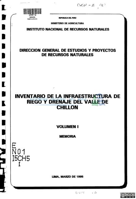
inventario de la infraestructura de riego y drenaje del valle de chillón
inventario de la infraestructura de riego y drenaje del valle de chillón
inventario de la infraestructura de riego y drenaje del valle de chillón

Create successful ePaper yourself
Turn your PDF publications into a flip-book with our unique Google optimized e-Paper software.
IHREHA<br />
Biblioteca<br />
IIQVnK:ADQ.PBIU<br />
MINISTERIO DE AGRICULTURA<br />
Q>^iP -^<br />
-Vc<br />
INSTITUTO NACIONAL DE RECURSOS NATURALES<br />
DIRECCIÓN GENERAL DE ESTUDIOS Y PROYECTOS<br />
DE RECURSOS NATURALES<br />
INVENTARIO DE LA INFRAESTRUCTURA DE<br />
RIEGO Y DRENAJE DEL VALLE DE<br />
CHILLÓN<br />
VOLUMEN I<br />
E<br />
N01<br />
I5CH5<br />
I<br />
MEMORIA<br />
UMA, MARZO DE 1995
— - — ' - ^ • i<br />
t»ror,«flftnc»a . . - t<br />
.(.gre90:_. . 1^07± '<br />
V>,ch«:__ ^-. --^ —<br />
J
iT)<br />
/<br />
áv. Od--<br />
%^€t"S<br />
MINISTERIO DE AGRICULTURA<br />
INSTITUTO NACIONAL DE RECUIfóOS NATURALES<br />
Biblioteca<br />
PERSONAL DIRECTIVO<br />
ING. MIGUEL VENTURA NAPA :<br />
ING. DAVID GASPAR VELASQUEZ :<br />
ING. JUSTO SALCEDO BAQUERIZO :<br />
Jefe <strong>de</strong>l INRENA<br />
Director General <strong>de</strong> Estudios y<br />
Proyectos <strong>de</strong> Recursos Naturales<br />
Director <strong>de</strong> Gestión <strong>de</strong> Proyectos<br />
PERSONAL PARTICIPANTE<br />
ING. CARLOS CURO MAQUEN<br />
BACH. JOSE ARANA HUAMAN<br />
SR. JULIO AO LÓPEZ<br />
Profesional Especialista<br />
Ingeniero Resi<strong>de</strong>nte<br />
Técnico <strong>de</strong> Sistemas<br />
UMIA, MARZO DE 1995
ÍNDICE<br />
PAG.<br />
PRESENTACIÓN<br />
I. INTRODUCCIÓN 1<br />
1.1 Antece<strong>de</strong>ntes 2<br />
1.2 Objetivos 2<br />
II. DESCRIPCIÓN GENERAL DEL ÁMBITO DEL VALLE CHILLÓN 2<br />
2.1 Ubicación 2<br />
2.2 Vías <strong>de</strong> Acceso 2<br />
2.3 Ámbito Jurisdiccional 3<br />
2.4 Aspecto Climático 4<br />
III. ORGANIZACIÓN ADMINISTRATIVA 4<br />
IV. SITUACIÓN ACTUAL DEL VALLE DE CHILLÓN 5<br />
4.1 Fuentes <strong>de</strong> Agua 5<br />
4.2 P<strong>la</strong>n <strong>de</strong> Cultivo y Riego 6<br />
4.3 Padrón <strong>de</strong> Usuarios 6<br />
4.4 Modalidad <strong>de</strong> Riego 6<br />
4.5 Tarifa <strong>de</strong> uso <strong>de</strong> Agua 7<br />
V. METODOLOGÍA 7<br />
VI. INVENTARIO DE LA INFRAESTRUCTURA DE RIEGO 7<br />
6.1 Sector Parte Alta 8<br />
6.1.1 Obras <strong>de</strong> Captación 8<br />
a. Bocatoma Huanchuy 8<br />
b. Bocatoma LLipata Alto 8<br />
c. Bocatoma LLipata Bajo 8<br />
d. Bocatoma Qui ves Cabana 8<br />
e. Bocatoma Mayupampa 9<br />
f. Bocatoma Larancocha 9<br />
g. Bocatoma Checta Pucará 9<br />
h. Bocatoma Huerta Vieja 10<br />
i. Bocatoma Magdalena 10<br />
j. Bocatoma Alcacoto Alto 10<br />
k. Bocatoma Huarabi Alto 10<br />
1. Bocatoma Huarabi Bajo 11
11. Bocatoma Pay Pay Yangas 11<br />
m. Bocatoma Alcacoto Bajo 11<br />
n. Bocatoma Hornillos 12<br />
ñ. Bocatoma Macas 12<br />
0. Bocatoma Zapan 12<br />
p. Bocatoma Casab<strong>la</strong>nca 12<br />
q. Bocatoma Huanchipuquio 13<br />
r. Bocatoma Quilca 13<br />
s. Bocatoma San Antonio 13<br />
t. Bocatoma Tambo 13<br />
u. Bocatoma Yanaconas 14<br />
V. Bocatoma Chocas Alto 14<br />
w. Bocatoma Chocas Medio 14<br />
X. Bocatoma Chocas Bajo 15<br />
y. Bocatoma Caballero 15<br />
z. Bocatoma Huarangal 15<br />
6.1.2 Infraestructura <strong>de</strong> Conducción, Distribución y Obras <strong>de</strong> Arte. ^ 15<br />
a. Canal <strong>de</strong> Derivación Huanchuy 16<br />
b. Canal <strong>de</strong> Derivación LLipata Alto 16<br />
c. Canal <strong>de</strong> Derivación LLipata Bajo 17<br />
d. Canal <strong>de</strong> Derivación Quives Cabana 17<br />
d.l Canales Laterales <strong>de</strong> 1er Or<strong>de</strong>n 17<br />
e. Canal <strong>de</strong> Derivación Mayupampa 18<br />
f. Canal <strong>de</strong> Derivación Larancocha 18<br />
g. Canal <strong>de</strong> Derivación Checta Pucará 19<br />
h. Canal <strong>de</strong> Derivación Huerta Vieja 19<br />
h.l Canales Laterales <strong>de</strong> 1er Or<strong>de</strong>n 20<br />
i. Canal <strong>de</strong> Derivación Magdalena 20<br />
i.l Canales Laterales <strong>de</strong> ler Or<strong>de</strong>n 20<br />
j. Canal <strong>de</strong> Derivación Alcacoto Alto 20<br />
k. Canal <strong>de</strong> Derivación Huarabi Alto 21<br />
k.l Canales <strong>la</strong>terales <strong>de</strong> ler Or<strong>de</strong>n 21<br />
1. Canal <strong>de</strong> Derivación Huarabi Bajo 21<br />
11. Canal <strong>de</strong> Derivación Pay Pay Yangas 22<br />
11.1 Canales Laterales <strong>de</strong> ler Or<strong>de</strong>n 22<br />
m. Canal <strong>de</strong> Derivación Alcacoto Bajo<br />
n. Canal <strong>de</strong> Derivación Hornillos<br />
23<br />
23
ñ. Canal <strong>de</strong> Derivación Macas 24<br />
ñ.l Canales <strong>la</strong>terales <strong>de</strong> 1er Or<strong>de</strong>n 24<br />
o. Canal <strong>de</strong> Derivación Zapan 24<br />
o.l Canales <strong>la</strong>terales <strong>de</strong> ler Or<strong>de</strong>n 25<br />
p. Canal <strong>de</strong> Derivación Casab<strong>la</strong>nca 25<br />
p.l Canales <strong>la</strong>terales <strong>de</strong> ler Or<strong>de</strong>n 25<br />
q. Canal <strong>de</strong> Derivación Huanchipuquio 26<br />
q.l Canales <strong>la</strong>terales <strong>de</strong> ler Or<strong>de</strong>n 26<br />
r. Canal <strong>de</strong> Derivación Quilca 26<br />
r.l Canales <strong>la</strong>terales <strong>de</strong> ler Or<strong>de</strong>n 27<br />
s. Canal <strong>de</strong> Derivación San Antonio 27<br />
s. 1 Canales <strong>la</strong>terales <strong>de</strong> ler Or<strong>de</strong>n 27<br />
t. Canal <strong>de</strong> Derivación Tambo 28<br />
t.l Canales <strong>la</strong>terales <strong>de</strong> ler Or<strong>de</strong>n 28<br />
u. Canal <strong>de</strong> Derivación Yanaconas 28<br />
u.l Canales <strong>la</strong>terales <strong>de</strong> ler Or<strong>de</strong>n 29<br />
V. Canal <strong>de</strong> Derivación Chocas Alto 29<br />
v.l Canales <strong>la</strong>terales <strong>de</strong> ler Or<strong>de</strong>n 29<br />
w. Canal <strong>de</strong> Derivación Chocas Medio 30<br />
X. Canal <strong>de</strong> Derivación Chocas Bajo 30<br />
x.l Canales <strong>la</strong>terales <strong>de</strong> ler Or<strong>de</strong>n 31<br />
y. Canal <strong>de</strong> Derivación Caballero 31<br />
y.l Canales <strong>la</strong>terales <strong>de</strong> ler Or<strong>de</strong>n 31<br />
z. Canal <strong>de</strong> Derivación Huarangal 31<br />
z. 1 Canales <strong>la</strong>terales <strong>de</strong> ler Or<strong>de</strong>n
6.2 Sector Parte Media 32<br />
6.2.1 Obras <strong>de</strong> Captación 32<br />
a. Bocatoma Cañón 32<br />
b. Bocatoma Torre B<strong>la</strong>nca 33<br />
c. Bocatoma Concón 33<br />
d. Bocatoma Infantas 33<br />
6.2.2 Infraestructura <strong>de</strong> Conducción, Distribución y Obras <strong>de</strong> Arte. 33<br />
a. Canal <strong>de</strong> Derivación Cañón 34<br />
a. 1 Canales Laterales <strong>de</strong> 1er Or<strong>de</strong>n 34<br />
a.2 Canales Laterales <strong>de</strong> 2do Or<strong>de</strong>n 34<br />
b. Canal <strong>de</strong> Derivación Torre B<strong>la</strong>nca 35<br />
b.l Canales Laterales <strong>de</strong> 1er Or<strong>de</strong>n 35<br />
c. Canal <strong>de</strong> Derivación Concón 36<br />
el Canales Laterales <strong>de</strong> 1er Or<strong>de</strong>n 36<br />
c.2 canales Laterales <strong>de</strong> 2do Or<strong>de</strong>n 36<br />
d. Canal <strong>de</strong> <strong>de</strong>rivación Puquio Zapata 37<br />
e. Canal <strong>de</strong> Derivación Infantas 37<br />
f. Canal <strong>de</strong> <strong>de</strong>rivación Puquio Cachaza 37<br />
f. 1 Canales <strong>la</strong>terales <strong>de</strong> 1er Or<strong>de</strong>n 38<br />
g. Canal <strong>de</strong> <strong>de</strong>rivación Puquio Choque 38<br />
h. Canal <strong>de</strong> <strong>de</strong>rivación Puquio Gallinazos 38<br />
6.3 Sector Parte Baja 39<br />
6.3.1 Obras <strong>de</strong> Captación 39<br />
a. Bocatoma Naranjal 39<br />
b. Bocatoma Chuquitanta 39<br />
c. Bocatoma Márquez 40<br />
6.3.2 Infraestructura <strong>de</strong> Conducción, Distribución y Obras <strong>de</strong> Arte. 40<br />
a. Canal <strong>de</strong> Derivación Naranjal 40<br />
a.l Canales Laterales <strong>de</strong> 1er Or<strong>de</strong>n 41<br />
b. Canal <strong>de</strong> Derivación Chuquitanta 41
.l Canales Laterales <strong>de</strong> ler Or<strong>de</strong>n 41<br />
c. Canal <strong>de</strong> Derivación Márquez<br />
42<br />
el<br />
Canales Laterales <strong>de</strong> ler Or<strong>de</strong>n<br />
42<br />
Vil. INVENTARIO DE LA INFRAESTRUCTURA DE DRENAJE 42<br />
VIII.<br />
CONCLUSIONES Y RECOMENDACIONES<br />
43<br />
8.1 Conclusiones<br />
8.2 Recomendaciones<br />
43<br />
43<br />
IX.<br />
ANEXOS<br />
Anexo N° I<br />
Anexo N° II<br />
Anexo N° III<br />
Re<strong>la</strong>ción <strong>de</strong> Cuadros<br />
Formatos <strong>de</strong>l Inventario<br />
Re<strong>la</strong>ción <strong>de</strong> P<strong>la</strong>nos
RELACIÓN DE PLANOS<br />
P<strong>la</strong>no N° 01 : P<strong>la</strong>no General<br />
P<strong>la</strong>no N° 02 : Esquema <strong>de</strong> <strong>la</strong> Red <strong>de</strong> Riego<br />
P<strong>la</strong>no N" 03-1 al 15-13 : Inventario <strong>de</strong> Infraestructura <strong>de</strong> Riego y Drenaje<br />
P<strong>la</strong>no N° 16 y 17 : Bocatomas <strong>de</strong> Captación
RELACIÓN DE CUADROS<br />
Cuadro N» 1 :<br />
Cuadro N" 2 :<br />
Cuadro N» 3 :<br />
Cuadro N" 4 :<br />
Cuadro N" 5 :<br />
Cuadro N«* 6 :<br />
Cuadro N" 7 :<br />
Cuadro N" 8<br />
Cuadro N» 9<br />
Cuadro N» 10:<br />
Cuadro N" 11:<br />
Cuadro N*» 12:<br />
Cuadro N" 13:<br />
Cuadro N» 14:<br />
Cuadro N" 15:<br />
Re<strong>la</strong>ción y ubicación <strong>de</strong> <strong>la</strong>s obras <strong>de</strong> arte en el canal <strong>de</strong> <strong>de</strong>rivación<br />
Huanchuy.<br />
Re<strong>la</strong>ción y ubicación <strong>de</strong> <strong>la</strong>s obras <strong>de</strong> arte en el canal <strong>de</strong> <strong>de</strong>rivación<br />
LLipata Alto.<br />
Re<strong>la</strong>ción y ubicación <strong>de</strong> <strong>la</strong>s obras <strong>de</strong> arte en el canal <strong>de</strong> <strong>de</strong>rivación<br />
LLipata Bajo.<br />
Re<strong>la</strong>ción y ubicación <strong>de</strong> <strong>la</strong>s obras <strong>de</strong> arte en el canal <strong>de</strong> <strong>de</strong>rivación<br />
Qui ves Cabana.<br />
Re<strong>la</strong>ción y ubicación <strong>de</strong> <strong>la</strong>s obras <strong>de</strong> arte en el canal <strong>de</strong> <strong>de</strong>rivación<br />
Mayupampa.<br />
Re<strong>la</strong>ción y ubicación <strong>de</strong> <strong>la</strong>s obrzís <strong>de</strong> arte en el canal <strong>de</strong> <strong>de</strong>rivación<br />
Larancocha.<br />
Re<strong>la</strong>ción y ubicación <strong>de</strong> <strong>la</strong>s obras <strong>de</strong> arte en el canal <strong>de</strong> <strong>de</strong>rivación<br />
Checta Pucará.<br />
Re<strong>la</strong>ción y ubicación <strong>de</strong> <strong>la</strong>s obras <strong>de</strong> arte en el canal <strong>de</strong> <strong>de</strong>rivación<br />
Huerta Vieja.<br />
Re<strong>la</strong>ción y ubicación <strong>de</strong> <strong>la</strong>s obras <strong>de</strong> arte en el canal <strong>de</strong> <strong>de</strong>rivación<br />
Magdalena.<br />
Re<strong>la</strong>ción y ubicación <strong>de</strong> <strong>la</strong>s obras <strong>de</strong> arte en el canal <strong>de</strong> <strong>de</strong>rivación<br />
Alcacoto Alto.<br />
Re<strong>la</strong>ción y ubicación <strong>de</strong> <strong>la</strong>s obras <strong>de</strong> arte en el canal <strong>de</strong> <strong>de</strong>rivación<br />
Alcacoto Bajo.<br />
Re<strong>la</strong>ción y ubicación <strong>de</strong> <strong>la</strong>s obras <strong>de</strong> arte en el canal <strong>de</strong> <strong>de</strong>rivación<br />
Huarabi Alto.<br />
Re<strong>la</strong>ción y ubicación <strong>de</strong> <strong>la</strong>s obras <strong>de</strong> arte en el canal <strong>de</strong> <strong>de</strong>rivación<br />
Huarabi Bajo.<br />
Re<strong>la</strong>ción y ubicación <strong>de</strong> <strong>la</strong>s obras <strong>de</strong> arte en el canal <strong>de</strong> <strong>de</strong>rivación Pay<br />
Pay Yangas.<br />
Re<strong>la</strong>ción y ubicación <strong>de</strong> <strong>la</strong>s obras <strong>de</strong> arte en el canal <strong>de</strong> <strong>de</strong>rivación<br />
Hornillos.
Cuadro N" 16:<br />
Cuadro N" 17:<br />
Cuadro N" 18:<br />
Cuadro N° 19:<br />
Cuadro N" 20:<br />
Cuadro N" 21:<br />
Cuadro N" 22:<br />
Cuadro N" 23:<br />
Cuadro N** 24:<br />
Cuadro N" 25:<br />
Cuadro N" 26:<br />
Cuadro N" 27:<br />
Cuadro N" 28:<br />
Cuadro N** 29:<br />
Cuadro N" 30:<br />
Cuadro N" 31:<br />
Re<strong>la</strong>ción y ubicación <strong>de</strong> <strong>la</strong>s obras <strong>de</strong> arte en el canal <strong>de</strong> <strong>de</strong>rivación<br />
Macas.<br />
Re<strong>la</strong>ción y ubicación <strong>de</strong> <strong>la</strong>s obras <strong>de</strong> arte en el canal <strong>de</strong> <strong>de</strong>rivación<br />
Zapan.<br />
Re<strong>la</strong>ción y ubicación <strong>de</strong> <strong>la</strong>s obras <strong>de</strong> arte en el canal <strong>de</strong> <strong>de</strong>rivación<br />
Casab<strong>la</strong>nca.<br />
Re<strong>la</strong>ción y ubicación <strong>de</strong> <strong>la</strong>s obras <strong>de</strong> arte en el canal <strong>de</strong> <strong>de</strong>rivación<br />
Huanchipuquio.<br />
Re<strong>la</strong>ción y ubicación <strong>de</strong> <strong>la</strong>s obras <strong>de</strong> arte en el canal <strong>de</strong> <strong>de</strong>rivación<br />
Quilca.<br />
Re<strong>la</strong>ción y ubicación <strong>de</strong> <strong>la</strong>s obras <strong>de</strong> arte en el canal <strong>de</strong> <strong>de</strong>rivación San<br />
Antonio.<br />
Re<strong>la</strong>ción y ubicación <strong>de</strong> <strong>la</strong>s obras <strong>de</strong> arte en el canal <strong>de</strong> <strong>de</strong>rivación<br />
Tambo. *<br />
Re<strong>la</strong>ción y ubicación <strong>de</strong> <strong>la</strong>s obras <strong>de</strong> arte en el canal <strong>de</strong> <strong>de</strong>rivación<br />
Yanaconas.<br />
Re<strong>la</strong>ción y ubicación <strong>de</strong> <strong>la</strong>s obras <strong>de</strong> arte en el canal <strong>de</strong> <strong>de</strong>rivación<br />
Chocas Alto.<br />
Re<strong>la</strong>ción y ubicación <strong>de</strong> <strong>la</strong>s obras <strong>de</strong> arte en el canal <strong>de</strong> <strong>de</strong>rivación<br />
Chocas Medio.<br />
Re<strong>la</strong>ción y ubicación <strong>de</strong> <strong>la</strong>s obras <strong>de</strong> arte en el canal <strong>de</strong> <strong>de</strong>rivación<br />
Chocas Bajo.<br />
Re<strong>la</strong>ción y ubicación <strong>de</strong> <strong>la</strong>s obras <strong>de</strong> arte en el canal <strong>de</strong> <strong>de</strong>rivación<br />
Caballero.<br />
Re<strong>la</strong>ción y ubicación <strong>de</strong> <strong>la</strong>s obras <strong>de</strong> arte en el canal <strong>de</strong> <strong>de</strong>rivación<br />
Huarangal.<br />
Re<strong>la</strong>ción y ubicación <strong>de</strong> <strong>la</strong>s obras <strong>de</strong> arte en el canal <strong>de</strong> <strong>de</strong>rivación<br />
Naranjal.<br />
Re<strong>la</strong>ción y ubicación <strong>de</strong> <strong>la</strong>s obréis <strong>de</strong> arte en el canal <strong>de</strong> <strong>de</strong>rivación<br />
Chuquitanta.<br />
Re<strong>la</strong>ción y ubicación <strong>de</strong> <strong>la</strong>s obras <strong>de</strong> arte en el canal <strong>de</strong> <strong>de</strong>rivación<br />
Puquio Zapata.
Cuadro N" 32:<br />
Cuadro N" 33:<br />
Cuadro N" 34:<br />
Cuadro N" 35:<br />
Cuadro N" 36:<br />
Cuadro N" 37:<br />
Cuadro N" 38:<br />
Re<strong>la</strong>ción y ubicación <strong>de</strong> <strong>la</strong>s obras <strong>de</strong> arte en el canal <strong>de</strong> <strong>de</strong>rivación<br />
Puquio Cachaza.<br />
Re<strong>la</strong>ción y ubicación <strong>de</strong> <strong>la</strong>s obras <strong>de</strong> arte en el canal <strong>de</strong> <strong>de</strong>rivación<br />
Puquio Choque.<br />
Re<strong>la</strong>ción y ubicación <strong>de</strong> <strong>la</strong>s obras <strong>de</strong> arte en el canal <strong>de</strong> <strong>de</strong>rivación<br />
Puquio Gallinazos.<br />
Re<strong>la</strong>ción y ubicación <strong>de</strong> <strong>la</strong>s obras <strong>de</strong> arte en el canal <strong>la</strong>teral <strong>de</strong> 1er<br />
or<strong>de</strong>n Chillón.<br />
Re<strong>la</strong>ción y ubicación <strong>de</strong> <strong>la</strong>s obras <strong>de</strong> arte en el canal <strong>de</strong> <strong>de</strong>rivación<br />
Torre B<strong>la</strong>nca.<br />
Re<strong>la</strong>ción y ubicación <strong>de</strong> <strong>la</strong>s obras <strong>de</strong> arte en el canal <strong>de</strong> <strong>de</strong>rivación<br />
Con Con.<br />
Re<strong>la</strong>ción y ubicación <strong>de</strong> <strong>la</strong>s obras <strong>de</strong> arte en el canal <strong>de</strong> <strong>de</strong>rivación<br />
Cañón.
PRESENTACIÓN<br />
El Instituto Nacional <strong>de</strong> Recursos Naturales, a través <strong>de</strong> <strong>la</strong> Dirección General <strong>de</strong> Estudios<br />
y Proyectos <strong>de</strong> Recursos Naturales, ha realizado el Inventario <strong>de</strong> <strong>la</strong> Infraestructura <strong>de</strong> Riego<br />
y Drenaje <strong>de</strong>l Valle Chillón, con el propósito <strong>de</strong> que <strong>la</strong> Junta <strong>de</strong> Usuarios, <strong>la</strong>s Comisiones<br />
<strong>de</strong> Regantes y <strong>la</strong> Administración Técnica <strong>de</strong>l SubDistrito <strong>de</strong> Riego <strong>de</strong> Chillón, cuenten con<br />
un documento técnico que sirva para tener un conocimiento real y actualizado <strong>de</strong> <strong>la</strong>s obras<br />
que conforman el sistema <strong>de</strong> <strong>riego</strong> <strong>de</strong>l <strong>valle</strong> <strong>de</strong> Chillón.<br />
Este documento permitirá programar técnicamente los trabajos <strong>de</strong> mejoramiento y/o<br />
rehabilitación, así como para optimizar <strong>la</strong> operación y mantenimiento <strong>de</strong> <strong>la</strong> <strong>infraestructura</strong><br />
existente.<br />
Se agra<strong>de</strong>ce a los directivos <strong>de</strong> <strong>la</strong> Junta <strong>de</strong> Usuarios, Comisiones <strong>de</strong> Regantes y funcionarios<br />
<strong>de</strong> <strong>la</strong> Administración Técnica <strong>de</strong>l SubDistrito <strong>de</strong> Riego <strong>de</strong> Chillón, por el apoyo brindado en<br />
el <strong>de</strong>sarrollo <strong>de</strong>l presente <strong>inventario</strong>.
INVENTARIO DE LA INFRAESTRUCTURA DE RIEGO<br />
Y DRENAJE DEL VALLE DE CHILLÓN<br />
I. INTRODUCCIÓN<br />
El Inventario <strong>de</strong> <strong>la</strong> Infraestructura <strong>de</strong> Riego y Drenaje se ha <strong>de</strong>sarrol<strong>la</strong>do en ámbito<br />
<strong>de</strong>l <strong>valle</strong> Chillón, <strong>de</strong>s<strong>de</strong> <strong>la</strong> parte alta <strong>de</strong>l <strong>valle</strong> hasta el Océano Pacífico y en ambas<br />
márgenes <strong>de</strong>l río Chillón.<br />
En <strong>la</strong> PARTE ALTA, comprendida entre <strong>la</strong>s bocatomas Huanchuy y Huarangal, se<br />
inventarió 28 obras <strong>de</strong> captación, <strong>de</strong> <strong>la</strong>s cuales 02 es <strong>de</strong> tipo permanente, 03 son <strong>de</strong><br />
tipo semirústico y 23 son <strong>de</strong> tipo rústico, sus caudales varían entre 0.10 y 0.8 mVs.<br />
También se inventarió 28 canales <strong>de</strong> <strong>de</strong>rivación con una longitud total 111,793 m. <strong>de</strong><br />
los cuales 12,451 m. son revestidos y 99,342 m. son en tierra.<br />
En el sistema <strong>de</strong> distribución se inventarió 37 canales <strong>de</strong> 1er or<strong>de</strong>n con una longitud<br />
total <strong>de</strong> 38,985 m. <strong>de</strong> los cuales 1,097 m. son revestidos y 37,888 m. son en tierra,<br />
sus capacida<strong>de</strong>s varían entre 80 y 900 1/s.<br />
Igualmente se inventarió un total <strong>de</strong> 279 obras <strong>de</strong> arte entre tomas <strong>la</strong>terales, tomas<br />
directas, alcantaril<strong>la</strong>s, puentes, acueductos, entregas, canoas y botadores.<br />
En <strong>la</strong> PARTE MEDIA, comprendida entre <strong>la</strong>s bocatomas Cañón e Infantas, se<br />
inventarió 04 obras <strong>de</strong> captación, <strong>de</strong> <strong>la</strong>s cuales 01 es <strong>de</strong> tipo permanente y 03 son <strong>de</strong><br />
tipo rústico, sus caudales varían entre 0.50 y 5.0 m^/s.<br />
También se inventarió 08 canales <strong>de</strong> <strong>de</strong>rivación con una longitud total 40,699 m.<br />
totalmente en tierra.<br />
En el sistema <strong>de</strong> distribución se inventarió 28 canales <strong>de</strong> 1er or<strong>de</strong>n con una longitud<br />
total <strong>de</strong> 80,804 m. <strong>de</strong> los cuales 1,370 m. son revestidos y 79,434 m. son en tierra,<br />
sus capacida<strong>de</strong>s varían entre 50 y 1000 1/s.<br />
Igualmente se inventarió 33 canales <strong>de</strong> 2do or<strong>de</strong>n con una longitud total <strong>de</strong> 61,140<br />
m. <strong>de</strong> los cuales 3,925 m. son revestidos y 57,215 m. son en tierra, sus capacida<strong>de</strong>s<br />
varían entre 50 y 600 1/s.<br />
Igualmente se inventarió un total <strong>de</strong> 81 obras <strong>de</strong> arte entre tomas <strong>la</strong>terales, tomas<br />
directas, tomas sub<strong>la</strong>terales, alcantaril<strong>la</strong>s, puentes, acueductos, entregas y botadores.<br />
En <strong>la</strong> PARTE BAJA, comprendida entre <strong>la</strong> bocatoma Naranjal y el Océano pacífico,<br />
se inventarió 03 obras <strong>de</strong> captación, <strong>de</strong> <strong>la</strong>s cuales 01 es <strong>de</strong> tipo permanente y 02 son<br />
<strong>de</strong> tipo rústico, sus caudales varían entre 0.20 y 1.5 mVs.<br />
También se inventarió 03 canales <strong>de</strong> <strong>de</strong>rivación con una longitud total 31,295 m.<strong>de</strong><br />
los cuales 11,579 son revestidos y 19,716 m. son en tierra.
En el sistema <strong>de</strong> distribución se inventarió 12 canales <strong>de</strong> 1er or<strong>de</strong>n con una longitud<br />
total <strong>de</strong> 28,350 m. <strong>de</strong> los cuales 3,835 m. son revestidos y 24,515 m. son en tierra,<br />
sus capacida<strong>de</strong>s varían entre 50 y 400 1/s.<br />
Igualmente se inventarió 10 canales <strong>de</strong> 2do or<strong>de</strong>n con una longitud total <strong>de</strong> 16,000<br />
m. totalmente en tierra, sus capacida<strong>de</strong>s varían entre 100 y 200 1/s.<br />
Igualmente se inventarió un total <strong>de</strong> 49 obras <strong>de</strong> arte entre tomas <strong>la</strong>terales, tomas<br />
directas, tomas sub<strong>la</strong>terales, alczintaril<strong>la</strong>s, puentes, puquios, entregas, <strong>de</strong>sarenadores<br />
y botadores.<br />
El Inventario <strong>de</strong> <strong>la</strong> Infraestructura <strong>de</strong> Riego y Drenaje <strong>de</strong>l Valle Chillón, <strong>de</strong>scribe<br />
cuantitativa y cualitativamente <strong>la</strong>s estructuras <strong>de</strong>stinadas a <strong>la</strong> captación, <strong>de</strong>rivación,<br />
control, medición y distribución <strong>de</strong> <strong>la</strong>s aguas <strong>de</strong> regadío, el cual ha sido <strong>de</strong>sarrol<strong>la</strong>do<br />
tomando como base los Términos <strong>de</strong> Referencia, e<strong>la</strong>borados por <strong>la</strong> Dirección General<br />
<strong>de</strong> Estudios y Proyectos <strong>de</strong> Recursos Naturales.<br />
1.1 ANTECEDENTES<br />
En el mes <strong>de</strong> Octubre <strong>de</strong> 1994," el Instituto Nacional <strong>de</strong> Recursos Naturales -<br />
INRENA, suscribió un convenio <strong>de</strong> apoyo institucional con <strong>la</strong> Junta <strong>de</strong> Usuarios <strong>de</strong>l<br />
SubDistrito <strong>de</strong> Riego Chillón, para ejecutar el Inventario <strong>de</strong> <strong>la</strong> Infraestructura <strong>de</strong><br />
Riego y Drenaje.<br />
1.2 OBJETIVOS<br />
E<strong>la</strong>borar el <strong>inventario</strong> <strong>de</strong> <strong>la</strong>s obras hidráulicas <strong>de</strong>stinadas a <strong>la</strong> captación, <strong>de</strong>rivación,<br />
control, medición y distribución <strong>de</strong> <strong>la</strong>s aguas <strong>de</strong> <strong>riego</strong>, para optimizar su operación<br />
y servicio, así como <strong>la</strong>s obras <strong>de</strong> <strong>drenaje</strong>.<br />
Proveer información técnica sistematizada <strong>de</strong>l estado actual <strong>de</strong> <strong>la</strong> <strong>infraestructura</strong> <strong>de</strong><br />
<strong>riego</strong> y <strong>drenaje</strong>, con <strong>la</strong> finalidad <strong>de</strong> sustentar <strong>la</strong> toma <strong>de</strong> <strong>de</strong>cisiones para <strong>la</strong> inversión<br />
en <strong>la</strong> ejecución <strong>de</strong> obras y activida<strong>de</strong>s que garanticen <strong>la</strong> operación a<strong>de</strong>cuada <strong>de</strong> <strong>la</strong><br />
<strong>infraestructura</strong> <strong>de</strong>l <strong>valle</strong>.<br />
II.<br />
DESCRIPCIÓN GENERAL DEL ÁMBITO DEL VALLE DE CHILLÓN<br />
2.1 Ubicación<br />
Politicamente pertenece a los Distritos <strong>de</strong> Puente Piedra, Carabayllo y Comas,<br />
Provincia <strong>de</strong> Lima y Departamento <strong>de</strong> Lima y geográficamente se encuentra<br />
localizado entre <strong>la</strong>s <strong>la</strong>titu<strong>de</strong>s 12° 05' y 12° 20' y longitu<strong>de</strong>s 76° 50' y 77° 10'.<br />
2.2 Vías <strong>de</strong> Acceso<br />
El <strong>valle</strong> Chillón cuenta con <strong>la</strong> Carretera Panamericana Norte, asfaltada, como <strong>la</strong> vía<br />
<strong>de</strong> mayor importancia que interconecta el <strong>valle</strong>, <strong>de</strong> el<strong>la</strong> se <strong>de</strong>rivan ingresos a los<br />
subsectores <strong>de</strong> <strong>riego</strong>.<br />
2
Los caminos <strong>de</strong> servicio público más importantes son:<br />
Carretera Puente Piedra - IPEN (Instituto Peruano <strong>de</strong> Energía Nuclear),<br />
asfaltada, que recorre <strong>la</strong> margen <strong>de</strong>recha, en <strong>la</strong> parte media <strong>de</strong>l <strong>valle</strong>.<br />
Carretera Lima - Canta, asfaltada, que pasa por los distritos <strong>de</strong> Comas y<br />
Carabayllo, recorriendo todo el <strong>valle</strong> hasta <strong>la</strong> localidad <strong>de</strong> Canta. Cubre <strong>la</strong><br />
margen izquierda <strong>de</strong>l <strong>valle</strong>, interconectándose mediante puentes <strong>de</strong> concreto<br />
y rústicos, con <strong>la</strong> margen <strong>de</strong>recha.<br />
La red interna que en<strong>la</strong>za al <strong>valle</strong> Chillón con <strong>la</strong>s distintas estructuras hidráulicas<br />
existentes, <strong>la</strong> conforman <strong>la</strong>s trochas, caminos carrozables y los caminos <strong>de</strong> vigi<strong>la</strong>ncia<br />
que existen a lo <strong>la</strong>rgo <strong>de</strong> los canales, los cuales permiten el control y vigi<strong>la</strong>ncia en<br />
todo el recorrido <strong>de</strong> cada uno <strong>de</strong> los canales, facilitando <strong>la</strong> operación y mantenimiento<br />
<strong>de</strong> <strong>la</strong> <strong>infraestructura</strong> <strong>de</strong> <strong>riego</strong> y <strong>drenaje</strong> existente.<br />
2.3 Ámbito Jurisdiccional<br />
El <strong>valle</strong> <strong>de</strong> Chillón presenta los siguientes límites:<br />
Por el Sur<br />
Por el Norte<br />
Por el Este<br />
Por el Oeste<br />
Con el río Rimac.<br />
Con <strong>la</strong> cuenca <strong>de</strong>l río Chancay-Huaral<br />
Con <strong>la</strong> cuenca <strong>de</strong>l río Mantaro<br />
Con el Océano Pacífico<br />
La superficie bajo <strong>riego</strong> total <strong>de</strong>l <strong>valle</strong> <strong>de</strong> Chillón es <strong>de</strong> 10,292.10 has <strong>de</strong> tierras <strong>de</strong><br />
cultivo, inscritas en el respectivo padrón <strong>de</strong> usuarios y se encuentra distribuida <strong>de</strong> <strong>la</strong><br />
siguiente manera :<br />
SECTOR<br />
AREA DE RIEGO<br />
ÍHa)<br />
1.- Parte Alta 4.094.57<br />
- Comisión <strong>de</strong> Regantes Yangas 435.02<br />
- Comisión <strong>de</strong> Regantes Macas 1,473.03<br />
- Comisión <strong>de</strong> Regantes Zapan 333.43<br />
- Comisión <strong>de</strong> Regantes San Antonio 869.18<br />
- Comisión <strong>de</strong> Regantes Chocas 983.91<br />
2.- Parte Media 4.900.09<br />
- Comisión <strong>de</strong> Regantes Caudivil<strong>la</strong> 1,008.56<br />
- Comisión <strong>de</strong> Regantes Chacra CerroAlto 453.13<br />
- Comisión <strong>de</strong> Regantes Chacra CerroPuquio 300.78<br />
- Comisión <strong>de</strong> Regantes Carabayllo 1,181.85<br />
- Comisión <strong>de</strong> Regantes San Lorenzo 986.82<br />
- Comisión <strong>de</strong> Regantes Isleta 374.41<br />
- Comisión <strong>de</strong> Regantes La Cachaza 594.54<br />
3
3.- Parte Baja 1.297.44<br />
Comisión <strong>de</strong> Regantes Naranjal 379.72<br />
Comisión <strong>de</strong> Regantes Chuquitanta 488.13<br />
Comisión <strong>de</strong> Regantes Oquendo 429.59<br />
Total (ha) 10,292.10<br />
2.4 Ámbito Climático<br />
La precipitación promedio anual en el <strong>valle</strong> <strong>de</strong> Chillón es <strong>de</strong> 30 mm; el clima tiene<br />
una temperatura anual promedio <strong>de</strong> 20° C. y <strong>la</strong> humedad re<strong>la</strong>tiva media es <strong>de</strong> 77 %<br />
III.<br />
ORGANIZACIÓN ADMINISTRATIVA<br />
La Unidad Agraria Departamental Lima-Cal<strong>la</strong>o, <strong>de</strong>ntro <strong>de</strong> su estructura orgánica,<br />
cuenta con el SubDistrito <strong>de</strong> Riego Chillón, cuya jefatura <strong>la</strong> ejerce un profesional en<br />
ingeniería con el cargo <strong>de</strong> Administrador Técnico, cuyas funciones entre otras es <strong>la</strong><br />
<strong>de</strong> coordinar y supervisar <strong>la</strong>s activida<strong>de</strong>s que <strong>de</strong>sarrol<strong>la</strong> <strong>la</strong> Junta <strong>de</strong> Usuarios insta<strong>la</strong>da<br />
en su ámbito.<br />
En el <strong>valle</strong> <strong>de</strong> Chillón, <strong>la</strong> Junta <strong>de</strong> Usuarios <strong>de</strong>l SubDistrito <strong>de</strong> Riego Chillón, es una<br />
organización <strong>de</strong> <strong>de</strong>recho privado con personería jurídica, constituida como asociación<br />
civil sin fines <strong>de</strong> lucro y <strong>de</strong> duración in<strong>de</strong>finida, cuyas activida<strong>de</strong>s se rigen por el<br />
Decreto Supremo N° 037-89-AG, y su función es <strong>la</strong> <strong>de</strong> representar a los usuarios <strong>de</strong><br />
agua, en todos los asuntos re<strong>la</strong>cionados con <strong>la</strong> distribución <strong>de</strong>l agua <strong>de</strong> regadío.<br />
La Junta <strong>de</strong> Usuarios <strong>de</strong>l SubDistrito <strong>de</strong> Riego Chillón <strong>la</strong> conforman los <strong>de</strong>legados<br />
<strong>de</strong> <strong>la</strong>s 15 Comisiones <strong>de</strong> Regantes.<br />
La directiva <strong>de</strong> <strong>la</strong> Junta <strong>de</strong> Usuarios está integrada por : 01 Presi<strong>de</strong>nte, 01 Vicepresi<strong>de</strong>nte,<br />
01 Secretario, 01 Tesorero, 01 Pro-Tesorero y 02 Vocales.<br />
Para <strong>de</strong>sarrol<strong>la</strong>r sus activida<strong>de</strong>s <strong>la</strong> Junta <strong>de</strong> Usuarios cuenta con los servicios <strong>de</strong> 01<br />
Gerente Técnico, 01 Secretaria, 02 auxiliares <strong>de</strong> Contabilidad, 02 técnicos<br />
agropecuarios y 01 chofer.<br />
Para cumplir con sus activida<strong>de</strong>s, <strong>la</strong> Junta <strong>de</strong> Usuarios cuenta con vehículos como:<br />
01 camioneta y 02 motocicletas.<br />
El <strong>valle</strong> <strong>de</strong> Chillón se encuentra <strong>de</strong>limitado <strong>de</strong> <strong>la</strong> siguiente manera:<br />
1.- Sector Parte Alta<br />
Conformado por :<br />
Comisión <strong>de</strong> Regantes Yangas<br />
4
Comisión <strong>de</strong> Regantes Macas<br />
Comisión <strong>de</strong> Regantes Zapan<br />
Comisión <strong>de</strong> Regantes San Antonio<br />
Comisión <strong>de</strong> Regantes Chocas<br />
2.- Sector Parte Media<br />
Conformado por :<br />
Comisión <strong>de</strong> Regantes Caudivil<strong>la</strong><br />
Comisión <strong>de</strong> Regantes Chacra Cerro Alto<br />
Comisión <strong>de</strong> Regantes Chacra Puquio<br />
Comisión <strong>de</strong> Regantes Carabayllo<br />
Comisión <strong>de</strong> Regantes San Lorenzo<br />
Comisión <strong>de</strong> Regantes Isleta<br />
Comisión <strong>de</strong> Regantes La Cachaza<br />
3.- Sector Parte Baja<br />
Conformado por :<br />
Comisión <strong>de</strong> Regantes Naranjal<br />
Comisión <strong>de</strong> Regantes Chuquitanta<br />
Comisión <strong>de</strong> Regantes Oquendo<br />
La ubicación se presenta en el P<strong>la</strong>no N** 01<br />
iV.<br />
SITUACIÓN ACTUAL DEL VALLE DE CHILLÓN<br />
4.1 Fuentes <strong>de</strong> Agua<br />
Los recursos <strong>de</strong> agua con que cuenta el <strong>valle</strong> <strong>de</strong> Chillón y que satisfacen los<br />
requerimientos hídricos <strong>de</strong>l <strong>valle</strong> provienen <strong>de</strong>l río Chillón, el cual tiene un régimen<br />
<strong>de</strong> <strong>de</strong>scargas irregu<strong>la</strong>res y torrentoso, y fluctúan durante <strong>la</strong>s estaciones <strong>de</strong>l año,<br />
presentando gran<strong>de</strong>s diferencias entre los meses <strong>de</strong> avenidas y estiaje.<br />
Las avenidas se inician en el mes <strong>de</strong> Diciembre y finaliza en el mes <strong>de</strong> Abril, <strong>la</strong><br />
época <strong>de</strong> estiaje se inicia en el mes <strong>de</strong> Agosto y termina en el mes <strong>de</strong> Noviembre,<br />
ambas situaciones <strong>de</strong> disponibilidad <strong>de</strong> agua ocasiona serios problemas en el <strong>valle</strong>.<br />
Estudios hidrológicos efectuados durante el período <strong>de</strong> análisis 1920-1980, han<br />
<strong>de</strong>terminado que <strong>la</strong> <strong>de</strong>scarga media anual <strong>de</strong>l río Chillón es <strong>de</strong> 8.98 m'/s.<br />
Existen fuentes hídricas complementarias como los manantiales ó puquios, JHÍZOS<br />
tubu<strong>la</strong>res y pozos artesianos, asi como <strong>la</strong>s filtraciones <strong>de</strong>l mismo río, los cuales<br />
satisfacen los requerimientos <strong>de</strong> los sub sectores <strong>de</strong> <strong>riego</strong>.<br />
5
4.2 P<strong>la</strong>n <strong>de</strong> Cultivo y Riego<br />
La Administración Técnica <strong>de</strong>l SubDistrito <strong>de</strong> Riego Chillón no cuenta con el P<strong>la</strong>n<br />
<strong>de</strong> Cultivo y Riego, don<strong>de</strong> se muestre los volúmenes <strong>de</strong> agua, áreas y cultivos<br />
autorizados, <strong>de</strong> acuerdo a lo seña<strong>la</strong>do en el D.S N° 0048-91-AG, titu<strong>la</strong>do<br />
"Reg<strong>la</strong>mento <strong>de</strong> <strong>la</strong> Ley <strong>de</strong> Promoción <strong>de</strong> <strong>la</strong>s Inversiones en el Sector Agrario".<br />
Los cultivos más importantes <strong>de</strong>l <strong>valle</strong> son: Papa, Frutales, Tomate, Pastos,<br />
Hortalizas y Pan Llevar.<br />
4.3 Padrón <strong>de</strong> Usuarios<br />
En el <strong>valle</strong> <strong>de</strong> Chillón existen 2,653 usuarios <strong>de</strong> agua inscritos en el Padrón <strong>de</strong><br />
Usuarios <strong>de</strong> <strong>la</strong> Junta <strong>de</strong> Usuarios <strong>de</strong>l SubDistrito <strong>de</strong> Riego Chillón, actualizado<br />
recientemente y distribuidos <strong>de</strong> <strong>la</strong> siguiente manera:<br />
Sectores<br />
Usuarios<br />
1.- Parte Alta 614<br />
Comisión <strong>de</strong> Regantes Yangas<br />
Comisión <strong>de</strong> Regantes Macas<br />
Comisión <strong>de</strong> Regantes Zapan<br />
Comisión <strong>de</strong> Regantes San Antonio<br />
Comisión <strong>de</strong> Regantes Chocas<br />
184<br />
84<br />
83<br />
155<br />
108<br />
Parte Media 1.605<br />
Comisión <strong>de</strong> Regantes Caudivil<strong>la</strong><br />
Comisión <strong>de</strong> Regantes Chacra Cerro Alto<br />
Comisión <strong>de</strong> Regantes Chacra Puquio<br />
Comisión <strong>de</strong> Regantes Carabayllo<br />
Comisión <strong>de</strong> Regantes San Lorenzo<br />
Comisión <strong>de</strong> Regantes Isleta<br />
Comisión <strong>de</strong> Regantes La Cachaza<br />
366<br />
222<br />
173<br />
264<br />
185<br />
114<br />
281<br />
Parte Baja 434<br />
Comisión <strong>de</strong> Regantes Naranjal<br />
Comisión <strong>de</strong> Regantes Chuquitanta<br />
Comisión <strong>de</strong> Regantes Oquendo<br />
Total<br />
146<br />
153<br />
135<br />
2,653<br />
4.4 Modalidad <strong>de</strong> Riego<br />
La modalidad <strong>de</strong> <strong>riego</strong> que se emplea en el <strong>valle</strong> Chillón es por gravedad y el reparto<br />
<strong>de</strong>l agua es por mitas ó turnos.<br />
6
Con excepción <strong>de</strong> <strong>la</strong> alfalfa, los cultivos se riegan por el método <strong>de</strong> surcos, en don<strong>de</strong><br />
el volumen aplicado <strong>de</strong>pen<strong>de</strong> <strong>de</strong> <strong>la</strong> experiencia <strong>de</strong>l agricultor.<br />
El momento <strong>de</strong> <strong>riego</strong> se <strong>de</strong>ci<strong>de</strong> por observación visual cuando <strong>la</strong> toma <strong>de</strong> agua es<br />
libre y en <strong>la</strong>s áreas don<strong>de</strong> se suministra el agua por rotación , <strong>la</strong> frecuencia <strong>de</strong> <strong>riego</strong><br />
<strong>de</strong>pen<strong>de</strong> <strong>de</strong> <strong>la</strong>s mitas.<br />
Tarifa <strong>de</strong> Uso <strong>de</strong> Agua<br />
El valor <strong>de</strong> <strong>la</strong> tarifa <strong>de</strong> uso <strong>de</strong> agua con fines agríco<strong>la</strong>s para el año 1994 es <strong>de</strong><br />
S/. 40.00 /há/año.<br />
METODOLOGÍA<br />
El <strong>inventario</strong> físico <strong>de</strong> <strong>la</strong> <strong>infraestructura</strong> <strong>de</strong> <strong>riego</strong> y <strong>drenaje</strong>, se <strong>de</strong>sarrolló con apoyo<br />
<strong>de</strong>l personal <strong>de</strong> campo <strong>de</strong> <strong>la</strong> Junta <strong>de</strong> Usuarios <strong>de</strong>l SubDistrito <strong>de</strong> Riego Chillón.<br />
Los trabajos se <strong>de</strong>sarrol<strong>la</strong>ron tomando como base los Términos <strong>de</strong> Referencia<br />
e<strong>la</strong>borados por <strong>la</strong> Dirección General <strong>de</strong> Estudios y Proyectos <strong>de</strong> Recursos Naturales.<br />
Se emplearon p<strong>la</strong>nos catastrales <strong>de</strong>l <strong>valle</strong> <strong>de</strong> Chillón a esca<strong>la</strong> 1:10,000 en los que se<br />
ubicó e i<strong>de</strong>ntificó <strong>la</strong> <strong>infraestructura</strong> <strong>de</strong> <strong>riego</strong> y <strong>drenaje</strong>, a partir <strong>de</strong> <strong>la</strong> primera<br />
captación (Ver p<strong>la</strong>nos N° 03-1 al 15-13)<br />
La información <strong>de</strong> campo correspondiente a <strong>la</strong>s bocatomas, canales <strong>de</strong> <strong>de</strong>rivación,<br />
obras <strong>de</strong> arte, <strong>la</strong>terales <strong>de</strong> 1er y 2do or<strong>de</strong>n se obtuvo en formatos e<strong>la</strong>borados para tal<br />
fin.<br />
Así mismo se confeccionó el Esquema <strong>de</strong> <strong>la</strong> Red <strong>de</strong> Riego <strong>de</strong> <strong>la</strong> <strong>infraestructura</strong> <strong>de</strong><br />
<strong>riego</strong> y <strong>drenaje</strong> don<strong>de</strong> se indica <strong>la</strong> longitud <strong>de</strong>l canal, número <strong>de</strong> usuarios, área<br />
servida y capacidad <strong>de</strong> conducción <strong>de</strong> cada <strong>la</strong>teral. (Ver P<strong>la</strong>no N** 02)<br />
INVENTARIO DE LA INFRAESTRUCTURA DE RIEGO<br />
El Inventario <strong>de</strong> Infraestructura <strong>de</strong> Riego <strong>de</strong>l <strong>valle</strong> Chillón, se presenta en los p<strong>la</strong>nos<br />
N" 03-1 al 15-13, en los que se ha ubicado y representado <strong>la</strong>s obras existentes<br />
utilizando <strong>la</strong> simbología establecida en los Términos <strong>de</strong> Referencia.<br />
La información <strong>de</strong> campo se ha vertido en formatos establecidos para tal fin y se<br />
resume en el Anexo N° II.<br />
La <strong>infraestructura</strong> existente se <strong>de</strong>scribe a continuación :<br />
7
6.1 Sector Parte Alta<br />
6.1.1 Obras <strong>de</strong> Captación<br />
a. Bocatoma Huanchuy<br />
Estructura <strong>de</strong> tipo rústico, ubicada en <strong>la</strong> margen izquierda <strong>de</strong>l río Chillón.<br />
Su captación es <strong>la</strong>teral y está compuesta por un muro <strong>de</strong> encauzamiento <strong>de</strong> piedra<br />
acomodada y parantes <strong>de</strong> ma<strong>de</strong>ra, <strong>la</strong> que es arrasada en cada creciente y reemp<strong>la</strong>zada<br />
nuevamente cuando disminuye el nivel <strong>de</strong> <strong>la</strong>s aguas. Tiene un bota<strong>de</strong>ro equipado con<br />
dos compuertas metálicas tipo tarjeta <strong>de</strong> izaje manual, <strong>de</strong> dimensiones 0.60 m. x 0.70<br />
m. Carece <strong>de</strong> estructuras <strong>de</strong> medición. Requiere <strong>de</strong> toma permanente.<br />
Esta bocatoma capta un caudal <strong>de</strong> 0.20 m^/s.<br />
El <strong>inventario</strong> <strong>de</strong> ésta bocatoma se presenta en el formato B.<br />
b. Bocatoma LLipata Alto<br />
Estructura <strong>de</strong> tipo rústico, ubicada en <strong>la</strong> margen <strong>de</strong>recha <strong>de</strong>l río Chillón.<br />
Su captación es <strong>la</strong>teral y está compuesta por un muro <strong>de</strong> encauzamiento <strong>de</strong> piedra<br />
acomodada, <strong>la</strong> que es arrasada en cada creciente y reemp<strong>la</strong>zada nuevamente cuando<br />
disminuye el nivel <strong>de</strong> <strong>la</strong>s aguas.<br />
Esta bocatoma capta un caudal <strong>de</strong> 0.10 m^/s.<br />
La ubicación <strong>de</strong> ésta estructura es variable, <strong>de</strong>pendiendo <strong>de</strong> <strong>la</strong>s crecidas y estiaje <strong>de</strong>l<br />
río Chillón. Requiere <strong>de</strong> toma permanente.<br />
El <strong>inventario</strong> <strong>de</strong> ésta bocatoma se presenta en el formato B.<br />
c. Bocatoma LLipata Bajo<br />
Estructura <strong>de</strong> tipo rústico, ubicada en <strong>la</strong> margen <strong>de</strong>recha <strong>de</strong>l río Chillón, progresiva<br />
Km. 78+750.<br />
Su captación es <strong>la</strong>teral y está compuesta por un muro <strong>de</strong> encauzamiento <strong>de</strong> piedra<br />
acomodada, <strong>la</strong> que es arrasada en cada creciente y reemp<strong>la</strong>zada nuevamente cuando<br />
disminuye el nivel <strong>de</strong> <strong>la</strong>s aguas.<br />
Esta bocatoma capta un caudal <strong>de</strong> 0.35 m^/s.<br />
La ubicación <strong>de</strong> ésta estructura es variable, <strong>de</strong>pendiendo <strong>de</strong> <strong>la</strong>s crecidas y estiaje <strong>de</strong>l<br />
río Chillón.<br />
Requiere <strong>de</strong> toma f)ermanente.<br />
El <strong>inventario</strong> <strong>de</strong> ésta bocatoma se presenta en el formato B.<br />
d. Bocatoma Quives Cabana<br />
Estructura <strong>de</strong> tipo rústico, ubicada en <strong>la</strong> margen izquierda <strong>de</strong>l río Chillón, progresiva<br />
Km. 78+750. Su captación es <strong>la</strong>teral y está compuesta por un muro <strong>de</strong><br />
encauzamiento <strong>de</strong> piedra acomodada y parantes <strong>de</strong> ma<strong>de</strong>ra, <strong>la</strong> que es arrasada en cada<br />
creciente y reemp<strong>la</strong>zada nuevamente cuando disminuye el nivel <strong>de</strong> <strong>la</strong>s aguas. Carece<br />
<strong>de</strong> compuertas en el bota<strong>de</strong>ro y <strong>de</strong> estructuras <strong>de</strong> medición<br />
Esta bocatoma capta un caudal <strong>de</strong> 0.30 m^/s.<br />
8
La ubicación <strong>de</strong> ésta estructura es variable, <strong>de</strong>pendiendo <strong>de</strong> <strong>la</strong>s crecidas y estiaje <strong>de</strong>l<br />
río Chillón.<br />
Requiere <strong>de</strong> toma permanente.<br />
El <strong>inventario</strong> <strong>de</strong> ésta bocatoma se presenta en el formato B.<br />
e. Bocatoma Mayupampa<br />
Estructura <strong>de</strong> tipo rústico, ubicada en <strong>la</strong> margen izquierda <strong>de</strong>l río Chillón, progresiva<br />
Km 75 + 750.<br />
Su captación es <strong>la</strong>teral y está compuesta por un pequeño barraje <strong>de</strong> piedra acomodada,<br />
<strong>la</strong> que es arrasada en cada creciente y reemp<strong>la</strong>zada nuevamente cuando disminuye el<br />
nivel <strong>de</strong> <strong>la</strong>s aguas. Carece <strong>de</strong> compuertas en el bota<strong>de</strong>ro, y estructuras <strong>de</strong> medición.<br />
Esta bocatoma capta un caudal <strong>de</strong> 0.20 m^/s.<br />
La ubicación <strong>de</strong> ésta estructura es variable, <strong>de</strong>pendiendo <strong>de</strong> <strong>la</strong>s crecidas y estiaje <strong>de</strong>l<br />
río Chillón.<br />
Requiere <strong>de</strong> toma permanente.<br />
El <strong>inventario</strong> <strong>de</strong> ésta bocatoma se presenta en el formato B.<br />
f. Bocatoma Larancocha<br />
Estructura <strong>de</strong> tipo rústico, ubicada en <strong>la</strong> margen izquierda <strong>de</strong>l río Chillón, progresiva<br />
Km 73+100.<br />
Su captación es <strong>la</strong>teral y está compuesta por un muro <strong>de</strong> encauzamiento <strong>de</strong> piedra<br />
acomodada, <strong>la</strong> que es arrasada en cada creciente y reemp<strong>la</strong>zada nuevamente cuando<br />
disminuye el nivel <strong>de</strong> <strong>la</strong>s aguas.<br />
Esta bocatoma capta un caudal <strong>de</strong> 0.20 m^/s.<br />
La ubicación <strong>de</strong> ésta estructura es variable, <strong>de</strong>pendiendo <strong>de</strong> <strong>la</strong>s crecidas y estiaje <strong>de</strong>l<br />
río Chillón.<br />
Requiere <strong>de</strong> toma permanente.<br />
El <strong>inventario</strong> <strong>de</strong> ésta bocatoma se presenta en el formato B.<br />
g. Bocatoma Checta Pucará<br />
Estructura <strong>de</strong> tipo rústico, ubicada en <strong>la</strong> margen izquierda <strong>de</strong>l río Chillón, progresiva<br />
Km 71 + 600.<br />
Su captación es <strong>la</strong>teral y está compuesta por un muro <strong>de</strong> encauzamiento <strong>de</strong> piedra<br />
acomodada, <strong>la</strong> que es arrasada en cada creciente y reemp<strong>la</strong>zada nuevamente cuando<br />
disminuye el nivel <strong>de</strong> <strong>la</strong>s aguas.<br />
Tiene un bota<strong>de</strong>ro equipado con una compuerta metálica <strong>de</strong> dimensiones 0.70 m. <strong>de</strong><br />
ancho x 0.60 m. <strong>de</strong> altura.<br />
Esta bocatoma capta un caudal <strong>de</strong> 0.30 m^/s.<br />
La ubicación <strong>de</strong> ésta estructura es variable, <strong>de</strong>pendiendo <strong>de</strong> <strong>la</strong>s crecidas y estiaje <strong>de</strong>l<br />
río Chillón.<br />
Requiere <strong>de</strong> toma permanente.<br />
El <strong>inventario</strong> <strong>de</strong> ésta bocatoma se presenta en el formato B.<br />
9
h. Bocatoma Huerta Vieja<br />
Estructura <strong>de</strong> tipo permanente, ubicada en <strong>la</strong> margen izquierda <strong>de</strong>l río Chillón,<br />
progresiva Km. 69+400.<br />
Su captación es <strong>la</strong>teral y está compuesta por un pequeño barraje <strong>de</strong> piedra acomodada,<br />
una rejil<strong>la</strong> y un muro <strong>de</strong> contención que contiene a <strong>la</strong> ventana <strong>de</strong> admisión. El muro<br />
<strong>de</strong> contención es <strong>de</strong> sección trapezoidal <strong>de</strong> 26.0 m. <strong>de</strong> longitud, 0.80 m. <strong>de</strong> base<br />
inferior y 0.40 m. en <strong>la</strong> base supperior, construido con concreto ciclópeo <strong>de</strong> f'c= 140<br />
Kg/cm^ con 30 % <strong>de</strong> piedra gran<strong>de</strong>.<br />
La ventana está protegida por <strong>la</strong> rejil<strong>la</strong> metálica, para evitar el ingreso <strong>de</strong> materiales<br />
al canal.<br />
Empotradas en el muro <strong>de</strong> contención, existen dos compuerta metálicas tipo tarjeta,<br />
para regu<strong>la</strong>r el caudal que ingresa al canal.<br />
Esta bocatoma capta un caudal <strong>de</strong> 0.20 m'/s.<br />
El <strong>inventario</strong> <strong>de</strong> ésta bocatoma se presenta en el formato B.<br />
Esta bocatoma se muestra en el P<strong>la</strong>no N° 16<br />
i. Bocatoma Magdalena<br />
Estructura <strong>de</strong> tipo rústico, ubicada en <strong>la</strong> margen <strong>de</strong>recha <strong>de</strong>l río Chillón, progresiva<br />
km 68+700.<br />
Su captación es <strong>la</strong>teral y está compuesta por un muro <strong>de</strong> encauzamiento <strong>de</strong> piedra<br />
acomodada, <strong>la</strong> que es arrasada en cada creciente y reemp<strong>la</strong>zada nuevamente cuando<br />
disminuye el nivel <strong>de</strong> <strong>la</strong>s aguas.<br />
Esta bocatoma capta un caudal <strong>de</strong> 0.40 m^/s.<br />
La ubicación <strong>de</strong> ésta estructura es variable, <strong>de</strong>pendiendo <strong>de</strong> <strong>la</strong>s crecidas y estiaje <strong>de</strong>l<br />
río Chillón.<br />
Requiere <strong>de</strong> toma permanente.<br />
El <strong>inventario</strong> <strong>de</strong> ésta bocatoma se presenta en el formato B.<br />
j. Bocatoma Alcacoto Alto<br />
Estructura <strong>de</strong> tipo semirústico, ubicada en <strong>la</strong> margen izquierda <strong>de</strong>l río Chillón,<br />
progresiva Km 65+200.<br />
Su captación es <strong>la</strong>teral y está compuesta por un pequeño barraje <strong>de</strong> piedra acomodada,<br />
el que es arrasado en cada creciente y reemp<strong>la</strong>zado nuevamente cuando disminuye el<br />
nivel <strong>de</strong> <strong>la</strong>s aguas. Tiene un muro <strong>de</strong> encauzamiento <strong>de</strong> concreto ciclópeo <strong>de</strong> f'c =<br />
140 Kg/cm^ con 30 % <strong>de</strong> piedra mediana, una compuerta metálica con mecanismo <strong>de</strong><br />
izaje manual. A continuación <strong>de</strong> <strong>la</strong> bocatoma tiene un <strong>de</strong>sarenador con una poza <strong>de</strong><br />
amortiguación que sirve para evacuar el material fino que se acumu<strong>la</strong> en este tramo.<br />
Esta bocatoma capta un caudal <strong>de</strong> 0.20 m^/s.<br />
El <strong>inventario</strong> <strong>de</strong> ésta bocatoma se presenta en el formato B.<br />
Esta bocatoma se muestra en el p<strong>la</strong>no N** 16<br />
k. Bocatoma Huarabi Alto<br />
Estructura <strong>de</strong> tipo rústico, ubicada en <strong>la</strong> margen <strong>de</strong>recha <strong>de</strong>l río Chillón, progresiva<br />
km 63 + 900.<br />
10
Su captación es <strong>la</strong>teral y está compuesta por un pequeño barraje <strong>de</strong> piedra acomodada,<br />
<strong>la</strong> que es arrasada en cada creciente y reemp<strong>la</strong>zada nuevamente cuando disminuye el<br />
nivel <strong>de</strong> <strong>la</strong>s aguas.<br />
Esta bocatoma capta un caudal <strong>de</strong> 0.60 m^/s.<br />
La ubicación <strong>de</strong> ésta estructura es variable, <strong>de</strong>pendiendo <strong>de</strong> <strong>la</strong>s crecidas y estiaje <strong>de</strong>l<br />
río Chillón.<br />
Requiere <strong>de</strong> toma permanente.<br />
El <strong>inventario</strong> <strong>de</strong> ésta bocatoma se presenta en el formato B.<br />
I. Bocatoma Huarabi Bajo<br />
Estructura <strong>de</strong> tipo rústico, ubicada en <strong>la</strong> margen <strong>de</strong>recha <strong>de</strong>l río Chillón, progresiva<br />
Km 61+400.<br />
Su captación es <strong>la</strong>teral y está compuesta por un barraje <strong>de</strong> piedra acomodada, <strong>la</strong> que<br />
es arrasada en cada creciente y reemp<strong>la</strong>zada nuevamente cuando disminuye el nivel<br />
<strong>de</strong> <strong>la</strong>s aguas.<br />
Esta bocatoma capta un caudal <strong>de</strong> 0.20 m^/s.<br />
La ubicación <strong>de</strong> ésta estructura es variable, <strong>de</strong>pendiendo <strong>de</strong> <strong>la</strong>s crecidas y estiaje <strong>de</strong>l<br />
río Chillón.<br />
Requiere <strong>de</strong> toma p)ermanente.<br />
El <strong>inventario</strong> <strong>de</strong> ésta bocatoma se presenta en el formato B.<br />
U. Bocatoma Pay Pay- Yangas<br />
Estructura <strong>de</strong> tipo rústico, ubicada en <strong>la</strong> margen izquierda <strong>de</strong>l río Chillón.<br />
Su captación es <strong>la</strong>teral y está compuesta por un pequeño barraje <strong>de</strong> piedra acomodada<br />
y parantes <strong>de</strong> ma<strong>de</strong>ra, <strong>la</strong> que es arrasada en cada creciente y reemp<strong>la</strong>zada nuevamente<br />
cuando disminuye el nivel <strong>de</strong> <strong>la</strong>s aguas.<br />
Esta bocatoma capta un caudal <strong>de</strong> 0.30 m^/s.<br />
La ubicación <strong>de</strong> ésta estructura es variable, <strong>de</strong>pendiendo <strong>de</strong> <strong>la</strong>s crecidas y estiaje <strong>de</strong>l<br />
río Chillón.<br />
Requiere <strong>de</strong> toma permanente.<br />
El <strong>inventario</strong> <strong>de</strong> ésta bocatoma se presenta en el formato B.<br />
m. Bocatoma Alcacoto Bajo<br />
Estructura <strong>de</strong> tipo rústico, ubicada en <strong>la</strong> margen izquierda <strong>de</strong>l río Chillón, progresiva<br />
Km 62+900.<br />
Su captación es <strong>la</strong>teral y está compuesta por un pequeño barraje <strong>de</strong> piedra acomodada,<br />
<strong>la</strong> que es arrasada en cada creciente y reemp<strong>la</strong>zada nuevamente cuando disminuye el<br />
nivel <strong>de</strong> <strong>la</strong>s aguas.<br />
Esta bocatoma capta un caudal <strong>de</strong> 0.30 m^/s.<br />
La ubicación <strong>de</strong> ésta estructura es variable, <strong>de</strong>pendiendo <strong>de</strong> <strong>la</strong>s crecidas y estiaje <strong>de</strong>l<br />
río Chillón.<br />
Requiere <strong>de</strong> toma permanente.<br />
El <strong>inventario</strong> <strong>de</strong> ésta bocatoma se presenta en el formato B.<br />
11
n. Bocatoma Hornillos<br />
Estructura <strong>de</strong> tipo rústico, ubicada en <strong>la</strong> margen izquierda <strong>de</strong>l río Chillón, progresiva<br />
Km 59+900.<br />
Su captación es <strong>la</strong>teral y está compuesta por un f>equeño barraje <strong>de</strong> piedra acomodada<br />
y parantes <strong>de</strong> ma<strong>de</strong>ra, <strong>la</strong> que es arrasada en cada creciente y reemp<strong>la</strong>zada nuevamente<br />
cuando disminuye el nivel <strong>de</strong> <strong>la</strong>s aguas.<br />
Esta bocatoma capta un caudal <strong>de</strong> 0.20 m^/s.<br />
La ubicación <strong>de</strong> ésta estructura es variable, <strong>de</strong>pendiendo <strong>de</strong> <strong>la</strong>s crecidas y estiaje <strong>de</strong>l<br />
río Chillón.<br />
Requiere <strong>de</strong> toma permanente.<br />
El <strong>inventario</strong> <strong>de</strong> ésta bocatoma se presenta en el formato B.<br />
ñ. Bocatoma Macas<br />
Estructura <strong>de</strong> tipo rústico, ubicada en <strong>la</strong> margen <strong>de</strong>recha <strong>de</strong>l río Chillón, progresiva<br />
Km 57+500.<br />
Su captación es <strong>la</strong>teral y está compuesta por un pequeño barraje <strong>de</strong> piedra<br />
acomodada, <strong>la</strong> que es arrasada en cada creciente y reemp<strong>la</strong>zada nuevamente cuando<br />
disminuye el nivel <strong>de</strong> <strong>la</strong>s aguas.<br />
Esta bocatoma capta un caudal <strong>de</strong> 0.30 m^/s.<br />
La ubicación <strong>de</strong> ésta estructura es variable, <strong>de</strong>pendiendo <strong>de</strong> <strong>la</strong>s crecidas y estiaje <strong>de</strong>l<br />
río Chillón.<br />
Requiere <strong>de</strong> toma permanente.<br />
El <strong>inventario</strong> <strong>de</strong> .ésta bocatoma se presenta en el formato B.<br />
o. Bocatoma Zapan<br />
Estructura <strong>de</strong> tipo rústico, ubicada en <strong>la</strong> margen izquierda <strong>de</strong>l río Chillón, progresiva<br />
Km 55+850.<br />
Su captación es <strong>la</strong>teral y está compuesta por un pequeño barraje <strong>de</strong> piedra acomodada,<br />
<strong>la</strong> que es arrasada en cada creciente y reemp<strong>la</strong>zada nuevamente cuando disminuye el<br />
nivel <strong>de</strong> <strong>la</strong>s aguas.<br />
Esta bocatoma capta un caudal <strong>de</strong> 0.60 m^/s.<br />
La ubicación <strong>de</strong> ésta estructura es variable, <strong>de</strong>pendiendo <strong>de</strong> <strong>la</strong>s crecidas y estiaje <strong>de</strong>l<br />
río Chillón.<br />
Requiere <strong>de</strong> toma permanente.<br />
El <strong>inventario</strong> <strong>de</strong> ésta bocatoma se presenta en el formato B.<br />
p. Bocatoma Casab<strong>la</strong>nca<br />
Estructura <strong>de</strong> tipo rústico, ubicada en <strong>la</strong> margen <strong>de</strong>recha <strong>de</strong>l río Chillón, progresiva<br />
Km 52+400.<br />
Su captación es <strong>la</strong>teral y está compuesta por por un pequeño barraje <strong>de</strong> piedra<br />
acomodada, <strong>la</strong> que es arrasada en cada creciente y reemp<strong>la</strong>zada nuevamente cuando<br />
disminuye el nivel <strong>de</strong> <strong>la</strong>s agüéis.<br />
Esta bocatoma capta un caudal <strong>de</strong> 0.40 m^/s.<br />
12
La ubicación <strong>de</strong> ésta estructura es variable, <strong>de</strong>pendiendo <strong>de</strong> <strong>la</strong>s crecidas y estiaje <strong>de</strong>l<br />
río Chillón.<br />
Requiere <strong>de</strong> toma permanente.<br />
El <strong>inventario</strong> <strong>de</strong> ésta bocatoma se presenta en el formato B.<br />
q. Bocatoma Huanchipuquio<br />
Estructura <strong>de</strong> tipo rústico, ubicada en <strong>la</strong> margen izquierda <strong>de</strong>l río Chillón, progresiva<br />
Km 47+900.<br />
Su captación es <strong>la</strong>teral y está compuesta por un pequeño barraje <strong>de</strong> piedra acomodada<br />
y parantes <strong>de</strong> ma<strong>de</strong>ra, <strong>la</strong> que es arrasada en cada creciente y reemp<strong>la</strong>zada nuevamente<br />
cuando disminuye el nivel <strong>de</strong> <strong>la</strong>s aguas.<br />
Esta bocatoma capta un caudal <strong>de</strong> 0.70 m^/s.<br />
La ubicación <strong>de</strong> ésta estructura es variable, <strong>de</strong>pendiendo <strong>de</strong> <strong>la</strong>s crecidas y estiaje <strong>de</strong>l<br />
río Chillón.<br />
Requiere <strong>de</strong> toma permanente.<br />
El <strong>inventario</strong> <strong>de</strong> ésta bocatoma se presenta en el formato B.<br />
r. Bocatoma Quílca<br />
Estructura <strong>de</strong> tipo rústico, ubicada en <strong>la</strong> margen <strong>de</strong>recha <strong>de</strong>l río Chillón, progresiva<br />
Km 48+900.<br />
Su captación es <strong>la</strong>teral y está compuesta por un pequeño barraje <strong>de</strong> piedra, <strong>la</strong> que es<br />
arrasada en cada creciente y reemp<strong>la</strong>zada nuevamente cuando disminuye el nivel <strong>de</strong><br />
<strong>la</strong>s aguas.<br />
Esta bocatoma capta un caudal <strong>de</strong> 0.80 m^/s.<br />
La ubicación <strong>de</strong> ésta estructura es variable, <strong>de</strong>pendiendo <strong>de</strong> <strong>la</strong>s crecidas y estiaje <strong>de</strong>l<br />
río Chillón.<br />
Requiere <strong>de</strong> toma permanente.<br />
El <strong>inventario</strong> <strong>de</strong> ésta bocatoma se presenta en el formato B.<br />
s. Bocatoma San Antonio<br />
Estructura <strong>de</strong> tipo rústico, ubicada en <strong>la</strong> margen <strong>de</strong>recha <strong>de</strong>l río Chillón, progresiva<br />
Km 45 + 350.<br />
Su captación es <strong>la</strong>teral y está compuesta por un pequeño barraje <strong>de</strong> piedra acomodada,<br />
<strong>la</strong> que es arrasada en cada creciente y reemp<strong>la</strong>zada nuevamente cuando disminuye el<br />
nivel <strong>de</strong> <strong>la</strong>s aguas.<br />
Esta bocatoma capta un caudal <strong>de</strong> 0.40 m^/s.<br />
La ubicación <strong>de</strong> ésta estructura es variable, <strong>de</strong>pendiendo <strong>de</strong> <strong>la</strong>s crecidas y estiaje <strong>de</strong>l<br />
río Chillón.<br />
Requiere <strong>de</strong> toma permanente.<br />
El <strong>inventario</strong> <strong>de</strong> ésta bocatoma se presenta en el formato B.<br />
t. Bocatoma Tambo<br />
Estructura <strong>de</strong> tipo rústico, ubicada en <strong>la</strong> margen <strong>de</strong>recha <strong>de</strong>l río Chillón, progresiva<br />
Km 43 + 650.<br />
13
Su captación es <strong>la</strong>teral y está compuesta por un pequeño barraje <strong>de</strong> piedra acomodada,<br />
<strong>la</strong> que es arrasada en cada creciente y reemp<strong>la</strong>zada nuevamente cuando disminuye el<br />
nivel <strong>de</strong> <strong>la</strong>s aguas. Presenta un bota<strong>de</strong>ro con dos compuertas que se encuentran<br />
malogrados.<br />
Esta bocatoma capta un caudal <strong>de</strong> 0.40 m^/s.<br />
La ubicación <strong>de</strong> ésta estructura es variable, <strong>de</strong>pendiendo <strong>de</strong> <strong>la</strong>s crecidas y estiaje <strong>de</strong>l<br />
río Chillón.<br />
Requiere <strong>de</strong> toma permanente.<br />
El <strong>inventario</strong> <strong>de</strong> ésta bocatoma se presenta en el formato B.<br />
u. Bocatoma Yanaconas<br />
Estructura <strong>de</strong> tipo rústico, ubicada en <strong>la</strong> margen <strong>de</strong>recha <strong>de</strong>l río Chillón, progresiva<br />
Km 42+850.<br />
Esta Bocatoma tiene por nombre "Trapiche".<br />
Su captación es <strong>la</strong>teral y está compuesta por un pequeño barraje <strong>de</strong> piedra acomodada,<br />
<strong>la</strong> que es arrasada en cada creciente y reemp<strong>la</strong>zada nuevamente cuando disminuye el<br />
nivel <strong>de</strong> <strong>la</strong>s aguas, tiene un bota<strong>de</strong>ro con dos compuertas en buen estado.<br />
Esta bocatoma capta un caudal <strong>de</strong> 0.60 m'/s.<br />
La ubicación <strong>de</strong> ésta estructura es variable, <strong>de</strong>pendiendo <strong>de</strong> <strong>la</strong>s crecidas y estiaje <strong>de</strong>l<br />
río Chillón.<br />
Requiere <strong>de</strong> toma permanente.<br />
El <strong>inventario</strong> <strong>de</strong> ésta bocatoma se presenta en el formato B.<br />
V. Bocatoma Chocas Alto<br />
Estructura <strong>de</strong> tipo permanente, ubicada en <strong>la</strong> margen izquierda <strong>de</strong>l río Chillón,<br />
progresiva Km 42+450.<br />
Su captación es <strong>la</strong>teral y está compuesta por un muro <strong>de</strong> encauzamiento <strong>de</strong> piedra<br />
acomodada, un barraje fijo <strong>de</strong> 35.0 m. <strong>de</strong> longitud, 0.70 m. <strong>de</strong> ancho y 1.50 m. <strong>de</strong><br />
altura. En <strong>la</strong> parte frontal tiene un muro <strong>de</strong> forma triangu<strong>la</strong>r <strong>de</strong> don<strong>de</strong> inicia el canal,<br />
lleva dos compuertas metálicas tipo tarjeta que sirven para regu<strong>la</strong>r el caudal <strong>de</strong><br />
ingreso.<br />
Esta bocatoma capta un caudal <strong>de</strong> 0.60 m^/s.<br />
El <strong>inventario</strong> <strong>de</strong> ésta bocatoma se presenta en el formato B.<br />
Esta bocatoma se muestra en el P<strong>la</strong>no N° 16<br />
w. Bocatoma Chocas Medio<br />
Estructura <strong>de</strong> tipo rústico, ubicada en <strong>la</strong> margen izquierda <strong>de</strong>l río Chillón, progresiva<br />
Km 41 + 350.<br />
Su captación es <strong>la</strong>teral y está compuesta por un pequeño barraje <strong>de</strong> piedra acomodada,<br />
<strong>la</strong> que es arrasada en cada creciente y reemp<strong>la</strong>zada nuevamente cuando disminuye el<br />
nivel <strong>de</strong> <strong>la</strong>s aguas.<br />
Esta bocatoma capta un caudal <strong>de</strong> 0.50 m'/s.<br />
La ubicación <strong>de</strong> ésta estructura es variable, <strong>de</strong>pendiendo <strong>de</strong> <strong>la</strong>s crecidas y estiaje <strong>de</strong>l<br />
río Chillón.<br />
14
Requiere <strong>de</strong> toma permanente.<br />
El <strong>inventario</strong> <strong>de</strong> ésta bocatoma se presenta en el formato B.<br />
X. Chocas Bajo<br />
Estructura <strong>de</strong> tipo rústico, ubicada en <strong>la</strong> margen izquierda <strong>de</strong>l río Chillón, progresiva<br />
Km. 39+850.<br />
Su captación es <strong>la</strong>teral y está compuesta por un pequeño barraje <strong>de</strong> piedra acomodada<br />
y parantes <strong>de</strong> ma<strong>de</strong>ra, <strong>la</strong> que es arrasada en cada creciente y reemp<strong>la</strong>zada nuevamente<br />
cuando disminuye el nivel <strong>de</strong> <strong>la</strong>s aguas.<br />
Esta bocatoma capta un caudal <strong>de</strong> 0.50 m^/s.<br />
La ubicación <strong>de</strong> ésta estructura es variable, <strong>de</strong>pendiendo <strong>de</strong> <strong>la</strong>s crecidas y estiaje <strong>de</strong>l<br />
río Chillón.<br />
Requiere <strong>de</strong> toma permanente.<br />
El <strong>inventario</strong> <strong>de</strong> ésta bocatoma se presenta en el formato B.<br />
y. Bocatoma Caballero<br />
Estructura <strong>de</strong> tipo rústico, ubicada en <strong>la</strong> margen izquierda <strong>de</strong>l río Chillón, progresiva<br />
km 36+900.<br />
Su captación es <strong>la</strong>teral y está compuesta por un pequeño barraje <strong>de</strong> piedra acomodada,<br />
<strong>la</strong> que es arrasada en cada creciente y reemp<strong>la</strong>zada nuevamente cuando disminuye el<br />
nivel <strong>de</strong> <strong>la</strong>s aguas. Tiene un bota<strong>de</strong>ro equipado con una compuerta metálica tipt)<br />
tarjeta.<br />
Esta bocatoma capta un caudal <strong>de</strong> 0.70 m^/s.<br />
La ubicación <strong>de</strong> ésta estructura es variable, <strong>de</strong>pendiendo <strong>de</strong> <strong>la</strong>s crecidas y estiaje <strong>de</strong>l •<br />
río Chillón.<br />
Requiere <strong>de</strong> toma permanente.<br />
El <strong>inventario</strong> <strong>de</strong> ésta bocatoma se presenta en el formato B.<br />
z. Bocatoma Huarangal<br />
Estructura <strong>de</strong> tipo rústico, ubicada en <strong>la</strong> margen <strong>de</strong>recha <strong>de</strong>l río Chillón, progresiva<br />
Km. 35 + 300.<br />
Su captación es <strong>la</strong>teral y cuenta so<strong>la</strong>mente con un pequeño barraje <strong>de</strong> piedra<br />
acomodada, <strong>la</strong> que es arrasada en cada creciente y reemp<strong>la</strong>zada nuevamente cuando<br />
disminuye el nivel <strong>de</strong> <strong>la</strong>s aguas.<br />
Esta bocatoma capta un caudal <strong>de</strong> 0.50 m^/ s.<br />
La ubicación <strong>de</strong> ésta estructura es variable, <strong>de</strong>pendiendo <strong>de</strong> <strong>la</strong>s crecidas y estiaje <strong>de</strong>l<br />
río Chillón.<br />
Requiere <strong>de</strong> toma permanente.<br />
El <strong>inventario</strong> <strong>de</strong> ésta bocatoma se presenta en el formato B.<br />
6.1.2 Infraestructura <strong>de</strong> Conducción, Distribución y Obras <strong>de</strong> Arte<br />
Constituido por los canales <strong>de</strong> <strong>de</strong>rivación y canales <strong>la</strong>terales <strong>de</strong> 1er or<strong>de</strong>n:<br />
15
a. Canal <strong>de</strong> Derivación Huanchuy<br />
Se inicia a continuación <strong>de</strong> <strong>la</strong> bocatoma Huanchuy, tiene una longitud total <strong>de</strong><br />
1,100 m. y es totalmente revestido.<br />
Es <strong>de</strong> sección rectangu<strong>la</strong>r cuyos elementos hidráulicos son :<br />
Q= 0.20 mVs. n= 0.025 A= 0.23 m^<br />
V= 0.86 m/s. s= 0.005 H= 0.40 m.<br />
P=1.38m. b=0. SOm. d= 0.29 m.<br />
T= O R= 0.168 m. B= 0.80 m.<br />
En éste canal se ha modificado los primeros 300 m. en su trayectoria, es <strong>de</strong>cir<br />
que se le ha construido 1.5 mt. por <strong>de</strong>bajo <strong>de</strong> su recorrido anterior. El sistema<br />
<strong>de</strong> <strong>riego</strong> utilizado es tecnifícado, es <strong>de</strong>cir por goteo, y el consumo <strong>de</strong> agua es<br />
mínimo, evacuando <strong>la</strong> mayor parte al río Chillón. El principal cultivo son los<br />
frutales como el manzano.<br />
El <strong>inventario</strong> <strong>de</strong> éste canal se presenta en el formato D.<br />
Obras <strong>de</strong> Arte<br />
En su longitud existen 01 Bocatoma, 01 bota<strong>de</strong>ro, 01 pasare<strong>la</strong>, 02 tomas<br />
directas y 01 entrega.<br />
La ubicación <strong>de</strong> éstas obras se presentan en el Cuadro N° 1<br />
Canal <strong>de</strong> <strong>de</strong>rivación LLipata Alto<br />
Se inicia a continuación <strong>de</strong> <strong>la</strong> bocatoma LLipata Alto, tiene una longitud total<br />
<strong>de</strong> 2,225 m. y es totalmente en tierra.<br />
Es <strong>de</strong> sección trapezoidal cuyos elementos hidráulicos son :<br />
Q= 0.10 mVs. n= 0.025 A= 0.13 m^<br />
V= 0.64 m/s. s= 0.005 H= 0.30 m.<br />
P=0.99m. b=0.80m. d= 0.22 m.<br />
T= 1/2:1 R= 0.13 m. B= 0.80 m.<br />
Este canal al final <strong>de</strong> su recorrido <strong>de</strong>semboca en el canal LLipata Bajo en <strong>la</strong><br />
progresiva Km. 0+650. Los <strong>la</strong>terales que parten <strong>de</strong> este canal, riegan<br />
directamente los predios.<br />
El <strong>inventario</strong> <strong>de</strong> éste canal se presenta en el formato D.<br />
Obras <strong>de</strong> Arte<br />
En su longitud existen 01 bocatoma, 04 tomas directas y 01 entrega.<br />
La ubicación <strong>de</strong> éstíis obras se presentan en el Cuadro N° 2<br />
16
c. Canal <strong>de</strong> <strong>de</strong>rivación LLipata Bajo<br />
Se inicia a continuación <strong>de</strong> <strong>la</strong> bocatoma LLipata Bajo, tiene una longitud total<br />
<strong>de</strong> 1,650 m., <strong>de</strong> los cuales son revestidos 432 m. y 1,218 m. son en tierra.<br />
Es <strong>de</strong> sección trapezoidal cuyos elementos hidráulicos son *.<br />
Q= 0.35 mVs. n= 0.025 A= 0.34 m^<br />
V= 1.02 m/s. s= 0.005 H= 0.50 m.<br />
P=1.55m. b=0.50m. d= 0.38 m.<br />
T= 1/2:1 R= 0.22 m. B= 1.20 m.<br />
Este canal recibe el caudal <strong>de</strong>l canal Llipata Alto en <strong>la</strong> progresiva Km.<br />
0+650.<br />
Presenta un tramo <strong>de</strong> canal sin revestir, necesita <strong>de</strong> limpieza y <strong>de</strong>shierbo <strong>de</strong><br />
los bor<strong>de</strong>s. El camino <strong>de</strong> acceso necesita <strong>de</strong> una trocha en el tramo inicial.<br />
El <strong>inventario</strong> <strong>de</strong> éste canal se presenta en el formato D.<br />
Obras <strong>de</strong> Arte<br />
En su longitud existen 01 bocatoma, 02 canoas, 02 tomas directas y 01<br />
entrega.<br />
La ubicación <strong>de</strong> éstas obras se presentan en el Cuadro N° 3<br />
d. Canal <strong>de</strong> <strong>de</strong>rivación Quives Cabana<br />
Se inicia a continuación <strong>de</strong> <strong>la</strong> bocatoma Quives Cabana, tiene una longitud<br />
total <strong>de</strong> 2,240 m., <strong>de</strong> los cuales 2,174 m. son revestidos y 66 m. son en<br />
tierra.<br />
Es <strong>de</strong> sección trapezoidal cuyos elementos hidráulicos son :<br />
Q= 0.30 mVs. n= 0.025 A= 0.30 m'<br />
V= 0.99 m/s. s= 0.005 H= 0.50 m.<br />
P=1.45m. b=0.50m. d= 0.38 m.<br />
T= 1/2:1 R= 0.20 m. B= 1.10 m.<br />
El <strong>inventario</strong> <strong>de</strong> éste canal se presenta en el formato D.<br />
Obras <strong>de</strong> Arte<br />
En su longitud existen 01 bocatoma, 01 botador, 04 tomas directas, 02 tomas<br />
<strong>la</strong>terales y 01 entrega.<br />
La ubicación <strong>de</strong> éstas obras se presentan en el Cuadro N" 4<br />
d.l<br />
Canales Laterales <strong>de</strong> 1er Or<strong>de</strong>n<br />
Los canales <strong>la</strong>terales <strong>de</strong> 1er or<strong>de</strong>n captan el agua <strong>de</strong>l canal principal por<br />
intermedio <strong>de</strong> tomas equipadas con compuertas metálicas y entregan el agua<br />
directamente a <strong>la</strong>s parce<strong>la</strong>s por tomas a los predios.<br />
17
Existen 02 canales <strong>la</strong>terales <strong>de</strong> 1er or<strong>de</strong>n, con una longitud total <strong>de</strong> 631 m.<br />
totalmente en tierra y sus capacida<strong>de</strong>s son <strong>de</strong> 150 1/s.<br />
El <strong>inventario</strong> <strong>de</strong> éstos canales se presenta en el formato E.<br />
e. Canal <strong>de</strong> <strong>de</strong>rivación Mayupampa<br />
Se inicia a continuación <strong>de</strong> <strong>la</strong> bocatoma Mayupampa, tiene una longitud total<br />
<strong>de</strong> 1,321 m. y es totalmente en tierra.<br />
Es <strong>de</strong> sección trapezoidal cuyos elementos hidráulicos son :<br />
Q= 0.20 mVs. n= 0.025 A= 0.22 m^<br />
V= 0.89 m/s. s= 0.005 H= 0.45 m.<br />
P= 1.24 m. b= 0.80 m. d= 0.33 m.<br />
T= 1/2:1 R= 0.17 m. B= 0.95 m.<br />
Este canal se encuentra en mal estado, necesita <strong>de</strong> limpieza, <strong>de</strong>sbroce,<br />
rectificación <strong>de</strong>l prisma y <strong>de</strong>shierbo <strong>de</strong>l camino <strong>de</strong> acceso a <strong>la</strong> bocatoma.<br />
El <strong>inventario</strong> <strong>de</strong> éste canal se presenta en el formato D.<br />
Obras <strong>de</strong> Arte<br />
En su longitud existen 01 bocatoma, 04 tomas directas y 01 entrega.<br />
La ubicación <strong>de</strong> éstas obras se presentan en el Cuadro N** 5<br />
f. Canal <strong>de</strong> <strong>de</strong>rivación Larancocha<br />
Se inicia a continuación <strong>de</strong> <strong>la</strong> bocatoma Larancocha, tiene una longitud total<br />
<strong>de</strong> 2,010 m. y es totalmente en tierra.<br />
Es <strong>de</strong> sección trapezoidal cuyos elementos hidráulicos son :<br />
Q= 0.20 mVs. n= 0.025 A= 0.23 m^<br />
V= 0.84 m/s. s= 0.005 H= 0.60 m.<br />
P=1.44m. b=0.50m. d= 0.47 m.<br />
T= 1/2:1 R= 0.16 m. B= 0.50 m.<br />
Este canal se encuentra en regu<strong>la</strong>r estado <strong>de</strong> conservación, necesita limpieza<br />
<strong>de</strong> los bor<strong>de</strong>s, <strong>de</strong>sazolve, rectificación <strong>de</strong>l prisma y <strong>de</strong>shierbo <strong>de</strong>l camino <strong>de</strong><br />
acceso a <strong>la</strong> toma, como es poco transitado, tiene bastante vegetación.<br />
El <strong>inventario</strong> <strong>de</strong> éste canal se presenta en el formato D.<br />
Obras <strong>de</strong> Arte<br />
En su longitud existen 01 bocatoma, 03 tomas directas, 02 puentes y 01<br />
entrega.<br />
La ubicación <strong>de</strong> éstas obras se presentan en el Cuadro N° 6<br />
18
g. Canal <strong>de</strong> <strong>de</strong>rivación Checta Pucará<br />
Se inicia a continuación <strong>de</strong> <strong>la</strong> bocatoma Checta Pucará, tiene una longitud<br />
total <strong>de</strong> 3,120 m. <strong>de</strong> los cuales 120 m. son revestidos y 3,000 m. son en<br />
tierra.<br />
Es <strong>de</strong> sección trapezoidal cuyos elementos hidráulicos son :<br />
Q= 0.30 mVs. n= 0.025 A= 0.30 m"<br />
V= 0.98 m/s. s= 0.005 H= 0.45 m.<br />
P= 1.47 m. b= 0.70 m. d= 0.34 m.<br />
T= 1/2:1 R= 0.20 m. B= 1.15 m.<br />
Este canal cuenta en <strong>la</strong> progresiva Km. 3 + 800 con un acueducto <strong>de</strong> concreto<br />
<strong>de</strong> 20 m. <strong>de</strong> longitud que cruza una quebrada. Al final <strong>de</strong>l canal se hal<strong>la</strong> un<br />
reservorio <strong>de</strong> uso particu<strong>la</strong>r <strong>de</strong>nominado "Checta" <strong>de</strong> concreto ciclópeo <strong>de</strong><br />
dimensiones 25 m. por 20 m. y altura variable <strong>de</strong>l.5m.a3.5m.,el espesor<br />
<strong>de</strong> <strong>la</strong>s pare<strong>de</strong>s varía entre 0.30 m. y 0.60 m. con un volumen <strong>de</strong><br />
almacenamiento <strong>de</strong> 1250 m', sirve para regu<strong>la</strong>r el <strong>riego</strong> <strong>de</strong> <strong>la</strong>s áreas <strong>de</strong><br />
cultivo, aguas abajo.<br />
El <strong>inventario</strong> <strong>de</strong> éste canal se presenta en el formato D.<br />
Obras <strong>de</strong> Arte<br />
En su longitud existen 01 bocatoma, 05 tomas directas, 01 puente, 01 entrega<br />
y 01 botador.<br />
La ubicación <strong>de</strong> éstas obras se presentan en el Cuadro N° 7<br />
h. Canal <strong>de</strong> <strong>de</strong>rivación Huerta Vieja<br />
Se inicia a continuación <strong>de</strong> <strong>la</strong> bocatoma Huerta Vieja, tiene una longitud total<br />
<strong>de</strong> 2,020 m. <strong>de</strong> los cuales 1,000 m. son revestidos y 1,020 m. son en tierra.<br />
Es <strong>de</strong> sección rectangu<strong>la</strong>r cuyos elementos hidráulicos son :<br />
Q= 0.20 mVs. n= 0.016 A= 0.16 m^<br />
V= 1.20 m/s. s= 0.005 H= 0.45 m.<br />
P=1.16m. b=0.50m. d= 0.33 m.<br />
T= O R= 0.14 m. B= 0.50 m.<br />
Este canal cuenta en <strong>la</strong> progresiva Km. 0+454 con un acueducto <strong>de</strong> 21 m. <strong>de</strong><br />
<strong>la</strong>rgo, que atravieza una quebrada por don<strong>de</strong> es frecuente <strong>la</strong> caída <strong>de</strong> huaycos.<br />
El <strong>inventario</strong> <strong>de</strong> éste canal se presenta en el formato D.<br />
Obras <strong>de</strong> Arte<br />
En su longitud existen 01 bocatoma, 01 acueducto, 01 toma directa, 01 toma<br />
<strong>la</strong>teral, 01 transición y 01 entrega.<br />
La ubicación <strong>de</strong> éstas obras se presentan en el Cuadro N" 8<br />
19
h.l<br />
Canales Laterales <strong>de</strong> 1er Or<strong>de</strong>n<br />
Los canales <strong>la</strong>terales <strong>de</strong> 1er or<strong>de</strong>n captan el agua <strong>de</strong>l canal principal por<br />
intermedio <strong>de</strong> tomas rústicas y entregan el agua directamente a <strong>la</strong>s parce<strong>la</strong>s<br />
por tomas a los predios.<br />
Existen 01 canal <strong>la</strong>teral <strong>de</strong> ler or<strong>de</strong>n <strong>de</strong>nominado Santos Hurtado, con una<br />
longitud total <strong>de</strong> 392 m. totalmente en tierra y su capacidad es <strong>de</strong> 150 1/s.<br />
El <strong>inventario</strong> <strong>de</strong> éste canal se presenta en el formato E.<br />
i. Canal <strong>de</strong> <strong>de</strong>rivación Magdalena<br />
Se inicia a continuación <strong>de</strong> <strong>la</strong> bocatoma Magdalena, tiene una longitud total<br />
<strong>de</strong> 2,676 m. <strong>de</strong> los cuales 1,759 m. son revestidos y 917 m. son en tierra.<br />
Es <strong>de</strong> sección trapezoidal cuyos elementos hidráulicos son :<br />
Q= 0.40 mVs. n= 0.025 A= 0.37 m^<br />
V= 1.05 m/s. s= 0.005 H= 0.50 m.<br />
P=1.65m. b=0.80m. d= 0.38 m.<br />
T= 1/2:1 R= 0.22 m. B= 1.30 m.<br />
En el tramo inicial <strong>de</strong>l canal, el camino <strong>de</strong> acceso está completamente cubierto<br />
<strong>de</strong> maleza, asi como los bordos.<br />
El <strong>inventario</strong> <strong>de</strong> éste canal se presenta en el formato D.<br />
Obras <strong>de</strong> Arte<br />
En su longitud existen 01 bocatoma, 05 tomas directas, 01 entrega y 01 toma<br />
<strong>la</strong>teral.<br />
La ubicación <strong>de</strong> éstas obras se presentan en el Cuadro N" 9<br />
i.l<br />
Canales <strong>la</strong>terales <strong>de</strong> ler Or<strong>de</strong>n<br />
Los canales <strong>la</strong>terales <strong>de</strong> ler or<strong>de</strong>n captan el agua <strong>de</strong>l canal principal por<br />
intermedio <strong>de</strong> tomas rústicas y entregan el agua directamente a <strong>la</strong>s parce<strong>la</strong>s<br />
por tomas a los predios.<br />
Existen 01 canal <strong>la</strong>teral <strong>de</strong> ler or<strong>de</strong>n, con una longitud total <strong>de</strong> 1,038 m. <strong>de</strong><br />
los cuales 52 m. son revestidos y 986 m. son en tierra y su capacidad es <strong>de</strong><br />
150 1/s.<br />
El <strong>inventario</strong> <strong>de</strong> éste canal se presenta en el formato E<br />
j. Canal <strong>de</strong> <strong>de</strong>rivación Alcacoto Alto<br />
Se inicia a continuación <strong>de</strong> <strong>la</strong> bocatoma Alcacoto Alto, tiene una longitud total<br />
<strong>de</strong> 5,200 m. <strong>de</strong> los cuales 700 m. son revestidos y 4,500 m. son en tierra.<br />
Es <strong>de</strong> sección rectangu<strong>la</strong>r cuyos elementos hidráulicos son:<br />
20
Q= 0.20 mVs. n= 0.025 A= 0.23 m^<br />
V= 0.84 m/s. s= 0.005 H= 0.60 m.<br />
P= 1.44 m. b= 0.50 m. d= 0.47 m.<br />
T= 0 R= 0.16 m. B= 0.50 m.<br />
El canal en tierra se encuentra en regu<strong>la</strong>res condiciones, necesita limpieza <strong>de</strong><br />
los bordos y <strong>de</strong>sazolve, y en varios tramos necesita <strong>de</strong>shierbo.<br />
El <strong>inventario</strong> <strong>de</strong> éste canal se presenta en el formato D.<br />
Obras <strong>de</strong> Arte<br />
En su longitud existen 01 bocatoma, 02 entregas y 09 tomas directas.<br />
La ubicación <strong>de</strong> éstas obras se presentan en el Cuadro N° 10<br />
k. Canal <strong>de</strong> <strong>de</strong>rivación Huarabi Alto<br />
Se inicia a continuación <strong>de</strong> <strong>la</strong> bocatoma Huarabi Alto, tiene una longitud total<br />
<strong>de</strong> 4300 m. y es totalmente en tierra.<br />
Es <strong>de</strong> sección trapezoidal cuyos elementos hidráulicos son :<br />
Q= 0.30 mVs. n= 0.025 A= 0.30 m^<br />
V= 0.97 m/s. s= 0.005 H= 0.45 m.<br />
P= 1.51 m. b=0.80m. d= 0.32 m.<br />
T= 1/2:1 R= 0.20 m. B= 1.25 m.<br />
El <strong>inventario</strong> <strong>de</strong> éste canal se presenta en el formato D.<br />
Obras <strong>de</strong> Arte<br />
En su longitud existen 01 bocatoma, 06 tomas directas, 01 entrega y 01 toma<br />
<strong>la</strong>teral.<br />
La ubicación <strong>de</strong> éstas obras se presentan en el Cuadro N° 12<br />
k.l<br />
Canales <strong>la</strong>terales <strong>de</strong> 1er Or<strong>de</strong>n<br />
Los canales <strong>la</strong>terales <strong>de</strong> 1er or<strong>de</strong>n captan el agua <strong>de</strong>l canal principal por<br />
intermedio <strong>de</strong> tomas rústicas y entregan el agua directamente a <strong>la</strong>s parce<strong>la</strong>s<br />
por tomas a los predios.<br />
Existen 01 canal <strong>la</strong>teral <strong>de</strong> 1er or<strong>de</strong>n <strong>de</strong>nominado Cisneros, con una longitud<br />
total <strong>de</strong> 1,200 m. totalmente en tierra y su capacidad es <strong>de</strong> 130 1/s.<br />
Al final este canal <strong>de</strong>semboca ó <strong>de</strong>scarga sus aguas en el canal Huarabi Bajo.<br />
El <strong>inventario</strong> <strong>de</strong> éste canal se presenta en el formato E.<br />
1. Canal <strong>de</strong> <strong>de</strong>rivación Huarabi Bajo<br />
Se inicia a continuación <strong>de</strong> <strong>la</strong> bocatoma Huarabi Bajo, tiene una longitud total<br />
21
<strong>de</strong> 7,650 m. <strong>de</strong> los cuales 20 m. son revestidos y 7,630 m. son en tierra.<br />
Es <strong>de</strong> sección trapezoidal cuyos elementos hidráulicos son:<br />
Q= 0.20 mVs. n= 0.025 A= 0.23 m"<br />
V= 0.86 m/s. s= 0.005 H= 0.35 m.<br />
P= 1.35 m. b=0.80m. d= 0.25 m.<br />
T= 1/2:1 R=0.16m. B= 1.15 m.<br />
Este canal en <strong>la</strong> progresiva Km. 3+400, recibe sus aguas <strong>de</strong>l canal Huarabi<br />
Alto, al final <strong>de</strong> su recorrido en este trazo. En <strong>la</strong> progresiva Km. 0+400<br />
existen dos compuertas <strong>de</strong> fierro <strong>de</strong> dimensiones 1.03 m. <strong>de</strong> ancho y 1.57 m.<br />
<strong>de</strong> altura, que sirve para evacuar <strong>la</strong>s aguas captadas por este canal hacia el<br />
río, cuando no se necesita regar ó por limpieza.<br />
El <strong>inventario</strong> <strong>de</strong> éste canal se presenta en el formato D.<br />
Obras <strong>de</strong> Arte<br />
En su longitud existen 01 bocatoma, 02 puentes, 06 tomas directas y 01<br />
bota<strong>de</strong>ro.<br />
La ubicación <strong>de</strong> éstas obras se presentan en el Cuadro N° 13<br />
11. Canal <strong>de</strong> <strong>de</strong>rivación Pay Pay - Yangas<br />
Se inicia a continuación <strong>de</strong> <strong>la</strong> bocatoma Pay Pay - Yangas, tiene una longitud<br />
total <strong>de</strong> 2,036 m. <strong>de</strong> los cuales 594 m. son revestidos y 1,442 m. son en<br />
tierra.<br />
Es <strong>de</strong> sección trapezoidal cuyos elementos hidráulicos son :<br />
Q= 0.40 mVs. n= 0.025 A= 0.37 m'<br />
V= 1.06 m/s. s= 0.005 H= 0.55 m.<br />
P=1.62m. b=0.70m. d= 0.41 m.<br />
T= 1/2:1 R= 0.23 m. B= 1.95 m.<br />
El <strong>inventario</strong> <strong>de</strong> éste canal se presenta en el formato D.<br />
Obras <strong>de</strong> Arte<br />
En su longitud existen 01 bocatoma, 02 puentes, 01 toma <strong>la</strong>teral, 04 tomas<br />
directas, 01 entrega y 02 alcantaril<strong>la</strong>s.<br />
La ubicación <strong>de</strong> éstas obras se presentan en el Cuadro N° 14<br />
II. 1<br />
Canales Laterales <strong>de</strong> 1er Or<strong>de</strong>n<br />
Los canales <strong>la</strong>terales <strong>de</strong> 1er or<strong>de</strong>n captan el agua <strong>de</strong>l canal principal por<br />
intermedio <strong>de</strong> tomas rústicas y entregan el agua directamente a <strong>la</strong>s parce<strong>la</strong>s<br />
por tomas a los predios.<br />
22
Existen 01 canal <strong>la</strong>teral <strong>de</strong> 1er or<strong>de</strong>n <strong>de</strong>nominado Enciso, con una longitud<br />
total <strong>de</strong> 393 m. <strong>de</strong> los cuales 275 m son revestidos y 118 m son en tierra y su<br />
capacidad es <strong>de</strong> 130 1/s.<br />
El <strong>inventario</strong> <strong>de</strong> éste canal se presenta en el formato E.<br />
m. Canal <strong>de</strong> <strong>de</strong>rivación Alcacoto Bajo<br />
Se inicia a continuación <strong>de</strong> <strong>la</strong> bocatoma Alcacoto Bajo, tiene una longitud total<br />
<strong>de</strong> 2,900 m. <strong>de</strong> los cuales 245 m. son revestidos y 2,655 m. son en tierra.<br />
Es <strong>de</strong> sección trapezoidal cuyos elementos hidráulicos son :<br />
Q= 0.30 mVs. n= 0.025 A= 0.30 m^<br />
V= 0.98 m/s. s= 0.005 H= 0.45 m.<br />
P=1.47m. b=0.70m. d= 0.35 m.<br />
T= 1/2:1 R= 0.20 m. B= 1.15 m.<br />
El <strong>inventario</strong> <strong>de</strong> éste canal se presenta en el formato D.<br />
Obras <strong>de</strong> Arte<br />
En su longitud existen 01 bocatoma, 04 tomas directas, 01 entrega y 01<br />
transición.<br />
La ubicación <strong>de</strong> éstas obras se presentan en el Cuadro N** 11<br />
n. Canal <strong>de</strong> <strong>de</strong>rivación Hornillos<br />
Se inicia continuación <strong>de</strong> <strong>la</strong> bocatoma Hornillos, tiene una longitud total <strong>de</strong><br />
2,840 m. <strong>de</strong> los cuales 90 m. son revestidos y 2,750 m. son en tierra.<br />
Es <strong>de</strong> sección trapezoidal cuyos elementos hidráulicos son :<br />
Q= 0.20 mVs. n= 0.025 A= 0.22 m'<br />
V= 0.88 m/s. s= 0.005 H= 0.40 m.<br />
P= 1.30 m. b= 0.70 m. d= 0.27 m.<br />
T= 1/2:1 R= 0.17 m. B= 1.10 m.<br />
Este canal tiene en <strong>la</strong> progresiva Km. 0+075 una compuerta <strong>de</strong> fierro <strong>de</strong> 0.70<br />
m. por 0.80 m. que regu<strong>la</strong> el caudal <strong>de</strong> ingreso. El canal requiere <strong>de</strong><br />
<strong>de</strong>shierbo, limpieza <strong>de</strong> los bordos y uniformización <strong>de</strong> <strong>la</strong> gradiente en varios<br />
tramos.<br />
El <strong>inventario</strong> <strong>de</strong> éste canal se presenta en el formato D.<br />
Obras <strong>de</strong> Arte<br />
En su longitud existen 01 bocatoma, 05 tomas directas, 01 alcantaril<strong>la</strong> y 01<br />
entrega.<br />
23
La ubicación <strong>de</strong> éstas obras se presentan en el Cuadro N° 15<br />
ñ. Canal <strong>de</strong> <strong>de</strong>rivación Macas<br />
Se inicia a continuación <strong>de</strong> <strong>la</strong> bocatoma Macas, tiene una longitud total <strong>de</strong><br />
9,360 m. <strong>de</strong> los cuales 156 m. son revestidos y 9,204 m. son en tierra.<br />
Es <strong>de</strong> sección trapezoidal cuyos elementos hidráulicos son :<br />
Q= 0.30 mVs. n= 0.025 A= 0.30 m^<br />
V= 0.99 m/s. s= 0.005 H= 0.50 m.<br />
P=1.46m. b=0.65m. d= 0.36 m.<br />
T= 1/2:1 R= 0.20'm. B= 1.15 m.<br />
Este canal necesita limpieza <strong>de</strong> los bor<strong>de</strong>s en varios tramos, <strong>de</strong>shierbo en los<br />
<strong>la</strong>terales y rectificación <strong>de</strong>l prisma.<br />
El <strong>inventario</strong> <strong>de</strong> éstos canales se presenta en el formato D.<br />
Obras <strong>de</strong> Arte<br />
En su longitud existen 01 bocatoma, 01 bota<strong>de</strong>ro, 06 tomas directas, 01<br />
puente, 01 entrega, 02 tomas <strong>la</strong>terales y 01 acueducto.<br />
La ubicación <strong>de</strong> éstas obras se presentan en el Cuadro N° 16<br />
ñ.l<br />
Canales <strong>la</strong>terales <strong>de</strong> 1er Or<strong>de</strong>n<br />
Los canales <strong>la</strong>terales <strong>de</strong> ler or<strong>de</strong>n captan el agua <strong>de</strong>l canal principal por<br />
intermedio <strong>de</strong> tomas rústicas y entregan el agua directamente a <strong>la</strong>s parce<strong>la</strong>s<br />
por tomas a los predios.<br />
Existen 02 canales <strong>la</strong>terales <strong>de</strong> ler or<strong>de</strong>n <strong>de</strong>nominados Celestino Rivas y<br />
Máximo Quispe, con una longitud total <strong>de</strong> 814 m. son totalmente en tierra y<br />
sus capacida<strong>de</strong>s <strong>de</strong> 200 1/s. Ambos canales tienen compuertas rústicas.<br />
El <strong>inventario</strong> <strong>de</strong> éstos canales se presenta en el formato E.<br />
o. Canal <strong>de</strong> <strong>de</strong>rivación Zapan<br />
Se inicia a continuación <strong>de</strong> <strong>la</strong> bocatoma Zapan, tiene una longitud total <strong>de</strong><br />
8,600 m. <strong>de</strong> los cuales 4,000 m. son revestidos y 4,600 m. son en tierra.<br />
Es <strong>de</strong> sección trapezoidal cuyos elementos hidráulicos son :<br />
Q= 0.60 mVs. n= 0.025 A= 0.51 m^<br />
V= 1.16 m/s. s= 0.005 H= 0.55 m.<br />
P=1.95m. b=1.00m. d= 0.42 m.<br />
T= 1/2:1 R= 0.26 m. B= 1.55 m.<br />
Este canal presenta varios tramos revestidos con arenamiento que requieren<br />
<strong>de</strong> limpieza, necesita limpieza <strong>de</strong> los bor<strong>de</strong>s y <strong>de</strong>shierbo. Para regu<strong>la</strong>r el<br />
caudal se tiene una compuerta <strong>de</strong> fierro en el Km. 0+200, que sirve para<br />
24
<strong>de</strong>saguar al río cuando no se le utiliza ó por limpieza.<br />
El <strong>inventario</strong> <strong>de</strong> éste canal se presenta en el formato D.<br />
Obras <strong>de</strong> Arte<br />
En su longitud existen 01 bocatoma, 05 tomas directas, 03 puentes, 01 entrega<br />
y 04 tomíis <strong>la</strong>terales.<br />
La ubicación <strong>de</strong> éstas obras se presentan en el Cuadro N** 17<br />
o.l<br />
Canales Laterales <strong>de</strong> 1er Or<strong>de</strong>n<br />
Los canales <strong>la</strong>terales <strong>de</strong> 1er or<strong>de</strong>n captan el agua <strong>de</strong>l canal principal por<br />
intermedio <strong>de</strong> tomas rústicas y entregan el agua directamente a <strong>la</strong>s parce<strong>la</strong>s<br />
por tomas a los predios.<br />
Existen 04 canales <strong>la</strong>terales <strong>de</strong> 1er or<strong>de</strong>n <strong>de</strong>nominados Zapan I, Zapan II,<br />
Zapan III y Zapan IV, con una longitud total <strong>de</strong> 6,630 m. totalmente en tierra<br />
y sus capacida<strong>de</strong>s varían entre 100 y 350 1/s.<br />
El <strong>inventario</strong> <strong>de</strong> éstos canales se presenta en el formato E.<br />
p. Canal <strong>de</strong> <strong>de</strong>rivación Casab<strong>la</strong>nca<br />
Se inicia a continuación <strong>de</strong> <strong>la</strong> bocatoma Casab<strong>la</strong>nca, tiene una longitud total<br />
<strong>de</strong> 3,900 m. y es totalmente en tierra.<br />
Es <strong>de</strong> sección trapezoidal cuyos elementos hidráulicos son :<br />
Q= 0.40 mVs. n= 0.025 A= 0.37 m^<br />
V= 1.05 m/s. s= 0.005 H= 0.50 m.<br />
P=1.65m. b=0.80m. d= 0.38 m.<br />
T= 1/2:1 R= 0.22 m. B= 1.30 m.<br />
Este canal necesita <strong>de</strong> <strong>de</strong>shierbe, limpieza <strong>de</strong> los bordos y rectificación <strong>de</strong>l<br />
prisma.<br />
El <strong>inventario</strong> <strong>de</strong> éste canal se presenta en el formato D.<br />
Obras <strong>de</strong> Arte<br />
En su longitud existen 01 bocatoma, 03 tomas directas, 03 puentes, 02<br />
entregas y 01 toma <strong>la</strong>teral.<br />
La ubicación <strong>de</strong> éstas obras se presentan en el Cuadro N** 18<br />
p.l<br />
Canales Laterales <strong>de</strong> 1er Or<strong>de</strong>n<br />
Los canales <strong>la</strong>terales <strong>de</strong> 1er or<strong>de</strong>n captan el agua <strong>de</strong>l canal principal por<br />
intermedio <strong>de</strong> tomas rústicas y entregan el agua directamente a <strong>la</strong>s parce<strong>la</strong>s<br />
por tomas a los predios.<br />
25
Existe 01 canal <strong>la</strong>teral <strong>de</strong> ler or<strong>de</strong>n <strong>de</strong>nominado Casab<strong>la</strong>nca I, con una<br />
longitud total <strong>de</strong> 540 m. totalmente en tierra y su capacidad es <strong>de</strong> 180 1/s.<br />
El <strong>inventario</strong> <strong>de</strong> éste canal se presenta en el formato E.<br />
q. Canal <strong>de</strong> <strong>de</strong>rivación Huanchipuquio<br />
Se inicia a continuación <strong>de</strong> <strong>la</strong> bocatoma Huanchipuquio, tiene una longitud<br />
total <strong>de</strong> 3,800 m. y es totalmente en tierra.<br />
Es <strong>de</strong> sección trapezoidal cuyos elementos hidráulicos son :<br />
Q= 0.70 mVs. n= 0.025 A= 0.57 m^<br />
V= 1.22 m/s. s= 0.005 H= 0.70 m.<br />
P=1.99m. b=0.80m. d= 0.53 m.<br />
T= 1/2:1 R= 0.28 m. B= 1.50 m.<br />
Este canal Necesita <strong>de</strong>shierbo y <strong>de</strong>sbroce en los primeros 400 m. cerca <strong>de</strong> <strong>la</strong><br />
bocatoma. En varios tramos necesita rectificación <strong>de</strong>l prisma.<br />
El <strong>inventario</strong> <strong>de</strong> éste canal se presenta en el formato D.<br />
Obras <strong>de</strong> Arte<br />
En su longitud existen 01 bocatoma, 05 tomas directas, 02 entregas y 01 toma<br />
<strong>la</strong>teral.<br />
La ubicación <strong>de</strong> éstas obras se presentan en el Cuadro N" 19<br />
q.l<br />
Canales Laterales <strong>de</strong> ler Or<strong>de</strong>n<br />
Los canales <strong>la</strong>terales <strong>de</strong> ler or<strong>de</strong>n captan el agua <strong>de</strong>l canal principal por<br />
intermedio <strong>de</strong> tomas rústicas y entregan el agua directamente a <strong>la</strong>s parce<strong>la</strong>s<br />
por tomas a los predios.<br />
Existe 01 canal <strong>la</strong>teral <strong>de</strong> ler or<strong>de</strong>n <strong>de</strong>nominado Elias Cruz, con una longitud<br />
total <strong>de</strong> 1,625 m. totalmente en tierra y su capacidad es <strong>de</strong> 900 1/s.<br />
El <strong>inventario</strong> <strong>de</strong> éste canal se presenta en el formato E.<br />
r. Canal <strong>de</strong> <strong>de</strong>rivación Quilca<br />
Se inicia en <strong>la</strong> bocatoma Quilca, tiene una longitud total <strong>de</strong> 5,340 m. y es<br />
totalmente en tierra.<br />
Es <strong>de</strong> sección trapezoidal cuyos elementos hidráulicos son :<br />
Q= 0.80 mVs. n= 0.025 A= 0.64 m'<br />
V= 1.24 m/s. s= 0.005 H= 0.60 m.<br />
P=2.20m. b=1.20m. d= 0.45 m.<br />
T= 1/2:1 R= 0.29 m. B= 1.80 m.<br />
Este canal necesita limpieza <strong>de</strong> los bor<strong>de</strong>s, <strong>de</strong>sazolve y rectificación <strong>de</strong>l<br />
prisma.<br />
26
El <strong>inventario</strong> <strong>de</strong> éste canal se presenta en el formato D.<br />
Obras <strong>de</strong> Arte<br />
En su longitud existen 01 bocatoma, 03 tomas <strong>la</strong>terales, 05 tomas directas y<br />
02 entregas.<br />
La ubicación <strong>de</strong> éstas obras se presentan en el Cuadro N° 20<br />
r.l<br />
Canales Laterales <strong>de</strong> 1er Or<strong>de</strong>n<br />
Los canales <strong>la</strong>terales <strong>de</strong> 1er or<strong>de</strong>n captan el agua <strong>de</strong>l canal principal jx)r<br />
intermedio <strong>de</strong> tomas rústicas y entregan el agua directamente a <strong>la</strong>s parce<strong>la</strong>s<br />
f)or tomas a los predios.<br />
Existe 03 canales <strong>la</strong>terales <strong>de</strong> 1er or<strong>de</strong>n <strong>de</strong>nominados Alejandro Jerí, López<br />
y Félix Gamboa, con una longitud total <strong>de</strong> 1,449 m. totalmente en tierra y sus<br />
capacida<strong>de</strong>s varían entre 80 y 150 1/s.<br />
El <strong>inventario</strong> <strong>de</strong> éstos canales se presenta en el formato E.<br />
s. Canal <strong>de</strong> <strong>de</strong>rivación San Antonio<br />
Se inicia a continuación <strong>de</strong> <strong>la</strong> bocatoma San Antonio, tiene una longitud total<br />
<strong>de</strong> 7,030 m. y es totalmente <strong>de</strong> tierra.<br />
Es <strong>de</strong> sección trapezoidal cuyos elementos hidráulicos son :<br />
Q= 0.40 mVs. n= 0.025 A= 0.38 m^<br />
V= 1.03 m/s. s= 0.005 H= 0.45 m.<br />
P=1.74m. b=1.00m. d= 0.33 m.<br />
T= 1/2:1 R= 0.22 m. B= 1.45 m.<br />
El <strong>inventario</strong> <strong>de</strong> éste canal se presenta en el formato D.<br />
Obras <strong>de</strong> Arte<br />
En su longitud existen 01 bocatoma, 02 puentes, 06 tomas directas, 01 entrega<br />
y 05 tomas <strong>la</strong>terales.<br />
La ubicación <strong>de</strong> éstas obras se presentan en el Cuadro N° 21<br />
s.l<br />
Canales Laterales <strong>de</strong> 1er Or<strong>de</strong>n<br />
Los canales <strong>la</strong>terales <strong>de</strong> 1er or<strong>de</strong>n captan el agua <strong>de</strong>l canal principal por<br />
intermedio <strong>de</strong> tomas rústicas y entregan el agua directamente a <strong>la</strong>s parce<strong>la</strong>s<br />
por tomas a los predios.<br />
Existe 05 canales <strong>la</strong>terales <strong>de</strong> 1er or<strong>de</strong>n <strong>de</strong>nominados Encarnación Gamboa,<br />
Apolinario Tarazona, Adrián Quispe, Antonio Matos y Melchor Acuña, con<br />
una longitud total <strong>de</strong> 4,211 m. <strong>de</strong> los cuales 35 m. son revestidos y 4,176 m.<br />
son en tierra y sus capacida<strong>de</strong>s varían entre 100 y 120 1/s.<br />
27
El <strong>inventario</strong> <strong>de</strong> éstos canales se presenta en el formato E.<br />
t. Canal <strong>de</strong> <strong>de</strong>rivación Tambo<br />
Se inicia a continuación <strong>de</strong> <strong>la</strong> bocatoma Tambo, tiene una longitud total <strong>de</strong><br />
5,515 m. y es totalmente en tierra.<br />
Es <strong>de</strong> sección trapezoidal cuyos elementos hidráulicos son :<br />
Q= 0.40 mVs. n= 0.025 A= 0.37 m"<br />
V= 1.05 m/s. s= 0.005 H= 0.50 m.<br />
P= 1.65 m. b=0.80m. d= 0.38 m.<br />
T= 1/2:1 R= 0.22 m. B= 1.40 m.<br />
Este canal necesita <strong>de</strong>shierbo, <strong>de</strong>sbroce y rectificación <strong>de</strong>l prima, tiene un<br />
camino <strong>de</strong> acceso con maleza que dificulta el pase vehicu<strong>la</strong>r.<br />
El <strong>inventario</strong> <strong>de</strong> éste canal se presenta en el formato D.<br />
Obras <strong>de</strong> Arte<br />
En su longitud existen 01 bocatoma, 03 puentes, 05 tomas directas, 02<br />
entregas y 01 toma <strong>la</strong>teral.<br />
La ubicación <strong>de</strong> éstas obras se presentan en el Cuadro N" 22<br />
t.l<br />
Canales <strong>la</strong>terales <strong>de</strong> 1er Or<strong>de</strong>n<br />
Los canales <strong>la</strong>terales <strong>de</strong> 1er or<strong>de</strong>n captan el agua <strong>de</strong>l canal principal por<br />
intermedio <strong>de</strong> tomas rústicas y entregan el agua directamente a <strong>la</strong>s parce<strong>la</strong>s<br />
por tomas a los predios.<br />
Existe 01 canal <strong>la</strong>teral <strong>de</strong> 1er or<strong>de</strong>n <strong>de</strong>nominado Reynaldo Márquez, con una<br />
longitud total <strong>de</strong> 450 m. totalmente en tierra y su capacidad es <strong>de</strong> 120 1/s.<br />
El <strong>inventario</strong> <strong>de</strong> éste canal se presenta en el formato E.<br />
u. Canal <strong>de</strong> <strong>de</strong>rivación Yanaconas<br />
Se inicia a continuación <strong>de</strong> <strong>la</strong> bocatoma Yanaconas, tiene una longitud total<br />
<strong>de</strong> 3,420 m. y es totalmente en tierra.<br />
Es <strong>de</strong> sección trapezoidal cuyos elementos hidráulicos son :<br />
Q= 0.60 mVs. n= 0.025 A= 0.51 m"<br />
V= 1.16 m/s. s= 0.005 H= 0.55 m.<br />
P= 1.95 m. b=1.00m. d= 0.42 m.<br />
T= 1/2:1 R= 0.26 m. B= 1.55 m.<br />
Este canal se encuentra en buenas condiciones <strong>de</strong> funcionamiento.<br />
El <strong>inventario</strong> <strong>de</strong> éste canal se presenta en el formato D.<br />
28
Obras <strong>de</strong> Arte<br />
En su longitud existen 01 bocatoma, 01 puente, 01 toma <strong>la</strong>teral, 01 entrega,<br />
01 bota<strong>de</strong>ro, 01 alcantaril<strong>la</strong> y 05 tomas directas.<br />
La ubicación <strong>de</strong> éstas obrzis se presentan en el Cuadro N" 23<br />
u.l<br />
Canales Laterales <strong>de</strong> 1er Or<strong>de</strong>n<br />
Los canales <strong>la</strong>terales <strong>de</strong> 1er or<strong>de</strong>n captan el agua <strong>de</strong>l canal principal por<br />
intermedio <strong>de</strong> tomas rústicas y entregan el agua directamente a <strong>la</strong>s parce<strong>la</strong>s<br />
por tomas a los predios.<br />
Existe 02 canales <strong>la</strong>terales <strong>de</strong> 1er or<strong>de</strong>n <strong>de</strong>nominados Trapiche 1 y Trapiche<br />
2, con una longitud total <strong>de</strong> 3,000 m. son totalmente en tierra y sus<br />
capacida<strong>de</strong>s varían entre 120 y 150 1/s.<br />
El <strong>inventario</strong> <strong>de</strong> éstos canales se presenta en el formato E.<br />
V. Canal <strong>de</strong> <strong>de</strong>rivación Chocas Alto<br />
Se inicia a continuación <strong>de</strong> <strong>la</strong> bocatoma Chocas Alto, tiene una longitud total<br />
<strong>de</strong> 3,500 m. <strong>de</strong> los cuales 46 m. son revestidos y 3,454 m. son en tierra.<br />
Es <strong>de</strong> sección trapezoidal cuyos elementos hidráulicos son :<br />
Q= 0.60 mVs. n= 0.025 A= 0.52 m"<br />
V= 1.14 m/s. s= 0.005 H= 0.50 m.<br />
P= 2.04 m. b= 1.20 m. d= 0.37 m.<br />
T= 1/2:1 R= 0.25 m. B= 1.70 m.<br />
En su recorrido el canal Chocas Alto vierte sus Aguas al canal Chocas Medio.<br />
El canal Chocas Medio es una continuación <strong>de</strong>l canal Chocas Alto.<br />
El <strong>inventario</strong> <strong>de</strong> éste canal se presenta en el formato D.<br />
Obras <strong>de</strong> Arte<br />
En su longitud existen 01 bocatoma, 01 botador, 03 tomas directas, 01<br />
entrega, 02 alcantaril<strong>la</strong>s y 03 tomas <strong>la</strong>terales.<br />
La ubicación <strong>de</strong> éstas obras se presentan en el Cuadro N" 24<br />
v.l<br />
Canales Laterales <strong>de</strong> 1er Or<strong>de</strong>n<br />
Los canales <strong>la</strong>terales <strong>de</strong> ler or<strong>de</strong>n captan el agua <strong>de</strong>l canal principal por<br />
intermedio <strong>de</strong> tomas rústicas y entregan el agua directamente a <strong>la</strong>s parce<strong>la</strong>s<br />
por tomas a los predios.<br />
Existe 03 canales <strong>la</strong>terales <strong>de</strong> ler or<strong>de</strong>n <strong>de</strong>nominados Chocas Alto 1, Chocas<br />
Alto 2 y Chocas Alto 3, con una longitud total <strong>de</strong> 615 m. totalmente en tierra<br />
y sus capacida<strong>de</strong>s varían entre 150 y 200 1/s.<br />
El <strong>inventario</strong> <strong>de</strong> éstos canales se presenta en el formato E.<br />
29
w. Canal <strong>de</strong> <strong>de</strong>rivación Chocas Medio<br />
Se inicia a continuación <strong>de</strong> <strong>la</strong> bocatoma Chocas Medio, tiene una longitud<br />
total <strong>de</strong> 3,150 m. y es totalmente en tierra.<br />
Es <strong>de</strong> sección trapezoidal cuyos elementos hidráulicos son :<br />
Q= 0.50 mVs. n= 0.025 A= 0.46 m^<br />
V= 1.08 m/s. s= 0.005 H= 0.45 m.<br />
P= 1.95 m. b=1.20m. d= 0.33 m.<br />
T= 1/2:1 R= 0.23 m. B= 1.65 m.<br />
Este canal es una prolongación <strong>de</strong>l canal principal Chocas Alto. En su<br />
recorrido cuenta con el aporte <strong>de</strong> dos puquiales, ubicados en los Kms. 3 + 800<br />
y 4+100; el mantenimiento <strong>de</strong> estos canales es <strong>de</strong>ficiente, necesita limpieza<br />
<strong>de</strong> los bordos, <strong>de</strong>sazolve y <strong>de</strong>shierbe, el camino <strong>de</strong> acceso también necesita<br />
que se efectué un <strong>de</strong>sbroce <strong>de</strong> <strong>la</strong> maleza. Los predios captan agua<br />
directamente <strong>de</strong>l canal.<br />
El <strong>inventario</strong> <strong>de</strong> éste canal se presenta en el formato D.<br />
Obras <strong>de</strong> Arte<br />
En su longitud existen 01 bocatoma, 03 puentes, 05 tomas directas y 02<br />
entregas.<br />
La ubicación <strong>de</strong> éstas obras se presentan en el Cuadro N° 25<br />
X. Canal <strong>de</strong> <strong>de</strong>rivación Chocas Bajo<br />
Se inicia continuación <strong>de</strong> <strong>la</strong> bocatoma Chocas Bajo, tiene una longitud total<br />
<strong>de</strong> 7,260 m. y es totalmente en tierra.<br />
Es <strong>de</strong> sección trapezoidal cuyos elementos hidráulicos son :<br />
Q= 0.50 mVs. n= 0.025 A= 0.46 m'<br />
V= 1.08 m/s. s= 0.005 H= 0.45 m.<br />
P= 1.95 m. b=1.20m. d= 0.33 m.<br />
T= 1/2:1 R= 0.23 m. B= 1.65 m.<br />
Este canal capta <strong>la</strong>s aguas <strong>de</strong> los canales Chocas Alto y Medio en <strong>la</strong><br />
progresiva Km. 1+750. El exce<strong>de</strong>nte <strong>de</strong> <strong>riego</strong> es vertido al canal caballero.<br />
Necesita <strong>de</strong>sbroce <strong>de</strong> los bordos, rectificación <strong>de</strong>l prisma en varios tramos.<br />
El <strong>inventario</strong> <strong>de</strong> éste canal se presenta en el formato D.<br />
Obras <strong>de</strong> Arte<br />
En su longitud existen 01 bocatoma, 01 puente, 03 tomas <strong>la</strong>terales, 09 tomas<br />
directas y 01 entrega.<br />
La ubicación <strong>de</strong> éstas obras se presentan en el Cuadro N° 26<br />
30
x.l<br />
Canales Laterales <strong>de</strong> 1er Or<strong>de</strong>n<br />
Lx)s canales <strong>la</strong>terales <strong>de</strong> 1er or<strong>de</strong>n captan el agua <strong>de</strong>l canal principal por<br />
intermedio <strong>de</strong> tomas equipadas con compuertas metálicas y entregan el agua<br />
directamente a <strong>la</strong>s parce<strong>la</strong>s por tomas a los predios.<br />
Existe 03 canales <strong>la</strong>terales <strong>de</strong> 1er or<strong>de</strong>n <strong>de</strong>nominados Eugenio May qui,<br />
Caballero y Lucio Cruz, con una longitud total <strong>de</strong> 4,477 m. <strong>de</strong> los cuales 659<br />
m. son revestidos y 3,818 m. son totalmente en tierra y sus capacida<strong>de</strong>s varían<br />
entre 180 y 300 1/s.<br />
El <strong>inventario</strong> <strong>de</strong> éstos canales se presenta en el formato E.<br />
y. Canal <strong>de</strong> <strong>de</strong>rivación Caballero<br />
Se inicia a continuación <strong>de</strong> <strong>la</strong> bocatoma Caballero, tiene una longitud total <strong>de</strong><br />
3,940 m. y es totalmente en tierra.<br />
Es <strong>de</strong> sección trapezoidal cuyos elementos hidráulicos son :<br />
Q= 0.70 mVs. n= 0.025 A= 0.70 m^<br />
V= 0.99 m/s. s= 0.003 H= 0.65 m.<br />
P= 2.28 m. b= 1.20 m. d= 0.48 m.<br />
T= 1/2:1 R= 0.30 m. B= 1.85 m.<br />
Este canal recibe <strong>la</strong>s aguas que provienen <strong>de</strong>l canal Chocas Bajo, aumentado<br />
así su caudal en época <strong>de</strong> estiaje.<br />
El <strong>inventario</strong> <strong>de</strong> éste canal se presenta en el formato D.<br />
Obras <strong>de</strong> Arte<br />
En su longitud existen 01 bocatoma, 03 tomas <strong>la</strong>terales, 04 tomas directas, 02<br />
entregas y 01 botador<br />
La ubicación <strong>de</strong> éstas obras se presentan en el Cuadro N" 27<br />
y.l<br />
Canales Laterales <strong>de</strong> 1er Or<strong>de</strong>n<br />
Los canales <strong>la</strong>terales <strong>de</strong> ler or<strong>de</strong>n captan el agua <strong>de</strong>l canal principal por<br />
intermedio <strong>de</strong> tomas equipadas con compuertas metálicas y entregan el agua<br />
directamente a <strong>la</strong>s parce<strong>la</strong>s por tomas a los predios.<br />
Existe 03 canales <strong>la</strong>terales <strong>de</strong> ler or<strong>de</strong>n, con una longitud total <strong>de</strong> 5,998 m.<br />
<strong>de</strong> los cuales 76 m. son revestidos y 5,922 m. son totalmente en tierra y sus<br />
capacida<strong>de</strong>s varían entre 15 y 200 1/s.<br />
El <strong>inventario</strong> <strong>de</strong> éstos canales se presenta en el formato E.<br />
z. Canal <strong>de</strong> <strong>de</strong>rivación Huarangal<br />
Se inicia a continuación <strong>de</strong> <strong>la</strong> bocatoma Huarangal, tiene una longitud total <strong>de</strong><br />
31
3,690 m. <strong>de</strong> los cuales 15 m. son revestidos y 3,675 m. son en tierra.<br />
Es <strong>de</strong> sección trapezoidal cuyos elementos hidráulicos son :<br />
Q= 0.50 mVs. n= 0.025 A= 0.55 m^<br />
V= 0.90 m/s. s= 0.003 H= 0.50 m.<br />
P= 2.08 m. b= 1.20 m. d= 0.39 m.<br />
T= 1/2:1 R= 0.26 m. B= 1.70 m.<br />
Este canal capta <strong>la</strong> mayor parte <strong>de</strong> agua para regar <strong>la</strong>s áreas <strong>de</strong> cultivo <strong>de</strong> <strong>la</strong><br />
Cooperativa <strong>de</strong> Producción "Tres Unidos.<br />
El <strong>inventario</strong> <strong>de</strong> éste canal se presenta en el formato D.<br />
Obras <strong>de</strong> Arte<br />
En su longitud existen 01 bocatoma, 03 tomas <strong>la</strong>terales, 09 tomas directas y<br />
01 puente.<br />
La ubicación <strong>de</strong> éstas obras se presentan en el Cuadro N" 28<br />
z.l<br />
Canales Laterales <strong>de</strong> 1er Or<strong>de</strong>n<br />
6.2 Sector Parte Media<br />
Los canales <strong>la</strong>terales <strong>de</strong> 1er or<strong>de</strong>n captan el agua <strong>de</strong>l canal principal por<br />
intermedio <strong>de</strong> tomas rústicas y entregan el agua directamente a <strong>la</strong>s parce<strong>la</strong>s<br />
por tomas a los predios.<br />
Existe 03 canales <strong>la</strong>terales <strong>de</strong> ler or<strong>de</strong>n <strong>de</strong>nominados 1, 2 y 3, con una<br />
longitud total <strong>de</strong> 5,522 m. totalmente en tierra y sus capacida<strong>de</strong>s varían entre<br />
140 y 200 1/s.<br />
El <strong>inventario</strong> <strong>de</strong> éstos canales se presenta en el formato E.<br />
6.2.1 Obras <strong>de</strong> Captación<br />
a. Bocatoma Cañón<br />
Estructura <strong>de</strong> tipo permanente, ubicada en <strong>la</strong> margen <strong>de</strong>recha <strong>de</strong>l río Chillón,<br />
progresiva Km 27+050.<br />
Es una <strong>de</strong> <strong>la</strong>s más importantes estructuras construidas sobre el río Chillón.<br />
Su captación es <strong>la</strong>teral y está compuesta por un pequeño barraje <strong>de</strong> piedra<br />
acomodada, un espigón <strong>de</strong> 20.0 m. <strong>de</strong> <strong>la</strong>rgo y 10.0 <strong>de</strong> ancho, el que se<br />
encuentra protejido en sus bor<strong>de</strong>s por un muro trapezoidal <strong>de</strong> concreto<br />
ciclópeo <strong>de</strong> 0.60 m. y 1.50 m. <strong>de</strong> ancho en <strong>la</strong>s bases y altura <strong>de</strong> 2.30 m.<br />
rellenado con piedra gran<strong>de</strong>.<br />
La captación está equipada con dos compuertas metálicas <strong>de</strong>slizantes <strong>de</strong> 2.30<br />
m. <strong>de</strong> ancho y 2.30 m. <strong>de</strong> alto, con mecanismo <strong>de</strong> izaje manual que se apoyan<br />
entre sí en un muro <strong>de</strong> concreto ciclópeo haciendo un ángulo <strong>de</strong> 50 grados con<br />
el canal <strong>de</strong> captación, tiene un botador equipado con compuertas metálicas, <strong>de</strong><br />
dimensiones 2.30 m. <strong>de</strong> ancho y 2.30 m. <strong>de</strong> alto, con mecanismo <strong>de</strong> izaje<br />
manual.<br />
32
Esta bocatoma capta un caudal <strong>de</strong> 5.0 m'/s.<br />
El <strong>inventario</strong> <strong>de</strong> ésta bocatoma se presenta en el formato B.<br />
La bocatoma se muestra en el P<strong>la</strong>no N° 17<br />
b. Bocatoma Torre B<strong>la</strong>nca<br />
Estructura <strong>de</strong> tipo rústico, ubicada en <strong>la</strong> margen izquierda <strong>de</strong>l río Chillón,<br />
progresiva Km 31 + 550.<br />
Su captación es <strong>la</strong>teral y está constituida por un barraje <strong>de</strong> piedra acomodada<br />
y caballetes <strong>de</strong> troncos atorte<strong>la</strong>dos con a<strong>la</strong>mbre, <strong>la</strong> que es arrasada en cada<br />
creciente y reemp<strong>la</strong>zada nuevamente cuando disminuye el nivel <strong>de</strong> <strong>la</strong>s aguas.<br />
Esta bocatoma capta un caudal <strong>de</strong> 0.50 mVs.<br />
La ubicación <strong>de</strong> ésta estructura es variable, <strong>de</strong>pendiendo <strong>de</strong> <strong>la</strong>s crecidas y<br />
estiaje <strong>de</strong>l río Chillón.<br />
Requiere <strong>de</strong> toma permanente.<br />
El <strong>inventario</strong> <strong>de</strong> ésta bocatoma se presenta en el formato B.<br />
c. Bocatoma Con-Con<br />
Estructura <strong>de</strong> tipo rústico, ubicada en <strong>la</strong> margen izquierda <strong>de</strong>l río Chillón,<br />
progresiva Km 30+750.<br />
Su captación es <strong>la</strong>teral y está compuesta por un pequeño barraje <strong>de</strong> piedra<br />
acomodada y <strong>de</strong> caballones formados a base <strong>de</strong> troncos y enmal<strong>la</strong>dos <strong>de</strong> rocas,<br />
<strong>la</strong> que es arrasada en cada creciente y reemp<strong>la</strong>zada nuevamente cuando<br />
disminuye el nivel <strong>de</strong> <strong>la</strong>s aguas. Esta bocatoma capta un caudal <strong>de</strong> 2.0 m^/s.<br />
La ubicación <strong>de</strong> ésta estructura es variable, <strong>de</strong>pendiendo <strong>de</strong> <strong>la</strong>s crecidas y<br />
estiaje <strong>de</strong>l río Chillón.<br />
Requiere <strong>de</strong> toma permanente.<br />
El <strong>inventario</strong> <strong>de</strong> ésta bocatoma se presenta en el formato B.<br />
d. Bocatoma Infantas<br />
Estructura <strong>de</strong> tipo rústico, ubicada en <strong>la</strong> margen izquierda <strong>de</strong>l río Chillón,<br />
progresiva Km 17 + 640.<br />
Su captación es <strong>la</strong>teral y está compuesta por un p)equeño barraje <strong>de</strong> piedra<br />
acomodada, dos caballones formados a base <strong>de</strong> troncos y piedras, <strong>la</strong> que es<br />
arrasada en cada creciente y reemp<strong>la</strong>zada nuevamente cuando disminuye el<br />
nivel <strong>de</strong> <strong>la</strong>s aguas. Tiene un botador <strong>de</strong> construcción rústica.<br />
Esta bocatoma capta un caudal <strong>de</strong> 0.40 m^/s.<br />
La ubicación <strong>de</strong> ésta estructura es variable, <strong>de</strong>pendiendo <strong>de</strong> <strong>la</strong>s crecidas y<br />
estiaje <strong>de</strong>l río Chillón.<br />
Requiere <strong>de</strong> toma permanente.<br />
El <strong>inventario</strong> <strong>de</strong> ésta bocatoma se presenta en el formato B.<br />
6.2.2 Infraestructura <strong>de</strong> Conducción, Distribución y Obras <strong>de</strong> Arte<br />
Constituido por los canales <strong>de</strong> <strong>de</strong>rivación y canales <strong>la</strong>terales <strong>de</strong> 1er or<strong>de</strong>n :<br />
33
a. Canal <strong>de</strong> <strong>de</strong>rivación Cañón<br />
Se inicia a continuación <strong>de</strong> <strong>la</strong> bocatoma Cañón, tiene una longitud total <strong>de</strong><br />
7,069 m. y es totalmente en tierra.<br />
Es <strong>de</strong> sección trapezoidal cuyos elementos hidráulicos son :<br />
Q= 5.00 mVs. n= 0.025 A= 3.05 m^<br />
V= 1.63 m/s. s= 0.003 H= 1.35 m.<br />
P= 4.73 m. b= 2.40 m. d= 1.04 m.<br />
T= 1/2:1 R= 0.64 m. B= 3.75 m.<br />
Este canal, se divi<strong>de</strong> en dos ramales: 01 ramal por <strong>la</strong> margen <strong>de</strong>recha que da<br />
continuidad al canal Cañón y 01 ramal por <strong>la</strong> margen izquierda para el inicio<br />
<strong>de</strong>l canal Isleta.<br />
El <strong>inventario</strong> <strong>de</strong> éste canal se presenta en el formato D.<br />
Obras <strong>de</strong> Arte<br />
En su longitud existen 01 bocatoma, 15 tomas <strong>la</strong>terales, 01 entrega y 01<br />
reservorio.<br />
La ubicación <strong>de</strong> éstas obras se presentan en el Cuadro N** 38<br />
a.l<br />
Canales Laterales <strong>de</strong> 1er Or<strong>de</strong>n<br />
Lx)s canales <strong>la</strong>terales <strong>de</strong> 1er or<strong>de</strong>n captan el agua <strong>de</strong>l canal principal por<br />
intermedio <strong>de</strong> tomas equipadas con compuertas metálicas y entregan el agua<br />
directamente a <strong>la</strong>s parce<strong>la</strong>s por tomas a los predios.<br />
Existe 14 canales <strong>la</strong>terales <strong>de</strong> 1er or<strong>de</strong>n, con una longitud total <strong>de</strong> 40,844 m.<br />
<strong>de</strong> los cuales 550 m. son revestidos y 40,294 m. son en tierra y sus<br />
capacida<strong>de</strong>s varían entre 50 y 1,000 1/s.<br />
El <strong>inventario</strong> <strong>de</strong> éstos canales se presenta en el formato E.<br />
a.2 Canales Laterales <strong>de</strong> 2do Or<strong>de</strong>n<br />
Los canales <strong>la</strong>terales <strong>de</strong> 2do or<strong>de</strong>n captan el agua <strong>de</strong> los canales <strong>la</strong>terales <strong>de</strong><br />
1er or<strong>de</strong>n por intermedio <strong>de</strong> tomas equipadas con compuertas metálicas y<br />
entregan el agua directamente a <strong>la</strong>s parce<strong>la</strong>s por tomas a los predios.<br />
Los canales <strong>la</strong>terales <strong>de</strong> 2do or<strong>de</strong>n más importantes se <strong>de</strong>scriben a<br />
continuación:<br />
El canal <strong>la</strong>teral Isleta, tiene 02 canales <strong>la</strong>terales <strong>de</strong> 2do or<strong>de</strong>n <strong>de</strong>nominados<br />
Pedregal y Punchín, con una longitud total <strong>de</strong> 3,620 m. totalmente en tierra<br />
y sus capacida<strong>de</strong>s son <strong>de</strong> 50 y 250 1/s.<br />
Canal <strong>la</strong>teral La Molina, tiene 04 canales <strong>la</strong>terales <strong>de</strong> 2do or<strong>de</strong>n, con una<br />
longitud total <strong>de</strong> 7,460 m. <strong>de</strong> los cuales 3,925 m. son revestidos y 3,525 m.<br />
son en tierra y sus capacida<strong>de</strong>s varían entre 100 y 150 1/s.<br />
34
Canal <strong>la</strong>teral Guayabo, tiene 02 canales <strong>la</strong>terales <strong>de</strong> 2do or<strong>de</strong>n <strong>de</strong>nominados<br />
San Juan <strong>de</strong> Dios y Chacra Gran<strong>de</strong>,con una longitud total <strong>de</strong> 10,750 m.<br />
totalmente en tierra y sus capacida<strong>de</strong>s varían entre 300 y 500 1/s.<br />
Canal <strong>la</strong>teral San Pedro, tiene 01 canal <strong>la</strong>teral <strong>de</strong> 2do or<strong>de</strong>n, <strong>de</strong>nominado San<br />
Francisco,con una longitud total <strong>de</strong> 1,100 m. totalmente en tierra y su<br />
capacidad es <strong>de</strong> 300 1/s.<br />
Canal <strong>la</strong>teral Roncadora, tiene 02 canales <strong>la</strong>terales <strong>de</strong> 2do or<strong>de</strong>n <strong>de</strong>nominados<br />
Tab<strong>la</strong> Larga y Naranjito, con una longitud total <strong>de</strong> 1,550 m. totalmente en<br />
tierra y sus capacida<strong>de</strong>s varían entre 30 y 100 1/s.<br />
Canal <strong>la</strong>teral Quita Calzón, tiene 01 canal <strong>la</strong>teral <strong>de</strong> 2do or<strong>de</strong>n <strong>de</strong>nominado<br />
Corral <strong>de</strong> vaca, con una longitud total <strong>de</strong> 1,900 m. totalmente en tierra y su<br />
capacidad es <strong>de</strong> 250 1/s.<br />
El <strong>inventario</strong> <strong>de</strong> éstos canales se presenta en el formato F.<br />
b. Canal <strong>de</strong> <strong>de</strong>rivación Torre B<strong>la</strong>nca<br />
Se inicia a continuación <strong>de</strong> <strong>la</strong> bocatoma Torre B<strong>la</strong>nca, tiene una longitud total<br />
<strong>de</strong> 5,700 m. y es totalmente en tierra.<br />
Es <strong>de</strong> sección trapezoidal cuyos elementos hidráulicos son :<br />
Q= 0.50 mVs. n= 0.025 A= 0.54 m^<br />
V= 0.92 m/s. s= 0.003 H= 0.60 m.<br />
P= 1.99 m. b= 1.00 m. d= 0.44 m.<br />
T= 1/2:1 R= 0.27 m. B= 1.60 m.<br />
Su estado <strong>de</strong> conservación es regu<strong>la</strong>r, presentando vegetación en los talu<strong>de</strong>s.<br />
En varios tramos <strong>de</strong> éste canal se tiene problemas con <strong>la</strong>s tomas c<strong>la</strong>n<strong>de</strong>stinas.<br />
El <strong>inventario</strong> <strong>de</strong> éste canal se presenta en el formato D.<br />
Obras <strong>de</strong> Arte<br />
En su longitud existen 01 bocatoma, 01 entrega y 03 tomas <strong>la</strong>terales.<br />
La ubicación <strong>de</strong> éstas obras se presentan en el Cuadro N° 36<br />
b.l<br />
Canales Laterales <strong>de</strong> 1er Or<strong>de</strong>n<br />
Los canales <strong>la</strong>terales <strong>de</strong> 1er or<strong>de</strong>n captan el agua <strong>de</strong>l canal principal por<br />
intermedio <strong>de</strong> tomas rústicas y entregan el agua directamente a <strong>la</strong>s parce<strong>la</strong>s<br />
por tomas a los predios.<br />
Existe 03 canales <strong>la</strong>terales <strong>de</strong> 1er or<strong>de</strong>n <strong>de</strong>nominados Santa Rosa <strong>de</strong><br />
F<strong>la</strong>ntrinquera, San Luis y Era 3, con una longitud total <strong>de</strong> 5,800 m.<br />
totalmente en tierra y sus capacida<strong>de</strong>s varían entre 60 y 300 1/s.<br />
35
El <strong>inventario</strong> <strong>de</strong> éstos canales se presenta en el formato E.<br />
c. Canal <strong>de</strong> <strong>de</strong>rivación Con- Con<br />
Se inicia a continuación <strong>de</strong> <strong>la</strong> bocatoma Con-Con, tiene una longitud total <strong>de</strong><br />
13,020 m. y es totalmente en tierra.<br />
Es <strong>de</strong> sección trapezoidal cuyos elementos hidráulicos son :<br />
Q= 2.00 mVs. n= 0.025 A= 0.54 m^<br />
V= 1.29 m/s. s= 0.003 H= 0.60 m.<br />
P= 3.40 m. b= 1.00 m. d= 0.44 m.<br />
T= 1/2:1 R= 0.27 m. B= 1.60 m.<br />
Este canal carece <strong>de</strong> estructuras <strong>de</strong> medición. Requiere <strong>de</strong> dos compuertas en<br />
el bota<strong>de</strong>ro y <strong>de</strong> reparación <strong>de</strong> compuertas en los diferentes <strong>la</strong>terales <strong>de</strong> este<br />
canal.<br />
El <strong>inventario</strong> <strong>de</strong> éste canal se presenta en el formato D.<br />
Obras <strong>de</strong> Arte<br />
En su longitud existen 01 bocatoma y 11 tomas <strong>la</strong>terales.<br />
La ubicación <strong>de</strong> éstas obras se presentan en el Cuadro N" 37<br />
c.l<br />
Canales Laterales <strong>de</strong> 1er Or<strong>de</strong>n<br />
Los canales <strong>la</strong>terales <strong>de</strong> 1er or<strong>de</strong>n captan el agua <strong>de</strong>l canal principal por<br />
intermedio <strong>de</strong> tomas equipadas con compuertas metálicas y entregan el agua<br />
directamente a <strong>la</strong>s parce<strong>la</strong>s por tomas a los predios.<br />
Existe 11 canales <strong>la</strong>terales <strong>de</strong> 1er or<strong>de</strong>n, con una longitud total <strong>de</strong> 26,380 m.<br />
<strong>de</strong> los cuales 620 m. son revestidos y 25,760 m. son en tierra y sus<br />
capacida<strong>de</strong>s varían entre 30 y 800 1/s.<br />
El <strong>inventario</strong> <strong>de</strong> éstos canales se presenta en el formato E.<br />
C.2 Canales Laterales <strong>de</strong> 2do Or<strong>de</strong>n<br />
Los canales <strong>la</strong>terales <strong>de</strong> 1er or<strong>de</strong>n captan el agua <strong>de</strong>l canal principal por<br />
intermedio <strong>de</strong> tomas equipadas con compuertas metálicas y entregan el agua<br />
directamente a <strong>la</strong>s parce<strong>la</strong>s por tomas a los predios.<br />
En el canal <strong>la</strong>teral Merce<strong>de</strong>s, existen 04 canales <strong>la</strong>terales <strong>de</strong> 2do or<strong>de</strong>n, con<br />
una longitud total <strong>de</strong> 6,420 m. totalmente en tierra y sus capacida<strong>de</strong>s varían<br />
entre 60 y 200 1/s.<br />
El <strong>inventario</strong> <strong>de</strong> éstos canales se presenta en el formato F.<br />
36
d. Canal <strong>de</strong> <strong>de</strong>rivación Puquio Zapata<br />
Este canal capta el agua directamente <strong>de</strong> un puquio ó ojo <strong>de</strong> agua, carece <strong>de</strong><br />
bocatoma, tiene una longitud total <strong>de</strong> 1,450 m. y es totalmente en tierra.<br />
Es <strong>de</strong> sección trapezoidal cuyos elementos hidráulicos son :<br />
Q= 0.15 mVs. n= 0.025 A= 0.22 m^<br />
V= 0.68 m/s. s= 0.003 H= 0.40 m.<br />
P= 1.25 m. b= 0.60 m. d= 0.29 m.<br />
T= 1/2:1 R= 0.17 m. B= 1.00 m.<br />
El <strong>inventario</strong> <strong>de</strong> éste canal se presenta en el formato D.<br />
Obras <strong>de</strong> Arte<br />
En su longitud existen 01 puquio y 01 entrega.<br />
La ubicación <strong>de</strong> éstas obras se presentan en el Cuadro N** 31<br />
e. Canal <strong>de</strong> <strong>de</strong>rivación Infantas<br />
Este canal se inicia a continuación <strong>de</strong> <strong>la</strong> bocatoma Infantas, tiene una longitud<br />
total <strong>de</strong> 2,700 m. y es totalmente en tierra.<br />
Es <strong>de</strong> sección trapezoidal cuyos elementos hidráulicos son ;<br />
Q= 0.40 mVs. n= 0.025 A= 0.46 m^<br />
V= 0.85 m/s. s= 0.003 H= 0.50 m.<br />
P=1.91m. b=1.10m. d= 0.36 m.<br />
T= 1/2:1 R= 0.24 m. B= 1.60 m.<br />
Este canal incrementa su caudal con el puquio Zapata ubicado en <strong>la</strong> progresiva<br />
km 0+300.<br />
El <strong>inventario</strong> <strong>de</strong> éste canal se presenta en el formato D.<br />
Obras <strong>de</strong> Arte<br />
En su longitud existen 01 bocatoma, 08 tomas directas y 01 entrega.<br />
La ubicación <strong>de</strong> éstas obras se presentan en el Cuadro N° 39<br />
f. Canal <strong>de</strong> <strong>de</strong>rivación Puquio Cachaza<br />
Este canal capta el agua directamente <strong>de</strong> un puquio ó ojo <strong>de</strong> agua ubicado en<br />
<strong>la</strong> falda <strong>de</strong>l Cerro Choque, carece <strong>de</strong> bocatoma, tiene una longitud total <strong>de</strong><br />
5,100 m. y es totalmente en tierra.<br />
Es <strong>de</strong> sección trapezoidal cuyos elementos hidráulicos son :<br />
Q= 0.15 mVs. n= 0.025 A= 0.21 m'<br />
V= 0.69 m/s. s= 0.003 H= 0.50 m.<br />
P= 1.23 m. b= 0.40 m. d= 0.37 m.<br />
T= 1/2:1 R= 0.17 m. B= 0.90 m.<br />
37
Este canal sirve como canal <strong>de</strong> <strong>de</strong>sagüe <strong>de</strong> los canales <strong>de</strong> <strong>riego</strong> <strong>de</strong> <strong>la</strong> zona <strong>de</strong><br />
Puente Piedra, a<strong>de</strong>más <strong>de</strong>riva <strong>la</strong>s aguas directamente al cauce <strong>de</strong>l río Chillón<br />
para que sean captadas en <strong>la</strong> parte baja <strong>de</strong>l <strong>valle</strong>.<br />
El <strong>inventario</strong> <strong>de</strong> éste canal se presenta en el formato D.<br />
Obras <strong>de</strong> Arte<br />
En su longitud existen 01 puquio, 01 entrega y 01 puente.<br />
La ubicación <strong>de</strong> éstas obras se presentan en el Cuadro N" 32<br />
f.l<br />
Canales Laterales <strong>de</strong> 1er Or<strong>de</strong>n<br />
Los canales <strong>la</strong>terales <strong>de</strong> 1er or<strong>de</strong>n captan el agua <strong>de</strong>l canal principal por<br />
intermedio <strong>de</strong> tomas rústicas y entregan el agua directamente a <strong>la</strong>s parce<strong>la</strong>s<br />
por tomas a los predios.<br />
Existe 02 canales <strong>la</strong>terales <strong>de</strong> ler or<strong>de</strong>n, con una longitud total <strong>de</strong> 11,200 m.<br />
totalmente en tierra y sus capacida<strong>de</strong>s varían entre 300 y 400 1/s.<br />
El <strong>inventario</strong> <strong>de</strong> éstos canales se presenta en el formato E.<br />
g. Canal <strong>de</strong> <strong>de</strong>rivación Puquio Choque<br />
Este canal capta el agua directamente <strong>de</strong> un puquio ó ojo <strong>de</strong> agua, carece <strong>de</strong><br />
bocatoma, tiene una longitud total <strong>de</strong> 2,710 m. y es totalmente en tierra.<br />
Es <strong>de</strong> sección trapezoidal cuyos elementos hidráulicos son :<br />
Q= 0.20 mVs. n= 0.025 A= 0.27 m'<br />
V= 0.74 m/s. s= 0.003 H= 0.50 m.<br />
P=1.36m. b=0.50m. d= 0.38 m.<br />
T= 1/2:1 R= 0.19 m. B= 1.00 m.<br />
Este canal riega <strong>la</strong>s áreas <strong>de</strong> cultivo <strong>de</strong> <strong>la</strong> parte media <strong>de</strong>l <strong>valle</strong>.<br />
El <strong>inventario</strong> <strong>de</strong> éste canal se presenta en el formato D.<br />
Obras <strong>de</strong> Arte<br />
En su longitud existen 01 puquio y 01 entrega.<br />
La ubicación <strong>de</strong> éstas obras se presentan en el Cuadro N° 33<br />
h. Canal <strong>de</strong> <strong>de</strong>rivación Puquio Gallinazos<br />
Este canal capta el agua <strong>de</strong> un puquio ó ojo <strong>de</strong> agua tiene una longitud total<br />
<strong>de</strong> 2,950 m. y es totalmente en tierra.<br />
Es <strong>de</strong> sección trapezoidal cuyos elementos hidráulicos son :<br />
38
Q= 0.30 mVs. n= 0.025 A= 0.54 m^<br />
V= 0.92 m/s. s= 0.003 H= 0.60 m.<br />
P= 1.99 m. b= 1.00 m. d= 0.44 m.<br />
T= 1/2:1 R= 0.27 m. B= 1.60 m.<br />
Este canal riega el área <strong>de</strong> cultivo <strong>de</strong> <strong>la</strong> parte media <strong>de</strong>l <strong>valle</strong>.<br />
El <strong>inventario</strong> <strong>de</strong> éste canal se presenta en el formato D.<br />
Obras <strong>de</strong> Arte<br />
6.3 Sector Parte Baja<br />
En su longitud existen 01 puquio y 01 entrega.<br />
La ubicación <strong>de</strong> éstas obras se presentan en el Cuadro N" 34<br />
6.3.1 Obras <strong>de</strong> Captación<br />
a. Bocatoma Naranjal<br />
Estructura <strong>de</strong> tipo permanente, ubicada en <strong>la</strong> margen izquierda <strong>de</strong>l río Chillón,<br />
progresiva Km. 17+340, a 800 m. aguas arriba <strong>de</strong> <strong>la</strong> carretera Panamericana<br />
Norte.<br />
Su captación es <strong>la</strong>teral, <strong>la</strong> <strong>de</strong>rivación <strong>de</strong> <strong>la</strong>s aguas, en época <strong>de</strong> estiaje, se<br />
realiza mediante un pequeño barraje con enrrocado acomodado que se extien<strong>de</strong><br />
hasta más <strong>de</strong> <strong>la</strong> mitad <strong>de</strong>l cauce <strong>de</strong>l río Chillón, el que es reconstruido <strong>de</strong>spués<br />
<strong>de</strong> <strong>la</strong>s avenidas. La bocatoma tiene una muros <strong>de</strong> encauzamiento en forma <strong>de</strong><br />
"Y" y es <strong>de</strong> concreto ciclópeo, cuyas pare<strong>de</strong>s tienen un espesor <strong>de</strong> 1.50 m.,<br />
altura 1.60 m. Carece <strong>de</strong> compuerta <strong>de</strong> regu<strong>la</strong>ción. Presenta un tramo inicial<br />
<strong>de</strong> 33 m. revestidos, al final <strong>de</strong>l cual lleva un botador equipado con una<br />
compuerta metálica tipo tarjeta <strong>de</strong> dimensiones 2.0 m. <strong>de</strong> ancho y 0.90 m. <strong>de</strong><br />
alto.<br />
Esta bocatoma capta un caudal <strong>de</strong> 1.50 m^/s.<br />
El <strong>inventario</strong> <strong>de</strong> ésta bocatoma se presenta en el formato B.<br />
La bocatoma se muestra en el P<strong>la</strong>no N° 17<br />
b. Bocatoma Chuquitanta<br />
Estructura <strong>de</strong> tipo rústico, ubicada en <strong>la</strong> margen izquierda <strong>de</strong>l río Chillón,<br />
progresiva Km. 13+320, aproximadamente a 1,900 m. aguas abajo <strong>de</strong>l puente<br />
<strong>de</strong> <strong>la</strong> carretera Panamericana.<br />
Su captación es <strong>la</strong>teral y está constituida por un barraje <strong>de</strong> piedra acomodada,<br />
construido a lo ancho <strong>de</strong>l cauce <strong>de</strong>l río para <strong>la</strong> captación en época <strong>de</strong><br />
avenidas, mediante dos muros <strong>de</strong> piedra y troncos que se ubican en el lecho<br />
<strong>de</strong>l río y cerca <strong>de</strong> <strong>la</strong> oril<strong>la</strong>. La toma carece <strong>de</strong> compuertas <strong>de</strong> captación y <strong>de</strong><br />
estructuras <strong>de</strong> medición.<br />
Esta bocatoma capta un caudal <strong>de</strong> 1.0 m^/s.<br />
39
c. Bocatoma Márquez<br />
Estructura <strong>de</strong> tipo rústico, ubicada en <strong>la</strong> margen izquierda <strong>de</strong>l río Chillón,<br />
progresiva Km. 7+235.<br />
Su captación es <strong>la</strong>teral y está constituida por un muro <strong>de</strong> encauzamiento <strong>de</strong><br />
piedra acomodada para que capte el suficiente caudal, <strong>la</strong> que es arrasada en<br />
cada creciente y reemp<strong>la</strong>zada nuevamente cuando disminuye el nivel <strong>de</strong> <strong>la</strong>s<br />
aguas.<br />
Esta bocatoma capta un caudal <strong>de</strong> 0.20 m^/s.<br />
La ubicación <strong>de</strong> ésta estructura es variable, <strong>de</strong>pendiendo <strong>de</strong> <strong>la</strong>s crecidas y<br />
estiaje <strong>de</strong>l río Chillón.<br />
Requiere <strong>de</strong> toma permanente.<br />
El <strong>inventario</strong> <strong>de</strong> ésta bocatoma se presenta en el formato B.<br />
6.3.2 Infraestructura <strong>de</strong> Conducción, Distribución y Obras <strong>de</strong> Arte<br />
Constituido por los canales <strong>de</strong> <strong>de</strong>rivación y canales <strong>la</strong>terales <strong>de</strong> 1er or<strong>de</strong>n :<br />
a. Canal <strong>de</strong> <strong>de</strong>rivación Naraiyal<br />
Se inicia a continuación <strong>de</strong> <strong>la</strong> bocatoma Naranjal, tiene una longitud total <strong>de</strong><br />
11,550 m. <strong>de</strong> los cuales 7,100 m. son revestidos y 4,450 m. son en tierra.<br />
Es <strong>de</strong> sección trapezoidal cuyos elementos hidráulicos son :<br />
Q= 1.50 mVs. n= 0.025 A= 1.22 m'<br />
V=1.22m/s. s= 0.003 H= 1.10 m.<br />
P= 2.91 m. b=1.10m. d= 0.81 m.<br />
T= 1/2:1 R= 0.42 m. B= 2.20 m.<br />
Este canal a partir <strong>de</strong> <strong>la</strong> progresiva km 0+870 en una longitud aproximada <strong>de</strong><br />
2,240 m. aguas abajo presenta una pendiente casi p<strong>la</strong>na, que ocasiona el<br />
continuo arenamiento en éste tramo <strong>de</strong>l canal y el consecuente aniego.<br />
En los tramos <strong>de</strong> progresivas Km. 4+860 a Km. 5 + 920, y km 7 + 100 a km<br />
7+800 es <strong>de</strong> construcción en tierra.<br />
Entre <strong>la</strong>s progresivas Km. 2+420 a km 7+800, el canal cruza diversos<br />
asentamientos y urbanizaciones cuya pob<strong>la</strong>ción arroja basura a este canal, lo<br />
que ocasiona constantes atoros y consecuente aniegos.<br />
El <strong>inventario</strong> <strong>de</strong> éste canal se presenta en el formato D.<br />
Obras <strong>de</strong> Arte<br />
En su longitud existen 01 bocatoma, 01 botador, 01 <strong>de</strong>sarenador, 09 tomas<br />
<strong>la</strong>terales, 05 transiciones, 04 puentes y 01 alcantaril<strong>la</strong>.<br />
La ubicación <strong>de</strong> éstas obras se presentan en el Cuadro N" 29<br />
40
a.l<br />
Canales Laterales <strong>de</strong> 1er Or<strong>de</strong>n<br />
Lx)s canales <strong>la</strong>terales <strong>de</strong> ler or<strong>de</strong>n captan el agua <strong>de</strong>l canal principal por<br />
intermedio <strong>de</strong> tomas rústicas y entregan el agua directamente a <strong>la</strong>s parce<strong>la</strong>s<br />
por tomas a los predios.<br />
Existe 08 canales <strong>la</strong>terales <strong>de</strong> ler or<strong>de</strong>n, con una longitud total <strong>de</strong> 18,645 m.<br />
<strong>de</strong> los cuales 1,870 m. son revestidos y 16,775 m. son en tierra y sus<br />
capacida<strong>de</strong>s varían entre 100 y 200 1/s.<br />
El <strong>inventario</strong> <strong>de</strong> éstos canales se presenta en el formato E.<br />
b. Canal <strong>de</strong> <strong>de</strong>rivación Chuquitanta<br />
Este canal se inicia a continuación <strong>de</strong> <strong>la</strong> bocatoma Chuquitanta, tiene una<br />
longitud total <strong>de</strong> 3,700 m. <strong>de</strong> los cuales 2,100 m. se encuentran revestidos y<br />
1600 m. son en tierra.<br />
Es <strong>de</strong> sección trapezoidal cuyos elementos hidráulicos son :<br />
Q= 1.00 mVs. n= 0.025 A= 0.90 m^<br />
V= 1.10 m/s. s= 0.003 H= 0.95 m.<br />
P=2.50m. b=0.90m. d= 0.71 m.<br />
T= 1/2:1 R=0.36m. B= 1.35 m.<br />
Este canal entre <strong>la</strong>s progresivas Km. 0+500 y km 0+550, y <strong>de</strong> <strong>la</strong>s<br />
progresivas Km. 1 + 100 a km 2+200 carece <strong>de</strong> revestimiento. Entre <strong>la</strong>s<br />
progresivas km 3 + 300 a km 3 + 700 el canal presenta una pendiente casi<br />
p<strong>la</strong>na, ocasionando el continuo arenamiento <strong>de</strong> este tramo, presenta constantes<br />
aniegos.<br />
Entre <strong>la</strong>s progresivas km 2+200 a km 3+700 el canal es <strong>de</strong> tipo cubierto y<br />
no cuenta con losa superior ó tapa, siendo utilizado como <strong>de</strong>pósito <strong>de</strong> basura<br />
por los pob<strong>la</strong>dores <strong>de</strong> asentamientos humanos y urbanizaciones ubicados en<br />
<strong>la</strong> cercanía.<br />
El <strong>inventario</strong> <strong>de</strong> éste canal se presenta en el formato D.<br />
Obras <strong>de</strong> Arte<br />
En su longitud existen 01 bocatoma, 01 botador, 02 transiciones, 04 tomas<br />
<strong>la</strong>terales y 01 puente.<br />
La ubicación <strong>de</strong> éstas obras se presentan en el Cuadro N° 30<br />
b.l<br />
Canales Laterales <strong>de</strong> ler Or<strong>de</strong>n<br />
Los canales <strong>la</strong>terales <strong>de</strong> ler or<strong>de</strong>n captan el agua <strong>de</strong>l canal principal por<br />
intermedio <strong>de</strong> tomas rústicas y entregan el agua directamente a <strong>la</strong>s parce<strong>la</strong>s<br />
jx)r tomas a los predios.<br />
41
Existe 03 canales <strong>la</strong>terales <strong>de</strong> 1er or<strong>de</strong>n, con una longitud total <strong>de</strong> 9,550 m.<br />
<strong>de</strong> los cuales 2,010 m. son revestidos y 7,540 m. son en tierra y sus<br />
capacida<strong>de</strong>s varían entre 300 y 600 1/s.<br />
El <strong>inventario</strong> <strong>de</strong> éstos canales se presenta en el formato E.<br />
c. Canal <strong>de</strong> <strong>de</strong>rivación Márquez<br />
Se inicia a continuación <strong>de</strong> <strong>la</strong> bocatoma Márquez, tiene una longitud total <strong>de</strong><br />
1,000 m. y es totalmente en tierra.<br />
Es <strong>de</strong> sección trapezoidal cuyos elementos hidráulicos son :<br />
Q= 0.20 mVs. n= 0.025 A= 0.25 m^<br />
V= 0.74 m/s. s= 0.003 H= 0.45 m.<br />
P= 1.38 m. b= 0.60 m. d= 0.35 m.<br />
T= 1/2:1 R= 0.19 m. B= 1.05 m.<br />
Este es el último <strong>de</strong> los canales <strong>de</strong> <strong>valle</strong>, en su recorrido aguas abajo bor<strong>de</strong>a<br />
el circuito <strong>de</strong> p<strong>la</strong>yas <strong>de</strong> <strong>la</strong> costa ver<strong>de</strong>.<br />
En el Km. 0+800 existe una alcataril<strong>la</strong> <strong>de</strong> 20 m. <strong>de</strong> longitud, que cruza <strong>la</strong><br />
carretera Ventanil<strong>la</strong>-Cal<strong>la</strong>o.<br />
El <strong>inventario</strong> <strong>de</strong> éste canal se presenta en el formato D.<br />
Obras <strong>de</strong> Arte<br />
En su longitud existen 01 bocatoma, 01 toma <strong>la</strong>teral, 02 tomas directas, 01<br />
alcantaril<strong>la</strong> y 01 entrega.<br />
La ubicación <strong>de</strong> éstas obras se presentan en el Cuadro N" 40<br />
el<br />
Canales Laterales <strong>de</strong> 1er Or<strong>de</strong>n<br />
Los canales <strong>la</strong>terales <strong>de</strong> 1er or<strong>de</strong>n captan el agua <strong>de</strong>l canal principal por<br />
intermedio <strong>de</strong> tomas rústicas y entregan el agua directamente a <strong>la</strong>s parce<strong>la</strong>s<br />
por tomas a los predios.<br />
Existe 01 canal <strong>la</strong>teral <strong>de</strong> 1er or<strong>de</strong>n, con una longitud total <strong>de</strong> 200 m. en tierra<br />
y su capacidad es <strong>de</strong> 50 1/s.<br />
El <strong>inventario</strong> <strong>de</strong> éste canal se presenta en el formato E.<br />
INVENTARIO DE LA INFRAESTRUCTURA DE DRENAJE<br />
La red <strong>de</strong> <strong>drenaje</strong> <strong>de</strong>l sistema <strong>de</strong> <strong>riego</strong> <strong>de</strong>l <strong>valle</strong> Chillón se basa en <strong>la</strong> utilización <strong>de</strong><br />
<strong>la</strong>s quebradas por <strong>la</strong>s que cruza los canales principales, los cuales vierten sus aguas<br />
al río Chillón; algunas quebradas son <strong>de</strong> régimen irregu<strong>la</strong>r y otras estacionarias.<br />
Las áreas <strong>de</strong> regadío se encuentran en una meseta a una altura promedio <strong>de</strong> 30 m.<br />
sobre el nivel <strong>de</strong>l río Chillón, lo que permite un buen <strong>drenaje</strong> <strong>de</strong> los suelos y el agua<br />
42
<strong>de</strong> salida <strong>de</strong> los campos en <strong>riego</strong> se vierten directamente a <strong>la</strong>s quebradas que<br />
conforman el <strong>drenaje</strong> natural <strong>de</strong>l área <strong>de</strong> regadío <strong>de</strong>l <strong>valle</strong> Chillón.<br />
VIII. CONCLUSIONES Y RECOMENDACIONES<br />
8.1 CONCLUSIONES<br />
El <strong>valle</strong> Chillón cuenta <strong>de</strong>ntro <strong>de</strong> su <strong>infraestructura</strong> <strong>de</strong> <strong>riego</strong> con 35<br />
bocatomas, <strong>de</strong> <strong>la</strong>s cuales 04 son <strong>de</strong> tipo permanente, 03 son <strong>de</strong> tipo<br />
semirústico y 28 son <strong>de</strong> tipo rústico.<br />
De los 35 canales <strong>de</strong> <strong>de</strong>rivación existentes, 03 cuentan con revestimiento, el<br />
resto son en tierra.<br />
La mayoría <strong>de</strong> los canales cuentan con tomas riisticas.<br />
La distribución <strong>de</strong>l agua se realiza en forma <strong>de</strong>ficiente por falta <strong>de</strong> vigi<strong>la</strong>ntes<br />
ó repartidores, situación que ocasiona que <strong>la</strong>s compuertas permanezcan<br />
siempre abiertas.<br />
El mantenimiento <strong>de</strong> los canales <strong>de</strong> <strong>de</strong>rivación y <strong>la</strong>terales se realiza 01 vez<br />
al año, generalmente antes <strong>de</strong>l inicio <strong>de</strong> <strong>la</strong> campaña agríco<strong>la</strong>, durante los<br />
meses Noviembre y Diciembre.<br />
Muchas <strong>de</strong> <strong>la</strong>s estructuras <strong>de</strong> evacuación (botadores) presentan Izis compuertas<br />
metálicas en ma<strong>la</strong>s condiciones <strong>de</strong> operación.<br />
8.2 RECOMENDACIONES<br />
La Junta <strong>de</strong> Usuarios <strong>de</strong>l SubDistrito <strong>de</strong> Riego Chillón, en coordinación con<br />
<strong>la</strong>s Comisiones <strong>de</strong> Regantes <strong>de</strong>be mejorar <strong>la</strong>s bocatomas <strong>de</strong> tipo rústicas,<br />
construyendo bocatomas <strong>de</strong> tipo permanente con el fin <strong>de</strong> mejorar <strong>la</strong> captación<br />
<strong>de</strong>l agua <strong>de</strong> <strong>riego</strong>.<br />
Se <strong>de</strong>be colocar compuertas en <strong>la</strong>s estructuras <strong>de</strong> evacuación (botadores) para<br />
facilitar <strong>la</strong> salida <strong>de</strong>l agua en caso <strong>de</strong> presentarse emergencias en los canales<br />
<strong>de</strong> conducción.<br />
Se <strong>de</strong>be revestir los canales en tierra con el fin <strong>de</strong> evitar <strong>la</strong>s perdidas por<br />
infiltración que se producen en los mismos para mejorar sus capacida<strong>de</strong>s <strong>de</strong><br />
conducción.<br />
Para mejorar <strong>la</strong> <strong>infraestructura</strong> <strong>de</strong> <strong>riego</strong>, <strong>la</strong> Junta <strong>de</strong> Usuarios <strong>de</strong>be e<strong>la</strong>borar<br />
estudios <strong>de</strong> pequeños proyectos <strong>de</strong> mejoramiento <strong>de</strong> <strong>riego</strong>, los cuales se<br />
presentarían a los organismos financieros.<br />
43
La Junta <strong>de</strong> Usuarios <strong>de</strong>be programar y ejecutar el mantenimiento <strong>de</strong> los<br />
canales y drenes, 02 veces al año, principalmente <strong>la</strong> limpieza <strong>de</strong> maleza y<br />
sedimentos, antes y <strong>de</strong>spués <strong>de</strong> <strong>la</strong>s avenidas, para conservar sus capacida<strong>de</strong>s<br />
<strong>de</strong> conducción.<br />
El Administrador Técnico <strong>de</strong>l SubDistrito <strong>de</strong> Riego Chillón, en coordinación<br />
con <strong>la</strong> Junta <strong>de</strong> Usuarios, <strong>de</strong>be e<strong>la</strong>borar el P<strong>la</strong>n <strong>de</strong> Cultivo y Riego para<br />
optimizar <strong>la</strong> distribución <strong>de</strong>l agua <strong>de</strong> regadío, <strong>de</strong> acuerdo a <strong>la</strong>s áreas y cultivos<br />
aprobados.<br />
Es necesario implementar Estaciones Hidrométricas y medidores parshall, en<br />
<strong>la</strong> cabecera <strong>de</strong>l <strong>valle</strong> y antes <strong>de</strong> <strong>la</strong> <strong>de</strong>sembocadura al mar, con <strong>la</strong> finalidad <strong>de</strong><br />
<strong>de</strong>terminar los volúmenes <strong>de</strong> agua ofertados y entregados por el río Chillón.<br />
IX.<br />
ANEXOS<br />
El contenido <strong>de</strong> los anexos es el siguiente:<br />
Anexo N" I : Re<strong>la</strong>ción <strong>de</strong> Cuadros<br />
Anexo N** II :<br />
Anexo N" III:<br />
Formatos <strong>de</strong>l Inventario<br />
Re<strong>la</strong>ción <strong>de</strong> P<strong>la</strong>nos<br />
44
ANEXOS
I<br />
ANEXO N" I<br />
RELACIÓN DE CUADROS
CUADRO N" 1<br />
Re<strong>la</strong>ción y ubicación <strong>de</strong> <strong>la</strong>s obras <strong>de</strong><br />
arte en el canal <strong>de</strong> <strong>de</strong>rivación Huanchuy<br />
yo<br />
Progresiva<br />
Descripción<br />
Estado<br />
1<br />
2<br />
3<br />
4<br />
5<br />
6<br />
0+000<br />
0+080<br />
0+350<br />
0+390<br />
0+470<br />
1 + 100<br />
Bocatoma<br />
Bota<strong>de</strong>ro<br />
Pasare<strong>la</strong><br />
Toma directa<br />
Toma directa<br />
Entrega(Fin Canal)<br />
Malo<br />
Bueno<br />
Regu<strong>la</strong>r<br />
Bueno<br />
Regu<strong>la</strong>r<br />
Regu<strong>la</strong>r<br />
RESUMEN<br />
Cantidad<br />
Descripción<br />
01<br />
01<br />
01<br />
02<br />
01<br />
Bocatoma<br />
Bota<strong>de</strong>ro<br />
Pasare<strong>la</strong><br />
Tomas directas<br />
Entrega
CUADRO N" 2<br />
Re<strong>la</strong>ción y ubicación <strong>de</strong> <strong>la</strong>s obras <strong>de</strong> arte<br />
en el canal <strong>de</strong> <strong>de</strong>rivación LLipata Alto<br />
^<br />
Progresiva<br />
Descripción<br />
Estado<br />
1<br />
2<br />
3<br />
4<br />
5<br />
6<br />
0+000<br />
0+850<br />
1+010<br />
1+200<br />
1 + 850<br />
2+225<br />
Bocatoma<br />
Toma directa<br />
Toma directa<br />
Toma directa<br />
Toma directa<br />
Entrega(Fin Canal)<br />
Malo<br />
Regu<strong>la</strong>r<br />
Regu<strong>la</strong>r<br />
Regu<strong>la</strong>r<br />
Regu<strong>la</strong>r<br />
Regu<strong>la</strong>r<br />
RESUMEN<br />
Cantidad<br />
Descripción<br />
01<br />
04<br />
01<br />
Bocatoma<br />
Tomas directas<br />
Entrega<br />
I<br />
I
CUADRO N" 3<br />
Re<strong>la</strong>ción y ubicación <strong>de</strong> <strong>la</strong>s obras <strong>de</strong> arte<br />
en el canal <strong>de</strong> <strong>de</strong>rivación LLipata Bajo<br />
V»<br />
Progresiva<br />
Descripción<br />
Estado<br />
1<br />
2<br />
3<br />
4<br />
5<br />
6<br />
0+000<br />
0+225<br />
0+420<br />
0+600<br />
0+750<br />
1 + 650<br />
Bocatoma<br />
Canoa<br />
Toma directa<br />
Canoa<br />
Toma directa<br />
Entrega(Fin Canal)<br />
Malo<br />
Regu<strong>la</strong>r<br />
Regu<strong>la</strong>r<br />
Regu<strong>la</strong>r<br />
Regu<strong>la</strong>r<br />
Regu<strong>la</strong>r<br />
RESUMEN<br />
Cantidad<br />
Descripción<br />
01<br />
02<br />
02<br />
01<br />
Bocatoma<br />
Canoas<br />
Tomas directas<br />
Entrega
CUADRO N" 4<br />
Re<strong>la</strong>ción y ubicación <strong>de</strong> <strong>la</strong>s obras <strong>de</strong> arte<br />
en el canal <strong>de</strong> <strong>de</strong>rivación Quives Cabana<br />
NO<br />
Progresiva<br />
Descripción<br />
Estado<br />
1<br />
2<br />
3<br />
4<br />
5<br />
6<br />
7<br />
8<br />
9<br />
0+000<br />
0+020<br />
0+490<br />
0+560<br />
0+723<br />
0+814<br />
0+960<br />
1+083<br />
2+240<br />
Bocatoma<br />
Botador<br />
Toma directa<br />
Toma directa<br />
Toma directa<br />
Toma <strong>la</strong>teral<br />
Toma directa<br />
Toma <strong>la</strong>teral<br />
Entrega(fin canal)<br />
Malo<br />
Regu<strong>la</strong>r<br />
Regu<strong>la</strong>r<br />
Regu<strong>la</strong>r<br />
Regu<strong>la</strong>r<br />
Regu<strong>la</strong>r<br />
Regu<strong>la</strong>r<br />
Regu<strong>la</strong>r<br />
Regu<strong>la</strong>r<br />
RESUMEN<br />
Cantidad<br />
Descripción<br />
01 Bocatoma<br />
01 Botador<br />
04 Tomas directas<br />
02 Tomas <strong>la</strong>terales<br />
01 Entrega
CUADRO N" 5<br />
Re<strong>la</strong>ción y ubicación <strong>de</strong> <strong>la</strong>s obras <strong>de</strong> arte<br />
en el canal <strong>de</strong> <strong>de</strong>rivación Mayupampa<br />
yo<br />
Progresiva<br />
Descripción<br />
Estado<br />
1<br />
2<br />
3<br />
4<br />
5<br />
6<br />
0+000<br />
0+451<br />
0+612<br />
0+793<br />
0+909<br />
1+321<br />
Bocatoma<br />
Toma directa<br />
Toma directa<br />
Toma directa<br />
Toma directa<br />
Entrega(Fin Canal)<br />
Malo<br />
Regu<strong>la</strong>r<br />
Regu<strong>la</strong>r<br />
Regu<strong>la</strong>r<br />
Regu<strong>la</strong>r<br />
Regu<strong>la</strong>r<br />
RESUMEN<br />
Cantidad<br />
Descripción<br />
01<br />
04<br />
01<br />
Bocatoma<br />
Tomas directas<br />
Entrega
CUADRO N" 6<br />
Re<strong>la</strong>ción y ubicación <strong>de</strong> <strong>la</strong>s obras <strong>de</strong><br />
arte en el canal <strong>de</strong> <strong>de</strong>rivación Larancocha<br />
yo<br />
Progresiva<br />
Descripción<br />
Estado<br />
1<br />
2<br />
3<br />
4<br />
5<br />
6<br />
7<br />
0+000<br />
0+250<br />
0+510<br />
0+900<br />
1+050<br />
1 + 650<br />
2+010<br />
Bocatoma<br />
Toma directa<br />
Toma directa<br />
Puente Carrozable<br />
Toma directa<br />
Puente Carrozable<br />
Entrega(Fin Canal)<br />
Malo<br />
Regu<strong>la</strong>r<br />
Regu<strong>la</strong>r<br />
Regu<strong>la</strong>r<br />
Regu<strong>la</strong>r<br />
Regu<strong>la</strong>r<br />
Regu<strong>la</strong>r<br />
RESUMEN<br />
Cantidad<br />
Descripción<br />
01<br />
03<br />
02<br />
01<br />
Bocatoma<br />
Tomas directas<br />
Puentes<br />
Entrega
CUADRO N" 7<br />
Re<strong>la</strong>ción y ubicación <strong>de</strong> <strong>la</strong>s obras <strong>de</strong> arte<br />
en el canal <strong>de</strong> <strong>de</strong>rivación Checta Pucará<br />
Progresiva<br />
Descripción<br />
Estado<br />
1<br />
2<br />
3<br />
4<br />
5<br />
6<br />
7<br />
8<br />
9<br />
0+000<br />
0+600<br />
0+850<br />
1+040<br />
1 + 180<br />
1+420<br />
1+500<br />
2+000<br />
3 + 120<br />
Bocatoma<br />
Botador<br />
Toma directa<br />
Toma directa<br />
Toma directa<br />
Puente Carrozable<br />
Toma directa<br />
Toma directa<br />
Entrega(Fin <strong>de</strong> Canal)<br />
Malo<br />
Regu<strong>la</strong>r<br />
Regu<strong>la</strong>r<br />
Regu<strong>la</strong>r<br />
Regu<strong>la</strong>r<br />
Bueno<br />
Regu<strong>la</strong>r<br />
Regu<strong>la</strong>r<br />
Regu<strong>la</strong>r<br />
RESUMEN<br />
Cantidad<br />
Descripción<br />
01<br />
05<br />
01<br />
01<br />
01<br />
Bocatoma<br />
Tomas directas<br />
Puente<br />
Entrega<br />
Botador
CUADRO N» 8<br />
Re<strong>la</strong>ción y ubicación <strong>de</strong> <strong>la</strong>s obras <strong>de</strong> arte<br />
en el canal <strong>de</strong> <strong>de</strong>rivación Huerta Vieja<br />
V»<br />
Progresiva<br />
Descripción<br />
Estado<br />
1<br />
2<br />
3<br />
4<br />
5<br />
6<br />
0+000 ,,<br />
0+492<br />
0+738<br />
1+000<br />
1+300<br />
2+020<br />
Bocatoma<br />
Acueducto<br />
Toma Lat. Stos Hurtado<br />
Transición<br />
Toma directa<br />
Entrega a Canal<br />
Bueno<br />
Regu<strong>la</strong>r<br />
Regu<strong>la</strong>r<br />
Bueno<br />
Regu<strong>la</strong>r<br />
Regu<strong>la</strong>r<br />
RESUMEN<br />
Cantidad<br />
Descripción<br />
01<br />
01<br />
01<br />
01<br />
01<br />
01<br />
Bocatoma<br />
Acueducto<br />
Toma directa<br />
Toma <strong>la</strong>teral<br />
Transición<br />
Entrega
CUADRO N» 09<br />
Re<strong>la</strong>ción y ubicación <strong>de</strong> <strong>la</strong>s obras <strong>de</strong> arte<br />
en el canal <strong>de</strong> <strong>de</strong>rivación Magdalena<br />
N° Progresiva<br />
Descripción<br />
Estado<br />
1<br />
2<br />
3<br />
4<br />
5<br />
6<br />
7<br />
8<br />
0+000<br />
0+550<br />
0+750<br />
1+413<br />
1 + 532<br />
1+759<br />
1 + 984<br />
2+676<br />
Bocatoma<br />
Toma directa<br />
Toma directa<br />
Toma directa<br />
Toma directa<br />
Toma <strong>la</strong>teral<br />
Toma directa<br />
Entrega(Final Canal)<br />
Malo<br />
Regu<strong>la</strong>r<br />
Regu<strong>la</strong>r<br />
Regu<strong>la</strong>r<br />
Regu<strong>la</strong>r<br />
Regu<strong>la</strong>r<br />
Regu<strong>la</strong>r<br />
Regu<strong>la</strong>r<br />
RESUMEN<br />
Cantidad<br />
Descripción<br />
01<br />
05<br />
01<br />
01<br />
Bocatoma<br />
Tomas directas<br />
Entrega<br />
Toma <strong>la</strong>teral
CUADRO N» 10<br />
Re<strong>la</strong>ción y ubicación <strong>de</strong> <strong>la</strong>s obras <strong>de</strong> arte<br />
en el canal <strong>de</strong> <strong>de</strong>rivación Alcacoto Alto<br />
NO<br />
Progresiva<br />
Descripción<br />
Estado<br />
1<br />
2<br />
3<br />
4<br />
5<br />
6<br />
7<br />
8<br />
9<br />
10<br />
11<br />
12<br />
0+000<br />
0+421<br />
1 + 820<br />
2+210<br />
2+250<br />
2+425<br />
2+710<br />
3+750<br />
3 + 950<br />
4+175<br />
4+575<br />
5+200<br />
Bocatoma<br />
Entrega<br />
Toma directa<br />
Toma directa<br />
Toma directa<br />
Toma directa<br />
Toma directa<br />
Toma directa<br />
Toma directa<br />
Toma directa<br />
Toma directa<br />
Entrega(Fin Canal)<br />
Regu<strong>la</strong>r<br />
Regu<strong>la</strong>r<br />
Regu<strong>la</strong>r<br />
Regu<strong>la</strong>r<br />
Regu<strong>la</strong>r<br />
Regu<strong>la</strong>r<br />
Regu<strong>la</strong>r<br />
Regu<strong>la</strong>r<br />
Regu<strong>la</strong>r<br />
Regu<strong>la</strong>r<br />
Regu<strong>la</strong>r<br />
Regu<strong>la</strong>r<br />
RESUMEN<br />
Cantidad<br />
Descripción<br />
01 Bocatoma<br />
09 Tomas directas<br />
02 Entrega
CUADRO N" 11<br />
Re<strong>la</strong>ción y ubicación <strong>de</strong> <strong>la</strong>s obras <strong>de</strong> arte<br />
en el canal <strong>de</strong> <strong>de</strong>rivación Alcacoto Bajo<br />
yo<br />
Progresiva<br />
Descripción<br />
Estado<br />
1<br />
2<br />
3<br />
4<br />
5<br />
6<br />
7<br />
8<br />
0+000<br />
0+245<br />
1+250<br />
1+350<br />
2+040<br />
2+350<br />
2+570<br />
2+900<br />
Bocatoma<br />
Transición<br />
Puente carrozable<br />
Toma directa<br />
Toma directa<br />
Toma directa<br />
Toma directa<br />
Entrega<br />
Regu<strong>la</strong>r<br />
Bueno<br />
Bueno<br />
Regu<strong>la</strong>r<br />
Regu<strong>la</strong>r<br />
Regu<strong>la</strong>r<br />
Regu<strong>la</strong>r<br />
Regu<strong>la</strong>r<br />
RESUMEN<br />
Cantidad<br />
Descripción<br />
01<br />
04<br />
01<br />
01<br />
Bocatoma<br />
Tomas directas<br />
Entrega<br />
Transición
CUADRO N" 12<br />
Re<strong>la</strong>ción y ubicación <strong>de</strong> <strong>la</strong>s obras <strong>de</strong> arte<br />
en el canal <strong>de</strong> <strong>de</strong>rivación Huarabi Alto<br />
N° Progresiva<br />
DescriDción<br />
Estado<br />
1<br />
2<br />
3<br />
4<br />
5<br />
6<br />
7<br />
8<br />
9<br />
0+000<br />
0+100<br />
0+240<br />
1+950<br />
2+650<br />
3 + 150<br />
3+450<br />
3 + 850<br />
4+300<br />
Bocatoma<br />
Toma directa<br />
Toma <strong>la</strong>teral Cisneros<br />
Toma directa<br />
Toma directa<br />
Toma directa<br />
Toma directa<br />
Toma directa<br />
Entrega(Fin Canal)<br />
Malo<br />
Regu<strong>la</strong>r<br />
Regu<strong>la</strong>r<br />
Regu<strong>la</strong>r<br />
Regu<strong>la</strong>r<br />
Regu<strong>la</strong>r<br />
Regu<strong>la</strong>r<br />
Regu<strong>la</strong>r<br />
Regu<strong>la</strong>r<br />
RESUMEN<br />
Cantidad<br />
Descripción<br />
01<br />
06<br />
01<br />
01<br />
Bocatoma<br />
Tomas directas<br />
Entrega<br />
Toma <strong>la</strong>teral
CUADRO N» 13<br />
m<br />
1<br />
2<br />
3<br />
4<br />
5<br />
6<br />
7<br />
8<br />
9<br />
10<br />
Progresiva<br />
0+000<br />
0+250<br />
0+340<br />
2+320<br />
2+720<br />
4+220<br />
5 + 625<br />
6+750<br />
7+250<br />
7+650<br />
Re<strong>la</strong>ción y ubicación <strong>de</strong> <strong>la</strong>s obras <strong>de</strong> arte<br />
en el canal <strong>de</strong> <strong>de</strong>rivación Huarabi Bajo<br />
Descripción<br />
Bocatoma<br />
Bota<strong>de</strong>ro<br />
Puente Carrozable<br />
Toma directa<br />
Toma directa<br />
Toma directa<br />
Toma directa<br />
Puente Carrozable<br />
Toma directa<br />
Toma directa<br />
Estado<br />
Malo<br />
Bueno<br />
Regu<strong>la</strong>r<br />
Regu<strong>la</strong>r<br />
Regu<strong>la</strong>r<br />
Regu<strong>la</strong>r<br />
Regu<strong>la</strong>r<br />
Bueno<br />
Regu<strong>la</strong>r<br />
Regu<strong>la</strong>r<br />
RESUMEN<br />
Cantidad<br />
01<br />
02<br />
06<br />
01<br />
Descripción<br />
Bocatoma<br />
Puentes carrozables<br />
Tomas directas<br />
Bota<strong>de</strong>ro<br />
V
CUADRO N" 14<br />
Re<strong>la</strong>ción y ubicación <strong>de</strong> <strong>la</strong>s obras <strong>de</strong> arte<br />
en el canal <strong>de</strong> <strong>de</strong>rivación Pay Pay Yangas<br />
N° Progresiva<br />
Descripción<br />
Estado<br />
1<br />
2<br />
3<br />
4<br />
5<br />
6<br />
7<br />
8<br />
9<br />
10<br />
11<br />
0+000<br />
0+990<br />
1 + 550<br />
1 + 759<br />
2+120<br />
2+130<br />
2+350<br />
2+570<br />
3 + 160<br />
3+540<br />
3+750<br />
Bocatoma<br />
Toma directa<br />
Puente carrozable<br />
Toma <strong>la</strong>teral Enciso<br />
Toma directa<br />
Puente carrozable<br />
Alcantaril<strong>la</strong><br />
Alcantaril<strong>la</strong><br />
Toma directa<br />
Toma directa<br />
Entrega<br />
Malo<br />
Bueno<br />
Bueno<br />
Regu<strong>la</strong>r<br />
Regu<strong>la</strong>r<br />
Bueno<br />
Bueno<br />
Bueno<br />
Regu<strong>la</strong>r<br />
Regu<strong>la</strong>r<br />
Regu<strong>la</strong>r<br />
RESUMEN<br />
Cantidad<br />
Descripción<br />
01<br />
02<br />
04<br />
01<br />
02<br />
01<br />
Bocatoma<br />
Puentes carrozables<br />
Tomas directas<br />
Entrega<br />
Alcantaril<strong>la</strong>s<br />
Toma <strong>la</strong>teral<br />
I<br />
I
CUADRO N» 15<br />
Re<strong>la</strong>ción y ubicación <strong>de</strong> <strong>la</strong>s obras <strong>de</strong><br />
arte en el canal <strong>de</strong> <strong>de</strong>rivación Hornillos<br />
S,o<br />
Progresiva<br />
Descripción<br />
Estado<br />
1<br />
2<br />
3<br />
4<br />
5<br />
6<br />
7<br />
8<br />
0+000<br />
0+215<br />
1+700<br />
1 + 940<br />
2+010<br />
2+114<br />
2+420<br />
2+840<br />
Bocatoma<br />
Toma directa<br />
Toma directa<br />
Alcantaril<strong>la</strong><br />
Toma directa<br />
Toma directa<br />
Toma directa<br />
Entrega(Fin Canal)<br />
Malo<br />
Bueno<br />
Regu<strong>la</strong>r<br />
Regu<strong>la</strong>r<br />
Regu<strong>la</strong>r<br />
Regu<strong>la</strong>r<br />
Regu<strong>la</strong>r<br />
Regu<strong>la</strong>r<br />
RESUMEN<br />
Cantidad<br />
Descripción<br />
01<br />
05<br />
01<br />
01<br />
Bocatoma<br />
Tomas directas<br />
Alcantaril<strong>la</strong><br />
Entrega
CUADRO N» 16<br />
Re<strong>la</strong>ción y ubicación <strong>de</strong> <strong>la</strong>s obras <strong>de</strong><br />
arte en el Canal <strong>de</strong> <strong>de</strong>rivación Macas<br />
N«<br />
Progresiva<br />
Descripción<br />
Estado<br />
1<br />
2<br />
3<br />
4<br />
5<br />
6<br />
7<br />
8<br />
9<br />
10<br />
11<br />
12<br />
13<br />
0+000<br />
0+350<br />
0+700<br />
1 + 600<br />
2+100<br />
2+110<br />
3+069<br />
3 + 918<br />
4+100<br />
6+750<br />
7+050<br />
7+275<br />
9+360<br />
Bocatoma<br />
Toma directa<br />
Toma directa<br />
Bota<strong>de</strong>ro<br />
Puente Carrozable<br />
Toma directa<br />
Toma Lat.Celestino Rivas<br />
Toma Lat.Máximo Quispe<br />
Toma directa<br />
Acueducto<br />
Toma directa<br />
Toma directa<br />
Entrega(Fin Canal)<br />
Malo<br />
Regu<strong>la</strong>r<br />
Regu<strong>la</strong>r<br />
Bueno<br />
Bueno<br />
Regu<strong>la</strong>r<br />
Regu<strong>la</strong>r<br />
Regu<strong>la</strong>r<br />
Regu<strong>la</strong>r<br />
Bueno<br />
Regu<strong>la</strong>r<br />
Regu<strong>la</strong>r<br />
Regu<strong>la</strong>r<br />
RESUMEN<br />
Cantidad<br />
Descripción<br />
01<br />
01<br />
06<br />
01<br />
01<br />
02<br />
01<br />
Bocatoma<br />
Bota<strong>de</strong>ro<br />
Tomas directas<br />
Puente<br />
Entrega<br />
Tomas <strong>la</strong>terales<br />
Acueducto
I<br />
CUADRO N° 17<br />
Re<strong>la</strong>ción y ubicación <strong>de</strong> <strong>la</strong>s obras <strong>de</strong><br />
arte en el Canal <strong>de</strong> <strong>de</strong>rivación Zapan<br />
jyo<br />
Progresiva<br />
Descripción<br />
Estado<br />
1<br />
2<br />
3<br />
4<br />
5<br />
6<br />
7<br />
8<br />
9<br />
10<br />
11<br />
12<br />
13<br />
14<br />
0+000<br />
0+600<br />
0+650<br />
1 + 800<br />
1 + 662<br />
2+236<br />
2+600<br />
3+096<br />
3 + 812<br />
4+674<br />
5 + 150<br />
6+270<br />
6+783<br />
8+600<br />
Bocatoma<br />
Toma <strong>la</strong>teral 1<br />
Puente Carrozable<br />
Toma directa<br />
Toma directa<br />
Puente Carrozable<br />
Toma <strong>la</strong>teral 2<br />
Toma directa<br />
Toma directa<br />
Toma directa<br />
Toma Lateral 3<br />
Toma Lateral 4<br />
Puente Carrozable<br />
Entrega(Fin Canal)<br />
Malo<br />
Regu<strong>la</strong>r<br />
Bueno<br />
Regu<strong>la</strong>r<br />
Regu<strong>la</strong>r<br />
Bueno<br />
Regu<strong>la</strong>r<br />
Regu<strong>la</strong>r<br />
Regu<strong>la</strong>r<br />
Regu<strong>la</strong>r<br />
Regu<strong>la</strong>r<br />
Regu<strong>la</strong>r<br />
Bueno<br />
Regu<strong>la</strong>r<br />
Cantidad<br />
RESUMEN<br />
Descripción<br />
01<br />
05<br />
03<br />
01<br />
04<br />
Bocatoma<br />
Tomas directas<br />
Puentes<br />
Entrega<br />
Tomas <strong>la</strong>terales<br />
I
CUADRO N» 18<br />
Re<strong>la</strong>ción y ubicación <strong>de</strong> <strong>la</strong>s obras <strong>de</strong> arte<br />
en el Canal <strong>de</strong> <strong>de</strong>rivación Casab<strong>la</strong>nca<br />
N-<br />
Progresiva<br />
Descripción<br />
Estado<br />
1<br />
2<br />
3<br />
4<br />
5<br />
6<br />
7<br />
8<br />
9<br />
10<br />
0+000<br />
0+325<br />
0+594<br />
1 + 134<br />
1+512<br />
1+650<br />
2+592<br />
2+943<br />
3+780<br />
3+900<br />
Bocatoma<br />
Puente Carrozable<br />
Puente Carrozable<br />
Puente Carrozable<br />
Toma <strong>la</strong>teral 1<br />
Entrega canal Macas<br />
Toma directa<br />
Toma directa<br />
Toma directa<br />
Entrega(Fin Canal)<br />
Malo<br />
Bueno<br />
Bueno<br />
Bueno<br />
Regu<strong>la</strong>r<br />
Bueno<br />
Regu<strong>la</strong>r<br />
Regu<strong>la</strong>r<br />
Regu<strong>la</strong>r<br />
Regu<strong>la</strong>r<br />
Cantidad<br />
RESUMEN<br />
Descripción<br />
01<br />
03<br />
03<br />
02<br />
01<br />
Bocatoma<br />
Tomas directas<br />
Puentes<br />
Entregas<br />
Toma <strong>la</strong>teral
CUADRO N° 19<br />
Re<strong>la</strong>ción y ubicación <strong>de</strong> <strong>la</strong>s obras <strong>de</strong> arte<br />
en el Canal <strong>de</strong> <strong>de</strong>rivación Huanchipuquio<br />
N" Progresiva<br />
Descripción<br />
Estado<br />
1<br />
2<br />
3<br />
4<br />
5<br />
6<br />
7<br />
8<br />
9<br />
0+000<br />
0+963<br />
1 + 123<br />
1+498<br />
2+033<br />
2+568<br />
2+889<br />
3+210<br />
3 + 800<br />
Bocatoma<br />
Entrega <strong>la</strong>teral Zapan<br />
Toma directa<br />
Toma <strong>la</strong>teral Elias Cruz<br />
Toma directa<br />
Toma directa<br />
Toma directa<br />
Toma directa<br />
Entrega(Fin Canal)<br />
Malo<br />
Regu<strong>la</strong>r<br />
Regu<strong>la</strong>r<br />
Regu<strong>la</strong>r<br />
Regu<strong>la</strong>r<br />
Regu<strong>la</strong>r<br />
Regu<strong>la</strong>r<br />
Regu<strong>la</strong>r<br />
Regu<strong>la</strong>r<br />
RESUMEN<br />
Cantidad<br />
Descripción<br />
01<br />
05<br />
02<br />
01<br />
Bocatoma<br />
Tomas directas<br />
Entregas<br />
Toma <strong>la</strong>teral
CUADRO N° 20<br />
Re<strong>la</strong>ción y ubicación <strong>de</strong> <strong>la</strong>s obras <strong>de</strong><br />
arte en el Canal <strong>de</strong> <strong>de</strong>rivación Quilca<br />
NO<br />
Progresiva<br />
Descripción<br />
Estado<br />
1<br />
2<br />
3<br />
4<br />
5<br />
6<br />
7<br />
8<br />
9<br />
10<br />
11<br />
0+000<br />
1+200<br />
1+554<br />
2+005<br />
2+400<br />
3 + 150<br />
3 + 675<br />
4+100<br />
6+200<br />
6+450<br />
7+700<br />
Bocatoma<br />
Toma directa<br />
Toma <strong>la</strong>t. Alejandro Jerí<br />
Entrega<br />
Toma Lateral López<br />
Toma directa<br />
Toma directa<br />
Toma Lat. Félix Gamboa<br />
Toma directa<br />
Toma directa<br />
Entrega(Fin Canal)<br />
Malo<br />
Regu<strong>la</strong>r<br />
Regu<strong>la</strong>r<br />
Regu<strong>la</strong>r<br />
Regu<strong>la</strong>r<br />
Regu<strong>la</strong>r<br />
Regu<strong>la</strong>r<br />
Regu<strong>la</strong>r<br />
Regu<strong>la</strong>r<br />
Regu<strong>la</strong>r<br />
Regu<strong>la</strong>r<br />
RESUMEN<br />
Cantidad<br />
DescriDción<br />
01<br />
03<br />
05<br />
02<br />
Bocatoma<br />
Tomas <strong>la</strong>terales<br />
Tomas directas<br />
Entregas
I<br />
CUADRO N" 21<br />
Re<strong>la</strong>ción y ubicación <strong>de</strong> <strong>la</strong>s obras <strong>de</strong> arte<br />
en el Canal <strong>de</strong> <strong>de</strong>rivación San Antonio<br />
NO<br />
Progresiva<br />
Descripción<br />
Estado<br />
1<br />
2<br />
3<br />
4<br />
5<br />
6<br />
7<br />
8<br />
9<br />
10<br />
11<br />
12<br />
13<br />
14<br />
15<br />
0+000<br />
0+410<br />
1+050<br />
1+250<br />
1 + 650<br />
1+700<br />
1 + 905<br />
2+250<br />
2+650<br />
2+773<br />
5+075<br />
5+350<br />
5+550<br />
6+600<br />
7+030<br />
Bocatoma<br />
Toma directa<br />
Toma <strong>la</strong>teral Gamboa<br />
Toma directa<br />
Toma directa<br />
Puente Carrozable<br />
Toma <strong>la</strong>teral Tarazona<br />
Toma directa<br />
Toma <strong>la</strong>teral Quispe<br />
Toma <strong>la</strong>teral Matos<br />
Toma <strong>la</strong>teral Acuña<br />
Toma directa<br />
Toma directa<br />
Puente Carrozable<br />
Entrega(Fin Canal)<br />
Malo<br />
Regu<strong>la</strong>r<br />
Regu<strong>la</strong>r<br />
Regu<strong>la</strong>r<br />
Regu<strong>la</strong>r<br />
Bueno<br />
Regu<strong>la</strong>r<br />
Regu<strong>la</strong>r<br />
Regu<strong>la</strong>r<br />
Regu<strong>la</strong>r<br />
Regu<strong>la</strong>r<br />
Regu<strong>la</strong>r<br />
Regu<strong>la</strong>r<br />
Bueno<br />
Regu<strong>la</strong>r<br />
RESUMEN<br />
Cantidad<br />
Descripción<br />
01<br />
02<br />
06<br />
01<br />
05<br />
Bocatoma<br />
Puentes<br />
Tomas directas<br />
Entrega<br />
Tomas <strong>la</strong>terales<br />
I
CUADRO N" 22<br />
Re<strong>la</strong>ción y ubicación <strong>de</strong> <strong>la</strong>s obras <strong>de</strong><br />
arte en el Canal <strong>de</strong> <strong>de</strong>rivación Tambo<br />
N»<br />
Progresiva<br />
Descripción<br />
Estado<br />
1<br />
2<br />
3<br />
4<br />
5<br />
6<br />
7<br />
8<br />
9<br />
10<br />
11<br />
12<br />
0+000<br />
0+450<br />
0+914<br />
1+010<br />
1+450<br />
1 + 900<br />
2+100<br />
3 + 150<br />
3 + 850<br />
4+150<br />
4+320<br />
5 + 515<br />
Bocatoma<br />
Puente Carrozable<br />
Toma <strong>la</strong>t. Márquez<br />
Puente Carrozable<br />
Toma directa<br />
Toma directa<br />
Toma directa<br />
Toma directa<br />
Puente Carrozable<br />
Entrega canal Sn Antonio<br />
Toma directa<br />
Entrega<br />
Malo<br />
Bueno<br />
Regu<strong>la</strong>r<br />
Bueno<br />
Regu<strong>la</strong>r<br />
Regu<strong>la</strong>r<br />
Regu<strong>la</strong>r<br />
Regu<strong>la</strong>r<br />
Bueno<br />
Regu<strong>la</strong>r<br />
Regu<strong>la</strong>r<br />
Regu<strong>la</strong>r<br />
RESUMEN<br />
Cantidad<br />
Descripción<br />
01 Bocatoma<br />
03 Puentes<br />
05 Tomas directas<br />
02 Entregas<br />
01 Toma <strong>la</strong>teral
CUADRO N" 23<br />
Re<strong>la</strong>ción y ubicación <strong>de</strong> <strong>la</strong>s obras <strong>de</strong> arte<br />
en el Canal <strong>de</strong> <strong>de</strong>rivación Yanaconas<br />
N"<br />
Progresiva<br />
Descripción<br />
Estado<br />
1<br />
2<br />
3<br />
4<br />
5<br />
6<br />
7<br />
8<br />
9<br />
10<br />
11<br />
12<br />
0+000<br />
0+200<br />
0+250<br />
0+425<br />
0+950<br />
1+800<br />
2+375<br />
2+650<br />
2+850<br />
3+020<br />
3+326<br />
3+420<br />
Bocatoma<br />
Alcantaril<strong>la</strong><br />
Bota<strong>de</strong>ro<br />
Toma directa<br />
Toma directa<br />
Toma directa<br />
Toma Lateral Trapiche 1<br />
Toma directa<br />
Toma directa<br />
Toma <strong>la</strong>teral Trapiche 2<br />
Puente Carrozable<br />
Entrega(Fin Canal)<br />
Malo<br />
Bueno<br />
Bueno<br />
Regu<strong>la</strong>r<br />
Regu<strong>la</strong>r<br />
Regu<strong>la</strong>r<br />
Regu<strong>la</strong>r<br />
Regu<strong>la</strong>r<br />
Regu<strong>la</strong>r<br />
Regu<strong>la</strong>r<br />
Bueno<br />
Regu<strong>la</strong>r<br />
RESUMEN<br />
Cantidad<br />
Descripción<br />
01<br />
01<br />
01<br />
01<br />
01<br />
01<br />
05<br />
Bocatoma<br />
Puente<br />
Toma <strong>la</strong>teral<br />
Entrega<br />
Bota<strong>de</strong>ro<br />
Alcantaril<strong>la</strong><br />
Tomas directas
I<br />
CUADRO N» 24<br />
Re<strong>la</strong>ción y ubicación <strong>de</strong> <strong>la</strong>s obras <strong>de</strong> arte<br />
en el Canal <strong>de</strong> <strong>de</strong>rivación Chocas Alto<br />
Sfo<br />
Progresiva<br />
Descripción<br />
Estado<br />
1<br />
2<br />
3<br />
4<br />
5<br />
6<br />
7<br />
8<br />
9<br />
LO<br />
Ll<br />
0+000<br />
0+300<br />
0+400<br />
1+050<br />
1+306<br />
1+650<br />
2+050<br />
2+480<br />
2+908<br />
3+200<br />
3+500<br />
Bocatoma<br />
Bota<strong>de</strong>ro<br />
Alcantaril<strong>la</strong><br />
Alcantaril<strong>la</strong><br />
Toma <strong>la</strong>teral 1<br />
Toma <strong>la</strong>teral 2<br />
Toma <strong>la</strong>teral 3<br />
Toma directa<br />
Toma directa<br />
Toma directa<br />
Entrega(Fin Canal)<br />
Regu<strong>la</strong>r<br />
Bueno<br />
Bueno<br />
Bueno<br />
Regu<strong>la</strong>r<br />
Regu<strong>la</strong>r<br />
regu<strong>la</strong>r<br />
Regu<strong>la</strong>r<br />
Regu<strong>la</strong>r<br />
Regu<strong>la</strong>r<br />
Regu<strong>la</strong>r<br />
RESUMEN<br />
Cantidad<br />
Descripción<br />
01<br />
01<br />
03<br />
01<br />
02<br />
03<br />
Bocatoma<br />
Bota<strong>de</strong>ro<br />
Tomas directas<br />
Entrega<br />
Alcantaril<strong>la</strong>s<br />
Tomas <strong>la</strong>terales<br />
I
CUADRO N" 25<br />
Re<strong>la</strong>ción y ubicación <strong>de</strong> <strong>la</strong>s obras <strong>de</strong> arte<br />
en el Canal <strong>de</strong> <strong>de</strong>rivación Chocas Medio<br />
s^<br />
Progresiva<br />
Descripción<br />
Estado<br />
1<br />
2<br />
3<br />
4<br />
5<br />
6<br />
7<br />
8<br />
9<br />
LO<br />
11<br />
0+000<br />
0+250<br />
0+945<br />
1+240<br />
1+400<br />
1+800<br />
2+250<br />
2+350<br />
2+650<br />
2+810<br />
3 + 150<br />
Bocatoma<br />
Toma directa<br />
Toma directa<br />
Toma directa<br />
Puente Carrozable<br />
Toma directa<br />
Entrega <strong>la</strong>t.Chocas Alto<br />
Puente Carrozable<br />
Puente Carrozable<br />
Toma directa<br />
Entrega(Fin Canal)<br />
Malo<br />
Regu<strong>la</strong>r<br />
Regu<strong>la</strong>r<br />
Regu<strong>la</strong>r<br />
Bueno<br />
Regu<strong>la</strong>r<br />
Regu<strong>la</strong>r<br />
Bueno<br />
Bueno<br />
Regu<strong>la</strong>r<br />
Regu<strong>la</strong>r<br />
RESUMEN<br />
Cantidad<br />
Descripción<br />
01<br />
03<br />
05<br />
02<br />
Bocatoma<br />
Puentes<br />
Tomas directas<br />
Entregas
CUADRO N" 26<br />
Re<strong>la</strong>ción y ubicación <strong>de</strong> <strong>la</strong>s obras <strong>de</strong> arte<br />
en el Canal <strong>de</strong> <strong>de</strong>rivación Chocas Bajo<br />
N° Progresiva<br />
Descripción<br />
Estado<br />
1<br />
2<br />
3<br />
4<br />
5<br />
6<br />
7<br />
8<br />
9<br />
10<br />
11<br />
12<br />
13<br />
14<br />
15<br />
0+000<br />
0+845<br />
0+975<br />
1+397<br />
1 + 967<br />
2+425<br />
2+950<br />
3 + 220<br />
3+470<br />
4+050<br />
4+125<br />
5 + 825<br />
5 + 897<br />
6+190<br />
7+260<br />
Bocatoma<br />
Puente Carrozable<br />
Toma directa<br />
Toma Lateral<br />
Toma Lateral<br />
Toma directa<br />
Toma directa<br />
Toma directa<br />
Toma directa<br />
Toma directa<br />
Toma directa<br />
Toma directa<br />
Toma <strong>la</strong>teral<br />
Toma directa<br />
Entrega(Fin Canal)<br />
Malo<br />
Bueno<br />
Regu<strong>la</strong>r<br />
Regu<strong>la</strong>r<br />
Regu<strong>la</strong>r<br />
Regu<strong>la</strong>r<br />
Regu<strong>la</strong>r<br />
Regu<strong>la</strong>r<br />
Regu<strong>la</strong>r<br />
Regu<strong>la</strong>r<br />
Regu<strong>la</strong>r<br />
Regu<strong>la</strong>r<br />
Regu<strong>la</strong>r<br />
Regu<strong>la</strong>r<br />
Regu<strong>la</strong>r<br />
RESUMEN<br />
Cantidad<br />
Descripción<br />
01<br />
01<br />
03<br />
09<br />
01<br />
Bocatoma<br />
Puente<br />
Tomas <strong>la</strong>terales<br />
Tomas directas<br />
Entrega
CUADRO N° 27<br />
Re<strong>la</strong>ción y ubicación <strong>de</strong> <strong>la</strong>s obras <strong>de</strong> arte<br />
en el Canal <strong>de</strong> <strong>de</strong>rivación Canal Caballero<br />
N»<br />
Progresiva<br />
Descripción<br />
Estado<br />
1<br />
2<br />
3<br />
4<br />
5<br />
6<br />
7<br />
8<br />
9<br />
10<br />
11<br />
0+000<br />
0+750<br />
1+055<br />
1+210<br />
1+665<br />
2+445<br />
2+765<br />
3+050<br />
3+770<br />
3 + 770<br />
3 + 940<br />
Bocatoma<br />
Toma directa<br />
Toma directa<br />
Toma directa<br />
Toma Lat. Eugenio Mayqui<br />
Toma <strong>la</strong>t. Caballero<br />
Toma directa<br />
Entrega Canal Chocas Bajo<br />
Toma Lat. Lucio Cruz<br />
Bota<strong>de</strong>ro<br />
Entrega(Fin Canal)<br />
Malo<br />
Regu<strong>la</strong>r<br />
Regu<strong>la</strong>r<br />
Regu<strong>la</strong>r<br />
Regu<strong>la</strong>r<br />
Regu<strong>la</strong>r<br />
Regu<strong>la</strong>r<br />
Regu<strong>la</strong>r<br />
Regu<strong>la</strong>r<br />
Regu<strong>la</strong>r<br />
Regu<strong>la</strong>r<br />
RESUMEN<br />
Cantidad<br />
01<br />
03<br />
04<br />
02<br />
01<br />
Descripción<br />
Bocatoma<br />
Tomas <strong>la</strong>terales<br />
Tomas directas<br />
Entregas<br />
Bota<strong>de</strong>ro
CUADRO N" 28<br />
Re<strong>la</strong>ción y ubicación <strong>de</strong> <strong>la</strong>s obras <strong>de</strong><br />
arte en el Canal <strong>de</strong> <strong>de</strong>rivación Huarangal<br />
N" Progresiva<br />
Descripción<br />
Estado<br />
1<br />
2<br />
3<br />
4<br />
5<br />
6<br />
7<br />
8<br />
9<br />
10<br />
11<br />
12<br />
13<br />
14<br />
0+000<br />
0+210<br />
0+275<br />
0+555<br />
0+770<br />
1+475<br />
1+724<br />
2+052<br />
2+550<br />
2+648<br />
2+810<br />
2+955<br />
3+435<br />
3+675<br />
Bocatoma<br />
Toma directa<br />
Puente Carrozable<br />
Toma directa<br />
Toma directa<br />
Toma directa<br />
Toma Lateral 1<br />
Toma <strong>la</strong>teral 2<br />
Toma directa<br />
Toma directa<br />
Toma Lateral 3<br />
Toma directa<br />
Toma directa<br />
Toma directa<br />
Malo<br />
Regu<strong>la</strong>r<br />
Bueno<br />
Regu<strong>la</strong>r<br />
Regu<strong>la</strong>r<br />
Regu<strong>la</strong>r<br />
Regu<strong>la</strong>r<br />
Regu<strong>la</strong>r<br />
Regu<strong>la</strong>r<br />
Regu<strong>la</strong>r<br />
Regu<strong>la</strong>r<br />
Regu<strong>la</strong>r<br />
Regu<strong>la</strong>r<br />
Regu<strong>la</strong>r<br />
RESUMEN<br />
Cantidad<br />
Descripción<br />
01<br />
03<br />
09<br />
01<br />
Bocatoma<br />
Tomas <strong>la</strong>terales<br />
Tomas directas<br />
Puente
CUADRO N" 29<br />
Re<strong>la</strong>ción y ubicación <strong>de</strong> <strong>la</strong>s obras <strong>de</strong> arte<br />
en el Canal <strong>de</strong> <strong>de</strong>rivación Naranjal<br />
N"<br />
Progresiva<br />
Descripción<br />
Estado<br />
1<br />
2<br />
3<br />
4<br />
5<br />
6<br />
7<br />
8<br />
9<br />
10<br />
11<br />
12<br />
13<br />
14<br />
15<br />
16<br />
17<br />
18<br />
19<br />
20<br />
21<br />
22<br />
0+000<br />
0+032<br />
0+180<br />
0+870<br />
1+220<br />
2+120<br />
2+500<br />
3+060<br />
3+460<br />
4+330<br />
4+740<br />
4+860<br />
5 + 900<br />
7+100<br />
7+800<br />
7+800<br />
8+250<br />
8+450<br />
9+100<br />
11+400<br />
11+550<br />
11+550<br />
Bocatoma<br />
Desarenador<br />
Bota<strong>de</strong>ro<br />
Transición<br />
Toma Lateral Chuquitanta<br />
Puente Trapiche<br />
Puente carrozable<br />
Puente Collique<br />
Alcantaril<strong>la</strong> Panamericana<br />
Toma Lateral Pro<br />
Puente carrozable<br />
Transición<br />
Transición<br />
Toma Lat.Naranjal Alto<br />
Toma <strong>la</strong>teral Huertas<br />
Transición<br />
Toma <strong>la</strong>t. Naranjal Bajo<br />
Transición<br />
Toma Lat.Vgen <strong>de</strong>l Rosario<br />
Toma <strong>la</strong>t. Oquendo Alto<br />
Toma <strong>la</strong>t. Oquendo Medio<br />
Toma <strong>la</strong>t. Oquendo Bajo<br />
Regu<strong>la</strong>r<br />
Bueno<br />
Bueno<br />
Bueno<br />
Regu<strong>la</strong>r<br />
Bueno<br />
Bueno<br />
Bueno<br />
Bueno<br />
Regu<strong>la</strong>r<br />
Bueno<br />
Bueno<br />
Bueno<br />
Regu<strong>la</strong>r<br />
Bueno<br />
Bueno<br />
Regu<strong>la</strong>r<br />
Bueno<br />
• Regu<strong>la</strong>r<br />
Regu<strong>la</strong>r<br />
Regu<strong>la</strong>r<br />
Regu<strong>la</strong>r<br />
Cantidad<br />
01<br />
01<br />
01<br />
09<br />
05<br />
04<br />
01<br />
RESUMEN<br />
Descripción<br />
Bocatoma<br />
Botador<br />
Desarenador<br />
Tomas <strong>la</strong>terales<br />
Transiciones<br />
Puentes<br />
AlcEintaril<strong>la</strong><br />
I<br />
I
CUADRO N" 30<br />
Re<strong>la</strong>ción y ubicación <strong>de</strong> <strong>la</strong>s obras <strong>de</strong> arte<br />
en el Canal <strong>de</strong> <strong>de</strong>rivación Chuquitanta<br />
N" Progresiva<br />
Descripción<br />
Estado<br />
1<br />
2<br />
3<br />
4<br />
5<br />
6<br />
7<br />
8<br />
9<br />
0+000<br />
0+490<br />
0+650<br />
0+500<br />
2+200<br />
3+300<br />
3+700<br />
3+700<br />
3+700<br />
Bocatoma<br />
Bota<strong>de</strong>ro<br />
Puente Carrozable<br />
Transición<br />
Transición<br />
Toma Lateral Paramonga<br />
Toma Lateral Josefina<br />
Toma Lateral Centro 1<br />
Toma T literal Centro 2<br />
Malo<br />
Bueno<br />
Bueno<br />
Bueno<br />
Bueno<br />
Regu<strong>la</strong>r<br />
Regu<strong>la</strong>r<br />
Regu<strong>la</strong>r<br />
Regu<strong>la</strong>r<br />
RESUMEN<br />
Cantidad<br />
Descripción<br />
01<br />
01<br />
02<br />
04<br />
01<br />
Bocatoma<br />
Bota<strong>de</strong>ro<br />
Transiciones<br />
Tomas <strong>la</strong>terales<br />
Puente
I<br />
CUADRO N« 31<br />
Re<strong>la</strong>ción y ubicación <strong>de</strong> <strong>la</strong>s obras <strong>de</strong> arte<br />
en el Canal <strong>de</strong> <strong>de</strong>rivación Puqio Zapata<br />
N«<br />
Progresiva<br />
Descripción<br />
Estado<br />
1<br />
2<br />
0+000<br />
1+450<br />
Puquio<br />
Entrega<br />
Regu<strong>la</strong>r<br />
Regu<strong>la</strong>r<br />
RESUMEN<br />
Cantidad<br />
Descripción<br />
01<br />
01<br />
Puquio<br />
Entrega<br />
I<br />
I
CUADRO N° 32<br />
Re<strong>la</strong>ción y ubicación <strong>de</strong> <strong>la</strong>s obras <strong>de</strong> arte<br />
en el Canal <strong>de</strong> <strong>de</strong>rivación Puquio Cachaza<br />
^<br />
Progresiva<br />
Descripción<br />
Estado<br />
1<br />
2<br />
3<br />
0+000<br />
1+200<br />
5 + 100<br />
Puquio<br />
Puente carrozable<br />
Entrega<br />
Regu<strong>la</strong>r<br />
Bueno<br />
Regu<strong>la</strong>r<br />
RESUMEN<br />
Cantidad<br />
Descripción<br />
01<br />
01<br />
01<br />
Puquio<br />
Entrega<br />
Puente
CUADRO N° 33<br />
Re<strong>la</strong>ción y ubicación <strong>de</strong> <strong>la</strong>s obras <strong>de</strong> arte<br />
en el Canal <strong>de</strong> <strong>de</strong>rivación Puquio Choque<br />
Progresiva<br />
0+000<br />
2+710<br />
Descripción<br />
Puquio<br />
Entrega<br />
Estado<br />
Regu<strong>la</strong>r<br />
Regu<strong>la</strong>r<br />
RESUMEN<br />
Cantidad<br />
01<br />
01<br />
Descripción<br />
Puquio<br />
Entrega
CUADRO N" 34<br />
Re<strong>la</strong>ción y ubicación <strong>de</strong> <strong>la</strong>s obras <strong>de</strong> arte<br />
en el Canal <strong>de</strong> <strong>de</strong>rivación Puquio Gallinazos<br />
yo<br />
Progresiva<br />
Descripción<br />
Estado<br />
1<br />
2<br />
0+000<br />
2+950<br />
Puquio<br />
Entrega<br />
Regu<strong>la</strong>r<br />
Regu<strong>la</strong>r<br />
RESUMEN<br />
Cantidad<br />
Descripción<br />
01<br />
01<br />
Puquio<br />
Entrega
CUADRO N" 35<br />
Re<strong>la</strong>ción y ubicación <strong>de</strong> <strong>la</strong>s obras <strong>de</strong> arte<br />
en el Canal <strong>la</strong>teral <strong>de</strong> 1er or<strong>de</strong>n Chillón<br />
Progresiva<br />
0+000<br />
0+640<br />
Descripción<br />
Puquio<br />
Entrega<br />
Estado<br />
Regu<strong>la</strong>r<br />
Regu<strong>la</strong>r<br />
RESUMEN<br />
Cantidad<br />
Descripción<br />
01 Puquio<br />
01 Entrega
CUADRO N" 36<br />
Re<strong>la</strong>ción y ubicación <strong>de</strong> <strong>la</strong>s obras <strong>de</strong> arte<br />
en el Canal <strong>de</strong> <strong>de</strong>rivación Torre B<strong>la</strong>nca<br />
N° Progresiva<br />
Descripción<br />
Estado<br />
1<br />
2<br />
3<br />
4<br />
5<br />
0+000<br />
0+010<br />
0+500<br />
1 + 300<br />
5+700<br />
Bocatoma<br />
Toma <strong>la</strong>t.F<strong>la</strong>ntriquera<br />
Toma <strong>la</strong>teral San Luis<br />
Toma <strong>la</strong>teral Era 3<br />
Entrega<br />
Regu<strong>la</strong>r<br />
Regu<strong>la</strong>r<br />
Regu<strong>la</strong>r<br />
Regu<strong>la</strong>r<br />
Regu<strong>la</strong>r<br />
RESUMEN<br />
Cantidad<br />
Descripción<br />
01<br />
01<br />
03<br />
Bocatoma<br />
Entrega<br />
Tomas <strong>la</strong>terales
CUADRO N" 37<br />
Re<strong>la</strong>ción y ubicación <strong>de</strong> <strong>la</strong>s obras <strong>de</strong> arte<br />
en el Canal <strong>de</strong> <strong>de</strong>rivación Con - Con<br />
N»<br />
Progresiva<br />
Descripción<br />
Estado<br />
1<br />
2<br />
3<br />
4<br />
5<br />
6<br />
7<br />
8<br />
9<br />
10<br />
11<br />
12<br />
0 + 000<br />
0+820<br />
2+050<br />
3+650<br />
4+150<br />
4+550<br />
6+650<br />
7+500<br />
8+800<br />
10+400<br />
13+020<br />
13+020<br />
Bocatoma<br />
Toma <strong>la</strong>teral Arenil<strong>la</strong><br />
Toma <strong>la</strong>teral Pacay<br />
Toma <strong>la</strong>teral Compuerta 1<br />
Toma <strong>la</strong>teral Compuerta 2<br />
Toma <strong>la</strong>teral Compuerta 3<br />
Toma <strong>la</strong>teral Merce<strong>de</strong>s<br />
Toma <strong>la</strong>teral Sta María<br />
Toma <strong>la</strong>teral CoUique<br />
Toma <strong>la</strong>t. Chacra Cerro A<br />
Toma <strong>la</strong>teral Val<strong>la</strong>dares<br />
Toma <strong>la</strong>t. Chacra Cerro P<br />
Regu<strong>la</strong>r<br />
Regu<strong>la</strong>r<br />
Regu<strong>la</strong>r<br />
Regu<strong>la</strong>r<br />
Regu<strong>la</strong>r<br />
Regu<strong>la</strong>r<br />
Regu<strong>la</strong>r<br />
Regu<strong>la</strong>r<br />
Regu<strong>la</strong>r<br />
Regu<strong>la</strong>r<br />
Regu<strong>la</strong>r<br />
Regu<strong>la</strong>r<br />
RESUMEN<br />
Cantidad<br />
Descripción<br />
01 Bocatoma<br />
11 Tomas <strong>la</strong>terales
I<br />
CUADRO N" 38<br />
Re<strong>la</strong>ción y ubicación <strong>de</strong> <strong>la</strong>s obras <strong>de</strong><br />
arte en el Canal <strong>de</strong> <strong>de</strong>rivación Cañón<br />
N»<br />
Progresiva<br />
Descripción<br />
Estado<br />
1<br />
2<br />
3<br />
4<br />
5<br />
6<br />
7<br />
8<br />
9<br />
10<br />
11<br />
12<br />
13<br />
14<br />
15<br />
16<br />
17<br />
0+000<br />
0+200<br />
0+300<br />
0+519<br />
0+949<br />
0+950<br />
1+708<br />
2+358<br />
3+216<br />
3+792<br />
4+400<br />
5 + 530<br />
6+060<br />
6+237<br />
6+240<br />
6+240<br />
7+069<br />
Bocatoma<br />
Toma <strong>la</strong>teral Isleta<br />
Toma <strong>la</strong>t. La Molina<br />
Toma <strong>la</strong>teral Guayabo<br />
Toma <strong>la</strong>teral Carabayllo<br />
Toma <strong>la</strong>teral San Pedro<br />
Toma <strong>la</strong>teral Pueblo Viejo<br />
Toma <strong>la</strong>teral Mendizabal<br />
Toma <strong>la</strong>teral Pascal<br />
Toma <strong>la</strong>t. Sn Agustín<br />
Reservorio<br />
Toma <strong>la</strong>teral Roncadora<br />
Toma <strong>la</strong>t. García<br />
Toma <strong>la</strong>teral Vásquez<br />
Toma <strong>la</strong>t. Quita Calzón<br />
Toma <strong>la</strong>t. Cerro Campana<br />
Entrega<br />
Regu<strong>la</strong>r<br />
Regu<strong>la</strong>r<br />
Regu<strong>la</strong>r<br />
Regu<strong>la</strong>r<br />
Regu<strong>la</strong>r<br />
Regu<strong>la</strong>r<br />
Regu<strong>la</strong>r<br />
Regu<strong>la</strong>r<br />
Regu<strong>la</strong>r<br />
Regu<strong>la</strong>r<br />
Regu<strong>la</strong>r<br />
Regu<strong>la</strong>r<br />
Regu<strong>la</strong>r<br />
Regu<strong>la</strong>r<br />
Regu<strong>la</strong>r<br />
Regu<strong>la</strong>r<br />
Regu<strong>la</strong>r<br />
RESUMEN<br />
Cantidad<br />
Descripción<br />
01<br />
14<br />
01<br />
01<br />
Bocatoma<br />
Tomas <strong>la</strong>terales<br />
Entrega<br />
Reservorio<br />
I
CUADRO N" 39<br />
Re<strong>la</strong>ción y ubicación <strong>de</strong> <strong>la</strong>s obras <strong>de</strong><br />
arte en el Canal <strong>de</strong> <strong>de</strong>rivación Infantas<br />
N»<br />
Progresiva<br />
Descripción<br />
Estado<br />
1<br />
2<br />
3<br />
4<br />
5<br />
6<br />
7<br />
8<br />
9<br />
10<br />
0+000<br />
0+090<br />
0+320<br />
0+550<br />
1 + 150<br />
1+420<br />
1+510<br />
1 + 730<br />
1+930<br />
2+700<br />
Bocatoma<br />
Toma directa<br />
Toma directa<br />
Toma directa<br />
Toma directa<br />
Toma directa<br />
Toma directa<br />
Toma directa<br />
Toma directa<br />
Entrega(fin <strong>de</strong> canal)<br />
Regu<strong>la</strong>r<br />
Regu<strong>la</strong>r<br />
Regu<strong>la</strong>r<br />
Regu<strong>la</strong>r<br />
Regu<strong>la</strong>r<br />
Regu<strong>la</strong>r<br />
Bueno<br />
Regu<strong>la</strong>r<br />
Regu<strong>la</strong>r<br />
Regu<strong>la</strong>r<br />
RESUMEN<br />
Cantidad<br />
Descripción<br />
01<br />
08<br />
01<br />
Bocatoma<br />
Tomas directcis<br />
Entrega
CUADRO N" 40<br />
Re<strong>la</strong>ción y ubicación <strong>de</strong> <strong>la</strong>s obras <strong>de</strong><br />
arte en el Canal <strong>de</strong> <strong>de</strong>rivación Márquez<br />
N»<br />
Progresiva<br />
Descripción<br />
Estado<br />
1<br />
2<br />
3<br />
4<br />
5<br />
6<br />
0+000<br />
0+400<br />
0+800<br />
0+850<br />
0+900<br />
1+000<br />
Bocatoma<br />
Toma <strong>la</strong>teral<br />
Alcantaril<strong>la</strong><br />
Toma directa<br />
Toma directa<br />
Entrega<br />
Regu<strong>la</strong>r<br />
Regu<strong>la</strong>r<br />
Bueno<br />
Regu<strong>la</strong>r<br />
Regu<strong>la</strong>r<br />
Regu<strong>la</strong>r<br />
RESUMEN<br />
Cantidad<br />
Descripción<br />
01 Bocatoma<br />
02 Tomas directas<br />
01 Entrega<br />
01 Alcantaril<strong>la</strong><br />
01 Toma <strong>la</strong>teral
«<br />
ANEXO N** II<br />
FORMATOS DEL INVENTARIO
FORMATO "B"<br />
REGION AGRARU : UNIDAD AGRARIA DEPARTAMENTAL UMA - CALLAO PARTE ALTA REGISTRADO POR: J. ARANA a<br />
SUB-DlSTRiro RIEGO : CHILLÓN INVENTARIO DE BOCATOMAS FECHA: 20.12.M<br />
Hojaj<br />
FUENTE<br />
NOMBRE<br />
NOMBRE<br />
CAUDAL<br />
VENTANAS<br />
COMPUERTAS DE REGULACIÓN (11)<br />
ESTRUCTURAS DE MANTENIMIENTO (12)<br />
HIDRICA<br />
0)<br />
UBICACIÓN<br />
Í2)<br />
MARGEN<br />
(3)<br />
BOCATOMA<br />
w<br />
CANAL<br />
(«<br />
(m3/Kg)<br />
(«)<br />
TIPO<br />
(7)<br />
MATERIAL<br />
m<br />
ESTADO<br />
(9)<br />
BOCAL<br />
(10) CANT. MATERIAL<br />
ANCHO/<br />
ALTURA OPERACIÓN ESTADO DESGRAVADOR DESRRIPIAOOR ESTADO<br />
RIO<br />
CHILLÓN<br />
78+750<br />
78+750<br />
75+750<br />
73+400<br />
73+600<br />
69+400<br />
88+700<br />
IZQUIERDA<br />
DERECHA<br />
DERECHA<br />
IZQUIERDA<br />
IZQUIERDA<br />
IZQUIERDA<br />
IZQUIERDA<br />
IZQUIERDA<br />
DERECHA<br />
Huanchuy<br />
Uipata Alto<br />
LllpalB Bajo<br />
Qulves Cabana<br />
Mayupampa<br />
Lacancocha<br />
Checta Pucará<br />
Huerta Vieja<br />
Magdalena<br />
Huanchuy<br />
Uipata Alto<br />
Uipata Bajo<br />
Quives Cabana<br />
Mayupampa<br />
Lacancocha<br />
Checta Pucará<br />
Huerta Vieja<br />
Magdalena<br />
0,20<br />
0,10<br />
0,35<br />
0,30<br />
0,20<br />
0,20<br />
0,30<br />
0,20<br />
0,40<br />
R<br />
R<br />
R<br />
R<br />
R<br />
R<br />
R<br />
Pe<br />
R<br />
—<br />
...<br />
-<br />
-<br />
~<br />
...<br />
Pied.<br />
04<br />
04<br />
04<br />
04<br />
0,<br />
04<br />
04<br />
04<br />
01<br />
04<br />
0<br />
0<br />
0<br />
0<br />
0<br />
0<br />
0<br />
1<br />
...<br />
1<br />
—<br />
...<br />
...<br />
...<br />
-<br />
-<br />
2<br />
Fe<br />
...<br />
...<br />
...<br />
...<br />
-<br />
~<br />
Fe<br />
...<br />
0.90 xO.90<br />
...<br />
...<br />
...<br />
...<br />
-<br />
0.50 xO.45<br />
...<br />
MEC.<br />
...<br />
...<br />
-<br />
-<br />
...<br />
...<br />
MEC.<br />
...<br />
1<br />
—<br />
-<br />
...<br />
...<br />
...<br />
-<br />
-<br />
1<br />
NO<br />
...<br />
-<br />
-<br />
...<br />
...<br />
...<br />
...<br />
...<br />
_.<br />
—<br />
-<br />
...<br />
...<br />
...<br />
-<br />
-<br />
~<br />
...<br />
—<br />
-<br />
-<br />
-<br />
-<br />
-<br />
65+200<br />
63+900<br />
62+900<br />
61+225<br />
59+900<br />
57+50<br />
55+800<br />
52+400<br />
IZQUIERDA<br />
DERECHA<br />
DERECHA<br />
IZQUIERDA<br />
DERECHA<br />
IZQUIERDA<br />
DERECHA<br />
IZQUIERDA<br />
DERECHA<br />
Alcaeoto Alto<br />
Huarabi Alto<br />
Pay-Pay Yangas<br />
Alcaeoto Bajo<br />
Huarabi Bajo<br />
Hornillos<br />
Macas<br />
Zapan<br />
Casa B<strong>la</strong>nca<br />
Alcaeoto Alto<br />
Huarabi Alto<br />
Pay-Pay Yangas<br />
Alcaeoto Bajo<br />
Huarabi Bajo<br />
Hornillos<br />
Macas<br />
Zapan<br />
Casa B<strong>la</strong>nca<br />
0,20<br />
0,30<br />
0,40<br />
0,30<br />
0,20<br />
0,20<br />
0,30<br />
0,60<br />
0,40<br />
SR<br />
R<br />
R<br />
R<br />
R<br />
R<br />
R<br />
R<br />
R<br />
Conc.<br />
Pied.<br />
Piedr.<br />
Piedr.<br />
Piedr.<br />
Piedr.<br />
Piedr.<br />
Piedr.<br />
Piedr.<br />
01<br />
04<br />
04<br />
04<br />
04<br />
04<br />
04<br />
04<br />
04<br />
1<br />
0<br />
0<br />
0<br />
0<br />
0<br />
0<br />
0<br />
0<br />
3<br />
-<br />
...<br />
-<br />
~<br />
...<br />
...<br />
...<br />
...<br />
Fe<br />
...<br />
-<br />
...<br />
...<br />
-<br />
...<br />
0.50 X 0.40<br />
-<br />
-<br />
...<br />
...<br />
...<br />
...<br />
Mee.<br />
-<br />
...<br />
--<br />
...<br />
...<br />
01<br />
-<br />
-<br />
...<br />
...<br />
-<br />
...<br />
No<br />
...<br />
...<br />
...<br />
...<br />
...<br />
SI<br />
...<br />
...<br />
...<br />
...<br />
...<br />
...<br />
-<br />
...<br />
01<br />
...<br />
-<br />
-<br />
-<br />
-<br />
...<br />
...<br />
48+900<br />
47+900<br />
DERECHA<br />
IZQUIERDA<br />
Quilca<br />
Huanchípuquío<br />
Quilca<br />
Huanchipuquio<br />
0,80<br />
0,70<br />
R<br />
R<br />
Piedr.<br />
Piedr.<br />
04<br />
04<br />
0<br />
0<br />
...<br />
...<br />
...<br />
...<br />
...<br />
...<br />
...<br />
...<br />
...<br />
...<br />
-<br />
-<br />
FORMAT-B
FORMATO "B"<br />
REGION AGRARU : UNIDAD AGRARIA DEPARTAMENTAL LIMA - CALLAO PARTE ALTA REGISTRADO POR: J. ARANA H.<br />
SUB-DISTRTFORIEGO :CHILLÓN INVENTARIO DE BOCATOMAS FECHA:20.12.94<br />
RIO<br />
CHILLÓN<br />
FUENTE<br />
HIDRICA<br />
(I)<br />
UBICACIÓN<br />
(2)<br />
45+350<br />
43+650<br />
42+SSO<br />
MARGEN<br />
(3)<br />
DERECHA<br />
DERECHA<br />
DERECHA<br />
NOMBRE<br />
BOCATOMA<br />
m<br />
San Antonio<br />
Tambo<br />
Yanaconas<br />
NOMBRE<br />
CANAL<br />
(5)<br />
San Antonio<br />
Tambo<br />
Yanaconas<br />
CAUDAL<br />
(mS/Kg)<br />
(6)<br />
0,40<br />
0,40<br />
0,60<br />
TIPO<br />
(7)<br />
R<br />
R<br />
R<br />
MATERIAL<br />
0)<br />
Piedr.<br />
Piedr.<br />
Piedr.<br />
ESTADO<br />
(9)<br />
04<br />
04<br />
04<br />
VENTANAS<br />
BOCAL<br />
(10)<br />
0<br />
0<br />
0<br />
CANT.<br />
._<br />
—<br />
-<br />
Hoja 2<br />
COMPUERTAS DE REGULACIÓN (H)<br />
ESTRUCTURAS DE IklANTENIMIENTO (12)<br />
ANCHO/<br />
MATERIAL ALTURA OPERACIÓN ESTADO DESGRAVADOR DESRRIPIADOR ESTADO<br />
...<br />
—<br />
-<br />
-<br />
-<br />
...<br />
-<br />
-<br />
...<br />
...<br />
~<br />
...<br />
-<br />
-<br />
42+450<br />
IZQUIERDA<br />
Chocas Alto<br />
Chocas Alto<br />
0,60<br />
Pe<br />
Concr<br />
01<br />
1<br />
2<br />
Fe<br />
1.10x1.0<br />
Mee<br />
01<br />
Si<br />
No<br />
01<br />
41+350<br />
39+850<br />
36+900<br />
35+300<br />
IZQUIERDA<br />
IZQUIERDA<br />
IZQUIERDA<br />
DERECHA<br />
Chocas Medio<br />
Chocas Bajo<br />
Caballero<br />
Huarangal<br />
Chocas Medio<br />
Chocas Bajo<br />
Caballero<br />
Huarangal<br />
0,50<br />
0,50<br />
0,70<br />
0,50<br />
R<br />
R<br />
SR<br />
SR<br />
Pied.<br />
Piedr<br />
Concr<br />
Concr<br />
04<br />
04<br />
01<br />
01<br />
-<br />
...<br />
...<br />
-<br />
--<br />
...<br />
...<br />
-<br />
-<br />
-<br />
-<br />
...<br />
-<br />
-<br />
-<br />
-<br />
...<br />
...<br />
...<br />
-<br />
-<br />
...<br />
~<br />
-<br />
...<br />
~-<br />
...<br />
...<br />
...<br />
...<br />
-<br />
...<br />
-<br />
...<br />
-<br />
-<br />
31+550<br />
30+750<br />
IZQUIERDA<br />
IZQUIERDA<br />
Torre B<strong>la</strong>nca<br />
Con- Con<br />
Tone B<strong>la</strong>nca<br />
Con-Con<br />
0,50<br />
2.00<br />
RU<br />
RU<br />
Piedr.<br />
Piedr.Ma<strong>de</strong>r<br />
04<br />
04<br />
0<br />
0<br />
4<br />
-<br />
Fe<br />
-<br />
-<br />
Man.<br />
04<br />
-<br />
-<br />
-<br />
27+050<br />
DERECHA<br />
Cañón<br />
Cañón<br />
5,00<br />
Pe<br />
Conc<br />
02<br />
0<br />
4<br />
Fe<br />
2.30 X 2.30<br />
Man.<br />
03<br />
-<br />
17+640<br />
17+340<br />
13+320<br />
IZQUIERDA<br />
IZQUIERDA<br />
IZQUIERDA<br />
Infantas<br />
Naranjal<br />
Chuquitanta<br />
Infantas<br />
Naranjal<br />
Chuquitanta<br />
0,40<br />
1,50<br />
1,00<br />
RU<br />
Pe<br />
RU<br />
Piedr.<br />
Concr<br />
Piedr.<br />
04<br />
02<br />
04<br />
0<br />
0<br />
0<br />
1<br />
1<br />
...<br />
Fe<br />
Fe<br />
-<br />
~<br />
2.00x1.40<br />
-<br />
Man<br />
Man<br />
...<br />
04<br />
02<br />
-<br />
-<br />
...<br />
-<br />
7+235<br />
IZQUIERDA<br />
Márquez<br />
Márquez<br />
0,20<br />
RU<br />
Piedr.<br />
04<br />
0<br />
FORMAT-B
FORIVIATO "D<br />
REGION AGRAKU : UNIDAD AGRARU DEPARTAMENTAL LIMA CALLAO PARTE ALTA<br />
siiB-DisTKiro DE RIEGO : CHILLÓN INVENTARIO DE CANALES DE DERIVACIÓN<br />
REGISTRADO POR: J. ARANA H.<br />
FECHA: 20.12.94<br />
UBICACIÓN<br />
(1)<br />
MAROEN<br />
(2)<br />
IZQUIERDA<br />
NOMBRE<br />
DEL CANAL<br />
(3)<br />
Huanchuy<br />
CAPACIDAD<br />
MAXIMA<br />
(4)<br />
0.20<br />
NUMERO DE<br />
USUARIOS<br />
(5)<br />
1<br />
AREA<br />
SERVIDA<br />
(6)<br />
28.00<br />
LONOITUD CANAL (7)<br />
C/ SI<br />
REVEST. REVEST.<br />
1100<br />
-<br />
CANT.<br />
-<br />
TOMAS LATERALES (8)<br />
C/<br />
C/<br />
RETENCIÓN COMPUERTA<br />
~<br />
„.<br />
MEDIDOR (9)<br />
TIPO ESTADO<br />
... -<br />
DESARENADOR<br />
(10)<br />
...<br />
OBSERVACIONES<br />
(11)<br />
REQUIERE<br />
DERECHA<br />
Ulpata Alto<br />
0.10<br />
1<br />
48.00<br />
-<br />
??25<br />
-<br />
-<br />
...<br />
...<br />
. Desazolbe<br />
. Deshierbe<br />
. Camino <strong>de</strong> Vigi<strong>la</strong>ncia<br />
DERECHA<br />
Ulpata Bajo<br />
0.35<br />
1<br />
6.82<br />
432.00<br />
1218<br />
Desazolbe<br />
Deshierbe<br />
Limpieza Bordas<br />
Uniformización<br />
Gradiente<br />
Remo<strong>de</strong><strong>la</strong>ción<br />
Priema<br />
^—-..V^<br />
DERECHA<br />
Quives Cabana<br />
0.30<br />
14<br />
18<br />
2174<br />
66<br />
2<br />
...<br />
-<br />
--<br />
...<br />
Desazolbe<br />
Deshierbe<br />
IZQUIERDA<br />
Mayupampa<br />
0.20<br />
10<br />
6<br />
1321<br />
Desazolbe<br />
Deshierbe<br />
Uniformización<br />
Gradiente<br />
Camino <strong>de</strong> Vigi<strong>la</strong>ncia<br />
DERECHA<br />
Larancocha<br />
0.20<br />
18<br />
30<br />
2010<br />
...<br />
-<br />
...<br />
...<br />
...<br />
...<br />
Desazolbe<br />
Deshierbe<br />
DERECHA<br />
Checta Rucara<br />
0.30<br />
40<br />
25<br />
120<br />
3000<br />
...<br />
...<br />
-<br />
...<br />
-<br />
...<br />
Desazolbe<br />
Deshierbe<br />
DERECHA<br />
Huerta Vieja<br />
0.2<br />
15<br />
19<br />
1000<br />
1020<br />
1<br />
~-<br />
-<br />
-<br />
...<br />
...<br />
Unifonnidad <strong>de</strong> Gradiente<br />
DERECHA<br />
Magdalena<br />
0.4<br />
8<br />
35<br />
1759<br />
917<br />
1<br />
-<br />
...<br />
...<br />
-<br />
Limpieza <strong>de</strong> Bordo<br />
Uniformidad Gradiente<br />
Remo<strong>de</strong><strong>la</strong>clón Prisma<br />
FORMAT-D
FORMATO "D'<br />
REGION AGRARU<br />
SlIB-DISTRITO DE RIEGO<br />
: UNIDAD AGRARIA DEPARTAMENTAL LIMA CALLAO<br />
: CHILLÓN<br />
PARTE ALTA<br />
INVENTARIO DE CANALES DE DERIVACIÓN<br />
REGISTRADO POR: J. ARANA H.<br />
FECHA: 20.12.94<br />
UBICACIÓN<br />
(1)<br />
MARGEN<br />
(2)<br />
IZQUIERDA<br />
IZQUIERDA<br />
NOMBRE<br />
DEL CANAL<br />
(3)<br />
Alcacoto Alto<br />
Huarabi Alto<br />
CAPACIDAD<br />
MAXIMA<br />
(4)<br />
0,20<br />
0.30<br />
NUMERO DE<br />
USUARIOS<br />
(5)<br />
32<br />
22<br />
AREA<br />
SERVIDA<br />
(6)<br />
35.00<br />
82.00<br />
LONGITUD CANAL (7)<br />
C/ S/<br />
REVEST. REVEST.<br />
...<br />
700<br />
4500<br />
4300<br />
CANT.<br />
-<br />
1<br />
TOMAS LATERALES (8)<br />
C/<br />
C/<br />
RETENCIÓN COMPUERTA<br />
~<br />
...<br />
„<br />
-<br />
MEDIDOR (9)<br />
TIPO ESTADO<br />
...<br />
... ...<br />
DESARENADOR<br />
(10)<br />
-<br />
...<br />
Desazolbe<br />
Deshierbe<br />
OBSERVACIONES<br />
(11)<br />
REQUIERE<br />
- Limpieza Bordos<br />
- Uniform. Grad.<br />
- Remod. Prisnna<br />
. Camino <strong>de</strong> Vigi<strong>la</strong>ncia<br />
DERECHA<br />
Pay - Pay Yangas<br />
0.40<br />
23<br />
25.00<br />
594<br />
1442<br />
1<br />
1<br />
Desazolbe<br />
Limpieza Bordos<br />
Unltomilzación<br />
Gradiente<br />
Remo<strong>de</strong><strong>la</strong>clón<br />
Priema<br />
IZQUIERDA<br />
Alcacoto Bajo<br />
0.30<br />
18<br />
18<br />
245<br />
2655<br />
-<br />
-<br />
...<br />
...<br />
-<br />
Desazolbe<br />
Deslilerbe<br />
DERECHA<br />
Huarabi Bajo<br />
0.20<br />
20<br />
120<br />
20<br />
7630<br />
...<br />
-<br />
...<br />
...<br />
...<br />
-<br />
Desazolbe<br />
Deshierbe<br />
Remo<strong>de</strong><strong>la</strong>clón Prisma<br />
IZQUIERDA<br />
Hornillos<br />
0.20<br />
14<br />
45<br />
90<br />
2750<br />
...<br />
-<br />
...<br />
...<br />
-<br />
Desazolbe<br />
Deshierbe<br />
DERECHA<br />
IZQUIERDA<br />
DERECHA<br />
Macas<br />
Zapan<br />
Casa B<strong>la</strong>nca<br />
0.30<br />
0.6<br />
0.4<br />
B3<br />
45<br />
10<br />
135<br />
203<br />
22<br />
-~<br />
158<br />
4000<br />
9204<br />
4600<br />
3900<br />
...<br />
4<br />
1<br />
...<br />
...<br />
-<br />
...<br />
2<br />
...<br />
...<br />
...<br />
...<br />
-<br />
...<br />
-<br />
- Limpieza Boixios<br />
. Desazolbe<br />
. Deshielo<br />
- Deshierbe<br />
- Limpieza Bordos<br />
- Remod. Prisma<br />
- Desazolbe<br />
• Unltormiz. Gradiente<br />
FORMAT.D
FORMATO "D<br />
REGION AGRASIA : UNIDAD AGRAKIA OBPAKTAMENTAL LIMA CALLAO PARTE ALTA REGISTRADO POR: J. ARANA H.<br />
siiB-wsTWTO DE RIEGO =ciniLON INVENTARIO DE CANALES DE DERIVACIÓN FECHA= 20.12.94<br />
UBICACIÓN<br />
(1)<br />
MARGEN<br />
(2)<br />
DERECHA<br />
Qullca<br />
NOMBRE<br />
DEL CANAL<br />
(3)<br />
CAPACIDAD<br />
MAXIMA<br />
(4)<br />
0.80<br />
NUMERO DE<br />
USUARIOS<br />
REGION AGRAMA<br />
SUB-DISTRITO BE RIEGO<br />
: UNIDAD AGRARIA DEPARTAMENTAL UMA CALLAO<br />
: CHILLÓN INVENTARIO DE<br />
FORMATO "D*<br />
PARTE MEDIA<br />
CANALES DE DERIVACIÓN<br />
REGISTRADO POR: J. ARANA a<br />
FECHA: 20.12.94<br />
UBICACIÓN<br />
(1)<br />
MARGEN<br />
(2)<br />
NOMBRE<br />
DEL CANAL<br />
(3)<br />
CAPACIDAD<br />
MAXIMA<br />
(4)<br />
NUMERO DE<br />
USUARIOS<br />
(S)<br />
AREA<br />
SERVIDA<br />
(6)<br />
LONGITUD CANAL (7)<br />
c/ 8/<br />
REVEST. REVEST.<br />
CANT.<br />
TOMAS LATERALES (8)<br />
C/<br />
C/<br />
RETENaON COMPUERTA<br />
MEDIDOR (9)<br />
TIPO<br />
ESTADO<br />
DESARENADOR<br />
(10)<br />
OBSERVACIONES<br />
(11)<br />
ZONA PUENTE PIEDRA<br />
27+050<br />
DERECHA<br />
Cañón<br />
5.00<br />
349<br />
1 785.20<br />
-<br />
7069<br />
13<br />
-<br />
11<br />
...<br />
...<br />
-<br />
ZONA CAUDIVILLA<br />
31+550<br />
30+750<br />
17+640<br />
IZQUIERDA<br />
IZQUIERDA<br />
IZQUIERDA<br />
IZQUIERDA<br />
DERECHA<br />
DERECHA<br />
DERECHA<br />
Torre B<strong>la</strong>nca<br />
Con - Con<br />
Puquio Zapata<br />
Infantas<br />
Puquio Cachaza<br />
Puquio Choque<br />
Puquio Gallinzos<br />
0.50<br />
2.00<br />
0.15<br />
0.40<br />
0.1S<br />
0.20<br />
0.30<br />
180<br />
541<br />
70<br />
21<br />
71<br />
20<br />
101<br />
347.77<br />
1 316.76<br />
70.09<br />
51.02<br />
219.22<br />
43.33<br />
246.61<br />
...<br />
-<br />
--<br />
-<br />
-<br />
...<br />
5700<br />
13020<br />
1450<br />
2700<br />
5100<br />
2710<br />
2950<br />
03<br />
20<br />
-<br />
...<br />
02<br />
-<br />
-<br />
-<br />
...<br />
-<br />
-<br />
-<br />
-<br />
...<br />
1<br />
06<br />
...<br />
01<br />
-~<br />
-<br />
-<br />
-<br />
...<br />
...<br />
...<br />
...<br />
-<br />
-<br />
...<br />
-<br />
-<br />
-<br />
~<br />
...<br />
-<br />
-<br />
...<br />
-<br />
PARTE BAJA<br />
17+340<br />
13+320<br />
IZQUIERDA<br />
IZQUIERDA<br />
Naranjal<br />
Chuquitanta<br />
1500<br />
1000<br />
300<br />
145<br />
758<br />
485<br />
7100<br />
2100<br />
4450<br />
1600<br />
08<br />
03<br />
-<br />
-<br />
06<br />
03<br />
...<br />
...<br />
~<br />
-<br />
—<br />
-<br />
7+235<br />
DERECHA<br />
Márquez<br />
200<br />
3<br />
30<br />
1000<br />
01<br />
FORMAT-D
FORMATO "D<br />
REGION AGRARIA<br />
SUB-DISTRITO DE RIEGO<br />
: UNIDAD AGRARIA DEPARTAMENTAL UMA CALLAO<br />
: CHILLÓN<br />
PARTE BAJA<br />
INVENTARIO DE CANALES DE DERIVACIÓN<br />
REGISTRADO POR: J. ARANA B.<br />
FECHA: 20.12.94<br />
UBICACIÓN<br />
(1)<br />
MAROEN<br />
(2)<br />
NOMBRE<br />
DEL CANAL<br />
(3)<br />
CAPACIDAD<br />
MAXIMA<br />
(4)<br />
NUMERO DE<br />
USUARIOS<br />
(5)<br />
AREA<br />
SERVIDA<br />
(6)<br />
LONOITUD CANAL (7)<br />
C/<br />
REVEST.<br />
S/<br />
REVEST.<br />
TOMAS LATERALES (8)<br />
C/<br />
RETENCIÓN<br />
C/<br />
COMPUERTA<br />
MEDIDOR (9)<br />
ESTADO<br />
DESARENADOR<br />
(10)<br />
OBSERVACIONES<br />
(11)<br />
IZQUIERDA<br />
Pozo Huacoy<br />
• FUENTE PUQUIO<br />
HUATOCAY<br />
Sector Cassinelli<br />
IZQUIERDA<br />
Puquio Caballero<br />
1350<br />
Canoa (Fe)<br />
Victoria Moran<br />
IZQUIERDA<br />
Huatocay<br />
3750<br />
Base Aerea Club Colllque<br />
DERECHA<br />
Chacra Cerro Bajo<br />
324<br />
Carretera Trapiche<br />
DERECHA<br />
Chacra Cerro Puqu<strong>la</strong>'<br />
Pozo<br />
2651<br />
* PUQUIO CHACRA<br />
CERRO ALTO<br />
Puquio Punchauca<br />
FORMAT-D
REGION AGRARIA<br />
SIIB-DISTRITODERIEG<br />
UNmAD AGRARIA DEPARTAMENTAL LIMA CALLAO<br />
-CHILLÓN<br />
FORMATO "E"<br />
PARTE ALTA<br />
INVENTARIO DE LATERALES DE 1° ORDEN<br />
'ímn^^^^^^.s::SMmmsmm¡<br />
REGISTRADO POR 1 ARANA K<br />
FECHA 2012.94<br />
Hojal<br />
• OUIVES CABANA<br />
REQUERIMIENTO<br />
0+814<br />
DERECHA<br />
NN<br />
150<br />
Piedra<br />
04<br />
520<br />
Deshierbe<br />
1+0S3<br />
DERECHA<br />
Juan Enclso<br />
150<br />
Fe<br />
01<br />
111<br />
- Deshierbe<br />
HUERTA VIEJA<br />
0+738 Santos Hurtado 392 Desazoibe<br />
Deshierbe<br />
MAGDALENA<br />
1+759 IZQUIERDA - Uniform Gradiente<br />
Limpieza Bordos<br />
Remod <strong>de</strong>l Pnsma<br />
HUARABI ALTO<br />
0+240 - Desazoibe<br />
- Deshierbe<br />
PAY-PAY-YANQAS<br />
1+759 118 Desazoibe<br />
Deshierbe<br />
- Limpieza Bordos<br />
- Uniform Gradiente<br />
Remod <strong>de</strong>l Pnsma<br />
MACAS<br />
FORMAT-E<br />
Celestino Rivas<br />
Maximo Qulspe<br />
Limpieza Bordos<br />
Remod <strong>de</strong>l Prisma<br />
Deshierbe<br />
Desazoibe<br />
Remod <strong>de</strong>l Pnsma<br />
- Camino Vlfli<strong>la</strong>nc<strong>la</strong>
REGION AGRAMA<br />
SUB-nSTRITDDERIEG<br />
UNIDAD AGRARIA DEPARTAMENTAL LIMA CALLAO<br />
-CHILLÓN<br />
FORMATO "E"<br />
PARTE ALTA<br />
INVENTARIO DE LATERALES DE 1° ORDEN<br />
REGISTRADO POR J ARANA H.<br />
FECHA 20.12.94<br />
ZAPAN<br />
REQUERIMIENTO<br />
IZQUIERDA<br />
Zapan<br />
Desazoibe<br />
Deshierbe<br />
Uniform Gradiente<br />
2-1-600<br />
IZQUIERDA<br />
Zapan It<br />
350<br />
2400<br />
- Desazoibe<br />
5-1-150<br />
IZQUIERDA<br />
Zapan III<br />
200<br />
1160<br />
Desazoibe<br />
Deshierbe<br />
Remo<strong>de</strong>l Prisma<br />
DERECHA<br />
Zapan IV<br />
Desazoibe<br />
Deshierbe<br />
Remo<strong>de</strong>l Pnsma<br />
• CASA BLANCA<br />
1-f512 Casa B<strong>la</strong>nca I Desazoibe<br />
Deshierbe<br />
IZQUIERDA<br />
DERECHA<br />
Alejandro Jen<br />
Lopez<br />
Felix Gamboa<br />
Desazoibe<br />
Deshierbe<br />
- Desazoibe<br />
Deshierbe<br />
- Desazoibe<br />
Deshierbe<br />
HUANCHIPUQUIO<br />
1-1-498 • Desazoibe<br />
- Deshierbe<br />
CANAL DERIVACIÓN<br />
FORMAT-E
REGION AGRAKIA<br />
SUB-DISTRITODERIEG<br />
UNIDAD AGRAMA DEPARTAMENTAL LIMA CALLAO<br />
CHILLÓN<br />
FORMATO "E"<br />
PARTE ALTA<br />
INVENTARIO DE LATERALES DE 1° ORDEN<br />
REGISTRADO POR J. ARANA H.<br />
FECHA 201Z94<br />
• SAN ANTONIO<br />
1+050<br />
Encarnación Gamboa<br />
REQUERIMIENTO<br />
- Desazoibe<br />
Deshierbe<br />
ñemod Pnsma<br />
IZQUIERDA<br />
IZQUIERDA<br />
IZQUIERDA<br />
IZQUIERDA<br />
Apolinario Tarazona<br />
Adrían Quispe<br />
Antonio Matos<br />
Melchor Acuña<br />
Desazoibe<br />
- Deshierbe<br />
- Desazoibe<br />
- Deshierbe<br />
- Remo<strong>de</strong>l Prisma<br />
Desazoibe<br />
Deshierbe<br />
Renx><strong>de</strong>l Prisma<br />
Desazoibe<br />
- De^lerbe<br />
- Remo<strong>de</strong>l Prisma<br />
% YANACONAS<br />
2+375<br />
DERECHA<br />
Trapiche 1<br />
120<br />
1400<br />
- Remo<strong>de</strong>l Prisma<br />
3-)-020<br />
DERECHA<br />
Trapiche 2<br />
150<br />
1600<br />
IZQUIERDA Reynaldo Márquez Desazoibe<br />
• Deshierbe<br />
CHOCAS ALTO<br />
1+306<br />
1+650 IZQUIERDA<br />
Chocas Alto 1<br />
Chocas Alto 2<br />
Desazoibe<br />
Deshierbe<br />
Desazoibe<br />
Deshierbe<br />
FORMAT-E
REGION AGRAMA<br />
SUB-KSTRITO DE RIEG<br />
: UNIDAD AGRABIA DEPARTAMENTAL LIMA CALLAO<br />
-CHILLÓN<br />
FORMATO "E"<br />
PARTE ALTA<br />
INVENTARIO DE LATERALES DE 1° ORDEN<br />
'.^¿: »^imsm.í<br />
REGISTRADO POR: J ARANA H.<br />
FECHA. 20 12.94<br />
mi-^m^^^miiss;smmm^m^mssnmmmss^^&<br />
f^^, í í»'» V.\Vi'-"<br />
2+050 IZQUIERDA Chocas Alto 3 - Desazolbe<br />
- Oeshlerbe<br />
hHoia4<br />
CHOCAS BAJO<br />
1+397<br />
IZQUIERDA<br />
Chocas Bajo 1<br />
Desazolbe<br />
Deshierbe<br />
Uniformlzaclón Gradiente<br />
5+S97<br />
DERECHA<br />
Victona Cár<strong>de</strong>nas<br />
1S0<br />
03<br />
39<br />
750<br />
Desazolbe<br />
1+967<br />
DERECHA<br />
Eugenio Durand<br />
200<br />
04<br />
ISO<br />
1220<br />
Desazolbe<br />
CABALLERO<br />
2+445 IZQUIERDA<br />
Fe<br />
- Desazolbe<br />
Deshierbe<br />
- Camino <strong>de</strong> Vigi<strong>la</strong>ncia<br />
DERECHA<br />
DERECHA<br />
Eugenio Mayqul<br />
Lucio Cnjz<br />
Desazolbe<br />
- Deshierbe<br />
- Remo<strong>de</strong>l Pnsma<br />
Camino Vigi<strong>la</strong>ncia<br />
- Desazolbe<br />
Deshierbe<br />
- Remo<strong>de</strong>l Pnsma<br />
Camino Vigi<strong>la</strong>ncia<br />
HUARANQAL<br />
- Desazolbe<br />
1+724<br />
2+052<br />
2+810<br />
IZQUIERDA<br />
IZQUIERDA<br />
IZQUIERDA<br />
Huarangal 1<br />
Huarangai 2<br />
Huarangal 3<br />
200<br />
140<br />
04<br />
04<br />
2725<br />
1481<br />
1316<br />
- Camino Vigi<strong>la</strong>ncia<br />
- Desazolbe<br />
- Camino Vigi<strong>la</strong>ncia<br />
- Desazolbe<br />
Deshierbe
KECION AGRARIA<br />
SUB-DISTRTTO DE RIEG<br />
: UNIDAD AGRARIA DEPARTAMENTAL LIMA CALLAO<br />
: CHILLÓN<br />
irüTT<br />
'" ^fe<br />
FORMATO "E"<br />
PARTE MEDIA<br />
INVENTARIO DE LATERALES DE 1° ORDEN<br />
.J«UAfUM<br />
REGISTRADO POR J ARAÑAR.<br />
FECHA 20.12.94<br />
^j^s^mm^^m^msj^immmmmm<br />
^?^^^w^m?^mmw^^^£:.<br />
Hojas<br />
' CANAL DERIVACIÓN<br />
CAAON<br />
IZQUIERDA<br />
Isleta<br />
800<br />
113 00<br />
353<br />
ESTADO<br />
0+300<br />
DERECHA<br />
La Molina<br />
200<br />
74 00<br />
327 2<br />
0 8/19<br />
Fe<br />
01<br />
4150<br />
Regu<strong>la</strong>r<br />
0+519<br />
IZQUIERDA<br />
Huayabo<br />
1000<br />
91 00<br />
430 31<br />
10/2 25<br />
Fe<br />
01<br />
5608<br />
Regu<strong>la</strong>r<br />
0+949<br />
IZQUIERDA<br />
Carabayllo Pueblo<br />
70<br />
18 00<br />
49 09<br />
O 4/1 60<br />
Fe<br />
03<br />
1265<br />
Regu<strong>la</strong>r<br />
0+950<br />
DERECHA<br />
San Pedro<br />
1000<br />
54 00<br />
216 97<br />
O 95/2 35<br />
Fe<br />
03<br />
3289<br />
Regu<strong>la</strong>r<br />
1+708<br />
IZQUIERDA<br />
Pueblo Vleio<br />
500<br />
15 00<br />
24136<br />
O 74/1 75<br />
Fe<br />
03<br />
8030<br />
2+358<br />
IZQUIERDA<br />
Mendizabal<br />
100<br />
7 00<br />
64 1<br />
O 60/1 50<br />
Fe<br />
03<br />
700<br />
3+216<br />
IZQUIERDA<br />
Pascal<br />
80<br />
200<br />
34<br />
0 50/1 00<br />
Fe<br />
03<br />
610<br />
3+792<br />
IZQUIERDA<br />
San Agustín<br />
250<br />
100<br />
80<br />
0 80/1 00<br />
04<br />
1500<br />
5+530<br />
IZQUIERDA<br />
Roncadora<br />
SOO<br />
28 00<br />
1421<br />
1 00/1 90<br />
Fe<br />
02<br />
2430<br />
6+060<br />
IZQUIERDA<br />
Lateral García<br />
SO<br />
3 00<br />
9 57<br />
O 30/1 10<br />
Fe<br />
01<br />
200<br />
6+237<br />
IZQUIERDA<br />
Lateral Vasquez<br />
SO<br />
600<br />
20 75<br />
0 30/0 30<br />
04<br />
750<br />
6+240<br />
IZQUIERDA<br />
Quitacalzon<br />
800<br />
104 00<br />
323 28<br />
0 90/2 00<br />
Fe<br />
03<br />
28S2<br />
6+240<br />
DERECHA<br />
Cerro Campana<br />
600<br />
20 00<br />
193 71<br />
1 20yi 00<br />
04<br />
3211<br />
* CANAL DERIVACIÓN<br />
TORRE BLANCA-<br />
0+010<br />
DERECHA<br />
Santa Rosa <strong>de</strong><br />
F<strong>la</strong>ntnnquera<br />
60<br />
38 00<br />
37 02<br />
100/2 00<br />
01<br />
1300<br />
0+500<br />
DERECHA<br />
San Luis<br />
100<br />
71 00<br />
57 85<br />
O 70/1 10<br />
04<br />
1200<br />
1+300<br />
DERECHA<br />
Era 3<br />
300<br />
70 00<br />
154 00<br />
100/150<br />
04<br />
3300<br />
* CANAL DERIVACIÓN<br />
•CON - CON"<br />
0+820<br />
DERECHA<br />
Arenil<strong>la</strong><br />
200<br />
25 00<br />
58 62<br />
100/1 50<br />
04<br />
1250<br />
2+050<br />
IZQUIERDA<br />
Pacay<br />
800<br />
77 00<br />
223 53<br />
100/200 Fe<br />
01<br />
3500<br />
FÓRMALE
REGION AGRARIA<br />
SUB-DISTRnO DE RIEG<br />
UNIDAD AGRARIA DEPARTAMENTAL LIMA CALLAO<br />
CHILLÓN<br />
FORMATO "E"<br />
PARTE MEDIA<br />
INVENTARIO DE LATERALES DE 1° ORDEN<br />
REGISTRADO FOR J .<br />
FECHA. 2012 94<br />
Ho]a 6<br />
a-feso<br />
DERECHA<br />
Compuerta # 1<br />
60<br />
11 00<br />
12 2<br />
O 30/0 60<br />
Fe<br />
01<br />
500<br />
4+150<br />
DERECHA<br />
Compuerta # 2<br />
50<br />
5 00<br />
1283<br />
0 30/0 80<br />
Fe<br />
01<br />
1000<br />
4+550<br />
DERECHA<br />
Compuerta # 3<br />
30<br />
400<br />
69<br />
0 20/0 60<br />
Fe<br />
01<br />
600<br />
4+650<br />
IZQUIERDA<br />
Merce<strong>de</strong>s<br />
500<br />
108 00<br />
341<br />
100/2 00<br />
Fe<br />
01<br />
550O<br />
7+500<br />
DERECHA<br />
Santa Mana<br />
200<br />
66 00<br />
191 27<br />
O 80/1 60<br />
Fe<br />
01<br />
3600<br />
8+SOO<br />
IZQUIERDA<br />
Colllque<br />
150<br />
32 00<br />
52 94<br />
O 80/1 00<br />
04<br />
3600<br />
10+400<br />
DERECHA<br />
Chacracerro Alto<br />
800<br />
77 00<br />
168 43<br />
100/200<br />
04<br />
3250<br />
13+020<br />
IZQUIERDA<br />
Val<strong>la</strong>dares<br />
100<br />
800<br />
69 05<br />
O 60/0 50<br />
04<br />
2460<br />
13+020<br />
DERECHA<br />
Chacracerro Puquio<br />
150<br />
128 00<br />
200<br />
O 70/0 90<br />
04<br />
500<br />
CANAL DERIVACIÓN<br />
CACHAZA<br />
0+400<br />
DERECHA<br />
Tambo Inga Alto<br />
400<br />
20 00<br />
69 51<br />
1 00/1 50<br />
S/C<br />
04<br />
4500<br />
4+400<br />
DERECHA<br />
Chillón<br />
300<br />
5100<br />
149 71<br />
O 70/1 40<br />
Fe<br />
02<br />
6700<br />
FORMAT-E
FORMATO "F"<br />
PARTE MEDIA<br />
REGION AGKAKIA : UNIDAD AGRARIA DEPARTAMENTAL LIMA CALLAO REGISTRADO POR: J. ARANA H.<br />
suB-DisTRironERiEG :CHILLÓN INVENTARIO DE LATERALES DE 2° ORDEN FECHA: 20.12.94<br />
asd«»G«<br />
MAR6BNB9<br />
VKLWaUL<br />
Hiiraii«(tt
FORMATO "F"<br />
PARTE MEDIA<br />
REGION AGRARIA<br />
SUB-DISTRTFO DE RIEG<br />
lnW>AO AGRARIA DEPARTAMENTAL LIMA CALLAO<br />
CHILLÓN<br />
INVENTARIO DE LATERALES DE 2° ORDEN<br />
REGISTRADO POR J. ARANA H.<br />
FECHA- 20 12.94<br />
CANAL PRIMER<br />
ORDEN •PACAY-<br />
0+600<br />
DERECHA<br />
Pa<strong>la</strong>cios<br />
100<br />
600<br />
1SS5<br />
0 60/1 00<br />
S/C<br />
04<br />
1400<br />
0+600<br />
IZQUIERDA<br />
Josefina<br />
500<br />
2B00<br />
105 48<br />
1 00/1 50<br />
S/C<br />
04<br />
3600<br />
* CANAL PRIMER<br />
ORDEN-MERCEDES-<br />
0+030<br />
IZQUIERDA<br />
Juanita<br />
19 00<br />
6295<br />
0 60/0 60<br />
S/C<br />
04<br />
2100<br />
0+350<br />
DERECHA<br />
La Rivera<br />
900<br />
32 61<br />
O 50/0 50<br />
S/C<br />
04<br />
1400<br />
1+400<br />
DERECHA<br />
Jr Del Rio<br />
70<br />
10 00<br />
32 23<br />
0 50/0 60<br />
S/C<br />
04<br />
1400<br />
1+700<br />
DERECHA<br />
San Carlos<br />
120<br />
27 00<br />
64 00<br />
O 70/0 70<br />
S/C<br />
04<br />
2000<br />
• CANAL PRIMER<br />
ORDEN - SANTA MARI<br />
IZQUIERDA San Bernardo 100 O 50/0 70 S/C<br />
' CANAL PRIMED ORDEN<br />
'CHACRA CERRO ALIO-<br />
Santa Barbara 1 00/2 00<br />
'CANAL PRIMER ORtlEN<br />
CHACRA CERRO PUQUIO'<br />
0+600<br />
IZQUIERDA<br />
CH<br />
CP#1<br />
17 00<br />
17 68<br />
0 50/0 50<br />
S/C<br />
04<br />
2400<br />
0+620<br />
IZQUIERDA<br />
CH<br />
CP#2<br />
20 00<br />
32 00<br />
O 50/0 50<br />
S/C<br />
04<br />
2400<br />
0+740<br />
IZQUIERDA<br />
CH<br />
CP#3<br />
20 00<br />
35 00<br />
O 50/0 50<br />
S/C<br />
04<br />
2400<br />
0+660<br />
IZQUIERDA<br />
CH<br />
CP#4<br />
25 00<br />
36 00<br />
0 50/0 50<br />
S/C<br />
04<br />
2400<br />
0+980<br />
IZQUIERDA<br />
CH<br />
CP#5<br />
30<br />
55 00<br />
O 50/0 50<br />
S/C<br />
04<br />
2400<br />
0+980<br />
DERECHA<br />
CH<br />
CP#6<br />
16 00<br />
22 32<br />
O 50/0 60<br />
S/C<br />
04<br />
2400<br />
• CANAL PRIMER<br />
ORDEN -CHILLÓN-<br />
IZQUIERDA Cliillon Ciiico O 40/0 80 Fe<br />
FORMAT E
REGION AGRAKIA<br />
SUB-DISTRITO DE RIEG<br />
UNIDAD AGRAKIA DEPARTAMENTAL LIMA CALLAO<br />
CHILLÓN<br />
FORMATO "F"<br />
PARTE MEDIA<br />
INVENTARIO DE LATERALES DE 2° ORDEN<br />
REGISTRADO POR J ARANA H.<br />
FECHA 2012.94<br />
Hojas<br />
' CANAL PRIMER<br />
ORDEN • ISLETA-<br />
0+600<br />
IZQUIERDA<br />
Pedregal<br />
50<br />
3 00<br />
22 64<br />
0 50/100<br />
Fe<br />
02<br />
eoo<br />
3+069<br />
DERECHA<br />
:Punchm<br />
250<br />
1500<br />
8155<br />
1 00/2 20<br />
Fe<br />
01<br />
2620<br />
FORMAT E
REGION AGRARIA<br />
SUB-DISTRITO DE RIEG -CHILLÓN<br />
UNIDAD AGRARIA DEPARTAMENTAL LIMA CALLAO<br />
SH^S<br />
FORMATO "F"<br />
PARTE BAJA<br />
INVENTARIO DE LATERALES DE 2° ORDEN<br />
iiwm^smmm:^.}<br />
REGISTRADO POR J ARANA H.<br />
FECHA 20.12.94<br />
iñmmemmx^muí;<br />
^ij¿3<br />
__../X^^^^l'£^^<br />
Ho<strong>la</strong>l<br />
LATERAL PRIMER ORDEN<br />
•VIRGEN DEL ROSARID'<br />
0+700<br />
DERECHA<br />
Cerro Can<strong>de</strong><strong>la</strong><br />
150<br />
17<br />
100/160<br />
Fe<br />
01<br />
2300<br />
0+700<br />
IZQUIERDA<br />
Huandoy<br />
150<br />
1600<br />
1 00/1 60<br />
Fe<br />
01<br />
1700<br />
> LATERAL PRIMER ORDEN<br />
•OQUENDO MEDtO'<br />
IZQUIERDA Huapaya 100/1 600 01<br />
' LATERAL PRMER ORDEN<br />
•OQUENDO BAJA-<br />
1+500<br />
DERECHA<br />
ArzobiGfMido<br />
100<br />
16 00<br />
48 00<br />
1 00/1 70<br />
Fe<br />
01<br />
1900<br />
1+500<br />
IZQUIERDA<br />
Co<strong>la</strong>n<br />
100<br />
800<br />
30 00<br />
1 00/1 70<br />
Fe<br />
01<br />
2100<br />
LATERAL PRIMER ORDEN<br />
'PARAMONQA'<br />
DERECHA San Diego O 90/1 50 Fe<br />
' LATERAL PRIMER ORDEN<br />
•CENTRO-<br />
0 80/1 20 S/C<br />
LATERAL PRIMER ORDEN<br />
'JOSEFINA-<br />
2+100<br />
IZQUIERDA<br />
Cayetano<br />
100<br />
14<br />
45 00<br />
100/180<br />
Fe<br />
01<br />
1600<br />
2+100<br />
DERECHA<br />
Gutierrez<br />
200<br />
11 00<br />
37 00<br />
0 90/0 90<br />
S/C<br />
04<br />
500<br />
2+100<br />
DERECHA<br />
Taboada<br />
ISO<br />
6<br />
20<br />
0 50/0 50<br />
S/C<br />
04<br />
1200<br />
FORMAT-E
REGION AGRARIA<br />
SUB-DISTRirO DE RIEG<br />
UNIDAD AGRARIA DEPARTAMErO'AL LIMA CALLAO<br />
CmLLON<br />
WT^.<br />
FORMATO "F"<br />
PARTE BAJA<br />
INVENTARIO DE LATERALES DE 2° ORDEN<br />
iX:^xíísmmmmm:,<br />
REGISTRADO POR J ARAÑAR.<br />
FECHA 2012.94<br />
Hoja 2<br />
* CANAL DERIVACIÓN<br />
'NARANJAL-<br />
4+330<br />
DERECHA<br />
Pro<br />
100<br />
100<br />
18<br />
0 50/150<br />
Fe<br />
02<br />
20<br />
480<br />
7+100<br />
DERECHA<br />
Naranjal Alto<br />
150<br />
14 00<br />
17<br />
100/1 40<br />
Fe<br />
01<br />
1400<br />
7+800<br />
IZQUIERDA<br />
Huertas<br />
150<br />
70 00<br />
35<br />
1 14/1 70<br />
Fe<br />
01<br />
S+250<br />
DERECHA<br />
Naranjal Bap<br />
200<br />
3200<br />
3S<br />
1 10/1 70<br />
Fe<br />
01<br />
5<br />
2095<br />
9+100<br />
IZQUIERDA<br />
Virgen <strong>de</strong>l Rosano<br />
250<br />
53 00<br />
192<br />
1 00/1 60<br />
Fe<br />
01<br />
100<br />
2100<br />
11+400<br />
DERECHA<br />
Oquendo Alto<br />
300<br />
36 00<br />
120<br />
0 90/1 70<br />
Fe<br />
01<br />
.•wno<br />
11+550<br />
DERECHA<br />
Oquendo Medio<br />
300<br />
45 00<br />
152<br />
1 10/1 70<br />
Fe<br />
01<br />
3200<br />
11+550<br />
IZQUIERDA<br />
Oquendo Bajo<br />
200<br />
47 00<br />
146<br />
1 10/1 70<br />
Fe<br />
01<br />
3700<br />
* CANAL DERIVACIÓN<br />
•CHUQUITANTA-<br />
3+300<br />
IZQUIERDA<br />
Paramonga<br />
400<br />
40 00<br />
105<br />
1 10/1 80<br />
Fe<br />
01<br />
300<br />
3700<br />
3+700<br />
IZQUIERDA<br />
Centro<br />
300<br />
33 00<br />
109<br />
1 20/1 60<br />
Fe<br />
01<br />
110<br />
1940<br />
3+700<br />
DERECHA<br />
Josefina<br />
600<br />
34 00<br />
230<br />
1 10/1 40<br />
Fe<br />
01<br />
1600<br />
1900<br />
CANAL DERIVACIÓN<br />
•MÁRQUEZ-<br />
DERECHA 0 50/0 30 S/C<br />
FORMAT E
ANEXO III<br />
RELACIÓN DE PLANOS
RELACIÓN DE PLANOS<br />
P<strong>la</strong>no N° 01 : P<strong>la</strong>no General<br />
P<strong>la</strong>no N° 02 : Esquema <strong>de</strong> <strong>la</strong> Red <strong>de</strong> Riego<br />
P<strong>la</strong>no N" 03-1 al 15-13 : Inventario <strong>de</strong> Infraestructura <strong>de</strong> Riego y Drenaje<br />
P<strong>la</strong>no N° 16 y 17 : Bocatomas <strong>de</strong> Captación