Lagunas de Soto Mozanaque
Lagunas de Soto Mozanaque
Lagunas de Soto Mozanaque

Create successful ePaper yourself
Turn your PDF publications into a flip-book with our unique Google optimized e-Paper software.
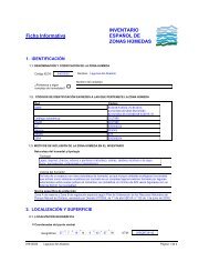
Ficha Informativa<br />
INVENTARIO<br />
ESPAÑOL DE<br />
ZONAS HÚMEDAS<br />
1. IDENTIFICACIÓN<br />
1.1. DENOMINACIÓN Y CODIFICACIÓN DE LA ZONA HUMEDA<br />
Código IEZH:<br />
IH311001<br />
¿Pertenece a algún<br />
complejo <strong>de</strong> humedales?<br />
Nombre: <strong>Lagunas</strong> <strong>de</strong> <strong>Soto</strong> <strong>Mozanaque</strong><br />
Nombre <strong>de</strong>l complejo:<br />
1.2. CÓDIGOS DE IDENTIFICACIÓN EN REDES A LAS QUE PERTENECE LA ZONA HÚMEDA<br />
1.3. MOTIVOS DE INCLUSIÓN DE LA ZONA HÚMEDA EN EL INVENTARIO<br />
Naturaleza <strong>de</strong>l humedal y tipología<br />
Tipología<br />
Estanques artificiales <strong>de</strong> interés ecológico<br />
Valores <strong>de</strong>l humedal<br />
Espacio con clara naturaleza <strong>de</strong> humedal que incluye unida<strong>de</strong>s ecológicas funcionales que actúan como<br />
sistemas acuáticos (en concreto aguas artificiales <strong>de</strong> interés ecológico). A<strong>de</strong>más este espacio posee<br />
relevancia faunística y botánica<br />
Norma específica <strong>de</strong> protección<br />
Humedal incluido en el Catálogo <strong>de</strong> Embalses y Humedales <strong>de</strong> la Comunidad <strong>de</strong> Madrid (Acuerdo <strong>de</strong> 2 <strong>de</strong><br />
septiembre <strong>de</strong> 2004 <strong>de</strong>l Consejo <strong>de</strong> Gobierno <strong>de</strong> la Comunidad <strong>de</strong> Madrid, por el que se aprueba la revisión<br />
<strong>de</strong>l Catálogo <strong>de</strong> Embalses y Humedales <strong>de</strong> la Comunidad <strong>de</strong> Madrid; BOCM nº 220, <strong>de</strong> 15 <strong>de</strong> septiembre <strong>de</strong><br />
2004).<br />
2. LOCALIZACIÓN Y SUPERFICIE<br />
2.1. LOCALIZACIÓN GEOGRÁFICA<br />
·<br />
·<br />
Coor<strong>de</strong>nadas <strong>de</strong>l punto central<br />
40<br />
º I "<br />
Geográficas 36 6 N 3<br />
º<br />
32<br />
I "<br />
19 W<br />
Altitud: 620 m.s.n.m<br />
2.2. LOCALIZACIÓN ADMINISTRATIVA<br />
UTM:<br />
Coor<strong>de</strong>nada X: 454535,28<br />
Coor<strong>de</strong>nada Y: 4494836,19<br />
Provincia:<br />
Madrid<br />
Comunidad Autónoma<br />
Comunidad <strong>de</strong> Madrid<br />
Término municipal:<br />
Algete<br />
Isla:<br />
2.3. LOCALIZACIÓN HIDROLÓGICA<br />
Demarcación:<br />
Tajo<br />
Subcuenca:<br />
Jarama<br />
2.4. SUPERFICIE DE LA ZONA HÚMEDA<br />
Superficie <strong>de</strong> la zona húmeda :<br />
22,1<br />
ha<br />
IH311001<br />
<strong>Lagunas</strong> <strong>de</strong> <strong>Soto</strong> <strong>Mozanaque</strong><br />
Página 1 <strong>de</strong> 5
Delimitación <strong>de</strong> la zona húmeda<br />
(método y cartografía):<br />
Cartografía (ha)<br />
22,06<br />
Varias zonas<br />
Contador 1 Zona Sup. (ha)<br />
A 0,034<br />
Método<br />
Delimitación sobre ortoimagen (0,5 m <strong>de</strong> B 0,078<br />
resolución) obtenida a partir <strong>de</strong> fotografía C 0,09<br />
aérea 1:18000, vuelo 1999 <strong>de</strong> la Comunidad<br />
<strong>de</strong> Madrid, y corregida sobre mapa D 0,143<br />
topográfico (digital) 1:5.000.<br />
E 0,42<br />
F 0,047<br />
G 0,085<br />
H 0,211<br />
I 0,108<br />
J 1,039<br />
K 0,009<br />
L 0,208<br />
M 0,013<br />
N 0,038<br />
Ñ 4,063<br />
O 0,788<br />
P 0,065<br />
Q 0,214<br />
R 0,06<br />
S 0,011<br />
T 0,072<br />
U 0,234<br />
V 0,028<br />
W 0,068<br />
TOTAL: 8,126<br />
Observaciones:<br />
El humedal está constituido por 24 láminas <strong>de</strong> agua que ocupan una superficie total <strong>de</strong><br />
8,126 ha.<br />
3.<br />
RÉGIMEN DE PROTECCIÓN, PLANES Y MEDIDAS DE<br />
CONSERVACIÓN<br />
3.1. PRINCIPAL FIGURA DE PROTECCIÓN<br />
·<br />
·<br />
·<br />
Figura <strong>de</strong> protección <strong>de</strong> mayor rango<br />
Norma y fecha <strong>de</strong> <strong>de</strong>claración:<br />
Porcentaje <strong>de</strong> la zona húmeda cubierto por esta figura:<br />
3.2. OTRAS FIGURAS DE PROTECCIÓN<br />
Humedal incluido en el Catálogo <strong>de</strong> Embalses y Humedales <strong>de</strong> la<br />
Comunidad <strong>de</strong> Madrid.<br />
Acuerdo <strong>de</strong> 2 <strong>de</strong> septiembre <strong>de</strong> 2004, <strong>de</strong>l Consejo <strong>de</strong> Gobierno <strong>de</strong> la<br />
Comunidad <strong>de</strong> Madrid, por el que se aprueba la revisión <strong>de</strong>l Catálogo<br />
<strong>de</strong> Embalses y Humedales <strong>de</strong> la Comunidad <strong>de</strong> Madrid (BOCM nº 220,<br />
<strong>de</strong> 15 <strong>de</strong> septiembre <strong>de</strong> 2004)<br />
100<br />
%<br />
3.3. PLANES Y MEDIDAS DE CONSERVACIÓN<br />
IH311001<br />
<strong>Lagunas</strong> <strong>de</strong> <strong>Soto</strong> <strong>Mozanaque</strong><br />
Página 2 <strong>de</strong> 5
4. ESTADO DE CONSERVACIÓN<br />
·<br />
·<br />
Estado <strong>de</strong> conservación:<br />
Observaciones:<br />
Conservada<br />
5. OTROS DATOS<br />
5.1. INFORMACIÓN OFICIAL<br />
Fecha <strong>de</strong> cumplimentación original <strong>de</strong> esta ficha<br />
15/03/2006<br />
Organismo que cumplimenta:<br />
Comunidad <strong>de</strong> Madrid. Consejería <strong>de</strong> Medio Ambiente y Or<strong>de</strong>nación <strong>de</strong>l<br />
Territorio. Dirección General <strong>de</strong> Medio Natural. Servicio <strong>de</strong> Espacios Naturales<br />
Protegidos. C/ Princesa, nº 3. 28008-Madrid. Fe<strong>de</strong>rico Zamora Martínez. Tfno:<br />
915803884. Fax: 915803868. Correo electrónico: fe<strong>de</strong>rico.zamora@madrid.org<br />
Norma y fecha <strong>de</strong> inclusión<br />
en el Inventario Español <strong>de</strong><br />
Zonas Húmedas:<br />
Norma Resolución <strong>de</strong> 16 <strong>de</strong> octubre <strong>de</strong> 2006, <strong>de</strong> la<br />
Dirección General para la Biodiversidad, por la<br />
que se incluyen en el Inventario Nacional <strong>de</strong><br />
Zonas Húmedas, humedales <strong>de</strong> la Comunidad<br />
<strong>de</strong> Madrid.<br />
Fecha: 16/10/2006<br />
BOE: Número:<br />
275 Fecha: 17/11/2006<br />
Otras modificaciones<br />
oficiales (Norma y fecha)<br />
Norma Resolución <strong>de</strong> 11 <strong>de</strong> diciembre <strong>de</strong> 2009, <strong>de</strong><br />
la Dirección General <strong>de</strong> Medio Natural y<br />
Politica Forestal, <strong>de</strong> corrección <strong>de</strong> errores<br />
<strong>de</strong> la <strong>de</strong> 16 <strong>de</strong> octubre <strong>de</strong> 2006, <strong>de</strong> la<br />
Dirección General para la Biodiversidad, por<br />
la que se incluyen en el inventario nacional<br />
<strong>de</strong> zonas húmedas, humedales <strong>de</strong> la<br />
Comunidad <strong>de</strong> Madrid.<br />
Fecha: 11/12/2009<br />
BOE: Número:<br />
14 Fecha: 16/01/2010<br />
5.2. POSTERIORES MODIFICACIONES DE INFORMACIÓN<br />
Número <strong>de</strong> actualizaciones <strong>de</strong> esta ficha: 1<br />
· · ·<br />
Fecha actualización ficha Organismo que actualiza Observaciones<br />
28/10/2009 Comunidad <strong>de</strong> Madrid. Consejería <strong>de</strong><br />
Medio Ambiente y Or<strong>de</strong>nación <strong>de</strong>l<br />
Territorio. Dirección General <strong>de</strong> Medio<br />
Natural. Servicio <strong>de</strong> Espacios Naturales<br />
Protegidos.<br />
Modificación <strong>de</strong> todos los apartados<br />
<strong>de</strong>l campo 2.4 (excepto <strong>de</strong>l apartado<br />
<strong>de</strong> método), para corrección <strong>de</strong><br />
errores cartográficos.<br />
6. CARTOGRAFÍA<br />
Proce<strong>de</strong>ncia <strong>de</strong><br />
la cartografía:<br />
Comunidad <strong>de</strong> Madrid. Consejería <strong>de</strong> Medio Ambiente y Or<strong>de</strong>nación <strong>de</strong>l Territorio. Dirección<br />
General <strong>de</strong> Medio Natural. Servicio <strong>de</strong> Espacios Naturales Protegidos. C/ Princesa, nº 3. 28008-<br />
Madrid. Fe<strong>de</strong>rico Zamora Martínez. Tfno: 915803884. Fax: 915803868. Correo electrónico:<br />
fe<strong>de</strong>rico.zamora@madrid.org<br />
Sistema <strong>de</strong> referencia ED 50 - UTM Huso 30<br />
IH311001<br />
<strong>Lagunas</strong> <strong>de</strong> <strong>Soto</strong> <strong>Mozanaque</strong><br />
Página 3 <strong>de</strong> 5
6. CARTOGRAFÍA<br />
INVENTARIO ESPAÑOL DE ZONAS HÚMEDAS<br />
Código IEZH IH311001 Nombre <strong>Lagunas</strong> <strong>de</strong> <strong>Soto</strong> <strong>Mozanaque</strong><br />
Proce<strong>de</strong>ncia <strong>de</strong> la cartografía: Comunidad <strong>de</strong> Madrid. Consejería <strong>de</strong> Medio Ambiente y Or<strong>de</strong>nación <strong>de</strong>l Territorio. Dirección General <strong>de</strong> Medio Natural. Servicio <strong>de</strong> Espacios<br />
Naturales Protegidos. C/ Princesa, nº 3. 28008-Madrid. Fe<strong>de</strong>rico Zamora Martínez. Tfno: 915803884. Fax: 915803868. Correo electrónico:<br />
fe<strong>de</strong>rico.zamora@madrid.org<br />
Coor<strong>de</strong>nadas geográficas <strong>de</strong>l punto central: 40 º 36 ' 6 '' N / 3 º 32 ' 19 '' W<br />
Coor<strong>de</strong>nadas UTM <strong>de</strong>l punto central:<br />
Coor<strong>de</strong>nada X: 454535,28 Coor<strong>de</strong>nada Y: 4494836,19<br />
Sistema <strong>de</strong> referencia en mapa: ED 50 - UTM Huso 30