estudi RISKCAT - Generalitat de Catalunya
estudi RISKCAT - Generalitat de Catalunya
estudi RISKCAT - Generalitat de Catalunya

You also want an ePaper? Increase the reach of your titles
YUMPU automatically turns print PDFs into web optimized ePapers that Google loves.
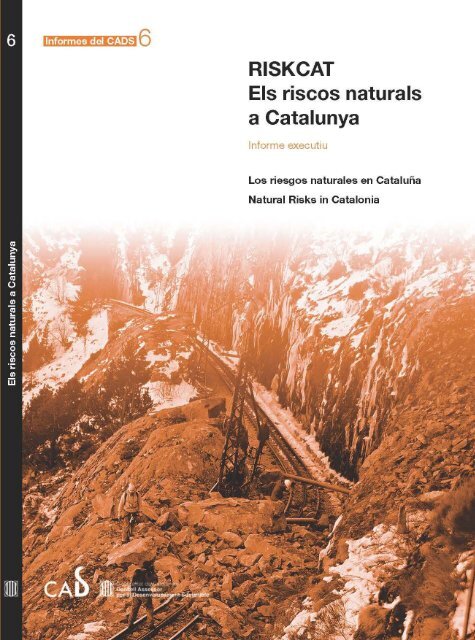
Informes <strong>de</strong>l CADS 6<br />
<strong>RISKCAT</strong><br />
Els riscos naturals<br />
a <strong>Catalunya</strong><br />
Informe executiu<br />
Los Riesgos Naturales en Cataluña<br />
Natural Risks in Catalonia<br />
<strong>Generalitat</strong> <strong>de</strong> <strong>Catalunya</strong><br />
Consell Assessor per al<br />
Desenvolupament Sostenible
BIBLIOTECA DE CATALUNYA - DADES CIP<br />
Vilaplana, Joan Manuel<br />
<strong>RISKCAT</strong> : els riscos naturals a <strong>Catalunya</strong> = los riesgos naturales en Cataluña = natural risks<br />
in Catalonia. – (Informes <strong>de</strong>l CADS ; 6)<br />
Text en català, castellà i anglès<br />
ISBN 9788439378365<br />
I. Payàs, Blanca II. Consell Assessor per al Desenvolupament Sostenible (<strong>Catalunya</strong>) III.<br />
Títol IV. Col·lecció: Informes <strong>de</strong>l CADS ; 6<br />
1. Catàstrofes naturals – <strong>Catalunya</strong> 2. <strong>Catalunya</strong> – Clima<br />
551.58(467.1)<br />
Nota:<br />
El CD-ROM annex conté:<br />
1. Informe executiu (cat.)<br />
2. Informe ejecutivo (cast.)<br />
3. Executive report (eng.)<br />
4. 7 Informes d’espertesa (cat.)<br />
5. Informe legislatiu (cat.)<br />
© <strong>Generalitat</strong> <strong>de</strong> <strong>Catalunya</strong><br />
Departament <strong>de</strong> la Vicepresidència<br />
Consell Assessor per al Desenvolupament Sostenible<br />
www.gencat.cat/cads<br />
Redacció <strong>de</strong> l’informe: Joan Manuel Vilaplana i Blanca Payàs<br />
Edició a cura <strong>de</strong>: Sílvia Cañellas i Joan Maria Romaní<br />
Traducció al castellà i a l’anglès: Abel Julien<br />
Projecte <strong>RISKCAT</strong> 2008, CADS<br />
Director: Joan Manuel Vilaplana<br />
Coordinadora: Blanca Payàs<br />
Equip d’experts: Ramon Copons, Jorge Guillén, Joan Escuer,<br />
Mª José Jiménez, Mariano García, Eduard De Ribot, Joan Mart<br />
Assessor: Antonio Cendrero<br />
Suport tècnic: Lau De Llobet, Silvia Pana<strong>de</strong>ll i Marta Guinau<br />
Maquetació i realització <strong>de</strong>l CD: virgili.com<br />
Impressió i copiatge <strong>de</strong>l CD: LV Grupo Gráfico - Avda. Carrilet 237, 2a planta - 08907 L’Hospitalet <strong>de</strong> Llobregat<br />
(Barcelona) - comercial@grupograficolv.com - www.grupograficolv.com<br />
Dipòsit legal (llibre + CD): B-00.000-2008<br />
ISBN: 978-84-393-7836-5<br />
Tiratge: 500 exemplars<br />
El Consell Assessor per al Desenvolupament Sostenible no comparteix necessàriament totes les opinions expressa<strong>de</strong>s<br />
pels autors d’aquesta publicació.
Presentació<br />
Aquest any 2008, <strong>de</strong>clarat per les Nacions Uni<strong>de</strong>s Any Internacional<br />
<strong>de</strong>l Planeta Terra, està resultant, malauradament,<br />
especialment procliu en catàstrofes relaciona<strong>de</strong>s amb fenòmens<br />
geològics i meteorològics arreu <strong>de</strong>l món. En són mostra<br />
el cicló Nargis, que ha assolat les costes <strong>de</strong> Birmània, el<br />
terratrèmol a la Xina, o l’erupció <strong>de</strong>l volcà Chaitén a Xile,<br />
entre d’altres. A <strong>Catalunya</strong>, tot i que no patim episodis tan<br />
greus, també s’han produït els darrers anys fenòmens<br />
d’aquesta naturalesa, com documenta l’<strong>estudi</strong> que teniu a<br />
les mans.<br />
Els fenòmens naturals com les tempestes, les allaus, les<br />
esllavissa<strong>de</strong>s, o els terratrèmols són, a hores d’ara, impossibles<br />
d’evitar. Ara bé, això no vol dir que els haguem<br />
d’admetre com una fatalitat, sinó que hem d’actuar <strong>de</strong> forma<br />
preventiva i proactiva: ampliant el coneixement sobre<br />
els riscos, establint les mesures per prevenir els impactes, i<br />
preparant-nos per a l’actuació enfront <strong>de</strong>ls <strong>de</strong>sastres. Establir<br />
les eines necessàries per a la prevenció i la gestió <strong>de</strong>ls<br />
riscos naturals és un <strong>de</strong>ls elements cabdals per al <strong>de</strong>senvolupament<br />
sostenible, per al present i sobretot per al futur. I<br />
en aquest sentit, la planificació <strong>de</strong>ls usos <strong>de</strong>l territori és<br />
l’eina clau <strong>de</strong> la prevenció. A més a més, tal com apuntava<br />
ja l’Informe sobre el canvi climàtic a <strong>Catalunya</strong> publicat<br />
pel CADS el 2005, el canvi climàtic farà que fenòmens com<br />
les fortes tempestes –que po<strong>de</strong>n causar inundacions– siguin<br />
més freqüents i <strong>de</strong> major magnitud.<br />
Per tots aquests motius, el Consell Assessor per al Desenvolupament<br />
Sostenible (CADS) va consi<strong>de</strong>rar que calia dur<br />
a terme un <strong>estudi</strong> que permetés reflexionar sobre l’abast <strong>de</strong><br />
<strong>de</strong>terminats riscos naturals a <strong>Catalunya</strong> i, sobretot, analitzar<br />
la capacitat <strong>de</strong> <strong>Catalunya</strong> per afrontar-los. L’<strong>estudi</strong> <strong>RISKCAT</strong><br />
es centra especialment en aquells riscos naturals relacionats<br />
amb la meteorologia i la geologia que tenen una major incidència<br />
(com les inundacions, fenòmens litorals), fenòmens<br />
amb un impacte localitzat (com allaus, esllavissa<strong>de</strong>s i esfondraments),<br />
però també d’altres <strong>de</strong>ls quals som menys<br />
conscients però que no hem d’oblidar (com el vulcanisme<br />
o els terratrèmols).<br />
Teniu a les mans l’informe executiu d’aquest extens treball,<br />
que en <strong>de</strong>stil·la i recull les principals conclusions i propostes.<br />
Per mitjà <strong>de</strong> set informes d’expertesa (un per cada fenomen<br />
<strong>estudi</strong>at), l’anàlisi <strong>de</strong> la normativa vigent, i una<br />
base <strong>de</strong> da<strong>de</strong>s documental amb el material inventariat, RIS-<br />
KCAT aporta la base <strong>de</strong> coneixement necessària sobre l’abast<br />
<strong>de</strong>ls riscos naturals, els es<strong>de</strong>veniments i els danys causats<br />
en el passat, la situació actual <strong>de</strong>l coneixement, i les mesures<br />
establertes.<br />
En la seva elaboració hi ha participat un grup remarcable<br />
d’experts <strong>de</strong>l nostre país, sota la direcció <strong>de</strong>l Dr. Joan Manuel<br />
Vilaplana, director també <strong>de</strong>l grup <strong>de</strong> recerca en riscos<br />
naturals <strong>de</strong> la Universitat <strong>de</strong> Barcelona. Volem <strong>de</strong>stacar que<br />
no és un treball només estrictament acadèmic, sinó que fa<br />
molt èmfasi en la gestió <strong>de</strong>ls riscos i en els instruments<br />
normatius i institucionals. Els nou especialistes que en són<br />
autors han fet entrevistes a més <strong>de</strong> 50 experts (científics,<br />
tècnics, i gestors). El resultat posa <strong>de</strong> manifest l’alt nivell<br />
<strong>de</strong> recerca a les universitats catalanes, i significa un avenç<br />
no només com a exercici <strong>de</strong> reflexió i diagnosi pioner al<br />
nostre país, que tracta un tema cabdal per a la sostenibilitat<br />
<strong>de</strong> <strong>Catalunya</strong>, sinó perquè compila una gran quantitat<br />
d’informació fins ara dispersa en relació amb els riscos naturals<br />
i perquè aporta un disseny d’una metodologia per a<br />
la gestió d’informació i propostes.<br />
El lema <strong>de</strong> l’Any Internacional Planeta Terra, “Ciències <strong>de</strong><br />
la Terra per a la societat”, reflecteix molt bé la visió <strong>de</strong>l CADS<br />
respecte la relació entre la recerca i el coneixement científic,<br />
i la millora <strong>de</strong> les polítiques i actuacions <strong>de</strong>l Govern. La<br />
nostra tasca és la d’assessorar el govern català en aquells<br />
àmbits rellevants per al <strong>de</strong>senvolupament sostenible, com ara<br />
els riscos naturals. <strong>RISKCAT</strong> ens permet disposar d’informació<br />
<strong>de</strong> qualitat i <strong>de</strong> propostes d’actuació, punt <strong>de</strong> partida imprescindible<br />
per dotar <strong>Catalunya</strong> d’una planificació i capacitat<br />
d’actuació a<strong>de</strong>qua<strong>de</strong>s davant <strong>de</strong>ls fenòmens adversos.<br />
El CADS continuarà treballant en aquest àmbit en el futur,<br />
ampliant els tipus <strong>de</strong> riscos naturals (sequera, incendis forestals,<br />
etc.) que s’han <strong>estudi</strong>at en la primera fase, i passant<br />
a més propostes concretes <strong>de</strong> gestió i d’acció, dirigi<strong>de</strong>s tant<br />
al govern com al conjunt <strong>de</strong> la ciutadania. A més a més, és<br />
un camp on és molt important també aprendre <strong>de</strong> l’experiència<br />
d’altres països, als quals, alhora, <strong>Catalunya</strong> pot aportar experiències<br />
com ara el treball que aquí es presenta. El CADS<br />
està en<strong>de</strong>gant un marc <strong>de</strong> col·laboració amb l’Estratègia <strong>de</strong><br />
Nacions Uni<strong>de</strong>s per a la Reducció <strong>de</strong>ls Desastres, dins el<br />
Marc d’Acció <strong>de</strong> Hyogo 2005-2015, que busca facilitar la<br />
transferència <strong>de</strong> coneixement entre països <strong>de</strong>l nord i <strong>de</strong>l sud<br />
en la reducció <strong>de</strong>l risc <strong>de</strong> <strong>de</strong>sastres, que esperem que sigui<br />
molt profitós tant per a <strong>Catalunya</strong> com per als governs locals<br />
i regionals d’arreu <strong>de</strong>l món que en formen part.<br />
Gabriel Ferraté i Pascual<br />
Presi<strong>de</strong>nt <strong>de</strong>l CADS<br />
Ramon Arribas i Quintana<br />
Director <strong>de</strong>l CADS<br />
3
<strong>RISKCAT</strong> Els riscos naturals a <strong>Catalunya</strong><br />
4
Pròleg<br />
La publicació d’un informe com el que aquí apareix ha <strong>de</strong><br />
ser motiu <strong>de</strong> satisfacció per a totes les persones que s’interessin<br />
pels riscos naturals, bé per raons científiques, bé perquè<br />
intentin abordar accions per a pal·liar els danys que aquests<br />
causen. El fet que aquest informe es presenti l’any 2008,<br />
<strong>de</strong>clarat per Nacions Uni<strong>de</strong>s l’Any Internacional <strong>de</strong>l Planeta<br />
Terra (AIPT), li atorga un plus d’actualitat i d’oportunitat,<br />
ja que el tema <strong>de</strong>ls riscos naturals és un <strong>de</strong>ls que s’ha assenyalat<br />
com d’especial interès durant aquest AIPT.<br />
Els riscos naturals constitueixen un problema consi<strong>de</strong>rable<br />
i creixent per a la humanitat. En aquest darrer mig segle el<br />
nombre <strong>de</strong> catàstrofes naturals comptabilitza<strong>de</strong>s en el món<br />
s’ha multiplicat aproximadament per 10, i els danys produïts<br />
per aquestes per 20-25. Les pèrdues ocasiona<strong>de</strong>s representen<br />
anualment més <strong>de</strong> l’1% <strong>de</strong>l producte brut mundial. En<br />
aquest mateix perío<strong>de</strong>, la població humana s’ha multiplicat<br />
per 2,3, el consum d’energia per 4, i el PIB per 7. Aquestes<br />
xifres revelen que, tot i que ha millorat l’eficiència <strong>de</strong>ls<br />
processos productius, la gestió <strong>de</strong>ls riscos naturals ha empitjorat<br />
consi<strong>de</strong>rablement. Només així s’explica que el<br />
nombre <strong>de</strong> catàstrofes hagi augmentat molt més <strong>de</strong>l que<br />
podria atribuir-se a la variabilitat <strong>de</strong>ls processos naturals.<br />
Aquesta mala gestió és encara més evi<strong>de</strong>nt quan s’observa<br />
el creixement <strong>de</strong> les pèrdues registra<strong>de</strong>s.<br />
Els riscos naturals sorgeixen <strong>de</strong> la conjunció <strong>de</strong> les amenaces<br />
o perills <strong>de</strong>guts a processos naturals, <strong>de</strong> l’exposició <strong>de</strong>ls<br />
elements humans a aquests, i <strong>de</strong> la seva vulnerabilitat.<br />
Per exemple, el nombre <strong>de</strong> catàstrofes <strong>de</strong>gu<strong>de</strong>s a inundacions<br />
i esllavissa<strong>de</strong>s <strong>de</strong> terres s’ha multiplicat per més <strong>de</strong> 30 en<br />
mig segle. Aquests processos són molt sensibles a la influència<br />
humana, tant la que el incrementa canvi climàtic<br />
com la que provoca canvis geomorfològics, és a dir, la modificació<br />
generalitzada <strong>de</strong> la superfície terrestre que incrementa<br />
la proporció <strong>de</strong> les aigües <strong>de</strong> pluja que discorren<br />
sobre seu i també redueix la resistència <strong>de</strong> la capa superficial<br />
a l’acció <strong>de</strong>ls agents <strong>de</strong>senca<strong>de</strong>nants naturals.<br />
El resultat és un augment <strong>de</strong> la freqüència i <strong>de</strong> la intensitat<br />
<strong>de</strong>ls processos citats (perill) que sumen a l’augment <strong>de</strong><br />
l’exposició per creixement urbà i d’infraestructures no a<strong>de</strong>quats<br />
per a una gestió sostenible <strong>de</strong>ls riscos.<br />
Les da<strong>de</strong>s anteriors ens mostren una cosa obvia: si la societat<br />
<strong>de</strong>sitja estar en condicions d’abordar a<strong>de</strong>quadament el<br />
greu problema que els riscos naturals representen, ha<br />
d’abordar la gestió <strong>de</strong>ls diferents factors <strong>de</strong>terminants <strong>de</strong>ls<br />
risc. Això inclou accions relaciona<strong>de</strong>s amb el coneixement<br />
científic general, la seva aplicació a una regió en concret<br />
per caracteritzar la naturalesa <strong>de</strong>ls seus perills i la posada<br />
en pràctica <strong>de</strong> programes d’observació, alarma i alerta. Però<br />
també comprèn mesures <strong>de</strong> preparació per disminuir els<br />
efectes negatius <strong>de</strong>ls processos naturals, <strong>de</strong>s <strong>de</strong> normes jurídiques<br />
i organismes amb capacitats per actuar, fins a programes<br />
encaminats a transmetre a la població una cultura<br />
apropiada per conviure amb el risc i contribuir a reduir-lo.<br />
El present informe constitueix, a la meva manera <strong>de</strong> veure,<br />
un notable exemple d’acció encaminada a abordar el conjunt<br />
<strong>de</strong> factors a tenir en compte en aquest àmbit. D’una manera<br />
sistemàtica s’analitza, per separat, <strong>de</strong> cadascun <strong>de</strong>ls processos<br />
que representen perills naturals, l’ “estat <strong>de</strong> l’art” a<br />
<strong>Catalunya</strong> en relació amb els diferents factors que influeixen<br />
en l’extensió, freqüència i magnitud <strong>de</strong>ls danys <strong>de</strong>guts a<br />
aquells. Val la pena senyalar l’atenció <strong>de</strong>dicada a la planificació<br />
i a l’or<strong>de</strong>nació <strong>de</strong>l territori, aspecte clau per a una<br />
bona gestió <strong>de</strong>ls riscos.<br />
La diagnosi presentada a partir d’aquesta anàlisi ha permès<br />
i<strong>de</strong>ntificar els punts forts i les carències <strong>de</strong>l conjunt <strong>de</strong>l<br />
sistema i, en conseqüència, fer una sèrie <strong>de</strong> recomanacions<br />
per millorar la situació actual. Es posa així en mans <strong>de</strong> les<br />
administracions un instrument que segurament permetrà<br />
establir prioritats per abordar paulatinament la millora <strong>de</strong>ls<br />
punts febles, i també, per mantenir, reforçar i aprofitar els<br />
punts forts ja existents. Tot això hauria d’ajudar les administracions<br />
locals i la <strong>Generalitat</strong> –i també l’administració<br />
central– a aconseguir una reducció <strong>de</strong>ls futurs danys <strong>de</strong>guts<br />
als processos naturals, i també a l’ús eficient <strong>de</strong>ls recursos<br />
<strong>de</strong>dicats a aquest fi. D’aquesta manera seguint la línia recomanada<br />
per l’AIPT s’ajudaria a maximitzar el coneixement<br />
i la conscienciació per minimitzar els danys.<br />
Encara que, com és lògic, l’informe està concebut i és<br />
d’especial interès per a <strong>Catalunya</strong>, la seva utilitat va bastant<br />
més enllà d’aquest àmbit territorial i, en la meva opinió,<br />
constitueix un mo<strong>de</strong>l i conté elements d’interès per a altres<br />
llocs. Seria, doncs, molt <strong>de</strong>sitjable que el treball es difongués<br />
entre els organismes que tenen responsabilitats d’un o altre<br />
tipus sobre els riscos naturals, bé sigui d’altres comunitats<br />
autònomes espanyoles, bé d’altres àmbits territorials<br />
d’Europa. Això contribuiria a donar respostes a les preguntes<br />
anteriors i a l’assoliment <strong>de</strong>l que constitueix la finalitat<br />
<strong>de</strong>ls esforços en aquest camp, la reducció <strong>de</strong>l tribut que<br />
anualment paga la humanitat en forma <strong>de</strong> vi<strong>de</strong>s humanes i<br />
pèrdues materials per causa d’unes catàstrofes que no són<br />
tan “naturals”.<br />
Antonio Cendrero Uceda<br />
Catedràtic <strong>de</strong> la Universidad <strong>de</strong> Cantabria<br />
Académico Numerario, Real Aca<strong>de</strong>mia <strong>de</strong> Ciencias<br />
Exactas, Físicas y Naturales<br />
5
Equip <strong>de</strong> treball<br />
Direcció: Joan Manuel Vilaplana<br />
Coordinació: Blanca Payàs<br />
Assessorament extern: Antonio Cendrero<br />
Tècnics: Lau <strong>de</strong> Llobet i Marta Guinau<br />
Experts per temàtiques:<br />
Allaus<br />
Ramon Copons<br />
Esllavissa<strong>de</strong>s<br />
Ramon Copons<br />
Esfondraments i subsidència<br />
Ramon Copons<br />
Fenòmens Litorals<br />
Jorge Guillén<br />
Inundacions<br />
Joan Escuer<br />
Terratrèmols<br />
M. José Jimènez i Mariano García<br />
Vulcanisme<br />
Joan Martí<br />
Legislació<br />
Eduard <strong>de</strong> Ribot
Sumari<br />
Presentació<br />
Pròleg<br />
1. Introducció<br />
Motivació<br />
Objectius<br />
Continguts i estructura<br />
2. Els fenòmens naturals consi<strong>de</strong>rats i el seu impacte<br />
2.1. Allaus: instantània <strong>de</strong> l’impacte a <strong>Catalunya</strong><br />
2.2. Esllavissa<strong>de</strong>s: instantània <strong>de</strong> l’impacte a <strong>Catalunya</strong><br />
2.3. Esfondraments i subsidència: instantània <strong>de</strong> l’impacte a <strong>Catalunya</strong><br />
2.4. Fenòmens litorals: instantània <strong>de</strong> l’impacte a <strong>Catalunya</strong><br />
2.5. Inundacions: instantània <strong>de</strong> l’impacte a <strong>Catalunya</strong><br />
2.6. Terratrèmols: instantània <strong>de</strong> l’impacte a <strong>Catalunya</strong><br />
2.7. Vulcanisme: instantània <strong>de</strong> l’impacte a <strong>Catalunya</strong><br />
3. Material existent relatiu al coneixement i a la gestió <strong>de</strong>ls riscos naturals<br />
3.1. Allaus<br />
3.2. Esllavissa<strong>de</strong>s<br />
3.3. Esfondraments i subsidència<br />
3.4. Fenòmens litorals<br />
3.5. Inundacions<br />
3.6. Terratrèmols<br />
3.7. Vulcanisme<br />
3.8. Legislació<br />
4. Valoració <strong>de</strong> l’estat actual <strong>de</strong>l coneixement <strong>de</strong>ls riscos i <strong>de</strong> la seva gestió<br />
4.1. Allaus<br />
4.2. Esllavissa<strong>de</strong>s<br />
4.3. Esfondraments i subsidència<br />
4.4. Fenòmens litorals<br />
4.5. Inundacions<br />
4.6. Terratrèmols<br />
4.7. Vulcanisme<br />
3<br />
5<br />
9<br />
11<br />
37<br />
43<br />
7
<strong>RISKCAT</strong> Els riscos naturals a <strong>Catalunya</strong><br />
5. Recomanacions per a una gestió sostenible <strong>de</strong>ls riscos<br />
5.1. Allaus<br />
5.1.1. Coneixement científicotècnic<br />
5.1.2. Gestió <strong>de</strong>l risc<br />
5.2. Esllavissa<strong>de</strong>s<br />
5.2.1. Coneixement científicotècnic<br />
5.2.2. Gestió <strong>de</strong>l risc<br />
5.3 Esfondraments i subsidència<br />
5.3.1. Coneixement científicotècnic<br />
5.3.2. Gestió <strong>de</strong>l risc<br />
5.4. Inundacions<br />
5.4.1. Coneixement científicotècnic<br />
5.4.2. Gestió <strong>de</strong>l risc<br />
5.5. Fenòmens litorals<br />
5.5.1. Coneixement científicotècnic<br />
5.5.2. Gestió <strong>de</strong>l risc<br />
5.6. Terratrèmols<br />
5.6.1. Coneixement científicotècnic<br />
5.6.2. Gestió <strong>de</strong>l risc<br />
5.7. Vulcanisme<br />
6. Legislació a <strong>Catalunya</strong> en matèria <strong>de</strong> riscos naturals: valoració i propostes<br />
6.1. Valoracions<br />
6.2. Propostes d’actuació<br />
6.2.1. Propostes legislatives o normatives<br />
6.2.2. Organització administrativa<br />
6.2.3. Gestió i actuacions administratives<br />
7. Consi<strong>de</strong>racions i proposta final<br />
Reflexions generals<br />
Proposta d’actuació<br />
Annexos<br />
I Riscos meteorològics i canvi climàtic<br />
II Glossari<br />
III Abreviatures<br />
Agraïments<br />
57<br />
63<br />
67<br />
71<br />
75<br />
8
Introducció<br />
1. Introducció<br />
Motivació i context<br />
Els fenòmens potencialment perillosos formen part <strong>de</strong>l<br />
funcionament normal <strong>de</strong>ls sistemes naturals. En el món<br />
actual la seva interacció amb la societat genera importants<br />
pèrdues humanes i econòmiques que cada vegada són<br />
més eleva<strong>de</strong>s. És indispensable reduir-les al màxim.<br />
Els informes sobre <strong>de</strong>sastres naturals elaborats per Nacions<br />
Uni<strong>de</strong>s (ISDR) i per les grans companyies asseguradores<br />
i reasseguradores (Swiss-re, Consorcio <strong>de</strong> Compensación<br />
<strong>de</strong> Seguros, entre d’altres) conclouen que l’impacte social<br />
i econòmic <strong>de</strong>ls riscos naturals, tant en països <strong>de</strong>senvolupats<br />
com en aquells en vies <strong>de</strong> <strong>de</strong>senvolupament, ha<br />
anat en augment durant els darrers anys i segueix la mateixa<br />
tendència <strong>de</strong> cara al futur immediat.<br />
Objectiu<br />
L’objectiu <strong>de</strong> <strong>RISKCAT</strong> és realitzar una anàlisi <strong>de</strong> la<br />
capacitat per afrontar riscos naturals a <strong>Catalunya</strong>.<br />
Per assolir l’objectiu s’analitzen un seguit <strong>de</strong> fenòmens<br />
d’origen geològic i hidrometeorològic i se’n fan informes<br />
d’expertesa que <strong>de</strong>tallen amb quines eines comptem avui<br />
per a la previsió i l’anàlisi <strong>de</strong>ls fenòmens, i també per a<br />
la seva <strong>de</strong>limitació espacial i temporal.<br />
Els fenòmens que s’analitzen són els següents:<br />
· Allaus.<br />
· Esllavissa<strong>de</strong>s i <strong>de</strong>spreniments.<br />
· Esfondraments i col·lapses.<br />
· Fenòmens litorals.<br />
· Inundacions (avingu<strong>de</strong>s en grans conques i en conques<br />
torrencials i rieres).<br />
· Terratrèmols.<br />
· Vulcanisme.<br />
Les causes d’aquest fet van lliga<strong>de</strong>s tant a la severitat<br />
<strong>de</strong>ls fenòmens naturals com a la vulnerabilitat física i<br />
social <strong>de</strong>l territori. Diferents <strong>estudi</strong>s indiquen que el factor<br />
vulnerabilitat és el que ha augmentat <strong>de</strong> manera més<br />
alarmant. Aquest fet és directament relacionable amb<br />
l’existència <strong>de</strong> mancances en les polítiques que <strong>de</strong>terminen<br />
l’ocupació <strong>de</strong>l territori.<br />
27%<br />
28%<br />
<strong>Catalunya</strong>, no queda al marge d’aquesta problemàtica.<br />
La creixent ocupació <strong>de</strong>l sòl per a nous usos (especialment<br />
l’urbanístic), la realització <strong>de</strong> grans infraestructures i els<br />
nous hàbits socials (especialment els lligats a la indústria<br />
<strong>de</strong>l lleure), fan que al nostre país hi hagi cada cop més<br />
territori i més població exposats als perills naturals.<br />
11%<br />
28%<br />
3% 3%<br />
Els canvis socioeconòmics i culturals <strong>de</strong> <strong>Catalunya</strong> en<br />
les darreres dèca<strong>de</strong>s han estat molt rellevants i han conformat<br />
la societat que avui tenim amb una distribució<br />
territorial específica i amb un comportament vers a l’entorn<br />
molt diferent al que hi havia fa relativament poc temps.<br />
Segons les da<strong>de</strong>s <strong>de</strong>l Consorcio <strong>de</strong> Compensación <strong>de</strong><br />
Seguros (CCS), <strong>Catalunya</strong> és una <strong>de</strong> les Comunitat Autònomes<br />
que té més <strong>de</strong>speses per catàstrofes naturals, i<br />
està sempre entre les 3 primeres d’Espanya. Aquestes<br />
<strong>de</strong>speses són genera<strong>de</strong>s principalment per inundacions,<br />
amb una mitjana anual <strong>de</strong> 89.000.000 Euros.<br />
Andalusia<br />
C. Valenciana<br />
<strong>Catalunya</strong><br />
Múrcia<br />
Galícia<br />
Resta d’Espanya<br />
Fig 1. Pèrdues a Espanya 1982-2002 per inundacions i terratrèmols. A <strong>Catalunya</strong>:<br />
1.334.780.279 Eur.<br />
Font: Consorcio <strong>de</strong> Compensación <strong>de</strong> Seguros.<br />
En aquest context neix el projecte <strong>RISKCAT</strong> fruit <strong>de</strong> la<br />
inquietud <strong>de</strong>l Consell Assessor per al Desenvolupament<br />
Sostenible-CADS (òrgan assessor <strong>de</strong> la <strong>Generalitat</strong> <strong>de</strong><br />
<strong>Catalunya</strong> en l’àmbit <strong>de</strong>l <strong>de</strong>senvolupament sostenible)<br />
per reflexionar sobre l’abast <strong>de</strong> <strong>de</strong>terminats riscos naturals<br />
a <strong>Catalunya</strong>, especialment aquells que tenen una<br />
major incidència en el territori.<br />
Tots aquests fenòmens són sobtats, <strong>de</strong> curta durada, i<br />
tenen una activitat recurrent. Tots ells po<strong>de</strong>n produir danys,<br />
a persones i a béns, <strong>de</strong> diversa consi<strong>de</strong>ració i amplitud<br />
geogràfica variable.<br />
També s’inclou un <strong>estudi</strong> sobre la legislació vigent vinculada<br />
als riscos i al territori, ja que d’aquesta se’n <strong>de</strong>-<br />
9
<strong>RISKCAT</strong> Els riscos naturals a <strong>Catalunya</strong><br />
riva gran part <strong>de</strong> la gestió i limita o fomenta l’eficàcia <strong>de</strong><br />
tot el procés.<br />
Es consi<strong>de</strong>ra que saber l’estat actual <strong>de</strong> la qüestió és<br />
necessari per po<strong>de</strong>r abordar què cal fer per aconseguir<br />
una bona gestió <strong>de</strong>ls riscos naturals a <strong>Catalunya</strong>. Ja que<br />
en el nostre país es treballa en l’àmbit <strong>de</strong>l coneixement<br />
i <strong>de</strong> la gestió <strong>de</strong>ls riscos naturals <strong>de</strong>s <strong>de</strong> fa anys, <strong>RISKCAT</strong><br />
fa un inventari <strong>de</strong> tots aquells materials i accions relacionats<br />
amb els riscos, i analitza i valora el que s’ha fet<br />
i el que s’està fent.<br />
Finalment es proposa una sèrie d’accions al Govern <strong>de</strong><br />
<strong>Catalunya</strong> i, especialment, als responsables <strong>de</strong> la gestió<br />
<strong>de</strong>ls riscos naturals, que possibilitin una gestió eficient<br />
<strong>de</strong>ls riscos i una or<strong>de</strong>nació més sostenible <strong>de</strong>l territori i<br />
més segura per a les persones.<br />
Malgrat que hi ha altres riscos naturals que també afecten<br />
<strong>Catalunya</strong>, es va <strong>de</strong>cidir que <strong>RISKCAT</strong> no consi<strong>de</strong>raria<br />
<strong>de</strong>terminats riscos naturals d’origen climàtic o antròpic<br />
(és el cas <strong>de</strong> la sequera, <strong>de</strong> la <strong>de</strong>sertificació o <strong>de</strong>ls incendis<br />
forestals) que tot i ser rellevants, tenen unes característiques<br />
i una incidència molt diferents <strong>de</strong> les que <strong>de</strong>terminen<br />
els fenòmens consi<strong>de</strong>rats en el present <strong>estudi</strong>.<br />
<strong>RISKCAT</strong> no és, en cap cas, una anàlisi <strong>de</strong>tallada <strong>de</strong>l risc<br />
associat a cadascun <strong>de</strong>ls fenòmens naturals consi<strong>de</strong>rats.<br />
Tampoc és un objectiu d’aquest projecte abordar la incidència<br />
<strong>de</strong>l canvi climàtic sobre els riscos naturals a <strong>Catalunya</strong>.<br />
Consi<strong>de</strong>rem que aquesta és una nova línia <strong>de</strong><br />
recerca que properament abordarà el Grup d’Experts en<br />
Canvi Climàtic a <strong>Catalunya</strong> (GECCC). De totes maneres,<br />
i atesa la rellevància d’aquesta temàtica, s’inclou en<br />
l’Annex I un breu article que reflexiona sobre la relació<br />
entre el canvi climàtic i els riscos naturals.<br />
El projecte <strong>RISKCAT</strong> s’ha materialitzat en 7 informes<br />
d’expertesa (un per a cada risc natural), 1 informe jurídic<br />
sobre la normativa en relació amb els riscos naturals, una<br />
Base <strong>de</strong> Da<strong>de</strong>s documental que inclou tot el material<br />
inventariat, i finalment aquest informe executiu que recull<br />
<strong>de</strong> manera sintètica les principals valoracions i recomanacions.<br />
L’informe executiu comença oferint una fotografia global<br />
<strong>de</strong> la problemàtica a <strong>Catalunya</strong> <strong>de</strong> cadascun <strong>de</strong>ls fenòmens<br />
consi<strong>de</strong>rats; <strong>de</strong>sprés es presenta la base <strong>de</strong> da<strong>de</strong>s documental,<br />
i posteriorment ja es passa a avaluar les fortaleses<br />
i febleses <strong>de</strong> la nostra situació per acabar suggerint i<br />
recomanant un seguit d’accions. En un capítol a part (capítol<br />
6) es tracta exclusivament la temàtica jurídica. Es<br />
recullen les principals conclusions <strong>de</strong> l’anàlisi <strong>de</strong> la legislació<br />
vigent a <strong>Catalunya</strong> en matèria <strong>de</strong> riscos naturals.<br />
Finalment, al capítol 7, l’informe conclou amb unes reflexions<br />
a l’entorn <strong>de</strong> la reducció <strong>de</strong>ls riscos naturals i<br />
amb propostes concretes al Govern <strong>de</strong> <strong>Catalunya</strong> per<br />
implementar noves accions i optimitzar-ne les existents<br />
<strong>de</strong> manera que millori l’eficiència en la mitigació <strong>de</strong>ls<br />
riscos naturals.<br />
El projecte <strong>RISKCAT</strong> és un exercici pioner d’autoanàlisi<br />
i reflexió, amb el qual es mostra que el nostre Govern<br />
s’adhereix a la inquietud internacional per la millora <strong>de</strong><br />
la gestió <strong>de</strong>ls riscos naturals i que vol consi<strong>de</strong>rar aquest<br />
tema, tant rellevant, en les seves línies estratègiques.<br />
Realització <strong>de</strong>l projecte i contingut<br />
<strong>de</strong> l’informe executiu<br />
Per a la realització <strong>de</strong> l’<strong>estudi</strong>, el Grup <strong>de</strong> Recerca en<br />
Riscos Naturals <strong>de</strong> la Universitat <strong>de</strong> Barcelona (RISK-<br />
NAT), ha creat un equip <strong>de</strong> treball constituït per nou<br />
especialistes: set experts en els diferents temes tractats,<br />
una coordinadora, un director i, a part, 3 tècnics que han<br />
<strong>de</strong>senvolupat treballs puntuals.<br />
Durant l’<strong>estudi</strong> s’han fet visites a organismes públics i<br />
privats per recollir informació, i s’han realitzat entrevistes<br />
a més <strong>de</strong> 50 persones relaciona<strong>de</strong>s amb els temes<br />
tractats (acadèmics, investigadors, tècnics, gestors, etc.)<br />
per recollir da<strong>de</strong>s i opinions. A la fase final s’ha realitzat<br />
una revisió <strong>de</strong> l’informe per part d’un expert que ha actuat<br />
en qualitat d’observador extern.<br />
10
Els fenòmens naturals consi<strong>de</strong>rats i el seu impacte<br />
2. Els fenòmens naturals<br />
consi<strong>de</strong>rants i el seu impacte<br />
L’objectiu d’aquest capítol és introduir al lector en l’abast,<br />
la importància i les conseqüències <strong>de</strong> cada un <strong>de</strong>ls fenòmens<br />
<strong>estudi</strong>ats a <strong>Catalunya</strong>. Per assolir aquest objectiu<br />
s’han elaborat una sèrie <strong>de</strong> taules i mapes a escala regional<br />
que resumeixen <strong>de</strong> manera molt genèrica l’abast i<br />
impacte <strong>de</strong> cada un d’aquests fenòmens.<br />
Descripció <strong>de</strong> les taules<br />
Les da<strong>de</strong>s contingu<strong>de</strong>s en aquestes taules són extretes <strong>de</strong>ls<br />
informes d’expertesa i complementa<strong>de</strong>s amb da<strong>de</strong>s que<br />
s’han pogut obtenir d’altres fonts. Aquestes fonts han estat<br />
majoritàriament la base <strong>de</strong> da<strong>de</strong>s que el Consorcio <strong>de</strong><br />
Compensación <strong>de</strong> Seguros (en endavant, CCS) ha cedit al<br />
projecte. També s’han extret da<strong>de</strong>s <strong>de</strong> l’<strong>estudi</strong> Pérdidas<br />
por terremotos e inundaciones en España durante el periodo<br />
1987-2001 y su estimación para los próximos 30<br />
años (2004-2003), que ha fet l’Instituto Geológico y Minero<br />
<strong>de</strong> Espanya (en endavant, IGME) amb informació<br />
<strong>de</strong>l CCS, <strong>de</strong> Protección Civil <strong>de</strong>l Estado i d’articles <strong>de</strong><br />
premsa nacional. També s’ha extret informació d’interès<br />
d’alguns <strong>estudi</strong>s <strong>de</strong> grups <strong>de</strong> recerca catalans com el Grup<br />
d’Anàlisi <strong>de</strong> Situacions Meteorològiques Adverses <strong>de</strong> la<br />
Universitat <strong>de</strong> Barcelona (GAMA) entre d’altres.<br />
En molts casos ha estat impossible o molt problemàtic<br />
obtenir da<strong>de</strong>s fiables. És especialment difícil obtenir informació<br />
quantitativa <strong>de</strong>tallada <strong>de</strong> l’impacte en la majoria<br />
d’es<strong>de</strong>veniments. Caldria fer un recull més exhaustiu<br />
d’aquest tipus d’informació. Normalment només s’obtenen<br />
da<strong>de</strong>s qualitatives amb <strong>de</strong>scripcions més o menys <strong>de</strong>talla<strong>de</strong>s<br />
<strong>de</strong>ls danys. Aquest fet impossibilita l’elaboració d’una<br />
acurada fotografia post-es<strong>de</strong>veniment, la qual seria molt<br />
útil, tant per a <strong>estudi</strong>s tècnics i científics <strong>de</strong> l’abast <strong>de</strong>l<br />
fenomen, com per als gestors i administracions responsables<br />
<strong>de</strong> mitigar-ne els efectes.<br />
La manca <strong>de</strong> consistència <strong>de</strong> moltes <strong>de</strong> les da<strong>de</strong>s quantitatives<br />
a nivell <strong>de</strong>l territori català s’ha optat per <strong>de</strong>scriure<br />
o <strong>de</strong>tallar algun es<strong>de</strong>veniment concret quan això ha semblat<br />
oportú i clarificador per al lector.<br />
No s’han trobat <strong>estudi</strong>s <strong>de</strong> pèrdues atribuï<strong>de</strong>s a efectes<br />
col·laterals produïts per es<strong>de</strong>veniments com pèrdues indirectes<br />
en la producció agrícola, pèrdua <strong>de</strong> llocs <strong>de</strong> treball,<br />
<strong>de</strong>scens <strong>de</strong> l’activitat turística, empresarial, etc....<br />
La disponibilitat i homogeneïtat <strong>de</strong> la informació sobre<br />
els danys produïts per fenòmens naturals a <strong>Catalunya</strong> és<br />
un assumpte pen<strong>de</strong>nt que s’haurà d’abordar d’alguna manera<br />
en el futur immediat.<br />
Llegenda <strong>de</strong> la taula:<br />
a) Historial d’es<strong>de</strong>veniments<br />
• Distribució espacial; localització <strong>de</strong>ls es<strong>de</strong>veniments<br />
amb danys.<br />
• Distribució temporal; registre d’es<strong>de</strong>veniments per<br />
data d’ocurrència.<br />
b) Estimació <strong>de</strong> la recurrència <strong>de</strong>l fenomen<br />
A partir <strong>de</strong>l registre d’es<strong>de</strong>veniments <strong>de</strong>scrit als informes<br />
d’expertesa s’ha fet una aproximació a la recurrència<br />
<strong>de</strong>l fenomen; entenent recurrència com<br />
l’estimació <strong>de</strong>l temps que pot passar entre es<strong>de</strong>veniments.<br />
c) Estimació <strong>de</strong> l’impacte<br />
• Impacte social: Aquí s’inclou el nombre <strong>de</strong> morts<br />
o <strong>de</strong>sapareguts. Si hi hagués da<strong>de</strong>s també s’haurien<br />
d’incloure ferits, persones sense llar, persones<br />
sense feina i en cas que n’hi hagués també hauria<br />
d’incloure epidèmies o malalties provoca<strong>de</strong>s per<br />
la catàstrofe.<br />
• Impacte econòmic directe: En aquest apartat hem<br />
intentat recollir les <strong>de</strong>speses per danys directes.<br />
Atesa a la carència <strong>de</strong> da<strong>de</strong>s, i com que en ocasions<br />
no ha estat possible accedir a da<strong>de</strong>s quantifica<strong>de</strong>s<br />
però si a da<strong>de</strong>s <strong>de</strong>scriptives, hem <strong>de</strong>sglossat la<br />
columna en 2 per po<strong>de</strong>r oferir el màxim<br />
d’informació.<br />
Quantificat: En aquests apartat hem recollit la<br />
quantificació <strong>de</strong>ls danys directes produïts pel fenomen<br />
com costos <strong>de</strong> reposició i reparació<br />
d’estructures, instal·lacions i propietats, sistemes<br />
<strong>de</strong> comunicació i electricitat.<br />
Descrit: En aquest apartat hem inclòs danys <strong>de</strong>scrits<br />
però no quantificats.<br />
A més <strong>de</strong>ls camps <strong>de</strong>scrits anteriorment seria molt interessant<br />
po<strong>de</strong>r incloure un camp anomenat impacte econòmic<br />
indirecte, en el qual es recollissin altres pèrdues<br />
indirectes genera<strong>de</strong>s pel fenomen i que podrien ser <strong>de</strong><br />
tipus industrial, agrícola i cultural. En serien exemple la<br />
reducció <strong>de</strong>l valor <strong>de</strong>ls bens, pèrdues <strong>de</strong> productivitat <strong>de</strong>l<br />
sòl agrícola, pèrdues d’ingressos per impostos, costos <strong>de</strong><br />
mesures preventives o mitigadores, pèrdues en la qualitat<br />
<strong>de</strong> l’aigua etc... Malhauradament, no se n’han trobat<br />
<strong>estudi</strong>s ni da<strong>de</strong>s, motiu pel qual no s’inclou aquest apartat<br />
a les taules.<br />
Descripció <strong>de</strong>ls mapes<br />
Tots el mapes aquí presentats són d’escala regional i han<br />
<strong>de</strong> permetre, amb un cop d’ull, tenir una i<strong>de</strong>a <strong>de</strong> l’àrea<br />
afectada dins <strong>de</strong> <strong>Catalunya</strong> i <strong>de</strong>l percentatge d’àrea on la<br />
11
<strong>RISKCAT</strong> Els riscos naturals a <strong>Catalunya</strong><br />
perillositat o el risc són elevats. Aquestes les cartografies<br />
són, doncs, orientatives i no pretenen ser la base per prendre<br />
<strong>de</strong>cisions <strong>de</strong> <strong>de</strong>tall.<br />
En alguns fenòmens la cartografia és <strong>de</strong> realització pròpia<br />
mentre que en altres s’han utilitzat mapes ja existents.<br />
Els mapes presentats per a cada fenomen mostren la susceptibilitat,<br />
la perillositat o el risc, <strong>de</strong>penent <strong>de</strong> la informació<br />
existent.<br />
2.1. Allaus<br />
Instantània <strong>de</strong> l’impacte a <strong>Catalunya</strong><br />
Les allaus tenen una gran incidència als Pirineus <strong>de</strong> <strong>Catalunya</strong>,<br />
on el nivell <strong>de</strong> vulnerabilitat i exposició ha augmentat<br />
molt els darrers anys. Afortunadament hi ha un<br />
recull històric d’allaus i també hi ha un inventari sistemàtic<br />
<strong>de</strong> les allaus a <strong>Catalunya</strong> <strong>de</strong>s <strong>de</strong> 1986 (http://www.igc.<br />
cat/web/gconten/ca/allaus/igc_allaus_acci<strong>de</strong>nts.html).<br />
parlant d’allaus menors, generalment <strong>de</strong> dimensions reduï<strong>de</strong>s<br />
i que han afectat a practicants <strong>de</strong>ls esports <strong>de</strong><br />
muntanya hivernal fora <strong>de</strong> les zones controla<strong>de</strong>s.<br />
Les allaus <strong>de</strong> grans dimensions i abast, anomena<strong>de</strong>s majors,<br />
solen arribar a cotes molt més baixes i tenen incidència<br />
en la <strong>de</strong>strucció <strong>de</strong>l bosc, <strong>de</strong> les diferents infraestructures,<br />
<strong>de</strong> xarxes vitals i d’algunes zones<br />
urbanitza<strong>de</strong>s. Les allaus majors es po<strong>de</strong>n produir localment<br />
o <strong>de</strong> manera més generalitzada durant neva<strong>de</strong>s intenses<br />
que generen episodis allavosos arreu <strong>de</strong> la serralada pirinenca.<br />
En el darrers 20 anys s’han produït 3 episodis<br />
generals i 4 <strong>de</strong> locals amb allaus majors que han ocasionat<br />
danys importants. Malauradament no hem aconseguit<br />
recollir da<strong>de</strong>s quantifica<strong>de</strong>s fiables <strong>de</strong>ls danys, però sí<br />
força da<strong>de</strong>s <strong>de</strong>scrites (vegeu la taula 1).<br />
És important anotar que tot i que la freqüència d’episodis<br />
allavosos rellevants no és molt elevada, sí que és constant<br />
el <strong>de</strong>goteig <strong>de</strong> petits i mitjans allaus.<br />
La preparació <strong>de</strong> la població <strong>de</strong> muntanya i la bona gestió<br />
territorial són imprescindibles perquè el nombre <strong>de</strong><br />
víctimes i <strong>de</strong> danys no segueixi en augment. Tinguem en<br />
compte que s’han i<strong>de</strong>ntificat a dia d’avui un mínim <strong>de</strong><br />
catorze carreteres exposa<strong>de</strong>s i setze urbanitzacions recents<br />
afecta<strong>de</strong>s <strong>de</strong> manera total o parcial per allaus (vegeu<br />
l’informe d’expertesa d’allaus).<br />
Durant els darrers 20 anys hi ha hagut 36 víctimes mortals<br />
per allaus i 44 ferits. En la majoria <strong>de</strong>ls casos estem<br />
Zona afectada per una allau <strong>de</strong> neu pols a la Pleta <strong>de</strong> Vaquèira al gener <strong>de</strong>l 2003. S’indica l’abast <strong>de</strong> la part <strong>de</strong>nsa (en mageneta) i <strong>de</strong> l’aerosol (en taronja).<br />
Foto: IGC.<br />
12
Els fenòmens naturals consi<strong>de</strong>rats i el seu impacte<br />
Rellevància <strong>de</strong> les allaus a <strong>Catalunya</strong><br />
Historial d’es<strong>de</strong>veniments<br />
Estimació <strong>de</strong> la recurrència<br />
Distribució espacial<br />
16 localitats afecta<strong>de</strong>s per allaus<br />
Alta Ribagorça: Estació <strong>de</strong> Boi-Taüll, Senet<br />
Alt Urgell: Cornellana<br />
Pallars Sobirà: Espot, Estació d’esquí <strong>de</strong><br />
Tavascan, Tavascan<br />
Ripollès: Cremallera <strong>de</strong> Núria, Collada <strong>de</strong> Toses,<br />
refugi Pasturia (Vallter)<br />
Vall d’Aran: Bagergue, Bonaigua, Bossost,<br />
Casarilh, Garòs, Pleta <strong>de</strong> Vaquèira, Unha, Toran<br />
Es<strong>de</strong>veniments històrics<br />
(anteriors a 1975)<br />
S XVI Tavascan<br />
S XVII Senet<br />
1855 Episodi allavós sever que afectà<br />
Toran, Unha, Bagergue<br />
1861 Bossost<br />
1937 Senet<br />
Es<strong>de</strong>veniments Recents<br />
(a partir <strong>de</strong> 1975)<br />
Distribució temporal<br />
Episodis allavosos<br />
1996 Vessant S Pirineu<br />
2003 Vessant N Pririneu<br />
2005 Garòs<br />
Episodis allavosos: severs<br />
entre un es<strong>de</strong>veniment cada 10 anys i un<br />
es<strong>de</strong>veniment cada 60 anys<br />
Allaus puntuals<br />
una allau cada any<br />
Allaus puntuals<br />
1981 Bossost<br />
1986 Núria i Collada <strong>de</strong> Toses<br />
1993-94 Ctra <strong>de</strong> la Bonaigua<br />
2004 Tavascan<br />
2005 Garòs<br />
2006 Collada <strong>de</strong> Toses<br />
Estimació <strong>de</strong> l’impacte<br />
Impacte social<br />
Impacte econòmic directe<br />
1855 60 morts<br />
1986-87 1 mort i 9 ferits<br />
1987-88 1 mort<br />
1988-89 1 mort i 1 ferit<br />
1990-91 4 morts i 3 ferits<br />
1991-92 2 morts i 2 ferits<br />
1992-93 3 ferits<br />
1993-94 1 mort i 4 ferits<br />
1995-96 2 morts i 4 ferits<br />
1996-97 1 mort<br />
1997-98 2 ferits<br />
1998-99 1 mort i 3 ferits<br />
1999-00 1 ferit<br />
2000-01 4 morts i 2 ferits<br />
2001-02 4 morts i 2 ferits<br />
2002-03 1 mort i 1 ferit<br />
2003-04 3 morts i 6 ferits<br />
2004-05 1 mort i 2 ferits<br />
2005-06 1 mort i 5 ferits<br />
2006-07 1 ferit<br />
2007-08 1 ferit<br />
Quantificat<br />
En un episodi allavós com el <strong>de</strong> 1996, s’estima<br />
que les pèrdues directes po<strong>de</strong>n ser <strong>de</strong> l’ordre <strong>de</strong><br />
centenars <strong>de</strong> milers d’euros.<br />
Descrit<br />
1855 Destrucció d’unes 58 cases a la Vall<br />
<strong>de</strong> Toran<br />
1986 Talls al cremallera <strong>de</strong> Vall <strong>de</strong> Núria i<br />
a la carretera <strong>de</strong> la collada <strong>de</strong> Toses<br />
(Ripollès)<br />
1993 Un cotxe arrossegat a la carretera<br />
<strong>de</strong> la Bonaigua<br />
1996 Desallotjaments a les urbanitzacions<br />
La Pleta <strong>de</strong> Vaquèira i El Nin <strong>de</strong><br />
Bertet a la Vall d’Aran. Destrucció<br />
<strong>de</strong> cases i infraestructures<br />
Destrucció <strong>de</strong>l refugi Pastuira a<br />
Vallter, amb 2 ferits<br />
Talls al cremallera <strong>de</strong> Vall <strong>de</strong> Núria<br />
Importants extensions <strong>de</strong> boscos<br />
arrasats<br />
2003 Cases i infraestructures afecta<strong>de</strong>s<br />
a La Pleta <strong>de</strong> Vaquèira<br />
2004 Cotxes afectats a l’aparcament <strong>de</strong><br />
l’estació d’esquí <strong>de</strong> Tavascan<br />
2006 Importants extensions <strong>de</strong> bosc arrasa<strong>de</strong>s<br />
Problemes a la carretera a la collada<br />
<strong>de</strong> Toses<br />
Taula 1. Resum <strong>de</strong> l’abast i l’impacte <strong>de</strong> les allaus a <strong>Catalunya</strong>.<br />
13
<strong>RISKCAT</strong> Els riscos naturals a <strong>Catalunya</strong><br />
A continuació es presenta la zonificació <strong>de</strong> la susceptibilitat<br />
o propensió <strong>de</strong>l territori a generar allaus (figura<br />
2). Les classes <strong>de</strong> susceptibilitat s’han basat en criteris<br />
<strong>de</strong> cota, <strong>de</strong> pen<strong>de</strong>nts i <strong>de</strong> da<strong>de</strong>s d’allaus ocorregu<strong>de</strong>s<br />
(Mapa Zones Allaus-MZA i Base Da<strong>de</strong>s Allaus <strong>de</strong> <strong>Catalunya</strong>-BDAC).<br />
Aquesta susceptibilitat està classificada en quatre nivells:<br />
Zones <strong>de</strong> susceptibilitat alta, aquelles on la BDAC ha<br />
enregistrat alguna allau en els darrers quinze anys.<br />
Zones <strong>de</strong> susceptibilitat mitjana, engloben sectors<br />
exposats a allaus segons els MZA però on no hi ha<br />
hagut cap allau en els darrers quinze anys.<br />
Zones <strong>de</strong> susceptibilitat baixa, es troben a altituds<br />
superiors a 1.500m però no hi ha constància que hi<br />
hagi hagut allaus.<br />
Zones <strong>de</strong> susceptibilitat no <strong>de</strong>tectada, es troben a altituds<br />
inferiors a 1.500m i no exposa<strong>de</strong>s a les allaus.<br />
Les zones <strong>de</strong> susceptibilitat mitjana i alta representen el<br />
4% <strong>de</strong>l territori i que<strong>de</strong>n confina<strong>de</strong>s als Pirineus. Fora<br />
d’aquesta àrea, només la capçalera <strong>de</strong>l Montseny queda<br />
catalogada com a susceptibilitat baixa. La resta <strong>de</strong> <strong>Catalunya</strong><br />
està catalogada amb susceptibilitat no <strong>de</strong>tectada.<br />
En aquest mapa també s’han afegit els majors es<strong>de</strong>veniments<br />
amb danys enregistrats en algun moment <strong>de</strong> la<br />
història.<br />
Fig 2. Zonificació <strong>de</strong> la susceptibilitat a les allaus a <strong>Catalunya</strong>.<br />
14
Els fenòmens naturals consi<strong>de</strong>rats i el seu impacte<br />
2.2. Esllavissa<strong>de</strong>s<br />
Instantània <strong>de</strong> l’impacte a <strong>Catalunya</strong><br />
No existeix cap registre sistemàtic <strong>de</strong> les esllavissa<strong>de</strong>s i<br />
<strong>de</strong>ls danys que causen. Hi ha força informació, però irregular<br />
i dispersa. S’ha aconseguit recollir un bon nombre<br />
d’es<strong>de</strong>veniments amb danys en els darrers anys i també<br />
en la història.<br />
De la informació recollida a la taula 2, se’n <strong>de</strong>sprèn que<br />
es <strong>de</strong>tecta un augment en el nombre d’esllavissa<strong>de</strong>s que<br />
produeixen danys, per tant hi ha un increment <strong>de</strong>l risc.<br />
Aquest fet va lligat sobretot a l’increment <strong>de</strong> l’ocupació<br />
i utilització <strong>de</strong>l sòl, és a dir, a un augment <strong>de</strong> l’exposició.<br />
No obstant, també volem mencionar la incidència <strong>de</strong><br />
l’anomenada petjada geomorfològica i <strong>de</strong> la relació entre<br />
aquesta i l’increment d’esllavissa<strong>de</strong>s. En els darrers 15<br />
anys el <strong>de</strong>senvolupament econòmic <strong>de</strong>l nostre país ha<br />
conduit a un urbanisme <strong>de</strong>saforat que, en molts casos, ha<br />
propiciat la inestabilitat <strong>de</strong>l terreny i ha reduït la resistència<br />
<strong>de</strong> la capa superficial a l’acció <strong>de</strong>ls agents naturals.<br />
Les esllavissa<strong>de</strong>s més importants han anat lliga<strong>de</strong>s als<br />
grans aiguats <strong>de</strong> 1962, 1982 i 2000. Cada un d’aquests<br />
va ocasionar nombrosos moviments <strong>de</strong>l terreny amb grans<br />
danys. Malauradament, la quantificació d’aquests danys<br />
no ha estat possible, ja que tot i que el CCS ha pagat parts<br />
importants <strong>de</strong> les <strong>de</strong>speses assegura<strong>de</strong>s, aquestes no s’han<br />
imputat al concepte esllavissa<strong>de</strong>s sinó al d’inundacions.<br />
L’IGME va realitzar un <strong>estudi</strong> l’any 1987 on estimava el<br />
cost econòmic aproximat <strong>de</strong> les esllavissa<strong>de</strong>s en el perío<strong>de</strong><br />
1986-2016 (taula 2). A dia d’avui el CCS paga els<br />
danys per esllavissa<strong>de</strong>s si aquestes es produeixen lliga<strong>de</strong>s<br />
a grans inundacions. Malhauradament encara no en separen<br />
els conceptes, però ens han informat que hi ha<br />
increment <strong>de</strong> casos sobretot d’esllavissa<strong>de</strong>s relaciona<strong>de</strong>s<br />
amb noves construccions en pen<strong>de</strong>nt, ja que s’ha modificat<br />
el sòl i amb l’acció <strong>de</strong> la pluja es propicia la inestabilitat<br />
<strong>de</strong>l terreny.<br />
Despreniments <strong>de</strong> roques a Malanyeu (Berguedà) el gener <strong>de</strong> 2006. Foto: J.M. Vilaplana.<br />
15
<strong>RISKCAT</strong> Els riscos naturals a <strong>Catalunya</strong><br />
Rellevància <strong>de</strong> les esllavissa<strong>de</strong>s a <strong>Catalunya</strong><br />
Historial d’es<strong>de</strong>veniments<br />
Estimació <strong>de</strong> la recurrència<br />
Distribució espacial<br />
Distribució temporal<br />
Esllavissa<strong>de</strong>s que han afectat elements exposats<br />
Alta Ribagorça: Senet<br />
Alt Urgell: Bescaràn, Organyà, Pont <strong>de</strong> Bar<br />
Bages: Montserrat<br />
Baix Empordà: l’Estartit, Sta. Cristina d’Aro<br />
Baix Llobregat: Castell<strong>de</strong>fels, El Papiol,<br />
Esparreguera, St. Esteve Sesrovires<br />
Barcelonès: Montjuïc<br />
Berguedà: Espinalbet, Gòsol, Guixers, Malanyeu<br />
Cerdanya: La Molina, Martinet<br />
La Garrotxa: Castellfollit <strong>de</strong> la Roca,<br />
St. Esteve d’en Bas<br />
Les Garrigues: Juncosa<br />
Osona: Rupit<br />
Pallars Jussà: Cap<strong>de</strong>lla, Espui, Puigcercós, Sant<br />
Salvador <strong>de</strong> Toló<br />
Pallars Sobirà: Boren-Isavarre, Caregue, Gerri<br />
<strong>de</strong> la sal, La Guingueta, Llavorsí, Sort<br />
Ripollès: Vall <strong>de</strong> Núria, Rocabruna<br />
Ribera d’Ebre: Tivissa<br />
Solsonès: La Coma<br />
Vall d’Aran: Arties<br />
Vallès Occi<strong>de</strong>ntal: Barberà <strong>de</strong>l Vallès,<br />
Castellbisbal, Ullastrell<br />
Es<strong>de</strong>veniments Històrics<br />
(anteriors a 1975)<br />
1845 Tivissa i Montjuïc<br />
1881 Puigcercós<br />
Finals S XIX Bescaran<br />
1907 Boren-Isavarre, Llavorsí i Espui<br />
1940 Rocabruna i Rupit<br />
1944 Ullastrell<br />
1962 Barberà <strong>de</strong>l Vallès, Castellbisbal<br />
i Papiol<br />
1963 Montjuïc, Arties i Senet<br />
Es<strong>de</strong>veniments Recents<br />
(posterior a 1975)<br />
1979 Castellfollit<br />
1982 La Guingueta, Caregue, Gerri<br />
<strong>de</strong> la Sal, Cap<strong>de</strong>lla, Pont <strong>de</strong> Bar,<br />
La Coma, Gòsol, Maçaners i<br />
Espinalbet, Vallcebre, Maçaners,<br />
Sant Salvador <strong>de</strong> Toló<br />
1984 El Papiol i St. Esteve Sesrovires<br />
1987 Guixers<br />
1990 Sort<br />
1995 Castellfollit<br />
1996 Martinet<br />
1998 St. Esteve d’en Bas<br />
2000 Esparreguera i Montserrat<br />
2003 Núria, Sta. Cristina d’Aro<br />
2004 L’Estartit<br />
2005 St Esteve d’en Bas<br />
2006 Malanyeu, Organyà i Juncosa<br />
<strong>de</strong> les Garrigues<br />
2007 Castellfollit <strong>de</strong> la Roca, La Molina<br />
i Montserrat<br />
Segons l’anterior registre d’es<strong>de</strong>veniments<br />
Històrics<br />
entre 1 es<strong>de</strong>veniment cada 5 i 1 es<strong>de</strong>veniment<br />
cada 10 anys<br />
Recents<br />
1 es<strong>de</strong>veniment cada any i mig<br />
Destrucció, per esllavissament, <strong>de</strong> la carretera N-260 a El Pont <strong>de</strong> Bar durant els aiguats <strong>de</strong> novembre <strong>de</strong> 1982. Foto: J.M. Vilaplana.<br />
16
Els fenòmens naturals consi<strong>de</strong>rats i el seu impacte<br />
Estimació <strong>de</strong> l’impacte<br />
Impacte social<br />
Impacte econòmic directe<br />
Impacte social<br />
Impacte econòmic directe<br />
Es<strong>de</strong>veniments recents<br />
2003 2 morts a Sta. Cristina d’Aro<br />
2005 1 mort a St. Esteve d’en Bas<br />
2006 2 morts a Juncosa <strong>de</strong> les Garrigues<br />
Pèrdues espera<strong>de</strong>s per al perío<strong>de</strong><br />
1987-2016 442.747.789,88€<br />
1881 Desplaçament <strong>de</strong> tot el poble<br />
<strong>de</strong> Puigcercós<br />
1982 Cases afecta<strong>de</strong>s i <strong>de</strong>sperfectes en<br />
el mobiliari urbà i infraestructures a<br />
la Guingueta d’Aneu i Pont <strong>de</strong> Bar.<br />
Tall <strong>de</strong> la carretera d’accés al poble<br />
<strong>de</strong> Pont <strong>de</strong> Bar.<br />
Desplaçament <strong>de</strong> tot el poble <strong>de</strong><br />
Pont <strong>de</strong> Bar (10 famílies).<br />
Castellfollit <strong>de</strong> la Roca,<br />
<strong>de</strong>sperfectes a les cases més<br />
properes a la cinglera<br />
2000 Talls a les vies <strong>de</strong> comunicació a<br />
Montserrat. Desperfectes en cotxes<br />
edificacions i infraestructures.<br />
Desperfectes en el Monestir.<br />
Des <strong>de</strong> 1990 Despefectes al cremallera <strong>de</strong> Núria.<br />
al 2007 Castellfolit <strong>de</strong> la Roca. Desperfectes<br />
a les cases més properes a la<br />
cinglera.<br />
2007 Desperfectes i talls a la carretera<br />
d’accés al Monestir <strong>de</strong> Montserrat<br />
i al cremallera.<br />
Taula 2. Resum <strong>de</strong> les da<strong>de</strong>s més rellevants quant a l’abast i l’impacte <strong>de</strong> les esllavissa<strong>de</strong>s.<br />
Font: IGME 1987.<br />
Les esllavissa<strong>de</strong>s <strong>de</strong> terres i roques tenen una gran incidència<br />
a <strong>Catalunya</strong> amb una distribució territorial molt<br />
àmplia.<br />
A la figura 3 es presenta la susceptibilitat o propensió <strong>de</strong>l<br />
territori a generar esllavissa<strong>de</strong>s. Les classes <strong>de</strong> susceptibilitat<br />
s’han <strong>de</strong>finit en base al relleu i a la tipologia <strong>de</strong>l<br />
terreny.<br />
17
<strong>RISKCAT</strong> Els riscos naturals a <strong>Catalunya</strong><br />
Fig. 3. Mapa <strong>de</strong> susceptibilitat als esllavissaments a <strong>Catalunya</strong> amb la localització <strong>de</strong>ls majors es<strong>de</strong>veniments amb danys enregistrats en algun moment <strong>de</strong> la<br />
història.<br />
Al mapa anterior (figura 3), la susceptibilitat està classificada<br />
en quatre nivells:<br />
Zones <strong>de</strong> susceptibilitat alta, aquelles amb relleu molt<br />
escarpat i amb litologies susceptibles <strong>de</strong> generar esllavissa<strong>de</strong>s.<br />
Ocupen aproximadament un 27% <strong>de</strong>l territori.<br />
Zones <strong>de</strong> susceptibilitat baixa, es troben a zones muntanyoses<br />
<strong>de</strong> relleu suau i a les <strong>de</strong>pressions amb un cert<br />
<strong>de</strong>snivell topogràfic. Ocupen el 45% <strong>de</strong>l territori.<br />
Zones <strong>de</strong> susceptibilitat no <strong>de</strong>tectada, representen un<br />
6% <strong>de</strong>l territori i són les grans planes interiors i les<br />
planes litorals amb relleu gairebé horitzontal.<br />
Zones <strong>de</strong> susceptibilitat mitjana, engloben sectors amb<br />
relleu escarpat però <strong>de</strong> relativament baix <strong>de</strong>snivell.<br />
Ocupen aproximadament un 22% <strong>de</strong>l territori.<br />
18
Els fenòmens naturals consi<strong>de</strong>rats i el seu impacte<br />
2.3. Esfondraments i subsidència<br />
Instantània <strong>de</strong> l’impacte a <strong>Catalunya</strong><br />
Els esfondraments són moviments verticals <strong>de</strong>l terreny,<br />
més o menys ràpids, lligats a l’existència <strong>de</strong> cavitats subterrànies<br />
pròximes a la superfície <strong>de</strong>l terreny. La subsidència<br />
és un procés d’enfonsament lent, gradual, d’un<br />
sector <strong>de</strong> la superfície terrestre.<br />
Encara que mai s’han produït víctimes mortals per aquest<br />
risc, l’impacte econòmic i social que ha generat un fet<br />
com l’esfondrament <strong>de</strong>l barri <strong>de</strong> l’Estació <strong>de</strong> Sallent és<br />
molt important. També a la ciutat <strong>de</strong> Súria els esfondraments<br />
sobtats han limitat l’expansió <strong>de</strong> la zona urbana,<br />
i a Cardona han obligat al <strong>de</strong>sviament <strong>de</strong>l riu Car<strong>de</strong>ner<br />
(taula 3).<br />
Una vegada més observem un increment en la freqüència<br />
d’es<strong>de</strong>veniments enregistrats (taula 3) que s’ha d’atribuir<br />
a l’increment d’ocupació <strong>de</strong> les àrees exposa<strong>de</strong>s i a<br />
l’acceleració <strong>de</strong>ls moviments verticals <strong>de</strong>l terreny a causa<br />
<strong>de</strong> certes activitats (mineria, extracció d’aigües subterrànies,<br />
etc...).<br />
Rellevància <strong>de</strong>ls esfondraments i la subsidència a <strong>Catalunya</strong><br />
Historial d’es<strong>de</strong>veniments<br />
Estimació <strong>de</strong> la recurrència<br />
Distribució espacial<br />
Distribució temporal<br />
Localitats afecta<strong>de</strong>s per esfondraments<br />
Besalú, Banyoles, Cardona, Sallent, Súria,<br />
St. Sadurní d’Anoia, La Bisbal <strong>de</strong>l Penedès, Foix<br />
Localitats afecta<strong>de</strong>s per subsidència<br />
Delta <strong>de</strong>l Besòs, Delta <strong>de</strong>l Llobregat, Delta<br />
<strong>de</strong> l’Ebre<br />
Es<strong>de</strong>veniments a la conca lacustre <strong>de</strong> Banyoles<br />
1904, 1908, 1978, 1982<br />
Conca potàssica catalana<br />
Esfondraments <strong>de</strong>tectats <strong>de</strong>s <strong>de</strong> principis <strong>de</strong>l<br />
segle XX<br />
Durant el segle XX<br />
14 es<strong>de</strong>veniments registrats<br />
1 es<strong>de</strong>veniment cada 7 anys<br />
Es<strong>de</strong>veniments recents<br />
(a partir <strong>de</strong> 1975)<br />
8 es<strong>de</strong>veniments registrats<br />
1 es<strong>de</strong>veniment cada 3 anys<br />
Estimació <strong>de</strong> l’impacte<br />
Impacte social<br />
Impacte econòmic directe<br />
Quantificat<br />
Descrit<br />
Episodi <strong>de</strong> Sallent 224 famílies <strong>de</strong>sallotja<strong>de</strong>s<br />
Per Subsidència<br />
No es coneix<br />
Per Esfondraments<br />
Per a l’episodi <strong>de</strong> Sallent es preveuen 14.000.000 €<br />
per compensar 172 propietaris afectats<br />
Desperfectes a la carretera <strong>de</strong> Banyoles a Olot<br />
A Banyoles, problemes a les infraestructures <strong>de</strong>l<br />
jocs olímpics <strong>de</strong>l 1992<br />
Episodi <strong>de</strong> Sallent, al barri <strong>de</strong> l’Estació, 333<br />
habitatges afectats, molts <strong>de</strong>ls quals s’han <strong>de</strong><br />
<strong>de</strong>sallotjar i en<strong>de</strong>rrocar<br />
A Súria, terrenys rústics afectats limiten<br />
l’expansió <strong>de</strong> la zona urbana<br />
A Cardona ha calgut <strong>de</strong>sviar el Riu Car<strong>de</strong>ner<br />
Taula 3. Resum <strong>de</strong> les da<strong>de</strong>s més rellevants sobre l’abast i l’impacte <strong>de</strong>ls esfondraments.<br />
19
<strong>RISKCAT</strong> Els riscos naturals a <strong>Catalunya</strong><br />
Fig 4. Mapa <strong>de</strong> susceptibilitat als esfondraments i subsidència a <strong>Catalunya</strong>. S’indiquen les zones més afecta<strong>de</strong>s.<br />
El mapa <strong>de</strong> la figura 4 representa <strong>de</strong> manera informativa<br />
les àrees <strong>de</strong>l terreny susceptibles a la formació<br />
d’esfondraments i subsidències, en base a les característiques<br />
litològiques <strong>de</strong>l substrat.<br />
S’han consi<strong>de</strong>rat quatre nivells <strong>de</strong> susceptibilitat:<br />
Zones <strong>de</strong> susceptibilitat alta, els guixos i/o les sals <strong>de</strong> la<br />
conca potàssica catalana, <strong>de</strong> Banyoles i <strong>de</strong> l’anticlinal<br />
<strong>de</strong> Barbastro. També els <strong>de</strong>ltes recents <strong>de</strong> l’Ebre, <strong>de</strong>l<br />
Llobregat, <strong>de</strong>l Besòs, <strong>de</strong> la Tor<strong>de</strong>ra i la plana <strong>de</strong> l’Empordà.<br />
Ocupen aproximadament un 10% <strong>de</strong>l territori.<br />
Zones <strong>de</strong> susceptibilitat mitjana, representen les àrees<br />
<strong>de</strong>l terreny on afloren formacions lutítiques potents.<br />
Aquestes zones són la <strong>de</strong>pressió central, la <strong>de</strong>pressió <strong>de</strong>l<br />
Vallès-Penedès, l’Alt Camp, el Gironès, la Cerdanya, el<br />
Baix Camp, el Maresme, el Barcelonès, entre d’altres.<br />
Ocupen aproximadament un 30% <strong>de</strong>l territori.<br />
Zones <strong>de</strong> susceptibilitat baixa, on es troben les formacions<br />
calcàries potents i conglomerats. Aquestes zones<br />
són els massissos calcaris Prepirinencs, gran part <strong>de</strong><br />
la serralada Prelitoral i el massís <strong>de</strong>l Garraf, entre<br />
d’altres. Ocupen el 40% <strong>de</strong>l territori.<br />
20
Els fenòmens naturals consi<strong>de</strong>rats i el seu impacte<br />
Zones <strong>de</strong> susceptibilitat no <strong>de</strong>tectada representen un<br />
20% <strong>de</strong>l territori i afloren formacions granítiques i<br />
metamòrfiques que difícilment formaran esfondraments<br />
i/o subsidències.<br />
En aquest mapa (figura 4) també s’han afegit els majors<br />
es<strong>de</strong>veniments amb danys enregistrats en algun moment<br />
<strong>de</strong> la història. A <strong>Catalunya</strong> les zones que més han patit i<br />
pateixen aquest fenomen es concentren a la conca potàssica<br />
<strong>de</strong> la <strong>Catalunya</strong> central, a l’àrea <strong>de</strong> Besalú-Bayoles,<br />
i als <strong>de</strong>ltes <strong>de</strong> l’Ebre, <strong>de</strong>l Llobregat i <strong>de</strong>l Besòs. A les<br />
zones <strong>de</strong>l Llobregat i el Besós cal una especial atenció,<br />
ja que són altament vulnerables i el risc és molt elevat.<br />
2.4. Fenòmens litorals<br />
Instantània <strong>de</strong> l’impacte a <strong>Catalunya</strong><br />
El litoral català té una longitud aproximada <strong>de</strong> 600 Km,<br />
i és caracteritzat per una gran diversitat morfològica i<br />
per estar afectat per un alt grau d’urbanització. El turisme<br />
associat a platja és i ha estat el principal motor econòmic<br />
<strong>de</strong>l nostre país, i això ha configurat el litoral altament<br />
antropitzat que avui tenim.<br />
L’obtenció <strong>de</strong> da<strong>de</strong>s quant a la rellevància <strong>de</strong>ls fenòmens<br />
litorals ha estat especialment laboriosa i complexa. El<br />
litoral català té molts actors, i les intervencions són diverses<br />
i constants a moltes ban<strong>de</strong>s. Existeix fragmentació<br />
<strong>de</strong> responsabilitats i gran dificultat <strong>de</strong> coordinació.<br />
Bòfia a la llera <strong>de</strong>l Car<strong>de</strong>ner, el 2003.<br />
Foto: http://www.laseguiq.org/montsalat/.<br />
Amb la taula 4, tot i que s’han aconseguit poques da<strong>de</strong>s,<br />
ens fem una i<strong>de</strong>a <strong>de</strong> la magnitud i la freqüència <strong>de</strong> temporals,<br />
i es fa palesa tota la problemàtica econòmica i<br />
ambiental associada a l’erosió i al manteniment <strong>de</strong> les<br />
platges.<br />
La platja <strong>de</strong> Lloret durant el temporal <strong>de</strong> llevant <strong>de</strong> 2004. Foto: J. Guillén.<br />
21
<strong>RISKCAT</strong> Els riscos naturals a <strong>Catalunya</strong><br />
Rellevància <strong>de</strong>ls fenòmens litorals a <strong>Catalunya</strong><br />
Historial d’es<strong>de</strong>veniments<br />
Estimació <strong>de</strong> la recurrència<br />
Distribució espacial<br />
Distribució temporal<br />
Longitud <strong>de</strong> costa<br />
578Km<br />
Costa en erosió<br />
192Km<br />
Costa amb infraestructures i platges artificials<br />
152Km<br />
Població en zona <strong>de</strong> costa afectada per erosió<br />
1.000.000 hab.<br />
Àrees urbanitza<strong>de</strong>s i industrials afecta<strong>de</strong>s per erosió<br />
123Km 2<br />
Àrees d’alt valor ecològic afecta<strong>de</strong>s per erosió<br />
217Km 2<br />
297 Temporals registrats els darrers 14 anys<br />
(1992-2006)<br />
147 Febles<br />
82 Mo<strong>de</strong>rats<br />
59 Significants<br />
8 Severs<br />
1 Extrem<br />
Erosió<br />
Procés continu, no caracteritzable per un perío<strong>de</strong><br />
<strong>de</strong> retorn<br />
Temporals<br />
20 t. / any (<strong>de</strong> febles a significants)<br />
1t. sever / 2 anys<br />
1t. extrem / 14 anys<br />
Tsunamis<br />
Sense registres a la costa catalana<br />
Ona<strong>de</strong>s gegants, seixes i ressonància<br />
No es disposa <strong>de</strong> da<strong>de</strong>s<br />
Estimació <strong>de</strong> l’impacte<br />
Impacte social<br />
Impacte econòmic directe<br />
Quantificat<br />
Descrit<br />
Per temporals els darrers 14 anys<br />
47 morts<br />
Per erosió i inundacions<br />
No es coneix<br />
Temporals<br />
Segons da<strong>de</strong>s <strong>de</strong> premsa<br />
2001 13.000.000 €<br />
Taxació <strong>de</strong> pèrdues<br />
(da<strong>de</strong>s <strong>de</strong>l CCS)<br />
1996 684.921 €<br />
1997 1.310.386 €<br />
2001 6.241.975 €<br />
2003 1.460.122 €<br />
2004 1.852 €<br />
2005 4.857.886 €<br />
2006 1.115.812 €<br />
Erosió<br />
2006 60.000.000 €<br />
Obres protecció platges<br />
<strong>de</strong> Barcelona<br />
1986-2006 110.000.000€<br />
Inversió mínima per a la<br />
regeneració artificial <strong>de</strong> platges<br />
Temporals<br />
Temporal <strong>de</strong>l 2001<br />
Trencament <strong>de</strong> mobiliari urbà<br />
Desperfectes en passeigs marítims<br />
Trencament d’obres <strong>de</strong> <strong>de</strong>fensa<br />
Inundació d’àrees <strong>de</strong>ltaiques<br />
Talls en la via fèrria<br />
Altres danys ocasionats per temporals<br />
Degradació d’ecosistemes<br />
Degradació <strong>de</strong> la qualitat <strong>de</strong> l’aigua<br />
Erosió<br />
Abocament <strong>de</strong> 19.000.000m 3 <strong>de</strong> sorra en<br />
20 anys<br />
Taula 4. Resum <strong>de</strong> les da<strong>de</strong>s sobre l’abast i l’impacte <strong>de</strong>ls fenòmens litorals a <strong>Catalunya</strong>.<br />
22
Els fenòmens naturals consi<strong>de</strong>rats i el seu impacte<br />
La vulnerabilitat <strong>de</strong> la costa als fenòmens d’erosió i inundació<br />
sol ser elevada, especialment en els trams <strong>de</strong> costa<br />
baixa sedimentària i en àrees amb alta pressió urbanística.<br />
El mapa <strong>de</strong> perillositat (figura 5) té com a<br />
objectiu oferir una visió general <strong>de</strong> la perillositat associada<br />
a l’erosió i a la inundació litoral.<br />
Atesa la diversitat <strong>de</strong> la nostra costa i la manca <strong>de</strong> da<strong>de</strong>s,<br />
s’ha d’insistir en el fet que el mapa <strong>de</strong> perillositat (figura<br />
5) és orientatiu. El volum total <strong>de</strong> sorra abocada a les<br />
platges <strong>de</strong>s <strong>de</strong> l’any 1986 és un bon indicador <strong>de</strong> quines<br />
son les àrees on el risc associat a l’erosió és més intens.<br />
Fig 5. Mapa <strong>de</strong> perillositat d’erosió i inundació al litoral català. Indicació <strong>de</strong>ls trams <strong>de</strong> costa amb acreció i <strong>de</strong> la quantitat (en metres cúbics) <strong>de</strong> material<br />
<strong>de</strong>stinat a la regeneració artificial <strong>de</strong> platges.<br />
23
<strong>RISKCAT</strong> Els riscos naturals a <strong>Catalunya</strong><br />
En general, es consi<strong>de</strong>ra que la perillositat és més elevada<br />
a les <strong>de</strong>sembocadures <strong>de</strong>ls grans rius i a la ciutat <strong>de</strong><br />
Barcelona, és mitjana als trams <strong>de</strong> costa sorrenca i altament<br />
urbanitzada (Maresme, Costa Daurada) i és baixa<br />
o no <strong>de</strong>tectada als trams <strong>de</strong> costa rocosa.<br />
L’alt nombre <strong>de</strong> víctimes atribuï<strong>de</strong>s a temporals als darrers<br />
14 anys (1993-2006) ens ha fet incloure el mapa <strong>de</strong> la<br />
figura 6. En 14 anys 47 persones han mort a les nostres<br />
platges. Tots els casos es po<strong>de</strong>n reduir a 2 tipologies,<br />
banyistes ofegats o passejants que han estat atrapats/<br />
colpejats per una ona. És important <strong>de</strong>stacar que tots<br />
aquests acci<strong>de</strong>nts tenen lloc a l’estiu durant temporals <strong>de</strong><br />
petita magnitud.<br />
Fig 6. Indicació <strong>de</strong>l nombre <strong>de</strong> víctimes mortals al litoral català <strong>de</strong>s <strong>de</strong>l 1992 al 2006.<br />
24
Els fenòmens naturals consi<strong>de</strong>rats i el seu impacte<br />
2.5. Inundacions<br />
Instantània <strong>de</strong> l’impacte a <strong>Catalunya</strong><br />
A <strong>Catalunya</strong> les riua<strong>de</strong>s presenten dues tipologies: d’una<br />
banda les <strong>de</strong>ls grans rius, els afluents <strong>de</strong> l’Ebre i els <strong>de</strong><br />
les conques internes, amb una dinàmica torrencial a la<br />
capçalera i <strong>de</strong> crescuda als cursos mitjans i baixos, i d’altra<br />
banda les revingu<strong>de</strong>s ràpi<strong>de</strong>s i torrencials <strong>de</strong> les rieres<br />
costaneres i <strong>de</strong>ls torrents <strong>de</strong> muntanya. Consi<strong>de</strong>rant les<br />
inundacions que produeixen algun tipus <strong>de</strong> dany, i segons<br />
el registre <strong>de</strong>ls darrers 26 anys, se’n produeixen gairebé<br />
3 per any. El recull presentat a la taula 5 és prou significatiu.<br />
El <strong>de</strong>goteig <strong>de</strong> víctimes mortals per inundacions mostra<br />
la rellevància <strong>de</strong>l fenomen. Als darrers anys les inundacions<br />
sobta<strong>de</strong>s, tipus “flash flood”, són les que més ens<br />
han preocupat per la dificultat <strong>de</strong> la seva predicció i per<br />
la rapi<strong>de</strong>sa <strong>de</strong>l seus efectes. L’increment <strong>de</strong> la població<br />
a <strong>Catalunya</strong> i la disposició d’aquesta en el territori fan<br />
que la vulnerabilitat davant d’aquest fenomen hagi augmentat.<br />
persones i béns assegurats i no els que no ho estan, ni<br />
tampoc cobreix els béns públics malmesos. També hem<br />
<strong>de</strong> saber que el pagament <strong>de</strong> l’assegurança és normalment<br />
menor al valor <strong>de</strong>l dany, i que en molts casos les franquícies<br />
ens amaguen el verda<strong>de</strong>r valor <strong>de</strong>l que s’ha <strong>de</strong><br />
reconstruir.<br />
Finalment, cal recordar que l’impacte econòmic indirecte,<br />
<strong>de</strong>l qual a la taula 5 no se’n recullen da<strong>de</strong>s, pot ser<br />
especialment rellevant en els episodis d’aiguats que ha<br />
sofert <strong>Catalunya</strong> i que moltes vega<strong>de</strong>s han impossibilitat<br />
la vida normal ja que afecten transport, comunicació,<br />
indústria, agricultura, etc, en perío<strong>de</strong>s força llargs.<br />
Quan se’n consi<strong>de</strong>ra la quantificació és remarcable la<br />
mitjana <strong>de</strong> quasi 100.000.000 € per any que ens aporta<br />
el CCS (vegeu les da<strong>de</strong>s <strong>de</strong> la taula 5). Hem <strong>de</strong> recordar<br />
que aquest valor és el mínim ja que només contempla les<br />
Efectes d’una rierada a Salou el 2006. Foto: Internet.<br />
25
<strong>RISKCAT</strong> Els riscos naturals a <strong>Catalunya</strong><br />
Rellevància <strong>de</strong> les inundacions a <strong>Catalunya</strong><br />
Historial d’es<strong>de</strong>veniments<br />
Estimació <strong>de</strong> la recurrència<br />
Distribució espacial<br />
Distribució temporal<br />
Registre <strong>de</strong>s <strong>de</strong>l S XIV<br />
Conques més afecta<strong>de</strong>s<br />
Conca <strong>de</strong>l Ter<br />
121 casos (entre 1322 - 2000)<br />
Conca <strong>de</strong>l Llobregat<br />
112 casos (entre 1315 - 2000)<br />
Episodis d’inundacions més importants en<br />
nombre <strong>de</strong> víctimes<br />
1863 Conca <strong>de</strong>l Llobregat<br />
1874 Conques <strong>de</strong> l’Ebre, Francolí,<br />
Gaià i Llobregat<br />
1907 Generals<br />
1940 <strong>Catalunya</strong> Nord i Pirineu Oriental<br />
1962 Besòs i Llobregat<br />
1971 Llobregat i Fluvià<br />
1977 Generals<br />
1982 Pirineu<br />
1987 Barcelona<br />
1988 Llobregat<br />
1994 Francolí i Siurana<br />
1995 Barcelona, Pirineu Oriental<br />
2000 Baix Penedès, Anoia, Baix<br />
Llobregat, Bages<br />
2004 Tarragona, Vendrell, Calafell,<br />
Baix Penedès, Delta <strong>de</strong> l’Ebre<br />
2005 Baix Empordà<br />
2006 Barcelona<br />
Perío<strong>de</strong> 1300 - 1900<br />
Entre 1 es<strong>de</strong>veniment cada 50 anys<br />
i 1 es<strong>de</strong>v. cada 15 anys<br />
Perío<strong>de</strong> 1900 - 1980<br />
1 es<strong>de</strong>v. cada any<br />
Perío<strong>de</strong> 1980 - 2006<br />
Gairebé 3 es<strong>de</strong>v. cada any<br />
Estimació <strong>de</strong> l’impacte<br />
Impacte social<br />
Impacte econòmic directe<br />
Quantificat<br />
Descrit<br />
1863 33 morts<br />
1874 600 morts<br />
1907 29 morts<br />
1940 90 morts<br />
1962 700 morts<br />
1971 35 morts<br />
1982 14 morts<br />
1987 10 morts<br />
1994 10 morts<br />
2000 9 morts<br />
2004 3 morts<br />
2005 5 morts<br />
2006 2 morts<br />
En cada episodi important hi ha <strong>de</strong>splaçats,<br />
incomunicats i/o ferits<br />
Perío<strong>de</strong> 1987-2002 a <strong>Catalunya</strong><br />
1.325.720.511 €<br />
Per províncies:<br />
Barcelona 979.131.709 €<br />
Tarragona 258.992.207 €<br />
Girona 62.782.627 €<br />
Lleida 24.813.968 €<br />
2003 51.883.030 €<br />
2004 12.731.832 €<br />
2005 77.662.356 €<br />
2006 78.953.125 €<br />
1874 700 habitatges <strong>de</strong>struïts<br />
1907 110 habitatges <strong>de</strong>struïts<br />
1940 380 cases afecta<strong>de</strong>s<br />
1971 450 fàbriques afecta<strong>de</strong>s<br />
1995 Inundacions a carrers i baixos<br />
<strong>de</strong> viven<strong>de</strong>s, greus danys en el<br />
sector agrari<br />
Talls <strong>de</strong> carreteres i <strong>de</strong> vies fèrries<br />
2000 485 comerços afectats,<br />
91 indústries, 10 oficines, 1.300<br />
viven<strong>de</strong>s i més <strong>de</strong> 1.000 vehicles<br />
industrials<br />
Danys importants en el Monestir<br />
<strong>de</strong> Montserrat, trencament <strong>de</strong> Pont<br />
a la NII, talls carreteres i vies<br />
fèrries<br />
Taula 5. Resum <strong>de</strong> les da<strong>de</strong>s sobre l’abast i l’impacte <strong>de</strong> les inundacions.<br />
Totes les da<strong>de</strong>s <strong>de</strong> l’Impacte Econòmic Directe Quantificat han estat proporciona<strong>de</strong>s pel Consorcio <strong>de</strong> Compensación <strong>de</strong> Seguros. La dada <strong>de</strong>l 2006 encara<br />
és mínima aproximada.<br />
26
Els fenòmens naturals consi<strong>de</strong>rats i el seu impacte<br />
Les inundacions són el fenomen natural que més danys<br />
produeix a <strong>Catalunya</strong>. La freqüència d’aiguats i tempestes,<br />
les característiques fisiogràfiques <strong>de</strong> la xarxa hidrogràfica,<br />
i l’elevada i vulnerable ocupació <strong>de</strong> les planes<br />
al·luvials i <strong>de</strong>ls cons <strong>de</strong> <strong>de</strong>jecció, són els principals factors<br />
que condicionen el risc d’inundació. Actualment més<br />
<strong>de</strong>l 15% <strong>de</strong> la superfície urbanitzada <strong>de</strong> <strong>Catalunya</strong> està<br />
exposada a les inundacions.<br />
A la figura 7 es presenta una estimació <strong>de</strong>l risc al Principat<br />
basada en la freqüència <strong>de</strong> les inundacions, la gravetat<br />
d’afectació, i el tipus d’elements vulnerables.<br />
Aquesta estimació prové directament <strong>de</strong>l Pla Especial<br />
d’Emergències per Inundacions <strong>de</strong> <strong>Catalunya</strong> (en endavant,<br />
INUNCAT) on l’anàlisi <strong>de</strong> la vulnerabilitat es va fer a<br />
escala regional, utilitzant els municipis com a unitat mínima<br />
<strong>de</strong> valoració.<br />
Fig 7. Mapa <strong>de</strong> Risc d’inundacions a <strong>Catalunya</strong> per municipis (font: INUNCAT) i xarxa hidrològica principal (font: ICC, Dpt. Medi Ambient i Habitatge,<br />
ACA 2004).<br />
27
<strong>RISKCAT</strong> Els riscos naturals a <strong>Catalunya</strong><br />
És, doncs, una primera aproximació, on s’han <strong>de</strong>finit 3<br />
nivells <strong>de</strong> risc:<br />
Risc alt i molt alt, on hi ha aproximadament un 47%<br />
<strong>de</strong>l territori i 380 municipis. Aquestes zones es caracteritzen<br />
per tenir municipis amb un mínim d’entre 50<br />
i 250 persones en àrees inundables, per tenir danys<br />
quantificats per episodis que exce<strong>de</strong>ixen els 60.000 €,<br />
i per pertànyer a una conca <strong>de</strong> perillositat greu o menor<br />
però amb alta vulnerabilitat.<br />
Risc mo<strong>de</strong>rat i mitjà, on hi ha aproximadament el 36%<br />
<strong>de</strong>l territori i afecta 368 municipis. Aquestes zones es<br />
caracteritzen per tenir municipis on hi ha entre 5 i 50<br />
persones en àrees inundables, per tenir danys quantificats<br />
per episodis que no exce<strong>de</strong>ixen els 60.000 €, i<br />
per pertànyer a una conca <strong>de</strong> perillositat lleu o major,<br />
però amb baixa vulnerabilitat.<br />
Risc baix, que afecta el 17% <strong>de</strong>l territori i 198 municipis.<br />
Aquestes zones es caracteritzen per tenir municipis<br />
amb menys <strong>de</strong> 5 persones en àrees inundables,<br />
per tenir danys quantificats per episodis que no exce<strong>de</strong>ixen<br />
els 60.000 €, i per pertànyer a una conca <strong>de</strong><br />
perillositat lleu.<br />
Efectes <strong>de</strong> la crescuda <strong>de</strong>l Segre a Martinet durant els aiguats <strong>de</strong> novembre <strong>de</strong> 1982. Foto: J.M. Vilaplana.<br />
28
Els fenòmens naturals consi<strong>de</strong>rats i el seu impacte<br />
2.6. Terratrèmols<br />
Instantània <strong>de</strong> l’impacte a <strong>Catalunya</strong><br />
Tot i que la informació més antiga sobre terratrèmols a<br />
<strong>Catalunya</strong> es remunta al segle VI, les da<strong>de</strong>s més fiables<br />
comencen al segle XIV, en el qual es produeixen els terratrèmols<br />
més <strong>de</strong>structius.<br />
Els terratrèmols històrics amb danys més importants, amb<br />
intensitats epicentrals entre VIII i IX, es donen entre 1373<br />
i 1448. Aquests es produeixen principalment a l’extrem<br />
nord <strong>de</strong>l país, excepte el cas <strong>de</strong> 1448 al Vallès Oriental<br />
(vegeu la taula 6).<br />
Més recentment, entre 1986 i 2006, es produeixen 16<br />
terratrèmols amb magnitud més gran <strong>de</strong> 4.0 ML, entre<br />
els que <strong>de</strong>staquen quatre sèries <strong>de</strong> terratrèmols generats<br />
al litoral, a 20-30 Km <strong>de</strong> la costa. No obstant, aquests no<br />
van ocasionar danys importants. El 2004 un terratrèmol<br />
<strong>de</strong> magnitud 4.0ML va produir danys lleus a l’àrea epicentral<br />
al Ripollès.<br />
Els terratrèmols, especialment en zones <strong>de</strong> sismicitat<br />
mo<strong>de</strong>rada com <strong>Catalunya</strong>, no presenten una pauta<br />
d’es<strong>de</strong>veniments que permeti calcular directament la<br />
seva recurrència en el temps. Per això s’utilitza una estimació<br />
<strong>de</strong> la taxa mitjana d’ocurrència a partir <strong>de</strong> l’ajust<br />
<strong>de</strong> les ocurrències observa<strong>de</strong>s. A la taula 6 s’han resumit<br />
els resultats <strong>de</strong> l’estimació <strong>de</strong> recurrències a partir <strong>de</strong>l<br />
mo<strong>de</strong>l <strong>de</strong>senvolupat per la unitat <strong>de</strong> sismologia <strong>de</strong> l’ICC<br />
(ICC97).<br />
L’estimació <strong>de</strong> l’impacte <strong>de</strong>ls terratrèmols a <strong>Catalunya</strong><br />
presenta certes dificultats, ja que no es disposa d’informació<br />
<strong>de</strong>tallada <strong>de</strong> les pèrdues provoca<strong>de</strong>s pels terratrèmols<br />
més <strong>de</strong>structors al no haver succeït en època recent.<br />
La informació sobre pèrdues directes <strong>de</strong>ls terratrèmols<br />
més recents pot trobar-se en les publicacions <strong>de</strong>l CCS i<br />
al Pla Especial d’Emergències Sísmiques <strong>de</strong> <strong>Catalunya</strong><br />
(en endavant, SISMICAT), elaborat per l’Institut Geològic<br />
<strong>de</strong> <strong>Catalunya</strong> (en endavant, IGC). En aquest darrer,<br />
s’inclouen estimacions <strong>de</strong> danys i víctimes a escala municipal,<br />
a partir <strong>de</strong>: a) el mapa <strong>de</strong> zones sísmiques <strong>de</strong><br />
l’annex 6 <strong>de</strong>l citat pla, que mostra les intensitats màximes<br />
que es po<strong>de</strong>n esperar amb un perío<strong>de</strong> mitjà <strong>de</strong> retorn <strong>de</strong><br />
500 anys; b) una avaluació estadística <strong>de</strong> la vulnerabilitat<br />
<strong>de</strong>ls edificis representatius <strong>de</strong> cada municipi, i c) el<br />
cens d’edificis i població. Les da<strong>de</strong>s extretes d’aquestes<br />
fonts s’han resumit a la taula 6 i es <strong>de</strong>scriuen amb més<br />
<strong>de</strong>tall a l’informe d’expertesa corresponent.<br />
29
<strong>RISKCAT</strong> Els riscos naturals a <strong>Catalunya</strong><br />
Rellevància <strong>de</strong>ls terratrèmols a <strong>Catalunya</strong><br />
Historial d’es<strong>de</strong>veniments<br />
Estimació <strong>de</strong> la recurrència<br />
Distribució espacial<br />
Distribució temporal<br />
Activitat concentrada als Pirineus i Serralada<br />
Litoral<br />
Activitat menor a la Serralada Ibèrica, al SW<br />
Activitat molt baixa a l’interior<br />
Terratrèmols més <strong>de</strong>structius a <strong>Catalunya</strong><br />
13734 La Ribagorça. Intensitat VIII-IX<br />
(escala MSK)<br />
1427-28 Crisi sísmica a la Selva, la Garrotxa i el<br />
Ripollès.<br />
Intensitat VIII-IX (escala MSK)<br />
1448 El Vallès Oriental.<br />
Intensitat VIII (escala MSK)<br />
1923 Vall d’Aran.<br />
Intensitat VIII (escala MSK)<br />
Segons el mo<strong>de</strong>l ICC97<br />
Taxa mitja <strong>de</strong> terratrèmols d’intensitat més gran o<br />
igual a V (MSK).<br />
Pirineu occi<strong>de</strong>ntal<br />
1 es<strong>de</strong>v. cada 4 anys i mig<br />
Litoral i Pirineu oriental<br />
Entre 1 es<strong>de</strong>v. cada 10 anys i un es<strong>de</strong>v.<br />
cada 6 anys<br />
SW i <strong>Catalunya</strong> central<br />
1 es<strong>de</strong>v. cada 25 anys<br />
1927 Montseny.<br />
Intensitat VII (escala MSK)<br />
Entre 1300 i 1995 900 terratrèmols sentits<br />
Entre 1996 i 2005 4000 terratrèmols registrats,<br />
19 <strong>de</strong>ls quals d’intensitat<br />
IV (escala MSK)<br />
Estimació <strong>de</strong> l’impacte<br />
Impacte social<br />
Impacte econòmic directe<br />
Terratrèmol <strong>de</strong> 1428<br />
Defunció <strong>de</strong>l 90% població a Queralbs, <strong>de</strong>l<br />
25-30% <strong>de</strong> la població a Camprodon,<br />
Castellfollit, Montagut, la Vall d’en Bas i la Vall<br />
<strong>de</strong> Bianya.<br />
A Barcelona 20 morts<br />
Terratrèmol <strong>de</strong> 1448<br />
7 morts documentats<br />
Estimació <strong>de</strong> víctimes mortals per<br />
un terratrèmol amb perío<strong>de</strong> <strong>de</strong> retorn <strong>de</strong> 500<br />
anys (segons SISMICAT)<br />
95% <strong>de</strong>ls municipis entre 0 i 10 morts<br />
A Barcelona, entre 1.000 i 2.000 morts<br />
Quantificat<br />
Pèrdues estima<strong>de</strong>s en el perío<strong>de</strong> 1987-2001<br />
9.000.000 €<br />
Extrapolació per als pròxims 30 anys<br />
70.000.000 € (valor subestimat)<br />
Taxació <strong>de</strong> pèrdues causa<strong>de</strong>s per terratrèmols<br />
(da<strong>de</strong>s <strong>de</strong>l CCS)<br />
1997 Terratrèmol amb epicentre<br />
a Perpinyà<br />
31.642 €<br />
2004 Terratrèmol amb epicentre<br />
a Queralbs<br />
302.932 €<br />
Descrit<br />
Terratrèmols <strong>de</strong> 1923 i 1927<br />
Greus danys a infraestructures i habitatges<br />
2004<br />
Danys lleus a la zona epicentral (Queralbs)<br />
Estimació d’edificis inhabitables per un<br />
terratrèmol amb perío<strong>de</strong> <strong>de</strong> retorn <strong>de</strong> 500 anys<br />
(segons SISMICAT)<br />
Entre 10 i 100 en el 50% <strong>de</strong>ls municipis<br />
A Barcelona i Saba<strong>de</strong>ll entre 1.000 i 10.000<br />
Estimació <strong>de</strong> la població que podria quedar sense<br />
llar per un terratrèmol amb perío<strong>de</strong> <strong>de</strong> retorn <strong>de</strong><br />
500 anys (segons SISMICAT)<br />
Entre 0 i 10 persones en el 26% <strong>de</strong> municipis<br />
Entre 10 i 100 persones en el 48% <strong>de</strong>ls municipis<br />
Entre 100 i 1.000 persones en el 21% <strong>de</strong>ls<br />
municipis<br />
A Barcelona entre 100.000 i 200.000 persones<br />
Taula 6. Resum <strong>de</strong> les da<strong>de</strong>s sobre l’abast i l’impacte <strong>de</strong>ls terratrèmols a <strong>Catalunya</strong>.<br />
30
Els fenòmens naturals consi<strong>de</strong>rats i el seu impacte<br />
El mapa que es presenta a continuació (figura 8) mostra<br />
els epicentres <strong>de</strong>ls terratrèmols <strong>de</strong> magnitud superior a<br />
5.0, amb danys observats a <strong>Catalunya</strong>, entre el 580 i el<br />
2003. Cal <strong>de</strong>stacar que els terratrèmols amb epicentre<br />
fora <strong>de</strong> <strong>Catalunya</strong> també po<strong>de</strong>n generar impacte al territori<br />
català.<br />
Per tal <strong>de</strong> mostrar la perillositat sísmica <strong>de</strong> <strong>Catalunya</strong>,<br />
s’ha utilitzat el Mapa <strong>de</strong> Zonificació Sísmica <strong>de</strong> <strong>Catalunya</strong><br />
presentat al SISMICAT. Aquest mapa (figura 9) s’ha<br />
elaborat consi<strong>de</strong>rant l’ocurrència <strong>de</strong> terratrèmols amb un<br />
<strong>de</strong> perío<strong>de</strong> mitjà <strong>de</strong> retorn <strong>de</strong> 500 anys i la zonificació<br />
d’intensitats màximes estima<strong>de</strong>s.<br />
Com que les característiques <strong>de</strong>l sòl condicionen la intensitat<br />
<strong>de</strong>ls terratrèmols senti<strong>de</strong>s en superfície, el mapa<br />
<strong>de</strong> zonificació sísmica <strong>de</strong> <strong>Catalunya</strong> també consi<strong>de</strong>ra<br />
l’efecte <strong>de</strong>l sòl, mitjançant la caracterització geotècnica<br />
<strong>de</strong>ls sòls <strong>de</strong>ls diferents municipis (figura 9).<br />
Fig 8. Sismicitat <strong>de</strong> <strong>Catalunya</strong> 580-2003 per a magnituds més grans que 5.0 (terratrèmols amb danys observats). Catàleg unificat en termes <strong>de</strong> magnitud <strong>de</strong>l<br />
projecte ISARD (http://isard.brgm.fr/). En vermell: magnitud estimada a partir d’observacions macrosísmiques; en blau: magnitud instrumental calculada.<br />
31
<strong>RISKCAT</strong> Els riscos naturals a <strong>Catalunya</strong><br />
Fig 9. Mapa <strong>de</strong> zonificació sísmica <strong>de</strong> <strong>Catalunya</strong> consi<strong>de</strong>rant l’efecte <strong>de</strong>l sòl, presentat al Pla Especial d’Emergències Sísmiques <strong>de</strong> <strong>Catalunya</strong> (SISMICAT)<br />
realitzat per l’ICC (2000).<br />
En aquest mapa (figura 9) es diferencien 6 zones sísmiques:<br />
En blanc, zones on es po<strong>de</strong>n donar terratrèmols amb<br />
intensitats entre V i VI. Corresponen aproximadament<br />
al 5% <strong>de</strong>l territori.<br />
En blau, zones on es po<strong>de</strong>n donar terratrèmols amb<br />
intensitat VI. Corresponen aproximadament al 32%<br />
<strong>de</strong>l territori.<br />
En verd, zones on es po<strong>de</strong>n donar terratrèmols amb<br />
intensitats entre VI i VII. Corresponen al 18% <strong>de</strong>l<br />
territori.<br />
En carabassa, zones on es po<strong>de</strong>n donar terratrèmols<br />
amb intensitat VII. Corresponen al 23% <strong>de</strong>l territori.<br />
En vermell, zones on es po<strong>de</strong>n donar terratrèmols amb<br />
entre VII i VIII. Corresponen al 12% <strong>de</strong>l territori.<br />
En granat, zones on es po<strong>de</strong>n donar terratrèmols amb<br />
intensitat VIII. Corresponen al 10% <strong>de</strong>l territori.<br />
Cal <strong>de</strong>stacar que les zones on es po<strong>de</strong>n donar intensitats<br />
més eleva<strong>de</strong>s es concentren al terç nord <strong>de</strong>l país, englobant<br />
la zona pirinenca i prepirinenca, i a la Serralada<br />
Costanera Catalana, mentre que les zones <strong>de</strong> menor intensitat<br />
es troben a l’extrem sud <strong>de</strong>l país i a l’interior, a<br />
la conca <strong>de</strong> l’Ebre. L’activitat sísmica als Pirineus és més<br />
accentuada a la part occi<strong>de</strong>ntal i centreoriental mentre<br />
que a l’extrem oriental <strong>de</strong> la serralada la intensitat disminueix.<br />
32
Els fenòmens naturals consi<strong>de</strong>rats i el seu impacte<br />
2.7. Vulcanisme<br />
Instantània <strong>de</strong> l’impacte a <strong>Catalunya</strong><br />
L’antiguitat <strong>de</strong> les erupcions volcàniques a <strong>Catalunya</strong> fa<br />
que es disposi <strong>de</strong> molt poques da<strong>de</strong>s referents a aquest<br />
fenomen que permetin concretar les edats <strong>de</strong>l vulcanisme<br />
i <strong>de</strong>terminar l’impacte d’aquest fenomen. A la taula 7<br />
s’han resumit les da<strong>de</strong>s <strong>de</strong> què es disposa.<br />
Com que no tenim registre històric <strong>de</strong> cap erupció, les<br />
estimacions quantitatives <strong>de</strong>l seu impacte només po<strong>de</strong>n<br />
ser potencials i s’han <strong>de</strong> fer en base a les da<strong>de</strong>s geològiques<br />
existents i amb l’aplicació <strong>de</strong> mo<strong>de</strong>ls predictius.<br />
Tenint en compte les da<strong>de</strong>s geològiques, una erupció<br />
com les que es van donar a la zona <strong>de</strong> la Garrotxa ens<br />
<strong>de</strong>fineix dos escenaris <strong>de</strong> danys: un a l’entorn immediat<br />
<strong>de</strong>l volcà per cola<strong>de</strong>s <strong>de</strong> lava i pluja <strong>de</strong> cendres, i un<br />
altre, en una segona fase amb un doble impacte, local i<br />
altament <strong>de</strong>structiu <strong>de</strong>gut a ona<strong>de</strong>s piroclàstiques, i regional<br />
a nivell atmosfèric <strong>de</strong>gut a la dispersió <strong>de</strong> les<br />
cendres <strong>de</strong> la columna eruptiva amb probables repercussions<br />
a l’espai aeri.<br />
Per tal <strong>de</strong> po<strong>de</strong>r entendre l’impacte que pot representar<br />
una erupció volcànica avui a la Garrotxa, i consi<strong>de</strong>rant<br />
que en època històrica no en tenim registre <strong>de</strong> cap, s’ha<br />
<strong>de</strong>finit un escenari eruptiu prenent com exemple una<br />
erupció com la <strong>de</strong>l Croscat. Mitjançant l’aplicació informàtica<br />
VORIS2 dissenyada a l’Institut Jaume Almera<br />
<strong>de</strong>l CSIC, s’ha quantificat l’evolució d’aquesta erupció<br />
i les àrees ocupa<strong>de</strong>s pels seus productes, indicant<br />
els efectes propers i a curt termini (emplaçament <strong>de</strong><br />
cola<strong>de</strong>s <strong>de</strong> lava, caiguda <strong>de</strong> cendres i ona<strong>de</strong>s piroclàstiques)<br />
i els efectes més distants i a llarg termini (formació<br />
<strong>de</strong> columnes eruptives i dispersió <strong>de</strong> cendres). A<br />
l’informe d’expertesa corresponent es <strong>de</strong>scriu amb més<br />
<strong>de</strong>tall aquesta mo<strong>de</strong>lització.<br />
Rellevància <strong>de</strong>l Vulcanisme a <strong>Catalunya</strong><br />
Historial d’es<strong>de</strong>veniments<br />
Estimació <strong>de</strong> la recurrència<br />
Distribució espacial<br />
Distribució temporal<br />
Concentrat al NE <strong>de</strong> <strong>Catalunya</strong>.<br />
Manifestacions aïlla<strong>de</strong>s al Baix Ebre i al fons<br />
marí central i les Balears<br />
Activitat més antiga<br />
Alt Empordà, 10.000.000 - 11.000.000 d’anys<br />
Activitat més recent<br />
La Garrotxa, <strong>de</strong>s <strong>de</strong> fa 350.00 anys fins<br />
fa 9.000 anys<br />
Indicis d’activitat anterior als 5.000 anys<br />
Recurrència estimada amb da<strong>de</strong>s insuficients<br />
1 episodi cada15.000 o 20.000 anys<br />
a La Garrotxa<br />
Taula 7. Resum <strong>de</strong> les da<strong>de</strong>s sobre vulcanisme a <strong>Catalunya</strong>.<br />
33
<strong>RISKCAT</strong> Els riscos naturals a <strong>Catalunya</strong><br />
No existeix cap avaluació <strong>de</strong> la perillositat ni <strong>de</strong>l risc<br />
que aquest fenomen pot suposar. No obstant, cal tenir<br />
en compte que el vulcanisme a <strong>Catalunya</strong> ha tingut una<br />
activitat durant els darrers 10 milions d’anys, i per tant,<br />
tot i que els darrers es<strong>de</strong>veniments daten <strong>de</strong> fa uns 10.000<br />
anys, cal pensar que aquesta activitat continuarà en el<br />
futur amb una pauta temporal com la passada.<br />
Segons les recomanacions <strong>de</strong> la Associació Internacional<br />
<strong>de</strong> Vulcanologia (en endavant IAVCEI), es consi<strong>de</strong>ra<br />
zona volcànica activa aquella que mostra o ha<br />
mostrat manifestacions d’activitat volcànica durant els<br />
darrers 10.000 anys.<br />
Aplicant les directrius <strong>de</strong> l’IAVCEI per tal <strong>de</strong> <strong>de</strong>terminar<br />
la perillositat que representa el vulcanisme recent<br />
a <strong>Catalunya</strong>, s’obté un grau <strong>de</strong> perillositat mo<strong>de</strong>rat tot<br />
i aplicar valors molt conservadors <strong>de</strong>ls paràmetres<br />
d’entrada, atesa la manca <strong>de</strong> coneixement que se’n té<br />
(vegeu-ne una <strong>de</strong>scripció més <strong>de</strong>tallada a l’informe<br />
d’expertesa corresponent).<br />
En el cas <strong>de</strong>l vulcanisme a <strong>Catalunya</strong>, i en concret a la<br />
zona on aquestes manifestacions són més recents (la<br />
Garrotxa i voltants), l’evolució socioeconòmica <strong>de</strong> l’àrea<br />
fa que es passi d’un risc baix o molt baix fa 100 anys a<br />
un risc entre mo<strong>de</strong>rat i alt a l’actualitat. A continuació<br />
es mostra un mapa amb la localització <strong>de</strong>ls cons volcànics<br />
i les cola<strong>de</strong>s <strong>de</strong> lava a la zona volcànica <strong>de</strong> la Garrotxa,<br />
on es pot observar l’impacte que actualment<br />
podrien causar aquelles erupcions sobre la població<br />
(figura 10).<br />
Volcà <strong>de</strong> Santa Margarida. Foto: Internet.<br />
34
Els fenòmens naturals consi<strong>de</strong>rats i el seu impacte<br />
Figura 10. Mapa <strong>de</strong> localització <strong>de</strong>ls volcans i les cola<strong>de</strong>s <strong>de</strong> lava a la zona volcànica <strong>de</strong> la Garrotxa. (IGC, 2008).<br />
35
<strong>RISKCAT</strong> Els riscos naturals a <strong>Catalunya</strong><br />
36
Material existent relatiu al coneixement i a la gestió <strong>de</strong>ls riscos naturals<br />
3. Material existent relatiu al<br />
coneixement i a la gestió <strong>de</strong>ls<br />
riscos naturals<br />
En el present informe, i amb l’objectiu d’analitzar i valorar<br />
l’estat <strong>de</strong> la qüestió referent a <strong>de</strong>terminats fenòmens<br />
naturals a <strong>Catalunya</strong>, s’ha procedit a recollir productes i<br />
accions realitza<strong>de</strong>s relatives al coneixement i a la gestió<br />
<strong>de</strong>ls riscos naturals consi<strong>de</strong>rats. Tot aquest material s’ha<br />
incorporat en un catàleg en forma <strong>de</strong> base <strong>de</strong> da<strong>de</strong>s documental.<br />
El catàleg documental<br />
Aquest catàleg pretén ser un inventari <strong>de</strong> tots aquells<br />
materials que s’han produït sobre el coneixement i la<br />
gestió <strong>de</strong>ls diferents riscos naturals que fan referència a<br />
l’àmbit territorial <strong>de</strong> <strong>Catalunya</strong> durant els darrers 30 anys.<br />
Això no exclou que hi pugui haver algun document més<br />
antic.<br />
Els materials recollits són molt diversos tant pel seu origen,<br />
pel seu format (informes, publicacions, cartografies,<br />
etc) com pels seus objectius o aplicacions (acadèmic,<br />
científic, tècnic, divulgatiu). Alguns d’aquests productes<br />
han estat publicats, altres són inèdits. Alguns són d’ús<br />
públic, d’altres d’ús restringit. En molts casos s’ha hagut<br />
d’anar a les fonts (autors, organismes, empreses), amb<br />
la complexitat i dificultat que això comporta. En alguns<br />
casos l’organisme que va generar el producte no és el<br />
mateix que actualment n’és, o n’hauria <strong>de</strong> ser-ne el dipositari.<br />
S’ha fet el recull <strong>de</strong> tots aquells materials als<br />
quals s’ha pogut accedir.<br />
S’ha posat <strong>de</strong> manifest la dificultat d’obtenció <strong>de</strong> <strong>de</strong>terminats<br />
documents; algunes vega<strong>de</strong>s <strong>de</strong>guda a la manca<br />
d’inventaris o registres interns sistemàtics, en d’altres <strong>de</strong>guda<br />
a les característiques específiques <strong>de</strong>ls productes.<br />
Aquest fet ha condicionat el catàleg que es presenta, ha<br />
provocat algunes mancances d’informació o obligat a fer<br />
agrupacions <strong>de</strong> da<strong>de</strong>s en una única fitxa, sense po<strong>de</strong>r<br />
conèixer el contingut concret, ni po<strong>de</strong>r arribar a saber el<br />
lloc i la data <strong>de</strong> l’informe o projecte. Aquest és el cas <strong>de</strong>l<br />
que s’ha catalogat com a conjunts d’informes, on sovint<br />
no s’arriba a saber ni tan sols quin és el nombre total<br />
d’informes fets. Tot això provoca també un cert <strong>de</strong>sequilibri<br />
quantitatiu entre diferents tipus <strong>de</strong> materials que<br />
distorsiona la realitat (vegeu la figura 11). Per exemple,<br />
que els informes recollits sobre inundacions siguin la<br />
meitat <strong>de</strong>ls que s’han recollit sobre terratrèmols no <strong>de</strong>ixa<br />
<strong>de</strong> ser sorprenent en un país on les riua<strong>de</strong>s són molt més<br />
impactants que els sismes.<br />
Cal consi<strong>de</strong>rar però, que és el primer cop que es realitza<br />
una iniciativa d’aquesta envergadura a <strong>Catalunya</strong>, i malgrat<br />
les limitacions referi<strong>de</strong>s més amunt i que provenen<br />
<strong>de</strong> situacions puntuals, el catàleg documental que es presenta<br />
a l’informe <strong>RISKCAT</strong> és un material molt valuós<br />
i es pot consi<strong>de</strong>rar com l’embrió <strong>de</strong>l que podria ser la<br />
futura base <strong>de</strong> da<strong>de</strong>s <strong>de</strong> riscos naturals a <strong>Catalunya</strong>.<br />
En aquest capítol volem presentar breument el que conté<br />
la base <strong>de</strong> da<strong>de</strong>s, però als informes d’expertesa es<br />
presenta i s’explica <strong>de</strong> manera més <strong>de</strong>tallada el contingut<br />
<strong>de</strong>l catàleg.<br />
Estructura<br />
Les da<strong>de</strong>s recolli<strong>de</strong>s han estat classifica<strong>de</strong>s segons els<br />
fenòmens <strong>estudi</strong>ats (allaus, esllavissa<strong>de</strong>s, esfondraments,<br />
fenòmens litorals, inundacions, terratrèmols i vulcanisme)<br />
i a banda, segons la legislació referent a riscos naturals.<br />
Per a cada un <strong>de</strong>ls fenòmens <strong>estudi</strong>ats es <strong>de</strong>fineixen 5<br />
tipus <strong>de</strong> fitxes: cartografies, informes, publicacions, da<strong>de</strong>s<br />
i projectes. D’aquesta manera, a cada producte li correspon<br />
una fitxa en la qual s’indiquen les diferents característiques<br />
(data, autoria, paraules clau, disponibilitat, etc.).<br />
que po<strong>de</strong>n variar segons la tipologia. A més, cal consi<strong>de</strong>rar<br />
les fitxes <strong>de</strong> normatives que segueixent unes pautes<br />
diferents. El catàleg disposa <strong>de</strong> 36 clases possibles, amb<br />
un total <strong>de</strong> 943 fitxes i 25 Mb d’informació.<br />
Allaus<br />
Esllavissa<strong>de</strong>s<br />
Esfondraments<br />
Inundacions<br />
Litorals<br />
Terratrèmols<br />
Vulcanisme<br />
Legislació<br />
TOTALS<br />
cartografies<br />
2<br />
4<br />
0<br />
36<br />
3<br />
36<br />
1<br />
81<br />
informes<br />
39<br />
33<br />
9<br />
67<br />
24<br />
133<br />
0<br />
305<br />
publicacions<br />
51<br />
48<br />
18<br />
91<br />
32<br />
111<br />
13<br />
364<br />
da<strong>de</strong>s<br />
3<br />
1<br />
0<br />
12<br />
8<br />
16<br />
0<br />
40<br />
projectes<br />
12<br />
13<br />
0<br />
43<br />
8<br />
30<br />
0<br />
106<br />
TOTALS<br />
107<br />
99<br />
27<br />
249<br />
75<br />
326<br />
14<br />
46<br />
943<br />
Fig.11. Distribució <strong>de</strong>l recull documental <strong>de</strong> cada fenomen per tipus <strong>de</strong> fitxes.<br />
37
<strong>RISKCAT</strong> Els riscos naturals a <strong>Catalunya</strong><br />
A continuació s’indica com s’estructuren les fitxes per a<br />
cada tipologia.<br />
3.1. Allaus<br />
3.1.1. Informes, <strong>estudi</strong>s i projectes constructius<br />
• Estudis acadèmics (tesis doctorals i <strong>de</strong> llicenciatura).<br />
• Informes tècnics que tenen com a objectiu proposar<br />
mesures <strong>de</strong> <strong>de</strong>fensa per disminuir el risc <strong>de</strong>ls elements<br />
vulnerables.<br />
• Informes tècnics que tenen com a resultat zonificacions<br />
a escala <strong>de</strong>tallada.<br />
• Informes tècnics d’inventari i documentació <strong>de</strong> les<br />
allaus es<strong>de</strong>vingu<strong>de</strong>s en un episodi allavós.<br />
• Plans d’Intervenció per al Desenca<strong>de</strong>nament Preventiu<br />
d’Allaus (PIDA) en estacions d’esquí.<br />
• Estudis i projectes constructius <strong>de</strong> proteccions.<br />
3.1.2. Da<strong>de</strong>s i bases <strong>de</strong> da<strong>de</strong>s<br />
• La Base <strong>de</strong> Da<strong>de</strong>s d’Allaus <strong>de</strong> <strong>Catalunya</strong> (BDAC)<br />
gestionada per l’Institut Geològic <strong>de</strong> <strong>Catalunya</strong>.<br />
• Les da<strong>de</strong>s <strong>de</strong> la Xarxa d’estacions Nivometeorològiques<br />
<strong>de</strong> <strong>Catalunya</strong>, gestionada pel Servei Meteorològic<br />
<strong>de</strong> <strong>Catalunya</strong>; útils per elaborar el Butlletí <strong>de</strong>l<br />
Perill d’Allaus (en endavant, BPA).<br />
• Da<strong>de</strong>s nivometeorològiques (perfils i estabilitat <strong>de</strong>l<br />
mantell nival) útils per elaborar el BPA.<br />
3.1.3. Cartografia i zonificacions<br />
• Mapa <strong>de</strong> zones d’allaus (MZA) a escala 1/25.000 (14<br />
fulls).<br />
• Mapa automàtic d’allaus a escala 1/100.000.<br />
• Mapes <strong>de</strong>tallats i locals sobre el perill natural a escala<br />
1/5.000 d’alguns municipis.<br />
3.1.4. Projectes <strong>de</strong> recerca<br />
Els projectes <strong>de</strong> recerca s’han agrupat segons objectius:<br />
• Proposar mèto<strong>de</strong>s d’anàlisi <strong>de</strong> les zones exposa<strong>de</strong>s al<br />
perill d’allaus i/o avaluar el grau d’exposició.<br />
• Analitzar el registre i el senyal sísmic <strong>de</strong> les allaus<br />
en zones experimentals.<br />
• Mo<strong>de</strong>litzar la dinàmica d’allaus, <strong>de</strong>l seu abast o <strong>de</strong>ls<br />
sectors on s’acumula la neu transportada pel vent.<br />
• Analitzar el paper <strong>de</strong> la vegetació i l’aplicació <strong>de</strong><br />
tècniques <strong>de</strong>ndrocronològiques per <strong>estudi</strong>ar la dinàmica,<br />
la freqüència i la intensitat <strong>de</strong> les allaus.<br />
3.1.5. Publicacions<br />
S’han publicat més <strong>de</strong> 45 treballs científics <strong>de</strong>s <strong>de</strong><br />
l’any 1986 fins al 2007 segons les temàtiques següents:<br />
• Tècniques cartogràfiques d’i<strong>de</strong>ntificació <strong>de</strong> les zones<br />
exposa<strong>de</strong>s a allaus per <strong>de</strong>senvolupar el MZA.<br />
• Aplicació <strong>de</strong> tècniques cartogràfiques sofistica<strong>de</strong>s per<br />
i<strong>de</strong>ntificar les zones d’allaus (ús <strong>de</strong> mo<strong>de</strong>ls empírics<br />
i numèrics, utilització <strong>de</strong>l SIG per i<strong>de</strong>ntificar zones<br />
susceptibles, utilització d’indicadors botànics per<br />
caracteritzar les zones d’allaus,…).<br />
• Estudi <strong>de</strong>l transport <strong>de</strong> la neu pel vent i perill d’allaus<br />
associat.<br />
• Anàlisi <strong>de</strong>l senyal sísmic <strong>de</strong> les allaus <strong>de</strong> cara a la<br />
seva <strong>de</strong>tecció i <strong>estudi</strong> <strong>de</strong> la dinàmica.<br />
• Utilització <strong>de</strong> la <strong>de</strong>ndrocronologia com a tècnica per<br />
avaluar freqüències <strong>de</strong> les allaus i la dinàmica <strong>de</strong> les<br />
allaus.<br />
• Presentació a la comunitat científica <strong>de</strong> les cartografies<br />
i bases <strong>de</strong> da<strong>de</strong>s existents a l’IGC.<br />
• Treballs i notes presentats en les Jorna<strong>de</strong>s Tècniques<br />
<strong>de</strong> Neu i Allaus organitza<strong>de</strong>s per l’IGC.<br />
3.2. Esllavissa<strong>de</strong>s<br />
3.2.1. Informes tècnics, <strong>estudi</strong>s i projectes constructius.<br />
• Estudis acadèmics (tesis doctorals i <strong>de</strong> llicenciatura).<br />
• Dictàmens d’emergències efectuats per l’IGC a partir<br />
d’avisos efectuats pels bombers o pel Centre<br />
d’Emergències <strong>de</strong> <strong>Catalunya</strong> (en endavant, CE-<br />
CAT).<br />
• Actuacions d’auscultació d’esllavissa<strong>de</strong>s.<br />
• Dictàmens preliminars d’i<strong>de</strong>ntificació <strong>de</strong>l perill per a<br />
Plans d’Or<strong>de</strong>nació Urbanística Municipal (en endavant,<br />
POUM).<br />
• Estudis <strong>de</strong> zonificació segons la perillositat a escala<br />
<strong>de</strong> <strong>de</strong>tall.<br />
Són <strong>estudi</strong>s encarregats pels ajuntaments per a la redacció<br />
<strong>de</strong>ls propis POUM.<br />
• Correccions hidrològiques en rius i torrents realitza<strong>de</strong>s<br />
per tal d’evitar esllavissaments.<br />
• Informes <strong>de</strong> <strong>de</strong>scripció <strong>de</strong>ls efectes geomorfològics<br />
<strong>de</strong>ls aiguats importants.<br />
• Projectes constructius <strong>de</strong> proteccions contra <strong>de</strong>spreniments.<br />
• Informes tècnics relacionats amb esllavissa<strong>de</strong>s.<br />
• Estudis relacionats amb zonificacions i i<strong>de</strong>ntificació<br />
<strong>de</strong> les àrees <strong>de</strong> risc.<br />
3.2.2. Bases <strong>de</strong> da<strong>de</strong>s<br />
• Base <strong>de</strong> da<strong>de</strong>s Lliscat.<br />
3.2.3. Cartografia i zonificacions<br />
• Cartografia <strong>de</strong> riscos geològics a les comarques <strong>de</strong><br />
muntanya <strong>de</strong> <strong>Catalunya</strong> <strong>de</strong> l’any 1985 a escala<br />
1/50.000.<br />
• Mapa Comarcal <strong>de</strong> Prevenció <strong>de</strong> Riscos Geològics a<br />
escala 1/50.000.<br />
Fins l’any 2005 es van realitzar els mapes <strong>de</strong> 13 comarques.<br />
• “Cartografia temàtica <strong>de</strong> les terres gironines”; mapa<br />
nº 13 <strong>de</strong> Processos geològics a escala 1/200.000 .<br />
38
Material existent relatiu al coneixement i a la gestió <strong>de</strong>ls riscos naturals<br />
3.2.4. Projectes <strong>de</strong> recerca<br />
S’han agrupat segons els seus objectius principals:<br />
• Estudis <strong>de</strong> la dinàmica <strong>de</strong> les esllavissa<strong>de</strong>s i proposar<br />
metodologies <strong>de</strong> treball <strong>de</strong> cara a avaluar les zones<br />
exposa<strong>de</strong>s.<br />
• Anàlisis <strong>de</strong> les variacions en l’activitat <strong>de</strong> les esllavissa<strong>de</strong>s<br />
en relació amb el canvi climàtic, passat o<br />
futur.<br />
• Auscultacions d’esllavissa<strong>de</strong>s per tal d’avaluar la influència<br />
<strong>de</strong>ls factors condicionants.<br />
• Anàlisis d’efectivitat <strong>de</strong>ls sistemes <strong>de</strong> protecció per<br />
la càrrega sòlida <strong>de</strong>ls torrents i <strong>de</strong> corrents<br />
d’arrossegalls.<br />
• Estudis <strong>de</strong> l’efecte <strong>de</strong>l bosc com a barrera natural <strong>de</strong>ls<br />
<strong>de</strong>spreniments.<br />
• Anàlisis <strong>de</strong> l’aplicabilitat i la resolució <strong>de</strong> noves tècniques<br />
i <strong>de</strong> l’ús <strong>de</strong> mo<strong>de</strong>ls.<br />
3.2.5. Publicacions<br />
Agrupa<strong>de</strong>s en les temàtiques següents:<br />
• Anàlisis <strong>de</strong> la reactivació d’esllavissa<strong>de</strong>s per episodis<br />
<strong>de</strong> pluja. Gran part d’aquestes anàlisis són el resultat<br />
<strong>de</strong>l monitoratge <strong>de</strong> l’esllavissada <strong>de</strong> Vallcebre.<br />
• Anàlisis <strong>de</strong> la susceptibilitat <strong>de</strong> <strong>de</strong>senca<strong>de</strong>nament<br />
d’esllavissa<strong>de</strong>s superficials mitjançant mèto<strong>de</strong>s estadístics<br />
i numèrics.<br />
• Anàlisis <strong>de</strong>ls llin<strong>de</strong>rs <strong>de</strong> pluja que <strong>de</strong>senca<strong>de</strong>nen esllavissa<strong>de</strong>s<br />
superficials i corrents d’arrossegalls.<br />
• Efectes geomorfològics i esllavissa<strong>de</strong>s reactiva<strong>de</strong>s per<br />
les pluges <strong>de</strong>l novembre <strong>de</strong> 1982.<br />
• Utilització <strong>de</strong> tècniques <strong>de</strong>ndrocronològiques per<br />
analitzar l’edat <strong>de</strong> les esllavissa<strong>de</strong>s i estimar les freqüències<br />
<strong>de</strong>ls es<strong>de</strong>veniments.<br />
• Propostes <strong>de</strong> mèto<strong>de</strong>s i tècniques per <strong>estudi</strong>ar la perillositat<br />
<strong>de</strong> les esllavissa<strong>de</strong>s.<br />
Gran <strong>de</strong>spreniment <strong>de</strong> roques el gener <strong>de</strong> 2007 a Montserrat. Foto: IGC.<br />
39
<strong>RISKCAT</strong> Els riscos naturals a <strong>Catalunya</strong><br />
• Mo<strong>de</strong>litzacions numèriques o simulacions <strong>de</strong> les caigu<strong>de</strong>s<br />
<strong>de</strong> blocs rocosos.<br />
3.3. Esfondraments i subsidència<br />
3.3.1. Estudis, informes i projectes tècnics<br />
S’han diferenciat els tipus d’informes següents:<br />
• Estudis i informes tècnics relacionats <strong>de</strong> manera directa<br />
o indirecta amb la subsidència <strong>de</strong>l terreny.<br />
• Informes tècnics i <strong>estudi</strong>s que analitzen el perill <strong>de</strong><br />
l’esfondrament <strong>de</strong>l terreny a la Conca Potàssica Catalana.<br />
• Informes tècnics relacionats amb el “monitoratge” <strong>de</strong><br />
l’esfondrament <strong>de</strong>l terreny a la població <strong>de</strong> Sallent.<br />
• Estudis indirectament relacionats amb la tubificació<br />
<strong>de</strong>l terreny.<br />
• Dictàmens preliminars d’i<strong>de</strong>ntificació <strong>de</strong>l perill per a<br />
POUM.<br />
3.3.2. Cartografia i zonificacions<br />
• Mapa Comarcal <strong>de</strong> Prevenció <strong>de</strong> Riscos Geològics a<br />
escala 1/50.000.<br />
3.3.3. Projectes <strong>de</strong> recerca<br />
S’han agrupat segons els seus objectius principals:<br />
• Analitzar la fiabilitat i les possibles millores <strong>de</strong><br />
l’aplicació <strong>de</strong> tècniques <strong>de</strong> sensors remots per monitoritzar<br />
zones subsi<strong>de</strong>nts.<br />
• RISCMASS.<br />
3.3.4. Publicacions científiques<br />
Es po<strong>de</strong>n agrupar en 2 tipus:<br />
• Anàlisi <strong>de</strong>l perill d’esfondraments a l’àrea <strong>de</strong> Banyoles<br />
i Besalú.<br />
• Anàlisi <strong>de</strong> l’aplicació <strong>de</strong> la metodologia d’Interferometria<br />
<strong>de</strong> Radar mitjançant Satèl·lit (DinSAR) per a la <strong>de</strong>tecció<br />
<strong>de</strong> zones urbanes amb subsidència.<br />
3.4. Fenòmens litorals<br />
3.4.1. Informes<br />
• Estudis acadèmics (tesis doctorals).<br />
• Informes resultants <strong>de</strong> projectes europeus.<br />
• Informes tècnics sobre l’evolució <strong>de</strong> la línia <strong>de</strong> costa.<br />
• Informes tècnics sobre actuacions <strong>de</strong> regeneració artificial<br />
<strong>de</strong> platges.<br />
• Informes tècnics sobre estimacions <strong>de</strong> condicions<br />
extremes d’onatge.<br />
3.4.2. Da<strong>de</strong>s<br />
• Sèries d’onatge.<br />
• Nivell marí.<br />
• Registres <strong>de</strong> tsunamis.<br />
• Fons documentals <strong>de</strong> cartografies i imatges.<br />
• Sèrie històrica <strong>de</strong> la línia <strong>de</strong> costa.<br />
3.4.3. Cartografia<br />
• Mapes d’erosió <strong>de</strong> la línia <strong>de</strong> costa.<br />
• Mapes <strong>de</strong> trams <strong>de</strong> costa artificial i <strong>de</strong> regeneració<br />
artificial <strong>de</strong> platges.<br />
3.4.4. Projectes<br />
La majoria corresponen a projectes actuals o molt<br />
recents, en la seva major part d’àmbit<br />
europeu, que abor<strong>de</strong>n les temàtiques següents:<br />
• Erosió <strong>de</strong> la costa.<br />
• Sèries històriques d’onatge i nivell <strong>de</strong>l mar.<br />
• Riscos d’inundació en la zona costanera <strong>de</strong>s <strong>de</strong> la<br />
perspectiva <strong>de</strong> la gestió integrada <strong>de</strong>l litoral.<br />
3.4.5. Publicacions<br />
Fonamentalment són <strong>de</strong> contingut científic, i posen<br />
un especial èmfasi en les variacions<br />
morfològiques <strong>de</strong> la costa.<br />
• Mesura i anàlisi <strong>de</strong> la dinàmica geomorfològica i sedimentària<br />
<strong>de</strong> la costa.<br />
• Evolució <strong>de</strong>ls <strong>de</strong>ltes.<br />
• Temporals i inundacions.<br />
• Impactes en el litoral.<br />
• Tsunamis.<br />
3.5. Inundacions<br />
3.5.1. Informes, <strong>estudi</strong>s i projectes tècnics<br />
• Estudis acadèmics (tesis doctorals i <strong>de</strong> llicenciatura).<br />
• Informes tècnics. Alguns tenen com a objectiu proposar<br />
mesures <strong>de</strong> <strong>de</strong>fensa i altres analitzar la possibilitat<br />
d’edificar en zones exposa<strong>de</strong>s segons les cartografies<br />
efectua<strong>de</strong>s.<br />
• Informes tècnics d’inventari i documentació <strong>de</strong> les<br />
inundacions es<strong>de</strong>vingu<strong>de</strong>s en un episodi plujós.<br />
• Estudis constructius i <strong>de</strong> mo<strong>de</strong>ls físics per al dimensionament<br />
i execució <strong>de</strong> mesures <strong>de</strong> <strong>de</strong>fensa estructurals.<br />
3.5.2. Da<strong>de</strong>s i bases <strong>de</strong> da<strong>de</strong>s<br />
• Da<strong>de</strong>s meteorològiques.<br />
• Da<strong>de</strong>s hidrològiques.<br />
• Base <strong>de</strong> da<strong>de</strong>s <strong>de</strong> punts crítics.<br />
3.5.3. Cartografia<br />
• Pla d’Espais Fluvials (PEF), 1:5.000.<br />
• Pla INUNCAT, 1:50.000.<br />
3.5.4. Projectes <strong>de</strong> recerca i administratius<br />
• Delimitació <strong>de</strong> zones inundables.<br />
• Informació i sensibilització <strong>de</strong> la població.<br />
• Aplicació <strong>de</strong> metodologies i tècniques <strong>de</strong> previsió<br />
40
Material existent relatiu al coneixement i a la gestió <strong>de</strong>ls riscos naturals<br />
meteorològiques i anàlisis meteorològiques.<br />
• Projectes constructius i <strong>de</strong> correcció hidrològica.<br />
3.5.5. Publicacions<br />
• Episodis d’inundació <strong>de</strong>terminats.<br />
• Tècniques cartogràfiques d’i<strong>de</strong>ntificació <strong>de</strong> les zones<br />
exposa<strong>de</strong>s o afecta<strong>de</strong>s per inundacions.<br />
• Anàlisi <strong>de</strong>l fenomen <strong>de</strong> les inundacions.<br />
• Manuals, recomanacions tècniques.<br />
• Obres hidràuliques i <strong>de</strong> restauració hidrològica.<br />
• La previsió i la gestió d’emergències.<br />
• Treballs <strong>de</strong> contingut científic-metodològic.<br />
3.6.5. Publicacions<br />
Són molt nombroses i, en general, temàticament diverses.<br />
Es po<strong>de</strong>n agrupar en diferents àmbits temàtics:<br />
• Sismicitat històrica (catàlegs, anàlisi <strong>de</strong> cas...).<br />
• Zonació i microzonació sísmica.<br />
• Anàlisi <strong>de</strong> la perillositat.<br />
• Anàlisi <strong>de</strong> la vulnerabilitat.<br />
• Risc sísmic.<br />
• Simulació d’escenaris.<br />
• Enginyeria sísmica.<br />
• Pla SISMICAT.<br />
• Tectònica activa.<br />
• Paleosismologia.<br />
3.6. Terratrèmols<br />
3.6.1. Informes<br />
Es po<strong>de</strong>n agrupar en diferents àmbits temàtics:<br />
• Sismicitat a <strong>Catalunya</strong>.<br />
• Zonació i microzonació sísmica.<br />
• Tectònica activa.<br />
• Paleosismologia.<br />
• Instrumentació i vigilància.<br />
• Pla SISMICAT.<br />
3.6.2. Da<strong>de</strong>s i bases <strong>de</strong> da<strong>de</strong>s<br />
• Informació actualitzada <strong>de</strong> la localització.<br />
• Característiques <strong>de</strong> la instrumentació <strong>de</strong> registre sísmic.<br />
• Catàlegs sísmics històrics.<br />
• Catàlegs sísmics instrumentals.<br />
• Butlletins sismològics mensuals.<br />
• Butlletins sismològics anuals.<br />
3.6.3. Cartografia<br />
• Mapes <strong>de</strong> sismicitat.<br />
• Mapes <strong>de</strong> zonificació sismogènica.<br />
• Mapes <strong>de</strong> zonificació sísmica.<br />
• Mapes <strong>de</strong> perillositat sísmica.<br />
• Mapes <strong>de</strong> vulnerabilitat i risc sísmics.<br />
• Mapes <strong>de</strong> normativa sismoresistent.<br />
• Mapes <strong>de</strong> distribució d’intensitats sísmiques per a<br />
terratrèmols individuals.<br />
• Mapes <strong>de</strong> caracterització geotècnica <strong>de</strong> sòls.<br />
3.6.4. Projectes<br />
En general són temàticament molt diversos. Es po<strong>de</strong>n<br />
agrupar en diferents àmbits:<br />
• Sismicitat històrica.<br />
• Tectònica activa.<br />
• Paleosismologia.<br />
• Sismes i tsunamis.<br />
• Anàlisi <strong>de</strong> la vulnerabilitat.<br />
• Risc sísmic.<br />
3.7. Vulcanisme<br />
En relació amb el vulcanisme a <strong>Catalunya</strong> només hi<br />
ha materials cartogràfics i publicacions.<br />
3.7.1. Cartografia<br />
• Vulcanisme <strong>de</strong> la Garrotxa a escala 1:25.000.<br />
3.7.2. Publicacions<br />
• Petrologia i petrogènesi volcànica.<br />
• Geoquímica.<br />
• Vulcanologia.<br />
• Geofísica.<br />
• Divulgació .<br />
3.8. Legislació<br />
El recull <strong>de</strong> temes legislatius relacionats amb els riscos<br />
naturals s’ha estructurat <strong>de</strong> manera in<strong>de</strong>pen<strong>de</strong>nt i seguint<br />
un altre esquema. En aquest cas el recull ha estat fet tenint<br />
en compte les premisses següents:<br />
• Tipologia <strong>de</strong>l producte: llei, <strong>de</strong>cret, ordre, norma,<br />
directriu, etc...<br />
• Àmbit territorial d’aplicació: internacional, estatal,<br />
autonòmic.<br />
• Àmbit temàtic: Planificació, gestió, execució, allaus,<br />
sismes, etc...<br />
• Lloc <strong>de</strong> publicació: DOCE, DOGC, BOE, etc...<br />
• Aplicació a la gestió <strong>de</strong>ls riscos: directa o indirecta.<br />
A cada producte li correspon una fitxa en la qual s’indiquen<br />
totes les característiques aquí esmenta<strong>de</strong>s i també s’hi<br />
inclouen unes informacions addicionals que, en molts<br />
casos, resumeixen l’essencial <strong>de</strong> la normativa inventariada.<br />
S’han recollit 46 fitxes entre directrius, lleis, normes,<br />
<strong>de</strong>crets, reglaments, sentències, texts refosos i tractats.<br />
41
<strong>RISKCAT</strong> Els riscos naturals a <strong>Catalunya</strong><br />
42
Valoració <strong>de</strong> l’estat actual <strong>de</strong>l coneixement i <strong>de</strong> la gestió <strong>de</strong>l risc<br />
4. Valoració <strong>de</strong> l’estat actual<br />
<strong>de</strong>l coneixement i <strong>de</strong> la gestió<br />
<strong>de</strong>l risc<br />
En aquest capítol partim <strong>de</strong> les valoracions fetes sobre<br />
l’estat actual <strong>de</strong>l coneixement i <strong>de</strong> la gestió <strong>de</strong>l risc natural<br />
a <strong>Catalunya</strong> en els informes d’expertesa.<br />
Els materials recollits al catàleg documental posen <strong>de</strong><br />
manifest l’existència d’una sèrie <strong>de</strong> productes científics<br />
i tècnics, així com tot un conjunt d’accions tècniques en<br />
el camp <strong>de</strong> la prevenció i la mitigació relacionats amb<br />
els riscos naturals tractats en l’informe. La seva anàlisi<br />
i valoració ens permet <strong>de</strong>tectar una sèrie <strong>de</strong> punts forts<br />
(i oportunitats) i punts febles (i reptes) que es recullen<br />
en el present capítol, els quals seran la base per a les<br />
recomanacions contingu<strong>de</strong>s en el capítol 5 <strong>de</strong>l present<br />
informe. Les fortaleses es basen en productes o accions<br />
que existeixen, que són consistents, que cal potenciar<br />
i que en molts casos representen una oportunitat <strong>de</strong><br />
millora <strong>de</strong>l coneixement o <strong>de</strong> la gestió. Els punts febles<br />
indiquen fonamentalment mancances en el coneixement<br />
o en la gestió.<br />
Efectes <strong>de</strong>l temporal <strong>de</strong> llevant <strong>de</strong> 2003 al passeig marítim <strong>de</strong> Torre<strong>de</strong>mbarra. Foto: J. Guillén.<br />
43
<strong>RISKCAT</strong> Els riscos naturals a <strong>Catalunya</strong><br />
4.1. Allaus<br />
Fortaleses i oportunitats<br />
Coneixement cientificotècnic<br />
Febleses i amenaces<br />
Coneixement cientificotècnic<br />
L’IGC té la competència en l’avaluació <strong>de</strong>l perill,<br />
<strong>de</strong>l risc d’allaus i <strong>de</strong> la seva prevenció.<br />
L’IGC i el Consell General d’Aran (en endavant<br />
CGA) inventarien i documenten sistemàticament<br />
les allaus.<br />
Organismes i institucions <strong>de</strong> la <strong>Generalitat</strong> i altres<br />
administracions redacten <strong>estudi</strong>s tècnics i projectes<br />
relacionats amb allaus.<br />
El Mapa <strong>de</strong> Zones d’Allaus (MZA) a escala 1:25000<br />
(14 fulls).<br />
Manca quantificació <strong>de</strong> danys i pèrdues econòmiques,<br />
socioculturals etc.<br />
Manquen guies tècniques oficials que assegurin i<br />
estandarditzin la qualitat <strong>de</strong>ls treballs.<br />
Manca cartografia sobre la perillositat, vulnerabilitat<br />
i risc a escales <strong>de</strong> <strong>de</strong>tall, que prioritzi les zones<br />
urbanitza<strong>de</strong>s i urbanitzables.<br />
La Base <strong>de</strong> Da<strong>de</strong>s d’Allaus <strong>de</strong> <strong>Catalunya</strong> (BDAC),<br />
consultable a la WEB <strong>de</strong> l’IGC.<br />
Bon coneixement cientificotècnic.<br />
Manquen <strong>estudi</strong>s aprofundits sobre la influència<br />
<strong>de</strong>l canvi climàtic en la gravetat i freqüència <strong>de</strong> les<br />
allaus.<br />
44
Valoració <strong>de</strong> l’estat actual <strong>de</strong>l coneixement i <strong>de</strong> la gestió <strong>de</strong>l risc<br />
Fortaleses i oportunitats<br />
Gestió <strong>de</strong>l risc i mitigació<br />
Febleses i amenaces<br />
Gestió <strong>de</strong>l risc i mitigació<br />
Des <strong>de</strong>l 2006 existeix una Direcció General específica<br />
<strong>de</strong> Protecció Civil.<br />
El Pla Especial d’Emergències per Neva<strong>de</strong>s <strong>de</strong> <strong>Catalunya</strong><br />
(en endavant, NEUCAT) és una oportunitat<br />
per incloure-hi les emergències per allaus.<br />
La Llei d’Urbanisme consi<strong>de</strong>ra les allaus en els<br />
POUM.<br />
Els PIDA en algunes estacions d’esports hivern.<br />
L’emissió <strong>de</strong>l BPA <strong>de</strong> molta utilització.<br />
Experiència en prediccions locals en alguna via <strong>de</strong><br />
comunicació (cas <strong>de</strong>l CGA a la C-28 i C-142b).<br />
Diferents organismes i institucions <strong>de</strong> la <strong>Generalitat</strong><br />
instal·len sistemes <strong>de</strong> <strong>de</strong>fensa antiallaus.<br />
La Llei <strong>de</strong> Forests consi<strong>de</strong>ra la qualificació <strong>de</strong>ls<br />
boscos <strong>de</strong> protecció com a elements naturals per<br />
disminuir el risc d’allaus.<br />
La temàtica <strong>de</strong>l risc d’allaus es contempla a l’ESO<br />
i en una matèria d’una <strong>de</strong> les modalitats <strong>de</strong> Batxillerat.<br />
El Pla NEUCAT no consi<strong>de</strong>ra les allaus.<br />
Manca un inventari <strong>de</strong> punts crítics per allaus que<br />
calgui consi<strong>de</strong>rar en la redacció <strong>de</strong>ls PAM.<br />
Manca una zonificació reglamentària <strong>de</strong> la perillositat.<br />
Manca una normativa que reguli la implementació<br />
<strong>de</strong>ls PIDA en totes les estacions d’esports<br />
d’hivern.<br />
Manca una validació sistemàtica <strong>de</strong>ls resultats <strong>de</strong>ls<br />
butlletins.<br />
Hi ha punts crítics en carreteres i en edificacions<br />
aïlla<strong>de</strong>s que no disposen d’una predicció local.<br />
Manca un pla d’actuació coordinat.<br />
Manca <strong>de</strong>finició <strong>de</strong>l risc residual.<br />
No hi ha una gestió sistemàtica <strong>de</strong>ls boscos <strong>de</strong> protecció.<br />
Manca implementació <strong>de</strong>l coneixement en l’entorn<br />
geogràfic proper i reflexió sobre l’autoprotecció.<br />
Creació <strong>de</strong> l’Associació pel Coneixement <strong>de</strong> la Neu<br />
i les Allaus (ACNA) que fomenta el coneixement<br />
<strong>de</strong>l risc d’allaus.<br />
45
<strong>RISKCAT</strong> Els riscos naturals a <strong>Catalunya</strong><br />
4.2. Esllavissa<strong>de</strong>s<br />
Fortaleses i oportunitats<br />
Coneixement cientificotècnic<br />
Febleses i amenaces<br />
Coneixement cientificotècnic<br />
L’IGC té la competència en l’avaluació <strong>de</strong>l perill,<br />
<strong>de</strong>l risc d’esllavissa<strong>de</strong>s i <strong>de</strong> la seva prevenció.<br />
Cartografies <strong>de</strong> perillositat d’esllavissa<strong>de</strong>s d’àmbit<br />
comarcal 1:50.000.<br />
Mapa <strong>de</strong> Prevenció <strong>de</strong> Riscos Geològics <strong>de</strong> <strong>Catalunya</strong><br />
(en endavant, MPRGC) 1:25.000. En inici.<br />
Alguns episodis són ben documentats.<br />
Ús restringit. Cobertura parcial <strong>de</strong>l territori.<br />
Projecte a massa llarg termini (2007-2019).<br />
Manca documentació sistemàtica d’episodis amb<br />
recull quantificat <strong>de</strong> danys i pèrdues econòmiques,<br />
socioculturals, etc.<br />
Projecte LLISCAT (UPC-IEC), base <strong>de</strong> da<strong>de</strong>s en<br />
realització.<br />
La Direcció General <strong>de</strong> Carreteres ha iniciat un<br />
inventari <strong>de</strong> punts afectats per inestabilitat <strong>de</strong> vessants.<br />
Bon coneixement cientificotècnic.<br />
Manca <strong>de</strong> transferència <strong>de</strong>l coneixement als <strong>estudi</strong>s<br />
tècnics, projectes i cartografies fets per les administracions.<br />
46
Valoració <strong>de</strong> l’estat actual <strong>de</strong>l coneixement i <strong>de</strong> la gestió <strong>de</strong>l risc<br />
Fortaleses i oportunitats<br />
Gestió <strong>de</strong>l risc i mitigació<br />
Febleses i amenaces<br />
Gestió <strong>de</strong>l risc i mitigació<br />
Des <strong>de</strong>l 2006 existeix una Direcció General específica<br />
<strong>de</strong> Protecció Civil<br />
El Pla INUNCAT consi<strong>de</strong>ra les esllavissa<strong>de</strong>s dins<br />
<strong>de</strong> l’apartat d’anàlisi <strong>de</strong>l perill.<br />
No totes les emergències per esllavissa<strong>de</strong>s que<strong>de</strong>n<br />
reflecti<strong>de</strong>s a l’INUNCAT.<br />
Manca un inventari <strong>de</strong> punts crítics relacionats amb<br />
esllavissa<strong>de</strong>s que puguin ser consi<strong>de</strong>rats als<br />
PAM.<br />
La legislació d’urbanisme consi<strong>de</strong>ra els riscos geològics<br />
(esllavissa<strong>de</strong>s) en els POUM.<br />
Diverses administracions implementen proteccions<br />
i fan accions <strong>de</strong> gestió.<br />
La temàtica <strong>de</strong>l risc d’esllavissa<strong>de</strong>s es contempla<br />
a l’ESO i en una matèria d’una <strong>de</strong> les modalitats<br />
<strong>de</strong> batxillerat.<br />
L’escala <strong>de</strong>ls MPRGC no possibilita una zonificació<br />
reglamentària <strong>de</strong> la perillositat aplicable als<br />
POUM, ni als <strong>estudi</strong>s <strong>de</strong> risc <strong>de</strong>ls projectes d’obres<br />
civils.<br />
Manca un pla d’actuació coordinat.<br />
Manquen guies tècniques oficials que assegurin i<br />
estandarditzin la qualitat tècnica <strong>de</strong>ls treballs.<br />
Manca implementació <strong>de</strong>l coneixement en l’entorn<br />
geogràfic proper i reflexió sobre l’autoprotecció.<br />
47
<strong>RISKCAT</strong> Els riscos naturals a <strong>Catalunya</strong><br />
4.3. Esfondraments i subsidència<br />
Fortaleses i oportunitats<br />
Coneixement cientificotècnic<br />
Febleses i amenaces<br />
Coneixement cientificotècnic<br />
L’IGC té la competència en l’avaluació <strong>de</strong>l perill,<br />
<strong>de</strong>l risc d’esfondraments i <strong>de</strong> la prevenció.<br />
Existeixen algunes cartografies <strong>de</strong> perillositat<br />
d’esfondraments d’àmbit comarcal a escala<br />
1:50.000.<br />
MPRGC 1:25.000. En inici.<br />
Alguns episodis són ben documentats.<br />
Diverses administracions locals <strong>de</strong> la zona metropolitana<br />
<strong>de</strong> Barcelona encarreguen <strong>estudi</strong>s per minimitzar<br />
el risc <strong>de</strong> subsidències en obra nova.<br />
Bon coneixement cientificotècnic sobre mèto<strong>de</strong>s<br />
<strong>de</strong> cartografia <strong>de</strong>l perill i <strong>de</strong> seguiment <strong>de</strong>ls moviments<br />
verticals <strong>de</strong>l terreny.<br />
Ús restringit. Cobertura parcial <strong>de</strong>l territori.<br />
Projecte a massa llarg termini (2007-2019).<br />
Manca documentació sistemàtica d’episodis amb<br />
quantificació <strong>de</strong> danys i pèrdues econòmiques, socioculturals<br />
etc.<br />
Manquen guies tècniques oficials que assegurin i<br />
estandarditzin la qualitat <strong>de</strong>ls treballs.<br />
Manca una recerca dirigida a analitzar la perillositat<br />
i el risc que puguin ser utilitzats en <strong>estudi</strong>s tècnics<br />
i zonificacions.<br />
48
Valoració <strong>de</strong> l’estat actual <strong>de</strong>l coneixement i <strong>de</strong> la gestió <strong>de</strong>l risc<br />
Fortaleses i oportunitats<br />
Gestió <strong>de</strong>l risc i mitigació<br />
Febleses i amenaces<br />
Gestió <strong>de</strong>l risc i mitigació<br />
Des <strong>de</strong>l 2006 existeix una Direcció General específica<br />
<strong>de</strong> Protecció Civil.<br />
Existència d’un Pla d’Emergència Local a Sallent.<br />
La legislació d’urbanisme consi<strong>de</strong>ra els riscos geològics<br />
(esfondraments) en els POUM.<br />
La temàtica <strong>de</strong>l risc d’esfondraments es contempla<br />
a l’ESO i en una matèria d’una <strong>de</strong> les modalitats<br />
<strong>de</strong> Batxillerat.<br />
No hi ha un Pla Especial d’Emergència que consi<strong>de</strong>ri<br />
els esfondraments .<br />
L’escala <strong>de</strong>ls MPRGC no permet una zonificació<br />
reglamentària <strong>de</strong> la perillositat aplicable als POUM,<br />
ni als <strong>estudi</strong>s <strong>de</strong> risc <strong>de</strong>ls projectes d’obres civils.<br />
Manca implementació <strong>de</strong>l coneixement en l’entorn<br />
geogràfic proper i reflexió sobre l’autoprotecció.<br />
49
<strong>RISKCAT</strong> Els riscos naturals a <strong>Catalunya</strong><br />
4.4. Fenòmens litorals<br />
Fortaleses i oportunitats<br />
Coneixement cientificotècnic<br />
Febleses i amenaces<br />
Coneixement cientificotècnic<br />
Existeixen diferents grups <strong>de</strong> treball amb expertesa<br />
i atribucions.<br />
Hi ha dificultat per accedir a algunes da<strong>de</strong>s i són<br />
disperses.<br />
Manca cartografia <strong>de</strong>ls riscos costaners (erosió i<br />
inundació) amb la precisió a<strong>de</strong>quada<br />
Manquen controls sistemàtics <strong>de</strong> l’evolució <strong>de</strong> la<br />
línia <strong>de</strong> costa i batimetries<br />
Acceptable monitoreig <strong>de</strong> da<strong>de</strong>s hidrodinàmiques<br />
i un sismògraf submarí<br />
Existeixen alguns episodis ben documentats.<br />
Heterogeneïtat <strong>de</strong> formats i freqüències.<br />
Manca un inventari històric d’impactes <strong>de</strong> grans<br />
temporals, inundacions i tsunamis a la costa catalana.<br />
Manca l’avaluació quantificada <strong>de</strong> danys i pèrdues<br />
econòmiques, socioculturals etc.<br />
Dos projectes en curs (“Plan Director para la sostenibilidad<br />
<strong>de</strong> la costa” i “Estat <strong>de</strong> la zona costanera<br />
a <strong>Catalunya</strong>”) contemplen una integració <strong>de</strong><br />
da<strong>de</strong>s <strong>de</strong>l litoral i una <strong>de</strong>finició <strong>de</strong>ls riscos costaners.<br />
Existeixen da<strong>de</strong>s per avaluar la perillositat a curt i<br />
mitjà termini.<br />
Manquen da<strong>de</strong>s sobre vulnerabilitat.<br />
50
Valoració <strong>de</strong> l’estat actual <strong>de</strong>l coneixement i <strong>de</strong> la gestió <strong>de</strong>l risc<br />
Fortaleses i oportunitats<br />
Gestió <strong>de</strong>l risc i mitigació<br />
Febleses i amenaces<br />
Gestió <strong>de</strong>l risc i mitigació<br />
Des <strong>de</strong>l 2006 existeix una Direcció General específica<br />
<strong>de</strong> Protecció Civil.<br />
El Pla INUNCAT menciona els temes referents a<br />
riscos litorals.<br />
La gestió <strong>de</strong>l litoral ha estat adoptada per moltes<br />
administracions, i existeixen nombroses iniciatives.<br />
El marc legal permet (i en alguns casos obliga)<br />
actuacions orienta<strong>de</strong>s a la protecció, prevenció i a<br />
la sostenibilitat.<br />
No hi ha un Pla Especial d’Emergència que consi<strong>de</strong>ri<br />
els fenòmens litorals mencionats.<br />
Fragmentació en les responsabilitats i dificultats<br />
<strong>de</strong> coordinació entre els organismes i sectors involucrats.<br />
La costa catalana presenta un alt grau d’urbanització,<br />
amb tendència al creixement, i les possibilitats<br />
d’intervenció en el territori són limita<strong>de</strong>s.<br />
Manquen criteris transparents i sostenibles en les<br />
<strong>de</strong>cisions d’intervenció en front <strong>de</strong> l’erosió.<br />
Actuacions al litoral que tracten <strong>de</strong> resoldre problemes<br />
puntuals.<br />
Realització <strong>de</strong> mesures <strong>de</strong> protecció directa (dics,<br />
espigons, esculleres, regeneració artificial).<br />
Continuada regeneració artificial <strong>de</strong> platges.<br />
Les estratègies per a l’adaptació al canvi climàtic<br />
en la zona costanera han <strong>de</strong> ser una excel·lent oportunitat<br />
per introduir els conceptes <strong>de</strong> riscos associats<br />
a l’erosió i la inundació en els plans <strong>de</strong> gestió.<br />
La temàtica <strong>de</strong>l risc <strong>de</strong>ls fenòmens litorals es contempla<br />
a l’ESO i en una matèria d’una <strong>de</strong> les modalitats<br />
<strong>de</strong> Batxillerat.<br />
Manquen mesures <strong>de</strong> prevenció a mitjà i llarg termini.<br />
Manca avaluació <strong>de</strong>l seu impacte ambiental (trasllat<br />
<strong>de</strong> la problemàtica a altres àrees).<br />
Manca avaluació <strong>de</strong>l seu impacte ambiental<br />
(l’extracció <strong>de</strong> sorres <strong>de</strong>l medi marí).<br />
El criteri <strong>de</strong> “risc” no està incorporat en moltes <strong>de</strong><br />
les actuacions.<br />
Manca implementació <strong>de</strong>l coneixement en l’entorn<br />
geogràfic proper i reflexió sobre l’autoprotecció.<br />
51
<strong>RISKCAT</strong> Els riscos naturals a <strong>Catalunya</strong><br />
4.5. Inundacions<br />
Fortaleses i oportunitats<br />
Coneixement cientificotècnic<br />
Febleses i amenaces<br />
Coneixement cientificotècnic<br />
L’Agència Catalana <strong>de</strong> l’Aigua (ACA) té la competència<br />
en la <strong>de</strong>terminació i gestió <strong>de</strong> les zones<br />
inundables.<br />
Cartografia <strong>de</strong> zones inundables INUNCAT (hidràulica)<br />
1:50.000.<br />
Manca integració <strong>de</strong> les metodologies hidràulica,<br />
hidrològica, geomorfològica i històrica.<br />
Cartografia <strong>de</strong> zones potencialment inundables<br />
INUNCAT (geomorfològica) 1:50.000.<br />
Cartografia <strong>de</strong>l Planificació d’Espais Fluvials (en<br />
endavant PEF) 1:5.000.<br />
Existència <strong>de</strong> guies tècniques per avaluar la inundació<br />
en curs fluvial.<br />
Alguns episodis són ben documentats.<br />
Cobertura encara parcial <strong>de</strong>l territori.<br />
Mancança <strong>de</strong> guies tècniques per avaluar la inundació<br />
en cursos torrencials, en ventalls al·luvials o<br />
cons <strong>de</strong> <strong>de</strong>jecció i per inundacions urbanes.<br />
Manca la recollida sistemàtica i quantificada <strong>de</strong><br />
danys i pèrdues econòmiques, socioculturals etc.<br />
Bona xarxa <strong>de</strong> mesures hidrometeorològiques i<br />
d’obtenció <strong>de</strong> da<strong>de</strong>s.<br />
Bon coneixement cientificotècnic.<br />
Manca <strong>de</strong> transferència <strong>de</strong>l coneixement i<br />
col·laboració entre organismes.<br />
Manca <strong>de</strong> coneixements en el comportament <strong>de</strong>ls<br />
cabals amb transport <strong>de</strong> sediments.<br />
Manquen <strong>estudi</strong>s aprofundits sobre la influència<br />
<strong>de</strong>l canvi climàtic en la gravetat i freqüència <strong>de</strong> les<br />
inundacions.<br />
Manca coneixement <strong>de</strong> la vulnerabilitat.<br />
52
Valoració <strong>de</strong> l’estat actual <strong>de</strong>l coneixement i <strong>de</strong> la gestió <strong>de</strong>l risc<br />
Fortaleses i oportunitats<br />
Gestió <strong>de</strong>l risc i mitigació<br />
Febleses i amenaces<br />
Gestió <strong>de</strong>l risc i mitigació<br />
Des <strong>de</strong>l 2006 existeix una Direcció General específica<br />
<strong>de</strong> Protecció Civil.<br />
El Pla INUNCAT (2005) és una bona<br />
eina <strong>de</strong> gestió.<br />
L’INUNCAT no ha <strong>de</strong>senvolupat prou les fases <strong>de</strong><br />
prevenció i preparació.<br />
Existeix una base <strong>de</strong> da<strong>de</strong>s <strong>de</strong> punts crítics <strong>de</strong><br />
l’INUNCAT<br />
L’INUNCAT obliga a redactar plans d’emergència<br />
per inundacions a 488 municipis (PAMS).<br />
Els PEF són una bona i necessària eina <strong>de</strong> gestió.<br />
Diverses administracions i organismes fan accions<br />
<strong>de</strong> gestió.<br />
La Llei i el Reglament d’Urbanisme consi<strong>de</strong>ren el<br />
risc d’inundacions.<br />
La política asseguradora <strong>de</strong>l nostre país és <strong>de</strong> caràcter<br />
solidari i cobreix els danys per inundació.<br />
La temàtica <strong>de</strong>l risc <strong>de</strong> les inundacions es contempla<br />
a l’ESO i en una matèria d’una <strong>de</strong> les modalitats<br />
<strong>de</strong> Batxillerat.<br />
Només el 20% el tenen confeccionat.<br />
Manquen PEF <strong>de</strong> gran part <strong>de</strong>l territori exposat.<br />
Manca coordinació entre organismes.<br />
El reglament té algunes mancances tècniques. Les<br />
excepcions po<strong>de</strong>n invalidar la normativa.<br />
La política asseguradora <strong>de</strong>l nostre país genera una<br />
manca <strong>de</strong> percepció <strong>de</strong>l risc.<br />
Manca implementació <strong>de</strong>l coneixement en l’entorn<br />
geogràfic proper i reflexió sobre l’autoprotecció.<br />
53
<strong>RISKCAT</strong> Els riscos naturals a <strong>Catalunya</strong><br />
4.6. Terratrèmols<br />
Fortaleses i oportunitats<br />
Coneixement cientificotècnic<br />
Febleses i amenaces<br />
Coneixement cientificotècnic<br />
L’IGC té la competència en l’avaluació <strong>de</strong>l perill,<br />
<strong>de</strong>l risc sísmic i <strong>de</strong> la prevenció.<br />
Existeixen <strong>estudi</strong>s i cartografia bàsica <strong>de</strong> perillositat<br />
sísmica, <strong>de</strong> vulnerabilitat i <strong>de</strong> risc sísmic a escala<br />
òptima.<br />
No es disposa d’una cartografia bàsica, a escala<br />
regional i <strong>de</strong>tall, <strong>de</strong> la perillositat d’efectes sísmics<br />
indirectes (liqüefacció, esllavissa<strong>de</strong>s, etc).<br />
Existeix un catàleg macrosísmic històric revisat fins<br />
el 1996.<br />
Existeix un catàleg instrumental amb xarxa permanent<br />
regional d’estacions sísmiques <strong>de</strong>s <strong>de</strong> 1986.<br />
Existeix un catàleg sísmic unificat <strong>de</strong>ls terratrèmols<br />
amb magnitud major o igual a 3.0 per al perío<strong>de</strong><br />
580-2003.<br />
Existeix una vigilància i seguiment permanent <strong>de</strong><br />
la sismicitat mitjançant una xarxa sísmica.<br />
Es disposa d’una xarxa permanent d’acceleròmetres.<br />
Existeix d’un sismòmetre <strong>de</strong> fons marí (OBS) permanent.<br />
Manca una informació més <strong>de</strong>tallada sobre els efectes<br />
<strong>de</strong>ls terratrèmols més recents amb l’avaluació<br />
quantificada <strong>de</strong> danys i pèrdues econòmiques.<br />
Manca que el sistema sigui robust i amb infraestructura<br />
redundant per garantir el seu funcionament<br />
en cas <strong>de</strong> <strong>de</strong>sastre.<br />
Nombre reduït d’acceleròmetres permanents i heterogeneïtat<br />
tant en la seva instrumentació com en<br />
la seva distribució.<br />
Manquen <strong>estudi</strong>s específics sobre la sismicitat i<br />
perillositat sísmica <strong>de</strong> terratrèmols amb epicentre<br />
marí.<br />
Existeixen <strong>estudi</strong>s <strong>de</strong> paleosismicitat en algunes<br />
falles actives <strong>de</strong> <strong>Catalunya</strong>.<br />
Bon coneixement cientificotècnic.<br />
54
Valoració <strong>de</strong> l’estat actual <strong>de</strong>l coneixement i <strong>de</strong> la gestió <strong>de</strong>l risc<br />
Fortaleses i oportunitats<br />
Gestió <strong>de</strong>l risc i mitigació<br />
Febleses i amenaces<br />
Gestió <strong>de</strong>l risc i mitigació<br />
Des <strong>de</strong>l 2006 existeix una Direcció General específica<br />
<strong>de</strong> Protecció Civil.<br />
Existeix un sistema permanent d’informació (comunicats)<br />
sobre els terratrèmols que po<strong>de</strong>n haver<br />
afectat la població a <strong>Catalunya</strong>.<br />
Existeix un Pla Especial d’Emergència Sísmica <strong>de</strong><br />
<strong>Catalunya</strong> homologat (SISMICAT).<br />
I<strong>de</strong>ntificats els municipis on és obligatori (439 <strong>de</strong><br />
946) o recomanat (480 <strong>de</strong> 946) un PAM.<br />
Existeix la Norma <strong>de</strong> Construcción Sismoresistente,<br />
a nivell <strong>de</strong> tot el territori espanyol, <strong>de</strong>s <strong>de</strong> 1962,<br />
actualitzada l’octubre <strong>de</strong> 2002 (NCSE-02).<br />
Existeix la proposta <strong>de</strong> <strong>de</strong>senvolupament d’una<br />
normativa <strong>de</strong> referència <strong>de</strong> disseny sismoresistent<br />
d’estructures (Eurocodi 8) per part <strong>de</strong>l Comitè Europeu<br />
<strong>de</strong> Normalització, per a la unificació <strong>de</strong> criteris<br />
i normes a nivell <strong>de</strong> la Unió Europea.<br />
Manca una <strong>de</strong>finició crítica <strong>de</strong> prioritats en els <strong>estudi</strong>s<br />
d’avaluació i prevenció, per part <strong>de</strong>ls organismes<br />
implicats en la gestió <strong>de</strong>l risc.<br />
Manca l’actualització <strong>de</strong> vulnerabilitat i risc ja que<br />
es basen en da<strong>de</strong>s <strong>de</strong> 1990 (cens d’edificis) i 1996<br />
(cens <strong>de</strong> població).<br />
Només hi ha 27 municipis amb PAM homologat,<br />
<strong>de</strong>ls 439 obligats a tenir-ne.<br />
Manca regularitat en el procés d’actualització <strong>de</strong><br />
la normativa <strong>de</strong> construcció sismoresistent.<br />
La norma <strong>de</strong> construcció sismoresistent no inclou<br />
una regulació específica o recomanacions per al<br />
reforç d’edificis i estructures anteriors a les normatives<br />
<strong>de</strong> construcció sismoresistent, o construïts<br />
sota normatives amb exigències menors a<br />
l’actualment en vigor.<br />
La norma <strong>de</strong> construcció sismoresistent no contempla<br />
una regulació específica o recomanacions per<br />
al reforç <strong>de</strong> monuments o edificis <strong>de</strong>l patrimoni<br />
històric.<br />
Manca agilitat en el procés d’obtenció <strong>de</strong> la informació<br />
més actual sobre perillositat i risc sísmic i<br />
en la seva aplicació.<br />
Poca informació pública assequible al ciutadà en<br />
webs institucionals (Gencat, Municipis) sobre el<br />
risc sísmic.<br />
La temàtica <strong>de</strong>l risc <strong>de</strong>ls terratrèmols es contempla<br />
a l’ESO i en una matèria d’una <strong>de</strong> les modalitats<br />
<strong>de</strong> Batxillerat.<br />
Manca implementació <strong>de</strong>l coneixement en l’entorn<br />
geogràfic proper i reflexió sobre l’autoprotecció.<br />
55
<strong>RISKCAT</strong> Els riscos naturals a <strong>Catalunya</strong><br />
4.7. Vulcanisme<br />
Fortaleses i oportunitats<br />
Febleses i amenaces<br />
L’IGC té la competència en l’avaluació <strong>de</strong>l perill,<br />
<strong>de</strong>l risc volcànic i <strong>de</strong> la prevenció.<br />
Existeix <strong>de</strong>s <strong>de</strong>l 2006 una Direcció General específica<br />
<strong>de</strong> Protecció Civil.<br />
Existeix potencial d’investigadors en vulcanologia<br />
al país.<br />
No existeix cap acció <strong>de</strong> prevenció ni <strong>de</strong> mitigació<br />
<strong>de</strong>l risc volcànic.<br />
Manca recerca sobre el vulcanisme recent.<br />
Manquen datacions numèriques <strong>de</strong> les erupcions<br />
volcàniques <strong>de</strong> la Garrotxa.<br />
No existeix cap projecte que <strong>estudi</strong>ï la perillositat,<br />
vulnerabilitat i el risc volcànic.<br />
La temàtica <strong>de</strong>l risc volcànic es contempla a l’ESO<br />
i en una matèria d’una <strong>de</strong> les modalitats <strong>de</strong> Batxillerat.<br />
Manca implementació <strong>de</strong>l coneixement en l’entorn<br />
geogràfic proper i reflexió sobre l’autoprotecció.<br />
Tasques informatives, pedagògiques i documentals<br />
<strong>de</strong>l Parc Natural <strong>de</strong> la Zona Volcànica <strong>de</strong> la Garrotxa.<br />
56
Recomanacions per a una gestió sostenible <strong>de</strong>l risc<br />
5. Recomanacions per a una gestió<br />
sostenible <strong>de</strong>l risc<br />
En aquest capítol es proposen les principals recomanacions<br />
(classifica<strong>de</strong>s segons fenòmens) que sorgeixen <strong>de</strong> la consi<strong>de</strong>ració<br />
<strong>de</strong> les fortaleses i mancances recolli<strong>de</strong>s en el<br />
capítol 4. Aquestes recomanacions estan dirigi<strong>de</strong>s a gestionar<br />
el risc natural pensant en criteris <strong>de</strong> sostenibilitat<br />
ambiental i social. Això implica consi<strong>de</strong>rar: la disminució<br />
i el control <strong>de</strong> la població exposada, <strong>de</strong>ls seus béns i<br />
<strong>de</strong> les infraestructures, així com la millor relació cost/<br />
benefici en les mesures <strong>de</strong> mitigació i el respecte al medi<br />
ambient.<br />
En cada bloc temàtic les recomanacions s’agrupen en dos<br />
conjunts: les que han <strong>de</strong> permetre una millora <strong>de</strong>l coneixement<br />
científic i tècnic <strong>de</strong>l fenomen, i les referents<br />
a la millora <strong>de</strong> la gestió <strong>de</strong>l risc. En l’apartat <strong>de</strong> gestió<br />
<strong>de</strong>l risc s’inclouen accions <strong>de</strong> prevenció i <strong>de</strong> protecció<br />
que han <strong>de</strong> permetre reduir els nivells actuals <strong>de</strong> risc.<br />
5.1. Allaus<br />
Es proposa un Pla Estratègic <strong>de</strong> Gestió <strong>de</strong>l Risc d’Allaus<br />
a <strong>Catalunya</strong> que integri estratègies <strong>de</strong> millora <strong>de</strong>l coneixement,<br />
<strong>de</strong> la prevenció i <strong>de</strong> la mitigació <strong>de</strong>l risc<br />
d’allaus.<br />
5.1.1. Coneixement cientificotècnic<br />
• Integrar la Base <strong>de</strong> Da<strong>de</strong>s d’Allaus (BDA) i els<br />
Mapes <strong>de</strong> Zones d’Allaus (MZA) al futur Sistema<br />
d’Informació Geològica, Edafològica i Geotemàtica<br />
<strong>de</strong> <strong>Catalunya</strong> (en endavant, SIDEG) <strong>de</strong> l’IGC.<br />
• Dissenyar un programa <strong>de</strong> seguiment <strong>de</strong>l risc que<br />
consti <strong>de</strong>:<br />
· Documentació <strong>de</strong>ls diferents es<strong>de</strong>veniments allavosos.<br />
· Informes anuals sobre l’impacte social i econòmic<br />
<strong>de</strong> les allaus.<br />
· Inventari <strong>de</strong>ls sectors amb risc d’allaus (punts crítics).<br />
5.1.2. Gestió <strong>de</strong>l risc d’allaus<br />
• Implementar un seguit d’accions reguladores que:<br />
· reglamentin la zonificació <strong>de</strong> la perillositat<br />
d’allaus<br />
· regulin els <strong>estudi</strong>s tècnics<br />
· regulin els PIDA.<br />
• Realitzar mapes <strong>de</strong> zonificació <strong>de</strong> la perillositat i<br />
<strong>de</strong> la zonificació reglamentària a escala <strong>de</strong> <strong>de</strong>tall<br />
(1:2.000) pels POUM.<br />
• Realitzar mapes <strong>de</strong> zonificació <strong>de</strong> la perillositat i<br />
<strong>de</strong> la zonificació reglamentària a escala <strong>de</strong> <strong>de</strong>tall<br />
(1:5.000) vinculada a l’execució d’infraestructures.<br />
• Implementar mesures <strong>de</strong> <strong>de</strong>fensa estructurals <strong>de</strong><br />
forma planificada i coordinada entre els diferents organismes<br />
i entitats involucrats.<br />
Impacte d’una allau en una edificació durant l’episodi allavós <strong>de</strong> febrer <strong>de</strong> 1996 a l’alta Vall <strong>de</strong>l Ter. Foto: Hostal Pastuira, cedida per l’IGC.<br />
57
<strong>RISKCAT</strong> Els riscos naturals a <strong>Catalunya</strong><br />
• Desenvolupar una bona gestió <strong>de</strong>ls boscos <strong>de</strong> protecció.<br />
• Emetre el BPA, millorant-lo amb una verificació sistemàtica.<br />
• Realitzar prediccions locals <strong>de</strong>l perill d’allaus en situacions<br />
<strong>de</strong> risc alt segons l’inventari <strong>de</strong> punts crítics.<br />
• Integrar el risc d’allaus en el Pla NEUCAT, i que<br />
això inci<strong>de</strong>ixi en el disseny <strong>de</strong>ls PAM <strong>de</strong> les comarques<br />
<strong>de</strong> muntanya.<br />
• Realitzar les accions sensibilitzadores <strong>de</strong>l risc d’allaus<br />
basa<strong>de</strong>s en l’educació, la informació i la divulgació.<br />
5.2. Esllavissa<strong>de</strong>s<br />
Es proposa un Pla Estratègic <strong>de</strong> Gestió <strong>de</strong>l Risc<br />
d’Esllavissa<strong>de</strong>s a <strong>Catalunya</strong> que integri estratègies <strong>de</strong><br />
millora <strong>de</strong>l coneixement, <strong>de</strong> prevenció i <strong>de</strong> mitigació <strong>de</strong>l<br />
risc.<br />
5.2.1. Coneixement cientificotècnic<br />
• Realitzar una base <strong>de</strong> da<strong>de</strong>s d’esllavissa<strong>de</strong>s que<br />
s’haurà d’integrar al futur SIDEG <strong>de</strong> l’IGC.<br />
• Realitzar les cartografies <strong>de</strong> zones amb perill<br />
d’esllavissa<strong>de</strong>s que s’hauran d’integrar al futur SIDEG<br />
<strong>de</strong> l’IGC.<br />
• Dissenyar un programa <strong>de</strong> seguiment <strong>de</strong>l risc que<br />
constaria <strong>de</strong>:<br />
· Documentació <strong>de</strong>ls diferents es<strong>de</strong>veniments<br />
d’esllavissa<strong>de</strong>s.<br />
· Informes anuals sobre l’impacte social i econòmic<br />
<strong>de</strong> les esllavissa<strong>de</strong>s.<br />
· Inventari <strong>de</strong>ls sectors amb risc d’esllavissa<strong>de</strong>s<br />
(punts crítics).<br />
5.2.2. Gestió <strong>de</strong>l risc<br />
• Realitzar mapes <strong>de</strong> zonificació <strong>de</strong> la perillositat i<br />
<strong>de</strong> la zonificació reglamentària a escala <strong>de</strong> <strong>de</strong>tall<br />
(1:2.000) pels POUM.<br />
• Realitzar mapes <strong>de</strong> zonificació <strong>de</strong> la perillositat i<br />
<strong>de</strong> la zonificació reglamentària a escala <strong>de</strong> <strong>de</strong>tall<br />
(1:5.000) vinculada a l’execució d’infraestructures.<br />
• Implementar mesures <strong>de</strong> <strong>de</strong>fensa estructurals i <strong>de</strong><br />
vigilància <strong>de</strong> forma planificada i coordinada entre els<br />
diferents organismes i entitats involucrats.<br />
• Valorar la necessitat i viabilitat d’un pla d’emergència<br />
especial per esllavissa<strong>de</strong>s.<br />
• Realitzar les accions sensibilitzadores <strong>de</strong>l risc<br />
d’esllavissa<strong>de</strong>s basa<strong>de</strong>s en l’educació, la informació<br />
i la divulgació.<br />
5.3. Esfondraments i subsidència<br />
Es proposa un Pla Estratègic <strong>de</strong> Gestió <strong>de</strong>l Risc<br />
d’Esfondraments a <strong>Catalunya</strong> que integri estratègies <strong>de</strong><br />
millora <strong>de</strong>l coneixement, <strong>de</strong> prevenció i <strong>de</strong> mitigació <strong>de</strong>l<br />
risc.<br />
5.3.1. Coneixement cientificotècnic<br />
• Realitzar una base <strong>de</strong> da<strong>de</strong>s d’esfondraments que<br />
s’haurà d’integrar al futur SIDEG <strong>de</strong> l’IGC.<br />
• Realitzar les cartografies <strong>de</strong> zones amb perill<br />
d’esfondraments que s’hauran d’integrar al futur<br />
SIDEG <strong>de</strong> l’IGC.<br />
• Dissenyar un programa <strong>de</strong> seguiment <strong>de</strong>l risc que<br />
constaria <strong>de</strong>:<br />
· Documentació <strong>de</strong>ls diferents es<strong>de</strong>veniments<br />
d’esfondraments i subsidència.<br />
· Informes anuals sobre l’impacte social i econòmic<br />
<strong>de</strong>ls esfondraments i subsidència.<br />
· Inventari <strong>de</strong>ls sectors amb risc d’esfondraments i<br />
subsidència (punts crítics).<br />
5.3.2. Gestió <strong>de</strong>l risc<br />
Danys a la carretera N-II al seu pas per Esparraguera durant l’aiguat <strong>de</strong> junys<br />
<strong>de</strong> 2000. Foto: M.A. Marquès.<br />
• Implementar un seguit d’accions reguladores<br />
que:<br />
· Reglamentin la zonificació <strong>de</strong> la perillositat<br />
d’esllavissa<strong>de</strong>s.<br />
· Regulin els <strong>estudi</strong>s tècnics.<br />
• Implementar un seguit d’accions reguladores<br />
que:<br />
· Reglamentin la zonificació <strong>de</strong> la perillositat<br />
d’esfondraments<br />
· Regulin els <strong>estudi</strong>s tècnics.<br />
• Realitzar mapes <strong>de</strong> zonificació <strong>de</strong> la perillositat i<br />
<strong>de</strong> la zonificació reglamentària a escala <strong>de</strong> <strong>de</strong>tall<br />
(1:2.000) pels POUM.<br />
• Realitzar mapes <strong>de</strong> zonificació <strong>de</strong> la perillositat i<br />
<strong>de</strong> la zonificació reglamentària a escala <strong>de</strong> <strong>de</strong>tall<br />
(1:5.000) vinculada a l’execució d’infraestructures.<br />
• Implementar mesures <strong>de</strong> vigilància i seguiment<br />
instrumental.<br />
• Regular les activitats que puguin incrementar el risc<br />
d’esfondraments i <strong>de</strong> subsidència.<br />
58
Recomanacions per a una gestió sostenible <strong>de</strong>l risc<br />
• Valorar la necessitat i viabilitat d’un pla d’emergència<br />
especial per als esfondraments.<br />
• Realitzar les accions sensibilitzadores <strong>de</strong>l risc<br />
d’esfondraments basa<strong>de</strong>s en l’educació, la informació<br />
i la divulgació.<br />
5.4. Fenòmens litorals<br />
Una visió sobre el risc natural <strong>de</strong>gut a l’impacte <strong>de</strong>ls<br />
fenòmens litorals a la costa catalana ens ofereix un panorama<br />
molt complex. El coneixement es troba molt<br />
compartimentat, hi ha moltes administracions implica<strong>de</strong>s<br />
en la seva gestió, i s’han fet actuacions molt diverses. La<br />
costa catalana presenta un grau d’urbanització molt alt,<br />
amb una tendència al creixement, i les possibilitats<br />
d’intervenció en el territori són limita<strong>de</strong>s.<br />
Es proposen les recomanacions següents:<br />
5.4.1. Coneixement cientificotècnic<br />
• Elaborar una cartografia a escala <strong>de</strong> <strong>de</strong>tall (1:5.000)<br />
per a tota la costa catalana que integri el risc d’erosió<br />
i el risc d’inundació. Aquests documents seran la base<br />
per a l’estimació <strong>de</strong>ls riscos en un escenari <strong>de</strong> canvi<br />
climàtic i un element fonamental en la gestió <strong>de</strong>l litoral.<br />
• Recollir sistemàticament les da<strong>de</strong>s durant i <strong>de</strong>sprès<br />
d’episodis <strong>de</strong> temporals, per tal d’avaluar l’impacte<br />
i <strong>de</strong> po<strong>de</strong>r alimentar l’anàlisi <strong>de</strong> risc amb da<strong>de</strong>s<br />
reals.<br />
• Incrementar la recollida <strong>de</strong> da<strong>de</strong>s hidrodinàmiques<br />
i geomorfològiques, en freqüència i nombre<br />
d’observatoris.<br />
• Agrupar totes les da<strong>de</strong>s i documents sobre els fenòmens<br />
litorals en un sistema d’informació únic i<br />
públic.<br />
• Impulsar i donar suport a la recerca bàsica i aplicada<br />
per millorar:<br />
· El coneixement sobre la resposta <strong>de</strong> la costa i les<br />
seves estructures als processos litorals.<br />
· Els procediments per avaluar el risc associat als<br />
fenòmens litorals.<br />
· La mo<strong>de</strong>lització <strong>de</strong>ls fenòmens litorals.<br />
· L’<strong>estudi</strong> d’alternatives per a la protecció <strong>de</strong> la zona<br />
costanera.<br />
5.4.2. Gestió <strong>de</strong>l risc<br />
• Potenciar aquelles iniciatives que permetin una gestió<br />
integrada i sostenible <strong>de</strong> les zones costaneres i facilitar<br />
la comunicació entre els grups <strong>de</strong> treball existents,<br />
l’Administració i els responsables <strong>de</strong> la gestió<br />
<strong>de</strong>l risc a tots nivells.<br />
• És necessari que els diferents especialistes puguin<br />
disposar d’un entorn que permeti el transvasament<br />
<strong>de</strong> coneixements per tal <strong>de</strong> generar sinergies i que<br />
les tasques realitza<strong>de</strong>s contribueixin directament a la<br />
gestió <strong>de</strong>l risc al litoral. Potenciar grups <strong>de</strong> treball i<br />
xarxes temàtiques.<br />
• Implementar protocols d’actuació en front <strong>de</strong>ls<br />
fenòmens litorals, potenciant la prevenció a mitjà<br />
i llarg termini:<br />
La platja <strong>de</strong> la Barceloneta durant un temporal <strong>de</strong> llevant <strong>de</strong> 2004. Foto: J. Guillén.<br />
59
<strong>RISKCAT</strong> Els riscos naturals a <strong>Catalunya</strong><br />
· Erosió: cal establir criteris transparents d’actuació<br />
i aprofundir en l’optimització <strong>de</strong>ls recursos <strong>de</strong><br />
sorres, especialment el transport <strong>de</strong>s <strong>de</strong> zones<br />
d’acreció a zones d’erosió.<br />
· Inundació: cal <strong>de</strong>finir protocols d’actuació en front<br />
d’es<strong>de</strong>veniments <strong>de</strong> llarg perío<strong>de</strong> <strong>de</strong> retorn (500<br />
anys o més) tant <strong>de</strong>s <strong>de</strong>l punt <strong>de</strong> vista <strong>de</strong> disseny<br />
d’estructures, sistemes d’alerta precoç com <strong>de</strong><br />
coordinació <strong>de</strong> les actuacions durant i <strong>de</strong>sprés <strong>de</strong><br />
l’es<strong>de</strong>veniment. Aquests protocols han d’integrarse<br />
en els plans <strong>de</strong> protecció civil (millora <strong>de</strong><br />
l’INUNCAT) tant per a inundacions per temporals<br />
<strong>de</strong> mar, com consi<strong>de</strong>rant l’efecte combinat <strong>de</strong>ls<br />
temporals <strong>de</strong> mar i les inundacions a la zona costanera<br />
associa<strong>de</strong>s a fortes pluges i/o <strong>de</strong>sbordament<br />
<strong>de</strong> rius.<br />
· Promoure la compra, per part <strong>de</strong> l’Administració,<br />
<strong>de</strong> terrenys especialment sensibles, per establir<br />
franges <strong>de</strong> protecció natural.<br />
· Reduir els acci<strong>de</strong>nts mortals associats als temporals.<br />
La informació actualitzada i orientada cap<br />
els usuaris/banyistes en les platges més afecta<strong>de</strong>s<br />
explicant els acci<strong>de</strong>nts previs i els processos que<br />
les provoquen (ona<strong>de</strong>s, corrents) tindria un efecte<br />
dissuasori.<br />
· Realitzar les accions sensibilitzadores <strong>de</strong>l risc <strong>de</strong>ls<br />
fenòmens litorals basa<strong>de</strong>s en l’educació, la informació<br />
i la divulgació.<br />
5.5. Inundacions<br />
En el tema <strong>de</strong> les inundacions trobem un pla força elaborat<br />
i molta feina feta, per aquest motiu les nostres recomanacions<br />
van més encamina<strong>de</strong>s a accions puntuals o<br />
a millores específiques sobre el que s’ha fet o s’està<br />
fent.<br />
Es proposen les recomanacions següents:<br />
5.5.1. Coneixement cientificotècnic<br />
• Recollir sistemàticament les da<strong>de</strong>s <strong>de</strong>sprés d’episodis<br />
<strong>de</strong> temporals, per tal d’avaluar l’impacte i <strong>de</strong> po<strong>de</strong>r<br />
alimentar l’anàlisi <strong>de</strong> risc amb da<strong>de</strong>s reals.<br />
• Potenciar el treball amb mo<strong>de</strong>ls i simulacions<br />
d’escenaris reals que permetin avaluar els danys en<br />
els elements exposats i augmentar el nostre coneixement<br />
<strong>de</strong> la perillositat i la vulnerabilitat.<br />
• Potenciar el treball amb metodologies integra<strong>de</strong>s que<br />
incorporin l’anàlisi històrica, la geomorfologia, la<br />
hidràulica i la hidrologia.<br />
• Introduir millores en l’estimació <strong>de</strong> la intensitat<br />
<strong>de</strong>ls fenòmens, <strong>de</strong>ls llindars d’alerta i <strong>de</strong>ls perío<strong>de</strong>s<br />
<strong>de</strong> retorn.<br />
5.5.2. Gestió <strong>de</strong>l risc<br />
• Potenciar aquelles iniciatives que permetin un tractament<br />
integral <strong>de</strong>l problema <strong>de</strong> les inundacions i<br />
facilitar la comunicació entre els grups <strong>de</strong> treball existents,<br />
l’Administració i els responsables <strong>de</strong> la gestió<br />
<strong>de</strong>l risc a tots nivells.<br />
• És necessari que els diferents especialistes puguin<br />
disposar d’un entorn que permeti el transvasament<br />
<strong>de</strong> coneixements per tal <strong>de</strong> generar sinergies, i que<br />
les tasques realitza-<strong>de</strong>s tinguin un reflex directe en la<br />
gestió <strong>de</strong>l risc d’inundacions. Potenciar grups <strong>de</strong> treball<br />
i xarxes temàtiques.<br />
• Convertir les cartografies <strong>de</strong>ls PEF en zonificació<br />
<strong>de</strong> la perillositat reglamentària, accelerar la seva<br />
producció i edició, i prioritzar els municipis amb sectors<br />
<strong>de</strong> major vulnerabilitat per utilitzar-los en els<br />
planejaments urbanístics municipals.<br />
• Impulsar la realització <strong>de</strong> “mapes indicatius <strong>de</strong>ls<br />
danys”, en els quals es <strong>de</strong>scriguin zones amb diferents<br />
grau <strong>de</strong> risc d’inundació, inclòs el risc <strong>de</strong> contaminació<br />
ambiental com a conseqüència <strong>de</strong> les inundacions.<br />
• Estar amatents a les iniciatives que es <strong>de</strong>senvolupen<br />
en països <strong>de</strong>l nostre entorn amb més experiència.<br />
Concretament, es proposa consi<strong>de</strong>rar el mo<strong>de</strong>l <strong>de</strong>ls<br />
PPR francesos (Plans <strong>de</strong> Prévention <strong>de</strong>s Risques).<br />
• Realitzar guies tècniques per caracteritzar la perillositat<br />
<strong>de</strong> la dinàmica torrencial, <strong>de</strong>ls ventalls o cons<br />
al·luvials, <strong>de</strong>ls corrents d’arrossegalls i <strong>de</strong> les inundacions<br />
urbanes, i incloure-ho en el cos normatiu i en<br />
la gestió <strong>de</strong>l fenomen.<br />
• És necessària una actualització <strong>de</strong> l’INUNCAT amb<br />
la incorporació <strong>de</strong> cartografies <strong>de</strong> <strong>de</strong>tall (PEF) i <strong>de</strong> la<br />
revisió <strong>de</strong> l’inventari <strong>de</strong> punts crítics.<br />
• Impulsar, facilitar i proposar un calendari per a la<br />
immediata realització <strong>de</strong>ls PAM a tots els municipis<br />
que l’han <strong>de</strong> tenir amb caràcter obligatori.<br />
• Mantenir en condicions naturals els espais fluvials<br />
(planes al·luvials) o possibilitar el seu restabliment<br />
amb la màxima superfície i amplada, tant pels efectes<br />
<strong>de</strong> laminació com pels beneficis en els ecosistemes.<br />
• Gestionar <strong>de</strong> manera integral el risc natural a nivell<br />
<strong>de</strong> conca (integrant els PAM) on es consi<strong>de</strong>ri prevenció,<br />
protecció, reacció i preparació. En conseqüència<br />
cal una absoluta sinergia entre Protecció Civil, Medi<br />
Ambient (ACA) i Política Territorial (IGC).<br />
• Realitzar les accions sensibilitzadores <strong>de</strong>l risc<br />
d’inundacions basa<strong>de</strong>s en l’educació, la informació i<br />
la divulgació.<br />
60
Recomanacions per a una gestió sostenible <strong>de</strong>l risc<br />
5.6. Terratrèmols<br />
5.6.1. Coneixement cientificotècnic<br />
• Reforçar el sistema <strong>de</strong> <strong>de</strong>tecció d’emergències sísmiques<br />
(xarxa sísmica), tant en instrumentació (acceleròmetres)<br />
com en les mesures encamina<strong>de</strong>s a<br />
garantir un funcionament bàsic davant <strong>de</strong> qualsevol<br />
eventualitat, proce<strong>de</strong>nt <strong>de</strong> la pròpia emergència o <strong>de</strong><br />
factors externs.<br />
• Desenvolupar <strong>estudi</strong>s específics sobre la sismicitat<br />
amb epicentre marí que pot afectar <strong>Catalunya</strong> i el<br />
seu potencial en la <strong>de</strong>terminació <strong>de</strong> la perillositat sísmica.<br />
• Avaluar la influència <strong>de</strong> l’actualització <strong>de</strong>l cens <strong>de</strong><br />
població i habitatge <strong>de</strong> l’INE el 2001 en els resultats<br />
<strong>de</strong> SISMICAT, aprofitant el seu manteniment bianual<br />
i, en tot cas, abans <strong>de</strong>l terme <strong>de</strong> la vigència <strong>de</strong> la<br />
versió actual (el 2008).<br />
• Realitzar la cartografia bàsica, a escala regional i<br />
<strong>de</strong> <strong>de</strong>tall, <strong>de</strong> la perillositat d’efectes sísmics indirectes<br />
(ex.: liqüefacció, esllavissa<strong>de</strong>s, etc.).<br />
• Investigar més <strong>de</strong>talladament els efectes <strong>de</strong>ls terratrèmols<br />
més recents amb danys, i incloure-hi<br />
l’estimació quantitativa <strong>de</strong> pèrdues.<br />
• Incorporar el coneixement més recent en el mapa<br />
<strong>de</strong> perillositat sísmica que acompanya a la norma<br />
<strong>de</strong> construcció sismoresistent, segons els estàndards<br />
seguits en altres països <strong>de</strong> la Unió Europea (ex. Itàlia),<br />
i com a previsió per a l’entrada en vigor <strong>de</strong> l’Eurocodi<br />
8 el 2010.<br />
• Avaluació crítica <strong>de</strong> la metodologia utilitzada per<br />
a l’elaboració <strong>de</strong>ls mapes <strong>de</strong> zones sísmiques inclosos<br />
en el SISMICAT, comparant-la amb la pràctica<br />
en altres països europeus <strong>de</strong>l nostre entorn, i amb<br />
atenció especial als criteris consi<strong>de</strong>rats per a <strong>de</strong>finir<br />
els factors d’amplificació segons el tipus <strong>de</strong> sòl.<br />
• Avaluació crítica <strong>de</strong>ls mèto<strong>de</strong>s disponibles per a<br />
l’estimació <strong>de</strong> la vulnerabilitat i <strong>de</strong>l risc sísmic a<br />
escala regional i urbana, comparant-los amb la pràctica<br />
en altres països europeus <strong>de</strong>l nostre entorn i amb<br />
els mapes actuals <strong>de</strong> SISMICAT.<br />
• Fer una anàlisi crítica <strong>de</strong>ls nivells <strong>de</strong> probabilitat<br />
(perío<strong>de</strong>s <strong>de</strong> retorn) més convenients en la <strong>de</strong>terminació<br />
<strong>de</strong> la perillositat sísmica tant per a estructures<br />
comunes (edificis), com per a les d’importància<br />
especial (ex.: hospitals, parcs <strong>de</strong> bombers, embassaments)<br />
i línies vitals o, alternativament, procedir a<br />
l’aplicació <strong>de</strong> factors d’increment <strong>de</strong> la classificació<br />
sísmica.<br />
5.6.2. Gestió <strong>de</strong>l risc<br />
• Impulsar el <strong>de</strong>senvolupament <strong>de</strong>ls plans d’actuació<br />
municipal per a emergències sísmiques, especialment<br />
en aquells municipis obligats pel SISMICAT que encara<br />
no els han elaborat o on no ha estat homologat.<br />
• Desenvolupar accions efectives encamina<strong>de</strong>s a millorar<br />
la transferència <strong>de</strong>l coneixement sobre perillositat<br />
i risc sísmic <strong>de</strong>s <strong>de</strong>ls organismes cientificotècnics<br />
als responsables <strong>de</strong> la gestió <strong>de</strong>l risc i usuaris<br />
potencials.<br />
• Proposar prioritats i implementar fonts regulars<br />
<strong>de</strong> finançament per a <strong>estudi</strong>s específics relacionats<br />
amb l’avaluació i la prevenció <strong>de</strong>l risc sísmic.<br />
• Valorar la importància d’incloure en la Norma <strong>de</strong><br />
Construcción Sismorresistente una regulació específica<br />
o recomanacions per al reforç d’edificis i<br />
estructures d’edificis i estructures anteriors a<br />
l’existència <strong>de</strong> normatives específiques, o construïts<br />
sota normatives amb exigències menors a l’actualment<br />
en vigor.<br />
• De la mateixa manera, consi<strong>de</strong>rar una regulació específica<br />
o recomanacions per al reforç <strong>de</strong> monuments<br />
o edificis <strong>de</strong>l patrimoni històric.<br />
• Regularitzar el procés d’actualització <strong>de</strong> la Norma<br />
<strong>de</strong> Construcción Sismorresistente.<br />
• Incloure una informació a<strong>de</strong>quada sobre el risc<br />
sísmic en el territori en els webs institucionals (<strong>Generalitat</strong>,<br />
ajuntaments).<br />
• Avaluar l’interès <strong>de</strong> l’accés públic a tots els continguts<br />
<strong>de</strong> SISMICAT, inclosa una informació pública<br />
(ex.: webs municipals) sobre el contingut <strong>de</strong>ls PAM-<br />
SISMICAT homologats.<br />
5.7. Vulcanisme<br />
La percepció <strong>de</strong>l risc volcànic pràcticament no existeix<br />
en la població per la inexistència <strong>de</strong> registre històric<br />
d’erupcions. L’elevada recurrència d’una erupció fa que<br />
la perillositat estimada <strong>de</strong>l fenomen volcànic a <strong>Catalunya</strong><br />
sigui relativament baixa, però això no ens permet <strong>de</strong><br />
dir que la probabilitat d’ocurrència d’una erupció volcànica<br />
sigui zero. Encara que aquesta probabilitat és baixa,<br />
la vulnerabilitat estructural i social <strong>de</strong>l territori exposat<br />
a patir danys en cas d’erupció és alta. En conseqüència<br />
cal consi<strong>de</strong>rar el risc.<br />
En aquest sentit, hem <strong>de</strong> tenir en compte que l’activitat<br />
volcànica es pot predir, i per tant, les mesures a prendre<br />
han <strong>de</strong> ser més preventives que reactives. Per aquesta<br />
raó, creiem <strong>de</strong>l tot necessari consi<strong>de</strong>rar el risc volcànic<br />
en la planificació territorial <strong>de</strong> la zona, i molt especialment<br />
en àrees properes als focus <strong>de</strong> la probable activitat volcànica.<br />
Es recomana consi<strong>de</strong>rar el disseny d’un programa <strong>de</strong> prevenció<br />
<strong>de</strong>l risc volcànic a <strong>Catalunya</strong>, que incorpori:<br />
• Potenciació <strong>de</strong>l coneixement bàsic <strong>de</strong> la dinàmica<br />
eruptiva i l’edat <strong>de</strong>l vulcanisme.<br />
61
<strong>RISKCAT</strong> Els riscos naturals a <strong>Catalunya</strong><br />
• Avaluació <strong>de</strong> la perillositat d’erupció volcànica a<br />
la zona <strong>de</strong> la Garrotxa i àrees adjacents.<br />
• Establiment <strong>de</strong> diferents escenaris <strong>de</strong> vulnerabilitat<br />
referida fonamentalment a grans infraestructures (aeroports,<br />
línies vitals, xarxa <strong>de</strong> transport, grans complexos<br />
industrials, hospitals i altres edificis sensibles).<br />
• Establiment d’un pla <strong>de</strong> vigilància amb monitoratge<br />
geofísic (sísmic, gravimètric i magnètic)<br />
• Implementació d’un programa sistemàtic<br />
d’informació i educació sobre risc volcànic aprofitant<br />
la potencialitat <strong>de</strong>l Parc Natural <strong>de</strong> la Zona Volcànica<br />
<strong>de</strong> la Garrotxa.<br />
• Pla Especial d’Emergència Volcànica alimentat <strong>de</strong><br />
les accions anteriors per tal <strong>de</strong> po<strong>de</strong>r afrontar una<br />
hipotètica crisi volcànica.<br />
62
Legislació a <strong>Catalunya</strong> en matèria <strong>de</strong> riscos naturals: valoració i propostes<br />
6. Legislació a <strong>Catalunya</strong> en<br />
matèria <strong>de</strong> riscos naturals:<br />
valoració i propostes<br />
El conjunt <strong>de</strong> normatives recolli<strong>de</strong>s al catàleg documental<br />
ha estat analitzat i valorat en l’informe d’expertesa<br />
jurídica a partir d’una revisió <strong>de</strong> la situació, regulació i<br />
or<strong>de</strong>nació legal <strong>de</strong>ls riscos naturals en l’actualitat, centrat<br />
a <strong>Catalunya</strong>.<br />
En el present capítol s’ha fet un resum on se n’han escollit<br />
només algunes, pensem que les més rellevants, <strong>de</strong> les<br />
moltes consi<strong>de</strong>racions que es fan en l’extens Informe<br />
Jurídic. Així, doncs, aquí es recullen consi<strong>de</strong>racions finals<br />
a tall <strong>de</strong> conclusió i es presenta un conjunt <strong>de</strong> propostes<br />
per millorar en la gestió i reducció <strong>de</strong>l risc natural.<br />
6.1. Valoracions finals<br />
Les valoracions que es presenten a continuació tenen en<br />
compte els aspectes següents <strong>de</strong> la regulació <strong>de</strong>ls riscos<br />
naturals: l’estat <strong>de</strong> la qüestió en matèria legislativa, normativa,<br />
administrativa, <strong>de</strong> planificació, <strong>de</strong> gestió i <strong>de</strong><br />
prevenció.<br />
Generals<br />
1. <strong>Catalunya</strong> disposa d’un or<strong>de</strong>nament jurídic que, en<br />
termes generals, conté una regulació a<strong>de</strong>quada <strong>de</strong>ls riscos<br />
naturals.<br />
2. Aquesta regulació inclou múltiples disposicions que<br />
es troben disperses en nombroses lleis i Reglaments que<br />
abasten la regulació <strong>de</strong> molts aspectes sectorials que inci<strong>de</strong>ixen<br />
en la matèria (protecció civil, urbanisme, aigües,<br />
forests, or<strong>de</strong>nació <strong>de</strong>l territori, avaluació ambiental,<br />
etc.).<br />
3. Es disposa d’un complet i complex sistema <strong>de</strong> planificació<br />
compost per una gran diversitat <strong>de</strong> plans i<br />
d’instruments <strong>de</strong> planificació <strong>de</strong> diferent naturalesa (plans<br />
<strong>de</strong> protecció civil, plans d’or<strong>de</strong>nació <strong>de</strong>l territori, plans<br />
urbanístics i planificació hidrològica, etc.).<br />
4. Existeixen diversos organismes públics i diferents <strong>de</strong>partaments<br />
<strong>de</strong> la <strong>Generalitat</strong> <strong>de</strong> <strong>Catalunya</strong> afectats per la<br />
matèria <strong>de</strong> riscos naturals que ostenten competències<br />
sectorials i concurrents al respecte (el Departament <strong>de</strong><br />
Política Territorial i Obres Públiques amb l’Institut Geològic<br />
<strong>de</strong> <strong>Catalunya</strong> i l’Institut Cartogràfic <strong>de</strong> <strong>Catalunya</strong>;<br />
el Departament <strong>de</strong> Medi Ambient i Habitatge amb<br />
l’Agència Catalana <strong>de</strong> l’Aigua i el Servei Meteorològic<br />
<strong>de</strong> <strong>Catalunya</strong>; la Direcció General <strong>de</strong> Protecció Civil,<br />
entre d’altres).<br />
5. L’actuació coordinada <strong>de</strong> tots aquests organismes públics<br />
i <strong>de</strong>partaments permetria optimitzar la política <strong>de</strong><br />
prevenció <strong>de</strong> riscos naturals a <strong>Catalunya</strong> i accelerar la<br />
integració <strong>de</strong> les zonificacions reglamentàries <strong>de</strong> riscos<br />
naturals en el planejament urbanístic i d’or<strong>de</strong>nació <strong>de</strong>l<br />
territori.<br />
Risc i territori<br />
6. La prevenció en matèria <strong>de</strong> riscos naturals ha <strong>de</strong> constituir<br />
una prioritat <strong>de</strong>l Govern <strong>de</strong> <strong>Catalunya</strong>, i la planificació<br />
<strong>de</strong>l territori, un element essencial per a l’assoliment<br />
d’aquest objectiu.<br />
7. S’han efectuat darrerament a <strong>Catalunya</strong> notables avenços<br />
en l’intent d’ajustar l’urbanisme i la prevenció <strong>de</strong> riscos<br />
naturals (promulgació <strong>de</strong> la Llei d’Urbanisme i <strong>de</strong>l Reglament<br />
d’Urbanisme, aprovació <strong>de</strong> la Llei d’Informació<br />
Geogràfica, elaboració <strong>de</strong> planificació hidrològica, Llei<br />
<strong>de</strong> l’Institut Geològic <strong>de</strong> <strong>Catalunya</strong>, etc.).<br />
8. Cal garantir la urgent incorporació al planejament urbanístic<br />
<strong>de</strong> la zonificació reglamentària <strong>de</strong> riscos naturals,<br />
amb un règim <strong>de</strong> limitació d’usos <strong>de</strong>l sòl a<strong>de</strong>quat a la<br />
seva naturalesa, al grau <strong>de</strong> perillositat i a la vulnerabilitat<br />
<strong>de</strong>l territori. Així mateix, cal garantir la immediata<br />
disposició <strong>de</strong> cartografia oficial en matèria <strong>de</strong> <strong>de</strong>limitació<br />
i zonificació <strong>de</strong>l territori sotmès a riscos naturals.<br />
9. No es coordina a<strong>de</strong>quadament el ritme <strong>de</strong> l’aprovació<br />
<strong>de</strong> planejament urbanístic a <strong>Catalunya</strong>, i el <strong>de</strong> la redacció,<br />
elaboració i aprovació <strong>de</strong> la cartografia oficial en matèria<br />
<strong>de</strong> riscos naturals.<br />
Específiques<br />
10. A <strong>Catalunya</strong>, la zonificació reglamentària <strong>de</strong>l territori<br />
sotmès, afectat o exposat a riscos naturals no és, a<br />
data d’avui, completa, ni està regulada en tots els riscos.<br />
11. Les escales <strong>de</strong>ls mapes <strong>de</strong> risc que s’han elaborat en<br />
matèria <strong>de</strong> protecció civil (escala 1:50.000 o 1:25.000)<br />
no són compatibles ni a<strong>de</strong>qua<strong>de</strong>s per permetre la seva<br />
incorporació directa al planejament urbanístic i d’or<strong>de</strong>nació<br />
<strong>de</strong>l territori elaborats a escales 1:1.000, 1:2.000, 1:5.000<br />
i 1:10.000.<br />
6.2. Propostes d’actuació<br />
Per al <strong>de</strong>senvolupament i la implementació <strong>de</strong>l conjunt<br />
<strong>de</strong> les conclusions i recomanacions recolli<strong>de</strong>s a l’informe<br />
jurídic, s’efectuen les següents propostes d’actuació classifica<strong>de</strong>s<br />
en tres grups: legislació, organització administrativa<br />
i gestió.<br />
63
<strong>RISKCAT</strong> Els riscos naturals a <strong>Catalunya</strong><br />
6.2.1. En matèria <strong>de</strong> propostes legislatives, o normatives<br />
Generals<br />
1. Incorporar entre l’atribució <strong>de</strong> funcions <strong>de</strong> la Direcció<br />
General <strong>de</strong> Protecció Civil <strong>de</strong> l’article 13 <strong>de</strong>l Decret<br />
479/2006 <strong>de</strong> 5 <strong>de</strong> Desembre, la facultat d’informar els<br />
planejaments urbanístics i d’or<strong>de</strong>nació <strong>de</strong>l territori, tot<br />
establint el caràcter vinculant <strong>de</strong> l’informe <strong>de</strong> l’òrgan<br />
competent en matèria <strong>de</strong> protecció civil, respecte <strong>de</strong>ls<br />
planejaments urbanístics i d’or<strong>de</strong>nació <strong>de</strong>l territori.<br />
2. La promulgació d’una norma holística i específica<br />
que reguli els riscos naturals a <strong>Catalunya</strong> <strong>de</strong> forma<br />
integral i unitària, podria ésser un instrument a<strong>de</strong>quat<br />
per facilitar el millor coneixement, informació, impuls,<br />
i aplicació, per part <strong>de</strong>l conjunt <strong>de</strong> les administracions<br />
públiques catalanes i <strong>de</strong> la societat en general, <strong>de</strong> la prevenció<br />
en matèria <strong>de</strong> riscos naturals.<br />
Risc i territori<br />
3. Incorporar a la legislació urbanística, en la regulació<br />
<strong>de</strong> la documentació tècnica obligatòria integrant <strong>de</strong>ls POUM<br />
(Plans d’Or<strong>de</strong>nació Urbanística Municipal) i entre els plànols<br />
d’informació, el plànol relatiu a la <strong>de</strong>limitació <strong>de</strong> les<br />
zones <strong>de</strong> risc natural <strong>de</strong>l municipi, a escala 1:2000. Aquest<br />
plànol s’ha d’elaborar incorporant-hi les zonificacions <strong>de</strong><br />
risc <strong>de</strong>riva<strong>de</strong>s <strong>de</strong> la planificació hidrològica, <strong>de</strong> la planificació<br />
<strong>de</strong> protecció civil i <strong>de</strong> la planificació d’or<strong>de</strong>nació<br />
<strong>de</strong>l territori <strong>de</strong> què es disposi, i en el seu <strong>de</strong>fecte, mitjançant<br />
la realització, amb caràcter preceptiu, d’<strong>estudi</strong>s<br />
d’inundabilitat i d’<strong>estudi</strong>s geològics. Garantir la incorporació<br />
en el plànol d’or<strong>de</strong>nació <strong>de</strong>l POUM corresponent a<br />
la classificació <strong>de</strong>l sòl <strong>de</strong>l municipi, les àrees sotmeses a<br />
riscos naturals amb la classificació <strong>de</strong> sòl no urbanitzable.<br />
Introduir els requisits esmentats a l’article 59 <strong>de</strong>l Decret<br />
Legislatiu 1/2005 <strong>de</strong> 26 <strong>de</strong> Juliol i esmenar parcialment<br />
l’actual redactat <strong>de</strong> l’article 72 <strong>de</strong>l Reglament d’Urbanisme<br />
per intensificar el règim <strong>de</strong> garanties.<br />
4. Revisar el contingut <strong>de</strong> l’article 5 <strong>de</strong>l Reglament<br />
d’Urbanisme que en regular la directriu <strong>de</strong> preservació<br />
front als riscs naturals ha incorporat excepcions a la prohibició<br />
general d’edificar i urbanitzar en zones sotmeses<br />
a riscos naturals fixada a l’article 9 <strong>de</strong> la Llei. I a tal<br />
efecte, suprimir l’exigència <strong>de</strong> “incompatibilitat total”<br />
incorporada al reglament i en el seu cas suprimir també<br />
o limitar l’abast <strong>de</strong> les excepcions que preveuen la possibilitat<br />
d’urbanitzar i edificar en aquestes zones <strong>de</strong> risc<br />
en el supòsit d’execució d’obres vincula<strong>de</strong>s a la protecció<br />
i prevenció <strong>de</strong>ls riscs.<br />
5. Revisar la Llei 23/83 <strong>de</strong> 21 <strong>de</strong> novembre <strong>de</strong> Política<br />
Territorial <strong>de</strong> <strong>Catalunya</strong> per incorporar-hi la perspectiva<br />
<strong>de</strong>ls riscos naturals com a elements d’interès general<br />
i supralocal a tenir en compte en l’elaboració i aprovació<br />
<strong>de</strong>ls instruments d’or<strong>de</strong>nació <strong>de</strong>l territori (Pla General<br />
Territorial <strong>de</strong> <strong>Catalunya</strong>, plans territorials parcials i altres<br />
plans).<br />
Específiques o tècniques<br />
6. Establir una normativa tècnica (guies tècniques) aplicables<br />
en matèria <strong>de</strong> cartografia oficial en el<br />
termini més ràpid possible.<br />
7. Esmenar l’article 2 <strong>de</strong> la Llei 16/2005 <strong>de</strong> 27 <strong>de</strong> <strong>de</strong>sembre<br />
reguladora <strong>de</strong> la informació geogràfica per tal<br />
d’incorporar entre les cartografies temàtiques, la menció<br />
expressa a la “cartografia <strong>de</strong> riscos naturals”.<br />
Risc i inundacions<br />
8. Modificar el Reglament d’Urbanisme (Decret 305/2006<br />
<strong>de</strong> 18 <strong>de</strong> Juliol) i garantir la prohibició d’implantació<br />
d’edificacions, instal·lacions i obres en zones inundables<br />
en perío<strong>de</strong>s <strong>de</strong> retorn mai inferiors a 100 anys, i anul·lar<br />
l’actual règim d’excepcions fixat a l’article 6 <strong>de</strong> la norma.<br />
9. Revisar el règim d’excepcions a les limitacions d’usos<br />
introduï<strong>de</strong>s al Reglament d’Urbanisme, tot intensificant<br />
la imposició <strong>de</strong> condicions, requisits i garanties, amb la<br />
finalitat <strong>de</strong> restringir al màxim la seva aplicació, augmentar<br />
la seguretat jurídica i garantir l’aplicació <strong>de</strong>l<br />
principi <strong>de</strong> prevenció i cautela en la matèria. En particular,<br />
incorporar el requisit <strong>de</strong> no alterar les condicions<br />
d’inundabilitat <strong>de</strong> la resta <strong>de</strong> terrenys, pel que fa a les<br />
excepcions <strong>de</strong> les limitacions d’usos en zona inundable<br />
per a un perío<strong>de</strong> <strong>de</strong> retorn <strong>de</strong> 500 anys.<br />
Risc i avaluació ambiental<br />
10. Incorporar a la Normativa d’Avaluació d’Impacte<br />
Ambiental <strong>de</strong> Projectes vigent a <strong>Catalunya</strong> (Decret 114/88<br />
<strong>de</strong> 7 d’abril), la perspectiva <strong>de</strong>ls riscos naturals. Modificar<br />
l’articulat <strong>de</strong>l <strong>de</strong>cret per tal <strong>de</strong> que s’incorpori en el contingut<br />
mínim <strong>de</strong>ls Estudis d’Impacte Ambiental la <strong>de</strong>scripció<br />
específica <strong>de</strong> si l’indret es veu afectat per riscos naturals,<br />
grau d’afectació i nivell <strong>de</strong> risc, així com les mesures<br />
correctores previstes per corregir i eliminar el risc.<br />
11. Incorporar a la Normativa d’Avaluació d’Impacte<br />
Ambiental <strong>de</strong> Projectes vigent a <strong>Catalunya</strong> (Decret<br />
114/88, <strong>de</strong> 7 d’Abril), pel que fa a l’<strong>estudi</strong> d’alternatives<br />
<strong>de</strong>ls projectes, a la <strong>de</strong>claració d’impacte ambiental i a la<br />
resolució <strong>de</strong>finitiva <strong>de</strong>l projecte, la necessitat <strong>de</strong> contemplar<br />
i tenir en compte la perspectiva <strong>de</strong>ls riscos naturals<br />
i <strong>de</strong> consi<strong>de</strong>rar les alternatives <strong>de</strong>l projecte amb menor<br />
incidència en sòls afectats per riscos naturals.<br />
64
Legislació a <strong>Catalunya</strong> en matèria <strong>de</strong> riscos naturals: valoració i propostes<br />
12. La futura promulgació <strong>de</strong> la Llei Catalana d’Avaluació<br />
Ambiental Estratègica <strong>de</strong> Plans i Programes ha <strong>de</strong><br />
constituir una oportunitat per incorporar la perspectiva<br />
<strong>de</strong> la prevenció <strong>de</strong> riscos naturals en tot el seu articulat.<br />
6.2.2. En matèria d’organització administrativa<br />
1. Nomenament pel Govern d’un Comissionat Especial<br />
en Matèria <strong>de</strong> Riscos Naturals a <strong>Catalunya</strong> amb la<br />
finalitat d’impulsar les polítiques <strong>de</strong> prevenció <strong>de</strong> riscos<br />
naturals, l’elaboració urgent <strong>de</strong>ls mapes <strong>de</strong> riscos naturals,<br />
i la implementació d’un full <strong>de</strong> ruta per a una gestió<br />
eficient i sostenible <strong>de</strong>ls riscos.<br />
2. Promoure la realització <strong>de</strong> guies tècniques oficials per<br />
a l’avaluació i zonificació <strong>de</strong> la perillositat.<br />
3. Assegurar la priorització <strong>de</strong> l’elaboració <strong>de</strong>ls mapes<br />
<strong>de</strong> risc i <strong>de</strong> la zonificació en matèria <strong>de</strong> riscos naturals,<br />
a escales compatibles amb el planejament urbanístic, en<br />
aquelles zones <strong>de</strong> major vulnerabilitat, en un termini no<br />
superior a 4 anys.<br />
4. Modificació <strong>de</strong>l contracte programa subscrit amb<br />
l’Agència Catalana <strong>de</strong> l’Aigua amb la finalitat <strong>de</strong> garantir<br />
la urgent elaboració <strong>de</strong>ls PEF i, amb aquest, les <strong>de</strong>limitacions<br />
<strong>de</strong> les zones inundables a tot el territori català,<br />
així com la dotació <strong>de</strong>l finançament a<strong>de</strong>quat.<br />
5. Inclusió en el contracte programa subscrit entre el<br />
Departament <strong>de</strong> Política Territorial i Obres Públiques i<br />
l’Institut Cartogràfic <strong>de</strong> <strong>Catalunya</strong> <strong>de</strong> la cartografia oficial<br />
en matèria <strong>de</strong> riscos naturals, així com la dotació <strong>de</strong>l<br />
finançament a<strong>de</strong>quat.<br />
6.2.3. En matèria <strong>de</strong> gestió i actuacions administratives<br />
Específiques<br />
1. Assegurar que <strong>Catalunya</strong> es doti, amb caràcter urgent,<br />
d’una Cartografia <strong>de</strong> Riscos Naturals, oficial i <strong>de</strong>gudament<br />
inscrita al Registre Cartogràfic <strong>de</strong> <strong>Catalunya</strong>, amb<br />
les formalitats i requisits previstos a la Llei 16/2005 <strong>de</strong><br />
27 <strong>de</strong> Desembre.<br />
2. Dotar a l’Institut Geològic <strong>de</strong> <strong>Catalunya</strong> <strong>de</strong> finançament,<br />
recursos personals, tècnics i materials<br />
suficients per tal <strong>de</strong> po<strong>de</strong>r prioritzar al màxim l’elaboració<br />
<strong>de</strong> les cartografies <strong>de</strong> riscos naturals i <strong>de</strong> les corresponents<br />
guies tècniques, i accelerar els processos d’oficialització<br />
d’aquestes cartografies i mapes <strong>de</strong> riscos.<br />
3. Incorporar, amb caràcter urgent, a la Infraestructura<br />
<strong>de</strong> Da<strong>de</strong>s Espacials <strong>de</strong> <strong>Catalunya</strong>, totes les da<strong>de</strong>s temàtiques<br />
adients relatives als riscos naturals per assegurar<br />
el coneixement general i garantir la seva posada a<br />
disposició <strong>de</strong> totes les Administracions públiques, en<br />
particular <strong>de</strong>ls ens locals i <strong>de</strong> la societat i ciutadania en<br />
general.<br />
Risc i inundacions<br />
4. Completar, amb caràcter urgent, la <strong>de</strong>limitació <strong>de</strong> les<br />
zones inundables impulsant l’aprovació <strong>de</strong> la planificació<br />
<strong>de</strong>ls espais fluvials (PEF), i assegurar que la mateixa<br />
abasti tots els rius i conques <strong>de</strong> <strong>Catalunya</strong>.<br />
5. Revisar la Planificació Hidrològica per adaptar-la<br />
als nous criteris tècnics <strong>de</strong>rivats <strong>de</strong> la Directiva 2007/60/<br />
CE i <strong>de</strong>l Reial Decret 9/2008 d’11 <strong>de</strong> gener. Cal consi<strong>de</strong>rar<br />
especialment, la possibilitat d’ampliar fins a 200m<br />
la zona <strong>de</strong> policia d’aigües; la <strong>de</strong>finició i <strong>de</strong>limitació<br />
<strong>de</strong> zones inundables; la recuperació <strong>de</strong> les planes<br />
al·luvials, i l’avaluació <strong>de</strong>ls possibles efectes <strong>de</strong>l canvi<br />
climàtic.<br />
6. Incorporar al Programa <strong>de</strong> Mesures i al Pla <strong>de</strong> Gestió<br />
<strong>de</strong>l Districte <strong>de</strong> Conca Fluvial <strong>de</strong> <strong>Catalunya</strong>, les mesures<br />
relatives a la prevenció i <strong>de</strong>fensa contra les inundacions<br />
que resultin <strong>de</strong> màxima prioritat en funció <strong>de</strong> la perillositat<br />
i vulnerabilitat.<br />
7. Incorporar al Programa Econòmic Financer <strong>de</strong> la<br />
Planificació Hidrològica <strong>de</strong> <strong>Catalunya</strong> la dotació <strong>de</strong><br />
mitjans, finançament i recursos així com l’a<strong>de</strong>quada programació<br />
en el temps <strong>de</strong> les obres <strong>de</strong> prevenció i <strong>de</strong>fensa<br />
<strong>de</strong>l risc d’inundació pel que fa als punts crítics existents<br />
i <strong>de</strong>tectats en l’INUNCAT.<br />
Risc i litoral<br />
8. Impulsar la incorporació <strong>de</strong> la <strong>de</strong>finició <strong>de</strong> les servituds<br />
<strong>de</strong> trànsit, zones <strong>de</strong> protecció (200 metres en lloc <strong>de</strong> 100m)<br />
i zona d’influència (superior a 500 metres), previstos a<br />
la Llei <strong>de</strong> Costes (22/88, <strong>de</strong> 28 <strong>de</strong> juliol), en els processos<br />
<strong>de</strong> revisió <strong>de</strong>ls instruments d’or<strong>de</strong>nació <strong>de</strong>l territori<br />
i l’urbanisme <strong>de</strong> <strong>Catalunya</strong>.<br />
9. Garantir la verificació, comprovació i eventual revisió<br />
<strong>de</strong> les actuals previsions urbanístiques per a les zones<br />
<strong>de</strong>ltaiques <strong>de</strong> <strong>Catalunya</strong>. Tot això, amb la finalitat<br />
d’impulsar polítiques <strong>de</strong> protecció <strong>de</strong>l sòl <strong>de</strong> major valor<br />
natural que incidiran alhora en la millor prevenció i seguretat<br />
per fer front als riscos naturals.<br />
Risc i territori<br />
10. Un cop es disposi <strong>de</strong>ls mapes <strong>de</strong> riscos naturals a<br />
l’escala a<strong>de</strong>quada, impulsar la revisió o modificació <strong>de</strong>ls<br />
planejaments urbanístics d’aquells municipis en què<br />
65
<strong>RISKCAT</strong> Els riscos naturals a <strong>Catalunya</strong><br />
les previsions <strong>de</strong> classificació <strong>de</strong>l sòl i d’usos permesos,<br />
no s’a<strong>de</strong>qüin a la zonificació <strong>de</strong> risc. Caldrà garantir la<br />
classificació <strong>de</strong>l sòl afectat per riscos naturals com a sòl<br />
no urbanitzable i la incorporació al planejament <strong>de</strong> les<br />
limitacions i restriccions d’usos adients.<br />
civil a tot el país i, com a mínim, als municipis que ho<br />
tenen obligat. Així mateix, articular les corresponents<br />
mesures <strong>de</strong> foment i les línies d’ajut, subvenció i suport<br />
tècnic adients, adreça<strong>de</strong>s a les entitats locals.<br />
11. Vincular i coordinar les polítiques <strong>de</strong> prevenció <strong>de</strong><br />
riscos naturals amb la planificació d’or<strong>de</strong>nació <strong>de</strong>l territori<br />
i l’urbanisme, utilitzant la potencialitat <strong>de</strong>ls seus<br />
instruments. Cal incorporar la perspectiva, zonificació i<br />
regulació <strong>de</strong> les àrees afecta<strong>de</strong>s per riscos naturals en tots<br />
els instruments d’or<strong>de</strong>nació <strong>de</strong>l territori que es redactin,<br />
tramitin i aprovin.<br />
12. Revisar el Pla Territorial General <strong>de</strong> <strong>Catalunya</strong><br />
aprovat el 16 <strong>de</strong> març <strong>de</strong> 1995 pel Parlament <strong>de</strong> <strong>Catalunya</strong>,<br />
amb la finalitat d’incorporar la zonificació i <strong>de</strong>limitació<br />
d’àrees <strong>de</strong> risc natural a tot <strong>Catalunya</strong>, la seva consi<strong>de</strong>ració<br />
a la memòria, la diagnosi i altres documents<br />
integrants <strong>de</strong>l pla, i les grans obres <strong>de</strong> <strong>de</strong>fensa i <strong>de</strong> prevenció<br />
<strong>de</strong> riscos, que es consi<strong>de</strong>ri necessari executar.<br />
13. Incorporar al Pla Territorial General <strong>de</strong> <strong>Catalunya</strong><br />
la <strong>de</strong>finició, a escala no superior a 1:10.000, <strong>de</strong> les àrees<br />
sotmeses a riscos naturals que convé excloure <strong>de</strong> qualsevol<br />
procés <strong>de</strong> transformació urbanística <strong>de</strong> les poblacions<br />
i d’emplaçament d’infraestructures.<br />
Risc i protecció civil<br />
14. Avaluar la conveniència <strong>de</strong> dotar-nos d’una Planificació<br />
<strong>de</strong> Protecció Civil específica per als riscos geològics<br />
(esllavissa<strong>de</strong>s, esfondraments, allaus), el risc volcànic<br />
i els riscos vinculats als fenòmens litorals, tant a<br />
nivell autonòmic com a nivell municipal.<br />
15. Adaptar el Mapa <strong>de</strong> Protecció Civil <strong>de</strong> <strong>Catalunya</strong><br />
(que ha d’incorporar tots els documents <strong>de</strong>ls plans especials<br />
d’emergència) a escales compatibles amb l’or<strong>de</strong>nació<br />
<strong>de</strong>l territori i l’urbanisme.<br />
16. Utilitzar la potencialitat <strong>de</strong>l Gravamen <strong>de</strong> Seguretat<br />
i <strong>de</strong>l Fons <strong>de</strong> Seguretat, previstos a la Llei <strong>de</strong> Protecció<br />
Civil <strong>de</strong> <strong>Catalunya</strong>, per dotar <strong>de</strong> recursos i <strong>de</strong> finançament<br />
la futura realització d’obres <strong>de</strong> <strong>de</strong>fensa, prevenció i protecció<br />
<strong>de</strong> riscos naturals l’execució <strong>de</strong>ls quals es consi<strong>de</strong>ri<br />
necessària.<br />
17. Estudiar la suficiència o no <strong>de</strong>ls actuals Gravamen<br />
<strong>de</strong> Seguretat i Fons <strong>de</strong> Seguretat, als fins abans indicats<br />
i, en el seu cas, modificar o esmenar-ne els aspectes que<br />
resultin millorables.<br />
18. Dotar la Direcció General <strong>de</strong> Protecció Civil <strong>de</strong>l<br />
finançament i <strong>de</strong>ls recursos personals i tècnics suficients<br />
per impulsar l’extensió <strong>de</strong> la planificació <strong>de</strong> protecció<br />
66
Consi<strong>de</strong>racions i proposta final<br />
7. Consi<strong>de</strong>racions i proposta final<br />
En aquest capítol s’exposen una sèrie <strong>de</strong> reflexions fonamentals<br />
<strong>de</strong> cara a la mitigació <strong>de</strong>ls riscos naturals i tot<br />
seguit es proposa una acció concreta que engloba les<br />
recomanacions prioritàries d’aquest <strong>estudi</strong>.<br />
Als informes d’expertesa i a l’informe jurídic es presenten<br />
unes valoracions i unes conclusions específiques<br />
agrupa<strong>de</strong>s per temes i per àmbits <strong>de</strong> gestió. Totes elles<br />
han estat la base per fer el recull <strong>de</strong> les recomanacions<br />
contingu<strong>de</strong>s als capítols 5 i 6, on se’n recullen 80 per a<br />
la millora <strong>de</strong>l coneixement i <strong>de</strong> la gestió, i 34 per a la<br />
millora <strong>de</strong>l context jurídic.<br />
L’objectiu <strong>de</strong> les recomanacions és que el Govern disposi<br />
d’un conjunt <strong>de</strong> propostes que permeti optimitzar les<br />
accions existents i implementar noves actuacions que<br />
millorin l’eficiència en la gestió <strong>de</strong>ls riscos naturals i, en<br />
conseqüència, assolir una reducció <strong>de</strong>l seu impacte.<br />
Per assolir aquest objectiu creiem imprescindible fer una<br />
proposta que incorpori un element <strong>de</strong> vertebració i coordinació<br />
<strong>de</strong>l sistema <strong>de</strong> gestió <strong>de</strong>ls riscos. Estem convençuts que<br />
la proposta farà possible establir un full <strong>de</strong> ruta per iniciar i<br />
conduir <strong>de</strong> manera immediata, i amb la màxima eficiència,<br />
una millor governança <strong>de</strong>ls riscos naturals a <strong>Catalunya</strong>.<br />
Danys a la via <strong>de</strong>l cremallera <strong>de</strong>l Vall <strong>de</strong> Núria per un <strong>de</strong>spreniment <strong>de</strong> roques l’any 2003. Foto: J.M. Vilaplana.<br />
67
<strong>RISKCAT</strong> Els riscos naturals a <strong>Catalunya</strong><br />
Reflexions generals<br />
Risc i <strong>de</strong>senvolupament sostenible<br />
Emmarcats en la cultura <strong>de</strong>l <strong>de</strong>senvolupament sostenible, la convivència amb els riscos naturals hi té un lloc<br />
molt important. Es indispensable <strong>de</strong>senvolupar eines útils per tal <strong>de</strong> conviure amb el risc, ja que és ben clar<br />
que el risc zero no existeix. La societat ha <strong>de</strong> <strong>de</strong>cidir els nivells <strong>de</strong> risc tolerable que està disposada a acceptar<br />
i amb els quals conviurà. En aquesta línia, és fonamental encetar un procés <strong>de</strong> concertació entre els diferents<br />
agents socials: Institucions, Administració i Societat Civil.<br />
Els riscos naturals ja no són tan naturals<br />
L’augment <strong>de</strong>ls danys en les anomena<strong>de</strong>s catàstrofes naturals s’atribueix en gran part a l’augment <strong>de</strong> població<br />
exposada, però també a l’increment <strong>de</strong> la intensitat i <strong>de</strong> l’impacte d’alguns fenòmens (inundacions) <strong>de</strong>guts a<br />
pràctiques <strong>de</strong> <strong>de</strong>senvolupament inapropia<strong>de</strong>s. La modificació <strong>de</strong> l’espai natural que ha sofert <strong>Catalunya</strong> les<br />
darreres dèca<strong>de</strong>s fa que avui la gravetat <strong>de</strong>ls fenòmens naturals tingui una important dimensió antròpica.<br />
Risc i gestió <strong>de</strong>l territori<br />
La millor manera d’evitar el risc és no ocupant les zones exposa<strong>de</strong>s. En aquest sentit la planificació és fonamental:<br />
cal incorporar la <strong>de</strong>limitació <strong>de</strong> zones <strong>de</strong> risc natural en l’or<strong>de</strong>nació <strong>de</strong>l territori i l’urbanisme. La<br />
consi<strong>de</strong>ració i contemplació <strong>de</strong>ls riscos naturals hauria <strong>de</strong> formar part <strong>de</strong> tots els processos públics <strong>de</strong> l’or<strong>de</strong>nació<br />
<strong>de</strong>l territori, <strong>de</strong> l’urbanisme, <strong>de</strong> la planificació <strong>de</strong>l sòl, <strong>de</strong> la programació i projecció d’infraestructures,<br />
d’equipaments i altres polítiques públiques.<br />
Risc i prevenció<br />
La mitigació eficient i la regulació a<strong>de</strong>quada <strong>de</strong>ls riscos naturals requereixen un impuls <strong>de</strong> la prevenció. La<br />
inversió en prevenció és molt més rendible, tant econòmicament com socialment, que la <strong>de</strong>spesa que comporta<br />
la rehabilitació i la recuperació <strong>de</strong>sprés <strong>de</strong>l <strong>de</strong>sastre.<br />
Risc i sensibilització: educació, informació, divulgació<br />
És imprescindible, mitjançant l’educació, la informació i la divulgació, arribar a uns nivells <strong>de</strong> sensibilització<br />
que permetin, tant als ciutadans, com als polítics, valorar el nivell <strong>de</strong> corresponsabilitat a l’hora <strong>de</strong> prendre<br />
<strong>de</strong>cisions en relació amb els riscos naturals.<br />
68
Consi<strong>de</strong>racions i proposta final<br />
Proposta d’actuació<br />
Al llarg <strong>de</strong> l’informe s’ha palesat l’extraordinària complexitat<br />
<strong>de</strong>l marc legal, normatiu i <strong>de</strong> planificació que<br />
comporta la gestió <strong>de</strong>ls riscos naturals al nostre país.<br />
S’ha posat <strong>de</strong> manifest que es tracta d’una temàtica absolutament<br />
transversal que involucra professionals i es-<br />
pecialistes <strong>de</strong> matèries ben diferents, i la seva execució<br />
implica necessàriament diverses administracions i organismes<br />
que tenen competència sobre l’educació, la recerca,<br />
el medi ambient i els diferents fenòmens naturals,<br />
el territori, l’habitatge, l’urbanisme, l’obra pública i la<br />
protecció civil, entre d’altres.<br />
Es proposa la creació d’un Comissionat per a la Reducció <strong>de</strong>ls Riscos Naturals a <strong>Catalunya</strong> que hauria <strong>de</strong><br />
tenir capacitat <strong>de</strong> <strong>de</strong>cisió i gestió, i hauria <strong>de</strong> rendir comptes <strong>de</strong> la seva activitat al Parlament <strong>de</strong> <strong>Catalunya</strong>.<br />
Aquest comissionat presidiria una comissió inter<strong>de</strong>partamental constituïda per un alt representant i un tècnic<br />
expert <strong>de</strong> cadascun <strong>de</strong>ls Departaments <strong>de</strong> la <strong>Generalitat</strong> implicats en el coneixement, gestió i mitigació <strong>de</strong>ls<br />
riscos naturals.<br />
A continuació es proposen les principals funcions i accions, a curt termini, que hauria <strong>de</strong> <strong>de</strong>senvolupar pel<br />
Comissionat:<br />
Funcions essencials<br />
1. Ajudar el Govern <strong>de</strong> la <strong>Generalitat</strong> <strong>de</strong> <strong>Catalunya</strong> a impulsar i a prioritzar la política <strong>de</strong> prevenció enfront <strong>de</strong>ls<br />
riscos naturals.<br />
2. Preparar el full <strong>de</strong> ruta amb les recomanacions contingu<strong>de</strong>s a l’informe <strong>RISKCAT</strong> i elaborar el cronograma<br />
<strong>de</strong> les actuacions a realitzar per assegurar una gestió sostenible i eficient <strong>de</strong>ls riscos.<br />
Accions d’organització administrativa<br />
1. Dotar la Direcció General <strong>de</strong> Protecció Civil (i/o entitats locals) <strong>de</strong>l finançament i <strong>de</strong>ls recursos personals i<br />
tècnics suficients per prioritzar i accelerar les estratègies preventives i els plans <strong>de</strong> protecció civil.<br />
2. Ajudar l’IGC a impulsar i prioritzar les accions <strong>de</strong> gestió 2, ja contempla<strong>de</strong>s en el seu contarcte programa.<br />
3. Revisar el contracte programa <strong>de</strong> l’ACA per dotar-lo econòmicament <strong>de</strong> tal manera que es pugui prioritzar<br />
i accelerar la realització <strong>de</strong> tots els PEF, seguint les accions <strong>de</strong> gestió 2 i 3.<br />
Accions <strong>de</strong> gestió<br />
1. Assegurar que <strong>Catalunya</strong> es doti amb caràcter urgent, i atorgant la màxima prioritat, d’una cartografia <strong>de</strong><br />
riscos naturals, <strong>de</strong> caràcter oficial i <strong>de</strong>gudament inscrita al Registre Cartogràfic <strong>de</strong> <strong>Catalunya</strong>, amb les formalitats<br />
i requisits previstos a la Llei 16/2005, <strong>de</strong> 27 <strong>de</strong> <strong>de</strong>sembre.<br />
2. Ajudar l’IGC a impulsar i prioritzar les accions <strong>de</strong> gestió 2, ja contempla<strong>de</strong>s en el seu contracte programa.<br />
3. Realitzar la zonificació <strong>de</strong> la perillositat reglamentària a escala 1:2000 per al planejament urbanístic i 1:5000<br />
per el planejament d’infraestructures, en el termini mínim possible, prioritzant aquelles zones <strong>de</strong> major vulnerabilitat<br />
per procedir a la seva aplicació als POUM.<br />
4. Incorporació immediata <strong>de</strong> les zonificacions reglamentàries a l’or<strong>de</strong>nació <strong>de</strong>l territori i a l’urbanisme.<br />
5. Promoure un pla <strong>de</strong> <strong>de</strong>fensa estructural i no estructural en les zones d’urbanització ja consolidada exposa<strong>de</strong>s<br />
als riscos naturals.<br />
69
<strong>RISKCAT</strong> Els riscos naturals a <strong>Catalunya</strong><br />
70
Annexos<br />
Annex 1<br />
Riscos meteorològics i canvi<br />
climàtic<br />
Dra. Maria <strong>de</strong>l Carme Llasat<br />
GAMA. Departament d’Astronomia i Meteorologia. Universitat<br />
<strong>de</strong> Barcelona<br />
En el darrer informe <strong>de</strong>l Grup Intergovernamental<br />
d’Experts sobre el Canvi Climàtic (IPCC, 2007) s’inclouen<br />
algunes conclusions sobre tendències observa<strong>de</strong>s així com<br />
les conseqüències que els escenaris futurs po<strong>de</strong>n tenir<br />
sobre els riscos naturals i, en particular, sobre aquells<br />
vinculats amb la precipitació, la temperatura i el temps<br />
sever. En termes generals les observacions apunten a un<br />
augment <strong>de</strong> les situacions extremes com sequeres, pluges<br />
fortes, ona<strong>de</strong>s <strong>de</strong> calor i ciclons tropicals. Si bé els perío<strong>de</strong>s<br />
consi<strong>de</strong>rats no són els mateixos ni per a totes les<br />
regions ni per a tots els riscos, el perío<strong>de</strong> comú començaria<br />
cap a 1970. L’informe indica, <strong>de</strong> forma genèrica, que<br />
s’ha observat un augment en la intensitat i duració <strong>de</strong> les<br />
sequeres <strong>de</strong>s <strong>de</strong> 1970, particularment en les zones tropicals<br />
i subtropicals. Aquest augment estaria vinculat amb<br />
l’augment <strong>de</strong> temperatures, la disminució <strong>de</strong> precipitació,<br />
els canvis en la temperatura superficial <strong>de</strong>l mar (SST),<br />
els vents i el <strong>de</strong>creixement <strong>de</strong>l mantell nival. També conclou<br />
que la freqüència <strong>de</strong> episodis <strong>de</strong> pluges fortes ha<br />
augmentat en algunes regions, en coherència amb<br />
l’escalfament i l’increment <strong>de</strong> vapor d’aigua a l’atmosfera.<br />
Respecte a les temperatures extremes, fa incidència en<br />
els canvis observats en els darrers 50 anys, amb una disminució<br />
<strong>de</strong> dies freds i gela<strong>de</strong>s i un augment <strong>de</strong> la freqüència<br />
<strong>de</strong> dies i nits càlids, així com d’ones <strong>de</strong> calor.<br />
En ambdós casos estariem parlant, segons l’IPCC, d’un<br />
canvi <strong>de</strong> l’ordre d’un 10%, tant en l’augment <strong>de</strong>ls dies<br />
càlids com en la disminució <strong>de</strong>ls freds. En el cas <strong>de</strong>ls<br />
ciclons tropicals, si bé es parla d’un increment <strong>de</strong> la seva<br />
intensitat <strong>de</strong>s <strong>de</strong> 1970, relacionat amb l’augment <strong>de</strong> la<br />
SST, no es pot concloure res sobre la seva freqüència. El<br />
mateix informe fa palès que no hi ha prou evidència que<br />
justifiqui canvis en els riscos <strong>de</strong> petita escala com po<strong>de</strong>n<br />
ser els tornados, la pedra i calamarsa, els llamps i les<br />
tempestes <strong>de</strong> pols. Si ens referim als escenaris futurs,<br />
l’informe indica que és molt probable que augmentin les<br />
ones <strong>de</strong> calor, els extrems càlids, els episodis <strong>de</strong> pluges<br />
fortes i la intensitat <strong>de</strong>ls ciclons tropicals.<br />
L’informe <strong>de</strong> l’IPCC no fa cap comentari concloent sobre<br />
altres riscos que es podrien vincular amb les condicions<br />
meteorològiques o climàtiques. Tal seria el cas <strong>de</strong> les<br />
esllavissa<strong>de</strong>s, els incendis forestals, les allaus o els temporals<br />
<strong>de</strong> vent. Intuïtivament es podria <strong>de</strong>duir un augment<br />
<strong>de</strong> les esllavissa<strong>de</strong>s vinculat a l’augment <strong>de</strong> les pluges<br />
fortes, o un augment <strong>de</strong>ls incendis a conseqüència <strong>de</strong> la<br />
disminució <strong>de</strong> la precipitació i l’augment <strong>de</strong> les temperatures.<br />
En la mateixa línia, malgrat que en el text complet<br />
<strong>de</strong> l’informe es mencionen les inundacions, no hi<br />
apareix cap conclusió. D’altra banda, les conclusions<br />
relatives a tendències ja <strong>de</strong>tecta<strong>de</strong>s i escenaris es troben<br />
en un marc <strong>de</strong> referència <strong>de</strong> canvi climàtic a escala global,<br />
que en certes ocasions pot discrepar <strong>de</strong>ls resultats<br />
obtinguts a una escala regional o local. Per tant, hi ha<br />
dos aspectes a tenir presents quan parlem <strong>de</strong> l’impacte<br />
<strong>de</strong>l canvi climàtic sobre els riscos naturals.<br />
La primera reflexió té en compte el caràcter complex <strong>de</strong>ls<br />
riscos naturals. En efecte, el concepte “risc” inclou<br />
l’aspecte més vinculat amb la perillositat i un altre aspecte<br />
vinculat amb la vulnerabilitat. Aquest darrer, a més,<br />
inclou explícitament o implícita aspectes com l’exposició,<br />
la gestió <strong>de</strong> l’emergència, la educació o sensibilització i<br />
la valoració <strong>de</strong>ls danys. El clima i les seves variacions<br />
po<strong>de</strong>n afectar, en primera instància, la perillositat, tant<br />
en el seu vessant <strong>de</strong> freqüència i perío<strong>de</strong> <strong>de</strong> retorn, com<br />
en el vessant <strong>de</strong> magnitud o intensitat. Si la relació entre<br />
l’augment <strong>de</strong> gasos amb efecte d’hivernacle i la perillositat<br />
<strong>de</strong>ls riscos estrictament meteorològics (ex: pluges<br />
fortes, tempestes, etc) és usualment no-lineal, l’anàlisi<br />
<strong>de</strong> l’impacte es complica quan es parla <strong>de</strong> riscos no estrictament<br />
meteorològics, que cal abordar <strong>de</strong>s d’una<br />
perspectiva multifactorial. Un exemple serien les inundacions:<br />
qualsevol <strong>estudi</strong> <strong>de</strong> freqüència o magnitud exigiria<br />
tenir present els aspectes geomorfològics, hidrològics<br />
o hidràulics, així com els seus possibles canvis. El<br />
segon aspecte fa referència a l’impacte social i ecològic,<br />
molt més complex si es té en compte que la franja<br />
d’adaptació o d’acceptació envers els riscos no és estacionaria<br />
ni homogènia en totes les regions. Un cert augment<br />
<strong>de</strong>l risc tant pot amagar un augment <strong>de</strong> la pobresa<br />
<strong>de</strong> la regió i els seus habitants, com un augment <strong>de</strong> la<br />
valoració <strong>de</strong>ls béns susceptibles <strong>de</strong> ser danyats. A la seva<br />
vegada un canvi climàtic pot provocar <strong>de</strong>splaçaments<br />
<strong>de</strong> població i, conseqüentment, <strong>de</strong> vulnerabilitat, o canvis<br />
d’actitud que acabin per alterar també la perillositat.<br />
De fet, si bé entre la comunitat científica no hi ha un<br />
acord unànime sobre l’augment <strong>de</strong> la perillositat, sí que<br />
existeix sobre l’augment <strong>de</strong>ls riscos, <strong>de</strong>gut essencialment<br />
a un augment en la vulnerabilitat i en l’exposició.<br />
71
<strong>RISKCAT</strong> Els riscos naturals a <strong>Catalunya</strong><br />
La segona reflexió té present el problema regional. Les<br />
incerteses <strong>de</strong> les diverses projeccions, sobretot pel que fa<br />
a la precipitació, són encara molt eleva<strong>de</strong>s quan es tracta<br />
a escala regional i segons quines èpoques <strong>de</strong> l’any. El<br />
Mediterrani està consi<strong>de</strong>rat una <strong>de</strong> les regions més complexes<br />
i <strong>de</strong> més difícil estimació. El “Informe <strong>de</strong>l Progreso<br />
<strong>de</strong> Primera Fase <strong>de</strong>l Proyecto <strong>de</strong> Generación <strong>de</strong> Escenarios<br />
Regionalizados <strong>de</strong> Cambio Climático” publicat pel<br />
Ministerio <strong>de</strong> Medio Ambiente, ja posa <strong>de</strong> manifest les<br />
incerteses que es troben quan s’analitza el comportament<br />
<strong>de</strong> la precipitació sobre España. Aquestes són especialment<br />
eleva<strong>de</strong>s en el sector Mediterrani, on s’observen resultats<br />
contraposats segons quin sigui el mo<strong>de</strong>l global i les regionalitzacions<br />
aplica<strong>de</strong>s. Paral·lelament, en l’informe “Impactos<br />
<strong>de</strong>l Cambio Climático en España” s’abor<strong>de</strong>n els<br />
riscos naturals en el capítol 12. En referència al Mediterrani,<br />
aquest capítol conclou que entre les dèca<strong>de</strong>s <strong>de</strong>ls 70<br />
i <strong>de</strong>ls 80 s’ha observat un augment <strong>de</strong> les pluges intenses<br />
en comparació amb les dèca<strong>de</strong>s anteriors. Algunes han<br />
generat crescu<strong>de</strong>s extraordinàries amb cabals màxims superiors<br />
als enregistrats durant la primera meitat <strong>de</strong>l segle<br />
XX. El capítol insisteix en l’augment <strong>de</strong> les zones vulnerables<br />
com a conseqüència <strong>de</strong> l’augment <strong>de</strong> l’exposició i,<br />
per tant, en què la millor adaptació consisteix en la millora<br />
<strong>de</strong>ls <strong>estudi</strong>s <strong>de</strong> prevenció i or<strong>de</strong>nació <strong>de</strong>l territori, així<br />
com <strong>de</strong>ls sistemes <strong>de</strong> predicció actualment operatius en<br />
algunes conques. En el mateix informe es <strong>de</strong>ixa palès que<br />
no s’ha observat cap canvi <strong>de</strong> tendència en la freqüència<br />
i magnitud <strong>de</strong> les esllavissa<strong>de</strong>s i allaus <strong>de</strong> neu, però que<br />
un augment <strong>de</strong> la torrencialitat <strong>de</strong> la pluja portaria a un<br />
augment <strong>de</strong> les esllavissa<strong>de</strong>s. Tanmateix, cal disposar d’un<br />
millor inventari d’esllavissa<strong>de</strong>s i tenir present en la planificació<br />
territorial i urbana les zones <strong>de</strong> risc. Finalment, i<br />
pel que fa als incendis, s’indica que l’ín<strong>de</strong>x mitjà <strong>de</strong> perill<br />
ha augmentat durant el segle XX. Tractant-se d’un risc<br />
mixt en que el paper <strong>de</strong> l’home com a <strong>de</strong>senca<strong>de</strong>nant <strong>de</strong><br />
la ignició i abandonament <strong>de</strong> terres <strong>de</strong> conreu és fonamental,<br />
és difícil concloure la seva relació amb el canvi climàtic,<br />
si bé és obvi que un augment <strong>de</strong> temperatura i <strong>de</strong> les condicions<br />
<strong>de</strong> sequera són factors favorables a un augment <strong>de</strong><br />
la perillositat.<br />
En aquest context, el CADS ha promogut la creació <strong>de</strong>l<br />
Grup d’Experts en Canvi Climàtic a <strong>Catalunya</strong> (GECCC).<br />
Una <strong>de</strong> les activitats i <strong>estudi</strong>s que aquest portarà a terme<br />
és l’anàlisi <strong>de</strong> la influència <strong>de</strong>l canvi climàtic sobre els<br />
riscos naturals. Amb aquest <strong>estudi</strong> s’aprofundirà en els<br />
diversos factors introduïts al llarg d’aquesta reflexió.<br />
Referències<br />
Ben i t o, G., J. Co r o m i n a s, J.M. Mo r e n o. “Impacto sobre los riesgos<br />
naturales <strong>de</strong> origen climático”. A Impactos <strong>de</strong>l Cambio Climático<br />
en España. Madrid, Ministerio <strong>de</strong> Medio Ambiente, p. 525-616<br />
IPCC, 2007. Climate Change 2007: The Physical Science Basics.<br />
Summary for Policymakers. 21 p.<br />
72
Annexos<br />
Annex 2<br />
Glossari<br />
Desastre natural · Desastre natural<br />
Natural disaster · Désastre naturel<br />
Catàstrofe natural · Catástrofe natural<br />
Natural catastrophe · Catastrophe naturelle<br />
Succés generat per algun perill natural que causa alteracions<br />
intenses a les persones, als béns, als serveis i al<br />
medi ambient, excedint la capacitat <strong>de</strong> resposta <strong>de</strong> la<br />
comunitat afectada.<br />
Desenvolupament sostenible<br />
Desarrollo sostenible · Sustainable<br />
<strong>de</strong>velopment · Développement durable<br />
Procés <strong>de</strong> transformacions naturals, econòmico-socials,<br />
culturals i institucionals que tenen com a objectiu la millora<br />
<strong>de</strong> les condicions <strong>de</strong> vida <strong>de</strong>l ser humà i <strong>de</strong>l sistema<br />
productiu, sense <strong>de</strong>teriorar el medi ambient ni comprometre<br />
les bases d’un <strong>de</strong>senvolupament similar per a les<br />
futures generacions.<br />
Exposició · Exposición<br />
Exposure · Exposition<br />
Indica la ubicació <strong>de</strong>l conjunt d’elements que ocupen i/o<br />
utilitzen el territori potencialment afectat o amenaçat per<br />
un <strong>de</strong>terminat perill natural (quan parlem d’elements<br />
territorials ens referim a persones, edificacions, xarxes<br />
<strong>de</strong> comunicacions, infraestructures diverses i, en general<br />
als diferents usos <strong>de</strong>l sòl).<br />
Gestió <strong>de</strong>l risc · Gestión <strong>de</strong>l riesgo<br />
Risk management · Gestion du risque<br />
Conjunt <strong>de</strong> procediments i mèto<strong>de</strong>s operatius per dur a<br />
terme amb eficiència accions <strong>de</strong> mitigació planifica<strong>de</strong>s.<br />
Prevenció · Prevención<br />
Prevention · Prévention<br />
Conjunt <strong>de</strong> tècniques i d’accions necessàries per eliminar,<br />
reduir o evitar els perill naturals sobre les persones, el<br />
béns i el medi.<br />
Resiliència · Resiliencia<br />
Resilience · Résilience<br />
Capacitat <strong>de</strong> recuperació o <strong>de</strong> regeneració <strong>de</strong> l’element<br />
vulnerable per tornar a ser com abans que l’afectés el<br />
fenomen perillós.<br />
Risc natural · Riesgo natural<br />
Natural risk · Risque naturel<br />
Probabilitat <strong>de</strong> danys <strong>de</strong>guts a un fenomen natural en un<br />
lloc concret i en un perío<strong>de</strong> <strong>de</strong> temps <strong>de</strong>terminat. El risc<br />
natural s’entén com el producte <strong>de</strong> la perillositat per la<br />
vulnerabilitat <strong>de</strong>ls elements exposats.<br />
Susceptibilitat · Susceptibilidad<br />
Susceptibility · Susceptibilité<br />
Propensió o facilitat <strong>de</strong>l territori <strong>de</strong> ser afectat per un<br />
<strong>de</strong>terminat fenomen natural.<br />
Vulnerabilitat · Vulnerabilidad<br />
Vulnerability · Vulnérabilité<br />
La vulnerabilitat expressa el percentatge <strong>de</strong>l valor (econòmic<br />
i/o social) <strong>de</strong>ls elements exposats que es pot perdre<br />
per un <strong>de</strong>terminat fenomen natural. (També es coneix com<br />
a grau <strong>de</strong> pèrdues potencials, expressat entre 0 i 1).<br />
Mitigació · Mitigación<br />
Mitigation · Mitigation<br />
Qualsevol estratègia <strong>de</strong> reducció o minimització <strong>de</strong>l risc.<br />
Això es pot aconseguir actuant individualment o <strong>de</strong> forma<br />
combinada sobre els factors <strong>de</strong>l risc: la perillositat,<br />
la vulnerabilitat i l’exposició.<br />
Perill natural · Peligro o amenaza natural<br />
Natural danger · Danger naturel<br />
Fenomen natural potencialment <strong>de</strong>structiu. Un sisme, una<br />
erupció volcànica, una esllavissada, una avinguda, un<br />
temporal, etc.<br />
Perillositat natural· Peligrosidad natural<br />
o grado <strong>de</strong> amenaza · Natural hazard · Aléa<br />
Probabilitat que pugui ocórrer un perill natural en un lloc<br />
concret i en un perío<strong>de</strong> <strong>de</strong> temps <strong>de</strong>terminat.<br />
73
<strong>RISKCAT</strong> Els riscos naturals a <strong>Catalunya</strong><br />
Annex 3<br />
Abreviatures<br />
CCS<br />
CECAT<br />
CGA<br />
CSIC<br />
DinSAR<br />
DOCE<br />
DOGC<br />
GAMA<br />
GECCC<br />
IAVCEI<br />
ICC<br />
IGC<br />
IGME<br />
IGN<br />
INE<br />
INUNCAT<br />
ML<br />
MSK<br />
MPRGC<br />
MZA<br />
NCSE<br />
NEUCAT<br />
PAM<br />
PEF<br />
PIB<br />
PIDA<br />
POUM<br />
RISKNAT<br />
SIDEG<br />
SISMICAT<br />
Consorcio <strong>de</strong> Compensación <strong>de</strong> Seguros<br />
Centre d’Emergències <strong>de</strong> <strong>Catalunya</strong><br />
Consell General d’Aran<br />
Consejo Superior <strong>de</strong> Investigaciones Científicas<br />
Interferometria <strong>de</strong> Radar mitjançant Satèl·lit<br />
Diario Oficial <strong>de</strong> la Comunidad Europea<br />
Diari Oficial <strong>de</strong> la <strong>Generalitat</strong> <strong>de</strong> <strong>Catalunya</strong><br />
Grup d’Anàlisis <strong>de</strong> Situacions Meteorològiques Adverses<br />
<strong>de</strong> la Universitat <strong>de</strong> Barcelona<br />
Grup d’Experts en Canvi Climàtic a <strong>Catalunya</strong><br />
Associació Internacional <strong>de</strong> Vulcanologia<br />
Institut Cartogràfic <strong>de</strong> <strong>Catalunya</strong><br />
Institut Geològic <strong>de</strong> <strong>Catalunya</strong><br />
Instituto Geológico y Minero <strong>de</strong> Espanya<br />
Instituto Geográfico Nacional<br />
Instituto Nacional <strong>de</strong> Estadística<br />
Pla Especial d’Emergències per Inundacions <strong>de</strong> <strong>Catalunya</strong><br />
Magnitud local d’un terratrèmol<br />
Escala Medve<strong>de</strong>v-Sponheuer-Karnik per estimar la intensitat d’un terratrèmol<br />
Mapa <strong>de</strong> Prevenció <strong>de</strong> Riscos Geològics <strong>de</strong> <strong>Catalunya</strong><br />
Mapa <strong>de</strong> Zones d’Allaus<br />
Norma <strong>de</strong> Construcción Sismoresistente<br />
Pla Especial d’Emergències per Neva<strong>de</strong>s <strong>de</strong> <strong>Catalunya</strong><br />
Pla d’Actuació Municipal<br />
Planificació d’Espais Fluvials<br />
Producte Interior Brut<br />
Plans d’Intervenció per al Desenca<strong>de</strong>nament Preventiu d’Allaus<br />
Pla d’Or<strong>de</strong>nació Urbanística Municipal<br />
Grup <strong>de</strong> Recerca en Riscos Naturals <strong>de</strong> la Universitat <strong>de</strong> Barcelona<br />
Sistema d’Informació Geològica, Edafològica i Geotemàtica <strong>de</strong> <strong>Catalunya</strong><br />
Pla Especial d’Emergències Sísmiques <strong>de</strong> <strong>Catalunya</strong><br />
74
Agraïments<br />
Ha estat revelador veure quanta gent té coses a dir i<br />
està implicada d’alguna manera en el tema <strong>de</strong>ls riscos<br />
al nostre país. Tots els mencionats han col·laborat a fer<br />
possible aquest informe, o en la recollida <strong>de</strong> da<strong>de</strong>s o<br />
aportant consells, suggeriments i recomanacions per a<br />
futures millores:<br />
Joan Altimir, Lluis Xavier Godé, Alex Gracia, Cristina<br />
Boloix, Carme Llasat, Montse Llasat, Juan Pedro Martin<br />
Vi<strong>de</strong>, José Julio Palma, Mariano Barriendos, Allen<br />
Bateman, Ramon Batalla, Carles Balasch, Marcel Hurlimann,<br />
Jordi Corominas, Carles Garcia, Merce<strong>de</strong>s Ferrer,<br />
Juan Carlos Garcia, Andres Diez, Inés Sanchez, Imma<br />
Verdaguer, Pere Martínez, Antoni Roca, Jorge Fleta,<br />
Elisenda Miquel, Manuel Novoa, Jordi Galofre, Xavier<br />
Marti, Josep Lluis Colomer, Jaume Miranda, Javier<br />
Martin-Vi<strong>de</strong>, Miriam Moyes, Antonio Lechuga, José<br />
Jiménez, Raul Medina, Agustín Sánchez-Arcilla, Juan<br />
Egozcue, Jesús Fernan<strong>de</strong>z, Pere Oller, Carles Fañanàs,<br />
Carles Raïmat, Manel Monter<strong>de</strong>, Eugènia Alvarez, Josep<br />
Ramon Mora, Núria Gasulla, David Saurí, Sergi Paricio,<br />
Xavier Berástegui, Montserrat Mases, Antonio Abellán,<br />
Glòria Furdada, Spencer Logan, Ivan Moner, Jordi Gavaldà,<br />
Àlex Barbat, Lluís Puja<strong>de</strong>s, Carles Roqué, David<br />
Brusi, Jordi Amigó, William Savage, Joan Palau, Jose<br />
Maria Carmona, Michelle Crossetto, Mari Àngels Trèmols,<br />
Jesús Carrera, Carles Roqué, Alejandro Lujan,<br />
Scira Menoni, Constanza Bonadona, Salvano Briceño,<br />
Michele Cochiglia, Francesc Sàbat, Jaume Bordonau,<br />
Daniel Sampere, Domingo Gimeno, Pere Santanach,<br />
Oriol Nel·lo, Joan Pallisé, Marta Pibernat, Josep Pedrol,<br />
Xavier Jovés, Jordi Sargatal, Montse Ferrer i Diego<br />
Moxó.<br />
Volem <strong>de</strong>stacar especialment la tasca impulsora <strong>de</strong> la<br />
professora i consellera <strong>de</strong>l CADS Mª Àngels Marquès<br />
qui, juntament amb les seves altres col·legues i conselleres<br />
Isabel Pont i Carmina Virgili, han estat sempre a<br />
la nostra disposició i ens han aportat tota la seva il·lusió<br />
i força.<br />
I, finalment, agrair el suport i les facilitats que el director<br />
<strong>de</strong>l CADS i el seu equip ens han donat en totes les<br />
tasques i al llarg <strong>de</strong> tot el procés d’elaboració.<br />
A tots, moltes gràcies.
Informes <strong>de</strong>l CADS 6<br />
<strong>RISKCAT</strong><br />
Los Riesgos Naturales<br />
en Cataluña<br />
Informe ejecutivo<br />
Nota:<br />
El CD-ROM anexo contiene:<br />
1. Informe executiu (cat.)<br />
2. Informe ejecutivo (cast.)<br />
3. Executive report (eng.)<br />
4. 7 Informes <strong>de</strong> pericia (cat.)<br />
5. Informe legislativo (cat.)<br />
<strong>Generalitat</strong> <strong>de</strong> <strong>Catalunya</strong><br />
Consell Assessor per al<br />
Desenvolupament Sostenible
Presentación<br />
Este año 2008, <strong>de</strong>clarado por las Naciones Unidas Año<br />
Internacional <strong>de</strong>l Planeta Tierra, está resultando, por<br />
<strong>de</strong>sgracia, especialmente proclive en catástrofes relacionadas<br />
con fenómenos geológicos y meteorológicos<br />
en todo el mundo. Son muestra <strong>de</strong> ello el ciclón Nargis,<br />
que ha asolado las costas <strong>de</strong> Birmania, el terremoto en<br />
China o la erupción <strong>de</strong>l volcán Chaitén en Chile, entre<br />
otros. En Cataluña, a pesar <strong>de</strong> que no sufrimos episodios<br />
tan graves, también se han producido en los últimos<br />
años fenómenos <strong>de</strong> esta naturaleza, tal y como documenta<br />
el presente <strong>estudi</strong>o.<br />
Los fenómenos naturales como las tormentas, los alu<strong>de</strong>s,<br />
los <strong>de</strong>slizamientos o los terremotos son, en estos momentos,<br />
imposibles <strong>de</strong> evitar. Sin embargo, esto no<br />
quiere <strong>de</strong>cir que los tengamos que admitir como una<br />
fatalidad sino que tenemos que actuar <strong>de</strong> forma preventiva<br />
y proactiva: ampliando el conocimiento sobre los<br />
riesgos, estableciendo las medidas para prevenir sus<br />
impactos y preparándonos para actuar frente a los <strong>de</strong>sastres.<br />
Establecer las herramientas necesarias para la<br />
prevención y gestión <strong>de</strong> los riesgos naturales es uno <strong>de</strong><br />
los elementos fundamentales para el <strong>de</strong>sarrollo sostenible,<br />
para el presente y sobretodo para el futuro. Y en<br />
este sentido, la planificación <strong>de</strong> los usos <strong>de</strong>l territorio<br />
es la herramienta clave <strong>de</strong> la prevención. A<strong>de</strong>más, tal<br />
como ya apuntaba el informe sobre el cambio climático<br />
en Cataluña publicado por el CADS en 2005, el cambio<br />
climático hará que fenómenos como las fuertes tormentas<br />
–que pue<strong>de</strong>n causar inundaciones- sean más frecuentes<br />
y <strong>de</strong> mayor magnitud.<br />
Por todos estos motivos, el Consell Assessor per al Desenvolupament<br />
Sostenible (CADS) consi<strong>de</strong>ró que era<br />
necesario llevar a cabo un <strong>estudi</strong>o que permitiera reflexionar<br />
sobre el alcance <strong>de</strong> <strong>de</strong>terminados riesgos naturales<br />
en Cataluña y, sobretodo, analizar la capacidad<br />
<strong>de</strong> Cataluña para afrontarlos. El <strong>estudi</strong>o <strong>RISKCAT</strong> se<br />
centra especialmente en aquellos riesgos naturales relacionados<br />
con la meteorología y la geología que tienen<br />
una mayor inci<strong>de</strong>ncia (como las inundaciones y los fenómenos<br />
litorales), fenómenos con un impacto localizado<br />
(como los alu<strong>de</strong>s, <strong>de</strong>slizamientos y hundimientos)<br />
pero también otros <strong>de</strong> los que somos menos conscientes<br />
pero que tampoco <strong>de</strong>bemos olvidar (como el vulcanismo<br />
o los terremotos).<br />
El presente informe ejecutivo <strong>de</strong>stila y recoge las principales<br />
conclusiones y propuestas <strong>de</strong> este extenso trabajo.<br />
Mediante siete informes <strong>de</strong> experiencia (uno para<br />
cada fenómeno <strong>estudi</strong>ado), el análisis <strong>de</strong> la normativa<br />
vigente y una base <strong>de</strong> datos documental con el material<br />
inventariado, <strong>RISKCAT</strong> aporta la base <strong>de</strong> conocimientos<br />
necesaria sobre el alcance <strong>de</strong> los riesgos naturales,<br />
los casos registrados y los daños causados en el pasado,<br />
la situación actual <strong>de</strong>l conocimiento y las medidas que<br />
se han adoptado.<br />
En su elaboración ha participado un grupo remarcable<br />
<strong>de</strong> expertos <strong>de</strong> nuestro país, bajo la dirección <strong>de</strong>l Dr.<br />
Joan Manuel Vilaplana, director también <strong>de</strong>l grupo <strong>de</strong><br />
investigación en riesgos naturales <strong>de</strong> la Universidad <strong>de</strong><br />
Barcelona. Queremos <strong>de</strong>stacar que éste no es sólo un<br />
trabajo estrictamente académico sino que pone mucho<br />
énfasis en la gestión <strong>de</strong> los riesgos y en los instrumentos<br />
normativos e institucionales. Los nueve especialistas<br />
autores <strong>de</strong>l informe han hecho entrevistas a más <strong>de</strong><br />
50 expertos (científicos, técnicos y gestores). El resultado<br />
pone <strong>de</strong> manifiesto el alto nivel <strong>de</strong> investigación<br />
en las universida<strong>de</strong>s catalanas y significa un avance, no<br />
sólo como un ejercicio <strong>de</strong> reflexión y diagnóstico pionero<br />
en nuestro país, que aborda un tema fundamental<br />
para la sostenibilidad <strong>de</strong> Cataluña sino porque compila<br />
una gran cantidad <strong>de</strong> información hasta ahora dispersa<br />
en relación con los riesgos naturales y porque aporta un<br />
diseño <strong>de</strong> una metodología para la gestión <strong>de</strong> información<br />
y propuestas.<br />
El lema <strong>de</strong>l Año Internacional <strong>de</strong>l Planeta Tierra, “Ciencias<br />
<strong>de</strong> la Tierra para la sociedad” refleja muy bien la<br />
visión <strong>de</strong>l CADS respecto a la relación entre la investigación<br />
y el conocimiento científico y la mejora <strong>de</strong> las<br />
políticas y actuaciones <strong>de</strong>l Govern. Nuestra tarea es la<br />
<strong>de</strong> asesorar al gobierno catalán en los ámbitos relevantes<br />
para el <strong>de</strong>sarrollo sostenible, tales como los riesgos<br />
naturales. <strong>RISKCAT</strong> nos permite disponer <strong>de</strong> información<br />
<strong>de</strong> calidad y <strong>de</strong> propuestas <strong>de</strong> actuación, punto <strong>de</strong><br />
partida imprescindible para dotar a Cataluña <strong>de</strong> una<br />
planificación y capacidad <strong>de</strong> actuación a<strong>de</strong>cuadas frente<br />
a los fenómenos adversos.<br />
El CADS continuará trabajando en este ámbito en el<br />
futuro, ampliando los tipos <strong>de</strong> riesgos naturales (sequía,<br />
incendios forestales, etc.) que se han <strong>estudi</strong>ado en la<br />
primera fase y pasando a más propuestas concretas <strong>de</strong><br />
gestión y acción, dirigidas tanto al gobierno como al<br />
conjunto <strong>de</strong> la sociedad. A<strong>de</strong>más, este es un campo don<strong>de</strong><br />
es muy importante apren<strong>de</strong>r también <strong>de</strong> la experiencia<br />
<strong>de</strong> otros países a los que Cataluña, al mismo tiempo,<br />
pue<strong>de</strong> aportar experiencias como el trabajo que aquí se<br />
presenta. El CADS está iniciando un marco <strong>de</strong> colaboración<br />
con la Estrategia <strong>de</strong> Naciones Unidas para la<br />
Reducción <strong>de</strong> los Desastres <strong>de</strong>ntro <strong>de</strong>l Marco <strong>de</strong> Acción<br />
<strong>de</strong> Hyogo 2005-2015, que busca facilitar la transferen-<br />
79
<strong>RISKCAT</strong> Los riesgos naturales en Cataluña<br />
cia <strong>de</strong> conocimiento entre países <strong>de</strong>l norte y <strong>de</strong>l sur en<br />
la reducción <strong>de</strong>l riesgo <strong>de</strong> <strong>de</strong>sastres, que esperemos que<br />
sea muy provechoso tanto para Cataluña como para los<br />
gobiernos locales y regionales <strong>de</strong> todo el mundo que<br />
forman parte <strong>de</strong> este grupo <strong>de</strong> acción.<br />
Gabriel Ferraté i Pascual<br />
Presi<strong>de</strong>nte <strong>de</strong>l CADS<br />
Ramon Arribas i Quintana<br />
Director <strong>de</strong>l CADS<br />
80
Prólogo<br />
La publicación <strong>de</strong> un informe como el que aquí aparece ha <strong>de</strong><br />
ser motivo <strong>de</strong> satisfacción para todas las personas que se interesen<br />
en los riesgos naturales, bien por razones científicas, bien<br />
porque intenten abordar acciones para paliar los daños que<br />
estos causan.<br />
El que el informe aparezca en 2008, <strong>de</strong>clarado por Naciones<br />
Unidas Año Internacional <strong>de</strong>l Planeta Tierra (AIPT), le confiere<br />
un plus <strong>de</strong> actualidad y oportunidad, ya que el tema <strong>de</strong><br />
los riesgos naturales es uno <strong>de</strong> los que se ha señalado como <strong>de</strong><br />
especial interés durante este AIPT.<br />
Los riesgos naturales constituyen un problema consi<strong>de</strong>rable y<br />
creciente para la humanidad. En el último medio siglo el número<br />
<strong>de</strong> catástrofes naturales contabilizadas en el mundo se<br />
ha multiplicado aproximadamente por 10, y los daños producidos<br />
por las mismas por 20-25. Las pérdidas ocasionadas<br />
representan anualmente algo más <strong>de</strong>l 1% <strong>de</strong>l producto bruto<br />
mundial. En ese mismo periodo la población humana se ha<br />
multiplicado por 2,3, el consumo <strong>de</strong> energía por 4, y el PIB<br />
por 7. Estas cifras revelan que, si bien ha mejorado la eficiencia<br />
<strong>de</strong> los procesos productivos, la gestión <strong>de</strong> los riesgos naturales<br />
ha empeorado consi<strong>de</strong>rablemente. Solo así se explica que<br />
el número <strong>de</strong> catástrofes haya aumentado mucho más <strong>de</strong> lo<br />
que podría atribuirse a la variabilidad <strong>de</strong> los procesos naturales.<br />
Esta mala gestión es todavía más evi<strong>de</strong>nte cuando se observa<br />
el crecimiento <strong>de</strong> las pérdidas registradas.<br />
Los riesgos naturales surgen <strong>de</strong> la conjunción <strong>de</strong> las amenazas<br />
o peligros <strong>de</strong>bidos a procesos naturales, la exposición <strong>de</strong> los<br />
elementos humanos a aquéllos, y la vulnerabilidad <strong>de</strong> éstos.<br />
Por ejemplo, el número <strong>de</strong> catástrofes tales como inundaciones<br />
y <strong>de</strong>slizamientos <strong>de</strong> tierras se ha multiplicado por más <strong>de</strong> 30<br />
en medio siglo. Esos procesos son muy sensibles a la influencia<br />
humana, tanto <strong>de</strong>bida al cambio climático como al cambio<br />
geomorfológico; esto es, a la modificación generalizada <strong>de</strong> la<br />
superficie terrestre, que incrementa la proporción <strong>de</strong> las aguas<br />
<strong>de</strong> lluvia que discurren sobre la misma y también reduce la<br />
resistencia <strong>de</strong> la capa superficial a la acción <strong>de</strong> agentes <strong>de</strong>senca<strong>de</strong>nantes<br />
naturales. El resultado neto es un aumento <strong>de</strong> la<br />
frecuencia y <strong>de</strong> la intensidad <strong>de</strong> los procesos citados (amenazas),<br />
que se une al aumento <strong>de</strong> la exposición por crecimientos urbanos<br />
y <strong>de</strong> infraestructuras no a<strong>de</strong>cuados para una gestión<br />
sostenible <strong>de</strong> los riesgos.<br />
Los datos anteriores muestran algo que <strong>de</strong>bería ser una obviedad:<br />
si una sociedad <strong>de</strong>sea estar en condiciones <strong>de</strong> abordar<br />
a<strong>de</strong>cuadamente el grave problema que los riesgos naturales<br />
representan, ha <strong>de</strong> abordar la gestión <strong>de</strong> los distintos factores<br />
<strong>de</strong>terminantes <strong>de</strong>l riesgo. Esto incluye acciones relacionadas<br />
con el conocimiento científico general, su aplicación a una<br />
región dada para caracterizar la naturaleza <strong>de</strong> las amenazas en<br />
la misma, y poner en práctica programas <strong>de</strong> observación, alarma<br />
y alerta. Pero también compren<strong>de</strong> medidas <strong>de</strong> preparación para<br />
disminuir los efectos negativos <strong>de</strong> los procesos naturales; <strong>de</strong>s<strong>de</strong><br />
normas jurídicas y organismos con capacidad para actuar, a programas<br />
encaminados a transmitir a la población una cultura<br />
apropiada para convivir con el riesgo y contribuir a reducirlo.<br />
El presente informe constituye, a mi modo <strong>de</strong> ver, un notable<br />
ejemplo <strong>de</strong> acción encaminada a abordar el conjunto <strong>de</strong> los<br />
factores a tener en cuenta en este ámbito. De una manera sistemática<br />
se analiza, por separado para cada uno <strong>de</strong> los procesos<br />
que representan peligros naturales, el “estado <strong>de</strong>l arte” en Cataluña<br />
en relación con los diferentes factores que influyen en<br />
la extensión, frecuencia y magnitud <strong>de</strong> los daños <strong>de</strong>bidos a<br />
aquéllos. Merece señalarse la atención <strong>de</strong>dicada a la planificación<br />
y or<strong>de</strong>nación <strong>de</strong>l territorio, aspecto crucial para una buena<br />
gestión <strong>de</strong> los riesgos.<br />
La diagnosis presentada a partir <strong>de</strong> ese análisis ha permitido<br />
i<strong>de</strong>ntificar los puntos fuertes y las carencias <strong>de</strong>l conjunto <strong>de</strong>l<br />
sistema y, como consecuencia, hacer una serie <strong>de</strong> recomendaciones<br />
para mejorar la situación actual. Se pone así en manos<br />
<strong>de</strong> las administraciones un instrumento que seguramente permitirá<br />
establecer priorida<strong>de</strong>s para ir abordando paulatinamente<br />
la mejora <strong>de</strong> los citados puntos débiles, y también para<br />
mantener, reforzar y aprovechar los puntos fuertes ya existentes.<br />
Todo ello <strong>de</strong>bería ayudar a las administraciones locales y<br />
a la <strong>Generalitat</strong> –y también a la administración central– a lograr<br />
una reducción <strong>de</strong> los futuros daños <strong>de</strong>bidos a procesos naturales,<br />
y también un uso más eficiente <strong>de</strong> los recursos <strong>de</strong>dicados<br />
a dicho fin. Siguiendo la línea recomendada <strong>de</strong>ntro <strong>de</strong>l AIPT,<br />
se ayudaría a maximizar el conocimiento y la concienciación<br />
para minimizar los daños.<br />
Aunque, como es lógico, el informe está concebido y es <strong>de</strong><br />
especial interés para Cataluña, su utilidad va bastante más allá<br />
<strong>de</strong> ese ámbito territorial y, en mi opinión, constituye un mo<strong>de</strong>lo<br />
y contiene elementos <strong>de</strong> interés para otros lugares. Sería por<br />
ello muy <strong>de</strong>seable que el trabajo se divulgara entre los organismos<br />
que tienen responsabilida<strong>de</strong>s <strong>de</strong> uno u otro tipo sobre<br />
los riesgos naturales, bien sea <strong>de</strong> otras comunida<strong>de</strong>s autónomas<br />
españolas, bien <strong>de</strong> otros ámbitos territoriales <strong>de</strong> Europa. Eso<br />
contribuiría a dar respuestas a las preguntas anteriores y al<br />
logro <strong>de</strong> lo que constituye el fin último <strong>de</strong> los esfuerzos en<br />
este campo, la reducción <strong>de</strong>l tributo que anualmente paga la<br />
humanidad en forma <strong>de</strong> vidas humanas y pérdidas materiales<br />
por causa <strong>de</strong> unas catástrofes que no son tan “naturales”.<br />
Antonio Cendrero Uceda<br />
Catedrático <strong>de</strong> la Universidad <strong>de</strong> Cantabria<br />
Académico Numerario, Real Aca<strong>de</strong>mia <strong>de</strong> Ciencias<br />
Exactas, Físicas y Naturales<br />
81
Equipo <strong>de</strong> trabajo<br />
Dirección: Joan Manuel Vilaplana<br />
Coordinación: Blanca Payàs<br />
Asesoramiento externo: Antonio Cendrero<br />
Técnicos: Lau <strong>de</strong> Llobet i Marta Guinau<br />
Expertos por temáticas:<br />
Alu<strong>de</strong>s<br />
Ramon Copons<br />
Deslizamientos<br />
Ramon Copons<br />
Hundimientos y subsi<strong>de</strong>ncia<br />
Ramon Copons<br />
Fenómenos litorales<br />
Jorge Guillén<br />
Inundaciones<br />
Joan Escuer<br />
Terremotos<br />
M. José Jimènez i Mariano García<br />
Vulcanismo<br />
Joan Martí<br />
Legislación<br />
Eduard <strong>de</strong> Ribot
Sumario<br />
Presentación<br />
Prólogo<br />
1. Introducción<br />
Motivación<br />
Objetivos<br />
Contenido y estructura<br />
2. Los fenómenos naturales consi<strong>de</strong>rados y su impacto<br />
2.1. Alu<strong>de</strong>s: instantánea <strong>de</strong>l impacto en Cataluña<br />
2.2. Deslizamientos: instantánea <strong>de</strong>l impacto en Cataluña<br />
2.3. Hundimientos y subsi<strong>de</strong>ncias: instantánea <strong>de</strong>l impacto en Cataluña<br />
2.4. Fenómenos litorales: instantánea <strong>de</strong>l impacto en Cataluña<br />
2.5. Inundaciones: instantánea <strong>de</strong>l impacto en Cataluña<br />
2.6. Terremotos: instantánea <strong>de</strong>l impacto en Cataluña<br />
2.7. Vulcanismo: instantánea <strong>de</strong>l impacto en Cataluña<br />
3. Material existente sobre el conocimiento y la gestión <strong>de</strong> los riesgos naturales<br />
3.1. Alu<strong>de</strong>s<br />
3.2. Deslizamientos<br />
3.3. Hundimientos y subsi<strong>de</strong>ncias<br />
3.4. Fenómenos litorales<br />
3.5. Inundaciones<br />
3.6. Terremotos<br />
3.7. Vulcanismo<br />
4. Valoración <strong>de</strong>l estado actual <strong>de</strong>l conocimiento sobre los riesgos y <strong>de</strong> su gestión<br />
4.1. Alu<strong>de</strong>s<br />
4.2. Deslizamientos<br />
4.3. Hundimientos y subsi<strong>de</strong>ncias<br />
4.4. Fenómenos litorales<br />
4.5. Inundaciones<br />
4.6. Terremotos<br />
4.7. Vulcanismo<br />
79<br />
81<br />
85<br />
87<br />
113<br />
119<br />
83
<strong>RISKCAT</strong> Los riesgos naturales en Cataluña<br />
5. Recomendaciones para una gestión sostenible <strong>de</strong> los riesgos<br />
5.1. Alu<strong>de</strong>s<br />
5.1.1. Concimiento cientificotécnico<br />
5.1.2. Gestión <strong>de</strong>l riesgo<br />
5.2. Deslizamientos<br />
5.2.1. Concimiento cientificotécnico<br />
5.2.2. Gestión <strong>de</strong>l riesgo<br />
5.3. Hundimientos y subsi<strong>de</strong>ncias<br />
5.3.1. Concimiento cientificotécnico<br />
5.3.2. Gestión <strong>de</strong>l riesgo<br />
5.4. Fenómenos litorales<br />
5.4.1. Concimiento cientificotécnico<br />
5.4.2. Gestión <strong>de</strong>l riesgo<br />
5.5. Inundaciones<br />
5.5.1. Concimiento cientificotécnico<br />
5.5.2. Gestión <strong>de</strong>l riesgo<br />
5.6. Terremotos<br />
5.6.1. Concimiento cientificotécnico<br />
5.2.2. Gestión <strong>de</strong>l riesgo<br />
5.7. Vulcanismo<br />
6. Legislación en materia <strong>de</strong> riesgos naturales en Cataluña: valoración y propuestas<br />
6.1. Valoraciones<br />
6.2. Propuestas <strong>de</strong> actuación:<br />
6.2.1. Propuestas legislativas o normativas<br />
6.2.2. Organización administrativa<br />
6.2.3. Gestión y actuaciones administrativas<br />
7. Consi<strong>de</strong>raciones y propuesta final<br />
Reflexiones generales<br />
Propuesta <strong>de</strong> actuación<br />
Anexos<br />
I Riesgos meteorológicos y cambio climático<br />
II Glosario<br />
III Abreviaturas<br />
Agra<strong>de</strong>cimientos<br />
133<br />
139<br />
143<br />
147<br />
151<br />
84
Introducción<br />
1. Introducción<br />
Motivación y contexto<br />
Los fenómenos potencialmente peligrosos forman parte<br />
<strong>de</strong>l funcionamiento normal <strong>de</strong> los sistemas naturales. En<br />
el mundo actual, su interacción con la sociedad genera<br />
importantes pérdidas humanas y económicas cada vez<br />
más elevadas y es indispensable reducirlas al máximo.<br />
Los informes sobre <strong>de</strong>sastres naturales elaborados por Naciones<br />
Unidas (ISDR) y por las gran<strong>de</strong>s compañías aseguradoras<br />
y reaseguradoras (Swiss-re, Consorcio <strong>de</strong> Compensación<br />
<strong>de</strong> Seguros, entre otras) concluyen que el impacto<br />
social y económico <strong>de</strong> los Riesgos Naturales, tanto en países<br />
<strong>de</strong>sarrollados como en aquellos en vías <strong>de</strong> <strong>de</strong>sarrollo,<br />
han ido en aumento durante los últimos años y se observa<br />
la misma ten<strong>de</strong>ncia <strong>de</strong> cara al futuro inmediato.<br />
Las causas <strong>de</strong> este hecho van ligadas tanto a la severidad<br />
<strong>de</strong> los fenómenos naturales como a la vulnerabilidad física<br />
y social <strong>de</strong>l territorio. Diferentes <strong>estudi</strong>os indican<br />
que el factor vulnerabilidad es el que ha aumentado <strong>de</strong><br />
forma más alarmante. Este hecho es directamente relacionable<br />
con la existencia <strong>de</strong> <strong>de</strong>bilida<strong>de</strong>s en las políticas<br />
que <strong>de</strong>terminan la ocupación <strong>de</strong>l territorio.<br />
Objetivo<br />
El objetivo <strong>de</strong> <strong>RISKCAT</strong> consiste en realizar un análisis<br />
<strong>de</strong> la capacidad para afrontar riesgos naturales en Cataluña.<br />
Para alcanzar dicho objetivo, se analizan una serie<br />
<strong>de</strong> fenómenos <strong>de</strong> origen geológico e hidrometeorológico<br />
y se realizan informes <strong>de</strong> experiencia que <strong>de</strong>tallan con<br />
qué herramientas contamos hoy para la previsión y análisis<br />
<strong>de</strong> los fenómenos, así como para su <strong>de</strong>limitación<br />
espacial y temporal.<br />
Los fenómenos que se analizan son los siguientes:<br />
· Alu<strong>de</strong>s<br />
· Corrimientos <strong>de</strong> tierras y <strong>de</strong>sprendimientos<br />
· Hundimientos y colapsos<br />
· Fenómenos litorales<br />
· Inundaciones (avenidas en gran<strong>de</strong>s cuencas y en cuencas<br />
torrenciales y rieras)<br />
· Terremotos<br />
· Vulcanismo.<br />
27%<br />
28%<br />
Cataluña no queda al margen <strong>de</strong> esta problemática. La<br />
creciente ocupación <strong>de</strong>l suelo para nuevos usos (especialmente<br />
el urbanístico), la realización <strong>de</strong> gran<strong>de</strong>s infraestructuras<br />
y los nuevos hábitos sociales (especialmente<br />
ligados a la industria <strong>de</strong>l ocio), hacen que en<br />
nuestro país exista cada vez más territorio y más población<br />
expuestos a los peligros naturales.<br />
11%<br />
28%<br />
3% 3%<br />
Los cambios socioeconómicos y culturales <strong>de</strong> Cataluña<br />
en las últimas décadas han sido muy relevantes y han<br />
conformado la sociedad que hoy tenemos con una distribución<br />
territorial específica y con un comportamiento<br />
respecto al entorno muy distinto al que existía hace<br />
relativamente poco tiempo.Según los datos <strong>de</strong>l Consorcio<br />
<strong>de</strong> Compensación <strong>de</strong> Seguros (CCS), Cataluña es<br />
una <strong>de</strong> las comunida<strong>de</strong>s autónomas que tiene más gasto<br />
por catástrofes naturales, estando siempre entre las<br />
3 primeras <strong>de</strong> España. Este gasto está generado principalmente<br />
por inundaciones, con una media anual <strong>de</strong><br />
89.000.000 <strong>de</strong> euros.<br />
En este contexto, nace el proyecto <strong>RISKCAT</strong> como una<br />
inquietud <strong>de</strong>l Consell Assessor per al Desenvolupament<br />
Sostenible (órgano asesor <strong>de</strong> la <strong>Generalitat</strong> <strong>de</strong> <strong>Catalunya</strong><br />
en el ámbito <strong>de</strong>l <strong>de</strong>sarrollo sostenible) para reflexionar<br />
sobre el alcance <strong>de</strong> <strong>de</strong>terminados riesgos naturales en<br />
Cataluña, especialmente aquellos que tienen una mayor<br />
inci<strong>de</strong>ncia sobre el territorio.<br />
Andalucía<br />
C. Valenciana<br />
Cataluña<br />
Murcia<br />
Galicia<br />
Resto <strong>de</strong> España<br />
Fig 1. Pérdidas en España 1982-2002 por inundaciones y terremotos. En<br />
Cataluña 1.334.780.279 Eur.<br />
Fuente: Consorcio <strong>de</strong> Compensación <strong>de</strong> Seguros<br />
Todos estos fenómenos son súbitos, <strong>de</strong> corta duración y<br />
tienen una actividad recurrente. Todos ellos pue<strong>de</strong>n producir<br />
daños a personas y bienes, <strong>de</strong> distinta consi<strong>de</strong>ración<br />
y <strong>de</strong> extensión geográfica variable.<br />
También se incluye un <strong>estudi</strong>o sobre la legislación vigente<br />
vinculada a los riesgos y al territorio, puesto que<br />
<strong>de</strong> ésta se <strong>de</strong>riva gran parte <strong>de</strong> la gestión y limita o fomenta<br />
la eficacia <strong>de</strong> todo el proceso.<br />
85
<strong>RISKCAT</strong> Los riesgos naturales en Cataluña<br />
Se consi<strong>de</strong>ra que es necesario saber el estado actual <strong>de</strong><br />
la cuestión para po<strong>de</strong>r abordar lo que se <strong>de</strong>be hacer para<br />
conseguir una buena gestión <strong>de</strong> los riesgos naturales en<br />
Cataluña. Puesto que en nuestro país se trabaja en el<br />
ámbito <strong>de</strong>l conocimiento y <strong>de</strong> la gestión <strong>de</strong> los riesgos<br />
naturales <strong>de</strong>s<strong>de</strong> hace años, <strong>RISKCAT</strong> lleva a cabo un<br />
inventario <strong>de</strong> todos los materiales y acciones relacionados<br />
con los riesgos, analizando y valorando lo que se ha hecho<br />
y lo que se está haciendo.<br />
Finalmente, se proponen una serie <strong>de</strong> acciones al Gobierno<br />
<strong>de</strong> Cataluña y especialmente, a los responsables <strong>de</strong> la<br />
gestión <strong>de</strong> los riesgos naturales, que posibiliten una gestión<br />
eficiente <strong>de</strong> los riesgos y una or<strong>de</strong>nación <strong>de</strong>l territorio<br />
más sostenible y más segura para las personas.<br />
A pesar <strong>de</strong> que hay otros riesgos naturales que también<br />
afectan a Cataluña, se <strong>de</strong>cidió que <strong>RISKCAT</strong> no consi<strong>de</strong>raría<br />
<strong>de</strong>terminados riesgos naturales <strong>de</strong> origen climático<br />
o antrópico (es el caso <strong>de</strong> la sequía, <strong>de</strong> la <strong>de</strong>sertización<br />
o <strong>de</strong> los incendios forestales) que, a pesar <strong>de</strong> ser<br />
relevantes, tienen unas características y una inci<strong>de</strong>ncia<br />
muy distintas <strong>de</strong> las que <strong>de</strong>terminan los fenómenos consi<strong>de</strong>rados<br />
en el presente <strong>estudi</strong>o.<br />
<strong>RISKCAT</strong> no es, en ningún caso, un análisis <strong>de</strong>tallado<br />
<strong>de</strong>l riesgo asociado a cada uno <strong>de</strong> los fenómenos naturales<br />
consi<strong>de</strong>rados. Este proyecto tampoco tiene por objetivo<br />
abordar la inci<strong>de</strong>ncia <strong>de</strong>l cambio climático sobre los<br />
riesgos naturales en Cataluña. Consi<strong>de</strong>ramos que esta es<br />
una nueva línea <strong>de</strong> investigación que pronto será abordada<br />
por el Grup d’Experts en Canvi Climàtic a <strong>Catalunya</strong><br />
(GECCC). De todas formas, y dada la relevancia<br />
<strong>de</strong> esta temática, se incluye en el Anexo I un breve artículo<br />
que reflexiona sobre la relación entre cambio climático<br />
y riesgos naturales.<br />
El proyecto <strong>RISKCAT</strong> se ha materializado en 7 informes<br />
<strong>de</strong> experiencia (uno por cada riesgo natural), 1 informe<br />
jurídico sobre la normativa vigente en relación a los riesgos<br />
naturales, una base <strong>de</strong> datos documental que incluye<br />
todo el material inventariado y, finalmente, este informe<br />
ejecutivo que sintetiza las principales valoraciones y recomendaciones.<br />
El informe ejecutivo comienza ofreciendo una fotografía<br />
global <strong>de</strong> la problemática en Cataluña <strong>de</strong> cada uno <strong>de</strong> los<br />
fenómenos consi<strong>de</strong>rados; <strong>de</strong>spués se presenta la base <strong>de</strong><br />
datos documental y posteriormente se pasa a evaluar las<br />
fortalezas y <strong>de</strong>bilida<strong>de</strong>s <strong>de</strong> nuestra situación, para terminar<br />
sugiriendo y recomendando una serie <strong>de</strong> acciones.<br />
En un capítulo aparte (capítulo 6) se trata exclusivamente<br />
la temática jurídica. Se recogen las principales conclusiones<br />
<strong>de</strong>l análisis <strong>de</strong> la legislación vigente en Cataluña<br />
en materia <strong>de</strong> riesgos naturales. Finalmente, en el<br />
capítulo 7, el informe concluye con unas reflexiones alre<strong>de</strong>dor<br />
<strong>de</strong> la reducción <strong>de</strong> riesgos naturales y ofrece<br />
propuestas concretas al Gobierno <strong>de</strong> Cataluña para implementar<br />
nuevas acciones, así como optimizar las existentes<br />
<strong>de</strong> manera que mejore la eficiencia en la mitigación<br />
<strong>de</strong> riesgos naturales.<br />
El proyecto <strong>RISKCAT</strong> es un ejercicio pionero <strong>de</strong> autoanálisis<br />
y reflexión que <strong>de</strong>muestra que nuestro Gobierno<br />
se adhiere a la inquietud internacional respecto a la mejora<br />
<strong>de</strong> la gestión <strong>de</strong> los riesgos naturales y que quiere<br />
consi<strong>de</strong>rar este tema, tan relevante, en sus líneas estratégicas.<br />
Realización <strong>de</strong>l proyecto y contenido <strong>de</strong>l informe<br />
ejecutivo<br />
Para la realización <strong>de</strong>l <strong>estudi</strong>o, el Grup <strong>de</strong> Recerca <strong>de</strong><br />
Riscos Naturals <strong>de</strong> la Universitat <strong>de</strong> Barcelona (RISK-<br />
NAT), ha creado un equipo <strong>de</strong> trabajo constituido por<br />
nueve especialistas: siete expertos en los diferentes temas<br />
tratados, una coordinadora, un director y, a parte, 3 técnicos<br />
que han <strong>de</strong>sarrollado trabajos puntuales.<br />
Durante el <strong>estudi</strong>o se han llevado a cabo visitas a organismos<br />
públicos y privados para recabar información y<br />
se han realizado entrevistas a más <strong>de</strong> 50 personas relacionadas<br />
con los temas tratados (académicos, investigadores,<br />
técnicos, gestores, etc.) para recoger datos y opiniones.<br />
En la fase final, el informe ha sido revisado por<br />
un experto que ha actuado como observador externo.<br />
86
Los fenómenos naturales consi<strong>de</strong>rados y su impacto<br />
2. Los fenómenos naturales consi<strong>de</strong>rados<br />
y su impacto<br />
El objetivo <strong>de</strong> este capítulo es introducir al lector en el<br />
alcance, la importancia y las consecuencias <strong>de</strong> cada uno<br />
<strong>de</strong> los fenómenos <strong>estudi</strong>ados en Cataluña. Para llegar a<br />
este objetivo se han elaborado un serie <strong>de</strong> tablas y mapas<br />
a escala regional que resumen <strong>de</strong> manera muy genérica<br />
el alcance e impacto <strong>de</strong> cada uno <strong>de</strong> estos fenómenos.<br />
Descripción <strong>de</strong> las tablas<br />
Los datos contenidos en estas tablas han sido extraídos <strong>de</strong> los<br />
informes <strong>de</strong> experiencia y complementados con datos que se<br />
han podido obtener <strong>de</strong> otras fuentes, que principalmente proce<strong>de</strong>n<br />
<strong>de</strong> la base <strong>de</strong> datos que el Consorcio <strong>de</strong> Compensación<br />
<strong>de</strong> Seguros (en a<strong>de</strong>lante, CCS) ha cedido al proyecto. También<br />
se han extraído datos <strong>de</strong>l <strong>estudi</strong>o Pérdidas por terremotos e<br />
inundaciones en España durante el período 1987-2001 y su<br />
estimación para los próximos 30 años (2004-2003), que ha<br />
elaboarado el Instituto Geológico y Minero <strong>de</strong> España (en<br />
a<strong>de</strong>lante, IGME) con información <strong>de</strong>l CCS, <strong>de</strong> Protección<br />
Civil <strong>de</strong>l Estado y <strong>de</strong> artículos <strong>de</strong> prensa nacional. También<br />
se ha obtenido información <strong>de</strong> interés <strong>de</strong> algunos <strong>estudi</strong>os <strong>de</strong><br />
grupos <strong>de</strong> investigación catalanes como el Grup d’Anàlisi <strong>de</strong><br />
Situacions Meteorològiques Adverses <strong>de</strong> la Universitat <strong>de</strong><br />
Barcelona (GAMA), entre otros.<br />
En muchos casos ha sido imposible o muy problemático<br />
obtener datos fiables. Es especialmente difícil obtener información<br />
cuantitativa <strong>de</strong>tallada <strong>de</strong>l impacto en la mayoría<br />
<strong>de</strong> casos. Sería necesario llevar a cabo una recopilación<br />
más exhaustiva <strong>de</strong> este tipo <strong>de</strong> información. Normalmente,<br />
sólo se obtienen datos cualitativos con <strong>de</strong>scripciones<br />
más o menos <strong>de</strong>talladas <strong>de</strong> los daños. Este hecho imposibilita<br />
la elaboración <strong>de</strong> una fotografía <strong>de</strong>tallada posterior<br />
al acontecimiento, que por otra parte seria muy útil, tanto<br />
para <strong>estudi</strong>os técnicos y científicos sobre el alcance <strong>de</strong>l<br />
fenómeno, como para los gestores y las administraciones<br />
responsables <strong>de</strong> mitigar sus efectos.<br />
Debido a la falta <strong>de</strong> consistencia <strong>de</strong> muchos <strong>de</strong> los datos<br />
cuantitativos a nivel <strong>de</strong> territorio catalán se ha optado<br />
por <strong>de</strong>scribir o <strong>de</strong>tallar algún caso concreto cuando esto<br />
ha parecido oportuno y clarificador para el lector.<br />
No se han podido hallar <strong>estudi</strong>os <strong>de</strong> pérdidas atribuidas<br />
a efectos colaterales producidos por los fenómenos, como<br />
pérdidas indirectas en la producción agrícola, pérdida<br />
<strong>de</strong> puestos <strong>de</strong> trabajo, <strong>de</strong>scenso <strong>de</strong> la actividad turística,<br />
empresarial, etc.<br />
Cataluña es un asunto pendiente que se <strong>de</strong>berá abordar<br />
<strong>de</strong> alguna manera en el futuro inmediato.<br />
Leyenda <strong>de</strong> la tabla:<br />
a) Historial <strong>de</strong> acontecimientos<br />
• Distribución espacial; localización <strong>de</strong> los acontecimientos<br />
con daños.<br />
• Distribución temporal; registro <strong>de</strong> acontecimientos<br />
por fecha <strong>de</strong> ocurrencia.<br />
b) Estimación <strong>de</strong> la recurrencia <strong>de</strong>l fenómeno<br />
A partir <strong>de</strong>l registro <strong>de</strong> acontecimientos <strong>de</strong>scrito en<br />
los informes <strong>de</strong> experiencia, se ha hecho una aproximación<br />
a la recurrencia <strong>de</strong>l fenómeno, entendiendo<br />
recurrencia como la estimación <strong>de</strong>l tiempo que pue<strong>de</strong><br />
pasar entre dos acontecimientos.<br />
c) Estimación <strong>de</strong>l impacto<br />
• Impacto social: aquí se incluye el número <strong>de</strong> muertos<br />
o <strong>de</strong>saparecidos. Si hubiera datos, también se<br />
incluirían heridos, personas sin hogar, personas<br />
sin trabajo y en caso <strong>de</strong> que los hubiera también<br />
<strong>de</strong>bería incluir epi<strong>de</strong>mias o enfermeda<strong>de</strong>s provocadas<br />
por la catástrofe.<br />
• Impacto económico directo: en este apartado hemos<br />
intentado recoger los gastos por daños directos.<br />
Debido a la carencia <strong>de</strong> datos y, puesto que en<br />
ocasiones no ha sido posible acce<strong>de</strong>r a datos cuantificados<br />
pero sí a datos <strong>de</strong>scriptivos, hemos <strong>de</strong>sglosado<br />
la columna 2 para po<strong>de</strong>r ofrecer el máximo<br />
<strong>de</strong> información.<br />
Cuantificado: en este apartado hemos recopilado<br />
la cuantificación <strong>de</strong> los daños directos producidos<br />
por el fenómeno, como costes <strong>de</strong> reposición y reparación<br />
<strong>de</strong> estructuras, instalaciones y propieda<strong>de</strong>s,<br />
sistemas <strong>de</strong> comunicación y electricidad.<br />
Descrito: en este apartado hemos incluido los daños<br />
<strong>de</strong>scritos pero no cuantificados.<br />
A<strong>de</strong>más <strong>de</strong> los campos <strong>de</strong>scritos anteriormente sería muy<br />
interesante po<strong>de</strong>r incluir un campo <strong>de</strong>nominado impacto<br />
económico indirecto, en el que se recopilaran otras pérdidas<br />
indirectas generadas por el fenómeno y que podrían<br />
ser <strong>de</strong> tipo industrial, agrícola y cultural. Serían buen ejemplo<br />
<strong>de</strong> ello la reducción <strong>de</strong> valor <strong>de</strong> los bienes, pérdidas<br />
<strong>de</strong> productividad <strong>de</strong> suelo agrícola, pérdidas <strong>de</strong> ingresos<br />
por impuestos, costes <strong>de</strong> medidas preventivas o mitigadoras,<br />
pérdidas en la calidad <strong>de</strong>l agua, etc. Desgraciadamente,<br />
no se han encontrado <strong>estudi</strong>os ni datos en este sentido,<br />
por lo que no se incluye este apartado en las tablas.<br />
La disponibilidad y la homogeneidad <strong>de</strong> la información<br />
sobre los daños producidos por fenómenos naturales en<br />
87
<strong>RISKCAT</strong> Los riesgos naturales en Cataluña<br />
Descripción <strong>de</strong> los mapas<br />
Todos los mapas aquí representados son <strong>de</strong> escala regional<br />
y tienen que permitir, a primera vista, tener una i<strong>de</strong>a<br />
<strong>de</strong>l área afectada <strong>de</strong>ntro <strong>de</strong> Cataluña y <strong>de</strong>l porcentaje <strong>de</strong><br />
área don<strong>de</strong> la peligrosidad o el riesgo son elevados. Por<br />
lo tanto, estas cartografías son orientativas y no preten<strong>de</strong>n<br />
ser la base para tomar <strong>de</strong>cisiones <strong>de</strong> <strong>de</strong>talle.<br />
En algunos fenómenos, la cartografía es <strong>de</strong> realización<br />
propia mientras que en otros se han utilizado mapas ya<br />
existentes. Los mapas presentados para cada fenómeno<br />
muestran la susceptibilidad, la peligrosidad o el riesgo,<br />
<strong>de</strong>pendiendo <strong>de</strong> la información existente.<br />
2.1. Alu<strong>de</strong>s<br />
Instantánea <strong>de</strong>l impacto en Cataluña<br />
Los alu<strong>de</strong>s tienen una gran inci<strong>de</strong>ncia en el Pirineo catalán,<br />
don<strong>de</strong> el nivel <strong>de</strong> vulnerabilidad y exposición ha<br />
aumentado mucho en los últimos años. Afortunadamente,<br />
hay un registro histórico <strong>de</strong> alu<strong>de</strong>s, así como un inventario<br />
sistemático <strong>de</strong> ellos en Cataluña <strong>de</strong>s<strong>de</strong> 1986<br />
(http://www.igc.cat/web/gconten/ca/allaus/igc_allaus_acci<strong>de</strong>nts.html).<br />
Durante los últimos 20 años ha habido 36 víctimas<br />
mortales por alu<strong>de</strong>s y 44 heridos. En la mayoría <strong>de</strong> los<br />
casos han sido alu<strong>de</strong>s menores, generalmente <strong>de</strong> dimensiones<br />
reducidas y que han afectado a practicantes<br />
<strong>de</strong> los <strong>de</strong>portes <strong>de</strong> montaña invernal fuera <strong>de</strong> zonas<br />
controladas.<br />
Los alu<strong>de</strong>s <strong>de</strong> gran<strong>de</strong>s dimensiones y alcance, <strong>de</strong>nominados<br />
mayores, suelen alcanzar cotas mucho más bajas<br />
y tienen inci<strong>de</strong>ncia en la <strong>de</strong>strucción <strong>de</strong>l bosque, <strong>de</strong> las<br />
distintas infraestructuras, <strong>de</strong> re<strong>de</strong>s vitales y <strong>de</strong> algunas<br />
zonas urbanizadas. Los alu<strong>de</strong>s mayores se pue<strong>de</strong>n producir<br />
localmente o <strong>de</strong> una manera más generalizada<br />
durante las nevadas intensas que generan episodios <strong>de</strong><br />
alu<strong>de</strong>s a lo largo <strong>de</strong> toda la cordillera pirenaica. En los<br />
últimos 20 años se han producido 3 episodios generales<br />
y 4 locales con alu<strong>de</strong>s mayores que han ocasionado<br />
daños importantes. Desgraciadamente, no hemos conseguido<br />
recoger datos cuantificados fiables <strong>de</strong> los daños<br />
pero sí bastantes datos <strong>de</strong>scritos (véase tabla 1).<br />
Es importante anotar que, a pesar <strong>de</strong> que la frecuencia<br />
<strong>de</strong> episodios <strong>de</strong> alu<strong>de</strong>s relevantes no es muy elevada,<br />
sí que es constante goteo <strong>de</strong> alu<strong>de</strong>s pequeños y medianos.<br />
La preparación <strong>de</strong> la población <strong>de</strong> montaña y la buena<br />
gestión territorial son imprescindibles para que el número<br />
<strong>de</strong> víctimas y daños no continúe en aumento. Hay<br />
que tener en cuenta que hasta la fecha se han i<strong>de</strong>ntificado<br />
catorce carreteras expuestas y dieciséis urbanizaciones<br />
recientes afectadas <strong>de</strong> manera total o parcial por<br />
alu<strong>de</strong>s (véase informe <strong>de</strong> experiencia sobre alu<strong>de</strong>s).<br />
Zona afectada por el alud <strong>de</strong> nieve en polvo en la Pleta <strong>de</strong> Vaquèira en enero <strong>de</strong> 2003. Se indica la extensión <strong>de</strong> la parte <strong>de</strong>nsa (en magenta) y <strong>de</strong>l aerosol (en<br />
naranja). Foto: IGC.<br />
88
Los fenómenos naturales consi<strong>de</strong>rados y su impacto<br />
Relevancia <strong>de</strong> los alu<strong>de</strong>s en Cataluña<br />
Historial <strong>de</strong> acontecimientos<br />
Estimación <strong>de</strong> la recurrencia<br />
Distribución espacial<br />
16 localida<strong>de</strong>s afectadas por alu<strong>de</strong>s<br />
Alta Ribagorça: Estación Boí-Taüll, Senet<br />
Alt Urgell: Cornellana<br />
Pallars Sobirà: Estación <strong>de</strong> esquí <strong>de</strong> Tavascan,<br />
Tavascan<br />
Ripollès: Cremallera <strong>de</strong> Núria, Collada <strong>de</strong> Toses,<br />
Refugio Pasturia (Vallter)<br />
Vall d’Aran: Bagergue, Bonaigua, Bossost,<br />
Casarilh, Garòs, Pleta <strong>de</strong> Vaquèira, Unha, Toran<br />
Distribución temporal<br />
Acontecimientos históricos<br />
(anteriores a 1975)<br />
S XVI Tavascan<br />
S XVII Senet<br />
1855 Episodio <strong>de</strong> alud severo que afectó<br />
Toran, Unha, Bahergue<br />
1861 Bossost<br />
1937 Senet<br />
Acontecimientos recientes<br />
(a partir <strong>de</strong> 1975)<br />
Episodios <strong>de</strong> alu<strong>de</strong>s<br />
1996 Vertiente S Pirineos<br />
2003 Vertiente N Pirineos<br />
2005 Garòs<br />
Episodios <strong>de</strong> alu<strong>de</strong>s severos<br />
entre un acontecimiento cada 10 años y uno cada<br />
60 años<br />
Alu<strong>de</strong>s puntuales<br />
un alud anual<br />
Alu<strong>de</strong>s puntuales<br />
1981 Bossost<br />
1986 Núria y Collada <strong>de</strong> Toses<br />
1993-94 Ctra. <strong>de</strong> la Bonaigua<br />
2004 Tavascan<br />
2005 Garòs<br />
2006 Collada <strong>de</strong> Toses<br />
Estimación <strong>de</strong>l impacto<br />
Impacto social<br />
Impacto económico directo<br />
1855 60 muertos<br />
1986-87 1 muerto y 9 heridos<br />
1987-88 1 muerto<br />
1988-89 1 muerto y 1 herido<br />
1990-91 4 muertos y 3 heridos<br />
1991-92 2 muertos y 2 heridos<br />
1992-93 3 heridos<br />
1993-94 1 muerto y 4 heridos<br />
1995-96 2 muertos y 4 heridos<br />
1996-97 1 muerto<br />
1997-98 2 heridos<br />
1998-99 1 muerto y 3 heridos<br />
1999-00 1 herido<br />
2000-01 4 muertos y 2 heridos<br />
2001-02 4 muertos y 2 heridos<br />
2002-03 1 muerto y 1 herido<br />
2003-04 3 muertos y 6 heridos<br />
2004-05 1 muerto y 2 heridos<br />
2005-06 1 muerto y 5 heridos<br />
2006-07 1 herido<br />
2007-08 1 herido<br />
Cantidad<br />
En un episodio <strong>de</strong> alu<strong>de</strong>s como el <strong>de</strong> 1996, se<br />
estima que las pérdidas directas pue<strong>de</strong>n ser <strong>de</strong>l<br />
or<strong>de</strong>n <strong>de</strong> centenares <strong>de</strong> millares <strong>de</strong> euros.<br />
Descrito<br />
1855 Destrucción <strong>de</strong> unas 58 casas en la<br />
Vall <strong>de</strong> Toran<br />
1986 Cortes en el cremallera <strong>de</strong> la Vall <strong>de</strong><br />
Núria y en la carretera <strong>de</strong> la collada<br />
<strong>de</strong> Toses (Ripollès)<br />
1993 Un coche arrastrado en la carretera<br />
<strong>de</strong> la Bonaigua<br />
1996 Desalojos en las urbanizaciones La<br />
Pleta <strong>de</strong> Vaquèira y El Nin <strong>de</strong> Bertet<br />
en el Valle <strong>de</strong> Arán. Destrucción <strong>de</strong><br />
casas e infraestructuras.<br />
Destrucción <strong>de</strong>l refugio Pastuira en<br />
Vallter, con 2 heridos<br />
Cortes en el cremallera <strong>de</strong> la Vall <strong>de</strong><br />
Núria<br />
Importantes extensiones <strong>de</strong> bosques<br />
arrasados<br />
2003 Casas e infraestructuras afectadas<br />
en la Pleta <strong>de</strong> Vaquèira<br />
2004 Coches afectados en el<br />
aparcamiento <strong>de</strong> la estación <strong>de</strong> esquí<br />
<strong>de</strong> Tavascan<br />
2006 Importantes extensiones <strong>de</strong> bosque<br />
arrasadas<br />
Problemas en la carretera en la<br />
collada <strong>de</strong> Toses<br />
Tabla 1. Resumen <strong>de</strong>l alcance y <strong>de</strong>l impacto <strong>de</strong> los alu<strong>de</strong>s en Cataluña.<br />
89
<strong>RISKCAT</strong> Los riesgos naturales en Cataluña<br />
A continuación se presenta la zonificación <strong>de</strong> la susceptibilidad<br />
o propensión <strong>de</strong>l territorio para generar alu<strong>de</strong>s<br />
(Figura 2). Las clases <strong>de</strong> susceptibilidad se han basado<br />
en criterios <strong>de</strong> cota, pendientes y datos <strong>de</strong> alu<strong>de</strong>s acaecidos<br />
(Mapa Zones Allaus-MZA y Base Da<strong>de</strong>s Allaus <strong>de</strong><br />
<strong>Catalunya</strong>-BDAC).<br />
Esta susceptibilidad está clasificada en cuatro niveles:<br />
Zonas <strong>de</strong> susceptibilidad alta, aquellas don<strong>de</strong> la BDAC<br />
ha registrado algún alud en los últimos 15 años.<br />
Zonas <strong>de</strong> susceptibilidad mediana, engloban sectores<br />
expuestos a alu<strong>de</strong>s según los MZA pero no don<strong>de</strong> no<br />
ha habido ningún alud en los últimos quince años.<br />
Zonas <strong>de</strong> susceptibilidad baja, se encuentran a altitu<strong>de</strong>s<br />
superiores a 1.500 pero no hay constancia <strong>de</strong> que<br />
haya alu<strong>de</strong>s.<br />
Zonas <strong>de</strong> susceptibilidad no <strong>de</strong>tectada, se encuentran a<br />
altitu<strong>de</strong>s inferiores a 1.500m y no expuestas a alu<strong>de</strong>s.<br />
Las zonas <strong>de</strong> susceptibilidad media y alta representan el 4%<br />
<strong>de</strong>l territorio y quedan confinadas a los Pirineos.<br />
Fuera <strong>de</strong> esta área, sólo la cabecera <strong>de</strong>l Montseny queda catalogada<br />
como zona <strong>de</strong> susceptibilidad baja. El resto <strong>de</strong> Cataluña<br />
está catalogada como susceptibilidad no <strong>de</strong>tectada.<br />
En este mapa también se han añadido los acontecimientos<br />
más importantes con daños registrados en algún momento<br />
<strong>de</strong> la historia.<br />
• Puntos afectados<br />
Susceptibilidad<br />
Alta<br />
Media<br />
Baja<br />
No <strong>de</strong>tectada<br />
Fig 2. Zonificación <strong>de</strong> la susceptibilidad <strong>de</strong> los alu<strong>de</strong>s en Cataluña.<br />
90
Los fenómenos naturales consi<strong>de</strong>rados y su impacto<br />
2.2. Deslizamientos<br />
Instantánea <strong>de</strong>l impacto en Cataluña<br />
No existe ningún registro sistemático <strong>de</strong> <strong>de</strong>slizamientos<br />
y los daños que causan. Hay bastante información, pero<br />
es irregular y está dispersa. Se ha conseguido recopilar<br />
un buen número <strong>de</strong> acontecimientos con daños <strong>de</strong> años<br />
recientes e históricos.<br />
De la información <strong>de</strong> la tabla 2, se <strong>de</strong>spren<strong>de</strong> que se<br />
<strong>de</strong>tecta un aumento en el número <strong>de</strong> <strong>de</strong>slizamientos que<br />
producen daños, por lo tanto hay un incremento <strong>de</strong>l riesgo.<br />
Este hecho va ligado sobretodo al incremento <strong>de</strong> la<br />
ocupación y utilización <strong>de</strong>l suelo, es <strong>de</strong>cir, a un aumento<br />
<strong>de</strong> la exposición. No obstante, también <strong>de</strong>bemos mencionar<br />
la inci<strong>de</strong>ncia <strong>de</strong> la llamada huella geomorfológica<br />
y <strong>de</strong> la relación entre ésta y el incremento <strong>de</strong> <strong>de</strong>slizamiento.<br />
En los últimos 15 años, el <strong>de</strong>sarrollo económico<br />
<strong>de</strong> nuestro país ha conducido a un urbanismo <strong>de</strong>saforado<br />
que, en muchos casos, ha propiciado la inestabilidad <strong>de</strong>l<br />
terreno y ha reducido la resistencia <strong>de</strong> la capa superficial<br />
a la acción <strong>de</strong> los agentes naturales.<br />
Los <strong>de</strong>slizamientos más importantes se han asociado a los<br />
gran<strong>de</strong>s aguaceros <strong>de</strong> 1962, 1982 y 2000. Cada uno <strong>de</strong><br />
ellos provocó numerosos movimientos <strong>de</strong>l terreno con<br />
gran<strong>de</strong>s daños. Desgraciadamente, la cuantificación <strong>de</strong><br />
estos daños no ha sido posible, ya que a pesar <strong>de</strong> que el<br />
CCS ha pagado partes importantes <strong>de</strong> los gastos cubiertos<br />
por los seguros, éstos no se han imputado al concepto<br />
<strong>de</strong> <strong>de</strong>slizamiento sino al <strong>de</strong> inundaciones.<br />
El IGME realizó un <strong>estudi</strong>ó en el año 1987 en el que estimaba<br />
el coste económico aproximado <strong>de</strong> los <strong>de</strong>slizamientos<br />
en el período 1986-216 (tabla 2). A día <strong>de</strong> hoy, el CCS<br />
paga los daños <strong>de</strong> <strong>de</strong>slizamientos si estos se producen asociados<br />
a gran<strong>de</strong>s inundaciones. Desgraciadamente, todavía<br />
no separan los conceptos pero informan que se ha <strong>de</strong>tectado<br />
un incremento <strong>de</strong> casos, sobretodo <strong>de</strong> <strong>de</strong>slizamientos<br />
relacionados con nuevas construcciones en pendiente, ya<br />
que se ha modificado el terreno y con la acción <strong>de</strong> la lluvia<br />
se propicia la inestabilidad <strong>de</strong>l mismo.<br />
Desprendimiento <strong>de</strong> rocas en Malanyeu (Berguedà) en enero <strong>de</strong> 2006. Foto: J.M. Vilaplana.<br />
91
<strong>RISKCAT</strong> Los riesgos naturales en Cataluña<br />
Relevancia <strong>de</strong> los <strong>de</strong>slizamientos en Cataluña<br />
Historial <strong>de</strong> acontecimientos<br />
Estimación <strong>de</strong> la recurrencia<br />
Distribución espacial<br />
Distribución temporal<br />
Corrimientos <strong>de</strong> tierras que han afectado<br />
elementos expuestos<br />
Alta Ribagorça: Senet<br />
Alt Urgell: Bescaran, Organyà, Pont <strong>de</strong> Bar<br />
Bages: Montserrat<br />
Baix Empordà: l’Estartit, Sta. Cristina d’Aro<br />
Baix Llobregat: Castell<strong>de</strong>fels, El Papiol,<br />
Esparreguera, St. Esteve <strong>de</strong> Sesrovires<br />
Barcelona: Montjuïc<br />
Berguedà: Espinalbet, Gòsol, Guixers, Malanyeu<br />
Cerdanya: La Molina, Martinet<br />
La Garrotxa: Castellfollit <strong>de</strong> la Roca, St. Esteve<br />
d’en Bas<br />
Les Garrigues: Juncosa<br />
Osona: Rupit<br />
Pallars Jussà: Cap<strong>de</strong>lla, Espui, Puigcercós, Sant<br />
Salvador <strong>de</strong> Toló<br />
Pallars Sobirà: Boren-Isavarre, Caregue, Gerri<br />
<strong>de</strong> la sal, La Guingueta, Llavorsí, Sort<br />
Ripollès: Vall <strong>de</strong> Núria, Rocabruna<br />
Ribera d’Ebre: Tivissa<br />
Solsonès: La Coma<br />
Vall d’Aran: Arties<br />
Vallès Occi<strong>de</strong>ntal: Barberà <strong>de</strong>l Vallès,<br />
Castellbisbal, Ullastrell<br />
Acontecimientos históricos<br />
(anteriores a 1975)<br />
1845 Tivissa y Montjuïc<br />
1881 Puigcercós<br />
Finales S XIX Bescaran<br />
1907 Boren-Isavarre, Llavorsí y Espui<br />
1940 Rocabruna y Rupit<br />
1944 Ullastrell<br />
1962 Barberà <strong>de</strong>l Vallès, Castellbisbal<br />
y Papiol<br />
1963 Montjuïc, Arties y Senet<br />
Acontecimientos recientes<br />
(posteriores a 1975)<br />
1979 Castellfollit<br />
1982 La Guingueta, Caregue, Gerri <strong>de</strong> la<br />
Sal, Cap<strong>de</strong>lla, Pont <strong>de</strong> Bar, La<br />
Coma, Gòsol, Maçaners y<br />
Espinalbet, Vallcebre, Maçaners,<br />
Sant Salvador <strong>de</strong> Toló<br />
1984 El Papiol y St. Esteve Sesrovires<br />
1987 Guixers<br />
1990 Sort<br />
1995 Castellfollit<br />
1996 Martinet<br />
1998 St. Esteve d’en Bas<br />
2000 Esparreguera y Montserrat<br />
2003 Núria, Sta. Cristina d’Aro<br />
2004 L’Estartit<br />
2005 St. Esteve d’en Bas<br />
2006 Malanyeu, Organyà y Juncosa <strong>de</strong> les<br />
Garrigues<br />
2007 Castellfollit <strong>de</strong> la Roca, La Molina<br />
y Montserrat<br />
Según el anterior registro <strong>de</strong> acontecimientos<br />
Históricos<br />
entre 1 acontecimiento cada 5 y 1 acontecimiento<br />
cada 10 años<br />
Recientes<br />
1 acontecimiento cada año y medio<br />
Destrucción, por un <strong>de</strong>slizamiento, <strong>de</strong> la carretera N-260 en El Pont <strong>de</strong> Bar durante los aguaceros <strong>de</strong> noviembre <strong>de</strong> 1982. Foto: J.M. Vilaplana.<br />
92
Los fenómenos naturales consi<strong>de</strong>rados y su impacto<br />
Estimación <strong>de</strong>l impacto<br />
Impacto social<br />
Impacto económico directo<br />
Cantidad<br />
Descrito<br />
Acontecimientos recientes<br />
2003 2 muertos en Sta. Cristina d’Aro<br />
2005 1 muerto en St. Esteve d’en Bas<br />
2006 2 muertos en Juncosa<br />
<strong>de</strong> les Garrigues<br />
Pérdidas esperadas para el período<br />
1987-2016 442.747.789,88 €<br />
1881 Desplazamiento <strong>de</strong> todo el pueblo<br />
<strong>de</strong> Puigcercós.<br />
1982 Casas afectadas y <strong>de</strong>sperfectos en el<br />
mobiliario urbano e infraestructuras<br />
en la Guingueta d’Aneu y Pont <strong>de</strong><br />
Bar. Corte <strong>de</strong> la carretera <strong>de</strong> acceso<br />
al pueblo <strong>de</strong> Pont <strong>de</strong> Bar.<br />
Desplazamiento <strong>de</strong> todo el pueblo<br />
<strong>de</strong> Pont <strong>de</strong> Bar (10 familias).<br />
Castellfollit <strong>de</strong> la Roca,<br />
<strong>de</strong>sperfectos en las casas más<br />
cercanas al acantilado<br />
2000 Cortes en las vías <strong>de</strong> comunicación<br />
a Montserrat. Desperfectos en<br />
coches, edificaciones e<br />
infraestructuras.<br />
Desperfectos en el monasterio<br />
Des<strong>de</strong> 1990 Desperfectos en el cremallera <strong>de</strong><br />
a 2007 Núria. Castellfollit <strong>de</strong> la Roca<br />
<strong>de</strong>sperfectos en las casas más<br />
cercanas al acantilado.<br />
2007 Desperfectos y cortes en la carretera<br />
<strong>de</strong> acceso al Monasterio <strong>de</strong><br />
Montserrat y al cremallera.<br />
Tabla 2. Resumen <strong>de</strong> los datos más relevantes en cuanto al alcance e impacto <strong>de</strong> los <strong>de</strong>slizamientos.<br />
Fuente: IGME, 1987.<br />
Los <strong>de</strong>slizamientos y rocas tienen una gran inci<strong>de</strong>ncia<br />
en Cataluña con una distribución muy amplia.<br />
En la figura 3 se presenta la susceptibilidad o propensión<br />
<strong>de</strong>l territorio a generar <strong>de</strong>slizamientos. Las clases <strong>de</strong> susceptibilidad<br />
se han <strong>de</strong>finido en base al relieve y a la tipología<br />
<strong>de</strong>l terreno.<br />
93
<strong>RISKCAT</strong> Los riesgos naturales en Cataluña<br />
• Puntos afectados<br />
Susceptibilidad<br />
Alta<br />
Media<br />
Baja<br />
No <strong>de</strong>tectada<br />
Fig. 3. Mapa <strong>de</strong> susceptibilidad a los <strong>de</strong>slizamientos en Cataluña con la localización <strong>de</strong> los mayores acontecimientos con daños registrados en algún momento<br />
<strong>de</strong> la historia.<br />
En el mapa anterior (figura 3), la susceptibilidad está<br />
clasificada en cuatro niveles:<br />
Zonas <strong>de</strong> susceptibilidad alta, aquellas con un relieve<br />
muy escarpado y con litologías susceptibles <strong>de</strong> generar<br />
<strong>de</strong>slizamientos. Ocupan aproximadamente un 27%<br />
<strong>de</strong>l territorio.<br />
Zonas <strong>de</strong> susceptibilidad media, engloban sectores con<br />
relieve escarpado pero <strong>de</strong> <strong>de</strong>snivel relativamente bajo.<br />
Ocupan el 22% <strong>de</strong>l territorio.<br />
Zonas <strong>de</strong> susceptibilidad baja, se encuentran en zonas<br />
montañosas <strong>de</strong> relieve suave y en las <strong>de</strong>presiones con<br />
un cierto <strong>de</strong>snivel topográfico. Ocupan el 45% <strong>de</strong>l<br />
territorio.<br />
Zonas <strong>de</strong> susceptibilidad no <strong>de</strong>tectada, representan un<br />
6% <strong>de</strong>l territorio y consisten en las gran<strong>de</strong>s llanuras<br />
interiores, así como las llanuras litorales con un relieve<br />
casi horizontal.<br />
94
Los fenómenos naturales consi<strong>de</strong>rados y su impacto<br />
2.3. Hundimientos y subsi<strong>de</strong>ncia<br />
Instantánea <strong>de</strong>l impacto en Cataluña<br />
Los hundimientos son movimientos verticales <strong>de</strong>l terreno,<br />
más o menos rápidos, asociados a la existencia <strong>de</strong><br />
cavida<strong>de</strong>s subterráneas próximas a la superficie <strong>de</strong>l terreno.<br />
La subsi<strong>de</strong>ncia es un proceso <strong>de</strong> hundimiento lento<br />
y gradual <strong>de</strong> un sector <strong>de</strong> la superficie terrestre.<br />
A pesar <strong>de</strong> que nunca se han producido víctimas mortales<br />
por este riesgo, el impacto económico y social que<br />
ha generado un hecho como el hundimiento <strong>de</strong>l barrio<br />
<strong>de</strong> l’Estació <strong>de</strong> Sallent es muy importante. También en<br />
la ciudad <strong>de</strong> Súria, los hundimientos súbitos han limitado<br />
la expansión <strong>de</strong> la zona urbana y en Cardona han<br />
obligado al <strong>de</strong>svío <strong>de</strong>l río Car<strong>de</strong>ner (tabla 3).<br />
Una vez más observamos un incremento en la frecuencia<br />
<strong>de</strong> acontecimientos registrados (tabla 3) que se han <strong>de</strong><br />
atribuir al incremento <strong>de</strong> ocupación <strong>de</strong> las áreas expuestas<br />
y a la aceleración <strong>de</strong> los movimientos verticales a<br />
causa <strong>de</strong> ciertas activida<strong>de</strong>s (minería, extracción <strong>de</strong> aguas<br />
subterráneas, etc.).<br />
Relevancia <strong>de</strong> los hundimientos y la subsi<strong>de</strong>ncia en Cataluña<br />
Historial <strong>de</strong> acontecimientos<br />
Estimación <strong>de</strong> la recurrencia<br />
Distribución espacial<br />
Distribución temporal<br />
Localida<strong>de</strong>s afectas por hundimientos<br />
Besalú, Banyoles, Cardona, Sallent, Súria,<br />
St. Sadurní d’Anoia, La Bisbal <strong>de</strong>l Penedès, Foix<br />
Localida<strong>de</strong>s afectadas por subsi<strong>de</strong>ncia<br />
Delta <strong>de</strong>l Besòs, Delta <strong>de</strong>l Llobregat, Delta<br />
<strong>de</strong> l’Ebre<br />
Acontecimientos en la cuenca lacustre <strong>de</strong><br />
Banyoles<br />
1904, 1908, 1978, 1982<br />
Cuenca potásica catalana<br />
Hundimientos <strong>de</strong>tectados <strong>de</strong>s<strong>de</strong> principios <strong>de</strong>l<br />
siglo XX<br />
Durante el siglo XX<br />
14 acontecimientos registrados<br />
1 acontecimiento cada 7 años<br />
Acontecimientos recientes<br />
(a partir <strong>de</strong> 1975)<br />
8 acontecimientos registrados<br />
1 acontecimiento cada 3 años<br />
Estimación <strong>de</strong>l impacto<br />
Impacto social<br />
Impacto económico directo<br />
Cantidad<br />
Descrito<br />
Episodio <strong>de</strong> Sallent 224 familias <strong>de</strong>salojadas<br />
Por subsi<strong>de</strong>ncia<br />
No se conoce<br />
Por hundimientos<br />
Para el episodio <strong>de</strong> Sallent se prevén 14.000.000<br />
€ para compensar 172 propietarios afectados<br />
Desperfectos en la carretera <strong>de</strong> Banyoles a Olot<br />
En Banyoles, problemas en las infraestructuras<br />
<strong>de</strong> los juegos olímpicos <strong>de</strong> 1992<br />
Episodio <strong>de</strong> Sallent, en el barrio <strong>de</strong> l’Estació, 333<br />
viviendas afectadas, muchas <strong>de</strong> ellas se han <strong>de</strong><br />
<strong>de</strong>salojar y <strong>de</strong>rribar.<br />
En Súria, terrenos rústicos afectados limitan la<br />
expansión <strong>de</strong> la zona urbana<br />
En Cardona ha sido necesario <strong>de</strong>sviar el río<br />
Car<strong>de</strong>ner<br />
Tabla 3. Resumen <strong>de</strong> los datos más relevantes sobre el alcance y el impacto <strong>de</strong> los hundimientos.<br />
95
<strong>RISKCAT</strong> Los riesgos naturales en Cataluña<br />
Puntos críticos por hundimientos<br />
Zonas críticas por subsi<strong>de</strong>ncia<br />
Susceptibilidad<br />
Alta<br />
Media<br />
Baja<br />
No <strong>de</strong>tectada<br />
Fig 4. Mapa <strong>de</strong> susceptibilitat als esfondraments i subsidència a <strong>Catalunya</strong>. S’indiquen les zones més afecta<strong>de</strong>s.<br />
El mapa <strong>de</strong> la figura 4 representa <strong>de</strong> manera informativa<br />
las áreas <strong>de</strong>l terreno susceptibles a la formación <strong>de</strong> hundimientos<br />
y subsi<strong>de</strong>ncias, en base a las características<br />
litológicas <strong>de</strong>l substrato.<br />
Se han consi<strong>de</strong>rado cuatro niveles <strong>de</strong> susceptibilidad:<br />
Zonas <strong>de</strong> susceptibilidad alta; correspon<strong>de</strong>n a los<br />
yesos y/o las sales <strong>de</strong> la cuenca potásica catalana, <strong>de</strong><br />
Banyoles al anticlinal <strong>de</strong> Barbastro. También los<br />
<strong>de</strong>ltas recientes <strong>de</strong>l Ebro, Llobregat, Besòs, Tor<strong>de</strong>ra<br />
y la planicie <strong>de</strong>l Empordà. Ocupan aproximadamente<br />
un 10% <strong>de</strong>l territorio.<br />
Zonas <strong>de</strong> susceptibilidad media; representan las áreas<br />
<strong>de</strong>l terreno don<strong>de</strong> afloran las formaciones lutíticas<br />
potentes. Estas zonas son la <strong>de</strong>presión central, la <strong>de</strong>presión<br />
<strong>de</strong>l Vallès-Penedès, Alt Camp, Gironès, Cerdanya,<br />
Baix Camp, Maresme y Barcelonès, entre otros.<br />
Ocupan aproximadamente un 30% <strong>de</strong>l territorio.<br />
Zonas <strong>de</strong> susceptibilidad baja, don<strong>de</strong> se encuentran<br />
las formaciones calcáreas potentes y conglomerados.<br />
Estas zonas son los macizos calcáreos <strong>de</strong>l prepirineo,<br />
gran parte <strong>de</strong> la Cordillera Prelitoral y el macizo <strong>de</strong>l<br />
Garraf, entre otros. Ocupan el 40% <strong>de</strong>l territorio.<br />
96
Los fenómenos naturales consi<strong>de</strong>rados y su impacto<br />
Zonas <strong>de</strong> susceptibilidad no <strong>de</strong>tectada; representan un<br />
20% <strong>de</strong>l territorio y en ellas afloran formaciones graníticas<br />
y metamórficas don<strong>de</strong> difícilmente se formarán<br />
hundimientos y/o subsi<strong>de</strong>ncias.<br />
En este mapa (figura 4) también se han añadido los mayores<br />
acontecimientos con daños registrados en algún<br />
momento <strong>de</strong> la historia. Las zonas <strong>de</strong> Cataluña que más<br />
han sufrido y sufren este fenómeno se concentran en la<br />
cuenca potásica <strong>de</strong> la Cataluña central, en el área <strong>de</strong><br />
Besalú-Banyoles y en los <strong>de</strong>ltas <strong>de</strong>l Ebro, Llobregat y<br />
Besòs. Hay que prestar especial atención a estas dos últimas<br />
ya que son altamente vulnerables y el riesgo es<br />
muy elevado.<br />
2.4. Fenómenos litorales<br />
Instantánea <strong>de</strong>l impacto en Cataluña<br />
El litoral catalán tiene una longitud aproximada <strong>de</strong> 600<br />
Km. y se caracteriza por una gran diversidad morfológica<br />
y por estar afectado por un alto grado <strong>de</strong> urbanización. El<br />
turismo asociado a la playa es y ha sido el principal motor<br />
económico <strong>de</strong> nuestro país y esto ha configurado el litoral<br />
altamente antropizado que tenemos hoy en día.<br />
La obtención <strong>de</strong> datos en cuanto a la relevancia <strong>de</strong> los<br />
fenómenos litorales ha sido especialmente laboriosa y<br />
compleja. El litoral catalán tiene muchos actores y las<br />
intervenciones son diversas y constantes por muchos<br />
flancos. Existen fragmentación <strong>de</strong> responsabilida<strong>de</strong>s y<br />
una gran dificultad <strong>de</strong> coordinación.<br />
Gran hundimiento en el lecho <strong>de</strong>l Car<strong>de</strong>ner, el 2003.<br />
Foto: http://www.lasequia.org/montsalat/.<br />
La tabla 4, a pesar <strong>de</strong> que se han conseguido pocos datos, da<br />
una i<strong>de</strong>a <strong>de</strong> la magnitud y la frecuencia <strong>de</strong> temporales y pone<br />
<strong>de</strong> manifiesto toda la problemática económica y ambiental<br />
asociada a la erosión y al mantenimiento <strong>de</strong> las playas.<br />
La playa <strong>de</strong> Lloret durante el temporal <strong>de</strong> levante <strong>de</strong>l 2004. Foto: J. Guillén.<br />
97
<strong>RISKCAT</strong> Los riesgos naturales en Cataluña<br />
Relevancia <strong>de</strong> los fenómenos litorales en Cataluña<br />
Historial <strong>de</strong> acontecimientos<br />
Estimación <strong>de</strong> la recurrencia<br />
Distribución espacial<br />
Distribución temporal<br />
297 temporales registrados en los últimos 14<br />
Longitud <strong>de</strong> costa<br />
217Km 2<br />
578Km<br />
años (1992-2006)<br />
147 Débiles<br />
Costa en erosión<br />
82 Mo<strong>de</strong>rados<br />
192Km<br />
59 Significativos<br />
8 Severos<br />
Costa con infraestructuras y playas artificiales<br />
152Km<br />
Población en zona <strong>de</strong> costa afectada por erosión<br />
1.000.000 hab.<br />
Áreas urbanizadas e industriales afectadas<br />
por erosión<br />
123Km 2<br />
Áreas <strong>de</strong> alto valor ecológico afectadas por erosión<br />
1 Extremo<br />
Erosión<br />
Proceso continuo, no caracterizable por un<br />
período <strong>de</strong> retorno<br />
Temporales<br />
20 t. / año (débiles a significativos)<br />
1 t. severo / 2 años<br />
1 t. extremo / 14 años<br />
Tsunamis<br />
Sin registros en la costa catalana<br />
Olas gigantes, seiches y resonancia<br />
No se disponen <strong>de</strong> datos<br />
Estimación <strong>de</strong>l impacto<br />
Impacto social<br />
Impacto económico directo<br />
Cantidad<br />
Descrito<br />
Por temporales en los últimos 14 años<br />
47 muertos<br />
Por erosión e inundaciones<br />
No se conoce<br />
Temporales<br />
Según datos <strong>de</strong> prensa<br />
2001 13.000.000 €<br />
Taxación <strong>de</strong> pérdidas<br />
(datos <strong>de</strong>l CCS)<br />
1996 684.921 €<br />
1997 1.310.386 €<br />
2001 6.241.975 €<br />
2003 1.460.122 €<br />
2004 1.852 €<br />
2005 4.857.886 €<br />
2006 1.115.812 €<br />
Erosión<br />
2006 60.000.000 €<br />
Obras <strong>de</strong> protección <strong>de</strong> las playas<br />
<strong>de</strong> Barcelona<br />
1986-2006 110.000.000 €<br />
Inversión mínima para la<br />
regeneración artificial <strong>de</strong> playas<br />
Temporales<br />
Temporal <strong>de</strong> 2001<br />
Rotura <strong>de</strong> mobiliario urbano <strong>de</strong>sperfectos en<br />
paseos marítimos<br />
Rotura <strong>de</strong> obras <strong>de</strong> <strong>de</strong>fensa<br />
Inundación <strong>de</strong> áreas <strong>de</strong>ltaicas<br />
Cortes en la vía férrea<br />
Otros daños ocasionados por temporales<br />
Degradación <strong>de</strong> ecosistemas<br />
Degradación <strong>de</strong> la calidad <strong>de</strong>l agua<br />
Erosión<br />
Aportación <strong>de</strong> 19.000.000m 3 en 20 años<br />
Tabla 4. Resumen <strong>de</strong> los datos sobre el alcance e impacto <strong>de</strong> los fenómenos litorales en Cataluña.<br />
98
Los fenómenos naturales consi<strong>de</strong>rados y su impacto<br />
La vulnerabilidad <strong>de</strong> la costa a los fenómenos <strong>de</strong> erosión<br />
e inundación suele ser elevada, especialmente en los tramos<br />
<strong>de</strong> costa baja sedimentaria y en áreas con alta presión<br />
urbanística. El mapa <strong>de</strong> peligrosidad (figura 5) tiene como<br />
objetivo ofrecer una visión general <strong>de</strong> la peligrosidad<br />
asociada a la erosión y a la inundación litoral.<br />
Debido a la diversidad <strong>de</strong> nuestra costa y a la falta <strong>de</strong><br />
datos, hay que insistir en el hecho <strong>de</strong> que el mapa <strong>de</strong><br />
peligrosidad (figura 5) es orientativo. El volumen total<br />
<strong>de</strong> arena aportado a las playas <strong>de</strong>s<strong>de</strong> el año 1986 es un<br />
buen indicador <strong>de</strong> cuáles son las áreas don<strong>de</strong> el riesgo<br />
asociado a la erosión es más intenso.<br />
Tramos <strong>de</strong> costa<br />
con acreción<br />
Material <strong>de</strong>stinado a la regeneración<br />
artificial <strong>de</strong> playas<br />
Peligrosidad<br />
Alta<br />
Media<br />
Baja o no <strong>de</strong>tectada<br />
Fig 5. Mapa <strong>de</strong> peligrosidad <strong>de</strong> erosión e inundación en el litoral catalán. Indicación <strong>de</strong> los tramos <strong>de</strong> costa con acreción y <strong>de</strong> la cantidad (en metros cúbicos)<br />
<strong>de</strong> material <strong>de</strong>stinado a la regeneración artificial <strong>de</strong> playas.<br />
99
<strong>RISKCAT</strong> Los riesgos naturales en Cataluña<br />
En general, se consi<strong>de</strong>ra que la peligrosidad es más elevada<br />
en las <strong>de</strong>sembocaduras <strong>de</strong> los gran<strong>de</strong>s ríos y en la ciudad<br />
<strong>de</strong> Barcelona, mediana en los tramos <strong>de</strong> costa arenosa y<br />
altamente urbanizada (como el Maresme o la Costa Daurada)<br />
y baja o no <strong>de</strong>tectada en los tramos <strong>de</strong> costa rocosa.<br />
El alto número <strong>de</strong> víctimas atribuidas a temporales en<br />
los últimos 14 años (1993-2006) nos ha hecho incluir el<br />
mapa <strong>de</strong> la figura 6. En 14 años, han muerto 47 personas<br />
en nuestras playas. Todos los casos se pue<strong>de</strong>n reducir a<br />
dos tipologías: bañistas ahogados o paseantes que han<br />
sido atrapados o golpeados por una ola. Es importante<br />
<strong>de</strong>stacar que todos estos acci<strong>de</strong>ntes tienen lugar en verano<br />
durante temporales <strong>de</strong> pequeña magnitud.<br />
Víctimas mortales <strong>de</strong>s<strong>de</strong> 1992 a 2006<br />
Playa con más <strong>de</strong> 4 muertos<br />
Playa con 3 ó 4 muertos<br />
Playa con 1 ó 2 muertos<br />
Fig 6. Número <strong>de</strong> víctimas mortales en el litoral catalán <strong>de</strong>s<strong>de</strong> 1992 a 2006<br />
100
Los fenómenos naturales consi<strong>de</strong>rados y su impacto<br />
2.5. Inundaciones<br />
Instantánea <strong>de</strong>l impacto a Cataluña<br />
En Cataluña las riadas presentan dos tipologías, por una<br />
parte las <strong>de</strong> los gran<strong>de</strong>s ríos (los afluentes <strong>de</strong>l Ebro) y los<br />
<strong>de</strong> las cuencas internas, que presentan una dinámica torrencial<br />
en la cabecera y <strong>de</strong> crecida en los cursos medios<br />
y bajos y, por otra parte, las crecidas rápidas y torrenciales<br />
<strong>de</strong> las rieras costeras y torrentes <strong>de</strong> montaña. Consi<strong>de</strong>rando<br />
las inundaciones que producen algún tipo <strong>de</strong><br />
daño y según el registro <strong>de</strong> los últimos 26 años, se producen<br />
casi 3 por año. La recopilación presentada en la<br />
tabla 5 es suficientemente significativa.<br />
El goteo <strong>de</strong> víctimas mortales por inundaciones muestra<br />
la relevancia <strong>de</strong>l fenómeno. En los últimos años, las inundaciones<br />
súbitas, tipo “flash flood”, son las que más nos<br />
han preocupado por su dificultad <strong>de</strong> predicción y por la<br />
rapi<strong>de</strong>z <strong>de</strong> sus efectos. El incremento <strong>de</strong> la población en<br />
Cataluña y la disposición <strong>de</strong> ésta en el territorio, hacen<br />
que la vulnerabilidad frente a este fenómeno haya aumentado.<br />
y bienes asegurados, sin tener en cuenta aquellos que no<br />
lo estaban ni los bienes públicos afectados. También hay<br />
que consi<strong>de</strong>rar que el pago <strong>de</strong>l seguro es normalmente<br />
menor al valor <strong>de</strong>l daño y que en muchos casos las franquicias<br />
nos escon<strong>de</strong>n el verda<strong>de</strong>ro valor <strong>de</strong> lo que será<br />
necesario reconstruir.<br />
Finalmente hay que recordar el impacto económico indirecto,<br />
no recogido en la tabla 5, pue<strong>de</strong> ser especialmente<br />
relevante en los episodios <strong>de</strong> aguaceros que ha sufrido<br />
Cataluña y que muchas veces ha imposibilitado la vida<br />
normal, ya que afectan a transportes, comunicaciones,<br />
industria, agricultura, etc. durante períodos bastante largos.<br />
Si se consi<strong>de</strong>ra la cuantificación, es remarcable la media<br />
<strong>de</strong> casi 100.000.000 € anuales que aporta el CCS (véanse<br />
los datos <strong>de</strong> la tabla 5). Debemos recordar que este<br />
valor es el mínimo, ya que sólo contempla las personas<br />
Efectos <strong>de</strong> una riada en Salou el 2006. Foto <strong>de</strong> Internet.<br />
101
<strong>RISKCAT</strong> Los riesgos naturales en Cataluña<br />
Relevancia <strong>de</strong> las inundaciones en Cataluña<br />
Historial <strong>de</strong> acontecimientos<br />
Estimación <strong>de</strong> la recurrencia<br />
Distribución espacial<br />
Distribución temporal<br />
Registro <strong>de</strong>s<strong>de</strong> el S XIV<br />
Cuencas más afectadas<br />
Cuenca <strong>de</strong>l Ter<br />
121 casos (1322-2000)<br />
Cuenca <strong>de</strong>l Llobregat<br />
112 casos (1315-2000)<br />
Episodios <strong>de</strong> inundaciones más importantes en<br />
número <strong>de</strong> víctimas<br />
1863 Cuenca <strong>de</strong>l Llobregat<br />
1874 Cuencas <strong>de</strong>l Ebro, Francolí, Gaià<br />
y Llobregat<br />
1907 Generales<br />
1940 Cataluña Norte y Pirineo Oriental<br />
1962 Besòs y Llobregat<br />
1971 Llobregat y Fluvià<br />
1977 Generales<br />
1982 Pirineos<br />
1987 Barcelona<br />
1988 Llobregat<br />
1994 Francolí y Siurana<br />
1995 Barcelona, Pirineos Orientales<br />
2000 Baix Penedès, Anoia, Baix<br />
Llobregat, Bages<br />
2004 Tarragona, Vendrell, Calafell, Baix<br />
Penedès, Delta <strong>de</strong>l Ebro<br />
2005 Baix Empordà<br />
2006 Barcelona<br />
Período 1300 - 1900<br />
Entre 1 acontecimiento cada 50 años<br />
y cada 15 años.<br />
Período 1900 - 1980<br />
1 acontecimiento cada año<br />
Período 1980 - 2006<br />
Casi 3 acontecimientos cada año<br />
Estimación <strong>de</strong>l impacto<br />
Impacto social<br />
Impacto económico directo<br />
Cantidad<br />
Descrito<br />
1863 33 muertos<br />
1874 600 muertos<br />
1907 29 muertos<br />
1940 90 muertos<br />
1962 700 muertos<br />
1971 35 muertos<br />
1982 14 muertos<br />
1987 10 muertos<br />
1994 10 muertos<br />
2000 9 muertos<br />
2004 3 muertos<br />
2005 5 muertos<br />
2006 2 muertos<br />
En cada episodio importante se dan <strong>de</strong>splazados,<br />
incomunicados y/o heridos.<br />
Período 1987-2002 en Cataluña<br />
1.325.720.511€<br />
Por provincias<br />
Barcelona 979.131.709 €<br />
Tarragona 258.992.207 €<br />
Girona 62.782.627 €<br />
Lleida 24.813.968 €<br />
2003 51.883.030 €<br />
2004 12.731.832 €<br />
2005 77.662.356 €<br />
2006 78.953.125 €<br />
1874 700 viviendas <strong>de</strong>struidas<br />
1907 110 viviendas <strong>de</strong>struidas<br />
1940 380 casas afectadas<br />
1971 450 fábricas afectadas<br />
1995 Inundaciones en calles y bajo <strong>de</strong><br />
viviendas, graves daños en el sector<br />
agrario<br />
Cortes <strong>de</strong> carreteras y vías férreas<br />
2000 485 comercios afectados, 91<br />
industrias, 10 oficinas, 1.300<br />
viviendas y más <strong>de</strong> 1.000 vehículos<br />
industriales<br />
Daños importantes en el monasterio<br />
<strong>de</strong> Montserrat, rotura <strong>de</strong>l puente <strong>de</strong><br />
la N-II, cortes en carreteras y vías<br />
férreas<br />
Tabla 5. Resumen <strong>de</strong> los datos sobre el alcance e impacto <strong>de</strong> las inundaciones.<br />
Todos los datos <strong>de</strong>l Impacto Económico Directo Cuantificado han sido proporcionados por el Consorcio <strong>de</strong> Compensación <strong>de</strong> Seguros. La información <strong>de</strong><br />
2006 es mínima aproximada.<br />
102
Los fenómenos naturales consi<strong>de</strong>rados y su impacto<br />
Las inundaciones son el fenómeno natural que más daños<br />
produce en Cataluña. La frecuencia <strong>de</strong> aguaceros y tormentas,<br />
las características fisiográficas <strong>de</strong> la red hidrográfica<br />
y la elevada y vulnerable ocupación <strong>de</strong> las planicies<br />
aluviales y <strong>de</strong> los conos <strong>de</strong> <strong>de</strong>yección, son los<br />
principales factores que condicionan el riesgo <strong>de</strong> inundación.<br />
Actualmente, más <strong>de</strong>l 15% <strong>de</strong> la superficie urbanizada<br />
<strong>de</strong> Cataluña está expuesta a las inundaciones. En<br />
la figura 7 se presenta una estimación <strong>de</strong>l riesgo en el<br />
Principado basada en la frecuencia <strong>de</strong> las inundaciones,<br />
la gravedad <strong>de</strong> afectación y el tipo <strong>de</strong> elementos vulnerables.<br />
Esta estimación proviene directamente <strong>de</strong>l Pla Especial<br />
d’Emergències per Inundacions <strong>de</strong> Cataluña (en a<strong>de</strong>lante,<br />
INUNCAT) don<strong>de</strong> el análisis <strong>de</strong> la vulnerabilidad se<br />
hizo a escala regional, utilizando los municipios como<br />
unidad mínima <strong>de</strong> valoración.<br />
Riesgo <strong>de</strong> inundación<br />
Alto<br />
Medio<br />
Bajo<br />
Fig 7. Mapa <strong>de</strong> riesgo <strong>de</strong> inundaciones en Cataluña por municipios (fuente: INUNCAT) y red hidrológica principal. (fuente: ICC, Dept. Medi Ambient<br />
i Habitatge, ACA 2004).<br />
103
<strong>RISKCAT</strong> Los riesgos naturales en Cataluña<br />
Es pues, una primera aproximación en la que se han <strong>de</strong>finido<br />
3 niveles <strong>de</strong> riesgo:<br />
Riesgo alto y muy alto, abarca aproximadamente un<br />
47% <strong>de</strong>l territorio y 380 municipios. Estas zonas se<br />
caracterizan por tener municipios con un mínimo <strong>de</strong><br />
entre 5 y 250 personas en áreas inundables, por tener<br />
daños cuantificados por episodios que exce<strong>de</strong>n los<br />
60.000 €, y por pertenecer a una cuenca <strong>de</strong> peligrosidad<br />
grave o menor pero con alta vulnerabilidad.<br />
Riesgo mo<strong>de</strong>rado o medio, abarca aproximadamente<br />
el 36% <strong>de</strong>l territorio y afecta a 368 municipios. Estas<br />
zonas se caracterizan por tener municipios don<strong>de</strong> entre<br />
5 y 50 personas viven en áreas inundables, por<br />
tener daños cuantificados por episodios que no exce<strong>de</strong>n<br />
los 60.000 € y por pertenecer a una cuenca <strong>de</strong><br />
peligrosidad leve o mayor pero con baja vulnerabilidad.<br />
Riesgo bajo, que afecta al 17% <strong>de</strong>l territorio y 198<br />
municipios. Estas zonas se caracterizan por tener municipios<br />
con menos <strong>de</strong> 5 personas en áreas inundables,<br />
por tener daños cuantificados por episodios que no<br />
exce<strong>de</strong>n los 60.000€ y por pertenecer a una cuenca<br />
<strong>de</strong> peligrosidad leve.<br />
Efectos <strong>de</strong> la crecida <strong>de</strong>l Segre en Martinet durante los aguaceros <strong>de</strong> noviembre <strong>de</strong> 1982. Foto: J.M. Vilaplana.<br />
104
Los fenómenos naturales consi<strong>de</strong>rados y su impacto<br />
2.6. Terremotos<br />
Instantánea <strong>de</strong>l impacto en Cataluña<br />
A pesar <strong>de</strong> que la información más antigua sobre terremotos<br />
en Cataluña se remonta al siglo VI, los datos más<br />
fiables empiezan en el siglo XIV, durante el cual se producen<br />
los terremotos más <strong>de</strong>structivos.<br />
Los terremotos históricos con daños más importantes,<br />
con intensida<strong>de</strong>s epicentrales entre VIII y IX, se dan entre<br />
1373 y 1448. Se produjeron principalmente en el<br />
extremo norte <strong>de</strong>l país, excepto el caso <strong>de</strong> 1448 en el<br />
Vallès Oriental (véase tabla 6).<br />
Más recientemente, entre 1986 y 2006, se producen 16<br />
terremotos con magnitud superior a 4,0 ML, entre los<br />
que <strong>de</strong>stacan cuatro series <strong>de</strong> terremotos generados en el<br />
litoral, a 20-30 KM <strong>de</strong> la costa. No obstante, estos no<br />
ocasionaron daños importantes. El 2004 un terremoto <strong>de</strong><br />
magnitud 4,0 ML produjo daños ligeros en el área epicentral,<br />
en el Ripollès.<br />
Los terremotos, especialmente en zonas <strong>de</strong> actividad sísmica<br />
mo<strong>de</strong>rada como Cataluña, no presentan una pauta<br />
<strong>de</strong> acontecimientos que permita calcular directamente su<br />
recurrencia en el tiempo. Por esto se utiliza una estimación<br />
<strong>de</strong> la tasa media <strong>de</strong> ocurrencia a partir <strong>de</strong>l ajuste <strong>de</strong><br />
las ocurrencias observadas. En la tabla 6 se han resumido<br />
los resultados <strong>de</strong> la estimación <strong>de</strong> recurrencias a partir<br />
<strong>de</strong>l mo<strong>de</strong>lo <strong>de</strong>sarrollado por la unidad <strong>de</strong> sismología<br />
<strong>de</strong>l ICC (ICC97).<br />
La estimación <strong>de</strong>l impacto <strong>de</strong> los terremotos en Cataluña<br />
presenta ciertas dificulta<strong>de</strong>s, ya que no se dispone <strong>de</strong><br />
información <strong>de</strong>tallada <strong>de</strong> las pérdidas provocadas por los<br />
terremotos más <strong>de</strong>structores, al no haber ocurrido en<br />
época reciente.<br />
La información sobre pérdidas directas <strong>de</strong> los terremotos<br />
más recientes pue<strong>de</strong> encontrarse en las publicaciones <strong>de</strong>l<br />
CCS y en el Pla Especial d’Emergències Sísmiques <strong>de</strong><br />
<strong>Catalunya</strong> (en a<strong>de</strong>lante, SISMICAT) elaborado por el<br />
Institut Geològic <strong>de</strong> <strong>Catalunya</strong> (en a<strong>de</strong>lante, IGC). En<br />
este último, se incluyen estimaciones <strong>de</strong> daños y víctimas<br />
a escala municipal a partir <strong>de</strong>: a) el mapa <strong>de</strong> zonas sísmicas<br />
<strong>de</strong>l anexo 6 <strong>de</strong>l citado plan, que muestra las intensida<strong>de</strong>s<br />
máximas que se pue<strong>de</strong>n esperar con un período<br />
medio <strong>de</strong> retorno <strong>de</strong> 500 años; b) una evaluación estadística<br />
<strong>de</strong> la vulnerabilidad <strong>de</strong> los edificios representativos<br />
<strong>de</strong> cada municipio y c) el censo <strong>de</strong> edificios y población.<br />
Los datos extraídos <strong>de</strong> estas fuentes se han<br />
resumido en la tabla 6 y se <strong>de</strong>scriben con más <strong>de</strong>talle en<br />
el correspondiente informe <strong>de</strong> pericia.<br />
105
<strong>RISKCAT</strong> Los riesgos naturales en Cataluña<br />
Relevancia <strong>de</strong> los terremotos en Cataluña<br />
Historial <strong>de</strong> acontecimientos<br />
Estimación <strong>de</strong> la recurrencia<br />
Distribución espacial<br />
Distribución temporal<br />
Actividad concentrada en Pirineos<br />
y Cordillera Litoral<br />
Actividad menor en la Cordillera Ibérica,<br />
en el SW<br />
Actividad muy baja en el interior<br />
Terremotos más <strong>de</strong>structivos en Cataluña<br />
1373 La Ribagorça. Intensidad VIII-IX<br />
(escala MSK)<br />
1427-28 Crisis sísmica en la Selva, la Garrotxa y<br />
el Ripollès.<br />
Intensidad VIII-IX (escala MSK)<br />
1448 El Vallès Oriental.<br />
Intensidad VIII (escala MSK)<br />
1923 Vall d’Aran.<br />
Intensidad VIII (escala MSK)<br />
Según el mo<strong>de</strong>lo ICC97, tasa media <strong>de</strong><br />
terremotos <strong>de</strong> intensidad mayor o igual a V<br />
(MSK)<br />
Pirineos occi<strong>de</strong>ntales<br />
1 caso cada 4 años y medio<br />
Litoral y Pirineos oriental<br />
Entre 1 caso cada 10 años y un caso cada 6 años<br />
SW y Cataluña central<br />
1 caso cada 25 años<br />
1927 Montseny.<br />
Intensidad VII (escala MSK)<br />
Entre 1300 y 1995 se escuchan 900 terremotos<br />
Entre 1996 y 2005 se registran 4000 terremotos,<br />
19 <strong>de</strong> ellos <strong>de</strong> intensidad IV (escala MSK)<br />
Estimación <strong>de</strong>l impacto<br />
Impacto social<br />
Impacto económico directo<br />
Terremoto <strong>de</strong> 1428<br />
Defunción <strong>de</strong>l 90% <strong>de</strong> la población en Queralbs,<br />
25-30% en Camprodon, Castellfollit, Montagut,<br />
la Vall d’en Bas y la Vall <strong>de</strong> Bianya.<br />
En Barcelona, 20 muertos<br />
Terremoto <strong>de</strong> 1448<br />
7 muertos documentados<br />
Estimación <strong>de</strong> víctimas mortales por un<br />
terremoto con un período <strong>de</strong> retorno <strong>de</strong> 500 años<br />
(según SISMICAT)<br />
95% <strong>de</strong> los municipios entre 0 y 10 muertos<br />
En Barcelona, entre 1000 y 2000 muertos<br />
Cantidad<br />
Pérdidas estimadas en el período 1987 – 2001<br />
9.000.000 €<br />
Extrapolación para los próximos 30 años<br />
70.000.000 € (valor subestimado)<br />
Taxación <strong>de</strong> pérdidas causadas por<br />
terremotos (datos <strong>de</strong>l CCS)<br />
1997 Terremoto con epicentro en<br />
Perpinyà<br />
31.642 €<br />
2004 Terremoto con epicentro en<br />
Queralbs<br />
302.932 €<br />
Descrito<br />
Terremotos <strong>de</strong> 1923 y 1927<br />
Graves daños en infraestructuras y viviendas<br />
2004<br />
Daños ligeros en la zona epicentral (Queralbs)<br />
Estimación <strong>de</strong> edificios inhabitables por un<br />
terremoto con un período <strong>de</strong> retorno <strong>de</strong> 500 años<br />
(según SISMICAT)<br />
Entre 10 y 100 en el 50% <strong>de</strong> los municipios<br />
En Barcelona y Saba<strong>de</strong>ll, entre 1.000 y 10.000<br />
Estimación <strong>de</strong> la población que podría quedar sin<br />
hogar por un terremoto con un período <strong>de</strong><br />
retorno <strong>de</strong> 500 años (según SISMICAT)<br />
Entre 0 y 10 personas en el 26% <strong>de</strong> los<br />
municipios<br />
Entre 10 y 100 personas en el 48% <strong>de</strong> los<br />
municipios<br />
Entre 100 y 1.000 personas en el 21% <strong>de</strong> los<br />
municipios<br />
En Barcelona, entre 100.000 y 200.000 personas<br />
Tabla 6. Resumen <strong>de</strong> los datos <strong>de</strong> alcance e impacto <strong>de</strong> terremotos en Cataluña.<br />
106
Los fenómenos naturales consi<strong>de</strong>rados y su impacto<br />
El mapa que se presenta a continuación (figura 8) muestra<br />
los epicentros <strong>de</strong> los terremotos <strong>de</strong> magnitud superior<br />
a 5.0, con daños observados en Cataluña, entre los años<br />
580 y 2003. Hay que <strong>de</strong>stacar que los terremotos con<br />
epicentros fuera <strong>de</strong> Cataluña también pue<strong>de</strong>n generar<br />
impacto en territorio catalán.<br />
Para mostrar la peligrosidad sísmica <strong>de</strong> Cataluña se ha<br />
utilizado el Mapa <strong>de</strong> Zonificación Sísmica <strong>de</strong> Cataluña<br />
presentado al SISMICAT. Este mapa (figura 9) se ha elaborado<br />
consi<strong>de</strong>rando la ocurrencia <strong>de</strong> terremotos con un<br />
período medio <strong>de</strong> retorno <strong>de</strong> 500 años y la zonificación<br />
<strong>de</strong> intensida<strong>de</strong>s máximas estimadas.<br />
Puesto que las características <strong>de</strong>l terreno condicionan la<br />
intensidad <strong>de</strong> los terremotos que se perciben en superficie,<br />
el mapa <strong>de</strong> zonificación sísmica <strong>de</strong> Cataluña también<br />
consi<strong>de</strong>ra el efecto <strong>de</strong>l terreno mediante la caracterización<br />
geotécnica <strong>de</strong> los diferentes municipios (figura 9).<br />
Fig 8. Sismicidad <strong>de</strong> Cataluña entre 580 y 2003 para magnitu<strong>de</strong>s superiores a 5.0 (terremotos con daños observados). Catálogo unificado en términos <strong>de</strong> magnitud<br />
<strong>de</strong>l proyecto ISARD (http://isard.brgm.fr/). En rojo: magnitud estimada a partir <strong>de</strong> observaciones macrosísmicas; en azul: magnitud instrumental calculada.<br />
107
<strong>RISKCAT</strong> Los riesgos naturales en Cataluña<br />
INTENSIDAD<br />
Fig 9. Mapa <strong>de</strong> zonificación sísmica <strong>de</strong> Cataluña consi<strong>de</strong>rando el efecto <strong>de</strong>l suelo, presentado en el Plan Especial <strong>de</strong> Emergencias Sísmicas <strong>de</strong> Cataluña (SIS-<br />
MICAT) realizado por el ICC (2000).<br />
En este mapa (figura 9) se diferencian 6 zonas sísmicas:<br />
En blanco, zonas don<strong>de</strong> se pue<strong>de</strong>n dar terremotos con<br />
intensida<strong>de</strong>s entre V y VI. Correspon<strong>de</strong>n aproximadamente<br />
al 5% <strong>de</strong>l territorio.<br />
En azul, zonas don<strong>de</strong> se pue<strong>de</strong>n dar terremotos con<br />
intensidad VI. Correspon<strong>de</strong>n aproximadamente al 32%<br />
<strong>de</strong>l territorio.<br />
En ver<strong>de</strong>, zonas don<strong>de</strong> se pue<strong>de</strong>n dar terremotos con<br />
intensida<strong>de</strong>s entre VI y VII. Correspon<strong>de</strong>n al 18% <strong>de</strong>l<br />
territorio.<br />
En naranja, zonas don<strong>de</strong> se pue<strong>de</strong>n dar terremotos con<br />
intensidad VII. Correspon<strong>de</strong>n al 23% <strong>de</strong>l territorio.<br />
En rojo, zonas don<strong>de</strong> se pue<strong>de</strong>n dar terremotos entre<br />
VII y VIII. Correspon<strong>de</strong>n al 12% <strong>de</strong>l territorio.<br />
En granate, zonas don<strong>de</strong> se pue<strong>de</strong>n dar terremotos con<br />
intensidad VIII. Correspon<strong>de</strong>n al 10% <strong>de</strong>l territorio.<br />
Hay que <strong>de</strong>stacar que las zonas don<strong>de</strong> se pue<strong>de</strong>n dar<br />
intensida<strong>de</strong>s más elevadas se concentran en el tercio norte<br />
<strong>de</strong>l país, englobando la zona pirenaica y prepirenaica<br />
y en la Cordillera Litoral Catalana, mientras que las zonas<br />
<strong>de</strong> menor intensidad se encuentran en el extremo sur<br />
<strong>de</strong>l país y en el interior, en la cuenca <strong>de</strong>l Ebro. La actividad<br />
sísmica en los Pirineos es más acentuada en la<br />
parte occi<strong>de</strong>ntal y centro-oriental, disminuyendo en su<br />
extremo oriental.<br />
108
Los fenómenos naturales consi<strong>de</strong>rados y su impacto<br />
2.7. Vulcanismo<br />
Instantánea <strong>de</strong>l impacto en Cataluña<br />
A tenor <strong>de</strong> la antigüedad <strong>de</strong> las erupciones volcánicas<br />
en Cataluña, se dispone <strong>de</strong> muy pocos datos referentes<br />
a este fenómeno que permitan concretar las eda<strong>de</strong>s <strong>de</strong>l<br />
vulcanismo y <strong>de</strong>terminar el impacto <strong>de</strong> este fenómeno.<br />
En la tabla 7 se han resumido los datos <strong>de</strong> los que se<br />
dispone.<br />
Puesto que no hay registro histórico <strong>de</strong> ninguna erupción,<br />
las estimaciones cuantitativas <strong>de</strong> su impacto sólo pue<strong>de</strong>n<br />
ser potenciales y se tienen que llevar a cabo en base a<br />
datos geológicos existentes y mediante la aplicación <strong>de</strong><br />
mo<strong>de</strong>los predictivos.<br />
Teniendo en cuenta los datos geológicos, una erupción<br />
como las que ocurrieron en la zona <strong>de</strong> la Garrotxa nos<br />
<strong>de</strong>fine dos escenarios <strong>de</strong> daños: uno en el entorno inmediato<br />
<strong>de</strong>l volcán por coladas <strong>de</strong> lava y lluvia <strong>de</strong> cenizas,<br />
y otro, en una segunda fase con un doble impacto:<br />
local y altamente <strong>de</strong>structivo <strong>de</strong>bido a olas piroclásticas,<br />
y regional a nivel atmosférico <strong>de</strong>bido a la dispersión <strong>de</strong><br />
las cenizas <strong>de</strong> la columna eruptiva y con probables repercusiones<br />
en el espacio aéreo.<br />
Para po<strong>de</strong>r enten<strong>de</strong>r el impacto que pue<strong>de</strong> representar<br />
una erupción volcánica hoy en día en la Garrotxa y<br />
dado que en época histórica no tenemos ningún registro,<br />
se ha <strong>de</strong>finido un escenario eruptivo tomando como<br />
ejemplo una erupción como la <strong>de</strong>l Croscat. Mediante la<br />
aplicación informática VORIS2, diseñada en el Institut<br />
Jaume Almera <strong>de</strong>l CSIC, se ha cuantificado la evolución<br />
<strong>de</strong> esta erupción y las áreas ocupadas por sus productos,<br />
indicando los efectos cercanos y a corto plazo (localización<br />
<strong>de</strong> coladas <strong>de</strong> lava, precipitación <strong>de</strong> cenizas y<br />
olas piroclásticas) y los efectos más distantes y a largo<br />
plazo (formación <strong>de</strong> columnas eruptivas y dispersión<br />
<strong>de</strong> cenizas). En el correspondiente informe <strong>de</strong> pericia,<br />
se <strong>de</strong>scribe con más <strong>de</strong>talle esta mo<strong>de</strong>lización.<br />
Relevancia <strong>de</strong>l vulcanismo en Cataluña<br />
Historial <strong>de</strong> acontecimientos<br />
Estimación <strong>de</strong> la recurrencia<br />
Distribución espacial<br />
Distribución temporal<br />
Concentrada en el NE <strong>de</strong> Cataluña<br />
Manifestaciones aisladas en el Baix Ebre y en el<br />
fondo marino central y las Baleares<br />
Actividad más antigua<br />
Alt Empordà 10.000.000 – 11.000.000 años<br />
Actividad más reciente<br />
La Garrotxa, <strong>de</strong>s<strong>de</strong> hace 350.000 años hasta hace<br />
9.000 años<br />
Indicios <strong>de</strong> actividad anterior a los 5.000 años<br />
Recurrencia estimada con datos insuficientes<br />
1 episodio cada 15.000 o 20.000 años en<br />
La Garrotxa<br />
Tabla 7. Resumen <strong>de</strong> los datos sobre vulcanismo en Cataluña.<br />
109
<strong>RISKCAT</strong> Los riesgos naturales en Cataluña<br />
No existe ninguna evaluación <strong>de</strong> la peligrosidad ni <strong>de</strong>l<br />
riesgo que este fenómeno pue<strong>de</strong> suponer. No obstante,<br />
hay que tener en cuenta que el vulcanismo en Cataluña<br />
ha manifestado actividad durante los últimos10 millones<br />
<strong>de</strong> años y, por lo tanto, a pesar <strong>de</strong> que los últimos acontecimientos<br />
daten <strong>de</strong> hace unos 10.000 años, hay que<br />
pensar que esta actividad continuará en el futuro con la<br />
misma pauta temporal.<br />
Según las recomendaciones <strong>de</strong> la Asociación Internacional<br />
<strong>de</strong> Vulcanología (en a<strong>de</strong>lante, IAVCEI), se consi<strong>de</strong>ra<br />
zona volcánica activa aquella que muestra o ha mostrado<br />
manifestaciones <strong>de</strong> actividad volcánica durante los últimos<br />
10.000 años.<br />
Aplicando las directivas <strong>de</strong> la IAVCEI para <strong>de</strong>terminar<br />
la peligrosidad que representa el vulcanismo reciente en<br />
Cataluña, se obtiene un grado <strong>de</strong> peligrosidad mo<strong>de</strong>rado<br />
aunque se apliquen valores muy conservadores <strong>de</strong> los<br />
parámetros <strong>de</strong> entrada, dada la falta <strong>de</strong> conocimiento <strong>de</strong><br />
que se dispone (véase una <strong>de</strong>scripción más <strong>de</strong>tallada en<br />
el correspondiente informe <strong>de</strong> pericia).<br />
En el caso <strong>de</strong>l vulcanismo en Cataluña y en concreto en<br />
la zona don<strong>de</strong> estas manifestaciones son más recientes<br />
(la Garrotxa y alre<strong>de</strong>dores), la evolución socioeconómica<br />
<strong>de</strong>l área hace que se pase <strong>de</strong>l riesgo bajo o muy bajo<br />
<strong>de</strong> hace 100 años a un riesgo entre mo<strong>de</strong>rado y alto en<br />
la actualidad. A continuación se muestra un mapa con la<br />
localización <strong>de</strong> los conos volcánicos y las coladas <strong>de</strong><br />
lava en la zona volcánica <strong>de</strong> la Garrotxa don<strong>de</strong> se pue<strong>de</strong><br />
observar el impacto que actualmente podrían causar aquellas<br />
erupciones sobre la población (figura 10).<br />
Volcán <strong>de</strong> Santa Margarida. Foto: Internet.<br />
110
Los fenómenos naturales consi<strong>de</strong>rados y su impacto<br />
Edificios<br />
Vías <strong>de</strong> comunicación<br />
Volcanes<br />
Coladas basálticas<br />
Figura 10. Mapa <strong>de</strong> la localización <strong>de</strong> los volcanes y las coladas <strong>de</strong> lava en la zona volcánica <strong>de</strong> la Garrotxa. (IGC2008).<br />
111
<strong>RISKCAT</strong> Los riesgos naturales en Cataluña<br />
112
Material existente sobre el conocimiento y la gestión <strong>de</strong> los riesgos naturales<br />
3. Material existente sobre el<br />
conocimiento y la gestión <strong>de</strong> los<br />
riesgos naturales.<br />
En el presente informe, y con el objetivo <strong>de</strong> analizar y valorar<br />
el estado <strong>de</strong> la cuestión referente a <strong>de</strong>terminados fenómenos<br />
naturales en Cataluña, se ha procedido a recopilar<br />
productos y acciones realizadas relativas al conocimiento<br />
y a la gestión <strong>de</strong> los riesgos naturales consi<strong>de</strong>rados. Todo<br />
este material se ha incorporado en un catálogo en forma <strong>de</strong><br />
base <strong>de</strong> datos documental.<br />
El catálogo documental<br />
Este catálogo preten<strong>de</strong> ser un inventario <strong>de</strong> todos los materiales<br />
que se han producido sobre el conocimiento y la gestión<br />
<strong>de</strong> los diferentes riesgos naturales que correspon<strong>de</strong>n al ámbito<br />
territorial <strong>de</strong> Cataluña durante los últimos 30 años. Esto no<br />
excluye que pueda existir algún documento más antiguo.<br />
Los materiales recopilados son muy distintos, tanto por su<br />
origen, por su formato (informes, publicaciones, cartografías,<br />
etc.), como por sus objetivos o aplicaciones (académico,<br />
científico, técnico divulgativo). Algunos <strong>de</strong> estos productos<br />
han sido publicados anteriormente, mientras que otros son<br />
inéditos. Algunos son <strong>de</strong> uso público y otros <strong>de</strong> uso restringido.<br />
En muchos casos se han tenido que consultar las fuentes<br />
correspondientes (autores, organismos, empresas, etc.),<br />
con la complejidad y dificultad que esto comporta. En algunos<br />
casos, el organismo que generó el producto no es el<br />
mismo que actualmente es o <strong>de</strong>bería ser el <strong>de</strong>positario. Se<br />
ha efectuado la recopilación <strong>de</strong> todos los materiales a los<br />
que se ha podido acce<strong>de</strong>r.<br />
Se ha puesto <strong>de</strong> manifiesto la dificultad para obtener <strong>de</strong>terminados<br />
documentos, algunas veces <strong>de</strong>bida a la falta <strong>de</strong><br />
inventarios o registros internos sistemáticos, en otras <strong>de</strong>bido<br />
a las características específicas <strong>de</strong> los productos.<br />
Este hecho ha condicionado el catálogo que se presenta, ha<br />
provocado algunas lagunas <strong>de</strong> información o ha obligado a<br />
llevar a cabo agrupaciones <strong>de</strong> datos en una única ficha, sin<br />
po<strong>de</strong>r conocer el contenido concreto, ni po<strong>de</strong>r llegar a conocer<br />
el lugar y fecha <strong>de</strong>l informe o proyecto. Este es el caso<br />
<strong>de</strong> lo que se ha catalogado como conjuntos <strong>de</strong> informes, don<strong>de</strong><br />
frecuentemente no se llega a saber ni tan siquiera cual es<br />
el número total <strong>de</strong> informes realizados. Todo esto provoca<br />
también un cierto <strong>de</strong>sequilibrio cuantitativo entre diferentes<br />
tipos <strong>de</strong> materiales que distorsiona la realidad (ver la figura<br />
11). Por ejemplo, el hecho <strong>de</strong> que los informes recopilados<br />
sobre inundaciones sean la mitad <strong>de</strong> los que se dispone sobre<br />
terremotos no <strong>de</strong>ja <strong>de</strong> ser sorpren<strong>de</strong>nte en un país don<strong>de</strong> las<br />
riadas son mucho más impactantes que los sismos.<br />
Cabe consi<strong>de</strong>rar, sin embargo, que es la primera vez que se<br />
lleva a cabo una iniciativa <strong>de</strong> esta envergadura en Cataluña<br />
y, a pesar <strong>de</strong> las limitaciones mencionadas anteriormente y<br />
que proce<strong>de</strong>n <strong>de</strong> situaciones puntuales, el catálogo documental<br />
que se presenta en el informe <strong>RISKCAT</strong> es un material<br />
<strong>de</strong> gran valor y se pue<strong>de</strong> consi<strong>de</strong>rar como el embrión<br />
<strong>de</strong> lo que podría ser la futura base <strong>de</strong> datos <strong>de</strong> riesgos naturales<br />
en Cataluña.<br />
En este capítulo queremos presentar brevemente lo que<br />
contiene la base <strong>de</strong> datos pero en los informes <strong>de</strong> pericia se<br />
presenta y se explica más <strong>de</strong>talladamente el contenido <strong>de</strong>l<br />
catálogo.<br />
Estructura<br />
Los datos recopilados han sido clasificados según los fenómenos<br />
<strong>estudi</strong>ados (alu<strong>de</strong>s, <strong>de</strong>slizamientos, hundimientos,<br />
fenómenos litorales, inundaciones, terremotos y vulcanismo)<br />
y, por otro lado, según la legislación referente a riesgos<br />
naturales.<br />
Para cada uno <strong>de</strong> los fenómenos <strong>estudi</strong>ados se <strong>de</strong>finen 5<br />
tipos <strong>de</strong> fichas: cartografía, informes, publicaciones, datos<br />
y proyectos. De esta manera, a cada producto le correspon<strong>de</strong><br />
una ficha en la que se indican las diferentes características<br />
(fecha, autoría, palabras clave, disponibilidad, etc.) que<br />
pue<strong>de</strong>n variar según la tipología. A<strong>de</strong>más, hay que consi<strong>de</strong>rar<br />
las fichas <strong>de</strong> normativa, que siguen unas pautas diferentes.<br />
El catálogo dispone <strong>de</strong> 36 clases posibles, con un<br />
total <strong>de</strong> 943 fichas y 25 Mb <strong>de</strong> información.<br />
Alu<strong>de</strong>s Deslizamientos<br />
Hundimientos<br />
Inundaciones Litorales<br />
Terremotos<br />
Vulcanismo Legislación<br />
TOTALES<br />
Cartografías<br />
2<br />
4<br />
0<br />
36<br />
3<br />
36<br />
1<br />
81<br />
Informes<br />
39<br />
33<br />
9<br />
67<br />
24<br />
133<br />
0<br />
305<br />
Publicaciones<br />
51<br />
48<br />
18<br />
91<br />
32<br />
111<br />
13<br />
364<br />
Datos<br />
3<br />
1<br />
0<br />
12<br />
8<br />
16<br />
0<br />
40<br />
Proyectos<br />
12<br />
13<br />
0<br />
43<br />
8<br />
30<br />
0<br />
106<br />
TOTALES<br />
107<br />
99<br />
27<br />
249<br />
75<br />
326<br />
14<br />
46<br />
943<br />
Fig. 11. Distribución <strong>de</strong> la recopilación documental <strong>de</strong> cada fenómeno por tipo <strong>de</strong> fichas.<br />
113
<strong>RISKCAT</strong> Los riesgos naturales en Cataluña<br />
A continuación se indica cómo se estructuran las fichas<br />
para cada tipología.<br />
3.1. Alu<strong>de</strong>s<br />
3.1.1. Informes, <strong>estudi</strong>os y proyectos constructivos<br />
• Estudios académicos (tesis doctorales y <strong>de</strong> licenciatura).<br />
• Informes técnicos que tienen como objetivo proponer<br />
medidas <strong>de</strong> <strong>de</strong>fensa para disminuir el riesgo <strong>de</strong> los<br />
elementos vulnerables.<br />
• Informes técnicos que tienen como resultado zonificaciones<br />
a escala <strong>de</strong>tallada.<br />
• Informes técnicos <strong>de</strong> inventario y documentación <strong>de</strong><br />
los alu<strong>de</strong>s acaecidos en un episodio <strong>de</strong> alu<strong>de</strong>s.<br />
• Planes <strong>de</strong> Intervención para el Desenca<strong>de</strong>namiento<br />
Preventivo <strong>de</strong> Alu<strong>de</strong>s (PIDA).<br />
• Estudios y proyectos constructivos <strong>de</strong> protecciones.<br />
3.1.2. Datos y bases <strong>de</strong> datos<br />
• La Base <strong>de</strong> Datos <strong>de</strong> Alu<strong>de</strong>s <strong>de</strong> Cataluña (BDAC)<br />
gestionada por el Institut Geològic <strong>de</strong> Cataluña.<br />
• Los datos <strong>de</strong> la red <strong>de</strong> estaciones nivometeorológicas<br />
<strong>de</strong> Cataluña, gestionada por el Servei Meteorològic<br />
<strong>de</strong> Cataluña; útiles para elaborar el Boletín <strong>de</strong> Peligro<br />
<strong>de</strong> Alu<strong>de</strong>s (en a<strong>de</strong>lante, BPA).<br />
• Datos nivometeorológicos (perfiles y estabilidad <strong>de</strong>l<br />
manto nival); <strong>de</strong> utilidad para elaborar el BPA.<br />
3.1.3. Cartografía y zonificaciones<br />
• Mapa <strong>de</strong> zonas <strong>de</strong> alu<strong>de</strong>s (MZA) a escala 1/25.000<br />
(14 hojas).<br />
• Mapa automático <strong>de</strong> alu<strong>de</strong>s a escala 1/100.000.<br />
• Mapas <strong>de</strong>tallados y locales sobre el peligro natural a<br />
escala 1/5.000 <strong>de</strong> algunos municipios.<br />
3.1.4. Proyectos <strong>de</strong> investigación<br />
Los proyectos <strong>de</strong> investigación se han agrupado según<br />
objetivos:<br />
• Proponer métodos <strong>de</strong> análisis <strong>de</strong> zonas expuestas al<br />
peligro <strong>de</strong> alu<strong>de</strong>s y/o evaluar el grado <strong>de</strong> exposición.<br />
• Analizar el registro y la señal sísmica <strong>de</strong> los alu<strong>de</strong>s<br />
en zonas experimentales.<br />
• Mo<strong>de</strong>lizar la dinámica <strong>de</strong> alu<strong>de</strong>s, <strong>de</strong> su alcance o <strong>de</strong><br />
los sectores don<strong>de</strong> se acumula la nieve transportada<br />
por el viento.<br />
• Analizar el papel <strong>de</strong> la vegetación y aplicación <strong>de</strong><br />
técnicas <strong>de</strong>ndrocronológicas para <strong>estudi</strong>ar la dinámica,<br />
frecuencia e intensidad <strong>de</strong> los alu<strong>de</strong>s.<br />
3.1.5. Publicaciones<br />
Se han publicado más <strong>de</strong> 45 trabajos científicos <strong>de</strong>s<strong>de</strong><br />
el año 1986 hasta el 2007 según las temáticas siguientes:<br />
• Técnicas cartográficas <strong>de</strong> i<strong>de</strong>ntificación <strong>de</strong> las zonas<br />
expuestas a alu<strong>de</strong>s para <strong>de</strong>sarrollar el MZA.<br />
• Aplicación <strong>de</strong> técnicas cartográficas sofisticadas para<br />
i<strong>de</strong>ntificar las zonas <strong>de</strong> alu<strong>de</strong>s (uso <strong>de</strong> mo<strong>de</strong>los empíricos<br />
y numéricos, utilización <strong>de</strong>l SIG para i<strong>de</strong>ntificar<br />
zonas susceptibles, utilización <strong>de</strong> indicadores botánicos<br />
para caracterizar las zonas <strong>de</strong> alu<strong>de</strong>s, etc.)<br />
• Estudio <strong>de</strong>l transporte <strong>de</strong> la nieve por el viento y peligro<br />
<strong>de</strong> alu<strong>de</strong>s asociado.<br />
• Análisis <strong>de</strong> la señal sísmica <strong>de</strong> los alu<strong>de</strong>s <strong>de</strong> cara a su<br />
<strong>de</strong>tección y <strong>estudi</strong>o <strong>de</strong> la dinámica.<br />
• Utilización <strong>de</strong> la <strong>de</strong>ndrocronología como técnica para<br />
evaluar frecuencias <strong>de</strong> los alu<strong>de</strong>s y su dinámica.<br />
• Presentación a la comunidad científica <strong>de</strong> las cartografías<br />
y bases <strong>de</strong> datos existentes en el IGC.<br />
• Trabajos y notas presentadas en las Jornadas Técnicas<br />
<strong>de</strong> Nieve y Alu<strong>de</strong>s organizadas por el IGC.<br />
3.2. Deslizamientos<br />
3.2.1. Informes técnicos, <strong>estudi</strong>os y proyectos constructivos<br />
• Estudios académicos (tesis doctorales y <strong>de</strong> licenciatura).<br />
• Dictámenes <strong>de</strong> emergencias efectuados por el IGC a<br />
partir <strong>de</strong> avisos efectuados por los bomberos o por el<br />
Centre d’Emergències <strong>de</strong> Cataluña (en a<strong>de</strong>lante, CE-<br />
CAT).<br />
• Actuaciones <strong>de</strong> auscultación <strong>de</strong> <strong>de</strong>slizamientos.<br />
• Dictámenes preliminares <strong>de</strong> i<strong>de</strong>ntificación <strong>de</strong>l peligro<br />
para Planes <strong>de</strong> Or<strong>de</strong>nación Urbanística Municipal (en<br />
a<strong>de</strong>lante, POUM).<br />
• Estudios <strong>de</strong> zonificación según la peligrosidad a escala<br />
<strong>de</strong> <strong>de</strong>talle.<br />
• Son <strong>estudi</strong>os encargados por los ayuntamientos para<br />
la redacción <strong>de</strong> los POUM.<br />
• Correcciones hidrológicas en ríos y torrentes realizadas<br />
para evitar <strong>de</strong>slizamientos.<br />
• Informes <strong>de</strong> <strong>de</strong>scripción <strong>de</strong> los efectos geomorfológicos<br />
<strong>de</strong> los aguaceros importantes.<br />
• Proyectos constructivos <strong>de</strong> protecciones contra <strong>de</strong>sprendimientos.<br />
• Informes técnicos relacionados con <strong>de</strong>slizamientos.<br />
• Estudios relacionados con zonificaciones e i<strong>de</strong>ntificación<br />
<strong>de</strong> las áreas <strong>de</strong> riesgo.<br />
3.2.2. Base <strong>de</strong> datos<br />
• Base <strong>de</strong> datos Lliscat.<br />
3.2.3. Cartografía y zonificaciones<br />
• Cartografía <strong>de</strong> riesgos geológicos a las comarcas <strong>de</strong><br />
montaña <strong>de</strong> Cataluña <strong>de</strong>l año 1985 a escala<br />
1/50.000.<br />
• Hasta el año 2005 se realizaron los mapas <strong>de</strong> 13 comarcas.<br />
114
Material existente sobre el conocimiento y la gestión <strong>de</strong> los riesgos naturales<br />
• “Cartografia temàtica <strong>de</strong> les terres gironines”; mapa<br />
nº 13 <strong>de</strong> procesos geológicos a escala 1/200.000.<br />
3.2.4. Proyectos <strong>de</strong> investigación<br />
Se han agrupado según sus objetivos principales:<br />
• Estudios <strong>de</strong> la dinámica <strong>de</strong> los <strong>de</strong>slizamientos y propuestas<br />
<strong>de</strong> metodologías <strong>de</strong> trabajo para evaluar zonas<br />
expuestas.<br />
• Análisis <strong>de</strong> las variaciones en la actividad <strong>de</strong> los <strong>de</strong>slizamientos<br />
en relación con el cambio climático, pasado<br />
o futuro.<br />
• Auscultaciones <strong>de</strong> <strong>de</strong>slizamientos para evaluar la influencia<br />
<strong>de</strong> los factores condicionantes.<br />
• Análisis <strong>de</strong> efectividad <strong>de</strong> los sistemas <strong>de</strong> protección<br />
por la carga sólida <strong>de</strong> los torrentes y <strong>de</strong> corrientes <strong>de</strong><br />
arrastre.<br />
• Estudios <strong>de</strong>l efecto <strong>de</strong>l bosque como barrera natural<br />
<strong>de</strong> los <strong>de</strong>sprendimientos.<br />
• Análisis <strong>de</strong> la aplicabilidad y la resolución <strong>de</strong> nuevas<br />
técnicas y <strong>de</strong>l uso <strong>de</strong> mo<strong>de</strong>los.<br />
3.2.5. Publicaciones<br />
Agrupadas en las temáticas siguientes:<br />
• Análisis <strong>de</strong> la reactivación <strong>de</strong> <strong>de</strong>slizamientos por episodios<br />
<strong>de</strong> lluvia. Gran parte <strong>de</strong> estos análisis son el<br />
resultado <strong>de</strong> la monitorización <strong>de</strong>l corrimiento <strong>de</strong><br />
Vallcebre.<br />
• Análisis <strong>de</strong> la susceptibilidad <strong>de</strong> <strong>de</strong>senca<strong>de</strong>namiento<br />
<strong>de</strong> <strong>de</strong>slizamientos superficiales mediante métodos<br />
estadísticos y numéricos.<br />
• Análisis <strong>de</strong>l umbral <strong>de</strong> lluvias que <strong>de</strong>senca<strong>de</strong>nan <strong>de</strong>slizamientos<br />
superficiales y corrientes <strong>de</strong> arrastre.<br />
• Efectos geomorfológicos y <strong>de</strong>slizamientos reactivados<br />
por las lluvias <strong>de</strong> noviembre <strong>de</strong> 1982.<br />
• Utilización <strong>de</strong> técnicas <strong>de</strong>ndrocronológicas para analizar<br />
la edad <strong>de</strong> los <strong>de</strong>slizamientos y estimar las frecuencias<br />
<strong>de</strong> los acontecimientos.<br />
• Propuestas <strong>de</strong> métodos y técnicas para <strong>estudi</strong>ar la<br />
peligrosidad <strong>de</strong> los <strong>de</strong>slizamientos.<br />
• Mo<strong>de</strong>lizaciones numéricas o simulaciones <strong>de</strong> las caídas<br />
<strong>de</strong> bloques rocosos.<br />
Gran <strong>de</strong>sprendimiento <strong>de</strong> rocas en enero <strong>de</strong> 2007 en Montserrat. Foto: IGC.<br />
115
<strong>RISKCAT</strong> Los riesgos naturales en Cataluña<br />
3.3. Hundimientos y subsi<strong>de</strong>ncia<br />
3.3.1. Estudios, informes y proyectos técnicos<br />
Se han diferenciado los tipos <strong>de</strong> informes siguientes:<br />
• Estudios e informes técnicos relacionados <strong>de</strong> manera<br />
directa o indirecta con la subsi<strong>de</strong>ncia <strong>de</strong>l terreno.<br />
• Informes técnicos y <strong>estudi</strong>os que analizan el peligro<br />
<strong>de</strong> hundimiento <strong>de</strong>l terreno en la cuenca potásica catalana.<br />
• Informes técnicos relacionados con la monitorización<br />
<strong>de</strong>l hundimiento <strong>de</strong>l terreno en la población <strong>de</strong> Sallent.<br />
• Estudios indirectamente relacionados con la tubificación<br />
<strong>de</strong>l terreno.<br />
• Dictámenes preliminares <strong>de</strong> i<strong>de</strong>ntificación <strong>de</strong>l peligro<br />
para POUMs.<br />
3.3.2. Cartografía y zonificaciones<br />
• Mapa comarcal <strong>de</strong> prevención <strong>de</strong> riesgos geológicos<br />
a escala 1/50.000.<br />
3.3.3. Proyectos <strong>de</strong> investigación<br />
Se han agrupado según sus objetivos principales:<br />
• Analizar la fiabilidad y las posibles mejoras <strong>de</strong> aplicación<br />
<strong>de</strong> técnicas <strong>de</strong> sensores remotos para monitorizar<br />
zonas <strong>de</strong> subsi<strong>de</strong>ncia.<br />
• RISCMASS.<br />
3.3.4. Publicaciones científicas<br />
Se pue<strong>de</strong>n agrupar en 2 clases:<br />
• Análisis <strong>de</strong>l peligro <strong>de</strong> hundimientos en el área <strong>de</strong><br />
Banyoles y Besalú.<br />
• Análisis <strong>de</strong> la aplicación <strong>de</strong> la metodología <strong>de</strong> interferometría<br />
<strong>de</strong> radar mediante satélite (DinSAR) para<br />
la <strong>de</strong>tección <strong>de</strong> zonas urbanas con subsi<strong>de</strong>ncia.<br />
3.4. Fenómenos litorales<br />
3.4.1. Informes<br />
• Estudios académicos (tesis doctorales).<br />
• Estudios resultantes <strong>de</strong> proyectos europeos.<br />
• Informes técnicos sobre la evolución <strong>de</strong> la línea <strong>de</strong> la<br />
costa.<br />
• Informes técnicos sobre actuaciones <strong>de</strong> regeneración<br />
artificial <strong>de</strong> playas.<br />
• Informes técnicos sobre estimaciones <strong>de</strong> condiciones<br />
extremas <strong>de</strong> oleaje.<br />
3.4.2. Datos<br />
• Series <strong>de</strong> oleaje.<br />
• Nivel marino.<br />
• Registros <strong>de</strong> tsunamis.<br />
• Fondos documentales <strong>de</strong> cartografías e imágenes.<br />
• Serie histórica <strong>de</strong> la línea <strong>de</strong> costa.<br />
3.4.3. Cartografía<br />
• Mapas <strong>de</strong> erosión <strong>de</strong> la línea <strong>de</strong> costa.<br />
• Mapas <strong>de</strong> tramos <strong>de</strong> costa artificial y <strong>de</strong> regeneración<br />
artificial <strong>de</strong> playas.<br />
3.4.4. Proyectos<br />
La mayoría correspon<strong>de</strong>n a proyectos actuales o muy<br />
recientes, en su mayor parte <strong>de</strong> ámbito europeo, que<br />
abordan las temáticas siguientes:<br />
• Erosión <strong>de</strong> la costa.<br />
• Series históricas <strong>de</strong> oleaje y nivel <strong>de</strong>l mar.<br />
• Riesgos <strong>de</strong> inundación en la zona costera <strong>de</strong>s<strong>de</strong> la<br />
perspectiva <strong>de</strong> la gestión integrada <strong>de</strong>l litoral.<br />
3.4.5. Publicaciones<br />
Fundamentalmente son <strong>de</strong> contenido científico y ponen<br />
especial énfasis en las variaciones morfológicas<br />
<strong>de</strong> la costa.<br />
• Medida y análisis <strong>de</strong> la dinámica geomorfológica y<br />
sedimentaria <strong>de</strong> la costa.<br />
• Evolución <strong>de</strong> los <strong>de</strong>ltas.<br />
• Temporales e inundaciones.<br />
• Impactos en el litoral.<br />
• Tsunamis.<br />
3.5. Inundaciones<br />
3.5.1. Informes, <strong>estudi</strong>os y proyectos técnicos<br />
• Estudios académicos (tesis doctorales y <strong>de</strong> licenciatura).<br />
• Informes técnicos. Algunos tienen como objetivo proponer<br />
medidas <strong>de</strong> <strong>de</strong>fensa y otros analizar la posibilidad<br />
<strong>de</strong> edificar en zonas expuestas según las cartografías<br />
efectuadas.<br />
• Informes técnicos <strong>de</strong> inventario y documentación <strong>de</strong><br />
las inundaciones que han tenido lugar en un episodio<br />
<strong>de</strong> lluvias.<br />
• Estudios constructivos y <strong>de</strong> mo<strong>de</strong>los físicos para el<br />
dimensionamiento y ejecución <strong>de</strong> medidas <strong>de</strong> <strong>de</strong>fensa<br />
estructurales.<br />
3.5.2. Datos y bases <strong>de</strong> datos<br />
• Datos meteorológicos.<br />
• Datos hidrológicos.<br />
• Base <strong>de</strong> datos <strong>de</strong> puntos críticos.<br />
3.5.3. Cartografía<br />
• Plan <strong>de</strong> Espacios Fluviales (PEF), 1:5.000.<br />
• Plan INUNCAT, 1:50.000.<br />
3.5.4. Proyectos <strong>de</strong> investigación y administrativos<br />
• Delimitación <strong>de</strong> zonas inundables.<br />
• Información y sensibilización <strong>de</strong> la población.<br />
• Aplicación <strong>de</strong> metodologías, técnicas <strong>de</strong> previsión y<br />
análisis meteorológicos.<br />
• Proyectos constructivos y <strong>de</strong> corrección hidrológica.<br />
116
Material existente sobre el conocimiento y la gestión <strong>de</strong> los riesgos naturales<br />
3.5.5. Publicaciones<br />
• Episodios <strong>de</strong> inundación <strong>de</strong>terminados.<br />
• Técnicas cartográficas <strong>de</strong> i<strong>de</strong>ntificación <strong>de</strong> las zonas<br />
expuestas o afectadas por inundaciones.<br />
• Análisis <strong>de</strong>l fenómeno <strong>de</strong> las inundaciones.<br />
• Manuales y recomendaciones técnicas.<br />
• Obras hidráulicas y <strong>de</strong> restauración hidrológica.<br />
• La previsión y gestión <strong>de</strong> emergencias.<br />
• Trabajos <strong>de</strong> contenido científico-metodológico.<br />
3.6. Terremotos<br />
3.6.1. Informes<br />
Se pue<strong>de</strong>n agrupar en distintos ámbitos temáticos:<br />
• Actividad sísmica en Cataluña.<br />
• Zonación y microzonación sísmica.<br />
• Tectónica activa.<br />
• Paleosismología.<br />
• Instrumentación y vigilancia.<br />
• Plan SISMICAT.<br />
3.6.2. Datos y bases <strong>de</strong> datos<br />
• Información actualizada <strong>de</strong> la localización.<br />
• Características <strong>de</strong> la instrumentación <strong>de</strong> registro sísmico.<br />
• Catálogos sísmicos históricos.<br />
• Catálogos sísmicos instrumentales.<br />
• Boletines sismológicos mensuales.<br />
• Boletines sismológicos anuales.<br />
3.6.3. Cartografía<br />
• Mapas <strong>de</strong> sismicidad.<br />
• Mapas <strong>de</strong> zonificación sismogénica.<br />
• Mapas <strong>de</strong> zonificación sísmica.<br />
• Mapas <strong>de</strong> peligrosidad sísmica.<br />
• Mapas <strong>de</strong> vulnerabilidad y riesgos sísmicos.<br />
• Mapas <strong>de</strong> normativa sismoresistente.<br />
• Mapas <strong>de</strong> distribución <strong>de</strong> intensida<strong>de</strong>s sísmicas para<br />
terremotos individuales.<br />
• Mapas <strong>de</strong> caracterización geotécnica <strong>de</strong> suelos.<br />
3.6.4. Proyectos<br />
En general son temáticamente muy diversos. Se pue<strong>de</strong>n<br />
agrupar en diferentes ámbitos:<br />
• Sismicidad histórica.<br />
• Tectónica activa.<br />
• Paleosismología.<br />
• Sismos y tsunamis.<br />
• Análisis <strong>de</strong> la vulnerabilidad.<br />
• Riesgo sísmico.<br />
3.6.5. Publicaciones<br />
Son muy numerosas y, en general, temáticamente<br />
diversas. Se pue<strong>de</strong>n agrupar en diferentes ámbitos<br />
temáticos:<br />
• Sismicidad histórica (catálogos, análisis <strong>de</strong> casos, etc.)<br />
• Zonación y microzonación sísmica.<br />
• Análisis <strong>de</strong> la peligrosidad.<br />
• Análisis <strong>de</strong> la vulnerabilidad.<br />
• Riesgo sísmico.<br />
• Simulación <strong>de</strong> escenarios.<br />
• Ingeniería sísmica.<br />
• Plan SISMICAT.<br />
• Tectónica activa.<br />
• Paleosismología.<br />
3.7. Vulcanismo<br />
En relación con el vulcanismo en Cataluña sólo hay<br />
materiales cartográficos y publicaciones.<br />
3.7.1. Cartografía<br />
• Vulcanismo <strong>de</strong> la Garrotxa a escala 1:25.000.<br />
3.7.2. Publicaciones<br />
• Petrología y petrogénesis volcánica.<br />
• Geoquímica.<br />
• Vulcanología.<br />
• Geofísica.<br />
• Divulgación.<br />
3.8. Legislación<br />
La recopilación <strong>de</strong> temas legislativos relacionados con<br />
los riesgos naturales se ha estructurado <strong>de</strong> manera in<strong>de</strong>pendiente<br />
y siguiendo otro esquema. En este caso, la<br />
recopilación se ha llevado a cabo teniendo en cuenta las<br />
siguientes premisas:<br />
• Tipología <strong>de</strong>l producto: ley, <strong>de</strong>creto, or<strong>de</strong>n, norma,<br />
directiva, etc.<br />
• Ámbito territorial <strong>de</strong> aplicación: internacional, estatal,<br />
autonómico.<br />
• Ámbito temático: planificación, gestión, ejecución,<br />
alu<strong>de</strong>s, seísmos, etc.<br />
• Lugar <strong>de</strong> publicación: DOCE, DOGC, BOE, etc.<br />
• Aplicación a la gestión <strong>de</strong> riesgos: directa o indirecta.<br />
A cada producto le correspon<strong>de</strong> una ficha en la que se<br />
indican todas las características aquí mencionadas y también<br />
se incluyen unas informaciones adicionales que, en<br />
muchos casos, resumen lo esencial <strong>de</strong> la normativa inventariada.<br />
Se han recopilado 46 fichas entre directivas, leyes, normas,<br />
<strong>de</strong>cretos, reglamentos, sentencias, textos refundidos y<br />
tratados.<br />
117
<strong>RISKCAT</strong> Los riesgos naturales en Cataluña<br />
118
Valoración <strong>de</strong>l estado actual <strong>de</strong>l conocimiento sobre los riesgos y <strong>de</strong> su gestión<br />
4. Valoración <strong>de</strong>l estado actual<br />
<strong>de</strong>l conocimiento y <strong>de</strong> la gestión<br />
<strong>de</strong>l riesgo<br />
En este capítulo partimos <strong>de</strong> las valoraciones llevadas a<br />
cabo sobre el estado actual <strong>de</strong>l conocimiento y <strong>de</strong> la<br />
gestión <strong>de</strong>l riesgo natural en Cataluña en los informes<br />
<strong>de</strong> pericia.<br />
Los materiales recogidos en el catálogo documental ponen<br />
<strong>de</strong> manifiesto la existencia <strong>de</strong> una serie <strong>de</strong> productos<br />
científicos y técnicos, así como un conjunto <strong>de</strong> acciones<br />
técnicas en el campo <strong>de</strong> la prevención y la mitigación<br />
relacionados con los riesgos naturales tratados en el in-<br />
forme. Su análisis y valoración nos permiten <strong>de</strong>tectar<br />
una serie <strong>de</strong> puntos fuertes (y oportunida<strong>de</strong>s) y puntos<br />
débiles (y retos) que se recogen en el presente capítulo<br />
y que serán la base para las recomendaciones contenidas<br />
en el capítulo 5 <strong>de</strong>l presente informe. Las fortalezas se<br />
basan en productos o acciones que existen, que son consistentes,<br />
que hay que potenciar y que, en muchos casos,<br />
representan una oportunidad <strong>de</strong> mejora <strong>de</strong>l conocimiento<br />
o <strong>de</strong> la gestión. Los puntos débiles indican fundamentalmente<br />
falta <strong>de</strong> conocimientos o una gestión pobre.<br />
Efectos <strong>de</strong>l temporal <strong>de</strong> levante <strong>de</strong> 2003 en el paseo marítimo <strong>de</strong> Torre<strong>de</strong>mbarra. Foto: J. Guillén.<br />
119
<strong>RISKCAT</strong> Los riesgos naturales en Cataluña<br />
4.1. Alu<strong>de</strong>s<br />
Fortalezas y oportunida<strong>de</strong>s<br />
Conocimiento cientificotécnico<br />
Debilida<strong>de</strong>s y amenazas<br />
Conocimiento cientificotécnico<br />
El ICG tiene la competencia en la evaluación <strong>de</strong>l<br />
peligro, <strong>de</strong>l riesgo <strong>de</strong> alu<strong>de</strong>s y <strong>de</strong> su prevención.<br />
El IGC y el Consejo General <strong>de</strong> Aran (en a<strong>de</strong>lante,<br />
CGA) inventarían y documentan sistemáticamente<br />
los alu<strong>de</strong>s.<br />
Organismos e instituciones <strong>de</strong> la <strong>Generalitat</strong> y otras<br />
administraciones redactan <strong>estudi</strong>os técnicos y proyectos<br />
relacionados con alu<strong>de</strong>s.<br />
El Mapa <strong>de</strong> Zonas <strong>de</strong> Alu<strong>de</strong>s (MZA) a escala<br />
1:25.000 (14 hojas).<br />
Falta cuantificación <strong>de</strong> los daños y pérdidas económicas,<br />
socioculturales, etc.<br />
Faltan guías técnicas oficiales que aseguren y estandaricen<br />
la calidad <strong>de</strong> los trabajos.<br />
Falta cartografía sobre la peligrosidad, vulnerabilidad<br />
y riesgo a escalas <strong>de</strong> <strong>de</strong>talle que priorice las<br />
zonas urbanizadas y urbanizables.<br />
La Base <strong>de</strong> Datos <strong>de</strong> Alu<strong>de</strong>s <strong>de</strong> Cataluña (BDAC),<br />
consultable en la web <strong>de</strong>l IGC.<br />
Buen conocimiento cientificotécnico<br />
Faltan <strong>estudi</strong>os profundos sobre la influencia <strong>de</strong>l<br />
cambio climático en la gravedad y frecuencia <strong>de</strong><br />
los alu<strong>de</strong>s.<br />
120
Valoración <strong>de</strong>l estado actual <strong>de</strong>l conocimiento sobre los riesgos y <strong>de</strong> su gestión<br />
Fortalezas y oportunida<strong>de</strong>s<br />
Gestión <strong>de</strong>l riesgo y mitigación<br />
Debilida<strong>de</strong>s y amenazas<br />
Gestión <strong>de</strong>l riesgo y mitigación<br />
Des<strong>de</strong> 2006 existe una Dirección General específica<br />
<strong>de</strong> Protección Civil.<br />
El Plan Especial <strong>de</strong> Emergencias para Nevadas <strong>de</strong><br />
Cataluña (en a<strong>de</strong>lante, NEUCAT) es una oportunidad<br />
para incluir las emergencias por alu<strong>de</strong>s.<br />
La ley <strong>de</strong> urbanismo consi<strong>de</strong>ra los alu<strong>de</strong>s en los<br />
POUM.<br />
Los PIDA en algunas estaciones <strong>de</strong> <strong>de</strong>portes <strong>de</strong><br />
invierno.<br />
La emisión <strong>de</strong>l BPA <strong>de</strong> mucho uso.<br />
Experiencia en predicciones locales en alguna vía<br />
<strong>de</strong> comunicación (caso <strong>de</strong>l CGA en la C-28 y<br />
C-142b).<br />
Diferentes organismos e instituciones <strong>de</strong> la <strong>Generalitat</strong><br />
instalan sistemas <strong>de</strong> <strong>de</strong>fensa antialu<strong>de</strong>s.<br />
La ley <strong>de</strong> bosques consi<strong>de</strong>ra la calificación <strong>de</strong> los<br />
bosques <strong>de</strong> protección como elementos naturales<br />
para disminuir el riesgo <strong>de</strong> alu<strong>de</strong>s.<br />
La temática <strong>de</strong>l riesgo <strong>de</strong> alu<strong>de</strong>s se contempla en<br />
la ESO y es una materia <strong>de</strong> una <strong>de</strong> las modalida<strong>de</strong>s<br />
<strong>de</strong> bachillerato.<br />
El plan NEUCAT no consi<strong>de</strong>ra los alu<strong>de</strong>s.<br />
Falta un inventario <strong>de</strong> puntos críticos para alu<strong>de</strong>s<br />
para consi<strong>de</strong>rar en los PAM.<br />
Falta una zonificación reglamentaria <strong>de</strong> la peligrosidad.<br />
Falta una normativa que regule la implementación<br />
<strong>de</strong> los PIDA en todas las estaciones <strong>de</strong> <strong>de</strong>portes <strong>de</strong><br />
invierno.<br />
Falta una validación sistemática <strong>de</strong> los resultados<br />
<strong>de</strong> los boletines.<br />
Hay puntos críticos en carreteras y en edificaciones<br />
aisladas que no disponen <strong>de</strong> una predicción local.<br />
Falta un plan <strong>de</strong> actuación coordinado.<br />
Falta <strong>de</strong>finición <strong>de</strong>l riesgo residual.<br />
No hay una gestión sistemática <strong>de</strong> los bosques <strong>de</strong><br />
protección.<br />
Falta implementación <strong>de</strong>l conocimiento en el entorno<br />
geográfico cercano y una reflexión sobre la<br />
autoprotección.<br />
Creación <strong>de</strong> la Associació pel Coneixement <strong>de</strong> la<br />
Neu i les Allaus (ACNA), que fomenta el conocimiento<br />
<strong>de</strong>l riesgo <strong>de</strong> alu<strong>de</strong>s.<br />
121
<strong>RISKCAT</strong> Los riesgos naturales en Cataluña<br />
4.2. Deslizamientos<br />
Fortalezas y oportunida<strong>de</strong>s<br />
Conocimiento cientificotécnico<br />
Debilida<strong>de</strong>s y amenazas<br />
Conocimiento cientificotécnico<br />
El IGC tiene la competencia en la evaluación <strong>de</strong>l<br />
peligro, <strong>de</strong>l riesgo <strong>de</strong> <strong>de</strong>slizamientos y <strong>de</strong> su prevención.<br />
Cartografías <strong>de</strong> peligrosidad <strong>de</strong> <strong>de</strong>slizamientos <strong>de</strong><br />
ámbito comarcal 1:50.000<br />
Mapa <strong>de</strong> Prevención <strong>de</strong> Riesgos Geológicos <strong>de</strong><br />
Cataluña (en a<strong>de</strong>lante, MPRGC) 1:25.000. En inicio.<br />
Algunos episodios están bien documentados.<br />
Uso restringido. Cobertura parcial <strong>de</strong>l territorio.<br />
Proyecto a <strong>de</strong>masiado largo plazo (2007 – 2019).<br />
Falta documentación sistemática <strong>de</strong> episodios con<br />
recopilación <strong>de</strong> cantidad <strong>de</strong> daños y pérdidas económicas,<br />
socioculturales, etc.<br />
Proyecto LLISCAT (UPC-IEC), base <strong>de</strong> datos en<br />
realización.<br />
La dirección general <strong>de</strong> carreteras ha iniciado un<br />
inventario <strong>de</strong> puntos afectados por inestabilidad <strong>de</strong><br />
la<strong>de</strong>ras.<br />
Buen conocimiento cientificotécnico.<br />
Falta transferencia <strong>de</strong>l conocimiento a los <strong>estudi</strong>os<br />
técnicos, proyectos y cartografías hechos por las<br />
administraciones.<br />
122
Valoración <strong>de</strong>l estado actual <strong>de</strong>l conocimiento sobre los riesgos y <strong>de</strong> su gestión<br />
Fortalezas y oportunida<strong>de</strong>s<br />
Gestión <strong>de</strong>l riesgo y mitigación<br />
Debilida<strong>de</strong>s y amenazas<br />
Gestión <strong>de</strong>l riesgo y mitigación<br />
Des<strong>de</strong> 2006 existe una dirección general específica<br />
<strong>de</strong> protección civil.<br />
El plan INUNCAT consi<strong>de</strong>ra los <strong>de</strong>slizamientos<br />
<strong>de</strong>ntro <strong>de</strong>l apartado <strong>de</strong> análisis <strong>de</strong> peligro.<br />
No todas las emergencias por <strong>de</strong>slizamientos quedan<br />
registradas en INUNCAT.<br />
Falta un inventario <strong>de</strong> puntos críticos relacionados<br />
con <strong>de</strong>slizamientos que puedan ser consi<strong>de</strong>rados<br />
en los PAM.<br />
La legislación <strong>de</strong> urbanismo consi<strong>de</strong>ra los riesgos<br />
geológicos (<strong>de</strong>slizamientos) en los POUM.<br />
Distintas administraciones implementan protecciones<br />
y realizan acciones <strong>de</strong> gestión.<br />
La temática <strong>de</strong>l riesgo <strong>de</strong> <strong>de</strong>slizamientos se contempla<br />
en la ESO y es una materia <strong>de</strong> una <strong>de</strong> las<br />
modalida<strong>de</strong>s <strong>de</strong> bachillerato.<br />
La escala <strong>de</strong> los MPRGC no posibilita una zonificación<br />
reglamentaria <strong>de</strong> la peligrosidad aplicable<br />
a los POUM, ni a los <strong>estudi</strong>os <strong>de</strong> riesgo <strong>de</strong> los<br />
proyectos <strong>de</strong> obra civil.<br />
Falta un plan <strong>de</strong> acción coordinado.<br />
Faltan guías técnicas oficiales que aseguren y estandaricen<br />
la calidad técnica <strong>de</strong> los trabajos.<br />
Falta la implementación <strong>de</strong>l conocimiento en el<br />
entorno geográfico cercano y reflexión sobre la<br />
autoprotección.<br />
123
<strong>RISKCAT</strong> Los riesgos naturales en Cataluña<br />
4.3. Hundimientos y subsi<strong>de</strong>ncia<br />
Fortalezas y oportunida<strong>de</strong>s<br />
Conocimiento cientificotécnico<br />
Debilida<strong>de</strong>s y amenazas<br />
Conocimiento cientificotécnico<br />
El IGC tiene la competencia en la evaluación <strong>de</strong>l peligro,<br />
<strong>de</strong>l riesgo <strong>de</strong> hundimientos y <strong>de</strong> la prevención.<br />
Existen algunas cartografías <strong>de</strong> peligrosidad <strong>de</strong><br />
hundimiento <strong>de</strong> ámbito comarcal a escala<br />
1:50.000.<br />
MPRGC 1:25.000. En inicio.<br />
Algunos episodios están bien documentados.<br />
Distintas administraciones locales <strong>de</strong> la zona metropolitana<br />
<strong>de</strong> Barcelona encargan <strong>estudi</strong>os para minimizar<br />
el riesgo <strong>de</strong> subsi<strong>de</strong>ncias en obra nueva.<br />
Buen conocimiento cientificotécnico sobre métodos<br />
<strong>de</strong> cartografía <strong>de</strong>l peligro y <strong>de</strong> seguimiento <strong>de</strong> los<br />
movimientos verticales <strong>de</strong>l terreno.<br />
Uso restringido. Cobertura parcial <strong>de</strong>l territorio.<br />
Proyecto a <strong>de</strong>masiado largo plazo (2007 – 2019).<br />
Falta <strong>de</strong> documentación sistemática <strong>de</strong> episodios<br />
con cuantificación <strong>de</strong> daños y pérdidas económicas,<br />
socioculturales, etc.<br />
Faltan guías técnicas oficiales que aseguren y estandaricen<br />
la calidad <strong>de</strong> los trabajos.<br />
Falta una investigación dirigida a analizar la peligrosidad<br />
y el riesgo que puedan ser utilizados en<br />
<strong>estudi</strong>os técnicos y zonificaciones.<br />
124
Valoración <strong>de</strong>l estado actual <strong>de</strong>l conocimiento sobre los riesgos y <strong>de</strong> su gestión<br />
Fortalezas y oportunida<strong>de</strong>s<br />
Gestión <strong>de</strong>l riesgo y mitigación<br />
Debilida<strong>de</strong>s y amenazas<br />
Gestión <strong>de</strong>l riesgo y mitigación<br />
Des<strong>de</strong> 2006 existe una dirección general específica<br />
<strong>de</strong> protección civil.<br />
Existencia <strong>de</strong> un plan <strong>de</strong> emergencia local en Sallent<br />
La legislación <strong>de</strong> urbanismo consi<strong>de</strong>ra los riesgos<br />
geológicos (hundimientos) en los POUM.<br />
La temática <strong>de</strong>l riesgo <strong>de</strong> hundimientos se contempla<br />
en la ESO y en una materia <strong>de</strong> una <strong>de</strong> las modalida<strong>de</strong>s<br />
<strong>de</strong> bachillerato.<br />
No hay un plan especial <strong>de</strong> emergencia que consi<strong>de</strong>re<br />
los hundimientos.<br />
La escala <strong>de</strong> los MPRGC no permite una zonificación<br />
reglamentaria <strong>de</strong> la peligrosidad aplicable a<br />
los POUM, ni a los <strong>estudi</strong>os <strong>de</strong> riesgo <strong>de</strong> los proyectos<br />
<strong>de</strong> obra civil.<br />
Falta implementación <strong>de</strong>l conocimiento en el entorno<br />
geográfico cercano y reflexión sobre la autoprotección.<br />
125
<strong>RISKCAT</strong> Los riesgos naturales en Cataluña<br />
4.4. Fenómenos litorales<br />
Fortalezas y oportunida<strong>de</strong>s<br />
Conocimiento cientificotécnico<br />
Debilida<strong>de</strong>s y amenazas<br />
Conocimiento cientificotécnico<br />
Existen diferentes grupos <strong>de</strong> trabajo con conocimientos<br />
y atribuciones.<br />
Hay dificultad para acce<strong>de</strong>r a algunos datos y son<br />
dispersos.<br />
Falta cartografía <strong>de</strong> los riesgos costeros (erosión e<br />
inundación) con la precisión a<strong>de</strong>cuada.<br />
Faltan controles sistemáticos <strong>de</strong> la evolución <strong>de</strong> la<br />
línea <strong>de</strong> costa y batimetrías.<br />
Aceptable monitorización <strong>de</strong> datos hidrodinámicos<br />
y un sismógrafo submarino.<br />
Existen algunos episodios bien documentados.<br />
Heterogeneidad <strong>de</strong> formatos y frecuencias.<br />
Falta un inventario histórico <strong>de</strong> impactos <strong>de</strong> gran<strong>de</strong>s<br />
temporales, inundaciones y tsunamis en la costa<br />
catalana.<br />
Falta la evaluación cuantificada <strong>de</strong> daños y pérdidas<br />
económicas, socioculturales, etc.<br />
Dos proyectos en curso (Plan director para la sostenibilidad<br />
<strong>de</strong> la costa y Estado <strong>de</strong> la zona costera<br />
en Cataluña) contemplan una integración <strong>de</strong> datos<br />
<strong>de</strong>l litoral y una <strong>de</strong>finición <strong>de</strong> los riesgos costeros.<br />
Existen datos para evaluar la peligrosidad a corto<br />
y medio plazo.<br />
Faltan datos sobre vulnerabilidad.<br />
126
Valoración <strong>de</strong>l estado actual <strong>de</strong>l conocimiento sobre los riesgos y <strong>de</strong> su gestión<br />
Fortalezas y oportunida<strong>de</strong>s<br />
Gestión <strong>de</strong>l riesgo y mitigación<br />
Debilida<strong>de</strong>s y amenazas<br />
Gestión <strong>de</strong>l riesgo y mitigación<br />
Des<strong>de</strong> 2006 existe una dirección general específica<br />
<strong>de</strong> protección civil.<br />
El plan INUNCAT menciona los temas referentes<br />
a riesgos litorales.<br />
La gestión <strong>de</strong>l litoral ha sido adoptada por muchas<br />
administraciones y existen numerosas iniciativas.<br />
El marco legal permite (y en algunos casos, obliga<br />
a) actuaciones orientadas a la protección, prevención<br />
y sostenibilidad.<br />
Actuaciones en el litoral que tratan <strong>de</strong> resolver<br />
problemas puntuales.<br />
Realización <strong>de</strong> medidas <strong>de</strong> protección directa (diques,<br />
espigones, rompeolas, regeneración artificial).<br />
Continuada regeneración artificial <strong>de</strong> playas.<br />
Las estrategias para la adaptación al cambio climático<br />
en la zona costera tienen que ser una excelente<br />
oportunidad para introducir los conceptos <strong>de</strong><br />
riesgos asociados a la erosión e inundación en los<br />
planes <strong>de</strong> gestión.<br />
La temática <strong>de</strong>l riesgo <strong>de</strong> los fenómenos litorales<br />
se contempla en la ESO y en una materia <strong>de</strong> una<br />
<strong>de</strong> las modalida<strong>de</strong>s <strong>de</strong> bachillerato.<br />
No hay un plan especial <strong>de</strong> emergencia que consi<strong>de</strong>re<br />
los fenómenos litorales mencionados.<br />
Fragmentación en las responsabilida<strong>de</strong>s y dificulta<strong>de</strong>s<br />
<strong>de</strong> coordinación entre los organismos y sectores<br />
involucrados.<br />
La costa catalana presenta un alto grado <strong>de</strong> urbanización,<br />
con ten<strong>de</strong>ncia al crecimiento, y las posibilida<strong>de</strong>s<br />
<strong>de</strong> intervención en el territorio son limitadas.<br />
Faltan criterios transparentes y sostenibles en las<br />
<strong>de</strong>cisiones <strong>de</strong> intervención frente a la erosión.<br />
Faltan medidas <strong>de</strong> prevención a medio y largo plazo.<br />
Falta evaluación <strong>de</strong> su impacto ambiental (traslado<br />
<strong>de</strong> la problemática a otras áreas).<br />
Falta evaluación <strong>de</strong> su impacto ambiental (extracción<br />
<strong>de</strong> arena <strong>de</strong>l medio marino).<br />
El criterio <strong>de</strong> “riesgo” no está incorporado en muchas<br />
<strong>de</strong> las actuaciones.<br />
Falta implementación <strong>de</strong>l conocimiento en el entorno<br />
geográfico cercano y reflexión sobre la autoprotección.<br />
127
<strong>RISKCAT</strong> Los riesgos naturales en Cataluña<br />
4.5. Inundaciones<br />
Fortalezas y oportunida<strong>de</strong>s<br />
Conocimiento cientificotécnico<br />
Debilida<strong>de</strong>s y amenazas<br />
Conocimiento cientificotécnico<br />
La agencia catalana <strong>de</strong>l agua (ACA) tiene la competencia<br />
en la <strong>de</strong>terminación y gestión <strong>de</strong> las zonas<br />
inundables.<br />
Cartografía <strong>de</strong> zonas inundables INUNCAT (hidráulica)<br />
1:50.000<br />
Falta integración <strong>de</strong> las metodologías hidráulica,<br />
hidrológica, geomorfológica e histórica.<br />
Cartografía <strong>de</strong> zonas potencialmente inundables<br />
INUNCAT (geomorfológica) 1:50.000<br />
Cartografía <strong>de</strong>l PEF (Planificació d’Espais Fluvials)<br />
1:5.000<br />
Existencia <strong>de</strong> guías técnicas para evaluar la inundación<br />
en cursos fluviales.<br />
Algunos episodios están bien documentados.<br />
Cobertura <strong>de</strong>l territorio todavía parcial.<br />
Falta <strong>de</strong> guías técnicas para evaluar las inundaciones<br />
en cursos torrenciales, abanicos aluviales o<br />
conos <strong>de</strong> <strong>de</strong>yección y para inundaciones urbanas.<br />
Falta la recopilación sistemática y cuantificada <strong>de</strong><br />
daños y pérdidas económicas, socioculturales, etc.<br />
Buena red <strong>de</strong> medidas hidrometeorológicas y <strong>de</strong><br />
obtención <strong>de</strong> datos.<br />
Buen conocimiento cientificotécnico.<br />
Falta <strong>de</strong> transferencia <strong>de</strong>l conocimiento y colaboración<br />
entre organismos.<br />
Falta <strong>de</strong> conocimientos en el comportamiento <strong>de</strong><br />
los caudales con transporte <strong>de</strong> sedimentos.<br />
Faltan <strong>estudi</strong>os profundos sobre la influencia <strong>de</strong>l<br />
cambio climático en la gravedad y frecuencia <strong>de</strong><br />
las inundaciones.<br />
Falta <strong>de</strong> conocimiento <strong>de</strong> la vulnerabilidad.<br />
128
Valoración <strong>de</strong>l estado actual <strong>de</strong>l conocimiento sobre los riesgos y <strong>de</strong> su gestión<br />
Fortalezas y oportunida<strong>de</strong>s<br />
Gestión <strong>de</strong>l riesgo y mitigación<br />
Debilida<strong>de</strong>s y amenazas<br />
Gestión <strong>de</strong>l riesgo y mitigación<br />
Des<strong>de</strong> 2006 existe una dirección general específica<br />
<strong>de</strong> protección civil.<br />
El plan INUNCAT (2005) es una buena herramienta<br />
<strong>de</strong> gestión.<br />
INUNCAT no ha <strong>de</strong>sarrollado suficientemente las<br />
fases <strong>de</strong> prevención y preparación.<br />
Existe una base <strong>de</strong> datos <strong>de</strong> puntos críticos <strong>de</strong> INUN-<br />
CAT.<br />
INUNCAT obliga a redactar planes <strong>de</strong> emergencia<br />
para inundaciones a 488 municipios (PAMS).<br />
Los PEF son una buena y necesaria herramienta <strong>de</strong><br />
gestión.<br />
Diversas administraciones y organismos llevan a<br />
cabo acciones <strong>de</strong> gestión.<br />
La ley y el reglamento <strong>de</strong> urbanismo consi<strong>de</strong>ran el<br />
riesgo <strong>de</strong> inundaciones.<br />
La política aseguradora <strong>de</strong> nuestro país es <strong>de</strong> carácter<br />
solidario y cubre los daños por inundación.<br />
La temática <strong>de</strong>l riesgo <strong>de</strong> inundaciones se contempla<br />
en la ESO y en una materia <strong>de</strong> una <strong>de</strong> las modalida<strong>de</strong>s<br />
<strong>de</strong> Bachillerato.<br />
Sólo el 20% lo tienen confeccionado.<br />
Faltan PEF <strong>de</strong> gran parte <strong>de</strong>l territorio expuesto.<br />
Falta coordinación entre organismos.<br />
El reglamento tiene algunas <strong>de</strong>bilida<strong>de</strong>s técnicas.<br />
Las excepciones pue<strong>de</strong>n invalidar la normativa.<br />
La política aseguradora <strong>de</strong> nuestro país genera una<br />
falta <strong>de</strong> percepción <strong>de</strong>l riesgo.<br />
Falta implementación <strong>de</strong>l conocimiento en el entorno<br />
geográfico cercano y reflexión sobre la autoprotección.<br />
129
<strong>RISKCAT</strong> Los riesgos naturales en Cataluña<br />
4.6. Terremotos<br />
Fortalezas y oportunida<strong>de</strong>s<br />
Conocimiento cientificotécnico<br />
Debilida<strong>de</strong>s y amenazas<br />
Conocimiento cientificotécnico<br />
El IGC tiene la competencia en la evaluación <strong>de</strong>l<br />
peligro, riesgo sísmico y <strong>de</strong> la prevención.<br />
Existen <strong>estudi</strong>os y cartografía básica <strong>de</strong> peligrosidad<br />
sísmica, <strong>de</strong> vulnerabilidad y <strong>de</strong> riesgo sísmico<br />
a escala óptima.<br />
No se dispone <strong>de</strong> una cartografía básica, a escala regional<br />
y <strong>de</strong> <strong>de</strong>tale, <strong>de</strong> la peligrosidad <strong>de</strong> efectos sísmicos<br />
indirectos (licuefacción, <strong>de</strong>slizamientos…)<br />
Existe un catálogo macrosísmico histórico revisado<br />
hasta 1996.<br />
Existe un catálogo instrumental con red permanente<br />
regional <strong>de</strong> estaciones sísmicas <strong>de</strong>s<strong>de</strong> 1986.<br />
Existe un catálogo sísmico unificado <strong>de</strong> los terremotos<br />
con magnitud mayor o igual a 3.0 para el<br />
período 588-2003.<br />
Existe una vigilancia y seguimiento permanente <strong>de</strong><br />
la sismicidad mediante una red sísmica.<br />
Se dispone <strong>de</strong> una red permanente <strong>de</strong> acelerómetros.<br />
Existe un sismómetro <strong>de</strong> fondo marino (OBS) permanente.<br />
Falta información más <strong>de</strong>tallada sobre los efectos<br />
<strong>de</strong> los terremotos más recientes con una evaluación<br />
cuantificada <strong>de</strong> los daños y pérdidas económicas.<br />
Falta que el sistema sea robusto y con una infraestructura<br />
redundante para garantizar su funcionamiento<br />
en caso <strong>de</strong> <strong>de</strong>sastre.<br />
Número reducido <strong>de</strong> acelerómetros permanentes y<br />
heterogeneidad tanto en su instrumentación como<br />
en su distribución.<br />
Faltan <strong>estudi</strong>os específicos sobre la sismicidad y<br />
peligrosidad sísmica <strong>de</strong> terremotos con epicentro<br />
marino.<br />
Existen <strong>estudi</strong>os <strong>de</strong> paleosismicidad en algunas<br />
fallas activas <strong>de</strong> Cataluña.<br />
Buen conocimiento cientificotécnico.<br />
130
Valoración <strong>de</strong>l estado actual <strong>de</strong>l conocimiento sobre los riesgos y <strong>de</strong> su gestión<br />
Fortalezas y oportunida<strong>de</strong>s<br />
Gestión <strong>de</strong>l riesgo y mitigación<br />
Debilida<strong>de</strong>s y amenazas<br />
Gestión <strong>de</strong>l riesgo y mitigación<br />
Des<strong>de</strong> 2006 existe una dirección general específica<br />
<strong>de</strong> protección civil.<br />
Existe un sistema permanente <strong>de</strong> información (comunicados)<br />
sobre los terremotos que pue<strong>de</strong>n haber<br />
afectado a la población <strong>de</strong> Cataluña.<br />
Existe un plan especial <strong>de</strong> emergencia sísmica en<br />
Cataluña (SISMICAT) homologado.<br />
I<strong>de</strong>ntificados los municipios en los que es obligatorio<br />
(439 <strong>de</strong> 946) o recomendado (480 <strong>de</strong> 496) un<br />
PAM.<br />
Existe la Norma <strong>de</strong> Construcción Sismoresistente<br />
a nivel <strong>de</strong> todo el territorio español, <strong>de</strong>s<strong>de</strong> 1962,<br />
actualizada en octubre <strong>de</strong> 2002 (NCSE-02).<br />
Existe la propuesta <strong>de</strong> <strong>de</strong>sarrollo <strong>de</strong> una normativa<br />
<strong>de</strong> referencia <strong>de</strong> diseño sismoresistente <strong>de</strong> estructuras<br />
(Eurocódigo 8) por parte <strong>de</strong>l Comité Europeo<br />
<strong>de</strong> Normalización para la unificación <strong>de</strong> criterios<br />
y normas a nivel <strong>de</strong> la Unión Europea.<br />
Falta una <strong>de</strong>finición crítica <strong>de</strong> priorida<strong>de</strong>s en los<br />
<strong>estudi</strong>os <strong>de</strong> evaluación y prevención por parte <strong>de</strong><br />
los organismos implicados en la gestión <strong>de</strong>l riesgo.<br />
Falta la actualización <strong>de</strong> vulnerabilidad y riesgo,<br />
ya que están basados en datos <strong>de</strong> 1990 (censo <strong>de</strong><br />
edificios) y 1996 (censo <strong>de</strong> población).<br />
Sólo hay 27 municipios con PAM homologado <strong>de</strong><br />
los 439 que están obligados a tenerlo.<br />
Falta regularidad en el proceso <strong>de</strong> actualización <strong>de</strong><br />
la normativa <strong>de</strong> construcción sismoresistente.<br />
La norma <strong>de</strong> construcción sismoresistente no incluye<br />
una regulación específica o recomendaciones<br />
para el refuerzo <strong>de</strong> edificios y estructuras anteriores<br />
a las normativas <strong>de</strong> construcción sismorresistentes<br />
o construidos bajo normativas con exigencias menores<br />
a la actualmente en vigor.<br />
La norma <strong>de</strong> construcción sismoresistente no contempla<br />
una regulación específica o recomendaciones<br />
para el refuerzo <strong>de</strong> monumentos o edificios <strong>de</strong>l<br />
patrimonio histórico.<br />
Falta agilidad en el proceso <strong>de</strong> obtención <strong>de</strong> la información<br />
más actual sobre peligrosidad y riesgo<br />
sísmico y en su aplicación.<br />
Poca información pública asequible para el ciudadano<br />
en webs institucionales (Gencat, municipios)<br />
sobre el riesgo sísmico.<br />
La temática <strong>de</strong>l riesgo <strong>de</strong> los terremotos se contempla<br />
en la ESO y en una materia <strong>de</strong> una <strong>de</strong> las<br />
modalida<strong>de</strong>s <strong>de</strong> Bachillerato.<br />
Falta implementación <strong>de</strong>l conocimiento en el entorno<br />
geográfico cercano y reflexión sobre la autoprotección.<br />
131
<strong>RISKCAT</strong> Los riesgos naturales en Cataluña<br />
4.7. Vulcanismo<br />
Fortalezas y oportunida<strong>de</strong>s<br />
Debilida<strong>de</strong>s y amenazas<br />
Conocimiento cientificotécnico<br />
El IGC tiene la competencia en la evaluación <strong>de</strong>l<br />
peligro, <strong>de</strong>l riesgo volcánico y <strong>de</strong> la prevención.<br />
Existe <strong>de</strong>s<strong>de</strong> 2006 una dirección general específica<br />
<strong>de</strong> protección civil.<br />
Existe potencial <strong>de</strong> investigadores <strong>de</strong> vulcanología<br />
en el país.<br />
No existe ninguna acción <strong>de</strong> prevención ni mitigación<br />
<strong>de</strong>l riesgo volcánico.<br />
Falta investigación sobre el vulcanismo reciente.<br />
Faltan fechados numéricos <strong>de</strong> las erupciones volcánicas<br />
<strong>de</strong> la Garrotxa.<br />
No existe ningún proyecto para <strong>estudi</strong>ar la peligrosidad,<br />
vulnerabilidad y riesgo volcánico.<br />
La temática <strong>de</strong>l riesgo volcánico se contempla en<br />
la ESO y en una materia <strong>de</strong> una <strong>de</strong> las modalida<strong>de</strong>s<br />
<strong>de</strong> Bachillerato.<br />
Falta implementación <strong>de</strong>l conocimiento en el entorno<br />
geográfico cercano y reflexión sobre la autoprotección.<br />
Tareas informativas, pedagógicas y documentales<br />
<strong>de</strong>l Parque Natural <strong>de</strong> la Zona Volcánica <strong>de</strong> la Garrotxa.<br />
132
Recomendaciones para una gestión sostenible <strong>de</strong> los riesgos<br />
5. Recomendaciones para una gestión<br />
sostenible <strong>de</strong>l riesgo<br />
En este capítulo se proponen las principales recomendaciones<br />
(clasificadas según fenómenos) que surgen <strong>de</strong> la<br />
consi<strong>de</strong>ración <strong>de</strong> las fortalezas y <strong>de</strong>bilida<strong>de</strong>s recopiladas<br />
en el capítulo 4. Estas recomendaciones están dirigidas<br />
a gestionar el riesgo natural con criterios <strong>de</strong> sostenibilidad<br />
ambiental y social. Esto implica consi<strong>de</strong>rar la disminución<br />
y el control <strong>de</strong> la población expuesta, <strong>de</strong> sus<br />
bienes y <strong>de</strong> las infraestructuras, así como la mejor relación<br />
coste/beneficio en las medidas <strong>de</strong> mitigación, a<strong>de</strong>más <strong>de</strong>l<br />
respeto al medio ambiente.<br />
En cada bloque temático, las recomendaciones se agrupan<br />
en dos conjuntos; las que tienen que permitir una mejora<br />
<strong>de</strong>l conocimiento científico y técnico <strong>de</strong>l fenómeno y<br />
las referentes a la mejora <strong>de</strong> la gestión <strong>de</strong>l riesgo. En el<br />
apartado <strong>de</strong> gestión <strong>de</strong>l riesgo se incluyen acciones <strong>de</strong><br />
prevención y <strong>de</strong> protección que han <strong>de</strong> permitir reducir<br />
los niveles actuales <strong>de</strong> riesgo.<br />
5.1. Alu<strong>de</strong>s<br />
Se propone un Plan Estratégico <strong>de</strong> Gestión <strong>de</strong>l Riesgo<br />
<strong>de</strong> Alu<strong>de</strong>s en Cataluña que integre estrategias <strong>de</strong> mejora<br />
<strong>de</strong>l conocimiento, <strong>de</strong> la prevención y <strong>de</strong> la mitigación<br />
<strong>de</strong>l riesgo <strong>de</strong> alu<strong>de</strong>s.<br />
5.1.1. Conocimiento cientificotécnico<br />
• Integrar la Base <strong>de</strong> Datos <strong>de</strong> Alu<strong>de</strong>s (BDA) y los<br />
Mapas <strong>de</strong> Zonas <strong>de</strong> Alu<strong>de</strong>s (MZA) en el futuro Sistema<br />
<strong>de</strong> Información Geológica, Edafológica y Geotemática<br />
<strong>de</strong> Cataluña (en a<strong>de</strong>lante SIDEG) <strong>de</strong>l IGC.<br />
• Diseñar un programa <strong>de</strong> seguimiento <strong>de</strong>l riesgo que<br />
conste <strong>de</strong>:<br />
· Documentación <strong>de</strong> los diferentes sucesos <strong>de</strong> alu<strong>de</strong>s.<br />
· Informes anuales sobre el impacto social y económico<br />
<strong>de</strong> los alu<strong>de</strong>s.<br />
· Inventario <strong>de</strong> los sectores con riesgo <strong>de</strong> alu<strong>de</strong>s<br />
(puntos críticos).<br />
5.1.2. Gestión <strong>de</strong>l riesgo <strong>de</strong> alu<strong>de</strong>s<br />
• Implementar un conjunto <strong>de</strong> acciones reguladoras<br />
que:<br />
· reglamenten la zonificación <strong>de</strong> la peligrosidad <strong>de</strong><br />
alu<strong>de</strong>s<br />
· regulen los <strong>estudi</strong>os técnicos<br />
· regulen los PIDA<br />
• Realizar mapas <strong>de</strong> zonificación <strong>de</strong> la peligrosidad<br />
y <strong>de</strong> la zonificación reglamentarias a escala <strong>de</strong> <strong>de</strong>talle<br />
(1:2.000) para los POUM.<br />
• Realizar mapas <strong>de</strong> zonificación <strong>de</strong> la peligrosidad<br />
y <strong>de</strong> la zonificación reglamentaria a escala <strong>de</strong><br />
<strong>de</strong>talle (1:5.000) vinculada a la ejecución <strong>de</strong> infraestructuras.<br />
Impacto <strong>de</strong> un alud en una edificación durante el episodio <strong>de</strong> alu<strong>de</strong>s <strong>de</strong> febrero <strong>de</strong> 1996 en el valle alto <strong>de</strong>l Ter. Foto: Hostal Pastuira, cedida por el IGC.<br />
133
<strong>RISKCAT</strong> Los riesgos naturales en Cataluña<br />
• Implementar medidas <strong>de</strong> <strong>de</strong>fensa estructurales <strong>de</strong><br />
forma planificada y coordinada entre los diferentes<br />
organismos y entida<strong>de</strong>s involucrados.<br />
• Desarrollar una buena gestión <strong>de</strong> los bosques <strong>de</strong><br />
protección.<br />
• Emitir el BPA, mejorándolo con una verificación<br />
sistemática.<br />
• Realizar predicciones locales <strong>de</strong>l peligro <strong>de</strong> alu<strong>de</strong>s<br />
en situaciones riesgo alto según el inventario <strong>de</strong> puntos<br />
críticos.<br />
• Integrar el riesgo <strong>de</strong> alu<strong>de</strong>s en el plan NEUCAT y<br />
que esto incida en el diseño <strong>de</strong> los PAM <strong>de</strong> las comarcas<br />
<strong>de</strong> montaña.<br />
• Realizar las acciones sensibilizadoras <strong>de</strong>l riesgo <strong>de</strong><br />
alu<strong>de</strong>s basadas en la educación, la información y la<br />
divulgación.<br />
5.2. Deslizamientos<br />
Se propone un Plan Estratégico <strong>de</strong> la Gestión <strong>de</strong>l Riesgo<br />
<strong>de</strong> Deslizamientos en Cataluña que integre estrategias <strong>de</strong><br />
mejora <strong>de</strong>l conocimiento, prevención y mitigación <strong>de</strong>l<br />
riesgo.<br />
5.2.1. Conocimiento cientificotécnico<br />
• Realizar una base <strong>de</strong> datos <strong>de</strong> <strong>de</strong>slizamientos que<br />
se <strong>de</strong>berá integrar en el futuro SIDEG <strong>de</strong>l IGC.<br />
• Realizar las cartografías <strong>de</strong> zonas con peligro <strong>de</strong><br />
<strong>de</strong>slizamientos que se <strong>de</strong>berán integrar al futuro SI-<br />
DEG <strong>de</strong>l IGC.<br />
• Diseñar un programa <strong>de</strong> seguimiento <strong>de</strong>l riesgo que<br />
constaría <strong>de</strong>:<br />
· Documentación <strong>de</strong> los diferentes sucesos <strong>de</strong> <strong>de</strong>slizamientos<br />
· Informes anuales sobre el impacto social y económico<br />
<strong>de</strong> los <strong>de</strong>slizamientos.<br />
· Inventario <strong>de</strong> los sectores con riesgo <strong>de</strong> <strong>de</strong>slizamientos<br />
(puntos críticos).<br />
5.2.2. Gestión <strong>de</strong>l riesgo<br />
• Implementar un conjunto <strong>de</strong> acciones reguladoras<br />
que:<br />
· Reglamenten la zonificación <strong>de</strong> la peligrosidad <strong>de</strong><br />
<strong>de</strong>slizamientos.<br />
· Regulen los <strong>estudi</strong>os técnicos.<br />
• Realizar mapas <strong>de</strong> zonificación <strong>de</strong> la peligrosidad<br />
y <strong>de</strong> la zonificación reglamentaria a escala <strong>de</strong> <strong>de</strong>talle<br />
(1:2.000) para los POUM.<br />
• Realizar mapas <strong>de</strong> zonificación <strong>de</strong> la peligrosidad<br />
y <strong>de</strong> la zonificación reglamentaria a escala <strong>de</strong> <strong>de</strong>talle<br />
(1:5.000) vinculada a la ejecución <strong>de</strong> infraestructuras.<br />
• Implementar medidas <strong>de</strong> <strong>de</strong>fensa estructurales y<br />
<strong>de</strong> vigilancia <strong>de</strong> forma planificada y coordinada entre<br />
los diferentes organismos y entida<strong>de</strong>s involucrados.<br />
• Valorar la necesidad y la viabilidad <strong>de</strong> un plan <strong>de</strong><br />
emergencia especial para <strong>de</strong>slizamientos.<br />
• Realizar las acciones sensibilizadoras <strong>de</strong>l riesgo <strong>de</strong><br />
<strong>de</strong>slizamientos basadas en la educación, la información<br />
y la divulgación.<br />
5.3. Hundimientos y subsi<strong>de</strong>ncia<br />
Se propone un Plan Estratégico <strong>de</strong> Gestión <strong>de</strong>l Riesgo <strong>de</strong> Hundimientos<br />
en Cataluña que integre estrategias <strong>de</strong> mejora <strong>de</strong>l<br />
conocimiento, <strong>de</strong> prevención y <strong>de</strong> mitigación <strong>de</strong>l riesgo.<br />
5.3.1. Conocimiento cientificotécnico<br />
• Realizar una base <strong>de</strong> datos <strong>de</strong> hundimientos que se<br />
<strong>de</strong>berá integrar en el futuro SIDEG <strong>de</strong>l IGC.<br />
• Realizar las cartografías <strong>de</strong> zonas con peligro <strong>de</strong><br />
hundimientos que se <strong>de</strong>berán integrar en el futuro<br />
SIDEG <strong>de</strong>l IGC.<br />
• Diseñar un programa <strong>de</strong> seguimiento <strong>de</strong>l riesgo que<br />
constaría <strong>de</strong>:<br />
· Documentación <strong>de</strong> los diferentes sucesos <strong>de</strong> hundimientos<br />
y subsi<strong>de</strong>ncia.<br />
· Informes anuales sobre el impacto social y económico<br />
<strong>de</strong> los hundimientos y subsi<strong>de</strong>ncia.<br />
· Inventario <strong>de</strong> los sectores con riesgos <strong>de</strong> hundimientos<br />
y subsi<strong>de</strong>ncia (puntos críticos).<br />
5.3.2. Gestión <strong>de</strong>l riesgo<br />
Daños en la carretera N-II a su paso por Esparraguera durante el aguacero<br />
<strong>de</strong> junio <strong>de</strong> 2000. Foto: M.A. Marquès.<br />
• Implementar un conjunto <strong>de</strong> acciones reguladoras<br />
que:<br />
· Reglamenten la zonificación <strong>de</strong> la peligrosidad <strong>de</strong><br />
hundimientos<br />
· Regulen los <strong>estudi</strong>os técnicos.<br />
• Realizar mapas <strong>de</strong> zonificación <strong>de</strong> la peligrosidad<br />
y <strong>de</strong> la zonificación reglamentaria a escala <strong>de</strong> <strong>de</strong>talle<br />
(1:2.000) para los POUM.<br />
134
Recomendaciones para una gestión sostenible <strong>de</strong> los riesgos<br />
• Realizar mapas <strong>de</strong> zonificación <strong>de</strong> la peligrosidad y<br />
<strong>de</strong> la zonificación reglamentaria a escala <strong>de</strong> <strong>de</strong>talle<br />
(1:5.000) vinculada a la ejecución <strong>de</strong> infraestructuras.<br />
• Implementar medidas <strong>de</strong> vigilancia y seguimiento<br />
instrumental.<br />
• Regular las activida<strong>de</strong>s que puedan incrementar el<br />
riesgo <strong>de</strong> hundimientos y subsi<strong>de</strong>ncia.<br />
• Valorar la necesidad y viabilidad <strong>de</strong> un plan <strong>de</strong><br />
emergencia especial para los hundimientos.<br />
• Realizar las acciones sensibilizadoras <strong>de</strong>l riesgo <strong>de</strong><br />
hundimientos basadas en la educación, la información<br />
y la divulgación.<br />
5.4. Fenómenos litorales<br />
Una visión sobre el riesgo natural <strong>de</strong>bido al impacto <strong>de</strong><br />
los fenómenos litorales en la costa catalana nos ofrece<br />
un panorama muy complejo. El conocimiento se encuentra<br />
muy compartimentado, hay muchas administraciones<br />
implicadas en su gestión y se han llevado a cabo actuaciones<br />
muy diversas. La costa catalana presenta un grado<br />
<strong>de</strong> urbanización muy alto, con una ten<strong>de</strong>ncia al crecimiento<br />
y las posibilida<strong>de</strong>s <strong>de</strong> intervención en el<br />
territorio son limitadas.<br />
Se proponen las recomendaciones siguientes:<br />
5.4.1. Conocimiento cientificotécnico<br />
• Elaborar una cartografía a escala <strong>de</strong> <strong>de</strong>talle (1:5.000)<br />
para toda la costa catalana que integre los riesgos <strong>de</strong><br />
erosión e inundación. Estos documentos serán la base<br />
para la estimación <strong>de</strong> los riesgos en un escenario<br />
<strong>de</strong> cambio climático y un elemento fundamental en<br />
la gestión <strong>de</strong>l litoral.<br />
• Recopilar sistemáticamente los datos durante y<br />
<strong>de</strong>spués <strong>de</strong> episodios <strong>de</strong> temporales, con el fin <strong>de</strong><br />
evaluar su impacto y po<strong>de</strong>r alimentar el análisis <strong>de</strong><br />
riesgo con datos reales.<br />
• Incrementar la recopilación <strong>de</strong> datos hidrodinámicos<br />
y geomorfológicos, en frecuencia y número <strong>de</strong><br />
observatorios.<br />
• Agrupar todos los datos y documentos sobre fenómenos<br />
litorales en un sistema <strong>de</strong> información único<br />
y público.<br />
• Impulsar y apoyar la investigación básica y aplicada<br />
para mejorar:<br />
· El conocimiento sobre la respuesta <strong>de</strong> la costa y<br />
sus estructuras en los procesos litorales.<br />
· Los procedimientos para evaluar el riesgo asociado<br />
a los fenómenos litorales.<br />
· La mo<strong>de</strong>lización <strong>de</strong> los fenómenos litorales.<br />
· El <strong>estudi</strong>o <strong>de</strong> alternativas para la protección <strong>de</strong> la<br />
zona costera.<br />
5.4.2. Gestión <strong>de</strong>l riesgo<br />
• Potenciar aquellas iniciativas que permitan una gestión<br />
integrada y sostenible <strong>de</strong> las zonas costeras y facilitar<br />
la comunicación entre los grupos <strong>de</strong> trabajo existentes,<br />
la Administración y los responsables <strong>de</strong> la<br />
gestión <strong>de</strong>l riesgo a todos los niveles.<br />
• Es necesario que los diferentes especialistas puedan<br />
La playa <strong>de</strong> la Barceloneta durante un temporal <strong>de</strong> levante el 2004. Foto: J. Guillén.<br />
135
<strong>RISKCAT</strong> Los riesgos naturales en Cataluña<br />
disponer <strong>de</strong> un entorno que permita el transvase <strong>de</strong><br />
conocimientos con el fin <strong>de</strong> generar sinergias y que<br />
las tareas realizadas contribuyan directamente a la<br />
gestión <strong>de</strong>l riesgo en el litoral. Potenciar grupos <strong>de</strong><br />
trabajo y re<strong>de</strong>s temáticas.<br />
• Implementar protocolos <strong>de</strong> actuación frente a los<br />
fenómenos litorales, potenciando la prevención a<br />
medio y largo plazo:<br />
· Erosión: es necesario establecer criterios transparentes<br />
<strong>de</strong> actuación y profundizar en la optimización<br />
<strong>de</strong> los recursos <strong>de</strong> arenas, especialmente en<br />
el transporte <strong>de</strong>s<strong>de</strong> zonas <strong>de</strong> acreción a zonas <strong>de</strong><br />
erosión.<br />
· Inundación: Hay que <strong>de</strong>finir protocolos <strong>de</strong> actuación<br />
frente a sucesos <strong>de</strong> largo período <strong>de</strong> retorno<br />
(500 años o más) tanto <strong>de</strong>s<strong>de</strong> el punto <strong>de</strong> vista <strong>de</strong><br />
diseño <strong>de</strong> infraestructuras, sistemas <strong>de</strong> alerta precoz<br />
como <strong>de</strong> coordinación <strong>de</strong> las actuaciones durante<br />
y <strong>de</strong>spués <strong>de</strong>l suceso. Estos protocolos <strong>de</strong>ben<br />
integrarse en los planes <strong>de</strong> protección civil (mejora<br />
<strong>de</strong>l INUNCAT) tanto para inundaciones por<br />
temporales <strong>de</strong> mar, como consi<strong>de</strong>rando el efecto<br />
combinado <strong>de</strong> temporales marítimos y las inundaciones<br />
en la zona costera asociadas a fuertes<br />
lluvias o <strong>de</strong>sbordamiento <strong>de</strong> ríos.<br />
· Promover la compra, por parte <strong>de</strong> la Administración,<br />
<strong>de</strong> terrenos especialmente sensibles, para establecer<br />
franjas <strong>de</strong> protección natural.<br />
· Reducir los acci<strong>de</strong>ntes mortales asociados a los<br />
temporales. La información actualizada y <strong>de</strong>stinada<br />
a los usuarios y bañistas <strong>de</strong> las playas más<br />
afectadas explicando los acci<strong>de</strong>ntes previos y los<br />
procesos que los provocan (olas, corrientes) tendría<br />
un efecto disuasorio.<br />
· Realizar las acciones sensibilizadoras <strong>de</strong>l riesgo<br />
<strong>de</strong> fenómenos litorales basadas en la educación,<br />
la información y la divulgación.<br />
5.5. Inundaciones<br />
En el campo <strong>de</strong> las inundaciones nos encontramos con<br />
un plan muy elaborado y mucho trabajo que ya se ha<br />
llevado a cabo, por este motivo nuestras recomendaciones<br />
van más encaminadas a acciones puntuales o mejoras<br />
específicas sobre lo que se ha hecho o se está haciendo.<br />
Se proponen las recomendaciones siguientes:<br />
5.5.1. Conocimiento cientificotécnico<br />
• Recoger sistemáticamente los datos <strong>de</strong>spués <strong>de</strong><br />
episodios temporales, para evaluar el impacto i po<strong>de</strong>r<br />
alimentar el análisis <strong>de</strong> riesgo con datos reales.<br />
• Potenciar el trabajo con mo<strong>de</strong>los y simulaciones <strong>de</strong><br />
escenarios reales que permitan evaluar los daños en<br />
los elementos expuestos y aumentar nuestro conocimiento<br />
<strong>de</strong> la peligrosidad y la vulnerabilidad.<br />
• Potenciar el trabajo con metodologías integradas que<br />
incorporen el análisis histórico, la geomorfología, la<br />
hidráulica y la hidrología.<br />
• Introducir mejoras en la estimación <strong>de</strong> la intensidad<br />
<strong>de</strong> los fenómenos, <strong>de</strong> los umbrales <strong>de</strong> alerta y <strong>de</strong><br />
los períodos <strong>de</strong> retorno.<br />
5.5.2. Gestión <strong>de</strong>l riesgo<br />
• Potenciar las iniciativas que permitan un tratamiento<br />
integral <strong>de</strong>l problema <strong>de</strong> las inundaciones y facilitar<br />
la comunicación entre los grupos <strong>de</strong> trabajo<br />
existentes, la Administración y los responsables <strong>de</strong> la<br />
gestión <strong>de</strong>l riesgo a todos los niveles.<br />
• Es necesario que los diferentes especialistas puedan<br />
disponer <strong>de</strong> un entorno que permita el transvase <strong>de</strong><br />
conocimientos para generar sinergias y que las tareas<br />
realizadas tengan un reflejo directo en la gestión <strong>de</strong>l<br />
riesgo <strong>de</strong> inundaciones. Potenciar grupos <strong>de</strong> trabajo<br />
y re<strong>de</strong>s temáticas.<br />
• Convertir las cartografías <strong>de</strong> los PEF en zonificación<br />
<strong>de</strong> la peligrosidad reglamentaria, acelerar su producción<br />
y edición y priorizar los municipios con sectores<br />
<strong>de</strong> mayor vulnerabilidad para utilizarlos en los<br />
planeamientos urbanísticos municipales.<br />
• Impulsar la realización <strong>de</strong> “mapas indicativos <strong>de</strong><br />
daños”, en los que se <strong>de</strong>scriban las zonas con diferentes<br />
grados <strong>de</strong> riesgo <strong>de</strong> inundación, incluido el<br />
riesgo <strong>de</strong> contaminación ambiental como consecuencia<br />
<strong>de</strong> las inundaciones.<br />
• Conocer las iniciativas que se <strong>de</strong>sarrollan en países<br />
<strong>de</strong> nuestro entorno con más experiencia. Concretamente,<br />
se propone consi<strong>de</strong>rar el mo<strong>de</strong>lo <strong>de</strong> los PPR<br />
franceses (Plans <strong>de</strong> Prévention <strong>de</strong>s Risques).<br />
• Realizar guías técnicas para caracterizar la peligrosidad<br />
<strong>de</strong> la dinámica torrencial, <strong>de</strong> los abanicos o<br />
conos aluviales, <strong>de</strong> las corrientes <strong>de</strong> arrastre y <strong>de</strong> las<br />
inundaciones urbanas e incluirlo en el cuerpo normativo<br />
y en la gestión <strong>de</strong>l fenómeno.<br />
• Es necesaria una actualización <strong>de</strong>l INUNCAT con<br />
la incorporación <strong>de</strong> cartografías <strong>de</strong> <strong>de</strong>talle (PEF) y <strong>de</strong><br />
la revisión <strong>de</strong>l inventario <strong>de</strong> puntos críticos.<br />
• Impulsar, facilitar y proponer un calendario para la<br />
inmediata realización <strong>de</strong> los PAM en todos los municipios<br />
que lo <strong>de</strong>ban tener con carácter obligatorio.<br />
• Mantener en condiciones naturales los espacios<br />
fluviales (llanuras aluviales) o posibilitar su restablecimiento<br />
con la máxima superficie y anchura, tanto<br />
por los efectos <strong>de</strong> laminación como por los beneficios<br />
en los ecosistemas.<br />
• Gestionar <strong>de</strong> manera integral el riesgo natural a<br />
nivel <strong>de</strong> cuenca (integrando los PAM) don<strong>de</strong> se consi<strong>de</strong>ren<br />
prevención, protección, reacción y preparación.<br />
En consecuencia, es necesaria una absoluta sinergia<br />
136
Recomendaciones para una gestión sostenible <strong>de</strong> los riesgos<br />
entre Protección Civil, Medi Ambient (ACA) y Política<br />
Territorial (IGC).<br />
• Realizar las acciones sensibilizadoras <strong>de</strong>l riesgo <strong>de</strong><br />
inundaciones basadas en la educación, la información<br />
y la divulgación.<br />
5.6. Terremotos<br />
5.6.1. Conocimiento cientificotécnico<br />
• Reforzar el sistema <strong>de</strong> <strong>de</strong>tección <strong>de</strong> emergencias<br />
sísmicas (red sísmica), tanto en instrumentación (acelerómetros)<br />
como en las medidas encaminadas a garantizar<br />
un funcionamiento básico frente a cualquier<br />
eventualidad, proce<strong>de</strong>nte <strong>de</strong> la propia emergencia o<br />
<strong>de</strong> factores externos.<br />
• Desarrollar <strong>estudi</strong>os específicos sobre la actividad<br />
sísmica con epicentro marino que pueda afectar a<br />
Cataluña y su potencial en la <strong>de</strong>terminación <strong>de</strong> la<br />
peligrosidad sísmica.<br />
• Evaluar la influencia <strong>de</strong> la actualización <strong>de</strong>l censo<br />
<strong>de</strong> población y vivienda <strong>de</strong>l INE <strong>de</strong> 2001 en los<br />
resultados <strong>de</strong> SISMICAT, aprovechando su mantenimiento<br />
bianual y, en cualquier caso, antes <strong>de</strong>l término<br />
<strong>de</strong> la vigencia <strong>de</strong> la versión actual (2008).<br />
• Realizar cartografía básica, a escala regional y <strong>de</strong><br />
<strong>de</strong>talle, <strong>de</strong> la peligrosidad <strong>de</strong> efectos sísmicos indirectos<br />
(p.ej., licuefacción, <strong>de</strong>slizamientos, etc.).<br />
• Investigar más <strong>de</strong>talladamente los efectos <strong>de</strong> los<br />
terremotos más recientes con daños e incluir la estimación<br />
cuantitativa <strong>de</strong> pérdidas.<br />
• Incorporar el conocimiento más reciente en el mapa<br />
<strong>de</strong> peligrosidad sísmica que acompaña a la norma<br />
<strong>de</strong> construcción sismoresistente, según los estándares<br />
seguidos en otros países <strong>de</strong> la Unión Europea<br />
(p. ej. Italia) y como previsión para la entrada en vigor<br />
<strong>de</strong>l Eurocódigo 8 en el 2010.<br />
• Evaluación crítica <strong>de</strong> la metodología utilizada para<br />
la elaboración <strong>de</strong> los mapas <strong>de</strong> zonas sísmicas<br />
incluidos en el SISMICAT, comparándola con la<br />
práctica en otros países europeos <strong>de</strong> nuestro entorno<br />
y con atención especial a los criterios consi<strong>de</strong>rados<br />
para <strong>de</strong>finir los factores <strong>de</strong> amplificación según el<br />
tipo <strong>de</strong> substrato.<br />
• Evaluación crítica <strong>de</strong> los métodos disponibles para<br />
la estimación <strong>de</strong> la vulnerabilidad y <strong>de</strong>l riesgo sísmico<br />
a escala regional y urbana, comparándolos con<br />
la práctica en otros países europeos <strong>de</strong> nuestro entorno<br />
y con los mapas actuales <strong>de</strong> SISMICAT.<br />
• Efectuar un análisis crítico <strong>de</strong> los niveles <strong>de</strong> probabilidad<br />
(períodos <strong>de</strong> retorno) más convenientes<br />
en la <strong>de</strong>terminación <strong>de</strong> la peligrosidad sísmica tanto<br />
para estructuras comunes (edificios), como para las<br />
<strong>de</strong> importancia especial (p. ej. hospitales, parques <strong>de</strong><br />
bomberos, embalses) y líneas vitales o, alternativamente,<br />
proce<strong>de</strong>r a la aplicación <strong>de</strong> factores <strong>de</strong> incremento<br />
<strong>de</strong> la clasificación sísmica.<br />
5.6.2. Gestión <strong>de</strong>l riesgo<br />
• Impulsar el <strong>de</strong>sarrollo <strong>de</strong> los planes <strong>de</strong> actuación<br />
municipal para emergencias sísmicas, especialmente<br />
en aquellos municipios obligados por el SISMICAT<br />
que todavía no los han elaborado o don<strong>de</strong> no han sido<br />
homologados.<br />
• Desarrollar acciones efectivas encaminadas a mejorar<br />
la transferencia <strong>de</strong>l conocimiento sobre la<br />
peligrosidad y riesgo sísmico <strong>de</strong> los organismos cientificotécnicos<br />
a los responsables <strong>de</strong> la gestión <strong>de</strong>l<br />
riesgo y a usuarios potenciales.<br />
• Proponer priorida<strong>de</strong>s e implementar fuentes regulares<br />
<strong>de</strong> financiación para <strong>estudi</strong>os específicos relacionados<br />
con la evaluación y la prevención <strong>de</strong>l riesgo<br />
sísmico.<br />
• Valorar la importancia <strong>de</strong> incluir en la Norma <strong>de</strong><br />
Construcción Sismorresistente una regulación específica<br />
o recomendaciones para el refuerzo <strong>de</strong> edificios<br />
y estructuras anteriores a la existencia <strong>de</strong> normativas<br />
específicas o construidos bajo normativas con exigencias<br />
menores a la que actualmente está en vigor.<br />
• Igualmente, consi<strong>de</strong>rar una regulación específica o<br />
recomendaciones para el refuerzo <strong>de</strong> monumentos<br />
o edificios <strong>de</strong>l patrimonio histórico.<br />
• Regularizar el proceso <strong>de</strong> actualización <strong>de</strong> la Norma<br />
<strong>de</strong> Construcción Sismorresistente.<br />
• Incluir una información a<strong>de</strong>cuada sobre el riesgo<br />
sísmico en el territorio en las webs institucionales<br />
(<strong>Generalitat</strong>, ayuntamientos).<br />
• Evaluar el interés <strong>de</strong>l acceso público a todos los<br />
contenidos <strong>de</strong> SISMICAT, incluyendo una información<br />
pública (p. ej., webs municipales) sobre el contenido<br />
<strong>de</strong> los PAM-SISMICAT homologados.<br />
5.7. Vulcanismo<br />
La percepción <strong>de</strong>l riesgo volcánico prácticamente no<br />
existe en la población <strong>de</strong>bido a la inexistencia <strong>de</strong> registro<br />
histórico <strong>de</strong> erupciones. La elevada recurrencia <strong>de</strong> una<br />
erupción provoca que la peligrosidad estimada <strong>de</strong>l fenómeno<br />
volcánico en Cataluña sea relativamente baja, pero<br />
esto no nos permite afirmar que la probabilidad <strong>de</strong><br />
ocurrencia <strong>de</strong> una erupción volcánica sea cero. Aunque<br />
esta probabilidad es baja, la vulnerabilidad estructural y<br />
social <strong>de</strong>l territorio expuesto a sufrir daños en caso <strong>de</strong><br />
erupción es alta. En consecuencia, es necesario consi<strong>de</strong>rar<br />
el riesgo.<br />
En este sentido, hay que tener en cuenta que la actividad<br />
volcánica se pue<strong>de</strong> pre<strong>de</strong>cir y, por lo tanto, las medidas<br />
a tomar tienen que ser más preventivas que reactivas. Por<br />
137
<strong>RISKCAT</strong> Los riesgos naturales en Cataluña<br />
esta razón, creemos completamente necesario consi<strong>de</strong>rar<br />
el riesgo volcánico en la planificación territorial <strong>de</strong> la<br />
zona y muy especialmente en áreas cercanas a los focos<br />
<strong>de</strong> la probable actividad volcánica.<br />
Se recomienda consi<strong>de</strong>rar el diseño <strong>de</strong> un programa <strong>de</strong><br />
prevención <strong>de</strong>l riesgo volcánico en Cataluña, que incorpore<br />
lo siguiente:<br />
• Potenciación <strong>de</strong>l conocimiento básico <strong>de</strong> la dinámica<br />
eruptiva y la edad <strong>de</strong>l vulcanismo.<br />
• Evaluación <strong>de</strong> la peligrosidad <strong>de</strong> erupción volcánica<br />
en la zona <strong>de</strong> la Garrotxa y áreas adyacentes.<br />
• Establecimiento <strong>de</strong> diferentes escenarios <strong>de</strong> vulnerabilidad<br />
referida fundamentalmente a gran<strong>de</strong>s infraestructuras<br />
(aeropuertos, líneas vitales, red <strong>de</strong><br />
transporte, gran<strong>de</strong>s complejos industriales, hospitales<br />
y otros edificios sensibles).<br />
• Establecimiento <strong>de</strong> un plan <strong>de</strong> vigilancia con monitorización<br />
geofísica (sísmica, gravimétrica y magnética).<br />
• Implementación <strong>de</strong> un programa sistemático <strong>de</strong><br />
información y educación sobre riesgo volcánico<br />
aprovechando la potencialidad <strong>de</strong>l Parc natural <strong>de</strong> la<br />
Zona Volcánica <strong>de</strong> la Garrotxa.<br />
• Plan Especial <strong>de</strong> Emergencia Volcánica alimentado<br />
por las acciones anteriores para po<strong>de</strong>r afrontar una<br />
hipotética crisis volcánica.<br />
138
Legislación en materia <strong>de</strong> riesgos naturales en Cataluña: valoración y propuestas<br />
6. Legislación en Cataluña en<br />
materia <strong>de</strong> riesgos naturales:<br />
valoración y propuestas<br />
El conjunto <strong>de</strong> normativas recogidas en el catálogo documental<br />
ha sido analizado y valorado en el informe <strong>de</strong><br />
experiencia jurídica a partir <strong>de</strong> una revisión <strong>de</strong> la situación,<br />
regulación y or<strong>de</strong>nación legal <strong>de</strong> los riesgos naturales en<br />
la actualidad, centrado en Cataluña.<br />
En el presente capítulo se ha llevado a cabo un resumen<br />
don<strong>de</strong> se han escogido sólo algunas, pensamos que las<br />
más relevantes, <strong>de</strong> las muchas consi<strong>de</strong>raciones que se<br />
han presentado en el extenso Informe Jurídico. Así pues,<br />
aquí se recogen consi<strong>de</strong>raciones finales a modo <strong>de</strong> conclusión<br />
y se presenta un conjunto <strong>de</strong> propuestas para<br />
mejorar la gestión y reducción <strong>de</strong> los riesgos naturales.<br />
6.1. Valoraciones finales<br />
Las valoraciones que se presentan a continuación tienen<br />
en cuenta los aspectos siguientes <strong>de</strong> la regulación <strong>de</strong> los<br />
riesgos naturales: estado <strong>de</strong> la cuestión en materia legislativa,<br />
normativa, administrativa, <strong>de</strong> planificación, <strong>de</strong><br />
gestión y <strong>de</strong> prevención.<br />
Generales<br />
1. Cataluña dispone <strong>de</strong> un or<strong>de</strong>namiento jurídico que, en<br />
términos generales, contiene una regulación a<strong>de</strong>cuada <strong>de</strong><br />
los riesgos naturales.<br />
2. Esta regulación incluye múltiples disposiciones que<br />
se encuentran dispersas en numerosas leyes y reglamentos<br />
que alcanzan la regulación <strong>de</strong> muchos aspectos sectoriales<br />
que inci<strong>de</strong>n en la materia (protección civil, urbanismo,<br />
aguas, bosques, or<strong>de</strong>nación <strong>de</strong>l territorio,<br />
evaluación ambiental, etc.).<br />
3. Se dispone <strong>de</strong> un completo y complejo sistema <strong>de</strong><br />
planificación compuesto por una gran diversidad <strong>de</strong> planes<br />
e instrumentos <strong>de</strong> planificación <strong>de</strong> distinta naturaleza<br />
(planes <strong>de</strong> protección civil, planes <strong>de</strong> or<strong>de</strong>nación <strong>de</strong>l<br />
territorio, planes urbanísticos y planificación hidrológica,<br />
etc.).<br />
4. Existen diversos organismos públicos y diferentes <strong>de</strong>partamentos<br />
<strong>de</strong> la <strong>Generalitat</strong> <strong>de</strong> <strong>Catalunya</strong> afectados por<br />
la materia <strong>de</strong> riesgos naturales, que ostentan competencias<br />
sectoriales y concurrentes al respecto (el <strong>de</strong>partamento<br />
<strong>de</strong> Política Territorial i Obres Públiques con el Institut<br />
Geològic <strong>de</strong> <strong>Catalunya</strong> y el Institut Cartográfic <strong>de</strong> <strong>Catalunya</strong>;<br />
el <strong>de</strong>partamento <strong>de</strong> Medi Ambient i Habitatge con<br />
la Agència Catalana <strong>de</strong> l’Aigua y el Servei Meteorològic<br />
<strong>de</strong> <strong>Catalunya</strong>; la Direcció General <strong>de</strong> Protecció Civil,<br />
entre otros).<br />
5. La actuación coordinada <strong>de</strong> todos estos organismos<br />
públicos y <strong>de</strong>partamentos permitiría optimizar la política<br />
<strong>de</strong> prevención <strong>de</strong> riesgos naturales en Cataluña y acelerar<br />
la integración <strong>de</strong> las zonificaciones reglamentarias<br />
<strong>de</strong> riesgos naturales en el planeamiento urbanístico y <strong>de</strong><br />
or<strong>de</strong>nación <strong>de</strong>l territorio.<br />
Riesgo y territorio<br />
6. La prevención en materia <strong>de</strong> riesgos naturales ha <strong>de</strong><br />
constituir una prioridad <strong>de</strong>l gobierno <strong>de</strong> Cataluña, y la<br />
planificación territorial un elemento esencial para la consecución<br />
<strong>de</strong> este objetivo.<br />
7. Recientemente, se han efectuado notables avances en<br />
el intento <strong>de</strong> ajustar el urbanismo y la prevención <strong>de</strong><br />
riesgos naturales (promulgación <strong>de</strong> la Ley <strong>de</strong> Urbanismo<br />
y <strong>de</strong>l Reglamento <strong>de</strong> Urbanismo, aprobación <strong>de</strong> la Ley<br />
<strong>de</strong> Información Geográfica, elaboración <strong>de</strong> planificación<br />
hidrológica, Ley <strong>de</strong>l Institut Geològic <strong>de</strong> <strong>Catalunya</strong>,<br />
etc.).<br />
8. Es necesario garantizar la urgente incorporación al<br />
planeamiento urbanístico <strong>de</strong> la zonificación reglamentaria<br />
<strong>de</strong> riesgos naturales, con un régimen <strong>de</strong> limitación <strong>de</strong><br />
usos <strong>de</strong>l suelo a<strong>de</strong>cuado a su naturaleza, al grado <strong>de</strong> peligrosidad<br />
y a la vulnerabilidad <strong>de</strong>l territorio. Así mismo,<br />
hay que garantizar la inmediata disposición <strong>de</strong> cartografía<br />
oficial en materia <strong>de</strong> <strong>de</strong>limitación y zonificación <strong>de</strong>l<br />
territorio sometido a riesgos naturales.<br />
9. No se coordina a<strong>de</strong>cuadamente el ritmo <strong>de</strong> la aprobación<br />
<strong>de</strong>l planeamiento urbanístico en Cataluña y el <strong>de</strong> la<br />
redacción, elaboración y aprobación <strong>de</strong> la cartografía<br />
oficial en materia <strong>de</strong> riesgos naturales.<br />
Específicas<br />
10. En Cataluña, la zonificación reglamentaria <strong>de</strong>l territorio<br />
sometido, afectado o expuesto a riesgos naturales,<br />
no es, a fecha <strong>de</strong> hoy, completa, ni está regulada en todos<br />
los riesgos.<br />
11. Las escalas <strong>de</strong> los mapas <strong>de</strong> riesgo que se han elaborado<br />
en materia <strong>de</strong> protección civil (escala 1:50.000 o<br />
1:25.000) no son compatibles ni a<strong>de</strong>cuadas para permitir<br />
su incorporación directa al planeamiento urbanístico y<br />
or<strong>de</strong>nación <strong>de</strong>l territorio elaborados a escalas 1:1.000,<br />
1:2.000, 1:5.000 y 1:10.000.<br />
139
<strong>RISKCAT</strong> Los riesgos naturales en Cataluña<br />
6.2. Propuestas <strong>de</strong> actuación<br />
Para el <strong>de</strong>sarrollo y la implementación <strong>de</strong>l conjunto <strong>de</strong><br />
las conclusiones y recomendaciones recopiladas en el<br />
informe jurídico, se efectúan las siguientes propuestas<br />
<strong>de</strong> actuación clasificadas en tres grupos: legislación, organización<br />
administrativa y gestión.<br />
6.2.1. En materia <strong>de</strong> propuestas legislativas o normativas<br />
Generales<br />
1. Incorporar entre la atribución <strong>de</strong> funciones <strong>de</strong> la Dirección<br />
General <strong>de</strong> Protección Civil <strong>de</strong>l artículo 13 <strong>de</strong>l<br />
Decreto 479/2006 <strong>de</strong> 5 <strong>de</strong> diciembre, la facultad <strong>de</strong> informar<br />
los planeamientos urbanísticos y <strong>de</strong> or<strong>de</strong>nación<br />
<strong>de</strong>l territorio, estableciendo el carácter vinculante <strong>de</strong>l<br />
informe <strong>de</strong>l órgano competente en materia <strong>de</strong> protección<br />
civil, respecto <strong>de</strong> los planeamientos urbanísticos y <strong>de</strong><br />
or<strong>de</strong>nación <strong>de</strong>l territorio.<br />
2. La promulgación <strong>de</strong> una norma holística y específica<br />
que regulara los riesgos naturales en Cataluña <strong>de</strong><br />
forma integral y unitaria, podría ser un instrumento a<strong>de</strong>cuado<br />
para facilitar el mejor conocimiento, información,<br />
impulso y aplicación, por parte <strong>de</strong>l conjunto <strong>de</strong> las administraciones<br />
públicas catalanas y <strong>de</strong> la sociedad en general,<br />
<strong>de</strong> la prevención en materia <strong>de</strong> riesgos naturales.<br />
Riesgo y territorio<br />
3. Incorporar en la legislación urbanística, en la regulación<br />
<strong>de</strong> la documentación técnica obligatoria integrante <strong>de</strong> los<br />
POUM (Planes <strong>de</strong> Or<strong>de</strong>nación Municipal Urbanística) y<br />
entre los mapas <strong>de</strong> información, el mapa relativo a la<br />
<strong>de</strong>limitación <strong>de</strong> las zonas <strong>de</strong> riesgo natural <strong>de</strong>l municipio<br />
a escala 1:2000. Este mapa se tiene que elaborar incorporando<br />
las zonificaciones <strong>de</strong> riesgo <strong>de</strong>rivadas <strong>de</strong> la planificación<br />
hidrológica, <strong>de</strong> la planificación <strong>de</strong> protección<br />
civil y <strong>de</strong> la planificación <strong>de</strong> or<strong>de</strong>nación <strong>de</strong>l territorio <strong>de</strong><br />
que se disponga y, en su <strong>de</strong>fecto, mediante la realización,<br />
con carácter preceptivo, <strong>de</strong> <strong>estudi</strong>os <strong>de</strong> inundabilidad y<br />
<strong>de</strong> <strong>estudi</strong>os geológicos. Garantizar la incorporación en<br />
el plano <strong>de</strong> or<strong>de</strong>nación <strong>de</strong>l POUM correspondiente a la<br />
clasificación <strong>de</strong>l suelo <strong>de</strong>l municipio, las áreas sometidas<br />
a riesgos naturales con la clasificación <strong>de</strong> suelo no urbanizable.<br />
Introducir los requisitos mencionados en el artículo<br />
59 <strong>de</strong>l Decreto Legislativo 1/2005 <strong>de</strong> 26 <strong>de</strong> julio<br />
y enmendar parcialmente el actual redactado <strong>de</strong>l artículo<br />
72 <strong>de</strong>l Reglamento <strong>de</strong> Urbanismo para intensificar el<br />
régimen <strong>de</strong> garantías.<br />
4. Revisar el contenido <strong>de</strong>l artículo 5 <strong>de</strong>l Reglamento<br />
<strong>de</strong> Urbanismo que, al regular la directriz <strong>de</strong> preservación<br />
frente a los riesgos naturales, ha incorporado excepciones<br />
a la prohibición general <strong>de</strong> edificar y urbanizar en zonas<br />
sometidas a riesgos naturales fijada en el artículo 9 <strong>de</strong> la<br />
Ley. Y a tal efecto, suprimir la exigencia <strong>de</strong> “incompatibilidad<br />
total” incorporada en el reglamento y, en su<br />
caso, suprimir también o limitar el alcance <strong>de</strong> las excepciones<br />
que prevén la posibilidad <strong>de</strong> urbanizar y edificar<br />
en estas zonas <strong>de</strong> riesgo en el supuesto <strong>de</strong> ejecución <strong>de</strong><br />
obras vinculadas a la protección y prevención <strong>de</strong> riesgos.<br />
5. Revisar la Ley 23/83 <strong>de</strong> 21 <strong>de</strong> noviembre <strong>de</strong> Política<br />
Territorial <strong>de</strong> Cataluña para incorporar la perspectiva<br />
<strong>de</strong> los riesgos naturales como elementos <strong>de</strong> interés general<br />
y supralocal a tener en cuenta en la elaboración y<br />
aprobación <strong>de</strong> los instrumentos <strong>de</strong> or<strong>de</strong>nación <strong>de</strong>l territorio<br />
(Plan General Territorial <strong>de</strong> Cataluña, planes territoriales<br />
parciales y otros planes).<br />
Específicas o técnicas<br />
6. Establecer una normativa técnica (guías técnicas) aplicable<br />
en materia <strong>de</strong> cartografía oficial en el plazo más<br />
rápido posible.<br />
7. Enmendar el artículo 2 <strong>de</strong> la Ley 16/2005 <strong>de</strong> 27 <strong>de</strong><br />
diciembre, reguladora <strong>de</strong> la información geográfica con<br />
el fin <strong>de</strong> incorporar cartografías temáticas, la mención<br />
expresa a la “cartografía <strong>de</strong> riesgos naturales”.<br />
Riesgo e inundaciones<br />
8. Modificar el Reglamento <strong>de</strong> Urbanismo (Decreto<br />
305/2006 <strong>de</strong> 18 <strong>de</strong> julio) y garantizar la prohibición <strong>de</strong><br />
implantación <strong>de</strong> edificaciones, instalaciones y obras en<br />
zonas inundables en períodos <strong>de</strong> retorno nunca inferiores<br />
a 100 años, y anular el actual régimen <strong>de</strong> excepciones<br />
fijado en el artículo 6 <strong>de</strong> la norma.<br />
9. Revisar el régimen <strong>de</strong> excepciones a las limitaciones<br />
<strong>de</strong> usos introducidas en el Reglamento <strong>de</strong> Urbanismo,<br />
intensificando la imposición <strong>de</strong> condiciones, requisitos<br />
y garantías, con la finalidad <strong>de</strong> restringir al máximo su<br />
aplicación, aumentar la seguridad jurídica y garantizar<br />
la aplicación <strong>de</strong>l principio <strong>de</strong> prevención y cautela en la<br />
materia, en particular, incorporar el requisito <strong>de</strong> no alterar<br />
las condiciones <strong>de</strong> inundabilidad <strong>de</strong>l resto <strong>de</strong> terrenos,<br />
por lo que se refiere a las excepciones <strong>de</strong> las limitaciones<br />
<strong>de</strong> usos en zona inundable para un período <strong>de</strong> retorno <strong>de</strong><br />
500 años.<br />
Riesgo y evaluación ambiental<br />
10. Incorporar la perspectiva <strong>de</strong> riesgos naturales en la<br />
Normativa <strong>de</strong> Evaluación <strong>de</strong> Impacto Ambiental <strong>de</strong><br />
Proyectos vigente en Cataluña (Decreto 144/88 <strong>de</strong> 7 <strong>de</strong><br />
abril). Modificar el articulado <strong>de</strong>l <strong>de</strong>creto para que se<br />
140
Legislación en materia <strong>de</strong> riesgos naturales en Cataluña: valoración y propuestas<br />
incorpore en el contenido mínimo <strong>de</strong> los <strong>estudi</strong>os <strong>de</strong> impacto<br />
ambiental la <strong>de</strong>scripción específica <strong>de</strong> si el lugar<br />
se ve afectado por riesgos naturales, su grado <strong>de</strong> afectación<br />
y nivel <strong>de</strong> riesgo, así como las medidas correctoras<br />
previstas para corregir y eliminar el riesgo.<br />
11. Incorporar en la Normativa <strong>de</strong> Evaluación <strong>de</strong> Impacto<br />
Ambiental <strong>de</strong> Proyectos vigente en Cataluña<br />
(Decreto 114/88 <strong>de</strong> 7 <strong>de</strong> abril), por lo que se refiere al<br />
<strong>estudi</strong>o <strong>de</strong> alternativas <strong>de</strong> los proyectos, en la <strong>de</strong>claración<br />
<strong>de</strong> impacto ambiental y en la resolución <strong>de</strong>finitiva <strong>de</strong>l<br />
proyecto, la necesidad <strong>de</strong> contemplar y tener en cuenta<br />
la perspectiva <strong>de</strong> los riesgos naturales y <strong>de</strong> consi<strong>de</strong>rar las<br />
alternativas <strong>de</strong>l proyecto con menor inci<strong>de</strong>ncia en los<br />
suelos afectados por riesgos naturales.<br />
12. La futura promulgación <strong>de</strong> la Ley Catalana <strong>de</strong> Evaluación<br />
Ambiental Estratégica <strong>de</strong> Planes y Programas<br />
tiene que constituir una oportunidad para incorporar la<br />
perspectiva <strong>de</strong> la prevención <strong>de</strong> riesgos naturales en todo<br />
su articulado.<br />
6.2.2. En materia <strong>de</strong> organización administrativa<br />
1. Nombramiento por parte <strong>de</strong>l Gobierno catalán <strong>de</strong> un<br />
Comisionado Especial en Materia <strong>de</strong> Riesgos Naturales<br />
en Cataluña con la finalidad <strong>de</strong> impulsar las políticas<br />
<strong>de</strong> prevención <strong>de</strong> riesgos naturales, la elaboración urgente<br />
<strong>de</strong> mapas <strong>de</strong> riesgos naturales, y la implementación <strong>de</strong><br />
una hoja <strong>de</strong> ruta para una gestión eficiente y sostenible<br />
<strong>de</strong> los riesgos.<br />
2. Promover la realización <strong>de</strong> guías técnicas oficiales<br />
para la evaluación y zonificación <strong>de</strong> la peligrosidad.<br />
3. Asegurar la priorización <strong>de</strong> la elaboración <strong>de</strong> los mapas<br />
<strong>de</strong> riesgo y <strong>de</strong> la zonificación en materia <strong>de</strong> riesgos<br />
naturales, a escalas compatibles con el planeamiento urbanístico<br />
en aquellas zonas <strong>de</strong> mayor vulnerabilidad en<br />
un plazo no superior a 4 años.<br />
4. Modificación <strong>de</strong>l contrato programa subscrito con la<br />
Agència Catalana <strong>de</strong> l’Aigua con la finalidad <strong>de</strong> garantizar<br />
la urgente elaboración <strong>de</strong> los PEF y, con este, las<br />
<strong>de</strong>limitaciones <strong>de</strong> las zonas inundables en todo el territorio<br />
catalán, así como la dotación <strong>de</strong> la financiación<br />
a<strong>de</strong>cuada.<br />
5. Inclusión en el contrato programa subscrito entre el<br />
Departament <strong>de</strong> Política Territorial i Obres Públiques y<br />
el Institut Cartográfic <strong>de</strong> <strong>Catalunya</strong> <strong>de</strong> la cartografía oficial<br />
en materia <strong>de</strong> riesgos naturales, así como la dotación<br />
<strong>de</strong> la financiación a<strong>de</strong>cuada.<br />
6.2.3. En materia <strong>de</strong> gestión y actuaciones administrativas<br />
Específicas<br />
1. Asegurar que Cataluña se dote, con carácter urgente,<br />
<strong>de</strong> una Cartografía <strong>de</strong> Riesgos Naturales oficial y <strong>de</strong>bidamente<br />
inscrita en el Registro Cartográfico <strong>de</strong> Cataluña<br />
con las formalida<strong>de</strong>s y requisitos previstos en la Ley<br />
16/2005 <strong>de</strong> 27 <strong>de</strong> diciembre.<br />
2. Dotar al Institut Geològic <strong>de</strong> <strong>Catalunya</strong> <strong>de</strong> financiación,<br />
recursos personales, técnicos y materiales suficientes<br />
para po<strong>de</strong>r priorizar al máximo la elaboración <strong>de</strong> las<br />
cartografías <strong>de</strong> riesgos naturales y <strong>de</strong> las correspondientes<br />
guías técnicas y acelerar los procesos <strong>de</strong> oficialización<br />
<strong>de</strong> estas cartografías y mapas <strong>de</strong> riesgos.<br />
3. Incorporar, con carácter urgente, a la Infraestructura<br />
<strong>de</strong> Datos Espaciales <strong>de</strong> Cataluña, todos los datos temáticos<br />
a<strong>de</strong>cuados relativos a riesgos naturales para<br />
asegurar el conocimiento general y garantizar su puesta<br />
a disposición para todas las administraciones públicas,<br />
en particular para los entes locales y <strong>de</strong> la sociedad y<br />
ciudadanos en general.<br />
Riesgo e inundaciones<br />
4. Completar, con carácter urgente, la <strong>de</strong>limitación <strong>de</strong><br />
las zonas inundables impulsando la aprobación <strong>de</strong> la<br />
planificación <strong>de</strong> los espacios fluviales (PEF) y asegurar<br />
que la misma comprenda todos los ríos y cuencas <strong>de</strong><br />
Cataluña.<br />
5. Revisar la planificación hidrológica para adaptarla a<br />
los nuevos criterios técnicos <strong>de</strong>rivados <strong>de</strong> la Directiva<br />
2007/60/CE y <strong>de</strong>l Real Decreto 9/2008 <strong>de</strong> 11 <strong>de</strong> enero.<br />
Hay que consi<strong>de</strong>rar especialmente, la posibilidad <strong>de</strong> ampliar<br />
hasta 200 m. la zona <strong>de</strong> policía <strong>de</strong> aguas, la <strong>de</strong>finición<br />
y <strong>de</strong>limitación <strong>de</strong> las zonas inundables, la recuperación<br />
<strong>de</strong> las planicies aluviales y la evaluación <strong>de</strong> los<br />
posibles efectos <strong>de</strong>l cambio climático.<br />
6. Incorporar en el Programa <strong>de</strong> Medidas y al Plan <strong>de</strong><br />
Gestión <strong>de</strong>l Distrito <strong>de</strong> la Cuenca Fluvial <strong>de</strong> Cataluña,<br />
las medidas relativas a la prevención y <strong>de</strong>fensa contra<br />
las inundaciones que resulten <strong>de</strong> máxima prioridad en<br />
función <strong>de</strong> la peligrosidad y vulnerabilidad.<br />
7. Incorporar en Programa Económico Financiero <strong>de</strong><br />
la Planificación Hidrológica <strong>de</strong> Cataluña, la dotación<br />
<strong>de</strong> medios, financiación y recursos, así como la a<strong>de</strong>cuada<br />
programación en el tiempo <strong>de</strong> las obras <strong>de</strong> prevención<br />
y <strong>de</strong>fensa <strong>de</strong>l riesgo <strong>de</strong> inundación por lo que se refiere<br />
a los puntos críticos existentes y <strong>de</strong>tectados en INUN-<br />
CAT.<br />
141
<strong>RISKCAT</strong> Los riesgos naturales en Cataluña<br />
Riesgo y litoral<br />
8. Impulsar la incorporación <strong>de</strong> la <strong>de</strong>finición <strong>de</strong> las servitu<strong>de</strong>s<br />
<strong>de</strong> tránsito, zonas <strong>de</strong> protección (200 metros en<br />
lugar <strong>de</strong> 100) y zona <strong>de</strong> influencia (superior a 500 m.),<br />
previstos en la Ley <strong>de</strong> Costas (22/88 <strong>de</strong> 28 <strong>de</strong> julio), en<br />
los procesos <strong>de</strong> revisión <strong>de</strong> los instrumentos <strong>de</strong> or<strong>de</strong>nación<br />
<strong>de</strong>l territorio y <strong>de</strong>l urbanismo en Cataluña.<br />
9. Garantizar la verificación, comprobación y eventual<br />
revisión <strong>de</strong> las actuales previsiones urbanísticas para las<br />
zonas <strong>de</strong>ltaicas <strong>de</strong> Cataluña, con la finalidad <strong>de</strong> impulsar<br />
políticas <strong>de</strong> protección <strong>de</strong>l suelo <strong>de</strong> mayor valor natural<br />
que incidirán al mismo tiempo en la mejor prevención y<br />
seguridad para hacer frente a los riesgos naturales.<br />
Riesgo y territorio<br />
10. Una vez se disponga <strong>de</strong> los mapas <strong>de</strong> riesgos naturales<br />
a escala a<strong>de</strong>cuada, impulsar la revisión o modificación<br />
<strong>de</strong> los planeamientos urbanísticos <strong>de</strong> aquellos municipios<br />
en los que las previsiones <strong>de</strong> clasificación <strong>de</strong>l suelo<br />
y <strong>de</strong> usos permitidos no se a<strong>de</strong>cuen a la zonificación <strong>de</strong><br />
riesgo. Será necesario garantizar la clasificación <strong>de</strong>l suelo<br />
afectado por riesgos naturales como suelo no urbanizable<br />
y la incorporación al planeamiento <strong>de</strong> las limitaciones<br />
y restricciones <strong>de</strong> usos a<strong>de</strong>cuados.<br />
11. Vincular y coordinar políticas <strong>de</strong> prevención <strong>de</strong> riesgos<br />
naturales con la planificación <strong>de</strong> or<strong>de</strong>nación <strong>de</strong>l territorio<br />
y urbanismo, utilizando la potencialidad <strong>de</strong> sus<br />
instrumentos. Es necesario incorporar la perspectiva,<br />
zonificación y regulación <strong>de</strong> las áreas afectadas por riesgos<br />
naturales en todos los instrumentos <strong>de</strong> or<strong>de</strong>nación<br />
<strong>de</strong>l territorio que se redacten, tramiten y aprueben.<br />
alu<strong>de</strong>s), el riego volcánico y los riesgos vinculados a los<br />
fenómenos litorales, tanto a nivel autonómico como a<br />
nivel municipal.<br />
15. Adaptar el Mapa <strong>de</strong> Protecció Civil <strong>de</strong> <strong>Catalunya</strong><br />
(que tiene que incorporar todos los documentos <strong>de</strong> los<br />
planes especiales <strong>de</strong> emergencia) a escalas compatibles<br />
con la or<strong>de</strong>nación <strong>de</strong>l territorio y el urbanismo.<br />
16. Utilizar la potencialidad <strong>de</strong>l Gravamen <strong>de</strong> Seguridad<br />
y <strong>de</strong>l Fondo <strong>de</strong> Seguridad, previstos en la Llei <strong>de</strong> Protecció<br />
Civil <strong>de</strong> <strong>Catalunya</strong>, para dotar <strong>de</strong> recursos y <strong>de</strong><br />
financiación a la futura realización <strong>de</strong> obras <strong>de</strong> <strong>de</strong>fensa,<br />
prevención y protección <strong>de</strong> riesgos naturales cuya ejecución<br />
se consi<strong>de</strong>re necesaria.<br />
17. Estudiar la suficiencia o no <strong>de</strong> los actuales Gravamen<br />
<strong>de</strong> Seguridad y Fondo <strong>de</strong> Seguridad, para los fines antes<br />
mencionados y, en su caso, modificar o enmendar<br />
aquellos aspectos que resulten mejorables.<br />
18. Dotar a la Direcció General <strong>de</strong> Protecció Civil <strong>de</strong><br />
la financiación y los recursos personales y técnicos suficientes<br />
para impulsar la extensión <strong>de</strong> la planificación <strong>de</strong><br />
protección civil a todo el país y, como mínimo, a los<br />
municipios que están obligados a ello. Así mismo, articular<br />
las correspondientes medidads <strong>de</strong> fomento y las<br />
lineas <strong>de</strong> ayuda, subvención y apoyo técnico a<strong>de</strong>cuadas,<br />
orientadas a las entida<strong>de</strong>s locales.<br />
12. Revisar el Pla Territorial General <strong>de</strong> <strong>Catalunya</strong><br />
aprobado el 16 <strong>de</strong> marzo <strong>de</strong> 1995 por el Parlament <strong>de</strong><br />
<strong>Catalunya</strong>, con la finalidad <strong>de</strong> incorporar la zonificación<br />
y <strong>de</strong>limitación <strong>de</strong> áreas <strong>de</strong> riesgo natural en toda Cataluña,<br />
su consi<strong>de</strong>ración en la memoria, el diagnóstico y otros<br />
documentos integrantes <strong>de</strong>l plan, y las gran<strong>de</strong>s obras <strong>de</strong><br />
<strong>de</strong>fensa y prevención <strong>de</strong> riesgos que se consi<strong>de</strong>re necesario<br />
ejecutar.<br />
13. Incorporar al Pla Territorial General <strong>de</strong> <strong>Catalunya</strong><br />
la <strong>de</strong>finición, a escala no superior a 1:10.000, <strong>de</strong> las áreas<br />
sometidas a riesgos naturales que conviene excluir <strong>de</strong><br />
cualquier proceso <strong>de</strong> transformación urbanística <strong>de</strong> las<br />
poblaciones y <strong>de</strong>l emplazamiento <strong>de</strong> infraestructuras.<br />
Riesgo y protección civil<br />
14. . Evaluar la conveniencia <strong>de</strong> dotarnos <strong>de</strong> <strong>de</strong> una Planificación<br />
<strong>de</strong> Protección civil específica para los riesgos<br />
geológicos (<strong>de</strong>slizamientos <strong>de</strong> tierras, hundimientos,<br />
142
Consi<strong>de</strong>raciones y propuesta final<br />
7. Consi<strong>de</strong>raciones y propuesta final<br />
En este capítulo se exponen una serie <strong>de</strong> reflexiones fundamentales<br />
<strong>de</strong> cara a la mitigación <strong>de</strong> los riesgos naturales<br />
y a continuación se propone una acción concreta<br />
que engloba las recomendaciones prioritarias <strong>de</strong> este <strong>estudi</strong>o.<br />
En los informes <strong>de</strong> experiencia y en el informe jurídico<br />
se presentan unas valoraciones y unas conclusiones específicas<br />
agrupadas por temas y por ámbitos <strong>de</strong> gestión.<br />
Todas ellas han formado la base para llevar a cabo la<br />
recopilación <strong>de</strong> las recomendaciones contenidas en los<br />
capítulos 5 y 6, don<strong>de</strong> se listan 80 <strong>de</strong> ellas para la mejora<br />
<strong>de</strong>l conocimiento y <strong>de</strong> la gestión y 34 para la mejora<br />
<strong>de</strong>l contexto jurídico.<br />
El objetivo <strong>de</strong> las recomendaciones es que el Govern<br />
disponga <strong>de</strong> un conjunto <strong>de</strong> propuestas que permita optimizar<br />
las acciones existentes e implementar nuevas<br />
actuaciones que mejoren la eficiencia en la gestión <strong>de</strong> los<br />
riesgos naturales y, en consecuencia, conseguir una reducción<br />
<strong>de</strong> su impacto.<br />
Para llegar a este objetivo creemos que es imprescindible<br />
realizar una propuesta que incorpore un elemento <strong>de</strong> vertebración<br />
y coordinación <strong>de</strong>l sistema <strong>de</strong> gestión <strong>de</strong> riesgos.<br />
Estamos convencidos <strong>de</strong> que la propuesta hará posible<br />
establecer una hoja <strong>de</strong> ruta para empezar a ejercer<br />
<strong>de</strong> manera inmediata y con la máxima eficacia, un mejor<br />
control <strong>de</strong> los riesgos naturales en Cataluña.<br />
Daños en la vía <strong>de</strong>l cremallera <strong>de</strong>l Valle <strong>de</strong> Núria por un <strong>de</strong>sprendimiento <strong>de</strong> rocas en el 2003. Foto: J.M. Vilaplana.<br />
143
<strong>RISKCAT</strong> Los riesgos naturales en Cataluña<br />
Reflexiones generales<br />
Riesgo y <strong>de</strong>sarrollo sostenible<br />
En el marco <strong>de</strong> la cultura <strong>de</strong>l <strong>de</strong>sarrollo sostenible, la convivencia con los riesgos naturales tiene un lugar muy<br />
importante. Es indispensable <strong>de</strong>sarrollar herramientas útiles para convivir con el riesgo, ya que está bien claro<br />
que el riesgo cero no existe. La sociedad <strong>de</strong>be <strong>de</strong>cidir los niveles <strong>de</strong> riesgo tolerables que está dispuesta a<br />
aceptar y con los que convivirá. En esta línea, es fundamental iniciar un proceso <strong>de</strong> concertación entre los<br />
diferentes agentes sociales: instituciones, Administración y sociedad civil.<br />
Los riesgos naturales ya no son tan naturales<br />
El aumento <strong>de</strong> los daños por las <strong>de</strong>nominadas catástrofes naturales se atribuye en gran parte al aumento <strong>de</strong> la<br />
población expuesta, pero también al incremento <strong>de</strong> la intensidad y <strong>de</strong>l impacto <strong>de</strong> algunos fenómenos (inundaciones)<br />
<strong>de</strong>bidos a prácticas <strong>de</strong> <strong>de</strong>sarrollo inapropiadas. La modificación <strong>de</strong>l espacio natural que ha sufrido<br />
Cataluña en las últimas décadas ha provocado que hoy en día la gravedad <strong>de</strong> los fenómenos naturales tenga<br />
una importante dimensión antrópica.<br />
Riesgo y gestión <strong>de</strong>l territorio<br />
La mejor manera <strong>de</strong> evitar el riesgo es no ocupando las zonas expuestas. En este sentido, la planificación es<br />
fundamental, es necesario incorporar la <strong>de</strong>limitación <strong>de</strong> zonas <strong>de</strong> riesgo natural en la or<strong>de</strong>nación <strong>de</strong>l territorio<br />
y <strong>de</strong>l urbanismo. La consi<strong>de</strong>ración y contemplación <strong>de</strong> los riesgos naturales <strong>de</strong>bería formar parte <strong>de</strong> todos los<br />
procesos públicos <strong>de</strong> la or<strong>de</strong>nación <strong>de</strong>l territorio, <strong>de</strong>l urbanismo, <strong>de</strong> la planificación <strong>de</strong>l suelo, <strong>de</strong> la programación<br />
y proyección <strong>de</strong> infraestructuras, equipamientos y otras políticas públicas.<br />
Riesgo y prevención<br />
La mitigación eficiente y la regulación a<strong>de</strong>cuada <strong>de</strong> los riesgos naturales requieren un impulso <strong>de</strong> la prevención.<br />
La inversión en prevención es mucho más rentable, tanto económica como socialmente, que el gasto que comporta<br />
la rehabilitación y recuperación <strong>de</strong>spués <strong>de</strong>l <strong>de</strong>sastre.<br />
Riesgo y sensibilización: educación, información, divulgación<br />
Es imprescindible, mediante la educación, la información y la divulgación, llegar a unos niveles <strong>de</strong> sensibilización<br />
que permitan, tanto a los ciudadanos, como a los políticos, valorar su nivel <strong>de</strong> corresponsabilidad en el<br />
momento <strong>de</strong> tomar <strong>de</strong>cisiones en relación a los riesgos naturales.<br />
144
Consi<strong>de</strong>raciones y propuesta final<br />
Propuesta <strong>de</strong> actuación<br />
A lo largo <strong>de</strong>l informe se ha puesto <strong>de</strong> manifiesto la extraordinaria<br />
complejidad <strong>de</strong>l marco legal, normativo y<br />
<strong>de</strong> planificación que comporta la gestión <strong>de</strong> los riesgos<br />
naturales en nuestro país.<br />
Se ha puesto <strong>de</strong> manifiesto que se trata <strong>de</strong> una temática<br />
absolutamente transversal que involucra profesionales y<br />
especialistas <strong>de</strong> materias muy distintas cuya ejecución<br />
implica necesariamente a distintas administraciones y<br />
organismos que tienen competencias sobre educación,<br />
investigación, medio ambiente y distintos fenómenos<br />
naturales, territorio, vivienda, urbanismo, obra pública<br />
y protección civil, entre otros.<br />
Se propone la creación <strong>de</strong> un Comisionado para la Reducción <strong>de</strong> los Riesgos Naturales en Cataluña que <strong>de</strong>bería<br />
tener capacidad <strong>de</strong> <strong>de</strong>cisión y gestión y <strong>de</strong>bería rendir cuentas <strong>de</strong> su actividad al Parlament <strong>de</strong> <strong>Catalunya</strong>.<br />
Este comisionado presidiría una comisión inter<strong>de</strong>partamental constituida por un alto representante y un técnico<br />
experto <strong>de</strong> cada uno <strong>de</strong> los <strong>de</strong>partamentos <strong>de</strong> la <strong>Generalitat</strong> implicados en el conocimiento, gestión y mitigación<br />
<strong>de</strong> los riesgos naturales.<br />
A continuación se proponen las principales funciones y acciones, a corto plazo, que el Comisionado <strong>de</strong>bería<br />
<strong>de</strong>sarrollar:<br />
Funciones esenciales<br />
1. Ayudar al gobierno <strong>de</strong> la <strong>Generalitat</strong> <strong>de</strong> <strong>Catalunya</strong> a impulsar y priorizar la política <strong>de</strong> prevención frente a<br />
riesgos naturales.<br />
2. Preparar la hoja <strong>de</strong> ruta con las recomendaciones contenidas en el informe <strong>RISKCAT</strong> y elaborar el cronograma<br />
<strong>de</strong> las actuaciones a realizar para asegurar una gestión sostenible y eficiente <strong>de</strong> los riesgos.<br />
Acciones <strong>de</strong> organización administrativa<br />
1. Dotar a la Dirección General <strong>de</strong> Protección Civil (así como a entida<strong>de</strong>s locales si correspon<strong>de</strong>) <strong>de</strong> la financiación<br />
y <strong>de</strong> los recursos personales y técnicos suficientes para priorizar y acelerar las estrategias preventivas<br />
y los planes <strong>de</strong> protección civil.<br />
2. Ayudar al IGC a impulsar y priorizar las acciones <strong>de</strong> gestión 2, ya contempladas en su contrato programa.<br />
3. Revisar el contrato programa <strong>de</strong>l ACA para dotarlo económicamente <strong>de</strong> tal manera que se puedan priorizar<br />
y acelerar la realización <strong>de</strong> todos los PEF, siguiendo las acciones <strong>de</strong> gestión 2 y 3.<br />
Acciones <strong>de</strong> gestión<br />
1. Asegurar que Cataluña se dote con carácter urgente, y otorgándole la máxima prioridad, <strong>de</strong> una cartografía<br />
<strong>de</strong> riesgos naturales, <strong>de</strong> carácter oficial y <strong>de</strong>bidamente inscrita en el Registro Cartográfico <strong>de</strong> Cataluña, con las<br />
formalida<strong>de</strong>s y requisitos previstos en la Ley 16/2005 <strong>de</strong> 27 <strong>de</strong> diciembre.<br />
2. Ayudar al IGC a impulsar y priorizar las acciones <strong>de</strong> gestión 2, ya contempladas en su contrato programa.<br />
3. Realizar la zonificación <strong>de</strong> la peligrosidad reglamentaria a escala 1:2000 para el planeamiento urbanístico y<br />
1:5.000 para el planeamiento <strong>de</strong> infraestructuras, en el mínimo plazo posible, priorizando aquellas zonas <strong>de</strong><br />
mayor vulnerabilidad para proce<strong>de</strong>r a su aplicación en los POUM.<br />
4. Incorporación inmediata <strong>de</strong> las zonificaciones reglamentarias a la or<strong>de</strong>nación <strong>de</strong>l territorio y al urbanismo.<br />
5. Promover un plan <strong>de</strong> <strong>de</strong>fensa estructural y no estructural <strong>de</strong> las zonas <strong>de</strong> urbanización ya consolidada expuestas<br />
a los riesgos naturales.<br />
145
<strong>RISKCAT</strong> Los riesgos naturales en Cataluña<br />
146
Anexos<br />
Anexo 1<br />
Riesgos meteorológicos y cambio<br />
climático<br />
Dra. Maria <strong>de</strong>l Carme Llasat<br />
GAMA. Departament d’Astronomia i Meteorologia. Universitat<br />
<strong>de</strong> Barcelona<br />
En el último informe <strong>de</strong>l Grupo Intergubernamental <strong>de</strong><br />
Expertos sobre el Cambio Climático (IPCC, 2007) se<br />
incluyen algunas conclusiones sobre ten<strong>de</strong>ncias observadas,<br />
así como las consecuencias que los escenarios<br />
futuros pue<strong>de</strong>n tener sobre los riesgos naturales y, en<br />
particular, sobre aquellos vinculados con la precipitación,<br />
la temperatura y el tiempo muy malo. En términos generales,<br />
las observaciones apuntan a un aumento <strong>de</strong> las<br />
situaciones extremas como sequías, potentes lluvias,<br />
olas <strong>de</strong> calor y ciclones tropicales. Si bien los períodos<br />
consi<strong>de</strong>rados no son los mismos ni para todas las regiones<br />
ni para todos los riesgos, el período común se habría<br />
iniciado hacia 1970. El informe indica, <strong>de</strong> forma genérica,<br />
que se ha observado un aumento en la intensidad<br />
y duración <strong>de</strong> las sequías <strong>de</strong>s<strong>de</strong> 1970, particularmente<br />
en las zonas tropicales y subtropicales. Dicho aumento<br />
estaría vinculado con el incremento <strong>de</strong> las temperaturas,<br />
la disminución <strong>de</strong> precipitación, los cambios en la temperatura<br />
superficial <strong>de</strong>l mar (SST), los vientos y la disminución<br />
<strong>de</strong>l manto nival. También concluye que la<br />
frecuencia <strong>de</strong> episodios <strong>de</strong> lluvias potentes ha aumentado<br />
en algunas regiones, en coherencia con el calentamiento<br />
e incremento <strong>de</strong> vapor <strong>de</strong> agua en la atmósfera.<br />
Respecto a las temperaturas extremas, hace inci<strong>de</strong>ncia<br />
en los cambios observados en los últimos 50 años, con<br />
una disminución <strong>de</strong> los días fríos y heladas y un aumento<br />
<strong>de</strong> la frecuencia <strong>de</strong> días y noches cálidas, así como<br />
<strong>de</strong> olas <strong>de</strong> calor. En ambos casos estaríamos hablando,<br />
según el IPCC, <strong>de</strong> un cambio <strong>de</strong>l or<strong>de</strong>n <strong>de</strong> un 10%,<br />
tanto en el aumento <strong>de</strong> los días cálidos como en la disminución<br />
<strong>de</strong> los fríos. En el caso <strong>de</strong> los ciclones tropicales,<br />
si bien se habla <strong>de</strong> un incremento <strong>de</strong> su intensidad<br />
<strong>de</strong>s<strong>de</strong> 1970, relacionado con el aumento <strong>de</strong> la SST, no<br />
se pue<strong>de</strong> llegar a ninguna conclusión sobre su frecuencia.<br />
El mismo informe pone <strong>de</strong> manifiesto que no hay<br />
suficiente evi<strong>de</strong>ncia que justifique cambios en los riesgos<br />
a pequeña escala como pue<strong>de</strong>n ser tornados, granizo,<br />
rayos y tormentas <strong>de</strong> polvo. Si nos referimos a escenarios<br />
futuros, el informe indica que es muy probable<br />
que aumenten las olas <strong>de</strong> calor, los extremos cálidos,<br />
los episodios <strong>de</strong> lluvias intensas y la intensidad <strong>de</strong> los<br />
ciclones tropicales.<br />
El informe <strong>de</strong>l IPCC no hace ningún comentario concluyente<br />
sobre otros riesgos que se podrían vincular con<br />
las condiciones meteorológicas o climáticas, como sería<br />
el caso <strong>de</strong> <strong>de</strong>slizamientos, incendios forestales, alu<strong>de</strong>s<br />
o temporales <strong>de</strong> viento. Intuitivamente se podría <strong>de</strong>ducir<br />
un aumento <strong>de</strong> los <strong>de</strong>slizamientos vinculado al incremento<br />
<strong>de</strong> las lluvias potentes o un aumento <strong>de</strong> los<br />
incendios como consecuencia <strong>de</strong> la disminución <strong>de</strong> la<br />
precipitación y el aumento <strong>de</strong> las temperaturas. En la<br />
misma línea, a pesar <strong>de</strong> que en el texto completo <strong>de</strong>l<br />
informe se mencionen las inundaciones, no se presenta<br />
ninguna conclusión. Por otra parte, las conclusiones<br />
relativas a ten<strong>de</strong>ncias ya <strong>de</strong>tectadas y escenarios se encuentran<br />
en un marco <strong>de</strong> referencia <strong>de</strong> cambio climático<br />
a escala global que en ciertas ocasiones pue<strong>de</strong>n discrepar<br />
<strong>de</strong> los resultados obtenidos a una escala regional<br />
o local. Por tanto, hay dos aspectos a tener presentes<br />
cuando hablemos <strong>de</strong>l impacto <strong>de</strong>l cambio climático sobre<br />
los riesgos naturales.<br />
La primera reflexión tiene en cuenta el carácter complejo<br />
<strong>de</strong> los riesgos naturales. En efecto, el concepto <strong>de</strong><br />
“riesgo” incluye el aspecto más vinculado con la peligrosidad<br />
y otro aspecto vinculado con la vulnerabilidad.<br />
Este último, a<strong>de</strong>más, incluye explícita o implícitamente<br />
aspectos como la exposición, gestión <strong>de</strong> la emergencia,<br />
educación o sensibilización y la valoración <strong>de</strong> los<br />
daños. El clima y sus variaciones pue<strong>de</strong>n afectar, en<br />
primera instancia, a la peligrosidad tanto en su vertiente<br />
<strong>de</strong> frecuencia y período <strong>de</strong> retorno como a la magnitud<br />
o intensidad. Si la relación entre el aumento <strong>de</strong><br />
gases con efecto inverna<strong>de</strong>ro y la peligrosidad <strong>de</strong> los<br />
riesgos estrictamente meteorológicos (p.ej., lluvias intensas,<br />
tormentas, etc.) es habitualmente no lineal, el<br />
análisis <strong>de</strong>l impacto se complica cuando se habla <strong>de</strong><br />
riesgos no estrictamente meteorológicos, que hay que<br />
abordar <strong>de</strong>s<strong>de</strong> una perspectiva multifactorial. Un ejemplo<br />
serían las inundaciones: cualquier <strong>estudi</strong>o <strong>de</strong> frecuencia<br />
o magnitud exigiría tener presentes los aspectos<br />
geomorfológicos, hidrológicos o hidráulicos, así como<br />
sus posibles cambios. El segundo aspecto hace referencia<br />
al impacto social y ecológico, mucho más complejo<br />
si se tiene en cuenta que la franja <strong>de</strong> adaptación o<br />
aceptación <strong>de</strong> los riesgos no es estacionaria ni homogénea<br />
en todas las regiones. Un cierto aumento <strong>de</strong>l<br />
riesgo tanto pue<strong>de</strong> escon<strong>de</strong>r un aumento <strong>de</strong> la pobreza<br />
<strong>de</strong> la región y <strong>de</strong> sus habitantes como un aumento <strong>de</strong> la<br />
valoración <strong>de</strong> sus bienes susceptibles al daño. A su vez,<br />
un cambio climático pue<strong>de</strong> provocar <strong>de</strong>splazamientos<br />
147
<strong>RISKCAT</strong> Los riesgos naturales en Cataluña<br />
<strong>de</strong> población y, consecuentemente, <strong>de</strong> vulnerabilidad,<br />
o cambios <strong>de</strong> actitud que acaben por alterar también la<br />
peligrosidad. De hecho, si bien entre la comunidad científica<br />
no hay un acuerdo unánime sobre el aumento <strong>de</strong><br />
la peligrosidad, sí que lo existe sobre el aumento <strong>de</strong> los<br />
riesgos, <strong>de</strong>bido esencialmente a un aumento en la vulnerabilidad<br />
y exposición.<br />
La segunda reflexión tiene presente el problema regional.<br />
Las incertidumbres <strong>de</strong> las distintas proyecciones,<br />
sobre todo en lo relativo a la precipitación, son todavía<br />
muy elevadas cuando se trata a escala regional y según<br />
en qué épocas <strong>de</strong>l año. El Mediterráneo está consi<strong>de</strong>rada<br />
una <strong>de</strong> las regiones más complejas y <strong>de</strong> más difícil<br />
estimación. El Informe <strong>de</strong>l Progreso <strong>de</strong> Primera Fase<br />
<strong>de</strong>l Proyecto <strong>de</strong> Generación <strong>de</strong> Escenarios Regionalizados<br />
<strong>de</strong> Cambio Climático, publicado por el Ministerio<br />
<strong>de</strong> Medio Ambiente, ya pone <strong>de</strong> manifiesto las incertidumbres<br />
que se encuentran cuando se analiza el<br />
comportamiento <strong>de</strong> la precipitación sobre España. Estas<br />
son especialmente elevadas en el sector Mediterráneo,<br />
don<strong>de</strong> se observan resultados contrapuestos según cuál<br />
sea el mo<strong>de</strong>lo global y las regionalizaciones aplicadas.<br />
Paralelamente, en el informe Impactos <strong>de</strong>l Cambio Climático<br />
en España, se abordan los riesgos naturales en<br />
su capítulo 12. En referencia al Mediterráneo, este capítulo<br />
concluye que entre las décadas <strong>de</strong> los 70 y 80 se<br />
ha observado un aumento <strong>de</strong> las lluvias intensas en comparación<br />
con décadas anteriores. Algunas han generado<br />
crecidas extraordinarias con caudales máximos superiores<br />
a los registrados durante la primera mitad <strong>de</strong>l<br />
siglo XX. El capítulo insiste en el aumento <strong>de</strong> las zonas<br />
vulnerables como consecuencia <strong>de</strong>l aumento <strong>de</strong> la exposición<br />
y, por tanto, en que la mejor adaptación consiste<br />
en la mejora <strong>de</strong> los <strong>estudi</strong>os <strong>de</strong> prevención y or<strong>de</strong>nación<br />
<strong>de</strong>l territorio, así como <strong>de</strong> los sistemas <strong>de</strong><br />
predicción actualmente operativos en algunas cuencas.<br />
En el mismo informe se pone <strong>de</strong> manifiesto que no se<br />
ha observado ningún cambio <strong>de</strong> ten<strong>de</strong>ncia en la frecuencia<br />
y magnitud <strong>de</strong> los alu<strong>de</strong>s pero que un aumento <strong>de</strong><br />
la torrencialidad <strong>de</strong> las lluvias comportaría un aumento<br />
<strong>de</strong> los <strong>de</strong>slizamientos. Sin embargo, es necesario disponer<br />
<strong>de</strong> un mejor inventario <strong>de</strong> los <strong>de</strong>slizamientos y<br />
tener presentes las zonas <strong>de</strong> riesgo en la planificación<br />
territorial y urbana. Finalmente y por lo que se refiere<br />
a los incendios, se indica que el índice medio <strong>de</strong> peligro<br />
ha aumentado durante el siglo XX. Tratándose <strong>de</strong> un<br />
riesgo mixto en que el papel <strong>de</strong>l hombre como <strong>de</strong>senca<strong>de</strong>nante<br />
<strong>de</strong> la ignición y <strong>de</strong>l abandono <strong>de</strong> tierras <strong>de</strong><br />
cultivo es fundamental, es difícil concluir que existe<br />
una relación con el cambio climático, si bien es obvio<br />
que un aumento <strong>de</strong> temperatura y <strong>de</strong> las condiciones <strong>de</strong><br />
sequía son factores favorables para un aumento <strong>de</strong> la<br />
peligrosidad.<br />
<strong>de</strong>l Grup d’Experts en Canvi Climàtic a <strong>Catalunya</strong><br />
(GECCC). Una <strong>de</strong> las activida<strong>de</strong>s y <strong>estudi</strong>os que este<br />
grupo llevará a cabo será el análisis <strong>de</strong> la influencia <strong>de</strong>l<br />
cambio climático sobre los riesgos naturales. Con este<br />
<strong>estudi</strong>o se profundizará en los distintos factores introducidos<br />
a lo largo <strong>de</strong> esta reflexión.<br />
Referencias<br />
Ben i t o, G., J. Co r o m i n a s, J.M. Mo r e n o. “Impacto sobre los riesgos<br />
naturales <strong>de</strong> origen climático”. A Impactos <strong>de</strong>l Cambio Climático<br />
en España. Madrid, Ministerio <strong>de</strong> Medio Ambiente, p. 525-616<br />
IPCC, 2007. Climate Change 2007: The Physical Science Basics.<br />
Summary for Policymakers. 21 p.<br />
En este contexto, el CADS ha promovido la creación<br />
148
Anexos<br />
Anexo 2<br />
Glosario<br />
Desastre natural · Desastre natural<br />
Natural disaster · Désastre naturel<br />
Catàstrofe natural · Catástrofe natural<br />
Natural catastrophe · Catastrophe naturelle<br />
Suceso generado por algún peligro natural que causa alteraciones<br />
intensas a las personas, a los bienes a los servicios<br />
y al medio ambiente, excediendo la capacidad <strong>de</strong><br />
respuesta <strong>de</strong> la comunidad afectada.<br />
Desarrollo sostenible · Desenvolupament sostenible<br />
Sustainable <strong>de</strong>velopment · Développement durable<br />
Proceso <strong>de</strong> transformaciones naturales, economicosociales,<br />
culturales e institucionales que tienen como objetivo la<br />
mejora <strong>de</strong> las condiciones <strong>de</strong> vida <strong>de</strong>l ser humano y <strong>de</strong>l<br />
sistema productivo, sin <strong>de</strong>teriorar el medio ambiente ni<br />
comprometer las bases para un <strong>de</strong>sarrollo similar para<br />
futuras generaciones.<br />
Exposición · Exposició<br />
Exposure · Exposition<br />
Indica la ubicación <strong>de</strong>l conjunto <strong>de</strong> elementos que ocupan<br />
y/o utilizan el territorio potencialmente afectado o amenazado<br />
por un <strong>de</strong>terminado peligro natural (cuando hablamos<br />
<strong>de</strong> elementos territoriales nos referimos a personas,<br />
edificaciones, re<strong>de</strong>s <strong>de</strong> comunicaciones, infraestructuras<br />
diversas y, en general, a diferentes usos <strong>de</strong>l suelo).<br />
Gestión <strong>de</strong>l riesgo · Gestió <strong>de</strong>l risc<br />
Risk management · Gestion du risque<br />
Conjunto <strong>de</strong> procedimientos y métodos operativos para<br />
llevar a cabo con eficacia acciones <strong>de</strong> mitigación planificadas.<br />
Prevención · Prevenció<br />
Prevention · Prévention<br />
Conjunto <strong>de</strong> técnicas y <strong>de</strong> acciones necesarias para eliminar,<br />
reducir o evitar los peligros naturales sobre las personas,<br />
bienes y el medio.<br />
Resiliencia · Resiliència<br />
Resilience · Résilience<br />
Capacidad <strong>de</strong> recuperación o <strong>de</strong> regeneración <strong>de</strong>l elemento<br />
vulnerable para volver a ser como antes <strong>de</strong> que fuera<br />
afectado por el fenómeno peligroso.<br />
Riesgo natural · Risc natural<br />
Natural risk · Risque naturel<br />
Probabilidad <strong>de</strong> daños <strong>de</strong>bidos a un fenómeno natural en<br />
un lugar concreto y en un período <strong>de</strong> tiempo <strong>de</strong>terminado.<br />
El riesgo natural se entien<strong>de</strong> como el producto <strong>de</strong> la peligrosidad<br />
por la vulnerabilidad <strong>de</strong> los elementos expuestos.<br />
Susceptibilidad · Susceptibilitat<br />
Susceptibility · Susceptibilité<br />
Propensión o facilidad <strong>de</strong>l territorio <strong>de</strong> ser afectado por<br />
un <strong>de</strong>terminado fenómeno natural.<br />
Vulnerabilidad · Vulnerabilitat<br />
Vulnerability · Vulnérabilité<br />
La vulnerabilidad expresa el porcentaje <strong>de</strong>l valor económico<br />
y/o social) <strong>de</strong> los elementos expuestos que se pue<strong>de</strong>n<br />
per<strong>de</strong>r en un <strong>de</strong>terminado fenómeno natural (También se<br />
conoce como grado <strong>de</strong> pérdidas potenciales, expresado<br />
entre 0 y 1).<br />
Mitigación · Mitigació<br />
Mitigation · Mitigation<br />
Cualquier estrategia <strong>de</strong> reducción o minimización <strong>de</strong>l riesgo.<br />
Esto se pue<strong>de</strong> conseguir actuando individualmente o<br />
<strong>de</strong> forma combinada sobre los factores <strong>de</strong>l riesgo: peligrosidad,<br />
vulnerabilidad y exposición.<br />
Peligro o amenaza natural · Perill natural<br />
Natural danger · Danger naturel<br />
Fenómeno natural potencialmente <strong>de</strong>structivo. Sismos,<br />
erupciones volcánicas, <strong>de</strong>slizamientos, avenidas, temporales,<br />
etc.<br />
Peligrosidad natural o grado <strong>de</strong> amenaza · Perillositat<br />
natural<br />
Natural hazard · Alea<br />
Probabilidad <strong>de</strong> que pueda ocurrir un peligro natural en un<br />
lugar concreto y en un período <strong>de</strong> tiempo <strong>de</strong>terminado.<br />
149
<strong>RISKCAT</strong> Los riesgos naturales en Cataluña<br />
Anexo 3<br />
Abreviaciones<br />
CCS<br />
CECAT<br />
CGA<br />
CSIC<br />
DinSAR<br />
DOCE<br />
DOGC<br />
GAMA<br />
GECCC<br />
IAVCEI<br />
ICC<br />
IGC<br />
IGME<br />
IGN<br />
INE<br />
INUNCAT<br />
ML<br />
MSK<br />
MPRGC<br />
MZA<br />
NCSE<br />
NEUCAT<br />
PAM<br />
PEF<br />
PIB<br />
PIDA<br />
POUM<br />
RISKNAT<br />
SIDEG<br />
SISMICAT<br />
Consorcio <strong>de</strong> Compensación <strong>de</strong> Seguros<br />
Centro <strong>de</strong> Emergencias <strong>de</strong> Cataluña<br />
Consejo General <strong>de</strong> Aran<br />
Consejo Superior <strong>de</strong> Investigaciones Científicas<br />
Interferometría <strong>de</strong> Radar por Satélite<br />
Diario Oficial <strong>de</strong> la Comunidad Europea<br />
Diario Oficial <strong>de</strong> la <strong>Generalitat</strong> <strong>de</strong> <strong>Catalunya</strong><br />
Grupo <strong>de</strong> Análisis <strong>de</strong> Situaciones Meteorológicas Adversas <strong>de</strong> la Universidad <strong>de</strong> Barcelona<br />
Grupo <strong>de</strong> Expertos en Cambio Climático en Cataluña<br />
Asociación Internacional <strong>de</strong> Vulcanología<br />
Instituto Cartográfico <strong>de</strong> Cataluña<br />
Instituto Geológico <strong>de</strong> Cataluña<br />
Instituto Geológico y Minero <strong>de</strong> España<br />
Instituto Geográfico Nacional<br />
Instituto Nacional <strong>de</strong> Estadística<br />
Plan Especial <strong>de</strong> Emergencias por Inundaciones <strong>de</strong> Cataluña<br />
Magnitud local <strong>de</strong> un terremoto<br />
Escala Medve<strong>de</strong>v-Sponheuer-Karnik para estimar la magnitud local <strong>de</strong> un terremoto<br />
Mapa <strong>de</strong> Prevención <strong>de</strong> Riesgos Geológicos <strong>de</strong> <strong>Catalunya</strong><br />
Mapa <strong>de</strong> Zonas <strong>de</strong> Alu<strong>de</strong>s<br />
Norma <strong>de</strong> Construcción Sismoresistente<br />
Plan Especial <strong>de</strong> Emergencies por Nevadas <strong>de</strong> Cataluña<br />
Plan <strong>de</strong> Actuación Municipal<br />
Planificación <strong>de</strong> Espacios Fluviales<br />
Producto Interior Bruto<br />
Planes <strong>de</strong> Intervención para el Desenca<strong>de</strong>nado Preventivo <strong>de</strong> Alu<strong>de</strong>s<br />
Plan <strong>de</strong> Or<strong>de</strong>nación Urbanística Municipal<br />
Grupo <strong>de</strong> Investigación en Riesgos Naturales <strong>de</strong> la Universidad <strong>de</strong> Barcelona<br />
Sistema <strong>de</strong> Información Geológica, Edafológica y Geotemática <strong>de</strong> Cataluña<br />
Plan Especial <strong>de</strong> Emergencias Sísmicas <strong>de</strong> Cataluña<br />
150
Agra<strong>de</strong>cimientos<br />
Ha sido revelador ver cuánta gente tiene cosas que <strong>de</strong>cir<br />
y está implicada <strong>de</strong> alguna manera en la temática <strong>de</strong> los<br />
riesgos en nuestro país. Todos los mencionados han colaborado<br />
para hacer posible este informe, en la recogida<br />
<strong>de</strong> datos o aportando consejos, sugerencias y recomendaciones<br />
para futuras mejoras:<br />
Joan Altimir, Lluis Xavier Godé, Alex Gracia, Cristina<br />
Boloix, Carme Llasat, Montse Llasat, Juan Pedro Martin,<br />
Vi<strong>de</strong>, José Julio Palma, Mariano Barriendos, Allen Bateman,<br />
Ramon Batalla, Carles Balasch, Marcel Hurlimann,<br />
Jordi Corominas, Carles Garcia, Merce<strong>de</strong>s Ferrer, Juan<br />
Carlos Garcia, Andres Diez, Inés Sanchez, Imma Verdaguer,<br />
Pere Martínez, Antoni Roca, Jorge Fleta, Elisenda<br />
Miquel, Manuel Novoa, Jordi Galofre, Xavier Marti,<br />
Josep Lluis Colomer, Jaume Miranda, Javier Martin-<br />
Vi<strong>de</strong>, Miriam Moyes, Antonio Lechuga, José Jiménez,<br />
Raul Medina, Agustín Sánchez-Arcilla, Juan Egozcue,<br />
Jesús Fernan<strong>de</strong>z, Pere Oller, Carles Fañanàs, Carles Raïmat,<br />
Manel Monter<strong>de</strong>, Eugènia Alvarez, Josep Ramon<br />
Mora, Núria Gasulla, David Saurí, Sergi Paricio, Xavier<br />
Berástegui, Montserrat Mases, Antonio Abellán, Glòria<br />
Furdada, Spencer Logan, Ivan Moner, Jordi Gavaldà, Àlex<br />
Barbat, Lluís Puja<strong>de</strong>s, Carles Roqué, David Brusi, Jordi<br />
Amigó, William Savage, Joan Palau, Jose Maria Carmona,<br />
Michelle Crossetto, Mari Àngels Trèmols, Jesús Carrera,<br />
Carles Roqué, Alejandro Lujan, Scira Menoni,<br />
Constanza Bonadona, Salvano Briceño, Michele Cochiglia,<br />
Francesc Sàbat, Jaume Bordonau, Daniel Sampere,<br />
Domingo Gimeno, Pere Santanach, Oriol Nel·lo, Joan<br />
Pallisé, Marta Pibernat, Josep Pedrol, Xavier Jovés, Jordi<br />
Sargatal, Montse Ferrer i Diego Moxó.<br />
Queremos <strong>de</strong>stacar especialmente la tarea impulsora <strong>de</strong> la<br />
profesora y consejera <strong>de</strong>l CADS Mª Àngels Marquès quien,<br />
juntamente con sus otras colegas y consejeras Isabel Pont<br />
y Carmina Virgili, han estado siempre a nuestra disposición<br />
y nos han aportado toda su ilusión y fuerza.<br />
Y, finalmente, agra<strong>de</strong>cer el apoyo y las facilida<strong>de</strong>s que<br />
el director <strong>de</strong>l CADS y su equipo nos han proporcionado<br />
en todas las tareas y a lo largo <strong>de</strong> todo el proceso <strong>de</strong><br />
elaboración.<br />
A todos, muchas gracias.
Informes <strong>de</strong>l CADS 6<br />
<strong>RISKCAT</strong><br />
Natural Risks<br />
in Catalonia<br />
Executive report<br />
Note:<br />
The CD-ROM contains:<br />
1. Informe executiu (cat.)<br />
2. Informe ejecutivo (cast.)<br />
3. Executive report (eng.)<br />
4. 7 Export reports (cat.)<br />
5. Legal framework report (cat.)<br />
<strong>Generalitat</strong> <strong>de</strong> <strong>Catalunya</strong><br />
Consell Assessor per al<br />
Desenvolupament Sostenible
Presentation<br />
The current year 2008, <strong>de</strong>clared by the United Nations<br />
International Year of Planet Earth is unfortunately becoming<br />
known for catastrophes related to geological<br />
and meteorological phenomena around the world. Ciclon<br />
Nargis, that <strong>de</strong>vastated the coasts of Burma, the earthquake<br />
in China or the eruption of the Chaitén volcano<br />
in Chile are, among others, good examples of this. In<br />
Catalonia, although we do not suffer from such serious<br />
episo<strong>de</strong>s, we have also had phenomena of this nature,<br />
as this study documents.<br />
Natural phenomena such as storms, avalanches, land<br />
collapses or earthquakes can’t be avoi<strong>de</strong>d at this time.<br />
However, this does not mean that we have to admit them<br />
as a fatality but to act preventively and proactively:<br />
extending our knowledge on risks, setting the measures<br />
to prevent impacts and getting ready for action in front<br />
of disasters. Setting the necessary tools for natural risk<br />
prevention and management is one of the key points for<br />
sustainable <strong>de</strong>velopment, both for the present and the<br />
future as well and territory planning is a key tool for<br />
prevention. Furthermore, as the report about the climate<br />
change in Catalonia published by the CADS in 2005<br />
pointed out, climate change will make that some phenomena,<br />
such as strong storms –that can cause floodsbe<br />
more frequent with a larger scope.<br />
For all these reasons, the Consell Assessor per al Desenvolupament<br />
Sostenible (CADS) consi<strong>de</strong>red that it was<br />
necessary to un<strong>de</strong>rtake a study that allowed us to consi<strong>de</strong>r<br />
the importance of certain natural risks in Catalonia<br />
and, particularly, analyze the capacity of Catalonia<br />
to face them. <strong>RISKCAT</strong> focuses on the natural risks<br />
related with meteorology and geology that have a greater<br />
inci<strong>de</strong>nce (such as floods, coastal phenomena), inci<strong>de</strong>nts<br />
with local impact (avalanches, landsli<strong>de</strong>s and<br />
collapses) but also in others that we do not consi<strong>de</strong>r of<br />
prime magnitu<strong>de</strong> but that we cannot forget (such as<br />
vulcanism or earthquakes)..<br />
This is the executive report that gathers and points out<br />
the main conclusions and proposals of this more extensive<br />
work. By means of seven expertise reports (one for<br />
every studied phenomena), the analysis of the current<br />
legislation and a document database with the inventoried<br />
material, <strong>RISKCAT</strong> contains the knowledge base nee<strong>de</strong>d<br />
to assess the importance of natural risks, the events and<br />
damages of the past, the current point of knowledge and<br />
the measures that have been established.<br />
A remarkable number of experts of our country have<br />
participated in the production of this report, un<strong>de</strong>r the<br />
direction of Dr. Joan Manual Vilaplana, director of the<br />
research group of natural risks of the University of Barcelona.<br />
We want to stress that this is not a strictly aca<strong>de</strong>mic<br />
work: the report consi<strong>de</strong>rs strongly risks management<br />
and legal and institutional tools. The nine<br />
specialist authors have interviewed more than 50 experts<br />
(scientists, technicians and managers). The result exposes<br />
the high research level of Catalan universities and<br />
means a step forward not only as a pioneer exercise of<br />
diagnose and reflection that <strong>de</strong>als with a basic issue for<br />
sustainability in Catalonia but also because it puts together<br />
a great <strong>de</strong>al of information about natural risks<br />
and casts a <strong>de</strong>sign of a methodology for information<br />
management, as well as proposals.<br />
The motive of the International Year of Planet Earth,<br />
“Earth Sciences for Society”, reflects very well the vision<br />
of the CADS in relation to research and scientific<br />
knowledge and the improvement of government policies.<br />
Our task is to advise the Catalan government in those<br />
areas that are relevant for sustainable <strong>de</strong>velopment, such<br />
as natural risks. <strong>RISKCAT</strong> allows us to have available<br />
quality information and proposals of action, a necessary<br />
starting point to give Catalonia the appropriate planning<br />
and action capacity in front of adverse phenomena.<br />
The CADS will keep working in this area in the future,<br />
extending the kinds of natural risks (droughts, forest<br />
fires, etc.) that have been studied in the first phase and<br />
passing more <strong>de</strong>fined proposals of action and management,<br />
targeted both to the government and the citizens.<br />
Furthermore, it is a field where it is very important to<br />
learn from the experiences of other countries that Catalonia<br />
can also help with the present work. The CADS<br />
has started a cooperation line with the United Nations<br />
Strategy for Disaster Reduction, within the Hyogo Framework<br />
for Action 2005-2015, which seeks to easy the<br />
transfer of knowledge between north-south countries in<br />
the reduction of disaster risks and that we hope will be<br />
very advantageous both for Catalonia and for the rest<br />
of local and regional governments involved.<br />
Gabriel Ferraté i Pascual<br />
Presi<strong>de</strong>nt of the CADS<br />
Ramon Arribas i Quintana<br />
Director of the CADS<br />
155
<strong>RISKCAT</strong> Natural Risks in Catalonia<br />
156
Prologue<br />
The publication of a report such as this one must be good<br />
news for all persons interested in natural risks either<br />
for scientific reasons or because they try to un<strong>de</strong>rtake<br />
actions to mitigate their damage. The fact that the report<br />
comes to light in 2008, the year <strong>de</strong>clared by the United<br />
Nations as International Year of Planet Earth (IYPE),<br />
gives it an extra value and opportunity, since the issue<br />
of natural risks has been <strong>de</strong>signed as of special interest<br />
during this IYPE.<br />
Natural risks constitute a consi<strong>de</strong>rable and growing problem<br />
for humanity. In the last half century, the number<br />
of natural catastrophes reported has increased ten fold<br />
and damage produced by them 20-25 times. Losses account<br />
for more than 1% of the world gross product annually.<br />
In the same period, the human population has<br />
increased 2.3 times, energy consumption 4 times and the<br />
gross product 7 fold. These figures reveal that, in spite<br />
that the efficiency of productive processes has improved,<br />
the management of natural risks is consi<strong>de</strong>rably poorer<br />
than in the past. Only this can explain that the number<br />
of catastrophes has increased much more than what could<br />
be expected from the variability of natural processes alone.<br />
This bad management is even more apparent when<br />
the growth of recor<strong>de</strong>d losses is taken into account.<br />
Natural risks arise from the threads or dangers due to<br />
natural processes, the exposure of human elements to<br />
them and their vulnerability.<br />
For example, the number of catastrophes such as floods<br />
and landsli<strong>de</strong>s has increased 30 times in half a century.<br />
Those processes are very sensitive to human influence<br />
due to both climate change and geomorphological change,<br />
including the modification of the terrestrial surface,<br />
which increases the proportion of water rain that runs<br />
over it and reduces the resistance of the surface layer to<br />
the action of natural trigger agents.<br />
The net result is an increase in the frequency and intensity<br />
of the mentioned processes (threads), joined by the<br />
growing exposure as a result of urban and infrastructure<br />
<strong>de</strong>velopment, not suitable for a sustainable management<br />
of risks.<br />
These facts show something that should be obvious: if a<br />
society wants to be in the appropriate condition to face<br />
the serious problem that natural risks mean, it has to<br />
face the management of the factors that cause the risk.<br />
This inclu<strong>de</strong>s actions related to the general scientific<br />
knowledge, its application in a given region to characterize<br />
the nature of its threats and the implementation of<br />
observation and alert programs. However, it also inclu<strong>de</strong>s<br />
measures to minimize the negative effects of natural processes,<br />
ranging from legal norms and organisms with<br />
action capacity to programs addressed to educate the<br />
population in an appropriate culture to get along with<br />
risk and contribute to reduce its effects.<br />
From my point of view, this report constitutes a remarkable<br />
example of action targeted to address the pool of<br />
factors to take into account in this issue. It analyzes systematically<br />
and separately, each of the processes that can<br />
represent natural dangers and the “state of the art” in<br />
Catalonia, as they relate with the factors that influence<br />
the extension, frequency and magnitu<strong>de</strong> of their damage.<br />
It is noteworthy to point out the attention given to territory<br />
planning, a key aspect for good risk management.<br />
The diagnose cast by this analysis has allowed us to i<strong>de</strong>ntify<br />
the strengths and weaknesses of the whole system<br />
and, consequently, carry out a series of recommendations<br />
to improve the current situation. Then, a tool is put in the<br />
hands of the administrations that will probably allow<br />
setting priorities to address the improvement of the weakest<br />
points but, also, to maintain, strengthen and take advantage<br />
of existing strong points. All of this should help<br />
local administrations and the <strong>Generalitat</strong> –as well as the<br />
central administration- to achieve a reduction of future<br />
damages caused by natural processes and should also<br />
help to make an efficient use of the resources. Thus, following<br />
the route recommen<strong>de</strong>d by the IYPE, knowledge<br />
and consciousness to manage damages would be<br />
maximized.<br />
In spite that the report, as it is obvious, is conceived and<br />
is of special interest for Catalonia, its utility goes beyond<br />
this territorial scope and, in my opinion, constitutes a mo<strong>de</strong>l<br />
in itself and contains points of interest for other places.<br />
It would then be very <strong>de</strong>sirable that the work is known<br />
also in other organisms that have some kind of responsibilities<br />
about natural risks, being either from other Spanish<br />
autonomous communities or from other European regions.<br />
This would contribute to answer the previous questions<br />
and to the achievement of the goals that spear the efforts<br />
in this field: the reduction of the toll that humankind pays<br />
in the form of human lives and material losses as a result<br />
of some disasters that are not “that natural”.<br />
Antonio Cendrero Uceda<br />
Professor of the Universidad <strong>de</strong> Cantabria<br />
Académico Numerario, Real Aca<strong>de</strong>mia <strong>de</strong> Ciencias<br />
Exactas, Físicas y Naturales<br />
157
Working team<br />
Direction: Joan Manuel Vilaplana<br />
Coordination: Blanca Payàs<br />
External advisor: Antonio Cendrero<br />
Technical staff: Lau <strong>de</strong> Llobet i Marta Guinau<br />
Experts by subject:<br />
Avalanches<br />
Ramon Copons<br />
Landsli<strong>de</strong>s<br />
Ramon Copons<br />
Land collapses<br />
Ramon Copons<br />
Coastal phenomena<br />
Jorge Guillén<br />
Floods<br />
Joan Escuer<br />
Earthquakes<br />
M. José Jimènez i Mariano García<br />
Vulcanism<br />
Joan Martí<br />
Legislation<br />
Eduard <strong>de</strong> Ribot
Contents<br />
Presentation<br />
Prologue<br />
1. Introduction<br />
Motivation<br />
Objectives<br />
Contents and structure<br />
2. The natural phenomena consi<strong>de</strong>red and their impact<br />
2.1 Avalanches: Impact status in Catalonia<br />
2.2 Landsli<strong>de</strong>s: Impact status in Catalonia<br />
2.3 Land collapses and subsi<strong>de</strong>nce: Impact status in Catalonia<br />
2.4 Floods: Impact status in Catalonia<br />
2.5 Coastal phenomena: Impact status in Catalonia<br />
2.6 Earthquakes: Impact status in Catalonia<br />
2.7 Vulcanism: Impact status in Catalonia<br />
155<br />
157<br />
161<br />
163<br />
3. Existing material related to the knowledge and management of natural risks<br />
3.1 Avalanches<br />
3.2 Landsli<strong>de</strong>s<br />
3.3 Land collapses and subsi<strong>de</strong>nce<br />
3.4 Floods<br />
3.5 Coastal phenomena<br />
3.6 Earthquakes<br />
3.7 Vulcanism<br />
3.8 Legislation<br />
4. Evaluation of the current status of risk knowledge and management<br />
4.1 Avalanches<br />
4.2 Landsli<strong>de</strong>s<br />
4.3 Land collapses and subsi<strong>de</strong>nce<br />
4.4 Floods<br />
4.5 Coastal phenomena<br />
4.6 Earthquakes<br />
4.7 Vulcanism<br />
189<br />
195<br />
159
<strong>RISKCAT</strong> Natural Risks in Catalonia<br />
5. Recommendations for a sustainable management of risks<br />
5.1 Avalanches<br />
5.1.1 Scientific and technical knowledge<br />
5.1.2 Risk management<br />
5.2 Landsli<strong>de</strong>s<br />
5.2.1 Scientific and technical knowledge<br />
5.2.2 Risk management<br />
5.3 Land collapses and subsi<strong>de</strong>nce<br />
5.3.1 Scientific and technical knowledge<br />
5.3.2 Risk management<br />
5.4 Floods<br />
5.4.1 Scientific and technical knowledge<br />
5.4.2 Risk management<br />
5.5 Coastal phenomena<br />
5.5.1 Scientific and technical knowledge<br />
5.5.2 Risk management<br />
5.6 Earthquakes<br />
5.6.1 Scientific and technical knowledge<br />
5.6.2 Risk management<br />
5.7 Vulcanism<br />
6. Natural risk legislation in Catalonia: evaluation and proposals<br />
6.1 Final conclusions<br />
6.2 Proposals for action<br />
6.2.1 Legislation and normative proposals<br />
6.2.2 Administrative organization<br />
6.2.3 Management and administrative actions<br />
7. Consi<strong>de</strong>rations and final proposal<br />
General consi<strong>de</strong>rations<br />
Proposal for action<br />
Annexes<br />
I Meteorological risks and climate change<br />
II Glossary<br />
III Acronyms<br />
Acknowledgements<br />
209<br />
215<br />
219<br />
223<br />
227<br />
160
Introduction<br />
1. Introduction<br />
Motivation and context<br />
Potentially dangerous phenomena are part of the regular<br />
<strong>de</strong>velopment of natural systems. Today, their interaction<br />
with society generates increasingly higher human and<br />
economic losses and it has become necessary to reduce<br />
them as much as possible.<br />
Reports on natural disasters by the United Nations (ISDR)<br />
and large insurance and reassurance companies (Swiss-re,<br />
Consorcio <strong>de</strong> Compensación <strong>de</strong> Seguros, among others)<br />
conclu<strong>de</strong> that the social and economic impact of Natural<br />
Risks, both in <strong>de</strong>veloped and <strong>de</strong>veloping countries have<br />
increased over the last few years and a similar trend is<br />
expected in the immediate future.<br />
The causes of this fact are related both to the severity of<br />
natural phenomena and the physical and social vulnerability<br />
of the territory. Different studies point out that the<br />
vulnerability factor is the one which has increased more<br />
alarmingly. This can be directly related to the existence<br />
of weaknesses in the policies that <strong>de</strong>termine the occupation<br />
of land.<br />
Risks in Catalonia, particularly those which have the<br />
greatest inci<strong>de</strong>nce on the territory.<br />
Objective<br />
The objective of <strong>RISKCAT</strong> is to carry out an analysis of<br />
the capacity to face natural risks in Catalonia. In or<strong>de</strong>r<br />
to achieve this objective, a number of geological and<br />
hydrometeorological phenomena have been analyzed and<br />
expertise reports have been produced, <strong>de</strong>tailing what are<br />
the currently available tools for forecasting and analyzing<br />
natural phenomena with a spatial and temporal scope in<br />
mind.<br />
The phenomena that have been analyzed are the following:<br />
· Avalanches.<br />
· Landsli<strong>de</strong>s and slips.<br />
· Land collapses.<br />
· Coastal phenomena.<br />
· Floods (spates in large basins and in torrential basins<br />
and streams).<br />
· Earthquakes.<br />
· Vulcanism.<br />
Catalonia is no set apart of this problem. The growing<br />
occupation of land for new usages (specially housing<br />
<strong>de</strong>velopment), the construction of large infrastructures<br />
and the new social habits (particularly related to the leisure<br />
industry), have the effect that more territory and<br />
more population are increasingly exposed to natural dangers.<br />
27%<br />
28%<br />
Cultural and socioeconomic changes in Catalonia in the<br />
last <strong>de</strong>ca<strong>de</strong>s have been very relevant and have shaped<br />
the society that we have in the present with a specific<br />
territorial distribution and have led to a behaviour towards<br />
the environment which is substantially different than the<br />
one we had not too long ago.<br />
11%<br />
28%<br />
3% 3%<br />
According to data from the Consorcio <strong>de</strong> Compensación<br />
<strong>de</strong> Seguros -Assurance Compensation Consortium- (CCS),<br />
Catalonia is one of the Autonomous Communities with<br />
more spending on natural disasters, being always among<br />
the top 3 communities in Spain. That spending is generated<br />
mainly by floods, with an annual average of<br />
89.000.000 Euros.<br />
In this context, the project <strong>RISKCAT</strong> comes to life as an<br />
initiative of the Consell Assessor per al Desenvolupament<br />
Sostenible -Advisory Council for the Sustainable Development<br />
(CADS) –an advisor agency of the <strong>Generalitat</strong><br />
<strong>de</strong> <strong>Catalunya</strong> in the area of sustainable <strong>de</strong>velopment- in<br />
or<strong>de</strong>r to discuss about the scope of a number of Natural<br />
Andalusia<br />
Valencia<br />
Catalonia<br />
Murcia<br />
Galicia<br />
Rest of Spain<br />
Fig 1. Losses in Spain 1982-2002 caused by floods and earthquakes. In Catalonia<br />
1.334.780.279 €.<br />
Source: Consorcio <strong>de</strong> Compensación <strong>de</strong> Seguros<br />
All of these phenomena happen sud<strong>de</strong>nly, are short lasting<br />
and have a recurrent activity. They all can lead to a variable<br />
<strong>de</strong>gree of damage to humans and goods and can<br />
161
<strong>RISKCAT</strong> Natural Risks in Catalonia<br />
be of a variable geographical extension. A study of the<br />
current legislation linked to natural risks and territory is<br />
also inclu<strong>de</strong>d, since this legislation affects management<br />
strategies and limits o increases the efficiency of the<br />
whole process.<br />
We consi<strong>de</strong>r that the knowledge of the current state of<br />
the situation is necessary in or<strong>de</strong>r to <strong>de</strong>sign a good management<br />
strategy of Natural Risks in Catalonia. Since<br />
we have been working for years in our country in the<br />
field of the knowledge and management of natural risks,<br />
<strong>RISKCAT</strong> un<strong>de</strong>rtakes an inventory of all those materials<br />
and actions related to risks, analyzing and evaluating<br />
what has been done and what is being done.<br />
Finally, a number of actions are proposed to the Catalan<br />
Government and specially to those in charge of the management<br />
of natural risks with the objective of achieving<br />
effective risk management and a kind of land <strong>de</strong>velopment<br />
which is more sustainable for the territory and more secure<br />
for humans.<br />
In spite there are other natural risks that also affect Catalonia,<br />
it was <strong>de</strong>ci<strong>de</strong>d that <strong>RISKCAT</strong> will not consi<strong>de</strong>r<br />
certain climatic or anthropic natural risks such as drought,<br />
<strong>de</strong>sertification and forest fires, which are of great importance<br />
but have very different characteristics and inci<strong>de</strong>nce<br />
than the phenomena consi<strong>de</strong>red in the current study.<br />
<strong>RISKCAT</strong> is not, by any means, a <strong>de</strong>tailed analysis of<br />
the risks associated to each of the natural phenomena<br />
consi<strong>de</strong>red. Also, it is not an objective of this project to<br />
discuss the inci<strong>de</strong>nce of climatic change over the natural<br />
risks in Catalonia. We consi<strong>de</strong>r that this is a new research<br />
line that will soon be addressed by the Grup d’Experts<br />
en Canvi Climàtic <strong>de</strong> <strong>Catalunya</strong> –Expert Group on Climate<br />
Change of Catalonia- (GECCC). However, given<br />
the relevance of this issue, Annex I inclu<strong>de</strong>s a brief article<br />
that highlights the main points about the relationship<br />
between climate change and natural risks.<br />
During the study they have introduced themselves to<br />
public and private organizations with the purpose of gathering<br />
information and more than 50 interviews have<br />
been done to people related to the issues discussed (aca<strong>de</strong>micians,<br />
investigators, technicians, managers, etc.) in<br />
or<strong>de</strong>r to gather data and opinions. In the final phase, an<br />
in<strong>de</strong>pen<strong>de</strong>nt external expert has ma<strong>de</strong> a full review of<br />
the report.<br />
The <strong>RISKCAT</strong> project has materialized in the form of 7<br />
expertise reports (one for each natural risk), 1 legal report<br />
about current legislation related to natural risks, a document<br />
data base that inclu<strong>de</strong>s all inventoried material and<br />
finally this executive report that summarizes the main<br />
evaluations and recommendations.<br />
The executive report starts offering a global picture of<br />
the main problems in Catalonia for each of the phenomena<br />
consi<strong>de</strong>red; afterwards shows the document database<br />
and finally evaluates the strong and weak points of<br />
our current situation, to conclu<strong>de</strong> with suggestions and<br />
recommendations of a number of actions.<br />
In a separate chapter (Chapter 6) legal issues are <strong>de</strong>alt<br />
with. We extract the main conclusions of the analysis of<br />
current legislation in Catalonia in the field of natural<br />
risks. Finally, in Chapter 7, the report conclu<strong>de</strong>s with a<br />
discussion about the reduction of natural risks and with<br />
<strong>de</strong>tailed suggestions to the Catalan Government in or<strong>de</strong>r<br />
to implement new actions and optimize the existing ones<br />
with the target of improving the efficiency of natural risk<br />
mitigation.<br />
The <strong>RISKCAT</strong> project is a pioneer exercise of self-analysis<br />
and discussion that <strong>de</strong>monstrates that our Govern joins<br />
the international concern in relation to the improvement<br />
of natural risk management and that it has the willingness<br />
to consi<strong>de</strong>r this relevant issue in its strategic lines.<br />
Realization of the project and contents of the<br />
executive report<br />
In or<strong>de</strong>r to un<strong>de</strong>rtake the study, the Grup <strong>de</strong> Recerca en<br />
Riscos Naturals <strong>de</strong> la Universitat <strong>de</strong> Barcelona – Research<br />
Group on Natural Risks of the University of Barcelona-<br />
(RISKNAT), has created a working team formed by nine<br />
specialists: seven experts in the different issues <strong>de</strong>alt<br />
with, a coordinator, a director and, as external help, 3<br />
technicians who have carried out occasional work.<br />
162
The natural phenomena consi<strong>de</strong>red and their impact<br />
2. The natural phenomena consi<strong>de</strong>red<br />
and their impact<br />
The objective of this chapter is to show the rea<strong>de</strong>r the<br />
scope, importance and consequences of each of the phenomena<br />
studied in Catalonia. In or<strong>de</strong>r to achieve this<br />
goal, a series of tables and maps at a regional scale have<br />
been produced, summarizing generically the impact of<br />
these phenomena.<br />
Description of the tables<br />
Data contained in the tables comes from the expertise reports<br />
and are completed with information obtained from other<br />
sources, mainly the database that the Consorcio <strong>de</strong> Compensación<br />
<strong>de</strong> Seguros (Assurance Compensation Consortium,<br />
CCS hereafter) has lent to the project. There is also information<br />
from the study “Pérdidas por terremotos e inundaciones<br />
en España durante el período 1987-2001 y su estimación<br />
para los próximos 30 años (2004-2003)” (Losses by<br />
earthquakes and floods in Spain during the period 1987-2001<br />
and their estimation for the next 30 years (2004-2003)), carried<br />
out by the Instituto Geológico y Minero <strong>de</strong> España<br />
(Geological and Mining Institute of Spain, IGME hereafter)<br />
with information from the CCS, Civil Protection and articles<br />
in the national press. Interesting information has been also<br />
extracted from some studies of Catalan research groups, such<br />
as the Grup d’Anàlisi <strong>de</strong> Situacions Meteorològiques Adverses<br />
(Adverse Meteorological Situations Analysis Group)<br />
from the University of Barcelona (GAMA), among others.<br />
In many cases it has been impossible or very difficult to<br />
obtain reliable data. It is especially difficult to obtain <strong>de</strong>tailed<br />
quantitative information of the impact of most of the<br />
events. It would be advisable to have a <strong>de</strong>eper knowledge<br />
of this type of information. Generally, only qualitative data<br />
with more or less <strong>de</strong>tailed <strong>de</strong>scriptions of damage are obtained.<br />
This fact impairs the creation of an accurate post-event<br />
picture which would be very useful for technical and scientific<br />
studies of the phenomenon but also for the managers<br />
and administrations responsible of the mitigation of their<br />
effect.<br />
Due to the lack of consistency of the quantitative information<br />
in the Catalan territory, it has been <strong>de</strong>ci<strong>de</strong>d to <strong>de</strong>scribe or<br />
<strong>de</strong>tail a particular event when this has been consi<strong>de</strong>red appropriate<br />
for better rea<strong>de</strong>r comprehension.<br />
No data has been found about losses accountable to collateral<br />
effects of the events, such as indirect losses in agriculture<br />
production, job losses, <strong>de</strong>crease of tourism or business<br />
and so on...<br />
The availability and homogeneity of the information about<br />
the damage caused by natural phenomena in Catalonia is a<br />
non resolved problem that will have to be addressed somehow<br />
in the near future.<br />
Table legend:<br />
a) Event history<br />
• Spatial distribution: location of events with damages.<br />
• Time distribution: event record by date of occurrence.<br />
b) Estimation of the recurrence of the phenomenon<br />
From the event record <strong>de</strong>scribed in the expertise reports,<br />
an approach to the recurrence of the phenomenon<br />
has been ma<strong>de</strong>. Recurrence is un<strong>de</strong>rstood as the<br />
estimation of time that can elapse between events.<br />
c) Impact estimation<br />
• Social impact: number of missing and <strong>de</strong>ad. If<br />
there was data, woun<strong>de</strong>d, homeless of jobless<br />
people should be inclu<strong>de</strong>d and also epi<strong>de</strong>mics or<br />
illnesses caused by the catastrophe.<br />
• Direct economic impact: as a result of the lack of<br />
information and since in occasions it has been<br />
impossible to have access to quantified information<br />
but, on the other hand, there was <strong>de</strong>scriptive information,<br />
column 2 has been split so as to offer<br />
as much information as possible.<br />
Quantified: quantitative data of the damage produced<br />
by the phenomenon, such as costs for infrastructure<br />
repair and substitution, installations<br />
and properties, communication systems and electricity.<br />
Descriptions: <strong>de</strong>scription of damages but no quantification.<br />
Besi<strong>de</strong>s the fields <strong>de</strong>scribed above, it would be very interesting<br />
to be able to inclu<strong>de</strong> a field named indirect economic<br />
impact, that would reflect other indirect losses generated<br />
by the event and that could be of industrial, agricultural<br />
or cultural type. Good examples of this would be the reduction<br />
of the value of goods, losses in agricultural soil<br />
productivity, tax losses, costs of mitigation and preventive<br />
measures, losses in the quality of water, etc. Unfortunately,<br />
there are no useful studies or data and therefore this information<br />
is not inclu<strong>de</strong>d in the tables.<br />
Description of maps<br />
All maps shown here are at a regional scale and should<br />
allow, at a glance, to have an i<strong>de</strong>a of the affected area in<br />
Catalonia and the percentage of the area where dangerousness<br />
and risk are high. Consequently, the maps are<br />
orientative and are not inten<strong>de</strong>d to be the base for <strong>de</strong>cision<br />
making.<br />
163
<strong>RISKCAT</strong> Natural Risks in Catalonia<br />
In some phenomena the cartography has been generated<br />
especially for this report, whilst in others existing maps<br />
have been used. The maps shown for each phenomenon<br />
show the susceptibility, dangerousness or risk, <strong>de</strong>pending<br />
on the information available.<br />
During the last 20 years there have been 36 <strong>de</strong>aths and<br />
44 woun<strong>de</strong>d. In most of the cases, these were minor<br />
avalanches, usually of reduced dimensions and that have<br />
mainly affected mountain sport lovers off the controlled<br />
zones.<br />
Large avalanches in terms of extension and volume,<br />
called major avalanches, usually reach much lower elevations<br />
and have inci<strong>de</strong>nce in the <strong>de</strong>struction of woods,<br />
infrastructures, vital networks and some inhabited zones.<br />
Major avalanches can take place locally or in wi<strong>de</strong>r<br />
areas during intense snow falls that produce avalanches<br />
across the Pyrenees. During the last 20 years there have<br />
been 3 general and 4 local episo<strong>de</strong>s with major avalanches<br />
that have resulted in important damage. Unluckily,<br />
we could not gather reliable quantitative data of<br />
damage but, instead, we were able to compile many<br />
<strong>de</strong>scriptive information (see table 1).<br />
2.1. Avalanches<br />
Impact status in Catalonia<br />
Avalanches have a great inci<strong>de</strong>nce in the Pyrenees in<br />
Catalonia, where the level of vulnerability and exposure<br />
has increased consi<strong>de</strong>rably in the last few years. Fortunately,<br />
there is a historic record of avalanches and a systematic<br />
inventory of avalanches in Catalonia since 1986<br />
(http://www.igc.cat/web/gconten/ca/allaus/igc_allaus_acci<strong>de</strong>nts.html).<br />
It is important to note that there is not a high frequency<br />
of relevant avalanches but there is a constant occurrence<br />
of small and medium avalanches.<br />
The preparation of people living in mountain areas and<br />
a good territorial management policy are key actions to<br />
avoid the increase in victims and damages. It should be<br />
taken into consi<strong>de</strong>ration that a minimum of fourteen<br />
exposed roads and sixteen recent urban <strong>de</strong>velopments<br />
have been affected totally or partially by avalanches<br />
(see expertise report on avalanches).<br />
Area affected by the pow<strong>de</strong>r snow avalanche in Pleta <strong>de</strong> Vaquèira in January 2003. The <strong>de</strong>nse area (magenta) and the spray area (orange) are shown.<br />
Photo: IGC.<br />
164
The natural phenomena consi<strong>de</strong>red and their impact<br />
Relevance of avalanches in Catalonia<br />
Event history<br />
Recurrence estimation<br />
Spatial distribution<br />
16 places affected by avalanches<br />
Alta Ribagorça: Sky station of Boí-Taüll, Senet<br />
Alt Urgell: Cornellana<br />
Pallars Sobirà: Sky station of Tavascan, Tavascan<br />
Ripollès: Rack Railway of Núria, Collada <strong>de</strong><br />
Toses, Refuge Pasturia (Vallter)<br />
Vall d’Aran: Bagergue, Bonaigua,<br />
Bossost, Casarilh, Garòs, Pleta <strong>de</strong> Vaquèira,<br />
Unha, Toran<br />
Historical events<br />
(before 1975)<br />
S XVI Tavascan<br />
S XVII Senet<br />
1855 Severe avalanche episo<strong>de</strong> that<br />
affected Toran, Unha, Bahergue<br />
1861 Bossost<br />
1937 Senet<br />
Recent events<br />
(after 1975)<br />
Time distribution<br />
Avalanche episo<strong>de</strong>s<br />
1996 South slope of the Pyrenees<br />
2003 North Slope of the Pyrenees<br />
2005 Garòs<br />
Severe avalanche episo<strong>de</strong>s between<br />
1 event every 10 years and 1 every 60 years.<br />
Spare avalanches<br />
1 avalanche a year<br />
Sparse avalanches<br />
1981 Bossost<br />
1986 Núria and the Collada <strong>de</strong> Toses<br />
1993-94 Road <strong>de</strong> la Bonaigua<br />
2004 Tavascan<br />
2005 Garòs<br />
2006 Collada <strong>de</strong> Toses<br />
Impact estimation<br />
Social impact<br />
Direct economic impact<br />
1855 60 <strong>de</strong>aths<br />
1986-87 1 <strong>de</strong>ath and 9 injured<br />
1987-88 1 <strong>de</strong>ath<br />
1988-89 1 <strong>de</strong>ath and 1 injured<br />
1990-91 4 <strong>de</strong>aths and 3 injured<br />
1991-92 2 <strong>de</strong>aths and 2 injured<br />
1992-93 3 injured<br />
1993-94 1 <strong>de</strong>ath and 4 injured<br />
1995-96 2 <strong>de</strong>aths and 4 injured<br />
1996-97 1 <strong>de</strong>ath<br />
1997-98 2 injured<br />
1998-99 1 <strong>de</strong>ath and 3 injured<br />
1999-00 1 injured<br />
2000-01 4 <strong>de</strong>aths and 2 injured<br />
2001-02 4 <strong>de</strong>aths and 2 injured<br />
2002-03 1 <strong>de</strong>ath and 1 injured<br />
2003-04 3 <strong>de</strong>aths and 6 injured<br />
2004-05 1 <strong>de</strong>ath and 2 injured<br />
2005-06 1 <strong>de</strong>ath and 5 injured<br />
2006-07 1 injured<br />
2007-08 1 injured<br />
Quantified<br />
In and avalanche episo<strong>de</strong> such as that of 1996, it<br />
is estimated that the direct losses can reach the<br />
level of hundreds of thousands euros.<br />
Described<br />
1855 Destruction of 58 houses in la Vall<br />
<strong>de</strong> Toran<br />
1986 Service cuts in the rack railway in<br />
the Vall <strong>de</strong> Núria and the road of la<br />
Collada <strong>de</strong> Toses (Ripollès)<br />
1993 A car wiped out in the road of la<br />
Bonaigua<br />
1996 Evacuations in the resi<strong>de</strong>ntial areas<br />
of La Pleta <strong>de</strong> Vaquèira and El Nin<br />
<strong>de</strong> Bertet in the Val d’Aran.<br />
Destruction of houses and<br />
infrastructures Destruction of the<br />
Pastuira refuge in Vallter, with 2<br />
injured.<br />
Service cuts in the rack railway of la<br />
Vall <strong>de</strong> Núria<br />
Important extensions of <strong>de</strong>vastated<br />
woods<br />
2003 Houses and infrastructures affected<br />
in la Pleta <strong>de</strong> Vaquèira<br />
2004 Cars affected in the parking lot of<br />
the sky station of Tavascan<br />
2006 Important extensions of <strong>de</strong>vastated<br />
woods.<br />
Problems in the road of la Collada<br />
<strong>de</strong> Toses<br />
Table 1. Summary of the scope and impact of avalanches in Catalonia.<br />
165
<strong>RISKCAT</strong> Natural Risks in Catalonia<br />
The susceptibility or probability of the territory to generate<br />
avalanches according to zones is shown below (figure<br />
2). The susceptibility classes have been based on<br />
elevation and slope criteria, as well as data from past<br />
avalanches (Avalanche Zone Map – Mapa Zones d’Allaus<br />
MZA and Avalanche Data Base – Base <strong>de</strong> Da<strong>de</strong>s d’Allaus<br />
<strong>de</strong> <strong>Catalunya</strong> – BDAC).<br />
The mentioned susceptibility has been classified in four<br />
levels:<br />
High susceptibility zones, where the BDAC has recor<strong>de</strong>d<br />
at least one avalanche in the last fifteen years.<br />
Medium susceptibility zones, which are exposed sectors<br />
according to the MZA but there has not been any<br />
avalanche in the last fifteen years.<br />
Low susceptibility zones, including areas above 1.500m<br />
but no avalanches have been recor<strong>de</strong>d.<br />
Un<strong>de</strong>tected, non-exposed zones at elevations below<br />
1.500m.<br />
The medium and high susceptibility zones represent 4%<br />
of the territory and are restricted to the Pyrenees. Outsi<strong>de</strong><br />
this area, only the high elevations of the Montseny<br />
are classified as low susceptibility. The rest of Catalonia<br />
belongs to the Un<strong>de</strong>tected category.<br />
This map also inclu<strong>de</strong>s the major events with damage<br />
recor<strong>de</strong>d some time in history.<br />
• Affected points<br />
Susceptibility<br />
High<br />
Medium<br />
Low<br />
Un<strong>de</strong>tected<br />
Fig 2. Zonification of avalanche susceptibility in Catalonia.<br />
166
The natural phenomena consi<strong>de</strong>red and their impact<br />
2.2. Landsli<strong>de</strong>s<br />
Impact status in Catalonia<br />
There is no systematic record of landsli<strong>de</strong>s and their damage.<br />
There exists quite a lot of information but it is<br />
irregular and sparse. This report has managed to compile<br />
a good number of events with damages in the last few<br />
years and in history.<br />
From the information in table 2, one can see an increase<br />
in the number of landsli<strong>de</strong>s that cause damage and therefore<br />
there is an increase in risk. This fact is tied to the<br />
growing territory occupation and use, in other words, to<br />
an increase of exposure. However, we would like to mention<br />
the inci<strong>de</strong>nce of what has been called the “geomorphological<br />
footprint” and its relation with greater numbers<br />
of landsli<strong>de</strong>s. In the last 15 years, the economic <strong>de</strong>velopment<br />
of our country has led to an extreme urban sprawl<br />
that, in many cases, has provoked ground unstability and<br />
has reduced the resistance of the surface layer to the<br />
action of natural agents.<br />
The most important landsli<strong>de</strong>s were associated to the<br />
large rainfalls in the years1962, 1982 and 2000. Each of<br />
these caused numerous land movements with big damages.<br />
Unfortunately, the quantification of that damage has<br />
not been possible, since –in spite of the CCS paying important<br />
part of the assured goods- it has not been assigned<br />
to landsli<strong>de</strong>s but floods.<br />
In 1987, the IGME carried out a study that estimated the<br />
approximate cost of landsli<strong>de</strong>s for the period 1986-2016<br />
(table 2). Today, the CCS pays for landsli<strong>de</strong> damage if it<br />
comes associated to large floods. Unfortunately, both<br />
concepts are not yet split but we have been informed that<br />
the cases are on the increase, particularly in housing <strong>de</strong>velopment<br />
around slopes, since the soil has been modified<br />
and the action of rain leads to unstable ground.<br />
Rock landsli<strong>de</strong>s in Malanyeu (Berguedà) in January 2006 (Photo J.M. Vilaplana).<br />
167
<strong>RISKCAT</strong> Natural Risks in Catalonia<br />
Relevance of landsli<strong>de</strong>s in Catalonia<br />
Event history<br />
Recurrence estimation<br />
Spatial distribution<br />
Time distribution<br />
Landsli<strong>de</strong>s that have affected exposed elements.<br />
Alta Ribagorça: Senet<br />
Alt Urgell: Bescaran, Organyà, Pont <strong>de</strong> Bar<br />
Bages: Montserrat<br />
Baix Empordà: l’Estartit, Sta. Cristina d’Aro<br />
Baix Llobregat: Castell<strong>de</strong>fels, El Papiol,<br />
Esparreguera, St. Esteve <strong>de</strong> Sesrovires<br />
Barcelona: Montjuïc<br />
Berguedà: Espinalbet, Gòsol, Guixers, Malanyeu<br />
Cerdanya: La Molina, Martinet<br />
La Garrotxa: Castellfollit <strong>de</strong> la Roca, St. Esteve<br />
d’en Bas<br />
Les Garrigues: Juncosa<br />
Osona: Rupit<br />
Pallars Jussà: Cap<strong>de</strong>lla, Espui, Puigcercós, Sant<br />
Salvador <strong>de</strong> Toló<br />
Pallars Sobirà: Boren-Isavarre, Caregue, Gerri<br />
<strong>de</strong> la sal, La Guingueta, Llavorsí, Sort<br />
Ripollès: Vall <strong>de</strong> Núria, Rocabruna<br />
Ribera d’Ebre: Tivissa<br />
Solsonès: La Coma<br />
Vall d’Aran: Arties<br />
Vallès Occi<strong>de</strong>ntal: Barberà <strong>de</strong>l Vallès,<br />
Castellbisbal, Ullastrell<br />
Historical events<br />
(before 1975)<br />
1845 Tivissa and Montjuïc<br />
1881 Puigcercós<br />
End of 19th century Bescaran<br />
1907 Boren-Isavarre, Llavorsí and Espui<br />
1940 Rocabruna and Rupit<br />
1944 Ullastrell<br />
1962 Barberà <strong>de</strong>l Vallès, Castellbisbal<br />
and el Papiol<br />
1963 Montjuïc, Arties and Senet<br />
Recent events<br />
(after 1975)<br />
1979 Castellfollit<br />
1982 La Guingueta, Caregue, Gerri <strong>de</strong> la<br />
Sal, Cap<strong>de</strong>lla, Pont <strong>de</strong> Bar, La<br />
Coma, Gòsol, Maçaners i<br />
Espinalbet, Vallcebre, Maçaners,<br />
Sant Salvador <strong>de</strong> Toló<br />
1984 El Papiol and St. Esteve Sesrovires<br />
1987 Guixers<br />
1990 Sort<br />
1995 Castellfollit<br />
1996 Martinet<br />
1998 St. Esteve d’en Bas<br />
2000 Esparreguera and Montserrat<br />
2003 Núria, Sta. Cristina d’Aro<br />
2004 L’Estartit<br />
2005 St. Esteve d’en Bas<br />
2006 Malanyeu, Organyà and Juncosa <strong>de</strong><br />
les Garrigues<br />
2007 Castellfollit <strong>de</strong> la Roca, La Molina<br />
and Montserrat<br />
According to the previous event record.<br />
Historical:<br />
between 1 event every 5 years and 1 event every<br />
10 years.<br />
Recent:<br />
1 event every year and a half.<br />
Destruction of the road N-260 by a landsli<strong>de</strong>. El Pont <strong>de</strong> Bar during the heavy rains in November 1982 (Photo J.M. Vilaplana).<br />
168
The natural phenomena consi<strong>de</strong>red and their impact<br />
Impact estimation<br />
Social impact<br />
Direct economic impact<br />
Quantified<br />
Described<br />
Recent events<br />
2003 2 <strong>de</strong>aths in Sta. Cristina d’Aro<br />
2005 1 <strong>de</strong>ath in St. Esteve d’en Bas<br />
2006 2 <strong>de</strong>aths in Juncosa <strong>de</strong> les Garrigues<br />
Expected losses for the period<br />
1987-2016 442.747.789,88 €<br />
1881 Sli<strong>de</strong> of the whole village of<br />
Puigcercós.<br />
1982 Affected houses and damages in<br />
street furniture and infrastructures<br />
in la Guingueta d’Aneu and Pont <strong>de</strong><br />
Bar.<br />
Cut in the access road to the village<br />
of Pont <strong>de</strong> Bar.<br />
Sli<strong>de</strong> of the whole village of Pont <strong>de</strong><br />
Bar (10 families). Castellfollit <strong>de</strong> la<br />
Roca, damages in the houses close<br />
to the scar.<br />
2000 Cuts in the communications to<br />
Montserrat. Damages in cars,<br />
edifications, and infrastructures<br />
Damages in the monastery.<br />
Since 1990 Damages in the rack railway of<br />
to 2007 Núria. Castellfollit <strong>de</strong> la Roca<br />
damages in the houses close to the<br />
scar.<br />
2007 Damages and cuts in the access road<br />
to monastery and in the rack<br />
railway.<br />
Table 2. Summary of most relevant data about the scope and impact of landsli<strong>de</strong>s.<br />
Font: IGME 1987.<br />
Soil and rock landsli<strong>de</strong>s have a great inci<strong>de</strong>nce and a<br />
wi<strong>de</strong> territorial distribution in Catalonia.<br />
In figure 3 the susceptibility or likelihood of the territory<br />
to generate landsli<strong>de</strong>s is shown. Susceptibility classes have<br />
been <strong>de</strong>fined based on ground relief and its typology.<br />
169
<strong>RISKCAT</strong> Natural Risks in Catalonia<br />
• Affected points<br />
Susceptibility<br />
High<br />
Medium<br />
Low<br />
Un<strong>de</strong>tected<br />
Fig. 3. Landsli<strong>de</strong> susceptibility map in Catalonia with the localization of major events with recor<strong>de</strong>d damage sometime in history.<br />
In the previous map (figure 3), susceptibility has been<br />
classified into four levels:<br />
High susceptibility zones. Those with a very steep<br />
relief and lithology prone to generate landsli<strong>de</strong>s. Their<br />
range is approximately 27% of the territory.<br />
Medium susceptibility zones. Those with steep relief<br />
but a relatively low level drop. They take approximately<br />
22% of the territory.<br />
Low susceptibility zones. Mountainous areas of smooth<br />
hills and <strong>de</strong>pressions with a certain topographic<br />
level drop. These account for 45% of the territory.<br />
Un<strong>de</strong>tected susceptibility zones. These are the great<br />
interior plains and coastal plains with practically horizontal<br />
relief that total 6% of the territory.<br />
170
The natural phenomena consi<strong>de</strong>red and their impact<br />
2.3. Land collapses and subsi<strong>de</strong>nce<br />
Impact status in Catalonia<br />
Land collapses are vertical movements of the ground,<br />
more or less sud<strong>de</strong>n, associated with the existence of<br />
subsoil cavities close to the ground surface. Subsi<strong>de</strong>nce<br />
is a process of slow, gradual collapse of an area of the<br />
ground.<br />
Although there have never been casualties as a result of<br />
this risk, the economic and social impact that has generated<br />
a fact such as the collapse of the Estació neighbourhood<br />
in Sallent is very relevant. Also, in Súria the sud<strong>de</strong>n<br />
land collapses have limited the expansion of the urban<br />
area and in Cardona have ma<strong>de</strong> imperative to divert the<br />
Car<strong>de</strong>ner River (table 3).<br />
Once more, we observe a growing frequency of recor<strong>de</strong>d<br />
events (table 3) that has to be attributed to the increment<br />
of exposed areas and to the acceleration of the vertical<br />
terrain movements as a result of certain activities (mining,<br />
subsoil water extraction, etc.)<br />
Relevance of land collapses and subsi<strong>de</strong>nce in Catalonia<br />
Event history<br />
Recurrence estimation<br />
Spatial distribution<br />
Time distribution<br />
Places affected by land collapses:<br />
Besalú, Banyoles, Cardona, Sallent, Súria, St.<br />
Sadurní d’Anoia, La Bisbal <strong>de</strong>l Penedès, Foix<br />
Places affected by subsi<strong>de</strong>nce:<br />
Delta <strong>de</strong>l Besòs, Delta <strong>de</strong>l Llobregat, Delta <strong>de</strong><br />
l’Ebre<br />
Events in the wetland basin of Banyoles<br />
1904, 1908, 1978, 1982<br />
Catalan potassic basin<br />
Collapses since the beginning of the 20th<br />
century<br />
During the 20th century<br />
14 events recor<strong>de</strong>d and 1 event every 7 years<br />
Recent events<br />
(after 1975)<br />
8 events recor<strong>de</strong>d and 1 event every 3 years<br />
Impact estimation<br />
Social impact<br />
Direct economic impact<br />
Quantified<br />
Described<br />
Sallent episo<strong>de</strong>: 224 families evacuated<br />
By subsi<strong>de</strong>nce<br />
Unknown<br />
By collapses<br />
In the Sallent episo<strong>de</strong>, 14.000.000 € are<br />
estimated to be given as a compensation for the<br />
172 home owners affected<br />
Damages in the road from Banyoles to Olot<br />
In Banyoles, problems with the infrastructures of<br />
the 1992 Olympic games.<br />
In the Sallent episo<strong>de</strong>, in the neighbourhood of<br />
l’Estació, 333 affected homes; any of them have<br />
to be evacuated and <strong>de</strong>molish.<br />
In Súria, rustic soil affected limits the expansion<br />
of the urban zone.<br />
In Cardona, the Car<strong>de</strong>ner river has had to be<br />
<strong>de</strong>rived<br />
Table 3. Summary of the most relevant data about the scope and impact of land collapses.<br />
171
<strong>RISKCAT</strong> Natural Risks in Catalonia<br />
Critical points for collapses<br />
Critical areas for subsi<strong>de</strong>nce<br />
Susceptibility<br />
High<br />
Medium<br />
Low<br />
Un<strong>de</strong>tected<br />
Fig 4. Susceptibility map to the collapses and subsi<strong>de</strong>nces in Catalonia. The most affected zones are highlighted.<br />
The map in figure 4 represents in an informative manner<br />
the areas of the territory that are susceptible to the formation<br />
of collapses and subsi<strong>de</strong>nces, based on the lithological<br />
features of the ground.<br />
Four levels of susceptibility:<br />
High susceptibility zones. The chalks and/or salts of<br />
the Catalan potassium basin, in Banyoles and the anticlinal<br />
of Barbastro and the recent <strong>de</strong>ltas: Ebre, Llobregat,<br />
Besòs, la Tor<strong>de</strong>ra and the Empordà plain. They<br />
occupy approximately 10% of the territory.<br />
Medium susceptibility zones. Represent the areas of<br />
the terrain were powerful lutitical formations occur.<br />
These areas are the central <strong>de</strong>pression, the Vallès-<br />
Penedès <strong>de</strong>pression, Alt Camp, Gironès, Cerdanya,<br />
Baix Camp, Maresme and Barcelonès, amongst others.<br />
They account for approximately 30% of the territory.<br />
Low susceptibility zones, where powerful calcareous<br />
and conglomerate formations are found. These zones<br />
are the calcareous massifs in the pre-Pyrenees, a large<br />
part of the Prelitoral mountain range and the Garraf<br />
172
The natural phenomena consi<strong>de</strong>red and their impact<br />
massif, among some others. They constitute 40% of<br />
the territory.<br />
Un<strong>de</strong>tected susceptibility zones. They account for 20%<br />
of the territory, where granitic and metamorphic formations<br />
that will not produce land collapses and subsi<strong>de</strong>nces<br />
appear.<br />
In this map (figure 4) the major events with damages<br />
recor<strong>de</strong>d some time in history have been ad<strong>de</strong>d. In Catalonia,<br />
the zones that have suffered -and still suffer- this<br />
phenomenon most are concentrated in the potassium basin<br />
of central Catalonia, the area Besalú-Banyoles and<br />
the <strong>de</strong>ltas: Ebre, Llobregat and Besòs. In the areas of the<br />
Llobregat and Besòs, special attention is nee<strong>de</strong>d, since<br />
they are particularly vulnerable and risk is very high.<br />
Large sink in the river bed of the Car<strong>de</strong>ner River, 2003.<br />
(http://www.lasequia.org/montsalat/)<br />
2.4. Coastal phenomena<br />
Impact status in Catalonia<br />
The Catalan coast is approximately 600Km long with a<br />
great morphological diversity and a high level of urban<br />
<strong>de</strong>velopment. The tourism associated to beaches is and<br />
has been the main economical focus of our country, being<br />
this the reason why we have a highly humanized coast.<br />
Data extraction related to the relevance of coastal phenomena<br />
has been particularly complex and time consuming.<br />
The Catalan coast has many actors and the interventions<br />
are diverse and constant in many fronts. There<br />
is a fragmentation of responsibilities and a great difficulty<br />
of coordination.<br />
With table 4, in spite that scarce information has been<br />
got, we can have an i<strong>de</strong>a of the magnitu<strong>de</strong> and frequency<br />
of coastal storms, showing all the economical and<br />
environmental problems associated to erosion and beach<br />
maintenance.<br />
Lloret beach during the easterly sea storm of 2004. (Photo J. Guillén).<br />
173
<strong>RISKCAT</strong> Natural Risks in Catalonia<br />
Relevance of the coastal phenomena in Catalonia<br />
Event history<br />
Recurrence estimation<br />
Spatial distribution<br />
Time distribution<br />
Coast length<br />
578Km<br />
Coast un<strong>de</strong>r erosion<br />
192Km<br />
Coast with infrastructures and artificial beaches<br />
152Km<br />
Population in the coast zone affected by erosion<br />
1.000.000 hab.<br />
Urban and industrial areas affected by erosion<br />
123Km 2<br />
Areas of high environmental value affected by<br />
erosion<br />
217Km 2<br />
297 sea storms recor<strong>de</strong>d in the last 14 years<br />
(1992-2006)<br />
147 Weak<br />
82 Mo<strong>de</strong>rate<br />
59 Significant<br />
8 Severe<br />
1 Extreme<br />
Erosion<br />
Continuous process, can’t be characterized by a<br />
return period<br />
Sea storms<br />
20 / year (from weak to significant)<br />
1 severe / 2 years<br />
1 extreme / 14 years<br />
Tsunamis<br />
No records in the Catalan coast<br />
Giant waves, ripples and swells.<br />
No data available<br />
Impact estimation<br />
Social impact<br />
Direct economic impact<br />
Quantified<br />
Described<br />
47 <strong>de</strong>aths as a result of sea storms<br />
in the last 14 years<br />
Erosion and floods<br />
Unknown<br />
Sea storms<br />
As published in the media<br />
2001 13.000.000 €<br />
Loss evaluation<br />
(CCS data)<br />
1996 684.921 €<br />
1997 1.310.386 €<br />
2001 6.241.975 €<br />
2003 1.460.122 €<br />
2004 1.852 €<br />
2005 4.857.886 €<br />
2006 1.115.812 €<br />
Erosion<br />
2006 60.000.000 €<br />
Protection works in the beaches of<br />
Barcelona<br />
1986-2006 110.000.000 €<br />
Minimum investment for artificial<br />
regeneration of beaches<br />
Sea storms<br />
2001 sea storm<br />
Damages in street furniture, damages in<br />
maritime avenues, leaks in <strong>de</strong>fense works,<br />
flooding in <strong>de</strong>ltaic areas, cuts in railway lines.<br />
Other damages caused by sea storms. Ecosystem<br />
<strong>de</strong>gradation, poorer quality of water.<br />
Erosion<br />
Beach renourishment with 19.000.000m 3 of sand<br />
in 20 years<br />
Table 4. Summary of information about the scope and impact of coastal phenomena in Catalonia.<br />
174
The natural phenomena consi<strong>de</strong>red and their impact<br />
Coastal vulnerability to erosion and flooding is usually<br />
high, especially in stretches of low sedimentary coast<br />
and in areas with high human pressure. The dangerousness<br />
map (figure 5) is inten<strong>de</strong>d to offer a general vision of the<br />
dangerousness associated to erosion and coastal<br />
flooding.<br />
Due to the diversity of our coast and to the lack of data,<br />
it has to be stressed that the dangerousness map (figure<br />
5) is orientative. The total volume of sand brought to<br />
beaches since 1986 is a good indicator of the areas where<br />
the risk associated to erosion is more intense.<br />
Coastal stretches with accretion<br />
Sand renourishment to artificially<br />
regenerate beaches<br />
Dangerousness<br />
High<br />
Medium<br />
Low or un<strong>de</strong>tected<br />
Fig 5. Map of dangerousness of erosion and flooding in the Catalan coast. Coastal stretches with accretion and quantities (cubic metres) of material inten<strong>de</strong>d<br />
to artificial regeneration of beaches are indicated.<br />
175
<strong>RISKCAT</strong> Natural Risks in Catalonia<br />
Generally speaking, it is consi<strong>de</strong>red that dangerousness<br />
is highest in the mouth of large rivers and the city of<br />
Barcelona, medium in the stretches of highly humanized,<br />
sandy coast (Maresme, Costa daurada) and low or un<strong>de</strong>tected<br />
in rocky coastal stretches.<br />
The large number of victims attributed to storms in the<br />
last 14 years (1993 – 2006) prompted us to inclu<strong>de</strong> the<br />
map in figure 6. In 14 years, 47 people have <strong>de</strong>ad in our<br />
beaches. All cases can be classified in two types: drowned<br />
bathers or passers-by that have been hit or swallowed by<br />
waves. It is important to point out that these acci<strong>de</strong>nts<br />
take place in summer during low magnitu<strong>de</strong> storms.<br />
Deaths from 1992 to 2006<br />
Beach with more than 4 <strong>de</strong>aths<br />
Beach with 3 or 4 <strong>de</strong>aths<br />
Beach with 1 or 2 <strong>de</strong>aths<br />
Fig 6. Number of <strong>de</strong>aths in the Catalan coast from 1996 to 2006.<br />
176
The natural phenomena consi<strong>de</strong>red and their impact<br />
2.5. Floods<br />
Impact status in Catalonia<br />
In Catalonia, floods have two typologies: on one si<strong>de</strong> we<br />
find the large rivers, the Ebre tributaries and rivers in the<br />
internal basins, with a torrential behaviour in the river<br />
sources and a swelling pattern in the medium and low<br />
tracks and on the other si<strong>de</strong> we find the fast and torrential<br />
swellings of coastal and mountain streams. Consi<strong>de</strong>ring<br />
the floods that cause damages and, according to the records<br />
of the last 26 years, there are almost 3 of them each year.<br />
The summary shown in table 5 is significative.<br />
The constant occurrence of mortal victims as a result of<br />
floods shows the relevance of the phenomenon. During<br />
the last few years, sud<strong>de</strong>n floods -of the “fast flood” typeare<br />
those that have worried us most because of the difficulty<br />
of their prediction and because of their real fast<br />
effects. The population increase in Catalonia and its distribution<br />
have led to an increase of the vulnerability in<br />
front of this phenomenon.<br />
goods. Also, in most cases the final payment is lower that<br />
the actual insured good and franchises hi<strong>de</strong> the real value<br />
of what has to be rebuilt.<br />
Finally, the indirect economic impact –not shown in table<br />
5- has to be consi<strong>de</strong>red, since it can be particularly relevant<br />
in many flood episo<strong>de</strong>s that have taken place in<br />
Catalonia and that, very often, have posed difficulties to<br />
normal life, since they have disturbed transportation,<br />
communications, industry, agriculture and others for quite<br />
long.<br />
At the quantification level, it is remarkable the average<br />
of almost 100.000.000 € per year that the CCS points<br />
out (see data in table 5). We must remember that this<br />
value is just a minimum since it only takes into account<br />
insured goods, excluding those which are not and public<br />
Effects of a torrential fload in Salou, 2006. Photo: Internet.<br />
177
<strong>RISKCAT</strong> Natural Risks in Catalonia<br />
Relevance of floods in Catalonia<br />
Event history<br />
Recurrence estimation<br />
Spatial distribution<br />
Time distribution<br />
Records since the 19th century<br />
Most affected basins<br />
Ter basin<br />
121 cases (between 1322-2000)<br />
Llobregat basin<br />
112 cases (between 1315 – 2000)<br />
Most important flood episo<strong>de</strong>s in number of<br />
victims<br />
1863 Llobregat basin<br />
1874 Ebro, Francolí, Gaià and Llobregat<br />
basins<br />
1907 General<br />
1940 North Catalonia and Eastern<br />
Pyrenees<br />
1962 Besòs and Llobregat<br />
1971 Llobregat and Fluvià<br />
1977 General<br />
1982 Pyrenees<br />
1987 Barcelona<br />
1988 Llobregat<br />
1994 Francolí and Siurana<br />
1995 Barcelona, Eastern Pyrenees<br />
2000 Baix Penedès, Anoia, Baix<br />
Llobregat, Bages<br />
2004 Tarragona, Vendrell, Calafell, Baix<br />
Penedès, Ebro <strong>de</strong>lta<br />
2005 Baix Empordà<br />
2006 Barcelona<br />
1300 – 1900 period<br />
Between 1 event every 50 years and one event<br />
every 15 years.<br />
1900-1980 period<br />
1 event a year<br />
1980-2006 period<br />
Almost 3 events a year<br />
Impact estimation<br />
Social impact<br />
Direct economic impact<br />
Quantified<br />
Described<br />
1863 33 <strong>de</strong>aths<br />
1874 600 <strong>de</strong>aths<br />
1907 29 <strong>de</strong>aths<br />
1940 90 <strong>de</strong>aths<br />
1962 700 <strong>de</strong>aths<br />
1971 35 <strong>de</strong>aths<br />
1982 14 <strong>de</strong>aths<br />
1987 10 <strong>de</strong>aths<br />
1994 10 <strong>de</strong>aths<br />
2000 9 <strong>de</strong>aths<br />
2004 3 <strong>de</strong>aths<br />
2005 5 <strong>de</strong>aths<br />
2006 2 <strong>de</strong>aths<br />
In every important episo<strong>de</strong> there have been<br />
injured, displaced, and isolated people.<br />
1987-2002 period in Catalonia<br />
1.325.720.511€<br />
By provinces:<br />
Barcelona 979.131.709 €<br />
Tarragona 258.992.207 €<br />
Girona 62.782.627 €<br />
Lleida 24.813.968 €<br />
2003 51.883.030 €<br />
2004 12.731.832 €<br />
2005 77.662.356 €<br />
2006 78.953.125 €<br />
1874 700 houses <strong>de</strong>stroyed<br />
1907 110 houses <strong>de</strong>stroyed<br />
1940 380 houses affected<br />
1971 450 industries affected<br />
1995 Floods in streets and un<strong>de</strong>r housing,<br />
severe damages in the crops.<br />
Cuts of roads and railway lines<br />
2000 485 shops affected, 91 industries, 10<br />
offices, 1.300 houses and more than<br />
1.000 industrial vehicles.<br />
Important damages in the<br />
Montserrat monastery, break down<br />
of a bridge in the N-II road, cuts in<br />
roads and railway lines<br />
Table 5. Summary of data about the scope and impact of floods.<br />
Data in Quantified Direct Economic Impact have been supplied by the Consorcio <strong>de</strong> Compensación <strong>de</strong> Seguros. Data for 2006 are still a minimum estimate.<br />
178
The natural phenomena consi<strong>de</strong>red and their impact<br />
Floods are the natural phenomenon that produces more<br />
damages in Catalonia. The frequency of rains and storms,<br />
the structural features of the hydrographic system and<br />
the high and vulnerable occupation of alluvial plains and<br />
cones are the main factors that influence the risk of<br />
flooding. Currently, more than 15% of the urban surface<br />
of Catalonia is exposed to flooding.<br />
In figure 7, an estimation of the risk in Catalonia based<br />
in the frequency of flooding, affectation gravity and type<br />
of vulnerable elements is presented.<br />
This estimation comes directly from the Flood Emergency<br />
Especial Plan of Catalonia (Pla Especial d’Emergències<br />
per Inundacions <strong>de</strong> <strong>Catalunya</strong>)<br />
INUNCAT, where the analysis of vulnerability was carried<br />
out at the regional level, using municipalities as the minimum<br />
unit of evaluation.<br />
Risk of flooding<br />
High<br />
Medium<br />
Low<br />
Risk of flods map in Catalonia, by municipalities (source: Inuscat) and river basin (source: ICC, Dept. <strong>de</strong> Medi Ambient i Habitatge, ACA, 2004).<br />
179
<strong>RISKCAT</strong> Natural Risks in Catalonia<br />
It is then a first approach where 3 levels of risk have been<br />
<strong>de</strong>fined:<br />
Very high or high risk, covering 47% of the territory<br />
and 380 municipalities. These areas are characterized<br />
for having municipalities with a minimum of 50 and<br />
250 people living in potentially flooding areas, quantified<br />
damages greater than 60.000 € and belonging<br />
to a high danger basin or, if lower, with otherwise high<br />
vulnerability.<br />
Mo<strong>de</strong>rate and medium risk, covering approximately<br />
36% of the territory and affecting 368 municipalities.<br />
These zones are characterized for having municipalities<br />
with 5 and 50 people living in potentially flooding<br />
areas, quantified damages un<strong>de</strong>r 60.000 € and belonging<br />
to a low danger basin or, if higher, with otherwise<br />
low vulnerability.<br />
Low risk, affecting 17% of the territory and 198 municipalities.<br />
These zones are characterized for having<br />
municipalities with less than 5 people in potentially<br />
flooding areas, quantified damages un<strong>de</strong>r 60.000 €<br />
and belonging to a low danger basin.<br />
Effects of the raise of the water level of the river Segre in Martinet during the heavy rains of November 1982. (Photo J.M. Vilaplana).<br />
180
The natural phenomena consi<strong>de</strong>red and their impact<br />
2.6. Earthquakes<br />
Impact status in Catalonia<br />
In spite that the ol<strong>de</strong>st information on earthquakes in<br />
Catalonia backtracks to the 6th century, reliable data start<br />
in the 19th century, when the most <strong>de</strong>structive earthquakes<br />
took place.<br />
The historical earthquakes that caused the most important<br />
damages and had epicentral intensities in the range of<br />
VIII and IX, took place in 1373 and 1448 in the North<br />
of the country, with the exception of the 1448 earthquake<br />
in the Vallès Oriental (see table 6).<br />
More recently, between 1986 and 2006, 16 earthquakes<br />
of magnitu<strong>de</strong> higher than 4.0 ML have been recor<strong>de</strong>d;<br />
among them, four series of earthquakes originated 20 – 30<br />
Km off the coast can be highlighted. None of these produced<br />
relevant damages and only in 2004 an earthquake<br />
of magnitu<strong>de</strong> 4.0 ML caused some light damages in an<br />
epicentral area in el Ripollès.<br />
Earthquakes, especially in areas of mo<strong>de</strong>rate seismic<br />
activity such as Catalonia, do not show an event pattern<br />
that allows a calculation of their recurrence in time and<br />
an estimation of the average occurrence rate taken from<br />
the observed frequencies is used. Table 6 summarizes the<br />
results of the estimation of recurrences from a mo<strong>de</strong>l<br />
<strong>de</strong>veloped by the seismology unit of the ICC (ICC97).<br />
The estimation of earthquake impact in Catalonia has<br />
several difficulties since there is no <strong>de</strong>tailed information<br />
about the losses caused by the most <strong>de</strong>structive earthquakes<br />
because they have not taken place in recent times.<br />
The information about direct losses from the most recent<br />
earthquakes can be found in the publications of the CCS<br />
and the Special Emergency Plan for Earthquakes of Catalonia<br />
(Pla Especial d’Emergències Sísmiques <strong>de</strong> <strong>Catalunya</strong>)<br />
SISMICAT, <strong>de</strong>veloped by the Catalan Geological<br />
Institute (Institut Geològic <strong>de</strong> <strong>Catalunya</strong>) IGC. This plan<br />
inclu<strong>de</strong>s estimations of damages and victims at the municipal<br />
level, taken from: a) the map of seismic zones in<br />
annex 6 of the plan, which shows <strong>de</strong> maximum intensities<br />
that can be expected with an average return period of 500<br />
years; b) a statistical evaluation of the vulnerability of<br />
the representative buildings of each municipality and c)<br />
the population and building census. Data from the referred<br />
sources have been summarized in table 6 and are <strong>de</strong>scribed<br />
in more <strong>de</strong>tail in the corresponding expertise report.<br />
181
<strong>RISKCAT</strong> Natural Risks in Catalonia<br />
Relevance of earthquakes in Catalonia<br />
Event history<br />
Recurrence estimation<br />
Spatial distribution<br />
Time distribution<br />
Activity mainly in the Pyrenees and the Coastal<br />
Ridge<br />
Minor activity in the Iberian Ridge, in the SW<br />
Very low activity inland<br />
Most <strong>de</strong>structive earthquakes in Catalonia<br />
1373 La Ribagorça. Intensity VIII-IX (MSK<br />
scale)<br />
1427-28 Earthquake crisis in la Selva, la<br />
Garrotxa and el Ripollès.<br />
Intensity VIII-IX (MSK scale)<br />
1448 El Vallès Oriental.<br />
Intensity VIII (MSK scale)<br />
1923 Vall d’Aran.<br />
Intensity VIII (MSK scale)<br />
According to the ICC97 mo<strong>de</strong>l, earthquake<br />
average rate of intensity equal or greater than V<br />
(MSK)<br />
Western Pyrenees<br />
1 event every 4 years and a half<br />
Coast and Eastern Pyrenees<br />
Between 1 event every 10 years and 1 event every<br />
6 years.<br />
SW and Central Catalonia<br />
1 event every 25 years<br />
1927 Montseny.<br />
Intensity VII (MSK scale)<br />
Between 1300 and 1995, 900 earthquakes are<br />
<strong>de</strong>tected<br />
Between 1996 and 2005, 4000 earthquakes are<br />
recor<strong>de</strong>d, 19 of them of intensity IV (MSK scale)<br />
Impact estimation<br />
Social impact<br />
Direct economic impact<br />
Earthquake of 1428<br />
Death of 90% of the population in Queralbs,<br />
25-30% in Camprodon, Castellfollit, Montagut,<br />
la Vall d’en Bas and la Vall <strong>de</strong> Bianya.<br />
In Barcelona, 20 <strong>de</strong>aths<br />
1448 earthquake<br />
7 documented <strong>de</strong>aths<br />
Estimation of mortal victims by an earthquake<br />
with a return period of 500 years (according to<br />
SISMICAT)<br />
95% of the municipalities between 0 and 10 <strong>de</strong>ad<br />
In Barcelona, between 1000 and 2000 <strong>de</strong>ad<br />
Quantified<br />
Estimated losses for the period 1987 - 2001<br />
9.000.000 €<br />
Extrapolation for the next 30 years<br />
70.000.000 € (un<strong>de</strong>restimation)<br />
Assessment of losses caused by earthquakes<br />
(CCS data)<br />
1997 Earthquake with epicentre in<br />
Perpinyà<br />
31.642 €<br />
2004 Earthquake with epicentre in<br />
Queralbs<br />
302.932 €<br />
Described<br />
1923 and 1927 earthquakes<br />
Severe damages to infrastructures and housing<br />
2004<br />
Light damages in the epicentral zone (Queralbs)<br />
Estimation of buildings left inhabitable by an<br />
earthquake with a return period of 500 years<br />
(according to SISMICAT)<br />
Between 10 and 100 in 50% of the<br />
municipalities.<br />
In Barcelona and Saba<strong>de</strong>ll between 1.000 and<br />
10.000<br />
Estimation of the population that could be left<br />
homeless by an earthquake with a return period<br />
of 500 years (according to SISMICAT)<br />
Between 0 and 10 people in 26% of the<br />
municipalities<br />
Between 10 and 100 people in 48% of the<br />
municipalities<br />
Between 100 and 1000 people in 21% of the<br />
municipalities<br />
In Barcelona, between 100.000 and 200.000<br />
people<br />
Table 6. Summary of data about the scope and impact of earthquakes in Catalonia.<br />
182
The natural phenomena consi<strong>de</strong>red and their impact<br />
The map below (figure 8) shows the epicentres of the earthquakes<br />
with damages of magnitu<strong>de</strong> greater than 5.0<br />
observed in Catalonia between 580 and 2003. It should be<br />
noted that earthquakes with epicentres outsi<strong>de</strong> Catalonia<br />
can generate impact in the Catalan territory as well.<br />
With the goal of showing the seismic danger in Catalonia,<br />
the Map of Seismic Zonification of Catalonia by the SIS-<br />
MICAT has been used. This map (figure 9) has been elaborated<br />
consi<strong>de</strong>ring the occurrence of earthquakes with<br />
an average return period of 500 years and the zonification<br />
of the estimated maximum intensities.<br />
Since soil characteristics influence the intensity of the<br />
earthquakes on the surface, the map of seismic zonification<br />
of Catalonia also consi<strong>de</strong>rs the effect of the soil,<br />
through the geotechnical characterization of the soils in<br />
the different municipalities (figure 9).<br />
Fig 8. Seismic activity in Catalonia 580 – 2003 for magnitu<strong>de</strong>s greater than 5.0 (earthquakes with observed damages). Unified catalogue in terms of magnitu<strong>de</strong> of<br />
the ISARD project (http://isard.brgm.fr/). In red: estimated magnitu<strong>de</strong> from macroseismic observations; in blue: calculated instrumental magnitu<strong>de</strong>.<br />
183
<strong>RISKCAT</strong> Natural Risks in Catalonia<br />
INTENSITY<br />
Fig 9. Map of seismic zonification of Catalonia consi<strong>de</strong>ring the effect of soil, presented in the Special Emergency Plan for Earthquakes of Catalonia (SISMICAT)<br />
carried out by the ICC (2000).<br />
In this map (figure 9), 6 seismic zones are characterized:<br />
In white, zones where there can occur earthquakes with<br />
intensities between V and VI. They account approximately<br />
for 5% of the territory.<br />
In blue, zones where there can occur intensity VI earthquakes.<br />
They cover approximately 32% of the territory.<br />
In green, zones where intensity VI and VII earthquakes<br />
can occur. They correspond to 18% of the territory.<br />
In orange, zones where intensity VII earthquakes can<br />
occur. They correspond to 23% of the territory.<br />
In red, zones where intensity VII and VIII earthquakes<br />
can occur. They correspond to 12% of the territory.<br />
In <strong>de</strong>ep red, zones where intensity VIII earthquakes can<br />
occur. They correspond to 10% of the territory.<br />
The areas where the highest intensities are expected are<br />
in the North third of the country, comprising the Pyrenees<br />
and pre-Pyrenees and the Catalan Coastal Ridge, whilst<br />
the lowest intensity areas are in the South and the inland<br />
in the Ebro basin. The seismic activity in the Pyrenees is<br />
more intense in the Western and Central Eastern part, <strong>de</strong>creasing<br />
in the Easternmost part of the ridge.<br />
184
The natural phenomena consi<strong>de</strong>red and their impact<br />
2.7. Vulcanism<br />
Impact Status in Catalonia<br />
Given the antiquity of volcanic eruptions in Catalonia,<br />
information on this phenomenon is scarce to allow a<br />
precise calculation of the ages of vulcanism and <strong>de</strong>termine<br />
its impact. Table 7 summarizes the information<br />
gathered.<br />
Since we do not have any historical record of any eruption,<br />
the quantitative estimates of its impact can only<br />
be potential and have to be ma<strong>de</strong> according to existing<br />
geological data combined with the application of predictive<br />
mo<strong>de</strong>ls.<br />
Taking into account geological data, an eruption such<br />
as those that took place in la Garrotxa, <strong>de</strong>fines two damage<br />
scenarios: one close to the immediate surroundings<br />
of the volcano by lava flows and ash rain and a second<br />
one with a local, highly <strong>de</strong>structive impact due to pyroclastic<br />
flows and also a regional impact at the atmospheric<br />
level due to the dispersion of ashes cast by the<br />
eruptive column, with probable repercussion in the air<br />
space.<br />
In or<strong>de</strong>r to be able to un<strong>de</strong>rstand the impact of what a<br />
volcanic eruption can mean today in la Garrotxa and<br />
given the fact that there is no historical record, an eruptive<br />
scenario has been <strong>de</strong>fined taking as a mo<strong>de</strong>l an<br />
eruption such as that of the Croscat. With the computer<br />
application VORIS2, <strong>de</strong>signed by the Institut Jaume<br />
Almera of the CSIC, the evolution of this eruption and<br />
the areas occupied by its products has been quantified,<br />
indicating the nearby effects in the short term (location<br />
of lava washings, ash falls and pyroclastic waves) and<br />
more distant effects in the long term (eruptive columns<br />
and ash dispersion). In the expertise report this mo<strong>de</strong>l<br />
is further <strong>de</strong>scribed.<br />
Relevance of vulcanism in Catalonia<br />
Event history<br />
Recurrence estimation<br />
Spatial distribution<br />
Time distribution<br />
Concentrated in the NE of Catalonia<br />
Isolated manifestations in the Baix Ebre and in<br />
the central marine bottom and in the Balearics<br />
Ol<strong>de</strong>st activity<br />
Alt Empordà 10.000.000 – 11.000.000 years<br />
Most recent activity<br />
In la Garrotxa, since 350.000 years ago until<br />
9.000 years ago<br />
Traces of activity prior to 5.000 years ago<br />
Estimated recurrence with insufficient data<br />
1 episo<strong>de</strong> every 15.000 or 20.000 years in La<br />
Garrotxa<br />
Table 7. Summary of data about vulcanism in Catalonia.<br />
185
<strong>RISKCAT</strong> Natural Risks in Catalonia<br />
There is not any evaluation of the danger or risk that this<br />
phenomenon can mean. However, we have to consi<strong>de</strong>r<br />
that volcanic activity has existed during the last 10 million<br />
years in Catalonia and, in spite the last events date from<br />
10.000 years ago, it can be expected that this activity is<br />
going to follow the same pattern in the future.<br />
According to the recommendations of the International<br />
Association of Vulcanology – IAVCEI, a volcanic zone<br />
is consi<strong>de</strong>red to be active when it shows or has shown<br />
volcanic activity during the last 10.000 years.<br />
Applying the directives of the AVCEI to <strong>de</strong>termine the<br />
dangerousness of recent vulcanism in Catalonia a mo<strong>de</strong>rate<br />
<strong>de</strong>gree of dangerousness is obtained, even if very<br />
conservative values are applied and the lack of existing<br />
knowledge is consi<strong>de</strong>red (see a more <strong>de</strong>tailed <strong>de</strong>scription<br />
in the corresponding expertise report).<br />
In the case of vulcanism in Catalonia and particularly in<br />
the area where these manifestations are recent (la Garrotxa<br />
and surroundings), the socioeconomic evolution of<br />
the area increases the risk from a low or very low one<br />
100 years ago to mo<strong>de</strong>rate or high in present times. The<br />
following is a map with the localization of the volcanic<br />
cones and lava washings in the volcanic area of la Garrotxa,<br />
where the impact that those eruptions could cause<br />
to the population can be observed (figure 10).<br />
Santa Margarida volcano Photo: Internet.<br />
186
The natural phenomena consi<strong>de</strong>red and their impact<br />
Buildings<br />
Roads<br />
Volcanoes<br />
Basaltic washings<br />
Figure 10. Localization map of volcanoes and lava flows in the volcanic zone of la Garrotxa (IGC2008).<br />
187
<strong>RISKCAT</strong> Natural Risks in Catalonia<br />
188
Existing material related to the knowledge and management of natural risks<br />
3. Existing material related to<br />
the knowledge and management<br />
of natural risks<br />
In the current report, with the goal of analyzing and evaluating<br />
the status of a number of natural phenomena in<br />
Catalonia, we have gathered products and actions ma<strong>de</strong><br />
related to the knowledge and management of natural risks<br />
consi<strong>de</strong>red. All this material is now part of a catalogue<br />
in a document database.<br />
Document database<br />
This catalogue has the purpose of being an inventory of<br />
all material produced related to the knowledge and management<br />
of the natural risks that can be have taken place<br />
in the area of Catalonia during the last 30 years. This<br />
does not exclu<strong>de</strong> ol<strong>de</strong>r documents.<br />
The material gathered is very diverse in terms of origin,<br />
format (reports, publications, maps, etc.), objectives or<br />
applications (aca<strong>de</strong>mic, scientific, technical, public diffusion).<br />
Some of these products have been published, but<br />
some are not. Some are of public use, others are of restricted<br />
use. In many cases, the authors had to address<br />
directly to the sources (authors, organisms, companies),<br />
with the complexity and difficulty that this means. In<br />
some cases, the organism that generated the product is<br />
not –or should not be- the current owner. All material<br />
that has been accessed has been gathered.<br />
Certain documents were very hard to obtain, sometimes<br />
due to the lack of inventories or systematic internal records<br />
and sometimes due to the particular characteristics of the<br />
products.<br />
This fact has biased the catalogue in a certain way, has<br />
led to a lack of information or has provoked that information<br />
had to be grouped in the same record, with no<br />
<strong>de</strong>tailed information on the contents, the place or the<br />
date of the report or project. This is the case of what has<br />
been catalogued as report groups, where often we could<br />
not even <strong>de</strong>tail the total number of reports gathered. All<br />
of this caused certain quantitative differences between<br />
the materials, distorting reality (see figure 11). For example,<br />
the fact that the number of reports collected about<br />
floods were half those that could be got about earthquakes<br />
is very surprising in a country where floods are much<br />
more frequent than earthquakes.<br />
One should consi<strong>de</strong>r, however, that it is the first time that<br />
an initiative of such a wi<strong>de</strong> scope is carried out in Catalonia<br />
and, in spite of the limitations listed above that<br />
come from particular situations, the catalogue shown in<br />
the report <strong>RISKCAT</strong> is a very valuable material and can<br />
be treated as the embryo of the future database of natural<br />
risks in Catalonia.<br />
In this chapter, we want to present briefly the contents<br />
of the database but the content of the catalogue is further<br />
explained in <strong>de</strong>pth in the expertise reports.<br />
Structure<br />
The information was classified according to the studied<br />
phenomena (avalanches, landsli<strong>de</strong>s, collapses, coastal<br />
phenomena, floods, earthquakes and vulcanism) and –on<br />
the other part- according to the legislation about natural<br />
risks.<br />
For each of the phenomena, 5 types of records were <strong>de</strong>fined:<br />
cartographies, reports, publications, data and projects.<br />
Thus, each product has a record that <strong>de</strong>fines it<br />
(data, author, keywords, availability, etc.) and the type<br />
of information contained can vary according to the type<br />
of data. Apart from this, there are normative records that<br />
follow different patterns. The catalogue has 36 possible<br />
classes with a total of 943 records and 25 MB of information.<br />
Avalanches<br />
Landsli<strong>de</strong>s<br />
Collapses<br />
Floods<br />
Coastal<br />
Earthquakes<br />
Vulcanism<br />
Legislation<br />
TOTALS<br />
Maps<br />
2<br />
4<br />
0<br />
36<br />
3<br />
36<br />
1<br />
81<br />
Reports<br />
39<br />
33<br />
9<br />
67<br />
24<br />
133<br />
0<br />
305<br />
Publications<br />
51<br />
48<br />
18<br />
91<br />
32<br />
111<br />
13<br />
364<br />
Data<br />
3<br />
1<br />
0<br />
12<br />
8<br />
16<br />
0<br />
40<br />
Projects<br />
12<br />
13<br />
0<br />
43<br />
8<br />
30<br />
0<br />
106<br />
TOTALS<br />
107<br />
99<br />
27<br />
249<br />
75<br />
326<br />
14<br />
46<br />
943<br />
Fig 11. Distribution of the document database per phenomenon and record type.<br />
189
<strong>RISKCAT</strong> Natural Risks in Catalonia<br />
In the following sections, the organization of the records<br />
for each typology is explained.<br />
3.1. Avalanches<br />
3.1.1. Reports, studies and constructive projects<br />
• Aca<strong>de</strong>mic studies (doctoral and <strong>de</strong>gree thesis)<br />
• Technical reports targeted to the proposal of <strong>de</strong>fense<br />
measures to diminish the risk of vulnerable elements.<br />
• Technical reports that produce zonifications at a <strong>de</strong>tailed<br />
scale.<br />
• Technical inventory reports and documentation of the<br />
avalanches occurred in avalanche episo<strong>de</strong>s.<br />
• Intervention Plans for the Preventive Induction of<br />
Avalanches (PIDA) in sky stations.<br />
• Studies and constructive projects for protections<br />
3.1.2. Data and databases<br />
• Avalanche Database of Catalonia (BDAC) managed<br />
by the Geological Institute of Catalonia<br />
• Data from the Meteorological Snow Stations Network<br />
of Catalonia, managed by the Meteorological Service<br />
of Catalonia; useful to elaborate the Bulletin of Avalanche<br />
Danger (Butlletí <strong>de</strong>l Perill d’Allaus) BPA.<br />
• Snow metrical data (profiles and stability of the snow<br />
mantle) useful for the elaboration of the BPA.<br />
3.1.3. Cartography and zonifications<br />
• Map of avalanche zones (MZA) at a 1/25.000 scale<br />
(14 sheets).<br />
• Automatic map of avalanches at a 1/100.000 scale.<br />
• Detailed and local maps about the natural danger at<br />
a 1/5.000 scale in some municipalities.<br />
3.1.4. Research projects<br />
Research projects have been grouped according to<br />
objectives:<br />
• Propose analysis methods of the zones exposed to<br />
avalanche danger and/or evaluate the <strong>de</strong>gree of exposure.<br />
• Analyze the record and seismic signal of the avalanches<br />
in experimental zones.<br />
• Mo<strong>de</strong>lling of avalanche dynamics, their scope or the<br />
sectors where wind driven snow accumulates.<br />
• Analyze the role of vegetation and the application of<br />
<strong>de</strong>ndrochronological techniques to study the dynamics,<br />
frequency and intensity of avalanches.<br />
3.1.5. Publications<br />
From 1986 to 2007, more than 45 scientific papers<br />
have been published <strong>de</strong>aling with the following issues:<br />
• Cartographical techniques for the i<strong>de</strong>ntification of<br />
avalanche exposed zones to <strong>de</strong>velop the MZA.<br />
• Application of sophisticated cartographic techniques<br />
to i<strong>de</strong>ntify avalanche zones (use of empirical and<br />
numeric mo<strong>de</strong>ls, use of SIG to i<strong>de</strong>ntify susceptible<br />
zones, use of botanical indicators to characterize avalanche<br />
zones, etc.)<br />
• Study of snow transport by wind and associated avalanche<br />
danger.<br />
• Analysis of the avalanche seismic signal for avalanche<br />
<strong>de</strong>tection and dynamics study.<br />
• Use of <strong>de</strong>ndrochronology as a technique to evaluate<br />
avalanche frequencies and avalanche dynamics.<br />
• Presentation to the scientific community of the cartographies<br />
and existing databases in the IGC.<br />
• Works and notes presented in the Technical Workshops<br />
for Snow and Avalanches (Jorna<strong>de</strong>s Tècniques <strong>de</strong> Neu<br />
i Allaus) organized by the IGC.<br />
3.2. Landsli<strong>de</strong>s<br />
3.2.1. Technical reports, studies and constructive<br />
projects.<br />
• Aca<strong>de</strong>mic studies (<strong>de</strong>gree and doctoral thesis)<br />
• Emergency assessments by the IGC from warnings by<br />
firemen or the Emergency Centre of Catalonia (Centre<br />
d’Emergències <strong>de</strong> <strong>Catalunya</strong>) CECAT.<br />
• Avalanche auscultation<br />
• Preliminary assessments of danger i<strong>de</strong>ntification for<br />
Plan of Municipal Urban Planning (Plans d’Or<strong>de</strong>nació<br />
Urbanística Municipal) POUMs.<br />
• Zonification studies according to danger at a <strong>de</strong>tail<br />
scale.<br />
• Zonification studies according to the danger level at a<br />
<strong>de</strong>tail scale. They are studies or<strong>de</strong>red by municipalities<br />
to <strong>de</strong>velop their own POUMs.<br />
• Hydrological corrections in rivers and streams to avoid<br />
landsli<strong>de</strong>s<br />
• Description reports of the geomorphological effects of<br />
heavy rains.<br />
• Constructive projects of protections against landsli<strong>de</strong>s<br />
• Technical reports related to landsli<strong>de</strong>s.<br />
• Studies related with zonifications and i<strong>de</strong>ntification or<br />
risk areas.<br />
3.2.2. Database<br />
• Database Lliscat.<br />
3.2.3. Cartography and zonifications<br />
• Cartography of geological risks in the mountain counties<br />
of Catalonia from 1985 at a 1/50.000 scale.<br />
• County Map of Geological Risk Prevention (Mapa<br />
Comarcal <strong>de</strong> Prevenció <strong>de</strong> Riscos Geològics) at<br />
1/50.000 scale. Up to 2005, maps of 13 counties were<br />
ma<strong>de</strong>.<br />
• “Theme cartography of Girona counties”; mapa nº 13<br />
of geological processes at 1/200.000 scale.<br />
190
Existing material related to the knowledge and management of natural risks<br />
3.2.4. Research projects<br />
They have been grouped according to their main objectives:<br />
• Studies of landsli<strong>de</strong> dynamics and proposals of work<br />
methodologies with the goal of exposed zones evaluation.<br />
• Analysis of the variations in landsli<strong>de</strong> activity in relation<br />
to climate change, past or present.<br />
• Auscultation of landsli<strong>de</strong>s to evaluate the influence<br />
of the conditioned factors.<br />
• Analysis of the effectiveness of protection systems<br />
in front of solid charge in streams and currents with<br />
<strong>de</strong>tritus.<br />
• Studies of the effect of woods as a natural barrier in<br />
landsli<strong>de</strong>s.<br />
• Analysis of the applicability and resolution of new<br />
techniques and mo<strong>de</strong>l use.<br />
3.2.5. Publications<br />
Grouped by the following subjects:<br />
• Analysis of the reactivation of landsli<strong>de</strong>s by rain episo<strong>de</strong>s.<br />
A large part of these analyses are the result of<br />
the monitoring work of the landsli<strong>de</strong> in Vallcebre.<br />
• Analysis of the susceptibility of superficial landsli<strong>de</strong><br />
triggering by means of statistical and numerical methods.<br />
• Analysis of threshold rains that cause superficial landsli<strong>de</strong>s<br />
and currents with <strong>de</strong>tritus.<br />
• Geomorphological effects and reactivated landsli<strong>de</strong>s<br />
by the rains of November 1982.<br />
• Use of <strong>de</strong>ndrochronological techniques to analyze the<br />
age of landsli<strong>de</strong>s and estimate the frequency of<br />
events.<br />
• Proposals of methods and techniques to study <strong>de</strong> dangerousness<br />
of landsli<strong>de</strong>s.<br />
• Numeric mo<strong>de</strong>lling or simulations of the falling of<br />
rocky blocks.<br />
51 The large rock landsli<strong>de</strong> in January 2007 in Montserrat (Photo IGC).<br />
191
<strong>RISKCAT</strong> Natural Risks in Catalonia<br />
3.3. Collapses and subsi<strong>de</strong>nce<br />
3.3.1. Studies, reports and technical projects<br />
Report types have been classified as follows:<br />
• Technical studies and reports <strong>de</strong>aling directly or indirectly<br />
with ground subsi<strong>de</strong>nce.<br />
• Studies and technical reports that analyze the danger<br />
of ground collapse in the Catalan Potassic Basin.<br />
• Technical reports related to the monitoring of ground<br />
sinking in the village of Sallent.<br />
• Studies indirectly related to soil piping.<br />
• Preliminary assessments for danger i<strong>de</strong>ntification for<br />
POUMs.<br />
3.3.2. Cartography and zonifications<br />
• County Map of Geological Risk Prevention at 1/50.000<br />
scale.<br />
3.3.3. Research projects<br />
They have been grouped according to their main goals:<br />
• Analyze the reliability and possible improvements of<br />
the application of remote sensor techniques to monitor<br />
subsi<strong>de</strong>nce zones.<br />
• RISCMASS.<br />
3.3.4. Scientific publications<br />
They can be grouped in two types:<br />
• Analysis of the danger of landsli<strong>de</strong>s in the area of<br />
Banyoles and Besalú.<br />
• Analysis of the application of the methodology of<br />
radar interferometry by means of satellite (DinSAR)<br />
for the <strong>de</strong>tection of urban zones with subsi<strong>de</strong>nce.<br />
3.4. Coastal phenomena<br />
3.4.1. Reports<br />
• Aca<strong>de</strong>mic studies (<strong>de</strong>gree and doctoral thesis).<br />
• Reports from European projects.<br />
• Technical reports about the evolution of the coastline.<br />
• Technical reports about actions for artificial regeneration<br />
of beaches.<br />
• Technical reports about the estimations of extreme<br />
wave conditions.<br />
3.4.2. Data<br />
• Wave series<br />
• Marine level<br />
• Tsunami records<br />
• Document base of cartographies and images.<br />
• Historical series of the coastline.<br />
3.4.3. Cartography<br />
• Erosion maps of the coastline.<br />
• Maps of tracks of artificial coast and artificial regeneration<br />
of beaches.<br />
3.4.4. Projects<br />
Most of them correspond to current or very recent<br />
projects, mostly of European scope, <strong>de</strong>aling with the<br />
following issues:<br />
• Coast erosion<br />
• Historical series of wave patterns and sea level.<br />
• Flood risks in the coastal zone from the perspective<br />
of coastal integrated management.<br />
3.4.5. Publications<br />
Basically, they are of scientific content and emphasize<br />
the morphological variations of the coast.<br />
• Measure and analysis of the geomorphological and<br />
sedimentary dynamics of the coast.<br />
• Evolution of the <strong>de</strong>ltas.<br />
• Storms and floods.<br />
• Impacts on the coast.<br />
• Tsunamis.<br />
3.5. Floods<br />
3.5.1. Reports, studies and technical projects<br />
• Aca<strong>de</strong>mic studies (<strong>de</strong>gree and doctoral thesis).<br />
• Technical reports. Some are targeted to the proposal<br />
of <strong>de</strong>fense measures whilst others are inten<strong>de</strong>d to<br />
analyze the possibility of building <strong>de</strong>velopment in<br />
exposed zones according to the available cartographies.<br />
• Inventory technical reports and documentation of past<br />
floods in rainy episo<strong>de</strong>s.<br />
• Constructive studies and physical mo<strong>de</strong>ls to assess<br />
the dimensions and execute measures of structural<br />
<strong>de</strong>fense.<br />
3.5.2. Data and databases<br />
• Meteorological data.<br />
• Hydrological data.<br />
• Database of critical points.<br />
3.5.3. Cartography<br />
• River Spaces Plan (Pla d’Espais Fluvials) PEF<br />
• INUNCAT Plan, 1:50.000.<br />
3.5.4. Research and administrative projects<br />
• Delimitation of flooding zones.<br />
• Public information and awareness<br />
• Application of methodologies and techniques for meteorological<br />
forecast and meteorological analysis.<br />
• Constructive and hydrological correction projects.<br />
3.5.5. Publications<br />
• Particular flooding episo<strong>de</strong>s.<br />
• Cartographic techniques for i<strong>de</strong>ntification of exposed<br />
zones or zones affected by floods.<br />
• Analysis of the general phenomenon of floods.<br />
192
Existing material related to the knowledge and management of natural risks<br />
• Manuals, technical recommendations.<br />
• Hydraulic works and hydrological restoration.<br />
• Forecasting and emergency management.<br />
• Works of scientific-methodology content.<br />
• Seismic engineering.<br />
• SISMICAT Plan.<br />
• Active tectonics.<br />
• Paleoseismology.<br />
3.6. Earthquakes<br />
3.6.1. Reports<br />
They can be grouped in different subjects:<br />
• Seismic activity in Catalonia.<br />
• Seismic zonation and microzonation.<br />
• Active tectonics.<br />
• Paleoseismology.<br />
• Instrumentation and surveillance.<br />
• SISMICAT Plan.<br />
3.6.2. Data and databases<br />
• Updated information about localization.<br />
• Characteristics of instrumentation and seismic record.<br />
• Historical seismic catalogues.<br />
• Instrumental seismic catalogues.<br />
• Monthly seismologic bulletins.<br />
• Annual seismologic bulletins.<br />
3.6.3. Cartography<br />
• Seismic activity maps.<br />
• Seismogenic zonification maps.<br />
• Seismic zonification maps.<br />
• Seismic danger maps.<br />
• Seismic vulnerability and risk maps.<br />
• Seismoresistant normative maps.<br />
• Maps of seismic intensity distribution for individual<br />
earthquakes.<br />
• Soil geotechnical characterization maps.<br />
3.6.4. Projects<br />
In general, they are of very diverse subjects. They can<br />
be grouped in different issues:<br />
• Historical seismicity.<br />
• Active tectonics.<br />
• Paleoseismology.<br />
• Earthquakes and tsunamis.<br />
• Vulnerability analysis.<br />
• Earthquake risk.<br />
3.6.5. Publications<br />
There are many publications and cover very diverse<br />
issues. Publications can be grouped in the following<br />
subject areas:<br />
• Historical seismicity (catalogues, case analysis,).<br />
• Seismic zonation and microzonation.<br />
• Danger analysis.<br />
• Vulnerability analysis.<br />
• Seismic risk.<br />
• Scenario simulation.<br />
3.7. Vulcanism<br />
As far as vulcanism is concerned in Catalonia there<br />
is only cartographic material and publications<br />
3.7.1. Cartography<br />
• Vulcanism in la Garrotxa at 1:25.000.<br />
3.7.2. Publications<br />
• Petrology and vulcanic petrogenesis<br />
• Geochemistry.<br />
• Vulcanology.<br />
• Geophysics.<br />
• Public awareness.<br />
3.8. Legislation<br />
The collection of legal subjects related with natural risks<br />
in this report has been structured in<strong>de</strong>pen<strong>de</strong>ntly and following<br />
different criteria. The collection of information<br />
has been carried out taking into account the following<br />
premises:<br />
• Typology of the product: law, <strong>de</strong>cree, or<strong>de</strong>r, norm,<br />
directive, etc.<br />
• Territorial scope of application: international, national,<br />
autonomous scope, etc.<br />
• Subject scope: planning, management, execution,<br />
avalanches, earthquakes, etc.<br />
• Place of publication: DOCE, DOGC, BOE, etc.<br />
• Application to risk management: direct or indirect.<br />
Each product has a corresponding record that collects all<br />
the characteristics mentioned here and some additional<br />
information are also inclu<strong>de</strong>d, summarizing in many cases<br />
the essential points of the inventoried normative.<br />
46 records have been collected, including directives, laws,<br />
norms, <strong>de</strong>crees, sentences, legal texts and treaties.<br />
193
<strong>RISKCAT</strong> Natural Risks in Catalonia<br />
194
Evaluation of the current status of risk knowledge and management<br />
4. Evaluation of the current<br />
status of risk knowledge and<br />
management<br />
In this chapter, we take as a start point the evaluations<br />
that have been done about the current state of the knowledge<br />
and management of natural risks in Catalonia in the<br />
expertise reports.<br />
The materials compiled in the document catalogue show<br />
the existence of a series of scientific and technical products,<br />
as well as a group of technical actions in the field<br />
of prevention and mitigation related with the natural<br />
risks that the report <strong>de</strong>als with. Their analysis and eva-<br />
luation allows us to <strong>de</strong>tect a series of strong points (and<br />
opportunities) and weak points (and challenges) that are<br />
collected in the present chapter; these will be the base<br />
for the recommendations contained in chapter 5 of this<br />
report. Strong points are based on products or actions<br />
that exist, that are consistent, need to be supported and,<br />
in many cases, mean an opportunity to improve our<br />
knowledge or management. Weak points indicate mainly<br />
a lack of information on knowledge and management.<br />
Effects of the easterly sea storm in 2003 on the seafront avenue of Torre<strong>de</strong>mbarra. (Photo J. Guillén).<br />
195
<strong>RISKCAT</strong> Natural Risks in Catalonia<br />
4.1. Avalanches<br />
Strengths and opportunities<br />
Scientific and technical knowledge<br />
Weaknesses and threats<br />
Scientific and technical knowledge<br />
The ICG has the competence in the evaluation of<br />
avalanche danger, risk and prevention.<br />
The IGC and the General Counsel of Aran CGA<br />
inventory and document avalanches systematically.<br />
Organisms and institutions of the <strong>Generalitat</strong> and<br />
other administrations carry out technical studies<br />
and projects <strong>de</strong>aling with avalanches.<br />
Avalanche Zone Map (MZA) at 1:25.000 scale (14<br />
sheets).<br />
No quantification of damages, economic and cultural<br />
losses, etc.<br />
No official technical gui<strong>de</strong>s that ensure and standardize<br />
work quality.<br />
No cartography about danger, vulnerability and risk<br />
at <strong>de</strong>tail scales that give priority to urban <strong>de</strong>veloped<br />
and potentially <strong>de</strong>veloping areas.<br />
Avalanche Database of Catalonia (BDAC), available<br />
in the web of the IGC.<br />
Good scientific and technical knowledge.<br />
No in <strong>de</strong>pth studies about the influence of climate<br />
change and the gravity and frequency of avalanches.<br />
196
Evaluation of the current status of risk knowledge and management<br />
Strengths and opportunities<br />
Risk management and mitigation<br />
Weaknesses and threats<br />
Risk management and mitigation<br />
Since 2006 there exists a specific General Direction<br />
of Civil Protection.<br />
The Snow Emergencies Special Plan of Catalonia<br />
NEUCAT is an opportunity to inclu<strong>de</strong> avalanche<br />
emergencies.<br />
The Urban Planning Law consi<strong>de</strong>rs avalanches in<br />
POUMs.<br />
The PIDA in some sky stations in winter.<br />
The NEUCAT Plan does not consi<strong>de</strong>r avalanches.<br />
An inventory of the critical points for avalanches<br />
is nee<strong>de</strong>d, in or<strong>de</strong>r to consi<strong>de</strong>r them in PAMs<br />
A regulatory zonification of dangerous zones is<br />
nee<strong>de</strong>d.<br />
A normative regulating the implementation of the<br />
PIDAs in all winter sky stations is nee<strong>de</strong>d.<br />
The release of the highly used BPA.<br />
No systematic validation of the bulletin results.<br />
Experience in local predictions in some roads (case<br />
of the CGA in C-28 and C-142b).<br />
There are critical points in roads and isolated buildings<br />
that do not have a local prediction.<br />
Different organisms and institutions in the <strong>Generalitat</strong><br />
install antiavalanche <strong>de</strong>fense systems.<br />
The Law of Woods consi<strong>de</strong>rs the qualification of<br />
protection woods as natural elements to reduce<br />
avalanche risk.<br />
The issue of avalanche risks is <strong>de</strong>alt with in ESO<br />
and it is a subject in one of the modalities in high<br />
school (batxillerat).<br />
No coordinated action plan. No <strong>de</strong>finition of residual<br />
risk.<br />
No systematic management of protection woods.<br />
No implementation of the knowledge in the nearby<br />
geographical environment and no training on selfprotection<br />
for the population.<br />
Creation of the Association for the Knowledge of<br />
Snow and Avalanches (ACNA), that promotes the<br />
knowledge of avalanche risks.<br />
197
<strong>RISKCAT</strong> Natural Risks in Catalonia<br />
4.2. Landsli<strong>de</strong>s<br />
Strengths and opportunities<br />
Scientific and technical knowledge<br />
Weaknesses and threats<br />
Scientific and technical knowledge<br />
The ICG has the competence in the evaluation of<br />
landsli<strong>de</strong> danger, risk and prevention.<br />
Cartographies of landsli<strong>de</strong> danger at the county<br />
level 1:50.000<br />
Map of Geological Risk Prevention of Catalonia<br />
MPRGC 1:25.000. In starting.<br />
Restricted use. Partial cover of the territory.<br />
Too long term project (2007 – 2019).<br />
Some episo<strong>de</strong>s are well documented.<br />
No systematic documentation of episo<strong>de</strong>s with collection<br />
of damage quantities and economic and<br />
sociocultural losses, etc.<br />
LLISCAT Project (UPC-IEC), database in progress<br />
of collection.<br />
The General Direction of Roads has started and<br />
inventory of points affected by slope unstability.<br />
Good scientific and technical knowledge.<br />
No knowledge transfer to technical studies, projects<br />
and maps <strong>de</strong>veloped by the administrations.<br />
198
Evaluation of the current status of risk knowledge and management<br />
Strengths and opportunities<br />
Risk management and mitigation<br />
Weaknesses and threats<br />
Risk management and mitigation<br />
Since 2006 there exists a specific General Direction<br />
of Civil Protection.<br />
The INUNCAT plan consi<strong>de</strong>rs landsli<strong>de</strong>s within<br />
the area of danger analysis.<br />
Not all emergencies related to landsli<strong>de</strong>s get recor<strong>de</strong>d<br />
in INUNCAT.<br />
No inventory of critical points with landsli<strong>de</strong>s that<br />
can be consi<strong>de</strong>red in the PAMs.<br />
The urban planning legislation consi<strong>de</strong>rs the geologic<br />
risks in the POUMs.<br />
Different administrations implement protections<br />
and take management actions.<br />
The issue of landsli<strong>de</strong> risks is <strong>de</strong>alt with in ESO<br />
and it is a subject in one of the modalities in high<br />
school (batxillerat).<br />
The scale of the MPRGC does not allow for a regulatory<br />
zonification of the danger that applies to<br />
POUMs or risk studies in the projects of public<br />
works.<br />
No coordinated action plan.<br />
No official technical gui<strong>de</strong>s that ensure and standardize<br />
the technical quality of works.<br />
No implementation of the knowledge in the nearby<br />
geographical environment and no training on selfprotection<br />
for the population.<br />
199
<strong>RISKCAT</strong> Natural Risks in Catalonia<br />
4.3. Collapses and subsi<strong>de</strong>nce<br />
Strengths and opportunities<br />
Scientific and technical knowledge<br />
Weaknesses and threats<br />
Scientific and technical knowledge<br />
The ICG has the competence in the evaluation of landsli<strong>de</strong><br />
danger, risk and prevention.<br />
There are some cartographies of collapse danger at the<br />
county level at 1:50.000 scale.<br />
Restricted use. Partial cover of the territory.<br />
MPRGC 1:25.000. In starting.<br />
Some episo<strong>de</strong>s are well documented.<br />
Several local administrations in the metropolitan area<br />
of Barcelona, or<strong>de</strong>r studies to minimize the risk of<br />
subsi<strong>de</strong>nces in new civil works.<br />
Good scientific and technical knowledge about methods<br />
of danger cartography and follow up of ground vertical<br />
movements.<br />
Too long term project (2007 – 2019).<br />
No systematic documentation of episo<strong>de</strong>s with damage<br />
quantification and economic and sociocultural<br />
losses.<br />
No official technical gui<strong>de</strong>s that ensure and standardize<br />
the quality of works.<br />
Investigation targeted to analyze the dangerousness<br />
and risk is nee<strong>de</strong>d in or<strong>de</strong>r to use it in technical<br />
studies and zonifications.<br />
200
Evaluation of the current status of risk knowledge and management<br />
Strengths and opportunities<br />
Risk management and mitigation<br />
Weaknesses and threats<br />
Risk management and mitigation<br />
Since 2006 there exists a specific General Direction<br />
of Civil Protection.<br />
Local emergency plan in Sallent<br />
The urban planning legislation takes into account<br />
geologic risks (collapses) in the POUM.<br />
The issue of collapse risks is <strong>de</strong>alt with in ESO and<br />
it is a subject in one of the modalities in high school<br />
(batxillerat).<br />
No emergency special plan that consi<strong>de</strong>rs collapses.<br />
The scale of the MPRGC does not allow for a regulatory<br />
zonification of the danger that applies to<br />
POUMs or risk studies in the projects of public<br />
works.<br />
No implementation of the knowledge in the nearby<br />
geographical environment and no training on selfprotection<br />
for the population.<br />
201
<strong>RISKCAT</strong> Natural Risks in Catalonia<br />
4.4. Coastal phenomena<br />
Strengths and opportunities<br />
Scientific and technical knowledge<br />
Weaknesses and threats<br />
Scientific and technical knowledge<br />
There exist different workgroups with knowledge<br />
and attributions.<br />
It is difficult to have access to some information<br />
and it is sparse.<br />
Lack of cartography about coastal risks (erosion<br />
and flooding) with the appropriate accuracy.<br />
No systematic control of the evolution of the coastline<br />
and batimetry measures.<br />
Acceptable hydrodynamic data monitoring and<br />
submarine seismograph.<br />
Some episo<strong>de</strong>s are well documented.<br />
Heterogeneity of formats and frequencies.<br />
No historical impact inventory of large storms, floods<br />
and tsunamis in the Catalan coast.<br />
Lack of quantified information about damages and<br />
economic and sociocultural losses.<br />
Two projects in progress (Director Plan for the<br />
Sustainability of the Coast and State of the Coastal<br />
Zone in Catalonia) take into account the integration<br />
of coastal data and a <strong>de</strong>finition of coastal risks.<br />
There are data to evaluate dangerousness in the<br />
short and medium term.<br />
No data on vulnerability.<br />
202
Evaluation of the current status of risk knowledge and management<br />
Strengths and opportunities<br />
Risk management and mitigation<br />
Weaknesses and threats<br />
Risk management and mitigation<br />
Since 2006 there exists a specific General Direction<br />
of Civil Protection.<br />
The INUNCAT plan mentions issues related to<br />
coastal risks.<br />
Many administrations are involved in coast management<br />
and there are a number of initiatives.<br />
The legal framework allows (and enforces in some<br />
cases) for action orientated to protection, prevention<br />
and sustainability.<br />
No emergency special plan that consi<strong>de</strong>rs the mentioned<br />
coastal phenomena.<br />
Fragmentation of responsibilities and difficulties<br />
of coordination between organisms and parts involved.<br />
The Catalan coast shows a growing trend of urban<br />
<strong>de</strong>velopment and the possibilities of intervention<br />
in the territory are limited.<br />
There is a lack of transparent and sustainable criteria<br />
in <strong>de</strong>cision taking in front of erosion.<br />
Actions in the coast to fix <strong>de</strong>finite problems.<br />
Measures of direct protection (dikes, piers,<br />
breakwaters, artificial generation).<br />
Continuous artificial regeneration of beaches.<br />
The strategies for the adaptation to climate change<br />
in the coastal zone must be an excellent opportunity<br />
to introduce the concepts of risks associated<br />
to erosion and flooding in the management plans.<br />
No prevention measures in the short and medium<br />
term.<br />
No evaluation of environmental impact (moving<br />
the problem to other areas).<br />
No evaluation of environmental impact (sand extraction<br />
from the marine environment).<br />
The “risk” criterion is not taken into consi<strong>de</strong>ration<br />
in many actions.<br />
The issue of coastal risks is <strong>de</strong>alt with in ESO and<br />
it is a subject in one of the modalities in high school<br />
(batxillerat).<br />
No implementation of the knowledge in the nearby<br />
geographical environment and no training on selfprotection<br />
for the population.<br />
203
<strong>RISKCAT</strong> Natural Risks in Catalonia<br />
4.5. Floods<br />
Strengths and opportunities<br />
Scientific and technical knowledge<br />
Weaknesses and threats<br />
Scientific and technical knowledge<br />
The Catalan Water Agency (ACA) has the competences<br />
in the <strong>de</strong>termination and management of<br />
flooding zones.<br />
Cartography of flooding zones INUNCAT (hydraulic)<br />
1:50.000<br />
No integration of the hydraulic, hydrologic, geomorphologic<br />
and historical methodologies.<br />
Cartography of potentially flooding zones INUN-<br />
CAT (geomorphologic) 1:50.000<br />
Cartography of the River Areas Planning PEF (Planificació<br />
d’Espais Fluvials) 1:5.000<br />
Existence of technical gui<strong>de</strong>s to evaluate flooding<br />
in river courses.<br />
Some episo<strong>de</strong>s are well documented.<br />
Territory cover still partial.<br />
Lack of technical gui<strong>de</strong>s to evaluate floods in<br />
streams, alluvial fans or cones and urban floods.<br />
Lack of systematic and quantified collection of<br />
information on damages, and sociocultural and<br />
economical losses.<br />
Good network of hydrometeorological measures<br />
and data collection.<br />
Good scientific and technical knowledge.<br />
Lack of knowledge transfer between organisms.<br />
Lack of knowledge in the behaviour of flows with<br />
sediment transport.<br />
Lack of in <strong>de</strong>pth studies about the influence of climate<br />
change in the gravity and frequency of<br />
floods.<br />
Lack of knowledge of vulnerability.<br />
204
Evaluation of the current status of risk knowledge and management<br />
Strengths and opportunities<br />
Risk management and mitigation<br />
Weaknesses and threats<br />
Risk management and mitigation<br />
Since 2006 there exists a specific General Direction<br />
of Civil Protection.<br />
The INUNCAT plan (2005) is a good management<br />
tool.<br />
INUNCAT has not <strong>de</strong>veloped enough the phases<br />
of prevention and preparation.<br />
There is a database of critical points of NUN-<br />
CAT.<br />
INUNCAT enforces the <strong>de</strong>velopment of flood emergency<br />
plans for 488 municipalities (PAMS).<br />
The PEF are a good and necessary management<br />
tool.<br />
Several administrations and organisms carry out<br />
management actions.<br />
The law or urban planning consi<strong>de</strong>rs the risk of<br />
floods.<br />
The insurance policy in our country is of solidarity<br />
character and covers flood damages.<br />
The issue of flood risks is <strong>de</strong>alt with in ESO and it<br />
is a subject in one of the modalities in high school<br />
(batxillerat).<br />
Only 20% have <strong>de</strong>veloped it.<br />
No PEF in most of the exposed territory.<br />
No coordination between organisms.<br />
The law has some technical flaws. Exceptions can<br />
invalidate the normative.<br />
The insurance policy in our country generates a<br />
lack of risk perception.<br />
No implementation of the knowledge in the nearby<br />
geographical environment and no training on selfprotection<br />
for the population.<br />
205
<strong>RISKCAT</strong> Natural Risks in Catalonia<br />
4.6. Earthquakes<br />
Strengths and opportunities<br />
Scientific and technical knowledge<br />
Weaknesses and threats<br />
Scientific and technical knowledge<br />
The IGC has the competence in danger evaluation,<br />
risk evaluation and prevention of earthquakes.<br />
There is a historical macroseismic catalogue updated<br />
until 1996.<br />
No basic cartography at the regional level and <strong>de</strong>tailed<br />
enough about the dangers of indirect earthquake<br />
effects (liquefaction, landsli<strong>de</strong>s, etc.)<br />
There is an instrumental catalogue with a permanent<br />
network of seismic stations since 1986.<br />
There is a unified seismic catalogue of earthquakes<br />
greater than or equal to magnitu<strong>de</strong> 3.0 for the period<br />
588 – 2003.<br />
More <strong>de</strong>tailed information is nee<strong>de</strong>d about the effect<br />
of the most recent earthquakes with a quantified<br />
evaluation of damages and economic losses.<br />
Earthquake activity is monitored and surveyed continuously<br />
by means of a seismic network.<br />
A network of permanent accelerometers is available.<br />
There exists a permanent ocean bottom seismometer<br />
(OBS).<br />
The system must be more robust and with a redundant<br />
infrastructure to guarantee its operation in<br />
case of disaster.<br />
Reduced number of permanent accelerometers and<br />
heterogeneity both in their instrumentation and<br />
distribution.<br />
There is a lack of specific studies about earthquakes<br />
and seismic danger with marine epicentre.<br />
There are some studies about paleoseismicity of<br />
some active divi<strong>de</strong>s in Catalonia.<br />
Good scientific and technical knowledge.<br />
206
Evaluation of the current status of risk knowledge and management<br />
Strengths and opportunities<br />
Risk management and mitigation<br />
Weaknesses and threats<br />
Risk management and mitigation<br />
Since 2006 there is a specific general direction of<br />
civil protection.<br />
There is a permanent information system about the<br />
earthquakes that can affect population in Catalonia.<br />
There is a homologated Seismic Emergency Special<br />
Plan of Catalonia (SISMICAT).<br />
The municipalities in which a PAM is required (439<br />
of 946) or recommen<strong>de</strong>d (480 of 946) have been<br />
i<strong>de</strong>ntified.<br />
There is the Seismoresistent Construction Norm,<br />
which applies to all Spain since 1962, updated in<br />
October 2002 (NCSE-02).<br />
There is a proposal to <strong>de</strong>velop a reference normative<br />
for the <strong>de</strong>sign of seismoresistant structures<br />
(Euroco<strong>de</strong> 8) on the si<strong>de</strong> of the European Committee<br />
for Standardization to unify criteria and norms<br />
at the European Union level.<br />
There is no critical <strong>de</strong>finition of priorities in the<br />
evaluation and prevention studies on the si<strong>de</strong> of the<br />
organisms involved in risk management.<br />
Vulnerability and risk need to be updated, since<br />
they are based on 1990 data (building census) and<br />
1996 (population census).<br />
There are only 27 municipalities with homologated<br />
PAM from the 439 that should have it.<br />
There is no regularity in the update process of the<br />
normative of seismoresistant construction.<br />
The seismoresistant norm does not inclu<strong>de</strong> a specific<br />
regulation or even recommendations for the<br />
consolidation of buildings and structures before the<br />
norm or built un<strong>de</strong>r lower restrictions than those<br />
active today.<br />
The seismoresistant construction norm does not<br />
cover a specific regulation or recommendations to<br />
protect monuments or buildings of historical heritage<br />
from earthquakes.<br />
The process to obtain updated information about<br />
dangerousness and risk is too slow.<br />
Few information is available for citizens in institutional<br />
Internet sites (<strong>Generalitat</strong>, municipalities)<br />
about earthquake risk.<br />
The issue of earthquake risks is <strong>de</strong>alt with in ESO<br />
and it is a subject in one of the modalities in high<br />
school (batxillerat).<br />
No implementation of the knowledge in the nearby<br />
geographical environment and no training on selfprotection<br />
for the population.<br />
207
<strong>RISKCAT</strong> Natural Risks in Catalonia<br />
4.7. Vulcanism<br />
Strengths and opportunities<br />
Weaknesses and threats<br />
The IGC has the competence in the evaluation of<br />
volcanic danger, risk and prevention.<br />
There is specific general direction of civil protection<br />
since 2006<br />
There is a potential of investigators on vulcanology<br />
in the country.<br />
There is no prevention or mitigation action of volcanic<br />
risk.<br />
Lack of investigation about recent vulcanism.<br />
No numeric datings of volcanic eruptions in la Garrotxa.<br />
There is no current project to study volcanic danger,<br />
vulnerability and risk.<br />
The issue of vulcanism risks is <strong>de</strong>alt with in ESO<br />
and it is a subject in one of the modalities in high<br />
school (batxillerat).<br />
No implementation of the knowledge in the nearby<br />
geographical environment and no training on selfprotection<br />
for the population.<br />
Public information and documentation in the Volcanic<br />
Zone Natural Park of la Garrotxa.<br />
208
Recommendations for a sustainable management of risks<br />
5. Recommendations for a sustainable<br />
management of risks<br />
This chapter proposes the main recommendations (classified<br />
according to the phenomena un<strong>de</strong>r study) that come<br />
to mind after consi<strong>de</strong>ring the strengths and weaknesses<br />
collected in chapter 4. The recommendations are<br />
targeted to manage natural risks thinking in environment<br />
and social sustainability criteria. This means consi<strong>de</strong>ring<br />
the following: minimizing and controlling exposed population,<br />
as well as their goods and infrastructures and<br />
finding the best relation of costs/benefits in the measures<br />
to mitigate the impact on the environment.<br />
For each subject, the recommendations are grouped in<br />
two sets: those that must allow for a better scientific and<br />
technical knowledge of the phenomenon and those related<br />
to the improvement in management of that particular<br />
risk. In the bloc of risk management, prevention and protection<br />
actions<br />
5.1. Avalanches<br />
A Strategic Plan for Avalanche Risk Management in Catalonia<br />
is proposed, suggesting the integration of strategies<br />
that should lead to the improvement of knowledge,<br />
prevention and mitigation of avalanche risk.<br />
5.1.1. Scientific and technical knowledge<br />
• Integrate the Avalanche Data Base (BDA) and the<br />
Maps of Avalanche Zones (MZA) into the Geologic,<br />
Edaphologic and Geothematic Information System of<br />
Catalonia (SIDEG) of the IGC.<br />
• Design a program for risk follow up consisting of the<br />
following:<br />
· Documentation of avalanche events.<br />
· Annual reports about the social and economic impact<br />
of avalanches.<br />
· Inventory of sectors with avalanche risk (critical<br />
spots).<br />
5.1.2. Avalanche risk management<br />
• Implementation of regulatory actions that lead to the<br />
following:<br />
· regulate the zonification of avalanche danger<br />
· regulate technical studies<br />
· regulate the PIDA<br />
• Produce maps of danger zonification and regulatory<br />
zonification at a <strong>de</strong>tail scale (1:2.000) for the<br />
POUMs.<br />
• Produce maps of danger zonification and regulatory<br />
zonification at a <strong>de</strong>tail scale (1:5.000) for the execution<br />
of infrastructures.<br />
• Implement measures of structural <strong>de</strong>fense in a planned<br />
and coordinated way between the different organisms<br />
and entities involved.<br />
Impact of an avalanche on a building during the episo<strong>de</strong> of February 1996 in the high Ter valley. (Photo Hostal Pastuira courtesy of the l’IGC).<br />
209
<strong>RISKCAT</strong> Natural Risks in Catalonia<br />
• Develop a good management policy of protection woods.<br />
• Publish the BPA, improving it and with systematic<br />
verification.<br />
• Carry out local predictions of avalanche danger in high<br />
risk situations according to the inventory of critical<br />
spots.<br />
• Integrate avalanche risk in the NEUCAT Plan, taking<br />
it into account in the <strong>de</strong>sign of the PAMs for mountain<br />
counties.<br />
• Un<strong>de</strong>rtake public awareness actions of avalanche risks<br />
based on education and information.<br />
5.2. Landsli<strong>de</strong>s<br />
A Strategic Plan for Landsli<strong>de</strong> Risk Management in Catalonia<br />
is proposed, integrating strategies for the improvement<br />
of risk knowledge, management and mitigation.<br />
5.2.1. Scientific and technical knowledge<br />
• Creation of a landsli<strong>de</strong> database that will have to be<br />
integrated in the future SIDEG of the IGC.<br />
• Creation of the maps with the landsli<strong>de</strong> danger zones<br />
that will have to be integrated in the future SIDEG of<br />
the IGC.<br />
• Design a program of risk follow up that should inclu<strong>de</strong><br />
the following:<br />
· Documentation of landsli<strong>de</strong> events.<br />
· Annual reports on the social and economic impact<br />
of landsli<strong>de</strong>s.<br />
· Inventory of the sectors with landsli<strong>de</strong> risk (critical<br />
spots).<br />
5.2.2. Risk management<br />
• Implementation of regulatory actions that lead to the<br />
following:<br />
· regulate the zonification of landsli<strong>de</strong> danger<br />
· regulate technical studies<br />
Damages to the road N-II in Esparreguera during the rain of June 2000.<br />
(Photo M.A. Marquès)<br />
• Produce maps of danger zonification and regulatory<br />
zonification at a <strong>de</strong>tail scale (1:2.000) for the<br />
POUMs.<br />
• Produce maps of danger zonification and regulatory<br />
zonification at a <strong>de</strong>tail scale (1:5.000) for the execution<br />
of infrastructures.<br />
• Implement measures of structural <strong>de</strong>fense in a planned<br />
and coordinated way between the different organisms<br />
and entities involved.<br />
• Evaluate the need and viability of an emergency plan<br />
inten<strong>de</strong>d specifically for landsli<strong>de</strong>s.<br />
• Un<strong>de</strong>rtake public awareness actions of landsli<strong>de</strong> risks<br />
based on education and information.<br />
5.3. Land collapses and subsi<strong>de</strong>nce<br />
A Strategic Plan for Land Collapses Risk Management<br />
in Catalonia is proposed, integrating strategies for the<br />
improvement or risk knowledge, prevention and mitigation.<br />
5.3.1. Scientific and technical knowledge<br />
• Creation of a land collapse database that will have to<br />
be integrated in the future SIDEG of the IGC.<br />
• Creation of the maps with the land collapse danger<br />
zones that will have to be integrated in the future<br />
SIDEG of the IGC.<br />
• Design a program of risk follow up that should inclu<strong>de</strong><br />
the following:<br />
· Documentation of land collapse and subsi<strong>de</strong>nce<br />
events.<br />
· Annual reports on the social and economic impact<br />
of land collapses and subsi<strong>de</strong>nces.<br />
· Inventory of the sectors with land collapse and<br />
subsi<strong>de</strong>nce risk (critical spots).<br />
5.3.2. Risk management<br />
• Implementation of regulatory actions that lead to the<br />
following:<br />
· regulate the zonification of land collapse danger<br />
· regulate technical studies<br />
• Produce maps of danger zonification and regulatory<br />
zonification at a <strong>de</strong>tail scale (1:2.000) for the<br />
POUMs.<br />
• Produce maps of danger zonification and regulatory<br />
zonification at a <strong>de</strong>tail scale (1:5.000) for the execution<br />
of infrastructures.<br />
• Implement measures of surveillance and instrumental<br />
monitoring.<br />
• Regulation of the activities that can increment the risk<br />
of land collapse and subsi<strong>de</strong>nce.<br />
• Evaluate the need and viability of an emergency plan<br />
inten<strong>de</strong>d specifically for land collapses.<br />
210
Recommendations for a sustainable management of risks<br />
• Un<strong>de</strong>rtake public awareness actions of landsli<strong>de</strong> risks<br />
based on education and information.<br />
5.4. Coastal phenomena<br />
An overview of natural risk due to the impact of coastal<br />
phenomena in the Catalan coast shows a very complex<br />
picture. The knowledge is found in very sparse sources,<br />
there are many administrations involved in its management<br />
and there have been very diverse actions. The Catalan<br />
coast has a very high <strong>de</strong>gree of urban sprawl –with a<br />
growing trend- and the possibilities of intervention in the<br />
territory are limited.<br />
The following recommendations are suggested:<br />
5.4.1. Scientific and technical knowledge<br />
• Creation of maps at a <strong>de</strong>tail scale (1:5.000) for the<br />
whole Catalan coast that integrates erosion and flood<br />
risk. These documents will be the base for risk estimation<br />
in a scenario of climate change and a key<br />
element for the management of the coast.<br />
• Systematic collection of data after storms with the<br />
objective of evaluating their impact and feed the risk<br />
analysis system with real data.<br />
• Increase the collection of hydrodynamic and geomorphological<br />
data, by means of increasing both in frequency<br />
and number of observatories.<br />
• Grouping of all data and documents about coastal phenomena<br />
in one single and public information system.<br />
• Support and promote basic and applied research to<br />
improve the following:<br />
· The knowledge about the response of the coast<br />
and its infrastructures to the natural processes.<br />
· The procedures to evaluate the risk associated to<br />
coastal phenomena.<br />
· The mo<strong>de</strong>lling of coastal phenomena.<br />
· The study of alternatives for the protection of the<br />
coastal zone.<br />
5.4.2. Risk management<br />
• Promote those initiatives that allow an integrated and<br />
sustainable management of coastal zones and provi<strong>de</strong><br />
means of communication between the existing working<br />
groups, the administration and those in charge of risk<br />
management at all levels.<br />
• Specialists from different fields must be provi<strong>de</strong>d<br />
with an environment that allows knowledge transfer<br />
in or<strong>de</strong>r to generate synergies and that the tasks in<br />
progress contribute directly to the management of risk<br />
in the coast. Promote working groups and specialist<br />
information networks.<br />
• Implement action protocols in front of coastal phenomena,<br />
improving prevention in the medium and<br />
long term:<br />
· Erosion: it is necessary to establish clear action<br />
criteria and <strong>de</strong>epen in the optimization of sand<br />
resources, particularly in the transport from accretion<br />
zones to erosion zones.<br />
· Flooding: action protocols must be <strong>de</strong>fined in front<br />
of events of long return periods (500 years or mo-<br />
Barceloneta beach during an easterly sea storm in 2004. (Photo J. Guillén)<br />
211
<strong>RISKCAT</strong> Natural Risks in Catalonia<br />
re) both from the point of view of structures <strong>de</strong>sign,<br />
early alert systems and action coordination during<br />
and after the event. These protocols must be integrated<br />
in the plans for civil protection (improvement<br />
of INUNCAT) in floods resulting from sea storms<br />
or floods in the coast resulting from the combined<br />
effects of heavy rains and river overflows.<br />
· Promoting the acquisition by the Administration<br />
of specially sensitive land tracks in or<strong>de</strong>r to set<br />
natural protection land strips.<br />
· Reduce mortal acci<strong>de</strong>nts associated to storms. The<br />
updated information targeted to beach users in the<br />
most affected beaches, explaining previous acci<strong>de</strong>nts<br />
and the processes that provoke them (waves, currents),<br />
would have a discouraging effect of bad practices.<br />
· Un<strong>de</strong>rtake public awareness actions to explain the<br />
risks of coastal phenomena, based on public education<br />
and information.<br />
5.5. Floods<br />
In the area of floods we find that there is an elaborated<br />
plan and a lot of work done, that’s why our recommendations<br />
refer mainly to point actions o specific improvements<br />
about what is being done or what has been done.<br />
The following recommendations are suggested:<br />
5.5.1. Scientific and technical knowledge<br />
• Systematic collection of data after storms in or<strong>de</strong>r to<br />
evaluate their impact and be able to feed the risk<br />
analysis system with real data.<br />
• Promote the work with mo<strong>de</strong>ls and real scenario simulations<br />
that allow us to evaluate the level of damages<br />
to exposed elements and increase our knowledge<br />
on danger and vulnerability.<br />
• Promote the work with integrated methodologies that<br />
incorporate historical, geomorphologic, hydraulic and<br />
hydrologic analysis.<br />
• Introduce improvements in the estimation of the intensity<br />
of phenomena, alert thresholds and return periods.<br />
5.5.2. Risk management<br />
• Promote those initiatives that allow a comprehensive<br />
treatment of flood problems and facilitate the communication<br />
between existing working teams, the Administration<br />
and those responsible of risk management<br />
at all levels.<br />
• It is necessary that the specialists are provi<strong>de</strong>d with<br />
an environment that allows knowledge transfer to<br />
generate synergies and that the tasks have a direct<br />
inci<strong>de</strong>nce in flood risk management. Promote working<br />
teams and specialist networks.<br />
• Convert PEF maps in zonification of regulatory danger,<br />
accelerate their production and edition and give<br />
priority to those municipalities with sectors of most<br />
vulnerability to use them in urban planning.<br />
• Promote the creation of maps that i<strong>de</strong>ntify damage<br />
zones, where zones with their <strong>de</strong>gree of flooding risk<br />
is <strong>de</strong>scribed, including the risk of environment contamination<br />
as a consequence of flooding.<br />
• We must be aware of the initiatives <strong>de</strong>veloped in our<br />
neighbour countries with more experience. In particular,<br />
we propose to consi<strong>de</strong>r the mo<strong>de</strong>l of the French<br />
PPR (Plans <strong>de</strong> Prévention aux Risques).<br />
• Production of technical gui<strong>de</strong>s to characterize the<br />
danger of torrential dynamics, alluvial cones or fans,<br />
currents with <strong>de</strong>tritus and urban flooding and inclu<strong>de</strong><br />
those in the regulatory body and in the management<br />
of the phenomenon.<br />
• It is necessary an INUNCAT update that adds the<br />
<strong>de</strong>tail maps (PEF) and the review of the inventory of<br />
critical spots.<br />
• Promote, facilitate and suggest a schedule for the immediate<br />
carrying out of the PAMs in all municipalities<br />
that must have it as compulsory.<br />
• Maintain the natural conditions in river spaces (alluvial<br />
plains) or allow for their restore with the maximum<br />
surface and width, both for the effects of lamination<br />
and the benefits of the ecosystems.<br />
• Manage the natural risk from a comprehensive view<br />
at basin level (integrated in the PAMs) where prevention,<br />
protection, reaction and preparation are consi<strong>de</strong>red.<br />
Consequently, it is necessary an absolute synergy<br />
between Civil Protection, the Environment<br />
Department (ACA) and the Territorial Policy Department<br />
(IGC).<br />
• Un<strong>de</strong>rtake public awareness actions of flooding risks<br />
based on education and information<br />
5.6. Earthquakes<br />
5.6.1. Scientific and technical knowledge<br />
• Reinforce the system for earthquake emergency <strong>de</strong>tection<br />
(seismic network), both in instrumentation<br />
(accelerometers) and in measures targeted to guarantee<br />
a basic action in front of any event, originated by<br />
the emergency itself of by external factors.<br />
• Develop specific studies about earthquake activity<br />
with marine epicenter that can affect Catalonia and<br />
its potential in the <strong>de</strong>termination of seismic danger.<br />
• Evaluate the influence of the population and building<br />
census update carried out by the INE in 2001 within<br />
the SISMICAT, taking advantage of its biannual update<br />
and, in any case, before the validity term of the<br />
current version (2008).<br />
212
Recommendations for a sustainable management of risks<br />
• Carry out the basic cartography at a regional and <strong>de</strong>tail<br />
level, of the danger of indirect earthquake effects<br />
(for example, liquefaction and landsli<strong>de</strong>s).<br />
• Investigate in more <strong>de</strong>tail the effects of the most recent<br />
earthquakes with damages and inclu<strong>de</strong> the quantitative<br />
estimation of losses.<br />
• Incorporate the most recent knowledge in the map of<br />
earthquake danger that accompanies the regulation<br />
of seismic resistant construction, according the standards<br />
from other countries in the European Union (for<br />
example, Italy) and as a preparation for the Euroco<strong>de</strong><br />
8, scheduled to come into effect in 2010.<br />
• Critical evaluation of the methodology used for the<br />
elaboration of earthquake zones inclu<strong>de</strong>d in SISMICAT,<br />
comparing it with the practice in other European countries<br />
and with special attention to the criteria consi<strong>de</strong>red<br />
to <strong>de</strong>fine the factors of amplification according<br />
to soil type.<br />
• Critical evaluation of the available methods for estimating<br />
earthquake vulnerability and risk at a regional<br />
and urban scale, comparing them with those of other<br />
European countries and with the current maps of SIS-<br />
MICAT.<br />
• Carry out a critical analysis of the probability levels<br />
(return periods) that are most appropriate in the <strong>de</strong>termination<br />
of the earthquake danger both for common<br />
structures (buildings) and structures of special importance<br />
(for example, hospitals, fire stations, dams, etc.)<br />
or vital lines or, alternatively, proceed to the application<br />
of increment factors in seismic classification.<br />
5.6.2. Risk management<br />
• Promote the <strong>de</strong>velopment of municipal action plans<br />
for earthquake emergencies, especially in those municipalities<br />
with compulsory <strong>de</strong>velopment as <strong>de</strong>fined<br />
in SISMICAT that have not yet elaborated them or<br />
haven’t had them homologated.<br />
• Develop effective actions targeted to improve knowledge<br />
transfer about earthquake danger and risk between<br />
the scientific and technical organisms responsible of<br />
risk management and potential users.<br />
• Propose priorities and implement regular financial<br />
sources for specific studies related with the evaluation<br />
and prevention of earthquake risk.<br />
• Evaluate the importance of including in the Regulation<br />
for Earthquake Resistant Construction a specific regulation<br />
or recommendations for the reinforcement<br />
of buildings and structures built prior to the existence<br />
of specific regulations or built un<strong>de</strong>r regulation<br />
with lower requirements than those in effect today.<br />
• Consi<strong>de</strong>r a specific regulation or recommendation to<br />
reinforce monuments or buildings of historical heritage.<br />
• Regulate the update process of the Regulation for<br />
Earthquake Resistant Construction.<br />
• Inclu<strong>de</strong> appropriate information about the areas with<br />
seismic risk in institutional web sites (<strong>Generalitat</strong>,<br />
local councils).<br />
• Evaluate the interest of public access to all contents<br />
of SISMICAT, including the public information (for<br />
example, in municipal web sites) about the content<br />
of the homologated PAM-SISMICAT.<br />
5.7. Vulcanism<br />
The perception of volcano risk is non-existent in the population<br />
as a result of the lack of events in historical<br />
records. The high return period of an eruption makes that<br />
the estimated danger of the volcanic phenomenon in Catalonia<br />
is relatively low, but this does not allow us to<br />
affirm that the probability of an eruption is zero. In spite<br />
of the probability being low, the structural and social<br />
vulnerability of the territory exposed to damages is high.<br />
Consequently, the risk needs to be consi<strong>de</strong>red.<br />
It should be taken into account that volcanic activity can<br />
be forecast and the measures to un<strong>de</strong>rtake must be mainly<br />
preventive rather than reactive. This is the reason why<br />
we believe absolutely necessary to consi<strong>de</strong>r volcanic risk<br />
in the territorial planning of the zones and very especially<br />
in areas close to the focuses of probable volcanic<br />
activity.<br />
A <strong>de</strong>sign of a program for volcanic risk prevention in<br />
Catalonia is recommen<strong>de</strong>d, incorporating the following:<br />
• Mechanism to improve the basic knowledge and eruptive<br />
dynamics, as well as vulcanism age.<br />
• Evaluation of the danger of volcanic eruption in la<br />
Garrotxa and close areas.<br />
• Evaluation of different vulnerability scenarios related<br />
mainly to large infrastructures, such as airport, vital<br />
lines, transportation network, large industrial complexes,<br />
hospitals and other sensitive buildings.<br />
• Setting of a surveillance and geophysical monitoring<br />
plan (seismic, gravimetric and magnetic).<br />
• Implementation of a systematic information and educational<br />
program about volcanic risk, taking advantage<br />
of the potential of the Volcanic Zone Natural<br />
Park of la Garrotxa.<br />
• Develop a Volcanic Emergency Special Plan fed with<br />
the above actions in or<strong>de</strong>r to face a hypothetic<br />
volcanic crisis.<br />
213
<strong>RISKCAT</strong> Natural Risks in Catalonia<br />
214
Natural risk legislation in Catalonia: evaluation and proposals<br />
6. Natural risk legislation in<br />
Catalonia: evaluation and proposals<br />
The whole set of regulations collected in the document<br />
catalogue has been analyzed and evaluated in the expertise<br />
report with a comprehensive revision of the legal<br />
situation, regulation and planning of natural risks in Catalonia.<br />
In this chapter a summary is shown but it contains only<br />
some –we think that those that are more relevant- of the<br />
many consi<strong>de</strong>rations that are ma<strong>de</strong> in the extensive Legal<br />
Report. Thus, here the final consi<strong>de</strong>rations are shown as<br />
a conclusion, as well as a set of proposals inten<strong>de</strong>d to<br />
improve natural risk management and reduction.<br />
6.1. Final conclusions<br />
The conclusions or recommendations introduced below<br />
take into account the following aspects in the regulation<br />
of natural risks: current state in matters of legislation,<br />
normative, administration, planning, management and<br />
prevention.<br />
General<br />
1. Catalonia has a legislation that, in general terms, contains<br />
an appropriate regulation of natural risks.<br />
2. This regulation inclu<strong>de</strong>s multiple dispositions, sparse<br />
in numerous laws and regulations that cover many sectorial<br />
aspects that have influence in the subject (civil<br />
protection, urban planning, water, forests, territory planning,<br />
environmental evaluation, etc.)<br />
3. A comprehensive and complex planning system is<br />
available but it is ma<strong>de</strong> of a great diversity of plans and<br />
planning tools of different nature (civil protection plans,<br />
territory planning, urban <strong>de</strong>velopment plans, hydrological<br />
planning, etc.)<br />
4. There are several public organisms and different <strong>de</strong>partments<br />
in the <strong>Generalitat</strong> <strong>de</strong> <strong>Catalunya</strong> affected by the<br />
issue of natural risks, having sectorial and concurrent<br />
competences on the same areas (the Department of Territorial<br />
Policy and Civil Works with the Geological Institute<br />
of Catalonia and the Cartographic Institute of Catalonia,<br />
the Department of Environment and Housing<br />
with the Catalan Water Agency and the Meteorological<br />
Service of Catalonia, the General Direction of Civil Protection,<br />
among others).<br />
5. The coordinated action of all these public organisms<br />
and <strong>de</strong>partments would optimize the prevention policy<br />
of natural risks in Catalonia and speed the integration of<br />
the regulatory zonifications of natural risks in urban and<br />
territory planning.<br />
Risk and territory<br />
6. The prevention in the issue of natural risks must be a<br />
priority of the Catalan Government and territory planning<br />
must be an essential element to achieve this goal.<br />
7. A remarkable progress has been recently ma<strong>de</strong> in Catalonia<br />
in the attempt to fit urban planning in the prevention<br />
of natural risks (promulgation of the Urbanism Law<br />
and Urbanism Regulations, approval of the Law of Geographical<br />
Information, elaboration of hydrological planning,<br />
the Law of the Geological Institute of Catalonia,<br />
etc.).<br />
8. Guarantee the urgent incorporation to urban planning<br />
of the regulatory zonification of natural risks with a regime<br />
of soil use restrictions a<strong>de</strong>quate to its nature, <strong>de</strong>gree<br />
of danger and vulnerability of the territory. On the other<br />
hand, the immediate availability of official maps in the<br />
matter of <strong>de</strong>limitation and zonification of the territory<br />
exposed to natural risks must be guaranteed.<br />
9. The pace of urban planning approval in Catalonia and<br />
the redaction, elaboration and approval of official cartography<br />
is not coordinated a<strong>de</strong>quately in the issue of natural<br />
risks.<br />
Specific<br />
10. In Catalonia, the regulatory zonification of the territory<br />
affected or exposed to natural risks is not, as of today,<br />
complete nor it is regulated in all risks.<br />
11. The risk map scales that have been elaborated for<br />
civil protection (sales 1:50.000 or 1:25.000) are neither<br />
compatible nor appropriate to allow their direct incorporation<br />
in the urban planning and ordination system of the<br />
territory, which use maps at scales of 1:1.000, 1:2.000,<br />
1:5.000 and 1:10.000<br />
6.2. Proposals for action<br />
For the <strong>de</strong>velopment and implementation of the set of<br />
conclusions and recommendations collected in the legal<br />
report, the following action proposals are suggested. they<br />
have been classified in three groups: legislation, administrative<br />
organization and management.<br />
215
<strong>RISKCAT</strong> Natural Risks in Catalonia<br />
6.2.1. Legislation and normative proposals<br />
General<br />
1. Incorporate within the attribution of functions of the<br />
Directorate of Civil Protection in the Article 13 of the<br />
Decree 479/2006 of 5 December, the faculty to inform<br />
urban and territory planning processes, establishing the<br />
binding character of the report ma<strong>de</strong> by the competent<br />
organism in the matter of civil protection, as related to<br />
urban and territory planning.<br />
2. The promulgation of a holistic and specific norm that<br />
regulates the natural risks in Catalonia from an integral<br />
point of view could be an a<strong>de</strong>quate instrument to facilitate<br />
the best knowledge, information, the taking of a step<br />
forward and the application, by the whole set of public<br />
administrations in Catalonia and society, of the prevention<br />
in the issue of natural risks.<br />
Risk and territory<br />
3. Incorporate in the urban legislation, in the regulation<br />
of the compulsory technical documentation in the POUMs<br />
(Plan of Municipal Urban Planning) and within the information<br />
maps, the one relative to the <strong>de</strong>limitation of<br />
the natural risk zones in the municipality, at a 1:2.000<br />
scale. This map must be elaborated including the risk<br />
zonifications <strong>de</strong>rived from the hydrological planning,<br />
civil protection planning, and territory planning available<br />
and, if not available, by means of the realization of flooding<br />
studies and geological studies. Guarantee the incorporation<br />
in the POUM map that <strong>de</strong>fines soil classification, the<br />
areas un<strong>de</strong>r thread of natural risks with the qualification<br />
of non urban soil. Incorporate the requisites mentioned<br />
above in the article 59 of the Legislative Decree 1/2005<br />
of 26 July and partially amend the text in article 79 of<br />
the Urbanism Regulation to intensify the regime of guarantees.<br />
4. Review the contents of article 5 of the Urbanism<br />
Regulation which in the regulation of the preservation<br />
directive in front of natural risks has incorporated exceptions<br />
to the general banning of building and urbanizing<br />
in areas un<strong>de</strong>r thread of natural risks set in article 9 of<br />
the Law. And, with that purpose, remove the requirement<br />
of “total incompatibility” set in the regulation and also<br />
eliminate or limit the scope of the exceptions that foresee<br />
the possibility of urban <strong>de</strong>velopment and building in those<br />
risky areas in the assumption of works linked to risk<br />
prevention and protection.<br />
5. Review the Law 23/83 of 21 November of Territorial<br />
Policy of Catalonia to incorporate the perspective of<br />
natural risks as elements of general and supralocal interest<br />
to take into account in the elaboration and approval<br />
of territory planning (Territorial General Plan of Catalonia,<br />
partial plans and others).<br />
Specific or technical<br />
6. Set a technical normative (technical gui<strong>de</strong>s), applicable<br />
in matters of official cartography in the fastest term<br />
available<br />
7. Amend the article 2 of the Law 16/2005 of 27 December<br />
that regulates geographical information in or<strong>de</strong>r<br />
to incorporate in the theme maps, the specific mention<br />
to “natural risks cartography”.<br />
Risk and floods<br />
8. Modify the Urbanism Regulation (Decree 305/2006<br />
of 18 July) and guarantee the banning of setting buildings,<br />
installations and works in flooding zones of return periods<br />
never below 100 years, and remove the current exceptions<br />
regime set in the article 6 of the norm.<br />
9. Review the regime of exceptions to the use limitations<br />
introduced in the Urbanism Regulation, intensifying the<br />
imposition of conditions, requisites and guarantees with the<br />
goal of restricting as much as possible its application, increase<br />
legal security and guarantee the application of the<br />
prevention principle in that matter. In particular, it should<br />
incorporate the requisite of non altering the flooding conditions<br />
of the rest of terrains, in the exceptions of use limitations<br />
in flooding zones with a return period of 500 years.<br />
Risk and environmental evaluation<br />
10. Incorporate in the Normative of Environmental<br />
Impact Evaluation in Projects in effect in Catalonia<br />
(Decree 114/88 of 7 April), the perspective of natural<br />
risks. Modify the articles in the <strong>de</strong>cree in or<strong>de</strong>r to incorporate<br />
the minimum contents in the Environmental Impact<br />
Studies the specific <strong>de</strong>scription about the affection of<br />
natural risks of the area, <strong>de</strong>gree of affection and risk<br />
level, as well as the foreseen corrective measures to correct<br />
and eliminate the risk.<br />
11. Incorporate in the Normative of Environmental<br />
Impact Evaluation in Projects in effect in Catalonia<br />
(Decree 114/88 of 7 April), in relation to the study of<br />
alternatives of the projects, in the <strong>de</strong>claration of environmental<br />
impact and in the <strong>de</strong>finitive resolution of the project,<br />
the need to take into account the perspective of<br />
natural risks and the consi<strong>de</strong>ration of the alternatives of<br />
the project with the least inci<strong>de</strong>nce in soils affected by<br />
natural risks<br />
12. The future promulgation of the Catalan Law of Strategic<br />
Environmental Evaluation of Plans and Programs<br />
216
Natural risk legislation in Catalonia: evaluation and proposals<br />
must constitute an opportunity to incorporate the perspective<br />
of the prevention of natural risks in all of its<br />
contents.<br />
6.2.2. Administrative organization<br />
1. Appointment by the Government of a Special Commissioner<br />
for Natural Risks in Catalonia with the goal<br />
of promoting policies of prevention of natural risk, the<br />
urgent elaboration of natural risk maps and the implementation<br />
of a road map for an efficient and sustainable<br />
management of risks.<br />
2. Promote the production of official technical gui<strong>de</strong>s for<br />
the evaluation and zonification of danger.<br />
3. Ensure that high priority is given to the making of risk<br />
maps and the zonification in matter of natural risks at<br />
scales compatible with urban planning in those areas of<br />
most vulnerability in a term not greater than 4 years.<br />
4. Modification of the program contract signed with the<br />
Catalan Water Agency with the goal to guarantee the<br />
urgent elaboration of the PEFs and, with these, get the<br />
precise outlines of the flooding areas in the whole Catalan<br />
territory. The appropriate financial support for this<br />
task must obviously be given.<br />
5. Inclusion in the program contract between the Department<br />
of Territorial Policy and Public Works with the<br />
Cartographic Institute of Catalonia of the official cartography<br />
of natural risks, as well as the appropriate financial<br />
support.<br />
6.2.3. Management and administrative actions<br />
Specific<br />
1. Ensure that Catalonia is urgently supplied with an official<br />
cartography of natural risks duly registered in the Cartographic<br />
Register of Catalonia, with the necessary formalities<br />
and requisites of the Law 16/2005 of 27 December.<br />
2. Provi<strong>de</strong> the Geological Institute of Catalonia with<br />
the funds, human, technical and material resources that<br />
are necessary to be able of prioritizing as much as possible<br />
the elaboration of the cartographies of natural risks<br />
and the corresponding technical gui<strong>de</strong>s, accelerating the<br />
processes of making official those cartographies and risk<br />
maps.<br />
3. Urgently incorporate to the Infrastructure of Spatial<br />
Data of Catalonia all theme data relative to natural risks<br />
in or<strong>de</strong>r to ensure the general knowledge and guarantee<br />
their availability to all public administration, particularly<br />
to local entities and the society and citizens.<br />
Risk and floods<br />
4. Urgently complete the <strong>de</strong>limitation of flooding zones<br />
promoting the approval of the river spaces planning (PEF)<br />
and ensure that it comprises all rivers and river basins of<br />
Catalonia.<br />
5. Review hydrologic planning to adapt it to the new<br />
technical criteria <strong>de</strong>rived from the Directive 2007/60/CE<br />
and the Royal Decree 9/2008 of 11 January. It should be<br />
consi<strong>de</strong>red the possibility of extending to 200 m. the<br />
zone of water policy, the <strong>de</strong>finition and outlining of<br />
flooding zones, the recuperation of alluvial plains and<br />
the evaluation of the possible effects of climate change.<br />
6. Incorporate to the Program of Measures and the Management<br />
Plan of the District of the River Basin of Catalonia,<br />
the measures related to prevention and <strong>de</strong>fense<br />
in front of floods that result in highest priority according<br />
to their vulnerability and exposure to danger.<br />
7. Incorporate to the Financial and Economic Program<br />
of the Hydrologic Planning of Catalonia, the funds and<br />
resources and the appropriate schedule of the timing of<br />
the prevention and <strong>de</strong>fense works as far as the existing<br />
critical spots inventoried in INUNCAT.<br />
Risk and coast<br />
8. Promote the incorporation of the <strong>de</strong>finition of traffic<br />
servitu<strong>de</strong>s, protection zones (200 m. instead of 100 m.)<br />
and influence zones (above 500 m .) <strong>de</strong>fined in the Law<br />
of Coasts (22/88 of 28 July), in the review processes of<br />
the territorial and urban <strong>de</strong>velopment plans of Catalonia.<br />
9. Guarantee the verification, checking and eventual revision<br />
of the current urban <strong>de</strong>velopment plans in the<br />
<strong>de</strong>ltaic zones of Catalonia. All this, with the goal of<br />
following a policy that protects the soil with most natural<br />
value, having its effect, at the same time, in a better<br />
prevention and security to face natural risks.<br />
Risk and territory<br />
10. Once natural risk maps are available at the appropriate<br />
scale, promote the revision or modification of urban<br />
plans in those municipalities in which the expected<br />
soil qualification does no fit risk zonification. It will be<br />
necessary to guarantee the classification of affected soil<br />
as non urban soil and the incorporation in the planning<br />
of the limitations and restrictions to the allowed uses.<br />
11. Link and coordinate the policies of natural risk prevention<br />
with territory and urban planning, using the po-<br />
217
<strong>RISKCAT</strong> Natural Risks in Catalonia<br />
tentiality of its tools. We must incorporate the perspective,<br />
zonification and regulation of the areas affected by<br />
natural risks in all the territory plans that are being <strong>de</strong>veloped,<br />
in process and approved.<br />
12. Review the General Territorial Plan of Catalonia<br />
approved on 16 March 1995 by the Parliament of Catalonia<br />
with the goal of incorporating the zonification and<br />
<strong>de</strong>limitation of natural risk areas in all Catalonia, their<br />
consi<strong>de</strong>ration in the reports, the diagnosis and other documents<br />
that are part of the plan and in the large public<br />
works for <strong>de</strong>fense and prevention of risks that are <strong>de</strong>emed<br />
necessary to execute.<br />
13. Incorporate in the General Territorial Plan of Catalonia<br />
the <strong>de</strong>finition at a scale un<strong>de</strong>r 1:10.000 of the<br />
areas un<strong>de</strong>r natural risk that should be exclu<strong>de</strong>d of any<br />
urban transformation process and the areas to allow for<br />
infrastructures.<br />
Risk and civil protection<br />
14. Evaluate the advisability of having a specific Planning<br />
for Civil Protection regarding geological risks (landsli<strong>de</strong>s,<br />
land collapses, avalanches), volcanic risk and the<br />
risks linked to coastal phenomena, both at the autonomous<br />
and local level.<br />
15. Adapt the Map of Civil Protection of Catalonia<br />
(that should incorporate all the documents of the special<br />
emergency plans) to scales compatible with those of territory<br />
and urban planning.<br />
16. Use the potentiality of the Security Charge and of<br />
the Security Fund, set in the Law of Civil Protection of<br />
Catalonia, to allow for resources and funding for the future<br />
un<strong>de</strong>rtaking of works of natural risk <strong>de</strong>fense, prevention<br />
and protection.<br />
17. Study if the Security Charge and Security Funds<br />
are enough for the goals indicated above and, if necessary,<br />
modify or amend what can be improved.<br />
18. Give the General Direction of Civil Protection the<br />
funds and human and technical resources necessary to<br />
promote the extension of civil protection planning in all<br />
the country and, at least, in the municipalities that have<br />
compulsory plans. Also, articulate the corresponding<br />
promotion measures and financial support, grants and<br />
appropriate technical support for local bodies.<br />
218
Consi<strong>de</strong>rations and final proposal<br />
7. Consi<strong>de</strong>rations and final proposal<br />
In this chapter a series of fundamental thoughts related<br />
to natural risk mitigation is shown, followed by a proposal<br />
of <strong>de</strong>fined action that comprises the priority recommendations<br />
of this study.<br />
In the expertise reports and in the legal report, specific<br />
evaluations and conclusions grouped by subject and management<br />
scope are presented. all of them have been the<br />
base to collect the recommendations contained in chapters<br />
5 and 6, where 80 of them are related to the improvement<br />
of knowledge and management and 34 for the<br />
improvement of the legal context.<br />
The objective of the recommendations is that the Catalan<br />
government is supplied with a set of proposals that will<br />
allow the optimization of current actions and implement<br />
new ones that improve the efficiency of natural risk management<br />
and, consequently, achieve a reduction of their<br />
impact.<br />
To reach this objective we believe it is necessary to make<br />
a proposal that incorporates a vertebration and coordination<br />
element of the risk management system. We are<br />
confi<strong>de</strong>nt that the proposal will make it possible to establish<br />
a road map to initiate and lead immediately and<br />
with the maximum efficiency a better govern of the natural<br />
risks in Catalonia.<br />
Damages to the rack railway in Vall <strong>de</strong> Núria caused by a rock landsli<strong>de</strong> in 2003. (Photo J.M. Vilaplana)<br />
219
<strong>RISKCAT</strong> Natural Risks in Catalonia<br />
General consi<strong>de</strong>rations<br />
Risk and sustainable <strong>de</strong>velopment<br />
In the framework of sustainable <strong>de</strong>velopment, the coexistence with natural risks has an important role. It is<br />
vital to <strong>de</strong>velop useful tools in or<strong>de</strong>r to coexist with risk, since it is clear that risk zero is non existent. Our<br />
society must <strong>de</strong>ci<strong>de</strong> the levels of tolerable risk that is ready to accept and coexist with them. In this sense, it is<br />
basic to start a process of un<strong>de</strong>rstanding between existing social agents: institutions, administration and civil<br />
society.<br />
Natural risks are not that natural<br />
The increase in damages of what we call natural catastrophes is attributed mainly to the increase of the exposed<br />
population but also to the increase in intensity and impact of some phenomena (particularly floods) due to<br />
inappropriate <strong>de</strong>velopment practices. the modification of the natural space that has experienced Catalonia in<br />
the last few <strong>de</strong>ca<strong>de</strong>s makes that today the gravity of natural phenomena has an anthropic dimension.<br />
Risk and territory management<br />
The best way to avoid risk is not to occupy exposed zones. In this sense, planning is fundamental: we must<br />
incorporate the <strong>de</strong>limitation of natural risk zones territory and urban planning. The consi<strong>de</strong>ration and contemplation<br />
of natural risks should be part of all public processes of territory planning, urbanism, soil planning,<br />
scheduling of infrastructures, equipments and other public policies.<br />
Risk and prevention<br />
The efficient mitigation and the a<strong>de</strong>quate regulation of natural risks require that prevention is given priority.<br />
The inversion in prevention is more profitable, both in economically and socially, than the costs of rehabilitation<br />
and recovery after the disaster.<br />
Risk and public awareness: information and education<br />
It is important, by means of the correct public information and education, to reach a level of public awareness<br />
that will allow to both citizens and politicians to evaluate the level of shared responsibility in <strong>de</strong>cision taking<br />
in relation to natural risks.<br />
220
Consi<strong>de</strong>rations and final proposal<br />
Proposal for action<br />
This report highlights the extraordinary complexity of<br />
the legal, normative and planning framework for the management<br />
of natural risks in our country.<br />
It has been clearly shown that this an absolutely interdisciplinary<br />
issue that involves professionals and specia-<br />
lists of very different subjects and their execution implies<br />
necessarily several administrations and organisms that<br />
have the competence on education, research, environment<br />
and different natural phenomena, territory, housing, urbanism,<br />
public works and civil protection, among<br />
others.<br />
The creation of a Commissioner for the Reduction of Natural Risks in Catalonia is proposed. This body should<br />
have <strong>de</strong>cision and management capacity and should report to the Parliament of Catalonia, having the presi<strong>de</strong>ntial<br />
role of an inter<strong>de</strong>partmental commission consisting of a high representative and a technical expert from<br />
each of the Departments of the <strong>Generalitat</strong> involved in the knowledge, management and mitigation of natural<br />
risks.<br />
The main functions and actions that the Commissioner should have in the short term are proposed below:<br />
Essential functions<br />
1. Help the Catalan Government of the <strong>Generalitat</strong> <strong>de</strong> <strong>Catalunya</strong> to promote and prioritize the prevention policy<br />
of natural risks.<br />
2. Prepare the road map with the recommendation contained in the <strong>RISKCAT</strong> report and elaborate the action<br />
schedule to carry out in or<strong>de</strong>r to ensure the sustainable and efficient management of risks.<br />
Actions of administrative organization<br />
1. Provi<strong>de</strong> the General Direction of Civil Protection (and local entities) with the funds and technical and human<br />
resources that are necessary to prioritize and accelerate the preventive strategies and civil protection plans.<br />
2. Help the IGC to promote and prioritize the management actions 2, established in its program contract.<br />
3. Review the program contract of the ACA to provi<strong>de</strong> it with funds so that it can prioritize and accelerate the<br />
<strong>de</strong>velopment of all of the PEFs, following the actions of management 2 and 3.<br />
Management actions<br />
1. Ensure that Catalonia has, in the shortest possible time and with maximum priority, a cartography of natural<br />
risks that is official and duly registered in the Cartographic Register of Catalonia, with the formalities and<br />
requisites of the Law 16/2005 of 27 December.<br />
2. Help the IGC promote and prioritize the actions of management 2, established in their program contract.<br />
3. Carry out the zonification of the regulatory danger at a scale of 1:2.000 for urban planning and 1:5.000 for<br />
infrastructure planning in the shortest possible term, giving priority to those zones with most vulnerability, so<br />
that they can be implemented in to the POUMs.<br />
4. Immediate incorporation of the regulatory zonifications in the territory and urban planning.<br />
5. Promote a structural and non structural <strong>de</strong>fense plan in the areas exposed to natural risks where urban <strong>de</strong>velopment<br />
has already taken place.<br />
221
<strong>RISKCAT</strong> Natural Risks in Catalonia<br />
222
Annexes<br />
Annex 1<br />
Meteorological risks and climate<br />
change<br />
Dra. Maria <strong>de</strong>l Carme Llasat<br />
GAMA. Departament d’Astronomia i Meteorologia. Universitat<br />
<strong>de</strong> Barcelona<br />
In the latest report of the Intergovernmental Panel on<br />
Climate Change (IPCC, 2007) some conclusions are<br />
inclu<strong>de</strong>d about observed ten<strong>de</strong>ncies, as well as consequences<br />
that the future scenarios can have on natural<br />
risks and, in particular, about those issues linked to<br />
precipitations, temperature and severe weather. In general<br />
terms, the observations point towards an increase<br />
of extreme situations such as droughts, heavy rains,<br />
heat waves and tropical cyclones. In spite that the consi<strong>de</strong>red<br />
periods are not the same for all regions and for<br />
all risks, the common period would start around 1970.<br />
The report indicates, in general terms, that an increase<br />
in the intensity and duration of droughts since 1970<br />
has been observed, particularly in tropical and subtropical<br />
zones. This would be linked to the increase in<br />
temperatures, the <strong>de</strong>crease in rain levels, the changes<br />
in the sea temperature (SST), winds and <strong>de</strong>crease of<br />
the snow mantle. The report also conclu<strong>de</strong>s that the<br />
frequency of episo<strong>de</strong>s of strong rains has increased in<br />
some regions, positively correlated with the heating<br />
and increase of water steam in the atmosphere. As far<br />
as extreme temperatures are concerned, a mention is<br />
ma<strong>de</strong> about the changes observed in the last 50 years<br />
with a <strong>de</strong>crease in the number of cold days and frosts<br />
and, on the other si<strong>de</strong>, a higher frequency of hot days<br />
and nights, as well as heat waves. In both cases, according<br />
to the IPCC, the magnitu<strong>de</strong> of the change would<br />
be of around 10% both in the increase of hot days and<br />
the <strong>de</strong>crease of cold ones. In the case of tropical cyclones,<br />
even if it has been an increase in their intensity<br />
since 1970, related to the highest SST, nothing can<br />
be stated about their frequency. The report notes that<br />
there is not enough evi<strong>de</strong>nce of change in small scale<br />
risks such as tornados, hailstorms, lightning and dust<br />
storms. As far as future scenarios are concerned, the<br />
report states that it is very likely that heat waves, extreme<br />
heat situations, heavy rain episo<strong>de</strong>s and intensity<br />
of tropical cyclones will be on the increase.<br />
The IPCC report makes no comments about other risks<br />
that could be associated to meteorological or climate<br />
conditions. Such would be the case of landsli<strong>de</strong>s, forest<br />
fires, avalanches or wind storms. However, intuitively<br />
one can assume an increase in landsli<strong>de</strong>s linked to the<br />
growing number of strong rains or an increase of forest<br />
fires as a consequence of the <strong>de</strong>crease of rains and the<br />
expected higher temperatures. Also, in spite that in the<br />
whole text of the report floods are mentioned, no conclusions<br />
are presented. On the other hand, the conclusions<br />
relative to already <strong>de</strong>tected trends and scenarios are<br />
found in a framework of climate change at a global<br />
scale that in certain occasions can differ from the results<br />
obtained at a regional or local level. Therefore, two<br />
factors must be taken into account when we talk about<br />
the impact of climate change on natural risks.<br />
Firstly, the complex character of natural risks must be<br />
consi<strong>de</strong>red. The “risk” concept itself contains a component<br />
of what we consi<strong>de</strong>r dangerousness and another<br />
component linked to vulnerability. The latter, furthermore,<br />
inclu<strong>de</strong>s by itself or a result of external factors,<br />
other aspects such as exposure, emergency management,<br />
public awareness and education and damage evaluation.<br />
The climate and its variations can affect, at first, the<br />
level of danger, both in frequency and return period and<br />
in magnitu<strong>de</strong> or intensity as well. If the relationship<br />
between the increase of gases that cause the greenhouse<br />
effect and the danger level of strictly meteorological<br />
risks (for example, strong rains, storms, etc.) is usually<br />
non-lineal, the analysis of the impact gets complicated<br />
when we talk about non strictly meteorological risks<br />
that must be addressed from a multifactor perspective.<br />
Floods can be a good example: any frequency or magnitu<strong>de</strong><br />
study would require taking into account the<br />
geomorphologic, hydrologic or hydraulic aspects of the<br />
area and its possible expected changes. The second aspect<br />
is related to the social and ecologic impact, much<br />
more complex if we consi<strong>de</strong>r that the range of adaptation<br />
or acceptance to risks is neither static nor homogeneous<br />
in all regions. A certain increase of risk can hi<strong>de</strong> an<br />
increase of poverty in the region and their inhabitants<br />
or, on the contrary, an increase in the evaluation of the<br />
goods susceptible to be damaged. At the same time a<br />
change in the climate can involve human displacement<br />
and, consequently, a change in vulnerability or changes<br />
in population behaviour that can alter also the level of<br />
danger. In fact, however there is not unanimous agreement<br />
about the increase of dangerousness, there is in<strong>de</strong>ed<br />
about the increase of risks, due essentially to an increase<br />
in vulnerability and exposure.<br />
223
<strong>RISKCAT</strong> Natural Risks in Catalonia<br />
The second main factor to take into account is the regional<br />
problem. The uncertainty of many projections, particularly<br />
those related with rainfalls, is still very high when<br />
treated at the regional scale and in certain seasons of the<br />
year. The Mediterranean is consi<strong>de</strong>red one of the most<br />
complex regions and of more difficult estimation. The<br />
Progress Report of the First Phase of the Project for Generation<br />
of Regionalized Scenarios of Climate Change,<br />
published by the Spanish Ministry of Environment,<br />
highlights these uncertainties found when rain patterns in<br />
Spain are analyzed. These are especially relevant in the<br />
Mediterranean sector, where conflicting results are observed<br />
<strong>de</strong>pending on the global mo<strong>de</strong>l and regionalization<br />
used. Also, in the report about Impacts of Climate Change<br />
in Spain, natural risks are <strong>de</strong>alt with in chapter 12. Regarding<br />
the Mediterranean area, this chapter conclu<strong>de</strong>s that<br />
between the <strong>de</strong>ca<strong>de</strong>s of the 70’s and 80’s an increase of<br />
heavy rains has been observed in comparison with previous<br />
<strong>de</strong>ca<strong>de</strong>s. Some have generated extraordinary grows with<br />
maximum records greater that those of the first half of the<br />
20th century. The chapter insists in the increase of vulnerable<br />
zones as a consequence of the growing exposure of<br />
more areas and, consequently, that the best adaptation<br />
consists in the improvement of prevention studies and in<br />
a better territory planning, pointing out also that the prediction<br />
systems in operation in some basins should be<br />
improved. This report states that there is no <strong>de</strong>fined trend<br />
in the frequency and magnitu<strong>de</strong> of landsli<strong>de</strong>s and avalanches<br />
but that an increase in the torrential character of rains<br />
would lead to an increase in landsli<strong>de</strong>s. However, a better<br />
inventory of landsli<strong>de</strong>s is nee<strong>de</strong>d and it is necessary to<br />
consi<strong>de</strong>r risk zones in territory and urban planning. Finally,<br />
regarding forest fires, the report shows that the average<br />
in<strong>de</strong>x of danger has increased during the 20th century.<br />
However, since this is a mixed risk in which the role of<br />
man as a trigger of the ignition and the abandoning of<br />
crops are key factors, it is difficult to relate it with climate<br />
change, in spite of it being obvious that the highest<br />
temperatures expected and drought conditions are favourable<br />
factors for an increase in danger levels.<br />
In this context, the CADS has promoted the creation of<br />
the Climate Change Experts Group of Catalonia (GECC).<br />
One of the activities and studies that this team will carry<br />
out is the analysis of the influence of climate change on<br />
natural risks. With this study, a <strong>de</strong>eper knowledge will<br />
be got about all the factors that have been pointed out in<br />
this introduction.<br />
References<br />
Ben i t o, G., J. Co r o m i n a s, J.M. Mo r e n o. “Impacto sobre los riesgos<br />
naturales <strong>de</strong> origen climático”. A Impactos <strong>de</strong>l Cambio Climático<br />
en España. Madrid, Ministerio <strong>de</strong> Medio Ambiente, p. 525-616<br />
IPCC, 2007. Climate Change 2007: The Physical Science Basics.<br />
Summary for Policymakers. 21 p.<br />
224
Annexes<br />
Annex 2<br />
Glossary<br />
Exposure · Exposició<br />
Exposición · Exposition<br />
Indicates the location of the whole set of elements that<br />
occupy and/or use the territory that is potentially affected<br />
or threatened by a certain natural danger (when we speak<br />
of territorial elements we refer to persons, edifications,<br />
communication networks, diverse infrastructures and in<br />
general to the different soil uses).<br />
Mitigation ·Mitigació<br />
Mitigación · Mitigation<br />
Any strategy for the reduction or minimization of risk.<br />
This can be achieved acting individually or in a combined<br />
form over the factors of risk: danger, vulnerability and<br />
exposure.<br />
Natural danger · Perill natural<br />
Peligro o amenaza natural · Danger naturel<br />
Potentially <strong>de</strong>structive natural phenomenon. An earthquake,<br />
volcanic eruption, landsli<strong>de</strong>, river flood, storm, etc.<br />
Natural disaster · Desastre natural<br />
Desastre natural· Désastre naturel<br />
Natural catastrophe · Catàstrofe natural · Catástrofe natural<br />
· Catastrophe naturelle<br />
Event generated by some natural danger that causes intense<br />
alterations to people, goods, services and the environment,<br />
exceeding the response capacity of the affected community.<br />
Resilience · Resiliència<br />
Resiliencia · Résilience<br />
Capacity of recovery or regeneration of the vulnerable<br />
element to get back to the previous situation before being<br />
affected by the dangerous phenomenon.<br />
Susceptibility · Susceptibilitat<br />
Susceptibilidad · Susceptibilité<br />
Ten<strong>de</strong>ncy or ease of the territory to be affected by a certain<br />
natural phenomenon.<br />
Sustainable <strong>de</strong>velopment · Desenvolupament sostenible<br />
Desarrollo sostenible · Développement durable<br />
Process of natural, economic, social, cultural and institutional<br />
transformations that have as a goal the improvement<br />
of living conditions of human beings and their productive<br />
system, without <strong>de</strong>teriorating the environment or compromising<br />
the bases to get a similar <strong>de</strong>velopment for future<br />
generations.<br />
Vulnerability · Vulnerabilitat<br />
Vulnerabilidad · Vulnérabilité<br />
Vulnerability expresses the percentage of the value (economic<br />
and/or social) of the exposed elements that can be<br />
lost as a consequence of a certain natural phenomenon. (It<br />
is also known as the <strong>de</strong>gree of potential losses, within a<br />
range from 0 and 1).<br />
Natural hazard · Perillositat natural<br />
Peligrosidad naturalo grado <strong>de</strong> amenaza · Aléa<br />
Probability of occurrence of a natural danger in a particular<br />
place and period of time.<br />
Natural risk · Risc natural<br />
Riesgo natural · Risque naturel<br />
Probability of damages due to a natural phenomenon in a<br />
particular place and period of time. The natural risk is<br />
un<strong>de</strong>rstood as a product of the danger caused by the vulnerability<br />
of the elements un<strong>de</strong>r exposure.<br />
Prevention · Prevenció<br />
Prevención · Prévention<br />
Whole set of techniques and actions that are necessary to<br />
eliminate, reduce or avoid natural dangers over people,<br />
goods and the environment.<br />
225
<strong>RISKCAT</strong> Natural Risks in Catalonia<br />
Annex 3<br />
Acronyms<br />
CCS<br />
CECAT<br />
CGA<br />
CSIC<br />
DinSAR<br />
DOCE<br />
DOGC<br />
GAMA<br />
GECCC<br />
IAVCEI<br />
ICC<br />
IGC<br />
IGME<br />
IGN<br />
INE<br />
INUNCAT<br />
ML<br />
MSK<br />
MPRGC<br />
MZA<br />
NCSE<br />
NEUCAT<br />
PAM<br />
PEF<br />
PIB<br />
PIDA<br />
POUM<br />
RISKNAT<br />
SIDEG<br />
SISMICAT<br />
Consorcio <strong>de</strong> Compensación <strong>de</strong> Seguros (Assurance Compensation Consortium)<br />
Centre d’Emergències <strong>de</strong> <strong>Catalunya</strong> (Emergency Center of Catalonia)<br />
Consell General d’Aran (administrative body of the county of la Val d’Aran)<br />
Consejo Superior <strong>de</strong> Investigaciones Científicas (Spanish Superior Counsel of Scientific Investigations)<br />
Interferometria <strong>de</strong> Radar mitjançant Satèl·lit (Radar Interferometry via Satellite)<br />
Diario Oficial <strong>de</strong> la Comunidad Europea (Official Diary of the European Community)<br />
Diari Oficial <strong>de</strong> la <strong>Generalitat</strong> <strong>de</strong> <strong>Catalunya</strong> (Official Diary of the <strong>Generalitat</strong> <strong>de</strong> <strong>Catalunya</strong>)<br />
Grup d’Anàlisis <strong>de</strong> Situacions Meteorològiques Adverses<br />
<strong>de</strong> la Universitat <strong>de</strong> Barcelona (Analysis Group for Adverse Meteorological Situations of the University<br />
of Barcelona)<br />
Grup d’Experts en Canvi Climàtic a <strong>Catalunya</strong> (Experts Group on Climate Change of Catalonia)<br />
Associació Internacional <strong>de</strong> Vulcanologia (International Association of Volcanology and Chemistry<br />
of the Earth’s Interior)<br />
Institut Cartogràfic <strong>de</strong> <strong>Catalunya</strong> (Cartographic Institute of Catalonia)<br />
Institut Geològic <strong>de</strong> <strong>Catalunya</strong> (Geological Institute of Catalonia)<br />
Instituto Geológico y Minero <strong>de</strong> España (Geological and Mining Institute of Spain)<br />
Instituto Geográfico Nacional (National Geographical Institute)<br />
Instituto Nacional <strong>de</strong> Estadística (National Institute of Statistics)<br />
Pla Especial d’Emergències per Inundacions <strong>de</strong> <strong>Catalunya</strong> (Special Emergency Plan for Floods of<br />
Catalonia)<br />
Magnitud local d’un terratrèmol (Local magnitu<strong>de</strong> of an earthquake)<br />
Escala Medve<strong>de</strong>v-Sponheuer-Karnik per estimar la intensitat d’un terratrèmol (Medve<strong>de</strong>v-Sponheuer-<br />
Karnik scale to estimate the intensity of an earthquake.<br />
Mapa <strong>de</strong> Prevenció <strong>de</strong> Riscos Geològics <strong>de</strong> <strong>Catalunya</strong> (Map of Geological Risk Prevention of<br />
Catalonia)<br />
Mapa <strong>de</strong> Zones d’Allaus (Map of Avalanche Zones)<br />
Norma <strong>de</strong> Construcción Sismoresistente (Regulation for Earthquake Resistant Construction)<br />
Pla Especial d’Emergències per Neva<strong>de</strong>s <strong>de</strong> <strong>Catalunya</strong> (Special Emergency Plan for Snowfalls of<br />
Catalonia)<br />
Pla d’Actuació Municipal (Municipal Action Plan)<br />
Planificació d’Espais Fluvials (River Spaces Plan)<br />
Producte Interior Brut (Gross National Product)<br />
Plans d’Intervenció per al Desenca<strong>de</strong>nament Preventiu d’Allaus (Intervention Plans for the Preventive<br />
Induction of Avalanches)<br />
Pla d’Or<strong>de</strong>nació Urbanística Municipal (Plan of Municipal Urban Planning)<br />
Grup <strong>de</strong> Recerca en Riscos Naturals <strong>de</strong> la Universitat <strong>de</strong> Barcelona (Research Group for Natural<br />
Risks of the University of Barcelona)<br />
Sistema d’Informació Geològica, Edafològica i Geotemàtica <strong>de</strong> <strong>Catalunya</strong> (Geologic, Edaphologic<br />
and Geothematic Information System of Catalonia)<br />
Pla Especial d’Emergències Sísmiques <strong>de</strong> <strong>Catalunya</strong> (Special Emergency Plan for Earthquakes of<br />
Catalonia)<br />
226
Acknowledgements<br />
We are very pleased to see that many people have a lot to<br />
say about risks and are somehow involved in this issue in<br />
our country. All the persons mentioned below have collaborated<br />
to make this report possible, collecting data or<br />
giving advice, suggestions and recommendations for future<br />
improvements:<br />
Joan Altimir, Lluis Xavier Godé, Alex Gracia, Cristina<br />
Boloix, Carme Llasat, Montse Llasat, Juan Pedro Martin,<br />
Vi<strong>de</strong>, José Julio Palma, Mariano Barriendos, Allen Bateman,<br />
Ramon Batalla, Carles Balasch, Marcel Hurlimann, Jordi<br />
Corominas, Carles Garcia, Merce<strong>de</strong>s Ferrer, Juan Carlos<br />
Garcia, Andres Diez, Inés Sanchez, Imma Verdaguer, Pere<br />
Martínez, Antoni Roca, Jorge Fleta, Elisenda Miquel,<br />
Manuel Novoa, Jordi Galofre, Xavier Marti, Josep Lluis<br />
Colomer, Jaume Miranda, Javier Martin-Vi<strong>de</strong>, Miriam<br />
Moyes, Antonio Lechuga, José Jiménez, Raul Medina,<br />
Agustín Sánchez-Arcilla, Juan Egozcue, Jesús Fernan<strong>de</strong>z,<br />
Pere Oller, Carles Fañanàs, Carles Raïmat, Manel Monter<strong>de</strong>,<br />
Eugènia Alvarez, Josep Ramon Mora, Núria Gasulla,<br />
David Saurí, Sergi Paricio, Xavier Berástegui, Montserrat<br />
Mases, Antonio Abellán, Glòria Furdada, Spencer<br />
Logan, Ivan Moner, Jordi Gavaldà, Àlex Barbat, Lluís<br />
Puja<strong>de</strong>s, Carles Roqué, David Brusi, Jordi Amigó, William<br />
Savage, Joan Palau, Jose Maria Carmona, Michelle Crossetto,<br />
Mari Àngels Trèmols, Jesús Carrera, Carles Roqué,<br />
Alejandro Lujan, Scira Menoni, Constanza Bonadona,<br />
Salvano Briceño, Michele Cochiglia, Francesc Sàbat, Jaume<br />
Bordonau, Daniel Sampere, Domingo Gimeno, Pere<br />
Santanach, Oriol Nel·lo, Joan Pallisé, Marta Pibernat, Josep<br />
Pedrol, Xavier Jovés, Jordi Sargatal, Montse Ferrer<br />
and Diego Moxó.<br />
We want to highlight the task of the professor and advisor<br />
of the CADS Mª Àngels Marquès who, jointly with her<br />
colleagues and advisors Isabel Pont and Carmina Virgili,<br />
have been always available to us and have contributed to<br />
the project with enthusiasm.<br />
And finally, we want to acknowledge all the support that<br />
the director of the CADS and his team have given us in<br />
all tasks and during all the process of writing this report.<br />
To all of them, thanks a lot.