Travaux pratiques de CARTOGRAPHIE
Travaux pratiques de CARTOGRAPHIE
Travaux pratiques de CARTOGRAPHIE

Create successful ePaper yourself
Turn your PDF publications into a flip-book with our unique Google optimized e-Paper software.
1. La carte topographique.<br />
1.1. Définition.<br />
<strong>Travaux</strong> <strong>pratiques</strong> <strong>de</strong> <strong>CARTOGRAPHIE</strong> 2009-<br />
2010<br />
La carte topographique est la projection sur un plan horizontal, celui d’une feuille <strong>de</strong> papier par<br />
exemple, d’une partie <strong>de</strong> la surface terrestre.<br />
- Justification : → La carte géologique est représentée en surimposition sur un fond<br />
topographique, qui permet <strong>de</strong> localiser géographiquement les indices géologiques et <strong>de</strong><br />
reconnaître le relief <strong>de</strong> la région, afin notamment <strong>de</strong> « lire » le paysage géologique.<br />
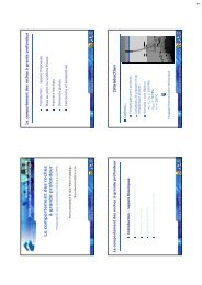
Figure 1. Exemple représentatif <strong>de</strong> projection <strong>de</strong> courbes <strong>de</strong> niveau sur un plan d’égale<br />
altimétrie (modifié à partir <strong>de</strong> Sorel et Vergely, 2004).<br />
4