pdf 1 - exhibitions international
pdf 1 - exhibitions international
pdf 1 - exhibitions international

Create successful ePaper yourself
Turn your PDF publications into a flip-book with our unique Google optimized e-Paper software.
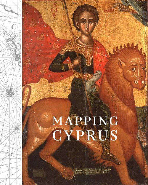
Mapping<br />
Cyprus
[22] [23]<br />
European Cartographers<br />
and Cyprus 1320–1918<br />
From the collection of<br />
Professor Andrew Nicolaides<br />
Andrew nicol Aides<br />
introduction<br />
Before the discovery of printing, maps of Cyprus and the rest of the world for<br />
that matter were drawn on vellum. Those used by sailors often showed only<br />
the outline of the shores with names of ports (portolan maps).<br />
Such were the maps used on the sailing ships of the crusades.<br />
The discovery of printing soon after 1450 using movable<br />
type made books available to a large number of people speeding<br />
up dissemination of knowledge. Until then manuscripts,<br />
which were expensive, were the privilege of the rich, the church<br />
and the noble. Strangely enough, the first printed atlases were<br />
not reproductions of portolan maps, but were based on the<br />
works of Ptolemy (Claudius Ptolemaeus 100–178 Ad) of Alexandria<br />
who was a mathematician, astronomer and geographer.<br />
Ptolemy worked in the great library in Alexandria where<br />
he had access to all accumulated knowledge including astronomy,<br />
geography and history. With this, with information he<br />
collected from travellers passing through Alexandria, culturally the centre of<br />
the Hellenic world, and with his own observations he produced two important<br />
books, his Almagest a manual on astronomy and his Geographike hyphegesis<br />
(known as Geographia or Cosmographia in some Latin editions), which was<br />
a summary of the geographical knowledge at 150 Ad and a guide to drawing<br />
maps of the known world. He provided instructions for drawing the map on a<br />
globe and for three possible projections on a plane surface; also for drawing a<br />
series of regional maps and a catalogue of approximately 8,000 localities with<br />
their coordinates of latitude and longitude.<br />
With the fall of the Roman Empire the classical Greek texts were lost to<br />
the West. Western scholars had been aware of Greek authors such as Homer,<br />
Plato, and Aristotle from references in Roman texts but they did not have any<br />
access to them. Thanks to the Byzantines who copied the Greek classics, many<br />
of which were taught at school, these texts including the Geographia survived.<br />
Today there are at least 53 known Greek manuscripts in existence, some with<br />
maps, the oldest dated 1300. The West became aware of the existence of Greek<br />
MAPPING CYPRUS EUROPEAN CARTOGRAPHERS AND CYPRUS<br />
Fig. 1: Cyprus. From Cosmographia Universalis<br />
(German edition) by Sebastian Munster,<br />
Basle, 1550; 96 x 150 mm
Fig. 2: Soria E Terra Sancta Nova Tabvla from<br />
La Geographia... by Giacomo Gastaldi, published<br />
by Giovanni Battista Pedrezano, Venice<br />
1548; 130 x 170 mm<br />
[24] [25]<br />
Classical scripts including Ptolemy’s books at the end of the 14th century<br />
when a delegation of Byzantine scholars visited Venice and Florence. For the<br />
Florentines this was a revelation. They were so impressed that several decided<br />
to learn Greek and translate them. Jacopo Angeli da Scarperia with the help of<br />
his teacher Manuel Chrysoloras, translated the Cosmographia into Latin during<br />
the years 1400–1407 making it available to the West for the first time in<br />
manuscript form.<br />
GeoGrAphicAl knowledGe At the time of ptolemy<br />
Ptolemy’s concept that the earth was a perfect sphere was based on the teachings<br />
of Pythagoras in the 6th century Bc and the proofs provided by Aristotle<br />
(384–322). He accepted the calculation of the earth’s circumference by Poseidonius<br />
of Apameia (130–52 Bc) of 18,000 miles (50 miles to an arc of 1 degree)<br />
rather than that of Eratosthenes of Cyrene of 25,200 miles (70 miles to an arc<br />
of 1 degree). This made the Earth circumference 18% smaller than the true<br />
size. His concept of the sun and planets in orderly orbits around the stationary<br />
earth at the centre of the universe with the stars fixed<br />
on an outer celestial sphere also rotating round the earth<br />
was the most popular at the time, while rejecting the heliocentric<br />
hypothesis of Aristarchus of Samos (310–230 Bc).<br />
The latitude of a locality was the angle of inclination<br />
from the equator and was between 00 and 900 depending<br />
on the distance from the equator. It could be determined<br />
from several measurements such as (a) the elevation of the<br />
north celestial pole above the horizon, (b) the ratio of a vertical<br />
stick (gnomon) to its shadow on the longest and shortest<br />
days of the year or (c) the ratio of the longest day of the<br />
year to the shortest, or even the length of the longest day.<br />
Thus, Ptolemy gives latitude as hours of sunlight.<br />
Longitude was measured eastward starting at the Fortunate (Canary)<br />
islands and Ptolemy drew his meridians at “intervals of a third of an equinoctial<br />
hour” i.e. at 50 intervals.<br />
“The Zodiacal circle”, the ecliptic, was recognised as the circle tilted at<br />
an angle of 240 traversed by the sun at a rate of just under a degree a day opposite<br />
to the rotation of the stars. The most northerly point of the ecliptic defined<br />
the Tropic of Cancer and the most southerly the Tropic of Capricorn.<br />
Tow further circles were recognised, the Arctic and Antarctic where the<br />
longest day of the year just reached 24 hours.<br />
Although the division of the circle to 3600 dates to Babylonian times<br />
and was used by the Greek astronomers and mathematicians,<br />
Ptolemy was the first to apply it in the use of terrestrial coordinates<br />
for specifying geographic positions.<br />
The habitable world of Ptolemy, the oikoumene, occupied<br />
one quarter of the earth, from just south of the equator to the<br />
64½ degrees north of the equator, and from the fortunate islands<br />
00 longitude to the end of the “Silk country” 1800 longitude.<br />
Thus, the width of Europe and Asia were exaggerated by 30%.<br />
Ptolemy believed that there was a southern land counterbalancing<br />
the land north of the equator so that the Indian Ocean was<br />
shown as a closed sea, but this land south of the equator was too<br />
hot to sustain human life. On the question whether the land on<br />
the other side of the earth was inhabited Ptolemy kept an open mind. The<br />
oikoumene was divided in three continents, Europe, Libye (Africa) and Asia.<br />
In the Geographia, Ptolemy states that to draw the world map on a globe<br />
is a method of ensuring correct representation of distances, but argues that<br />
globes are usually too small to show detail and he describes how to make<br />
projections on a flat surface. He gives detailed instructions how to make three<br />
different projections. His first projection is a conical one. In this projection<br />
east-west distances are portrayed in correct proportionality to north-south<br />
distances only along the parallel of Rhodes. His second projection is a pseudoconical<br />
one that preserves the ratio of the total latitudinal dimension to the<br />
total longitudinal dimension for all parallels. A third spherical projection is a<br />
modification of the second, but has not been used in any of the manuscript or<br />
printed Ptolemaic atlases. In addition to the world map, Ptolemaic atlases<br />
contain 26 regional maps with equidistant meridians and parallels: 10 for<br />
MAPPING CYPRUS EUROPEAN CARTOGRAPHERS AND CYPRUS<br />
Fig. 3: Asiae IIII Tab: From Tabvlae Goographicae<br />
Cl. Ptolomei... edited by Gerard<br />
Mercator, and printed by Godefrid von<br />
Kempen, Cologne, 1578; 345 x 465 mm
[26] Cat. 77 [27]<br />
Europe, 4 for Africa and 12 of Asia. Cyprus was in “Tabula Asiae IIII”, the forth<br />
table in the section of Asia.<br />
mAppinG the world<br />
If one looks at the world map of Ptolemy, the area that is most recognisable<br />
and closest to the world as we know it today is the region of the Mediterranean.<br />
However, it is the Mediterranean of Roman times with Roman places<br />
and names. The further away one looks the less recognisable the regions<br />
become. The first printed maps coincided with the beginning of the time of<br />
exploration and the discoveries of new lands. Following the trip of Columbus<br />
in 1492 and the circumnavigation of Africa by the Portuguese, the map of the<br />
world changed very fast; so did the maps of the Mediterranean regions not so<br />
much in land outline but mainly in terms of names and accuracy. The theme<br />
of the exhibition “European Cartographers and Cyprus” as well as the cartography<br />
of the Eastern Mediterranean cannot be seen in isolation without<br />
knowledge of the changes in other areas nor without a detailed knowledge of<br />
the work of Ptolemy who influenced subsequent European cartographers.<br />
The early Editions of the Geographia<br />
As indicated in the introduction, Ptolemy’s maps were a revelation in the West<br />
because for the first time they showed a wide audience what the world was<br />
like and the Geographia became one of the earliest texts to be published soon<br />
after printing was invented. With the exception of the Mediterranean region,<br />
the maps were far in advance of any others that existed. Such was the demand<br />
that by 1500 there were four printed editions with maps and two further<br />
impressions.<br />
The Bologna Edition 1477 The first printed edition was in Vicenza in 1475<br />
without maps. The first edition with maps was printed by Taddeo Crivelli in<br />
Bologna in 1477 (misprinted as 1462 on the front page). It included the reedited<br />
text of the Latin translation by Jacobo d’Angelo and 26 rather crudely<br />
Cipro, from Viaggio da Venetia...<br />
by Gioseppe Rosaccio and Giacomo Franco,<br />
Venice 1598<br />
98 x 174 mm<br />
MAPPING CYPRUS EUROPEAN CARTOGRAPHERS AND CYPRUS
[28] Cat. 89<br />
Cat. 90 [29]<br />
Christ (First half of the 16th century)<br />
St Nicolas (16th century)<br />
Arakapas, old church of Panayia Iamatiki, Diocese of Limassol<br />
Church of Chrysaliniotissa, Nicosia<br />
67 x 25,1cm<br />
67 x 25,1cm<br />
MAPPING CYPRUS EUROPEAN CARTOGRAPHERS AND CYPRUS
[30] Cat. 93 (top)<br />
Cat. 95 [31]<br />
Map (First half of the 16th century)<br />
Manuscript with map of Cyprus (16th century)<br />
67 x 25,1cm<br />
Ink on paper, 67 x 25,1cm<br />
Cat. 94 (bottom)<br />
Map (First half of the 16th century)<br />
67 x 25,1cm<br />
Collection xxx<br />
MAPPING CYPRUS EUROPEAN CARTOGRAPHERS AND CYPRUS
Les cartographes européens et Chypre<br />
(1320–1918) dans la collection<br />
d’Andrew Nicolaïdes<br />
Andrew nicol Aides<br />
introduction<br />
Avant la découverte de l’imprimerie, les<br />
cartes de Chypre, et plus généralement du<br />
reste du monde, étaient dessinées sur vélin.<br />
Les cartes utilisées par les navigateurs ne<br />
montraient souvent que les contours des<br />
rivages en indiquant les ports. Elles étaient<br />
de ce fait appelées portulans. C’est ce type<br />
de cartes qui fut utilisé sur les voiliers des<br />
croisades.<br />
Fig 1. Untitled Chart of the Eastern Mediterranean<br />
(265 x 325 mm) by Christian Wechelus, Hanover,<br />
1611 as drawn by Pietro Vesconte for Marino<br />
Sanudo’s “Liber Secretorum Fidelibus de Crucis”<br />
c. 1320.<br />
La découverte de l’imprimerie à caractères<br />
mobiles, peu après 1450, rendit les<br />
livres accessibles à un large public et accéléra<br />
fortement la diffusion des connaissances.<br />
Auparavant, les manuscrits, dont la<br />
réalisation était très coûteuse, avaient été le<br />
privilège des riches, de l’Église et de la<br />
noblesse. Fait assez singulier, les premiers<br />
atlas imprimés ne furent pas des reproductions<br />
de portulans, mais s’appuyèrent sur les<br />
travaux du mathématicien, astronome et<br />
géographe Claude Ptolémée d’Alexandrie<br />
(lat. Claudius Ptolemaeus, 100-178 apr. J.-C.).<br />
Ptolémée travaillait à la grande bibliothèque<br />
d’Alexandrie et avait donc accès à la somme<br />
[224] [225]<br />
de toutes les connaissances disponibles,<br />
notamment astronomiques, géographiques<br />
et historiques. Armé de ce vaste fonds et des<br />
informations qu’il recueillit auprès des voyageurs<br />
de passage à Alexandrie, centre culturel<br />
du monde hellène, mais aussi de ses<br />
propres observations, il produisit deux<br />
ouvrages importants : l’Almageste, un<br />
manuel d’astronomie, et la Geographike<br />
hyphegesis (que certaines éditions latines<br />
connaissent sous le nom de Geographia ou<br />
de Cosmographia), résumé des connaissances<br />
géographiques vers 150 apr. J.-C. et<br />
manuel de dessin de cartes du monde connu.<br />
Ptolémée explique comment en dessiner la<br />
carte sur un globe et donne des instructions<br />
pour réaliser trois types de projections sur<br />
une surface plane, mais aussi pour dessiner<br />
une série de cartes régionales. Il fournit<br />
enfin un catalogue d’environ 8000 localités<br />
avec leurs coordonnées longitudinales et<br />
latitudinales.<br />
Suite à la chute de l’Empire romain, les<br />
textes classiques grecs furent perdus pour<br />
l’Occident. Les lettrés occidentaux avaient<br />
connaissance des auteurs grecs comme<br />
Homère, Platon et Aristote par les citations<br />
qu’en donnaient les textes latins, mais n’y<br />
avaient aucun accès direct. Grâce aux Byzantins<br />
qui copièrent les classiques grecs, dont<br />
beaucoup étaient enseignés à l’école, ces<br />
textes survécurent, et notamment, avec eux,<br />
la Geographia,. À ce jour, on recense 53<br />
manuscrits grecs de cet ouvrage, certains<br />
illustrés de cartes, le plus ancien datant de<br />
1300. C’est dans le cadre de la visite d’une<br />
délégation d’érudits byzantins à Venise et à<br />
Florence à la fin du XIVe siècle que l’Occident<br />
prit connaissance de l’existence des<br />
classiques grecs et des ouvrages de Ptolémée.<br />
Pour les Florentins, ce fut une révélation.<br />
L’impression fut telle qu’ils décidèrent<br />
d’apprendre le grec et de les traduire. Aidé<br />
de son maître Manuel Chrysoloras, Jacopo<br />
d’Angelo da Scarperia traduisit la Cosmographia<br />
en latin dans les années 1400 à 1407,<br />
la rendant pour la première fois accessible à<br />
l’Occident sous forme de manuscrit.<br />
lA connAissAnce GéoGrAphique<br />
à l’époque de ptolémée<br />
La conception de Ptolémée selon laquelle la<br />
Terre était une sphère parfaite reposait sur<br />
les enseignements de Pythagore (VIe s. av.<br />
J.-C.) et les preuves de la sphéricité de la<br />
Terre apportées par Aristote (384-322 av.<br />
J.-C.). Ptolémée admettait le calcul de la circonférence<br />
de la Terre par Posidonius d’Apamée<br />
(130-52 av. J.-C.), qui l’avait fixée à 28 125<br />
km (78 km pour un degré d’arc), plutôt que<br />
celle de 39 375 km calculée par Érastosthène<br />
de Cyrène, diminuant ainsi la taille de la<br />
Terre de 29 % (?) par rapport à sa taille véritable.<br />
Sa conception d’un soleil et de planètes<br />
disposées en orbites ordonnées autour<br />
d’une Terre stationnaire occupant le centre<br />
de l’univers, les étoiles étant fixées sur une<br />
sphère céleste externe tournant elle aussi<br />
autour de la Terre, était la plus couramment<br />
admise à son époque, sachant qu’elle s’opposait<br />
à l’hypothèse héliocentrique d’Aristarque<br />
de Samos (310-230 av. J.-C.).<br />
La latitude d’un lieu correspondait à<br />
l’angle d’inclinaison de l’équateur et se<br />
comptait de 0 à 90 degrés selon sa distance<br />
par rapport à l’équateur. Plusieurs méthodes<br />
permettaient de la calculer : 1) hauteur du<br />
pôle nord céleste au-dessus de l’horizon ; 2)<br />
proportion entre un bâton vertical (gnomon)<br />
et son ombre aux jours le plus court et<br />
le plus long de l’année ; ou encore 3) proportion<br />
entre les jours le plus long et le plus<br />
court de l’année, voire sur la base de la durée<br />
du jour le plus long de l’année. C’est ce qui<br />
fait que Ptolémée donne la latitude d’un<br />
lieu en heures d’une journée.<br />
Concernant la longitude, elle était mesurée<br />
depuis l’est en partant des îles Fortunées<br />
ou îles des Bienheureux, aujourd’hui îles<br />
Canaries, et Ptolémée traçait ses méridiens<br />
comme « intervalles d’un tiers d’heure équinoxiale<br />
», c’est-à-dire à intervalles de cinq<br />
degrés.<br />
Le « cercle zodiacal » (l’écliptique) était<br />
reconnu comme le cercle formant un angle<br />
de 24 degrés par rapport à l’équateur, parcouru<br />
par le soleil en sens contraire de la<br />
rotation des étoiles à raison d’un peu moins<br />
d’un degré par jour. Le point le plus au nord<br />
de l’écliptique marquait le tropique du Cancer,<br />
et le point le plus au sud le tropique du<br />
Capricorne.<br />
D’autres cercles étaient également reconnus<br />
: les cercles Arctique et Antarctique<br />
marquaient le lieu où le jour le plus long de<br />
l’année durait exactement 24 heures.<br />
Bien que la division du cercle en 360°<br />
remontât à l’époque babylonienne et qu’elle<br />
fût utilisée par les astronomes et mathématiciens<br />
grecs, Ptolémée fut le premier à l’appliquer<br />
aux coordonnées terrestres pour spécifier<br />
des position géographiques.<br />
Le monde habitable de Ptolémée, l’oikouménè,<br />
couvrait un quart de la Terre. Dans le<br />
sens nord/sud, il s’étendait d’un peu au sud<br />
de l’équateur à 64,5° nord, et dans le sens<br />
est-ouest de la longitude 0° des îles Fortunées<br />
à la longitude 180° marquant l’extrémité<br />
orientale du « Pays de la soie ». La largeur<br />
de l’Europe et de l’Asie était donc<br />
exagérée de 30 %. Ptolémée croyait qu’il<br />
existait dans l’hémisphère sud une terre qui<br />
contrebalançait la terre située au nord de<br />
l’équateur, de sorte que l’océan Indien était<br />
présenté comme une mer intérieure, mais<br />
cette terre située au sud de l’équateur était<br />
trop chaude pour permettre la vie humaine.<br />
Quant à savoir si les terres situées de l’autre<br />
côté de la Terre étaient habitées, Ptolémée<br />
réservait son opinion. L’ œkoumène était<br />
divisé en trois continents : Europe, Libye<br />
(Afrique), Asie.<br />
Dans sa Geographia, Ptolémée explique<br />
que dessiner la carte du monde sur un globe<br />
est la méthode qui garantit la justesse des<br />
distances, mais que les globes sont habituellement<br />
trop petits pour montrer des détails.<br />
Il décrit donc la méthode permettant de réaliser<br />
des projections sur une surface plane et<br />
donne des instructions détaillées pour réaliser<br />
trois types de projections différents. Sa<br />
première projection est conique. Dans ce<br />
mode de projection, la proportionnalité<br />
entre les distances est-ouest et nord-sud est<br />
préservée, mais seulement le long du parallèle<br />
de Rhodes. Sa deuxième projection est<br />
pseudoconique, elle préserve la proportionnalité<br />
de la dimension latitudinale par rapport<br />
à toute la dimension longitudinale<br />
pour tous les parallèles. Une troisième projection,<br />
en l’occurrence sphérique, consiste<br />
en une modification de la deuxième<br />
méthode, mais n’a été utilisée dans aucun<br />
atlas ptolémaïque manuscrit ou imprimé.<br />
En plus de la carte du monde, les atlas<br />
ptolémaïques contiennent 26 cartes régionales<br />
présentant des méridiens et des parallèles<br />
équidistants : 10 cartes portent sur<br />
l’Europe, 4 sur l’Afrique et 12 sur l’Asie.<br />
Chypre se trouvait dans la « Tabula Asiae<br />
IIII », quatrième table de la section Asie.<br />
cArtoGrAphie du monde<br />
Quand on se penche sur la carte du monde<br />
de Ptolémée, la zone géographique la plus<br />
reconnaissable et la plus ressemblante au<br />
monde tel que nous le connaissons<br />
aujourd’hui, est la région méditerranéenne.<br />
Il s’agit toutefois d’une Méditerranée<br />
romaine avec des toponymes romains. Plus<br />
on s’en éloigne, moins les autres régions<br />
sont reconnaissables. Les premières cartes<br />
imprimées coïncident avec le début des<br />
grandes découvertes et l’exploration de<br />
terres inconnues. Après l’expédition de<br />
Christophe Colomb en 1492 et le contournement<br />
de l’Afrique par les Portugais, la carte<br />
du monde change rapidement. Ceci vaut<br />
également pour les cartes des régions méditerranéennes,<br />
mais moins en termes de<br />
contours des terres que principalement en<br />
termes de toponymes et de précision. Le<br />
thème de l’exposition « Les cartographes<br />
européens et Chypre » et la cartographie de<br />
la Méditerranée orientale ne peuvent être<br />
abordés isolément sans connaissance des<br />
évolutions dans d’autres domaines, ni sans<br />
une connaissance détaillée de l’œuvre de<br />
Ptolémée, qui exerça une influence déterminante<br />
sur les cartographes européens ultérieurs,<br />
et dont les erreurs dans la région<br />
méditerranéenne se perpétuèrent encore<br />
pendant une bonne partie du XVIIe siècle.<br />
Premières éditions de la Geographia<br />
Comme nous l’avons dit dans l’introduction,<br />
les cartes de Ptolémée furent une révélation<br />
en Occident parce qu’elles montraient pour<br />
la première fois à un large public à quoi ressemblait<br />
le monde, et la Geographia devint<br />
l’un des tout premiers textes publiés peu<br />
après l’invention de l’imprimerie. Exceptée<br />
la région méditerranéenne, ses cartes<br />
étaient très en avance sur toutes les cartes<br />
existantes. La demande fut telle qu’en 1500,<br />
quatre éditions enrichies de cartes et deux<br />
réimpressions supplémentaires avaient déjà<br />
été imprimées.<br />
L’édition de Bologne 1477 La première édition<br />
imprimée fut publiée sans cartes en<br />
1475 à Vicence. La première édition contenant<br />
des cartes fut imprimée en 1477 à<br />
Bologne par Taddeo Crivelli (l’année 1462<br />
MAPPING CYPRUS FRENCH TRANSLATIONS<br />
figurant en page de titre est erronée). Elle<br />
comprenait la réédition de la traduction<br />
latine de Jacopo d’Angelo et 26 cartes plutôt<br />
mal gravées sur cuivre. Le grand nombre<br />
d’inexactitudes et d’erreurs d’impression<br />
suggère que cette édition fut préparée à la<br />
hâte pour pouvoir revendiquer d’avoir été la<br />
première. En tout état de cause, ce fut un<br />
des premiers livres à présenter des gravures<br />
sur cuivre. L’année suivante, l’édition de<br />
Bologne devait être reléguée dans l’ombre<br />
par l’édition de Rome plus érudite et n’allait<br />
jamais être réimprimée.<br />
De cet atlas n’existent aujourd’hui que 26<br />
exemplaires connus.<br />
L’édition de Rome 1478 La deuxième édition<br />
de l’ouvrage de Ptolémée fut imprimée<br />
en 1478 à Rome par Arnoldus Bucking.<br />
Conrad Swenheym, qui avait appris le métier<br />
chez Gutenberg, commença à travailler aux<br />
gravures sur cuivre en 1474. Pendant qu’à<br />
Bologne, Taddeo Crivelli se hâtait pour être<br />
le premier à publier l’ouvrage, Swenheym<br />
travaillait lentement et soigneusement pour<br />
lui assurer une haute qualité. La justesse du<br />
texte et la finesse des gravures en fit la plus<br />
admirée de toutes les éditions du XVe siècle.<br />
L’utilisation d’une presse d’imprimerie plutôt<br />
que d’une presse à gravure était une nouveauté.<br />
Une autre nouveauté était l’impression<br />
des toponymes en fins caractères<br />
d’imprimerie – plutôt que leur gravure<br />
directe sur les plaques de cuivre. Une troisième<br />
nouveauté contribua à l’excellente<br />
qualité de la gravure, à savoir le fait que<br />
chaque carte était imprimée en utilisant<br />
deux plaques imprimées chacune sur une<br />
feuille séparée, les deux feuilles étant<br />
Fig 2. Asiae Tabula IV (370 x 540 mm); From Claudii<br />
Ptolemaei Alexandrini Philosophi Cosmographia,<br />
Edited by Arnoldus Bucking, Rome 1478


![01 -[BE/INT-2] 2 KOL +UITGEV+ - exhibitions international](https://img.yumpu.com/19621858/1/184x260/01-be-int-2-2-kol-uitgev-exhibitions-international.jpg?quality=85)