

libretto ESCURSIONISTICA.indd - Valle di Ledro
libretto ESCURSIONISTICA.indd - Valle di Ledro
libretto ESCURSIONISTICA.indd - Valle di Ledro

Create successful ePaper yourself
Turn your PDF publications into a flip-book with our unique Google optimized e-Paper software.
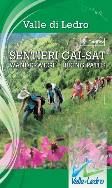
<strong>Valle</strong> <strong>di</strong> <strong>Ledro</strong><br />
SENTIERI CAI-SAT<br />
WANDERWEGE - HIKING PATHS
402<br />
403<br />
“SENTER DE VAL SORDA”<br />
Pastorìa in Val Concèi<br />
S.M.<br />
855 Ú 0.25<br />
Val Sorda (area sosta) 939 0.30 1.00<br />
Bivio strada Malga-Bocca <strong>di</strong> Tràt 1510 1.40 0.05<br />
Bocca <strong>di</strong> Tràt (b. 403-413-420) 1581 0.10 0.35<br />
Malga Dosso dei Fiori 1355 0.20 0.50<br />
Malga Pranzo 1050 0.30 0.50<br />
Parisi (Campi) 745 0.35 0.40<br />
Pinza 505 0.30 0.15<br />
Bivio 418 - Sentiero Crazidei 470 0.10 0.05<br />
Ruderi S. Giovanni 450 0.05 0.30<br />
S. Maria Maddalena 250 0.20 0.15<br />
pr. Bastione - bivio 404 (Riva) 200 0.10 Ò<br />
5.00 5.30<br />
Lungo itinerario fra la Val Concèi e Riva del Garda attraverso la Bocca <strong>di</strong> Tràt, normalmente percorso<br />
nei singoli tratti degli opposti versanti. Dai prati <strong>di</strong> Pastoria, allo sbocco della Val Sorda, per strada<br />
sterrata si percorre l’ameno fondovalle pianeggiante fi no ad una radura (area <strong>di</strong> sosta attrezzata) dove termina<br />
la strada. Per ripido ma buon sentiero si sale lungo la <strong>di</strong>rezione orografi ca della valle fra boschi misti fi n quasi<br />
alla testata dove si piega verso sud fi no ad incontrare la stra<strong>di</strong>na che collega Malga Tràt alla Bocca <strong>di</strong> Tràt.<br />
This is a long itinerary between the Val Concèi and Riva del Garda through Bocca <strong>di</strong> Tràt. From the<br />
fi elds in Pastoria to the mouth of the Valsorda, you walk along an untracked road on the pleasant<br />
valley bottom, until you reach a clearing (picnic area) where the road fi nishes. A good but sheer path rises<br />
then on the right side of the valley through steep, mixed-leaf woods almost as far as the head of the valley,<br />
where it turns south until it meets the small mountain road connecting Malga Tràt to Bocca Tràt.<br />
Lange Wanderroute zwischen dem Val Concèi und Riva del Garda, <strong>di</strong>e <strong>di</strong>e Bocca <strong>di</strong> Tràt überquert und<br />
hauptsächlich in den Gebieten der gegenüber liegenden Hänge verläuft. Von den Wiesen in Pastoria,<br />
an der Talmündung des Valsorda, begeht man einen unbepfl asterten Weg in der anmutigen, fl achen Talsohle<br />
bis zu einer Lichtung, wo <strong>di</strong>e Straße aufhört. Auf steilem, aber gut markiertem Weg steigt man lange, rechts<br />
vom Tal durch steilen Mischwald bis fast zum Bergkamm, wo man in südlicher Richtung auf eine kleine<br />
Straße stößt, <strong>di</strong>e den Malga Tràt mit dem Bocca <strong>di</strong> Tràt verbindet.<br />
Long itinéraire entre la Vallée de Concei et Riva del Garda à travers Bocca <strong>di</strong> Tràt. Des prés de<br />
Pastoria, au débouché de la Val Sorda, on parcourt le fond de la vallée sur un chemin de terre jusqu‘à<br />
arriver à une clairière à la fi n de la route. On monte dans la <strong>di</strong>rection orographique par un sentier escarpé dans<br />
une forêt mixte et on continu vers le sud. On poursuit sur la petite route qui relit Malga Tràt à la Bocca <strong>di</strong> Tràt.<br />
“SENTER DE VAL DA VAI“<br />
Lenzumo<br />
S.M.<br />
788 Ú 0.20<br />
Val da Vai (bivio strada) 906 0.25 1.10<br />
Malga Trat 1500 1.40 0.10<br />
Bocca <strong>di</strong> Trat (b. 402-413-420) 1581 0.15 Ò<br />
2.20 1.40<br />
Da Lenzumo si segue per circa km. 1,5 la strada per la Malga <strong>di</strong> Tràt e il Rifugio Nino Pernici fi n dove<br />
questa attraversa la Val da Vai. Si prende il sentiero che percorre il ripido e boscoso versante e dopo<br />
ca. 40 min. <strong>di</strong> cammino si giunge all’imbocco della Val dei Morti per la quale si risale fi no a sbucare sui pascoli<br />
sottostanti la Malga <strong>di</strong> Tràt. Incontrata nuovamente la strada, la si percorre fi no alla malga per poi proseguire<br />
dentro un bel bosco <strong>di</strong> faggi e un piccolo pascolo sino alla Bocca <strong>di</strong> Tràt a breve <strong>di</strong>stanza dal rifugio Nino Pernici.
From Lenzumo, you follow the road to Malga <strong>di</strong> Tràt and the Refuge Nino Pernici for about 1,5 km<br />
until it crosses the Val da Vai. You take the path which goes along the steep and wooded valley<br />
bottom and after about 40 min walking, you reach the entrance of Val dei Morti, through which you climb<br />
until you come out in the fi elds underneath Malga <strong>di</strong> Tràt. Once on the road again, you follow it until you get<br />
to the “malga” (summer pasture) and then carry on through a lovely beech wood and a small meadow until<br />
you get to Bocca <strong>di</strong> Tràt, a short <strong>di</strong>stance from the Refuge Nino Pernici.<br />
Von Lenzumo aus folgt man auf 1,5 km der Straße nach Malga <strong>di</strong> Tràt und “Nino Pernici”-Berghütte,<br />
bis sie der Val da Vai durchquert. Man schlägt den Pfad entlang der steilen, bewaldeten Talsohle ein<br />
und gelangt nach ca. 40 Min. zur Talmündung des Val <strong>di</strong>e Morti, das man besteigt, bis man auf das Weideland<br />
stößt, das sich unterhalb der Malga <strong>di</strong> Tràt befi ndet. Sobald man wieder auf <strong>di</strong>e Straße trifft, geht man weiter<br />
bis zur Hütte und setzt seinen Weg inmitten eines schönen Buchenwaldes und kleinen Weidelandes fort, bis<br />
zur Bocca <strong>di</strong> Tràt. In der Nähe befi ndet sich <strong>di</strong>e Berghütte Nino Pernici.<br />
De Lenzumo on suit pour environ 1.5 Km la route pour Malga <strong>di</strong> Tràt et le Refuge Alpin Nino Pernici<br />
jusqu‘à la Val da Vai. On prend le sentier qui parcourt le fond escarpé et boisé de la vallée et après<br />
environ 40 minutes de marche on arrive au début de la <strong>Valle</strong> dei Morti par laquelle on monte jusqu‘aux verts<br />
pâturages au dessous de la Malga Tràt. On poursuit sur la rue jusqu‘à la Malga et on continu dans une belle<br />
forêt de hêtres et un petit pâturage jusqu‘à la Bocca <strong>di</strong> Tràt, proche du Refuge Pernici.<br />
413<br />
“SENTIERO PER IL RIFUGIO PERNICI”<br />
Bivio 404(vers. E-NE Bocca dei Concoli)<br />
S.M.<br />
1100 Ú 0.30<br />
Bivio 418 (vers. E Cima Rocchetta) 1300 0.40 0.40<br />
Bocca Giumella (b. 451) 1410 0.50 0.40<br />
Bocca <strong>di</strong> Dromaè (Campigolo b. 453) 1680 0.50 0.45<br />
pr. Bocca <strong>di</strong> Sàval (b. 454) 1720 0.50 0.50<br />
Rifugio Nino Pernici 1600 0.45 0.05<br />
Bocca <strong>di</strong> Trat (b. 402-403-420) 1581 0.45 Ò<br />
4.00 3.30<br />
Lunga e panoramica traversata a ridosso dello spartiacque tra la Val <strong>di</strong> <strong>Ledro</strong> e la valle percorsa dai<br />
torrenti Giumella e Albola. Pur essendo facile, presenta alcuni tratti esposti su ripi<strong>di</strong>ssime fi ancate<br />
erbose. Per il sentiero 404 o 417 si giunge fi no al Bochèt dei Concolì, nei cui pressi, sul versante <strong>di</strong> Riva del<br />
Garda, ha inizio questo percorso che, tenendosi alla base della cresta rocciosa della Rocchetta e costeggiando<br />
numerose postazioni della Prima Guerra Mon<strong>di</strong>ale, aggira da nord il Monte Rocchetta (<strong>di</strong>ramazione per cima<br />
Sat) e Cima Valdes, e scende per il crinale prativo a Bocca Giumella, attraversata da due linee dell’alta<br />
tensione. Dopo un buon tratto <strong>di</strong> salita su cresta, il sentiero, tenendosi a nord del monte Cima d’Oro, passa<br />
per la Bocca Dromaè, aggira Cima Sclapa e Parì e giunge nei pressi della Bocca Savàl. Sempre a mezza costa<br />
fra ripide pale erbose e qualche piccola roccia, si traversa, per <strong>di</strong>versi valloncelli, tutto il versante orientale<br />
dei Dossi <strong>di</strong> Tràt e dei Seaoi, quest’ultimo ricoperto da boschi <strong>di</strong> faggi, fi no a giungere al Rifugio Pernici e<br />
quin<strong>di</strong> alla Bocca <strong>di</strong> Tràt.<br />
This is a long and panoramic itinerary sheltered by the watershed between the Val <strong>di</strong> <strong>Ledro</strong> and<br />
the valley of the Giumella and Albola torrents. Although fairly easy, the route has some exposed<br />
stretches on very steep, grassy slopes. Along paths 404 or 417 you get to Bochèt dei Concolì, where this route<br />
starts, on the Riva del Garda side. Keeping the base of the rocky crest of the Rocchetta, skirting numerous<br />
emplacements and encampments, dating back to the First World War, the path goes round Monte Rocchetta<br />
(a branch-off for Cima Sat) and Cima Valdes from the North and descends along a meadow ridge to Bocca<br />
Giumella, which is crossed by two high-power electricity lines. After a good uphill stretch, the path goes<br />
through Bocca Dromaè, keeping to the North of Monte Cima d’Oro, goes round Cima Sclapa and Parì and<br />
comes to Bocca Savàl. Still half-way up steep grassy and partly rocky slopes, the path continues through<br />
various small gorges to cover the entire western face of the Dosso <strong>di</strong> Tràt and Seaoi, the latter being full of<br />
beautiful beech woods, until it reaches the Rifugio Nino Pernici and Bocca <strong>di</strong> Tràt.<br />
Lange Panoramaüberquerung an der Wasserscheide zwischen dem <strong>Ledro</strong>tal und dem Tal der<br />
Wildbäche Giumella und Albola. Obwohl der Weg im Allgemeinen leicht ist, weist er doch einige sehr<br />
steile, grasbewachsene ausgesetzte Abhänge auf. Über <strong>di</strong>e Wanderwege 404 oder 417 erreicht man den
Bochèt dei Concolì, in dessen Nähe - auf der Hangseite Richtung Riva - <strong>di</strong>eser Wanderweg beginnt; er läuft<br />
den steinigen Bergkamm der Rocchetta entlang, vorbei an zahlreichen Barackenlagern und Aufstellungen aus<br />
dem 1. Weltkrieg, umschreibt von Norden den M. Rocchetta (Abzweigung zum Cima Sat) und den Cima Valdes<br />
und steigt über einen grasbewachsenen Hang zur Bocca Giumella ab, <strong>di</strong>e von zwei Hochspannungsleitungen<br />
durchzogen ist. Nach einer leichten, ansteigenden Strecke auf dem Gebirgskamm erreicht man nördlich der<br />
Cima d’Oro den Pass “Bocca Dromaè”, umläuft den Cima Sclapa und Parì und kommt man fast bis zur Bocca<br />
Savàl. Zwischen grasbewachsenen Steilhängen und Felsen überquert man über verschiedene Talmulden den<br />
ganzen östlichen Hang des Dosso <strong>di</strong> Tràt und <strong>di</strong> Seaoi, der von reizvollen Buchenwäldern bedeckt ist, und<br />
erreicht man <strong>di</strong>e Schutzhütte Nino Pernici und <strong>di</strong>e Bocca <strong>di</strong> Tràt.<br />
Il s‘agit d‘un long itinéraire panoramique qui traverse la crête entre la Val <strong>di</strong> <strong>Ledro</strong> et la vallée<br />
parcourue par les torrents Giumella et Albola. Bien que facile, le sentier présente des parties<br />
exposées sur des fl ancs herbus très raides. Par le sentier 404 ou 417 on arrive jusqu‘à Bochèt dei Concolì.<br />
Près d‘ici, sur le versant de Riva del Garda, commence cet itinéraire, qui reste à la base de la crête rocheuse<br />
de Rocchetta. Il longe beaucoup d‘emplacements de la Première Guerre Mon<strong>di</strong>ale, contourne par le nord<br />
le Monte Rocchetta (embranchement pour Cima Sat) et Cima Valdes et descend le long de l‘arête à Bocca<br />
Giumella, traversée par deux lignes à haute tension. Après une montée sur la crête, le sentier, qui reste au<br />
nord de Cima d‘Oro, va à Bocca Dromaè, contourne Cima Sclapa et Parì pour arriver près de Bocca Savàl. A<br />
mi-côte entre abruptes pentes herbues et des petits rochers, on traverse tout le versant oriental de Dosso <strong>di</strong><br />
Trat et de Seaoi, couvert de bois de hêtres, jusqu‘à gagner le Rifugio Nino Pernici et la Bocca <strong>di</strong> Trat.<br />
414<br />
“SENTER DEI GUÌ”<br />
Rifugio al Faggio/Val Concèi<br />
S.M.<br />
963 Ú 0.15<br />
Ponte Glera 1030 0.20 1.45<br />
Malga Guì 1440 1.10 0.10<br />
Bivio 452 1530 0.15 0.40<br />
Bocca dell’Ussol (b. 455) 1878 1.00 0.30<br />
Malga Casinotto 1672 0.20 0.50<br />
Malga Gavar<strong>di</strong>na (strada per Bondo) 1386 0.35 Ò<br />
3.40 3.10<br />
Dal Rifugio al Faggio, nella verde Val Concèi, si segue la strada <strong>di</strong> fondovalle (chiusa al traffi co) a<br />
fi anco del Torrente Assàt fi no allo sbocco dei ripi<strong>di</strong> valloni Pasorìa e Maggiorvalle fortemente segnati<br />
dalle valanghe. Qui la strada termina e si prende a salire per ripida mulattiera inizialmente scavata nella<br />
roccia a fi anco d’una cascata. Si prosegue in una profonda valle fi no ai pascoli <strong>di</strong> Guì per i quali si giunge alla<br />
malga; <strong>di</strong>agonalmente, in <strong>di</strong>rezione O, si sale ad incontrare il sentiero 452 per poi continuare nella <strong>di</strong>rezione<br />
opposta lungo i ripi<strong>di</strong> pascoli del Corno dei Guì arrivando alla Bocca dell’Ussol (b. 455 “Sentiero della Pace”),<br />
sulla cresta del Monte Gavar<strong>di</strong>na alla testata delle Valli <strong>di</strong> Concèi a sud e Gavar<strong>di</strong>na a nord. Per sfasciumi si<br />
scende alla testata della Gavar<strong>di</strong>na passando per Malga Casinotto e nella sottostante conca dove si trova<br />
Malga Gavar<strong>di</strong>na e dove inizia la strada che conduce a Bondo.<br />
From the Rifugio al Faggio, in the lovely green Val Concei, you follow the road along the valley bottom<br />
(closed to the traffi c), and the torrente Assàt as far as the beginning of the steep and narrow valleys<br />
of Pasorìa and Maggiorvalle, deeply marked by avalanches. The road ends here and you begin to climb up<br />
a steep mule track which is carved out of the rock beside a waterfall. The path continues up a steep valley<br />
as far as the Guì pastureland, through which you reach the “malga Guì” summer pasture. Going <strong>di</strong>agonally<br />
and westwards, the path climbs up to meet path number 452 and then continues in the opposite <strong>di</strong>rection<br />
along the steep pastureland of Corno <strong>di</strong> Guì, reaching Bocca dell’Ussol (junction with 455 “Sentiero della<br />
Pace”) on the crest of Monte Gavar<strong>di</strong>na at the head of the <strong>Valle</strong> dei Concèi to the South and the head of the<br />
<strong>Valle</strong> <strong>di</strong> Gavar<strong>di</strong>na to the North-West. Following a path in the rocks, you go down to the head of the <strong>Valle</strong> <strong>di</strong><br />
Gavar<strong>di</strong>na via Malga Casinotto and into the basin underneath, in which Malga Gavar<strong>di</strong>na lies and where the<br />
road lea<strong>di</strong>ng to Bondo starts.<br />
Von der Hütte “Al Faggio”, im grünen Seitental “Val Concei” läuft man <strong>di</strong>e Schotterstraße in der<br />
Talsohle entlang (für den Verkehr gesperrt), neben dem Bach Assàt bis zur Mündung der steilen<br />
Talmulden Pasorìa und Maggiorvalle, <strong>di</strong>e stark durch Lawinen geprägt sind. Hier hört <strong>di</strong>e Straße auf, und<br />
der Aufstieg beginnt auf einem steilen Pfad, der anfangs im Felsen entlang eines Wasserfalls verläuft. Man
wandert in einem tiefen Tal bis zur “Guì”-Weide und weiter bis zur Hütte; <strong>di</strong>agonal in westlicher Richtung<br />
steigt man bis zum Wanderweg 452 auf, um dann in entgegengesetzte Richtung, auf dem steilen Berganhang<br />
des Corno dei Guì, den Pass “Bocca dell’Ussol” (Abzw. 455 “Wanderweg des Friedens”) zu erreichen, der<br />
sich am Grat des M. Gavar<strong>di</strong>na am Talschluss des <strong>Valle</strong> <strong>di</strong> Concei im Süden und des <strong>Valle</strong> Gavar<strong>di</strong>na im<br />
Nordwesten befi ndet. Der Abstieg erfolgt auf Schottersteinen bis zum Talschluss des Val Gavar<strong>di</strong>na, an der<br />
Malga Casinotto vorbei, und in der unterhalb gelegenen Mulde, wo sich <strong>di</strong>e Malga Gavar<strong>di</strong>na befi ndet, und<br />
wo <strong>di</strong>e Straße nach Bondo beginnt.<br />
Du Refuge „al Faggio“, dans la verte Vallée de Concei, on suit la route du fond de la vallée (rue<br />
inter<strong>di</strong>te à la circulation) à coté du torrent Assàt jusqu‘aux raides vallons de Pasoria et Maggiorvalle<br />
fortement tracés par les avalanches. Ici la route s‘arrête et on monte par un sentier muletier dans les roches<br />
à coté d‘une cascade. On poursuit dans une profonde vallée jusqu‘aux près de Guì par lesquels on arrive à la<br />
Malga; on monte <strong>di</strong>agonalement sur le sentier 452 vers l‘ouest et puis on continue dans la <strong>di</strong>rection opposée<br />
le long des raides près du Corno <strong>di</strong> Guì jusqu‘à Bocca dell‘Ussol (b. 455 „Sentiero della Pace“) sur la crête<br />
du Mont Gavar<strong>di</strong>na. On descend vers la Malga Casinotto et après vers la Malga Gavar<strong>di</strong>na où commence la<br />
route qui mène à Bondo<br />
414bis<br />
“SENTER DE LOMAR”<br />
Rifugio al Faggio<br />
S.M.<br />
1000 Ú 1.00<br />
Doss de Lomàr 1629 1.50 Ò<br />
1.50 1.00<br />
Dal Rifugio al Faggio si raggiunge il Bait de le Vele e si prende a sinistra per una strada forestale che<br />
s’inerpica, mantenendo la destra della <strong>Valle</strong>, per un bosco <strong>di</strong> abeti fi no ai prati da dove, seguendo il<br />
sentiero al limite del bosco, si raggiunge il Doss de Lomàr ed i sentieri 414 e 452.<br />
From the Rifugio al Faggio, you reach Bait de le Vele and turn to the left taking a forest road, which<br />
starts to rise, keeping the right of the valley. Following the edge of the fi r-wood, you reach Dos de<br />
Lomàr and paths 414 and 452.<br />
Von der Schutzhütte “Al Faggio” aus erreicht man das Bait de le Vele; von dort aus schlägt man links<br />
einen Forstweg ein, der stets auf der rechten Seite des Tals ansteigt und durch einen Tannenwald<br />
bis zu einer Wiese führt, von wo aus man der Waldgrenze folgend zum Doss de Lomàr hinauf geht und zu<br />
den Wegen 414 und 452 gelangt.<br />
Du Refuge „al Faggio“ on arrive au Bait de le Vele et on tourne à gauche sur une route assez<br />
escarpée qui parcourt la petite vallée sur la côte droite dans une forêt de sapins jusqu‘aux prés. De<br />
là on poursuit jusqu‘à la limite du bois et on arrive au Lomar et au sentier 414 et 452.<br />
415<br />
“SENTER DE CROINA”<br />
Tiarno <strong>di</strong> Sotto<br />
S.M.<br />
730 Ú 0.25<br />
Ponte <strong>di</strong> Croina 970 0.30 0.50<br />
Fienili <strong>di</strong> Croina 1223 1.00 0.50<br />
Bocca <strong>di</strong> Vies 1605 1.00 0.20<br />
Malga Vies 1555 0.20 Ò<br />
2.50 2.25<br />
Da Tiarno <strong>di</strong> Sotto, per comoda via si raggiunge il Ponte Romano <strong>di</strong> Croina, si prosegue fi no al ponte<br />
sul rio Gabuz e si prende a destra per salire nella <strong>Valle</strong> <strong>di</strong> Croina. Di valletta in valletta, tra graziosi<br />
gruppi <strong>di</strong> fi enili, si snoda l’itinerario fi no a raggiungere il fondo della valle sotto le pale del Monte Nozzolo. Si<br />
lascia la stra<strong>di</strong>na e con un sentiero che conduce nei pressi della Baita S.A.T., a mezza costa nella faggeta, si<br />
raggiunge la Bocca <strong>di</strong> Vies e da qui, la Malga (b. 423-424-459).
From Tiarno <strong>di</strong> Sotto, along a comfortable road, you reach the Roman Bridge of Croina and then<br />
the bridge on the small torrent Gabuz, where you continue your ascent on the right following the<br />
mountain road into the Croina <strong>Valle</strong>y.<br />
Passing beautiful places with attractive groups of hay-lofts you come to the valley bottom under the impressive<br />
mountain slopes of Monte Nozzolo. You leave the road here and follow a path which goes half-way up through<br />
beech woods, until you reach Bocca <strong>di</strong> Vies and, from here, Malga Vies (junction with 423-424-459).<br />
Von Tiarno <strong>di</strong> Sotto aus erreicht man auf bequemer Straße <strong>di</strong>e Ponte Romano <strong>di</strong> Croina (Brücke aus<br />
der Römerzeit), und danach <strong>di</strong>e Brücke über dem kleinen Bach “Gabuz”.<br />
Man folgt der Bergstraße rechts, <strong>di</strong>e hinauf in das Croina-Tal weiter führt und sich von einem kleinen Tal zum<br />
anderen zwischen hübschen Heuschobern windet.<br />
So erreicht man den Talgrund unterhalb der steilen und beeindrucksvollen Abhänge des Monte Nozzolo.<br />
Hier verlässt man <strong>di</strong>e Straße und begeht man einen Pfad, der auf halber Hanghöhe mitten in schönen<br />
Buchenwäldern hinauf zur Bocca <strong>di</strong> Vies und von dort zur gleichnamigen Malga (Abzw. 423, 424, 459) führt.<br />
De Tiarno <strong>di</strong> Sotto on peut arriver au Pont romain de Croina par une pratique route. En suite on<br />
découvre le pont de Gabuz et on continue à monter à droite sur la route de terre de Croina entre<br />
des jolies granges.<br />
On continue jusqu‘au fond de la vallée au dessous du Mont Nozzolo. Par un sentier dans une forêt de hêtres<br />
on arrive à la Bocca <strong>di</strong> Vies et d‘ici, on peut rejoindre la Malga (b. 423-424-459)<br />
416<br />
“SENTER DEL PIÀ”<br />
Tiarno <strong>di</strong> Sotto<br />
S.M.<br />
730 Ú 0.30<br />
Rinalt 999 0.40 0.30<br />
Pr. Cima Vai (b. 416 bis) 1230 0.40 0.45<br />
Malga Casèt 1551 1.00 0.05<br />
Bocca Casèt (b. 419-456 bis) 1608 0.10 Ò<br />
2.30 1.40<br />
Facile percorso entro fi tti boschi lungo il costone NO <strong>di</strong> Cima Casèt che da Tiarno <strong>di</strong> Sotto, loc. alla<br />
Costa, porta nei pressi delle antenne sotto il roccolo, sale a Cima Vai, caratterizzata dalla presenza<br />
<strong>di</strong> postazioni <strong>di</strong> artiglieria del 1914-18, e raggiunge Malga Casèt e Bocca Casèt da dove, su comoda strada<br />
sterrata, si raggiunge in mezz’ora Tremalzo. Piacevoli scorci panoramici sulla <strong>Valle</strong> d’Ampola.<br />
An easy route through thick woods along the north-west ridge of Cima Casèt which, from Tiarno <strong>di</strong><br />
Sotto, Loc. Alla Costa, leads up towards the aerial poles and continues uphill passing near the old<br />
“roccolo” (small tower buil<strong>di</strong>ng used to catch birds). With a steep ascent you reach Cima Vai along a path<br />
featuring artillery emplacements from the 1914-1918 War and then arrive at malga Casèt and Bocca Casèt<br />
from which you can reach Tremalzo in half an hour’s walk. Pleasant views over the <strong>Valle</strong> d’Ampola.<br />
Leichter Wanderweg durch <strong>di</strong>chten Wald entlang des nordwestlichen Abhangs der Cima Casèt,<br />
der von Tiarno <strong>di</strong> Sotto, Ortsteil Alla Costa, Richtung Fernsehantennen, und weiter hinauf, einem<br />
“Roccolo” vorbei, bis nach Cima Vai führt. Da sind auch Geschütze vom 1. Weltkrieg zu sehen. Er führt<br />
weiter nach Malga Casèt und Bocca Casèt, vom wo aus man in einer halben Stunde Tremalzo erreicht.<br />
Wunderschöner Panoramablick auf das <strong>Valle</strong> d‘Ampola.<br />
Depuis Tiarno <strong>di</strong> Sotto un chemin facile dans la forêt touffue le long de la côte nord-est de Cima<br />
Casèt - localité Costa- conduit aux antennes et en passant près du “roccolo” il monte à Cima Vai,<br />
caractérisée par la présence des emplacements d‘artillerie du 1914-1918. D‘ici on arrive à la Malga Casèt<br />
et de là on peut joindre Tremalzo en une demi heure environ. Sur le chemin on a un beau panorama sur la<br />
Vallée d‘Ampola
417<br />
“SENTER DEI CONCOLÌ”<br />
Biacesa<br />
S.M.<br />
418 Ú 0.10<br />
Caregna (b. 470) 470 0.15 0.30<br />
Val Vasotina (loc. Frate) (b. 460) 675 0.40 0.35<br />
Bivio 405 bis 1000 0.50 0.20<br />
Bocchetta dei Concoli 1207 0.30 Ò<br />
2.15 1.40<br />
Attraversando il paese <strong>di</strong> Biacesa e i campi soprastanti si raggiunge l’imbocco della Val Vasotina; fra<br />
campagne terrazzate dominate dalla punta rocciosa <strong>di</strong> Cima Valdes si sale nel bosco tipicamente<br />
me<strong>di</strong>terraneo, lasciando a destra il sentiero per la chiesetta <strong>di</strong> S. Giovanni e Cima Capi. Dopo lunga e faticosa<br />
salita si arriva infi ne al Bochèt dei Concolì da dove continuando per i sentieri 404 e 413 si possono combinare<br />
interessanti escursioni.<br />
Passing through the village of Biacesa and the fi elds above it, you reach the entrance to the Val<br />
Vasotina; you begin to climb amid terraced countryside dominated by the rocky peak of Cima Valdes<br />
and then enter the typically Me<strong>di</strong>terranean wood; go straight ahead leaving the path to the small church<br />
of S. Giovanni and the Cima Capi on your right. After a long and tiring climb, you eventually reach the pass<br />
Bochèt dei Concolì from which other combinations of interesting excursions are possible by following paths<br />
404 and 413.<br />
Man wandert durch das Dorf Biacesa und seine darüberliegenden Gemüsegärten und erreicht <strong>di</strong>e<br />
Talmündung des Val Vasotina; über terrassenförmig angelegte Felder, <strong>di</strong>e von der Felsenspitze des<br />
Cima Valdes überragt werden, steigt man durch einen typisch me<strong>di</strong>terranen Wald auf; rechts lässt man den<br />
Weg zur kleinen Kapelle S. Giovanni und zum Cima Capi liegen. Nach einem langen und anstrengenden<br />
Aufstieg erreicht man schließlich den Bochèt dei Concolì, von wo aus man, auf den Wanderwegen 404 und<br />
413, interessante Bergtouren weiterführen kann.<br />
Du village de Biacesa on poursuit vers la Val Vasotina, dans la campagne étagée au dessous de la<br />
rocheuse Cima Valdes. On monte dans le bois typiquement mé<strong>di</strong>terranée en laissant sur la droite le<br />
sentier pour la petite église de S. Giovanni et Cima Capi. Après une longue grimpée on arrive au Bochèt dei<br />
Concolì d‘où on peut continuer sur les sentiers 404 et 413.<br />
419<br />
“SENTER DE MALGA GIÙ”<br />
Pian <strong>di</strong> Pur<br />
S.M.<br />
669 Ú 0.30<br />
Malga Cita (b. 457 bis) 750 0.30 0.10<br />
Ponte T. Val Pur Casino 830 0.15 0.45<br />
Malga Giù (b. 416) 1277 1.10 0.05<br />
Bivio 457 1300 0.05 0.40<br />
Bocca Casèt(b.416) 1600 0.50 0.40<br />
Tremalzo 1521 0.40 Ò<br />
3.30 2.50<br />
Da Pur, raggiungibile in auto da Molina <strong>di</strong> <strong>Ledro</strong> per strada asfaltata che costeggia il Lago <strong>di</strong> <strong>Ledro</strong>,<br />
si prosegue lungo il dolce fondovalle prativo per mezzo <strong>di</strong> una strada sterrata che conduce a Malga<br />
Cita; in un ambiente dominato da alti e severi <strong>di</strong>rupi, si sale lungo la Val Scaia superando, in vista <strong>di</strong> una frana<br />
imbrigliata, le sorgenti del torrente Sat. Continuando nel bosco si lascia a destra il sentiero per «Ca’ de Mez»<br />
per sbucare poi sui magnifi ci prati <strong>di</strong> Malga Giù situati in ottima posizione soleggiata <strong>di</strong> fronte alle cime <strong>di</strong><br />
Tremalzo e del Corno Spezzato. Si prosegue sulla sinistra su strada sterrata fi no a Tremalzo.
From Pur, which can be reached by car from Molina <strong>di</strong> <strong>Ledro</strong> along the asphalt road which skirts<br />
Lake <strong>Ledro</strong>, you continue along the gentle valley bottom along a mountain road which leads to Malga<br />
Cita; you climb along the Val Scaia dominated by sharp, high crags, passing the springs of the Torrente Sat,<br />
in sight of a vast landslide. Continuing through the wood, pass the path for the “Ca’ de Mez” on your right to<br />
then come out into the beautiful meadows of Malga Giù which lie in the sun underneath the Tremalzo and<br />
Corno Spezzato peaks. Then follow the path until you reach the road which goes to Tremalzo.<br />
Von Molina <strong>di</strong> <strong>Ledro</strong> aus kann man entlang des <strong>Ledro</strong>sees auf asphaltierter Straße mit dem Auto<br />
Pur erreichen; von dort aus läuft man über schöne Wiesen in der Talsohle auf einer Schotterstraße,<br />
<strong>di</strong>e nach Malga Cita führt; in einer Landschaft, <strong>di</strong>e von hohen, steilen Felsen gekennzeichnet ist, kommt man<br />
entlang des Tals Val Scaia höher, in dem man angesichts eines riesigen Bergrutsches <strong>di</strong>e Quellen des Baches<br />
Sat überquert. Der Weg führt weiter durch den Wald; man lässt den Weg nach Ca’ de Mez rechts liegen und<br />
kommt dann zu den wunderschönen, besonnten Wiesen der Malga Giù, gegenüber den Gipfeln des Tremalzo<br />
und des Corno Spezzato. Man läuft weiter auf einer Bergstraße, <strong>di</strong>e <strong>di</strong>rekt nach Tremalzo führt.<br />
De Molina <strong>di</strong> <strong>Ledro</strong> on va à Pur le long du Lac de <strong>Ledro</strong> et on poursuit dans le fond de la vallée<br />
par une petite route qui amène à la Malga Cita. On monte dans la Vallée Scaia et on surplombe<br />
les sources du torrent Sat. On continue en laissant à droite le sentier pour „Ca‘ de Mez“ pour rejoindre les<br />
magnifi ques prés de Malga Giù situés dans une belle position ensoleillé en front aux cimes de Tremalzo et du<br />
Corno Spezzato. On poursuit sur la route qui se joint à la route qui conduit à Tremalzo<br />
420<br />
“ALTA VIA DI CONCEI”<br />
Bocca <strong>di</strong> Trat (b. 402-413)<br />
S.M.<br />
1581 Ú 1.20<br />
Corni <strong>di</strong> Pichèa 2138 1.40 0.30<br />
Monte Tofi no 2151 0.20 0.30<br />
Bochèt de Slavazì 2048 0.35 0.40<br />
Doss della Torta (b 455) 2153 0.40 Ò<br />
3.15 3.00<br />
E’ un tratto del Sentiero della Pace. Dalla Bocca <strong>di</strong> Trat si imbocca il sentiero nella vegetazione verso<br />
nord, passando accanto a caverne e grotte utilizzate durante la guerra. Dopo alcune rocce si lascia a<br />
destra il bivio con il sentiero per la vicina Mazza <strong>di</strong> Pichèa. Ci si alza sotto alcune guglie, si tocca una selletta<br />
con panorama sul Rifugio Pernici, si prosegue poi a mezza costa in vista della Val <strong>di</strong> Concei e si sale fi no alla<br />
cresta. Si percorre una trincea che tocca la vetta dei Corni <strong>di</strong> Pichèa. Si scende quin<strong>di</strong> ad una sella a quota<br />
2060, sotto la quale affi orano possenti lastronate. Si rimontano facili roccette e si raggiunge la cresta del<br />
Tofi no. Si prosegue in piano lungo la cresta per poi scendere ad un’altra sella. Si sale un rilievo e si supera il<br />
Bochèt de Slavazì (corda fi ssa). Si continua oltre il bivio con il sentiero 420, che <strong>di</strong> qui scende a Malga Nardìs<br />
e a Ballino, fi no ai pie<strong>di</strong> del Dosso della Torta (deviazione a destra per la cima), dove si trova il sentiero 455<br />
per Bocca dell’Ussol (b. 414).<br />
This route is part of the Sentiero della Pace. From the pass Bocca <strong>di</strong> Trat you take the path in the<br />
vegetation towards North, walk next to caves and trenches used during WWI. The mountain path<br />
climbs some rocks and comes to the junction with the path to Mazza <strong>di</strong> Pichèa. Leave this junction on your<br />
right and continue your ascent under some rocky walls. You reach a little saddle with view on Refuge Pernici<br />
and walk half-way under the crest overlooking the <strong>Valle</strong> <strong>di</strong> Concei. Eventually you come to the ridge and<br />
following a trench you come to the peak of Corni <strong>di</strong> Pichèa. It continues downhill for a while to a saddle (2060<br />
mt) on impressive sheer rocky slates. You remount some easy little rocks until the top of Mount Tofi no. It<br />
goes on along the ridge and then downhill to a saddle, you pass the Bochèt de Slavazì (fi xed rope), climb up<br />
an elevation and walk on until you come to the crossroad where the path 420 parts and descends to Malga<br />
Nardìs and Ballino, with the path 455 you cross the rocky slope underneath Doss della Torta (deviation on the<br />
right when you want to reach the peak) you continue to the pass Bocca dell’Ussol (junction 414).<br />
Es ist ein sehr schönes Stück des Friedenspfades. Von Bocca <strong>di</strong> Trat schlägt man den Weg im Wald<br />
Richtung Norden ein, man kommt an einer Höhle vorbei und umgeht einen Sporn. Man besteigt<br />
problemlos einige Felsen und kreuzt man den Weg zur nahen Mazza <strong>di</strong> Pichèa. Unter einigen Felsnadel steigt<br />
man weiter hinauf bis zu einem kleinen Sattel (Blick auf <strong>di</strong>e Pernici Berghütte) und setzt den Weg auf halber<br />
Höhe in Sicht des <strong>Valle</strong> <strong>di</strong> Concei fort. Der Pfad gelangt auf dem Grat, verläuft an einem Schutzgraben aus der
Kriegszeit und führt zur Spitzte der Corni <strong>di</strong> Pichèa. Man steigt zu einem Sattel auf einer Höhe von 2060 m,<br />
unter imposanten Kalksteinwänden ab. Weiter geht es über leichte kleine Felsen bis zum Tofi no Berg hinauf.<br />
Auf dem Grat bleibend wandert man fl ach weiter und steigt dann zu einem Sattel ab. Nach einer Anhöhe<br />
kommt man überwindet den Pass “Bochèt de Slavazì” (fi xe Seile) und steigt man weiter bis zur Abzweigung<br />
des Weges, der rechts hinunter zur Malga Nardìs und Ballino führt, man folgt dem Weg links am Fuß des<br />
Dosso della Torta (zur Spitze Abzw. nach rechts von einem kleinen Sattel). Mit dem Weg 455 geht es weiter<br />
bis zum Bocca dell’ Ussol.<br />
C’est une partie du Sentier de la Paix. De Bocca <strong>di</strong> Trat on prend le sentier dans la végétation vers le<br />
nord et on passe à côté des cavernes de la Guerre. Après quelques petits rochers on laisse à droite<br />
le sentier pour Mazza <strong>di</strong> Pichèa. On monte sous quelques aiguilles jusqu’à un col avec un panorama sur le<br />
refuge alpin Pernici. On continue à mi-côte en vue de la Vallée de Concei et on monte jusqu’à la crête. On<br />
parcourt une tranchée qui touche le sommet des Corni <strong>di</strong> Pichèa et on descende jusqu’au col situé à 2060 m,<br />
où émergent des plaques rocheuses très imposantes. On remonte petits rochers et on arrive sur la crête du<br />
Mont Tofi no. On continue après le long de la crête pour descendre vers le col. D’ici on monte un relief et on<br />
dépasse le Bochèt de Slavazì (corde fi xe). On continue au-delà de la bifurcation du sentier 420, qui descende<br />
à Malga Nardìs et Ballino, jusqu’au dessous du Dosso della Torta (pour le sommet il y a une déviation à droite<br />
d’un petit col). Avec le sentier 455 on peut rejoindre Bocca dell’Ussol (b. 414).<br />
421<br />
“SENTER DE MALGA VIL”<br />
Prè<br />
S.M.<br />
530 Ú 0.40<br />
Leano 888 1.00 0.40<br />
Passo Guil (b. 422) 1159 1.00 0.20<br />
Bocca dei Fortini 1243 0.30 0.20<br />
Passo <strong>di</strong> Nota 1209 0.30 0.55<br />
Val <strong>di</strong> Pur 669 1.30 Ò<br />
4.30 3.05<br />
A valle dell’abitato <strong>di</strong> Prè, si snoda una ripida strada che raggiunge Leano, passando per loc.<br />
Madonna del Cenile. Per una strada trattorabile si arriva in fondo alla valletta e si sale a tornanti<br />
fi no a Malga Vil e al Passo Guil dove si incontra il sentiero 422 proveniente da Pregasina. Per una vecchia<br />
mulattiera militare si prosegue a destra lungo il versante sud per Bocca dei Fortini e Passo Nota, dove si<br />
vedono ancora le postazioni militari italiane della Grande Guerra. Si scende per un sentiero fi no a mezza costa<br />
dove si raggiunge la strada che porta al Pian <strong>di</strong> Pur.<br />
Starting from the village of Prè, a steep paved road winds its way through loc. Madonna del Cenile to<br />
reach Leano. Following the tractor path you arrive at the bottom of the valley, then the path begins<br />
to climb in a series of sharp bends as far as the Malga Vil and the Passo Guil where it joins up with path 422<br />
coming from Pregasina. Following an old military mule track, you continue along the southern slope of Mount<br />
Carone to Bocca dei Fortini and Passo Nota where you can still see the Italian military emplacements of the<br />
World War I. You then walk downhill a path until you are half-way down the mountain slope where you join<br />
the forest road that leads to Pian <strong>di</strong> Pur.<br />
Von der Ortschaft Prè aus, schlänget sich ein alter bepfl asterter Bergweg durch <strong>di</strong>e Ortschaft<br />
Madonna del Cenile nach Leano. Auf einem Forstweg kommt man bis zum Grunde des kleinen<br />
Tals und steigt auf Serpentinen bis nach Malga Vil und zum Passo Guil auf, wo man den Wanderweg 422<br />
trifft, der von Pregasina kommt. Auf einem ehemals militärischen Karrenweg läuft man weiter entlang des<br />
südlichen Abhangs des Monte Carone bis zur Bocca dei Fortini und Passo Nota, wo man noch italienische<br />
Militäranlagen des 1. Weltkrieges sehen kann. Der Abstieg erfolgt auf einem Weg bis zur Hälfte des Hanges,<br />
wo man in dem Val Fontanine <strong>di</strong>e Forststraße nach Pian <strong>di</strong> Pur erreicht.<br />
A Prè on prend la vielle route de montagne qui conduit à Leano, à travers la localité Madonna del<br />
Cenile. On arrive à la fi n de la petite vallée sur une route de terre et on monte jusqu‘à Malga Vil et<br />
au Passo Guil, ou on rencontre le sentier 422 provenant de Pregasina. Par un vieux chemin muletier militaire<br />
on poursuit sur la côte sud du Mont Carone pour Bocca dei Fortini et Passo Nota, où on peut encore voir les<br />
emplacements militaires italiennes de la Grande Guerre. On descend par un sentier à mi-côte et on rejoint la<br />
route forestière qui conduit au Pian <strong>di</strong> Pur.
422bis<br />
“SENTER DE PALAER”<br />
Pregàsina<br />
S.M.<br />
532 Ú 0.45<br />
Bocca dei Larici 881 1.10 0.15<br />
Malga Palaèr 946 0.20 0.30<br />
Passo Rocchetta 1159 0.40 0.30<br />
Passo <strong>di</strong> GuiI (b. 421) 1209 0.30 Ò<br />
2.40 2.00<br />
Dai pressi della chiesetta <strong>di</strong> S. Giorgio, splen<strong>di</strong>do belvedere poco a monte del grazioso e tranquillo<br />
paesino <strong>di</strong> Pregàsina; si segue una strada sterrata che si inerpica verso sud costeggiando alcuni<br />
masi. Attraverso i boschi della Val Palaèr si sale lungo le scorciatoie <strong>di</strong> una strada forestale fi no a Bocca dei<br />
Larici dove si raccomanda la breve deviazione sullo sperone <strong>di</strong> Punta Larici, eccezionale balcone panoramico<br />
sul Lago <strong>di</strong> Garda e il Monte Baldo. Seguendo la strada forestale si raggiunge Malga Palaèr e da qui per una<br />
ripida mulattiera il Passo Rocchetta. Costeggiando il versante Sud del Monte Guìl, dopo aver aggirato la spalla<br />
meri<strong>di</strong>onale del Monte si giunge sui pascoli <strong>di</strong> Passo Guil in vista del Monte Carone.<br />
Near the small church of S. Giorgio, an excellent viewpoint just above the pretty and quiet village<br />
of Pregàsina, you take a mountain road which goes southwards skirting several hay-lofts. Going<br />
through the woods of the Val Palaèr you start to climb along the forest road shortcut as far as Bocca dei Larici<br />
where a short <strong>di</strong>version to the spur of the Punta Larici is recommended because of its exceptional view of<br />
lake Garda and Monte Baldo. Following the forest road you come to the Malga Palaèr and from here, along<br />
a steep path, you reach the Passo Rocchetta; then, skirting the southern side of the mountain, you reach the<br />
meadows of Passo Guil, in sight of Monte Carone.<br />
In der Nähe der Kirche S. Giorgio hat man eine wunderschöne Aussicht stromaufwärts des hübschen,<br />
ruhigen Dorfs Pregàsina; man begeht eine unbepfl asterte Straße, <strong>di</strong>e Richtung Süden abbiegt<br />
und an einigen Heuschobern vorbeiführt. Durch den Wald im Val Palaèr steigt man auf Abkürzungen eines<br />
Forstwegs hinauf bis zur Bocca dei Larici, wo sich ein kurzer Umweg zum Ausläufer des Punta Larici lohnt,<br />
ein außergewöhnlicher Aussichtspunkt auf den Gardasee und den M. Baldo. Bleibt man auf dem Forstweg,<br />
kommt man zu Malga Palaèr, und von dort aus auf steilem Pfad zum Passo Rocchetta. Man wandert weiter<br />
entlang des Südhangs des M. Guil, nachdem man seinen südlichen Ausläufer umgangen hat, bis zu den<br />
Weiden des Passo Guil mit Blick auf den M. Carone.<br />
De l‘église de S. Giorgio à Pregasina on suit une route de terre vers le sud à travers les forêts de<br />
la vallée de Palaer, puis on monte, en prenant les raccourcis le long de la route forestière, jusqu’à<br />
Bocca Larici, et si on va sur l’éperon de Larici, on peut jouir d’un très beau panorama sur le Lac de Garda et<br />
le Monte Baldo. En suivant la route forestière on arrive à Malga Palaer et d’ici, par un raide chemin muletier,<br />
à Passo Rocchetta. On côtoie le versant méri<strong>di</strong>onal du Monte Guìl et on rejoint les prairies de Passo Guìl avec<br />
vue sur le Monte Carone.<br />
423<br />
“SENTER DE VIES”<br />
Lenzumo (b. 459 bis)<br />
S.M.<br />
787 Ú 1.00<br />
Ex Centrale elettrica (b. 452) 1118 1.00 0.55<br />
Malga Vies (b. 415-459-424) 1555 1.30 1.00<br />
Monte Cadria (b. 448) 2254 2.00 Ò<br />
4.30 2.55<br />
Da Lenzumo si raggiunge per una comoda via carrozzabile l’ex Centrale Elettrica da dove, subito<br />
dopo il ponte, si prende la strada trattorabile che s’inerpica, tenendo la sinistra della <strong>Valle</strong>, fi no a<br />
Malga Vies. Per un sentiero militare si sale passando per le “scale” (tratto <strong>di</strong> strada ricavato nella roccia) e<br />
si raggiunge la Conca <strong>di</strong> Cadria. Per il crinale nord-est si ritorna a salire e percorrendo un sentiero lungo la<br />
cresta (per soli esperti) si arriva sulla cima <strong>di</strong> Monte Cadria, il monte più alto delle Alpi <strong>di</strong> <strong>Ledro</strong> (b. 448).
From Lenzumo, following a comfortable road you reach the former Electricity Power Station where,<br />
imme<strong>di</strong>ately after the bridge, you take the tractor road which rises, keeping to the left of the valley,<br />
as far as Malga Vies. Going up a military path, past the “steps” (a stretch of road carved out of rock), you<br />
reach the Cadria summer grazing place. Ascen<strong>di</strong>ng the north-eastern ridge you are climbing up once again.<br />
Then the path (for experienced hikers only) follows the crest until you reach the top of Monte Cadria, the<br />
highest mountain in the Alpi <strong>di</strong> <strong>Ledro</strong> (junction with 448).<br />
Von Lenzumo aus erreicht man auf Fahrstrasse das ehemalige Elektrizitätswerk, von wo aus man<br />
gleich hinter der Brücke <strong>di</strong>e Forststrasse einschlägt, <strong>di</strong>e auf der linken Seite des Tals bis nach Malga<br />
Vies hinaufsteigt. Auf einem Militärweg steigt man auf in Felsen gehauenen Stufen bis zur Cadria Almweide.<br />
Man besteigt den nordöstlichen Gebirgskamm (nur für erfahrene, trittsichere Wanderer) und wandert man<br />
weiter hinauf den Gipfelgrat entlang, bis man <strong>di</strong>e Spitze des M. Cadria erreicht, den höchsten Berg der <strong>Ledro</strong><br />
-Alpen (Abzw. 448).<br />
De Lenzumo on rejoint par une route carrossable la vieille Centrale Electrique d’où, après le pont,<br />
part l’itinéraire qui monte jusqu’à Malga Vies. Par un sentier militaire on monte et on gagne la Conca<br />
<strong>di</strong> Cadria. On prend le sentier qui monte sur le versant nord oriental et, en suivant la crête, on arrive au<br />
sommet de Monte Cadria, le plus haut de la Val <strong>di</strong> <strong>Ledro</strong> (2254 m). (b. 448).<br />
424<br />
“SENTER DEI CANAI”<br />
Bezzecca<br />
S.M.<br />
690 Ú 0.25<br />
Val Molini (b. 459) 700 0.30 1.20<br />
Malga Vies (b. 459-415-423) 1555 2.05 Ò<br />
2.35 1.45<br />
Da Bezzecca si raggiunge, per la carrozzabile Via Tovi, la <strong>Valle</strong> dei Molini (b. 459) e si prosegue con<br />
una stra<strong>di</strong>na forestale lungo il torrente. In fondo alla valle si prende un sentiero che, a tratti anche molto<br />
ripido, passa ripetutamente da una sponda all’altra del torrente, risale alcune roccette (prestare particolare<br />
attenzione alla segnaletica bianco-rossa), e infi ne raggiunge l’alpeggio <strong>di</strong> Malga Vies (b. 459-415-423).<br />
From Bezzecca, following the street Via Tovi, you come to the <strong>Valle</strong> dei Molini (junction with 459) and<br />
you then continue along a small forest road which runs alongside the torrent. At the bottom of the<br />
valley take the path which, going continually from one side to the other of the torrent and its valley, eventually<br />
reaches Malga Vies (junction with 459-415-423).<br />
Von Bezzecca aus erreicht man über <strong>di</strong>e Via Tovi das <strong>Valle</strong> dei Molini (Abzw. 459) und läuft dann<br />
weiter auf einem Forstweg den Bach entlang. Am Ende des Tals schlägt man einen Wanderweg ein,<br />
der häufi g das Bachufer wechselt und so Malga Vies erreicht (Abzw. 459,415,423).<br />
De Bezzecca par Via Tovi on rejoint Val <strong>di</strong> Molini (b. 459) et on poursuit sur une petite route forestière<br />
le long du torrent. Au fond de la vallée on prend un chemin qui passe plusieurs fois d‘un coté à<br />
l‘autre du torrent et enfi n on arrive à Malga Vies (b. 459-415-423)<br />
448<br />
“SENTER DE RINGIA”<br />
Monte Cadria (b. 423)<br />
S.M.<br />
2254 Ú 1.20<br />
Pozza <strong>di</strong> Cadria (b. 450) 1816 0.50 1.00<br />
Malga Ringia 1398 0.40 Ò<br />
1.30 2.20<br />
Dal Monte Cadria si scende lungo il pen<strong>di</strong>o <strong>di</strong> sud-est e si attraversa la Conca <strong>di</strong> Cadria raggiungendo<br />
la Malga e poi la Pozza. Da qui si scende per un comodo sentiero a tornanti fi no a Malga Ringia nella<br />
Val Giu<strong>di</strong>carie.
From Monte Cadria you go down the south-eastern slope and cross the summer grazing place of<br />
Cadria to reach the Malga and the Pozza (small alpine lake). From the pass called Bocca Ringia you<br />
go down an easy path in a series of sharp bends until you reach Malga Ringia in the Giu<strong>di</strong>carie <strong>Valle</strong>y.<br />
Vom Monte Cadria steigt man den südöstlichen Abhang hinunter, überquert <strong>di</strong>e Conca <strong>di</strong> Cadria und<br />
erreicht so erst <strong>di</strong>e Malga und dann <strong>di</strong>e Pozza (kleinen Alpensee). Von hier aus, von der Bocca Ringia,<br />
steigt man auf bequemen Serpentinen bis zur Malga Ringia ab.<br />
Du Mont Cadria on descend le long de la pente jusqu‘à la Malga et puis à la Pozza de Cadria (petit<br />
lac). D‘ici on descend par un pratique chemin en lacets jusqu‘à la Malga Ringia.<br />
450<br />
“SENTER DE LE GRESTE”<br />
Laretto (b. 450 bis)<br />
S.M.<br />
1199 Ú 1.00<br />
Passo Giovo 1298 1.20 0.50<br />
Bocca Giumella (Cadré) 1452 1.10 0.30<br />
Malga Campèl 1719 0.40 0.30<br />
Pozza <strong>di</strong> Cadria (b. 448) 1816 0.50 Ò<br />
4.00 2.50<br />
Da Laretto parte un sentiero che raggiunge lo spartiacque tra <strong>Ledro</strong> e le Giu<strong>di</strong>carie. Con un continuo<br />
saliscen<strong>di</strong> <strong>di</strong> cima in cima il sentiero raggiunge il Monte Palone e <strong>di</strong> qui Bocca Giumella. Dalla Bocca<br />
si prende a nord-est per un itinerario che, sempre sulle creste, raggiunge Malga Campèl ed in seguito la<br />
Pozza <strong>di</strong> Cadria.<br />
From Laretto to the watershed between <strong>Ledro</strong> and the Val Giu<strong>di</strong>carie the path goes up and down<br />
from peak to peak until it reaches Monte Palone and then Bocca Giumella. From the pass you turn<br />
North-East to follow an itinerary which goes along the crests to reach Malga Campèl and Pozza <strong>di</strong> Cadria.<br />
Von Laretto führt ein Wanderweg zur Wasserscheide zwischen <strong>Ledro</strong> und dem Val Giu<strong>di</strong>carie. Nach<br />
einem stän<strong>di</strong>gen Auf - und Absteigen von Gipfel zu Gipfel erreicht man den M. Palone und Bocca<br />
Giumella. Dann schlägt man <strong>di</strong>e nordöstliche Richtung ein und begeht einen Pfad auf den Gebirgskämmen<br />
bis nach Malga Campèl und Pozza <strong>di</strong> Cadria.<br />
De Laretto on prend un sentier qui rejoint la crête entre la Vallée de <strong>Ledro</strong> et la Val Giu<strong>di</strong>carie. En<br />
continuant à monter et redescendre de sommet en sommet, le chemin arrive au Monte Palone et,<br />
d‘ici, à Bocca Giumella. De la Bocca on continue en <strong>di</strong>rection nord-est pour suivre un itinéraire qui continue<br />
le long des crêtes pour gagner Malga Campèl et Pozza <strong>di</strong> Cadria.<br />
451<br />
“SENTER DE GIUMELA”<br />
Molina <strong>di</strong> <strong>Ledro</strong>/Fraz. Barcesino<br />
S.M.<br />
607 Ú 0.05<br />
Santuario Madonna Addolorata 687 0.10 1.25<br />
Bocca Giumella (b. 413) 1410 2.10 Ò<br />
2.20 1.30<br />
Dalla Frazione Barcesino <strong>di</strong> Molina <strong>di</strong> <strong>Ledro</strong> in breve si percorre la strada con «Via Crucis» che<br />
conduce al Santuario della Madonna Addolorata (o Madonna delle ferle): qui ha inizio un ripido<br />
sentiero che sale inerpicandosi nell’alta Val Giumella fi no a raggiungere la Bocca Giumella, fra Cima d’Oro e<br />
Cima Valdes, caratterizzata dalla deturpante presenza <strong>di</strong> due enormi tralicci per l’energia elettrica.<br />
A short <strong>di</strong>stance from Barcesino, an hamlet of Molina <strong>di</strong> <strong>Ledro</strong>, along a “Via Crucis” path, you come<br />
to the Madonna Addolorata (Sorrows’ Madonna Sanctuary); from here a steep path, going into the<br />
upper Val Giumella, leads to Bocca Giumella between Cima d’Oro and Cima Valdes, which features two<br />
enormous, <strong>di</strong>sfi guring electricity pylons.
Vom Ortsteil Barcesino bei Molina <strong>di</strong> <strong>Ledro</strong> nimmt man den Kreuzweg zur Wallfahrtskirche der<br />
Madonna Addolorata (Schmerzensmutter). Hier beginnt ein steiler Pfad, der im hohen Val Giumella<br />
bis zur Talmündung Bocca Giumella ansteigt, <strong>di</strong>e zwischen dem Cima d’Oro und dem Cima Valdes liegt, und<br />
von zwei riesigen Strommästen verunstaltet wird.<br />
Du hameau de Barcesino de Molina <strong>di</strong> <strong>Ledro</strong> on parcourt la route du Chemin de Croix qui amène au<br />
Sanctuaire de la Madonna Addolorata, ou Madonna delle Ferle (des Béquilles): ici un raide sentier<br />
monte dans la Val Giumella et conduit à Bocca Giumella, entre Cima d‘Oro et Cima Valdes, caractérisée par<br />
la présence de deux lignes électriques qui gâtent le paysage.<br />
452<br />
“SENTER DE LE BAITE”<br />
Bivio 423 ex Centrale Elettrica<br />
S.M.<br />
1118 Ú 1.40<br />
Baita Vesì (b. 452 bis) 1472 2.00 0.30<br />
Baita Sadri 1589 0.30 0.30<br />
Baita Lomàr 1531 0.30 0.30<br />
Doss de Lomàr (b.414 - 414bis) 1629 0.30 Ò<br />
3.30 3.10<br />
Cinquanta metri prima dell’ex Centrale Elettrica in Val Concei, si sale a destra per un sentiero che<br />
inerpicandosi per un ghiaione porta in 800 m fi no alla cima. Salendo gradualmente per una selva<br />
si raggiungono i prati <strong>di</strong> Vesì. Con un comodo sentiero che sale e scende si prosegue poi passando per le varie<br />
Baite (Ernia - Sadri - Lomàr). Nella parte fi nale il percorso s’inerpica per raggiungere Doss de Lomàr (b. 414).<br />
Fifty meters before the former Electricity Power Station in Val Concei, you follow a path which in 800<br />
meters and going up through a stretch of screen, takes you to the peak. Climbing gently through a<br />
wood, you then reach the fi elds of Vesì. An easy path goes up and down through Baita Ernia, Baita Sadri and<br />
Baita Lomàr and rises the last part until it reaches Doss de Lomàr (junction with 414).<br />
Fünfzig Meter vor dem ehemaligen Wasserkraftwerk im Val Concei schlägt man einen steilen<br />
Wanderpfad rechts ein, welcher über eine Geröllhalde 800 m hinauf zum Gipfel führt. Steigt man<br />
allmählich höher, kommt man durch einen Wald und erreicht so <strong>di</strong>e Wiesen von Vesì. Ein bequemer Weg führt<br />
abwechselnd bergauf und bergab und geht den verschiedenen Hirtenhütten (Ernia - Sadri - Lomàr) vorbei,<br />
nach dem steilen Endstück erreicht man den Doss de Lomàr (Abzw. 414).<br />
Cinquante mètres avant la vieille Centrale Electrique située dans la Vallée de Concei, on suit à droite<br />
un sentier qui amène, en 800 mètres, jusqu’au sommet. En montant graduellement dans le bois, on<br />
rejoint les prairies de Vesì. Un chemin facile passe, en montées et en descentes, à travers les chalets Ernia,<br />
Sadri et Lomar et puis monte la dernière partie pour arriver à Doss de Lomàr (b. 414).<br />
452bis<br />
“SENTER DE VESÌ”<br />
Ponte dei Car<br />
S.M.<br />
870 Ú 0.55<br />
Vesì (b. 452) 1471 1.30 Ò<br />
1.30 0.55<br />
Per una via forestale s’inizia l’itinerario attraversando il torrente e seguendo il sentiero che<br />
fi ancheggia a sinistra a poca <strong>di</strong>stanza il corso d’acqua.<br />
Si raggiungono le sorgenti e riattraversandole si sale fi no a Vesì.<br />
This itinerary starts on a forest road and crosses the torrent to follow the path which fl anks the river<br />
a short <strong>di</strong>stance away on the left.<br />
The path leads you to the torrent’s springs and crossing them again, reaches Vesì.
Der Wanderweg beginnt mit einem Forststraße, der den Bach überquert und dann auf der linken<br />
Seite dem Wasserlauf folgt.<br />
Man erreicht <strong>di</strong>e Quellen, überquert sie und steigt man bis nach Vesì hinauf.<br />
Cet itinéraire commence avec une route forestière et traverse le torrent pour suivre le sentier qui<br />
longe, à gauche, le cours d‘eau.<br />
On arrive aux sources, on les traverse et on monte jusqu‘à Vesì.<br />
453<br />
“SENTER DE DROMAE”<br />
Mezzolago<br />
S.M.<br />
674 Ú 0.15<br />
Mòi 750 0.20 1.15<br />
Fienili Dromaè (Casinei) 1398 1.50 0.15<br />
Malga Dromaè 1522 0.20 0.15<br />
Campigolo (b. 413) 1675 0.20 Ò<br />
2.50 2.00<br />
Da Mezzolago, frazione <strong>di</strong> Pieve <strong>di</strong> <strong>Ledro</strong> una ripida mulattiera percorre la Val <strong>di</strong> Dromaè fi no alla<br />
testata, dapprima sul fondo, poi per i boschi misti ed i pascoli che ricoprono il versante occidentale<br />
<strong>di</strong> Cima d’Oro. Nei pressi del crinale fra Cima Sclapa e Cima d’Oro il sentiero s’innesta nell’itinerario 413 e se<br />
abbinato a quest’ultimo e al sentiero 454, completa il giro completo <strong>di</strong> Cima Parì.<br />
This is a steep mule track which runs along Val <strong>di</strong> Dromaè from Mezzolago, a <strong>di</strong>strict of Pieve <strong>di</strong><br />
<strong>Ledro</strong> on the northern shore of Lake <strong>Ledro</strong>, to the head of the valley. It fi rst runs along its bottom<br />
and then through the mixed-leaf woods and meadows which cover the western slope of Cima d’Oro. Near<br />
the crest between Cima Sclapa and Cima d’Oro the path joins itinerary 413 and, following this path and path<br />
454, it is possible to walk all the way around the Cima Parì.<br />
Steiler Maultierpfad, der von Mezzolago aus, einem Ortsteil von Pieve <strong>di</strong> <strong>Ledro</strong> am nördlichen Ufer<br />
des <strong>Ledro</strong>sees, das Val de Dromaè bis zum Talschluss durchkreuzt, zunächst im Talgrund, dann<br />
durch Mischwald und Weiden am Westhang des Cima d’Oro. In der Nähe des Gebirgskamms zwischen Cima<br />
Sclapa und Cima d’Oro mündet der Weg in den Wanderpfad 413 und ermöglicht zusammen mit dem Weg 454<br />
einen vollstän<strong>di</strong>gen Rundgang um Cima Pari.<br />
Raide chemin muletier qui de Mezzolago, hameau de Pieve <strong>di</strong> <strong>Ledro</strong> située dans la côte septentrionale<br />
du Lac, parcours la Val <strong>di</strong> Dromaè jusqu‘au sommet: au début on marche au fond, puis dans la forêt<br />
et dans les prairies qui recouvrent le versant occidental de Cima d‘Oro. Près de l‘arête entre Cima Sclapa<br />
et Cima d‘Oro, le sentier rejoint l‘itinéraire 413. En suivant les sentiers 413 et 454, est possible faire le tour<br />
complet de Cima Parì.<br />
454<br />
“SENTER DE SAVÀL”<br />
Pieve <strong>di</strong> <strong>Ledro</strong><br />
S.M.<br />
658 Ú 1.10<br />
Rave 1360 2.00 0.40<br />
Malga Savàl 1693 1.00 0.05<br />
Bocca Savàl 1740 0.10 0.05<br />
Bivio 413 1720 0.05 Ò<br />
3.15 2.10<br />
Costituisce il principale sentiero d’accesso al suggestivo alpeggio <strong>di</strong> Malga Savàl. Da Pieve <strong>di</strong> <strong>Ledro</strong><br />
il ripido sentiero risale l’assolata fi ancata del Monte Cocca, ne sfi ora la sommità, attraversa le<br />
pen<strong>di</strong>ci orientali del Monte Tomeabrù per inoltrarsi nella valletta sospesa dove si trova l’alpeggio <strong>di</strong> Savàl. Nei<br />
pressi della Bocca <strong>di</strong> Saval il sentiero s’inserisce nell’itinerario 413.
This is the main access way to the large and breath-taking summer grazing of Malga Savàl. The<br />
path leaves Pieve <strong>di</strong> <strong>Ledro</strong> and climbs the sunny slope of Monte Cocca, comes close to its summit,<br />
crosses the eastern slopes of Monte Tomeabrù and then continues into the small and high valley where the<br />
summer grazing land of Savàl lies. Near Bocca <strong>di</strong> Savàl the path joins itinerary 413.<br />
Er stellt den wichtigsten Zugang zur großen, herrlichen Alpenweide der Malga Savàl dar. Von Pieve <strong>di</strong> <strong>Ledro</strong><br />
aus steigt der steile Weg auf der Sonnenseite des M. Cocca auf, erreicht fast seinen Gipfel, überquert <strong>di</strong>e<br />
Osthänge des Monte Tomeabrù, um dann seinen Lauf in dem kleinen, erhobenen Tal fortzusetzen, in dem sich <strong>di</strong>e<br />
Alpenweide Savàl befi ndet. In der Nähe der Bocca Savàl mündet der Pfad in den Wanderweg Nr. 413.<br />
Il s‘agit du principal chemin d‘accès à la Malga Savàl. De Pieve <strong>di</strong> <strong>Ledro</strong>, le raide chemin muletier<br />
monte le versant ensoleillé du Monte Cocca, rejoint presque le sommet, traverse les pentes<br />
orientales du Monte Tomeabrù et puis continue dans la vallée où se trouve l‘alpe de Savàl. Près de Bocca<br />
Savàl le chemin rejoint l‘itinéraire 413.<br />
455<br />
“SENTIERO DELLA PACE”<br />
Dosso della Torta (b. 420)<br />
S.M.<br />
2153 Ú 0.45<br />
Cima Gavar<strong>di</strong>na (b. 463) 2047 0.40 0.30<br />
Bocca dell’Ussol(b.414) 1878 0.20 0.30<br />
pr. Corno <strong>di</strong> Guì 2000 0.40 0.20<br />
pr. Corno <strong>di</strong> Lomàr 1960 0.20 0.30<br />
Cima la Roda 2119 0.40 1.00<br />
Bocca <strong>di</strong> Tortavai 1947 0.50 0.40<br />
Monte Cadria (b. 448-423) 2250 1.00 Ò<br />
4.30 4.15<br />
Tutto il sentiero si sviluppa sulla cresta o in prossimità della stessa sul lungo ed articolato spartiacque<br />
che va dal Dosso della Torta al Monte Cadria, percorrendo i camminamenti che nella prima Guerra<br />
Mon<strong>di</strong>ale costituirono la Prima Linea del fronte austro-ungarico.<br />
The whole of this path lies near the crest of the long watershed which goes from Doss della Torta<br />
to Monte Cadria, passing the trenches which were the front line of the Austro-Hungarian defenses<br />
during World War I.<br />
Der ganze Wanderweg verläuft auf dem Kamm (oder in seiner Nähe) der langen, gegliederten<br />
Wasserscheide, <strong>di</strong>e vom Dosso della Torta zum Monte Cadria reicht, und den Laufgräben folgt, <strong>di</strong>e<br />
im Ersten Weltkrieg <strong>di</strong>e vorderste Linie der Österreichisch-ungarischen Front darstellten.<br />
Le chemin suit la crête (ou presque) qui va du Doss della Torta au Monte Cadria. Ce parcours<br />
correspond à la première ligne du front austro-hongrois pendant la Première Guerre Mon<strong>di</strong>ale.<br />
456<br />
“SENTER DE SAN MARTÌ”<br />
Pieve <strong>di</strong> <strong>Ledro</strong><br />
S.M.<br />
659 Ú 0.50<br />
Vecchio acquedotto 800 1.10 0.15<br />
San Martino 1226 0.20 0.40<br />
pr. Bochèt de Spinèra (b. 456 bis) 1320 0.20 0.15<br />
S Anna - Ca’ de Mez 1305 0.40 0.00<br />
Malga Giù (b. 419) 1277 0.10 Ò<br />
2.40 2.00<br />
Da Pieve <strong>di</strong> <strong>Ledro</strong> si percorre la strada asfaltata, che conduce su Doss <strong>di</strong> Pur, dove si stacca l’itinerario<br />
456. Su ripida via cementata si raggiungono i Fienili <strong>di</strong> S. Martino, tipica zona d’alpeggio estivo
caratterizzata dalla presenza della chiesetta de<strong>di</strong>cata a S. Martino. Si prosegue su un sentiero a mezza costa<br />
lungo il versante sud del Monte Corno e <strong>di</strong> Cima Casèt per raggiungere il pascolo <strong>di</strong> S. Anna e Malga Giù.<br />
From Pieve <strong>di</strong> <strong>Ledro</strong> take the asphalt road which goes up to Doss <strong>di</strong> Pur where the itinerary 456<br />
starts. A steep cement path takes you to the Fienili <strong>di</strong> S. Martino, a summer grazing area with a small<br />
alpine church de<strong>di</strong>cated to Saint Martin. Continue along the path half-way up the southern slope of Monte<br />
Corno and Cima Casèt till you reach the beautiful grazing place of S. Anna and Malga Giù.<br />
Von Pieve <strong>di</strong> <strong>Ledro</strong> nimmt man <strong>di</strong>e asphaltierte Strasse nach Doss <strong>di</strong> Pur, wo der Wanderweg 456<br />
abzweigt. Auf steilem, betoniertem Weg erreicht man <strong>di</strong>e Wiesen mit Heuschobern, eine typische<br />
Gegend der Sommeralm, <strong>di</strong>e durch <strong>di</strong>e Kapelle S. Martino geprägt ist. Man läuft weiter auf einem Pfad<br />
entlang des südlichen Hanges des M. Corno und des Cima Casèt, und somit gelangt man zu den Almweiden<br />
von S. Anna und Malga Giù.<br />
De Pieve <strong>di</strong> <strong>Ledro</strong> on rejoint Doss de Pur par la route asphaltée, d’ici commence l’itinéraire 456. Par<br />
une route cimentée abrupte, on rejoint les granges de S. Martino, zone d’alpage d’été où est située<br />
une petite église alpine dé<strong>di</strong>ée à S. Martin. On poursuit par un chemin à mi-côte le long du versant méri<strong>di</strong>onal<br />
du Monte Corno et de Cima Casét pour gagner S. Anna et Malga Giù.<br />
456bis<br />
“FIORE MORA e MAURO PELLEGRINI”<br />
pr. Bochèt <strong>di</strong> Spinèra (b. 546)<br />
S.M.<br />
1320 Ú 1.00<br />
Bocchetta pr. Monte Corno 1650 1.20 1.40<br />
pr. Cima Casèt 1720 1.45 0.20<br />
Bocca Caset 1608 0.15 Ò<br />
3.20 3.00<br />
Itinerario attrezzato (EEA) lungo la cresta fra il Monte Corno e la Cima Casèt. Ampio panorama sulla<br />
<strong>Valle</strong> <strong>di</strong> <strong>Ledro</strong>, il Lago <strong>di</strong> <strong>Ledro</strong> ed i monti circostanti. Dai pressi <strong>di</strong> Bochèt de Spinèra, raggiungibile a<br />
pie<strong>di</strong> da Pieve <strong>di</strong> <strong>Ledro</strong> in circa 2 ore per il sentiero 456, si sale prima sul boscoso versante nord-est del Monte<br />
Corno, poi su quello orientale caratterizzato da un’articolata serie <strong>di</strong> balze rocciose prive <strong>di</strong> vegetazione. Per<br />
un canale erboso si giunge ad una forcelletta e a sud del versante ha inizio il percorso attrezzato che segue il<br />
crinale roccioso fi no a Cima Casèt. Dalla Bocca <strong>di</strong> Casèt per il sentiero 419 o 416 si può ritornare a <strong>Valle</strong>.<br />
This is an equipped route along the crest between the Monte Corno and Cima Casèt (for equipped<br />
experienced hikers only). There are sweeping views of the <strong>Valle</strong> <strong>di</strong> <strong>Ledro</strong>, Lake <strong>Ledro</strong> and the<br />
surroun<strong>di</strong>ng mountains. Near Bochèt <strong>di</strong> Spinèra, which can be reached from Pieve <strong>di</strong> <strong>Ledro</strong> in about two<br />
hours by path 456, you start to climb up the wooded north-eastern slope of Monte Corno and then the eastern<br />
slope which has a series of rocky crags without vegetation. Walking along a grassy gorge you reach a small<br />
fork and south of the slope the equipped route starts, which follows the rocky ridge as far as Cima Casèt.<br />
From Bocca <strong>di</strong> Casèt you can descend along paths 419 or 416.<br />
Weg für erfahrene Wanderer mit Klettersteigausrüstung (teilweise mit festem Seil) entlang des<br />
Gebirgskamms zwischen Monte Corno und Cima Casèt. Weiter Blick über das <strong>Ledro</strong>tal, den<br />
<strong>Ledro</strong>see und <strong>di</strong>e umliegenden Berge. In der Nähe der Bochèt Spinèra, den man zu Fuß von Pieve <strong>di</strong> <strong>Ledro</strong> in<br />
ca. 2 Stunden auf dem Wanderweg 456 erreichen kann, besteigt man zuerst den bewaldeten, nordöstlichen<br />
Hang des Monte Corno, und dann den östlichen Berghang, der eine Reihe von steinigen, vegetationslosen<br />
Steilabhängen aufweist. Über einen begrasten Graben erreicht man südlich des Hanges eine Gabelung, wo<br />
der gesicherte Wanderweg beginnt, der entlang dem steinigen Gebirgskamm bis zur Cima Casèt verläuft. An<br />
der Bocca <strong>di</strong> Casèt kann man auf den Wegen 419 und 416 nach Pieve <strong>di</strong> <strong>Ledro</strong> zurückkehren.<br />
Il y a un itinéraire équipé (seulement pour des randonneurs avec expérience et équipement) tout<br />
le long de là crête entre Monte Corno et Cima Casèt, d‘où on jouit d‘une vue dégagée sur la vallée<br />
et le lac de <strong>Ledro</strong> et les monts environnants. De près du Bochet de Spinèra, qu‘on peut atteindre à pieds de<br />
Pieve <strong>di</strong> <strong>Ledro</strong> en 2 heures par le sentier 456, on monte, au début, sur le versant boisé nord-est du Monte<br />
Corno, puis sur le versant est, très escarpé. En marchant dans un passage herbeux on arrive à un autre<br />
parcours équipé qui suit l‘arête rocheuse jusqu‘à Bocca Casèt. De Bocca Casèt, par le chemin 419-416 on<br />
peut redescendre dans la Vallée.
457<br />
“SENTER DEL PRA DE LA RÒSA”<br />
Passo Nota<br />
S.M.<br />
1208 Ú 0.25<br />
Monte Nota 1384 0.30 0.50<br />
Malga Corno (b. 457 bis) 1183 0.45 0.55<br />
Malga Tremalzo <strong>di</strong> Molina 1610 1.30 0.50<br />
La Pertega 1483 0.45 0.35<br />
Malga Giù (b. 456) 1470 0.30 Ò<br />
4.00 3.35<br />
Da Passo Nota per la strada militare verso Ovest si giunge, passando per il Monte Nota, al Prà della<br />
Rósa da dove il sentiero scende con un maestoso ed impressionante susseguirsi <strong>di</strong> canaloni a Malga<br />
Corno (Còr) (bivio 457 bis). Da qui, prosegue nella suggestiva Val Marcia e Val Gatum fi no a Malga Tremalzo<br />
<strong>di</strong> Molina. Il sentiero risale un po’ e lungo il versante settentrionale del Monte Tremalzo raggiunge la cascina<br />
<strong>di</strong> Malga Pèrtega con un susseguirsi <strong>di</strong> scorci sulla <strong>Valle</strong> <strong>di</strong> Pur. Poco dopo si raccorda con il sentiero 456<br />
proveniente da Malga Giù e <strong>di</strong>retto da Bocca Casèt.<br />
From Passo Nota you climb the Mount Nota on the military path towards West and you reach Prà de<br />
la Ròsa, where, in a majestic and impressive succession of gorges, the path goes downhill to Malga<br />
Corno (Còr) (junction with 457 bis). It continues through the wild and beautiful Val Marcia and Val Gatum as<br />
far as Malga Tremalzo <strong>di</strong> Molina and then goes uphill for a short stretch. Across the northern slope of Mount<br />
Tremalzo it leads to Malga Pertèga with wonderful views of the <strong>Valle</strong> <strong>di</strong> Pur. A short <strong>di</strong>stance later it joins up<br />
with path 456 coming from Malga Giù and hea<strong>di</strong>ng for Bocca Casèt.<br />
Vom Passo Nota wandert man auf dem Militärweg hinauf zum Monte Nota und erreicht man den<br />
Prà de la Ròsa, wo der Weg nach Malga Corno (Còr) (Abzw. 457 B) absteigt, und majestätische,<br />
eindrucksvolle Schluchten passiert; von dort läuft man weiter zum wilden Val Marcia und Val Gatum bis zur<br />
Malga Tremalzo <strong>di</strong> Molina. Von hier aus geht es noch ein kleines Stück bergauf und weiter dem Bauernhaus<br />
der Malga Pertèga vorbei. Schöne Ausblicke auf das <strong>Valle</strong> <strong>di</strong> Pur mit dem See. Kurz darauf trifft man auf den<br />
Weg 456, der von Malga Giù kommt und hinauf zum Pass “Bocca Casèt” führt.<br />
A partir de Passo Nota on rejoint Pra della Rosa par la route militaire, en passant par Monte Nota.<br />
Par un sentier qui descend, on arrive à Malga Corno (Còr) (b. 457 bis). D’ici on poursuit dans la<br />
Val Marcia et Val Gatum jusqu’à Malga Tremalzo <strong>di</strong> Molina. On remonte un petit peu et le long du versant<br />
septentrional du Monte Tremalzo on rejoint l’étable de Malga Pèrtega, le parcours présente une succession<br />
de belles vues sur là Val <strong>di</strong> Pur. Peu après le sentier on rencontre le chemin 456, qui vient de Malga Giù et<br />
continu en <strong>di</strong>rection de Bocca Casèt.<br />
457bis<br />
“SENTER DE MALGA COR”<br />
Bivio 419 Malga Cita<br />
S.M.<br />
724 Ú 0.40<br />
Bivio 457 Malga Còr 1183 1.20 Ò<br />
1.20 0.40<br />
Sentiero <strong>di</strong> raccordo tra Malga Cita (419), e Malga Còr (457). L’itinerario, dopo Malga Cita, segue una<br />
valletta a Sud. A quota 997 si trova una sorgente.<br />
This path joins Malga Cita (path 419) with Malga Còr (path 457). After Malga Cita, the itinerary<br />
follows a small valley to the South. You come to a spring at an altitude of 997 mt.<br />
Verbindugsweg zwischen Malga Cita (Weg 419) und Malga Còr (457). Nach dem Malga Cita verläuft<br />
der Weg in einem kleinen Tal im Süden. Auf der Höhe von 997 m befi ndet sich eine Quelle.<br />
Il s‘agit d‘un chemin de raccordement entre Malga Cita (sentier 419), et Malga Còr (sentier 457).<br />
Après Malga Cita, l‘itinéraire suit une petite vallée à sud. A 997 mètres se trouve une source d’eau.
458<br />
“SENTER DA STIGOL”<br />
Tiarno <strong>di</strong> Sopra<br />
S.M.<br />
749 Ú 1.20<br />
Ponte del Visì 884 1.20 0.40<br />
Malga Stigolo 1281 0.40 0.40<br />
Bivio per Monte Stigolo 1500 1.00 1.20<br />
Bivio 450 Passo <strong>di</strong> Rango 1304 1.20 1.00<br />
Bestem 1004 1.00 1.00<br />
Tiarno <strong>di</strong> Sopra 749 0.40 Ò<br />
6.00 6.00<br />
Da Tiarno <strong>di</strong> Sopra per un facile sentiero che corre a mezza costa, parallelo alla SS 240, si giunge in<br />
Val d’Ampola. Da qui per comoda strada, si sale al Ponte del Visì.<br />
L’itinerario prosegue a sinistra, prima su stra<strong>di</strong>na, poi su mulattiera a tornanti, fi no a raggiungere<br />
Malga Stigolo, a<strong>di</strong>bita a bivacco e situata <strong>di</strong>nnanzi ad un bacino <strong>di</strong> raccolta dell’acqua con funzione<br />
antincen<strong>di</strong>o. A monte della malga, verso ovest, il sentiero prosegue per un bosco <strong>di</strong> pini con strette svolte.<br />
La salita continua nella valletta a nord est del Monte Stigolo fi no a raggiungere lo spartiacque fra le Giu<strong>di</strong>carie<br />
e <strong>Ledro</strong>. Si lascia a sinistra la via per Laretto e si prosegue verso nord nei pressi della cresta. Possibili<br />
deviazioni per Cima del Visì e Cima Borei.<br />
Dalla cresta che unisce le due cime si scende al Passo <strong>di</strong> Rango dove, lasciato a sinistra il segnavia 450 per<br />
Rango, il sentiero scende nel bosco sulla strada forestale della <strong>Valle</strong> del Fer, che si imbocca verso destra per<br />
scendere a Bestem e quin<strong>di</strong> nella <strong>Valle</strong> del Torrente Sache a Tiarno <strong>di</strong> Sopra.<br />
Leaving Tiarno <strong>di</strong> Sopra along an easy path which runs half-way up and parallel to the main road,<br />
you arrive in the Val d’Ampola. From here, following an easy road, you walk uphill until you come to<br />
the bridge of Visì, where you keep left onto a small mountain road that soon changes into a win<strong>di</strong>ng muletrack<br />
to the grazing place of Malga Stigolo, now used as bivouac and situated in front of a water basin. From<br />
the road above the Malga, the path continues in western <strong>di</strong>rection into a Pine-wood with narrow bends. You<br />
climb up the north-eastern slope of Monte Stigolo until you reach the watershed between Giu<strong>di</strong>carie and<br />
<strong>Ledro</strong>.<br />
You leave to the left the road to Laretto and go on, hea<strong>di</strong>ng to the North along or nearby the ridge. Possible<br />
deviations to Cima Vesì and Cima Borei. From the ridge that connects the two peaks you walk downhill to<br />
the pass of Rango, where you leave on the left the path 450 to Rango, the path leads you downhill into the<br />
wood and to the forest road of the <strong>Valle</strong> del Fer. You follow it to descend to Bestem and into the valley of the<br />
torrent Sache in Tiarno <strong>di</strong> Sopra.<br />
Von Tiarno Di Sopra kann man über einen leichten Weg parallel zur Staatsstrasse 240 das Val<br />
d’Ampola erreichen. Von hier aus steigt man auf bequemer Straße bis zur Brücke von Visì auf, wo<br />
man links hält und einem Maultierpfad folgend hinauf zur Weide der Malga Stigolo wandert. Jetzt steht <strong>di</strong>e<br />
Malga als Biwak immer offen und liegt vor einem Feuerschutzsee. Oberhalb der Malga, von der neuen Straße<br />
aus, führt unser Weg weiter, Richtung Westen, in den Kieferwald hinauf. Man besteigt den ost-nördlichen<br />
Abhang des Monte Stigolo und erreicht man den Kamm zwischen dem <strong>Ledro</strong>tal und den Ju<strong>di</strong>karien. Man<br />
lässt <strong>di</strong>e Abzweigung nach Laretto links liegen und man wandert weiter Richtung Norden längst oder in der<br />
Nähe des Grates.<br />
Mögliche Degressionen zum Gipfel Vesì und Borei. Von dem Grat zwischen den zwei Berggipfeln steigt man<br />
zum Passo Rango ab, Abzweigung mit dem Weg 450 nach Rango. Man biegt rechts auf dem Weg, der im Wald<br />
auf <strong>di</strong>e Forststraße im <strong>Valle</strong> del Fer hinunter führt. Die Straße steigt nach Besten (Heustadel) ab und dann in<br />
das Tal des Sache-Baches bis nach Tiarno <strong>di</strong> Sopra.<br />
De Tiarno <strong>di</strong> Sopra par un sentier facile parallèle à la route nationale, on peut rejoindre la Val<br />
d’Ampola. D’ici on monte jusqu’à atteindre le Ponte de Visì. L’itinéraire continue à gauche, au debut<br />
sur une petite route de montagne, puis sur un chemin muletier en lacets jusqu’à Malga Stigolo, toujours<br />
ouverte comme bivouac et située devant un bassin d’eau avec fonction anti-incen<strong>di</strong>e. Au-dessus de la Malga,<br />
vers ouest, le sentier continue dans le bois de pins avec des virages serrés. La montée continue dans la vallée<br />
à nord-est du Monte Stigolo, et arrive sur la crête entre <strong>Ledro</strong> et le Vallée Giu<strong>di</strong>carie. On laisse à gauche la<br />
route par Laretto et on poursuit vers le nord le long de la crête. Possibles <strong>di</strong>gressions par Cima Vesì et Cima<br />
Borei. De la crête, qui relie les deux cimes, on descend vers Passo <strong>di</strong> Rango (jonction avec chemin Nr. 450).<br />
Dans le bois on descend sur la route forêtière de la <strong>Valle</strong> del Fer, d’ici on poursuit vers la droite pour arriver à<br />
Bestem. On poursuit dans la vallée du torrent Sache et on arrive à Tiarno <strong>di</strong> Sopra.
459<br />
“SENTER DE CHELINA”<br />
Val dei Molini (b. 424)<br />
S.M.<br />
700 Ú 0.40<br />
Bochèt de Zori(b. 419bis) 1174 1.20 1.00<br />
Monte Vies 1699 1.30 0.40<br />
Malga Vies (b. 423-415-424) 1555 0.30 Ò<br />
3.20 2.20<br />
Dalla <strong>Valle</strong> dei Molini a nord-ovest <strong>di</strong> Bezzecca, seguendo una comoda strada forestale, si raggiunge<br />
il Bochèt de Zori dove si incontra il percorso 459 bis. Da qui si inizia a salire per un sentiero che si<br />
sviluppa sulla cresta o in prossimità della stessa e che, verso la fi ne della Prima Guerra Mon<strong>di</strong>ale, raccordava<br />
il fondovalle agli avamposti italiani <strong>di</strong> Monte Vies. Lungo questo tratto si scorgono piacevoli panorami sulla<br />
<strong>Valle</strong> <strong>di</strong> <strong>Ledro</strong> e la Val Concei. Si raggiunge quin<strong>di</strong> Malga Vies dove s’incontrano gli itinerari 415, 424, e 423<br />
che prosegue per Monte Cadria.<br />
From the <strong>Valle</strong> dei Molini, North-West of Bezzecca, following an easy forest road you get to Bochèt<br />
de Zori which joins up with path 459 bis. From here you start to climb along a mountain path which<br />
runs along or near the crest, which linked, towards the end of World War I, the bottom of the valley to the<br />
Italian outposts of Monte Vies. All along this stretch you can enjoy interesting views over <strong>Valle</strong> <strong>di</strong> <strong>Ledro</strong> and<br />
Val Concei. Then you come to Malga Vies, where you meet itineraries 415, 424 and 423, which continues<br />
uphill to Monte Cadria.<br />
Vom <strong>Valle</strong> dei Molini, nordwestlich von Bezzecca, erreicht man auf Forststrasse den Bochèt de Zori,<br />
wo man auf den Wanderweg 459 B trifft. Hier beginnt der Aufstieg auf einem Pfad, der auf oder in der<br />
Nähe des Gebirgskamms verläuft, und der gegen Ende des 1. Weltkriegs <strong>di</strong>e Talsohle mit den italienischen<br />
Vorposten des Monte Vies verband. Längst <strong>di</strong>eser Gratstrecke hat man eine wunderschöne Aussicht auf das<br />
<strong>Valle</strong> <strong>di</strong> <strong>Ledro</strong> und das Val Concei. Man erreicht dann Malga Vies, wo man auf <strong>di</strong>e Wege 415,424, und 423<br />
zum Monte Cadria trifft.<br />
De Vallée dei Molini, située a nord-ouest de Bezzecca, on suit un facile chemin déblayé pour arriver<br />
à Bochèt de Zori, où on rencontre le sentier 459 bis. D‘ici on monte par un sentier qui se déroule<br />
près de la crête, qui joignait, vers la fi n de la Première Guerre Mon<strong>di</strong>ale, le fond de la vallée aux avant-postes<br />
italiens du Monte Vies. Le long de ce chemin on jouit d’agréables panoramas sur la Vallée de <strong>Ledro</strong> et la Val<br />
Concei. On arrive après à Malga Vies, où on rencontre les itinéraires 415, 424, et 423, qui amène vers le<br />
Monte Cadria.<br />
459bis<br />
“SENTER DEL BOCHET DE ZORI”<br />
Lenzumo<br />
S.M.<br />
796 Ú 0.30<br />
Bochèt de Zori 1174 1.00 Ò<br />
1.00 0.30<br />
Sentiero <strong>di</strong> alternativa e <strong>di</strong> raccordo al 459 che dal paese <strong>di</strong> Lenzumo raggiunge, seguendo una<br />
boscosa e ripida valletta, il Bochèt de Zori<br />
An alternative path, which joins up with 459 and goes from the village of Lenzumo through a small<br />
wooded and very steep valley to Bochèt de Zori.<br />
Alternativer Wanderweg und Verbindung zum 459, der vom Lenzumo über ein bewaldetes steiles<br />
Tal nach Bochèt de Zori führt.<br />
Un chemin alternatif qui joint l‘itinéraire 459 lequel, de Lenzumo, arrive à Bochèt de Zori en suivant<br />
une petite vallée boisée.
460<br />
“SENTIERO ATTREZZATO MARIO FOLETTI”<br />
Le Frate (b. 417)<br />
S.M.<br />
680 Ú 0.20<br />
Bivio 460 bis 840 0.30 0.05<br />
Chiesetta S. Giovanni 860 0.05 0.45<br />
Cresta NO Cima Capi (b. 405) 880 0.45 Ò<br />
1.20 1.10<br />
Da Biacesa si segue inizialmente la mulattiera 417 per la Val Vasotina ed il Bochèt dei Concolì fi no in<br />
località le Frate dove, nei pressi <strong>di</strong> un torrente, si prende la deviazione <strong>di</strong> destra e si sale ripidamente<br />
fi no al panoramico colle e alla chiesetta de<strong>di</strong>cata a S. Giovanni. A breve <strong>di</strong>stanza si trova il bivacco “F.<br />
Arcioni”, sempre aperto. Qui ha inizio il sentiero attrezzato «Mario Foletti» (sconsigliabile agli inesperti, a<br />
coloro che soffrono <strong>di</strong> vertigini, o che non sono attrezzati adeguatamente) che costeggia dapprima la base<br />
della verticale parete meri<strong>di</strong>onale <strong>di</strong> Cima Rocca, quin<strong>di</strong> si porta sulla sommità <strong>di</strong> una ripida cengia dove<br />
parte il percorso attrezzato in roccia. Questo collega la prima cengia ad una seconda (esposta) per la quale si<br />
scende nuovamente fi no alla base della parete in prossimità <strong>di</strong> una galleria e <strong>di</strong> una trincea sull’aerea cresta<br />
che collega Cima Rocca a Cima Capi percorsa dall’itinerario 405.<br />
From Biacesa you initially follow the mule track 417 for the Val Vasotina and Bochèt dei Concolì as<br />
far as loc. le Frate where you take the fork to the right, near the torrent, and follow a steep path to<br />
the panoramic hill with its small church de<strong>di</strong>cated to San Giovanni. A short <strong>di</strong>stance away is the refuge “F.<br />
Arcioni”, which is always open. The “Mario Foletti” path starts here (not recommended for the inexperienced,<br />
those who suffer from vertigo and hikers not properly equipped). It skirts the bottom of the vertical southern<br />
rock face of Cima Rocca and leads to a steep ledge where the equipped part of the route over the rock begins.<br />
This equipped part connects the fi rst ledge to a second (exposed) by which you descend to the base of the<br />
rock face, near a tunnel and a trench on the lofty crest, which links Cima Rocca to Cima Capi, covered by<br />
itinerary 405.<br />
Von Biacesa aus begeht man anfangs den Weg Nr. 417 Richtung Val Vasotina und Bochèt dei Concolì<br />
bis zur Ortschaft Le Frate, wo man in der Nähe eines Baches <strong>di</strong>e Abzweigung nach rechts einschlägt,<br />
und steil bis zum Aussichtshügel steigt, wo sich <strong>di</strong>e Kapelle S. Giovanni befi ndet. In ihrer Nähe steht auch<br />
<strong>di</strong>e “F. Arcioni” unbewirtschaftete Hütte (Biwak), <strong>di</strong>e immer geöffnet ist. Hier beginnt der Klettersteig “Mario<br />
Foletti”, der nur für geübte, schwindelfreie Bergsteiger mit Ausrüstung zu empfehlen ist. Er verläuft am<br />
Fuße der südlichen, vertikalen Wand der Cima Rocca und führt dann zur Spitze eines steilen Felsbandes,<br />
wo <strong>di</strong>e festen Seile anfangen. Dieses Stück Klettersteig verbindet das erste mit einem zweiten Felsband<br />
(Klettersteig), auf dem man wieder absteigt bis zum Fuße der Felswand, in der Nähe eines Tunnels und<br />
eines Einschnitts auf dem hohen Kamm, der Cima Rocca mit Cima Capi verbindet und vom Wanderweg 405<br />
durchgelaufen wird.<br />
De Biacesa on suit, au début, le chemin muletier 417 vers la Val Vasotina et le Bochèt dei Concolì<br />
jusqu‘à la localité Le Frate où, près d‘un torrent, on prend la déviation à droite et on monte vite jusqu‘au<br />
col panoramique avec la petite église dé<strong>di</strong>ée à S. Giovanni. Tout près il y a le bivouac “F. Arcioni”, toujours ouvert.<br />
Ici démarre le sentier „Mario Foletti“ (pas conseillé aux non initiés, aux personnes qui souffrent de vertiges ou à<br />
ceux qui ne sont pas équipés). Au début, le sentier suit la paroi sud verticale de Cima Rocca et après amène au<br />
sommet d‘une raide vire, ici commence le sentier équipé pour la partie rocheuse qui relie la première vire à une<br />
deuxième (exposée), par la quelle on descend jusqu‘à la base de la paroi, prés d‘un tunnel et d‘une tranchée sur<br />
là crête que relie Cima Rocca à Cima Capi, parcouru par l‘itinéraire 405.<br />
460bis<br />
Bivio 460 pr. Chiesetta S. Giovanni<br />
S.M.<br />
840 Ú 0.15<br />
Bocca Pasumer o Sperone 980 0.20 Ò<br />
0.20 0.15<br />
Breve sentiero <strong>di</strong> collegamento tra la Chiesetta <strong>di</strong> S. Giovanni soprastante Biacesa e la Bocca<br />
Pasumer o Sperone che sale fra bosco ceduo lungo il versante occidentale della Rocca. Viene usato
come interessante alternativa al sentiero 417 da Biacesa per il Bochèt dei Concolì, oppure per completare<br />
il giro della Rocca.<br />
This is a short path connecting the church of S. Giovanni above Biacesa to Bocca Pasumer or Sperone<br />
which rises among coppices along the western slope of the Rocca. It is used as an interesting<br />
alternative to path 417 from Biacesa for the Bochèt dei Concolì or to complete the walk around the Rocca.<br />
Kurzer Verbindungsweg zwischen der Kapelle S. Giovanni oberhalb von Biacesa und dem Pass<br />
“Bocca Pasumer” (oder Sperone), der durch einen Schlagwald entlang des Westhangs der Rocca<br />
führt. Er wird als interessante Alternative zum Weg 417 von Biacesa zum Bochèt dei Concolì benutzt, oder um<br />
den Rundgang um den Rocca zu vervollstän<strong>di</strong>gen.<br />
Il s‘agit d‘un court sentier de liaison entre là petite église de S. Giovanni, au dessous de Biacesa,<br />
et là Bocca Pasumer ou Sperone qui monte par le bois le long du versant occidental de là Rocca.<br />
Il est utilisé comme sentier alternatif au 417 de Biacesa pour Bochèt dei Concolì, ou pour compléter le tour<br />
de là Rocca.<br />
470<br />
“SENTER DEI BECH”<br />
Biacesa / Caregna<br />
S.M.<br />
470 Ú 0.30<br />
Val dei Gac 600 0.40 0.30<br />
Cresta S-SE Cima Capi (b. 405) 600 0.30 Ò<br />
1.10 1.10<br />
Apprezzato soprattutto nella stagione invernale o primaverile questo interessante sentiero offre un<br />
bel panorama su parte del Lago <strong>di</strong> Garda e costituisce un ottimo collegamento fra la <strong>Valle</strong> <strong>di</strong> <strong>Ledro</strong> e<br />
Cima Capi. Da Biacesa si percorre per circa 15’ il sentiero 417 fra le campagne soprastanti il paese e presa<br />
a destra una stra<strong>di</strong>na la si percorre alzandosi gradatamente verso la soleggiata Val dei Gac che si attraversa<br />
in quota fi no a raggiungere la cresta sud-est <strong>di</strong> Cima Capi. Prendendo il sentiero attrezzato «Fausto Susatti»<br />
(solo per escursionisti esperti, privi <strong>di</strong> vertigini e attrezzati adeguatamente) si può salire a Cima Capi.<br />
Particularly popular in winter and spring, this interesting path offers a good view of part of Lake<br />
Garda and serves as an excellent link between the <strong>Valle</strong> <strong>di</strong> <strong>Ledro</strong> and Cima Capi. From Biacesa you<br />
walk for about 15’ along path 417 among the fi elds above the village and then, taking a path to the right,<br />
you gradually climb towards the sunny Val dei Gac, which is crossed high up, until you have gone around the<br />
south-south-eastern crest of Cima Capi. Taking the equipped “Fausto Susatti” route (for experienced hikers<br />
only who do not suffer from vertigo and are properly equipped), you can climb up to Cima Capi.<br />
Dieser interessante Wanderweg wird besonders im Winter und Frühjahr geschätzt, bietet eine<br />
schöne Aussicht auf den Gardasee und verbindet das <strong>Ledro</strong>tal mit dem Cima Capi. Von Biacesa aus<br />
begeht man ca. 15 Minuten lang den Weg 417 zwischen den Feldern oberhalb des Dorfes und nimmt dann<br />
eine kleine Straße auf der rechten Seite, <strong>di</strong>e allmählich zum sonnigen Val dei Gac ansteigt; man wandert<br />
weiter bis man den südsüdöstlichen Gebirgskamm von Cima Capi umgeht. Über den Klettersteig “Fausto<br />
Susatti” (nur für geübte, schwindelfreie Wanderer mit Klettersteigausrüstung) kann man dann zum Cima<br />
Capi aufsteigen.<br />
Cet itinéraire très intéressant est particulièrement apprécié en hiver et au printemps. Il offre un très<br />
beau panorama sur une partie du Lago <strong>di</strong> Garda et constitue une excellente liaison entre là <strong>Valle</strong> <strong>di</strong><br />
<strong>Ledro</strong> et Cima Capi. De Biacesa on emprunte, pour 15 minutes environ, le sentier 417 entre les champs au<br />
dessus du village et on prend une petite route à droite qui monte graduellement vers la Val dei Gac. On la<br />
traverse jusqu‘à rejoindre la crête sud oriental de Cima Capi. Si on prend le sentier équipé „Fausto Susatti“<br />
on peut monter à Cima Capi (seulement pour des alpinistes qui ne souffrent pas de vertiges et sont bien<br />
équipés).
Note
Milano<br />
Storo<br />
Brescia<br />
VALLE DI LEDRO Brennero<br />
Lago <strong>di</strong> Garda<br />
Verona<br />
Riva d. G.<br />
Rovereto sud<br />
Venezia<br />
Uffi cio Turistico: via Nuova, 9 - 38060 PIEVE DI LEDRO<br />
tel. +39 0464 591222 - fax +39 0464 591577 - e-mail: info@valle<strong>di</strong>ledro.com<br />
www.valle<strong>di</strong>ledro.com<br />
Trento