Le Spiagge del Gargano - Puglia
Le Spiagge del Gargano - Puglia
Le Spiagge del Gargano - Puglia

You also want an ePaper? Increase the reach of your titles
YUMPU automatically turns print PDFs into web optimized ePapers that Google loves.
Azienda di Promozione Turistica<br />
<strong>del</strong>la Provincia di Foggia<br />
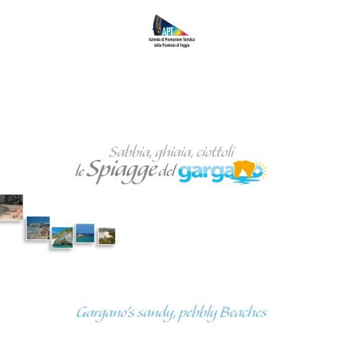
Sabbia, ghiaia, ciottoli<br />
le <strong>Spiagge</strong> <strong>del</strong><br />
<strong>Gargano</strong>’s sandy, pebbly Beaches
UNIONE EUROPEA<br />
Iniziativa finanziata con fondi UE.<br />
Linee di intervento misura 4.15 POR <strong>Puglia</strong> 2000/2006<br />
REGIONE PUGLIA<br />
Progetto “Città Aperte”<br />
Si ringrazia per la gentile collaborazione:<br />
For the grateful contribution thanks to:<br />
per il comune di Cagnano Varano<br />
per il comune di Ischitella<br />
per il comune di Vico <strong>del</strong> <strong>Gargano</strong><br />
per il comune di Peschici<br />
per il comune di Vieste<br />
per il comune di Mattinata<br />
Beraradino Bocale<br />
Giuseppe Derrico (Presidente Associazione Turistica Ambientale Varano)<br />
Dottor <strong>Le</strong>o La Malva (Assessore Turismo e Sport)<br />
Avvocato Massimo Fiorentino (Assessore ai lavori pubblici)<br />
Raffaele Lamonaca<br />
Giovanni Cassa<br />
Vincenzo Denittis (Assessore Turismo e Sport)<br />
Gabriele Draicchio<br />
Ingegnere Giuseppe Armellino (Studio Tecnico ArKingegno)<br />
Agenzia viaggi vieste.it - Via C. <strong>del</strong>l’Erba n° 4 - 71019 Vieste (FG)<br />
Sito web: www.vieste.it - e-mail: vieste@vieste.it - Tel.: 0884.701080<br />
Pierpaolo D’Arienzo<br />
Lorenzo Di Mauro<br />
Un particolare ringraziamento a:<br />
Special thanks to:<br />
Giuseppe Disanti (maestro), Dottor Angelo Raffaele Guglielmi (GTOURS), Maria Grazia Dirodi (maestra),<br />
Tonino Vitarelli (operatore turistico in Mattinata), Remo Rainone (Studio Tecnico Kartographia)<br />
Si ringraziano inoltre per la fornitura di materiale fotografico i seguenti operatori:<br />
For available photographs thanks to:<br />
Archivio fotografico APT-Foggia, Nicola De Marco, Gruppo Saccia, Vincenzo Toma, Vincenzo Derrico,<br />
Domenico Damato, P.I. Giuseppe Bonsanto, Dante Ottolini, Paolo Lorusso, Luigi Manzionna,<br />
Girolamo Notarangelo, Girolamo Notarangelo, Natale Corso, Stefano Martucci, Gruppo Sacco,<br />
Gaetano Lavacca, Carlo Ranalli, Franco Iaconeta, Berardino Mione (Foto Studio Dettagli),<br />
Antonio Giuliani, Michele Fusillo, Marino Solitro, Mario Turi, Francesca Palmucci, Pasquale Tatalo<br />
Fotoaeree e cartografia:<br />
Aerial photos and cartography:<br />
Cartografia Tecnica Regionale (ortofoto) - www.sit.puglia.it<br />
Traduzioni<br />
Translations<br />
Agenzia SOL sas<br />
di Abbattista T. R. (Vieste)<br />
Tel. 340.9062046<br />
www.solvieste.it<br />
Grafica e stampa<br />
Layout and print<br />
Grafiche Grilli<br />
Via Manfredonia, km 2,200<br />
71100 Foggia<br />
Tel. 0881.56.80.40 - Fax 0881.75.55.25<br />
www.grafichegrilli.it<br />
info@grafichegrilli.it
AZIENDA DI PROMOZIONE TURISTICA DI FOGGIA<br />
Il <strong>Gargano</strong> non solo rappresenta il turismo <strong>del</strong>la provincia<br />
di Foggia, in Italia e all’estero, ma il suo litorale<br />
è considerato uno tra i più importanti patrimoni<br />
naturalistici <strong>del</strong> nostro Paese.<br />
I circa 140 km di costa con le sue innumerevoli<br />
spiagge, insenature, baie e grotte ci hanno spinto alla<br />
realizzazione di questo strumento utile alle migliaia di<br />
turisti che ogni anno visitano il nostro territorio.<br />
E’ uno opuscolo pensato e ideato per soddisfare un<br />
turista curioso che vuole avere a sua disposizione<br />
quante più notizie utili per una vacanza all’insegna <strong>del</strong> mare e <strong>del</strong> sole. Questo<br />
progetto rappresenta il nostro territorio attraverso il mare e la sua costa con una<br />
descrizione <strong>del</strong>le spiagge, <strong>del</strong>le insenature e <strong>del</strong>le baie, quali mete preferite dal<br />
turismo estivo.<br />
Un valido strumento di promozione <strong>del</strong> <strong>Gargano</strong> ideato e realizzato dai dipendenti<br />
<strong>del</strong>l’Azienda di Promozione Turistica <strong>del</strong>la provincia di Foggia.<br />
Non mi resta che augurarvi buone vacanze godendovi le nostre bellissime spiagge.<br />
Il Commissario<br />
Nicola Vascello<br />
Foggia Tourist Board<br />
The <strong>Gargano</strong>, well-known all over the province of Foggia,<br />
Italy and abroad for tourism is also considered for its coast,<br />
one of the most important Italy’s naturalistic patrimony.<br />
Its coast, approximately 140 km long, embellished with a<br />
great number of beaches, inlets, bays and caves gives us<br />
the opportunity to work at this project, a guidebook, that<br />
can be used by thousands of travellers, who visit our region<br />
every year.<br />
The aim of this booklet is to make it possible for dedicated<br />
visitors to explore and better spend their holiday at<br />
seaside.<br />
This work depicts our region, as well as our coast and sea,<br />
with a description of beaches, inlets and bays, which are<br />
favourite destinations of summer tourism.<br />
This guidebook, planned and published by the Foggia Tourist<br />
Board employees, promotes <strong>Gargano</strong>’s territory. Now I say<br />
enjoy Your holiday and our marvellous beaches.<br />
Commissary of Foggia Tourist Board<br />
Mr Nicola Vascello<br />
5
UFFICI TURISTICI DELLA PROVINCIA DI FOGGIA<br />
Informazione e Accoglienza Turistica - LocaL Tourist OFFICE<br />
Verkehrsverein - Syndacat d’Initiative<br />
APT “Azienda di Promozione Turistica <strong>del</strong>la Provincia di Foggia”<br />
Via E. Perrone, 17<br />
CAP 71100 Foggia<br />
Tel. 0881.723141 - Fax. 0881.725536<br />
www.viaggiareinpuglia.it<br />
e-mail: aptfoggia@viaggiareinpuglia.it<br />
6<br />
MANFREDONIA<br />
Piazza <strong>del</strong>la Libertà, c/o stazione F.S<br />
CAP 71043<br />
Tel. e Fax 0884.581998<br />
e-mail: iatmanfredonia@viaggiareinpuglia.it<br />
MARGHERITA DI SAVOIA<br />
Via Principe Amedeo, 4<br />
CAP 71044<br />
Tel. 0883.654012<br />
e-mail: iatmargheritadisavoia@viaggiareinpuglia.it<br />
MATTINATA<br />
Corso Matino, 68<br />
CAP 71030<br />
Tel. 0884.559169 - Fax. 0884.550013<br />
PESCHICI<br />
Via Magenta, 3<br />
CAP 71013<br />
Tel. e Fax 0884.915362<br />
SAN GIOVANNI ROTONDO<br />
Piazza Europa, 104<br />
CAP 71013<br />
Tel. e Fax. 0882.456240<br />
e-mail: iatsangiovannirotondo@viaggiareinpuglia.it<br />
TROIA<br />
Piazza Giovanni XXIII<br />
CAP 71029<br />
Tel. 0881.970020<br />
VIESTE<br />
Piazza Kennedy<br />
CAP 71019<br />
Tel. 0884.708806 / 707495 - Fax 0884.704511<br />
e-mail: iatvieste@viaggiareinpuglia.it
INTRODUZIONE<br />
La costa adriatica italiana si presenta come una una lunga sequela di spiagge da<br />
Trieste al sud <strong>del</strong>la <strong>Puglia</strong>. Il promontorio <strong>del</strong> <strong>Gargano</strong>, invece, con la sua linea di<br />
costa di ben 140 Km., permette al visitatore di ammirare, anche spostandosi di pochi<br />
chilometri, la gran parte dei paesaggi marini <strong>del</strong>l’ambiente costiero mediterraneo.<br />
La costa garganica, infatti, nel suo susseguirsi regala scorci sempre diversi, mostrando<br />
baie strettissime che terminano con minuscole spiaggette ora di ghiaia ora di sabbia,<br />
strapiombi caratterizzati da grotte, faraglioni, falesie altissime e bianchissime, coste<br />
basse e sabbiose, torri e antiche necropoli. Il fenomeno <strong>del</strong>le grotte, così come<br />
quello dei faraglioni, si è originato sia come fenomeno sotterraneo per effetto<br />
<strong>del</strong>l’erosione causata dal moto ondoso e successivamente messe a nudo, sia per<br />
l’erosione causata dai venti.<br />
Nel suo insieme, il <strong>Gargano</strong> è circondato dal mare su tre lati e si protende verso<br />
oriente sia fisicamente che culturalmente. Numerose testimonianze legano questo<br />
promontorio all’altra sponda <strong>del</strong>l’Adriatico, leggibili nelle rocce, nella flora, nella<br />
fauna, nell’architettura e nelle tracce di antichi popoli colonizzatori.<br />
Il promontorio, e in special modo la sua costa, è sottoposto a numerose correnti<br />
marine, provenienti da nord con direttrice Sud. <strong>Le</strong> correnti sono abbastanza lente e<br />
si rinforzano con i venti di tramontana mentre rallentano con lo scirocco. Sovente<br />
nei discorsi che intercorrono tra i pescatori si sente dire <strong>del</strong>la tramontana che<br />
pulisce e lo scirocco che intorba le acque <strong>del</strong> mare. E’ da tenere infine presente<br />
che l’Adriatico è un mare con un bacino piuttosto stretto e pertanto soggetto a<br />
repentini cambiamenti climatici: una giornata dal mare calmo in pochi minuti può<br />
trasformarsi in una di mare agitato.<br />
Il profilo <strong>del</strong>la costa è caratterizzato da tre tipologie, ciascuna con il proprio habitat,<br />
di flora e fauna sia di superficie che sottomarina:<br />
- la costa rocciosa, sottoposta al moto ondoso e alle furie <strong>del</strong>le acque, è generalmente<br />
priva di vegetazione per una fascia di 5-10 metri dalla linea <strong>del</strong> mare, salvo<br />
meravigliosi e contorti esemplari di pini d’aleppo i cui rami sembrano accarezzare<br />
le onde <strong>del</strong> mare. <strong>Le</strong> bianchissime falesie di Mattinata e Vieste o le più piccole<br />
<strong>del</strong>la parte settentrionale sono autentici capolavori <strong>del</strong>la natura;<br />
- le spiagge, di ghiaia o sabbia finissima, piccolissime o lunghe, larghe o strette,<br />
createsi nelle insenature <strong>del</strong>la costa o a ridosso di promontori registrano una<br />
significativa presenza <strong>del</strong>l’uomo;<br />
- le zone umide costiere quali stagni, lagune salmastre, praterie umide spesso<br />
<strong>del</strong>imitate dal mare da dune sabbiose, ricchissime di avifauna e spesso non considerate<br />
come meta di interesse turistico.<br />
INTRODUCTION<br />
The Italian Adriatic coastline is an endless succession of<br />
beaches, stretching from Trieste to the southern <strong>Puglia</strong>.<br />
The 140 km long coastline of the <strong>Gargano</strong>’s headland gives<br />
travellers the possibility to enjoy a variety of Mediterranean<br />
sea landscapes, in an area of a few kilometres.<br />
The <strong>Gargano</strong>’s coastline is a variety of different views –<br />
narrow bays with sand or pebbly little beaches, overhangs<br />
embroidered with sea caves, rocks, steep white cliffs, low<br />
sandy shore, towers and necropolis. The sea-caves and<br />
stacks formation originated first in the subsoil, rose out<br />
of the sea-level, as a consequence of the erosion, resulting<br />
from the wave-motion. This is the reason why many caves<br />
are placed below the sea-level.<br />
The <strong>Gargano</strong> is mostly surrounded by the sea and stretches<br />
out, with its culture too, eastwards. The <strong>Gargano</strong> headland is<br />
connected to the opposite Adriatic coastline by similar rocks,<br />
flora, architecture and ancient civilised people.<br />
The headland, and the coast in particular, is mainly swept by<br />
northern winds blowing southwards. Air streams are weak,<br />
even though they grow stronger by north winds and weaker<br />
by sirocco. Fishermen often state, that north winds “make<br />
clear”, on the other hand, sirocco “makes sea water muddy”.<br />
The Adriatic Sea basin is said to be very narrow, therefore<br />
it is exposed to sudden climatic changes. A day of calm sea<br />
can turn into a rough one.<br />
Three different kinds of shoreline can be compared, identified<br />
by different surface, sea flora and fauna habitat:<br />
- the rocky shoreline, pounded by the waves and by the<br />
fury of the sea water, is 5-10 m from the sea level bare<br />
of vegetation, except for marvellous crabbed Aleppo<br />
pine-trees with branches lapped by the waves;<br />
- very frequently appear to men small or long , wide or<br />
narrow sandy and pebbly beaches, placed in the bays<br />
along the coast or close behind the headlands;<br />
- the coastal swampy areas, such as pools, brackish backwater,<br />
swampy meadows, separated from the sea by<br />
sandy dunes, are rich in aquatic birds. This area deserves<br />
attention.<br />
7
8<br />
The lack of service roads between Vieste and Mattinata, has<br />
preserved the territory, riddled with cliffs, so that interesting<br />
plants and animals still live, such as the crown vetch, the<br />
white elecampene, the peregrine, the swift, the herring-gull.<br />
Over the sea level the variety of different sceneries, due<br />
to the erosion, is breathtaking. Neap tides are all over the<br />
Mediterranean Sea basin, a change in the sea level only, that<br />
bares small coastline areas. The <strong>Gargano</strong>’s climate is very<br />
complicated, because of its peculiar geophysical position and<br />
morphology. Despite its small-sized territory and its highest<br />
mountain, Calvo Mountain (1065 m a.s.l.), changes in the<br />
climate are notable. Thanks to the Adriatic Sea current, the<br />
<strong>Gargano</strong>’s climate, right along the coastline and close to it,<br />
is typically Mediterranean.<br />
Mild climate and short rainfall mark the southern coastline:<br />
it means very hot dry summer and yearly short rainfall (less<br />
than 400 mm), one of the lowest in Italy.<br />
In late autumn and winter the climate is also mild, it is possible<br />
to make excursions searching for beaches, placed in this<br />
marvellous corner of nature on the Adriatic Sea coast.<br />
La scarsa accessibilità <strong>del</strong>la costa garganica tra Vieste e Mattinata, formata da scogliere<br />
e falesie, ne ha salvaguardato l’aspetto; grazie a questa caratteristica persistono<br />
interessanti elementi <strong>del</strong> mondo vegetale ed animale come la Coronilla Juncea, l’Inula<br />
Candida il Falco Pellegrino, il Rondone Maggiore, il Gabbiano Reale mentre sulla linea<br />
di mare le variazioni ad opera <strong>del</strong>l’erosione e <strong>del</strong> cambiamento <strong>del</strong> livello marino<br />
sono assai spettacolari e talvolta nette. <strong>Le</strong> maree, così come in tutto il bacino <strong>del</strong><br />
Mediterraneo, hanno scarsa ampiezza e si traducono in una variazione che scopre<br />
solo una zona di pochi decimetri.<br />
La particolare posizione geofisica e la stessa morfologia <strong>del</strong> <strong>Gargano</strong> conferiscono al<br />
suo clima una notevole complessità. Nonostante la sua limitata estensione ed un’altitudine<br />
massima di 1065 metri s.m.l. che si raggiunge sul Monte Calvo, le variazioni<br />
climatiche sono sensibili da area a area. In particolare il clima sul Promontorio <strong>del</strong><br />
<strong>Gargano</strong> risulta prettamente mediterraneo lunga la costa e nelle zone appena prossime<br />
ai litorali grazie all’azione mitigatrice <strong>del</strong>l’Adriatico. I litorali sono molto miti e<br />
generalmente poco piovosi, in particolare il versante Sud è caratterizzato da estati<br />
molto calde e siccitose dove la piovosità annuale (poco meno di 400 mm) è una <strong>del</strong>le<br />
minori italiane ed il clima resta abbastanza mite anche nel semestre freddo.<br />
Presupposti questi per intraprendere, senza alcun rischio, entusiasmanti gite alla<br />
scoperta <strong>del</strong>le varie spiagge per meglio conoscere e immergersi nel nostro meraviglioso<br />
e unico angolo <strong>del</strong>la natura <strong>del</strong>la costa adriatica.<br />
Tabella <strong>del</strong>le temperature<br />
medie <strong>del</strong>l’aria e <strong>del</strong> mare<br />
Air and sea temperature<br />
average chart<br />
GENNAIO<br />
January<br />
FEBBRAIO<br />
February<br />
MARZO<br />
March<br />
APRILE<br />
April<br />
MAGGIO<br />
May<br />
GIUGNO<br />
June<br />
LUGLIO<br />
July<br />
AGOSTO<br />
August<br />
SETTEMBRE<br />
September<br />
OTTOBRE<br />
October<br />
NOVEMBRE<br />
November<br />
DICEMBRE<br />
December<br />
TEMPERATURE MASSIME<br />
Maximum Temperature<br />
TEMPERATURE MINIME<br />
Minimum Temperature<br />
TEMPERATURE MEDIE<br />
Medium Temperature<br />
TEMPERATURE MEDIE DEL MARE<br />
Sea Medium Temperature<br />
11.3° 11.7° 13.2° 16.5° 20.7° 24.5° 27.3° 27.6° 24.7° 20.3° 16.2° 12.9°<br />
7.1° 7.1° 8.4° 11.2° 15.0° 18.9° 21.5° 21.8° 19.2° 15.3° 11.7° 8.7°<br />
9.2° 9.4° 10.8° 13.9° 17.9° 21.7° 24.5° 24.7° 22.0° 17.8° 13.9° 10.8°<br />
14° 12° 14° 16° 17° 19° 23° 24° 21° 20° 19° 14°
comune di<br />
Cagnano<br />
Varano<br />
• SPIAGGIA ISOLA DI VARANO<br />
9<br />
CAPOIALE FOCE VARANO LIDO DEL SOLE SAN MENAIO PESCHICI BIVIO UMBRA MARE VIESTE TESTA DEL GARGANO PUGNOCHIUSO BIVIO SANTA TECLA BAIA DELLE ZAGARE MATTINATA<br />
km 0,0 km 5,61 km 10,6 km 12,47 km 23,35 km 30,85 km 47,53 km 53,93 km 62,33 km 72,59 km 77,49 km 87,02 km 102,47<br />
CAGNANO VARANO ISCHITELLA RODI GARGANICO VICO DEL GARGANO PESCHICI VIESTE MATTINATA
10<br />
5,480 60<br />
Nord<br />
North<br />
Spiaggia ISOLA DI VARANO<br />
Isola Varano beach<br />
Comune di (Town): Cagnano Varano<br />
Riferimento GPS (GPS): N. 41’54,875’ - E. 015’43,601’<br />
Distanza fra i comuni vicini (Distance from): Cagnano V. Km 17,30 - Foce V. (Ischitella) Km 5,03<br />
L<br />
’arenile, costituito di fine sabbia<br />
che digrada nel mare, prolungandosi<br />
sull’omonima spiaggia <strong>del</strong> comune<br />
di Ischitella, raggiunge l’istmo di Capoiale.<br />
Ospita la Riserva Statale Isola di Varano con<br />
i suoi maestosi pini, eucalipti e una ridente<br />
macchia mediterranea nonché i numerosi<br />
volatili che dimorano nelle salmastre acque<br />
<strong>del</strong> lago (6.000 ha). Mentre l’arenile è quasi<br />
tuta spiaggia libera e poco attrezzato, nell’entroterra<br />
sono presenti adeguate strutture ricettive<br />
e ricreative con facile accesso, tramite<br />
percorsi segnalati che la rendono ideale per<br />
le famiglie con bambini. Il visitatore attento<br />
non mancherà di visitare sull’altura ad Ovest<br />
il sito archeologico di Monte d’Elio con i resti<br />
<strong>del</strong>la Chiesa di Santa Maria con affreschi <strong>del</strong><br />
XII e XIII sec. di ispirazione bizantina in cui<br />
spicca il Cristo Pantocrator. In epoca medievale<br />
vi sorgeva l’antico centro cittadino<br />
di Devia nato come colonia slava fortificata<br />
dai Bizantini nell’XI sec.<br />
The fine sand beach with the same<br />
name in the territory of Ischitella<br />
stretches down to the isthmus of Capoiale and<br />
slopes to the sea. It houses the Isola Varano State<br />
Reserve, that is rich in imposing pine trees, eucalyptus,<br />
in flourishing Mediterranean vegetation<br />
and in a great variety of aquatic birds, living in<br />
the lake (6000 ha) brackish water. The beach<br />
is mostly public with a few bathing establishments.<br />
Inland are well-equipped recreation and<br />
accommodation facilities of easy access through<br />
signed and fit paths. It is ideal for families with<br />
children. West of the top of Elio Mountain in the<br />
archaeological site, are the ruins of the Church<br />
of Santa Maria. Wise visitors have the possibility<br />
to watch the XII and XIII century Byzantine<br />
frescoes among these the Almighty Christ. In the<br />
Middle Age the ancient town centre Devia stood,<br />
it was a Slav colony, fortified by Byzantines in<br />
the XI century.<br />
Isola di Varano<br />
CAPOIALE FOCE VARANO LIDO DEL SOLE SAN MENAIO PESCHICI BIVIO UMBRA MARE VIESTE TESTA DEL GARGANO PUGNOCHIUSO BIVIO SANTA TECLA BAIA DELLE ZAGARE MATTINATA<br />
km 0,0 km 5,61 km 10,6 km 12,47 km 23,35 km 30,85 km 47,53 km 53,93 km 62,33 km 72,59 km 77,49 km 87,02 km 102,47<br />
CAGNANO VARANO ISCHITELLA RODI GARGANICO VICO DEL GARGANO PESCHICI VIESTE MATTINATA
comune di<br />
ISCHITELLA<br />
• ISOLA VARANO<br />
• FOCE VARANO<br />
11<br />
CAPOIALE FOCE VARANO LIDO DEL SOLE SAN MENAIO PESCHICI BIVIO UMBRA MARE VIESTE TESTA DEL GARGANO PUGNOCHIUSO BIVIO SANTA TECLA BAIA DELLE ZAGARE MATTINATA<br />
km 0,0 km 5,61 km 10,6 km 12,47 km 23,35 km 30,85 km 47,53 km 53,93 km 62,33 km 72,59 km 77,49 km 87,02 km 102,47<br />
CAGNANO VARANO ISCHITELLA RODI GARGANICO VICO DEL GARGANO PESCHICI VIESTE MATTINATA
12<br />
4,800 55<br />
Nord<br />
North<br />
Spiaggia di ISOLA DI VARANO<br />
Isola Varano beach<br />
Comune di (Town): ISCHITELLA<br />
Riferimento GPS (GPS): N. 41’55,152’ - E. 015’47,287’<br />
Distanza fra i comuni vicini (Distance from): Ischitella Km 10,5 - Rodi Garganico Km 7,4<br />
Antichissima lingua di sabbia<br />
che ha causato la formazione<br />
<strong>del</strong> lago dividendolo dal mare, che va da<br />
Foce Varano sino alla confinante e omonima<br />
spiaggia di Cagnano Varano. Ospita la Riserva<br />
Statale Isola di Varano con una superficie di<br />
ha 154 fatta di pini e macchia mediterranea,<br />
mentre nella laguna si possono osservare<br />
tra gli altri volatili i cormorani, gli svassi, i<br />
piovanelli tridatti, i quattrocchi e gli smergi e<br />
nel bosco occhioni, silvie, cuculi, volpi, tassi e<br />
tartarughe. L’arenile, quasi <strong>del</strong> tutto privo di<br />
concessioni demaniali, è facilmente raggiungibile<br />
tramite la S. P. n. 41 attraverso numerosi<br />
ingressi segnalati, con un cancellato e un<br />
comodo sentiero pedonale. Esposta a Nord<br />
è dominata da venti settentrionali, ideali per<br />
chi ama veleggiare con il surf.<br />
It is a very ancient sandy strip, that<br />
have caused the formation of the<br />
lake, by separating it from the sea. It stretches<br />
from the Varano Mouth down to the Cagnano<br />
Varano beach. It houses the 154 ha wide Isola<br />
Varano State Reserve, an area of pine trees<br />
and Mediterranean vegetation. Habitat for a<br />
lot of birds and other animals, among these are:<br />
sea crows, grebes, goldeneyes , mergansers, in<br />
the wood stone-curlews, white throats, cuckoos,<br />
foxes, badgers and tortoises. A large part of the<br />
beach is not under State license, it can be easily<br />
reached through the provincial road 41, from it<br />
several service roads branch, signed by railings<br />
and paths. It faces north and northern winds, is<br />
ideal for surfers and for those, who love nature.<br />
Isola di Varano<br />
CAPOIALE FOCE VARANO LIDO DEL SOLE SAN MENAIO PESCHICI BIVIO UMBRA MARE VIESTE TESTA DEL GARGANO PUGNOCHIUSO BIVIO SANTA TECLA BAIA DELLE ZAGARE MATTINATA<br />
km 0,0 km 5,61 km 10,6 km 12,47 km 23,35 km 30,85 km 47,53 km 53,93 km 62,33 km 72,59 km 77,49 km 87,02 km 102,47<br />
CAGNANO VARANO ISCHITELLA RODI GARGANICO VICO DEL GARGANO PESCHICI VIESTE MATTINATA
Spiaggia di FOCE VARANO<br />
Foce Varano beach<br />
Comune di (Town): ISCHITELLA<br />
Riferimento GPS (GPS): N. 41’55,287’ - E. 015’48,847’<br />
Distanza fra i comuni vicini (Distance from): Ischitella Km 8,8 - Rodi Garg.co Km 5,5<br />
una lunga spiaggia con serie di<br />
È antiche e alte dune sabbiose<br />
che va dalla Foce al confine con il territorio<br />
di Rodi Garganico fatta di fine sabbia e con<br />
un basso fondale. Costeggiata da numerose<br />
strade <strong>del</strong> centro abitato <strong>del</strong>la frazione omonima<br />
di Ischitella, l’arenile è di facile accesso<br />
anche per la presenza di passerelle in legno<br />
che agevolano lo scavalcamento <strong>del</strong>le dune.<br />
Essendo ben attrezzata con strutture ricettive<br />
e ricreative è adatta ai bambini. La sua<br />
esposizione la espone ai venti predominanti<br />
da Nord.<br />
It is a long beach with a succession<br />
of high sandy coastal dunes, that<br />
stretches from the Varano Mouth down to the<br />
territory of Rodi Garganico. The fine sand beach<br />
is marked by shallow water. Flanked by a lot of<br />
roads, branching from the village with the same<br />
name in the territory of Ischitella, the beach can<br />
be easily reached through wooden footbridges,<br />
which make easier getting over the dunes. The<br />
beach, well equipped with accommodation and<br />
recreation facilities, is ideal for children. It mostly<br />
faces northern winds.<br />
1.950 50<br />
Nord<br />
North<br />
13<br />
FOCE Varano<br />
CAPOIALE FOCE VARANO LIDO DEL SOLE SAN MENAIO PESCHICI BIVIO UMBRA MARE VIESTE TESTA DEL GARGANO PUGNOCHIUSO BIVIO SANTA TECLA BAIA DELLE ZAGARE MATTINATA<br />
km 0,0 km 5,61 km 10,6 km 12,47 km 23,35 km 30,85 km 47,53 km 53,93 km 62,33 km 72,59 km 77,49 km 87,02 km 102,47<br />
CAGNANO VARANO ISCHITELLA RODI GARGANICO VICO DEL GARGANO PESCHICI VIESTE MATTINATA
comune di<br />
RODI<br />
GARGANICO<br />
• SPIAGGIA DI PONENTE<br />
• SPIAGGIA DI LEVANTE<br />
15<br />
CAPOIALE FOCE VARANO LIDO DEL SOLE SAN MENAIO PESCHICI BIVIO UMBRA MARE VIESTE TESTA DEL GARGANO PUGNOCHIUSO BIVIO SANTA TECLA BAIA DELLE ZAGARE MATTINATA<br />
km 0,0 km 5,61 km 10,6 km 12,47 km 23,35 km 30,85 km 47,53 km 53,93 km 62,33 km 72,59 km 77,49 km 87,02 km 102,47<br />
CAGNANO VARANO ISCHITELLA RODI GARGANICO VICO DEL GARGANO PESCHICI VIESTE MATTINATA
4,950 55<br />
Nord<br />
North<br />
Spiaggia di PONENTE<br />
Ponente beach<br />
Comune di (Town): Rodi Garganico<br />
Riferimento GPS (GPS): N. 41’55,545’ - E. 015’50,834’<br />
Distanza fra i comuni vicini (Distance from): Ischitella Km 8,5 - San Menaio (Vico G.) Km 6,1<br />
Ad Ovest <strong>del</strong>la città, si prolunga<br />
fino al Lido <strong>del</strong> Sole ed è formata<br />
da una lunga serie di dune sabbiose che<br />
digradano lentamente nel mare. Interrotta dalla<br />
foce <strong>del</strong> Torrente Romandato, per 500-700<br />
metri è composta di ciottoli e di pietrisco trasportati<br />
dalle piogge. L’arenile è ben attrezzato<br />
con numerose strutture ricettive e ricreative<br />
che la rendono ideale per le famiglie con bambini.<br />
Essendo esposta ai venti settentrionali è<br />
un zona idonea agli amanti <strong>del</strong> surf. Il visitatore<br />
non potrà non percepire l’inebriante profumo<br />
dei vicini aranceti.<br />
West of the town, the beach<br />
stretches down to Lido <strong>del</strong> Sole<br />
with a succession of sandy dunes gently sloping to<br />
the sea. In the middle is the Romandato Stream<br />
mouth and for round 500-700 m the beach is<br />
covered by shingles and crushed stones, carried by<br />
rainfall. It is equipped with many recreation and<br />
accommodation facilities and is ideal for families<br />
with children. The beach faces northern winds, is<br />
ideal for surfers and fragrant with the neighbouring<br />
orange trees.<br />
16<br />
di PONENTE<br />
CAPOIALE FOCE VARANO LIDO DEL SOLE SAN MENAIO PESCHICI BIVIO UMBRA MARE VIESTE TESTA DEL GARGANO PUGNOCHIUSO BIVIO SANTA TECLA BAIA DELLE ZAGARE MATTINATA<br />
km 0,0 km 5,61 km 10,6 km 12,47 km 23,35 km 30,85 km 47,53 km 53,93 km 62,33 km 72,59 km 77,49 km 87,02 km 102,47<br />
CAGNANO VARANO ISCHITELLA RODI GARGANICO VICO DEL GARGANO PESCHICI VIESTE MATTINATA
Spiaggia di LEVANTE<br />
<strong>Le</strong>vante beach<br />
Comune di (Town): Rodi Garganico<br />
Riferimento GPS (GPS): N. 41’55,792’ - E. 015’53,960’<br />
Distanza fra i comuni vicini (Distance from): Ischitella Km 14,5 - San Menaio (Vico G.) Km 1,4<br />
Il lungo arenile si trova ad Est <strong>del</strong>la<br />
città ed è fatto di una fine sabbia<br />
dorata che digrada dolcemente nel mare.<br />
Dominata ad Ovest dalla città appollaiata sul<br />
costone roccioso è fiancheggiata sia dalla S. S.<br />
89 che dalla Ferrovia <strong>del</strong> <strong>Gargano</strong> e arricchita<br />
dal moderno e attrezzato porto turistico. La<br />
baia citata da D’Annunzio è “tutta coperta<br />
da una selva di aranci e limoni” circondata<br />
da giardini che addolciscono e profumano il<br />
paesaggio. Di facile accesso è attrezzata con<br />
strutture ricettive e balneari che la rendono<br />
adatta ai bambini.<br />
East of the town, the long golden<br />
fine sand beach gently slopes<br />
to the sea. Overlooked by the town, perched on<br />
the cliff, it is flanked both by the State Road 89<br />
and the <strong>Gargano</strong> Railway and enriched with the<br />
new well-equipped marina. The bay, mentioned by<br />
D’Annunzio, “ it is fully covered with orange and<br />
lemon trees”, is very pleasant and fragrant with the<br />
gardens, that enclose it. Of easy access, the beach<br />
is well-equipped with accommodation facilities and<br />
bathing establishments, ideal for children.<br />
3,810 80<br />
Nord<br />
North<br />
17<br />
DI LEVANTE<br />
CAPOIALE FOCE VARANO LIDO DEL SOLE SAN MENAIO PESCHICI BIVIO UMBRA MARE VIESTE TESTA DEL GARGANO PUGNOCHIUSO BIVIO SANTA TECLA BAIA DELLE ZAGARE MATTINATA<br />
km 0,0 km 5,61 km 10,6 km 12,47 km 23,35 km 30,85 km 47,53 km 53,93 km 62,33 km 72,59 km 77,49 km 87,02 km 102,47<br />
CAGNANO VARANO ISCHITELLA RODI GARGANICO VICO DEL GARGANO PESCHICI VIESTE MATTINATA
18<br />
CAPOIALE FOCE VARANO LIDO DEL SOLE SAN MENAIO PESCHICI BIVIO UMBRA MARE VIESTE TESTA DEL GARGANO PUGNOCHIUSO BIVIO SANTA TECLA BAIA DELLE ZAGARE MATTINATA<br />
km 0,0 km 5,61 km 10,6 km 12,47 km 23,35 km 30,85 km 47,53 km 53,93 km 62,33 km 72,59 km 77,49 km 87,02 km 102,47<br />
CAGNANO VARANO ISCHITELLA RODI GARGANICO VICO DEL GARGANO PESCHICI VIESTE MATTINATA
comune di<br />
VICO DEL<br />
GARGANO<br />
• SPIAGGIA DI SAN MENAIO<br />
• SPIAGGIA DEI CENTO SCALINI<br />
O DEL<strong>Le</strong> TUFARe<br />
• SPIAGGIA DI MURGIA<br />
DELLA MADONNA - SOSPETTO<br />
• SPIAGGIA DI CALENEL<strong>Le</strong><br />
19<br />
CAPOIALE FOCE VARANO LIDO DEL SOLE SAN MENAIO PESCHICI BIVIO UMBRA MARE VIESTE TESTA DEL GARGANO PUGNOCHIUSO BIVIO SANTA TECLA BAIA DELLE ZAGARE MATTINATA<br />
km 0,0 km 5,61 km 10,6 km 12,47 km 23,35 km 30,85 km 47,53 km 53,93 km 62,33 km 72,59 km 77,49 km 87,02 km 102,47<br />
CAGNANO VARANO ISCHITELLA RODI GARGANICO VICO DEL GARGANO PESCHICI VIESTE MATTINATA
20<br />
2,550 60<br />
Spiaggia di SAN MENAIO<br />
San Menaio beach<br />
Comune di (Town): Vico <strong>del</strong> gargano<br />
Riferimento GPS (GPS): N. 41’56,070’ - E. 015’56,066’<br />
Distanza fra i comuni vicini (Distance from): Rodi Garganico Km 4,7 - Peschici Km 7,6<br />
La spiaggia, prospiciente l’omonima<br />
frazione di Vico <strong>del</strong> <strong>Gargano</strong>,<br />
sviluppatasi intorno ad una antica torre e alle<br />
casette che ospitavano i contadini addetti nei<br />
profumatissimi e rinomati giardini, conta oggi<br />
numerosi e attrezzati lidi con annessi servizi<br />
che la rendono, nonostante l’estensione, ben<br />
attrezzata a soddisfare le più svariate esigenze.<br />
La località con la sua spiaggia ha contribuito<br />
in maniera rilevante allo sviluppo <strong>del</strong> turismo<br />
garganico, e già negli anni 50 annoverava svariati<br />
lidi attrezzati e residenze estive mentre nel<br />
resto <strong>del</strong> <strong>Gargano</strong> si viveva solo di agricoltura e<br />
pastorizia. La spiaggia confina a Nord , in località<br />
Pietre Nere, con il territorio di Rodi Garganico<br />
e su tutta la riviera giunge il fragore incantato<br />
degli aranceti che la circondano.<br />
The beach faces the village of the<br />
same name, placed in the territory<br />
of Vico <strong>del</strong> <strong>Gargano</strong>. It expanded round an ancient<br />
tower and the little houses, lived by the farmers<br />
cultivating the well-known and fragrant citrus trees.<br />
The large beach is equipped with a great number<br />
of good bathing establishments, that can meet the<br />
guests’ requirements. Since fifties, the village and<br />
its beach have heavily helped increasing tourism in<br />
the <strong>Gargano</strong>, that lived on agriculture and sheepfarming.<br />
The beach was equipped with bathing<br />
establishments and holiday-houses. On the North<br />
the beach borders, in Pietre Nere area, on Rodi<br />
Garganico, and is fragrant with its orange trees.<br />
SAN MENAIO<br />
CAPOIALE FOCE VARANO LIDO DEL SOLE SAN MENAIO PESCHICI BIVIO UMBRA MARE VIESTE TESTA DEL GARGANO PUGNOCHIUSO BIVIO SANTA TECLA BAIA DELLE ZAGARE MATTINATA<br />
km 0,0 km 5,61 km 10,6 km 12,47 km 23,35 km 30,85 km 47,53 km 53,93 km 62,33 km 72,59 km 77,49 km 87,02 km 102,47<br />
CAGNANO VARANO ISCHITELLA RODI GARGANICO VICO DEL GARGANO PESCHICI VIESTE MATTINATA
Nord<br />
North<br />
21<br />
CAPOIALE FOCE VARANO LIDO DEL SOLE SAN MENAIO PESCHICI BIVIO UMBRA MARE VIESTE TESTA DEL GARGANO PUGNOCHIUSO BIVIO SANTA TECLA BAIA DELLE ZAGARE MATTINATA<br />
km 0,0 km 5,61 km 10,6 km 12,47 km 23,35 km 30,85 km 47,53 km 53,93 km 62,33 km 72,59 km 77,49 km 87,02 km 102,47<br />
CAGNANO VARANO ISCHITELLA RODI GARGANICO VICO DEL GARGANO PESCHICI VIESTE MATTINATA
970 18<br />
Nord<br />
North<br />
Spiaggia dei CENTO SCALINI O DELLE TUFARE<br />
Dei Cento Scalini or <strong>del</strong>le Tufare beach<br />
Comune di (Town): Vico <strong>del</strong> gargano<br />
Riferimento GPS (GPS): N. 41’56,418’ - E. 015’58,461’<br />
Distanza fra i comuni vicini (Distance from): Rodi Garganico Km 6,2 - Peschici Km 7,1<br />
Per raggiungere questa spiaggia<br />
bisogna scendere una lunga scalinata<br />
che si prende dal sentiero con inizio sulla<br />
statale n. 89, oppure percorrere per intero, direzione<br />
Sud, la spiaggia di San Menaio essendo<br />
la stessa semplicemente la parte finale <strong>del</strong>la<br />
precitata spiaggia di San Menaio. Nonostante<br />
la presenza di lidi attrezzati resta una spiaggia<br />
molto tranquilla adatta per chi cerca momenti<br />
di relax. Il costone roccioso alle sue spalle la<br />
protegge dai venti meridionali. Consigliamo<br />
una piccola escursione percorrendo il sentiero<br />
pedonale che si immerge nella bellissima<br />
pineta Marzini, la cui visita si effettua in un’ora<br />
e regala panorami suggestivi al tramonto con<br />
sfondo le Isole Tremiti.<br />
T<br />
he several steps leading to this<br />
beach can be taken from the<br />
path flanking the State Road 89, it can be also<br />
reached covering southward the S. Menaio<br />
beach. This beach is the ending of the collapsed<br />
S. Menaio beach. Despite the bathing establishments<br />
presence, it is ideal for those, who search<br />
for relaxation. To enjoy spectacular views at sunset<br />
with the Tremiti Islands in the background, a<br />
short 1hour excursion along the path leading<br />
to the marvellous Marzini pinewood can be<br />
suggested.<br />
22<br />
DEI CENTO SCALINI<br />
CAPOIALE FOCE VARANO LIDO DEL SOLE SAN MENAIO PESCHICI BIVIO UMBRA MARE VIESTE TESTA DEL GARGANO PUGNOCHIUSO BIVIO SANTA TECLA BAIA DELLE ZAGARE MATTINATA<br />
km 0,0 km 5,61 km 10,6 km 12,47 km 23,35 km 30,85 km 47,53 km 53,93 km 62,33 km 72,59 km 77,49 km 87,02 km 102,47<br />
CAGNANO VARANO ISCHITELLA RODI GARGANICO VICO DEL GARGANO PESCHICI VIESTE MATTINATA
Spiaggia di MURGIA DELLA MADONNA O SOSPETTO<br />
Murgia <strong>del</strong>la Madonna or Sospetto beach<br />
Comune di (Town): Vico <strong>del</strong> gargano<br />
Riferimento GPS (GPS): N. 41’56,427’ - E. 015’58,580’<br />
Distanza fra i comuni vicini (Distance from): Rodi Garganico Km 6,4 - Peschici Km 6,9<br />
Giungendo da Nord è la prima<br />
spiaggia interamente in ghiaia<br />
che trova. Ai piedi <strong>del</strong> promontorio su di cui<br />
si estende la pineta Marzini, caratterizzata da<br />
pini d’Aleppo dal fusto diritto e di grandi dimensioni<br />
come lo zappino di San Francesco e<br />
quello <strong>del</strong>lo Scorzone che superano i cinque<br />
metri di circonferenza e i venti di altezza.<br />
Proprio sotto la grotta “Sospetto”, da qui il<br />
nome <strong>del</strong>la spiaggia, si trova questo angolo<br />
isolato adatto per gli amanti <strong>del</strong>la tranquillità.<br />
Non ha servizi di nessun tipo e si raggiunge a<br />
piedi percorrendo poche centinaia di metri<br />
dalla strada carrozzabile più vicina.<br />
This is the first pebbly beach for<br />
visitors coming from North. It<br />
is beautiful sited at the foot of the headland,<br />
covered with the Marzini pinewood. Among the<br />
high and imposing pinetrees are the 20m high<br />
and 5m of circumference wide Zappino di San<br />
Francesco and Scorzone. The “Sospetto” cave<br />
lends its name to the adjoining beach, an isolated<br />
place, ideal for those, who enjoy stillness. It is not<br />
equipped and can be reached on foot, covering<br />
a few hundreds metres carriage road.<br />
270 15<br />
Nord<br />
North<br />
23<br />
MURGIA DELLA MADONNA<br />
CAPOIALE FOCE VARANO LIDO DEL SOLE SAN MENAIO PESCHICI BIVIO UMBRA MARE VIESTE TESTA DEL GARGANO PUGNOCHIUSO BIVIO SANTA TECLA BAIA DELLE ZAGARE MATTINATA<br />
km 0,0 km 5,61 km 10,6 km 12,47 km 23,35 km 30,85 km 47,53 km 53,93 km 62,33 km 72,59 km 77,49 km 87,02 km 102,47<br />
CAGNANO VARANO ISCHITELLA RODI GARGANICO VICO DEL GARGANO PESCHICI VIESTE MATTINATA
910 50<br />
Nord<br />
North<br />
Spiaggia di CALENELLE<br />
Calenelle beach<br />
Comune di (Town): Vico <strong>del</strong> gargano<br />
Riferimento GPS (GPS): N. 41’56,487’ - E. 015’58,771’<br />
Distanza fra i comuni vicini (Distance from): Rodi Garganico Km 9,6 - Peschici Km 6,3<br />
Circondata da una fitta vegetazione,<br />
ai piedi <strong>del</strong>la torre di<br />
Monte Pucci, la spiaggia è un arenile di fine<br />
sabbia che ricorda la bellezza dei luoghi liberi<br />
dalla presenza massiccia <strong>del</strong>l’uomo. Alle sue<br />
spalle la piana è coltivata a ortaggi e le strutture<br />
ricettive li presenti son mimetizzate<br />
nelle pinete. Ci si arriva facilmente prendendo<br />
una stradina che attraversa i binari<br />
<strong>del</strong>la Ferrovia <strong>del</strong> <strong>Gargano</strong> e giunge fino alla<br />
spiaggia. Da visitare gli ipogei di Monte Pucci,<br />
utilizzati dalle comunità garganiche fino all’alto<br />
medioevo come luogo di culto e funereo<br />
e in tempi più recenti come ricovero per le<br />
mandrie al pascolo che hanno seriamente<br />
compromesso il sito.<br />
Framed by a lush greenery, at the<br />
foot of the Monti Pucci Warning<br />
Tower, the fine sand beach offers the marvellous<br />
view of a landscape free from the imposing<br />
human presence. Close to the beach is the<br />
vegetables-covered plain, on the other hand,<br />
the accommodation facilities are hidden among<br />
the pinewoods. The beach can be easily reach,<br />
covering a little path, that crosses the rails of the<br />
Ferrovie <strong>del</strong> <strong>Gargano</strong> (<strong>Gargano</strong> Railway). It’s not<br />
to miss the visit to the Monte Pucci Hypogeum,<br />
used up to the late Middle Age by the population<br />
of the <strong>Gargano</strong> as worship place and graveyard.<br />
In recent years the site was used as shelter for<br />
herds to pasture, that has seriously damaged<br />
the site.<br />
24<br />
CALENEL<strong>Le</strong><br />
CAPOIALE FOCE VARANO LIDO DEL SOLE SAN MENAIO PESCHICI BIVIO UMBRA MARE VIESTE TESTA DEL GARGANO PUGNOCHIUSO BIVIO SANTA TECLA BAIA DELLE ZAGARE MATTINATA<br />
km 0,0 km 5,61 km 10,6 km 12,47 km 23,35 km 30,85 km 47,53 km 53,93 km 62,33 km 72,59 km 77,49 km 87,02 km 102,47<br />
CAGNANO VARANO ISCHITELLA RODI GARGANICO VICO DEL GARGANO PESCHICI VIESTE MATTINATA
comune di<br />
PESCHICI<br />
• JALILLO O MAPPAMONDO<br />
• MARINA DI PESCHICI<br />
• LA CALA<br />
• PROCINISCO<br />
• SAN NICOLA<br />
• ZAIANA<br />
• MANACCORA<br />
• CALA LUNGA<br />
• BAIA DEL TURCO<br />
• GUSMAY<br />
• SPIAGGIA DELLA CROCE<br />
O SANTA CROCE<br />
• BESCILE o MANACORA<br />
• SFINALE O SPINALE<br />
25<br />
CAPOIALE FOCE VARANO LIDO DEL SOLE SAN MENAIO PESCHICI BIVIO UMBRA MARE VIESTE TESTA DEL GARGANO PUGNOCHIUSO BIVIO SANTA TECLA BAIA DELLE ZAGARE MATTINATA<br />
km 0,0 km 5,61 km 10,6 km 12,47 km 23,35 km 30,85 km 47,53 km 53,93 km 62,33 km 72,59 km 77,49 km 87,02 km 102,47<br />
CAGNANO VARANO ISCHITELLA RODI GARGANICO VICO DEL GARGANO PESCHICI VIESTE MATTINATA
167 15<br />
Nord<br />
North<br />
Spiaggia di JALILLO<br />
Jalillo beach<br />
Comune di (Town): Peschici<br />
Riferimento GPS (GPS): N. 41’56,726’ - E. 016’00,119’<br />
Distanza fra i comuni vicini (Distance from): S. Menaio (Vico G.) Km 6,45 - Peschici Km 1,5<br />
Nome dialettale che significa<br />
piccola spiaggia da alcuni<br />
chiamata anche “Mappamondo”, è l’ultimo<br />
tratto <strong>del</strong>la baia di Peschici ed è ubicata oltre<br />
un grosso masso roccioso che la “nasconde”.<br />
Di sabbia fine mista a ghiaia, con mare digradante,<br />
è di facile accesso per mezzo di una<br />
passerella che la collega alla spiaggia <strong>del</strong>la<br />
vicina Marina di Peschici. Da sempre scelta da<br />
chi ama una maggiore privacy, è protetta dai<br />
venti meridionali e a metà pomeriggio essendo<br />
in ombra offre una gradevole frescura.<br />
The word “Jalillo”, meaning “little<br />
beach”, comes from the local<br />
dialect, the beach is also called “globe”. It is<br />
placed at the end of Peschici’s bay, beyond a big<br />
rock, that “hides” the beach. The fine sand-pebbly<br />
beach slopes to the sea, of easy access through<br />
a gangway joined to the Peschici’s beach. It is<br />
ideal for those, who love to have more privacy,<br />
is sheltered from southern winds and in the<br />
afternoon hours is in the shade and in a pleasant<br />
coolness.<br />
26<br />
JALILLO<br />
CAPOIALE FOCE VARANO LIDO DEL SOLE SAN MENAIO PESCHICI BIVIO UMBRA MARE VIESTE TESTA DEL GARGANO PUGNOCHIUSO BIVIO SANTA TECLA BAIA DELLE ZAGARE MATTINATA<br />
km 0,0 km 5,61 km 10,6 km 12,47 km 23,35 km 30,85 km 47,53 km 53,93 km 62,33 km 72,59 km 77,49 km 87,02 km 102,47<br />
CAGNANO VARANO ISCHITELLA RODI GARGANICO VICO DEL GARGANO PESCHICI VIESTE MATTINATA
Spiaggia di MARINA DI PESCHICI<br />
Marina di Peschici beach<br />
Comune di (Town): Peschici<br />
Riferimento GPS (GPS): N. 41’56,819’ - E. 016’00,586’<br />
Distanza fra i comuni vicini (Distance from): S. Menaio (Vico) Km 6,35 - Peschici Km 0,5<br />
Nota col termine dialettale “a<br />
marejn” la marina, è limitata<br />
dal porto turistico ancora in fase di completamento<br />
ed è incorniciata sulla destra dal<br />
costone roccioso sul quale è arroccata la<br />
cittadina di Peschici e a sinistra dalla punta di<br />
Monte Pucci. Fatta di sabbia fine di tipo cristallino<br />
e con fondale che digrada dolcemente,<br />
è ben attrezzata con stabilimenti balneari<br />
e pochi tratti di spiaggia libera che la rendono<br />
idonea a famiglie con bambini. Fiancheggiata<br />
dalla S. S. n. 89 è di facile accesso e con strutture<br />
ricettive e ricreative. Essendo esposta<br />
ai venti settentrionali è ideale per i surfisti.<br />
Ha la particolarità che in piena estate si può<br />
osservare sia il sorgere che il tramonto <strong>del</strong><br />
sole sull’orizzonte <strong>del</strong>l’ Adriatico.<br />
Well-known under the word “a<br />
mareijn”, the beach, from the<br />
local dialect, it is situated close to the boat<br />
harbour, the building works are close to the end.<br />
On the right side, the beach is bounded by the<br />
rocky cliff, on which the little town of Peschici<br />
stands and on the left by Monte Pucci Cape.<br />
The fine sand beach gently slopes to the sea, it<br />
is equipped with bathing establishments; the rest<br />
part of the beach is public. This beach is ideal<br />
for families with children. Flanked by the state<br />
road 89 and of easy access, it is equipped with<br />
accommodation and recreation facilities. Facing<br />
northern winds, the beach is ideal for surfers.<br />
At the height of the summer, from this beach<br />
it is possible to watch both the sunrise and the<br />
sunset on the horizon of the Adriatic Sea.<br />
663 45<br />
Nord Nord-Ovest<br />
North-Northwest<br />
27<br />
MARINA DI PESCHICI<br />
CAPOIALE FOCE VARANO LIDO DEL SOLE SAN MENAIO PESCHICI BIVIO UMBRA MARE VIESTE TESTA DEL GARGANO PUGNOCHIUSO BIVIO SANTA TECLA BAIA DELLE ZAGARE MATTINATA<br />
km 0,0 km 5,61 km 10,6 km 12,47 km 23,35 km 30,85 km 47,53 km 53,93 km 62,33 km 72,59 km 77,49 km 87,02 km 102,47<br />
CAGNANO VARANO ISCHITELLA RODI GARGANICO VICO DEL GARGANO PESCHICI VIESTE MATTINATA
28<br />
CAPOIALE FOCE VARANO LIDO DEL SOLE SAN MENAIO PESCHICI BIVIO UMBRA MARE VIESTE TESTA DEL GARGANO PUGNOCHIUSO BIVIO SANTA TECLA BAIA DELLE ZAGARE MATTINATA<br />
km 0,0 km 5,61 km 10,6 km 12,47 km 23,35 km 30,85 km 47,53 km 53,93 km 62,33 km 72,59 km 77,49 km 87,02 km 102,47<br />
CAGNANO VARANO ISCHITELLA RODI GARGANICO VICO DEL GARGANO PESCHICI VIESTE MATTINATA
Spiaggia di LA CALA<br />
La Cala beach<br />
Comune di (Town): Peschici<br />
Riferimento GPS (GPS): N. 41’53,868’ - E. 016’00,929’<br />
Distanza fra i comuni vicini (Distance from): Peschici Km 0,0 - Vieste Km 23,2<br />
Quella che una volta rappresentava<br />
una <strong>del</strong>le tante<br />
spiagge presso le quali gli abitanti <strong>del</strong> posto<br />
andavano a bagnarsi, da moltissimi anni non è<br />
più raggiungibile in quanto il tempo ha “provveduto”,<br />
anche per il fatto che non è stata più<br />
frequentata, a cancellare definitivamente la<br />
presenza <strong>del</strong> sentiero utilizzato una volta per<br />
raggiungere questa piccola e suggestiva caletta<br />
di ciottoli, raggiungibile oggi solo per via<br />
d’acqua e godibile come panorama. Essendo<br />
racchiusa in una stretta nicchia rocciosa non<br />
vede l’alba e il tramonto.<br />
Long time ago beaches like La<br />
Cala, were attended by the neighbouring<br />
inhabitants. Since many years the little<br />
suggestive pebbly bay cannot be reached any<br />
more, the ancient path, leading to abandoned<br />
and largely forgotten, is disappeared. Today it<br />
can be reached by sea and a breathtaking sight<br />
can be enjoined. The beach is enclosed by rocks<br />
and neither the dawn nor the sunset can be<br />
enjoined.<br />
15 8<br />
Nord Nord-Ovest<br />
North-Northwest<br />
Spiaggia di PROCINISCO<br />
Procinisco beach<br />
Comune di (Town): Peschici<br />
Riferimento GPS (GPS): N. 41’56,721’ - E. 016’01,559’<br />
Distanza fra i comuni vicini (Distance from): Peschici Km 2,54 - Vieste Km 24,3<br />
Incredibilmente bella questa baia<br />
di sabbia dorata e mare digradante<br />
è racchiusa tra due suggestive punte<br />
rocciose, su quella di destra si potrà ammirare<br />
un bellissimo Trabucco. È quasi tutta in<br />
concessione al servizio di una struttura alberghiera<br />
e dei proprietari di ville <strong>del</strong>la zona,<br />
presenta anche un tratto di spiaggia libera. Di<br />
difficile accesso ai turisti occasionali, si può<br />
accedere con un sentiero che dalla località<br />
“Tuppo <strong>del</strong>le Pile” scende fino alla spiaggia.<br />
Protetta dai venti meridionali, nel tardo pomeriggio<br />
si può godere di una fresca ombra.<br />
Very marvellous is this golden<br />
sand bay, that slopes to the sea<br />
and stands between two picturesque rocky<br />
peaks, on the right one a nice “trabucco” is<br />
placed. It is licensed to a hotel and to the householders<br />
of this area and part of the beach is public.<br />
Of difficult access for occasional visitors, the<br />
beach can be reached through a path branches<br />
off from the “Tuppo <strong>del</strong>le Pile” area. It is sheltered<br />
from southern winds and in late afternoon hours<br />
is in the shade and in pleasant coolness.<br />
146 38<br />
Nord<br />
North<br />
29<br />
LA CALA<br />
PROCINISCO<br />
CAPOIALE FOCE VARANO LIDO DEL SOLE SAN MENAIO PESCHICI BIVIO UMBRA MARE VIESTE TESTA DEL GARGANO PUGNOCHIUSO BIVIO SANTA TECLA BAIA DELLE ZAGARE MATTINATA<br />
km 0,0 km 5,61 km 10,6 km 12,47 km 23,35 km 30,85 km 47,53 km 53,93 km 62,33 km 72,59 km 77,49 km 87,02 km 102,47<br />
CAGNANO VARANO ISCHITELLA RODI GARGANICO VICO DEL GARGANO PESCHICI VIESTE MATTINATA
612 45<br />
Spiaggia di SAN NICOLA<br />
San Nicola beach<br />
Comune di (Town): Peschici<br />
Riferimento GPS (GPS): N. 41’56,714’ - E. 016’01,939’<br />
Distanza fra i comuni vicini (Distance from): Peschici Km 2,5 - Vieste Km 23,8<br />
quasi tutta in concessione al<br />
è servizio di più strutture ricettive<br />
turistiche prospicienti la baia, presenta<br />
anche un tratto di spiaggia libera raggiungibile<br />
per mezzo di una strada che la costeggia.<br />
È formata da sabbia fine e mare digradante.<br />
Esposta a Nord, il bagnante potrà godersi<br />
una riposante ombra pomeridiana ed ammirare<br />
lo stupendo Trabucco.<br />
Like “Procinisco” beach, most of<br />
San Nicola beach is licensed to<br />
many accommodation facilities, placed close to<br />
the bay. The strip of public beach can be reached<br />
through a road, that runs along. The fine sand<br />
beach, facing north, slopes down to the sea; bathers<br />
enjoy a relaxing afternoon shade, admiring<br />
the spectacular “trabucco”.<br />
Nord<br />
North<br />
30<br />
SAN NICOLA<br />
CAPOIALE FOCE VARANO LIDO DEL SOLE SAN MENAIO PESCHICI BIVIO UMBRA MARE VIESTE TESTA DEL GARGANO PUGNOCHIUSO BIVIO SANTA TECLA BAIA DELLE ZAGARE MATTINATA<br />
km 0,0 km 5,61 km 10,6 km 12,47 km 23,35 km 30,85 km 47,53 km 53,93 km 62,33 km 72,59 km 77,49 km 87,02 km 102,47<br />
CAGNANO VARANO ISCHITELLA RODI GARGANICO VICO DEL GARGANO PESCHICI VIESTE MATTINATA
Spiaggia di ZAIANA<br />
Zaiana beach<br />
Comune di (Town): Peschici<br />
Riferimento GPS (GPS): N. 41’56,735’ - E. 016’02,518’<br />
Distanza fra i comuni vicini (Distance from): Peschici Km 4,2 - Vieste Km 23,1<br />
Denominata la “spiaggia dei<br />
giovani”, negli anni ’70 e ’80<br />
fu una spiaggia frequentata da naturisti, oggi<br />
è un importante punto di ritrovo, grazie alle<br />
suggestive punte rocciose che le fanno da<br />
cornice, alla privacy che regna sovrana e alla<br />
possibilità, dovuta alla conformazione rocciosa<br />
<strong>del</strong>la scogliera e a trampolini naturali,<br />
che consente di sbizzarrirsi in spettacolari<br />
tuffi. La duna è fatta di sabbia fine che digrada<br />
lentamente nel mare. Di facile accesso prendendo<br />
le deviazioni dalla S. P., resta protetta<br />
dai venti da Sud e il pomeriggio è in ombra.<br />
It is called “the beach of young people”,<br />
in the seventies and eighties,<br />
the beach was attended by nudists. Today it is a<br />
gathering place because of the suggestive rocky<br />
peaks, that encircle this beach, the stillness, that<br />
reigns and the possibility to dive, from the natural<br />
springboards on the cliff. The fine sand beach<br />
gently slopes down to the sea, of easy access<br />
making a detour from the provincial road. The<br />
beach is sheltered from southern winds and is<br />
in the shade in the afternoon hours.<br />
236 40<br />
Nord<br />
North<br />
31<br />
ZAIANA<br />
CAPOIALE FOCE VARANO LIDO DEL SOLE SAN MENAIO PESCHICI BIVIO UMBRA MARE VIESTE TESTA DEL GARGANO PUGNOCHIUSO BIVIO SANTA TECLA BAIA DELLE ZAGARE MATTINATA<br />
km 0,0 km 5,61 km 10,6 km 12,47 km 23,35 km 30,85 km 47,53 km 53,93 km 62,33 km 72,59 km 77,49 km 87,02 km 102,47<br />
CAGNANO VARANO ISCHITELLA RODI GARGANICO VICO DEL GARGANO PESCHICI VIESTE MATTINATA
32<br />
592 56<br />
Nord<br />
North<br />
Spiaggia di MANACCORA<br />
Manaccora beach<br />
Comune di (Town): Peschici<br />
Riferimento GPS (GPS): N. 41’56,733’ - E. 016’02,777’<br />
Distanza fra i comuni vicini (Distance from): Peschici Km 7,2 - Vieste Km 20,0<br />
Nel tempo ha visto il sovrapporsi<br />
di antiche civiltà sin<br />
dalla preistoria e, oltre all’importanza <strong>del</strong> sito<br />
archeologico - oggi completamente fruibile<br />
grazie ad interventi che permettono di vivere<br />
quella che è una parte importante <strong>del</strong>la nostra<br />
storia, è una <strong>del</strong>le più belle e frequentate<br />
baie di Peschici. Racchiusa tra due suggestive<br />
punte rocciose, è formata di sabbia fine con<br />
mare digradante, con possibilità di accesso<br />
per mezzo di una strada asfaltata che giunge<br />
fino al famoso Grottone di Manaccora risalente<br />
al XVII se. a. c., importante ipogeo realizzato<br />
all’interno <strong>del</strong>la cavità ed adoperato<br />
per la durata di alcune generazioni. Nel suo<br />
ambito vero e proprio posto sulla sommità<br />
<strong>del</strong> soprastante promontorio, recenti scavi<br />
hanno finora portato alla luce la presenza di<br />
almeno 66 capanne <strong>del</strong>imitate da canalette<br />
scavate nella roccia. Quasi tutta la spiaggia<br />
è in concessione al servizio <strong>del</strong>le strutture<br />
turistiche che si affacciano sull’arenile, con<br />
una parte libera. È esposta ai venti da Nord<br />
ed il turista potrà ammirare il tradizionale<br />
Trabucco sulla scogliera.<br />
Since past times this beach was<br />
attended by different ancient<br />
civilised people, it is an important archaeological<br />
site, that is available today after interventions,<br />
that have brought to light an important period<br />
of our history. The beach is one of the most<br />
beautiful Peschici’s bays. It is placed between<br />
two haunting rocky peaks, is a fine sand beach,<br />
that slopes to the sea. An asphalted road leads to<br />
this beach and down to the well-known Grottone<br />
di Manaccore (Big Cave of Manaccore) dating<br />
back to the XVII century BC. Inside is sited an<br />
important hypogeum, used by many generations.<br />
It stands on the top of the headland, where recent<br />
excavations bring to light some 66 graves<br />
bounded by small grooves carved in the stone.<br />
The large part of the beach is licensed to accommodation<br />
facilities, placed close to the shoreline,<br />
the remaining part is public. It faces northern<br />
winds, visitors have the possibility to admire the<br />
traditional Trabucco, placed on the cliff.<br />
MANACCORA<br />
CAPOIALE FOCE VARANO LIDO DEL SOLE SAN MENAIO PESCHICI BIVIO UMBRA MARE VIESTE TESTA DEL GARGANO PUGNOCHIUSO BIVIO SANTA TECLA BAIA DELLE ZAGARE MATTINATA<br />
km 0,0 km 5,61 km 10,6 km 12,47 km 23,35 km 30,85 km 47,53 km 53,93 km 62,33 km 72,59 km 77,49 km 87,02 km 102,47<br />
CAGNANO VARANO ISCHITELLA RODI GARGANICO VICO DEL GARGANO PESCHICI VIESTE MATTINATA
Spiaggia di CALA LUNGA<br />
Cala Lunga beach<br />
Comune di (Town): Peschici<br />
Riferimento GPS (GPS): N. 41’56,684’ - E. 016’03,408’<br />
Distanza fra i comuni vicini (Distance from): Peschici Km 7,74 - Vieste Km 15,8<br />
È<strong>del</strong>imitata da promontori che<br />
si spingono nel mare, posizionata<br />
a pochi chilometri da Peschici, lungo la<br />
litoranea Peschici/Vieste, è facilmente raggiungibile<br />
grazie alla strada che termina a<br />
ridosso <strong>del</strong> costone roccioso e al comodo<br />
sentiero che scende fin nella baia. Di sabbia<br />
finissima e con mare digradante, con le due<br />
incantevoli punte rocciose, con i trabucchi<br />
che le fanno da cornice e la onnipresente<br />
Torre di avvistamento, è da sempre una<br />
spiaggia esclusiva e tranquilla dalla quale si<br />
potrà osservare una interessante formazione<br />
rocciosa terminate con un arco.<br />
It is encircled by cliffs overhanging<br />
the sea, placed a few kilometres<br />
from Peschici along the coast road Peschici/Vieste.<br />
The beach can be easily reached through the<br />
road leading up close to the cliff and to the path<br />
getting down to the bay. The fine sand beach,<br />
sloping to the sea, is framed by two picturesque<br />
rocky peaks, where stand the trabucchi and the<br />
warning tower. It is an exclusive restful beach,<br />
adorned with cliffs, shaping an arch.<br />
182 40<br />
Nord<br />
North<br />
33<br />
CALA LUNGA<br />
CAPOIALE FOCE VARANO LIDO DEL SOLE SAN MENAIO PESCHICI BIVIO UMBRA MARE VIESTE TESTA DEL GARGANO PUGNOCHIUSO BIVIO SANTA TECLA BAIA DELLE ZAGARE MATTINATA<br />
km 0,0 km 5,61 km 10,6 km 12,47 km 23,35 km 30,85 km 47,53 km 53,93 km 62,33 km 72,59 km 77,49 km 87,02 km 102,47<br />
CAGNANO VARANO ISCHITELLA RODI GARGANICO VICO DEL GARGANO PESCHICI VIESTE MATTINATA
34<br />
53 17<br />
Nord-Est<br />
Northeast<br />
Spiaggia di CALA DEL TURCO<br />
Cala <strong>del</strong> Turco beach<br />
Comune di (Town): Peschici<br />
Riferimento GPS (GPS): N. 41’56,717’ - E. 016’03,715’<br />
Distanza fra i comuni vicini (Distance from): Peschici Km 7,55 - Vieste Km 15,61<br />
Posizionata tra Cala Lunga e la<br />
baia <strong>del</strong> Gusmay questa piccola<br />
e graziosissima cala dal nome che evoca<br />
momenti tristi a causa <strong>del</strong>le scorrerie di pirati<br />
turchi che scorazzavano lungo le nostre<br />
coste, oggi può essere considerata un posto<br />
dove crogiolarsi al sole e bagnarsi in acque<br />
limpide, come <strong>del</strong> resto per tutte le nostre<br />
baie, in pieno relax. Spiaggia completamente<br />
libera e comodamente raggiungibile fino alla<br />
punta di Cala Lunga e poi seguendo un sentiero<br />
che scende fin giù all’arenile.<br />
Per sfuggire alla calura estiva su questa meravigliosa<br />
cala c’è una grotta che può essere<br />
utilizzata all’occorrenza come riparo. Essendo<br />
esposta a N.E. rimane in ombra da metà<br />
pomeriggio.<br />
It is placed between Cala Lunga<br />
and Gusmay bay, the name of this<br />
little nice beach recalls sad times, the Saracen<br />
incursions along the coastline. Today the beach is<br />
ideal for those, who relax basking in the sun and<br />
swimming into clear water. The public beach can<br />
be easily reached up to the end of Cala Lunga<br />
bay, going on through a path leading to. To avoid<br />
the summer heat, visitors can take shelter in<br />
the cave, placed on this marvellous beach. It<br />
faces north-east and is in the shade in the late<br />
afternoon hours.<br />
10 5<br />
Nord Nord-Est<br />
North-Northeast<br />
Spiaggia <strong>del</strong>la CROCE O SANTA CROCE<br />
Della Croce or Santa Croce beach<br />
Comune di (Town): Peschici<br />
Riferimento GPS (GPS): N. 41’56,555’ - E. 016’04,132’<br />
Distanza fra i comuni vicini (Distance from): Peschici Km 8,85 - Vieste Km 15,05<br />
Ubicata tra la baia <strong>del</strong> Gusmay<br />
e la spiaggia di “Bescile” è una<br />
<strong>del</strong>le baie - anche se piccola - meno affollate<br />
e godibilissima di Peschici; di sabbia e<br />
mare che digrada dolcemente, facilmente<br />
raggiungibile per mezzo di una stradina che<br />
lambisce la baietta, proseguendo, poi, per un<br />
comodo sentiero. Esposta a Nord è riparata<br />
dai venti meridionali.<br />
It stands between the Gusmay bay<br />
and the “Bescile” beach, is one of<br />
the most fascinating and less crowded small<br />
Peschici’s beaches. The sand beach gently slopes<br />
to the sea and can be easily reached through<br />
a little road, that runs along the small bay and<br />
leads to a path. It faces north and is sheltered<br />
from southern winds.<br />
CALA DEL TURCO<br />
DELLA CROCE O SANTA CROCE<br />
CAPOIALE FOCE VARANO LIDO DEL SOLE SAN MENAIO PESCHICI BIVIO UMBRA MARE VIESTE TESTA DEL GARGANO PUGNOCHIUSO BIVIO SANTA TECLA BAIA DELLE ZAGARE MATTINATA<br />
km 0,0 km 5,61 km 10,6 km 12,47 km 23,35 km 30,85 km 47,53 km 53,93 km 62,33 km 72,59 km 77,49 km 87,02 km 102,47<br />
CAGNANO VARANO ISCHITELLA RODI GARGANICO VICO DEL GARGANO PESCHICI VIESTE MATTINATA
Spiaggia di GUSMAY<br />
Gusmay beach<br />
Comune di Town): Peschici<br />
Riferimento GPS (GPS): N. 41’56,401’ - E. 016’03,892’<br />
Distanza fra i comuni vicini (Distance from): Peschici Km 8,7 - Vieste Km 15,2<br />
Posta, come al solito tra due<br />
incantevoli punte rocciose che<br />
le fanno da cornice con quella di destra arricchita<br />
dalla presenza <strong>del</strong> Trabucco e <strong>del</strong>la<br />
Torre <strong>del</strong>la Punta, è formata da fine sabbia<br />
che digrada dolcemente, un vero angolo di<br />
paradiso. Esposta ai venti settentrionali è<br />
di difficile accesso essendo in concessione<br />
esclusiva a strutture ricettive turistiche che<br />
abbracciano la baia.<br />
Framed by two spectacular rocky<br />
peaks, on the right one stand the<br />
Trabucco and the Della Punta Tower, the fine<br />
sand beach gently slopes down to the sea, this is<br />
a corner of paradise. Of difficult access, it faces<br />
southern winds and is licensed to accommodation<br />
facilities, placed close to the beach.<br />
236 31<br />
Nord Nord-Est<br />
North-Northeast<br />
35<br />
GUSMAY<br />
CAPOIALE FOCE VARANO LIDO DEL SOLE SAN MENAIO PESCHICI BIVIO UMBRA MARE VIESTE TESTA DEL GARGANO PUGNOCHIUSO BIVIO SANTA TECLA BAIA DELLE ZAGARE MATTINATA<br />
km 0,0 km 5,61 km 10,6 km 12,47 km 23,35 km 30,85 km 47,53 km 53,93 km 62,33 km 72,59 km 77,49 km 87,02 km 102,47<br />
CAGNANO VARANO ISCHITELLA RODI GARGANICO VICO DEL GARGANO PESCHICI VIESTE MATTINATA
417 36<br />
Nord-Est<br />
Northeast<br />
Spiaggia di BESCILE o MANACORE<br />
Bescile or Manacore beach<br />
Comune di (Town): Peschici<br />
Riferimento GPS (GPS): N. 41’56,434’ - E. 016’04,520’<br />
Distanza fra i comuni vicini (Distance from): Vieste Km 13 - Peschici Km 11<br />
Meglio conosciuta come la baia<br />
di Manacore, bella come tutte<br />
le baie <strong>del</strong> territorio garganico, racchiusa<br />
tra due punte rocciose, con mare digradante.<br />
Angolo di sabbia fine e dorata riservata e<br />
comodamente raggiungibile con l’auto grazie<br />
alla strada che giunge fin sull’arenile. Non<br />
avendo, la stessa, una parte libera, poiché<br />
è interamente stata data in concessione a<br />
strutture ricettive limitrofe, è di difficile fruibilità<br />
per i non clienti <strong>del</strong>le strutture.<br />
It is also known as Manaccore bay<br />
and is nice like other Gargnano’s<br />
bays. It is framed by two rocky peaks, sloping<br />
to the sea. A fine sand golden beach, that can<br />
be easily reached by car along the road leading<br />
to the bay. It is fully licensed to neighbouring<br />
accommodation facilities and available to the<br />
guests only.<br />
36<br />
BESCILE - MANACORE<br />
CAPOIALE FOCE VARANO LIDO DEL SOLE SAN MENAIO PESCHICI BIVIO UMBRA MARE VIESTE TESTA DEL GARGANO PUGNOCHIUSO BIVIO SANTA TECLA BAIA DELLE ZAGARE MATTINATA<br />
km 0,0 km 5,61 km 10,6 km 12,47 km 23,35 km 30,85 km 47,53 km 53,93 km 62,33 km 72,59 km 77,49 km 87,02 km 102,47<br />
CAGNANO VARANO ISCHITELLA RODI GARGANICO VICO DEL GARGANO PESCHICI VIESTE MATTINATA
Spiaggia di SFINALE O SPINALE<br />
Sfinale or Spinale beach<br />
Comune di (Town): Peschici<br />
Riferimento GPS (GPS): N. 41’56,069’ - E. 016’05,480’<br />
Distanza fra i comuni vicini (Distance from): Peschici Km 12,68 - Vieste Km 11,68<br />
Una <strong>del</strong>le poche baie che ancora<br />
oggi conserva tutto il<br />
suo fascino “selvaggio”, segna il confine tra<br />
Peschici e Vieste, decisamente incontaminata<br />
e facilmente raggiungibile grazie alla strada<br />
che arriva a ridosso <strong>del</strong>la spiaggia, racchiusa<br />
tra due bellissime punte rocciose, con quella<br />
di sinistra che conserva i resti di una imponente<br />
Torre di avvistamento saracena che, a<br />
mo’ di vedette merlano le punte rocciose<br />
che si susseguono sul nostro litorale. Intatta<br />
anche la vegetazione che arriva a lambire<br />
il mare, ricca di lentisco, cisto, rosmarino,<br />
ginepro coccolone e di fiori di zafferano<br />
mentre l’avifauna è ricca di fratini e piovanelle<br />
pancianera, un vero angolo di paradiso.<br />
E’ sottoposta alle correnti che spirano da<br />
meridione.<br />
few bays like this still remains<br />
A “wild” today. It is placed on the<br />
boundary between Peschici and Vieste, is untouched<br />
and can be reached through a road leading<br />
down close to the beach and enclosed between<br />
two marvellous rocky peaks. On the left peak<br />
stand the ruins of an imposing Saracen warning<br />
tower, a lot of these towers dot the cliff along the<br />
coast. Untouched is also vegetation, lapped by<br />
the sea water, rich in mastic tree, cistus, rosemary,<br />
juniper, saffron blossoms, on the other hand<br />
the avifauna is rich in Kentish flovers, dunlins.<br />
The beach is a real corner of paradise. It faces<br />
southern winds.<br />
700 51<br />
Est Nord-Est<br />
East-Northeast<br />
37<br />
SFINALE O SPINALE<br />
CAPOIALE FOCE VARANO LIDO DEL SOLE SAN MENAIO PESCHICI BIVIO UMBRA MARE VIESTE TESTA DEL GARGANO PUGNOCHIUSO BIVIO SANTA TECLA BAIA DELLE ZAGARE MATTINATA<br />
km 0,0 km 5,61 km 10,6 km 12,47 km 23,35 km 30,85 km 47,53 km 53,93 km 62,33 km 72,59 km 77,49 km 87,02 km 102,47<br />
CAGNANO VARANO ISCHITELLA RODI GARGANICO VICO DEL GARGANO PESCHICI VIESTE MATTINATA
comune di<br />
VIESTE<br />
• SFINALICCHIO<br />
• CROVATICO<br />
• SPIAGGIA STRETTA<br />
• LA CHIANCA<br />
• SCIALMARINO<br />
• MOLINELLA<br />
• BRAICO<br />
• PUNTA LUNGA<br />
• DEI COLOMBI<br />
• DIETRO SAN LORENZO o u murt<br />
• CONVENTO O SAN LORENZO<br />
• CASTELLO O SCIALARA<br />
• GROTTA DEI PIPISTRELLI<br />
• SCOGLIERA DEI CAVOLI<br />
• PORTONUOVO<br />
• BAIA DI SAN FELICE<br />
• BAIA DI CAMPI<br />
• CALA <strong>del</strong>la SANGUINARA<br />
• PORTOGRECO<br />
• PORTOPIATTO<br />
• PUGNOCHIUSO<br />
• CALA DELLA PERGOLA<br />
• VIGNANOTICA<br />
39<br />
CAPOIALE FOCE VARANO LIDO DEL SOLE SAN MENAIO PESCHICI BIVIO UMBRA MARE VIESTE TESTA DEL GARGANO PUGNOCHIUSO BIVIO SANTA TECLA BAIA DELLE ZAGARE MATTINATA<br />
km 0,0 km 5,61 km 10,6 km 12,47 km 23,35 km 30,85 km 47,53 km 53,93 km 62,33 km 72,59 km 77,49 km 87,02 km 102,47<br />
CAGNANO VARANO ISCHITELLA RODI GARGANICO VICO DEL GARGANO PESCHICI VIESTE MATTINATA
450 30<br />
Est Nord-Est<br />
East-Northeast<br />
Spiaggia di SFINALICCHIO<br />
Sfinalicchio beach<br />
Comune di (Town): VIESTE<br />
Riferimento GPS (GPS): N. 41’55,897’ - E. 016’05,724’<br />
Distanza fra i comuni vicini (Distance from): Vieste Km 9,75 - Peschici 12,5<br />
Un tempo era separata da<br />
quella di Sfinale, in territorio<br />
di Peschici all’altezza <strong>del</strong>la Grotta <strong>del</strong>l’Acqua<br />
e per questo ha due denominazioni. È<br />
una lunga striscia di fine sabbia che digrada<br />
dolcemente verso profondità maggiori. Si<br />
accede con facilità, con possibilità di parcheggio<br />
dalla litoranea a Nord di Vieste e<br />
segna il confine con il territorio di Peschici.<br />
È molto attrezzata con strutture ricettive e<br />
ricreative stabilimenti balneari, noleggio di<br />
natanti, scuola di vela e surf, bar e ristoranti.<br />
Adatta per i bambini che possono scorazzare<br />
liberamente protetti. Riparata dai venti provenienti<br />
dai quadranti meridionali.<br />
It was separated from Sfinale beach,<br />
in the territory of Peschici by<br />
Dell’Acqua Cave, therefore the beach is signed by<br />
two different names. It is a long fine sand beach<br />
gently sloping down to the sea. Of easy access<br />
and on the border with Peschici’s territory, the<br />
beach lies north of Vieste along the coastal road,<br />
it is possible to park. It is well-equipped with<br />
recreation, accommodation facilities and bathing<br />
establishments, boat hire, sailing and surf school,<br />
bars and restaurants. It is ideal for children, who<br />
can free and guarded run around. The beach<br />
faces southern winds.<br />
40<br />
SFINALICCHIO<br />
CAPOIALE FOCE VARANO LIDO DEL SOLE SAN MENAIO PESCHICI BIVIO UMBRA MARE VIESTE TESTA DEL GARGANO PUGNOCHIUSO BIVIO SANTA TECLA BAIA DELLE ZAGARE MATTINATA<br />
km 0,0 km 5,61 km 10,6 km 12,47 km 23,35 km 30,85 km 47,53 km 53,93 km 62,33 km 72,59 km 77,49 km 87,02 km 102,47<br />
CAGNANO VARANO ISCHITELLA RODI GARGANICO VICO DEL GARGANO PESCHICI VIESTE MATTINATA
Spiaggia di CROVATICO<br />
Crovatico beach<br />
Comune di (Town): VIESTE<br />
Riferimento GPS (GPS): N. 41’55,684’ - E. 016’06,032’<br />
Distanza fra i comuni vicini (Distance from): Vieste Km 9,4 - Peschici 13,7<br />
una serie di dune sabbiose<br />
È che digradano, con un fondale<br />
basso che si inoltra lentamente nel mare. Di<br />
difficile accesso, è costeggiata dalla strada<br />
litoranea e da pinete lussureggianti. È molto<br />
attrezzata con strutture ricettive e di svago,<br />
con spiaggia attrezzata, noleggio natanti,<br />
ristorante e bar. Racchiusa da due piccoli<br />
promontori è ideale per famiglie con bambini.<br />
Si consiglia la visita alla cosidetta “Tomba<br />
di Noè”, ubicata nelle vicinanze e risalente<br />
alle prime colonizzazioni illiriche, provenienti<br />
dalla costa opposta <strong>del</strong>l’Adriatico.<br />
succession of sandy dunes, gently<br />
A sloping down to deep water, is<br />
this beach, of difficult access, flanked by the<br />
coastal road and luxuriant pine woods. It is wellequipped<br />
with bathing establishments, boats<br />
hire, bars and restaurants. The beach is framed<br />
by two little headlands and ideal for families with<br />
children. A visit to the “Noah’s tomb”, placed<br />
close to the beach and dating to first Illyrian<br />
colonizers, coming from the opposite Adriatic<br />
coast, can be recommended.<br />
330 40<br />
Nord-Est<br />
Northeast<br />
41<br />
CROVATICO<br />
CAPOIALE FOCE VARANO LIDO DEL SOLE SAN MENAIO PESCHICI BIVIO UMBRA MARE VIESTE TESTA DEL GARGANO PUGNOCHIUSO BIVIO SANTA TECLA BAIA DELLE ZAGARE MATTINATA<br />
km 0,0 km 5,61 km 10,6 km 12,47 km 23,35 km 30,85 km 47,53 km 53,93 km 62,33 km 72,59 km 77,49 km 87,02 km 102,47<br />
CAGNANO VARANO ISCHITELLA RODI GARGANICO VICO DEL GARGANO PESCHICI VIESTE MATTINATA
50 55<br />
Nord-Est<br />
Northeast<br />
SPIAGGIA STRETTA<br />
Spiaggia stretta beach<br />
Comune di (Town): VIESTE<br />
Riferimento GPS (GPS): N. 41’55,627’ - E. 016’06,208’<br />
Distanza fra i comuni vicini (Distance from): Vieste Km 8,8 - Peschici 14,4<br />
un piccolo gioiello incastonato<br />
È in un anello fatto da una pineta<br />
ombrosa e rigogliosa e dal misterioso mare.<br />
È un’alta duna di fine sabbia con fondale<br />
sabbioso e basso, ideale per famiglie con<br />
bambini. Vi si accede con facilità dalla S. P.<br />
Vieste Peschici. La spiaggia è ben riparata dai<br />
venti meridionali.<br />
very small gem, set in a luxuriant<br />
A shady pinewood and a mysterious<br />
sea. Fine sandy high dune, sandy deep water,<br />
the beach is ideal for families with children. Of<br />
easy access through the Provincial Road Vieste/<br />
Peschici, it is sheltered from southern winds.<br />
42<br />
SPIAGGIA STRETTA<br />
CAPOIALE FOCE VARANO LIDO DEL SOLE SAN MENAIO PESCHICI BIVIO UMBRA MARE VIESTE TESTA DEL GARGANO PUGNOCHIUSO BIVIO SANTA TECLA BAIA DELLE ZAGARE MATTINATA<br />
km 0,0 km 5,61 km 10,6 km 12,47 km 23,35 km 30,85 km 47,53 km 53,93 km 62,33 km 72,59 km 77,49 km 87,02 km 102,47<br />
CAGNANO VARANO ISCHITELLA RODI GARGANICO VICO DEL GARGANO PESCHICI VIESTE MATTINATA
Spiaggia di LA CHIANCA<br />
La Chianca beach<br />
Comune di (Town): VIESTE<br />
Riferimento GPS (GPS): N. 41’55,387’ - E. 016’06,146’<br />
Distanza fra i comuni vicini (Distance from): Vieste Km 8,0 - Peschici Km 15,0<br />
La spiaggia è un arenile chiuso<br />
verso Nord dallo scoglio <strong>del</strong>la<br />
Chianca con il suo caratteristico trabucco<br />
posto all’estremità <strong>del</strong>l’isolotto. Lo scoglio<br />
è raggiungibile a piedi grazie al fondale sabbioso<br />
particolarmente basso di accesso non<br />
difficoltoso dalla strada litoranea è circondata<br />
da una pineta di pini d’Aleppo. Oltre che<br />
ai bambini è adatta agli amanti degli scogli.<br />
Presenta adeguate strutture ricettive.<br />
The beach is bounded by the<br />
Chianca rock, marked by the<br />
Trabucco, located on the end of the islet. The<br />
islet can be reached on foot, crossing a not<br />
very deep sandy sea floor. Of easy access along<br />
the coastal road, the beach is close to Aleppo<br />
pinewoods. It is ideal for children and for those,<br />
who prefer rocky beaches. It houses good accommodation<br />
facilities.<br />
220 40<br />
Est<br />
East<br />
43<br />
LA CHIANCA<br />
CAPOIALE FOCE VARANO LIDO DEL SOLE SAN MENAIO PESCHICI BIVIO UMBRA MARE VIESTE TESTA DEL GARGANO PUGNOCHIUSO BIVIO SANTA TECLA BAIA DELLE ZAGARE MATTINATA<br />
km 0,0 km 5,61 km 10,6 km 12,47 km 23,35 km 30,85 km 47,53 km 53,93 km 62,33 km 72,59 km 77,49 km 87,02 km 102,47<br />
CAGNANO VARANO ISCHITELLA RODI GARGANICO VICO DEL GARGANO PESCHICI VIESTE MATTINATA
44<br />
2.850 60 Spiaggia di SCIALMARINO<br />
Scialmarino beach<br />
Comune di (Town): VIESTE<br />
Riferimento GPS (GPS): N. 41’55,003’ - E. 016’07,008’<br />
Distanza fra i comuni vicini (Distance from): Vieste Km 4,3 - Peschici Km 15,2<br />
formata da una antica serie di<br />
È dune di fine e dorata sabbia<br />
con un basso fondale sabbioso che digrada<br />
dolcemente verso profondità non proibitive.<br />
È circondata da rigogliose attività produttive<br />
agricole. Di accesso molto facile con possibilità<br />
di parcheggio è molto attrezzata con<br />
innumerevoli strutture ricettive e ricreative:<br />
stabilimenti balneari, ristoranti, bar, parco<br />
giochi la rendono perfetta per i bambini; la<br />
possibilità di noleggio natanti e le rinomate<br />
scuole di vela, surf e Kite, la rendono paradiso<br />
dei surfisti anche nella bassa stagione<br />
grazie alla favorevole esposizione ai venti. La<br />
penisola rocciosa a Nord custodisce la maestosa<br />
e unica Necropoli paleocristiana <strong>del</strong>la<br />
“Salata” o “Salatella” ritenuta dagli archeologi<br />
It is a succession of ancient fine<br />
sandy dunes, golden sand and<br />
sandy deep water, gently sloping down to the sea.<br />
Flourishing agricultural production is all around<br />
this beach of very easy access, where it is possible<br />
to park. Equipped with a large number of accommodation<br />
facilities, bathing establishments,<br />
restaurants, bars, playgrounds, the beach is also<br />
ideal for children. It is possible to hire boats, the<br />
well-known sailing, surf and kite school is available<br />
in low season too. The beach faces favourable<br />
winds and is ideal for surfers. The northern<br />
rocky little headland houses the only imposing<br />
early Christian Necropolis “Salata” or “Salatella”,<br />
that, according to many archaeologists, is one of<br />
the most suggestive. It is 6000 m wide, placed<br />
a few metres from the beach, in a naturalistic<br />
scialmarino<br />
CAPOIALE FOCE VARANO LIDO DEL SOLE SAN MENAIO PESCHICI BIVIO UMBRA MARE VIESTE TESTA DEL GARGANO PUGNOCHIUSO BIVIO SANTA TECLA BAIA DELLE ZAGARE MATTINATA<br />
km 0,0 km 5,61 km 10,6 km 12,47 km 23,35 km 30,85 km 47,53 km 53,93 km 62,33 km 72,59 km 77,49 km 87,02 km 102,47<br />
CAGNANO VARANO ISCHITELLA RODI GARGANICO VICO DEL GARGANO PESCHICI VIESTE MATTINATA
Est Nord-Est<br />
East-Northeast<br />
tra le più suggestive; estesa su di un area di<br />
6.000 mq a pochi metri dalla spiaggia, immersa<br />
in un’oasi naturalistica e lungo la litoranea<br />
prospiciente la spiaggia, si può visitare la<br />
Chiesa Santuario di Santa Maria di Merino<br />
con i resti <strong>del</strong>l’annessa Villa romana di epoca<br />
imperiale (datata 63 a.c. -14d.c.).<br />
oasis along the coastal road facing the beach.<br />
The Sanctuary of Santa Maria of Merino and<br />
the ruins of the adjoining Roman villa (dating to<br />
63 BC - 14 AD) can be also visited.<br />
45
380 50<br />
Est<br />
East<br />
Spiaggia di MOLINELLA<br />
Molinella beach<br />
Comune di (Town): VIESTE<br />
Riferimento GPS (GPS): N. 41’54,314’ - E. 016’09,033’<br />
Distanza fra i comuni vicini (Distance from): Vieste Km 3,2 - Peschici Km 21,2<br />
Racchiusa tra due penisolette,<br />
la spiaggia, una duna sabbiosa,<br />
si inoltra nel mare con un fondale sabbioso<br />
che digrada dolcemente. Di facile accesso<br />
attraverso la S. P. Vieste-Peschici con deviazione<br />
per l’omonima località, è dotata di<br />
buone strutture ricettive, parcheggio custodito,<br />
ristoranti, bar, scuola di vela e surf e con<br />
il parco giochi è molto indicata per famiglie<br />
con bambini. Poco distante si può visitare<br />
un Grottone con incisioni rupestri risalenti<br />
al Paleolitico ed il Trabucco presente sul<br />
promontorio, a sinistra <strong>del</strong>la baia.<br />
Bounded by two little headlands,<br />
the beach, a sandy dune, gently<br />
slopes through a sandy deep water to the sea.<br />
Of easy access along the Provincial Road Vieste/<br />
Peschici and a detour for the resort with the<br />
same name, it is equipped with good accommodation<br />
facilities, attended car park, restaurants,<br />
bars, sailing and surf school, playgrounds, ideal<br />
for families with children. Close to the beach is a<br />
big Cave, with stone cuts, dating to the Paleolith<br />
Era and a Trabucco, placed on the promontory<br />
left of the bay.<br />
46<br />
molinella<br />
CAPOIALE FOCE VARANO LIDO DEL SOLE SAN MENAIO PESCHICI BIVIO UMBRA MARE VIESTE TESTA DEL GARGANO PUGNOCHIUSO BIVIO SANTA TECLA BAIA DELLE ZAGARE MATTINATA<br />
km 0,0 km 5,61 km 10,6 km 12,47 km 23,35 km 30,85 km 47,53 km 53,93 km 62,33 km 72,59 km 77,49 km 87,02 km 102,47<br />
CAGNANO VARANO ISCHITELLA RODI GARGANICO VICO DEL GARGANO PESCHICI VIESTE MATTINATA
Spiaggia di BRAICO<br />
Braico beach<br />
Comune di (Town): VIESTE<br />
Riferimento GPS (GPS): N. 41’54,089’ - E. 016’09,217’<br />
Distanza fra i comuni vicini (Distance from): Vieste Km 2,65 - Peschici Km 22,0<br />
Pur se piccolo questo arenile<br />
sabbioso è un’oasi naturalistica<br />
incastonata in una refrigerante e profumata<br />
corona di pini d’Aleppo che lambiscono<br />
il mare. Vi si accede con qualche difficoltà<br />
dalla pineta che costeggia la strada comunale<br />
che conduce alla località di Molinella. Il suo<br />
fondale sabbioso digrada molto dolcemente.<br />
È un vero piacere arrivarci e godersi la brezza<br />
marina in piena tranquillità con i bambini. È<br />
ben protetta dai venti che provengono dai<br />
quadranti meridionali.<br />
This little sand beach is a naturalistic<br />
oasis, set in the coolness of<br />
a fragrant Aleppo pine wood, lapping by the sea.<br />
Of difficult access, it can be reached across the<br />
pine wood, flanking the municipal road, leading<br />
to Molinella area. The sandy deep water gently<br />
slopes to the sea. Relaxing on this beach is very<br />
amusing as well as enjoying with one’s children<br />
the sea breeze in the quiet. It is sheltered from<br />
southern winds.<br />
110 50<br />
Est Nord-Est<br />
East-Northeast<br />
Spiaggia di PUNTA LUNGA<br />
Calenella beach<br />
Comune di VIESTE<br />
Riferimento GPS - N. 41’54,012’ - E. 016’09,210’<br />
Distanza fra i comuni vicini - Vieste Km 2,8 - Peschici Km 22,20<br />
Prende il nome dall’omonima<br />
penisoletta, è una spiaggia di<br />
sabbia fine che si inoltra con lieve inclinazione<br />
nel mare con un fondale basso. Di difficile<br />
accesso, è dotata di complete strutture ricettive<br />
e ricreative, stabilimento balneare,<br />
noleggio natanti, scuola di vela e surf, parco<br />
giochi, bar che la rendono molto adatta ad<br />
una famiglia con bambini e a chi può alternare<br />
un riposo ristoratore a volteggi con il surf<br />
o Kite. Verso Nord si può sostare all’ombra<br />
<strong>del</strong> Trabucco, e comunque è molto riservata<br />
e ovattata dalla circostante pineta arricchita<br />
di macchia mediterranea.<br />
The fine sand beach is named<br />
after the little peninsula and<br />
gently slopes to the deep water. Of difficult<br />
access, it is equipped with recreation and accommodation<br />
facilities, bathing establishments,<br />
boat hire, sailing and surf school, playground,<br />
bars. The beach is ideal for families with children<br />
for surfers and for those, who enjoy relaxing in<br />
the shade of the Trabucco or enjoy the stillness<br />
of the neighbouring pinewood rich in Mediterranean<br />
vegetation.<br />
110 60<br />
Est<br />
East<br />
47<br />
braico punta lunga<br />
CAPOIALE FOCE VARANO LIDO DEL SOLE SAN MENAIO PESCHICI BIVIO UMBRA MARE VIESTE TESTA DEL GARGANO PUGNOCHIUSO BIVIO SANTA TECLA BAIA DELLE ZAGARE MATTINATA<br />
km 0,0 km 5,61 km 10,6 km 12,47 km 23,35 km 30,85 km 47,53 km 53,93 km 62,33 km 72,59 km 77,49 km 87,02 km 102,47<br />
CAGNANO VARANO ISCHITELLA RODI GARGANICO VICO DEL GARGANO PESCHICI VIESTE MATTINATA
80 30<br />
Est<br />
East<br />
Spiaggia dei COLOMBI<br />
Colombi beach<br />
Comune di (Town): VIESTE<br />
Riferimento GPS (GPS): N. 41’53,916’ - E. 016’09,304’<br />
Distanza fra i comuni vicini (Distance from): Vieste Km 1,4 - Peschici Km 21,7<br />
La spiaggia è una nicchia sabbiosa<br />
racchiusa da rocce e pini. Il<br />
fondale sabbioso digrada dolcemente verso<br />
il largo. Vi si accede con discreta facilità dalla<br />
strada litoranea che la costeggia e lungo la<br />
quale ci sono buone possibilità di parcheggio<br />
anche custodito. La sua riservata localizzazione<br />
la rendono unica per le famiglie con<br />
bambini. Deve il suo nome alla gigantesca<br />
Grotta dei Colombi che la protegge e rende<br />
l’ambiente suggestivo. Il bagnante non potrà<br />
non ammirare il maestoso Trabucco sulla<br />
vicina scogliera.<br />
niche kept by rocks and pinewood,<br />
is this sand beach, that A<br />
gently slopes through a deep sandy floor to the<br />
sea. Of rather easy access along the coastal<br />
road, that flanked the beach, there is attended<br />
car park. The beach is beautiful sited and ideal<br />
for families with children. It is named after the<br />
Dove Sea-Cave, that shelters the beach offering<br />
a suggestive sight. Close to the cliff stands<br />
the imposing Trabucco, that can be admired<br />
by bathers.<br />
48<br />
195 30<br />
Nord-Est<br />
Northeast<br />
Spiaggia di DIETRO SAN LORENZO o U MURT<br />
Dietro San Lorenzo beach or U Murt beach<br />
Comune di VIESTE<br />
Riferimento GPS - N. 41’53,689’ - E. 016’09,504’<br />
Distanza fra i comuni vicini - Peschici Km 1,00 - Vieste Km 22,0<br />
La spiaggia è costituita da un<br />
arenile di sabbia con fondale<br />
basso. Di facile accesso dalla strada litoranea,<br />
e con possibilità di parcheggio libero e<br />
custodito, fornita di stabilimento balneare<br />
ben attrezzato e strutture ricreative, bar,<br />
ristorante è ideale sia per i bambini che per<br />
chi ama cimentarsi nella pesca sugli scogli.<br />
Non deve mancare una visita al tradizionale<br />
e molto attivo Trabucco (antico e maestoso<br />
strumento da pesca) con la vicina peschiera<br />
e alla Grotta dei Colombi.<br />
The sand beach is made of a<br />
sandy sea floor. Of easy access<br />
along the coastal road and with supervised and<br />
unattended car park, it is equipped with a good<br />
bathing establishment, bar, restaurant, ideal both<br />
for children and those, who enjoy fishing from the<br />
rocks. A visit to the working Trabucco, an ancient<br />
imposing fishing tool, is worth, as well as to the<br />
adjoining fishpond and the Doves Sea Cave.<br />
dei colombi dietro san lorenzo o U murt<br />
CAPOIALE FOCE VARANO LIDO DEL SOLE SAN MENAIO PESCHICI BIVIO UMBRA MARE VIESTE TESTA DEL GARGANO PUGNOCHIUSO BIVIO SANTA TECLA BAIA DELLE ZAGARE MATTINATA<br />
km 0,0 km 5,61 km 10,6 km 12,47 km 23,35 km 30,85 km 47,53 km 53,93 km 62,33 km 72,59 km 77,49 km 87,02 km 102,47<br />
CAGNANO VARANO ISCHITELLA RODI GARGANICO VICO DEL GARGANO PESCHICI VIESTE MATTINATA
Spiaggia <strong>del</strong> CONVENTO o SAN LORENZO<br />
Convento or San Lorenzo beach<br />
Comune di (Town): VIESTE<br />
Riferimento GPS (GPS): N. 41’53,221’ - E. 016’10,013’<br />
Distanza fra i comuni vicini (Distance from): Vieste Km 0 - Peschici Km 22,2<br />
La doppia toponomastica è dovuta<br />
al modo con cui i locali<br />
identificano l’inizio e la fine <strong>del</strong>la spiaggia;<br />
verso il centro abitato chiamata <strong>del</strong> “Covento”<br />
mentre a Nord identificata come “San<br />
Lorenzo”. È una lunga distesa sabbiosa, che<br />
parte dall’abitato e facilmente accessibile. Ha<br />
un fondale sabbioso che si inclina dolcemente<br />
in mare. Sita a Nord <strong>del</strong> centro urbano,<br />
costeggiata dal Lungomare Europa, offre la<br />
possibilità di ampie zone adibite a sosta auto<br />
e camper. La spiaggia è dotata di ben attrezzati<br />
stabilimenti balneari con scuola di vela e<br />
surf, parco giochi, ottime strutture ricettive<br />
alberghiere ed extralberghiere e zone di<br />
spiaggia libera che la rendono comodissima<br />
a famiglie con bambini. È dominata a Nord<br />
dalla Punta di San Lorenzo con l’omonima<br />
Chiesa rupestre (X - XII sec.) e a Sud dall’ex<br />
Convento dei Cappuccini (XVII sec.). La<br />
duna sabbiosa chiude l’antico Porto Aviane<br />
insabbiatosi proprio in seguito alla sua formazione.<br />
È riparata dal vento di maestrale<br />
nella parte Nord, dal vento di scirocco nella<br />
parte a ridosso <strong>del</strong> paese.<br />
Double name given to the beach<br />
by the local population for identifying<br />
its end and beginning, so that close to the<br />
built-up area, it is called “Convento” and north of<br />
the town “San Lorenzo”. It is a long sand beach<br />
of easy access, starting from the built-up area.<br />
The not very deep sandy sea floor gently slopes<br />
to the sea, north of the town, it is flanked by<br />
the Europa Promenade, where it is easy to find<br />
attended car and camper park. The beach is<br />
well equipped with bathing establishments, surf<br />
and sailing school, playground, accommodation<br />
facilities, holiday villages, residential hotels. Part<br />
of the beach is also public, it is ideal for families<br />
with children. North is San Lorenzo Cape and<br />
the rocky church with the same name, that<br />
overlook the beach, south is the ex-Convent<br />
of the Capuchins (XVII century). The ancient<br />
Aviane port is bounded by the sandy dune, that<br />
caused the silting up of the port. The beach is<br />
sheltered north from Mistral wind, close to the<br />
town from sirocco.<br />
1400 120<br />
Est Nord-Est<br />
East-Northeast<br />
49<br />
convento o san lorenzo<br />
CAPOIALE FOCE VARANO LIDO DEL SOLE SAN MENAIO PESCHICI BIVIO UMBRA MARE VIESTE TESTA DEL GARGANO PUGNOCHIUSO BIVIO SANTA TECLA BAIA DELLE ZAGARE MATTINATA<br />
km 0,0 km 5,61 km 10,6 km 12,47 km 23,35 km 30,85 km 47,53 km 53,93 km 62,33 km 72,59 km 77,49 km 87,02 km 102,47<br />
CAGNANO VARANO ISCHITELLA RODI GARGANICO VICO DEL GARGANO PESCHICI VIESTE MATTINATA
50<br />
2950 70 Spiaggia di CASTELLO O SCIALARA<br />
Castello or Scialara beach<br />
Comune di (Town): VIESTE<br />
Riferimento GPS (GPS): N. 41’51,911’ - E. 016’10,463’<br />
Distanza fra i comuni vicini (Distance from): Vieste Km 0,0 - Mattinata Km 38,7<br />
la spiaggia per eccellenza di<br />
È Vieste, formata da sabbia<br />
bianco-dorata con fondale che dolcemente<br />
si inclina nel mare. Situata a Sud <strong>del</strong> centro<br />
abitato, accoglie all’alba il primo sole <strong>del</strong> <strong>Gargano</strong>.<br />
Fiancheggiata dal Lungomare Enrico<br />
Mattei, presenta innumerevoli punti di accesso<br />
anche per i diversamente abili, parcheggi<br />
liberi e custoditi. L’arenile è attrezzato con<br />
numerosi e moderni stabilimenti balneari<br />
ideali per trascorrere una serena vacanza<br />
con i bambini, e non mancano ampie zone<br />
di spiaggia libera. L’intero litorale è fornito<br />
di ottime strutture ricettive alberghiereresidenziali<br />
e ricreative: bar, discoteche, ristoranti,<br />
pizzerie e parco giochi. Vi fanno da<br />
corona, oltre che il bianco promontorio di<br />
It is the Vieste’s beach par excellence.<br />
The floor of this white-golden<br />
sand beach gently slopes to the sea. South of<br />
the town , it is the first beach in the <strong>Gargano</strong> to<br />
be lighted at dawn by the sun. It is flanked by<br />
the Enrico Mattei Promenade, provided with a<br />
great number of easy and disabled accesses and<br />
supervised and unattended car parks. The beach<br />
is well equipped with modern bathing establishments,<br />
that help families with children to spend<br />
relaxing holidays. Part of the beach is public.<br />
The beach is flanked by a great number of good<br />
accommodation facilities, holiday residences,<br />
bars, restaurants, discos, pizza-restaurants and<br />
playgrounds. It is framed by the white rocks of<br />
Vieste, “Petto” hills and the cliff of Ponte. The<br />
beach is crossed by different fresh spring water<br />
castello o scialara<br />
CAPOIALE FOCE VARANO LIDO DEL SOLE SAN MENAIO PESCHICI BIVIO UMBRA MARE VIESTE TESTA DEL GARGANO PUGNOCHIUSO BIVIO SANTA TECLA BAIA DELLE ZAGARE MATTINATA<br />
km 0,0 km 5,61 km 10,6 km 12,47 km 23,35 km 30,85 km 47,53 km 53,93 km 62,33 km 72,59 km 77,49 km 87,02 km 102,47<br />
CAGNANO VARANO ISCHITELLA RODI GARGANICO VICO DEL GARGANO PESCHICI VIESTE MATTINATA
Est<br />
East<br />
Vieste, le colline <strong>del</strong> “Petto” e la scogliera <strong>del</strong><br />
Ponte. Solcata da numerosi torrenti di fresca<br />
acqua sorgiva, protetta dal Castello Svevo<br />
con la sua sottostante sentinella, il monolite<br />
<strong>del</strong> Pizzomunno (punta o capo <strong>del</strong> mondo)<br />
simbolo <strong>del</strong>la città, il Pizzomunno è legato ad<br />
una leggenda di marinai innamorati e di sirene<br />
gelose che liberano dalle catene marine la<br />
bella Cristalda (Vieste) una volta ogni cento<br />
anni. La penisola di Punta San Francesco,<br />
dove si può osservare il centro storico che<br />
guarda verso la spiaggia, ripara la parte Nord<br />
<strong>del</strong>l’arenile dai venti di maestrale.<br />
little streams and overshadowed by the Swabian<br />
Castle and the Pizzomunno Monolith (from the<br />
local dialect: peak or cape of the world), that<br />
is the symbol of the town. The “Pizzomunno”<br />
tale tells about fishermen in love and jealous<br />
sirens, who unchain the beautiful Cristalda, who<br />
symbolizes the town of Vieste, every one hundred<br />
years. The San Francesco Cape with the historic<br />
town centre facing the beach, shelters it from<br />
northern winds.<br />
51<br />
CAPOIALE FOCE VARANO LIDO DEL SOLE SAN MENAIO PESCHICI BIVIO UMBRA MARE VIESTE TESTA DEL GARGANO PUGNOCHIUSO BIVIO SANTA TECLA BAIA DELLE ZAGARE MATTINATA<br />
km 0,0 km 5,61 km 10,6 km 12,47 km 23,35 km 30,85 km 47,53 km 53,93 km 62,33 km 72,59 km 77,49 km 87,02 km 102,47<br />
CAGNANO VARANO ISCHITELLA RODI GARGANICO VICO DEL GARGANO PESCHICI VIESTE MATTINATA
60 25 Spiaggia <strong>del</strong>la GROTTA DEI PIPISTRELLI<br />
Grotta dei pipistrelli beach<br />
Comune di (Town): VIESTE<br />
Riferimento GPS (GPS): N. 41’51,199’ - E. 016’10,635’<br />
Distanza fra i comuni vicini (Distance from): Vieste Km 3,00 - Mattinata Km 38,75<br />
Est<br />
East<br />
una spiaggetta sabbiosa avvolta<br />
È dagli scogli <strong>del</strong> “Ponte” e dalla<br />
concava e maestosa apertura <strong>del</strong>la omonima<br />
grotta che deve il suo nome alla presenza dei<br />
mammiferi volanti ed è percorribile a piedi. Si<br />
può accedere solo a piedi dalla vicina spiaggia<br />
<strong>del</strong> Castello.<br />
The little sand beach is framed by<br />
the Ponte rocks and the imposing<br />
sea cave, that borrows its name from the<br />
bats, living here. It can be reached on foot from<br />
the adjoining Castello beach.<br />
52<br />
40 4<br />
Est<br />
East<br />
Spiaggia <strong>del</strong>la SCOGLIERA DEI CAVOLI<br />
Scogliera dei cavoli beach<br />
Comune di (Town): VIESTE<br />
Riferimento GPS (GPS): N. 41’49,898’ - E. 016’11,342’<br />
Distanza fra i comuni vicini (Distance from): Vieste Km 6,4 - Mattinata Km 34,62<br />
Racchiusa da una bianca falesia<br />
carsica impreziosita da bande<br />
e noduli di lucida selce cui fa da corona una<br />
verdeggiante pineta, è formata da fine ghiaia<br />
e un fondale che digrada rapidamente nel<br />
pescoso mare. Accessibile solo dal mare, è il<br />
sogno per chi vuole immergersi nella natura.<br />
Deve il suo nome ai caul’ un’erba selvatica.<br />
It is bounded by a karstic white<br />
cliff, enriched with flint-stone layers<br />
and nodules and a luxuriant pine wood. The<br />
fine pebbly beach slopes down to the sea, full of<br />
fish. Accessible from the sea only, the beach is a<br />
paradise for those, who enjoy plunging into nature.<br />
The name originates from the word “caul”,<br />
meaning wild plant.<br />
grotta dei pipistrelli<br />
scogliera dei cavoli<br />
CAPOIALE FOCE VARANO LIDO DEL SOLE SAN MENAIO PESCHICI BIVIO UMBRA MARE VIESTE TESTA DEL GARGANO PUGNOCHIUSO BIVIO SANTA TECLA BAIA DELLE ZAGARE MATTINATA<br />
km 0,0 km 5,61 km 10,6 km 12,47 km 23,35 km 30,85 km 47,53 km 53,93 km 62,33 km 72,59 km 77,49 km 87,02 km 102,47<br />
CAGNANO VARANO ISCHITELLA RODI GARGANICO VICO DEL GARGANO PESCHICI VIESTE MATTINATA
Spiaggia di PORTONUOVO<br />
Portonuovo beach<br />
Comune di (Town): VIESTE<br />
Riferimento GPS (GPS): N. 41’50,583’ - E. 016’10,583’<br />
Distanza fra i comuni vicini (Distance from): Vieste Km 3,3 - Mattinata Km 36,4<br />
costituita da una lunga serie di<br />
È dune di sabbia bianca e fine solcata<br />
da alcuni torrenti carsici che danno refrigerio<br />
nei caldi giorni estivi. Il fondale sabbioso<br />
digrada piacevolmente, rendendo la spiaggia<br />
ottimale per le famiglie con bambini per la<br />
più completa presenza di strutture ricettive<br />
e ricreative (noleggio natanti, parco giochi,bar,<br />
ristoranti…). Di facile accesso dalla strada<br />
litoranea e con ampie zone di spiaggia libera, il<br />
territorio circostante è ricco di uliveti secolari<br />
e macchia mediterranea. La baia divenne porto<br />
dopo l’insabbiamento <strong>del</strong> vecchio porto di<br />
Vieste; protetta ed arricchita in mare dall’isolotto<br />
omonimo e dallo scoglio <strong>del</strong>la “Sfinge”, e<br />
da terra dalle Torri costiere <strong>del</strong> XVI sec. <strong>del</strong>la<br />
Gattarella, di Portonuovo e <strong>del</strong> Ponte (ruderi),<br />
non vi mancano alcune misteriose grotte carsiche<br />
e marine che la rendono unica.<br />
he beach is a succession of<br />
Twhite fine sand dunes, crossed<br />
by many little Karst streams, that cool the<br />
visitors in the hot summer time. The sandy<br />
floor gently slopes to the sea, the beach is<br />
ideal for families with children, equipped with<br />
accommodation and recreation facilities (boat<br />
hire, play grounds, bars, restaurants). Of easy<br />
access it is flanked by the coastal road and is<br />
largely public. A rich Mediterranean vegetation<br />
and a large number of age-old olive trees<br />
can be admired in the neighbouring area. After<br />
the silting up of the ancient port of Vieste, the<br />
bay was used as harbour. It is enriched and<br />
sheltered by the little island with the same<br />
name, the “Sfinge” rock and the Towers of<br />
Gattarella, Portonuovo and Ponte (today in<br />
ruins). Mysterious Karst sea caves offer a<br />
unique sight.<br />
1415 80<br />
Est Nord-Est<br />
East-Northeast<br />
53<br />
PORTONUOVO<br />
CAPOIALE FOCE VARANO LIDO DEL SOLE SAN MENAIO PESCHICI BIVIO UMBRA MARE VIESTE TESTA DEL GARGANO PUGNOCHIUSO BIVIO SANTA TECLA BAIA DELLE ZAGARE MATTINATA<br />
km 0,0 km 5,61 km 10,6 km 12,47 km 23,35 km 30,85 km 47,53 km 53,93 km 62,33 km 72,59 km 77,49 km 87,02 km 102,47<br />
CAGNANO VARANO ISCHITELLA RODI GARGANICO VICO DEL GARGANO PESCHICI VIESTE MATTINATA
54<br />
160 30 Spiaggia di san felice<br />
San Felice beach<br />
Comune di (Town): VIESTE<br />
Riferimento GPS (GPS): N. 41’49,825’ - E. 016’11,286’<br />
Distanza fra i comuni vicini (Distance from): Vieste Km 7,0 - Mattinata Km 34,0<br />
Est<br />
East<br />
ncastonata tra l’“Architiello”<br />
I(mirabile simbolo <strong>del</strong>la costa viestana)<br />
e la scogliera sovrastata da una torre<br />
d’avvistamento <strong>del</strong> XVI secolo, si presenta<br />
con due spiagge, rispettivamente di 100 e 60<br />
metri, divise da una scogliera di un centinaio<br />
di metri, di difficile accesso attraverso gli<br />
scogli. Viene considerata meritevole di una<br />
sosta sia per immortalare in lontananza il<br />
panorama <strong>del</strong>la cittadina di Vieste incorniciata<br />
dai pini, sia per inoltrarsi nelle vicine<br />
grotte “Contrabbandieri” e “Campana Piccola”.<br />
La posizione all’interno di una profonda<br />
insenatura la proteggono da quasi tutti<br />
i venti e la presenza di strutture ricettive che<br />
dispongono di ombrelloni, sdraio, natanti, ristorante,<br />
bar e condotti di lancio la rendono<br />
ideale per nuclei famigliari con bambini.<br />
Two little beaches (approximately<br />
100m and 60m long), separated<br />
by a 100m wide cliff, form S. Felice beach. Framed<br />
by the little rock arch, Architiello (spectacular<br />
symbol of Vieste) and the cliff with the imposing<br />
coastal warning Tower (XVI century), it can be<br />
reached from the cliff only. A stopoff offers the<br />
possibility of taking pictures of the marvellous<br />
sight: pinewoods and the distant white Vieste.<br />
Worth visiting are also the adjoining sea caves<br />
as the Smugglers and the Little Bell Cave. It is<br />
equipped with accommodation and recreation<br />
facilities, boat hire, restaurants, bars, boat launch<br />
area. Sited inside the bay, is sheltered from winds<br />
and ideal for families with children.<br />
CAPOIALE FOCE VARANO LIDO DEL SOLE SAN MENAIO PESCHICI BIVIO UMBRA MARE VIESTE TESTA DEL GARGANO PUGNOCHIUSO BIVIO SANTA TECLA BAIA DELLE ZAGARE MATTINATA<br />
km 0,0 km 5,61 km 10,6 km 12,47 km 23,35 km 30,85 km 47,53 km 53,93 km 62,33 km 72,59 km 77,49 km 87,02 km 102,47<br />
san felice<br />
CAGNANO VARANO ISCHITELLA RODI GARGANICO VICO DEL GARGANO PESCHICI VIESTE MATTINATA
Spiaggia di BAIA DI CAMPI<br />
Baia di Campi beach<br />
Comune di (Town): VIESTE<br />
Riferimento GPS (GPS): N. 41’49,005’ - E. 016’11,653’<br />
Distanza fra i comuni vicini (Distance from): Vieste Km 10,5 - Mattinata Km 30,5<br />
L<br />
’arenile ghiaioso forma una<br />
pittoresca baia protetta a Sud<br />
dallo Scoglio di Campi e circondata da oliveti<br />
e pinete. È l’ideale per i sub cacciatori<br />
di immagini uniche e di tesori nascosti. Nei<br />
suoi fondali è adagiato il relitto di antica nave<br />
romana onoraria affondata duemila anni fa.<br />
Presenta sulle penisolette laterali, coronate<br />
da verdeggianti pini, e sullo scoglio numerose<br />
e misteriose grotte marine da esplorare in<br />
barca o con canoa.<br />
È ben attrezzata con strutture ricettive extralberghiere<br />
e ricreative, bar, ristorante,<br />
spiaggia attrezzata, condotto di lancio. È meta<br />
degli innumerevoli turisti che provenienti<br />
dall’escursione alla costa Sud <strong>del</strong> <strong>Gargano</strong><br />
approfittano <strong>del</strong>le sue acque cristalline per<br />
una breve pausa balneare. È difficoltoso il<br />
parcheggio. Partendo in barca da Campi,<br />
prima di raggiungere la Testa <strong>del</strong> <strong>Gargano</strong>, il<br />
punto più ad Est <strong>del</strong>l’Adriatico (antico limite<br />
<strong>del</strong> Mare Adriatico), si possono visitare in<br />
successione la misteriosa “Grotta Dei Due<br />
Occhi”, la solare “Grotta Sfondata” e l’unica<br />
“Grotta Calda o Rossa”, oltre che numerose<br />
altre più piccole e inesplorate. Come tutte<br />
le spiagge site oltre Testa <strong>del</strong> <strong>Gargano</strong>, è ben<br />
riparata dai venti che soffiano da Nord.<br />
The pebbly beach is a picturesque<br />
bay sheltered in the south by the<br />
Campi rock, framed by olive trees and pinewoods.<br />
It is ideal for divers searching for unique pictures<br />
and hidden treasures. In the depth is the wreck<br />
of an ancient Roman ship, sank two thousand<br />
years ago. In the side little promontories, covered<br />
with luxuriant pinewood, and in the rock are a<br />
large number of sea-caves, that can be visited by<br />
boat or canoe. It is well equipped with recreation<br />
and accommodation facilities, bars, restaurants,<br />
bathing establishments, boat launch area. After<br />
visiting the southern coast of <strong>Gargano</strong>, a large<br />
number of tourists can stop and splash around<br />
in the crystal clear freshwater of this beach. It is<br />
difficult to find car park. From Campi beach, it is<br />
easy to reach Testa <strong>del</strong> <strong>Gargano</strong> Cape by boat,<br />
the easternmost place in the Adriatic Sea (the<br />
ancient boundary line). Several sea-caves can be<br />
visited: the “Two Eyes Cave”, the sunny “Broken<br />
Cave”, the unique “Hot or Red Cave” and many<br />
other unexplored caves. Beaches sited, as Campi<br />
beach, on the other side of Testa <strong>del</strong> <strong>Gargano</strong><br />
Cape, are sheltered from northern winds.<br />
544 40<br />
Est Nord-Est<br />
East-Northeast<br />
55<br />
baia di campi<br />
CAPOIALE FOCE VARANO LIDO DEL SOLE SAN MENAIO PESCHICI BIVIO UMBRA MARE VIESTE TESTA DEL GARGANO PUGNOCHIUSO BIVIO SANTA TECLA BAIA DELLE ZAGARE MATTINATA<br />
km 0,0 km 5,61 km 10,6 km 12,47 km 23,35 km 30,85 km 47,53 km 53,93 km 62,33 km 72,59 km 77,49 km 87,02 km 102,47<br />
CAGNANO VARANO ISCHITELLA RODI GARGANICO VICO DEL GARGANO PESCHICI VIESTE MATTINATA
56<br />
6 10<br />
Nord-Est<br />
Northeast<br />
Spiaggia di CALA DELLA SANGUINARA<br />
Cala <strong>del</strong>la Sanguinara beach<br />
Comune di (Town): VIESTE<br />
Riferimento GPS (GPS): N. 41’48,601’ - E. 016’11,548’<br />
Distanza fra i comuni vicini (Distance from): Vieste Km 12,25 - Mattinata Km 31,8<br />
un piccolo gioiello di fondo<br />
È ghiaioso che digrada rapidamente<br />
verso profondità nascoste e misteriose.<br />
Incastonata in una bianca falesia carsica<br />
ricca di selce e sormontata da pini, è per gli<br />
amanti di una vacanza che non ristora solo<br />
il corpo e per i cacciatori di immagini non<br />
solo subacquee. Vi si accede tramite un sentiero<br />
immerso in una lussureggiante pineta<br />
(pinete di Pino d’Aleppo - pinus Alepensis - le<br />
più estese d’Italia) e via mare con i pini che<br />
lambiscono il mare azzurro. Da visitare sono<br />
le vicine grotte marine, tra le quali spicca<br />
la Grotta dei Pomodori. È molto riparata<br />
dai venti ma il soleggiamento inizia un pò<br />
più tardi e un po’ prima l’ombreggiamento<br />
pomeridiano.<br />
Like a gem is this little pebbly<br />
beach, that quickly slopes down<br />
to the hidden sea depth. It is set into a white<br />
Karst cliff, rich in lime stones, framed by pinewood.<br />
It is ideal for those, who enjoy to relax and<br />
to take not only underwater pictures. Of difficult<br />
access, along a path plunged into a lush greenery<br />
(Aleppo pinetree – pinus Alepensis – the largest<br />
one in Italy), it can be reached by sea, whose blue<br />
waters lap on the pine trees. Also worth noting<br />
are the near sea caves, with the marvellous<br />
“Tomatoes Cave”. It is sheltered from wind, even<br />
though it gets sun for a short time.<br />
cala <strong>del</strong>la sanguinara<br />
CAPOIALE FOCE VARANO LIDO DEL SOLE SAN MENAIO PESCHICI BIVIO UMBRA MARE VIESTE TESTA DEL GARGANO PUGNOCHIUSO BIVIO SANTA TECLA BAIA DELLE ZAGARE MATTINATA<br />
km 0,0 km 5,61 km 10,6 km 12,47 km 23,35 km 30,85 km 47,53 km 53,93 km 62,33 km 72,59 km 77,49 km 87,02 km 102,47<br />
CAGNANO VARANO ISCHITELLA RODI GARGANICO VICO DEL GARGANO PESCHICI VIESTE MATTINATA
Spiaggia di PORTOGRECO<br />
Portogreco beach<br />
Comune di (Town): VIESTE<br />
Riferimento GPS (GPS): N. 41’47,996’ - E. 016’11,553’<br />
Distanza fra i comuni vicini (Distance from): Vieste Km 14,0 - Mattinata Km 35,0<br />
Il piccolo approdo naturale protegge<br />
una spiaggia ghiaiosa che<br />
declina rapidamente verso una maggiore<br />
profondità. È immersa in una verdeggiante<br />
macchia mediterranea ricca di essenze ed<br />
aromi inebrianti e vi si accede con qualche<br />
difficoltà dalla strada litoranea percorrendo<br />
uno sterrato di circa 400m. Ma arrivarci con<br />
il piccolo sentiero compenserà il piccolo<br />
sacrificio perché si potrà godere una vacanza<br />
esclusiva e ammirare l’Architiello di Porto<br />
Greco, visitare la stupenda Grotta dei Marmi<br />
e la coinvolgente Grotta <strong>del</strong>le Viole. Basterà<br />
alzare lo sguardo per sentirsi piccini sotto la<br />
maestosa Torre <strong>del</strong>l’Aglio. La baia, così come<br />
ricorda il nome, era utilizzata dai marinai per<br />
trovare riparo dal mare alto per venti provenienti<br />
sia da Nord che da Sud; gli unici venti<br />
che riescono a violare la quiete <strong>del</strong>la spiaggia<br />
sono quelli <strong>del</strong> <strong>Le</strong>vante e <strong>del</strong> Grecale.<br />
The little natural landing place<br />
shelters the pebbly beach, that<br />
quickly slopes down to the marine depth. It is<br />
plunged into a lush fragrant Mediterranean<br />
vegetation. Of difficult access, it can be reached<br />
by the coastal road, taking a little dirt path for<br />
round 400m. The beach offers a breathtaking<br />
view on the Architiello (Arch) of Porto Greco and<br />
a relaxing holiday after hard strains in reaching it.<br />
Notable are also the marvellous “Marble Cave”,<br />
the “Viola Cave” and the imposing Aglio Warning<br />
Tower, visitors will cower before it. The bay, that<br />
takes its name from fishermen, who sheltered<br />
here from wind and rough sea, faces southern<br />
and northern winds as Gregale and <strong>Le</strong>vant, that<br />
break the peace of the beach.<br />
84 30<br />
Est<br />
East<br />
57<br />
portogreco<br />
CAPOIALE FOCE VARANO LIDO DEL SOLE SAN MENAIO PESCHICI BIVIO UMBRA MARE VIESTE TESTA DEL GARGANO PUGNOCHIUSO BIVIO SANTA TECLA BAIA DELLE ZAGARE MATTINATA<br />
km 0,0 km 5,61 km 10,6 km 12,47 km 23,35 km 30,85 km 47,53 km 53,93 km 62,33 km 72,59 km 77,49 km 87,02 km 102,47<br />
CAGNANO VARANO ISCHITELLA RODI GARGANICO VICO DEL GARGANO PESCHICI VIESTE MATTINATA
90 20 Spiaggia di PORTOPIATTO<br />
Portopiatto beach<br />
Comune di (Town): VIESTE<br />
Riferimento GPS (GPS): N. 41’47,349’ - E. 016’11,306’<br />
Distanza fra i comuni vicini (Distance from): Vieste Km 16,0 - Mattinata Km 33,2<br />
Sud-Est<br />
Southeast<br />
Servita da strutture ricettive, è<br />
una buona spiaggia di ghiaia piccola<br />
racchiusa in una bianca scogliera venata<br />
di selce e contornata da una verdeggiante<br />
pineta. Il suo fondale alto e pescoso attrae gli<br />
amanti di immersioni favolose. Angolo unico,<br />
vi si accede via mare e, con qualche difficoltà,<br />
dalla strada litoranea per Pugnochiuso. Esposta<br />
a levante, gode dei primi raggi di sole; si<br />
potranno visitare le numerose grotte marine<br />
presenti tra cui la Grotta di Pugnochiuso.<br />
It is a little pebbly beach, framed by<br />
a white limestone-veined cliff and<br />
a lush pinewood. The shallow water, full of fish<br />
is ideal for those, who enjoy diving. Of difficult<br />
access, the beach is a corner of paradise and<br />
can be reached through the coastal road for<br />
Pugnochiuso bay and by sea. It is equipped with<br />
accommodation facilities. It faces north and is<br />
lighted by the sun very early in the morning.<br />
Several sea caves, among these the Pugnochiuso<br />
Cave, can be visited<br />
58<br />
portopiatto<br />
CAPOIALE FOCE VARANO LIDO DEL SOLE SAN MENAIO PESCHICI BIVIO UMBRA MARE VIESTE TESTA DEL GARGANO PUGNOCHIUSO BIVIO SANTA TECLA BAIA DELLE ZAGARE MATTINATA<br />
km 0,0 km 5,61 km 10,6 km 12,47 km 23,35 km 30,85 km 47,53 km 53,93 km 62,33 km 72,59 km 77,49 km 87,02 km 102,47<br />
CAGNANO VARANO ISCHITELLA RODI GARGANICO VICO DEL GARGANO PESCHICI VIESTE MATTINATA
Spiaggia di PUGNOCHIUSO<br />
Pugnochiuso beach<br />
Comune di (Town): VIESTE<br />
Riferimento GPS (GPS): N. 41’47,120’ - E. 016’11,248’<br />
Distanza fra i comuni vicini (Distance from): Vieste Km 19,8 - Mattinata Km 32,8<br />
una spiaggia fatta di ghiaia e<br />
È con un fondale che rapidamente<br />
si abbassa. Racchiusa da due splendidi<br />
promontori, è il paradiso dei sub cacciatori<br />
di immagini uniche e prede ambite. Partendo<br />
dal Faro (una volta Torre costiera <strong>del</strong> XVI<br />
sec.) lungo la costa ci si può inoltrare in barca<br />
in numerose e uniche grotte marine. La<br />
baia è circondata da stupende colline ricche<br />
di secolari pini ed è immersa in un mare di<br />
ulivi. Tutto il complesso costituisce un parco<br />
naturalistico intatto e ben tenuto. Di difficile<br />
accesso, la spiaggia è fornita dei comfort che<br />
un visitatore può desiderare: stabilimento<br />
balneare, piscine, scuola di vela, condotto di<br />
lancio, bar, discoteca…<br />
The pebbly beach quickly slopes<br />
to the marine depth. Framed by<br />
two little promontories, it is a paradise for divers,<br />
searching for taking unique pictures. Starting<br />
from the light tower (the ancient XVI century<br />
coastal Warning Tower), a great number of sea<br />
caves can be visited by boat. The bay is bounded<br />
by marvellous hills covered with age-old pine<br />
trees and plunged into a very large number of<br />
olive-trees. The area is a well preserved natural<br />
park. Of difficult access, the beach is equipped<br />
with what visitors are looking for: bathing establishments,<br />
swimming-pools, sailing school, bars,<br />
restaurants, boat launch area.<br />
190 20<br />
Est Nord-Est<br />
East-Northeast<br />
59<br />
Spiaggia di CALA DELLA PERGOLA<br />
Cala <strong>del</strong>la Pergola beach<br />
Comune di (Town): VIESTE<br />
Riferimento GPS (GPS): N. 41’46,780’ - E. 016’11,177’<br />
Distanza fra i comuni vicini (Distance from): Vieste Km 22,0 - Mattinata Km 31,0<br />
lunga appena venti metri con<br />
È un fondo di piccoli ciottoli e<br />
digrada rapidamente verso alti fondali: un<br />
vero paradiso per i sub cacciatori di immagini<br />
suggestive. Circondata da misteriose grotte<br />
marine, tra le quali la splendida Grotta <strong>del</strong>le<br />
Due Stanze. Di facile accesso con possibilità<br />
di parcheggio è riservata ai romantici amanti<br />
<strong>del</strong>l’alba che sorge, in una esplosione di nuovi<br />
colori dal mare con i rami dei pini che accarezzano<br />
l’acqua di un azzurro profondo e<br />
si sente soltanto il raschiare dei ciottoli e il<br />
frinire <strong>del</strong>le cicale.<br />
The 20m long pebbly beach<br />
quickly slopes to the sea depth.<br />
A paradise for divers, searching for taking suggestive<br />
pictures, it is bounded by marvellous sea<br />
caves, as the “Two Rooms Caves”. Of easy access,<br />
car park is possible, the beach is ideal for those,<br />
who enjoy watching the daybreak and the colour<br />
explosion of the blue sea and the green pine<br />
trees, whose branches are lapped by the deep<br />
blue sea. Creaking cicadas and rolling pebbles<br />
can be listened.<br />
20 15<br />
Est<br />
East<br />
pugnochiuso cala <strong>del</strong>la pergola<br />
CAPOIALE FOCE VARANO LIDO DEL SOLE SAN MENAIO PESCHICI BIVIO UMBRA MARE VIESTE TESTA DEL GARGANO PUGNOCHIUSO BIVIO SANTA TECLA BAIA DELLE ZAGARE MATTINATA<br />
km 0,0 km 5,61 km 10,6 km 12,47 km 23,35 km 30,85 km 47,53 km 53,93 km 62,33 km 72,59 km 77,49 km 87,02 km 102,47<br />
CAGNANO VARANO ISCHITELLA RODI GARGANICO VICO DEL GARGANO PESCHICI VIESTE MATTINATA
60<br />
780 40 Spiaggia di VIGNANOTICA<br />
Vignanotica beach<br />
Comune di (Town): vieste-MATTINATA<br />
Riferimento GPS (GPS): N. 41’45,719’ - E. 016’09,939’<br />
Distanza fra i comuni vicini (Distance from): Vieste Km 23,29 - Mattinata Km 22,85<br />
Sud-Est<br />
Southeast<br />
Incastonata tra la riserva faunistica<br />
venatoria di Santa Tecla e la<br />
riserva naturale forestale di Monte Barone<br />
rispettivamente ricadenti nel territorio di<br />
Vieste e Mattinata, è la spiaggia famosa per<br />
la sua bianca ed alta falesia splendidamente<br />
immersa nella natura tra suggestive grotte<br />
marine e pescosi scogli. Ha fondo ghiaioso<br />
e digrada rapidamente verso maggiori profondità<br />
ed è servita da stabilimento balneare<br />
e annessi servizi. Si accede dalla S. P. Vieste<br />
Mattinata prendendo una stradina tortuosa<br />
ma tranquillamente percorribile che si insinua<br />
per circa 3 Km nella natura ed è come<br />
un miraggio scoprirla dopo tanta fatica tuffandosi<br />
liberi nelle sue fresche acque verdeggianti.<br />
È da non perdere la scoperta tra<br />
The beach is set between Santa<br />
Tecla hunting fauna park,<br />
located in the territory of Vieste, and Monte<br />
Barone wild park, in the territory of Mattinata.<br />
It is well-known for its white and high<br />
cliff, plunged into nature among marvellous<br />
sea caves and rocky shore full of fish.<br />
The pebbly sea floor quickly slopes down<br />
to the depth; the beach is equipped with<br />
bathing establishment and can be reached<br />
following the municipal road Vieste/Mattinata,<br />
taking a winding practicable 3 km<br />
path. It is hard to reach this breathtaking<br />
beach for enjoying diving into its green<br />
fresh water. Close to the white karstic cliff,<br />
are the picturesque “Pigeous Cave”, the<br />
“Dreams Cave”, the “Lacework Arch” and<br />
vignanotica<br />
CAPOIALE FOCE VARANO LIDO DEL SOLE SAN MENAIO PESCHICI BIVIO UMBRA MARE VIESTE TESTA DEL GARGANO PUGNOCHIUSO BIVIO SANTA TECLA BAIA DELLE ZAGARE MATTINATA<br />
km 0,0 km 5,61 km 10,6 km 12,47 km 23,35 km 30,85 km 47,53 km 53,93 km 62,33 km 72,59 km 77,49 km 87,02 km 102,47<br />
CAGNANO VARANO ISCHITELLA RODI GARGANICO VICO DEL GARGANO PESCHICI VIESTE MATTINATA
NORD<br />
la bianca falesia carsica <strong>del</strong>la Grotta dei Colombi,<br />
<strong>del</strong>la Grotta dei Sogni, <strong>del</strong> raro Arco<br />
Ricamato e <strong>del</strong>la michelangiolesca Grotta<br />
Campana Grande. La spiaggia, a causa <strong>del</strong>la<br />
sua esposizione e <strong>del</strong>l’alta falesia, è assolata<br />
sin dall’alba ma a metà pomeriggio gran parte<br />
di essa è all’ombra <strong>del</strong>la falesia.<br />
the Michelangelesque “Big Bell Cave”. The<br />
beach is in the sun since dawn and in the<br />
shade of the cliff in early afternoon.<br />
61<br />
CAPOIALE FOCE VARANO LIDO DEL SOLE SAN MENAIO PESCHICI BIVIO UMBRA MARE VIESTE TESTA DEL GARGANO PUGNOCHIUSO BIVIO SANTA TECLA BAIA DELLE ZAGARE MATTINATA<br />
km 0,0 km 5,61 km 10,6 km 12,47 km 23,35 km 30,85 km 47,53 km 53,93 km 62,33 km 72,59 km 77,49 km 87,02 km 102,47<br />
CAGNANO VARANO ISCHITELLA RODI GARGANICO VICO DEL GARGANO PESCHICI VIESTE MATTINATA
comune di<br />
MATTINATA<br />
• VIGNANOTICA<br />
• BAIA DEL LEONE<br />
• CALA DELL’AQUILA<br />
• CALA DEI MORTI<br />
• BAIA DEI MERGOLI<br />
• CALA DELLA PIPA<br />
• GROTTONE DEL PESCATORE<br />
• CALA DELLA CATTEDRALE<br />
• PUNTA DELL’AGO<br />
• DEL PESCECANE<br />
• DEL FICO<br />
• MATTINATELLA O FONTANA<br />
DELLE ROSE<br />
• CALA DELLE PIETRE NERE<br />
• BAIA DEI GABBIANI<br />
• VALLE DELLE SIRENE<br />
• BAIA ROSSA<br />
• DEI PANNUCID<br />
• CALA DEI CEFALI<br />
• DEL PoNTONE TUNNO<br />
“ROTONDO”<br />
• DI TOR DI LUPO<br />
• PIANA DI MATTINATA<br />
63<br />
CAPOIALE FOCE VARANO LIDO DEL SOLE SAN MENAIO PESCHICI BIVIO UMBRA MARE VIESTE TESTA DEL GARGANO PUGNOCHIUSO BIVIO SANTA TECLA BAIA DELLE ZAGARE MATTINATA<br />
km 0,0 km 5,61 km 10,6 km 12,47 km 23,35 km 30,85 km 47,53 km 53,93 km 62,33 km 72,59 km 77,49 km 87,02 km 102,47<br />
CAGNANO VARANO ISCHITELLA RODI GARGANICO VICO DEL GARGANO PESCHICI VIESTE MATTINATA
70<br />
6<br />
Est Sud-Est<br />
East-Southeast<br />
Spiaggia di BAIA DEL LEONE<br />
Baia <strong>del</strong> <strong>Le</strong>one beach<br />
Comune di (Town): MATTINATA<br />
Riferimento GPS (GPS): N. 41’45,227’ - E. 016’09,615’<br />
Distanza fra i comuni vicini (Distance from): Mattinata Km 16,15 - Vieste Km 24,6<br />
Piccola baia di difficile accesso<br />
da terra, prende il nome da<br />
uno scoglio staccatosi dall’alta falesia calcarea,<br />
che ricorda le sembianze di un leone con<br />
fluente criniera accovacciato sulle zampe<br />
posteriori. La spiaggia con fondo di bianca<br />
ghiaia, che repentinamente si protende verso<br />
alti fondali, protetta dai venti da Nord ed esposta<br />
a quelli meridionali, risulta soleggiata<br />
nelle ore <strong>del</strong> mattino.<br />
Of difficult access, this little bay<br />
takes its name from a rock, that<br />
slid down the cliff and shaped a lion with flowing<br />
mane, crouching on its hind legs. The white<br />
pebbly beach, quickly sloping to shallow water,<br />
is sheltered from northern winds and faces, on<br />
the other hand, southern ones. It gets sun in the<br />
morning hours.<br />
64<br />
50<br />
4<br />
Est Sud-Est<br />
East-Southeast<br />
Spiaggia di CALA DELL’AQUILA<br />
Cala <strong>del</strong>l’Aquila beach<br />
Comune di (Town): MATTINATA<br />
Riferimento GPS (GPS): N. 41’45,082 - E. 016’09,362’<br />
Distanza fra i comuni vicini (Distance from): Mattinata Km 15,7 - Vieste Km 24,1<br />
Questa caletta presenta sulla<br />
parte alta <strong>del</strong>la falesia diversi<br />
anfratti scavati dalla natura, uno dei quali<br />
ospita annualmente una coppia di aquile che<br />
vi nidifica. Con un fondo di ghiaia mista che<br />
digrada rapidamente verso il fondale, riparata<br />
dai venti settentrionali, soleggiata nelle<br />
ore antimeridiane, rappresenta un angolo<br />
incontaminato <strong>del</strong>la natura.<br />
In the high white cliff of this little<br />
bay are small caves carved in the<br />
rock by nature, among these, the sea cave, housing<br />
a pair of eagles, that yearly nests here. The<br />
pebbly beach, quickly sloping to shallow water,<br />
is sheltered from northern winds and is in the<br />
sun in the morning. It is an edge of untouched<br />
nature.<br />
baia <strong>del</strong> leone cala <strong>del</strong>l’aquila<br />
CAPOIALE FOCE VARANO LIDO DEL SOLE SAN MENAIO PESCHICI BIVIO UMBRA MARE VIESTE TESTA DEL GARGANO PUGNOCHIUSO BIVIO SANTA TECLA BAIA DELLE ZAGARE MATTINATA<br />
km 0,0 km 5,61 km 10,6 km 12,47 km 23,35 km 30,85 km 47,53 km 53,93 km 62,33 km 72,59 km 77,49 km 87,02 km 102,47<br />
CAGNANO VARANO ISCHITELLA RODI GARGANICO VICO DEL GARGANO PESCHICI VIESTE MATTINATA
Spiaggia di CALA DEI MORTI<br />
Cala dei morti beach<br />
Comune di (Town): MATTINATA<br />
Riferimento GPS (GPS): N. 41’45,011’ - E. 016’09,021’<br />
Distanza fra i comuni vicini (Distance from): Mattinata Km 15,5 - Vieste Km 23,9<br />
La fantasia popolare identifica in<br />
maniera impressionante questa<br />
baia, che invece ha salvato diversi marinai<br />
in balia <strong>del</strong>le onde a seguito di una violenta<br />
mareggiata di grecale. La baia si presenta con<br />
una spiaggetta di ghiaia che in pochi metri<br />
digrada verso inesplorati fondali ed è raggiungibili<br />
solo via mare. Ad abbellire il tutto<br />
ha provveduto la natura con una rigogliosa<br />
pineta che corona la baia.<br />
Though known as Bay of the Dead,<br />
it rescued a large number<br />
of shipwreck victims, sheltering in the bay for<br />
violent Gregale sea storms. The bay holds a little<br />
pebbly beach, sloping down to unexplored sea<br />
depth. It can be reached by sea only. The bay is<br />
embellished with a lush pinewood.<br />
20 4<br />
Est Sud-Est<br />
East-Southeast<br />
65<br />
cala dei morti<br />
CAPOIALE FOCE VARANO LIDO DEL SOLE SAN MENAIO PESCHICI BIVIO UMBRA MARE VIESTE TESTA DEL GARGANO PUGNOCHIUSO BIVIO SANTA TECLA BAIA DELLE ZAGARE MATTINATA<br />
km 0,0 km 5,61 km 10,6 km 12,47 km 23,35 km 30,85 km 47,53 km 53,93 km 62,33 km 72,59 km 77,49 km 87,02 km 102,47<br />
CAGNANO VARANO ISCHITELLA RODI GARGANICO VICO DEL GARGANO PESCHICI VIESTE MATTINATA
66<br />
790 20 Spiaggia di BAIA DEI MERGOLI<br />
Baia dei Mergoli beach<br />
Comune di (Town): MATTINATA<br />
Riferimento GPS (GPS): N. 41’44,833’ - E. 016’08,803’<br />
Distanza fra i comuni vicini (Distance from): Mattinata Km 14,62 - Vieste Km 26,2<br />
Est Sud-Est<br />
East-Southeast<br />
Nota anche come Baia <strong>del</strong>le Zagare<br />
è indubbiamente uno dei<br />
siti balneari più noti di tutto il Promontorio. La<br />
baia prende il nome dalla presenza, nel vallone<br />
e sulle falesie, di una nutrita colonia di merli e<br />
passeri solitari, mentre il termine Zagare deriva<br />
dal nome <strong>del</strong> fiore degli aranceti <strong>del</strong>la zona. Sono<br />
presenti tre spiagge, esposte ad est e in ombra<br />
nel tardo pomeriggio, separate, le due piu<br />
lunghe, da una sporgenza rocciosa di circa 130<br />
metri, comunemente chiamate spiaggia Nord<br />
(di circa 260 m.) e spiaggia Sud (di circa 450 m.)<br />
mentre la terza, la più a nord a poche decine di<br />
metri dalle altre, lunga circa 60 m., resta isolata<br />
ed è raggiungibile solo dal mare. Uno scenario<br />
inconfondibile costituito da falesie di bianchissimo<br />
calcare, da un mare azzurro smeraldo e<br />
da una lussureggiante vegetazione formata da<br />
uliveti, vigneti, pinete e querceti (la baia confina<br />
con la Riserva Naturale Biogenetica di Monte<br />
Barone). <strong>Le</strong> alte scogliere che circondano la<br />
baia fanno da corona a due spettacolari faraglioni<br />
denominati “Arco di Diomede” e “<strong>Le</strong><br />
Forbici” che affiorano a pochi metri dalla riva<br />
in corrispondenza <strong>del</strong>la sporgenza che divide le<br />
due spiagge. Alla spiaggia Sud si accede tramite<br />
una scalinata privata e previo rilascio di un pass<br />
giornaliero (max 30 pass nel periodo giugno/<br />
settembre) da parte <strong>del</strong>l’Ufficio Relazioni Pubbliche<br />
<strong>del</strong> Comune di Mattinata; alla spiaggia<br />
Nord si accede con una certa difficoltà tramite<br />
un ripido canalone.<br />
Also known as “Baia <strong>del</strong>le Zagare”<br />
(Orange flowers bay), the beach is<br />
doubtless one of the most renowned seaside resort<br />
in the <strong>Gargano</strong>’s promontory. The bay borrows its<br />
name from the large number of blackbirds and<br />
blue rock thrushes, living in the deep valley or on<br />
the cliffs, and from the orange flowers “Zagare” of<br />
ancient orange trees, once growing here. The bay<br />
houses three different beaches, that face East and<br />
are in the shade in late afternoon. Two of these beaches,<br />
known as North beach (260 m) and South<br />
one (450m), are longer and separated by a 130<br />
metres wide rock. The third northernmost beach<br />
(260m), set not far from the others can be reached<br />
by sea only. The beaches offer a breathtaking view<br />
with brightly white karstic cliffs, emerald-blue sea,<br />
lush greenery of olive-trees, vineyards, pine-woods<br />
(the bay borders on the Monte Barone Biogenetic<br />
Wild Park) and brown oak woods. The high cliffs<br />
encircle the bay and the two haunting stacks “Diomedee’s<br />
Arch” and “Scissor rock”, that crop out a<br />
few metres from the shore and are opposite the<br />
rock, separating both beaches. The South beach<br />
can be easily reached by private stairs, once having<br />
picked up a daily permit (up to 30 a day, June-<br />
September) from the PRO of Mattinata Council.<br />
On the other hand the North beach is difficult to<br />
get to, taking the canyon, leading to.<br />
baia dei mergoli<br />
CAPOIALE FOCE VARANO LIDO DEL SOLE SAN MENAIO PESCHICI BIVIO UMBRA MARE VIESTE TESTA DEL GARGANO PUGNOCHIUSO BIVIO SANTA TECLA BAIA DELLE ZAGARE MATTINATA<br />
km 0,0 km 5,61 km 10,6 km 12,47 km 23,35 km 30,85 km 47,53 km 53,93 km 62,33 km 72,59 km 77,49 km 87,02 km 102,47<br />
CAGNANO VARANO ISCHITELLA RODI GARGANICO VICO DEL GARGANO PESCHICI VIESTE MATTINATA
Spiaggia di CALA DELLA PIPA<br />
Cala <strong>del</strong>la Pipa beach<br />
Comune di (Town): MATTINATA<br />
Riferimento GPS (GPS): N. 41’44,508’ - E. 016’08,602’<br />
Distanza fra i comuni vicini (Distance from): Mattinata Km 12,5 - Vieste Km 26,86<br />
Prende il nome da uno scoglio<br />
che la natura si è divertita a<br />
scolpire a forma di pipa ed è sormontata da<br />
una falesia di calcareniti su cui l’erosione <strong>del</strong><br />
vento e <strong>del</strong>la pioggia hanno creato originali<br />
ghirigori. Caratterizzata da una spiaggetta di<br />
ghiaia mista che si protende verso l’azzurro<br />
mare, protetta a Nord ed esposta ai venti<br />
spiranti da meridione. Il nuotatore esperto<br />
può esplorare le numerose grotte marine<br />
circostanti.<br />
The beach, crowned with a karstic<br />
cliff, flourished by the erosion<br />
due to rainfall and wind, takes its name from a<br />
pipe-shaped rock. The bay holds a little pebbly<br />
beach, sloping down to the blue sea. The beach,<br />
sheltered from northern winds, faces, on the<br />
other hand, southern ones. Nearby, several sea<br />
caves can be explored by skilled swimmers.<br />
70<br />
4<br />
Est Sud-Est<br />
East-Southeast<br />
Spiaggia <strong>del</strong> GROTTONE DEL PESCATORE<br />
Cala <strong>del</strong>la Pipa beach<br />
Comune di (Town): MATTINATA<br />
Riferimento GPS (GPS): N. 41’44,475’ - E. 016’08,494’<br />
Distanza fra i comuni vicini (Distance from): Mattinata Km 12,5 - Vieste Km 26,86<br />
La piccola spiaggia di ghiaia mista,<br />
di difficile accesso, è protetta<br />
dai venti settentrionali ed è in ombra nelle<br />
ore pomeridiane; <strong>del</strong>imitata da un grottone<br />
naturale scolpito dalla natura, usato come rifugio<br />
dai pescatori che lì sostavano per pulire<br />
le reti dopo pesche fortunate. La falesia che<br />
la sovrasta è punteggiata da numerosi incavi<br />
che sembrano creati da palle di cannone<br />
prodotte da fantastiche battaglie navali.<br />
This little pebbly beach of difficult<br />
access, sheltered from northern<br />
winds, is in the shade in the afternoon hours.<br />
It is set inside a big cave, flourished by nature,<br />
where fishermen sheltered and cleaned their<br />
fishing-nets after abundant fishing. The beach is<br />
crowned with a cliff riddled with several hallows<br />
like cannon-balls, shot against during mysterious<br />
naval battles.<br />
40<br />
Est<br />
East<br />
5<br />
67<br />
cala <strong>del</strong>la pipa<br />
grottone <strong>del</strong> pescatore<br />
CAPOIALE FOCE VARANO LIDO DEL SOLE SAN MENAIO PESCHICI BIVIO UMBRA MARE VIESTE TESTA DEL GARGANO PUGNOCHIUSO BIVIO SANTA TECLA BAIA DELLE ZAGARE MATTINATA<br />
km 0,0 km 5,61 km 10,6 km 12,47 km 23,35 km 30,85 km 47,53 km 53,93 km 62,33 km 72,59 km 77,49 km 87,02 km 102,47<br />
CAGNANO VARANO ISCHITELLA RODI GARGANICO VICO DEL GARGANO PESCHICI VIESTE MATTINATA
60<br />
5<br />
Est Sud-Est<br />
East-Southeast<br />
Spiaggia di CALA DELLA CATTEDRALE<br />
Cala <strong>del</strong>la Cattedrale beach<br />
Comune di (Town): MATTINATA<br />
Riferimento GPS (GPS): N. 41’44,446’ - E. 016’08,357’<br />
Distanza fra i comuni vicini (Distance from): Mattinata Km 13,3 - Vieste Km 27,55<br />
Appellativo ampiamente meritato<br />
poiché la falesia di questa<br />
baia presenta maestose conformazioni naturali<br />
che richiamano alla memoria una bianca e luminosa<br />
cattedrale. Arricchita da due spiaggette<br />
di difficile accesso e da alcuni poco distanti<br />
monoliti rocciosi, cui il mare e il vento hanno<br />
dato forme suggestive e misteriose. Esposta ai<br />
venti meridionali e soleggiata soltanto nelle ore<br />
antimeridiane.<br />
The cliff in the shape of a brightly<br />
white cathedral, that lends its<br />
name to the bay, embellished with a monolith,<br />
flourished by sea and wind, holds two little beaches.<br />
Of difficult access, the little beaches facing southern<br />
winds, get sun in the afternoon hours.<br />
68<br />
90<br />
7<br />
Est Sud-Est<br />
East-Southeast<br />
Spiaggia di PUNTA DELL’AGO<br />
Punta <strong>del</strong>l’ago beach<br />
Comune di (Town): MATTINATA<br />
Riferimento GPS (GPS): N. 41’44,384’ - E. 016’08,100’<br />
Distanza fra i comuni vicini (Distance from): Mattinata Km 12,95 - Vieste Km 27,95<br />
Deve il suo nome ad un monolite<br />
calcareo in cui l’osservatore<br />
attento potrà rilevare la forma di un grosso<br />
ago, con la sua ben evidente cruna. Un piccolo<br />
promontorio, sormontato da una rigogliosa<br />
pineta, protegge una bella spiaggia fatta di ghiaia<br />
bianca che digrada rapidamente. Raggiungibile<br />
solo via mare, risulta ideale per chi vuole godersi<br />
il sole il mattino ed il pomeriggio riposare<br />
all’ ombra dei pini che sovrastano la falesia.<br />
This little promontory, crowned with<br />
a lush pinewood, takes its name<br />
from a karstic monolith in the shape of a big needle,<br />
whose eye shelters a nice white pebbly beach, sloping<br />
down to the sea. It can be reached by sea only,<br />
is ideal for those, who enjoy basking in the sun in<br />
the morning and cooling down in the shade of pine<br />
trees, crowning the cliff, in late afternoon.<br />
cala <strong>del</strong>la cattredale<br />
punta <strong>del</strong>l’ago<br />
CAPOIALE FOCE VARANO LIDO DEL SOLE SAN MENAIO PESCHICI BIVIO UMBRA MARE VIESTE TESTA DEL GARGANO PUGNOCHIUSO BIVIO SANTA TECLA BAIA DELLE ZAGARE MATTINATA<br />
km 0,0 km 5,61 km 10,6 km 12,47 km 23,35 km 30,85 km 47,53 km 53,93 km 62,33 km 72,59 km 77,49 km 87,02 km 102,47<br />
CAGNANO VARANO ISCHITELLA RODI GARGANICO VICO DEL GARGANO PESCHICI VIESTE MATTINATA
Spiaggia di CALA DEL PESCECANE<br />
Cala <strong>del</strong> Pescecane beach<br />
Comune di (Town): MATTINATA<br />
Riferimento GPS (GPS): N. 41’44,306’ - E. 016’07,308’<br />
Distanza fra i comuni vicini - Mattinata Km 12,6 - Vieste Km 28,3<br />
Il nome deriva dalla presenza<br />
di uno scoglio, prospiciente le<br />
due spiaggette, che ricorda la pinna di uno<br />
squalo. La bianca falesia, l’azzurro <strong>del</strong> mare<br />
e il verde <strong>del</strong>la lussureggiante vegetazione<br />
circostante invogliano a passare una giornata<br />
indimenticabile in in uno scenario incontaminato.<br />
Il Monte Scappone ripara la cala dalle<br />
correnti settentrionali e la lascia in ombra a<br />
metà pomeriggio.<br />
shark’s fin-shaped cliff lends its<br />
A name to two marvellous little<br />
beaches. It is an ideal place for those, who enjoy<br />
spending a memorable day into an untouched<br />
nature with white cliff, blue sea and green lush<br />
vegetation. The Scappone hill shelters the bay<br />
from northern winds and overshadows it in late<br />
afternoon.<br />
90<br />
8<br />
Est Sud-Est<br />
East-Southeast<br />
Spiaggia di CALA DEL fico<br />
Cala <strong>del</strong> Fico beach<br />
Comune di (Town): MATTINATA<br />
Riferimento GPS (GPS): N. 41’44,322’ - E. 016’07,558’<br />
Distanza fra i comuni vicini (Distance from): Mattinata Km 12,3 - Vieste Km 28,9<br />
Composta da ghiaia bianca<br />
mista che il mare ha eroso<br />
dalla falesia e depositato ai suoi piedi, deve il<br />
suo nome a secolari piante di fico selvatico<br />
resistenti ai venti meridionali, cui la costa è<br />
esposta. Accessibile solo via mare, circondata<br />
da piccole grotte, ideale per nuotatori<br />
provetti.<br />
The erosion of the cliff, due to<br />
wave motion, has created this<br />
little white pebbly beach. It takes its name from<br />
old-aged wild fig trees, that face strong southern<br />
winds, blowing along the coast. The beach, encircled<br />
by several sea caves, can be reached by sea<br />
only, ideal place for experienced swimmers.<br />
25<br />
4<br />
Est Sud-Est<br />
East-Southeast<br />
69<br />
cala <strong>del</strong> pescecane<br />
CAPOIALE FOCE VARANO LIDO DEL SOLE SAN MENAIO PESCHICI BIVIO UMBRA MARE VIESTE TESTA DEL GARGANO PUGNOCHIUSO BIVIO SANTA TECLA BAIA DELLE ZAGARE MATTINATA<br />
km 0,0 km 5,61 km 10,6 km 12,47 km 23,35 km 30,85 km 47,53 km 53,93 km 62,33 km 72,59 km 77,49 km 87,02 km 102,47<br />
CAGNANO VARANO ISCHITELLA RODI GARGANICO VICO DEL GARGANO PESCHICI VIESTE MATTINATA<br />
cala <strong>del</strong> fico
70<br />
860 25 Spiaggia di Mattinatella o Fontana <strong>del</strong>le Rose<br />
Mattinatella or Fontana <strong>del</strong>le Rose beach<br />
Comune di (Town): MATTINATA<br />
Riferimento GPS (GPS): N. 41’44,255’ - E. 016’07,228’<br />
Distanza fra i comuni vicini (Distance from): Mattinata Km 11,25 - Vieste Km 31,2<br />
Est Sud-Est<br />
East-Southeast<br />
Composta da due spiagge attigue,<br />
divise da uno spuntone<br />
di roccia di circa 100 metri, <strong>del</strong> tutto simili<br />
sotto l’aspetto ambientale-paseaggistico, caratterizzato<br />
dai ritagli <strong>del</strong> bianco <strong>del</strong>la ghiaia e<br />
<strong>del</strong> calcare <strong>del</strong>le falesie, dall’ azzurro intenso <strong>del</strong><br />
mare profondo e dal verde <strong>del</strong>la prorompente<br />
vegetazione presente, ma diverse sul piano<br />
<strong>del</strong>l’accessibilità. Infatti, la spiaggia ubicata sul<br />
versante Nord (lunga circa 280 m.), <strong>del</strong> tutto<br />
incontaminata, non presenta alcuna possibilità<br />
di essere raggiunta da terra e resta in ombra nel<br />
pomeriggio; un paradiso per gli amanti <strong>del</strong>la<br />
pesca subacquea e <strong>del</strong>la tranquillità assoluta,<br />
dove l’unico “comfort” è rappresentato da una<br />
sorgente di acqua dolce “denominata “Acqua<br />
<strong>del</strong>le Rose” che ha dato il nome alla località. La<br />
spiaggia, ubicata a Ovest a ridosso di Monte<br />
Scappone, resta in ombra a metà pomeriggio. La<br />
seconda spiaggia (lunga circa 580 m.) anch’essa<br />
circondata da scogliera è, invece, ben servita<br />
da strutture ricettive, ristorantini, parcheggi,<br />
lidi attrezzati e diversi accessi, il principale dei<br />
quali ben segnalato lungo la litoranea Mattinata/<br />
Vieste.<br />
The Mattinatella beach holds two<br />
adjoining beaches, separated by<br />
a 100m wide rock. Both beaches are similarly<br />
located in very attractive surroundings made of<br />
white pebbly beaches and cliffs, of blue deep sea<br />
and green lush vegetation. On the other hand,<br />
different is the way to get to. The northern beach<br />
(about 260m long) is wild, can be reached by sea<br />
only and is in the shade in the afternoon hours. On<br />
this beach, ideal for those, who enjoy underwater<br />
fishing and relaxing in absolute quiet, is the fresh<br />
water spring “Sorgente Acqua <strong>del</strong>le Rose” (Roses<br />
Water Spring), that lends its name to the bay. Set<br />
close to the Scappone hill, it faces West. The about<br />
550 m long southern beach, framed by cliffs, is,<br />
on the other hand, well equipped with accommodation<br />
facilities, restaurants, car parking, bathing<br />
establishments and several service roads. It is easy<br />
to get to, following the well signed Mattinata/Vieste<br />
coastal road.<br />
CAPOIALE FOCE VARANO LIDO DEL SOLE SAN MENAIO PESCHICI BIVIO UMBRA MARE VIESTE TESTA DEL GARGANO PUGNOCHIUSO BIVIO SANTA TECLA BAIA DELLE ZAGARE MATTINATA<br />
km 0,0 km 5,61 km 10,6 km 12,47 km 23,35 km 30,85 km 47,53 km 53,93 km 62,33 km 72,59 km 77,49 km 87,02 km 102,47<br />
CAGNANO VARANO ISCHITELLA RODI GARGANICO VICO DEL GARGANO PESCHICI VIESTE MATTINATA<br />
mattinatella
Spiaggia di PIETRE NERE<br />
Pietre Nere beach<br />
Comune di (Town): MATTINATA<br />
Riferimento GPS (GPS): N. 41’43,858’ - E. 016’06,618’<br />
Distanza fra i comuni vicini (Distance from): Mattinata Km 8,8 - Vieste Km 33,4<br />
La colorazione scura di piccole<br />
formazioni rocciose, in<br />
netto contrasto con il candore <strong>del</strong>la falesia,<br />
che separano in modo netto almeno tre<br />
spiaggette hanno dato il nome a questa baia<br />
caratterizzata da un bianco fondo ghiaioso<br />
digradante verso ricchi fondali. Esposta ai<br />
venti dei quadranti meridionali, è soleggiata<br />
il mattino , mentre nel pomeriggio si potrà<br />
godere la frescura <strong>del</strong>la sovrastante odorosa<br />
vegetazione.<br />
succession of little beaches,<br />
A three of them, separated by<br />
dark rocks, from which the name of the beach<br />
derives, stand out on the brightly glare of the<br />
white cliff. The white pebbly beach slopes down<br />
to marine depth. It faces southern winds, is in<br />
the sun in the morning and in the shade of the<br />
perfumed vegetation, crowning the beach, in the<br />
afternoon hours.<br />
80 6<br />
Est Sud-Est<br />
East-Southeast<br />
71<br />
CAPOIALE FOCE VARANO LIDO DEL SOLE SAN MENAIO PESCHICI BIVIO UMBRA MARE VIESTE TESTA DEL GARGANO PUGNOCHIUSO BIVIO SANTA TECLA BAIA DELLE ZAGARE MATTINATA<br />
km 0,0 km 5,61 km 10,6 km 12,47 km 23,35 km 30,85 km 47,53 km 53,93 km 62,33 km 72,59 km 77,49 km 87,02 km 102,47<br />
CAGNANO VARANO ISCHITELLA RODI GARGANICO VICO DEL GARGANO PESCHICI VIESTE MATTINATA<br />
pietre nere
450 8 Spiaggia di BAIA DEI GABBIANI<br />
Baia dei Gabbiani beach<br />
Comune di (Town): MATTINATA<br />
Riferimento GPS (GPS): N. 41’43,642’ - E. 016’06,208’<br />
Distanza fra i comuni vicini (Distance from): Mattinata Km 8,4 - Vieste Km 33,7<br />
Est Sud-Est<br />
East-Southeast<br />
on accesso esclusivamente<br />
Cdal mare e priva di qualsiasi<br />
servizio, è costituita da tre spiaggette in ghiaia<br />
(rispettivamente di 270 m. circa, di 110 m. circa<br />
e poco più di 50 m.), incastonate tra alte e selvagge<br />
falesie; l’ambiente è caratterizzato dalla<br />
presenza <strong>del</strong>la tipica macchia mediterranea<br />
e pinete che lambiscono l’azzurro <strong>del</strong> mare,<br />
mentre la campagna circostante si presenta<br />
con uliveti secolari e profumatissimi frutteti.<br />
Abbastanza protette dai venti da Nord, restano<br />
in ombra nel pomeriggio.<br />
T<br />
he bay houses three pebbly beaches,<br />
the one is 270m long, the others<br />
round 110m and 50m. They hold no facilities<br />
and can be reached by sea only. The beaches are<br />
set close to high, wild cliffs, surrounded by a lush<br />
Mediterranean vegetation and pinewoods, washed<br />
by the blue sea water. Nearby the countryside is<br />
rich in old-aged olive trees and perfumed orange<br />
trees. Sheltered from northern winds, they are in<br />
the shade in late afternoon hours.<br />
72<br />
CAPOIALE FOCE VARANO LIDO DEL SOLE SAN MENAIO PESCHICI BIVIO UMBRA MARE VIESTE TESTA DEL GARGANO PUGNOCHIUSO BIVIO SANTA TECLA BAIA DELLE ZAGARE MATTINATA<br />
km 0,0 km 5,61 km 10,6 km 12,47 km 23,35 km 30,85 km 47,53 km 53,93 km 62,33 km 72,59 km 77,49 km 87,02 km 102,47<br />
CAGNANO VARANO ISCHITELLA RODI GARGANICO VICO DEL GARGANO PESCHICI VIESTE MATTINATA<br />
baia dei gabbiani
Spiaggia di VALLE DELLE SIRENE<br />
Valle <strong>del</strong>le Sirene beach<br />
Comune di (Town): MATTINATA<br />
Riferimento GPS (GPS): N. 41’43,522’ - E. 016’06,106’<br />
Distanza fra i comuni vicini (Distance from): Mattinata Km 8,1 - Vieste Km 33,00<br />
Formatasi ai piedi di una vallata<br />
aspra e selvaggia è raggiungibile,<br />
sia pure con estrema difficoltà,<br />
a piedi oltre che via mare; costituita da serie<br />
di spiagge ghiaiose separate da piccole<br />
formazioni rocciose, risulta incantevole per<br />
la sua misteriosa e sorprendente bellezza,<br />
definita da alcuni simile alla attrazione <strong>del</strong><br />
canto <strong>del</strong>le mitiche Sirene. Protetta dalla<br />
falesia dai venti settentrionali e soleggiata<br />
nelle ore antimeridiane.<br />
T<br />
he beach is set at the foot of a<br />
wide and wild plain and can be<br />
reached with great effort on foot and by sea. The<br />
scenery is a succession of little pebbly beaches,<br />
separated by rocks. The beauty of this mysterious<br />
and surprising landscape goes into raptures and<br />
is comparable to the bewitching Sirens song. The<br />
beach, sheltered from northern winds by the cliff,<br />
is in the sun in the morning hours.<br />
230<br />
8<br />
Est Sud-Est<br />
East-Southeast<br />
Spiaggia di BAIA ROSSA<br />
Rossa bay<br />
Comune di (Town): MATTINATA<br />
Riferimento GPS (GPS): N. 41’43,240’ - E.016’05,778’<br />
Distanza fra i comuni vicini (Distance from): Mattinata Km 7,8 - Vieste Km 34,2<br />
Formazioni rocciose rossicce,<br />
che danno il nome alla baia, si<br />
stagliano nette tra il biancore abbagliante<br />
<strong>del</strong>la falesia calcarea, sormontata da una<br />
verdeggiante pineta, facendo assumere<br />
all’insieme forma di tavolozza di suggestivi<br />
colori. Presenta spiaggette di ghiaia mista,<br />
accessibili solo via mare, riparate dai venti<br />
settentrionali e soleggiate il mattino. Di notevole<br />
fascino le piccole grotte circostanti.<br />
It takes its name from the red<br />
coloured rocks, standing out on<br />
the brightly white karstic cliff. Crowned with a<br />
lush green pinewood, the bay holds some little<br />
pebbly beaches, that, sheltered from northern<br />
winds, get sun in the morning hours. It can be<br />
reached by sea only, nearby, worth visiting are<br />
the sea caves.<br />
70<br />
5<br />
Est Sud-Est<br />
East-Southeast<br />
73<br />
CAPOIALE FOCE VARANO LIDO DEL SOLE SAN MENAIO PESCHICI BIVIO UMBRA MARE VIESTE TESTA DEL GARGANO PUGNOCHIUSO BIVIO SANTA TECLA BAIA DELLE ZAGARE MATTINATA<br />
km 0,0 km 5,61 km 10,6 km 12,47 km 23,35 km 30,85 km 47,53 km 53,93 km 62,33 km 72,59 km 77,49 km 87,02 km 102,47<br />
CAGNANO VARANO ISCHITELLA RODI GARGANICO VICO DEL GARGANO PESCHICI VIESTE MATTINATA<br />
valle <strong>del</strong>le sirene<br />
baia rossa
70<br />
4<br />
Est Sud-Est<br />
East-Southeast<br />
Spiaggia di PANUCCID<br />
Panuccid beach<br />
Comune di (Town): MATTINATA<br />
Riferimento GPS (GPS): N. 41’43,136’ - E. 016’05,656’<br />
Distanza fra i comuni vicini (Distance from): Mattinata Km 5,35 - Vieste Km 35,6<br />
La caratteristica di questa spiaggia,<br />
raggiungibile solo dal mare,<br />
è dovuta alla presenza di una decina di grotte,<br />
larghe dai 10 ai 20 metri circa, che presentano<br />
tutte all’interno una minuscola spiaggia;<br />
l’insieme rievoca piccola biancheria stesa ad asciugare,<br />
definita nel locale dialetto “Pannuccid”<br />
(piccoli panni), che dà il nome a questo tratto<br />
<strong>del</strong> comprensorio garganico dove l’erosione<br />
<strong>del</strong> mare si è divertita a formare una sequela<br />
tanto unica quanto suggestiva di questo tipo<br />
di cavità.<br />
huge amount of 10 to 20m wide<br />
A caves with inner little beaches<br />
marks this beach, that can be reached by sea only.<br />
About ten are the caves, where clothes, were spread<br />
out to dry on the beaches. The word “pannuccid”<br />
(clothes) from the local dialect gives the name to<br />
one of <strong>Gargano</strong>’s most suggestive views, a strip<br />
of coast with a succession of caves, shaped by the<br />
marine erosion.<br />
74<br />
80<br />
Sud-Est<br />
Southeast<br />
5<br />
Spiaggia di CALA DEI CEFALI<br />
Cala dei Cefali beach<br />
Comune di MATTINATA<br />
Riferimento GPS - N. 41’43,051’ - E. 016’05,556’<br />
Distanza fra i comuni vicini - Mattinata Km 4,95 - Vieste Km 36,00<br />
Deve il suo nome alla presenza<br />
dei cefali <strong>del</strong>l’Adriatico, attratti<br />
dalle sorgenti di acqua dolce che sgorgano<br />
in questa zona e si riversano nel mare. <strong>Le</strong><br />
spiaggette sono di ghiaia e il fondale digrada<br />
rapidamente verso fondali molto pescosi. La<br />
sovrastante pineta e la falesia la proteggono<br />
dai venti settentrionali.<br />
The mullets of the Adriatic Sea, running<br />
up the underground fresh<br />
water springs, that flow into the sea, lend their<br />
name to the bay. The little pebbly beaches slope<br />
down to sea depth, full of fish. A pinewood and a<br />
cliff, overshadowing the bay, shelter the beaches<br />
from northern winds.<br />
CAPOIALE FOCE VARANO LIDO DEL SOLE SAN MENAIO PESCHICI BIVIO UMBRA MARE VIESTE TESTA DEL GARGANO PUGNOCHIUSO BIVIO SANTA TECLA BAIA DELLE ZAGARE MATTINATA<br />
km 0,0 km 5,61 km 10,6 km 12,47 km 23,35 km 30,85 km 47,53 km 53,93 km 62,33 km 72,59 km 77,49 km 87,02 km 102,47<br />
CAGNANO VARANO ISCHITELLA RODI GARGANICO VICO DEL GARGANO PESCHICI VIESTE MATTINATA<br />
panuccid cala dei cefali
Spiaggia di PONTONE TUNNO (ROTONDO)<br />
Pontone Tunno beach<br />
Comune di (Town): MATTINATA<br />
Riferimento GPS (GPS): N. 41’42,886’ - E. 016’05,383’<br />
Distanza fra i comuni vicini (Distance from): Mattinata Km 8,1 - Vieste Km 33,00<br />
Una ripida falesia racchiude tre<br />
spiaggette di bianca ghiaia, incastonate<br />
tra scogli e pini e protette da un<br />
piccolo promontorio di forma tondeggiante,<br />
da cui deriva il nome. Abbastanza riparate dai<br />
venti dei quadranti settentrionali, digradano<br />
repentinamente verso fondali incantevoli e<br />
sono raggiungibili preferibilmente via mare.<br />
L’appassionato naturalista potrà ammirare,<br />
all’ombra <strong>del</strong>la rigogliosa pineta, l’eccezionale<br />
bellezza <strong>del</strong> mare circostante.<br />
The cliff encircles three little white<br />
pebbly beaches, set in the rocks<br />
and in the pinewood and sheltered by a small<br />
rounded promontory, from which their name<br />
derives. Protected from northern winds, the<br />
beaches slope down to marine depth and can be<br />
easier reached by sea. Ideal for those, who enjoy<br />
watching the explosion of colours of the sea and<br />
relaxing in the shade of the lush pinewood.<br />
90 6<br />
Sud-Est M<br />
Southeast<br />
75<br />
CAPOIALE FOCE VARANO LIDO DEL SOLE SAN MENAIO PESCHICI BIVIO UMBRA MARE VIESTE TESTA DEL GARGANO PUGNOCHIUSO BIVIO SANTA TECLA BAIA DELLE ZAGARE MATTINATA<br />
km 0,0 km 5,61 km 10,6 km 12,47 km 23,35 km 30,85 km 47,53 km 53,93 km 62,33 km 72,59 km 77,49 km 87,02 km 102,47<br />
CAGNANO VARANO ISCHITELLA RODI GARGANICO VICO DEL GARGANO PESCHICI VIESTE MATTINATA<br />
pontone tunno
420 25 Spiaggia di TOR DI LUPO<br />
Tor di Lupo beach<br />
Comune di (Town): MATTINATA<br />
Riferimento GPS (GPS): N. 41’42’768’ - E. 016’04,874’<br />
Distanza fra i comuni vicini (Distance from): Mattinata Km 1,95 - Vieste Km 41,00<br />
Est Sud-Est<br />
East-Southeast<br />
Riparata da venti e correnti provenienti<br />
dai versanti settentrionali<br />
grazie alla presenza a Nord di un’alta<br />
falesia, risulta, di contro, molto esposta ai venti<br />
e correnti provenienti dai versanti meridionali.<br />
Ben servita di ampio parcheggio (a pagamento),<br />
lidi attrezzati e strutture ricettive, munita di due<br />
facili accessi liberi costituiti da piccole scalinate.<br />
A causa <strong>del</strong>la forte azione erosiva <strong>del</strong> mare, la<br />
spiaggia nel corso degli anni si è notevolmente<br />
ridimensionata e oggi si presenta formata da<br />
due tronconi separati da una scogliera di circa<br />
m. 100: il primo a ridosso <strong>del</strong>la falesia (lungo<br />
circa m. 180) e il secondo (lungo circa 170m.)<br />
a ridosso <strong>del</strong> molo foraneo <strong>del</strong> braccio <strong>del</strong><br />
porto.<br />
Sheltered from northern winds by a<br />
very high cliff, it faces, on the other<br />
hand, strong southern winds. It can be reached<br />
through two different free stepped accesses, is<br />
well-equipped with a wide paying car park, bathing<br />
establishments and accommodation facilities. Due<br />
to a heavy marine erosion, the beach is now smaller<br />
and separated by a 100m wide cliff. A first strip<br />
of beach (round 180m) stands close to the cliff,<br />
near the wharf outside the harbour is the second<br />
(round 170m)<br />
76<br />
CAPOIALE FOCE VARANO LIDO DEL SOLE SAN MENAIO PESCHICI BIVIO UMBRA MARE VIESTE TESTA DEL GARGANO PUGNOCHIUSO BIVIO SANTA TECLA BAIA DELLE ZAGARE MATTINATA<br />
km 0,0 km 5,61 km 10,6 km 12,47 km 23,35 km 30,85 km 47,53 km 53,93 km 62,33 km 72,59 km 77,49 km 87,02 km 102,47<br />
CAGNANO VARANO ISCHITELLA RODI GARGANICO VICO DEL GARGANO PESCHICI VIESTE MATTINATA<br />
tor di lupo
Spiaggia di PIANA DI MATTINATA<br />
Piana di Mattinata beach<br />
Comune di (Town): MATTINATA<br />
Riferimento GPS (GPS): N. 41’42’263’ - E. 016’04,172’<br />
Distanza fra i comuni vicini (Distance from): Mattinata Km 1,71 - Vieste Km 42,00<br />
itus Matinum” sul quale leg-<br />
narra naufragò Archita,<br />
“Lgenda<br />
oggi la più lunga e attrezzata <strong>del</strong> territorio di<br />
Mattinata; ricca di lidi quieti e ghiaiosi, strutture<br />
ricettive e ristorantini sul mare, con ciottoli<br />
arrotondati e policromi ed un mare che digrada<br />
velocemente. Un’occasione imperdibile<br />
per lasciarsi accarezzare dal sole, ma soprattutto<br />
per un tuffo nel mare dal profondo blu.<br />
E’ dominata a Sud dai 260 metri <strong>del</strong> Monte<br />
Saraceno, uno sperone che si protende nel<br />
mare consentendo una vista panoramica <strong>del</strong>la<br />
baia, che custodisce, tra rosmarino e macchia<br />
mediterranea, circa 500 tombe, incavate nella<br />
roccia a forma di utero o borsa, <strong>del</strong>la omonima<br />
necropoli databile tra la fine <strong>del</strong>l’età <strong>del</strong> bronzo<br />
e l’ inizio <strong>del</strong>l’età <strong>del</strong> ferro. Sul versante Nord<br />
è collocato il porticciolo turistico, importante<br />
It is a very nice beach (the litus Matinum,<br />
where Archita was wrecked),<br />
one of the longest and well-equipped beaches in<br />
the territory of Mattinata. The beach with rounded<br />
and multicoloured pebbles, quickly sloping down to<br />
the depth of the sea, is riddled with accommodation<br />
facilities and restaurants, placed at the edge of the<br />
sea. It is ideal for those, who enjoy basking in the<br />
sun and splashing into the blue sea. Overlooked by<br />
Saraceno Mountain (260 m asl) to the South, a<br />
spur stretching out into the sea with a breathtaking<br />
view over the bay, the beach holds, plunged into<br />
rosemary shrubs and Mediterranean vegetation,<br />
about 500 bag or womb-shaped tombs, carved into<br />
the rock, set in the necropolis with the same name,<br />
dating to the late Bronze - early Iron Age. North of<br />
the beach is the marine, used by those, who enjoy<br />
make excursions by boat along the coast. Nearby<br />
1960 45<br />
Est Sud-Est<br />
East-Southeast<br />
77<br />
CAPOIALE FOCE VARANO LIDO DEL SOLE SAN MENAIO PESCHICI BIVIO UMBRA MARE VIESTE TESTA DEL GARGANO PUGNOCHIUSO BIVIO SANTA TECLA BAIA DELLE ZAGARE MATTINATA<br />
km 0,0 km 5,61 km 10,6 km 12,47 km 23,35 km 30,85 km 47,53 km 53,93 km 62,33 km 72,59 km 77,49 km 87,02 km 102,47<br />
CAGNANO VARANO ISCHITELLA RODI GARGANICO VICO DEL GARGANO PESCHICI VIESTE MATTINATA<br />
piana di mattinata
sia per chi ama effettuare escursioni lungo la<br />
costa e sia per la presenza dei resti <strong>del</strong>la “villa di<br />
Agnuli” , di notevoli dimensioni e risalente al I<br />
sec a.c., oggi parzialmente distrutta a causa <strong>del</strong><br />
progressivo arretramento <strong>del</strong>la costa causato<br />
dall’ erosione <strong>del</strong> mare.<br />
are the remains of the imposing I century AD Villa<br />
Agnuli, largely destroyed by the sea erosion and the<br />
retrogradation of the coastline.<br />
78<br />
CAPOIALE FOCE VARANO LIDO DEL SOLE SAN MENAIO PESCHICI BIVIO UMBRA MARE VIESTE TESTA DEL GARGANO PUGNOCHIUSO BIVIO SANTA TECLA BAIA DELLE ZAGARE MATTINATA<br />
km 0,0 km 5,61 km 10,6 km 12,47 km 23,35 km 30,85 km 47,53 km 53,93 km 62,33 km 72,59 km 77,49 km 87,02 km 102,47<br />
CAGNANO VARANO ISCHITELLA RODI GARGANICO VICO DEL GARGANO PESCHICI VIESTE MATTINATA
Consigli per un mare più sicuro<br />
Advices for your safety at sea<br />
IN SPIAGGIA E IN ACQUA EVITA DI…<br />
IMPORTANTI E SEMPLICI REGOLE:<br />
On the beach…<br />
important and simple rules:<br />
Non disturbare le creature <strong>del</strong> mare (pesci, di ogni tipo, granchi, ecc.).<br />
Don’t disturb marine life (all kinds of fish, crabs,…).<br />
Prima di fare il bagno far trascorrere almeno tre ore<br />
dall’ultimo pasto principale.<br />
Bathe 3 hours after having a complete meal.<br />
Avvisa l’assistente bagnante o la Capitaneria di Porto<br />
di situazioni di pericolo.<br />
Inform the bathing attendant (Lifeguard)<br />
or the Harbour Office about dangerous situations.<br />
Non entrare in acqua da solo.<br />
Don’t swim alone.<br />
Non tuffarti se non conosci la profondità <strong>del</strong>l’acqua;<br />
se qualcuno controlla il tuo bagno da terra, è meglio.<br />
Before diving, make enquiries about water depth, it is better,<br />
to have someone watched your swimming from the shore.<br />
Dopo una lunga esposizione al sole, è bene entrare in acqua<br />
progressivamente: iniziare a bagnarsi la testa per passare<br />
poi al resto <strong>del</strong> corpo.<br />
Bathe slowly, if you lie in the sun longer:<br />
your head first, then the rest of your body.<br />
Non lasciare rifiuti sulla spiaggia e non accendere fuochi.<br />
It is forbidden to dump rubbish on the beach and set fire.<br />
In acqua evita di:<br />
Into seawater:<br />
Nuotare di notte, senza compagnia, lontano da terra,<br />
superando il limite <strong>del</strong>la zona riservata alla balneazione.<br />
Don’t swim alone in the night, offshore and crossing the bathing area.<br />
Allontanarsi oltre 50 metri dalla riva con materassini,<br />
salvagenti, piccolo canotti gonfiabili.<br />
Don’t swim 50m off shore by using life-belts or little dinghies.<br />
Segnalare situazioni di pericolo per gioco.<br />
Don’t signal dangerous situations for fun.<br />
Fare il bagno con il mare agitato o molto freddo.<br />
Don’t swim in rough sea or very cold sea water.<br />
Fare il bagno nei porti, nei porti canale, nei corridoi<br />
di entrata e di uscita <strong>del</strong>le imbarcazioni.<br />
Don’t swim in harbour area, gats or boat launch zone.<br />
Se nuoti lontano dalla riva, per la tua sicurezza,<br />
renditi visibile indossando, ad esempio una cuffia ben visibile.<br />
By swimming offshore, make your presence visible:<br />
wearing a brightly coloured bathing cap for example.<br />
E inoltre…<br />
Further advices…<br />
Mai sottovalutare le condizioni <strong>del</strong> mare<br />
(il vento, le onde, le correnti, la temperature).<br />
Never underestimate sea conditions<br />
(wind, wave-motion, marine stream, temperature).<br />
Mai sopravvalutare le proprie capacità di nuotatore.<br />
Don’t overrate your swimming ability.<br />
Attento se vi è la bandiera rossa esposta sulla spiaggia!<br />
Significa che la balneazione è pericolosa.<br />
Red flag on the beach means bathing risk.<br />
79
Torre Mileto<br />
Capoiale<br />
Isola Varano<br />
1 2<br />
3<br />
Foce Varano<br />
4<br />
Rodi Garganic<br />
Lido<br />
<strong>del</strong> Sole<br />
Ischitella<br />
5<br />
SS693<br />
SS693<br />
Uscita Autostradale<br />
SS16<br />
<strong>Le</strong>sina<br />
Poggio<br />
Imperiale<br />
Sannicandro<br />
Garganico<br />
Cagnano<br />
Varano<br />
Carpino<br />
Apricena<br />
A14<br />
80<br />
San Severo<br />
San Marco<br />
in Lamis<br />
San Giovanni<br />
Rotondo<br />
Rignano Garganico<br />
Manfredonia<br />
SS16<br />
A14<br />
Uscita Autostradale<br />
Foggia<br />
CAPOIALE FOCE VARANO LIDO DEL SOLE SAN MENAIO PESCHICI BIVIO UMBRA MARE VIESTE TESTA DEL GARGANO PUGNOCHIUSO BIVIO SANTA TECLA BAIA DELLE ZAGARE MATTINATA<br />
km 0,0 km 5,61 km 10,6 km 12,47 km 23,35 km 30,85 km 47,53 km 53,93 km 62,33 km 72,59 km 77,49 km 87,02 km 102,47<br />
CAGNANO VARANO ISCHITELLA RODI GARGANICO VICO DEL GARGANO PESCHICI VIESTE MATTINATA
10<br />
8<br />
6 7<br />
9<br />
11 12 15 17 19 22<br />
13 14 16 18 2021<br />
23 24<br />
25 26<br />
Peschici<br />
27<br />
San Menaio<br />
o<br />
Vico <strong>del</strong><br />
<strong>Gargano</strong><br />
Monte S. Angelo<br />
Foresta Umbra<br />
Mattinata<br />
SS89<br />
65<br />
Bivio<br />
Umbramare<br />
61<br />
62<br />
64<br />
63<br />
60<br />
Vieste<br />
29<br />
28<br />
30<br />
32<br />
Testa <strong>del</strong> <strong>Gargano</strong><br />
SP53<br />
59<br />
54<br />
55<br />
56<br />
52<br />
57<br />
58<br />
34<br />
31<br />
35<br />
33<br />
45<br />
46<br />
50<br />
53<br />
51<br />
36<br />
37<br />
40<br />
41<br />
44<br />
38<br />
39<br />
42<br />
43<br />
1 Spiaggia Isola Varano Cagnano Varano pag. 10<br />
2 Spiaggia Isola Varano Ischitella pag. 12<br />
3 Spiaggia Foce Varano Ischitella pag. 13<br />
4 Spiaggia di Ponente Rodi Garganico pag. 16<br />
5 Spiaggia di <strong>Le</strong>vante Rodi Garganico pag. 17<br />
6 Spiaggia di San Menaio Vico <strong>del</strong> <strong>Gargano</strong> pag. 20<br />
7 Spiaggia dei Cento Scalini o <strong>del</strong>le Tufare Vico <strong>del</strong> <strong>Gargano</strong> pag. 22<br />
8 Spiaggia <strong>del</strong>lo scoglio <strong>del</strong>la Madonna o Sospetto Vico <strong>del</strong> <strong>Gargano</strong> pag. 23<br />
9 Spiaggia di Calenelle Vico <strong>del</strong> <strong>Gargano</strong> pag. 24<br />
10 Spiaggia di Jalillo Peschici pag. 26<br />
11 Spiaggia di Marina di Peschici Peschici pag. 27<br />
12 Spiaggia <strong>del</strong>la Cala Peschici pag. 29<br />
13 Spiaggia di Procinisco Peschici pag. 29<br />
14 Spiaggia di San Nicola Peschici pag. 30<br />
15 Spiaggia Zaiana Peschici pag. 31<br />
16 Spiaggia di Manaccora Peschici pag. 32<br />
47<br />
48<br />
49<br />
17 Spiaggia di Cala Lunga Peschici pag. 33<br />
18 Spiaggia di Cala <strong>del</strong> Turco Peschici pag. 34<br />
19 Spiaggia di Santa Croce Peschici pag. 34<br />
20 Spiaggia di Gusmay Peschici pag. 35<br />
21 Spiaggia di Bescile o Manacora Peschici pag. 36<br />
22 Spiaggia di Sfinale o Spinare Peschici pag. 37<br />
23 Spiaggia di Sfinalicchio Vieste pag. 40<br />
24 Spiaggia di Crovatico Vieste pag. 41<br />
25 Spiaggia Stretta Vieste pag. 42<br />
26 Spiaggia <strong>del</strong>la Chianca Vieste pag. 43<br />
27 Spiaggia di Scialmarino Vieste pag. 44<br />
28 Spiaggia di Molinella Vieste pag. 46<br />
29 Spiaggia di Braico Vieste pag. 47<br />
30 Spiaggia di Punta Lunga Vieste pag. 47<br />
31 Spiaggia <strong>del</strong>la Grotta dei Colombi Vieste pag. 48<br />
32 Spiaggia di dietro San Lorenzo o U murt Vieste pag. 48<br />
33 Spiaggia di San Lorenzo o <strong>del</strong> Convento Vieste pag. 49<br />
34 Spiaggia di Castello o Scialara Vieste pag. 50<br />
35 Spiaggia <strong>del</strong>la Grotta dei Pipistrelli Vieste pag. 52<br />
36 Spiaggia <strong>del</strong>la Scogliera dei Cavoli Vieste pag. 52<br />
37 Spiaggia di Portonuovo Vieste pag. 53<br />
38 Spiaggia di San Felice Vieste pag. 54<br />
39 Spiaggia di Baia di Campi Vieste pag. 55<br />
81<br />
40 Spiaggia di Cala <strong>del</strong>la Sanguinara Vieste pag. 56<br />
41 Spiaggia di Portogreco Vieste pag. 57<br />
42 Spiaggia di Portopiatto Vieste pag. 58<br />
43 Spiaggia di Pugnochiuso Vieste pag. 59<br />
44 Spiaggia di Cala <strong>del</strong>la Pergola Vieste pag. 59<br />
45 Spiaggia di Vignanotica Vieste/Mattinata pag. 60<br />
46 Spiaggia di Baia <strong>del</strong> <strong>Le</strong>one Mattinata pag. 64<br />
47 Spiaggia <strong>del</strong>la Cala <strong>del</strong>l’Aquila Mattinata pag. 64<br />
48 Spiaggia <strong>del</strong>la Cala dei Morti Mattinata pag. 65<br />
49 Spiaggia <strong>del</strong>la Baia dei Mergoli Mattinata pag. 66<br />
50 Spiaggia di Cala <strong>del</strong>la Pipa Mattinata pag. 67<br />
51 Spiaggia <strong>del</strong> Grottone <strong>del</strong> Pescatore Mattinata pag. 67<br />
52 Spiaggia <strong>del</strong>la Cala <strong>del</strong>la Cattedrale Mattinata pag. 68<br />
53 Spiaggia <strong>del</strong>la Punta <strong>del</strong>l’Ago Mattinata pag. 68<br />
54 Spiaggia <strong>del</strong> Pescecane Mattinata pag. 69<br />
55 Spiaggia <strong>del</strong> Fico Mattinata pag. 69<br />
56 Spiaggia di Mattinatella o Fontana <strong>del</strong>le Rose Mattinata pag. 70<br />
57 Spiaggia <strong>del</strong>le Pietre Nere Mattinata pag. 70<br />
58 Spiaggia <strong>del</strong>la Baia dei Gabbiani Mattinata pag. 72<br />
59 Spiaggia <strong>del</strong>la Valle <strong>del</strong>le Sirene Mattinata pag. 73<br />
60 Spiaggia <strong>del</strong>la Baia Rossa Mattinata pag. 73<br />
61 Spiaggia dei Panuccid Mattinata pag. 74<br />
62 Spiaggia <strong>del</strong>la Cala dei Cefali Mattinata pag. 74<br />
63 Spiaggia di Pontone Tunno Mattinata pag. 75<br />
64 Complesso <strong>del</strong>le spiagge di Tor di Lupo Mattinata pag. 76<br />
65 Spiaggia di Piana di Mattinata Mattinata pag. 77
I CONSIGLI DEL MEDICO<br />
Doctor’s advices<br />
SETTE REGOLE PER NON SBAGLIARE<br />
CON I BAMBINI<br />
Non scottarsi!<br />
I piccolissimi, meno di un anno, sempre all’ombra<br />
Attenti alla prima volta! Magliette e crema solare<br />
Si al cappellino!<br />
<strong>Le</strong> nuvole non mettono al riparo!<br />
Spalmare la crema prima di ogni bagno!<br />
Pause di gioco all’ombra!<br />
Follow these seven rules in<br />
taking care of your kids<br />
Beware of sunburn<br />
Babies in the shade only<br />
Protect with sun cream and T-shirt the first going out in the sun<br />
of your kids’ body<br />
Put on a sunhat<br />
Clouds don’t protect from sunlight<br />
Before bathing, smear your kids’ body with cream<br />
Kids have to play in the shade only<br />
84<br />
EMERGENZA IN MARE<br />
Puoi sempre contare sulla Guardia Costiera: se la barca affonda<br />
chiedi soccorso!<br />
Con la radio VHF utilizza i canali 16 o 70 e comunica:” MAYDAY,<br />
MAYDAY, MAYDAY, la posizione, il nome <strong>del</strong>la barca o altro<br />
identificativo, il tipo di problema o incidente.<br />
Con il cellulare chiama il numero blu 1530<br />
e comunica posizione, nome <strong>del</strong>la barca e tipo di emergenza.<br />
SEA EMERGENCY<br />
In case your ship is sinking, call by your mobile telephone,<br />
the free number 1530 (Harbour-Office) and inform about position,<br />
ship’s name or callsign, nature of distress, aid required<br />
Set to VHF Channel 16 or 70, say MAYDAY, MAYDAY, MAYDAY,<br />
position, ship’s name, nature of distress, aid required.<br />
Sole e mare fanno molto bene alla salute dei bambini<br />
(le radiazioni ultraviolette stimolano la preziosa vitamina D),<br />
ma per non sbagliare, è bene seguire alcune regole…:<br />
Durante la giornata: acqua da bere a volontà!<br />
Prendere il sole al primo mattino o nel tardo pomeriggio senza<br />
dimenticare la crema protettiva<br />
Non bere alcolici ad alta gradazione<br />
Gusta lentamente gelati e bibite ghiacciate<br />
Evita I farmaci che alterano lo stato di coscienza o che inducono<br />
sonnolenza<br />
Non digiunare per molte ore di seguito<br />
Non stare sotto il sole troppo a lungo: nè fermo, nè giocando, nè<br />
praticando sport<br />
Se colto da crampi: non agitarti, distenditi sul dorso e chiedi aiuto<br />
Sun and sea are good for children’s health<br />
(UV rays stimulate the precious Vitamin D).<br />
Follow these simple advices……..<br />
Drink water all day long<br />
Go out in the sun early in the morning or late in the afternoon<br />
and put on a protective suncream<br />
No strong drinks<br />
Taste ice-creams and iced drinks slowly<br />
No drugs troubling consciousness or helping to fall asleep<br />
Don’t go without food for a long while<br />
Don’t make sports, play, stay in the sun too long<br />
In case you are hit by cramps, lie down on your back and call for help<br />
CAPOIALE FOCE VARANO LIDO DEL SOLE SAN MENAIO PESCHICI BIVIO UMBRA MARE VIESTE TESTA DEL GARGANO PUGNOCHIUSO BIVIO SANTA TECLA BAIA DELLE ZAGARE MATTINATA<br />
km 0,0 km 5,61 km 10,6 km 12,47 km 23,35 km 30,85 km 47,53 km 53,93 km 62,33 km 72,59 km 77,49 km 87,02 km 102,47<br />
CAGNANO VARANO ISCHITELLA RODI GARGANICO VICO DEL GARGANO PESCHICI VIESTE MATTINATA