91 caracterização do carste da região de cordisburgo, minas gerais
91 caracterização do carste da região de cordisburgo, minas gerais
91 caracterização do carste da região de cordisburgo, minas gerais

You also want an ePaper? Increase the reach of your titles
YUMPU automatically turns print PDFs into web optimized ePapers that Google loves.
Resumos <strong>de</strong> Teses e Dissertações<br />
RESUMO: Travassos. Caracterização <strong>do</strong> <strong>carste</strong> <strong>da</strong> região <strong>de</strong> Cordisburgo. .<br />
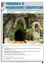
CARACTERIZAÇÃO DO CARSTE DA REGIÃO DE CORDISBURGO,<br />
MINAS GERAIS<br />
THE CHARACTERIZATION OF THE CORDISBURGO KARST REGION, MINAS GERAIS<br />
Luiz Eduar<strong>do</strong> Panisset Travassos<br />
Resumo<br />
A presente dissertação tem como objetivo principal, a caracterização geográfica <strong>do</strong> <strong>carste</strong> <strong>da</strong> região <strong>de</strong><br />
Cordisburgo, Minas Gerais, a partir <strong>da</strong> aplicação <strong>de</strong> conceitos consoli<strong>da</strong><strong>do</strong>s <strong>do</strong> “<strong>carste</strong> clássico” a<strong>da</strong>pta<strong>do</strong>s à<br />
reali<strong>da</strong><strong>de</strong> <strong>do</strong> <strong>carste</strong> intertropical. Por meio <strong>da</strong> caracterização <strong>do</strong> <strong>carste</strong> <strong>da</strong> Bacia <strong>do</strong> Ribeirão <strong>da</strong> Onça, Sub-<br />
Bacia <strong>do</strong> Rio <strong>da</strong>s Velhas, realizou-se um mapeamento exploratório <strong>da</strong>s principais feições cársticas, via o<br />
cruzamento <strong>da</strong>s informações levanta<strong>da</strong>s em imagem LANDSAT 7, imagens <strong>do</strong> GoogleEarth, interpretação<br />
<strong>de</strong> mapas topográficos (1:100.000), fotografias aéreas (1:60.000) e controle <strong>de</strong> campo. O produto final,<br />
apresenta<strong>do</strong> na forma <strong>de</strong> um mapa <strong>de</strong> fenômenos cársticos <strong>da</strong> região <strong>de</strong> Cordisburgo, partiu <strong>da</strong> utilização <strong>da</strong><br />
meto<strong>do</strong>logia <strong>da</strong> Comissão <strong>de</strong> Fenômenos Cársticos <strong>do</strong> Comitê Nacional <strong>de</strong> Geografia (Paris, 1965) e<br />
a<strong>da</strong>pta<strong>da</strong> por Kohler (1989). A escolha <strong>de</strong>ssa meto<strong>do</strong>logia cartográfica justifica-se pela existência <strong>de</strong><br />
inúmeras cartas <strong>do</strong> <strong>carste</strong> dinário e intertropical, facilitan<strong>do</strong> a análise comparativa. Tal carta sintetizou, pela<br />
primeira vez nessa região, a distribuição <strong>da</strong>s feições cársticas, fornecen<strong>do</strong> informações para a<br />
compartimentação geoambiental <strong>da</strong> região <strong>de</strong> Cordisburgo, importante subsídio para uma gestão ambiental<br />
sustentável. Por suas características geológicas, geomorfológicas, hidrológicas e biogeográficas, o <strong>carste</strong><br />
<strong>de</strong>ssa região é um expressivo exemplo <strong>do</strong> <strong>carste</strong> intertropical brasileiro, cuja evolução superficial e<br />
subterrânea <strong>de</strong>ve ser compreendi<strong>da</strong> como um fenômenocomplexo. A Formação Lagoa <strong>do</strong> Jacaré foi pouco<br />
estu<strong>da</strong><strong>da</strong> quanto ao teor <strong>de</strong> CaCO3 frente às intercalações <strong>de</strong> filitos, veios <strong>de</strong> quartzo, etc. Sen<strong>do</strong> assim, é<br />
prematuro afirmar que o <strong>carste</strong> <strong>de</strong> Cordisburgo apresenta baixo índice <strong>de</strong> carstificação em to<strong>do</strong> o seu pacote<br />
carbonático, sen<strong>do</strong> possível a ocorrência <strong>de</strong> sítios com calcários puros, associa<strong>do</strong>s a outros com intercalações<br />
não carbonáticas. Contu<strong>do</strong>, estu<strong>do</strong>s sobre a magnitu<strong>de</strong> e o fluxo subterrâneo no en<strong>do</strong><strong>carste</strong> ain<strong>da</strong> são pouco<br />
explora<strong>do</strong>s. Na região <strong>de</strong> estu<strong>do</strong>s, tu<strong>do</strong> indica que o fluxo en<strong>do</strong>cárstico é coman<strong>da</strong><strong>do</strong> pela Bacia <strong>do</strong> Ribeirão<br />
<strong>da</strong> Onça, ten<strong>do</strong> como seu nível <strong>de</strong> base o Rio <strong>da</strong>s Velhas. Ao norte <strong>da</strong> região estu<strong>da</strong><strong>da</strong>, o fluxo en<strong>do</strong>cárstico<br />
também parece estar associa<strong>do</strong> à drenagem <strong>do</strong> Rio <strong>da</strong>s Velhas, ain<strong>da</strong> que em cotas mais baixas, nas quais<br />
pre<strong>do</strong>minam as formas <strong>de</strong> um <strong>carste</strong> mais evoluí<strong>do</strong> (planícies e lagoas).<br />
Palavras-Chave: Caracterização Geográfica; Carste; Cordisburgo; Mapa <strong>de</strong> Fenômenos Cársticos.<br />
Orienta<strong>do</strong>r: Prof. Dr. Heinz Charles Kohler.<br />
Abstract<br />
This work aims at presenting the geographical characterization of the Cordisburgo karst region, in the State<br />
of Minas Gerais by applying the consoli<strong>da</strong>ted concepts of the “classical karst” a<strong>da</strong>pted to the reality of the<br />
intertropical karst. The characterization of the karst from the Onça´s Creek basin, Velhas River basin led to<br />
an exploratory mapping of the main karst features, which was ma<strong>de</strong> possible by confronting <strong>da</strong>ta collected<br />
through LANDSAT 7 imaging, GoogleEarth images, topographic maps interpretation (1:100.000), aerial<br />
photography (1:60.000) and field control. The final product, which is presented as a map, used the<br />
metho<strong>do</strong>logy proposed by the Commission of Karst Phenomena of the National Geography Committee<br />
(Paris, 1965) and a<strong>da</strong>pted by Kohler (1989). The choice to use this metho<strong>do</strong>logy was ma<strong>de</strong> on the grounds<br />
that the existence of many Dinaric and Intertropical Karst maps is a facilitator to a comparative analysis. As<br />
a result of this study, and for the first time in this region, a map summarized the distribution of the karst<br />
features, providing relevant information for the geoenvironmental compartmentation of the Cordisburgo<br />
area and important subsi<strong>de</strong>s for the sustainable management of this region. Due to its geological,<br />
geomorphologic, hydrological and biogeographical characteristics, the karst of this region is an expressive<br />
example of the Brazilian intertropical one, whose superficial and subterraneous evolution must be<br />
un<strong>de</strong>rstood as a complex phenomenon. There is little research on the Lagoa <strong>do</strong> Jacare Formation especially<br />
regarding the amount of CaCO3 in comparison to the phyllites, quartz veins, etc. So, it is premature to state<br />
that the karst in Cordisburgo shows a low karstification rate in its entire carbonatic pack as a whole. It is<br />
Campinas, SeTur/SBE. Pesquisas em Turismo e Paisagens Cársticas, 1(1), 2008.<br />
<strong>91</strong>
RESUMO: Travassos. Caracterização <strong>do</strong> <strong>carste</strong> <strong>da</strong> região <strong>de</strong> Cordisburgo. .<br />
possible that pure limestone sites associated to non-carbonatic layers can be found. Studies about the<br />
magnitu<strong>de</strong> and the direction of un<strong>de</strong>rground water are still insufficient, however. All evi<strong>de</strong>nces leads to the<br />
fact that the en<strong>do</strong>karstic flow in the region studied is comman<strong>de</strong>d towards the base level of the Velhas River<br />
basin by the Onça’s Creek. In the north of this region, the subterraneous flow seems to be also associated<br />
to the Velhas River basin, even though at lower levels, where most of the i<strong>de</strong>ntified forms is that of an<br />
evolved karst (plains and lakes).<br />
Key-Words: Geographical Characterization; Karst; Cordisburgo; Map of Karst Phenomena.<br />
Advisor: Prof. Dr. Heinz Charles Kohler.<br />
Referência<br />
Travassos, L.E.P. Caracterização <strong>do</strong> <strong>carste</strong> <strong>da</strong> região <strong>de</strong> Cordisburgo, Minas Gerais. Belo Horizonte:<br />
PucMG, 2007. 95f. Dissertação (Mestra<strong>do</strong> em Tratamento <strong>da</strong> Informação Espacial), Pontifícia<br />
Universi<strong>da</strong><strong>de</strong> Católica <strong>de</strong> Minas Gerais. 2007.<br />
A Pesquisa em Turismo e Paisagens Cársticas é uma publicação <strong>da</strong> Seção <strong>de</strong> Espeleoturismo <strong>da</strong> Socie<strong>da</strong><strong>de</strong><br />
Brasileira <strong>de</strong> Espeleologia (SeTur/SBE). Para submissão <strong>de</strong> artigos ou consulta aos já publica<strong>do</strong>s visite:<br />
www.sbe.com.br/turismo.asp<br />
Campinas, SeTur/SBE. Pesquisas em Turismo e Paisagens Cársticas, 1(1), 2008.<br />
92