


You also want an ePaper? Increase the reach of your titles
YUMPU automatically turns print PDFs into web optimized ePapers that Google loves.
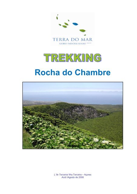
<strong>Rocha</strong> <strong>do</strong> <strong>Chambre</strong><br />
L´île Terceira/ Ilha Terceira – Açores<br />
Août /Agosto de 2008
Promenade Roche du <strong>Chambre</strong><br />
Percurso Pedestre <strong>Rocha</strong> <strong>do</strong> <strong>Chambre</strong><br />
A. Description / Description / Descrição:<br />
A.1 L’Informations du Sentier | Rail Information | Informações <strong>do</strong> Trilho:<br />
Parcours circulaire avec guide et pique-nique. L'accès est difficile et<br />
n'est pas balisé. L'itinéraire commence près de la route régionale qui<br />
va jusqu´a la commune de Biscoitos et passe dans l’intérieur de l’île.<br />
Circular circuit with guide and with picnic. The access is difficult and its<br />
not marked. The circuit starts by the regional road that goes to the<br />
village of biscoitos and develops in the interior of the island.<br />
Percurso circular com guia e com pic-niq. O acesso é difícil e não<br />
está baliza<strong>do</strong>. O percurso inicia junto à estrada regional que vai até à<br />
freguesia <strong>do</strong>s Biscoitos e desenvolve-se no interior da ilha.<br />
Trekking<br />
Dífficulté | Difficulty | Dificuldade: Difficille | Difícil<br />
Extension | Extension | Extensão: 9 km<br />
Temp | Time | Tempo: Toute le jour | Dia inteiro (5h)<br />
Pente | Slope | Declive: Dure | Acentua<strong>do</strong><br />
A.2 Information Pratique | Practical Information | Informação Prática :<br />
En raison de la difficulté d'accès et des difficultés du parcours, les enfants de moins 16 ans ne sont pas<br />
autorisés. Toutes les personnes <strong>do</strong>ivent avoir une bonne préparation physique et des chaussures<br />
adaptées ainsi que des pantalons pour protéger les jambes des plantes et des chutes<br />
Due to the hard access and to some difficulties, children with less than 16 years old aren’t allowed in this<br />
circuit. Every person should have good physical form and wear footwear with good traction and long<br />
jeans for protection from trail aggressive plants and eventual falls.<br />
Devi<strong>do</strong> ao difícil acesso e a algumas dificuldades, não são permitidas crianças, com menos de 16<br />
anos. Todas as pessoas deverão ter uma boa preparação física e usar calça<strong>do</strong> com boa tracção e de<br />
calças para proteger as pernas de plantas rastejantes agressivas e de eventuais quedas.<br />
A.3 Description du Parcours | Descrição <strong>do</strong> Percurso:<br />
Cette route offre au visiteur un paysage très riche et varié. Le paysage est le témoin de la formation et<br />
des éruptions volcaniques qui ont changés la topographie (Photo 1).<br />
This circuit offers the tourist a very rich and diversified landscape. These landscapes are the testimony of<br />
volcanic formations and eruptions that mould the relief and the landscapes (Photo 1).<br />
Este percurso oferece ao turista uma paisagem muito rica e diversificada. A paisagem é testemunho<br />
das formações e erupções vulcânicas que modelaram o relevo e a paisagem existente (Foto 1).
Photo 1 - Paysage modifié par les éruptions volcaniques | Foto 1 - Paisagem alterada pelas erupções vulcânicas<br />
Du haut de la Roche du <strong>Chambre</strong> (Photo 2 et 3) vous pouvez voir un riche patrimoine naturel : la<br />
Réserve Forestière de la Sierra de Santa Barbara et le Mistérios Negros (Mystère Noir), la Réserve<br />
Forestière Naturelle Partielle de Biscoito de Ferraria (Biscuit de ferronnerie), la Sierra Labaçal où est<br />
inséré le beau Morro Assombra<strong>do</strong> (Mont Hanté), le Biscoito Racha<strong>do</strong> (Biscuit Cassé), le Pico das<br />
Pardelas, le Pico Alto (Pointe Haut), la <strong>Terra</strong> Brava, le Pico Agu<strong>do</strong> (Pointe Eigue) et le Pico <strong>do</strong> Tamujo<br />
Les jours où la visibilité est bonne, vous pouvez voir l´île Graciosa.<br />
From the top of the Rock of the <strong>Chambre</strong> (Photo 2 and 3), we can observe a very rich natural heritage: the<br />
Florestal Reserve of Serra de Santa Bárbara and of the Mistérios Negros (Dark Misteries), the Florestal<br />
Natural Partial Reserve of the Biscoito da Ferraria(Blacksmith Biscuit), the Serra <strong>do</strong> Labaçal where it is<br />
inserted the beautiful Morro Assombra<strong>do</strong> (Haunted Mountain), the Biscoito Racha<strong>do</strong> (Cracked Biscuit),<br />
the Pico das Pardelas, the Pico Alto (High Peak), the <strong>Terra</strong> Brava (Wild Land), the Pico Agu<strong>do</strong> (Acute<br />
Peak) and the Pico <strong>do</strong> Tamujo. During good visibility days, island of Graciosa can be seen.<br />
Do alto da <strong>Rocha</strong> <strong>do</strong> <strong>Chambre</strong> (Foto 2 e 3), pode-se observar um riquíssimo património natural: a<br />
Reserva Florestal da Serra de Santa Bárbara e <strong>do</strong>s Mistérios Negros, a Reserva Florestal Natural<br />
Parcial <strong>do</strong> Biscoito da Ferraria, a Serra <strong>do</strong> Labaçal onde está inseri<strong>do</strong> o belo Morro Assombra<strong>do</strong>, o<br />
Biscoito Racha<strong>do</strong>, o Pico das Pardelas, o Pico Alto, a <strong>Terra</strong> Brava, o Pico Agu<strong>do</strong> e o Pico <strong>do</strong> Tamujo.<br />
Em dias de boa visibilidade é possível observar a Ilha Graciosa.<br />
Trekking<br />
Photo 2 et 3 – Vue de la Roche du <strong>Chambre</strong> | Foto 2 e 3 - Vista da <strong>Rocha</strong> <strong>do</strong> <strong>Chambre</strong><br />
Déjeuner dans une forêt de cryptomerias bien développes est très agréable (Photo 4).<br />
The lunch is eaten in a cryptomeria woods well developed, which is very pleasant (Photo 4)<br />
O almoço faz-se numa mata de criptomérias bem desenvolvidas e muito agradável (Foto 4).<br />
Photo 4 – Forêt de criptomérias, lieu de pic-niq | Foto 4 - Mata de criptomérias, local de pic-niq
Le Pico <strong>do</strong> Fogo (Pointe de feu) est la deuxième éruption en 1761, quatre jours après la première, qui<br />
a eu lieu dans le <strong>do</strong>maine de Mistérios Negros (Mystères Noir) entre Pico et la Sierra Gor<strong>do</strong> de Santa<br />
Barbara. La deuxième éruption <strong>do</strong>nné naissance à Pico <strong>do</strong> Fogo (pointe de feu), à Pico Vermelho et à<br />
Pico das Caldeirinhas ont été aussi en développement selon les rapports du temps trois flux de lave.<br />
La première vers l'est, avec arrêt à un endroit appelé la Chama (Flamme), la deuxième vers l'ouest et<br />
le nord jusqu'à la Tamujal. Et la troisième vers le nord, s’est divisée en deux s’est anchée a Vimeiro et<br />
l'autre s’est anchée a Juncalinho, jusqu'à enter dans le village de Biscoitos et de détruire quelques<br />
maisons.<br />
The Pico <strong>do</strong> Fogo (Peak of Fire) is where the second eruption of 1761, four days after the first, which<br />
happen in the Mistérios Negros (Dark Misteries) zone, between the Pico Gor<strong>do</strong> (Fat Peak) and the Serra<br />
de Santa Bárbara. The second eruption, originated then the Pico <strong>do</strong> Fogo (Peak of Fire), the Pico<br />
Vermelho (Red Peak) and the Pico das Caldeirinhas, developing also, based on the records of that time,<br />
in three lava streams, the first towards East, with stop in an area called Chama (Flame), the second<br />
towards West, throwing a propagation to North till Tamujal, and the third, the superior, dislocated to<br />
North, dividing subsequently in two, one stagnated in Vimeiro and the other went to Juncalinho, reaching<br />
Biscoitos and destroying a few houses (Photo 5).<br />
O Pico <strong>do</strong> Fogo é o local onde se deu a segunda erupção de 1761, quatro dias depois da primeira, que<br />
aconteceu na zona <strong>do</strong>s Mistérios Negros, entre o Pico Gor<strong>do</strong> e a Serra de Santa Bárbara.<br />
A segunda erupção, deu então origem ao Pico <strong>do</strong> Fogo, Pico Vermelho e Pico das Caldeirinhas,<br />
desenvolven<strong>do</strong>-se também segun<strong>do</strong> os relatos da época, em três correntes de lava, a primeira rumo a<br />
oriente, com paragem num local designa<strong>do</strong> de Chama a segunda dirigiu-se para Ocidente, lançan<strong>do</strong><br />
uma propagação para Norte até ao Tamujal, e a terceira a superior, deslocou-se para Norte, dividin<strong>do</strong>se<br />
posteriormente em duas, uma das quais estagnou no Vimeiro e a outra foi dar ao Juncalinho,<br />
chegan<strong>do</strong> mesmo a invadir os Biscoitos e a destruir algumas casas (Foto 5).<br />
Trekking<br />
Photo 5 – Paysage modifié par l'éruption de 1761 | Foto 5 - Paisagem alterada pela erupção de 1761<br />
Une fois que l'itinéraire est terminé rentrons a l´ hôtel <strong>Terra</strong> <strong>do</strong> <strong>Mar</strong> en bus.<br />
Terminated the circuit we come back to the Hotel <strong>Terra</strong> <strong>do</strong> <strong>Mar</strong> by bus.<br />
Termina<strong>do</strong> o percurso regressamos ao Hotel <strong>Terra</strong> <strong>do</strong> <strong>Mar</strong> de autocarro.