Arlington County Street Naming System Guide
Arlington County Street Naming System Guide
Arlington County Street Naming System Guide

You also want an ePaper? Increase the reach of your titles
YUMPU automatically turns print PDFs into web optimized ePapers that Google loves.
If All Else Fails –<br />
Take Along a Copy of a Free Map<br />
of <strong>Arlington</strong> <strong>Street</strong>s<br />
If you do get lost, gas stations are closed, and the guy<br />
standing on the corner never heard of Venable<br />
<strong>Street</strong>—try consulting a map. The Department of<br />
Environmental Services, Division of Transportation, makes<br />
black and white copies of the official county street map<br />
(measuring 36 x 45 inches) available in the Permitting and<br />
Inspections office of Division of Transportation, Suite 813,<br />
2100 Clarendon Boulevard, <strong>Arlington</strong>, VA 22201. The first<br />
copy is free—additional copies are $5 each. A full size color<br />
version of this same map can be purchased for $10. The map<br />
is also available online through the <strong>County</strong>’s website at<br />
www.arlingtonva.us/Departments/EnvironmentalServices/<br />
cpe/maps/MapsByTopic.aspx, and selecting “Maps by<br />
Category,” then selecting “transportation,” then selecting<br />
“<strong>Street</strong> Map 2nd Edition.” Free street maps produced by the<br />
<strong>Arlington</strong> Chamber of Commerce are distributed at most<br />
banks, public libraries, recreation facilities, and in Information<br />
Center of the lobby in the <strong>Arlington</strong> <strong>County</strong> Government Office<br />
Building at 2100 Clarendon Boulevard. The <strong>Arlington</strong> Chamber<br />
of Commerce street maps are also available free by calling<br />
703-525-2400.<br />
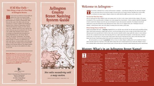
About the Cover: The reproduction of the original 1793<br />
topographical map of the Territory of Columbia shows <strong>Arlington</strong><br />
<strong>County</strong> when it was a part of the Federal District established<br />
by Congress in 1790. The name was changed to the City of<br />
Washington in 1791 and to the District of Columbia in 1801.<br />
President George Washington appointed American surveyor<br />
Andrew Ellicott (1754-1820) to survey the boundary of the<br />
10-mile square territory. <strong>Arlington</strong> streets still conform to the<br />
topography shown on Ellicott’s map.<br />
<strong>Arlington</strong> <strong>County</strong> Department of Environmental Services<br />
Division of Transportation<br />
Dennis Leach, Director<br />
Ron Carlee, <strong>County</strong> Manager<br />
Luis Araya, Editor<br />
FIRST PRINTED 1984: REVISED 1990 AND 2008<br />
<strong>Arlington</strong><br />
<strong>County</strong><br />
<strong>Street</strong> <strong>Naming</strong><br />
<strong>System</strong> <strong>Guide</strong><br />
Five miles meandering with<br />
a mazy motion.<br />
– SAMUEL TAYLOR COLERIDGE, “KUBLA KAHN,” 1816<br />
Welcome to <strong>Arlington</strong>—<br />
This brochure is dedicated, first, to tourists and newcomers to <strong>Arlington</strong> —especially those hailing from cities with streets mapped<br />
out on a grid system where if you travel far enough on Second Avenue you are bound to intersect with Main <strong>Street</strong>. And secondly,<br />
it is dedicated to the many longtime <strong>Arlington</strong> residents who ruefully admit they still can get lost on the county’s streets.<br />
You Can Get There from Here…<br />
when you understand the official <strong>Arlington</strong> <strong>County</strong> street naming system. Yes, there is such a system, and this brochure explains it. The system<br />
was adopted in 1934 as a priority project of <strong>Arlington</strong>’s new county manager form of government. A citizens committee studied the hodgepodge<br />
of streets created in the <strong>Arlington</strong> area by the topsy-turvy development of many unincorporated communities. The <strong>Arlington</strong> <strong>County</strong> Board<br />
implemented a system that eliminated the many duplicated street names (There were 10 <strong>Arlington</strong> <strong>Street</strong>s and 11 Washington <strong>Street</strong>s for<br />
example.), retained historic names, and set the pattern for naming streets that remains in effect today.<br />
Where Getting There is Half the Fun<br />
Getting around <strong>Arlington</strong> still can be…intriguing. Originally laid out over old trade routes and trails, the early roads wound around hills and along<br />
ridges, skirted streams and pastures, dodged estates and stores, veered toward springs and easy stream crossings, and often followed earlier trails.<br />
Subsequent paved streets generally had to be laid over these early routes that eventually resulted in unique quirks that continue to create confusion<br />
when one tries to navigate the <strong>County</strong>. Some streets skip along with seven or eight separate block interruptions. At North Taylor <strong>Street</strong>, 26th <strong>Street</strong><br />
North becomes 31st <strong>Street</strong> North. At 17th <strong>Street</strong> North, North Sycamore <strong>Street</strong> becomes North Roosevelt <strong>Street</strong>, while at North Glebe Road, North<br />
Quincy <strong>Street</strong> becomes North Henderson Road, both caused by the connection of these streets for better mobility.<br />
But such anomalies are no cause for agyiophobia, the fear of streets. In reality, <strong>Arlington</strong>’s rambling streets can be considered as having a<br />
built-in automatic safety factor. Nationwide, urban traffic statistics indicate that curved, randomly-patterned street systems like <strong>Arlington</strong>’s result in<br />
fewer residential traffic accidents than the squared-off grid systems. And streets that curve in harmony with the landscape help preserve natural beauty.<br />
History: What’s in an <strong>Arlington</strong> <strong>Street</strong> Name?<br />
In history-gilded <strong>Arlington</strong> <strong>County</strong>,<br />
Virginia, reading a street map is like a<br />
historical tour, or a history class<br />
when you start looking up halfremembered<br />
and unfamiliar names (try Lorcom,<br />
Dumbarton, Smythe or Eads for starters).<br />
<strong>Arlington</strong>’s streets literally present a pageant of<br />
history:<br />
MUSIC – Key Boulevard and Key Bridge<br />
were named for Frances Scott Key, author of the<br />
“Star Spangled Banner.” SCENE – Charming<br />
landmarks recall the land’s natural beauty: Rock<br />
Spring, Carlin Springs, Little Falls, Four Mile<br />
Run, Valley, and Forest. PEOPLE – Indian-origin<br />
street names include Potomac, Powhatan,<br />
Pocomoke, Tuckahoe, Tacoma, Kennebec,<br />
Kennesaw, and Ottawa. Pioneer family names<br />
adorn many street-name signs: Roberts,<br />
Dittmar, Marcey, Ball, Veitch, and Lorcom (for<br />
Dr. Joseph Taber Johnson’s two sons, LORen<br />
and BasCOM). Famous names abound: Barton,<br />
Custis, Marshall, Harvard, and Longfellow.<br />
COLONIAL MEMORIES – Williamsburg<br />
Boulevard memorializes the colonial capital,<br />
Yorktown Boulevard - the surrender of the<br />
British at the end of the Revolutionary War.<br />
SOUTHERN ELEGANCE – Gracious plantation<br />
and estate names: <strong>Arlington</strong>, Wakefield,<br />
Abingdon, Kenmore. Vacation Lane was a popular<br />
street for summer-retreat homes for<br />
Washington families. NOBILITY – Fairfax Drive<br />
is named for Lord Fairfax, who inherited the<br />
large area known as Fairfax <strong>County</strong> from his<br />
mother, Catherine Culpeper. There is a Culpeper<br />
<strong>Street</strong>, too.<br />
ROMANCE – Romance and commerce<br />
blend in Rolfe and Powhatan streets. John Rolfe<br />
started the tobacco industry in Virginia, and he<br />
also married Pocahontas, daughter of the<br />
famous Indian chief, Powhatan. ADVENTURE –<br />
Columbus and Peary streets. FAITH – Old-time<br />
religion gave Glebe Road its name. A glebe was<br />
a rectory on farmland for a Church of England<br />
minister. PROGRESS – Edison <strong>Street</strong> honors the<br />
great American inventor, and Walter Reed Drive<br />
honors the Army surgeon whose research conquered<br />
yellow fever. Shirley Highway —Virginia’s<br />
first limited access highway—was named in<br />
1942 for Virginia Highway Commissioner Henry<br />
G. Shirley, internationally recognized master<br />
road-builder. WAR & PEACE – Many street name<br />
signs commemorate war stories: Liberty, Fort<br />
Myer, Fort Scott, Lee, Pershing, Rixey, Yorktown,<br />
and Richmond. DRAMA – Patrick Henry Drive:<br />
“Give me liberty or give me death.”<br />
POLITICS – Statesmen are remembered<br />
on many corners: Bryan, Randolph, George<br />
Mason, Dinwiddie, Franklin, Hamilton, and<br />
Hancock. Jefferson Davis Highway commemorates<br />
the Confederate President. And the<br />
names of 23 U.S. presidents—from George<br />
Washington through Woodrow Wilson—dignify<br />
numerous street-name signs. That is, all but<br />
Chester Alan Arthur, James K. Polk, and John<br />
Tyler. An oversight? Insufficient alphabetizing<br />
space? Or just politics?
You Can Get There From Here—<br />
An understanding of the system help tourists and<br />
newcomers find their way around. Although there<br />
are some exceptions to each guideline, these are<br />
the pointers most helpful to remember.<br />
<strong>Arlington</strong> Boulevard, also known as Route 50, divides<br />
the <strong>County</strong> into North & South <strong>Arlington</strong>.<br />
The streets on corresponding sides of <strong>Arlington</strong> Boulevard are designated<br />
as North or South. The only exception is the few streets in Radnor<br />
Heights between the U. S. Government reservation at Fort Myer and<br />
<strong>Arlington</strong> Boulevard which are designated “North” even though they<br />
are on the south side of <strong>Arlington</strong> Boulevard. The prefix North or South<br />
precedes name streets… EXAMPLES: North Lincoln <strong>Street</strong> or South<br />
Wakefield <strong>Street</strong>; and as a suffix follows numbered streets ...<br />
EXAMPLES: 15th <strong>Street</strong> North or 31st <strong>Street</strong> South.<br />
Named streets generally run North and South and are<br />
alphabetized starting at the East end of the <strong>County</strong>.<br />
Progressing westerly, this is the “alphabetizing sequence: (1) one-syllable<br />
names, Ball <strong>Street</strong> to Wise <strong>Street</strong>; (2) two-syllable names, Adams to<br />
BLOCK NUMBERS ON NUMBERED STREETS<br />
200 BALL 2000 TAFT 3700 NELSON 5400 HARRISON<br />
300 CLARK 2100 UHLE 3800 OAKLAND 5500 ILLINOIS<br />
400 DALE 2200 VEITCH 3900 POLLARD 5600 JEFFERSON<br />
500 EADS 2300 WAYNE 4000 QUINCY 5700 KENSINGTON<br />
600 FERN 2400 ADAMS 4100 RANDOLPH 5800 LEXINGTON<br />
700 GRANT 2500 BARTON 4200 STAFFORD 5900 MADISON<br />
800 HAYES 2600 CLEVELAND 4300 TAYLOR 6000 NOTTINGHAM<br />
900 IVES 2700 DANVILLE 4400 UTAH 6100 OHIO<br />
1000 JOYCE 2800 EDGEWOOD 4500 VERMONT 6200 POWHATAN<br />
1100 KENT 2900 FILLMORE 4600 WAKEFIELD 6300 QUANTICO<br />
1200 LYNN 3000 GARFIELD 4700 ABINGDON 6400 ROOSEVELT<br />
1300 MEADE 3100 HIGHLAND 4800 BUCHANAN 6500 SYCAMORE<br />
1400 NASH 3200 IRVING 4900 COLUMBUS 6600 TUCKAHOE<br />
1500 OAK 3300 JACKSON 5000 DINWIDDIE 6700 UNDERWOOD<br />
1600 PIERCE 3400 KENMORE 5100 EDISON 6800 VAN BUREN<br />
1700 QUEEN 3500 LINCOLN 5200 FREDERICK 6900 WESTMORELAND<br />
1800 ROLFE 3600 MONROE 5300 GREENBRIER 7000 YUCATAN<br />
1900 SCOTT<br />
Addresses on the South and West sides of streets are even-numbered, odd-numbered on the North and East sides.<br />
Woodrow; (3) three-syllable names, Abingdon to Yucatan; and (4) four-syllable<br />
names, with Arizona being the only street in this sequence.<br />
Numbered <strong>Street</strong>s generally run East and West,<br />
parallel to <strong>Arlington</strong> Boulevard.<br />
When numbers are repeated, it’s sequence: <strong>Street</strong>, Road and Place. On the<br />
south side of <strong>Arlington</strong> Boulevard, numbered streets range from 1st <strong>Street</strong><br />
South to 36th <strong>Street</strong> South. On the north side, numbered streets range from<br />
1st <strong>Street</strong> North to 44th <strong>Street</strong> North.<br />
Avenues, Circles, Highways, Lanes, Parkways,<br />
Pikes and Terraces.<br />
<strong>Arlington</strong> has only one pike— Columbia Pike, which originally was a toll road.<br />
There are two avenues — Campbell Avenue in Shirlington, and 21st Avenue North<br />
in Cherrydale, two circles—Beechwood Circle off of Military Road, and South<br />
Kenmore Circle off of 13th <strong>Street</strong> South, one terrace— Colonial Terrace west of<br />
Rosslyn, and four lanes— Cathedral Lane, Lorcom Lane, Roberts Lane and<br />
Vacation Lane, all in North <strong>Arlington</strong>. There are three parkways: Spout Run<br />
Parkway, George Washington Memorial Parkway, and the portion of Interstate I-66<br />
within the <strong>County</strong> which is named Custis Memorial Parkway. There are two highways—Henry<br />
G. Shirley Memorial Highway, also known as Interstate 395; and<br />
Remember…<br />
Jefferson Davis Highway, which is Virginia Route 110 and a segment of U.S. 1—<br />
both in South <strong>Arlington</strong>.<br />
Boulevards, Drives and Roads generally are major<br />
thoroughfares with historic names.<br />
These thoroughfares are designated North and South when they appear on<br />
both sides of <strong>Arlington</strong> Boulevard—for example, North and South Washington<br />
Boulevard, North and South George Mason Drive, North and South Glebe Roads.<br />
Boulevards, drives or roads that exist exclusively on either the north side or<br />
the south side of the <strong>County</strong> do not have a “North” or “South” prefix.<br />
EXAMPLE: Clarendon, Key, Wilson, Williamsburg and Yorktown Boulevards;<br />
Dittmar, Franklin, Henderson, Kirkwood, Little Falls, Marcey, McKinley, Military,<br />
Ridgeview, Rock Spring, and Round Hill Roads; Bluemont, Brookside, Fairfax,<br />
John Marshall, Lynnbrook, Old Dominion, Nelly Custis, Park, and Patrick Henry<br />
Drives exist only on the north side. Likewise, Army-Navy, Boundary Channel,<br />
Crystal, Forest, Fort Scott, and Walter Reed Drives; Chesterfield, Kemper,<br />
Oakcrest, Southgate, and Shirlington Roads, exist only on the south side.<br />
Named roads typically follow early winding routes and<br />
are excluded from the alphabetized pattern.<br />
Examples are Military Road (Built through dense forests in only three days by<br />
Civil War Federal troops.), which wound toward the northern part of <strong>Arlington</strong>’s<br />
ring of Civil War forts; and Old Dominion Drive, which follows an early electric<br />
railroad route. Drive along its curving path and you can almost feel the trolley<br />
car swaying.<br />
Numbered and named streets are not<br />
necessarily through routes.<br />
Only a few segments of named and numbered streets in the northwestern part<br />
of the county are unbroken in continuity. The majority of numbered and named<br />
streets will stop and continue a block or more away, in some instances more<br />
than once. However, the North or South prefix designations for named streets,<br />
and suffix designations for numbered streets —with <strong>Arlington</strong> Boulevard as the<br />
dividing line— will not change. Generally, Boulevards, Drives, Highways and<br />
Named Roads cross the county in unbroken continuity.<br />
The <strong>County</strong>’s address numbering system<br />
parallels the street naming system.<br />
One of the benefits of the county’s street naming system is that it can help one<br />
find an address on either a name or a numbered street. The block numbers on<br />
named streets are established by an intersecting numbered street. For example,<br />
ARLINGTON<br />
THROUGH<br />
STREETS<br />
Fillmore <strong>Street</strong> between 1st and 2nd streets (North or South) would be the<br />
100 Block, and between 16th and 17th streets would be the 1600 Block.<br />
The block numbers on numbered streets, however, can be determined<br />
only if one has a copy of the block number chart below. The chart<br />
reflects the alphabetical progression of name streets starting at the east<br />
end of the <strong>County</strong> and moving westward. An address on a numbered street<br />
can be determined by the intersection of the block number of nearest<br />
name street shown on the chart below. For example, the 1800 block of<br />
14th <strong>Street</strong> (North or South) would start at Rolfe <strong>Street</strong>; likewise, the 5700<br />
block of 5th <strong>Street</strong> would start at Kensington <strong>Street</strong>. This pattern will be the<br />
same for streets north or south of <strong>Arlington</strong> Boulevard, i.e., North or South.