Main Penang 2018-ENG Posters
Main Penang 2018-ENG Posters
Main Penang 2018-ENG Posters

You also want an ePaper? Increase the reach of your titles
YUMPU automatically turns print PDFs into web optimized ePapers that Google loves.
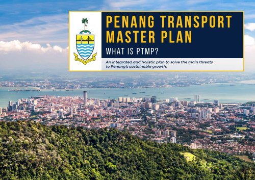
PENANG TRANSPORT<br />
MASTER PLAN<br />
What is PTMP?<br />
An integrated and holistic plan to solve the main threats<br />
to <strong>Penang</strong>’s sustainable growth.
PTMP BENEFITS:<br />
1 2<br />
1<br />
Increase Public Transport Mode Share<br />
to 40%.<br />
2<br />
Reduce traffic congestion, increase<br />
productivity, enhance competitiveness<br />
and improve quality of life.<br />
3<br />
Create safe developable land especially<br />
for housing.<br />
4<br />
5<br />
Enable sustainable growth of economic<br />
engines: E&E, Tourism, Business Centre<br />
and Service Industry.<br />
Create job opportunities while<br />
improving liveability.<br />
3 4
BAYAN LEPAS LRT (BL LRT)<br />
PTMP components:<br />
PAN ISLAND LINK 1 (PIL 1) HIGHWAY<br />
BAYAN LEPAS LRT (BL LRT)<br />
Forms the backbone for corridor<br />
with highest ridership demand.<br />
Links George Town to <strong>Penang</strong><br />
International Airport passing by high<br />
demand areas like Komtar, Macallum,<br />
Jelutong, LCC Terminal and Bayan<br />
Lepas FIZ.<br />
Last mile connectivity with efficient<br />
feeder bus system.<br />
Provides future connectivity within<br />
the Island and to mainland.<br />
Safer and more reliable.<br />
PAN ISLAND LINK 1 (PIL 1) HIGHWAY<br />
Will serve as a new Second Spine<br />
providing an alternative route to the<br />
congested Tun Dr Lim Chong Eu<br />
(LCE) Expressway.<br />
PIL 1 will be a new bypass with a Ring<br />
Traffic Dispersal System that has five<br />
strategic interchanges connecting<br />
Gurney Expressway, Jalan Paya Terubong,<br />
Jalan Tun Dr Awang, Tun Dr Lim Chong<br />
Eu Expressway, First and Second<br />
<strong>Penang</strong> Bridge and the <strong>Penang</strong><br />
International Airport.<br />
PENANG SOUTH RECLAMATION (PSR)<br />
1 The State owns the PSR land and its benefits (land for safe development,<br />
including public infrastructure and open spaces).<br />
PENANG SOUTH RECLAMATION (PSR)<br />
2 Close proximity to strategic locations such as FIZ, <strong>Penang</strong> International Airport<br />
and the Second <strong>Penang</strong> Bridge.<br />
Fuels <strong>Penang</strong>’s primary growth engines for sustainable growth – E&E and services<br />
(tourism, business processes outsourcing, etc) sectors.<br />
3<br />
Allows future extension of BL LRT and PIL 1 without the need for new infrastructure.
Formation of<br />
<strong>Penang</strong> Transport<br />
Council (PTC).<br />
• Preliminary<br />
Agreement signed<br />
with Zenith-BUCG.<br />
• Halcrow study<br />
was adopted by<br />
<strong>Penang</strong> State<br />
Govt.<br />
Appointment of<br />
SRS Consortium as<br />
Project Delivery<br />
Partner (PDP)<br />
for PTMP.<br />
Appointment of<br />
PTC members for<br />
5 years.<br />
2009<br />
2013<br />
2015<br />
<strong>2018</strong><br />
2011<br />
2014<br />
2016<br />
TMP Strategy<br />
study conducted<br />
by Halcrow.<br />
Request for<br />
Proposal (RFP) by<br />
<strong>Penang</strong> State<br />
Govt.<br />
• <strong>Penang</strong> State<br />
Govt adoption of<br />
PTMP.<br />
• Appointment of<br />
PTC members for<br />
2 years.<br />
PTMP DEVELOPMENT<br />
TIMELINE
PTMP<br />
HALCROW<br />
1 FEASIBILITY<br />
STUDY<br />
2 PRELIMINARY<br />
DESIGN<br />
3<br />
EIA,<br />
TIA, SIA etc.<br />
VS PTMP<br />
PTMP is based on common planned period of 50 years. eg.<br />
London tube (the backbone) is still in use after 150 years.<br />
HALCROW<br />
Studied by internationally reputable consultants eg. Arup,<br />
TY Lin, CH2M, Jacobs, DHI, PwC, Tony Gee, etc.<br />
1 IDEA<br />
2<br />
CONCEPTUAL<br />
/<br />
ASPIRATIONAL<br />
Halcrow’s 20-year planning horizon is not<br />
cost-effective, as investing in public transport<br />
solution is costly and time consuming.<br />
Halcrow is a conceptual and aspirational framework<br />
– no engineering studies, no cost benefit study and<br />
no funding model.<br />
Engineering design<br />
to determine<br />
constructability<br />
EIA, SIA, TIA<br />
and cost<br />
benefit studies<br />
“…No detailed studies have been undertaken to determine the issues<br />
that might be associated with providing such new infrastructure…<br />
the costestimates are broad brush unit rates… should therefore<br />
NOT BE RELIED ON.”<br />
Halcrow Report 2 page 31<br />
Funding<br />
model for<br />
implementation<br />
Incorporates 60:40<br />
(Private: Public)<br />
mode share
THE<br />
1 2 3<br />
PTMP<br />
IS BASED ON:<br />
Feasibility studies with<br />
engineering design to<br />
determine constructability<br />
Environmental and Social<br />
Impact Assessments<br />
(EIA & SIA)<br />
Traffic Impact<br />
studies<br />
A Transport Master Plan to<br />
achieve 60% private & 40%<br />
public transport mode share<br />
Cost benefit studies to<br />
determine economic<br />
viability of PTMP components.<br />
(not onducted by Halcrow)<br />
Funding model (PSR),<br />
including the Economic and<br />
Social Benefits Assessment<br />
of <strong>Penang</strong>’s growth engines<br />
4 5<br />
6
the need for pil 1 highway<br />
Needed to Alleviate Congestion<br />
alternative to ease congestion<br />
Tun Dr Lim Chong<br />
Eu Expressway<br />
WITH PIL 1<br />
2 nd spine with a Ring Traffic<br />
Dispersal System<br />
Only one North-South spine<br />
road in <strong>Penang</strong> – currently<br />
over-loaded (level of service F).<br />
WITHOUT PIL 1<br />
Road vehicles have no alternative<br />
Central hilly terrain forces<br />
traffic eastwards along<br />
already congested local<br />
roads (Jalan Tg Tokong,<br />
Jalan Paya Terubong, Jalan<br />
Tun Dr Awang) to the LCE.<br />
Condition will worsen with<br />
new developments.<br />
without pil 1<br />
lce expressway<br />
los f<br />
(force flow)<br />
with pil 1<br />
lce expressway<br />
los c<br />
(stable flow)<br />
Connects to North Coast<br />
Paired Road (NCPR),<br />
Gurney Expressway, LCE,<br />
<strong>Penang</strong> Airport, 1st and<br />
2 nd <strong>Penang</strong> Bridge.<br />
5 interchanges for<br />
traffic dispersal:<br />
• Gurney<br />
• Utama<br />
• Paya Terubong<br />
• Tun Dr Awang<br />
• Tun Dr Lim Chong Eu IC<br />
With PIL 1 as the 2 nd ring<br />
spine, traffic load on LCE<br />
will be relieved.<br />
There is need for a new 2 nd<br />
spine to relieve heavily<br />
congested LCE.
THE PROPOSED PAN<br />
ISLAND LINK 1 HIGHWAY<br />
PROJECT, PENANG<br />
MAIN BENEFITS OF PIL 1<br />
An alternative to transfer traffic from the 2 nd<br />
Bridge and the airport (PIA) to George Town<br />
and the North Coast area.<br />
Forms a second North-South spine road.<br />
PROJECT COMPONENTS<br />
The 19.5 km long PIL 1 Highway is a dual 3-lane non-tolled highway<br />
and consists of several components as follows:<br />
Caters to demand from the airport and industrial<br />
zone expansion.<br />
Shortens North-South travel time<br />
(Gurney-Airport to from 45 min to 15 min).<br />
7.6 km<br />
Elevated<br />
road section<br />
(viaducts)<br />
10.1 km<br />
Tunnel section<br />
1.8 km<br />
Embankment<br />
Interchanges in the PIL 1 Highway:<br />
• Gurney Interchange<br />
(To be constructed by Others)<br />
• Utama Interchange<br />
(at Youth Park)<br />
• Paya Terubong<br />
Interchange<br />
• Awang Interchange<br />
• Tun Dr. Lim<br />
Chong Eu (LCE)<br />
Interchange<br />
Alleviates the heavy traffic load on the Tun Dr LCE<br />
Expressway and adjacent arterials.<br />
PIL 1 will have 6 interchanges to link highly<br />
populated areas and transport hubs on the island.<br />
Facilitates to improve the LOS in existing local<br />
highways, particularly the Tun Dr LCE Expressway,<br />
Jalan Tun Dr Awang and Jalan Sultan Abdul Aziz.<br />
Opens up opportunities for development in the<br />
western and south-western parts of <strong>Penang</strong> Island.
THE PROPOSED PAN island link 1 highway project, penang<br />
PIL 1 COMPONETS & SECTIONS<br />
nO. COMPONENT/SECTION LOCATION/EXIT<br />
1 Interchange (IC) 1 - Gurney Near Gurney roundabout<br />
2<br />
3<br />
4<br />
5<br />
6<br />
7<br />
8<br />
9<br />
10<br />
11<br />
12<br />
13<br />
14<br />
Viaduct (Elevated section) (V1)<br />
Interchange (IC) 2 - Utama<br />
Tunnel 1<br />
Short viaduct (V2)<br />
Tunnel 2<br />
Viaduct (V3)<br />
Interchange (IC)3 - Paya Terubong<br />
Tunnel 3<br />
Embankment road to IC4<br />
Tunnel 4<br />
Viaduct (V4)<br />
Interchange 5 - Awang<br />
Interchange 6 - LCE<br />
Jln. Bagan Jermal – Jln. Gottlieb – to Youth Park (Taman Perbandaran)<br />
PIL 1 to Taman Perbandaran and Persiaran Kuari<br />
• Start near Tmn. Perbandaran<br />
• Exit west of Columbarium at Kek Lok Si Temple<br />
West of Columbarium at Kek Lok Si Temple to join the second tunnel<br />
Start south-west of Kek Lok Si Columbarium Exit west of Emerald Heights<br />
South-west of Taman Seri Rambai to IC 3<br />
PIL 1 to PORR at Air Hitam<br />
• Start south-west of Oriental Garden<br />
• Exit south-west of Setia Vista<br />
• Start west of Emerald Heights<br />
• End south-west of Emerald Heights<br />
• Start south-west of Setia Greens<br />
• Exit at Sg. Ara<br />
Near Kg. Sg. Ara, Kg. Tersusun Sg. Ara, along Sg. Ara and Sg. Kluang<br />
PIL1 to Jln. Tun Awang<br />
PIL1 joins the LCE Expressway<br />
LEGAL REQUIREMENTS<br />
The Project falls under “Prescribed Activity 20(c)<br />
First Schedule: “Construction of road, tunnel or<br />
bridge traversing or adjacent or near to<br />
environmentally sensitive areas” and “Prescribed<br />
Activity 13(b) Second Schedule: “Construction of<br />
road, tunnel or bridge traversing an area with slope<br />
greater than or equal to 350” of Subparagraph 3(1)<br />
and (4) of the Environmental Quality (Prescribed<br />
Activities) (Environmental Impact Assessment)<br />
Order, 2015. Hence the PIL1 Project falls under the<br />
Second Schedule of the Environmental Quality<br />
(Prescribed Activities) (Environmental Impact<br />
Assessment) Order, 2015.
Will the new highways<br />
joining existing roads<br />
cause traffic congestion?<br />
NO!<br />
Potential traffic impacts have<br />
been identified in the TIA and<br />
counter-measures proposed.<br />
Why PIL 1 needs 6 lanes?<br />
The tunnels have to be constructed in a single phase,<br />
as expansion in the future is not possible.<br />
Following engagements with technical stakeholders’<br />
(JKR & MBPP), it was decided that the elevated sections<br />
would be increased from 4 to 6 lanes and built in one go<br />
to leverage on the cost difference (1% increase).<br />
PIL 1 is a strategic bypass<br />
functioning as a second<br />
spine with Ring Traffic<br />
Dispersal System.<br />
It is meant to relieve traffic<br />
congestion on Tun Dr. Lim Chong<br />
Eu (LCE) and other roads linked<br />
to LCE.<br />
With PIL 1 in place regional traffic<br />
is diverted away from local roads<br />
thereby mitigating<br />
traffic congestion.<br />
7.6<br />
km<br />
Elevated viaducts<br />
10.1<br />
km<br />
Tunnels
ayan lepas lrt<br />
1<br />
The BL LRT will link George Town to the <strong>Penang</strong><br />
International Airport, passing by a corridor with<br />
the highest trip demands (Komtar, Macallum,<br />
Jelutong, LCC Terminal & Bayan Lepas FIZ).<br />
2<br />
This forms the main backbone for public transport.<br />
3<br />
It also provides future connectivity of transport<br />
network within the island, and to mainland.
WHY NOT TRAMS<br />
FOR PENANG?<br />
At-grade trams on <strong>Penang</strong> Island are not a viable solution.<br />
5<br />
4<br />
2<br />
3<br />
1<br />
SKYCAB<br />
KOMTAR<br />
MACALLUM<br />
BDR SRI PINANG<br />
N<br />
why?<br />
6<br />
EAST JELUTONG<br />
7-13<br />
THE LIGHT<br />
With the existing 25 junctions along the alignment,<br />
traffic will slow down with backlog on adjacent roads.<br />
GELUGOR<br />
USM<br />
<strong>Penang</strong>’s high motorcycle users (40%) - mixture of road<br />
and rail increases risk of accidents.<br />
14<br />
BATU UBAN<br />
Shortage of road space - Especially at narrower areas<br />
closerto Georgetown, e.g. 2-lane roads (Jalan C.Y Choy,<br />
JalanJelutong, Gat Lebuh Prangin, etc).<br />
Conversely, elevated LRT will ensure:<br />
BKT JAMBUL<br />
19<br />
20<br />
21<br />
SPICE<br />
17<br />
15<br />
16<br />
18<br />
SG NIBONG<br />
JALAN T<strong>ENG</strong>AH<br />
22<br />
FIZ NORTH<br />
PESTA<br />
Existing road conditions are maintained for greater public safety.<br />
Safe and secure operations without being affected by <strong>Penang</strong>’s<br />
frequent flooding.<br />
Faster trains and improved reliability.<br />
25<br />
23<br />
24<br />
FIZ SOUTH<br />
SG TIRAM<br />
PENANG AIRPORT<br />
PMTG DAMAR LAUT<br />
Legend<br />
At-Grade<br />
Sufficient capacity for increased ridership demand from airport<br />
passengers and future expansion of FIZ.
ALL YOU NEED TO KNOW<br />
ABOUT DRILL & BLAST<br />
QUESTIONS ABOUT<br />
DRILL & BLAST<br />
01<br />
02<br />
03<br />
04<br />
05<br />
Rock<br />
06<br />
07<br />
Granite in <strong>Penang</strong> Hills is suited for tunnel<br />
construction compared to soft or sedimentary<br />
rocks (mudstone/shale, or karstic limestone).<br />
“Drill & Blast” method is appropriate and common<br />
for tunnelling in granite. Safely adopted in Malaysia<br />
on past projects, eg. Genting Sempah Tunnel (Karak Expressway)<br />
and Menora Tunnel (North South Expressway) since the 1970s.<br />
Before tunnelling, actual ground conditions and<br />
fault lines will be determined via detailed soil<br />
investigation and seismic surveys.<br />
Tunnelling is a carefully controlled activity with<br />
strict operating procedures to minimise ground<br />
movements, vibrations and ensure public safety.<br />
excavation will be carried out by experts<br />
using controlled blasting.<br />
The explosives are carefully designed to achieve<br />
desired excavation levels in stages with noise and<br />
vibration effects kept to allowable limits.<br />
Excavated material will be safely transported to<br />
approved disposal sites according to a detailed<br />
Traffic Management Plan complying to Local<br />
Authority requirements.<br />
Question:<br />
Is it risky to blast through fault lines?<br />
ANSWER:<br />
NO. The faults in Peninsular Malaysia are inactive and not<br />
subjected to movements.<br />
Question:<br />
Will vibrations from blasting affect<br />
nearby structures?<br />
ANSWER:<br />
NO. As part of DoE requirements, settlement and vibration<br />
monitoring of adjacent structures will be carried out to ensure<br />
safety of adjacent structures.<br />
Question:<br />
Will Kek Lok Si Temple and Ayer Itam Dam be<br />
affected from blasting activities?<br />
ANSWER:<br />
NO. Landmarks situated 500m away, i.e. Kek Lok Si and Air Itam<br />
will be unaffected.<br />
Question:<br />
What about <strong>Penang</strong> Hill Funicular Railway?<br />
ANSWER:<br />
NO. <strong>Penang</strong> Hill Railway will not be impacted as PIL1 tunnel<br />
is over 150m below it.
““<br />
ptmp public forum<br />
DRILL AND BLAST IS SAFE<br />
<strong>Penang</strong> tunnel works will have low<br />
impact on structures<br />
By HUGH YAO<br />
newsdesk@thestar.com.my<br />
PENANGITES need not worry about ground<br />
movements, vibrations or even landslides from the<br />
“drill and blast” method to be used to construct the<br />
Pan Island Link (PIL 1), according to a geotechnical<br />
expert.<br />
In allaying concerns over the suitability and safety of<br />
the drill and blast method of rock excavation, Datuk Dr<br />
Gue See Sew explained that it was the most common<br />
method used for tunnelling in granite that has been<br />
adopted in Malaysia since the 1970s, including for the<br />
Genting Sempah Tunnel (Karak Expressway) and<br />
Menora Tunnel (North South Expressway).<br />
“The drill and blast method is a safe and established<br />
method that takes into consideration all aspects<br />
related to ground movements and settlements.<br />
“It is used even in Taiwan which is within the seismic<br />
fault zone. The relevant areas are prepped in advance<br />
with preventive measures such as pre-grouting in<br />
permeable faults and strengthening using steel ribs<br />
and rock bolts in areas with weak zones.<br />
“These are standard techniques to tackle water<br />
seepage and ensuring the stability of tunnels,” he said.<br />
Gue added that drill and blast is also used in Hong<br />
Kong, which, like <strong>Penang</strong>, is predominantly granite<br />
formation and far more densely populated.<br />
He also addressed concerns over the effects of<br />
tunnelling on important structures such as the Kek<br />
Lok Si Temple, Air Itam Dam and <strong>Penang</strong> Hill<br />
Funicular Railway, explaining that these structures<br />
are not even close to the drill and blast site.<br />
It has been reported that Kek Lok Si Temple and the Air<br />
Itam Dam are 500m away from the alignment, while<br />
the tunnel for PIL 1 is more than 150m below the<br />
<strong>Penang</strong> Hill Funicular Railway.<br />
“The drilling and controlled blasting has negligible<br />
impact in terms of vibration and settlement to<br />
structures or buildings beyond a distance of 100m<br />
from blasting points,” Gue said.<br />
“With proper design and blast control measures in<br />
place, vibration and settlement to neighbouring<br />
structures can be controlled even at a distance less<br />
than 10m, evident from the recently completed Klang<br />
Valley MRT Line 1 where tunnelling was done with live<br />
traffic on top!<br />
“Some recorded vibration and noise levels measured as<br />
close as 8.7m were found to be within limits and the<br />
works were successfully carried out without major<br />
incidences.<br />
“There is a zone of influence that will be<br />
pre-determined, but that can be complied with, can be<br />
done and has been done,” said Gue who is serving as<br />
commissioner for both Commissions of Inquiry set up<br />
in <strong>Penang</strong> to investigate three incidences over the past<br />
years – the Menara Umno building failure and Second<br />
<strong>Penang</strong> Bridge ramp collapse in 2013 – and the<br />
landslide at the Tanjung Bungah construction site in<br />
October 2017.<br />
Gue said that as part of Department of Environment<br />
requirements, settlement and vibration monitoring of<br />
adjacent structures will need to be carried out to<br />
ensure safety of adjacent structures.<br />
He also clarified that there is no concern that the<br />
vibration from the blast would cause the soil in <strong>Penang</strong><br />
Hill to loosen.<br />
“Beyond the tunnel entrance, most of the controlled<br />
blasting will be deep below ground and enclosed,<br />
unlike in a quarry where blasting is carried out in the<br />
open. Cracks if any, will be sealed promptly after<br />
blasting,” he assured.<br />
The PIL 1 is an integral part of the <strong>Penang</strong> Transport<br />
Master Plan (PTMP), designed to solve the island state’s<br />
traffic congestion and cater to the economic needs of<br />
<strong>Penang</strong> over the next five decades. The first phase of<br />
the PTMP is the construction of the PIL 1 and the Bayan<br />
Lepas LRT.<br />
Drill and blast is a safe and<br />
established method that<br />
takes into consideration<br />
all aspects related to<br />
ground movements and<br />
Currently, the Tun Dr Lim Chong Eu (LCE) Expressway is<br />
<strong>Penang</strong>’s only spine road which is perpetually<br />
congested.<br />
PIL 1 is expected to serve as a second link with a ring<br />
traffic dispersal system connecting North Coast Paired<br />
Road (NCPR), Gurney Expressway, LCE, <strong>Penang</strong> Airport,<br />
and, the first and second <strong>Penang</strong> bridges.<br />
Meanwhile, the Bayan Lepas LRT is expected to meet<br />
the public transport demand along the congested LCE<br />
corridor and will form the main backbone for<br />
connectivity between the island and the mainland<br />
PIL 1’s “drill and controlled<br />
blasting” tunnelling method<br />
is safe and widely used<br />
worldwide.<br />
settlements.<br />
Dr Gue: Public need not<br />
worry as construction of PIL 1<br />
using “drill and controlled<br />
blasting” is safe.<br />
Dr Gue See Sew
catalyst for penang’s growth engines<br />
<strong>Main</strong> economic engines of <strong>Penang</strong>’s are E & E,<br />
Tourism and other services.<br />
Global E&E industry is projected to grow 30% per<br />
annum. <strong>Penang</strong> needs to expand to meet next<br />
generation E&E trades- Internet of Things, artificial<br />
intelligence, 5G-enabled devices etc.<br />
Tourism industry needs new attractions to move up<br />
its value chain.<br />
Sustainable growth of <strong>Penang</strong>’s economic engines<br />
needed to attract and retain highly-skilled talents<br />
and entrepreneurs for the next 40 years.<br />
<strong>Penang</strong> Island is short on land for safe development<br />
and new infrastructures, resulting in many risky<br />
ad-hoc hill slope developments.<br />
The George Town heritage zone is also under pressure,<br />
threatening overall quality of life. Shortage of land for<br />
affordable housing led to escalating property prices.
WHY PENANG SOUTH?<br />
BAYAN LEPAS<br />
FIZ<br />
PENANG<br />
INTERNATIONAL<br />
AIRPORT<br />
PENANG 2 ND<br />
BRIDGE<br />
ISLAND<br />
C<br />
ISLAND<br />
B<br />
ISLAND<br />
a<br />
Strategic location & high demand synergy with existing bayan lepas lrt best suited for reclamation<br />
Strategic location of <strong>Penang</strong><br />
South coast Near to FIZ,<br />
<strong>Penang</strong> International Airport.<br />
To sustain <strong>Penang</strong>’s primary<br />
growth engines E&E and Services<br />
sector (Tourism, Business<br />
Processes Outsourcing, etc).<br />
Suitability of location for new land<br />
Natural embayment and shallow<br />
waters. LRT and PIL can be easily<br />
extended without need for<br />
new infrastructure.
enefits to<br />
1<br />
FISHERMeN LIVELIHOOD<br />
PSR encourages fishing activities with wide waterways and<br />
channels to ensure access to fishing grounds up to 4km away.<br />
Fishermen’s requests for affordable housing and compensation /<br />
ex-gratia being worked on by State Government.<br />
Public housing will be allocated on the reclaimed islands<br />
for the fishermen.<br />
2<br />
BENEFIT TO THE RAKYAT<br />
1 Homes for all income levels served by well-planned amenities<br />
Supplement the State and Federal Government’s efforts to build sufficient<br />
quality housing for the Rakyat.<br />
2 Employment opportunities<br />
From the reclamation works, infrastructure, property development and higher<br />
value-added manufacturing and services activities.<br />
New investments into the proposed project components will support more than<br />
300,000 job opportunities by 2050.<br />
3<br />
3 Enhanced liveability with a balanced “Live, Learn, Work and Play” lifestyle<br />
Smart living in a sustainable neighbourhood.<br />
Creation of unique identity and sense of belonging.
enefits to penang’s<br />
natural environment<br />
PSR will provide sufficient contiguous land mass required<br />
for long-term development (up to 50-year horizon),<br />
thereby relieving the need for hillside development.<br />
SIZE OF PENANG ISLAND<br />
Available Development Land<br />
Forest Reserve & Hills<br />
Roads & Open areas<br />
Public Amenities<br />
Residential, Commercial & Industrial Areas<br />
72,400 acres<br />
16,800 acres<br />
35,200 acres<br />
10,500 acres<br />
5,300 acres<br />
4,600 acres<br />
PSR will also moderate the escalation of land and property<br />
prices in <strong>Penang</strong> Island with controlled supply of new<br />
land and developments.<br />
Mitigate haphazard developments on the hilly central region.


![[Exhibit 6] Tunnelling Virtual Reality Walk](https://img.yumpu.com/62890814/1/184x260/exhibit-6-tunnelling-virtual-reality-walk.jpg?quality=85)
![[Exhibit 2] Autonomous Tunnel Boring Machine](https://img.yumpu.com/62883468/1/190x107/exhibit-2-autonomous-tunnel-boring-machine.jpg?quality=85)
![[Exhibit 1] Tunnelling Centralised Command Control Centre (TC4) Statistics](https://img.yumpu.com/62879681/1/190x107/exhibit-1-tunnelling-centralised-command-control-centre-tc4-statistics.jpg?quality=85)