Historic Sites and Districts of Hunterdon County
Historic Sites and Districts of Hunterdon County
Historic Sites and Districts of Hunterdon County
Create successful ePaper yourself
Turn your PDF publications into a flip-book with our unique Google optimized e-Paper software.
<strong>Hunterdon</strong> <strong>County</strong><br />
Cultural & Heritage Commission Members<br />
Stephanie Stevens, Chairman<br />
Beverly Drake, Vice Chairman<br />
Lawrence Carlbon<br />
Frank Curcio<br />
James Davidson<br />
Janet Hunt<br />
June Kapp<br />
Estelle Katcher<br />
John Kuhl<br />
<strong>Hunterdon</strong> <strong>County</strong><br />
Board <strong>of</strong> Chosen Freeholders<br />
Frank Fuzo, Director<br />
Marcia Karrow<br />
George Melick<br />
George D. Muller<br />
Paul Sauerl<strong>and</strong><br />
Disclaimer<br />
The enclosed maps were prepared by the <strong>Hunterdon</strong> <strong>County</strong> Planning Board<br />
based upon available information. They are to be used for general reference<br />
purposes only. For an <strong>of</strong>ficial copy <strong>of</strong> a district map, interested persons should<br />
contact the NJ <strong>Historic</strong> Preservation Office at 609.292.2023.<br />
Credits<br />
Photographs were taken by Stephanie Stevens, Linda Weber <strong>and</strong> Louis Fineberg.<br />
Thanks to Linda Weber <strong>of</strong> the <strong>Hunterdon</strong> <strong>County</strong> Planning Board for her<br />
assistance in composing this booklet.<br />
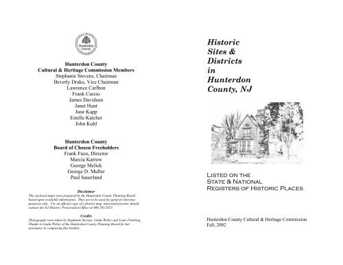
<strong>Historic</strong><br />
<strong>Sites</strong> &<br />
<strong>Districts</strong><br />
in<br />
<strong>Hunterdon</strong><br />
<strong>County</strong>, NJ<br />
Listed on the<br />
State & National<br />
Registers <strong>of</strong> <strong>Historic</strong> Places<br />
<strong>Hunterdon</strong> <strong>County</strong> Cultural & Heritage Commission<br />
Fall, 2002<br />
1
National Register (NR) <strong>and</strong> State Register (SR)<br />
<strong>Historic</strong> <strong>Districts</strong><br />
In <strong>Hunterdon</strong> <strong>County</strong>, NJ<br />
In order to better preserve the many charming<br />
villages <strong>and</strong> towns <strong>of</strong> <strong>Hunterdon</strong>, citizens <strong>and</strong> local<br />
governments have had these places architecturally<br />
surveyed <strong>and</strong> entered on the State <strong>and</strong> National Registers<br />
<strong>of</strong> <strong>Historic</strong> Places.<br />
A lengthy process is entailed for nominations<br />
to these registers; submission <strong>of</strong> a documented completed<br />
application, review <strong>and</strong> public hearings take<br />
place before the nomination is confirmed. State <strong>and</strong><br />
National Registered <strong>Districts</strong> are granted certain privileges<br />
from governmental intrusions.<br />
These <strong>Districts</strong> represent <strong>Hunterdon</strong>’s past.<br />
The architecture <strong>and</strong> viewscapes are excellent. As<br />
you read this booklet think about touring the <strong>Districts</strong><br />
to familiarize yourself with the beautiful buildings<br />
constructed by our ancestors. The majority <strong>of</strong> the<br />
buildings are still under private ownership <strong>and</strong> not<br />
open to the public; however, they can all be enjoyed<br />
from the road.<br />
Happy touring!<br />
Stephanie B. Stevens<br />
1
Alex<strong>and</strong>ria Township<br />
Everittstown <strong>Historic</strong> District<br />
SR 2/20/90 NR 8/28/80<br />
This District was known as<br />
Everitt's Mills in 1759. By 1816<br />
it became known as Everittstown<br />
<strong>and</strong> had grown considerably. In<br />
1881 there was a post <strong>of</strong>fice, oil<br />
mill, tavern, blacksmith shop,<br />
tailor <strong>and</strong> about twenty-five<br />
dwellings.<br />
2
Alex<strong>and</strong>ria Township<br />
Little York <strong>Historic</strong> District<br />
SR 6/17/88 NR 8/4/88<br />
Prior to 1828, Little York was known as Pokano<br />
<strong>and</strong> two mills had been constructed on the Wissahawken<br />
Creek. In<br />
1881 there were<br />
three churches, two<br />
stores, two mills,<br />
two blacksmiths,<br />
one tavern <strong>and</strong> one<br />
wheelwright.<br />
3
Alex<strong>and</strong>ria Township<br />
Mt. Pleasant <strong>Historic</strong> District<br />
SR 10/5/87 NR 11/16/88<br />
Mt. Pleasant is located in<br />
Alex<strong>and</strong>ria <strong>and</strong> Holl<strong>and</strong><br />
Townships, along a branch<br />
<strong>of</strong> the Hakeahawka Creek.<br />
Early mills spurred the<br />
growth <strong>of</strong> the village that in<br />
1881 had a post <strong>of</strong>fice, two<br />
stores, a mill, blacksmith<br />
<strong>and</strong> wheelwright shops,<br />
<strong>and</strong> a Presbyterian Church.<br />
4
Alex<strong>and</strong>ria Township<br />
Structures<br />
Saint Thomas Episcopal Church, 18th century<br />
Block 21, Lot 37<br />
Mt. Salem Methodist Episcopal Church, 1864<br />
Block 11, Lots 3, 3.01<br />
Other <strong>Districts</strong><br />
See the Pittstown <strong>Historic</strong> District<br />
in Franklin Township<br />
5
Bethlehem Township<br />
Asbury <strong>Historic</strong> District<br />
SR 11/2/92 NR 3/19/93<br />
Asbury was originally called Hall's Mill. In 1800<br />
the name was changed to honor Methodist Bishop<br />
Asbury. Located on the<br />
Musconetcong River, there<br />
were two mills <strong>and</strong> a<br />
woolen factory here in<br />
1873. The majority <strong>of</strong> this<br />
historic district lies in<br />
neighboring Warren<br />
<strong>County</strong>.<br />
<strong>Hunterdon</strong> <strong>County</strong><br />
Warren <strong>County</strong><br />
6
Califon Borough<br />
Califon <strong>Historic</strong> District<br />
SR 5/8/75 NR 10/14/76<br />
Straddling the South Branch <strong>of</strong> the Raritan River,<br />
the village originally was named Neighbor’s Mill<br />
<strong>and</strong> California. Califon was<br />
created out <strong>of</strong> Tewksbury Township<br />
<strong>and</strong> Lebanon Townships on<br />
April 2, 1905. Long known for<br />
the production <strong>of</strong> peach baskets -<br />
an important industry when<br />
<strong>Hunterdon</strong>'s biggest crop was<br />
peaches - Califon thrived as an<br />
industrial center. In 1880 there<br />
were two gristmills, two saw mills, two stores, two<br />
shoe shops, <strong>and</strong> two blacksmiths <strong>and</strong> wheelwrights,<br />
along with one hotel, a harness maker,<br />
distillery, railroad depot, <strong>and</strong> 31 dwellings.<br />
7
Califon Borough<br />
Structure<br />
J.K. Apgar Farmhouse, 18-19th century<br />
Block 28, Lot 4<br />
8
Clinton Town<br />
Clinton Town <strong>Historic</strong> District<br />
SR 3/3/95 NR 9/28/95<br />
The town was named for New York governor<br />
Dewitt Clinton in 1828. Home <strong>of</strong> the most<br />
photographed mill in America -- the Red Mill –<br />
Clinton was originally<br />
called "Hunt's Mills."<br />
During Revolutionary<br />
War times the most<br />
important building<br />
was Bonnell's Tavern,<br />
which was built in<br />
1764 <strong>and</strong> served as a<br />
meeting place for Patriots.<br />
9
Clinton Town<br />
Structures<br />
Clinton <strong>Historic</strong>al Museum, 1763<br />
Block 8, Lot 3, 3.01<br />
Dunham’s Mill/Parry’s Mill, 1837<br />
Block 9, Lot 1<br />
Music Hall, 1890-91, 1910, 1916<br />
Block 25, Lot 19<br />
M.C. Mulligan & Sons Quarry<br />
Block 8, Lots 3, 3.01<br />
Old Gr<strong>and</strong>in Library, 1898<br />
Block 12, Lot 4.01<br />
10
Clinton Township<br />
Ann<strong>and</strong>ale <strong>Historic</strong> District<br />
SR 8/1/94 NR 9/8/94<br />
Ann<strong>and</strong>ale, known as<br />
"Clinton Station," was the<br />
depot for the New Jersey<br />
Central Railroad. Beaver<br />
Avenue, Ann<strong>and</strong>ale's main<br />
road, was originally a part <strong>of</strong><br />
the New Jersey Turnpike, an<br />
early toll road that went from<br />
New Brunswick to Easton,<br />
PA. The Revolutionary Tom<br />
Jones’ Tavern is located on the main road.<br />
11
Clinton Township<br />
Cokesbury <strong>Historic</strong> District<br />
SR 6/3/97 NR 7/17/97<br />
Cokesbury <strong>Historic</strong> District is located in both<br />
Tewksbury <strong>and</strong> Clinton<br />
Townships. The village<br />
was named for the two<br />
most prominent Methodist<br />
Ministers <strong>of</strong> the era,<br />
Bishop Asbury <strong>and</strong><br />
Bishop Coke. There was<br />
a furnace here in 1754.<br />
12
Clinton Township<br />
Readingsburg <strong>Historic</strong> District<br />
SR 1/1/00 NR 3/3/00<br />
Readingsburgh <strong>Historic</strong> District is located on the<br />
South Branch <strong>of</strong> the<br />
Raritan River <strong>and</strong> was<br />
the site <strong>of</strong> early mills.<br />
About six dwellings<br />
comprised the village.<br />
13
Clinton Township<br />
Structures<br />
Bray-H<strong>of</strong>fman House, early 19th century<br />
Block 30, Lot 28<br />
Fink Type Ttruss Bridge, 1857<br />
(demolished)<br />
Other <strong>Districts</strong><br />
See the Potterstown <strong>Historic</strong> District<br />
in Readington Township<br />
See Cokesbury <strong>Historic</strong> District<br />
in Tewksbury Township<br />
14
Delaware Township<br />
Covered Bridge <strong>Historic</strong> District<br />
SR 1/19/99 NR 3/5/99<br />
Green Sergeants Bridge is the last remaining<br />
covered bridge in the State <strong>of</strong> New Jersey. A<br />
volunteer citizens group saved it from demolition<br />
in the 1960’s. The District includes the 1872<br />
bridge <strong>and</strong> surrounding farmsteads <strong>of</strong> the late 18th<br />
<strong>and</strong> 19th century.<br />
15
Delaware Township<br />
Delaware & Raritan Canal<br />
SR 11/30/72 NR 5/11/73<br />
Delaware <strong>and</strong> Raritan Canal <strong>Historic</strong> District is located<br />
in five communities: the Townships <strong>of</strong> Delaware,<br />
Kingwood, <strong>and</strong> West Amwell, <strong>and</strong> the Borough <strong>of</strong><br />
Stockton. Begun in 1832, the canal commenced at<br />
“Bool’s (Bull’s) Isl<strong>and</strong> <strong>and</strong> paralleled the Delaware<br />
River to Trenton<br />
where it turned<br />
<strong>and</strong> made its way<br />
to New Brunswick.<br />
The engineer<br />
in charge <strong>of</strong><br />
this monumental<br />
undertaking was<br />
Ashbel Welch.<br />
Hundreds <strong>of</strong> men,<br />
many <strong>of</strong> them Irish, rushed to Lambertville to seek<br />
work digging the canal. Unfortunately, an epidemic <strong>of</strong><br />
“Asiatic Cholera” broke out amongst the workers, <strong>and</strong><br />
dozens were buried in nameless graves in Potter’s<br />
Field. The canal served as the most modern <strong>of</strong> transportation<br />
methods; manufactured goods <strong>and</strong> coal from<br />
the Pennsylvania mines were moved quickly to the<br />
markets to the east. Upon the advent <strong>of</strong> railroads in the<br />
1840s <strong>and</strong> 50s, the canals died as a means <strong>of</strong> transportation.<br />
(see map on next page)<br />
16
Delaware Township<br />
Structures<br />
Locktown Baptist Church, 1819<br />
Block 8, Lot 1<br />
Peck’s Ferry Bridge, 1900<br />
(D-388)<br />
Green Sergeant’s Covered Bridge, 1872<br />
(D-304)<br />
The D & R Canal<br />
District is the dark line<br />
parallel to the Canal <strong>and</strong><br />
Delaware River.<br />
Pennsylvania<br />
Delaware & Raritan Canal <strong>Historic</strong> District<br />
17<br />
<strong>Hunterdon</strong><br />
<strong>County</strong>
East Amwell Township<br />
Clover Hill <strong>Historic</strong> District<br />
SR 10/16/79 NR 9/29/80<br />
Clover Hill <strong>Historic</strong> District is comprised <strong>of</strong> a<br />
small settlement in the most easterly part <strong>of</strong> the<br />
township. Much <strong>of</strong> the<br />
district lies in Hillsborough<br />
Township, Somerset<br />
<strong>County</strong>. Originally<br />
referred to as<br />
“Coughstown” or<br />
“Koughstown,” it was<br />
known as Clover Hill by<br />
1848. A few houses, a store, hotel, blacksmith<br />
shop, post <strong>of</strong>fice <strong>and</strong> church comprised the village<br />
by 1880.<br />
Raritan Township<br />
<strong>Hunterdon</strong> <strong>County</strong><br />
18<br />
East Amwell Township
East Amwell Township<br />
New Market-Linvale Snydertown <strong>Historic</strong> District<br />
SR 12/29/97 NR 2/12/98<br />
New Market-Linvale/<br />
Snyderstown <strong>Historic</strong> District<br />
is located along the old Trenton<br />
Road (Route 31). There<br />
was a store as early as the late<br />
18 th century, which st<strong>and</strong>s today.<br />
Snyderstown was named<br />
for a pre-Revolutionary grist<br />
<strong>and</strong> oil mill which is now a<br />
private dwelling. The area<br />
became known as Linvale in<br />
1891.<br />
19
East Amwell Township<br />
Reaville <strong>Historic</strong> District<br />
SR 12/20/01 NR 5/2/02<br />
The village was formerly<br />
called Greenville. It was the<br />
site <strong>of</strong> the 18th century<br />
Manners Tavern. By the<br />
mid-19th century it became<br />
known as Reaville after<br />
Runkle Rea who was the<br />
first postmaster <strong>and</strong> the<br />
founder <strong>of</strong> the village. By<br />
1881 there was a school,<br />
Presbyterian church, hotel, store, shops, <strong>and</strong><br />
twenty or more dwellings.<br />
20
East Amwell Township<br />
Ringoes <strong>Historic</strong> District<br />
SR 10/12/99 NR 12/20/99<br />
Ringoes village grew<br />
around the site <strong>of</strong><br />
John Ringo's Tavern.<br />
It was in that tavern<br />
that the Committee <strong>of</strong><br />
Correspondence <strong>and</strong><br />
the Sons <strong>of</strong> Liberty<br />
met during the Revolutionary<br />
War.<br />
21
East Amwell Township<br />
Wertsville <strong>Historic</strong> District<br />
SR 8/3/00 NR 10/5/00<br />
Wertsville, located at<br />
the corner <strong>of</strong> Lindbergh<br />
Road <strong>and</strong><br />
Wertsville Road,<br />
takes its name from<br />
the Werts family. In<br />
1881, the village<br />
consisted <strong>of</strong> a<br />
school, post <strong>of</strong>fice, <strong>and</strong> Baptist Church.<br />
22
East Amwell Township<br />
Structures<br />
Highfields (Charles Lindbergh Estate)<br />
Block 38, Lot 30<br />
(also situated in Hopewell Township,<br />
Mercer <strong>County</strong>)<br />
23
Flemington Borough<br />
Flemington <strong>Historic</strong> District<br />
SR 2/27/80 NR 9/17/80<br />
Due to its vast history, almost the entire Borough<br />
<strong>of</strong> Flemington is on<br />
the historic register.<br />
The oldest dwelling<br />
is the 1756 Fleming<br />
Castle, which was the<br />
first substantial house<br />
in town. Flemington<br />
has been the <strong>County</strong><br />
Seat since I791, <strong>and</strong> has seen the building <strong>of</strong> three<br />
courthouses in the span <strong>of</strong> two hundred eight<br />
years. The Borough has a plethora <strong>of</strong> well<br />
maintained 19th century <strong>and</strong> early 20th century<br />
residential architecture.<br />
Route<br />
12<br />
24<br />
Route<br />
31<br />
Route<br />
202
Flemington Borough<br />
Structure<br />
Fleming Castle, 1756<br />
Block 15, Lot 30<br />
25
Franklin Township<br />
Pittstown <strong>Historic</strong> District<br />
SR 8/17/90 NR 10/11/90<br />
Pittstown, located along the Capoolong Creek, was<br />
originally called “H<strong>of</strong>f’s Mills.” The name was<br />
changed to Pitts Town in honor <strong>of</strong> William Pitt,<br />
the British nobleman.<br />
Built in<br />
1801 by Moore<br />
Furman, the<br />
Century Inn was<br />
constructed to<br />
celebrate the new<br />
century. The Inn<br />
still st<strong>and</strong>s today<br />
<strong>and</strong> was recently renovated.<br />
26
Franklin Township<br />
Quakertown <strong>Historic</strong> District<br />
SR 2/20/90 NR 8/23/90<br />
Quakertown is an 18 th century settlement <strong>of</strong> members<br />
<strong>of</strong> the Society <strong>of</strong> Friends, or Quakers. It is<br />
dominated by the Quaker<br />
Meeting House - the third<br />
Meeting House on this spot -<br />
<strong>and</strong> its cemetery to the rear.<br />
The village consisted <strong>of</strong> two<br />
stores, a school, two blacksmith<br />
shops <strong>and</strong> about 30<br />
dwellings in 1880.<br />
27
Franklin Township<br />
Rockhill Agricultural <strong>Historic</strong> District<br />
SR 6/25/80 NR 4/5/84<br />
Rockhill Agricultural <strong>Historic</strong> District is so named<br />
for the Rockhill family who lived here as early as<br />
1731 <strong>and</strong> owned 846<br />
acres. An agricultural<br />
district with extant<br />
18 th century farms,<br />
stone houses, barns<br />
<strong>and</strong> outbuildings, it<br />
extends into Union<br />
Township.<br />
28
Franklin Township<br />
Structure<br />
Lansdown dwelling, c. 1765<br />
Block 13, Lot 5<br />
29
Frenchtown Borough<br />
Frenchtown <strong>Historic</strong> District<br />
SR 3/14/94 NR 5/14/94<br />
Before the American<br />
Revolution, Thomas<br />
Lowrey owned the area<br />
now comprising the<br />
Frenchtown <strong>Historic</strong><br />
District. He built a gristmill<br />
on the l<strong>and</strong> fronting<br />
the Delaware River. Lowrey sold the l<strong>and</strong> (968<br />
acres) in 1794 to Paul Henri Mallet-Prevost, who<br />
served as a soldier in the French Revolution.<br />
Though he was thought to be French – hence the<br />
name Frenchtown – Paul Henri was a Swiss! The<br />
borough was set <strong>of</strong>f from Alex<strong>and</strong>ria Township on<br />
April 4, 1867. By 1881 Frenchtown was the site<br />
<strong>of</strong> several<br />
mills,<br />
stores, <strong>and</strong><br />
taverns.<br />
30
Glen Gardner Borough<br />
Structure<br />
Pony Pratt Truss Bridge, 1870<br />
School Street over Spruce Run<br />
(G-63)<br />
31
Hampton Borough<br />
See the Imlaysdale <strong>Historic</strong> District<br />
in Lebanon Township<br />
32
High Bridge Borough<br />
Structure<br />
High Bridge Reformed Church, 1870<br />
Block 11 Lots 6 & 7<br />
33
Amsterdam <strong>Historic</strong> District<br />
SR 1/24/95 NR 3/17/95<br />
Amsterdam <strong>Historic</strong><br />
District is located on<br />
the side <strong>of</strong> Gravel<br />
Hill. In 1881 this<br />
hamlet had a sawmill,<br />
a shoemaker’s shop<br />
<strong>and</strong> a carpenter’s<br />
shop.<br />
Holl<strong>and</strong> Township<br />
34<br />
to Route 627
Holl<strong>and</strong> Township<br />
Pursley’s Ferry <strong>Historic</strong> District<br />
SR 7/12/78 NR 10/8/80<br />
Pursley's Ferry <strong>Historic</strong> District was also referred<br />
to as “Parsley's<br />
Ferry” <strong>and</strong><br />
“Johnson's Ferry" for<br />
the ferry operation<br />
that crossed the<br />
Delaware River<br />
from pre-1777 up until<br />
the Civil War. An<br />
early road led from the ferry to Bethlehem Township.<br />
35
Holl<strong>and</strong> Township<br />
Structure<br />
Riegel Ridge Community Center<br />
Block 6, Lot 2<br />
Other <strong>Districts</strong><br />
See the Little York <strong>and</strong> Mt Pleasant<br />
<strong>Historic</strong> <strong>Districts</strong> in Alex<strong>and</strong>ria Township.<br />
36
Kingwood Township<br />
<strong>Districts</strong><br />
See the Delaware & Raritan Canal<br />
<strong>Historic</strong> District in Delaware Township<br />
37
Lambertville City<br />
Lambertville <strong>Historic</strong> District<br />
SR 5/18/83 NR 6/30/83<br />
<strong>Hunterdon</strong>'s only city, Lambertville’s history dates<br />
back to the early 1700s when a ferry crossing the<br />
Delaware River to Pennsylvania was established.<br />
The area became known as Coryell's Ferry after<br />
Emanuel Coryell who purchased the ferry in 1733.<br />
The name stuck until 1814 when a post <strong>of</strong>fice was<br />
established <strong>and</strong><br />
named in honor <strong>of</strong><br />
Senator John Lambert,<br />
who helped<br />
procure the post<br />
<strong>of</strong>fice for the town.<br />
Lambertville’s<br />
Revolutionary history<br />
is extensive,<br />
with Washington’s presence in Coryell's Ferry in<br />
1776, 1777 <strong>and</strong> 1778.<br />
George Coryell, a pallbearer for Washington, is<br />
buried in the Presbyterian churchyard. As the city<br />
grew, its prosperity was evident by the many mills<br />
<strong>and</strong> factories. All periods <strong>of</strong> American architecture<br />
are still present in Lambertville.<br />
(see the map on the following page)<br />
38
Lambertville City<br />
Structures<br />
Lambertville House, 1812<br />
Block 1035, Lot 17<br />
James Marshall House, 1816<br />
Block 1038, Lot 28<br />
Other <strong>Districts</strong><br />
See also the Delaware & Raritan Canal<br />
<strong>Historic</strong> District in Delaware Township.<br />
Lambertville <strong>Historic</strong> District<br />
39
Lebanon Township<br />
Imlaydale <strong>Historic</strong> District<br />
SR 2/6/91 NR 3/27/91<br />
Imlaydale <strong>Historic</strong><br />
District is located<br />
along the Musconetcong<br />
River in both<br />
<strong>Hunterdon</strong> <strong>and</strong> Warren<br />
Counties. This<br />
small village grew<br />
up around an early<br />
grist mill <strong>and</strong> the<br />
original stone arch bridge that crossed the river.<br />
<strong>Hunterdon</strong> <strong>County</strong><br />
40
Lebanon Township<br />
New Hampton <strong>Historic</strong> District<br />
SR 1/28/98 NR 4/6/98<br />
New Hampton <strong>Historic</strong> District is located along<br />
the Musconetcong<br />
River. Formerly<br />
known as “Johnson's<br />
Mills. . .where the<br />
road from Trenton to<br />
Oxford (Furnace)<br />
<strong>and</strong> Sussex <strong>County</strong><br />
crossed the stream.”<br />
In 1834 the village<br />
consisted <strong>of</strong> a gristmill, a saw mill, 2 stores, 3 taverns<br />
<strong>and</strong> 20-25 dwellings.<br />
41<br />
<strong>Hunterdon</strong> <strong>County</strong>
Lebanon Township<br />
Structures<br />
Miller Farmstead (includes Stephensburg Bridge, 1860)<br />
Block 55, Lot 1<br />
(<strong>and</strong> L-97W)<br />
New Hampton Pony Pratt Truss Bridge, 1900<br />
Springtown Road<br />
(L-90W)<br />
42
Raritan Township<br />
Structure<br />
John Reading Farmstead, 1760<br />
Block 16, Lot 37<br />
<strong>Districts</strong><br />
See the Dart’s Mill <strong>and</strong> Readington/Raritan South<br />
Branch <strong>Historic</strong> <strong>Districts</strong> in Readington Township<br />
<strong>and</strong><br />
Clover Hill <strong>and</strong> Reaville <strong>Historic</strong> <strong>Districts</strong><br />
in East Amwell Township<br />
43
Readington Township<br />
Dart’s Mill <strong>Historic</strong> District<br />
SR 3/18/81 NR 4/29/82<br />
Dart's Mill <strong>Historic</strong> District was a thriving mill<br />
seat on the South<br />
Branch <strong>of</strong> the Raritan<br />
River. It included a<br />
merchant center,<br />
blacksmith, store <strong>and</strong><br />
a complex <strong>of</strong> mills.<br />
Until recently, mills<br />
were on this site dating<br />
back to 1730. The last mill burned in 1994.<br />
South Branch <strong>of</strong><br />
The Raritan River<br />
to Route 31<br />
Rt 523<br />
44
Readington Township<br />
Potterstown Rural <strong>Historic</strong> District<br />
SR 4/10/92 NR 7/2/92<br />
Potterstown <strong>Historic</strong> District is one <strong>of</strong> the oldest<br />
settlements in <strong>Hunterdon</strong>. Potterstown was at the<br />
crossroads <strong>of</strong> the West Jersey Society's “Line” <strong>and</strong><br />
the old Raritan Path which became the "<strong>County</strong><br />
Road" <strong>and</strong> later the<br />
New Jersey Turnpike.<br />
Eventually the road<br />
moved south <strong>and</strong> is<br />
known today as Route<br />
22. The first German<br />
Lutheran Church in<br />
New Jersey was built<br />
in Potterstown on l<strong>and</strong> donated by a free negro,<br />
Aray Van Guinea.<br />
I-78<br />
45<br />
I-78<br />
to Route 22
Readington Township<br />
Readington Village <strong>Historic</strong> District<br />
SR 5/10/91 NR 6/24/91<br />
Readington Village <strong>Historic</strong> District.<br />
Readington Village was<br />
settled in the first decade <strong>of</strong> the<br />
18th century by Dutch farmers.<br />
The Readington Dutch Reformed<br />
Church is the oldest Dutch reformed<br />
parish in the county. The<br />
Village was located on the main<br />
road to New Brunswick, a thriving<br />
19 th century city in Middlesex<br />
<strong>County</strong>. The Village originally consisted <strong>of</strong> a<br />
church, mill, store , school <strong>and</strong> tavern.<br />
46
Readington Township<br />
Readington/Raritan South Branch <strong>Historic</strong> District<br />
SR 12/7/89 NR 1/26/90<br />
The South Branch District is.the site <strong>of</strong> some <strong>of</strong> the<br />
oldest houses in both Raritan <strong>and</strong> Readington Townships.<br />
The home <strong>of</strong> Acting Royal Governor John Reading,<br />
dated 1760, still remains.<br />
The Ryerson<br />
house is dated 1733 <strong>and</strong> is<br />
the oldest remaining<br />
house in Readington<br />
Township.<br />
Route<br />
31<br />
47
Readington Township<br />
Stanton <strong>Historic</strong> District<br />
SR 2/24/90 NR 8/10/90<br />
Stanton is an early Dutch German settlement with<br />
three 18th century<br />
stone houses <strong>and</strong> an<br />
18 th century frame<br />
house still remaining.<br />
The construction <strong>of</strong><br />
the Dutch Reformed<br />
Church in 1833<br />
spurred more growth<br />
in the 19 th century.<br />
48
Readington Township<br />
Taylor’s Mill <strong>Historic</strong> District<br />
SR 4/10/92 NR 3/7/97<br />
This District includes a miller’s house <strong>and</strong> mill<br />
ruins from 1760<br />
along with the mill<br />
race <strong>and</strong> truss bridge<br />
crossing the Rockaway<br />
Creek. The<br />
original mill owner<br />
John Taylor was<br />
Colonel in the 4th<br />
<strong>Hunterdon</strong> Militia<br />
<strong>and</strong> fought in the Continental Army <strong>of</strong> the Revolution.<br />
Grain for George Washington’s troops was<br />
ground here during the Revolution.<br />
49
Readington Township<br />
Structures<br />
Higginsville Road Bridges, c. 1893<br />
(R-183S <strong>and</strong> R-184S)<br />
Whitehouse Railroad Station, 1892<br />
Block 22, Lot 1.02<br />
50
Prallsville <strong>Historic</strong> District<br />
SR 8/16/76 NR 6/27/79<br />
As early as 17O2,<br />
John Reading<br />
owned <strong>and</strong> operated<br />
mills here.<br />
Located on the<br />
Delaware River, it<br />
is named for John<br />
Prall who settled<br />
here in 1792. In<br />
1834, the hamlet was made up <strong>of</strong> a grist mill, store,<br />
tavern <strong>and</strong> some 6 to 8 houses.<br />
D & R Canal<br />
<strong>and</strong><br />
Delaware<br />
River<br />
Stockton Borough<br />
51<br />
Rt 29
Tewksbury Township<br />
Fairmount <strong>Historic</strong> District<br />
SR 10/23/96 NR 12/20/96<br />
Fairmount is located in the middle<br />
<strong>of</strong> the Township <strong>and</strong> was<br />
originally called 'Parkersville"<br />
for West Jersey Proprietor,<br />
James Parker. The Rockaway<br />
River flows through the village<br />
which was home to several early<br />
American shops <strong>and</strong> businesses.<br />
52
Tewksbury Township<br />
Mountainville <strong>Historic</strong> District<br />
SR 7/30/93 NR 12/7/93<br />
Mountainville was probably first settled <strong>and</strong><br />
named in the 1840s. By 1880, it boasted a store,<br />
blacksmith, shoe<br />
shop, wheelwright,<br />
a still,<br />
two mills, hotel,<br />
school house<br />
<strong>and</strong> twenty three<br />
dwellings.<br />
53
Tewksbury Township<br />
Oldwick <strong>Historic</strong> District<br />
SR 6/2/86 NR 11/14/88<br />
Formerly known as New<br />
Germantown, this town<br />
changed its name to Oldwick<br />
after WWI. It was<br />
settled by Palatine Germans<br />
in the first half <strong>of</strong> the l8th<br />
century. The Zion Lutheran<br />
Church occupied the present<br />
church building in I750.<br />
54
Tewksbury Township<br />
Pottersville <strong>Historic</strong> District<br />
SR 8/9/90 NR 9/18/90<br />
Pottersville <strong>Historic</strong> District. This district was<br />
named for one <strong>of</strong> its<br />
earliest settlers - the<br />
Potter family. The<br />
village is located in<br />
three counties,<br />
<strong>Hunterdon</strong> Morris<br />
<strong>and</strong> Somerset. A<br />
very ancient mill<br />
seat, the village is located on the Lamington River<br />
<strong>and</strong> was originally called Lamington Falls.<br />
55
Tewksbury Township<br />
Structures<br />
Kline Farmhouse, 1790<br />
Block 38, Lot 8<br />
Palatine Road Bridge, c. 1900<br />
(T-42)<br />
Hollow Brook Road Bridge, c. 1930<br />
(T-22)<br />
Frog Hollow Road Bridge, 19th century<br />
(T-9)<br />
Other <strong>Districts</strong><br />
See Cokesbury <strong>Historic</strong> District<br />
in Clinton Township<br />
56
Union Township<br />
Van Syckel Corner District<br />
SR 8/9/79 NR 11/8/79<br />
In 1763, David Reynolds constructed the first<br />
tavern in this village.<br />
In 1766, three<br />
delegates to the<br />
"Sons <strong>of</strong> Liberty"<br />
were chosen at a<br />
meeting here. The<br />
Tavern has been recently<br />
restored <strong>and</strong><br />
is under private<br />
ownership.<br />
57
Union Township<br />
Structures<br />
Daniel Case/Sarah Clark farmstead, c. 1800<br />
Block 1, Lot 12<br />
Peter Mechlin’s Corner Tavern, c. 1830<br />
Block 17, Lot 6.01<br />
Perryville Tavern, 1813<br />
Block 13, Lot 12<br />
Turner/Chew/Carhart Farm, 19th Century<br />
Block 11, Lot 23<br />
Other <strong>Districts</strong><br />
See Rockhill Agricultural <strong>Historic</strong> District<br />
in Franklin Township<br />
58
West Amwell Township<br />
Mount Airy <strong>Historic</strong> District<br />
SR 9/14/89 NR 11/13/89<br />
In colonial days, this hamlet was a stage stop on<br />
the Old York Road - a heavily traveled road that<br />
connected Philadelphia<br />
<strong>and</strong> New York City.<br />
The Holcombe storehouse<br />
was built in the<br />
1700s <strong>and</strong> still st<strong>and</strong>s.<br />
It was in the storehouse<br />
that farm produce<br />
was stored until<br />
market wagons could take it to more easterly<br />
markets.<br />
59<br />
Rt<br />
179
West Amwell Township<br />
Pleasant Valley <strong>Historic</strong> District<br />
SR 4/12/91 NR 6/14/91<br />
60<br />
This is a 19th century<br />
farm settlement located<br />
in the valley just south<br />
<strong>of</strong> the City <strong>of</strong> Lambertville.<br />
Pleasant Valley<br />
also lies in Mercer<br />
<strong>County</strong>.<br />
Mercer <strong>County</strong>
West Amwell Township<br />
Other <strong>Districts</strong><br />
See the Delaware & Raritan Canal <strong>Historic</strong> District<br />
in Delaware Township<br />
<strong>and</strong><br />
New Market-Linvale/Snydertown <strong>Historic</strong> District<br />
in East Amwell Township.<br />
61


