MARIANA ISLANDS RANGE COMPLEX ... - Guam Legislature
MARIANA ISLANDS RANGE COMPLEX ... - Guam Legislature
MARIANA ISLANDS RANGE COMPLEX ... - Guam Legislature

Create successful ePaper yourself
Turn your PDF publications into a flip-book with our unique Google optimized e-Paper software.
Prepared for<br />
Commander, U.S. Pacific Fleet, Executive Agent<br />
In accordance with<br />
The National Environmental Policy Act and<br />
Executive Order 12114<br />
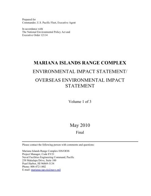
<strong>MARIANA</strong> <strong>ISLANDS</strong> <strong>RANGE</strong> <strong>COMPLEX</strong><br />
ENVIRONMENTAL IMPACT STATEMENT/<br />
OVERSEAS ENVIRONMENTAL IMPACT<br />
STATEMENT<br />
Volume 1 of 3<br />
May 2010<br />
Final<br />
Please contact the following person with comments and questions:<br />
Mariana Islands Range Complex EIS/OEIS<br />
Project Manager, Code EV21<br />
Naval Facilities Engineering Command, Pacific<br />
258 Makalapa Drive, Suite 100<br />
Pearl Harbor, HI 96869-3134<br />
Phone: 808-472-1402<br />
E-mail: marianas.tap.eis@navy.mil
This page intentionally left blank.
FINAL ENVIRONMENTAL IMPACT STATEMENT/<br />
OVERSEAS ENVIRONMENTAL IMPACT STATEMENT<br />
<strong>MARIANA</strong> <strong>ISLANDS</strong> <strong>RANGE</strong> <strong>COMPLEX</strong><br />
Lead Agency for the EIS\OEIS:<br />
Title of the Proposed Action:<br />
Affected Jurisdiction:<br />
Designation:<br />
U.S. Department of the Navy<br />
Mariana Islands Range Complex (MIRC)<br />
Mariana Islands<br />
Final Environmental Impact Statement/Overseas Environmental Impact<br />
Statement (EIS/OEIS)<br />
Abstract<br />
The National Environmental Policy Act of 1969 requires Federal agencies to examine the environmental<br />
effects of their proposed actions. On behalf of the Department of Defense Representative <strong>Guam</strong>,<br />
Commonwealth of the Northern Mariana Islands, Federated States of Micronesia and Republic of Palau the<br />
Navy is preparing this EIS/OEIS to assess the potential environmental effects associated with continuing<br />
and proposed military activities within the MIRC Study Area. The Navy is the lead agency for the<br />
EIS/OEIS because of its role as Executive Agent. The National Marine Fisheries Service (NMFS), the U.S.<br />
Department of the Interior, the U.S. Department of Agriculture Wildlife Services, the Federal Aviation<br />
Administration (FAA), the U.S. Army; the U.S. Marine Corps, the U.S. Air Force and the U.S. Coast Guard<br />
were invited as cooperating agencies. The NMFS, U.S. Department of Interior (Office of Insular Affairs),<br />
FAA, U.S. Marine Corps and U.S. Air Force have accepted as cooperating agencies.<br />
The military services (Services) have identified the need to support and conduct current, emerging, and<br />
future training and research, development, test, and evaluation (RDT&E) training activities in the Mariana<br />
Islands Study Area. Three alternatives are analyzed in this EIS/OEIS. The No Action Alternative will<br />
continue training and RDT&E activities of the same types, and at the same levels of training intensity as<br />
currently conducted, without change in the nature or scope of military activities in the EIS/OEIS study area.<br />
Alternative 1 is a proposal designed to meet the Services’ current and near-term operational training<br />
requirements. It would include increased training activities as a result of upgrades and modernization of<br />
existing training areas. This alternative also includes increased activities due to meeting new training and<br />
capability requirements for personnel and platforms, and an overall increase in the number and types of<br />
training events (including major exercises, the Intelligence, Surveillance and Reconnaissance/Strike Air<br />
Force initiative at Andersen Air Force Base, U.S. Marine Corps training activities, and the participation of<br />
allied forces in major exercises in the MIRC). Training activities will also increase as a result of the<br />
acquisition and development of new Portable Underwater Tracking Range capabilities supporting antisubmarine<br />
warfare and new facility capabilities supporting Military Operations in Urban Terrain training.<br />
Implementation of Alternative 2 would include all the actions proposed for MIRC, including the No Action<br />
Alternative and Alternative 1, and new activities related to additional Major Exercises.<br />
Prepared by:<br />
Point of Contact:<br />
Department of the Navy<br />
Mariana Islands Range Complex EIS/OEIS<br />
Project Manager, Code EV21<br />
Naval Facilities Engineering Command, Pacific<br />
258 Makalapa Drive, Suite 100<br />
Pearl Harbor, HI 96869-3134<br />
Phone: 808-472-1402<br />
E-mail: marianas.tap.eis@navy.mil
This page intentionally left blank
<strong>MARIANA</strong> <strong>ISLANDS</strong> <strong>RANGE</strong> <strong>COMPLEX</strong> FEIS/OEIS MAY 2010<br />
ES 1 EXECUTIVE SUMMARY<br />
ES 1.1 INTRODUCTION<br />
This Environmental Impact Statement (EIS)/Overseas Environmental Impact Statement (OEIS) analyzes<br />
the potential environmental consequences that may result from the Proposed Action and Alternatives,<br />
which address ongoing and proposed military training activities within the Mariana Islands Range<br />
Complex (MIRC). For the purposes of this EIS/OEIS, the MIRC and the Study Area are the same<br />
geographical areas. The MIRC consists of the ranges, airspace, and ocean areas surrounding the ranges<br />
that make up the Study Area. The Study Area does not include the sovereign territory (including waters<br />
out to 12 nautical miles [nm]) of the Federated States of Micronesia (FSM).<br />
This EIS/OEIS has been prepared by the Department of the Navy (DoN) in compliance with the National<br />
Environmental Policy Act (NEPA) of 1969 (42 United States Code [U.S.C.] Section [§] 4321 et seq.); the<br />
Council on Environmental Quality [CEQ] Regulations for Implementing the Procedural Provisions of<br />
NEPA (Title 40 Code of Federal Regulations [C.F.R.] §§ 1500-1508); Department of the Navy<br />
Procedures for Implementing NEPA (32 C.F.R. 775); and Executive Order 12114 (EO 12114),<br />
Environmental Effects Abroad of Major Federal Actions. The Navy is the lead agency for the EIS/OEIS<br />
because of its role as executive agent, and the EIS/OEIS has been prepared for the Department of Defense<br />
(DoD) Representative <strong>Guam</strong>, Commonwealth of the Northern Mariana Islands (CNMI), Federated States<br />
of Micronesia and Republic of Palau (DoD REP). This EIS/OEIS satisfies the requirements of NEPA and<br />
EO 12114, and will be filed with the U.S. Environmental Protection Agency (USEPA) and made<br />
available to appropriate Federal, State, local, and private agencies, organizations, and individuals for<br />
review and comment.<br />
The National Marine Fisheries Service (NMFS), United States (U.S.) Department of the Interior (Office<br />
of Insular Affairs), U.S. Department of Agriculture Wildlife Services (USDA WS), Federal Aviation<br />
Administration (FAA), U.S. Army, U.S. Marine Corps (USMC), U.S. Air Force (USAF), and U.S. Coast<br />
Guard (USCG) were invited as cooperating agencies. The NMFS, U.S. Department of Interior (Office of<br />
Insular Affairs), FAA, USMC, and USAF have agreed to be cooperating agencies.<br />
The Proposed Action would result in critical enhancements to increase training capabilities (especially in<br />
the undersea and air warfare areas) that are necessary if the military services are to maintain a state of<br />
military readiness commensurate with the national defense mission. The Proposed Action does not<br />
involve extensive changes to the MIRC facilities, activities, or training capabilities, nor does it involve an<br />
expansion of the existing MIRC boundaries or airspace requirements. The Proposed Action does not<br />
involve the redeployment of U.S. Army, USN, USMC, USAF, or US Coast Guard personnel or assets,<br />
carrier berthing capability, or deployment of strategic missile defense assets to the Marianas. The<br />
Proposed Action focuses on the development and improvement of existing training capabilities in the<br />
MIRC and does not include any military construction projects.<br />
This EIS/OEIS focuses on the achievement of Service readiness activities while the separate <strong>Guam</strong> and<br />
CNMI Marine Relocation EIS/OEIS focuses on the relocation of forces to the Marianas with its<br />
associated infrastructure and military construction requirements, Army Ballistic Missile Defense System,<br />
and construction of a new pier to support more frequent visits from transient Nuclear Aircraft Carrier<br />
(CVN) Berthing. The Intelligence, Surveillance, and Reconnaissance/Strike (ISR/Strike) EIS analyzes the<br />
force structure changes and associated support personnel and infrastructure requirements for new and<br />
increased aircraft events. Cumulative impact is the impact on the environment which results from the<br />
incremental impact of the action when added to other past, present, and reasonably foreseeable future<br />
actions and can result from individually minor but collectively significant actions taking place over a<br />
EXECUTIVE SUMMARY<br />
ES-1
<strong>MARIANA</strong> <strong>ISLANDS</strong> <strong>RANGE</strong> <strong>COMPLEX</strong> FEIS/OEIS MAY 2010<br />
period of time. Along with other cumulative effects, the cumulative impacts associated with the Marine<br />
relocation and ISR/Strike actions are analyzed within this EIS/OEIS.<br />
The Proposed Action is to use the MIRC to support and conduct current, emerging, and future training<br />
and Research, Development, Test, and Evaluation (RDT&E) activities, while enhancing training<br />
resources through investment in the ranges. Training and RDT&E activities do not include combat<br />
operations, operations in direct support of combat, or other activities conducted primarily for purposes<br />
other than training. Three alternatives have been analyzed to determine environmental impacts. The No<br />
Action Alternative consists of the current training that occurs in the MIRC. Alternative 1 includes current<br />
training and additional training as a result of new major exercises and ISR/Strike actions. Alternative 2<br />
consists of additional training above and beyond Alternative 1.<br />
The MIRC Study Area is located in the Western Pacific (WestPac) and consists of three primary<br />
components: ocean surface and undersea areas, special use airspace (SUA), and training land areas. The<br />
ocean surface and undersea areas extend from the international waters south of <strong>Guam</strong> to north of Pagan<br />
(CNMI), and from the Pacific Ocean east of the Mariana Islands to the middle of the Philippine Sea to the<br />
west, encompassing 501,873 square nautical miles (nm 2 ) (1,299,851 square kilometers [km 2 ]) of open<br />
ocean and littorals (coastal areas). The MIRC Study Area includes ocean areas in the Philippine Sea,<br />
Pacific Ocean, and exclusive economic zones (EEZs) of the United States and FSM. Portions of the<br />
Marianas Trench Marine National Monument, which was established in January 2009 by Presidential<br />
Proclamation under the authority of the Antiquities Act (16 U.S.C. 431), lie within the Study Area. The<br />
range complex includes land ranges and training area/facilities on <strong>Guam</strong>, Rota, Tinian, Saipan, and<br />
Farrallon de Medinilla (FDM), encompassing 64 nm 2 (220 km 2 ) of land. SUA consists of Warning Area<br />
517 (W-517), restricted airspace over FDM (R-7201), and Air Traffic Control Assigned Airspace<br />
(ATCAA) encompassing 63,000 nm 2 (216,000 km 2 ) of airspace. For range management and scheduling<br />
purposes, the MIRC is divided into training areas under different controlling authorities. MIRC-supported<br />
activities and training, RDT&E of military hardware, personnel, tactics, munitions, explosives, and<br />
electronic combat (EC) systems are described in Chapter 2. Figures ES-1 through ES-13, located at the<br />
end of this Executive Summary, depicts the MIRC Study Area and its components covered in this<br />
EIS/OEIS.<br />
Title 10 § 3062, 5062, and 8062 of the U.S.C. directs each of the U.S. Military Services (Services) to<br />
organize, train, and equip forces for combat. To fulfill their statutory missions, each of the Services needs<br />
combat-capable forces ready to deploy worldwide. U.S. military forces must have access to the ranges,<br />
operating areas (OPAREAs), and airspace needed to develop and maintain skills for the conduct of<br />
military activities. Ranges, OPAREAs, and airspace must be sustained to support the training needed to<br />
ensure a high state of military readiness. Activities involving RDT&E for military systems are an integral<br />
part of this readiness mandate.<br />
ES 2 PURPOSE AND NEED FOR THE PROPOSED ACTION<br />
The mission of the MIRC is to serve as the principal military training and basing venue in the WestPac<br />
with the unique capability and capacity to support required current, emerging, and future training.<br />
The purpose of the Proposed Action is to achieve and maintain Service readiness using the MIRC to<br />
support and conduct current, emerging, and future training and RDT&E activities, while enhancing<br />
training resources through investment in the ranges. The decision to be made by the DoD REP is to<br />
determine both the scope of training and RDT&E to be conducted and the nature of range enhancements<br />
to be made within the MIRC. In making this decision, the DoD REP will consider the information and<br />
environmental impact analysis presented in this EIS/OEIS when deciding whether to implement<br />
Alternative 1, Alternative 2, or the No Action Alternative.<br />
EXECUTIVE SUMMARY<br />
ES-2
<strong>MARIANA</strong> <strong>ISLANDS</strong> <strong>RANGE</strong> <strong>COMPLEX</strong> FEIS/OEIS MAY 2010<br />
The need for the Proposed Action is to enable the Services to meet their statutory responsibility to<br />
organize, train, equip, and maintain combat-ready forces and to successfully fulfill their current and future<br />
global mission of winning wars, deterring aggression, and maintaining freedom of the seas. Activities<br />
involving RDT&E are an integral part of this readiness mandate.<br />
The existing MIRC plays a vital part in the execution of this readiness mandate. Because of its close<br />
location to forward-deployed forces in WestPac, it provides the best economical alternative for forwarddeployed<br />
U.S. forces to train on U.S.-owned lands. U.S. forces also train in SUA and sea space outside of<br />
U.S. territorial boundaries. The Proposed Action is a step toward ensuring the continued vitality of this<br />
essential military training resource.<br />
This EIS/OEIS provides an assessment of environmental effects associated with current and proposed<br />
training activities, force structure (to include new weapons systems and platforms), and range investments<br />
in the MIRC.<br />
In summary, the Military Services propose to implement actions within the MIRC to support current,<br />
emerging, and future training and RDT&E in the MIRC. The Proposed Action focuses on the<br />
development and improvement of existing training capabilities in the MIRC and does not include any<br />
military construction projects. The actions evaluated in this EIS/OEIS include:<br />
• Maintaining baseline training and RDT&E at mandated levels;<br />
• Increasing training exercises from current levels;<br />
• Accommodating force structure changes (human resources, new platforms, and additional<br />
weapons systems); and<br />
• Developing range complex investment strategies that sustain, upgrade, modernize, and transform<br />
the MIRC to accommodate increased use and more realistic training scenarios.<br />
To support an informed decision, the EIS/OEIS identifies objectives and criteria for military activities in<br />
the MIRC Study Area. The core of the EIS/OEIS is the development and analysis of different alternatives<br />
for achieving the Services’ objectives. Alternatives development is a complex process, particularly in the<br />
dynamic context of military training. The touchstone for this process is a set of criteria that respond to the<br />
Services’ readiness mandate, as it is implemented in the MIRC. The criteria for developing and analyzing<br />
alternatives to meet these objectives are set forth in Section 2.2.1. These criteria provide the basis for the<br />
statement of the Proposed Action and Alternatives and selection of alternatives for further analysis<br />
(Chapter 2), as well as analysis of the environmental effects of the Proposed Action and Alternatives<br />
(Chapter 3).<br />
ES 2.1 WHY THE MILITARY TRAINS<br />
The United States military is maintained to uphold the U.S. constitution and to defend it from all enemies,<br />
foreign and domestic. In order to do so, Title 10 of the U.S.C. requires the Services to maintain, train, and<br />
equip combat-ready forces capable of winning wars, deterring aggression, and maintaining freedom of the<br />
seas. Modern war and security operations are complex. Modern weaponry has brought both<br />
unprecedented opportunity and innumerable challenges to the military. Smart weapons, used properly, are<br />
very accurate and actually allow the military to accomplish their mission with greater precision and far<br />
less destruction than in past conflicts. But these modern smart weapons are very complex to use. U.S.<br />
military personnel must train regularly with them to understand their capabilities, limitations, and<br />
operation. Modern military actions require teamwork between hundreds or thousands of people, and their<br />
various equipment, vehicles, ships, and aircraft, all working individually and as a coordinated unit to<br />
achieve success. Military training addresses all aspects of the team, from the individual to joint and<br />
EXECUTIVE SUMMARY<br />
ES-3
<strong>MARIANA</strong> <strong>ISLANDS</strong> <strong>RANGE</strong> <strong>COMPLEX</strong> FEIS/OEIS MAY 2010<br />
coalition teamwork. To do this, the military employs a building block approach to training. Training<br />
doctrine and procedures are based on operational requirements for deployment of forces. Training<br />
proceeds on a continuum, from teaching basic and specialized individual military skills, to intermediate<br />
skills or small-unit training, to advanced, integrated training events, culminating in multi-Service (Joint)<br />
exercises or predeployment certification events. In order to provide the experience so important to success<br />
and survival, training must be as realistic as possible. The military often employs simulators and synthetic<br />
training to provide early skill repetition and enhance teamwork, but live training in a realistic environment<br />
is vital to success. This requires: sufficient land, sea, and airspace to maneuver tactically; realistic targets<br />
and objectives; simulated opposition that creates a realistic enemy; and instrumentation to objectively<br />
monitor the events and learn to correct errors.<br />
Range complexes provide a controlled and safe environment with threat-representative targets that enable<br />
military forces to conduct realistic combat-like training as they undergo all phases of the graduated<br />
buildup needed for combat-ready deployment. Ranges and operating areas provide the space necessary to<br />
conduct controlled and safe training scenarios representative of those that the military would have to face<br />
in actual combat. The range complexes are designed to provide the most realistic training in the most<br />
relevant environments, replicating to the best extent possible the operational stresses of warfare. The<br />
integration of undersea ranges, with land training areas, safety landing fields, and amphibious landing<br />
sites, are critical to this realism, allowing execution of multidimensional exercises in complex scenarios.<br />
They also provide instrumentation that captures the performance of tactics and equipment in order to<br />
provide the feedback and assessment that is essential for constructive criticism of personnel and<br />
equipment. The live-fire phase of training facilitates assessment of the military’s ability to place weapons<br />
on target with the required level of precision while under a stressful environment. Live training will<br />
remain the cornerstone of readiness.<br />
ES 2.1.1<br />
The Strategic Importance of the MIRC<br />
The MIRC is characterized by a unique combination of attributes that make it a strategically important<br />
range complex for the Services. These attributes include the following:<br />
• Location within U.S. territory<br />
• Live-fire ranges on the islands of <strong>Guam</strong>, Tinian, and FDM<br />
• Expansive airspace, surface sea space, and underwater sea space<br />
• Authorized use of multiple types of live and inert ordnance on FDM<br />
• Support for all Navy warfare areas and numerous other Service roles, missions, and tactical tasks<br />
• Support to homeported Navy, Army, USCG, and USAF units based at military installations on<br />
<strong>Guam</strong> and CNMI<br />
• Training support for deployed forces<br />
• WestPac Theater training venue for Special Warfare forces<br />
• Ability to conduct Joint and combined force exercises<br />
• Rehearsal area for WestPac contingencies<br />
Due to <strong>Guam</strong> and CNMI’s strategic location and DoD’s ongoing reassessment of the WestPac military<br />
alignment, there has been a dramatic increase in the importance of the MIRC as a training venue and its<br />
capabilities to support required military training.<br />
EXECUTIVE SUMMARY<br />
ES-4
<strong>MARIANA</strong> <strong>ISLANDS</strong> <strong>RANGE</strong> <strong>COMPLEX</strong> FEIS/OEIS MAY 2010<br />
ES 3 SCOPE AND CONTENT OF THE EIS<br />
In its analysis under NEPA, the Navy includes areas of the MIRC Study Area 1 that lie within 12 nm (22<br />
kilometers [km]) of the shoreline, or the territorial seas. Environmental effects in the areas that are outside<br />
of U.S. territorial seas are analyzed under EO 12114 and associated implementing regulations.<br />
ES 3.1 NEPA<br />
This EIS/OEIS provides an assessment of environmental effects associated with current and proposed<br />
training activities, force structure (to include new weapons systems and platforms), and range investments<br />
in the MIRC.<br />
This EIS/OEIS incorporates the 1999 EIS for Military Training in the Marianas and supersedes the<br />
Overseas Environmental Assessment Notification for Air/Surface International Warning Areas (2002). In<br />
addition, this EIS/OEIS addresses the environmental impacts of future at-sea training events such as the<br />
Valiant Shield Exercise (last held in the summer of 2007), which was previously analyzed under separate<br />
environmental documentation. This expanded EIS/OEIS also gives the Navy an opportunity to review its<br />
procedures and ensure the benefits of recent scientific and technological advances are applied toward<br />
assessing environmental effects.<br />
The first step in the NEPA process is preparation of a notice of intent (NOI) to develop the EIS. The NOI<br />
provides an overview of the Proposed Action and the scope of the EIS. The NOI for this project was<br />
published in the Federal Register on June 1, 2007 (Federal Register Volume 72, No. 105, pp 30557-59).<br />
A newspaper notice was placed in two local newspapers, Pacific Daily News (<strong>Guam</strong>) and Saipan Tribune<br />
(Saipan/Tinian). The NOI and newspaper notices included information about comment procedures, a list<br />
of information repositories (public libraries), the dates and locations of the scoping meetings, and the<br />
project website address (www.MarianasRangeComplexEIS.com).<br />
Scoping is an early and open process for developing the “scope” of issues to be addressed in the EIS and<br />
for identifying significant issues related to a Proposed Action. The scoping process for this EIS/OEIS was<br />
initiated by the publication of the NOI in the Federal Register and local newspapers noted above. During<br />
scoping, the public is given an opportunity to help define and prioritize issues and convey these issues to<br />
the Navy through written comments. Scoping meetings were held at three locations: Hilton <strong>Guam</strong><br />
(Tumon Bay, <strong>Guam</strong>) on June 18, 2007; Hyatt Regency Saipan (Garapan Village, Saipan) on June 20,<br />
2007; and Tinian Dynasty Hotel (San Jose Village, Tinian) on June 21, 2007. There were 135 total<br />
attendees, including 65 in <strong>Guam</strong>, 48 in Saipan, and 22 in Tinian. As a result of the scoping process, the<br />
Navy received comments from the public, which have been considered in the preparation of this<br />
EIS/OEIS.<br />
Comments from the public were received through public comment forms, which were available at each<br />
information station and were collected during the meeting. The forms could also be mailed to the address<br />
or e-mail address provided on the form. For people who wanted to submit oral comments, there were two<br />
options: a tape recorder was available for people wanting to dictate their comments directly into the<br />
recorder and a Navy representative was also available to transcribe public comments using a laptop<br />
1 For the purposes of this EIS, the MIRC and the Study Area are the same geographical areas. The complex consists of the ranges and the ocean<br />
areas surrounding the ranges that make up the Study Area. The Study Area does not include the sovereign territory (including waters out to 12<br />
nm) of the Federated States of Micronesia (FSM).<br />
EXECUTIVE SUMMARY<br />
ES-5
<strong>MARIANA</strong> <strong>ISLANDS</strong> <strong>RANGE</strong> <strong>COMPLEX</strong> FEIS/OEIS MAY 2010<br />
computer. During scoping, the Marianas EIS/OEIS team set up and allowed the public to submit<br />
comments electronically via an e-mail address, marianas.tap.eis@navy.mil, which, at that time, was the<br />
preferred electronic method to offer the public for submitting comments. A total of 25 individual public<br />
comments were received, including written and oral comments from the public meetings and written<br />
comments via mail and e-mail.<br />
Subsequent to the scoping process, the Navy and Federal and local regulators met quarterly to discuss<br />
additional scoping issues of concerns prior to development of this EIS/OEIS. A Draft EIS/OEIS was<br />
prepared to assess the potential effects of the Proposed Action and Alternatives on the environment. It<br />
was then provided to the U.S. Environmental Protection Agency (EPA) for review and comment. A notice<br />
of availability was published in the Federal Register on January 30, 2009. Notices were placed in local<br />
newspapers announcing the availability of the Draft EIS/OEIS. The Draft EIS/OEIS was available for<br />
general review and was circulated for review and comment. Public meetings were advertised and held in<br />
similar venues as the scoping meetings to receive public comments on the Draft EIS/OEIS.<br />
The DoD REP published a combined Notice of Availability (NOA)/Notice of Public Hearings (NOPH)<br />
newspaper display advertisement in the Pacific Daily News, the Saipan Tribune and the Marianas Variety<br />
announcing the dates, times and locations of the public hearings. The NOA/NOPH ad also included<br />
information on how to comment on the Draft EIS/OEIS. An overview of additional notification efforts,<br />
from postcards to fliers, and a list of information repositories that received copies of the Draft EIS/OEIS<br />
are included in Chapter 11.<br />
Public hearings were held at five locations, two on <strong>Guam</strong> and one each on Saipan, Tinian, and Rota.<br />
There were 129 total attendees, including 52 in <strong>Guam</strong>, 40 in Saipan, 22 in Tinian, and 15 in Rota as<br />
shown in Table ES-1.<br />
Table ES-1: Meeting Locations, Dates, and Attendees—Public Hearings<br />
Jesus & Eugenia Leon Guerrero School<br />
Location Date Public Attendees<br />
of Business and Public Administration<br />
Building, University of <strong>Guam</strong>, <strong>Guam</strong><br />
19 February 2009 32<br />
Southern High School, Santa Rita, <strong>Guam</strong> 20 February 2009 20<br />
Multi-Purpose Center, Susupe, Saipan 23 February 2009 40<br />
Tinian Elementary School, San Jose Village, Tinian 24 February 2009 22<br />
Sinapolo Elementary School, Sinapolo, Rota 26 February 2009 15<br />
The public hearings were dual format, consisting of an open house where the public could view<br />
informational posters and speak to project representatives and a formal hearing where information from<br />
the MIRC Draft EIS/OEIS was presented and individual testimony accepted. The purpose of the public<br />
review process and the public hearings was to solicit comments on the Draft EIS/OEIS. The public<br />
hearings identified environmental issues that the public, elected officials and government agencies<br />
believed needed further analysis. In addition to providing written or verbal comments at the public<br />
hearings, the public could also provide comments through the project website, by sending an email, or by<br />
mailing a written comment. The comment period originally ended March 16, 2009, but was extended 15<br />
EXECUTIVE SUMMARY<br />
ES-6
<strong>MARIANA</strong> <strong>ISLANDS</strong> <strong>RANGE</strong> <strong>COMPLEX</strong> FEIS/OEIS MAY 2010<br />
days until March 31, 2009, to allow for additional public input. Transcripts from the hearings and written<br />
public comments received during the comment period are provided in Chapter 11. A summary of<br />
comments (number of commenters, resource issues identified, number of comments by resource issue) is<br />
provided in detail in Chapter 11. A total of 68 public comments were provided during the public hearings<br />
(Table 11-5). A total of 762 comments were received (Table 11-8). Responses to each comment received<br />
from the public and agencies pertaining to specific resource areas and locations are also provided in detail<br />
in Chapter 11. Those comments received from the public concerning Department of Defense (DoD)<br />
policy and program issues outside the scope of the analysis in this EIS/OEIS were not addressed in the<br />
EIS/OEIS.<br />
Responses to public comments may take various forms as necessary, including correction of data,<br />
clarifications of and modifications to analytical approaches, and inclusion of additional data or analyses.<br />
The Final EIS/OEIS was made available to the public.<br />
The Record of Decision (ROD) will summarize the DoD REP’s decision and identify the selected<br />
alternative, describe the public involvement and agency decision-making processes, and present<br />
commitments to specific mitigation measures.<br />
ES 3.2 EXECUTIVE ORDER (EO) 12114<br />
EO 12114, Environmental Effects of Major Federal Actions, directs Federal agencies to provide for<br />
informed decision-making for major Federal actions outside the U.S. territorial sea, but not including<br />
actions within the territory or territorial sea of a foreign nation. For purposes of this EIS/OEIS, areas<br />
outside U.S. territorial sea are considered to be areas beyond 12 nm from shore. This EIS/OEIS satisfies<br />
the requirements of EO 12114, as analysis of activities or impacts occurring, or proposed to occur, outside<br />
of 12 nm is provided.<br />
For the majority of resource sections addressed in this EIS/OEIS, projected impacts outside of U.S.<br />
territory would be similar to those within the territorial sea. In addition, the baseline environment and<br />
associated impacts to the various resource areas analyzed in this EIS/OEIS are not substantially different<br />
within or outside the 12 nm jurisdictional boundary. Therefore, for these resource sections, the impact<br />
analyses contained in the main body of the EIS/OEIS are comprehensive and follow both NEPA and EO<br />
12114 guidelines. The description of the affected environment addresses areas both within and beyond<br />
U.S. territorial sea.<br />
ES 3.3 OTHER ENVIRONMENTAL REQUIREMENTS CONSIDERED<br />
The Services must comply with a variety of other Federal environmental laws, regulations, and EOs.<br />
These include (among other applicable laws and regulations) the following:<br />
• Marine Mammal Protection Act (MMPA)<br />
• Endangered Species Act (ESA)<br />
• Migratory Bird Treaty Act (MBTA)<br />
• Coastal Zone Management Act (CZMA)<br />
• Rivers and Harbors Act (RHA)<br />
• Magnuson-Stevens Fishery Conservation and Management Act (MSFCMA) for Essential Fish<br />
Habitat (EFH)<br />
• Marine Protection, Research and Sanctuaries Act (MPRSA)<br />
• Clean Air Act (CAA)<br />
• Federal Water Pollution Control Act (Clean Water Act [CWA])<br />
EXECUTIVE SUMMARY<br />
ES-7
<strong>MARIANA</strong> <strong>ISLANDS</strong> <strong>RANGE</strong> <strong>COMPLEX</strong> FEIS/OEIS MAY 2010<br />
• National Historic Preservation Act (NHPA)<br />
• National Invasive Species Act<br />
• Resource Conservation and Recovery Act (RCRA)<br />
• EO 12898, Federal Actions to Address Environmental Justice in Minority Populations and Low-<br />
Income Populations<br />
• EO 13045, Environmental Health and Safety Risks to Children<br />
• EO 13089, Protection of Coral Reefs<br />
• EO 13112, Invasive Species<br />
In addition, laws and regulations of the Territory of <strong>Guam</strong> and the CNMI that are applicable to military<br />
actions are identified and addressed in this EIS/OEIS. To the extent practicable, this EIS/OEIS was used<br />
as the basis for any required consultation and coordination in connection with applicable laws and<br />
regulations.<br />
ES 4 PROPOSED ACTION AND ALTERNATIVES<br />
ES 4.1 ALTERNATIVES DEVELOPMENT<br />
NEPA-implementing regulations provide guidance on the consideration of alternatives in an EIS. These<br />
regulations require the decision-maker to consider the environmental effects of the Proposed Action and a<br />
range of alternatives to the Proposed Action (40 C.F.R. § 1502.14). The range of alternatives includes<br />
reasonable alternatives, which must be rigorously and objectively explored, as well as other alternatives<br />
that are eliminated from detailed study. To be “reasonable,” an alternative must meet the stated purpose of<br />
and need for the Proposed Action.<br />
The purpose of including a No Action Alternative in environmental impact analyses is to ensure that<br />
agencies compare the potential impacts of the proposed Federal action to the known impacts of<br />
maintaining the status quo. Section 1502.14(d) of the CEQ guidelines requires that the alternatives<br />
analysis in the EIS “include the alternative of no action.” For evaluating the Proposed Action under this<br />
EIS, the current level of range management activity is used as a benchmark. By proposing the status quo<br />
as the No Action Alternative, the Navy compares the impacts of the proposed alternatives to the impacts<br />
of continuing to operate, maintain, and use the MIRC in the same manner and at the same levels as they<br />
do now.<br />
The No Action Alternative is representative of baseline conditions, where the action presented represents<br />
a regular and historical level of activity on the MIRC to support training activities and exercises. The No<br />
Action Alternative serves as a baseline, and represents the “status quo” when studying levels of range<br />
usage and activity. This use of the current level of operations as a baseline level is appropriate under CEQ<br />
guidance, as set forth in the Forty Most Asked Questions Concerning CEQ’s National Environmental<br />
Policy Act Regulations, Question #3 (http://ceq.hss.doe.gov/nepa/regs/40/40p1.htm). The current military<br />
training the MIRC was initially addressed in the 1999 Military Training in the Marianas EIS, and in<br />
several Environmental Assessments (EAs) (e.g., Overseas EA Notification for Air/Surface International<br />
Warning Areas and Valiant Shield Overseas EA [OEA]) for more specific training events or platforms.<br />
Alternative 1 and Alternative 2 analyze greater use of range assets to support training activities and<br />
maximize training opportunities that fully supports the increased training requirements of the ISR/Strike<br />
initiative and increased surface and undersea training.<br />
The Services have developed a set of criteria for use in assessing whether a possible alternative meets the<br />
purpose of and need for the Proposed Action. Each of the alternatives must be feasible, reasonable, and<br />
reasonably foreseeable in accordance with CEQ regulations (40 C.F.R. §§ 1500-1508). Reasonable<br />
EXECUTIVE SUMMARY<br />
ES-8
<strong>MARIANA</strong> <strong>ISLANDS</strong> <strong>RANGE</strong> <strong>COMPLEX</strong> FEIS/OEIS MAY 2010<br />
alternatives include those that are practical or feasible from the technical and economic standpoint.<br />
Alternatives that are outside the scope of what Congress has approved or funded must still be evaluated in<br />
the EIS/OEIS if they are reasonable, because the EIS/OEIS may serve as the basis for modifying<br />
congressional approval or funding in light of NEPA goals and policies.<br />
Alternatives were selected based on their ability to meet the following criteria:<br />
1. Location where Joint U.S. forces can train within a specified geographical region.<br />
2. Location where 7th Fleet forces can train within their area of responsibility (AOR).<br />
3. Location where training requirements of deployed military forces can be met while remaining<br />
within range of WestPac nations.<br />
4. Location where training can be accomplished within the territory of the United States.<br />
5. Training capabilities must meet operational requirements by supporting realistic training.<br />
6. Training capacity must meet Fleet deployment schedules, and Service training schedules,<br />
standards, and exercises.<br />
7. The range complex must meet the requirements of DoD Directive 3200.15, “Sustainment of<br />
Ranges and Operating Areas (OPAREA)”.<br />
8. The range complex must be capable of implementing new training requirements and RDT&E<br />
activities.<br />
9. The range complex must be capable of supporting current and forecasted range and training<br />
upgrades.<br />
NEPA regulations require that the Federal action proponent study means to mitigate adverse<br />
environmental impacts by virtue of going forward with the Proposed Action or an alternative (40 C.F.R. §<br />
1502.16). Additionally, an EIS is to include study of appropriate mitigation measures not already included<br />
in the Proposed Action or alternatives (40 C.F.R. § 1502.14 [h]). Each of the alternatives, including the<br />
Proposed Action considered in this EIS/OEIS, includes mitigation measures intended to reduce the<br />
environmental effects of military activities. Protective measures, such as Best Management Practices<br />
(BMPs) and Standard Operating Procedures (SOPs), are discussed throughout this EIS/OEIS.<br />
ES 4.2 ALTERNATIVES ELIMINATED FROM FURTHER CONSIDERATION<br />
Having identified criteria for generating alternatives for consideration in this EIS/OEIS (see Section<br />
2.2.1), the Navy eliminated several alternatives from further consideration after initial review.<br />
Specifically, the following potential alternatives (described in Section 2.2.2) were not carried forward for<br />
analysis:<br />
• Alternative range complex locations;<br />
• Simulated training;<br />
• Concentrating the level of current training in the MIRC to fewer sites;<br />
• Reduction of activity types and activity levels; and<br />
• Alternative based on mitigations.<br />
After careful consideration of each of these potential alternatives in light of the identified criteria, it was<br />
determined that none of them meets the Purpose and Need for the Proposed Action.<br />
ES 4.3 ALTERNATIVES CONSIDERED<br />
Three alternatives are analyzed in this EIS/OEIS:<br />
EXECUTIVE SUMMARY<br />
ES-9
<strong>MARIANA</strong> <strong>ISLANDS</strong> <strong>RANGE</strong> <strong>COMPLEX</strong> FEIS/OEIS MAY 2010<br />
1. No Action Alternative - Current Training Activities<br />
2. Alternative 1 - Increase Training; Modernization; and Upgrades<br />
3. Alternative 2 - Increase Major At-Sea Exercises and Training<br />
As noted in Section 1.4, the purpose of the Proposed Action is to achieve, enhance, and maintain Military<br />
readiness using the MIRC Study Area to support current and future training. The Services propose to:<br />
• Increase training and RDT&E from current levels as necessary;<br />
• Accommodate mission requirements associated with force structure changes and introduction of<br />
new weapons and systems to the Services; and<br />
• Implement enhanced range complex capabilities.<br />
The components that make up the Proposed Action are discussed in the following sections.<br />
ES 4.3.1<br />
No Action Alternative ― Current Training within the MIRC<br />
The No Action Alternative is the continuation of existing training activities, RDT&E activities, and<br />
continuing base activities. This includes all multi-Service training activities on DoD training areas,<br />
including either a Joint expeditionary warfare exercise or a Joint multi-strike group exercise. Current<br />
military training and RDT&E activities in the MIRC have been evaluated in the Final Environmental<br />
Impact Statement for Military Training in the Marianas, June 1999 and in several Environmental<br />
Assessments (e.g., OEA Notification for Air/Surface International Warning Areas and Valiant Shield<br />
OEA). As such, evaluation of the No Action Alternative in this EIS/OEIS provides a baseline for<br />
assessing environmental impacts of Alternative 1 (Preferred Alternative), and Alternative 2, as described<br />
in the following sections.<br />
While the No Action Alternative meets a portion of the Service’s requirements, it does not meet the<br />
purpose and need. This alternative does not provide for training capabilities for ISR/Strike, undersea<br />
warfare improvements, or increased training activities within the MIRC.<br />
With reference to the criteria identified in Section 2.2.1, the No Action Alternative does not satisfy<br />
criteria 7, 8, and 9 (relating to support for the full spectrum of training requirements). See Tables 2-7, 2-8,<br />
2-9, and 2-10 for summaries of major exercises, annual training activities, ordnance use, and sonar<br />
activities (mid Frequency Active [MFA] and Surveillance Towed-Array Sensor System [SURTASS] Low<br />
Frequency Active [LFA] sonar), respectively, in the MIRC Study area associated with the No Action<br />
Alternative.<br />
ES 4.3.2<br />
Alternative 1 (Preferred Alternative) ― Increase Training, Modernization,<br />
and Upgrades<br />
Alternative 1 is a proposal designed to meet the Services’ current and near-term training requirements. If<br />
Alternative 1 were to be selected, in addition to accommodating the No Action Alternative, it would<br />
include increased training activities as a result of upgrades and modernization of existing training areas.<br />
Only the training portion as described in Chapter 2 for Alternative 1 is covered for the ISR/Strike<br />
initiative in the MIRC EIS/OEIS. Other ISR/Strike actions are covered in the ISR/Strike EIS. This<br />
alternative also includes increased activities due to meeting new training and capability requirements for<br />
personnel and platforms, and an overall increase in the number and types of events (including major<br />
exercises, the ISR/Strike Air Force initiative at Andersen Air Force Base (AFB), other services and<br />
agencies (USMC, USA, USCG, Department of Homeland Security [DHS], and the participation of the<br />
allied forces in major exercises in the MIRC). Activities will also increase as a result of the acquisition<br />
EXECUTIVE SUMMARY<br />
ES-10
<strong>MARIANA</strong> <strong>ISLANDS</strong> <strong>RANGE</strong> <strong>COMPLEX</strong> FEIS/OEIS MAY 2010<br />
and development of new Portable Underwater Tracking Range capabilities supporting Anti-Submarine<br />
Warfare (ASW), and new facility capabilities supporting MOUT training.<br />
Major Exercises. Training activities would be increased to include training in major exercises, multi-<br />
Service and Joint exercises involving multiple strike groups and task forces. Major exercises provide<br />
multi-Service and Joint participation in realistic maritime and expeditionary training that is designed to<br />
replicate the types of events and challenges that could be faced during real-world contingency operations.<br />
Major exercises also include providing training to submarine, ship, aircraft, and special warfare forces in<br />
mission tactics, techniques, and procedures.<br />
The Navy intends to conduct three exercises during a five-year period that may include both SURTASS<br />
LFA and MFA active sonar sources. The Navy has analyzed all SURTASS LFA sonar use in Final and<br />
Supplemental EISs/OEISs, and its operation is covered by associated environmental documentation. The<br />
LFA sonar and the MFA sonar would not normally be operated in close proximity to each other or at the<br />
same time.<br />
(Note: The <strong>Guam</strong> and CNMI Marine Relocation EIS/OEIS for the relocation of USMC forces from<br />
Okinawa to <strong>Guam</strong> examines the potential impact from activities associated with the USMC units’<br />
relocation, including facilities and infrastructure. In addition, the EIS/OEIS addresses the proposed Army<br />
missile defense system on <strong>Guam</strong>, and the infrastructure required for berthing a visiting aircraft carrier.<br />
Since the MIRC EIS/OEIS covers DoD training on existing DoD land and training areas in and around<br />
<strong>Guam</strong> and the CNMI, there is overlap between the two EIS/OEISs in the area of usage of existing DoD by<br />
USMC units. These documents are being closely coordinated to ensure consistency.)<br />
ISR/Strike. Only the training portion as described in Chapter 2 for Alternative 1 is covered for the<br />
ISR/Strike initiative in the MIRC EIS/OEIS. Other ISR/Strike actions are covered in the ISR/Strike EIS.<br />
The USAF has established the ISR/Strike program at Andersen AFB, <strong>Guam</strong>. ISR/Strike will be<br />
implemented in phases over a planning horizon of FY2007–FY2016. ISR/Strike force structure consists<br />
of up to 24 fighter, 12 aerial refueling, six bomber, and four unmanned aircraft with associated support<br />
personnel and infrastructure. Environmental impacts associated with the establishment of ISR/Strike on<br />
Andersen AFB have been analyzed in the 2006 Establishment and Operation of an Intelligence,<br />
Surveillance and Reconnaissance/Strike, Andersen Air Force Base, EIS. Implementation of Alternative 1<br />
analyzed in this EIS/OEIS would result in ISR/Strike aircraft events out of Andersen AFB increasing by<br />
45 percent over the current level (FY2006). The 45 percent increase in aircraft events out of and into<br />
Andersen AFB, as analyzed in the 2006 EIS, requires improved range infrastructure to accommodate this<br />
increased training tempo, newer aircraft, and weapon systems commensurate with ISR/Strike force<br />
structure. There will be increased activity on all the current training areas supporting USAF activities: W-<br />
517, ATCAAs, and FDM.<br />
FDM. Under the No Action Alternative, public access to FDM is strictly prohibited and there are no<br />
commercial or recreational activities on or near the island. During training exercises, aircraft and marine<br />
vessels are restricted within a 3-nm (5-km) radius. Notices-to-Mariners (NOTMARs) and Notices-to-<br />
Airmen (NOTAMs) are issued at least 72 hours in advance of potentially hazardous FDM range events<br />
and may advise restrictions beyond 3-nm (5-km) from FDM for certain training events. These temporary<br />
advisory restrictions are used to maintain the safety of the military and the public during training sessions<br />
by providing public notice of potentially hazardous training activity and temporary Danger Zones and<br />
Restricted Areas.<br />
FDM and the nearshore waters are leased to the United States for military purposes specifically for use as<br />
a live fire naval gunfire and air warfare air strike training range. As such, FDM and its nearshore area<br />
have always been an off-limits area to all personnel both civilian and military due to unexploded ordnance<br />
EXECUTIVE SUMMARY<br />
ES-11
<strong>MARIANA</strong> <strong>ISLANDS</strong> <strong>RANGE</strong> <strong>COMPLEX</strong> FEIS/OEIS MAY 2010<br />
concerns. The lease agreement between CNMI and the United States, states in pertinent part, at Article 12<br />
of the lease: “c. Farallon de Medinilla: Public access to Farallon de Medinilla Island and the waters of the<br />
Commonwealth immediately adjacent thereto shall be permanently restricted for safety reasons.” This<br />
restriction will continue and FDM and nearshore areas, including the fringing reef remain a restricted<br />
area, which prohibits the entry of all personnel, civilian and military from the island without specific<br />
permission from Commander, Joint Region Marianas.<br />
Under implementation of either Alternative 1 or Alternative 2, a 10-nm surface Danger Zone would be<br />
established to restrict all private and commercial vessels from entering the area during the conduct of<br />
hazardous training activity. The proposed Danger Zone would designate a surface safety zone of 10-nm<br />
radius surrounding FDM. The creation of the proposed Danger Zone does not affect the continued<br />
implementation of restricted access as indicated in the lease agreement; and, therefore no trespassing is<br />
permitted on the island or nearshore waters and reef at any time. Public access to FDM will remain<br />
strictly prohibited and there are no commercial or recreational activities on or near the island. NOTMARs<br />
and NOTAMs will continue to be issued at least 72 hours in advance of potentially hazardous FDM range<br />
events and may advise restrictions for certain training events.<br />
Scheduled training will be communicated to the stakeholders (e.g., local mayors, resources agencies,<br />
fishermen) using a telephone tree and e-mail (developed by Joint Region Marianas with stakeholders’<br />
input) to send, facsimiles to mayors and fishermen, and notices on the NOAA and local cable channels,<br />
and emergency management offices. This safety zone provides an additional measure of safety for the<br />
public during hazardous training activities involving the island. The surface Danger Zone is proposed as a<br />
surface safety exclusion area to be established in accordance with 33 CFR § 334.1. The U.S. Army Corps<br />
of Engineers (USACE) may promulgate regulations restricting commercial, public, and private vessels<br />
from entering the restricted safety zone to minimize danger from the hazardous activity in the area.<br />
Anti-Submarine Warfare (ASW). ASW describes the entire spectrum of platforms, tactics, and weapon<br />
systems used to neutralize and defeat hostile submarine threats to combatant and noncombatant maritime<br />
forces. A critical component of ASW training is the Portable Underwater Tracking Range (PUTR). The<br />
acquisition and development of new PUTR capabilities would allow near real-time tracking and feedback<br />
to all participants. The PUTR should provide both a shallow water and deep water operating environment,<br />
with a variety of bottom slope and sound velocity profiles similar to potential contingency operating<br />
areas. <strong>Guam</strong>-homeported submarine crews, as well as crews of transient submarines, require ASW<br />
training events to maintain qualifications. A MIRC-instrumented ASW PUTR, target support services,<br />
and assigned torpedo retriever craft would meet support requirements for Torpedo Exercise (TORPEX)<br />
and Tracking Exercise (TRACKEX) activities in the MIRC in support of Fast Attack Submarine (SSN)<br />
and Ballistic Missile Submarine (SSBN) and other deployed forces.<br />
Military Operations in Urban Terrain (MOUT). MOUT training is conducted within a facility that<br />
replicates an urban area, to the extent practicable. The urban area includes a central urban infrastructure of<br />
buildings, blocks, and streets; an outlying suburban residential area; and outlying facilities. Suburban area<br />
structures should represent a local noncombatant populace and infrastructure. The Services will need to<br />
repair and upgrade the existing MOUT facilities to support training requirements of special warfare units<br />
stationed at or deployed to the MIRC.<br />
See Tables 2-7, 2-8, 2-9, and 2-10 for a summary of major exercises, annual training activities, ordnance<br />
use, and sonar activities, respectively, in the MIRC Study area associated with Alternative 1.<br />
Laser Range. Training activities will increase as a result of the development of a laser certified range<br />
area in W-517. This laser range capability will aid in the training of aircrews in the delivery of air-tosurface<br />
missiles against surface vessel targets. Primarily conducted in W-517, the weapon systems<br />
EXECUTIVE SUMMARY<br />
ES-12
<strong>MARIANA</strong> <strong>ISLANDS</strong> <strong>RANGE</strong> <strong>COMPLEX</strong> FEIS/OEIS MAY 2010<br />
commonly used in this training activity are the laser guided HELLFIRE missile or an inert captive air<br />
training missile (CATM). The CATM is a missile shape that contains electronics only, and it remains<br />
attached to the aircraft weapon mounting points. The MISSILEX involves in-flight laser designation and<br />
guidance, and arming and releasing of the air to surface weapon by aircraft, typically against a small<br />
stationary, towed, or maneuvering target; however a CATM Exercise (CATMEX) may be conducted<br />
against any laser reflective target mounted on or towed by a target support vessel.<br />
ES 4.3.3<br />
Alternative 2 ― Increase Major At-Sea Exercises and Training<br />
Implementation of Alternative 2 would include all the actions proposed for the MIRC, including the No<br />
Action Alternative and Alternative 1, and increased training activity associated with an increase in major<br />
at-sea exercises including Fleet Strike Group Exercise (Carrier Strike Group), Integrated ASW Exercise<br />
(Strike Group), and Ship Squadron ASW Exercise (Cruiser, Destroyer).<br />
Fleet Strike Group Exercise. Would be conducted in the MIRC by forward-deployed Navy Strike<br />
Groups to sustain or assess their proficiency in conducting tasking within the Seventh Fleet. Training<br />
would be focused on conducting Strike Warfare or ASW in the most realistic environment, against the<br />
level of threat expected in order to effect changes to both training and capabilities (e.g., equipment,<br />
tactics, and changes to size and composition) of the Navy Strike Group. Although these exercises would<br />
emphasize Strike or ASW, there is significant training value inherent in all at-sea exercises and the<br />
opportunity to exercise other mission areas. Each exercise would last a week or less.<br />
Integrated ASW Exercise. This is an ASW exercise to be conducted by the Navy’s Strike Groups to<br />
assess their ASW proficiency while located in the Seventh Fleet area of activities. The exercise is<br />
designed to assess the Strike Groups’ ability to conduct ASW in the most realistic environment, against<br />
the level of threat expected, in order to effect changes to both training and capabilities (e.g., equipment,<br />
tactics, and changes to size and composition) of U.S. Navy Strike Groups. Strike Groups would receive<br />
significant training value in the assessment, as training is inherent in all at-sea exercises.<br />
Ship Squadron ASW Exercise. The exercise will typically involve multiple ships, submarines, and<br />
aircraft in several coordinated events over a period of a week or less, focused on all elements of ASW<br />
training.<br />
See Tables 2-7, 2-8, 2-9, and 2-10 for summary of major exercises, annual training activities, ordnance<br />
use, and sonar activities, respectively, in the MIRC Study area associated with Alternative 2.<br />
ES 5 PREFERRED ALTERNATIVE<br />
The Preferred Alternative (Alternative 1) in this EIS/OEIS (See Chapter 2 for details) was evaluated to<br />
ensure it met the purpose and need, giving due consideration to range complex attributes such as the<br />
capability to support current and emerging Fleet training and RDT&E requirements; the capability to<br />
support realistic, essential training at the level and frequency sufficient to support the Fleet Response<br />
Training Plan (FRTP); and the capability to support training requirements while following Navy<br />
Personnel Tempo of Operations (i.e., time away from homeport) guidelines.<br />
The Preferred Alternative maintains current activities, increases training, expands warfare missions,<br />
accommodates force structure changes (changes in weapon systems and platforms and homebase new<br />
aircraft and ships), and implements enhancements to enable each range complex to meet foreseeable<br />
needs. In addition to the discussion/analysis of the Preferred Alternative, the EIS/OEIS includes<br />
descriptions and analyses of the No Action Alternative and Alternative 2. The DoD REP will not make its<br />
EXECUTIVE SUMMARY<br />
ES-13
<strong>MARIANA</strong> <strong>ISLANDS</strong> <strong>RANGE</strong> <strong>COMPLEX</strong> FEIS/OEIS MAY 2010<br />
decision of which alternative it will implement until the ROD is signed at the conclusion of the NEPA<br />
process.<br />
ES 6 AFFECTED ENVIRONMENT AND ENVIRONMENTAL<br />
CONSEQUENCES<br />
Chapter 3 of this EIS/OEIS describes existing environmental conditions and environmental consequences<br />
for resources potentially affected by the Proposed Action and Alternatives described in Chapter 2. This<br />
chapter also identifies and assesses the environmental consequences of the Proposed Action and<br />
Alternatives. The affected environment and environmental consequences are described and analyzed<br />
according to categories of resources. The categories of resources addressed in this EIS/OEIS and the<br />
location of the respective analyses are identified in the following table:<br />
Table ES-2: Categories of Resources Addressed and EIS/OEIS Chapter 3 Analysis Guide<br />
Resource<br />
Section<br />
Geology, Soils, and Bathymetry 3.1<br />
Hazardous Materials 3.2<br />
Water Quality 3.3<br />
Air Quality 3.4<br />
Airborne Noise 3.5<br />
Marine Communities 3.6<br />
Marine Mammals 3.7<br />
Sea Turtles 3.8<br />
Fish and Essential Fish Habitat 3.9<br />
Seabirds and Shorebirds 3.10<br />
Terrestrial Species and Habitats 3.11<br />
Socioeconomic Resources (Land Use, Transportation, Demographics,<br />
Regional Economy, Recreation)<br />
3.12, 3.14, 3.15, 3.16, 3.17<br />
Cultural Resources 3.13<br />
Environmental Justice and Protection of Children 3.18<br />
Public Health and Safety 3.19<br />
ES 6.1 GENERAL ANALYSIS APPROACH TO ASSESSING ENVIRONMENTAL CONSEQUENCES<br />
Each alternative analyzed in this EIS/OEIS includes several warfare areas (e.g., AW, Amphibious<br />
Warfare [AMW], ASW, Electronic Combat (EC), Mine Warfare [MIW], Naval Special Warfare [NSW],<br />
Surface Warfare [SUW], and Strike Warfare [STW], etc.). Likewise, several activities (e.g., vessel<br />
EXECUTIVE SUMMARY<br />
ES-14
<strong>MARIANA</strong> <strong>ISLANDS</strong> <strong>RANGE</strong> <strong>COMPLEX</strong> FEIS/OEIS MAY 2010<br />
movements, aircraft overflights, weapons firing) are accomplished under each event, and those activities<br />
typically are not unique to that event. For example, many of the activities involve Navy vessel movements<br />
and aircraft overflights. Detailed descriptions of the events are contained in Appendix D. The analysis for<br />
each resource category is organized by warfare areas and/or stressors associated with that activity.<br />
Chapter 3 contains the details of the analyses. The following general steps were used to analyze the<br />
potential environmental consequences of the alternatives to:<br />
• Identify those aspects of the Proposed Action that are likely to act as stressors to resources by<br />
having a direct or indirect effect on the physical, chemical, and biotic environment of each Study<br />
Area.<br />
• Identify those aspects of the Proposed Action that required detailed analysis in the EIS/OEIS.<br />
• Identify the resources that are likely to co-occur with the stressors in space and time, and the<br />
nature of that co-occurrence (exposure analysis).<br />
• Determine whether and how resources are likely to respond given their exposure and available<br />
scientific knowledge of their responses (response analysis).<br />
• Determine the risks those responses pose to resources and the significance of those risks.<br />
ES 6.2 ENVIRONMENTAL STRESSORS ANALYZED<br />
Of the potential environmental stressors considered in the analysis, the following stressors were carried<br />
forward for detailed analysis for all resources categories:<br />
• Vessel movements<br />
• Aircraft overflights<br />
• Sonar<br />
• Weapons Firing (including explosions and underwater detonations)<br />
• Nonexplosive Mine Shapes (deployed in the ocean and recovered)<br />
• Expended Materials<br />
• Amphibious Landings<br />
• Vehicle Movements<br />
• Building Modification (repairs, maintenance, and upgrade)<br />
• Land Detonations<br />
• Foot Traffic<br />
ES 6.3 SUMMARY OF ENVIRONMENTAL IMPACTS<br />
Environmental effects which might result from the implementation of the Navy’s Proposed Action or<br />
alternatives have been summarized in Table ES-3. A detailed analysis of effects is provided in Chapter 3.<br />
EXECUTIVE SUMMARY<br />
ES-15
<strong>MARIANA</strong> <strong>ISLANDS</strong> <strong>RANGE</strong> <strong>COMPLEX</strong> FEIS/OEIS MAY 2010<br />
Table ES-3: Summary of Environmental Impacts<br />
Resource<br />
Category<br />
Alternative<br />
National Environmental Policy Act<br />
(Land and Territorial Waters,<br />
12 nm)<br />
Section 3.1<br />
Geology, Soils,<br />
and Bathymetry<br />
No Action<br />
Alternative,<br />
Alternative 1,<br />
or<br />
Alternative 2<br />
Under No Action Alternative localized<br />
disturbance to topography and localized<br />
erosion would continue; however,<br />
topographic and surface soil changes<br />
would be minimal and would be<br />
managed in accordance with established<br />
protective measures. Dispersion and<br />
suspension of marine sediments as a<br />
result of detonation of underwater mines<br />
and Explosive Ordnance Disposal (EOD)<br />
demolition would continue. Continuation<br />
of disturbance to some sandy beaches;<br />
these effects would be similar to that<br />
from normal wave action during stormy<br />
conditions.<br />
Under Alternative 1 and Alternative 2 the<br />
impacts would be similar to those<br />
described under the No Action<br />
Alternative; however, the intensity of<br />
impacts to geologic resources and soils<br />
would be greater.<br />
Impacts would be similar to those<br />
described for the No Action<br />
Alternative, Alternative 1, and<br />
Alternative 2 for territorial waters.<br />
No significant harm to geology,<br />
soils, and bathymetry resources.<br />
Section 3.2<br />
Hazardous<br />
Materials<br />
No Action<br />
Alternative,<br />
Alternative 1,<br />
or<br />
Alternative 2<br />
Under the No Action Alternative use of<br />
training materials would continue<br />
deposition of expendable training<br />
material on the ranges. Most of the<br />
degradation products of these materials<br />
are nonhazardous inorganic materials.<br />
Under Alternative 1 and Alternative 2 the<br />
impacts would be similar to the No<br />
Action Alternative; however the rate of<br />
deposition of expendable training<br />
material on the ranges would slightly<br />
increase compared to the No Action<br />
Alternative.<br />
Existing ashore hazardous material and<br />
waste management systems are<br />
sufficient for handling of wastes<br />
generated under the No Action<br />
Alternative, Alternative 1, and Alternative<br />
2.<br />
Impacts would be similar to those<br />
described for the No Action<br />
Alternative, Alternative 1, and<br />
Alternative 2 for territorial waters.<br />
Existing hazardous materials and<br />
waste management systems are<br />
sufficient for handling of wastes<br />
generated by the No Action<br />
Alternative, Alternative 1, and<br />
Alternative 2.<br />
No significant harm to resources<br />
from hazardous materials and<br />
waste.<br />
EXECUTIVE SUMMARY<br />
ES-16
<strong>MARIANA</strong> <strong>ISLANDS</strong> <strong>RANGE</strong> <strong>COMPLEX</strong> FEIS/OEIS MAY 2010<br />
Table ES-3: Summary of Environmental Impacts (Continued)<br />
Resource<br />
Category<br />
Alternative<br />
National Environmental Policy Act<br />
(Land and Territorial Waters,<br />
12 nm)<br />
Section 3.3<br />
Water Quality<br />
No Action<br />
Alternative,<br />
Alternative 1,<br />
or<br />
Alternative 2<br />
Under the No Action Alternative releases<br />
of munitions constituents from<br />
explosives, ordnance, and small arms<br />
rounds used during training exercises<br />
have no short-term impacts. No longterm<br />
degradation of marine, surface, or<br />
groundwater quality. Protective<br />
measures include continued compliance<br />
with Service SOPs and BMPs for ashore<br />
management, storage, and discharge of<br />
hazardous materials and wastes, and<br />
other pollution protection measures.<br />
Impacts would be similar to those<br />
described for the No Action<br />
Alternative, Alternative 1, and<br />
Alternative 2 for territorial waters.<br />
No significant harm to water<br />
quality.<br />
Impacts and protective measures for<br />
Alternative 1 and Alternative 2 would be<br />
similar to those described under the No<br />
Action Alternative.<br />
Section 3.4<br />
Air Quality<br />
No Action<br />
Alternative,<br />
Alternative 1,<br />
or<br />
Alternative 2<br />
Under the No Action Alternative there<br />
would be no significant impacts to air<br />
quality of coastal and inland areas from<br />
current emission-generating training<br />
activities. Training areas will remain in<br />
attainment of the National Ambient Air<br />
Quality Standards.<br />
Impacts would be similar to those<br />
described for the No Action<br />
Alternative, Alternative 1, and<br />
Alternative 2 for territorial waters.<br />
No significant harm to air quality.<br />
Impacts to air quality under Alternative 1<br />
and Alternative 2 of coastal and inland<br />
training areas from emission-generating<br />
activities would be similar to those under<br />
the No Action Alternative.<br />
Section 3.5<br />
Airborne Noise<br />
No Action<br />
Alternative,<br />
Alternative 1,<br />
or<br />
Alternative 2<br />
Under the No Action Alternative soundgenerating<br />
events are intermittent, occur<br />
in remote or off-limits areas, and do not<br />
expose a substantial number of human<br />
receptors to high noise levels. No<br />
sensitive receptors are likely to be<br />
exposed to sound for such military<br />
activities.<br />
Impacts would be similar to those<br />
described for the No Action<br />
Alternative, Alternative 1, and<br />
Alternative 2 for territorial waters.<br />
No significant harm to resources<br />
from airborne noise.<br />
Under Alternative 1 and Alternative 2<br />
impacts would be similar to the No<br />
Action Alternative.<br />
EXECUTIVE SUMMARY<br />
ES-17
<strong>MARIANA</strong> <strong>ISLANDS</strong> <strong>RANGE</strong> <strong>COMPLEX</strong> FEIS/OEIS MAY 2010<br />
Table ES-3: Summary of Environmental Impacts (Continued)<br />
Resource<br />
Category<br />
Alternative<br />
National Environmental Policy Act<br />
(Land and Territorial Waters,<br />
12 nm)<br />
Section 3.6<br />
Marine<br />
Communities<br />
No Action<br />
Alternative,<br />
Alternative 1,<br />
or<br />
Alternative 2<br />
Under the No Action Alternative there<br />
may be localized disturbance, injury, and<br />
mortality. No long-term population or<br />
community-level effects.<br />
Protective measures include continued<br />
compliance with Service SOPs and<br />
BMPs for ashore management, storage,<br />
and discharge of hazardous materials<br />
and wastes, and other pollution<br />
protection measures.<br />
Impacts would be similar to those<br />
described for the No Action<br />
Alternative, Alternative 1, and<br />
Alternative 2 for territorial waters.<br />
No significant harm to marine<br />
communities.<br />
Under Alternative 1 and Alternative 2<br />
impacts and protective measures would<br />
be similar to those described under the<br />
No Action Alternative.<br />
No significant impact to marine<br />
communities.<br />
Section 3.7<br />
Marine Mammals<br />
No Action<br />
Alternative,<br />
Alternative 1,<br />
or<br />
Alternative 2<br />
Vessel Movements<br />
Under the No Action Alternative,<br />
Alternative 1, and Alternative 2: shortterm<br />
behavioral responses would result<br />
from general vessel disturbance. The<br />
potential exists for injury or mortality<br />
from vessel collisions. No long-term<br />
population or community-level effects<br />
would be expected.<br />
Vessel Movements<br />
Impacts would be similar to those<br />
described for the No Action<br />
Alternative, Alternative 1, and<br />
Alternative 2 for territorial waters.<br />
Aircraft Overflights<br />
Aircraft Overflights<br />
Under the No Action Alternative,<br />
Alternative 1, and Alternative 2: potential<br />
exposure to aircraft noise inducing shortterm<br />
behavioral changes exists. No longterm<br />
population or community-level<br />
effects would be expected.<br />
Impacts would be similar to those<br />
described for the No Action<br />
Alternative, Alternative 1, and<br />
Alternative 2 for territorial waters.<br />
Weapons Firing/Non-Explosive<br />
Ordnance Use<br />
Weapons Firing/Non-Explosive<br />
Ordnance Use<br />
Under the No Action Alternative,<br />
Alternative 1, and Alternative 2 direct<br />
strike of marine mammals unlikely due to<br />
wide dispersal of training events and<br />
marine mammals, as well as protective<br />
measures. Potential for short-term<br />
behavioral responses due to sonic<br />
booms from large shells (e.g. 5 inch<br />
shells).<br />
Impacts would be similar to those<br />
described for the No Action<br />
Alternative, Alternative 1, and<br />
Alternative 2 for territorial waters.<br />
EXECUTIVE SUMMARY<br />
ES-18
<strong>MARIANA</strong> <strong>ISLANDS</strong> <strong>RANGE</strong> <strong>COMPLEX</strong> FEIS/OEIS MAY 2010<br />
Table ES-3: Summary of Environmental Impacts (Continued)<br />
Resource<br />
Category<br />
Alternative<br />
National Environmental Policy Act<br />
(Land and Territorial Waters,<br />
12 nm)<br />
No Action<br />
Alternative,<br />
Alternative 1,<br />
or<br />
Alternative 2<br />
Expended Materials<br />
Under the No Action Alternative,<br />
Alternative 1, and Alternative 2: there is<br />
a low potential for ingestion of ordnance<br />
related materials and chaff and/or flare<br />
plastic end caps and pistons.<br />
Expended Materials<br />
Impacts would be similar to those<br />
described for the No Action<br />
Alternative, Alternative 1, and<br />
Alternative 2 for territorial waters.<br />
Section 3.7<br />
Marine Mammals<br />
(Continued)<br />
No Action<br />
Alternative<br />
Alternative 1<br />
Alternative 2<br />
Sonar Use<br />
Potential occurrences of Level B<br />
harassment (non-Temporary Threshold<br />
Shift [TTS] and TTS) and one Level A<br />
exposure.<br />
Sonar Use<br />
Impacts would be similar to those<br />
described for the No Action<br />
Alternative for territorial waters.<br />
No Action Alternative Sonar Use<br />
Modeling results for all waters (territorial and non-territorial) indicate the<br />
potential for 69,287 Level B harassments (68,191 from non-TTS and 1,096<br />
from TTS). One potential Level A exposure resulting from the summation of<br />
MFA modeling is estimated for the pantropical spotted dolphin.<br />
Sonar Use<br />
Potential occurrences of Level B<br />
harassment (non-TTS and TTS) and two<br />
Level A exposures.<br />
Sonar Use<br />
Impacts would be similar to those<br />
described for Alternative 1 for<br />
territorial waters.<br />
Modeling results for all waters (territorial and non-territorial) indicate the<br />
potential for 79,562 Level B harassments (78,319 from non-TTS and 1,243<br />
from TTS). Two potential Level A exposures resulting from the summation of<br />
MFA modeling; one is estimated for the pantropical spotted dolphin, and one<br />
for the sperm whale.<br />
Alternative 2 Sonar Use<br />
Potential occurrences of Level B<br />
harassment (non-TTS and TTS) and two<br />
Level A exposures.<br />
Alternative 2 Sonar Use<br />
Impacts would be similar to those<br />
described for Alternative 2 for<br />
territorial waters.<br />
Modeling results for all waters (territorial and non-territorial) indicate the<br />
potential for 94,736 Level B harassments (93,272 from non-TTS and 1,464<br />
from TTS). Two potential Level A exposures resulting from the summation of<br />
MFA modeling; one is estimated for the pantropical spotted dolphin, and one<br />
for the sperm whale.<br />
EXECUTIVE SUMMARY<br />
ES-19
<strong>MARIANA</strong> <strong>ISLANDS</strong> <strong>RANGE</strong> <strong>COMPLEX</strong> FEIS/OEIS MAY 2010<br />
Table ES-3: Summary of Environmental Impacts (Continued)<br />
Resource<br />
Category<br />
Alternative<br />
National Environmental Policy Act<br />
(Land and Territorial Waters,<br />
12 nm)<br />
Underwater Detonations and Explosive<br />
Ordnance Use<br />
Potential occurrences of Level B<br />
harassment (sub-TTS and TTS) events.<br />
Underwater Detonations and<br />
Explosive Ordnance Use<br />
Impacts would be similar to those<br />
described for the No Action<br />
Alternative for territorial waters.<br />
No Action<br />
Alternative<br />
Modeling results for all waters (territorial and non-territorial) indicate the<br />
potential for 57 Level B harassments (42 from sub-TTS and 15 from TTS).<br />
Alternative 1<br />
Underwater Detonations and Explosive<br />
Ordnance Use<br />
Potential occurrences of Level B<br />
harassment (sub-TTS and TTS) events.<br />
Underwater Detonations and<br />
Explosive Ordnance Use<br />
Impacts would be similar to those<br />
described for Alternative 1 for<br />
territorial waters.<br />
Modeling results for all waters (territorial and non-territorial) indicate the<br />
potential for 151 Level B harassments (109 from sub-TTS and 42 from TTS).<br />
Section 3.7<br />
Marine Mammals<br />
(Continued)<br />
Alternative 2<br />
Underwater Detonations and Explosive<br />
Ordnance Use<br />
Potential occurrences of Level B<br />
harassment (sub-TTS and TTS) events.<br />
Underwater Detonations and<br />
Explosive Ordnance Use<br />
Impacts would be similar to those<br />
described for Alternative 2 for<br />
territorial waters.<br />
Modeling results for all waters (territorial and non-territorial) indicate the<br />
potential for 154 Level B harassments (111 from sub-TTS and 43 from TTS).<br />
No Action<br />
Alternative,<br />
Alternative 1,or<br />
Alternative 2<br />
No Action<br />
Alternative,<br />
Alternative 1,or<br />
Alternative 2<br />
Endangered Species Act<br />
The No Action Alternative, Alternative 1 or Alternative 2 may affect the<br />
following endangered species within the MIRC Study Area: blue whale<br />
(Balaenoptera musculus), fin whale (Balaenoptera physalus), sei whale<br />
(Balaenoptera borealis) and sperm whale (Physeter macrocephalus). Critical<br />
habitat for marine mammals has not been designated within the MIRC Study<br />
Area. Navy has worked closely with NMFS regarding this determination for the<br />
preferred alternative, Alternative 1.<br />
Marine Mammal Protection Act<br />
The No Action Alternative, Alternative 1 or Alternative 2 could expose non-<br />
ESA listed marine mammals to impacts associated with sonar, underwater<br />
detonations, and explosive ordnance use that could result in Level A or Level<br />
B harassment as defined by MMPA provisions that are applicable to the Navy.<br />
Accordingly, the Navy is working with NMFS through the MMPA permitting<br />
process to ensure compliance with the MMPA.<br />
EXECUTIVE SUMMARY<br />
ES-20
<strong>MARIANA</strong> <strong>ISLANDS</strong> <strong>RANGE</strong> <strong>COMPLEX</strong> FEIS/OEIS MAY 2010<br />
Table ES-3: Summary of Environmental Impacts (Continued)<br />
Resource<br />
Category<br />
Alternative<br />
National Environmental Policy Act<br />
(Land and Territorial Waters,<br />
12 nm)<br />
Section 3.8<br />
Sea Turtles<br />
No Action<br />
Alternative,<br />
Alternative 1,<br />
or<br />
Alternative 2<br />
Under the No Action Alternative short<br />
term behavioral responses from vessel<br />
movements and aircraft overflights may<br />
occur. No long-term population-level<br />
effects are anticipated due to aircraft<br />
overflight. The potential exists for injury<br />
or mortality from vessel collisions.<br />
Amphibious landings could result in<br />
short-term behavioral responses from<br />
landing activity associated with vehicles<br />
and personnel on beaches. Vehicle<br />
activity and personnel movements may<br />
cause nest failures (false crawls of<br />
nesting females, or sand compaction/<br />
nest mortality). Long-term effects of<br />
accelerated beach erosion from vehicle<br />
tracks on the beach and craft wakes in<br />
the water may occur. No nest failures<br />
have occurred within the MIRC or in<br />
other Navy training areas in the Pacific<br />
with similar training (e.g. Hawaii Range<br />
Complex), and protective measures that<br />
are employed by the Navy that have<br />
been developed in consultation with<br />
USFWS avoid or reduce potential<br />
adverse effects to nesting sea turtles<br />
and habitat. Applicable surveys and<br />
monitoring will be conducted before and<br />
after any amphibious landing activities.<br />
Based on the results of the surveys<br />
coordination with resource agencies will<br />
be conducted, if applicable.<br />
Sonar would have a low probability for<br />
masking effects, although MFA and HFA<br />
sonar frequencies do not overlap with<br />
sea turtle sensitive hearing ranges.<br />
Weapons Firing/Non-Explosive<br />
Ordnance Use has a low probability of<br />
direct strikes of sea turtles, but the<br />
potential exists for short-term temporary<br />
disturbance associated with gunnery<br />
noise transmitted to the ocean surface<br />
and/or transmitted through a ship’s hull.<br />
Impacts would be similar to those<br />
described for the No Action<br />
Alternative, Alternative 1, and<br />
Alternative 2 for territorial waters.<br />
Therefore, as per Section 7(a)(2)<br />
of the ESA, the Navy has worked<br />
closely with USFWS and NMFS to<br />
identify potential effects to sea<br />
turtles in the marine environment<br />
within non-territorial waters.<br />
The impacts for amphibious<br />
landings are not applicable to nonterritorial<br />
waters as they occur<br />
exclusively within territorial waters.<br />
Therefore, consultation with<br />
USFWS for actions within nonterritorial<br />
waters is not required.<br />
Although activities within nonterritorial<br />
waters may affect sea<br />
turtles, these effects are expected<br />
to be short-term in duration,<br />
unlikely to occur, and not expected<br />
to result in take of sea turtles at<br />
sea. Therefore, no significant<br />
harm to sea turtles would occur in<br />
non-territorial waters.<br />
EXECUTIVE SUMMARY<br />
ES-21
<strong>MARIANA</strong> <strong>ISLANDS</strong> <strong>RANGE</strong> <strong>COMPLEX</strong> FEIS/OEIS MAY 2010<br />
Table ES-3: Summary of Environmental Impacts (Continued)<br />
Resource<br />
Category<br />
Alternative<br />
National Environmental Policy Act<br />
(Land and Territorial Waters,<br />
12 nm)<br />
Underwater detonations and explosive<br />
ordnance have the potential for shortterm<br />
behavioral responses for sea<br />
turtles. The potential for injury or<br />
mortality within a limited zone of<br />
influence (ZOI) exists. Sinking Exercises<br />
(SINKEXs) will not occur in territorial<br />
waters.<br />
Expended materials pose a low potential<br />
for ingestion of chaff and/or flare plastic<br />
end caps, parachutes, marine markers,<br />
or pistons. A low potential exists for<br />
entanglement of sea turtles with<br />
expended materials such as parachutes,<br />
flex hoses, or guide wires.<br />
Under Alternative 1 and Alternative 2<br />
impacts would be the same as the No<br />
Action Alternative.<br />
Section 3.8<br />
Sea Turtles<br />
(Continued)<br />
No Action<br />
Alternative,<br />
Alternative 1,<br />
or<br />
Alternative 2<br />
The Navy has determined that MIRC<br />
training may affect sea turtles; therefore,<br />
as per Section 7(a)(2) of the ESA, the<br />
Navy has worked closely with the<br />
USFWS for potential effects to nesting<br />
sea turtles within the MIRC. Similarly,<br />
the Navy has also worked closely with<br />
NMFS for potential effects to sea turtles<br />
in the marine environment.<br />
EXECUTIVE SUMMARY<br />
ES-22
<strong>MARIANA</strong> <strong>ISLANDS</strong> <strong>RANGE</strong> <strong>COMPLEX</strong> FEIS/OEIS MAY 2010<br />
Table ES-3: Summary of Environmental Impacts (Continued)<br />
Resource<br />
Category<br />
Alternative<br />
National Environmental Policy Act<br />
(Land and Territorial Waters,<br />
12 nm)<br />
Section 3.9<br />
Fish and<br />
Essential Fish<br />
Habitat<br />
No Action<br />
Alternative,<br />
Alternative 1,<br />
or<br />
Alternative 2<br />
Under the No Action Alternative,<br />
Alternative 1, or Alternative 2, vessel<br />
movements, amphibious landings,<br />
weapons firing/non-explosive ordnance<br />
use, and underwater detonations and<br />
explosive ordnance would result in shortterm<br />
and localized disturbance to the<br />
water column. Limited injury or mortality<br />
to fish eggs and larvae would be<br />
expected. No long-term population-level<br />
effects or reduction in the quality and/or<br />
quantity of essential fish habitat would<br />
be expected.<br />
No impacts are anticipated as a result of<br />
the use of sonar.<br />
Species of Concern may be subject to<br />
temporary behavioral changes (such as<br />
swimming away from detonation) within<br />
Apra Harbor.<br />
Expended materials may result in longterm,<br />
minor, and localized accumulation<br />
of expended materials in benthic habitat.<br />
There is a limited potential for ingestion<br />
although no long-term population-level<br />
effects or reduction in the quality and/or<br />
quantity of essential fish habitat is<br />
expected.<br />
Impacts would be similar to those<br />
described for the No Action<br />
Alternative, Alternative 1, and<br />
Alternative 2 for territorial waters.<br />
The impacts for amphibious<br />
landings are not applicable to nonterritorial<br />
waters as they occur<br />
exclusively within territorial waters.<br />
The Species of Concern<br />
discussed in this section are not<br />
expected to occur in non-territorial<br />
waters.<br />
No significant harm to fish<br />
populations or habitat.<br />
Section 3.10<br />
Seabirds and<br />
Shorebirds<br />
No Action<br />
Alternative,<br />
Alternative 1,<br />
or<br />
Alternative 2<br />
Under the No Action Alternative,<br />
Alternative 1, or Alternative 2, impacts to<br />
seabirds and shorebirds as a result of<br />
vessel movements, aircraft overflights,<br />
amphibious landings, weapons<br />
firing/non-explosive ordnance use,<br />
underwater detonations and explosive<br />
ordnance, and expended materials<br />
would be short-term behavioral<br />
responses and an extremely low<br />
potential for injury/mortality from<br />
collisions, primarily at night. No longterm<br />
population-level effects are<br />
anticipated. An increased danger to<br />
seabirds and shorebirds at FDM could<br />
occur, although under current conditions,<br />
no long-term population-level effects are<br />
anticipated.<br />
Impacts would be similar to those<br />
described for the No Action<br />
Alternative, Alternative 1, and<br />
Alternative 2 for territorial waters.<br />
The impacts for amphibious<br />
landings are not applicable to nonterritorial<br />
waters as they occur<br />
exclusively within territorial waters.<br />
No significant harm to seabirds<br />
and shorebirds.<br />
EXECUTIVE SUMMARY<br />
ES-23
<strong>MARIANA</strong> <strong>ISLANDS</strong> <strong>RANGE</strong> <strong>COMPLEX</strong> FEIS/OEIS MAY 2010<br />
Table ES-3: Summary of Environmental Impacts (Continued)<br />
Resource<br />
Category<br />
Alternative<br />
National Environmental Policy Act<br />
(Land and Territorial Waters,<br />
12 nm)<br />
Section 3.11<br />
Terrestrial<br />
Species and<br />
Habitats<br />
No Action<br />
Alternative<br />
The Navy is currently operating under<br />
the 1999 USFWS Biological Opinion for<br />
Training in the Marianas, and the USAF<br />
is operating under the 2007 Biological<br />
Opinion for the ISR/Strike Establishment<br />
at Andersen AFB. No significant impacts<br />
will result from continued training under<br />
the No Action Alternative.<br />
EO 12114 is not applicable for the<br />
No Action Alternative.<br />
Alternative 1<br />
The Navy has worked closely with<br />
USFWS to avoid/reduce adverse effects<br />
associated with increased training under<br />
Alternative 1, as per Section 7(a)(2) of<br />
the ESA. No changes to vegetation that<br />
would alter vegetation community types<br />
will result from training activities; other<br />
wildlife resources will not be affected.<br />
EO 12114 is not applicable for<br />
Alternative 1.<br />
Alternative 2<br />
Impacts would be the same as those<br />
described under Alternative 1.<br />
EO 12114 is not applicable for<br />
Alternative 2.<br />
Section 3.12<br />
Land Use<br />
No Action<br />
Alternative,<br />
Alternative 1,<br />
or<br />
Alternative 2<br />
Under the No Action Alternative,<br />
Alternative 1, or Alternative 2, there are<br />
no effects on land encroachment, land<br />
forms, or soil; transportation or utility<br />
systems; scenic quality of the offshore<br />
area; or real estate use or agreements.<br />
EO 12114 is not applicable for the<br />
No Action Alternative, Alternative<br />
1, or Alternative 2.<br />
EXECUTIVE SUMMARY<br />
ES-24
<strong>MARIANA</strong> <strong>ISLANDS</strong> <strong>RANGE</strong> <strong>COMPLEX</strong> FEIS/OEIS MAY 2010<br />
Table ES-3: Summary of Environmental Impacts (Continued)<br />
Resource<br />
Category<br />
Alternative<br />
National Environmental Policy Act<br />
(Land and Territorial Waters,<br />
12 nm)<br />
There would be no significant<br />
impacts to terrestrial archaeological<br />
sites from current training activities.<br />
There would be no significant<br />
impacts to buildings and structures<br />
from current training activities.<br />
Compliance with existing protective<br />
measures in accordance with the<br />
Navy Memorandum of Agreement<br />
(MOA), Navy Programmatic<br />
Agreement (PA), and the Air Force<br />
MOA to avoid cultural resources<br />
would reduce impacts from training<br />
activities under the No Action<br />
Alternative.<br />
Compliance with protective<br />
measures established in accordance<br />
with the 2009 PA to avoid cultural<br />
resources would reduce impacts<br />
from training activities under<br />
Alternative 1 and Alternative 2.<br />
Impacts on additional submerged<br />
cultural resources will not occur.<br />
Effects from Alternative 1 and<br />
Alternative 2 generally are the same<br />
as described for the No Action<br />
Alternative. An increase in training<br />
exercises would not result in<br />
significant impacts to cultural<br />
resources if avoidance conditions<br />
and stipulations are followed.<br />
If avoidance of cultural resources<br />
through siting and design of<br />
upgraded training facilities and<br />
portable training equipment were<br />
implemented, impacts to cultural<br />
resources would be unlikely to<br />
occur. If cultural resources cannot<br />
be avoided, consultation with the<br />
appropriate Historic Preservation<br />
Officer will be initiated and any<br />
adverse effect to cultural resources<br />
will be resolved prior to construction<br />
of the new or upgraded facilities.<br />
Section 3.13<br />
Cultural<br />
Resources<br />
No Action<br />
Alternative,<br />
Alternative<br />
1,<br />
or<br />
Alternative 2<br />
Impacts on submerged cultural<br />
resources could occur from<br />
projectiles and shock waves.<br />
Currently there are no known<br />
submerged resources in nonterritorial<br />
waters in the Study<br />
Area. Possible impacts to<br />
submerged cultural resources<br />
could occur from projectiles<br />
and shock waves if they were<br />
located in the immediate<br />
vicinity. However, there are no<br />
known submerged resources<br />
in non-territorial waters in the<br />
Study Area.<br />
EXECUTIVE SUMMARY<br />
ES-25
<strong>MARIANA</strong> <strong>ISLANDS</strong> <strong>RANGE</strong> <strong>COMPLEX</strong> FEIS/OEIS MAY 2010<br />
Table ES-3: Summary of Environmental Impacts (Continued)<br />
Resource<br />
Category<br />
Alternative<br />
National Environmental Policy Act<br />
(Land and Territorial Waters,<br />
12 nm)<br />
Section 3.14<br />
Transportation<br />
No Action<br />
Alternative,<br />
Alternative 1,<br />
or<br />
Alternative 2<br />
Under the No Action Alternative,<br />
Alternative 1, or Alternative 2, the<br />
impacts are the same. The FAA has<br />
established SUA W-517, R-7201, and<br />
ATCAAs for military training activities.<br />
When military aircraft are conducting<br />
training activities that are not compatible<br />
with civilian activity, the military aircraft<br />
are confined to the SUA to prevent<br />
accidental contact.<br />
Hazardous air training activities are<br />
communicated to commercial airlines<br />
and general aviation by Notices to<br />
Airmen (NOTAMs), published by the<br />
FAA. There are no additional impacts on<br />
the FAA’s capabilities, no expected<br />
decrease in aviation safety, and no<br />
adverse effect on commercial or general<br />
aviation activities.<br />
Military use of the offshore ocean is also<br />
compatible with civilian use. Where<br />
naval vessels are conducting training<br />
activities that are not compatible with<br />
other uses, such as weapons firing, they<br />
are confined to surface areas and SUA<br />
away from shipping lanes and other<br />
recreational use areas.<br />
Hazardous marine training activities are<br />
communicated to all vessels and<br />
operators by Notices to Mariners<br />
(NOTMARs), published by the USCG.<br />
Impacts would be similar to those<br />
described for the No Action<br />
Alternative, Alternative 1, and<br />
Alternative 2 for territorial waters.<br />
Section 3.15<br />
Demographics<br />
No Action<br />
Alternative,<br />
Alternative 1,<br />
or<br />
Alternative 2<br />
Implementation of No Action Alternative,<br />
Alternative 1, or Alternative 2 would not<br />
result in substantial shifts in population<br />
trends, or adversely affect regional<br />
spending and earning patterns;<br />
therefore, they would not result in<br />
significant impacts.<br />
Impacts would be similar to those<br />
described for the No Action<br />
Alternative, Alternative 1, and<br />
Alternative 2 for territorial waters.<br />
The impacts to recreational and<br />
commercial fishing will not<br />
adversely affect regional spending<br />
and earning patterns; therefore,<br />
they would not result in any<br />
impacts in non-territorial waters.<br />
EXECUTIVE SUMMARY<br />
ES-26
<strong>MARIANA</strong> <strong>ISLANDS</strong> <strong>RANGE</strong> <strong>COMPLEX</strong> FEIS/OEIS MAY 2010<br />
Table ES-3: Summary of Environmental Impacts (Continued)<br />
Resource<br />
Category<br />
Alternative<br />
National Environmental Policy Act<br />
(Land and Territorial Waters,<br />
12 nm)<br />
Section 3.16<br />
Regional<br />
Economy<br />
No Action<br />
Alternative,<br />
Alternative 1,<br />
or<br />
Alternative 2<br />
Implementation of the No Action<br />
Alternative, Alternative 1, or Alternative 2<br />
would not result in impacts to industry,<br />
commercial fishing, fishing gear use,<br />
tourism, or recreational and subsistence<br />
fishing in the Study Area as training<br />
activities in existing ranges and training<br />
areas and the increase in training<br />
activities and modernization of existing<br />
ranges and training areas proposed in<br />
Alternative 1 and Alternative 2 will not<br />
directly impact the resources in the<br />
Study Area.<br />
Industry – The analysis of industry<br />
is not applicable to the non-U.S.<br />
territorial waters.<br />
The impacts to commercial<br />
fisheries, fishing gear, tourism,<br />
and recreational and subsistence<br />
fishing are similar to those for the<br />
territorial waters.<br />
Section 3.17<br />
Recreation<br />
No Action<br />
Alternative,<br />
Alternative 1,<br />
or<br />
Alternative 2<br />
Military activity in territorial waters would<br />
have no significant impact on<br />
recreational activities under the No<br />
Action Alternative, Alternative 1, or<br />
Alternative 2.<br />
Military activity in non-territorial<br />
waters would not cause significant<br />
harm to recreational activities<br />
under the No Action Alternative,<br />
Alternative 1, or Alternative 2.<br />
Section 3.18<br />
Environmental<br />
Justice and<br />
Protection of<br />
Children<br />
No Action<br />
Alternative,<br />
Alternative 1,<br />
or<br />
Alternative 2<br />
Implementation of No Action Alternative,<br />
Alternative 1, or Alternative 2 would<br />
have no impact on the minority<br />
populations or protection of children<br />
within the Study Area.<br />
Implementation of No Action<br />
Alternative, Alternative 1, or<br />
Alternative 2 would have no<br />
impact on the minority population<br />
or protection of children within the<br />
Study Area.<br />
Section 3.19<br />
Public Health<br />
and Safety<br />
No Action<br />
Alternative,<br />
Alternative 1,<br />
or<br />
Alternative 2<br />
Under the No Action Alternative,<br />
Alternative 1, or Alternative 2, only minor<br />
impacts to public health and safety<br />
would occur from current training<br />
activities. Impacts are reduced by<br />
access restrictions to land-based and<br />
nearshore training areas and prior<br />
notification (where appropriate) during<br />
training events. Implementation of<br />
applicable safety procedures further<br />
reduces potential impacts to public<br />
health and safety.<br />
Under the No Action Alternative,<br />
Alternative 1, or Alternative 2 there<br />
would be no long-term harm to<br />
public health and safety in the<br />
global commons. Implementation<br />
of safety procedures would reduce<br />
impacts to public health and safety<br />
in the global commons.<br />
ES 7 MITIGATION MEASURES<br />
The Services are committed to demonstrating environmental stewardship while executing their national<br />
defense mission and providing compliance with a suite of Federal environmental and natural resources<br />
laws and regulations that apply to a wide variety of environments. Consistent with the Service’s<br />
cooperating agency agreement with the NMFS, mitigation and monitoring measures presented in this<br />
EIS/OEIS focus on protecting and managing marine resources.<br />
EXECUTIVE SUMMARY<br />
ES-27
<strong>MARIANA</strong> <strong>ISLANDS</strong> <strong>RANGE</strong> <strong>COMPLEX</strong> FEIS/OEIS MAY 2010<br />
ES 8 CUMULATIVE IMPACTS<br />
The approach taken for analysis of cumulative impacts (or cumulative effects) follows the objectives of<br />
NEPA of 1969, CEQ regulations, and CEQ guidance. CEQ regulations (40 C.F.R. §§ 1500-1508) provide<br />
the implementing procedures for NEPA. The regulations define cumulative effects as:<br />
“. . . the impact on the environment which results from the incremental impact of the<br />
action when added to the other past, present, and reasonably foreseeable future actions<br />
regardless of what agency (Federal or non-Federal) or person undertakes such other<br />
actions. Cumulative impacts can result from individually minor but collectively<br />
significant actions taking place over a period of time.” (40 C.F.R. 1508.7).<br />
CEQ provides guidance on cumulative impacts analysis in Considering Cumulative<br />
Effects Under the National Environmental Policy Act (CEQ, 1997). This guidance further<br />
identifies cumulative effects as those environmental effects resulting “from spatial and<br />
temporal crowding of environmental perturbations. The effects of human activities will<br />
accumulate when a second perturbation occurs at a site before the ecosystem can fully<br />
rebound from the effects of the first perturbation.” Noting that environmental impacts<br />
result from a diversity of sources and processes, this CEQ guidance observes that “no<br />
universally accepted framework for cumulative effects analysis exists,” while noting that<br />
certain general principles have gained acceptance. One such principle provides that<br />
“cumulative effects analysis should be conducted within the context of resource,<br />
ecosystem, and community thresholds – levels of stress beyond which the desired<br />
condition degrades.” Thus, “each resource, ecosystem, and human community must be<br />
analyzed in terms of its ability to accommodate additional effects, based on its own time<br />
and space parameters.” Therefore, cumulative effects analysis normally will encompass<br />
geographic boundaries beyond the immediate area of the Proposed Action, and a time<br />
frame including past actions and foreseeable future actions, in order to capture these<br />
additional effects. Bounding the cumulative effects analysis is a complex undertaking,<br />
appropriately limited by practical considerations. Thus, CEQ guidelines observe, “[it] is<br />
not practical to analyze cumulative effects of an action on the universe; the list of<br />
environmental effects must focus on those that are truly meaningful.”<br />
Geographic boundaries for analyses of cumulative impacts in this EIS/OEIS vary for different resources<br />
and environmental media. For air quality, the potentially affected air quality regions are the appropriate<br />
boundaries for assessment of cumulative impacts from releases of pollutants into the atmosphere. For<br />
wide-ranging or migratory wildlife, specifically marine mammals and sea turtles, any impacts from the<br />
Proposed Action or alternatives might combine with impacts from other sources within the range of the<br />
population. Therefore, identification of impacts elsewhere in the range of a potentially affected population<br />
is appropriate. The training area venues within the MIRC Study Area (Figures ES-1 through ES-13) are<br />
the appropriate geographical area for assessing cumulative impacts. For all other ocean resources, the<br />
ocean ecosystem of the marine waters off Mariana Islands is the appropriate geographic area for analysis<br />
of cumulative impacts.<br />
Identifiable present effects of past actions are analyzed, to the extent they may be additive to impacts of<br />
the Proposed Action. In general, the Navy need not list or analyze the effect of individual past actions;<br />
cumulative impacts analysis appropriately focuses on aggregate effects of past actions. Reasonably<br />
foreseeable future actions that may have impacts additive to the effects of the Proposed Action also are to<br />
be analyzed. Along with other cumulative effects, the cumulative impacts associated with the Marine<br />
relocation and ISR/Strike actions are analyzed within this EIS/OEIS.<br />
EXECUTIVE SUMMARY<br />
ES-28
<strong>MARIANA</strong> <strong>ISLANDS</strong> <strong>RANGE</strong> <strong>COMPLEX</strong> FEIS/OEIS MAY 2010<br />
ES 9 OTHER CONSIDERATIONS<br />
ES 9.1 POSSIBLE CONFLICTS WITH OBJECTIVES OF FEDERAL, STATE, AND LOCAL PLANS,<br />
POLICIES, AND CONTROLS<br />
Based on evaluation with respect to consistency and statutory obligations, the Navy’s Proposed Action<br />
and Alternatives for the MIRC EIS/OEIS does not conflict with the objectives or requirements of Federal,<br />
state, regional, or local plans, policies, or legal requirements. Table 4-1 provides a summary of<br />
environmental compliance requirements that may apply.<br />
ES 9.2 RELATIONSHIP BETWEEN SHORT-TERM USE OF MAN’S ENVIRONMENT AND MAINTENANCE<br />
AND ENHANCEMENT OF LONG-TERM PRODUCTIVITY<br />
NEPA requires analysis of the relationship between a project’s short-term impacts on the environment<br />
and the effects that those impacts may have on the maintenance and enhancement of the long-term<br />
productivity of the affected environment. Impacts that narrow the range of beneficial uses of the<br />
environment are of particular concern. This means that choosing one option may reduce future flexibility<br />
in pursuing other options, or that committing a resource to a certain use may often eliminate the<br />
possibility for other uses of that resource.<br />
With respect to marine mammals, the Services, in partnership with the NMFS, are committed to further<br />
understanding potential impacts of military training.<br />
The Proposed Action would result in both short-term and long-term environmental effects. However, the<br />
Proposed Action would not be expected to result in any impacts that would reduce environmental<br />
productivity, permanently narrow the range of beneficial uses of the environment, or pose long-term risks<br />
to health, safety, or general welfare of the public. The Services are committed to sustainable range<br />
management, including co-use of the MIRC with general public and commercial interests. This<br />
commitment to co-use will enhance long-term productivity of the range areas surrounding the MIRC.<br />
ES 9.3 IRREVERSIBLE OR IRRETRIEVABLE COMMITMENT OF RESOURCES<br />
NEPA requires that environmental analysis include identification of “any irreversible and irretrievable<br />
commitments of resources which would be involved in the Proposed Action should it be implemented.”<br />
Irreversible and irretrievable resource commitments are related to the use of nonrenewable resources and<br />
the effects that the uses of these resources have on future generations. Irreversible effects primarily result<br />
from the use or destruction of a specific resource (e.g., energy or minerals) that cannot be replaced within<br />
a reasonable time frame. Irretrievable resource commitments involve the loss in value of an affected<br />
resource that cannot be restored as a result of the action (e.g., the disturbance of a cultural site).<br />
For the alternatives, including the Proposed Action, most resource commitments are neither irreversible<br />
nor irretrievable. Most impacts are short-term and temporary, or long lasting but negligible. There will be<br />
no adverse effect on historic properties. No habitat associated with threatened or endangered species<br />
would be lost as result of implementation of the Proposed Action. Since there would be no building or<br />
facility construction, the consumption of materials typically associated with such construction (e.g.,<br />
concrete, metal, sand, fuel) would not occur, though in the upgrade and maintenance of ranges, there<br />
would be consumption of some of those materials. Energy typically associated with construction activities<br />
would not be expended and irreversibly lost. Implementation of the Proposed Action would require fuels<br />
used by aircraft, ships, and ground-based vehicles. Since fixed- and rotary-wing flight and ship activities<br />
could increase relative to what is currently experienced, total fuel use would increase. Fuel use by ground-<br />
EXECUTIVE SUMMARY<br />
ES-29
<strong>MARIANA</strong> <strong>ISLANDS</strong> <strong>RANGE</strong> <strong>COMPLEX</strong> FEIS/OEIS MAY 2010<br />
based vehicles involved in training activities would also increase. Therefore, total fuel consumption<br />
would increase and this nonrenewable resource would be considered irretrievably lost.<br />
ES 9.4 ENERGY REQUIREMENTS AND CONSERVATION POTENTIAL OF ALTERNATIVES AND<br />
MITIGATION MEASURES<br />
Increased training and testing activities on the MIRC would result in an increase in energy demand over<br />
the No Action Alternative. This would result in an increase in fossil fuel consumption, mainly from<br />
aircraft, vessels, ground equipment, and power supply. Although the required electricity demands of<br />
increased intensity of land-use would be met by the existing electrical generation infrastructure at the<br />
MIRC, the alternatives would result in a net cumulative negative impact on the energy supply.<br />
Energy requirements would be subject to any established energy conservation practices at each facility.<br />
No additional power generation capacity other than the potential use of generators would be required for<br />
any of the events. The use of energy sources has been minimized wherever possible without<br />
compromising safety, training, or testing activities.<br />
At the present time, the Services, under the direction of the Energy Policy Act (EPAct) of 1992 and<br />
EO 13149, is actively testing and introducing several different types of alternate fuels (bio-diesel<br />
B100/B20, clean natural gas, fuel ethanol E85, fuel cells, etc.) to further reduce the impacts of its<br />
activities on the environment and nonrenewable resources.<br />
ES 9.5 NATURAL OR DEPLETABLE RESOURCE REQUIREMENTS AND CONSERVATION<br />
POTENTIAL OF VARIOUS ALTERNATIVES AND MITIGATION MEASURES<br />
Resources that would be permanently and continually consumed by project implementation include water,<br />
electricity, natural gas, and fossil fuels; however, the amount and rate of consumption of these resources<br />
would not result in significant environmental impacts or the unnecessary, inefficient, or wasteful use of<br />
resources. Nuclear-powered vessels would be a benefit as they decrease the use of fossil fuels. In<br />
addition, repair and upgrade of ranges related to increased training and testing events in the MIRC Study<br />
Area would result in the irretrievable commitment of nonrenewable energy resources, primarily in the<br />
form of fossil fuels (including fuel oil), natural gas, and gasoline construction equipment. With respect to<br />
training activities, compliance with all applicable building codes, as well as project mitigation measures,<br />
would ensure that all natural resources are conserved or recycled to the maximum extent feasible. It is<br />
also possible that new technologies or systems would emerge, or would become more cost effective or<br />
user-friendly, which would further reduce reliance on nonrenewable natural resources. However, even<br />
with implementation of conservation measures, consumption of natural resources would generally<br />
increase with implementation of the alternatives.<br />
Aircraft operations within the MIRC airspace are the single largest airborne noise source. Noise levels in<br />
excess of 90 decibels can occur. Protective measures (structural attenuation features) are in place.<br />
Sustainable range management practices are in place that protect and conserve natural and cultural<br />
resources as well as preserve access to training areas for current and future training requirements, while<br />
addressing potential encroachments that threaten to impact range capabilities.<br />
ES 9.6 URBAN QUALITY, HISTORIC AND CULTURAL RESOURCES, AND THE DESIGN OF THE<br />
BUILT ENVIRONMENT<br />
There are no urban areas under consideration in this EIS/OEIS and therefore no urban quality issues exist.<br />
Likewise, there is no new construction being proposed, only minor repair and upgrade to existing<br />
facilities. Terrestrial archaeological sites, buildings, or structures are not substantially affected by current<br />
EXECUTIVE SUMMARY<br />
ES-30
<strong>MARIANA</strong> <strong>ISLANDS</strong> <strong>RANGE</strong> <strong>COMPLEX</strong> FEIS/OEIS MAY 2010<br />
training activities and an increase in training exercises would not substantially affect cultural resources if<br />
avoidance conditions and stipulations are followed.<br />
The Proposed Action would result in both short-term and long-term environmental effects. However, the<br />
Proposed Action would not be expected to result in any impacts that would reduce environmental<br />
productivity, permanently narrow the range of beneficial uses of the environment, or pose long-term risks<br />
to health, safety, or the general welfare of the public. The Services are committed to sustainable range<br />
management, including co-use of the MIRC Study Area with the general public and commercial interests<br />
to the extent practicable and consistent with accomplishment of the Military mission and in compliance<br />
with applicable law. This commitment to co-use enhances the long-term productivity of the range areas<br />
surrounding the MIRC.<br />
EXECUTIVE SUMMARY<br />
ES-31
<strong>MARIANA</strong> <strong>ISLANDS</strong> <strong>RANGE</strong> <strong>COMPLEX</strong> FEIS/OEIS MAY 2010<br />
Figure ES-1: Mariana Islands Range Complex and EIS/OEIS Study Area<br />
EXECUTIVE SUMMARY<br />
ES-32
<strong>MARIANA</strong> <strong>ISLANDS</strong> <strong>RANGE</strong> <strong>COMPLEX</strong> FEIS/OEIS MAY 2010<br />
Source: ManTech-SRS<br />
Figure ES-2: W-517 Aerial Training Area<br />
EXECUTIVE SUMMARY<br />
ES-33
<strong>MARIANA</strong> <strong>ISLANDS</strong> <strong>RANGE</strong> <strong>COMPLEX</strong> FEIS/OEIS MAY 2010<br />
Source: ManTech-SRS<br />
Figure ES-3: Farallon de Medinilla (FDM)<br />
EXECUTIVE SUMMARY<br />
ES-34
<strong>MARIANA</strong> <strong>ISLANDS</strong> <strong>RANGE</strong> <strong>COMPLEX</strong> FEIS/OEIS MAY 2010<br />
Figure ES-4: Farallon de Medinilla (FDM) Restricted Area and Danger Zone<br />
EXECUTIVE SUMMARY<br />
ES-35
<strong>MARIANA</strong> <strong>ISLANDS</strong> <strong>RANGE</strong> <strong>COMPLEX</strong> FEIS/OEIS MAY 2010<br />
Source: ManTech-SRS<br />
Figure ES-5: Apra Harbor and Nearshore Training Areas<br />
EXECUTIVE SUMMARY<br />
ES-36
<strong>MARIANA</strong> <strong>ISLANDS</strong> <strong>RANGE</strong> <strong>COMPLEX</strong> FEIS/OEIS MAY 2010<br />
Source: ManTech-SRS<br />
Figure ES-6: Navy Munitions Site (aka Ordnance Annex) Training Areas<br />
EXECUTIVE SUMMARY<br />
ES-37
<strong>MARIANA</strong> <strong>ISLANDS</strong> <strong>RANGE</strong> <strong>COMPLEX</strong> FEIS/OEIS MAY 2010<br />
Source: ManTech-SRS<br />
Figure ES-7: Finegayan Communications Annex Training Areas<br />
EXECUTIVE SUMMARY<br />
ES-38
<strong>MARIANA</strong> <strong>ISLANDS</strong> <strong>RANGE</strong> <strong>COMPLEX</strong> FEIS/OEIS MAY 2010<br />
Source: ManTech-SRS<br />
Figure ES-8: Communications Annex, Barrigada<br />
EXECUTIVE SUMMARY<br />
ES-39
<strong>MARIANA</strong> <strong>ISLANDS</strong> <strong>RANGE</strong> <strong>COMPLEX</strong> FEIS/OEIS MAY 2010<br />
Source: ManTech-SRS<br />
Figure ES-9: Tinian Training Land Use and Saipan<br />
*Note the Navy has leased a portion of the EMUA to the VoA-IBB.<br />
EXECUTIVE SUMMARY<br />
ES-40
<strong>MARIANA</strong> <strong>ISLANDS</strong> <strong>RANGE</strong> <strong>COMPLEX</strong> FEIS/OEIS MAY 2010<br />
Source: ManTech-SRS<br />
Figure ES-10: Andersen Air Force Base Assets<br />
EXECUTIVE SUMMARY<br />
ES-41
<strong>MARIANA</strong> <strong>ISLANDS</strong> <strong>RANGE</strong> <strong>COMPLEX</strong> FEIS/OEIS MAY 2010<br />
Figure ES-11. <strong>Guam</strong> Aircraft Flight Level Restrictions<br />
EXECUTIVE SUMMARY<br />
ES-42
<strong>MARIANA</strong> <strong>ISLANDS</strong> <strong>RANGE</strong> <strong>COMPLEX</strong> FEIS/OEIS MAY 2010<br />
Source: ManTech-SRS<br />
Figure ES-12: MIRC ATCAAs<br />
EXECUTIVE SUMMARY<br />
ES-43
<strong>MARIANA</strong> <strong>ISLANDS</strong> <strong>RANGE</strong> <strong>COMPLEX</strong> FEIS/OEIS MAY 2010<br />
Source: ManTech-SRS<br />
Figure ES-13: Rota<br />
EXECUTIVE SUMMARY<br />
ES-44
<strong>MARIANA</strong> <strong>ISLANDS</strong> <strong>RANGE</strong> <strong>COMPLEX</strong> FEIS/OEIS MAY 2010<br />
This page intentionally left blank<br />
EXECUTIVE SUMMARY<br />
ES-45
<strong>MARIANA</strong> <strong>ISLANDS</strong> <strong>RANGE</strong> <strong>COMPLEX</strong> FEIS/OEIS MAY 2010<br />
This page intentionally left blank<br />
EXECUTIVE SUMMARY<br />
ES-46
<strong>MARIANA</strong> <strong>ISLANDS</strong> <strong>RANGE</strong> <strong>COMPLEX</strong> FEIS/OEIS MAY 2010<br />
ABSTRACT<br />
Volume I<br />
TABLE OF CONTENTS<br />
EXECUTIVE SUMMARY .......................................................................................................................... ES-1<br />
ACRONYMS AND ABBREVIATIONS .................................................................................................... i<br />
CHAPTER 1 PURPOSE AND NEED FOR PROPOSED ACTION ........................................................ 1-1<br />
1.1 INTRODUCTION ................................................................................................................................. 1-1<br />
1.2 BACKGROUND ................................................................................................................................... 1-4<br />
1.2.1 Why the Military Trains ............................................................................................................... 1-4<br />
1.2.2 The Navy’s Tactical Training Theater Assessment and Planning (TAP) Program ...................... 1-5<br />
1.2.3 The Strategic Importance of the Existing MIRC ......................................................................... 1-6<br />
1.3 OVERVIEW OF THE MIRC ............................................................................................................... 1-7<br />
1.3.1 Primary Components ................................................................................................................... 1-7<br />
1.3.2 Strategic Vision ............................................................................................................................ 1-9<br />
1.3.2.1 Army Strategic Vision ................................................................................................................. 1-9<br />
1.3.2.2 Navy Strategic Vision .................................................................................................................. 1-9<br />
1.3.2.3 Marine Corps Strategic Vision ..................................................................................................... 1-9<br />
1.3.2.4 USAF Strategic Vision ................................................................................................................ 1-10<br />
1.3.3 Shortfalls of the MIRC................................................................................................................. 1-10<br />
1.4 PURPOSE AND NEED FOR THE PROPOSED ACTION ......................................................................... 1-11<br />
1.5 THE ENVIRONMENTAL REVIEW PROCESS ...................................................................................... 1-11<br />
1.5.1 National Environmental Policy Act (NEPA) ............................................................................... 1-12<br />
1.5.2 Executive Order (EO) 12114 ....................................................................................................... 1-15<br />
1.5.3 Other Environmental Requirements Considered.......................................................................... 1-17<br />
1.5.3.1 Marine Mammal Protection Act (MMPA) Compliance .............................................................. 1-17<br />
1.5.3.2 The Endangered Species Act (ESA) ............................................................................................ 1-18<br />
1.5.4 Government-to-Government Consultations ................................................................................. 1-19<br />
1.5.5 Regulatory Agency Briefings ...................................................................................................... 1-19<br />
1.6 RELATED ENVIRONMENTAL DOCUMENTS ...................................................................................... 1-19<br />
1.6.1 Documents Incorporated by Reference ........................................................................................ 1-20<br />
1.6.2 Relevant Environmental Documents Being Prepared Concurrently with this EIS/OEIS ............ 1-20<br />
TABLE OF CONTENTS<br />
i
<strong>MARIANA</strong> <strong>ISLANDS</strong> <strong>RANGE</strong> <strong>COMPLEX</strong> FEIS/OEIS MAY 2010<br />
CHAPTER 2 DESCRIPTION OF PROPOSED ACTION AND ALTERNATIVES .................... 2-1<br />
2.1 DESCRIPTION OF THE MIRC ........................................................................................................... 2-1<br />
2.1.1 MIRC Overview .................................................................................................................................. 2-2<br />
2.1.2 Navy Primary Training Areas of the MIRC ........................................................................................ 2-2<br />
2.1.3 Air Force Primary Training Areas of the MIRC ................................................................................. 2-17<br />
2.1.4 Federal Aviation Administration Air Traffic Controlled Assigned Airspace ..................................... 2-21<br />
2.1.5 Other MIRC Training Assets ....................................................................................................... 2-23<br />
2.2 PROPOSED ACTION AND ALTERNATIVES ........................................................................................ 2-25<br />
2.2.1 Alternatives Development ................................................................................................................... 2-25<br />
2.2.2 Alternatives Eliminated from Further Consideration .......................................................................... 2-26<br />
2.2.2.1 Alternative Range Complex Locations ........................................................................................ 2-26<br />
2.2.2.2 Simulated Training ...................................................................................................................... 2-28<br />
2.2.2.3 Concentrating the Level of Current Training in the MIRC to Fewer Sites .................................. 2-29<br />
2.2.2.4 Reduction in Activity Types and Activity Levels ........................................................................ 2-29<br />
2.2.2.5 Maintaining the Level of Current Training in the MIRC with Implementation of Spatial and Temporal<br />
Mitigation .................................................................................................................................... 2-30<br />
2.2.3 Proposed Action and Alternatives Considered............................................................................. 2-30<br />
2.3 NO ACTION ALTERNATIVE – CURRENT TRAINING WITHIN THE MIRC ....................................... 2-30<br />
2.3.1 Description of Current Training Activities within the MIRC ............................................................. 2-31<br />
2.3.1.1 Army Training ............................................................................................................................. 2-31<br />
2.3.1.2 Marine Corps Training ................................................................................................................. 2-32<br />
2.3.1.3 Navy Training .............................................................................................................................. 2-33<br />
2.3.1.4 Air Force Training ....................................................................................................................... 2-40<br />
2.3.1.5 Research, Development, Test, and Evaluation Activities ............................................................ 2-41<br />
2.4 ALTERNATIVE 1—CURRENT TRAINING, INCREASED TRAINING SUPPORTED BY MODERNIZATION<br />
AND UPGRADES/MODIFICATIONS TO EXISTING CAPABILITIES, TRAINING ASSOCIATED WITH ISR/STRIKE,<br />
AND MULTI-NATIONAL AND/OR JOINT EXERCISES (PREFERRED ALTERNATIVE) ................................... 2-41<br />
2.5 ALTERNATIVE 2—CURRENT TRAINING; INCREASED TRAINING SUPPORTED BY MODERNIZATION AND<br />
UPGRADES/MODIFICATIONS TO EXISTING CAPABILITIES; TRAINING ASSOCIATED WITH ISR/STRIKE;<br />
INCREASED MULTI-NATIONAL AND/OR JOINT EXERCISES; AND ADDITIONAL NAVAL EXERCISES ............ 2-44<br />
TABLE OF CONTENTS<br />
ii
<strong>MARIANA</strong> <strong>ISLANDS</strong> <strong>RANGE</strong> <strong>COMPLEX</strong> FEIS/OEIS MAY 2010<br />
CHAPTER 3 AFFECTED ENVIRONMENT AND ENVIRONMENTAL CONSEQUENCES .......... 3-1<br />
3.1 GEOLOGY, SOILS, AND BATHYMETRY ............................................................................................ 3.1-1<br />
3.1.1 Introduction and Methods ................................................................................................................... 3.1-1<br />
3.1.1.1 Regulatory Framework ................................................................................................................ 3.1-2<br />
3.1.1.2 Warfare Training Areas and Associated Geological Resource Stressors ..................................... 3.1-2<br />
3.1.2 Affected Environment ......................................................................................................................... 3.1-2<br />
3.1.2.1 <strong>Guam</strong> ............................................................................................................................................ 3.1-13<br />
3.1.2.2 Tinian ........................................................................................................................................... 3.1-17<br />
3.1.2.3 Farallon de Medinilla (FDM)....................................................................................................... 3.1-17<br />
3.1.2.4 Rota .............................................................................................................................................. 3.1-19<br />
3.1.2.5 Saipan .......................................................................................................................................... 3.1-19<br />
3.1.2.6 Current Protective Measures ........................................................................................................ 3.1-22<br />
3.1.3 Environmental Consequences ............................................................................................................. 3.1-22<br />
3.1.3.1 No Action Alternative .................................................................................................................. 3.1-22<br />
3.1.3.2 Alternative 1 (Preferred Alternative) ........................................................................................... 3.1-26<br />
3.1.3.3 Alternative 2 ................................................................................................................................ 3.1-26<br />
3.1.4 Unavoidable Adverse Environmental Effects ..................................................................................... 3.1-27<br />
3.1.5 Summary of Environmental Effects (NEPA and EO 12114) .............................................................. 3.1-28<br />
3.2 HAZARDOUS MATERIALS ................................................................................................................. 3.2-1<br />
3.2.1 Introduction and Methods ................................................................................................................... 3.2-1<br />
3.2.1.1 Regulatory Framework ................................................................................................................ 3.2-1<br />
3.2.1.2 Assessment Methods and Data Used ........................................................................................... 3.2-4<br />
3.2.2 Affected Environment ......................................................................................................................... 3.2-13<br />
3.2.2.1 Hazardous Materials Management ............................................................................................... 3.2-14<br />
3.2.2.2 Hazardous Materials .................................................................................................................... 3.2-15<br />
3.2.2.3 Expended Training Materials ....................................................................................................... 3.2-23<br />
3.2.3 Environmental Consequences ............................................................................................................. 3.2-25<br />
3.2.3.1 Approach to Analysis ................................................................................................................... 3.2-25<br />
3.2.3.2 No Action Alternative .................................................................................................................. 3.2-26<br />
3.2.3.3 Alternative 1 (Preferred Alternative) ........................................................................................... 3.2-29<br />
3.2.3.4 Alternative 2 ................................................................................................................................ 3.2-32<br />
3.2.4 Unavoidable Significant Environmental Effects ................................................................................. 3.2-32<br />
3.2.5 Summary of Environmental Effects (NEPA and EO 12114) .............................................................. 3.2-32<br />
3.3 WATER QUALITY ............................................................................................................................. 3.3-1<br />
3.3.1 Introduction and Methods ................................................................................................................... 3.3-1<br />
3.3.1.1 Regulatory Framework ................................................................................................................ 3.3-1<br />
3.3.1.2 Warfare Training Areas and Associated Water QualityStressors ................................................ 3.3-6<br />
3.3.2 Affected Environment ......................................................................................................................... 3.3-14<br />
3.3.2.1 Current Protective Measures ........................................................................................................ 3.3-21<br />
3.3.3 Environmental Consequences ............................................................................................................. 3.3-21<br />
3.3.3.1 No Action Alternative .................................................................................................................. 3.3-21<br />
3.3.3.2 Alternative 1 (Preferred Alternative) ........................................................................................... 3.3-31<br />
3.3.3.3 Alternative 2 ................................................................................................................................ 3.3-32<br />
3.3.4 Unavoidable Significant Environmental Effects ................................................................................. 3.3-33<br />
3.3.5 Summary of Environmental Effects (NEPA and EO 12114) .............................................................. 3.3-33<br />
TABLE OF CONTENTS<br />
iii
<strong>MARIANA</strong> <strong>ISLANDS</strong> <strong>RANGE</strong> <strong>COMPLEX</strong> FEIS/OEIS MAY 2010<br />
3.4 AIR QUALITY ................................................................................................................................... 3.4-1<br />
3.4.1 Introduction and Methods ............................................................................................................ 3.4-2<br />
3.4.1.1 Regulatory Framework ............................................................................................................... 3.4-2<br />
3.4.1.2 Warfare Training Areas and Associated Air Quality Stressors .................................................... 3.4-9<br />
3.4.2 Affected Environment ................................................................................................................. 3.4-17<br />
3.4.2.1 Surface Ship Training Activities ................................................................................................. 3.4-17<br />
3.4.2.2 Aircraft Emissions ....................................................................................................................... 3.4-18<br />
3.4.2.3 Emissions from Weapons and Explosives .................................................................................. 3.4-20<br />
3.4.2.4 FDM Range ................................................................................................................................. 3.4-21<br />
3.4.3 Environmental Consequences ..................................................................................................... 3.4-22<br />
3.4.3.1 No Action Alternative ................................................................................................................. 3.4-23<br />
3.4.3.2 Alternative 1 (Preferred Alternative) .......................................................................................... 3.4-24<br />
3.4.3.3 Alternative 2 ............................................................................................................................... 3.4-26<br />
3.4.4 Unavoidable Significant Environmental Effects ......................................................................... 3.4-26<br />
3.4.5 Summary of Environmental Effects (NEPA and EO 12114) ...................................................... 3.4-26<br />
3.5 AIRBORNE NOISE .............................................................................................................................. 3.5-1<br />
3.5.1 Introduction and Methods ................................................................................................................... 3.5-1<br />
3.5.1.1 Definition of Resource ................................................................................................................. 3.5-1<br />
3.5.1.2 Airborne Noise Characteristics .................................................................................................... 3.5-1<br />
3.5.1.3 Applicable Noise Regulations ...................................................................................................... 3.5-5<br />
3.5.2 Affected Environment ......................................................................................................................... 3.5-6<br />
3.5.2.1 Regional Setting ........................................................................................................................... 3.5-6<br />
3.5.2.2 Onshore and Nearshore Airborne Sound Sources ........................................................................ 3.5-6<br />
3.5.3 Environmental Consequences ............................................................................................................. 3.5-7<br />
3.5.3.1 Approach to Analysis ................................................................................................................... 3.5-7<br />
3.5.3.2 No Action Alternative .................................................................................................................. 3.5-8<br />
3.5.3.3 Alternative 1 (Preferred Alternative) ........................................................................................... 3.5-23<br />
3.5.3.4 Alternative 2 ................................................................................................................................ 3.5-26<br />
3.5.4 Unavoidable Significant Environmental Effects ................................................................................. 3.5-27<br />
3.5.5 Summary of Environmental Effects (NEPA and EO 12114) .............................................................. 3.5-27<br />
3.6 MARINE COMMUNITIES ................................................................................................................... 3.6-1<br />
3.6.1 Introduction and Methods ................................................................................................................... 3.6-1<br />
3.6.1.1 Regulatory Framework ................................................................................................................ 3.6-1<br />
3.6.1.2 Assessment Methods and Data Used ........................................................................................... 3.6-1<br />
3.6.1.3 Warfare Training Areas and Associated Marine Communities Stressors .................................... 3.6-3<br />
3.6.2 Affected Environment ......................................................................................................................... 3.6-11<br />
3.6.2.1 Primary Production Communities ................................................................................................ 3.6-11<br />
3.6.2.2 Secondary Production Communities ............................................................................................ 3.6-11<br />
3.6.2.3 Benthic Communities................................................................................................................... 3.6-12<br />
3.6.2.4 Coastal Communities ................................................................................................................... 3.6-14<br />
3.6.2.5 Artificial Habitats ........................................................................................................................ 3.6-18<br />
3.6.2.6 Marianas Trench Marine National Monument ............................................................................. 3.6-19<br />
3.6.3 Environmental Consequences ............................................................................................................. 3.6-22<br />
3.6.3.1 No Action Alternative .................................................................................................................. 3.6-22<br />
3.6.3.2 Alternative 1 (Preferred Alternative) ........................................................................................... 3.6-26<br />
3.6.3.3 Alternative 2 ................................................................................................................................ 3.6-29<br />
TABLE OF CONTENTS<br />
iv
<strong>MARIANA</strong> <strong>ISLANDS</strong> <strong>RANGE</strong> <strong>COMPLEX</strong> FEIS/OEIS MAY 2010<br />
3.6.4 Conservation Measures ....................................................................................................................... 3.6-30<br />
3.6.4.1 Amphibious Landing Restrictions at Unai Chulu, Unai Babui, and Unai Dankulo ..................... 3.6-30<br />
3.6.4.2 Adaptive Management ................................................................................................................. 3.6-30<br />
3.6.5 Summary of Environmental Effects (NEPA and EO 12114) .............................................................. 3.6-31<br />
3.7 MARINE MAMMALS ......................................................................................................................... 3.7-1<br />
3.7.1 Introduction and Methods ................................................................................................................... 3.7-1<br />
3.7.1.1 Regulatory Framework ................................................................................................................ 3.7-1<br />
3.7.1.2 Assessment Methods and Data Used ........................................................................................... 3.7-3<br />
3.7.1.3 Warfare Training Areas and Associated Marine Mammal Stressors ........................................... 3.7-5<br />
3.7.2 Affected Environment ......................................................................................................................... 3.7-17<br />
3.7.2.1 Overview of Marine Mammals within the MIRC Study Area ..................................................... 3.7-17<br />
3.7.2.2 Overview of Marine Mammal Hearing and Vocalization ............................................................ 3.7-24<br />
3.7.2.3 ESA-Listed Marine Mammals in the MIRC Study Area ............................................................. 3.7-26<br />
3.7.2.4 Nonendangered and Nonthreatened Marine Mammals within the MIRC Study Area ................. 3.7-41<br />
3.7.3 Environmental Consequences ............................................................................................................. 3.7-63<br />
3.7.3.1 Acoustic Effects ........................................................................................................................... 3.7-63<br />
3.7.3.2 No Action Alternative .................................................................................................................. 3.7-113<br />
3.7.3.3 Alternative 1 (Preferred Alternative) ........................................................................................... 3.7-153<br />
3.7.3.4 Alternative 2 ................................................................................................................................ 3.7-173<br />
3.7.4 Unavoidable Significant Environmental Effects ................................................................................. 3.7-192<br />
3.7.5 Summary of Environmental Effects .................................................................................................... 3.7-192<br />
3.7.5.1 Endangered Species Act .............................................................................................................. 3.7-192<br />
3.7.5.1 Marine Mammal Protection Act .................................................................................................. 3.7-192<br />
3.7.5.2 Summary of Environmental Effects (NEPA and EO 12114) ....................................................... 3.7-194<br />
3.8 SEA TURTLES ................................................................................................................................... 3.8-1<br />
3.8.1 Introduction and Methods ................................................................................................................... 3.8-1<br />
3.8.1.1 Regulatory Framework ................................................................................................................ 3.8-1<br />
3.8.1.2 Assessment Methods and Data Used ........................................................................................... 3.8-2<br />
3.8.1.3 Warfare Training Areas and Associated Stressors ....................................................................... 3.8-3<br />
3.8.2 Affected Environment ......................................................................................................................... 3.8-12<br />
3.8.2.1 Overview of Sea Turtles .............................................................................................................. 3.8-12<br />
3.8.2.2 Sea Turtles within the MIRC Study Area .................................................................................... 3.8-14<br />
3.8.3 Environmental Consequences ............................................................................................................. 3.8-24<br />
3.8.3.1 No Action Alternative .................................................................................................................. 3.8-24<br />
3.8.3.2 Alternative 1 (Preferred Alternative) ........................................................................................... 3.8-39<br />
3.8.3.3 Alternative 2 ................................................................................................................................ 3.8-42<br />
3.8.4 Conservation Measures and Other Standard Protective Measures ...................................................... 3.8-42<br />
3.8.4.1 Conservation Measures for Open Ocean and Near Shore Training ............................................. 3.8-42<br />
3.8.4.2 Conservation Measures for Amphibious Landings and Land-Based Training ............................ 3.8-42<br />
3.8.5 Unavoidable Significant Environmental Effects ................................................................................. 3.8-43<br />
3.8.6 Summary of Environmental Effects (NEPA and EO 12114) .............................................................. 3.8-43<br />
3.8.6.1 Endangered Species Act .............................................................................................................. 3.8-43<br />
3.8.6.2 National Environmental Policy Act and Executive Order 12114 ................................................ 3.8-45<br />
3.9 FISH AND ESSENTIAL FISH HABITAT .............................................................................................. 3.9-1<br />
3.9.1 Introduction and Methods ................................................................................................................... 3.9-1<br />
3.9.1.1 Regulatory Framework ................................................................................................................ 3.9-1<br />
TABLE OF CONTENTS<br />
v
<strong>MARIANA</strong> <strong>ISLANDS</strong> <strong>RANGE</strong> <strong>COMPLEX</strong> FEIS/OEIS MAY 2010<br />
3.9.1.2 Assessment Methods and Data Used ........................................................................................... 3.9-3<br />
3.9.1.3 Warfare Training Areas and Associated Environmental Stressors .............................................. 3.9-4<br />
3.9.2 Affected Environment ......................................................................................................................... 3.9-19<br />
3.9.2.1 Regional Overview ...................................................................................................................... 3.9-19<br />
3.9.2.2 Essential Fish Habitat Designations ............................................................................................. 3.9-20<br />
3.9.2.3 Sensitivity of Fish to Acoustic Energy ........................................................................................ 3.9-24<br />
3.9.2.4 ESA-Listings and Species of Concern ......................................................................................... 3.9-37<br />
3.9.3 Environmental Consequences ............................................................................................................. 3.9-37<br />
3.9.3.1 Assessment of Effects on Fish ..................................................................................................... 3.9-37<br />
3.9.3.2 No Action Alternative .................................................................................................................. 3.9-55<br />
3.9.3.3 Alternative 1 (Preferred Alternative) ........................................................................................... 3.9-62<br />
3.9.3.4 Alternative 2 ................................................................................................................................ 3.9-64<br />
3.9.4 Summary of Environmental Effects (NEPA and EO 12114) .............................................................. 3.9-64<br />
3.9.4.1 Essential Fish Habitat (Magnuson-Stevens Fishery Conservation and Management Act) .......... 3.9-64<br />
3.9.4.2 Endangered Species Act .............................................................................................................. 3.9-64<br />
3.9.4.3 Unavoidable Significant Environmental Impacts ........................................................................ 3.9-64<br />
3.9.4.4 National Environmental Policy Act and Executive Order 12114 ................................................ 3.9-64<br />
3.10 SEABIRDS AND SHOREBIRDS ........................................................................................................... 3.10-1<br />
3.10.1 Introduction and Methods ........................................................................................................... 3.10-1<br />
3.10.1.1 Regulatory Framework ............................................................................................................... 3.10-1<br />
3.10.1.2 General Approach to Analysis .................................................................................................... 3.10-2<br />
3.10.1.3 Warfare Training Areas and Associated Seabirds Stressors ....................................................... 3.10-4<br />
3.10.2 Affected Environment ................................................................................................................. 3.10-13<br />
3.10.2.1 Overview of Seabirds and Shorebirds in the Tropics .................................................................. 3.10-13<br />
3.10.2.2 Seabirds and Shorebirds within the MIRC Study Area ............................................................... 3.10-13<br />
3.10.3 Environmental Consequences ..................................................................................................... 3.10-30<br />
3.10.3.1 No Action Alternative ................................................................................................................. 3.10-30<br />
3.10.3.2 Alternative 1 (Preferred Alternative) .......................................................................................... 3.10-40<br />
3.10.3.3 Alternative 2 ............................................................................................................................... 3.10-42<br />
3.10.4 ESA-Listed Seabirds and Shorebirds .......................................................................................... 3.10-43<br />
3.10.4.1 Short-tailed Albatross (Poebastria albatrus) .............................................................................. 3.10-43<br />
3.10.4.2 Hawaiian Petrel (Pterodroma sandwichensis) ............................................................................ 3.10-43<br />
3.10.4.3 Newell’s Shearwater (Puffinus auricularis) ................................................................................ 3.10-44<br />
3.10.5 Mitigation, Conservation Measures, and Other Standard Protective Measures ........................... 3.10-44<br />
3.10.5.1 Conservation Measures for Predators, Pests, and Plants: Invasive Species Management<br />
Associated with MIRC Training Activities ................................................................................. 3.10-44<br />
3.10.5.2 Conservation Measures to limit Direct and Indirect Effects of FDM Live Munitions ................. 3.10-45<br />
3.10.5.3 Conservation Measures for Shorebirds and Waterbirds on Tinian ............................................. 3.10-46<br />
3.10.5.4 Conservation Measures for Shorebirds and Waterbirds on <strong>Guam</strong> .............................................. 3.10-46<br />
3.10.6 Unavoidable Significant Environmental Effects (NEPA and EO 12114) .................................... 3.10-46<br />
3.10.7 Summary of Environmental Effects (NEPA and EO 12114) ...................................................... 3.10-46<br />
3.10.7.1 Migratory Bird Treaty Act .......................................................................................................... 3.10-46<br />
3.10.7.2 National Environmental Policy Act and Executive Order 12114 ............................................... 3.10-47<br />
TABLE OF CONTENTS<br />
vi
<strong>MARIANA</strong> <strong>ISLANDS</strong> <strong>RANGE</strong> <strong>COMPLEX</strong> FEIS/OEIS MAY 2010<br />
3.11 TERRESTRIAL SPECIES AND HABITATS .......................................................................................... 3.11-1<br />
3.11.1 Introduction and Methods ................................................................................................................... 3.11-1<br />
3.11.1.1 General Approach to Analysis ..................................................................................................... 3.11-1<br />
3.11.1.2 Study Area ................................................................................................................................... 3.11-1<br />
3.11.1.3 Data Sources ................................................................................................................................ 3.11-1<br />
3.11.1.4 Factors Used to Assess the Significance of Effects ..................................................................... 3.11-2<br />
3.11.1.5 Regulatory Framework ................................................................................................................ 3.11-2<br />
3.11.1.6 Warfare Training Areas and Associated Terrestrial Resources Stressors .................................... 3.11-3<br />
3.11.2 Affected Environment ......................................................................................................................... 3.11-13<br />
3.11.2.1 Terrestrial Habitats within the MIRC Study Area ....................................................................... 3.11-13<br />
3.11.2.2 Threatened and Endangered Species ............................................................................................ 3.11-33<br />
3.11.2.3 Designated Critical Habitat .......................................................................................................... 3.11-53<br />
3.11.2.4 Candidate and Delisted Species ................................................................................................... 3.11-53<br />
3.11.2.5 Natural and Human-Induced Mortality within the MIRC Study Area ......................................... 3.11-57<br />
3.11.2.6 Poaching ...................................................................................................................................... 3.11-59<br />
3.11.2.7 Ungulate Introductions................................................................................................................. 3.11-59<br />
3.11.2.8 Exotic Predator Introductions ...................................................................................................... 3.11-59<br />
3.11.2.9 Exotic Pest Introductions ............................................................................................................. 3.11-60<br />
3.11.2.10 Invasive Plant Species.................................................................................................................. 3.11-61<br />
3.11.3 Environmental Consequences ............................................................................................................. 3.11-61<br />
3.11.3.1 No Action Alternative .................................................................................................................. 3.11-61<br />
3.11.3.2 Alternative 1 (Preferred Alternative) ........................................................................................... 3.11-66<br />
3.11.3.3 Alternative 2 ................................................................................................................................ 3.11-67<br />
3.11.4 Mitigation, Conservation Measures, and Other Standard Protective Measures .................................. 3.11-68<br />
3.11.4.1 Conservation Measures for Predators, Pests, and Plants: Invasive Species Management Associated<br />
with MIRC Training Activities .................................................................................................... 3.11-68<br />
3.11.4.2 Conservation Measures Specific to FDM .................................................................................... 3.11-70<br />
3.11.4.3 Conservation Measures Specific to Saipan .................................................................................. 3.11-72<br />
3.11.4.4 Conservation Measures Specific to Tinian .................................................................................. 3.11-73<br />
3.11.4.5 Conservation Measures Specific to Rota ..................................................................................... 3.11-74<br />
3.11.4.6 Conservation Measures Specific to <strong>Guam</strong> ................................................................................... 3.11-74<br />
3.11.5 Unavoidable Significant Environmental Effects ................................................................................. 3.11-76<br />
3.11.6 Summary of Environmental Effects (NEPA and EO 12114) .............................................................. 3.11-76<br />
3.11.6.1 Endangered Species Act .............................................................................................................. 3.11-76<br />
3.11.6.2 National Environmental Policy Act and Executive Order 12114 ................................................ 3.11-80<br />
3.12 LAND USE ........................................................................................................................................ 3.12-1<br />
3.12.1 Introduction and Methods ........................................................................................................... 3.12-1<br />
3.12.1.1 Regulatory Framework ............................................................................................................... 3.12-1<br />
3.12.1.2 Assessment Methods and Data Used .......................................................................................... 3.12-1<br />
3.12.1.3 Warfare Training Areas and Associated Land Use Stressors ....................................................... 3.12-2<br />
3.12.2 Affected Environment ................................................................................................................. 3.12-2<br />
3.12.2.1 Navy Lands on <strong>Guam</strong> .................................................................................................................. 3.12-3<br />
3.12.2.2 DoD Leased, Navy Managed Lands on CNMI ........................................................................... 3.12-6<br />
3.12.2.3 Air Force Lands on <strong>Guam</strong> ........................................................................................................... 3.12-7<br />
3.12.2.4 Real Estate Use and Agreements ................................................................................................ 3.12-11<br />
3.12.3 Mitigation Measures and Standard Operating Procedures .......................................................... 3.12-18<br />
3.12.4 Environmental Consequences ..................................................................................................... 3.12-18<br />
3.12.4.1 No Action Alternative ................................................................................................................. 3.12-18<br />
TABLE OF CONTENTS<br />
vii
<strong>MARIANA</strong> <strong>ISLANDS</strong> <strong>RANGE</strong> <strong>COMPLEX</strong> FEIS/OEIS MAY 2010<br />
3.12.4.2 Alternative 1 (Preferred Alternative) .......................................................................................... 3.12-18<br />
3.12.4.3 Alternative 2 ............................................................................................................................... 3.12-19<br />
3.12.5 Unavoidable Significant Environmental Effects .......................................................................... 3.12-19<br />
3.12.6 Summary of Environmental Effects (NEPA and EO 12114) ...................................................... 3.12-19<br />
3.13 CULTURAL RESOURCES .................................................................................................................. 3.13-1<br />
3.13.1 Introduction and Methods ........................................................................................................... 3.13-1<br />
3.13.1.1 Regulatory Framework ............................................................................................................... 3.13-1<br />
3.13.1.2 Warfare Training Areas and Associated Cultural Resource Stressors ........................................ 3.13-2<br />
3.13.2 Affected Environment ................................................................................................................. 3.13-11<br />
3.13.2.1 Airspace ...................................................................................................................................... 3.13-13<br />
3.13.2.2 <strong>Guam</strong> Offshore ........................................................................................................................... 3.13-14<br />
3.13.2.3 <strong>Guam</strong> Commercial Harbor .......................................................................................................... 3.13-14<br />
3.13.2.4 Apra Harbor Naval Complex (Main Base) ................................................................................. 3.13-15<br />
3.13.2.5 Navy Munitions Site (Ordnance Annex) ..................................................................................... 3.13-18<br />
3.13.2.6 Communications Annex .............................................................................................................. 3.13-21<br />
3.13.2.7 Tinian .......................................................................................................................................... 3.13-26<br />
3.13.2.8 Other <strong>Guam</strong>/CNMI ..................................................................................................................... 3.13-30<br />
3.13.2.9 Andersen Air Force Base ............................................................................................................ 3.13-31<br />
3.13.3 Environmental Consequences ..................................................................................................... 3.13-34<br />
3.13.3.1 No Action Alternative ................................................................................................................. 3.13-35<br />
3.13.3.2 Alternative 1 (Preferred Alternative) .......................................................................................... 3.13-53<br />
3.13.3.3 Alternative 2 ............................................................................................................................... 3.13-56<br />
3.13.4 Unavoidable Significant Environmental Effects ......................................................................... 3.13-59<br />
3.13.5 Summary of Environmental Effects (NEPA and EO 12114) ....................................................... 3.13-59<br />
3.14 TRANSPORTATION RESOURCES ...................................................................................................... 3.14-1<br />
3.14.1 Introduction and Methods ........................................................................................................... 3.14-1<br />
3.14.2 Regulatory Framework ............................................................................................................... 3.14-3<br />
3.14.3 Assessment Methods and Data Used .......................................................................................... 3.14.3<br />
3.14.3.1 Warfare Training Areas and Associated Transportation Resource Stressors .............................. 3.14.3<br />
3.14.4 Affected Environment ................................................................................................................. 3.14-10<br />
3.14.4.1 Ocean Traffic .............................................................................................................................. 3.14-10<br />
3.14.4.2 Air Traffic ................................................................................................................................... 3.14-12<br />
3.14.4.3 Ground Traffic ............................................................................................................................ 3.14-14<br />
3.14.5 Mitigation Measures and Standard Operating Procedures .......................................................... 3.14-14<br />
3.14.6 Environmental Consequences ..................................................................................................... 3.14-14<br />
3.14.6.1 No Action Alternative ................................................................................................................. 3.14-15<br />
3.14.6.2 Alternative 1 (Preferred Alternative) .......................................................................................... 3.14-15<br />
3.14.6.3 Alternative 2 ............................................................................................................................... 3.14-16<br />
3.14.7 Unavoidable Significant Environmental Effects ......................................................................... 3.14-16<br />
3.14.8 Summary of Environmental Effects (NEPA and EO 12114) ...................................................... 3.14-16<br />
TABLE OF CONTENTS<br />
viii
<strong>MARIANA</strong> <strong>ISLANDS</strong> <strong>RANGE</strong> <strong>COMPLEX</strong> FEIS/OEIS MAY 2010<br />
3.15 DEMOGRAPHICS ............................................................................................................................... 3.15-1<br />
3.15.1 Introduction and Methods ........................................................................................................... 3.15-1<br />
3.15.1.1 Regulatory Framework ............................................................................................................... 3.15-1<br />
3.15.1.2 Assessment Methods and Data Used .......................................................................................... 3.15.1<br />
3.15.1.3 Warfare Training Areas and Associated Demographic Stressors ................................................ 3.15.1<br />
3.15.2 Affected Environment ................................................................................................................. 3.15-1<br />
3.15.2.1 Population Characteristics ......................................................................................................... 3.15-1<br />
3.15.2.2 Age Structure .............................................................................................................................. 3.15-2<br />
3.15.2.3 Race and Ethnicity ...................................................................................................................... 3.15-2<br />
3.15.2.4 Poverty ........................................................................................................................................ 3.15-4<br />
3.15.2.5 Education .................................................................................................................................... 3.15-4<br />
3.15.3 Environmental Consequences ..................................................................................................... 3.15-4<br />
3.15.3.1 No Action Alternative ................................................................................................................. 3.15-4<br />
3.15.3.2 Alternative 1 (Preferred Alternative) .......................................................................................... 3.15-4<br />
3.15.3.3 Alternative 2 ............................................................................................................................... 3.15-4<br />
3.15.4 Unavoidable Significant Environmental Effects ......................................................................... 3.15-4<br />
3.15.5 Summary of Environmental Effects (NEPA and EO 12114) ...................................................... 3.15-5<br />
3.16 REGIONAL ECONOMY ...................................................................................................................... 3.16-1<br />
3.16.1 Introduction and Methods ........................................................................................................... 3.16-1<br />
3.16.1.1 Regulatory Framework ............................................................................................................... 3.16-1<br />
3.16.1.2 Assessment Methods and Data Used .......................................................................................... 3.16-1<br />
3.16.1.3 Warfare Areas and Associated Environmental Stressors ............................................................ 3.16-1<br />
3.16.2 Affected Environment ................................................................................................................. 3.16-4<br />
3.16.2.1 Industry ....................................................................................................................................... 3.16-4<br />
3.16.2.2 Tourism ....................................................................................................................................... 3.16-5<br />
3.16.2.3 Commercial Fishing Management .............................................................................................. 3.16-6<br />
3.16.2.4 Commercial Fisheries ................................................................................................................. 3.16-6<br />
3.16.2.5 Fishing Gear ................................................................................................................................ 3.16-10<br />
3.16.2.6 Recreational Fishing ................................................................................................................... 3.16-10<br />
3.16.2.7 <strong>Guam</strong> Marine Preserves .............................................................................................................. 3.16-11<br />
3.16.3 Mitigation Measures and Standard Operating Procedures .......................................................... 3.16-11<br />
3.16.4 Environmental Consequences ..................................................................................................... 3.16-12<br />
3.16.4.1 No Action Alternative ................................................................................................................. 3.16-12<br />
3.16.4.2 Alternative 1 (Preferred Alternative) .......................................................................................... 3.16-12<br />
3.16.4.3 Alternative 2 ............................................................................................................................... 3.16-13<br />
3.16.5 Unavoidable Significant Environmental Effects ......................................................................... 3.16-13<br />
3.16.6 Summary of Environmental Effects (NEPA and EO 12114) ...................................................... 3.16-13<br />
3.17 RECREATION .................................................................................................................................... 3.17-1<br />
3.17.1 Introduction and Methods ........................................................................................................... 3.17-1<br />
3.17.1.1 Regulatory Framework ............................................................................................................... 3.17-1<br />
3.17.1.2 Assessment Methods and Data Used .......................................................................................... 3.17-1<br />
3.17.1.3 Warfare Areas and Associated Environmental Stressors ............................................................ 3.17-2<br />
3.17.2 Affected Environment ................................................................................................................. 3.17-4<br />
3.17.2.1 CNMI Tourism ........................................................................................................................... 3.17-4<br />
3.17.2.2 CNMI Diving .............................................................................................................................. 3.17-7<br />
3.17.2.3 CNMI Recreational Fishing ........................................................................................................ 3.17-7<br />
TABLE OF CONTENTS<br />
ix
<strong>MARIANA</strong> <strong>ISLANDS</strong> <strong>RANGE</strong> <strong>COMPLEX</strong> FEIS/OEIS MAY 2010<br />
3.17.2.4 <strong>Guam</strong> Tourism ............................................................................................................................ 3.17-9<br />
3.17.2.5 <strong>Guam</strong> Diving ............................................................................................................................... 3.17-12<br />
3.17.2.6 Galvez and Santa Rosa Banks ..................................................................................................... 3.17-12<br />
3.17.2.7 <strong>Guam</strong> Marine Preserves .............................................................................................................. 3.17-12<br />
3.17.2.8 <strong>Guam</strong> Recreational Fishing ......................................................................................................... 3.17-13<br />
3.17.3 Mitigation Measures and Standard Operating Procedures .......................................................... 3.17-13<br />
3.17.4 Environmental Consequences ..................................................................................................... 3.17-14<br />
3.17.4.1 No Action Alternative ................................................................................................................. 3.17-14<br />
3.17.4.2 Alternative 1 (Preferred Alternative) .......................................................................................... 3.17-15<br />
3.17.4.3 Alternative 2 ............................................................................................................................... 3.17-15<br />
3.17.5 Unavoidable Significant Environmental Effects ......................................................................... 3.17-17<br />
3.17.6 Summary of Environmental Effects (NEPA and EO 12114) ...................................................... 3.17-17<br />
3.18 ENVIRONMENTAL JUSTICE AND PROTECTION OF CHILDREN ...................................................... 3.18-1<br />
3.18.1 Introduction and Methods ........................................................................................................... 3.18-1<br />
3.18.1.1 Regulatory Framework ............................................................................................................... 3.18-2<br />
3.18.1.2 Assessment Methods and Data Used .......................................................................................... 3.18-2<br />
3.18.1.3 Warfare Areas and Associated Environmental Stressors ............................................................ 3.18-2<br />
3.18.2 Affected Environment ................................................................................................................. 3.18-2<br />
3.18.3 Environmental Consequences ..................................................................................................... 3.18-3<br />
3.18.3.1 No Action Alternative ................................................................................................................. 3.18-4<br />
3.18.3.2 Alternative 1 (Preferred Alternative) .......................................................................................... 3.18-4<br />
3.18.3.3 Alternative 2 ............................................................................................................................... 3.18-4<br />
3.18.4 Unavoidable Significant Environmental Effects ......................................................................... 3.18-5<br />
3.18.5 Summary of Environmental Effects (NEPA and EO 12114) ...................................................... 3.18-5<br />
3.19 PUBLIC HEALTH AND SAFETY ......................................................................................................... 3.19-1<br />
3.19.1 Introduction and Methods .................................................................................................................. 3.19-1<br />
3.19.1.1 Regulatory Framework ............................................................................................................... 3.19-1<br />
3.19.1.2 Assessment Methods and Data Used .......................................................................................... 3.19-2<br />
3.19.1.3 Warfare Areas and Associated Stressors to Public Health and Safety ......................................... 3.19-3<br />
3.19.2 Affected Environment ................................................................................................................. 3.19-10<br />
3.19.2.1 Training Areas ............................................................................................................................. 3.19-10<br />
3.19.2.2 Training Hazards and Safety Procedures ..................................................................................... 3.19-11<br />
3.19.3 Environmental Consequences ..................................................................................................... 3.19-12<br />
3.19.3.1 No Action Alternative ................................................................................................................. 3.19-12<br />
3.19.3.2 Alternative 1 (Preferred Alternative) .......................................................................................... 3.19-17<br />
3.19.3.3 Alternative 2 ............................................................................................................................... 3.19-17<br />
3.19.4 Unavoidable Significant Environmental Effects ......................................................................... 3.19-17<br />
3.19.5 Summary of Environmental Effects (NEPA and EO 12114) ...................................................... 3.19-18<br />
TABLE OF CONTENTS<br />
x
<strong>MARIANA</strong> <strong>ISLANDS</strong> <strong>RANGE</strong> <strong>COMPLEX</strong> FEIS/OEIS MAY 2010<br />
EXECUTIVE SUMMARY<br />
LIST OF FIGURES<br />
Figure ES-1:<br />
Figure ES-2:<br />
Figure ES-3:<br />
Figure ES-4:<br />
Figure ES-5:<br />
Figure ES-6:<br />
Figure ES-7:<br />
Figure ES-8:<br />
Figure ES-9:<br />
Figure ES-10:<br />
Figure ES-11:<br />
Figure ES-12:<br />
Figure ES-13:<br />
CHAPTER 1<br />
Mariana Islands Range Complex and EIS/OEIS Study Area ............................................................. ES-33<br />
W-517 Aerial Training Area ............................................................................................................... ES-34<br />
Farallon de Medinilla (FDM).............................................................................................................. ES-35<br />
Farallon de Medinilla (FDM) Restricted Area and Danger Zone ....................................................... ES-36<br />
Apra Harbor and Nearshore Training Areas ....................................................................................... ES-37<br />
Navy Munitions Site (aka Ordnance Annex) Training Areas ............................................................. ES-38<br />
Finegayan Communications Annex Training Areas ........................................................................... ES-39<br />
Communications Annex, Barrigada .................................................................................................... ES-40<br />
Tinian Training Land Use and Saipan ................................................................................................. ES-41<br />
Andersen Air Force Base Assets ......................................................................................................... ES-42<br />
<strong>Guam</strong> Aircraft Flight Level Restrictions ............................................................................................. ES-43<br />
MIRC ATCAAs ................................................................................................................................ ES-44<br />
Rota ..................................................................................................................................................... ES-45<br />
PURPOSE AND NEED FOR PROPOSED ACTION<br />
Figure 1-1: Mariana Islands Range Complex and EIS/OEIS Study Area ............................................................. 1-2<br />
CHAPTER 2<br />
DESCRIPTION OF PROPOSED ACTION AND ALTERNATIVES<br />
Figure 2-1: W-517 Aerial Training Area .............................................................................................................. 2-9<br />
Figure 2-2: Farallon de Medinilla (FDM) ............................................................................................................. 2-10<br />
Figure 2-3: Farallon de Medinilla (FDM) Restricted Area and Danger Zone ...................................................... 2-11<br />
Figure 2-4: Apra Harbor and Nearshore Training Areas ...................................................................................... 2-12<br />
Figure 2-5: Navy Munitions Site (aka Ordnance Annex) Training Areas ............................................................ 2-13<br />
Figure 2-6: Finegayan Communications Annex Training Areas .......................................................................... 2-14<br />
Figure 2-7: Communications Annex, Barrigada ................................................................................................... 2-15<br />
Figure 2-8: Tinian Training Land Use and Saipan ................................................................................................ 2-16<br />
Figure 2-9: Andersen Air Force Base Assets ........................................................................................................ 2-19<br />
Figure 2-10: <strong>Guam</strong> Aircraft Flight Level Restrictions ............................................................................................ 2-20<br />
Figure 2-11: MIRC ATCAAs ................................................................................................................................ 2-22<br />
Figure 2-12: Rota ..................................................................................................................................................... 2-24<br />
CHAPTER 3<br />
AFFECTED ENVIRONMENT AND ENVIRONMENTAL CONSEQUENCES<br />
3.1 GEOLOGY, SOILS, AND BATHYMETRY<br />
Figure 3.1-1: Subduction of Pacific Plate ................................................................................................................ 3.1-11<br />
Figure 3.1-2: Seafloor Beneath the Mariana Islands ................................................................................................ 3.1-12<br />
Figure 3.1-3: Soil Map of <strong>Guam</strong> .............................................................................................................................. 3.1-16<br />
Figure 3.1-4: Soil Map of Tinian and Aguigan ........................................................................................................ 3.1-18<br />
Figure 3.1-5: Soil Map of Rota ................................................................................................................................. 3.1-20<br />
Figure 3.1-6: Soil Map of Saipan ............................................................................................................................. 3.1-21<br />
3.2 HAZARDOUS MATERIALS AND WASTES<br />
There are no figures in this chapter.<br />
TABLE OF CONTENTS<br />
xi
<strong>MARIANA</strong> <strong>ISLANDS</strong> <strong>RANGE</strong> <strong>COMPLEX</strong> FEIS/OEIS MAY 2010<br />
3.3 WATER QUALITY<br />
Figure 3.3-1: Flood Zone A - Map of Tinian ............................................................................................................ 3.3-17<br />
3.4 AIR QUALITY<br />
Figure 3.4-1: <strong>Guam</strong> SO 2 Nonattainment Areas ........................................................................................................ 3.4-7<br />
3.5 AIRBORNE NOISE<br />
Figure 3.5-1: Sound Levels of Typical Noise Sources and Environments .............................................................. 3.5-3<br />
Figure 3.5-2: Day-Night Average A-Weighted Sound Level .................................................................................. 3.5-4<br />
Figure 3.5-3: Baseline Noise Contours Andersen AFB ........................................................................................... 3.5-11<br />
Figure 3.5-4: Updated Baseline DNL Noise Contours Andersen AFB, <strong>Guam</strong> ........................................................ 3.5-15<br />
3.6 MARINE COMMUNITIES<br />
Figure 3.6-1: MIRC Study Area and Marianas Trench Marine National Monument .............................................. 3.6-20<br />
3.7 MARINE MAMMALS<br />
Figure 3.7-1: Conceptual Model for Assessing the Effects of Sound Exposures on Marine Mammals .................. 3.7-67<br />
Figure 3.7-2: Hypothetical Temporary and Permanent Threshold Shifts ................................................................. 3.7-71<br />
Figure 3.7-3 Exposure Zones Extending from a Hypothetical, Directional Sound Source .................................... 3.7-83<br />
Figure 3.7-4: Risk Function Curve for Odontocetes (toothed whales) .................................................................... 3.7-94<br />
Figure 3.7-5: Risk Function Curve for Mysicetes (Baleen Whales) ........................................................................ 3.7-95<br />
Figure 3.7-6: The Percentage of Behavioral Harassments Resulting from the Risk Function for Every 5 dB<br />
of Received Level .............................................................................................................................. 3.7-98<br />
Figure 3.7-7: Proposed Marine Mammal Response Severity Scale Spectrum to Anthropogenic Sounds in Free<br />
Ranging Marine Mammals .................................................................................................................. 3.7-102<br />
Figure 3.7-8: Characteristics of Sound Transmission through Air-Water Interface ................................................ 3.7-115<br />
3.8 SEA TURTLES<br />
Figure 3.8-1: Turtle Nesting Activity on Tinian ......................................................................................... 3.8-18<br />
3.9 FISH AND ESSENTIAL FISH HABITAT<br />
Figure 3.9-1: Hearing Curves (audiograms) for Select Teleost Fish ....................................................................... 3.9-26<br />
3.10 SEABIRDS AND SHOREBIRDS<br />
Figure 3.10-1: Open Ocean Observations of Seabirds and Shorebirds and Leg Locations ....................................... 3.10-19<br />
Figure 3.10-2: Seabird Rookery Locations on FDM for Masked, Red-Footed, and Brown Boobies,<br />
And Great Frigatebirds ....................................................................................................................... 3.10-20<br />
Figure 3.10-3: Offshore Seabird Foraging Concentrations Observed in Summer 2008 ............................................ 3.10-21<br />
3.11 TERRESTRIAL SPECIES AND HABITATS<br />
Figure 3.11-1: Vegetation Community Types within Apra Harbor Naval Complex/Main Base ............................... 3.11-19<br />
Figure 3.11-2: Vegetation Community Types within the Ordnance Annex .............................................................. 3.11-20<br />
Figure 3.11-3: Vegetation Community Types within Communications Annex (Barrigada) ..................................... 3.11-21<br />
TABLE OF CONTENTS<br />
xii
<strong>MARIANA</strong> <strong>ISLANDS</strong> <strong>RANGE</strong> <strong>COMPLEX</strong> FEIS/OEIS MAY 2010<br />
Figure 3.11-4: Vegetation Community Types within Communications Annex (Finegayan) .................................... 3.11-22<br />
Figure 3.11-5: Vegetation Community Types within Andersen AFB ....................................................................... 3.11-23<br />
Figure 3.11-6: Vegetation Community Types on Rota .............................................................................................. 3.11-25<br />
Figure 3.11-7: Vegetation Community Types on Saipan ........................................................................................... 3.11-27<br />
Figure 3.11-8: Vegetation Community Types on Tinian ........................................................................................... 3.11-30<br />
Figure 3.11-9: Vegetation Community Types – Farallon de Medinilla ..................................................................... 3.11-32<br />
Figure 3.11-10: FDM Vegetation Impacts and Recovery ............................................................................................ 3.11-33<br />
Figure 3.11-11: Moorhen Trend Data, Lake Hagoi, Tinian: 1999-2007 ...................................................................... 3.11-45<br />
3.12 LAND USE<br />
Figure 3.12-1: <strong>Guam</strong> National Wildlife Refuge and Other State Protected Areas ..................................................... 3.12-10<br />
Figure 3.12-2: Andersen AFB Clear Zones and Accident Protection Zones ............................................................. 3.12-14<br />
Figure 3.12-3: DNL 60-85 dB Aircraft Noise Contours for Andersen AFB (2006 Baseline) ................................... 3.12-15<br />
3.13 CULTURAL RESOURCES<br />
Figure 3.13-1: Major Cultural Resource Surveys Conducted at Waterfront Annex .................................................. 3.13-17<br />
Figure 3.13-2: Major Cultural Resource Surveys Conducted at Navy Munitions Site .............................................. 3.13-20<br />
Figure 3.13-3: Major Cultural Resource Surveys Conducted at Finegayan Communications Annex ....................... 3.13-23<br />
Figure 3.13-4: Major Cultural Resource Surveys Conducted at Barrigada Communications Annex ........................ 3.13-25<br />
Figure 3.13-5: Major Cultural Resource Surveys in the Military Lease Area, Tinian ................................................ 3.13-27<br />
Figure 3.13-6: Tinian Training Constraints Map and NHL ....................................................................................... 3.13-29<br />
Figure 3.13-7: Major Cultural Resource Surveys Conducted at Andersen Air Force Base ....................................... 3.13-33<br />
3.14 TRANSPORTATION<br />
Figure 3.14-1: Commercially Used Waterways in CNMI ......................................................................................... 3.14-11<br />
3.15 DEMOGRAPHICS<br />
There are no figures in this chapter.<br />
3.16 REGIONAL ECONOMY<br />
There are no figures in this chapter.<br />
3.17 RECREATION<br />
Figure 3.17-1: Ushi Field-North Field Trail ............................................................................................................... 3.17-6<br />
Figure 3.17-2: Popular Dive Sites in the MIRC EIS/OEIS Study Area ...................................................................... 3.17-8<br />
Figure 3.17-3: <strong>Guam</strong> Public Boat Launch Sites ........................................................................................................ 3.17-16<br />
3.18 ENVIRONMENTAL JUSTICE AND PROTECTION OF CHILDREN<br />
There are no figures in this chapter.<br />
3.19 PUBLIC HEALTH AND SAFETY<br />
There are no figures in this chapter.<br />
TABLE OF CONTENTS<br />
xiii
<strong>MARIANA</strong> <strong>ISLANDS</strong> <strong>RANGE</strong> <strong>COMPLEX</strong> FEIS/OEIS MAY 2010<br />
EXECUTIVE SUMMARY<br />
LIST OF TABLES<br />
Table ES-1:<br />
Table ES-2:<br />
Table ES-3:<br />
CHAPTER 1<br />
Meeting Locations, Dates, and Attendees – Scoping ......................................................................... ES-6<br />
Categories of Resources Addressed and EIS/OEIS Chapter 3 Analysis Guide .................................. ES-15<br />
Summary of Environmental Impacts................................................................................................... ES-17<br />
PURPOSE AND NEED FOR PROPOSED ACTION<br />
Table 1-1: Meeting Locations, Dates, and Attendees – Scoping ......................................................................... 1-12<br />
Table 1-2: Public Scoping Comment Summary ................................................................................................... 1-13<br />
Table 1-3: Meeting Locations, Dates, and Attendees – Public Hearings ............................................................. 1-14<br />
Table 1-4: Geographical Occurrence of Training and RDT&E Activities ........................................................... 1-16<br />
CHAPTER 2<br />
DESCRIPTION OF PROPOSED ACTION AND ALTERNATIVES<br />
Table 2-1: Summary of the MIRC Air, Sea, Undersea, and Land Space ............................................................ 2-2<br />
Table 2-2: Navy Primary MIRC Training Areas ................................................................................................. 2-3<br />
Table 2-3: Air Force Controlled and Managed MIRC Training Areas ................................................................ 2-18<br />
Table 2-4: FAA Air Traffic Controlled Assigned Airspace ................................................................................ 2-21<br />
Table 2-5: Other MIRC Training Assets ............................................................................................................. 2-23<br />
Table 2-6: Response Times to Asia by Air and Sea ............................................................................................ 2-28<br />
Table 2-7: Major Exercises in the MIRC Study Area ......................................................................................... 2-45<br />
Table 2-8: Annual Training Activities in the MIRC Study Area ......................................................................... 2-47<br />
Table 2-9: Summary of Ordnance Use by Training Area in the MIRC Study Area ............................................ 2-58<br />
Table 2-10: Summary of Sonar Activity by Exercise Type in the MIRC Study Area ........................................... 2-61<br />
CHAPTER 3<br />
AFFECTED ENVIRONMENT AND ENVIRONMENTAL CONSEQUENCES<br />
3.1 GEOLOGY, SOILS, AND BATHYMETRY<br />
Table 3.1-1: Warfare Training and Potential Stressors to Geological Resources ................................................... 3.1-3<br />
Table 3.1-2: Summary of Environmental Effects of the Alternatives on Geology, Soils, and Bathymetry ........... 3.1-28<br />
3.2 HAZARDOUS MATERIALS AND WASTES<br />
Table 3.2-1: Warfare Training and Associated Hazardous Materials Stressors ...................................................... 3.2-5<br />
Table 3.2-2: Hazardous Constituents of Training Materials ................................................................................... 3.2-16<br />
Table 3.2-3: Sonobuoy Hazardous Constituents .................................................................................................... 3.2-19<br />
Table 3.2-4: Water Solubility of Common Explosives and Degradation Products ................................................ 3.2-20<br />
Table 3.2-5: Explosive Components of Munitions ................................................................................................. 3.2-21<br />
Table 3.2-6: Chemical Byproducts of Underwater Detonations ............................................................................. 3.2-22<br />
Table 3.2-7: Annual Ordnance Usage During Training Exercises for the No Action Alternative .......................... 3.2-27<br />
Table 3.2-8: Annual Ordnance Usage During Training Exercises for Alternative 1 ............................................... 3.2-30<br />
Table 3.2-9: Annual Ordnance Usage During Training Exercises for Alternative 2 ............................................... 3.2-33<br />
Table 3.2-10: Summary of Environmental Effects of Hazardous Materials and Waste for the Alternatives in the<br />
MIRC Study Area .............................................................................................................................. 3.2-36<br />
TABLE OF CONTENTS<br />
xiv
<strong>MARIANA</strong> <strong>ISLANDS</strong> <strong>RANGE</strong> <strong>COMPLEX</strong> FEIS/OEIS MAY 2010<br />
3.3 WATER QUALITY<br />
Table 3.3-1: National Ambient Water Quality Criteria Standards for Saltwater ..................................................... 3.3-3<br />
Table 3.3-2: Summary of Navy Pollution Control Discharge Restrictions (Coastal Zone) ..................................... 3.3-4<br />
Table 3.3-3: Warfare Training Areas and Associated Water Quality Stressors ...................................................... 3.3-6<br />
Table 3.3-4: Torpedoes Typically Used in Navy Training Activities ..................................................................... 3.3-22<br />
Table 3.3-5: MK-46 Torpedo Constituents ............................................................................................................ 3.3-22<br />
Table 3.3-6 Sonobuoy Hazardous Constituents – No Action Alternative ............................................................. 3.3-24<br />
Table 3.3-7 Components of RR-188 or RR-170 Chaff ........................................................................................... 3.3-25<br />
Table 3.3-8 Ordnance Constituents of Concern ..................................................................................................... 3.3-26<br />
Table 3.3-9 Explosive Components of Munitions ................................................................................................. 3.3-26<br />
Table 3.3-10 Missiles Typically Fired in Training Exercises ................................................................................... 3.3-28<br />
Table 3.3-11 Select Training Materials and Associated Releases to the Marine Environment for the<br />
No Action Alternative and Alternative 1 ............................................................................................ 3.3-32<br />
Table 3.3-12 Select Training Materials and Associated Releases to the Marine Environment for the<br />
No Action Alternative and Alternative 2 ............................................................................................ 3.3-33<br />
Table 3.3-13 Summary of Environmental Effects of the Alternatives on Water Quality in the MIRC Study Area 3.3-34<br />
3.4 AIR QUALITY<br />
Table 3.4-1: National Ambient Air Quality Standards ............................................................................................ 3.4-4<br />
Table 3.4-2: Warfare Training Areas and Associated Air Quality Stressors ........................................................... 3.4-10<br />
Table 3.4-3: Air Emissions Associated with Surface Ships During Major Exercises ............................................. 3.4-18<br />
Table 3.4-4: Recurring Air Emissions Associated with the ISR/Strike Initiative .................................................... 3.4-19<br />
Table 3.4-5: Aircraft Emissions Associated with Major Exercises ......................................................................... 3.4-20<br />
Table 3.4-6: Annual SO 2 Emissions for Training Activities Conducted in <strong>Guam</strong>’s SO 2 Nonattainment<br />
Areas Under the No Action Alternative .............................................................................................. 3.4-24<br />
Table 3.4-7: Annual SO 2 Emissions for Training Activities Conducted in <strong>Guam</strong>’s SO 2 Nonattainment<br />
Areas Under Alternative 1 .................................................................................................................. 3.4-25<br />
Table 3.4-8: Summary of Environmental Effects of the Alternatives on Air Quality in the MIRC Study Area ..... 3.4-27<br />
3.5 AIRBORNE NOISE<br />
Table 3.5-1: Land Use Compatibility Guidelines ................................................................................................... 3.5-6<br />
Table 3.5-2: Likeliness of Operational Types to Contribute to Community DNL ................................................. 3.5-8<br />
Table 3.5-3: Baseline DNL and SEL at Analysis Points ........................................................................................ 3.5-10<br />
Table 3.5-4: Summary of Environmental Effects of Airborne Noise for the Alternatives in the<br />
MIRC Study Area .............................................................................................................................. 3.5-28<br />
3.6 MARINE COMMUNITIES<br />
Table 3.6-1: Warfare Training and Potential Stressors to Marine Communities ..................................................... 3.6-4<br />
Table 3.6-2: Summary of Environmental Effects of the Alternatives on Marine Communities in the MIRC<br />
Study Area ......................................................................................................................................... 3.6-32<br />
3.7 MARINE MAMMALS<br />
Table 3.7-1: Summary of Potential Stressors to Marine Mammals ........................................................................ 3.7-7<br />
Table 3.7-2: Summary of Marine Mammal Species, Listing Status, and Potential Occurrence in the<br />
MIRC Study Area ............................................................................................................................... 3.7-17<br />
Table 3.7-3: Summary of Marine Mammal Densities ............................................................................................. 3.7-22<br />
TABLE OF CONTENTS<br />
xv
<strong>MARIANA</strong> <strong>ISLANDS</strong> <strong>RANGE</strong> <strong>COMPLEX</strong> FEIS/OEIS MAY 2010<br />
Table 3.7-4: Summary of the Five Functional Hearing Groups of Marine Mammals ............................................. 3.7-26<br />
Table 3.7-5: Percent of Harassments at Each Received Level Band ....................................................................... 3.7-97<br />
Table 3.7-6: Navy Protocols for Accurate Modeling Quantification of Marine Mammal Exposures .................... 3.7-99<br />
Table 3.7-7: Effects Analysis Criteria for Underwater Detonations for Explosives < 2000 lb (909 kg) Net Explosive<br />
Weight ................................................................................................................................................. 3.7-112<br />
Table 3.7-8: No Action Alternative – Summary of Predicted Annual Usage of Sonar Sources in the MIRC ........ 3.7-132<br />
Table 3.7-9: No Action Alternative - Sonar Exposures by Sonar Source Type ..................................................... 3.7-132<br />
Table 3.7-10: No Action Alternative – Summary of Estimated Level A and Level B Annual Exposures<br />
from All MFA ASW Sonar ................................................................................................................ 3.7-133<br />
Table 3.7-11: No Action Alternative – Summary of Estimated Level A and Level B Annual Exposures<br />
From Underwater Detonations ........................................................................................................... 3.7-138<br />
Table 3.7-12: Alternative 1 – Summary of Predicted Annual Usage of Sonar Sources in the MIRC ....................... 3.7-154<br />
Table 3.7-13: Alternative 1 - Sonar Exposures by Sonar Source Type .................................................................... 3.7-155<br />
Table 3.7-14: Alternative 1 – Summary of Estimated Level A and Level B Annual Exposures from all<br />
MFA ASW Sonar ................................................................................................................................ 3.7-156<br />
Table 3.7-15: Alternative 1 – Summary of Estimated Level A and Level B Annual Exposures from<br />
Underwater Detonations .................................................................................................................... 3.7-158<br />
Table 3.7-16: Alternative 2 – Summary of Predicted Annual Usage of Sonar Sources in the Mariana<br />
Islands Range Complex ..................................................................................................................... 3.7-174<br />
Table 3.7-17: Alternative 2 - Sonar Exposures by Sonar Source Type .................................................................... 3.7-175<br />
Table 3.7-18: Alternative 2 – Summary of Estimated Level A and B Annual Exposures from all<br />
MFA ASW Sonar ............................................................................................................................... 3.7-176<br />
Table 3.7-19: Alternative 2 – Summary of Estimated Level A and Level B Annual Exposures from<br />
Underwater Detonations .................................................................................................................... 3.7-177<br />
Table 3.7-20: Summary of ESA Effects Determinations for Marine Mammals: No Action Alternative,<br />
Alternative 1 and Alternative 2 .......................................................................................................... 3.7-193<br />
Table 3.7-21: Summary of Environmental Effects of the Alternatives on Marine Mammals in the<br />
MIRC Study Area .............................................................................................................................. 3.7-194<br />
3.8 SEA TURTLES<br />
Table 3.8-1: Warfare Training and Potential Stressors to Sea Turtles .................................................................... 3.8-4<br />
Table 3.8-2: Sea Turtles Known to Occur within the MIRC Study Area ............................................................... 3.8-15<br />
Table 3.8-3: Summary of Criteria and Acoustic Thresholds for Underwater Detonation –<br />
Impacts on Sea Turtles ....................................................................................................................... 3.8-32<br />
Table 3.8-4: Determination of Effect for Federally Listed Sea Turtles that Occur in the Study Area<br />
- Alternative 1 (Preferred Alternative) ............................................................................................... 3.8-44<br />
Table 3.8-5: Summary of Environmental Effects of the Alternatives on Sea Turtles in the MIRC Study Area .... 3.8-45<br />
3.9 FISH AND ESSENTIAL FISH HABITAT<br />
Table 3.9-1: Training and Potential Stressors to Fish and Essential Fish Habitat ................................................... 3.9-6<br />
Table 3.9-2: Hearing Ranges of Fish ...................................................................................................................... 3.9-29<br />
Table 3.9-3: Summary of Environmental Effects of the Alternatives on Fish and Essential Fish Habitat in the<br />
MIRC Study Area .............................................................................................................................. 3.9-65<br />
TABLE OF CONTENTS<br />
xvi
<strong>MARIANA</strong> <strong>ISLANDS</strong> <strong>RANGE</strong> <strong>COMPLEX</strong> FEIS/OEIS MAY 2010<br />
3.10 SEABIRDS AND SHOREBIRDS<br />
Table 3.10-1: Summary of Potential Stressors to Seabirds and Shorebirds .............................................................. 3.10-5<br />
Table 3.10-2: Seabirds and Shorebirds within the MIRC Study Area ...................................................................... 3.10-14<br />
Table 3.10-3: Open Ocean Observations of Seabirds and Shorebirds: 2007 MISTCS Cruise ................................. 3.10-18<br />
Table 3.10-4: Summary of Environmental Effects of the Alternatives on Seabirds and Migratory Birds in the<br />
MIRC Study Area .............................................................................................................................. 3.10-48<br />
3.11 TERRESTRIAL SPECIES AND HABITATS<br />
Table 3.11-1: Warfare Training Areas and Associated Terrestrial Resources Stressors ........................................... 3.11-5<br />
Table 3.11-2: Vegetation Community Types on MIRC Lands on <strong>Guam</strong> ................................................................. 3.11-18<br />
Table 3.11-3: Vegetation Community Types on Tinian within the MLA ................................................................ 3.11-28<br />
Table 3.11-4: Threatened and Endangered Species within the MIRC Study Area ................................................... 3.11-34<br />
Table 3.11-5: Critical Habitat Designations in the Mariana Islands for Terrestrial Species .................................... 3.11-54<br />
Table 3.11-6: Summary of Effects to ESA-Listed Species ....................................................................................... 3.11-78<br />
Table 3.11-7: Summary of Environmental Effects of the Alternatives on Terrestrial Species and Habitats in<br />
the MIRC Study Area ........................................................................................................................ 3.11-80<br />
3.12 LAND USE<br />
There are no tables in this section.<br />
3.13 CULTURAL RESOURCES<br />
Table 3.13-1: Warfare Training and Potential Stressors to Cultural Resources ....................................................... 3.13-3<br />
Table 3.13-2: Cultural Resources and Protective Measures for the Training Activities Associated with the MIRC<br />
Airspace and FDM ............................................................................................................................ 3.13-37<br />
Table 3.13-3: Cultural Resources and Protective Measures for the Training Activities Associated with <strong>Guam</strong><br />
Offshore Locations ............................................................................................................................. 3.13-39<br />
Table 3.13-4: Cultural Resources and Protective Measures for the Training Activities Associated with <strong>Guam</strong><br />
Commercial Harbor ............................................................................................................................ 3.13-40<br />
Table 3.13-5: Cultural Resources and Protective Measures for the Training Activities Associated with Apra<br />
Harbor Naval Complex ...................................................................................................................... 3.13-41<br />
Table 3.13-6: Cultural Resources and Protective Measures for the Training Activities Associated with the<br />
Navy Munitions Site, <strong>Guam</strong> ............................................................................................................... 3.13-45<br />
Table 3.13-7: Cultural Resources and Protective Measures for the Training Activities Associated with<br />
the Communications Annex ............................................................................................................... 3.13-47<br />
Table 3.13-8: Cultural Resources and Protective Measures for the Training Activities Associated with the<br />
Tinian MLA ................................................................................................................................ 3.13-48<br />
Table 3.13-9: Cultural Resources and Protective Measures for Training Activities at Andersen AFB .................... 3.13-51<br />
Table 3.13-10: Cultural Resources Impacts and Protective Measures for Alternative 1 ............................................ 3.13-54<br />
Table 3.13-11: Cultural Resources Impacts and Protective Measures for Alternative 2 ............................................ 3.13-57<br />
Table 3.13-12: Summary of Cultural Resources Effects ............................................................................................. 3.13-59<br />
3.14 TRANSPORTATION<br />
Table 3.14-1: Summary of Potential Stressors to Transportation Resources ............................................................ 3.14-4<br />
Table 3.14-2: Summary of Environmental Effects of the Alternatives on the Transportation Resources in the<br />
MIRC Study Area ............................................................................................................................... 3.14-17<br />
TABLE OF CONTENTS<br />
xvii
<strong>MARIANA</strong> <strong>ISLANDS</strong> <strong>RANGE</strong> <strong>COMPLEX</strong> FEIS/OEIS MAY 2010<br />
3.15 DEMOGRAPHICS<br />
Table 3.15-1: Race and Ethnicity Comparison .......................................................................................................... 3.15-2<br />
Table 3.15-2: Race and Ethnicity Detail ................................................................................................................... 3.15-3<br />
Table 3.15-3: Poverty Level Comparison .................................................................................................................. 3.15-4<br />
Table 3.15-4: Summary of Environmental Effects of the Alternatives on the Demographics in the MIRC Study Area<br />
............................................................................................................................................................ 3.15-5<br />
3.16 REGIONAL ECONOMY<br />
Table 3.16-1: Summary of Potential Stressors to Regional Economy Resources ..................................................... 3.16-2<br />
Table 3.16-2: CNMI Commercial Landings (2001-2006), All Species .................................................................... 3.16-8<br />
Table 3.16-3: <strong>Guam</strong> Commercial Landings (2001-2006), All Species .................................................................... 3.16-8<br />
Table 3.16-4: Summary of Environmental Effects of the Alternatives on the Regional Economy in the MIRC<br />
Study Area .......................................................................................................................................... 3.16-14<br />
3.17 RECREATION<br />
Table 3.17-1: Summary of Potential Stressors to Recreation Resources ................................................................... 3.17-2<br />
Table 3.17-2: Recreational Activities and Public Access on AAFB ........................................................................ 3.17-11<br />
Table 3.17-3: Summary of Environmental Effects of the Alternatives on Recreation in the MIRC Study Area ..... 3.17-18<br />
3.18 ENVIRONMENTAL JUSTICE AND PROTECTION OF CHILDREN<br />
Table 3.18-1: Summary of Environmental Impacts of the Alternatives on Environmental Justice in the<br />
MIRC Study Area .............................................................................................................................. 3.18-6<br />
3.19 PUBLIC HEALTH AND SAFETY<br />
Table 3.19-1: MIRC Training Areas and Associated Public Health and Safety Stressors ....................................... 3.19-3<br />
Table 3.19-2: Summary of Environmental Effects of the Alternatives on Public Health and Safety in the<br />
MIRC Study Area ............................................................................................................................... 3.19-19<br />
TABLE OF CONTENTS<br />
xviii
<strong>MARIANA</strong> <strong>ISLANDS</strong> <strong>RANGE</strong> <strong>COMPLEX</strong> FEIS/OEIS MAY 2010<br />
Acronyms and Abbreviations<br />
µg/L<br />
micrograms per liter<br />
µm micrometers<br />
µg/m 3<br />
micrograms per cubic meter<br />
µPa 2 -s<br />
squared micropascal-second<br />
µPa<br />
micropascal<br />
A- Alert Area<br />
A-A<br />
Air-to-Air<br />
A-G<br />
Air-to-Ground<br />
A-S<br />
Air-to-Surface<br />
AFB<br />
Air Force Base<br />
AAFB<br />
Andersen Air Force Base<br />
AAMEX<br />
Air-to-Air Missile Exercise<br />
AAV<br />
Amphibious Assault Vehicle<br />
AAW<br />
Anti-Air Warfare<br />
ABR<br />
Auditory Brainstem Response<br />
ACHP Advisory Council on Historic Preservation<br />
ACM<br />
Air Combat Maneuvers<br />
ADAR<br />
Air Deployed Active Receiver<br />
ADC<br />
Acoustic Device Countermeasure<br />
ADV<br />
SEAL Delivery Vehicle<br />
AEER<br />
Advanced Extended Echo Ranging<br />
AEP<br />
Auditory Evoked Potentials<br />
AESA<br />
Airborne Electronically Scanned Array<br />
AFAST<br />
Atlantic Fleet Active Sonar Training<br />
AFB<br />
Air Force Base<br />
AFCEE Air Force Center for Environmental Excellence<br />
AFI<br />
Air Force Instruction<br />
AGE<br />
Aerospace Ground Equipment<br />
AGL<br />
Above Ground Level<br />
AICUZ<br />
Air Installations Compatible Use Zones<br />
AIM<br />
Air Intercept Missile<br />
AK<br />
Alaska<br />
AMRAAM Advanced Medium-Range Air-to-Air Missile<br />
AMSP Advanced Multi-Static Processing Program<br />
AMW<br />
Amphibious Warfare<br />
ANNUALEX<br />
Annual Exercise<br />
AOR<br />
area of responsibility<br />
APCD<br />
Air Pollution Control District<br />
APZ<br />
Accident Potential Zones<br />
AQCR<br />
Air Quality Control Region<br />
AR<br />
Army Reserves<br />
AR-Marianas<br />
Army Reserves Marianas<br />
Army<br />
U.S. Army<br />
ARPA Archaeological Resources Protection Act<br />
ARS<br />
Advance Ranging Source<br />
ARTCC<br />
Air Route Traffic Control Center<br />
AS<br />
Assault Support<br />
ASDS<br />
Advanced SEAL Delivery System<br />
ASL<br />
Above Sea Level<br />
ASTA<br />
Andersen South Training Area<br />
ASTM American Society for Testing and Materials<br />
ASUW<br />
Anti-Surface Warfare<br />
ASW<br />
Anti-Submarine Warfare<br />
AT<br />
Anti-Terrorism<br />
AT/FP<br />
Anti-Terrorism/Force Protection<br />
ATC<br />
Air Traffic Control<br />
ATCAA<br />
Air Traffic Control Assigned Airspace<br />
atm<br />
atmosphere (pressure)<br />
ATOC Acoustic Thermometry of Ocean Climate<br />
ATSDR<br />
Agency for Toxic Substances<br />
and Disease Registry<br />
AUPM<br />
Above & Underground Storage<br />
Tanks and Pesticide Management<br />
AUTEC Atlantic Undersea Test and Evaluation Center<br />
AV-8B<br />
Vertical/Short Takeoff and Landing<br />
Strike Aircraft<br />
AW<br />
Air Warfare<br />
B-1 Strategic Bomber<br />
B-2 Stealth Bomber<br />
B-52 Strategic Bomber<br />
BA<br />
Biological Assessment<br />
BAMS<br />
Broad Area Maritime Surveillance<br />
BASH<br />
Bird Aircraft Strike Hazard<br />
BDA<br />
Battle-Damage Assessment<br />
BDU<br />
Bomb Dummy Unit<br />
BH<br />
Breacher House<br />
BMDTF<br />
Ballistic Missile Defense Task Force<br />
BMP<br />
Best Management Practices<br />
BO<br />
Biological Opinion<br />
BOMBEX<br />
Bombing Exercise<br />
BQM<br />
Aerial Target Drone Designation<br />
BRAC<br />
Base Realignment and Closure<br />
BSP<br />
Bureau of Statistics and Plans<br />
BSS<br />
Beaufort Sea State<br />
BZO<br />
Battle Sight Zero<br />
°C degrees Centigrade<br />
C2<br />
Command and Control<br />
C-4 Composition 4<br />
C-130 Military Transport Aircraft<br />
CA<br />
California<br />
CAA<br />
Clean Air Act<br />
CAL<br />
Confined Area Landing<br />
CAN<br />
Center for Naval Analysis<br />
CAS<br />
Close Air Support<br />
CASS<br />
Comprehensive Acoustic System<br />
Simulation<br />
CASS-GRAB<br />
Comprehensive Acoustic System<br />
Simulation Gaussian Ray Bundle<br />
CATM Combat Arms and Training Maintenance<br />
CATMEX Captive Air Training Missile Exercise<br />
cc<br />
cubic centimeter(s)<br />
CCD<br />
Carbonate Compensation Depth<br />
CCF<br />
Combined Control Facility<br />
CDF<br />
Cumulative Distribution Function<br />
CDS<br />
Container Delivery System<br />
CEQ<br />
Council on Environmental Quality<br />
CERCLA Comprehensive Environmental Response,<br />
Compensation and Liability Act<br />
CFR<br />
Code of Federal Regulations<br />
CG<br />
Cruiser<br />
CHAFFEX/FLAREX<br />
Chaff/Flare Exercise<br />
CHESS<br />
Chase Encirclement Stress Studies<br />
CI<br />
Confidence Interval<br />
CIP<br />
Capital Improvements Program<br />
CITES<br />
Convention on International Trade<br />
In Endangered Species<br />
CIWS<br />
Close-in Weapons System<br />
cm<br />
centimeters<br />
CMC Northern Mariana Islands Commonwealth Code<br />
ACRONYMS AND ABBREVIATIONS<br />
i
<strong>MARIANA</strong> <strong>ISLANDS</strong> <strong>RANGE</strong> <strong>COMPLEX</strong> FEIS/OEIS MAY 2010<br />
CMP<br />
Coastal Management Plan<br />
CNEL<br />
Community Noise Equivalent Level<br />
CNO<br />
Chief of Naval Operations<br />
CNRM<br />
Commander, Navy Region Marianas<br />
CNMI Commonwealth of the Northern Mariana Islands<br />
CO<br />
Carbon Monoxide<br />
CO 2<br />
Carbon Dioxide<br />
COMNAVREG Commander, Navy Region Marianas<br />
COMNAVMAR Commander, United States Naval Forces<br />
Marianas<br />
COMPACFLT<br />
Commander, Pacific Fleet<br />
COMPTUEX Composite Training Unit Exercise<br />
COMSUBPAC Commander, Submarine Forces Pacific<br />
CONEX Container Express (Shipping Container)<br />
CONUS<br />
Continental United States<br />
CPF<br />
Commander, U.S. Pacific Fleet<br />
CPRW Commander, Patrol and Reconnaissance Wing<br />
CPX<br />
Command Post Exercise<br />
CQC<br />
Close Quarters Combat<br />
CR<br />
Control Regulation<br />
CRE FMP<br />
Coral Reef Ecosystem<br />
Fishery Management Plan<br />
CRG<br />
Contingency Response Group<br />
CRM<br />
Coastal Resources Management<br />
CRRC<br />
Combat Rubber Raiding Craft<br />
CRU<br />
Cruiser<br />
CSAR<br />
Combat Search and Rescue<br />
CSG<br />
Carrier Strike Group<br />
CSS<br />
Commander, Submarine Squadron<br />
CT<br />
Computerized Tomography<br />
CTF<br />
Cable Termination Facility<br />
CUC<br />
Commonwealth Utilities Corporation<br />
CV<br />
Coefficients of Variation<br />
CVN<br />
Aircraft Carrier, Nuclear<br />
CW<br />
Continuous Wave<br />
CWA<br />
Clean Water Act<br />
CY<br />
Calendar Year<br />
CZ<br />
Clear Zones<br />
CZMA<br />
Coastal Zone Management Act<br />
DARPA Defense Advanced Research Programs Agency<br />
DAWR Division of Aquatic and Wildlife Resources<br />
dB<br />
Decibel<br />
dBA<br />
A-Weighted Sound Level<br />
DBDBV Digital Bathymetry Data Base Variable<br />
DDG<br />
Guided Missile Destroyer<br />
DDT<br />
Dichlorodiphenyltrichloroethane<br />
DES<br />
Destroyer<br />
DESRON<br />
Destroyer Squadron<br />
DEQ<br />
Department of Environmental Quality<br />
DFW<br />
CNMI Division of Fish and Wildlife<br />
DICASS Directional Command Activated Sonobuoy<br />
System<br />
DLCD<br />
Department of Land Conservation and<br />
Development<br />
DNL Day-Night Average A-Weighted Sound Level<br />
DNT<br />
Dinitrotoluene<br />
DoD<br />
Department of Defense<br />
DoD REP<br />
DoD Representative <strong>Guam</strong>,<br />
Commonwealth of Northern Mariana Islands,<br />
Federated States of Micronesia and Republic of Palau<br />
DoN<br />
Department of Navy<br />
DPW<br />
Department of Public Works<br />
DTR<br />
Demolition Training Range<br />
DZ<br />
Drop Zone<br />
EA-6<br />
Electronic Attack Aircraft<br />
ACRONYMS AND ABBREVIATIONS<br />
EA-18<br />
Electronic Warfare Aircraft<br />
EA<br />
Electronic Attack<br />
EA<br />
Environmental Assessment<br />
EAC<br />
Early Action Compact<br />
EC<br />
Electronic Combat<br />
EC OPS<br />
Chaff and Electronic Combat<br />
ECSWTR East Coast Shallow-Water Training Range<br />
EDS<br />
Emergency Detonation Site<br />
EER<br />
Extended Echo Ranging<br />
EEZ<br />
Exclusive Economic Zone<br />
EFD<br />
Energy Flux Density<br />
EFH<br />
Essential Fish Habitat<br />
EFSEC<br />
Energy Facility Site Evaluation Council<br />
EGTTR<br />
Eglin Gulf Test and Training Range<br />
EIS<br />
Environmental Impact Statement<br />
EL<br />
Sound Energy Flux Density Level<br />
EMATT Expendable Mobile ASW Training Target<br />
EMR<br />
Electromagnetic Radiation<br />
EMUA<br />
Exclusive Military Use Area<br />
ENP<br />
Eastern North Pacific<br />
ENSO<br />
El Niño/Southern Oscillation<br />
EO<br />
Executive Order<br />
EOD<br />
Explosive Ordnance Disposal<br />
EODMU Explosive Ordnance Disposal Mobile Unit<br />
EPA<br />
Environmental Protection Agency<br />
EPAct<br />
Energy Policy Act<br />
EPCRA<br />
Emergency Planning and Community<br />
Right to Know Act<br />
ER<br />
Extended Range<br />
ES<br />
Electronic Support<br />
ESA<br />
Endangered Species Act<br />
ESG<br />
Expeditionary Strike Group<br />
ESGEX<br />
Expeditionary Strike Group Exercise<br />
ESQD<br />
Explosive Safety Quantity Distance<br />
ET<br />
Electronically Timed<br />
ETP<br />
Eastern Tropical Pacific<br />
EW<br />
Electronic Warfare<br />
EX<br />
Exercise<br />
EXTORP<br />
Exercise Torpedo<br />
°F degrees Fahrenheit<br />
FA-18<br />
Flight/Attack Strike Fighter<br />
FAA<br />
Federal Aviation Administration<br />
FAC<br />
Forward Air Control<br />
FACSFAC Fleet Area Control and Surveillance Facility<br />
FAD<br />
Fish Aggregating Devices<br />
FARP Fuel and Armament Replenishment Point<br />
FAST<br />
Floating At-Sea Target<br />
FAST<br />
Fleet Anti-Terrorism Security Team<br />
FCLP<br />
Field Carrier Landing Practice<br />
FDM<br />
Farallon de Medinilla<br />
FDNF<br />
Forward Deployed Naval Forces<br />
FEA<br />
Final Environmental Assessment<br />
FEIS<br />
Final Environmental Impact Statement<br />
FEMA Federal Emergency Management Agency<br />
FFG<br />
Frigate<br />
FHA<br />
Federal Housing Administration<br />
FICUN<br />
Federal Interagency Committee<br />
On Urban Noise<br />
FIP<br />
Federal Implementation Plan<br />
FIREX<br />
Fire Support<br />
FIRP<br />
Flood Insurance Rate Map<br />
FISC<br />
Fleet and Industrial Supply Center<br />
FHA<br />
Federal Housing Administration<br />
FL<br />
Flight Level<br />
FM<br />
Frequency Modulated<br />
ii
<strong>MARIANA</strong> <strong>ISLANDS</strong> <strong>RANGE</strong> <strong>COMPLEX</strong> FEIS/OEIS MAY 2010<br />
FMC<br />
Fishery Management Council<br />
FMP<br />
Fishery Management Plan<br />
FONSI<br />
Finding of No Significant Impact<br />
FP<br />
Force Protection<br />
FP<br />
fibropapillomatosis<br />
FR<br />
Federal Register<br />
FRP<br />
Facility Response Plan<br />
FRTP<br />
Fleet Response Training Plan<br />
FSAR<br />
Finegayan Small Arms Ranges<br />
FSM<br />
Federated States of Micronesia<br />
ft<br />
feet<br />
ft 2<br />
square feet<br />
FTX<br />
Field Training Exercise<br />
FUTR<br />
Fixed Underwater Tracking Range<br />
FY<br />
Fiscal Year<br />
FY04 NDAA National Defense Authorization Act<br />
For Fiscal Year 2004<br />
g<br />
gram<br />
GBU<br />
Guided Bomb Unit<br />
GCA<br />
<strong>Guam</strong> Code Annotated<br />
GCA<br />
Ground Controlled Approach<br />
GCE<br />
Ground Combat Element<br />
GCMP<br />
<strong>Guam</strong> Coastal Management Plan<br />
GDEM Generalized Digital Environmental Model<br />
GDP<br />
Gross Domestic Product<br />
GEPA<br />
<strong>Guam</strong> Environmental Protection Agency<br />
GHG<br />
greenhouse gas<br />
GIAA<br />
<strong>Guam</strong> International Airport Authority<br />
GIAT<br />
<strong>Guam</strong> International Air Terminal<br />
GJMMP<br />
<strong>Guam</strong> Joint Military Master Plan<br />
GLUP<br />
<strong>Guam</strong> Land Use Plan<br />
GNWR<br />
<strong>Guam</strong> National Wildlife Refuge<br />
Gov<strong>Guam</strong><br />
Government of <strong>Guam</strong><br />
GRAB<br />
Gaussian Ray Bundle<br />
GUANG<br />
<strong>Guam</strong> Air National Guard<br />
GUARNG<br />
<strong>Guam</strong> Army National Guard<br />
GUNEX<br />
Gunnery Exercise<br />
GVB<br />
<strong>Guam</strong> Visitors Bureau<br />
HABS<br />
Historic American Building Survey<br />
HADR<br />
Humanitarian and Disaster Relief<br />
HAER<br />
Historic American Engineering Record<br />
HAPC<br />
Habitat Areas of Particular Concern<br />
HARM<br />
High Speed Anti-radiation Missile<br />
HC<br />
Helicopter Coordinator<br />
HC(A)<br />
Helicopter Coordinator (Airborne)<br />
HCN<br />
Hydrogen Cyanide<br />
HE<br />
High Explosive<br />
HELO<br />
Helicopter<br />
HFA<br />
High-Frequency Active<br />
HFBL<br />
High-Frequency Bottom Loss<br />
HFM3<br />
High Frequency Marine Mammal<br />
Monitoring Sonar System<br />
HH<br />
Helicopter Designation<br />
(Typically Search/Rescue/Medical Evacuation))<br />
HMMWV High Mobility Multipurpose Wheeled Vehicle<br />
HMX<br />
High Melting Explosive<br />
HPA<br />
Hypothalamic-pituitary-adrenal<br />
HPO<br />
Historic Preservation Officer<br />
hr<br />
hour<br />
HRST<br />
Helicopter Rope Suspension Training<br />
HSC<br />
Helicopter Sea Combat<br />
HSWA<br />
Hazardous and Solid Waste Act<br />
HUD<br />
Department of Housing and<br />
Urban Development<br />
Hz<br />
hertz<br />
ACRONYMS AND ABBREVIATIONS<br />
IAH<br />
Inner Apra Harbor<br />
IBB<br />
International Broadcasting Bureau<br />
ICAP<br />
Improved Capability<br />
ICMP Integrated Comprehensive Monitoring Program<br />
ICRMP Integrated Cultural Resource Management Plan<br />
ICWC<br />
International Whaling Commission<br />
IED<br />
Improvised Explosive Device<br />
IEER<br />
Improved Extended Echo Ranging<br />
IFR<br />
Instrument Flight Rules<br />
IHA<br />
Incidental Harassment Authorization<br />
III MEF<br />
Third Marine Expeditionary Force<br />
in.<br />
inch<br />
in 3<br />
cubic inch<br />
INRMP Integrated Natural Resource Management Plan<br />
IOC<br />
Initial Operating Capability<br />
IP<br />
Implementation Plan<br />
IR<br />
infrared<br />
ISR Intelligence, Surveillance, and Reconnaissance<br />
ISR/Strike<br />
Intelligence, Surveillance, and<br />
Reconnaissance/Strike<br />
IUCN<br />
The World Conservation Union<br />
IWC<br />
International Whaling Commission<br />
JDAM<br />
Joint Direct Attack Munition<br />
JFCOM<br />
Joint Forces Command<br />
JGPO<br />
Joint <strong>Guam</strong> Program Office<br />
JLOTS<br />
Joint Logistics over the shore<br />
JNTC<br />
Joint National Training Capability<br />
JSOW<br />
Joint Stand-Off Weapon<br />
JTFEX<br />
Joint Task Force Exercise<br />
JUCAS<br />
Joint Unmanned Combat Air System<br />
KD<br />
Known Distance<br />
KE<br />
Kinetic Energy<br />
kg<br />
kilogram<br />
kHz<br />
kilohertz<br />
km<br />
kilometer<br />
km 2<br />
square kilometer<br />
kts<br />
knots<br />
LAV<br />
Light Armored Vehicle<br />
lb<br />
pound<br />
LBA<br />
Lease Back Area<br />
LCAC<br />
Landing Craft Air Cushion<br />
LCE<br />
Logistics Combat Element<br />
LCS<br />
Littoral Combat Ship<br />
LCU<br />
Landing Craft Utility<br />
LFA<br />
Low-Frequency Active<br />
LFBL<br />
Low-Frequency Bottom Loss<br />
L eq<br />
Equivalent Sound Level<br />
LHA<br />
Amphibious Assault Ship<br />
LHD<br />
Amphibious Assault Ship<br />
L max<br />
Maximum Sound Level<br />
LGB<br />
Laser Guided Bomb<br />
LGTR<br />
Laser Guided Training Round<br />
LMRS Long-Term Mine Reconnaissance System<br />
ln<br />
natural log<br />
LOA<br />
Letter of Agreement<br />
LOA<br />
Letter of Authorization<br />
LPD<br />
Amphibious Transport Dock<br />
LSD<br />
Amphibious Assault Ship<br />
LT<br />
Limited Training<br />
LZ<br />
Landing Zone<br />
m<br />
meters<br />
m 2<br />
square meters<br />
m 3<br />
cubic meters<br />
M-4 Assault Rifle<br />
M-16 Assault Rifle<br />
iii
<strong>MARIANA</strong> <strong>ISLANDS</strong> <strong>RANGE</strong> <strong>COMPLEX</strong> FEIS/OEIS MAY 2010<br />
M-203 40 mm Grenade Launcher<br />
M-240G<br />
Medium Machine Gun<br />
M-249 SAW Light Machine Gun,<br />
Squad Automatic Weapon<br />
MAGTF<br />
Marine Air Ground Task Force<br />
MARPOL 73/78 Marine Pollution Convention ‘73,<br />
modified in ‘78<br />
MAW<br />
Marine Air Wing<br />
MBTA<br />
Migratory Bird Treaty Act<br />
MCM<br />
Mine Countermeasure<br />
MCMEX<br />
Mine Exercise<br />
MEDEVAC<br />
Medical Evacuation<br />
MEF<br />
Marine Expeditionary Force<br />
MEMC Military Expended Material Constituent<br />
METOC Meteorological and Oceanographic Operations<br />
MEU<br />
Marine Expeditionary Unit<br />
MFA<br />
Mid-Frequency Active<br />
MFAS<br />
Medium-Frequency Active Sonar<br />
MG<br />
Machine Gun<br />
mgd<br />
million gallons per day<br />
mg/L<br />
milligrams per liter<br />
MH<br />
Helicopter Designation<br />
(Typically Multi-mission)<br />
MHWM<br />
Mean High Water Mark<br />
mi.<br />
miles<br />
mi 2<br />
square miles<br />
MI<br />
Maritime Interdiction<br />
MILCON<br />
Military Construction<br />
min<br />
minutes<br />
MINEX<br />
Mine Laying Exercise<br />
MIO<br />
Maritime Interception Operation<br />
MIRC<br />
Mariana Islands Range Complex<br />
MISSILEX<br />
Missile Exercise<br />
MISTCS<br />
The Mariana Islands Sea Turtle<br />
and Cetacean Survey<br />
MIW<br />
Mine Warfare<br />
MLA<br />
Military Lease Area<br />
mm<br />
millimeters<br />
MMA<br />
Multi-mission Maritime Aircraft<br />
MMHSRA<br />
Marine Mammal Health and<br />
Stranding Response Act<br />
MMHSRP<br />
Marine Mammal Health and<br />
Stranding Response Program<br />
MMPA<br />
Marine Mammal Protection Act<br />
MMR<br />
Military Munitions Rule<br />
MOA<br />
Military Operations Area<br />
MOA<br />
Memorandum of Agreement<br />
MOU<br />
Memorandum of Understanding<br />
MOUT<br />
Military Operations in Urban Terrain<br />
MPA<br />
Maritime Patrol Aircraft<br />
MPRSA<br />
Marine Protection, Research, and<br />
Sanctuaries Act<br />
MRA<br />
Marine Resources Assessment<br />
MRUUV<br />
Mission Reconfigurable Unmanned<br />
Undersea Vehicle<br />
MSA<br />
Munitions Storage Area<br />
MSE<br />
Multiple Successive Explosions<br />
MSFCMA Magnuson-Stevens Fishery Conservation and<br />
Management Act<br />
MSL<br />
Mean Sea Level<br />
MSS<br />
Mobile Security Squadron<br />
MTH<br />
Marianas Training Handbook<br />
MVA<br />
Marianas Visitors Authority<br />
MWR<br />
Morale, Welfare, and Recreation<br />
NA<br />
NAAQS<br />
NAS<br />
NAS<br />
NATO<br />
NAVBASE<br />
NAVFAC PAC<br />
NAVMAG<br />
NAVSTA<br />
NAWQC<br />
NCA<br />
NCRD<br />
NCTAMS<br />
NCTS<br />
NDAA<br />
NDE<br />
NEC<br />
NECC<br />
NEO<br />
NEPA<br />
NEW<br />
NHL<br />
NHPA<br />
NITTRSS<br />
NLNA<br />
nm<br />
nm²<br />
NMFS<br />
NMMTB<br />
NO 2<br />
NO x<br />
NOAA<br />
NOI<br />
NOTAM<br />
NOTMAR<br />
NPAL<br />
NPDES<br />
NPS<br />
NRC<br />
NRFCC<br />
NRHP<br />
NRIS<br />
NRL<br />
NS<br />
NSCT<br />
NSFS<br />
NSR<br />
NSW<br />
NSWG<br />
NSWU<br />
NT<br />
NUWC<br />
NVG<br />
NWD<br />
NWF<br />
NWR<br />
Not Applicable<br />
National Ambient Air Quality Standards<br />
Naval Air Station<br />
National Academies of Science<br />
North Atlantic Treaty Organization<br />
Naval Base<br />
Naval Facilities Engineering<br />
Command Pacific<br />
Naval Magazine<br />
Naval Station<br />
National Ambient Water<br />
Quality Criteria<br />
National Command Authority<br />
No Cultural Resource Damage<br />
Naval Communications Area<br />
Master Station<br />
Naval Computers and<br />
Telecommunications Station<br />
National Defense Authorization Act<br />
National Defense Exemption<br />
North Equatorial Current<br />
Navy Expeditionary Combat Command<br />
Noncombatant Evacuation Operations<br />
National Environmental Policy Act<br />
Net Explosive Weight<br />
National Historic Landmark<br />
National Historic Preservation Act<br />
Navy Integrated Training<br />
and Test Range Strategic Study<br />
Northern Land Navigation Area<br />
nautical mile<br />
square nautical mile<br />
National Marine Fisheries Service<br />
National Marine Mammal<br />
Tissue Bank<br />
Nitrogen Dioxide<br />
Oxides of Nitrogen<br />
National Oceanic and<br />
Atmospheric Administration<br />
Notice of Intent<br />
Notice to Airmen<br />
Notice to Mariners<br />
North Pacific Acoustic Laboratory<br />
National Pollutant Discharge<br />
Elimination System<br />
National Park Service<br />
National Research Council<br />
National Recreational Fisheries<br />
Coordination Council<br />
National Register of Historic Places<br />
National Register Information System<br />
Naval Research Laboratory<br />
Naval Station<br />
Naval Special Clearance Team<br />
Naval Surface Fire Support<br />
New Source Review<br />
Naval Special Warfare<br />
Naval Special Warfare Group<br />
Naval Special Warfare Unit<br />
No Training<br />
Naval Undersea Warfare Center<br />
Night Vision Goggle<br />
No Wildlife Disturbance<br />
Northwest Field<br />
National Wildlife Refuge<br />
ACRONYMS AND ABBREVIATIONS<br />
iv
<strong>MARIANA</strong> <strong>ISLANDS</strong> <strong>RANGE</strong> <strong>COMPLEX</strong> FEIS/OEIS MAY 2010<br />
NZ<br />
Noise Zones<br />
O 3<br />
Ozone<br />
OAH<br />
Outer Apra Harbor<br />
OAMCM Organic Airborne Mine Countermeasure<br />
OCE<br />
Officer-In-Charge of the Exercise<br />
OEA<br />
Overseas Environmental Assessment<br />
OEIS Overseas Environmental Impact Statement<br />
OLF<br />
Outlying Landing Field<br />
OP<br />
Orote Point<br />
OPA<br />
Oil Pollution Act<br />
OPAREA<br />
Operating Area<br />
OPCQC<br />
Orote Point Close Quarters Combat<br />
OPFOR<br />
Opposition Forces<br />
OPKDR<br />
Orote Point Known Distance Range<br />
OPNAV Office of the Chief of Naval Operations<br />
OPNAVINST Chief of Naval Operations Instruction<br />
OPS<br />
Operations<br />
OR<br />
Oregon<br />
ORMA<br />
Ocean Resources Management Act<br />
OSS<br />
Operations Support Squadron<br />
OTB<br />
Over-the-Beach<br />
OTH<br />
Over the Horizon<br />
Pa<br />
Pascal<br />
PA<br />
Programmatic Agreement<br />
Pa•s<br />
Pascal•seconds<br />
PACAF<br />
Pacific Air Forces<br />
PACFIRE<br />
Pre-action Calibration Firing<br />
PACOM<br />
U.S. Pacific Command<br />
PAG<br />
Port Authority of <strong>Guam</strong><br />
PAH<br />
Polycyclic Aromatic Hydrocarbons<br />
Pb<br />
Lead<br />
PCB<br />
Polychlorinated Biphenyl<br />
PETN<br />
Pentaerythritol Tetranitrate<br />
pH<br />
Hydrogen Ion Concentration<br />
PIFSC<br />
Pacific Islands Fisheries Science Center<br />
PIRO<br />
Pacific Islands Regional Office<br />
PL<br />
Public Law<br />
PM 2.5 Particulate Matter 2.5 Microns in Diameter<br />
PM 10 Particulate Matter 10 Microns in Diameter<br />
PMAR<br />
Primary Mission Area<br />
POL<br />
Petroleum, Oils, and Lubricants<br />
POW<br />
Prisoner of War<br />
PPA<br />
Pollution Prevention Act<br />
ppb<br />
parts per billion<br />
PPF<br />
Polaris Point Field<br />
ppm<br />
parts per million<br />
PRI<br />
Primary Training Area<br />
psf<br />
pounds per square foot<br />
psi<br />
pounds per square inch<br />
psi-ms<br />
pounds per square inch - milliseconds<br />
PTP<br />
Pre-deployment Training Phase<br />
PTS<br />
Permanent Threshold Shift<br />
PUTR<br />
Portable Underwater Tracking Range<br />
PWC<br />
Public Works Center<br />
PWSS<br />
Public Water Supply Systems<br />
QDR<br />
Quadrennial Defense Review<br />
R- Restricted Area<br />
R&S<br />
Reconnaissance and Surveillance<br />
RAICUZ<br />
Range Air Installations<br />
Compatible Use Zones<br />
RCA<br />
Range Condition Assessment<br />
RCB<br />
Reserve Craft Beach<br />
RCD<br />
Required Capabilities Document<br />
RCMP<br />
Range Complex Management Plan<br />
RCRA Resource Conservation and Recovery Act<br />
ACRONYMS AND ABBREVIATIONS<br />
RDT&E Research, Development, Test, and Evaluation<br />
RDX<br />
Royal Demolition Explosive<br />
re 1 µPa-m referenced to 1 micropascal at 1 meter<br />
RED HORSE Rapid Engineer Deployable Heavy<br />
Operational Repair Squadron Engineer<br />
REXTORP<br />
Recoverable Exercise Torpedo<br />
RFRCP<br />
Recreational Fisheries Resources<br />
Conservation Plan<br />
RHA<br />
Rivers and Harbors Act<br />
RHIB<br />
Rigid Hull Inflatable Boat<br />
RICRMP Regional Integrated Cultural Resources<br />
Management Plan<br />
RIMPAC<br />
Rim of the Pacific<br />
RL<br />
Received Level<br />
rms<br />
root mean square<br />
RNM<br />
Rotorcraft Noise Model<br />
ROD<br />
Record of Decision<br />
ROWPU Reverse Osmosis Water Purification Unit<br />
RSIP<br />
Regional Shore Infrastructure Plan<br />
RSO<br />
Range Safety Officer<br />
S-A<br />
Surface-to-Air<br />
S-S<br />
Surface-to-Surface<br />
S&R<br />
Surveillance and Reconnaissance<br />
SACEX Supporting Arms Coordination Exercise<br />
SAM<br />
Surface-to-Air Missile<br />
SAMEX<br />
Surface-to Air Missile Exercise<br />
SAR<br />
Search and Rescue<br />
SARS<br />
Severe Acute Respiratory Syndrome<br />
SAW<br />
Squad Automatic Weapon<br />
SBU<br />
Special Boat Unit<br />
SCD<br />
Silicate Compensation Depth<br />
SCUBA Self-Contained Underwater Breathing Apparatus<br />
SD<br />
Standard Deviation<br />
SDV<br />
SEAL Delivery Vehicle<br />
SDWA<br />
Safe Drinking Water Act<br />
SDZ<br />
Surface Danger Zone<br />
SEAD<br />
Suppression of Enemy Air Defense<br />
SEAL<br />
Sea, Air, and Land Forces<br />
sec<br />
second<br />
SEC<br />
Secondary Training Areas<br />
§ Section<br />
SEIS Supplemental Environmental Impact Statement<br />
SEL<br />
Sound Exposure Level<br />
SEPA<br />
State Environmental Policy Act<br />
SFCP<br />
Shore Fire Control Parties<br />
SFS<br />
Security Forces Squadron<br />
SH<br />
Helicopter Designation<br />
(Typically Anti-Submarine)<br />
SHAREM<br />
Ship ASW Readiness<br />
and Evaluation Measuring<br />
SHPO<br />
State Historic Preservation Officer<br />
SINKEX<br />
Sinking Exercise<br />
SIP<br />
State Implementation Plan<br />
SLAM-ER Stand-off Land Attack Missile -<br />
Extended Range<br />
SLC<br />
Submarine Learning Center<br />
SLNA<br />
Southern Land Navigation Area<br />
SM<br />
Standard Missile<br />
SMA<br />
Shoreline Management Act<br />
SNS<br />
Sympathetic Nervous System<br />
SO 2<br />
Sulfur Dioxide<br />
SOCAL<br />
Southern California<br />
SOC<br />
Special Operations Capable<br />
SOCEX<br />
Special Operations Capable Exercise<br />
v
<strong>MARIANA</strong> <strong>ISLANDS</strong> <strong>RANGE</strong> <strong>COMPLEX</strong> FEIS/OEIS MAY 2010<br />
SOF<br />
Special Operations Forces<br />
SONAR<br />
Sound Navigation and Ranging<br />
SOP<br />
Standard Operating Procedure<br />
SPCC Spill Prevention, Control, and Countermeasure<br />
SPIE<br />
Special Purpose Insertion and Extraction<br />
SPL<br />
Sound Pressure Level<br />
SPMAGTF<br />
Special Purpose Marine Air<br />
Ground Task Force<br />
SPORTS<br />
Sonar Positional Reporting System<br />
sqrt<br />
Square Root<br />
SRBOC<br />
Super Rapid Bloom Off-board Chaff<br />
SRF<br />
Ship Repair Facility<br />
SRP<br />
Scientific Research Program<br />
SSBN Ship, Submersible, Ballistic, Nuclear (Submarine)<br />
SSC<br />
SPAWAR Systems Center<br />
SSG<br />
Surface Strike Group<br />
SSGN<br />
Guided Missile Submarine<br />
SSN<br />
Fast Attack Submarine<br />
SSN<br />
Nuclear Submarine<br />
STD<br />
Standard<br />
STOM<br />
Ship to Objective Maneuver<br />
STW<br />
Strike Warfare<br />
SUA<br />
Special Use Airspace<br />
SURC<br />
Small Unit River Craft<br />
SURTASS Surveillance Towed-Array Sensor System<br />
SUS<br />
Signal Underwater Sound<br />
SUW<br />
Surface Warfare<br />
SVP<br />
Sound Velocity Profile<br />
SWFSC<br />
Southwest Fisheries Science Center<br />
SWPPP Storm Water Pollution Prevention Plans<br />
T&E<br />
Threatened and Endangered Species<br />
TACP<br />
Tactical Air Control Party<br />
TALD<br />
Tactical Air-Launched Decoy<br />
TAP<br />
Tactical Training Theater Assessment<br />
And Planning<br />
TDU<br />
Target Drone Unit<br />
TGEX<br />
Task Group Exercise<br />
TM<br />
Tympanic Membrane<br />
TMDL<br />
Total Maximum Daily Loads<br />
TNT<br />
Trinitrotoluene<br />
TORPEX<br />
Torpedo Exercise<br />
TP<br />
Training Projectile<br />
TRACKEX<br />
Tracking Exercise<br />
TRUEX Training in Urban Environment Exercise<br />
TS<br />
Threshold Shift<br />
TSCA<br />
Toxic Substances Control Act<br />
TSPI<br />
Time, Space, Position, Information<br />
TSV<br />
Training Support Vessel<br />
TTS<br />
Temporary Threshold Shift<br />
UAS<br />
Unmanned Aerial System<br />
UAV<br />
Unmanned Aerial Vehicle<br />
UCRMP<br />
Updated Cultural Resources<br />
Management Plan<br />
UDP<br />
Unit Deployment Program<br />
UJTL<br />
Universal Joint Task List<br />
ULT<br />
Unit-level Training<br />
UME<br />
Unusual Mortality Event<br />
UN<br />
United Nations<br />
UNDET<br />
Underwater Detonations<br />
U.S.<br />
United States<br />
USACE United States Army Corps of Engineers<br />
USAF<br />
United States Air Force<br />
USC<br />
United States Code<br />
USCG<br />
United States Coast Guard<br />
USCINCPAC REP<br />
Commander In Chief,<br />
U.S. Pacific Command Representative<br />
USCINCPAC REP GUAM/CNMI Commander In Chief,<br />
U.S. Pacific Command Representative <strong>Guam</strong> and the<br />
Commonwealth of the Northern Mariana Islands<br />
USDA<br />
United States Department of Agriculture<br />
USDA WS United States Department of Agriculture<br />
Wildlife Services<br />
USEPA United States Environmental Protection Agency<br />
USFF<br />
United States Fleet Forces<br />
USFWS United States Fish and Wildlife Service<br />
USGS<br />
United States Geological Survey<br />
USGS – BRD<br />
United States Geological Survey<br />
Biological Resources Division<br />
USMC<br />
United States Marine Corps<br />
USNS<br />
U.S.Naval Ship<br />
USPACOM<br />
United States Pacific Command<br />
USWEX<br />
Undersea Warfare Exercise<br />
USWTR<br />
Undersea Warfare Training Range<br />
UTR<br />
Underwater Tracking Range<br />
UUV<br />
Unmanned Underwater Vehicle<br />
UXO<br />
Unexploded Ordnance<br />
V&VE<br />
coastal flood hazard zones<br />
VAST-IMPASS<br />
Virtual At-Sea Training<br />
Integrated Maritime Portable Acoustic<br />
Scoring and Simulator<br />
VBSS<br />
Visit, Board, Search, and Seizure<br />
VFR<br />
Visual Flight Rules<br />
VoA-IBB Voice of America -<br />
International Broadcasting Bureau<br />
VOC<br />
Volatile Organic Compounds<br />
VTNF<br />
Variable Timed, Non-Fragmentation<br />
VTOL<br />
Vertical Takeoff and Landing<br />
VTUAV<br />
Vertical Take-off and Land UAV<br />
W- Warning Area<br />
WestPac<br />
Western Pacific<br />
WISS<br />
Weapons Impact Scoring System<br />
WPRFMC<br />
Western Pacific Regional<br />
Fisheries Management Council<br />
WS<br />
Wildlife Service<br />
WWII<br />
World War Two<br />
ZOI<br />
Zone of Influence<br />
ACRONYMS AND ABBREVIATIONS<br />
vi
<strong>MARIANA</strong> <strong>ISLANDS</strong> <strong>RANGE</strong> <strong>COMPLEX</strong> FEIS/OEIS MAY 2010<br />
CHAPTER 1<br />
PURPOSE AND NEED FOR PROPOSED ACTION<br />
1.1 INTRODUCTION<br />
The National Environmental Policy Act of 1969 (NEPA) (42 United States Code [U.S.C.] Section [§] 4321 et<br />
seq.); requires federal agencies to examine the environmental effects of their proposed actions. An<br />
Environmental Impact Statement (EIS) is a detailed public document providing an assessment of the<br />
potential effects a federal action might have on the human, natural, or cultural environment. On behalf of the<br />
Department of Defense Representative <strong>Guam</strong>, Commonwealth of the Northern Mariana Islands (CNMI),<br />
Federated States of Micronesia and Republic of Palau (DoD REP) the Navy is preparing this EIS/OEIS to<br />
assess the potential environmental effects associated with continuing and proposed military activities within<br />
the MIRC Study Area. The Navy is the lead agency for the EIS/OEIS because of its role as Executive Agent<br />
for management of the MIRC. The National Marine Fisheries Service (NMFS), the United States (U.S.)<br />
Department of the Interior (Office of Insular Affairs), the U.S. Department of Agriculture Wildlife Services<br />
(USDA WS), the Federal Aviation Administration (FAA), the U.S Army; the U.S. Marine Corps (USMC),<br />
the U.S. Air Force (USAF), and the U.S. Coast Guard (USCG) were invited as cooperating agencies. The<br />
NMFS, U.S. Department of Interior (Office of Insular Affairs), FAA, USMC, and USAF have accepted as<br />
cooperating agencies.<br />
This EIS/OEIS analyzes the training of U.S. military forces in the onshore, nearshore, and offshore areas in<br />
and adjacent to the islands of <strong>Guam</strong> and the CNMI. The MIRC consists of existing multiple training areas of<br />
land, sea space (nearshore and offshore), undersea space, and airspace (Figure 1-1). The MIRC is further<br />
described and discussed in detail in Chapter 2.<br />
<strong>Guam</strong> and the CNMI are political subdivisions of the United States. <strong>Guam</strong> was annexed to the United States<br />
as a result of the Treaty of Paris of 1898. Since that time, <strong>Guam</strong> has been administered as a territory of the<br />
United States. The CNMI, also a fully integrated political subdivision of the United States, was integrated<br />
into the United States as a result of The Covenant to Establish a Commonwealth of the Northern Mariana<br />
Islands in Political Union with the United States of America, approved and effective March 24, 1 1 976.<br />
Though no territory within the sovereign states of FSM is included within the MIRC Study Area [1] and range<br />
complex, the range complex does include waters outside the territorial seas surrounding FSM. The sovereign<br />
state shares a special historical relationship with the United States as a result of the United Nations mandate<br />
placing them in trustee status with the United States in 1946. Subsequent to this relationship, the sovereign<br />
state of FSM exercised its political right to form an independent nation and entered into a treaty relationship<br />
with the United States, commonly known as the Compacts of Freely Associated States. Said treaty provide<br />
for bilateral cooperation between the United States and the FSM.<br />
Title 10 of the U.S. Code directs each of the U.S. Military Services (Services) to organize, train, and equip<br />
forces for combat. To fulfill their statutory missions, each of the Services needs combat-capable forces ready<br />
to deploy worldwide. U.S. military forces must have access to the ranges, operating areas (OPAREAs), and<br />
airspace needed to develop and maintain skills for the conduct of military training.<br />
1 For the purposes of this EIS/OEIS, the MIRC and the Study Area are the same geographical areas. The complex consists of the<br />
ranges and the ocean areas surrounding the ranges that make up the Study Area. The Study Area does not include the sovereign<br />
territory (including waters out to 12 nm) of the Federated States of Micronesia (FSM).<br />
PURPOSE AND NEED FOR THE PROPOSED ACTION 1-1
<strong>MARIANA</strong> <strong>ISLANDS</strong> <strong>RANGE</strong> <strong>COMPLEX</strong> FEIS/OEIS MAY 2010<br />
Source: ManTech SRS<br />
Figure 1-1: Mariana Islands Range Complex and EIS/OEIS Study Area<br />
PURPOSE AND NEED FOR THE PROPOSED ACTION 1-2
<strong>MARIANA</strong> <strong>ISLANDS</strong> <strong>RANGE</strong> <strong>COMPLEX</strong> FEIS/OEIS MAY 2010<br />
Ranges, OPAREAs, and airspace must be sustained to support the training needed to ensure a high state of<br />
military readiness. Activities involving Research, Development, Test, and Evaluation (RDT&E) for military<br />
systems are an integral part of this readiness mandate.<br />
The Proposed Action would result in critical enhancements of the MIRC to increase training capabilities<br />
(especially in the undersea and air warfare areas) that are necessary if the military services are to maintain a<br />
state of military readiness commensurate with the national defense mission. The Proposed Action does not<br />
involve an expansion of the existing MIRC boundaries. The Proposed Action does not involve major<br />
permanent relocations of U.S. Army, USN, USMC, USAF, or U.S. Coast Guard personnel or assets, carrier<br />
berthing capability, or deployment of strategic missile defense assets to the MIRC. The Proposed Action<br />
focuses on the sustainable development and improvement of existing training capabilities in the MIRC and<br />
will not include any new and permanent military construction projects. This EIS/OEIS focuses on the<br />
achievement of service readiness activities while the analyses of the <strong>Guam</strong> and CNMI Marine Relocation<br />
EIS/OEIS and Intelligence, Surveillance, and Reconnaissance (ISR)/Strike actions focus on the relocation<br />
of forces to the Marianas with its associated infrastructure and military construction requirements.<br />
The purpose of the Proposed Action is to achieve and maintain Service readiness using the MIRC to support<br />
and conduct current, emerging, and future training and RDT&E activities, while enhancing training<br />
resources through investment in the ranges. The decision to be made by the DoD REP is to determine both<br />
the scope of training and RDT&E to be conducted and the nature of range enhancements to be made within<br />
the MIRC. In making this decision, the DoD REP will consider the information and environmental impact<br />
analysis presented in this EIS/OEIS, when deciding whether to implement Alternative 1, Alternative 2, or to<br />
select the No Action Alternative.<br />
The need for the Proposed Action is to enable the Services to meet their statutory responsibility to organize,<br />
train, equip, and maintain combat-ready forces and to successfully fulfill their current and future global<br />
mission of winning wars, deterring aggression, and maintaining freedom of the seas. Activities involving<br />
RDT&E are an integral part of this readiness mandate.<br />
The existing MIRC plays a vital part in the execution of this readiness mandate. Because of its close<br />
location to forward-deployed forces (those forces close to an area of potential hostility) in the Western<br />
Pacific (WestPac), it provides the best economical alternative for forward-deployed U.S. forces to train on<br />
U.S.-owned lands. U.S. forces also train in Special Use Airspace (SUA) and sea space outside of U.S.<br />
territorial boundaries (see Figure 1-1). The Proposed Action is a step toward ensuring the continued vitality<br />
of this essential military training resource.<br />
To support an informed decision, the EIS/OEIS identifies objectives and criteria for military activities in the<br />
MIRC (see Section 1.2, Background). The core of the EIS/OEIS is the development and analysis of<br />
different alternatives for achieving the Services’ objectives. Alternatives development is a complex process,<br />
particularly in the dynamic context of military training. The touchstone for this process is a set of criteria<br />
that respond to the Services’ readiness mandate, as it is implemented in the MIRC. The criteria for<br />
developing and analyzing alternatives to meet these objectives are set forth in Section 2.2.1. These criteria<br />
provide the basis for the statement of the Proposed Action and Alternatives and selection of alternatives for<br />
further analysis (Chapter 2), as well as analysis of the environmental effects of the Proposed Action and<br />
Alternatives (Chapter 3).<br />
This EIS/OEIS will incorporate the 1999 EIS for Military Training in the Marianas and supersedes the<br />
Overseas Environmental Assessment Notification for Air/Surface International Warning Areas (2002). In<br />
addition, this EIS/OEIS addresses the environmental impacts of future at-sea training events such as the<br />
Valiant Shield Exercise (last held in the summer of 2007), which was previously analyzed under separate<br />
environmental documentation.<br />
PURPOSE AND NEED FOR THE PROPOSED ACTION 1-3
<strong>MARIANA</strong> <strong>ISLANDS</strong> <strong>RANGE</strong> <strong>COMPLEX</strong> FEIS/OEIS MAY 2010<br />
This EIS/OEIS is being prepared in compliance with NEPA; the Council on Environmental Quality (CEQ)<br />
Regulations for Implementing the Procedural Provisions of NEPA (Title 40 Code of Federal Regulations<br />
[C.F.R.] Parts 1500-1508); Department of the Navy (DoN) Procedures for Implementing NEPA (32 C.F.R.<br />
Part 775); and Executive Order (EO) 12114, Environmental Effects Abroad of Major Federal Actions. The<br />
NEPA process ensures that environmental impacts of proposed major federal actions are considered in<br />
agency decision-making. EO 12114 requires environmental consideration for actions that may significantly<br />
harm the environment of the global commons (e.g., environment outside the U.S. territorial seas). This<br />
EIS/OEIS satisfies the requirements of both NEPA and EO 12114.<br />
1.2 BACKGROUND<br />
The Navy is the Executive Agent for management of the MIRC. The senior Navy commander in the<br />
Mariana Islands has three overlapping roles within the MIRC: Commander, Navy Region Marianas<br />
(CNRM); Commander, U.S. Naval Forces Marianas (COMNAVMAR); and DoD REP.<br />
• In the role of CNRM, functions include legal, environmental, facilities, public affairs, and<br />
comptroller support.<br />
• In the role of COMNAVMAR, functions include providing management, sustainment, and training<br />
support oversight of the MIRC; providing regional coordination for all shore-based naval personnel<br />
and shore activities in <strong>Guam</strong>; and representing the Navy to the <strong>Guam</strong> community.<br />
• In the role of DoD REP, functions include providing liaison to the governments of <strong>Guam</strong>, the<br />
CNMI, the FSM, and the Republic of Palau, and coordinating multi-service (Joint) Service planning<br />
and use, including environmental planning, of MIRC.<br />
All Services have continuing requirements to accommodate force structure changes in <strong>Guam</strong> and CNMI.<br />
These changes require an increase in the type, tempo, and frequency of training.<br />
The strategic mission of the MIRC is to provide training venues for the following warfare functional areas:<br />
Air Warfare (AW), Amphibious Warfare (AMW), Surface Warfare (SUW), Anti-Submarine Warfare<br />
(ASW), Mine Warfare (MIW), Strike Warfare (STW), Electronic Combat (EC), and Naval Special Warfare<br />
(NSW). These eight primary warfare areas encompass Joint and Service-level roles, missions, and tactical<br />
tasks. The MIRC should have the capabilities to provide training venues that support operational readiness<br />
through realistic live-fire training for deployed Navy, USMC, USAF units, <strong>Guam</strong> Army National Guard<br />
(GUARNG), <strong>Guam</strong> Air National Guard (GUANG), Army Reserves Marianas (AR-Marianas), USCG, and<br />
other users based and deployed in the WestPac.<br />
1.2.1 Why the Military Trains<br />
The U.S. military is maintained to ensure the freedom and safety of all Americans, both at home and<br />
abroad. In order to do so, Title 10 of the U.S.C. requires the Services to maintain, train, and equip combatready<br />
forces capable of winning wars, deterring aggression, and maintaining freedom of the seas. Modern<br />
war and security operations are complex. Modern weaponry has brought both unprecedented opportunity<br />
and innumerable challenges to the Services. Smart weapons, used properly, are very accurate and actually<br />
allow the Services to accomplish their mission with greater precision and far less destruction than in past<br />
conflicts. But these modern smart weapons are very complex to use. U.S. military personnel must train<br />
regularly with them to understand their capabilities, limitations, and operation. Modern military actions<br />
require teamwork between hundreds or thousands of people, and their various equipment, vehicles, ships,<br />
and aircraft, all working individually and as a coordinated unit to achieve success. Military training<br />
addresses all aspects of the team, from the individual to joint and coalition teamwork. To do this, the<br />
Services employ a building block approach to training. Training doctrine and procedures are based on<br />
PURPOSE AND NEED FOR THE PROPOSED ACTION 1-4
<strong>MARIANA</strong> <strong>ISLANDS</strong> <strong>RANGE</strong> <strong>COMPLEX</strong> FEIS/OEIS MAY 2010<br />
operational requirements for deployment of forces. Training proceeds on a continuum, from teaching basic<br />
and specialized individual military skills, to intermediate skills or small unit training, to advanced,<br />
integrated training events, culminating in Joint exercises or pre-deployment certification events.<br />
In order to provide the experience so important to success and survival, training must be as realistic as<br />
possible. The military often employs simulators and synthetic training to provide early skill repetition and<br />
enhance teamwork, but live training in a realistic environment is vital to success. This requires sufficient<br />
land, sea, and airspace to maneuver tactically; realistic targets and objectives; simulated opposition that<br />
creates a realistic enemy; and instrumentation to objectively monitor the events and learn to correct errors.<br />
Range complexes provide a controlled and safe environment with threat-representative targets that enable<br />
military forces to conduct realistic combat-like training as they undergo all phases of the graduated buildup<br />
needed for combat-ready deployment. Ranges and operating areas provide the space necessary to conduct<br />
controlled and safe training scenarios representative of those that the military would have to face in actual<br />
combat. The range complexes are designed to provide the most realistic training in the most relevant<br />
environments, replicating to the best extent possible the operational stresses of warfare. The integration of<br />
undersea ranges, with land training areas, safety landing fields, and amphibious landing sites are critical to<br />
this realism, allowing execution of multidimensional exercises in complex scenarios. They also provide<br />
instrumentation that captures the performance of tactics and equipment in order to provide the feedback and<br />
assessment that is essential for constructive criticism of personnel and equipment. The live-fire phase of<br />
training facilitates assessment of the military’s ability to place weapons on target with the required level of<br />
precision while under a stressful environment. Live training will remain the cornerstone of readiness.<br />
1.2.2 The Navy’s Tactical Training Theater Assessment and Planning (TAP) Program<br />
The TAP Program serves as the Navy’s range sustainment program. The purpose of TAP is to support Navy<br />
objectives that (1) promote use and management of ranges (such as the MIRC) in a manner that supports<br />
national security objectives and a high state of combat readiness, and (2) ensures the long-term viability of<br />
range assets while protecting human health and the environment. The TAP Program focuses specifically on<br />
the sustainability of ranges, OPAREAs, and airspace areas that support the Navy’s pre-deployment training,<br />
which is governed by the Navy’s Fleet Response Training Plan (FRTP).<br />
The Navy’s Required Capabilities Document (RCD) is a product of the TAP program. The purpose of the<br />
RCD is to define quantitatively the required capabilities that would allow Navy ranges to support missionessential<br />
training and RDT&E. In sum, the RCD defines required range capabilities in much the same<br />
manner as a specification for an aircraft might define required flight characteristics and other system<br />
capabilities. The RCD uses several factors to determine range capability requirements or criteria. These<br />
factors include range attributes, range-related systems, training levels, and Navy Primary Mission Areas<br />
(PMARs).<br />
• Range attributes include Airspace, Sea Space, Undersea Space, and Land Area. The RCD identifies<br />
spatial dimensions required to conduct a given level or type of training in a given training medium.<br />
• Range-related systems include systems and infrastructure for scheduling, communications,<br />
meteorological data, targets, training instrumentation, and opposition force simulation.<br />
• Training levels consist of Basic, Intermediate, and Advanced.<br />
• PMARs are the warfare areas encompassed by Navy training activities. The eight PMARs are<br />
AAW, AMW, SUW, ASW, MIW, STW, EC, and NSW. The RCD also captures the required<br />
capabilities associated with naval aviation and surface/undersea RDT&E.<br />
PURPOSE AND NEED FOR THE PROPOSED ACTION 1-5
<strong>MARIANA</strong> <strong>ISLANDS</strong> <strong>RANGE</strong> <strong>COMPLEX</strong> FEIS/OEIS MAY 2010<br />
Thus, the RCD defines the nature and size of a training medium (e.g., airspace) and training systems to be<br />
employed in that medium in order to conduct a specified level of training for naval forces to achieve and<br />
sustain proficiency in a given PMAR.<br />
The RCD provides guidelines for required range capabilities, but is not range-specific. As part of TAP, the<br />
Navy has developed a series of analyses of its requirements for the Navy’s range complexes. These analyses<br />
are contained in Range Complex Management Plans (RCMPs), and:<br />
• Provide comprehensive descriptions of ranges, OPAREAs, and training areas within a given range<br />
complex;<br />
• Assess training and RDT&E activities currently conducted within the range complex;<br />
• Identify investment needs and strategy for maintenance, range improvement, and modernization;<br />
• Develop a strategic vision for range activities with a long-term planning horizon;<br />
• Provide range complex sustainable management principles and practices, to include environmental<br />
stewardship and community outreach; and<br />
• Identify encroachments on ranges, and evaluate the potential impacts of encroachments on training<br />
and RDT&E.<br />
For the MIRC, this analysis serves as a useful planning tool for developing the Navy portions of the<br />
Proposed Action and Alternatives to be assessed in this EIS/OEIS.<br />
1.2.3 The Strategic Importance of the Existing MIRC<br />
The MIRC is characterized by a unique combination of attributes that make it a strategically important<br />
range complex for the Services. These attributes include the following:<br />
• Location within U.S. territory<br />
• Live-fire ranges on the islands of <strong>Guam</strong>, Tinian, and Farallon de Medinilla (FDM)<br />
• Expansive airspace, surface sea space, and underwater sea space<br />
• Authorized use of multiple types of live and inert ordnance on FDM<br />
• Support for all Navy warfare areas (PMARs) and numerous other Service roles, missions, and<br />
tactical tasks<br />
• Support to homeported Navy, Army, USCG, and USAF units based at military installations on<br />
<strong>Guam</strong> and CNMI.<br />
• Training support for deployed forces<br />
• WestPac Theater training venue for Special Warfare forces<br />
• Ability to conduct Joint and combined force exercises<br />
• Rehearsal area for WestPac contingencies<br />
PURPOSE AND NEED FOR THE PROPOSED ACTION 1-6
<strong>MARIANA</strong> <strong>ISLANDS</strong> <strong>RANGE</strong> <strong>COMPLEX</strong> FEIS/OEIS MAY 2010<br />
Due to <strong>Guam</strong> and CNMI’s strategic location and DoD’s ongoing reassessment of the WestPac military<br />
alignment, there has been a dramatic increase in the importance of the MIRC as a training venue and its<br />
capabilities to support required military training.<br />
1.3 Overview of the MIRC<br />
Table 1-4 presents the geographical area addressed in this EIS/OEIS. The table outlines the given activities<br />
that are addressed on land, within 0 to 3 nautical miles (nm), within 3 to 12 nm, or outside of the territorial<br />
sea (not within 12 nm of shore).<br />
1.3.1 Primary Components<br />
The MIRC consists of three primary components: ocean surface and undersea areas, SUA, and training land<br />
areas.<br />
The ocean surface and undersea areas of the MIRC are included in the MIRC Study Area as depicted in<br />
Figure 1-1: extending from waters south of <strong>Guam</strong> to north of Pagan (CNMI) and from the Pacific Ocean<br />
east of the Mariana Islands to the middle of the Philippine Sea to the west, encompassing 501,873 square<br />
nautical miles (nm 2 ) (1,299,851 square kilometers [km 2 ]) of open ocean and littorals (coastal areas).<br />
Chapter 2 contains specific maps for each of the training areas. The MIRC Study Area includes ocean areas<br />
in the Philippine Sea, Pacific Ocean, and the exclusive economic zones (EEZs) of United States and FSM.<br />
The range complex includes training area/facilities on <strong>Guam</strong>, Rota, Tinian, Saipan, and FDM,<br />
encompassing 64 nm 2 of land. The MIRC Study Area includes these land areas and the offshore areas;<br />
detailed maps of all the areas are found in Chapter 2.<br />
SUA consists of Warning Area 517 (W-517), restricted airspace over FDM (Restricted Area [R]-7201), and<br />
Air Traffic Control Assigned Airspace (ATCAA) as depicted in Figure 1-1; these areas encompass 63,000<br />
nm 2 of airspace.<br />
For range management and scheduling purposes, the MIRC is divided into training areas under different<br />
controlling authorities. MIRC-supported training, RDT&E of military hardware, personnel, tactics,<br />
munitions, explosives, and EC combat systems are described in Chapter 2.<br />
Surface/Undersea Areas. Within the MIRC Study Area are surface and undersea areas routinely used by<br />
the military for a variety of activities; these areas are depicted in detailed maps in Chapter 2 and include the<br />
following:<br />
• W-517. This 14,000-nm 2 area is a polygon-shaped area of water space under W-517 used by Navy<br />
ships for unit-level training; it begins approximately 50 nm south-southwest of <strong>Guam</strong>. Controlling<br />
authority is COMNAVMAR.<br />
• Offshore. Agat Bay, Tipalao Cove, Dadi Beach, and Piti Mine Neutralization Area are nearshore<br />
training areas off of Naval Base <strong>Guam</strong>-Main Base, and are located within federally owned coastal<br />
waters on <strong>Guam</strong>. Agat Bay, Tipalao Cove, and Dadi Beach are to the east of Main Base. Piti Mine<br />
Neutralization Area is just north of the Apra Harbor Glass Breakwater. These areas are utilized for<br />
military littoral training activities and unit-level training. Controlling authority is COMNAVMAR.<br />
PURPOSE AND NEED FOR THE PROPOSED ACTION 1-7
<strong>MARIANA</strong> <strong>ISLANDS</strong> <strong>RANGE</strong> <strong>COMPLEX</strong> FEIS/OEIS MAY 2010<br />
• Outer Apra Harbor. Outer Apra Harbor supports commercial operations as well as Navy activities<br />
and unit-level training. Outer Apra Harbor is a deep-water port that can accommodate the Navy’s<br />
largest vessels. Outer Apra Harbor provides access to areas which support Navy activities and<br />
training within the harbor, including Kilo Wharf, Gab Gab Beach, Reserve Craft Beach, Sumay<br />
Cove Channel and Basin, San Luis Beach, and Inner Apra Harbor. Controlling authorities within<br />
Outer Apra Harbor include the Commercial Port Authority, the USCG, and COMNAVMAR for<br />
military training.<br />
• Inner Apra Harbor. Inner Apra Harbor is part of Naval Base <strong>Guam</strong>-Main Base. Wharves and<br />
mooring buoys support Navy shipping, and the basin supports small craft and diver training.<br />
Controlling authority is COMNAVMAR.<br />
Airspace. The MIRC Study Area includes airspace used either exclusively by the military, or co-used with<br />
civilian and commercial aircraft. Some of this airspace is SUA, which is military airspace designated by the<br />
FAA as Warning Areas, Restricted Areas, and ATCAA. Airspace in the MIRC Study Area includes:<br />
• Warning Area 517 (W-517). W-517 is an irregular-shaped polygon comprising 14,000 nm 2 of<br />
airspace that begins south of <strong>Guam</strong> and extends south-southwest in waters and airspace for a<br />
distance of approximately 80 to 100 nm, from the ocean surface up to unlimited altitude.<br />
Controlling Authority is COMNAVMAR.<br />
• Restricted Area 7201 (R-7201). R-7201 is a 28-nm 2 circular area over FDM that extends out in a 3-<br />
nm radius from FDM from the surface to unlimited altitude. Controlling Authority is<br />
COMNAVMAR.<br />
• ATCAA. Open-ocean ATCAAs within the MIRC Study Area are utilized for military training, from<br />
unit-level training to major joint exercises. ATCAAs 1 through 3 (3A, 3B, 3C), and 5 and 6 as<br />
depicted in Figure 1-1 have been preassigned in agreements with the FAA and 36 th Operational<br />
Group. The four ATCAAs encompass 63,000 nm 2 of area from south of <strong>Guam</strong> to north-northeast of<br />
FDM, from the surface to flight level (FL) 300, FL390 to FL430, or surface to unlimited, as<br />
depicted in Table 2-4. ATCAAs are activated for short periods to cover the period of training<br />
activities. COMNAVMAR coordinates all ATCAA requests with the FAA and 36 th Operational<br />
Group. Other ATCAAs may be configured and requested contingent on agreement with the FAA<br />
and coordination with COMNAVMAR and 36 th Operational Group.<br />
• Airspace associated with military airfields and landing areas, such as Andersen tower and landing<br />
patterns, are not included in this analysis.<br />
Land Range. The land areas of the MIRC include DoD training areas and facilities located on FDM,<br />
Tinian, and <strong>Guam</strong>, and non-DoD training venues on Rota.<br />
• FDM is an island comprising approximately 182 acres of land leased by DoD from CNMI. The<br />
FDM is an un-instrumented range and supports live and inert bombing, shore bombardment, missile<br />
strikes, and strafing. Controlling authority for training on FDM is COMNAVMAR.<br />
• The Tinian Military Lease Area (MLA) encompasses 15,400 acres on the island of Tinian, leased<br />
by DoD from CNMI. Training on Tinian is conducted on two parcels within the MLA: the<br />
Exclusive Military Use Area (EMUA) encompassing 7,600 acres on the northern third of Tinian,<br />
and the Leaseback Area (LBA) encompassing 7,800 acres and the middle third of Tinian. The MLA<br />
supports small unit-level through large field exercises and expeditionary warfare training.<br />
Controlling authority for training on Tinian is COMNAVMAR.<br />
• Rota is the southernmost island of CNMI and provides non-DoD training facilities supporting<br />
special warfare training. Controlling authority for training on Rota is COMNAVMAR.<br />
PURPOSE AND NEED FOR THE PROPOSED ACTION 1-8
<strong>MARIANA</strong> <strong>ISLANDS</strong> <strong>RANGE</strong> <strong>COMPLEX</strong> FEIS/OEIS MAY 2010<br />
• <strong>Guam</strong> land-based ranges and training facilities support unit-level training, special warfare training,<br />
small arms qualifications, field exercise, and expeditionary warfare activities including Training in<br />
Urban Environment Exercise (TRUEX) (USMC Urban Warfare Training, company level).<br />
COMNAVMAR, NSW Unit ONE, and Naval Base Security are the controlling authorities for<br />
training conducted on DoD land and facilities located on Naval Base <strong>Guam</strong> which includes Main<br />
Base (6,205 acres) Navy Munitions Site (8,800 acres), Communications Annex-Finegayan (3,000<br />
acres), and Communications Annex-Barrigada (1,800 acres). The 36th Contingency Response<br />
Group (CRG) is the controlling authority for training conducted at Northwest Field (4,500 acres)<br />
and Andersen South (1,900 acres). The 36th Security Forces Squadron (SFS) controls the Pati Pt.<br />
Combat Arms Training and Maintenance (CATM) Rifle Range (21 acres).<br />
1.3.2 Strategic Vision<br />
The U.S. Pacific Command (USPACOM) Strategic Vision for the MIRC is that it supports the training<br />
requirements of permanent, deployed military forces and temporary, deployed military forces in the<br />
WestPac. This vision emanates from the DoD Training Transformation, the USPACOM Joint Training<br />
Plan, and Service user training requirements. The Army (GUARNG and AR-Marianas), Navy, USMC, and<br />
USAF share MIRC training resources to prepare for potential WestPac military activities. The USPACOM<br />
Strategic Vision recognizes the geographical/political environment within the WestPac Theater and its<br />
corresponding training requirements. In that regard, the USPACOM Strategic Vision guides Joint and<br />
Military Service visions.<br />
The Services share training resources throughout the WestPac. Operational forces view the MIRC as<br />
currently the best opportunity in WestPac for training. The MIRC is part of U.S. territory with a supportive<br />
local population. With range resource and infrastructure improvements, the MIRC can provide quality<br />
training venues for Service and Joint training scenarios.<br />
1.3.2.1 Army Strategic Vision<br />
The Army strategic vision for the MIRC is to provide training resources and venues consistent with<br />
supporting high quality and responsive training of GUARNG and AR-Marianas forces. Elements of an<br />
active Army unit, 3rd Battalion, 196th Infantry Brigade, stationed on <strong>Guam</strong>, conduct this training. The<br />
training sustains and improves GUARNG and AR-Marianas mobilization readiness in the areas of combat<br />
training activities, logistics, and civil defense.<br />
1.3.2.2 Navy Strategic Vision<br />
The Pacific Fleet strategic vision for the MIRC is to sustain, upgrade, modernize, and transform the MIRC<br />
to support the training requirements of Seventh Fleet, forces transiting through WestPac, and the rotational<br />
deployed units in accordance with assigned roles and missions. The Navy strategic vision is consistent with<br />
the Navy TAP program and is articulated in the RCMP for the MIRC. Additionally, the Navy, through<br />
COMNAVMAR, has the responsibility to provide MIRC training support to U.S Military Services and<br />
allied military forces. The imperatives of MIRC sustainment, upgrade, modernization, and transformation<br />
apply to all MIRC users.<br />
1.3.2.3 Marine Corps Strategic Vision<br />
The USMC strategic vision is to upgrade, modernize, and transform the MIRC into a training complex that<br />
accommodates the USMC Ship to Objective Maneuver (STOM) mission and Marine Air Ground Task<br />
Force (MAGTF) training requirements of the Third Marine Expeditionary Force (III MEF) and rotational<br />
deployed units.<br />
PURPOSE AND NEED FOR THE PROPOSED ACTION 1-9
<strong>MARIANA</strong> <strong>ISLANDS</strong> <strong>RANGE</strong> <strong>COMPLEX</strong> FEIS/OEIS MAY 2010<br />
1.3.2.4 USAF Strategic Vision<br />
The USAF strategic vision for the MIRC is for a range complex that can support the training requirements<br />
mandated by the WestPac missions of deployed and rotational expeditionary air forces under the USAF<br />
ISR/Strike task force. The complex must support training that features air-to-air, air-to-ground, surveillance,<br />
intelligence, and tanker assets integrated into advanced, Joint, and Service-level tactical scenarios using<br />
instrumented airspace and hi-fidelity, instrumented, live, and inert target areas. Training must include an EC<br />
environment employing advanced EC threat simulators.<br />
1.3.3 Shortfalls of the MIRC<br />
While the MIRC provides strategically vital training attributes as described in Section 1.2.3, there are<br />
certain shortfalls that constrain its ability to support required training. Correcting these shortfalls would<br />
provide the enhanced training environment required by the Services that utilize the MIRC. Current<br />
shortfalls stem from the inadequate range infrastructure and limited range capabilities to meet Joint and<br />
Service training requirements. The current shortfalls include, but are not limited to, the following:<br />
• Air-to-Air Live-Fire Capability<br />
• AW Targets<br />
• ASW Targets<br />
• Close Quarters Combat (CQC) Facility<br />
• Contiguous Airspace, Warning Areas<br />
• EC Assets<br />
• Fleet Area Control and Surveillance Facility (FACSFAC) Capability<br />
• Heavy Weapons Range<br />
• Hi-Fidelity Air-to-Ground (A-G) Inert Range<br />
• Inadequate Military Operations in Urban Terrain (MOUT) Facility<br />
• Limited Torpedo/MK-30 Target Recovery Capability<br />
• Live Target Land<br />
• Mine Shapes<br />
• Naval Surface Fire Support (NSFS)<br />
• No Underwater Tracking Range<br />
• Opposition Forces (OPFOR) support<br />
• Parachute Training Area<br />
• Ramp Space for Navy and USMC Aircraft Deployments<br />
• Small Arms/Sniper Range<br />
• STOM Sea, Land, Subsurface Areas<br />
• Time, Space, Position, Information (TSPI) Capability<br />
• Unmanned Aerial Vehicle OPAREA<br />
PURPOSE AND NEED FOR THE PROPOSED ACTION 1-10
<strong>MARIANA</strong> <strong>ISLANDS</strong> <strong>RANGE</strong> <strong>COMPLEX</strong> FEIS/OEIS MAY 2010<br />
The capabilities of the MIRC must be sustained, upgraded, and modernized to address these shortfalls.<br />
Moreover, the MIRC must have the flexibility to adapt and transform the training environment as new<br />
weapons systems are introduced, new threat capabilities emerge, and new technologies offer improved<br />
training opportunities. Training capacity, meaning adequate space to train on the land, sea, and in the air, is<br />
a continuing concern throughout the DoD. For the MIRC, training capacity concerns arise due to increased<br />
operational tempo, and increases or proposed increases in the size and composition of DoD forces that rely<br />
on the range complex. The activities of these forces are to be accommodated on existing land, sea, and air<br />
range areas, leading to increased intensity of use. Preserving and enhancing access to training space on and<br />
throughout the range complex is critical to maintaining adequate training capacity in the MIRC.<br />
1.4 PURPOSE AND NEED FOR THE PROPOSED ACTION<br />
The purpose of the Proposed Action is to:<br />
• Achieve and maintain military readiness for deployed military forces using the MIRC to conduct<br />
and support current, emerging, and future military training and RDT&E activities on existing DoD<br />
land ranges and adjacent air and ocean areas; and<br />
• Upgrade and modernize range complex capabilities to enhance and sustain military training and<br />
RDT&E activities and to support training in expanded Service warfare missions.<br />
The Proposed Action is needed to provide a training environment consisting of training areas and range<br />
instrumentation with the capacity and capabilities to fully support required training tasks for deployed<br />
military forces. The Services have developed alternatives criteria based on this statement of the purpose and<br />
need for the Proposed Action (see Section 2.2).<br />
In this regard, the MIRC furthers the Service’s execution of their roles and responsibilities as mandated in<br />
Title 10. To implement this Congressional mandate, the U.S Military Services need to:<br />
• Maintain mandated levels of military readiness by training in the MIRC.<br />
• Accommodate future increases in training tempo on existing ranges and adjacent air and ocean<br />
areas in the MIRC and support the rapid employment of military units or strike groups.<br />
• Support the achievement and sustainment of Service readiness so that the Services can quickly<br />
surge required combat power in the event of a national crisis or contingency operation; consistent<br />
with the MIRC mission to support Service training requirements and air, land, and sea space<br />
requirements, and provide for the sustainable development and improvement of MIRC live fire<br />
ranges.<br />
• Support the acquisition, testing, training, and fielding of advanced platforms and weapons systems<br />
into Service force structure.<br />
• Maintain the long-term viability of the MIRC while protecting human health and the environment,<br />
and enhancing the quality of training, communications, and safety within the range complex.<br />
1.5 THE ENVIRONMENTAL REVIEW PROCESS<br />
NEPA requires federal agencies to examine the environmental effects of their Proposed Actions. An EIS is<br />
a detailed public document that provides an assessment of the potential effects that a major federal action<br />
might have on the human, natural, or cultural environment. The Navy undertakes environmental planning<br />
for Navy actions occurring in, or affecting, the 50 states, territories, and possessions of the U.S.<br />
Additionally, the Navy applies NEPA to areas of the MIRC within the U.S. territorial sea, which extends<br />
PURPOSE AND NEED FOR THE PROPOSED ACTION 1-11
<strong>MARIANA</strong> <strong>ISLANDS</strong> <strong>RANGE</strong> <strong>COMPLEX</strong> FEIS/OEIS MAY 2010<br />
seaward 12 nm pursuant to Proclamation No. 5928 of December 27, 1988, 54 Fed. Reg. 777, title<br />
“Territorial Sea of the United States”.<br />
Environmental effects in the areas that are beyond the U.S. territorial sea are analyzed under EO 12114 and<br />
associated implementing regulations.<br />
1.5.1 National Environmental Policy Act (NEPA)<br />
The first step in the NEPA process is preparation of a notice of intent (NOI) to develop the EIS. The NOI<br />
provides an overview of the Proposed Action and the scope of the EIS. The NOI for this project was<br />
published in the Federal Register on June 1, 2007 (Federal Register, Volume 72, No. 105, pp 30557-59). A<br />
newspaper notice was placed in two local newspapers, Pacific Daily News (<strong>Guam</strong>) and Saipan Tribune<br />
(Saipan/Tinian). The NOI and newspaper notices included information about comment procedures, a list of<br />
information repositories (public libraries), the dates and locations of the scoping meetings, and the project<br />
website address (www.MarianasRangeComplexEIS.com).<br />
Scoping is an early and open process for developing the “scope” of issues to be addressed in the EIS and for<br />
identifying significant issues related to a Proposed Action. The scoping process for this EIS/OEIS was<br />
initiated by the publication of the NOI in the Federal Register and local newspapers noted above. During<br />
scoping, the public is given an opportunity to help define and prioritize issues and convey these issues to the<br />
Navy through written comments. Scoping meetings were held at three locations: Hilton <strong>Guam</strong> (Tumon Bay,<br />
<strong>Guam</strong>) on June 18, 2007; Hyatt Regency Saipan (Garapan Village, Saipan) on June 20, 2007; and Tinian<br />
Dynasty Hotel (San Jose Village, Tinian) on June 21, 2007. There were 135 total attendees, including 65 in<br />
<strong>Guam</strong>, 48 in Saipan, and 22 in Tinian, as shown in Table 1-1. As a result of the scoping process, the Navy<br />
received comments from the public, which have been considered in the preparation of this EIS/OEIS.<br />
Table 1-1: Meeting Locations, Dates, and Attendees—Scoping<br />
Location Date Public Attendees<br />
Hilton <strong>Guam</strong>, Tumon Bay, <strong>Guam</strong> 18 June 2007 65<br />
Hyatt Regency Saipan, Garapan Village, Saipan 20 June 2007 48<br />
Tinian Dynasty Hotel, San Jose Village, Tinian 21 June 2007 22<br />
Comments received from the public during the scoping process are categorized and summarized in Table 1-<br />
2. This table is not intended to provide a complete listing, but to show the extent of the scope of comments.<br />
These comments were received through public comment forms, which were available at each information<br />
station and were collected during the meeting. The forms could also be mailed to the address or e-mail<br />
address provided on the form. For people that wanted to submit oral comments, there were two options: a<br />
tape recorder was available for people wanting to dictate their comments directly into the recorder and a<br />
Navy representative was also available to transcribe public comments using a laptop computer. During<br />
scoping, the Marianas EIS/OEIS team set up and allowed the public to submit comments electronically via<br />
an e-mail address: marianas.tap.eis@navy.mil. A total of 25 comments were received, including written and<br />
oral comments from the public meetings and written comments via mail and e-mail.<br />
PURPOSE AND NEED FOR THE PROPOSED ACTION 1-12
<strong>MARIANA</strong> <strong>ISLANDS</strong> <strong>RANGE</strong> <strong>COMPLEX</strong> FEIS/OEIS MAY 2010<br />
Table 1-2: Public Scoping Comment Summary<br />
Category Commentator Discussion Topic/Summary of Concern<br />
Alternatives<br />
Environmental<br />
Water Quality<br />
and Quantity<br />
Marine Life<br />
<strong>Guam</strong> Environmental Protection Agency<br />
Private Citizen<br />
Department of Public Lands (Saipan)<br />
<strong>Guam</strong> Environmental Protection Agency<br />
<strong>Guam</strong> Department of Agriculture<br />
U.S. Environmental Protection Agency<br />
Private Citizens<br />
U.S. Environmental Protection Agency<br />
Private Citizen<br />
<strong>Guam</strong> Department of Agriculture<br />
Private Citizens<br />
U.S. Fish & Wildlife Service<br />
U.S. Environmental Protection Agency<br />
Alternatives outside Mariana Islands.<br />
Additional alternative that consolidates training<br />
activities on fewer ranges.<br />
Alternative that includes reducing training.<br />
General environmental concerns.<br />
Development of appropriate mitigation<br />
measures.<br />
Availability of fresh water.<br />
Impacts to marine life, essential fish habitat,<br />
and coral reefs, from sound, underwater<br />
detonations, vessel activity, disturbances,<br />
hazardous materials, and pollution.<br />
ESA-listed species.<br />
Airborne Noise Private Citizens Noise from aircraft.<br />
Invasive<br />
Species<br />
Birds and<br />
Terrestrial<br />
Species<br />
<strong>Guam</strong> Department of Agriculture<br />
U.S. Fish & Wildlife Service<br />
U.S. Environmental Protection Agency<br />
Private Citizens<br />
CNMI Division of Fish & Wildlife<br />
Private Citizens<br />
U.S. Fish & Wildlife Service<br />
Increase in invasive species, including brown<br />
tree snake, flatworm.<br />
Activity/noise disturbance to Tinian Monarch.<br />
Impacts to native species, including arboreal<br />
snails.<br />
ESA-listed species.<br />
Habitat destruction.<br />
Socioeconomics U.S. Environmental Protection Agency Environmental Justice<br />
Subsequent to the scoping process, the Navy and federal and local regulators met quarterly to discuss<br />
additional scoping issues of concerns prior to development of this EIS/OEIS. A Draft EIS/OEIS was<br />
prepared to assess the potential effects of the Proposed Action and alternatives on the environment. The<br />
Draft was then provided to the U.S. Environmental Protection Agency (EPA) for review and comment. A<br />
notice of availability was published in the Federal Register and notices were placed in the aforementioned<br />
newspapers announcing the availability of the Draft EIS/OEIS. The Draft EIS/OEIS was available for<br />
general review and was circulated for review and comment. Public meetings were advertised and held in<br />
similar venues as the scoping meetings to receive public comments on the Draft EIS/OEIS.<br />
PURPOSE AND NEED FOR THE PROPOSED ACTION 1-13
<strong>MARIANA</strong> <strong>ISLANDS</strong> <strong>RANGE</strong> <strong>COMPLEX</strong> FEIS/OEIS MAY 2010<br />
A Notice of Availability (NOA) and a Notice of Public Hearing (NOPH) were published for the MIRC<br />
Draft EIS/OEIS in the Federal Register on Friday, January 30, 2009. Combined NOA/NOPH newspaper<br />
display advertisements were published in the Pacific Daily News, the Saipan Tribune and the Marianas<br />
Variety announcing the dates, times and locations of the public hearings. The NOA/NOPH ad also included<br />
information on how to comment on the Draft EIS/OEIS. An overview of additional notification efforts,<br />
from postcards to fliers, and a list of information repositories that received copies of the Draft EIS/OEIS are<br />
included in Chapter 11.<br />
Public hearings were held at five locations, two on <strong>Guam</strong> and one each on Saipan, Tinian, and Rota. There<br />
were 129 total attendees, including 52 in <strong>Guam</strong>, 40 in Saipan, 22 in Tinian, and 15 in Rota, as shown in<br />
Table 1-3.<br />
Table 1-3: Meeting Locations, Dates, and Attendees—Public Hearings<br />
Location Date Public Attendees<br />
Jesus & Eugenia Leon Guerrero School<br />
of Business and Public Administration<br />
Building, University of <strong>Guam</strong>, <strong>Guam</strong><br />
19 February 2009 32<br />
Southern High School, Santa Rita, <strong>Guam</strong> 20 February 2009 20<br />
Multi-Purpose Center, Susupe, Saipan 23 February 2009 40<br />
Tinian Elementary School, San Jose Village, Tinian 24 February 2009 22<br />
Sinapolo Elementary School, Sinapolo, Rota 26 February 2009 15<br />
The public hearings were dual format, consisting of an open house where the public could view<br />
informational posters and speak to project representatives and a formal hearing where information from the<br />
MIRC Draft EIS/OEIS was presented and individual testimony accepted. The purpose of the public review<br />
process and the public hearings was to solicit comments on the Draft EIS/OEIS. The public hearings<br />
identified environmental issues that the public, elected officials and government agencies believed needed<br />
further analysis. In addition to providing written or verbal comments at the public hearings, the public could<br />
also provide comments through the project website, by sending an email, or by mailing a written comment.<br />
The comment period originally ended March 16, 2009, but was extended 15 days until March 31, 2009, to<br />
allow for additional public input. Transcripts from the hearings and written public comments received<br />
during the comment period are provided in Chapter 11. A summary of comments (number of commenters,<br />
resource issues identified, number of comments by resource issue) is provided in detail in Chapter 11. A<br />
total of 68 public comments were provided during the public hearings (Table 11-5). A total of 762<br />
comments were received (Table 11-8). Those comments received from the public concerning Department of<br />
Defense (DoD) policy and program issues outside the scope of the analysis in this EIS/OEIS were not<br />
addressed in the EIS/OEIS. Chapter 11 provides a summary and responses to all public comments received<br />
on the Draft EIS/OEIS. Responses to public comments may take various forms as necessary, including<br />
correction of data, clarifications of and modifications to analytical approaches, and inclusion of additional<br />
data or analyses. The Final EIS/OEIS will be made available to the public. The EPA will publish the Notice<br />
Of Availability (NOA) in the Federal Register. Publication of the NOA initiates a 30-calendar-day waiting<br />
period (no action period) on decision making. The Record of Decision (ROD) will summarize the Navy’s<br />
decision and identify the selected alternative, describe the public involvement and agency decision-making<br />
processes, and present commitments to specific mitigation measures.<br />
PURPOSE AND NEED FOR THE PROPOSED ACTION 1-14
<strong>MARIANA</strong> <strong>ISLANDS</strong> <strong>RANGE</strong> <strong>COMPLEX</strong> FEIS/OEIS MAY 2010<br />
1.5.2 Executive Order (EO) 12114<br />
EO 12114, Environmental Effects Abroad of Major Federal Actions, directs federal agencies to provide for<br />
informed decision-making for major federal actions outside the U.S. territorial sea, including action within<br />
the EEZ, but not including action within the territorial sea of a foreign nation. For purposes of this<br />
EIS/OEIS, areas outside U.S. territorial seas are considered to be areas beyond 12 nm (22 km) from shore.<br />
This EIS/OEIS satisfies the requirements of EO 12114, as analysis of activities or impacts occurring, or<br />
proposed to occur, outside of 12 nm (22 km) is provided. Table 1-4 presents a list of training and RDT&E<br />
activities (by warfare area) and the geographical area in which they occur (land, 0-3 nm, 3-12 nm, and 12<br />
nm and beyond). The table presents typical activities that are addressed pursuant to NEPA (because they<br />
occur on land, within 0-3 nm, or within 3-12 nm) or EO 12114 (because they occur outside of the territorial<br />
sea [not within 12 nm of shore]).<br />
PURPOSE AND NEED FOR THE PROPOSED ACTION 1-15
<strong>MARIANA</strong> <strong>ISLANDS</strong> <strong>RANGE</strong> <strong>COMPLEX</strong> FEIS/OEIS MAY 2010<br />
Table 1-4: Geographical Occurrence of Training and RDT&E Activities<br />
Training Activities<br />
Land<br />
0-3<br />
nm<br />
3-12<br />
nm<br />
Beyond<br />
12 nm<br />
Air Combat Maneuvers X X X X<br />
AW<br />
Air-to-Air Missile Exercise<br />
Surface-to-Air Gunnery Exercise<br />
Surface-to-Air Missile Exercise<br />
X<br />
X<br />
X<br />
AMW<br />
Conduct Amphibious Training Activities<br />
(<strong>Guam</strong>, Tinian)<br />
X X X X<br />
Naval Surface Fire Support (FDM) X X X X<br />
ASW<br />
Ant-Submarine Warfare Torpedo Exercise (ASW<br />
TORPEX)<br />
Anti-Submarine Warfare Tracking Exercise<br />
(ASW TRACKEX) – Maritime Patrol Aircraft (MPA)<br />
Anti-Submarine Warfare Tracking Exercise<br />
(ASW TRACKEX) – Helicopter<br />
X X X<br />
X X X<br />
X X X<br />
Anti-Submarine Warfare Tracking Exercise<br />
(ASW TRACKEX) – Surface Ship<br />
X<br />
X<br />
Anti-Submarine Warfare Tracking Exercise<br />
(ASW TRACKEX) – Submarine<br />
X X X<br />
EC Electronic Combat Exercises X X X X<br />
Mine Laying Exercise (MINEX – Air to Subsurface)<br />
X<br />
MIW<br />
Mine Countermeasures<br />
X<br />
Land Demolitions X X<br />
NSW<br />
Insertion/Extraction X X<br />
Special Warfare Training X X<br />
Air-to-Surface Gunnery Exercise (GUNEX) X X<br />
Surface-to-Surface Gunnery Exercise (GUNEX) X X<br />
SUW<br />
Air –to-Surface MISSILE Exercise (MISSILEX) X X<br />
Air-to-Surface Bombing Exercise (BOMBEX)<br />
Sinking Exercise (SINKEX)<br />
X<br />
X<br />
STW<br />
Support<br />
Ops<br />
High Speed Anti-radiation Missile (HARM) Exercise (Nonfiring)<br />
X X X X<br />
Air –to-Ground BOMBEX X X X X<br />
Intelligence, Surveillance, and Reconnaissance (ISR) X X X X<br />
Unmanned Aerial Vehicle Training and RDT&E X X X X<br />
PURPOSE AND NEED FOR THE PROPOSED ACTION 1-16
<strong>MARIANA</strong> <strong>ISLANDS</strong> <strong>RANGE</strong> <strong>COMPLEX</strong> FEIS/OEIS MAY 2010<br />
1.5.3 Other Environmental Requirements Considered<br />
The Services must comply with a variety of other federal environmental laws, regulations, and EOs. These<br />
include the following (among other applicable laws and regulations):<br />
• Migratory Bird Treaty Act (MBTA)<br />
• Coastal Zone Management Act (CZMA)<br />
• Rivers and Harbors Act (RHA)<br />
• Magnuson-Stevens Fishery Conservation and Management Act (MSFCMA) for Essential Fish<br />
Habitat (EFH)<br />
• Clean Air Act (CAA)<br />
• Federal Water Pollution Control Act (Clean Water Act [CWA])<br />
• National Historic Preservation Act (NHPA)<br />
• National Invasive Species Act<br />
• Resource Conservation and Recovery Act (RCRA)<br />
• EO 12898, Federal Actions to Address Environmental Justice in Minority Populations and Low-<br />
Income Populations<br />
• EO 13045, Environmental Health and Safety Risks to Children<br />
• EO 13089, Protection of Coral Reefs<br />
• EO 13112, Invasive Species<br />
In addition, laws and regulations of the Territory of <strong>Guam</strong> and the CNMI that are applicable to military<br />
actions are identified and addressed in this EIS/OEIS. To the extent practicable, the analysis in this<br />
EIS/OEIS was used as the basis for any required consultation and coordination in connection with<br />
applicable laws and regulations.<br />
1.5.3.1 Marine Mammal Protection Act (MMPA) Compliance<br />
The MMPA established, with limited exceptions, a moratorium on the “taking” of marine mammals in<br />
waters or on lands under U.S. jurisdiction. The act further regulates “takes” of marine mammals on the high<br />
seas by vessels or persons under U.S. jurisdiction. The term “take,” as defined in Section 3 of the MMPA<br />
(16 U.S.C. 1362), means “to harass, hunt, capture, or kill, or attempt to harass, hunt, capture, or kill any<br />
marine mammal.” “Harassment” was further defined in the 1994 and 2004 amendments to the MMPA. The<br />
1994 amendments provided two levels of harassment: Level A (potential injury) and Level B (potential<br />
disturbance).<br />
As applied to military readiness activities, the National Defense Authorization Act for Fiscal Year 2004<br />
(FY04 NDAA) (Public Law [PL] 108-136) amended the MMPA to (1) clarify the applicable definition of<br />
harassment; (2) exempt such activities from the “specified geographical region” and “small numbers”<br />
requirements of Section 101(1)(5)(A) of the MMPA; (3) require consideration of personnel safety,<br />
practicality of implementation, and impact on effectiveness of military readiness activities by NMFS in<br />
making its determination regarding least practicable adverse impact; and (4) establish a national defense<br />
exemption. PL 107-314, Section 315(f), defines “military readiness activities” to include “all training<br />
activities of the Armed Forces that relate to combat; and the adequate and realistic testing of military<br />
PURPOSE AND NEED FOR THE PROPOSED ACTION 1-17
<strong>MARIANA</strong> <strong>ISLANDS</strong> <strong>RANGE</strong> <strong>COMPLEX</strong> FEIS/OEIS MAY 2010<br />
equipment, vehicles, weapons and sensors for proper operation and suitability for combat use.” The testing<br />
and training with active sonar constitutes a military readiness activity under this definition.<br />
The definition of “harassment” as applied to military readiness activities is any act that:<br />
• Injures or has the significant potential to injure a marine mammal or marine mammal stock in the<br />
wild (“Level A harassment”), or<br />
• Disturbs or is likely to disturb a marine mammal or marine mammal stock in the wild by causing<br />
disruption of natural behavioral patterns including, but not limited to, migration, surfacing, nursing,<br />
breeding, feeding, or sheltering to a point where such behavioral patterns are abandoned or<br />
significantly altered (“Level B harassment”) (16 U.S.C. 1362 [18][B][i],[ii]).<br />
Section 101(a)(5) of the MMPA directs the Secretary of Commerce to allow, upon request, the incidental,<br />
but not intentional, taking of marine mammals by U.S. citizens who engage in a specified activity<br />
(exclusive of commercial fishing). These incidental takes are allowed only if NMFS issues regulations<br />
governing the permissible methods of taking. In order to issue regulations, NMFS must make a<br />
determination that (1) the taking will have a negligible impact on the species or stock, and (2) the taking<br />
will not have an unmitigable adverse impact on the availability of such species or stock for subsistence<br />
uses.<br />
In addition, the MMPA requires NMFS to develop regulations governing the issuance of a Letter of<br />
Authorization (LOA) and to publish these regulations in the Federal Register. Specifically, the regulations<br />
for each allowed activity establish:<br />
• Permissible methods of taking, and other means of affecting the least practicable adverse impact on<br />
such species or stock and its habitat, and on the availability of such species or stock for subsistence<br />
(as clarified above).<br />
• Requirements for monitoring and reporting of such taking. For military readiness activities (as<br />
described in the NDAA), a determination of “least practicable adverse impacts” on a species or<br />
stock includes consideration, in consultation with the DoD, of personnel safety, practicality of<br />
implementation, and impact on the effectiveness of the military readiness activity.<br />
In support of the Proposed Action, the Navy applied for an LOA pursuant to Section 101(a) (5) (A) of the<br />
MMPA. After the application was reviewed by NMFS, a Notice of Receipt of Application was published in<br />
the Federal Register on March 18, 2009 (Federal Register, Volume 74, No. 51, pp 11530-31). Publication<br />
of the Notice of Receipt of Application initiated the 30-day public comment period, during which time<br />
anyone could obtain a copy of the application by contacting NMFS. NMFS published a proposed rule for<br />
public comment September 28, 2009. The public was afforded 30 days to comment on this proposed<br />
rulemaking. NMFS considered and addressed all comments received during the public comment period, and<br />
anticipates issuing the final rule, if appropriate, in early 2010.<br />
1.5.3.2 The Endangered Species Act (ESA)<br />
The ESA (16 U.S.C. 1531 to 1543) applies to federal actions in two separate respects. First, the ESA<br />
requires that federal agencies, in consultation with the responsible wildlife agency (e.g., NMFS), ensure that<br />
proposed actions are not likely to jeopardize the continued existence of any endangered species or<br />
threatened species, or result in the destruction or adverse modification of a critical habitat (16 U.S.C. 1536<br />
[a][2]). Those actions that “may affect” a listed species or adversely modify critical habitat must also follow<br />
the regulations implementing the ESA consultation requirement.<br />
PURPOSE AND NEED FOR THE PROPOSED ACTION 1-18
<strong>MARIANA</strong> <strong>ISLANDS</strong> <strong>RANGE</strong> <strong>COMPLEX</strong> FEIS/OEIS MAY 2010<br />
In addition, if an agency’s Proposed Action would take a listed species, the agency must obtain an<br />
incidental take statement from the responsible wildlife agency. The ESA defines the term “take” to mean<br />
“harass, harm, pursue, hunt, shoot, wound, kill, trap, capture, or collect, or attempt any such conduct” (16<br />
U.S.C. 1532[19]).<br />
1.5.4 Government-to-Government Consultations<br />
The Navy has held a number of Government-to-Government consultations between June and July 2007.<br />
The purpose was to present the Proposed Action and Alternatives of the EIS/OEIS and to initiate<br />
consultations. Meetings included <strong>Guam</strong> legislative and executive branches of government; Mayor’s<br />
Council; Chamber of Commerce; the CNMI legislative and executive branches of government including<br />
briefings to the Governors and their staffs at each jurisdiction, and Congressional delegations from each<br />
jurisdiction.<br />
1.5.5 Regulatory Agency Briefings<br />
The DoD held a number of regulatory quarterly agency briefings and meetings starting in June 2007 with<br />
the following regulators/stakeholders: National Oceanic and Atmospheric Administration (NOAA)/NMFS,<br />
U.S. Fish and Wildlife Service (USFWS), <strong>Guam</strong> Department of Agriculture Division of Aquatics and<br />
Wildlife, the Commonwealth Department of Natural Resources, the Territorial and Commonwealth Historic<br />
Preservation Offices, Commonwealth Department of Environmental Quality, the <strong>Guam</strong> Environmental<br />
Protection Agency and the <strong>Guam</strong> military and civilian task force.<br />
The parties to these meetings raised a variety of issues and concerns. In brief, some of the main concerns<br />
included clarification between the MIRC EIS and the JGPO actions covered in the <strong>Guam</strong> and CNMI<br />
Military Relocation EIS/OEIS, the USAF actions in the ISR/Strike EIS, and the Navy’s Kilo Wharf<br />
Extension EIS. Discussion provided clarification on current quantity and types of training, the proposed<br />
increase in both the quantity and quality of training activities (including live-fire exercises), new training<br />
and research and development activities and systems, and how these actions differ from the proposals under<br />
the Defense Policy Review Initiative or <strong>Guam</strong> and CNMI Military Relocation EIS/OEIS. Discussions<br />
included concerns for the cumulative impacts as the result of the proposed actions contained in the above<br />
mentioned EIS/OEIS efforts including proposed Government of <strong>Guam</strong> and CNMI infrastructure<br />
improvements. These discussions on cumulative impacts included dialogue on social and economic impacts<br />
including effects on the indigenous populations, commercial and subsistence fishing concerns, island<br />
infrastructure concerns and traffic concerns. The discussions on natural resource regulatory agency included<br />
concern for effects on coral reefs, concern for effective control and quarantine of invasive species<br />
particularly the brown tree snake, concern for cumulative effects on threatened and endangered species,<br />
expended debris and materials in the water, underwater detonations and their effects on fish and marine<br />
mammals, use of sonar within the Exclusive Economic Zone (EEZ) surrounding the islands, noise<br />
encroachment, fuel spill issues, and conflicts with sportsmen that use the areas within the MIRC.<br />
1.6 RELATED ENVIRONMENTAL DOCUMENTS<br />
This EIS/OEIS provides an assessment of environmental effects associated with current and proposed<br />
training activities, changes in force structure (to include new training requirements associated with evolving<br />
weapons systems and platforms), and range investments in the MIRC. In contrast, the <strong>Guam</strong> and CNMI<br />
Military Relocation EIS/OEIS will analyze the relocation of Marines from Okinawa, construction of<br />
berthing for visiting aircraft carriers, and establishment of a U.S. Army (Army) Ballistic Missile Defense<br />
Task Force (BMDTF). The <strong>Guam</strong> and CNMI Relocation EIS/OEIS will analyze construction and<br />
modification of facilities on <strong>Guam</strong> and Tinian to support relocation of approximately 8,552 Marines of III<br />
MEF, and 9,000 dependents to <strong>Guam</strong> from Okinawa by 2014. This includes aviation and waterfront<br />
PURPOSE AND NEED FOR THE PROPOSED ACTION 1-19
<strong>MARIANA</strong> <strong>ISLANDS</strong> <strong>RANGE</strong> <strong>COMPLEX</strong> FEIS/OEIS MAY 2010<br />
activities, training, main encampment, family housing and associated utilities, and infrastructure<br />
improvements.<br />
1.6.1 Documents Incorporated by Reference<br />
According to CEQ regulations for implementing NEPA, “material relevant to an EIS may be incorporated<br />
by reference with the intent of reducing the size of the document.” Some of the programs and projects<br />
within the geographical scope of this EIS/OEIS that have undergone environmental review and<br />
documentation to ensure NEPA compliance include:<br />
• Military Training in the Marianas EIS, June 1999<br />
• Marianas Training Handbook, COMNAV<strong>MARIANA</strong>S Instruction 3500.4, June 1999.<br />
• Environmental Assessment/Overseas Environmental Assessment of the SH-60R Helicopter/ ALFS<br />
Test Program, October 1999.<br />
• Andersen Air Force Base Cargo Parachute Drop Zone EA, December 2000.<br />
• 2001 Final Overseas Environmental Statement / Environmental Impact Statement (FOEIS/EIS) for<br />
SURTASS LFA Sonar<br />
• Environmental Assessment, MOUT Training at Andersen South, <strong>Guam</strong>, January 2003.<br />
• Marine Resource Assessment for the Marianas Operating Area, August 2005.<br />
• Beddown of Training and Support Initiatives at Northwest Field, Environmental Assessment,<br />
Andersen Air Force Base, <strong>Guam</strong>, EA June 2006.<br />
• Final Environmental Impact Statement, Establishment and Operation of an Intelligence,<br />
Surveillance, and Reconnaissance and Strike Capability, Andersen Air Force Base, <strong>Guam</strong>,<br />
November 2006.<br />
• Final Environmental Impact Statement (FEIS), Kilo Wharf Extension, Military Construction<br />
(MILCON) P-502, Apra Harbor Naval Complex, <strong>Guam</strong>, Mariana Islands, October 2007.<br />
• Final Supplemental Environmental Impact Statement for Surveillance Towed Array Sensor System<br />
Low Frequency Active (SURTASS LFA) Sonar, May 2007.<br />
• Valiant Shield – Final Programmatic Overseas Environmental Assessment, August 2007.<br />
1.6.2 Relevant Environmental Documents Being Prepared Concurrently with this<br />
EIS/OEIS<br />
The <strong>Guam</strong> and CNMI Marine Relocation EIS/OEIS for the relocation of USMC forces from Okinawa to<br />
<strong>Guam</strong> examines the potential impact from activities associated with the USMC units’ relocation, including<br />
facilities and infrastructure. In addition, the EIS/OEIS addresses the proposed Army missile defense system<br />
on <strong>Guam</strong>, and the infrastructure required for berthing a visiting aircraft carrier. Since the MIRC EIS/OEIS<br />
covers DoD training on existing DoD land and training areas in and around <strong>Guam</strong> and the CNMI, there is<br />
overlap between the two EIS/OEISs in the area of usage of existing DoD training areas by USMC units.<br />
These documents are being closely coordinated to ensure consistency.<br />
PURPOSE AND NEED FOR THE PROPOSED ACTION 1-20
<strong>MARIANA</strong> <strong>ISLANDS</strong> <strong>RANGE</strong> <strong>COMPLEX</strong> FEIS/OEIS MAY 2010<br />
CHAPTER 2 DESCRIPTION OF PROPOSED ACTION AND<br />
ALTERNATIVES<br />
The Department of Defense (DoD) Representative <strong>Guam</strong>, Commonwealth of the Northern Mariana<br />
Islands (CNMI), and Federated States of Micronesia (FSM) and Republic of Palau (DoD REP) proposes<br />
to improve training activities in the Mariana Islands Range Complex (MIRC) by selectively improving<br />
critical facilities, capabilities, and training capacities. The Proposed Action would result in focused<br />
critical enhancements and increases in training that are necessary to maintain a state of military readiness<br />
commensurate with the national defense mission. The Proposed Action includes minor repairs and<br />
upgrades to facilities and capabilities but does not include any military construction requirements. This is<br />
part of the periodically scheduled reviews of facilities, capabilities and training capacities within the<br />
MIRC.<br />
The U.S. Military Services (Services) need to implement actions within the MIRC to support current,<br />
emerging, and future training and Research, Development, Test, and Evaluation (RDT&E) activities.<br />
Training and RDT&E activities do not include combat operations, operations in direct support of combat,<br />
or other activities conducted primarily for purposes other than training. These actions will be evaluated in<br />
this Environmental Impact Statement/Overseas Environmental Impact Statement (EIS/OEIS) and include:<br />
• Maintaining baseline training and RDT&E activities at mandated levels;<br />
• Increasing training activities and exercises from current levels;<br />
• Accommodating increased readiness activities associated with the force structure changes (human<br />
resources, new platforms, additional weapons systems, including undersea tracking capabilities<br />
and training activities to support Intelligence, Surveillance, and Reconnaissance[ISR]/Strike); and<br />
• Implementing range complex investment strategies that sustain, upgrade, modernize, and<br />
transform the MIRC to accommodate increased use and more realistic training scenarios.<br />
This chapter is divided into the following major sections: Section 2.1 provides a detailed description of<br />
the MIRC. Sections 2.2 to 2.5 describe the major elements of the Proposed Action and Alternatives to the<br />
Proposed Action. Sections 2.4 and 2.5 describe Alternative 1 and Alternative 2, respectively.<br />
2.1 DESCRIPTION OF THE MIRC 1<br />
Military activities in MIRC occur (1) on the ocean surface, (2) under the ocean surface, (3) in the air, and<br />
(4) on land. Summaries of the land, air, sea, undersea space addressed in this Draft EIS/OEIS are<br />
provided in Tables 2-1, 2-2, 2-3, 2-4, and 2-5. To aid in the description of the training areas covered in the<br />
MIRC Draft EIS/OEIS, the range complex is divided into major geographic and functional areas. Each of<br />
the individual training areas fall into one of three major MIRC training areas:<br />
• The Surface/Subsurface Area consists of all sea and undersea training areas in the MIRC.<br />
• The Airspace Area includes all Special Use Airspace (SUA) in the MIRC.<br />
• The Land Area includes all land training area in the MIRC.<br />
1 For the purposes of this EIS, the MIRC and the Study Area are the same geographical areas. The complex consists of the ranges and the ocean<br />
areas surrounding the ranges that make up the Study Area. The Study Area does not include the sovereign territory (including waters out to 12<br />
nm) of the Federated States of Micronesia (FSM).<br />
DESCRIPTION OF PROPOSED ACTION AND ALTERNATIVES 2-1
<strong>MARIANA</strong> <strong>ISLANDS</strong> <strong>RANGE</strong> <strong>COMPLEX</strong> FEIS/OEIS MAY 2010<br />
Figures 2-1 through 2-12 depict the major geographic divisions of the training areas, and Table 2-1<br />
provides a summary of the area within the major geographical areas. Tables 2-2, 2-3, 2-4, and 2-5<br />
summarize the functional training areas of the MIRC.<br />
Table 2-1: Summary of the MIRC Air, Sea, Undersea, and Land Space*<br />
Area Name<br />
Warning<br />
Area<br />
Airspace (nm 2 )<br />
Restricted<br />
Airspace<br />
ATCAA /<br />
Other<br />
Sea Space<br />
(nm 2 )<br />
Undersea<br />
Space<br />
(nm 2 )<br />
Land<br />
Range<br />
(acres)<br />
MIRC 14,000 28 63,000 501,873 14,000 24,894<br />
* Source: 366 Report to Congress. Notes: nm 2 – square nautical miles; ATCAA - Air Traffic Control Assigned Airspace.<br />
The military Services use suitable MIRC air, land, sea, and undersea areas for various military training<br />
activities. For purposes of scheduling, managing, and controlling these activities and the ranges, the<br />
MIRC is divided into multiple components that are overseen by specific Services.<br />
2.1.1 MIRC Overview<br />
The MIRC includes land training areas, ocean surface areas, and undersea areas as depicted in Figure 1-1.<br />
These areas extend from the waters south of <strong>Guam</strong> to north of Pagan (CNMI), and from the Pacific Ocean<br />
east of the Mariana Islands to the Philippine Sea to the west; encompassing 501,873 square nautical miles<br />
(nm 2 ) (1,299,851 square kilometers [km 2 ]) of open ocean and littorals. The MIRC does not include the<br />
sovereign territory (including waters out to 12 nautical miles [nm]) of the FSM. Portions of the Marianas<br />
Trench National Monument, which was established in January 2009 by Presidential Proclamation under<br />
the authority of the Antiquities Act (16 U.S.C. 431), lie within the Study Area.<br />
2.1.2 Navy Primary Training Areas of the MIRC<br />
Table 2-2 provides an overview of each Navy controlled and managed area and its location. Figures 2-1<br />
through 2-8 depict these training areas.<br />
DESCRIPTION OF PROPOSED ACTION AND ALTERNATIVES 2-2
<strong>MARIANA</strong> <strong>ISLANDS</strong> <strong>RANGE</strong> <strong>COMPLEX</strong> FEIS/OEIS MAY 2010<br />
Table 2-2: Navy Primary MIRC Training Areas 2<br />
Training Area<br />
Detail/Description<br />
Warning Area<br />
W-517 W-517 is SUA (approximately 14,000 nm 2 ) that overlays deep open<br />
ocean approximately 50 miles south-southwest of <strong>Guam</strong> and provides a<br />
large contiguous area that is relatively free of surface vessel traffic.<br />
Commercial air traffic lanes constrain the warning area; however, ATCAA<br />
2 overlays most of W-517, permitting coordination of scheduling of shortlived<br />
airspace training events with the Federal Aviation Administration<br />
(FAA).<br />
W-517 altitude limits are from the surface to infinity and capable of<br />
supporting Gunnery Exercise (GUNEX), Chaff and Electronic Combat<br />
(EC), Missile Exercise (MISSILEX), Mine Exercise (MINEX), Sinking<br />
Exercise (SINKEX), Bombing Exercise (BOMBEX), Torpedo Exercise<br />
(TORPEX), and Carrier training activities. Descriptions of training are<br />
included in Appendix D. Figure 2-1 depicts the W-517 Training Area and<br />
the proposed HELLFIRE Missile and Laser Hazard Areas.<br />
Restricted Area<br />
Farallon de Medinilla (FDM)<br />
/R-7201<br />
FDM, which is leased by the DoD from the CNMI, consists of the island<br />
land mass and the restricted airspace designated R-7201. The land mass<br />
(approximately 182 acres), is approximately 1.7 miles long and 0.3 miles<br />
wide. It contains a live-fire and inert bombing range and supports live-fire<br />
and inert engagements such as surface-to-ground and air-to-ground<br />
GUNEX, BOMBEX, MISSILEX, Fire Support, and Precision Weapons<br />
(including laser seeking). R-7201 is the Restricted Area surrounding FDM<br />
(extending 3-nm radius from center of FDM, encompassing 28 nm 2 , and<br />
altitude limits from surface to Flight Level [FL] 60,000 feet).<br />
Public access to Farallon de Medinilla Island and the waters of the<br />
Commonwealth immediately adjacent thereto are permanently restricted<br />
for safety reasons and there are no commercial or recreational activities<br />
on or near the island; aircraft and marine vessels are restricted from<br />
entering within a 3-nm (5-kilometer [km]) radius of FDM. Notices to<br />
Airmen (NOTAMs) and/or Notices to Mariners (NOTMARs) are issued at<br />
least 72 hours in advance of potentially hazardous activity occurring<br />
during a training exercise. NOTAMs and NOTMARs may also advise<br />
restrictions beyond a 3-nm (5-km) radius as needed for certain training<br />
events. These increased advisory restrictions are used in an effort to<br />
ensure better protection to the military and the public during some<br />
training sessions. For these specific exercises, additional public notice<br />
will be provided. Figure 2-2 depicts Farallon de Medinilla. Figure 2-3<br />
shows the FDM Restricted Area and the proposed 10-nm Danger Zone.<br />
Figure 2-11 shows R-7201 and MIRC ATCAAs.<br />
2 See Appendix D for descriptions of training activities, including activities such as GUNEX, MISSILEX, Mine Exercise (MCMEX), SINKEX,<br />
TORPEX, and BOMBEX.<br />
DESCRIPTION OF PROPOSED ACTION AND ALTERNATIVES 2-3
<strong>MARIANA</strong> <strong>ISLANDS</strong> <strong>RANGE</strong> <strong>COMPLEX</strong> FEIS/OEIS MAY 2010<br />
Table 2-2: Navy Primary MIRC Training Areas (Continued)<br />
Training Area<br />
Detail/Description<br />
Offshore<br />
Agat Bay<br />
Tipalao Cove and Dadi Beach<br />
Drop Zones<br />
Piti Floating Mine Neutralization<br />
Area<br />
Agat Bay supports Mine Countermeasure (MCM) training, military dive<br />
activities, and parachute insertion training. Underwater detonation<br />
charges up to 10 pounds Net Explosive Weight (NEW) are used.<br />
Hydrographic surveys to determine hazards for military approaches are<br />
periodically conducted in this area. Figure 2-4 depicts the Apra Harbor<br />
and Nearshore Training Areas.<br />
Tipalao Cove and Dadi Beach provide access to beach areas capable of<br />
supporting shallow draft amphibious landing craft and have been<br />
proposed for use as Landing Craft Air Cushion (LCAC) and Amphibious<br />
Assault Vehicle (AAV) landing sites. They would require beach and surf<br />
zone surveys prior to use to determine the presence of turtles and nests,<br />
and the improvements required to repair storm damage, grade<br />
approaches and landing areas, and clear the surf zone and landing zone<br />
of obstacles. Tree or brush removal may be required to clear landing<br />
zones and beach access roads.<br />
Tipalao Cove and Dadi Beach support military diving activities and<br />
hydrographic survey training.<br />
Figure 2-4 depicts the Apra Harbor and Nearshore Training Areas.<br />
Drop Zones (DZ) in the Offshore Areas are shown in Figure 2-1. A DZ<br />
may be used for the air-to-surface insertion of personnel/equipment.<br />
Figure 2-4 depicts the Apra Harbor and Nearshore Training Areas.<br />
The Piti Floating Mine Neutralization Area lies north of Apra Harbor and<br />
supports Explosive Ordnance Disposal (EOD) training, with underwater<br />
explosive charges up to 10 pounds NEW. Figure 2-4 depicts the Apra<br />
Harbor and Nearshore Training Areas.<br />
Apra Harbor<br />
Outer Apra Harbor (OAH)<br />
Kilo Wharf<br />
Commanding Officer United States (U.S.) Coast Guard (USCG) is the<br />
Captain of the Port and controls OAH. Navy Security zones extend<br />
outward from the Navy controlled waterfront and related military<br />
anchorages/moorings. OAH supports frequent and varied training<br />
requirements for Navy Sea, Air, Land Forces (SEALs), EOD, and Marine<br />
Support Squadrons including underwater detonations (explosive charges<br />
up to 10 pounds NEW are permitted at a site near Buoy 702), military<br />
diving, logistics training, small boat activities, security activities, drop<br />
zones, visit board search, and seizures (VBSS) and amphibious craft<br />
navigation (LCAC, LCU, and AAVs). Figure 2-4 depicts the Apra Harbor<br />
and Nearshore Training Areas.<br />
Kilo Wharf is used for ordnance handling and is a training site with limited<br />
capabilities due to explosive safety constraints; however, when explosive<br />
constraints are reduced it is used for Anti-Terrorism/Force Protection<br />
(AT/FP) training and VBSS activities. Figure 2-4 depicts the Apra Harbor<br />
and Nearshore Training Areas.<br />
DESCRIPTION OF PROPOSED ACTION AND ALTERNATIVES 2-4
<strong>MARIANA</strong> <strong>ISLANDS</strong> <strong>RANGE</strong> <strong>COMPLEX</strong> FEIS/OEIS MAY 2010<br />
Table 2-2: Navy Primary MIRC Training Areas (Continued)<br />
Training Area<br />
Detail/Description<br />
Apra Harbor Naval Complex (Main Base): The Main Base comprises a total of approximately<br />
4,500 acres.<br />
Inner Apra Harbor<br />
Gab Gab Beach<br />
Reserve Craft<br />
Beach<br />
Sumay<br />
Channel/Cove<br />
Clipper Channel<br />
San Luis Beach<br />
The inner portion of Apra Harbor (sea space) is Navy controlled and includes the<br />
submerged lands, waters, shoreline, wharves, and piers and is associated with the<br />
Main Base (658 acres). Activities include military diving, logistics training, small boat<br />
activities, security activities, drop zones, torpedo/target recovery training, VBSS, and<br />
amphibious landings (LCAC, LCU, and AAVs). Figure 2-4 depicts the Apra Harbor and<br />
Nearshore Training Areas.<br />
Gab Gab Beach is used for both military and recreational activities. The western half of<br />
Gab Gab Beach is primarily used to support EOD and Naval Special Warfare (NSW)<br />
training requirements. Activities include military diving, logistics training, small boat<br />
activities, security activities, drop zones, and AT/FP. Figure 2-4 depicts the Apra<br />
Harbor and Nearshore Training Areas.<br />
Reserve Craft Beach is a small beach area located on the western shoreline of Dry<br />
Dock Island. It supports both military and recreational activities. It is used as an offload<br />
area for amphibious landing craft including LCACs; EOD inert training activities;<br />
military diving, logistics training, small boat activities, security activities, and AT/FP.<br />
Figure 2-4 depicts the Apra Harbor and Nearshore Training Areas.<br />
Sumay Channel/Cove provides moorage for recreational boats and an EOD small boat<br />
facility. It supports both military and recreational activities. It is used for<br />
insertion/extraction training for NSW and amphibious vehicle ramp activity, military<br />
diving, logistics training, small boat activities, security activities, and AT/FP. Figure 2-4<br />
depicts the Apra Harbor and Nearshore Training Areas.<br />
Clipper Channel provides insertion/extraction training for NSW, military diving, logistics<br />
training, small boat activities, security activities, and AT/FP. The Clipper Channel has<br />
the potential to support amphibious vehicle ramp activity. Figure 2-4 depicts the Apra<br />
Harbor and Nearshore Training Areas.<br />
San Luis Beach is used for both military and recreational activities. San Luis Beach is<br />
used to support EOD and NSW training requirements. Activities include military diving,<br />
logistics training, small boat activities, security activities, drop zones, and AT/FP.<br />
Figure 2-4 depicts the Apra Harbor and Nearshore Training Areas.<br />
Main Base/Polaris Point<br />
Polaris Point Field<br />
(PPF)<br />
Polaris Point Beach<br />
Polaris Point Field supports both military and recreational activities and beach access<br />
to small landing craft. PPF supports small field training exercises, temporary bivouac,<br />
craft laydown, parachute insertions (freefall), assault training activities, AT/FP, and<br />
EOD and Special Forces Training. Figure 2-4 depicts the Apra Harbor and Nearshore<br />
Training Areas.<br />
Polaris Point Beach supports both military and recreational activities and beach<br />
access to small landing craft and LCAC. Polaris Point Beach supports military diving,<br />
logistics training, small boat activities, security activities, drop zones, and AT/FP.<br />
Figure 2-4 depicts the Apra Harbor and Nearshore Training Areas.<br />
DESCRIPTION OF PROPOSED ACTION AND ALTERNATIVES 2-5
<strong>MARIANA</strong> <strong>ISLANDS</strong> <strong>RANGE</strong> <strong>COMPLEX</strong> FEIS/OEIS MAY 2010<br />
Table 2-2: Navy Primary MIRC Training Areas (Continued)<br />
Training Area<br />
Detail/Description<br />
Main Base/Polaris Point (continued)<br />
Polaris Point Site III<br />
Polaris Point Site III is where <strong>Guam</strong>-homeported submarines and the submarine<br />
tender are located and is the primary site location for docking, training, and support<br />
infrastructure. Additionally, it supports AT/FP and torpedo/target logistics training.<br />
Figure 2-4 depicts the Apra Harbor and Nearshore Training Areas.<br />
Main Base/Orote Point<br />
Orote Pt. Airfield/<br />
Runway<br />
Orote Pt. Close<br />
Quarter Combat<br />
Facility (OPCQC)<br />
Orote Pt. Small<br />
Arms Range/<br />
Known Distance<br />
Range (OPKDR)<br />
Orote Pt. Triple<br />
Spot<br />
Orote Point Airfield consists of expeditionary runways and taxiways and is largely<br />
encumbered by the Explosive Safety Quantity Distance (ESQD) arcs associated with<br />
Kilo Wharf ordnance logistical activity. Orote Pt. Airfield runways are used for vertical<br />
and short field military aircraft. They provide a large flat area that supports Field<br />
Training Exercise (FTX), parachute insertions, emergency vehicle driver training, and<br />
EOD and Special Warfare training. The airfield is on the National Register of Historic<br />
Places (NRHP). Figure 2-4 depicts the Apra Harbor and Nearshore Training Areas.<br />
The OPCQC, commonly referred to as the Killhouse, is a small one-story building<br />
providing limited small arms live-fire training. Close Quarter combat (CQC) is one<br />
activity within Military Operations in Urban Terrain (MOUT)-type training. It is the only<br />
Navy Special Warfare designated live-fire CQC facility in the MIRC. Figure 2-4 depicts<br />
the Apra Harbor and Nearshore Training Areas.<br />
The Orote Pt. Known Distance Range (OPKDR) supports small arms and machine<br />
gun training (up to 7.62mm), and sniper training out to a distance of 500 yards. The<br />
OPKDR is a long flat cleared area with an earthen berm that is used to support<br />
marksmanship. The OPKDR supports upgrade to an automated scored range system.<br />
Figure 2-4 depicts the Apra Harbor and Nearshore Training Areas.<br />
The Orote Pt. Triple Spot is a helicopter landing zone on the Orote Pt. Airfield Runway.<br />
It supports personnel transfer, logistics, parachute training, and a variety of training<br />
activities reliant on helicopter transport. Figure 2-4 depicts the Apra Harbor and<br />
Nearshore Training Areas.<br />
Navy Munitions Site (aka Ordnance Annex): Comprises approximately 8,800 acres.<br />
Breacher House<br />
(BH)<br />
Emergency<br />
Detonation Site<br />
(EDS)<br />
The breacher house is a concrete structure in an isolated part of the Navy Munitions<br />
Site that is used for tactical entry using a small explosive charge. Live-fire is not<br />
authorized in the breacher house. An adjacent flat area allows for a helicopter landing<br />
zone (LZ) supporting airborne raid type events. Figure 2-5 depicts the Navy Munitions<br />
Site Training Areas.<br />
The EDS is located within a natural bowl-shaped high valley area within the Navy<br />
Munitions Site and is used for emergency response detonations, up to 3,000 pounds.<br />
A flat area near EDS allows for helicopter access. EOD activities are the primary type<br />
of training occurring at EDS. Figure 2-5 depicts the Navy Munitions Site Training<br />
Areas.<br />
DESCRIPTION OF PROPOSED ACTION AND ALTERNATIVES 2-6
<strong>MARIANA</strong> <strong>ISLANDS</strong> <strong>RANGE</strong> <strong>COMPLEX</strong> FEIS/OEIS MAY 2010<br />
Table 2-2: Navy Primary MIRC Training Areas (Continued)<br />
Training Area<br />
Detail/Description<br />
Navy Munitions Site (aka Ordnance Annex) (continued)<br />
Navy Munitions Site<br />
Sniper Range<br />
Northern Land<br />
Navigation Area<br />
(NLNA)<br />
Southern Land<br />
Navigation Area<br />
(SLNA)<br />
General<br />
The Navy Munitions Site Sniper Range is an open terrain, natural earthen backstop area that<br />
is used to support marksmanship training. The Navy Munitions Site Sniper Range is<br />
approved for up to .50 cal sniper rifle with unknown distance targets. Figure 2-5 depicts the<br />
Navy Munitions Site Training Areas.<br />
The NLNA is located in the northeast corner of the Navy Munitions Site where small unit FTX<br />
and foot and vehicle land navigation training occurs. Figure 2-5 depicts the Navy Munitions<br />
Site Training Areas.<br />
The SLNA is located in the southern half of the Navy Munitions Site where foot land<br />
navigation training occurs. Figure 2-5 depicts the Navy Munitions Site Training Areas.<br />
Air training activities occur here, including combat search and rescue (CSAR),<br />
insertion/extraction, and fire bucket training. Figure 2-5 depicts the Navy Munitions Site<br />
Training Areas.<br />
Communications Annex: The Communications Annex comprises approximately 3,000 acres at<br />
Finegayan and 1,800 acres at Barrigada. The annex includes open area and secondary forest<br />
available for small field exercises, and Haputo Beach for small craft (combat rubber raiding craft<br />
[CRRC]) type landings<br />
Finegayan<br />
Communications<br />
Annex<br />
Barrigada<br />
Communications<br />
Annex<br />
Finegayan Communications Annex supports FTX and MOUT training. Haputo Beach is used<br />
for small craft (e.g., CRRC) landings and Over the Beach insertions. Haputo Beach is part of<br />
the Haputo ecological reserve area. The Finegayan Small Arms Ranges (FSAR) are located<br />
in the Finegayan Communications Annex. Also referred to as the “North Range,” FSAR<br />
supports qualification and training with small arms up to 7.62mm. The small arms ranges are<br />
known distance ranges consisting of a long flat cleared, earthen bermed area that is used to<br />
support marksmanship.<br />
Within the Finegayan Housing area is a small group of unoccupied buildings that support a<br />
company-sized (approximately 200-300) ground combat unit to conduct MOUT-type training,<br />
including use of LZ and DZ. The Ferguson-Hill DZ is used for parachute insertion and special<br />
warfare training. Open areas provide command and control (C2) and logistics training;<br />
bivouac, vehicle land navigation, and convoy training; and other field activities. Figure 2-6<br />
depicts the Finegayan Communications Annex Training Areas and Figure 2-7 depicts the<br />
Communications Annex, Barrigada.<br />
Barrigada Communications Annex supports FTX and MOUT training. The Barrigada Housing<br />
area contains a few unoccupied housing units available for MOUT-type training. Open areas<br />
(former transmitter sites) provide command and control (C2) and logistics training; bivouac,<br />
vehicle land navigation, and convoy training; and other field activities.<br />
DESCRIPTION OF PROPOSED ACTION AND ALTERNATIVES 2-7
<strong>MARIANA</strong> <strong>ISLANDS</strong> <strong>RANGE</strong> <strong>COMPLEX</strong> FEIS/OEIS MAY 2010<br />
Table 2-2: Navy Primary MIRC Training Areas (Continued)<br />
Training Area<br />
Detail/Description<br />
Tinian: Tinian Military Lease Area (MLA). The MLA consists of 15,400 acres divided into two<br />
parcels.<br />
Exclusive Military<br />
Use Area (EMUA)<br />
Lease Back Area<br />
(LBA)<br />
The EMUA is DoD-leased land (7,600 acres) covering the northern third of Tinian. The<br />
key feature is North Field, an unimproved expeditionary World War II (WWII) era airfield<br />
used for vertical and short-field landings. North Field is also used for expeditionary airfield<br />
training including C2, air traffic control (ATC), logistics, temporary establishment of a<br />
Fuels and Armament Replenishment Point (FARP), rapid runway repair, and other<br />
airfield-related requirements. North Field is a National Historic Landmark. The<br />
surrounding area is used for force-on-force airfield defense and offensive training.<br />
The EMUA has two sandy beaches, Unai Chulu and Unai Dankulo (Long Beach) that are<br />
capable of supporting LCAC training at high tides. Only Unai Chulu has been used for<br />
LCAC training.<br />
Unai Babui is a rocky beach capable of supporting narrow single-lane AAV landings;<br />
however, it would require channel, landing zone, and beach improvements.<br />
Unai Chulu, Unai Dankulo, and Unai Babui require beach and surf zone surveys prior to<br />
use to determine the presence of turtles and nests, and the improvements required to<br />
repair storm damage, grade approaches and landing areas, and clear the surf zone and<br />
landing zone of obstacles. Tree or brush removal may be required to clear landing zones<br />
and beach access roads.<br />
There are no active live-fire ranges on the EMUA, except sniper small arms into bullet<br />
traps. Future plans for any live-fire ranges will be addressed in other National<br />
Environmental Policy Act (NEPA) documents. Tinian is capable of supporting Marine<br />
Expeditionary Unit (MEU) and Marine Air Wing (MAW) events such as ground element<br />
training and air element training, Noncombatant Evacuation Operation (NEO), airfield<br />
seizure, and expeditionary airfield training, and special warfare activities, including large<br />
MEU and MAW training events. The Voice of America International Broadcasting Bureau<br />
is located on the EMUA. Figure 2-8 depicts the Tinian Training Land Use and Saipan.<br />
The LBA is DoD-leased land (7,800 acres) covering the central portion of the island, and<br />
makes up the middle third of Tinian. A key feature is the proximity to the commercial<br />
airport on the southern boundary of the LBA. The runway is not instrumented; however, it<br />
is capable of landing large aircraft. The airport has limited airfield services. The LBA is<br />
used for ground element training including MOUT-type training, C2, logistics, bivouac,<br />
vehicle land navigation, convoy training, and other field activities. There are no active livefire<br />
ranges on the LBA, except sniper small arms into bullet traps. Figure 2-8 depicts the<br />
Tinian Training Land Use and Saipan.<br />
DESCRIPTION OF PROPOSED ACTION AND ALTERNATIVES 2-8
<strong>MARIANA</strong> <strong>ISLANDS</strong> <strong>RANGE</strong> <strong>COMPLEX</strong> FEIS/OEIS MAY 2010<br />
Source: ManTech-SRS<br />
Figure 2-1: W-517 Aerial Training Area<br />
DESCRIPTION OF PROPOSED ACTION AND ALTERNATIVES 2-9
<strong>MARIANA</strong> <strong>ISLANDS</strong> <strong>RANGE</strong> <strong>COMPLEX</strong> FEIS/OEIS MAY 2010<br />
Source: ManTech-SRS<br />
Figure 2-2: Farallon de Medinilla (FDM)<br />
DESCRIPTION OF PROPOSED ACTION AND ALTERNATIVES 2-10
<strong>MARIANA</strong> <strong>ISLANDS</strong> <strong>RANGE</strong> <strong>COMPLEX</strong> FEIS/OEIS MAY 2010<br />
Figure 2-3: Farallon de Medinilla (FDM) Restricted Area and Danger Zone<br />
DESCRIPTION OF PROPOSED ACTION AND ALTERNATIVES 2-11
<strong>MARIANA</strong> <strong>ISLANDS</strong> <strong>RANGE</strong> <strong>COMPLEX</strong> FEIS/OEIS MAY 2010<br />
Source: ManTech-SRS<br />
Figure 2-4: Apra Harbor and Nearshore Training Areas<br />
DESCRIPTION OF PROPOSED ACTION AND ALTERNATIVES 2-12
<strong>MARIANA</strong> <strong>ISLANDS</strong> <strong>RANGE</strong> <strong>COMPLEX</strong> FEIS/OEIS MAY 2010<br />
Source: ManTech-SRS<br />
Figure 2-5: Navy Munitions Site (aka Ordnance Annex) Training Areas<br />
DESCRIPTION OF PROPOSED ACTION AND ALTERNATIVES 2-13
<strong>MARIANA</strong> <strong>ISLANDS</strong> <strong>RANGE</strong> <strong>COMPLEX</strong> FEIS/OEIS MAY 2010<br />
Source: ManTech-SRS<br />
Figure 2-6: Finegayan Communications Annex Training Areas<br />
DESCRIPTION OF PROPOSED ACTION AND ALTERNATIVES 2-14
<strong>MARIANA</strong> <strong>ISLANDS</strong> <strong>RANGE</strong> <strong>COMPLEX</strong> FEIS/OEIS MAY 2010<br />
Source: ManTech-SRS<br />
Figure 2-7: Communications Annex, Barrigada<br />
DESCRIPTION OF PROPOSED ACTION AND ALTERNATIVES 2-15
<strong>MARIANA</strong> <strong>ISLANDS</strong> <strong>RANGE</strong> <strong>COMPLEX</strong> FEIS/OEIS MAY 2010<br />
Source: ManTech-SRS<br />
Figure 2-8: Tinian Training Land Use and Saipan<br />
DESCRIPTION OF PROPOSED ACTION AND ALTERNATIVES 2-16
<strong>MARIANA</strong> <strong>ISLANDS</strong> <strong>RANGE</strong> <strong>COMPLEX</strong> FEIS/OEIS MAY 2010<br />
2.1.3 Air Force Primary Training Areas of the MIRC<br />
Administered by 36th Wing, the Main Base at Andersen AFB comprises about 11,500 acres. The base is<br />
used for aviation, small arms, and Air Force EOD training. As a large working airfield, the base has a full<br />
array of operations, maintenance, and community support facilities. 36th Wing supports all U.S. military<br />
aircraft and personnel transiting the Mariana Islands. 36th Wing is host to deployed bomber, fighter, and<br />
aerial refueling squadrons, and with the completion of the ISR/Strike initiative will host rotationally<br />
deployed F-22 aircraft, and permanently deployed air lift and refueling aircraft, and RQ-4 Global Hawk<br />
Unmanned Aerial Vehicle (UAV). Facilities are available for cargo staging and inspection. Undeveloped<br />
terrain consists of open and forested land (USAF 2006a). The coastline of the base consists of high cliffs<br />
and a long, narrow recreation beach (Tarague Beach) to the northeast. Multiple exposed coral pillars<br />
negate use of this beach for amphibious landings by landing craft or amphibious vehicles.<br />
The 36 th Contingency Response Group (CRG) is the controlling authority for operations and training<br />
conducted on Andersen Air Force Base (11,000 acres). The 36 th CRG controls training at Northwest Field<br />
(4,500 acres) and Andersen South (1,900 acres). The 36 th Security Forces Squadron (SFS) controls the<br />
Pati Pt. Combat Arms Training and Maintenance (CATM) Range (21 acres).<br />
Table 2-3 provides an overview of each Air Force controlled and managed area and its location. Figure 2-<br />
9 depicts those training areas associated with Andersen AFB and Figure 2-10 shows the flight level<br />
restrictions associated with training areas on <strong>Guam</strong>.<br />
DESCRIPTION OF PROPOSED ACTION AND ALTERNATIVES 2-17
<strong>MARIANA</strong> <strong>ISLANDS</strong> <strong>RANGE</strong> <strong>COMPLEX</strong> FEIS/OEIS MAY 2010<br />
Table 2-3: Air Force Controlled and Managed MIRC Training Areas<br />
Training Area<br />
Northwest Field<br />
Andersen South<br />
Main Base<br />
Pati Point (Tarague<br />
Beach) Combat Arms<br />
and Training<br />
Maintenance (CATM)<br />
Range and EOD Pit<br />
Detail/Description<br />
Northwest Field is an unimproved expeditionary WWII era airfield used for<br />
vertical and short field landings. Approximately 280 acres of land are cleared<br />
near the eastern end of both runways for parachute drop training. The south<br />
runway is used for training of short field and vertical lift aircraft and often<br />
supports various types of ground maneuver training. Helicopter units use other<br />
paved surfaces for Confined Area Landing (CAL), simulated amphibious ship<br />
helicopter deck landings, and insertions and extractions of small maneuver<br />
teams.<br />
About 3,562 acres in Northwest Field are the primary maneuver training areas<br />
available at Andersen AFB for field exercises and bivouacs. Routine training<br />
exercises include camp/tent setup, survival skills, land navigation, day/night<br />
tactical maneuvers and patrols, blank ammunition and pyrotechnics firing,<br />
treatment and evaluation of casualties, fire safety, weapons security training,<br />
perimeter defense/security, field equipment training, and chemical<br />
attack/response.<br />
The Air Force will complete its Northwest Field Beddown and Training and<br />
Support Initiative, co-locating at Northwest Field the Rapid Engineer Deployable<br />
Heavy Operations Repair Squadron Engineers (RED HORSE) and its Silver<br />
Flag training unit, the Commando Warrior training program, and the Combat<br />
Communications squadron. Additional information concerning these activities is<br />
contained in the Northwest Field Beddown Initiative Environmental Assessment<br />
(EA) (USAF 2006b).<br />
Andersen South consists of abandoned military housing and open area<br />
consisting of 1,922 acres. Andersen South open fields and wooded areas are<br />
used for basic ground maneuver training including routine training exercises,<br />
camp/tent setup, survival skills, land navigation, day/night tactical maneuvers<br />
and patrols, blank ammunition and pyrotechnics firing, treatment and evaluation<br />
of casualties, fire safety, weapons security training, perimeter defense/security,<br />
field equipment training. Vacant single-family housing and vacant dormitories<br />
are used for MOUT training and small-unit tactics. The buildings may need<br />
repairs and upgrade to be suitable for consistent use in training.<br />
Andersen Main Base is dedicated to its primary airfield mission. Administered<br />
by 36 th Wing, the Main Base at Andersen AFB comprises about 11,500 acres.<br />
The base is used for aviation, small arms, and Air Force EOD training. As a<br />
working airfield, the base has a full array of operations, maintenance, and<br />
community support facilities. 36 th Wing supports all U.S. military aircraft and<br />
personnel transiting the MIRC. Facilities are available for cargo staging and<br />
inspection.<br />
Pati Point consists of 21 acres used for the CATM small arms range. The<br />
CATM range supports training with pistols, rifles, machine guns up to 7.62mm,<br />
and inert mortars up to 60mm. Training is also conducted with the M203 40mm<br />
grenade launcher using inert training projectiles only.<br />
DESCRIPTION OF PROPOSED ACTION AND ALTERNATIVES 2-18
<strong>MARIANA</strong> <strong>ISLANDS</strong> <strong>RANGE</strong> <strong>COMPLEX</strong> FEIS/OEIS MAY 2010<br />
Source: ManTech-SRS<br />
Figure 2-9: Andersen Air Force Base Assets<br />
DESCRIPTION OF PROPOSED ACTION AND ALTERNATIVES 2-19
<strong>MARIANA</strong> <strong>ISLANDS</strong> <strong>RANGE</strong> <strong>COMPLEX</strong> FEIS/OEIS MAY 2010<br />
Figure 2-10: <strong>Guam</strong> Aircraft Flight Level Restrictions<br />
DESCRIPTION OF PROPOSED ACTION AND ALTERNATIVES 2-20
<strong>MARIANA</strong> <strong>ISLANDS</strong> <strong>RANGE</strong> <strong>COMPLEX</strong> FEIS/OEIS MAY 2010<br />
2.1.4 Federal Aviation Administration Air Traffic Controlled Assigned Airspace<br />
As per the Letter of Agreement (LOA) dated 15 May, 2007 between <strong>Guam</strong> Air Route Traffic Control<br />
Center (ARTCC), Commander, U.S. Naval Forces Marianas (COMNAVMAR), and 36 th Operations<br />
Group, COMNAVMAR is designated the scheduling and using agency for W-517, and ATCAAs 1, 2,<br />
3A, 3B, 3C, 5, and 6. <strong>Guam</strong> ARTCC is designated the Controlling Agency. <strong>Guam</strong> ARTCC<br />
decommissioned ATCAA 4 in November 2007.<br />
Range control consists of scheduling with training and operational units and notifying others of that<br />
schedule via Notice to Airmen (NOTAM) and Notice to Mariners (NOTMAR).<br />
Table 2-4 provides more detailed information about the ATCAA. Figure 2-11 shows the location of the<br />
ATCAA.<br />
Table 2-4: FAA Air Traffic Controlled Assigned Airspace<br />
Air Traffic Controlled Assigned Airspace:<br />
Subcomplex Name/Training Area<br />
Airspace nm² Lower Limit Upper Limit Over Land?<br />
ATCAA 1 10,250 Surface Unlimited No<br />
ATCAA 2 13,750 Surface Unlimited No<br />
ATCAA 3A 5,000 Surface Unlimited No, except for FDM<br />
ATCAA 3B 7,750 Surface FL300 No<br />
ATCAA 3C 8,000 Surface Unlimited No<br />
ATCAA 5 10,500 Surface FL300 No<br />
ATCAA 6<br />
15,300<br />
FL390<br />
FL430<br />
No, except for <strong>Guam</strong>,<br />
CNMI*<br />
* ATCAA 6 is primarily over water, but <strong>Guam</strong>, Rota, Tinian, and Saipan lie underneath it.<br />
W-517 lies mostly within ATCAA 2.<br />
R-7201 lies within ATCAA 3A.<br />
Sources: Commander, Naval Forces Marianas; Federal Aviation Administration<br />
DESCRIPTION OF PROPOSED ACTION AND ALTERNATIVES 2-21
<strong>MARIANA</strong> <strong>ISLANDS</strong> <strong>RANGE</strong> <strong>COMPLEX</strong> FEIS/OEIS MAY 2010<br />
Source: ManTech-SRS<br />
Figure 2-11: MIRC ATCAAs<br />
DESCRIPTION OF PROPOSED ACTION AND ALTERNATIVES 2-22
<strong>MARIANA</strong> <strong>ISLANDS</strong> <strong>RANGE</strong> <strong>COMPLEX</strong> FEIS/OEIS MAY 2010<br />
2.1.5 Other MIRC Training Assets<br />
Other MIRC training areas include training facilities controlled and managed by the AR-Marianas and the<br />
<strong>Guam</strong> Army National Guard (GUARNG) and the Government of the CNMI.<br />
Table 2-5 provides more detailed information about these other MIRC training assets. Figure 2-8 locates<br />
the Army Reserve Center, Saipan. Figure 2-12 locates the NSWU-1 leased pier space and laydown area<br />
on Rota.<br />
Table 2-5: Other MIRC Training Assets<br />
Subcomplex Name/<br />
Training Area<br />
Detail/Description<br />
<strong>Guam</strong>:<br />
Army Reserve Center<br />
<strong>Guam</strong> Army National Guard<br />
Center<br />
Located on Barrigada Communications Annex, and supporting<br />
approximately 1,200 Army reservists. Contains an indoor small arms range<br />
(9mm).<br />
Located on Barrigada Communications Annex and supports approximately<br />
1,000 <strong>Guam</strong> Army National Guard personnel. Contains armory,<br />
classrooms, administrative areas, maintenance facilities, and laydown<br />
areas.<br />
Saipan:<br />
Army Reserve Center<br />
Commonwealth Port<br />
Authority<br />
East Side of northern<br />
Saipan (Marpi Pt. area)<br />
CNMI Department of Public<br />
Safety Range<br />
Saipan Army Reserve Center (Figure 2-8) contains armory, classrooms,<br />
administrative areas, maintenance facilities, and laydown areas and<br />
supports C2, logistics, AT/FP, bivouac, and other headquarter activities.<br />
The Navy has access to approximately 100 acres of Port Authority area<br />
including wharf space which supports VBSS, AT/FP, and NSW training<br />
activities.<br />
With the coordination of the Army Reserve Unit Saipan and the CNMI<br />
government, land navigation training is conducted on non-DoD lands.<br />
The Army Reserve Unit Saipan has access to the CNMI Public Safety<br />
Small Arms Range Complex on non-DOD lands. KD and pistol ranges;<br />
supports up to 7.62mm.<br />
Rota: Rota, which is about 40 miles from <strong>Guam</strong>, is capable of supporting long-range NSW<br />
missions between <strong>Guam</strong>, Tinian, and FDM. Boat refueling is conducted at commercial<br />
marina on Rota, as well as Saipan and Tinian.<br />
Commonwealth Port<br />
Authority<br />
Municipality of Rota<br />
The Navy has access to Angyuta Island seaward of Song Song’s West<br />
Harbor as a forward staging/overnight bivouac site. The island is adjacent<br />
to the commercial port facility and leased space is used for boat refueling<br />
and maintenance. West Harbor and Rota airfield are capable of supporting<br />
NVG operations for rotary aircraft, and special warfare and special marine,<br />
air, and ground activities coordinated with local law enforcement and the<br />
Commonwealth Port Authority.<br />
Certain types of special warfare training including hostage rescue, NEO,<br />
and MOUT are conducted with local law enforcement, on non-DoD lands.<br />
DESCRIPTION OF PROPOSED ACTION AND ALTERNATIVES 2-23
<strong>MARIANA</strong> <strong>ISLANDS</strong> <strong>RANGE</strong> <strong>COMPLEX</strong> FEIS/OEIS MAY 2010<br />
Source: ManTech-SRS<br />
Figure 2-12: Rota<br />
DESCRIPTION OF PROPOSED ACTION AND ALTERNATIVES 2-24
<strong>MARIANA</strong> <strong>ISLANDS</strong> <strong>RANGE</strong> <strong>COMPLEX</strong> FEIS/OEIS MAY 2010<br />
2.2 PROPOSED ACTION AND ALTERNATIVES<br />
The purpose of the Proposed Action is to achieve and maintain Service readiness using the MIRC to<br />
support current and future training activities. The Services propose to:<br />
1. Maintain baseline training activities at current levels.<br />
2. Increase training activities from current levels as necessary.<br />
3. Accommodate force structure changes (new platforms and weapons systems).<br />
4. Implement range enhancements associated with the MIRC.<br />
2.2.1 Alternatives Development<br />
The analysis of alternatives is the heart of an EIS and is intended to provide the decision-maker and the<br />
public with a clear understanding of relevant issues and the basis for choice among identified options.<br />
National Environmental Policy Act (NEPA) requires that an EIS be prepared to evaluate the<br />
environmental consequences of a range of reasonable alternatives. Reasonable alternatives must meet the<br />
stated purpose and need of the Proposed Action. Reasonable alternatives include those that are practical<br />
or feasible from the technical and economic standpoint.<br />
The purpose of including a No Action Alternative in environmental impact analyses is to ensure that<br />
agencies compare the potential impacts of the proposed federal action to the known impacts of<br />
maintaining the status quo. Section 1502.14(d) of the CEQ guidelines requires that the alternatives<br />
analysis in the EIS “include the alternative of no action.” For evaluating the Proposed Action under this<br />
EIS, the current level of range management activity is used as a benchmark. By proposing the status quo<br />
as the No Action Alternative, the Navy compares the impacts of the proposed alternatives to the impacts<br />
of continuing to operate, maintain, and use the MIRC in the same manner and at the same levels as they<br />
do now.<br />
The No Action Alternative is representative of baseline conditions, where the action presented represents<br />
a regular and historical level of activity on the MIRC to support training activities and exercises. The No<br />
Action Alternative serves as a baseline, and represents the “status quo” when studying levels of range<br />
usage and activity. This use of the current level of operations as a baseline level is appropriate under CEQ<br />
guidance, as set forth in the Forty Most Asked Questions Concerning CEQ’s National Environmental<br />
Policy Act Regulations, Question #3. The No Action Alternative, or the current level of training and<br />
RDT&E activities, has been analyzed in the Military Training in the Marianas EIS, June 1999 (DoD<br />
1999) and in several EAs (e.g., OEA Notification for Air/Surface International Warning Areas (DoD<br />
2002) and Valiant Shield OEA [DoN 2007]) for more specific training events or platforms. The preferred<br />
alternative analyzes greater use of range assets to support training activities and maximize training<br />
opportunities that fully support the increased training requirements of the ISR/Strike initiative and<br />
increased surface and undersea training. ISR/Strike is a USAF initiative that bases additional tanker,<br />
fighter, bomber, and Global Hawk UAV aircraft at Andersen Air Force Base.<br />
The Services have developed a set of criteria for use in assessing whether a possible alternative meets the<br />
purpose of and need for the Proposed Action. Each of the alternatives must be feasible, reasonable, and<br />
reasonably foreseeable in accordance with CEQ regulations (40 C.F.R. 1500-1508). Reasonable<br />
alternatives include those that are practical or feasible from the technical and economic standpoint.<br />
Alternatives that are outside the scope of what Congress has approved or funded must still be evaluated in<br />
the EIS/OEIS if they are reasonable, because the EIS/OEIS may serve as the basis for modifying<br />
congressional approval or funding in light of NEPA goals and policies.<br />
DESCRIPTION OF PROPOSED ACTION AND ALTERNATIVES 2-25
<strong>MARIANA</strong> <strong>ISLANDS</strong> <strong>RANGE</strong> <strong>COMPLEX</strong> FEIS/OEIS MAY 2010<br />
Alternatives were selected based on their ability to meet the following criteria:<br />
1. Location where Joint U.S. forces can train within a specified geographical region.<br />
2. Location where 7th Fleet forces can train within their area of responsibility (AOR).<br />
3. Location where training requirements of deployed military forces can be met while remaining<br />
within range of Western Pacific (WestPac) nations.<br />
4. Location where training can be accomplished within the territory of the United States.<br />
5. Training capabilities must meet operational requirements by supporting realistic training.<br />
6. Training capacity must meet Fleet deployment schedules, and Service training schedules,<br />
standards, and exercises.<br />
7. The range complex must meet the requirements of DoD Directive 3200.15, “Sustainment of<br />
Ranges and Operating Areas (OPAREA).”<br />
8. The range complex must be capable of implementing new training requirements and RDT&E<br />
activities.<br />
9. The range complex must be capable of supporting current and forecasted range and training<br />
upgrades.<br />
NEPA regulations require that the federal action proponent study means to mitigate adverse<br />
environmental impacts by virtue of going forward with the Proposed Action or an alternative (40 C.F.R. §<br />
1502.16). Additionally, an EIS is to include study of appropriate mitigation measures not already included<br />
in the Proposed Action or alternatives (40 C.F.R. § 1502.14 [h]). Each of the alternatives considered in<br />
this EIS/OEIS includes mitigation measures intended to reduce the environmental effects of Navy<br />
activities. Protective measures, such as Best Management Practices (BMPs) and Standard Operating<br />
Procedures (SOPs) are discussed throughout this EIS/OEIS.<br />
2.2.2 Alternatives Eliminated from Further Consideration<br />
Alternatives that included additional training areas capabilities and platforms were reviewed to be<br />
included in this document, including a Fixed Underwater Tracking Range (FUTR), support for the<br />
Littoral Combat Ship (LCS), use of the existing mortar range on Tinian, and expansion of amphibious<br />
landings beyond those covered in the 1999 Military Training in the Marianas EIS (DoD 1999). Activities<br />
that would require additional area or platforms or activities with insufficient information to characterize<br />
the action were eliminated from further consideration because there was insufficient information to<br />
perform an impact analysis. In addition, the timing for these activities may occur outside the reasonable<br />
timetable (5-10 years) for this EIS/OEIS. Under NEPA, these projects are too premature to analyze. These<br />
additional training capabilities, training platforms, and/or areas may be addressed in the future.<br />
2.2.2.1 Alternative Range Complex Locations<br />
Consideration of alternative locations for training presently conducted in the MIRC was rejected from<br />
further analysis because it does not meet the criteria set forth for the purpose and need of the Proposed<br />
Action. This document provides a description of existing training and RDT&E activities and reasonably<br />
foreseeable alternative levels of activity within the MIRC, and an analysis of the environmental<br />
consequences of training and RDT&E activities.<br />
The MIRC is the only capable and efficient training location within the territory of the United States in<br />
the WestPac for military services homeported, deployed to, or returning from regions in the WestPac and<br />
the Indian Ocean. The MIRC has the capability to support a large number of forces (multi-national air,<br />
land, and sea components), has extensive existing range assets, and accommodates training and testing<br />
DESCRIPTION OF PROPOSED ACTION AND ALTERNATIVES 2-26
<strong>MARIANA</strong> <strong>ISLANDS</strong> <strong>RANGE</strong> <strong>COMPLEX</strong> FEIS/OEIS MAY 2010<br />
responsibilities both geographically and strategically, in a location under U.S. control. The U.S. military’s<br />
physical presence and training capabilities are critical in providing stability to the Pacific Region.<br />
Strategically located in the WestPac, the MIRC has a unified presence of Army, Marine Corps, Navy, Air<br />
Force, National Guard, and Coast Guard elements. The MIRC’s strategic location provides the Pacific<br />
Joint Commander an area from which he can launch strategic engagement plans that may include<br />
multinational training with allied nations from North America, Australia, and Asia or training U.S.<br />
forces for contingency response to a humanitarian or geo-political crisis. Multi-national training not only<br />
provides a well-trained force, but also furthers international cooperation in the WestPac area.<br />
The open ocean of the MIRC presents a realistic environment for strike warfare training, contingency<br />
operations training including amphibious training activities, and ASW. Training may be conducted in the<br />
open ocean, close to land masses, and in unobstructed airspace so that battle situations may be<br />
realistically simulated. There is room and space to operate within proximity of land but at safe distances<br />
from other simultaneous training. This allows both training of locally based units and the necessary buildup<br />
of capability through training that culminates in multi-force training in waters offshore of <strong>Guam</strong> and<br />
CNMI. There are land-based ranges on <strong>Guam</strong> and CNMI. The premier capability of the MIRC is the<br />
combination of large ocean and airspace to support undersea, surface, air, and space warfare training<br />
combined with land-based ranges.<br />
One of DoD’s highest priorities is maintaining the readiness and sustainability of U.S. forces. Readiness<br />
is the overall ability of forces to arrive on time where needed, and be sufficiently trained, equipped, and<br />
supported to effectively carry out assigned missions. Forces must be placed and maintained such that they<br />
can be utilized in a timely fashion. A timely response is directly related to the amount of time required to<br />
reach the destination, and dependent on distance traveled. The distance from the potential threat can vary<br />
based on unit type and need, as well as mode of transport. Traditionally, forces were deployed in a slow<br />
steady buildup over time. Now, however, crises manifest quickly in a variety of locations. Forces must be<br />
placed and maintained such that they can provide a rapid and timely response. Therefore, it is imperative<br />
to locate forces so that the amount of time required to reach a crisis location is kept to a minimum. Table<br />
2-6 shows the response time by air and sea once forces are deployed from <strong>Guam</strong>, Alaska, Hawaii, and<br />
California to South Korea, Japan, Taiwan, Singapore, and Bahrain, respectively. As the table shows,<br />
deployed forces that use the MIRC have reduced response times compared to forces positioned in Alaska,<br />
Hawaii, or California.<br />
The greatest flexibility for the U.S. military to train is on ranges located in the United States and its<br />
territories. Other governments, while having strategic advantages to ensuring force capabilities in the<br />
region, may be unwilling to consider an expansion of training within their borders. This could limit the<br />
response flexibility of U.S. troops during times of maximum threat. <strong>Guam</strong> and CNMI are U.S. territories,<br />
and thus afford the greatest flexibility and the fewest restrictions from a government to government<br />
standpoint.<br />
For the above reasons, it is neither reasonable, practicable, nor appropriate to seek alternative locations<br />
for training conducted in the MIRC. This alternative, therefore, has been eliminated from further<br />
consideration in the EIS/OEIS.<br />
DESCRIPTION OF PROPOSED ACTION AND ALTERNATIVES 2-27
<strong>MARIANA</strong> <strong>ISLANDS</strong> <strong>RANGE</strong> <strong>COMPLEX</strong> FEIS/OEIS MAY 2010<br />
Table 2-6: Response Times to Asia by Air and Sea<br />
<strong>Guam</strong> Alaska Hawaii California<br />
Air Deployment (based on C-17 speed of 450 knots) - hours<br />
South Korea 4.4 8.2 10.1 13.4<br />
Japan 3.3 7.6 8.7 12.2<br />
Taiwan 3.8 10.4 11.2 15.2<br />
Singapore 6.4 14.9 15.1 19.6<br />
Bahrain 14.7 23.2 23.4 27.9<br />
Sea Deployment (based on ship speed of 20 knots) - days<br />
South Korea 4.2 7.7 9.5 12.5<br />
Japan 3.1 7.1 8.1 11.5<br />
Taiwan 3.5 9.7 10.5 14.3<br />
Singapore 6.0 14.0 14.2 18.4<br />
Bahrain 13.8 21.8 22.0 26.2<br />
2.2.2.2 Conduct Simulated Training Exclusively<br />
Training by the military Services includes extensive use of computer-simulated virtual training<br />
environments, and conducting command and control (C2) exercises with assigned role play and modeling<br />
versus actual operational forces (constructive training) where possible. These training methods have<br />
substantial value in achieving limited training objectives. Computer technologies provide excellent tools<br />
for implementing a successful, integrated training program while reducing the risk and expense typically<br />
associated with live military training. However, virtual and constructive training are an adjunct to, not a<br />
substitute for, live training, including live-fire training. Unlike live training, these methods do not provide<br />
the requisite level of realism necessary to attain combat readiness, and cannot replicate the high-stress<br />
environment encountered during an actual combat situation.<br />
The Services continue to research new ways to provide realistic training through simulation, but there are<br />
limits to realism that simulation can provide, most notably in dynamic environments involving numerous<br />
forces, and where the training media is too complex to accurately model. Simulation cannot replicate the<br />
dynamics of the natural environment, especially the unanticipated. A good example of this is the behavior<br />
of sound in the ocean, as currents and sea temperature may change quickly under certain weather<br />
conditions, thereby invalidating standard assumptions. Simulators may assist in developing an<br />
understanding of basic skills and equipment operation, but cannot offer a complete picture of the detailed<br />
and instantaneous interaction within each command and among the many commands and warfare<br />
communities that actual training at sea provides. A simulator cannot replicate the dynamic maneuvering<br />
of various ships/units within any area of ocean.<br />
Aviation simulation has provided valuable training for aircrews in specific limited training situations.<br />
However, the numerous variables that affect the outcome of any given training flight cannot be simulated<br />
with a high degree of fidelity. Landing practice and in-flight refueling are two examples of flight training<br />
missions that aircraft simulators cannot effectively replicate.<br />
DESCRIPTION OF PROPOSED ACTION AND ALTERNATIVES 2-28
<strong>MARIANA</strong> <strong>ISLANDS</strong> <strong>RANGE</strong> <strong>COMPLEX</strong> FEIS/OEIS MAY 2010<br />
While classroom training and computer simulations are valuable methods for basic training they are no<br />
substitute for real-time, at-sea training which mimics the conditions the Services and their allies would<br />
encounter in actual operating environments. Therefore, the use of training ranges, unlike simulators, is<br />
vital. The training that occurs in these designated training areas allows for safe and effective multiwarfare<br />
training.<br />
This alternative—substitution of simulation for live training—fails to meet the purpose of and need for<br />
the Proposed Action and was therefore eliminated from detailed study.<br />
2.2.2.3 Concentrating the Level of Current Training in the MIRC to Fewer Sites<br />
During scoping, an alternative to decrease the training venues within the MIRC and increase the level of<br />
training activities in those venues was suggested. This alternative suggested increasing training activities<br />
in certain venues by increasing event tempo and frequency, through improvements in coordination and<br />
schedules. This would allow some training venues to be eliminated and the concentrated impacts of<br />
training would occur at fewer sites. A concentration of training at fewer locations would not support the<br />
same amount of training, would jeopardize the quality of training, and would raise significant safety<br />
concerns. In addition, a concentration in training activities could jeopardize the ability of specialty forces,<br />
transient units, and Strike Groups using the MIRC to train together, as the training for some units is<br />
incompatible with the training for other groups because of operational or safety actions required. This<br />
could preclude the forces from being ready and qualified for operations. Lastly, a concentration in<br />
training activities in the MIRC would cause a large disruption in training schedules if unforeseen<br />
circumstances such as weather conditions precluded training to occur. Without the flexibility of multiple<br />
training venues, units would have their schedule disrupted, or would have to travel to other range<br />
complexes to fulfill training requirements. This would result in an unacceptable increase in time away<br />
from the AOR; increase cost of training, and not meet the criteria for the purpose and need. For these<br />
reasons, this alternative has been eliminated from further consideration in the EIS/OEIS.<br />
2.2.2.4 Reduction in Activity Types and Activity Levels<br />
As part of the Public Hearing Process, comments were received asking for consideration of an additional<br />
alternative that involved a reduction in activity types and levels to ensure that decision-makers are fully<br />
informed and are presented with a full range of alternatives. As previously indicated the analysis of<br />
alternatives is the heart of an EIS and is intended to provide the decision-maker and the public with a<br />
clear understanding of relevant issues and the basis for choice among identified options. National<br />
Environmental Policy Act (NEPA) requires that an EIS be prepared to evaluate the environmental<br />
consequences of a range of reasonable alternatives. Therefore, activity levels were analyzed for the three<br />
Alternatives analyzed in the EIS. The alternatives presented in this FEIS analyzed different activity types<br />
(No Action with the fewest and Alternative 2 with the most). Reasonable alternatives must meet the stated<br />
purpose and need of the Proposed Action. Reasonable alternatives include those that are practical or<br />
feasible from the technical and economic standpoint. The FEIS appropriately limits its analysis to<br />
reasonable alternatives that meet the purpose and need of the action. A reduction in activities could lead<br />
to the purpose and need not being met. For these reasons, this alternative has been eliminated from further<br />
consideration in the EIS/OEIS.<br />
2.2.2.5 Maintaining the Level of Current Training in the MIRC with Implementation of Spatial and<br />
Temporal Mitigation<br />
As part of the Public Hearing Process, comments were received requesting an alternative that involved<br />
additional mitigation measures. The example provided suggested a mitigated alternative that avoids all<br />
training in the Marianas Trench Marine National Monument (MTMNM). This alternative might have<br />
geographic or temporal exclusions. The recommendation was to identify geographic areas where training<br />
exclusions would be especially beneficial to environmental resources, such as the MTMNM. The<br />
DESCRIPTION OF PROPOSED ACTION AND ALTERNATIVES 2-29
<strong>MARIANA</strong> <strong>ISLANDS</strong> <strong>RANGE</strong> <strong>COMPLEX</strong> FEIS/OEIS MAY 2010<br />
comment recommended that the analysis for this alternative would show how excluding such an area<br />
would affect training goals and the underlying purpose and need.<br />
An alternative with mitigations based on geographical or temporal restrictions could severely limit the<br />
flexibility required for meeting training requirements and is not consistent with the purpose and need of<br />
the Proposed Action. The Navy must train in the same manner as it will fight. ASW can require a<br />
significant amount of time to develop the “tactical picture,” or an understanding of the battle space such<br />
as area searched or unsearched, identifying false contacts, understanding the water conditions, etc. The<br />
Navy developed the Proposed Action and Alternatives in conjunction with the cooperating agencies for<br />
this FEIS; the NMFS, the US Department of the Interior (Office of Insular Affairs), the FAA, the USMC,<br />
and the USAF. The Navy has consistently adopted mitigation measures in consultation with USFWS and<br />
NMFS that are effective at reducing risk without significant detrimental effects on training. The Navy has<br />
historically declined mitigation measures that are not effective at reducing risk to marine species, yet<br />
cause an undue burden on training.<br />
All alternatives would employ mitigation measures described for the Proposed Action. Future training<br />
assumptions and their mitigation measures are subject to the constraints that are already developed in the<br />
No Action Alternative. When new activities or new requirements for current activities are identified, then<br />
new environmental analysis under NEPA would be conducted. Consultations and public review would be<br />
included as part of the analysis process. Chapter 5 (Mitigation Measures) of the EIS also includes a Range<br />
Monitoring Plan. The development of a Monitoring plan provides the mechanism for effective<br />
mitigations, without causing detrimental impacts to training. For these reasons, this alternative has been<br />
eliminated from further consideration in the EIS/OEIS.<br />
2.2.3 Proposed Action and Alternatives Considered<br />
Three alternatives are analyzed in this EIS/OEIS:<br />
1. The No Action Alternative – Current Training within the MIRC.<br />
2. Alternative 1—Current training; increased training supported by modernization and<br />
upgrades/modifications to existing capabilities; training associated with ISR/Strike; and multinational<br />
and/or joint exercises.<br />
3. Alternative 2—Current training; increased training supported by modernization and<br />
upgrades/modifications to existing capabilities; training associated with ISR/Strike; increased<br />
multi-national and/or joint exercises; and additional naval exercises.<br />
Note that each Alternative builds on the previous Alternative, so that Alternative 2 would capture all the<br />
activities proposed, including those current training activities under the No Action Alternative.<br />
The Preferred Alternative in this EIS/OEIS is Alternative 1.<br />
The major exercise footprints that are included in the alternatives are summarized in Table 2-7 at the end<br />
of this chapter. Table 2-8 summarizes the component training activities that make up the major exercises<br />
and unit-level training for the Proposed Action and Alternatives discussed in the following sections.<br />
2.3 NO ACTION ALTERNATIVE – CURRENT TRAINING WITHIN THE MIRC<br />
The No Action Alternative is the continuation of training activities, RDT&E activities, and continuing<br />
base activities at historical and current tempo and intensity. This includes all multi-Service training<br />
activities on DoD training areas, including either a joint expeditionary warfare exercise or a joint multistrike<br />
group exercise. The current military training in the MIRC was initially analyzed in the 1999 Final<br />
DESCRIPTION OF PROPOSED ACTION AND ALTERNATIVES 2-30
<strong>MARIANA</strong> <strong>ISLANDS</strong> <strong>RANGE</strong> <strong>COMPLEX</strong> FEIS/OEIS MAY 2010<br />
Environmental Impact Statement Military Training in the Marianas (DoD 1999) and in several EAs (e.g.,<br />
OEA Notification for Air/Surface International Warning Areas (DoD 2002) and Valiant Shield OEA<br />
[DoN 2007]) for more specific training events or platforms. As such, evaluation of the No Action<br />
Alternative in this EIS/OEIS provides a baseline for assessing environmental impacts of Alternative 1<br />
(Preferred Alternative), and Alternative 2, as described in the following sections.<br />
While the No Action Alternative meets a portion of the Service’s requirements, it does not meet the<br />
purpose and need. This Alternative does not provide for training capabilities for ISR/Strike, undersea<br />
warfare improvements, or increased training activities within the MIRC. With reference to the criteria<br />
identified in Section 2.2.1, the No Action Alternative does not satisfy criteria 7, 8, and 9 (relating to<br />
support for the full spectrum of training requirements).<br />
2.3.1 Description of Current Training Activities within the MIRC<br />
Each military training activity described in this EIS/OEIS meets a requirement that can be traced<br />
ultimately to requirements from the National Command Authority (NCA) composed of the President of<br />
the United States and the Secretary of Defense. Based upon NCA requirements, the Joint Staff develops a<br />
set of high-level strategic warfighting missions, called the Universal Joint Task List (UJTL). The Joint<br />
Forces Command (JFCOM) and each military Service uses the UJTL to develop specific statements of<br />
required tactical tasks. Each Service derives its tactical tasks from the UJTLs. These Service-level tactical<br />
task lists are in turn applied to training requirements that the MIRC is to support with range and training<br />
area capabilities. Service tactical tasks that encompass the current training activities within the MIRC are<br />
listed in Table 2-8, are briefly described below in Service-specific groupings, and are described in greater<br />
detail in Appendix D. The source for these lists is the MIRC Range Complex Management Plan (RCMP)<br />
(DoN 2006).<br />
2.3.1.1 Army Training<br />
Surveillance and Reconnaissance (S&R). S&R are conducted to evaluate the battlefield and enemy<br />
forces, and to gather intelligence. For training of assault forces, opposition forces (OPFOR) units may be<br />
positioned ahead of the assault force and permitted a period of time to conduct S&R and prepare defenses<br />
against an assaulting force. S&R training has occurred at urban training facilities at Finegayan and<br />
Barrigada on <strong>Guam</strong>, and both the Exclusive Military Use Area (EMUA) and the Lease Back Area (LBA)<br />
on Tinian.<br />
Field Training Exercise (FTX). An FTX is an exercise wherein the battalion and its combat and combat<br />
service support units deploy to field locations to conduct tactical training activities under simulated<br />
combat conditions. A company or smaller-sized element of the Army Reserve, GUARNG, or <strong>Guam</strong> Air<br />
National Guard (GUANG) will typically accomplish an FTX within the MIRC, due to the constrained<br />
environment for land forces. The headquarters and staff elements may simultaneously participate in a<br />
Command Post Exercise (CPX) mode. FTXs have occurred on <strong>Guam</strong> at Polaris Point Field, Orote Point<br />
Airfield/Runway, NLNA, SLNA, Andersen Air Force Base Northwest Field, and Andersen South<br />
Housing Area, and on Tinian at the EMUA.<br />
Live-Fire. Live-fire training is conducted to provide direct fire in support of combat forces. Limited livefire<br />
training has occurred at Pati Pt. CATM Range and Orote Point Known Distance Range.<br />
Parachute Insertions and Air Assault. These air training activities are conducted to insert troops and<br />
equipment by parachute and/or by fixed or rotary wing aircraft to a specified objective area. These<br />
training activities have occurred at Orote Point Triple Spot, Polaris Point Field, and the Navy Munitions<br />
Site Breacher House. Additionally, Orote Point Airfield/Runway supports personnel, equipment, and<br />
Container Delivery System (CDS) airborne parachute insertions.<br />
DESCRIPTION OF PROPOSED ACTION AND ALTERNATIVES 2-31
<strong>MARIANA</strong> <strong>ISLANDS</strong> <strong>RANGE</strong> <strong>COMPLEX</strong> FEIS/OEIS MAY 2010<br />
Military Operations in Urban Terrain (MOUT). MOUT training activities encompass advanced offensive<br />
close quarter battle techniques used on urban terrain conducted by units trained to a higher level than<br />
conventional infantry. Techniques include advanced breaching, selected target engagement, and dynamic<br />
assault techniques using organizational equipment and assets. MOUT is primarily an offensive operation,<br />
where noncombatants are or may be present and collateral damage must be kept to a minimum. MOUT<br />
can consist of more than one type. One example might be a “raid,” in which Army Special Forces or<br />
Navy SEALs use MOUT tactics to seize and secure an objective, accomplish their mission, and withdraw.<br />
Another example might be a Marine Expeditionary Force (MEF) using MOUT tactics to seize and secure<br />
an objective for the long term. Regardless of the type, training to neutralize enemy forces must be<br />
accomplished in a built-up area featuring structures, streets, vehicles, and civilian population. MOUT<br />
training involves clearing buildings; room-by-room, stairwell-by-stairwell, and keeping them clear. It is<br />
manpower intensive, requiring close fire and maneuver coordination and extensive training. Limited,<br />
non–live-fire, MOUT training is conducted at the OPCQC House, Navy Munitions Site Breacher House,<br />
Barrigada Housing, and Andersen South Housing Area. Additionally, the OPCQC supports “raid” type<br />
MOUT training on a limited basis.<br />
2.3.1.2 Marine Corps Training<br />
Ship to Objective Maneuver (STOM). STOM is conducted to gain a tactical advantage over the enemy in<br />
terms of both time and space. The maneuver is not aimed at the seizure of a beach, but builds upon the<br />
foundations of expanding the battlespace. STOM has occurred at the EMUA on Tinian.<br />
Operational Maneuver. This training exercise supports forces achieving a position of advantage over the<br />
enemy for accomplishing operational or strategic objectives. These exercises have occurred at NLNA and<br />
SLNA.<br />
Noncombatant Evacuation Operation (NEO). NEO training activities are conducted when directed by<br />
the Department of State, the DoD, or other appropriate authority whereby noncombatants are evacuated<br />
from foreign countries to safe havens or to the United States, when their lives are endangered by war,<br />
civil unrest, or natural disaster. NEO training activities have occurred at the EMUA on Tinian.<br />
Assault Support (AS). Assault support exercises provide helicopter support for C2, assault escort, troop<br />
lift/logistics, reconnaissance, search and rescue (SAR), medical evacuation (MEDEVAC), reconnaissance<br />
team insertion/extract and Helicopter Coordinator (Airborne) duties. Assault support provides the<br />
mobility to focus and sustain combat power at decisive places and times. It provides the capability to take<br />
advantage of fleeting battlespace opportunities. Polaris Point Field and OPKDR provide temporary sites<br />
from which the MEU commander can provide assault support training to his forces within the MIRC.<br />
Assault support training activities have also occurred on Tinian at the EMUA.<br />
Reconnaissance and Surveillance (R&S). R&S is conducted to evaluate the battlefield, enemy forces,<br />
and gather intelligence. For training of assault forces, OPFOR units may be positioned ahead of the<br />
assault force and permitted a period of time to conduct R&S and prepare defenses to the assaulting force.<br />
These types of training activities have occurred on Tinian at the EMUA.<br />
Military Operations in Urban Terrain (MOUT). Marine Corps MOUT training is similar in nature and<br />
intent to Army MOUT training. MOUT training is conducted at the Navy Munitions Site Breacher House.<br />
Additionally, the OPCQC supports “raid” type MOUT training on a limited basis.<br />
Direct Fire. Direct Fire, similar in nature and content to Navy Marksmanship exercises, is used to train<br />
personnel in the use of all small arms weapons for the purpose of defense and security. Direct Fire<br />
training activities are strictly controlled and regulated by specific individual weapon qualification<br />
standards. These training activities have occurred at FDM and OPKDR. Another form of Marine Corps<br />
DESCRIPTION OF PROPOSED ACTION AND ALTERNATIVES 2-32
<strong>MARIANA</strong> <strong>ISLANDS</strong> <strong>RANGE</strong> <strong>COMPLEX</strong> FEIS/OEIS MAY 2010<br />
Direct Fire exercises involves the use of aircraft acting as forward observers for Naval Surface Fire<br />
Support (NSFS). During this training, Marine aircraft will act as spotters for the ships and relay targeting<br />
and battle hit assessments information. These types of training activities utilize FDM and ATCAA 3A<br />
airspace.<br />
Exercise Command and Control (C2). This type of exercise provides primary communications training<br />
for command, control, and intelligence, providing critical interpretability and situation awareness<br />
information. C2 exercises have occurred at Andersen AFB.<br />
Protect and Secure Area of Operations (Protect the Force). Force protection training activities<br />
increase the physical security of military personnel in the region to reduce their vulnerability to attacks.<br />
Force protection training includes moving forces and building barriers, detection, and assessment of<br />
threats, delay, or denial of access of the adversary to their target, appropriate response to threats and<br />
attack, and mitigation of effects of attack. Force protection includes employment of offensive as well as<br />
defensive measures. Force protection training activities have occurred at Northwest Field on Andersen<br />
Air Force Base.<br />
2.3.1.3 Navy Training<br />
Anti-Submarine Warfare (ASW) Training. ASW training engages helicopter and sea control aircraft,<br />
ships, and submarines, operating alone or in combination, in training to detect, localize, and attack<br />
submarines. ASW training involves sophisticated training and simulation devices utilizing sonobuoys,<br />
ship sonar systems, submarine sonar systems, and helicopter dipping sonar systems utilizing both passive<br />
and active modes. Underwater targets which emit sound through the water are also used. When the<br />
objective of the exercise is to track the target but not attack it, the exercise is called a Tracking Exercise<br />
(TRACKEX). A Torpedo Exercise (TORPEX) takes the training activity one step further, culminating in<br />
the release of running Exercise Torpedo (EXTORP) or a non-running Recoverable Exercise Torpedo<br />
(REXTORP) shape. Both EXTORP and REXTORP are inert warhead, recoverable training torpedoes.<br />
• ASW Training Targets. ASW training targets are used to simulate target submarines. They are<br />
equipped with one or a combination of the following devices:<br />
- Acoustic projectors emanating sounds to simulate submarine acoustic signatures;<br />
- Echo repeaters to simulate the characteristics of the echo of a particular sonar signal reflected<br />
from a specific type of submarine; and<br />
- Magnetic sources to trigger magnetic detectors.<br />
Two anti-submarine warfare targets are used in the Study Area. The first is the MK-30 Mobile<br />
ASW Training Target. The MK-30 target is a torpedo-like, self-propelled, battery powered<br />
underwater vehicle capable of simulating the dynamic, acoustic, and magnetic characteristics of a<br />
submarine. The MK-30 is 21 inches in diameter and 20.5 feet in length. These targets are<br />
launched by aircraft and surface vessels and can run approximately four hours dependent on the<br />
programmed training scenario. The MK 30 is recovered after the exercise for reconditioning and<br />
subsequent reuse. The second ASW target is the MK 39 Expendable Mobile Acoustic Training<br />
Target (EMATT). The MK 39 is a battery powered air or ship-launched submarine simulator. It is<br />
5 inches in diameter and 3 feet in length and weighs 21 lbs. The MK 39 target acts as an echo<br />
repeater for active sonar and an acoustic target for passive detection. It can also trail 100 feet of<br />
wire to produce a recognizable magnetic anomaly detection signature. The target typically runs<br />
for 6 hours, but has the capability to run up to 11 hours. At the completion of the run, the MK 39<br />
scuttles and sinks to the ocean bottom.<br />
DESCRIPTION OF PROPOSED ACTION AND ALTERNATIVES 2-33
<strong>MARIANA</strong> <strong>ISLANDS</strong> <strong>RANGE</strong> <strong>COMPLEX</strong> FEIS/OEIS MAY 2010<br />
• MK-84 Range Pingers. MK-84 range pingers are active acoustic devices that allow ships,<br />
submarines, and target simulators to be tracked by means of deployed transponders. The signal<br />
from a MK-84 pinger is very brief (15 milliseconds) with a selectable frequency at 12.9 kHz or<br />
37 kHz and a source level of approximately 194 dB Sound Pressure Level (SPL).<br />
• ASW Activities from SURTASS LFA Ships. Up to two SURTASS LFA ships may operate in<br />
support of a major MIRC exercise (i.e. the Joint Multi-Strike Group Exercise); however they<br />
typically operate independently of the naval strike group. Independent LFA activities are covered<br />
in the LFA FEIS. SURTASS LFA sonar systems are long-range sonar that operates day or night<br />
in most weather conditions in the low frequency range of 100 to 500 hertz (Hz). The SURTASS<br />
LFA system consists of an active component and a passive component. The active component of<br />
the system, LFA, is a set of low frequency acoustic transmitting source elements (called<br />
projectors) suspended by cable from underneath the ship. These projectors produce the active<br />
sonar signal or “ping.” The passive or listening component of the system is SURTASS, which<br />
detects returning echoes from submerged objects, such as Opposition Force submarines. The<br />
returning signals are received through hydrophones that are towed behind the ship on a receiving<br />
array. The long-range capability of the sensitive receiving array and onboard acoustic processing<br />
provides a large geographic area of protection and submarine detection (Department of the Navy<br />
2001). This information is provided to naval Strike Groups to then determine the appropriate<br />
response including the possible use of ASW capable ships and other ASW capable aircraft,<br />
including helicopters and MPA aircraft.<br />
Air Warfare (AW) Training. AW training includes one or more of the following training activities.<br />
• Surface-to-Air Missile Exercise (S-A MISSILEX). Missiles are fired from ships against aerial<br />
targets.<br />
• Air-to-Air Missile/Gunnery Exercise (A-A MISSILEX/GUNEX). Involve a fighter or fighter/attack<br />
aircraft and may involve firing missiles/guns at an aerial target. The missiles fired are not<br />
recovered.<br />
• Surface-to-Air Gunnery Exercise (S-A GUNEX). S-A GUNEX does not occur in the MIRC due to<br />
a requirement for commercial air service to tow targets.<br />
• Chaff/Flare Exercise (CHAFFEX/FLAREX). Ship and aircraft crews practice defensive<br />
maneuvering while expending chaff and/or flares to evade targeting by a simulated missile threat.<br />
Chaff consists of thin metallic strips that reflect radio frequency energy, confusing radar. No<br />
ordnance is used, only chaff and flares.<br />
• Air Combat Maneuver (ACM). Two to eight fighter aircraft engage in aerial combat, typically at<br />
high altitudes, far from land.<br />
Surface Warfare (SUW) Training. SUW training includes one or more of the following training<br />
activities.<br />
• Surface-to-Surface Gunnery Exercise (S-S GUNEX). S-S GUNEX activities take place in the<br />
open ocean to provide gunnery practice for Navy and Coast Guard ships utilizing shipboard gun<br />
systems and small craft crews supporting NSW, EOD, and Mobile Security Squadrons (MSS)<br />
utilizing small arms. GUNEX training activities conducted in W-517 involve surface targets such<br />
as a MK-42 Floating At Sea Target (FAST), MK-58 marker (smoke) buoys, or 55-gallon drums.<br />
The systems employed against surface targets include the 5-inch, 76mm, 25mm chain gun, 20mm<br />
Close-in Weapon System (CIWS), .50 caliber machine gun, 7.62mm machine gun, small arms,<br />
and 40mm grenade.<br />
DESCRIPTION OF PROPOSED ACTION AND ALTERNATIVES 2-34
<strong>MARIANA</strong> <strong>ISLANDS</strong> <strong>RANGE</strong> <strong>COMPLEX</strong> FEIS/OEIS MAY 2010<br />
• Air-to-Surface Gunnery Exercise (A-S GUNEX.). A-S GUNEX training activities are conducted<br />
by rotary-wing aircraft against targets (FAST and smoke buoy). Rotary-wing aircraft involved in<br />
this operation would use either 7.62mm or .50 caliber door-mounted machine guns. GUNEX<br />
training occurs in the MIRC Offshore Areas including W-517.<br />
• Visit Board Search and Seizure (VBSS). These exercises involve the interception of a suspect<br />
surface ship by a Navy ship and are designed to train personnel to board a ship, other vessel, or<br />
transport to inspect and examine the ship’s papers or examine it for compliance with applicable<br />
resolutions or sanctions. Seizure is the confiscating or taking legal possession of the vessel and<br />
contraband (goods or people) found in violation of resolutions or sanctions. A VBSS can be<br />
conducted both by ship personnel trained in VBSS or by NSW SEAL teams trained to conduct<br />
VBSS on uncooperative vessels. Employment onto the vessel designated for inspection is usually<br />
done by small boat or by helicopter.<br />
• Sinking Exercise (SINKEX). A SINKEX is typically conducted by aircraft, surface ships, and<br />
submarines in order to take advantage of a full-size ship target and an opportunity to fire live<br />
weapons. The target is typically a decommissioned combatant or merchant ship that has been<br />
made environmentally safe for sinking. SINKEX conducted in the MIRC have been conducted in<br />
deep water and beyond 50nm of land in a location where it will not be a navigation hazard to<br />
other shipping. Ship, aircraft, and submarine crews typically are scheduled to attack the target<br />
with coordinated tactics and deliver live ordnance to sink the target. Inert ordnance may be used<br />
during the first stages of the event so that the target may be available for a longer time. The<br />
duration of a SINKEX is unpredictable because it ends when the target sinks, but the goal is to<br />
give all forces involved in the exercise an opportunity to deliver their live ordnance. Sometimes<br />
the target will begin to sink immediately after the first weapon impact and sometimes only after<br />
multiple impacts by a variety of weapons. Typically, the exercise lasts for 4 to 8 hours and<br />
possibly over 1 to 2 days, especially if inert ordnance, such as 5-inch gun projectiles or MK-76<br />
dummy bombs, is used during the first hours. A SINKEX is conducted under the auspices of a<br />
permit from the U.S. Environmental Protection Agency (EPA).<br />
• Air-to-Surface Missile Exercises (A-S MISSILEX). A-S MISSILEX trains aircrews in the delivery<br />
of air-to-surface missiles against sea surface targets and the delivery of missiles against surface<br />
vessel targets. Primarily conducted in W-517, the weapon system commonly used in this training<br />
activity are the laser guided HELLFIRE missile or an inert captive air training missile. Involves<br />
in-flight laser designation and guidance, and arming and releasing of the air to surface weapon by<br />
rotary or fixed wing fighter/bomber or maritime patrol craft, typically against a small stationary,<br />
towed, or maneuvering target; however a Captive Air Training Missile Exercise (CATMEX) may<br />
be conducted against any laser reflective target mounted on or towed by a target support vessel.<br />
• Air-to-Surface Bombing Exercise (Sea). (BOMBEX-Sea). BOMBEX-Sea trains aircrews in the<br />
delivery of bombs and munitions against sea surface targets. Primarily conducted in W-517, the<br />
weapons commonly used in this training are inert training munitions (e.g. MK-76, BDU-45,<br />
BDU-48, and BDU-56), or live MK-80 series bombs, or precision-guided munitions such as<br />
Laser Guided Bombs (LGB), Laser Guided Training Round (LGTR), Glide Bomb Units (GBU),<br />
and the Joint Direct Attack Munitions (JDAM). Involves in-flight arming and releasing of bombs<br />
by fixed wing fighter/bomber or maritime patrol craft, typically against a small stationary, towed,<br />
or maneuvering target; however may be conducted against a marker such smoke munitions or a<br />
programmed latitude and longitude.<br />
DESCRIPTION OF PROPOSED ACTION AND ALTERNATIVES 2-35
<strong>MARIANA</strong> <strong>ISLANDS</strong> <strong>RANGE</strong> <strong>COMPLEX</strong> FEIS/OEIS MAY 2010<br />
Strike Warfare (STW) Training. STW training consists of the following training activities.<br />
• Air-to-Ground Bombing Exercises (Land) (BOMBEX-Land). BOMBEX (Land) allows aircrews<br />
to train in the delivery of bombs and munitions against ground targets. The weapons commonly<br />
used in this training on FDM are inert training munitions (e.g., MK-76, BDU-45, BDU-48, and<br />
BDU-56), and live MK-80-series bombs and precision-guided munitions LGBs or LGTRs).<br />
Cluster bombs, fuel-air explosives, and incendiary devices are not authorized on FDM. Depleted<br />
uranium rounds are not authorized on FDM. BOMBEX exercises can involve a single aircraft, or<br />
a flight of two, four, or multiple aircraft. The types of aircraft that frequent FDM are F/A-18, F-<br />
22, F-15, F-16, B-1B, B-2, B-52, and H-60, and possibly UAVs. The F-35, expected to be<br />
operational in 2012, will also frequent FDM. FDM is an uncontrolled and un-instrumented, lasercertified<br />
range with fixed targets, which may include Container Express (CONEX) boxes in<br />
various configurations within the live-fire zones, high fidelity anti-aircraft missiles, and gunshape<br />
targets within the inert-only zone. COMNAVMAR is the scheduling authority. All aircraft<br />
without aid of an air controller must make a clearance pass prior to engaging targets as instructed<br />
in the FDM Range Users Manual (COMNAVMAR Instruction [COMNAVMARINST] 3502.1).<br />
• Air-to-Ground Missile Exercises (A-G MISSILEX). A-G MISSILEX trains aircraft crews in the<br />
use of air-to-ground missiles. On FDM it is conducted mainly by H-60 Aircraft using Hellfire<br />
missiles and occasionally by fixed-wing aircraft using Maverick missiles. A basic air-to-ground<br />
attack involves one or two H-60 aircraft. Typically, the aircraft will approach the target, acquire<br />
the target, and launch the missile. The missile is launched in forward flight or at hover at an<br />
altitude of 300 feet Above Ground Level (AGL).<br />
Naval Special Warfare (NSW) Training. NSW forces train to conduct military operations in five Special<br />
Operations mission areas: unconventional warfare, direct action, special reconnaissance, foreign internal<br />
defense, and counterterrorism. Specific training events in the MIRC include:<br />
• Naval Special Warfare (NSW). NSW personnel perform special warfare training using tactics that<br />
are applicable to the specific tactical situations where the NSW personnel are employed. They are<br />
specially trained, equipped, and organized to conduct special operations in maritime, littoral, and<br />
riverine environments. Several general training activities and scenarios are called out in this EIS,<br />
and while there is a baseline of special operation exercises, training is always evolving to meet<br />
the tactical requirements and special weapons required to complete the mission assigned.<br />
Exercises involving NSW personnel include, but are not limited to the following:<br />
- Amphibious Warfare Exercises<br />
- BOMBEX (Air-to-Ground)<br />
- Breaching<br />
- Close Air Support (CAS)<br />
- Direct Action<br />
- Escape and Evasion<br />
- High Mobility Multipurpose Wheeled Vehicle (HMMWV) Training<br />
- Insertion/Extraction<br />
- Immediate Action Drills<br />
- Land Demolitions<br />
- Land Navigation<br />
- Maritime Training Activities<br />
- Marksmanship<br />
- MOUT<br />
- Nearshore Hydrographic Reconnaissance<br />
- NSW Physical Conditioning Training Exercises<br />
DESCRIPTION OF PROPOSED ACTION AND ALTERNATIVES 2-36
<strong>MARIANA</strong> <strong>ISLANDS</strong> <strong>RANGE</strong> <strong>COMPLEX</strong> FEIS/OEIS MAY 2010<br />
- Over-the-Beach<br />
- Over-the-Beach Stalk<br />
- Special Boat Team Training Activities<br />
- Swimmer/CRRC Over-the-Beach<br />
- UAV Operations (OPS)<br />
- Unmanned Underwater Vehicles (UUV) OPS<br />
- Underwater Detonation<br />
- VBSS<br />
References to NSW training activity contained in the list above will be discussed as they occur within the<br />
text of this document.<br />
• Airfield Seizure. Airfield Seizure training activities are used to secure key facilities in order to<br />
support follow-on forces, or enable the introduction of follow-on forces. An airfield seizure<br />
consists of a raid/seizure force from over the horizon assaulting across a hostile territory in a<br />
combination of helicopters, vertical takeoff and landing (VTOL aircraft), and other landing craft<br />
with the purpose of securing an airfield or a port. NSW teams have conducted this training at<br />
Northwest Field on Andersen Air Force Base.<br />
• Breaching. Breaching training teaches personnel to employ any means available to break through or<br />
secure a passage through an enemy defense, obstacle, minefield, or fortification. This enables a force<br />
to maintain its mobility by removing or reducing natural and man-made obstacles. In the NSW sense,<br />
breacher training activities are designed to provide personnel experience knocking down doors to<br />
enter a building or structure. During the conduct of a typical breach activity, battering rams or<br />
less than 1.2 pounds net explosive weight (NEW) is used to knock down doors. Training has<br />
occurred at OPCQC House and the Navy Munitions Site Breacher House (BH). However,<br />
explosives at OPCQC are not permitted, which limits the value of conducting this training at<br />
OPCQC.<br />
• Direct Action. NSW Direct Action is either covert or overt directed against an enemy force to<br />
seize, damage, or destroy a target and/or capture or recover personnel or material. Training<br />
activities are small-scale offensive actions including raids; ambushes; standoff attacks by firing<br />
from ground, air, or maritime platforms; designate or illuminate targets for precision-guided<br />
munitions; support for cover and deception operations; and sabotage inside enemy-held territory.<br />
Units involved are typically at the squad or platoon level staged on ships at sea. They arrive in the<br />
area of operations by helicopter or CRRC across a beach. NSW teams are capable of using small<br />
craft to island hop from <strong>Guam</strong> to Rota, Rota to Tinian, Tinian to Saipan, and Saipan to FDM;<br />
however, this is not a frequent event. Once at FDM, small arms, grenades, and crew-served<br />
weapons (weapons that require a crew of several individuals to operate) are employed in direct<br />
action against targets on the island. Participation in Tactical Air Control Party/Forward Air<br />
Control (TACP/FAC) training in conjunction with a BOMBEX-Land also occurs. NSW and<br />
visiting Special Forces training in the MIRC will frequently include training that utilizes the<br />
access provided by Gab Gab Beach to Apra Harbor and Orote Point training areas, as well as<br />
training in the OPCQC.<br />
• Insertion/Extraction. Insertion/extraction activities train forces, both Navy (primarily Special<br />
Forces and EOD) and Marine Corps, to deliver and extract personnel and equipment. These<br />
activities include, but are not limited to, parachute, fast rope, rappel, Special Purpose<br />
Insertion/Extraction (SPIE), CRRC, and lock-in/lock-out from underwater vehicles. Training<br />
activities have been conducted at Outer Apra Harbor, Inner Apra Harbor, Gab Gab Beach<br />
(western half), Reserve Craft Beach, and Polaris Point Field. Additionally, parachute, fast rope,<br />
and rappel training have been conducted at Orote Point Airfield/Runway, Orote Point Triple Spot,<br />
DESCRIPTION OF PROPOSED ACTION AND ALTERNATIVES 2-37
<strong>MARIANA</strong> <strong>ISLANDS</strong> <strong>RANGE</strong> <strong>COMPLEX</strong> FEIS/OEIS MAY 2010<br />
OPCQC House, Ferguson-Hill Drop Zone, OPKD Range, and the Navy Munitions Site Breacher<br />
House.<br />
• Military Operations in Urban Terrain (MOUT). NSW MOUT training is similar in nature and<br />
intent to Army and Marine Corps MOUT training, but typically on a smaller scale. MOUT<br />
training is conducted at the Navy Munitions Site Breacher House. Additionally, the OPCQC<br />
supports “raid” type MOUT training on a limited basis.<br />
• Over the Beach (OTB). NSW personnel use different methods of moving forces from the sea<br />
across a beach onto land areas in order to get closer to a tactical assembly area or target<br />
depending on threat force capabilities. A typical OTB exercise would involve a squad (8<br />
personnel) to a platoon (16 personnel) or more of NSW personnel being covertly inserted into the<br />
water off of a beach area of hostile territory. However, the insertion could be accomplished by<br />
other means, such as fixed-winged aircraft, helicopter, submarine, or surface ship. From the<br />
insertion point several miles at sea, the SEALs may use a CRRC, Rigid Hull Inflatable Boat<br />
(RHIB), SEAL Delivery Vehicle (SDV), Advanced SEAL Delivery System (ASDS), or swim to<br />
reach the beach, where they will move into the next phase of the exercise and on to the objective<br />
target area and mission of that phase of the exercise.<br />
Amphibious Warfare (AMW) Training. AMW training includes individual and crew, small unit, large<br />
unit, and Marine Air Ground Task Force (MAGTF)-level events. Individual and crew training include<br />
operation of amphibious vehicles and naval gunfire support training. Small-unit training activities include<br />
events leading to the certification of a MEU as “Special Operations Capable” (SOC). Such training<br />
includes shore assaults, boat raids, airfield or port seizures, and reconnaissance. Larger-scale amphibious<br />
exercises are carried out principally by MAGTFs or elements of MAGTFs embarked with Expeditionary<br />
Strike Groups (ESG), and include the following training exercises.<br />
• Naval Surface Fire Support (FIREX Land). FIREX (Land) on FDM consists of the shore<br />
bombardment of an Impact Area by Navy guns as part of the training of both the gunners and<br />
Shore Fire Control Parties (SFCP). A SFCP consists of spotters who act as the eyes of a Navy<br />
ship when gunners cannot see the intended target. From positions on the ground or air, spotters<br />
provide the target coordinates at which the ship’s crew directs its fire. The spotter provides<br />
adjustments to the fall of shot, as necessary, until the target is destroyed. On FDM, spotting may<br />
be conducted from the special use “no fire” zone or provided from a helicopter platform. No one<br />
may land on the island without the express permission of COMNAVMAR<br />
(COMNAVMARINST 3502.1).<br />
• Marksmanship. Marksmanship exercises are used to train personnel in the use of small arms<br />
weapons for the purpose of ship self defense and security. Basic marksmanship training activities<br />
are strictly controlled and regulated by specific individual weapon qualification standards. Small<br />
arms include but are not limited to 9mm pistol, 12-gauge shotgun, and 7.62mm rifles. These<br />
exercises have occurred at Orote Point and Finegayan small arms ranges, and OPKD Range.<br />
• Expeditionary Raid. An Expeditionary Raid (Assault) is an attack involving swift incursion into<br />
hostile territory for a specified purpose. The attack is then followed by a planned withdrawal of<br />
the raid forces. A raid force can consist of varying numbers of aviation, infantry, engineering, and<br />
fire support forces. Expeditionary Raids conducted in support to movement of operational forces<br />
are normally directed against objectives requiring specific outcomes not possible by other means.<br />
A key influence in every raid is the ability to insert, complete the assigned mission, and extract<br />
without providing the enemy force with opportunity to reinforce their forces or plan for counter<br />
measures. The expeditionary raid is the foundation for all MEU SOC operational missions and is<br />
structured based upon mission requirements, situational settings, and force structure. Reserve<br />
Craft Beach is capable of supporting a small Expeditionary Raid training event followed by a<br />
DESCRIPTION OF PROPOSED ACTION AND ALTERNATIVES 2-38
<strong>MARIANA</strong> <strong>ISLANDS</strong> <strong>RANGE</strong> <strong>COMPLEX</strong> FEIS/OEIS MAY 2010<br />
brief administrative buildup of forces ashore. In Fiscal Year (FY) 2003 up to 300 31 st MEU<br />
personnel and pieces of equipment were moved ashore at Reserve Craft Beach via LCAC.<br />
• Hydrographic Surveys. Hydrographic Reconnaissance is conducted to survey underwater terrain<br />
conditions and report findings to provide precise analysis typically in support of amphibious<br />
landings and precise ship and small craft movement through cleared routes (Q-Routes). Exercises<br />
involve the methodical reconnoitering of beaches and surf conditions during the day and night to<br />
find and clear underwater obstacles and to determine the feasibility of landing an amphibious<br />
force on a particular beach. Hydrographic Survey exercises have also occurred at Outer Apra<br />
Harbor and Tipalao Cove.<br />
Mine Warfare (MIW) Training.<br />
• Land Demolition. Training activities using land demolition training are designed to develop and<br />
hone EOD detachment mission proficiency in location, excavation, identification, and<br />
neutralization of buried land mines. During the training, teams transit to the training site in trucks<br />
or other light-wheeled vehicles. A search is conducted to locate inert (non-explosively filled) land<br />
mines or Improvised Explosive Devices (IEDs) and then designate the target for destruction.<br />
Buried land mines and Unexploded Ordnance (UXO) require the detachment to employ probing<br />
techniques and metal detectors for location phase. Use of hand tools and digging equipment is<br />
required to excavate. Once exposed and/or properly identified, the detachment neutralizes threats<br />
using simulated or live explosives. Land demolition training is actively conducted throughout the<br />
MIRC. Explosive Ordnance Disposal Mobile Unit (EODMU)-5 is stationed at Main Base and<br />
EOD Detachment, Marianas (DET <strong>MARIANA</strong>S) is a small unit of EOD personnel who are<br />
permanently attached to COMNAVBASE <strong>MARIANA</strong>S and are actively involved in disposing of<br />
old munitions and UXO found throughout the MIRC. Land demolition training activities have<br />
occurred at Inner Apra Harbor, Gab Gab Beach, Reserve Craft Beach, Polaris Point Field, Orote<br />
Point Airfield/Runway, OPCQC House, Navy Munitions Site Breacher House, Navy Munitions<br />
Site Emergency Detonation Site, NLNA, SLNA, and Barrigada Housing.<br />
• Underwater Demolition. Underwater demolitions are designed to train personnel in the<br />
destruction of mines, obstacles, or other structures in an area to prevent interference with friendly<br />
or neutral forces and noncombatants. It provides NSW and EOD teams experience detonating<br />
underwater explosives. Outer Apra Harbor supports this training near the Glass Breakwater at a<br />
depth of 125 feet and with up to a 10-pound net explosive weight (NEW) charge. Piti and Agat<br />
Bay Floating Mine Neutralization areas also support this type of training, with up to a 10-pound<br />
NEW charge at or near the surface.<br />
Logistics and Combat Services Support. Logistics and combat services support include the following<br />
training activities.<br />
• Combat Mission Area Training. Special Forces and EOD units conduct mission area training that<br />
supports their own and other services combat service needs in both the water and on land. At<br />
Orote Point Airfield/Runway, this task includes providing patrolling, scouting, observation,<br />
imagery, and air control services and training.<br />
• Command and Control (C2.). C2 training activities provide primary communications for<br />
command, control, and intelligence, providing critical interpretability and situation awareness<br />
information. EOD personnel have provided USMC C2 support at Reserve Craft Beach.<br />
Combat Search and Rescue (CSAR). CSAR activities train rescue forces personnel in the tasks needed<br />
to be performed to affect the recovery of distressed personnel during war or military operations other than<br />
war. These training activities could include aircraft, surface ships, submarines, ground forces (NSW and<br />
DESCRIPTION OF PROPOSED ACTION AND ALTERNATIVES 2-39
<strong>MARIANA</strong> <strong>ISLANDS</strong> <strong>RANGE</strong> <strong>COMPLEX</strong> FEIS/OEIS MAY 2010<br />
USMC), and their associated personnel in the execution of training events. North Field on Tinian has<br />
supported night vision goggle (NVG) familiarization training for CSAR personnel.<br />
Protect and Secure Area of Operations. The following training activities are included in this training<br />
category.<br />
• Embassy Reinforcement (Force Protection). Force protection training increases the physical<br />
security of military personnel in the region to reduce their vulnerability to attacks. Force<br />
protection training includes moving forces and building barriers; detection and assessment of<br />
threats; delay or denial of access of the adversary to their target; appropriate response to threats<br />
and attack; and mitigation of effects of attack. Force protection includes employment of offensive<br />
as well as defensive measures. Base Naval Security Forces and Marine Support Squadrons<br />
frequently conduct force protection training throughout the Main Base, but all forces will<br />
participate in force protection training to some degree in multiple locations throughout the MIRC,<br />
including: Inner Apra Harbor, Kilo Wharf, Reserve Craft Beach, Orote Point Airfield/Runway,<br />
Orote Point Close Quarters Combat House, Orote Point Radio Tower, and Orote Point Triple<br />
Spot.<br />
• Anti-Terrorism (AT). AT training activities concentrate on the deterrence of terrorism through<br />
active and passive measures, including the collection and dissemination of timely threat<br />
information, conducting information awareness programs, coordinated security plans, and<br />
personal training. The goal is to develop protective plans and procedures based upon likely<br />
threats and strike with a reasonable balance between physical protection, mission requirements,<br />
critical assets and facilities, and available resources to include manpower. AT training activities<br />
may involve units of Marines dedicated to defending both U.S. Navy and Marine Corps assets<br />
from terrorist attack. The units are designated as the Fleet Anti-Terrorism Security Team, or<br />
FAST. FAST Company Marines augment, assist, and train installation security when a threat<br />
condition is elevated beyond the ability of resident and auxiliary security forces. They are not<br />
designed to provide a permanent security force for the installation. They also ensure nuclear<br />
material on submarines is not compromised when vessels are docked. FAST Companies deploy<br />
only upon approval of the Chief of Naval Operations (CNO). USMC Security Force FAST<br />
Platoons stationed in Yokuska, Japan have conducted AT training with Base Naval Security,<br />
NSW, and EOD support in multiple locations within the MIRC, including: Inner Apra Harbor,<br />
Polaris Point Site III, Navy Munitions Site Breacher House, and Orote Annex Emergency<br />
Detonation Site.<br />
Major Exercise. Training would also include either a joint expeditionary warfare exercise or a joint<br />
multi-strike group exercise. This exercise consists of combining the individual training activities<br />
described in the No Action Alternative in such a manner as to provide multi-Service and multi-national<br />
participation in realistic maritime and expeditionary training activity. This is designed to replicate the<br />
types of operations and challenges that could be faced during real-world contingency operations. Major<br />
exercises provide training for command elements, submarine, ship, aircraft, expeditionary, and special<br />
warfare forces in tactics, techniques, and procedures.<br />
2.3.1.4 Air Force Training<br />
Counter Land. Counter land is similar in nature and content to the Navy’s BOMBEX (Land) training<br />
activity. These activities have occurred at FDM and utilize ATCAA 3.<br />
Counter Air. Counter air is single to multiple aircraft engaged in advanced, simulated radar, infrared (IR),<br />
or visual air-to-air training. During this training, aircraft may dispense chaff and flares as part of missile<br />
defense training. Flares are high incendiary devices meant to decoy IR missiles. Burn time for flares<br />
DESCRIPTION OF PROPOSED ACTION AND ALTERNATIVES 2-40
<strong>MARIANA</strong> <strong>ISLANDS</strong> <strong>RANGE</strong> <strong>COMPLEX</strong> FEIS/OEIS MAY 2010<br />
usually lasts from 3 to 5 seconds. Chaff exercises train aircraft and/or shipboard personnel in the use of<br />
chaff to counter anti-ship and anti-aircraft missile threats. Chaff is a radar confusion reflector, consisting<br />
of thin, narrow metallic strips of various lengths and frequency responses, which are used to reflect<br />
echoes to deceive radars. During a chaff exercise, the chaff layer combines aircraft maneuvering with<br />
deployment of multiple rounds of chaff to confuse incoming missile threats. In an integrated Chaff<br />
Exercise scenario, ships/helicopters/fixed wing craft will deploy ship- and air-launched, rapid bloom<br />
offboard chaff in preestablished patterns designed to enhance missile defense. Chaff exercises have been<br />
conducted in W-517 and ATCAA 1 & 2.<br />
Airlift. Airlift operations provide airlift support to combat forces. Airlift operations and training activity<br />
have occurred at Andersen Air Force Base and Northwest Field.<br />
Air Expeditionary. This type of training provides air expeditionary operations support to forward<br />
deployed forces. Northwest Field on Andersen Air Force Base is used in support of forward/expeditionary<br />
training and is available as an alternate landing and laydown site for short field capable aircraft. Andersen<br />
South is utilized to support MOUT type training.<br />
Force Protection. This type of training is to provide force protection to individuals, buildings, and<br />
specific areas of interest. Force protection training has occurred on Andersen Air Force Base at Northwest<br />
Field, Pati Pt. CATM Range, and Main Base.<br />
Maritime Interdiction. This type of training is similar in nature and content to the Navy’s A-S BOMBEX<br />
(Sea) or A-S MISSILEX (Sea) training activity. When these activities involve actual release of live or<br />
inert ordnance they will typically occur in W-517.<br />
2.3.1.5 Research, Development, Test, and Evaluation Activities<br />
The Services may conduct RDT&E, engineering, and fleet support for command, control, and<br />
communications systems and ocean surveillance in the MIRC. These activities may include ocean<br />
engineering, missile firings, torpedo testing, manned and unmanned submersibles testing, UAV tests, EC,<br />
and other DoD weapons testing.<br />
2.4 ALTERNATIVE 1—CURRENT TRAINING, INCREASED TRAINING SUPPORTED BY<br />
MODERNIZATION AND UPGRADES/MODIFICATIONS TO EXISTING CAPABILITIES, TRAINING<br />
ASSOCIATED WITH ISR/STRIKE, AND MULTI-NATIONAL AND/OR JOINT EXERCISES<br />
(PREFERRED ALTERNATIVE)<br />
Alternative 1 is a proposal designed to meet the Services’ current and foreseeable training requirements.<br />
If Alternative 1 were to be selected, in addition to accommodating the No Action Alternative, it would<br />
include increased training as a result of upgrades and modernization of existing capabilities, and include<br />
establishment of a Danger Zone and restricted area around FDM (a 10-nm zone around FDM to be<br />
established in accordance with C.F.R. Title 33 §334.1; see Figure 2-3). Alternative 1 also includes<br />
training associated with ISR/Strike and other Andersen AFB initiatives. Training will also increase as a<br />
result of the development and deployment of new Portable Underwater Tracking Range (PUTR)<br />
capabilities. PUTR trains personnel in undersea warfare including conducting TRACKEX and TORPEX<br />
activities. Helicopter, ship, and submarine sonar systems will use this capability. Training activities will<br />
increase as a result of the development of a laser certified range area in W-517. This laser range capability<br />
will aid in the training of aircrews in the delivery of air-to-surface missiles against surface vessel targets.<br />
Primarily conducted in W-517, the weapon systems commonly used in this training activity are the laser<br />
guided HELLFIRE missile or an inert captive air training missile. The captive air training missile is a<br />
missile shape that contains electronics only, and it remains attached to the aircraft weapon mounting<br />
points. The MISSILEX involves in-flight laser designation and guidance, and arming and releasing of the<br />
DESCRIPTION OF PROPOSED ACTION AND ALTERNATIVES 2-41
<strong>MARIANA</strong> <strong>ISLANDS</strong> <strong>RANGE</strong> <strong>COMPLEX</strong> FEIS/OEIS MAY 2010<br />
air to surface weapon by aircraft, typically against a small stationary, towed, or maneuvering target;<br />
however a captive air training missile exercise (CATMEX) may be conducted against any laser reflective<br />
target mounted on or towed by a target support vessel.<br />
Small arms range capability improvements and MOUT training facility improvements would also<br />
increase training activities. Table 2-8 summarizes these increases in training activities. These increased<br />
capabilities will result in increased multi-national and/or joint exercises.<br />
Major Exercise. Training would increase to include additional major exercises involving multiple strike<br />
groups and expeditionary task forces (see Table 2-7). Major exercises provide multi-Service and multinational<br />
participation in realistic maritime and expeditionary training that is designed to replicate the<br />
types of operations and challenges that could be faced during real-world contingency operations. Major<br />
exercises provide training for command elements, submarine, ship, aircraft, expeditionary, and special<br />
warfare forces in tactics, techniques, and procedures.<br />
(Note: the <strong>Guam</strong> and CNMI Military Relocation EIS/OEIS is being prepared for the relocation of Marine<br />
Corps forces from Okinawa to <strong>Guam</strong>. The Military Relocation EIS/OEIS examines the potential impact<br />
from activities associated with the Marine Corps units’ relocation, including training activities and<br />
infrastructure changes on and off DoD lands. Since the MIRC EIS/OEIS covers DoD training on existing<br />
DoD land and training areas in and around <strong>Guam</strong> and the CNMI, there will be overlap between the two<br />
EIS/OEISs in the area of land usage. These documents are being closely coordinated to ensure<br />
consistency.)<br />
Intelligence, Surveillance and Reconnaissance (ISR)/Strike. The Air Force has established the<br />
ISR/Strike program at Andersen AFB, <strong>Guam</strong>. ISR/Strike will be implemented in phases over a planning<br />
horizon of FY2007–FY2016. ISR/Strike force structure consists of up to 24 fighter, 12 aerial refueling,<br />
six bomber, and four unmanned aircraft with associated support personnel and infrastructure. Aircraft<br />
operations and training out of Andersen AFB ultimately will increase by 45 percent over the current level<br />
(FY2006). Environmental impacts associated with ISR/Strike have been analyzed in the 2006<br />
Establishment and Operation of an Intelligence, Surveillance and Reconnaissance/Strike, Andersen Air<br />
Force Base, EIS (USAF 2006a). The anticipated 45 percent increase in aircraft operations and training out<br />
of and into Andersen AFB requires improved range infrastructure to accommodate this increased training<br />
tempo, newer aircraft, and weapon systems commensurate with ISR/Strike force structure. There will be<br />
increased activity on all the current training areas supporting Air Force training activities: W-517,<br />
ATCAAs, and FDM/R-7201. The ISR/Strike EIS analyzed environmental impacts related to the<br />
infrastructure improvements required (USAF 2006a). The MIRC EIS/OEIS analyzes the impacts of the<br />
increased training resulting from the ISR/Strike implementation.<br />
Farallon de Medinilla (FDM). Under the No Action Alternative, public access to FDM is strictly<br />
prohibited and there are no commercial or recreational activities on or near the island. During training<br />
exercises, aircraft and marine vessels are restricted within a 3-nm (5-km) radius. Notices-to-Mariners<br />
(NOTMARs) and Notices-to-Airmen (NOTAMs) are issued at least 72 hours in advance of potentially<br />
hazardous FDM range events and may advise restrictions beyond 3-nm (5-km) from FDM for certain<br />
training events. These temporary advisory restrictions are used to maintain the safety of the military and<br />
the public during training sessions by providing public notice of potentially hazardous training activity<br />
and temporary Danger Zones and Restricted Areas.<br />
FDM and the nearshore waters are leased to the United States for military purposes specifically for use as<br />
a live fire naval gunfire and air warfare air strike training range. As such, FDM and its nearshore area<br />
have always been an off-limits area to all personnel both civilian and military due to unexploded ordnance<br />
concerns. The lease agreement between CNMI and the United States, states in pertinent part, at Article 12<br />
of the lease: “c. Farallon de Medinilla: Public access to Farallon de Medinilla Island and the waters of the<br />
DESCRIPTION OF PROPOSED ACTION AND ALTERNATIVES 2-42
<strong>MARIANA</strong> <strong>ISLANDS</strong> <strong>RANGE</strong> <strong>COMPLEX</strong> FEIS/OEIS MAY 2010<br />
Commonwealth immediately adjacent thereto shall be permanently restricted for safety reasons.” This<br />
restriction will continue and FDM and nearshore areas, including the fringing reef remain a restricted<br />
area, which prohibits the entry of all personnel, civilian and military from the island without specific<br />
permission from Commander, Joint Region Marianas.<br />
Under implementation of either Alternative 1 or Alternative 2, a 10-nm surface Danger Zone would be<br />
established to restrict all private and commercial vessels from entering the area during the conduct of<br />
hazardous training activity. The proposed Danger Zone would designate a surface safety zone of 10-nm<br />
radius surrounding FDM. The creation of the proposed Danger Zone does not affect the continued<br />
implementation of restricted access as indicated in the lease agreement; and, therefore no trespassing is<br />
permitted on the island or nearshore waters and reef at any time. Public access to FDM will remain<br />
strictly prohibited and there are no commercial or recreational activities on or near the island. NOTMARs<br />
and NOTAMs will continue to be issued at least 72 hours in advance of potentially hazardous FDM range<br />
events and may advise restrictions for certain training events.<br />
Scheduled training will be communicated to the stakeholders (e.g., local mayors, resources agencies,<br />
fishermen) using a telephone tree and e-mail (developed by Joint Region Marianas with stakeholders’<br />
input) to send, facsimiles to mayors and fishermen, and notices on the NOAA and local cable channels,<br />
and emergency management offices. This safety zone provides an additional measure of safety for the<br />
public during hazardous training activities involving the island. The surface Danger Zone is proposed as a<br />
surface safety exclusion area to be established in accordance with 33 CFR § 334.1. The U.S. Army Corps<br />
of Engineers (USACE) may promulgate regulations restricting commercial, public, and private vessels<br />
from entering the restricted safety zone to minimize danger from the hazardous activity in the area.<br />
Modernization and Upgrades of Training Areas.<br />
Anti-Submarine Warfare (ASW). ASW describes the entire spectrum of platforms, tactics, and weapon<br />
systems used to neutralize and defeat hostile submarine threats to combatant and non-combatant maritime<br />
forces. A critical component of ASW training is the Portable Underwater Tracking Range (PUTR). This<br />
is an instrumented range that allows near real-time tracking and feedback to all participants. The tracking<br />
range should provide for both a shallow water and deep water operating environment, with a variety of<br />
bottom slope and sound velocity profiles similar to potential contingency operating areas. <strong>Guam</strong>homeported<br />
submarine crews, as well as crews of transient submarines, require ASW training events to<br />
maintain qualifications. A MIRC instrumented ASW PUTR, target support services, and assigned torpedo<br />
retriever craft would meet support requirements for TORPEX and TRACKEX activities in the MIRC in<br />
support of submarines and other deployed ASW forces.<br />
Portable Underwater Tracking Range (PUTR) Pingers and Transponders. MK-84 range pingers are used<br />
in association with the Portable Underwater Tracking Range. PUTR transponders are anchored to the<br />
seafloor and track up to four MK-84 range pingers. PUTR Baseline 1 consists of 10 transponders with<br />
three held in reserve, and is deployable from 400 meters to 3500 meters depth. Signals from the<br />
transponders are uplinked to range control for processing. The transponder uplink signal is selectable at<br />
either 8.8 kHz (186 dB SPL) or 40 kHz (190 dB SPL).<br />
Military Operations in Urban Terrain (MOUT). MOUT training is conducted within a facility that<br />
replicates an urban area, to the extent practicable. The urban area includes a central urban infrastructure of<br />
buildings, blocks, and streets; an outlying suburban residential area; and outlying facilities. Suburban area<br />
structures should represent a local noncombatant populace and infrastructure. The existing MOUT<br />
facilities will be maintained and remodeled as necessary to support training requirements of units<br />
stationed at or deployed to the MIRC. In addition, modular and temporary facilities may be assembled to<br />
support MOUT exercises.<br />
DESCRIPTION OF PROPOSED ACTION AND ALTERNATIVES 2-43
<strong>MARIANA</strong> <strong>ISLANDS</strong> <strong>RANGE</strong> <strong>COMPLEX</strong> FEIS/OEIS MAY 2010<br />
MISSILEX [A-S] and BOMBEX [A-S] in W-517. MISSILEX is authorized in W-517, however in support<br />
of HSC-25 a permanent Laser Hazard Area and Missile Hazard Area is required to support HELLFIRE<br />
Missile Exercise unit level training requirements. The HELLFIRE laser range location and schedule will<br />
be established and coordinated with Area Training Office and the <strong>Guam</strong> FAA. BOMBEX [A-S] is<br />
authorized in W-517, however in support of USAF requirements for live fire BOMBEX, Area Training<br />
and USAF have developed range safety and mitigation procedures for support of Joint Direct Attack<br />
Munitions (JDAM) in W-517. JDAM is capable of over-the-horizon release and GPS guidance to target<br />
aimpoint.<br />
2.5 ALTERNATIVE 2—CURRENT TRAINING; INCREASED TRAINING SUPPORTED BY<br />
MODERNIZATION AND UPGRADES/MODIFICATIONS TO EXISTING CAPABILITIES; TRAINING<br />
ASSOCIATED WITH ISR/STRIKE; INCREASED MULTI-NATIONAL AND/OR JOINT EXERCISES;<br />
AND ADDITIONAL NAVAL EXERCISES<br />
Implementation of Alternative 2 would include all the actions proposed for MIRC in Alternative 1 and<br />
increased training activity associated with major at-sea exercises (see Tables 2-7 and 2-8). Additional<br />
major at-sea exercises would provide additional ships and personnel maritime training including<br />
additional use of sonar that would improve the level of joint operating skill and teamwork between the<br />
Navy, Joint Forces, and Partner Nations. Submarine, ship, and aircraft crews train in tactics, techniques,<br />
and procedures required in carrying out the primary mission areas of maritime forces. The additional<br />
maritime exercises would take place within the MIRC and would focus on carrier strike group training<br />
and ASW activities similar to training conducted in other Seventh Fleet locations, including a Fleet Strike<br />
Group Exercise, an Integrated ASW Exercise, and a Ship Squadron ASW Exercise.<br />
Additional Major Exercises proposed for Alternative 2.<br />
The Fleet Strike Group Exercise and an additional Integrated ASW Exercise would be conducted in<br />
the MIRC by forward-deployed Navy Strike Groups to sustain or assess their proficiency in conducting<br />
tasking within the Seventh Fleet. Training would be focused on conducting Strike Warfare or ASW in the<br />
most realistic environment, against the level of threat expected in order to effect changes to both training<br />
and capabilities (e.g., equipment, tactics, and changes to size and composition) of the Navy Strike Group.<br />
Although these exercises would emphasize Strike or ASW, there is significant training value inherent in<br />
all at-sea exercises and the opportunity to exercise other mission areas. Each exercise would last a week<br />
or less.<br />
The Ship Squadron ASW Exercise overall objective is to sustain and assess surface ship ASW readiness<br />
and effectiveness. The exercise typically involves multiple ships, submarines, and aircraft in several<br />
coordinated events over a period of a week or less. Maximizing opportunities to collect high-quality data<br />
to support quantitative analysis and assessment of training activities is an additional goal of this training.<br />
DESCRIPTION OF PROPOSED ACTION AND ALTERNATIVES 2-44
<strong>MARIANA</strong> <strong>ISLANDS</strong> <strong>RANGE</strong> <strong>COMPLEX</strong> FEIS/OEIS MAY 2010<br />
MIRC EIS/OEIS<br />
Exercise<br />
Table 2-7: Major Exercises in the MIRC Study Area<br />
Joint<br />
Expeditionary<br />
Exercise<br />
(CSG + ESG)<br />
Joint<br />
Multistrike<br />
Group<br />
Exercise<br />
(3 CSG +<br />
USAF)<br />
US<br />
PACOM<br />
Fleet<br />
Strike<br />
Group<br />
Exercise<br />
(CSG)<br />
Major Exercises<br />
Integrated<br />
ASW<br />
Exercise<br />
(CSG)<br />
Ship<br />
Squadron<br />
ASW<br />
Exercise<br />
(CRU DES)<br />
MAGTF<br />
Exercise<br />
(STOM/<br />
NEO)<br />
SPMAGTF<br />
Exercise<br />
(HADR/<br />
NEO)<br />
Urban<br />
Warfare<br />
Exercise<br />
Exercise Sponsor US<br />
PACOM<br />
C7F C7F C7F III MEF III MEF;<br />
MEU/UDP<br />
III MEF;<br />
MEU/ UDP<br />
Alternative: No<br />
1 of the above 0 0 0 1 0 2<br />
Action<br />
Alternative 1 1 1 0 0 0 4 2 5<br />
Alternative 2 1 1 1 1 1 4 2 5<br />
Primary Training Site Tinian MI MI MI Maritime MI Maritime Tinian <strong>Guam</strong> <strong>Guam</strong><br />
Maritime Maritime >3 nm >3 nm<br />
>12 nm >12 nm<br />
Secondary Training<br />
Sites<br />
Activity Days per<br />
Exercise<br />
Exercise Footprint<br />
N<br />
A<br />
V<br />
Y<br />
S<br />
H<br />
I<br />
P<br />
S<br />
Partner<br />
National<br />
Ships<br />
F<br />
I<br />
X<br />
E<br />
D<br />
W<br />
I<br />
N<br />
G<br />
Nearshore to<br />
OTH: <strong>Guam</strong>:<br />
Rota; Saipan;<br />
FDM<br />
FDM FDM FDM N/A Nearshore<br />
to OTH:<br />
<strong>Guam</strong>:<br />
Rota;<br />
Saipan;<br />
FDM<br />
Tinian,<br />
Rota,<br />
Saipan<br />
Tinian,<br />
Rota,<br />
Saipan<br />
10 10 7 5 5 10 10 7-21<br />
CVN 1 3 1 1 0 0 0 0<br />
CG 1 3 1 1 1 0 0 0<br />
FFG 2 3 1 1 1 1 0 0<br />
DDG 5 12 3 3 3 2 0 0<br />
LHD/ LHA 1 0 1 0 0 1 1 1<br />
LSD 2 0 0 0 0 2 1 1<br />
LPD 1 0 0 0 0 1 1 1<br />
TAOE 1 3 1 0 0 0 0 N/A<br />
SSN 1 5 1 1 1 0 0 N/A<br />
SSGN 1 0 0 0 0 1 0 0<br />
T-AGO<br />
(LFA)<br />
2 2 N/A N/A N/A N/A N/A N/A<br />
CG 1 0 0 0 0 0 0 N/A<br />
DDG 2 0 0 0 0 0 0 N/A<br />
SS 1 1 0 0 0 0 0 N/A<br />
F/A-18 4 Squadrons 12<br />
Squadrons<br />
4<br />
Squadron<br />
s<br />
1<br />
Squadron<br />
1<br />
Squadron<br />
4<br />
Squadrons<br />
N/A N/A N/A N/A<br />
EA-6B/<br />
EA-18G<br />
1 Squadron 3<br />
Squadrons<br />
1 Squadron N/A N/A N/A N/A<br />
E-2 1 Squadron 3<br />
1 Squadron N/A N/A N/A N/A<br />
Squadrons<br />
MPA (P- 3 5 3 3 3 N/A N/A N/A<br />
3/8A)<br />
AV-8B/F- 1 Squadron N/A 1 N/A N/A N/A N/A N/A<br />
35<br />
Squadron<br />
C-130 2 N/A N/A N/A N/A 1 1 1<br />
DESCRIPTION OF PROPOSED ACTION AND ALTERNATIVES 2-45
<strong>MARIANA</strong> <strong>ISLANDS</strong> <strong>RANGE</strong> <strong>COMPLEX</strong> FEIS/OEIS MAY 2010<br />
MIRC EIS/OEIS<br />
Exercise<br />
Exercise Footprint<br />
F<br />
I<br />
X<br />
E<br />
D<br />
W<br />
I<br />
N<br />
G<br />
R<br />
O<br />
T<br />
A<br />
R<br />
Y<br />
UAS<br />
Landing<br />
Craft<br />
USAF<br />
Bomber<br />
F-<br />
15/16/22/3<br />
5<br />
Table 2-7: Major Exercises in the MIRC Study Area (Continued)<br />
Joint<br />
Expeditionary<br />
Exercise<br />
(CSG + ESG)<br />
Joint<br />
Multistrike<br />
Group<br />
Exercise<br />
(3 CSG +<br />
USAF)<br />
N/A 1<br />
Squadron<br />
N/A 1<br />
Squadron<br />
Fleet<br />
Strike<br />
Group<br />
Exercise<br />
(CSG)<br />
Major Exercises<br />
Integrated<br />
ASW<br />
Exercise<br />
(CSG)<br />
Ship<br />
Squadron<br />
ASW<br />
Exercise<br />
(CRU DES)<br />
MAGTF<br />
Exercise<br />
(STOM/<br />
NEO)<br />
SPMAGTF<br />
Exercise<br />
(HADR/<br />
NEO)<br />
Urban<br />
Warfare<br />
Exercise<br />
N/A N/A N/A N/A N/A N/A<br />
1<br />
Squadron<br />
N/A N/A N/A N/A N/A<br />
A-10 4 N/A N/A N/A N/A N/A N/A N/A<br />
E-3 1 1 1 N/A N/A N/A N/A N/A<br />
KC-<br />
10/135/130<br />
1 2 1 N/A N/A N/A N/A N/A<br />
MH-60R/S 4 12 4 4 4 2 N/A N/A<br />
SH-60H 4 12 4 4 4 N/A N/A N/A<br />
HH-60H 4 12 4 4 N/A N/A N/A N/A<br />
SH-60F 3 9 3 3 N/A N/A N/A N/A<br />
CH-53 4 N/A 4 N/A N/A 4 4 4<br />
CH-46 12 N/A 12 N/A N/A 12 12 12<br />
AH-1 4 N/A 4 N/A N/A 4 4 4<br />
UH-1 2 N/A 2 N/A N/A 2 2 2<br />
MV-22 FY10<br />
(replace CH-<br />
46)<br />
Ship<br />
Based<br />
Ground<br />
Based<br />
10 N/A 10 N/A N/A 10 10 10<br />
2 3 1 1 0 1 0 0<br />
2 1 0 0 0 2 1 1<br />
LCAC 3-5 N/A N/A N/A N/A 3-5 3 N/A<br />
LCU 1-2 N/A N/A N/A N/A 1-2 1 N/A<br />
CRRC 18 N/A N/A N/A N/A 18 18 0<br />
GCE AAV 14 N/A N/A N/A N/A 14 3 3<br />
LAV 13 N/A N/A N/A N/A 5 5 5<br />
HMMWV 78 N/A N/A N/A N/A 78 16 16<br />
Ground<br />
Personnel<br />
1200 N/A N/A N/A N/A 1200 250 250<br />
LCE Trucks 36 N/A N/A N/A N/A 36 8 8<br />
Dozer 2 N/A N/A N/A N/A 2 1 1<br />
Forklift 6 N/A N/A N/A N/A 6 2 2<br />
ROWPU 2 N/A N/A N/A N/A 2 1 1<br />
RHIB 2 N/A N/A N/A N/A 2 2 2<br />
Ground<br />
Personnel<br />
300 N/A N/A N/A N/A 300 60 60<br />
DESCRIPTION OF PROPOSED ACTION AND ALTERNATIVES 2-46
<strong>MARIANA</strong> <strong>ISLANDS</strong> <strong>RANGE</strong> <strong>COMPLEX</strong> FEIS/OEIS MAY 2010<br />
Table 2-8: Annual Training Activities in the MIRC Study Area<br />
Range Activity<br />
Platform<br />
System or<br />
Ordnance<br />
No Action<br />
Alternative<br />
Alternative 1<br />
Alternative 2<br />
Location<br />
(PRI=Primary;<br />
SEC=Secondary)<br />
Anti-Submarine Warfare (ASW)<br />
ASW<br />
TRACKEX<br />
(SHIP)<br />
CG/ DDG / FFG<br />
SUB/ MK-30/<br />
EMATT<br />
SQS-53C/D<br />
SQS-56<br />
10 30 60 PRI: W-517<br />
SEC: MI Maritime, >3 nm<br />
from land<br />
ASW<br />
TRACKEX<br />
(SUB)<br />
SSN; SSGN<br />
MK-30<br />
BQQ 5 10 12 PRI: <strong>Guam</strong> Maritime, >3<br />
nm from land<br />
SEC: W-517<br />
ASW<br />
TRACKEX<br />
(HELO)<br />
SH-60B, SH-60F<br />
SUB/ MK-30/<br />
EMATT<br />
AQS-22<br />
DICASS<br />
9 18 62 PRI: W-517<br />
SEC: MI Maritime, >3 nm<br />
from land<br />
ASW<br />
TRACKEX<br />
(MPA)<br />
FIXED WING<br />
MPA<br />
SUB/ MK-30/<br />
EMATT<br />
DICASS<br />
EER/IEER/AEER<br />
5 8 17 PRI: W-517<br />
SEC: MI Maritime, >3 nm<br />
from land<br />
ASW TORPEX<br />
(SUB)<br />
SSN; SSGN<br />
MK-30<br />
TRB / MH-60S<br />
BQQ<br />
MK-48 EXTORP<br />
5 10 12 PRI: <strong>Guam</strong> Maritime, >3<br />
nm from land<br />
SEC: W-517<br />
ASW TORPEX<br />
(SHIP)<br />
CG/ DDG / FFG<br />
SUB/ MK-30/<br />
EMATT<br />
TRB / MH-60S/<br />
RHIB<br />
SQS-53C/D<br />
SQS-56<br />
EXTORP/<br />
REXTORP<br />
0 3 6 PRI: <strong>Guam</strong> Maritime, >3<br />
nm from land<br />
SEC: W-517<br />
ASW TORPEX<br />
(MPA / HELO)<br />
MPA / SH-60B/F,<br />
SUB/ MK-30/<br />
EMATT<br />
AQS-22 /<br />
DICASS<br />
EXTORP/<br />
0 4 8 PRI: <strong>Guam</strong> Maritime, >3<br />
nm from land<br />
SEC: W-517<br />
TRB / MH-60S/<br />
RHIB<br />
REXTORP<br />
DESCRIPTION OF PROPOSED ACTION AND ALTERNATIVES 2-47
<strong>MARIANA</strong> <strong>ISLANDS</strong> <strong>RANGE</strong> <strong>COMPLEX</strong> FEIS/OEIS MAY 2010<br />
Table 2-8: Annual Training Activities in the MIRC Study Area (Continued)<br />
Range Activity<br />
Platform<br />
System or<br />
Ordnance<br />
No Action<br />
Alternative<br />
Alternative 1<br />
Alternative 2<br />
Location<br />
(PRI=Primary;<br />
SEC=Secondary)<br />
Mine Warfare (MIW)<br />
MINEX<br />
Fixed Wing<br />
Fighter/Bomber/MPA<br />
e.g. B-1/ B-2/ B-52/<br />
FA-18/P-3/P-8A<br />
MK-62 / MK-56<br />
(Inert)<br />
2 3 3<br />
PRI: W-517<br />
SEC: MI Maritime, >12 nm<br />
from land<br />
Underwater<br />
Demolition<br />
RHIB<br />
Bottom/midmoored<br />
mine<br />
shape<br />
5 – 10 lb NEW<br />
22 30 30<br />
PRI: Agat Bay<br />
SEC: Apra Harbor<br />
Floating Mine<br />
Neutralization<br />
RHIB<br />
Floating mine<br />
shape<br />
5 – 10 lb NEW<br />
8 20 20<br />
PRI: Piti<br />
SEC: Agat Bay<br />
Surface Warfare (SUW)<br />
SINKEX<br />
BOMBEX<br />
(Air to Surface)<br />
MISSILEX<br />
(Air to Surface)<br />
BOMBEX<br />
(Air to Surface)<br />
Inert Only<br />
MISSILEX<br />
(Air to Surface<br />
CATMEX)<br />
Inert Only<br />
HARM [2]<br />
SLAM-ER [4]<br />
HARPOON [5]<br />
5” Rounds [400]<br />
HELLFIRE [2]<br />
MAVERICK [8]<br />
Ship hulk or barge<br />
GBU-12 [10]<br />
GBU-10 [4]<br />
MK-48 [1]<br />
Underwater<br />
Demolitions<br />
[2 -100lb]<br />
Fixed Wing<br />
Fighter/Bomber/MPA MK-82/83/84<br />
(MK 58 Smoke tgt. series and JDAM<br />
or towed sled or (Live Rounds)<br />
small hull target)<br />
Rotary and Fixed<br />
Wing Aircraft (MK 58<br />
HELLFIRE (Live<br />
Smoke tgt. or towed<br />
Rounds)<br />
sled or small hull<br />
target)<br />
Fixed Wing MK 82 I;<br />
Fighter/Bomber/MPA BDU-45; MK 76;<br />
(MK 58 Smoke tgt. JDAM<br />
or towed sled) (Inert Rounds)<br />
Rotary and Fixed Laser<br />
Wing Aircraft (MK 58 Designation and<br />
Smoke tgt. or towed Tracking with<br />
sled or small hull Captive Air<br />
target) Training Missile<br />
1 2 2<br />
1 round<br />
4 / year<br />
(1 round<br />
/qrtr.)<br />
4 / year<br />
(1 round<br />
/qrtr.)<br />
PRI: W-517, >50 nm from<br />
land<br />
SEC: MI Maritime, >50 nm<br />
from land; ATCAAs<br />
PRI: W-517, >50 nm from<br />
land<br />
SEC: MI Maritime, >50 nm<br />
from land; ATCAAs<br />
PRI: W-517,<br />
0 2 rounds 2 rounds<br />
SEC: MI Maritime, >50 nm<br />
from land; ATCAAs<br />
16<br />
(48<br />
rounds)<br />
24<br />
(72<br />
rounds)<br />
30<br />
(90<br />
rounds)<br />
40 60 60<br />
PRI: W-517<br />
SEC: MI Maritime, >12 nm<br />
from land; ATCAAs<br />
PRI: W-517<br />
SEC: MI Maritime, >12 nm<br />
from land; ATCAAs<br />
DESCRIPTION OF PROPOSED ACTION AND ALTERNATIVES 2-48
<strong>MARIANA</strong> <strong>ISLANDS</strong> <strong>RANGE</strong> <strong>COMPLEX</strong> FEIS/OEIS MAY 2010<br />
Table 2-8: Annual Training Activities in the MIRC Study Area (Continued)<br />
Range Activity<br />
Platform<br />
System or<br />
Ordnance<br />
No Action<br />
Alternative<br />
Alternative 1<br />
Alternative 2<br />
Location<br />
(PRI=Primary;<br />
SEC=Secondary)<br />
Surface Warfare (SUW) (Continued)<br />
GUNEX<br />
Surface-to-Surface<br />
(Ship)<br />
GUNEX<br />
Surface-to-Surface<br />
(Small arms)<br />
Ships and patrol<br />
craft. Barrel,<br />
Inflatable tgt.<br />
CG and DDG. Barrel<br />
or Inflatable tgt. or<br />
towed sled<br />
FFG. Barrel or<br />
Inflatable tgt. or<br />
towed sled<br />
CG cutters, Ship,<br />
RHIB, small craft.<br />
Barrel or Inflatable<br />
tgt.<br />
.50 cal MG<br />
.25 mm MG<br />
5” gun<br />
76 mm<br />
M-16, M-4,<br />
M-249 SAW, M-<br />
240G,<br />
.50 cal,<br />
M-203 (5.56<br />
/7.62 mm/ .50<br />
cal round/ 40mm<br />
TP)<br />
1<br />
(2,400<br />
rounds)<br />
1<br />
(1,600<br />
rounds)<br />
4<br />
(160<br />
rounds)<br />
2<br />
(60<br />
rounds)<br />
24<br />
(12,000<br />
rounds)<br />
5<br />
(12,000<br />
rounds)<br />
5<br />
(8,000<br />
rounds)<br />
8<br />
(320<br />
rounds)<br />
4<br />
(120<br />
rounds)<br />
32<br />
(16,000<br />
rounds)<br />
5<br />
(12,000<br />
rounds)<br />
5<br />
(8,000<br />
rounds)<br />
10<br />
(400<br />
rounds)<br />
5<br />
(150<br />
rounds)<br />
40<br />
(20,000<br />
rounds)<br />
PRI: W-517<br />
SEC: MI Maritime, >12 nm<br />
from land<br />
PRI: MI Maritime, >3 nm<br />
from land<br />
SEC: W-517<br />
DESCRIPTION OF PROPOSED ACTION AND ALTERNATIVES 2-49
<strong>MARIANA</strong> <strong>ISLANDS</strong> <strong>RANGE</strong> <strong>COMPLEX</strong> FEIS/OEIS MAY 2010<br />
Table 2-8: Annual Training Activities in the MIRC Study Area (Continued)<br />
Range Activity Platform System or<br />
Ordnance<br />
No Action<br />
Alternative<br />
Alternative<br />
1<br />
Alternative<br />
2<br />
Location<br />
(PRI=Primary;<br />
SEC=Secondary)<br />
Surface Warfare (SUW) (Continued)<br />
GUNEX<br />
Air-to-Surface<br />
Rotary and Fixed<br />
Wing Aircraft, e.g.<br />
SH-60; HH-60; MH-<br />
60R/S; UH-1; CH-<br />
53; FA-18; AH-1W;<br />
F-15; F16; F-22; F-<br />
35; AV-8B; A-10<br />
(Barrel or MK-58<br />
smoke tgt.)<br />
Visit, Board,<br />
Search and<br />
Seizure/Maritime RHIB, Small Craft,<br />
Interception Ship, H-60<br />
Operation<br />
(VBSS/MIO)<br />
Electronic Combat<br />
SH-60; MH-60; HH-<br />
60; MH-53<br />
7.62 mm MG<br />
.50 cal MG<br />
20 mm cannon<br />
25 mm cannon<br />
150<br />
(30,000<br />
rounds)<br />
10<br />
(2,000<br />
rounds)<br />
50<br />
(5,000<br />
rounds)<br />
10<br />
(1,000<br />
rounds)<br />
30 mm cannon 0<br />
200<br />
(40,000<br />
rounds)<br />
20<br />
(4,000<br />
rounds)<br />
100<br />
(10,000<br />
rounds)<br />
40<br />
(4,000<br />
rounds)<br />
15<br />
(1,500<br />
rounds)<br />
200<br />
(40,000<br />
rounds)<br />
20<br />
(4,000<br />
rounds)<br />
100<br />
(10,000<br />
rounds)<br />
40<br />
(4,000<br />
rounds)<br />
15<br />
(1,500<br />
rounds)<br />
n/a 3 6 8<br />
RR-144A/AL<br />
12 sorties<br />
(360<br />
rounds)<br />
14 sorties<br />
(420<br />
rounds)<br />
14 sorties<br />
(420<br />
rounds)<br />
PRI: W-517<br />
SEC: MI Maritime, >12<br />
nm from land; ATCAAs<br />
PRI: Apra Harbor<br />
SEC: MI Maritime<br />
CHAFF Exercise<br />
FA-18; EA-18; AV-<br />
8B; MPA; EA-6<br />
USAF Fixed Wing<br />
Aircraft e.g. F-15;<br />
F-16; F-35; C-130<br />
RR-144A/AL<br />
RR-188<br />
16 sorties<br />
(160<br />
rounds)<br />
150<br />
sorties<br />
(1,500<br />
rounds)<br />
32 sorties<br />
(320<br />
rounds)<br />
500<br />
sorties<br />
(5,000<br />
rounds)<br />
48 sorties<br />
(500<br />
rounds)<br />
550<br />
sorties<br />
(5,500<br />
rounds)<br />
PRI: W-517<br />
SEC: MI Maritime,<br />
>12nm from land;<br />
ATCAAs<br />
CG, DDG, FFG,<br />
LHA, LHD, LPD,<br />
LSD<br />
MK 214<br />
(seduction); MK<br />
216 (distraction)<br />
12<br />
(72<br />
canisters)<br />
16<br />
(90<br />
canisters)<br />
20<br />
(108<br />
canisters)<br />
DESCRIPTION OF PROPOSED ACTION AND ALTERNATIVES 2-50
<strong>MARIANA</strong> <strong>ISLANDS</strong> <strong>RANGE</strong> <strong>COMPLEX</strong> FEIS/OEIS MAY 2010<br />
Table 2-8: Annual Training Activities in the MIRC Study Area (Continued)<br />
Range Activity<br />
Platform<br />
System or<br />
Ordnance<br />
No Action<br />
Alternative<br />
Alternative<br />
1<br />
Alternative<br />
2<br />
Location<br />
(PRI=Primary;<br />
SEC=Secondary)<br />
Electronic Combat (EC) (Continued)<br />
FLARE Exercise<br />
Strike Warfare (STW)<br />
BOMBEX<br />
(LAND)<br />
MISSILEX<br />
A-G<br />
GUNEX<br />
A-G<br />
Combat Search<br />
and Rescue<br />
(CSAR)<br />
Air Warfare (AW)<br />
Air Combat<br />
Maneuvers (ACM)<br />
Air Intercept<br />
Control<br />
SH-60; MH-60; HH-<br />
60; MH-53<br />
FA-18; EA-18; AV-<br />
8B; MPA; EA-6<br />
USAF Fixed Wing<br />
Aircraft e.g. F-15; F-<br />
16; F-35; C-130<br />
Fixed Wing Aircraft,<br />
e.g. FA-18; AV-8B;<br />
B-1; B-2; B-52; F-<br />
15; F-16; F-22; F-35<br />
A-10<br />
MK 46 MOD 1C;<br />
MJU-8A/B; MJU-<br />
27A/B; MJU-32B;<br />
MJU-53B; SM-<br />
875/ALE<br />
MJU-7; MJU-10;<br />
MJU-206<br />
High Explosive<br />
Bombs ≤ 500 lbs<br />
High Explosive<br />
Bombs: 750 /<br />
1,000 lbs / 2,000<br />
lbs<br />
Inert Bomb<br />
Training Rounds<br />
≤ 2,000 lbs<br />
Total Sorties (1<br />
aircraft per sortie):<br />
Fixed Wing and<br />
Rotary, e.g. FA-18;<br />
AV-8B; F-15; F-16; TOW; MAVERICK;<br />
F-22; F-35; A-10; HELLFIRE<br />
MH-60R/S; SH-60B;<br />
HH-60H; AH-1<br />
Fixed Wing and<br />
Rotary, e.g. FA-18;<br />
AV-8B; F-15; F-16;<br />
F-22; F-35; A-10;<br />
MH-60R/S; SH-60B;<br />
HH-60H; AH-1; AC-<br />
130<br />
SH-60; MH-60; HH-<br />
60; MH-53; CH-53;<br />
C-17; C-130; V-22<br />
Fixed Wing Aircraft,<br />
e.g. FA-18; AV-8B;<br />
F-15; F16; F-35.<br />
Fixed Wing Aircraft,<br />
e.g. FA-18; F-15; F-<br />
35<br />
20 OR 25 MM<br />
CANNON<br />
30 MM CANNON<br />
(A-10)<br />
40mm or 105mm<br />
CANNON (AC-<br />
130)<br />
NIGHT VISION<br />
Captive Air<br />
Training Missile or<br />
Telemetry Pod<br />
Search and Fire<br />
Control Radars<br />
12 sorties<br />
(360<br />
flares)<br />
16 sorties<br />
(160<br />
rounds)<br />
4 sorties<br />
(1,500<br />
rounds)<br />
400<br />
annually<br />
1,600<br />
annually<br />
1,800<br />
annually<br />
1,000<br />
sorties<br />
30<br />
annually<br />
16,500<br />
rounds<br />
0<br />
100<br />
rounds<br />
14 sorties<br />
(420<br />
rounds)<br />
32 sorties<br />
(320<br />
rounds)<br />
500<br />
sorties<br />
(5,000<br />
rounds)<br />
500<br />
annually<br />
1,650<br />
annually<br />
2,800<br />
annually<br />
1,300<br />
sorties<br />
60<br />
annually<br />
20,000<br />
rounds<br />
1,500<br />
rounds<br />
200<br />
rounds<br />
14 sorties<br />
(420<br />
rounds)<br />
48 sorties<br />
(500<br />
rounds)<br />
550<br />
sorties<br />
(5,500<br />
rounds)<br />
600<br />
annually<br />
1,700<br />
annually<br />
3,000<br />
annually<br />
1,400<br />
sorties<br />
70<br />
annually<br />
22,000<br />
rounds<br />
1,500<br />
rounds<br />
200<br />
rounds<br />
30 sorties 60 sorties 75 sorties<br />
360<br />
sorties of<br />
2-4<br />
aircraft<br />
per sortie<br />
40 sorties<br />
(2-4<br />
aircraft)<br />
20 events<br />
720<br />
sorties of<br />
2-4<br />
aircraft<br />
per sortie<br />
80 sorties<br />
(2-4<br />
aircraft)<br />
40 events<br />
840<br />
sorties 2-4<br />
aircraft<br />
per sortie<br />
100<br />
sorties (2-<br />
4 aircraft)<br />
50 events<br />
PRI: W-517<br />
SEC: MI Maritime,<br />
>12nm from land;<br />
ATCAAs<br />
FDM (R-7201)<br />
FDM (R-7201)<br />
FDM (R-7201)<br />
PRI: Tinian North Field:<br />
<strong>Guam</strong> Northwest Field<br />
SEC: Orote Point<br />
Airfield; Rota Airport<br />
PRI: W-517<br />
SEC: MI Maritime,<br />
>12nm from land;<br />
ATCAAs<br />
PRI: W-517<br />
SEC: MI Maritime,<br />
>12nm from land;<br />
ATCAAs<br />
DESCRIPTION OF PROPOSED ACTION AND ALTERNATIVES 2-51
<strong>MARIANA</strong> <strong>ISLANDS</strong> <strong>RANGE</strong> <strong>COMPLEX</strong> FEIS/OEIS MAY 2010<br />
Table 2-8: Annual Training Activities in the MIRC Study Area (Continued)<br />
Range Activity<br />
Platform<br />
System or<br />
Ordnance<br />
No Action<br />
Alternative<br />
Alternative 1<br />
Alternative 2<br />
Location<br />
(PRI=Primary;<br />
SEC=Secondary)<br />
Air Warfare (AW) (Continued)<br />
MISSILEX /<br />
GUNEX<br />
Air-to-Air<br />
MISSILEX<br />
Ship-to-Air<br />
Fixed Wing Aircraft,<br />
e.g. FA-18; EA-18;<br />
AV-8B; F-35. TALD<br />
tgt.<br />
CVN, LHD, CG,<br />
DDG; BQM-74E.<br />
Amphibious Warfare (AMW)<br />
FIREX<br />
(Land)<br />
Amphibious<br />
Assault<br />
Marine Air<br />
Ground Task<br />
Force (MAGTF)<br />
Amphibious Raid<br />
Special Purpose<br />
MAGTF<br />
CG, DDG<br />
1 LHA or LHD, 1<br />
LPD, 1 LSD, 1 CG or<br />
DDG, and 2 FFG.<br />
1 LHA or LHD, 1<br />
LPD, and 1 LSD.<br />
Tailored MAGTF.<br />
AIM-7 Sparrow<br />
(Non Explosive).<br />
20mm or 25 mm<br />
cannon.<br />
AIM-9 Sidewinder<br />
(HE)/AIM-120 (HE<br />
or Inert). 20mm or<br />
25 mm cannon.<br />
RIM-7 Sea Sparrow<br />
RIM-116 RAM<br />
RIM-67 SM-II ER<br />
5” Guns and (HE)<br />
shells<br />
4-14 AAV/EFV or<br />
LAV/LAR; 3-5<br />
LCAC; 1-2 LCU; 4<br />
H-53; 12 H-46 or 10<br />
MV-22; 2 UH-1; 4<br />
AH-1; 4 AV-8;<br />
Includes temporary<br />
FARP construction.<br />
4-14 AAV/EFV or<br />
LAV/LAR; 0-5<br />
LCAC; 0-2 LCU; 4<br />
H-53; 12 H-46 or 10<br />
MV-22; 2 UH-1; 4<br />
AH-1; 4 AV-8<br />
4 sorties<br />
(2-4<br />
aircraft)<br />
(4<br />
missiles;<br />
1,000<br />
rounds)<br />
4 sorties<br />
(2-4<br />
aircraft)<br />
(4<br />
missiles;<br />
1,000<br />
rounds)<br />
1<br />
(1<br />
missile)<br />
4<br />
(400<br />
rounds)<br />
1 event<br />
(assault,<br />
offload,<br />
backload)<br />
0<br />
6 sorties<br />
(2-4<br />
aircraft)<br />
(6<br />
missiles;<br />
1,500<br />
rounds)<br />
6 sorties<br />
(2-4<br />
aircraft)<br />
(6<br />
missiles;<br />
1,500<br />
rounds)<br />
2<br />
(2 missile)<br />
8<br />
(800<br />
rounds)<br />
4 events<br />
(assault,<br />
offload,<br />
backload)<br />
2 events<br />
(raid,<br />
offload,<br />
backload)<br />
8 sorties<br />
(2-4<br />
aircraft)<br />
(8<br />
missiles;<br />
2,000<br />
rounds)<br />
8 sorties<br />
(2-4<br />
aircraft)<br />
(8<br />
missiles;<br />
2,000<br />
rounds)<br />
PRI: W-517<br />
SEC: MI Maritime,<br />
>12nm from land;<br />
ATCAAs<br />
PRI: W-517<br />
2 SEC: MI Maritime,<br />
(2 missile) >12nm from land;<br />
ATCAAs<br />
10<br />
(1,000<br />
rounds)<br />
4 events<br />
(assault,<br />
offload,<br />
backload)<br />
2 events<br />
(raid,<br />
offload,<br />
backload)<br />
FDM (R-7201)<br />
PRI: Tinian Military<br />
Leased Area; Unai<br />
Chulu, Dankulo and<br />
Babui (beach) and<br />
Tinian Harbor; North<br />
Field.<br />
SEC: Apra Harbor;<br />
Reserve Craft Beach;<br />
Polaris Point Beach<br />
(MWR) and Polaris<br />
Point Field; Orote Point<br />
Airfield; Sumay Cove<br />
and MWR Ramp;<br />
Tipalao Cove and Dadi<br />
Beach<br />
PRI: Apra Harbor;<br />
Reserve Craft Beach;<br />
Polaris Point Beach<br />
(MWR) and Polaris<br />
Point Field; Orote Point<br />
Airfield; Field; Sumay<br />
Cove and MWR<br />
Marina Ramp; Tipalao<br />
Cove and Dadi Beach<br />
SEC: Tinian Military<br />
Leased Area; Unai<br />
Chulu, Dankulo, and<br />
Babui (beach) and<br />
Tinian Harbor; North<br />
Field.<br />
DESCRIPTION OF PROPOSED ACTION AND ALTERNATIVES 2-52
<strong>MARIANA</strong> <strong>ISLANDS</strong> <strong>RANGE</strong> <strong>COMPLEX</strong> FEIS/OEIS MAY 2010<br />
Table 2-8: Annual Training Activities in the MIRC Study Area (Continued)<br />
Range<br />
Activity<br />
Platform<br />
System or<br />
Ordnance<br />
No Action<br />
Alternative<br />
Alternative<br />
1<br />
Alternative<br />
2<br />
Location<br />
(PRI=Primary;<br />
SEC=Secondary)<br />
Expeditionary Warfare<br />
USMC Infantry<br />
Company: AH-1,<br />
UH-1; H-46 or MV-<br />
22; H-53; AAV,<br />
LAV, HMMWV,<br />
TRUCK<br />
USAF RED<br />
Military<br />
HORSE<br />
Operations<br />
SQUADRON:<br />
in Theater<br />
TRUCK, HMMWV;<br />
(MOUT)<br />
MH-53; H-60<br />
Training<br />
Special Warfare<br />
Navy NECC<br />
Company:<br />
HMWWV, TRUCK<br />
Army<br />
Reserve/GUARNG<br />
Company;<br />
HMWWV, TRUCK<br />
SEAL Tactical Air<br />
Control Party<br />
(TAC-P); RHIB;<br />
Small Craft.<br />
SEAL<br />
Platoon/Squad;<br />
Direct Action NECC<br />
Platoon/Squad;<br />
USMC<br />
Platoon/Squad;<br />
ARMY<br />
Platoon/Squad;<br />
USAF<br />
Platoon/Squad<br />
5.56 mm<br />
blanks/Simulations<br />
M-16, M-4, M-249<br />
SAW, M-240G, .50<br />
cal, M-203 (5.56<br />
/7.62 mm/ .50 cal<br />
round/ 40mm HE)<br />
5.56 mm<br />
blanks/Simulations<br />
9mm (Orote Pt.<br />
Combat<br />
Qualification<br />
Center - OPCQC)<br />
1.5 lb NEW C4<br />
(Navy Munitions<br />
Site Breaching<br />
House)<br />
2 events,<br />
7-21<br />
days/event<br />
2 events,<br />
3-5<br />
days/event<br />
2 events,<br />
3-5<br />
days/event<br />
2 events,<br />
3-5<br />
days/event<br />
2<br />
(2,000<br />
rounds)<br />
32<br />
(12,500<br />
9mm)<br />
(10.5 lb NEW<br />
C4)<br />
5 events of<br />
7-21<br />
days/event<br />
4 events,<br />
3-5<br />
days/event<br />
4 events,<br />
3-5<br />
days/event<br />
4 events,<br />
3-5<br />
days/event<br />
3<br />
(3,000<br />
rounds)<br />
40<br />
(15,000<br />
9mm)<br />
(15 lb NEW<br />
C4)<br />
5 events of<br />
7-21<br />
days/event<br />
4 events,<br />
3-5<br />
days/event<br />
4 events,<br />
3-5<br />
days/event<br />
4 events,<br />
3-5<br />
days/event<br />
3<br />
(3,000<br />
rounds)<br />
48<br />
(17,500<br />
9mm)<br />
(19.5 lb NEW<br />
C4)<br />
PRI: <strong>Guam</strong>; AAFB<br />
South; Finegayan<br />
Communication<br />
Annex; Barrigada<br />
Housing; Northwest<br />
Field<br />
SEC: Tinian; Rota;<br />
Saipan<br />
FDM (R-7201)<br />
PRI: OPCQC and<br />
Navy Munitions Site<br />
Breacher House<br />
SEC: Tarague<br />
Beach CQC and<br />
Navy Munitions Site<br />
Breacher House.<br />
DESCRIPTION OF PROPOSED ACTION AND ALTERNATIVES 2-53
<strong>MARIANA</strong> <strong>ISLANDS</strong> <strong>RANGE</strong> <strong>COMPLEX</strong> FEIS/OEIS MAY 2010<br />
Table 2-8: Annual Training Activities in the MIRC Study Area (Continued)<br />
Range Activity<br />
Platform<br />
System or<br />
Ordnance<br />
No Action<br />
Alternative<br />
Alternative<br />
1<br />
Alternative<br />
2<br />
Location<br />
(PRI=Primary;<br />
SEC=Secondary)<br />
Special Warfare (SW) (Continued)<br />
Military<br />
Operations in<br />
Theater (MOUT)<br />
Training<br />
Parachute<br />
Insertion<br />
Insertion/<br />
Extraction<br />
Hydrographic<br />
Surveys<br />
Breaching<br />
(Buildings,<br />
Doors)<br />
SEAL<br />
Platoon/Squad;<br />
EOD<br />
Platoon/Squad;<br />
HMWWV;<br />
TRUCK<br />
SEAL<br />
Platoon/Squad;<br />
EOD<br />
Platoon/Squad;<br />
ARMY<br />
Platoon/Squad<br />
USAF<br />
Platoon/Squad;<br />
C-130; CH-46; H-<br />
60<br />
SEAL<br />
Platoon/Squad;<br />
EOD<br />
Platoon/Squad;<br />
ARMY<br />
Platoon/Squad;<br />
USMC<br />
Platoon/Squad;<br />
USAF<br />
Platoon/Squad:<br />
RHIB; Small<br />
Craft; CRRC; H-<br />
60; H-46 or MV-<br />
22<br />
SEAL<br />
Platoon/Squad;<br />
EOD<br />
Platoon/Squad;<br />
USMC<br />
Platoon/Squad;<br />
Small Craft;<br />
RHIB; CRRC; H-<br />
60<br />
SEAL<br />
Platoon/Squad;<br />
EOD<br />
Platoon/Squad;<br />
ARMY<br />
Platoon/Squad;<br />
USMC<br />
Platoon/Squad;<br />
6 events of<br />
5.56 mm<br />
3-5<br />
blanks/Simulations<br />
days/event<br />
Square Rig or<br />
Static Line<br />
Square Rig or<br />
Static Line;<br />
Fastrope; Rappel;<br />
SCUBA<br />
8 events of<br />
3-5<br />
days/event<br />
10 events<br />
of 3-5<br />
days/event<br />
6 12 12<br />
104 150 150<br />
SCUBA 3 6 6<br />
Breach House (1.5<br />
lbs NEW C4<br />
max/door)<br />
PRI: <strong>Guam</strong>; AAFB<br />
South; Finegayan<br />
Communication<br />
Annex; Barrigada<br />
Housing; Navy<br />
Munitions Site<br />
Breaching House<br />
SEC: Tinian; Rota;<br />
Saipan<br />
PRI: Orote Pt. Airfield;<br />
Northwest Airfield;<br />
Orote Pt. Triple Spot<br />
SEC: Finegayan DZ;<br />
Apra Harbor; Navy<br />
Munitions Site<br />
Breacher House<br />
PRI: Orote Pt. Airfield;<br />
Northwest Field; Orote<br />
Pt. Triple Spot; Apra<br />
Harbor; Gab Gab<br />
Beach<br />
SEC: Orote Pt. CQC;<br />
Finegayan DZ; Haputo<br />
Beach; Munitions Site<br />
Breacher House;<br />
Polaris Pt. Field; Orote<br />
Pt. KD Range<br />
PRI: FDM; Tinian;<br />
Tipalao Cove<br />
SEC: Haputo Beach;<br />
Gab Gab Beach; Dadi<br />
Beach<br />
10 20 20 Navy Munitions Site<br />
Breacher House<br />
DESCRIPTION OF PROPOSED ACTION AND ALTERNATIVES 2-54
<strong>MARIANA</strong> <strong>ISLANDS</strong> <strong>RANGE</strong> <strong>COMPLEX</strong> FEIS/OEIS MAY 2010<br />
Table 2-8: Annual Training Activities in the MIRC Study Area (Continued)<br />
Range Activity<br />
Platform<br />
System or<br />
Ordnance<br />
No Action<br />
Alternative<br />
Alternative<br />
1<br />
Alternative<br />
2<br />
Location<br />
(PRI=Primary;<br />
SEC=Secondary)<br />
Special/Expeditionary Warfare<br />
NECC EOD<br />
Platoon/ Squad;<br />
Land Demolitions USMC EOD<br />
(IED Discovery/ Platoon/ Squad;<br />
Disposal) USAF EOD<br />
Platoon/ Squad:<br />
HMWWV; TRUCK<br />
NECC EOD<br />
Platoon/ Squad;<br />
Land Demolitions USMC EOD<br />
(UXO Discovery/ Platoon/ Squad;<br />
Disposal) USAF EOD<br />
Platoon/ Squad:<br />
HMWWV; TRUCK<br />
Seize Airfield<br />
Airfield<br />
Expeditionary<br />
SEAL Company/<br />
Platoon<br />
USMC Company/<br />
Platoon<br />
ARMY Company/<br />
Platoon<br />
USAF Squadron<br />
C-130; MH-53; H-<br />
60; HMWWV;<br />
TRUCK<br />
USAF RED<br />
HORSE<br />
Squadron.<br />
NECC SEABEE<br />
Company.<br />
USMC Combat<br />
Engineer<br />
Company<br />
USAR Engineer<br />
Dozer, Truck,<br />
Crane, Forklift,<br />
Earth Mover,<br />
HMMWV. C-130;<br />
H-53.<br />
IED Shapes 60 120 120<br />
UXO 100 200 200<br />
5.56 mm<br />
blank/Simulations<br />
Expeditionary<br />
Airfield Repair and<br />
Operation<br />
(includes<br />
temporary FARP<br />
construction and<br />
operation)<br />
2 12 12<br />
1 12 12<br />
PRI: <strong>Guam</strong>, Orote Pt.<br />
Airfield; Orote Pt.<br />
CQC; Polaris Pt. Field;<br />
Andersen South;<br />
Northwest Field<br />
SEC:<br />
Northern/Southern<br />
Land Navigation Area;<br />
Munitions Site<br />
Breacher House;<br />
Tinian MLA<br />
PRI: Navy Munitions<br />
Site EOD Disposal Site<br />
(limit 3000 lbs NEW<br />
per UXO event)<br />
SEC: AAFB EOD<br />
Disposal Site (limit 100<br />
lbs per event) and<br />
Northwest Field (limit<br />
20 lbs NEW per event)<br />
PRI: Northwest Field<br />
SEC: Orote Pt. Airfield;<br />
Tinian North Field;<br />
Rota Airfield<br />
PRI: Northwest Field<br />
SEC: Orote Pt. Airfield;<br />
Tinian North Airfield<br />
DESCRIPTION OF PROPOSED ACTION AND ALTERNATIVES 2-55
<strong>MARIANA</strong> <strong>ISLANDS</strong> <strong>RANGE</strong> <strong>COMPLEX</strong> FEIS/OEIS MAY 2010<br />
Table 2-8: Annual Training Activities in the MIRC Study Area (Continued)<br />
Range Activity<br />
Platform<br />
System or<br />
Ordnance<br />
No Action<br />
Alternative<br />
Alternative 1<br />
Alternative 2<br />
Location<br />
(PRI=Primary;<br />
SEC=Secondary)<br />
Special/Expeditionary Warfare (Continued)<br />
SEAL<br />
Platoon/Squad;<br />
Intelligence, ARMY<br />
Surveillance, Platoon/Squad;<br />
Reconnaissance USMC<br />
(ISR) Platoon/Squad;<br />
USAF<br />
Platoon/Squad<br />
Field Training<br />
Exercise (FTX)<br />
ARMY Company/<br />
Platoon<br />
NECC SEABEE<br />
Company/ Platoon<br />
Amphibious<br />
Non-Combatant Shipping (1-LHD;<br />
Evacuation 1-LPD; 1-LSD)<br />
Operation (NEO) USMC Special<br />
Purpose MAGTF<br />
MANEUVER<br />
(Convoy; Land<br />
Navigation)<br />
USMC<br />
Company/Platoon<br />
Army<br />
Company/Platoon<br />
Night Vision;<br />
Combat Camera;<br />
5.56 mm<br />
blanks/Simulation<br />
Tents; Trucks;<br />
HMMWV;<br />
Generators<br />
12 16 16<br />
100<br />
events, 2-<br />
3 days<br />
per event<br />
HMMWV; Trucks;<br />
Landing Craft 1 event,<br />
(LCAC/ LCU); AAV/ 3-10 days<br />
LAV; H-46 or MV-22<br />
Trucks;<br />
HMWWV;AAV/LAV<br />
100 events,<br />
2-3 days per<br />
event<br />
100<br />
events, 2-<br />
3 days<br />
per event<br />
2 2<br />
8 16 16<br />
PRI: <strong>Guam</strong>; Northwest<br />
Field; Barrigada<br />
Housing; Finegayan<br />
Comm. Annex; Orote<br />
Pt. Airfield.<br />
SEC: Tinian, Rota,<br />
Saipan<br />
PRI: <strong>Guam</strong>, Northwest<br />
Field; Northern Land<br />
Navigation Area<br />
SEC: Orote Pt.<br />
Airfield; Polaris Pt.<br />
Field; Tinian North<br />
Field.<br />
PRI: Apra Harbor;<br />
Reserve Craft Beach;<br />
Polaris Point Beach<br />
(MWR) and Polaris<br />
Point Field; Orote<br />
Point Airfield;<br />
Northwest Field;<br />
Sumay Cove and<br />
MWR Marina Ramp<br />
SEC: Tinian Military<br />
Leased Area; Unai<br />
Chulu, Dankulo, and<br />
Babui (beach) and<br />
Tinian Harbor; North<br />
Field. Rota<br />
Airfield/West Harbor<br />
PRI: Northwest Field;<br />
AAFB South; Northern<br />
and Southern Land<br />
Navigation Area;<br />
Tinian MLA SEC:<br />
Finegayan Annex;<br />
Barrigada Annex;<br />
Orote Pt. Airfield;<br />
DESCRIPTION OF PROPOSED ACTION AND ALTERNATIVES 2-56
<strong>MARIANA</strong> <strong>ISLANDS</strong> <strong>RANGE</strong> <strong>COMPLEX</strong> FEIS/OEIS MAY 2010<br />
Table 2-8: Annual Training Activities in the MIRC Study Area (Continued)<br />
Range Activity<br />
Platform<br />
System or<br />
Ordnance<br />
No Action<br />
Alternative<br />
Alternative<br />
1<br />
Alternative<br />
2<br />
Location<br />
(PRI=Primary;<br />
SEC=Secondary)<br />
Special/Expeditionary Warfare (Continued)<br />
Amphibious<br />
Humanitarian<br />
Shipping (1-LHD;<br />
Assistance/<br />
1-LPD; 1-LSD)<br />
Disaster Relief<br />
USMC Special<br />
Operation (HADR)<br />
Purpose MAGTF<br />
Force Protection / Anti-Terrorism<br />
SEAL Platoon<br />
ARMY Platoon<br />
USMC Company/<br />
Platoon<br />
Embassy Trucks; HMMWV;<br />
Reinforcement helicopters, tiltrotor,<br />
STOL fixed<br />
wing aircraft;<br />
LCAC or other<br />
landing craft<br />
USAF Squadron/<br />
Platoon<br />
NECC SEABEE<br />
Company/ Platoon<br />
Force Protection USAR Engineer<br />
Company/ Platoon<br />
Tents; Trucks;<br />
HMMWV;<br />
Generators<br />
Anti-Terrorism<br />
Navy Base<br />
Security<br />
USAF Security<br />
Squadron<br />
USMC FAST<br />
Platoon<br />
Trucks; HMMWV;<br />
MH-60<br />
HMMWV; Trucks;<br />
Landing Craft<br />
(LCAC/ LCU);<br />
AAV/ LAV; H-46 or<br />
MV-22<br />
5.56 mm<br />
blanks/Simulations<br />
5.56 mm<br />
blanks/Simulations<br />
5.56 mm<br />
blanks/Simulations<br />
1 event, 3-<br />
10 days<br />
42 events,<br />
1-2 days<br />
per event<br />
60 events,<br />
1-2 days<br />
per event<br />
80 events,<br />
1<br />
day/event<br />
2 2<br />
50 events,<br />
2-3 days<br />
per event<br />
75 events,<br />
1-2 days per<br />
event<br />
80 events,<br />
1 day/event<br />
PRI: Apra Harbor;<br />
Reserve Craft Beach;<br />
Polaris Point Beach<br />
(MWR) and Polaris<br />
Point Field; Orote Point<br />
Airfield; Northwest<br />
Field; Sumay Cove and<br />
MWR Marina Ramp<br />
SEC: Tinian Military<br />
Leased Area; Unai<br />
Chulu (beach) and<br />
Tinian Harbor; North<br />
Field; Rota<br />
Airfield/West Harbor.<br />
PRI: Orote. Pt. Airfield<br />
Inner Apra Harbor;<br />
50 Northern and Southern<br />
events, Land Navigation Area<br />
2-3 days SEC: Orote Pt. Triple<br />
per event Spot; Orote Pt. CQC;<br />
Kilo Wharf; Rota<br />
Municipality.<br />
75<br />
events,<br />
1-2 days<br />
per event<br />
80<br />
events,<br />
1<br />
day/event<br />
PRI: <strong>Guam</strong>, Northwest<br />
Field; Northern Land<br />
Navigation Area;<br />
Barrigada Annex<br />
SEC: Orote Pt. Airfield;<br />
Polaris Pt. Field; Tinian<br />
North Field; Rota<br />
Municipality.<br />
PRI: Tarague Beach<br />
Shoot House and<br />
CATM Range; Polaris<br />
Pt.; Northwest Field.<br />
SEC: Kilo Wharf;<br />
Finegayan Comm.<br />
Annex; Navy Munitions<br />
Site; AAFB Munitions<br />
Site; Rota Municipality.<br />
DESCRIPTION OF PROPOSED ACTION AND ALTERNATIVES 2-57
<strong>MARIANA</strong> <strong>ISLANDS</strong> <strong>RANGE</strong> <strong>COMPLEX</strong> FEIS/OEIS MAY 2010<br />
Table 2-9: Summary of Ordnance Use by Training Area in the MIRC Study Area 1<br />
Training Area and Ordnance Type<br />
FDM (R-7201)<br />
Inert Bomb Training Rounds ≤ 2000 lb<br />
(nominal i.e., approximate weight of ordnance,<br />
not weight of explosive charge)<br />
Bombs (HE) ≤ 500 lb<br />
(nominal i.e., approximate weight of ordnance,<br />
not weight of explosive charge)<br />
Bombs (HE) 750 / 1000 / 2000 lb<br />
(nominal i.e., approximate weight of ordnance,<br />
not weight of explosive charge)<br />
Missiles<br />
[Maverick; Hellfire; TOW]<br />
Number of Rounds Per Year<br />
No Action Alternative 1 Alternative 2<br />
BOMBEX [A-G]; MISSILEX [A-G]; GUNEX [A-G]; NSFS<br />
1,800 2,800 3,000<br />
400 500 600<br />
1,600 1,650 1,700<br />
30 60 70<br />
Cannon Shells (20 or 25 mm) 16,500 20,000 22,000<br />
Cannon Shells (30 mm) 0 1,500 1,500<br />
AC-130 Cannon Shells<br />
(40mm or 105mm)<br />
100 200 200<br />
5-inch Gun Shells 400 800 1,000<br />
Small Arms<br />
[5.56mm; 7.62mm; .50 cal; 40mm]<br />
PRIMARY: <strong>Guam</strong> Maritime > 3 nm from<br />
land<br />
SECONDARY: W-517<br />
2,000 3,000 3,000<br />
TORPEX<br />
MK-48/MK-46/MK-50/MK-54 EXTORP 20 40 48<br />
MK-46/ MK-50/MK-54 REXTORP 0 7 14<br />
MK-84 SUS (Signal Under Surface Device,<br />
Electro-Acoustic)<br />
20 40 48<br />
DESCRIPTION OF PROPOSED ACTION AND ALTERNATIVES 2-58
<strong>MARIANA</strong> <strong>ISLANDS</strong> <strong>RANGE</strong> <strong>COMPLEX</strong> FEIS/OEIS MAY 2010<br />
Table 2-9: Summary of Ordnance Use by Training Area in the MIRC Study Area (Continued)<br />
Training Area and Ordnance Type<br />
PRIMARY: W-517SECONDARY: Marianas<br />
Maritime > 12 nm; ATCAAs<br />
Number of Rounds Per Year<br />
No Action Alternative 1 Alternative 2<br />
MINEX; BOMBEX [A-S]; MISSILEX [A-S; S-A; A-A;<br />
S-S]; GUNEX [S-S; A-S]; CHAFFEX; FLAREX<br />
Air Deployed Mines [MK-62; MK-56] (inert) 320 480 480<br />
Inert Bomb Training Rounds [MK-82 I; BDU-45;<br />
MK-76]<br />
48 72 90<br />
MK-82/83/84 / GBU-31/32/38 JDAM 1 4 4<br />
5-inch Gun Shells 160 320 400<br />
HELLFIRE 0 2 2<br />
76 mm Gun Shells 60 120 150<br />
.50 cal MG 4,400 16,000 16,000<br />
25 mm MG 1,600 8,000 8,000<br />
7.62 mm MG 30,000 40,000 40,000<br />
20 mm; 25 mm; 30 mm Cannon Shells 8,000 18,500 19,500<br />
RR-144A/AL Chaff Canisters 520 740 920<br />
RR-188 Chaff Canisters 1,500 5,000 5,500<br />
MK-214; MK-216 Chaff Canisters 72 90 108<br />
MK-46 MOD 1C; MJU-8A/B; MJU-27A/B; MJU-32B;<br />
MJU-53B; SM-875/ALE Flares<br />
520 740 920<br />
MJU-7; MJU-10; MJU-206 Flares 1,500 5,000 5,500<br />
AIM-7 Sparrow 4 6 8<br />
AIM-9 Sidewinder 4 6 8<br />
AIM-120 AMRAAM 4 6 8<br />
RIM-7 Sea Sparrow/ RIM-116 RAM /<br />
RIM-67 SM II ER<br />
2 4 6<br />
DESCRIPTION OF PROPOSED ACTION AND ALTERNATIVES 2-59
<strong>MARIANA</strong> <strong>ISLANDS</strong> <strong>RANGE</strong> <strong>COMPLEX</strong> FEIS/OEIS MAY 2010<br />
Table 2-9: Summary of Ordnance Use by Training Area in the MIRC Study Area (Continued)<br />
Training Area and Ordnance Type<br />
PRIMARY: Marianas Maritime > 3 nm<br />
SECONDARY: W-517<br />
Number of Rounds Per Year<br />
No Action Alternative 1 Alternative 2<br />
TRACKEX; GUNEX [S-S]<br />
EER/IEER/AEER 103 106 115<br />
5.56 mm; 7.62 mm; .50 cal; 40 mm 12,000 16,000 20,000<br />
PRIMARY: W-517<br />
SECONDARY: Marianas Maritime > 50 nm;<br />
ATCAAs<br />
SINKEX<br />
HARM 2 4 4<br />
SLAM-ER 4 8 8<br />
HARPOON 5 10 10<br />
5-inch Gun Shells 400 800 800<br />
HELLFIRE 2 4 4<br />
MAVERICK 8 16 16<br />
GBU-12 10 20 20<br />
GBU-10 4 8 8<br />
MK-48 1 2 2<br />
Underwater Demolitions [100 lb NEW] 2 4 4<br />
PRIMARY: Agat Bay (10 lb NEW max)<br />
SECONDARY: Apra Harbor (10 lb NEW<br />
max)<br />
Underwater Demolition<br />
5 – 10 lb NEW 22 30 30<br />
PRIMARY: Agat Bay (10 lb NEW max)<br />
SECONDARY: Piti (10 lb NEW max)<br />
Floating Mine Neutralization<br />
5 – 10 lb NEW 8 20 20<br />
1.<br />
Baseline ordnance expenditure estimates were made from review of FY2003-2007 Service records, databases, schedules,<br />
and estimates.<br />
DESCRIPTION OF PROPOSED ACTION AND ALTERNATIVES 2-60
<strong>MARIANA</strong> <strong>ISLANDS</strong> <strong>RANGE</strong> <strong>COMPLEX</strong> FEIS/OEIS MAY 2010<br />
Table 2-10: Summary of Sonar Activity by Exercise Type in the MIRC Study Area<br />
Exercise Type No Action Alternative 1 Alternative 2<br />
Multi-Strike Group: One; [3]<br />
CSG; April – September;<br />
[10] Days<br />
Activity Guidelines Per CSG: [4] SQS-53; [1] SQS-56 ; [2] Dips per<br />
hour; [16] DICASS per hour; Reset Time -12 hours<br />
Events Per Year<br />
0 or 1 (One Multi-Strike<br />
Group Exercise or One<br />
Joint Expeditionary<br />
Exercise)<br />
1 1<br />
SQS-53 1705 hours 1705 hours 1705 hours<br />
SQS-56 77 hours 77 hours 77 hours<br />
AQS-22 288 dips 288 dips 288 dips<br />
DICASS 1282 1282 1282<br />
Sub BQQ 0 0 0<br />
LFA<br />
LFA support activity conducted in accordance with LFA FEIS<br />
SINKEX : Two [2] Day Event Activity Guidelines: Sonar Hours in TRACKEX/TORPEX below<br />
Events Per Year 1 2 2<br />
DICASS 100 200 200<br />
MK-48 (HE) 1 2 2<br />
Joint Expeditionary: One [1] Activity Guidelines: [3] SQS-53; [1] SQS-56; Sonar Hours and<br />
CSG + ESG; [10] Days Sonobuoys in TRACKEX/TORPEX below<br />
Events Per Year<br />
0 or 1 (One Multi-Strike<br />
Group Exercise or One<br />
Joint Expeditionary<br />
Exercise)<br />
1 1<br />
Fleet Strike Group: One [1]<br />
CSG; [7] Days<br />
Activity Guidelines: [4] SQS-53; [1] SQS-56; Sonar Hours and<br />
Sonobuoys in TRACKEX/TORPEX below<br />
Events Per Year 0 0 1<br />
Integrated ASW: One [1]<br />
CSG; [5] Days<br />
Activity Guidelines: [4] SQS-53; [1] SQS-56; Sonar Hours and<br />
Sonobuoys in TRACKEX/TORPEX below<br />
Events Per Year 0 0 1<br />
DESCRIPTION OF PROPOSED ACTION AND ALTERNATIVES 2-61
<strong>MARIANA</strong> <strong>ISLANDS</strong> <strong>RANGE</strong> <strong>COMPLEX</strong> FEIS/OEIS MAY 2010<br />
Table 2-10: Summary of Sonar Activity by Exercise Type in the MIRC Study Area (Continued)<br />
Exercise Type No Action Alternative 1 Alternative 2<br />
Ship Squadron ASW: One<br />
[1] DESRON; [5] Days<br />
Activity Guidelines: [4] SQS-53; [1] SQS-56; Sonar Hours and<br />
Sonobuoys in TRACKEX/TORPEX below<br />
Events Per Year 0 0 1<br />
MAGTF Exercise<br />
(STOM/NEO)<br />
Activity Guidelines: [2] SQS-53; [1] SQS-56; Sonar Hours and<br />
Sonobuoys in TRACKEX/TORPEX below<br />
Events Per Year 1 4 4<br />
ASW TRACKEX (SHIP): One Activity Guidelines: [2] SQS-53, [1] SQS-56; Reset Time - 8 hours (sub<br />
[1] Reset, One [1] Day Event target), 4 hours (non-sub target); [3] 53, ½ Time Active, [1] 56, ¼ Time<br />
Active<br />
Events Per Year 10 30 60<br />
SQS-53 120 hours 360 hours 720 hours<br />
SQS-56 20 hours 60 hours 120 hours<br />
ASW TRACKEX (HELO):<br />
One [1] Reset, One [1] Day<br />
Event<br />
Activity Guidelines: [2] HELO; [1] Dipping HELO 2 dips per hour;<br />
Reset Time - 8 hours (sub target), 4 hours (non-sub target)<br />
Events Per Year 9 18 62<br />
AQS-22 144 dips 288 dips 576 dips<br />
DICASS 36 72 144<br />
ASW TRACKEX (MPA): One<br />
[1] Reset, [1] Day Per Event<br />
Activity Guidelines: [1] MPA; Reset Time - 8 hours (sub target), 4<br />
hours (non-sub target)<br />
Events Per Year 5 8 17<br />
DICASS 50 80 170<br />
EER/IEER/AEER 5 8 17<br />
ASW TORPEX (SUB): One Activity Guidelines: [1] SSN or SSGN; Reset Time - 8 hours (sub<br />
[1] Reset, [1] Day Per Event; target), 4 hours (non-sub target)<br />
[1] EXTORP Per Event<br />
Events Per Year 5 10 12<br />
Sub BQQ 6 hours 12 hours 15 hours<br />
MK-48 EXTORP 20 40 48<br />
DESCRIPTION OF PROPOSED ACTION AND ALTERNATIVES 2-62
<strong>MARIANA</strong> <strong>ISLANDS</strong> <strong>RANGE</strong> <strong>COMPLEX</strong> FEIS/OEIS MAY 2010<br />
Table 2-10: Summary of Sonar Activity by Exercise Type in the MIRC Study Area (Continued)<br />
Exercise Type No Action Alternative 1 Alternative 2<br />
ASW TORPEX (SHIP): One [1]<br />
Reset, [1] Day per Event; [1]<br />
REXTORP<br />
Activity Guidelines: [2] SQS-53, [1] SQS-56; Reset Time - 8 hours<br />
(sub target), 4 hours (non-sub target); ½ Time Active<br />
Events per Year 0 3 6<br />
SQS-53 0 8 hours 16 hours<br />
SQS-56 0 4 hours 8 hours<br />
REXTORP 0 3 6<br />
ASW TORPEX (MPA/HELO):<br />
One [1] Reset, One [1] Day<br />
Event; [1] REXTORP<br />
Activity Guidelines: [2] HELO; [1] Dipping HELO; [1] MPA; Reset<br />
Time - 8 hours (sub target), 4 hours (non-sub target)<br />
Events per Year 0 4 8<br />
AQS-22 0 16 dips 32 dips<br />
DICASS 0 20 40<br />
REXTORP 0 4 8<br />
Portable Underwater Tracking Activity Guidelines: [4] MK-84 Range Pinger; [7] Transponders;<br />
Range<br />
Exercise Time – 8 hours; Reset Time – 24 hours.<br />
PUTR Range Days 0 35 35<br />
DESCRIPTION OF PROPOSED ACTION AND ALTERNATIVES 2-63
<strong>MARIANA</strong> <strong>ISLANDS</strong> <strong>RANGE</strong> <strong>COMPLEX</strong> FEIS/OEIS MAY 2010<br />
This page intentionally left blank<br />
DESCRIPTION OF PROPOSED ACTION AND ALTERNATIVES 2-64
<strong>MARIANA</strong> <strong>ISLANDS</strong> <strong>RANGE</strong> <strong>COMPLEX</strong> FEIS/OEIS MAY 2010<br />
CHAPTER 3<br />
AFFECTED ENVIRONMENT AND ENVIRONMENTAL CONSEQUENCES<br />
This chapter describes existing environmental conditions for resources potentially affected by the<br />
Alternatives described in Chapter 2. This chapter also identifies and assesses the environmental<br />
consequences of the Alternatives. The affected environment and environmental consequences are<br />
described and analyzed according to categories of resources.<br />
The Navy has embraced its stewardship responsibilities for the rich variety of natural resources at land<br />
and sea, managing them for multiple use, sustained yield, biodiversity, and ecosystem services. The Navy<br />
adopts an ecosystems management at land and sea, a management strategy based on the application of<br />
appropriate scientific methodologies focused on levels of biological organization which encompass the<br />
essential processes, functions and interactions among organisms and their environment. "Ecosystem"<br />
means a dynamic complex of plant, animal and micro-organism communities and their non-living<br />
environment interacting as a functional unit. Ecosystem management is a focus from sustaining the<br />
current viability of systems to one of sustaining the viability of systems now and into the future by<br />
bringing ecosystem capabilities, social, and economic needs into closer alignment. Therefore, the Navy<br />
recognizes that impacts to particular resource areas analyzed in this EIS/OEIS (listed below) can affect<br />
other resource areas within the ecosystem. For example, an effect on water quality may potentially impact<br />
fish populations by altering primary productivity. In other words, the Navy recognizes that impacts to one<br />
resource area can influence other ecological processes. Ecosystem management is only successful when<br />
management decisions reflect understanding and awareness of the principles that result in resource<br />
sustainability.<br />
Through the consideration of local and global effects to the ecosystems within the MIRC, as well as<br />
interrelated impacts to individual resource areas, this EIS/OEIS is consistent with the ecosystems<br />
management approach in the environmental impact analysis process. The affected environment and<br />
environmental consequences are described and analyzed according to categories of resources. The<br />
categories of resources addressed in this EIS/OEIS are:<br />
Resource Section Resource Section<br />
Geology, Soils, and Bathymetry 3.1 Hazardous Materials 3.2<br />
Water Quality 3.3 Air Quality 3.4<br />
Airborne Noise 3.5 Marine Communities 3.6<br />
Marine Mammals 3.7 Sea Turtles 3.8<br />
Fish and Essential Fish Habitat 3.9 Seabirds and Shorebirds 3.10<br />
Terrestrial Species and Habitats 3.11 Land Use 3.12<br />
Cultural Resources 3.13 Transportation 3.14<br />
Demographics 3.15 Regional Economy 3.16<br />
Recreation 3.17<br />
Public Health and Safety 3.19<br />
Environmental Justice and Protection of<br />
Children<br />
3.18<br />
AFFECTED ENVIRONMENT AND ENVIRONMENTAL CONSEQUENCES 3-1
<strong>MARIANA</strong> <strong>ISLANDS</strong> <strong>RANGE</strong> <strong>COMPLEX</strong> FEIS/OEIS MAY 2010<br />
This page intentionally left blank<br />
AFFECTED ENVIRONMENT AND ENVIRONMENTAL CONSEQUENCES 3-2
<strong>MARIANA</strong> <strong>ISLANDS</strong> <strong>RANGE</strong> <strong>COMPLEX</strong> FEIS/OEIS MAY 2010<br />
3.1 GEOLOGY, SOILS, AND BATHYMETRY<br />
This section addresses terrestrial earth resources: geologic formations, topography, soil resources, and<br />
geologic hazards (e.g., seismic activity, liquefaction) of the MIRC. A brief overview of marine geology<br />
and bathymetry of the MIRC Study Area is also provided.<br />
The major earth resources of an area are its bedrock and soils. For the purpose of this EIS/OEIS, the terms<br />
soil and rock refer to unconsolidated and consolidated materials, respectively. Earth resources also<br />
include mineral deposits, significant landforms, tectonic features and paleontological remains (i.e.,<br />
fossils). Geologic resources can have scientific, economic, and recreational value, and some can pose<br />
hazards to human endeavors. The location, extent and sensitivity of paleontological resources in the<br />
MIRC are unknown 1 . Because training in the MIRC will not require excavations into subsurface geologic<br />
units, adverse impacts to paleontological resources would not occur. For this reason, paleontological<br />
resources will not be evaluated herein.<br />
The bathymetry, sediments, and soils of an area are its general bottom features, soil, and sediments. These<br />
materials include sediments and rock outcroppings in the nearshore and open ocean underwater<br />
environment. Bathymetry is also referred to as seafloor topography.<br />
3.1.1 Introduction and Methods<br />
The assessment of geology, soils, and bathymetry in the MIRC was conducted by reviewing available<br />
literature including previously published NEPA documents for actions in the MIRC and surrounding area.<br />
A site-specific geotechnical investigation was not undertaken for this EIS/OEIS. Information on marine<br />
geology and bathymetry of the MIRC was taken from the Marine Resources Assessment (MRA) for the<br />
Marianas Operating Area (DoN 2005).<br />
Potential geology and soils impacts are limited to elements of current and proposed activities that could<br />
affect onshore land forms or that could be affected by geologic hazards. Aircraft training activities are not<br />
expected to have substantial effects on geology and soils. Potential soil contamination issues are<br />
addressed in Section 3.2 (Hazardous Materials and Wastes). Potential bay and ocean sediment<br />
contamination issues are addressed in Section 3.3 (Water Quality).<br />
Impacts on geology, soils, and bathymetry can be direct or indirect. Direct impacts result from physical<br />
soil disturbances or topographic alterations, while indirect impacts include risks to individuals from<br />
geologic hazards. Factors considered in determining whether an impact would be significant include the<br />
potential for substantial change in soil stability and physical effects on ocean bottom sediments and<br />
natural ocean processes (e.g., sedimentation and currents). An impact to geologic resources would be<br />
considered significant if the action would have the potential to disrupt geologic features, or if actions<br />
were to be affected by potential geologic hazards. Impacts would be considered significant if the action<br />
would result in substantial erosion as a result of disturbance of the ground surface by training activities.<br />
1 Although there are limited published accounts of fossil crabs and algae from <strong>Guam</strong>, and karsts on islands sometimes have fossil<br />
bird remains, information on paleontological resources is limited in the MIRC Study Area.<br />
GEOLOGY, SOILS, AND BATHYMETRY 3.1-1
<strong>MARIANA</strong> <strong>ISLANDS</strong> <strong>RANGE</strong> <strong>COMPLEX</strong> FEIS/OEIS MAY 2010<br />
3.1.1.1 Regulatory Framework<br />
3.1.1.1.1 Federal Laws and Regulations<br />
There are no Federal laws or regulations applicable to geological resources and soils in the MIRC Study<br />
Area and to effects caused by the proposed training activities. To address geologic hazards, zoning<br />
considerations and local building codes aim to improve the seismic safety of existing buildings.<br />
3.1.1.1.2 Territory and Commonwealth Laws and Regulations<br />
The government of <strong>Guam</strong> has established a Soils and Water Conservation Program as defined in Chapter<br />
26 of Title 17 of the <strong>Guam</strong> Code Annotated (GCA) as authorized by Public Law 28-179. The program is<br />
administered by the University of <strong>Guam</strong>. This regulation promotes the Territory of <strong>Guam</strong>’s soil and water<br />
conservation policy in an effort to prevent erosion and water management problems; conserves and<br />
improves the use of the Territory’s land and water resources; establishes Soil and Water Conservation<br />
Districts; and affirms the University of <strong>Guam</strong>’s role as the Territory’s lead soil conservation agency.<br />
Conservation programs are also administered by the Public Utility Agency of <strong>Guam</strong> and the <strong>Guam</strong><br />
Environmental Protection Agency (GEPA).<br />
The CNMI has Earthmoving and Erosion Control Regulations (CR) Vol. 15, No. 10, October 15, 1993)<br />
(CNMI Environmental Protection Act, Public Law 3-23, 2 Northern Mariana Islands Commonwealth<br />
Code [CMC] §§ 3101 to 3134, and 1 CMC §§ 2601 to 2605) that establish a permit process for<br />
construction activities, identify investigations and studies that are required prior to construction and<br />
design, and establish standards for grading, filling, and clearing.<br />
3.1.1.2 Warfare Training Areas and Associated Geological Resource Stressors<br />
Aspects of the proposed training likely to act as stressors to geological resources and soils were identified<br />
through analysis of training activities and specific activities included in the alternatives. This analysis is<br />
presented in Table 3.1-1. An impact analysis is provided in Section 3.1.3.<br />
3.1.2 Affected Environment<br />
The Mariana Islands are stratovolcanoes created by subduction of the Pacific Plate beneath the Philippine<br />
Plate. The islands are located west and parallel with the Mariana Trench, which reaches a depth of nearly<br />
36,000 ft, (approximately 10,970 m) in the western Pacific (WestPac) (DoN 2003).<br />
The geology of the individual islands is largely dependent on the degree of recent volcanism. The older<br />
southern islands (<strong>Guam</strong>, Rota, Tinian, Agrigan, Saipan, and FDM) generally consist of a volcanic core<br />
that is covered by coralline limestone in layers up to several hundred meters thick. In general, the original<br />
volcanoes subsided beneath the ocean surface, allowing the coral formations to grow, which ultimately<br />
formed the limestone caps on these southern islands. Alternating sea level heights and wave action<br />
formed the limestone plateaus at various elevations. Uplifting of the Philippine Plate resulted in the<br />
limestone caps being pushed several hundred meters above sea level. The volcanic core is exposed in<br />
some areas through either recent volcanic activities or erosion.<br />
GEOLOGY, SOILS, AND BATHYMETRY 3.1-2
<strong>MARIANA</strong> <strong>ISLANDS</strong> <strong>RANGE</strong> <strong>COMPLEX</strong> FEIS/OEIS MAY 2010<br />
Table 3.1-1: Warfare Training and Potential Stressors to Geological Resources<br />
Range Activity Location Potential<br />
Stressor<br />
Anti-Submarine Warfare (ASW)<br />
PRI: W-517<br />
ASW TRACKEX (Ship)<br />
ASW TRACKEX<br />
(Submarine)<br />
ASW TRACKEX<br />
(Helicopter)<br />
ASW TRACKEX (MPA)<br />
ASW TORPEX<br />
(Submarine)<br />
ASW TORPEX (Ship)<br />
ASW TORPEX<br />
(MPA/Helicopter)<br />
Mine Warfare (MIW)<br />
MINEX<br />
Underwater Demolition<br />
Floating Mine<br />
Neutralization<br />
Surface Warfare (SUW)<br />
SINKEX<br />
BOMBEX<br />
(Air-to-Surface)<br />
SEC: MI Maritime, ><br />
3 nm from land<br />
PRI: MI Maritime, ><br />
3 nm from land<br />
SEC: W-517<br />
PRI: W-517<br />
SEC: MI Maritime, ><br />
3 nm from land<br />
PRI: W-517<br />
SEC: MI Maritime, ><br />
3 nm from land<br />
PRI: MI Maritime, ><br />
3 nm from land<br />
SEC: W-517<br />
PRI: MI Maritime, ><br />
3 nm from land<br />
SEC: W-517<br />
PRI: MI Maritime, ><br />
3 nm from land<br />
SEC: W-517<br />
PRI: W-517<br />
SEC: MI Maritime, ><br />
12 nm from land<br />
PRI: Agat Bay<br />
SEC: Apra Harbor<br />
PRI: Piti<br />
SEC: Agat Bay<br />
PRI: W-517, > 50<br />
nm from land<br />
SEC: MI Maritime, ><br />
50 nm from land;<br />
ATCAAs<br />
PRI: W-517, > 50<br />
nm from land<br />
SEC: MI Maritime, ><br />
50 nm from land;<br />
ATCAAs<br />
None<br />
None<br />
Sonobuoys<br />
Sonobuoys<br />
Ordnance<br />
Ordnance<br />
Ordnance<br />
Sonobuoys<br />
Ordnance<br />
Explosives<br />
Explosives<br />
Explosives<br />
Ordnance<br />
Ordnance<br />
Potential Activity Effect on<br />
Geological Resources and Soils<br />
None<br />
None<br />
Disturbance of bottom sediments from<br />
sonobuoys settling on ocean floor<br />
Disturbance of bottom sediments from<br />
sonobuoys settling on ocean floor<br />
Disturbance of bottom sediments from<br />
torpedo fragments settling on ocean<br />
floor<br />
Disturbance of bottom sediments from<br />
torpedo fragments settling on ocean<br />
floor<br />
Disturbance of bottom sediments from<br />
torpedo fragments and sonobuoys<br />
settling on ocean floor<br />
Disturbance of bottom sediments from<br />
ordnance settling on ocean floor<br />
Disturbance of bottom sediments<br />
Disturbance of bottom sediments<br />
Disturbance of bottom sediments from<br />
explosive detonations and from<br />
expended training materials settling on<br />
ocean floor<br />
Disturbance of bottom sediments from<br />
ordnance detonations and expended<br />
training materials settling on ocean floor<br />
GEOLOGY, SOILS, AND BATHYMETRY 3.1-3
<strong>MARIANA</strong> <strong>ISLANDS</strong> <strong>RANGE</strong> <strong>COMPLEX</strong> FEIS/OEIS MAY 2010<br />
Table 3.1-1: Warfare Training and Potential Stressors to Geological Resources (Continued)<br />
Range Activity Location Potential<br />
Stressor<br />
Surface Warfare (SUW) (Continued)<br />
PRI: W-517, > 50<br />
nm from land<br />
MISSILEX<br />
(Air-to-Surface)<br />
BOMBEX<br />
(Air-to-Surface) Inert Only<br />
MISSILEX<br />
(Air-to-Surface CATMEX)<br />
Inert Only<br />
GUNEX<br />
(Surface-to-Surface,<br />
Ship)<br />
GUNEX<br />
(Surface-to-Surface,<br />
Small Arms)<br />
GUNEX<br />
(Air-to-Surface)<br />
Visit, Board, Search and<br />
Seizure/Maritime<br />
Interception Operation<br />
(VBSS/MIO)<br />
Electronic Combat (EC)<br />
CHAFF Exercise<br />
FLARE Exercise<br />
Strike Warfare (STW)<br />
BOMBEX<br />
(Land)<br />
MISSILEX<br />
(Air-to-Ground)<br />
GUNEX<br />
(Air-to-Ground)<br />
SEC: MI Maritime, ><br />
50 nm from land;<br />
ATCAAs<br />
PRI: W-517<br />
SEC: MI Maritime, ><br />
12 nm from land;<br />
ATCAAs<br />
PRI: W-517<br />
SEC: MI Maritime, ><br />
12 nm from land;<br />
ATCAAs<br />
PRI: W-517<br />
SEC: MI Maritime, ><br />
12 nm from land<br />
PRI: MI Maritime, ><br />
3 nm from land<br />
SEC: W-517<br />
PRI: W-517<br />
SEC: MI Maritime, ><br />
12 nm from land;<br />
ATCAAs<br />
PRI: Apra Harbor<br />
SEC: MI Maritime<br />
PRI: W-517<br />
SEC: MI Maritime, ><br />
12 nm from land;<br />
ATCAAs<br />
PRI: W-517<br />
SEC: MI Maritime, ><br />
12 nm from land;<br />
ATCAAs<br />
FDM (R-7201)<br />
FDM (R-7201)<br />
FDM (R-7201)<br />
Ordnance<br />
Ordnance<br />
Ordnance<br />
Ordnance<br />
Ordnance<br />
Ordnance<br />
None<br />
Chaff cartridges<br />
Flares<br />
Ordnance<br />
Ordnance<br />
Ordnance<br />
Potential Activity Effect on<br />
Geological Resources and Soils<br />
Disturbance of bottom sediments from<br />
expended training materials settling on<br />
the ocean floor<br />
Disturbance of bottom sediments from<br />
expended training materials settling on<br />
the ocean floor<br />
Disturbance of bottom sediments from<br />
expended training materials settling on<br />
the ocean floor<br />
Disturbance of bottom sediments from<br />
expended training materials settling on<br />
the ocean floor<br />
Disturbance of bottom sediments from<br />
expended training materials settling on<br />
the ocean floor<br />
Disturbance of bottom sediments from<br />
expended training materials settling on<br />
the ocean floor<br />
None<br />
Disturbance of bottom sediments from<br />
settling of expended training materials<br />
on ocean floor<br />
Disturbance of bottom sediments from<br />
settling of expended training materials<br />
on ocean floor<br />
Soil disturbance/suspension of soil/soil<br />
loss<br />
Soil disturbance/suspension of soil/soil<br />
loss<br />
Soil disturbance/suspension of soil/soil<br />
loss<br />
GEOLOGY, SOILS, AND BATHYMETRY 3.1-4
<strong>MARIANA</strong> <strong>ISLANDS</strong> <strong>RANGE</strong> <strong>COMPLEX</strong> FEIS/OEIS MAY 2010<br />
Table 3.1-1: Warfare Training and Potential Stressors to Geological Resources (Continued)<br />
Range Activity Location Potential<br />
Stressor<br />
Strike Warfare (STW) (Continued)<br />
PRI: Tinian North<br />
Field, <strong>Guam</strong><br />
Northwest Field<br />
Combat Search and<br />
Rescue (CSAR)<br />
Air Warfare (AW)<br />
Air Combat Maneuvers<br />
(ACM)<br />
SEC: Orote Point<br />
Airfield, Rota Airport<br />
PRI: W-517<br />
SEC: MI Maritime, ><br />
12 nm from land;<br />
ATCAAs<br />
PRI: W-517<br />
Troop Movements<br />
None<br />
Potential Activity Effect on<br />
Geological Resources and Soils<br />
Soil disturbance/suspension of soil/soil<br />
loss<br />
None<br />
Air Intercept Control<br />
MISSILEX/GUNEX<br />
(Air-to-Air)<br />
MISSILEX<br />
(Ship-to-Air)<br />
Amphibious Warfare (AMW)<br />
FIREX (Land)<br />
SEC: MI Maritime, ><br />
12 nm from land;<br />
ATCAAs<br />
PRI: W-517<br />
SEC: MI Maritime, ><br />
12 nm from land;<br />
ATCAAs<br />
PRI: W-517<br />
SEC: MI Maritime, ><br />
12 nm from land;<br />
ATCAAs<br />
FDM (R-7201)<br />
PRI: Tinian MLA;<br />
Unai Chulu,<br />
Dankulo and Babui<br />
(beach) and Tinian<br />
Harbor: North Field<br />
None<br />
Ordnance<br />
Ordnance<br />
Vessel Movements<br />
Ordnance<br />
None<br />
Disturbance of bottom sediments from<br />
expended training materials settling on<br />
the ocean floor<br />
Disturbance of bottom sediments from<br />
expended training materials settling on<br />
the ocean floor<br />
Beach erosion, siltation and formation<br />
of sediment plumes<br />
Soil disturbance/suspension of soil/soil<br />
loss<br />
Amphibious Assault<br />
Marine Air Ground Task<br />
Force (MAGTF)<br />
SEC: Apra Harbor;<br />
Reserve Craft<br />
Beach; Polaris Point<br />
Beach (MWR) and<br />
Polaris Point Field;<br />
Orote Point Airfield;<br />
Sumay Cove and<br />
MWR Ramp;<br />
Tipalao Cove and<br />
Dadi Beach<br />
Vessel Movements<br />
Vehicle and Troop<br />
Movements<br />
Ordnance<br />
Beach erosion, siltation and formation<br />
of sediment plumes<br />
Soil disturbance/suspension of soil/soil<br />
loss<br />
GEOLOGY, SOILS, AND BATHYMETRY 3.1-5
<strong>MARIANA</strong> <strong>ISLANDS</strong> <strong>RANGE</strong> <strong>COMPLEX</strong> FEIS/OEIS MAY 2010<br />
Table 3.1-1: Warfare Training and Potential Stressors to Geological Resources (Continued)<br />
Range Activity Location Potential<br />
Stressor<br />
Amphibious Warfare (AMW) (Continued)<br />
PRI: Apra Harbor;<br />
Reserve Craft<br />
Beach; Polaris Point<br />
Beach (MWR) and<br />
Polaris Point Field;<br />
Orote Point Airfield;<br />
Sumay Cove and Vessel Movements<br />
Amphibious Raid<br />
MWR Ramp; Vehicle and Troop<br />
Special Purpose MAGTF Tipalao Cove and Movements<br />
Dadi Beach<br />
Ordnance<br />
Potential Activity Effect on<br />
Geological Resources and Soils<br />
Beach erosion, siltation and formation<br />
of sediment plumes<br />
Soil disturbance/suspension of soil/soil<br />
loss; localized erosion<br />
Expeditionary Warfare<br />
Military Operations in<br />
Urban Terrain (MOUT)<br />
Training (USMC Infantry,<br />
USAF RED HORSE<br />
Squadron, Navy NECC<br />
Company, Army Reserve,<br />
GUARNG)<br />
Special Warfare<br />
Direct Action<br />
(SEAL Tactical Air<br />
Control Party)<br />
Direct Action<br />
(SEAL, NECC, USMC,<br />
Army, USAF<br />
Platoon/Squad)<br />
Military Operations in<br />
Urban Terrain (MOUT)<br />
Training (SEAL, EOD<br />
Platoon/Squad)<br />
SEC: Tinian MLA;<br />
Unai Chulu,<br />
Dankulo and Babui<br />
(beach) and Tinian<br />
Harbor: North Field<br />
PRI: <strong>Guam</strong>; AAFB<br />
South; Finegayan<br />
Communication<br />
Annex; Barrigada<br />
Housing; Northwest<br />
Field<br />
SEC: Tinian, Rota,<br />
Saipan<br />
FDM (R-7201)<br />
PRI: OPCQC and<br />
NMS Breacher<br />
House<br />
SEC: Tarague<br />
Beach CQC and<br />
NMS Breacher<br />
House<br />
PRI: <strong>Guam</strong>; AAFB<br />
South; Finegayan<br />
Communication<br />
Annex; Barrigada<br />
Housing; NMS<br />
Breacher House<br />
Vehicle and Troop<br />
Movements<br />
Ordnance<br />
Vessel and Troop<br />
Movements<br />
Ordnance<br />
Vehicle and Troop<br />
Movements<br />
Explosives<br />
Ordnance<br />
Vehicle and Troop<br />
Movements<br />
Ordnance<br />
Soil disturbance/suspension of soil/soil<br />
loss; localized erosion<br />
Soil disturbance/suspension of soil/soil<br />
loss; localized erosion<br />
Soil disturbance/suspension of soil/soil<br />
loss; localized erosion<br />
Soil disturbance/suspension of soil/soil<br />
loss; localized erosion<br />
Parachute Insertion<br />
(SEAL, EOD, USAF, Army<br />
Platoon/Squad)<br />
SEC: Tinian, Rota,<br />
Saipan<br />
PRI: Orote Point<br />
Airfield; Northwest<br />
Field; Orote Point<br />
Triple Spot<br />
SEC: Finegayan<br />
DZ; Apra Harbor;<br />
NMS Breacher<br />
House<br />
Troop Movements<br />
Soil disturbance/suspension of soil/soil<br />
loss; localized erosion<br />
GEOLOGY, SOILS, AND BATHYMETRY 3.1-6
<strong>MARIANA</strong> <strong>ISLANDS</strong> <strong>RANGE</strong> <strong>COMPLEX</strong> FEIS/OEIS MAY 2010<br />
Table 3.1-1: Warfare Training and Potential Stressors to Geological Resources (Continued)<br />
Range Activity Location Potential<br />
Stressor<br />
Special Warfare (Continued)<br />
PRI: Orote Point<br />
Airfield; Northwest<br />
Field; Orote Point<br />
Triple Spot; Apra<br />
Harbor; Gab Gab<br />
Beach<br />
Insertion/Extraction<br />
(SEAL, EOD, Army,<br />
USMC, USAF<br />
Platoon/Squad)<br />
Hydrographic Surveys<br />
(SEAL, EOD, USMC<br />
Platoon/Squad)<br />
Breaching<br />
(Buildings, Doors)<br />
(SEAL, EOD, USMC, Army<br />
Platoon/Squad)<br />
Special/Expeditionary Warfare<br />
Land Demolitions<br />
(IED Discovery/Disposal)<br />
(NECC EOD, USMC EOD,<br />
USAF EOD<br />
Platoon/Squad)<br />
Land Demolitions<br />
(UXO Discovery/Disposal)<br />
(NECC EOD, USMC EOD,<br />
USAF EOD<br />
Platoon/Squad)<br />
Seize Airfield<br />
(SEAL, USMC, Army<br />
Company/Platoon; USAF<br />
Squadron)<br />
SEC: Finegayan<br />
DZ; Haputo Beach;<br />
NMS Breacher<br />
House; Polaris<br />
Point Field; Orote<br />
Point KD Range<br />
PRI: FDM; Tinian;<br />
Tipalao Cove<br />
SEC: Haputo<br />
Beach; Gab Gab<br />
Beach; Dadi Beach<br />
NMS Breacher<br />
House<br />
PRI: <strong>Guam</strong>; Orote<br />
Point Airfield; Orote<br />
Point CQC; Polaris<br />
Point Field;<br />
Andersen South;<br />
Northwest Field<br />
SEC: NLNA/SLNA;<br />
NMS Breacher<br />
House; Tinian MLA<br />
PRI: NMS EOD<br />
Disposal Site (limit<br />
3000 lbs NEW per<br />
UXO event)<br />
SEC: AAFB EOD<br />
Disposal Site (limit<br />
100 lbs NEW per<br />
event) and<br />
Northwest Field<br />
(limit 20 lbs NEW<br />
per event)<br />
PRI: Northwest<br />
Field<br />
SEC: Orote Point<br />
Airfield; Tinian<br />
North Field; Rota<br />
Airfield<br />
Vessel Movements<br />
Troop Movements<br />
Vessel Movements<br />
Explosives<br />
Vehicle Movements<br />
Explosives<br />
Vehicle Movements<br />
Explosives<br />
Vehicle and Troop<br />
Movements<br />
Ordnance (inert)<br />
Potential Activity Effect on<br />
Geological Resources and Soils<br />
Beach erosion, siltation and formation<br />
of sediment plumes<br />
Soil disturbance/suspension of soil/soil<br />
loss; localized erosion<br />
Beach erosion, siltation and formation<br />
of sediment plumes<br />
Soil disturbance/suspension of soil/soil<br />
loss<br />
Soil disturbance/suspension of soil/soil<br />
loss; localized erosion<br />
Soil disturbance/suspension of soil/soil<br />
loss; localized erosion<br />
Soil disturbance/suspension of soil/soil<br />
loss; localized erosion<br />
Soil disturbance/suspension of soil/soil<br />
loss; localized erosion<br />
GEOLOGY, SOILS, AND BATHYMETRY 3.1-7
<strong>MARIANA</strong> <strong>ISLANDS</strong> <strong>RANGE</strong> <strong>COMPLEX</strong> FEIS/OEIS MAY 2010<br />
Table 3.1-1: Warfare Training and Potential Stressors to Geological Resources (Continued)<br />
Range Activity Location Potential<br />
Stressor<br />
Special/Expeditionary Warfare (Continued)<br />
Airfield Expeditionary<br />
PRI: Northwest<br />
(USAF RED HORSE<br />
Field<br />
Squadron, NECC<br />
Vehicle and Troop<br />
SEABEE Company,<br />
SEC: Orote Point Movements<br />
USMC Combat Engineer<br />
Airfield; Tinian<br />
Company, USAR<br />
North Field<br />
Engineer)<br />
Intelligence, Surveillance,<br />
Reconnaissance (ISR)<br />
(SEAL, Army, USMC,<br />
USAF Platoon/Squad)<br />
PRI: <strong>Guam</strong>;<br />
Northwest Field;<br />
Barrigada Housing;<br />
Finegayan<br />
Communications<br />
Annex; Orote Point<br />
Airfield<br />
Troop Movements<br />
Ordnance (inert)<br />
Potential Activity Effect on<br />
Geological Resources and Soils<br />
Soil disturbance/suspension of soil/soil<br />
loss; localized erosion<br />
Soil disturbance/suspension of soil/soil<br />
loss<br />
Field Training Exercise<br />
(FTX)<br />
(Army, NECC SEABEE<br />
Company/Platoon)<br />
Non-Combatant<br />
Evacuation Operation<br />
(NEO)<br />
Maneuver<br />
(Convoy, Land<br />
Navigation)<br />
SEC: Tinian; Rota;<br />
Saipan<br />
PRI: <strong>Guam</strong>;<br />
Northwest Field;<br />
NLNA<br />
SEC: Orote Point<br />
Airfield; Polaris<br />
Point Field; Tinian<br />
North Field<br />
PRI: Apra Harbor;<br />
Reserve Craft<br />
Beach; Polaris Point<br />
Beach (MWR) and<br />
Polaris Point Field;<br />
Orote Point Airfield;<br />
Northwest Field;<br />
Sumay Cove and<br />
MWR Marina Ramp<br />
SEC: Tinian MLA;<br />
Unai Chulu,<br />
Dankulo, and Babui<br />
(beach) and Tinian<br />
Harbor: North Field;<br />
Rota Airfield/West<br />
Harbor<br />
PRI: Northwest<br />
Field, Andersen<br />
South; NLNA/SLNA;<br />
Tinian MLA<br />
SEC: Finegayan<br />
Annex; Barrigada<br />
Annex; Orote Point<br />
Airfield<br />
Vehicle and Troop<br />
Movements<br />
Vessel Movements<br />
Vehicle and Troop<br />
Movements<br />
Vehicle and Troop<br />
Movements<br />
Soil disturbance/suspension of soil/soil<br />
loss; localized erosion<br />
Beach erosion, siltation and formation<br />
of sediment plumes<br />
Soil disturbance/suspension of soil/soil<br />
loss; localized erosion<br />
Soil disturbance/suspension of soil/soil<br />
loss; localized erosion<br />
GEOLOGY, SOILS, AND BATHYMETRY 3.1-8
<strong>MARIANA</strong> <strong>ISLANDS</strong> <strong>RANGE</strong> <strong>COMPLEX</strong> FEIS/OEIS MAY 2010<br />
Table 3.1-1: Warfare Training and Potential Stressors to Geological Resources (Continued)<br />
Range Activity Location Potential<br />
Stressor<br />
Special/Expeditionary Warfare (Continued)<br />
PRI: Apra Harbor;<br />
Reserve Craft<br />
Beach; Polaris Point<br />
Beach (MWR) and<br />
Polaris Point Field;<br />
Orote Point Airfield;<br />
Humanitarian Assistance/ Northwest Field;<br />
Vessel Movements<br />
Disaster Relief (HADR) Sumay Cove and<br />
Vehicle Movements<br />
Operation<br />
MWR Marina Ramp<br />
Force Protection / Anti-Terrorism<br />
Embassy Reinforcement<br />
(SEAL, Army Platoon,<br />
USMC Company/Platoon)<br />
Force Protection<br />
(USAF Squadron, NECC<br />
SEABEE<br />
Company/Platoon, USAR<br />
Engineer<br />
Company/Platoon)<br />
Anti-Terrorism<br />
(Navy Base Security,<br />
USAF Security Squadron,<br />
USMC FAST Platoon)<br />
SEC: Tinian MLA;<br />
Unai Chulu (beach)<br />
and Tinian Harbor;<br />
North Field; Rota<br />
Airfield/West Harbor<br />
PRI: Orote Point<br />
Airfield: Inner Apra<br />
Harbor:<br />
NLNA/SNLA<br />
SEC: Orote Point<br />
Triple Spot; Orote<br />
Point CQC; Kilo<br />
Wharf; Rota<br />
Municipality<br />
PRI: <strong>Guam</strong>;<br />
Northwest Field,<br />
NLNA; Barrigada<br />
Annex<br />
SEC: Orote Point<br />
Airfield; Polaris<br />
Point Field; Tinian<br />
North Field; Rota<br />
Municipality<br />
PRI: Tarague<br />
Beach Shoot House<br />
and CATM Range;<br />
Polaris Point;<br />
Northwest Field<br />
SEC: Kilo Wharf;<br />
Finegayan<br />
Communications<br />
Annex; NMS; AAFB<br />
MSA; Rota<br />
Municipality<br />
Vehicle and Troop<br />
Movements<br />
Ordnance (inert)<br />
Vehicle and Troop<br />
Movements<br />
Ordnance (inert)<br />
Vehicle and Troop<br />
Movements<br />
Ordnance (inert)<br />
Potential Activity Effect on<br />
Geological Resources and Soils<br />
Beach erosion, siltation and formation<br />
of sediment plumes<br />
Soil disturbance/suspension of soil/soil<br />
loss; localized erosion<br />
Soil disturbance/suspension of soil/soil<br />
loss; localized erosion<br />
Soil disturbance/suspension of soil/soil<br />
loss; localized erosion<br />
Soil disturbance/suspension of soil/soil<br />
loss; localized erosion<br />
GEOLOGY, SOILS, AND BATHYMETRY 3.1-9
<strong>MARIANA</strong> <strong>ISLANDS</strong> <strong>RANGE</strong> <strong>COMPLEX</strong> FEIS/OEIS MAY 2010<br />
The northern islands (north of FDM) are generally younger and have not experienced periods of<br />
submergence; therefore, they lack thick limestone caps. Sarigan has no known historical eruptions. Three<br />
earthquakes of magnitude greater than 6.5 on the Richter scale occurred in the Mariana Islands within the<br />
past 15 years: (1) an earthquake of magnitude 7.4 on the Richter scale occurred in 2007 approximately<br />
175 miles (mi) northwest of Farallon de Pajaros, (2) an earthquake of magnitude 7.1 on the Richter scale<br />
occurred in the Mariana Islands in 2002, and (3) an earthquake of magnitude 7.8 on the Richter scale<br />
occurred south of <strong>Guam</strong> in 1993 (U.S. Geological Survey [USGS] 2008). Anatahan continues to be<br />
volcanically active. During the 2008 eruption, ash plumes extended for approximately 60 miles (100 km).<br />
Guguan had a single historic eruption in 1883. Alamagan is suspected to have had two historic eruptions<br />
in 1864 and 1887. Pagan has had 19 historic eruptions, the most recent in 2006. Agrigan has had a single<br />
known historic eruption in 1917. Asuncion is considered volcanically active with the most recent eruption<br />
in 1906. Maug is comprised of three small islands that are the rim of a submerged summit crater;<br />
however, there are no historic eruptions. Farallon de Pajaros, also called Uracas, is the northernmost<br />
island of CNMI and most recently erupted in 1967 (DoN 2003).<br />
All of the islands in the archipelago have some nearshore coral reef development. Some islands have only<br />
a narrow fringing reef system, while others such as Saipan have extensive reef flats extending seaward for<br />
hundreds of meters. The islands in the chain are not at high risk for tsunami due to the absence of a shoal<br />
for seismic waves to crest upon. Earthquakes of low magnitude occur throughout the year in the Mariana<br />
Islands as two sections of the ocean floor collide and one slides beneath the other at the nearby Mariana<br />
Trench.<br />
The MIRC Study Area for geological resources analyzed in this EIS/OEIS extends outside the U.S.<br />
territorial sea or beyond 12 nm (22 km) of the shore as it relates to training and RDT&E activities in the<br />
MIRC. The open ocean training areas are subject to analysis under E.O. 12114. Portions of potentially<br />
affected inner sea range within these boundaries are also subject to analysis under NEPA.<br />
The Mariana Islands are volcanic islands developed west of the Mariana Trench, an active subduction<br />
zone where one section of the ocean crust is pushed beneath another. Coralline limestone covers much of<br />
each island, in some cases in a layer several hundred meters thick. Soils developed on volcanic rock tend<br />
to be poorly drained clays, while soils developed on limestone are usually shallow and highly porous.<br />
Surface water bodies and streams can only exist in regions with enough clay to prevent water from<br />
draining through to the porous rock below (DoN 1999).<br />
Marine Geology and Bathymetry. The MIRC Study Area is located at the intersection of the Philippine<br />
and Pacific crustal plates, atop what is believed to be the oldest seafloor on the planet dating to the<br />
Jurassic era. The collision of the two plates has resulted in the subduction of the Pacific Plate beneath the<br />
Philippine Plate forming the Mariana Trench (Figure 3.1-1) 2 . The Mariana Trench is over 1,410 mi (2,269<br />
km) long and 71 mi (114 km) wide (Figure 3.1-2). The deepest point in the trench and on Earth,<br />
Challenger Deep, is found 338 mi (544 km) southwest of <strong>Guam</strong> in the southwestern extremity of the<br />
trench (DoN 2005).<br />
2 The asthenosphere is a weak part of earth's mantle: a weak zone in the upper part of the Earth's mantle where rock can be deformed in response<br />
to stress, resulting in movement of the overlying crust.<br />
GEOLOGY, SOILS, AND BATHYMETRY 3.1-10
<strong>MARIANA</strong> <strong>ISLANDS</strong> <strong>RANGE</strong> <strong>COMPLEX</strong> FEIS/OEIS MAY 2010<br />
Figure 3.1-1: Subduction of Pacific Plate<br />
Thermocline. The water column in the MIRC Study Area contains a well-mixed surface layer ranging<br />
from approximately 300 to 410 ft (90 to 125 meters [m]). Immediately below the mixed layer is a rapid<br />
decline in temperature to the cold deeper waters. Unlike more temperate climates, the thermocline is<br />
relatively stable, rarely turning over and mixing the more nutrient waters of the deeper ocean in to the<br />
surface layer. This constitutes what has been defined as a “significant” surface duct (a mixed layer of<br />
constant water temperature extending from the sea surface to 100 ft [30 m] or more), which influences the<br />
transmission of sound in the water. This factor has been included in the acoustic exposure modeling<br />
analysis for marine mammals, discussed in detail in Section 3.7 (Marine Mammals).<br />
The seafloor of the MIRC Study Area region is characterized by the Mariana Trench, the Mariana<br />
Trough, ridges, numerous seamounts, hydrothermal vents, and volcanic activity. Two volcanic arcs, the<br />
West Mariana Ridge (a remnant volcanic arc) and the Mariana Ridge (an active volcanic arc) are<br />
separated by the Mariana Trough. The Mariana Trough formed when the oceanic crust in this region<br />
began to spread between the ridges four million years ago. The Mariana Trough is spreading at a rate of<br />
less than 0.4 inch [in.] (1 centimeter [cm]) per year in the northern region and at rates up to 1.2 in (3 cm)<br />
per year in the center of the trough. The Mariana archipelago is located on the Mariana Ridge, 99 to 124<br />
mi (159 to 200 km) west of the Mariana Trench subduction zone. The Mariana archipelago comprises 15<br />
volcanic islands: <strong>Guam</strong>, Rota, Tinian, Saipan, FDM, Aguijan, Anatahan, Sarigan, Guguan, Alamagan,<br />
Pagan, Agrigan, Asuncion, Maug, and Farallon de Pajaros. Approximately 497 mi (795 km) separate<br />
<strong>Guam</strong> from Farallon de Pajaros (DoN 2005).<br />
GEOLOGY, SOILS, AND BATHYMETRY 3.1-11
<strong>MARIANA</strong> <strong>ISLANDS</strong> <strong>RANGE</strong> <strong>COMPLEX</strong> FEIS/OEIS MAY 2010<br />
Figure 3.1-2: Seafloor Beneath the Mariana Islands<br />
GEOLOGY, SOILS, AND BATHYMETRY 3.1-12
<strong>MARIANA</strong> <strong>ISLANDS</strong> <strong>RANGE</strong> <strong>COMPLEX</strong> FEIS/OEIS MAY 2010<br />
The islands north of FDM are located on an active volcanic arc ridge axis and were formed between 1.3<br />
and 10 million years ago. The six southern islands (<strong>Guam</strong> to FDM) are on the old Mariana fore-arc ridge<br />
axis and formed about 43 million years ago (Eocene). The young volcanic active ridge axis is offset 16 to<br />
22 mi (26 to 35 km) west of the southern arc ridge axis. The islands on the southern ridge consist of a<br />
volcanic core covered by thick coralline limestone (up to several hundreds of meters). The subsidence of<br />
the original volcanoes in the southern islands allowed for the capping of the volcanoes by limestone.<br />
Limestone covers the northern half of <strong>Guam</strong> (limestone plateau height: 295 to 590 ft (90 to 180 m) above<br />
mean sea level [MSL]) while volcanic rock and clay are exposed on the southern half of the island. Tinian<br />
consists of rocky shoreline cliffs and limestone plateaus with no apparent volcanic rock. Similar to<br />
Tinian, the uplifted limestone substrate of FDM is bordered by steep cliffs (DoN 2005).<br />
In contrast, volcanoes north of FDM have not subsided below sea level, do not have limestone caps, and<br />
remain active such as Anatahan. Guguan, Alamagan, Pagan (two active volcanoes), Agrigan, Asuncion,<br />
and Farallon de Pajaros have documented volcanic activity spanning from 1883 to 1967. Ruby Volcano<br />
and Esmeralda Bank are submarine volcanoes found west of Saipan and Tinian. Ruby Volcano erupted in<br />
1966 and then again in 1995 as the surrounding area experienced submarine explosions, fish kills, a<br />
sulfurous odor, bubbling water, and volcanic tremors (DoN 2005). Ruby Volcano, also known as Ruby<br />
Seamount, is 25 mi (40 km) northwest of Saipan and estimated to be approximately 200 ft (60 m) below<br />
sea level (University of North Dakota 2008). The summits of the Esmeralda Bank are from 141 to 459 ft<br />
(43 to 140 m) beneath the sea surface (Smithsonian Institution 2008).<br />
The MIRC Study Area experiences numerous shallow to intermediate depth (< 186 mi [299 km]) normalfault<br />
events indicative of a region that is stretching, resulting in low magnitude earthquakes. Further, the<br />
subduction of the Pacific Plate under the Philippine Plate causes abundant seismic activity in the area,<br />
with occasional intense and destructive earthquakes (magnitudes greater than 7 on the Richter scale)<br />
(DoN 2005).<br />
As the Pacific Plate descends into the interior of the Earth, fluids driven off lower the melting temperature<br />
of the mantle permitting partial melting of the mantle. This material is less dense and rises to the surface<br />
to form seamounts. Seamounts in the MIRC Study Area are of two distinct varieties: volcanoes and mud<br />
volcanoes. Volcanoes are formed along the spreading axis in the Mariana Trough in which molten rock<br />
from the interior of the Earth rises to the surface in the form of magma to construct the seamount conical<br />
structure. These seamounts are often associated with hydrothermal communities. An example of a<br />
volcanic seamount in the MIRC Study Area is Ruby Volcano, last believed to have erupted in May 1995.<br />
Mud volcanoes are formed in a band behind the axis of the Mariana Trench. They are formed when water<br />
generated by the dehydration of the subducting Pacific plate (due to increased pressure and temperature)<br />
ascends to the mantle of the overlying crust and creates low-density rock capable of rising and extruding<br />
to the seafloor. Mud volcanoes tend to have a central conduit that feeds serpentinite mud which comprises<br />
the bulk of the seamount structure (DoN 2005).<br />
3.1.2.1 <strong>Guam</strong><br />
<strong>Guam</strong> is located at the eastern edge of the Philippine Plate at the subduction boundary of the Pacific Plate.<br />
The Mariana Trench is located approximately 6 mi (9.6 km) below the ocean surface in the subduction<br />
boundary east of <strong>Guam</strong>. Due to movement of lithospheric plates, <strong>Guam</strong> is prone to earthquakes. Between<br />
1849 and 1911, four earthquakes with a magnitude of 7.0 or greater on the Richter Scale occurred in the<br />
vicinity of <strong>Guam</strong>. The most recent large-magnitude earthquake was recorded in 1993 and measured 7.8<br />
on the Richter scale (USGS 2008).<br />
<strong>Guam</strong> is divided into four geophysical regions: (1) the volcanic remnants of south <strong>Guam</strong>; (2) the<br />
deformed beds of the Alutom formation of central <strong>Guam</strong> composed of well-defined, fine- to coarse-<br />
GEOLOGY, SOILS, AND BATHYMETRY 3.1-13
<strong>MARIANA</strong> <strong>ISLANDS</strong> <strong>RANGE</strong> <strong>COMPLEX</strong> FEIS/OEIS MAY 2010<br />
grained gray, green, and brown tuffaceous shale and sandstone; (3) the limestone formations of the<br />
northern plateau; and (4) coastal lowlands (USAF 2006).<br />
A limestone plateau covers the northern half of <strong>Guam</strong>. The plateau elevation ranges from 295 to 590 ft<br />
(90 to 180 m) above MSL and drops to the shoreline in steep cliffs. In the southern portion of <strong>Guam</strong>,<br />
bedrock is mostly volcanic rock with clay soils on top. Streams have carved this half of the island into a<br />
rugged mountainous region; its highest peak is Mount Lamlam (1,335 ft [400 m] above MSL) near the<br />
southwest coast. No significant groundwater aquifer has been identified here. The two halves of the island<br />
are joined by a transition region of hilly terrain and mixed limestone and volcanic rock (DoN 1999).<br />
Andersen AFB lies on the limestone formations of the northern plateau. A narrow coastal lowland terrace<br />
is located at the bottom of steep cliffs that surround the plateau on the north, east, and west. This coastal<br />
zone is between 300 to 900 ft (90 to 270 m) wide from the base of the cliff to the shore. Massive<br />
limestone formations from the Miocene-age (approximately 23.3 to 6.7 million years old) to the<br />
Pleistocene-age (about 5.2 to 3.4 million years old) underlie Andersen AFB. These formations were<br />
exposed by tectonic uplift and sea level fluctuations. The underlying limestone subtypes range from<br />
brittle to well cemented (USAF 2006).<br />
The northern area of <strong>Guam</strong> is karst terrain that exhibits solution cavities and caves within the porous<br />
limestone bedrock. Collapses of these subterranean cavities form sinkholes, which are prominent<br />
topographic features of the limestone. The area is dominated by subsurface drainage instead of wellintegrated<br />
surface drainage systems with principal stream valleys and tributaries. Rainwater easily<br />
percolates through the limestone to recharge the <strong>Guam</strong> Northern Aquifer, which is a sole source aquifer<br />
as designated by the USEPA.<br />
The southern half of the island is predominately volcanic in origin and is underlain by highly weathered<br />
basalt and tuff-derived sedimentary rocks. The island has two major fault zones, the Adelup and the<br />
Talofofo faults. The topography, surface drainage, distribution of bedrock and soils, groundwater storage<br />
and discharge, landslide potential, and coastal formation of the island is strongly affected by the<br />
numerous smaller faults, vertical joints, and local fractures (DoN 2001).<br />
Geologically, the Main Base at the Apra Harbor Naval Complex is more closely aligned with the northern<br />
structural province. The underlying rocks are composed of coral limestone. Orote Peninsula is a raised<br />
limestone plateau reaching 190 ft (57 m) in elevation above MSL. The plateau slopes eastward to near sea<br />
level. Much of the land has been substantially altered by shaping, dredging, and filling. The Dry Dock<br />
Island Peninsula, Polaris Point, and sections of the shoreline are the result of dredging and filling. The<br />
coastline is composed of a relatively narrow margin of beach interspersed with basalt or limestone rock<br />
formations. Beach deposits consist of beach sand and gravel, beach rock in the intertidal zone, and<br />
patches of recently emerged detrital limestone. A fringing reef extends around the coastline to<br />
approximately 200 ft (60 m) offshore. The reef complex begins near shore as a relatively flat backchannel<br />
or moat (from 16 to 33 ft [5 to 10 m] deep) that consists of large areas of flat hard pavement with<br />
encrusting corals. This deeper channel becomes shallower as it rises to the reef crest on the seaward side,<br />
which is formed by terraced algal pools. Natural cuts in the reef, such as Tarague Cut in the north, and<br />
Mamaon in the south, are dangerous areas where water constrained by the fringing reefs is funneled back<br />
out to sea. The ocean bottom drops off abruptly just past the reef. Apra Harbor, the only deep-water<br />
harbor on the island with its 900 ft (270 m) entrance and depths of between 30 and 160 ft (9 and 48 m), is<br />
protected to the north by low-lying Cabras and Luminao Reef, to the east by the inland mountain ranges<br />
and to the south by the Orote Peninsula (DoN 2001). Luminao Reef is a very large stretch of reef outside<br />
the breakwater to Apra Harbor on the north edge. The Glass Breakwater is built along part of this sandbar.<br />
Despite the increased development and boat traffic, Apra Harbor still has functional coral reef ecosystems<br />
(USCRTF 2008).<br />
GEOLOGY, SOILS, AND BATHYMETRY 3.1-14
<strong>MARIANA</strong> <strong>ISLANDS</strong> <strong>RANGE</strong> <strong>COMPLEX</strong> FEIS/OEIS MAY 2010<br />
Communications Annex, Finegayan and Communications Annex, Barrigada lie in the northern limestone<br />
structural province. Elevations at the top of the plateau range from 500 to 600 ft (150 to 180 m) above<br />
MSL. At the edge of the plateau to the north, west, and east, steep cliffs drop down to an intermittent<br />
narrow coastal lowland terrace. The coastal areas range from 200 to 900 ft (60 to 270 m) wide, stretching<br />
from the base of the cliffs to the shore. The substrate comprises a heterogeneous mixture of limestone<br />
subtypes ranging from highly friable to well-cemented depending on the depositional source. Numerous<br />
solution cavities and caves exist within the porous limestone bedrock; collapses of these subterranean<br />
cavities form sinkholes, which are prominent topographic features of the limestone. There are no<br />
perennial streams in either of these annexes (DoN 2001).<br />
Navy Munitions Site is located in the southern structural provinces of <strong>Guam</strong>. The western boundary of<br />
Navy Munitions Site coincides with a range of low mountains orientated on a north to south axis. This<br />
range includes Mount Alifan, Mount Almagosa, Mount Lamlam, which attains a height of 1,335 ft (400<br />
m) above sea level, and Mount Jumullong Manglo. This range lies on the Bolanos structural block, which<br />
consists of rock from the Miocene-aged Umatac Formation. The Umatac Formation is composed of eastdipping<br />
(5-10 degrees) volcanic rocks, including flow basalts (Dandan Member) and tuff breccia or tuffderived<br />
conglomerate, sandstone, and shale (Bolanos Member). The tuff is consolidated volcanic ash that<br />
was marine deposited and uplifted. Breccia refers to the angular fragments of the conglomerate. Portions<br />
of the range have alternated between periods of submergence and emergence as evidenced from the<br />
presence of Alifan Limestone (DoN 2001).<br />
The drainage pattern within the southern structural province is the result of the numerous faults. The<br />
range of low mountains forms the majority of the topographic divide of the catchment area. A total of<br />
nine major perennial stream courses exist within Navy Munitions Site. Four (Imong, Sadog Gago,<br />
Almagosa River, and Maulap) of the perennial streams have relatively steep gradients and flow into Fena<br />
Reservoir, which was formed with the construction of a dam. Three of the perennial streams (Bonya,<br />
Talisay, and Maemong) converge with the Maagas River before meeting the Talofofo River. The Maagas<br />
River is also known as the Lost River because it disappears underground and resurfaces again. The<br />
Mahlac, Bonya, Talisay, Maemong, and Maagas Rivers have more gentle gradients, which results in<br />
broad river basins (DoN 2001).<br />
Five major soil types are found in <strong>Guam</strong>, including laterite (volcanic), riverine mud, coral rock, coral<br />
sand, and argillaceous (mixtures of coral and laterite soil). <strong>Guam</strong> soil is classified into three categories:<br />
bottomland, volcanic upland, and limestone upland. Soil at Andersen AFB is classified as limestone<br />
upland. This soil exhibits moderately rapid permeability and low water capacity. A thin layer (between 4<br />
to 10 in [10 to 25 cm]) of <strong>Guam</strong> cobbley clay soil overlies the northern limestone substrate, contributing<br />
to a shallow vegetation root structure at the Andersen AFB (USAF 2006). A map of soil types found on<br />
<strong>Guam</strong> is provided on Figure 3.1-3.<br />
The Main Base at Andersen AFB is dominated by shallow, well-drained limestone soils; however, areas<br />
of soils formed on bottomlands and soils formed on volcanic plateaus are also present in specific areas.<br />
Large areas of Orote Peninsula Annex has highly disturbed soils classified as urban, and extensive areas<br />
along Apra Harbor consists of coastal fill and are covered by roads, buildings, and parking lots. Coastal<br />
and depressional areas often include poorly drained soils formed from a variety of sources (limestone,<br />
volcanic, and beach deposits). Upland soils are dominated by highly weathered shallow, well-drained<br />
volcanic soils. The landscape of Navy Munitions Site is more complex than the other Annexes, and<br />
includes soils formed on bottomland, volcanic plateaus, and limestone plateaus. The soils found at the<br />
higher elevations along the mountain range from Mount Alifan to Mount Lamlam consist of shallow,<br />
well-drained limestone soils. Extensive areas of highly weathered volcanic soils are present in the central<br />
and southern portions of Navy Munitions Site. Soils along the broad river bottoms tend to be poorly<br />
drained soils formed from sediment eroded from the upland limestone and volcanic soils (DoN 2001).<br />
GEOLOGY, SOILS, AND BATHYMETRY 3.1-15
<strong>MARIANA</strong> <strong>ISLANDS</strong> <strong>RANGE</strong> <strong>COMPLEX</strong> FEIS/OEIS MAY 2010<br />
Source: UTA 2008<br />
Figure 3.1-3: Soil Map of <strong>Guam</strong><br />
GEOLOGY, SOILS, AND BATHYMETRY 3.1-16
<strong>MARIANA</strong> <strong>ISLANDS</strong> <strong>RANGE</strong> <strong>COMPLEX</strong> FEIS/OEIS MAY 2010<br />
The majority of the soils at Communication Annex, Finegayan are shallow, well-drained soils on the<br />
limestone plateaus. The cliff line areas are primarily rock outcrops and very shallow and well drained<br />
coralline limestone soils. The soils at Communication Annex, Barrigada are similar to Communication<br />
Annex, Finegayan except for areas consisting of shallow well drained soils formed from argillaceous<br />
limestone, which contain clay soil particles (DoN 2001).<br />
Radon, a radioactive gas that seeps out of rocks and soil, is known to occur on <strong>Guam</strong>. Radon can enter<br />
buildings through cracks in the foundation floors, walls or other openings. High concentration of this gas<br />
is a potential health concern for enclosed buildings on <strong>Guam</strong>, where surveys indicate that approximately<br />
27 percent of homes on island have elevated levels of radon (GEPA 2008).<br />
3.1.2.2 Tinian<br />
Tinian is composed of permeable limestone overlaying a relatively impermeable volcanic foundation<br />
(DoN 2003). Almost no volcanic rock is exposed on Tinian; its topography consists of a series of<br />
limestone plateaus and rocky shoreline cliffs (DoN 1999). Most of the shoreline consists of low to high<br />
limestone cliffs with sea-level caverns, cuts, notches and slumped border, commonly bordered by<br />
intertidal benches. Beach deposits consist mainly of medium- to coarse-grain calcareous sands, gravel and<br />
rubble interspersed in exposed limestone rock. The north, east and south coasts have very limited fringing<br />
or apron reef development. Submarine topography is characterized by limestone pavement with<br />
interspersed coral colonies and occasional zones of submerged boulders. Coral reef development is more<br />
prevalent at various west coast locations (DoN 1999).<br />
Unai Dankulo (Long Beach) is the largest beach on Tinian, extending approximately 492 ft (150 m)<br />
between limestone cliffs that extend to the water line. The Dankulo beaches are composed of white<br />
calcareous sands that gently slope into a shallow reef flat separated from the open ocean by a reef crest<br />
that is emergent at low tide. The reef crest is continuous across the entire run of the beach. Strong wave<br />
action from typhoons in the late 1990s severely damaged the shallow coral reef formation and resulted in<br />
deposition of cobble and rubble in channels along the ocean floor (DoN 1999).<br />
A map of soil types found on Tinian is provided on Figure 3.1-4. Surface runoff is practically nonexistent<br />
due to rapid percolation through the soils. There are no springs or perennial streams (DoN 2003).<br />
Tinian has only a few small surface water bodies. The island has an aquifer of fresh water in the older<br />
limestone unit in the south-central portion of the island and may have a smaller aquifer in the north (DoN<br />
1999).<br />
3.1.2.3 Farallon de Medinilla (FDM)<br />
There are no published United States Geological Survey (USGS) or National Resource Conservation<br />
Service reports that specifically describe soil or geologic conditions at FDM. The island is likely related<br />
to Saipan and other Marianas chain islands, and likely has a volcanic core. The island is composed<br />
predominantly of limestone formations with a thin layer of related porous soils. FDM is suspected to<br />
contain many faults and is subject to cave and sinkhole formation, as limestone is susceptible to erosion<br />
by rainwater dissolution, wave action, and biological breakdown processes. Substantial erosion has been<br />
observed on the island, particularly on the cliffs near the central isthmus where large sections of rock have<br />
fallen into the ocean (DoN 2008). The beaches are composed of very coarse carbonate sand and small<br />
rubble/cobble fragments (DoN 2003). Because FDM has no surface water bodies, it is suspected to be<br />
completely covered by limestone and related porous soils. The existence or extent of any freshwater<br />
aquifer is unknown (DoN 1999).<br />
GEOLOGY, SOILS, AND BATHYMETRY 3.1-17
<strong>MARIANA</strong> <strong>ISLANDS</strong> <strong>RANGE</strong> <strong>COMPLEX</strong> FEIS/OEIS MAY 2010<br />
Source: UTA 2008<br />
Figure 3.1-4: Soil Map of Tinian and Aguigan<br />
GEOLOGY, SOILS, AND BATHYMETRY 3.1-18
<strong>MARIANA</strong> <strong>ISLANDS</strong> <strong>RANGE</strong> <strong>COMPLEX</strong> FEIS/OEIS MAY 2010<br />
Two generic types of soils have been identified on FDM: a red, highly plastic clay, and a black humus<br />
most likely composed of decomposing vegetation and bird guano. Detonation of air-to-surface munitions<br />
on the land surface results in the formation of craters up to 6 ft (1.8 m) in depth and 20 ft (6 m) in<br />
diameter. Exposed soil and rock are susceptible to wind and water erosion, though the vegetation present<br />
on the island, which typically reestablishes quickly, may limit erosion on the flatter portions of the island.<br />
Clear evidence of ordnance impacts exists on cliff tops and faces on certain sections of the island that may<br />
contribute to erosion, runoff, and sediment pluming (DoN 2008).<br />
Shore bombardment of barren cliffs on the west side of the island may have weakened the exposed<br />
limestone and contributed to erosion of the cliffside. The eastern cliffs near Zone 2 (land bridge) are<br />
avoided during shore bombardment activities (DoN 2008). Shore bombardment targets involving use of<br />
ordnance are located on the cliffs along the western side of the island. The use of explosive material on<br />
the surface of the cliffs is subject to control that avoids known seabird rookeries. Areas subject to<br />
ordnance use are restricted to prevent disturbance and impacts to new areas. Erosion on the western<br />
cliffside is controlled by conservation measures and targeting restrictions that are in effect for ongoing<br />
training activities.<br />
Typhoons are a natural threat to geologic formations on FDM, because they can produce extremely strong<br />
winds, torrential rain, high waves, and storm surges, which in turn can cause extensive flooding.<br />
Weathering of soils and coastal formations on FDM has resulted from typhoons. The northern two-thirds<br />
of the island are nearly separated from the southern third where the island narrows dramatically<br />
(Oceandots 2008).<br />
3.1.2.4 Rota<br />
Rota is best depicted as a series of limestone terraces surrounding a volcanic core that protrudes slightly<br />
above the top terrace as Mount Manira (1,627 ft [488 m] above MSL). Volcanic rock is also exposed<br />
along the south and southeast slopes of the island in an area known as the Talakhaya, where all the<br />
surface drainageways are located. A perched aquifer under the Talakhaya gives rise to Rota’s two main<br />
water sources, the Matanhanom and As Onaan springs. A basal lens of fresh to brackish water is also<br />
known to exist on the central north coast (DoN 1999). A map of soil types found on Rota is provided in<br />
Figure 3.1-5.<br />
3.1.2.5 Saipan<br />
Saipan is a subareal peak on the Mariana Island arc and consists of a volcanic core overlain by younger<br />
limestones. Limestones and calcareous deposits dominate the surface lithology, comprising about 90<br />
percent of the surface exposures. Volcanic rocks are exposed on the remaining 10 percent of the land<br />
surface. Primary and secondary porosity of the limestones usually result in high permeability (conducive<br />
to faster groundwater flow), whereas poor sorting and alteration in the volcanic rocks usually result in low<br />
permeability (conducive to slower groundwater flow). A map of soil types found on Saipan is provided in<br />
Figure 3.1-6. Faults transect the island in a north-northeast direction, complicating the sequence and<br />
permeability of the rock units (Carruth 2003).<br />
GEOLOGY, SOILS, AND BATHYMETRY 3.1-19
<strong>MARIANA</strong> <strong>ISLANDS</strong> <strong>RANGE</strong> <strong>COMPLEX</strong> FEIS/OEIS MAY 2010<br />
Source: UTA 2008<br />
Figure 3.1-5: Soil Map of Rota<br />
GEOLOGY, SOILS, AND BATHYMETRY 3.1-20
<strong>MARIANA</strong> <strong>ISLANDS</strong> <strong>RANGE</strong> <strong>COMPLEX</strong> FEIS/OEIS MAY 2010<br />
Source: UTA 2008<br />
Figure 3.1-6: Soil Map of Saipan<br />
GEOLOGY, SOILS, AND BATHYMETRY 3.1-21
<strong>MARIANA</strong> <strong>ISLANDS</strong> <strong>RANGE</strong> <strong>COMPLEX</strong> FEIS/OEIS MAY 2010<br />
3.1.2.6 Current Protective Measures<br />
The following measures are current protective measures for activities that could impact geology and soils<br />
in the Study Area:<br />
• Locate ground-disturbing training activities on previously disturbed sites whenever possible.<br />
• Ensure that all training areas, including transit routes necessary to reach training areas, are clearly<br />
identified or marked. Restrict vehicular activities to designated/previously identified areas.<br />
• Ensure that protective measures are developed for amphibious landings on <strong>Guam</strong> and Tinian and<br />
other training activities at Unai Dankulo on Tinian. The detailed training constraints map for Unai<br />
Dankulo will be modified to incorporate any exclusion areas required for beach training activities<br />
(per the Marianas Training Handbook, COMNAV<strong>MARIANA</strong>S Instruction 3500.4 [DoN 2000]).<br />
• Continue to control erosion through the Site Approval Process, whereby the Navy reviews each<br />
proposed project for its erosion potential, and involves the designated installation Natural<br />
Resource Specialist in the process.<br />
• Continue to manage erosion in accordance with the applicable storm water pollution prevention<br />
plan (SWPPP) at each training location.<br />
• Prohibit off-road vehicle use except in designated off-road areas or on established trails.<br />
• Monitor erosion and drainage at select locations, particularly at Unai Dankulo.<br />
• Implement protective measures for terrestrial biological resources (to reduce impacts from loss of<br />
ground cover) and cultural resources (to ensure avoidance of restricted areas).<br />
• Comply with existing policies and management activities to conserve soils, including<br />
requirements and restrictions outlined in the Marianas Training Handbook<br />
(COMNAV<strong>MARIANA</strong>S Instruction 3500.4 [DoN 2000]).<br />
3.1.3 Environmental Consequences<br />
3.1.3.1 No Action Alternative<br />
Training in the MIRC encompasses the land, air, ocean surface, and subsurface. The No Action<br />
Alternative would result in continued multi-Service training activities at Andersen AFB, Naval Station<br />
<strong>Guam</strong> and its offshore areas, FDM, Tinian, Saipan, and Rota. Under the No Action Alternative, the Navy<br />
would continue its existing training and Research, Development, Test, and Evaluation (RDT&E)<br />
programs and ongoing base training. Ongoing training activities in the MIRC that interface with the<br />
geologic environment include the following: Army surveillance and reconnaissance; FTX; live-fire<br />
training; MOUT; Protect the Force activities; mine warfare training; Strike Warfare training including<br />
BOMBEX and MISSILEX; NSW OPS; Over-the-Beach (OTB) exercises; AMW training including<br />
FIREX Land, marksmanship, expeditionary raids and hydrographic surveys; and Explosive Ordnance<br />
Disposal (EOD) activities such as land demolitions and underwater demolitions.<br />
Effects on Marine Geology and Bathymetry. No geologic resources in offshore submerged locations<br />
would be impacted by existing training. Effects of offshore training activities on geologic resources are<br />
limited to training expendables (e.g., targets, sonobuoys, inert bombs, missiles, other ordnance and<br />
debris) that would fall into the ocean, sink to the bottom, and settle on submerged resources. Torpedoes,<br />
parachutes and other deployed training materials are retrieved to the maximum extent possible. Examples<br />
of deployed training materials that are retrieved are: EXTORP; REXTORP; MK-30 Target; BQM-74<br />
Missile Target; BQM-37 Missile Target; towed floating targets; all ROV, AUV, UUV, UAV, and USV<br />
craft and targets; Portable Underwater Tracking Range Transponders; Training Mine Shapes; floating<br />
barriers; temporary marker buoys; floating dummy (Oscar) and life rings. Submerged resources will not<br />
GEOLOGY, SOILS, AND BATHYMETRY 3.1-22
<strong>MARIANA</strong> <strong>ISLANDS</strong> <strong>RANGE</strong> <strong>COMPLEX</strong> FEIS/OEIS MAY 2010<br />
be disturbed except when training expendables settle on top of them or sink into soft bottom sediments.<br />
These effects on submerged geologic resources are negligible because no change to existing conditions<br />
would result. The settling of small amounts of debris on submerged geologic formations would have no<br />
more adverse effect than the gradual accumulation of natural sediments. Marine geologic resources are<br />
not affected by surface vessels, by the transit of submarines, or by deposition of expended training<br />
materials.<br />
Marine sediments can become contaminated as a result of unrecovered sonobuoys, torpedo components,<br />
Acoustic Device Countermeasures (ADCs), and expendable mobile Expendable Mobile ASW Training<br />
Targets (EMATTs) used in training activities. Contamination of sediments would not result in adverse<br />
effects. Accumulation of expended materials from unrecovered sonobuoys, torpedo components, ADCs,<br />
and EMATTs would not result in adverse effects on marine geology or bathymetry as discussed below.<br />
Underwater Detonations. Mine warfare training is an EOD event that involves the use of underwater<br />
detonation devices by Navy divers. Ongoing training occurs in designated areas where existing marine<br />
geologic features have been disturbed from past use. The detonation of explosives and mines in water<br />
results in localized dispersion of marine sediments, which is a repetitive activity limited to the designated<br />
activity zone. Although geologic resources have been affected by past training activities and would<br />
continue to be affected under the No Action Alternative, there is no indication of historical geological<br />
degradation as a result of underwater detonations. No degradation has been observed in the area where<br />
underwater detonations occur.<br />
Deepwater Mine Countermeasure training is conducted at Outer Apra Harbor using 10-pound (lb) (4.5-<br />
kilogram [kg]) charges at 125 ft (38 m) and where the marine geology consists of a sandy substrate that is<br />
devoid of living coral. Impact to marine geology consists of the temporary suspension of sandy sediments<br />
until they settle back to the bottom.<br />
Shallow-water demolition training occurs near the Glass Breakwater at Outer Apra Harbor using 1-lb<br />
charges to clear obstacles for amphibious landings. With the exception of debris from cleared obstacles<br />
settling to the bottom, this type of training does not impact marine geology since only small charges are<br />
used near the surface.<br />
Floating mine neutralization training is restricted to Agat Bay and the Piti Mine Neutralization Area in the<br />
open ocean. This type of training occurs near the surface where a 10-lb charge is used to “neutralize” a<br />
floating mine or cut its mooring cable. There is little to no impact to the marine geology of the immediate<br />
area.<br />
Sonobuoys. Training and RDT&E activities involving sonobuoys would occur in the MIRC Study Area.<br />
A sonobuoy is an expendable device used for the detection of underwater acoustical energy and for<br />
conducting vertical water column temperature measurements. Residual metals associated with scuttled<br />
sonobuoys on the ocean floor represent a potential source of contamination to sediments. Sediments act as<br />
a reservoir for metals that are attracted to particulate organic carbon and, as such, may be available as a<br />
source of chronic stress to the benthic community.<br />
During operation, a sonobuoy’s seawater batteries may release copper, silver, lithium, or other metals to<br />
the surrounding marine environment, depending upon the type of battery used. They also may release<br />
fluorocarbons. The maximum life of seawater batteries is about 8 hours. The batteries cease operating<br />
when their chemical constituents have been consumed. Once expended and scuttled, the sonobuoys sink<br />
to the ocean floor. Scuttled sonobuoy seawater batteries on the ocean floor would have negligible adverse<br />
effects on sediments because electrodes are largely exhausted during training exercises and residual<br />
constituent dissolution will occur more slowly than releases from the activated seawater batteries.<br />
GEOLOGY, SOILS, AND BATHYMETRY 3.1-23
<strong>MARIANA</strong> <strong>ISLANDS</strong> <strong>RANGE</strong> <strong>COMPLEX</strong> FEIS/OEIS MAY 2010<br />
Corrosion and colonization of encrusting marine organisms on the sonobuoy housing would reduce<br />
leaching rates.<br />
Torpedoes. Torpedo components deposited into sediment would include nonhazardous launch<br />
accessories (e.g., nose cap, suspension bands, air stabilizer, sway brace pad, arming wire, release wire,<br />
propeller baffle, fahnstock clip), the guidance wire and flexible hose, fuel combustion byproducts, and<br />
lead ballast weights used for recovering a torpedo. Fuel combustion byproducts would be diluted and<br />
dispersed in the water column; lead ballasts (jacketed in steel) would be buried in the sediments. No lead<br />
would be exposed or ionized within the sediments.<br />
Acoustic Device Countermeasures (ADCs). Lithium sulfur dioxide battery cells power ADCs. The<br />
chemical reactions of the lithium sulfur dioxide batteries would be highly localized and short-lived, and<br />
the ocean currents would greatly diffuse concentrations of the chemicals leached by the batteries. Due to<br />
the rapid dilution of the chemical releases, accumulation of chemicals in sediments is not likely.<br />
Expendable Mobile ASW Training Targets (EMATTs). Lithium sulfur dioxide battery cells also power<br />
EMATTs. The chemical reactions of the lithium sulfur dioxide batteries would be highly localized and<br />
short-lived, and the ocean currents would greatly diffuse concentrations of the chemicals leached by the<br />
batteries. Due to the rapid dilution of the chemical releases, accumulation of chemicals in sediments is not<br />
likely.<br />
At-sea training exercises would not affect ocean bottom topography or natural ocean processes. Some<br />
training activities could slightly increase local turbidity or create shallow depressions in bottom<br />
sediments; however, these are temporary effects that disappear over time under the influence of natural<br />
ocean circulation and sediment transport.<br />
Over the entire period of military training at the MIRC, expended material would accumulate in ocean<br />
bottom sediments. These materials would sink to the ocean floor throughout the entire MIRC Study Area<br />
and eventually be covered with sediments. Expended material would be spread over a relatively large<br />
area. These training items are small and of low density, so that they would not affect sediment stability on<br />
the ocean bottom when deposited on the ocean floor.<br />
Effects on Land and Soils. Ongoing military training activities on land surfaces during the individual<br />
training exercises identified in Section 2.3 have contributed to localized disturbances to topographic<br />
features and localized erosion. Training activities are conducted in previously disturbed areas in<br />
accordance with established procedures and site-specific constraints, including protective measures to<br />
prevent effects such as erosion or loss of topsoil. The nature of the exercises would not change as a result<br />
of the No Action Alternative, and incorporation of protective measures would continue. The execution of<br />
training activities in the MIRC would have minimal effects on geological resources and soils.<br />
Field training exercises (FTX) occur on Tinian and <strong>Guam</strong> in established training locations. MOUT<br />
training is conducted primarily in existing structures such as the Orote Point CQC House, Barrigada<br />
Housing, and Andersen South. Marine Corps Protect the Force training activities occur at Northwest Field<br />
on Andersen AFB. The continued use of these locations in accordance with established procedures and<br />
protective measures would not result in loss of geologic resources.<br />
The Tarague Beach Small Arms Range has been used as a live-fire training location for many years. The<br />
integrity of geologic resources at this location has been severely degraded due to human activity.<br />
Geologic resources outside the Tarague Beach Small Arms Range could have been affected by past<br />
training activities and may continue being affected under the No Action Alternative.<br />
GEOLOGY, SOILS, AND BATHYMETRY 3.1-24
<strong>MARIANA</strong> <strong>ISLANDS</strong> <strong>RANGE</strong> <strong>COMPLEX</strong> FEIS/OEIS MAY 2010<br />
Strike warfare activities such as BOMBEX (Land) and MISSILEX involve the use of inert training<br />
munitions as well as live munitions by aircrews that practice on ground targets. Missile launches by airto-ground<br />
exercises would also use munitions upon ground targets. These warfare training activities occur<br />
on the FDM land mass and are limited to the designated impact zones along the central corridor of the<br />
island. Training activities may contribute to ongoing soil disturbance and erosion from natural causes on<br />
FDM. The live-fire and inert bombing range on FDM is leased by DoD for exclusive use for military<br />
training and does not support other land uses.<br />
NSW training mostly occurs in well-defined, well-used areas, although the range of training activities can<br />
occur in a variety of terrain. Special warfare training would be conducted in maritime, littoral, and<br />
riverine environments. OTB exercises involve the movement of NSW personnel from the sea across a<br />
beach onto land. Similarly, AMW training on FDM, marksmanship training on the small arms ranges on<br />
Orote Point and Finegayan, expeditionary raids at Reserve Craft Beach in the Outer Apra Harbor<br />
Complex, and hydrographic surveys at FDM and Tinian would result in disturbance to land surfaces as<br />
well as reef flat zones. Disturbance to some sandy beaches would continue; these effects would be similar<br />
to that from normal wave action during stormy conditions. Such activities may result in localized<br />
disturbance of soils and beach substrates in the event that any previously undisturbed areas are utilized for<br />
training. Amphibious landings and personnel activities on the beach would result in a continuation of<br />
disturbance to some sandy beaches; these effects would be similar to that from normal wave action during<br />
stormy conditions. Most of the existing locations have soil conditions that are degraded from ongoing<br />
military use. Beach landings are infrequent and restricted to designated beaches on military land. These<br />
beaches are comprised of mixed sand and coral rubble which are resistant to compaction. Landing craft<br />
are on full cushion for beach landings and designed not to compact the sand. Amphibious assault vehicles<br />
are tracked vehicles and, by design, distribute weight to minimize impacts to the beach. Environmental<br />
monitors are present during beach landings to ensure environmental compliance with protective measures.<br />
Following beach landing activities, beach topography would be restored to smooth out ruts left by<br />
military training vehicles on the beach. For these reasons, compaction of sand would not be expected to<br />
occur.<br />
The moderate to highly weathered limestone bedrock overlain by a thin layer of soil on FDM would<br />
continue to be susceptible to wind and water erosion and the impacts from ordnance use on cliff tops and<br />
faces. These effects would continue to contribute to the ongoing erosion, runoff, and sediment pluming.<br />
Erosion of the barren cliffs on the west side of the island would continue to weaken the exposed<br />
limestone, while eastern cliffs near the land bridge would continue to be avoided during shore<br />
bombardment activities.<br />
EOD training occurs in the Main Base at Andersen AFB, Apra Harbor and other locations in response to<br />
the identification of unexploded ordnance (UXO). Disposal actions are individually reviewed for safety<br />
risk. Personnel safety is the primary concern. Within these constraints and because EOD activities are<br />
limited by ground sensitivity concerns, effects on geological resources would be limited. Land and<br />
underwater demolitions have resulted in localized disturbance to existing geologic features.<br />
Based on the analysis presented above, the No Action Alternative would result in minimal to no impact<br />
on geological resources in most areas of the MIRC. Existing training areas are already disturbed from<br />
ongoing military training. The geologic hazards associated with earthquakes, active volcanoes, and<br />
collapse of subterranean cavities in limestone formation have not resulted in any impact on existing<br />
training activities. Radon gas would not be considered a geologic hazard because outdoor concentrations<br />
would be below U.S. Environmental Protection Agency (USEPA) action levels and indoor training would<br />
be conducted with proper ventilation. Localized disruption of soils may result from live-fire activities and<br />
detonations in portions of the MIRC where no previous training activities have occurred. With adherence<br />
to established protective measures, impacts to geologic resources would not be considered significant.<br />
GEOLOGY, SOILS, AND BATHYMETRY 3.1-25
<strong>MARIANA</strong> <strong>ISLANDS</strong> <strong>RANGE</strong> <strong>COMPLEX</strong> FEIS/OEIS MAY 2010<br />
3.1.3.2 Alternative 1 (Preferred Alternative)<br />
Alternative 1 would include all of the training activities under the No Action Alternative, with the<br />
addition of increased training activities as a result of upgrades and modernization of the existing ranges<br />
and training areas. Under Alternative 1, the number of Navy training events at all training locations would<br />
increase in frequency (i.e., more annual training activities). Alternative 1 would also result in an increase<br />
in the intensity of training events at each location (i.e., use of increased number of rounds of fire per<br />
training activity or sortie). No new construction would be required, although some facilities would be<br />
improved.<br />
Although Alternative 1 would have the potential to increase erosion as a result of disturbance of the<br />
ground surface by increased training activities, disruption of soils would be prevented or managed<br />
through the use of protective measures identified in Section 3.1.2.6. In addition, vehicular traffic would be<br />
limited to existing roads (no new roads will be created). With adherence to established protective<br />
measures, impacts to geologic resources from Alternative 1 would not be considered significant.<br />
Aerial, surface, and subsurface training activities would not affect marine geologic resources. Alternative<br />
1 would not result in direct loss of geologic resources because no new construction would be required.<br />
Any physical improvements to facilities or infrastructure that includes ground disturbance could result in<br />
potential impacts to geological resources and soils. Ground disturbance for facility improvements would<br />
be conducted in accordance with standard construction protective measures and associated permit<br />
conditions including applicable SWPPPs.<br />
Impacts on geological resources would be similar to those described under the No Action Alternative. The<br />
nature of the training activities would not change substantially, with the exception of the number and<br />
intensity of exercises to be conducted at each location. Erosion would continue to occur from training<br />
activities that involve land detonations on FDM. Training activities would continue to be conducted in<br />
accordance with policies and restrictions to conserve soils as outlined in the Marianas Training Handbook<br />
(COMNAV<strong>MARIANA</strong>S Instruction 3500.4). An estimated 33 percent increase in aircraft associated with<br />
the proposed Intelligence, Surveillance, and Reconnaissance (ISR)/Strike program at Andersen AFB<br />
would result in increased range and training capabilities at various locations. Use of existing training<br />
locations and ranges would intensify as a result of the increase in range capability and modernization<br />
would include enhanced activities in ASW, mine warfare, MOUT, combined arms warfare, and airspace<br />
and electronic combat. Shore bombardment training activities and mine warfare training using underwater<br />
detonation devices by Navy divers would continue with the use of a 10 lb NEW explosive device that was<br />
authorized in 1999. Restrictions on use of this explosive would remain the same as outlined in the<br />
Marianas Training Handbook. With the increase in training exercises at each location, specific protective<br />
measures to protect geologic resources will require evaluation for adequacy and applicability in<br />
consideration of the increase in multi-Service personnel that will have joint participation in major<br />
exercises.<br />
3.1.3.3 Alternative 2<br />
Alternative 2 would include all of the training activities under Alternative 1, with the addition of more atsea<br />
major exercises (refer to Sections 2.4 and 2.5). Under Alternative 2, the number of Navy training<br />
events at all at-sea training locations would increase above the level projected for Alternative 1. Under<br />
Alternative 2, the number of Navy training events at many at-sea training locations would increase in<br />
frequency (i.e., more annual training activities) over the number for Alternative 1. Alternative 2 would<br />
also result in an increase in the intensity of many training events at each at-sea location (i.e., use of<br />
increased number of rounds of fire per training activity or sortie) over the amount for Alternative 1.<br />
Training on land ranges (terrestrial), with the exception of FDM which will experience increased<br />
GEOLOGY, SOILS, AND BATHYMETRY 3.1-26
<strong>MARIANA</strong> <strong>ISLANDS</strong> <strong>RANGE</strong> <strong>COMPLEX</strong> FEIS/OEIS MAY 2010<br />
bombing, will be the same as in Alternative 1. No new construction would be required. The nature of the<br />
training activities would not change substantially, with the exception of the number and intensity of<br />
training exercises to be conducted at each at-sea location.<br />
Although Alternative 2 would have the potential for erosion as a result of disturbance of the ground<br />
surface by land and near-shore training activities, disruption of soils would be prevented or managed<br />
through the use of protective measures identified in Section 3.1.2.6. In addition, vehicular traffic would be<br />
limited to existing roads (no new roads will be created). With adherence to established protective<br />
measures, impacts to geologic resources from Alternative 2 would not be considered significant.<br />
Specific protective measures to protect geologic resources will require evaluation for adequacy and<br />
applicability in consideration of the increase in multi-Service personnel that will have joint participation<br />
in major exercises. Impacts on geological resources would not differ substantially from those described<br />
under Alternative 1.<br />
3.1.4 Unavoidable Adverse Environmental Effects<br />
Scientific factors considered in determining the residual (i.e., unavoidable) environmental effects of the<br />
Proposed Action on soils include the net deposition rate of training materials and the degree to which<br />
erosion processes would be accelerated.<br />
The Proposed Action would have no unavoidable adverse environmental effects on soil erosion because<br />
erosion control measures, structures, and procedures could, if appropriately implemented, minimize or<br />
offset increases in erosion from training activities.<br />
The Proposed Action would unavoidably and gradually increase the concentrations of expended training<br />
materials on beaches and in intertidal zones within the MIRC. These effects are unavoidable because<br />
some residues from detonations of live ordnance and some corrosion and degradation products of<br />
materials left on the range for extended periods would be too small to readily distinguish from native<br />
materials, and no cost-effective technology exists for removal of these materials. A gradual increase in the<br />
quantities of these materials is expected because the processes of degradation, dissolution, and dispersal<br />
into the larger environment are very slow relative to the anticipated rate of deposition. Aside from the<br />
potential effects of hazardous substances (addressed in Section 3.2), however, a buildup of expended<br />
training materials would be an aesthetic concern. Depending on the amount of additional expended<br />
material added to the soil matrix and the sizes of such materials, an increase over time in the amount of<br />
the expended materials in the soil matrix could affect vegetation growth, change movements of particles,<br />
or diminish habitat quality in the affected area.<br />
GEOLOGY, SOILS, AND BATHYMETRY 3.1-27
<strong>MARIANA</strong> <strong>ISLANDS</strong> <strong>RANGE</strong> <strong>COMPLEX</strong> FEIS/OEIS MAY 2010<br />
3.1.5 Summary of Environmental Effects (NEPA and EO 12114)<br />
Table 3.1-2 summarizes the effects of the No Action Alternative, Alternative 1, and Alternative 2 on<br />
geology, soils, and bathymetry.<br />
Table 3.1-2: Summary of Environmental Effects of the Alternatives on Geology, Soils, and<br />
Bathymetry in the MIRC Study Area<br />
Alternative<br />
No Action<br />
Alternative<br />
Alternative 1<br />
Alternative 2<br />
NEPA<br />
(Land and U.S. Territorial Waters,<br />
12 nm)<br />
Expendable training materials would<br />
continue to be deposited on the ocean<br />
floor or submerged geologic resources.<br />
No adverse effects on marine geology or<br />
bathymetry.<br />
There would be no significant harm to the<br />
bathymetry, geology, or soil resources in<br />
non-territorial waters under the No Action<br />
Alternative.<br />
Impacts would be similar to those<br />
described for the No Action Alternative.<br />
There would be no significant harm to the<br />
bathymetry, geology, or soil resources in<br />
non-territorial waters under Alternative 1.<br />
Impacts would be similar to those<br />
described for the No Action Alternative.<br />
There would be no significant harm to the<br />
bathymetry, geology, or soil resources in<br />
non-territorial waters under Alternative 2.<br />
GEOLOGY, SOILS, AND BATHYMETRY 3.1-28
<strong>MARIANA</strong> <strong>ISLANDS</strong> <strong>RANGE</strong> <strong>COMPLEX</strong> FEIS/OEIS MAY 2010<br />
3.2 HAZARDOUS MATERIALS<br />
3.2.1 Introduction and Methods<br />
Hazardous materials addressed in this EIS/OEIS are broadly defined as substances that pose a substantial<br />
hazard to human health or the environment by virtue of their chemical or biological properties. The<br />
purpose of evaluating hazardous materials, including hazardous wastes, is to determine whether they pose<br />
a direct hazard to individuals or the environment; whether fresh or marine surface waters, soils, or<br />
groundwater would be contaminated; and whether waste generation would exceed regional capacity of<br />
hazardous waste management facilities.<br />
In general, the degree of hazard posed by these materials is related to their quantity, concentration,<br />
bioavailability, or physical state. Hazardous materials are often used in small amounts in high technology<br />
weapons, ordnance, and targets because they are strong, lightweight, reliable, long-lasting, or low cost.<br />
Hazardous materials also are required for maintenance and operation of equipment used by the Navy in<br />
training activities. These materials include petroleum products, coolants, paints, adhesives, solvents,<br />
corrosion inhibitors, cleaning compounds, photographic materials and chemicals, heavy metals, and<br />
batteries.<br />
A solid waste is a hazardous waste if it is not excluded from regulation as a hazardous waste or if it<br />
exhibits any ignitable, corrosive, reactive, or toxic characteristics (40 Code of Federal Regulations<br />
[C.F.R.] Part 261). A hazardous waste may be a solid, liquid, semi-solid, or contained gaseous material<br />
that alone or in combination may: (1) cause, or significantly contribute to, an increase in mortality or an<br />
increase in serious irreversible, or incapacitating reversible illness; or (2) pose a substantial present or<br />
potential hazard to human health or the environment when improperly treated, stored, transported,<br />
disposed of, or otherwise managed. Hazardous wastes are managed under the Resource Conservation and<br />
Recovery Act (RCRA) (42 U.S.C. §§ 6901 6992k).<br />
For purposes of air, sea, or land transportation, the U.S. Department of Transportation defines a hazardous<br />
material as a substance or material that is capable of posing an unreasonable risk to health, safety, and<br />
property when transported in commerce. These materials include hazardous substances, hazardous wastes,<br />
and marine pollutants.<br />
Because hazardous constituents comprise only a portion of the materials entering the MIRC, this section<br />
also addresses nonhazardous expended materials. Nonhazardous expended material is defined as parts of<br />
a device that are made of nonreactive materials, including parts made of steel or aluminum, polymers<br />
(e.g., nylon, rubber, vinyl, and various other plastics), glass fiber, and concrete. While these items<br />
represent persistent seabed litter, their strong resistance to degradation and their chemical composition<br />
mean that they do not chemically contaminate the surrounding environment by leaching heavy metals or<br />
organic compounds; however, they may pose a physical hazard to biological resources wherever they are<br />
deposited.<br />
3.2.1.1 Regulatory Framework<br />
The geographic footprint of the MIRC includes land on <strong>Guam</strong> and the Commonwealth of the Northern<br />
Mariana Islands (CNMI) and vast open areas in the Pacific Ocean. For the most part, existing<br />
environmental laws and regulations applicable to hazardous materials and wastes that are presented in<br />
succeeding paragraphs are applicable to land-based facilities and activities and are not applicable to Navy<br />
activities at sea beyond three nautical miles from shore. Certain international treaties may apply to at-sea<br />
training activities.<br />
HAZARDOUS MATERIALS 3.2-1
<strong>MARIANA</strong> <strong>ISLANDS</strong> <strong>RANGE</strong> <strong>COMPLEX</strong> FEIS/OEIS MAY 2010<br />
3.2.1.1.1 International Treaties<br />
The international treaty for regulating disposal of wastes generated by operation of vessels is the<br />
International Convention for the Prevention of Pollution from Ships, 1973, as modified by the Protocol of<br />
1978 relating thereto (MARPOL 73/78). Although naval ships are exempt from MARPOL 73/78, the U.S.<br />
Congress required compliance by the U.S. Navy with Annex V of the treaty in the Marine Plastic<br />
Pollution Research and Control Act of 1987 as modified by the National Defense Authorization Act for<br />
Fiscal Year 1994.<br />
Annex V covers nonfood marine pollution solid waste. Under Annex V, the nonfood solid waste materials<br />
that are controlled include paper and cardboard, metal, glass (including crockery and similar materials),<br />
and plastics. None of these materials may be discharged overboard in Special Areas and plastics may not<br />
be discharged in the ocean anywhere. Special Areas are areas where more stringent discharge standards<br />
are applicable. The Pacific Ocean is not designated a Special Area at this time.<br />
3.2.1.1.2 Federal Laws and Regulations<br />
Hazardous materials and wastes are regulated by several Federal laws and regulations. The relevant laws<br />
include RCRA; the Comprehensive Environmental Response, Compensation, and Liability Act<br />
(CERCLA) (42 U.S.C. § 9601 – 9675); the Toxic Substances Control Act (TSCA) (15 U.S.C. § 2601 et<br />
seq.), the Hazardous Materials Transport Act; the Emergency Planning and Community Right to Know<br />
Act (EPCRA) (42 U.S.C. § 11002 et seq.); the Pollution Prevention Act (PPA) (42 U.S.C. § 13101 –<br />
13109), and the Oil Pollution Act (OPA) (33 U.S.C. § 2701 et seq.). Together, the regulations adopted to<br />
implement these laws govern the storage, use, and transportation of hazardous materials and wastes from<br />
their origin to their ultimate disposal. The recovery and cleanup of environmental contamination resulting<br />
from accidental releases of these materials also are addressed in the regulations. Laws and regulations of<br />
the Territory of <strong>Guam</strong> and the CNMI generally implement Federal requirements.<br />
Resource Conservation and Recovery Act (RCRA). Hazardous wastes are defined by the Solid Waste<br />
Disposal Act, as amended by the RCRA, which was further amended by the Hazardous and Solid Waste<br />
Amendments. The RCRA specifically defines a hazardous waste as a solid waste (or combination of<br />
wastes) that, due to its quantity, concentration, or physical, chemical, or infectious characteristics, can<br />
cause or significantly contribute to an increase in mortality. The RCRA further defines a hazardous waste<br />
as one that can increase serious, irreversible, or incapacitating reversible illness or pose a hazard to human<br />
health or the environment when improperly treated, stored, disposed of, or otherwise managed. A solid<br />
waste is a hazardous waste only if it is a “listed waste” or if it meets one of the four criteria (ignitable,<br />
corrosive, reactive, or toxic) for hazardous waste (40 C.F.R. Part 261).<br />
In 1997, the U.S. Environmental Protection Agency (USEPA) published its Final Military Munitions Rule<br />
(MMR) (40 C.F.R. 266.200.206). The MMR identifies when conventional and chemical military<br />
munitions become hazardous wastes under the RCRA, and provides for their safe storage and transport.<br />
Under the MMR, military munitions include, but are not limited to, the following items:<br />
• Confined gaseous, liquid, and solid propellants,<br />
• Explosives,<br />
• Pyrotechnics,<br />
• Chemical, biological and riot agents, and<br />
• Smoke canisters.<br />
The MMR defines training; Research, Development, Test, and Evaluation (RDT&E); and clearance of<br />
unexploded ordnance (UXO) and munitions fragments on active or inactive ranges as normal uses of the<br />
HAZARDOUS MATERIALS 3.2-2
<strong>MARIANA</strong> <strong>ISLANDS</strong> <strong>RANGE</strong> <strong>COMPLEX</strong> FEIS/OEIS MAY 2010<br />
product. When military munitions are used for their intended purpose, they are not considered to be a<br />
solid waste for regulatory purposes. Under the MMR, wholly inert items and nonmunitions training<br />
materials are not defined as military munitions. These materials must meet the criteria for hazardous<br />
waste to be regulated as hazardous wastes under the RCRA.<br />
Under the RCRA, hazardous materials are considered solid wastes – and thus fall under the definition of<br />
hazardous wastes – if they are used in a manner constituting disposal rather than for their intended<br />
purpose. Military munitions become subject to the RCRA when transported off-range for storage;<br />
reclaimed and/or treated for disposal; buried or landfilled on- or off-range; or they land off-range and are<br />
not immediately rendered safe or retrieved. Transportation, storage, and disposal of these items are<br />
governed by the RCRA.<br />
Comprehensive Environmental Response, Compensation, and Liability Act (CERCLA). Under<br />
CERCLA, as amended by the Superfund Amendments and Reauthorization Act, a hazardous substance is<br />
defined as any substance that, due to its quantity, concentration, or physical and chemical characteristics,<br />
poses a potential hazard to human health and safety or to the environment. CERCLA has established<br />
national policies and procedures to identify and clean up sites contaminated by hazardous substances.<br />
Andersen AFB is an active National Priorities List site and a cleanup program is underway. Training<br />
activities at Andersen AFB are conducted so as not to interfere with the progress of cleanup activities.<br />
Toxic Substances Control Act (TSCA). The TSCA requires that, prior to manufacturing a new<br />
substance which is to become an article of commerce; a facility must file a Pre-Manufacture Notice with<br />
the USEPA characterizing the toxicity of the substance. The TSCA also regulates the disposal of<br />
polychlorinated biphenyls.<br />
Emergency Planning and Community Right to Know Act (EPCRA). The EPCRA requires Federal,<br />
state, and local governments and industry to report on their use of hazardous and toxic chemicals. Access<br />
to this information contributes to improvements in chemical safety and protection of local communities.<br />
Oil Pollution Act (OPA). The OPA of 1990 requires oil storage facilities and vessels to submit plans to<br />
the Federal government describing how they will respond to large, unplanned releases. In 2002, the Oil<br />
Pollution Prevention regulations were amended by the Oil Pollution Prevention and Response; Non-<br />
Transportation-Related Onshore and Offshore Facilities; Final Rule (40 C.F.R. 112). This rule requires<br />
Spill Prevention, Control, and Countermeasure (SPCC) Plans and Facility Response Plans (FRPs). These<br />
plans outline the requirements to plan for and respond to oil and hazardous substance releases. Oil and<br />
hazardous releases would be reported and remediated in accordance with current DoD policy.<br />
Pollution Prevention Act (PPA). The PPA of 1990 focuses on source reduction, reducing pollution<br />
through changes in production, and use of raw materials. PPA also addresses other practices that increase<br />
efficiency in the use of natural resources or that protects natural resources through conservation.<br />
3.2.1.1.3 State and Local Laws and Regulations<br />
The Services comply with applicable state regulations in accordance with EO 12088, Federal Compliance<br />
with Pollution Control Standards. Statutory hazardous waste authorities for the Territory of <strong>Guam</strong> and the<br />
CNMI are contained in the following agencies and regulations.<br />
The <strong>Guam</strong> Environmental Protection Agency (GEPA) Hazardous Waste Management Program was<br />
created in December 1998 under Public Law 24-304 and is codified in Title 10 <strong>Guam</strong> Code Annotated<br />
(GCA) Chapter 51 (Solid Waste Management and Litter Control Act) and Chapter 76 (Underground<br />
Storage of Hazardous Substance Act). The program is responsible for permitting hazardous waste<br />
collection; treatment, storage, and disposal facilities; and inspection, compliance monitoring,<br />
HAZARDOUS MATERIALS 3.2-3
<strong>MARIANA</strong> <strong>ISLANDS</strong> <strong>RANGE</strong> <strong>COMPLEX</strong> FEIS/OEIS MAY 2010<br />
enforcement, and corrective action on all hazardous waste-related activities. <strong>Guam</strong> has authority to<br />
enforce RCRA and Hazardous and Solid Waste Act regulations and has adopted 56 percent of the<br />
USEPA’s corresponding rules. To date, <strong>Guam</strong> has not adopted the MMR; munitions on <strong>Guam</strong> are<br />
currently covered under the definition of solid waste.<br />
The CNMI Department of Environmental Quality (DEQ) Hazardous and Solid Waste Management<br />
Branch regulates hazardous waste generated within the CNMI. In 1984, the CNMI DEQ adopted the<br />
Federal hazardous waste regulations under RCRA and the Hazardous and Solid Waste Act (HSWA) and<br />
is currently working to update those regulations in order to adopt the most recent USEPA regulations. The<br />
CNMI does not have any hazardous waste regulations that are more stringent than the USEPA regulations<br />
and has not adopted the MMR.<br />
The OPA of 1990 preserves state authority to establish laws governing oil spill prevention, response, and<br />
periodic drills and exercises. Statutory petroleum, oils, and lubricants (POL) management authorities for<br />
<strong>Guam</strong> and the CNMI within the MIRC are contained in the following agencies and regulations.<br />
• The GEPA’s Water Pollution Control Program administers the FRP/SPCC Plan requirements<br />
under the OPA for affected facilities under 40 C.F.R. 112.<br />
• The CNMI DEQ Above & Underground Storage Tanks and Pesticide Management (AUPM)<br />
Branch is responsible for regulating storage tanks, SPCC, and used oil and pesticides. The AUPM<br />
branch regulates SPCC based on the CNMI DEQ’s Memorandum of Understanding (MOU) with<br />
USEPA Region 9. The MOU provides for DEQ to take the lead when conducting and enforcing<br />
FRP/SPCC requirements and to provide to the USEPA on a quarterly basis findings and<br />
recommendations as appropriate.<br />
3.2.1.2 Assessment Methods and Data Used<br />
3.2.1.2.1 General Approach to Analysis<br />
To address potential impacts, the approach to analysis includes 1) characterizing the hazardous training<br />
materials used, their hazardous constituents, the hazardous wastes generated from them, and their<br />
nonhazardous expended components; and 2) understanding how these are managed to prevent<br />
contaminating the environment and to comply with applicable Federal and state regulations.<br />
Hazardous materials addressed in this document are chemical substances that pose a substantial hazard to<br />
human health or the environment. The definition of “hazardous materials” includes extremely hazardous<br />
substances and toxic chemicals. In general, these materials pose hazards because of their quantity,<br />
concentration, or physical, chemical, or infectious characteristics. Hazardous materials are often used in<br />
high technology weapons, ordnance, and targets because they are strong, lightweight, reliable, longlasting,<br />
or low cost.<br />
A hazardous waste may be a solid, liquid, semi-solid, or contained gaseous material that, alone or in<br />
combination with other substances, may (a) cause, or significantly contribute to, an increase in mortality<br />
or an increase in serious irreversible, or incapacitating reversible illness; or (b) pose a substantial present<br />
or potential hazard to human or the environment when improperly treated, stored, transported, disposed<br />
of, or otherwise managed. Hazardous wastes are managed in accordance with the RCRA.<br />
Some training materials, including gun ammunition, bombs, missiles, targets, chaff, and flares, are<br />
expended on the range and not recovered. Items expended on the water, and fragments that are not<br />
recognizable as expended material (e.g., flare residue or candle mix), typically are not recovered. A small<br />
percentage of training items containing military explosives fail to function properly, and, if not recovered,<br />
remain on the range as UXO. In accordance with the Marianas Training Handbook, recovery of lead<br />
HAZARDOUS MATERIALS 3.2-4
<strong>MARIANA</strong> <strong>ISLANDS</strong> <strong>RANGE</strong> <strong>COMPLEX</strong> FEIS/OEIS MAY 2010<br />
based bullets is an ongoing procedure carried out at existing training locations. All expended brass and<br />
lead rounds are collected and hauled away.<br />
3.2.1.2.2 Data Sources<br />
Available reference materials, including Navy instructions and prior Environmental Assessments (EA)<br />
and EISs were reviewed. In particular, the Marianas Training Handbook (MTH) or<br />
COMNAV<strong>MARIANA</strong>S Instruction 3500.4 (DoN 2000) was the source for restrictions regarding the use<br />
of hazardous materials while training in the MIRC. The 1999 Military Training in the Marianas EIS (DoN<br />
1999) was also consulted extensively. Information on existing range conditions at FDM and the Navy<br />
Munitions Site Emergency Detonation Site was taken from the Final Range Condition Assessment,<br />
Marianas Land-Based Operational Range Complex Decision Point 1 Recommendations Report (DoN<br />
2008a).<br />
3.2.1.2.3 Warfare Training Areas and Associated Hazardous Materials Stressors<br />
Aspects of the proposed training likely to act as environmental stressors from hazardous materials use and<br />
hazardous waste generation were identified by conducting an analysis of the warfare areas and specific<br />
activities included in the alternatives. This analysis is presented in Table 3.2-1. Impact analysis is<br />
presented in Section 3.2.3, Environmental Consequences.<br />
Table 3.2-1: Warfare Training and Associated Hazardous Materials Stressors<br />
Range Activity Location Potential<br />
Stressor<br />
Anti-Submarine Warfare (ASW)<br />
PRI: W-517<br />
ASW TRACKEX (Ship)<br />
ASW TRACKEX<br />
(Submarine)<br />
ASW TRACKEX<br />
(Helicopter)<br />
ASW TRACKEX (MPA)<br />
ASW TORPEX<br />
(Submarine)<br />
SEC: MI Maritime, ><br />
3 nm from land<br />
PRI: MI Maritime, ><br />
3 nm from land<br />
SEC: W-517<br />
PRI: W-517<br />
SEC: MI Maritime, ><br />
3 nm from land<br />
PRI: W-517<br />
SEC: MI Maritime, ><br />
3 nm from land<br />
PRI: MI Maritime, ><br />
3 nm from land<br />
SEC: W-517<br />
Vessel Movements<br />
None<br />
Aircraft Overflights<br />
Sonobuoys<br />
Aircraft Overflights<br />
Sonobuoys<br />
Aircraft Overflights<br />
Ordnance<br />
Potential Activity Effect from<br />
Hazardous Materials<br />
Unintentional release of petroleum, oils<br />
and lubricants (POL) from vessels<br />
None<br />
Unintentional release of POL during<br />
aircraft mishap<br />
Release of hazardous materials from<br />
sonobuoys<br />
Release of expended training materials<br />
Unintentional release of POL during<br />
aircraft mishap<br />
Release of Hazardous materials from<br />
sonobuoys<br />
Release of expended training materials<br />
Unintentional release of POL during<br />
aircraft mishap<br />
Release of hazardous materials from<br />
ordnance<br />
Release of expended training materials<br />
HAZARDOUS MATERIALS 3.2-5
<strong>MARIANA</strong> <strong>ISLANDS</strong> <strong>RANGE</strong> <strong>COMPLEX</strong> FEIS/OEIS MAY 2010<br />
Table 3.2-1: Warfare Training and Associated Hazardous Materials Stressors (Continued)<br />
Range Activity Location Potential<br />
Stressor<br />
ASW TORPEX (Ship)<br />
ASW TORPEX<br />
(MPA/Helicopter)<br />
Mine Warfare (MIW)<br />
MINEX<br />
Underwater Demolition<br />
PRI: MI Maritime, ><br />
3 nm from land<br />
SEC: W-517<br />
PRI: MI Maritime, ><br />
3 nm from land<br />
SEC: W-517<br />
PRI: W-517<br />
SEC: MI Maritime, ><br />
12 nm from land<br />
PRI: Agat Bay<br />
SEC: Apra Harbor<br />
Vessel Movements<br />
Aircraft Overflights<br />
Ordnance<br />
Vessel Movements<br />
Aircraft Overflights<br />
Sonobuoys<br />
Ordnance<br />
Aircraft Overflights<br />
Ordnance (Inert)<br />
Vessel Movements<br />
Explosives<br />
Potential Activity Effect from<br />
Hazardous Materials<br />
Unintentional release of POL from<br />
vessels and during aircraft mishap<br />
Release of hazardous materials from<br />
ordnance<br />
Release of expended training materials<br />
Unintentional release of POL from<br />
vessels and during aircraft mishap<br />
Release of hazardous materials from<br />
sonobuoys and ordnance<br />
Release of expended training materials<br />
Unintentional release of POL during<br />
aircraft mishap<br />
Release of expended training materials<br />
Unintentional release of POL from<br />
vessels<br />
Release of hazardous materials from<br />
explosive detonations<br />
Mine Warfare (MIW) (Continued)<br />
Floating Mine<br />
Neutralization<br />
PRI: Piti<br />
SEC: Agat Bay<br />
Vessel Movements<br />
Explosives<br />
Release of expended training materials<br />
Unintentional release of POL from<br />
vessels<br />
Release of hazardous materials from<br />
explosive detonations<br />
Surface Warfare (SUW)<br />
SINKEX<br />
BOMBEX<br />
(Air-to-Surface)<br />
MISSILEX<br />
(Air-to-Surface)<br />
PRI: W-517, > 50<br />
nm from land<br />
SEC: MI Maritime, ><br />
50 nm from land;<br />
ATCAAs<br />
PRI: W-517, > 50<br />
nm from land<br />
SEC: MI Maritime, ><br />
50 nm from land;<br />
ATCAAs<br />
PRI: W-517, > 50<br />
nm from land<br />
SEC: MI Maritime, ><br />
50 nm from land;<br />
ATCAAs<br />
Vessel Movements<br />
Explosives<br />
Ordnance<br />
Aircraft Overflights<br />
Ordnance<br />
Aircraft Overflights<br />
Ordnance<br />
Release of expended training materials<br />
Unintentional release of POL from<br />
vessels<br />
Release of hazardous materials from<br />
explosives/ordnance detonations<br />
Release of expended training materials<br />
Unintentional release of POL during<br />
aircraft mishap<br />
Release of hazardous materials from<br />
ordnance<br />
Release of expended training materials<br />
Unintentional release of POL during<br />
aircraft mishap<br />
Release of hazardous materials from<br />
ordnance<br />
Release of expended training materials<br />
HAZARDOUS MATERIALS 3.2-6
<strong>MARIANA</strong> <strong>ISLANDS</strong> <strong>RANGE</strong> <strong>COMPLEX</strong> FEIS/OEIS MAY 2010<br />
Table 3.2-1: Warfare Training and Associated Hazardous Materials Stressors (Continued)<br />
Range Activity Location Potential<br />
Stressor<br />
PRI: W-517<br />
BOMBEX<br />
(Air-to-Surface) Inert Only<br />
MISSILEX<br />
(Air-to-Surface CATMEX)<br />
Inert Only<br />
GUNEX<br />
(Surface-to-Surface, Ship)<br />
SEC: MI Maritime, ><br />
12 nm from land;<br />
ATCAAs<br />
PRI: W-517<br />
SEC: MI Maritime, ><br />
12 nm from land;<br />
ATCAAs<br />
PRI: W-517<br />
SEC: MI Maritime, ><br />
12 nm from land<br />
Aircraft Overflights<br />
Ordnance (inert)<br />
Aircraft Overflights<br />
Ordnance (inert)<br />
Vessel Movements<br />
Ordnance<br />
Potential Activity Effect from<br />
Hazardous Materials<br />
Unintentional release of POL during<br />
aircraft mishap<br />
Release of expended training materials<br />
Unintentional release of POL during<br />
aircraft mishap<br />
Release of expended training materials<br />
Unintentional release of POL from<br />
vessels<br />
Release of hazardous materials from<br />
ordnance<br />
Deposition of UXO<br />
Surface Warfare (SUW) (Continued)<br />
GUNEX<br />
(Surface-to-Surface,<br />
Small Arms)<br />
PRI: MI Maritime, ><br />
3 nm from land<br />
SEC: W-517<br />
Vessel Movements<br />
Ordnance<br />
Release of expended training materials<br />
Unintentional release of POL from<br />
vessels<br />
Release of hazardous materials from<br />
ordnance<br />
Deposition of UXO<br />
GUNEX<br />
(Air-to-Surface)<br />
PRI: W-517<br />
SEC: MI Maritime, ><br />
12 nm from land;<br />
ATCAAs<br />
Aircraft Overflights<br />
Ordnance<br />
Release of expended training materials<br />
Unintentional release of POL during<br />
aircraft mishap<br />
Release of hazardous materials from<br />
ordnance<br />
Deposition of UXO<br />
Visit, Board, Search and<br />
Seizure/Maritime<br />
Interception Operation<br />
(VBSS/MIO)<br />
Electronic Combat (EC)<br />
CHAFF Exercise<br />
PRI: Apra Harbor<br />
SEC: MI Maritime<br />
PRI: W-517<br />
SEC: MI Maritime, ><br />
12 nm from land;<br />
ATCAAs<br />
PRI: W-517<br />
Vessel Movements<br />
Aircraft Overflights<br />
Vessel Movements<br />
Chaff<br />
Release of expended training materials<br />
Unintentional release of POL from<br />
vessels<br />
Unintentional release of POL from<br />
vessels and during aircraft mishap<br />
Release of expended training materials<br />
Unintentional release of POL during<br />
aircraft mishap<br />
FLARE Exercise<br />
SEC: MI Maritime, ><br />
12 nm from land;<br />
ATCAAs<br />
Aircraft Overflights<br />
Flares<br />
Release of hazardous materials from<br />
flares<br />
Release of expended training materials<br />
HAZARDOUS MATERIALS 3.2-7
<strong>MARIANA</strong> <strong>ISLANDS</strong> <strong>RANGE</strong> <strong>COMPLEX</strong> FEIS/OEIS MAY 2010<br />
Table 3.2-1: Warfare Training and Associated Hazardous Materials Stressors (Continued)<br />
Range Activity Location Potential<br />
Stressor<br />
Strike Warfare (STW)<br />
Potential Activity Effect from<br />
Hazardous Materials<br />
Unintentional release of POL during<br />
aircraft mishap<br />
BOMBEX<br />
(Land)<br />
FDM (R-7201)<br />
Aircraft Overflights<br />
Ordnance<br />
Release of hazardous materials from<br />
ordnance detonations<br />
Deposition of UXO<br />
Release of expended training materials<br />
Unintentional release of POL during<br />
aircraft mishap<br />
MISSILEX<br />
(Air-to-Ground)<br />
FDM (R-7201)<br />
Aircraft Overflights<br />
Ordnance<br />
Release of hazardous materials from<br />
ordnance detonations<br />
Strike Warfare (STW) (Continued)<br />
Release of expended training materials<br />
Unintentional release of POL during<br />
aircraft mishap<br />
GUNEX<br />
(Air-to-Ground<br />
FDM (R-7201)<br />
Aircraft Overflights<br />
Ordnance<br />
Release of hazardous materials from<br />
ordnance detonations<br />
Deposition of UXO<br />
Combat Search and<br />
Rescue (CSAR)<br />
Air Warfare (AW)<br />
PRI: Tinian North<br />
Field, <strong>Guam</strong><br />
Northwest Field<br />
SEC: Orote Point<br />
Airfield, Rota Airport<br />
PRI: W-517<br />
Aircraft Overflights<br />
Release of expended training materials<br />
Unintentional release of POL during<br />
aircraft mishap<br />
Air Combat Maneuvers<br />
(ACM)<br />
SEC: MI Maritime, ><br />
12 nm from land;<br />
ATCAAs<br />
PRI: W-517<br />
Aircraft Overflights<br />
Unintentional release of POL during<br />
aircraft mishap<br />
Air Intercept Control<br />
MISSILEX/GUNEX<br />
(Air-to-Air)<br />
SEC: MI Maritime, ><br />
12 nm from land;<br />
ATCAAs<br />
PRI: W-517<br />
SEC: MI Maritime, ><br />
12 nm from land;<br />
ATCAAs<br />
Aircraft Overflights<br />
Aircraft Overflights<br />
Ordnance<br />
Unintentional release of POL during<br />
aircraft mishap<br />
Unintentional release of POL during<br />
aircraft mishap<br />
Release of hazardous materials from<br />
ordnance detonations<br />
Deposition of UXO<br />
Release of expended training materials<br />
HAZARDOUS MATERIALS 3.2-8
<strong>MARIANA</strong> <strong>ISLANDS</strong> <strong>RANGE</strong> <strong>COMPLEX</strong> FEIS/OEIS MAY 2010<br />
Table 3.2-1: Warfare Training and Associated Hazardous Materials Stressors (Continued)<br />
Range Activity Location Potential<br />
Stressor<br />
MISSILEX<br />
(Ship-to-Air)<br />
Amphibious Warfare (AMW)<br />
PRI: W-517<br />
SEC: MI Maritime, ><br />
12 nm from land;<br />
ATCAAs<br />
Vessel Movements<br />
Ordnance<br />
Potential Activity Effect from<br />
Hazardous Materials<br />
Unintentional release of POL from<br />
vessels<br />
Release of hazardous materials from<br />
ordnance detonations<br />
Release of expended training materials<br />
Unintentional release of POL from<br />
vessels<br />
FIREX (Land)<br />
FDM (R-7201)<br />
Vessel Movements<br />
Ordnance<br />
Release of hazardous materials from<br />
ordnance<br />
Deposition of UXO<br />
Amphibious Warfare (AMW) (Continued)<br />
PRI: Tinian MLA;<br />
Unai Chulu,<br />
Dankulo and Babui<br />
(beach) and Tinian<br />
Harbor: North Field<br />
Amphibious Assault<br />
Marine Air Ground Task<br />
Force (MAGTF)<br />
Amphibious Raid<br />
Special Purpose MAGTF<br />
Expeditionary Warfare<br />
SEC: Apra Harbor;<br />
Reserve Craft<br />
Beach; Polaris Point<br />
Beach (MWR) and<br />
Polaris Point Field;<br />
Orote Point Airfield;<br />
Sumay Cove and<br />
MWR Ramp;<br />
Tipalao Cove and<br />
Dadi Beach<br />
PRI: Apra Harbor;<br />
Reserve Craft<br />
Beach; Polaris Point<br />
Beach (MWR) and<br />
Polaris Point Field;<br />
Orote Point Airfield;<br />
Sumay Cove and<br />
MWR Ramp;<br />
Tipalao Cove and<br />
Dadi Beach<br />
SEC: Tinian MLA;<br />
Unai Chulu,<br />
Dankulo and Babui<br />
(beach) and Tinian<br />
Harbor: North Field<br />
Vessel Movements<br />
Aircraft Overflight<br />
Ordnance<br />
Vessel Movements<br />
Vehicle Movements<br />
Aircraft Overflight<br />
Ordnance<br />
Release of expended training materials<br />
Unintentional release of POL from<br />
vessels, vehicles, and during aircraft<br />
mishap<br />
Release of hazardous materials from<br />
ordnance<br />
Deposition of UXO<br />
Release of expended training materials<br />
Unintentional release of POL from<br />
vessels, vehicles, and during aircraft<br />
mishap<br />
Release of hazardous materials from<br />
ordnance<br />
Deposition of UXO<br />
Release of expended training materials<br />
HAZARDOUS MATERIALS 3.2-9
<strong>MARIANA</strong> <strong>ISLANDS</strong> <strong>RANGE</strong> <strong>COMPLEX</strong> FEIS/OEIS MAY 2010<br />
Table 3.2-1: Warfare Training and Associated Hazardous Materials Stressors (Continued)<br />
Range Activity Location Potential<br />
Stressor<br />
PRI: <strong>Guam</strong>; AAFB<br />
South; Finegayan<br />
Communication<br />
Annex; Barrigada Vehicle Movements<br />
Housing; Northwest Ordnance (inert)<br />
Field<br />
Buildings<br />
Military Operations in<br />
Urban Terrain (MOUT)<br />
Training (USMC Infantry,<br />
USAF RED HORSE<br />
Squadron, Navy NECC<br />
Company, Army Reserve,<br />
GUARNG)<br />
Special Warfare<br />
SEC: Tinian, Rota,<br />
Saipan<br />
Potential Activity Effect from<br />
Hazardous Materials<br />
Unintentional release of POL from<br />
vehicles<br />
Release of expended training materials<br />
Potential release of lead-based paint<br />
and asbestos-containing materials<br />
Unintentional release of POL from<br />
vessels<br />
Direct Action<br />
(SEAL Tactical Air<br />
Control Party)<br />
FDM (R-7201)<br />
Vessel Movements<br />
Ordnance<br />
Release of hazardous materials from<br />
ordnance<br />
Deposition of UXO<br />
Special Warfare (Continued)<br />
Direct Action<br />
(SEAL, NECC, USMC,<br />
Army, USAF<br />
Platton/Squad)<br />
Military Operations in<br />
Urban Terrain (MOUT)<br />
Training (SEAL, EOD<br />
Platoon/Squad)<br />
Parachute Insertion<br />
(SEAL, EOD, USAF, Army<br />
Platoon/Squad)<br />
PRI: OPCQC and<br />
NMS Breacher<br />
House<br />
SEC: Tarague<br />
Beach CQC and<br />
NMS Breacher<br />
House<br />
PRI: <strong>Guam</strong>; AAFB<br />
South; Finegayan<br />
Communication<br />
Annex; Barrigada<br />
Housing; NMS<br />
Breacher House<br />
SEC: Tinian, Rota,<br />
Saipan<br />
PRI: Orote Point<br />
Airfield; Northwest<br />
Field; Orote Point<br />
Triple Spot<br />
SEC: Finegayan<br />
DZ; Apra Harbor;<br />
NMS Breacher<br />
House<br />
Vehicle Movements<br />
Explosives/Ordnance<br />
Vehicle Movements<br />
Ordnance (inert)<br />
Buildings<br />
Aircraft Overflights<br />
Release of expended training materials<br />
Unintentional release of POL from<br />
vehicles<br />
Release of hazardous materials from<br />
ordnance<br />
Deposition of UXO<br />
Release of expended training materials<br />
Unintentional release of POL from<br />
vehicles<br />
Release of hazardous materials from<br />
ordnance<br />
Deposition of UXO<br />
Release of expended training materials<br />
Potential release of lead-based paint,<br />
asbestos-containing materials<br />
Unintentional release of POL during<br />
aircraft mishap<br />
HAZARDOUS MATERIALS 3.2-10
<strong>MARIANA</strong> <strong>ISLANDS</strong> <strong>RANGE</strong> <strong>COMPLEX</strong> FEIS/OEIS MAY 2010<br />
Table 3.2-1: Warfare Training and Associated Hazardous Materials Stressors (Continued)<br />
Range Activity Location Potential<br />
Stressor<br />
PRI: Orote Point<br />
Airfield; Northwest<br />
Field; Orote Point<br />
Triple Spot; Apra<br />
Harbor; Gab Gab<br />
Beach<br />
Insertion/Extraction<br />
(SEAL, EOD, Army,<br />
USMC, USAF<br />
Platoon/Squad)<br />
Hydrographic Surveys<br />
(SEAL, EOD, USMC<br />
Platoon/Squad)<br />
Breaching<br />
(Buildings, Doors)<br />
(SEAL, EOD, USMC, Army<br />
Platoon/Squad)<br />
Special/Expeditionary Warfare<br />
Land Demolitions<br />
(IED Discovery/Disposal)<br />
(NECC EOD, USMC EOD,<br />
USAF EOD<br />
Platoon/Squad)<br />
Land Demolitions<br />
(UXO Discovery/Disposal)<br />
(NECC EOD, USMC EOD,<br />
USAF EOD<br />
Platoon/Squad)<br />
Seize Airfield<br />
(SEAL, USMC, Army<br />
Company/Platoon; USAF<br />
Squadron)<br />
SEC: Finegayan<br />
DZ; Haputo Beach;<br />
NMS Breacher<br />
House; Polaris<br />
Point Field; Orote<br />
Point KD Range<br />
PRI: FDM; Tinian;<br />
Tipalao Cove<br />
SEC: Haputo<br />
Beach; Gab Gab<br />
Beach; Dadi Beach<br />
NMS Breacher<br />
House<br />
PRI: <strong>Guam</strong>; Orote<br />
Point Airfield; Orote<br />
Point CQC; Polaris<br />
Point Field;<br />
Andersen South;<br />
Northwest Field<br />
SEC: NLNA/SLNA;<br />
NMS Breacher<br />
House; Tinian MLA<br />
PRI: NMS EOD<br />
Disposal Site (limit<br />
3000 lbs NEW per<br />
UXO event)<br />
SEC: AAFB EOD<br />
Disposal Site (limit<br />
100 lbs NEW per<br />
event) and<br />
Northwest Field<br />
(limit 20 lbs NEW<br />
per event)<br />
PRI: Northwest<br />
Field<br />
SEC: Orote Point<br />
Airfield; Tinian<br />
North Field; Rota<br />
Airfield<br />
Vessel Movements<br />
Aircraft Overflights<br />
Vessel Movements<br />
Aircraft Overflights<br />
Explosives<br />
Buildings<br />
Vehicle Movements<br />
Explosives<br />
Vehicle Movements<br />
Explosives<br />
Vehicle Movements<br />
Aircraft Overflights<br />
Ordnance (inert)<br />
Potential Activity Effect from<br />
Hazardous Materials<br />
Unintentional release of POL from<br />
vessels and during aircraft mishap<br />
Unintentional release of POL from<br />
vessels and during aircraft mishap<br />
Release of hazardous materials from<br />
explosive detonations<br />
Release of expended training materials<br />
Potential release of lead-based paint<br />
Unintentional release of POL from<br />
vehicles<br />
Release of hazardous materials from<br />
explosive detonations<br />
Unintentional release of POL from<br />
vehicles<br />
Release of hazardous materials from<br />
explosive/UXO detonations<br />
Unintentional release of POL from<br />
vehicles and during aircraft mishap<br />
Release of expended training materials<br />
HAZARDOUS MATERIALS 3.2-11
<strong>MARIANA</strong> <strong>ISLANDS</strong> <strong>RANGE</strong> <strong>COMPLEX</strong> FEIS/OEIS MAY 2010<br />
Table 3.2-1: Warfare Training and Associated Hazardous Materials Stressors (Continued)<br />
Range Activity Location Potential<br />
Stressor<br />
Airfield Expeditionary<br />
PRI: Northwest<br />
(USAF RED HORSE<br />
Field<br />
Squadron, NECC<br />
Vehicle Movements<br />
SEABEE Company,<br />
SEC: Orote Point Aircraft Overflights<br />
USMC Combat Engineer<br />
Airfield; Tinian<br />
Company, USAR<br />
North Field<br />
Engineer)<br />
Intelligence, Surveillance,<br />
Reconnaissance (ISR)<br />
(SEAL, Army, USMC,<br />
USAF Platoon/Squad)<br />
PRI: <strong>Guam</strong>;<br />
Northwest Field;<br />
Barrigada Housing;<br />
Finegayan<br />
Communications<br />
Annex; Orote Point<br />
Airfield<br />
Ordnance (inert)<br />
Potential Activity Effect from<br />
Hazardous Materials<br />
Unintentional release of POL from<br />
vehicles and during aircraft mishap<br />
Release of expended training materials<br />
Field Training Exercise<br />
(FTX)<br />
(Army, NECC SEABEE<br />
Company/Platoon)<br />
SEC: Tinian; Rota;<br />
Saipan<br />
PRI: <strong>Guam</strong>;<br />
Northwest Field;<br />
NLNA<br />
SEC: Orote Point<br />
Airfield; Polaris<br />
Point Field; Tinian<br />
North Field<br />
Special/Expeditionary Warfare (Continued)<br />
Non-Combatant<br />
Evacuation Operation<br />
(NEO)<br />
Maneuver<br />
(Convoy, Land<br />
Navigation)<br />
PRI: Apra Harbor;<br />
Reserve Craft<br />
Beach; Polaris Point<br />
Beach (MWR) and<br />
Polaris Point Field;<br />
Orote Point Airfield;<br />
Northwest Field;<br />
Sumay Cove and<br />
MWR Marina Ramp<br />
SEC: Tinian MLA;<br />
Unai Chulu,<br />
Dankulo, and Babui<br />
(beach) and Tinian<br />
Harbor: North Field;<br />
Rota Airfield/West<br />
Harbor<br />
PRI: Northwest<br />
Field, Andersen<br />
South; NLNA/SLNA;<br />
Tinian MLA<br />
SEC: Finegayan<br />
Annex; Barrigada<br />
Annex; Orote Point<br />
Airfield<br />
Vehicle Movements<br />
Use of generators<br />
Vessel Movements<br />
Vehicle Movements<br />
Aircraft Overflights<br />
Vehicle Movements<br />
Vessel Movements<br />
Unintentional release of POL from<br />
vehicles and generators<br />
Unintentional release of POL from<br />
vessels, vehicles and during aircraft<br />
mishap<br />
Unintentional release of POL from<br />
vehicles and vessels<br />
HAZARDOUS MATERIALS 3.2-12
<strong>MARIANA</strong> <strong>ISLANDS</strong> <strong>RANGE</strong> <strong>COMPLEX</strong> FEIS/OEIS MAY 2010<br />
Table 3.2-1: Warfare Training and Associated Hazardous Materials Stressors (Continued)<br />
Range Activity Location Potential<br />
Stressor<br />
PRI: Apra Harbor;<br />
Reserve Craft<br />
Beach; Polaris Point<br />
Beach (MWR) and<br />
Polaris Point Field;<br />
Orote Point Airfield;<br />
Humanitarian Assistance/ Northwest Field; Vessel Movements<br />
Disaster Relief (HADR) Sumay Cove and Vehicle Movements<br />
Operation<br />
MWR Marina Ramp Aircraft Overflights<br />
Potential Activity Effect from<br />
Hazardous Materials<br />
Unintentional release of POL from<br />
vessels, vehicles and during aircraft<br />
mishap<br />
Force Protection / Anti-Terrorism<br />
Embassy Reinforcement<br />
(SEAL, Army Platoon,<br />
USMC Company/Platoon)<br />
SEC: Tinian MLA;<br />
Unai Chulu (beach)<br />
and Tinian Harbor;<br />
North Field; Rota<br />
Airfield/West Harbor<br />
PRI: Orote Point<br />
Airfield: Inner Apra<br />
Harbor:<br />
NLNA/SNLA<br />
SEC: Orote Point<br />
Triple Spot; Orote<br />
Point CQC; Kilo<br />
Wharf; Rota<br />
Municipality<br />
Force Protection / Anti-Terrorism (Continued)<br />
PRI: <strong>Guam</strong>;<br />
Northwest Field,<br />
NLNA; Barrigada<br />
Annex<br />
Force Protection<br />
(USAF Squadron, NECC<br />
SEABEE<br />
Company/Platoon, USAR<br />
Engineer<br />
Company/Platoon)<br />
Anti-Terrorism<br />
(Navy Base Security,<br />
USAF Security Squadron,<br />
USMC FAST Platoon)<br />
SEC: Orote Point<br />
Airfield; Polaris<br />
Point Field; Tinian<br />
North Field; Rota<br />
Municipality<br />
PRI: Tarague<br />
Beach Shoot House<br />
and CATM Range;<br />
Polaris Point;<br />
Northwest Field<br />
SEC: Kilo Wharf;<br />
Finegayan<br />
Communications<br />
Annex; NMS; AAFB<br />
MSA; Rota<br />
Municipality<br />
Vehicle Movements<br />
Aircraft Overflights<br />
Ordnance (inert)<br />
Vehicle Movements<br />
Use of Generators<br />
Ordnance (inert)<br />
Vehicle Movements<br />
Aircraft Overflights<br />
Ordnance (inert)<br />
Unintentional release of POL from<br />
vehicles and during aircraft mishap<br />
Release of expended training materials<br />
Unintentional release of POL from<br />
vehicles and generators<br />
Release of expended training materials<br />
Unintentional release of POL from<br />
vehicles and during aircraft mishap<br />
Release of expended training materials<br />
3.2.2 Affected Environment<br />
The MIRC is located in the Western Pacific (WestPac), centered around the Territory of <strong>Guam</strong> and the<br />
CNMI. The MIRC consists of DoD-controlled training areas on <strong>Guam</strong> and the island of Farallon de<br />
Medinilla (FDM), leased areas on Tinian, and port facilities in the CNMI. Training areas and activities are<br />
as listed in Table 2-2.<br />
HAZARDOUS MATERIALS 3.2-13
<strong>MARIANA</strong> <strong>ISLANDS</strong> <strong>RANGE</strong> <strong>COMPLEX</strong> FEIS/OEIS MAY 2010<br />
3.2.2.1 Hazardous Materials Management<br />
In support of training activities in the MIRC, the MTH (COMNAV<strong>MARIANA</strong>S 3500.4 [DoN 2000]) was<br />
developed to provide information, instructions, and procedures governing the use of training areas in the<br />
MIRC. Chapter 4 of the MTH presents a notional Environmental Protection Plan to be developed for a<br />
major training exercise at the MIRC. Appendix C of the MTH presents the Hazardous Wastes and Solid<br />
Waste Management Plan.<br />
Chapter 4 of the MTH lists general requirements and restrictions categorized for air, maritime, and shore<br />
training as well as specific requirements and restrictions pertaining to air/air support training, naval ships<br />
training, land training, amphibious training, and underwater demolitions. General requirements and<br />
restrictions relating to hazardous materials and hazardous waste include:<br />
• No washdown activity on Tinian (air training).<br />
• No hazardous material or substance allowed in trash containers or dumpsters (shore).<br />
• No discharge allowed at sea (maritime training).<br />
• Report spills in water immediately (maritime training).<br />
• Report spills immediately (shore training).<br />
Specific requirements and restrictions relating to hazardous materials, including hazardous waste, are:<br />
• Maintain airfield Crash-Fire-Rescue equipment and crews at North Field for the duration of the<br />
exercise (Tinian – Fixed Wing Aircraft/Airborne, Airmobile, Container Delivery System [CDS]).<br />
• Do not use live cluster weapons, live scatterable munitions, fuel air explosives, incendiaries, or<br />
bombs greater than 2,000 lb (FDM – Live and Inert Bombing, Live Fire Guns, Naval Surface Fire<br />
Support).<br />
• Emergency fuel release may only be conducted in designated aircraft emergency fuel release<br />
areas. If designated emergency fuel release areas are unavailable, fuel may be released as directed<br />
at locations at least 12 nm from any land, sea mound or island, in depths greater than or equal to<br />
1,000 fathoms (6,000 ft) of water and at an altitude safe for flight or as directed to ensure<br />
complete evaporation of the fuel.<br />
• Ordnance may be jettisoned in designated emergency jettison areas only. If designated emergency<br />
jettison areas are unavailable, ordnance may be jettisoned at locations at least 12 nm from any<br />
land, sea mound or island, in depths greater than or equal to 1,000 fathoms (6,000 ft) of water and<br />
at an altitude safe for flight or as directed.<br />
• Use approved oil-spill and cleanup equipment (<strong>Guam</strong> and Tinian – Craft and Amphibious Assault<br />
Vehicle [AAV] refueling).<br />
• Set up fuel bladders within berms with impervious liner or double wall protection, preferably<br />
over existing pavement rather than open ground. Spill kit and spill response capability must be<br />
readily available. (<strong>Guam</strong> and Tinian – Fuel Bladders).<br />
• No live fire or tracer rounds will be used on Tinian. Use of pyrotechnics, flares, blank fire, and<br />
other potential fire-starting activities must be conducted on existing cleared runways and in<br />
accordance with the Fire Prevention Plan (Tinian – Field Maneuvers and Simulated POW<br />
Camps).<br />
• Collect and haul away all expended brass and lead rounds (TRUE, MOUT, NSW Direct Action,<br />
Embassy Reinforcement, Force Protection).<br />
HAZARDOUS MATERIALS 3.2-14
<strong>MARIANA</strong> <strong>ISLANDS</strong> <strong>RANGE</strong> <strong>COMPLEX</strong> FEIS/OEIS MAY 2010<br />
• For underwater demolitions, the maximum size of the charge will be 10 lb Net Explosive Weight<br />
(NEW) (Deepwater Mine Countermeasures).<br />
• Dispose oily waste and bilge water at disposal facilities on <strong>Guam</strong> and/or Saipan.<br />
Appendix C of the MTH or the Hazardous Wastes and Solid Waste Management Plan provides further<br />
guidance to ensure that hazardous materials and solid wastes are handled in an environmentally<br />
responsible and sustainable manner. The plan covers, but is not limited to, the following:<br />
• Reduction in hazardous materials usage.<br />
• Establishment of hazardous materials storage facilities away from catch basins, storm drains, and<br />
waterways. Storage of liquid hazardous materials in containers/facilities with an impervious<br />
lining.<br />
• Use of hazardous chemical warning labels on all hazardous materials. Material Safety Data<br />
Sheets for each hazardous material to be carried by deploying unit.<br />
• Availability of spill containment and cleanup equipment.<br />
• Availability of trained spill response teams.<br />
• Designated collection points for segregation, packaging, and labeling of hazardous wastes for<br />
disposal.<br />
• Availability of packaging materials for hazardous materials and hazardous waste.<br />
• Segregation of hazardous waste from general refuse.<br />
In addition to compliance with the requirements of the MTH, Navy shore installations, ships, and air<br />
detachments comply with the hazardous materials and hazardous waste management requirements of<br />
OPNAVINST 5090.1C (DoN 2007).<br />
All military installations on <strong>Guam</strong> also implement rigorous programs for hazardous materials and<br />
hazardous waste management, including SPCC Plans and FRPs for the management of fuels (e.g.<br />
gasoline, diesel, jet fuel) and petroleum, oil, and lubricants (POLs); Lead-Based Paint Management Plans;<br />
Asbestos Management Plans; Ozone Depleting Substances Management Plans; and others. The last three<br />
plans are specific to the management of materials on buildings, including structures used for training,<br />
particularly those used for MOUT.<br />
Each land range has a hazardous materials and waste management plan, and is cleared of expended<br />
hazardous materials accordingly. Expended materials are removed after an exercise to the extent possible,<br />
and all ranges are monitored for off-site release of hazardous constituents.<br />
3.2.2.2 Hazardous Materials<br />
Expended training material can leak or leach small amounts of toxic substances as they degrade and<br />
decompose. Table 3.2-2 lists the hazardous constituents of common training munitions. These items<br />
decompose very slowly, so the volume of expended material that decomposes within the training areas,<br />
and the amounts of toxic substances being released to the environment, gradually increase over the period<br />
of military use. Concentrations of some substances in sediments surrounding the expended material<br />
deposited on the training ranges increase over time. In ocean waters, sediment transport via currents can<br />
eventually disperse these contaminants outside training areas where they will be present at relatively<br />
lower concentrations compared to those in the training ranges and, thus, have no measurable effect on the<br />
open ocean environment. Annual quantities deposited on the training ranges are provided in Tables 3.2-7<br />
to 3.2-9.<br />
HAZARDOUS MATERIALS 3.2-15
<strong>MARIANA</strong> <strong>ISLANDS</strong> <strong>RANGE</strong> <strong>COMPLEX</strong> FEIS/OEIS MAY 2010<br />
Table 3.2-2: Hazardous Constituents of Training Materials<br />
Pyrotechnics<br />
Tracers<br />
Spotting Charges<br />
Oxidizers<br />
Delay Elements<br />
Propellants<br />
Fuses<br />
Detonators<br />
Primers<br />
Training Application/<br />
Munitions Element<br />
Barium chromate<br />
Potassium perchlorate<br />
Lead oxide<br />
Barium Chromate<br />
Potassium perchlorate<br />
Lead chromate<br />
Ammonium perchlorate<br />
Potassium perchlorate<br />
Fulminate of mercury<br />
Potassium perchlorate<br />
Lead azide<br />
Hazardous<br />
Constituent<br />
Training materials containing hazardous materials are described as follows:<br />
3.2.2.2.1 Missiles<br />
Missiles would be fired by ships, aircraft, and Naval Special Warfare (NSW) operatives at a variety of<br />
airborne and surface targets on the MIRC. The single largest hazardous constituent of missiles is solid<br />
propellant, primarily composed of rubber (polybutadiene) mixed with ammonium perchlorate, but<br />
numerous hazardous constituents are used in igniters, explosive bolts, batteries (potassium hydroxide and<br />
lithium chloride), and warheads (i.e., PBX-N high explosive components; PBXN-106 explosive; and PBX<br />
[AF]-108 explosive). In the event of an ignition failure, or other launch mishap, the rocket motor or<br />
portions of the unburned propellant may impact the environment. Most of the missiles fired carry inert<br />
warheads that contain no hazardous constituents. Exterior surfaces may be coated, however, with anticorrosion<br />
compounds containing chromium or cadmium.<br />
Live missiles fired in training would have an explosive warhead or telemetry warhead. The only training<br />
missiles that do not use rocket motors are missiles that do not leave the rail, such as a captive AIM-9<br />
Sidewinder. Practice missiles use rocket motors that contain potentially hazardous rocket fuel. The main<br />
environmental impact would be the physical structure of the missile itself entering the water, as the rocket<br />
fuel would be combusted prior to entering the water.<br />
Exploding warheads used in air-to-air missile exercises detonate upon impact with the aerial target,<br />
disintegrate, and then fall into the ocean. Live missiles used in air-to-surface exercises explode near the<br />
water surface.<br />
3.2.2.2.2 Bombs<br />
Bombing exercises at the MIRC involve one or more aircraft bombing a target simulating a hostile<br />
surface vessel at sea and a variety of targets on FDM simulating buildings, convoys, and missile sites.<br />
Live and inert bombs are used on FDM.<br />
Bomb bodies are steel and the bomb fins are either steel or aluminum. Based upon the American Society<br />
for Testing and Materials (ASTM) standards specified for bomb construction, each of the iron bomb<br />
bodies or steel fins may also contain small percentages (typically less than one percent) of any of the<br />
following: carbon, manganese, phosphorus, sulfur, copper, nickel, chromium, molybdenum, vanadium,<br />
columbium, or titanium. The aluminum fins, in addition to the aluminum, may also contain zinc,<br />
magnesium, copper, chromium, manganese, silicon, or titanium.<br />
HAZARDOUS MATERIALS 3.2-16
<strong>MARIANA</strong> <strong>ISLANDS</strong> <strong>RANGE</strong> <strong>COMPLEX</strong> FEIS/OEIS MAY 2010<br />
Practice bombs, also called bomb dummy units (BDU), are bomb bodies filled with an inert material such<br />
as concrete and configured with either low-drag conical tail fins or high-drag tail fins for retarded weapon<br />
delivery. A BDU has the same weight, size, center of gravity, and ballistics as a live bomb. Practice<br />
bombs may contain spotting charges/signal cartridges that produce a visual indication of impact.<br />
Authorized spotting charges include the M1A1 (contains 3 lb of black powder), M3 (contains 2.33 lb of<br />
dark smoke filler and 425 grains of black powder), and the M5 (a 2.54-lb charge assembly consisting of a<br />
glass bottle filled with sulfuric oxide [FS] smoke mixture).<br />
Practice bombs which are much smaller in size and weight than the service bombs they simulate are<br />
called subscale practice bombs. There are two types of subcaliber practice bombs – the MK 76 Mod 5 and<br />
the BDU-48/B. The MK-76 Mod 5 is designed for impact firing only and the BDU-48/B simulates<br />
retarded weapon delivery (DoN 2008b).<br />
Hazardous energetic materials in unrecovered bombs will eventually leach out as the metal bomb casing<br />
continues to corrode. Impact to the marine environment from the leaching of hazardous bomb material<br />
would be minimal due to dilution factors from the vast ocean and the failure of bombs to detonate (see<br />
discussion in Section 3.3, Water Quality).<br />
Bombs that strike FDM would release a small percentage of munition constituents that are not consumed<br />
in the detonation and ensuing explosion. This amount would be further reduced by wind transporting<br />
some of the munition constituents to the southwest away from the island and rapidly mixing with the<br />
surrounding air before being deposited into the ocean. Munition constituents deposited on land are<br />
eventually carried out to the ocean by percolating surface water through the limestone formations. For this<br />
reason, the impact of hazardous materials in bombs on FDM would also be minimal.<br />
The Final Range Condition Assessment (RCA), Marianas Land-Based Operational Range Complex<br />
Decision Point 1 Recommendations Report (DoN 2008a) indicates that the entire land area on FDM is<br />
considered a munitions constituent source, as bombing of the entire island was conducted for a 28-year<br />
period prior to the establishment of designated impact areas in 1999. The majority of munitions<br />
constituent released to the environment originates from munitions that only partially detonate or do not<br />
detonate (UXOs). Munitions constituents in UXO are contained within the munition itself and release of<br />
munitions constituents due to corrosion of the casing may take a long time to occur, although salt spray<br />
and humidity may accelerate deterioration of the casing. UXO clearance is not conducted at FDM,<br />
although an operational range clearance plan is under development (DoN 2008a). Testing for the presence<br />
of munitions constituents and modeling to predict transport or transformation of munitions constituents<br />
has not yet been conducted for FDM (DoN 2008a). The RCA concludes that for FDM, no further analysis<br />
is required to assess the risk of off-range release of munitions constituents because FDM is an uninhabited<br />
isolated island with no risk of exposure to human receptors. FDM and the nearshore waters are leased to<br />
the United States for military purpose specifically for use as a live fire naval gunfire and air warfare air<br />
strike training range. As such FDM and its nearshore area have always been an off-limits area to all<br />
personnel both civilian and military due to unexploded ordnance concerns. The lease agreement between<br />
CNMI and the United States, states in pertinent part, at Article 12 of the lease: “c. Farallon de Medinilla:.<br />
Public access to Farallon de Medinilla Island the waters of the Commonwealth immediately adjacent<br />
thereto shall be permanently restricted for safety reasons.” This restriction will continue and FDM and<br />
nearshore areas remain a restricted area which prohibits the entry of all personnel, civilian and military<br />
from the island without specific permission from Commander, Joint Region Marianas. Further analysis<br />
may be required to assess off-range release of munitions constituents at FDM on other environmental<br />
resources.<br />
HAZARDOUS MATERIALS 3.2-17
<strong>MARIANA</strong> <strong>ISLANDS</strong> <strong>RANGE</strong> <strong>COMPLEX</strong> FEIS/OEIS MAY 2010<br />
3.2.2.2.3 Aerial and Surface Targets<br />
Aerial targets are used for testing and training purposes. Most air targets contain jet fuels, oils, hydraulic<br />
fluid, batteries, and explosive cartridges as part of their operating systems. Fuel is shut off by an<br />
electronic signal, the engine stops, and the target begins to descend. A parachute is activated and the<br />
target descends to the ocean surface where range personnel retrieve it. Some targets are actually hit by<br />
missiles and fall into the range.<br />
Surface targets are made environmentally clean and are discussed further in Section 3.2.2.3.3.<br />
3.2.2.2.4 Sonobuoys<br />
Sonobuoys are electro-mechanical devices used for a variety of ocean sensing and monitoring tasks.<br />
Sonobuoys contain lead solder, lead weights, and copper anodes. Sonobuoys also may contain<br />
fluorocarbons and lithium sulfur dioxide, lithium, or thermal batteries. They consist of expendable metal<br />
cylinders having two sections, a surface unit that contains a seawater battery and a metal subsurface unit.<br />
The seawater battery becomes energized following contact with the water. The subsurface assembly<br />
descends to a selected depth, the metal case falls away, and sea anchors deploy to stabilize the<br />
hydrophone (underwater microphone). At this point, an active sonobuoy emits a sound pulse to generate<br />
an echo from a potential threat or target, and a passive sonobuoy listens for sound from a potential threat<br />
or target.<br />
Regardless of type, each sonobuoy contains a seawater battery housed in the upper, floating portion and<br />
which supplies power to the sonobuoy. The seawater battery contains about 300 grams of lead, in addition<br />
to battery electrodes composed of lead chloride, cuprous thiocyanide, or silver chloride. Silver chloride,<br />
lithium, or lithium iron disulfide thermal batteries are used to power subsurface units. The lithium-sulfur<br />
batteries used typically contain lithium sulfur dioxide and lithium bromide, but may also contain lithium<br />
carbon monofluoroxide, lithium manganese dioxide, sulfur dioxide, and acenitrile (a cyanide compound).<br />
During battery operation, the lithium reacts with the sulfur dioxide to form lithium dithionite. Lithium<br />
iron disulfide thermal batteries are used in DICASS sonobuoys. An important component of the thermal<br />
battery is a hermetically-sealed casing of welded stainless steel 0.03 to 0.1-inches thick that is resistant to<br />
the battery electrolytes.<br />
Chemical reactions with sonobuoy batteries proceed almost to completion once the cell is activated and<br />
only a small amount of reactants remain when the battery life ends. These residual materials will slowly<br />
dissolve and become diluted with ongoing ocean and tidal currents. Given the mobility characteristics for<br />
the most soluble battery constituent, lead chloride, there is low potential for substantial accumulation of<br />
such material in sediments.<br />
For explosive sonobuoys such as the SSQ-110A, the sonobuoy is composed of two sections, an active –<br />
explosive – section and a passive section. The explosive section consists of two explosive payloads of<br />
Class A explosive weighing 4.2 lbs (1.9 kg) each. This explosive is composed of cyclo-1,3,5 –<br />
tetramethylene-2,4,6-tetranitramine (HLX), which is 90 percent RDX, plus small amounts (less than 0.3<br />
grams) of plastic-bonded explosive (PBXN) and hexanitrostilbene, a detonator component. Once in the<br />
water, the charges explode, creating a loud acoustic signal. The explosion creates an air bubble of gaseous<br />
byproducts that travels to the surface and escapes into the atmosphere, with a small amount dissolving in<br />
the water column.<br />
Various types of sonobuoys are used, so the exact amounts of waste materials that are generated are not<br />
known. Table 3.2-3 provides sonobuoy hazardous constituents, based on the types of sonobuoys in use on<br />
the San Clemente Island Underwater Range and likely to be used in the MIRC.<br />
HAZARDOUS MATERIALS 3.2-18
<strong>MARIANA</strong> <strong>ISLANDS</strong> <strong>RANGE</strong> <strong>COMPLEX</strong> FEIS/OEIS MAY 2010<br />
Table 3.2-3: Sonobuoy Hazardous Constituents<br />
Constituent<br />
Weight (lb) per Sonobuoy<br />
Copper thiocyanate 1.59<br />
Fluorocarbons 0.02<br />
Copper 0.34<br />
Lead 0.94<br />
Steel, tin/lead plated 0.06<br />
TOTAL 2.95<br />
Source: U.S. Department of the Navy, San Clemente Island Ordnance Database [No Date]<br />
3.2.2.2.5 Torpedoes<br />
MK-46, MK-54, MK-50, and MK-48 torpedoes contain potentially hazardous or harmful (non-propulsion<br />
related) components and materials. Only very small quantities of these materials, however, are contained<br />
in each torpedo.<br />
The MK-48 torpedo may be used during training exercises. A guidance wire consisting of a thin-gauge<br />
copper-cadmium core with a polyolefin coating is attached to the torpedo. At the end of a torpedo run, the<br />
guidance wire is released and sinks to the sea floor. A flexible hose protects the guidance wire and<br />
prevents it from forming loops as it leaves the tube.<br />
During training exercises, the torpedo is recovered at the end of a run; therefore, none of the potentially<br />
hazardous or harmful materials would be released to the marine environment. Because the guidance<br />
system of the torpedo is programmed for target and bottom avoidance, potentially hazardous or harmful<br />
materials are not released on impact with a target or the sea floor. For these reasons, the chance of an<br />
accidental release is remote. Further, since the amounts of potentially hazardous and harmful materials<br />
contained in each torpedo are very small, upon accidental release the materials would rapidly diffuse in<br />
the marine environment.<br />
During service weapons tests, if the torpedo does not function as designed, then the torpedo will sink<br />
upon completion of the run cycle, implode at depth, and the debris (including the explosive warhead) will<br />
settle to the bottom. Potentially hazardous components and materials would rapidly diffuse in the marine<br />
environment.<br />
An exercise torpedo that actually “runs” is referred to as an “EXTORP.” The remaining shots are<br />
nonrunning, recoverable “dummy” torpedo shapes called “REXTORPs.” Upon completion of an MK-46<br />
EXTORP, two steel-jacketed lead ballast weights are released to lighten the torpedo, allowing it to rise to<br />
the surface. Each ballast weighs 37 lb (16.8 kg) and sinks rapidly to the bottom. MK-46 REXTORPs must<br />
also be ballasted for safety purposes. Ballast weights for REXTORPs are similarly released to allow for<br />
torpedo recovery. Ballasting the MK-46 REXTORP for maritime patrol aircraft use requires six ballasts,<br />
totaling 180 lb (82 kg) of lead.<br />
Torpedoes are powered with Otto Fuel II. The fuel is combusted in the torpedo engine and the combustion<br />
byproducts are exhausted into the torpedo wake, which is extremely turbulent and causes rapid mixing<br />
and diffusion. Combustion byproducts include hydrogen cyanide (HCN), which is highly soluble in<br />
seawater and readily diluted.<br />
HCN does not normally occur in seawater and, at high enough concentrations, could pose a risk to both<br />
humans and marine biota. The USEPA acute and chronic national recommendation for cyanide in marine<br />
waters is 1.0 microgram per liter (µg/L), or approximately one part per billion (ppb) (DoN 1996a,b). HCN<br />
concentrations of 280 ppb would be discharged by MK-46 torpedoes and HCN concentrations ranging<br />
from 140 to 150 ppb would be discharged from MK-48 torpedoes (DoN 1996a,b). These initial<br />
HAZARDOUS MATERIALS 3.2-19
<strong>MARIANA</strong> <strong>ISLANDS</strong> <strong>RANGE</strong> <strong>COMPLEX</strong> FEIS/OEIS MAY 2010<br />
concentrations are well above the USEPA recommendations for cyanide. Because it is very soluble in<br />
seawater, however, HCN would be diluted to less than 1 µg/L at 17.7 ft (5.4 m) from the center of the<br />
torpedo’s path, and thus should pose no threat to marine organisms.<br />
3.2.2.2.6 Explosives<br />
Explosives in modern military ordnance are generally solid-cast explosive fills formed by melting the<br />
constituents and pouring them into steel or aluminum casings. Most new military formulations contain<br />
plastic-bonded explosives that use plastic or other polymer binders to increase their stability (Jane’s 2005<br />
2006). Royal Demolition Explosive (RDX)/High Melting Explosive (HMX) blends have generally<br />
replaced trinitrotoluene (TNT) in plastic-bonded formulations.<br />
Munitions constituents of concern include nitroaromatics—principally TNT, its degradation products, and<br />
related compounds; and cyclonitramines, including RDX, HMX, and their degradation products. TNT<br />
degrades to dinitrotoluene (DNT) and subsequent degradation products from exposure to sunlight<br />
(photolysis) or bacteria (biodegradation). RDX also is subject to photolysis and biodegradation once<br />
exposed to the environment. As a group, military-grade explosives have low water solubility (see Table<br />
3.2-4), and are relatively immobile in water. The physical structure and composition of blended<br />
explosives containing multiple chemical compounds, often with additional binding agents, may further<br />
slow the degradation and dissolution of these materials (see Table 3.2-5).<br />
Table 3.2-4: Water Solubility of Common Explosives and Degradation Products<br />
Compound<br />
Water Solubility, mg/L (at 20°C)<br />
salt (sodium chloride) [for comparison] 357,000<br />
ammonium perchlorate 249,000<br />
picric acid 12,820<br />
nitrobenzene 1,900<br />
dinitrobenzene 500<br />
trinitrobenzene 335<br />
dinitrotoluene (DNT) 160-161<br />
trinitrotoluene (TNT) 130<br />
Tetryl 51<br />
PETN 43<br />
RDX 38<br />
HMX 7<br />
white phosphorus 4<br />
Source: USEPA 2006<br />
mg/L – milligrams per liter<br />
HAZARDOUS MATERIALS 3.2-20
<strong>MARIANA</strong> <strong>ISLANDS</strong> <strong>RANGE</strong> <strong>COMPLEX</strong> FEIS/OEIS MAY 2010<br />
Table 3.2-5: Explosive Components of Munitions<br />
Name Composition Use<br />
Composition A 91% RDX grenades, projectiles<br />
Composition B 60% RDX, 39% TNT projectiles, grenades, shells, bombs<br />
Composition C-4 91% RDX, 9% plasticizer demolition explosive<br />
Explosive D picric acid, ammonium picrate bombs, projectiles<br />
Octol 70-75% HMX, 25-30% TNT shaped and bursting charges<br />
TNT Not Applicable projectiles, shells<br />
Tritonal 80% TNT, 20% aluminum bombs, projectiles<br />
H6 80% Comp B, 20% aluminum bombs, projectiles<br />
Source: USEPA 2006<br />
Explosive byproducts generated when ordnance functions as designed (high-order detonation), or<br />
experiences a low-order detonation, also generate constituents of concern. The major explosive<br />
byproducts of organic nitrated compounds such as TNT and RDX include water, carbon dioxide, carbon<br />
monoxide, and nitrogen. High-order detonations result in almost complete conversion of explosives<br />
(99.997 percent or more [USACE 2003]) into such inorganic compounds, whereas low-order detonations<br />
result in incomplete conversion (i.e., a mixture of the original explosive and its byproducts). For example,<br />
Table 3.2-6 lists the calculated chemical byproducts of high-order underwater detonation of TNT, RDX,<br />
and related materials.<br />
The RCA (DoN 2008a) also reported on the condition of the Navy Munitions Site Emergency Detonation<br />
Site. The concern relates to the potential for contamination of the Fena Reservoir with munitions<br />
constituents from explosives use at this range. While surface water level screening analysis indicated that<br />
the potential exists for munitions constituents to reach the Fena Reservoir, the concentration of munitions<br />
constituents are not released into the reservoir at levels of health concern. Subsequently, confirmation<br />
sampling and analysis of soil and water samples indicated that munitions constituents are not migrating<br />
from the range and entering the Fena Reservoir at levels exceeding screening values based on USEPA<br />
Region IX Preliminary Remediation Goals (DoN 2008a). The report recommends conducting another<br />
RCA in 5 years.<br />
3.2.2.2.7 Other Ordnance<br />
Munitions constituents, in particular heavy metals (lead, nickel, chromium, cadmium, and copper), tend to<br />
accumulate in surface soils because of their generally low solubility and their elemental nature. They may<br />
oxidize or otherwise react with natural substances, but do not break down in the manner of organic<br />
compounds.<br />
HAZARDOUS MATERIALS 3.2-21
<strong>MARIANA</strong> <strong>ISLANDS</strong> <strong>RANGE</strong> <strong>COMPLEX</strong> FEIS/OEIS MAY 2010<br />
Table 3.2-6: Chemical Byproducts of Underwater Detonations<br />
Byproduct<br />
Percent by Weight, by Explosive Compound<br />
TNT RDX Composition B PBX<br />
nitrogen 18.2 37.0 29.3 33.2<br />
carbon dioxide 27.0 24.9 34.3 32.0<br />
water 5.0 16.4 8.4 13.2<br />
carbon monoxide 31.3 18.4 17.5 7.1<br />
carbon (elemental) 10.6 - 2.3 3.2<br />
ethane 5.2 1.6 5.4 7.1<br />
hydrogen 0.2 0.3 0.1 0.1<br />
propane 1.6 0.2 1.8 2.8<br />
ammonia 0.3 0.9 0.6 1<br />
methane 0.2 0.2 0.2 0.1<br />
hydrogen cyanide
<strong>MARIANA</strong> <strong>ISLANDS</strong> <strong>RANGE</strong> <strong>COMPLEX</strong> FEIS/OEIS MAY 2010<br />
the training areas and the amounts of toxic substances being released to the environment gradually<br />
increases over the period of military use. Concentrations of some substances in sediments surrounding the<br />
disposed items would increase over time.<br />
3.2.2.3 Expended Training Materials<br />
Various types of training items are shot, thrown, dropped, or placed within the training areas. Items that<br />
are expended on the water, and fragments that are not recognizable as expended training materials (e.g.,<br />
flare residue or candle mix), are not collected. Some nonhazardous expended training materials that<br />
remain as floating debris can constitute marine litter, hazards to navigation, and potential hazards to<br />
marine life. Plastics and other nonbiodegradable items pose slightly more significant problems as seabed<br />
litter than items such as metals, and could also result in floating and coastal litter. However, since they are<br />
nonhazardous, minimal in volume due to infrequent training activities in the open ocean, and dispersed<br />
over a vast ocean training area, the impact is not considered significant.<br />
3.2.2.3.1 Missiles<br />
Missiles used in most aviation exercises are inert versions that do not explode upon contact with the target<br />
or sea surface. The principal source of potential impacts to water and sediment quality from missiles<br />
would be unburned solid propellant residue and batteries. Solid propellant fragments would sink to the<br />
ocean floor and undergo changes in the presence of seawater. The concentration decreases over time as<br />
the leaching rate decreases and further dilution occurs. The aluminum remains in the propellant binder<br />
and is eventually oxidized by seawater to aluminum oxide. The remaining binder material and aluminum<br />
oxide pose no threat to the marine environment.<br />
3.2.2.3.2 Bombs<br />
Detonated bomb debris, practice bombs, and unrecovered bombs that enter the water would settle to the<br />
ocean floor and the solid metal bomb components would corrode slowly in seawater. Over time, natural<br />
encrustation of exposed metal surfaces would occur, reducing the rate at which subsequent corrosion<br />
occurs. Rates of deterioration would vary, depending on the material and conditions in the immediate<br />
marine and benthic environment.<br />
3.2.2.3.3 Aerial and Surface Targets<br />
Surface targets are used during MISSILEX and BOMBEX. Surface targets include stationary targets such<br />
as a MK-42 Floating At Sea Target (FAST) or MK-58 marker (smoke) buoys. Surface targets are stripped<br />
of unnecessary hazardous constituents, and made environmentally clean.<br />
A Sinking Exercise (SINKEX) uses an excess vessel hull as a target that is eventually sunk during the<br />
course of the exercise. The target is an empty, cleaned, and environmentally remediated target vessel that<br />
is towed to a designated location where various ships, submarines, or aircraft use multiple types of<br />
weapons to fire shots at the target vessel. The vessels used as targets are selected from a list of CNOapproved<br />
vessels that have been cleaned according to the requirements set forth under Section 102 of the<br />
Marine Protection, Research and Sanctuaries Act (40 CFR 229.2) and the August 1999 Navy/EPA<br />
Agreement that details vessel preparation requirements to address PCBs under the SINKEX permit.<br />
Weapons can include missiles, precision and nonprecision bombs, gunfire, and torpedoes. If none of the<br />
shots sink the target vessel, either a submarine shot or placed explosive charges are used to sink the ship.<br />
Charges ranging from 100 to 200 lb, depending on the size of the ship, are placed on or in the target<br />
vessel if sunk by explosives. Prior to selection of the target vessel, the ship is cleaned to the maximum<br />
extent possible. Objects on Navy vessels that may contain PCBs are cable insulation, rubber gaskets, felt<br />
gaskets, thermal insulation material (fiberglass, felt, foam and cork), adhesives, tapes, surface<br />
contamination of machinery and other solid surface, oil-based paints, caulking, rubber insulation mounts,<br />
foundation mounts, pipe hangers, light ballasts, plasticizers and paints. PCBs are identified and removed<br />
HAZARDOUS MATERIALS 3.2-23
<strong>MARIANA</strong> <strong>ISLANDS</strong> <strong>RANGE</strong> <strong>COMPLEX</strong> FEIS/OEIS MAY 2010<br />
to the maximum extent possible, although there is a possibility that there will be some PCB-containing<br />
residue remaining on the target vessel. Under the terms of the 1999 agreement, the Navy shall ascertain<br />
the presence of PCB in an inventory of the vessel to be sunk, and remove all transformers and capacitors<br />
containing 3 pounds or more of dielectric fluid, and make reasonable efforts to remove all other<br />
capacitors, heat transfer equipment or other materials containing less than this amount. Disposal of all<br />
PCB and materials containing PCB is conducted in accordance with applicable regulations. The Navy is<br />
also required to: report quantities of PCB to the USEPA, sample PCBs according to local sampling<br />
protocols; keep records of its sampling activities for each vessel; sink vessels no closer than one mile<br />
from other vessels; and, provide pre-SINKEX and post-SINKEX notification to the USEPA.<br />
The USEPA granted the Navy a general permit through the Marine Protection, Research, and Sanctuaries<br />
Act (MPRSA) to transport vessels “for the purpose of sinking such vessels in ocean waters…” (40 CFR<br />
229.2). Subparagraph (a)(3) of this regulation states “All such vessel sinkings shall be conducted in water<br />
at least 1,000 fathoms (6,000 ft) deep and at least 50 nm from land.” In accordance with 40 CFR 229.2,<br />
an annual report is submitted by the Navy to the Administrator of the USEPA that includes the name of<br />
each vessel used as a target vessel, its approximate tonnage, and the location and date of sinking.<br />
Target fragments and expended material would sink to the ocean floor, gradually degrade, be overgrown<br />
with marine life, and/or be incorporated into the sediments. Floating nonhazardous expended material<br />
may be lost and would either degrade over time or wash ashore as flotsam. The SINKEX general permit<br />
under the MPRSA requires that “before sinking, appropriate measures shall be taken by qualified<br />
personnel at a Navy or other certified facility to remove to the maximum extent practicable all materials<br />
which may degrade the marine environment, including without limitation removing from the hulls other<br />
pollutants and all readily detachable materials capable of creating debris or contributing to chemical<br />
pollution.” If the sinking exercise could create floating non-hazardous expended material that will create<br />
persistent marine debris or has the potential to wash ashore, the Navy should attempt to remove such<br />
material from the marine environment. Nonhazardous expended materials are defined as all parts of a<br />
device made of nonreactive materials, including parts made of steel or aluminum, polymers (e.g., nylon,<br />
rubber, vinyl, and various other plastics), glass fiber, and concrete. While these items represent persistent<br />
seabed litter, their strong resistance to degradation and their chemical composition mean that they do not<br />
chemically contaminate the surrounding environment by leaching heavy metals or organic compounds.<br />
3.2.2.3.4 Torpedoes<br />
Expended training materials from torpedoes (guidance wire, flexible hose, launch accessories [nose cap,<br />
suspension bands, air stabilizer, release wire, propeller baffle, sway brace pad, arming wire, and fahnstock<br />
clip]) will be spread over a relatively large ocean area. These expended training materials will settle to the<br />
ocean bottom and will be covered by sediments over time.<br />
Lead in the ballast weights is unlikely to mobilize into the sediment or water as lead ion for three reasons.<br />
First, the lead is jacketed with steel, which means that the lead surface would not be exposed directly to<br />
seawater. Second, even if the lead were exposed, general ocean bottom conditions are slightly basic with<br />
low oxygen content which would prohibit the lead from ionizing. In addition, lead is only slightly soluble<br />
in seawater. Finally, in softbottom areas, the lead weights would be buried due to the velocity of their<br />
impact. Over a long period of time, however, lead may be released into the sediment or water upon<br />
corrosion of the steel jacket.<br />
3.2.2.3.5 Sonobuoys<br />
In addition to the sonobuoy’s metal case and expended power source, expendable materials include a<br />
parachute assembly (12-to 18-inch diameter nylon chute), nylon cord, plastic casing, antenna float, metal<br />
clips and electrical wires. Over time, these materials will sink to the ocean floor. The outside metal case<br />
HAZARDOUS MATERIALS 3.2-24
<strong>MARIANA</strong> <strong>ISLANDS</strong> <strong>RANGE</strong> <strong>COMPLEX</strong> FEIS/OEIS MAY 2010<br />
will slowly corrode and can become encrusted from seawater processes and marine organisms, thus<br />
further slowing the rate of corrosion.<br />
3.2.2.3.6 Chaff<br />
Radio frequency chaff (chaff) is an electronic countermeasure designed to reflect radar waves and obscure<br />
aircraft, ships, and other equipment from radar tracking sources. Chaff is nonhazardous and consists of<br />
aluminum-coated glass fibers (about 60 percent silica and 40 percent aluminum by weight) ranging in<br />
lengths of 0.3 to 3 inches (in) (0.8 to 7.6 centimeters [cm]) with a diameter of about 0.0016 in (40<br />
micrometers [μm]). Chaff is released or dispensed from military vehicles in cartridges or projectiles that<br />
contain millions of chaff fibers, forming a diffuse cloud of fibers that is undetectable to the human eye.<br />
Chaff is a very light material that can remain suspended in air anywhere from 10 minutes to 10 hours and<br />
can travel considerable distances from its release point, depending on prevailing atmospheric conditions.<br />
Based on the dispersion characteristics of chaff, large areas of open water within the MIRC would be<br />
exposed to chaff; however, the chaff concentrations would be low. The fine, neutrally buoyant chaff<br />
streamers act like particulates in water, temporarily increasing the turbidity of the ocean’s surface, but are<br />
quickly dispersed. The Air Force has studied chaff and has determined that it has no adverse<br />
environmental impacts (U.S. Air Force 1997).<br />
For each chaff cartridge used, a plastic end cap and a Plexiglas piston are released into the environment in<br />
addition to the chaff fibers. The end cap and the piston are both round and are 1.3 in (3.3 cm) in diameter<br />
and 0.13 in (0.33 cm) thick. The end caps and piston would sink. Although highly unlikely, some may<br />
remain at or near the surface if it were to fall directly on floating materials. The expended material could<br />
also be transported long distances before becoming incorporated into the bottom sediments.<br />
3.2.2.3.7 Other Ordnance<br />
Other ordnance includes gunnery rounds. Most of this ordnance is inert (nonexplosive) and consists of<br />
nonhazardous constituents. Inert ordnance includes steel shapes or replicas containing concrete,<br />
vermiculite (clay), or other nonhazardous constituents similar in appearance, size, and weight to explosive<br />
ordnance used in wartime. These inert rounds will accumulate over time. If dropped in the water, they<br />
will sink to the ocean floor and eventually be covered with sediments.<br />
3.2.3 Environmental Consequences<br />
3.2.3.1 Approach to Analysis<br />
The significance of potential impacts associated with hazardous materials, constituents, substances, and<br />
wastes is based primarily on their characteristics, distribution, transportation, storage, and disposal.<br />
Factors used to assess significance include the extent or degree to which implementation of an alternative<br />
would substantially increase the human health risk or environmental exposure resulting from the storage,<br />
use, transportation, and disposal of these materials and substances. A second measure of significance is<br />
whether the use, transportation, storage, and disposal of hazardous items are consistent with the various<br />
Federal and state laws regulating these materials.<br />
Under each alternative, ordnance usage is quantified for each training area and converted into a weight<br />
per unit area to determine area expended material loading. In addition, ordnance usage was converted into<br />
a concentration unit of mg/L as an indication of contamination potential, assuming a conservative depth<br />
of only 1 meter of ocean water or 1 meter of soil depth. For FDM, the calculation was based only on the<br />
impact areas totaling an area of 54 acres, and not the total island mass of 182 acres. For ordnance<br />
expended in water, the area of the seaspace where training is conducted was used to calculate<br />
concentrations and not the total seaspace of the MIRC, For example, concentrations of ordnance dropped<br />
in W-517 were calculated based on the area of W-517 only at 14,000 sq nm, and not the entire seaspace of<br />
HAZARDOUS MATERIALS 3.2-25
<strong>MARIANA</strong> <strong>ISLANDS</strong> <strong>RANGE</strong> <strong>COMPLEX</strong> FEIS/OEIS MAY 2010<br />
501, 873 sq nm. These assumptions are conservative and results for all three alternatives are shown in<br />
Tables 3.2-7 to 3.2-9.<br />
3.2.3.2 No Action Alternative<br />
Under the No Action Alternative, training activities and level of activity in the MIRC would remain the<br />
same as current activities. Training activities would continue to be conducted in accordance with<br />
applicable Federal regulations, OPNAVINST Series 5090.1 requirements for hazardous materials and<br />
hazardous waste management afloat and ashore, the GEPA Hazardous Waste Management Program, the<br />
CNMI DEQ Hazardous and Solid Waste Management regulations, the MTH, and Air Force Instruction<br />
(AFI) 32-7086, Hazardous Materials Management, and AFI 32-7042, Hazardous Waste Management, for<br />
training activities on Andersen AFB.<br />
Table 3.2-7 provides a quantification of ordnance used during training exercises associated with the No<br />
Action Alternative. In addition, predicted area loadings and concentrations are presented in Table 3.2-7.<br />
As expected, loadings and concentrations are higher on FDM due to its size.<br />
There would be no increase in human health risk or environmental exposure from the storage, use,<br />
transportation, and disposal of hazardous substances associated with current training activities.<br />
Nonhazardous expended training materials will continue to be deposited on the training areas at current<br />
levels. On land ranges, nonhazardous expended training materials will continue to be collected for<br />
appropriate disposal or reuse options. Those expended on the water are not collected and will accumulate<br />
over time. Although unlikely because of the vast expanse of ocean area where expended training materials<br />
may be deposited, over time, they may become physical hazards to marine life or to navigation.<br />
Hazardous materials on structures (e.g., lead-based paint, asbestos, ozone depleting substances) used for<br />
MOUT training will continue to be managed in accordance with applicable management plans to preclude<br />
their release to the environment or the exposure of military personnel while conducting training. MOUT<br />
training facilities at the MIRC consist of relatively old structures at Andersen South, Barrigada (Housing),<br />
Navy Munitions Site and Orote Point CQC House that are likely to contain hazardous construction<br />
materials.<br />
HAZARDOUS MATERIALS 3.2-26
<strong>MARIANA</strong> <strong>ISLANDS</strong> <strong>RANGE</strong> <strong>COMPLEX</strong> FEIS/OEIS MAY 2010<br />
Table 3.2-7: Annual Ordnance Usage During Training Exercises for the No Action Alternative<br />
Training<br />
Area<br />
Quantity<br />
Annual Ordnance Usage During Training Exercises<br />
Gun<br />
Shells<br />
Cannons<br />
Small Arms<br />
Torpedoes<br />
Missiles and<br />
Rockets<br />
Bombs<br />
Explosives<br />
Targets<br />
Sonobuoys<br />
Pyrotechnics<br />
Chaff<br />
FDM<br />
(R-7201)<br />
Primary:<br />
<strong>Guam</strong><br />
Maritime<br />
>3nm from<br />
land;<br />
Secondary:<br />
W-517<br />
Primary:<br />
W-517;<br />
Secondary:<br />
Marianas<br />
Maritime<br />
>12nm<br />
ATCAAs<br />
Primary:<br />
Maritime<br />
>3nm;<br />
Secondary:<br />
W-517<br />
Number<br />
Expended<br />
Weight (lb) per<br />
year<br />
Weight/Area<br />
(lb per nm 2 )<br />
Concentration*<br />
(mg/L)<br />
Number<br />
Expended<br />
Weight (lb) per<br />
year<br />
Weight/Area<br />
(lb per nm 2 )<br />
Concentration**<br />
(mg/L)<br />
Number<br />
Expended<br />
Weight (lb) per<br />
year<br />
Weight/Area<br />
(lb per nm 2 )<br />
Concentration**<br />
(mg/L)<br />
Number<br />
Expended<br />
Weight (lb) per<br />
year<br />
Weight/Area<br />
(lb per nm 2 )<br />
Concentration**<br />
(mg/L)<br />
17450 50 1500 0 30 3800 0 0 0 0 0<br />
418 586 1 0 178 83691 0 0 0 0 0<br />
6561 9197 16 0 2794 1313558 0 0 0 0 0<br />
0.870 1.220 0.002 0 0.371 174 0 0 0 0 0<br />
0 0 0 20 0 0 0 20 0 0 0<br />
0 0 0 1440 0 0 0 0 0 0 0<br />
0 0 0 0.003 0 0 0 0 0 0 0<br />
0 0 0 4 x 10 -7 0 0 0 0 0 0 0<br />
8220 0 36000 0 14 368 0 0 0 2020 2092<br />
184 0 28 0 120 8309 0 0 0 1717 0<br />
0.013 0 0.002 0 0.009 0.594 0 0 0 0.123 0<br />
2 x 10 -6 0 3 x 10 -7 0 1 x 10 -6 8 x 10 -5 0 0 0 2 x 10 -5 0<br />
3000 0 9000 0 0 0 0 0 103 0 0<br />
27 0 4 0 0 0 0 0 304 0 0<br />
0.0000 0 0.0000 0 0 0 0 0 0.001 0 0<br />
0 0 0 0 0 0 0 0 1 x 10 -7 0 0<br />
HAZARDOUS MATERIALS AND WASTE 3.2-27
<strong>MARIANA</strong> <strong>ISLANDS</strong> <strong>RANGE</strong> <strong>COMPLEX</strong> FEIS/OEIS MAY 2010<br />
Table 3.2-7: Annual Ordnance Usage During Training Exercises for the No Action Alternative (Continued)<br />
Training<br />
Area<br />
Quantity<br />
Annual Ordnance Usage During Training Exercises<br />
Gun<br />
Shells<br />
Cannons<br />
Small Arms<br />
Torpedoes<br />
Missiles and<br />
Rockets<br />
Bombs<br />
Explosives<br />
Targets<br />
Sonobuoys<br />
Pyrotechnics<br />
Chaff<br />
Primary:<br />
W-517;<br />
Marianas<br />
Maritime<br />
>50nm<br />
Primary:<br />
Agat Bay<br />
(10 lb<br />
NEW);<br />
Secondary:<br />
Apra Harbor<br />
(10 lb NEW)<br />
TOTAL<br />
Number<br />
Expended<br />
400 0 0 1 35 0 2 0 0 0 0<br />
Weight (lb) per<br />
year<br />
407 0 0 72 656 0 7 0 0 0 0<br />
Weight/Area<br />
(lb per nm 2 )<br />
0.029 0 0 0.005 0.047 0 0.000 0 0 0 0<br />
Concentration**<br />
(mg/L)<br />
4 x 10 -6 0 0 7 x10 -7 6 x 10 -6 0 0 0 0 0 0<br />
Number<br />
Expended<br />
0 0 0 0 0 0 30 0 0 0 0<br />
Weight (lb) per<br />
year<br />
0 0 0 0 0 0 10 0 0 0 0<br />
Weight/Area<br />
(lb per nm 2 )<br />
0 0 0 0 0 0 6.44 0 0 0 0<br />
Concentration**<br />
(mg/L)<br />
0 0 0 0 0 0 9 x 10 -4 0 0 0 0<br />
Number<br />
Expended<br />
29070 50 46500 21 79 4168 32 20 103 2020 2092<br />
Weight (lb) 1036 586 35 1512 954 92000 17 0 304 1717 0<br />
Weight/Area<br />
(lb per nm 2 )<br />
0.0003 0.0001 0.0000 0.0004 0.0003 0.0236 0.0000 0.0000 0.0001 0.0004 0.0000<br />
Concentration**<br />
(mg/L)<br />
3 x 10 -7 1 x 10 -7 0 4 x 10 -7 3 x 10 -7 2 x 10 -5 0 0 1 x 10 -7 4 x 10 -7 0<br />
*Based on 1 meter of soil depth; **Based on 1 meter of water depth<br />
HAZARDOUS MATERIALS AND WASTE 3.2-28
<strong>MARIANA</strong> <strong>ISLANDS</strong> <strong>RANGE</strong> <strong>COMPLEX</strong> FEIS/OEIS MAY 2010<br />
3.2.3.3 Alternative 1 (Preferred Alternative)<br />
Under Alternative 1, the number of training exercises in the MIRC would increase; however, the nature of<br />
the training activities would not change substantially. Alternative 1 would include all of the training<br />
activities under the No Action Alternative, with the addition of increased training activities as a result of<br />
upgrades and modernization of the existing ranges and training areas. Under Alternative 1, the number of<br />
Navy training events at all training locations would increase in frequency (i.e., more annual training<br />
activities). Alternative 1 would also result in an increase in the intensity of training events at each location<br />
(i.e., use of increased number of rounds of fire per training activity or sortie). This alternative also takes<br />
into consideration the addition of major exercises and the Air Force’s ISR/Strike and other initiatives at<br />
Andersen AFB. No new construction would be required, although some facilities would be improved.<br />
Modernization and upgrade of existing ranges, training facilities, and training areas, as described in<br />
Section 2.4, are proposed under this alternative which would result in increased and enhanced training in<br />
ASW and MOUT.<br />
Table 3.2-8 provides a quantification of ordnance used during training exercises associated with<br />
Alternative 1. In addition, predicted area loadings and concentrations are also presented in Table 3.2-8.<br />
Area loading and concentrations in water, compared to those for the No Action Alternative, increase,<br />
although not considered to be significant (within the same order of magnitude). Area loading and<br />
concentrations on land (FDM), compared to those for the No Action Alternative, increase twofold.<br />
Although Alternative 1 would have the potential to increase the use and disposal of hazardous materials<br />
as a result of increased training activities, training activities would continue to be conducted in<br />
accordance with applicable Federal, <strong>Guam</strong> and CNMI regulations, the MTH, and applicable Service<br />
instructions. With adherence to established protective measures, impacts from hazardous materials from<br />
Alternative 1 would not be considered significant.<br />
Impacts from hazardous materials would be similar to those described under the No Action Alternative.<br />
The nature of the training activities would not change substantially, with the exception of the number and<br />
intensity of exercises to be conducted at each location.<br />
Because training activities are conducted in areas and facilities where access by the public is not allowed,<br />
human health risk from the increased storage, use, transportation, and disposal of hazardous substances<br />
associated with training activities will remain the same. However, risk of exposure of the environment to<br />
hazardous substances may increase. Compliance with applicable regulations and implementation of<br />
associated management plans should reduce the increased risk of environmental exposure.<br />
Hazardous materials on structures (e.g., lead-based paint, asbestos, ozone depleting substances) used for<br />
MOUT training will continue to be managed in accordance with applicable management plans to preclude<br />
their release to the environment or the exposure of military personnel while conducting training. MOUT<br />
training facilities at the MIRC consist of relatively old structures at Andersen South, Barrigada (Housing),<br />
Navy Munitions Site and Orote Point CQC House that are likely to contain hazardous construction<br />
materials.<br />
The rate of deposition of nonhazardous expended training materials on training areas will increase with<br />
increased training tempo. Environmental effects will be similar to those under the No Action Alternative.<br />
HAZARDOUS MATERIALS AND WASTE 3.2-29
<strong>MARIANA</strong> <strong>ISLANDS</strong> <strong>RANGE</strong> <strong>COMPLEX</strong> FEIS/OEIS MAY 2010<br />
Table 3.2-8: Annual Ordnance Usage During Training Exercises for Alternative 1<br />
Training<br />
Area<br />
Quantity<br />
Annual Ordnance Usage During Training Exercises<br />
Gun Shells<br />
Cannons<br />
Small Arms<br />
Torpedoes<br />
Missiles and<br />
Rockets<br />
Bombs<br />
Explosives<br />
Targets<br />
Sonobuoys<br />
Pyrotechnic<br />
s<br />
Chaff<br />
FDM<br />
(R-7201)<br />
Primary:<br />
<strong>Guam</strong><br />
Maritime<br />
>3nm<br />
from land;<br />
Secondar<br />
y: W-517<br />
Primary:<br />
W-517;<br />
Secondar<br />
y:<br />
Marianas<br />
Maritime<br />
>12nm<br />
ATCAAs<br />
Primary:<br />
Maritime<br />
>3nm;<br />
Secondar<br />
y: W-517<br />
Number<br />
Expended<br />
Weight (lb) per<br />
year<br />
Weight/Area<br />
(lb per nm 2 )<br />
Concentration<br />
(mg/L)<br />
Number<br />
Expended<br />
Weight (lb) per<br />
year<br />
Weight/Area<br />
(lb per nm 2 )<br />
Concentration<br />
(mg/L)<br />
Number<br />
Expended<br />
Weight (lb) per<br />
year<br />
Weight/Area<br />
(lb per nm 2 )<br />
Concentration<br />
(mg/L)<br />
Number<br />
Expended<br />
Weight (lb) per<br />
year<br />
Weight/Area<br />
(lb per nm 2 )<br />
Concentration<br />
(mg/L)<br />
23150 100 2250 0 60 4950 0 0 0 0 0<br />
841 1172 1 0 356 92471 0 0 0 0 0<br />
13200 18395 16 0 5588 1451363 0 0 0 0 0<br />
1.751 2.44 0.002 0 0.741 193 0 0 0 0 0<br />
0 0 0 47 0 0 0 40 0 0 0<br />
0 0 0 3384 0 0 0 0 0 0 0<br />
0 0 0 0.007 0 0 0 0 0 0 0<br />
0 0 0 9 x 10 -7 0 0 0 0 0 0 0<br />
18940 0 64000 0 22 552 0 0 0 5740 5830<br />
389 0 112 0 230 12463 0 0 0 4879 0<br />
0.028 0 0.008 0 0.016 0.890 0 0 0 0.349 0<br />
4 x 10 -6 0 1 x 10 -6 0 2 x 10 -6 1 x 10 -4 0 0 0 5 x 10 -5 0<br />
4000 0 12000 0 0 0 0 0 106 0 0<br />
36 0 5 0 0 0 0 0 313 0 0<br />
0.000 0 0.000 0 0 0 0 0 0.001 0 0<br />
0 0 0 0 0 0 0 0 1 x 10 -7 0 0<br />
HAZARDOUS MATERIALS AND WASTE 3.2-30
<strong>MARIANA</strong> <strong>ISLANDS</strong> <strong>RANGE</strong> <strong>COMPLEX</strong> FEIS/OEIS MAY 2010<br />
Table 3.2-8: Annual Ordnance Usage During Training Exercises for Alternative 1 (Continued)<br />
Training<br />
Area<br />
Quantity<br />
Annual Ordnance Usage During Training Exercises<br />
Gun Shells<br />
Cannons<br />
Small Arms<br />
Torpedoes<br />
Missiles and<br />
Rockets<br />
Bombs<br />
Explosives<br />
Targets<br />
Sonobuoys<br />
Pyrotechnic<br />
s<br />
Chaff<br />
Primary:<br />
W-517;<br />
Marianas<br />
Maritime<br />
>50nm<br />
Primary:<br />
Agat Bay<br />
(10 lb<br />
NEW);<br />
Secondar<br />
y: Apra<br />
Harbor (10<br />
lb NEW)<br />
TOTAL<br />
Number<br />
Expended<br />
800 0 0 2 70 0 4 0 0 0 0<br />
Weight (lb) per<br />
year<br />
813 0 0 144 1313 0 14 0 0 0 0<br />
Weight/Area<br />
(lb per nm 2 )<br />
0.058 0 0 0.010 0.094 0 0.001 0 0 0 0<br />
Concentration<br />
(mg/L)<br />
8 x 10 -6 1 x 10 -6 1 x 10 -5 0 1 x 10 -7 0 0 0 0<br />
Number<br />
Expended<br />
0 0 0 0 0 0 50 0 0 0 0<br />
Weight (lb) per<br />
year<br />
0 0 0 0 0 0 17 0 0 0 0<br />
Weight/Area<br />
(lb per nm 2 )<br />
0 0 0 0 0 0 10.949 0 0 0 0<br />
Concentration<br />
(mg/L)<br />
0 0 0 0 0 0 0.001 0 0 0 0<br />
Number<br />
Expended<br />
46890 100 78250 49 152 5502 54 40 106 5740 5830<br />
Weight (lb) 2079 1171 118 3528 1899 104934 31 0 313 4879 0<br />
Weight/Area<br />
(lb per nm 2 )<br />
0.0005 0.0003 0.0000 0.0009 0.0005 0.0269 0.0000 0.0000 0.0001 0.0012 0<br />
Concentration<br />
(mg/L)<br />
5 x 10 -7 3 x 10 -7 0 9 x 10 -7 5 x 10 -7 3 x 10 -5 0 0 1 x 10 -7 1 x 10 -6 0<br />
*Based on 1 meter of soil depth; **Based on 1 meter of water depth<br />
HAZARDOUS MATERIALS AND WASTE 3.2-31
<strong>MARIANA</strong> <strong>ISLANDS</strong> <strong>RANGE</strong> <strong>COMPLEX</strong> FEIS/OEIS MAY 2010<br />
3.2.3.4 Alternative 2<br />
Under Alternative 2, the number of training exercises in the MIRC would slightly increase in comparison<br />
to Alternative 1; however, the nature of the training activities would not change substantially. In addition<br />
to upgrades and modernization of some existing ranges and training areas proposed under Alternative 1,<br />
additional major exercises would be included.<br />
Training activities would continue to be conducted in accordance with applicable Federal, <strong>Guam</strong> and<br />
CNMI regulations, the MTH, and applicable Service instructions. Table 3.2-9 provides a quantification of<br />
ordnance used during training exercises associated with Alternative 2. In addition, predicted area loadings<br />
and concentrations are also presented in Table 3.2-9. Area loading and concentrations in water, compared<br />
to those for the No Action Alternative, increase, although not considered to be significant (within the<br />
same order of magnitude). Area loading and concentrations on land (FDM), compared to those for the No<br />
Action Alternative, increase by about 150 percent.<br />
Environmental impacts would be similar to that of Alternative 1. Hazardous material usage, hazardous<br />
waste generation, and deposition of nonhazardous expended training materials will increase over that of<br />
Alternative 1. Compliance with applicable regulations and implementation of associated management<br />
plans should reduce the increased risk of environmental exposure.<br />
3.2.4 Unavoidable Significant Environmental Effects<br />
The quantities of hazardous substances (in expended training materials) in the soils, sands, and sediments<br />
of the MIRC training areas would gradually accumulate over time. However, the concentrations of these<br />
substances are not expected to reach a concentration that could affect human health since military<br />
personnel exposure is limited and public access to training areas is restricted. For land ranges, hazardous<br />
substances are deposited on the surface of the soil and confined within the perimeter of the range.<br />
The volume of hazardous wastes generated by training activities at MIRC and transported back to<br />
disposal facilities in the Continental United States (CONUS) would increase. CONUS-based facilities are<br />
adequate to contain minimal quantities of wastes generated from training at the MIRC.<br />
3.2.5 Summary of Environmental Effects (NEPA and EO 12114)<br />
Table 3.2-10 presents a summary of effects and mitigation measures for the No Action Alternative,<br />
Alternative 1, and Alternative 2.<br />
HAZARDOUS MATERIALS AND WASTE 3.2-32
<strong>MARIANA</strong> <strong>ISLANDS</strong> <strong>RANGE</strong> <strong>COMPLEX</strong> FEIS/OEIS MAY 2010<br />
Table 3.2-9: Annual Ordnance Usage During Training Exercises for Alternative 2<br />
Training<br />
Area<br />
Quantity<br />
Annual Ordnance Usage During Training Exercises<br />
Gun Shells<br />
Cannons<br />
Small Arms<br />
Torpedoes<br />
Missiles and<br />
Rockets<br />
Bombs<br />
Explosives<br />
Targets<br />
Sonobuoys<br />
Pyrotechnic<br />
s<br />
Chaff<br />
Number<br />
Expended<br />
25350 100 2250 0 70 5300 0 0 0 0 0<br />
FDM<br />
(R-7201)<br />
Weight (lb)<br />
per year<br />
Weight/Area<br />
(lb per nm 2 )<br />
1045 1172 1 0 411 97251 0 0 0 0 0<br />
16402 18395 16 0 6451 1526386 0 0 0 0 0<br />
Concentration<br />
(mg/L)<br />
2.175 2.440 .002 0 0.856 202 0 0 0 0 0<br />
Number<br />
Expended<br />
0 0 0 62 0 0 0 48 0 0 0<br />
Primary:<br />
<strong>Guam</strong><br />
Maritime<br />
>3nm from<br />
land;<br />
Secondary:<br />
W-517<br />
Weight (lb)<br />
per year<br />
Weight/Area<br />
(lb per nm 2 )<br />
0 0 0 4464 0 0 0 0 0 0 0<br />
0 0 0 0.009 0 0 0 0 0 0 0<br />
Concentration<br />
(mg/L)<br />
0 0 0<br />
1 x<br />
10 -6 0 0 0 0 0 0 0<br />
Number<br />
Expended<br />
20050 0 64000 0 30 570 0 0 0 6420 6528<br />
Primary:<br />
W-517;<br />
Secondary:<br />
Marianas<br />
Maritime<br />
>12nm<br />
ATCAAs<br />
Weight (lb)<br />
per year<br />
Weight/Area<br />
(lb per nm 2 )<br />
472 0 112 0 341 12525 0 0 0 5457 0<br />
0.034 0 0.008 0 0.024 0.895 0 0 0 0.390 0<br />
Concentration<br />
(mg/L)<br />
5 x<br />
10 -6 0 1 x<br />
10 -6 0 3 x<br />
10 -6 1 x 10⁻⁴ 0 0 0<br />
5 x<br />
10 -5 0<br />
HAZARDOUS MATERIALS AND WASTE 3.2-33
<strong>MARIANA</strong> <strong>ISLANDS</strong> <strong>RANGE</strong> <strong>COMPLEX</strong> FEIS/OEIS MAY 2010<br />
Table 3.2-9: Annual Ordnance Usage During Training Exercises for Alternative 2 (Continued)<br />
Training<br />
Area<br />
Quantity<br />
Annual Ordnance Usage During Training Exercises<br />
Gun Shells<br />
Cannons<br />
Small Arms<br />
Torpedoes<br />
Missiles and<br />
Rockets<br />
Bombs<br />
Explosives<br />
Targets<br />
Sonobuoys<br />
Pyrotechnic<br />
s<br />
Chaff<br />
Number<br />
Expended<br />
5000 0 15000 0 0 0 0 0 115 0 0<br />
Primary:<br />
Maritime<br />
>3nm;<br />
Secondary:<br />
W-517<br />
Weight (lb)<br />
per year<br />
Weight/Area<br />
(lb per nm 2 )<br />
45 0 7 0 0 0 0 0 339 0 0<br />
0.000 0 0.0000 0 0 0 0 0 0.001 0 0<br />
Concentration<br />
(mg/L)<br />
0 0 0 0 0 0 0 0<br />
1 x<br />
10 -7 0 0<br />
Number<br />
Expended<br />
800 0 0 2 70 0 4 0 0 0 0<br />
Primary:<br />
W-517;<br />
Marianas<br />
Maritime<br />
>50nm<br />
Weight (lb)<br />
per year<br />
Weight/Area<br />
(lb per nm 2 )<br />
813 0 0 144 1313 0 14 0 0 0 0<br />
0.058 0 0 0.010 0.094 0 0.001 0 0 0 0<br />
Concentration<br />
(mg/L)<br />
8 x<br />
10 -6 0 0 1 x<br />
10 -6 1 x<br />
10 -5 0 1 x 10 -<br />
7 0 0 0 0<br />
Primary:<br />
Agat Bay<br />
(10 lb<br />
NEW);<br />
Secondary:<br />
Apra<br />
Harbor (10<br />
lb NEW)<br />
Number<br />
Expended<br />
Weight (lb)<br />
per year<br />
Weight/Area<br />
(lb per nm 2 )<br />
Concentration<br />
(mg/L)<br />
0 0 0 0 0 0 50 0 0 0 0<br />
0 0 0 0 0 0 17 0 0 0 0<br />
0 0 0 0 0 0 10.949 0 0 0 0<br />
0 0 0 0 0 0<br />
1 x 10 -<br />
3 0 0 0 0<br />
HAZARDOUS MATERIALS AND WASTE 3.2-34
<strong>MARIANA</strong> <strong>ISLANDS</strong> <strong>RANGE</strong> <strong>COMPLEX</strong> FEIS/OEIS MAY 2010<br />
Table 3.2-9: Annual Ordnance Usage During Training Exercises for Alternative 2 (Continued)<br />
Training<br />
Area<br />
Quantity<br />
Annual Ordnance Usage During Training Exercises<br />
Gun Shells<br />
Cannons<br />
Small Arms<br />
Torpedoes<br />
Missiles and<br />
Rockets<br />
Bombs<br />
Explosives<br />
Targets<br />
Sonobuoys<br />
Pyrotechnic<br />
s<br />
Chaff<br />
Number<br />
Expended<br />
51200 100 81250 64 170 5870 54 48 115 6420 6528<br />
Weight (lb) 2376 1171 119 4610 2066 109800 31 0 339 5457 0<br />
TOTAL<br />
Weight/Area<br />
(lb per nm 2 )<br />
0.005 0.002 0.000 0.009 0.004 0.213 0.000 0.000 0.001 0.011 0<br />
Concentration<br />
(mg/L)<br />
7 x 3 x<br />
10 -7 10 -7 0 1 x 5 x<br />
10 -6 10 -7 3 x 10⁻⁵ 0 0<br />
1 x 2 x<br />
10 -7 10 -6 0<br />
*Based on 1 meter of soil depth; **Based on 1 meter of water depth<br />
HAZARDOUS MATERIALS AND WASTE 3.2-35
<strong>MARIANA</strong> <strong>ISLANDS</strong> <strong>RANGE</strong> <strong>COMPLEX</strong> FEIS/OEIS MAY 2010<br />
Table 3.2-10: Summary of Environmental Effects of Hazardous Materials and Waste for the<br />
Alternatives in the MIRC Study Area<br />
Alternative<br />
No Action<br />
Alternative<br />
Alternative 1<br />
Alternative 2<br />
NEPA<br />
(Land and U.S. Territorial Waters,<br />
12 nm)<br />
Use of expendable training materials will<br />
deposit training materials on the ranges.<br />
Most of the degradation products of<br />
these materials are nonhazardous<br />
inorganic materials.<br />
Existing hazardous materials and waste<br />
management systems are sufficient for<br />
handling of wastes generated by the No<br />
Action Alternative.<br />
There would be no significant harm to<br />
the environment of the non-territorial<br />
waters under the No Action Alternative.<br />
Impacts on MIRC would be similar to<br />
those of the No Action Alternative.<br />
Overall volumes, loadings and resultant<br />
concentrations of expended training<br />
materials would increase slightly over<br />
those from the No Action Alternative.<br />
Existing hazardous materials and waste<br />
management systems are sufficient for<br />
handling of wastes generated under<br />
Alternative 1.<br />
There would be no significant harm to<br />
the environment of the non-territorial<br />
waters under Alternative 1.<br />
Impacts on MIRC would be similar to<br />
those of the No Action Alternative and<br />
Alternative 1. Overall volumes, area<br />
loadings, and resultant concentrations of<br />
expended training materials would<br />
increase slightly over those from<br />
Alternative 1.<br />
Existing hazardous materials and waste<br />
management system are sufficient for<br />
handling of wastes generated by<br />
Alternative 2.<br />
There would be no significant harm to<br />
the environment of the non-territorial<br />
waters under Alternative 2.<br />
HAZARDOUS MATERIALS AND WASTE 3.2-36
<strong>MARIANA</strong> <strong>ISLANDS</strong> <strong>RANGE</strong> <strong>COMPLEX</strong> FEIS/OEIS MAY 2010<br />
3.3 WATER QUALITY<br />
Water quality consists of the chemical and physical composition of groundwater and surface waters.<br />
Potentially affected water bodies include Pacific Ocean waters surrounding <strong>Guam</strong> and the CNMI, and<br />
rivers, lakes, streams, wetlands, and groundwater within or affected by actions on the subject onshore and<br />
offshore ranges.<br />
3.3.1 Introduction and Methods<br />
The assessment of water quality in the MIRC was conducted by reviewing available literature including<br />
previously published NEPA documents for actions in the MIRC and surrounding area.<br />
Potential water quality impacts are limited to elements of current and proposed activities that could affect<br />
ocean, groundwater and surface water. With the exception of air-to-ground warfare training, aircraft<br />
activities and training activities in airspace are not expected to have adverse effects on water quality.<br />
Factors considered in evaluating impacts on marine water quality include the extent or degree to which:<br />
• Concentrations of water pollutants from the proposed activity would exceed applicable<br />
standards;<br />
• Proposed activities would violate laws or regulations adopted to protect or manage the water<br />
resource system; or<br />
• Proposed activities would affect existing or future beneficial uses.<br />
Current and proposed activities that could affect non-marine water resources are limited to deposition of<br />
constituents of training and testing materials on surface soils in the MIRC. Deposition on soils could<br />
indirectly affect surface freshwater resources and groundwater.<br />
3.3.1.1 Regulatory Framework<br />
The study area for water quality extends 12 nm from the coastline of any U.S. Territory as defined by<br />
Presidential Proclamation 5928. Portions of the potentially affected inner sea range within these<br />
boundaries are subject to analysis under NEPA.<br />
The study area for this action extends outside the U.S. territorial sea or beyond 12 nm (22 km) of the<br />
shore as it relates to training and RDT&E activities in the MIRC. The open ocean training areas are<br />
subject to analysis under EO 12114.<br />
3.3.1.1.1 International Regulations<br />
The international treaty for regulating disposal of wastes in the open ocean generated by operation of<br />
vessels is the International Convention for the Prevention of Pollution from Ships, 1973, as modified<br />
by the Protocol of 1978 relating thereto (MARPOL 73/78). The International Maritime Organization<br />
(IMO), based in London, performs Secretariat functions for the implementation of MARPOL 73/78.<br />
MARPOL 73/78 is implemented in the United States by the Act to Prevent Pollution from Ships, under<br />
the lead of the U.S. Coast Guard. MARPOL 73/78 includes regulations aimed at preventing and<br />
minimizing pollution from ships, accidental or routine, and currently includes six annexes as follows:<br />
WATER QUALITY 3.3-1
<strong>MARIANA</strong> <strong>ISLANDS</strong> <strong>RANGE</strong> <strong>COMPLEX</strong> FEIS/OEIS MAY 2010<br />
• Annex I—Regulation for the Prevention of Pollution by Oil<br />
• Annex II—Regulations for the Control of Pollution by Noxious Liquid Substances in Bulk<br />
• Annex III—Prevention of Pollution by Harmful Substances Carried by Sea in Packaged Form<br />
• Annex IV—Prevention of Pollution by Sewage from Ships<br />
• Annex V—Prevention of Pollution by Garbage from Ships<br />
• Annex VI—Prevention of Air Pollution from Ships<br />
Annexes I and II are mandatory on parties to the treaty while Annexes III to VI are optional and not<br />
binding unless specifically accepted. The United States is not a party to Annex IV; however, the U.S.<br />
Congress mandated the Navy to comply with regulations set forth in Annex V.<br />
Annex V covers nonfood marine pollution solid waste. Although naval ships are exempt from MARPOL<br />
73/78, the U.S. Congress required compliance by the U.S. Navy in the Marine Plastic Pollution Research<br />
and Control Act of 1987 as modified by the National Defense Authorization Act for Fiscal Year 1994.<br />
Under Annex V, the nonfood solid waste materials that are controlled include the following:<br />
• Paper and cardboard<br />
• Metal<br />
• Glass (including crockery and similar materials)<br />
• Plastics<br />
The basic requirements of Annex V include the following:<br />
• Disposal of all plastics into the sea is prohibited.<br />
• Disposal of dunnage, lining and packing material that will float is prohibited within 25 nm of<br />
the nearest land.<br />
• Disposal of food waste and other garbage is prohibited within 12 nm of the nearest land,<br />
unless the waste is comminuted and able to pass through 25 mm screens, in which case,<br />
disposal is permitted beyond 3 nm from the nearest land.<br />
• Disposal of all garbage (except food waste beyond 12 nm) is prohibited in the Baltic Sea and<br />
other Special Areas.<br />
3.3.1.1.2 Federal Laws and Regulations<br />
The United States Environmental Protection Agency (USEPA) and National Oceanic and Atmospheric<br />
Administration (NOAA) are the federal agencies primarily responsible for water quality and ocean<br />
resources. Federal laws regulating water quality include the Clean Water Act (CWA) (33 USC 1251 et<br />
seq.) and the Safe Drinking Water Act (SDWA) (42 USC 300f et seq.). The CWA was enacted by<br />
Congress to restore and maintain the chemical, physical, and biological integrity of United States (U.S.)<br />
waters. The CWA requires each state to establish water quality standards for its surface waters based on<br />
designated uses. For impaired water bodies, the CWA directs each state to develop Total Maximum Daily<br />
Loads (TMDL), the amounts of pollutants that can be assimilated by a body of water without exceeding<br />
water quality standards. Based on the developed TMDLs, the state or USEPA can limit any discharge of<br />
pollutants to a level sufficient to ensure compliance with state water quality standards.<br />
WATER QUALITY 3.3-2
<strong>MARIANA</strong> <strong>ISLANDS</strong> <strong>RANGE</strong> <strong>COMPLEX</strong> FEIS/OEIS MAY 2010<br />
As required under the CWA, the USEPA has established National Recommended Water Quality Criteria<br />
(USEPA 2010). The criteria are maximum concentration levels for specific contaminants in discharges to<br />
surface waters necessary to protect ecological and human health. The criteria are not rules, and have no<br />
regulatory effect. However, they can be used to develop regulatory requirements, based on concentrations<br />
that will have an adverse effect on the qualities necessary to sustain beneficial uses of U.S. waters. Table<br />
3.3-1 shows the water quality criteria standards for saltwater.<br />
Table 3.3-1: National Ambient Water Quality Criteria Standards For Saltwater<br />
Contaminant<br />
Water Quality Criteria Standard (µg/L)<br />
Acute (1-hr average)<br />
Chronic (4-day average)<br />
Metals<br />
Nickel 74.0 8.20<br />
Lead 210.0 8.10<br />
Cadmium 40.0 8.80<br />
Copper 4.8 3.10<br />
Mercury 1.8 0.94<br />
µg/L - micrograms per liter; hr - hour<br />
SOURCE: USEPA 2010<br />
The CWA prohibits the discharge of oil or hazardous substances into the territorial waters of the U.S.<br />
(i.e., up to 12 nm [19 km]) in quantities harmful to the public health or welfare, or to the environment. Oil<br />
and hazardous substance spills are addressed under the National Contingency Plan. USEPA has proposed<br />
Uniform National Discharge Standards for military vessels. Table 3.3-2 summarizes current Navy<br />
pollution control discharge restrictions in the coastal zone.<br />
Navy activities are carried out in compliance with OPNAVINST 5090.1c (Environmental Readiness<br />
Program Manual), issued in October 2007, which is an update to the Navy’s Environmental and Natural<br />
Resources Program Manual. Policies and procedures to protect water quality area provided in various<br />
chapters of this instruction. Requirements and responsibilities for the control and prevention of surface<br />
water pollution are defined in Chapter 9. Response procedures for oil and hazardous substance spills from<br />
Navy vessels and shore facilities are defined in Chapter 12. Environmental compliance policies and<br />
procedures applicable to shipboard operations are defined in Chapter 22.<br />
WATER QUALITY 3.3-3
<strong>MARIANA</strong> <strong>ISLANDS</strong> <strong>RANGE</strong> <strong>COMPLEX</strong> FEIS/OEIS MAY 2010<br />
Table 3.3-2: Summary of Navy Pollution Control Discharge Restrictions (Coastal Zone)<br />
Area<br />
Sewage (“Black Water”)<br />
Type of Waste<br />
Gray water<br />
0-3 nm<br />
No discharge (direct discharge is allowed<br />
within 3 nm under emergency conditions)<br />
If no pierside collection capability exists, direct<br />
discharge permitted<br />
3-12 nm Direct discharge permitted. Direct discharge permitted<br />
12-25 nm Direct discharge permitted. Direct discharge permitted<br />
Area Oily Waste Garbage (Non-plastics)<br />
0-3 nm<br />
No sheen. If equipped with Oil Content<br />
Monitor (OCM), discharge < 15 ppm oil. (If<br />
operating properly, oil/water separator<br />
(OWS) or bilge water processing tank<br />
(BWPS) will routinely be less than 15<br />
ppm)<br />
No discharge<br />
3-12 nm Same as 0-3 nm. Pulped garbage may be discharged<br />
12-25 nm<br />
If equipped with OCM, discharge < 15<br />
ppm oil. Ships with Oil/Water Separator<br />
but no OCM must process all bilge water<br />
through the oil-water separator.<br />
Direct discharge permitted<br />
Area Garbage (Non-Plastics) Garbage (Plastics)<br />
0-3 nm No discharge. No discharge<br />
3-12 nm<br />
12-25 nm<br />
Pulped or comminuted food and pulped<br />
paper and cardboard waste may be<br />
discharged >3 nm.<br />
Bagged shredded glass and metal waste<br />
may be discharged >12 nm. Submarines<br />
may discharge compacted, sinkable<br />
garbage between 12 nm and 25 nm<br />
provided that the depth of water is greater<br />
than 1,000 fathoms<br />
No discharge<br />
No discharge. Submarines may discharge<br />
compacted, sinkable garbage between 12 nm<br />
and 25 nm provided that the depth of water is<br />
greater than 1,000 fathoms<br />
Area Hazardous Materials Medical Wastes (Infectious & Sharps)<br />
0-3 nm No discharge.<br />
3-12 nm No discharge.<br />
Steam sterilize, store, and transfer ashore. No<br />
discharges<br />
Steam sterilize, store, and transfer ashore. No<br />
discharges<br />
12-25 nm<br />
Source: DoN 2007a<br />
No discharge except as permitted by<br />
Navy authorized disposal methods for<br />
shipboard hazardous materials.<br />
Steam sterilize, store, and transfer ashore. No<br />
discharges<br />
WATER QUALITY 3.3-4
<strong>MARIANA</strong> <strong>ISLANDS</strong> <strong>RANGE</strong> <strong>COMPLEX</strong> FEIS/OEIS MAY 2010<br />
3.3.1.1.3 Territory and Commonwealth Laws and Regulations<br />
Statutory water quality authorities and regulations for <strong>Guam</strong> and the CNMI are described herein. The<br />
USEPA Region 9 Water Division implements programs that prevent, reduce, and regulate surface and<br />
groundwater contamination. The 1986 amendments to the SDWA and the 1987 amendments to the CWA<br />
established authority for USEPA water programs.<br />
A Memorandum of Agreement (MOA) with the USEPA provides the authority for the <strong>Guam</strong><br />
Environmental Protection Agency (GEPA) Water Programs Division to enforce portions of federal<br />
statutes (such as portions of the CWA and the SDWA) and regulations not covered by local statutes.<br />
GEPA’s Water Programs Division is responsible for the management and protection of <strong>Guam</strong>’s drinking,<br />
surface, and marine water resources. This agency is responsible for three programs:<br />
• Safe Drinking Water Program<br />
• Water Pollution Control Program<br />
• Water Resource Management Program<br />
The main objectives of the Safe Drinking Water Program are to undertake planning activities, and<br />
develop, implement, and enforce <strong>Guam</strong>’s Primary and Secondary Safe Drinking Water Regulations, as<br />
authorized by the <strong>Guam</strong> SDWA (10 <strong>Guam</strong> Annotated Code [GCA] Chapter 53) and the 1986 and 1996<br />
SDWA, as amended. The primary goal of this program is to ensure that potable water on <strong>Guam</strong> meets<br />
local and national standards by implementing the Water and Wastewater Operator’s Mandatory<br />
Certification Act (10 GCA Chapter 52) and the <strong>Guam</strong> Lead Ban Act (10 GCA Chapter 53A). The<br />
mandatory operators’ certification program ensures that all operators who supervise water and wastewater<br />
utilities are qualified and adequately trained to operate the system in a manner that ensures the water<br />
treatment systems meet criteria for safety and quality. The <strong>Guam</strong> Lead Ban Act is implemented and<br />
enforced to minimize the public’s exposure to lead contamination attributed to plumbing materials,<br />
fittings and fixtures. The eleven permitted Public Water Supply Systems (PWSS) on <strong>Guam</strong> are regulated<br />
under this program through an Operating Permit. The Navy and the Air Force PWSS are currently<br />
permitted (DoN 2007b).<br />
The GEPA Water Pollution Control Program, comprised of the Community Wastewater and Individual<br />
Wastewater Sections, is responsible for protecting public health, the source of <strong>Guam</strong>’s drinking water (the<br />
<strong>Guam</strong> Northern Aquifer), and <strong>Guam</strong>’s waters from point and non-point sources of water pollution. The<br />
Community Wastewater Section is responsible for administering a program that provides sewage<br />
treatment and related facilities for <strong>Guam</strong>, while the Individual Wastewater Section is responsible for<br />
controlling pollution from domestic wastewater through a permit system requiring all buildings on <strong>Guam</strong><br />
have a safe and adequate sewage disposal system. The program is also responsible for the administration<br />
of the National Pollutant Discharge Elimination System (NPDES) Program, Spill Prevention, Control and<br />
Countermeasure Program, the Nonpoint Source Management Program, Federal Sewer Construction<br />
Grants Program, <strong>Guam</strong> Water Quality Standards, Soil Erosion and Sediment Control Regulations, Feedlot<br />
Waste Management Regulations, and Connection to Public Sewer Regulations.<br />
The GEPA Water Resources Management Program is responsible for implementing <strong>Guam</strong>’s Water<br />
Resources Conservation Act (10 GCA Chapter 46) by managing and protecting <strong>Guam</strong>’s principal source<br />
aquifer from pollution and over pumping and by implementing the Water Resources Development and<br />
Operating Regulations, the Underground Injection Control Regulations, and the Wellhead Protection and<br />
Water Quality Standards. Data on groundwater lens characteristics are continuously collected and used to<br />
determine how the groundwater resource has been affected and to what extent future development can or<br />
should occur. The data are also used to determine whether changes or modifications to the current<br />
management are necessary.<br />
WATER QUALITY 3.3-5
<strong>MARIANA</strong> <strong>ISLANDS</strong> <strong>RANGE</strong> <strong>COMPLEX</strong> FEIS/OEIS MAY 2010<br />
The CNMI Department of Environmental Quality (DEQ) has developed its own Water Quality Standards,<br />
which are promulgated in accordance with the Federal CWA, the Commonwealth Environmental<br />
Protection Act, the Commonwealth Environmental Amendments Act, and the Commonwealth<br />
Groundwater Management and Protection Act (DoN 2007b).<br />
3.3.1.2 Warfare Training Areas and Associated Water QualityStressors<br />
Aspects of the proposed training likely to act as stressors to water quality were identified through analysis<br />
of the training and specific activities included in the alternatives. Environmental stressors are limited to<br />
those locations where surface, ground and ocean water resources could potentially be affected by training<br />
activities. This analysis is presented in Table 3.3-3. An impact analysis is provided in Section 3.3.3.<br />
Table 3.3-3: Warfare Training and Associated Water Quality Stressors<br />
Range Activity Location Potential<br />
Stressor<br />
Anti-Submarine Warfare (ASW)<br />
PRI: W-517<br />
ASW TRACKEX (Ship)<br />
ASW TRACKEX<br />
(Submarine)<br />
ASW TRACKEX<br />
(Helicopter)<br />
ASW TRACKEX (MPA)<br />
ASW TORPEX<br />
(Submarine)<br />
ASW TORPEX (Ship)<br />
ASW TORPEX<br />
(MPA/Helicopter)<br />
SEC: MI Maritime,<br />
>3 nm from land<br />
PRI: MI Maritime,<br />
>3 nm from land<br />
SEC: W-517<br />
PRI: W-517<br />
SEC: MI Maritime,<br />
>3 nm from land<br />
PRI: W-517<br />
SEC: MI Maritime,<br />
>3 nm from land<br />
PRI: MI Maritime,<br />
>3 nm from land<br />
SEC: W-517<br />
PRI: MI Maritime,<br />
>3 nm from land<br />
SEC: W-517<br />
PRI: MI Maritime,<br />
>3 nm from land<br />
SEC: W-517<br />
Vessel Movements<br />
None<br />
Sonobuoys<br />
Aircraft Overflights<br />
Sonobuoys<br />
Aircraft Overflights<br />
Vessel Movements<br />
Ordnance<br />
Vessel Movements<br />
Ordnance<br />
Vessel Movements<br />
Aircraft Overflights<br />
Ordnance<br />
Sonobuoys<br />
Potential Activity Effect on<br />
Water Quality<br />
Contaminant accumulation in waters<br />
from unintentional release of petroleum,<br />
oils and lubricants (POL).<br />
None.<br />
Contaminant accumulation in waters<br />
from release of hazardous substances<br />
and from unintentional release of POL<br />
during aircraft mishap.<br />
Contaminant accumulation in waters<br />
from release of hazardous substances<br />
and from unintentional release of POL<br />
during aircraft mishap<br />
Contaminant accumulation in waters<br />
from release of hazardous substances<br />
and from unintentional release of POL<br />
Contaminant accumulation in waters<br />
from release of hazardous substances<br />
and from unintentional release of POL<br />
Contaminant accumulation in waters<br />
from unintentional release of POL (from<br />
vessel movements and from aircraft<br />
mishap) and from release of hazardous<br />
substances<br />
Mine Warfare (MIW)<br />
MINEX<br />
PRI: W-517<br />
SEC: MI Maritime,<br />
>12 nm from land<br />
Aircraft Overflights<br />
Contaminant accumulation in waters<br />
from unintentional release of POL<br />
during aircraft mishap<br />
WATER QUALITY 3.3-6
<strong>MARIANA</strong> <strong>ISLANDS</strong> <strong>RANGE</strong> <strong>COMPLEX</strong> FEIS/OEIS MAY 2010<br />
Table 3.3-3: Warfare Training and Associated Water Quality Stressors (Continued)<br />
Range Activity Location Potential<br />
Stressor<br />
Underwater Demolition<br />
Floating Mine<br />
Neutralization<br />
Surface Warfare (SUW)<br />
SINKEX<br />
BOMBEX<br />
(Air-to-Surface)<br />
MISSILEX<br />
(Air-to-Surface)<br />
BOMBEX<br />
(Air-to-Surface) Inert Only<br />
MISSILEX<br />
(Air-to-Surface CATMEX)<br />
Inert Only<br />
GUNEX<br />
(Surface-to-Surface, Ship)<br />
GUNEX<br />
(Surface-to-Surface,<br />
Small Arms)<br />
GUNEX<br />
(Air-to-Surface)<br />
PRI: Agat Bay<br />
SEC: Apra Harbor<br />
PRI: Piti<br />
SEC: Agat Bay<br />
PRI: W-517, > 50<br />
nm from land<br />
SEC: MI Maritime, ><br />
50 nm from land;<br />
ATCAAs<br />
PRI: W-517, > 50<br />
nm from land<br />
SEC: MI Maritime, ><br />
50 nm from land;<br />
ATCAAs<br />
PRI: W-517, > 50<br />
nm from land<br />
SEC: MI Maritime, ><br />
50 nm from land;<br />
ATCAAs<br />
PRI: W-517<br />
SEC: MI Maritime,<br />
>12 nm from land;<br />
ATCAAs<br />
PRI: W-517<br />
SEC: MI Maritime,<br />
>12 nm from land;<br />
ATCAAs<br />
PRI: W-517<br />
SEC: MI Maritime,<br />
>12 nm from land<br />
PRI: MI Maritime,<br />
>3 nm from land<br />
SEC: W-517<br />
PRI: W-517<br />
SEC: MI Maritime,<br />
>12 nm from land;<br />
ATCAAs<br />
Vessel Movements<br />
Explosives<br />
Vessel Movements<br />
Explosives<br />
Vessel Movements<br />
Explosives<br />
Ordnance<br />
Aircraft Overflights<br />
Ordnance<br />
Aircraft Overflights<br />
Ordnance<br />
Aircraft Overflights<br />
Aircraft Overflights<br />
Vessel Movements<br />
Ordnance<br />
Vessel Movements<br />
Ordnance<br />
Aircraft Overflights<br />
Ordnance<br />
Potential Activity Effect on<br />
Water Quality<br />
Suspension of bottom sediments;<br />
increased concentration of suspended<br />
sediments; decreased water clarity and<br />
short-term increase in turbidity<br />
Contaminant accumulation in waters<br />
from unintentional release of POL<br />
Suspension of bottom sediments;<br />
increased concentration of suspended<br />
sediments; decreased water clarity and<br />
short-term increase in turbidity<br />
Contaminant accumulation in waters<br />
from unintentional release of POL<br />
Suspension of bottom sediments;<br />
increased concentration of suspended<br />
sediments; decreased water clarity and<br />
short-term increase in turbidity<br />
Accumulation in waters from<br />
unintentional release of POL<br />
Contaminant accumulation in waters<br />
from release of hazardous substances<br />
and from unintentional release of POL<br />
during aircraft mishap.<br />
Contaminant accumulation in waters<br />
from release of hazardous substances<br />
and from unintentional release of POL<br />
during aircraft mishap<br />
Accumulation in waters from<br />
unintentional release of POL during<br />
aircraft mishap.<br />
Accumulation in waters from<br />
unintentional release of POL during<br />
aircraft mishap<br />
Contaminant accumulation in waters<br />
from release of hazardous substances<br />
and from unintentional release of POL<br />
Contaminant accumulation in waters<br />
from release of hazardous substances<br />
and from unintentional release of POL<br />
Contaminant accumulation in waters<br />
from release of hazardous substances<br />
and from unintentional release of POL<br />
during aircraft mishap<br />
WATER QUALITY 3.3-7
<strong>MARIANA</strong> <strong>ISLANDS</strong> <strong>RANGE</strong> <strong>COMPLEX</strong> FEIS/OEIS MAY 2010<br />
Table 3.3-3: Warfare Training and Associated Water Quality Stressors (Continued)<br />
Range Activity Location Potential<br />
Stressor<br />
Visit, Board, Search and<br />
Seizure/Maritime<br />
Interception Operation<br />
(VBSS/MIO)<br />
Electronic Combat (EC)<br />
CHAFF Exercise<br />
FLARE Exercise<br />
Strike Warfare (STW)<br />
BOMBEX<br />
(Land)<br />
MISSILEX<br />
(Air-to-Ground)<br />
GUNEX<br />
(Air-to-Ground)<br />
Combat Search and<br />
Rescue (CSAR)<br />
PRI: Apra Harbor<br />
SEC: MI Maritime<br />
PRI: W-517<br />
SEC: MI Maritime,<br />
>12 nm from land;<br />
ATCAAs<br />
PRI: W-517<br />
SEC: MI Maritime,<br />
>12 nm from land;<br />
ATCAAs<br />
FDM (R-7201)<br />
FDM (R-7201)<br />
FDM (R-7201)<br />
PRI: Tinian North<br />
Field, <strong>Guam</strong><br />
Northwest Field<br />
SEC: Orote Point<br />
Airfield, Rota Airport<br />
Vessel Movements<br />
Aircraft Overflights<br />
Vessel Movements<br />
Aircraft Overflights<br />
Flares<br />
Aircraft Overflights<br />
Ordnance<br />
Aircraft Overflights<br />
Ordnance<br />
Aircraft Overflights<br />
Ordnance<br />
Aircraft Overflights<br />
Troop Movements<br />
Potential Activity Effect on<br />
Water Quality<br />
Suspension of bottom sediments;<br />
increased concentration of suspended<br />
sediments; decreased water clarity<br />
Contaminant accumulation in waters<br />
from unintentional release of POL<br />
Suspension of bottom sediments;<br />
increased concentration of suspended<br />
sediments; decreased water clarity<br />
Contaminant accumulation in waters<br />
from unintentional release of POL (from<br />
vessel movements and from aircraft<br />
mishap)<br />
Contaminant accumulation in waters<br />
from release of hazardous substances<br />
and from unintentional release of POL<br />
during aircraft mishap<br />
Contaminant accumulation in waters<br />
from unintentional release of POL<br />
during aircraft mishap<br />
Contamination of surface drainage<br />
areas from runoff<br />
Contaminant accumulation in waters<br />
from unintentional release of POL<br />
during aircraft mishap<br />
Contamination of surface drainage<br />
areas from runoff<br />
Contaminant accumulation in waters<br />
from unintentional release of POL<br />
during aircraft mishap<br />
Contamination of surface drainage<br />
areas from runoff<br />
Contamination of surface drainage<br />
areas from runoff<br />
Contaminant accumulation in waters<br />
from leaks or spills of hazardous<br />
substances and from unintentional<br />
release of POL during aircraft mishap<br />
WATER QUALITY 3.3-8
<strong>MARIANA</strong> <strong>ISLANDS</strong> <strong>RANGE</strong> <strong>COMPLEX</strong> FEIS/OEIS MAY 2010<br />
Table 3.3-3: Warfare Training and Associated Water Quality Stressors (Continued)<br />
Range Activity Location Potential<br />
Stressor<br />
Air Warfare (AW)<br />
PRI: W-517<br />
Air Combat Maneuvers<br />
(ACM)<br />
Air Intercept Control<br />
MISSILEX/GUNEX<br />
(Air-to-Air)<br />
MISSILEX<br />
(Ship-to-Air)<br />
Amphibious Warfare (AMW)<br />
FIREX (Land)<br />
Amphibious Assault<br />
Marine Air Ground Task<br />
Force (MAGTF)<br />
SEC: MI Maritime,<br />
>12 nm from land;<br />
ATCAAs<br />
PRI: W-517<br />
SEC: MI Maritime,<br />
>12 nm from land;<br />
ATCAAs<br />
PRI: W-517<br />
SEC: MI Maritime,<br />
>12 nm from land;<br />
ATCAAs<br />
PRI: W-517<br />
SEC: MI Maritime,<br />
>12 nm from land;<br />
ATCAAs<br />
FDM (R-7201)<br />
PRI: Tinian MLA;<br />
Unai Chulu,<br />
Dankulo and Babui<br />
(beach) and Tinian<br />
Harbor: North Field<br />
SEC: Apra Harbor;<br />
Reserve Craft<br />
Beach; Polaris Point<br />
Beach (MWR) and<br />
Polaris Point Field;<br />
Orote Point Airfield;<br />
Sumay Cove and<br />
MWR Ramp;<br />
Tipalao Cove and<br />
Dadi Beach<br />
Aircraft Overflights<br />
Aircraft Overflights<br />
Aircraft Overflights<br />
Ordnance<br />
Vessel Movements<br />
Ordnance<br />
Vessel Movements<br />
Ordnance<br />
Vessel Movements<br />
Vehicle and Troop<br />
Movements<br />
Aircraft Overflights<br />
Ordnance<br />
Potential Activity Effect on<br />
Water Quality<br />
Contaminant accumulation in waters<br />
from unintentional release of POL<br />
during aircraft mishap<br />
Contaminant accumulation in waters<br />
from unintentional release of POL<br />
during aircraft mishap<br />
Contaminant accumulation in waters<br />
from unintentional release of POL<br />
during aircraft mishap and from release<br />
of hazardous substances<br />
Contaminant accumulation in waters<br />
from unintentional release of POL and<br />
from release of hazardous substances<br />
Contamination of surface drainage<br />
areas from runoff<br />
Contaminant accumulation in waters<br />
from unintentional release of POL and<br />
from release of hazardous substances<br />
Suspension of bottom sediments;<br />
increased concentration of suspended<br />
sediments; decreased water clarity<br />
Contaminant accumulation in waters<br />
from unintentional release of POL (from<br />
vessel movements and from aircraft<br />
mishap) and from release of hazardous<br />
substances<br />
WATER QUALITY 3.3-9
<strong>MARIANA</strong> <strong>ISLANDS</strong> <strong>RANGE</strong> <strong>COMPLEX</strong> FEIS/OEIS MAY 2010<br />
Table 3.3-3: Warfare Training and Associated Water Quality Stressors (Continued)<br />
Range Activity Location Potential<br />
Stressor<br />
Amphibious Warfare (AMW) – (Continued)<br />
PRI: Apra Harbor;<br />
Reserve Craft<br />
Beach; Polaris Point<br />
Beach (MWR) and<br />
Polaris Point Field;<br />
Orote Point Airfield;<br />
Vessel Movements<br />
Sumay Cove and<br />
Vehicle and Troop<br />
Amphibious Raid<br />
MWR Ramp;<br />
Movements<br />
Special Purpose MAGTF Tipalao Cove and<br />
Aircraft Overflights<br />
Dadi Beach<br />
Ordnance<br />
Expeditionary Warfare<br />
Military Operations in<br />
Urban Terrain (MOUT)<br />
Training (USMC Infantry,<br />
USAF RED HORSE<br />
Squadron, Navy NECC<br />
Company, Army Reserve,<br />
GUARNG)<br />
Special Warfare<br />
Direct Action<br />
(SEAL Tactical Air<br />
Control Party)<br />
Direct Action<br />
(SEAL, NECC, USMC,<br />
Army, USAF<br />
Platoon/Squad)<br />
Military Operations in<br />
Urban Terrain (MOUT)<br />
Training (SEAL, EOD<br />
Platoon/Squad)<br />
SEC: Tinian MLA;<br />
Unai Chulu,<br />
Dankulo and Babui<br />
(beach) and Tinian<br />
Harbor: North Field<br />
PRI: <strong>Guam</strong>; AAFB<br />
South; Finegayan<br />
Communication<br />
Annex; Barrigada<br />
Housing; Northwest<br />
Field<br />
SEC: Tinian, Rota,<br />
Saipan<br />
FDM (R-7201)<br />
PRI: OPCQC and<br />
NMS Breacher<br />
House<br />
SEC: Tarague<br />
Beach CQC and<br />
NMS Breacher<br />
House<br />
PRI: <strong>Guam</strong>; AAFB<br />
South; Finegayan<br />
Communication<br />
Annex; Barrigada<br />
Housing; NMS<br />
Breacher House<br />
SEC: Tinian, Rota,<br />
Saipan<br />
Vehicle and Troop<br />
Movements<br />
Vessel and Troop<br />
Movements<br />
Ordnance<br />
Vehicle and Troop<br />
Movements<br />
Explosives<br />
Ordnance<br />
Vehicle and Troop<br />
Movements<br />
Potential Activity Effect on<br />
Water Quality<br />
Suspension of bottom sediments;<br />
increased concentration of suspended<br />
sediments; decreased water clarity<br />
Contamination of surface drainage<br />
areas from runoff<br />
Contaminant accumulation in waters<br />
from unintentional release of POL (from<br />
vessel movements and from aircraft<br />
mishap) and from release of hazardous<br />
substances<br />
Contamination of surface drainage<br />
areas from runoff<br />
Contaminant accumulation in waters<br />
from leaks or spills of hazardous<br />
substances<br />
Suspension of bottom sediments;<br />
increased concentration of suspended<br />
sediments; decreased water clarity<br />
Contamination of surface drainage<br />
areas from runoff<br />
Contaminant accumulation in waters<br />
from leaks or spills of hazardous<br />
substances<br />
Contamination of surface drainage<br />
areas from runoff<br />
Contaminant accumulation in waters<br />
from leaks or spills of hazardous<br />
substances.<br />
Contamination of surface drainage<br />
areas from runoff<br />
Contaminant accumulation in waters<br />
from leaks or spills of hazardous<br />
substances<br />
WATER QUALITY 3.3-10
<strong>MARIANA</strong> <strong>ISLANDS</strong> <strong>RANGE</strong> <strong>COMPLEX</strong> FEIS/OEIS MAY 2010<br />
Table 3.3-3: Warfare Training and Associated Water Quality Stressors (Continued)<br />
Range Activity Location Potential<br />
Stressor<br />
Special Warfare (Continued)<br />
PRI: Orote Point<br />
Airfield; Northwest<br />
Field; Orote Point<br />
Triple Spot<br />
Parachute Insertion<br />
(SEAL, EOD, USAF, Army<br />
Platoon/Squad)<br />
Insertion/Extraction<br />
(SEAL, EOD, Army,<br />
USMC, USAF<br />
Platoon/Squad)<br />
Hydrographic Surveys<br />
(SEAL, EOD, USMC<br />
Platoon/Squad)<br />
Breaching<br />
(Buildings, Doors)<br />
(SEAL, EOD, USMC, Army<br />
Platoon/Squad)<br />
Special/Expeditionary Warfare<br />
Land Demolitions<br />
(IED Discovery/Disposal)<br />
(NECC EOD, USMC EOD,<br />
USAF EOD<br />
Platoon/Squad)<br />
SEC: Finegayan<br />
DZ; Apra Harbor;<br />
NMS Breacher<br />
House<br />
PRI: Orote Point<br />
Airfield; Northwest<br />
Field; Orote Point<br />
Triple Spot; Apra<br />
Harbor; Gab Gab<br />
Beach<br />
SEC: Finegayan<br />
DZ; Haputo Beach;<br />
NMS Breacher<br />
House; Polaris<br />
Point Field; Orote<br />
Point KD Range<br />
PRI: FDM; Tinian;<br />
Tipalao Cove<br />
SEC: Haputo<br />
Beach; Gab Gab<br />
Beach; Dadi Beach<br />
NMS Breacher<br />
House<br />
PRI: <strong>Guam</strong>; Orote<br />
Point Airfield; Orote<br />
Point CQC; Polaris<br />
Point Field;<br />
Andersen South;<br />
Northwest Field<br />
SEC: NLNA/SLNA;<br />
NMS Breacher<br />
House; Tinian MLA<br />
Aircraft Overflights<br />
Troop Movements<br />
Vessel Movements<br />
Troop Movements<br />
Aircraft Overflights<br />
Vessel Movements<br />
Aircraft Overflihgts<br />
Explosives<br />
Vehicle Movements<br />
Explosives<br />
Potential Activity Effect on<br />
Water Quality<br />
Contamination of surface drainage<br />
areas from runoff<br />
Contaminant accumulation in waters<br />
from leaks or spills of hazardous<br />
substances and from unintentional<br />
release of POL during aircraft mishap<br />
Suspension of bottom sediments;<br />
increased concentration of suspended<br />
sediments; decreased water clarity<br />
Contamination of surface drainage<br />
areas from runoff<br />
Contaminant accumulation in waters<br />
from leaks or spills of hazardous<br />
substances and from unintentional<br />
release of POL (from vessels and from<br />
aircraft mishap)<br />
Suspension of bottom sediments;<br />
increased concentration of suspended<br />
sediments; decreased water clarity<br />
Contaminant accumulation in waters<br />
from leaks or spills of hazardous<br />
substances and from unintentional<br />
release of POL (from vessels and from<br />
aircraft mishap)<br />
Contamination of surface drainage<br />
areas from runoff<br />
Contaminant accumulation in waters<br />
from leaks or spills of hazardous<br />
substances.<br />
Contamination of surface drainage<br />
areas from runoff<br />
Contaminant accumulation in waters<br />
from leaks or spills of hazardous<br />
substances<br />
WATER QUALITY 3.3-11
<strong>MARIANA</strong> <strong>ISLANDS</strong> <strong>RANGE</strong> <strong>COMPLEX</strong> FEIS/OEIS MAY 2010<br />
Table 3.3-3: Warfare Training and Associated Water Quality Stressors (Continued)<br />
Range Activity Location Potential<br />
Stressor<br />
Special/Expeditionary Warfare (Continued)<br />
PRI: NMS EOD<br />
Disposal Site (limit<br />
3000 lbs NEW per<br />
UXO event)<br />
Land Demolitions<br />
(UXO Discovery/Disposal)<br />
(NECC EOD, USMC EOD,<br />
USAF EOD<br />
Platoon/Squad)<br />
Seize Airfield<br />
(SEAL, USMC, Army<br />
Company/Platoon; USAF<br />
Squadron)<br />
Airfield Expeditionary<br />
(USAF RED HORSE<br />
Squadron, NECC<br />
SEABEE Company,<br />
USMC Combat Engineer<br />
Company, USAR<br />
Engineer)<br />
Intelligence, Surveillance,<br />
Reconnaissance (ISR)<br />
(SEAL, Army, USMC,<br />
USAF Platoon/Squad)<br />
Field Training Exercise<br />
(FTX)<br />
(Army, NECC SEABEE<br />
Company/Platoon)<br />
SEC: AAFB EOD<br />
Disposal Site (limit<br />
100 lbs NEW per<br />
event) and<br />
Northwest Field<br />
(limit 20 lbs NEW<br />
per event)<br />
PRI: Northwest<br />
Field<br />
SEC: Orote Point<br />
Airfield; Tinian<br />
North Field; Rota<br />
Airfield<br />
PRI: Northwest<br />
Field<br />
SEC: Orote Point<br />
Airfield; Tinian<br />
North Field<br />
PRI: <strong>Guam</strong>;<br />
Northwest Field;<br />
Barrigada Housing;<br />
Finegayan<br />
Communications<br />
Annex; Orote Point<br />
Airfield<br />
SEC: Tinian; Rota;<br />
Saipan<br />
PRI: <strong>Guam</strong>;<br />
Northwest Field;<br />
NLNA<br />
SEC: Orote Point<br />
Airfield; Polaris<br />
Point Field; Tinian<br />
North Field<br />
Vehicle Movements<br />
Explosives<br />
Vehicle and Troop<br />
Movements<br />
Aircraft Overflights<br />
Vehicle and Troop<br />
Movements<br />
Aircraft Overflights<br />
Troop Movements<br />
Vehicle and Troop<br />
Movements<br />
Generators<br />
Potential Activity Effect on<br />
Water Quality<br />
Contamination of surface drainage<br />
areas from runoff<br />
Contaminant accumulation in waters<br />
from leaks or spills of hazardous<br />
substances<br />
Contamination of surface drainage<br />
areas from runoff<br />
Contaminant accumulation in waters<br />
from leaks or spills of hazardous<br />
substances and from unintentional<br />
release of POL (from aircraft mishap)<br />
Contamination of surface drainage<br />
areas from runoff<br />
Contaminant accumulation in waters<br />
from leaks or spills of hazardous<br />
substances and from unintentional<br />
release of POL (from aircraft mishap)<br />
Contamination of surface drainage<br />
areas from runoff<br />
Contaminant accumulation in waters<br />
from leaks or spills of hazardous<br />
substances<br />
Contamination of surface drainage<br />
areas from runoff<br />
Contaminant accumulation in waters<br />
from leaks or spills of hazardous<br />
substances<br />
WATER QUALITY 3.3-12
<strong>MARIANA</strong> <strong>ISLANDS</strong> <strong>RANGE</strong> <strong>COMPLEX</strong> FEIS/OEIS MAY 2010<br />
Table 3.3-3: Warfare Training and Associated Water Quality Stressors (Continued)<br />
Range Activity Location Potential<br />
Stressor<br />
Special/Expeditionary Warfare (Continued)<br />
PRI: Apra Harbor;<br />
Reserve Craft<br />
Beach; Polaris Point<br />
Beach (MWR) and<br />
Polaris Point Field;<br />
Orote Point Airfield;<br />
Northwest Field;<br />
Sumay Cove and<br />
MWR Marina Ramp<br />
Non-Combatant<br />
Evacuation Operation<br />
(NEO)<br />
Maneuver<br />
(Convoy, Land<br />
Navigation)<br />
Humanitarian Assistance/<br />
Disaster Relief (HADR)<br />
Operation<br />
SEC: Tinian MLA;<br />
Unai Chulu,<br />
Dankulo, and Babui<br />
(beach) and Tinian<br />
Harbor: North Field;<br />
Rota Airfield/West<br />
Harbor<br />
PRI: Northwest<br />
Field, Andersen<br />
South; NLNA/SLNA;<br />
Tinian MLA<br />
SEC: Finegayan<br />
Annex; Barrigada<br />
Annex; Orote Point<br />
Airfield<br />
PRI: Apra Harbor;<br />
Reserve Craft<br />
Beach; Polaris Point<br />
Beach (MWR) and<br />
Polaris Point Field;<br />
Orote Point Airfield;<br />
Northwest Field;<br />
Sumay Cove and<br />
MWR Marina Ramp<br />
SEC: Tinian MLA;<br />
Unai Chulu (beach)<br />
and Tinian Harbor;<br />
North Field; Rota<br />
Airfield/West Harbor<br />
Vessel Movements<br />
Vehicle and Troop<br />
Movements<br />
Aircraft Overflights<br />
Vehicle and Troop<br />
Movements<br />
Vessel Movements<br />
Vessel Movements<br />
Vehicle Movements<br />
Aircraft Overflights<br />
Potential Activity Effect on<br />
Water Quality<br />
Suspension of bottom sediments;<br />
increased concentration of suspended<br />
sediments; decreased water clarity<br />
Contamination of surface drainage<br />
areas from runoff<br />
Contaminant accumulation in waters<br />
from leaks or spills of hazardous<br />
substances and from unintentional<br />
release of POL (from vessels and from<br />
aircraft mishap)<br />
Contamination of surface drainage<br />
areas from runoff<br />
Contaminant accumulation in waters<br />
from leaks or spills of hazardous<br />
substances and from unintentional<br />
release of POL from vessels<br />
Suspension of bottom sediments;<br />
increased concentration of suspended<br />
sediments; decreased water clarity<br />
Contamination of surface drainage<br />
areas from runoff<br />
Contaminant accumulation in waters<br />
from leaks or spills of hazardous<br />
substances and from unintentional<br />
release of POL (from vessels and from<br />
aircraft mishap)<br />
WATER QUALITY 3.3-13
<strong>MARIANA</strong> <strong>ISLANDS</strong> <strong>RANGE</strong> <strong>COMPLEX</strong> FEIS/OEIS MAY 2010<br />
Table 3.3-3: Warfare Training and Associated Water Quality Stressors (Continued)<br />
Range Activity Location Potential<br />
Stressor<br />
Force Protection / Anti-Terrorism<br />
PRI: Orote Point<br />
Airfield: Inner Apra<br />
Harbor:<br />
NLNA/SNLA<br />
Embassy Reinforcement<br />
(SEAL, Army Platoon,<br />
USMC Company/Platoon)<br />
Force Protection<br />
(USAF Squadron, NECC<br />
SEABEE<br />
Company/Platoon, USAR<br />
Engineer<br />
Company/Platoon)<br />
Anti-Terrorism<br />
(Navy Base Security,<br />
USAF Security Squadron,<br />
USMC FAST Platoon)<br />
SEC: Orote Point<br />
Triple Spot; Orote<br />
Point CQC; Kilo<br />
Wharf; Rota<br />
Municipality<br />
PRI: <strong>Guam</strong>;<br />
Northwest Field,<br />
NLNA; Barrigada<br />
Annex<br />
SEC: Orote Point<br />
Airfield; Polaris<br />
Point Field; Tinian<br />
North Field; Rota<br />
Municipality<br />
PRI: Tarague<br />
Beach Shoot House<br />
and CATM Range;<br />
Polaris Point;<br />
Northwest Field<br />
SEC: Kilo Wharf;<br />
Finegayan<br />
Communications<br />
Annex; NMS; AAFB<br />
MSA; Rota<br />
Municipality<br />
Vehicle and Troop<br />
Movements<br />
Aircraft Overflights<br />
Vehicle and Troop<br />
Movements<br />
Generators<br />
Vehicle and Troop<br />
Movements<br />
Aircraft Overflights<br />
Potential Activity Effect on<br />
Water Quality<br />
Contamination of surface drainage<br />
areas from runoff<br />
Contaminant accumulation in waters<br />
from leaks or spills of hazardous<br />
substances and from unintentional<br />
release of POL during aircraft mishap<br />
Contamination of surface drainage<br />
areas from runoff<br />
Contaminant accumulation in waters<br />
from leaks or spills of hazardous<br />
substances<br />
Contamination of surface drainage<br />
areas from runoff<br />
Contaminant accumulation in waters<br />
from leaks or spills of hazardous<br />
substances and from unintentional<br />
release of POL during aircraft mishap<br />
3.3.2 Affected Environment<br />
The study area is comprised of marine, surface, and groundwater associated with the islands of <strong>Guam</strong>,<br />
Tinian, Saipan, Rota and FDM.<br />
Marine Water. Water quality in the marine environment is determined by a complex set of interactions<br />
between chemical and physical processes operating continuously in the ocean system. This dynamic<br />
equilibrium is expressed by a variety of indicators, including temperature, salinity, dissolved oxygen, and<br />
nutrient levels. Nutrients are chemicals or elements necessary to produce organic matter. Basic nutrients<br />
include dissolved nitrogen, phosphates, and silicates. Dissolved inorganic nitrogen occurs in ocean water<br />
as nitrates, nitrites, and ammonia, with nitrates as the dominant form. Water pollutants alter the basic<br />
chemistry of sea water in various ways.<br />
The marine environment has a high buffering capacity (i.e., the pH of seawater is relatively stable) due to<br />
the presence of dissolved elements, particularly carbon and hydrogen. Most of the carbon in the sea is<br />
present as dissolved inorganic carbon that originates from the complex equilibrium reaction of dissolved<br />
carbon dioxide (CO 2 ) and water. This CO 2 -carbonate equilibrium system is the major buffering system in<br />
seawater, maintaining a hydrogen ion concentration (pH) between 7.5 and 8.5.<br />
WATER QUALITY 3.3-14
<strong>MARIANA</strong> <strong>ISLANDS</strong> <strong>RANGE</strong> <strong>COMPLEX</strong> FEIS/OEIS MAY 2010<br />
The vast expanse of the off-shore waters combined with their distance from the shore and the mixing and<br />
transport effects of the currents, work together to maintain a generally high quality of water. The major<br />
chemical parameters of marine water quality include pH, dissolved oxygen, and nutrient concentrations.<br />
The major ions present in seawater are sodium, chloride, potassium, calcium, magnesium, and sulfate.<br />
The quality of coastal ocean waters is strongly affected by human activities with urban runoff as a<br />
primary source of contamination. Runoff may contain bacterial contamination, inorganic nutrients,<br />
various organic compounds, and metals. Sediment toxicity can be severe in port and marina areas within<br />
bays, harbors, and river mouths.<br />
Water pollutants associated with Navy training activities are released into the ocean; however, their<br />
release is regulated in accordance with appropriate regulatory permits. Navy training activities require the<br />
use of a variety of solid and liquid hazardous materials. Hazardous materials required on the open ocean<br />
ranges can be broadly classified as either shipboard materials, necessary for normal training and<br />
maintenance, such as fuel and paint, and training materials. Training materials include both live and<br />
practice munitions (considered to contain military expended material constituent [MEMC] because they<br />
contain explosives or propellants), and non-munition training materials.<br />
Commercial, recreational, and institutional vessels discharge water pollutants into the ocean. Shipboard<br />
waste-handling procedures governing the discharge of non-hazardous waste streams have been<br />
established for commercial and Navy vessels. These categories of wastes include: (a) Liquids: “black<br />
water” (sewage); “gray water” (i.e., water from deck drains, showers, dishwashers, and laundries); oily<br />
wastes (oil water mixtures); and, (b) solids (garbage).<br />
Marine water quality around the Mariana Islands is good. <strong>Guam</strong>'s ocean water quality is relatively good<br />
with the exception of locations close to river mouths or sewage treatment outfalls. <strong>Guam</strong> beaches are<br />
tested weekly using biological parameters. Sediments in Apra Harbor have exhibited high levels of<br />
copper, lead, mercury, tin, zinc, PCBs and PAH (GEPA 2000).<br />
The CNMI DEQ has designated the coastal 1 and oceanic waters 2 surrounding FDM as Class A. The<br />
objective of this class of waters is for the protection of recreational and aesthetic enjoyment; any other<br />
uses shall be allowed as long as it is compatible with protection and propagation of fish and wildlife, and<br />
with compatible recreation with risk of water ingestion by either children or adults. Such waters shall be<br />
kept clean of solid waste, oil and grease, and shall not act as receiving waters for an effluent which has<br />
not received the best degree of treatment of control practicable under existing technology and economic<br />
conditions and compatible with standards established for this class (CNMI n.d.). Various locations in<br />
Tinian Harbor are tested monthly for fecal coliform. There were three incidents of coliform violations due<br />
to fishing boat discharges into the harbor in 1995.<br />
Several beach and harbor areas on Rota are tested quarterly for fecal coliform. No testing is done on FDM<br />
which is uninhabited (DoN 1999).<br />
Surface Water. Surface water quality in the Mariana Islands, in general, is good. <strong>Guam</strong>'s surface waters<br />
are vulnerable to contamination from sewage disposal overflows, animal wastes, and sediment erosion<br />
carried into streams during periods of heavy rainfall. Inland surface water bodies are of highest quality,<br />
1 Coastal waters, as defined by DEQ, are all waters of a depth less than twenty (20) fathoms, or waters up to a<br />
distance of 1,000 ft offshore from the mean high water mark, whichever is the greater distance from the shoreline.<br />
2 Oceanic waters, as defined by DEQ, are all other marine waters outside of the twenty (20) fathoms depth contour<br />
or greater than 1,000 ft offshore from the mean high water mark, whichever is the greatest distance from the<br />
shoreline.<br />
WATER QUALITY 3.3-15
<strong>MARIANA</strong> <strong>ISLANDS</strong> <strong>RANGE</strong> <strong>COMPLEX</strong> FEIS/OEIS MAY 2010<br />
whereas coastal regions contain surface water bodies ranging from pristine high quality to low quality.<br />
Surface water bodies on Tinian and Rota are similarly vulnerable to contamination (DoN 1999).<br />
<strong>Guam</strong>. <strong>Guam</strong>’s only large reservoir of water is confined behind a dam and is located on Navy lands at the<br />
Navy Munitions Site. The Fena Reservoir has a capacity of approximately 7,050 acre-ft and confines the<br />
water from four rivers: the Imong, Almagosa, Sadag Gago, and Maulap. Water from the Fena Reservoir,<br />
along with surface water redirected from Almagosa and Bona Springs, is pumped to the Fena Water<br />
Treatment Plant and then into Navy and municipal distribution systems (DoN 2001).<br />
Fena Reservoir and springs within the Navy Munitions Site are important sources of water for the U.S.<br />
Navy and the Government of <strong>Guam</strong>, providing approximately 30 percent of <strong>Guam</strong>’s current water<br />
requirements. Water quality from Fena Reservoir and springs is generally high, requiring minimum<br />
treatment and chlorination for domestic use. Threats to the water quality in Navy Munitions Site include<br />
sedimentation from accelerated erosion and fecal material contamination from feral ungulates and other<br />
animals (DoN 2001).<br />
The general landscape of southern <strong>Guam</strong> is not conducive to the construction of dams to confine surface<br />
waters. Many stream courses are short and have steep gradients where the water flows into broad valleys<br />
unsuitable for the construction of dams.<br />
Tinian. Surface water on Tinian is restricted to the wetlands comprised of areas of impermeable clay that<br />
impound rainwater. There are several wetland areas, the largest of which is Hagoi in the northern part of<br />
the island southwest of the EMUA. Hagoi, like other Tinian wetlands, is dependent entirely on<br />
precipitation as a water source; and, in periods of drought, the water level drops and open water<br />
dramatically decreases. Navy biologists have not observed the wetland to be completely dry. Other Tinian<br />
wetlands are smaller than Hagoi and considered ephemeral because they are not large enough to sustain<br />
periods of low rainfall. Mahalang and Bateha wetlands are suspected to be artificial bomb craters or manmade<br />
water reservoirs for cattle. Makpo Swamp once supported open water, but municipal groundwater<br />
pumping significantly altered the water levels (DoN 2003).<br />
Floodplains are low-lying areas subject to flooding due to excessive rains and high runoff of surface water<br />
from higher elevations. Since the elevation is relatively uniform and there is little surface water runoff,<br />
flooding is not an important natural hazard on Tinian. FEMA delineates flood hazard areas and nineteen<br />
isolated areas are designated as Flood Zone A, which are areas likely to be inundated in a 100-year flood<br />
event. The remainder of Tinian, exclusive of the coastline is outside the regulatory floodplain. Zone A<br />
areas are unpopulated areas and include Hagoi, and portions of North Field, Tinian International Airport,<br />
and Makpo (DoN 2003) (refer to Figure 3.3-1).<br />
Saipan. Surface water on Saipan includes canyon drainages throughout the island. Lake Susupe and its<br />
contiguous reed marsh is the largest surface water body on the island. The southern two-thirds of Saipan’s<br />
western coast is a low-lying coastal plain adjacent to the lagoon. Many depressional wetlands can be<br />
found along this coastal plain (Burr et al. 2005).<br />
Rota. Surface water on the island of Rota is limited to streams along the southern edge of the island and<br />
small, isolated, depressional wetlands. The most common wetlands on Rota are those associated with the<br />
island’s streams (Burr et al. 2005). An aqueduct connects a system of springs and wells along the<br />
southern perimeter of the island.<br />
FDM. Very little published information is available for FDM. Surface water is limited to one small area<br />
of ponded rainwater recorded in the west-central slope of FDM (DoN 2003).<br />
WATER QUALITY 3.3-16
<strong>MARIANA</strong> <strong>ISLANDS</strong> <strong>RANGE</strong> <strong>COMPLEX</strong> FEIS/OEIS MAY 2010<br />
Figure 3.3-1: Flood Zone A - Map of Tinian<br />
WATER QUALITY 3.3-17
<strong>MARIANA</strong> <strong>ISLANDS</strong> <strong>RANGE</strong> <strong>COMPLEX</strong> FEIS/OEIS MAY 2010<br />
The CNMI DEQ has designated all surface waters in the Northern Islands including FDM as Class 1. The<br />
objective of this class of waters is these waters remain in their natural state as nearly as possible with an<br />
absolute minimum of pollution from any human-caused source. To the extent possible, the wilderness<br />
character of such areas shall be protected. Wastewater discharges and zone of mixing into these waters<br />
are prohibited. The uses to be protected in this class of water are for domestic water supplies, food<br />
processing, the support and propagation of fish and wildlife, groundwater recharge, compatible recreation<br />
and aesthetic enjoyment including water contact recreation with risk of water ingestion by either children<br />
or adults (CNMI n.d.).<br />
Groundwater. Groundwater quality in the Mariana Islands, in general, is good. Groundwater serves as<br />
the primary source of drinking water to <strong>Guam</strong> and other nearby islands. Groundwater is stored in highlypermeable<br />
limestone aquifers which were originally formed as coral reefs. In some areas, these limestone<br />
aquifers are perched above underlying volcanic rocks.<br />
<strong>Guam</strong>. As an isolated island in the Western Pacific, <strong>Guam</strong> is totally dependent on rainfall to supply water<br />
to support life on the island. The availability of sufficient high quality water is critical to maintain healthy<br />
ecosystems; therefore water is a vital natural resource. The availability of water for most life forms is<br />
dependent on sufficient storage on or near the earth’s surface. In natural environments water is stored in<br />
the soil profile, underlying rocks, canopy of vegetation, rivers, streams, and wetlands. The abundant<br />
rainfall on <strong>Guam</strong> supplies high quality, clean water to meet the needs of most species. The construction of<br />
catchment systems and drilling deep wells to extract water has expanded the quantity of water available to<br />
meet the requirements of people and industry (DoN 2001).<br />
The movement and storage of water on <strong>Guam</strong> is greatly influenced by the island’s geology. Water is held<br />
in the soil pore space by cohesive attraction between water molecules and the mineral and organic<br />
components of the soil. The limestone geology of northern <strong>Guam</strong> is soluble and is very porous.<br />
Dissolution of the limestone by percolating rainwater has resulted in complex underground drainage<br />
systems, including caves and depressions. The large pore spaces and fractures in limestone rock result in<br />
water percolating rapidly downward through the soil profile with no surface water flow and little water<br />
being stored in the upper soil profile. The limestone in northern <strong>Guam</strong> is underlain with impervious<br />
volcanic rock at varying depths. Where the underlain volcanic rock is situated below sea level, saltwater<br />
permeates laterally through the porous limestone. The downward movement of water through the<br />
limestone continues until the water encounters an impervious mineral layer of volcanic rock or the higher<br />
density saltwater. If the downward percolating water encounters impervious mineral rock, parabasal water<br />
(or freshwater that flows directly on the impermeable volcanic basement rock) is stored in the porous<br />
limestone rock above the impervious rock (DoN 2001).<br />
Because fresh water has a lower density than saltwater, the fresh groundwater “floats” on saltwater. This<br />
freshwater resting on saltwater is called basal water, and the resulting groundwater lens is known as a<br />
Ghyben-Herzberg Lens. The Ghyben-Herzberg Lens is comprised of zones. Brackish water is present<br />
where there is a mixing of the freshwater and saltwater. Above this mixing zone is a zone of freshwater<br />
that saturates the porous limestone. There is a strong relationship between the thickness of the limestone<br />
rock above the saltwater and the thickness of the groundwater lens. As depth of the limestone above sea<br />
level increases, the greater the potential depth of the freshwater lens (DoN 2001).<br />
Limestone layers below the surface often contain numerous open cavities that can store water for<br />
extended periods of time. However, because gravity acts on this groundwater, the freshwater flow<br />
laterally until it is discharged into the ocean. Conduit flow occurs where the groundwater travels through<br />
underground channels. Groundwater can travel rapidly through these underground fractures. Diffuse flow<br />
occurs where groundwater moves through the pores in the limestone rock. Diffuse flow is much slower<br />
than conduit flow (DoN 2001).<br />
WATER QUALITY 3.3-18
<strong>MARIANA</strong> <strong>ISLANDS</strong> <strong>RANGE</strong> <strong>COMPLEX</strong> FEIS/OEIS MAY 2010<br />
The Ghyben-Herzberg Lens is recharged with rainwater falling on the limestone geology. The diffuse<br />
recharge by rainwater percolated through hundreds of feet of porous limestone can be slow. Point<br />
recharge is the quickest means for rainwater to reach the groundwater via sinkholes and conduits leading<br />
from them. Development of northern <strong>Guam</strong> is resulting in extensive surface areas being sealed with<br />
impervious materials (houses, roads, parking areas). Municipal stormwater collection and conduits are<br />
often designed to direct stormwater into sinkholes where the water rapidly percolates. Water collected<br />
from roads and parking lots often contains pollutants, which lower water quality (DoN 2001).<br />
The hydrology of water falling on volcanic soils in southern <strong>Guam</strong> is very different than the limestone<br />
geology of northern <strong>Guam</strong>. The rocks that underlay southern <strong>Guam</strong> were derived from consolidated<br />
volcanic ash deposited under the sea and then uplifted. The uplifted rock is underlain with numerous<br />
faults with a complex sloping topography. Over several million years this material has weathered to form<br />
the soils that generally contain a large percentage of clay particles and smaller pore spaces. If the soils are<br />
not already saturated with water, rainfall percolates into the soil and is held by cohesive forces in the<br />
smaller pore spaces. If rainfall intensity exceeds the rate of percolation, surface flow will occur. Also,<br />
because the depth to impervious mineral layers is generally shallow the soil profile can become saturated<br />
if the duration and frequency of rainfall exceeds the discharge rate of groundwater into streams, which<br />
will result in surface flow (DoN 2001).<br />
Groundwater flows laterally along the impervious layers of volcanic rock until it diffuses into seeps,<br />
springs, streams, or wetlands. These areas of surface water provide important habitat for wildlife. The<br />
quantity of surface water stored in streams and wetland is dependent on the seasonality, intensity, and<br />
duration of rainfall. Once the soil profile is saturated any additional rainfall is diffused into the streams<br />
and travels to the ocean (DoN 2001).<br />
The Northern <strong>Guam</strong> Lens aquifer supplies up to 80 percent of the island’s potable water and serves as the<br />
primary source of potable water for the island. Other potable water sources are from surface water on the<br />
island. The aquifer is replenished from precipitation that percolates through the limestone. Groundwater is<br />
typically found approximately 450 to 500 ft (137 to 152 m) below ground surface (bgs). The Northern<br />
<strong>Guam</strong> Lens is considered by the <strong>Guam</strong> EPA as groundwater under direct influence of surface water. The<br />
aquifer has also been designated by the USEPA as a Sole Source Aquifer under the Safe Drinking Water<br />
Act. The high permeability of the limestone in northern <strong>Guam</strong> allows rapid infiltration of rainfall so<br />
surface runoff occurs locally only after intense rain. The limestone also offers little resistance to<br />
groundwater flow so only a thin freshwater lens has developed. Water levels in the freshwater lens vary<br />
several feet daily and seasonally in response to ocean tides, recharge, and ground-water withdrawal. The<br />
thickness of the freshwater lens varies seasonally, primarily in response to seasonal variations in recharge.<br />
The only source of groundwater is precipitation, which infiltrates to the subsurface and recharges the<br />
underlying water table (the upper surface of the groundwater system). <strong>Guam</strong> receives approximately 90-<br />
100 inches of rain per year. A significant portion of this is lost to evapotranspiration; some is lost to<br />
surface runoff, and the remaining portion is available as recharge to groundwater. The average annual<br />
recharge rate is estimated at 35 inches per year. The thickness of the groundwater lens is directly related<br />
to the recharge rate and to water withdrawal rates (USAF 2006).<br />
Andersen AFB lies on the northern portion of three groundwater subbasins: the Finegayan subbasin under<br />
the western third of the Base; the Agafa Gumas subbasin under the central portion of the Base, which<br />
includes Northwest Field; and the Andersen subbasin under the eastern portion of the Base (USAF 2000).<br />
Over 100 dry wells were created at the Base to assist in storm water recharge into the aquifer. However,<br />
this method has the potential to cause groundwater contamination from storm water runoff. Past activities<br />
have not resulted in extensive groundwater contamination due to implementation of the Base Storm Water<br />
Pollution Prevention Plan. Groundwater in each subbasin consists of a basal or parabasal zone.<br />
WATER QUALITY 3.3-19
<strong>MARIANA</strong> <strong>ISLANDS</strong> <strong>RANGE</strong> <strong>COMPLEX</strong> FEIS/OEIS MAY 2010<br />
Subsurface freshwater floats above the seawater within the basal zone, while in the parabasal zone,<br />
freshwater flows directly on the impermeable volcanic basement rock (USAF 2006).<br />
Parts of Andersen AFB overlie the Groundwater Protection Zone, an area which supplies most of the<br />
island's population with drinking water. Groundwater underlying Andersen AFB was found to be<br />
contaminated with volatile organic compounds (VOC). VOCs at levels above the Agency for Toxic<br />
Substances and Disease Registry (ATSDR) health-based comparison values and USEPA Safe Drinking<br />
Water Standards were also found in three base production wells. These VOCs included tricholorethylene<br />
and tetrachloroethylene. Other active drinking water base production wells are either upgradient of or<br />
some distance away from areas of contamination. ATSDR evaluated past exposure to contaminants in the<br />
affected production wells and determined that drinking this water would not harm individuals or increase<br />
their likelihood of developing adverse health effects. ATSDR also concluded the agency does not expect<br />
any public health hazards, now or in the future, for individuals drinking water from the Andersen AFB<br />
water supply or any other production wells on <strong>Guam</strong>. Several reasons for this include: 1) the military’s<br />
remediation actions are further reducing contamination at the Base; and 2) the natural groundwater flow<br />
patterns dilute chemical contaminants to concentrations well below levels of public health concern.<br />
Finally, mixing of drinking water in the Base’s distribution system further dilutes the levels of any<br />
contaminants in the water before the water reaches the taps. On the basis of its evaluation of available<br />
environmental information, ATSDR concluded that exposures to contaminants in groundwater, surface<br />
soil, and local plants and animals harvested for consumption are below levels that would cause adverse<br />
health effects. ATSDR has categorized the Base as “no apparent public health hazard” because of the Air<br />
Force's education efforts, access restrictions and monitoring programs at Andersen AFB, and contact with<br />
unexploded ordnance (UXO) and the possibility of harm are remote. Approximately 43 mgd of water is<br />
withdrawn from the Northern <strong>Guam</strong> Lens aquifer. The 2.5 mgd of water Andersen AFB withdraws from<br />
the aquifer equates to about 5.81 percent of the daily water withdrawal (USAF 2006).<br />
Tinian. Most of Tinian’s groundwater supply is located within units of the Takpochao Limestone and the<br />
known Ghyben-Herzberg Lens areas. The basal fresh water lens extends from 2 to 4 ft (0.6 to 1.2 m)<br />
above mean sea level to approximately 80 to 160 ft (24 to 49 m) below sea level at its deepest point. Most<br />
households utilize municipal water and a small percentage of these homes are totally dependent on<br />
rainwater catchment. Historically, the groundwater resources supported over 150,000 military personnel<br />
during WW II. Approximately 40 wells were drilled at an average depth of 229.7 ft (70 m), however most<br />
of these have been abandoned (DoN 2003). The Makpo wetland area supplies agricultural and domestic<br />
water supply for the island of Tinian. The potable water supply well was originally drilled by the U.S.<br />
military in 1945 and is located north of the agricultural well. Potable water is stored in tanks at Makpo<br />
Heights and Carolinas Heights (DoN 2003).<br />
Saipan. All fresh groundwater on Saipan originates as rainfall (Carruth 2003). Groundwater is the major<br />
source of water on Saipan. Residents do not have a continuous potable water supply, many areas do not<br />
receive water 24 hours a day and most of the water that is produced does not meet USEPA drinking water<br />
quality standards. Water supply problems are intensified during the dry season and during recurring<br />
periods of drought (USGS 2008).<br />
On Saipan, about 130 municipal production wells produce about 11 million gallons of water per day,<br />
accounting for about 90 percent of the municipal water supply. Three developed springs and a rainwater<br />
catchment system at the airport make up the remaining 10 percent of the water supply. The thickness of<br />
the freshwater lens in the coastal aquifer system on Saipan ranges from about 20 to 60 ft (6 to 18 m) and<br />
many wells produce water with high chloride concentrations (USGS 2008).<br />
Rota. As an island covered by uplifted limestone, Rota relies on its limestone aquifers for most of its<br />
potable water. The entire island surface is covered by uplifted limestone with the exception of a 2.5-mile<br />
WATER QUALITY 3.3-20
<strong>MARIANA</strong> <strong>ISLANDS</strong> <strong>RANGE</strong> <strong>COMPLEX</strong> FEIS/OEIS MAY 2010<br />
(4 km) scarp along the southernmost flank of the island where the volcanic core is exposed. Almost all of<br />
the island’s potable water supply is produced from springs that emerge along the face of the scarp (USGS<br />
2003). Water sampled from exploratory wells drilled in 1999 meet USEPA requirements for potable<br />
water source, and have been designated as municipal water wells (USGS 2005).<br />
FDM. There is no published data on the hydrology of FDM. There is no aquifer information (DoN 2003).<br />
3.3.2.1 Current Protective Measures<br />
Navy activities could result in environmental effects on water quality in ocean areas due to shipboard<br />
training, expenditure of ordnance, and training-related debris such as used targets. Navy ships are<br />
required to conduct activities at sea in a manner that minimizes or eliminates any adverse impacts on the<br />
marine environment. Environmental compliance policies and procedures applicable to shipboard training<br />
afloat and pollution prevention are defined in Navy instructions, DoD Instruction 5000.2-R, EO 12856,<br />
and EO 13101. These instructions reinforce the CWA’s prohibition against discharge of harmful<br />
quantities of hazardous substances into or upon U.S. waters out to 200 nm (371 km), and mandate<br />
stringent hazardous waste discharge, storage, dumping, and pollution prevention requirements. Navy<br />
protective measures for shipboard management, storage, and discharge of hazardous materials and wastes,<br />
and other pollution protection measures are intended to protect water quality.<br />
Governing procedures for the use of training areas, ranges and airspace operated and controlled by the<br />
Commander U.S. Naval Forces, Marianas including instructions and procedures for the use of <strong>Guam</strong>,<br />
Saipan, Tinian, Rota and FDM are included in COMNAV<strong>MARIANA</strong>S Instruction 3500.4 (Marianas<br />
Training Handbook) (DoN 2000). This guidance identifies specific land use constraints to enable<br />
protection of environmental resources during military training activities in the MIRC.<br />
3.3.3 Environmental Consequences<br />
3.3.3.1 No Action Alternative<br />
At-sea training and test activities involve numerous combatant ships, torpedo retrieval boats, and other<br />
support craft. These vessels are manned, and, with the exception of the use of marine location markers<br />
(e.g., MK-58) used in man overboard training and shipboard familiarization fire training, do not<br />
intentionally expend any munitions constituents into the water. Offshore training activities also expend<br />
bombs, missiles, torpedoes, sonobuoys, targets, flares, or chaff from ships, submarines, or aircraft. These<br />
training materials are shot, launched, dropped, or placed within the range. Expended materials entering<br />
the ocean would not affect marine water quality.<br />
Most weapons and devices used during training exercises are removed at the conclusion of the exercises.<br />
Some training materials, including gun ammunition and naval shells, bombs and missiles, targets,<br />
sonobuoys, and flares, however, are used on the range and not recovered. Items expended on the water,<br />
and fragments not recognizable as expended training material (e.g., flare residue or candle mix), typically<br />
are not recovered. The types of expendable training materials used in each category of at-sea training<br />
typically contain various constituents of concern.<br />
3.3.3.1.1 Expended Training Materials<br />
Torpedoes. Torpedoes are recovered at the end of each exercise; however, non-hazardous materials<br />
associated with their launch are expended and ultimately settle on the ocean floor. These include the<br />
guidance wire, flexible hose, nose cap, suspension bands, air stabilizer, release wire, propeller baffle,<br />
sway brace pad, arming wire and fahnstock clip. Potential effects of torpedoes on water or sediment<br />
quality are associated with propulsion systems, chemical releases, or expended accessories. The potential<br />
hazardous or harmful materials are not normally released into the marine environment because the<br />
WATER QUALITY 3.3-21
<strong>MARIANA</strong> <strong>ISLANDS</strong> <strong>RANGE</strong> <strong>COMPLEX</strong> FEIS/OEIS MAY 2010<br />
torpedo is sealed and, at the end of a run, the torpedoes are recovered. Torpedoes contain only small<br />
quantities of hazardous components. Torpedoes are programmed to avoid targets and the ocean bottom;<br />
however, in the unlikely event of impact with a target or the ocean floor, the small quantities of hazardous<br />
materials will diffuse rapidly in the water column.<br />
Recoverable Exercise Torpedoes (REXTORP) are non-explosive exercise torpedoes that use air charges<br />
or hydrostatic pressure to discharge ballast and float to the water’s surface. They have no warheads, no<br />
propellant, and negligible amounts of hazardous materials. Table 3.3-4 describes torpedoes typically used<br />
in training, and Table 3.3-5 describes torpedo constituents.<br />
Table 3.3-4: Torpedoes Typically Used in Navy Training Activities<br />
MK-46 EXTORP<br />
Torpedo<br />
MK-48 ADCAP EXTORP<br />
Characteristics<br />
Hazardous materials include explosive bolts (less than 0.035 oz.), gas<br />
generator (130.9 lb), and a seawater battery (4 oz). The monopropellant is<br />
Otto fuel.<br />
The hazardous materials list is classified.<br />
MK-54 EXTORP<br />
Sources: Naval Institute Guide to Ships and Aircraft of the U.S. Fleet 2001.<br />
This EXTORP is based on the propulsion system of the MK-46 torpedo and<br />
the search and homing capabilities of the MK-50 torpedo.<br />
Table 3.3-5: MK-46 Torpedo Constituents<br />
Materials<br />
Torpedo Hydraulic Fluid (MIL-H-5606E mineral oil base)<br />
Grease (Dow Corning 55M Grease)<br />
Lubricating and Motor Oils<br />
Luminous Dye (Sodium Fluorescein)<br />
Solder (QQ-S-571, SN60)<br />
Ethylene Glycol (two speed valve backfill fluid)<br />
Ballast Lead Weight<br />
Explosive Bolts (Lead Azide and Cyclonite)<br />
Pressure Actuated Bolt (Potassium Perchlorate)<br />
Practice Exploder (Lead Azide)<br />
Source: U.S. Department of the Navy 1996a<br />
Practice Arming Rotor (Lead Azide)<br />
Scuttle Valve (Lead Azide)<br />
Frangible Bolt (Lead Azide and Cyclonite)<br />
Propellant (Ammonium Perchlorate)<br />
Gas Generator (Barium Chromate and Lead Azide)<br />
Release Mechanism (Barium Chromate and Lead Azide)<br />
Stabilizer (Barium Chromate and Lead Azide)<br />
Cartridge Activated Cutter<br />
(Barium Chromate and Lead Azide)<br />
Propulsion Igniter<br />
Exercise Head Battery<br />
OTTO Fuel II propulsion systems are used in both the MK-46 and the MK-48 torpedoes. OTTO Fuel II<br />
may be toxic to marine organisms (DoN 1996a). There have been over 5,800 exercise test runs of the<br />
MK-46 torpedo worldwide between FY89 and FY96 (DoN 1996a), and approximately 30,000 exercise<br />
test runs of the MK-48 torpedo over the last 25 years (DoN 1996b). Most of these launches have been on<br />
WATER QUALITY 3.3-22
<strong>MARIANA</strong> <strong>ISLANDS</strong> <strong>RANGE</strong> <strong>COMPLEX</strong> FEIS/OEIS MAY 2010<br />
Navy test ranges, where there have been no reports of deleterious impact on marine water quality from the<br />
effects of OTTO Fuel II or its combustion products (DoN 1996a). Furthermore, Navy studies conducted<br />
at torpedo test ranges that have lower flusing rates than the open ocean did not detect residual OTTO Fuel<br />
II in the marine environment (DoN 1996a). Thus, no adverse effects are anticipated from the use of<br />
OTTO Fuel II.<br />
In addition to typical combustion products, hydrogen cyanide (HCN) is generated when the torpedo is<br />
fired using Otto Fuel II. HCN does not normally occur in seawater and, at high enough concentrations,<br />
could pose a risk to both humans and marine biota. The USEPA acute and chronic national<br />
recommendation for cyanide in marine waters is 1.0 ug/L, or approximately one ppb (DoN 1996a).<br />
Hydrogen cyanide concentrations of 280 ppb would be discharged by MK-46 torpedoes and 140 to 150<br />
ppb from MK-48 torpedoes (DoN 1996a). These initial concentrations are well above the USEPA<br />
recommendations for cyanide. However, since HCN is highly soluble in seawater, HCN would be diluted<br />
to less than 1.0 ug/L at 17.7 ft from the center of the torpedo’s path, and thus should pose no substantial<br />
threat to marine organisms.<br />
Although highly unlikely, up to 59 lb of OTTO Fuel II could be released from a MK-46 torpedo from a<br />
catastrophic failure (DoN 1996a). Even in the event of such a spill, no long-term adverse impacts on<br />
marine water quality would result because the water volume and depth would dilute the spill. In addition,<br />
common marine bacteria would degrade and ultimately break down OTTO fuel (DoN 1996a).<br />
Lead ballasts which are released to allow the torpedo to rise for surface recovery are encased in a steel<br />
jacket and, under ocean bottom conditions of slightly basic with low oxygen content, lead will not ionize.<br />
The lead will not be in direct contact with seawater. In areas of soft bottoms, the lead weight would<br />
quickly be buried due to the velocity of its impact with the bottom and its greater density. As a result,<br />
releases of dissolved lead into bottom waters are unlikely.<br />
Under the No Action alternative, up to 22 MK-48 torpedoes per year will be used. Based on the above, no<br />
adverse effects are anticipated from the use of torpedoes in the MIRC Study area.<br />
Sonobuoys. Sonobuoys are electromechanical devices used for a variety of ocean sensing and<br />
monitoring tasks. Lead solder, lead weights, and copper anodes are used in the sonobuoys. Sonobuoys<br />
also may contain fluorocarbons and lithium sulfur dioxide, lithium, or thermal batteries.<br />
During operation, a sonobuoy's seawater batteries could release copper, silver, lithium, or other metals to<br />
the surrounding marine environment, depending upon the type of battery used. They also may release<br />
fluorocarbons. Marine organisms in its vicinity could be exposed to battery effluents for up to 8 hours,<br />
which is about the maximum life of seawater batteries. The batteries cease operating when their chemical<br />
constituents have been consumed. Once expended and scuttled, the sonobuoys would sink to the ocean<br />
floor.<br />
Various types of sonobuoys could be used, so the exact amounts of hazardous materials that would be<br />
expended on the ranges are not known. Table 3.3-6 provides estimates of sonobuoy wastes, based on the<br />
types of sonobuoys typically used for current Navy training activities. Under the No Action alternative,<br />
1,671 sonobuoys per year will be used, resulting in a release of about 2.46 tons (2.24 metric tons) of<br />
hazardous materials annually to the marine environment. The large ocean volume of the Study Area<br />
would dilute the hazardous materials release from sonobuoys to very low concentrations; these<br />
concentrations are not expected to alter the water quality characteristics of seawater. For example,<br />
assuming only a 1 m depth of ocean, the total volume of seawater over the entire MIRC is approximately<br />
1.7 x 10 15 liters. Therefore, the concentration of copper thiocyanate (the largest amount released from<br />
sonobuoys) would only be 7 x 10 -7 mg/liter.<br />
WATER QUALITY 3.3-23
<strong>MARIANA</strong> <strong>ISLANDS</strong> <strong>RANGE</strong> <strong>COMPLEX</strong> FEIS/OEIS MAY 2010<br />
Table 3.3-6: Sonobuoy Hazardous Constituents – No Action Alternative<br />
Constituent<br />
Amount/Sonobuoy*<br />
lb (kg)<br />
Annual Amount<br />
tons (metric tons)<br />
Copper thiocyanate 1.59 (0.72) 1.33 (1.21)<br />
Fluorocarbons 0.02 (0.01) 0.02 (0.02)<br />
Copper 0.34 (0.15) 0.28 (0.25)<br />
Lead 0.94 (0.43) 0.79 (0.72)<br />
Steel, tin/lead plated 0.06 (0.03) 0.05 (0.05)<br />
TOTAL 2.95 (1.34) 2.46 (2.24)<br />
*Source: DoN 2006<br />
Chaff. Chaff is a thin polymer with an aluminum coating used to decoy enemy radars. Chaff reflects radar<br />
signals and forms a very large image or electronic cloud of reflected signals on a radar screen. Chaff is<br />
comprised of silica, aluminum, and stearic acid, which are generally prevalent in the environment. A<br />
single bundle of chaff consists of the filaments in a cartridge with a plastic piston, a cushioned spacer, and<br />
two plastic end caps. The chaff is shot out of launchers using a propellant charge. The plastic end caps<br />
and spacer fall off when chaff is dispensed. Table 3.3-7 lists the components of the silica core and the<br />
aluminum coating. The weight of chaff material in the RR-188 cartridge is approximately 3.35 oz (95 gm)<br />
(USAF 1997). It is estimated that 2,092 canisters of chaff will be used annually under the No Action<br />
alternative, resulting in a release of 0.22 tons (0.20 metric tons) of chaff material, the majority of which<br />
will fall into the open ocean. Chemicals leached from the chaff will be diluted by the surrounding<br />
seawater, reducing the potential for concentrations of these chemicals to build up to levels that can affect<br />
sediment quality and benthic habitats. Chaff will have no discernable effect on the marine environment<br />
(USAF 1997).<br />
Pyrotechnics. Flares, smoke grenades and other pyrotechnic training devices expended in the water may<br />
leak or leach toxic substances as they degrade and decompose. Solid flare and pyrotechnic residues may<br />
contain, depending on their purpose and color, aluminum, magnesium, zinc, strontium, barium, cadmium,<br />
nickel, and perchlorates. Hazardous constituents in pyrotechnic residues are typically present in small<br />
amounts or low concentrations, and are bound up in relatively insoluble compounds. The perchlorate<br />
compounds present in the residues are highly soluble, although persistent in the environment and should<br />
disperse quickly. At an average residue weight of about 0.85 lb (0.39 kg) per item, an estimated 0.86 tons<br />
(0.78 metric tons) per year of pyrotechnic residues from 2,020 flares used annually under the No Action<br />
alternative will be deposited in the marine environment. The large ocean volume of the Study Area would<br />
dilute pyrotechnic residues to very low concentrations that would not alter the water quality<br />
characteristics of seawater. Using the same calculation for copper thiocyanate released from sonobuoys,<br />
the concentration of pyrotechnic residues would be about 4.5 x 10 -7 mg/liter, assuming only 1 meter of<br />
ocean depth over the entire Study Area.<br />
WATER QUALITY 3.3-24
<strong>MARIANA</strong> <strong>ISLANDS</strong> <strong>RANGE</strong> <strong>COMPLEX</strong> FEIS/OEIS MAY 2010<br />
Table 3.3-7: Components of RR-188 or RR-170 Chaff<br />
Compound/Element<br />
Silica Core<br />
Percent by Weight<br />
Silicon dioxide 52-56<br />
Alumina 12-16<br />
Calcium Oxide and Magnesium Oxide 16-25<br />
Boron Oxide 8-13<br />
Sodium Oxide and Potassium Oxide 1-4<br />
Iron Oxide<br />
Aluminum<br />
Silicon and Iron<br />
Copper<br />
Manganese<br />
Magnesium<br />
Zinc<br />
Vanadium<br />
Titanium<br />
Others<br />
Source: USAF 1997<br />
Aluminum Coating (Typically Alloy 1145)<br />
1 or less<br />
99.45 minimum<br />
0.55 maximum<br />
0.05 maximum<br />
0.05 maximum<br />
0.05 maximum<br />
0.05 maximum<br />
0.05 maximum<br />
0.03 maximum<br />
0.03 maximum<br />
Ordnance. The ordnance used in offshore training activities usually does not carry live warheads with<br />
explosives. Explosives and propellants in live rounds are mostly consumed during use of the item, leaving<br />
only residues. Training items containing energetic materials may fail to function properly, however, and if<br />
not recovered, remain on the range as unexploded ordnance (UXO) containing explosives or propellants.<br />
Table 3.3-8 lists constituents of concern for some ordnance components.<br />
Munitions constituents of concern also include nitroaromatics – principally Trinitrotoluene (TNT), its<br />
degradation products, related compounds, and cyclonitramines, including Royal Demolition Explosive<br />
(RDX), High Melting Explosive (HMX), and their degradation products. TNT degrades to dinitrotoluene<br />
(DNT) and subsequent degradation products from exposure to sunlight (photolysis) or bacteria<br />
(biodegradation). RDX also is subject to photolysis and biodegradation once exposed to the environment.<br />
As a group, military-grade explosives have low water solubility and are relatively immobile in water. The<br />
physical structure and composition of blended explosives containing multiple chemical compounds<br />
(Table 3.3-9), often with additional binding agents, may further slow the degradation and dissolution of<br />
these materials.<br />
WATER QUALITY 3.3-25
<strong>MARIANA</strong> <strong>ISLANDS</strong> <strong>RANGE</strong> <strong>COMPLEX</strong> FEIS/OEIS MAY 2010<br />
Table 3.3-8: Ordnance Constituents of Concern<br />
Training Munitions<br />
Pyrotechnics<br />
Tracers<br />
Spotting Charges<br />
Oxidizers<br />
Delay Elements<br />
Propellants<br />
Fuses<br />
Detonators<br />
Primers<br />
Constituent of Concern<br />
Barium chromate<br />
Potassium perchlorate<br />
Lead oxide<br />
Barium chromate<br />
Potassium perchlorate<br />
Lead chromate<br />
Ammonium perchlorate<br />
Potassium perchlorate<br />
Fulminate of mercury<br />
Potassium perchlorate<br />
Lead azide<br />
Table 3.3-9: Explosive Components of Munitions<br />
Name Composition Use<br />
Composition A<br />
91% Royal Demolition Explosive<br />
(RDX)<br />
Grenades, projectiles<br />
Composition B 60% RDX, 39% trinitroluene (TNT) Projectiles, grenades, shells, bombs<br />
Composition C-4 91% RDX, 9% plasticizer Demolition explosive<br />
Explosive D Picric acid, ammonium picrate Bombs, projectiles<br />
Octol<br />
70-75% High Melting Explosive<br />
(HMX), 25-30% TNT<br />
Shaped and bursting charges<br />
TNT 100% TNT Projectiles, shells<br />
Tritonal 80% TNT, 20% aluminum Bombs, projectiles<br />
H6 80% Composition B, 20% aluminum Bombs, projectiles<br />
Source: USEPA 2006.<br />
Explosive byproducts generated when ordnance functions as designed (high-order detonation) or<br />
experiences a low-order detonation, also generate constituents of concern. The major explosive<br />
byproducts of organic nitrated compounds such as TNT and RDX include water, carbon dioxide, carbon<br />
monoxide, and nitrogen. Residues of high-order detonations are primarily micron-sized and submicronsized<br />
particles that are spread over a large area. High-order detonations result in almost complete<br />
conversion of explosives (99.997% or more [USACE 2003] into such inorganic compounds, whereas<br />
low-order detonations result in incomplete conversion (i.e., a mixture of the original explosive and its<br />
byproducts).<br />
WATER QUALITY 3.3-26
<strong>MARIANA</strong> <strong>ISLANDS</strong> <strong>RANGE</strong> <strong>COMPLEX</strong> FEIS/OEIS MAY 2010<br />
Munitions constituents are deposited on the surface of the ocean during training and testing in amounts<br />
similar to those identified on land ranges. Laboratory studies have determined that TNT exhibits toxicity<br />
in the marine environment at concentrations of 0.9 to 11.5 milligrams per liter (mg/L), while RDX<br />
generally showed limited toxicity. In marine sediments, TNT exhibits toxicity at concentrations of 159 to<br />
320 parts per million (ppm). RDX exhibits no sediment toxicity at the concentrations tested (Lotufo and<br />
Ludy 2005; Rosen and Lotufo 2005, 2007a, 2007b). In a series of tests mimicking a natural environment,<br />
Ek et al. (2006) determined that, under environmental conditions typical of in-water UXO, no substantial<br />
toxicity or bioaccumulation of TNT munitions occurred. In general, munitions constituents in the marine<br />
environment appear to pose little risk to the environment.<br />
The CNMI Senate requested the Agency for Toxic Substances and Disease Registry (ATSDR) on 19<br />
February 2008 to conduct a public health assessment on FDM of toxic substances released by bombs and<br />
the “bioaccumulation of these toxins in consumable pelagic fish.” The Agency, in its letter to the CNMI<br />
Senate on 24 September 2008 concluded that “pelagic fish caught in the open water are not likely to<br />
contain high levels of explosive residues from the neighboring FDM bombing range and will not pose a<br />
public hazard to people who eat them.” The conclusion is supported by the Agency’s “Preliminary<br />
Assessment of Pelagic Fish Caught in the Open Pacific” (ATSDR 2008).<br />
Gun Shells, Small Arms, and Practice Bombs. These training materials generally remain intact upon<br />
contact with the surface of the ocean, and sink quickly through the water column to the bottom. Thus,<br />
they do not affect water quality directly. Degradation and dispersal of explosive and propellant residues,<br />
and explosives and propellants from items that did not function (i.e., UXO), would not substantially affect<br />
water quality or bottom sediments. Corrosion of metallic materials may affect the bottom sediments<br />
immediately surrounding expended items, but would not contaminate substantial portions of the ocean<br />
bottom. Corrosion of metallic materials and the leaching of toxic substances from them also may<br />
indirectly affect water quality in their vicinity, but not to a substantial degree due to the relatively<br />
insignificant amount of material, its slow rate of release into the environment, and the action of ocean<br />
currents in dispersing the materials once they enter the water column.<br />
Underwater Explosives. Underwater detonations associated with MIW training conducted at Outer Apra<br />
Harbor and Agat Bay is conducted at a depth of 125 feet (40 m) using charges up to 10 lb NEW. The<br />
Agat Bay and Piti floating mine neutralization areas also support MIW training at or near the surface.<br />
Underwater demolitions for SINKEX activities using 100 lb NEW charges are conducted at undersea<br />
space associated with W-517 or the ATCAAs. BOMBEX air-to-surface training activities use MK-80<br />
series bombs with charges greater than 100 lb NEW in W-517 or the ATCAAs. Based on studies of the<br />
effects of explosive source sonobuoys, the explosive reaction that follows detonation would result in<br />
release of gaseous byproducts formed in an air bubble to the surface where byproducts would be released<br />
into the atmosphere. There are no risk evaluations of effects of underwater detonations on water quality,<br />
nor are there risk-based benchmarks for toxic constituents. Studies show that only a small percentage<br />
(0.63 percent) of available hydrogen fluoride explosive product is expected to become solubilized before<br />
reaching the surface and that rapid dilution would occur upon mixing with ambient water. Based on these<br />
sonobuoy explosive studies, it is unlikely that explosive reactions contribute contaminant risks to the<br />
aquatic community (DoN 2008).<br />
Combustion products of typical military explosives such as RDX and PETN consist of common gases<br />
(e.g., nitrogen, carbon dioxide) and relatively inert inorganic salts. Combustion efficiency of underwater<br />
detonations is relatively high, and residues of these hazardous materials may remain in the water and<br />
sediment. However, they would be present in trace concentrations that would not have an adverse effect<br />
on water quality.<br />
Under the No Action alternative, up to 500 lb NEW would be used annually for underwater detonations,<br />
which are normally high-order detonations. Based on a 99.997% conversion efficiency for high-order<br />
WATER QUALITY 3.3-27
<strong>MARIANA</strong> <strong>ISLANDS</strong> <strong>RANGE</strong> <strong>COMPLEX</strong> FEIS/OEIS MAY 2010<br />
detonations, explosive residue would amount to approximately 0.015 lb. The large ocean volume of the<br />
Study Area would dilute explosive residues to very low concentrations. For this reason, there would be no<br />
significant impact to water quality from the use of underwater explosives.<br />
Missiles. Missiles used in training contain hazardous materials as normal parts of their functional<br />
components. Missiles contain igniters, explosive bolts, batteries, warheads, and solid propellants. Exterior<br />
surfaces may be coated with anti-corrosion compounds containing toxic metals. Most of the missiles are<br />
equipped with non-explosive warheads that contain no hazardous materials. For missiles falling in the<br />
ocean, the principal contaminant is unburned solid propellant residue and batteries. Table 3.3-10 lists the<br />
missiles typically fired during training and their associated hazardous materials.<br />
Table 3.3-10: Missiles Typically Fired in Training Exercises<br />
Type<br />
AIM-7 Sparrow<br />
AIM-9 Sidewinder<br />
AIM-11B Hellfire<br />
AIM-120 AMRAAM<br />
SM-1 and SM-2<br />
Standard Missile<br />
Hazardous Materials<br />
The missile is propelled by a Hercules MK-58 dual-thrust solid propellant rocket motor.<br />
The explosive charge is an 88-lb WDU-27/B blast-fragmentation warhead.<br />
Depending on the model, the propulsion system contains up to 44 lb of solid double-base<br />
propellant. The warhead contains approximately 10 lb of PBX-N HE.<br />
The missile is propelled by a solid propellant rocket motor, the Thiokol TX-657 (M120E1)<br />
The missile is propelled by a solid propellant (ATK WPU-6B booster and sustainer)<br />
rocket motor that uses RS HTPB solid propellant fuel. The warhead is 40 lb of HE.<br />
Propulsion system has 1,550 lb of aluminum and ammonia propellant in the booster and<br />
386 lb of propellant in the sustainer. The warhead is 75-80 lb, depending on the version.<br />
Potassium hydroxide battery 1.9 oz.<br />
Missile propellants typically contain ammonium perchlorate, aluminum compounds, copper, and organic<br />
lead compounds. Perchlorate is an inorganic chemical used in the manufacture of solid rocket propellants<br />
and explosives. A typical surface-to-air missile (e.g., SM-2) initially has 150 lb of solid propellant and<br />
uses 99 to 100 percent of the propellant during the exercise (i.e., < 1.5 lb remaining). The remaining solid<br />
propellant fragments sink to the ocean floor and undergo physical and chemical changes in the presence<br />
of seawater. Tests show that water penetrates only 0.06 inches into the propellant during the first 24 hours<br />
of immersion, and that fragments slowly release ammonium and perchlorate ions. These ions rapidly<br />
disperse into the surrounding seawater such that local concentrations are extremely low. The leaching rate<br />
will decrease over time as the concentration of perchlorate in the propellant declines. The aluminum in<br />
the propellant binder will eventually be oxidized by seawater to aluminum oxide. The remaining binder<br />
material and aluminum oxide will not pose a threat to the marine environment.<br />
For missiles with explosive warheads, an estimated 99.997% of this material would be consumed in a<br />
high-order detonation, typically leaving less than 1.0 lb of residue. Explosive residues would degrade and<br />
disperse in a manner similar to that of propellants, and similarly would not be a substantial concern.<br />
Studies have concluded that munitions residues do not impact the marine environment. Missiles with<br />
explosive warheads have not been used as part of ongoing training in the MIRC, and none are proposed<br />
within 12 nm of the shore.<br />
Under the No Action Alternative, 27 various missiles will be used annually, resulting in less than 68 lb of<br />
explosive residues and solid propellant being released on ocean waters. The large ocean volume of the<br />
Study Area would dilute explosive residues and solid propellant to very low concentrations. For this<br />
reason, there would be no significant impact to water quality from missile use.<br />
WATER QUALITY 3.3-28
<strong>MARIANA</strong> <strong>ISLANDS</strong> <strong>RANGE</strong> <strong>COMPLEX</strong> FEIS/OEIS MAY 2010<br />
Missile batteries are another source of potential contamination. The batteries used for missiles are similar<br />
in type and size to those used for sonobuoys. The evaluation of effects of expended sonobuoys concluded<br />
that they do not have a substantial effect on marine water or sediment quality (refer to Section 3.3.3.1.1<br />
and Table 3.3-6).<br />
3.3.3.1.2 Effects on Water Resources<br />
Training activities would not permanently alter surface flows, and would have no adverse effect on<br />
surface hydrology or floodplains within the drainage basin. Certain training activities result in minor<br />
topographic alterations of beaches, but disturbed areas would be restored to pre-existing conditions at the<br />
conclusion of the training exercise. Landing craft can cause temporary, minor alterations in bottom<br />
topography at the shoreline. Military training vehicles would be confined to military training areas within<br />
DoD installations and are not expected to travel off-base during training. Non-recovery of fired missiles<br />
would result in deposition of material on the ocean floor.<br />
Training exercises that use inert or live munitions on ground targets would result in continued alteration<br />
of topography in areas where such activities are part of ongoing training activities and may result in the<br />
alteration of surface flows. However, the majority of munitions used is inert and may or may not contain<br />
only marking charges for indicating location of impact. The types, amounts, and NEW of ordnance used<br />
is provided in Chapter 2.<br />
The military training areas on each island have limited natural surface waters, some of which feed rainfall<br />
into potable groundwater aquifers. Water quality concerns are associated with prevention of groundwater<br />
contamination. The primary areas of concern would be at the Navy Munitions Site located near Fena<br />
Reservoir, the EMUA and North Field on Tinian adjacent to Hagoi, and the west central slope on FDM<br />
(which may encompass Impact Areas 1 and 2). Although surface water impoundments may be absent<br />
from training locations such as Northwest Field on Andersen AFB, groundwater contamination can still<br />
occur due to the rapid percolation of surface flow into the aquifer. Training activities such as SUW live<br />
fire exercises, STW firing munitions onto ground targets, NSW amphibious warfare exercises, MIW, and<br />
use of non-explosive ordnance all have potential to entrain hazardous materials as runoff or by<br />
infiltration. Training activities at Northwest Field on Andersen AFB above the <strong>Guam</strong> Northern Aquifer<br />
are unlikely to impact groundwater because these training activities consist of rapid runway repair on an<br />
impervious surface. Fuel spills and other contaminants are managed in accordance with current protective<br />
measures and emergency response procedures.<br />
Water quality parameters of concern consist of physical characteristics such as temperature, density,<br />
stratification, clarity, dissolved gases (e.g., oxygen), and suspended sediments, and concentrations of<br />
water pollutants. Military training activities would have no known effects on ocean water temperature,<br />
density, stratification, or dissolved gases. Compliance with <strong>Guam</strong> and CNMI water quality standards that<br />
support the designated public uses of waters would continue.<br />
Training involves the use of fuels, engine oil, hydraulic fluids, batteries, flares, and explosives, all of<br />
which contain hazardous constituents that may adversely affect water quality. Anti-corrosion coatings<br />
typically include cadmium. Anti-fouling paints may contain copper, and batteries may contain lead,<br />
cadmium, or mercury. Explosives of less than 1 pound NEW are used during breaching training activities<br />
at the Navy Munitions Site Breacher House. These hazardous substances may be present in materials<br />
leaked or spilled in the water, or in runoff from surfaces flushed with water. These substances also may<br />
leach from surfaces in constant contact with the water.<br />
In accordance with the Marianas Training Handbook, recovery of lead based bullets is an ongoing<br />
procedure carried out at existing land training locations. All expended brass, clips, and lead rounds are<br />
collected and hauled away.<br />
WATER QUALITY 3.3-29
<strong>MARIANA</strong> <strong>ISLANDS</strong> <strong>RANGE</strong> <strong>COMPLEX</strong> FEIS/OEIS MAY 2010<br />
No toxic chemicals are used in chemical attack/response training exercises. All pyrotechnic firing and<br />
explosive devices are used on hard surfaces or within controlled ranges. Expended materials are removed<br />
from land ranges after exercises to the extent possible and all land ranges are monitored for off-site<br />
releases of constituents. Inert shells and projectiles are removed from land ranges after training exercises.<br />
These substances would not be expected to be transported into water bodies or leached into the<br />
groundwater.<br />
Petroleum products, including fuel, oil, hydraulic fluids, and lubricants, may be released into bay and<br />
ocean waters by Navy vessels and equipment during training activities. The hazardous constituents of<br />
concern for petroleum products, such as fuels, engine oil, and hydraulic fluid, are hydrocarbons. The most<br />
toxic components of petroleum products are polycyclic aromatic hydrocarbons such as benzene, toluene,<br />
xylene, and naphthalene. These chemicals are relatively volatile, and highly water soluble. Used engine<br />
oil, fuel additives, and hydraulic fluids also may contain traces of toxic metals such as chromium,<br />
cadmium, and nickel. At low concentrations typical of water pollution, these chemicals pose no acute<br />
threat to human health.<br />
Because of the number of potential sources and the stresses placed on personnel and equipment in the<br />
training environment, small leaks or spills due to equipment failure (e.g., burst hydraulic line) or human<br />
error occasionally occur. While most spills are typically less than five gallons, all spills are routinely<br />
cleaned up by on-site personnel, using spill control equipment and supplies normally stored on Navy<br />
vessels, in military vehicles, and at military facilities. Thus, the residual (i.e., unrecovered) spilled<br />
materials left in the water would be a small portion of the quantity originally spilled.<br />
Concentrations of copper and other toxic constituents of marine vessel anti-fouling coatings are of<br />
concern for ocean water quality, as are anode materials used in cathodic protection systems. Navy vessels<br />
can contribute to the concentration of these constituents in smaller water bodies however; training<br />
activities have little or no effect on concentrations of these substances in bay and ocean waters. Smaller<br />
Navy vessels and watercraft stored out of the water when not in use have insufficient contact time with<br />
the water to be a significant source of contaminants.<br />
As noted in Table 3.3-2, discharges of black water from Navy ships within 3 nm (5 km) of shore are<br />
prohibited except under emergency situations. Most training activities take place within this zone, so<br />
discharges of black water associated with training in the MIRC are expected to be negligible. Discharges<br />
of gray water within 3 nm of shore are allowed only if there is no pier-side capability for collecting gray<br />
water. Discharges of gray water, however, are not expected to have an adverse effect on inshore water<br />
quality.<br />
One possible source of water quality degradation is the solid wastes produced by training participants,<br />
both in beach areas and on vessels afloat. The Navy has instituted solid waste management guidelines and<br />
procedures for surface ships. The guidelines stipulate minimum distances from shore for discharges of<br />
solid wastes. The Navy vessels supporting training activities in the MIRC do not intentionally discharge<br />
any solid wastes into the water. Shore-based personnel similarly are required to collect and dispose of<br />
solid wastes properly. Because solid wastes are not discharged by Navy vessels during training activities,<br />
the amount of solid wastes entering marine waters from training activities would not have an adverse<br />
effect on water quality.<br />
Training activities in the MIRC would continue with detonation of small amounts of explosives on the<br />
water surface and underwater. Training that involves the detonation of underwater explosives could create<br />
craters in the bay bottom sediments depending upon the size of the explosives charge and the depth of the<br />
water. Such training events would result in temporary disturbance to the ocean bottom surface and<br />
suspension of sediments which may contribute to temporary degradation of water quality. Effects of<br />
training activities on soil erosion and sediment transport are addressed in Section 3.1 (Geology, Soils and<br />
Bathymetry).<br />
WATER QUALITY 3.3-30
<strong>MARIANA</strong> <strong>ISLANDS</strong> <strong>RANGE</strong> <strong>COMPLEX</strong> FEIS/OEIS MAY 2010<br />
Contaminants from many sources accumulate in bay and ocean bottom sediments over time. Ship<br />
movements and amphibious exercises, including some of the logistics training activities, stir up bottom<br />
sediments. This activity temporarily increases the concentration of suspended sediments and decreases<br />
water clarity in the vicinity of the training exercise. Detonating underwater explosives charges in shallow<br />
water also stirs up sediments, with a short-term increase in turbidity in the vicinity of the exercise.<br />
When military training activities disturb bottom sediments, re-suspending them in the water, the<br />
contaminants present in the sediments may re-enter the water. Sediments offshore of training locations<br />
have above-average loads of organic materials and of some toxic metals. Following completion of<br />
training activities, sediments will begin to aggregate and re-settle to the ocean bottom. In addition,<br />
training events with potential to stir bottom sediments are spaced over time, allowing sediments to resettle.<br />
For these reasons, the suspension of bottom sediments from training activities would not result in<br />
adverse effects on water quality.<br />
3.3.3.2 Alternative 1 (Preferred Alternative)<br />
Alternative 1 would include all of the training activities under the No Action Alternative with the addition<br />
of increased training activities as a result of upgrades and modernization of the existing ranges and<br />
training areas and training associated with the Air Force ISR/Strike and other initiatives at Andersen<br />
AFB. Under Alternative 1, the number of Navy training events at all training locations would increase in<br />
frequency (i.e., more annual training activities). Alternative 1 would also result in an increase in the<br />
intensity of training events at each location (i.e., use of increased number of rounds of fire per training<br />
activity or sortie). No new construction would be required, although some facilities would be repaired or<br />
upgraded.<br />
Surface and subsurface training activities would contribute to temporary sedimentation in ocean and<br />
surface waters. Any physical improvements to facilities or infrastructure that includes ground disturbance<br />
could result in potential impacts to water quality as a result of small quantities of spills or leaks of<br />
hazardous materials that can cause contamination. As required in the Marianas Training Handbook (refer<br />
to Section 3.2), hazardous materials, including petroleum, oil and lubricants, will be managed to include<br />
secondary containment.<br />
Table 3.3-11 provides a comparison of training materials and associated releases to the marine<br />
environment under Alternative 1 to those of the No Action Alternative.<br />
WATER QUALITY 3.3-31
<strong>MARIANA</strong> <strong>ISLANDS</strong> <strong>RANGE</strong> <strong>COMPLEX</strong> FEIS/OEIS MAY 2010<br />
Table 3.3-11: Select Training Materials and Associated Releases to the Marine Environment<br />
for the No Action Alternative and Alternative 1<br />
Training<br />
Material<br />
No Action Alternative Alternative 1<br />
Number of<br />
Units<br />
Amount of<br />
Release<br />
Number of<br />
Units<br />
Amount of<br />
Release<br />
MK-48 Torpedoes 22 -* 42 -*<br />
Sonobuoys 1,574 2.46 tons 1,760 2.75 tons<br />
Chaff 2,092 0.22 tons 5,830 0.61 tons<br />
Flares 2,020 0.86 tons 5,740 2.44 tons<br />
Underwater<br />
Explosives<br />
500 lb NEW 0.015 lb 1,400 lb NEW 0.042 lb<br />
Missiles 27 < 68 lb 50 < 125 lb<br />
*information on composition is classified.<br />
Training exercises using inert or live munitions on ground targets would increase over existing<br />
conditions. This would result in an increase in alteration of topography; however training would be<br />
limited to existing disturbed areas. Impacts on water quality would not differ substantially from those<br />
described under the No Action Alternative. The nature of the training activities would not change<br />
substantially with the exception of the number of exercises to be conducted at each location. Use of<br />
existing training locations and ranges would intensify as a result of the increase in range capability and<br />
modernization would include enhanced activities in anti-submarine warfare, mine warfare, MOUT,<br />
combined arms warfare, airspace and electronic combat. With the increase in training exercises at each<br />
location, specific preventive measures to protect water quality will require evaluation for adequacy and<br />
applicability in consideration of the increase in multi-Service personnel that will have joint participation<br />
in major exercises.<br />
Impacts on water quality would not differ substantially from those described under the No Action<br />
Alternative. With the increase in training exercises, specific preventive measures to protect water quality<br />
would continue to be implemented.<br />
3.3.3.3 Alternative 2<br />
Alternative 2 would include all of the training activities under Alternative 1 with the addition of more<br />
major exercises. Under Alternative 2, a majority of the training events would increase above the level<br />
projected for Alternative 1. The nature of the training activities would not change substantially with the<br />
exception of the number of exercises to be conducted at each location.<br />
Table 3.3-12 provides a comparison of training materials and associated releases to the marine<br />
environment under Alternative 2 to those of the No Action Alternative.<br />
WATER QUALITY 3.3-32
<strong>MARIANA</strong> <strong>ISLANDS</strong> <strong>RANGE</strong> <strong>COMPLEX</strong> FEIS/OEIS MAY 2010<br />
Table 3.3-12: Select Training Materials and Associated Releases to the Marine Environment<br />
for the No Action Alternative and Alternative 2<br />
Training<br />
Material<br />
Number of<br />
Units<br />
No Action Alternative Alternative 2<br />
Amount of<br />
Release<br />
Number of<br />
Units<br />
Amount of<br />
Release<br />
MK-48 Torpedoes 22 -* 50 -*<br />
Sonobuoys 1,574 2.46 tons 1,951 3.05 tons<br />
Chaff 2,092 0.22 tons 6,528 0.69 tons<br />
Flares 2,020 0.86 tons 6,420 2.73 tons<br />
Underwater<br />
Explosives<br />
500 lb NEW 0.015 lb 1,400 lb NEW 0.042 lb<br />
Missiles 27 < 68 lb 54 < 135 lb<br />
*information on composition is classified.<br />
Impacts on water quality would not differ substantially from those described under the No Action<br />
Alternative and Alternative 1. With the increase in training exercises, specific preventive measures to<br />
protect water quality would continue to be implemented.<br />
3.3.4 Unavoidable Significant Environmental Effects<br />
The proposed training activities in the MIRC would have unavoidable effects on ocean and surface water<br />
quality. Trace quantities of hazardous materials and hazardous constituents of training materials would be<br />
discharged into these waters, and training activities that re-suspend bottom sediments would reintroduce<br />
contaminants contained in these sediments to the water column. Contamination of surface drainage areas<br />
from runoff would continue. Contaminant accumulation in waters from leaks or spills of hazardous<br />
substances may occur. Siltation and formation of sediment plumes may form in water bodies where<br />
training activities occur. While unavoidable, these temporary effects on water quality would not result in<br />
adverse effects because training activities would continue to be conducted with implementation of current<br />
protective measures described in Section 3.3.2.1 and Chapter 5.<br />
Proposed training activities in the MIRC also would have unavoidable effects on public use of coastal<br />
waters. The increased marine and amphibious vessel traffic associated with the Proposed Action would<br />
not result in any change to water quality. The potential for leaks and spills of fuel and oil from<br />
amphibious landing craft, similar to that of privately owned watercraft, would be an unavoidable<br />
environmental effect that is not considered significant. Training activities would be limited to short-term<br />
activities (i.e., several hours). While unavoidable, these temporary effects would not be considered<br />
adverse.<br />
3.3.5 Summary of Environmental Effects (NEPA and EO 12114)<br />
Table 3.3-13 summarizes the effects of the No Action Alternative, Alternative 1, and Alternative 2 on<br />
water quality. For purposes of analyzing such effects in accordance with NEPA and EO 12114, this table<br />
summarizes effects on a jurisdictional basis (i.e., under NEPA for actions or effects within U.S. Territory,<br />
and under EO 12114 for actions or effects outside of U.S. Territories).<br />
WATER QUALITY 3.3-33
<strong>MARIANA</strong> <strong>ISLANDS</strong> <strong>RANGE</strong> <strong>COMPLEX</strong> FEIS/OEIS MAY 2010<br />
Table 3.3-13: Summary of Environmental Effects of the Alternatives on Water Quality in the<br />
MIRC Study Area<br />
Alternative<br />
No Action<br />
Alternative<br />
Alternative 1<br />
Alternative 2<br />
NEPA<br />
(Land and US. Territorial Waters,<br />
12nm)<br />
Munitions constituents and other materials<br />
(batteries, fuel, and propellant) from<br />
training devices have minimal effect; are<br />
below standards; or result in local, shortterm<br />
impacts.<br />
No long-term degradation of marine water<br />
quality.<br />
There would be no significant harm to nonterritorial<br />
waters under the No Action<br />
Alternative.<br />
Munitions constituents and materials<br />
(batteries, fuel, and propellant) from<br />
training devices would have minimal effect;<br />
would be below standards; or would result<br />
in local, short-term impacts.<br />
No long-term degradation of marine water<br />
quality.<br />
There would be no significant harm to nonterritorial<br />
waters under Alternative 1.<br />
Munitions constituents and other materials<br />
(batteries, fuel, and propellant) from<br />
training devices would have minimal effect,<br />
would be below standard, or would result in<br />
localized, short-term impacts.<br />
No long-term degradation of marine water<br />
quality.<br />
There would be no significant harm to nonterritorial<br />
waters under Alternative 2.<br />
WATER QUALITY 3.3-34
<strong>MARIANA</strong> <strong>ISLANDS</strong> <strong>RANGE</strong> <strong>COMPLEX</strong> FEIS/OEIS MAY 2010<br />
3.4 AIR QUALITY<br />
Air quality in a given location is described by the concentration of various pollutants in the atmosphere,<br />
generally expressed in units of parts per million (ppm) or micrograms per cubic meter (µg/m 3 ), the size<br />
and topography of the air basin, and the prevailing meteorological conditions. The USEPA sets<br />
concentration levels for specific pollutants of concern with respect to the health and welfare of the general<br />
public. The six major pollutants of concern are carbon monoxide (CO), sulfur dioxide (SO 2 ), nitrogen<br />
dioxide (NO 2 ), ozone (O 3 ), suspended particulate matter (PM 10 and PM 2.5 ), and lead (Pb). The USEPA<br />
established the National Ambient Air Quality Standards (NAAQS) for these “criteria pollutants.” The<br />
NAAQS establishes ambient concentrations of criteria pollutants considered protective of public health<br />
and welfare.<br />
Pollutant emissions typically refer to the amount of pollutants or pollutant precursors introduced into the<br />
atmosphere by a source or group of sources. Pollutant emissions contribute to the ambient air<br />
concentrations of criteria pollutants, either by directly affecting the pollutant concentrations measured in<br />
the ambient air or by interacting in the atmosphere to form criteria pollutants. Primary pollutants, such as<br />
CO, SO 2 , Pb, and some particulates, are emitted directly into the atmosphere from emission sources.<br />
Secondary pollutants such as O 3 , NO 2 , and some particulates are formed through atmospheric<br />
photochemical reactions that are influenced by meteorology, ultraviolet light, and other atmospheric<br />
processes.<br />
Wind direction will determine the trajectory, or path, of air pollutants from their source to any receptor.<br />
Wind speed and the distance from the source will determine the time it will take air pollutants to travel<br />
from source to receptor. At high wind speeds, the air will experience more mechanical turbulence and<br />
pollutants released near ground level will disperse more rapidly. However, air pollutants emitted by<br />
elevated stack sources may be more rapidly transported to the ground during high wind speeds and can<br />
actually lead to higher ground-level pollutant concentrations. At low wind speeds, pollutants emitted from<br />
sources near ground level, such as vehicle exhaust, will disperse at a slower rate.<br />
The combination of a strong temperature inversion and light winds may lead to a layer of cold, stagnant<br />
air near the ground. Pollutants emitted from sources close to the ground, such as vehicles, are trapped in<br />
this layer of air. A persistent temperature inversion over a long period of time may lead to increased<br />
concentrations of air pollutants in the lower atmosphere from these sources.<br />
The region of air that extends from the earth's surface to the base of the temperature inversion is referred<br />
to as the mixing layer. This layer of air is relatively well mixed due to heating from the sun and from<br />
human sources. The depth of the mixing layer defines the volume of air in which air pollutants can be<br />
mixed. The lower the depth of the mixing layer, the less volume that is available to disperse air pollutants.<br />
A persistent lack of a mixing layer or shallow mixing depth may lead to episodes of high pollution<br />
concentrations. The mixing layer is especially important in urban locations where large quantities of<br />
pollutants are released near ground level.<br />
In general terms, the air quality of the MIRC is considered very good (i.e., <strong>Guam</strong> and the CNMI have<br />
been designated in attainment or unclassified for all criteria pollutants, with the exception of SO 2 around<br />
the Tanguisson and Piti power facilities on <strong>Guam</strong>). As mentioned above, this is reflective of the pollutant<br />
concentrations, the size and topography of the MIRC, and the prevailing meteorological conditions. The<br />
nearly constant easterly trade winds, which average about 4 to 12 miles (6.4 to 19.3 kilometers [km]) per<br />
hour, are dominant throughout the year and prevent the occurrence of inversion layers and the build-up of<br />
pollutants.<br />
AIR QUALITY 3.4-1
<strong>MARIANA</strong> <strong>ISLANDS</strong> <strong>RANGE</strong> <strong>COMPLEX</strong> FEIS/OEIS MAY 2010<br />
The proposed project consists of continuing military training activities in the MIRC. The project does not<br />
include the construction of new stationary emission sources; however, it includes repair and maintenance<br />
of existing training facilities to accommodate increased training events.<br />
3.4.1 Introduction and Methods<br />
3.4.1.1 Regulatory Framework<br />
Federal Laws and Regulations. The USEPA is the federal agency responsible for enforcing the Clean<br />
Air Act (CAA) of 1970 and its 1977 and 1990 amendments (42 USC §7401 et seq.). The purpose of the<br />
CAA is to establish the NAAQS, classify areas as to their attainment status relative to the NAAQS,<br />
develop schedules and strategies to meet the NAAQS, and regulate emissions of criteria and toxic air<br />
pollutants to protect public health and welfare. Under the CAA, individual states and territories are<br />
allowed to adopt ambient air quality standards and other regulations provided they are at least as stringent<br />
as federal standards.<br />
The USEPA requires each state or territory to prepare a State Implementation Plan (SIP) that describes<br />
how that state or territory will achieve compliance with the NAAQS. A SIP is a compilation of goals,<br />
strategies, schedules, and enforcement actions that will lead the state or territory into compliance with all<br />
federal air quality standards. The predominant air quality regulations promulgated under the CAA<br />
potentially applicable to the proposed action include:<br />
• NAAQS and<br />
• General Conformity Rule.<br />
A New Source Review (NSR) is required when a new stationary source or a major modification to an<br />
existing major stationary source has the potential to emit any pollutant regulated under the CAA in<br />
amounts equal to or exceeding specified major source thresholds (100 tons per year for 28 sources listed<br />
in 40 CFR 51.166(b)(1)(i)(a) or 250 tons per year for any stationary source). A major modification to the<br />
source also triggers an NSR. A major modification is a physical change or change in the method of<br />
operation at an existing major source that causes a significant “net emissions increase” at that source of<br />
any pollutant regulated under the CAA. Any new or modified stationary emission sources require permits<br />
from the Air Pollution Control District (APCD) to construct and operate. Through the APCD’s permitting<br />
process, all stationary sources are reviewed and are subject to an NSR process. The NSR process ensures<br />
that factors such as the availability of emission offsets and their ability to reduce emissions are addressed<br />
and conform with the SIP.<br />
The NEPA process ensures that environmental impacts of proposed major federal actions are considered<br />
in the decision-making process. EO 12114 requires environmental consideration (i.e., preparation of an<br />
OEA) for actions that may significantly harm the environment of the global commons (i.e., environment<br />
outside U.S. Territorial Waters).<br />
EO 13423, Strengthening Federal Environmental, Energy, and Transportation Management, instructs<br />
federal agencies to conduct their environmental, transportation, and energy-related activities in support of<br />
their respective missions in an environmentally, economically and fiscally sound, integrated, continuously<br />
improving, efficient and sustainable manner. This Executive Order requires federal agencies to meet goals<br />
in energy efficiency, acquisition, renewable energy, toxic chemical reduction, recycling, sustainable<br />
buildings, electronic stewardship, fleets, and water conservation. In addition, EO 13423 requires greater<br />
use of Environmental Management Systems (EMS) as the framework in which to manage and continually<br />
improve these sustainable practices. EO 13423 rescinded EO 13148, Greening the Government through<br />
Leadership in Environmental Management. EO 13148 focused on integrating environmental<br />
accountability in agency day-to-day decision making and long-term planning processes across all agency<br />
AIR QUALITY 3.4-2
<strong>MARIANA</strong> <strong>ISLANDS</strong> <strong>RANGE</strong> <strong>COMPLEX</strong> FEIS/OEIS MAY 2010<br />
missions, activities, and functions, with pollution prevention as a key aspect to the environmental<br />
management system process.<br />
EO 12088, Federal Compliance with Pollution Control Standards, requires the head of each federal<br />
agency to comply with "applicable pollution control standards" defined as "the same substantive,<br />
procedural, and other requirements that would apply to a private person." The EO further requires federal<br />
agencies to cooperate with the USEPA, state, and local environmental regulatory officials. To ensure their<br />
cost-effective and timely compliance with applicable pollution control standards, the USEPA<br />
Administrator is required to provide technical advice and assistance to executive agencies. EO 12088 also<br />
provides that disputes between the USEPA and other federal agencies, regarding environmental<br />
violations, shall be elevated to the Office of Management and Budget for resolution. Section 1-4 of EO<br />
12088, Pollution Control Plan, which required each agency to prepare and submit to the Director of the<br />
OMB an annual plan and annual cost estimates for controlling environmental pollution, was rescinded by<br />
EO 13148. All other portions of EO 12088 are in effect. The Navy, in fulfilling the requirements of EO<br />
12088 and 13423, has developed the Chief of Naval Operations Instruction (OPNAVINST) 5090.1 Series<br />
(DoN 2007), which contains guidance for environmental evaluation. Chapter 7 and Appendix F of<br />
OPNAVINST 5090.1 Series contain guidance for air quality analysis and general conformity<br />
determinations.<br />
NAAQS. The CAA requires the USEPA to set NAAQS (40 CFR Part 50) for pollutants considered<br />
harmful to public health and the environment (Table 3.4-1). The CAA established two types of national<br />
air quality standards (primary and secondary). Primary standards set limits to protect public health,<br />
including the health of sensitive populations such as asthmatics, children, and the elderly. Secondary<br />
standards set limits to protect public welfare, including protection against decreased visibility, damage to<br />
animals, crops, vegetation, and buildings.<br />
As previously mentioned, the USEPA set NAAQS for six pollutants (“criteria pollutants”). Areas within a<br />
particular state that do not meet the NAAQS for a criteria pollutant are designated as being in<br />
“nonattainment” for that pollutant. Nonattainment status is further defined by the extent to which the<br />
standard is exceeded. O 3 nonattainment status is categorized by six classifications: transitional, marginal,<br />
moderate, serious, severe, and extreme; CO, PM 10 and PM 2.5 nonattainment status is categorized by two<br />
classifications: moderate and serious. The remaining criteria pollutants have designations of either<br />
“attainment,” “nonattainment,” or “unclassifiable.” Areas that achieve the air quality standard after being<br />
designated in nonattainment are redesignated as in attainment following USEPA approval of a<br />
maintenance plan. These areas are commonly known as “maintenance areas,” signifying that they are<br />
attainment areas with a maintenance plan approved by USEPA. The maintenance plan must include<br />
emissions budgets demonstrating measures to be taken to ensure the area continues to meet the NAAQS.<br />
AIR QUALITY 3.4-3
<strong>MARIANA</strong> <strong>ISLANDS</strong> <strong>RANGE</strong> <strong>COMPLEX</strong> FEIS/OEIS MAY 2010<br />
Table 3.4-1: National Ambient Air Quality Standards<br />
Pollutant Primary Standards Averaging Times<br />
Secondary<br />
Standards<br />
Carbon Monoxide<br />
9 ppm (10 µg/m 3 ) 8-hour 1 None<br />
35 ppm (40 µg/m 3 ) 1-hour 1 None<br />
Lead 1.5 µg/m 3 Quarterly Average Same as Primary<br />
Nitrogen Dioxide 0.053 ppm (100 µg/m 3 )<br />
Annual<br />
(Arithmetic Mean)<br />
Same as Primary<br />
Particulate Matter (PM 10 ) 150 µg/m 3 24-hour 2 Same as Primary<br />
Particulate Matter (PM 2.5 )<br />
15.0 µg/m 3 Annual 3 (Arithmetic Mean) Same as Primary<br />
35 µg/m 3 24-hour 4 Same as Primary<br />
0.075 ppm (2008 std) 8-hour 5 Same as Primary<br />
Ozone<br />
0.08 ppm (1997 std) 8-hour 6 Same as Primary<br />
0.12 ppm<br />
1-hour 7 (Applies only in limited<br />
areas)<br />
Same as Primary<br />
Sulfur Oxides<br />
0.03 ppm<br />
Annual<br />
(Arithmetic Mean)<br />
0.14 ppm 24-hour 1<br />
0.5 ppm<br />
(1,300<br />
µg/m 3 )<br />
3-hour 1<br />
Source: http://epa.gov/air/criteria.html<br />
Notes:<br />
1. Not to be exceeded more than once per year.<br />
2. Not to be exceeded more than once per year on average over 3 years.<br />
3. To attain this standard, the 3-year average of the weighted annual mean PM 2.5 concentrations from single or<br />
multiple community-oriented monitors must not exceed 15.0µg/m 3 .<br />
4. To attain this standard, the 3-year average of the 98th percentile of 24-hour concentrations at each populationoriented<br />
monitor within an area must not exceed 35µg/m 3 (effective December 17, 2006).<br />
5. To attain this standard, the 3-year average of the fourth-highest daily maximum 8-hour average O 3<br />
concentrations measured at each monitor within an area over each year must not exceed 0.075 ppm (effective<br />
May 27, 2008).<br />
6. (a) To attain this standard, the 3-year average of the fourth-highest daily maximum 8-hour average O 3<br />
concentrations measured at each monitor within an area over each year must not exceed 0.08 ppm.<br />
(b) The 1997 standard – and the implementation rules for that standard – will remain in place for implementation<br />
purposes as EPA undertakes rulemaking to address the transition from the 1997 O 3 standard to the 2008 O 3<br />
standard.<br />
7. (a) The standard is attained when the expected number of days per calendar year with maximum hourly average<br />
concentrations above 0.12 ppm is ≤1.<br />
(b) As of June 15, 2005, USEPA revoked the 1-hour O 3 standard in all areas, except the 8-hour O 3<br />
nonattainment Early Action Compact (EAC) Areas.<br />
AIR QUALITY 3.4-4
<strong>MARIANA</strong> <strong>ISLANDS</strong> <strong>RANGE</strong> <strong>COMPLEX</strong> FEIS/OEIS MAY 2010<br />
General Conformity Rule. The USEPA rule implementing the conformity requirements, "Determining<br />
Conformity of General Federal Actions to State or Federal Implementation Plans,” was published on<br />
30 November 1993 at 58 FR 63214 and codified at 40 CFR Parts 51 and 93. 40 CFR Part 51, Subpart W,<br />
contains the General Conformity Rule provisions that were to be incorporated into SIPs, including the<br />
requirement that states revise the SIPs to include the conformity requirements. However, in August 2005,<br />
Congress eliminated the requirement for States to adopt and submit General Conformity SIPs when it<br />
passed the Safe, Accountable, Flexible, Efficient Transportation Equity Act: A Legacy for Users<br />
(SAFETEA–LU). If a State does not submit a SIP revision, or EPA does not approve a submitted SIP,<br />
federal agencies must comply with the Federal General Conformity Rule set out in 40 CFR Part 93, and<br />
any previously existing generally applicable State conformity requirements. If a SIP revision has been<br />
approved, the new SIP conformity criteria and procedures apply. Any applicable SIP requirements<br />
relating to conformity remain enforceable until the State revises its SIP to specifically remove the<br />
requirements and EPA approves the revision. Once a SIP has been revised and approved by USEPA, the<br />
conformity requirements become federally enforceable and federal agencies are subject to the conformity<br />
requirements as they appear in the SIP. In cases where a Federal Implementation Plan (FIP) is in effect,<br />
federal actions must conform to the requirements of the FIP (DoN 2007). Each federal agency taking an<br />
action subject to the General Conformity Rule must make its own conformity determination (40 CFR<br />
93.154).<br />
A Conformity Review must be completed for every federal action that generates air emissions. The action<br />
proponent is responsible for the documentation. The Conformity Review can be satisfied by (1) a<br />
determination that the action is not subject to the General Conformity Rule, (2) a Record of Non-<br />
Applicability, or (3) a Conformity Determination (DoN 2007).<br />
The action proponent may make a determination that the proposed action is not subject to the General<br />
Conformity Rule. Actions not subject to the rule are actions that occur in attainment areas, and that do not<br />
generate emissions in nonattainment areas, or actions where the criteria pollutant emitted (or its<br />
precursors) is one for which the area is in attainment. If NEPA documentation is prepared for the action,<br />
the determination shall be described in that documentation; otherwise, no documentation is required (DoN<br />
2007). This EIS/OEIS includes the determination that all actions occurring in the attainment areas are not<br />
subject to the General Conformity Rule.<br />
Territory and Commonwealth Laws and Regulations. <strong>Guam</strong> has an approved SIP which was<br />
developed to allow the Territory to achieve attainment of the NAAQS for sulfur oxides in an area where<br />
the standard is exceeded (area where power production facilities [Tanguisson and Piti power plants]<br />
burning high sulfur content fuel oil are located). In lieu of the USEPA’s Title V operating permit<br />
program, <strong>Guam</strong> has an approved alternate operating permit program (40 CFR Part 69, Subpart A –<br />
<strong>Guam</strong>).<br />
The USEPA’s Region 9 Air Division manages, implements, and enforces programs covering indoor and<br />
outdoor air quality, radiation, control of air pollution from stationary and mobile sources, stratospheric O 3<br />
protection, and other air quality related programs for the Pacific Southwest. Region 9 also has an active<br />
and direct role over islands west and south of Hawaii, including the U.S. territories of <strong>Guam</strong> and<br />
American Samoa, the CNMI, and other unincorporated U.S. Pacific possessions.<br />
The Air and Land Programs Division of the GEPA administers the air pollution control program in <strong>Guam</strong><br />
by implementing and enforcing <strong>Guam</strong>’s Air Pollution Control Standards and Regulations. The Air<br />
Pollution Control Act of <strong>Guam</strong> or Public Law 10-74 was promulgated and codified under Chapter 49,<br />
Title 10 of the <strong>Guam</strong> Code Annotated (GCA) to support requirements of the CAA.<br />
AIR QUALITY 3.4-5
<strong>MARIANA</strong> <strong>ISLANDS</strong> <strong>RANGE</strong> <strong>COMPLEX</strong> FEIS/OEIS MAY 2010<br />
The CNMI DEQ is the primary environmental regulatory agency in the Commonwealth. It is responsible<br />
for developing, implementing, and enforcing programs and regulations designed to protect human health<br />
and the environment. The CNMI DEQ’s air pollution control regulations can be found in the Federal<br />
Register (FR) (52 FR 43574).<br />
Regional Air Quality. The fundamental method by which the USEPA tracks compliance with the<br />
NAAQS is the designation of a particular region as “attainment” or “nonattainment.” Based on the<br />
NAAQS, each state is divided into three types of areas for each of the criteria pollutants. The areas are:<br />
• Those areas in compliance with the NAAQS (attainment);<br />
• Those areas that do not meet the ambient air quality standards (nonattainment); and<br />
• Those areas where a determination of attainment/nonattainment cannot be made due to a lack of<br />
monitoring data (unclassifiable – treated as attainment until proven otherwise).<br />
Generally, areas in violation of one or more of the NAAQS are designated nonattainment and must<br />
comply with stringent restrictions until all standards are met. In the case of O 3 , CO, PM 10 , and PM 2.5 the<br />
USEPA divides nonattainment areas into different categories, depending on the severity of the problem in<br />
each area. Each nonattainment category has a separate deadline for attainment and a different set of<br />
control requirements under the SIP.<br />
The GEPA is responsible for air quality within <strong>Guam</strong> Air Quality Control Region (AQCR) 246. The<br />
USEPA designated the entire island of <strong>Guam</strong> to be in attainment or unclassified for all criteria pollutants,<br />
except for SO 2 within a 3.5-kilometer radius of the Tanguisson and Piti power plants (40 CFR 81.353).<br />
The SO 2 nonattainment area is shown on Figure 3.4-1. All training areas are in attainment areas, with the<br />
exception of the Piti Floating Mine Neutralization Area, Reserve Craft Beach, Polaris Point Field, and the<br />
firing ranges at the Finegayan Communications Annex. Under either proposed action alternatives,<br />
increased training activities within the MIRC would result in minor, short-term effects, such as minor<br />
increases of aircraft air emissions within the airsheds, but would have no unavoidable significant<br />
environmental effects. Significant environmental effects on air quality would include violation of the<br />
NAAQS as a result of project emissions, significant enough to change the attainment status of the area to<br />
non-attainment.<br />
Recent air quality data and an island-wide emissions inventory are not readily available. GEPA has not<br />
collected ambient air quality data since 1991. Historical data are available from 1972 through 1991, when<br />
ambient air quality data were collected at a number of sites through a USEPA-sponsored monitoring<br />
program. The monitored pollutants were total suspended particulates, SO 2 , NO 2 and NO x . In 1991, PM 10<br />
was monitored in addition to total suspended particulates. In 1999, the <strong>Guam</strong> Power Authority established<br />
a network of five stations to measure SO 2 for one year, from the fall of 1999 through the summer of 2000.<br />
None of these monitors were placed close to a major stationary source and the observed SO 2<br />
concentrations at these stations were all far below the 24-hour SO 2 NAAQS.<br />
The USEPA has not received any emissions inventory data from GEPA (Biland personal communication;<br />
Dombrowski personal communication). The only emissions inventory information for <strong>Guam</strong> available<br />
from the Internet is from 1973, developed in support of <strong>Guam</strong>’s original submittal to the USEPA for a<br />
SIP.<br />
AIR QUALITY 3.4-6
<strong>MARIANA</strong> <strong>ISLANDS</strong> <strong>RANGE</strong> <strong>COMPLEX</strong> FEIS/OEIS MAY 2010<br />
SO 2 Nonattainment Areas<br />
Figure 3.4-1: <strong>Guam</strong> SO 2 Nonattainment Areas<br />
AIR QUALITY 3.4-7
<strong>MARIANA</strong> <strong>ISLANDS</strong> <strong>RANGE</strong> <strong>COMPLEX</strong> FEIS/OEIS MAY 2010<br />
The CNMI DEQ is responsible for air quality within the CNMI. Air quality is not monitored in the<br />
CNMI, except for SO 2 related to volcanic activity from Anatahan, which is monitored by the CNMI<br />
Emergency Management Office (Bearden personal communication). The USEPA designated the Northern<br />
Mariana Islands to be in attainment or unclassified for all criteria pollutants (40 CFR 81.354). Because the<br />
CNMI is in attainment of the NAAQS, a SIP is not required. Except for power generating facilities (e.g.,<br />
large power plants, hotel generators), there are no significant sources of air emissions within the CNMI<br />
(Castro personal communication).<br />
Greenhouse Gas Emissions. Greenhouse gases (GHGs) are gases that trap heat in the atmosphere.<br />
These emissions occur from natural processes and human activities. The accumulation of GHGs in the<br />
atmosphere impacts the earth’s temperature. Scientific evidence indicates a trend of increasing global<br />
temperature over the past century due to an increase in GHG emissions from human activities. The<br />
climate change associated with this global warming is predicted to produce negative economic and social<br />
consequences across the globe.<br />
Recent observed changes due to global warming include shrinking glaciers, thawing permafrost, a<br />
lengthened growing season, and shifts in plant and animal ranges (Intergovernmental Panel on Climate<br />
Change 2007). Predictions of long-term environmental impacts due to global warming include sea level<br />
rise, changing weather patterns with increases in the severity of storms and droughts, changes to local and<br />
regional ecosystems including the potential loss of species, and a significant reduction in winter snow<br />
pack. Small islands are considered among the most vulnerable to climate change because extreme events<br />
have major impacts on them (United States Global Change Research Program [USGCRP]2009). Changes<br />
in weather patterns and the frequency of extreme events, sea level rise, coastal erosion, coral reef<br />
bleaching, ocean acidification, and contamination of fresh water resources by salt water are among the<br />
impacts small islands face (USGCRP 2009). Projections for the Pacific Islands imply a large range of<br />
possible levels of increased rainfall during summer months and frequency of heavy downpours (USGCRP<br />
2009).<br />
The most common GHGs emitted from natural processes and human activities include carbon dioxide<br />
(CO 2 ), methane (CH 4 ), and nitrous oxide (N 2 O). Examples of GHGs created and emitted primarily<br />
through human activities include fluorinated gases (hydro fluorocarbons and per fluorocarbons) and sulfur<br />
hexafluoride. Each GHG is assigned a global warming potential (GWP). The GWP is the ability of a gas<br />
or aerosol to trap heat in the atmosphere. The GWP rating system is standardized to CO 2 , which has a<br />
value of one. For example, CH 4 has a GWP of 21, which means that it has a global warming effect 21<br />
times greater than CO 2 on an equal-mass basis. Total GHG emissions from a source are often reported as<br />
a CO 2 equivalent (CO 2 e). The CO2e is calculated by multiplying the emission of each GHG by its GWP<br />
and adding the results together to produce a single, combined emission rate representing all GHGs.<br />
Federal agencies are, on a national scale, addressing emissions of GHGs by reductions mandated in<br />
federal laws and Executive Orders, most recently, Executive Order 13423. Several states (although none<br />
in the EIS/OEIS Study Area) have promulgated laws as a means to reduce statewide levels of GHG<br />
emissions. In an effort to reduce energy consumption, reduce dependence on petroleum, and increase the<br />
use of renewable energy resources in accordance with the goals set by Executive Order 13423 (as<br />
originally mandated in Executive 13123, which was revoked by Executive Order 13423) and the Energy<br />
Policy Act of 2005, the Department of Defense (DoD) is currently conducting an assessment of the<br />
impact of global warming on US military installations worldwide for the next 30 to 40 years. These<br />
impacts include, but are not limited to, rising sea levels, extreme weather events, and other projected<br />
climate change impacts. In addition, the DoD is now considering and integrating climate change effects in<br />
its national security and national defense strategic planning. Executive Order 13514, signed on 5 October<br />
2009, further expands on the energy reduction and environmental performance requirements of Executive<br />
Order 13423, including requiring Federal agencies to set targets for greenhouse gas emission reductions.<br />
AIR QUALITY 3.4-8
<strong>MARIANA</strong> <strong>ISLANDS</strong> <strong>RANGE</strong> <strong>COMPLEX</strong> FEIS/OEIS MAY 2010<br />
The present level of scientific understanding of future climate change lacks the resolution and specificity<br />
for conducting detailed analysis. Thus, it is not currently feasible to quantify the direct and indirect effects<br />
of global climate change on training facilities. Likewise, currently it is not possible to quantify how<br />
climate change may affect training activities. This is especially true given the limited planning horizon of<br />
this EIS/OEIS and the long-term nature of any global warming effect. A discussion of climate change and<br />
GHG emissions has been added to Chapter 6, Cumulative Effects.<br />
3.4.1.2 Warfare Training Areas and Associated Air Quality Stressors<br />
The training activities and training areas in the MIRC are listed in Table 3.4-2. For each training activity,<br />
emission sources (environmental stressors) are listed. These sources/stressors are associated with either<br />
the training platform, the weapon system utilized during the exercise, or the target or support craft.<br />
Emissions occurring or that would occur above 3,000 ft (914 m) are considered to be above the<br />
atmospheric inversion layer and are considered to have no impact on the local air quality (USEPA 1992).<br />
In general, helicopter and small boat exercises take place closer to the shore, whereas fixed wing aircraft<br />
and large ship exercises take place at a great distance from shore. This is important from an air quality<br />
perspective because it helps to understand which exercise emission sources would contribute to the<br />
overall air quality for human receptors. When emissions occur near shore or over land, they can mix with<br />
the air breathed by human receptors. Table 3.4-2 summarizes the emissions sources associated with each<br />
exercise.<br />
The number of training events, the types of training platforms, the magnitude of each training event, and<br />
the training location under each alternative were compared to those under the no action alternative as a<br />
basis for analyzing impacts to air quality. With the exception of emissions from ships and aircraft<br />
participating in major training exercises and emissions associated with the Air Force ISR/Strike initiative<br />
(which, together, generate a substantial amount of emissions from proposed training activities within the<br />
MIRC), a qualitative analysis is provided for other training emission sources in lieu of a quantitative<br />
analysis because of the high variability in the number of training events per year, the unpredictability of<br />
the types and training events each year (due to varying contingency response requirements of the<br />
Services), the number of participants, weapon platforms and support equipment for each training event.<br />
Majority of ship and aircraft emissions during training, though significant, occur offshore beyond U.S.<br />
Territorial Waters and would have little to no effect onshore (refer to Sections 3.4.2.1 and 3.4.2.2 for<br />
additional discussion). In addition, information related to military vehicle use (types and numbers, fuel<br />
use, vehicle miles travelled, etc.), small boat use (types and numbers, distances travelled, fuel<br />
consumption, etc.), or auxiliary equipment use (types and numbers, fuel consumption, duration of use,<br />
etc.) varies greatly depending upon the training scenarios needed for each event, and are not readily<br />
available. However, in assessing increases in air emissions, it was assumed that each training event type is<br />
relatively uniform. Slight increases in emissions are indicated for training events that occur in open ocean,<br />
as well as for increased training events that originally are low in numbers and remain relatively low (e.g.,<br />
one or two events increasing to two or four events). Increased emissions are indicated for training events<br />
that increase by more than 200 percent and the training events that involve land-based events and<br />
equipment such as trucks and light wheeled vehicles.<br />
AIR QUALITY 3.4-9
<strong>MARIANA</strong> <strong>ISLANDS</strong> <strong>RANGE</strong> <strong>COMPLEX</strong> FEIS/OEIS MAY 2010<br />
Table 3.4-2: Warfare Training Areas and Associated Air Quality Stressors<br />
Range Activity Location Potential<br />
Stressor<br />
Anti-Submarine Warfare (ASW)<br />
PRI: W-517<br />
ASW TRACKEX (Ship)<br />
ASW TRACKEX<br />
(Submarine)<br />
ASW TRACKEX<br />
(Helicopter)<br />
ASW TRACKEX (MPA)<br />
ASW TORPEX<br />
(Submarine)<br />
ASW TORPEX (Ship)<br />
ASW TORPEX<br />
(MPA/Helicopter)<br />
Mine Warfare (MIW)<br />
MINEX<br />
Underwater Demolition<br />
Floating Mine<br />
Neutralization<br />
Surface Warfare (SUW)<br />
SINKEX<br />
BOMBEX<br />
(Air-to-Surface)<br />
SEC: MI Maritime, ><br />
3 nm from land<br />
PRI: MI Maritime, ><br />
3 nm from land<br />
SEC: W-517<br />
PRI: W-517<br />
SEC: MI Maritime, ><br />
3 nm from land<br />
PRI: W-517<br />
SEC: MI Maritime, ><br />
3 nm from land<br />
PRI: MI Maritime, ><br />
3 nm from land<br />
SEC: W-517<br />
PRI: MI Maritime, ><br />
3 nm from land<br />
SEC: W-517<br />
PRI: MI Maritime, ><br />
3 nm from land<br />
SEC: W-517<br />
PRI: W-517<br />
SEC: MI Maritime, ><br />
12 nm from land<br />
PRI: Agat Bay<br />
SEC: Apra Harbor<br />
PRI: Piti<br />
SEC: Agat Bay<br />
PRI: W-517, > 50<br />
nm from land<br />
SEC: MI Maritime, ><br />
50 nm from land;<br />
ATCAAs<br />
PRI: W-517, > 50<br />
nm from land<br />
SEC: MI Maritime, ><br />
50 nm from land;<br />
ATCAAs<br />
Vessels<br />
None<br />
Aircraft<br />
Aircraft<br />
None<br />
Vessels<br />
Aircraft<br />
Aircraft<br />
Small watercraft<br />
Explosives<br />
Small watercraft<br />
Explosives<br />
Vessels<br />
Explosives<br />
Ordnance<br />
Aircraft<br />
Ordnance<br />
Potential Activity Effect on<br />
Air Quality<br />
Emissions from fuel combustion<br />
None<br />
Emissions from fuel combustion<br />
Emissions from fuel combustion<br />
None<br />
Emissions from fuel combustion<br />
Emissions from fuel combustion<br />
Emissions from fuel combustion<br />
Emissions from fuel combustion and<br />
explosive detonations<br />
Emissions from fuel combustion and<br />
explosive detonations<br />
Emissions from fuel combustion and<br />
explosive/ordnance detonations<br />
Emissions from fuel combustion and<br />
ordnance detonations<br />
AIR QUALITY 3.4-10
<strong>MARIANA</strong> <strong>ISLANDS</strong> <strong>RANGE</strong> <strong>COMPLEX</strong> FEIS/OEIS MAY 2010<br />
Table 3.4-2: Warfare Training Areas and Associated Air Quality Stressors (Continued)<br />
Range Activity Location Potential<br />
Stressor<br />
Surface Warfare (SUW) (Continued)<br />
PRI: W-517, > 50<br />
nm from land<br />
MISSILEX<br />
(Air-to-Surface)<br />
BOMBEX<br />
(Air-to-Surface) Inert Only<br />
MISSILEX<br />
(Air-to-Surface CATMEX)<br />
Inert Only<br />
GUNEX<br />
(Surface-to-Surface, Ship)<br />
GUNEX<br />
(Surface-to-Surface,<br />
Small Arms)<br />
GUNEX<br />
(Air-to-Surface)<br />
Visit, Board, Search and<br />
Seizure/Maritime<br />
Interception Operation<br />
(VBSS/MIO)<br />
Electronic Combat (EC)<br />
CHAFF Exercise<br />
FLARE Exercise<br />
SEC: MI Maritime, ><br />
50 nm from land;<br />
ATCAAs<br />
PRI: W-517<br />
SEC: MI Maritime, ><br />
12 nm from land;<br />
ATCAAs<br />
PRI: W-517<br />
SEC: MI Maritime, ><br />
12 nm from land;<br />
ATCAAs<br />
PRI: W-517<br />
SEC: MI Maritime, ><br />
12 nm from land<br />
PRI: MI Maritime, ><br />
3 nm from land<br />
SEC: W-517<br />
PRI: W-517<br />
SEC: MI Maritime, ><br />
12 nm from land;<br />
ATCAAs<br />
PRI: Apra Harbor<br />
SEC: MI Maritime<br />
PRI: W-517<br />
SEC: MI Maritime, ><br />
12 nm from land;<br />
ATCAAs<br />
PRI: W-517<br />
SEC: MI Maritime, ><br />
12 nm from land;<br />
ATCAAs<br />
Aircraft<br />
Ordnance<br />
Aircraft<br />
Aircraft<br />
Vessels<br />
Ordnance<br />
Vessels<br />
Small watercraft<br />
Ordnance<br />
Aircraft<br />
Ordnance<br />
Vessels<br />
Small watercraft<br />
Aircraft<br />
Aircraft<br />
Vessels<br />
Aircraft<br />
Flares<br />
Potential Activity Effect on<br />
Air Quality<br />
Emissions from fuel combustion and<br />
ordnance detonations<br />
Emissions from fuel combustion<br />
Emissions from fuel combustion<br />
Emissions from fuel combustion and<br />
ordnance use<br />
Emissions from fuel combustion and<br />
ordnance use<br />
Emissions from fuel combustion and<br />
ordnance detonations<br />
Emissions from fuel combustion<br />
Emissions from fuel combustion<br />
Emissions from fuel combustion and<br />
flares<br />
AIR QUALITY 3.4-11
<strong>MARIANA</strong> <strong>ISLANDS</strong> <strong>RANGE</strong> <strong>COMPLEX</strong> FEIS/OEIS MAY 2010<br />
Table 3.4-2: Warfare Training Areas and Associated Air Quality Stressors (Continued)<br />
Range Activity Location Potential<br />
Stressor<br />
Strike Warfare (STW)<br />
BOMBEX<br />
Aircraft<br />
FDM (R-7201)<br />
(Land)<br />
Ordnance<br />
MISSILEX<br />
Aircraft<br />
FDM (R-7201)<br />
(Air-to-Ground)<br />
Ordnance<br />
GUNEX<br />
Aircraft<br />
FDM (R-7201)<br />
(Air-to-Ground<br />
Ordnance<br />
Combat Search and<br />
Rescue (CSAR)<br />
Air Warfare (AW)<br />
Air Combat Maneuvers<br />
(ACM)<br />
PRI: Tinian North<br />
Field, <strong>Guam</strong><br />
Northwest Field<br />
SEC: Orote Point<br />
Airfield, Rota Airport<br />
PRI: W-517<br />
SEC: MI Maritime, ><br />
12 nm from land;<br />
ATCAAs<br />
PRI: W-517<br />
Aircraft<br />
Vehicles<br />
Aircraft<br />
Potential Activity Effect on<br />
Air Quality<br />
Emissions from fuel combustion and<br />
ordnance detonations<br />
Emissions from fuel combustion and<br />
ordnance detonations<br />
Emissions from fuel combustion and<br />
ordnance detonations<br />
Emissions from fuel combustion<br />
Emissions from fuel combustion<br />
Air Intercept Control<br />
MISSILEX/GUNEX<br />
(Air-to-Air)<br />
MISSILEX<br />
(Ship-to-Air)<br />
Amphibious Warfare (AMW)<br />
FIREX (Land)<br />
SEC: MI Maritime, ><br />
12 nm from land;<br />
ATCAAs<br />
PRI: W-517<br />
SEC: MI Maritime, ><br />
12 nm from land;<br />
ATCAAs<br />
PRI: W-517<br />
SEC: MI Maritime, ><br />
12 nm from land;<br />
ATCAAs<br />
FDM (R-7201)<br />
PRI: Tinian MLA;<br />
Unai Chulu,<br />
Dankulo and Babui<br />
(beach) and Tinian<br />
Harbor: North Field<br />
Aircraft<br />
Aircraft<br />
Ordnance<br />
Vessels<br />
Ordnance<br />
Vessels<br />
Ordnance<br />
Emissions from fuel combustion<br />
Emissions from fuel combustion and<br />
ordnance detonations<br />
Emissions from fuel combustion and<br />
ordnance detonations<br />
Emissions from fuel combustion and<br />
ordnance detonations<br />
Amphibious Assault<br />
Marine Air Ground Task<br />
Force (MAGTF)<br />
SEC: Apra Harbor;<br />
Reserve Craft<br />
Beach; Polaris Point<br />
Beach (MWR) and<br />
Polaris Point Field;<br />
Orote Point Airfield;<br />
Sumay Cove and<br />
MWR Ramp;<br />
Tipalao Cove and<br />
Dadi Beach<br />
Vessels<br />
Small watercraft<br />
Vehicles<br />
Ordnance<br />
Emissions from fuel combustion and<br />
ordnance use<br />
AIR QUALITY 3.4-12
<strong>MARIANA</strong> <strong>ISLANDS</strong> <strong>RANGE</strong> <strong>COMPLEX</strong> FEIS/OEIS MAY 2010<br />
Table 3.4-2: Warfare Training Areas and Associated Air Quality Stressors (Continued)<br />
Range Activity Location Potential<br />
Stressor<br />
Amphibious Warfare (AMW) (Continued)<br />
PRI: Apra Harbor;<br />
Reserve Craft<br />
Beach; Polaris Point<br />
Beach (MWR) and<br />
Polaris Point Field;<br />
Orote Point Airfield;<br />
Sumay Cove and<br />
Vessels<br />
Amphibious Raid<br />
MWR Ramp;<br />
Small watercraft<br />
Special Purpose MAGTF Tipalao Cove and<br />
Ordnance<br />
Dadi Beach<br />
Potential Activity Effect on<br />
Air Quality<br />
Emissions from fuel combustion and<br />
ordnance use<br />
Expeditionary Warfare<br />
Military Operations in<br />
Urban Terrain (MOUT)<br />
Training (USMC Infantry,<br />
USAF RED HORSE<br />
Squadron, Navy NECC<br />
Company, Army Reserve,<br />
GUARNG)<br />
Special Warfare<br />
Direct Action<br />
(SEAL Tactical Air<br />
Control Party)<br />
Direct Action<br />
(SEAL, NECC, USMC,<br />
Army, USAF<br />
Platoon/Squad)<br />
Military Operations in<br />
Urban Terrain (MOUT)<br />
Training (SEAL, EOD<br />
Platoon/Squad)<br />
SEC: Tinian MLA;<br />
Unai Chulu,<br />
Dankulo and Babui<br />
(beach) and Tinian<br />
Harbor: North Field<br />
PRI: <strong>Guam</strong>; AAFB<br />
South; Finegayan<br />
Communication<br />
Annex; Barrigada<br />
Housing; Northwest<br />
Field<br />
SEC: Tinian, Rota,<br />
Saipan<br />
FDM (R-7201)<br />
PRI: OPCQC and<br />
NMS Breacher<br />
House<br />
SEC: Tarague<br />
Beach CQC and<br />
NMS Breacher<br />
House<br />
PRI: <strong>Guam</strong>; AAFB<br />
South; Finegayan<br />
Communication<br />
Annex; Barrigada<br />
Housing; NMS<br />
Breacher House<br />
Small watercraft<br />
Vehicles<br />
Aircraft<br />
Ordnance<br />
Small watercraft<br />
Explosives<br />
Ordnance<br />
Vehicles<br />
Explosives<br />
Ordnance<br />
Vehicles<br />
Ordnance<br />
Emissions from fuel combustion and<br />
ordnance use<br />
Emissions from fuel combustion and<br />
explosives/ordnance detonations<br />
Emissions from fuel combustion and<br />
explosives/ordnance detonations<br />
Emissions from fuel combustion and<br />
ordnance use<br />
Parachute Insertion<br />
(SEAL, EOD, USAF, Army<br />
Platoon/Squad)<br />
SEC: Tinian, Rota,<br />
Saipan<br />
PRI: Orote Point<br />
Airfield; Northwest<br />
Field; Orote Point<br />
Triple Spot<br />
SEC: Finegayan<br />
DZ; Apra Harbor;<br />
NMS Breacher<br />
House<br />
Aircraft<br />
Emissions from fuel combustion<br />
AIR QUALITY 3.4-13
<strong>MARIANA</strong> <strong>ISLANDS</strong> <strong>RANGE</strong> <strong>COMPLEX</strong> FEIS/OEIS MAY 2010<br />
Table 3.4-2: Warfare Training Areas and Associated Air Quality Stressors (Continued)<br />
Range Activity Location Potential<br />
Stressor<br />
Special Warfare (Continued)<br />
PRI: Orote Point<br />
Airfield; Northwest<br />
Field; Orote Point<br />
Triple Spot; Apra<br />
Harbor; Gab Gab<br />
Beach<br />
Insertion/Extraction<br />
(SEAL, EOD, Army,<br />
USMC, USAF<br />
Platoon/Squad)<br />
Hydrographic Surveys<br />
(SEAL, EOD, USMC<br />
Platoon/Squad)<br />
Breaching<br />
(Buildings, Doors)<br />
(SEAL, EOD, USMC, Army<br />
Platoon/Squad)<br />
Special/Expeditionary Warfare<br />
Land Demolitions<br />
(IED Discovery/Disposal)<br />
(NECC EOD, USMC EOD,<br />
USAF EOD<br />
Platoon/Squad)<br />
Land Demolitions<br />
(UXO Discovery/Disposal)<br />
(NECC EOD, USMC EOD,<br />
USAF EOD<br />
Platoon/Squad)<br />
Seize Airfield<br />
(SEAL, USMC, Army<br />
Company/Platoon; USAF<br />
Squadron)<br />
SEC: Finegayan<br />
DZ; Haputo Beach;<br />
NMS Breacher<br />
House; Polaris<br />
Point Field; Orote<br />
Point KD Range<br />
PRI: FDM; Tinian;<br />
Tipalao Cove<br />
SEC: Haputo<br />
Beach; Gab Gab<br />
Beach; Dadi Beach<br />
NMS Breacher<br />
House<br />
PRI: <strong>Guam</strong>; Orote<br />
Point Airfield; Orote<br />
Point CQC; Polaris<br />
Point Field;<br />
Andersen South;<br />
Northwest Field<br />
SEC: NLNA/SLNA;<br />
NMS Breacher<br />
House; Tinian MLA<br />
PRI: NMS EOD<br />
Disposal Site (limit<br />
3000 lbs NEW per<br />
UXO event)<br />
SEC: AAFB EOD<br />
Disposal Site (limit<br />
100 lbs NEW per<br />
event) and<br />
Northwest Field<br />
(limit 20 lbs NEW<br />
per event)<br />
PRI: Northwest<br />
Field<br />
SEC: Orote Point<br />
Airfield; Tinian<br />
North Field; Rota<br />
Airfield<br />
Small watercraft<br />
Vehicles<br />
Small watercraft<br />
Aircraft<br />
Explosives<br />
Vehicles<br />
Explosives<br />
Vehicles<br />
Explosives<br />
Vehicles<br />
Aircraft<br />
Ordnance<br />
Potential Activity Effect on<br />
Air Quality<br />
Emissions from fuel combustion<br />
Emissions from fuel combustion<br />
Emissions from explosive detonations<br />
Emissions from fuel combustion and<br />
explosives detonation<br />
Emissions from fuel combustion and<br />
explosives/ordnance detonations<br />
Emissions from fuel combustion and<br />
ordnance use<br />
AIR QUALITY 3.4-14
<strong>MARIANA</strong> <strong>ISLANDS</strong> <strong>RANGE</strong> <strong>COMPLEX</strong> FEIS/OEIS MAY 2010<br />
Table 3.4-2: Warfare Training Areas and Associated Air Quality Stressors (Continued)<br />
Range Activity Location Potential<br />
Stressor<br />
Special/Expeditionary Warfare (Continued)<br />
Airfield Expeditionary<br />
PRI: Northwest<br />
(USAF RED HORSE<br />
Field<br />
Vehicles<br />
Squadron, NECC<br />
Heavy construction<br />
SEABEE Company,<br />
SEC: Orote Point equipment<br />
USMC Combat Engineer<br />
Airfield; Tinian Aircraft<br />
Company, USAR<br />
North Field<br />
Engineer)<br />
Intelligence, Surveillance,<br />
Reconnaissance (ISR)<br />
(SEAL, Army, USMC,<br />
USAF Platoon/Squad)<br />
PRI: <strong>Guam</strong>;<br />
Northwest Field;<br />
Barrigada Housing;<br />
Finegayan<br />
Communications<br />
Annex; Orote Point<br />
Airfield<br />
None<br />
Potential Activity Effect on<br />
Air Quality<br />
Emissions from fuel combustion<br />
None<br />
Field Training Exercise<br />
(FTX)<br />
(Army, NECC SEABEE<br />
Company/Platoon)<br />
Non-Combatant<br />
Evacuation Operation<br />
(NEO)<br />
Maneuver<br />
(Convoy, Land<br />
Navigation)<br />
SEC: Tinian; Rota;<br />
Saipan<br />
PRI: <strong>Guam</strong>;<br />
Northwest Field;<br />
NLNA<br />
SEC: Orote Point<br />
Airfield; Polaris<br />
Point Field; Tinian<br />
North Field<br />
PRI: Apra Harbor;<br />
Reserve Craft<br />
Beach; Polaris Point<br />
Beach (MWR) and<br />
Polaris Point Field;<br />
Orote Point Airfield;<br />
Northwest Field;<br />
Sumay Cove and<br />
MWR Marina Ramp<br />
SEC: Tinian MLA;<br />
Unai Chulu,<br />
Dankulo, and Babui<br />
(beach) and Tinian<br />
Harbor: North Field;<br />
Rota Airfield/West<br />
Harbor<br />
PRI: Northwest<br />
Field, Andersen<br />
South; NLNA/SLNA;<br />
Tinian MLA<br />
SEC: Finegayan<br />
Annex; Barrigada<br />
Annex; Orote Point<br />
Airfield<br />
Vehicles<br />
Generators<br />
Vessels<br />
Vehicles<br />
Aircraft<br />
Small watercraft<br />
Vehicles<br />
Emissions from fuel combustion<br />
Emissions from fuel combustion<br />
Emissions from fuel combustion<br />
AIR QUALITY 3.4-15
<strong>MARIANA</strong> <strong>ISLANDS</strong> <strong>RANGE</strong> <strong>COMPLEX</strong> FEIS/OEIS MAY 2010<br />
Table 3.4-2: Warfare Training Areas and Associated Air Quality Stressors (Continued)<br />
Range Activity Location Potential<br />
Stressor<br />
Special/Expeditionary Warfare (Continued)<br />
PRI: Apra Harbor;<br />
Reserve Craft<br />
Beach; Polaris Point<br />
Beach (MWR) and<br />
Polaris Point Field;<br />
Orote Point Airfield;<br />
Vessels<br />
Humanitarian Assistance/ Northwest Field;<br />
Small watercraft<br />
Disaster Relief (HADR) Sumay Cove and<br />
Vehicles<br />
Operation<br />
MWR Marina Ramp<br />
Aircraft<br />
Force Protection / Anti-Terrorism<br />
Embassy Reinforcement<br />
(SEAL, Army Platoon,<br />
USMC Company/Platoon)<br />
Force Protection<br />
(USAF Squadron, NECC<br />
SEABEE<br />
Company/Platoon, USAR<br />
Engineer<br />
Company/Platoon)<br />
Anti-Terrorism<br />
(Navy Base Security,<br />
USAF Security Squadron,<br />
USMC FAST Platoon)<br />
SEC: Tinian MLA;<br />
Unai Chulu (beach)<br />
and Tinian Harbor;<br />
North Field; Rota<br />
Airfield/West Harbor<br />
PRI: Orote Point<br />
Airfield: Inner Apra<br />
Harbor:<br />
NLNA/SNLA<br />
SEC: Orote Point<br />
Triple Spot; Orote<br />
Point CQC; Kilo<br />
Wharf; Rota<br />
Municipality<br />
PRI: <strong>Guam</strong>;<br />
Northwest Field,<br />
NLNA; Barrigada<br />
Annex<br />
SEC: Orote Point<br />
Airfield; Polaris<br />
Point Field; Tinian<br />
North Field; Rota<br />
Municipality<br />
PRI: Tarague<br />
Beach Shoot House<br />
and CATM Range;<br />
Polaris Point;<br />
Northwest Field<br />
SEC: Kilo Wharf;<br />
Finegayan<br />
Communications<br />
Annex; NMS; AAFB<br />
MSA; Rota<br />
Municipality<br />
Vehicles<br />
Aircraft<br />
Ordnance<br />
Vehicles<br />
Generators<br />
Ordnance<br />
Vehicles<br />
Aircraft<br />
Ordnance<br />
Potential Activity Effect on<br />
Air Quality<br />
Emission from fuel combustion<br />
Emissions from fuel combustion and<br />
ordnance use<br />
Emissions from fuel combustion and<br />
ordnance use<br />
Emissions from fuel combustion and<br />
ordnance use<br />
AIR QUALITY 3.4-16
<strong>MARIANA</strong> <strong>ISLANDS</strong> <strong>RANGE</strong> <strong>COMPLEX</strong> FEIS/OEIS MAY 2010<br />
3.4.2 Affected Environment<br />
Section 2.1 describes the location of the MIRC and Mariana Islands Study Area and Section 2.3 provides<br />
details related to current training activities. The affected environment for purposes of air quality includes:<br />
• Warning Area W-517 and Restricted Airspace R-7201 (FDM);<br />
• <strong>Guam</strong> Offshore;<br />
• <strong>Guam</strong> Commercial Harbor;<br />
• Apra Naval Harbor Complex;<br />
• Navy Munitions Site;<br />
• Communication Annexes;<br />
• Tinian;<br />
• Saipan and Rota;<br />
• Andersen AFB;<br />
• FAA Assigned Airspace; and,<br />
• Multiple Locations (during major exercises) including all or some of the above and<br />
seaspace/undersea space beyond 12 nm (22.2 km) of <strong>Guam</strong> and the CNMI.<br />
Table 3.4-2 indicates that the majority of emission sources are from mobile sources, particularly surface<br />
ships and aircraft associated with training platforms. Minor sources of emissions include military vehicles<br />
and explosives/ordnance use. These emissions are generated on an intermittent basis and only when<br />
training exercises are ongoing.<br />
3.4.2.1 Surface Ship Training Activities<br />
Marine vessel traffic in the MIRC is composed of military ship and boat traffic, including support vessels<br />
providing services for military training exercises. Commercial vessels are regularly present within the<br />
MIRC at the commercial ports of <strong>Guam</strong> and the CNMI and are a significant portion of the marine vessel<br />
traffic in the area that contribute to air emissions. On <strong>Guam</strong>, these commercial vessels consist of container<br />
ships, break bulk vessels, barges, and fishing vessels which totaled to 1,196 ship calls in 2006 (Parsons<br />
Brinkerhoff 2008). These commercial vessels were not evaluated in the air quality analysis as they are not<br />
part of the proposed action.<br />
Because no time is spent by surface ships within a nonattainment AQCR, it was not necessary to<br />
investigate in detail, the time spent within particular locations, at what power level, or the path taken by<br />
the boat or ship within the MIRC. Training includes the use of small boats to transit through U.S.<br />
Territorial Waters to training areas located between 3 nm (5.6 km) and 12 nm (22.2 km) from shore.<br />
Small harbor boats also produce minor amounts of outboard motor emissions in transit to training areas<br />
located 3 nm (5.6 km) to 12 nm (22.2 km) offshore. Larger ships also transit through U.S. Territorial<br />
Waters on their way to training areas located beyond 12 nm (22.2 km) from shore. Only minor boat<br />
engine emissions are involved in these training transits in relation to the emissions from commercial boat<br />
traffic entering and leaving the <strong>Guam</strong> Commercial Harbor. Other surface craft emissions can come from<br />
support craft used in training events or small powered target craft. Support craft may be used for target<br />
setup or retrieval or aerial drone recovery.<br />
Estimates of surface ship emissions from major exercises for the three alternatives (based on duration of<br />
the exercise and numbers and types of participating vessels as detailed in Table 2-6) are presented in<br />
Table 3.4-3. Normally, criteria air pollutants would be compared to a regional air pollutant emissions<br />
AIR QUALITY 3.4-17
<strong>MARIANA</strong> <strong>ISLANDS</strong> <strong>RANGE</strong> <strong>COMPLEX</strong> FEIS/OEIS MAY 2010<br />
inventory to determine significance. If emissions from the action equaled or exceeded 10 percent of the<br />
region’s total emissions, the emissions would be considered significant. Because an air emissions<br />
inventory does not exist for either <strong>Guam</strong> or the CNMI, the significance criteria for attainment areas of 250<br />
tons per year were used. It should be noted that although ship emissions for CO, NO x and SO x for<br />
Alternatives 1 and 2 are significant, they occur in areas beyond U.S. Territorial Waters and would have<br />
little to no effect onshore.<br />
Table 3.4-3: Air Emissions Associated with Surface Ships During Major Exercises<br />
Source<br />
(Number of<br />
Vessels*)<br />
No Action<br />
Alternative -<br />
Joint Multi-<br />
Strike Group<br />
Exercise<br />
(35)<br />
Alternative 1<br />
(87)<br />
Net increase in<br />
emissions for<br />
Alternative 1<br />
Alternative 2<br />
(108)<br />
Net increase in<br />
emissions for<br />
Alternative 2<br />
Criteria Pollutant, tons per year<br />
CO VOC** NO X ** SO X PM 10<br />
252.3 25.4 170.9 161.6 30.5<br />
498.0 57.8 402.9 514.0 99.8<br />
245.7 32.4 232.0 352.4 69.3<br />
598.2 66.8 461.8 548.1 105.9<br />
345.9 41.4 290.9 386.5 75.4<br />
*Includes Navy ships, submarines and participating foreign ships<br />
**Not criteria pollutants but are precursors to ozone formation<br />
3.4.2.2 Aircraft Emissions<br />
Evaluating aircraft emissions involves evaluating the type of training activities for each type of aircraft,<br />
the number of hours of operation for each aircraft type, the type of engine in each aircraft, and the mode<br />
of operation for each type of aircraft engine during training. Aircraft emit the following NAAQS criteria<br />
pollutants and precursors: Volatile Organic Compounds (VOCs), NO x , CO, SO 2 and PM 10. Emissions<br />
occurring above 3,000 ft (914 m) AGL need not be addressed in accordance with USEPA guidance<br />
(USEPA 1992). Aircraft flights, for the most part originate from an onshore air station (e.g., Andersen<br />
AFB), but some are from aircraft carriers offshore. It was assumed that all fixed wing aircraft would be<br />
traveling from Andersen AFB or an aircraft carrier to the ATCAAs, W-517 and R-7201 at elevations<br />
above 3,000 ft (914 m), and that transit to and from the airspaces would not affect local air quality. With<br />
the exception of HC-25 helicopters, the majority of aircraft emissions in the airspaces occur above 3,000<br />
ft (914 m). Training activities involving helicopters will occur in the attainment and unclassified areas of<br />
the MIRC.<br />
Aircraft operating in the MIRC generally have reciprocating, turboprop, or jet engines. Most of these<br />
aircraft use JP-5 or JP-8 as a standard fuel. Emissions of concern are primarily hydrocarbons that disperse<br />
readily in the atmosphere. A portion of those emissions may be VOCs, which are associated with the<br />
generation of ground level O 3 .<br />
AIR QUALITY 3.4-18
<strong>MARIANA</strong> <strong>ISLANDS</strong> <strong>RANGE</strong> <strong>COMPLEX</strong> FEIS/OEIS MAY 2010<br />
The U.S. Air Force is in the process of establishing ISR/Strike capability at Andersen AFB. The<br />
ISR/Strike training at FDM is included as part of Alternative 1 and Alternative 2 for this EIS. ISR/Strike<br />
includes the use of 24 fighter aircraft, 12 KC-135s, six bombers, and four Global Hawk UAVs which<br />
were assessed in the Final EIS for Establishment and Operation of an Intelligence, Surveillance,<br />
Reconnaissance, and Strike Capability, Andersen Air Force Base, <strong>Guam</strong> (USAF 2006). Recurring<br />
emissions associated with the ISR/Strike mission are presented in Table 3.4-4. Emissions are generated<br />
from the operation of aircraft during training runs, use of aerospace ground equipment (AGE) and<br />
privately owned vehicles (POVs) (by ISR/Strike Air Force personnel), and aircraft maintenance at<br />
Andersen AFB facilities.<br />
Table 3.4-4: Recurring Air Emissions Associated with the ISR/Strike Initiative<br />
Source<br />
Criteria Pollutant, tons per year<br />
CO VOC* NO X * SO X PM 10<br />
Aircraft 31.0 7.8 14.8 2.5 4.4<br />
AGE 1.2 0.4 4.3 0.5 0.3<br />
POV 56.6 4.1 6.5 0.7 40.7<br />
Fuel Cell<br />
Maintenance<br />
Corrosion<br />
Control<br />
0.0 0.3 0.0 0.0 0.0<br />
0 0.4 0.0 0.0 0.3<br />
TOTAL 88.8 13.0 25.6 3.7 45.7<br />
Source: USAF, 2006.<br />
*Not criteria pollutants but are precursors to ozone formation<br />
ISR/Strike annual aircraft emissions are associated with 38,868 annual airfield operations or 162.2 daily<br />
airfield operations or 5,116 annual sorties for a total annual flying time of 20,242 hours (Note: an airfield<br />
operation is the single movement or individual portion of a flight in the airfield airspace environment,<br />
such as one departure (takeoff), one arrival (landing), or one transit through the airport traffic area. The<br />
airfield airspace environment is typically referred to as airspace allocated to the air traffic control tower<br />
and includes the airspace within an approximate five-mile radius of the airfield and up to 2,500 feet AGL.<br />
A low approach or a missed approach consists of two airfield operations, i.e., one arrival and one<br />
departure. A closed pattern consists of two airfield operations (i.e., one takeoff and one landing<br />
accomplished as one touch and go). The minimum number of airfield operations for one sortie is two<br />
operations, one takeoff (departure) and one landing (arrival) (USAF 2006).<br />
For the most part, aircraft training activities proposed for the MIRC outside of ISR/Strike are attributable<br />
to major exercises (listed in Table 2-6). Assuming an average of one sortie per aircraft per training day,<br />
annual aircraft emissions from non-ISR/Strike training activities presented in Table 3.4-5 are estimated<br />
using total sorties as the proportioning factor. Actual ground level emissions may even be less than<br />
estimated as most of these aircraft training runs originate and terminate on aircraft carriers that are<br />
deployed in the open ocean beyond 12 nm (22.2 km) of shore.<br />
AIR QUALITY 3.4-19
<strong>MARIANA</strong> <strong>ISLANDS</strong> <strong>RANGE</strong> <strong>COMPLEX</strong> FEIS/OEIS MAY 2010<br />
Table 3.4-5: Aircraft Emissions Associated with Major Exercises<br />
Source<br />
(Total Sorties)<br />
ISR/Strike<br />
Aircraft<br />
(5,116 sorties)<br />
No Action<br />
Alternative<br />
(Joint Multi-<br />
Strike Group<br />
Exercise, 3,941<br />
sorties)<br />
Alternative 1<br />
(8,955 sorties)<br />
Net increase in<br />
emissions for<br />
Alternative 1<br />
Alternative 2<br />
(16,338 sorties)<br />
Net increase in<br />
emissions for<br />
Alternative 2<br />
Criteria Pollutant, tons per year<br />
CO VOC* NO X * SO X PM 10<br />
31.0 7.8 14.8 2.5 4.4<br />
23.9 6.0 11.4 1.9 3.4<br />
54.2 13.7 25.9 4.4 7.7<br />
30.3 7.7 14.5 2.5 4.3<br />
99.0 24.9 47.3 8.0 14.1<br />
75.1 18.9 35.9 6.1 10.7<br />
*Not criteria pollutants but are precursors to ozone formation<br />
3.4.2.3 Emissions from Weapons and Explosives<br />
Other common chemical emissions associated with Navy training are explosive compounds and oxidation<br />
products from ordnance use. The majority of air emissions from ordnance use consist of oxides of carbon<br />
(carbon dioxide [CO 2 ], CO), nitrogen and water, thus reducing the likelihood of parent chemicals<br />
(trinitrotoluene [TNT] and cyclonite [RDX]) entering surrounding environments. Other nitroaromatic<br />
compounds such as octogen (HMX), tetryl, and picric acid (used in fuzes and primers) produce the same<br />
oxidation reactions. Practice ordnance does not carry an explosive charge; it carries only a smoke or<br />
marking charge, and thus, the incidence of emission particles is negligible. The detonation of the marking<br />
charge consumes approximately 98 to 99 percent of the explosive filler. The one to two percent of the<br />
marking charge not consumed is generally dispersed, with most falling to the water in the immediate<br />
vicinity of the blast and the balance being dispersed in the air subject to wind currents and weather<br />
conditions. Similarly, 98 to 99 percent of the explosive material in live ordnance is consumed, with the<br />
remaining one to two percent falling into the water or dispersed in air.<br />
Much of the smoke and fumes given off by pyrotechnics and screening devices are considered nontoxic<br />
and only mildly irritating to the eyes and nasal passages when encountered in relatively light<br />
concentrations out-of-doors. Because smoke floats and flares are used infrequently, out-of-doors, and at<br />
great distances from land, associated air emissions would be considered non-toxic to residents in the<br />
MIRC.<br />
AIR QUALITY 3.4-20
<strong>MARIANA</strong> <strong>ISLANDS</strong> <strong>RANGE</strong> <strong>COMPLEX</strong> FEIS/OEIS MAY 2010<br />
Underwater detonations are conducted at Agat Bay and at Apra Harbor. Underwater detonations<br />
associated with Explosive Ordnance Disposal (EOD) Mine Neutralization training utilize less than 5 lbs<br />
NEW of C4 or 10 lbs NEW of trinitrotoluene (TNT). C4 consists of RDX plus a small amount of<br />
polyisobutylene binder. The principal explosive byproducts of C4 are water, CO 2 , CO, nitrogen, and<br />
hydrogen; those of TNT are CO 2 , water, nitrogen and a small amount of carbon particulates from<br />
incomplete combustion. Like other underwater explosions, a cavity filled with high-pressure gas is<br />
created, which pushes the water out radially against the opposing external hydrostatic pressure. At the<br />
instant of explosion, a certain amount of gas is instantaneously generated at high pressure and<br />
temperature, creating a bubble. In addition, the heat causes a certain amount of water to vaporize, adding<br />
to the volume of the bubble. This action immediately begins to force the water in contact with the blast<br />
front in an outward direction. It is estimated that 90 percent of the gaseous explosion products would<br />
become airborne (DoN 2001). Airborne explosion products are assumed to stabilize in a spherical form<br />
and move downwind, with concentrations remaining for the first 100 ft (30 m). This “cloud” would not be<br />
visible. Then, the airborne cloud would continue to move at the speed of the wind and become diluted and<br />
dispersed by atmospheric turbulence (DoN 2001). The underwater detonation explosive byproducts<br />
consisting of CO 2 , CO, carbon particles, nitrogen, hydrogen and water will have no effect on regional air<br />
quality.<br />
The air quality impacts of chaff were evaluated by the U.S. Air Force in “Environmental Effects of Self-<br />
Protection Chaff and Flares” (USAF 1997). The study concluded that most chaff fibers maintain their<br />
integrity after ejection. Although some fibers are likely to fracture during ejection, this does not result in<br />
the release of particulate matter.<br />
Although not significant, tests indicated that the explosive charge in the impulse cartridge results in<br />
minimal releases of particulate matter. Therefore, chaff deployment would not result in an exceedance of<br />
the NAAQS. Chaff exercises in the MIRC are conducted relatively infrequently, and are always<br />
conducted beyond 12 nm (22.2 km) from shore.<br />
3.4.2.4 FDM Range<br />
Aircraft training in the airspace above FDM use JP-5 as a standard fuel. Emissions of concern are<br />
primarily hydrocarbons that disperse readily in the atmosphere. A portion of those emissions may be<br />
VOCs, which are associated with the generation of ground level O 3 . However, the volume of aircraft<br />
training events in the over land SUA is relatively small and adjacent areas are in attainment for O 3 levels.<br />
Therefore, emissions related to aircraft activities at FDM are not anticipated to have a negative impact on<br />
the Study Area environment.<br />
Another potential stressor to air quality from bombing training events at FDM would be from the release<br />
of bomb constituents or releases of pollutants from bombing targets. Ordnance greater than 2,000 lbs is<br />
not permitted at FDM. Inert bombs used at the range contain a small spotting charge attached to the<br />
bomb. The spotting charge is a small smoke charge activated by a mechanical fuze when the bomb hits<br />
the ground to readily see where the bomb hits the target for scoring purposes. Detonation of the spotting<br />
charge consumes approximately 98 to 99 percent of the explosive filler. The 1 or 2 percent of explosive<br />
filler not consumed is generally dispersed, with most falling to the soil in the immediate vicinity of the<br />
impact and the balance being dispersed in the air subject to wind currents and weather conditions.<br />
When live ordnance (e.g., explosives up to 2,000 lb in weight) is used at FDM, training activities are<br />
conducted in accordance with standard operating procedures for proper handling and storage of<br />
explosives. Accidental ignition of explosive materials could result in localized wildfires that may result in<br />
smoke inhalation by humans. With proper management of explosives, accidents involving live ordnance<br />
are prevented. Emergency procedures would be implemented to respond to fires.<br />
AIR QUALITY 3.4-21
<strong>MARIANA</strong> <strong>ISLANDS</strong> <strong>RANGE</strong> <strong>COMPLEX</strong> FEIS/OEIS MAY 2010<br />
3.4.3 Environmental Consequences<br />
The method used in this EIS/OEIS to assess the air quality impacts associated with existing and proposed<br />
Navy training and testing within the MIRC include following the steps:<br />
• Analyze existing federal and state air quality regulations applicable to the proposed action.<br />
Determine applicability of the General Conformity Rule;<br />
• Analyze existing air quality in the range complex;<br />
• Analyze the types of emission sources associated with training and testing within the MIRC;<br />
• Determine overall air quality impacts associated with existing training within the range complex<br />
given the regulatory framework; and<br />
• Determine overall air quality impacts associated with the proposed increases in training within<br />
the range complex given the regulatory framework.<br />
• Determine contribution of proposed increases in training to global greenhouse gas emissions.<br />
Because military training activities are intermittent events (and not continuous area or point emission<br />
sources), air quality modeling and air monitoring are not recommended.<br />
Evaluation of potential air quality impacts includes two separate analyses. Effects of air pollutant<br />
emissions from MIRC training activities occurring within the U.S. Territory (within 12 nm [22.2 km] of<br />
the coastline) are assessed under NEPA. Effects of air pollutant emissions from MIRC training activities<br />
occurring outside the U.S. Territory are assessed under EO 12114.<br />
For the purposes of assessing air quality effects under NEPA, all training activities involving the use of<br />
aircraft and vessels at or below 3,000 ft (914 m) in areas within U.S. Territorial Waters or overland were<br />
included in the assessment. For the purposes of assessing air quality effects under EO 12114, only those<br />
training events involving aircraft, vessels, and missiles/targets occurring at or below 3,000 ft (914 m) and<br />
outside U.S. Territorial Waters were considered in the evaluation.<br />
NEPA analysis involves evaluating emissions generated from the proposed activities and assessing<br />
potential impacts on air quality, including an evaluation of potential exposures to toxic air pollutant<br />
emissions. Normally, criteria air pollutant emissions assessed under NEPA would be compared to a<br />
regional air pollutant emissions inventory to determine significance. If emissions equaled or exceeded 10<br />
percent of the region’s total emissions, the emissions would be significant. Because <strong>Guam</strong> and the CNMI<br />
do not have regional emission inventories to determine whether emissions from the action would be<br />
significant and because the CNMI and <strong>Guam</strong> (except in the areas that are identified as non-attainment for<br />
SO 2 ) are attainment or unclassifiable areas, the major stationary source threshold of 250 tons per year<br />
under the EPA’s Prevention of Significant Deterioration (PSD) program for new major stationary sources<br />
in attainment areas is the criteria used for determining significance of air emissions from the project<br />
alternatives. The proposed action is not one of the 28 industrial categories identified under the PSD<br />
program as a major stationary source where the applicable threshold is 100 tons per year [40 CFR<br />
51.166(b)(1)(i)(a)], therefore the major stationary source threshold of 250 tons per year [40 CFR<br />
51.166(b)(1)(i)(b)] applies.<br />
Trace amounts of toxic air emissions would be generated from combustion sources and use of ordnance.<br />
Air toxics emissions include hazardous air pollutants not covered under ambient air quality standards.<br />
Potential hazardous air pollutant sources are associated with missile and target training events and include<br />
rocket motor exhaust and unspent missile fuel vapors. These emissions would be minor and would not<br />
AIR QUALITY 3.4-22
<strong>MARIANA</strong> <strong>ISLANDS</strong> <strong>RANGE</strong> <strong>COMPLEX</strong> FEIS/OEIS MAY 2010<br />
result in significant impacts due to the distance from sensitive receptors that could be affected by air<br />
toxics and the negligible levels of emissions.<br />
Live and inert ordnance dropped at FDM may result in short-term emissions of particulate matter in the<br />
form of organics, dust, and sand. Depending on the size and mass of the particulate matter and local wind<br />
conditions at or around FDM, particulate matter either settles out in the immediate vicinity or may be<br />
carried out to sea. Impacts to air quality are temporary and localized to FDM. Public exposure to dust<br />
generated from ordnance drops at FDM is unlikely because FDM is closed to the public. Impacts to air<br />
quality and human health from the use of live ordnance at FDM would not be considered significant.<br />
A CAA General Conformity analyses for SO 2 emissions within the SO 2 nonattainment areas of <strong>Guam</strong> are<br />
presented under each alternative. The combustion of fuel oil with relatively high sulfur content for power<br />
production at the Piti and Tanguisson power plants is responsible for the SO 2 nonattainment designation<br />
of areas around these power plants. The <strong>Guam</strong> SIP control strategy for achieving attainment of the SO 2<br />
NAAQS is to limit sulfur in fuels for power production to 0.74 % sulfur or a SO 2 emission limit of 0.8 lbs<br />
per million BTUs of heat input.<br />
Training activities that may be conducted in the SO 2 nonattainment areas of <strong>Guam</strong> and that generate SO 2<br />
emissions include floating mine neutralization, amphibious assault and amphibious raid,<br />
insertion/extraction, hydrographic surveys, land demolitions (for improvised explosive devices), field<br />
training exercises, non-combatant evacuation operations, human assistance/disaster relief, force<br />
protection, and anti-terrorism. The training areas that are located in the SO 2 nonattainment areas include<br />
Reserve Craft Beach, Polaris Point Field, Polaris Point Beach, Finegayan Communications Annex, Piti<br />
Mine Neutralization Area, and Haputo Beach.<br />
3.4.3.1 No Action Alternative<br />
The No Action Alternative consists of maintaining the current levels of training and testing in the MIRC.<br />
Thus, there would be no change in current levels of emissions associated with training or testing.<br />
The MIRC is located within areas designated as attainment or unclassified for all criteria pollutants, with<br />
the exception of areas within 2.2 mi (3.5 km) of the Piti and Tanguisson power plants on <strong>Guam</strong> which are<br />
designated as non-attainment for SO 2 . Included within this characterization of regional air quality are the<br />
existing aircraft, surface ship, small water craft, and weapon emissions. Therefore, there would be no<br />
significant impact to air quality from implementing the No Action Alternative.<br />
The offshore reaches of the MIRC (beyond 12 nm [22.2 km]) are non-classifiable for priority pollutants<br />
under the CAA. Therefore, the CAA General Conformity Review is not applicable. Initial concentrations<br />
of air emissions over the ocean would disperse rapidly in the atmosphere. Because of the low initial<br />
concentrations and rapid dispersion of exhaust and explosion byproducts, there would not be any risk to<br />
human health. Therefore, there would be no significant harm to offshore air quality from implementing<br />
the No Action Alternative.<br />
SO 2 emissions from training activities occurring within the SO 2 nonattainment areas of <strong>Guam</strong> under the<br />
No Action Alternative are presented in Table 3.4-6. A worst case analysis, assuming all events occurred<br />
in the nonattainment areas, was conducted to demonstrate that the SO 2 emissions are less than the de<br />
minimis annual emission rate for SO 2 of 100 tons per year as listed in 40 CFR 93.153(b)(1) that requires a<br />
General Conformity Determination. It should be noted that the training areas identified in Table 3.4-8 are<br />
some of many training areas for each of the activities listed and are either primary (where the activity is<br />
more likely to occur) or secondary training areas.<br />
AIR QUALITY 3.4-23
<strong>MARIANA</strong> <strong>ISLANDS</strong> <strong>RANGE</strong> <strong>COMPLEX</strong> FEIS/OEIS MAY 2010<br />
Table 3.4-6: Annual SO 2 Emissions for Training Activities Conducted in <strong>Guam</strong>’s SO 2<br />
Nonattainment Areas under the No Action Alternative<br />
Activity<br />
Number<br />
of Events<br />
Training Areas within<br />
SO2 Nonattainment Area<br />
Floating mine neutralization 8 Piti mine neutralization area (primary) 0.1<br />
Amphibious assault 1<br />
Amphibious raid 0<br />
Insertion/extraction 104<br />
Reserve Craft Beach (secondary)<br />
Polaris Point Beach (secondary)<br />
Polaris Point Field (secondary) 12.0<br />
Reserve Craft Beach (primary)<br />
Polaris Point Beach (primary)<br />
Polaris Point Field (primary) 0.0<br />
Polaris Point Field (secondary)<br />
Haputo Beach (secondary) 1.6<br />
Hydrographic Surveys 3 Haputo Beach (secondary) 0.1<br />
Land demolitions (IED) 60 Polaris Point Field (primary) 0.1<br />
Field training exercise 100 Polaris Point Field (secondary) 0.1<br />
Non-combatant evacuation<br />
operations 1<br />
Human assistance/<br />
disaster relief 1<br />
Reserve Craft Beach (primary)<br />
Polaris Point Beach (primary)<br />
Polaris Point Field (primary 4.0<br />
Reserve Craft Beach (primary)<br />
Polaris Point Beach (primary)<br />
Polaris Point Field (primary 4.0<br />
Force protection 60 Polaris Point Field (secondary) 0.1<br />
Anti-terrorism 80 Polaris Point Field (primary) 0.2<br />
TOTAL 22.3<br />
SO2 Emissions<br />
tons per year<br />
3.4.3.2 Alternative 1 (Preferred Alternative)<br />
Under Alternative 1 there would be an increase in air pollutants within the Study Area in comparison to<br />
baseline levels. The CAA General Conformity Rules would not apply to the actions conducted within<br />
designated or unclassified attainment areas within the MIRC (those areas within the 3 nm jurisdiction of<br />
the CAA). However, certain areas of the MIRC would be subject to the rule as they are within 2.2 mi (3.5<br />
km) of the Piti and Tanguisson power plants on <strong>Guam</strong> which are designated as non-attainment for SO 2 .<br />
The air quality impacts from increased training events, including ISR/Strike and other Air Force training<br />
initiatives would be primarily from ship, small water craft, truck and light vehicles, and aircraft. These<br />
impacts would be minor, dispersed, and would be short-term in nature. Most of the aircraft training events<br />
take place above 3,000 ft (914 m) AGL. Air emissions above 3,000 ft (914 m) AGL are not addressed in<br />
accordance with USEPA guidance (USEPA 1992). Additionally, most ship and aircraft training events<br />
occur beyond 12 nm (22.2 km) from shore, thus substantially reducing the likelihood that any of the<br />
associated emissions would mix with over land airsheds.<br />
Training levels are expected to be relatively consistent with baseline levels for the other MIRC training at<br />
the <strong>Guam</strong> Commercial Harbor, Apra Naval Harbor Complex, Naval Munitions Site, Communication<br />
Annexes, Tinian, Saipan, Rota, and Andersen AFB. These other training events would be land-based or<br />
within harbors.<br />
SO 2 emissions from training activities occurring within the SO 2 nonattainment areas of <strong>Guam</strong> under<br />
Alternative 1 are presented in Table 3.4-7. A worst case analysis, assuming all events occurred in the<br />
AIR QUALITY 3.4-24
<strong>MARIANA</strong> <strong>ISLANDS</strong> <strong>RANGE</strong> <strong>COMPLEX</strong> FEIS/OEIS MAY 2010<br />
nonattainment areas, was conducted to demonstrate that the SO 2 emissions are less than the de minimis<br />
annual emission rate for SO 2 of 100 tons per year as listed in 40 CFR 93.153(b)(1) that requires a General<br />
Conformity Determination. It should be noted that the training areas identified in Table 3.4-7 are some of<br />
many training areas for each of the activities listed and are either primary (where the activity is more<br />
likely to occur) or secondary training areas.<br />
Table 3.4-7: Annual SO 2 Emissions for Training Activities Conducted in <strong>Guam</strong>’s SO 2<br />
Nonattainment Areas under Alternative 1<br />
Activity<br />
Number<br />
of Events<br />
Training Areas within<br />
SO 2 Nonattainment Area<br />
Floating mine neutralization 20 Piti mine neutralization area (primary) 0.1<br />
Amphibious assault 5<br />
Amphibious raid 2<br />
Insertion/extraction 150<br />
Reserve Craft Beach (secondary)<br />
Polaris Point Beach (secondary)<br />
Polaris Point Field (secondary) 59.9<br />
Reserve Craft Beach (primary)<br />
Polaris Point Beach (primary)<br />
Polaris Point Field (primary) 13.9<br />
Polaris Point Field (secondary)<br />
Haputo Beach (secondary) 2.3<br />
Hydrographic Surveys 6 Haputo Beach (secondary) 0.1<br />
Land demolitions (IED) 120 Polaris Point Field (primary) 0.1<br />
Field training exercise 100 Polaris Point Field (secondary) 0.1<br />
Non-combatant evacuation<br />
operations 2<br />
Human assistance/<br />
disaster relief 2<br />
Reserve Craft Beach (primary)<br />
Polaris Point Beach (primary)<br />
Polaris Point Field (primary 8.0<br />
Reserve Craft Beach (primary)<br />
Polaris Point Beach (primary)<br />
Polaris Point Field (primary 8.0<br />
Force protection 75 Polaris Point Field (secondary) 0.1<br />
Anti-terrorism 80 Polaris Point Field (primary) 0.2<br />
TOTAL 92.8<br />
Net SO 2 emissions increase for Alternative 1 70.5<br />
SO 2 Emissions<br />
tons per year<br />
In conclusion, the actions evaluated under Alternative 1 generally take place either:<br />
• Within areas designated in attainment for all criteria pollutants, and therefore are not subject to<br />
the CAA General Conformity Rule; or<br />
• Within offshore areas unclassified for priority pollutants, where surface ship and aircraft<br />
emissions are minimal and typically produce emissions above the mixing layer; or<br />
• Within areas designated as nonattainment for SO 2 (Polaris Point Field, Polaris Point Beach,<br />
Reserve Craft Beach, Finegayan Communications Annex, Piti Mine Neutralization Area and<br />
Haputo Beach) and the associated total annual emissions of intermittent military training<br />
activities in these SO 2 nonattainment areas are less than the annual emission rates requiring a<br />
General Conformity determination.<br />
AIR QUALITY 3.4-25
<strong>MARIANA</strong> <strong>ISLANDS</strong> <strong>RANGE</strong> <strong>COMPLEX</strong> FEIS/OEIS MAY 2010<br />
Therefore, there would be no significant impact to air quality from implementing Alternative 1.<br />
Furthermore, there would be no significant harm to the air quality over non-territorial waters from<br />
implementing Alternative 1.<br />
3.4.3.3 Alternative 2<br />
Like Alternative 1, under Alternative 2, there would be an increase in air pollutants within the MIRC<br />
Study Area in comparison to baseline levels. Under Alternative 2, there would be additional increases in<br />
emissions over Alternative 1 from an increase in major exercises. Most of the increase in emissions would<br />
be generated at least 12 nm (22.2 km) from shore where major exercises are conducted. Annual SO 2<br />
emissions for training activities conducted in the SO 2 nonattainment areas are the same as those for<br />
Alternative 1. These impacts would be minor, dispersed, and short-term in nature. The conclusion for<br />
Alternative 1 also applies to Alternative 2.<br />
3.4.4 Unavoidable Significant Environmental Effects<br />
There are no significant air quality effects for either proposed action alternatives. Increased training<br />
activities within the MIRC would result in intermittent, short-term effects within the airsheds. While there<br />
may be significant emissions from military vessels and aircraft, a majority of these emissions occur in the<br />
open ocean, outside of U.S Territorial Waters, where there would be little to no effect onshore.<br />
3.4.5 Summary of Environmental Effects (NEPA and EO 12114)<br />
Emissions associated with implementation of Alternatives 1 and 2 would result in increases in air<br />
emissions above baseline (No Action Alternative) conditions. Within U.S. territory, emissions are mainly<br />
associated with increased small boat and support vehicle emissions. Outside U.S. territory, emission<br />
increases are mainly associated with surface vessel exercises, with additional contributions from<br />
participating aircraft. In conclusion, although Alternatives 1 and 2 would result in increases in emissions<br />
of air pollutants, all air impacts would be less than significant in scope and intensity for the following<br />
reasons:<br />
• All training events analyzed in this EIS/OEIS occur within areas designated by the USEPA as<br />
being in attainment for all criteria pollutants or in nonattainment areas for SO 2 where the<br />
associated total annual emissions are less than the criteria for General Conformity determination.<br />
• The majority of training event types and the majority of training activities/sorties occur more than<br />
12 nm from the shore and would not affect air quality for human receptors. Furthermore, the<br />
majority of aircraft training emissions occur above 3,000 ft (914 m) (above the atmospheric<br />
inversion layer), and would have no impact on local air quality (USEPA 1992).<br />
As shown in Table 3.4-8, implementation of the No Action Alternative, Alternative 1, or Alternative 2<br />
would not result in significant adverse impacts to regional air quality. Implementation of the No Action<br />
Alternative, Alternative 1 or Alternative 2 would not result in significant harm to the air quality of the<br />
global commons.<br />
AIR QUALITY 3.4-26
<strong>MARIANA</strong> <strong>ISLANDS</strong> <strong>RANGE</strong> <strong>COMPLEX</strong> FEIS/OEIS MAY 2010<br />
Table 3.4-8: Summary of Environmental Effects of the Alternatives on Air Quality in the MIRC<br />
Study Area<br />
Alternative and<br />
Stressor<br />
Surface ship<br />
Emissions<br />
Aircraft emissions<br />
S&R Training, FTX,<br />
Live Fire, MOUT,<br />
STOM, NEO, Direct<br />
Fire, Protect the Force,<br />
Insertion/Extraction,<br />
Direct Action, Airfield<br />
Seizure, AMW, EOD,<br />
CSAR, AT<br />
Impact Conclusion<br />
Surface ship<br />
Emissions<br />
Aircraft emissions<br />
S&R Training, FTX,<br />
Live Fire, MOUT,<br />
STOM, NEO, Direct<br />
Fire, Protect the Force,<br />
Insertion/Extraction,<br />
Direct Action, Airfield<br />
Seizure, AMW, EOD,<br />
CSAR, AT<br />
Impact Conclusion<br />
Surface ship<br />
Emissions<br />
Aircraft emissions<br />
S&R Training, FTX,<br />
Live Fire, MOUT,<br />
STOM, NEO, Direct<br />
Fire, Protect the Force,<br />
Insertion/Extraction,<br />
Direct Action, Airfield<br />
Seizure, AMW, EOD,<br />
CSAR, AT<br />
Impact Conclusion<br />
NEPA<br />
(Land and Territorial Waters, 12 nm)<br />
Minor at-sea emissions. No long-term<br />
harm to the global commons.<br />
Minor at-sea emissions. No long-term<br />
harm to the global commons.<br />
Minor at-sea emissions. No long-term<br />
harm to the global commons.<br />
No significant harm to Study Area air<br />
quality.<br />
Minor at-sea emissions. No long-term<br />
harm to the global commons.<br />
Minor at-sea emissions. No long-term<br />
harm to the global commons.<br />
Minor at-sea emissions. No long-term<br />
harm to the global commons.<br />
No significant harm to Study Area air<br />
quality.<br />
Minor at-sea emissions. No long-term<br />
harm to the global commons.<br />
Minor at-sea emissions. No long-term<br />
harm to the global commons.<br />
Minor at-sea emissions. No long-term<br />
harm to the global commons.<br />
No significant harm to Study Area air<br />
quality.<br />
AIR QUALITY 3.4-27
<strong>MARIANA</strong> <strong>ISLANDS</strong> <strong>RANGE</strong> <strong>COMPLEX</strong> FEIS/OEIS MAY 2010<br />
This page intentionally left blank<br />
AIR QUALITY 3.4-28
<strong>MARIANA</strong> ISLAND TRAINING <strong>RANGE</strong> <strong>COMPLEX</strong> FEIS/OEIS MAY 2010<br />
3.5 AIRBORNE NOISE<br />
3.5.1 Introduction and Methods<br />
This chapter describes the existing environmental resources that could be affected by activities listed<br />
under Alternative 1, Alternative 2, or the No-Action Alternative. Only those specific resources relevant to<br />
potential impacts to human receptors are described in detail. The baseline represents the current condition<br />
for the respective resources or conditions that may exist due to the No-Action Alternative.<br />
3.5.1.1 Definition of Resource<br />
Noise is defined as any sound that is undesirable because it interferes with communication, is intense<br />
enough to damage hearing, diminishes the quality of the environment, or is otherwise annoying. Response<br />
to noise varies by the type and characteristics of the noise source, distance between source and receptor,<br />
receptor sensitivity, and time of day. Noise may be intermittent or continuous, steady or impulsive, and<br />
may be generated by stationary sources such as industrial plants or by transient sources such as<br />
automobiles and aircraft. Noise receptors can include humans as well as terrestrial animals. Each receptor<br />
has higher or lower sensitivities to sounds of varying characteristics. However, of specific concern to this<br />
analysis are potential noise effects on humans and in general, federally listed animal species. Information<br />
specific to other noise receptors of concern (e.g., marine mammals, birds, and fish, etc.) is provided in the<br />
appropriate sections.<br />
This section describes the airborne component of noise from military activities. As such, the following<br />
introductory description of the characteristics of airborne noise provides a basis for descriptions later in<br />
this section of the existing airborne noise in various parts of the Mariana Islands Range Complex (MIRC).<br />
A brief description of underwater sounds will be provided later, but will be presented in the context of<br />
propagation of airborne noise sources into the water column.<br />
3.5.1.2 Airborne Noise Characteristics<br />
Noise Terminology. Sound waves are longitudinal (linear or on a line) mechanical waves. They can be<br />
propagated in solids, liquids, and gases. The material particles transmitting such a wave oscillate in the<br />
direction of propagation of the wave itself. Sound waves originate from a vibrating surface (e.g., vibrating<br />
string of a violin, a person’s vocal cords, a vibrating column of air from an organ or clarinet, or a<br />
vibrating panel from a loudspeaker, drum, aircraft, or train). All of these vibrating elements alternatively<br />
compress the surrounding air on a forward movement and rarefy it on a backward movement. This wave<br />
compression and rarefaction is transmitted through the medium because the material possesses elasticity<br />
as well as inertia or mass. Thus, the propagation of sound depends on these physical properties of the<br />
medium. This section describes the airborne component of noise from military activities.<br />
There is a large range of frequencies within which longitudinal mechanical waves can be generated,<br />
sound waves being confined to the frequency range that can stimulate the auditory organs to the sensation<br />
of hearing. For humans this range is from about 20 hertz (Hz) to about 20,000 Hz. The air transmits this<br />
frequency disturbance outward from the source of the wave. Sound waves, if unimpeded, will spread out<br />
in all directions from a source. Upon entering the auditory organs, these waves produce the sensation of<br />
sound. Waveforms that are approximately periodic or consist of a small number of periodic components<br />
can give rise to a pleasant sensation (assuming the intensity is not too high), for example, as in a musical<br />
composition. Noise can be represented as a superposition of periodic waves with a large number of<br />
components.<br />
AIRBORNE NOISE 3.5-1
<strong>MARIANA</strong> ISLAND TRAINING <strong>RANGE</strong> <strong>COMPLEX</strong> FEIS/OEIS MAY 2010<br />
Airborne sound is a rapid fluctuation of air pressure above and below atmospheric levels. The loudest<br />
sounds the human ear can hear comfortably are approximately one trillion times the acoustic energy that<br />
the ear can barely detect. Because of this vast range, any attempt to represent the acoustic intensity of a<br />
particular sound on a linear scale becomes unwieldy. As a result of this, a logarithmic ratio originally<br />
conceived for radio and telephone work known as the decibel (dB or one-tenth Bel) is commonly<br />
employed. The decibel is thus defined as 10 times the common (base ten) logarithm of the measured<br />
sound intensity to some reference level. For the purposes of airborne environmental monitoring, this level<br />
is defined as 20 times the logarithm of the measured sound pressure to a reference pressure. This<br />
reference pressure level is taken as 20 micropascals or 20 x 10 -6 Pascals (2.9 x 10 -9 PSI or 1.973 x 10 -10<br />
atmospheres [ATM]).<br />
A sound level of zero “0” dB is scaled such that it is defined as the threshold of human hearing and would<br />
be barely audible to a human of normal hearing under extremely quiet listening conditions and would<br />
correspond to a sound pressure level equal to the reference level of 20 micropascals. Such conditions can<br />
only be generated in anechoic or “dead rooms.” Typically the quietest environmental conditions (extreme<br />
rural areas with extensive shielding) yield sound levels of approximately 20 decibels. Normal speech has<br />
a sound level of approximately 60 dB. Sound levels above 120 dB roughly correspond to the threshold of<br />
pain.<br />
The minimum change in sound level that the human ear can detect is approximately three dB. A change in<br />
sound level of 10 dB is usually perceived by the average person as a doubling (or halving) of a sound’s<br />
loudness (Figure 3.5-1). A change in sound level of 10 dB actually represents an approximately 90<br />
percent change in the sound intensity, but only about a 50 percent change in the perceived loudness. This<br />
is due to the nonlinear response of the human ear to sound.<br />
As described above, most of the sounds we hear in the airborne environment do not consist of a single<br />
frequency, but rather a broad band of frequencies differing in sound level. The intensities of each<br />
frequency add to generate the sound we hear. Although exposure to high noise levels has been<br />
demonstrated to cause hearing loss, the principal human response to environmental noise is annoyance.<br />
The response of individuals to similar noise events is diverse and influenced by the type of noise, the<br />
perceived importance of the noise and its appropriateness in the setting, the time of day, and the<br />
sensitivity of the individual hearing the sound.<br />
The method commonly used to quantify environmental sounds consists of determining all of the<br />
frequencies of a sound according to a weighting system that reflects the nonlinear response characteristics<br />
of the human ear. This is called “A” weighting, and the decibel level measured is called the A-weighted<br />
sound level (or dBA). In practice, the level of a noise source is conveniently measured using a sound level<br />
meter that includes a filter corresponding to the dBA curve.<br />
Although the A-weighted sound level may adequately indicate the level of airborne environmental noise<br />
at any instant in time, community noise levels vary continuously. Most environmental noise includes a<br />
conglomeration of sounds from distant sources that create a relatively steady background noise in which<br />
no particular source is identifiable. For this type of noise a single descriptor called the L eq (or equivalent<br />
sound level) is used. L eq is the energy-mean A-weighted sound level during a measured time interval. . It<br />
is the “equivalent” constant sound level that would have to be produced by a given source to equal the<br />
fluctuating level measured.<br />
AIRBORNE NOISE 3.5-2
<strong>MARIANA</strong> ISLAND TRAINING <strong>RANGE</strong> <strong>COMPLEX</strong> FEIS/OEIS MAY 2010<br />
Source: U.S. Department of Housing and Urban Development 2002<br />
Figure 3.5-1: Sound Levels of Airborne Typical Noise Sources and Environments<br />
AIRBORNE NOISE 3.5-3
<strong>MARIANA</strong> ISLAND TRAINING <strong>RANGE</strong> <strong>COMPLEX</strong> FEIS/OEIS MAY 2010<br />
Single Event Sound Metrics. Although the highest dBA level measured during an event (i.e., maximum<br />
sound level, L max ) is the most easily understood descriptor for a noise event, alone it provides little<br />
information. Specifically, it provides no information concerning either the duration of the event or the<br />
amount of sound energy. Thus, sound exposure level (SEL), which is a measure of the physical energy of<br />
the noise event and accounts for both intensity and duration, is used for single event noise analysis.<br />
Subjective tests indicate that human response to noise is a function not only of the maximum level, but<br />
also of the duration of the event and its variation with respect to time. Evidence indicates that two noise<br />
events with equal sound energy will produce the same response. For example, a noise at a constant level<br />
of 85 dBA lasting for 10 seconds would be judged to be equally as annoying as a noise event at a constant<br />
level of 82 dBA and duration of 20 seconds (i.e., three dBA decrease equals one half the sound energy but<br />
lasting for twice the time period). This is known as the “equal energy principle.” The SEL value<br />
represents the A-weighted level of a constant sound with duration of one second, providing an amount of<br />
sound energy equal to the event under consideration.<br />
By definition, SEL values are referenced to a duration of one second and should not be confused with<br />
either the average (L eq ) or L max associated with a specific event. The L eq is the constant level which has the<br />
same A-weighted sound energy as that contained in the time-varying sound. When an event lasts longer<br />
than one second, the SEL value will be higher than the Lmax from the event. The L max would typically be<br />
five to ten dBA below the SEL value for aircraft overflight.<br />
Averaged Noise Metrics. Single event analysis has a major shortcoming -- single event metrics do not<br />
describe the overall noise environment. Day-Night Level (DNL) is the measure of the total noise<br />
environment. DNL averages the sum of all aircraft noise producing events over a 24-hour period, with a<br />
10 dBA upward adjustment added to the nighttime events (between 10:00 p.m. and 7:00 a.m.). Figure 3.5-<br />
2 depicts the relationship of the single event, the number of events, the time of day, and DNL. This<br />
adjustment is an effort to account for increased human sensitivity to nighttime noise events. A similar<br />
metric, the community noise equivalent level (CNEL), is calculated similar to the DNL, but an additional<br />
upward adjustment of five dBA is added to evening events (between 7:00 p.m. and 10:00 .m.). The<br />
summing of sound during a 24-hour period does not ignore the louder single events, it actually tends to<br />
emphasize both the sound level and number of those events. The logarithmic nature of the dB unit causes<br />
sound levels of the loudest events to control the 24-hour average.<br />
NUMBER OF<br />
EVENTS<br />
SINGLE EVENT<br />
NOISE (SEL)<br />
DNL<br />
TIME OF DAY<br />
Figure 3.5-2: Day-Night Average A-Weighted Sound Level<br />
DNL is the accepted unit for quantifying annoyance to humans from general environmental noise,<br />
including aircraft noise. The Federal Interagency Committee on Urban Noise (FICUN) developed land<br />
use compatibility guidelines for noise exposure areas (FICUN 1980). Based on these FICUN guidelines,<br />
the Federal Aviation Administration (FAA) developed recommended land uses in aircraft noise exposure<br />
areas. The Air Force uses DNL as the method to estimate the amount of exposure to aircraft noise and<br />
AIRBORNE NOISE 3.5-4
<strong>MARIANA</strong> ISLAND TRAINING <strong>RANGE</strong> <strong>COMPLEX</strong> FEIS/OEIS MAY 2010<br />
predict impacts. Land use compatibility and incompatibility are determined by comparing the predicted<br />
DNL level at a site with the recommended land uses.<br />
3.5.1.3 Applicable Noise Regulations<br />
OPNAVINST 5090.1C (DoN 2007) contains guidance for environmental evaluations. Chapter 17, Noise<br />
Prevention Ashore, contains guidance for noise control and abatement of Navy shore activities. Planning<br />
in the Noise Environment, (DoN 1978) provides compatibility criteria for various land uses (Table 3.5-1<br />
Residences and public use facilities such as schools, libraries, hospitals, churches, nursing homes, and<br />
recreational areas are more sensitive to noise than those in other types of facilities because the activities<br />
that take place in those structures require lower sound levels. Sound levels up to 65 dBA, CNEL are<br />
compatible with land uses such as residences, transient lodging, and medical facilities. Appropriate noise<br />
mitigation is required for development in areas where the CNEL exceeds 65 dBA. These levels are<br />
similar to levels listed in 14 CFR Part 150, which are listed in Table 3.5-2. Sound levels exceeding 75<br />
dBA, CNEL are incompatible with these types of land uses. Similar criteria are included in OPNAVINST<br />
11010.36A, Air Installations Compatible Use Zones (AICUZ) Program (DoN 2002). No Navy regulations<br />
restrict noise emissions from stationary noise sources, either at the property line or within a Navy/Marine<br />
facility. NAVFAC P-970 indicates that impulse sounds should be considered separately when the peak<br />
noise level exceeds 110 dB. It also indicates that, when peak sound levels exceed 140 dB, evaluation of<br />
effects such as hearing loss and structural damage should be undertaken.<br />
The FAA criteria suggest that sound levels lower than 65 DNL would be compatible with all land uses.<br />
As the Government of <strong>Guam</strong> (Gov<strong>Guam</strong>) does not have specific noise level regulations, Federal<br />
standards would apply, if appropriate. Federal agencies apply noise levels and criteria based on noise<br />
levels in relation to proposed land use. These criteria have been developed by various agencies such as the<br />
U.S. Environmental Protection Agency (USEPA) and FAA to meet specific objectives. There is no single<br />
set of criteria that applies to all noise evaluations. The most sensitive land use and associated population<br />
type is residential. Other sensitive noise receptors include schools, libraries, hospitals, and churches.<br />
Except for the USEPA, Federal agencies generally use 65 DNL as a maximum exposure level for<br />
residential land use without incorporation of interior sound attenuation. Specific Federal standards are as<br />
follows:<br />
• According to FAA guidelines, all land uses are considered compatible with noise levels less than<br />
65 DNL. The FAA generally accepts 60 DNL as the maximum for “open environment” life<br />
styles. At higher noise exposures, certain selected land uses are deemed acceptable.<br />
• The USEPA recommends a DNL below 55 for outdoors noise levels and 45 for indoor noise<br />
levels in residential areas.<br />
• For residential areas, the Federal Housing Administration (FHA) and the Department of Housing<br />
and Urban Development (HUD) consider 65 DNL or lower to be an acceptable exterior noise<br />
level only if appropriate sound attenuation is provided. This standard is applied nationally for<br />
U.S. Department of Defense (DoD) housing projects.<br />
AIRBORNE NOISE 3.5-5
<strong>MARIANA</strong> ISLAND TRAINING <strong>RANGE</strong> <strong>COMPLEX</strong> FEIS/OEIS MAY 2010<br />
Table 3.5-1: Land Use Compatibility Guidelines<br />
OUTDOOR NOISE LEVELS<br />
LAND USE CATEGORY<br />
55-65 DNL 65-75 DNL 75+ DNL<br />
Single Family Home<br />
Residential<br />
Multi-Family Home<br />
Mobile Homes<br />
Dorms, etc.<br />
Schools<br />
Churches<br />
Institutional<br />
Hospitals<br />
Nursing Homes<br />
Libraries<br />
Sports/Play<br />
Recreational<br />
Music Shells<br />
Camping<br />
Commercial<br />
Industrial<br />
Agricultural<br />
All Uses<br />
All Uses<br />
All Uses<br />
Compatible Land Use Compatible Land Use with Sound Insulation Incompatible Land Use<br />
Source: FAA, Land Use Compatibility and Airports, a Guide for Effective Land Use Planning, 1999<br />
3.5.2 Affected Environment<br />
The Study Area for airborne noise includes all areas of the MIRC where aircraft, ship, boat, or other<br />
sound is emitted by Navy activities, especially areas where concentrated or routine activities occur. This<br />
includes areas on the island of <strong>Guam</strong> and surrounding Marianas Islands.<br />
3.5.2.1 Regional Setting<br />
Noise sources in the MIRC can be transitory and widely dispersed or concentrated in small areas for<br />
varying periods of time. Airborne sound sources that could rise to noise include civilian and military<br />
aircraft (both of which fly at altitudes ranging from hundreds of feet to tens of thousands of feet above the<br />
surface), as well as missiles and targets.<br />
3.5.2.2 Onshore and Nearshore Airborne Sound Sources<br />
The primary sound sources of noise in the MIRC are aircraft and vehicle traffic and industry. The only<br />
source of noise on the uninhabited Farallon de Medinilla (FDM) is periodic military bombardment and<br />
aircraft overflights. The sources of noise on Tinian are aircraft and vehicular traffic. The north end of the<br />
island, including the Exclusive Military Use Area (EMUA), is in the landing approach for Saipan<br />
AIRBORNE NOISE 3.5-6
<strong>MARIANA</strong> ISLAND TRAINING <strong>RANGE</strong> <strong>COMPLEX</strong> FEIS/OEIS MAY 2010<br />
International Airport and is subject to periodic elevated noise levels from low-altitude jet aircraft<br />
throughout the day. Aircraft and general traffic and industrial noise sources in the Agana-Tamuning<br />
metropolitan area generate noise on <strong>Guam</strong>. Noise from power plants, aircraft, and vehicular traffic is<br />
limited.<br />
Land explosion noise in the MIRC typically involves active explosive demolition practice, explosive<br />
ordnance disposal (EOD), active bombing practice, offshore bombardment, artillery and small arms fire.<br />
The type and quantity of ordnance expended depends highly on the training objectives and range utilized.<br />
By far the greatest amount of land explosion noise occurs in the FDM area with smaller amounts in the<br />
Navy Munitions Site, Orote Point and the Communications Annex on <strong>Guam</strong>.<br />
Missile and target launch noise occurs in the MIRC in an infrequent manner, and only during scheduled<br />
activities. Due to safety concerns associated with launch activities, a large buffer zone of several square<br />
miles is typically instituted. Noise due to missile and target launch activities is typically maximum at the<br />
point of initiation and rapidly fades as: a) the missile or target reaches optimal thrust conditions at which<br />
time thermal equilibrium of gasses surrounding the exhaust nozzle occur; and b) the missile or target<br />
reaches an adequate downrange distance.<br />
3.5.3 Environmental Consequences<br />
3.5.3.1 Approach to Analysis<br />
The analysis presented in this section is limited to impacts of military-generated noise on humans.<br />
Impacts of military-generated noise on biological resources such as birds, fish, marine mammals, and sea<br />
turtles, are presented in their respective sections. The following sections below divide operations into<br />
component activities that may contribute to the acoustic environment, as listed in Table 2-6 and described<br />
in detail in Section 2.3.1. To determine potential acoustic effects from military activities, these sections<br />
will first describe the acoustic environment created by each activity, determine activity location(s), and<br />
apply this information to the specific locality and respective sensitive receptors.<br />
Potential airborne sound-generating events associated with the Proposed Action were identified, and the<br />
potential airborne sound levels that could result from these activities were estimated on the basis of<br />
published data on military sound sources. These estimated sound levels were reviewed to determine<br />
whether they would (a) represent a substantial increase in the average ambient sound level, (b) have an<br />
adverse effect on a substantial population of sensitive receptors, or (c) be inconsistent with any relevant<br />
and applicable standards. Table 3.5-2 presents the likeliness of a defined operation to contribute<br />
significantly to community sound levels at public sensitive receptors and exceed 65 dB DNL. Detailed<br />
descriptions of activities and analysis of noise resulting from them are listed in their respective sections<br />
below.<br />
AIRBORNE NOISE 3.5-7
<strong>MARIANA</strong> ISLAND TRAINING <strong>RANGE</strong> <strong>COMPLEX</strong> FEIS/OEIS MAY 2010<br />
Table 3.5-2: Likeliness of Operational Types to Contribute to Community DNL<br />
Likeliness of Operation to Exceed 65 dB DNL at Public Sensitive Receptors<br />
Operation No Action Alternative Alternative 1 Alternative 2<br />
Aircraft Overflights Occasional Occasional Occasional<br />
Tactical Insertions Unlikely Unlikely Unlikely<br />
Direct Actions Unlikely Unlikely Unlikely<br />
Assault Support Occasional Occasional Occasional<br />
Parachute Unlikely Unlikely Unlikely<br />
Airlift Unlikely Unlikely Unlikely<br />
Seize Airfield Unlikely Unlikely Unlikely<br />
Offshore Operations Unlikely Unlikely Unlikely<br />
GUNEX Unlikely Unlikely Unlikely<br />
BOMBEX Unlikely Unlikely Unlikely<br />
MISSILEX (Surface) Unlikely Unlikely Unlikely<br />
MISSILEX (Air) Unlikely Unlikely Unlikely<br />
FIREX Unlikely Unlikely Unlikely<br />
Beaching Unlikely Unlikely Unlikely<br />
Land Demolitions Occasional Occasional Occasional<br />
Marksmanship Unlikely Unlikely Unlikely<br />
MOUT Occasional Occasional Occasional<br />
3.5.3.2 No Action Alternative<br />
The No Action Alternative is representative of baseline conditions, where the action presented represents<br />
a regular and historical level of activity on the MIRC to support training activities and exercises. The No<br />
Action Alternative serves as a baseline, and represents the “status quo” when studying levels of range<br />
usage and activity. The No Action Alternative, or the current level of training and Research,<br />
Development, Testing, and Evaluation (RDT&E) activities, has been analyzed in the Military Training in<br />
the Marianas Environmental Impact Statement (EIS), June 1999 (DoN 1999) and in several<br />
Environmental Assessments (EAs) (e.g., Overseas Environmental Assessment [OEA] Notification for<br />
Air/Surface International Warning Areas and Valiant Shield OEA) for more specific training events or<br />
platforms. While the referenced documents indicated that there were no effects to human receptors, the<br />
general activities presented in Section 2.3 are described in more detail to further facilitate discussion of<br />
AIRBORNE NOISE 3.5-8
<strong>MARIANA</strong> ISLAND TRAINING <strong>RANGE</strong> <strong>COMPLEX</strong> FEIS/OEIS MAY 2010<br />
potential effects on human sensitive receptors from the implementation of either of the Action<br />
Alternatives. The potential effects from noise under existing environmental conditions were restricted to<br />
Mariana fruit bats (Pteropus marianus marianus) and the Marianas crow (Corvus kubaryi) and are fully<br />
discussed in Section 3.11.<br />
Airborne noise in offshore and nearshore areas typically consists of ambient noise levels from natural and<br />
man-made sources. Airborne sound decreases in magnitude as it moves away from the noise source due to<br />
transmission and absorption losses. These sound decreases are partially dependent on the types of<br />
interaction surfaces (e.g., water, sand, and vegetation) and on atmospheric conditions (e.g., temperature<br />
and inversion layers, wind speed and direction, and relative humidity). A common source of airborne<br />
noise in offshore areas is marine vessels and associated training activities. Noise sources associated with<br />
marine vessels include engine noise, intake and exhaust noise, auxiliary equipment, and firing activities.<br />
Military personnel who might be exposed to noise from these activities are required to take precautions,<br />
such as the wearing of protective equipment, to reduce or eliminate potential harmful effects of such<br />
exposure (military personnel are not considered sensitive receptors for purposes of impact analysis).<br />
Aircraft Overflights. Aircraft from both Andersen Air Force Base (AAFB) and the <strong>Guam</strong> International<br />
Airport contribute to aircraft noise on <strong>Guam</strong>. The International Airport is operated by the <strong>Guam</strong><br />
International Airport Authority (GIAA), a public corporation and autonomous agency of Gov<strong>Guam</strong>.<br />
Located about 3.1 mi (five km) northeast of Hagatna and approximately four mi (6.4 km) southwest of the<br />
proposed ASTA, it handles nearly all of the commercial flights into and out of <strong>Guam</strong> and is the only<br />
civilian air transportation facility on <strong>Guam</strong>. Eight major airlines operate there, making it the hub of air<br />
transportation for Micronesia and the Western Pacific. AAFB handles Air Mobility Command Flights for<br />
military personnel and their dependents. AAFB is home the 36 th Wing (host unit) as well as to the 734th<br />
Air Mobility Support Squadron, Navy Helicopter Squadron 25 (HC-25), and several other tenant<br />
organizations. The primary mission of AAFB is to maintain the manpower infrastructure to provide<br />
support for tactical and strategic peacetime, contingency, and wartime deployment and employment<br />
activities, strategic airlifts, transient support, and staging activities. Commercial aircraft may occasionally<br />
fly through AAFB airspace, but only with permission from the AAFB control tower.<br />
The primary sources of noise on Tinian are aircraft and vehicular traffic. The north end of the island,<br />
including the EMUA, is in the landing approach for Saipan International Airport and is subject to periodic<br />
elevated noise levels from low-altitude jet aircraft throughout the day. International flights on approach to<br />
Saipan International pass over North Field Runway One at an altitude of about 2,200 to 2,600 ft (650 to<br />
800 m). Aircraft flying into West Tinian Airport, located within the Leaseback Area (LBA) of Tinian’s<br />
Military Lease Area (MLA) also use flight tracks above North Field. West Tinian airport is currently<br />
being expanded to accommodate jet aircraft. North Field Runway Able is used for military fixed-wing<br />
and helicopter activities during training exercises. North Field Runway Two is used for parachute drops<br />
and helicopter activities. These relatively low altitude activities may occur below flight paths used by<br />
large commercial jet aircraft on approach to Saipan.<br />
Single Event Sound Analysis. In 2003, the Air Force Center for Engineering and Environmental<br />
(AFCEE) conducted a single event analysis to evaluate effects on noise-sensitive receptors in the<br />
immediate vicinity of AAFB (AFCEE 2003). Table 3.5-3 and Figure 3.5-3 show ten points surrounding<br />
the airfield that were identified for analysis in the area. These points were selected as they represented<br />
locations where the general public may be sensitive to noise from single aircraft overflights.<br />
Figure 3.5-2 shows the DNL noise contours for the baseline average daily airfield activities condition at<br />
Andersen Air Force Base (AFB) as reported in the AAFB EIS (USAF 2006). While the aircraft reported<br />
in Table 3.5-3 represent the loudest SEL for only those aircraft flying the top 20 flight track events<br />
contributing the most DNL at each location, the DNL contours in Figure 3.5-3 represent all aircraft<br />
AIRBORNE NOISE 3.5-9
<strong>MARIANA</strong> ISLAND TRAINING <strong>RANGE</strong> <strong>COMPLEX</strong> FEIS/OEIS MAY 2010<br />
activities at AAFB. Only a small portion off-base (353 acres) is within the 65-dB contour from baseline<br />
aircraft activities. Most of the off-base land in the immediate vicinity of AAFB main base is undeveloped<br />
or residential with low to moderate density (approximately 0.7 persons per acre). A relationship between<br />
noise and annoyance levels was suggested by Schultz (1978) and was reevaluated for use in describing<br />
the reaction of people to environmental noise (Fidell et al. 1988). These data provide a perspective on the<br />
level of annoyance that might occur. For example, 12 to 22 percent of people exposed on a long-term<br />
basis to DNL of 65 to 70 dBA are expected to be potentially highly annoyed by noise events. Based on<br />
population density in the area anticipated to encounter DNLs above 65 dBA, approximately 53 people are<br />
expected to be highly annoyed by aircraft activities at AAFB. However, the 2001 AICUZ Report<br />
indicates there is no off-Base incompatible land use resulting from aircraft noise (USAF 1998).<br />
Table 3.5-3: Baseline DNL and SEL at Analysis Points<br />
Number Description DNL (dBA) Aircraft SEL (dBA)<br />
1 Dededo 49 C-5 99<br />
2 Falcona Beach 47 C-5 108<br />
3 Jinapsan Beach 47 C-5 111<br />
4 Andersen AFB Middle<br />
School<br />
55 EA-6B 103<br />
5 Pati Point 66 C-5 116<br />
6 Tarague Beach 44 C-5 98<br />
7 Tarague Channel 44 F-18 97<br />
8 Uruno Point 36 C-5 90<br />
9 Off-Base School<br />
(Machanananao)<br />
41 C-5 106<br />
10 Yigo 54 EA-6B 108<br />
AIRBORNE NOISE 3.5-10
<strong>MARIANA</strong> ISLAND TRAINING <strong>RANGE</strong> <strong>COMPLEX</strong> FEIS/OEIS MAY 2010<br />
Figure 3.5-3: Baseline Noise Contours on Andersen AFB<br />
-2<br />
Figure 3.5-3<br />
Baseline Noise Contours<br />
Andersen AFB, <strong>Guam</strong><br />
SOURCE: AFCEE 2003<br />
AIRBORNE NOISE 3.5-11
<strong>MARIANA</strong> ISLAND TRAINING <strong>RANGE</strong> <strong>COMPLEX</strong> FEIS/OEIS MAY 2010<br />
This page intentionally left blank<br />
AIRBORNE NOISE 3.5-12
<strong>MARIANA</strong> ISLAND TRAINING <strong>RANGE</strong> <strong>COMPLEX</strong> FEIS/OEIS MAY 2010<br />
In 2007, Wyle Laboratories prepared a set of data collection packages based on previous modeling of<br />
AAFB and performed a site visit to AAFB. As a result of the site visit and interviews, significant changes<br />
were made to the flight tracks, aircraft mix, and operations of the previous modeling (Table 4-1; Wyle<br />
2008). Operation types include departures, straight-in (nonbreak) arrivals, overhead break arrivals, touchand-go<br />
patterns, and ground controlled approach (GCA) patterns. Because much of AAFB flight activity<br />
is by deployed or transient aircraft, the fleet mix for the modeling scenario includes many aircraft types.<br />
The top users of the airfield are the MH-60S Knighthawks in HSC-25 (modeled as SH-60B aircraft in<br />
RNM), with 66 percent of the total military operations. Jet tankers (modeled as KC-135R) are the next<br />
most frequent users of the airfield, with approximately 10 percent of the total operations. F/A-18E/F and<br />
T-45 comprise eight percent of the total operations. The next most frequent users are transient F-15s, with<br />
approximately seven percent of the total operations. Based HSC-25 aircraft perform approximately 6<br />
percent of their operations during the acoustical nighttime (10pm – 7am) period, and transient aircraft<br />
perform an average of 14 percent of their operations during the same period.<br />
This data was used to calculate and plot the 60 dB through 85 dB DNL contours for the AFD operations<br />
for AAFB, as shown in Figure 3.5-4. The off-base overland portion of the 60 dB DNL contour extends<br />
along runway heading approximately five statute miles southwest of the base boundary. The off-base<br />
overland portion of the 65 dB DNL contour extends approximately 2.5 miles southwest of the AFB<br />
boundary. The main contributors to off-base overland noise exposure are the approaches to Runway 06R<br />
and pattern work on Runway 06R. The highest off-base overland DNL exposure outside Andersen AFB<br />
property is between 75 dB and 80 dB DNL evidenced by the 75 dB DNL contour extending<br />
approximately 600 feet past the southwest base boundary.<br />
Under the existing conditions presented in the Wyle (2008) report, approximately 66 percent of military<br />
activities are operations of MH-60S helicopter. This helicopter can produce single-event pass-by noise<br />
levels approaching 94 dBA, SEL at 100 ft from the source. Typical training missions can occur both day<br />
and night, and often transit areas of civilian housing at low elevations. While these events are short lived,<br />
the low elevations of these routes would create brief noise levels that would be above the ambient noise<br />
levels of the area. At distances beyond about 2,500 ft, noise from such a source would be at or below<br />
typical background noise levels for a daytime urban area (Table 3.5-1). This noise level is assumed to be<br />
reasonably representative of the average noise emissions from all types of helicopters used in training.<br />
Noise sources in and around Northwest Field on AAFB include surface traffic and other ground training<br />
activities. The south runway at Northwest Field is used for fixed-wing aircraft activities and airmobile or<br />
airborne activities, which include airdrop activities at a drop zone on the eastern end of the runway. The<br />
north runway is used for helicopter practice landings and airdrop activities at a drop zone on the eastern<br />
end of the runway. During periods of no flying activity, noise results primarily from bivouac and<br />
maneuver training by Army National Guard and Army Reserve personnel (USAF 2000). The only<br />
operating facility at Northwest Field is the satellite tracking station. Aircraft activities and ground training<br />
activities at Northwest Field are infrequent. Noise modeling for aircraft activities is not required by Air<br />
Force directives if the noise contours do not extend beyond the installation boundary, or if there are fewer<br />
than 10 jet or 25 propeller driven aircraft activities per day. The level of aircraft activities at Northwest<br />
Field is well below these thresholds (USAF 2000). The 4.6-mile distance between the main base airfield<br />
and Northwest Field naturally attenuates aircraft-generated noise at the main base airfield. Existing<br />
ambient noise conditions at and around Northwest Field include aircraft overflight from main base<br />
activities, shotgun firing associated with the public hunting program, vehicle traffic on unimproved access<br />
roads, and thunderclaps during thunderstorms. The noise environment at Northwest Field and the<br />
immediately adjacent off-Base area is estimated to be typical for a quiet urban daytime (i.e., 50 dBA).<br />
AIRBORNE NOISE 3.5-13
<strong>MARIANA</strong> ISLAND TRAINING <strong>RANGE</strong> <strong>COMPLEX</strong> FEIS/OEIS MAY 2010<br />
This page intentionally left blank<br />
AIRBORNE NOISE 3.5-14
<strong>MARIANA</strong> ISLAND TRAINING <strong>RANGE</strong> <strong>COMPLEX</strong> FEIS/OEIS MAY 2010<br />
Figure 3.5-4: Updated Noise Contours on Andersen AFB<br />
Figure 3.3-2<br />
Baseline Noise Contours<br />
Andersen AFB, <strong>Guam</strong><br />
SOURCE: AFCEE 2003<br />
Figure 3.5-3 3.5-4<br />
Updated Baseline Noise DNL Contours Noise Contours<br />
Andersen AFB, <strong>Guam</strong><br />
SOURCE: AFCEE WYLE 2008 2003<br />
AIRBORNE NOISE 3.5-15
<strong>MARIANA</strong> ISLAND TRAINING <strong>RANGE</strong> <strong>COMPLEX</strong> FEIS/OEIS MAY 2010<br />
This page intentionally left blank<br />
AIRBORNE NOISE 3.5-16
<strong>MARIANA</strong> ISLAND TRAINING <strong>RANGE</strong> <strong>COMPLEX</strong> FEIS/OEIS MAY 2010<br />
The number of aircraft typically involved in an operation combined with the length of the operation and<br />
distance from aircraft all directly affect the received noise levels at locations of sensitive receptors. Based<br />
on the noise emission factor for the SH-60 helicopter, a single airborne helicopter will produce a peak<br />
pass-by noise level of about 94 dBA SEL at a distance of 100 ft and about 75 dB at 1,000 ft. Two<br />
helicopters operating in the same general area at this distance may generate a combined noise level of up<br />
to 78 dBA, and three helicopters may generate a combined noise level of up to 80 dBA. Peak noise levels<br />
are referenced to a one second duration. Four minutes per hour of noise at a level of 80 dBA would<br />
exceed an hourly L eq of 65 dBA, which could cause a substantial number of individuals to be "highly<br />
annoyed." In contrast, relatively infrequent, short-duration pass-bys over public areas constitute discrete<br />
intrusive noise events that, while noticeable because they substantially exceed the ambient background<br />
noise level, typically contribute very little to the hourly average noise level. Numerous activities<br />
throughout the MIRC utilize aircraft as part of their activities and are described below.<br />
Tactical Insertions/Extractions. Insertion/extraction activities train forces, both Navy (primarily Special<br />
Forces and Explosive Ordnance Disposal [EOD]) and Marine Corps, to deliver and extract personnel and<br />
equipment. The majority of activities involve the use of SH-60 helicopters and to a lesser extent, C-130<br />
aircraft. As described above, the typical overflight of a SH-60 helicopter (typical aircraft for training<br />
activities at MIRC) can produce single-event pass-by noise levels approaching 94 dBA, SEL at 100 ft<br />
from the source. At distances beyond about 2,500 ft, noise from such a source would be at or below<br />
typical background noise levels for a daytime urban area. The majority of insertion/extraction exercises<br />
involving the use of aircraft are located in the <strong>Guam</strong> Commercial Harbor and within the Apra Harbor<br />
Naval Complex (Table 2-6), both of which are at distances from public lands that operational noise would<br />
not contribute to community noise levels.<br />
Direct Action. Naval Special Warfare (NSW) Direct Action is either covert or overt directed against an<br />
enemy force to seize, damage, or destroy a target and/or capture or recover personnel or material.<br />
Training activities are small-scale offensive actions including raids; ambushes; standoff attacks by firing<br />
from ground, air, or maritime platforms; designate or illuminate targets for precision-guided munitions;<br />
support for cover and deception activities; and sabotage inside enemy-held territory. Units involved are<br />
typically at the squad or platoon level staged on ships at sea. They arrive in the area of operations by<br />
helicopter (typical sound levels presented above) or small rubber boats (Combat Rubber Raiding Craft<br />
[CRRC]) across a beach. NSW and visiting Special Forces training in the MIRC will frequently include<br />
training that utilizes the access provided by Gab Gab Beach to Apra Harbor and Orote Point training<br />
areas, as well as the Orote Pt. Close Quarter Combat (CQC) Facility (OPCQC).<br />
Under the No Action Alternative, approximately 22 Direct Action activities occur annually. The majority<br />
of these Direct Action activities (15) occur at the OPCQC House in the Apra Harbor Naval Complex.<br />
Noise from helicopter insertions is expected to be transient and of short duration. Combined with the<br />
distance between operational areas and adjacent public land use, there is no expected contribution to the<br />
community noise levels on adjacent non-military land or effects to other sensitive receptors from aircraft<br />
noise during these activities.<br />
Assault Support. Assault Support exercises provide helicopter support for command and control, assault<br />
escort, troop lift/logistics, reconnaissance, search and rescue (SAR), medical evacuation (MEDEVAC),<br />
reconnaissance team insertion/extract and Helicopter Coordinator (Airborne) (HC[A]) duties. Typical<br />
aircraft may include from one to four H-60, H-46, H-53, or V-22 variants. Under the No Action<br />
Alternative, Assault Support activities occur 9 times at Polaris Point Field and Orote Point Known<br />
Distance (KD) Range sites from which the MEU commander can provide assault support activities to his<br />
forces within the MIRC. Assault support activities also occurred 8 times annually on Tinian at the<br />
EMUA.<br />
AIRBORNE NOISE 3.5-17
<strong>MARIANA</strong> ISLAND TRAINING <strong>RANGE</strong> <strong>COMPLEX</strong> FEIS/OEIS MAY 2010<br />
Noise levels from H-60 and H-46 helicopters are similar, each capable during overflights of producing<br />
SELs of approximately 94 dBA at 100 ft from the source. H-53 and C-130 variants are each capable of<br />
producing SELs of up to 105 dBA during a single overflight. Sensitive receptors in the immediate vicinity<br />
of these activities may be affected. Based on the noise emission factor for the H-60 or H-46 helicopters, a<br />
single airborne helicopter will produce a peak pass-by noise level of about 65 dBA at a distance of one<br />
mile, which is the approximate distance between the Northwest Field operational site and the closest nonmilitary<br />
land use. Two helicopters operating in the same general area may generate a combined received<br />
noise level of up to 68 dBA, and three helicopters may generate a combined noise level of up to 70 dBA.<br />
Peak noise levels are referenced to a one second duration. Assuming a typical ambient noise level of 55<br />
dBA, approximately 18 minutes per hour of noise at a received level of 70 dBA would be necessary to<br />
exceed an hourly L eq of 65 dBA. Typical Assault Support activities last between two to four hours and<br />
aircraft would need to remain localized to the operational area for 30 percent of the operation time as well<br />
as in close proximity to the ground to create noise levels that exceed L eq of 65 dBA for the duration of the<br />
operation. While noise from these exercises are expected to contribute to the ambient noise levels in<br />
surrounding public lands, the contribution at the indicated levels would not be sufficient to elevate DNLs<br />
to levels above 65 dBA, most notably when operational hours are limited to 0700 to 2200.<br />
Polaris Point Field and Orote Point KD Range sites are both farther from adjacent non-military lands than<br />
the Northwest Field, and as such, received noise levels at non-military land locations would be less than<br />
those determined for activities at Northwest Field on AAFB. These activities do not contribute to the<br />
community noise levels of adjacent non-military land and no human sensitive receptors are affected by<br />
the sound from such activities.<br />
Parachute Insertions and Air Assault. These air activities are conducted to insert troops and equipment<br />
by parachute and/or air land by fixed or rotary wing aircraft to a specified objective area. Typical aircraft<br />
may include from one to four H-60, H-46, H-53, V-22, or C-130 variants. Under the No Action<br />
Alternative, 26 of these activities occur annually at Orote Point Triple Spot, Polaris Point Field, Navy<br />
Munitions Site Breacher House, or Northwest Field, AAFB. Additionally, Orote Point Airfield/Runway<br />
supports personnel, equipment, and Container Delivery System airborne parachute insertions. Noise from<br />
aircraft utilized in this operation are typically less than those presented in the previous section, as aircraft<br />
are not expected to remain in the same area for an extended period of time, and altitudes are typically<br />
above 1,500 feet above ground level. At these altitudes, peak sound levels would be expected to be<br />
approximately 80 dBA from H-60 or H-46 helicopters. Fixed-wing aircraft, while producing louder<br />
sounds, typically operate at higher altitudes, thus reducing the amount of sound that propagates to the<br />
ground. Given these estimated sound levels, approximately 20 minutes of these sound levels during an<br />
hour would raise the hourly L eq to 75 dBA. However, as the majority of parachute insertion activities take<br />
less than two hours, rarely involve four aircraft and aircraft locations during each operation vary in<br />
elevation and proximity to each other, it is highly unlikely that this level of intensity is reached during<br />
these activities for a duration long enough to affect community noise levels, even at the base boundary<br />
northwest of Northwest Field.<br />
Airlift. Airlift activities provide airlift support to combat forces. Aircraft and ground training activities at<br />
Northwest Field are infrequent, under the No Action Alternative, 77 airlift activities occur at Northwest<br />
Field on AAFB annually. Typical aircraft may include H-60, H-46, H-53, V-22, or C-130 variants and up<br />
to four of these aircraft can be used per operation. As indicated previously, the noise environment at<br />
Northwest Field and the immediately adjacent off-Base area is estimated to be typical for a quiet urban<br />
daytime (i.e., 50 dBA) when activities are not occurring. Existing ambient noise conditions at and around<br />
Northwest Field include aircraft overflight from main base activities, shotgun firing associated with the<br />
public hunting program, vehicle traffic on unimproved access roads, and thunderclaps during<br />
thunderstorms.<br />
AIRBORNE NOISE 3.5-18
<strong>MARIANA</strong> ISLAND TRAINING <strong>RANGE</strong> <strong>COMPLEX</strong> FEIS/OEIS MAY 2010<br />
The expected sound levels involving a single helicopter could reach 94 dBA SEL in the immediate<br />
vicinity of the operation (approximately 100 ft). Two helicopters at this range would produce SELs<br />
nearing 97 dBA and four aircraft operating in this defined area would produce SELs nearing 100 dBA.<br />
However, the closest non-military land use area is over 500 m to the west of the airfield. No schools or<br />
hospitals occur in this zone. Scattered beachfront houses do occur between the Pacific Ocean shoreline<br />
and the Base boundary northwest of Northwest Field. At distances to these receptors, four helicopters<br />
operating near the ground would produce SELs of approximately 76 dB. Fewer aircraft per operation, or<br />
higher operating elevations would reduce this sound level. Given these estimated sound levels,<br />
approximately 45 minutes of these levels during an hour would raise the hourly L eq to 75 dBA. It would<br />
take over two hours of the activity level to raise the DNL above 65 dBA. As the majority of airlift<br />
activities take less than two hours, rarely involve four aircraft and aircraft locations during each operation<br />
vary in elevation and proximity to each other, it is highly unlikely that this level of intensity is reached<br />
during these activities for a duration long enough to affect community noise levels, even at the base<br />
boundary northwest of Northwest Field.<br />
Seize Airfield. Airfield Seizure activities are used to secure key facilities in order to support follow-on<br />
forces, or enable the introduction of follow-on forces. An airfield seizure consists of a raid/seizure force<br />
from over the horizon assaulting across a hostile territory in a combination of helicopters, vertical takeoff<br />
and landing (VTOL aircraft), and other landing craft with the purpose of securing an airfield or a port.<br />
NSW teams have conducted this operation at Northwest Field on AAFB. As typical aircraft and operation<br />
duration is similar to that of airlift activities at Northwest Field on AAFB, the effects from a single<br />
operation are the same as described above. However, this operation occurs very rarely and does not<br />
contribute to community noise levels.<br />
Offshore Operations. This section will assess airborne noise effects from activities that occur offshore of<br />
islands in the MIRC as well as activities occurring in Warning Area and Restricted Airspace, including<br />
FDM. Types and numbers of activities occurring in the baseline and the proposed alternatives may be<br />
found in Section 2.0 and Table 2-6. Though there are several major exercises that occur under the No<br />
Action Alternative, they are primarily offshore and typically do not affect terrestrial/airborne sensitive<br />
receptors. Components of these major exercises that can contribute to airborne noise and potentially affect<br />
sensitive receptors such as aircraft overflights are similar to effects described in the above sections, and<br />
potential effects from ordnance used during these activities (i.e. Gunnery Exercise [GUNEX], Bombing<br />
Exercise [BOMBEX], etc.) are similar to those described below. These range exercises typically last<br />
between 2-3 weeks and occur on an annual basis, minimizing contributions to long-term noise levels.<br />
GUNEX. Surface-To-Surface GUNEX takes place in the open ocean offshore areas of MIRC to provide<br />
gunnery practice for Navy and Coast Guard ships utilizing shipboard gun systems and small craft crews<br />
supporting NSW, EOD, and Mobile Security Squadrons (MSS) utilizing small arms. GUNEX training<br />
activities conducted in W-517 involve only surface stationary targets such as a MK-42 Floating At Sea<br />
Target (FAST) or MK-58 marker (smoke) buoys. The systems employed against surface targets include<br />
the 5-in,76-mm, 25-mm chain gun, 20-mm Close In Weapon System (CIWS), .50 caliber machine gun,<br />
7.62 mm machine gun, small arms, and 40-mm grenades. Air-to-Surface (A-S) GUNEX activities are<br />
conducted by rotary-wing aircraft against stationary targets (FAST and smoke buoy). Rotary-wing aircraft<br />
involved in this operation would use either 7.62-mm or .50-caliber door-mounted machine guns<br />
Noise produced by GUNEX activities is varied in nature and typically consist of engine and boat noise or<br />
aircraft noise (A-S activities) with intermittent .50-cal machine gun and small arms firing. Of the<br />
ordnance types listed above, the loudest sounds would be from the 5-inch and 76- mm guns, both of<br />
which are capable of producing SELs of 110 dBA at distances of 50 ft from the source. The SH-60<br />
helicopters that most typically participate in A-S GUNEX activities can produce single event overflight<br />
AIRBORNE NOISE 3.5-19
<strong>MARIANA</strong> ISLAND TRAINING <strong>RANGE</strong> <strong>COMPLEX</strong> FEIS/OEIS MAY 2010<br />
levels approaching 90 dBA SEL. Effects from these acoustic sources are minimal to non-existent as the<br />
offshore areas are remote from populated areas, participants are all beyond safe distances, and there are<br />
no sensitive human sources in the vicinity.<br />
BOMBEX. BOMBEX (Land) allows aircrews to train in the delivery of bombs and munitions against<br />
ground targets at FDM. BOMBEX exercises can involve a single aircraft or multiple aircraft which can<br />
include aircraft such as FA-18, B-1B, B-2, B-52, and H-60. F-22 and F-15 aircraft will be part of the<br />
ISR/Task Force and may require use of this training range as well. Noise from aircraft is minimal, as<br />
long-range bombers typically operate at higher elevations (15,000 ft above ground level [AGL] or<br />
higher), and smaller tactical aircraft operate much lower, though usually above 3,000 ft AGL. At these<br />
elevations, SELs from direct overflights of F-18s and SH-60s would approach 95 dBA and 70 dBA,<br />
respectively. The ordnance commonly used in this training on FDM are inert training munitions (e.g.,<br />
MK-76, BDU-45, BDU-48, BDU-56), and live MK-80-series bombs. Of these, the loudest sounds would<br />
be from live MK-80-series bombs, with SELs ranging between 110 dBA and 125 dBA, with peak sound<br />
levels being much higher. However, the noise impacts to humans would be minimal because the offshore<br />
areas are remote from populated areas, participants are all beyond safe distances, and there are no<br />
sensitive human receptors in the vicinity.<br />
MISSILEX (Surface). The Air-to-ground Missile Exercise (MISSILEX) provides live-fire opportunities<br />
for aircrews and supporting maintenance. On FDM it is conducted mainly by H-60 aircraft using AGM-<br />
114 Hellfire missiles and occasionally by fixed wing aircraft using AGM-65 and AGM-88 missiles. A<br />
basic air-to-ground attack involves one or two H-60 aircraft. Typically, the aircraft will approach the<br />
target, acquire the target, and launch the missile. The missile is launched in forward flight or at hover at<br />
an altitude of 300 ft AGL.<br />
Fixed wing aircraft would produce some noise at the surface, but noise levels for helicopters would be<br />
more intense, about 90 dBA. Although no precise data are available on powered missile impact noise<br />
levels, they can be approximated by live MK-80-series bombs, which can produce SELs in the range of<br />
110-125 dBA at 50 ft (15 m). However, because of the remoteness of the FDM area, the ambient wind<br />
noise, and the lack of sensitive human receptors, the impacts would be less than significant for the No<br />
Action and the other two alternatives.<br />
MISSILEX (Air). The Air-to-air Missile Training Exercise provides live-fire opportunities for aircrews and<br />
supporting maintenance. Typically, these exercises are conducted by Air Force and Navy fighter aircraft,<br />
firing live missiles against unmanned, air-launched drones or flares. Historically, these events have<br />
accompanied COCOM-level exercises and take place in Warning Areas at significant range (60 nm or<br />
greater) from inhabited areas, negating potential noise impacts on local populace.<br />
FIREX. FIREX (Land) on FDM consists of the shore bombardment of an impact area by Navy guns as<br />
part of the training of both the gunners and Shore Fire Control Parties (SFCP). A SFCP consists of<br />
spotters who act as the eyes of a Navy ship when gunners cannot see the intended target. From positions<br />
on the ground or air, spotters provide the target coordinates at which the ship’s crew directs its fire. The<br />
spotter provides adjustments to the fall of shot, as necessary, until the target is destroyed. On FDM,<br />
spotting may be conducted from the special use ‘no fire’ zone or provided from a helicopter platform.<br />
Noise associated with FIREX exercises typically exceed 110 dBA SEL at the source (i.e., gun muzzle) for<br />
each round fired. For a 110-round exercise over six hours, a typical 60 dBA hourly L eq impact contour of<br />
0.1 nm (180 m) would be expected around the ship, which is about five to seven nm (9 - 13 km) offshore.<br />
The potential impact of these sound levels is minimal because of its close-in distance to the ship and<br />
extremely low probability that any non-participant ship, boat or divers would be in this close vicinity.<br />
AIRBORNE NOISE 3.5-20
<strong>MARIANA</strong> ISLAND TRAINING <strong>RANGE</strong> <strong>COMPLEX</strong> FEIS/OEIS MAY 2010<br />
Breaching. Breaching activities train personnel to employ any means available to break through or secure<br />
a passage through an enemy defense, obstacle, minefield, or fortification. This enables a force to maintain<br />
its mobility by removing or reducing natural and man-made obstacles. In the NSW sense, breacher<br />
activities are designed to provide Navy SEAL teams experience knocking down doors to enter a building<br />
or structure. During the conduct of a normal breach operation, SEALs practice knocking down the door<br />
using explosives that are less than one pound net explosive weight (NEW). Training activities are<br />
infrequent, occurring about 13 times a year at the Navy Munitions Site Breacher House and exercised<br />
using simulations occur at the OPCQC House. Explosives at OPCQC are not permitted, which limits the<br />
value of conducting this training at OPCQC.<br />
Typical noise levels associated with detonations of one pound NEW have been reported producing peak<br />
sound level of approximately 150 dBA at a distance of 150 m from the source. As these detonations are<br />
brief in duration and transient in occurrence, associated SELs are much lower, the contribution of this<br />
noise to community DNLs and the projected impacts to human sensitive receptors is low. Breacher<br />
training is restricted to the Navy Munitions Site Breacher House, which is approximately 500 m from the<br />
Navy Munitions Site Boundary. In addition, the varied elevation and terrain surrounding the breacher<br />
house which would serve to further attenuate propagation, would limit the effect of this training activity<br />
on time-averaged community noise levels. However, individuals or non-human sensitive species exposed<br />
to these noise events may be startled if they are unaware of the source of the noise. The infrequency of<br />
this event represents a transient stimulus which does not have a prolonged effect on human sensitive<br />
receptors.<br />
Explosive Ordnance Disposal Training.<br />
Land Demolition Activities. Activities using land demolitions are designed to develop and hone EOD<br />
detachment mission proficiency in location, excavation, identification, and neutralization of buried land<br />
mines. During the training, teams transit to the training site in trucks or other light wheeled vehicles. A<br />
search is conducted to locate inert (non-explosively filled) land mines or Improvised Explosive Devices<br />
(IEDs) and then designate the target for destruction. Buried land mines and unexploded ordnance (UXO)<br />
require the detachment to employ probing techniques and metal detectors for location phase. Use of hand<br />
tools and digging equipment is required to excavate. Once exposed and/or properly identified, the<br />
detachment neutralizes threats using simulated or live explosives that utilize up to two pounds NEW.<br />
Land demolition training is actively conducted throughout the MIRC. Land demolition activities have<br />
occurred at Inner Apra Harbor, Gab Gab Beach, Reserve Craft Beach, Polaris Point Field, Orote Point<br />
Airfield/Runway, OPCQC House, Navy Munitions Site Breacher House, Navy Munitions Site Detonation<br />
Range, Fire Break # 3, Navy Munitions Site Galley Building 460, Southern Land Navigation Area, and<br />
Barrigada Housing.<br />
Under the No Action Alternative, these activities take place approximately 136 times annually, with 82 of<br />
the activities culminating in the use of explosives to neutralize mines or UXO. These 82 activities all<br />
occurred at the Navy Munitions Site Demolition Range which is located approximately 1,250 m from the<br />
closest public boundary. Typical peak noise levels associated with detonations of up to two pounds NEW<br />
are approximately 155 dBA at a distance of 150 m from the source. The received peak levels at the Annex<br />
boundary without taking noise attenuation from terrain shielding or a berm into account would be<br />
expected to be approximately 137 dB, with the respective SEL being lower, as this is an extremely brief<br />
event. While individuals or non-human sensitive receptors exposed to these noise events may be startled<br />
if they are unaware of the source of the noise, the brevity of these received levels and relative infrequency<br />
of activities do not contribute to Community Noise Equivalent Levels (CNELs) even at the closest public<br />
land use area to the Navy Munitions Site, and the impacts to human sensitive receptors is low to minimal.<br />
AIRBORNE NOISE 3.5-21
<strong>MARIANA</strong> ISLAND TRAINING <strong>RANGE</strong> <strong>COMPLEX</strong> FEIS/OEIS MAY 2010<br />
Marksmanship. Marksmanship exercises are used to train personnel in the use of all small arms weapons<br />
for the purpose of ship self defense and security. Basic marksmanship activities are strictly controlled and<br />
regulated by specific individual weapon qualification standards. Small arms include but are not limited to<br />
9-mm pistol, 12-gauge shotgun, and 7.62-mm rifles. These exercises have occurred at Orote Point and<br />
Finegayan small arms ranges, and Orote Point known distance (KD) range and are the most common<br />
activity that occurs in the MIRC, with over 570 activities annually.<br />
Small arms firing can produce peak noise levels of 90 to 100 dB at 500 ft (152 m) and 80 to 90 dB at<br />
1,000 ft (305 m) for the most common types of small arms. While the use of these arms can produce<br />
received sound levels up to 90 dBA SEL at 50 ft for each round fired, these sound-generating events are<br />
not continuous, which minimizes their contribution to hourly L eq values or community DNLs. In addition,<br />
these exercises occur in areas that are restricted to general public use and are well away from surrounding<br />
community land use. In addition, propagation of noise from small arms fire is in the direction of the firing<br />
activity, in these cases, away from public land-use, further minimizing their contribution to hourly L eq<br />
values or community DNLs. Potential impacts to non-human sensitive receptors, such as federally listed<br />
species, is expected to be minimal to non-existent as marksmanship activities occur away from known<br />
habitats of sensitive species. These activities do not make large contributions to the community noise<br />
levels of adjacent non-military land and no human sensitive receptors are affected by the sound from such<br />
activities.<br />
MOUT. Military Operations in Urban Terrain (MOUT) activities encompass advanced offensive close<br />
quarter battle techniques used on urban terrain conducted by units trained to a higher level than<br />
conventional infantry. Techniques include advanced breaching, selected target engagement, and dynamic<br />
assault techniques using organizational equipment and assets. MOUT is primarily an offensive operation,<br />
where noncombatants are or may be present and collateral damage must be kept to a minimum. MOUT<br />
can consist of more than one type. One example might be a “raid,” in which Army Special Forces or<br />
Navy Sea, Air, and Land Forces (SEALs) use MOUT tactics to seize and secure an objective, accomplish<br />
their mission and withdraw. Another example might be a Marine Expeditionary Force (MEF) using<br />
MOUT tactics to seize and secure an objective for the long term. Regardless, of the type, training to<br />
neutralize enemy forces must be accomplished in a built-up area featuring structures, streets, vehicles, and<br />
civilian population. MOUT training involves clearing buildings; room-by-room, stairwell-by-stairwell,<br />
and keeping them clear. It is manpower intensive, requiring close fire and maneuver coordination and<br />
extensive training. Limited, non-live fire, MOUT training is conducted at the OPCQC House, the Navy<br />
Munitions Site Breacher House, Barrigada Housing, and the Andersen South Housing Area. Additionally,<br />
the OPCQC supports “raid” type MOUT training on a limited basis.<br />
About 100 MOUT events occur per year, the majority of which include the firing of blanks or simulated<br />
munitions (known as “simulations”). The most intensive use would occur during TRUEX type exercises,<br />
when up to three Marine Corps companies utilize Anderson South range for up to three weeks, which<br />
currently occurs twice a year. Small arms firing can produce peak noise levels of 90 to 100 dB at 500 ft<br />
(152 m) and 80 to 90 dB at 1,000 ft (305 m) for the most common types of small arms. Most blank<br />
ammunition for small arms has a smaller propellant charge than that used for live ammunition. As a<br />
result, noise from small arms blank ammunition typically generates noise levels about four decibels below<br />
those of live ammunition. A blank produces a noise level of about 96 dBA at a distance of 500 ft (152 m)<br />
and about 90 dBA at a distance of 1,000 ft (305 m). Activities that utilize low numbers of simulations do<br />
not likely contribute to surrounding land-use noise levels, as the infrequency and brief duration of each<br />
event do not influence hourly equivalent noise levels. However, intense activities could contribute to the<br />
surrounding noise levels depending on the location the activities take place. For example, 1,400 blanks<br />
fired within an hour from the same approximate location produce an hourly L eq of about 85 dBA at a<br />
distance of 750 ft (229 m), which would influence community DNLs in that vicinity. These high intensity<br />
AIRBORNE NOISE 3.5-22
<strong>MARIANA</strong> ISLAND TRAINING <strong>RANGE</strong> <strong>COMPLEX</strong> FEIS/OEIS MAY 2010<br />
events may be distracting or annoying in nearby public areas. However, MOUT activities that occur at the<br />
Orote CQC House and the Navy Munitions Site Breacher House are not in close proximity to public land<br />
use and do not contribute to the community noise levels. MOUT activities occurring at the Barrigada<br />
Housing site and Andersen South Housing Areas during prolonged intense training activities and in close<br />
proximity to adjacent public lands for the duration of the event could elevate community noise levels but<br />
is unlikely due to the infrequency of activities in these locations.<br />
Direct Action. Direct action activities also occur at FDM. In addition to the aircraft noise described in<br />
Section 3.5.2.2, small arms, grenades, and crew served weapons are employed in direct action activities<br />
against targets on the island. Small arms firing can produce peak noise levels of 90 to 100 dB at 500 ft<br />
(152 m) and 80 to 90 dB at 1,000 ft (305 m) for the most common types of small arms. Peak sound levels<br />
from grenades can reach 164 dBA at 50 ft. Participation in Tactical Air Control Party/Forward Air<br />
Control (TACP/FAC) training in conjunction with a BOMBEX-Land also occurs. Because of the<br />
remoteness of the FDM area, the ambient wind noise, and the lack of sensitive human receptors, any noise<br />
impacts would be less than minimal for the No Action Alternative.<br />
3.5.3.3 Alternative 1 (Preferred Alternative)<br />
Alternative 1 is a proposal designed to meet the Services’ current and foreseeable training requirements.<br />
If Alternative 1 were to be selected, in addition to accommodating the No Action Alternative, it would<br />
include increased training as a result of upgrades and modernization of existing capabilities, and include<br />
establishment of a surface danger zone around FDM (a 10-nm zone around FDM to be established in<br />
accordance with C.F.R. Title 33 Part 334; see Figure 2-3). Alternative 1 also includes training associated<br />
with ISR/Strike and other Andersen AFB initiatives. Training will also increase as a result of the<br />
acquisition and development of new Portable Underwater Tracking Range (PUTR) capabilities. PUTR<br />
trains personnel in undersea warfare including conducting TRACKEX and TORPEX activities.<br />
Helicopter, ship, and submarine sonar systems will use this capability. Small arms range capability<br />
improvements and MOUT training facility improvements would also increase training activities. Table 2-<br />
8 summarizes these increases in training activities. These increased capabilities will result in increased<br />
multi-national and/or joint exercises.<br />
Environmental impacts associated with ISR/Strike have been analyzed in the 2006 Establishment and<br />
Operation of an Intelligence, Surveillance and Reconnaissance Strike, Andersen Air Force Base, EIS<br />
(USAF 2006). Noise from aircraft overflights would affect Mariana fruit bat and Mariana crow recovery<br />
efforts, as well as current populations. Based on current literature and field observations presented in the<br />
EIS, habituation by Marianas fruit bats and Mariana crows to an incremental increase of overflights<br />
would be expected. Further, adverse effects that do become apparent due to aircraft activities would<br />
initiate modifications to aircraft ground tracks and profiles over sensitive areas through an adaptive<br />
management strategy. Funding for this adaptive management strategy involves multiyear monitoring of<br />
noise effects using up-to-date standards for acoustical studies on sensitive species that would affect<br />
operational changes has been programmed by the USAF as part of the mitigation plan agreed to for the<br />
ISR/Strike.<br />
In general, under Alternative 1, the number of noise-generating training activities would increase. This<br />
increase in many of activities listed in Section 3.5.3.2 would not result in general increases in noise levels.<br />
As with the No Action Alternative, sound-generating events under Alternative 1 are intermittent, occur in<br />
remote or off-limit areas, and do not expose a substantial number of human receptors to high noise levels.<br />
Very few sensitive receptors are likely to be exposed to sound from such military activities.<br />
AIRBORNE NOISE 3.5-23
<strong>MARIANA</strong> ISLAND TRAINING <strong>RANGE</strong> <strong>COMPLEX</strong> FEIS/OEIS MAY 2010<br />
Aircraft Overflights.<br />
Tactical Insertion/Extraction. Under Alternative 1, the number of Tactical Insertion/Extractions is<br />
expected to increase and the majority of insertion/extraction exercises will continue to occur in the <strong>Guam</strong><br />
Commercial Harbor and within the Apra Harbor Naval Complex, both of which are at distances from<br />
public lands where operational noise would not contribute to community noise levels. As this operational<br />
increase is expected to be minimal, the contribution to community noise levels would remain nearly the<br />
same and not likely to affect non-human sensitive receptors. Activities occurring outside the <strong>Guam</strong><br />
Commercial Harbor or Apra Harbor Naval Complex would take place infrequently and would not be a<br />
significant contributor to community noise levels.<br />
Direct Action. Under Alternative 1, the number of Direct Action activities will increase by no more than<br />
32 activities annually. The majority of these Direct Action activities will continue to occur at the OPCQC<br />
House in the Apra Harbor Naval Complex. Noise from helicopter insertions is expected to be transient<br />
and of short duration. Combined with the distance between training areas and adjacent public land use,<br />
influences on the community noise environment or other terrestrial sensitive receptors from Direct Action<br />
activities is expected to be the same as those described under the No Action Alternative.<br />
Assault Support. The number of Assault Support activities is expected to increase occur nine times at<br />
Polaris Point Field and Orote Point KD Range sites from which the MEU commander can provide assault<br />
support activities to his forces within the MIRC. Assault support activities also occurred eight times<br />
annually on Tinian at the EMUA.<br />
Parachute Insertions and Air Assault. These air activities are conducted to insert troops and equipment by<br />
parachute and/or air land by fixed or rotary wing aircraft to a specified objective area. Typical aircraft will<br />
include from one to four H-60, H-46, H-53, V-22, or C-130 variants. Under the No Action Alternative, 26<br />
of these activities occur annually at Orote Point Triple Spot, Polaris Point Field Navy Munitions Site<br />
Breacher House, or Northwest Field at AAFB. Additionally, Orote Point Airfield/Runway supports<br />
personnel, equipment, and Container Delivery System airborne parachute insertions. Noise from aircraft<br />
utilized in this operation are typically less than those presented in the previous section, as aircraft are not<br />
expected to remain in the same area for an extended period of time, and operation altitudes are typically<br />
above 1,500 feet AGL. At these altitudes, peak sound levels would be expected to be approximately 80<br />
dBA from H-60 or H-46 helicopters. Fixed-wing aircraft, while producing louder sounds, typically<br />
operate at higher altitude, thus reducing the amount of sound that propagates to the ground and related<br />
impacts to sensitive receptors. Given these estimated sound levels, approximately 20 minutes of<br />
operations producing these sound levels during an hour would raise the hourly L eq to 75 dBA. However,<br />
as the majority of parachute insertion activities take less than two hours, rarely involve four aircraft and<br />
aircraft locations during each operation vary in elevation and proximity to each other, it is highly unlikely<br />
that this level of intensity is reached during these activities for a duration long enough to affect<br />
community noise levels, even at the base boundary northwest of Northwest Field.<br />
Airlift. Airlift activities are expected to approximately double in occurrence from the current level of 77<br />
annual activities. Training associated with airlift activities will continue to utilize Northwest Field on<br />
AAFB. Dependent on the distribution of the proposed activities over time, the potential for community<br />
DNLs to exceed 65 dBA exists in the non-military land-use area that is northwest of the training area. As<br />
described under the No Action Alternative, a training activity would need to produce two hours of nearly<br />
constant sound (approximately 75 dBA) to raise the community noise level in this public area above 65<br />
dB, assuming a typical ambient noise level of 55 dBA. Scheduling two activities in a single day period<br />
that have this level of activity would potentially raise the DNL to over 68 dBA which would result in a<br />
small proportion of the civilian population in the area being annoyed by the noise. However, it is not<br />
AIRBORNE NOISE 3.5-24
<strong>MARIANA</strong> ISLAND TRAINING <strong>RANGE</strong> <strong>COMPLEX</strong> FEIS/OEIS MAY 2010<br />
anticipated that the infrequent noise level elevation caused by these activities would have any lasting<br />
effect on human-receptors outside of annoyance. Restricting the total number of activities per day and<br />
scheduling high intensity activities for periods between 0700 and 2200 would minimize the contribution<br />
to DNLs in this public area from airlift noise.<br />
Seize Airfield. Seize Airfield activities are expected to increase only slightly and will continue to utilize<br />
Northwest Field on AAFB The increase in activities would not produce long-term ambient noise levels<br />
appreciably greater than the No Action Alternative. Thus, no impact changes are expected under this<br />
Alternative and effects are the same as described under the No Action Alternative.<br />
Offshore Operations. Under Alternative 1, the number of activities occurring within W-517 and FDM<br />
are expected to increase from 552 activities to 2,542 annually. Offshore major exercises are expected to<br />
increase as well, though not expected to contribute (outside of aircraft overflights over land and ordnance<br />
use) to community noise levels. The majority of these activities are expected to be associated with<br />
BOMBEX activities. The ordnance used in this training is expected to remain similar and include inert<br />
training munitions (e.g., MK-76, BDU-45, BDU-48, BDU-56), and live MK-80-series bombs. As<br />
previously stated, the loudest sounds would be from live MK-80-series bombs, with SELs ranging<br />
between 110 dBA and 125 dBA, with peak sound levels being much higher. While the total number of<br />
annual activities is high, the average number of daily activities is less than ten and would still not<br />
contribute to equivalent noise levels. For example, assuming ten activities occur an hour, each involving<br />
the use of a live MK-80 series bomb, and respective detonations occurring in the same location, this<br />
operation would produce a hourly L eq of approximately 65 dBA at a distance of 55 m. This increase in<br />
number of activities and detonations may affect non-human sensitive receptors on FDM from increased<br />
numbers of potentially disturbing impulse noises. However, current practices of targeting areas that are<br />
the least sensitive for nesting and roosting (eastern cliffs, northern portion of island) of sensitive species<br />
aim to reduce any direct effect from ordnance activities, though there may still be acoustic signatures that<br />
cause temporary disturbance. Impacts to human receptors would be minimal because the offshore areas<br />
are remote from populated areas, participants are all beyond safe distances, and there are no sensitive<br />
human receptors in the vicinity.<br />
Breaching. Breaching activities are expected to increase slightly under Alternative 1 from 11 to no more<br />
than 26 activities annually. Breaching activities are expected to occur at OPCQC and the Navy Munitions<br />
Site Breacher House. The increases in activities would not produce long-term ambient noise levels<br />
appreciably greater than the No Action Alternative. Thus, no impact changes are expected under this<br />
Alternative and effects are the same as described under the No Action Alternative for human sensitive<br />
receptors.<br />
EOD Training. Under Alternative 1, the number of land demolition activities is expected to increase at<br />
Inner Apra Harbor, Gab Gab Beach, Reserve Craft Beach, Polaris Point Field, Orote Point<br />
Airfield/Runway, OPCQC House, Navy Munitions Site Breacher House, Navy Munitions Site Detonation<br />
Range, Fire Break # 3, Navy Munitions Site Galley Building 460, Southern Land Navigation Area, and<br />
Barrigada Housing. The number of activities that neutralize ordnance or mine-shapes with explosives is<br />
anticipated to increase from 82 to 100 activities annually. If activities that culminate in the actual<br />
detonation of ordnance remain limited to the Navy Munitions Site Demolition Range, contributions to the<br />
community noise levels will remain minimal, as the explosive events are extremely brief. While the<br />
increase in these impulsive noise sources may affect non-human sensitive receptors, the infrequency of<br />
this activity limits any potential impacts to sensitive receptors and effects of noise from EOD training are<br />
the same as described under the No Action Alternative for human sensitive receptors.<br />
AIRBORNE NOISE 3.5-25
<strong>MARIANA</strong> ISLAND TRAINING <strong>RANGE</strong> <strong>COMPLEX</strong> FEIS/OEIS MAY 2010<br />
Marksmanship. Marksmanship activities under Alternative 1 would increase, from approximately 570 to<br />
over 750 annual activities. Small arms include but are not limited to 9-mm pistol, 12-gauge shotgun, and<br />
7.62-mm rifles. These exercises will continue to occur at the Orote Point and Finegayan small arms<br />
ranges, and Orote Point KD range which are restricted to general public use and are well away from<br />
surrounding community land use (greater than one mile).<br />
Small arms firing can produce peak noise levels of 90 to 100 dB at 500 ft (152 m) and 80 to 90 dB at<br />
1,000 ft (305 m) for the most common types of small arms. While the use of these arms can produce<br />
received sound levels up to 90 dBA SEL at 50 ft for each round fired, the received sound levels on<br />
adjacent lands may be at or near ambient noise levels. In addition, propagation of noise from small arms<br />
fire is in the direction of the firing activity, in these cases, away from public land-use, further minimizing<br />
their contribution to hourly L eq values or community DNLs. These activities would not contribute to the<br />
community noise levels of adjacent non-military land and no human sensitive receptors would be affected<br />
by the sound from such activities.<br />
MOUT. MOUT activities under Alternative 1 are expected to double from the current level of activities<br />
presented in the No Action Alternative. Of these activities, almost half would occur under the proposed<br />
activities at Andersen South Training Area (ASTA). The remaining activities are spread out between<br />
Orote Point QCQ, and the Navy Munitions Site Breacher House. The minimal increase in these activities<br />
at these training areas would not likely contribute significantly to the ambient noise levels. Therefore,<br />
impacts associated with Alternative 1 would be the same as those described above for the No Action<br />
Alternative for MOUT activities not occurring at the ASTA.<br />
The U.S. Marine Corps prepared an Environmental Assessment (EA) for MOUT Training at Andersen<br />
South, <strong>Guam</strong> (DoN 2003). The EA analyzed the potential impacts from the development of a MOUT<br />
training facility at Andersen South, along with basic infantry skills training, maneuver exercises, and<br />
aviation and related training. The analysis indicated that noise from helicopters approaching the training<br />
area from the north would potentially impact residential communities. Noise effects from simulated close<br />
air support with fixed wing aircrafts would likely affect human sensitive receptors outside of the training<br />
area. Noise modeling, based on a worst case scenario of flying as low as 500 feet (152 m) AGL, indicated<br />
noise levels above 65 dB. However, as fixed wing aviation training was projected to be infrequent and of<br />
short duration (approximately four times a year to support a three day major exercise), the potential<br />
impact from such activities would be minimal. To further avoid or minimize disruption, helicopters would<br />
be required to approach from the south during night-time hours to reduce effect on nearby public use<br />
lands. While the proposed activities were not implemented, this reference indicates the potential for high<br />
levels of activity with only minimal effects on sensitive receptors, which can be further reduced with<br />
mitigation. The increase in activities at ASTA under Alternative 1 is less than was analyzed under EA<br />
described above. As such, the effects of noise from MOUT activities under Alternative 1 is expected to<br />
remain the same as those described under that No Action Alternative.<br />
3.5.3.4 Alternative 2<br />
Implementation of Alternative 2 would include all the actions proposed for MIRC in Alternative 1 and<br />
increased training activity associated with major at-sea exercises. Additional major at-sea exercises would<br />
provide additional ships and personnel maritime training including additional use of sonar that may<br />
improve the level of joint operating skill and teamwork between the Navy, Joint Forces, and Partner<br />
Nations. Submarine, ship, and aircraft crews train in tactics, techniques, and procedures required in<br />
carrying out the primary mission areas of maritime forces. The additional maritime exercises would take<br />
place within the MIRC and would focus on carrier strike group training and ASW activities similar to<br />
AIRBORNE NOISE 3.5-26
<strong>MARIANA</strong> ISLAND TRAINING <strong>RANGE</strong> <strong>COMPLEX</strong> FEIS/OEIS MAY 2010<br />
training conducted in other Seventh Fleet locations, including a Fleet Strike Group Exercise, an Integrated<br />
ASW Exercise, and a Ship Squadron ASW Exercise.<br />
One type of ASW exercise is conducted by deployed Navy Strike Groups (CSGs and ESGs) to assess<br />
their ASW proficiency while located in the Seventh Fleet area of activities. This ASW exercise is<br />
designed to assess the Strike Groups’ ability to conduct ASW in the most realistic environment, against<br />
the level of threat expected, in order to effect changes to both training and capabilities (e.g., equipment,<br />
tactics, and changes to size and composition) of Navy Strike Groups. Along with the assessment goal,<br />
CSGs and ESGs receive significant training value in this type of ASW exercise, as training is inherent in<br />
all at-sea exercises.<br />
Another major ASW exercise is a Chief of Naval Operations (CNO) chartered program with the overall<br />
objective to collect and analyze high-quality data to quantitatively "assess" surface ship ASW readiness<br />
and effectiveness. This ASW exercise will typically involve multiple ships, submarines, and aircraft in<br />
several coordinated events over a period of a week or less.<br />
The number of activities and the types of effects on humans of sound generated by military activities<br />
under Alternative 2 would be similar to those under Alternative 1 for terrestrial activities. Under<br />
Alternative 2, there would be a 15% increase of activities in at sea exercises, which are removed from<br />
human receptors. As with the No Action Alternative and Alternative 1, sound-generating events under<br />
Alternative 2 are intermittent, occur in remote or off-limit areas, and do not expose a substantial number<br />
of human receptors to high noise levels.<br />
3.5.4 Unavoidable Significant Environmental Effects<br />
Under either proposed action alternative, increased training activities within the MIRC would result in<br />
irregular, minor, and short-term disturbances from military activity noise, but would have no unavoidable<br />
significant environmental effects.<br />
3.5.5 Summary of Environmental Effects (NEPA and EO 12114)<br />
Airborne noise generated by the Proposed Action under the No Action Alternative, Alternative 1, or<br />
Alternative 2 would have no substantial environmental effects on human sensitive receptors because:<br />
• Noise from training activities in the MIRC would be dispersed and intermittent, so it would not<br />
contribute to public long-term noise levels;<br />
• Training areas on FDM are remote and isolated from the general public, so no sensitive receptors<br />
(non-participants) would be exposed to noise events occurring on FDM;<br />
• No new public areas would be exposed to noise from training and testing activities.<br />
• Land-based ordnance detonations occur mostly in FDM, a designated restricted area; and<br />
• The incremental increases in the numbers of range events would not considerably increase longterm<br />
average noise levels; hourly average equivalent noise levels are and would remain relatively<br />
low.<br />
Table 3.5-4 summarizes noise effects for the No Action, Alternative 1, and Alternative 2.<br />
AIRBORNE NOISE 3.5-27
<strong>MARIANA</strong> ISLAND TRAINING <strong>RANGE</strong> <strong>COMPLEX</strong> FEIS/OEIS MAY 2010<br />
Table 3.5-4: Summary of Environmental Effects of Airborne Noise for the Alternatives in the MIRC<br />
Study Area<br />
Alternative<br />
No Action<br />
Alternative<br />
Alternative 1<br />
Alternative 2<br />
NEPA<br />
(Land and U.S. Territorial Waters,<br />
< 12 nm)<br />
Sound-generating events are intermittent,<br />
occur in remote or off-limits areas, and do not<br />
expose a substantial number of human<br />
receptors to high noise levels. No sensitive<br />
receptors are likely to be exposed to sound for<br />
such military activities.<br />
Increases in training activities generally are not<br />
of a magnitude that would result in a<br />
perceptible increase in the ambient noise level.<br />
Therefore, impacts would be similar as under<br />
the No Action Alternative.<br />
Increases in training activities generally are not<br />
of a magnitude that would result in a<br />
perceptible increase in the ambient noise level.<br />
Therefore, impacts would be similar as under<br />
the No Action Alternative.<br />
EO 12114<br />
(Non-U.S. Territorial Waters, > 12 nm<br />
Sound-generating events are intermittent,<br />
occur in remote areas, and do not expose a<br />
substantial number of human receptors to<br />
high noise levels. No sensitive receptors are<br />
likely to be exposed to sound for such<br />
military activities.<br />
Increases in training activities generally are<br />
not of a magnitude that would result in a<br />
perceptible increase in the ambient noise<br />
level. Therefore, impacts would be similar<br />
under the No Action Alternative.<br />
Increases in training activities generally are<br />
not of a magnitude that would result in a<br />
perceptible increase in the ambient noise<br />
level. Therefore, impacts would be similar<br />
as under the No Action Alternative.<br />
AIRBORNE NOISE 3.5-28
<strong>MARIANA</strong> <strong>ISLANDS</strong> <strong>RANGE</strong> <strong>COMPLEX</strong> FEIS/OEIS MAY 2010<br />
3.6 MARINE COMMUNITIES<br />
3.6.1 Introduction and Methods<br />
3.6.1.1 Regulatory Framework<br />
A community is an assemblage of plants and/or animal populations sharing a common environment and<br />
interacting with each other and with the physical environment. This section specifically addresses the<br />
following marine communities occurring within the MIRC Study Area: primary and secondary<br />
production communities, benthic communities (including seamounts, hydrothermal vents, abyssal plain,<br />
and the Marianas Trench), coastal habitats (including intertidal zone, coral communities and reefs, soft<br />
bottom habitats, estuaries, lagoons, seagrasses and submerged aquatic vegetation, and mangroves), and<br />
artificial habitats (including artificial reefs, shipwrecks, and fish aggregating devices [FADs]). Marine<br />
mammals are addressed in Section 3.7, sea turtles are addressed in Section 3.8, fish and essential fish<br />
habitat are addressed in Section 3.9, and seabirds and migratory birds are addressed in Section 3.10.<br />
Marine species listed under the ESA are addressed in Sections 3.7 through 3.9, as applicable.<br />
The various federal laws and regulations that afford protection and management of marine communities<br />
are primarily aimed at specific community components such as ESA-listed species and designated critical<br />
habitat; marine mammals; federally managed fish species and essential fish habitat; and migratory birds.<br />
Compliance with EO 13089 and the Marine Protection, Research, and Sanctuaries Act (MPRSA) serve as<br />
the threshold for significance in NEPA analysis of potential impacts associated with the No Action,<br />
Alternative 1, and Alternative 2.<br />
3.6.1.1.1 Federal Laws and Regulations<br />
Executive Order 13089, Coral Reef Protection. EO 13089, Coral Reef Protection, was issued on June<br />
11, 1998, “to preserve and protect the biodiversity, health, heritage, and social and economic value of<br />
U.S. coral reef ecosystems and the marine environment.” EO 13089 instructs federal agencies whose<br />
actions may affect U.S. coral reef ecosystems to (1) identify actions that may affect coral reef ecosystems;<br />
(2) utilize their programs and authorities to protect and enhance the conditions of such ecosystems; and<br />
(3) to the extent permitted by law, ensure that any actions they authorize, fund, or carry out will not<br />
degrade the conditions of such ecosystems.<br />
Marine Protection, Research, and Sanctuaries Act. Another regulation protecting the underwater<br />
environment is the MPRSA, which was enacted in 1972 by Congress. This Act prohibits dumping<br />
material into the ocean that would unreasonably degrade or endanger human health or the marine<br />
environment. Where dredging and ocean dumping of the dredged materials occur, a permit must be issued<br />
by the U.S. Army Corp of Engineers (USACE), which is subject to USEPA approval.<br />
Unless authorized by a permit, MPRSA generally prohibits (1) transportation of material from the U.S.<br />
for the purpose of ocean dumping ; (2) transportation of material from anywhere for the purpose of ocean<br />
dumping by U.S. agencies or U.S.-flagged vessels; and (3) dumping of material transported from outside<br />
the U.S. into the U.S. territorial sea or into the contiguous zone (12 nm [22 km] from the base line) to the<br />
extent that it may affect the territorial sea or the territory of the United States.<br />
3.6.1.2 Assessment Methods and Data Used<br />
General Approach to Analysis. This EIS/OEIS analyzes warfare areas (e.g., Mine Warfare, Air<br />
Warfare) which include multiple types of training activities (e.g., Mine Neutralization, Air-to-Surface<br />
Missile Exercise). These training activities include such events as ship maneuvers, aircraft overflights,<br />
MARINE COMMUNITIES 3.6-1
<strong>MARIANA</strong> <strong>ISLANDS</strong> <strong>RANGE</strong> <strong>COMPLEX</strong> FEIS/OEIS MAY 2010<br />
and weapons firing and are considered to be the environmental stressors when analyzing impacts to<br />
biological resources.<br />
The following general steps were used to analyze the content and intensity of potential environmental<br />
consequences to marine communities and biological resources as a whole:<br />
• Identify those aspects of the Proposed Action that are likely to act as stressors to biological<br />
resources by having a direct or indirect effect on the physical, chemical, and biotic environment<br />
of the Study Area. As part of this step, the spatial extent of these stressors, including changes in<br />
that spatial extent over time, were identified. The results of this step identified those aspects of<br />
the Proposed Action that required detailed analysis in this EIS/OEIS and defined the MIRC Study<br />
Area.<br />
• Identify the biological resources that are likely to co-occur with the stressors in space and time,<br />
and the nature of that co-occurrence (exposure analysis).<br />
• Determine whether and how biological resources are likely to respond given their exposure and<br />
available data (response analysis).<br />
• Determine the risks those responses pose to biological resources and the significance of those<br />
risks.<br />
Study Area. The Study Area for marine communities consists of surface areas and targets of the MIRC as<br />
shown on Figure 1-1.<br />
Data Sources. A comprehensive and systematic review of relevant literature and data has been<br />
conducted in order to complete this analysis for marine communities. Of the available scientific literature<br />
(both published and unpublished), the following types of documents were utilized in the assessment:<br />
journals, books, periodicals, bulletins, Department of Defense training reports, EISs, Range Complex<br />
Management Plans, and other technical reports published by government agencies, private businesses, or<br />
consulting firms. The scientific literature was also consulted during the search for geographic location<br />
data on the occurrence of marine resources within the Study Area. The primary sources of information<br />
used to describe the affected environment for marine communities include the Navy’s Marine Resources<br />
Assessment (MRA) report for the Marianas Operating Area (DoN 2005), and supplemental literature<br />
searches for updated information. The MRA report provides a compilation of the most recent data as of<br />
2005 and information on the occurrence of marine resources in the Study Area. Descriptions of literature<br />
and data searches conducted during preparation of the MRA are described in detail in that report.<br />
Essential Fish Habitat Assessment. An Essential Fish Habitat (EFH) Assessment (EFHA) has been<br />
prepared for the MIRC, and is provided in Appendix J. Since coral reefs are considered EFH, the EFHA<br />
includes a coral reef assessment in accordance with EO 13089. The analysis and conclusions contained in<br />
the EFHA were used in preparation of this EIS/OEIS. The EFHA used an ecosystem-based approach to<br />
assess the potential direct and indirect impacts to EFH, and concluded that based on the limited extend,<br />
duration and magnitude of potential impacts from MIRC training and testing, there would not be adverse<br />
impacts to ecosystem structure and function or critical ecosystem services relative to EFH. From an<br />
ecosystem-based management perspective, range training activities would not adversely contribute to<br />
cumulative impacts on present or future uses of the MIRC.<br />
Factors Used to Assess Effects. The factors used to assess significance of the effects to marine<br />
communities include the content and intensity that implementation of an alternative would result in<br />
permanent loss or long-term degradation of the physical, chemical, and biotic components that make up a<br />
marine community.<br />
MARINE COMMUNITIES 3.6-2
<strong>MARIANA</strong> <strong>ISLANDS</strong> <strong>RANGE</strong> <strong>COMPLEX</strong> FEIS/OEIS MAY 2010<br />
3.6.1.3 Warfare Training Areas and Associated Marine Communities Stressors<br />
The Navy used a screening process to identify aspects of the Proposed Action that could act as stressors to<br />
marine communities. Navy subject matter experts de-constructed the warfare areas and training activities<br />
described in Chapter 2 of this EIS/OEIS to identify specific activities that could act as stressors. Public<br />
and agency scoping comments, previous environmental analyses, previous agency consultations, laws,<br />
regulations, Executive Orders, and resource-specific information were also evaluated. This process was<br />
used to focus the information presented and analyzed in the affected environment and environmental<br />
consequences sections of this EIS/OEIS. As summarized in Table 3.6-1, potential stressors to marine<br />
communities include vessel movements (disturbance and collisions), weapons firing/non-explosive<br />
ordnance use (strikes), underwater detonations and explosive ordnance (explosions), and expended<br />
materials (ordnance related materials, targets, chaff, self-protection flares, and marine markers). The<br />
potential effects of these stressors on marine communities are analyzed in detail in Section 3.6.3. Some of<br />
the stressors listed in Table 3.6-1 are determined, through analysis, to be unlikely or discountable. Effects<br />
to marine communities are summarized again, following analysis.<br />
As discussed in Section 3.2 (Hazardous Materials) and Section 3.4 (Air Quality), some water and air<br />
pollutants would be released into the environment as a result of the Proposed Action. The analyses<br />
presented in those sections indicate that any increases in water or air pollutant concentrations resulting<br />
from Navy training in the MIRC Study Area would be negligible and localized, and impacts to water and<br />
air quality would be less than significant. Based on the analyses presented in those sections, water and air<br />
quality changes would have no effect or negligible effects on marine communities. Accordingly, the<br />
effects of water and air quality changes on marine communities are not addressed further in this<br />
EIS/OEIS.<br />
MARINE COMMUNITIES 3.6-3
<strong>MARIANA</strong> <strong>ISLANDS</strong> <strong>RANGE</strong> <strong>COMPLEX</strong> FEIS/OEIS MAY 2010<br />
Training Event<br />
Type/<br />
Training Area<br />
Training Event<br />
Name<br />
Table 3.6-1: Warfare Training and Potential Stressors to Marine Communities<br />
Potential Stressor<br />
Potential Activity Effect on Marine Communities<br />
Surveillance and<br />
Reconnaissance<br />
None<br />
N/A<br />
(S & R)<br />
Field Training<br />
Exercise (FTX)<br />
None<br />
N/A<br />
Live Fire None N/A<br />
Parachute<br />
Insertions and Air<br />
None<br />
N/A<br />
Assault<br />
Military Training<br />
in Urban Terrain<br />
(MOUT)<br />
Aircraft Overflights Potential exposure to aircraft noise inducing short-term behavior changes.<br />
Ship to Objective<br />
Maneuver<br />
(STOM)/ Tinian<br />
EMUA<br />
Training<br />
Maneuver<br />
Non-Combatant<br />
Evacuation Order<br />
(NEO)<br />
Assault Support<br />
(AS)<br />
Reconnaissance<br />
and Surveillance<br />
(R & S)<br />
Direct Fires<br />
Exercise<br />
Command and<br />
Control (C2)<br />
Protect and<br />
Secure Area of<br />
Training<br />
Vessel Movements<br />
None<br />
None<br />
Aircraft Overflights<br />
None<br />
Aircraft Overflights<br />
Weapons Firing<br />
Expended Materials<br />
None<br />
None<br />
Localized disturbance, injury, and mortality to plankton in nearshore waters, and<br />
possible collisions with coral communities (
<strong>MARIANA</strong> <strong>ISLANDS</strong> <strong>RANGE</strong> <strong>COMPLEX</strong> FEIS/OEIS MAY 2010<br />
Training Event<br />
Type/<br />
Training Area<br />
Table 3.6-1: Warfare Training and Potential Stressors to Marine Communities (Continued)<br />
Training Event<br />
Name<br />
Potential Stressor<br />
Potential Activity Effect on Marine Communities<br />
Anti-Submarine<br />
Warfare (ASW)/<br />
Open Ocean<br />
Mine Warfare<br />
(MIW)/<br />
Agat Bay, Apra<br />
Harbor, Piti<br />
Floating Mine<br />
Neutralization<br />
Area<br />
Air Warfare (AW)/<br />
W-517, R-7201<br />
Vessel Movements<br />
Aircraft Overflights<br />
Underwater explosions<br />
Expended Materials<br />
Vessel Movements<br />
Underwater explosions<br />
Expended Materials<br />
Expended Materials<br />
Localized disturbance, injury, and mortality to plankton in nearshore waters, and<br />
possible collisions with coral communities (
<strong>MARIANA</strong> <strong>ISLANDS</strong> <strong>RANGE</strong> <strong>COMPLEX</strong> FEIS/OEIS MAY 2010<br />
Table 3.6-1: Warfare Training and Potential Stressors to Marine Communities (Continued)<br />
Training Event<br />
Type/<br />
Training Area<br />
Training Event Name Potential Stressor Potential Activity Effect on Marine Communities<br />
Surface to Surface<br />
Gunnery Exercise<br />
(GUNEX)<br />
Expended Materials<br />
Weapons Firing<br />
Long-term, minor, and localized accumulation of expended materials in soft bottom<br />
benthic communities.<br />
Short-term, localized disturbance to soft bottom benthic communities. Localized<br />
disturbance, injury, and mortality to plankton.<br />
Surface Warfare<br />
(SUW)/ FDM, R-<br />
7201<br />
Air to Surface<br />
Gunnery Exercise<br />
Aircraft Overflights<br />
Expended Materials<br />
Weapons Firing<br />
Localized disturbance, injury, and mortality to hard reef communities.<br />
Long-term, minor, and localized accumulation of expended materials in soft bottom<br />
benthic communities.<br />
Potential exposure to aircraft noise inducing short-term behavior changes.<br />
Short-term, localized disturbance to soft bottom benthic communities. Localized<br />
disturbance, injury, and mortality to plankton.<br />
Strike Warfare<br />
(STW)/<br />
FDM<br />
Visit Board Search<br />
and Seizure (VBSS)<br />
Air to Ground<br />
Bombing Exercises<br />
(Land)(BOMBEX-<br />
Land)<br />
Air to Ground<br />
Missile Exercises<br />
(MISSILEX)<br />
Aircraft Overflights<br />
Aircraft Overflights<br />
Expended Materials<br />
Aircraft Overflights<br />
Expended Materials<br />
Localized disturbance, injury, and mortality to hard reef communities.<br />
Potential exposure to aircraft noise inducing short-term behavior changes.<br />
Potential exposure to aircraft noise inducing short-term behavior changes.<br />
Long-term, minor, and localized accumulation of expended materials in soft bottom<br />
benthic communities. Localized disturbance, injury, and mortality to hard reef<br />
communities.<br />
Potential exposure to aircraft noise inducing short-term behavior changes.<br />
Long-term, minor, and localized accumulation of expended materials in soft bottom<br />
benthic communities. Localized disturbance, injury, and mortality to hard reef<br />
communities.<br />
MARINE COMMUNITIES 3.6-6
<strong>MARIANA</strong> <strong>ISLANDS</strong> <strong>RANGE</strong> <strong>COMPLEX</strong> FEIS/OEIS MAY 2010<br />
Training Event<br />
Type/<br />
Training Area<br />
Table 3.6-1: Warfare Training and Potential Stressors to Marine Communities (Continued)<br />
Training Event<br />
Name<br />
Potential Stressor<br />
Potential Activity Effect on Marine Communities<br />
Localized disturbance, injury, and mortality to plankton in nearshore waters, and<br />
possible collisions with coral communities (
<strong>MARIANA</strong> <strong>ISLANDS</strong> <strong>RANGE</strong> <strong>COMPLEX</strong> FEIS/OEIS MAY 2010<br />
Training Event<br />
Type/<br />
Training Area<br />
Naval Special<br />
Warfare (NSW)/<br />
Orote Point<br />
Training Areas,<br />
Navy Munitions<br />
Site Breacher<br />
House, Gab Gab<br />
Beach, Apra<br />
Harbor, Andersen<br />
South, Northwest<br />
Field, Reserve<br />
Craft Beach,<br />
Polaris Point<br />
Field<br />
Amphibious<br />
Warfare (AMW)/<br />
FDM, Orote Point<br />
and Finegayan<br />
Small Arms<br />
Ranges, Orote<br />
Point KD Range,<br />
Reserve Craft<br />
Beach, Outer<br />
Apra Harbor,<br />
Tipalao Cove,<br />
Tinian EMUA<br />
Table 3.6-1: Warfare Training and Potential Stressors to Marine Communities (Continued)<br />
Training Event<br />
Name<br />
Potential Stressor<br />
MOUT None N/A<br />
Airfield Seizure None N/A<br />
Over the Beach<br />
(OTB)<br />
Vessel Movements<br />
Aircraft Overflights<br />
Amphibious Landings<br />
Weapons Firing<br />
Expended Materials<br />
Breaching None<br />
Naval Surface Fire<br />
Support (FIREX<br />
Land)<br />
Vessel Movements<br />
Amphibious Landings<br />
Weapons Firing<br />
Expended Materials<br />
Marksmanship None<br />
Expeditionary Raid<br />
Hydrographic<br />
Surveys<br />
Vessel Movements<br />
Aircraft Overflights<br />
Amphibious Landings<br />
Weapons Firing<br />
Expended Materials<br />
Vessel Movements<br />
Amphibious Landings<br />
Potential Activity Effect on Marine Communities<br />
Localized disturbance, injury, and mortality to plankton in nearshore waters, and<br />
possible collisions with coral communities (
<strong>MARIANA</strong> <strong>ISLANDS</strong> <strong>RANGE</strong> <strong>COMPLEX</strong> FEIS/OEIS MAY 2010<br />
Training Event<br />
Type/<br />
Training Area<br />
Explosive<br />
Ordnance<br />
Disposal (EOD)<br />
Table 3.6-1: Warfare Training and Potential Stressors to Marine Communities (Continued)<br />
Training Event<br />
Name<br />
Land Demolition/<br />
Inner Apra Harbor,<br />
Gab Gab Beach,<br />
Reserve Craft Beach,<br />
Polaris Point Field,<br />
Orote Point<br />
(Airfield/Runway,<br />
CQC, Small Arms<br />
Range/ Known<br />
Distance Range,<br />
Triple Spot), Navy<br />
Munitions Site<br />
Breacher House,<br />
Navy Munitions Site<br />
Emergency<br />
Detonation Site,<br />
SLNA, Navy<br />
Munitions Site SLNA,<br />
Barrigada<br />
Communications<br />
Annex<br />
Underwater<br />
Demolition/ Outer<br />
Apra Harbor, Piti<br />
Floating Mine<br />
Neutralization Area,<br />
Agat Bay<br />
Potential Stressor<br />
None<br />
Vessel Movements<br />
Explosive Ordnance<br />
Expended Materials<br />
N/A<br />
Potential Activity Effect on Marine Communities<br />
Localized disturbance, injury, and mortality to plankton in nearshore waters, and<br />
possible collisions with coral communities (
<strong>MARIANA</strong> <strong>ISLANDS</strong> <strong>RANGE</strong> <strong>COMPLEX</strong> FEIS/OEIS MAY 2010<br />
Training Event<br />
Type/<br />
Training Area<br />
Logistics and<br />
Combat Services<br />
Support/Orote<br />
Point Airfield/<br />
Runway, Reserve<br />
Craft Beach<br />
Combat Search<br />
and Rescue<br />
(CSAR)<br />
Table 3.6-1: Warfare Training and Potential Stressors to Marine Communities (Continued)<br />
Training Event<br />
Name<br />
Combat Mission Area<br />
Potential Stressor<br />
Vessel Movements<br />
Amphibious Landings<br />
Weapons Firing<br />
Expended Materials<br />
Potential Activity Effect on Marine Communities<br />
Localized disturbance, injury, and mortality to plankton in nearshore waters, and<br />
possible collisions with coral communities (
<strong>MARIANA</strong> <strong>ISLANDS</strong> <strong>RANGE</strong> <strong>COMPLEX</strong> FEIS/OEIS MAY 2010<br />
3.6.2 Affected Environment<br />
3.6.2.1 Primary Production Communities<br />
Primary production is a rate at which the biomass of organisms changes and is defined as the amount of<br />
carbon fixed by organisms in a fixed volume of water through the synthesis of organic matter using<br />
energy derived from solar radiation or chemical reactions (Thurman 1997). The major process through<br />
which primary production occurs is photosynthesis. The intensity and quality of light, the availability of<br />
nutrients, and seawater temperature all influence primary productivity as generated through<br />
photosynthesis (Valiela 1995). Chemosynthesis will also be mentioned in this section since it is another<br />
form of primary production occurring at hydrothermal vent communities along ocean spreading centers in<br />
the MIRC Study Area.<br />
Overall, the upper portion of the water column within the MIRC Study Area is nutrient depleted, which<br />
greatly limits the presence of organisms associated with primary productivity, such as phytoplankton.<br />
Phytoplankton are single-celled organisms that are similar to plants because they photosynthesize using<br />
sunlight and chlorophyll. Phytoplankton are at the base of the marine food chain, and are essential to the<br />
overall productivity of the ocean. In regions in which overall nutrient concentrations are low, the<br />
phytoplankton communities are dominated by small nanoplankton and picoplankton (Le Bouteiller et al.<br />
1992; Higgins and Mackey 2000). This is true for the Study Area, as phytoplankton communities in the<br />
western Pacific are dominated by cyanobacteria (Synechococcus spp.), prochlorophytes, haptophytes, and<br />
chlorophytes (Higgins and Mackey 2000).<br />
Two regions within the MIRC Study Area show elevated primary production, off the southwest coast of<br />
<strong>Guam</strong> and in the region surrounding Tinian and Saipan. These areas of localized increased primary<br />
production have been attributed to the interaction of island masses and currents, where the currents will<br />
eddy and concentrate phytoplankton (NASA 1998).<br />
Another potentially significant source of biological productivity does not occur in the light of the surface,<br />
but rather at great depths within the ocean. In some locations, including the Mariana Trough,<br />
hydrothermal springs can support benthic communities (Hessler and Lonsdale 1991; Hashimoto et al.<br />
1995; Galkin 1997). Many organisms live in association with bacteria capable of deriving energy from<br />
hydrogen sulfide that is dissolved in the hydrothermal vent water (Thurman 1997). Since these bacteria<br />
are dependent upon the release of chemical energy, the mechanism responsible for this production is<br />
called chemosynthesis. Little is known regarding the significance of bacterial productivity on the ocean<br />
floor on a global scale. Hydrothermal indicators and vents have been found within the Study Area<br />
(Embley et al. 2004) and locations are described in further detail in subsequent sections.<br />
3.6.2.2 Secondary Production Communities<br />
Secondary production refers to the production (change in biomass) of organisms that consume primary<br />
producers, i.e., the production of bacteria and animals through heterotrophic processes (Scavia 1988;<br />
Strayer, 1988). Marine zooplankton are aquatic organisms that range from microscopic sizes to large<br />
shrimp (Parsons et al. 1984), and can be separated into two distinct categories based upon their<br />
dependence to coastal proximity. Oceanic zooplankton includes organisms such as salps and copepods<br />
typically found at a distance from the coast and over great depths in the open sea. Neritic zooplankton<br />
(found in waters overlying the island shelves), include such species as fish and benthic invertebrate<br />
larvae, and are usually only found short distances from the coast (Uchida 1983).<br />
The North Equatorial Current (NEC), which provides the bulk of water passing the Mariana archipelago,<br />
is composed primarily of plankton-poor water. Zooplankton biomass at the surface examined for the<br />
MARINE COMMUNITIES 3.6-11
<strong>MARIANA</strong> <strong>ISLANDS</strong> <strong>RANGE</strong> <strong>COMPLEX</strong> FEIS/OEIS MAY 2010<br />
western Pacific and adjacent seas found that zooplankton biomass was low within the NEC, and even<br />
lower at a station nearest the MIRC Study Area (Vinogradov and Parin 1973).<br />
Studies on the neritic plankton have centered around Apra Harbor and Piti Reef on <strong>Guam</strong>. However, the<br />
majority of studies have been performed in conjunction with more general environmental surveys, and<br />
thus no long-term surveys have been conducted. In general, abundance of zooplankton is highly variable<br />
with respect to location and time (both throughout the day and month to month) (Uchida 1983). In Apra<br />
Harbor, the commercial port contains the highest levels of zooplankton abundance and is dominated by<br />
copepods (Uchida 1983). Other organisms in the harbor include fish larvae, decapod zoeae<br />
(freeswimming larvae), and pteropods (Uchida 1983). In Tanapag Harbor, Saipan, the diurnal<br />
zooplankton community is dominated by copepods and the nocturnal zooplankton community by larval<br />
crustaceans (Uchida 1983).<br />
3.6.2.3 Benthic Communities<br />
Benthic or bottom-dwelling communities are strongly dependent on the type of bottom habitat or<br />
substrate that exists in an area. Deep sea benthic habitats include seamounts, hydrothermal vents, the<br />
abyssal plain, and trenches. The bottom sediments covering the sea floor in much of the Study Area are<br />
volcanic or marine in nature (Eldredge 1983). In the Marianas Trench, the seabed is composed mostly of<br />
sand and clays (Ogawa et al. 1997). Sediments found on the narrow shelves along the Marianas<br />
archipelago are a combination of volcanic and calcareous sediments derived from calcareous animal<br />
skeletons (Eldredge 1983). Additional benthic community details are provided in Appendix J.<br />
Seamounts. Seamounts are undersea mountains that rise steeply from the ocean floor to an altitude<br />
greater than 3,300 ft (1,000 m) above the ocean basin (Thurman 1997). Generally, seamounts tend to be<br />
conical in shape and volcanic in origin, although some seamounts are formed by tectonic movement and<br />
converging plates (Rogers 1994). The MIRC Study Area contains seamounts of both types. The seamount<br />
topography is a striking difference to the surrounding flat, sediment covered abyssal plain, and the effects<br />
seamounts can impart on local ocean circulation are complex and poorly understood (Rogers 1994).<br />
However, around seamounts increased levels of phytoplankton, primary production, and pelagic and<br />
demersal fish (Fedorov and Chistikov 1985; Rogers 1994) are correlated with current pattern alterations<br />
and Taylor columns (circulation vortices) (Boehlert and Genin 1987; Rogers 1994).<br />
The large ranges in depth, hard substrate, steep vertical gradients, cryptic topography, variable currents,<br />
clear oceanic waters, and geographic isolation all combine to make seamounts a unique habitat for both<br />
deep-sea and shallow water organisms (Rogers 1994). Thus, seamounts are capable of supporting a wide<br />
range of organisms (Wilson and Kaufman 1987). To date, Richer de Forges et al. (2000) conducted the<br />
most extensive species identification on seamounts. Richer de Forges et al. (2000) found a range of 108 to<br />
516 species of fish and macro-invertebrates from three areas of seamounts in the southwest Pacific<br />
(Tasman Sea, Coral Sea). Approximately one third of species found were new to science and potentially<br />
endemic. The number of species encountered versus the sampling effort showed that more species are<br />
probably present on the seamounts they investigated. Richer de Forges et al. (2000) noted that there were<br />
significant differences in the species composition between groups of seamounts found at the same latitude<br />
and approximately 620 mi (1,033 km) apart. Such differences in seamount communities suggest that<br />
species dispersal is limited to clustered seamounts and that seamount species have localized distributions<br />
(Richer de Forges et al. 2000).<br />
Hydrothermal Vents. Deep-sea hydrothermal vents occur in areas of crustal formation near mid-ocean<br />
ridge systems both in fore-arc and back-arc areas (Humphris 1995). Seawater permeating and entrained<br />
through the crust and upper mantle is superheated by hot basalt and is chemically altered to form<br />
hydrothermal fluids as it rises through networks of fissures in newly-formed seafloor (Humphris 1995;<br />
MARINE COMMUNITIES 3.6-12
<strong>MARIANA</strong> <strong>ISLANDS</strong> <strong>RANGE</strong> <strong>COMPLEX</strong> FEIS/OEIS MAY 2010<br />
McMullin et al., 2000). The temperature of the hydrothermal fluid is characteristically 400° to 750°F<br />
(204° to 399°C) in areas of focused flows and less than 400°F (204°C) in areas of diffuse flow. Other than<br />
being hot, hydrothermal fluids are typically poor in oxygen content, and contain toxic reduced chemicals<br />
including hydrogen sulfide and heavy metals (McMullin et al. 2000). As the hot hydrothermal fluids<br />
come in contact with seawater overlying the vent, heavy metals precipitate out of the fluid and<br />
accumulate to form chimneys and mounds. In complete darkness, under the high ambient pressure of the<br />
deep sea, in nutrient-poor conditions, and under extreme thermal and chemical conditions, metazoans<br />
(multicellular animals) are able to adapt and colonize these sites. Chemosynthetic bacteria use the reduced<br />
chemicals of the hydrothermal fluid (hydrogen sulfide) as an energy source for carbon fixation and<br />
generate a chemosynthetic-based primary production. In turn, vent organisms (metazoans) consume the<br />
chemosynthetic bacteria or form symbiotic relationships with them, and use numerous morphological,<br />
physiological, and behavioral adaptations to flourish in this extreme deep-sea environment. These<br />
chemosynthetic organisms produce communities typically characterized by a high biomass and low<br />
diversity.<br />
A number of hydrothermal vents have been located in the Study Area. Evidence of active hydrothermal<br />
venting has been identified near more than 12 submarine volcanoes and at two sites along the back-arc<br />
spreading center off of the volcanic arc (Kojima 2002; Embley et al. 2004) with the potential for more<br />
systems yet to be discovered. Hydrothermal vents located in the Mariana Trough experience high levels<br />
of endemism due to their geographic isolation from other vent systems, with at least 8 of the 30 identified<br />
genera only known to occur in western Pacific hydrothermal vent systems (Hessler and Lonsdale 1991;<br />
Paulay 2003). Hydrothermal vents at Esmeralda Bank, one of the active submarine volcanoes in the<br />
MIRC Study Area, span an area greater than 0.08 mi 2 (0.2 km 2 ) on the seafloor and expel water with<br />
temperatures exceeding 172°F (78°C) (Stüben et al. 1992). West of <strong>Guam</strong> and on the Mariana Ridge,<br />
there are three known hydrothermal vent fields: Forecast Vent site (13°24’N, 143°55’E; depth: 4,750 feet<br />
[1,450 meters]), TOTO Caldera (12°43’N, 143°32’E), and the 13°N Ridge (13°05’N, 143°41’E) (Kojima<br />
2002). The gastropod Alviniconcha hessleri is the most abundant chemosynthetic organism found in<br />
hydrothermal vent fields of the Mariana Trough. Vestimentiferan tube worms are also found in these sites<br />
west of <strong>Guam</strong> (Kojima 2002).<br />
Abyssal Plain. The Mariana Trough is comprised of a large relatively flat abyssal plain with water depths<br />
ranging approximately from 11,500 to 13,100 ft (3,500 to 4,100 m) (Thurman 1997). Very little data<br />
regarding the Mariana Trough within the study region has been investigated. However, in general abyssal<br />
plains can be described as large and relatively flat regions covered in a thick layer of fine silty sediments<br />
with the topography interrupted by occasional mounds and seamounts (Kennett 1982; Thurman 1997). It<br />
is host to thousands of species of invertebrates and fish (Mariana Trench 2003).<br />
Mariana Trench. The seafloor contains numerous hydrothermal vents formed by spreading tectonic<br />
plates (Mariana Trench 2003). Away from the hydrothermal vents, the seafloor is covered with soft<br />
brown sediments devoid of rock formations (Kato et al. 1998). Sediments that lack carbonate and silica<br />
shells appear to be dissolving, suggesting that the ocean floor lies below the carbonate compensation<br />
depth and at or near the silicate compensation depth (Ogawa et al. 1997). In addition, sediments appear to<br />
be affected by local currents, which can transport sandy or silty sediments along the trench floor (Ogawa<br />
et al. 1997). The trench is host to numerous hydrothermal vent systems supporting a wide variety of<br />
chemosynthetic organisms. In addition, the deep waters of the Mariana Trench support barophilic<br />
organisms capable of surviving in the cold, dark, high pressure environment. One mud sample taken from<br />
Challenger Deep by oceanographers yielded over 200 different microorganisms (Mariana Trench 2003).<br />
MARINE COMMUNITIES 3.6-13
<strong>MARIANA</strong> <strong>ISLANDS</strong> <strong>RANGE</strong> <strong>COMPLEX</strong> FEIS/OEIS MAY 2010<br />
3.6.2.4 Coastal Communities<br />
Coastal habitats of the Study Area encompass part of the subneritic zone, which extends from the<br />
shoreline at high tide to the edge of the insular shelf (656 ft [200 m] isobath) (Kennett 1982; Thurman<br />
1997). The following discussion of shoreline habitats will focus on the intertidal zone (region of shoreline<br />
covered by water between the high and low tidal extremes), coral communities and reefs, soft bottom<br />
habitats (sand beaches, mudflats, and sand flats), lagoons (semi-enclosed bays found around the islands),<br />
seagrass beds, mangroves, and artificial reefs. Since the tidal range in the Study Area is less than 3.3 ft [1<br />
m] (Paulay 2003), the shoreline intertidal zone is very narrow around the Mariana Islands.<br />
Biodiversity is high throughout the subneritic zone due to the high variability existing within the habitat<br />
(Thurman 1997). Organisms residing on or in the benthos (epifauna and infauna, respectively) can be<br />
greatly affected by sedimentation, sediment resuspension, vertical mixing, regeneration (recycling of<br />
nutrients), and light penetration (turbidity) (Valiela 1995). Additional coastal community details are<br />
provided in Appendix J.<br />
Intertidal Zone. Within the intertidal zone, the shoreline can be divided into three subzones: the high-tide<br />
zone, the mid-tide zone, and the low-tide zone. In the high-tide zone, benthic organisms are covered by<br />
water only during the highest high tides. Organisms in this zone spend the majority of the day exposed to<br />
the atmosphere. In the mid-tide zone, benthic organisms spend approximately half of the time submerged.<br />
Organisms residing in this zone are exposed during periods of low tides, but are covered with water<br />
during all high tides. Organisms in the low-tide zone are submerged most of the time but may be exposed<br />
to the air during the lowest of low tides.<br />
The islands within the Study Area are volcanic in nature and thus the overall geology reflects this origin<br />
(Eldredge 1983). The intertidal regions along the majority of the coastlines of islands in the Study Area<br />
are rocky in nature (Rock 1999). Coastlines within the Study Area are generally lined with rocky<br />
intertidal areas, steep cliffs and headlands, and the occasional sandy beach or mudflat (Eldredge 1983).<br />
The water erosion of rocky coastlines in the Study Area has produced wave-cut cliffs (produced by<br />
undercutting and mass wasting), and sea-level benches (volcanic and limestone and wave-cut notches at<br />
the base of the cliffs (Eldredge 1979, 1983). Large blocks and boulders often buttress the foot of these<br />
steep cliffs in the Marianas. Wave-cut terraces also occur seaward of the cliffs (Eldredge 1983; Myers<br />
1999).<br />
Coral Communities and Reefs. Islands within the Study Area (<strong>Guam</strong> to FDM) support reefs (biogenic<br />
or hermatypic coral reefs) as do islands north of FDM (Anatahan, Sarigan, Guguan, Alamagan, Maug,<br />
and Farrallon de Pajaros). Reefs are also found on offshore banks including Tatsumi Reef located 1.3 mi<br />
(2 km) southeast of Tinian, Arakane Bank located 200 mi (322 km) west-northwest of Saipan, Pathfinder<br />
Bank located 170 mi (274 km) west of Anahatan, and Supply Reef located 11.5 mi (18.5 km) northwest<br />
of Maug Island (Starmer 2005). The degree of reef development depends on a number of environmental<br />
controls including the age of the islands, volcanic activity, the availability of favorable substrates and<br />
habitats, weathering caused by groundwater discharge, sedimentation and runoff accentuated by the<br />
overgrazing of feral animals, and varying levels of exposure to wave action, trade winds, and storms<br />
(Eldredge 1983; Randall 1985, 1995; Randall et al. 1984; Paulay 2003; Starmer 2005).<br />
MARINE COMMUNITIES 3.6-14
<strong>MARIANA</strong> <strong>ISLANDS</strong> <strong>RANGE</strong> <strong>COMPLEX</strong> FEIS/OEIS MAY 2010<br />
The southern islands (<strong>Guam</strong> to FDM) are inactive volcanic islands that have subsided and are covered by<br />
massive limestone deposits dating back more than 40 million years (Birkeland 1997; Randall 2003). The<br />
substrate of the younger islands to the north of FDM dates back to 1.3 million years and is not<br />
characterized by substantial limestone deposits (Randall 1995, 2003). In the southern islands, faulting and<br />
erosion caused by groundwater discharge have produced large, oblique, and shallow areas (lagoons, bays)<br />
favorable to extensive reef development. This contrasts with the vertical profile of the uplifted younger<br />
islands, where less favorable and fewer macrohabitats are available for reef development (Randall 1995).<br />
Softbottom Habitats. Softbottom habitats are those habitats in which the benthos is covered with a layer<br />
of fine sediment (Nybakken 1997). Commonly identified habitats are beaches, sand flats, and mudflats.<br />
Sand flats differ from sand beaches in that beaches are intertidal pile-ups along coasts, while sandflats can<br />
be found anywhere away from the coasts. Softbottom habitats can occur on a sloped seafloor and not only<br />
on a flat, horizontal surface (Paulay personal communication, as cited in DoN 2005).<br />
Softbottom substrates in coastal regions of the Study Area are not common. This is due to the fact that the<br />
intertidal and subtidal regions are often characterized by limestone pavement interspersed with coral<br />
colonies and submerged boulders (Kolinski et al. 2001). Shorelines are often rocky with interspersed sand<br />
beaches or mud flats (Eldredge 1983; PBEC 1985).<br />
On the island of <strong>Guam</strong>, the majority of the coastline is comprised of rocky intertidal regions. Interspersed<br />
among this rocky shoreline are 58 beaches composed of calcareous or volcanic sands (Eldredge 1983). On<br />
Rota, the rare beaches are found scattered among limestone patches and are composed of rubble and sand<br />
(Eldredge 1983). The submarine topography surrounding Tinian and Aguijan can be described as<br />
limestone pavement with interspersed coral colonies and submarine boulders (Kolinski et al. 2001).<br />
While the island of Aguijan contains no beaches (Kolinski et al. 2001), the island of Tinian contains 13<br />
beaches (10 located on the west coast and three on the east coast). These beaches are not well developed<br />
(except Tinian Harbor on the southwest coast, and Unai Dankulo along the east coast) and are comprised<br />
mainly of medium to course grain calcareous sands, gravel, and coral rubble (“coral-algalmollusk<br />
rubble”) (Eldredge 1983; Kolinski et al. 2001). The west coast of Saipan contains well developed finesand<br />
beaches protected by the Saipan and Tanapag Lagoons (Scott 1993). All other beaches of Saipan<br />
consist of coral-algal-mollusk rubble. The coastal area of FDM contains two small intertidal beaches that<br />
are inundated by high tide on the northeastern and western coastlines. Offshore of FDM, at approximately<br />
65 ft (20 m), a softbottom, sandy slope extends downward onto the abyssal plain (DoN 2003). Most of the<br />
other islands in the Marianas also have sandy slopes below the fore reef, typically starting at 100 to 130 ft<br />
(30 to 40 m), with some variation (Paulay personal communication, as cited in DoN 2005).<br />
Estuarine Habitats. Estuaries are bodies of water along coasts and are formed where there is an<br />
interaction between freshwater, saltwater, land, and the atmosphere (Day et al. 1989). Estuaries are<br />
among the most productive natural systems on earth, producing more food per acre than the richest<br />
farmland (RAE/ERF 1999). The dominant feature of the estuarine environment is the fluctuating salinity.<br />
Within the Study Area, estuarine habitats are found in lagoons, embayments, and river mouths.<br />
Steep slopes and complex shorelines of the Mariana Islands (<strong>Guam</strong> to FDM) form relatively sheltered<br />
coastal bays characterized by silty sediments and turbid waters. Often, these bays are associated with<br />
riverine freshwater discharge (Myers 1999). Bordering estuaries and coastal embayments throughout the<br />
world are unique plant associations. In temperate and subpolar regions, this association is found in the<br />
form of a salt marsh. A salt marsh develops wherever sediment has accumulated to form a transition area<br />
between aquatic and terrestrial ecosystems (Nybakken 1997). They are composed of beds of intertidal<br />
rooted vegetation which are alternately inundated and drained by the tides (Day et al. 1989). While salt<br />
marshes can occasionally form in tropical regions along salt flats, they are not known to occur in the<br />
MARINE COMMUNITIES 3.6-15
<strong>MARIANA</strong> <strong>ISLANDS</strong> <strong>RANGE</strong> <strong>COMPLEX</strong> FEIS/OEIS MAY 2010<br />
Study Area (Day et al. 1999). Rather, mangroves, the tropical equivalent of salt marshes, occur within the<br />
Study Area. On <strong>Guam</strong>, estuarine habitats occur in areas of tidal intrusion or brackish water, and consist<br />
primarily of mangroves and the lower channels of rivers that are inundated by tides (Scott 1993). Nine of<br />
<strong>Guam</strong>’s 46 rivers that empty into the ocean have true estuarine habitats with elevated salinity levels<br />
extending upstream (Scott 1993). While estuarine habitats in the Commonwealth of the Northern Mariana<br />
Islands (CNMI) are not as widely studied, there are a number of bays and lagoons that probably function<br />
as estuarine habitats.<br />
Lagoons. A lagoon within the Study Area can be described as a semi-enclosed bay found between the<br />
shoreline and the landward edge of a fringing reef or barrier reef (NCCOS/NOAA 2005). By definition,<br />
true lagoons lie only behind barrier reefs, while moats (a shallow analogue of lagoons) can lie behind<br />
fringing reefs. A lagoon is formed when a sandbar (or barrier reef) is built up parallel to the coastline and<br />
cuts off the inland waters to the sea, creating a shallow region of water. A lagoon typically contains three<br />
distinct zones: freshwater zone, transitional zone, and saltwater zone (Thurman 1997). Yet, most tropical<br />
reef-associated lagoons are not brackish and lack significant freshwater influence.<br />
The Study Area contains numerous relatively shallow lagoons (depth ranging from 3 to 50 ft [1 to 15 m])<br />
and one deep lagoon, Apra Harbor (NCCOS/NOAA 2005). The bottoms of the lagoons are mostly sandy<br />
and flat or undulatory. Coral rubble, coral mounds (patch reefs), seagrass, and algae are found within the<br />
lagoons. Coral mounds tend to be more abundant in the outer lagoons and are widely scattered or absent<br />
in the inner lagoons (PBEC 1985; NCCOS/NOAA 2005).<br />
Lagoons of coastal <strong>Guam</strong> are associated with Apra Harbor (Inner Harbor, Outer Harbor and Sasa Bay),<br />
Cocos Lagoon, and numerous embayments along the western coastline. Apra Harbor is the only deep<br />
lagoon on <strong>Guam</strong> and is the busiest port in the Mariana Islands. The Outer Harbor is enclosed by the Glass<br />
Breakwater. Sasa Bay, located on the edge of the Outer Harbor, is a shallow coastal lagoon populated<br />
with patchy corals (Scott 1993). The Inner Apra Harbor is a lagoon created by dredging in the 1940s.<br />
Cocos Lagoon, a shallow lagoon (40 ft [12 m] water depth) located on the southern tip of <strong>Guam</strong> is also<br />
encompassed by a series of barrier reefs (Paulay et al. 2002). Embayments along the entire western<br />
coastline except for the small regions spanning from Oca Point to Ypao Point and from Orote Point to<br />
Apuntua Point have developed behind fringing reefs and may possess physical characteristics similar to a<br />
lagoon (USGS 1978; Paulay et al. 2002). A similar situation occurs on the eastern coastline with fringing<br />
reefs occurring along the eastern coastline from Fadian Point to Cocos Lagoon (USGS 1978).<br />
The western coastline of Saipan is lined with sandy beaches protected by a barrier reef which forms<br />
Tanapag and Saipan Lagoons (Scott 1993). Tanapag Lagoon is a typical high-island barrier reef lagoon.<br />
Tanapag Lagoon is located on the northwestern coast of Saipan. Also, on the western coastline of Saipan,<br />
the barrier reefs form two additional lagoons, creating the largest lagoon system in the Mariana Islands,<br />
Garapan Lagoon and Chalan Kanoa Lagoon (Duenas and Associates 1997). The maximum width of<br />
Saipan Lagoon is approximately 330 ft (100 m), and the maximum depth is 46 ft (14 m) in the Tanapag<br />
Harbor channel, although average depth is only 10 ft (3 m) (PBEC 1985).<br />
MARINE COMMUNITIES 3.6-16
<strong>MARIANA</strong> <strong>ISLANDS</strong> <strong>RANGE</strong> <strong>COMPLEX</strong> FEIS/OEIS MAY 2010<br />
Seagrass Beds. Seagrasses are flowering plants adapted to living in a saline environment and grow<br />
completely submerged (Phillips and Menez 1988). Seagrasses are unique as they are land plants that<br />
spend their entire life cycle underwater. Seagrasses grow in muddy or sandy substrates and can develop<br />
into extensive undersea meadows (Phillips and Menez 1988). Seagrass beds are among the most highly<br />
productive ecosystems in the world and are an important ecosystem of shallow-water tropical regions<br />
(Nybakken 1997). Beds are often used as protective habitats or nursery grounds for many organisms that<br />
live in/on sandy or muddy bottoms, in the surrounding waters, or on the plants themselves (Phillips and<br />
Menez 1988; Daniel and Minton 2004). While seagrasses are consumed by only a few species (including<br />
dugongs, sea turtles, mollusks, and some urchins), many organisms feed on the epiphytic algae growing<br />
on the plant structure (Nybakken 1997).<br />
Currently, four species of seagrasses (Enhalus acoroides, Halodule uninervis, Halophila sp (cf., H.<br />
Minor) and Thalassia hemprichii) are known to occur in the Mariana Islands (McKenzie and Rasheed<br />
2006). Seagrass beds are widely distributed within the Study Area. Both <strong>Guam</strong> and Saipan have extensive<br />
seagrass meadows surrounding the coastlines (NCCOS/NOAA 2005), including extensive beds in Agat<br />
Bay (including the Agat Unit of the War in the Pacific National Historical Park; Daniel and Minton,<br />
2004), south of Apra Harbor, and Cocos Lagoon on <strong>Guam</strong> (Eldredge et al. 1977; Daniel and Minton<br />
2004). Rota is known to posses a small seagrass bed off its southern shore (Abraham et al. 2004). Tinian<br />
possesses seagrass beds along the northwestern, the northeastern, the southwestern and the eastern<br />
coastlines (DoN 2003). Seagrasses are more scattered on the island of Saipan, with seagrass beds reported<br />
along Tanapag Beach (along the northwest coast) and in the Puerto Rico Mudflats (northwest shoreline,<br />
south of Tanapag Beach) (Tsuda et al. 1977; Scott 1993). Seagrasses have vanished off the southern coast<br />
of Saipan (Abraham et al. 2004). There is no record of seagrass beds occurring on the islands north of<br />
Saipan (Tsuda 2003).<br />
Mangroves. Mangroves are a type of wetland that borders estuaries or shores protected from the open<br />
ocean (Scott 1993). They are composed of salt-tolerant trees and other plant species and they provide<br />
habitat for both marine and terrestrial life. Species diversity is usually high in mangroves, and like<br />
seagrasses, can act as a filter to remove sediments before they can be transported onto an adjacent coral<br />
reef (Scott 1993; Nybakken 1997). Mangroves often line the shores of coastal embayments and the banks<br />
of rivers to the upper tidal limits in tropical environments, especially where the slope is gentle (Myers<br />
1999). Mangroves possess large roots that spread laterally and consolidate sediments, eventually<br />
transforming local mudflats into dry land (Myers 1999). The extensive root system and nutrient rich<br />
waters found in mangroves make them among the richest of nursery grounds for marine life (Scott 1993;<br />
Myers 1999).<br />
Mangrove forests are native to the MIRC Study Area, however, they are only present on the islands of<br />
<strong>Guam</strong> and Saipan, with the mangroves of <strong>Guam</strong> being the most extensive and diverse, totaling<br />
approximately 170 acres (68 hectares) (Scott 1993). There are 125.3 acres (50.7 hectares) of mangrove<br />
forests on ten sites within the Navy lands on <strong>Guam</strong> (DoN 1999). The largest of these mangrove sites (88.7<br />
acres [35.9 hectares]) is located along the eastern shoreline of the Marine Preserve of Sasa Bay (DoN<br />
1999). Four sites near Abo Cove at the southern tip of the Inner Apra Harbor amount to 30.6 acres (12.4<br />
hectares) of mangrove forests. There are two mangrove sites near Dry Dock Island and two more sites<br />
near Polaris Point. Along the southern shore of Apra Harbor, there is a mangrove area which covers a 1.7<br />
acres (0.7 hectares) area (DoN 1999). Achang Bay Mangroves is centered on Achang Bay at the southern<br />
end of <strong>Guam</strong>. This area is the only sizable area of mangrove forest in southern <strong>Guam</strong> (Wilder 1976). The<br />
forest is owned by the Government of <strong>Guam</strong> and is a 65 to 200 ft (20 to 61 m) wide strip lining the shore.<br />
Mangroves in the CNMI are restricted to Saipan. These mangroves can only be found in a few small<br />
stands (Scott 1993) in two locations: Puerto Rico Mudflats and American Memorial Park. American<br />
Memorial Park is located within the CNMI on the western side of the island of Saipan. Within the 133-<br />
MARINE COMMUNITIES 3.6-17
<strong>MARIANA</strong> <strong>ISLANDS</strong> <strong>RANGE</strong> <strong>COMPLEX</strong> FEIS/OEIS MAY 2010<br />
acre park boundary are beaches, sports fields, picnic sites, boat marinas, playgrounds, walkways, and a<br />
30-acre wetland and mangrove forest. Puerto Rico Mudflats (15°13’N, 145°43’E) is a series of mudflats<br />
bounded by National Park Service lands (American Memorial Park) and a former landfill (landfill has<br />
been capped and no longer receives waste). Within these mudflats is a broken fringe of mangrove trees.<br />
The largest stands of mangroves are found north of the landfill.<br />
3.6.2.5 Artificial Habitats<br />
Artificial habitats (shipwrecks, artificial reefs, jetties, pontoons, docks, and other man-made structures)<br />
are physical alterations to the naturally-occurring marine environment. In addition to artificial structures<br />
intentionally or accidentally placed on the seafloor, fish aggregating devices (FADs) are suspended in the<br />
water column and anchored on the seafloor to attract fish. Artificial structures provide a substrate upon<br />
which a marine community can develop. Navigational, meteorological, and oceanographic buoys<br />
suspended in the water column potentially function like artificial habitats. Epibenthic organisms will<br />
settle on artificial substrates (including algae, sponges, corals, barnacles, anemones, and hydroids) to<br />
eventually provide a biotope suitable for large motile invertebrates (e.g., starfish, lobster, crabs) and<br />
demersal and pelagic fishes (Bohnsack et al. 1991).<br />
Artificial Reefs. An artificial reef consists of one or more submerged structures of natural or man-made<br />
origin that are purposefully deployed on the seabed to influence the physical, biological, or<br />
socioeconomic processes related to living marine resources (Baine 2001). Artificial reefs are defined both<br />
physically, by the design and arrangement of materials used in construction, and functionally according to<br />
their purpose (Seaman and Jensen 2000). A large number of items are used for the creation of artificial<br />
reefs including natural objects, such as wood (weighted tree trunks) and shells; quarry rock; or man-made<br />
objects, like vehicles (automobile bodies, railroad cars, and military tanks), aircraft, steel-hulled vessels<br />
(Liberty ships, landing ship tanks, barges, and tug boats), home appliances, discarded construction<br />
materials (concrete culverts), scrap vehicle tires, oil/gas platforms, ash byproducts (solid municipal<br />
incineration, and coal/oil combustion), and prefabricated concrete structures (reef balls) (Artificial Reef<br />
Subcommittee 1997).<br />
Dedicated artificial reefs are currently found in two locations of the Study Area: Agat Bay, <strong>Guam</strong> and<br />
Apra Harbor, <strong>Guam</strong>. In 1969, 357 tires were tied together and scattered over a 5,000 ft 2 (463 m 2 ) area in<br />
Cocos Lagoon (Eldredge 1979). In the early 1970s, a second reef consisting of 2,500 tires was also placed<br />
in Cocos lagoon (Eldredge 1979). These tire reefs disintegrated and no longer serve as artificial reefs. In<br />
1977, a 52.5 ft (16 m) barge was modified to enhance fish habitat and was sunk in 60 ft (20 m) of water in<br />
Agat Bay. Fish abundance has increased with time, and herbivorous and carnivorous communities have<br />
thrived (Eldredge 1979). In Apra Harbor, the “American Tanker” was sunk in 1944, approximately 100 m<br />
east of the entrance of Apra Harbor to act as a breakwater (Micronesian Divers Association, Inc. 2005). In<br />
1944, the 76th Naval Construction Battalion (SEABEES) built the Glass Breakwater which forms the<br />
north and northwest sides of Apra Harbor (Thompson 2005). The enormous seawall is made of 1,200<br />
acre-feet of soil and coral extracted from Cabras Island (Thompson 2005). The Glass Breakwater is the<br />
largest artificial substrate in the Marianas.<br />
MARINE COMMUNITIES 3.6-18
<strong>MARIANA</strong> <strong>ISLANDS</strong> <strong>RANGE</strong> <strong>COMPLEX</strong> FEIS/OEIS MAY 2010<br />
Shipwrecks. Many shipwrecks are found within the Study Area including grounded vessels and military<br />
wreckage. Vessels have probably wrecked upon the shores of the Mariana Islands since Spanish galleons<br />
sailed to these islands during the seventeenth century. There are abundant WWII-era remains (including<br />
sunken ships, airplanes, and tanks) along the shores of the Marianas that resulted from the battles of<br />
<strong>Guam</strong>, Tinian, and Saipan (CNMI Coastal Resources Management [CRM] 2001). Many of the<br />
shipwrecks have become an environmental resource providing a foundation for coral growth and habitat<br />
for fish; resultantly, many of the shipwrecks along the shorelines of the Study Area have become popular<br />
dive sites. The groundings of ships can also create numerous hazards for navigation or the environment<br />
including the formation of large scars through seagrass beds or coral reefs, blockage of entry into ports or<br />
harbors, and the release of engine oil and fuel into the surrounding waters (NOAA 2004). The submerged<br />
cultural resources within the Study Area are further discussed in Section 3.13.<br />
FADs. FADs consist of single or multiple floating devices (Samples and Hollyer 1989) connected to the<br />
ocean floor by ballast or anchors. Usually prefabricated, FADs are designed to attract fish species to them<br />
(Klima and Wickham 1971). Even though a naturally floating log attracts fish, it is not considered a FAD<br />
because humans did not intentionally place it in the ocean (Blue Water 2002). Two fundamentally<br />
different types of FADs have been employed since the 1970s: large floating FADs and small mid-water<br />
FADs. Large FADs have been deployed in water depths exceeding 4,000 ft (1,200 m) for ocean pelagic<br />
commercial and recreational fisheries. Small FADs have been used in more nearshore and coastal<br />
environments for recreational fisheries in water depths ranging from 50 to 100 ft (15 to 30 m) (Rountree<br />
1990).<br />
Currently, <strong>Guam</strong> maintains 16 FADs within 20 nm (37 km) of the shoreline (Chapman 2004; DAWR<br />
2004). Lost FADs are replaced within two weeks (Chapman 2004). CNMI Department of Fish and<br />
Wildlife (DFW) manage the FAD program in waters off Rota, Saipan, and Tinian, which includes 10<br />
FAD locations (Chapman 2004; CNMI DFW 2005). The CNMI FAD program began in 1990 (CNMI<br />
DFW 2008).<br />
3.6.2.6 Marianas Trench Marine National Monument<br />
The Marianas Trench Marine National Monument (the ‘Monument’) was established in January 2009 by<br />
Presidential Proclamation under the authority of the Antiquities Act (16 U.S.C. 431). The Monument<br />
consists of approximately 71,897 square nautical miles (246,600 square kilometers) of submerged lands<br />
and waters of the Mariana Archipelago and was designated with the purpose of protecting the submerged<br />
volcanic areas of the Mariana Ridge, the coral reef ecosystems of the waters surrounding the islands<br />
of Farallon de Pajaros, Maug, and Asuncion in the Commonwealth of the Northern Mariana Islands, and<br />
the Mariana Trench. The Monument includes the waters and submerged lands of the three northernmost<br />
Mariana Islands (the ‘Islands Unit’) and only the submerged lands of designated volcanic sites (the<br />
‘Volcanic Unit’) and the Mariana Trench (the ‘Trench Unit’) to the extent described as follows: The<br />
seaward boundaries of the Islands Unit of the monument extend to the lines of latitude and longitude<br />
which lie approximately 50 nautical miles (93 kilometers) from the mean low water line of Farallon de<br />
Pajaros (Uracas), Maug, and Asuncion.<br />
The inland boundary of the Islands Unit of the monument is the mean low water line. The boundary of the<br />
Trench Unit of the Monument extends from the northern limit of the Exclusive Economic Zone of the<br />
United States in the Commonwealth of the Northern Mariana Islands to the southern limit of the<br />
Exclusive Economic Zone of the United States in <strong>Guam</strong> approximately following the points of latitude<br />
and longitude identified in Figure 3.6-1. The boundaries of the Volcanic Unit of the Monument include a<br />
one nautical mile radius centered on each of the islands’ volcanic features.<br />
MARINE COMMUNITIES 3.6-19
<strong>MARIANA</strong> <strong>ISLANDS</strong> <strong>RANGE</strong> <strong>COMPLEX</strong> FEIS/OEIS MAY 2010<br />
Figure 3.6-1: MIRC Study Area and Marianas Trench Marine National Monument<br />
MARINE COMMUNITIES 3.6-20
<strong>MARIANA</strong> <strong>ISLANDS</strong> <strong>RANGE</strong> <strong>COMPLEX</strong> FEIS/OEIS MAY 2010<br />
The Monument contains objects of scientific interest, including the largest active mud volcanoes on Earth.<br />
The Champagne vent, located at the Eifuku submarine volcano, produces almost pure liquid carbon<br />
dioxide. This phenomenon has only been observed at one other site in the world. The Sulfur Cauldron, a<br />
pool of liquid sulfur, is found at the Daikoku submarine volcano. The only other known location of<br />
molten sulfur is on Io, a moon of Jupiter. Unlike other reefs across the Pacific, the northernmost Mariana<br />
reefs provide unique volcanic habitats that support marine biological communities requiring basalt. Maug<br />
Crater represents one of only a handful of places on Earth where photosynthetic and chemosynthetic<br />
communities of life are known to come together.<br />
The waters of the Monument’s northern islands are among the most biologically diverse in the Western<br />
Pacific and include the greatest diversity of seamount and hydrothermal vent life yet discovered. These<br />
volcanic islands are ringed by coral ecosystems with very high numbers of apex predators, including large<br />
numbers of sharks. They also contain one of the most diverse collections of stony corals in the Western<br />
Pacific. The northern islands and shoals in the Monument have substantially higher large fish biomass,<br />
including apex predators, than the southern islands and <strong>Guam</strong>. The waters of Farallon de Pajaros (also<br />
known as Uracas), Maug, and Asuncion support some of the largest biomass of reef fishes in the Mariana<br />
Archipelago. A portion of the Monument lies within the MIRC, including a small area on the northern<br />
border of the MIRC as well as the Volcanic Unit and the Trench Unit. Any of the activities identified<br />
under the Proposed Action could take place within areas included in the Monument, where they overlap.<br />
(see Figure 3.6-1).<br />
The Presidential Proclamation establishing the Monument includes the following language regarding<br />
military activities in the area:<br />
Armed Forces Actions<br />
1. The prohibitions required by the Proclamation shall not apply to activities and<br />
exercises of the Armed Forces (including those carried out by the United States Coast<br />
Guard).<br />
2. The Armed Forces shall ensure, by the adoption of appropriate measures not impairing<br />
operations or operational capabilities, that its vessels and aircraft act in a manner<br />
consistent, so far as is reasonable and practicable, with the Proclamation.<br />
3. In the event of threatened or actual destruction of, loss of, or injury to a monument<br />
living marine resource resulting from an incident, including but not limited to spills and<br />
groundings, caused by a component of the Department of Defense or the United States<br />
Coast Guard, the cognizant component shall promptly coordinate with the Secretary of<br />
the Interior or Commerce, as appropriate, for the purpose of taking appropriate actions to<br />
respond to and mitigate any actual harm and, if possible, restore or replace the monument<br />
resource or quality.<br />
4. Nothing in the Proclamation or any regulation implementing it shall limit or otherwise<br />
affect the Armed Forces' discretion to use, maintain, improve, manage, or control any<br />
property under the administrative control of a Military Department or otherwise limit the<br />
availability of such property for military mission purposes.<br />
The Secretaries of Commerce, through the National Oceanic and Atmospheric<br />
Administration, and the Interior, shall manage the Monument pursuant to applicable legal<br />
authorities and in consultation with the Secretary of Defense.<br />
Under the Proclamation the Secretaries of the Interior and Commerce shall,<br />
within 2 years of the date of the Proclamation, prepare management plans within their<br />
respective authorities and promulgate implementing regulations that address any further<br />
specific actions necessary for the proper care and management of the objects identified in<br />
MARINE COMMUNITIES 3.6-21
<strong>MARIANA</strong> <strong>ISLANDS</strong> <strong>RANGE</strong> <strong>COMPLEX</strong> FEIS/OEIS MAY 2010<br />
the Proclamation. In developing and implementing any management plans and any<br />
management rules and regulations, the Secretaries shall designate and involve as<br />
cooperating agencies the agencies with jurisdiction or special expertise, including the<br />
Department of Defense, the Department of State, and other agencies through scoping in<br />
accordance with the National Environmental Policy Act (42 U.S.C. 4321 et seq.),<br />
its implementing regulations and with Executive Order 13352 of August 26, 2004,<br />
Facilitation of Cooperative Conservation, and shall treat as a cooperating agency the<br />
Government of the Commonwealth of the Northern Mariana Islands, consistent with<br />
these authorities. The monument management plans shall ensure that the monument will<br />
be administered in accordance with the Proclamation.<br />
According to the Proclamation, the management plans and their implementing regulations shall impose no<br />
restrictions on innocent passage in the territorial sea or otherwise restrict navigation, overflight, and other<br />
internationally recognized lawful uses of the sea, and shall incorporate the provisions of the Proclamation<br />
regarding Armed Forces actions and compliance with international law.<br />
3.6.3 Environmental Consequences<br />
3.6.3.1 No Action Alternative<br />
Vessel Movements. Vessel movements associated with training in the MIRC occur mostly during a<br />
major exercise, which can last up to<br />
three weeks. Elements of this activity are widely dispersed throughout the Study Area, which is a vast<br />
area encompassing 501,873 nm 2 (1,299,851 km 2 ). The Navy logs about 1,000 total vessel days (vessel<br />
days are computed as the number of steaming days per year by summing the number of steaming hours<br />
proposed in the range complex, dividing by 24 hours per day, and rounding to the nearest 10 days) within<br />
the Study Area during a typical year. Vessel movements would have no direct effect on benthic<br />
communities or artificial habitats because Navy vessels are operated in relatively deep waters and have<br />
navigational capabilities to avoid contact with these habitats.<br />
Vessel movements would result in short-term and localized disturbances to the water column.<br />
Phytoplankton and zooplankton in the upper portions of the water column could be displaced, injured, or<br />
killed by vessel and propeller movements. However, no measurable effects on plankton populations<br />
would occur because the majority of the MIRC Study Area is considered to contain relatively low levels<br />
of plankton due to decreased nutrient levels. In the areas where currents and islands interact to aggregate<br />
plankton, the number of organisms exposed to vessel movements would be low relative to total plankton<br />
biomass. Vessel movements in territorial waters would have no significant impact on marine communities<br />
under the No Action Alternative. Similarly, vessel movements in non-territorial waters would not cause<br />
significant harm to marine communities under the No Action Alternative.<br />
Amphibious Landings. Amphibious landings consist of a seaborne force from over the horizon<br />
assaulting across a beach in a combination of helicopters, aircraft, landing craft air cushion (LCAC), light<br />
armored vehicle (LAV), and combat rubber raiding craft (CRRC). In addition, amphibious assault vehicle<br />
(AAV) landings are conducted, but are restricted to an established approach lane and land at Unai Babui.<br />
Further, AAV landings will occur at high tide.<br />
Unai Chulu, Unai Babui, and Unai Dankulo are three beach areas and nearshore reefs within the MIRC<br />
study area that have been evaluated for amphibious training landing exercises (Marine Research<br />
Consultants 1999). Unai Chulu and Unai Babui are located on the northwestern side of Tinian and Unai<br />
Dankulo on the east side of the island, north of Puntan Masalok.<br />
MARINE COMMUNITIES 3.6-22
<strong>MARIANA</strong> <strong>ISLANDS</strong> <strong>RANGE</strong> <strong>COMPLEX</strong> FEIS/OEIS MAY 2010<br />
It is likely that amphibious landing training activities may have temporary and localized impacts to<br />
marine communities. Amphibious landings in nearshore areas can lead to a temporary and localized<br />
impact on coral species, and increased turbidity. Increases in turbidity could temporarily decrease the<br />
foraging efficiency of fishes. In sandy areas, given the dynamic nature of the habitat and the grain size of<br />
the material, turbidity is expected to be minimal and localized. Although corals are not common in the<br />
channels that are used for training, recovery to coral that is affected by amphibious landings would be<br />
dependent upon the frequency of additional disturbances and other natural factors. Protective measures<br />
(discussed in Section 3.6.4.1) are in place to ensure that impacts to sensitive habitat are avoided.<br />
Amphibious landings would be infrequent; applicable surveys will be conducted before any beach<br />
improvements, amphibious landing activities, or over the beach insertions/extractions are conducted.<br />
Analysis of impacts from the proposed activities based on the surveys will be conducted at that time.<br />
Based upon the findings of the surveys, coordination with resource agencies will be conducted, as<br />
applicable.<br />
Aircraft Overflights. Various types of fixed-wing aircraft and helicopters are used in training exercises<br />
throughout the MIRC Study Area. These aircraft overflights would produce airborne noise and some of<br />
this energy would be transmitted into the water. The potential effects of aircraft noise on various marine<br />
community components are analyzed in Sections 3.7 (Marine Mammals), 3.8 (Sea Turtles), and 3.9 (Fish<br />
and Essential Fish Habitat). Based on the analyses presented in those sections, aircraft overflights over<br />
territorial waters would have no significant impact on marine communities under the No Action<br />
Alternative. In addition, aircraft overflights over non-territorial waters would not cause significant harm<br />
to marine communities under the No Action Alternative.<br />
Weapons Firing/Non-Explosive Practice Munitions. Current Navy training activities in the Study Area<br />
include firing a variety of weapons and employ a variety of non-explosive training rounds and explosive<br />
rounds, including bombs, missiles, naval gun shells, cannon shells, and small caliber ammunition. The<br />
analysis presented in this section focuses on non-explosive training rounds, while potential effects of<br />
explosive ordnance and underwater detonations are analyzed in the Explosive Ordnance section below.<br />
Fired ordnance has the potential to directly strike marine life and marine habitats as they travel through<br />
the water column and come into contact with the sea floor. The potential environmental consequences of<br />
direct ordnance strikes at or near the sea surface and within the water column are analyzed in Sections 3.7<br />
(Marine Mammals), 3.8 (Sea Turtles), and 3.9 (Fish and Essential Fish Habitat). The analysis presented<br />
here focuses on the potential effects of ordnance strikes on benthic communities and artificial habitats.<br />
Ordnance use is not authorized in nearshore areas (0 to 3 nm [0 to 5.6 km] offshore).<br />
The potential for ordnance strikes to adversely affect benthic communities depends on several factors,<br />
including the size and speed of the ordnance, water depth, the number of rounds delivered, the frequency<br />
of training, and the presence/absence of sensitive benthic communities. As described in Section 3.6.2.3,<br />
benthic communities occur within the MIRC Study Area. While a broad area of soft and hard bottom<br />
benthic habitat could be exposed to direct ordnance strikes, the training exercises are intermittent and<br />
widely dispersed, which decreases the likelihood that a given area would be subjected to repeated<br />
exposure. Most ordnance firing occurs in areas greater than 12 nm (22 km) offshore. The velocity of<br />
ordnance would rapidly decrease upon contact with the water. As a result, expended ordnance would be<br />
moving at slow speeds by the time it travels through the water column and reaches the sea floor.<br />
Consequently, ordnance strikes would cause little or no physical damage to benthic habitat and any<br />
damage would be localized. The probability of ordnance striking an artificial reef or shipwreck is<br />
extremely low based on the widely dispersed nature of these resources and the training exercises. If<br />
ordnance were to strike these resources, little or no damage to the overall community would be expected<br />
based on the slow speed the ordnance would be traveling upon contact. Ordnance strikes in territorial<br />
waters would have no significant impact on marine communities under the No Action Alternative.<br />
MARINE COMMUNITIES 3.6-23
<strong>MARIANA</strong> <strong>ISLANDS</strong> <strong>RANGE</strong> <strong>COMPLEX</strong> FEIS/OEIS MAY 2010<br />
Similarly, ordnance strikes in non-territorial waters would not cause significant harm to marine<br />
communities under the No Action Alternative.<br />
Underwater Detonations and Explosive Ordnance. Explosions that occur in the MIRC are associated<br />
with training exercises that use high explosive ordnance, including BOMBEX, MISSILEX, and naval gun<br />
shells, as well as underwater detonations associated with MINEX and SINKEX. Underwater detonation<br />
and high explosive ordnance use is limited to specific training areas (Table 2-8 for current annual training<br />
levels, and Table 2-9 for total ordnance use by training area locations) and does not occur within 3 nm<br />
from the shoreline of islands within the MIRC Study Area. The potential effects of explosions on marine<br />
mammals, sea turtles, fish, and their habitat are analyzed in Sections 3.7.3, 3.8.3, and 3.9.3, respectively.<br />
Aplin (1947) found that fish with air bladders are much more likely to be killed by explosives than those<br />
without. Explosives do not appear to harm lobsters but abalones may be damaged (Aplin 1947). This<br />
section analyzes the potential effects of underwater detonations and high explosive ordnance use on<br />
benthic communities and artificial habitats.<br />
Explosions associated with BOMBEX, MISSILEX, and GUNEX occur at or near the water's surface in<br />
areas where depths range from 65 ft (20 m) to over 2,900 ft (880 m). The shock waves from explosions<br />
and impacts at or near the surface would attenuate before reaching bottom-dwelling coral and sponge<br />
reefs. Therefore, these explosions are expected to have minimal effects on benthic communities and<br />
artificial habitats. Underwater detonations would be associated with mine neutralization training<br />
exercises, where explosive ordnance disposal detachments place explosive charges next to or on inert<br />
practice mines. Under the No Action Alternative, approximately 32 mine neutralization training events<br />
would occur. Some charges would be detonated directly on the bottom and the others would be detonated<br />
in the water column. The Navy will continue to work with regulatory agencies to minimize the potential<br />
for impacts on hard bottom / coral communities. As a result, only unconsolidated, soft bottom habitats<br />
would be exposed to impacts from underwater detonations.<br />
Pelagic species, whether plankton or large invertebrates, are most common in the surface and near-surface<br />
layers of the open ocean. Therefore, any surface or near-surface explosions or impacts have the potential<br />
to kill or harm individual animals and plants in the immediate vicinity. However, the shock waves from<br />
such explosions attenuate quickly. In situations where an explosion or impact occurred in an area with a<br />
high concentration of individuals, the extent of death or harm would be greater than in a more barren area.<br />
However, pelagic species are abundant, have high rates of reproduction, are widely distributed, both<br />
across the ocean surface and vertically in the water column, and their distribution tends to be patchy<br />
rather than uniform. Because of these factors and the very low density of explosions and impacts that<br />
would be associated with the No Action Alternative, negligible impacts are anticipated.<br />
Training activities involving the sinking of large vessels (SINKEX) may have the likelihood to affect<br />
benthic communities, such as deep water coral reef habitat. The USEPA grants the Navy a general permit<br />
through the Marine Protection, Research, and Sanctuaries Act to transport vessels “for the purpose of<br />
sinking such vessels in ocean waters…” (40 CFR Part 229.2). Each SINKEX uses an excess vessel hulk<br />
as a target that is eventually sunk during the course of the exercise.<br />
Chapter 5, Section 5.1.2.12 details the mitigations in place for SINKEX. The selection of sites suitable for<br />
Sinking Exercises (SINKEXs) involves a balance of operational suitability, requirements established<br />
under the Marine Protection, Research and Sanctuaries Act (MPRSA) permit granted to the Navy (40<br />
Code of Federal Regulations §229.2), and the identification of areas with a low likelihood of encountering<br />
ESA listed species. To meet operational suitability criteria, locations must be within a reasonable distance<br />
of the target vessels’ originating location. The locations should also be close to active military bases to<br />
allow participating assets access to shore facilities. For safety purposes, these locations should also be in<br />
areas that are not generally used by non-military air or watercraft. The MPRSA permit requires vessels to<br />
MARINE COMMUNITIES 3.6-24
<strong>MARIANA</strong> <strong>ISLANDS</strong> <strong>RANGE</strong> <strong>COMPLEX</strong> FEIS/OEIS MAY 2010<br />
be sunk in waters which are at least 2,000 yds (1,839 m) deep and at least 50 nm from land. The target is<br />
an empty, cleaned, and environmentally remediated ship hull that is towed to a designated location where<br />
various platforms would use multiple types of weapons to fire shots at the hulk. Platforms can consist of<br />
air, surface, and subsurface elements. Weapons can include missiles, precision and non-precision bombs,<br />
gunfire, and torpedoes (see Chapter 2 for annual expenditures and training locations). If none of the shots<br />
result in the hulk sinking, either a submarine shot or placed explosive charges would be used to sink the<br />
ship. Charges ranging from 100 to 200 pounds, depending on the size of the ship, would be placed on or<br />
in the hulk. Vessel sinkings are conducted in water at least 1,000 fathoms (6,000 feet) deep and at least 50<br />
nm from land. Therefore, SINKEX training activities would have short-term, localized impact associated<br />
with the operation (such as in-water detonations); although it may alter soft bottom habitats and may<br />
provide a beneficial use by providing habitat in the deep water environment. Additional details regarding<br />
location of EFH and HAPCs are provided in Appendix J.<br />
The Navy will continue to work with regulatory agencies to minimize the potential for impacts on hard<br />
bottom / coral communities. As a result, only unconsolidated, soft bottom habitats would be exposed to<br />
impacts from underwater detonations. Potential cratering of soft bottom seafloor is the only habitat<br />
disruption that would result from underwater detonations. For a specific size of explosive charge, crater<br />
depths and widths would vary depending on depth of the charge and sediment type, but crater dimensions<br />
generally decrease as bottom depth increases. For example, the available data for a 20-pound charge<br />
detonated on the bottom can create depressions in the substrate up to 4 to 5 ft (approximately 1.5 m) in<br />
diameter and 1 ft (0.3 m) deep (DoN 2000). Assuming a worst-case scenario where all underwater<br />
detonations occurred on the bottom, about 863 ft 2 (80 m 2 ) of benthic habitat would be affected per year.<br />
Crater effects are usually temporary in sand and mud bottoms. Only short-term increases in turbidity and<br />
resuspension of bottom sediments would be expected. There have been no studies of sediment deposition<br />
rates in the area of the Proposed Action, but the Minerals Management Service (2002) indicates that<br />
sandy sediments are quickly redeposited within 1,300 ft (396 m) of oil well blowouts, and finer sediments<br />
are widely dispersed and redeposited over a period of 30 days or longer within a few thousand meters.<br />
Repopulation of displaced sediments should be relatively rapid compared to hard bottom areas (NRC<br />
2002). The impact to the seafloor following underwater explosive detonations would be much less<br />
traumatic than from oil well blowouts or fish trawling (Auster and Langton 1998; Hamilton 2000;<br />
Barnette 2001; Johnson 2002; Morgan and Chuenpagdee 2003).<br />
Explosions would result in short-term disruptions to soft bottom benthic communities and would not<br />
affect artificial reefs or shipwrecks. Explosions in territorial waters would have no significant impact on<br />
marine communities under the No Action Alternative. Furthermore, explosions in non-territorial waters<br />
would not cause significant harm to marine communities under the No Action Alternative.<br />
Sonar. Sonar may be used during a major exercise. Very little information is available regarding the<br />
hearing capability of marine invertebrates (NRC 2003). Squid and crustaceans may detect low frequencies<br />
below 1,000 Hz; however, they are not able to detect mid or high frequency active sonar. Lovell et al.<br />
(2005) indicated that the prawn Palaemon serratus is responsive to sounds ranging in frequency from 100<br />
to 3,000 Hz. No effects to marine invertebrates are anticipated from active sonar since they would most<br />
likely not be able to detect mid or high frequency active sonar and because acoustic transmissions are<br />
brief in nature.<br />
Expended Materials. The Navy uses a variety of materials during training exercises conducted in the<br />
MIRC. Materials expended under the No Action Alternative include chaff, targets, sonobuoys,<br />
parachutes, inert munitions, unexploded munitions and fragments from exploded munitions including<br />
missiles, bombs, and shells. Various types of training items are shot, thrown, dropped, or placed within<br />
the training areas. Items that are expended on the water, and fragments that are not recognizable as<br />
expended training materials (e.g., flare residue or candle mix), are not collected. Some nonhazardous<br />
MARINE COMMUNITIES 3.6-25
<strong>MARIANA</strong> <strong>ISLANDS</strong> <strong>RANGE</strong> <strong>COMPLEX</strong> FEIS/OEIS MAY 2010<br />
expended training materials that remain as floating debris can constitute marine litter, hazards to<br />
navigation, and potential hazards to marine life. Plastics and other nonbiodegradable items pose slightly<br />
more significant problems as seabed litter than items such as metals, and could also result in floating and<br />
coastal litter. However, since they are nonhazardous, minimal in volume due to infrequent training<br />
activities in the open ocean, and dispersed over a vast ocean training area, the impact is not considered<br />
significant.<br />
Expendable materials would eventually sink to the bottom, but are unlikely to result in any physical<br />
impacts to the seafloor because they would sink into a soft bottom, where they eventually would be<br />
covered by shifting sediments. Soft bottom habitats are considered less sensitive than hard bottom<br />
habitats, and in such areas, the effects of expended materials would be minimal because the density of<br />
organisms and expended materials are low. Given the small size of expended materials and the large size<br />
of the range, these items are not expected to adversely affect sensitive benthic habitats or species. Over<br />
time, these materials would degrade, corrode, and become incorporated into the sediments. Rates of<br />
deterioration would vary, depending on material and conditions in the immediate marine and benthic<br />
environment. Additional details are provided in Appendix J.<br />
Chaff canisters contain a few million hair-like fibers between 0.3 and 2.0 inches long that are composed<br />
of aluminum-coated fiberglass. Eventual dispersal would be over dozens of square miles. In tests of<br />
marine organisms from Chesapeake Bay, Systems Consultants (1977) found no adverse effects from chaff<br />
exposure at levels “far in excess of those…encountered in the actual environment.” Animals evaluated in<br />
the study were oysters, mussels, blue crab, menhaden (a fish), killifish, and a polycheate worm. Haley and<br />
Kurnas (1992) conducted laboratory tests with mysid shrimp and sheepshead minnow and found no<br />
toxicity at concentrations greater than 1,000 mg per liter, a level far in excess of those to be expected in<br />
the MIRC. A more detailed discussion of chaff is provided in Section 3.3, Water Quality.<br />
Soft bottom benthic communities throughout the MIRC would be exposed to expended materials because<br />
use is widely dispersed and a majority of the materials rapidly sink to the sea floor. Expended materials<br />
would become encrusted by natural processes and incorporated into the sea floor, with no significant<br />
accumulations in any particular area and no negative effects to water quality. Some of the materials are<br />
the same as those often used in artificial reef construction (e.g., concrete and metal) and would be<br />
colonized by benthic organisms that prefer hard substrate. This colonization could result in localized<br />
increases in species richness and abundance, but no significant changes in community structure or<br />
function would be anticipated based on the limited amount and dispersed nature of the materials.<br />
Deposition of expended training materials on the ocean bottom is judged to have negligible impacts<br />
because expended materials are distributed widely across open ocean areas (W-517 extends for 14,000<br />
nm 2 ; the entire MIRC study area extends for 501,873 nm 2 ) and the majority of items are inert and would<br />
have little impact. Benthic habitat could be disrupted locally, however, over the long-term, deposited<br />
material could provide new, hard substrate for benthic communities to utilize. As discussed in Section<br />
3.2.2.3, hazardous material use may become physical hazards to marine life. Expended material use in<br />
territorial waters would have no significant impact on marine communities under the No Action<br />
Alternative. Furthermore, expended material use in non-territorial waters would not cause significant<br />
harm to marine communities under the No Action Alternative.<br />
3.6.3.2 Alternative 1 (Preferred Alternative)<br />
Under Alternative 1, training activities will increase as discussed in Chapter 2 and as presented in Tables<br />
2-8, 2-9, and 2-10.<br />
MARINE COMMUNITIES 3.6-26
<strong>MARIANA</strong> <strong>ISLANDS</strong> <strong>RANGE</strong> <strong>COMPLEX</strong> FEIS/OEIS MAY 2010<br />
Vessel Movements. One additional major exercise involving vessel movements will be added under<br />
Alternative 1. Unlike the Multiple Strike Group exercise, the additional exercise will be an Amphibious<br />
Assault exercise, which will not involve as many vessel movements as a Multiple Strike Group exercise.<br />
These changes would result in increased potential for planktonic organisms associated with primary and<br />
secondary productivity in the upper portions of the water column to be displaced, injured, or killed by<br />
vessel and propeller movements compared to baseline conditions. However, no measurable effects on<br />
plankton populations would occur because the number of organisms exposed to vessel movements would<br />
continue to be low relative to total plankton biomass. Vessel movements in territorial waters would have<br />
no significant impact on marine communities under Alternative 1. Similarly, vessel movements in nonterritorial<br />
waters would not cause significant harm to marine communities under Alternative 1.<br />
Amphibious Landings. An additional major exercise, an Amphibious Assault exercise, will be added<br />
under Alternative 1. It is likely that amphibious landing training activities may have temporary and<br />
localized impacts to marine communities. Amphibious landings in nearshore areas can lead to a<br />
temporary and localized impact on coral species, and increased turbidity. Increases in turbidity could<br />
temporarily decrease the foraging efficiency of fishes. In sandy areas, given the dynamic nature of the<br />
habitat and the grain size of the material, turbidity is expected to be minimal and localized. Although<br />
corals are not common in the channels that are used for training, recovery to coral that is affected by<br />
amphibious landings would be dependent upon the frequency of additional disturbances and other natural<br />
factors. Protective measures (discussed in Section 3.6.4.1) are in place to ensure that impacts to sensitive<br />
habitat are avoided. Amphibious landings would be infrequent; applicable surveys will be conducted<br />
before any beach improvements, amphibious landing activities, or over the beach insertions/extractions<br />
are conducted. Analysis of impacts from the proposed activities based on the surveys will be conducted at<br />
that time. Based upon the findings of the surveys, coordination with resource agencies will be conducted,<br />
as applicable.<br />
Aircraft Overflights. Fixed-wing aircraft and helicopter sorties will increase in the Study Area (Table 2-<br />
8). The potential effects of aircraft noise on various marine community components are analyzed in<br />
Sections 3.7 (Marine Mammals), 3.8 (Sea Turtles), and 3.9 (Fish and Essential Fish Habitat). Based on<br />
the analyses presented in those sections, aircraft overflights over territorial waters would have no<br />
significant impact on marine communities under Alternative 1. In addition, aircraft overflights over nonterritorial<br />
waters would not cause significant harm to marine communities under Alternative 1.<br />
Weapons Firing/Non-Explosive Practice Munitions. The amount of non-explosive ordnance fired<br />
would increase in the Study Area under Alternative 1. These changes would result in increased potential<br />
for ordnance to strike benthic communities and artificial habitats compared to baseline conditions. The<br />
velocity of ordnance would rapidly decrease upon contact with the water. As a result, expended ordnance<br />
would be moving at slow speeds by the time it travels through the water column and reaches the sea floor.<br />
Consequently, ordnance strikes would cause little or no physical damage to benthic habitat and any<br />
damage would be localized. The probability of ordnance striking an artificial reef or shipwreck would<br />
continue to be extremely low based on the widely dispersed nature of these resources and the training<br />
exercises. If ordnance were to strike these resources, little or no damage to the overall community would<br />
be expected based on the slow speed the ordnance would be traveling upon contact. Appendix J contains<br />
an EFHA detailing the potential effects of the preferred alternative on benthic habitats and species.<br />
Although the increased training frequency will represent a slight increase in overall impacts to marine<br />
environments, non-explosive ordnance strikes in territorial waters would have no significant impact on<br />
marine communities under Alternative 1. Similarly, non-explosive ordnance strikes in non-territorial<br />
waters would not cause significant harm to marine communities under Alternative 1.<br />
Underwater Detonations and Explosive Ordnance. The number of explosions occurring in the Study<br />
Area would change under Alternative 1. Table 2-8 shows annual training levels proposed under<br />
MARINE COMMUNITIES 3.6-27
<strong>MARIANA</strong> <strong>ISLANDS</strong> <strong>RANGE</strong> <strong>COMPLEX</strong> FEIS/OEIS MAY 2010<br />
Alternative 1, and Table 2-9 lists the total ordnance use by training area locations. Assuming a worst-case<br />
scenario where all underwater detonations occurred on the bottom, about 1,216 ft 2 (113 m 2 ) of benthic<br />
habitat would be affected per year under Alternative 1. Appendix J contains an EFHA detailing the<br />
potential effects of the preferred alternative on benthic habitats and species. Explosions in territorial<br />
waters would have no significant impact on marine communities under Alternative 1. Furthermore,<br />
explosions in non-territorial waters would not cause significant harm to marine communities under<br />
Alternative 1.<br />
Expended Materials. The amount of expended materials entering the marine environment would increase<br />
in the Study Area under Alternative 1. These changes would result in increased exposure of benthic<br />
communities to expended materials. Under Alternative 1, use of munitions and missiles in W-517 may<br />
result in residual expended material deposition on benthic environments. Santa Rosa and Galvez banks<br />
are outside or on the edge of W-517, therefore the possibility of expended materials being deposited on<br />
these areas is low. Given the large area of the range (approximately 14,000 nm 2 ), the amount of material<br />
expended annually is negligible (e.g., 1.3 pounds per nm 2 ). Appendix J contains an EFHA detailing the<br />
potential effects of the preferred alternative on benthic habitats and species. The analysis for hazardous<br />
materials indicates that no significant accumulations of expended materials would occur in any particular<br />
area and water quality would not be negatively affected by expendable materials. Some of the materials<br />
would be colonized by benthic organisms that prefer hard substrate, resulting in localized increases in<br />
species richness and abundance. No significant changes in community structure or function would be<br />
anticipated based on the limited amount and dispersed nature of the materials. Expended material use in<br />
territorial waters would have no significant impact on marine communities under Alternative 1.<br />
Furthermore, expended material use in non-territorial waters would not cause significant harm to marine<br />
communities under Alternative 1.<br />
Portable Undersea Tracking Range. A portable undersea tracking range (PUTR), an instrumented<br />
range that allows near real-time tracking and feedback, would be acquired and developed under<br />
Alternative 1.<br />
The PUTR system allows targets, torpedoes, and submarines to be tracked underwater in conjunction with<br />
Navy training exercises, and would consist of ten 800 lbs. (363 kg) transponders spread on the ocean floor<br />
over a specified area. The transponders are anchored to the bottom one at a time using a 275 lbs. (125 kg)<br />
clump weight (a number of separate weights incorporated or attached along a flexible suspension means)<br />
and then surveyed in place using acoustic survey techniques. During exercises, the Shipboard Processing<br />
Unit aboard the support boat communicates with the transponders using a hydrophone, and outputs<br />
unclassified ping arrival time information to a radio modem that transmits the data to shore. The<br />
transponders currently uses a stack of 90 D-cells, and when the transponder batteries are depleted over the<br />
course of several weeks, the support boat recovers the transponders by activating their acoustic releases.<br />
The transponders are returned to shore, and maintenance is performed prior to the next deployment cycle.<br />
No area supporting a PUTR system has been identified; however, potential impacts to EFH can be<br />
assessed based on several assumptions. PUTR transponders would be placed on soft bottom habitats to<br />
the extent practicable; impacts would be similar to those discussed above for expended materials. There<br />
would be direct impact to soft bottom habitat where the clump weight contacted the bottom, which may<br />
result in localized mortality to epifauna and infauna within the footprint, although it is anticipated that<br />
recolonization would occur within a relatively short period of time. Upon completion of the exercise, the<br />
transponders are recovered, which eliminates any potential impacts associated with hazardous materials<br />
such as batteries and electronic components. The clump weight is not recovered, and since it is composed<br />
of inert material, it is not a potential source of contaminants, and could provide a substrate for benthic<br />
fauna. There may also be indirect effects associated with increased turbidity due to resuspension of<br />
sediments from the clump weight contacting the bottom. The turbidity plume is expected to be localized<br />
MARINE COMMUNITIES 3.6-28
<strong>MARIANA</strong> <strong>ISLANDS</strong> <strong>RANGE</strong> <strong>COMPLEX</strong> FEIS/OEIS MAY 2010<br />
and temporary, as sediment would eventually settle to the ocean floor or be dispersed by ocean currents.<br />
Therefore, localized and temporary impacts to benthic fauna and water quality may occur from the PUTR,<br />
but no long-term adverse impact is anticipated.<br />
3.6.3.3 Alternative 2<br />
As detailed in Chapter 2 and Table 2-8, implementation of Alternative 2 would include all the actions<br />
proposed for MIRC, including the No-Action Alternative and Alternative 1, and some additional<br />
activities.<br />
Vessel Movements. The additional activities under Alternative 2 would result in increased potential for<br />
planktonic organisms in the upper portions of the water column to be displaced, injured, or killed by<br />
vessel and propeller movements compared to baseline or Alternative 1 conditions. However, no<br />
measurable effects on plankton populations would occur because the number of organisms exposed to<br />
vessel movements would continue to be low relative to total plankton biomass. Vessel movements in<br />
territorial waters would have no significant impact on marine communities under Alternative 2. Similarly,<br />
vessel movements in non-territorial waters would not cause significant harm to marine communities<br />
under Alternative 2.<br />
Amphibious Landings. Amphibious landing training activities under Alternative 2 may have temporary<br />
and localized impacts to marine communities. Amphibious landings in nearshore areas can lead to a<br />
temporary and localized impact on coral species, and increased turbidity that could temporarily decrease<br />
the foraging efficiency of fishes. In sandy areas, turbidity is expected to be minimal and localized.<br />
Recovery to coral that is affected by amphibious landings would be dependent upon the frequency of<br />
additional disturbances and other natural factors. Protective measures (discussed in Section 3.6.4.1) are in<br />
place to ensure that impacts to sensitive habitat are avoided. Amphibious landings would be infrequent;<br />
applicable surveys will be conducted before any beach improvements, amphibious landing activities, or<br />
over the beach insertions/extractions are conducted. Analysis of impacts from the proposed activities<br />
based on the surveys will be conducted at that time. Based upon the findings of the surveys, coordination<br />
with resource agencies will be conducted, as applicable.<br />
Aircraft Overflights. The potential effects of aircraft noise on various marine community components are<br />
analyzed in Sections 3.7 (Marine Mammals), 3.8 (Sea Turtles), and 3.9 (Fish and Essential Fish Habitat).<br />
Based on the analyses presented in those sections, aircraft overflights over territorial waters would have<br />
no significant impact on marine communities under Alternative 2. In addition, aircraft overflights over<br />
non-territorial waters would not cause significant harm to marine communities under Alternative 2.<br />
Weapons Firing/Non-Explosive Practice Munitions. The amount of non-explosive ordnance fired<br />
would increase in the Study Area under Alternative 2. These increases would result in increased potential<br />
for ordnance to strike benthic communities and artificial habitats compared to baseline conditions. As<br />
discussed for the No Action Alternative and Alternative 1, the velocity of ordnance would rapidly<br />
decrease upon contact with the water, and expended ordnance would be moving at slow speeds by the<br />
time it travels through the water column and reaches the sea floor. Consequently, ordnance strikes would<br />
cause little or no physical damage to benthic habitat and any damage would be localized. The probability<br />
of ordnance striking an artificial reef or shipwreck would continue to be extremely low based on the<br />
widely dispersed nature of these resources and the training exercises. If ordnance were to strike these<br />
resources, little or no damage to the overall community would be expected based on the slow speed the<br />
ordnance would be traveling upon contact. Although the increased training frequency will represent a<br />
slight increase in overall impacts to marine environments, non-explosive ordnance strikes in territorial<br />
waters would have no significant impact on marine communities under Alternative 2. Similarly, non-<br />
MARINE COMMUNITIES 3.6-29
<strong>MARIANA</strong> <strong>ISLANDS</strong> <strong>RANGE</strong> <strong>COMPLEX</strong> FEIS/OEIS MAY 2010<br />
explosive ordnance strikes in non-territorial waters would not cause significant harm to marine<br />
communities under Alternative 2.<br />
Underwater Detonations and Explosive Ordnance. The number of explosions occurring in the Study<br />
Area would increase under Alternative 2. Table 2-8 shows annual training levels proposed under<br />
Alternative 2, and Table 2-9 lists the total ordnance use by training area locations. Ordnance use would<br />
increase approximately 7 percent over Alternative 1. Assuming a worst-case scenario where all<br />
underwater detonations occurred on the bottom, about 1,300 ft 2 (120 m 2 ) of benthic habitat would be<br />
affected per year under Alternative 2. Explosions in territorial waters would have no significant impact on<br />
marine communities under Alternative 2. Furthermore, explosions in non-territorial waters would not<br />
cause significant harm to marine communities under Alternative 2.<br />
Expended Materials. The amount of expended materials entering the marine environment would increase<br />
in the Study Area under Alternative 2. These changes would result in increased exposure of benthic<br />
communities to expended materials. Use of munitions and missiles in W-517 may result in residual<br />
expended material deposition on benthic environments. The analysis for hazardous materials indicates<br />
that no significant accumulations of expended materials would occur in any particular area and water<br />
quality would not be negatively affected by expendable materials. Some of the materials would be<br />
colonized by benthic organisms that prefer hard substrate, resulting in localized increases in species<br />
richness and abundance. No significant changes in community structure or function would be anticipated<br />
based on the limited amount and dispersed nature of the materials. Expended material use in territorial<br />
waters would have no significant impact on marine communities under Alternative 2. Furthermore,<br />
expended material use in non-territorial waters would not cause significant harm to marine communities<br />
under Alternative 2.<br />
Portable Undersea Tracking Range. The effects of the PUTR would be the same as those described<br />
previously for Alternative 1.<br />
Conclusion. All stressors would increase under Alternative 2, resulting in similar, increased effects as in<br />
Alternative 1. Despite the increases in the number of training events and the total NEW deployed during<br />
training events (Table 2-9), effects to the marine environment are expected to be short term and<br />
recoverable. Therefore, in accordance with NEPA, impacts associated with Alternative 2 will not be<br />
significant. In accordance with EO-12114, Alternative 2 will result in no significant harm to marine<br />
communities in non-territorial waters.<br />
3.6.4 Conservation Measures<br />
3.6.4.1 Amphibious Landing Restrictions at Unai Chulu, Unai Babui, and Unai Dankulo<br />
At Unai Chulu, the Navy recognizes that surge waves may be generated by slow moving LCACs that<br />
could break off coral heads. To avoid or minimize the surge effect, amphibious landings occur at high<br />
tide, and LCACs remain fully on cushion when over shallow reef and slowing and turning when over land<br />
or deeper water. Amphibious assault vehicle landings at Unai Babui are restricted to an established<br />
approach land and land at high tide. Applicable surveys and monitoring will be conducted before and<br />
after any amphibious landing activities. In addition, prior to any beach improvements or amphibious<br />
landing activities, coordination with resource agencies will be conducted, if applicable.<br />
3.6.4.2 Adaptive Management<br />
Adaptive management principles consider appropriate adjustments to mitigation, monitoring, and<br />
reporting as the outcomes of the Proposed Actions and required mitigation are better understood. NMFS<br />
includes adaptive management principles in the regulations for the implementation of the Proposed<br />
Action, and any adaptive adjustments of mitigation and monitoring would be led by NMFS and<br />
MARINE COMMUNITIES 3.6-30
<strong>MARIANA</strong> <strong>ISLANDS</strong> <strong>RANGE</strong> <strong>COMPLEX</strong> FEIS/OEIS MAY 2010<br />
developed in coordination with the Navy. The intent of adaptive management here is to ensure the<br />
continued proper implementation of the required mitigation measures, to conduct appropriate monitoring<br />
and evaluation efforts, and to recommend possible adjustments to the mitigation/monitoring/reporting to<br />
accomplish the established goals of the mitigation and monitoring.<br />
Generally speaking, adaptive management supports the integration of NEPA’s principles into the ongoing<br />
implementation and management of the Proposed Action, including a process for improving, where<br />
needed, the effectiveness of the identified mitigations. Note that any adjustment of mitigation and<br />
monitoring would be within the scope of the environmental analyses and considerations presented in this<br />
EIS/OEIS.<br />
3.6.5 Summary of Environmental Effects (NEPA and EO 12114)<br />
The analysis presented above indicates that Alternatives 1 and 2 would not result in unavoidable<br />
significant adverse effects to marine communities.<br />
An EFHA has been prepared for the MIRC, and is provided in Appendix J. The analysis and conclusions<br />
contained in the EFHA were used in preparation of this EIS/OEIS. The EFHA used an ecosystem-based<br />
approach to assess the potential direct and indirect impacts to EFH, and concluded that based on the<br />
limited extent, duration and magnitude of potential impacts from MIRC training and testing, there would<br />
not be adverse impacts to ecosystem structure and function or critical ecosystem services relative to EFH.<br />
From an ecosystem-based management perspective, range training activities would not adversely<br />
contribute to cumulative impacts on present or future uses of the MIRC.<br />
Table 3.6-2 summarizes the effects of the No Action Alternative, Alternative 1, and Alternative 2 on<br />
marine communities. For purposes of analyzing such effects in accordance with NEPA and E.O. 12114,<br />
this table summarizes effects on a jurisdictional basis (i.e., under NEPA for actions or effects within U.S.<br />
Territory, and under E.O. 12114 for actions or effects outside of U.S. Territories).<br />
MARINE COMMUNITIES 3.6-31
<strong>MARIANA</strong> <strong>ISLANDS</strong> <strong>RANGE</strong> <strong>COMPLEX</strong> FEIS/OEIS MAY 2010<br />
Table 3.6-2: Summary of Environmental Effects of the Alternatives on<br />
Marine Communities in the MIRC Study Area<br />
Alternative and<br />
Stressor<br />
NEPA<br />
(Land and Territorial Waters, < 12 nm)<br />
Executive Order 12114<br />
(Non-Territorial Waters, >12 nm)<br />
No Action Alternative<br />
Vessel<br />
Movements<br />
Amphibious<br />
Landings<br />
Aircraft<br />
Overflights<br />
Weapons<br />
Firing/Non-<br />
Explosive<br />
Ordnance Use<br />
Underwater<br />
Detonations and<br />
Explosive<br />
Ordnance<br />
Expended<br />
Materials<br />
Impact<br />
Conclusion<br />
Localized disturbance, injury, and mortality to<br />
plankton. No long-term population or<br />
community-level effects.<br />
Localized disturbance at specific landing<br />
areas with coralline exposures. Surge wave<br />
generated by slow moving craft could break<br />
off coral heads. No long-term population or<br />
community level effects. Coordination with<br />
resource agencies will be conducted as<br />
appropriate.<br />
Potential exposure to aircraft noise. No longterm<br />
population or community-level effects.<br />
Localized disturbance to soft bottom benthic<br />
communities. No long-term population or<br />
community-level effects.<br />
Short-term, localized disturbance to soft<br />
bottom benthic communities. Localized<br />
disturbance, injury, and mortality to plankton.<br />
No long-term population or community-level<br />
effects.<br />
Long-term, minor, and localized<br />
accumulation of expended materials in soft<br />
bottom benthic communities. No long-term<br />
changes in community structure or function.<br />
No significant impact to marine communities.<br />
Localized disturbance, injury, and mortality to<br />
submerged benthic features. No long-term<br />
population or community-level effects.<br />
Not Applicable. Amphibious landings occur<br />
exclusively within territorial waters.<br />
Potential exposure to aircraft noise. No longterm<br />
population or community-level effects.<br />
Localized disturbance to soft bottom benthic<br />
communities. No long-term population or<br />
community-level effects.<br />
Short-term, localized disturbance to soft<br />
bottom benthic communities. Localized<br />
disturbance, injury, and mortality to plankton.<br />
No long-term population or community-level<br />
effects.<br />
Long-term, minor, and localized accumulation<br />
of expended materials in soft bottom benthic<br />
communities. No long-term changes in<br />
community structure or function.<br />
No significant harm to marine communities.<br />
MARINE COMMUNITIES 3.6-32
<strong>MARIANA</strong> <strong>ISLANDS</strong> <strong>RANGE</strong> <strong>COMPLEX</strong> FEIS/OEIS MAY 2010<br />
Table 3.6-2: Summary of Environmental Effects of the Alternatives on<br />
Marine Communities in the MIRC Study Area (Continued)<br />
Alternative and<br />
Stressor<br />
NEPA<br />
(Land and Territorial Waters, < 12 nm)<br />
Executive Order 12114<br />
(Non-Territorial Waters, >12 nm)<br />
Alternative 1, Preferred Alternative<br />
Vessel<br />
Movements<br />
Amphibious<br />
Landings<br />
Aircraft<br />
Overflights<br />
Weapons<br />
Firing/Non-<br />
Explosive<br />
Ordnance Use<br />
Underwater<br />
Detonations and<br />
Explosive<br />
Ordnance<br />
Expended<br />
Materials<br />
Impact<br />
Conclusion<br />
No measurable effects compared to baseline<br />
conditions. Localized disturbance, injury, and<br />
mortality to plankton. No long-term<br />
population or community-level effects.<br />
Amphibious assault exercises would increase<br />
over those described for the No Action<br />
Alternative. Localized disturbance at specific<br />
landing areas with coralline exposures.<br />
Surge wave generated by slow moving craft<br />
could break off coral heads. No long-term<br />
population or community level effects.<br />
Coordination with resource agencies will be<br />
conducted as appropriate.<br />
Fixed wing aircraft and helicopter sorties will<br />
increase over the No Action Alternative, but<br />
would not present measurable effects on<br />
marine communities. Potential exposure to<br />
aircraft noise. No long-term population or<br />
community-level effects.<br />
Non-explosive ordnance use would increase<br />
over No Action Alternative conditions.<br />
Alternative 1 would result in localized<br />
disturbance to soft bottom benthic<br />
communities. No long-term population or<br />
community-level effects.<br />
Approximately 1,216 ft 2 of benthic habitat<br />
would be affected under Alternative 1 (total<br />
for territorial and non-territorial waters).<br />
Short-term, localized disturbance to soft<br />
bottom benthic communities. Localized<br />
disturbance, injury, and mortality to plankton.<br />
No long-term population or community-level<br />
effects.<br />
Expended materials would increase over<br />
baseline conditions; however no significant<br />
accumulations or water quality changes<br />
would occur. Long-term, minor, and localized<br />
accumulation of expended materials in soft<br />
bottom benthic communities. No long-term<br />
changes in community structure or function.<br />
No significant impact to marine communities.<br />
No measurable effects compared to baseline<br />
conditions. Localized disturbance, injury, and<br />
mortality to submerged benthic features. No<br />
long-term population or community-level<br />
effects.<br />
Not Applicable. Amphibious landings occur<br />
exclusively within territorial waters.<br />
Fixed wing aircraft and helicopter sorties will<br />
increase over Alternative 1 conditions, but<br />
would not present measurable effects on<br />
marine communities. Potential exposure to<br />
aircraft noise. No long-term population or<br />
community-level effects.<br />
Non-explosive ordnance use would increase<br />
over baseline conditions. Alternative 1 would<br />
result in localized disturbance to soft bottom<br />
benthic communities. No long-term population<br />
or community-level effects.<br />
Approximately 1,216 ft 2 of benthic habitat<br />
would be affected under Alternative 1 (total for<br />
territorial and non-territorial waters). Shortterm,<br />
localized disturbance to soft bottom<br />
benthic communities. Localized disturbance,<br />
injury, and mortality to plankton. No long-term<br />
population or community-level effects.<br />
Expended materials would increase over<br />
baseline conditions; however no significant<br />
accumulations or water quality changes would<br />
occur. Long-term, minor, and localized<br />
accumulation of expended materials in soft<br />
bottom benthic communities. No long-term<br />
changes in community structure or function.<br />
No significant harm to marine communities.<br />
MARINE COMMUNITIES 3.6-33
<strong>MARIANA</strong> <strong>ISLANDS</strong> <strong>RANGE</strong> <strong>COMPLEX</strong> FEIS/OEIS MAY 2010<br />
Table 3.6-2: Summary of Environmental Effects of the Alternatives on<br />
Marine Communities in the MIRC Study Area (Continued)<br />
Alternative and<br />
Stressor<br />
Alternative 2<br />
Vessel<br />
Movements<br />
Amphibious<br />
Landings<br />
Aircraft<br />
Overflights<br />
Weapons<br />
Firing/Non-<br />
Explosive<br />
Ordnance Use<br />
Underwater<br />
Detonations and<br />
Explosive<br />
Ordnance<br />
Expended<br />
Materials<br />
Impact<br />
Conclusion<br />
NEPA<br />
(Land and Territorial Waters, < 12 nm)<br />
No measurable effects compared to baseline<br />
conditions. Localized disturbance, injury, and<br />
mortality to plankton. No long-term<br />
population or community-level effects.<br />
Amphibious assault exercises would be the<br />
same as those described for Alternative 1.<br />
Localized disturbance at specific landing<br />
areas with coralline exposures. Surge wave<br />
generated by slow moving craft could break<br />
off coral heads. No long-term population or<br />
community level effects. Coordination with<br />
resource agencies will be conducted as<br />
appropriate.<br />
Fixed wing aircraft and helicopter sorties will<br />
increase over Alternative 1, but would not<br />
present measurable effects on marine<br />
communities. Potential exposure to aircraft<br />
noise. No long-term population or<br />
community-level effects.<br />
Non-explosive ordnance use would increase<br />
over Alternative 1 conditions. Alternative 2<br />
would result in localized disturbance to soft<br />
bottom benthic communities. No long-term<br />
population or community-level effects.<br />
Effects would be similar to those described<br />
for Alternative 1. Short-term, localized<br />
disturbance to soft bottom benthic<br />
communities. Localized disturbance, injury,<br />
and mortality to plankton. No long-term<br />
population or community-level effects.<br />
Expended materials would increase over<br />
Alternative 1; however no significant<br />
accumulations or water quality changes<br />
would occur. Long-term, minor, and localized<br />
accumulation of expended materials in soft<br />
bottom benthic communities. No long-term<br />
changes in community structure or function.<br />
No significant impact to marine communities.<br />
Executive Order 12114<br />
(Non-Territorial Waters, >12 nm)<br />
No measurable effects compared to baseline<br />
conditions. Localized disturbance, injury, and<br />
mortality to submerged benthic features. No<br />
long-term population or community-level<br />
effects.<br />
Not Applicable. Amphibious landings occur<br />
exclusively within territorial waters.<br />
Fixed wing aircraft and helicopter sorties will<br />
increase over Alternative 1, but would not<br />
present measurable effects on marine<br />
communities. Potential exposure to aircraft<br />
noise. No long-term population or communitylevel<br />
effects.<br />
Non-explosive ordnance use would increase<br />
over Alternative 1 conditions. Alternative 2<br />
would result in localized disturbance to soft<br />
bottom benthic communities. No long-term<br />
population or community-level effects.<br />
Effects would be similar to those described for<br />
Alternative 1. Short-term, localized disturbance<br />
to soft bottom benthic communities. Localized<br />
disturbance, injury, and mortality to plankton.<br />
No long-term population or community-level<br />
effects.<br />
Expended materials would increase over<br />
Alternative 1; however no significant<br />
accumulations or water quality changes would<br />
occur. Long-term, minor, and localized<br />
accumulation of expended materials in soft<br />
bottom benthic communities. No long-term<br />
changes in community structure or function.<br />
No significant harm to marine communities.<br />
MARINE COMMUNITIES 3.6-34
<strong>MARIANA</strong> <strong>ISLANDS</strong> <strong>RANGE</strong> <strong>COMPLEX</strong> FEIS/OEIS MAY 2010<br />
3.7 MARINE MAMMALS<br />
3.7.1 Introduction and Methods<br />
3.7.1.1 Regulatory Framework<br />
3.7.1.1.1 Federal Laws and Regulations<br />
Marine Mammal Protection Act. The Marine Mammal Protection Act (MMPA) of 1972 established,<br />
with limited exceptions, a moratorium on the “taking” of marine mammals in waters or on lands under<br />
United States (U.S.) jurisdiction. The act further regulates “takes” of marine mammals in the global<br />
commons (i.e., the high seas) by vessels or persons under U.S. jurisdiction. The term “take,” as defined in<br />
Section 3 (16 United States Code [U.S.C.] 1362) of the MMPA, means “to harass, hunt, capture, or kill,<br />
or attempt to harass, hunt, capture, or kill any marine mammal.” “Harassment” was further defined in the<br />
1994 amendments to the MMPA, which provided two levels of “harassment,” Level A (potential injury)<br />
and Level B (potential disturbance).<br />
The National Defense Authorization Act (NDAA) of Fiscal Year (FY) 2004 (Public Law [PL] 108-136)<br />
amended the definition of harassment as applied to military readiness activities or scientific research<br />
activities conducted by or on behalf of the federal government, consistent with Section 104(c)(3)<br />
[16 U.S.C. 1374 (c)(3)]. The FY 2004 NDAA adopted the definition of “military readiness activity” as set<br />
forth in the FY 2003 NDAA (PL 107-314). Military training activities within the Mariana Islands Range<br />
Complex (MIRC) Study Area constitute military readiness activities as that term is defined in PL 107-314<br />
because training activities constitute “training and operations of the Armed Forces that relate to combat”<br />
and constitute “adequate and realistic testing of military equipment, vehicles, weapons, and sensors for<br />
proper operation and suitability for combat use.” For military readiness activities, harassment may be<br />
defined as either “Level A harassment” or “Level B harassment.” These definitions are included below:<br />
• Level A Harassment—injures or has the significant potential to injure a marine mammal or<br />
marine mammal stock in the wild (“Level A harassment”). Injury is defined as the destruction or<br />
loss of biological tissue resulting in the alteration of physiological function that exceeds the<br />
normal daily physiological variation of the intact tissue.<br />
• Level B Harassment—any act that disturbs or is likely to disturb a marine mammal or marine<br />
mammal stock in the wild by causing disruption of natural behavioral patterns including, but not<br />
limited to, migration, surfacing, nursing, breeding, feeding, or sheltering to a point where such<br />
behavioral patterns are abandoned or significantly altered (16 U.S.C. 1362 [18][B][i][ii]). For the<br />
purposes of the analysis in this Environmental Impact Statement/Overseas Environmental Impact<br />
Statement (EIS/OEIS), Level B harassment may be considered (1) temporary disturbance, where<br />
a marine mammal would suffer a temporary reduction in hearing sensitivity and temporarily<br />
impeded from responding in a normal manner to an acoustic stimulus; or (2) harassment that does<br />
not include permanent injury.<br />
Section 101(a) (5) of the MMPA directs the Secretary of the Department of Commerce to allow, upon<br />
request, the incidental (but not intentional) taking of marine mammals by U.S. citizens who engage in a<br />
specified activity (exclusive of commercial fishing), if certain findings are made and regulations that set<br />
forth the permissible methods of taking and requirements pertaining to the mitigation, monitoring and<br />
reporting are issued. Permission will be granted by the Secretary for the incidental take of marine<br />
mammals if the taking will have a negligible impact on the species or stock and will not have an<br />
unmitigable adverse impact on the availability of such species or stock for taking for subsistence uses.<br />
MARINE MAMMALS 3.7-1
<strong>MARIANA</strong> <strong>ISLANDS</strong> <strong>RANGE</strong> <strong>COMPLEX</strong> FEIS/OEIS MAY 2010<br />
Thirty-two marine mammal species, stocks or populations have confirmed or possible occurrence in the<br />
marine waters of the MIRC Study Area, including 29 cetaceans (whales, dolphins, and porpoises), two<br />
pinnipeds (Hawaiian monk seal [Monachus schauinslandi] and northern elephant seal [Mirounga<br />
angustirostris]), and one sirenian, the dugong (Dugong dugon) (Department of Navy [DoN] 2005a,<br />
2007a). Of these 32, there are approximately 22 that are regularly found in the area, four that are rare and<br />
six that are extralimital (DoN 2005a). The North Pacific right whale (Eubalaena japonica), Indo Pacific<br />
bottlenose dolphin (Tursiops aduncus), Hubbs’ beaked whale (Mesoplodon carlhubbsi), dugong,<br />
Hawaiian monk seal and the northern elephant seal were designated as extralimital (a species that has<br />
occurred rarely in the past or may have only one or several documented sightings) in the Mariana Islands<br />
Marine Resource Assessment (MRA) (DoN 2005a), therefore, those species were excluded from further<br />
sonar and underwater detonation exposure analysis. Brief descriptions of these marine mammals follow,<br />
along with reasons why the Navy is not including them in the EIS/OEIS are presented in Section<br />
3.7.2.1.2.<br />
The Navy is meeting its MMPA regulatory obligations by requesting a five-year Letter of Authorization<br />
(LOA) for the incidental harassment of marine mammal species found within the MIRC Study Area. The<br />
Navy’s LOA request is requesting mortality takes because of the uncertain cause of strandings. As<br />
discussed in this section, the training events may expose marine mammals to sound from mid-frequency<br />
and high-frequency active tactical sonar or to pressures from underwater detonations during training,<br />
research and development, and testing and evaluation.<br />
Endangered Species Act. The Endangered Species Act (ESA) of 1973 established protection over and<br />
conservation of threatened and endangered species and the ecosystems upon which they depend. An<br />
“endangered” species is a species that is in danger of extinction throughout all or a significant portion of<br />
its range, while a “threatened” species is one that is likely to become endangered within the foreseeable<br />
future throughout all or in a significant portion of its range. The United States Fish and Wildlife Service<br />
(USFWS) and the National Marine Fisheries Service (NMFS) jointly administer the ESA and are also<br />
responsible for the listing of species (i.e., the labeling of a species as either threatened or endangered).<br />
The USFWS has primary management responsibility for management of terrestrial and freshwater<br />
species, while the NMFS has primary responsibility for marine species and anadromous fish species<br />
(species that migrate from saltwater to freshwater to spawn). The ESA allows the designation of<br />
geographic areas as critical habitat for threatened or endangered species.<br />
The ESA requires federal agencies to conserve listed species and consult with the USFWS and/or NMFS<br />
to ensure that proposed actions that may affect listed species or critical habitat are consistent with the<br />
requirements of the ESA. Section 7 of the ESA directs all federal agencies to use their existing authorities<br />
to conserve threatened and endangered species and to consult with USFWS and/or NMFS to ensure that<br />
its actions will not jeopardize the continued existence of any listed species. The ESA specifically requires<br />
agencies not to “jeopardize” the continued existence of any endangered or threatened species, or to<br />
destroy or adversely modify habitat critical to any endangered or threatened species. Section 9 of the ESA<br />
prohibits the take of ESA-listed species; “take” means to harass, harm, pursue, hunt, shoot, wound, kill,<br />
trap, capture, or collect. Take may be exempted through the issuance of an incidental take statement<br />
pursuant to a biological opinion in which NMFS or the USFWS have concluded that the action will not<br />
jeopardize the continued existence of any ESA-listed species. Under Section 7 of the ESA, “jeopardize”<br />
means to engage in any action that would be expected to reduce appreciably the likelihood of the survival<br />
and recovery of a listed species by reducing its reproduction, numbers, or distribution. Under the ESA,<br />
“harassment” is defined as an “intentional or negligent act or omission which creates the likelihood of<br />
injury to wildlife by annoying it to such an extent as to significantly disrupt normal behavioral patterns<br />
which include, but are not limited to, breeding, feeding, or sheltering.” (50 CFR 17.3). Any behavioral<br />
disruptions that may result in animals that fail to feed or breed successfully or fail to complete their life<br />
history because of these responses could have population-level consequences.<br />
MARINE MAMMALS 3.7-2
<strong>MARIANA</strong> <strong>ISLANDS</strong> <strong>RANGE</strong> <strong>COMPLEX</strong> FEIS/OEIS MAY 2010<br />
Five cetacean species occur within the Mariana Islands that are listed as endangered under the ESA (DoN<br />
2005a, 2008). Marine mammals that are ESA-listed are considered “depleted” under the MMPA. These<br />
ESA-listed species include the blue whale (Balaenoptera musculus), fin whale (Balaenoptera physalus),<br />
humpback whale (Megaptera novaeangliae), sei whale (Balaenoptera borealis) and sperm whale<br />
(Physeter macrocephalus). Blue and fin whales only occur rarely while the other species occur regularly,<br />
either throughout the year or seasonally. As a conservative measure, blue and fin whales were also<br />
included in the effects modeling. No Critical Habitat for marine mammals protected under the ESA has<br />
been designated within the MIRC Study Area. A sixth ESA-listed species, the North Pacific right whale,<br />
is considered extralimital (no confirmed sightings) in the Mariana Islands as this species is primarily<br />
found to the north in temperate to polar waters, therefore this species is not expected to be present<br />
(Reeves et al. 1999).<br />
The Navy has initiated the ESA Section 7 consultation process with NMFS for the five ESA-listed marine<br />
mammals, in addition to sea turtles discussed in Section 3.8. Copies of correspondence with NMFS are<br />
provided in Appendix C, Agency Correspondence of this EIS/OEIS.<br />
3.7.1.1.2 Territory and Commonwealth Laws and Regulations<br />
<strong>Guam</strong>. Pursuant to Section 6 of the ESA, a cooperative agreement exists between the <strong>Guam</strong> government<br />
(Gov<strong>Guam</strong>) Division of Aquatic and Wildlife Resources (DAWR), Department of Agriculture and<br />
USFWS and NMFS that provides for funding and implementation of programs for endangered species<br />
research and recovery. Gov<strong>Guam</strong> DAWR administers the <strong>Guam</strong> Endangered Species Act (<strong>Guam</strong> Public<br />
Law 15-36) and the Fish, Game, Forestry, and Conservation Act (5 <strong>Guam</strong> Code Annotated [GCA] 63101-<br />
63117). Although Gov<strong>Guam</strong> does not specifically list marine mammals under Public Law 15-36, marine<br />
mammals are considered species of concern. Other Gov<strong>Guam</strong> resource agencies, such as <strong>Guam</strong>’s Bureau<br />
of Statistics and Plans (BSP), have specific mandates in relation to marine mammal conservation.<br />
Gov<strong>Guam</strong> BSP administers the <strong>Guam</strong> Coastal Management Plan (GCMP) through the Coastal Zone<br />
Management Act of 1972 (<strong>Guam</strong> Public Law 92-583 and Public Law 94-370). The GCMP guides the use,<br />
protection, and development of land and ocean resources within <strong>Guam</strong>’s coastal zone, which includes all<br />
non-federal property and all submerged lands and waters out to three nautical miles (nm) from the<br />
shoreline.<br />
Commonwealth of the Northern Mariana Islands. Similar to <strong>Guam</strong>, the Commonwealth of the<br />
Northern Mariana Islands (CNMI) Department of Fish and Wildlife (CNMI DFW) receives federal<br />
assistance to implement federal and CNMI natural resource programs through Section 6 ESA agreements<br />
with USFWS. Although the CNMI does not have specific listings of marine mammal species, CNMI<br />
Public Law 2-51 considers all cetacean species within CNMI waters to be species of concern.<br />
3.7.1.2 Assessment Methods and Data Used<br />
3.7.1.2.1 General Approach to Analysis<br />
Each alternative analyzed in this EIS/OEIS includes several warfare areas (e.g., Mine Warfare, Air<br />
Warfare, etc.) and most warfare areas include multiple types of training events (e.g., Mine Neutralization,<br />
Air-to-Surface Missile Exercise, etc.). Likewise, several activities (e.g., vessel movements, aircraft<br />
overflights, weapons firing, etc.) are accomplished under each training activity, and those activities<br />
typically are not unique to that training activity. For example, many of the training activities involve Navy<br />
vessel movements and aircraft overflights. Accordingly, the analysis for marine mammals is organized by<br />
specific activity and/or stressors associated with that activity, rather than warfare area or training events.<br />
MARINE MAMMALS 3.7-3
<strong>MARIANA</strong> <strong>ISLANDS</strong> <strong>RANGE</strong> <strong>COMPLEX</strong> FEIS/OEIS MAY 2010<br />
The following general steps were used to analyze the content and intensity of potential environmental<br />
consequences of the alternatives to marine mammals:<br />
• Identify those aspects of the Proposed Action that are likely to act as stressors to biological<br />
resources by having a direct or indirect effect on the physical, chemical, and biotic environment.<br />
As part of this step, the spatial extent of these stressors, including changes in that spatial extent<br />
over time, were identified. The results of this step identified those aspects of the Proposed Action<br />
that required detailed analysis in this EIS/OEIS.<br />
• Identify resources that may occur in the MIRC.<br />
• Identify those biological resources that are likely to co-occur with the stressors in space and time,<br />
and the nature of that co-occurrence (exposure analysis).<br />
• Determine whether and how biological resources are likely to respond given their exposure and<br />
available scientific knowledge of their responses (response analysis).<br />
• Determine the risks those responses pose to biological resources and the significance of those<br />
risks.<br />
3.7.1.2.2 Study Area<br />
The MIRC Study Area for marine mammals is described in Chapter 1, Section 1.5 and is shown in Figure<br />
1.1-1. The Study Area is analogous to the “action area,” for purposes of analysis under Section 7 of the<br />
ESA.<br />
3.7.1.2.3 Data Sources<br />
A comprehensive and systematic review of relevant literature and data has been conducted to complete<br />
this analysis for marine mammals. Of the available scientific literature (both published and unpublished),<br />
the following types of documents were utilized in the assessment: journals, books, periodicals, bulletins,<br />
Department of Defense reports, theses, dissertations, endangered species recovery plans, species<br />
management plans, stock assessment reports, Environmental Impact Statements, Range Complex<br />
Management Plans, and other technical reports published by government agencies, private businesses, or<br />
consulting firms. The scientific literature was also consulted during the search for geographic location<br />
data (geographic coordinates) on the occurrence of marine resources within the MIRC Study Area.<br />
Eldredge (1991) compiled the first list of published and unpublished records for the greater Micronesia<br />
area, reporting 19 marine mammal species. Some of these species accounts were based on unsubstantiated<br />
reports and may not reflect true species distribution in the region. Eldredge (2003) refined this list<br />
specifically for 13 cetacean species thought to occur around <strong>Guam</strong> (Eldredge 2003). The first<br />
comprehensive marine mammal survey of waters off the Mariana Islands was conducted from mid-<br />
January to mid April of 2007 (DoN 2007a). Given the survey’s seasonal coverage and relatively low<br />
number of sightings, density estimates derived from the survey data are augmented by density and<br />
abundance estimates from the western North Pacific and the NMFS Southwest Fisheries Science Center<br />
(SWFSC) surveys of the eastern tropical Pacific and Hawaiian Islands (Ferguson and Barlow 2001, 2003;<br />
Barlow 2003, 2006). <strong>Guam</strong> references currently available are Kami and Lujan (1976), Donaldson (1983),<br />
and Eldredge (1991, 2003).<br />
The Mariana Islands MRA (DoN 2005a) includes a summary of scientific literature on marine species<br />
occurrence within the MIRC. For the purposes of this EIS/OEIS, the information from the MRA was<br />
supplemented with additional citations derived from new survey efforts, and scientific publications.<br />
Literature searches were conducted using the search engines: Biosis, Cambridge Abstract's Aquatic<br />
MARINE MAMMALS 3.7-4
<strong>MARIANA</strong> <strong>ISLANDS</strong> <strong>RANGE</strong> <strong>COMPLEX</strong> FEIS/OEIS MAY 2010<br />
Sciences, University of California Melvyl, Biosis, and Zoological Record Plus. Searches were also<br />
conducted on peer reviewed journals that regularly publish marine mammal related articles (e.g., Marine<br />
Mammal Science, Canadian Journal of Zoology, Journal of Acoustical Society of America, Journal of<br />
Zoology, and Aquatic Mammals). Additional references were also obtained from previous U.S. Navy<br />
environmental documents, and other regionally based reports.<br />
Recent advances in marine mammal tagging and tracking have contributed to the growth of biological<br />
information including at-sea movements and diving behavior. Given the development of this new<br />
technology and difficulties in placing tags on marine mammals in the wild, the body of literature and<br />
sample size, while growing, is still relatively small. For difficult to study marine mammals, such as<br />
Gervais beaked whales, an audiogram from a single stranded individual (Cook et al. 2006) contributes<br />
new information that had not been available previously. Additional information was also solicited from<br />
acknowledged experts within academic institutions and government agencies such as NMFS SWFSC,<br />
with expertise in marine mammal biology, distribution, and acoustics. All relevant information was<br />
collected and reviewed but some species such as some baleen whales or beaked whales have little<br />
information available (several species of beaked whales have only been identified from strandings or<br />
museum specimens).<br />
Analysis of the Surveillance Towed Array Sensor System (SURTASS) Low Frequency Active (LFA)<br />
Sonar system was previously presented in a series of documents (DoN 2001b, 2007b) and addressed by<br />
NOAA/NMFS (2002a, 2007b) in consideration of applicable regulations including the potential for<br />
synergistic and cumulative effects. This EIS does not include an analysis for the use of LFA but does<br />
recognize an association with the use of SURTASS LFA sonar and High Frequency Active (HFA) and<br />
Mid-frequency Active (MFA) sonar for training. LFA sonar is discussed in more detail in Section<br />
3.7.3.2.2.2.<br />
3.7.1.3 Warfare Training Areas and Associated Marine Mammal Stressors<br />
The Navy used a screening process to identify aspects of the Proposed Action that could act as stressors to<br />
marine mammals. Navy subject matter experts de-constructed the warfare areas and training activities<br />
included in the Proposed Action to identify specific activities that could act as stressors. Public and<br />
agency scoping comments, previous environmental analyses, previous agency consultations, laws,<br />
regulations, Executive Orders, and resource-specific information were also evaluated. This process was<br />
used to focus the information presented and analyzed in the affected environment and environmental<br />
consequences sections of this EIS/OEIS. As shown in Table 3.7-1, potential stressors to marine mammals<br />
include vessel movements (disturbance or collisions), aircraft overflights (disturbance), sonar<br />
(harassment), weapons firing/ordnance use (disturbance and strikes), use of high explosive ordnance<br />
(disturbance, strike, habitat alteration), and expended materials (ingestion or entanglement). The potential<br />
effects of these stressors on marine mammals are analyzed in detail in Section 3.7.3.<br />
MARINE MAMMALS 3.7-5
<strong>MARIANA</strong> <strong>ISLANDS</strong> <strong>RANGE</strong> <strong>COMPLEX</strong> FEIS/OEIS MAY 2010<br />
This page intentionally left blank.<br />
MARINE MAMMALS 3.7-6
<strong>MARIANA</strong> <strong>ISLANDS</strong> <strong>RANGE</strong> <strong>COMPLEX</strong> FEIS/OEIS MAY 2010<br />
Training Event<br />
Type / Location<br />
Training Event<br />
Name<br />
Table 3.7-1: Warfare Training and Potential Stressors to Marine Mammals<br />
Potential Stressor<br />
Potential Activity Effect on Marine Mammals<br />
Surveillance and<br />
Reconnaissance<br />
(S&R)<br />
Field Training<br />
Exercise (FTX) )/<br />
Polaris Point Field,<br />
Orote Point Airfield &<br />
Runway, Fire Break<br />
#3, Northwest Field,<br />
Andersen South,<br />
Tinian EMUA<br />
Parachute Insertions<br />
and Air Assault/<br />
Orote Point Triple<br />
Spot, Polaris Point<br />
Field, Navy Munitions<br />
Site Breacher House<br />
Military Operations in<br />
Urban Terrain<br />
(MOUT) /Orote Point<br />
CQC House, Navy<br />
Munitions Site,<br />
Breacher House,<br />
Barrigada Housing,<br />
Andersen South<br />
None<br />
None<br />
None<br />
Aircraft Overflights<br />
None<br />
None<br />
None<br />
Potential for short-term behavioral responses to overflights in adjacent marine waters.<br />
Potential exposure to aircraft noise inducing short-term behavior changes.<br />
MARINE MAMMALS 3.7-7
<strong>MARIANA</strong> <strong>ISLANDS</strong> <strong>RANGE</strong> <strong>COMPLEX</strong> FEIS/OEIS MAY 2010<br />
Training Event<br />
Type / Location<br />
Table 3.7-1: Warfare Training and Potential Stressors to Marine Mammals (Continued)<br />
Training Event<br />
Name<br />
Potential Stressor<br />
Potential Activity Effect on Marine Mammals<br />
Ship to Objective<br />
Maneuver (STOM)<br />
Operational<br />
Maneuver<br />
Noncombatant<br />
Evacuation Order<br />
(NEO) /Tinian<br />
EMUA<br />
Assault Support<br />
(AS) / Polaris Point<br />
Field, Orote Point<br />
KD Range, Tinian<br />
EMUA<br />
Vessel Movements<br />
None<br />
None<br />
Aircraft Overflights<br />
Potential for short-term behavioral responses; potential injury and mortality from vessel<br />
collisions.<br />
None<br />
None<br />
Potential for short-term behavioral responses to overflights to access insertion locations<br />
in the Waterfront Annex and within the EMUA on Tinian.<br />
Potential exposure to aircraft noise inducing short-term behavior changes.<br />
Reconnaissance<br />
and Surveillance<br />
(R&S) / Tinian<br />
EMUA<br />
None<br />
Direct Fires Aircraft Overflights<br />
Exercise Command<br />
and Control (C2)<br />
Protect and Secure<br />
Area of Operations<br />
Weapons Firing<br />
Expended Materials<br />
None<br />
None<br />
None<br />
Potential for short-term behavioral responses to overflights to access firing sights at<br />
FDM and Orote Point KD Range.<br />
Potential for direct strike of marine mammals, potential injury or mortality within a<br />
limited zone of influence, potential for permanent temporary threshold shift or<br />
permanent threshold shift, and behavioral changes due to acoustic impacts for<br />
detonating rounds.<br />
Potential for ingestion of chaff and/or flare plastic end caps and pistons.<br />
None<br />
None<br />
MARINE MAMMALS 3.7-8
<strong>MARIANA</strong> <strong>ISLANDS</strong> <strong>RANGE</strong> <strong>COMPLEX</strong> FEIS/OEIS MAY 2010<br />
Table 3.7-1: Warfare Training and Potential Stressors to Marine Mammals (Continued)<br />
Training Event<br />
Type / Location<br />
Training Event<br />
Name<br />
Potential Stressor<br />
Potential Activity Effect on Marine Mammals<br />
Anti-Submarine<br />
Warfare (ASW)<br />
Vessel Movements<br />
Short-term behavioral responses from general vessel disturbance. Potential for injury or<br />
mortality from vessel collisions.<br />
Aircraft Overflights<br />
Potential for short-term behavioral responses to overflights.<br />
Sonar<br />
Potential occurrences of temporary behavioral disturbance, or injury from a number of<br />
acoustic sources considered in the analysis.<br />
Underwater explosions<br />
Potential for short-term behavioral responses from explosive noise and pressure<br />
changes. Potential permanent threshold shift or temporary threshold shift. Potential for<br />
injury or mortality within limited zone of influence (ZOI).<br />
Expended Materials<br />
Potential for ingestion of chaff and/or flare plastic end caps and pistons.<br />
Mine Warfare (MIW) Vessel Movements<br />
Underwater explosions<br />
Expended Materials<br />
Air Warfare (AW) Expended Materials<br />
Weapons Firing<br />
Short-term behavioral responses from general vessel disturbance. Potential for injury or<br />
mortality from vessel collisions within Agat Bay.<br />
Potential for vessel collision with marine mammals, potential for short term behavioral<br />
responses due to vessel traffic, potential for masking of underwater noise due to noise<br />
associated with vessel traffic.<br />
Potential for short-term behavioral responses from explosive noise and pressure<br />
changes. Potential permanent threshold shift or temporary threshold shift. Potential for<br />
injury or mortality within limited ZOI.<br />
Potential for ingestion of chaff and/or flare plastic end caps and pistons.<br />
Potential for ingestion of chaff and/or flare plastic end caps and pistons.<br />
Potential for direct strike of marine mammals; potential injury or mortality within a<br />
limited zone of influence, potential for permanent temporary threshold shift or<br />
permanent threshold shift, and behavioral changes due to acoustic impacts for<br />
detonating rounds..<br />
MARINE MAMMALS 3.7-9
<strong>MARIANA</strong> <strong>ISLANDS</strong> <strong>RANGE</strong> <strong>COMPLEX</strong> FEIS/OEIS MAY 2010<br />
Table 3.7-1: Warfare Training and Potential Stressors to Marine Mammals (Continued)<br />
Training Event<br />
Type / Location<br />
Training Event<br />
Name<br />
Potential Stressor<br />
Potential Activity Effect on Marine Mammals<br />
Surface Warfare<br />
(SUW)<br />
Surface to Surface<br />
Gunnery Exercise<br />
(GUNEX)<br />
Weapons Firing<br />
Expended Materials<br />
Potential for direct strike of marine mammals; potential injury or mortality within a<br />
limited zone of influence, potential for permanent temporary threshold shift or<br />
permanent threshold shift, and behavioral changes due to acoustic impacts for<br />
detonating rounds.<br />
Potential for ingestion of chaff and/or flare plastic end caps and pistons, potential for<br />
entanglement of marine mammals with expended materials.<br />
Air to Surface<br />
GUNEX, Missile<br />
Exercise<br />
(MISSILEX), and<br />
Bombing Exercises<br />
(BOMBEX)<br />
Aircraft Overflights<br />
Weapons Firing<br />
Expended Materials<br />
Potential for short-term behavioral responses to overflights in W-517 including transit of<br />
rotary aerial platforms for weapons delivery (e.g. live fire HELLFIRE missiles and<br />
CATMEX training), higher altitude delivery of Joint Direct Attack Munitions (JDAMs),<br />
and other aircraft within W-517.<br />
Potential for direct strike of marine mammals; potential injury or mortality within a<br />
limited zone of influence, potential for permanent temporary threshold shift or<br />
permanent threshold shift, and behavioral changes due to acoustic impacts for<br />
detonating rounds.<br />
Potential for ingestion of chaff and/or flare plastic end caps and pistons.<br />
Visit Board Search<br />
and Seizure<br />
(VBSS)<br />
Aircraft Overflights<br />
Vessel Movements<br />
Potential for short-term behavioral responses to overflights.<br />
Short-term behavioral responses from general vessel disturbance.<br />
Potential for injury or mortality from vessel collisions.<br />
Strike Warfare<br />
(STW)/ FDM<br />
Air to Ground<br />
(BOMBEX-Land)<br />
Aircraft Overflights<br />
Expended Materials<br />
Potential for short-term behavioral responses to overflights to marine mammals near<br />
FDM.<br />
Potential for direct strike of marine mammals.<br />
Potential for ingestion of chaff and/or flare plastic end caps and pistons.<br />
Air to Ground<br />
MISSILEX<br />
Aircraft Overflights<br />
Expended Materials<br />
Potential for short-term behavioral responses to overflights to marine mammals near<br />
FDM<br />
Potential for ingestion of ordnance related materials and chaff and/or flare plastic end<br />
caps and pistons.<br />
MARINE MAMMALS 3.7-10
<strong>MARIANA</strong> <strong>ISLANDS</strong> <strong>RANGE</strong> <strong>COMPLEX</strong> FEIS/OEIS MAY 2010<br />
Table 3.7-1: Warfare Training and Potential Stressors to Marine Mammals (Continued)<br />
Training Event<br />
Type / Location<br />
Training Event<br />
Name<br />
Potential Stressor<br />
Potential Activity Effect on Marine Mammals<br />
Naval Special<br />
Warfare (NSW) /<br />
Orote Point<br />
Training Areas,<br />
House, Navy<br />
Munitions Site<br />
Breacher House,<br />
<strong>Guam</strong> Beaches<br />
(Gab Gab Beach,<br />
San Luis Beach,<br />
Reserve Craft<br />
Beach, Polaris<br />
Point Beach,<br />
Haputo Beach,<br />
Dadi Beach,<br />
Tipalao Beach)<br />
Apra Harbor,<br />
Andersen South,<br />
Northwest Field,<br />
Tinian Beaches<br />
(Unai Chulu, Unai<br />
Babui, Unai<br />
Dankulo), FDM.<br />
Naval Special<br />
Warfare (NSW)<br />
Insertion/Extraction<br />
Aircraft Overflights<br />
Vessel Movements<br />
Amphibious Landings<br />
Weapons Firing<br />
Expended Materials<br />
Aircraft Overflights<br />
Vessel Movements<br />
Amphibious Landings<br />
Weapons Firing<br />
Potential for short-term behavioral responses to overflights.<br />
Short-term behavioral responses from general vessel disturbance. Potential for injury or<br />
mortality from vessel collisions.<br />
Short-term behavioral responses from landing activity associated with landing craft<br />
approaching beaches.<br />
Potential for direct strike of marine mammals; potential injury or mortality within a<br />
limited zone of influence, potential for permanent temporary threshold shift or<br />
permanent threshold shift, and behavioral changes due to acoustic impacts for<br />
detonating rounds.<br />
Potential for ingestion of chaff and/or flare plastic end caps and pistons.<br />
Potential for short-term behavioral responses to overflights.<br />
Short-term behavioral responses from general vessel disturbance. Potential injury or<br />
mortality from vessel collisions.<br />
Potential for injury or mortality from vessel collisions. Short-term behavioral responses<br />
from landing activity associated with landing craft approaching beaches.<br />
Potential for direct strike of marine mammals; potential injury or mortality within a<br />
limited zone of influence, potential for permanent temporary threshold shift or<br />
permanent threshold shift, and behavioral changes due to acoustic impacts for<br />
detonating rounds.<br />
Expended Materials<br />
Potential for ingestion of chaff and/or flare plastic end caps and pistons.<br />
Direct Action<br />
Aircraft Overflights<br />
Potential for short-term behavioral responses to overflights.<br />
Vessel Movements<br />
Short-term behavioral responses from general vessel disturbance. Potential for injury or<br />
mortality from vessel collisions.<br />
Amphibious Landings<br />
Short-term behavioral responses from landing activity associated with vehicles and<br />
personnel on beaches.<br />
Weapons Firing<br />
Potential for direct strike of marine mammals; potential injury or mortality within a<br />
limited zone of influence, potential for permanent temporary threshold shift or<br />
permanent threshold shift, and behavioral changes due to acoustic impacts for<br />
detonating rounds.<br />
MARINE MAMMALS 3.7-11
<strong>MARIANA</strong> <strong>ISLANDS</strong> <strong>RANGE</strong> <strong>COMPLEX</strong> FEIS/OEIS MAY 2010<br />
Table 3.7-1: Warfare Training and Potential Stressors to Marine Mammals (Continued)<br />
Training Event<br />
Type / Location<br />
Training Event<br />
Name<br />
Potential Stressor<br />
Potential Activity Effect on Marine Mammals<br />
Naval Special<br />
Warfare (NSW) /<br />
Orote Point<br />
Training Areas,<br />
House, Navy<br />
Munitions Site<br />
Breacher House,<br />
<strong>Guam</strong> Beaches<br />
(Gab Gab Beach,<br />
San Luis Beach,<br />
Reserve Craft<br />
Beach, Polaris<br />
Point Beach,<br />
Haputo Beach,<br />
Dadi Beach,<br />
Tipalao Beach)<br />
Apra Harbor,<br />
Andersen South,<br />
Northwest Field,<br />
Tinian Beaches<br />
(Unai Chulu, Unai<br />
Babui, Unai<br />
Dankulo), FDM.<br />
Direct Action<br />
(Continued)<br />
Breaching Airfield<br />
Seizure<br />
Expended Materials<br />
None<br />
Potential for ingestion of chaff and/or flare plastic end caps and pistons.<br />
None<br />
MOUT None None<br />
Airfield Seizure None None<br />
Over the Beach<br />
(OTB)<br />
Aircraft Overflights<br />
Vessel Movements<br />
Amphibious Landings<br />
Weapons Firing<br />
Expended Materials<br />
Breaching None None<br />
Potential for short-term behavioral responses to overflights.<br />
Short-term behavioral responses from general vessel disturbance. Potential for injury or<br />
mortality from vessel collisions.<br />
Short-term behavioral responses from landing activity associated with landing craft<br />
approaching beaches.<br />
Potential for direct strike of marine mammals; potential injury or mortality within a<br />
limited zone of influence, potential for permanent temporary threshold shift or<br />
permanent threshold shift, and behavioral changes due to acoustic impacts for<br />
detonating rounds.<br />
Potential for ingestion of chaff and/or flare plastic end caps and pistons.<br />
MARINE MAMMALS 3.7-12
<strong>MARIANA</strong> <strong>ISLANDS</strong> <strong>RANGE</strong> <strong>COMPLEX</strong> FEIS/OEIS MAY 2010<br />
Table 3.7-1: Warfare Training and Potential Stressors to Marine Mammals (Continued)<br />
Training Event<br />
Type / Location<br />
Training Event<br />
Name<br />
Potential Stressor<br />
Potential Activity Effect on Marine Mammals<br />
Amphibious<br />
Warfare (AMW) /<br />
FDM<br />
Naval Surface Fire<br />
Support (FIREX<br />
Land)<br />
Vessel Movements<br />
Amphibious Landings<br />
Short-term behavioral responses from general vessel disturbance.<br />
Potential for injury or mortality from vessel collisions.<br />
Short-term behavioral responses from landing activity associated with landing craft<br />
approaching beaches.<br />
Weapons Firing<br />
Expended Materials<br />
Potential for direct strike of marine mammals; potential injury or mortality within a<br />
limited zone of influence, potential for permanent temporary threshold shift or<br />
permanent threshold shift, and behavioral changes due to acoustic impacts for<br />
detonating rounds.<br />
Potential for ingestion of chaff and/or flare plastic end caps and pistons.<br />
Small Arms<br />
Ranges, Orote<br />
Point KD Range,<br />
Outer Apra Harbor,<br />
<strong>Guam</strong> Beaches<br />
(Gab Gab Beach,<br />
San Luis Beach,<br />
Reserve Craft<br />
Beach, Polaris<br />
Point Beach,<br />
Haputo Beach,<br />
Dadi Beach,<br />
Tipalao Beach) ,<br />
Apra Harbor,<br />
Andersen South,<br />
Northwest Field,<br />
Tinian Beaches<br />
(Unai Chulu, Unai<br />
Babui, Unal<br />
Dankulo), Tinian<br />
MLA, Rota, Saipan,<br />
FDM.<br />
Marksmanship None None<br />
Expeditionary Raid<br />
Hydrographic<br />
Surveys<br />
Aircraft Overflights<br />
Vessel Movements<br />
Amphibious Landings<br />
Expended Materials<br />
Vessel Movements<br />
Amphibious Landings<br />
Potential for short-term behavioral responses to overflights.<br />
Short-term behavioral responses from general vessel disturbance.<br />
Potential for injury or mortality from vessel collisions.<br />
Short-term behavioral responses from landing activity associated with landing craft<br />
approaching beaches.<br />
Potential for ingestion of chaff and/or flare plastic end caps and pistons.<br />
Short-term behavioral responses from general vessel disturbance.<br />
Potential for injury or mortality from vessel collisions.<br />
Short-term behavioral responses from landing activity associated with landing craft<br />
approaching beaches.<br />
MARINE MAMMALS 3.7-13
<strong>MARIANA</strong> <strong>ISLANDS</strong> <strong>RANGE</strong> <strong>COMPLEX</strong> FEIS/OEIS MAY 2010<br />
Table 3.7-1: Warfare Training and Potential Stressors to Marine Mammals (Continued)<br />
Training Event<br />
Type / Location<br />
Training Event<br />
Name<br />
Potential Stressor<br />
Potential Activity Effect on Marine Mammals<br />
Explosive<br />
Ordnance Disposal<br />
(EOD) / (refer to<br />
specific event)<br />
Land Demolition/<br />
Inner Apra Harbor,<br />
Gab Gab Beach,<br />
Reserve Craft<br />
Beach, Polaris<br />
Point Field, Orote<br />
Point Training<br />
Areas, Navy<br />
Munitions Site<br />
Breacher House,<br />
Navy Munitions<br />
Site Detonation<br />
Range, Fire Break<br />
#3, Navy Munitions<br />
Site Galley Building<br />
460, SLNA,<br />
Barrigada Housing<br />
None<br />
None<br />
Underwater<br />
Demolition<br />
Vessel Movements<br />
Short-term behavioral responses from general vessel disturbance.<br />
Potential for injury or mortality from vessel collisions.<br />
Explosive Ordnance<br />
Expended Materials<br />
Potential for short-term behavioral responses from explosive noise and pressure<br />
changes. Potential temporary threshold shift or permanent threshold shift. Potential for<br />
injury or mortality within limited ZOI.<br />
Potential for ingestion of chaff and/or flare plastic end caps and pistons.<br />
MARINE MAMMALS 3.7-14
<strong>MARIANA</strong> <strong>ISLANDS</strong> <strong>RANGE</strong> <strong>COMPLEX</strong> FEIS/OEIS MAY 2010<br />
Table 3.7-1: Warfare Training and Potential Stressors to Marine Mammals (Continued)<br />
Training Event<br />
Type / Location<br />
Training Event<br />
Name<br />
Potential Stressor<br />
Potential Activity Effect on Marine Mammals<br />
Logistics and<br />
Combat Services<br />
Support<br />
Combat Mission<br />
Area<br />
Vessel Movements<br />
Amphibious Landings<br />
Short-term behavioral responses from general vessel disturbance.<br />
Potential for injury or mortality from vessel collisions.<br />
Short-term behavioral responses from landing activity associated with landing craft<br />
approaching beaches.<br />
Weapons Firing<br />
Expended Materials<br />
Potential for direct strike of marine mammals; potential injury or mortality within a<br />
limited zone of influence, potential for permanent temporary threshold shift or<br />
permanent threshold shift, and behavioral changes due to acoustic impacts for<br />
detonating rounds.<br />
Potential for ingestion of chaff and/or flare plastic end caps and pistons.<br />
Command and<br />
Control (C2)<br />
None<br />
None<br />
Combat Search and<br />
Rescue (CSAR)<br />
Embassy<br />
Reinforcement<br />
None<br />
None<br />
Anti-Terrorism (AT) None None<br />
Air Expeditionary None None<br />
MARINE MAMMALS 3.7-15
<strong>MARIANA</strong> <strong>ISLANDS</strong> <strong>RANGE</strong> <strong>COMPLEX</strong> FEIS/OEIS MAY 2010<br />
Training Event<br />
Type / Location<br />
Table 3.7-1: Warfare Training and Potential Stressors to Marine Mammals (Continued)<br />
Training Event<br />
Name<br />
Potential Stressor<br />
Potential Activity Effect on Marine Mammals<br />
Counter Land None None<br />
Counter Sea (Chaff) Expended Materials Potential for ingestion of chaff and/or flare plastic end caps and pistons.<br />
Airlift None None<br />
Air Expeditionary None None<br />
Force Protection None None<br />
Intelligence,<br />
Surveillance,<br />
Reconnaissance<br />
(ISR) and Strike<br />
Capacity/<br />
R-7201, FDM,<br />
Andersen AFB<br />
Rapid Engineer<br />
Deployable Heavy<br />
Operational Repair<br />
Squadron Engineer<br />
(RED HORSE) /<br />
Northwest Field<br />
Air-to-Air Training None None<br />
Air-to-Ground<br />
Training<br />
None<br />
None<br />
Silver Flag Training None None<br />
Commando Warrior<br />
Training<br />
Combat<br />
Communications<br />
None<br />
None<br />
None<br />
None<br />
MARINE MAMMALS 3.7-16
<strong>MARIANA</strong> <strong>ISLANDS</strong> <strong>RANGE</strong> <strong>COMPLEX</strong> FEIS/OEIS MAY 2010<br />
3.7.2 Affected Environment<br />
3.7.2.1 Overview of Marine Mammals within the MIRC Study Area<br />
Table 3.7-2 provides a list of marine mammal species that have confirmed or potential occurrence in the<br />
MIRC Study Area.<br />
Table 3.7-2: Summary of Marine Mammal Species, Listing Status, and Potential Occurrence in the<br />
MIRC Study Area<br />
Common Name<br />
Species Name<br />
Status 1 Occurrence 2<br />
IUCN ESA MMPA<br />
Summer<br />
July-Nov<br />
Winter<br />
Dec-June<br />
ESA-Listed Species<br />
Mysticetes<br />
Blue whale Balaenoptera musculus E E D Rare Rare<br />
Fin whale Balaenoptera physalus E E D Rare Regular<br />
Sei whale Balaenoptera borealis E E D Rare Regular<br />
Humpback whale<br />
Megaptera<br />
novaeangliae<br />
LC E D Rare Regular<br />
North Pacific right whale Eubalaena japonica E E D Extra-limital Extra-limital<br />
Odontocetes<br />
Sperm whale<br />
Physeter<br />
macrocephalus<br />
V E D Regular Regular<br />
Pinniped<br />
Hawaiian monk seal<br />
Monachus<br />
schauinslandi<br />
CR E D Extra-limital Extra-limital<br />
Sirenia<br />
Dugong Dugong dugon V E D Extra-limital Extra-limital<br />
Non ESA-Listed Species<br />
Mysticetes<br />
Bryde’s whale Balaenoptera edeni DD - ND Regular Regular<br />
Minke whale<br />
Odontocetes<br />
Blainville’s beaked whale<br />
Balaenoptera<br />
acutorostrata<br />
Mesoplodon<br />
densirostris<br />
LC - ND Rare Regular<br />
DD - ND Regular Regular<br />
Bottlenose dolphin Tursiops truncatus LC - ND Regular Regular<br />
Cuvier’s beaked whale Ziphius cavirostris LC - ND Regular Regular<br />
Dwarf sperm whale Kogia sima DD - ND Regular Regular<br />
False killer whale Pseudorca crassidens DD - ND Regular Regular<br />
Fraser’s dolphin Lagenodelphis hosei LC - ND Regular Regular<br />
Ginkgo-toothed beaked<br />
whale<br />
Mesoplodon<br />
ginkgodens<br />
DD - ND Rare Rare<br />
MARINE MAMMALS 3.7-17
<strong>MARIANA</strong> <strong>ISLANDS</strong> <strong>RANGE</strong> <strong>COMPLEX</strong> FEIS/OEIS MAY 2010<br />
Table 3.7-2: Summary of Marine Mammal Species, Listing Status, and Potential Occurrence in the<br />
MIRC Study Area (Continued)<br />
Common Name<br />
Non ESA-ListedSpecies<br />
Odontocetes<br />
Species Name<br />
Status 1 Occurrence 2<br />
IUCN ESA MMPA<br />
Summer<br />
July-Nov<br />
Winter<br />
Dec-June<br />
Hubbs’ beaked whale Mesoplodon carlhubbsi DD - ND Extra-limital Extra-limital<br />
Indo-Pacific bottlenose Tursiops aduncus DD - ND Extra-limital Extra-limital<br />
Killer whale Orcinus orca DD - ND Regular Regular<br />
Longman’s beaked whale Indopacetus pacificus DD - ND Regular Rare<br />
Melon-headed whale Peponocephala electra LC - ND Regular Regular<br />
Pantropical spotted Stenella attenuata LC - ND Regular Regular<br />
Pygmy killer whale Feresa attenuata DD - ND Regular Regular<br />
Pygmy sperm whale Kogia breviceps DD - ND Regular Regular<br />
Risso’s dolphin Grampus griseus LC - ND Regular Regular<br />
Rough-toothed dolphin Steno bredanensis LC - ND Regular Regular<br />
Short-beaked common Delphinus delphis LC - ND Rare Rare<br />
Short-finned pilot whale<br />
Globicephala<br />
macrorhynchus<br />
DD - ND Regular Regular<br />
Spinner dolphin Stenella longirostris DD - ND Regular Regular<br />
Striped dolphin Stenella coeruleoalba LC - ND Regular Regular<br />
Pinniped<br />
Northern elephant seal Mirounga angustirostris LC - ND Extra-limital Extra-limital<br />
Source: Mariana Islands Marine Resources Assessment (DoN 2005a) except for sei and minke whale occurrence, which are based<br />
upon visual and acoustic detection (DoN 2007a)<br />
Notes (1) International Union for the Conservation of Nature (IUCN) Listing Status (Version 2009.2):<br />
CR = Critically Endangered,<br />
E = Endangered,<br />
V = Vulnerable,<br />
LC = Least Concern,<br />
DD = Data Deficient,<br />
Rare=species with small populations that may be at risk<br />
ESA Listing Status:<br />
E = Endangered,<br />
T = Threatened<br />
MMPA Listing Status<br />
D = Depleted Stock,<br />
ND = Not Depleted;<br />
(2) Extralimital: Species that has occurred rarely in the past, may be only one or several documented sightings<br />
3.7.2.1.1 Factors Influencing Marine Mammal Occurrence<br />
Marine mammal distribution within the MIRC Study Area and throughout the world is affected by<br />
demographic, evolutionary, ecological, habitat-related, and anthropogenic factors (Bjørge 2002; Bowen et<br />
al. 2002; Forcada 2002; Stevick et al. 2002; Ballance et al. 2006; Ferguson et al. 2006). Movement of<br />
individuals is generally associated with feeding or breeding activity (Stevick et al. 2002). Some baleen<br />
whale species, such as the humpback whale, make extensive annual migrations in the northern<br />
hemisphere to low-latitude mating and calving grounds in the winter and to high-latitude feeding grounds<br />
in the summer (Corkeron and Connor 1999). Migrations likely occur during these seasons due to the<br />
presence of highly productive waters and associated cetacean prey species at high latitudes and of warm<br />
water temperatures at low latitudes (Corkeron and Connor 1999; Stern 2002). However, not all baleen<br />
whales migrate. Cetacean movements can also reflect the distribution and abundance of prey (Gaskin<br />
1982; Payne et al. 1986; Kenney et al. 1996). Cetacean movements are linked to indirect indicators of<br />
MARINE MAMMALS 3.7-18
<strong>MARIANA</strong> <strong>ISLANDS</strong> <strong>RANGE</strong> <strong>COMPLEX</strong> FEIS/OEIS MAY 2010<br />
prey, such as temperature variations, sea-surface chlorophyll concentrations, and bottom depth (Fiedler<br />
2002).<br />
3.7.2.1.2 Marine Mammals Excluded from Analysis<br />
Six species (North Pacific right whale, Hawaiian monk seal, dugong, Hubbs’ beaked whale, Indo-Pacific<br />
bottlenose dolphin, and northern elephant seal) are excluded from further analysis. Brief descriptions of<br />
these marine mammals follow, along with reasons why the Navy is not including them in the EIS/OEIS.<br />
North Pacific Right Whale. The likelihood of a North Pacific right whale being present in the MIRC<br />
Study Area is extremely low. It may be the most endangered of the large whale species (Perry et al. 1999,<br />
Jefferson et al. 2008), and currently, there is no reliable population estimate, although the population in<br />
the eastern North Pacific Ocean is considered to be very small, perhaps in the tens to low hundreds of<br />
animals (Wade et al. 2006). The North Pacific right whale has been listed as endangered under the ESA<br />
since 1973 when it was listed as the "northern right whale." It was originally listed as endangered under<br />
the Endangered Species Conservation Act, the precursor to the ESA, in June 1970. The species is also<br />
designated as depleted under the MMPA.<br />
In April 2008, the North Pacific right whale was listed as a separate, endangered species (distinguished<br />
from the "northern right whale" which also included the Atlantic species). As this was a newly listed<br />
entity, NMFS was required to designate critical habitat for the North Pacific right whale. The same two<br />
areas, within the Gulf of Alaska and within the Bering Sea, that were previously designated as critical<br />
habitat (71 FR 38277) for the northern right whale are now designated as critical habitat for the North<br />
Pacific right whale (73 FR 19000). Based on this information, it is highly unlikely for a right whale to be<br />
present in the action area. Consequently, this species will not be considered in the remainder of this<br />
analysis.<br />
Hawaiian Monk Seal. The likelihood of a Hawaiian monk seal being present in the MIRC Study Area is<br />
extremely low. The Hawaiian monk seal is listed as endangered under the ESA (41 FR 51611) and<br />
depleted under the MMPA (Ragen and Lavigne 1999; Carretta et al. 2007; Jefferson et al. 2008) and is<br />
designated as ‘critically endangered” by the International Union for the Conservation of Nature (IUCN)<br />
Red List (IUCN Red List version 2009.2). Hawaiian monk seals are managed as a single stock within the<br />
Hawaiian Islands and breed there exclusively (Ragen and Lavigne 1999; Carretta et al. 2004).<br />
The best estimate of the total population size is 1,247 individuals (Carretta et al. 2007). In 2001, there<br />
were an estimated 77 seals in the main Hawaiian Islands (Baker and Johanos 2004; Carretta et al. 2004);<br />
the vast majority of the population occurs in the Northwestern Hawaiian Islands. The trend in abundance<br />
for the population over the past 20 years has mostly been negative (Baker and Johanos 2004; Carretta et<br />
al. 2004).<br />
There are no confirmed records of Hawaiian monk seals in the Micronesia region; however, Reeves et al.<br />
(1999) and Eldredge (1991, 2003) have noted occurrence records for seals (unidentified species) in the<br />
Marshall and Gilbert islands. It is possible that Hawaiian monk seals wander from the Hawaiian Islands<br />
and appear at the Marshall or Gilbert Islands in the Micronesia region (Eldredge 1991). However, given<br />
the extremely low likelihood of this species occurrence in the MIRC Study Area, the Hawaiian monk seal<br />
will not be considered in the remainder of the EIS/OEIS.<br />
Dugong. The likelihood of a dugong being present in the MIRC Study Area is extremely low. The<br />
dugong is listed as endangered under the ESA throughout its entire range (39 FR 1171) and is designated<br />
as “vulnerable” by The IUCN Red List (IUCN Red List Version 2009.2) (Marsh et al. 2003; Jefferson et<br />
al. 2008) and is considered extralimital in this area (DoN 2005a). There are several reports of dugong<br />
MARINE MAMMALS 3.7-19
<strong>MARIANA</strong> <strong>ISLANDS</strong> <strong>RANGE</strong> <strong>COMPLEX</strong> FEIS/OEIS MAY 2010<br />
sightings within the MIRC Study Area, however, the most recent was in 1985 (Eldredge 1991, 2003). A<br />
total of 27 individuals were counted during the course of the 2003 aerial survey at Palau, the only location<br />
in the Micronesia region with a dugong population (Davis 2004). The likelihood of a dugong occurring in<br />
the MIRC Study Area is extremely low. Consequently, this species will not be considered in the<br />
remainder of the EIS/OEIS.<br />
Hubbs’ Beaked Whale. The likelihood of a Hubbs’ beaked whale occurring in the MIRC Study Area is<br />
extremely low. There are no occurrence records for the Mariana Islands and the nearest records are from<br />
strandings in Japan (DoN 2005a). Recent data suggests that the distribution is likely north of 30 o N<br />
(MacCleod et al. 2006). Given the extremely low likelihood of this species occurrence in the MIRC Study<br />
Area, the Hubbs’ beaked whale will not be considered in the remainder of this analysis.<br />
Indo-Pacific Bottlenose Dolphin. The likelihood of an Indo-Pacific bottlenose dolphin occuring in the<br />
MIRC Study Area is extremely low. The Indo-Pacific bottlenose dolphin is generally associated with<br />
continental margins and does not appear to occur around offshore islands that are great distances from a<br />
continent, such as the Marianas (Jefferson personal communication as cited in DoN 2005a). Given the<br />
extremely low likelihood of this species occurrence in the MIRC Study Area, the Indo-Pacific bottlenose<br />
dolphin will not be considered in the remainder of this analysis.<br />
Northern Elephant Seal. Northern elephant seals are common on islands and mainland haul-out sites in<br />
Baja California, Mexico north through central California. Elephant seals spend several months at sea<br />
feeding and travel as far as the Gulf of Alaska. Occasionally juveniles wander great distances with several<br />
individuals being observed in Hawaii and Japan. Northern elephant seals have not been observed in the<br />
MIRC Study area. Although elephant seals may wander great distances it is very unlikely that they would<br />
travel to Japan or Hawaii and then continue traveling to the MIRC. Given the extremely low likelihood of<br />
this species occurrence in the MIRC Study Area, the northern elephant seal will not be considered in the<br />
remainder of this analysis.<br />
3.7.2.1.3 Density of Marine Mammals in the MIRC Study Area<br />
Prior to 2007 there was little information available on the abundance and density of marine mammals in<br />
the MIRC Study Area. Most information on the occurrence of marine mammals came from short surveys<br />
(several days) and opportunistic sightings (NMFS Platform of Opportunity, oceanographic cruises or<br />
strandings). The first comprehensive survey of the area, Mariana Islands Sea Turtle and Cetacean Survey<br />
(MISTCS), was funded by the Navy to gather data in support of this analysis and was conducted in early<br />
2007 covering mid January to mid April (DoN 2007a). Densities were calculated for 13 species observed<br />
during this survey and are the only published densities derived for this area that are based upon actual<br />
sightings.<br />
To ensure that the MISTCS estimates represented the best available data for use in acoustic effects<br />
modeling, they were compared with those from similar geographical areas with existing survey data and<br />
similar oceanography (e.g., sea surface temperature), such as the Hawaiian Islands (Barlow 2003, 2006)<br />
and warm water areas of the eastern tropical Pacific (Ferguson and Barlow 2001, 2003) and Miyashita<br />
(1993). Each species that MISTCS provided an estimate for is either mid-range or higher in comparison<br />
to other existing studies (see Table 3.7-3). This, combined with the fact that the MISTCS survey was<br />
conducted in the MIRC Study Area, supports the Navy’s decision to use the MISTCS data as the primary<br />
source for modeling.<br />
If a density was not available for a species from the MISTCS report, NMFS Hawaiian Islands survey<br />
(Barlow 2003, 2006) was used because of the similarity of habitat and species to the MIRC. This was<br />
followed by densities from the Eastern Tropical Pacific (ETP) survey (Ferguson and Barlow 2001, 2003).<br />
MARINE MAMMALS 3.7-20
<strong>MARIANA</strong> <strong>ISLANDS</strong> <strong>RANGE</strong> <strong>COMPLEX</strong> FEIS/OEIS MAY 2010<br />
This method of providing marine mammal density estimates for the MIRC was provided to and approved<br />
by fisheries biologists from the NMFS Pacific Islands Fisheries Science Center (PIFSC). Densities from<br />
the western Pacific (southern Japan/east Taiwan; Miyashita 1993) were reviewed; however, no densities<br />
from that report were available for ESA-listed species.<br />
Navy 2007 Mariana Islands Sea Turtle and Cetacean Survey. The MISTCS was conducted from 13<br />
January 2007 to 13 April 2007 in the Mariana Islands area which included most of the MIRC. The survey<br />
was conducted using the systematic line transect survey protocol developed by the NMFS SWFSC<br />
(Barlow 2003, 2006; Ferguson and Barlow 2001, 2003). Both visual and acoustic detection methods were<br />
used during the survey (DoN 2007a). This first systematic marine mammal survey of the Mariana Islands<br />
and <strong>Guam</strong> area was conceived and paid for by the Navy to provide data to support an analysis of potential<br />
effects from ongoing military readiness activities in the Mariana Islands.<br />
Observers visually surveyed 6,063 nm (11,033 kilometers [km]) of trackline during the MISTCS cruise.<br />
On-effort distances ranged from 119 nm to 1,782 nm (220 km to 3,300 km) per leg (four 21 day legs to<br />
the survey). Visual survey effort was stopped at Beaufort Sea State (BSS) >7. The original intent was to<br />
stop visual effort at BSS>5; however, poor sea conditions would have prevented any survey effort on<br />
several days during the first half of the survey. Therefore, all survey effort and sightings in BSS≤ 6 were<br />
included in the density estimation analyses per the systematic line transect survey protocol developed by<br />
the NMFS SWFSC.<br />
There were 148 total sightings of 12 marine mammal species. The sperm whale was the most frequently<br />
seen species (21 sightings) followed by Bryde’s and sei whales (18 and 16 sightings, respectively). The<br />
pantropical spotted dolphin was the most frequently encountered delphinid species (16 sightings)<br />
followed by the false killer whale and the striped dolphin (both 10 sightings). There were also three<br />
sightings of beaked whales (two Mesoplodon spp. and one ziphiid whale). Group size varied by species<br />
and ranged from 1 to 115 individuals. The range of bottom depth for sightings was highly variable and<br />
was species-dependent.<br />
Species with similar sighting characteristics (e.g., body size, group size, surface behavior, blow visibility)<br />
were pooled for three categories: Balaenoptera spp., blackfish (medium size odontocetes such as pilot and<br />
melon headed whales), and smaller dolphins. This was done because there were insufficient numbers of<br />
sightings (
<strong>MARIANA</strong> <strong>ISLANDS</strong> <strong>RANGE</strong> <strong>COMPLEX</strong> FEIS/OEIS MAY 2010<br />
1989; Buckland et al. 2001, 1993). The methods used in the Hawaiian Islands offshore surveys are similar<br />
to those described for the Mariana Islands survey.<br />
The outer EEZ of the Hawaiian Islands, 25 nm beyond the coast of the islands, was surveyed during the<br />
summer and fall of 2002 (Barlow 2003, 2006). The low number of cetaceans sighted in this area made<br />
density estimates difficult (Barlow 2003, 2006). Barlow developed a method using detection probabilities<br />
of cetaceans from this study and previous line transects studies in Hawaiian waters to estimate cetacean<br />
density and abundance.<br />
Eastern Tropical Pacific – Water Areas (Ferguson and Barlow 2001, 2003). The NMFS SWFSC has<br />
conducted marine mammal surveys in the ETP since the 1970s. During the last 30 years, SWFSC has<br />
refined the techniques for conducting visual observations from ships using line transect methods (Holt<br />
and Powers 1982; Hiby and Hammond 1989; Buckland et al. 2001, 1993).<br />
Ferguson and Barlow (2001, 2003) provide density estimates and associated coefficients of variation<br />
(CVs) for geographic regions or strata (5 o squares) within the ETP. Marine mammal density estimates<br />
from the offshore strata with similar sea surface temperatures to the MIRC were used in the MIRC<br />
analysis because these areas are oceanographically more similar to the Mariana Islands area. Areas<br />
adjacent to the coast were not used because of the higher productivity associated with coastal areas in the<br />
ETP (e.g. Galapagos Islands or the Costa Rica Dome; Hardy 1993; Burtenshaw et al. 2004). The<br />
modeling efforts for this EIS/OEIS used the density estimates from Ferguson and Barlow (2001, 2003)<br />
for blue whales, fin whales, humpback whales, minke whales, and Ginko-toothed beaked whales.<br />
Table 3.7-3: Summary of Marine Mammal Densities<br />
Marine Mammal Densities (animals/km 2 )<br />
Common Name<br />
Navy 2007<br />
Mariana<br />
Islands Survey<br />
Hawaii<br />
Offshore<br />
Eastern<br />
Tropical<br />
Pacific<br />
Japan/Western<br />
Pacific<br />
ESA-Listed Species<br />
Blue whale<br />
Balaenoptera musculus<br />
Fin whale<br />
Balaenoptera physalus<br />
Humpback whale<br />
Megaptera novaeangliae<br />
Sei whale<br />
Balaenoptera borealis<br />
Sperm whale<br />
Physeter macrocephalus<br />
Non ESA-Listed Species<br />
N/A<br />
N/A<br />
N/A<br />
0.00029<br />
(CV = 0.49)<br />
0.00123<br />
(CV = 0.60)<br />
N/A<br />
N/A<br />
N/A<br />
0.0001<br />
(CV = 0.43-1.00)<br />
0.0003<br />
(CV = 0.72)<br />
0.0069<br />
(CV = 1.00)<br />
N/A<br />
N/A<br />
N/A<br />
N/A N/A N/A<br />
0.00282<br />
(CV = 0.81)<br />
0.0001-0.0035<br />
(CV = 0.47–1.00)<br />
N/A<br />
Bryde's whale<br />
Balaenoptera edeni<br />
0.00041<br />
(CV = 0.45)<br />
0.00019<br />
(CV = 0.45)<br />
0.0001-0.0029<br />
(CV = 0.47-1.00)<br />
N/A<br />
Minke whale<br />
Balaenoptera acutorostrata<br />
N/A<br />
N/A<br />
0.0003<br />
(CV = 0.71)<br />
N/A<br />
MARINE MAMMALS 3.7-22
<strong>MARIANA</strong> <strong>ISLANDS</strong> <strong>RANGE</strong> <strong>COMPLEX</strong> FEIS/OEIS MAY 2010<br />
Table 3.7-3: Summary of Marine Mammal Densities (Continued)<br />
Marine Mammal Densities (animals/km 2 )<br />
Common Name<br />
Navy 2007<br />
Mariana<br />
Islands Survey<br />
Hawaii<br />
Offshore<br />
Eastern<br />
Tropical<br />
Pacific<br />
Japan/Western<br />
Pacific<br />
Blainville’s beaked whale<br />
Berardius bairdii<br />
N/A<br />
0.00117<br />
(CV =1.25)<br />
0.0013<br />
(CV = 0.71)<br />
N/A<br />
Bottlenose dolphin<br />
Tursiops truncatus<br />
0.00021<br />
(CV = 0.99)<br />
0.00131<br />
(CV = 0.59)<br />
0.0001 -0.0311<br />
(CV = 0.36-1.0)<br />
0.0146<br />
Cuvier's beaked whale<br />
Ziphius cavirostris<br />
N/A<br />
0.00621<br />
(CV = 1.43)<br />
0.0003-0.054<br />
(CV = 0.55-1.00)<br />
N/A<br />
Dwarf sperm whale<br />
Kogia sima<br />
N/A<br />
0.00714<br />
(CV = 0.74)<br />
0.0017-0.0173<br />
(CV = 0.52-1.00)<br />
N/A<br />
False killer whale<br />
Pseudorca crassidens<br />
0.00111<br />
(CV = 0.74)<br />
0.0001<br />
(CV = 1.08)<br />
0.0004-0.0147<br />
(CV = 0.58-1.00)<br />
N/A<br />
Fraser’s dolphin<br />
Lagenodelphis hosei<br />
N/A<br />
0.00417<br />
(CV = 1.16)<br />
0.005-0.1765<br />
(CV = 0.58-1.00)<br />
N/A<br />
Ginkgo-toothed beaked<br />
whale<br />
Mesoplodon ginkgodens<br />
N/A<br />
N/A<br />
0.0005<br />
(CV = 0.45-1.00)<br />
N/A<br />
Killer whale<br />
Orcinus orca<br />
N/A<br />
0.00014<br />
(CV = 0.98)<br />
0.0001-0.003<br />
(CV = 0.58-1.00)<br />
N/A<br />
Longman’s beaked whale<br />
Indopacetus pacificus<br />
N/A<br />
0.00041<br />
(CV = 1.26)<br />
0.0002-0.0004<br />
(CV = 1.00)<br />
N/A<br />
Melon-headed whale<br />
Peponocephala electra<br />
0.00428<br />
(CV = 0.88)<br />
0.0012<br />
(CV = 1.10)<br />
0.0007-0.0167<br />
(CV = 0.71-1.00)<br />
N/A<br />
Pantropical spotted dolphin<br />
Stenella attenuata<br />
0.0226<br />
(CV = 0.70)<br />
0.00366<br />
(CV = 0.48)<br />
0.0574-0.4208<br />
(CV = 0.24-0.95)<br />
0.0137<br />
Pygmy killer whale<br />
Feresa attenuata<br />
0.00014<br />
(CV = 0.88)<br />
0.00039<br />
(CV = 0.83)<br />
0.0014-0.0156<br />
(CV = 0.44-1.00)<br />
N/A<br />
Pygmy sperm whale<br />
Kogia breviceps<br />
N/A<br />
0.00291<br />
(CV = 1.12)<br />
0.0018-0.0031<br />
(CV = 0.71-1.00)<br />
N/A<br />
Risso's dolphin<br />
Grampus griseus<br />
N/A<br />
0.00097<br />
(CV = 0.65)<br />
0.0006-0.0178<br />
(CV = 0.39-1.0)<br />
0.0106<br />
MARINE MAMMALS 3.7-23
<strong>MARIANA</strong> <strong>ISLANDS</strong> <strong>RANGE</strong> <strong>COMPLEX</strong> FEIS/OEIS MAY 2010<br />
Table 3.7-3: Summary of Marine Mammal Densities (Continued)<br />
Marine Mammal Densities (animals/km 2 )<br />
Common Name<br />
Navy 2007<br />
Mariana<br />
Islands Survey<br />
Hawaii<br />
Offshore<br />
Eastern<br />
Tropical<br />
Pacific<br />
Japan/Western<br />
Pacific<br />
Rough-toothed dolphin<br />
Steno bredanensis<br />
Short-beaked common<br />
dolphin<br />
Delphinus delphinus<br />
Short-finned pilot whale<br />
Globicephala<br />
macrorhynchus<br />
Spinner dolphin<br />
Stenella longirostris<br />
Striped dolphin<br />
Stenella coeruleoalba<br />
0.00029<br />
(CV = 0.89)<br />
N/A<br />
0.00159<br />
(CV = 0.68)<br />
0.00314<br />
(CV = 0.95)<br />
0.00355<br />
(CV = 0.45)<br />
N/A<br />
0.00362<br />
(CV = 0.38)<br />
0.00137<br />
(CV = 0.74)<br />
0.0002-0.0576<br />
(CV = 0.40-1.00)<br />
0.0021<br />
(CV = 0.28)<br />
0.0007-0.0208<br />
(CV = 0.36-1.00)<br />
0.0001-0.2191<br />
(CV = 0.31-1.00)<br />
N/A<br />
N/A<br />
N/A<br />
N/A<br />
0.00616<br />
(CV = 0.54)<br />
0.00536<br />
(CV = 0.48)<br />
0.0019-0.3825<br />
(CV = 0.24-1.46)<br />
0.0329<br />
Notes:<br />
Densities in bold were used in the effects modeling, described in Section 3.7.3 (Environmental Consequences).<br />
CV = Coefficient of Variation<br />
Density Sources: Navy 2007 Mariana Islands Sea Turtle and Cetacean Survey – DoN 2007a<br />
Hawaii Offshore survey – Barlow 2006<br />
Eastern Tropical Pacific - Ferguson and Barlow 2003<br />
Japan/Western Pacific - Miyashita 1993<br />
Western Pacific (Miyashita 1993). Miyashita (1993) reported on the winter distribution and abundance<br />
of cetaceans in the western north Pacific. Data were collected using ship based surveys but were not<br />
conducted in the same systematic line transect manner as the NMFS surveys in Hawaii and the ETP. Ship<br />
surveys were conducted relative to the Japanese small cetacean drive fisheries (commercial cetacean<br />
fisheries) and occurred while searching for cetaceans. Miyashita (1993), was reviewed, however, no<br />
densities from that report were ultimately utilized.<br />
3.7.2.2 Overview of Marine Mammal Hearing and Vocalization<br />
In general, marine mammals hear sounds much like humans and other mammals, with some changes to<br />
adapt to the demands of hearing in the sea. The typical mammalian ear is divided into an outer ear, middle<br />
ear, and inner ear. The outer ear is separated from the middle ear by a tympanic membrane, or eardrum. In<br />
terrestrial mammals and pinnipeds, the eardrum transduces airborne vibration into mechanical vibration.<br />
In cetaceans, sound is conducted directly from the water through specialized tissue in the lower jaw, or<br />
other structures in and around the skull, to the middle ear. The middle ear contains a chain of three small<br />
bones (ossicles) that transmit and amplify the mechanical vibration (i.e., there is no airborne sound<br />
transmission through the middle ear) from the eardrum to the oval window at the inner ear (Reynolds and<br />
Rommel 1999; Berta et al. 2006). Specialized cells, called hair cells, respond to the vibration and produce<br />
nerve pulses that are transmitted to the central nervous system. Acoustic energy causes the basilar<br />
membrane in the cochlea to vibrate. Sensory cells at different positions along the basilar membrane are<br />
excited by different frequencies of sound (Pickles 1998). Baleen whales have inner ears that appear to be<br />
specialized for low-frequency hearing. Conversely, dolphins and porpoises have ears that are specialized<br />
to hear high frequencies.<br />
MARINE MAMMALS 3.7-24
<strong>MARIANA</strong> <strong>ISLANDS</strong> <strong>RANGE</strong> <strong>COMPLEX</strong> FEIS/OEIS MAY 2010<br />
Marine mammal vocalizations often extend both above and below the range of human hearing;<br />
vocalizations with frequencies lower than 18 hertz (Hz) are labeled as infrasonic and those higher than 20<br />
kilohertz (kHz) as ultrasonic. Measured data on the hearing abilities of whales and dolphins are sparse,<br />
and are virtually nonexistent for the larger cetaceans such as the baleen whales. The auditory thresholds<br />
of some of the smaller odontocetes have been determined in captivity. It is generally believed that<br />
cetaceans should at least be sensitive to the frequencies of their own vocalizations. Comparisons of the<br />
anatomy of cetacean inner ears and models of the structural properties and the response to vibrations of<br />
the ear’s components in different species provide an indication of likely sensitivity to various sound<br />
frequencies. The ears of small toothed whales are optimized for receiving high-frequency sound, while<br />
baleen whale inner ears are best in low to infrasonic frequencies (Ketten 1992, 1997, 1998).<br />
Baleen whale vocalizations are composed primarily of frequencies below 1 kHz (Watkins et al. 1987,<br />
Richardson et al. 1995, Rivers 1997, Wartzok and Ketten 1999) but can be as high as 24 kHz (humpback<br />
whale; Au et al. 2006). Clark and Ellison (2004) suggested that baleen whales use low frequency sounds<br />
not only for long-range communication, but also as a simple form of echo ranging, using echoes to<br />
navigate and orient relative to physical features of the ocean. Information on auditory function in<br />
mysticetes is extremely lacking. Sensitivity to low-frequency sound by baleen whales has been inferred<br />
from observed vocalization frequencies, observed reactions to playback of sounds, and anatomical<br />
analyses of the auditory system. Although there is apparently much variation, the source levels of most<br />
baleen whale vocalizations lie in the range of 150-190 decibel (dB) re 1 micropascal (µPa) at 1 meter (m).<br />
Low-frequency vocalizations made by baleen whales and their corresponding auditory anatomy suggest<br />
that they have good low-frequency hearing (Ketten 2000), although specific data on sensitivity, frequency<br />
or intensity discrimination, or localization abilities are lacking. Marine mammals, like all mammals, have<br />
typical U-shaped audiograms that begin with relatively low sensitivity (high threshold) at some specified<br />
low frequency with increased sensitivity (low threshold) to a species specific optimum followed by a<br />
generally steep rise at higher frequencies (high threshold) (Fay 1988).<br />
The toothed whales produce a wide variety of sounds, which include species-specific broadband “clicks”<br />
with peak energy between 10 and 200 kHz, individually variable “burst pulse” click trains, and constant<br />
frequency or frequency-modulated (FM) whistles ranging from 4 to 16 kHz (Wartzok and Ketten 1999).<br />
The general consensus is that the tonal vocalizations (whistles) produced by toothed whales play an<br />
important role in maintaining contact between dispersed individuals, while broadband clicks are used<br />
during echolocation (Wartzok and Ketten 1999). Burst pulses have also been strongly implicated in<br />
communication, with some scientists suggesting that they play an important role in agonistic encounters<br />
(McCowan and Reiss 1995), while others have proposed that they represent “emotive” signals in a<br />
broader sense, possibly representing graded communication signals (Herzing 1996). Sperm whales,<br />
however, are known to produce only clicks, which are used for both communication and echolocation<br />
(Whitehead 2003). These clicks range in frequency from less than 100 Hz to 30 kHz and source levels up<br />
to 230 dB re 1 µPa 1 m or greater (Møhl et al. 2003).<br />
Southall et al. (2007) has provided a comprehensive review of marine mammal acoustics including<br />
designating functional hearing groups. Southall et al. (2007) identified five functional hearing groups for<br />
low frequency cetaceans, mid-frequency cetaceans, high frequency cetaceans, pinnipeds hearing in water,<br />
and pinnipeds hearing on land. The ESA-listed marine mammals considered for analysis within this EIS<br />
belong to the low frequency cetaceans (blue whale, fin whale, humpback whale, and sei whale) and the<br />
mid frequency cetaceans (sperm whale). Table 3.7-4 presents the functional hearing groups and<br />
representative species or taxonomic groups for each.<br />
MARINE MAMMALS 3.7-25
<strong>MARIANA</strong> <strong>ISLANDS</strong> <strong>RANGE</strong> <strong>COMPLEX</strong> FEIS/OEIS MAY 2010<br />
Table 3.7-4: Summary of the Five Functional Hearing Groups of Marine Mammals<br />
(from Southall et al. 2007, supplemented by Richardson et al. 1995; Nedwell et al. 2004;)<br />
Functional Hearing<br />
Group<br />
Low frequency cetaceans<br />
(Mysticetes–Baleen whales)<br />
Estimated Auditory<br />
Bandwidth<br />
7 Hz to 22 kHz (best hearing is<br />
generally below 1000 Hz,<br />
higher frequencies result from<br />
humpback whales*)<br />
Species or Taxonomic Groups<br />
All baleen whales<br />
Mid-frequency cetaceans<br />
(Odontocetes)<br />
150 Hz to 160 kHz<br />
(best hearing is from<br />
approximately 10-120 kHz*)<br />
Most delphinid species including rough-toothed,<br />
bottlenose, spinner, common, Fraser’s, dusky,<br />
hourglass, Peale, white-beaked and white-sided,<br />
Risso’s and right whale dolphins; medium and<br />
large odontocete whales including melon-headed,<br />
pygmy killer, false killer, killer whale, pilot, sperm ,<br />
beluga, narwhal and beaked<br />
High-frequency cetaceans<br />
(Odontocetes)<br />
Pinnipeds in water<br />
Pinnipeds in air<br />
200 Hz to 180 kHz<br />
(best hearing is from<br />
approximately 10-150 kHz*)<br />
75 Hz to 75 kHz<br />
(best hearing is from<br />
approximately 1-30 kHz*)<br />
75 Hz to 30 kHz<br />
(best hearing is from<br />
approximately 1-16 kHz*)<br />
Porpoise species including the harbor, finless, and<br />
Dall’s porpoise; river dolphins including the Baiji,<br />
Ganges, Amazon river dolphins; the dwarf and<br />
pygmy sperm whales; and Commerson’s,<br />
Heaviside and Hector’s dolphins<br />
All seals, fur seals, sea lions and walrus<br />
All seals, fur seals, sea lions and walrus<br />
*Best hearing is the portion of the audiogram in which the lowest sound level elicits a behavioral or physiological response, or is<br />
based on models or anatomical features of the group.<br />
General reviews of marine mammal sound production and hearing may be found in Richardson et al.<br />
(1995), Edds-Walton (1997), Wartzok and Ketten (1999), Au et al. (2000), and May-Collado et al.<br />
(2007). For a discussion of acoustic concepts, terminology, and measurement procedures, as well as<br />
underwater sound propagation, Urick (1983) and Richardson et al. (1995) are recommended.<br />
3.7.2.3 ESA-Listed Marine Mammals in the MIRC Study Area<br />
The ESA-listed blue whale, fin whale, humpback whale, sei whale, and sperm whale are expected to<br />
regularly occur, although seasonally, in the MIRC and each species is described below. Species are also<br />
designated according to the IUCN Red List of Threatened Species (ICUN Red List version 2009.2) using<br />
the following terms:<br />
• Endangered: a taxon is Endangered when the best available evidence indicates that it is facing a<br />
very high risk of extinction in the wild.<br />
• Vulnerable: considered to be facing a high risk of extinction in the wild.<br />
• Near Threatened: is close to qualifying for or is likely to qualify for a threatened category<br />
(endangered or vulnerable) in the near future.<br />
MARINE MAMMALS 3.7-26
<strong>MARIANA</strong> <strong>ISLANDS</strong> <strong>RANGE</strong> <strong>COMPLEX</strong> FEIS/OEIS MAY 2010<br />
• Least Concern: a taxon is categorized as Least Concern when it does not qualify for Critically<br />
Endangered, Endangered, Vulnerable, or Near Threatened. Widespread and abundant taxa are<br />
included in this category.<br />
• Data Deficient: A taxon is Data Deficient when there is inadequate information to make a direct,<br />
or indirect, assessment of its risk of extinction based on its distribution and/or population status.<br />
A taxon in this category may be well studied, and its biology well known, but appropriate data on<br />
abundance and/or distribution are lacking.<br />
• Critically Endangered: A taxon is Critically Endangered when the best available evidence<br />
indicates that it is facing an extremely high risk of extinction in the wild.<br />
3.7.2.3.1 Blue whale (Balaenoptera musculus) Western North Pacific Stock<br />
Listing Status—In the North Pacific, the International Whaling Commission (IWC) began management of<br />
commercial whaling for blue whales in 1969; blue whales were fully protected from commercial whaling<br />
in 1976 (Allen 1980). Blue whales were listed as endangered under the ESA in 1973, therefore they are<br />
considered depleted and strategic under the MMPA. They are also protected by the Convention on<br />
International Trade in Endangered Species (CITES) of wild flora and fauna and the MMPA. Blue whales<br />
are listed as “endangered” on the IUCN Red List of Threatened Species (ICUN Red List version 2009.2)<br />
(Jefferson et al. 2008; Baillie and Groombridge 1996). There is no designated critical habitat for blue<br />
whales within the MIRC Study Area.<br />
Population Status—The blue whale was severely depleted by commercial whaling in the twentieth<br />
century (NMFS 1998a; Jefferson et al. 2008). In the North Pacific, pre-exploitation population size is<br />
speculated to be approximately 4,900 blue whales and the current population estimate is a minimum of<br />
3,300 blue whales (Wade and Gerrodette 1993; NMFS 2006c). No blue whales were visually or<br />
acoustically detected during the MISTCS winter survey cruise (DoN 2007a); however ship noise required<br />
the acoustic system to set a filter above the frequency of infrasonic calls. There was no density estimate<br />
for blue whales available from Hawaii (Barlow 2006), therefore, the density estimate of 0.0001 animals<br />
per km 2 (CV = 0.43-1.00) (Ferguson and Barlow 2001, 2003) was used for the density estimate of blue<br />
whales within the MIRC Study Area.<br />
A clear population trend for blue whales is difficult to detect under current survey methods. An increasing<br />
trend between 1979/80 and 1991 and between 1991 and 1996 was suggested by available survey data, but<br />
it was not statistically significant (Carretta et al. 2006). Although the population in the North Pacific is<br />
expected to have grown since being given protected status in 1966, the possibility of continued<br />
unauthorized takes by Soviet whaling vessels after 1966, and the existence of incidental ship strikes and<br />
gillnet mortality makes this uncertain (Yablokov 1994).<br />
Distribution—The blue whale has a worldwide distribution in circumpolar and temperate waters<br />
(Jefferson et al. 2008). Blue whales undertake seasonal migrations and were historically hunted on their<br />
summer, feeding areas. It is assumed that blue whale distribution is governed largely by food<br />
requirements and that populations are seasonally migratory. Poleward movements in spring allow the<br />
whales to take advantage of high zooplankton production in summer. Movement toward the subtropics in<br />
the fall allows blue whales to reduce their energy expenditure while fasting, avoid ice entrapment in some<br />
areas, and engage in reproductive activities in warmer waters. The timing varied, but whalers located blue<br />
whales in wintering areas from December to February. The NMFS Biological Opinion for Valiant Shield<br />
(NMFS 2007a) stated that observations made after whaling was banned revealed a similar pattern: blue<br />
whales spend most of the summer foraging at higher latitudes where the waters are more productive<br />
(Sears 1990; Calambokidis et al. 1990; Calambokidis 1995). Like the other baleen whales, individual blue<br />
MARINE MAMMALS 3.7-27
<strong>MARIANA</strong> <strong>ISLANDS</strong> <strong>RANGE</strong> <strong>COMPLEX</strong> FEIS/OEIS MAY 2010<br />
whales may migrate south prematurely into the MIRC; however, the occurrence of blue whales during<br />
summer months is not likely.<br />
There are no occurrence records for the blue whale in the MIRC and vicinity, though this area is in the<br />
distribution range for this species. Blue whales would be most likely to occur in the Mariana Islands area<br />
during the winter (Jefferson personal communication, cited in DoN 2005a) although none were observed<br />
during a recent marine mammal survey (January through April 2007) of the area (DoN 2007a).<br />
Reproduction/Breeding—Blue whales move south in the fall and calving primarily occurs in the winter<br />
(Yochem and Leatherwood 1985).<br />
Diving Behavior—Blue whales spend more than 94 percent of their time below the water’s surface<br />
(Lagerquist et al. 2000). Croll et al. (2001) determined that blue whales dived to an average of 462 feet<br />
(ft) (141 m) and for 7.8 minutes (min) when foraging and to 222 ft (68 m) and for 4.9 min when not<br />
foraging. Calambokidis et al. (2003) deployed tags on blue whales and collected data on dives as deep as<br />
about 984 ft (300 m). Lunge-feeding at depth is energetically expensive and likely limits the deeper<br />
diving capability of blue whales. Foraging dives are deeper than traveling dives; traveling dives were<br />
generally to ~ 100 ft (30 m). Typical dive shape is somewhat V-shaped, although the bottom of the V is<br />
wide to account for the vertical lunges at bottom of dive. Blue whales also have shallower foraging dives.<br />
Acoustics—Blue whale vocalizations are long, patterned low-frequency sounds with durations up to 36<br />
sec (Richardson et al. 1995) repeated every 1 to 2 min (Mellinger and Clark 2003). Their frequency range<br />
is 12 to 400 hertz (Hz), with dominant energy in the infrasonic range at 12 to 25 Hz (Ketten 1998;<br />
Mellinger and Clark 2003). During the Magellan II Sea Test (at-sea exercises designed to test systems for<br />
antisubmarine warfare), off the coast of California in 1994, blue whale vocalization source levels at 17 Hz<br />
were estimated in the range of 195 dB re 1 µPa-m (Aburto et al. 1997). Širović et al. (2007) reported that<br />
blue whales produced vocalizations with a source level of 189 ± 3 dB re:1 Pa-1 m over a range of 25–29<br />
Hz and could be detected up to 125 mi (200 km) away. McDonald et al. (2006) reported a long-term shift<br />
in the frequency of the blue whale calling is seen; in 2003 the spectral energy peak was 16 Hz, whereas in<br />
1964-65 the energy peak was near 22.5 Hz, illustrating a more than 30 percent shift in call frequency over<br />
four decades.<br />
Vocalizations of blue whales appear to vary among geographic areas (Rivers 1997), with clear differences<br />
in call structure suggestive of separate populations for the western and eastern regions of the North<br />
Pacific (Stafford et al. 2001). Stafford et al. (2005) recorded the highest calling rates when blue whale<br />
prey was closest to the surface during its vertical migration. Wiggins et al. (2005) reported the same trend<br />
of reduced vocalization during daytime foraging and then an increase in vocalizations at dusk as prey<br />
move up into the water column and disperse. Blue whales make seasonal migrations to areas of high<br />
productivity to feed and vocalize less in the feeding grounds than during the migration (Burtenshaw et al.<br />
2004). Oleson et al. (2007) reported higher calling rates in shallow diving ( 165 ft [50 m]) were likely feeding and calling less.<br />
As with other mysticete sounds, the function of vocalizations produced by blue whales is unknown.<br />
Hypothesized functions include: (1) maintenance of inter-individual distance, (2) species and individual<br />
recognition, (3) contextual information transmission (e.g., feeding, alarm, courtship), (4) maintenance of<br />
social organization (e.g., contact calls between females and offspring), (5) location of topographic<br />
features, and (6) location of prey resources (Thompson and Friedl 1982). Responses to nonspecific sounds<br />
have been demonstrated in a number of mysticetes (Edds-Walton 1997), and there is no reason to believe<br />
that blue whales do not communicate similarly. While no data on hearing ability for this species are<br />
available, Ketten (1997) hypothesized that mysticetes have acute infrasonic hearing. Although no recent<br />
MARINE MAMMALS 3.7-28
<strong>MARIANA</strong> <strong>ISLANDS</strong> <strong>RANGE</strong> <strong>COMPLEX</strong> FEIS/OEIS MAY 2010<br />
studies have directly measured the sound sensitivity in blue whales, experts assume that blue whales are<br />
able to receive sound signals in roughly the same frequencies as the signals they produce.<br />
Impacts of Human Activity—Historic Whaling. Blue whales were occasionally hunted by the sailingvessel<br />
whalers of the 19th century. The introduction of steam power in the second half of that century<br />
made it possible for boats to overtake large, fast-swimming blue whales and other balaenopterid whales.<br />
From the turn of the century until the mid-1960s, blue whales from various stocks were intensely hunted<br />
in all the world’s oceans. Blue whales were protected in portions of the Southern Hemisphere beginning<br />
in 1939, but were not fully protected in the Antarctic until 1965. In 1955, they were given complete<br />
protection in the North Atlantic under the International Convention for the Regulation of Whaling; this<br />
protection was extended to the Antarctic in 1965 and the North Pacific in 1966 (Gambell 1979, Best<br />
1993). The protected status of North Atlantic blue whales was not recognized by Iceland until 1960<br />
(Sigurjonsson 1988). Only a few illegal kills of blue whales have been documented in the Northern<br />
Hemisphere, including three at Canadian east-coast whaling stations during 1966-69 (Mitchell 1975),<br />
some at shore stations in Spain during the late 1950s to early 1970s (Aguilar and Lens 1981, Sanpera and<br />
Aguilar 1992), and at least two by “pirate” whalers in the eastern North Atlantic in 1978 (Best 1992).<br />
Some illegal whaling by the USSR also occurred in the North Pacific; it is likely that blue whales were<br />
among the species taken by these operations, but the extent of the catches is not known. Since gaining<br />
complete legal protection from commercial whaling in 1966, some populations have shown signs of<br />
recovery, while others have not been adequately monitored to determine their status (NMFS 1998a).<br />
Removal of this significant threat has allowed increased recruitment in the population and, therefore, the<br />
blue whale population in the eastern North Pacific is expected to have grown.<br />
Fisheries Interactions—Because little evidence of entanglement in fishing gear exists, and large whales<br />
such as the blue whale may often die later and drift far enough not to strand on land after such incidents, it<br />
is difficult to estimate the numbers of blue whales killed and injured by gear entanglements. In addition,<br />
the injury or mortality of large whales due to interactions or entanglements in fisheries may go<br />
unobserved because large whales swim away with a portion of the net or gear. Fishers have reported that<br />
large whales tend to swim through their nets without entangling and causing little damage to nets (Barlow<br />
et al. 1997).<br />
Ship Strikes—Because little evidence of ship strikes exists, and large whales such as the blue whale may<br />
often die later and drift far enough not to strand on land after such incidents, it is difficult to estimate the<br />
numbers of blue whales killed and injured by ship strikes. In addition, a boat owner may be unaware of<br />
the strike when it happens. Ship strikes were implicated in the deaths of blue whales in 1980, 1986, 1987,<br />
1993, and 2002 (Carretta et al. 2006). Additional mortality from ship strikes probably goes unreported<br />
because the whales do not strand or, if they do, they do not always have obvious signs of trauma (Carretta<br />
et al. 2006).<br />
Major shipping lanes pass through, or near, whale migration areas, and underwater noise by commercial<br />
ship traffic may have a much greater impact than that produced by whale watching. However, little is<br />
known about whether, or how, vessel noise affects blue whales.<br />
3.7.2.3.2 Fin whale (Balaenoptera physalus)<br />
Listing Status—In the North Pacific, the IWC began management of commercial whaling for fin whales<br />
in 1969; fin whales were fully protected from commercial whaling in 1976 (Allen 1980; Jefferson et al.<br />
2008). Fin whales were listed as endangered under the ESA in 1973. They are also protected by the<br />
CITES and the MMPA. Fin whales are listed as “endangered” on the IUCN Red List of Threatened<br />
Animals (ICUN Red List version 2009.2) (Baillie and Groombridge 1996; Jefferson et al. 2008). Critical<br />
habitat has not been designated for fin whales.<br />
MARINE MAMMALS 3.7-29
<strong>MARIANA</strong> <strong>ISLANDS</strong> <strong>RANGE</strong> <strong>COMPLEX</strong> FEIS/OEIS MAY 2010<br />
Population Status—In the North Pacific, the total pre-exploitation population size of fin whales is<br />
estimated at 42,000 to 45,000 whales (Ohsumi and Wada 1974). The most recent abundance estimate<br />
(early 1970s) for fin whales in the entire North Pacific basin is between 14,620 and 18,630 whales<br />
(NMFS 2006c). Fin whales have a worldwide distribution with two distinct stocks recognized in the<br />
North Pacific: the East China Sea Stock and “the rest of the North Pacific Stock” (Donovan 1991). No fin<br />
whales were detected visually or acoustically during the winter MISTCS cruise (DoN 2007a); however,<br />
ship noise required the acoustic system to set a filter that included the frequency range of infrasonic calls.<br />
There was no density estimate for fin whales available from the Mariana Islands (DoN 2007a) or Hawaii<br />
(Barlow 2006), therefore, a density estimate of 0.0003 animals per km 2 (CV = 0.72) that was derived<br />
from the ETP was used (Ferguson and Barlow 2001, 2003).<br />
Distribution—Fin whales occur in oceans of both Northern and Southern Hemispheres between 20–75°N<br />
and S latitudes (Calambokidis et al. 2008). Fin whales are distributed widely in the world’s oceans. In the<br />
northern hemisphere, most migrate seasonally from high latitude feeding areas in summer to low latitude<br />
breeding and calving areas in winter. The fin whale is found in continental shelf and oceanic waters<br />
(Gregr and Trites 2001, Reeves et al. 2002). Globally, it tends to be aggregated in locations where<br />
populations of prey are most plentiful, irrespective of water depth, although those locations may shift<br />
seasonally or annually (Payne et al. 1986, 1990; Kenney et al. 1997; Notarbartolo-di-Sciara et al. 2003).<br />
Fin whales in the North Pacific spend the summer feeding along the cold eastern boundary currents (Perry<br />
et al. 1999).<br />
Fin whales are typically not expected south of 20°N during summer, and less likely expected during<br />
summer near <strong>Guam</strong> (Miyashita et al. 1995, NMFS 2006b). Miyashita et al. (1995) presents a compilation<br />
of at-sea sighting results, from commercial fisheries vessels, by species in the Pacific Ocean from 1964-<br />
1990. For fin whales in August, Miyashita et al. (1995) reports no sightings south of 20°N, and<br />
significantly more sightings north of 40°N. Since, however, Miyashita (1995) shows limited search effort<br />
south of 20°N, while fin whales are not expected; there is a possibility of limited occurrence during the<br />
August exercise timeframe. There is no designated critical habitat for this species in the North Pacific.<br />
Reproduction/Breeding—Reproductive activities for fin whales occur primarily in low latitude areas in<br />
the winter (Reeves et al. 1999, Carretta et al. 2007). Fin whales become sexually mature between six to<br />
ten years of age, depending on density-dependent factors (Gambell 1985). Reproductive activities for fin<br />
whales occur primarily in the winter. Gestation lasts 11 to 12 months (Jefferson et al. 2008) and nursing<br />
occurs for 6 to 11 months (Perry et al. 1999). The age distribution of fin whales in the North Pacific is<br />
unknown.<br />
Diving Behavior—Fin whales typically dive for 5 to 15 min, separated by sequences of 4 to 5 blows at 10<br />
to 20 sec intervals (Cetacean and Turtle Assessment Program 1982, Stone et al. 1992, Lafortuna et al.<br />
2003). Kopelman and Sadove (1995) found significant differences in blow intervals, dive times, and<br />
blows per hour between surface feeding and nonsurface-feeding fin whales. Croll et al. (2001) determined<br />
that fin whales dived to 321 ft (97 m) (Standard Deviation [SD] = ± 106.8 ft [32.4 m]) with a duration of<br />
6.3 min (SD = ± 1.53 min) when foraging and to 168 ft (51 m) (SD = ± 97.3 ft [29.5m]) with a duration of<br />
4.2 min (SD = ± 1.67 min) when not foraging. Goldbogen et al. (2006) reported that fin whales in<br />
California made foraging dives to a maximum of 748-889 ft (228-271 m) and dive durations of 6.2-7.0<br />
min. Fin whale dives exceeding 492 ft (149 m) and coinciding with the diel migration of krill were<br />
reported by Panigada et al. (1999). Fin whales feed on planktonic crustaceans, including Thysanoessa sp<br />
and Calanus sp, as well as schooling fish including herring, capelin and mackerel (Aguilar 2002). Depth<br />
distribution data from the Ligurian Sea in the Mediterranean are the most complete (Panigada et al. 2003),<br />
and showed differences between day and night diving; daytime dives were shallower (< 330 ft [100 m])<br />
and night dives were deeper (> 1320 ft [400 m]) but decreased through the night. It is possible that the<br />
MARINE MAMMALS 3.7-30
<strong>MARIANA</strong> <strong>ISLANDS</strong> <strong>RANGE</strong> <strong>COMPLEX</strong> FEIS/OEIS MAY 2010<br />
whales were waiting to take advantage of nocturnal prey migrations into shallower depths; this data may<br />
be atypical of fin whales elsewhere in areas where they do not feed on vertically-migrating prey.<br />
Goldbogen et al. (2006) studied fin whales in southern California and found that 60 percent of total time<br />
was spent diving, with the other 40 percent near surface (< 165 ft [50 m]); dives were to > 743 ft (225 m)<br />
and were characterized by rapid gliding ascent, foraging lunges near the bottom of dive, and rapid ascent<br />
with flukes. Dives were somewhat V-shaped although the bottom of the V is wide. Based on information<br />
from Goldbogen et al. (2006), percentage of time at depth levels is estimated as 44 percent at < 165 ft (50<br />
m), 23 percent at 165-743 ft (50-225 m) (covering the ascent and descent times) and 33 percent at > 743 ft<br />
(225 m).<br />
Acoustics—Underwater sounds produced by fin whales are one of the most studied Balaenoptera sounds.<br />
Fin whales produce calls with the lowest frequency and highest source levels of all cetaceans. Low<br />
frequency pattern sounds (10-200 Hz) have been documented for fin whales (Watkins et al. 1987, Clark<br />
and Fristrup 1997, McDonald and Fox 1999). Charif et al. (2002) estimated source levels between 159-<br />
184 dB re:1 µPa-1 m for fin whale vocalizations recorded between Oregon and Northern California. Fin<br />
whales can also produce a variety of sounds with a frequency range up to 750 Hz. The long, patterned 15<br />
to 30 Hz vocal sequence is most typically recorded; only males are known to produce these (Croll et al.<br />
2002). The most typical signals are long, patterned sequences of short duration (0.5-2s) infrasonic pulses<br />
in the 18-35 Hz range. Estimated source levels are as high as 190 dB (Watkins et al. 1987, Thompson et<br />
al. 1992, McDonald et al. 1995). In temperate waters, intense bouts of long patterned sounds are very<br />
common from fall through spring, but also occur to a lesser extent during the summer in high latitude<br />
feeding areas (Clark and Charif 1998). Short sequences of rapid pulses in the 20-70 Hz band are<br />
associated with animals in social groups (McDonald et al. 1995). Each pulse lasts on the order of one<br />
second and at 20 Hz (Tyack 1999). Particularly in the breeding season, fin whales produce series of<br />
pulses in a regularly repeating pattern. These bouts of pulsing may last for longer than one day (Tyack<br />
1999). The seasonality and stereotype of the bouts of patterned sounds suggest that these sounds are male<br />
reproductive displays (Watkins et al. 1987), while the individual counter-calling data of McDonald et al.<br />
(1995) suggest that the more variable calls are contact calls. The most typical fin whale sound is a 20 Hz<br />
pulse (actually an FM sweep from about 23 to 18 Hz) with durations of about 1 sec and can reach source<br />
levels of 184 to 186 dB re 1 µPa (maximum up to 200) (Richardson et al. 1995; Charif et al. 2002). Croll<br />
et al. (2002) suggested that these long, patterned vocalizations might function as male breeding displays,<br />
much like those that male humpback whales sing.<br />
Some researchers feel there are geographic differences in the frequency, duration, and repetition of the<br />
pulses (Thompson et al. 1992). As with other mysticete sounds, the function of vocalizations produced by<br />
fin whales is unknown. Hypothesized functions include: (1) maintenance of inter-individual distance, (2)<br />
species and individual recognition, (3) contextual information transmission (e.g., feeding, alarm,<br />
courtship), (4) maintenance of social organization (e.g., contact calls between females and offspring), (5)<br />
location of topographic features, and (6) location of prey resources (review by Thompson et al. 1992).<br />
Responses to conspecific sounds have been demonstrated in a number of mysticetes, and there is no<br />
reason to believe that fin whales do not communicate similarly (Edds-Walton 1997). The low-frequency<br />
sounds produced by fin whales have the potential to travel over long distances, and it is possible that<br />
long-distance communication occurs in fin whales (Payne and Webb 1971; Edds-Walton 1997). Also,<br />
there is speculation that the sounds may function for long-range echolocation of large-scale geographic<br />
targets such as seamounts, which might be used for orientation and navigation (Tyack 1999).The source<br />
depth, or depth of calling fin whales, has been reported to be about 162 ft (49 m) (Watkins et al. 1987).<br />
Although no studies have directly measured the sound sensitivity of fin whales, experts assume that fin<br />
whales are able to receive sound signals in roughly the same frequencies as the signals they produce. This<br />
MARINE MAMMALS 3.7-31
<strong>MARIANA</strong> <strong>ISLANDS</strong> <strong>RANGE</strong> <strong>COMPLEX</strong> FEIS/OEIS MAY 2010<br />
suggests fin whales, like other baleen whales are more likely to have their best hearing capacities at low<br />
frequencies, including infrasonic frequencies, rather than at mid- to high-frequencies (Ketten 1997).<br />
Impacts of Human Activity—As early as the mid-seventeenth century, the Japanese were capturing fin,<br />
blue, and other large whales using a fairly primitive open-water netting technique (Tønnessen and<br />
Johnsen 1982, Cherfas 1989). In 1864, explosive harpoons and steam-powered catcher boats were<br />
introduced in Norway, allowing the large-scale exploitation of previously unobtainable whale species.<br />
The North Pacific and Antarctic whaling operations soon added this modern equipment to their arsenal.<br />
After blue whales were depleted in most areas, the smaller fin whale became the focus of whaling<br />
operations and more than 700,000 fin whales were landed in the twentieth century. The incidental take of<br />
fin whales in fisheries is extremely rare. Anecdotal observations from fishermen suggest that large whales<br />
swim through their nets rather than get caught in them (NMFS 2000). Because of their size and strength,<br />
fin whales probably swim through fishing nets which might explain why these whales are rarely reported<br />
as having become entangled in fishing gear.<br />
3.7.2.3.3 Humpback whale (Megaptera novaeangliae) Western North Pacific Stock<br />
Listing Status—The IWC first protected humpback whales in the North Pacific in 1966 (Jefferson et al.<br />
2008). They are also protected under CITES. In the U.S., humpback whales were listed as endangered<br />
under the ESA in 1973 and are therefore classified as depleted and strategic stock under the MMPA. The<br />
IUCN Red List categorizes the humpback whale as “least concern” (ICUN Red List version 2009.2)<br />
(Jefferson et al. 2008). No Critical Habitat for marine mammals protected under the ESA has been<br />
designated within the MIRC Study Area.<br />
Population Status—Humpback whales live in all major ocean basins from equatorial to sub-polar<br />
latitudes migrating from tropical breeding areas to polar or sub-polar feeding areas (Jefferson et al. 2008).<br />
Three Pacific stocks of humpback whales are recognized in the Pacific Ocean and include the western<br />
North Pacific stock, central North Pacific stock, and eastern North Pacific stock (Calambokidis et al.<br />
1997; Baker et al. 1998). The Western North Pacific humpback whale stock is the one most likely to be<br />
encountered within the Mariana Islands. In the entire North Pacific Ocean prior to 1905, it is estimated<br />
that there were 15,000 humpback whales basin-wide (Rice 1998). In 1966, after heavy commercial<br />
exploitation, humpback abundance was estimated at 1,000 to 1,200 whales (Rice 1998), although it is<br />
unclear if estimates were for the entire North Pacific or just the eastern North Pacific. The current<br />
estimate for the entire North Pacific is 18,302 humpback whales in all feeding and wintering areas<br />
(Calambokidis et al. 2008). There were several acoustic detections of humpback whales during MISTCS,<br />
however, since the only visual sighting was ‘off effort’, data did not exist to generate a density estimate<br />
for humpback whales (DoN 2007a). Additionally, since Barlow 2006 was conducted off-season, a density<br />
estimate of 0.0069 animals per km 2 (CV = 1.00) derived from the ETP was used for the MIRC (Ferguson<br />
and Barlow 2001, 2003).<br />
Distribution—Although humpback whales typically travel over deep, oceanic waters during migration,<br />
their feeding and breeding habitats are mostly in shallow, coastal waters over continental shelves<br />
(Clapham and Mead 1999). Shallow banks or ledges with high sea-floor relief characterize feeding<br />
grounds (Payne et al. 1990; Hamazaki 2002). North Pacific humpback whales are distributed primarily in<br />
four more-or-less distinct wintering areas: the Ryukyu and Ogasawara (Bonin) Islands (south of Japan),<br />
Hawaii, the Revillagigedo Islands off Mexico, and along the coast of mainland Mexico (Calambokidis et<br />
al. 2001). The small winter aggregation of humpback whales observed by the Navy in 2007 (DoN 2007a),<br />
combined with acoustic detections of song indicate that there is at least a small wintering population in<br />
the Mariana Islands (DoN 2007a, Rivers et al. 2007) as well. There is known to be some interchange of<br />
whales among different wintering grounds, and some matches between Hawaii and Japan, and between<br />
Hawaii and Mexico have been found (Salden et al. 1999; Calambokidis et al. 2000, 2001, 2008). During<br />
MARINE MAMMALS 3.7-32
<strong>MARIANA</strong> <strong>ISLANDS</strong> <strong>RANGE</strong> <strong>COMPLEX</strong> FEIS/OEIS MAY 2010<br />
summer months, North Pacific humpback whales feed in a nearly continuous band from southern<br />
California to the Aleutian Islands, Kamchatka Peninsula, and the Bering and Chukchi seas (Calambokidis<br />
et al. 2001, 2008). Humpback whales summer throughout the central and western portions of the Gulf of<br />
Alaska, including Prince William Sound, around Kodiak Island (including Shelikof Strait and the Barren<br />
Islands), and along the southern coastline of the Alaska Peninsula. The northern Bering Sea, Bering Strait,<br />
and the southern Chukchi Sea along the Chukchi Peninsula, appear to form the northern extreme of the<br />
humpback whale’s range (Nikulin 1946; Berzin and Rovnin 1966). Humpback whales winter in lower<br />
latitude coastal areas (generally below 26 o N) across the North Pacific Ocean (Calambokidis et al. 2008).<br />
Humpback whales were observed during the winter MISTCS cruise (January through April) 2.7 and 7.6<br />
nm (5 and 14 km) (north of Tinian in deep water (2,625 to 3,940 ft [800 to 1,200 m]) and in shallow water<br />
(1234 ft [374 m]) 1.4 nm (2.6 km) north of Tinian (DoN 2007a). The visual observations occurred during<br />
“off effort” period of the MISTICS cruise, therefore they cannot be used to calculate humpback whale<br />
densities (DoN 2007a). Acoustic detections of humpback song were made during these sightings as well<br />
as on other occasions (DoN 2007a, Norris et al. 2007).<br />
Reproduction/Breeding—Western North Pacific humpback whales have been observed in the Philippine<br />
Sea from the northern Philippines, Taiwan, southern Japan and Mariana Islands area during winter<br />
months although there is little information and northern Mariana Islands may be south of the breeding<br />
areas (Mori et al. 1998; Yamaguchi et al. 2002).<br />
Diving Behavior—Humpback whale diving behavior depends on the time of year (Clapham and Mead<br />
1999). In summer, most dives last less than five min; those exceeding 10 min are atypical. In winter<br />
(December through March), dives average 10 to 15 min; dives of greater than 30 min have been recorded<br />
(Clapham and Mead 1999). Although humpback whales have been recorded to dive as deep as about<br />
1,638 ft (500 m), on the feeding grounds they spend the majority of their time in the upper 400 ft (122 m)<br />
of the water column (Dolphin 1987). Humpback whales on the wintering grounds do dive deeply; Baird et<br />
al. (2000) recorded dives to 577 ft (176 m).<br />
Like other large mysticetes, they are a “lunge feeder” taking advantage of dense prey patches and<br />
engulfing as much food as possible in a single gulp. They also blow nets, or curtains, of bubbles around<br />
or below prey patches to concentrate the prey in one area, then lunge with mouths open through the<br />
middle. Dives appear to be closely correlated with the depths of prey patches, which vary from location to<br />
location. In the north Pacific, most dives were of fairly short duration (
<strong>MARIANA</strong> <strong>ISLANDS</strong> <strong>RANGE</strong> <strong>COMPLEX</strong> FEIS/OEIS MAY 2010<br />
levels of 144 to 174 dB re 1 µPa-m, with a mean of 155 dB re 1 µPa-m (Thompson et al. 1979; Payne and<br />
Payne 1985; Frazer and Mercado 2000; Au et al. 2006). Au et al. (2001) recorded high-frequency<br />
harmonics (out to 13.5 kHz) and source level (between 171 and 189 dB re 1 µPa-m) of humpback whale<br />
songs. Songs have also been recorded on feeding grounds (Mattila et al. 1987; Clark and Clapham 2004).<br />
“Feeding calls,” unlike song and social sounds, are highly stereotyped series of narrow-band trumpeting<br />
calls. They are 20 Hz to 2 kHz, less than one second in duration, and have source levels of 175 to 192 dB<br />
re 1 μPa-m (DoN 2006). The fundamental frequency of feeding calls is approximately 500 Hz (D’Vincent<br />
et al. 1985).<br />
Male calves were recorded in Hawaii producing sounds that were simple in structure, low frequency<br />
(mean of 220 Hz), brief in duration (mean duration of 170 ms) and occurred over a narrow bandwidth of 2<br />
kHz (Zoidis et al. 2008).<br />
No tests on humpback whale hearing have been made. Houser et al. (2001a) constructed a humpback<br />
audiogram using a mathematical model based on the internal structure of the ear and estimated sensitivity<br />
to frequencies from 700 Hz to 10 kHz, with maximum relative sensitivity between 2 and 6 kHz.<br />
Research by Au et al. (2001, 2006) off Hawaii indicated the presence of high-frequency harmonics in<br />
humpback whale vocalizations at 24 kHz. While recognizing this was the upper limit of the recording<br />
equipment, it does not demonstrate that humpbacks can actually hear those harmonics, which may simply<br />
be correlated harmonics of the frequency fundamental in the humpback “song”. In addition, the system<br />
had some low frequency components (below 1 kHz) which may be an artifact of the acoustic equipment.<br />
This may have affected the response of the whales to both the control and sonar playbacks.<br />
In terms of functional hearing capability humpback whales belong to low-frequency cetaceans which<br />
have best hearing ranging from 7 Hz and 22 kHz (Southall et al. 2007). There are no tests of specific<br />
humpback whale hearing ranges although modeling estimates a range of 700 Hz to 10 kHz (Houser et al.<br />
2001a). Recent information on the songs of humpback whales suggests that their hearing may extend to<br />
frequencies of at least 24 kHz and source levels of 151-173 dB re 1μPa (Au et al. 2006).<br />
Impacts of Human Activity—Historic whaling. Commercial whaling, the single most significant impact on<br />
humpback whales ceased in the North Atlantic in 1955 and in all other oceans in 1966. The humpback<br />
whale was the most heavily exploited by Soviet whaling fleets after World War II.<br />
Fisheries Interactions—Entanglement in fishing gear poses a threat to individual humpback whales<br />
throughout the Pacific. Reports of entangled humpbacks whales found swimming, floating, or stranded<br />
with fishing gear attached, have been documented in the North Pacific. A number of fisheries based out of<br />
west coasts ports may incidentally take the ENP stock of humpback whale, and documented interactions<br />
are summarized in the U.S. Pacific Marine Mammal Stock Assessments: 2006 (Carretta et al. 2007). The<br />
estimated impact of fisheries on the ENP humpback whale stock is likely underestimated, since the<br />
serious injury or mortality of large whales due to entanglement in gear, may go unobserved because<br />
whales swim away with a portion of the net, line, buoys, or pots. According to Carretta et al. (2007) and<br />
the California Marine Mammal Stranding Network Database (U.S Department of Commerce 2006), 12<br />
humpback whales and two unidentified whales have been reported as entangled in fishing gear (all crab<br />
pot gear, except for one of the unidentified whales) since 1997.<br />
Ship Strikes—Humpback whales, especially calves and juveniles, are highly vulnerable to ship strikes and<br />
other interactions with nonfishing vessels. Younger whales spend more time at the surface, are less<br />
visible, and closer to shore (Herman et al. 1980; Mobley et al. 1999), thereby making them more<br />
MARINE MAMMALS 3.7-34
<strong>MARIANA</strong> <strong>ISLANDS</strong> <strong>RANGE</strong> <strong>COMPLEX</strong> FEIS/OEIS MAY 2010<br />
susceptible to collisions. Humpback whale distribution overlaps significantly with the transit routes of<br />
large commercial vessels, including cruise ships, large tug and barge transport vessels, and oil tankers.<br />
Ship strikes were implicated in the deaths of at least two humpback whales in 1993, one in 1995, and one<br />
in 2000 (Carretta et al. 2006). During 1999-2003, there were an additional five injuries and two<br />
mortalities of unidentified whales, attributed to ship strikes. Additional mortality from ship strikes<br />
probably goes unreported because the whales do not strand or, if they do, they do not have obvious signs<br />
of trauma.<br />
Whale watching boats and boats from which scientific research is being conducted specifically direct their<br />
activities toward whales and may have direct or indirect impacts on humpback whales. The growth of the<br />
whale-watching industry has not increased as rapidly for the ENP stock of humpback whales, as it has for<br />
the Central North Pacific stock (wintering grounds in Hawaii and summering grounds in Alaska), but<br />
whale-watching activities do occur throughout the ENP stock’s range. There is concern regarding the<br />
impacts of close vessel approaches to large whales, since harassment may occur, preferred habitats may<br />
be abandoned, and fitness and survivability may be compromised if disturbance levels are too high. While<br />
a 1996 study in Hawaii measured the acoustic noise of different whale-watching boats (Au and Green<br />
2000) and determined that the sound levels were unlikely to produce grave effects on the humpback<br />
whale auditory system, the potential direct and indirect effects of harassment due to vessels cannot be<br />
discounted. Several investigators have suggested shipping noise may have caused humpback whales to<br />
avoid or leave feeding or nursery areas (Jurasz and Jurasz 1979; Dean et al. 1985), while others have<br />
suggested that humpback whales may become habituated to vessel traffic and its associated noise. Still<br />
other researchers suggest that humpback whales may become more vulnerable to vessel strikes once they<br />
habituate to vessel traffic (Swingle et al. 1993).<br />
Other Threats—Similar to fin whales, humpbacks are potentially affected by a resumption of commercial<br />
whaling, loss of habitat, loss of prey (for a variety of reasons including climate variability), underwater<br />
noise, and pollutants. Generally, very little is known about the effects of organochlorine pesticides, heavy<br />
metals, and PCB’s and other toxins in baleen whales, although the impacts may be less than higher<br />
trophic level odontocetes due to baleen whales’ lower levels of bioaccumulation from prey.<br />
Anthropogenic noise may also affect humpback whales, as humpback whales seem to respond to moving<br />
sound sources, such as whale-watching vessels, fishing vessels, recreational vessels, and low-flying<br />
aircraft (Beach and Weinrich 1989; Clapham et al. 1993; Atkins and Swartz 1989). Their responses to<br />
noise are variable and have been correlated with the size, composition, and behavior of the whales when<br />
the noises occurred (Herman et al. 1980; Watkins et al. 1981; Krieger and Wing 1986; Frankel and Clark<br />
1998).<br />
3.7.2.3.4 Sei whale (Balaenoptera borealis) Eastern North Pacific Stock<br />
Listing Status—Sei whales did not have meaningful protection at the international level until 1970, when<br />
catch quotas for the North Pacific began to be set on a species basis (rather than on the basis of total<br />
production, with six sei whales considered equivalent to one “blue whale unit”). Prior to that time, the kill<br />
was limited only to the extent that whalers hunted selectively for the larger species with greater return on<br />
effort (Allen 1980). The sei whale was given complete protection from commercial whaling in the North<br />
Pacific in 1976. In the late 1970s, some “pirate” whaling for sei whales took place in the eastern North<br />
Atlantic (Best 1992). There is no direct evidence of illegal whaling for this species in the North Pacific<br />
although the acknowledged misreporting of whaling data by Soviet authorities (Yablokov 1994) means<br />
that catch data are not wholly reliable. In the U.S., sei whales were listed as endangered under the ESA in<br />
1973 and are therefore classified as depleted and strategic stock under the MMPA. It is also classified as<br />
“endangered” by the IUCN (Baillie and Groombridge 1996; Jefferson et al. 2008) (ICUN Red List<br />
MARINE MAMMALS 3.7-35
<strong>MARIANA</strong> <strong>ISLANDS</strong> <strong>RANGE</strong> <strong>COMPLEX</strong> FEIS/OEIS MAY 2010<br />
version 2009.2) and is listed in CITES Appendix I, Response to Bain Letter. Critical habitat has not been<br />
designated for this species for the eastern North Pacific stock.<br />
Population Status—Prior to the MISTCS survey, sei whales were considered to be extralimital south of<br />
20°N latitude and in the Mariana Islands area (DoN 2005a). However, they were the second most<br />
commonly sighted species during the survey, resulting in an estimated population of 166 (CV = 0.49;<br />
95% CI = 67-416) sei whales in the MISTCS study area. Sei whale density was estimated as 0.00029<br />
animals per km 2 (CV = 0.49) (DoN 2007a; Fulling et al. 2007).<br />
The IWC groups all of sei whales in the entire North Pacific Ocean into one stock (Donovan 1991).<br />
However, some mark-recapture, catch distribution, and morphological research, indicated that more than<br />
one stock exists; one between 175°W and 155°W longitude, and another east of 155°W longitude (Masaki<br />
1976, 1977). In the U.S. Pacific EEZ, only the Eastern North Pacific Stock is recognized. Worldwide, sei<br />
whales were severely depleted by commercial whaling activities. In the North Pacific, the pre-exploitation<br />
population estimate for sei whales is 42,000 whales and the most current population estimate for sei<br />
whales in the entire North Pacific (from 1977) is 9,110 (Calambokidis et al. 2008).<br />
Application of various models to whaling catch and effort data suggests that the total population of adult<br />
sei whales in the North Pacific declined from about 42,000 to 8,600 between 1963 and 1974 (Tillman<br />
1977). Since 500-600 sei whales per year were killed off Japan from 1910 to the late 1950s, the stock size<br />
presumably was by 1963 below its carrying capacity level (Tillman 1977).<br />
Distribution—Sei whales live in temperate regions of all oceans in the Northern and Southern<br />
Hemispheres and are not usually associated with coastal features (Calambokidis et al. 2008). Sei whales<br />
are highly mobile, and there is no indication that any population remains in the same area year-round (i.e.,<br />
is resident) (Jefferson et al. 2008). Pole-ward summer feeding migrations occur, and sei whales generally<br />
winter in warm temperate or subtropical waters. Masaki (1976, 1977) reported that during the winter, sei<br />
whales are found from 20°- 23°N and during the summer from 35°-50°N, however, the MISTCS survey<br />
data appears to contradict this winter latitude restriction (DoN 2007a).<br />
Sei whales are most often found in deep, oceanic waters of the cool temperate zone. They appear to prefer<br />
regions of steep bathymetric relief, such as the continental shelf break, canyons, or basins situated<br />
between banks and ledges (Kenney and Winn 1987; Schilling et al. 1992; Gregr and Trites 2001; Best<br />
and Lockyer 2002). These reports are consistent with what was observed during the MISTCS cruise, as<br />
sightings most often occurred in deep water 10,381 – 30,583 ft (3,164 to 9,322 m). Most sei whale<br />
sightings were also associated with bathymetric relief (e.g., steeply sloping areas), including sightings<br />
adjacent to the Chamorro Seamounts east of CNMI (DoN 2007a). All confirmed sightings of sei whales<br />
were south of Saipan (approximately 15°N) with concentrations in the southeastern corner of the<br />
MISTCS study area (DoN 2007a). Sightings also often occurred in mixed groups with Bryde’s whales.<br />
On feeding grounds, the distribution is largely associated with oceanic frontal systems (Horwood 1987).<br />
In the North Pacific, sei whales are found feeding particularly along the cold eastern currents (Perry et al.<br />
1999).<br />
Reproduction/Breeding—No breeding areas have been determined but calving is thought to occur from<br />
September to March (Rice 1977).<br />
Diving Behavior—There are no reported diving depths or durations for sei whales.<br />
Acoustics—Sei whale vocalizations have been recorded several times. They consist of phases (0.5 to 0.8<br />
sec separated by 0.4 to 1.0 sec). Each phase was composed of 10 to 20 short frequency modulated sweeps<br />
MARINE MAMMALS 3.7-36
<strong>MARIANA</strong> <strong>ISLANDS</strong> <strong>RANGE</strong> <strong>COMPLEX</strong> FEIS/OEIS MAY 2010<br />
between 1.5 and 3.5 kHz (Thompson et al. 1979; Knowlton et al. 1991). Sei whales in the Antarctic<br />
produced broadband “growls” and “whooshes” at frequency of 433 ±192 kHz and source level of 156<br />
±3.6 dB re 1 µPa at 1 m (McDonald et al. 2005). Calls recorded off the Hawaiian Islands consisted of<br />
down sweeps from 100 Hz to 44 Hz over 1.0 sec and low frequency calls with down sweeps from 39 Hz<br />
to 21 Hz over 1.3 sec (Rankin and Barlow 2007a).<br />
Although no studies have directly measured the sound sensitivity of sei whales, experts assume that sei<br />
whales are able to receive sound signals in roughly the same frequencies as the signals they produce. This<br />
suggests sei whales, like other baleen whales are more likely to have their best hearing capacities at low<br />
frequencies, including infrasonic frequencies, rather than at mid- to high-frequencies (Ketten 1997).<br />
Impact of Human Activity—Historic Whaling. Several hundred sei whales in the North Pacific were taken<br />
each year by whalers based at shore stations in Japan and Korea between 1910 and the start of World War<br />
II (Committee for Whaling Statistics 1942). From 1910 to 1975, approximately 74,215 sei whales were<br />
caught in the entire North Pacific Ocean (Perry et al. 1999). The species was taken less regularly and in<br />
much smaller numbers by pelagic whalers elsewhere in the North Pacific during this period (Committee<br />
for Whaling Statistics 1942). Small numbers were taken sporadically at shore stations in British Columbia<br />
from the early 1900s until the 1950s, when their importance began to increase (Pike and MacAskie 1969).<br />
More than 2,000 were killed in British Columbia waters between 1962 and 1967, when the last whaling<br />
station in western Canada closed (Pike and MacAskie 1969). Small numbers were taken by shore whalers<br />
in Washington and California (Clapham et al. 1997) in the early twentieth century, and California shore<br />
whalers took 386 from 1957 to 1971 (Rice 1977). Heavy exploitation by pelagic whalers began in the<br />
early 1960s, with total catches throughout the North Pacific averaging 3,643 per year from 1963 to 1974<br />
(total 43,719; annual range 1,280-6,053; Tillman 1977). The total reported kill of sei whales in the North<br />
Pacific by commercial whalers was 61,500 between 1947 and 1987 (Barlow et al. 1997).<br />
A major area of discussion in recent years has been IWC member nations issuing permits to kill whales<br />
for scientific purposes. Since the moratorium on commercial whaling came into effect Japan, Norway,<br />
and Iceland have issued scientific permits as part of their research programs. For the last five years, only<br />
Japan has issued permits to harvest sei whales although Iceland asked for a proposal to be reviewed by the<br />
IWC SC in 2003. The Government of Japan has captured minke, Bryde’s, and sperm whales (Physeter<br />
macrocephalus) in the North Pacific (JARPN II). The Government of Japan extended the captures to<br />
include 50 sei whales from pelagic areas of the western North Pacific.<br />
Fisheries Interactions—Sei whales, because of their offshore distribution and relative scarcity in U.S.<br />
Atlantic and Pacific waters, probably have a lower incidence of entrapment and entanglement than fin<br />
whales. Data on entanglement and entrapment in non-U.S. waters are not reported systematically.<br />
Heyning and Lewis (1990) made a crude estimate of about 73 balaenopterid whales killed/year in the<br />
southern California offshore drift gillnet fishery during the 1980's. Some of these may have been fin<br />
whales and some of them sei whales. Some balaenopterids, particularly fin whales, may also be taken in<br />
the drift gillnet fisheries for sharks and swordfish along the Pacific coast of Baja California, Mexico<br />
(Barlow et al. 1997). Heyning and Lewis (1990) suggested that most whales killed by offshore fishing<br />
gear do not drift far enough to strand on beaches or to be detected floating in the nearshore corridor where<br />
most whale-watching and other types of boat traffic occur. Thus, the small amount of documentation<br />
should not be interpreted to mean that entanglement in fishing gear is an insignificant cause of mortality.<br />
Observer coverage in the Pacific offshore fisheries has been too low for any confident assessment of<br />
species-specific entanglement rates (Barlow et al. 1997). Sei whales, similar to other large whales, may<br />
break through or carry away fishing gear. Whales carrying gear may die later, become debilitated or<br />
seriously injured, or have normal functions impaired, but with no evidence recorded.<br />
MARINE MAMMALS 3.7-37
<strong>MARIANA</strong> <strong>ISLANDS</strong> <strong>RANGE</strong> <strong>COMPLEX</strong> FEIS/OEIS MAY 2010<br />
Ship Strikes—The decomposing carcass of a sei whale was found on the bow of a container ship in<br />
Boston harbor, suggesting that sei whales, like fin whales, are killed at least occasionally by ship strikes<br />
(Waring et al. 1997). Sei whales are observed from whale-watching vessels in eastern North America<br />
only occasionally (Edds et al. 1984) or in years when exceptional foraging conditions arise (Schilling et<br />
al. 1992). There is no comparable evidence available for evaluating the possibility that sei whales<br />
experience significant disturbance from vessel traffic.<br />
Other Threats—No major habitat concerns have been identified for sei whales in either the North Atlantic<br />
or the North Pacific. However, fishery-caused reductions in prey resources could have influenced sei<br />
whale abundance. The sei whale’s strong preference for copepods and euphausiids (i.e., low trophic level<br />
organisms), at least in the North Atlantic, may make it less susceptible to the bioaccumulation of<br />
organochlorine and metal contaminants than, for example, fin, humpback, and minke whales, all of which<br />
seem to feed more regularly on fish and euphausiids (O’Shea and Brownell 1994). Since sei whales off<br />
California often feed on pelagic fish as well as invertebrates (Rice 1977), they might accumulate<br />
contaminants to a greater degree than do sei whales in the North Atlantic. There is no evidence that levels<br />
of organochlorines, organotins, or heavy metals in baleen whales generally (including fin and sei whales)<br />
are high enough to cause toxic or other damaging effects (O'Shea and Brownell 1995). It should be<br />
emphasized, however, that very little is known about the possible long-term and trans-generational effects<br />
of exposure to pollutants.<br />
3.7.2.3.5 Sperm whale (Physeter macrocephalus)<br />
Listing Status—Sperm whales have been protected from commercial harvest by the IWC since 1981,<br />
although the Japanese continued to harvest sperm whales in the North Pacific until 1988 (Reeves and<br />
Whitehead 1997). Sperm whales were listed as endangered under the ESA in 1973. The IUCN status for<br />
this species is “vulnerable” (Jefferson et al. 2008 [ICUN Red List version 2009.2]). They are also<br />
protected by the CITES and the MMPA. Critical habitat has not been designated for sperm whales.<br />
Population Status—The sperm whale was the most frequently sighted cetacean (21 sightings) during the<br />
MISTCS cruise with acoustic detections three times higher than visual detections (DoN 2007a). There are<br />
an estimated 705 (CV = 0.60; 95% CI = 228-2,181) sperm whales in the MISTCS study area and density<br />
was estimated as 0.0012 animals per km 2 (CV = 0.60) (DoN 2007a).<br />
Approximately 258,000 sperm whales in the North Pacific were harvested by commercial whalers<br />
between 1947 and 1987 (Hill and DeMaster 1999). However, this number may be negatively biased by as<br />
much as 60 percent because of under-reporting by Soviet whalers (Brownell et al. 1998). In particular, the<br />
Bering Sea population of sperm whales (consisting mostly of males) was severely depleted (Perry et al.<br />
1999). Catches in the North Pacific continued to climb until 1968 when 16,357 sperm whales were<br />
harvested. Catches declined after 1968, in part through limits imposed by the IWC (Rice 1989). Reliable<br />
estimates of current and historical sperm whale abundance across each ocean basin are not available<br />
(Calambokidis et al. 2008). Five stocks of sperm whales are recognized in U.S. waters: the North Atlantic<br />
stock, the northern Gulf of Mexico stock, the Hawaiian stock, the California/Oregon/Washington stock,<br />
and the North Pacific stock (Calambokidis et al. 2008). Sperm whales are widely distributed across the<br />
entire North Pacific Ocean and into the southern Bering Sea in summer, but the majority of sperm whales<br />
are thought to occur south of 40°N in winter. Estimates of pre-whaling abundance in the North Pacific are<br />
considered somewhat unreliable, but may have totaled 1,260,000 sperm whales. Whaling harvests<br />
between 1800 and the 1980s took at least 436,000 sperm whales from the entire North Pacific Ocean<br />
(Calambokidis et al. 2008).<br />
Several researchers have proposed population structures that recognize at least three sperm whales<br />
populations in the North Pacific for management purposes (Kasuya 1991; Banister and Mitchell 1980). At<br />
MARINE MAMMALS 3.7-38
<strong>MARIANA</strong> <strong>ISLANDS</strong> <strong>RANGE</strong> <strong>COMPLEX</strong> FEIS/OEIS MAY 2010<br />
the same time, the IWC’s Scientific Committee designated two sperm whale stocks in the North Pacific: a<br />
western and eastern stock or population (Donovan 1991). The line separating these populations has been<br />
debated since their acceptance by the IWC’s Scientific Committee. Stock structure for sperm whales in<br />
the North Pacific is not known (Dufault et al. 1999). For management purposes, the IWC has divided the<br />
North Pacific into two management regions defined by a zig-zag line which starts at 150°W at the<br />
equator, is at 160°W between 40 to 50°N, and ends up at 180°W north of 50°N (Donovan 1991).<br />
Distribution—Sperm whales occur throughout all ocean basins from equatorial to polar waters, including<br />
the entire North Atlantic, North Pacific, northern Indian Ocean, and the southern oceans (Jefferson et al.<br />
2008). Sperm whales are found throughout the North Pacific and are distributed broadly from tropical and<br />
temperate waters to the Bering Sea as far north as Cape Navarin. Mature, female, and immature sperm<br />
whales of both sexes are found in more temperate and tropical waters from the equator to around 45˚N<br />
throughout the year. These groups of adult females and immature sperm whales are rarely found at<br />
latitudes higher than 50˚N and 50˚S (Reeves and Whitehead 1997). Sexually mature males join these<br />
groups throughout the winter. During the summer, mature male sperm whales are thought to move north<br />
into the Aleutian Islands, Gulf of Alaska, and the Bering Sea. Sperm whales are rarely found in waters<br />
less than 990 ft (300 m) in depth. They are often concentrated around oceanic islands in areas of<br />
upwelling, and along the outer continental shelf and mid-ocean waters. Sperm whales show a strong<br />
preference for deep waters (Rice 1989), especially areas with high sea-floor relief. Sperm whale<br />
distribution is associated with waters over the continental shelf edge, over the continental slope, and into<br />
deeper waters (Hain et al. 1985; Kenney and Winn 1987; Waring and Finn 1995; Gannier 2000; Gregr<br />
and Trites 2001; Waring et al. 2001). However, in some areas, such as off New England, on the<br />
southwestern and eastern Scotian Shelf, and in the northern Gulf of California, adult males are reported to<br />
quite consistently use waters with bottom depths < 330 ft (100 m) and as shallow as 132 ft (40 m)<br />
(Whitehead et al. 1992; Scott and Sadove 1997; Croll et al. 1999; Garrigue and Greaves 2001; Waring et<br />
al. 2002).<br />
Whaling records demonstrate sightings year-round around the Marianas (Townsend 1935); with group<br />
size ranging from one to 25 individuals (DoN 2007a). During the Navy-funded survey in 2007, sperm<br />
whales were observed in waters 2,670 to 32,584 ft (809 to 9,874 m) deep, however, in some locales,<br />
sperm whales also may be found in waters less than 330 ft (100 m) deep (Scott and Sadove 1997; Croll et<br />
al. 1999). There are two stranding records for this area (Kami and Lujan 1976; Eldredge 1991, 2003). The<br />
2007 Navy survey had multiple sightings that included young calves and large bulls, supporting an earlier<br />
sighting of a group of sperm whales that included a newborn calf off the west coast of <strong>Guam</strong> (Eldredge<br />
2003). Sperm whale occurrence patterns are assumed to be similar throughout the year (DoN 2005a).<br />
Sightings collected by Kasuya and Miyashita (1988) suggest that that there are two stocks of sperm<br />
whales in the western North Pacific, a northwestern stock with females that summer off the Kuril Islands<br />
and winter off Hokkaido and Sanriku, and the southwestern North Pacific stock with females that summer<br />
in the Kuroshio Current System and winter around the Bonin Islands. The males of these two stocks are<br />
found north of the range of the corresponding females, i.e., in the Kuril Islands/Sanriku/Hokkaido and in<br />
the Kuroshio Current System, respectively, during the winter.<br />
Reproduction/Breeding—Calving generally occurs in the summer at lower latitudes and the tropics<br />
(Watkins et al. 2002).<br />
Diving Behavior—Sperm whales forage during deep dives that routinely exceed a depth of 1,314 ft (398<br />
m) and 30 min duration (Watkins et al. 2002). Sperm whales are capable of diving to depths of over 6,564<br />
ft (1,989 m) with durations of over 60 min (Watkins et al. 1993). Sperm whales spend up to 83 percent of<br />
daylight hours underwater (Jacquet et al. 2000; Amano and Yoshioka 2003). Males do not spend<br />
extensive periods of time at the surface (Jacquet et al. 2000). In contrast, females spend prolonged periods<br />
MARINE MAMMALS 3.7-39
<strong>MARIANA</strong> <strong>ISLANDS</strong> <strong>RANGE</strong> <strong>COMPLEX</strong> FEIS/OEIS MAY 2010<br />
of time at the surface (1 to 5 hours daily) without foraging (Whitehead and Weilgart 1991; Amano and<br />
Yoshioka 2003). The average swimming speed is estimated to be 2.3 ft/sec (0.7 m/sec) (Watkins et al.<br />
2002). Dive descents averaged 11 min at a rate of 5 ft/sec (1.52 m/sec), and ascents averaged 11.8 min at<br />
a rate of 4.6 ft/sec (1.4 m/sec) (Watkins et al. 2002).<br />
Acoustics—Sperm whales produce short-duration (generally less than three sec) broadband clicks from<br />
about 0.1 to 30 kHz (Weilgart and Whitehead 1997; Goold and Jones 1995; Thode et al. 2002) in two<br />
dominant bands (2 to 4 kHz and 10 to 16 kHz), with source levels be up to 236 dB re 1 µPa-m (Møhl et<br />
al. 2003). Thode et al. (2002) suggested that the acoustic directivity (angular beam pattern) from sperm<br />
whales must range between 10 and 30 dB in the 5 to 20 kHz region. The clicks of neonate sperm whales<br />
are very different from usual clicks of adults in that they are of low directionality, long duration, and lowfrequency<br />
(centroid frequency between 300 and 1,700 Hz) with estimated source levels between 140 and<br />
162 dB re 1 µPa-m (Madsen et al. 2003). Centroid frequency refers to the average of frequencies within a<br />
signal, where the average is weighted by the magnitude of the frequencies. Clicks are heard most<br />
frequently when sperm whales are engaged in diving/foraging behavior (Whitehead and Weilgart 1991;<br />
Miller et al. 2004; Zimmer et al. 2005). These may be echolocation clicks used in feeding, contact calls<br />
(for communication), and orientation during dives. When sperm whales are socializing, they tend to<br />
repeat series of clicks (codas), which follow a precise rhythm and may last for hours. Codas are shared<br />
between individuals of a social unit and are considered to be primarily for intragroup communication<br />
(Weilgart and Whitehead 1997; Rendell and Whitehead 2004). Sperm whales have been observed to<br />
frequently stop echolocating in the presence of underwater pulses made by echosounders and submarine<br />
sonar (Watkins et al. 1985). They also stop vocalizing for brief periods when codas are being produced by<br />
other individuals, perhaps because they can hear better when not vocalizing themselves (Goold and Jones<br />
1995).<br />
The anatomy of the sperm whale’s ear indicates that it hears high-frequency sounds (Ketten 1992). The<br />
sperm whale may also possess better low-frequency hearing than some other odontocetes, although not as<br />
extraordinarily low as many baleen whales (Ketten 1992). The only data on the hearing range of sperm<br />
whales are evoked potentials from a stranded neonate (Carder and Ridgway 1990). These data suggest<br />
that neonatal sperm whales respond to sounds from 2.5-60 kHz and the highest sensitivity to frequencies<br />
was between 5 and 20 kHz (Ridgway and Carder 2001).<br />
Sperm whales functional hearing range is estimated to occur between approximately 100 Hz and 30 kHz,<br />
placing them in the mid-frequency cetacean group (Southall et al. 2007). No direct tests on sperm whale<br />
hearing have been made, with the exception of a stranded neonate (Carder and Ridgway 1990), although<br />
the anatomy of the sperm whale’s inner and middle ear indicates an ability to best hear high frequency to<br />
ultrasonic frequency sounds. The lower end of the sperm whale functional hearing range is of lower<br />
frequency than the lowest mid-frequency active sonar frequency analyzed in this EIS. However, the<br />
overall sperm whale hearing range generally intersects MIRC mid- and high-frequency sonar. The<br />
intersection of common frequencies between sperm whale functional hearing and mid and high frequency<br />
sonar suggests that more often than not there is a potential for a behavioral response. But as a result of<br />
having a functional range lower than the mid-frequency active sonar, there are still some likelihood low<br />
frequency vocalizations and sound dependent behaviors may not be disrupted or may only be partially<br />
disrupted or masked. Behavioral observations have been made whereby during playback experiments off<br />
the Canary Islands, André et al. (1997) reported that foraging whales exposed to a 10 kHz pulsed signal<br />
did not exhibit any general avoidance reactions. When resting at the surface in a compact group, sperm<br />
whales initially reacted strongly, and then ignored the signal completely (André et al. 1997). Additionally,<br />
even though the sperm whales may exhibit a reaction when initially exposed to active acoustic energy, the<br />
exposures are not expected to be long-term due to the likely low received level of acoustic energy and<br />
relatively short duration of potential exposures.<br />
MARINE MAMMALS 3.7-40
<strong>MARIANA</strong> <strong>ISLANDS</strong> <strong>RANGE</strong> <strong>COMPLEX</strong> FEIS/OEIS MAY 2010<br />
In the event that sperm whales are exposed to MFA/HFA sonar the available data suggests that the<br />
response to mid-frequency (1 kHz to 10 kHz) sounds is variable (Richardson et al. 1995). In the<br />
Caribbean, Watkins et al. (1985) observed that sperm whales exposed to 3.25 kHz to 8.4 kHz pulses<br />
interrupted their activities and left the area. The pulses were surmised to have originated from submarine<br />
sonar signals given that no vessels were observed. The authors did not report received levels from these<br />
exposures, and also got a similar reaction from artificial noise they generated by banging on their boat<br />
hull. It was unclear if the sperm whales were reacting to the sonar signal itself or to a potentially new<br />
unknown sound in general. Other studies involving sperm whales indicate that, after an initial<br />
disturbance, the animals return to their previous activity. During playback experiments off the Canary<br />
Islands, André et al. (1997) reported that foraging whales exposed to a 10 kHz pulsed signal did not<br />
exhibit any general avoidance reactions. When resting at the surface in a compact group, sperm whales<br />
initially reacted strongly, and then ignored the signal completely (André et al. 1997).<br />
Impacts of Human Activity—In U.S. waters in the Pacific, sperm whales are known to have been<br />
incidentally taken only in drift gillnet operations, which killed or seriously injured an average of nine<br />
sperm whales per year from 1991-1995 (Barlow et al. 1997). Of the eight sperm whales observed taken<br />
by the California/Oregon drift gillnet fishery, three were released alive and uninjured (37.5 percent), one<br />
was released injured (12.5 percent), and four were killed (50 percent) (NMFS 2000). Therefore,<br />
approximately 63 percent of captured sperm whales could be killed accidentally or injured (based on the<br />
mortality and injury rate of sperm whales observed taken by the U.S. fleet from 1990-2000). Based on<br />
past fishery performance, sperm whales are not observed taken in every year; they were observed taken in<br />
four out of the last ten years (NMFS 2000). During the three years the Pacific Coast Take Reduction Plan<br />
has been in place, a sperm whale was observed taken only once (in a set that did not comply with the<br />
Take Reduction Plan (NMFS 2000).<br />
Interactions between longline fisheries and sperm whales in the Gulf of Alaska have been reported over<br />
the past decade (Rice 1989; Hill and DeMaster 1999). Observers aboard Alaskan sablefish and halibut<br />
longline vessels have documented sperm whales feeding on longline-caught fish in the Gulf of Alaska<br />
(Hill and Mitchell 1998) and in the South Atlantic (Ashford et al. 1996). During 1997, the first<br />
entanglement of a sperm whale in Alaska’s longline fishery was recorded, although the animal was not<br />
seriously injured (Hill and DeMaster 1998). The available evidence does not indicate sperm whales are<br />
being killed or seriously injured as a result of these interactions, although the nature and extent of<br />
interactions between sperm whales and long-line gear is not yet clear. Ashford et al. (1996) suggested that<br />
sperm whales pluck, rather than bite, the fish from the long-line.<br />
In 2000, the Japanese Whaling Association announced that it planned to kill 10 sperm whales and 50<br />
Bryde’s whales in the Pacific Ocean for research purposes, which would be the first time sperm whales<br />
would be taken since the international ban on commercial whaling took effect in 1986. Despite protests<br />
from the U.S. government and members of the IWC, the Japanese government harvested five sperm<br />
whales and 43 Bryde’s whales in the last six months of 2000. According to the Japanese Institute of<br />
Cetacean Research (Institute of Cetacean Research undated), another five sperm whales were killed for<br />
research in 2002–2003. The consequences of these deaths on the status and trend of sperm whales<br />
remains uncertain; however, the renewal of a program that intentionally targets and kills sperm whales<br />
before it can be ascertained that the population has recovered from earlier harvests places this species at<br />
risk in the foreseeable future.<br />
3.7.2.4 Nonendangered and Nonthreatened Marine Mammals within the MIRC Study Area<br />
Other marine mammal species occurring within the MIRC Study Area are described below. All of these<br />
species, while protected under the MMPA, are not listed as endangered under the ESA nor considered<br />
depleted or strategic under the MMPA.<br />
MARINE MAMMALS 3.7-41
<strong>MARIANA</strong> <strong>ISLANDS</strong> <strong>RANGE</strong> <strong>COMPLEX</strong> FEIS/OEIS MAY 2010<br />
3.7.2.4.1 Bryde’s Whale (Balaenoptera edeni)<br />
Population Status—There were an estimated 233 (CV = 0.45; 95% CI = 99-546) Bryde’s whales in the<br />
MISTCS study area, and density was estimated as 0.00041 animals per km 2 (CV = 0.45) (DoN 2007a).<br />
The IWC recognizes three management stocks of Bryde’s whales in the North Pacific: Western North<br />
Pacific, Eastern North Pacific, and East China Sea (Donovan 1991). The Bryde’s whale is designated as<br />
“data deficient” on the IUCN Red List (Reeves et al. 2003) (ICUN Red List version 2009.2).<br />
Distribution—Bryde’s whale is found year-round in tropical and subtropical waters, generally not moving<br />
poleward of 40° in either hemisphere (Jefferson et al. 1993; Kato 2002). They have been reported to<br />
occur in both deep and shallow waters globally. Long migrations are not typical of Bryde’s whales,<br />
though limited shifts in distribution toward and away from the equator, in winter and summer,<br />
respectively, have been observed (Cummings 1985). Bryde’s whales have a broad, overlapping winter<br />
and summer distribution in the Central Pacific from 5°S to 40°N, and are the most common baleen whales<br />
likely to occur in the Mariana Islands from May-July, and possibly August (Eldredge 1991, 2003; Kishiro<br />
1996; Miyashita et al. 1996).<br />
Historical records show a consistent presence of Bryde’s whales in the Mariana Islands. Miyashita et al.<br />
(1996) sighted Bryde’s whales in the Mariana Islands during a 1994 survey, commenting that in the<br />
western Pacific these whales are typically only seen when surface water temperature was greater than<br />
68°F (20°C) although Yoshida and Kato (1999) reported a preference for water temperatures between<br />
approximately 59° and 68°F (15° and 20°C). A single Bryde’s whale washed ashore on Masalok Beach<br />
on Tinian in February, 2005. There was one sighting in July 1999, approximately 5 to 10 nm (9.3 to 18.5<br />
km) west of FDM. Additionally, there was a sighting 105 nm (195 km) southeast of <strong>Guam</strong> made during<br />
December 1996, which was reported to the NMFS for their Platforms of Opportunity Program. There is<br />
also one reported stranding for this area that occurred in August 1978 (Eldredge 1991, 2003). Occurrence<br />
patterns are expected to be the same throughout the year.<br />
Bryde’s whales were observed at least 18 times during the three month Navy survey in 2007 (DoN<br />
2007a). They were observed in groups of one to three, with several sightings including calves. Bryde’s<br />
whales were sighted in deep waters, ranging from 8,363 to 24,190 ft (2,534 to 7,330 m) in bottom depth.<br />
There were several sightings in waters over and near the Mariana Trench. Most sightings though were<br />
associated with bathymetric relief (e.g., steeply sloping areas and seamounts), including sightings<br />
adjacent to the Chamorro Seamounts east of CNMI and over the West Mariana Ridge. There were also<br />
concentrations in the southeast corner of the MISTCS study area. Multi-species aggregations with sei<br />
whales were also observed on several occasions (DoN 2007a). During marine mammal monitoring for<br />
Valiant Shield 07, a single Bryde’s whale was observed about 87 nm (161 km) east of <strong>Guam</strong> at the edge<br />
of the Mariana Trench (Mobley 2007).<br />
While 25°N may represent the northernmost extent of Bryde’s whale winter distribution (5°S to 25°N;<br />
Kishiro 1996), they can range from 5°N to 40°N during summer, suggesting that winter and summer<br />
ranges overlap (Ohizumi et al. 2002). Miyashita et al. (1995) report the majority of August sightings in<br />
the Western Pacific for Bryde’s whales between 20-40°N, although there was no reported sighting effort<br />
south of 20°N. Bryde’s whales are sometimes seen very close to shore and even inside enclosed bays (see<br />
Best et al. 1984).<br />
Reproduction/Breeding—Breeding and calving occur in warm temperate and tropical areas but regularly<br />
used sites have not been identified.<br />
MARINE MAMMALS 3.7-42
<strong>MARIANA</strong> <strong>ISLANDS</strong> <strong>RANGE</strong> <strong>COMPLEX</strong> FEIS/OEIS MAY 2010<br />
Diving Behavior—Bryde’s whales are lunge-feeders, feeding on fish and krill (Nemoto and Kawamura<br />
1977). Cummings (1985) reported that Bryde’s whales might dive as long as 20 min.<br />
Acoustics—Bryde’s whales produce low frequency tonal and swept calls similar to those of other<br />
balaenopterid whales (Oleson et al. 2003). Calls vary regionally, yet all but one of the call types have a<br />
fundamental frequency below 60 Hz; they last from 0.25 sec to several seconds; and they are produced in<br />
extended sequences (Oleson et al. 2003). Heimlich et al. (2005) recently described five tone types. While<br />
no data on hearing ability for this species are available, Ketten (1997) hypothesized that mysticetes have<br />
acute infrasonic hearing.<br />
3.7.2.4.2 Minke whale (Balaenoptera acutorostrata)<br />
Population Status—The minke whale is designated as “least concern” on the IUCN Red List (ICUN Red<br />
List version 2009.2). There are no abundance estimates for this species in this area. Horwood (1990)<br />
noted that densities of minke whales throughout the North Pacific are low, however, frequent acoustic<br />
detections suggest that this may be due to their cryptic nature (Rankin et al. 2007, Rankin and Barlow<br />
2003). The IWC recognizes three stocks of minke whales in the North Pacific, one of which is in the<br />
western Pacific west of 180ºN (Donovan 1991).<br />
The minke whale was frequently detected acoustically (29 detections) during the MISTCS cruise.<br />
However, since there were no visual sightings, no abundance or density could be calculated for this<br />
species (DoN 2007a). Barlow (2006) also did not generate a density estimate for minke whales, therefore<br />
a density estimate of 0.0003 animals per km 2 (CV = 0.71) was derived from the eastern tropical Pacific<br />
surveys (Ferguson and Barlow 2003).<br />
Distribution—The minke whale generally occupies waters over the continental shelf, including inshore<br />
bays and estuaries (Mitchell and Kozicki 1975; Ivashin and Vitrogov 1981; Murphy 1995; Mignucci-<br />
Giannoni 1998; Calambokidis et al. 2004). However, based on whaling catches and surveys worldwide,<br />
there is also a deep-ocean component to the minke whale’s distribution (Slijper et al. 1964; Horwood<br />
1990; Mitchell 1991; Mellinger et al. 2000; Roden and Mullin 2000). During August in the North Pacific,<br />
minke whales are more common in the Bering and Chukchi seas and in the Gulf of Alaska (Miyashita et<br />
al. 1995).<br />
Minke whales are distributed in polar, temperate, and tropical waters (Jefferson et al. 1993, 2008); they<br />
are less common in the tropics than in cooler waters. Minke whales are present in the North Pacific from<br />
near the equator to the Arctic (Horwood 1990). In the winter, minke whales are found south to within 2°<br />
of the equator (Perrin and Brownell 2002). There is no obvious migration from low-latitude, winter<br />
breeding grounds to high-latitude, summer feeding locations in the western North Pacific, as there is in<br />
the North Atlantic (Horwood 1990); however, there are some monthly changes in densities in both high<br />
and low latitudes (Okamura et al. 2001). Some coastal minke whales restrict their summer activities to<br />
exclusive home ranges (Dorsey 1983) and exhibit site fidelity to these areas between years (Borggaard et<br />
al. 1999).<br />
Minke whales were the most frequently acoustically detected species of baleen whale during the Navy’s<br />
2007 survey and were mostly found in the southwestern area of the MIRC near the Mariana Trench (DoN<br />
2007a). It is not unusual to have acoustic sightings with no visual confirmation (DoN 2007a; Rankin et al.<br />
2007) due to the cryptic behavior of this species in tropical waters. Minke whale vocalizations in the<br />
Pacific Islands have only been reported during the winter months, however it is not known if this is<br />
indicative of a seasonal migration.<br />
MARINE MAMMALS 3.7-43
<strong>MARIANA</strong> <strong>ISLANDS</strong> <strong>RANGE</strong> <strong>COMPLEX</strong> FEIS/OEIS MAY 2010<br />
Reproduction/Breeding—Stewart and Leatherwood (1985) suggested that mating occurs in winter or<br />
early spring although it has never been observed.<br />
Diving Behavior—Stern (1992) described a general surfacing pattern of minke whales consisting of about<br />
four surfacings, interspersed by short-duration dives averaging 38 sec. After the fourth surfacing, there<br />
was a longer duration dive ranging from approximately 2 to 6 min. Minke whales are “gulpers,” or lunge<br />
feeders like the other balaenopterid whales (Pivorunas 1979). Hoelzel et al. (1989) reported on different<br />
feeding strategies used by minke whales. In the North Pacific, major food items include krill, Japanese<br />
anchovy, Pacific saury, and walleye pollock (Perrin and Brownell 2002).<br />
Acoustics—Recordings in the presence of minke whales have included both high-and low-frequency<br />
sounds (Beamish and Mitchell 1973; Winn and Perkins 1976; Mellinger et al. 2000). Mellinger et al.<br />
(2000) described two basic forms of pulse trains that were attributed to minke whales: a “speed up” pulse<br />
train with energy in the 200 to 400 Hz band, with individual pulses lasting 40 to 60 msec, and a lesscommon<br />
“slow-down” pulse train characterized by a decelerating series of pulses with energy in the 250<br />
to 350 Hz band. Recorded vocalizations from minke whales have dominant frequencies of 60 Hz to<br />
greater than 12,000 Hz, depending on vocalization type (Richardson et al. 1995). Recorded source levels,<br />
depending on vocalization type, range from 151 to 175 dB re 1 µPa-m (Ketten 1998). Gedamke et al.<br />
(2001) recorded a complex and stereotyped sound sequence (“star-wars vocalization”) in the Southern<br />
Hemisphere that spanned a frequency range of 50 Hz to 9.4 kHz. Broadband source levels between 150<br />
and 165 dB re 1 µPa-m were calculated. “Boings,” recently confirmed to be produced by minke whales<br />
and suggested to be a breeding call, consist of a brief pulse at 1.3 kHz, followed by an amplitudemodulated<br />
call with greatest energy at 1.4 kHz, with slight frequency modulation over a duration of 2.5<br />
sec (Rankin and Barlow 2003). While no data on hearing ability for this species are available, Ketten<br />
(1997) hypothesized that mysticetes have acute infrasonic hearing.<br />
3.7.2.4.3 Blainville’s Beaked Whale (Mesoplodon densirostris)<br />
Population Status—The Blainville’s beaked whale is designated as “data deficient” on the IUCN Red List<br />
(Reeves et al. 2003) (ICUN Red List version 2009.2). There are no abundance estimates for the<br />
Blainville’s beaked whale in this area. There was no density estimate for Blainville’s beaked whales<br />
available from the Mariana Islands (DoN 2007a), therefore, a density estimate of 0.0013 animals per km 2<br />
(CV = 0.71) that was derived from the offshore Hawaii area was used (Barlow 2006).<br />
Distribution—The Blainville’s beaked whale occurs in temperate and tropical waters of all oceans<br />
(Jefferson et al. 1993, 2008). In the eastern Pacific, where there are about a half-dozen Mesoplodon spp.<br />
known, the Blainville’s beaked whale is second only to the pygmy beaked whale (Mesoplodon<br />
peruvianus) in abundance in tropical waters (Wade and Gerrodette 1993). In waters of the western<br />
Pacific, where the pygmy beaked whale is not considered to be present, the Blainville’s beaked whale is<br />
probably the most common and abundant tropical species of Mesoplodon (Jefferson personal<br />
communication, cited in DoN 2005a). Beaked whales may be expected to occur in the area including, and<br />
seaward of, the shelf break. Two Mesopolodon spp. were observed during the Navy’s 2007 survey, over<br />
the West Mariana Ridge, but were not identified to the species level (DoN 2007a). Occurrence of beaked<br />
whales on the shelf between the 165 ft (50 m) isobath and the shelf break are not expected, which takes<br />
into account that deep waters come very close to the shore in this area. In some locales, beaked whales<br />
can be found in waters over the shelf, so it is possible that beaked whales have similar habitat preferences<br />
here. Occurrence patterns are expected to be the same throughout the year. Recent information suggests<br />
that beaked whale species (Blainville’s and Cuvier’s beaked whales, and northern bottlenose whales)<br />
show site fidelity and can be sighted in the area over many years (Hooker et al. 2002, McSweeney et al.<br />
2007).<br />
MARINE MAMMALS 3.7-44
<strong>MARIANA</strong> <strong>ISLANDS</strong> <strong>RANGE</strong> <strong>COMPLEX</strong> FEIS/OEIS MAY 2010<br />
Reproduction/Breeding—Beaked whales generally breed in October and November, but little else is<br />
known of their reproductive behavior (Balcomb 1989).<br />
Diving Behavior—Analysis of stomach contents from captured and stranded individuals suggests that<br />
beaked whales are deep-diving animals, feeding by suction (Heyning and Mead 1996). Another species of<br />
beaked whales, the Baird’s beaked whale, feeds mainly on benthic fishes and cephalopods, but<br />
occasionally on pelagic fish such as mackerel, sardine, and saury (Kasuya 2002; Walker et al. 2002;<br />
Ohizumi et al. 2003). Baird et al. (2006) reported on the diving behavior of four Blainville’s beaked<br />
whales off the west coast of Hawaii. The four beaked whales foraged in deep ocean areas (2,270 to 9,855<br />
ft [688 to 2,986 m]) with a maximum dive to 4,619 ft (1,400 m). Dives ranged from at least 13 min (lost<br />
dive recorder during the dive) to a maximum of 68 min (Baird et al. 2006).<br />
Acoustics—MacLeod (1999) suggested that beaked whales use frequencies of between 300 Hz and 129<br />
kHz for echolocation, and between 2 and 10 kHz, and possibly up to 16 kHz, for social communication.<br />
Blainville’s beaked whales echolocation clicks were recorded at frequencies from 20 to 40 kHz although<br />
40 kHz was the upper range of recording equipment (Johnson et al. 2004). Therefore, it is possible that<br />
Blainville’s beaked whales may use frequencies similar to those measured for Cuvier’s beaked whales,<br />
i.e, frequencies from 20 to 70 kHz (Zimmer et al. 2005). Recently, an acoustic recording tag was attached<br />
to two Blainville’s beaked whales in the Ligurian Sea (Johnson et al. 2004). The source level of these<br />
clicks ranges from 200 to 220 dB re 1 μPa-m, as measured peak to peak (Johnson et al. 2004).<br />
Blainville’s beaked whales produce whistles and pulsed sounds between 6 and 16 kHz (Rankin and<br />
Barlow 2007b).<br />
No hearing data is available for Blainville’s beaked whales but Cook et al. (2006) reported that the<br />
Gervais beaked whale (Mesoplodon europeus) could hear in the range of 5 to 80 kHz although no<br />
measurements were attempted above 80 kHz. The Gervais beaked whale was most sensitive from 40 to 80<br />
kHz (Cook et al. 2006).<br />
3.7.2.4.4 Bottlenose dolphin (Tursiops truncatus)<br />
Population Status—There were an estimated 122 (CV = 0.99; 95% CI = 5.0-2,943) bottlenose dolphins in<br />
the MISTCS study area and density was estimated as 0.00021 animals per km 2 (CV = 0.99 DoN 2007a).<br />
Bottlenose dolphin group size ranged from 3 to 10 individuals and calves were seen during several<br />
sightings.<br />
Bottlenose dolphins are designated as “least concern” on the IUCN Red List (Reeves et al. 2003) (ICUN<br />
Red List version 2009.2). Nothing is known of stock structure around the Marianas. The only estimate of<br />
abundance of bottlenose dolphins for the region is an estimate of 31,700 animals for the Western North<br />
Pacific (Miyashita 1993), which may possibly coincide with the stock of offshore bottlenose dolphins that<br />
occurs around the Marianas.<br />
Distribution—Bottlenose dolphins off the Pacific coast of the U.S. are known to feed primarily on surf<br />
perches (Family Embiotocidae) and croakers (Family Sciaendae). Bottlenose dolphins are expected to<br />
occur from the coastline to the 6,600 ft (2,000 m) isobath, which takes into consideration the known<br />
habitat preferences of Tursiops globally. Individuals are expected to occur in both harbors and lagoons,<br />
based on observations worldwide in similar habitats. There is a low or unknown occurrence of the<br />
bottlenose dolphin seaward of the 6,600 ft (2,000 m) isobath. This pattern takes into account possible<br />
movement by bottlenose dolphins between the Mariana Islands chain, as well as sightings globally in<br />
deep waters. Occurrence patterns are expected to be the same throughout the year. There are no stranding<br />
records available for this species in the Marianas area and vicinity, and only a mention by Trianni and<br />
Kessler (2002) that bottlenose dolphins are seen in coastal waters of <strong>Guam</strong>. It is possible that bottlenose<br />
MARINE MAMMALS 3.7-45
<strong>MARIANA</strong> <strong>ISLANDS</strong> <strong>RANGE</strong> <strong>COMPLEX</strong> FEIS/OEIS MAY 2010<br />
dolphins do not occur in great numbers in this island chain. Gannier (2002) attributed the fact that large<br />
densities of bottlenose dolphins do not occur at the Marquesas Islands to the fact that the area does not<br />
have a significant shelf component. A similar situation could be occurring in the MIRC Study Area and<br />
vicinity.<br />
Bottlenose dolphins were sighted three times during the Navy’s 2007 MISTCS survey, two of the<br />
sightings were in the vicinity of Challenger Deep, while the other sighting was east of Saipan near the<br />
Mariana Trench in deep waters ranging from 13,995 to 16,536 ft (4,241 to 5,011 m) (DoN 2007a). One of<br />
the sightings near the Challenger Deep was a mixed-species aggregation that included sperm whales (with<br />
calves) logging at the surface. Another mixed-species aggregation involved bottlenose dolphins with<br />
short-finned pilot whales and rough-toothed dolphins.<br />
Reproduction/Breeding—Newborn calves are observed throughout the year and may be influenced by<br />
productivity and food abundance (Urian et al. 1996). Miyashita (1993) reported that all his sightings of<br />
bottlenose dolphins in the western Pacific were of a larger, unspotted type (presumably the bottlenose<br />
dolphin, as opposed to the similar Indo-Pacific bottlenose dolphin). The Indo-Pacific bottlenose dolphin is<br />
considered to be a species associated with continental margins, as it does not appear to occur around<br />
offshore islands great distances from a continent, such as the Marianas (DoN 2005a). However, since the<br />
Indo-Pacific bottlenose dolphin occurs directly west and to the south of the Marianas area, there is the<br />
possibility of extralimital occurrences of this species.<br />
There are no stranding records available for this species in the Marianas area and vicinity, and only a<br />
mention by Trianni and Kessler (2002) that bottlenose dolphins are seen in coastal waters of <strong>Guam</strong>. It is<br />
possible that bottlenose dolphins do not occur in great numbers in this island chain. Gannier (2002)<br />
attributed the fact that large densities of bottlenose dolphins do not occur at the Marquesas Islands to the<br />
fact that the area does not have a significant shelf component. A similar situation could be occurring in<br />
the MIRC Study Area and vicinity.<br />
Diving Behavior—Pacific coast bottlenose dolphins feed primarily on surf perches (Family<br />
Embiotocidae) and croakers (Family Sciaendae) (Norris and Prescott 1961; Walker 1981; Schwartz et al.<br />
1992; Hanson and Defran 1993), and also consume squid (Loligo opalescens) (Schwartz et al. 1992).<br />
Navy bottlenose dolphins have been trained to reach maximum diving depths of about 984 ft (298 m)<br />
(Ridgway et al. 1969). Reeves et al. (2002) noted that the presence of deep-sea fish in the stomachs of<br />
some offshore individual bottlenose dolphins suggests that they dive to depths of more than 1,638 ft (496<br />
m). Dive durations up to 15 min have been recorded for trained individuals (Ridgway et al. 1969).<br />
Typical dives, however, are more shallow and of a much shorter duration.<br />
Offshore bottlenose dolphins in the Bahamas dove to depths below 1,485 ft (450 m) and for over five min<br />
during the night but dives were shallow (< 165 ft [50 m]) during the day (Klatsky et al. 2007). In contrast,<br />
the dives of offshore bottlenose dolphins off the east coast of Australia were mostly within 16.5 ft (5 m)<br />
of the surface (approximately 67 percent of dives) with the deepest dives to only 495 ft (150 m)<br />
(Corkeron and Martin 2004). A comparison of hemoglobin concentration and hematocrit, important to<br />
oxygen storage for diving, between Atlantic coastal and offshore bottlenose dolphins shows higher levels<br />
of both in offshore dolphins (Hersh and Duffield 1990). The increase in hemoglobin and hematocrit<br />
suggest greater oxygen storage capacity in the offshore dolphin which may allow it to dive longer in the<br />
deep offshore areas that they inhabit.<br />
Acoustics—Sounds emitted by bottlenose dolphins have been classified into two broad categories: pulsed<br />
sounds (including clicks and burst-pulses) and narrow-band continuous sounds (whistles), which usually<br />
are frequency modulated (FM). Clicks and whistles have a dominant frequency range of 110 to 130 kHz<br />
and a peak to peak source level of 218 to 228 dB re 1 μPa-m (Au 1993) and 3.5 to 14.5 kHz and 125 to<br />
MARINE MAMMALS 3.7-46
<strong>MARIANA</strong> <strong>ISLANDS</strong> <strong>RANGE</strong> <strong>COMPLEX</strong> FEIS/OEIS MAY 2010<br />
173 dB re 1 μPa-m, respectively (Ketten 1998). Generally, whistles range in frequency from 0.8 to 24<br />
kHz (Richardson et al. 1995).<br />
The bottlenose dolphin has a functional high-frequency hearing limit of 160 kHz (Au 1993) and can hear<br />
sounds at frequencies as low as 40 to 125 Hz (Turl 1993). Inner ear anatomy of this species has been<br />
described (Ketten 1992). Electrophysiological experiments suggest that the bottlenose dolphin brain has a<br />
dual analysis system: one specialized for ultrasonic clicks and the other for lower-frequency sounds, such<br />
as whistles (Ridgway 2000). Scientists have reported a range of best sensitivity between 25 and 70 kHz,<br />
with peaks in sensitivity occurring at 25 and 50 kHz (Nachtigall et al. 2000).<br />
Temporary threshold shift (TTS) in hearing have been experimentally induced in captive bottlenose<br />
dolphins using a variety of noises (i.e., broad-band, pulses) (Ridgway et al. 1997; Schlundt et al. 2000,<br />
2006; Nachtigall et al. 2003; Finneran et al. 2002, 2005; Mooney et al. 2009a). For example, TTS has<br />
been induced with exposure to a 3 kHz, one-second pulse with sound exposure level (SEL) of 195 decibel<br />
re 1 micropascal squared-second (dB re 1 μPa 2 -s) (Finneran et al. 2005), one-second pulses from 3 to 20<br />
kHz at 192 to 201 dB re 1 μPa (Schlundt et al. 2000), octave band noise (4 to 11 kHz) for 50 minutes at<br />
179 dB re 1 μPa (Nachtigall et al. 2003), and sonar signals (0.5 sec in duration) spaced 24 seconds at 5.6<br />
kHz (Mooney et al. 2009a). Preliminary research indicates that TTS and recovery after noise exposure are<br />
frequency dependent and that an inverse relationship exists between exposure time and sound pressure<br />
level associated with exposure (Mooney et al. 2006; Mooney et al. 2009b). TTS was induced by repeated<br />
exposures to intense sonar pings with received sound exposure levels of 214 dB re: 1 μPa 2 -s, (Mooney et<br />
al. 2009a). Mooney et al. 2009a suggests that for TTS to occur from sonar in the environment, the<br />
dolphin would need to be within 40 m of the source and exposed for approximately 2-2.5 minutes. The<br />
authors suggest that this would be an unlikely situation out in the open ocean. Finneran et al. (2005)<br />
concluded that a SEL of 195 dB re 1 μPa 2 -s is a reasonable threshold for the onset of TTS in bottlenose<br />
dolphins exposed to mid-frequency tones.<br />
3.7.2.4.5 Cuvier’s beaked whale (Ziphius cavirostris)<br />
Population Status—There are no abundance estimates for the Cuvier’s beaked whale in this area. The<br />
Cuvier’s beaked whale is designated as “least concern” on the IUCN Red List (Reeves et al. 2003) (ICUN<br />
Red List version 2009.2). There was no density estimate for Cuvier’s beaked whales available from the<br />
Mariana Islands (DoN 2007a, therefore, a density estimate of 0.0052 animals per km 2 (CV = 0.83) that<br />
was derived from the offshore Hawaii area was used (Barlow 2006).<br />
Distribution—Beaked whales may be expected to occur in the area mostly seaward of the shelf break.<br />
One ziphiid whale was observed during the Navy’s 2007 survey in deep water, but was not identified to<br />
the species level (DoN 2007a). There is a low or unknown occurrence of beaked whales on the shelf<br />
between the 165 ft (50 m) isobath and the shelf break, which takes into account that deep waters come<br />
very close to the shore in this area.In some locales, beaked whales can be found in waters over the shelf,<br />
so it is possible that beaked whales have similar habitat preferences here. Occurrence patterns are<br />
expected to be the same throughout the year. During marine mammal monitoring for Valiant Shield 07, a<br />
single Cuvier’s beaked whale was observed about 65 nm (120 km) south of <strong>Guam</strong> at the edge of the<br />
Mariana Trench (Mobley 2007).Little is known about the habitat preferences of any beaked whale. Based<br />
on current knowledge, beaked whales normally inhabit deep ocean waters (> 6,600 ft [2,000 m]) or<br />
continental slopes (660-6,600 ft [200–2,000 m]), and only rarely stray over the continental shelf (Pitman<br />
2002). Cuvier’s beaked whale generally is sighted in waters > 660 ft (200 m) deep, and is frequently<br />
recorded at depths > 3,300 ft (1,000 m) (Gannier 2000; MacLeod et al. 2004). They are commonly<br />
sighted around seamounts, escarpments, and canyons. MacLeod et al. (2004) reported that Cuvier’s<br />
beaked whales occur in deeper waters than Blainville’s beaked whales in the Bahamas. In Hawaii<br />
Cuvier’s beaked whales showed a high degree of site fidelity in a study spanning 21 years and showed<br />
MARINE MAMMALS 3.7-47
<strong>MARIANA</strong> <strong>ISLANDS</strong> <strong>RANGE</strong> <strong>COMPLEX</strong> FEIS/OEIS MAY 2010<br />
that there was an offshore population and an island associated population (McSweeney et al. 2007). The<br />
site fidelity in the island associated population was hypothesized to take advantage of the influence of<br />
islands on oceanographic conditions that may increase productivity (McSweeney et al. 2007).<br />
Reproductive/Breeding—Little is known of beaked whale reproductive behavior.<br />
Diving Behavior—Cuvier’s beaked whales are generally sighted in waters with a bottom depth greater<br />
than about 650 ft (197 m) and are frequently recorded at depths of 3,282 ft (995 m) or more (Gannier<br />
2000; MacLeod et al. 2004). They are commonly sighted around seamounts, escarpments, and canyons.<br />
In the eastern tropical Pacific Ocean, the mean bottom depth for Cuvier’s beaked whales is approximately<br />
11,154 ft (3,380 m), with a maximum depth of over 16,732 ft (5,070 m) (Ferguson 2005). Recent studies<br />
by Baird et al. (2006) show that Cuvier’s beaked whales dive deeply (maximum of 4,757 ft [1,442 m])<br />
and for long periods (maximum dive duration of 68.7 min) but also spent time at shallow depths. Tyack et<br />
al. (2006a) has also reported deep diving for Cuvier’s beaked whales with mean depth of 3,510 ft (1,064<br />
m) and mean duration of 58 min.<br />
Acoustics—MacLeod (1999) suggested that beaked whale species use frequencies of between 300 Hz and<br />
129 kHz for echolocation, and between 2 and 10 kHz, and possibly up to 16 kHz, for social<br />
communication. Cuvier’s beaked whales’ echolocation clicks were recorded at frequencies from 20 to 70<br />
kHz (Zimmer et al. 2005). Cuvier’s beaked whales only echolocated below 660 ft (200 m) (Tyack et al.<br />
2006b). Echolocation clicks are produced in trains (interclick intervals near 0.4 sec) and individual clicks<br />
are frequency modulated pulses with durations of 200-300 µsec, the center frequency was around 40 kHz<br />
with no energy below 20 kHz (Tyack et al. 2006b).<br />
Cook et al. (2006), in the only hearing study of a beaked whale, reported that the Gervais beaked whale<br />
(Mesoplodon europeus) could hear in the range of 5 to 80 kHz although no measurements were attempted<br />
above 80 kHz. The Gervais beaked whale was most sensitive from 40 to 80 kHz (Cook et al. 2006).<br />
3.7.2.4.6 Dwarf Sperm Whale (Kogia sima)<br />
Population Status—The dwarf sperm whale is not listed as endangered under the ESA and is not a<br />
depleted or strategic stock under the MMPA (Carretta et al. 2005). The dwarf sperm whale is designated<br />
as “data deficient” on the IUCN Red List (Reeves et al. 2003) (ICUN Red List version 2009.2). There is<br />
no information on the population trend of dwarf sperm whales or their abundance in the Marianas area.<br />
There was no density estimate for dwarf sperm whales available from the Mariana Islands (DoN 2007a),<br />
therefore, a density estimate of 0.0078 animals per km 2 (CV = 0.66) that was derived from the Hawaii<br />
offshore area was used (Barlow 2006).<br />
The difficulty in differentiating between the two Kogia species (dwarf sperm whales and pygmy sperm<br />
whales) considered in this EIS is exacerbated by their avoidance reaction towards ships and change in<br />
behavior towards approaching survey aircraft (Würsig et al. 1998). Based on the cryptic behavior of these<br />
species and their small group sizes (much like that of beaked whales), as well as similarity in appearance,<br />
it is difficult to identify these species in sightings at sea.<br />
Distribution—Both species of Kogia generally occur in waters along the continental shelf break and over<br />
the continental slope (Baumgartner et al. 2001; McAlpine 2002; Baird 2005). The primary occurrence for<br />
dwarf sperm whales is seaward of the shelf break and in deep water with a mean depth of 4,674 ft (779<br />
fathoms, 1,416 m) (Baird 2005). This takes into account their preference for deep waters. There is a rare<br />
occurrence for Kogia inshore of the area of primary occurrence. Occurrence is expected to be the same<br />
throughout the year. Dwarf sperm whales showed a high degree of site fidelity, determined from photo<br />
identification over several years, in areas west of the island of Hawaii (Baird et al. 2006). During marine<br />
MARINE MAMMALS 3.7-48
<strong>MARIANA</strong> <strong>ISLANDS</strong> <strong>RANGE</strong> <strong>COMPLEX</strong> FEIS/OEIS MAY 2010<br />
mammal monitoring for Valiant Shield 07, a group of three dwarf/pygmy sperm whales were observed<br />
about eight nm (15 km) east of <strong>Guam</strong> (Mobley 2007).<br />
There are only two stranding records for the dwarf sperm whale in the MIRC area and vicinity (Kami and<br />
Lujan 1976; Reeves et al. 1999; Eldredge 1991, 2003).<br />
Reproduction/Breeding—There is no information on the breeding behavior within the MIRC. No<br />
breeding or calving areas for the Mariana Islands have been described.<br />
Diving Behavior—Dwarf sperm whales feed on cephalopods and, less often, on deep-sea fishes and<br />
shrimps (Caldwell and Caldwell 1989; Baird et al. 1996; Willis and Baird 1998; Wang et al. 2002). Willis<br />
and Baird (1998) reported that Kogia make dives of up to 25 min. Median dive times of around 11 min<br />
have been documented for Kogia (Barlow 1999).<br />
Acoustics—Although there is no information available on dwarf sperm whale vocalizations or hearing<br />
capabilities, there is data on the closely-related pygmy sperm whale. Pygmy sperm whale clicks range<br />
from 60 to 200 kHz, with a dominant frequency of 120 kHz (Richardson et al. 1995). An auditory<br />
brainstem response study indicates that pygmy sperm whales have their best hearing between 90 and 150<br />
kHz (Ridgway and Carder 2001), and it would be logical to assume similar acoustic characteristics in<br />
dwarf sperm whales due to similar feeding and diving behavior.<br />
Although little is known about the functional hearing range of Kogia, they are assumed to be most<br />
sensitive to acoustic energy in the high frequency range. Active sonar outside this area may not result in<br />
responses as strong as those that occur within their best hearing sensitivity. Because risk function<br />
methods do not necessarily exclude sonar frequencies that are outside a species functional hearing range,<br />
pygmy or dwarf sperm whale behavioral exposures discussed in sections 3.7.3.2 (No Action Alternative),<br />
3.7.3.3 (Alternative 1), and 3.7.3.4 (Alternative 2) may be overestimated.<br />
3.7.2.4.7 False killer whale (Pseudorca crassidens)<br />
Population Status—There were an estimated 637 (CV = 0.74; 95% CI = 164-2,466) false killer whales in<br />
the MISTCS study area and density was estimated as 0.00111 animals per 1,000 km 2 (CV = 0.74 DoN<br />
2007a). False killer whale group size ranged from 2 to 26 individuals and several sightings contained<br />
calves.<br />
This species is designated as “data deficient” on the IUCN Red List (Reeves et al. 2003) (ICUN Red List<br />
version 2009.2). Nothing is known of the stock structure of false killer whales in the North Pacific Ocean.<br />
There are estimated to be about 6,000 false killer whales in the area surrounding the Mariana Islands<br />
(Miyashita 1993).<br />
Distribution—The false killer whale is an oceanic species, occurring in deep waters, and is known to<br />
occur close to shore near oceanic islands (Baird 2002). They are found in tropical and temperate waters,<br />
generally between 50°S and 50°N latitude with a few records north of 50°N in the Pacific and the Atlantic<br />
(Odell and McClune 1999). False killer whales were sighted in waters with a bottom depth ranging from<br />
10,095 to 26,591 ft (3,059 to 8,058 m) during the Navy’s 2007 survey, with groups ranging from 2 to 26<br />
individuals (DoN 2007a). Several sightings contained calves. There are two additional unpublished<br />
sightings and no reported strandings of the false killer whale in the Marianas. Seasonal movements in the<br />
western North Pacific may be related to prey distribution (Odell and McClune 1999). Baird et al. (2005)<br />
noted considerable inter-island movements of individuals in the Hawaiian Islands.<br />
MARINE MAMMALS 3.7-49
<strong>MARIANA</strong> <strong>ISLANDS</strong> <strong>RANGE</strong> <strong>COMPLEX</strong> FEIS/OEIS MAY 2010<br />
False killer whales are commonly sighted in offshore waters from small boats and aircraft, as well as<br />
offshore from long-line fishing vessels (e.g., Mobley et al. 2000; Baird et al. 2003a; Walsh and<br />
Kobayashi 2004).<br />
Several sightings were made over the Mariana Trench and the southeast corner of the study area, in<br />
waters with a bottom depth greater than 16,404 ft (4,971 m). There was also a sighting in deep waters<br />
west of the West Mariana Ridge.<br />
Reproduction/Breeding—There is no information on the breeding behavior in this area. No breeding or<br />
calving areas for the Mariana Islands have been described.<br />
Diving Behavior—False killer whales primarily eat deep-sea cephalopods and fish (Odell and McClune<br />
1999), but they have been known to attack other cetaceans, including dolphins (Perryman and Foster<br />
1980; Stacey and Baird 1991), sperm whales (Palacios and Mate 1996), and baleen whales.<br />
Acoustics—The dominant frequencies of false killer whale whistles are 4 to 9.5 kHz; those of their clicks<br />
are 25 to 30 kHz and 95 to 130 kHz (Thomas et al. 1990; Richardson et al. 1995). The source level for<br />
echolocation clicks is 220 to 228 dB re 1 µPa-m (Ketten 1998). Best hearing sensitivity measured for a<br />
false killer whale was around 16 to 64 kHz (Thomas et al. 1988, 1990).<br />
Yuen et al. (2005) tested a stranded false killer whale using auditory evoke potentials to produce an<br />
audiogram in the range of 4 to 44 kHz and with best sensitivity at 16 to 24 kHz, but it may have had age<br />
related hearing loss. Nachtigall and Supin (2008) showed that false killer whales are able to adjust their<br />
hearing of echolocation signals to compensate for distance and size (i.e. more sensitive hearing for<br />
smaller returning echos).<br />
3.7.2.4.8 Fraser’s Dolphin (Lagenodelphis hosei)<br />
Population Status—This species is designated as “least concern” on the IUCN Red List (Reeves et al.<br />
2003) (ICUN Red List version 2009.2). There are no abundance estimates available for the Fraser’s<br />
dolphin in this area. There was no density estimate for Fraser’s dolphins available from the Mariana<br />
Islands (DoN 2007a), therefore, a density estimate of 0.0069 animals per km 2 (CV = 1.11) that was<br />
derived from the Hawaii offshore area was used (Barlow 2006).<br />
Distribution—The Fraser’s dolphin is an oceanic species. In the Gulf of Mexico, this species has been<br />
seen in waters over the abyssal plain (Leatherwood et al. 1993). In some locales, as noted earlier, Fraser’s<br />
dolphins do approach closer to shore, particularly in locations where the shelf is narrow and deep waters<br />
are nearby, so there is also a low or unknown occurrence from the 330 ft (100 m) isobath to the shelf<br />
break. In the offshore eastern tropical Pacific, this species is distributed mainly in upwelling-modified<br />
waters (Au and Perryman 1985). Occurrence patterns are assumed to be the same throughout the year.<br />
Reproduction/Breeding—There is no information on the breeding behavior in this area. No breeding or<br />
calving areas for the Mariana Islands have been identified (Jefferson and Leatherwood 1994).<br />
Diving Behavior—Fraser's dolphins feed on mid-water fishes, squids, and shrimps (Jefferson and<br />
Leatherwood 1994; Perrin et al. 1994b). There is no information available on depths to which Fraser's<br />
dolphins dive, but they are thought to be capable of deep dives.<br />
Acoustics—Very little is known of the acoustic abilities of the Fraser’s dolphin. Fraser's dolphin whistles<br />
have a frequency range of 7.6 to 13.4 kHz (Leatherwood et al. 1993) and recent data extended that range<br />
MARINE MAMMALS 3.7-50
<strong>MARIANA</strong> <strong>ISLANDS</strong> <strong>RANGE</strong> <strong>COMPLEX</strong> FEIS/OEIS MAY 2010<br />
to 6.6 to 23.5 kHz with durations of 0.06 to 0.93 sec (Oswald et al. 2007). There are no hearing data for<br />
this species.<br />
3.7.2.4.9 Ginkgo-toothed Beaked Whale (Mesoplodon ginkgodens)<br />
Population Status—There was no density estimate for ginkgo-toothed beaked whales available from the<br />
Mariana Islands (DoN 2007a), therefore, a density estimate of 0.0005 animals per km 2 (CV = 0.45 – 1.00)<br />
that was derived from the Hawaii offshore area was used (Barlow 2006). The ginkgo-toothed beaked<br />
whale is designated as “data deficient” in the North Pacific on the IUCN Red List (Reeves et al. 2003)<br />
(ICUN Red List version 2009.2).<br />
Distribution—Beaked whales normally inhabit deep ocean waters (> 6,600 ft [2,000 m]) or continental<br />
slopes (660 to 6,600 ft [200 to 2,000 m]), and only rarely stray over the continental shelf (Pitman 2002).<br />
Palacios (1996) suggested based on stranding records in the eastern Pacific Ocean, that this species may<br />
select relatively cool, upwelling-modified habitats, such as those found in the California and Perú<br />
Currents and along the equatorial front. Beaked whales may be expected to occur in the area including,<br />
and seaward of, the shelf break. There is a low or unknown occurrence of beaked whales on the shelf<br />
between the 165 ft (50 m) isobath and the shelf break, which takes into account that deep waters come<br />
very close to the shore in this area. In some locales, beaked whales can be found in waters over the shelf,<br />
so it is possible that beaked whales have similar habitat preferences here. Occurrence patterns are<br />
expected to be the same throughout the year. Very little is known about the distribution of this species.<br />
What is known of its range suggests any records in the Marianas area and vicinity would be rare (DoN<br />
2005a).<br />
The ginkgo-toothed whale is known only from strandings (there are no confirmed live sightings) in<br />
temperate and tropical waters of the Pacific and Indian Oceans (Mead 1989; Palacios 1996). There are no<br />
occurrence records for this species in the MIRC Study Area and vicinity, but this area is within the known<br />
distribution range for this species.<br />
Reproduction/Breeding—There is no information on the breeding behavior in this area. No breeding or<br />
calving areas for the Mariana Islands have been described.<br />
Diving Behavior—Analysis of stomach contents from captured and stranded individuals suggests that<br />
beaked whales are deep-diving animals, feeding by suction (Heyning and Mead 1996). Another species of<br />
beaked whales, the Baird’s beaked whale, feeds mainly on benthic fishes and cephalopods, but<br />
occasionally on pelagic fish such as mackerel, sardine, and saury (Kasuya 2002; Walker et al. 2002;<br />
Ohizumi et al. 2003). Baird et al. (2006) reported on the diving behavior of four Blainville’s beaked<br />
whales off the west coast of Hawaii. The four beaked whales foraged in deep ocean areas (2,270-9,855ft<br />
[688-2,986 m]) with a maximum dive to 4,619 ft (1,400 m). Dives ranged from at least 13 min (lost dive<br />
recorder during the dive) to a maximum of 68 min (Baird et al. 2006). Tyack et al. (2006a) reported a<br />
mean depth of 2,740 ft (830 m) and mean duration of 46.5 min for Baird’s beaked whales.<br />
Acoustics—Nothing is known of the acoustic abilities of the ginko-toothed whale but information is<br />
available for other beaked whale species. MacLeod (1999) suggested that beaked whales use frequencies<br />
of between 300 Hz and 129 kHz for echolocation, and between 2 and 10 kHz, and possibly up to 16 kHz,<br />
for social communication. Blainville’s beaked whales echolocation clicks were recorded at frequencies<br />
from 20 to 40 kHz (Johnson et al. 2004) and Cuvier’s beaked whales at frequencies from 20 to 70 kHz<br />
(Zimmer et al. 2005).<br />
MARINE MAMMALS 3.7-51
<strong>MARIANA</strong> <strong>ISLANDS</strong> <strong>RANGE</strong> <strong>COMPLEX</strong> FEIS/OEIS MAY 2010<br />
Cook et al. (2006), in the only hearing study on beaked whales, reported that the Gervais beaked whale<br />
(Mesoplodon europeus) could hear in the range of 5 to 80 kHz although no measurements were attempted<br />
above 80 kHz). The Gervais beaked whale was most sensitive from 40 to 80 kHz (Cook et al. 2006).<br />
3.7.2.4.10 Killer whale (Orcinus orca)<br />
Population Status—This species is designated as “data deficient” on the IUCN Red List (Reeves et al.<br />
2003) (ICUN Red List version 2009.2). There are no abundance estimates available for the killer whale<br />
within the MIRC Study Area. Little is known of stock structure of killer whales in the North Pacific, with<br />
the exception of the northeastern Pacific where resident, transient, and offshore stocks have been<br />
described for coastal waters of Alaska, British Columbia, and Washington to California (Carretta et al.<br />
2004). There was no density estimate for killer whales available from the Mariana Islands (DoN 2007a),<br />
therefore, a density estimate of 0.0002 animals per km 2 (CV = 0.72) that was derived from the offshore<br />
Hawaii area was used (Barlow 2006).<br />
Distribution—Killer whales in general are uncommon in most tropical areas (Jefferson personal<br />
communication cited in DoN 2005a). The distinctiveness of this species would lead it to be reported more<br />
than any other member of the dolphin family, if it occurs in a certain locale. Rock (1993) reported that<br />
killer whales have been reported in the tropical waters around <strong>Guam</strong>, Yap, and Palau “for years.” There<br />
is, however; a paucity of sighting documentation to substantiate this claim (Reeves et al. 1999; Visser and<br />
Bonoccorso 2003). There are a few sightings (most are unconfirmed) of killer whales off <strong>Guam</strong> (Eldredge<br />
1991), including a sighting 14.6 nm (27 km) west of Tinian during January, 1997 reported to the NMFS<br />
Platforms of Opportunity Program. There was also a badly decomposed killer whale found stranded on<br />
<strong>Guam</strong> in August 1981 (Kami and Hosmer 1982).<br />
Reproduction/Breeding—There is no information on the breeding behavior in this area. No breeding or<br />
calving areas for the Mariana Islands have been described.<br />
Diving Behavior—The maximum depth recorded for free-ranging killer whales diving off British<br />
Columbia is about 864 ft (262 m) (Baird et al. 2005). On average, however, for seven tagged individuals,<br />
less than 1 percent of all dives examined were to depths greater than about 99 ft (30 m) (Baird et al.<br />
2003b). The longest duration of a recorded dive from a radio-tagged killer whale was 17 min (Dahlheim<br />
and Heyning 1999).<br />
Acoustics—The killer whale produces a wide variety of clicks and whistles, but most of its sounds are<br />
pulsed and at 1 to 6 kHz (Richardson et al. 1995). Peak to peak source levels of echolocation signals<br />
range between 195 and 224 dB re 1 μPa-m (Au et al. 2004). The source level of social vocalizations<br />
ranges between 137 to 157 dB re 1 μPa-m (Veirs 2004). Acoustic studies of resident killer whales in<br />
British Columbia have found that there are dialects, in their highly stereotyped, repetitive discrete calls,<br />
which are group-specific and shared by all group members (Ford 2002). These dialects likely are used to<br />
maintain group identity and cohesion, and may serve as indicators of relatedness that help in the<br />
avoidance of inbreeding between closely related whales (Ford 2002). Dialects also have been documented<br />
in killer whales occurring in northern Norway, and likely occur in other locales as well (Ford 2002).<br />
The killer whale has the lowest frequency of maximum sensitivity and one of the lowest high frequency<br />
hearing limits known among toothed whales (Szymanski et al. 1999). The upper limit of hearing is 100<br />
kHz for this species. The most sensitive frequency, in both behavioral and in auditory brainstem response<br />
audiograms, has been determined to be 20 kHz (Szymanski et al. 1999).<br />
MARINE MAMMALS 3.7-52
<strong>MARIANA</strong> <strong>ISLANDS</strong> <strong>RANGE</strong> <strong>COMPLEX</strong> FEIS/OEIS MAY 2010<br />
3.7.2.4.11 Longman’s Beaked Whale (Indopacetus pacificus)<br />
Population Status—Longman’s beaked whale is considered to be a relatively rare beaked whale species<br />
(Pitman et al. 1999; Dalebout et al. 2003). This species is listed as “data deficient” on the IUCN Red List<br />
(ICUN Red List version 2009.2). There was no density estimate for Longman’s beaked whales available<br />
from the Mariana Islands (DoN 2007a), therefore, a density estimate of 0.0003 animals per km 2 (CV =<br />
1.05) that was derived from the Hawaii offshore area was used (Barlow 2006).<br />
Distribution—Longman’s beaked whale appears to have a preference for warm tropical water, with most<br />
sightings occurring in waters with a SST warmer than 79ºF (26ºC) (Pitman et al. 1999). Beaked whales<br />
normally inhabit deep ocean waters (> 6,600 ft [2,000 m]) or continental slopes (660 to 6,600 ft [200 to<br />
2,000 m]), and only rarely stray over the continental shelf (Pitman 2002). Longman’s beaked whale is<br />
known from tropical waters of the Pacific and Indian Oceans (Pitman et al. 1999; Dalebout et al. 2003).<br />
Ferguson and Barlow (2001) reported that all Longman’s beaked whale sightings were south of 25ºN.<br />
Beaked whales may be expected to occur in the area including around seaward of the shelf break.<br />
Longman’s beaked whale is not as rare as previously thought but is not as common as the Cuvier’s and<br />
Mesoplodon beaked whales (Ferguson and Barlow 2001). Recent information shows that Cuvier’s and<br />
Mesoplodon beaked whales may not always inhabit deep ocean areas and may be found over the<br />
continental slope (Ferguson et al. 2006).<br />
In general, there is a low or unknown occurrence of beaked whales on the shelf between the 165 ft (50 m)<br />
isobath and the shelf break, which takes into account that deep waters come very close to the shore in this<br />
area. In some locales, beaked whales can be found in waters over the shelf, so it is possible that beaked<br />
whales have similar habitat preferences in these areas.<br />
Reproduction/Breeding—There is no information on the breeding behavior in this area. No breeding or<br />
calving areas for the Mariana Islands have been described.<br />
Diving Behavior—Analysis of stomach contents from captured and stranded individuals suggests that<br />
beaked whales are deep-diving animals, feeding by suction (Heyning and Mead 1996). Another species of<br />
beaked whale, the Baird’s beaked whale, feed mainly on benthic fishes and cephalopods, but occasionally<br />
on pelagic fish such as mackerel, sardine, and saury (Kasuya 2002; Walker et al. 2002; Ohizumi et al.<br />
2003). Prolonged dives by the Baird’s beaked whales for periods of up to 67 min have been reported<br />
(Kasuya 2002), though dives of about 84 to 114 ft (25 to 36 m) are typical, and dives of 45 min are not<br />
unusual (Balcomb 1989; Von Saunder and Barlow 1999). Tyack et al. (2006a) reported a mean depth of<br />
2,740 ft (830 m) and mean duration of 46.5 min for Baird’s beaked whales.<br />
Acoustics—Little is known of the acoustics of Longman’s beaked whale but information is available for<br />
other beaked whale species. MacLeod (1999) suggested that beaked whales use frequencies of between<br />
300 Hz and 129 kHz for echolocation, and between 2 and 10 kHz, and possibly up to 16 kHz, for social<br />
communication. Blainville’s beaked whales echolocation clicks were recorded at frequencies from 20 to<br />
40 kHz (Johnson et al. 2004) and Cuvier’s beaked whales at frequencies from 20 to 70 kHz (Zimmer et<br />
al. 2005).<br />
Cook et al. (2006), in the only hearing study on beaked whales, reported that the Gervais beaked whale<br />
(Mesoplodon europeus) could hear in the range of 5 to 80 kHz although no measurements were attempted<br />
above 80 kHz). The Gervais beaked whale was most sensitive from 40 to 80 kHz (Cook et al. 2006).<br />
MARINE MAMMALS 3.7-53
<strong>MARIANA</strong> <strong>ISLANDS</strong> <strong>RANGE</strong> <strong>COMPLEX</strong> FEIS/OEIS MAY 2010<br />
3.7.2.4.12 Melon-headed Whale (Peponocephala electra)<br />
Population Status—There were an estimated 2,455 (CV = 0.70; 95% CI = 695-8,677) melon-headed<br />
whales in the MISTCS study area and density was estimated as 0.00428 animals per km 2 (CV = 0.70<br />
DoN 2007a). Melon-headed whale group size ranged from 80 to109 individuals. This species is<br />
designated as “Least Concern” on the IUCN Red List (Reeves et al. 2003) (ICUN Red List version<br />
2009.2).<br />
Distribution—The melon-headed whale is an oceanic species. Occurrence patterns are assumed to be the<br />
same throughout the year. There were two sightings of melon-headed whales during the Navy’s 2007<br />
survey, with group sizes of 80 to 109 individuals (DoN 2007a). Additionally, there was a live stranding<br />
on the beach at Inarajan Bay, <strong>Guam</strong> in April 1980 (Kami and Hosmer 1982; Donaldson 1983), and have<br />
been some sightings at Rota and <strong>Guam</strong> (Jefferson et al. 2006; DoN 2005a). Melon-headed whales are<br />
expected to occur from the shelf break (660 ft [200 m] isobath) to seaward of the Marianas area and<br />
vicinity. There is also a low or unknown occurrence from the coastline to the shelf break which would<br />
take into account any sightings that could occur closer to shore since deep water is very close to shore at<br />
these islands. For example, during 4 July 2004, there was a sighting of an estimated 500 to 700 melonheaded<br />
whales and an undetermined smaller number of rough-toothed dolphins at Sasanhayan Bay (Rota)<br />
in waters with a bottom depth of 251 ft (76 m) (Jefferson et al. 2006). Occurrence patterns are assumed to<br />
be the same throughout the year.<br />
Melon-headed whales were sighted in waters with a bottom depth, ranging from 10,577 to 12,910 ft<br />
(3,205 to 3,912 m). One of the two sightings was in the vicinity of the West Mariana Ridge.<br />
Reproduction/Breeding—Breeding behavior is unknown and it is unclear whether there is significant<br />
seasonality in calving (Jefferson and Barros 1997).<br />
Diving Behavior—Melon-headed whales prey on squid, pelagic fishes, and occasionally crustaceans.<br />
Most of the fish and squid families eaten by this species consist of mesopelagic forms found in waters up<br />
to 4,950 ft (1,500 m) deep, suggesting that feeding takes place deep in the water column (Jefferson and<br />
Barros 1997). There is no information on specific diving depths for melon-headed whales.<br />
Acoustics—The only published acoustic information for melon-headed whales is from the southeastern<br />
Caribbean (Watkins et al. 1997). Sounds recorded included whistles and click sequences. Whistles had<br />
dominant frequencies around 8 to 12 kHz; source levels for higher-level whistles were estimated at no<br />
more than 155 dB re 1 μPa-m (Watkins et al. 1997). Clicks had dominant frequencies of 20 to 40 kHz;<br />
higher-level click bursts were judged to be about 165 dB re 1 μPa-m (Watkins et al. 1997). No data on<br />
hearing ability for this species are available.<br />
3.7.2.4.13 Pantropical spotted dolphin (Stenella attenuata)<br />
Population Status—There were an estimated 12,981 (CV = 0.70; 95% CI = 3,446-48,890) pantropical<br />
spotted dolphins in the MISTCS study area and density was estimated as 0.0226 animals per km 2 (CV =<br />
0.70 DoN 2007a). Pantropical spotted dolphin group size ranged from 1 to 115 individuals. There were<br />
multiple sightings that included young calves, and one mixed species aggregation with melon-headed<br />
whales and another with an unidentified Balaenoptera spp. These pantropical spotted dolphins were<br />
identified as the offshore morphotype.<br />
Pantropical spotted dolphins may have several stocks in the western Pacific (Miyashita 1993), although<br />
this is not confirmed at present. There were an estimated 127,800 spotted dolphins in the waters<br />
surrounding the Mariana Islands (Miyashita 1993). This species is designated as “least concern” on the<br />
MARINE MAMMALS 3.7-54
<strong>MARIANA</strong> <strong>ISLANDS</strong> <strong>RANGE</strong> <strong>COMPLEX</strong> FEIS/OEIS MAY 2010<br />
IUCN Red List (Reeves et al. 2003) (ICUN Red List version 2009.2). Three subspecies are recognized in<br />
the Pacific Ocean, two of which have not been formerly named. S. a. subspecies A occurs in the offshore<br />
waters of the eastern tropical Pacific, S. a. subspecies B inhabits nearshore waters around the Hawaiian<br />
Islands, and S. a. graffmani occurs in coastal waters between Baja California and the northwestern coast<br />
of South America (Reeves et al. 2002).<br />
Distribution—The pantropical spotted dolphin can be found throughout tropical and some subtropical<br />
oceans of the world (Perrin and Hohn 1994). Pantropical spotted dolphins are associated with warm<br />
tropical surface water (Au and Perryman 1985; Reilly 1990; Reilly and Fiedler 1994). Pantropical spotted<br />
dolphins usually occur in deeper waters, and rarely over the continental shelf or continental shelf edge<br />
(Davis et al. 1998; Waring et al. 2002). They are extremely gregarious, forming groups of hundreds or<br />
even thousands of individuals. Range in the central Pacific is from the Hawaiian Islands in the north to at<br />
least the Marquesas in the south (Perrin and Hohn 1994). The pantropical spotted dolphin is primarily an<br />
oceanic species (Jefferson et al. 1993). Based on the known habitat preferences of the pantropical spotted<br />
dolphin, this species is expected to occur seaward of the shelf break (660 ft [200 m] isobath). Low or<br />
unknown occurrence of the pantropical spotted dolphin from the coastline (except in harbors and lagoons)<br />
to the shelf break is based on sightings of pantropical spotted dolphins being reported in coastal waters of<br />
<strong>Guam</strong> by Trianni and Kessler (2002).<br />
Pantropical spotted dolphins were sighted throughout the MIRC Study Area in waters with a variable<br />
bottom depth, ranging from 374 to 18,609 ft (113 to 5,639 m) in bottom depth. The vast majority of the<br />
sightings (65 percent; 11 of 17 sightings) were in deep waters (>10,000 ft [3,030 m]); these findings<br />
match the known preference of this species for oceanic waters. There was only one shallow-water<br />
sighting 1.4 nm (2.5 km) north of Tinian during the humpback whale focal study, in waters with a bottom<br />
depth of 374 ft (113 m). During marine mammal monitoring for Valiant Shield 07, a group of 30<br />
pantropical spotted dolphins was observed about 140 nm (255 km) south east of <strong>Guam</strong> (Mobley 2007).<br />
Reproduction/Breeding—In the Eastern Tropical Pacific there are two calving peaks, one in spring and<br />
one in fall (Perrin and Hohn 1994).<br />
Diving Behavior—Results from various tracking and food habit studies suggest that pantropical spotted<br />
dolphins in the eastern tropical Pacific and off Hawaii feed primarily at night on epipelagic species and on<br />
mesopelagic species which rise towards the water’s surface after dark (Robertson and Chivers 1997; Scott<br />
and Cattanach 1998; Baird et al. 2001). Dives during the day generally are shorter and shallower than<br />
dives at night; rates of descent and ascent are higher at night than during the day (Baird et al. 2001).<br />
Similar mean dive durations and depths have been obtained for tagged pantropical spotted dolphins in the<br />
eastern tropical Pacific and off Hawaii (Baird et al. 2001).<br />
Acoustics—Pantropical spotted dolphin whistles have a dominant frequency range of 6.7 to 17.8 kHz<br />
(Ketten 1998). Click source levels between 197 and 220 dB re 1 μPa-m (peak to peak levels), within the<br />
range of 40-140 kHz, have been recorded for pantropical spotted dolphins (Schotten et al. 2004). Data<br />
from Atlantic spotted dolphins are provided to fill in the gaps of acoustic information for pantropical<br />
spotted dolphins. Echolocation clicks measured in wild Atlantic spotted dolphins showed bimodal ranges<br />
of 40 and 50 kHz and a high-frequency peak between 110 and 130 kHz, with a source level of 210 dB re<br />
1 μPa (Au and Herzing 2003).<br />
There are no published hearing data for pantropical spotted dolphins (Ketten 1998). Anatomy of the ear of<br />
the pantropical spotted dolphin has been studied; Ketten (1992, 1997) found that they have a Type II<br />
cochlea, like other delphinids.<br />
MARINE MAMMALS 3.7-55
<strong>MARIANA</strong> <strong>ISLANDS</strong> <strong>RANGE</strong> <strong>COMPLEX</strong> FEIS/OEIS MAY 2010<br />
3.7.2.4.14 Pygmy killer whale (Feresa attenuata)<br />
Population Status—There was only one sighting of the pygmy killer whale with a group size of six<br />
animals (DoN 2007a). Based on this one sighting, the best estimate of abundance was 78 individuals (CV<br />
= 0.88; 95% CI = 17-353) and density was estimated as 0.00014 animals per km 2 (CV = 0.88) (DoN<br />
2007a). This species is designated as “data deficient” on the IUCN Red List (Reeves et al. 2003) (ICUN<br />
Red List version 2009.2).<br />
Distribution—The pygmy killer whale is an oceanic species. This species has a worldwide distribution in<br />
deep tropical and subtropical oceans. Pygmy killer whales generally do not range north of 40°N or south<br />
of 35°S (Jefferson et al. 1993). Reported sightings suggest that this species primarily occurs in equatorial<br />
waters, at least in the eastern tropical Pacific (Perryman et al. 1994). Most of the records outside the<br />
tropics are associated with strong, warm western boundary currents that effectively extend tropical<br />
conditions into higher latitudes (Ross and Leatherwood 1994).<br />
The sighting was made near the Mariana Trench, south of <strong>Guam</strong>, where the bottom depth was 14,564 ft<br />
(4,413 m). This is consistent with the known habitat preferences of the species for deep, oceanic waters.<br />
Reproduction/Breeding—There is no information on the breeding behavior in this area. No breeding or<br />
calving areas for the Mariana Islands have been described.<br />
Diving Behavior—There is no information on the diving behavior of pygmy killer whales.<br />
Acoustics—The pygmy killer whale produces clicks in the range of 45 to 117 kHz, with the main energy<br />
in the range of 70 to 85 kHz (Madsen et al. 2004). Peak to peak source levels were 197 to 223 dB re 1<br />
µPa m. There is no information on the hearing of pygmy killer whales.<br />
3.7.2.4.15 Pygmy sperm whale (Kogia breviceps)<br />
Population Status—Pygmy sperm whales are designated as “data deficient” on the IUCN Red List<br />
(Reeves et al. 2003) (ICUN Red List version 2009.2). There are no abundance estimates available for the<br />
Kogiidae family within the MIRC. There was no density estimate for pygmy sperm whales available from<br />
the Mariana Islands (DoN 2007a), therefore, a density estimate of 0.0078 animals per km 2 (CV = 0.77)<br />
that was derived from the Hawaii offshore area was used (Barlow 2006).<br />
Distribution—Pygmy sperm whales have a worldwide distribution in tropical and temperate waters<br />
(Jefferson et al. 1993), and generally occur in waters along the continental shelf break and over the<br />
continental slope (e.g., Baumgartner et al. 2001; McAlpine 2002; Baird 2005). This takes into account<br />
their preference for deep waters. There is only one stranding record available for Kogia in the MIRC<br />
Study Area and vicinity (Kami and Lujan 1976; Reeves et al. 1999; Eldredge 1991, 2003). Identification<br />
to species for this genus is difficult, particularly at sea. There is a rare occurrence for Kogia inshore of the<br />
area of primary occurrence. Occurrence is expected to be the same throughout the year. During marine<br />
mammal monitoring for Valiant Shield 07, a group of three dwarf/pygmy sperm whales were observed<br />
about 8 nm (15 km) east of <strong>Guam</strong> (Mobley 2007).<br />
Reproduction/Breeding—In the Eastern Tropical Pacific there are two calving peaks, one in spring and<br />
one in fall (Caldwell and Caldwell 1989).<br />
Diving Behavior—Pygmy sperm whales feed on cephalopods and, less often, on deep-sea fishes and<br />
shrimps (Caldwell and Caldwell 1989; Baird et al. 1996; Willis and Baird 1998; Wang et al. 2002). Willis<br />
and Baird (1998) reported that Kogia make dives of up to 25 min. Median dive times of around 11 min<br />
MARINE MAMMALS 3.7-56
<strong>MARIANA</strong> <strong>ISLANDS</strong> <strong>RANGE</strong> <strong>COMPLEX</strong> FEIS/OEIS MAY 2010<br />
have been documented for Kogia (Barlow 1999). A satellite-tagged pygmy sperm whale released off<br />
Florida was found to make long nighttime dives, presumably indicating foraging on squid in the deep<br />
scattering layer (Scott et al. 2001). Most sightings of Kogia are brief; these whales are often difficult to<br />
approach and they actively avoid aircraft and vessels (Würsig et al. 1998).<br />
Acoustics—Pygmy sperm whale clicks range from 60 to 200 kHz, with a dominant frequency of 120 kHz<br />
(Richardson et al. 1995). An auditory brainstem response study indicates that pygmy sperm whales have<br />
their best hearing between 90 and 150 kHz (Ridgway and Carder 2001).<br />
3.7.2.4.16 Risso’s dolphin (Grampus griseus)<br />
Population Status—This species is designated as “least concern” on the IUCN Red List (Reeves et al.<br />
2003) (ICUN Red List version 2009.2). Essentially nothing is known of stock structure of Risso’s<br />
dolphins in the western Pacific. Assuming that several stocks may occur there, Miyashita (1993) used<br />
Japanese survey data to estimate that about 7,000 Risso’s dolphins occur in the area to the north of the<br />
Mariana Islands. There was no density estimate for Risso’s dolphins available from the Mariana Islands<br />
(DoN 2007a); therefore, a density estimate of 0.0010 animals per km 2 (CV = 0.65) that was derived from<br />
the Hawaii offshore area was used for acoustic effects modeling (Barlow 2006).<br />
Distribution—Risso’s dolphins are expected to occur in the Marianas area from the shelf break to<br />
seaward of the Marianas area and vicinity. While there is a predominance of Risso’s dolphin sightings<br />
worldwide in areas with steep bottom topography, this species is also found in deeper waters. The largest<br />
numbers for this species will likely be in the vicinity of the shelf break and upper continental slope<br />
(Jefferson personal communication, cited in DoN 2005a). There is an area of low or unknown occurrence<br />
from the 165 ft (50 m) isobath to the shelf break. This takes into consideration also the possibility that this<br />
species, with a preference for waters with steep bottom topography, might swim into areas where deep<br />
water is close to shore. Leatherwood et al. (1979) and Shane (1994) reported on sightings of Risso’s<br />
dolphins in shallow waters in the northeastern Pacific, including near oceanic islands. These sites are in<br />
areas where the continental shelf is narrow and deep water is closer to the shore (Leatherwood et al. 1979,<br />
Gannier 2000, 2002). Occurrence patterns are assumed to be the same throughout the year.<br />
A comprehensive study of the distribution of Risso’s dolphin in the Gulf of Mexico found that they used<br />
the steeper sections of the upper continental slope in waters 1,150–3,200 ft (350–975 m) deep<br />
(Baumgartner 1997). Risso’s dolphins occur individually or in small to moderate-sized groups, normally<br />
ranging in numbers from 2 to nearly 250.<br />
Reproduction/Breeding—There is no information on the breeding behavior in this area. No breeding or<br />
calving areas for the Mariana Islands have been described.<br />
Diving Behavior—Risso’s dolphins may remain submerged on dives for up to 30 min (Kruse et al. 1999).<br />
Cephalopods are the primary prey (Clarke 1996).<br />
Acoustics—Risso’s dolphin vocalizations include broadband clicks, barks, buzzes, grunts, chirps,<br />
whistles, and simultaneous whistle and burst-pulse sounds (Corkeron and Van Parijs 2001). The<br />
combined whistle and burst pulse sound appears to be unique to Risso’s dolphin (Corkeron and Van<br />
Parijs 2001). Corkeron and Van Parijs (2001) recorded five different whistle types, ranging in frequency<br />
from 4 to 22 kHz. Broadband clicks had a frequency range of six to greater than 22 kHz. Low-frequency<br />
narrowband grunt vocalizations had a frequency range of 0.4 to 0.8 kHz. A recent study established<br />
empirically that Risso’s dolphins echolocate; estimated source levels were up to 216 to 225 dB re 1 μPam<br />
(peak to peak levels) with two prominent peaks in the range of 30-50 kHz and 80 to 100 kHz (Philips et<br />
al. 2003; Madsen et al. 2004).<br />
MARINE MAMMALS 3.7-57
<strong>MARIANA</strong> <strong>ISLANDS</strong> <strong>RANGE</strong> <strong>COMPLEX</strong> FEIS/OEIS MAY 2010<br />
The range of hearing in two Risso’s dolphins (one infant and one adult was 1.6 to 150 kHz with<br />
maximum sensitivity occurring between 8 and 64 kHz (Nachtigall et al. 1995, 2005).<br />
3.7.2.4.17 Rough-toothed dolphin (Steno bredanensis)<br />
Population Status—There were only two sightings of the rough-toothed dolphin made during the<br />
MISTCS cruise. There were an estimated 166 (CV = 0.89; 95% CI = 36-761) rough toothed dolphins in<br />
the MISTCS study area and density was estimated as 0.0029 animals per km 2 (CV = 0.89) (DoN 2007a).<br />
Rough-toothed dolphin group size was nine individuals. A mixed-species aggregation involved common<br />
bottlenose dolphins with short finned pilot whales and rough-toothed dolphins. There was one sighting of<br />
rough-toothed dolphin that included calves.<br />
The rough-toothed dolphin is designated as “least concern” on the IUCN Red List (Reeves et al. 2003)<br />
(ICUN Red List version 2009.2). There are no abundance estimates for this species in this area. Roughtoothed<br />
dolphins are common in tropical areas, but not nearly as abundant as some other dolphin species<br />
(Reeves et al. 2002). Nothing is known about stock structure for the rough-toothed dolphin in the North<br />
Pacific (Carretta et al. 2004).<br />
Distribution—Rough-toothed dolphins are typically found in tropical and warm temperate waters (Perrin<br />
and Walker 1975 in Bonnell and Dailey 1993), rarely ranging north of 40°N or south of 35°S (Miyazaki<br />
and Perrin 1994). Occurrence patterns are expected to be the same throughout the year. Rough-toothed<br />
dolphins occur in low densities throughout the ETP where surface water temperatures are generally above<br />
77°F (25°C) (Perrin and Walker 1975). Sighting and stranding records in the eastern North Pacific Ocean<br />
are rare (e.g., Ferrero et al. 1994).<br />
There were two sightings of rough-toothed dolphins during the MISTCs survey (DoN 2007a), both in<br />
groups of nine individuals with calves present in one sighting. As an oceanic species, the rough-tooth<br />
dolphin is expected to occur from the shelf break to seaward in this area. There is also a low or unknown<br />
occurrence of rough-toothed dolphins from the coastline (including harbors and lagoons) to the shelf<br />
break, which takes into consideration the possibility of encountering this species in more shallow waters,<br />
based on distribution patterns for this species in other tropical locales. In July 2004, there was a sighting<br />
of an undetermined smaller number of rough-toothed dolphins mixed in with a school of an estimated<br />
500-700 melon-headed whales at Sasanhayan Bay (Rota) in waters with a bottom depth of 249 ft<br />
(Jefferson et al. 2006). During marine mammal monitoring for Valiant Shield 07, a group of eight roughtoothed<br />
dolphins was observed about 102 nm (188 km) east of <strong>Guam</strong> (Mobley 2007).<br />
Rough-toothed dolphins usually form groups of 10–20 (Reeves et al. 2002), but aggregations of hundreds<br />
can be found (Leatherwood and Reeves 1983). In the ETP, they have been found in mixed groups with<br />
spotted, spinner, and bottlenose dolphins (Perrin and Walker 1975). Reeves et al. (2002) suggested that<br />
they are deep divers, and can dive for up to 15 min. They usually inhabit deep waters (Davis et al. 1998),<br />
where they prey on fish and cephalopods (Reeves et al. 2002).<br />
Rough-toothed dolphins were sighted in deep waters, ranging from 3,343 to 14,731 ft (1,013 to 4,464 m)<br />
in bottom depth. One sighting was off the island of Guguan, while the other was at the southern edge of<br />
the MIRC Study Area (DoN 2007a).<br />
Reproduction/Breeding—There is no information on the breeding behavior in this area. No breeding or<br />
calving areas for the Mariana Islands have been described.<br />
Diving Behavior—Rough-toothed dolphins are deep divers and can stay under for up to 15 min (Reeves et<br />
al. 2002). They usually inhabit deep waters (Davis et al. 1998), where they prey on fish and cephalopods<br />
MARINE MAMMALS 3.7-58
<strong>MARIANA</strong> <strong>ISLANDS</strong> <strong>RANGE</strong> <strong>COMPLEX</strong> FEIS/OEIS MAY 2010<br />
(Reeves et al. 2002). Rough-toothed dolphins may stay submerged for up to 15 min and are known to<br />
dive as deep as 230 ft (70 m), but can probably dive much deeper (Miyazaki and Perrin 1994).<br />
Acoustics—The vocal repertoire of the rough-toothed dolphin includes broad-band clicks, barks, and<br />
whistles (Yu et al. 2003). Echolocation clicks of rough-toothed dolphins are in the frequency range of 0.1<br />
to 200 kHz, with a peak of about 25 kHz (Miyazaki and Perrin 1994; Yu et al. 2003). Whistles show a<br />
wide frequency range: 0.3 to >24 kHz (Yu et al. 2003).<br />
There is little published information on hearing ability of this species. Preliminary data from Cook et al.<br />
(2005) showed that rough-tooth dolphins hear from 5to 80 kHz (80 kHz was the upper limit tested) and<br />
probably higher frequencies.<br />
3.7.2.4.18 Short-beaked common dolphin (Delphinus delphis)<br />
Population Status—There are no abundance estimates for the short-beaked common dolphin within the<br />
MIRC. This species is designated as “least concern” on the IUCN Red List (Reeves et al. 2003) (ICUN<br />
Red List version 2009.2). There was no density estimate for short-beaked common dolphins available<br />
from the Mariana Islands (DoN 2007a), therefore, a density estimate of 0.0021 animals per km 2 (CV =<br />
0.28) that was derived from the ETP area was used for acoustic effects modeling (Ferguson and Barlow<br />
2001, 2003).<br />
Distribution—Delphinus is a widely distributed genus of cetacean. It is found worldwide in temperate,<br />
tropical, and subtropical seas. The range of the short-beaked common dolphin may extend entirely across<br />
the tropical and temperate North Pacific (Heyning and Perrin 1994). There is a low or unknown<br />
occurrence of the short-beaked common dolphin from the shelf break to seaward of the Marianas area and<br />
vicinity. Short-beaked common dolphins are thought to be more common in cool temperate waters of the<br />
North Pacific, although there are populations in cooler, upwelling modified waters of the eastern tropical<br />
Pacific (Au and Perryman 1985). The absence of known areas of major upwelling in the western tropical<br />
Pacific suggests that common dolphins will not be found there, although there have been some reports of<br />
sightings of this species (Masaki and Kato 1979). However, the species identification of these records is<br />
not confirmed, and therefore is in doubt. Occurrence patterns are assumed to be the same throughout the<br />
year.<br />
Reproduction/Breeding—The peak calving season occurs from spring and early summer (Forney 1994).<br />
Diving Behavior—There are limited direct measurements for the short-beaked common dolphin dives, but<br />
dives to > 660 ft (200 m) are possible, while most are in the range of 30 to 165 ft (9 to 50 m) based on a<br />
study of one tagged individual tracked off San Diego (Evans 1971, 1994). Stomach contents of Delphinus<br />
from California waters revealed 19 species of fish and two species of cephalopods; Delphinus feeds<br />
primarily on organisms in the vertically migrating deep scattering layer (DSL) (Evans 1994). Fluctuations<br />
in vocal activity of this species (more vocal activity during late evening and early morning) appear to be<br />
linked to feeding on the DSL as it rises during the same time (Goold 2000).<br />
Acoustics—Recorded Delphinus vocalizations (which are similar among species within this genus)<br />
include whistles, chirps, barks, and clicks (Ketten 1998). Clicks and whistles have dominant frequency<br />
ranges of 23 to 67 kHz and 0.5 to 18 kHz, respectively (Ketten 1998), with maximum source levels at<br />
approximately 180 dB 1 μPa-m (Fish and Turl 1976). Oswald et al. (2003) found that short-beaked<br />
common dolphins in the ETP have whistles with a mean frequency range of 6.3 kHz, mean maximum<br />
frequency of 13.6 kHz, and mean duration of 0.8 sec.<br />
MARINE MAMMALS 3.7-59
<strong>MARIANA</strong> <strong>ISLANDS</strong> <strong>RANGE</strong> <strong>COMPLEX</strong> FEIS/OEIS MAY 2010<br />
Popov and Klishin (1998) recorded auditory brainstem responses from a common dolphin. The<br />
audiogram was U-shaped with a steeper high-frequency branch. The audiogram bandwidth was up to 128<br />
kHz at a level of 100 dB above the minimum threshold. The minimum thresholds were observed at<br />
frequencies of 60 to 70 kHz.<br />
3.7.2.4.19 Short-finned pilot whale (Globicephala macrorhynchus)<br />
Population Status—There were an estimated 909 (CV = 0.68; 95% CI = 230-3,590) short-finned pilot<br />
whales in the MISTCS study area and density was estimated as 0.00159 animals per km 2 (CV = 0.68)<br />
(DoN 2007a).<br />
This species is designated as “data deficient” on the IUCN Red List (Reeves et al. 2003) (ICUN Red List<br />
version 2009.2). There are no abundance estimates for the short-finned pilot whale in this area. Stock<br />
structure of short-finned pilot whales has not been adequately studied in the North Pacific, except in<br />
Japanese waters, where two stocks have been identified based on pigmentation patterns and head shape<br />
differences of adult males (Kasuya et al. 1988). The southern stock of short-finned pilot whales (Kasuya<br />
et al. 1988), which is probably the one associated with the Mariana Islands area, has been estimated to<br />
number about 18,700 whales in the area south of 30°N latitude (Miyashita 1993).<br />
Distribution—Miyashita et al. (1996) reported sightings in the vicinity of the Northern Mariana Islands<br />
during February through March 1994, but did not provide the actual sighting coordinates. A group of<br />
more than 30 individuals was sighted in late April 1977 near Urunao Point, off the northwest coast of<br />
<strong>Guam</strong> (Birkeland 1977). A stranding occurred on <strong>Guam</strong> in July 1980 (Kami and Hosmer 1982;<br />
Donaldson 1983).<br />
Expected occurrence of the short-finned pilot whale in the MIRC and vicinity is seaward of the 330 ft<br />
(100 m) isobath. The known preference of this species globally for steep bottom topography, which is<br />
most probably related to distribution of squid, was considered. With a narrow shelf and deep waters in<br />
close proximity to the shore, there is also a low or unknown occurrence of pilot whales in waters over the<br />
shelf from the coastline to the 330 ft (100 m) isobath, not including any lagoons. Occurrence patterns are<br />
assumed to be the same throughout the year.<br />
Short-finned pilot whale group size ranged from 5 to 43 individuals. A mixed-species aggregation<br />
involved bottlenose dolphins with short-finned pilot whales and rough-toothed dolphins. No calves were<br />
seen. Short-finned pilot whales were sighted in waters with a bottom depth, ranging from 3,041 to 14,731<br />
ft (922 to 4,464 m) in bottom depth (DoN 2007a). Three sightings were over the West Mariana Ridge (an<br />
area of seamounts), another sighting was 7 nm (13 km) off the northeast corner of <strong>Guam</strong>, just inshore of<br />
the 9,900 ft (3,000 m) isobath. There was also an off-effort sighting of a group of 6 to 10 pilot whales<br />
near the mouth of Apra Harbor (DoN 2007a).<br />
Reproduction/Breeding—Calving and breeding peaks occurs in the spring and summer or spring and<br />
autumn depending on the population (Jefferson et al. 1993).<br />
Diving Behavior—Long-finned pilot whales are deep divers; the maximum dive depth measured is<br />
approximately 2,125 ft (648 m) (Baird et al. 2002). Pilot whales feed primarily on squid, but also take<br />
fish (Bernard and Reilly 1999). Pilot whales are not generally known to prey on other marine mammals;<br />
however, records from the eastern tropical Pacific suggest that the short-finned pilot whale does<br />
occasionally chase, attack, and may eat dolphins during fishery operations (Perryman and Foster 1980),<br />
and they have been observed harassing sperm whales in the Gulf of Mexico (Weller et al. 1996).<br />
MARINE MAMMALS 3.7-60
<strong>MARIANA</strong> <strong>ISLANDS</strong> <strong>RANGE</strong> <strong>COMPLEX</strong> FEIS/OEIS MAY 2010<br />
Acoustics—Short-finned pilot whale whistles and clicks have a dominant frequency range of 2 to 14 kHz<br />
and a source level of 180 dB re 1 μPa-m for whistles (Fish and Turl 1976; Ketten 1998). There are no<br />
published hearing data available for this species.<br />
3.7.2.4.20 Spinner dolphin (Stenella longirostris)<br />
Population Status—During the MISTCS there was only one sighting of spinner dolphins with a group<br />
size of 98 animals. There were an estimated 1,803 (CV = 0.96; 95% CI = 361-9,004) spinner dolphins in<br />
the MISTCS study area and density was estimated as 0.00314 animals per km 2 (CV = 0.96) (DoN 2007a).<br />
There is some anecdotal information from commercial boat operators of spinner dolphins regularly using<br />
Agat Bay but there is no systematic survey information to estimate abundance or density.<br />
This species is designated as “data deficient” on the IUCN Red List (Reeves et al. 2003) (ICUN Red List<br />
version 2009.2).<br />
Distribution—The spinner dolphin is found in tropical and subtropical waters worldwide. Limits are near<br />
40°N and 40°S (Jefferson et al. 1993). The spinner dolphin is expected to occur throughout the entire<br />
Marianas area and vicinity, except within Apra Harbor, where there is a low or unknown occurrence for<br />
this species. Spinner dolphins are behaviorally sensitive and avoid areas with much anthropogenic usage,<br />
which is why this species is not expected to occur in Apra Harbor. Spinner dolphins occur regularly in<br />
Agat Bay, off Haputo Beach, and in Agat Bay, off Haputo Beach, and in Cocos Lagoons on <strong>Guam</strong>, where<br />
these animals congregate during the day to rest. In the Mariana Islands, dolphins are reported in Saipan<br />
Lagoon at Saipan nearly every year (Trianni and Kessler 2002), and they were observed off Saipan during<br />
the MISTCs survey (DoN 2007a) in 1,406 ft (426 m) of water. Typically, sightings are from the northern<br />
part of the lagoon, referred to as Tanapag Lagoon (Trianni and Kessler 2002). Spinner dolphins travel<br />
among the Mariana island chain (Trianni and Kessler 2002). Spinner dolphins are seen at FDM (DoN<br />
2001a; Trianni and Kessler 2002), <strong>Guam</strong> (Trianni and Kessler 2002), and at Rota (Jefferson et al. 2006).<br />
Spinner dolphins at islands and atolls rest during daytime hours in shallow, wind-sheltered nearshore<br />
waters and forage over deep waters at night (Norris et al. 1994; Östman 1994; Poole 1995; Gannier 2000,<br />
2002; Lammers 2004; Östman-Lind et al. 2004). Spinner dolphins are expected to occur in shallow water<br />
(about 162 ft [49 m] or less) resting areas throughout the middle of the day, moving into deep waters<br />
offshore during the night to feed. Preferred resting habitat is usually more sheltered from prevailing<br />
tradewinds than adjacent areas and the bottom substrate is generally dominated by large stretches of white<br />
sand bottom rather than the prevailing reef and rock bottom along most other parts of the coast (Norris et<br />
al. 1994; Lammers 2004). These clear, calm waters and light bottom substrates provide a less cryptic<br />
backdrop for predators like tiger sharks (Norris et al. 1994; Lammers 2004). High-use areas at <strong>Guam</strong><br />
include Bile Bay, Tumon Bay, Double Reef, north Agat Bay, and off Merizo (Cocos Lagoon area)<br />
(Eldredge 1991; Amesbury et al. 2001; DoN 2005a). During the MISTCS cruise spinner dolphins were<br />
sighted northeast of Saipan in waters with a bottom depth of 1,398 ft (424 m) (DoN 2007a). Beaches<br />
currently authorized for amphibious landings include Tipalao and Dadi beaches on <strong>Guam</strong>. Both beaches<br />
are adjacent to known spinner dolphin resting habitat.<br />
Reproductive/Breeding—There is no information on the breeding behavior in this area.<br />
Diving Behavior—Spinner dolphins feed primarily on small mesopelagic fishes, squids, and sergestid<br />
shrimp and they dive to at least 656 to 984 ft (109 to 164 fathoms, 200 to 300 m) (Perrin and Gilpatrick<br />
1994). Foraging can begin in the late afternoon (Lammers 2004), but takes place primarily at night when<br />
the mesopelagic prey migrates vertically towards the surface and also horizontally towards the shore<br />
(Benoit-Bird et al. 2001; Benoit-Bird and Au 2004; Dollar and Grigg 2004).<br />
MARINE MAMMALS 3.7-61
<strong>MARIANA</strong> <strong>ISLANDS</strong> <strong>RANGE</strong> <strong>COMPLEX</strong> FEIS/OEIS MAY 2010<br />
Acoustics— Spinner dolphins produce whistles in the range of 1 to 22.5 kHz with the dominant frequency<br />
being 6.8 to 17.9 kHz, although their full range of hearing may extend down to 1 kHz or below as<br />
reported for other small odontocetes (Richardson et al. 1995; Nedwell et al. 2004, Bazúa-Durán and Au<br />
2002). Spinner dolphins consistently produce whistles with frequencies as high as 16.9 to 17.9 kHz, with<br />
a maximum frequency for the fundamental component at 24.9 kHz (Bazúa-Durán and Au 2002; Lammers<br />
et al. 2003). Clicks have a dominant frequency of 60 kHz (Ketten 1998). The burst pulses are<br />
predominantly ultrasonic, often with little or no energy below 20 kHz (Lammers et al. 2003). Peak to<br />
peak source levels between 195 and 222 dB re 1 µPa-m have been recorded for spinner dolphin clicks<br />
(Schotten et al. 2004). Their echolocation clicks range up to at least 65 kHz (Richardson et al. 1995).<br />
3.7.2.4.21 Striped dolphin (Stenella coeruleoalba)<br />
Population Status—There were an estimated 3,531 (CV = 0.54; 95% CI = 1,250-9,977) striped dolphins<br />
in the MISTCS study area and density was estimated as 0.00616 animals per km 2 (CV = 0.54) (DoN<br />
2007a). Striped dolphin group size ranged from 7 to 44 individuals and several sightings contained calves.<br />
This species is designated as “least concern” on the IUCN Red List (Reeves et al. 2003) (ICUN Red List<br />
version 2009.2). The stock structure of striped dolphins in the western Pacific is poorly known, although<br />
there is evidence for more than one stock (Miyashita 1993). A putative population south of 30°N in the<br />
western Pacific was estimated to number about 52,600 dolphins, and this is probably the group from<br />
which any striped dolphins around the Marianas would come from.<br />
Distribution—Striped dolphins have a cosmopolitan distribution in tropical to warm temperate waters<br />
(Perrin et al. 1994a). Their preferred habitat seems to be deep water (Davis et al. 1998) along the edge<br />
and seaward of the continental shelf, particularly in areas influenced by warm currents (Waring et al.<br />
2002). This species is well documented in both the western and eastern Pacific off the coasts of Japan and<br />
North America (Perrin et al. 1994a); the northern limits are the Sea of Japan, Hokkaido, Washington<br />
state, and along roughly 40°N across the western and central Pacific (Reeves et al. 2002).<br />
Prior to the MISTCs survey (DoN 2007a), striped dolphins were only known from one stranding that<br />
occurred in July 1985 (Eldredge 1991, 2003). However, several striped dolphin sightings were made in<br />
waters ranging from 8,686 to 24,981 ft (2,362 to 7,570 m) of water (DoN 2007a). Group size ranged from<br />
7 to 44 individuals. None were observed south of <strong>Guam</strong>.<br />
Striped dolphins are gregarious (groups of 20 or more are common) and active at the surface (Whitehead<br />
et al. 1998). Wade and Gerrodette (1993) noted a mean group size of 61 in the ETP, and Smith and<br />
Whitehead (1999) reported a mean group size of 50 in the Galápagos.<br />
Striped dolphins were sighted throughout the MIRC Study Area in waters with a variable bottom depth,<br />
ranging from 7,749 to 24,835 ft (2,348 to 7,526 m) in bottom depth. There was at least one sighting over<br />
the Mariana Trench, southeast of Saipan. There were no sightings south of <strong>Guam</strong> (approximately 13°N).<br />
Reproduction/Breeding—Off Japan, where their biology has been best studied, there are two calving<br />
peaks: one in summer, another in winter (Perrin et al. 1994a).<br />
Diving Behavior—Striped dolphins often feed in pelagic or benthopelagic zones along the continental<br />
slope or just beyond oceanic waters. A majority of the prey possess luminescent organs, suggesting that<br />
striped dolphins may be feeding at great depths, possibly diving to about 656 to 2,297 ft (200 to 700 m) to<br />
reach potential prey (Archer and Perrin 1999). Striped dolphins may feed at night, in order to take<br />
advantage of the deep scattering layer’s diurnal vertical movements. Small, mid-water fishes (in<br />
particular, myctophids or lanternfish) and squids are the dominant prey (Perrin et al. 1994a).<br />
MARINE MAMMALS 3.7-62
<strong>MARIANA</strong> <strong>ISLANDS</strong> <strong>RANGE</strong> <strong>COMPLEX</strong> FEIS/OEIS MAY 2010<br />
Acoustics—Striped dolphin whistles range from 6 to at least 24 kHz, with dominant frequencies ranging<br />
from 8 to 12.5 kHz (Richardson et al. 1995).<br />
The striped dolphin’s range of most sensitive hearing (defined as the frequency range with sensitivities<br />
within 10 dB of maximum sensitivity) was determined to be 29 to 123 kHz using standard psychoacoustic<br />
techniques; maximum sensitivity occurred at 64 kHz (Kastelein et al. 2003).<br />
3.7.3 Environmental Consequences<br />
3.7.3.1 Acoustic Effects<br />
3.7.3.1.1 Assessing Marine Mammal Response to Sonar<br />
Estimating potential acoustic effects on cetaceans entails answering the following questions:<br />
• What action will occur? This requires identification of all acoustic sources that would be used in<br />
the exercises and the specific outputs of those sources. This information is provided in the<br />
following paragraph and Appendix F, Marine Mammal Modeling.<br />
• Where and when will the action occur? The place, season, and time of the action are important<br />
to: Determine which marine mammal species are likely to be present. Species occurrence and<br />
density data (Appendix G, Marine Mammal Density) are used to determine the subset of marine<br />
mammals for consideration and to estimate the distribution of those species.<br />
- Predict the underwater acoustic environment that would be encountered. The acoustic<br />
environment here refers to environmental factors that influence the propagation of underwater<br />
sound. Acoustic parameters influenced by the place, season, and time are described in<br />
Appendix F, Marine Mammal Modeling.<br />
• What are the predicted sound exposures for the species present? This requires appropriate<br />
sound propagation models to predict the anticipated sound levels as a function of source location,<br />
animal location and depth, and season and time of the action. The sound propagation models and<br />
predicted acoustic exposures are described in detail in Appendix F, Marine Mammal Modeling.<br />
• What are the potential effects of sound on the species present? This requires an analysis of the<br />
manner in which sound interacts with the physiology of marine mammals and the potential<br />
responses of those animals to sound. The paragraph in this section titled “Physiology Block”<br />
presents the conceptual framework used in this EIS/OEIS to evaluate the potential effects of<br />
sound on marine mammal physiology and behavior. When possible, specific criteria and numeric<br />
values are derived to relate acoustic exposure to the likelihood of a particular effect.<br />
• How many marine mammals are predicted to be harmed or harassed? This requires potential<br />
effects to be evaluated within the context of the existing regulations. The Regulatory Framework<br />
section reviews the regulatory framework and premises upon which the effects analyses in this<br />
EIS/OEIS are based. The section titled “Criteria and Thresholds for MMPA Harassment”<br />
discusses the numeric criteria for MMPA harassment and the anticipated acoustic effects to ESAlisted<br />
and non-listed marine mammals.<br />
Acoustic Sources Analyzed. The following mid and high frequency active sonar sources were analyzed<br />
for the MIRC:<br />
• AN/SQS-53: Surface ship sonar—mid-frequency active sonar source,<br />
• AN/SQS-56: Surface ship sonar—mid-frequency active sonar source,<br />
MARINE MAMMALS 3.7-63
<strong>MARIANA</strong> <strong>ISLANDS</strong> <strong>RANGE</strong> <strong>COMPLEX</strong> FEIS/OEIS MAY 2010<br />
• AN/AQS-22: Helicopter-dipping sonar—mid-frequency active sonar source,<br />
• AN/BQQ-10: Submarine sonar—mid-frequency active sonar source,<br />
• AN/SSQ-62 DICASS: Sonobuoy sonar—mid-frequency active sonar source,<br />
• MK-48 1 : Torpedo sonar—high-frequency active sonar source,<br />
• AN/SSQ-110A (IEER): Aircraft deployed buoys—impulsive broadband source,<br />
• AN/SSQ-125 (AEER): Sonobuoy sonar—mid-frequency active sonar source, and<br />
• PUTR Pingers: mid to high frequency active sound source.<br />
The analyses of active sonar sources that are currently used in the MIRC or proposed for use under<br />
Alternative 1 and Alternative 2 include modeling efforts described later in this sub-chapter. All of the<br />
above mentioned sonar sources were modeled for potential impacts to marine mammals within the MIRC;<br />
however, other sources included in the analysis were not modeled. The analysis included depth profiles of<br />
specific marine mammals, best available density information for specific species, and seasonal variability<br />
based on individual species’ life history descriptions.<br />
This EIS does not include an analysis for the use of LFA but does recognize an association with the use of<br />
SURTASS LFA sonar and HFA and MFA sonar for training. Analysis of the SURTASS LFA system was<br />
previously presented in a series of documents (DoN 2001b, 2007b) and addressed by NOAA/NMFS<br />
(2002a, 2007) in consideration of applicable regulations including the potential for synergistic and<br />
cumulative effects. LFA sonar is discussed in more detail in Section 3.7.3.2.2.2.<br />
Other Acoustic Sources Considered. An increased number of ships operating in the area will result in<br />
increased sound from vessel traffic. Marine mammals react to vessel-generated sounds in a variety of<br />
ways. Some respond negatively by retreating or engaging in antagonistic responses while other animals<br />
ignore the stimulus altogether (Watkins 1986; Terhune and Verboom 1999).<br />
Most studies have ascertained the short-term response to vessel sound and vessel traffic (Watkins et al.<br />
1981; Baker et al. 1983); however, the long-term implications of ship sound on marine mammals is<br />
largely unknown (NMFS 2007b). Anthropogenic sound has increased in the marine environment over the<br />
past 50 years (Richardson et al. 1995; NRC 2003). This sound increase can be attributed to increases in<br />
vessel traffic as well as sound from marine dredging and construction, oil and gas drilling, geophysical<br />
surveys, sonar, and underwater explosions (Richardson et al. 1995).<br />
Given the current ambient sound levels in the marine environment, the amount of sound contributed by<br />
the use of Navy vessels in the proposed exercises and training is very low. It is anticipated that any<br />
marine mammals exposed would exhibit only short-term reactions and would not suffer any long-term<br />
consequences from ship sound.<br />
MK 84 range pingers, used in association with the Portable Undersea Tracking Range, are active acoustic<br />
devices that allow ships, submarines, and target simulators to be tracked by means of deployed<br />
hydrophones. The signal from a MK 84 pinger is very brief (15 milliseconds) with a selectable frequency<br />
at 9.24 kHz, 12,93 kHz, 33.25 kHz, or 36.95 kHz and a source level of approximately 190 dB re 1 µPam<br />
(sound pressure level [SPL]).<br />
1 MK-48 sonar is modeled as representative of all torpedoes including MK-46, MK-50, and MK-54.<br />
MARINE MAMMALS 3.7-64
<strong>MARIANA</strong> <strong>ISLANDS</strong> <strong>RANGE</strong> <strong>COMPLEX</strong> FEIS/OEIS MAY 2010<br />
Based on the operational characteristics (short transmission, limited directivity, output level, and limited<br />
propagation) of this acoustic source, the potential to affect marine mammals is very low. Consistent with<br />
NOAA's June 3, 2002, ESA Section 7 letter to the Navy for RIMPAC 2002 and the RIMPAC 2006<br />
Biological Opinion, the Navy determined that use of pingers is not likely to adversely affect ESA-listed or<br />
MMPA protected species under the jurisdiction of NMFS (NOAA 2006).<br />
Conceptual Biological Framework. The regulatory language of the MMPA and ESA requires that all<br />
anticipated responses to sound resulting from Navy exercises in the MIRC be considered relative to their<br />
potential impact on animal growth, survivability, and reproduction. Although a variety of effects may<br />
result from an acoustic exposure, not all effects will impact survivability or reproduction (e.g., short-term<br />
changes in respiration rate would have no effect on survivability or reproduction). Whether an effect<br />
significantly affects a marine mammal must be determined from the best available science regarding<br />
marine mammal responses to sound.<br />
A conceptual framework has been constructed (Figure 3.7-1) to assist in ordering and evaluating the<br />
potential responses of marine mammals to sound. Although the framework is described in the context of<br />
effects of sonar on marine mammals, the same approach could be used for fish, turtles, sea birds, etc.<br />
exposed to other sound sources (e.g., impulsive sounds from explosions); the framework need only be<br />
consulted for potential pathways leading to possible effects.<br />
Organization. The framework is a “block diagram” or “flow chart”, organized from left to right, and<br />
grossly compartmentalized according to the phenomena that occur within each. These include the physics<br />
of sound propagation (Physics block), the potential physiological responses associated with sound<br />
exposure (Physiology block), the behavioral processes that might be affected (Behavior block), and the<br />
life functions that may be immediately affected by changes in behavior at the time of exposure (Life<br />
Function – Proximate). These are extended to longer term life functions (Life Function – Ultimate) and<br />
into population and species effects.<br />
Throughout the flow chart dotted and solid lines are used to connect related events. Solid lines are those<br />
items which “will” happen, dotted lines are those which “might” happen, but which must be considered<br />
(including those hypothesized to occur but for which there is no direct evidence). Blue dotted lines<br />
indicate instances of “feedback,” where the information flows back to a previous block. Some boxes are<br />
colored according to how they relate to the definitions of harassment in the MMPA, with red indicating<br />
Level A harassment (injury) and yellow indicating Level B harassment (behavioral disturbance).<br />
The following sections describe the flowthrough of the framework, starting with the production of a<br />
sound, and flowing through marine mammal exposures, responses to the exposures, and the possible<br />
consequences of the exposure. Along with the description of each block an overview of the state of<br />
knowledge is described with regard to marine mammal responses to sound and the consequences of those<br />
exposures. Application of the conceptual framework to impact analyses and regulations defined by the<br />
MMPA and ESA are discussed in subsequent sections.<br />
MARINE MAMMALS 3.7-65
<strong>MARIANA</strong> <strong>ISLANDS</strong> <strong>RANGE</strong> <strong>COMPLEX</strong> FEIS/OEIS MAY 2010<br />
This page intentionally left blank.<br />
MARINE MAMMALS 3.7-66
<strong>MARIANA</strong> <strong>ISLANDS</strong> <strong>RANGE</strong> <strong>COMPLEX</strong> FEIS/OEIS MAY 2010<br />
Figure 3.7-1: Conceptual Model for Assessing the Effects of Sound Exposures on Marine Mammals<br />
(Source: U.S. Navy)<br />
MARINE MAMMALS 3.7-67
<strong>MARIANA</strong> <strong>ISLANDS</strong> <strong>RANGE</strong> <strong>COMPLEX</strong> FEIS/OEIS MAY 2010<br />
This page intentionally left blank.<br />
MARINE MAMMALS 3.7-68
<strong>MARIANA</strong> <strong>ISLANDS</strong> <strong>RANGE</strong> <strong>COMPLEX</strong> FEIS/OEIS MAY 2010<br />
Physics. Sounds emitted from a source propagate through the environment to create a spatially variable<br />
sound field. To determine if an animal is “exposed” to the sound, the received sound level at the animal’s<br />
location is compared to the background ambient noise. An animal is considered exposed if the predicted<br />
received sound level (at the animal’s location) is above the ambient level of background noise. If the<br />
animal is determined to be exposed, two possible scenarios must be considered with respect to the<br />
animal’s physiology: responses of the auditory system and responses of nonauditory system tissues.<br />
These are not independent pathways and both must be considered since the same sound could affect both<br />
auditory and nonauditory tissues.<br />
Physiology Block.<br />
Auditory System Response. The primary physiological effects of sound are on the auditory system (Ward<br />
1997). The mammalian auditory system consists of the outer ear, middle ear, inner ear, and central<br />
nervous system. Sound waves are transmitted through the outer and middle ears to fluids within the inner<br />
ear. The inner ear contains delicate electromechanical hair cells that convert the fluid motions into neural<br />
impulses that are sent to the brain. The hair cells within the inner ear are the most vulnerable to<br />
overstimulation by noise exposure (Yost 1994).<br />
Potential auditory system effects are assessed by considering the characteristics of the received sound<br />
(e.g., amplitude, frequency, duration) and the sensitivity/susceptibility of the exposed animals. Some of<br />
these assessments can be numerically based, while others will be necessarily qualitative, due to lack of<br />
information, or will need to be extrapolated from other species for which information exists. Potential<br />
physiological responses to a sound exposure are discussed here in order of increasing severity,<br />
progressing from perception of sound to auditory trauma.<br />
No Perception. The received level is not of sufficient amplitude, frequency, and duration to be perceptible<br />
to the animal (i.e., the sound is not audible). By extension, this cannot result in a stress response or a<br />
change in behavior.<br />
Perception. Sounds with sufficient amplitude and duration to be detected within the background ambient<br />
noise are assumed to be perceived (i.e., sensed) by an animal. This category includes sounds from the<br />
threshold of audibility through the normal dynamic range of hearing. To determine whether an animal<br />
perceives the sound, the received level, frequency, and duration of the sound are compared to what is<br />
known of the species’ hearing sensitivity. Within this conceptual framework, a sound capable of auditory<br />
masking, auditory fatigue, or trauma is assumed to be perceived by the animal.<br />
Information on hearing sensitivity exists for approximately 25 of the nearly 130 species of marine<br />
mammals. Within the cetaceans, these studies have focused primarily on odontocete species (e.g.,<br />
Szymanski et al. 1999; Kastelein et al. 2002; Nachtigall et al. 2005; Yuen et al. 2005; Houser and<br />
Finneran 2006). Because of size and availability, direct measurements of mysticete whale hearing are<br />
nearly non-existent (Ridgway and Carder 2001). Measurements of hearing sensitivity have been<br />
conducted on species representing all of the families within the pinniped families (Phocidae, Otariidae,<br />
Odobenidae) (Schusterman et al. 1972; Moore and Schusterman 1987; Terhune 1988; Thomas et al.<br />
1990; Turnbull and Terhune 1990; Kastelein et al. 2002, 2005; Wolski et al. 2003). Hearing sensitivity<br />
measured in these studies can be compared to the amplitude, duration and frequency of a received sound,<br />
as well as the ambient environmental noise, to predict whether or not an exposed marine mammal will<br />
perceive a sound to which it is exposed.<br />
The features of a perceived sound (e.g., amplitude, frequency, duration, and temporal pattern) are also<br />
used to judge whether the sound exposure is capable of producing a stress response. Factors to consider in<br />
this decision include the probability of the animal being naïve or experienced with the sound (i.e., what<br />
are the known/unknown consequences to the animal from the exposure). Although preliminary because of<br />
the small numbers of samples collected, different types of sounds (impulsive vs. continuous broadband<br />
MARINE MAMMALS 3.7-69
<strong>MARIANA</strong> <strong>ISLANDS</strong> <strong>RANGE</strong> <strong>COMPLEX</strong> FEIS/OEIS MAY 2010<br />
vs. continuous tonal) have been shown to produce variable stress responses in marine mammals. Belugas<br />
demonstrated no catecholamine (hormones released in situations of stress) response to the playback of oil<br />
drilling sounds (Thomas et al. 1990) but showed an increase in catecholamines following exposure to<br />
impulsive sounds produced from a seismic water gun (Romano et al. 2004). A dolphin exposed to the<br />
same seismic water gun signals did not demonstrate a catecholamine response, but did demonstrate an<br />
elevation in aldosterone, a hormone that has been suggested as being a significant indicator of stress in<br />
odontocetes (St. Aubin and Geraci 1989; St. Aubin et al. 2001). Increases in heart rate were observed in<br />
dolphins to which conspecific calls were played, although no increase in heart rate was observed when<br />
tank noise was played back (Miksis et al. 2001). Collectively, these results suggest a variable response<br />
that depends on the characteristics of the received signal and prior experience with the received signal.<br />
Audible natural and artificial sounds can potentially result in auditory masking, a condition that occurs<br />
when a sound interferes with an animal’s ability to hear other sounds. Masking occurs when the<br />
perception of a sound is interfered with by a second sound and the probability of masking increases as the<br />
two sounds increase in similarity. It is important to distinguish auditory fatigue, which persists after the<br />
sound exposure, from masking, which occurs during the sound exposure. Critical ratios have been<br />
determined for pinnipeds (Southall et al. 2000; Southall et al. 2003) and detections of signals under<br />
varying masking conditions have been determined for active echolocation and passive listening tasks in<br />
odontocetes (Johnson 1971; Au and Pawloski 1989; Erbe 2000). These studies provide baseline<br />
information from which the probability of masking can be estimated. The potential impact to a marine<br />
mammal depends on the type of signal that is being masked, important cues from conspecifics, signals<br />
produced by predators, or interference with echolocation are likely to have a greater impact on a marine<br />
mammal when they are masked than will a sound of little biological consequence.<br />
Unlike auditory fatigue, which always results in a localized stress response because the sensory tissues are<br />
being stimulated beyond their normal physiological range, masking may or may not result in a stress<br />
response since it depends on the degree and duration of the masking effect and the signal that is being<br />
masked. Masking may also result in a unique circumstance where an animal’s ability to detect other<br />
sounds is compromised without the animal’s knowledge. This could conceivably result in sensory<br />
impairment and subsequent behavior change; in this case, the change in behavior is the lack of a response<br />
that would normally be made if sensory impairment did not occur. For this reason, masking also may lead<br />
directly to behavior change without first causing a stress response.<br />
The most intense underwater sounds in the MIRC are those produced by sonar and other acoustic sources<br />
that are in the mid-frequency or higher range. The sonar signals are likely within the audible range of<br />
most cetaceans, but are very limited in the temporal, frequency, and spatial domains. In particular, the<br />
pulse lengths are short, the duty cycle low, the events are geographically and temporally dispersed, event<br />
durations are limited, and the tactical sonar transmit within a narrow band of frequencies (typically less<br />
than one-third octave). Finally, high levels of sound are confined to a volume around the source and are<br />
constrained by attenuation at mid- and high-frequencies, as well as by limited beam widths and pulse<br />
lengths. For these reasons, the likelihood of sonar operations causing masking effects is considered<br />
negligible in this EIS/OEIS.<br />
Auditory Fatigue. The most familiar effect of exposure to high intensity sound is hearing loss, meaning an<br />
increase in the hearing threshold. This phenomenon is called a noise-induced threshold shift (NITS), or<br />
simply a threshold shift (TS) (Miller, 1974). A TS may be either permanent, in which case it is called a<br />
permanent threshold shift (PTS), or temporary, in which case it is called a temporary threshold shift<br />
(TTS). The distinction between PTS and TTS is based on whether there is a complete recovery of a TS<br />
following a sound exposure. If the TS eventually returns to zero (the threshold returns to the preexposure<br />
value), the TS is a TTS. If the TS does not return to zero but leaves some finite amount of TS, then that<br />
MARINE MAMMALS 3.7-70
<strong>MARIANA</strong> <strong>ISLANDS</strong> <strong>RANGE</strong> <strong>COMPLEX</strong> FEIS/OEIS MAY 2010<br />
remaining TS is a PTS. Figure 3.7-2 (Two Hypothetical Threshold Shifts) shows one hypothetical TS that<br />
completely recovers, a TTS, and one that does not completely recover, leaving some PTS.<br />
Although both auditory trauma and fatigue may result in hearing loss, the mechanisms responsible for<br />
auditory fatigue differ from auditory trauma and would primarily consist of metabolic fatigue and<br />
exhaustion of the hair cells and cochlear tissues. Note that the term “auditory fatigue” is often used to<br />
mean “TTS”; however, in this EIS/OEIS we use a more general meaning to differentiate fatigue<br />
mechanisms (e.g., metabolic exhaustion and distortion of tissues) from trauma mechanisms (e.g., physical<br />
destruction of cochlear tissues occurring at the time of exposure). Auditory fatigue may result in PTS or<br />
TTS but is always assumed to result in a stress response. The actual amount of threshold shift depends on<br />
the amplitude, duration, frequency, and temporal pattern of the sound exposure.<br />
Figure 3.7-2: Hypothetical Temporary and Permanent Threshold Shifts<br />
There are no PTS data for cetaceans; however, a number of investigators have measured TTS in cetaceans<br />
(Schlundt et al. 2000, 2006; Finneran et al. 2000, 2002, 2005, 2007; Nachtigall et al. 2003, 2004; Mooney<br />
et al. 2009a, 2009b; Lucke et al. 2009). In these studies hearing thresholds were measured in trained<br />
dolphins and belugas before and after exposure to intense sounds. Some of the more important data<br />
obtained from these studies are onset-TTS levels – exposure levels sufficient to cause a just-measurable<br />
amount of TTS, often defined as 6 dB of TTS (for example, Schlundt et al. 2000). The existing cetacean<br />
TTS data show the following for the species studied in this EIS/OEIS and non-impulsive, midfrequency<br />
sounds of interest:<br />
• The growth and recovery of TTS are analogous to those in land mammals. This means that,<br />
as in land mammals, cetacean TSs depend on the amplitude, duration, frequency content, and<br />
temporal pattern of the sound exposure. Threshold shifts will generally increase with the<br />
amplitude and duration of sound exposure. For continuous sounds, exposures of equal energy will<br />
lead to approximately equal effects (Ward 1997). For intermittent sounds, less TS will occur than<br />
from a continuous exposure with the same energy (some recovery will occur during the quiet<br />
period between exposures) (Kryter et al. 1966; Ward 1997).<br />
• Sound pressure level (SPL) by itself is not a good predictor of onset-TTS, since the amount of<br />
TTS depends on both SPL and duration.<br />
• Sound exposure level (SEL) is correlated with the amount of TTS and is a good predictor for<br />
onset-TTS from single, continuous exposures with variable durations. This agrees with human<br />
TTS data presented by Ward et al. (1958, 1959).<br />
The most relevant TTS data for analyzing the effects of mid-frequency sonar are from Schlundt et al.<br />
(2000, 2006) and Finneran et al. (2005). These studies point to an SEL of 195 dB re 1 μPa 2 -s as the most<br />
MARINE MAMMALS 3.7-71
<strong>MARIANA</strong> <strong>ISLANDS</strong> <strong>RANGE</strong> <strong>COMPLEX</strong> FEIS/OEIS MAY 2010<br />
appropriate predictor for onset-TTS in dolphins and belugas from a single, continuous exposure in the<br />
mid-frequency range. This finding is supported by the recommendations of a panel of scientific experts<br />
formed to study the effects of sound on marine mammals (Southall et al. 2007).<br />
In a more recent study, Mooney et al. (2009a) measured TTS in a bottlenose dolphin exposed to midfrequency<br />
naval sonar recorded from Puget Sound during US Navy training. Hearing thresholds for a 5.6<br />
kHz tone were determined before and after exposure using auditory evoked potentials. These studies<br />
showed that TTS occurred at exposures of 210 to 214 dB re 1 µPa 2 -s (SEL) and typically required 20<br />
minutes to recover (all had recovered within 40 minutes).<br />
In contrast to TTS data, PTS data do not exist and are unlikely to be obtained for marine mammals.<br />
Differences in auditory structures and the way that sound propagates and interacts with tissues prevent<br />
terrestrial mammal PTS thresholds from being directly applied to marine mammals; however, the inner<br />
ears of marine mammals are analogous to those of terrestrial mammals. Experiments with marine<br />
mammals have revealed similarities between marine and terrestrial mammals with respect to features such<br />
as TTS, age-related hearing loss, ototoxic drug-induced hearing loss, masking, and frequency selectivity.<br />
Therefore, in the absence of marine mammal PTS data, onset-PTS exposure levels may be estimated from<br />
marine mammal TTS data and PTS/TTS relationships observed in terrestrial mammals. This involves:<br />
• Estimating the largest amount of TTS that may be induced without PTS. Exposures causing a TS<br />
greater than this value are assumed to cause PTS.<br />
• Estimating the additional exposure, above the onset-TTS exposure, necessary to reach the<br />
maximum allowable amount of TTS (assumed here to indicate PTS). This requires estimating the<br />
growth rate of TTS – how much additional TTS is produced by an increase in exposure level.<br />
A variety of terrestrial mammal data sources indicate that TSs up to 40 to 50 dB may be induced without<br />
PTS, and that 40 dB is a reasonable upper limit for TS to prevent PTS (Ward et al. 1958, 1959, 1960;<br />
Miller et al., 1963; Kryter et al., 1966). A conservative assumption is that continuous-type exposures<br />
producing TSs of 40 dB or more always result in some amount of PTS.<br />
The TTS growth rate as a function of exposure SEL is nonlinear; the growth rate at small amounts of TTS<br />
is less than the growth rate at larger amounts of TTS. In other words, the curve relating TTS and SEL is<br />
not a straight line but a curve that becomes steeper as SEL and TTS increase. This means that the<br />
relatively small amounts of TTS produced in marine mammal studies limit the applicability of these data<br />
to estimate the TTS growth rate—since the amounts of TTS are generally small the TTS growth rate<br />
estimates would likely be too low. Fortunately, data exist for the growth of TTS in terrestrial mammals at<br />
higher amounts of TTS. Data from Ward et al. (1958, 1959) reveal a linear relationship between TTS and<br />
exposure SEL with growth rates of 1.5 to 1.6 dB TTS per dB increase in SEL. Since there is a 34 dB TS<br />
difference between onset-TTS (6 dB) and onset-PTS (40 dB), the additional exposure above onset-TTS<br />
that is required to reach PTS would be 34 dB divided by 1.6 dB, or approximately 20 dB. Therefore,<br />
exposures with SELs 20 dB above those producing TTS may be assumed to produce a PTS. For an onset-<br />
TTS exposure with SEL = 195 dB re 1 μPa 2 -s, the estimate for onset-PTS for cetaceans would be 215 dB<br />
re 1 μPa 2 -s. The estimate for onset-PTS threshold for harbor seals would be 203 dB re 1 μPa 2 -s. This<br />
extrapolation process and the resulting TTS prediction is identical to that recently proposed by a panel of<br />
scientific experts formed to study the effects of sound on marine mammals (Southall et al. 2007). The<br />
method predicts larger (worse) effects than have actually been observed in tests on a bottlenose dolphin<br />
[Schlundt et al. (2006) reported a TTS of 23 dB (no PTS) in a bottlenose dolphin exposed to a 3 kHz tone<br />
with an SEL = 217 dB re 1 μPa 2 -s].<br />
Auditory Trauma. Auditory trauma represents direct mechanical injury to hearing related structures,<br />
including tympanic membrane rupture, disarticulation of the middle ear ossicles, and trauma to the inner<br />
ear structures such as the organ of Corti and the associated hair cells. The potential for trauma is related to<br />
MARINE MAMMALS 3.7-72
<strong>MARIANA</strong> <strong>ISLANDS</strong> <strong>RANGE</strong> <strong>COMPLEX</strong> FEIS/OEIS MAY 2010<br />
the frequency, duration, onset time and received sound pressure as well as the sensitivity of the animal to<br />
the sound frequencies. Because of these interactions, the potential for auditory trauma will vary among<br />
species. Auditory trauma is always injurious, but could be temporary and not result in permanent hearing<br />
loss. Auditory trauma is always assumed to result in a stress response.<br />
Relatively little is known about auditory system trauma in marine mammals resulting from known sound<br />
exposure. A single study spatially and temporally correlated the occurrence of auditory system trauma in<br />
humpback whales with the detonation of a 5,000 kg (11,023 lb) explosive (Ketten et al. 1993). The exact<br />
magnitude of the exposure in this study cannot be determined and it is possible that the trauma was<br />
caused by the shock wave produced by the explosion (which would not be generated by sonar). There are<br />
no known occurrences of direct auditory trauma in marine mammals exposed to tactical sonar.<br />
Non-Auditory System Response. Potential impacts to tissues other than those related to the auditory<br />
system are assessed by considering the characteristics of the sound (e.g., amplitude, frequency, duration)<br />
and the known or estimated response characteristics of non-auditory tissues. Some of these assessments<br />
can be numerically based (e.g., exposure required for rectified diffusion). Others will be necessarily<br />
qualitative, due to lack of information on the mechanical properties of the tissues and their function. Each<br />
of the potential responses may or may not result in a stress response.<br />
Further information on non-auditory system responses (such as direct and in-direct tissue effects) as it<br />
relates to the impulsive characteristics of sound will be discussed in Section 3.7.3.2.2 under Potential<br />
Impacts from Exposure to Underwater Detonations.<br />
Direct Tissue Effects. Direct tissue responses to sound stimulation may range from tissue trauma (injury)<br />
to mechanical vibration with no resulting injury. Any tissue injury would produce a stress response<br />
whereas on-injurious stimulation may or may not.<br />
Resonance is a phenomenon that exists when an object is vibrated at a frequency near its natural<br />
frequency of vibration, or the particular frequency at which the object vibrates most readily. The size and<br />
geometry of an air cavity determine the frequency at which the cavity will resonate. Displacement of the<br />
cavity boundaries during resonance has been suggested as a cause of injury. Large displacements have the<br />
potential to tear tissues that surround the air space (e.g., lung tissue).<br />
Understanding resonant frequencies and the susceptibility of marine mammal air cavities to resonance is<br />
important in determining whether certain sonar have the potential to affect different cavities in different<br />
species. In 2002, NMFS convened a panel of government and private scientists to address this issue<br />
(NOAA 2002b). They modeled and evaluated the likelihood that Navy mid-frequency sonar caused<br />
resonance effects in beaked whales that eventually led to their stranding (DoC and DoN 2001a). The<br />
conclusions of that group were that resonance in air-filled structures was not likely to have caused the<br />
Bahamas stranding (NOAA 2002b). The frequencies at which resonance was predicted to occur were<br />
below the frequencies utilized by the sonar systems employed. Furthermore, air cavity vibrations, even at<br />
resonant frequencies, were not considered to be of sufficient amplitude to cause tissue damage, even<br />
under the worst-case scenario in which air volumes would be undamped by surrounding tissues and the<br />
amplitude of the resonant response would be maximal. These same conclusions would apply to other<br />
actions involving mid-frequency tactical sonar.<br />
Indirect Tissue Effects. Based upon the amplitude, frequency, and duration of the sound, it must be<br />
assessed whether exposure is sufficient to indirectly affect tissues. For example, one suggested (indirect)<br />
cause of injury to marine mammals is rectified diffusion (Crum and Mao 1996), the process of increasing<br />
the size of a bubble by exposing it to a sound field. Under this hypothesis, one of three things could<br />
happen: (1) bubbles grow to the extent that tissue hemorrhage (injury) occurs; (2) bubbles develop to the<br />
MARINE MAMMALS 3.7-73
<strong>MARIANA</strong> <strong>ISLANDS</strong> <strong>RANGE</strong> <strong>COMPLEX</strong> FEIS/OEIS MAY 2010<br />
extent that a complement immune response is triggered or the nervous tissue is subjected to enough<br />
localized pressure that pain or dysfunction occurs (a stress response without injury); or (3) the bubbles are<br />
cleared by the lung without negative consequence to the animal. The probability of rectified diffusion, or<br />
any other indirect tissue effect, will necessarily be based upon what is known about the specific process<br />
involved.<br />
Rectified diffusion is facilitated if the environment in which the ensonified bubbles exist is supersaturated<br />
with gas. Repetitive diving by marine mammals can cause the blood and some tissues to accumulate gas<br />
to a greater degree than is supported by the surrounding environmental pressure (Ridgway and Howard<br />
1979). The dive patterns of some marine mammals (for example, beaked whales) are theoretically<br />
predicted to induce greater supersaturation (Houser et al. 2001b). If rectified diffusion were possible in<br />
marine mammals exposed to high-level sound, conditions of tissue supersaturation could theoretically<br />
speed the rate and increase the size of bubble growth. Subsequent effects due to tissue trauma and emboli<br />
would presumably mirror those observed in humans suffering from decompression sickness (DCS).<br />
It is unlikely that the short duration of sonar pings would be long enough to drive bubble growth to any<br />
substantial size, if such a phenomenon occurs. However, an alternative but related hypothesis has also<br />
been suggested: stable microbubbles could be destabilized by high-level sound exposures such that<br />
bubble growth then occurs through static diffusion of gas out of the tissues. In such a scenario, the marine<br />
mammal would need to be in a gas-supersaturated state for a long enough period of time for bubbles to<br />
become of a problematic size.<br />
Recent research with ex vivo supersaturated tissues suggested that sound exposures of approximately 215<br />
dB re 1 μPa would be required before microbubbles became destabilized and grew (Crum et al. 2005).<br />
Assuming spherical spreading loss and a nominal sonar source level of 235 dB re 1 μPa, a whale would<br />
need to be within 10 m (33 ft) of the sonar dome to be exposed to such sound levels. Furthermore, tissues<br />
were supersaturated by exposing them to pressures of 400 to 700 kPa for periods of hours and then<br />
releasing them to ambient pressures. Assuming the equilibration of gases with the tissues occurred when<br />
the tissues were exposed to the high pressures, levels of supersaturation in the tissues could have been as<br />
high as 400 to 700 percent. These levels of tissue supersaturation are substantially higher than model<br />
predictions for marine mammals (Houser et al. 2001b). It is improbable that this mechanism is<br />
responsible for stranding events or traumas associated with beaked whale strandings. Both the degree of<br />
supersaturation and exposure levels observed to cause microbubble destabilization are unlikely to occur,<br />
either alone or in concert.<br />
Yet another hypothesis has speculated that rapid ascent to the surface following exposure to a startling<br />
sound might produce tissue gas saturation sufficient for the evolution of nitrogen bubbles (Jepson et al.<br />
2003; Fernandez et al. 2005). This is accounted for in the conceptual framework via a feedback path from<br />
the behavioral changes of “diving” and “avoidance” to the “indirect tissue response” block. In this<br />
scenario, the rate of ascent would need to be sufficiently rapid to compromise behavioral or physiological<br />
protections against nitrogen bubble formation. Recent modeling suggests that unrealistically rapid rates of<br />
ascent from normal dive behaviors are unlikely to result in supersaturation to the extent that bubble<br />
formation would be expected in beaked whales (Zimmer and Tyack 2007). Recently, Tyack et al. (2006a)<br />
suggested that emboli observed in animals exposed to mid-frequency range sonar (Jepson et al. 2003;<br />
Fernandez et al. 2005) could stem instead from a behavioral response that involves repeated dives<br />
shallower than the depth of lung collapse. Given that nitrogen gas accumulation is a passive process (i.e.<br />
nitrogen is metabolically inert), a bottlenose dolphin was trained to repetitively dive a profile predicted to<br />
elevate nitrogen saturation to the point that nitrogen bubble formation was predicted to occur. However,<br />
inspection of the vascular system of the dolphin via ultrasound did not demonstrate the formation of even<br />
asymptomatic nitrogen gas bubbles (Houser 2007).<br />
MARINE MAMMALS 3.7-74
<strong>MARIANA</strong> <strong>ISLANDS</strong> <strong>RANGE</strong> <strong>COMPLEX</strong> FEIS/OEIS MAY 2010<br />
There is considerable disagreement among scientists as to the likelihood of this phenomenon (Piantadosi<br />
and Thalmann 2004; Evans and Miller 2003). Although it has been argued that traumas from recent<br />
beaked whale strandings are consistent with gas emboli and bubble-induced tissue separations (Jepson et<br />
al. 2003; Fernandez et al. 2005), nitrogen bubble formation as the cause of the traumas has not been<br />
verified. The presence of bubbles postmortem, particularly after decompression, is not necessarily<br />
indicative of bubble pathology. Prior experimental work has demonstrated the post-mortem presence of<br />
bubbles following decompression in laboratory animals can occur as a result of invasive investigative<br />
procedures (Arruda et al. 2007).<br />
Additionally, the fat embolic syndrome identified by Fernández et al. (2005) is the first of its kind. The<br />
pathogenesis of fat emboli formation is as yet undetermined and remains largely unstudied, and it would<br />
therefore be inappropriate to causally link it to nitrogen bubble formation. Because evidence of nitrogen<br />
bubble formation following a rapid ascent by beaked whales is arguable and requires further<br />
investigation, this EIS/OEIS makes no assumptions about it being the causative mechanism in beaked<br />
whale strandings associated with sonar operations. No similar findings to those found in beaked whales<br />
stranding coincident with sonar activity have been reported in other stranded animals following known<br />
exposure to sonar operations. By extension, no marine mammals addressed in this EIS/OEIS are given<br />
differential treatment due to the possibility for acoustically mediated bubble growth.<br />
No Tissue Effects. The received sound is insufficient to cause either direct (mechanical) or indirect effects<br />
to tissues. No stress response occurs.<br />
The Stress Response. The acoustic source is considered a potential stressor if, by its action on the<br />
animal, via auditory or nonauditory means, it may produce a stress response in the animal. The term<br />
“stress” has taken on an ambiguous meaning in the scientific literature, but with respect to Figure 3.7-1<br />
and the later discussions of allostasis and allostatic loading, the stress response will refer to an increase in<br />
energetic expenditure that results from exposure to the stressor and which is predominantly characterized<br />
by either the stimulation of the sympathetic nervous system (SNS) or the hypothalamic-pituitary-adrenal<br />
(HPA) axis (Reeder and Kramer 2005), or through oxidative stress, as occurs in noise-induced hearing<br />
loss (Henderson et al. 2006). The SNS response to a stressor is immediate and acute and is characterized<br />
by the release of the catecholamine neurohormones norepinephrine and epinephrine (i.e., adrenaline).<br />
These hormones produce elevations in the heart and respiration rate, increase awareness, and increase the<br />
availability of glucose and lipids for energy. The HPA response is ultimately defined by increases in the<br />
secretion of the glucocorticoid steroid hormones, (e.g., cortisol, aldosterone). The amount of increase in<br />
circulating glucocorticoids above baseline may be an indicator of the overall severity of a stress response<br />
(Hennessy et al. 1979). Each component of the stress response is variable in time; e.g., adrenalines are<br />
released nearly immediately and are used or cleared by the system quickly, whereas cortisol levels may<br />
take long periods of time to return to baseline.<br />
The presence and magnitude of a stress response in an animal depends on a number of factors. These<br />
include the animal’s life history stage (e.g., neonate, juvenile, and adult), the environmental conditions,<br />
reproductive or developmental state, and experience with the stressor. Not only will these factors be<br />
subject to individual variation, but they will also vary within an individual over time. Prior experience<br />
with a stressor may be of particular importance as repeated experience with a stressor may dull the stress<br />
response via acclimation (St. Aubin et al. 2001). In considering potential stress responses of marine<br />
mammals to acoustic stressors, each of these should be considered. For example, is the acoustic stressor<br />
in an area where animals engage in breeding activity? Are animals in the region resident and likely to<br />
have experience with the stressor (i.e., repeated exposures)? Is the region a foraging ground or are the<br />
animals passing through as transients? What is the ratio of young (naïve) to old (experienced) animals in<br />
the population? It is unlikely that all such questions can be answered from empirical data; however, they<br />
MARINE MAMMALS 3.7-75
<strong>MARIANA</strong> <strong>ISLANDS</strong> <strong>RANGE</strong> <strong>COMPLEX</strong> FEIS/OEIS MAY 2010<br />
should be addressed in any qualitative assessment of a potential stress response as based on the available<br />
literature.<br />
Marine mammals naturally experience stressors within their environment and as part of their life histories.<br />
Changing weather and ocean conditions, exposure to diseases and naturally occurring toxins, lack of prey<br />
availability, social interactions with conspecifics, and interactions with predators all contribute to the<br />
stress a marine mammal experiences. In some cases, naturally occurring stressors can have profound<br />
impacts on marine mammals; for example, chronic stress, as observed in stranded animals with long-term<br />
debilitating conditions (e.g., disease), has been demonstrated to result in an increased size of the adrenal<br />
glands and an increase in the number of epinephrine-producing cells (Clark et al. 2006). Anthropogenic<br />
activities have the potential to provide additional stressors above and beyond those that occur naturally.<br />
Potential stressors resulting from anthropogenic activities must be considered not only as to their direct<br />
impact on the animal but also as to their cumulative impact with environmental stressors already<br />
experienced by the animal.<br />
Thus, the issue is not whether cetaceans are ‘’under stress’’ in a given situation, as they are always under<br />
demand for adaptation. The issue is whether the degree and duration of stress experienced is<br />
physiologically damaging or not. The effects of stress are expected to vary with the adaptive mechanisms<br />
of the subject, and will therefore vary with the species and its environment. Since stress may have a<br />
psychological component, which could be influenced by experience, it may be expected to vary among<br />
individuals of the same species (Cowan and Curry 2008).<br />
Studies on the stress response of odontocete cetaceans to acute acoustic stimuli were previously discussed<br />
Thomas et al. 1990; Miksis et al. 2001; Romano et al. 2004). Other types of stressors include the<br />
presence of vessels, fishery interactions, acts of pursuit and capture, the act of stranding, and pollution. In<br />
contrast to the limited amount of work performed on stress responses resulting from sound exposure, a<br />
considerably larger body of work exists on stress responses associated with pursuit, capture, handling and<br />
stranding. Pursuit, capture and short-term holding of belugas has been observed to result in a decrease in<br />
thyroid hormones (St. Aubin and Geraci 1989) and increases in epinephrine (St. Aubin et al. 2001). In<br />
dolphins, the trend is more complicated with the duration of the handling time potentially contributing to<br />
the magnitude of the stress response. Elephant seals demonstrate an acute cortisol response to handling,<br />
but do not demonstrate a chronic response; on the contrary, adult females demonstrate a reduction in the<br />
adrenocortical response following repetitive chemical immobilization (Engelhard et al. 2001). With<br />
respect to anthropogenic sound as a stressor, the current limited body of knowledge will require<br />
extrapolation from species for which information exists to those for which no information exists.<br />
The stress response may or may not result in a behavioral change, depending on the characteristics of the<br />
exposed animal. Perturbations to an animal that may occur with the presence of a stressor, either<br />
biological (e.g., predator) or anthropogenic (e.g., construction), can contribute to the allostatic load.<br />
Additional costs are cumulative and additions to the allostatic load over time may contribute to where<br />
animals engage in breeding activity? Are animals in the region resident and likely to have reductions in<br />
the probability of achieving ultimate life history functions (e.g., survival, maturation, reproductive effort<br />
and success) by producing pathophysiological states. The contribution to the allostatic load from a<br />
stressor requires estimating the magnitude and duration of the stress response, as well as any secondary<br />
contributions that might result from a change in behavior.<br />
If the acoustic source does not produce tissue effects, is not perceived by the animal, or does not produce<br />
a stress response by any other means, Figure 3.7-1 assumes that the exposure does not contribute to the<br />
allostatic load. Additionally, without a stress response or auditory masking, it is assumed that there can be<br />
no behavioral change. Conversely, any immediate effect of exposure that produces an injury (i.e., red<br />
MARINE MAMMALS 3.7-76
<strong>MARIANA</strong> <strong>ISLANDS</strong> <strong>RANGE</strong> <strong>COMPLEX</strong> FEIS/OEIS MAY 2010<br />
boxes on the flow chart in Figure 3.7-1) is assumed to also produce a stress response and contribute to the<br />
allostatic load.<br />
Behavior Block. Acute stress responses may or may not cause a behavioral reaction. However, all<br />
changes in behavior are expected to result from an acute stress response. This expectation is<br />
conservatively based on the assumption that some sort of physiological trigger must exist for an<br />
anthropogenic stimulus to alter a biologically significant behavior that is already being performed. The<br />
exception to this rule is the case of masking. The presence of a masking sound may not produce a stress<br />
response, but may interfere with the animal’s ability to detect and discriminate biologically relevant<br />
signals. The inability to detect and discriminate biologically relevant signals hinders the potential for<br />
normal behavioral responses to auditory cues and is thus considered a behavioral change.<br />
Numerous behavioral changes can occur as a result of stress response, and Figure 3.7-1 lists only those<br />
that might be considered the most common types of response for a marine animal. For each potential<br />
behavioral change, the magnitude in the change and the severity of the response needs to be estimated.<br />
Certain conditions, such as a flight response might have a probability of resulting in injury. For example,<br />
a flight response, if significant enough, could produce a stranding event. Under the MMPA, such an event<br />
precipitated by anthropogenic noise would be considered a Level A harassment. Each altered behavior<br />
may also have the potential to disrupt biologically significant events (e.g., breeding or nursing) and may<br />
need to be qualified as Level B harassment. All behavioral disruptions have the potential to contribute to<br />
the allostatic load. This secondary potential is signified by the feedback from the collective behaviors to<br />
allostatic loading (physiology block).<br />
The response of a marine mammal to an anthropogenic sound source will depend on the frequency<br />
content, duration, temporal pattern and amplitude of the sound as well as the animal’s prior experience<br />
with the sound and the context in which the sound is encountered (i.e., what the animal is doing at the<br />
time of the exposure). The direction of the responses can vary, with some changes resulting in either<br />
increases or decreases from baseline (e.g., decreased dive times and increased respiration rate). Responses<br />
can also overlap; for example, an increased respiration rate is likely to be coupled to a flight response.<br />
Differential responses between and within species are expected since hearing ranges vary across species<br />
and the behavioral ecology of individual species is unlikely to completely overlap.<br />
A review of marine mammal responses to anthropogenic sound was first conducted by Richardson and<br />
others in 1995. A more recent review (Nowacek et al. 2007) addresses studies conducted since 1995 and<br />
focuses on observations where the received sound level of the exposed marine mammal(s) was known or<br />
could be estimated. The following sections provide a very brief overview of the state of knowledge of<br />
behavioral responses. The overviews focus on studies conducted since 2000 but are not meant to be<br />
comprehensive; rather, they provide an idea of the variability in behavioral responses that would be<br />
expected given the differential sensitivities of marine mammal species to sound and the wide range of<br />
potential acoustic sources to which a marine mammal may be exposed. Estimates of the types of<br />
behavioral responses that could occur for a given sound exposure should be determined from the literature<br />
that is available for each species, or extrapolated from closely related species when no information exists.<br />
Flight Response. A flight response is a dramatic change in normal movement to a directed and rapid<br />
movement away from the perceived location of a sound source. Relatively little information on flight<br />
responses of marine mammals to anthropogenic signals exist, although observations of flight responses to<br />
the presence of predators have occurred (Connor and Heithaus 1996). Flight responses have been<br />
speculated as being a component of marine mammal strandings associated with sonar activities (Evans<br />
and England 2001).<br />
MARINE MAMMALS 3.7-77
<strong>MARIANA</strong> <strong>ISLANDS</strong> <strong>RANGE</strong> <strong>COMPLEX</strong> FEIS/OEIS MAY 2010<br />
Response to Predator. Evidence suggests that at least some marine mammals have the ability to<br />
acoustically identify potential predators. For example, harbor seals that reside in the coastal waters off<br />
British Columbia are frequently targeted by certain groups of killer whales, but not others. The seals<br />
discriminate between the calls of threatening and non-threatening killer whales (Deecke et al. 2002), a<br />
capability that should increase survivorship while reducing the energy required for attending to and<br />
responding to all killer whale calls. The occurrence of masking or hearing impairment provides a means<br />
by which marine mammals may be prevented from responding to the acoustic cues produced by their<br />
predators. Whether or not this is a possibility depends on the duration of the masking/hearing impairment<br />
and the likelihood of encountering a predator during the time that predator cues are impeded.<br />
Diving. Changes in dive behavior can vary widely. They may consist of increased or decreased dive times<br />
and surface intervals as well as changes in the rates of ascent and descent during a dive. Variations in dive<br />
behavior may reflect interruptions in biologically significant activities (e.g., foraging) or they may be of<br />
little biological significance. Variations in dive behavior may also expose an animal to potentially<br />
harmful conditions (e.g., increasing the chance of shipstrike) or may serve as an avoidance response that<br />
enhances survivorship. The impact of a variation in diving resulting from an acoustic exposure depends<br />
on what the animal is doing at the time of the exposure and the type and magnitude of the response.<br />
Nowacek et al. (2004) reported disruptions of dive behaviors in foraging North Atlantic right whales<br />
when exposed to an alerting stimulus, an action, they noted, that could lead to an increased likelihood of<br />
ship strike. However, the whales did not respond to playbacks of either right whale social sounds or<br />
vessel noise, highlighting the importance of the sound characteristics in producing a behavioral reaction.<br />
Conversely, Indo-Pacific humpback dolphins have been observed to dive for longer periods of time in<br />
areas where vessels were present and/or approaching (Ng and Leung 2003). In both of these studies, the<br />
influence of the sound exposure cannot be decoupled from the physical presence of a surface vessel, thus<br />
complicating interpretations of the relative contribution of each stimulus to the response. Indeed, the<br />
presence of surface vessels, their approach and speed of approach, seemed to be significant factors in the<br />
response of the Indo-Pacific humpback dolphins (Ng and Leung 2003). Low frequency signals of the<br />
Acoustic Thermometry of Ocean Climate (ATOC) sound source were not found to affect dive times of<br />
humpback whales in Hawaiian waters (Frankel and Clark 2000) or to overtly affect elephant seal dives<br />
(Costa et al. 2003). They did, however, produce subtle effects that varied in direction and degree among<br />
the individual seals, illustrating the equivocal nature of behavioral effects and consequent difficulty in<br />
defining and predicting them.<br />
Due to past incidents of beaked whale strandings associated with sonar operations, feedback paths are<br />
provided between avoidance and diving and indirect tissue effects. This feedback accounts for the<br />
hypothesis that variations in diving behavior and/or avoidance responses can possibly result in nitrogen<br />
tissue supersaturation and nitrogen off-gassing, possibly to the point of deleterious vascular bubble<br />
formation (Jepson et al. 2003). Although hypothetical, the potential process is being debated within the<br />
scientific community.<br />
Foraging. Disruption of feeding behavior can be difficult to correlate with anthropogenic sound exposure,<br />
so it is usually inferred by observed displacement from known foraging areas, the appearance of<br />
secondary indicators (e.g., bubble nets or sediment plumes), or changes in dive behavior. Noise from<br />
seismic surveys was not found to impact the feeding behavior in western gray whales off the coast of<br />
Russia and sperm whales engaged in foraging dives did not abandon dives when exposed to distant<br />
signatures of seismic airguns (Madsen et al. 2006). Balaenopterid whales exposed to moderate lowfrequency<br />
signals similar to the ATOC sound source demonstrated no variation in foraging activity (Croll<br />
et al. 2001), whereas five out of six North Atlantic right whales exposed to an acoustic alarm interrupted<br />
their foraging dives (Nowacek et al. 2004). Although the received sound pressure level at the animals was<br />
similar in the latter two studies, the frequency, duration, and temporal pattern of signal presentation were<br />
MARINE MAMMALS 3.7-78
<strong>MARIANA</strong> <strong>ISLANDS</strong> <strong>RANGE</strong> <strong>COMPLEX</strong> FEIS/OEIS MAY 2010<br />
different. These factors, as well as differences in species sensitivity, are likely contributing factors to the<br />
differential response. A determination of whether foraging disruptions incur fitness consequences will<br />
require information on or estimates of the energetic requirements of the individuals and the relationship<br />
between prey availability, foraging effort and success, and the life history stage of the animal.<br />
Breathing. Variations in respiration naturally vary with different behaviors and variations in respiration<br />
rate as a function of acoustic exposure can be expected to co-occur with other behavioral reactions, such<br />
as a flight response or an alteration in diving. However, respiration rates in and of themselves may be<br />
representative of annoyance or an acute stress response. Mean exhalation rates of gray whales at rest and<br />
while diving were found to be unaffected by seismic surveys conducted adjacent to the whale feeding<br />
grounds (Gailey et al. 2007). Studies with captive harbor porpoises showed increased respiration rates<br />
upon introduction of acoustic alarms (Kastelein et al. 2000; Kastelein et al. 2006) and emissions for<br />
underwater data transmission (Kastelein et al. 2005). However, exposure of the same acoustic alarm to a<br />
striped dolphin under the same conditions did not elicit a response (Kastelein et al. 2006), again<br />
highlighting the importance in understanding species differences in the tolerance of underwater noise<br />
when determining the potential for impacts resulting from anthropogenic sound exposure.<br />
Social relationships. Social interactions between mammals can be affected by noise via the disruption of<br />
communication signals or by the displacement of individuals. Disruption of social relationships therefore<br />
depends on the disruption of other behaviors (e.g., caused avoidance, masking, etc.) and no specific<br />
overview is provided here. However, social disruptions must be considered in context of the relationships<br />
that are affected. Long-term disruptions of mother/calf pairs or mating displays have the potential to<br />
affect the growth and survival or reproductive effort/success of individuals, respectively.<br />
Vocalizations. Vocal changes in response to anthropogenic noise can occur across the repertoire of sound<br />
production modes used by marine mammals, such as whistling, echolocation click production, calling,<br />
and singing. Changes may result in response to a need to compete with an increase in background noise or<br />
may reflect an increased vigilance or startle response. For example, in the presence of low-frequency<br />
active sonar, humpback whales have been observed to increase the length of their ”songs” (Miller et al.<br />
2000; Fristrup et al. 2003), possibly due to the overlap in frequencies between the whale song and the<br />
low-frequency active sonar. A similar compensatory effect for the presence of low frequency vessel noise<br />
has been suggested for right whales; right whales have been observed to shift the frequency content of<br />
their calls upward while reducing the rate of calling in areas of increased anthropogenic noise (Parks et al.<br />
2007). Killer whales off the northwestern coast of the United States have been observed to increase the<br />
duration of primary calls once a threshold in observing vessel density (e.g., whale watching) was reached,<br />
which has been suggested as a response to increased masking noise produced by the vessels (Foote et al.<br />
2004). In contrast, both sperm and pilot whales potentially ceased sound production during the Heard<br />
Island feasibility test (Bowles et al. 1994), although it cannot be absolutely determined whether the<br />
inability to acoustically detect the animals was due to the cessation of sound production or the<br />
displacement of animals from the area.<br />
Avoidance. Avoidance is the displacement of an individual from an area as a result of the presence of a<br />
sound. It is qualitatively different from the flight response in its magnitude (i.e., directed movement, rate<br />
of travel, etc.). Oftentimes avoidance is temporary, and animals return to the area once the noise has<br />
ceased. Longer term displacement is possible, however, which can lead to changes in abundance or<br />
distribution patterns of the species in the affected region if they do not become acclimated to the presence<br />
of the sound (Blackwell et al. 2004, Bejder et al. 2006). Acute avoidance responses have been observed<br />
in captive porpoises and pinnipeds exposed to a number of different sound sources (Kastelein et al. 2000;<br />
Finneran et al. 2003; Kastelein et al. 2006; Kastelein et al. 2006b). Short term avoidance of seismic<br />
surveys, low frequency emissions, and acoustic deterrents has also been noted in wild populations of<br />
odontocetes (Bowles et al. 1994, Goold 1996, Goold and Fish 1998, Morton and Symonds 2002) and to<br />
MARINE MAMMALS 3.7-79
<strong>MARIANA</strong> <strong>ISLANDS</strong> <strong>RANGE</strong> <strong>COMPLEX</strong> FEIS/OEIS MAY 2010<br />
some extent in mysticetes (Gailey et al. 2007), while longer term or repetitive/chronic displacement for<br />
some dolphin groups and for manatees has been suggested to be due to the presence of chronic vessel<br />
noise (Haviland-Howell et al. 2007).<br />
Orientation. A shift in an animal’s resting state or an attentional change via an orienting response<br />
represent behaviors that would be considered mild disruptions if occurring alone, and thus are placed at<br />
the bottom of the framework behavior list. As previously mentioned, the responses may co-occur with<br />
other behaviors; for instance, an animal may initially orient toward a sound source, and then move away<br />
from it. Thus, any orienting response should be considered in context of other reactions that may occur.<br />
Life Function. Proximate life history functions are the functions that the animal is engaged in at the time<br />
of acoustic exposure. The disruption of these functions, and the magnitude of the disruption, is something<br />
that must be considered in determining how the ultimate life history functions are affected. Consideration<br />
of the magnitude of the effect to each of the proximate life history functions is dependent upon the life<br />
stage of the animal. For example, an animal on a breeding ground which is sexually immature will suffer<br />
relatively little consequence to disruption of breeding behavior when compared to an actively displaying<br />
adult of prime reproductive age.<br />
The ultimate life functions are those that enable an animal to contribute to the population (or stock, or<br />
species, etc.) and which related to the animal’s fitness. The impact to ultimate life functions will depend<br />
on the nature and magnitude of the perturbation to proximate life history functions. Depending on the<br />
severity of the response to the stressor, acute perturbations may have nominal to profound impacts on<br />
ultimate life functions. For example, unit-level use of sonar by a vessel transiting through an area that is<br />
utilized for foraging, but not for breeding, may disrupt feeding by exposed animals for a brief period of<br />
time. Because of the brevity of the perturbation, the impact to ultimate life functions may be negligible.<br />
By contrast, weekly training over a period of years may have a more substantial impact because the<br />
stressor is chronic. Assessment of the magnitude of the stress response from the chronic perturbation<br />
would require an understanding of how and whether animals acclimate to a specific, repeated stressor and<br />
whether chronic elevations in the stress response (e.g., cortisol levels) produce fitness deficits.<br />
The proximate life functions are loosely ordered in decreasing severity of impact. Mortality (survival) has<br />
an immediate effect, in that no future reproductive success is feasible and there is no further addition to<br />
the population resulting from reproduction. Severe injuries may also lead to reduced survivorship<br />
(longevity) and prolonged alterations in behavior. The latter may further affect an animal’s overall<br />
reproductive success and reproductive effort. Disruptions of breeding have an immediate impact on<br />
reproductive effort and may impact reproductive success. The magnitude of the effect will depend on the<br />
duration of the disruption and the type of behavior change that was provoked. Disruptions to feeding and<br />
migration can affect all of the ultimate life functions; however, the impacts to reproductive effort and<br />
success are not likely to be as severe or immediate as those incurred by mortality and breeding<br />
disruptions.<br />
The Regulatory Framework. To complete the acoustic effects analysis, the conceptual framework must<br />
be related to the existing regulatory frameworks of the ESA and MMPA. The following sections describe<br />
the relationship between analyses conducted within the conceptual framework and regulations established<br />
by the MMPA and ESA.<br />
Marine Mammal Protection Act Harassment. For military readiness activities, MMPA Level A<br />
harassment includes any act that injures or has the significant potential to injure a marine mammal or<br />
marine mammal stock in the wild. Injury, as defined in this OEIS/EIS and previous rulings (NOAA 2001,<br />
2002a), is the destruction or loss of biological tissue. Consistent with prior actions and rulings (NOAA<br />
2001), this OEIS/EIS assumes that all injuries (slight to severe) are considered Level A harassment under<br />
MARINE MAMMALS 3.7-80
<strong>MARIANA</strong> <strong>ISLANDS</strong> <strong>RANGE</strong> <strong>COMPLEX</strong> FEIS/OEIS MAY 2010<br />
the MMPA. For military readiness activities, MMPA Level B harassment includes all actions that disturb<br />
or are likely to disturb a marine mammal or marine mammal stock in the wild through the disruption of<br />
natural behavioral patterns including, but not limited to, migration, surfacing, nursing, breeding, feeding,<br />
or sheltering to a point where such behavioral patterns are abandoned or significantly altered.<br />
Some physiological responses to sound exposure can occur that are noninjurious but that can potentially<br />
disrupt the behavior of a marine mammal. These include temporary distortions in sensory tissue that alter<br />
physiological function, but that are fully recoverable without the requirement for tissue replacement or<br />
regeneration. For example, an animal that experiences a TTS suffers no injury to its auditory system, but<br />
may not perceive some sounds due to the reduction in sensitivity. As a result, the animal may not respond<br />
to sounds that would normally produce a behavioral reaction. This lack of response qualifies as a<br />
temporary disruption of normal behavioral patterns—the animal is impeded from responding in a normal<br />
manner to an acoustic stimulus. This OEIS/EIS assumes that all TTS (slight to severe) is considered Level<br />
B harassment, even if the effect from the temporary impairment is biologically insignificant.<br />
The harassment status of slight behavior disruption (without physiological effects as defined in this<br />
OEIS/EIS) has been addressed in workshops, previous actions, and rulings (NOAA 2002b, 2009; DoN<br />
2001a). The conclusion is that a momentary behavioral reaction of an animal to a brief, time-isolated<br />
acoustic event does not qualify as Level B harassment. A more general conclusion, that Level B<br />
harassment occurs only when there is “a potential for a significant behavioral change or response in a<br />
biologically important behavior or activity,” is found in recent rulings (NOAA 2002a). Public Law 108-<br />
136 (2004) amended the definition of Level B harassment for military readiness activities, which applies<br />
to this action.<br />
For military readiness activities, Level B harassment is defined as “any act that disturbs or is likely to<br />
disturb a marine mammal or marine mammal stock by causing disruption of natural behavioral<br />
patterns…to a point where such behaviors are abandoned or significantly altered.” These conclusions and<br />
definitions, including the 2004 amendments to the definitions of harassment, were considered in<br />
developing conservative thresholds for behavioral disruptions. As a result, the actual incidental<br />
harassment of marine mammals associated with this action may be less than calculated.<br />
The volumes of ocean in which Level A and Level B harassment are predicted to occur are described as<br />
harassment zones. The Level A harassment zone extends from the source out to the distance and exposure<br />
at which the slightest amount of injury is predicted to occur. The acoustic exposure that produces the<br />
slightest degree of injury is therefore the threshold value defining the outermost limit of the Level A<br />
harassment zone. Use of the threshold associated with the onset of slight injury as the most distant point<br />
and least injurious exposure takes account of all more serious injuries by inclusion within the Level A<br />
harassment zone. The Level B harassment zone begins just beyond the point of slightest injury and<br />
extends outward from that point to include all animals with the potential to experience Level B<br />
harassment. The animals predicted to be in the portion of the zone where temporary impairment of<br />
sensory function (altered physiological function) is expected are all assumed to experience Level B<br />
harassment because of the potential impediment of behaviors that rely on acoustic cues. Beyond that<br />
distance, the Level B harassment zone continues to the point at which no behavioral disruption is<br />
expected to occur.<br />
Because the tissues of the ear appear to be the most susceptible to the physiological effects of sound and<br />
TSs tend to occur at lower exposures than other more serious auditory effects, PTS and TTS are used in<br />
this OEIS/EIS as biological indicators of physiological responses that qualify as harassment. PTS is<br />
nonrecoverable and, by definition, must result from the destruction of tissues within the auditory system.<br />
PTS therefore qualifies as an injury and is classified as Level A harassment under the wording of the<br />
MMPA. In this OEIS/EIS, the smallest amount of PTS (onset-PTS) is taken to be the indicator for the<br />
MARINE MAMMALS 3.7-81
<strong>MARIANA</strong> <strong>ISLANDS</strong> <strong>RANGE</strong> <strong>COMPLEX</strong> FEIS/OEIS MAY 2010<br />
smallest degree of injury that can be measured. The acoustic exposure associated with onset-PTS is used<br />
to define the outer limit of the Level A harassment zone.<br />
TTS is recoverable and, as in recent rulings (NOAA 2001, 2002a), is considered to result from the<br />
temporary, noninjurious distortion of hearing-related tissues. In this OEIS/EIS, the smallest measurable<br />
amount of TTS (onset-TTS) is taken as the best indicator for slight temporary sensory impairment.<br />
Because it is considered noninjurious, the acoustic exposure associated with onset-TTS is used to define<br />
the outer limit of the portion of the Level B harassment zone attributable to a physiological impairment,<br />
and within which all animals are assumed to incur Level B harassment. This follows from the concept that<br />
hearing loss potentially affects an animal’s ability to react normally to the sounds around it. Therefore, in<br />
this OEIS/EIS the potential for TTS is considered as a Level B harassment that is mediated by a<br />
physiological effect upon the auditory system.<br />
At exposure levels below those which can cause TTS, animals may respond to the sound and alter their<br />
natural behaviors. Whether or not these alterations result in “a potential for a significant behavioral<br />
change or response in a biologically important behavior or activity” depends on the physical<br />
characteristics of the sound (e.g., amplitude, frequency characteristics, temporal pattern, duration, etc.) as<br />
well as the animal’s experience with the sound, the context of the exposure (e.g., what is the animal doing<br />
at the time of the exposure), and the animal’s life history stage. Responses will be species-specific and<br />
must consider the acoustic sensitivity of the species. In this OEIS/EIS a risk function is used to determine<br />
the outer limit of the portion of the Level B harassment zone attributable to significant changes in<br />
biologically important behaviors, but which is not a function of TTS. The risk function defines a<br />
probability of a significant change in biologically important behaviors as a function of the received sound<br />
pressure level. This follows from the concept that the probability of a behavioral response will generally<br />
decline as a function of decreasing exposure level.<br />
Figure 3.7-3 (Exposure Zones Used in This OEIS/EIS) is a visual depiction of the MMPA acoustic effects<br />
framework used in this OEIS/EIS. The volumes of ocean in which Level A and Level B harassment are<br />
predicted to occur are described as harassment zones. (This figure is intended to illustrate the general<br />
relationships between harassment zones and does not represent the sizes or shapes of the actual<br />
harassment zones for this OEIS/EIS.) The Level A harassment zone extends from the source out to the<br />
distance and exposure where onset-PTS is predicted to occur. The Level B harassment zone begins just<br />
beyond the point of onset-PTS and extends outward to the distance and exposure where no (biologically<br />
significant) behavioral disruption is expected to occur. The Level B harassment zone includes both the<br />
region in which TTS is predicted to occur and the region in which significant behavioral responses<br />
without TS are predicted to occur.<br />
MARINE MAMMALS 3.7-82
<strong>MARIANA</strong> <strong>ISLANDS</strong> <strong>RANGE</strong><br />
<strong>COMPLEX</strong> FEIS/OEIS<br />
MAY 2010<br />
Figure 3.7-3 Exposure Zones Extending<br />
From a Hypothetical, Directional Sound Source<br />
ESA Harm<br />
and Harassment. Sound exposure criteria and thresholds relevant to MMPA<br />
regulations<br />
were<br />
developedd using the MMPA Level A and Level B definitions. Regulations established by the ESA<br />
establish different criteria for determining impacts to animals covered by the ESA.<br />
ESA regulations define harm as “an act whichh actually kills or injures” fish or wildlife (50 Code of<br />
Federal Regulations [C.F.R.] 222.102). Based on this definition, the criteria and thresholds developed to<br />
estimate MMPA Level<br />
A harassment zones are also used to provide an initial assessment of the potential<br />
for harm under the ESA. The Level A harassment criterion applied here is the slightest measurable degree<br />
of tissue injury. If any<br />
ESA-listed marine mammals are predicted to be within the Level A harassment<br />
zone, these species are considered to<br />
potentially experience ESA harm (Section 3.7.5.3) ).<br />
ESA regulations define harassment as an “intentional or negligent act or omission which creates the<br />
likelihood<br />
of injury to wildlife by<br />
annoying it to such an<br />
extent as to significantly disrupt normal<br />
behavioral patterns which include, but are not limited to, breeding, feeding, or sheltering” (50 C.F.R.<br />
17.3). Consistent with NMFS Section 7 analysess (e.g., NMFS<br />
2007a), the spatial and temporal overlap of<br />
activities with the presence of listed<br />
species is assessed. The density and distribution of age, gender, and<br />
life history stage of the<br />
species present are then considered with respect to the predictedd number and types<br />
of behavioral reactions<br />
expected to occur as a result of the action. The potential for behavioral responses<br />
to affect the fitness of an individual<br />
is then determined; the fitness of the animal is generally related to the<br />
animal’s relative lifetime reproductive success. Disrupted factors that can impact an animal’s fitness<br />
include survival, growth, and reproductive effort<br />
or success. A reduction in an animal’ s fitness may<br />
have<br />
the potential to contribute to an overall reduction<br />
in the abundance of a population by affecting the growth<br />
rate of the population to which it belongs. In this OEIS/EIS, the risk function for estimating Level B<br />
harassment under the MMPA is used to first assess the number of acousticc exposures of marine mammals<br />
that could<br />
“possibly” affect the fitness of an individual. For<br />
each species, the relationship between the<br />
exposure values and predicted behavioral responses are then compared against the predicted distribution<br />
MARINE MAMMALS<br />
3.7-83
<strong>MARIANA</strong> <strong>ISLANDS</strong> <strong>RANGE</strong> <strong>COMPLEX</strong> FEIS/OEIS MAY 2010<br />
of age, gender and life history stage of the exposed animals. Next, a determination is made as to whether<br />
behavioral responses will have a fitness consequence to the animals. Any behavioral responses that are<br />
deemed to have potential fitness consequences are qualified as harassment. Finally, a determination is<br />
made as to whether the cumulative cost to the fitness of the individuals is likely to adversely affect the<br />
population’s viability.<br />
Results of the acoustic effects modeling are evaluated with respect to the species density inputs to the<br />
model to determine if the sound exposures predicted in the model are expected to occur on the MIRC<br />
Range Complex. Details of the predicted exposure levels (e.g., number, duration, and sound pressure level<br />
of received pings), species density and distribution information, species life history information, and the<br />
conceptual biological framework are then consulted to evaluate the potential for harm or harassment as<br />
defined in the ESA.<br />
Criteria and Thresholds for MMPA Harassment.<br />
Permanent Threshold Shift (Level A) and Temporary Threshold Shift (Level B). As discussed previously,<br />
the tissues of the ear as being the most susceptible to physiological effects of underwater sound. PTS and<br />
TTS were determined to be the most appropriate biological indicators of physiological effects that equate<br />
to the onset of injury (Level A harassment) and behavioral disturbance (Level B harassment),<br />
respectively.<br />
A marine mammal predicted to receive a sound exposure with SEL of the appropriate threshold (183- 195<br />
dB re 1 μPa 2 -s but less than the PTS threshold) is assumed to experience TTS and is counted as Level B<br />
harassment. A marine mammal predicted to receive a sound exposure with SEL of the appropriate<br />
threshold (203-215 dB re 1 μPa 2 -s) is assumed to experience PTS and is counted as a Level A harassment.<br />
The only exceptions to this approach are for a limited number of species where the predicted sound<br />
exposure is not expected to occur, due to significant differences in the expected species presence at a<br />
specific MIRC Range Complex site versus the modeled density inputs for the larger area of the MIRC<br />
Range Complex.<br />
Derivation of Effect Thresholds. The TTS threshold is primarily based on the cetacean TTS data from<br />
Schlundt et al. (2000) and pinniped data from Kastak et al. (1999, 2005). Since these tests used shortduration<br />
tones similar to sonar pings, they are the most directly relevant data for this OEIS/EIS. The mean<br />
exposure SEL required to produce onset-TTS in these tests was 195 dB re 1 μPa 2 -s. This result is<br />
corroborated by the mid-frequency tone data of Finneran et al. (2005) Schlundt et al. (2006) and Mooney<br />
et al. (2009a, 2009b), impulse sound data from Lucke et al. (2009) and the long duration noise data from<br />
Nachtigall et al. (2003, 2004). Together, these data demonstrate that TTS in cetaceans is correlated with<br />
the received SEL and that onset-TTS exposures are fit well by an equal-energy line passing through 195<br />
dB re 1 μPa 2 -s.<br />
The PTS threshold is based on a 20-dB increase in exposure SEL over that required for onset-TTS. The<br />
20-dB value is based on estimates from terrestrial mammal data of PTS occurring at 40 dB or more of TS,<br />
and on TS growth occurring at a rate of 1.6 dB/dB increase in exposure SEL. This estimate is<br />
conservative because (1) 40 dB of TS is actually an upper limit for TTS used to approximate onset-PTS;<br />
(2) the 1.6 dB/dB growth rate is the highest observed in the data from Ward et al. (1958, 1959) and larger<br />
than that experimentally observed in dolphins; and (3) a bottlenose dolphin exposed to a 3 kHz tone at<br />
217 dB re 1 μPa 2 -s experienced only TTS and no permanent effects.<br />
Mystices and Odontocetes. Information on auditory function in mysticetes is extremely lacking.<br />
Sensitivity to low-frequency sound by baleen whales has been inferred from observed vocalization<br />
frequencies, observed reactions to playback of sounds, and anatomical analyses of the auditory system.<br />
Baleen whales are estimated to hear from 7 Hz to 22 kHz, with good sensitivity from 20 Hz to 2 kHz<br />
(Ketten 1998; Southall et al. 2007). Filter-bank models of the humpback whale’s ear have been developed<br />
MARINE MAMMALS 3.7-84
<strong>MARIANA</strong> <strong>ISLANDS</strong> <strong>RANGE</strong> <strong>COMPLEX</strong> FEIS/OEIS MAY 2010<br />
from anatomical features of the humpback’s ear and optimization techniques (Houser et al. 2001a). The<br />
results suggest that humpbacks are sensitive to frequencies between 700 Hz to 10 kHz, with maximum<br />
relative sensitivity between 2 and 6 kHz. However, absolute sensitivity has not been modeled for any<br />
baleen whale species. Furthermore, there is no indication of what sorts of sound exposure produce<br />
threshold shifts in these animals.<br />
The criteria and thresholds for PTS and TTS developed for odontocetes in this OEIS/EIS are also used for<br />
mysticetes. This generalization is based on the assumption that the empirical data at hand are<br />
representative of both groups until data collection on mysticete species shows otherwise. For the<br />
frequencies of interest in this OEIS/EIS, there is no evidence that the total amount of energy required to<br />
induce onset-TTS and onset-PTS in mysticetes is different than that required for odontocetes.<br />
Use of Exposure Level for Permanent Threshold Shift/Temporary Threshold Shift. Thresholds for<br />
PTS/TTS are expressed in terms of total received SEL. Sound exposure level is a measure of the flow of<br />
sound energy through an area. Marine and terrestrial mammal data show that, for continuous-type sounds<br />
(nonimpulsive sounds) of interest in this OEIS/EIS, TTS and PTS are more closely related to the energy<br />
in the sound exposure than to the exposure SPL.<br />
The SEL for each individual ping is calculated from the following equation:<br />
SEL = SPL + 10log10(duration)<br />
The SEL includes both the ping SPL and duration. Longer-duration pings and/or higher-SPL pings<br />
will have a higher SEL.<br />
If an animal is exposed to multiple pings, the sound exposure in each individual ping is summed to<br />
calculate the total SEL. Since mammals exhibit lower TSs from intermittent exposures compared to<br />
continuous exposures with the same energy (Ward 1997), basing the thresholds on the total received SEL<br />
is a conservative approach for treating multiple pings; in reality, some recovery will occur between pings<br />
and lessen the severity of a particular exposure. Therefore, estimates in this OEIS/EIS are conservative<br />
because recovery is not taken into account; intermittent exposures are considered equivalent to continuous<br />
exposures.<br />
The total SEL depends on the SPL, duration, and number of pings received. The TTS and PTS thresholds<br />
do not imply any specific SPL, duration, or number of pings. The SPL and duration of each received ping<br />
are used to calculate the total SEL and determine whether the received SEL meets or exceeds the effect<br />
thresholds. For example, the TTS threshold would be reached through any of the following exposures:<br />
• A single ping with SPL = 195 dB re 1 μPa and duration = 1 second<br />
• A single ping with SPL = 192 dB re 1 μPa and duration = 2 seconds<br />
• Two pings with SPL = 192 dB re 1 μPa and duration = 1 second<br />
• Two pings with SPL = 189 dB re 1 μPa and duration = 2 seconds<br />
MARINE MAMMALS 3.7-85
<strong>MARIANA</strong> <strong>ISLANDS</strong> <strong>RANGE</strong> <strong>COMPLEX</strong> FEIS/OEIS MAY 2010<br />
Previous Use of Exposure Level for Permanent Threshold Shift/Temporary Threshold Shift. Energy<br />
measures have been used as a part of dual criteria for cetacean auditory effects in shock trials, which only<br />
involve impulsive-type sounds (DoN 1997, 2001a). These actions used 192 dB re 1 μPa 2 -s as a reference<br />
point to derive a TTS threshold in terms of SEL. A second TTS threshold, based on peak pressure, was<br />
also used. If either threshold was exceeded, effect was assumed.<br />
The 192 dB re 1 μPa 2 -s reference point differs from the threshold of 195 dB re 1 μPa 2 -s used for TTS in<br />
this OEIS/EIS. The 192 dB re 1 μPa 2 -s value was based on the minimum observed by Ridgway et al.<br />
(1997) and Schlundt et al. (2000) during TTS measurements with bottlenose dolphins exposed to 1-<br />
second tones. At the time, no impulsive test data for marine mammals were available and the 1-second<br />
tonal data were considered to be the best available. The minimum value of the observed range of 192 to<br />
201 dB re 1 μPa 2 -s was used to protect against misinterpretation of the sparse data set available. The 192<br />
dB re 1 μPa 2 -s value was reduced to182 dB re 1 μPa 2 -s to accommodate the potential effects of pressure<br />
peaks in impulsive waveforms.<br />
The additional data now available for onset-TTS in small cetaceans confirm the original range of values<br />
and increase confidence in it (Finneran et al. 2005; Nachtigall et al. 2003, 2004; Schlundt et al. 2006).<br />
This OEIS/EIS, therefore, uses the more complete data available and the mean value of the entire<br />
Schlundt et al. (2000) data set (195 dB re 1 μPa 2 -s), instead of the minimum of 192 dB re 1 μPa 2 -s. The<br />
threshold is applied in this OEIS/EIS as an “all-or-nothing” value, where 100 percent of animals receiving<br />
SEL ≥ 195 dB re 1 μPa 2 -s are considered to experience TTS. From the standpoint of statistical sampling<br />
and prediction theory, the mean is the most appropriate predictor – the “best unbiased estimator” – of the<br />
SEL at which onset-TTS should occur; predicting the number of harassment incidents in future actions<br />
relies (in part) on using the SEL at which onset-TTS will most likely occur. When the SEL is applied over<br />
many pings in each of many sonar exercises, that value will provide the most accurate prediction of the<br />
actual number of harassment incidents by onset-TTS over all of those exercises. Use of the minimum<br />
value would overestimate the amount of incidental harassment because many animals counted would not<br />
have experienced onset-TTS. Further, there is no logical limiting minimum value of the distribution that<br />
would be obtained from continued successive testing. Continued testing and use of the minimum would<br />
produce more and more erroneous estimates for the “all-or-nothing” threshold for effect.<br />
Summary of Existing Credible Scientific Evidence Relevant to Assessing Behavioral Effects.<br />
Background. Based on available evidence, marine animals are likely to exhibit any of a suite of potential<br />
behavioral responses or combinations of behavioral responses upon exposure to sonar transmissions.<br />
Potential behavioral responses include, but are not limited to: avoiding exposure or continued exposure;<br />
behavioral disturbance (including distress or disruption of social or foraging activity); habituation to the<br />
sound; becoming sensitized to the sound; or not responding to the sound.<br />
Existing studies of behavioral effects of human-made sounds in marine environments remain<br />
inconclusive, partly because many of those studies have lacked adequate controls, applied only to certain<br />
kinds of exposures (which are often different from the exposures being analyzed in the study), and had<br />
limited ability to detect behavioral changes that may be significant to the biology of the animals that were<br />
being observed. These studies are further complicated by the wide variety of behavioral responses marine<br />
mammals exhibit and the fact that those responses can vary substantially by species, individuals, and the<br />
context of an exposure. In some circumstances, some individuals will continue normal behavioral<br />
activities in the presence of high levels of human-made noise. In other circumstances, the same individual<br />
or other individuals may avoid an acoustic source at much lower received levels (Richardson et al. 1995;<br />
Wartzok et al. 2003; Southall et al. 2007). These differences within and between individuals appear to<br />
result from a complex interaction of experience, motivation, and learning that are difficult to quantify and<br />
predict.<br />
MARINE MAMMALS 3.7-86
<strong>MARIANA</strong> <strong>ISLANDS</strong> <strong>RANGE</strong> <strong>COMPLEX</strong> FEIS/OEIS MAY 2010<br />
It is possible that some marine mammal behavioral reactions to anthropogenic sound may result in<br />
strandings. Several “mass stranding” events—strandings that involve two or more individuals of the same<br />
species (excluding a single cow–calf pair)—that have occurred over the past two decades have been<br />
associated with naval operations, seismic surveys, and other anthropogenic activities that introduced<br />
sound into the marine environment. Sonar exposure has been identified as a contributing cause or factor<br />
in five specific mass stranding events: Greece in 1996; the Bahamas in March 2000; Madeira, Portugal in<br />
2000; the Canary Islands in 2002, and Spain in 2006 (Marine Mammal Commission 2006).<br />
In these circumstances, exposure to acoustic energy has been considered a potential indirect cause of the<br />
death of marine mammals (Cox et al. 2006). A popular hypothesis regarding a potential cause of the<br />
strandings is that tissue damage results from a “gas and fat embolic syndrome” (Fernandez et al. 2005;<br />
Jepson et al. 2003; 2005). Models of nitrogen saturation in diving marine mammals have been used to<br />
suggest that altered dive behavior might result in the accumulation of nitrogen gas such that the potential<br />
for nitrogen bubble formation is increased (Houser et al. 2001b; Zimmer and Tyack 2007). If so, this<br />
mechanism might explain the findings of gas and bubble emboli in stranded beaked whales. It is also<br />
possible that stranding is a behavioral response to a sound under certain contextual conditions and that the<br />
subsequently observed physiological effects of the strandings (e.g., overheating, decomposition, or<br />
internal hemorrhaging from being on shore) were the result of the stranding and not the direct result of<br />
exposure to sonar (Cox et al. 2006).<br />
Development of the Risk Function. In Section 4.1.2.4.9 of the Hawaii Range Complex (HRC) EIS/OEIS<br />
(DoN 2008), the Navy presented a dose methodology to assess the probability of MMPA Level B<br />
behavioral harassment from the effects of MFA and high-frequency active (HFA) sonar on marine<br />
mammals. Following publication of the HRC EIS/OEIS the Navy continued working with NMFS to<br />
refine the mathematically representative curve previously used, along with applicable input parameters<br />
with the purpose of increasing the accuracy of the Navy’s assessment. As the regulating and cooperating<br />
agency, NMFS presented two methodologies to six scientists (marine mammalogists and acousticians<br />
from within and outside the federal government) for an independent review. Two NMFS scientists, one<br />
from the NMFS Office of Science and Technology and one from the Office of Protected Resources, then<br />
summarized the reviews from the six scientists and developed a recommendation. One of the<br />
methodologies was a normal curve fit to a “mean of means” calculated from the mean of: (1) the<br />
estimated mean received level produced by the reconstruction of the USS SHOUP event of May 2003 in<br />
which killer whales were exposed to MFA sonar; (2) the mean of the five maximum received levels at<br />
which Nowacek et al. (2004) observed significantly different responses of right whales to an alert stimuli;<br />
and (3) the mean of the lowest received levels from the 3 kHz data that the Space and Naval Warfare<br />
System (SPAWAR) Systems Center (SSC Pacific) classified as altered behavior from Finneran and<br />
Schlundt (2004).<br />
The second methodology was a derivation of a mathematical function used for assessing the percentage of<br />
a marine mammal population experiencing the risk of harassment under the MMPA associated with the<br />
Navy’s use of the Surveillance Towed-Array Sensor System (SURTASS) low-frequency active (LFA)<br />
sonar (DoN 2001b). This function is appropriate for application to instances with limited data (Feller<br />
1968). This methodology is subsequently identified as “the risk function” in this document.<br />
The NMFS Office of Protected Resources made the decision to use the risk function and applicable input<br />
parameters to estimate the risk of behavioral harassment associated with exposure to MFA sonar. This<br />
determination was based on the recommendation of the two NMFS scientists; consideration of the<br />
independent reviews from six scientists; and NMFS MMPA regulations affecting the Navy’s use of<br />
SURTASS LFA sonar (DoN 2001b; National Oceanic and Atmospheric Administration 2007).<br />
MARINE MAMMALS 3.7-87
<strong>MARIANA</strong> <strong>ISLANDS</strong> <strong>RANGE</strong> <strong>COMPLEX</strong> FEIS/OEIS MAY 2010<br />
Applying the Risk Function Methodology. To assess the potential effects on marine mammals associated<br />
with active sonar used during training activities, the Navy together with NMFS, as a first step,<br />
investigated a series of mathematical models and methodologies that estimate the number of times<br />
individuals of the different species of marine mammals might be exposed to MFA sonar at different<br />
received levels. The Navy effects analyses assumed that the potential consequences of exposure to MFA<br />
sonar on individual animals would be a function of the received sound pressure level (dB re 1 μPa). These<br />
analyses assume that MFA sonar poses no risk, that is, does not constitute harassment to marine mammals<br />
if they are exposed to sound pressure levels from the MFA sonar below a certain basement value.<br />
The second step of the assessment procedure requires the Navy and NMFS to identify how marine<br />
mammals are likely to respond when they are exposed to active sonar. Marine mammals can experience a<br />
variety of responses to sound including sensory impairment (permanent and temporary threshold shifts<br />
and acoustic masking), physiological responses (particular stress responses), behavioral responses, social<br />
responses that might result in reducing the fitness of individual marine mammals, and social responses<br />
that would not result in reducing the fitness of individual marine mammals.<br />
As noted in the prior section, the Navy and NMFS have previously used acoustic thresholds to identify<br />
the number of marine mammals that might experience hearing losses (temporary or permanent) or<br />
behavioral harassment upon being exposed to MFA sonar. These acoustic thresholds have been<br />
represented by either sound exposure level (related to sound energy, abbreviated as SEL), sound pressure<br />
level (abbreviated as SPL), or other metrics such as peak pressure level and acoustic impulse. The general<br />
approach has been to apply these threshold functions so that a marine mammal is counted as behaviorally<br />
harassed or experiencing hearing loss when exposed to received sound levels above a certain threshold<br />
and not counted as behaviorally harassed or experiencing hearing loss when exposed to received levels<br />
below that threshold. For example, previous Navy EISs, environmental assessments, MMPA take<br />
authorization requests, and the MMPA incidental harassment authorization (IHA) for the Navy’s 2006<br />
RIMPAC Major Exercise (NOAA 2006a) used 173 decibel re 1 micropascal squared-second (dB re 1<br />
μPa 2 -s) as the energy threshold level (i.e., SEL) for Level B behavioral harassment for cetaceans.<br />
If the transmitted sonar accumulated energy received by a whale was above 173 dB re 1 μPa 2 -s, then the<br />
animal was considered to have been behaviorally harassed. If the received accumulated energy level was<br />
below 173 dB re 1 μPa 2 -s, then the animal was not treated as having been behaviorally harassed. The<br />
responses of marine mammals would not be affected by differences in acoustic conditions; differences<br />
between species and populations; differences in gender, age, reproductive status, or social behavior; or the<br />
prior experience of the individuals. Both the Navy and NMFS agree that the studies of marine mammals<br />
in the wild and in experimental settings do not support these assumptions—different species of marine<br />
mammals and different individuals of the same species respond differently to sonar exposure.<br />
Additionally, there are specific geographic/bathymetric conditions that dictate the response of marine<br />
mammals to sonar that suggest that different populations may respond differently to sonar exposure.<br />
Further, studies of animal physiology suggest that gender, age, reproductive status, and social behavior,<br />
among other variables, probably affect how marine mammals respond to sonar exposures (Wartzok et al.<br />
2003; Southall et al. 2007). Over the past several years, the Navy and NMFS have worked on developing<br />
an MFA sonar acoustic risk function to replace the acoustic thresholds used in the past to estimate the<br />
probability of marine mammals being behaviorally harassed by received levels of MFA sonar.<br />
The Navy and NMFS will continue to use acoustic thresholds to estimate temporary or permanent<br />
threshold shifts using SEL as the appropriate metric. Unlike acoustic thresholds, acoustic risk continuum<br />
functions (which are also called “exposure-response functions,” “dose-response functions,” or “stressresponse<br />
functions” in other risk assessment contexts) assume that the probability of a response depends<br />
first on the “dose” (in this case, the received level of sound) and that the probability of a response<br />
MARINE MAMMALS 3.7-88
<strong>MARIANA</strong> <strong>ISLANDS</strong> <strong>RANGE</strong> <strong>COMPLEX</strong> FEIS/OEIS MAY 2010<br />
increases as the “dose” increases. It is important to note that the probabilities associated with acoustic risk<br />
functions do not represent an individual’s probability of responding. Rather, the probabilities identify the<br />
proportion of an exposed population that is likely to respond to an exposure.<br />
As the exposure receive level increases, the probability of a response increases as well but the relationship<br />
between an exposure and a response is “linear” only in the center of the curve (that is, unit increases in<br />
exposure would produce unit increases in the probability of a response only in the center of a risk function<br />
curve). In the “tails” of an acoustic risk function curve, unit increases in exposure produce smaller<br />
increases in the probability of a response. Based on observations of various animals, including humans,<br />
the relationship represented by an acoustic risk function is a more robust predictor of the probable<br />
behavioral responses of marine mammals to sonar and other acoustic sources.<br />
The Navy and NMFS have previously used the acoustic risk function to estimate the probable responses<br />
of marine mammals to acoustic exposures for other training and research programs. Examples of previous<br />
application include the Navy Final EISs on the SURTASS LFA sonar (DoN 2001b); the North Pacific<br />
Acoustic Laboratory experiments conducted off the Island of Kauai (Office of Naval Research 2001), and<br />
the Supplemental EIS for SURTASS LFA sonar (DoN 2007d).<br />
The Navy and NMFS used two metrics to estimate the number of marine mammals that could be subject<br />
to Level B harassment (behavioral harassment and TTS) as defined by the MMPA, during training<br />
exercises. The agencies used acoustic risk functions with the metric of received sound pressure level (dB<br />
re 1 μPa) to estimate the number of marine mammals that might be at risk for MMPA Level B behavioral<br />
harassment as a result of being exposed to MFA sonar. The agencies will continue to use acoustic<br />
thresholds (“step-functions”) with the metric of sound exposure level (dB re 1 μPa 2 -s) to estimate the<br />
number of marine mammals that might be “taken” through sensory impairment (i.e., Level A – PTS and<br />
Level B – TTS) as a result of being exposed to MFA sonar.<br />
Although the Navy has not used acoustic risk functions prior to the Hawaii Range Complex MFA sonar<br />
assessments of the potential effects of MFA sonar on marine mammals (DoN 2008), risk functions are not<br />
new concepts for risk assessments. Common elements are contained in the process used for developing<br />
criteria for air, water, radiation, and ambient noise and for assessing the effects of sources of air, water,<br />
and noise pollution. The Environmental Protection Agency (EPA) uses dose-functions to develop water<br />
quality criteria and to regulate pesticide applications (EPA 1998); the Nuclear Regulatory Commission<br />
uses dose-functions to estimate the consequences of radiation exposures (see Nuclear Regulatory<br />
Commission 1997 and 10 C.F.R. 20.1201); the Centers for Disease Control and Prevention and the Food<br />
and Drug Administration use dose-functions as part of their assessment methods (for example, see<br />
Centers for Disease Control and Prevention 2003); and the Occupational Safety and Health<br />
Administration (OSHA) uses dose-functions to assess the potential effects of noise and chemicals in<br />
occupational environments on the health of people working in those environments (for examples, see<br />
OSHA 1996).<br />
Risk Function Adapted from Feller (1968). The particular acoustic risk function developed by the Navy<br />
and NMFS estimates the probability of behavioral responses that NMFS would classify as non-TTS<br />
behavioral harassment for the purposes of the MMPA given exposure to specific received levels of<br />
MFA/HFA sonar. The mathematical function is derived from a solution in Feller (1968) for the<br />
probability as defined in the SURTASS LFA Sonar Final OEIS/EIS (DoN 2001b), and relied on in the<br />
Supplemental SURTASS LFA Sonar EIS (DoN 2007c) for the probability of MFA/HFA sonar risk for<br />
MMPA Level B behavioral harassment with input parameters modified by NMFS for MFA sonar for<br />
mysticetes, odontocetes, and pinnipeds.<br />
In order to represent a probability of risk, the function should have a value near zero at very low<br />
exposures, and a value near one for very high exposures. One class of functions that satisfies this criterion<br />
MARINE MAMMALS 3.7-89
<strong>MARIANA</strong> <strong>ISLANDS</strong> <strong>RANGE</strong> <strong>COMPLEX</strong> FEIS/OEIS MAY 2010<br />
is cumulative probability distributions, a type of cumulative distribution function. In selecting a particular<br />
functional expression for risk, several criteria were identified:<br />
• The function must use parameters to focus discussion on areas of uncertainty;<br />
• The function should contain a limited number of parameters;<br />
• The function should be capable of accurately fitting experimental data; and<br />
• The function should be reasonably convenient for algebraic manipulations.<br />
As described in DoN (2001b), the mathematical function below is adapted from a solution in Feller<br />
(1968).<br />
Where: R = risk (0 – 1.0);<br />
L = received Level (RL) in dB;<br />
B = basement RL in dB; (120 dB);<br />
⎛ L − B ⎞<br />
1−<br />
⎜ ⎟<br />
K<br />
=<br />
⎝ ⎠<br />
⎛ L − B ⎞<br />
1−<br />
⎜ ⎟<br />
⎝ K ⎠<br />
− A<br />
R<br />
−2<br />
A<br />
K = the RL increment above basement in dB at which there is 50 percent risk;<br />
A = risk transition sharpness parameter (A=10 odontocetes; A=8 mysticetes) (explanation<br />
in the following section).<br />
In order to use this function, the values of the three parameters (B, K, and A) need to be established. The<br />
values used in this analysis are based on three sources of data: TTS experiments conducted at SSC and<br />
documented in Finneran et al. (2001, 2003, and 2005); Finneran and Schlundt (2004); reconstruction of<br />
sound fields produced by the USS SHOUP associated with the behavioral responses of killer whales<br />
observed in Haro Strait and documented in NMFS (2005a) and Fromm (2004a, 2004b); and observations<br />
of the behavioral response of North Atlantic right whales exposed to alert stimuli containing midfrequency<br />
components documented in Nowacek et al. (2004). The input parameters, as defined by NMFS,<br />
are based on very limited data that represent the best available science at this time.<br />
Data Sources Used for Risk Function. There is widespread consensus that cetacean response to MFA<br />
sound signals needs to be better defined using controlled experiments (Cox et al. 2006; Southall et al.<br />
2007). The Navy is contributing to an ongoing behavioral response study in the Bahamas that is<br />
anticipated to provide some initial information on beaked whales, the species identified as the most<br />
sensitive to MFA sonar. NMFS is leading this international effort with scientists from various academic<br />
institutions and research organizations to conduct studies on how marine mammals respond to underwater<br />
sound exposures.<br />
Until additional data is available, NMFS and the Navy have determined that the following three data sets<br />
are most applicable for the direct use in developing risk function parameters for MFA sonar. These data<br />
sets represent the only known data that specifically relate altered behavioral responses to exposure to<br />
MFA sound sources (Mooney et al. 2009a was published after the development of this risk function,<br />
MARINE MAMMALS 3.7-90
<strong>MARIANA</strong> <strong>ISLANDS</strong> <strong>RANGE</strong> <strong>COMPLEX</strong> FEIS/OEIS MAY 2010<br />
therefore it was not included as one of the data sets). Until applicable data sets are evaluated to better<br />
qualify harassment from HFA sources, the risk function derived for MFA sources will apply to HFA.<br />
Data from SSC’s Controlled Experiments. Most of the observations of the behavioral responses of<br />
toothed whales resulted from a series of controlled experiments on bottlenose dolphins and beluga whales<br />
conducted by researchers at SSC’s facility in San Diego, California (Finneran et al. 2001, 2003, 2005;<br />
Finneran and Schlundt 2004; Schlundt et al. 2000). In experimental trials with marine mammals trained to<br />
perform tasks when prompted, scientists evaluated whether the marine mammals performed these tasks<br />
when exposed to mid-frequency tones. Altered behavior during experimental trials usually involved<br />
refusal of animals to return to the site of the sound stimulus. This refusal included what appeared to be<br />
deliberate attempts to avoid a sound exposure or to avoid the location of the exposure site during<br />
subsequent tests (Schlundt et al. 2000, Finneran et al. 2002). Bottlenose dolphins exposed to 1-sec intense<br />
tones exhibited short-term changes in behavior above received sound levels of 178 to 193 dB re 1 μPa<br />
root mean square (rms), and beluga whales did so at received levels of 180 to 196 dB and above. Test<br />
animals sometimes vocalized after an exposure to impulsive sound from a seismic watergun (Finneran et<br />
al. 2002). In some instances, animals exhibited aggressive behavior toward the test apparatus (Ridgway et<br />
al. 1997; Schlundt et al. 2000).<br />
• Finneran and Schlundt (2004) examined behavioral observations recorded by the trainers or test<br />
coordinators during the Schlundt et al. (2000) and Finneran et al. (2001, 2003, 2005) experiments<br />
featuring 1-sec tones. These included observations from 193 exposure sessions (fatiguing<br />
stimulus level > 141 dB re 1μPa) conducted by Schlundt et al. (2000) and 21 exposure sessions<br />
conducted by Finneran et al. (2001, 2003, 2005). The observations were made during exposures<br />
to sound sources at 0.4 kHz, 3 kHz, 10 kHz, 20 kHz, and 75 kHz. The TTS experiments that<br />
supported Finneran and Schlundt (2004) are further explained below:<br />
– Schlundt et al. (2000) provided a detailed summary of the behavioral responses of trained<br />
marine mammals during TTS tests conducted at SSC San Diego with 1-sec tones. Schlundt et<br />
al. (2000) reported eight individual TTS experiments. Fatiguing stimuli durations were 1-sec;<br />
exposure frequencies were 0.4 kHz, 3 kHz, 10 kHz, 20 kHz and 75 kHz. The experiments<br />
were conducted in San Diego Bay. Because of the variable ambient noise in the bay, lowlevel<br />
broadband masking noise was used to keep hearing thresholds consistent despite<br />
fluctuations in the ambient noise. Schlundt et al. (2000) reported that “behavioral alterations,”<br />
or deviations from the behaviors the animals being tested had been trained to exhibit,<br />
occurred as the animals were exposed to increasing fatiguing stimulus levels.<br />
– Finneran et al. (2001, 2003, 2005) conducted TTS experiments using tones at 3 kHz. The test<br />
method was similar to that of Schlundt et al. (2000) except the tests were conducted in a pool<br />
with very low ambient noise level (below 50 dB re 1 μPa 2 /hertz [Hz]), and no masking noise<br />
was used. Two separate experiments were conducted using 1-sec tones. In the first, fatiguing<br />
sound levels were increased from 160 to 201 dB SPL. In the second experiment, fatiguing<br />
sound levels between 180 and 200 dB SPL were randomly presented.<br />
Data from Studies of Baleen (Mysticetes) Whale Responses. The only mysticete data available resulted<br />
from a field experiment in which baleen whales (mysticetes) were exposed to sounds ranging in<br />
frequency from 50 Hz (ship noise playback) to 4500 Hz (alert stimulus) (Nowacek et al. 2004).<br />
Behavioral reactions to an alert stimulus, consisting of a combination of tones and frequency and<br />
amplitude modulated signals ranging in frequency from 500 Hz to 4500 Hz, was the only portion of the<br />
study used to support the risk function input parameters.<br />
• Nowacek et al. (2004, 2007) documented observations of the behavioral response of North<br />
Atlantic right whales exposed to alert stimuli containing mid-frequency components. To assess<br />
MARINE MAMMALS 3.7-91
<strong>MARIANA</strong> <strong>ISLANDS</strong> <strong>RANGE</strong> <strong>COMPLEX</strong> FEIS/OEIS MAY 2010<br />
risk factors involved in ship strikes, a multi-sensor acoustic tag was used to measure the<br />
responses of whales to passing ships and experimentally tested their responses to controlled<br />
sound exposures, which included recordings of ship noise, the social sounds of conspecifics and a<br />
signal designed to alert the whales. The alert signal was 18 minutes of exposure consisting of<br />
three 2-minute signals played sequentially three times over. The three signals had a 60 percent<br />
duty cycle and consisted of: (1) alternating 1-sec pure tones at 500 Hz and 850 Hz; (2) a 2-sec<br />
logarithmic down-sweep from 4,500 Hz to 500 Hz; and (3) a pair of low (1,500 Hz)-high (2,000<br />
Hz) sine wave tones amplitude modulated at 120 Hz and each 1-sec long. The purposes of the<br />
alert signal were (a) to provoke an action from the whales via the auditory system with<br />
disharmonic signals that cover the whales’ estimated hearing range; (b) to maximize the signal to<br />
noise ratio (obtain the largest difference between background noise) and c) to provide localization<br />
cues for the whale. Five out of six whales reacted to the signal designed to elicit such behavior.<br />
Nowacek et al. 2007 reported maximum received levels that ranged from 133 to 148 dB re 1μPa<br />
/√Hz.<br />
Observations of Killer Whales in Haro Strait in the Wild. In May 2003, killer whales (Orcinus orca) were<br />
observed exhibiting behavioral responses while USS SHOUP was engaged in MFA sonar operations in<br />
the Haro Strait in the vicinity of Puget Sound, Washington. Although these observations were made in an<br />
uncontrolled environment, the sound field associated with the sonar operations had to be estimated, and<br />
the behavioral observations were reported for groups of whales, not individual whales, the observations<br />
associated with the USS SHOUP provide the only data set available of the behavioral responses of wild,<br />
noncaptive animal upon exposure to the AN/SQS-53 MFA sonar.<br />
U.S. Department of Commerce (NMFS 2005a); from (2004a, 2004b) documented reconstruction of sound<br />
fields produced by USS SHOUP associated with the behavioral response of killer whales observed in<br />
Haro Strait. Observations from this reconstruction included an estimate of 169.3 dB SPL which represents<br />
the mean received level at a point of closest approach within a 1,650 ft (500 m) wide area in which the<br />
animals were exposed. Within that area, the estimated received levels varied from approximately 150 to<br />
180 dB SPL.<br />
Limitations of the Risk Function Data Sources. There are substantial limitations and challenges to any<br />
risk function derived to estimate the probability of marine mammal behavioral responses; these are<br />
largely attributable to sparse data. Ultimately there should be multiple functions for different marine<br />
mammal taxonomic groups, but the current data are insufficient to support them. The goal is<br />
unquestionably that risk functions be based on empirical measurement.<br />
The risk function presented here is based on three data sets that NMFS and the Navy have determined are<br />
the best available science at this time. The Navy and NMFS acknowledge each of these data sets has<br />
limitations.<br />
While NMFS considers all data sets as being weighted equally in the development of the risk function,<br />
the Navy believes the SSC San Diego data is the most rigorous and applicable for the following reasons:<br />
• The data represents the only source of information where the researchers had complete control<br />
over and ability to quantify the noise exposure conditions.<br />
• The altered behaviors were identifiable due to long-term observations of the animals.<br />
• The fatiguing noise consisted of tonal exposures with limited frequencies contained in the MFA<br />
sonar bandwidth.<br />
MARINE MAMMALS 3.7-92
<strong>MARIANA</strong> <strong>ISLANDS</strong> <strong>RANGE</strong> <strong>COMPLEX</strong> FEIS/OEIS MAY 2010<br />
However, the Navy and NMFS do agree that the following are limitations associated with the three data<br />
sets used as the basis of the risk function:<br />
• The three data sets represent the responses of only four species: trained bottlenose dolphins and<br />
beluga whales, North Atlantic right whales in the wild, and killer whales in the wild.<br />
• None of the three data sets represent experiments designed for behavioral observations of animals<br />
exposed to MFA sonar.<br />
• The behavioral responses of marine mammals that were observed in the wild do not take into<br />
consideration (due to minimal or no supporting data):<br />
- Potential relationships between acoustic exposures and specific behavioral activities (e.g.,<br />
feeding, reproduction, changes in diving behavior, etc.), variables such as bathymetry, or<br />
acoustic waveguides; or<br />
- Differences in individuals, populations, or species, or the prior experiences, reproductive<br />
state, hearing sensitivity, or age of the marine mammal.<br />
SSC San Diego Trained Bottlenose Dolphins and Beluga Data Set:<br />
• The animals were trained animals in captivity; therefore, they may be more or less sensitive than<br />
cetaceans found in the wild (Domjan 1998).<br />
• The tests were designed to measure TTS, not behavior.<br />
• Because the tests were designed to measure TTS, the animals were exposed to much higher levels<br />
of sound than the baseline risk function (non-TTS) (only two of the total 193 observations were at<br />
levels below 160 dB re 1 μPa 2 -s).<br />
• The animals were not exposed in the open ocean but in a shallow bay or pool.<br />
• The tones used in the tests were 1-sec pure tones similar to MFA sonar.<br />
North Atlantic Right Whales in the Wild Data Set:<br />
• The observations of behavioral response were from exposure to alert stimulus that contained midfrequency<br />
components but was not similar to an MFA sonar ping. The alert signal was 18 minutes<br />
of exposure consisting of three 2-minute signals played sequentially three times over. The three<br />
signals had a 60 percent duty cycle and consisted of: (1) alternating 1-sec pure tones at 500 Hz<br />
and 850 Hz; (2) a 2-sec logarithmic down-sweep from 4,500 Hz to 500 Hz; and (3) a pair of low<br />
(1,500 Hz)-high (2,000 Hz) sine wave tones amplitude modulated at 120 Hz and each 1-sec long.<br />
This 18-minute alert stimulus is in contrast to the average 1-sec ping every 30 sec in a<br />
comparatively very narrow frequency band used by military sonar.<br />
• The purpose of the alert signal was, in part, to provoke an action from the whales through an<br />
auditory stimulus.<br />
Killer Whales in the Wild Data Set:<br />
• The observations of behavioral harassment were complicated by the fact that there were other<br />
sources of harassment in the vicinity (other vessels and their interaction with the animals during<br />
the observation).<br />
• The observations were anecdotal and inconsistent. There were no controls during the observation<br />
period, with no way to assess the relative magnitude of the observed response as opposed to<br />
baseline conditions.<br />
MARINE MAMMALS 3.7-93
<strong>MARIANA</strong> <strong>ISLANDS</strong> <strong>RANGE</strong> <strong>COMPLEX</strong> FEIS/OEIS MAY 2010<br />
Input Parameters for the Feller-Adapted Risk Function. The values of B, K, and A need to be specified in<br />
order to utilize the risk function, defined previously above. The risk continuum function approximates the<br />
dose-response function in a manner analogous to pharmacological risk assessment (DoN 2001b,<br />
Appendix A, Cooperating Agency Requests and Acceptance Letters). In this case, the risk function is<br />
combined with the distribution of sound exposure levels to estimate aggregate impact on an exposed<br />
population.<br />
Basement Value for Risk: The B Parameter. The B parameter defines the basement value for risk, below<br />
which the risk is so low that calculations are impractical. This 120 dB level is taken as the estimate<br />
received level (RL) below which the risk of significant change in a biologically important behavior<br />
approaches zero for the MFA sonar risk assessment. This level is based on a broad overview of the levels<br />
at which multiple species have been reported responding to a variety of sound sources, both midfrequency<br />
and other, was recommended by the scientists, and has been used in other publications. The<br />
Navy recognizes that for actual risk of changes in behavior to be zero, the signal-to-noise ratio of the<br />
animal must also be zero.<br />
The K Parameter. NMFS and the Navy used the mean of the following values to define the midpoint of<br />
the function: (1) the mean of the lowest received levels (185.3 dB) at which individuals responded with<br />
altered behavior to 3 kHz tones in the SSC data set; (2) the estimated mean received level value of 169.3<br />
dB produced by the reconstruction of the USS SHOUP incident in which killer whales exposed to MFA<br />
sonar (range modeled possible received levels: 150 to 180 dB); and (3) the mean of the five maximum<br />
received levels at which Nowacek et al. (2004) observed significantly altered responses of right whales to<br />
the alert stimuli than to the control (no input signal) is 139.2 dB SPL. The arithmetic mean of these three<br />
mean values is 165 dB SPL. The value of K is the difference between the value of B (120 dB SPL) and<br />
the 50 percent value of 165 dB SPL; therefore, K=45.<br />
Risk Transition: The A Parameter. The A parameter controls how rapidly risk transitions from low to high<br />
values with increasing received level. As A increases, the slope of the risk function increases. For very<br />
large values of A, the risk function can approximate a threshold response or step function. NMFS has<br />
recommended that Navy use A=10 as the value for odontocetes (except harbor porpoises) and pinnipeds,<br />
and A=8 for mysticetes, (Figures 3.7-8 and 3.7-9). Figure 3.7-4 displays the risk function curve for<br />
odontocetes (toothed whales) and Figure 3.7-5 displays the risk function curve for mysicetes (Baleen<br />
Whales).<br />
1<br />
0.9<br />
A = 10<br />
Probability of Harassment<br />
0.8<br />
0.7<br />
0.6<br />
0.5<br />
0.4<br />
0.3<br />
K = 45 dB SPL<br />
50% Risk at 165 dB SPL<br />
0.2<br />
0.1<br />
0<br />
120 130 140 150 160 170 180 190<br />
Received Level (dB)<br />
Figure 3.7-4: Risk Function Curve for Odontocetes (toothed whales)<br />
MARINE MAMMALS 3.7-94
<strong>MARIANA</strong> <strong>ISLANDS</strong> <strong>RANGE</strong> <strong>COMPLEX</strong> FEIS/OEIS MAY 2010<br />
1<br />
0.9<br />
A = 8<br />
Probability of Harassment<br />
0.8<br />
0.7<br />
0.6<br />
0.5<br />
0.4<br />
0.3<br />
K = 45 dB SPL<br />
50% Risk at 165 dB SPL<br />
0.2<br />
0.1<br />
0<br />
120 130 140 150 160 170 180 190<br />
Received Level (dB)<br />
Figure 3.7-5: Risk Function Curve for Mysticetes (Baleen Whales)<br />
Justification for the Steepness Parameter of A = 10 for the Odontocete Curve. The NMFS independent<br />
review process described in Section 4.1 of DoN (2008) provided the impetus for the selection of the<br />
parameters for the risk function curves. One scientist recommended staying close to the risk continuum<br />
concept as used in the SURTASS LFA Sonar EIS. This scientist opined that both the basement and slope<br />
values, B=120 dB and A=10 respectively, from the SURTASS LFA sonar risk continuum concept are<br />
logical solutions in the absence of compelling data to select alternate values supporting the Feller-adapted<br />
risk function for MFA sonar. Another scientist indicated a steepness parameter needed to be selected, but<br />
did not recommend a value. Four scientists did not specifically address selection of a slope value. After<br />
reviewing the six scientists’ recommendations, the two NMFS scientists recommended selection of A=10.<br />
Direction was provided by NMFS to use the A=10 curve for odontocetes based on the scientific review of<br />
potential risk functions explained in Section 4.1 of DoN (2008).<br />
As background, a sensitivity analysis of the A=10 parameter was undertaken and presented in Appendix<br />
D of the SURTASS/LFA FEIS (DoN 2001b). The analysis was performed to support the A=10 parameter<br />
for mysticete whales responding to a low-frequency sound source, a frequency range to which the<br />
mysticete whales are believed to be most sensitive to. The sensitivity analysis results confirmed the<br />
increased risk estimate for animals exposed to sound levels below 165 dB. Results from the Low<br />
Frequency Sound Scientific Research Program (LFS SRP) phase II research showed that whales<br />
(specifically gray whales in their case) did scale their responses with received level as supported by the<br />
A=10 parameter (Buck and Tyack 2000). In the second phase of the LFS SRP research, migrating gray<br />
whales showed responses similar to those observed in earlier research (Malme et al. 1983, 1984) when the<br />
LF source was moored in the migration corridor (1.1nm [2 km] from shore). The study extended those<br />
results with confirmation that a louder SL elicited a larger scale avoidance response. However, when the<br />
source was placed offshore (2.2 nm [4 km] from shore) of the migration corridor, the avoidance response<br />
was not evident. This implies that the inshore avoidance model – in which 50 percent of the whales avoid<br />
exposure to levels of 141 + 3 dB – may not be valid for whales in proximity to an offshore source (DoN<br />
2001b). As concluded in the SURTASS LFA Sonar Final OEIS/EIS (DoN 2001b), the value of A=10<br />
produces a curve that has a more gradual transition than the curves developed by the analyses of<br />
migratory gray whale studies (Malme et al. 1984; Buck and Tyack 2000; and SURTASS LFA Sonar<br />
OEIS/EIS, Subchapters 1.4.3, 4.2.4.3 and Appendix D).<br />
Justification for the Steepness Parameter of A = 8 for the Mysticete Curve. The Nowacek et al. (2004)<br />
study provides the only available data source for a mysticete species behaviorally responding to a sound<br />
source (i.e., alert stimulus) with frequencies in the range of tactical mid-frequency sonar (1-10 kHz),<br />
including empirical measurements of received levels (RLs). While there are fundamental differences in<br />
MARINE MAMMALS 3.7-95
<strong>MARIANA</strong> <strong>ISLANDS</strong> <strong>RANGE</strong> <strong>COMPLEX</strong> FEIS/OEIS MAY 2010<br />
the stimulus used by Nowacek et al. (2004) and tactical mid-frequency sonar (e.g., source level,<br />
waveform, duration, directionality, likely range from source to receiver), they are generally similar in<br />
frequency band and the presence of modulation patterns. Thus, while they must be considered with<br />
caution in interpreting behavioral responses of mysticetes to mid-frequency sonar, they seemingly cannot<br />
be excluded from this consideration given the overwhelming lack of other information. The Nowacek et<br />
al. (2004) data indicate that five out of the six North Atlantic right whales exposed to an alert stimulus<br />
“significantly altered their regular behavior and did so in identical fashion” (i.e., ceasing feeding and<br />
swimming to just under the surface). For these five whales, maximum RLs associated with this response<br />
ranged from root- mean-square sound (rms) pressure levels of 133-148 dB (re: 1 µPa).<br />
When six scientists (one of them being Nowacek) were asked to independently evaluate available data for<br />
constructing a dose response curve based on a solution adapted from Feller (1968), the majority of them<br />
(4 out of 6; one being Nowacek) indicated that the Nowacek et al. (2004) data were not only appropriate<br />
but also necessary to consider in the analysis. While other parameters associated with the solution adapted<br />
from Feller (1968) were provided by many of the scientists (i.e., basement parameter [B], increment<br />
above basement where there is 50 percent risk [K]), only one scientist provided a suggestion for the risk<br />
transition parameter, A.<br />
A single curve may provide the simplest quantitative solution to estimating behavioral harassment.<br />
However, the policy decision, by NMFS-OPR, to adjust the risk transition parameter from A=10 to A=8<br />
for mysticetes and create a separate curve was based on the fact that the use of this shallower slope better<br />
reflected the increased risk of behavioral response at relatively low RLs suggested by the Nowacek et al.<br />
(2004) data. In other words, by reducing the risk transition parameter from 10 to 8, the slope of the curve<br />
for mysticetes is reduced. This results in an increase in the proportion of the population being classified as<br />
behaviorally harassed at lower RLs. It also slightly reduces the estimate of behavioral response<br />
probability at quite high RLs, though this is expected to have quite little practical result owing to the very<br />
limited probability of exposures well above the mid-point of the function. This adjustment allows for a<br />
slightly more conservative approach in estimating behavioral harassment at relatively low RLs for<br />
mysticetes compared to the odontocete curve and is supported by the only dataset currently available. It<br />
should be noted that the current approach (with A=8) still yields an extremely low probability for<br />
behavioral responses at RLs between 133-148 dB, where the Nowacek data indicated significant<br />
responses in a majority of whales studied. (Note: Creating an entire curve based strictly on the Nowacek<br />
et al. [2004] data alone for mysticetes was advocated by several of the reviewers and considered<br />
inappropriate, by NMFS-OPR, since the sound source used in this study was not identical to tactical midfrequency<br />
sonar, and there were only five data points available). The policy adjustment made by NMFS-<br />
OPR was also intended to capture some of the additional recommendations and considerations provided<br />
by the scientific panel (i.e., the curve should be more data driven and that a greater probability of risk at<br />
lower RLs be associated with direct application of the Nowacek et al. 2004 data).<br />
Basic Application of the Risk Function and Relation to the Current Regulatory Scheme. The risk function<br />
is used to estimate the percentage of an exposed population that is likely to exhibit behaviors that would<br />
qualify as harassment (as that term is defined by the MMPA applicable to military readiness activities,<br />
such as the Navy’s testing and training with MFA/HFA sonar) at a given received level of sound. For<br />
example, at 165 dB SPL (dB re: 1µPa rms), the risk (or probability) of harassment is defined according to<br />
this function as 50 percent, and the Navy and NMFS apply that by estimating that 50 percent of the<br />
individuals exposed at that received level are likely to respond by exhibiting behavior that NMFS would<br />
classify as behavioral harassment. The risk function is not applied to individual animals, only to exposed<br />
populations.<br />
The data used to produce the risk function were compiled from four species that had been exposed to<br />
sound sources in a variety of different circumstances. As a result, the risk function represents a general<br />
MARINE MAMMALS 3.7-96
<strong>MARIANA</strong> <strong>ISLANDS</strong> <strong>RANGE</strong> <strong>COMPLEX</strong> FEIS/OEIS MAY 2010<br />
relationship between acoustic exposures and behavioral responses that is then applied to specific<br />
circumstances. That is, the risk function represents a relationship that is deemed to be generally true,<br />
based on the limited, best-available science, but may not be true in specific circumstances. In particular,<br />
the risk function, as currently derived, treats the received level as the only variable that is relevant to a<br />
marine mammal’s behavioral response. However, it is known that many other variables—the marine<br />
mammal’s gender, age, and prior experience; the activity it is engaged in during an exposure event, its<br />
distance from a sound source, the number of sound sources, and whether the sound sources are<br />
approaching or moving away from the animal—can be critically important in determining whether and<br />
how a marine mammal will respond to a sound source (Southall et al. 2007). The data that are currently<br />
available do not allow for incorporation of these other variables in the current risk functions; however, the<br />
risk function represents the best use of the data that are available.<br />
NMFS and Navy made the decision to apply the MFA risk function curve to HFA sources due to lack of<br />
available and complete information regarding HFA sources. As more specific and applicable data become<br />
available for MFA/HFA sources, NMFS can use these data to modify the outputs generated by the risk<br />
function to make them more realistic. Ultimately, data may exist to justify the use of additional, alternate,<br />
or multi-variate functions. As mentioned above, it is known that the distance from the sound source and<br />
whether it is perceived as approaching or moving away can affect the way an animal responds to a sound<br />
(Wartzok et al. 2003). In the MIRC, for example, animals exposed to received levels below 140 dB may<br />
be more than 19 to 68 nm (36 to 125 km) from a sound source; those distances would influence whether<br />
those animals might perceive the sound source as a potential threat, and their behavioral responses to that<br />
threat. Though there are data showing marine mammal responses to sound sources at that received level,<br />
NMFS does not currently have any data that describe the response of marine mammals to sounds at that<br />
distance (or to other contextual aspects of the exposure, such as the presence of higher frequency<br />
harmonics), much less data that compare responses to similar sound levels at varying distances. However,<br />
if data were to become available that suggested animals were less likely to respond (in a manner NMFS<br />
would classify as harassment) to certain levels beyond certain distances, or that they were more likely to<br />
respond at certain closer distances, the Navy will re-evaluate the risk function to try to incorporate any<br />
additional variables into the “take” estimates.<br />
Last, pursuant to the MMPA, an applicant is required to estimate the number of animals that will be<br />
“taken” by its activities. This estimate informs the analysis that NMFS must perform to determine<br />
whether the activity will have a “negligible impact” on the species or stock. Level B (behavioral)<br />
harassment occurs at the level of the individual(s) and does not assume any resulting population-level<br />
consequences, though there are known avenues through which behavioral disturbance of individuals can<br />
result in population-level effects. Alternately, a negligible impact finding is based on the lack of likely<br />
adverse effects on annual rates of recruitment or survival (i.e., population-level effects). An estimate of<br />
the number of Level B harassment takes, alone, is not enough information on which to base an impact<br />
determination. In addition to considering estimates of the number of marine mammals that might be<br />
“taken” through harassment, NMFS must consider other factors, such as the nature of any responses (their<br />
intensity, duration, etc.), the context of any responses (critical reproductive time or location, migration,<br />
etc.), or any of the other variables mentioned in the first paragraph (if known), as well as the number and<br />
nature of estimated Level A takes, the number of estimated mortalities, and effects on habitat. Generally<br />
speaking, the Navy and NMFS anticipate more severe effects from takes resulting from exposure to<br />
higher received levels (though this is in no way a strictly linear relationship throughout species,<br />
individuals, or circumstances) and less severe effects from takes resulting from exposure to lower<br />
received levels. Table 3.7-5 presents the percent of harassments at each received level band. Figure 3.7-6<br />
presents the percentage of behavioral harassments resulting from the risk function for every 5 dB of<br />
received level.<br />
Table 3.7-5: Percent of Harassments at Each Received Level Band<br />
MARINE MAMMALS 3.7-97
<strong>MARIANA</strong> <strong>ISLANDS</strong> <strong>RANGE</strong> <strong>COMPLEX</strong> FEIS/OEIS MAY 2010<br />
Received Level<br />
Distance at which Levels Occur<br />
in MIRC<br />
Percent of Harassments<br />
Occurring at Given Levels<br />
Below 140 dB SPL 36 km–125 km Level>150 dB SPL 15 km–36 km 2%<br />
150>Level>160 dB SPL 5 km–15 km 20%<br />
160>Level>170 dB SPL 2 km–5 km 40%<br />
170>Level>180 dB SPL 0.6–2 km 24%<br />
180>Level>190 dB SPL 180–560 meters 9%<br />
Above 190 dB SPL 0–180 meters 2%<br />
TTS (195 dB EFDL) 0–110 meters 2%<br />
PTS (215 dB EFDL) 0–10 meters
<strong>MARIANA</strong> <strong>ISLANDS</strong> <strong>RANGE</strong> <strong>COMPLEX</strong> FEIS/OEIS MAY 2010<br />
Table 3.7-6: Navy Protocols for Accurate Modeling Quantification of Marine Mammal Exposures<br />
Acoustic<br />
Parameters<br />
Post<br />
Modeling<br />
Analysis<br />
AN/SQS-53 and<br />
AN/SQS-56<br />
Submarine Sonar<br />
Land Shadow<br />
Multiple Ships<br />
Multiple Exposures<br />
The AN/SQS-53 and the AN/SQS-56 active sonar sources were<br />
modeled separately to account for the differences in source level,<br />
frequency, and exposure effects.<br />
Submarine active sonar use is included in effects analysis<br />
calculations.<br />
For sound sources within the acoustic footprint of land, (approximately<br />
65 nm for the MIRC), subtract the land area from the marine mammal<br />
exposure calculation.<br />
Correction factors are used to address the maximum potential of<br />
exposures to marine mammals resulting from multiple counting based<br />
on the acoustic footprint when there are occasions for more than one<br />
ship operating within approximately 130 nm of one another.<br />
Accurate accounting for MIRC training events within the course of one<br />
day or a discreet continuous sonar event:<br />
• Other MIRC ASW training – 12 hours<br />
• Joint Multi-strike Group – 12 hours<br />
As described above and as required by NMFS, the analysis included in this EIS/OEIS assumes that shortterm,<br />
noninjurious sound exposure levels (SELs) predicted to cause TTS or temporary behavioral<br />
disruptions qualify as Level B harassment from TTS. Application of this criterion assumes an effect even<br />
though not every behavioral disruption or instances of TTS will result in the abandonment or significant<br />
alteration of behavioral patterns (refer to military readiness definition of “harassment”). Given the context<br />
of exposures at the lowest received levels (~120 dB) it is expected that there will be adjustments to the<br />
modeled exposures, or at least consideration of these factors in the preparation of an incidental take<br />
authorization. To date, there is no information indicating a correlation between MFA/HFA sonar use and<br />
marine mammals abandoning their habitat in other range complexes such as Hawaii and Southern<br />
California.<br />
3.7.3.1.2 Estimated Effects Modeling<br />
Acoustic Source Modeling. The approach for estimating potential acoustic effects from MIRC ASW<br />
training activities on cetacean species makes use of the methodology that was developed in cooperation<br />
with NOAA for the Navy’s USWEX EA/OEA (DoN 2007c), RIMPAC EA/OEA (NOAA 2006a) and<br />
Composite Training Unit Exercise/Joint Task Force Exercise (COMPTUEX/JTFEX) EA/OEA (DoN<br />
2007d), as well as additional cooperative work with NMFS for analyzing behavioral effects to marine<br />
mammals using the risk-function methodology (DoN 2008). The methodology is provided here to<br />
determine the number and species of marine mammals for which incidental take authorization is being<br />
requested in consultation between the Navy and NMFS.<br />
In order to estimate acoustic effects from the MIRC ASW training activities, acoustic sources to be used<br />
were examined with regard to their operational characteristics. Sources were examined using simple<br />
spreadsheet calculations to ensure that they did not need to be considered further. For example, if a<br />
sonobuoy’s typical use yielded an exposure area that produced no marine mammal exposures based on<br />
the maximum marine mammal density that sonobuoy as a source was designated nonproblematic and was<br />
not modeled in the sense of running its parameters through the environmental model (CASS), generating<br />
an acoustic footprint, etc.<br />
MARINE MAMMALS 3.7-99
<strong>MARIANA</strong> <strong>ISLANDS</strong> <strong>RANGE</strong> <strong>COMPLEX</strong> FEIS/OEIS MAY 2010<br />
In addition, systems with an operating frequency greater than 100 kHz were not analyzed in the detailed<br />
modeling as these signals attenuate rapidly (due to the frequency) resulting in very short propagation<br />
distances for a received level exceeding the acoustic thresholds of concern. There are no ASW sonar<br />
transmitting sound underwater in excess of 50 kHz in use by the Navy in the MIRC Study Area.<br />
Based on the information above, only hull-mounted MFA tactical sonar (on combatant ships and<br />
submarines), DICASS sonobuoy, MK 48 torpedo (HFA), AEER (ANN/SSQ 125) and AN/AQS 22<br />
(dipping sonar) were determined to have the potential to affect marine mammals protected under the<br />
MMPA and ESA during MIRC ASW training events.<br />
For modeling purposes, sonar parameters (i.e., source levels, ping length, the interval between pings,<br />
output frequencies, etc.) were based on records from training events, previous exercises, and preferred<br />
ASW tactical doctrine to reflect the sonar use expected to occur during events in the MIRC. The actual<br />
sonar use across a given exercise area is classified, however, marine mammal exposure estimates<br />
employed actual and preferred parameters to which the participants have trained to use during ASW<br />
events in the MIRC.<br />
For discussion purposes surface ship sonar can be considered as having the nominal source level of 235<br />
decibels (dB) re 1 μPa 2 -s at 1 m, transmitting a 1 second omnidirectional ping at center frequencies of 2.6<br />
kHz and 3.3 kHz, with 30 seconds between pings. Sonar parameters for other sources are provided in<br />
Appendix F, Marine Mammal Modeling.<br />
Every active sonar operation includes the potential to harass marine animals in the vicinity of the source.<br />
The number of animals exposed to potential harassment in any such action is dictated by the propagation<br />
field and the manner in which the sonar is operated (i.e., source level, depth, frequency, pulse length,<br />
directivity, platform speed, repetition rate).<br />
Modeling Physiological Effects. For the MIRC, the relevant measure of potential physiological effects<br />
to marine mammals due to sonar training is the accumulated (summed over all source emissions) sound<br />
exposure level received by the animal over the duration of the activity.<br />
The modeling for estimating received sound exposure level from surface ship active tactical sonar<br />
consisted of five broad steps, listed below. Results were calculated based on the typical ASW activities<br />
planned for the MIRC.<br />
• Step 1. Environmental Seasons. The MIRC Study Area is divided into two seasons, dry season<br />
and wet season and each has a unique combination of environmental conditions. Seasonal<br />
variation provides the most significant variation in the sound speed field, as evidenced during<br />
warm and cool seasons in tropical waters. A study area in relatively higher latitudes would<br />
typically be divided into four seasons.<br />
• Step 2. Transmission Loss. The MIRC Study Area is divided into nine environmental provinces,<br />
which are characterized by water depth, sediment thickness, and acoustic variables related to<br />
sound velocity and bottom loss of high and low frequency sound. Since sound propagates<br />
differently in these nine environmental provinces, separate transmission loss calculations must be<br />
made for each, in both seasons. The transmission loss is predicted using Comprehensive Acoustic<br />
System Simulation Gaussian Ray Bundle (CASS-GRAB) sound modeling software.<br />
• Step 3. Exposure Volumes. The transmission loss, combined with the source characteristics,<br />
gives the energy field of a single ping. The energy of over 12 hours (the typical length of a<br />
TORPEX training event) of pinging is summed, carefully accounting for overlap of several pings,<br />
so an accurate average exposure of an hour of pinging is calculated for each depth increment.<br />
MARINE MAMMALS 3.7-100
<strong>MARIANA</strong> <strong>ISLANDS</strong> <strong>RANGE</strong> <strong>COMPLEX</strong> FEIS/OEIS MAY 2010<br />
Repeating this calculation for each environment in each season gives the hourly ensonified<br />
volume, by depth, for each environment and season.<br />
• Step 4. Marine Mammal Densities. The marine mammal densities were given in two dimensions,<br />
but using sources such as the North Pacific Acoustic Laboratory EIS (North Pacific Acoustic<br />
Laboratory, 2001), the depth regimes of these marine mammals are used to project the two<br />
dimensional densities into three dimensions. Estimations of marine mammal densities are<br />
discussed in Section 3.7.2.1 (Overview of Marine Mammals within the MIRC Study Area).<br />
• Step 5. Exposure Calculations. Each marine mammal’s three dimensional density is multiplied by<br />
the calculated impact volume—to that marine mammal’s depth regime. This is the number of<br />
exposures per hour for that particular marine mammal. In this way, each marine mammal's<br />
exposure count per hour is based on its density, depth habitat, and the ensonified volume by<br />
depth. Calculated exposures above 0.5 were counted as one exposure.<br />
The movement of various units during an ASW event is largely unconstrained and dependent on the<br />
developing tactical situation presented to the commander of the forces. Only when all exposures for all<br />
training are summed for the year does the model indicate the potential for exposure in excess of 215 dB re<br />
1 μPa 2 -s.<br />
Modeling Behavioral Effects. For the MIRC, the relevant measure of potential behavioral disturbance<br />
effects to marine mammals due to sonar training is the maximum sound pressure level (SPL) received by<br />
the animal over the duration of the activity (or over each day).<br />
The modeling for estimating received sound exposure from surface ship active tactical sonar is analogous<br />
to the modeling for sound exposure level, discussed above. However, the SPL metric yields the maximum<br />
SPL (and not the sum of energies).<br />
Results were calculated based on the typical ASW activities planned for the MIRC. Acoustic propagation<br />
and mammal population data are analyzed for both the dry season (December to June) and wet season<br />
(July to November).<br />
3.7.3.1.3 Model Results Explanation<br />
Acoustic exposures are evaluated based on their potential direct effects on marine mammals, and these<br />
effects are then assessed in the context of the species biology and ecology to determine if there is a mode<br />
of action that may result in the acoustic exposure warranting consideration as a harassment level effect.<br />
A large body of research on terrestrial animal and human response to airborne sound exists, but results<br />
from those studies are not readily applicable to the development of behavioral criteria and thresholds for<br />
marine mammals. Differences in hearing thresholds, dynamic range of the ear, and the typical exposure<br />
patterns of interest (e.g., human data tend to focus on 8-hour-long exposures), and the difference between<br />
acoustics in air and in water make extrapolation of human sound exposure standards inappropriate.<br />
Behavioral observations of marine mammals exposed to anthropogenic sound sources exists, however,<br />
there are few observations and no controlled measurements of behavioral disruption of cetaceans caused<br />
by sound sources with frequencies, waveforms, durations, and repetition rates comparable to those<br />
employed by the tactical sonar described in this EIS/OEIS (Deecke 2006) or for multiple explosives.<br />
Controlled studies in the laboratory have been conducted to determine physical changes (TTS) in hearing<br />
of marine mammals associated with sound exposure (Finneran et al. 2001, 2003, 2005). Research on<br />
behavioral effects has been difficult because of the difficulty and complexity of implementing controlled<br />
conditions.<br />
MARINE MAMMALS 3.7-101
<strong>MARIANA</strong> <strong>ISLANDS</strong> <strong>RANGE</strong> <strong>COMPLEX</strong> FEIS/OEIS MAY 2010<br />
At the present time there is no general scientifically accepted consensus on how to account for behavioral<br />
effects on marine mammals exposed to anthropogenic sounds including military sonar and explosions<br />
(NRC 2003, 2005). While the first elements in Figure 3.7-7 can be easily defined (source, propagation,<br />
receiver) the remaining elements (perception, behavior, and life functions) are not well understood given<br />
the difficulties in studying marine mammals at sea (NRC 2005). The National Research Council (2005)<br />
acknowledges “there is not one case in which data can be integrated into models to demonstrate that noise<br />
is causing adverse affects on a marine mammal population.”<br />
For purposes of predicting the number of marine mammals that will be behaviorally harassed or sustain<br />
either temporary or permanent threshold shift, the Navy uses an acoustic impact model process with<br />
numeric criteria agreed upon with the NMFS.<br />
Figure 3.7-7: Proposed Marine Mammal Response Severity Scale Spectrum to<br />
Anthropogenic Sounds in Free Ranging Marine Mammals<br />
MARINE MAMMALS 3.7-102
<strong>MARIANA</strong> <strong>ISLANDS</strong> <strong>RANGE</strong> <strong>COMPLEX</strong> FEIS/OEIS MAY 2010<br />
In order to fully understand the exposure estimates, there are some associated caveats that help to put<br />
them into context. For instance:<br />
1. Significant scientific uncertainties are implied and carried forward in any analysis using marine<br />
mammal density data as a predictor for animal occurrence within a given geographic area;<br />
2. There are limitations to the actual model process based on information available, such as animal<br />
densities, animal depth distributions, animal motion data, impact thresholds, type of sound source<br />
and intensity, behavior (involved in reproduction or foraging), and/or previous experience and<br />
supporting statistical model; and,<br />
3. Determination of what constitutes a significant behavioral effect in a marine mammal is still<br />
unresolved (NRC 2005).<br />
The sources of marine mammal densities used in this EIS/OEIS are derived from the Navy MISTCS<br />
cruise (DoN 2007a) and surveys from other areas (in Barlow 2003; Ferguson and Barlow 2001, 2003,<br />
2006; and Miyashita et al. 1995). These ship board surveys cover significant distance around the<br />
Hawaiian Islands, Eastern Tropical Pacific and the Mariana Islands. Although survey design includes<br />
statistical placement of survey tracks, the survey itself can only cover so much ocean area. Post-survey<br />
statistics are used to calculate animal abundance and densities (Barlow and Forney 2007). There is often<br />
significant statistical variation inherent within the calculation of the final density values depending on<br />
how many sightings were available during a survey. Occurrence of marine mammals within any<br />
geographic area including the Mariana Islands is highly variable and strongly correlated to oceanographic<br />
conditions, bathymetry, and ecosystem level patterns (prey abundance and distribution) (Benson et al.<br />
2002; Moore et al. 2002; Redfern et al. 2006).<br />
For some species, distribution may be even more highly influenced by relative small scale biological or<br />
oceanographic features over both short and long-term time scales (Ballance et al. 2006; Etnoyer et al.<br />
2006; Ferguson et al. 2006). Unfortunately, the scientific understanding of some large scale and most<br />
small scale processes thought to influence marine mammal distribution is incomplete.<br />
Given the uncertainties in marine mammal density estimation and localized distributions, the Navy’s<br />
acoustic impact models can not currently take into account location data for any marine mammals within<br />
specific areas of the MIRC. To resolve this issue and allow modeling to proceed, animals are “artificially<br />
and uniformly distributed” within the modeling provinces, and modeled as stationary points.<br />
Behavioral Responses. The intensity of the behavioral responses exhibited by marine mammals<br />
depends on a number of conditions including the age, reproductive condition, experience, behavior<br />
(foraging or reproductive), species, received sound level, type of sound (impulse or continuous) and<br />
duration (including whether exposure occurs once or multiple times) of sound (Reviews by Richardson et<br />
al. 1995; Wartzok et al. 2003; Cox et al. 2006; Nowacek et al. 2007; Southall et al. 2007) (Figure 3.7-7).<br />
Many behavioral responses may be short term (seconds to minutes orienting to the sound source or over<br />
several hours if they move away from the sound source) and of little immediate consequence for the<br />
animal. However, certain responses may lead to a stranding or mother-offspring separation (Baraff and<br />
Weinrich 1993; Gabriele et al. 2001). Active sonar exposure is brief as the ship is constantly moving and<br />
the animal will likely be moving as well (although marine mammals are modeled as stationary points).<br />
Generally the louder the sound source the more intense the response although duration is also very<br />
important (Southall et al. 2007).<br />
According to the severity scale response spectrum (Figure 3.7-7) proposed by Southall et al. (2007),<br />
responses classified as from 0-3 are brief and minor, those from 4-6 have a higher potential to affect<br />
foraging, reproduction, or survival and those from 7-9 are likely to affect foraging, reproduction and<br />
survival. Sonar and explosive mitigation measures (sonar power-down or shut-down zones and explosive<br />
MARINE MAMMALS 3.7-103
<strong>MARIANA</strong> <strong>ISLANDS</strong> <strong>RANGE</strong> <strong>COMPLEX</strong> FEIS/OEIS MAY 2010<br />
exclusion zones) would likely prevent animals from being exposed to the loudest sonar sounds or<br />
explosive effects that could potentially result in TTS or PTS and more intense behavioral reactions (i.e.,<br />
7-9) on the response spectrum.<br />
There are little data on the consequences of sound exposure on vital rates of marine mammals. Several<br />
studies have shown the effects of chronic noise (either continuous or multiple pulses) on marine mammal<br />
presence in an area exposed to seismic survey airguns or ship noise (e.g., Malme et al. 1984; McCauley et<br />
al. 1998; Nowacek et al. 2004). MFA sonar is not continuous and only occurs over a short time period<br />
within an area; therefore, there is no chronic exposure to marine mammals. There are no data to suggest<br />
that the MFA/HFA sonar affects the presence of marine mammals. MFA/HFA sonar use in the MIRC is<br />
not new given the current hull-mounted sonar employs the same basic sonar equipment and having the<br />
same output for over approximately 30 years. Given this history, the Navy believes that risk to marine<br />
mammals from sonar training is low.<br />
Even for more cryptic species such as beaked whales, the main determinant of causing a stranding<br />
appears to be exposure in limited egress areas (a long narrow channel) with multiple ships. The result is<br />
that animals may be exposed for a prolonged period rather than several sonar pings over several minutes<br />
and the animals having no means to avoid the exposure. Under these specific circumstances and<br />
conditions, MFA sonar is believed to have contributed to the stranding event, resulting in indirect<br />
mortality of a small number of beaked whales in locations other than the MIRC. The “Joint Interim<br />
Report, Bahamas Marine Mammal Stranding Event of 15-16 March 2000” (DoC and DoN 2001a) noted<br />
that in addition to the presence of beaked whales and the constricted channels with limited egress, the<br />
occurrence of a surface duct, unusual underwater bathymetry, and intensive use of multiple sonar units,<br />
were aggregate factors that contributed to the stranding event. There are no limited egress areas (long<br />
narrow channels) in the MIRC; therefore, it is unlikely that the proposed sonar use would result in any<br />
strandings. Although the Navy has substantially changed operating procedures to avoid the aggregate of<br />
circumstances that may have contributed to previous strandings, it is important that future unusual<br />
stranding events be reviewed and investigated so that any human cause of the stranding can be understood<br />
and avoided.<br />
There have been no beaked whales strandings in the MIRC associated with the use of MFA/HFA sonar.<br />
This is a critically important contextual difference between the MIRC and areas of the world where<br />
strandings have occurred (Southall et al. 2007). While the absence of evidence does not prove there have<br />
been no impacts on beaked whales, decades of history with no evidence cannot be lightly dismissed.<br />
Temporary Threshold Shift. A temporary threshold shift is a temporary recoverable, loss of hearing<br />
sensitivity over a small range of frequencies related to the sound source to which it was exposed. The<br />
animal may not even be aware of the TTS and does not become deaf, but requires a louder sound stimulus<br />
(relative to the amount of TTS) to detect that sound within the affected frequencies. TTS may last several<br />
minutes to several days and the duration is related to the intensity of the sound source and the duration of<br />
the sound (including multiple exposures). Sonar exposures are generally short in duration and intermittent<br />
(approximately one ping per 30 seconds from a moving ship), and with mitigation measures in place, TTS<br />
in marine mammals exposed to mid- or high-frequency active sonar and underwater detonations are<br />
unlikely to occur. There is currently no information to suggest that if an animal has TTS, that it will<br />
decrease the survival rate or reproductive fitness of that animal. TTS range from a MFA or HFA sonar’s<br />
235 dB source level one second ping is approximately 361 ft (110 m) from the bow of the ship under<br />
nominal oceanographic conditions.<br />
Permanent Threshold Shift. A permanent threshold shift is nonrecoverable and results from the<br />
destruction of tissues within the auditory system and occurs over a small range of frequencies related to<br />
the sound exposure. PTS could indicate that an animal is deaf in part of its range, or that the animal does<br />
MARINE MAMMALS 3.7-104
<strong>MARIANA</strong> <strong>ISLANDS</strong> <strong>RANGE</strong> <strong>COMPLEX</strong> FEIS/OEIS MAY 2010<br />
not become deaf but requires a louder sound stimulus (relative to the amount of PTS) to detect that sound<br />
within the affected frequencies. Sonar exposures are generally short in duration and intermittent<br />
(approximately one ping per 30 seconds from a moving ship), and with mitigation measures in place, PTS<br />
in marine mammals exposed to MFA or HFA sonar is unlikely to occur. There is currently no information<br />
to suggest that if an animal has PTS that it decreases the survival rate or reproductive fitness of that<br />
animal. The distance to PTS from a MFA sonar’s 235 dB source level one second ping is approximately<br />
33 ft (10 m) from the bow of the ship under nominal oceanographic conditions.<br />
Population Level Effects. There are several progressive levels of potential effects of anthropogenic<br />
sound on marine mammals: behavioral (diving, resting, orientation, avoidance); life function (survival<br />
migration, feeding, breeding); vital rate (survival, maturation, reproduction); and population effect<br />
(population growth rate, extinction probability) (NRC 2005). The acoustic analyses in this EIS/OEIS<br />
assume that short-term noninjurious sound levels predicted to cause TTS or temporary behavioral<br />
disruptions qualify as Level B harassment. However, it is unlikely that most behavioral disruptions or<br />
instances of TTS will result in long-term significant effects. Mitigation measures reduce the likelihood of<br />
exposures to sound levels that would cause significant behavioral disruption (the higher levels of 7-9 in<br />
Figure 3.7-7), TTS or PTS. The Navy does not anticipate any indirectly caused mortality to result from<br />
the proposed or existing training. It is unlikely that the short term behavioral disruption would adversely<br />
affect the species or stock through effects on annual rates of recruitment or survival.<br />
Assessment of Marine Mammal Response to Acoustic Exposures. Acoustic exposures are evaluated<br />
based on their potential direct effects on marine mammals, and these effects are then assessed in the<br />
context of the species biology and ecology to determine if there is a mode of action that may result in the<br />
acoustic exposure warranting consideration as a harassment level effect. A large body of research on<br />
terrestrial animal and human response to airborne sound exists, but results from those studies are not<br />
readily extendable to the development of effect criteria and thresholds for marine mammals. For example,<br />
“annoyance” is one of several criteria used to define impact to humans from exposure to industrial sound<br />
sources. Comparable criteria cannot be developed for marine mammals because there is no acceptable<br />
method for determining whether a nonverbal animal is annoyed. Further, differences in hearing<br />
thresholds, dynamic range of the ear, and the typical exposure patterns of interest (e.g., human data tend<br />
to focus on 8-hour-long exposures) make extrapolation of human sound exposure standards inappropriate.<br />
Behavioral observations of marine mammals exposed to anthropogenic sound sources exist; however,<br />
there are few observations and no controlled measurements of behavioral disruption of cetaceans caused<br />
by sound sources with frequencies, waveforms, durations, and repetition rates comparable to those<br />
employed by the tactical sonar to be used in the MIRC. At the present time there is no consensus on how<br />
to account for behavioral effects on marine mammals exposed to continuous-type sounds (NRC 2003).<br />
When analyzing the results of the acoustic effect modeling to provide an estimate of harassment, it is<br />
important to understand that there are limitations to the ecological data used in the model, and to interpret<br />
the model results within the context of a given species’ ecology.<br />
Limitations in the model include:<br />
• Density estimates (may be limited in duration and time of year and are modeled to derive density<br />
estimates).<br />
• When reviewing the acoustic effect modeling results, it is also important to understand that the<br />
estimates of marine mammal sound exposures are presented without consideration of mitigation<br />
which may reduce the potential for estimated sound exposures to occur.<br />
• Overlap of TTS and risk function (non-TTS).<br />
MARINE MAMMALS 3.7-105
<strong>MARIANA</strong> <strong>ISLANDS</strong> <strong>RANGE</strong> <strong>COMPLEX</strong> FEIS/OEIS MAY 2010<br />
Potential Injury. As described previously, with respect to the acoustic model, the model inputs included<br />
the lowest sound level at which a response might occur. For example, the model considered the potential<br />
of onset of PTS in estimating exposures that might result in permanent tissue damage. Other effects<br />
postulated as permanent damage to marine mammal tissues also are considered in evaluating the potential<br />
for the estimated acoustic exposures to actually result in tissue damage. Resonance, rectified diffusion and<br />
decompression sickness were discussed previously with the conclusion that these effects are unlikely to<br />
occur.<br />
Behavioral Disturbance. TTS was used as an onset of physiological response but not at the level of<br />
injury. This response is easily measured in a laboratory situation but is difficult to predict in free ranging<br />
animals exposed to sound. Because it is an involuntary response, it is easier to predict than behavioral<br />
responses. The risk function methodology considers other exposures which may include a variety of<br />
modes of action that could result in behavioral responses.<br />
Limited information from literature on the proximal responses specific to mid-frequency active sonar and<br />
marine mammals require the use of information from other species and from other types of acoustic<br />
sources to build a conceptual model for considering issues such as allostatic loading, spatial<br />
disorientation, impaired navigation and disrupted life history events, disrupted communication, or<br />
increased energy costs. The risk function methodology assumes a range of responses from very low levels<br />
of exposure for certain individuals (with some individuals being more reactive than others depending on<br />
the situation – i.e., foraging, breeding, migrating), with increasing probability of response as the received<br />
sound level increases. The result is an estimate of probability that the range of physiological and<br />
behavioral responses that might occur are accounted for in determining the number of non-TTS<br />
harassment incidents. The predicted responses using the risk function (non-TTS) and TTS methodology<br />
are conservatively estimated to result in the disruption of natural behavioral patterns although it is<br />
assumed that such behavioral patterns are not abandoned or significantly altered.<br />
No Harassment. Although a marine mammal may be exposed to mid-frequency active sonar, it may not<br />
respond or may only show a mild response, which may not rise to the level of harassment. In using the<br />
risk function it is assumed that the response of animals is variable, depending on their activity, gender or<br />
age, and that higher sound levels would elicit a greater response. Each exposure, using the risk function<br />
methodology, represents the probability of a response that NMFS would classify as harassment under the<br />
MMPA. The ESA-listed species that may be exposed to mid-frequency active sonar in the MIRC include<br />
the blue whale, fin whale, humpback whale, sei whale, and sperm whale. The exposure modeling was<br />
completed using the same methodology as that for non-ESA-listed species.<br />
3.7.3.1.4 Analytical Framework for Assessing Marine Mammal Response to Underwater<br />
Detonations<br />
Some of the Navy’s training exercises include the underwater detonation of explosives. When an<br />
explosive detonates, a physical shock front rapidly compresses the explosive material. As this front passes<br />
through the explosive, it triggers a chemical reaction, turning the solid of the explosive into gaseous<br />
products and liberating a large amount of energy. An accompanying pressure wave, called a “shock<br />
wave” is also produced which then passes into the surrounding medium. Noise associated with the blast is<br />
also transmitted into the surrounding medium. The shock wave (impulsive characteristic of sound) and<br />
blast noise (acoustic characteristic of sound) are of the most concern to marine animals. Beyond a short<br />
distance from the blast (generally 3-10 diameters of the explosive charge), thermal and direct detonation<br />
effects from the explosion are significantly reduced or eliminated (Viada et al. 2008). The main sources<br />
of impact outside the immediate vicinity of the explosion are the shock wave and expanding gaseous<br />
reaction products. Generally, the original shock wave is the primary cause of harm to aquatic life. The<br />
expanding gases, if they break into the water column, can set up a pulsating bubble whose recurring<br />
pressure waves also may contribute significantly to damage (Viada et al. 2008).<br />
MARINE MAMMALS 3.7-106
<strong>MARIANA</strong> <strong>ISLANDS</strong> <strong>RANGE</strong> <strong>COMPLEX</strong> FEIS/OEIS MAY 2010<br />
The effects of an underwater explosion on marine mammals and sea turtles, are dependent on several<br />
factors, including the size, type, and depth of both the animal and the explosive charge; the depth of the<br />
water column; and the standoff distance between the explosive charge and the animal, as well as the<br />
sound propagation properties of the environment. Impacts to marine species are a result of physiological<br />
responses (generally the destruction of tissues at air-fluid interfaces) to both the type and strength of the<br />
acoustic signature and shock wave generated by an underwater explosion. Behavioral impacts are also<br />
expected, though the type and severity of these effects are more difficult to define due to limited studies<br />
addressing the behavioral effects of explosives on marine mammals and other aquatic species. Potential<br />
effects can range from brief acoustic effects (such as behavioral disturbance), tactile perception, physical<br />
discomfort, slight injury of the internal organs and the auditory system, to death of the animal (Yelverton<br />
et al. 1973; O’Keefe and Young 1984; DoN 2001a). Non-lethal injury includes slight injury to internal<br />
organs and the auditory system; however, delayed lethality may be a result of individual or cumulative<br />
sublethal injuries (DoN 2001a). Immediate lethal injury would be a result of massive combined trauma to<br />
internal organs as a direct result of close proximity to the point of detonation (DoN 2001a). In the<br />
following sections, potential effects due to the exposure to underwater detonations are discussed in more<br />
detail.<br />
Potential Impacts from Exposure to Underwater Detonations<br />
Direct Tissue Effects. Direct tissue responses to impulsive sound stimulation may range from tissue<br />
trauma (injury) to mechanical vibration or compression with no resulting injury. Any tissue injury would<br />
produce a stress response whereas a non-injurious stimulation may or may not. Generally, blast injury,<br />
defined as biophysical and pathophysiological events and clinical syndromes that occur when a living<br />
body is exposed to a blast of any origin, comprises two categories: primary blast injury (PBI) and<br />
cavitation (Costanzo and Gordon 1989; DoN 2001a, 2007). Primary blast injury (PBI) occurs when the<br />
shock wave strikes and compresses the body, and energy from the blast is transferred directly from the<br />
transmitting medium (water) to the body surface. Cavitation occurs when compression waves generated<br />
by an underwater explosion propagate to the surface and are reflected back through the water column as<br />
rarefraction waves. Subsequent rarefraction waves create a state of tension in the water column, causing<br />
cavitation (defined as the formation of partial vacuums in a liquid by high intensity sound waves) within a<br />
bounded area called the cavitation region (Viada et al. 2008). In addition to these two avenues for<br />
impulsive effects, direct tissue damage can occur if the animal is close enough to the explosive source to<br />
be struck by the fragments or casing of the actual explosive device. Given current mitigation measures<br />
associated with underwater detonations, this scenario is highly unlikely.<br />
Injury resulting from a shock wave takes place at boundaries between tissues of different density.<br />
Different velocities are imparted to tissue of different densities, and this can lead to their physical<br />
disruption. Blast effects are greatest at gas-liquid interfaces (Landsberg 2000). Gas-containing organs,<br />
particularly the lungs, gastrointestinal tract, and the auditory system are susceptible in marine animals<br />
(Goertner 1982; Hill 1978; Yelverton et al. 1973). The direct effects of cavitation on marine mammals<br />
and sea turtles is unknown, though it is assumed that cavitation created by detonation of a small charge<br />
could directly annoy or injure (primarily the auditory system and lungs) or increase the severity of PBI<br />
injuries in the cavitation region (DoN 2001a; 2007). Non-lethal injuries include minor injuries to the<br />
auditory system and certain internal organs.<br />
Because the ears are the most sensitive to pressure, they are the organs most sensitive to injury (Ketten<br />
2000). Sound related damage associated with the blast noise can be theoretically distinct from injury from<br />
the shock wave, particularly farther from the explosion. Sound related trauma can be lethal or sub-lethal.<br />
Lethal impacts are those that result in immediate death or serious debilitation in or near an intense source<br />
and are not, technically, pure acoustic trauma (Ketten 1995). Sub-lethal impacts include hearing loss,<br />
which is caused by exposure to perceptible sounds. Severe damage, from the shock wave, to the ears can<br />
MARINE MAMMALS 3.7-107
<strong>MARIANA</strong> <strong>ISLANDS</strong> <strong>RANGE</strong> <strong>COMPLEX</strong> FEIS/OEIS MAY 2010<br />
include rupture of the tympanic membrane (or tympanum in the case of sea turtles), facture of the<br />
ossicles, damage to the cochlea, hemorrhage, and cerebrospinal fluid leakage into the middle ear.<br />
Moderate injury implies partial hearing loss due to tympanic membrane rupture and blood in the middle<br />
ear. Permanent hearing loss also can occur when the hair cells are damaged by one very loud event, as<br />
well as prolonged exposure to noise. The level of impact from blasts depends on both an animal’s location<br />
and, at outer zones, on its sensitivity to the residual noise (Ketten 1995).<br />
In addition to injuries to the ear, other sensitive organs are also affected by the shock wave from<br />
underwater detonations. For example, lung injuries, including laceration and rupture of the alveoli and<br />
blood vessels, can lead to hemorrhage, creation of air embolisms, and breathing difficulties. In addition,<br />
gas-containing organs including the nasal sacs, larynx, pharynx, trachea, and lungs may be damaged by<br />
compression/expansion caused by the oscillations of the blast gas bubble (Reidenberg and Laitman 2003).<br />
The gastrointestinal tract is also susceptible to trauma from underwater explosions. Intestinal walls can<br />
bruise or rupture, with subsequent hemorrhage and escape of the gut contents into the body cavity. Less<br />
severe gastrointestinal tract injuries include contusions, slight hemorrhaging, and petichia (Yelverton et<br />
al. 1973). In underwater blast studies using cadaver marine mammals, Ketten et al. (2003) and<br />
Reidenberg and Laitman (2003), injury was consistent with what would be expected in live animals and<br />
included apparent hemorrhages at the blubber-muscle interface and in gas-containing organs and the<br />
gastrointestinal tract; ruptures of the liver and spleen; and contusions of the kidney. Ketten et al. (2003)<br />
noted distinct injury patterns to the blubber, melon, and jaw fats of cadaver bottlenose dolphins due to the<br />
differences in density, and hence sound speed velocity, of these tissues from adjoining tissues.<br />
Compression also appears to cause air to enter tissues adjacent to air spaces in dead marine mammals<br />
exposed to explosives (Reidenberg and Laitman 2003). Slight injury to any of these organs would be<br />
considered recoverable and would not ultimately be debilitating to the individual.<br />
Exposures of animals to high peak pressure shock waves can result in injuries including concussive brain<br />
damage; cranial, skeletal, or shell fractures; hemorrhage; or massive inner ear trauma (Ketten 1995).<br />
Depending on the size of the animal (with small animals being more susceptible), extremely high shock<br />
wave pressure impulses may or may not be lethally injurious to internal organs. However, overall system<br />
shock and significant external tissue damage, as well as severe localized damage to the skeletal system,<br />
would be expected from such a shock wave. These injuries, if not themselves fatal, would probably put<br />
the animal at increased risk of predation, secondary infection, or disease (DoN 2001a; 2007).<br />
Indirect Tissue Effects. Indirect tissue effects may also be possible from underwater detonations, by<br />
means of the impulsive shock wave or its associated acoustic energy. For example, hemorrhage of the<br />
gastrointestinal tract can be caused by the direct effect of the shock wave or indirectly by the excitation of<br />
radial oscillations of small gas bubbles normally present in the intestines (Richmond et al. 1973 and<br />
Yelverton et al. 1973).<br />
A plausible mechanism for indirect tissue effects may be from behaviorally mediated bubble growth.<br />
Although this hypothesis was originally proposed in relation to the effects of sonar on marine mammals,<br />
the general pathway could also be applicable to underwater detonations. By this hypothesis, if the<br />
acoustic energy or impulsive force of an underwater detonation was great enough to startle marine<br />
mammals, it could trigger their flight response and cause them to react by changing their dive behavior<br />
(i.e. rapid ascent, staying at the surface or at depth longer to avoid exposure). Jepson et al. (2003)<br />
proposed that bubble formation might result from behavioral changes to normal dive profiles (such as<br />
accelerated ascent rate), causing excessive nitrogen supersaturation in the tissues (as occurs in<br />
decompression sickness). Because evidence of nitrogen bubble formation following a rapid ascent by<br />
marine mammals is arguable and requires further investigation, this EIS/OEIS makes no assumptions<br />
about it being a causative mechanism.<br />
MARINE MAMMALS 3.7-108
<strong>MARIANA</strong> <strong>ISLANDS</strong> <strong>RANGE</strong> <strong>COMPLEX</strong> FEIS/OEIS MAY 2010<br />
An alternative, but related hypothesis has also been suggested: stable micro-bubbles could become<br />
destabilized, or bubbles could be formed via cavitation following high level sound exposures, which<br />
could originate from impulsive sources. Under such a condition, bubble growth could then occur through<br />
static diffusion of gas out of the tissues. In this scenario, the marine mammal would need to be in a gassupersaturated<br />
state for a long period of time for bubbles to become of a problematic size. While it is<br />
unlikely that the short duration of sonar pings or impulsive sounds from explosive sources would be long<br />
enough to drive bubble growth to any substantial size, such a phenomenon is within the realm of<br />
possibility. For a further discussion of these mechanisms refer back to the Indirect Effects section of the<br />
acoustic analysis.<br />
Behavioral Effects. There have been few studies addressing the behavioral effect of explosives on marine<br />
mammals. While recognizing that the nature of shock waves produced by high explosives is different<br />
from that produced by airguns or MFAS, these sounds serve as the best proxy for assessing the effects of<br />
underwater detonations on marine life. Despite the difference in the character of the sound source, it is<br />
anticipated that the same general behavioral responses would result from explosive detonations. As a<br />
result, for a further discussion of the behavioral effects of underwater detonations on marine species, refer<br />
back to the Behavior Block section of the acoustic analysis.<br />
Criteria and Thresholds for Explosives. The criterion for mortality for marine mammals from explosive<br />
sources used in the CHURCHILL FEIS (DoN 2001a) is “onset of severe lung injury.” This is<br />
conservative in that it corresponds to a one percent chance of mortal injury, and yet any animal<br />
experiencing onset severe lung injury is counted as a lethal exposure.<br />
The threshold is stated in terms of the Goertner (1982) modified positive impulse with value “indexed to<br />
31 psi-ms.” Since the Goertner approach depends on propagation, source/animal depths, and animal mass<br />
in a complex way, the actual impulse value corresponding to the 31-psi-ms index is a complicated<br />
calculation. Again, to be conservative, the CHURCHILL FEIS used the mass of a calf dolphin (at 27 lb<br />
[12.2 kg]), so that the threshold index is 30.5 psi-ms.<br />
Direct tissue responses to impulsive sound stimulation may range from tissue trauma (injury) to<br />
mechanical vibration or compression with no resulting injury. Any tissue injury would produce a stress<br />
response whereas a non-injurious stimulation may or may not. Indirect tissue effects may also be possible<br />
from underwater detonations, by means of the impulsive shock wave or its associated acoustic energy.<br />
Dual criteria are used for injury: onset of slight lung hemorrhage and 50 percent eardrum rupture<br />
(tympanic membrane [TM] rupture). These criteria are considered indicative of the onset of injury.<br />
• The threshold for onset of slight lung injury is calculated for a small animal (a dolphin calf<br />
weighing 27 lb [12.2 kg]), and is given in terms of the “Goertner modified positive impulse,”<br />
indexed to 13 psi-ms (DoN 2001a). This threshold is conservative since the positive impulse<br />
needed to cause injury is proportional to animal mass, and therefore, larger animals require a<br />
higher impulse to cause the onset of injury.<br />
• The threshold for TM rupture corresponds to a 50 percent rate of rupture (i.e., 50 percent of<br />
animals exposed to the level are expected to suffer TM rupture); this is stated in terms of an SEL<br />
value of 205 dB re 1 μPa 2 -s. The criterion reflects the fact that TM rupture is not necessarily a<br />
serious or life-threatening injury for cetaceans, as sound energy is transferred via the cetacean<br />
mandible to the middle ear, bypassing the TM (Pickles 1998). The TM rupture threshold,<br />
however, is a useful index of possible injury that is well correlated with measures of permanent<br />
hearing impairment (e.g., Ketten 1998 indicates a 30 percent incidence of PTS at the same<br />
threshold).<br />
MARINE MAMMALS 3.7-109
<strong>MARIANA</strong> <strong>ISLANDS</strong> <strong>RANGE</strong> <strong>COMPLEX</strong> FEIS/OEIS MAY 2010<br />
• The first criterion for TTS is 182 dB re 1 μPa 2 -s maximum SEL level in any 1/3-octave<br />
band at frequencies >100 hertz (Hz) for odontocetes and >10 Hz for mysticetes.<br />
• A second criterion for estimating TTS threshold has also been developed. A threshold of<br />
12 pounds per square inch (psi) peak pressure was developed for 10,000-lb (4,545 kg)<br />
charges as part of the CHURCHILL FEIS (DoN 2001a, [FR 70/160, 19 Aug 05; FR<br />
71/226, 24 Nov 06]). It was introduced to provide a more conservative safety zone for<br />
TTS when the explosive or the animal approaches the sea surface (for which case the<br />
explosive energy is reduced but the peak pressure is not). Navy policy is to use a 23 psi<br />
criterion for explosive charges less than 2,000 lb (909 kg) and the 12 psi criterion for<br />
explosive charges larger than 2,000 lb (909 kg). This is below the level of onset of TTS<br />
for an odontocete (Finneran et al. 2002). All explosives modeled for the MIRC EIS/OEIS<br />
are less than 1,500 lb (682 kg).<br />
• The third criterion is used for estimation of behavioral disturbance before TTS (sub-TTS)<br />
for cases with multiple successive explosions. The result of exposure at 177 dB re 1 μPa 2 -<br />
s (SEL) is behavioral harassment: behavioral effects significant enough to be judged as<br />
harassment, but occurring at lower sound energy levels than those that may cause TTS.<br />
Table 3.7-7 provides the effects analysis criteria for underwater detonations for explosives < 2000 lb (909<br />
kg) Net Explosive Weight.<br />
Three criteria are considered for noninjurious harassment TTS, which is a temporary, recoverable, loss of<br />
hearing sensitivity (NMFS 2001; DoN 2001a).<br />
• The first criterion for TTS is 182 dB re 1 μPa 2 -s maximum SEL level in any 1/3-octave band at<br />
frequencies >100 hertz (Hz) for odontocetes and >10 Hz for mysticetes.<br />
• A second criterion for estimating TTS threshold has also been developed. A threshold of 12<br />
pounds per square inch (psi) peak pressure was developed for 10,000-lb (4,545 kg) charges as<br />
part of the CHURCHILL FEIS (DoN 2001a, [FR 70/160, 19 Aug 05; FR 71/226, 24 Nov 06]). It<br />
was introduced to provide a more conservative safety zone for TTS when the explosive or the<br />
animal approaches the sea surface (for which case the explosive energy is reduced but the peak<br />
pressure is not). Navy policy is to use a 23 psi criterion for explosive charges less than 2,000 lb<br />
(909 kg) and the 12 psi criterion for explosive charges larger than 2,000 lb (909 kg). This is<br />
below the level of onset of TTS for an odontocete (Finneran et al. 2002). All explosives modeled<br />
for the MIRC EIS/OEIS are less than 1,500 lb (682 kg).<br />
• The third criterion is used for estimation of behavioral disturbance before TTS (sub-TTS) for<br />
cases with multiple successive explosions. The result of exposure at 177 dB re 1 μPa 2 -s (SEL) is<br />
behavioral harassment: behavioral effects significant enough to be judged as harassment, but<br />
occurring at lower sound energy levels than those that may cause TTS.<br />
Harassment Threshold for Multiple Successive Explosions (MSE). There may be rare occasions when<br />
MSE are part of a static location event such as during MINEX, MISSILEX, BOMBEX, SINKEX,<br />
GUNEX, and NSFS (when using other than inert weapons). For these events, the CHURCHILL FEIS<br />
approach was extended to cover MSE events occurring at the same location. For MSE exposures,<br />
accumulated energy over the entire training time is the natural extension for energy thresholds since<br />
energy accumulates with each subsequent shot; this is consistent with the treatment of multiple arrivals in<br />
the CHURCHILL FEIS. For positive impulse, it is consistent with the CHURCHILL FEIS to use the<br />
maximum value over all impulses received.<br />
MARINE MAMMALS 3.7-110
<strong>MARIANA</strong> <strong>ISLANDS</strong> <strong>RANGE</strong> <strong>COMPLEX</strong> FEIS/OEIS MAY 2010<br />
For MSE, the acoustic criterion for behavioral disturbance is used to account for behavioral effects<br />
significant enough to be judged as harassment, but occurring at lower sound energy levels than those that<br />
may cause TTS (sub-TTS). Sub-TTS behavioral harassment is derived following the approach of the<br />
CHURCHILL FEIS for the energy-based TTS threshold.<br />
The research on pure-tone exposures reported in Schlundt et al. (2000) and Finneran and Schlundt (2004)<br />
provided a threshold of 192 dB re 1 μPa 2 -s as the lowest TTS value. This value for pure-tone exposures is<br />
modified for explosives by (a) interpreting it as an energy metric, (b) reducing it by 10 dB to account for<br />
the time constant of the mammal ear, and (c) measuring the energy in 1/3 octave bands, the natural filter<br />
band of the ear. The resulting TTS threshold for explosives is 182 dB re 1 μPa 2 -s in any 1/3 octave band.<br />
As reported by Schlundt et al. (2000) and Finneran and Schlundt (2004), instances of altered behavior in<br />
the pure-tone research generally began five dB lower than those causing TTS. Determination of<br />
behavioral harassment is therefore derived by subtracting five dB from the 182 dB re 1 μPa 2 -s in any 1/3<br />
octave band threshold, resulting in a 177 dB re 1 μPa 2 -s (SEL) behavioral disturbance threshold for MSE.<br />
Preliminary modeling undertaken for other Navy compliance documents considers sub-TTS behavioral<br />
harassment to result from exposure to 177 dB; this approach has demonstrated that for events involving<br />
MSE using small (NEW) explosives (MINEX, GUNEX, NSFS, and underwater detonations [UNDET]),<br />
the footprint of the threshold for explosives onset TTS criteria based on the 23 psi pressure component<br />
dominates and supersedes any exposures at a received level involving the 177 dB SEL threshold. Restated<br />
in another manner, modeling for sub-TTS behavioral harassment should not result in any estimated<br />
impacts that are not already quantified under the larger footprint of the 23 psi criteria for small MSE.<br />
Given that modeling for sub-TTS behavioral harassment should not, therefore, result in any additional<br />
harassment takes for MINEX, GUNEX, NSFS, and underwater detonations (UNDET), analysis of<br />
potential for behavioral disturbance using the behavioral harassment criteria was not undertaken for these<br />
events (MINEX, GUNEX, NSFS, and UNDET).<br />
For the remainder of the MSE events (BOMBEX, SINKEX, and MISSILEX) where the behavioral<br />
harassment exposures may need to be considered, these potential behavioral disturbances were estimated<br />
by extrapolation from the acoustic modeling results for the explosives TTS threshold (182 dB re 1 mPa 2 -s<br />
in any 1/3 octave band). In the absence of modeling, to account for the five dB lower behavioral<br />
harassment threshold, a factor of 3.17 was applied to the TTS modeled numbers in order to extrapolate<br />
the number of behavioral harassment exposures estimated for MSE events. This multiplication factor is<br />
used to calculate the increased area represented by the difference between the 177 dB behavioral<br />
harassment threshold and the modeled 182 dB threshold. The factor is based on the increased range five<br />
dB would propagate (assuming spherical spreading), where the range increases by approximately 1.78<br />
times, resulting in a circular area increase of approximately 3.17 times that of the modeled results at 182<br />
dB.<br />
MARINE MAMMALS 3.7-111
<strong>MARIANA</strong> <strong>ISLANDS</strong> <strong>RANGE</strong> <strong>COMPLEX</strong> FEIS/OEIS MAY 2010<br />
Table 3.7-7: Effects Analysis Criteria for Underwater Detonations for Explosives<br />
< 2000 lb (909 kg) Net Explosive Weight<br />
Mortality & Injury<br />
Criterion Metric Threshold Comments Source<br />
Mortality<br />
Shock Wave<br />
All marine<br />
30.5 psi-msec<br />
mammals<br />
Onset of<br />
extensive lung<br />
hemorrhage<br />
Slight Injury<br />
Onset of slight<br />
lung<br />
hemorrhage<br />
Slight Injury<br />
Goertner modified<br />
positive impulse<br />
Shock Wave<br />
Goertner modified<br />
positive impulse<br />
Shock Wave<br />
13.0 psi-msec<br />
(dolphin calf)<br />
All marine<br />
mammals<br />
(dolphin calf)<br />
Goertner 1982<br />
Goertner 1982<br />
50% TM<br />
Rupture<br />
Energy Flux Density<br />
(EFD)<br />
205 dB re:1µPa 2 -s<br />
All marine<br />
mammals<br />
DoN 2001a<br />
Harassment<br />
Temporary<br />
Auditory<br />
Effects<br />
TTS<br />
Temporary<br />
Auditory<br />
Effects<br />
TTS<br />
Noise Exposure<br />
greatest EFD in any<br />
1/3-octave band over<br />
all exposures<br />
Noise Exposure<br />
Peak Pressure for any<br />
single exposure<br />
182 dB re:1µPa 2 -s<br />
23 psi<br />
For odontocetes<br />
greatest EFD for<br />
frequencies<br />
>100 Hz and for<br />
mysticetes ≥10 Hz<br />
All marine<br />
mammals<br />
NMFS 2005a,<br />
NMFS 2006a<br />
DoN 2001a<br />
Behavioral<br />
Modification<br />
Noise Exposure<br />
greatest EFD in any<br />
1/3-octave band over<br />
multiple exposures<br />
177 dB re:1µPa 2 -s<br />
For odontocetes<br />
greatest EFD for<br />
frequencies<br />
>100 Hz and for<br />
mysticetes ≥10 Hz<br />
NMFS<br />
Based on CHURCHILL FEIS (DoN 2001a) and Eglin Air Force Base IHA (NMFS 2005b) and LOA (NMFS 2006b)<br />
Notes:<br />
Goertner. 1982. Prediction of underwater explosion safe ranges for sea mammals. Naval Surface Weapons Center, White Oak<br />
Laboratory, Silver Spring, MD. NSWC/WOL TR-82-188. 25 pp.<br />
DoN. 2001a. USS Churchill Shock Trail FEIS- February 2001. Department of the Navy.<br />
NMFS. 2005b. Notice of Issuance of an Incidental Harassment Authorization, Incidental to Conducting the Precisions Strike Weapon<br />
(PSW) Testing and Training by Eglin Air Force Base in the Gulf of Mexico. Federal Register,70(160):48675-48691.<br />
NMFS. 2006a. Incidental Takes of Marine Mammals Incidental to Specified Activities; Naval Explosive Ordnance Disposal School<br />
Training Operations at Eglin Air Force Base, Florida, National Oceanic and Atmospheric Administration, National Marine Fisheries<br />
Service. Federal Register 71(199):60693-60697<br />
NMFS. Briefed to NMFS for VAST-IMPASS; U.S. Air Force uses 176 dB for permit applications at Eglin Gulf Test and Training<br />
Range (EGTTR)<br />
MARINE MAMMALS 3.7-112
<strong>MARIANA</strong> <strong>ISLANDS</strong> <strong>RANGE</strong> <strong>COMPLEX</strong> FEIS/OEIS MAY 2010<br />
Potential overlap of exposures from multiple explosive events within a 24-hour period was not taken into<br />
consideration in the modeling resulting in the potential for some double counting of exposures. However,<br />
because an animal would generally move away from the area following the first explosion, the overlap is<br />
likely to be minimal.<br />
It should be emphasized that there is a lead time for set up and clearance of any area before an event using<br />
explosives takes place (this may be 30 minutes to several hours). There will, therefore, be a long period of<br />
area monitoring before any detonation or live-fire event begins. Ordnance cannot be released until the<br />
target area is determined clear. Many events, such as GUNEX, may involve only inert rounds. In addition,<br />
live rounds are generally expended and immediately halted if sea turtles are observed within the target<br />
area. Training is delayed until the animal clears the target area. These mitigation factors to determine if<br />
the area is clear, serve to minimize the risk of harming sea turtles and marine mammals.<br />
3.7.3.1.5 Cetacean Stranding Events<br />
The Navy is very concerned and thoroughly investigates each stranding potentially associated with Navy<br />
activities to better understand these interactions. Strandings can involve single animal or several to<br />
hundreds. An event where animals are found out of their normal habitat may be considered a stranding<br />
even though animals do not necessarily end up beaching (such as the July 2004 Hanalei Mass Stranding<br />
Event; Southall et al. 2006). Several hypotheses have been given for the mass strandings which include<br />
the impact of shallow beach slopes on odontocete echolocation, disease or parasites, geomagnetic<br />
anomalies that affect navigation, following a food source in close to shore, avoiding predators, social<br />
interactions that cause other cetaceans to come to the aid of stranded animals, and human actions.<br />
Generally, inshore species do not strand in large numbers but generally just as individual animals. This<br />
may be due to their unfamiliarity with the coastal area. By contrast, pelagic species that are unfamiliar<br />
with obstructions or sea bottom tend to strand more often in larger numbers (Woodings 1995). The Navy<br />
has studied several stranding events in detail that may have occurred in association with Navy sonar<br />
activities. To better understand the causal factors in stranding events that may be associated with Navy<br />
sonar activities, the main factors including bathymetry (i.e. steep drop offs), narrow channels (less than 35<br />
nm [65 km]), environmental conditions (e.g., surface ducting), and multiple sonar ships (see Appendix H,<br />
Cetacean Stranding Report) were compared among the different stranding events. Marine mammal<br />
strandings have been a historic and ongoing occurrence attributed to a variety of causes. Over the last 50<br />
years, increased awareness and reporting has lead to more information about species affected and raised<br />
concerns about anthropogenic sources of stranding. While there has been some marine mammal<br />
mortalities potentially associated with mid-frequency sonar effects to a small number of species<br />
(primarily limited numbers of certain species of beaked whales), the significance and actual causative<br />
reason for any impacts is still subject to continued investigation. ICES (2005a) noted, however, that taken<br />
in context of marine mammal populations in general, sonar is not a major threat, nor is it a significant<br />
portion of the overall ocean noise budget. However, continued research based on sound scientific<br />
principles is needed in order to avoid speculation as to stranding causes, and to further our understanding<br />
of potential effects or lack of effects from military mid-frequency sonar (Bradshaw et al. 2005; ICES<br />
2005b; Barlow and Gisiner 2006; Cox et al. 2006). Additional details regarding cetacean stranding is<br />
provided in Appendix H, Cetacean Stranding Report.<br />
3.7.3.2 No Action Alternative<br />
3.7.3.2.1 Non-sonar Acoustic Effects and Non-Acoustic Effects<br />
3.7.3.2.1.1 Aircraft Overflights<br />
Overview. Various types of fixed-wing aircraft and helicopters are used in training exercises throughout<br />
the MIRC Study Area (see Chapter 2 and Appendix D, Training Operations). These aircraft overflights<br />
MARINE MAMMALS 3.7-113
<strong>MARIANA</strong> <strong>ISLANDS</strong> <strong>RANGE</strong> <strong>COMPLEX</strong> FEIS/OEIS MAY 2010<br />
would produce airborne noise and some of this energy would be transmitted into the water. Marine<br />
mammals could be exposed to noise associated with subsonic and supersonic fixed-wing aircraft<br />
overflights and helicopter operations while at the surface or while submerged (see Section 3.5 – Airborne<br />
Noise for a description of the existing noise environment for an overview of airborne and underwater<br />
acoustics). In addition to sound, marine mammals could react to the shadow of a low-flying aircraft<br />
and/or, in the case of helicopters, surface disturbance from the downdraft.<br />
Transmission of sound from a moving airborne source to a receptor underwater is influenced by<br />
numerous factors and has been addressed by Young (1973), Richardson et al. (1995), Eller and Cavanagh<br />
(2000), Laney and Cavanagh (2000), and others. Sound is transmitted from an airborne source to a<br />
receptor underwater by four principal means: (1) a direct path, refracted upon passing through the airwater<br />
interface; (2) direct-refracted paths reflected from the bottom in shallow water; (3) lateral<br />
(evanescent) transmission through the interface from the airborne sound field directly above; and (4)<br />
scattering from interface roughness due to wave motion.<br />
Aircraft sound is refracted upon transmission into water because sound waves move faster through water<br />
than through air (a ratio of about 0.23:1). Based on this difference, the direct sound path is totally<br />
reflected if the sound reaches the surface at an angle more than 13 degrees from vertical. As a result, most<br />
of the acoustic energy transmitted into the water from an aircraft arrives through a relatively narrow cone<br />
with a 26 degree apex angle extending vertically downward from the aircraft (Figure 3.7-8). The<br />
intersection of this cone with the surface traces a "footprint" directly beneath the flight path, with the<br />
width of the footprint being a function of aircraft altitude.<br />
The sound pressure field is actually doubled at the air-to-water interface because the large difference in<br />
the acoustic properties of water and air. For example, a sonic boom with a peak pressure of 10 pounds per<br />
square foot (psf) at the sea surface becomes an impulsive wave in water with a maximum peak pressure of<br />
20 psf. The pressure and sound levels then decrease with increasing depth.<br />
Eller and Cavanagh (2000) modeled estimates of sound pressure level as a function of time at selected<br />
underwater locations (receiver animal depths of 2, 10, and 50 m) for F-18 aircraft subsonic overflights<br />
(250 knots) at various altitudes (990, 3,300, and 9,900 ft [300, 1000, and 3,000 m]). As modeled for all<br />
deep water scenarios, the sound pressure levels ranged from approximately 120 to 150 dB re 1 µPa. They<br />
concluded that it is difficult to construct cases (for any aircraft at any altitude in any propagation<br />
environment) for which the underwater sound is sufficiently intense and long lasting to cause harm to any<br />
form of marine life.<br />
The maximum overpressures calculated for F/A-18 aircraft supersonic overflights range from 5.2 psf at<br />
10,000 ft (3,030 m) to 28.8 psf at 1,000 ft (303 m) (Ogden 1997). Considering an extreme case of a sonic<br />
boom that generates maximum overpressure of 50 psf in air, it would become an impulsive wave in water<br />
with a maximum peak pressure of 100 psf or about 0.7 psi. Therefore, even a worst case situation for<br />
sonic booms would produce a peak pressure in water well below the level that would cause harm to<br />
marine mammals or sea turtles (Laney and Cavanagh 2000). Since the paper was written, the threshold<br />
has been revised to 23 psi; sonic booms were not analyzed further in the analysis because the 0.7 psi is<br />
substantially below the 23 psi threshold.<br />
MARINE MAMMALS 3.7-114
<strong>MARIANA</strong> <strong>ISLANDS</strong> <strong>RANGE</strong> <strong>COMPLEX</strong> FEIS/OEIS MAY 2010<br />
Figure 3.7-8: Characteristics of Sound Transmission through Air-Water Interface<br />
It should be noted that most of the aircraft overflight exposures analyzed in the studies mentioned above<br />
are different than Navy aircraft overflights. Survey and whale watching aircraft are expected to fly at<br />
lower altitudes than typical Navy fixed-wing overflights. Exposure durations would be longer for aircraft<br />
intending to observe or follow an animal. These factors might increase the likelihood of a response to<br />
survey or whale watching aircraft. Exposure to Navy overflights would be very brief, but the noise levels<br />
might be higher based on aircraft type and airspeed.<br />
Fixed-wing Aircraft Overflights. Exposure to fixed-wing aircraft noise would be brief (seconds) as an<br />
aircraft quickly passes overhead. As stated in Appendix D, Training Operations, insertion / extraction<br />
training events would involve fixed wing aircraft at altitudes greater than 25,000 ft (7,576 m) or less than<br />
1,000 ft (303 m). Exposures would be infrequent based on the transitory and dispersed nature of the<br />
overflights; repeated exposure to individual animals over a short period of time (hours or days) is<br />
extremely unlikely. Furthermore, the sound exposure levels would be relatively low to marine mammals<br />
that spend the majority of their time underwater.<br />
Most observations of cetacean responses to aircraft overflights are from aerial scientific surveys that<br />
involve aircraft flying at relatively low altitudes and low airspeeds. Mullin et al. (1991) reported that<br />
sperm whale reactions to aerial survey aircraft (standard survey altitude of 750 ft [227 m]) were not<br />
consistent. Some sperm whales remained on or near the surface the entire time the aircraft was in the<br />
vicinity, while others dove immediately or a few minutes after the sighting.<br />
Smultea et al. (2001) reported that a group of sperm whales responded to a circling aircraft (altitude of<br />
800 to 1,100 ft [242 to 333 m]) by moving closer together and forming a fan-shaped semi-circle with their<br />
MARINE MAMMALS 3.7-115
<strong>MARIANA</strong> <strong>ISLANDS</strong> <strong>RANGE</strong> <strong>COMPLEX</strong> FEIS/OEIS MAY 2010<br />
flukes to the center and their heads facing the perimeter. Several sperm whales in the group were<br />
observed to turn on their sides, to apparently look up toward the aircraft. Smultea et al. (2008) reported<br />
population study results where a significant subset of groups approached within 1,180 ft (360 m)<br />
responded with sudden dives or group formations that the researchers interpreted as agitation, distress,<br />
and/or defense. Richter et al. (2003) reported that the number of sperm whale blows per surfacing<br />
increased when recreational whale watching aircraft were present, but the changes in ventilation were<br />
small and probably of little biological consequence. The presence of whale watching aircraft also<br />
apparently caused sperm whales to turn more sharply, but did not affect blow interval, surface time, time<br />
to first click, or the frequency of aerial behavior (Richter et al. 2003). A review of behavioral<br />
observations of baleen whales indicates that whales will either demonstrate no behavioral reaction to an<br />
aircraft or, occasionally, display avoidance behavior such as diving (Koski et al. 1998).<br />
Marine mammals exposed to a low-altitude fixed-wing aircraft overflight could exhibit a short-term<br />
behavioral response, but not to the extent where natural behavioral patterns would be abandoned or<br />
significantly altered. Fixed-wing aircraft overflights are not expected to result in chronic stress because it<br />
is extremely unlikely that individual animals would be repeatedly exposed to low altitude overflights.<br />
Fixed-wing aircraft overflights may affect ESA-listed marine mammals, but are not expected to result in<br />
Level A or Level B harassment as defined by the MMPA. In accordance with NEPA, fixed-wing aircraft<br />
overflights over territorial waters would have no significant impact on marine mammals. Furthermore,<br />
fixed-wing aircraft overflights over non-territorial waters would not cause significant harm to marine<br />
mammals in accordance with EO 12114. The Services are working with NMFS through the ESA<br />
consultation and MMPA permitting processes accordingly.<br />
Helicopter Overflights. Helicopter overflights can occur throughout the MIRC Study Area. Unlike fixedwing<br />
aircraft, helicopters would fly above the surface at 200 to 400 ft (61 to 122 m) altitude, and hover<br />
for an insertion or extraction exercise as low as 20 ft (6 m) above the surface.<br />
Very little data are available regarding reactions of cetaceans to helicopters. One study observed that<br />
sperm whales showed no reaction to a helicopter until the whales encountered the downdrafts from the<br />
propellers (Clarke 1956). Other species such as bowhead whale and beluga whales show a range of<br />
reactions to helicopter overflights, including diving, breaching, change in direction or behavior, and<br />
alteration of breathing patterns, with belugas exhibiting behavioral reactions more frequently than<br />
bowheads (38 percent and 14 percent of the time, respectively) (Patenaude et al. 2002). These reactions<br />
were less frequent as the altitude of the helicopter increased to approximately 500 ft (150 m) or higher.<br />
Marine mammals exposed to a low-altitude helicopter overflight could exhibit a short-term behavioral<br />
response, but not to the extent where natural behavioral patterns would be abandoned or significantly<br />
altered. Helicopter overflights are not expected to result in chronic stress because it is extremely unlikely<br />
that individual animals would be repeatedly exposed. Helicopter overflights may affect ESA-listed marine<br />
mammals, but are not expected to result in Level A or Level B harassment as defined by the MMPA. In<br />
accordance with NEPA, helicopter overflights over territorial waters would have no significant impact on<br />
marine mammals. Furthermore, helicopter overflights over non-territorial waters would not cause<br />
significant harm to marine mammals in accordance with EO 12114. The Services are working with<br />
NMFS through the ESA consultation and MMPA permitting processes accordingly.<br />
3.7.3.2.1.2 Vessel Movements<br />
Overview. Many of the ongoing and proposed training events within the MIRC Study Area involve<br />
maneuvers by various types of surface ships, boats, and submarines (collectively referred to as vessels).<br />
Vessel movements have the potential to affect marine mammals by directly striking or disturbing<br />
individual animals. The probability of vessel and marine mammal interactions occurring in the MIRC<br />
MARINE MAMMALS 3.7-116
<strong>MARIANA</strong> <strong>ISLANDS</strong> <strong>RANGE</strong> <strong>COMPLEX</strong> FEIS/OEIS MAY 2010<br />
Study Area is dependent upon several factors including numbers, types, and speeds of vessels; the<br />
regularity, duration, and spatial extent of training events; the presence/absence and density of marine<br />
mammals; and mitigation measures implemented by the Navy.<br />
Currently, the number of Navy ships and smaller vessels located in the Study Area varies based on<br />
training schedules. Events involving vessel movements occur intermittently ranging from a few hours to<br />
up to a few weeks. These events are widely dispersed throughout the Study Area, which is a vast area<br />
encompassing 50,090 nm 2 . Also, in addition to larger ships and submarines, a variety of smaller craft,<br />
such as service vessels for routine events and opposition forces used during training events will be<br />
operating within the study area. Small craft types, sizes, and speeds vary and are generally only used in<br />
near shore waters. The Navy's rigid hull inflatable boat (RHIB) is one representative example of a small<br />
craft that may be used during training exercises. By way of example, the Naval Special Warfare RHIB is<br />
35 ft in length and is very similar in operational characteristics to faster moving recreational small craft.<br />
Other small craft, such as those used in maritime security training events often resemble recreational<br />
fishing boats (i.e. a 30-35 ft center consol boat with twin outboard engines). In all cases, the vessels/craft<br />
are operated in a safe manner consistent with the local conditions.<br />
General Disturbance. Marine mammals are frequently exposed to vessels due to research, ecotourism,<br />
commercial and private vessel traffic, and government activities. The presence of vessels has the potential<br />
to alter the behavior patterns of marine mammals. It is difficult to differentiate between responses to<br />
vessel sound and visual cues associated with the presence of a vessel; thus, it is assumed that both play a<br />
role in prompting reactions from animals. Anthropogenic sound has increased in the marine environment<br />
over the past 50 years (Richardson et al. 1995; NRC 2003) and can be attributed to vessel traffic, marine<br />
dredging and construction, oil and gas drilling, geophysical surveys, sonar, and underwater explosions<br />
(Richardson et al., 1995).<br />
Marine mammals react to vessels in a variety of ways. Some respond negatively by retreating or engaging<br />
in antagonistic responses while other animals ignore the stimulus altogether (Watkins, 1986; Terhune and<br />
Verboom, 1999). The predominant reaction is neutral or avoidance behavior, rather than attraction<br />
behavior.<br />
Vessel Strikes: Globally, marine mammals are frequently exposed to vessels due to research, ecotourism,<br />
commercial and private vessel traffic, and government activities; many of these activities occur in the<br />
Mariana Islands. Vessel strikes to marine mammals are a significant cause of mortality and stranding<br />
(Laist et al. 2001; Geraci and Lounsbury 2005; De Stephanis and Urquiola 2006). After reviewing<br />
historical records and computerized stranding databases (compiled by NMFS) for evidence of ship strikes<br />
involving baleen and sperm whales, Laist et al. (2001) found that accounts of large whale ship strikes<br />
involving motorized boats date back to at least the late 1800s. Ship collisions remained infrequent until<br />
the 1950s, after which point they increased. An animal at the surface could be struck directly by a vessel,<br />
a surfacing animal could hit the bottom of a vessel, or an animal just below the surface could be cut by a<br />
vessel’s propeller. There have been instances in which sperm whales approached vessels too closely and<br />
were cut by the propellers (NMFS 2006b). In the Canary Islands, Spain, de Stephanis and Urquiola 2006)<br />
reported that 37 marine mammals had been struck by vessels since 1985, with significant increases in<br />
strikes with the advent of inter-island fast ferry service since 1999 (seven prior to 1997 and 30 after<br />
1998). From January 2008 through June 30, 2009, the NMFS Southwest Region Stranding Network<br />
reported nine large whale strikes in the general Southern California area. These were four gray whales,<br />
four fin whales, and one unidentified whale. Two of the fin whales were reportedly struck by Navy<br />
vessels within the SOCAL Range Complex, one on February 2, 2009, and another on May 6, 2009. There<br />
have been no reported ship strikes to marine whales in the Marianas Range Complex.<br />
Although the most vulnerable marine mammals may be assumed to be slow-moving cetaceans or those<br />
that spend extended periods of time at the surface in order to restore oxygen levels within their tissues<br />
MARINE MAMMALS 3.7-117
<strong>MARIANA</strong> <strong>ISLANDS</strong> <strong>RANGE</strong> <strong>COMPLEX</strong> FEIS/OEIS MAY 2010<br />
after deep dives (e.g., sperm whale), fin whales are actually struck most frequently (Laist et al. 2001;<br />
Jensen and Silber 2004; Panigada et al. 2006; Nelson et al. 2007).<br />
An examination of all known ship strikes from all shipping sources (civilian and military) indicates vessel<br />
speed is a principal factor in whether a vessel strike results in death (Knowlton and Kraus 2001; Laist et<br />
al. 2001; Jensen and Silber 2003; Vanderlaan and Taggart 2007). In assessing records in which vessel<br />
speed was known, Laist et al. (2001) found a direct relationship between the occurrence of a whale strike<br />
and the speed of the vessel involved in the collision. The authors concluded that most deaths occurred<br />
when a vessel was traveling in excess of 13 knots although most vessels do travel greater than 15 knots.<br />
Jensen and Silber (2003) detailed 292 records of known or probable ship strikes of all large whale species<br />
from 1975 to 2002. Of these, vessel speed at the time of collision was reported for 58 cases. Of these<br />
cases, 39 (or 67 percent) resulted in serious injury or death (19 or 33 percent resulted in serious injury as<br />
determined by blood in the water, propeller gashes or severed tailstock, and fractured skull, jaw,<br />
vertebrae, hemorrhaging, massive bruising or other injuries noted during necropsy and 20 or 35 percent<br />
resulted in death). Operating speeds of vessels that struck various species of large whales ranged from 2<br />
to 51 knots. The majority (79 percent) of these strikes occurred at speeds of 13 knots or greater. The<br />
average speed that resulted in serious injury or death was 18.6 knots. Pace and Silber (2005) found that<br />
the probability of death or serious injury increased rapidly with increasing vessel speed. Specifically, the<br />
predicted probability of serious injury or death increased from 45 percent to 75 percent as vessel speed<br />
increased from 10 to 14 knots, and exceeded 90 percent at 17 knots. Higher speeds during collisions result<br />
in greater force of impact, but higher speeds also appear to increase the chance of severe injuries or death<br />
by pulling whales toward the vessel. Computer simulation modeling showed that hydrodynamic forces<br />
pulling whales toward the vessel hull increase with increasing speed (Clyne 1999; Knowlton et al. 1995).<br />
The growth in civilian commercial ports and associated commercial vessel traffic is a result in the<br />
globalization of trade. The Final Report of the NOAA International Symposium on “Shipping Noise and<br />
Marine Mammals: A Forum for Science, Management, and Technology” stated that the worldwide<br />
commercial fleet has grown from approximately 30,000 vessels in 1950 to over 85,000 vessels in 1998<br />
(NRC 2003; Southall 2005). Between 1950 and 1998, the U.S. flagged fleet declined from approximately<br />
25,000 to less than 15,000 and currently represents only a small portion of the world fleet. From 1985 to<br />
1999, world seaborne trade doubled to 5 billion tons and currently includes 90 percent of the total world<br />
trade, with container shipping movements representing the largest volume of seaborne trade. It is<br />
unknown how international shipping volumes and densities will continue to grow. However, current<br />
statistics support the prediction that the international shipping fleet will continue to grow at the current<br />
rate or at greater rates in the future. Shipping densities in specific areas and trends in routing and vessel<br />
design are as, or more, significant than the total number of vessels. Densities along existing coastal routes<br />
are expected to increase both domestically and internationally. New routes are also expected to develop as<br />
new ports are opened and existing ports are expanded. Vessel propulsion systems are also advancing<br />
toward faster ships operating in higher sea states for lower operating costs; and container ships are<br />
expected to become larger along certain routes (Southall 2005).<br />
While there are reports and statistics of whales struck by vessels in U.S. waters, the magnitude of the risks<br />
of commercial ship traffic poses to marine mammal populations is difficult to quantify or estimate (Best<br />
et al. 2001; Knowlton and Kraus 2001; Laist et al. 2001; IWC 2007; Glass et al. 2008). In addition, there<br />
is limited information on vessel strike interactions between ships and marine mammals outside of U.S.<br />
waters (Laist et al. 2001; de Stephanis and Urquiola 2006; Glass et al. 2008). Laist et al. (2001) and Glass<br />
et al. (2008) concluded that ship collisions may have a negligible effect on most marine mammal<br />
populations in general, except for regional based small populations where the significance of low<br />
numbers of collisions would be greater given smaller populations or population segments.<br />
MARINE MAMMALS 3.7-118
<strong>MARIANA</strong> <strong>ISLANDS</strong> <strong>RANGE</strong> <strong>COMPLEX</strong> FEIS/OEIS MAY 2010<br />
Of 11 species known to be hit by ships in a world-wide context, fin whales are struck most frequently;<br />
right whales, humpback whales, sperm whales, and gray whales are hit commonly (Laist et al. 2001). De<br />
Stephanis and Urquiola (2006) also report multiple ship strikes on sperm whales, beaked whales, and<br />
other medium sized toothed whales such as pilot whale, and pygmy sperm whales in the Canary Islands.<br />
Smaller marine mammals such as dolphins move more quickly throughout the water column and are often<br />
seen riding the bow wave of large ships. The severity of injuries to any marine mammal subject to ship<br />
strike typically depends on the size and speed of the vessel (Knowlton and Kraus 2001; Laist et al. 2001;<br />
Vanderlaan and Taggart 2007). Richardson et al. (1995) and Southall (2005) summarizes some of the<br />
previous research and data gaps on vessel noise impacts on marine mammals. Reactions to vessels and<br />
potential for ship strikes are best summarized by grouping of species with similar behaviors and diving<br />
characteristics, as follows:<br />
Fin and Humpback Whales. Fin whales have been observed altering their swimming patterns by<br />
increasing speed and heading away from the vessel, as well as their breathing patterns in response to a<br />
vessel approach (Jahoda et al. 2003). Observations have shown that when vessels remain 330 ft (100 m)<br />
or farther from fin and humpback whales, they were largely ignored (Watkins et al. 1981). Only when<br />
vessels approached more closely did the fin whales in the study alter their behavior by increasing time at<br />
the surface and engaging in evasive maneuvers. In this study, humpback whales did not exhibit any<br />
avoidance behavior (Watkins et al. 1981). However, in other instances humpback whales did react to<br />
vessel presence. In a study of regional vessel traffic, Baker et al. (1983) found that when vessels were in<br />
the area, the respiration patterns of the humpback whales changed. The whales also exhibited two forms<br />
of behavioral avoidance when vessels were between 0 and 6,600 ft (0 and 2,000 m) away (Baker et al.<br />
1983): 1) horizontal avoidance (changing direction and/or speed) when vessels were between 6,600 and<br />
13,200 ft (2,000 and 4,000 m) away, or 2) vertical avoidance (increased dive times and change in diving<br />
pattern).<br />
Based on existing studies, it is likely that fin and humpback whales would have little reaction to vessels<br />
that maintain a reasonable distance from the animals. The distance that will provoke a response varies<br />
based on many factors including, but not limited to, vessel size, geographic location, and individual<br />
animal tolerance levels (Watkins et al. 1981; Baker et al. 1983; Jahoda et al. 2003). Should the vessels<br />
approach close enough to invoke a reaction, animals may engage in avoidance behaviors and/or alter their<br />
breathing patterns. Reactions exhibited by the whales would be temporary in nature. They would be<br />
expected to return to their pre-disturbance activities once the vessel has left the area.<br />
Blue and Sei Whales. There is little information on blue whale or sei whale response to vessel presence<br />
(NMFS 1998a, 1998b). Sei whales have been observed ignoring the presence of vessels and passing close<br />
to the vessel. The response of blue and sei whales to vessel traffic is assumed to be similar to that of the<br />
other baleen whales, ranging from avoidance maneuvers to disinterest in the presence of vessels. Any<br />
behavioral response would be short-term in nature.<br />
Sperm Whales. Sperm whales spend long periods (typically up to ten minutes; Jacquet et al. 1998)<br />
“rafting” at the surface between deep dives. This could make them exceptionally vulnerable to ship<br />
strikes. There have been instances in which sperm whales approached vessels too closely and were cut by<br />
the propellers (NMFS 2006b).<br />
Delphinids. Species of delphinids can vary widely in their reaction to vessels. Many exhibit mostly<br />
neutral behavior, but there are frequent instances of observed avoidance behaviors (Hewitt 1985; Würsig<br />
et al. 1998). In addition, approaches by vessels can elicit changes in behavior, including a decrease in<br />
resting behavior or change in travel direction (Bejder et al. 2006). Alternately, many of the delphinid<br />
species exhibit behavior indicating attraction to vessels. This can include solely approaching a vessel<br />
(observed in harbor porpoises and minke whales) (David 2002), but many species such as common,<br />
rough-toothed and bottlenose dolphins are frequently observed bow riding or jumping in the wake of a<br />
MARINE MAMMALS 3.7-119
<strong>MARIANA</strong> <strong>ISLANDS</strong> <strong>RANGE</strong> <strong>COMPLEX</strong> FEIS/OEIS MAY 2010<br />
vessel (Norris and Prescott 1961; Würsig et al. 1998; Ritter 2002). These behavioral alterations are shortterm<br />
and would not result in any lasting effects.<br />
Dwarf and Pygmy Sperm Whales and Beaked Whales. The two species of Kogia and beaked whales<br />
generally avoid vessels; however, when in close proximity to vessels, Wursig et al. (1998) observed quick<br />
diving behavior and avoidance measures.<br />
In summary, the most vulnerable marine mammals are those that spend extended periods of time at the<br />
surface in order to restore oxygen levels within their tissues after deep dives (e.g., sperm whale). In<br />
addition, some baleen whales, such as the northern right whale and fin whale swim slowly and seem<br />
generally unresponsive to ship sound, making them more susceptible to ship strikes (Nowacek et al.<br />
2004).<br />
The Navy has adopted standard protective measures that reduce the potential for collisions with surfaced<br />
marine mammals and sea turtles. At all times when ships are underway, there are many people on watch<br />
scanning the area around the ship. If a marine mammal or sea turtle is sighted, appropriate action will be<br />
taken to avoid the animal. Collisions with marine mammals are not expected to occur. Navy lookouts are<br />
trained in marine mammal identification with curriculum approved by NMFS, which includes speciesspecific<br />
characteristics to aid in species identification and tell-tail signs of marine mammal presence in<br />
the vicinity of a ship. These signs and identification keys include tall blows, whale silhouettes, physical<br />
size of animals, and group size.<br />
3.7.3.2.1.3 Expended Materials<br />
Marine mammals become entangled in abandoned fishing gear and cannot submerge to feed or surface to<br />
breathe; they may lose a limb, attract predators with their struggling, or interrupt normal life functions.<br />
Expended materials, such as sonobuoy floats and parachutes, torpedo parachutes, and missile and target<br />
components that float may be encountered by marine mammals in the waters of the MIRC. Entanglement<br />
in military-related materials was not cited as a source of injury or mortality for any marine mammals<br />
recorded in a large marine mammal and sea turtle stranding database for Californian waters. That is most<br />
likely attributable to the relatively low density of military material that remains on or near the sea surface<br />
where it might be encountered by a marine mammal. Parachute and cable assemblies used to facilitate<br />
target recovery are collected in conjunction with the target during normal operations. Sonobuoys and<br />
flares sink along with the attached parachutes. Range scrap and munition constituents will not likely<br />
interfere with marine mammal species in the MIRC Study Area.<br />
Military Expended Material<br />
Ordnance-Related Material. Ordnance-related material includes various sizes of non-explosive training<br />
rounds and shrapnel from explosive rounds. The solid metal material would quickly move through the<br />
water column and settle to the sea floor. The analyses presented in Sections 3.1 through 3.3 indicate that<br />
this material would become encrusted by natural processes and incorporated into the seafloor, with no<br />
significant accumulations in any particular area and no negative effect to water quality. However, benthic<br />
foraging marine mammals could be exposed to expended ordnance through ingestion. Ingestion of<br />
expended ordnance is not expected to occur in the water column because ordnance quickly sinks. Some<br />
materials such as an intact non-explosive training bomb would be too large to be ingested by a marine<br />
mammal, but many materials such as cannon shells, small caliber ammunition, and shrapnel are small<br />
enough to be ingested. Records indicate that generally metal debris ingested by marine mammals is small<br />
(e.g., fishhooks, bottle caps, metal spring) (Walker and Coe 1990; Laist 1997). The effects of ingesting<br />
solid metal objects on marine mammals are unknown. A documented instance indicates that certain types<br />
of metal debris, in this case a lead sinker, may cause toxicosis in marine mammals (Zabka et al. 2006).<br />
Ordnance materials, made of different alloys than a sinker, would not necessarily cause a similar<br />
MARINE MAMMALS 3.7-120
<strong>MARIANA</strong> <strong>ISLANDS</strong> <strong>RANGE</strong> <strong>COMPLEX</strong> FEIS/OEIS MAY 2010<br />
physiological reaction. Another instance of lead toxicosis was documented in a captive bottlenose dolphin<br />
that had ingested 55 air gun pellets (which contain 40% lead) resulting in mortality (Schlosberg et.al.<br />
1997). Expended ordnance which contains lead may have the potential to induce toxicosis in marine<br />
mammals in some circumstances. Ingestion of marine debris in general can also cause digestive tract<br />
blockages or damage the digestive system (Gorzelany 1998; Stamper et al. 2006). Relatively small<br />
objects with smooth edges such as a cannon shell or small caliber ammunition might pass through the<br />
digestive tract without causing harm, while a piece of metal shrapnel with sharp edges would be more<br />
likely to cause damage.<br />
The potential for ingestion of expended materials depends on species-specific feeding habitats. Baleen<br />
whales generally feed at the surface or in the water column and would not ingest expended material from<br />
the bottom. Baleen whales are not expected to ingest expended material because feeding in the MIRC<br />
would be limited and they primarily feed in the water column and in northern latitudes.<br />
Toothed whales, which feed at the surface or in the water column, would not be expected to ingest<br />
expended material from the bottom. Beaked whales have exhibited some bottom feeding behavior using<br />
suction feeding techniques (MacLeod et al., 2003) and are known to incidentally ingest foreign objects<br />
while foraging (Walker and Coe, 1990). Although the potential exists for ingestion of expended material,<br />
the amount of material that an animal would encounter is low. In addition, an animal would not likely<br />
ingest every piece of material that it encounters. Thus, it is unlikely that an animal would both encounter<br />
and ingest expended material. Expended ordnance material may affect ESA-listed marine mammals, but<br />
are not expected to result in Level A or Level B harassment as defined by the MMPA.<br />
Target Related Material. A variety of at-sea targets are used in the MIRC Study Area, both airborne and<br />
surface targets, as well as floating at-sea targets and airborne towed banners. Many of the targets are<br />
designed to be recovered for reuse and are not destroyed during training because ordnance is set to<br />
detonate before impacting the target. Expendable targets such as floating at-sea inflatable targets are<br />
recovered after use and properly disposed of onshore. Some targets such as 55-gallon metal drums cannot<br />
be recovered and sink to the sea floor after use. Unrecoverable floating material generated by target use is<br />
expected to be minimal. Descriptions of the targets used in the MIRC Study Area and information on fate<br />
and transport are provided in Section 3.2.<br />
As previously discussed for ordnance related material, species that feed on or near the bottom may<br />
encounter an expended target while feeding; however, the size of the target would prohibit any listed<br />
species from ingesting it. Therefore, the use of targets would have no effect on listed marine mammals.<br />
Targets will sink quickly through the water column, causing only temporary impacts. Once they hit the<br />
sea floor they may impact sea floor habitat. Upon striking the sea floor, the exercise components may<br />
disturb existing benthic communities, sediment, or other bottom habitat. This may result in temporary<br />
changes, such as increased turbidity which would not permanently impact sea floor habitat. However, the<br />
disturbance may be longer term or even permanent if the sea floor habitat is destroyed by being directly<br />
struck.<br />
These components may also change the topography of the benthic habitat by creating craters due to<br />
impacts or increasing the height of the sea floor through displacement of sediment or presence of the<br />
material themselves. Once on the sea floor, targets will become part of the marine environment until<br />
broken down by natural processes. Their presence will alter the long-term make up of the benthic habitat,<br />
possibly alter water quality, and add anthropogenic foreign objects to the marine environment. Target<br />
related material will have no effect on ESA-listed marine mammals, and are not expected to result in<br />
Level A or Level B harassment as defined by the MMPA.<br />
MARINE MAMMALS 3.7-121
<strong>MARIANA</strong> <strong>ISLANDS</strong> <strong>RANGE</strong> <strong>COMPLEX</strong> FEIS/OEIS MAY 2010<br />
Chaff Fibers, End Caps, and Pistons. Radio frequency chaff (chaff) is an electronic countermeasure<br />
designed to reflect radar waves and obscure aircraft, ships, and other equipment from radar tracking<br />
sources. Chaff is composed of an aluminum alloy coating on glass fibers of silicon dioxide. The coating is<br />
about 99.4 percent aluminum by weight and contains negligible amounts of silicon, iron, copper,<br />
manganese, magnesium, zinc, vanadium, and titanium (USAF 1997). These aluminum-coated glass fibers<br />
(about 60% silica and 40% aluminum by weight) range in lengths of 0.8 to 7.5-cm with a diameter of<br />
about 40 micrometers. Chaff is released or dispensed from military vehicles in cartridges or projectiles<br />
that contain millions of chaff fibers. For each cartridge used, a plastic end cap and Plexiglas piston is<br />
released into the environment in addition to the chaff fibers. The end cap and piston are both round and<br />
are 1.3 inches in diameter and 0.13 inches thick (Spargo 2007). When deployed, a diffuse cloud of fibers<br />
is formed that is undetectable to the human eye. Chaff is a very light material that can remain suspended<br />
in air anywhere from 10 minutes to 10 hours and can travel considerable distances from its release point,<br />
depending on prevailing atmospheric conditions (USAF 1997; Arfsten et al. 2002). Doppler radar has<br />
tracked chaff plumes containing approximately 900 grams of chaff drifting 200 miles from the point of<br />
release with the plume covering a volume of greater than 400 cubic miles (Arfsten et al. 2002).<br />
Based on the dispersion characteristics of chaff, large areas of open water within the Study Area would be<br />
exposed to chaff, but the chaff concentrations would be low. For example, Hullar et al. (1999) calculated<br />
that a 4.97 miles by 7.46 miles (37.1 mi 2 or 28 nm 2 ) area would be affected by deployment of a single<br />
cartridge containing 150 grams of chaff. The resulting chaff concentration would be about 5.4 g/nm 2 . This<br />
corresponds to less than 179,000 fibers/nm 2 or less than 0.005 fibers/ft 2 , assuming that each canister<br />
contains five million fibers.<br />
The chaff concentrations that marine life could be exposed to following release of multiple cartridges<br />
(e.g., following a single day of training) is difficult to accurately estimate because it depends on several<br />
unknown factors. First of all, specific release points are not recorded and tend to be random, and chaff<br />
dispersion in air depends upon prevailing atmospheric conditions. After falling from the air, chaff fibers<br />
would be expected to float on the sea surface for some period of time depending on wave and wind<br />
action. The fibers would be dispersed further by sea currents as they float and slowly sink toward the<br />
bottom. Chaff concentrations in benthic habitats following release of a single cartridge would be lower<br />
than the values noted above based on dispersion by currents and the enormous dilution capacity of the<br />
receiving waters.<br />
Several literature reviews and controlled experiments indicate that chaff poses little environmental risk<br />
except at concentrations substantially higher than those that could reasonably occur from military training<br />
use Arfsten et al. 2002, Hullar et al. 1999, and USAF 1997. Nonetheless, some marine mammal species<br />
within the Study Area could be exposed to chaff through direct body contact, inhalation, and ingestion.<br />
As discussed in more detail below, chemical alteration of water and sediment resulting from<br />
decomposition of chaff fibers is not expected to result in exposure.<br />
Based on the dispersion characteristics of chaff it is likely that marine mammals would occasionally come<br />
in direct contact with chaff fibers while at the water's surface and while submerged, but such contact<br />
would be inconsequential. Chaff is similar in form to fine human hair (USAF 1997). Due to its flexible<br />
nature and softness, external contact with chaff would not be expected to adversely affect most wildlife<br />
(USAF 1997) and the fibers would quickly wash off shortly after contact. Given the properties of chaff,<br />
skin irritation is not expected to be a problem (USAF 1997).<br />
The potential exists for marine mammals to inhale chaff fibers if they are at the surface while chaff is<br />
airborne. Arfsten et al. (2002), Hullar et al. (1999), and USAF (1997) reviewed the potential effects of<br />
chaff inhalation on humans, livestock, and animals and concluded that the fibers are too large to be<br />
inhaled into the lung. If inhaled, the fibers are predicted to be deposited in the nose, mouth, or trachea and<br />
MARINE MAMMALS 3.7-122
<strong>MARIANA</strong> <strong>ISLANDS</strong> <strong>RANGE</strong> <strong>COMPLEX</strong> FEIS/OEIS MAY 2010<br />
are either swallowed or expelled. However, these reviews did not specifically consider marine mammals.<br />
It is possible that marine mammals, particularly large whales, could inhale chaff fibers into the lung based<br />
on their size and respiratory system characteristics. In terrestrial environments chaff fibers could break<br />
into smaller particles by various physical processes. If resuspended, the small particles could be available<br />
for inhalation (USAF 1997). However, this is not a concern in the marine environment because chaff<br />
fibers would not break up on the water's surface or be resuspended. Any effects of chaff inhalation on<br />
marine mammals are considered insignificant given the fact that marine mammals spend significant time<br />
submerged.<br />
Based on the small size of chaff fibers, it appears unlikely that marine mammals would confuse the fibers<br />
with prey items or purposefully feed on chaff fibers. However, marine mammals could occasionally<br />
ingest low concentrations of chaff incidentally from the surface, water column, or sea floor. While no<br />
studies have been conducted to evaluate the effects of chaff ingestion on marine mammals, the effects are<br />
expected to be negligible based the low concentrations that could reasonably be ingested, the small size of<br />
chaff fibers, and available data on the toxicity of chaff and aluminum. A study on calves that were fed<br />
chaff found no evidence of digestive disturbance or other clinical symptoms (USAF 1997).<br />
Silicon dioxide, also known as silica, is an abundant compound in nature that is prevalent in soils, rocks,<br />
and sand (USAF 1997). Silicon is the second most abundant element in the earth's crust, making up<br />
approximately 28.2 percent by weight (Jefferson Lab 2007). As such, the diet of benthic foraging marine<br />
animals that routinely ingest sediment while feeding likely contains relatively high concentrations of<br />
silicon dioxide. Silicon dioxide is chemically unreactive in the environment (EPA 1991) and the acute and<br />
chronic oral toxicity of silicon dioxide is low. No significant toxicity or mortality has been reported in<br />
animals given doses of up to 3,000 mg/kg of body weight per day (EVM 2003). No observed adverse<br />
effect levels of 2,500 and 7,500 mg/kg of body weight per day were obtained for mice and rats,<br />
respectively in long-term studies (up to 24 months) (Takizawa et al. 1988).<br />
Aluminum is the third most abundant element in the earth's crust, making up approximately 8.2 percent<br />
by weight (Jefferson Lab 2007). Similar to silicon dioxide, the diet of benthic foraging marine animals<br />
that routinely ingest sediment while feeding likely contains relatively high concentrations of aluminum.<br />
Aluminum toxicosis in domestic animals is largely expressed as secondary phosphorus deficiency,<br />
presumably because it binds phosphorus in an unabsorbable complex in the intestine (NRC 1980). Signs<br />
of phosphorus deficiency have been observed in sheep, chicks, rats, and mice receiving high levels of<br />
dietary aluminum (as summarized in NRC 1980).<br />
Scheuhammer (1987) reviewed the metabolism and toxicology of aluminum in birds and terrestrial<br />
mammals. Intestinal absorption of orally ingested aluminum salts was very poor, and the small amount<br />
absorbed was almost completely removed from the body by excretion in urine. Rats and mice presented<br />
with moderately high dietary aluminum content (160 to 335 mg/kg) excreted most of it in the feces (NRC<br />
1980). However, aluminum can be deposited in the liver, skeleton, brain, and other tissues, and the<br />
amount of aluminum retained is positively related to the amount consumed (NRC 1980). High<br />
concentrations of aluminum have been found in the stomach content, liver, and brain of stranded gray<br />
whales (Varanasi et al. 1993) and in the stomach content of subsistence harvested (presumably healthy)<br />
gray whales (Tilbury et al. 2002), which appears to be consistent with the ingestion of sediments by this<br />
benthic foraging species. The aluminum concentrations in brain tissue of gray whales are within the range<br />
for some terrestrial mammals that may receive high concentrations of aluminum in their diets, suggesting<br />
a broad range in tolerance to aluminum in mammals (Varanasi et al. 1993).<br />
Dietary aluminum normally has small effects on terrestrial mammals, and often high concentrations<br />
(>1,000 mg/kg) are needed to induce effects such as impaired bone development, reduced growth, and<br />
anemia (Nybø 1996). Studies suggest that the maximum tolerable level of aluminum for cattle and sheep<br />
MARINE MAMMALS 3.7-123
<strong>MARIANA</strong> <strong>ISLANDS</strong> <strong>RANGE</strong> <strong>COMPLEX</strong> FEIS/OEIS MAY 2010<br />
is about 1,000 mg/kg (of body weight) (NRC 1980). A marine animal weighing 1 kg would need to ingest<br />
more than 83,000 chaff fibers per day to receive a daily aluminum dose equal to 1,000 mg/kg (based on<br />
chaff consisting of 40% aluminum by weight and a 150-g chaff canister containing 5 million fibers). An<br />
adult male sperm whale weighing 40,800 kg would need to ingest more than 3 billion chaff fibers per day<br />
to receive a daily aluminum dose equal to 1,000 mg/kg. It is highly unlikely that a marine mammal would<br />
ingest a toxic dose of chaff.<br />
Marine mammals would not be indirectly affected by changes in water quality resulting from the<br />
degradation of chaff in water. Any changes in water quality from chaff use would be negligible based on<br />
the low concentration of chaff, the slow rate at which it degrades in saltwater (USAF 1997), and the<br />
enormous dilution capacity of the receiving waters of the Study Area. In addition, available data indicate<br />
that chaff is relatively non-toxic in marine environments. Laboratory toxicity tests conducted using two<br />
marine indicator organisms (mysid shrimp and sheepshead minnow) indicated that chaff is not acutely<br />
toxic at concentrations greater than 1,000 mg/L (Haley and Kurnas 1992). The bioavailability and toxicity<br />
of aluminum is relatively low in marine environments compared to freshwater environments because of<br />
the high pH levels and high calcium and sodium concentrations in saltwater (Lydersen and Lofgren<br />
2002). The U.S. Environmental Protection Agency has not designated aluminum as a priority pollutant<br />
and has not established ambient water quality criteria for aluminum in saltwater (EPA 2007). A review of<br />
numerous toxicological studies indicated that the principal components of chaff are unlikely to have<br />
significant effects on humans and the environment based on the general toxicity of the components, the<br />
dispersion patterns, and the unlikelihood of the components to interact with other substances in nature to<br />
produce synergistic toxic effects (USAF 1997). In addition, available evidence suggests that chaff use<br />
does not result in significant accumulation of aluminum in sediments after prolonged training. Sediment<br />
samples collected from an area of the Chesapeake Bay where chaff had been used for approximately 25<br />
years indicated that aluminum concentrations in sediments were not significantly different than<br />
background concentrations (Wilson et al. 2002).<br />
Chaff cartridge plastic end caps and pistons would also be released into the marine environment, where<br />
they could persist for long periods and could be ingested by marine mammals. Chaff end caps and pistons<br />
sink in saltwater (Spargo 2007), which reduces the likelihood of ingestion by marine mammals at the<br />
surface or in the water column. Sperm whales have been known to ingest anthropogenic debris similar to<br />
the end caps and pistons during the course of feeding (Walker and Coe 1990; Laist 1997); however, this<br />
does not always result in negative consequences to health or vitality (Walker and Coe 1990). Walker and<br />
Coe (1990) theorized that for larger animals, such as beaked whales, it would take a high volume of<br />
foreign debris to result in death or debilitation resulting from impaction. This can be extrapolated to<br />
sperm whales as well.<br />
Based on the small size of chaff end caps and pistons (1.3-inch diameter, 0.13-inch thick), it appears<br />
unlikely that sperm whales would confuse them with prey items or purposefully feed on them. If ingested,<br />
it is likely that the small, round end cap or piston would be excreted without causing harm. Sperm whales<br />
primarily feed on squid and their digestive systems are capable of excreting indigestible squid beaks.<br />
However, ingestion of foreign materials has been noted to result in negative consequences to marine<br />
mammals, including mortality, due to disruption of the digestive tract and/or intestinal blockage<br />
(Gorzelany 1998; Stamper et al. 2006). Documented instances of this are rare, particularly for smaller<br />
items (Walker and Coe 1990; Laist 1997). Although instances of impacts from ingestion of debris have<br />
been recorded, the low concentration and minimal likelihood that a sperm whale would ingest an endcap<br />
or piston make the potential effects discountable.<br />
Chaff use under the No Action Alternative may affect blue, fin, humpback, sei, and sperm whales. Chaff<br />
is not expected to result in Level A or Level B harassment as defined by the MMPA. In accordance with<br />
NEPA, chaff would have no significant impact on marine mammals in territorial waters. Furthermore,<br />
MARINE MAMMALS 3.7-124
<strong>MARIANA</strong> <strong>ISLANDS</strong> <strong>RANGE</strong> <strong>COMPLEX</strong> FEIS/OEIS MAY 2010<br />
chaff would not cause significant harm to marine mammals in non-territorial waters in accordance with<br />
Executive Order 12114. Chaff may affect ESA-listed marine mammals, but are not expected to result in<br />
Level A or Level B harassment as defined by the MMPA.<br />
Self-Protection Flares. Self-protection flares consist of a magnesium/Teflon formulation that, when<br />
ignited and released from an aircraft, burn for a short period of time (less than 10 seconds) at very high<br />
temperatures. Flares release heat and light to disrupt tracking of Navy aircraft by enemy infrared tracking<br />
devices or weapons. Flares are designed to burn completely. Under normal operations, the only material<br />
that would enter the water would be a small, round plastic end-cap (approximately 1.4-inch diameter).<br />
Under the No Action Alternative approximately 2,020 self protection flares would be used per year, under<br />
Alternative 1 approximately 5,740, and under Alternative 2 approximately 6,420 flares are proposed<br />
annually.<br />
An extensive literature review and controlled experiments conducted by the Air Force revealed that selfprotection<br />
flares use poses little risk to the environment or animals (USAF 1997). Nonetheless, marine<br />
mammals within the MIRC Study Area could be exposed to light generated by the flares and flare plastic<br />
end-caps. The light generated by flares would have no effect on marine mammals based on short burn<br />
time, relatively high altitudes where they are used, and the wide-spread and infrequent use. Flare end-caps<br />
have similar properties as chaff end-caps and pistons, therefore, the analysis of potential impacts from<br />
chaff end-caps and pistons is applicable to flare end-caps as well. Although instances of impacts from<br />
ingestion of debris have been recorded, the low concentration and minimal likelihood that a marine<br />
mammal would ingest an end-cap or piston make the potential effects discountable. See Section 3.2 and<br />
Appendix D, Training Operations, for a more detailed discussion of the composition of self protection<br />
flares. Flares may affect ESA-listed marine mammals, but are not expected to result in Level A or Level<br />
B harassment as defined by the MMPA.<br />
Torpedo Guidance Wire. The potential entanglement impact of MK-48 torpedo control wires on marine<br />
mammals is very low because of the following:<br />
The control wire is very thin (approximately 0.02 in. [0.5 mm]) and has a relatively low breaking strength<br />
(19 kg [42 lb]; DoN 1996). Even with the exception of a chance encounter with the control wire while it<br />
was sinking to the sea floor (at an estimated rate of 0.5 ft/sec [0.15 m/sec]), a marine animal would not be<br />
vulnerable to entanglement given the low breaking strength.<br />
The torpedo control wire is held stationary in the water column by drag forces as it is pulled from the<br />
torpedo in a relatively straight line until its length becomes sufficient for it to form a catenary droop (DoN<br />
1996). When the wire is released or broken, it is relatively straight and the physical characteristics of the<br />
wire prevent it from tangling, unlike the monofilament fishing lines and polypropylene ropes identified in<br />
the entanglement literature (DoN 1996). The Navy therefore believes the potential for any harm or<br />
harassment to these species from torpedo guidance wires is extremely low. Torpedo guidance wire will<br />
have no effect on ESA-listed marine mammals, and are not expected to result in Level A or Level B<br />
harassment as defined by the MMPA.<br />
Torpedo Flex Hoses. Improved flex hoses or strong flex hoses will be expended during torpedo<br />
exercises. DoN (1996) analyzed the potential for the flex hoses to affect marine mammals. This analysis<br />
concluded that the potential entanglement effects to marine animals will be insignificant for reasons<br />
similar to those stated for the potential entanglement effects of control wires:<br />
• Due to its weight, the flex hoses will rapidly sink to the bottom upon release. With the exception<br />
of a chance encounter with the flex hose while it was sinking to the sea floor, a marine animal<br />
MARINE MAMMALS 3.7-125
<strong>MARIANA</strong> <strong>ISLANDS</strong> <strong>RANGE</strong> <strong>COMPLEX</strong> FEIS/OEIS MAY 2010<br />
would be vulnerable to entanglement only if its diving and feeding patterns placed it in contact<br />
with the bottom.<br />
• Due to its stiffness, the 250-ft (76 m) long flex hose will not form loops that could entangle<br />
marine animals.<br />
Torpedo flex hoses will have no effect on ESA-listed marine mammals, and are not expected to result in<br />
Level A or Level B harassment as defined by the MMPA.<br />
Parachutes. Aircraft-launched sonobuoys, torpedoes, and EMATTs deploy nylon parachutes of varying<br />
sizes. At water impact, the parachute assembly is expended, and it sinks away from the exercise sonobuoy<br />
or torpedo. The parachute assembly will potentially be at the surface for a short time before sinking to the<br />
sea floor. Entanglement and the eventual drowning of a marine mammal in a parachute assembly will be<br />
unlikely, since the parachute will have to land directly on an animal, or an animal will have to swim into<br />
it before it sinks. The potential for a marine mammal to encounter an expended parachute is extremely<br />
low, given the generally low probability of a marine mammal being in the immediate location of<br />
deployment.<br />
All of the material is negatively buoyant and will sink to the ocean floor. Many of the components are<br />
metallic and will sink rapidly. The expended material will accumulate on the ocean floor and will be<br />
covered by sediments over time, thereby remaining on the ocean floor, reducing the potential for<br />
entanglement. This accrual of material is not expected to cause an increased potential for marine mammal<br />
entanglement. If bottom currents are present, the canopy may billow (bulge) and pose an entanglement<br />
threat to marine animals with bottom-feeding habits; however, the probability of a marine mammal<br />
encountering a parachute assembly and the potential for accidental entanglement in the canopy or<br />
suspension lines is considered to be unlikely.<br />
The overall possibility of marine mammals ingesting parachute fabric or becoming entangled in cable<br />
assemblies is very remote. Parachutes may affect ESA-listed marine mammals, but are not expected to<br />
result in Level A or Level B harassment as defined by the MMPA.<br />
Sonobuoys. A sonobouy is an expendable device used for detection of underwater acoustic energy and<br />
conducting vertical water column temperature measurements. Sonobuoys are cylindrical devices about<br />
4.9 in (12.5 cm) in diameter and 36 in (91 cm) in length, weighing from 14 to 39 lb (6 to 18 kg).<br />
Following deployment, sonobuoys descend to specified depths and transmit data measurements to a<br />
surface unit via an electrical suspension cable or radio frequency signal. At water impact, a seawater<br />
battery activates and deployment initiates. If deployed from aircraft, the parachute assembly is jettisoned<br />
and sinks away from the unit, while a float containing an antenna is inflated. The subsurface assembly<br />
descends to a selected depth, and the sonobuoy case falls away and sea anchors deploy to stabilize the<br />
hydrophone (underwater microphone). The operating life of the seawater battery is eight hours, after<br />
which the sonobuoy scuttles itself and sinks to the ocean bottom. Expended materials associated with<br />
sonobouys include the following:<br />
• Parachute assembly and nylon cord;<br />
• Lead chloride, cuprous thiocyanate, or silver chloride batteries; lithium batteries or lithium iron<br />
disulfide thermal batteries (expendable bathythermograph systems do not contain a battery); and<br />
• Plastic casing, metal clips, nylon strap, and electrical wiring.<br />
All of the material is negatively buoyant. At water impact, the parachute assembly and battery will sink to<br />
the ocean floor where they will be buried into its soft sediments or land on the hard bottom where they<br />
MARINE MAMMALS 3.7-126
<strong>MARIANA</strong> <strong>ISLANDS</strong> <strong>RANGE</strong> <strong>COMPLEX</strong> FEIS/OEIS MAY 2010<br />
will eventually be colonized by marine organisms and degrade over time. These components are not<br />
expected to float at the water surface or remain suspended within the water column. Many of the<br />
components are metallic and will sink rapidly. Over time, the amount of materials deposited will<br />
accumulate on the ocean floor. Marine mammal species may ingest expended materials at the surface<br />
(during a short residency time) and within the water column (as material transits downward) prior to<br />
settling on the bottom. The use of active sonobuoys will not likely occur in the same location each time.<br />
Lighter constituents may drift on the surface or within the water column, sonobouy deployments do not<br />
typically occur over shallow benthic foraging areas. Additionally, the materials will not likely settle in the<br />
same area due to ocean currents and be widely dispersed. Sonobuoys may affect ESA-listed marine<br />
mammals, but are not expected to result in Level A or Level B harassment as defined by the MMPA.<br />
Marine Markers. The MK Series marine markers produce chemical flames and regions of surface smoke<br />
and are used in various training exercises to mark a surface position to simulate divers, ships, and points<br />
of contact on the surface of the ocean. When the accompanying cartridge is broken, an area of smoke is<br />
released. The smoke dissipates in the air, having little effect on the marine environment. The marker<br />
burns similar to a flare, producing a flame until all burn components have been used. While the light<br />
generated from the marker is bright enough to be seen up to three miles away in ideal conditions, the<br />
resulting light would either be reflected off the water’s surface or would enter the water and attenuate in<br />
brightness over depth. The point source of the light would be focused and be less intense than if an animal<br />
were to look to the surface and encounter the direct path of the sun.<br />
MK Series marine markers are approximately 20 inches long and three to five inches in diameter. They<br />
produce a yellow flame and smoke for up to 60 minutes (The Ordnance Shop 2007). The marker itself is<br />
not designed to be recovered and would eventually sink to the bottom and become encrusted and/or<br />
incorporated into the sediments. It is unlikely that marine mammals would be exposed to any chemicals<br />
that produce either flames or smoke since these components are consumed in their entirety during the<br />
burning process. Animals are unlikely to approach and/or get close enough to the flame to be exposed to<br />
any chemical components.<br />
Expended marine markers are a potential ingestion hazard for marine mammals while they are floating or<br />
after they sink to the bottom. However the probability of ingestion is extremely low. Marine markers will<br />
sink quickly through the water column, causing only temporary impacts. Once they hit the sea floor they<br />
may impact sea floor habitat. Upon striking the sea floor, the exercise components may disturb benthic<br />
communities, sediment, or other bottom habitat. This may result in temporary changes, such as increased<br />
turbidity which would not permanently impact sea floor habitat. However, the disturbance may be longer<br />
term or even permanent if the sea floor habitat is destroyed by being directly struck. Once on the sea<br />
floor, marine markers will become part of the marine environment until broken down by natural<br />
processes. Their presence will alter the long-term make up of the benthic habitat, possibly alter water<br />
quality, and add anthropogenic foreign objects to the marine environment. Marine markers may affect<br />
ESA-listed marine mammals, but are not expected to result in Level A or Level B harassment as defined<br />
by the MMPA.<br />
ASW Training Targets. ASW training targets are used to simulate target submarines. They are equipped<br />
with one or a combination of the following devices: (1) acoustic projectors emanating sounds to simulate<br />
submarine acoustic signatures; (2) echo repeaters to simulate the characteristics of the echo of a particular<br />
sonar signal reflected from a specific type of submarine; and (3) magnetic sources to trigger magnetic<br />
detectors.<br />
Two anti-submarine warfare targets are used in the Study Area. The first is the MK-30 Mobile ASW<br />
Training Target. The MK 30 target is a torpedo-like, self-propelled, battery powered underwater vehicle<br />
capable of simulating the dynamic, acoustic, and magnetic characteristics of a submarine. The MK-30 is<br />
MARINE MAMMALS 3.7-127
<strong>MARIANA</strong> <strong>ISLANDS</strong> <strong>RANGE</strong> <strong>COMPLEX</strong> FEIS/OEIS MAY 2010<br />
21 inches in diameter and 20.5 feet in length. These targets are launched by aircraft and surface vessels<br />
and can run approximately four hours dependent on the programmed training scenario. The MK-30 is<br />
recovered after the exercise for reconditioning and subsequent reuse. The MK-30 has no discharges into<br />
the environment and fulfills the need for a convenient, cost-effective means for training Navy units in<br />
ASW. ASW training target related material will have no effect on ESA-listed marine mammals, and are<br />
not expected to result in Level A or Level B harassment as defined by the MMPA.<br />
3.7.3.2.1.4 Munitions Use/Non-explosive Practice Munitions<br />
Direct ordnance strikes and disturbance associated with shockwaves from inert munitions striking the<br />
water’s surface are potential stressors to marine mammals. As discussed in Chapter 2, “nonvirtual”<br />
surface targets include MK-42 FAST, MK-58 markers, SEPTARs, ISTTs, or decommissioned hulks.<br />
Direct Ordnance Strikes. The primary concern is potential exposure of marine mammals at or near the<br />
water’s surface, which could result in injury or mortality. However, marine mammals are widely<br />
dispersed in the MIRC; therefore, it is extremely unlikely that inert munitions would directly strike an<br />
animal.<br />
Effects of Shock Waves from Mines, Inert Bombs, Missiles and Targets Striking the Water’s<br />
Surface. Mines, inert bombs, or intact missiles or targets fall into the waters of the MIRC during the<br />
following exercises:<br />
• MCMEX<br />
• MISSILEX<br />
• SINKEX<br />
• BOMBEX<br />
• GUNEX<br />
Mines, inert bombs, and intact missiles and targets could impact the water with great force and produce a<br />
large impulse and loud noise. Physical disruption of the water column by the shock wave and bubble<br />
pulse is a localized, temporary effect, and would be limited to within tens of meters of the impact area and<br />
would persist for a matter of minutes. Physical and chemical properties would be temporarily affected<br />
(e.g., increased oxygen concentrations due to turbulent mixing with the atmosphere), but there would be<br />
no lasting adverse effect on the water column habitat from this physical disruption. Large objects hitting<br />
the water produce sound with source levels on the order of 240 to 271 dB re 1 µPa and pulse durations of<br />
0.1 to 2 ms, depending on the size of the object (McLennan 1997). Impulses of this magnitude could<br />
affect marine mammals in proximity. The rise times of these shock waves are very short and the effects of<br />
shock waves from mines, inert bombs, and intact missiles and targets hitting the water surface on marine<br />
mammals are expected to be localized and minimal.<br />
Since the publication of the Draft EIS/OEIS, additional activities have been included in Alternative 1 and<br />
Alternative 2. As described in Chapter 2, Alternative 1 and Alternative 2 have changed to accommodate<br />
HELLFIRE MISSILEX [A-S] and BOMBEX [A-S] independent from SINKEX. HELLFIRE MISSILEX<br />
[A-S] is added as a separate event with two live fire HELLFIRE events per year and 40 CATMEX events<br />
per year. BOMBEX [A-S] is added as a separate event with one live fire event per quarter (total of four<br />
per year). Because the ordnance will be expended individually, the impact analysis is different from the<br />
SINKEX modeling. The JDAM guidance system is proposed to be used within W-517 with MK-84/GBU-<br />
31 JDAM the largest of the MK-80/JDAM series bombs proposed for use. JDAM training would occur in<br />
W-517 and generally in the southern portion avoiding known fishing areas. The surface danger zone<br />
requires a 25 nm buffer around the aim point, so that all operations occur within W-517.<br />
MARINE MAMMALS 3.7-128
<strong>MARIANA</strong> <strong>ISLANDS</strong> <strong>RANGE</strong> <strong>COMPLEX</strong> FEIS/OEIS MAY 2010<br />
As for the proposed HELLFIRE missile use, an area approximately 30-35 nm south of Apra Harbor in W-<br />
517 is proposed for training. CATMEX does not use a live missile shot (inert or live). In a CATMEX, the<br />
attacking platform (e.g. helicopter) is carrying a weapon simulating a HELLFIRE missile involved in the<br />
training. The “captive” missile is a missile shape containing electronics only which remains attached to<br />
the weapons mounting system. The CATMEX exercises would occur in the same area of W-517 that the<br />
HELLFIRE MISSILEX exercises, as described above, occur.<br />
Torpedo Strike Impact. There is negligible risk that a marine mammal could be struck by a torpedo<br />
during ASW training events. This conclusion is based on a review of ASW torpedo design features,<br />
review of a large number of previous U.S. Navy exercise ASW torpedo events, and post-exercise<br />
inspection of all ASW exercise torpedoes.<br />
The acoustic homing programs of Navy ASW torpedoes are designed to detect either the mechanical<br />
noise signature of the submarine or active sonar returns from its metal hull with large internal air volume<br />
interface. The torpedoes are specifically designed to ignore false targets. As a result, their homing logic<br />
does not detect or recognize the relatively small air volume associated with the lungs of marine mammals.<br />
They do not detect or home to marine mammals.<br />
The Navy has conducted EXTORP events since 1968. At least 14,000 EXTORP runs have been<br />
conducted during the time period from 1968 to the present. Although the areas where these EXTORP<br />
suns host marine mammal stocks equal to or greater in size than those of the MIRC Study Area, there<br />
have been no recorded/reported instances of a marine mammal strike by an EXTORP. This review of<br />
EXTORP events included both interviews with supervisory personnel who have been on scene for<br />
torpedo firing events since 1971, and a records review of the more than 5,000 events that have occurred<br />
since 1990. These records include data on the actual exercise event and the post-exercise inspection of the<br />
EXTORP.<br />
Every EXTORP event is monitored acoustically by on-scene range personnel listening to range<br />
hydrophones positioned on the ocean floor in the immediate vicinity of the torpedo event. After each<br />
torpedo run, the recovered EXTORP is thoroughly inspected for any damage. The torpedoes then go<br />
through an extensive production line refurbishment process for re-use. This production line has stringent<br />
quality control procedures to ensure that the torpedos will safety and effectively operate during its next<br />
run. Since these EXTORPs are frequently used against manned Navy submarines, this post-event<br />
inspection process is thorough and accurate. Inspection records and quality control documents prepared<br />
for each exercise torpedo run show no evidence of marine mammal strikes. Such evidence could include<br />
loss of the exercise torpedo, damage to the nose cone, or debris attached to the exercise torpedo. This<br />
post-exercise inspection is the basis that supports the conclusion of negligible risk of marine mammal<br />
strike. Therefore, the use of torpedoes during ASW training operations on the range would not affect<br />
listed marine mammal species or take species protected under the MMPA. The probability of direct strike<br />
of torpedoes in the MIRC Study Area is negligible and therefore would have no effect on ESA-listed<br />
marine mammal species. Torpedo activities in the MIRC Study Area would not result in harassment of<br />
any marine mammal species.<br />
3.7.3.2.1.5 Transmitted Gunnery Sound<br />
A gun fired from a ship on the surface of the water propagates a blast wave away from the gun muzzle.<br />
This spherical blast wave reflects off and diffracts around objects in its path. As the blast wave hits the<br />
water, it reflects back into the air, transmitting a sound pulse back into the water in proportions related to<br />
the angle at which it hits the water.<br />
MARINE MAMMALS 3.7-129
<strong>MARIANA</strong> <strong>ISLANDS</strong> <strong>RANGE</strong> <strong>COMPLEX</strong> FEIS/OEIS MAY 2010<br />
Propagating energy is transmitted into the water in a finite region below the gun. A critical angle (about<br />
13°, as measured from the vertical) can be calculated to determine the region of transmission in relation to<br />
a ship and gun (DoN 2006).<br />
The largest proposed shell size for these operations is a 5-inch shell. This will produce the highest<br />
pressure and all analysis will be done using this as a conservative measurement of produced and<br />
transmitted pressure, assuming that all other smaller ammunition sizes would fall under these levels.<br />
Aboard the USS Cole in June 2000, a series of pressure measurements were taken during the firing of a<br />
five-inch gun. Average pressure measured approximately 200 decibels (dB) with reference pressure of<br />
one micro Pascal (dB re: one μPa) at the point of the air and water interface. Based on the USS Cole data,<br />
down-range peak pressure levels were calculated to be less than 186 dB re: one μPa at 330 ft (100 m)<br />
(DoN 2006) and as the distance increases, the pressure would decrease.<br />
In reference to the EFD harassment criteria, the EFD levels (greatest in any 1/3 octave band above 10 Hz)<br />
of a 5-inch gun muzzle blast were calculated to be 190 dB re: one μPa 2 -s directly below the gun muzzle<br />
decreasing to 170 dB re: one μPa 2 -s at 330 ft (100 m) into the water (DoN 2006). The rapid dissipation of<br />
the sound pressure wave coupled with the mitigation measures implemented by the Navy (see Chapter 5<br />
for details) to detect marine mammals in the area prior to conducting training, would result in a blast from<br />
a gun muzzle with neglible effects on marine mammals.<br />
Sound Transmitted through Ship Hull. A gun blast will also transmit sound waves through the structure of<br />
the ship which can propagate into the water. The 2000 study aboard the USS Cole also examined the rate<br />
of sound pressure propagation through the hull of a ship (DoN 2006). The structurally borne component<br />
of the sound consisted of low level oscillations on the pressure time histories that preceded the main<br />
pulse, due to the air blast impinging on the water (DoN 2006).<br />
The structural component for a standard round was calculated to be 6.19 percent of the air blast (DoN<br />
2006). Given that this component of a gun blast was a small portion of the sound propagated into the<br />
water from a gun blast, and far less than the sound from the gun muzzle itself, the transmission of sound<br />
from a gun blast through the ship’s hull would have no effect on marine mammals.<br />
Long-term Effects. Navy activities are conducted in the same general areas throughout the MIRC, so<br />
marine mammal populations could be exposed to repeated activities over time. However, as described<br />
earlier, short-term noninjurious sound exposure levels predicted to cause TTS or temporary behavioral<br />
disruptions qualify as Level B harassment. Application of this criterion assumes an effect even though it<br />
is highly unlikely that all behavioral disruptions or instances of TTS will result in long term significant<br />
impacts. Because some marine mammals may be more or less year-round residents within the MIRC<br />
(e.g., Risso’s dolphin, melon-headed whale), individuals may be exposed to more behavioral disruptions<br />
due to MIRC activities; however, the accumulated behavioral disruptions or instances of TTS is unlikely<br />
to result in long term significant impacts. In addition, sonar exercises have been conducted in the MIRC<br />
for 40 years without a sonar-related stranding being observed. Most populations of marine mammals have<br />
been stable or increasing in the MIRC.<br />
Monitoring programs for the MIRC are being developed by the Navy to assess population trends and<br />
responses of marine mammals to Navy activities. Short-term monitoring programs for major exercises<br />
(e.g., RIMPAC, Joint Task Force Exercises [JTFEX]) are being developed to assess mitigation measures<br />
and responses of marine mammals to Navy activities.<br />
For all marine mammal species, transmitted gunnery sound is not expected to result in Level A or Level B<br />
harassment as defined by the MMPA. Transmitted gunnery sound may affect ESA-listed marine<br />
mammals. In accordance with NEPA there would be no significant impact to marine mammals from<br />
transmitted gunnery sound during training exercises within territorial waters. In accordance with EO<br />
MARINE MAMMALS 3.7-130
<strong>MARIANA</strong> <strong>ISLANDS</strong> <strong>RANGE</strong> <strong>COMPLEX</strong> FEIS/OEIS MAY 2010<br />
12114, there would be no significant harm to marine mammals resulting from transmitted gunnery sound<br />
during training exercises in non-territorial waters.<br />
3.7.3.2.1.6 Nonacoustic Exposures Summary<br />
All Stressors. In an ESA context nonacoustic associated potential impacts under the No Action<br />
Alternative may affect ESA-listed marine mammals. Based on the descriptions of vessel movements,<br />
expended materials, and other nonacoustic stressors discussed earlier, the nonacoustic stressors are not<br />
expected to result in Level A or Level B harassment as defined by the MMPA. Although the nonacoustic<br />
stressors may affect ESA-listed marine mammals, these effects are not expected to result in take by<br />
harming or harassing ESA-listed marine mammals. Therefore, in accordance with NEPA, nonacoustic<br />
stressors would have no significant impact on marine mammals in territorial waters. Furthermore, in<br />
accordance with EO 12114, nonacoustic stressors would not cause significant harm to marine mammals<br />
in non-territorial waters.<br />
3.7.3.2.2 Acoustic Exposure<br />
3.7.3.2.2.1 MFA/HFA Sonar<br />
When analyzing the results of the acoustic exposure modeling to provide an estimate of effects, it is<br />
important to understand that there are limitations to the ecological data used in the model, and that the<br />
model results must be interpreted within the context of a given species’ ecology. When reviewing the<br />
acoustic effects modeling results, it is also important to understand that the estimates of marine mammal<br />
sound exposures are presented without consideration of standard mitigation operating procedures or the<br />
fact that there have been no confirmed acoustic effects on any marine species in previous MIRC exercises<br />
or from any other mid-frequency active sonar training events within the MIRC.<br />
All Level B harassment would be short term and temporary in nature. In addition, the short-term non<br />
injurious exposures predicted to cause TTS or temporary behavioral disruptions are considered Level B<br />
harassment even though it is highly unlikely that the disturbance would be to a point where behavioral<br />
patterns are abandoned or significantly altered. The modeling for MIRC analyzed the potential interaction<br />
of mid-frequency active tactical sonar and underwater detonations with marine mammals that occur in the<br />
MIRC.<br />
The annual estimated number of exposures for mid-frequency active sonar and underwater detonations<br />
(mine neutralization, MISSILEX, BOMBEX, and GUNEX) are given for each species. The modeled<br />
exposure is the probability of a response that NMFS would classify as harassment under the MMPA.<br />
These exposures are calculated for all activities modeled and represent the total exposures per year and<br />
are not based on a per day basis.<br />
The resulting exposure numbers are generated by the model without consideration of mitigation measures<br />
that would reduce the potential for marine mammal exposures to sonar and other activities. Table 3.7-8<br />
summarizes the predicted annual usage for different sonar sources under the No Action Alternative.<br />
Source levels vary to between 201 and 236 dB; transmissions vary from 0.1 to 1 sec; center frequencies<br />
vary from 950 Hz to >10 kHz; time between pings varies from 10 sec to 5 minutes, so pings per hour<br />
range from 10 to 160. Table 3.7-9 provides the number of exposures modeled based on risk function<br />
(non-TTS), the TTS threshold, and the PTS threshold. Table 3.7-10 provides a summary of the total sonar<br />
exposures from ASW training (for MFA) that will be conducted under the No Action Alternative over the<br />
course of a year.<br />
Based on NMFS comments on the Draft EIS/OEIS regarding training in the MIRC during the humpback<br />
seasonal migration and the potential for humpback whale exposures, winter training and the acoustic<br />
effects modeling was reviewed for the Final EIS/OEIS. The acoustic exposure analysis was updated under<br />
MARINE MAMMALS 3.7-131
<strong>MARIANA</strong> <strong>ISLANDS</strong> <strong>RANGE</strong> <strong>COMPLEX</strong> FEIS/OEIS MAY 2010<br />
the No Action Alternative, to include a revision to the seasonal occurrence of sonar training activity. The<br />
ASW sources modeled and total annual activity have not changed compared to the information provided<br />
in the Draft EIS/OEIS; however, the variation in the seasonal occurrence of activity has changed to reflect<br />
less ASW training activity occurring in the summer and slightly more ASW training activity occurring in<br />
the winter months. Consistent with the DEIS, the majority of ASW training activity in the MIRC occurs<br />
in conjunction with the Joint Multi-Strike Group Exercise, scheduled to occur in the summer months<br />
(mid-May through mid-November). The remaining MIRC ASW training activity scheduled to occur<br />
throughout the year was modeled as a 50/50 split between summer and winter months. The revised<br />
modeling changed the Level B sonar exposures for humpback whales from 0 to 264. In addition, Level B<br />
sonar exposures for some of the marine mammal species also changed. The total Level B sonar exposures<br />
increased by 318, however, the total Level A sonar exposures did not change.<br />
The acoustic modeling and post-modeling analysis estimates that 69,287 marine mammals may be<br />
exposed to sonar resulting in Level B harassment. Of these, 68,191 would be from non-TTS and 1,096<br />
from TTS. The model estimates one annual exposure for a pantropical spotted dolphin that exceeds the<br />
PTS threshold (Level A harassment).<br />
Table 3.7-8: No Action Alternative—Summary of Predicted Annual Usage of Sonar Sources<br />
in the MIRC<br />
Exercise<br />
SQS<br />
53<br />
Sonar<br />
Hours<br />
SQS<br />
56<br />
Sonar<br />
Hours<br />
Sub<br />
BQQ<br />
Hours<br />
Total<br />
Sonar<br />
Hours<br />
Number of<br />
Dips for<br />
AQS-22<br />
Number of<br />
DICASS<br />
Sonobuoy<br />
Deployments<br />
MK-48<br />
Torpedo<br />
Events<br />
Major Exercise 1,705 77 0 1,782 288 1,282 0<br />
Other ASW 120 20 6 146 144 186 20<br />
Total Hours or<br />
Number of Events<br />
1,825 97 6 1,928 432 1,468 20<br />
Table 3.7-9: No Action Alternative - Sonar Exposures by Sonar Source Type<br />
Source<br />
Total Level B<br />
Exposures<br />
Level B Exposures<br />
Non-TTS<br />
(SPL)<br />
TTS (SEL)<br />
Level A<br />
Exposures<br />
PTS (SEL)<br />
AN-SQS-53 68,749 67,653 1,096 1<br />
AN-SQS-56 172 172 0 0<br />
BQQ-10 Submarine Sonar 23 23 0 0<br />
AQS-22 Dipping Sonar 172 172 0 0<br />
SSQ-62 DICASS Sonobuoy 125 125 0 0<br />
AEER 10 10 0 0<br />
MK-48 Torpedo Sonar 36 36 0 0<br />
Total 69,287 68,191 1,096 1<br />
MARINE MAMMALS 3.7-132
<strong>MARIANA</strong> <strong>ISLANDS</strong> <strong>RANGE</strong> <strong>COMPLEX</strong> FEIS/OEIS MAY 2010<br />
Table 3.7-10: No Action Alternative—Summary of Estimated Level A and Level B<br />
Annual Exposures from All MFA ASW Sonar<br />
Level B<br />
Sonar Exposures<br />
Level A<br />
Sonar Exposures<br />
Species<br />
Total Level B Non-TTS TTS PTS<br />
ESA Species<br />
Blue whale 114 112 2 0<br />
Fin whale 159 157 2 0<br />
Humpback whale 264 261 3 0<br />
Sei whale 283 278 5 0<br />
Sei or Bryde’s whale 55 54 1 0<br />
Sperm whale 716 707 9 0<br />
Unidentified balaenopterid whale 63 62 1 0<br />
Mysticetes<br />
Bryde’s whale 400 393 7 0<br />
Minke whale 389 383 6 0<br />
Odontocetes<br />
Blainville’s beaked whale 674 663 11 0<br />
Bottlenose dolphin 150 147 3 0<br />
Cuvier’s beaked whale 3,169 3,130 39 0<br />
Dwarf and Pygmy sperm whale 5,853 5,761 92 0<br />
False killer whale 1,129 1,109 20 0<br />
Fraser’s dolphin 4,026 3,960 66 0<br />
Ginkgo-toothed beaked whale 376 370 6 0<br />
Killer whale 201 198 3 0<br />
Longman’s beaked whale 181 179 2 0<br />
Melon-headed whale 2,497 2,456 41 0<br />
Pantropical spotted dolphin 28,483 28,033 450 1<br />
Pygmy killer whale 140 138 2 0<br />
Bottlenose or Rough-toothed dolphin 64 63 1 0<br />
Risso’s dolphin 5,897 5,800 97 0<br />
Rough-toothed dolphin 211 207 4 0<br />
Short-beaked common dolphin 818 803 15 0<br />
Short-finned pilot whale 1,994 1,962 32 0<br />
Spinner dolphin 1,868 1,836 32 0<br />
Striped dolphin 7,764 7,641 123 0<br />
Unidentified delphinid 1,349 1,328 21 0<br />
Total 69,287 68,191 1,096 1<br />
MFA and HFA Sonar Risk Function Curve 120-195 dB SPL<br />
195 dB – TTS 195-215 dB re 1 µPa 2 -s<br />
215 dB- PTS >215 dB re 1 µPa 2 -s<br />
TTS = temporary threshold shift<br />
PTS = permanent threshold shift<br />
MARINE MAMMALS 3.7-133
<strong>MARIANA</strong> <strong>ISLANDS</strong> <strong>RANGE</strong> <strong>COMPLEX</strong> FEIS/OEIS MAY 2010<br />
3.7.3.2.2.2 Surveillance Towed Array Sensor System (SURTASS) Low Frequency Active (LFA)<br />
Sonar<br />
The MIRC is within the SURTASS LFA operating areas covered by the current SURTASS LFA Final<br />
Rule western Pacific mission site area number 4, and excludes nearshore waters around shorelines.<br />
Estimates of potential effects to marine mammal stocks are below the criteria delineated by NMFS in its<br />
Final Rule for SURTASS LFA sonar. Furthermore, “small numbers” and “specified geographical region”<br />
are no longer requirements under the MMPA for military readiness activities as amended by the National<br />
Defense Authorization Act of Fiscal Year 2004 (NDAA FY04). This EIS does not include any modeling<br />
of the use of LFA but does recognize a possible association with the use of SURTASS LFA sonar and<br />
HFA and MFA sonar for training. Analysis of the SURTASS LFA sonar system was previously presented<br />
in a series of documents (DoN 2001b, 2007b) and addressed by NOAA/NMFS (2002a, 2007b) in<br />
consideration of applicable regulations including the potential for synergistic and cumulative effects.<br />
The MIRC EIS/OEIS No Action Alternative, Alternatives 1 and 2 have the same level of use of the LFA<br />
system. In the MIRC Study Area, the Navy intends to conduct three exercises during a five-year period<br />
that may include both SURTASS LFA and MFA active sonar sources. Up to three of the major exercises<br />
proposed for the MIRC could include the use of Surveillance Towed Array Sensor System Low<br />
Frequency Active (SURTASS LFA) Sonar in the next five years. The expected duration of this combined<br />
exercise is approximately 14 days. Based on an exercise of this length, an LFA system would be active<br />
(i.e., actually transmitting) for no more than approximately 25 hours. In the combined exercise, LFA<br />
sonar is used as a long-range search tool (to find a potential target at long range) while MFA sonar is<br />
generally used as a closer-range search tool (to find a target at closer range). The LFA sonar and the MFA<br />
sonar would not normally be operated in close proximity to each other. Tactical and technical<br />
considerations dictate that the LFA ship would typically be tens of miles from the MFA ship when using<br />
active sonar.<br />
SURTASS LFA Risk Function. The physiological effect thresholds described in this EIS/OEIS should<br />
not be confused with criteria and thresholds used for the Navy’s SURTASS LFA sonar. SURTASS LFA<br />
features pings lasting many tens of seconds. SURTASS LFA risk functions were expressed in terms of the<br />
received “single ping equivalent” SPL. Physiological effect thresholds described in this EIS/OEIS are<br />
expressed in terms of the total received SEL. The SURTASS LFA risk function parameters cannot be<br />
directly compared to the effect thresholds used in the MIRC EIS/OEIS. Comparisons must take into<br />
account the differences in ping duration, number of pings received, and method of accumulating effects<br />
over multiple pings.<br />
The primary potential deleterious effect from SURTASS LFA sonar is change in a biologically significant<br />
behavior. An activity is biologically significant when it affects an animal’s ability to grow, survive, and<br />
reproduce (NRC 2005). The Low Frequency Sound Scientific Research Program (LFS SRP) field<br />
research in 1997-98 provided important results on and insights into the types of responses of whales to<br />
SURTASS LFA sonar signals and how those responses scaled relative to RL and context. The results of<br />
the LFS SRP confirmed that some portion of the whales exposed to the SURTASS LFA sonar responded<br />
behaviorally by changing their vocal activity, moving away from the source vessel, or both, but the<br />
responses were short-lived (Clark et al. 2001).<br />
In a 1998 SURTASS LFA sonar playback experiment, migrating gray whales avoided exposure to LFA<br />
signals (source levels of 170 and 178 dB) when the source was placed within their migration corridor.<br />
Responses were similar for the 170-dB SL LFA stimuli and for the 170-dB SL one-third octave bandlimited<br />
noise with timing and frequency band similar to the LFA stimulus. However, during the<br />
SURTASS LFA sonar playback experiments, in all cases, whales resumed their normal activities within<br />
tens of minutes after the initial exposure to the LFA signal (Clark et al. 2001). Essentially, the whales<br />
made minor course changes to go around the source. When the source was relocated outside of the<br />
MARINE MAMMALS 3.7-134
<strong>MARIANA</strong> <strong>ISLANDS</strong> <strong>RANGE</strong> <strong>COMPLEX</strong> FEIS/OEIS MAY 2010<br />
migration corridor, but with SL increased so as to reproduce the same sound field inside the corridor, the<br />
whales continued their migration unabated. This result stresses the importance of context in interpreting<br />
animals’ responses to underwater sounds.<br />
Prey fish within the 180-dB sound field of the SURTASS LFA sonar source could potentially be affected,<br />
which would suggest that this could presumably affect the foraging potential for some localized marine<br />
mammals to some extent. However, recent results from low frequency sonar exposure studies conducted<br />
on trout and channel catfish indicated that the impact from low frequency sonar is likely to be minimal, if<br />
not negligible; and certainly there is no potential for any measurable fish stock mortalities from<br />
SURTASS LFA sonar operations (subchapter 4.1.1 of the SURTASS LFA SEIS). Therefore, marine<br />
mammal foraging will not be affected.<br />
Bubble Growth. The issue of bubble growth via rectified diffusion was evaluated in the SURTASS LFA<br />
Final OEIS/EIS, Record of Decision and Final Rule. Crum and Mao (1996) stated that RL would have to<br />
exceed 190 dB in order for there to be the possibility of significant bubble growth via rectified diffusion<br />
(one form of the growth of gas bubbles in liquids) due to supersaturation of gases in the blood.<br />
Resonance. In response to the resonance issue raised by letters and comments to NMFS’s Proposed Rule<br />
of the employment of SURTASS LFA sonar, Cudahy and Ellison (2002) analyzed the potential for injury<br />
related to resonance from SURTASS LFA sonar signals. Their analysis did not support the claim that<br />
resonance from SURTASS LFA sonar will cause injury. Physical injury due to resonance will not occur<br />
unless it will increase stress on tissue to the point of damage. Therefore, the issue is not whether<br />
resonance occurs in air/gas cavities, but whether tissue damage occurs. Cudahy and Ellison (2002)<br />
indicate that the potential for in vivo tissue damage to marine mammals from exposure to underwater low<br />
frequency sound will occur at a damage threshold on the order of 180 to 190 dB RL or higher. These<br />
include: 1) transluminal (hydraulic) damage to tissues at intensities on the order of 190 dB RL or greater;<br />
2) vascular damage thresholds from cavitation at intensities in the 240 dB RL regime; 3) tissue shear<br />
damage at intensities on the order of 190 dB RL or greater; and 4) tissue damage in air-filled spaces at<br />
intensities above 180 dB RL.<br />
In a workshop held April 24 and 25, 2002, an international group of 32 scientists with backgrounds in<br />
acoustics met at NMFS Headquarters in Silver Spring, Maryland, to consider the question of acoustic<br />
resonance and its possible role in tissue damage in marine mammals. The group concluded that it is not<br />
likely that acoustic resonance in air spaces plays a primary role in tissue damage in marine mammals<br />
exposed to intense acoustic sources. Tissue displacements are too small to cause damage, and the resonant<br />
frequencies of marine mammal air spaces are too low to be excited by most sounds produced by humans.<br />
Resonance of non-air containing tissues was not ruled out. While tissue trauma from resonance in air<br />
spaces seems highly unlikely, the group agreed that resonance in non-air-containing tissues cannot be<br />
considered negated until certain experiments are performed (NOAA/NMFS 2002b).<br />
In summary, the best available scientific information shows that, while resonance can occur in marine<br />
animals, this resonance does not necessarily cause injury, and any such injury is not expected to occur<br />
below a sound pressure level of 180 dB RL for SURTASS LFA sonar. Because the SURTASS LFA<br />
FOEIS/EISs used 180 dB RL as the criterion for the determination for the potential for injury to marine<br />
life and for the implementation of geographic and monitoring mitigation measures, any non-auditory<br />
physiological impacts associated with resonance were accounted for. The 145-dB RL restriction for<br />
known recreational and commercial dive sites will provide an additional level of protection to marine<br />
animals in these areas.<br />
Additionally, it has been claimed that air space resonance impacts can cause damage to the lungs and<br />
large sinus cavities of cetaceans, that low frequency sound could induce panic and subsequent problems<br />
MARINE MAMMALS 3.7-135
<strong>MARIANA</strong> <strong>ISLANDS</strong> <strong>RANGE</strong> <strong>COMPLEX</strong> FEIS/OEIS MAY 2010<br />
with equalization, and that low frequency sound could cause bubble growth in blood vessels. With regard<br />
to the specific impacts to lungs and sinus cavities, there is abundant anatomical evidence that marine<br />
mammals have evolved and adapted to dramatic fluctuations in pressure during long, deep dives that seem<br />
to exceed their aerobic capacities (Williams et al. 2000). For example, marine mammal lungs are<br />
reinforced with more extensive connective tissues than their terrestrial relatives. These extensive<br />
connective tissues, combined with the probable collapse of the alveoli at the depths at which significant<br />
SURTASS LFA sonar signals can be heard, make it very unlikely that significant lung resonance effects<br />
could be realized.<br />
Temporary Hearing Loss. In addition to the possibility of causing permanent injury to hearing, sound<br />
may cause TTS, a temporary and reversible loss of hearing that may last for minutes to hours. The precise<br />
physiological mechanism for TTS is not understood. It may result from fatigue of the sensory hair cells as<br />
a result of their being over-stimulated or from some small damage to the cells, which is repaired over<br />
time. The duration of TTS depends on a variety of factors including intensity and duration of the stimulus,<br />
and recovery can take minutes, hours, or even days. Therefore, animals suffering from TTS over longer<br />
time periods, such as hours or days, may be considered to have a change in a biologically significant<br />
behavior, as they could be prevented from detecting sounds that are biologically relevant, including<br />
communication sounds, sounds of prey, or sounds of predators. As concluded in the SURTASS LFA<br />
FOEIS/EIS and substantiated in the SURTASS LFA Supplemental EIS (SEIS), there is no evidence for<br />
the potential effects of LF sound to cause temporary loss of hearing in marine mammals.<br />
Permanent Hearing Loss. The issue of permanent hearing loss was evaluated in the SURTASS LFA<br />
FOEIS/EIS, Record of Decision and Final Rule. The updated literature reviews and research results<br />
included in the SURTASS LFA SEIS indicate that there are no new data that contradict any of the<br />
assumptions or conclusions in the FOEIS/EIS; thus, its findings regarding the potential for permanent loss<br />
of hearing from SURTASS LFA sonar operations with mitigation remains valid. That is, that the potential<br />
impact on any stock of marine mammals from injury (such as permanent loss of hearing) is considered<br />
negligible.<br />
The potential effects from SURTASS LFA sonar activities on any stock of marine mammals from injury<br />
(nonauditory or permanent loss of hearing) are considered negligible, and the potential effects on the<br />
stock of any marine mammal from temporary loss of hearing or behavioral change (significant change in<br />
a biologically important behavior) are considered minimal. Any auditory masking in marine mammals<br />
due to SURTASS LFA sonar signal transmissions is not expected to be severe and would be temporary.<br />
Therefore, in accordance with NEPA, LFA use during major exercises will not significantly impact<br />
marine mammals or marine mammal populations under the action Alternatives. In accordance with EO<br />
12114, the action Alternatives will not significantly harm marine mammals or marine mammal<br />
populations in non-territorial waters.<br />
MFA/HFA and SURTASS LFA Sonar. When and if use of the SURTASS LFA system is to occur<br />
concurrent with other Navy MFA/HFA sonar and/or commercial sonar systems, synergistic effects are not<br />
probable because of differences between these systems (DoN 2007b). For the sound fields to converge,<br />
the multiple sources would have to transmit exactly in phase (at the same time), requiring similar signal<br />
characteristics, such as time of transmissions, depth, frequency, bandwidth, vertical steering angle,<br />
waveform, wavetrain, pulse length, pulse repetition rate, and duty cycle. The potential for synergistic<br />
effects occurring is negligible. The potential for cumulative masking of marine mammal vocalizations in<br />
the event of the simultaneous use of LFA and MFA/HFA is also negligible given the fact that the<br />
frequencies are relatively narrowband (compared to ambient noise in the ocean) and the systems<br />
frequencies do not overlap the frequency band of best hearing for most ESA-listed marine mammals<br />
(Richardson et al. 1995; Edds-Walton 1997; Ketten 2000).<br />
MARINE MAMMALS 3.7-136
<strong>MARIANA</strong> <strong>ISLANDS</strong> <strong>RANGE</strong> <strong>COMPLEX</strong> FEIS/OEIS MAY 2010<br />
It is unlikely but not impossible for both LFA and MFA sonar to be active at exactly the same time during<br />
a major exercise. In the unlikely event that both systems were active at the same time, the likelihood of a<br />
marine mammal with some sensitivity in both the low and middle frequencies also being physically<br />
present at a time, location, and depth to be able to receive both LFA and MFA signals at the same time is<br />
even smaller. Finally the sound from both signals would have attenuated when they reached the marine<br />
mammal in question, so even a simultaneous exposure would not be at the full signal of either system. In<br />
terms of estimated hours of such exposure, assuming an LFA and MFA source transmitting at the same<br />
time over a 25-hour period (which is a subset of a nominal 14-day exercise) and based on the fact that the<br />
two sources transmit at very different duty cycles, the overlap of the signals would be approximately 3.2<br />
percent, or 0.8 hours (assuming that there is only one MFA ship transmitting). But the possibility of even<br />
that overlap must consider the other factors discussed above.<br />
Based on the fact that an LFA ship would be tens of miles away from an MFA ship when using active<br />
sonar and that the overlap of the signals would only be about 50 minutes, the potential impacts on marine<br />
mammals that might be exposed simultaneously to both MFA and LFA would be limited and not<br />
significant.<br />
3.7.3.2.3 Explosive Exposures<br />
Training events involving explosives include mine neutralization, MISSILEX, BOMBEX, SINKEX,<br />
GUNEX, and NSFS. The modeling efforts for all alternatives (No Action, Alternative 1, and Alternative<br />
2) underwater detonations within Agat Bay and Apra Harbor considered 10-lb (9-kg) NEW charges. In a<br />
SINKEX, weapons are typically fired in order of decreasing range from the source with weapons fired<br />
until the target is sunk. Since the target may sink at any time during the exercise, the actual number of<br />
weapons used can vary widely. In the representative case, however, all of the ordnances are assumed<br />
expended; this represents the worst case of maximum exposure. The sequence of weapons firing for a<br />
representative SINKEX is described in Chapter 2 of this EIS/OEIS. Guided weapons are nearly 100<br />
percent accurate and are modeled as hitting the target in all but two cases: (1) the Maverick is modeled as<br />
a miss to represent the occasional miss, and (2) the MK-48 torpedo intentionally detonates in the water<br />
column immediately below the hull of the target. The model considers the percussive force of a direct hit;<br />
in other words, just because a target is hit does not mean that there is no effect to marine mammal.<br />
Unguided weapons are more frequently off-target and are modeled according to the statistical hit/miss<br />
ratios. These hit/miss ratios are artificially low in order to demonstrate a worst-case scenario or a higher<br />
likelihood for effect; they should not be taken as indicative of weapon or platform reliability.<br />
The modeled exposure harassment numbers for all training events involving explosives are presented by<br />
species in Table 3.7-11. The modeling indicates that under the No Action Alternative there would be 57<br />
exposures from impulsive sound or underwater detonations that may result in Level B harassment. Of<br />
these, 42 would be from sub-TTS and 15 would be from TTS. Under the No Action Alternative, there<br />
would be no exposures that would exceed the onset of slight injury threshold, and no exposures that<br />
would exceed the onset of massive lung injury or mortality threshold.<br />
MARINE MAMMALS 3.7-137
<strong>MARIANA</strong> <strong>ISLANDS</strong> <strong>RANGE</strong> <strong>COMPLEX</strong> FEIS/OEIS MAY 2010<br />
Table 3.7-11: No Action Alternative—Summary of Estimated Level A and Level B<br />
Annual Exposures from Underwater Detonations<br />
Species<br />
Total<br />
Level B Exposures<br />
Sub-TTS<br />
177 dB<br />
SEL<br />
TTS<br />
182<br />
dB/SEL<br />
23 psi<br />
Level A<br />
Exposures<br />
50% TM Rupture<br />
205 dB or Slight<br />
Lung Injury<br />
13 psi-ms<br />
Onset<br />
Massive Lung<br />
Injury or<br />
Mortality 31<br />
psi-ms<br />
ESA Species<br />
Blue whale 0 0 0 0 0<br />
Fin whale 0 0 0 0 0<br />
Humpback whale 0 0 0 0 0<br />
Sei whale 0 0 0 0 0<br />
Sei or Bryde’s whale 0 0 0 0 0<br />
Sperm whale 0 0 0 0 0<br />
Unidentified Balenoptera whale 0 0 0 0 0<br />
Mysticetes<br />
Bryde’s whale 0 0 0 0 0<br />
Minke whale 0 0 0 0 0<br />
Odontocetes<br />
Blainville’s beaked whale 0 0 0 0 0<br />
Bottlenose dolphin 0 0 0 0 0<br />
Cuvier’s beaked whale 8 6 2 0 0<br />
Dwarf and Pygmy sperm whale 8 6 2 0 0<br />
False killer whale 0 0 0 0 0<br />
Fraser’s dolphin 8 6 2 0 0<br />
Ginkgo-toothed beaked whale 0 0 0 0 0<br />
Killer whale 0 0 0 0 0<br />
Longman’s beaked whale 0 0 0 0 0<br />
Melon-headed whale 8 6 2 0 0<br />
Pantropical spotted dolphin 9 6 3 0 0<br />
MARINE MAMMALS 3.7-138
<strong>MARIANA</strong> <strong>ISLANDS</strong> <strong>RANGE</strong> <strong>COMPLEX</strong> FEIS/OEIS MAY 2010<br />
Table 3.7-11: No Action Alternative—Summary of Estimated Level A and Level B<br />
Annual Exposures from Underwater Detonations (Continued)<br />
Species<br />
Total<br />
Level B Exposures<br />
Sub-TTS<br />
177 dB<br />
SEL<br />
TTS<br />
182<br />
dB/SEL<br />
23 psi<br />
Level A<br />
Exposures<br />
50% TM Rupture<br />
205 dB or Slight<br />
Lung Injury<br />
13 psi-ms<br />
Onset<br />
Massive Lung<br />
Injury or<br />
Mortality 31<br />
psi-ms<br />
Pygmy killer whale 0 0 0 0 0<br />
Risso’s dolphin 16 12 4 0 0<br />
Bottlenose or Rough-toothed dolphin 0 0 0 0 0<br />
Short-beaked common dolphin 0 0 0 0 0<br />
Short-finned pilot whale 0 0 0 0 0<br />
Spinner dolphin 0 0 0 0 0<br />
Striped dolphin 0 0 0 0 0<br />
Unidentified delphinid 0 0 0 0 0<br />
Total 57 42 15 0 0<br />
dB – decibel<br />
psi = pounds per square inch<br />
ms = milli second<br />
TM = Tympanic Membrane<br />
3.7.3.2.4 Effects to ESA-Listed Species<br />
The endangered species that may be affected as a result of the No Action Alternative include the blue<br />
whale, fin whale, humpback whale, sei whale, and sperm whale.<br />
Blue Whales. Under the No Action Alternative, the risk function and Navy post-modeling analysis<br />
estimates 114 blue whales may be exposed to sonar resulting in Level B harassment. Of these, 112 would<br />
be from non-TTS and two would be from TTS. No blue whales would be exposed to sound levels that<br />
could cause PTS.<br />
Without consideration of clearance procedures, there would be no exposures from impulsive sound, and<br />
no exposures from underwater detonations that would exceed the TTS threshold; no exposure that would<br />
exceed the onset of slight injury threshold, and no exposure that would exceed the onset of massive lung<br />
injury or mortality threshold.<br />
Given the large size (up to 98 ft [30 m]) of individual blue whales (Leatherwood and Reeves 1982),<br />
pronounced vertical blow, and aggregation of approximately two to three animals in a group (probability<br />
of track line detection = 0.90 in Beaufort Sea States of six or less), it is likely that lookouts would detect a<br />
group of blue whales at the surface. The probability of track line detection is a parameter used during<br />
systematic line transect surveys (Barlow 2003) and is intended here as a relative description of the<br />
likelihood of detection for each species while implementing mitigation measures, rather than an absolute<br />
detection probability. Mean group size is from Barlow (2006). The implementation of mitigation<br />
measures to reduce exposure to short duration and intermittent high levels of sonar sound, minimizes the<br />
likelihood that exposure to MFA/HFA sonar sound would cause a behavioral response that may affect<br />
vital functions (reproduction or survival), TTS or PTS.<br />
Based on the model results, blue whale behavior and acoustics, past training events, and the<br />
implementation of mitigation measures (see Chapter 5), the Navy finds that the No Action Alternative<br />
would not likely result in any population level effects, death or injury to blue whales. Modeling does<br />
MARINE MAMMALS 3.7-139
<strong>MARIANA</strong> <strong>ISLANDS</strong> <strong>RANGE</strong> <strong>COMPLEX</strong> FEIS/OEIS MAY 2010<br />
indicate the potential for Level B harassment, indicating the proposed ASW exercises may affect (as<br />
defined by ESA) blue whales.<br />
In accordance with the ESA, the Navy finds that MIRC training activities may affect blue whales. The<br />
Navy has consulted with NMFS in accordance with Section 7 of the ESA for concurrence.<br />
Fin Whales. Under the No Action Alternative, the risk function and Navy post-modeling analysis<br />
estimates 159 fin whales may be exposed to sonar resulting in Level B harassment. Of these, 157 would<br />
be from non-TTS and two would be from TTS. No fin whales would be exposed to sound levels that<br />
could cause PTS.<br />
The modeling analysis for underwater detonations estimates fin whales would not be exposed to Level B<br />
or Level A harassment or exposures resulting in mortality.<br />
Given the large size (up to 78 ft [24m]) of individual fin whales (Leatherwood and Reeves 1982),<br />
pronounced vertical blow, mean aggregation of three animals in a group (probability of trackline<br />
detection = 0.90 in Beaufort Sea States of six or less; Barlow 2003), it is likely that lookouts would detect<br />
a group of fin whales at the surface. The implementation of mitigation measures to reduce exposure to<br />
short duration and intermittent high levels of sonar sound, minimizes the likelihood that exposure to<br />
MFA/HFA sonar sound would cause a behavioral response that may affect vital functions (reproduction<br />
or survival), TTS or PTS.<br />
In the St. Lawrence estuary area, fin whales avoided vessels with small changes in travel direction, speed<br />
and dive duration, and slow approaches by boats usually caused little response (MacFarlane 1981). Fin<br />
whales continued to vocalize in the presence of boat sound (Edds and MacFarlane 1987), indicating that<br />
the presence of vessels would not disturb fin whales significantly enough where takes of this species<br />
would occur. Even though any undetected fin whales transiting the MIRC Study Area may exhibit a<br />
reaction when initially exposed to active acoustic energy, field observations indicate the effects would not<br />
cause disruption of natural behavioral patterns to a point where such behavioral patterns would be<br />
abandoned or significantly altered.<br />
Based on the model results, behavioral patterns, acoustic abilities of fin whales, results of past training,<br />
and the implementation of mitigation measures for sonar and for underwater detonations, the Navy finds<br />
that the MIRC training events would not likely result in any population level effects, death or injury to fin<br />
whales. Modeling does indicate the potential for Level B harassment, indicating the proposed ASW<br />
exercises may affect fin whales.<br />
In accordance with the ESA, the Navy finds that MIRC training activities may affect fin whales. The<br />
Navy has consulted with NMFS in accordance with Section 7 of the ESA for concurrence.<br />
Humpback Whales. As described in Chapter 2, the analysis of humpback whale exposures has been<br />
revised since the publication of the Draft EIS/OEIS to consider seasonal occurrence of humpback whales<br />
and training activities that may occur throughout the year. Under the No Action Alternative, the risk<br />
function and Navy post-modeling analysis estimates 264 humpback whales may be exposed to sonar<br />
resulting in Level B harassment. Of these, 261 would be from non-TTS and three would be from TTS. No<br />
humpback whales would be exposed to sound levels that could cause PTS.<br />
Without consideration of clearance procedures, there would be no exposures from impulsive sound or<br />
pressures from underwater detonations that would exceed the TTS threshold, no exposure that would<br />
exceed the onset of slight injury threshold, and no exposures that would exceed the onset of massive lung<br />
injury or mortality threshold.<br />
MARINE MAMMALS 3.7-140
<strong>MARIANA</strong> <strong>ISLANDS</strong> <strong>RANGE</strong> <strong>COMPLEX</strong> FEIS/OEIS MAY 2010<br />
Based on the model results, the nature of Navy’s training, and behavioral patterns of humpback whales,<br />
the Navy finds that the MIRC sonar and underwater detonation training events under the No Action<br />
Alternative would not likely result in any population level effects, death or injury to humpback whales.<br />
In accordance with the ESA, the Navy finds that MIRC training activities may affect humpback whales.<br />
The Navy initiated consultation with NMFS in accordance with Section 7 of the ESA for concurrence.<br />
Sei Whales. Under the No Action Alternative, the risk function and Navy post-modeling analysis<br />
estimates 283 sei whales may be exposed to sonar resulting in Level B harassment. Of these, 278 would<br />
be from non-TTS and five would be from TTS. No sei whales would be exposed to sound levels that<br />
could cause PTS.<br />
Without consideration of clearance procedures, there would be no exposures from impulsive sound or<br />
pressures from underwater detonations that would exceed the TTS threshold, no exposures that would<br />
exceed the onset of slight injury threshold, and no exposures that would exceed the onset of massive lung<br />
injury or mortality threshold.<br />
Given the large size (up to 53 ft [16m]) of individual sei whales (Leatherwood and Reeves 1982),<br />
pronounced vertical blow, aggregation of approximately three animals (probability of trackline detection<br />
= 0.90 in Beaufort Sea States of six or less; Barlow 2003), it is likely that lookouts would detect a group<br />
of sei whales at the surface. The implementation of mitigation measures to reduce exposure to short<br />
duration and intermittent high levels of sonar sound, minimizes the likelihood that exposure to MFA/HFA<br />
sonar sound would cause a behavioral response that may affect vital functions (reproduction or survival),<br />
TTS or PTS.<br />
There is little information on the acoustic abilities of sei whales or their response to human activities. The<br />
only recorded sounds of sei whales are frequency modulated sweeps in the range of 1.5 to 3.5 kHz<br />
(Thompson et al. 1979) but it is likely that they also vocalized at frequencies below 1 kHz as do fin<br />
whales. Sei whales were more difficult to approach than were fin whales and moved away from boats but<br />
were less responsive when feeding (Gunther 1949).<br />
Based on the model results, behavioral patterns, acoustic abilities of sei whales, results of past training,<br />
and the implementation of mitigation measures presented for sonar and underwater detonations, the Navy<br />
finds that the MIRC training events would not likely result in any population level effects, death or injury<br />
to sei whales. Modeling does indicate the potential for Level B harassment, indicating the proposed ASW<br />
exercises may affect sei whales.<br />
In accordance with the ESA, the Navy finds that MIRC training activities may affect sei whales. The<br />
Navy has consulted with NMFS in accordance with Section 7 of the ESA for concurrence.<br />
Sei/Bryde’s Whales. In addition, Bryde’s and sei whales are often difficult to distinguish at sea and the<br />
Navy’s 2007 survey in the Mariana Islands had three sightings which were classified as sei/Bryde’s<br />
whales (DoN 2007a). Estimates were also made using the density for this group.<br />
Under the No Action Alternative, the risk function and Navy post-modeling analysis estimates 55<br />
sei/Bryde’s whales may be exposed to sonar resulting in Level B harassment. Of these, 54 would be from<br />
non-TTS and one would be from TTS. No sei/Bryde’s whales would be exposed to sound levels that<br />
could cause PTS.<br />
Without consideration of clearance procedures, there would be no exposures from impulsive sound or<br />
pressures from underwater detonations that would exceed the TTS threshold, no exposure that would<br />
MARINE MAMMALS 3.7-141
<strong>MARIANA</strong> <strong>ISLANDS</strong> <strong>RANGE</strong> <strong>COMPLEX</strong> FEIS/OEIS MAY 2010<br />
exceed the onset of slight injury threshold, and no exposures that would exceed the onset of massive lung<br />
injury or mortality threshold.<br />
Given the large size (up to 53 ft [16m]) of individual sei/Bryde’s whales (Leatherwood and Reeves 1982),<br />
pronounced vertical blow, aggregation of approximately three animals (probability of trackline detection<br />
= 0.90 in Beaufort Sea States of six or less; Barlow 2003), it is likely that lookouts would detect a group<br />
of sei or Bryde’s whales at the surface. The implementation of mitigation measures to reduce exposure to<br />
short duration and intermittent high levels of sonar sound, minimizes the likelihood that exposure to<br />
MFA/HFA sonar sound would cause a behavioral response that may affect vital functions (reproduction<br />
or survival), TTS or PTS.<br />
Based on the model results, behavioral patterns, acoustic abilities of sei/Bryde’s whales, results of past<br />
training, and the implementation of mitigation measures presented for sonar and underwater detonations,<br />
the Navy finds that the MIRC training events would not likely result in any population level effects, death<br />
or injury to sei/Bryde’s whales. Modeling does indicate the potential for Level B harassment, indicating<br />
the proposed ASW exercises may affect sei/Bryde’s whales.<br />
In accordance with the ESA, the Navy finds that MIRC training activities may affect sei/Bryde’s whales.<br />
The Navy has consulted with NMFS in accordance with Section 7 of the ESA for concurrence.<br />
Sperm Whales. Under the No Action Alternative, the risk function and Navy post-modeling analysis<br />
estimates 716 sperm whales may be exposed to sonar resulting in Level B harassment. Of these, 707<br />
would be from non-TTS and nine would be from TTS. No sperm whales would be exposed to sound<br />
levels that could cause PTS.<br />
As for impulsive sound or pressures from underwater detonations, there would be no exposures that<br />
would exceed the TTS threshold and no exposure that would exceed the onset of slight injury threshold or<br />
mortality.<br />
Given the large size (up to 56 ft [17m]) of individual sperm whales (Leatherwood and Reeves 1982),<br />
pronounced blow (large and angled), mean group size of approximately seven animals (probability of<br />
trackline detection = 0.87 in Beaufort Sea States of six or less; Barlow 2003; 2006), it is likely that<br />
lookouts would detect a group of sperm whales at the surface. Sperm whales can make prolonged dives of<br />
up to two hours making detection more difficult but passive acoustic monitoring can detect and localize<br />
sperm whales from their calls (Watwood et al. 2006). The implementation of mitigation measures to<br />
reduce exposure to short duration and intermittent high levels of sonar sound, minimizes the likelihood<br />
that exposure to MFA/HFA sonar sound would cause a behavioral response that may affect vital functions<br />
(reproduction or survival), TTS or PTS.<br />
In the unlikely event that sperm whales are exposed to mid-frequency sonar, the information available on<br />
sperm whales exposed to received levels of active mid-frequency sonar suggests that the response to midfrequency<br />
(1 kHz to 10 kHz) sounds is variable (Richardson et al. 1995). While Watkins et al. (1985)<br />
observed that sperm whales exposed to 3.25 kHz to 8.4 kHz pulses interrupted their activities and left the<br />
area, other studies indicate that, after an initial disturbance, the animals return to their previous activity.<br />
During playback experiments off the Canary Islands, André et al. (1997) reported that foraging sperm<br />
whales exposed to a 10 kHz pulsed signal did not exhibit any general avoidance reactions. When resting<br />
at the surface in a compact group, sperm whales initially reacted strongly but then ignored the signal<br />
completely (André et al. 1997).<br />
Based on the model results, behavioral patterns, acoustic abilities of sperm whales, results of past<br />
training, and the implementation of mitigation measures for sonar and underwater detonations, the Navy<br />
MARINE MAMMALS 3.7-142
<strong>MARIANA</strong> <strong>ISLANDS</strong> <strong>RANGE</strong> <strong>COMPLEX</strong> FEIS/OEIS MAY 2010<br />
finds that the MIRC training events would not likely result in any population level effects, death or injury<br />
to sperm whales. Modeling does indicate the potential for Level B harassment, indicating the proposed<br />
ASW exercises may affect sperm whales.<br />
In accordance with the ESA, the Navy finds that MIRC training activities may affect sperm whales. The<br />
Navy has consulted with NMFS in accordance with Section 7 of the ESA for concurrence.<br />
3.7.3.2.5 Estimated Exposures for Non-ESA Species<br />
Bryde’s Whale. Under the No Action Alternative, the risk function and Navy post-modeling analysis<br />
estimates 400 Bryde’s whales may be exposed to sonar resulting in Level B harassment. Of these, 393<br />
would be from non-TTS and seven would be from TTS. No Bryde’s whales would be exposed to sound<br />
levels that could cause PTS.<br />
Without consideration of clearance procedures, there would be no exposures from impulsive sound or<br />
pressures from underwater detonations that would exceed the TTS threshold and no exposure that would<br />
exceed the onset of slight injury threshold. There would be no exposures that would exceed the onset of<br />
massive lung injury or mortality threshold.<br />
Given the large size (up to 46 ft. [14 m]) of individual Bryde’s whales, pronounced blow, and mean group<br />
size of approximately 1.5 animals and (probability of trackline detection = 0.87 in Beaufort Sea States of<br />
six or less; Barlow 2003; 2006), it is likely that lookouts would detect a group of Bryde’s whales at the<br />
surface. The implementation of mitigation measures to reduce exposure to short duration and intermittent<br />
high levels of sonar sound, minimizes the likelihood that exposure to MFA/HFA sonar sound would<br />
cause a behavioral response that may affect vital functions (reproduction or survival), TTS or PTS.<br />
Based on the model results, the nature of the Navy’s MFA/HFA sonar, behavioral patterns and acoustic<br />
abilities of Bryde’s whales, observations made during past training events, and the planned<br />
implementation of mitigation measures, the Navy finds that the MIRC training events under the No<br />
Action Alternative would not result in any population level effects, death, or injury to Bryde’s whales.<br />
Minke Whale. Under the No Action Alternative, the risk function and Navy post-modeling analysis<br />
estimates 389 minke whales may be exposed to sonar resulting in Level B harassment. Of these, 383<br />
would be from non-TTS and six would be from TTS. No minke whales would be exposed to sound levels<br />
that could cause PTS.<br />
Without consideration of clearance procedures, there would be no exposures from impulsive sound or<br />
pressures from underwater detonations that would exceed the TTS threshold and no exposure that would<br />
exceed the onset of slight injury threshold. There would be no exposure that would exceed the onset of<br />
massive lung injury or mortality threshold.<br />
Minke whales are difficult to spot visually but can be detected using passive acoustic monitoring (when<br />
available). The implementation of mitigation measures to reduce exposure to short duration and<br />
intermittent high levels of sonar sound, minimizes the likelihood that exposure to MFA/HFA sonar sound<br />
would cause a behavioral response that may affect vital functions (reproduction or survival), TTS or PTS.<br />
Based on the model results, the nature of the Navy’s MFA/HFA sonar, behavioral patterns and acoustic<br />
abilities of minke whales, observations made during past training events, and the planned implementation<br />
of mitigation measures, the Navy finds that the MIRC training events under the No Action Alternative<br />
would not result in any population level effects, death, or injury to minke whales.<br />
MARINE MAMMALS 3.7-143
<strong>MARIANA</strong> <strong>ISLANDS</strong> <strong>RANGE</strong> <strong>COMPLEX</strong> FEIS/OEIS MAY 2010<br />
Blainville’s Beaked Whale. Under the No Action Alternative, the risk function and Navy post-modeling<br />
analysis estimates 674 Blainville’s beaked whales may be exposed to sonar resulting in Level B<br />
harassment. Of these, 663 would be from non-TTS and 11 would be from TTS. No Blainville’s beaked<br />
whales would be exposed to sound levels that could cause PTS.<br />
Without consideration of clearance procedures, there would be no exposures from impulsive sound or<br />
pressures from underwater detonations that would exceed the TTS threshold and no exposure that would<br />
exceed the onset of slight injury threshold. There would be no exposure that would exceed the onset of<br />
massive lung injury or mortality threshold.<br />
Given the size (up to 15.5 ft. [4.7 m]) of individual Blainville’s beaked whales, aggregation of 2.3<br />
animals, it is likely that lookouts would detect a group of Blainville’s beaked whales at the surface<br />
although beaked whales make prolonged dives that can last up to an hour (Baird et al. 2004). The<br />
implementation of mitigation measures to reduce exposure to short duration and intermittent high levels<br />
of sonar sound, minimizes the likelihood that exposure to MFA/HFA sonar sound would cause a<br />
behavioral response that may affect vital functions (reproduction or survival), TTS or PTS.<br />
Based on the model results, the nature of the Navy’s MFA/HFA sonar, behavioral patterns, observations<br />
made during past training events, and the planned implementation of mitigation measures, the Navy finds<br />
that the MIRC training events under the No Action Alternative would not result in any population level<br />
effects, death, or injury to Blainville’s beaked whales.<br />
Bottlenose Dolphin. The risk function and Navy post-modeling analysis estimates 150 bottlenose<br />
dolphins may be exposed to sonar resulting in Level B harassment. Of these, 147 would be from non-TTS<br />
and three would be from TTS. No bottlenose dolphins would be exposed to sound levels that could cause<br />
PTS.<br />
Without consideration of clearance procedures, there would be no exposures from impulsive sound or<br />
pressures from underwater detonations that would exceed the TTS threshold and no exposure that would<br />
exceed the onset of slight injury threshold. There would be no exposure that would exceed the onset of<br />
massive lung injury or mortality threshold.<br />
Given the frequent surfacing, aggregation of approximately nine animals (probability of trackline<br />
detection = 0.76 in Beaufort Sea States of six or less; Barlow 2003), it is likely that lookouts would detect<br />
a group of bottlenose dolphins at the surface. The implementation of mitigation measures to reduce<br />
exposure to short duration and intermittent high levels of sonar sound, minimizes the likelihood that<br />
exposure to MFA/HFA sonar sound would cause a behavioral response that may affect vital functions<br />
(reproduction or survival), TTS or PTS.<br />
Based on the model results, the nature of the Navy’s MFA/HFA sonar, behavioral patterns and acoustic<br />
abilities of bottlenose dolphins, observations made during past training events, and the planned<br />
implementation of mitigation measures, the Navy finds that the MIRC training events under the No<br />
Action Alternative would not result in any population level effects, death, or injury to bottlenose<br />
dolphins.<br />
Cuvier’s Beaked Whale. Under the No Action Alternative, the risk function and Navy post-modeling<br />
analysis estimates 3,169 Cuvier’s beaked whales may be exposed to sonar resulting in Level B<br />
harassment. Of these, 3,130 would be from non-TTS and 39 would be from TTS. No Cuvier’s beaked<br />
whale would be exposed to sound levels that could cause PTS.<br />
MARINE MAMMALS 3.7-144
<strong>MARIANA</strong> <strong>ISLANDS</strong> <strong>RANGE</strong> <strong>COMPLEX</strong> FEIS/OEIS MAY 2010<br />
Without consideration of clearance procedures, the modeling indicates that under the No Action<br />
Alternative there would be eight exposures from impulsive sound or underwater detonations that may<br />
result in Level B harassment. Of these, six would be from sub-TTS and two would be from TTS. There<br />
would be no exposures that would exceed the onset of slight injury threshold, and no exposure that would<br />
exceed the onset of massive lung injury or mortality threshold.<br />
Given the medium size (up to 23 ft. [7.0 m]) of individual Cuvier’s beaked whales, aggregation of<br />
approximately two animals (Barlow 2006), it is likely that lookouts would detect a group of Cuvier’s<br />
beaked whales at the surface although beaked whales make prolonged dives that can last up to an hour<br />
(Baird et al. 2004). The implementation of mitigation measures to reduce exposure to short duration and<br />
intermittent high levels of sonar sound, minimizes the likelihood that exposure to MFA/HFA sonar sound<br />
would cause a behavioral response that may affect vital functions (reproduction or survival), TTS or PTS.<br />
Based on the model results, the nature of the Navy’s MFA/HFA sonar, behavioral patterns and acoustic<br />
abilities of Cuvier’s beaked whales, observations made during past training events, and the planned<br />
implementation of mitigation measures, the Navy finds that the MIRC training events under the No<br />
Action Alternative would not result in any population level effects, death, or injury to Cuvier’s beaked<br />
whales.<br />
Dwarf and Pygmy Sperm Whales. Dwarf and pygmy sperm whales are difficult to distinguish from each<br />
other at sea; therefore, the two species were combined for acoustic exposure modeling. Under the No<br />
Action Alternative, the risk function and Navy post-modeling analysis estimates 5,853 dwarf/pygmy<br />
sperm whales may be exposed to sonar resulting in Level B harassment. Of these, 5,761 would be from<br />
non-TTS and 92 would be from TTS. No dwarf/pygmy sperm whales would be exposed to sound levels<br />
that could cause PTS.<br />
Without consideration of clearance procedures, the modeling indicates that under the No Action<br />
Alternative there would be eight exposures from impulsive sound or underwater detonations that may<br />
result in Level B harassment. Of these, six would be from sub-TTS and two would be from TTS. There<br />
would no exposures that would exceed the onset of slight injury threshold, and no exposure that would<br />
exceed the onset of massive lung injury or mortality threshold.<br />
The implementation of mitigation measures to reduce exposure to short duration and intermittent high<br />
levels of sonar sound, minimizes the likelihood that exposure to MFA/HFA sonar sound would cause a<br />
behavioral response that may affect vital functions (reproduction or survival), TTS or PTS.<br />
Based on the model results, the nature of the Navy’s MFA/HFA sonar, behavioral patterns and acoustic<br />
abilities of dwarf/pygmy sperm whales, observations made during past training events, and the planned<br />
implementation of mitigation measures, the Navy finds that the MIRC training events under the No<br />
Action Alternative would not result in any population level effects, death, or injury to dwarf/pygmy<br />
sperm whales.<br />
False Killer Whale. The risk function and Navy post-modeling analysis estimates 1,129 false killer<br />
whales may be exposed to sonar resulting in Level B harassment. Of these, 1,109 would be from non-TTS<br />
and 20 would be from TTS. No dwarf sperm whales would be exposed to sound levels that could cause<br />
PTS.<br />
Without consideration of clearance procedures, there would be no exposures from impulsive sound or<br />
pressures from underwater detonations that would exceed the TTS threshold and no exposure that would<br />
exceed the onset of slight injury threshold. There would be no exposure that would exceed the onset of<br />
massive lung injury or mortality threshold.<br />
MARINE MAMMALS 3.7-145
<strong>MARIANA</strong> <strong>ISLANDS</strong> <strong>RANGE</strong> <strong>COMPLEX</strong> FEIS/OEIS MAY 2010<br />
Given their size (up to 19.7 ft [6 m]) and large mean group size of 10.3 animals (probability of trackline<br />
detection = 0.76 in Beaufort Sea States of six or less; Barlow 2003), it is likely that lookouts would detect<br />
a group of false killer whales at the surface. The implementation of mitigation measures to reduce<br />
exposure to short duration and intermittent high levels of sonar sound, minimizes the likelihood that<br />
exposure to MFA/HFA sonar sound would cause a behavioral response that may affect vital functions<br />
(reproduction or survival), TTS or PTS.<br />
Based on the model results, the nature of the Navy’s MFA/HFA sonar, behavioral patterns and acoustic<br />
abilities of false killer whales, observations made during past training events, and the planned<br />
implementation of mitigation measures, the Navy finds that the MIRC training events under the No<br />
Action Alternative would not result in any population level effects, death, or injury to false killer whales.<br />
Fraser’s Dolphin. Under the No Action Alternative, the risk function and Navy post-modeling analysis<br />
estimates 4,026 Fraser’s dolphins may be exposed to sonar resulting in Level B harassment. Of these,<br />
3,960 would be from non-TTS and 66 would be from TTS. No Fraser’s dolphins would be exposed to<br />
sound levels that could cause PTS.<br />
The modeling indicates that under the No Action Alternative there would be eight exposures from<br />
impulsive sound or underwater detonations that may result in Level B harassment. Of these, six would be<br />
from sub-TTS and two would be from TTS. There would be no exposures to impulsive noise or pressures<br />
from underwater detonations that would cause slight physical injury or onset of massive lung injury.<br />
Given their large aggregations, mean group size of 286.3 animals (probability of trackline detection =<br />
1.00 in Beaufort Sea States of six or less; Barlow 2006), it is likely that lookouts would detect a group of<br />
Fraser’s dolphins at the surface. The implementation of mitigation measures to reduce exposure to short<br />
duration and intermittent high levels of sonar sound, minimizes the likelihood that exposure to MFA/HFA<br />
sonar sound would cause a behavioral response that may affect vital functions (reproduction or survival),<br />
TTS or PTS.<br />
Based on the model results, the nature of the Navy’s MFA/HFA sonar, behavioral patterns and acoustic<br />
abilities of Fraser’s dolphins, observations made during past training events, and the planned<br />
implementation of mitigation measures, the Navy finds that the MIRC training events under the No<br />
Action Alternative would not result in any population level effects, death, or injury to Fraser’s dolphins.<br />
Ginkgo-Toothed Beaked Whale. Under the No Action Alternative, the risk function and Navy postmodeling<br />
analysis estimates 376 ginkgo-toothed beaked whales may be exposed to sonar resulting in<br />
Level B harassment. Of these, 370 would be from non-TTS and six would be from TTS. No ginkgotoothed<br />
beaked whale would be exposed to sound levels that could cause PTS.<br />
Without consideration of clearance procedures, there would be no exposures from impulsive sound or<br />
pressures from underwater detonations that would exceed the TTS threshold and no exposure that would<br />
exceed the onset of slight injury threshold. There would be no exposure that would exceed the onset of<br />
massive lung injury or mortality threshold.<br />
Given the size (up to 15.5 ft. [4.7 m]) of individual ginkgo-toothed beaked whales, aggregation of 2.3<br />
animals, lookouts may detect a group of ginkgo-toothed beaked whales at the surface although beaked<br />
whales make prolonged dives that can last up to an hour (Baird et al. 2004). The implementation of<br />
mitigation measures to reduce exposure to short duration and intermittent high levels of sonar sound,<br />
minimizes the likelihood that exposure to MFA/HFA sonar sound would cause a behavioral response that<br />
may affect vital functions (reproduction or survival), TTS or PTS.<br />
MARINE MAMMALS 3.7-146
<strong>MARIANA</strong> <strong>ISLANDS</strong> <strong>RANGE</strong> <strong>COMPLEX</strong> FEIS/OEIS MAY 2010<br />
Based on the model results, the nature of the Navy’s MFA/HFA sonar, behavioral patterns and acoustic<br />
abilities of ginkgo-toothed beaked whales, observations made during past training events, and the planned<br />
implementation of mitigation measures, the Navy finds that the MIRC training events under the No<br />
Action Alternative would not result in any population level effects, death, or injury to ginkgo-toothed<br />
beaked whales.<br />
Killer Whale. Under the No Action Alternative, the risk function and Navy post-modeling analysis<br />
estimates 201 killer whales may be exposed to sonar resulting in Level B harassment. Of these, 198<br />
would be from non-TTS and three would be from TTS. No killer whales would be exposed to sound<br />
levels that could cause PTS.<br />
Without consideration of clearance procedures, there would be no exposures from impulsive sound or<br />
pressures from underwater detonations that would exceed the TTS threshold and no exposure that would<br />
exceed the onset of slight injury threshold. There would be no exposure that would exceed the onset of<br />
massive lung injury or mortality threshold.<br />
Given their size (up to 23 ft [7.0 m]), conspicuous coloring, pronounced dorsal fin and large mean group<br />
size of 6.5 animals (probability of trackline detection = 0.90 in Beaufort Sea States of six or less; Barlow<br />
2003), it is likely that lookouts would detect a group of killer whales at the surface. The implementation<br />
of mitigation measures to reduce exposure to short duration and intermittent high levels of sonar sound,<br />
minimizes the likelihood that exposure to MFA/HFA sonar sound would cause a behavioral response that<br />
may affect vital functions (reproduction or survival), TTS or PTS.<br />
Based on the model results, the nature of the Navy’s MFA/HFA sonar, behavioral patterns and acoustic<br />
abilities of killer whales, observations made during past training events, and the planned implementation<br />
of mitigation measures, the Navy finds that the MIRC training events under the No Action Alternative<br />
would not result in any population level effects, death, or injury to killer whales.<br />
Longman’s Beaked Whale. Under the No Action Alternative, the risk function and Navy post-modeling<br />
analysis estimates 181 Longman’s beaked whales may be exposed to sonar resulting in Level B<br />
harassment. Of these, 179 would be from non-TTS and two would be from TTS. No Longman’s beaked<br />
whale would be exposed to sound levels that could cause PTS.<br />
Without consideration of clearance procedures, there would be no exposures from impulsive sound or<br />
pressures from underwater detonations that would exceed the TTS threshold and no exposure that would<br />
exceed the onset of slight injury threshold. There would be no exposure that would exceed the onset of<br />
massive lung injury or mortality threshold.<br />
Given the size (up to 15.5 ft. [4.7 m]) of individual Longman’s beaked whales, aggregation of 2.3<br />
animals, lookouts may detect a group of Longman’s beaked whales at the surface although beaked whales<br />
make prolonged dives that can last up to an hour (Baird et al. 2004). The implementation of mitigation<br />
measures to reduce exposure to short duration and intermittent high levels of sonar sound, minimizes the<br />
likelihood that exposure to MFA/HFA sonar sound would cause a behavioral response that may affect<br />
vital functions (reproduction or survival), TTS or PTS.<br />
Based on the model results, the nature of the Navy’s MFA/HFA sonar, behavioral patterns and acoustic<br />
abilities of Longman’s beaked whales, observations made during past training events, and the planned<br />
implementation of mitigation measures, the Navy finds that the MIRC training events under the No<br />
Action Alternative would not result in any population level effects, death, or injury to Longman’s beaked<br />
whales.<br />
MARINE MAMMALS 3.7-147
<strong>MARIANA</strong> <strong>ISLANDS</strong> <strong>RANGE</strong> <strong>COMPLEX</strong> FEIS/OEIS MAY 2010<br />
Melon-Headed Whale. Under the No Action Alternative, the risk function and Navy post-modeling<br />
analysis estimates 2,497 melon-headed whales may be exposed to sonar resulting in Level B harassment.<br />
Of these, 2,456 would be from non-TTS and 41 would be from TTS. No melon-headed whales would be<br />
exposed to sound levels that could cause PTS.<br />
Without consideration of clearance procedures, the modeling indicates that under the No Action<br />
Alternative there would be eight exposures from impulsive sound or underwater detonations that may<br />
result in Level B harassment. Of these, six would be from sub-TTS and two would be from TTS. There<br />
would be no exposures that would exceed the onset of slight injury threshold, and no exposures that<br />
would exceed the onset of massive lung injury or mortality threshold.<br />
Given their size (up to 8.2 ft [2.5 m]) and large group size (mean of 89.2 whales or more animals)<br />
(probability of trackline detection = 1.00 in Beaufort Sea States of six or less; Barlow 2003), it is likely<br />
that lookouts would detect a group of melon-headed whales at the surface during ASW training events.<br />
The implementation of mitigation measures to reduce exposure to short duration and intermittent high<br />
levels of sonar sound, minimizes the likelihood that exposure to MFA/HFA sonar sound would cause a<br />
behavioral response that may affect vital functions (reproduction or survival), TTS or PTS.<br />
Based on the model results, the nature of the Navy’s MFA/HFA sonar, behavioral patterns and acoustic<br />
abilities of melon-headed whales, observations made during past training events, and the planned<br />
implementation of mitigation measures, the Navy finds that the MIRC training events under the No<br />
Action Alternative would not result in any population level effects, death, or injury to melon-headed<br />
whales.<br />
Pantropical Spotted Dolphin. Under the No Action Alternative, the risk function and Navy postmodeling<br />
analysis estimates 28,483 pantropical spotted dolphin may be exposed to sonar resulting in<br />
Level B harassment. Of these, 28,033 would be from non-TTS and 450 would be from TTS. One<br />
pantropical spotted dolphin would be exposed to sound levels that could cause PTS.<br />
Without consideration of clearance procedures, the modeling indicates that under the No Action<br />
Alternative there would be nine exposures from impulsive sound or underwater detonations that may<br />
result in Level B harassment. Of these, six would be from sub-TTS and three would be from TTS. There<br />
would be no exposures that would exceed the onset of slight injury threshold and no exposures that would<br />
exceed the onset of massive lung injury or mortality threshold.<br />
Given their frequent surfacing, large group size in the hundreds of animals (Leatherwood and Reeves<br />
1982), and probability of trackline detection of 1.00 in Beaufort Sea States of six or less (Barlow 2006), it<br />
is likely that lookouts would detect a group of pantropical spotted dolphins at the surface during ASW<br />
training events. The implementation of mitigation measures to reduce exposure to short duration and<br />
intermittent high levels of sonar sound, minimizes the likelihood that exposure to MFA/HFA sonar sound<br />
would cause a behavioral response that may affect vital functions (reproduction or survival), TTS or PTS.<br />
Based on the model results, the nature of the Navy’s MFA/HFA sonar, behavioral patterns and acoustic<br />
abilities of pantropical spotted dolphins, observations made during past training events, and the planned<br />
implementation of mitigation measures, the Navy finds that the MIRC training events under the No<br />
Action Alternative would not result in any population level effects, death, or injury to pantropical spotted<br />
dolphins. The exposures estimated by the model are the accumulation of all exposures for the entire year<br />
and therefore rises to the threshold of one PTS exposure for a pantropical spotted dolphin.<br />
Pygmy Killer Whale. Under the No Action Alternative, the risk function and Navy post-modeling<br />
analysis estimates 140 pygmy killer whales may be exposed to sonar resulting in Level B harassment. Of<br />
MARINE MAMMALS 3.7-148
<strong>MARIANA</strong> <strong>ISLANDS</strong> <strong>RANGE</strong> <strong>COMPLEX</strong> FEIS/OEIS MAY 2010<br />
these, 138 would be from non-TTS and two would be from TTS. No pygmy killer whales would be<br />
exposed to sound levels that could cause PTS.<br />
Without consideration of clearance procedures, there would be no exposures from impulsive sound or<br />
pressures from underwater detonations that would exceed the TTS threshold and no exposure that would<br />
exceed the onset of slight injury threshold. There would be no exposures that would exceed the onset of<br />
massive lung injury or mortality threshold.<br />
Given their size (up to 8.5 ft [2.6 m]) and mean group size of 14.4 animals (probability of trackline<br />
detection = 0.76 in Beaufort Sea States of six or less; Barlow 2003), it is likely that lookouts would detect<br />
a group of pygmy killer whales at the surface during ASW training events. The implementation of<br />
mitigation measures to reduce exposure to short duration and intermittent high levels of sonar sound,<br />
minimizes the likelihood that exposure to MFA/HFA sonar sound would cause a behavioral response that<br />
may affect vital functions (reproduction or survival), TTS or PTS.<br />
Based on the model results, the nature of the Navy’s MFA/HFA sonar, behavioral patterns and acoustic<br />
abilities of killer whales, observations made during past training events, and the planned implementation<br />
of mitigation measures, the Navy finds that the MIRC training events under the No Action Alternative<br />
would not result in any population level effects, death, or injury to pygmy killer whales.<br />
Bottlenose or Rough-toothed dolphin. Bottlenose and rough-toothed dolphins are difficult to<br />
distinguish from each other at sea; therefore, the two species were combined for acoustic exposure<br />
modeling. Under the No Action Alternative, the risk function and Navy post-modeling analysis estimates<br />
64 bottlenose/rough-toothed dolphins may be exposed to sonar resulting in Level B harassment. Of these,<br />
63 would be from non-TTS and one would be from TTS. No bottlenose/rough-toothed dolphins would be<br />
exposed to sound levels that could cause PTS.<br />
Without consideration of clearance procedures, there would be no exposures from impulsive sound or<br />
pressures from underwater detonations that would exceed the TTS thresholds and no exposure that would<br />
exceed the onset of slight injury threshold. There would be no exposures that would exceed the onset of<br />
massive lung injury or mortality threshold.<br />
The implementation of mitigation measures to reduce exposure to short duration and intermittent high<br />
levels of sonar sound, minimizes the likelihood that exposure to MFA/HFA sonar sound would cause a<br />
behavioral response that may affect vital functions (reproduction or survival), TTS or PTS.<br />
Based on the model results, the nature of the Navy’s MFA/HFA sonar, behavioral patterns and acoustic<br />
abilities of bottlenose/rough-toothed dolphins, observations made during past training events, and the<br />
planned implementation of mitigation measures, the Navy finds that the MIRC training events under the<br />
No Action Alternative would not result in any population level effects, death, or injury to<br />
bottlenose/rough-toothed dolphins.<br />
Risso’s Dolphin. Under the No Action Alternative, the risk function and Navy post-modeling analysis<br />
estimates 5,897 Risso’s dolphins may be exposed to sonar resulting in Level B harassment. Of these,<br />
5,800 would be from non-TTS and 97 would be from TTS. No Risso’s dolphins would be exposed to<br />
sound levels that could cause PTS.<br />
Without consideration of clearance procedures, the modeling indicates that under the No Action<br />
Alternative there would be 16 exposures from impulsive sound or underwater detonations that may result<br />
in Level B harassment. Of these, 12 would be from sub-TTS and four would be from TTS. There would<br />
MARINE MAMMALS 3.7-149
<strong>MARIANA</strong> <strong>ISLANDS</strong> <strong>RANGE</strong> <strong>COMPLEX</strong> FEIS/OEIS MAY 2010<br />
be no exposures that would exceed the onset of slight injury threshold and no exposures that would<br />
exceed the onset of massive lung injury or mortality threshold.<br />
Given their frequent surfacing, light coloration and large group size of up to several hundred animals<br />
(Leatherwood and Reeves 1982), mean group size of 15.4 Risso’s dolphins and probability of trackline<br />
detection of 0.76 in Beaufort Sea States of six or less (Barlow 2006), it is likely that lookouts would<br />
detect a group of Risso’s dolphins at the surface. The implementation of mitigation measures to reduce<br />
exposure to short duration and intermittent high levels of sonar sound, minimizes the likelihood that<br />
exposure to MFA/HFA sonar sound would cause a behavioral response that may affect vital functions<br />
(reproduction or survival), TTS or PTS.<br />
Based on the model results, the nature of the Navy’s MFA/HFA sonar, behavioral patterns and acoustic<br />
abilities of Risso’s dolphins, observations made during past training events, and the planned<br />
implementation of mitigation measures, the Navy finds that the MIRC training events under the No<br />
Action Alternative would not result in any population level effects, death, or injury to Risso’s dolphins.<br />
Rough-Toothed Dolphin. Under the No Action Alternative, the risk function and Navy post-modeling<br />
analysis estimates 211 rough-toothed dolphins may be exposed to sonar resulting in Level B harassment.<br />
Of these, 207 would be from non-TTS and four would be from TTS. No rough-toothed dolphins would be<br />
exposed to sound levels that could cause PTS.<br />
Without consideration of clearance procedures, there would be no exposures from impulsive sound or<br />
pressures from underwater detonations that would exceed the TTS threshold and no exposure that would<br />
exceed the onset of slight injury threshold. There would be no exposures that would exceed the onset of<br />
massive lung injury or mortality threshold.<br />
Given their frequent surfacing and mean group size of 14.8 animals (probability of trackline detection =<br />
0.76 in Beaufort Sea States of six or less; Barlow 2006), it is likely that lookouts would detect a group of<br />
rough-toothed dolphins at the surface during ASW training events. The implementation of mitigation<br />
measures to reduce exposure to short duration and intermittent high levels of sonar sound, minimizes the<br />
likelihood that exposure to MFA/HFA sonar sound would cause a behavioral response that may affect<br />
vital functions (reproduction or survival), TTS or PTS.<br />
Based on the model results, the nature of the Navy’s MFA/HFA sonar, behavioral patterns and acoustic<br />
abilities of rough-toothed dolphins, observations made during past training events, and the planned<br />
implementation of mitigation measures, the Navy finds that the MIRC training events under the No<br />
Action Alternative would not result in any population level effects, death, or injury to rough-toothed<br />
dolphins.<br />
Short-Beaked Common Dolphin. Under the No Action Alternative, the risk function and Navy postmodeling<br />
analysis estimates 818 short-beaked common dolphins may be exposed to sonar resulting in<br />
Level B harassment. Of these, 803 would be from non-TTS and 15 would be from TTS. No short-beaked<br />
common dolphins would be exposed to sound levels that could cause PTS.<br />
Without consideration of clearance procedures, there would be no exposures from impulsive sound or<br />
pressures from underwater detonations that would exceed the TTS threshold and no exposure that would<br />
exceed the onset of slight injury threshold. There would be no exposures that would exceed the onset of<br />
massive lung injury or mortality threshold.<br />
Given the frequent surfacing and their large group size of up to 1,000 animals (Leatherwood and Reeves<br />
1982), it is likely that lookouts would detect a group of short-beaked common dolphins at the surface. The<br />
MARINE MAMMALS 3.7-150
<strong>MARIANA</strong> <strong>ISLANDS</strong> <strong>RANGE</strong> <strong>COMPLEX</strong> FEIS/OEIS MAY 2010<br />
implementation of mitigation measures to reduce exposure to short duration and intermittent high levels<br />
of sonar sound, minimizes the likelihood that exposure to MFA/HFA sonar sound would cause a<br />
behavioral response that may affect vital functions (reproduction or survival), TTS or PTS.<br />
Based on the model results, the nature of the Navy’s MFA/HFA sonar, behavioral patterns and acoustic<br />
abilities of short-beaked common dolphins, observations made during past training events, and the<br />
planned implementation of mitigation measures, the Navy finds that the MIRC training events under the<br />
No Action Alternative would not result in any population level effects, death, or injury to short-beaked<br />
common dolphins.<br />
Short-Finned Pilot Whale. Under the No Action Alternative, the risk function and Navy post-modeling<br />
analysis estimates 1,994 short-finned pilot whales may be exposed to sonar resulting in Level B<br />
harassment. Of these, 1,962 would be from non-TTS and 32 would be from TTS. No short-finned pilot<br />
whale would be exposed to sound levels that could cause PTS.<br />
Without consideration of clearance procedures, there would be no exposures from impulsive sound or<br />
pressures from underwater detonations that would exceed the TTS threshold and no exposure that would<br />
exceed the onset of slight injury threshold. There would be no exposures that would exceed the onset of<br />
massive lung injury or mortality threshold.<br />
Given their size (up to 20 ft [6.1 m]), and large mean group size of 22.5 animals (probability of trackline<br />
detection = 0.76 in Beaufort Sea States of six or less; Barlow 2006), it is likely that lookouts would detect<br />
a group of short-finned pilot whales at the surface. The implementation of mitigation measures to reduce<br />
exposure to short duration and intermittent high levels of sonar sound, minimizes the likelihood that<br />
exposure to MFA/HFA sonar sound would cause a behavioral response that may affect vital functions<br />
(reproduction or survival), TTS or PTS.<br />
Based on the model results, the nature of the Navy’s MFA/HFA sonar, behavioral patterns and acoustic<br />
abilities of short-finned pilot whales, observations made during past training events, and the planned<br />
implementation of mitigation measures, the Navy finds that the MIRC training events under the No<br />
Action Alternative would not result in any population level effects, death, or injury to short-finned pilot<br />
whales.<br />
Spinner Dolphin. Under the No Action Alternative, the risk function and Navy post-modeling analysis<br />
estimates 1,868 spinner dolphins may be exposed to sonar resulting in Level B harassment. Of these,<br />
1,836 would be from non-TTS and 32 would be from TTS. No spinner dolphins would be exposed to<br />
sound levels that could cause PTS.<br />
Without consideration of clearance procedures, there would be no exposures from impulsive sound or<br />
pressures from underwater detonations that would exceed the TTS threshold and no exposure that would<br />
exceed the onset of slight injury threshold. There would be no exposures that would exceed the onset of<br />
massive lung injury or mortality threshold. Agat Bay is known to be an important resting location for<br />
spinner dolphins and is also the location of an UNDET site for anti-mine warfare training. Although no<br />
quantitative density data is available for this location to calculate exposures using risk function<br />
methodology, potential impacts are likely avoided due to three factors: (1) spinner dolphins are easily<br />
detectable, (2) mitigation measures (described in Chapter 5) would be in place to reduce or avoid<br />
potential impacts, and (3) similar Navy training in the past has not resulted in any injury or death of<br />
spinner dolphins.<br />
Given their frequent surfacing, aerobatics and large mean group size of 31.7 animals (probability of<br />
trackline detection = 1.00 in Beaufort Sea States of six or less; Barlow 2006), it is likely that lookouts<br />
MARINE MAMMALS 3.7-151
<strong>MARIANA</strong> <strong>ISLANDS</strong> <strong>RANGE</strong> <strong>COMPLEX</strong> FEIS/OEIS MAY 2010<br />
would detect a group of spinner dolphins at the surface. The implementation of mitigation measures to<br />
reduce exposure to short duration and intermittent high levels of sonar sound, minimizes the likelihood<br />
that exposure to MFA/HFA sonar sound would cause a behavioral response that may affect vital functions<br />
(reproduction or survival), TTS or PTS.<br />
Based on the model results, the nature of the Navy’s MFA/HFA sonar, behavioral patterns and acoustic<br />
abilities of spinner dolphins, observations made during past training events, and the planned<br />
implementation of mitigation measures, the Navy finds that the MIRC training events under the No<br />
Action Alternative would not result in any population level effects, death, or injury to spinner dolphins.<br />
Striped Dolphin. Under the No Action Alternative, the risk function and Navy post-modeling analysis<br />
estimates 7,764 striped dolphins may be exposed to sonar resulting in Level B harassment. Of these,<br />
7,641 would be from non-TTS and 123 would be from TTS. No striped dolphins would be exposed to<br />
sound levels that could cause PTS.<br />
Without consideration of clearance procedures, there would be no exposures from impulsive sound or<br />
pressures from underwater detonations that would exceed the TTS threshold and no exposure that would<br />
exceed the onset of slight injury threshold. There would be no exposures that would exceed the onset of<br />
massive lung injury or mortality threshold.<br />
Given their frequent surfacing, aerobatics and large mean group size of 37.3 animals (probability of<br />
trackline detection = 1.00 in Beaufort Sea States of six or less; Barlow 2006), it is likely that lookouts<br />
would detect a group of striped dolphins at the surface. The implementation of mitigation measures to<br />
reduce exposure to short duration and intermittent high levels of sonar sound, minimizes the likelihood<br />
that exposure to MFA/HFA sonar sound would cause a behavioral response that may affect vital functions<br />
(reproduction or survival), TTS or PTS.<br />
Based on the model results, the nature of the Navy’s MFA/HFA sonar, behavioral patterns and acoustic<br />
abilities of striped dolphins, observations made during past training events, and the planned<br />
implementation of mitigation measures, the Navy finds that the MIRC training events under the No<br />
Action Alternative would not result in any population level effects, death, or injury to striped dolphins.<br />
Unidentified Balaenopterid Whales. Unidentified balaenopterid whales (Balaenoptera spp.) would<br />
include those species, blue, fin, sei, Bryde’s, and minke whales, that could not be distinguished due to<br />
distance from the survey ship and sea conditions. Under the No Action Alternative, the risk function and<br />
Navy post-modeling analysis estimates 63 unidentified balaenopterid whales may be exposed to sonar<br />
resulting in Level B harassment. Of these, 62 would be from non-TTS and one would be from TTS. No<br />
unidentified balaenopterid whales would be exposed to sound levels that could cause PTS.<br />
Without consideration of clearance procedures, there would be no exposures from impulsive sound or<br />
pressures from underwater detonations that would exceed the TTS threshold and no exposure that would<br />
exceed the onset of slight injury threshold. There would be no exposures that would exceed the onset of<br />
massive lung injury or mortality threshold.<br />
The implementation of mitigation measures to reduce exposure to short duration and intermittent high<br />
levels of sonar sound, minimizes the likelihood that exposure to MFA/HFA sonar sound would cause a<br />
behavioral response that may affect vital functions (reproduction or survival), TTS or PTS.<br />
Based on the model results, the nature of the Navy’s MFA/HFA sonar, behavioral patterns and acoustic<br />
abilities of unidentified balaenopterid whales, observations made during past training events, and the<br />
planned implementation of mitigation measures, the Navy finds that the MIRC training events under the<br />
MARINE MAMMALS 3.7-152
<strong>MARIANA</strong> <strong>ISLANDS</strong> <strong>RANGE</strong> <strong>COMPLEX</strong> FEIS/OEIS MAY 2010<br />
No Action Alternative would not result in any population level effects, death, or injury to unidentified<br />
balaenopterid whales.<br />
Unidentified Delphinids. Under the No Action Alternative, the risk function and Navy post-modeling<br />
analysis estimates 1,349 unidentified delphinids may be exposed to sonar resulting in Level B<br />
harassment. Of these, 1,328 would be from non-TTS and 21 would be from TTS. No unidentified<br />
delphinids would be exposed to sound levels that could cause PTS.<br />
Without consideration of clearance procedures, there would be no exposures from impulsive sound or<br />
pressures from underwater detonations that would exceed the TTS threshold and no exposure that would<br />
exceed the onset of slight injury threshold. There would be no exposures that would exceed the onset of<br />
massive lung injury or mortality threshold.<br />
Given their frequent surfacing and generally large groups of delphinid species, it is likely that lookouts<br />
would detect a group of unidentified delphinids at the surface. The implementation of mitigation<br />
measures to reduce exposure to short duration and intermittent high levels of sonar sound, minimizes the<br />
likelihood that exposure to MFA/HFA sonar sound would cause a behavioral response that may affect<br />
vital functions (reproduction or survival), TTS or PTS.<br />
Based on the model results, the nature of the Navy’s MFA/HFA sonar, behavioral patterns and acoustic<br />
abilities of unidentified delphinids, observations made during past training events, and the planned<br />
implementation of mitigation measures, the Navy finds that the MIRC training events under the No<br />
Action Alternative would not result in any population level effects, death, or injury to unidentified<br />
delphinids.<br />
3.7.3.3 Alternative 1 (Preferred Alternative)<br />
As described in Chapter 2 of this EIS/OEIS, Alternative 1 has been updated to include additional analysis<br />
of humpback whale exposures, updated analyses for PUTR sound sources, and analyses of HELLFIRE<br />
missile and JDAMs. Consequently, the mitigation measures described in Chapter 5 have been updated to<br />
include BOMBEX operating procedures and mitigation measures associated with live ordnance drops in<br />
W-517.<br />
3.7.3.3.1 Non-sonar Acoustic Effects and Non-Acoustic Effects<br />
All Stressors. In an ESA context, non-acoustic associated potential impacts under Alternative 1 may<br />
affect ESA-listed whales. Based on the descriptions of vessel movements, expended materials, and other<br />
non-acoustic stressors included in Section 3.7.3.2.1, the non-acoustic stressors are not expected to result<br />
in Level A or Level B harassment as defined by the MMPA. In accordance with NEPA, non-acoustic<br />
stressors would have no significant impact on marine mammals in territorial waters. Furthermore, nonacoustic<br />
stressors would not cause significant harm to marine mammals in non-territorial waters in<br />
accordance with EO 12114.<br />
3.7.3.3.2 Acoustic Exposures<br />
3.7.3.3.2.1 MFA/HFA Sonar<br />
Based on NMFS comments on the Draft EIS/OEIS regarding training in the MIRC during the humpback<br />
seasonal migration and the potential for humpback whale exposures, winter training and the acoustic<br />
effects modeling was reviewed for the Final EIS/OEIS. The acoustic exposure analysis was updated under<br />
Alternative 1, to include a revision to the seasonal occurrence of sonar training activity. The ASW sources<br />
modeled and total annual activity have not changed compared to the information provided in the Draft<br />
MARINE MAMMALS 3.7-153
<strong>MARIANA</strong> <strong>ISLANDS</strong> <strong>RANGE</strong> <strong>COMPLEX</strong> FEIS/OEIS MAY 2010<br />
EIS/OEIS; however, the variation in the seasonal occurrence of activity has changed to reflect less ASW<br />
training activity occurring in the summer and slightly more ASW training activity occurring in the winter<br />
months. Consistent with the DEIS, the majority of ASW training activity in the MIRC occurs in<br />
conjunction with the Joint Multi-Strike Group Exercise, scheduled to occur in the summer months (mid-<br />
May through mid-November). The remaining MIRC ASW training activity scheduled to occur throughout<br />
the year was modeled as a 50/50 split between summer and winter months. The acoustic exposure<br />
analysis under Alternative 1 was also updated to consider the usage of PUTR within the MIRC. The<br />
revised modeling (to account for seasonal occurrence of sonar training activity and PUTR usage) changed<br />
the Level B sonar exposures for humpback whales from 0 to 805. In addition, Level B sonar exposures for<br />
some of the marine mammal species also changed. The total Level B sonar exposures increased by 901,<br />
however, the total Level A sonar exposures did not change.<br />
The acoustic modeling and post-modeling analysis estimates that 79,562 marine mammals may be<br />
exposed to sonar resulting in Level B harassment. Of these, 78,319 would be from non-TTS and 1,243<br />
would be from TTS. The modeling, without consideration of mitigation measures, estimates there will be<br />
two exposures to sound levels from sonar that may exceed the threshold for PTS (Level A harassment),<br />
one exposure for the pantropical spotted dolphin (Stenella attenuata) and one exposure for the sperm<br />
whale (Physeter macrocephalus). The sperm whale exposure estimate was the result of the annual<br />
accumulation of exposures which reached the threshold of 0.05 exposures for ESA animals and no one<br />
activity reached the 0.05 exposure threshold. In addition, a sperm whale would have to be within 33 ft (10<br />
m) of the sonar dome of a moving ship to be exposed to a sound level that could cause PTS. The<br />
summary of modeled sonar exposure harassment numbers by species are presented in Table 3.7-12 and<br />
represent potential harassment without implementation of mitigation measures. Source levels vary from<br />
201 to 236 dB; transmissions vary from 0.1 to 1 sec; center frequencies vary from 950 Hz to >10 kHz;<br />
time between pings varies from 10 sec to 5 minutes, so pings per hour range from 10 to 160.<br />
Table 3.7-12: Alternative 1—Summary of Predicted Annual Usage of Sonar Sources<br />
in the MIRC<br />
Exercise<br />
SQS<br />
53<br />
Sonar<br />
Hours<br />
SQS<br />
56<br />
Sonar<br />
Hours<br />
Sub<br />
BQQ<br />
Hours<br />
Total<br />
Sonar<br />
Hours<br />
Number of<br />
Dips for<br />
AQS-22<br />
Number of<br />
DICASS<br />
Sonobuoy<br />
Deployments<br />
MK-48<br />
Torpedo<br />
Events<br />
Major Exercise 1,705 77 0 1,782 288 1,282 0<br />
Other ASW 368 64 12 444 304 372 40<br />
Total Hours or<br />
Number of Events<br />
2,073 141 12 2,226 592 1,654 40<br />
For each of the types of exercises, marine mammals are exposed to mid-frequency sonar from several<br />
sources. Table 3.7-13 summarizes the predicted annual usage for different sonar sources under<br />
Alternative 1. Table 3.7-14 provides the number of exposures modeled based on risk function (non-TTS),<br />
the TTS threshold (195 dB), and the PTS threshold (215 dB). For PTS, the numbers are so small that only<br />
the total values are given. Each source is modeled separately and then the exposures are summed to get<br />
the number of exposures. This is a conservative approach in that if the more powerful 53 sonar overlaps<br />
one of the other sonar then the lesser sonar would not actually produce an exposure. However, for<br />
modeling purposes all sonar exposures were counted.<br />
MARINE MAMMALS 3.7-154
<strong>MARIANA</strong> <strong>ISLANDS</strong> <strong>RANGE</strong> <strong>COMPLEX</strong> FEIS/OEIS MAY 2010<br />
Table 3.7-13: Alternative 1 - Sonar Exposures by Sonar Source Type<br />
Source<br />
Total Level B<br />
Exposures<br />
Level B Exposures<br />
Non-TTS<br />
(SPL)<br />
TTS (SEL)<br />
Level A<br />
Exposures<br />
PTS (SEL)<br />
AN-SQS-53<br />
AN-SQS-56<br />
BQQ-10 Submarine Sonar<br />
AQS-22 Dipping Sonar<br />
SSQ-62 DICASS Sonobuoy<br />
AEER<br />
MK-48 Torpedo Sonar<br />
PUTR Transponder<br />
PUTR Pingers<br />
Total<br />
78,775 77,533 1,242 2<br />
257 257 0 0<br />
51 51 0 0<br />
238 238 0 0<br />
138 138 0 0<br />
10 10 0 0<br />
73 72 1 0<br />
0 0 0 0<br />
20 20 0 0<br />
79,562 78,319 1,243 2<br />
The resulting exposure numbers are generated by the model without consideration of mitigation measures<br />
that would reduce the potential for marine mammal exposures to sonar and other activities. Table 3.7-14<br />
provides a summary of the total sonar exposures from all Alternative 1 ASW training that will be<br />
conducted over the course of a year. Under Alternative 1, the acoustic modeling and post-modeling<br />
analysis estimates that 79,562 marine mammals may be exposed to sonar resulting in Level B harassment.<br />
Of these, 78,319 would be from non-TTS and 1,243 from TTS. The model estimates one annual exposure<br />
for a sperm whale and a pantropical spotted dolphin that exceed the PTS threshold (Level A harassment).<br />
3.7.3.3.2.2 SURTASS LFA Sonar<br />
As discussed in the No Action Alternative, the MIRC is within the SURTASS LFA operating areas<br />
covered by the current SURTASS LFA Final Rule western Pacific mission site area number 4, and<br />
excludes nearshore waters around shorelines. Estimates of potential effects to marine mammal stocks are<br />
below the criteria delineated by NMFS in its Final Rule for SURTASS LFA sonar. This EIS does not<br />
include any modeling of the use of LFA but does recognize a possible association with the use of<br />
SURTASS LFA sonar and HFA and MFA sonar for training. Use of the SURTASS LFA sonar was<br />
analyzed in the SURTASS LFA EIS and is the same for all alternatives analyzed in this EIS. Analysis of<br />
the SURTASS LFA sonar system was previously presented in a series of documents (DoN 2001b, 2007b)<br />
and addressed by NOAA/NMFS (2002a, 2007b) in consideration of applicable regulations including the<br />
potential for synergistic and cumulative effects.<br />
In the MIRC Study Area, the Navy intends to conduct three exercises during a five-year period that may<br />
include both SURTASS LFA and MFA active sonar sources. Up to three of the major exercises proposed<br />
for the MIRC could include the use of SURTASS LFA Sonar in the next five years. The expected<br />
duration of this combined exercise is approximately 14 days. Based on an exercise of this length, an LFA<br />
MARINE MAMMALS 3.7-155
<strong>MARIANA</strong> <strong>ISLANDS</strong> <strong>RANGE</strong> <strong>COMPLEX</strong> FEIS/OEIS MAY 2010<br />
system would be active (i.e., actually transmitting) for no more than approximately 25 hours. In the<br />
combined exercise, LFA sonar is used as a long-range search tool (to find a potential target at long range)<br />
while MFA sonar is generally used as a closer-range search tool (to find a target at closer range). The<br />
LFA sonar and the MFA sonar would not normally be operated in close proximity to each other. Tactical<br />
and technical considerations dictate that the LFA ship would typically be tens of miles from the MFA<br />
ship when using active sonar.<br />
Table 3.7-14: Alternative 1—Summary of Estimated Level A and Level B Annual Exposures<br />
from All MFA ASW Sonar<br />
Level B Sonar Exposures<br />
Level A<br />
Sonar Exposures<br />
Species<br />
Total Level<br />
B Exposures<br />
Non-TTS<br />
Exposures<br />
(SPL)<br />
TTS<br />
Exposures<br />
(SEL)<br />
PTS<br />
(SEL)<br />
ESA Species<br />
Blue whale 130 128 2 0<br />
Fin whale 182 180 2 0<br />
Humpback whale 805 795 10 0<br />
Sei whale 325 319 6 0<br />
Sei or Bryde’s whale 62 61 1 0<br />
Sperm whale 816 806 10 1<br />
Unidentified balaenopterid whale 72 71 1 0<br />
Mysticetes<br />
Bryde’s whale 457 449 8 0<br />
Minke whale 445 438 7 0<br />
Odontocetes<br />
Blainville’s beaked whale 770 758 12 0<br />
Bottlenose dolphin 171 168 3 0<br />
Cuvier’s beaked whale 3,611 3,567 44 0<br />
Dwarf and Pygmy sperm whale 6,679 6,576 103 0<br />
False killer whale 1,289 1,266 23 0<br />
Fraser’s dolphin 4,599 4,525 74 0<br />
Ginkgo-toothed beaked whale 430 423 7 0<br />
Killer whale 230 226 4 0<br />
Longman’s beaked whale 206 204 2 0<br />
Melon-headed whale 2,855 2,809 46 0<br />
Pantropical spotted dolphin 32,480 31,970 510 1<br />
Pygmy killer whale 160 158 2 0<br />
Bottlenose or Rough-toothed dolphin 73 72 1 0<br />
Risso’s dolphin 6,737 6,629 108 0<br />
Rough-toothed dolphin 241 236 5 0<br />
Short-beaked common dolphin 935 918 17 0<br />
MARINE MAMMALS 3.7-156
<strong>MARIANA</strong> <strong>ISLANDS</strong> <strong>RANGE</strong> <strong>COMPLEX</strong> FEIS/OEIS MAY 2010<br />
Table 3.7-14: Alternative 1—Summary of Estimated Level A and Level B Annual Exposures<br />
from All MFA ASW Sonar (Continued)<br />
Level B Sonar Exposures<br />
Level A<br />
Sonar Exposures<br />
Species<br />
Total Level<br />
B Exposures<br />
Non-TTS<br />
Exposures<br />
(SPL)<br />
TTS<br />
Exposures<br />
(SEL)<br />
PTS<br />
(SEL)<br />
Short-finned pilot whale 2,274 2,238 36 0<br />
Spinner dolphin 2,136 2,100 36 0<br />
Striped dolphin 8,854 8,715 139 0<br />
Unidentified delphinid 1,538 1,514 24 0<br />
Total 79,562 78,319 1,243 2<br />
MFA and HFA Sonar Risk Function Curve 120-195 dB SPL<br />
195 dB – TTS 195-215 dB re 1 µPa 2 -s<br />
215 dB- PTS >215 dB re 1 µPa 2 -s<br />
TTS = temporary threshold shift<br />
PTS = permanent threshold shift<br />
The potential effects from SURTASS LFA sonar activities on any stock of marine mammals from injury<br />
(nonauditory or permanent loss of hearing) are considered negligible, and the potential effects on the<br />
stock of any marine mammal from temporary loss of hearing or behavioral change (significant change in<br />
a biologically important behavior) are considered minimal. Any auditory masking in marine mammals<br />
due to SURTASS LFA sonar signal transmissions is not expected to be severe and would be temporary.<br />
Therefore, in accordance with NEPA, LFA use during major exercises will not significantly impact<br />
marine mammals or marine mammal populations under Alternative 1.<br />
3.7.3.3.2.3 Explosive Exposures<br />
Training events involving explosives discussed in the No Action Alternative also apply to Alternative 1.<br />
Since the publication of the Draft EIS/OEIS, the Navy has updated underwater detonation exposure<br />
calculations based on the addition of two training events in W-517: MK-84/GBU-31 JDAM BOMBEX<br />
[A-S] and HELLFIRE MISSILEX [A-S]. The descriptions of the updated activities are described in detail<br />
in Chapter 2, and the analysis is summarized below.<br />
Background for Updated W-517 Explosive Modeling: Use of MK-84/GBU-31 JDAM and HELLFIRE<br />
Missiles Under Alternative 1. While BOMBEX and MISSILEX occurring within W-517 were addressed<br />
in the DEIS during SINKEX, the new training activities are proposed to occur independent of SINKEX.<br />
Alternative 1 and Alternative 2 in the DEIS associates HELLFIRE with 100% accuracy rate of hitting the<br />
target hulk – there was no prior underwater effects analysis done for HELLFIRE missile. The proposed<br />
action has changed to accommodate HELLFIRE MISSILEX [A-S] and BOMBEX [A-S] independent<br />
from SINKEX. HELLFIRE MISSILEX [A-S] is added as a separate event with two live fire HELLFIRE<br />
events per year and 40 CATMEX events per year. BOMBEX [A-S] is added as a separate event with one<br />
live fire event per quarter (total of four per year). Because the ordnance will be expended individually, the<br />
impact analysis is different from the SINKEX modeling. The JDAM guidance system is proposed to be<br />
used within W-517 with MK-84/GBU-31 JDAM the largest of the MK-80/JDAM series bombs proposed<br />
for use. Based on the revised modeling, no Level A or Level B exposures were anticipated from<br />
HELLFIRE and one Level B exposure each was anticipated for dwarf and pygmy sperm whales, Cuvier’s<br />
beaked whale, and Risso’s dolphin from MK-84/GBU-31 JDAM. There was no change in Level A<br />
exposures.<br />
MARINE MAMMALS 3.7-157
<strong>MARIANA</strong> <strong>ISLANDS</strong> <strong>RANGE</strong> <strong>COMPLEX</strong> FEIS/OEIS MAY 2010<br />
The modeled exposure harassment numbers for Alternative 1 training activities involving explosives are<br />
presented by species in Table 3.7-15. The modeling indicates that under Alternative 1, there would be 151<br />
exposures from impulsive sound or underwater detonations that may result in Level B harassment. Of<br />
these, 109 would be from sub-TTS and 42 would be from TTS. The modeling indicates there would be no<br />
exposures from pressure from underwater detonations that could cause slight injury (Level A harassment).<br />
The modeling indicates that no marine mammals would be exposed to pressure from underwater<br />
detonations that could cause severe injury or mortality.<br />
3.7.3.3.3 Effects to ESA-Listed Species<br />
The ESA-listed species that may be affected by sonar and underwater detonations as a result of<br />
Alternative 1 include the blue whale (Balaenoptera musculus), fin whale (Balaenoptera physalus),<br />
humpback whales (Megaptera novaeangliae), sei whale (Balaenoptera borealis), and sperm whale<br />
(Physeter macrocephalus).<br />
Blue Whales. Under Alternative 1, the risk function and Navy post-modeling analysis estimates 130 blue<br />
whales may be exposed to sonar resulting in Level B harassment. Of these, 128 would be from non-TTS<br />
and two would be from TTS. No blue whales would be exposed to sound levels that could cause PTS.<br />
Without consideration of clearance procedures, there would be no exposures from impulsive sound or<br />
pressures from underwater detonations that would exceed the TTS threshold and no exposure that would<br />
exceed the onset of slight injury threshold. There would be no exposures that would exceed the onset of<br />
massive lung injury or mortality threshold.<br />
Table 3.7-15: Alternative 1—Summary of Estimated Level A and Level B Annual Exposures<br />
from Underwater Detonations<br />
Species<br />
Total<br />
Level B Exposures<br />
Sub-TTS<br />
177 dB<br />
SEL<br />
TTS<br />
182 dB/SEL<br />
23 psi<br />
Level A<br />
Exposures<br />
50% TM Rupture<br />
205 dB or Slight<br />
Lung Injury<br />
13 psi-ms<br />
Onset<br />
Massive<br />
Lung Injury<br />
or Mortality<br />
31<br />
psi-ms<br />
ESA Species<br />
Blue whale 0 0 0 0 0<br />
Fin whale 0 0 0 0 0<br />
Humpback whale 0 0 0 0 0<br />
Sei whale 0 0 0 0 0<br />
Sei or Bryde’s whale 0 0 0 0 0<br />
Sperm whale 8 6 2 0 0<br />
Unidentified Balenoptera whale 0 0 0 0 0<br />
Mysticetes<br />
Bryde’s whale 0 0 0 0 0<br />
Minke whale 0 0 0 0 0<br />
Odontocetes<br />
Blainville’s beaked whale 0 0 0 0 0<br />
Bottlenose dolphin 0 0 0 0 0<br />
Cuvier’s beaked whale 17 12 5 0 0<br />
Dwarf and Pygmy sperm whale 27 20 7 0 0<br />
False killer whale 0 0 0 0 0<br />
MARINE MAMMALS 3.7-158
<strong>MARIANA</strong> <strong>ISLANDS</strong> <strong>RANGE</strong> <strong>COMPLEX</strong> FEIS/OEIS MAY 2010<br />
Table 3.7-15: Alternative 1—Summary of Estimated Level A and Level B Annual Exposures<br />
from Underwater Detonations (Continued)<br />
Species<br />
Total<br />
Level B Exposures<br />
Sub-TTS<br />
177 dB<br />
SEL<br />
TTS<br />
182 dB/SEL<br />
23 psi<br />
Level A<br />
Exposures<br />
50% TM Rupture<br />
205 dB or Slight<br />
Lung Injury<br />
13 psi-ms<br />
Onset<br />
Massive<br />
Lung Injury<br />
or Mortality<br />
31<br />
psi-ms<br />
Fraser’s dolphin 16 12 4 0 0<br />
Ginkgo-toothed beaked whale 0 0 0 0 0<br />
Killer whale 0 0 0 0 0<br />
Longman’s beaked whale 0 0 0 0 0<br />
Melon-headed whale 8 6 2 0 0<br />
Pantropical spotted dolphin 19 12 7 0 0<br />
Pygmy killer whale 0 0 0 0 0<br />
Bottlenose or Rough-toothed dolphin 0 0 0 0 03<br />
Risso’s dolphin 36 26 10 0 0<br />
Rough-toothed dolphin 0 0 0 0 0<br />
Short-beaked common dolphin 8 6 2 0 0<br />
Short-finned pilot whale 0 0 0 0 0<br />
Spinner dolphin 8 6 2 0 0<br />
Striped dolphin 4 3 1 0 0<br />
Unidentified delphinid 0 0 0 0 0<br />
Total 151 109 42 0 0<br />
dB – decibel<br />
psi = pounds per square inch<br />
ms = milli second<br />
TM = Tympanic Membrane<br />
Given the large size (up to 98 ft [30 m]) of individual blue whales (Leatherwood and Reeves 1982),<br />
pronounced vertical blow, and aggregation of approximately two to three animals in a group (probability<br />
of track line detection = 0.90 in Beaufort Sea States of six or less; Barlow 2003), it is likely that lookouts<br />
would detect a group of blue whales at the surface. The probability of track line detection is a parameter<br />
used during systematic line transect surveys (Barlow 2003) and is intended here as a relative description<br />
of the likelihood of detection for each species while implementing mitigation measures, rather than an<br />
absolute detection probability. Mean group size is from Barlow (2006). The implementation of mitigation<br />
measures to reduce exposure to short duration and intermittent high levels of sonar sound, minimizes the<br />
likelihood that exposure to MFA/HFA sonar sound would cause a behavioral response that may affect<br />
vital functions (reproduction or survival), TTS or PTS.<br />
Based on the model results, behavioral patterns, acoustic abilities of blue whales, results of past training,<br />
and the implementation of mitigation measures presented for sonar and for underwater detonations, the<br />
Navy finds that the MIRC training events would not likely result in any population level effects, death or<br />
injury to blue whales resulting from Alternative 1. Modeling does indicate the potential for Level B<br />
harassment, indicating the proposed ASW exercises may affect blue whales, but are not likely to cause<br />
long-term effects on their behavior or physiology or abandonment of areas that are regularly used by blue<br />
whales.<br />
MARINE MAMMALS 3.7-159
<strong>MARIANA</strong> <strong>ISLANDS</strong> <strong>RANGE</strong> <strong>COMPLEX</strong> FEIS/OEIS MAY 2010<br />
In accordance with the ESA, the Navy finds that MIRC training activities may affect blue whales. The<br />
Navy has consulted with NMFS in accordance with Section 7 of the ESA for concurrence.<br />
Fin Whales. Under Alternative 1, the risk function and Navy post-modeling analysis estimates 182 fin<br />
whales may be exposed to sonar resulting in Level B harassment. Of these, 180 would be from non-TTS<br />
and two would be from TTS. There would be no exposures to sound levels that could cause PTS.<br />
Without consideration of clearance procedures, there would be no exposures from impulsive sound or<br />
pressures from underwater detonations that would exceed the TTS threshold and no exposure that would<br />
exceed the onset of slight injury threshold. There would be no exposures that would exceed the onset of<br />
massive lung injury or mortality threshold.<br />
Given the large size (up to 78 ft [24m]) of individual fin whales (Leatherwood and Reeves 1982),<br />
pronounced vertical blow, mean aggregation of three animals in a group (probability of trackline<br />
detection = 0.90 in Beaufort Sea States of six or less; Barlow 2003), it is likely that lookouts would detect<br />
a group of fin whales at the surface. The implementation of mitigation measures to reduce exposure to<br />
short duration and intermittent high levels of sonar sound, minimizes the likelihood that exposure to<br />
MFA/HFA sonar sound would cause a behavioral response that may affect vital functions (reproduction<br />
or survival), TTS or PTS.<br />
In the St. Lawrence estuary area, fin whales avoided vessels with small changes in travel direction, speed<br />
and dive duration, and slow approaches by boats usually caused little response (MacFarlane 1981). Fin<br />
whales continued to vocalize in the presence of boat sound (Edds and MacFarlane 1987). Even though<br />
any undetected fin whales transiting the MIRC Study Area may exhibit a reaction when initially exposed<br />
to active acoustic energy, field observations indicate the effects would not cause disruption of natural<br />
behavioral patterns to a point where such behavioral patterns would be abandoned or significantly altered.<br />
Based on the model results, behavioral patterns, acoustic abilities of fin whales, results of past training,<br />
and the implementation of mitigation measures for sonar and for underwater detonations, the Navy finds<br />
that the MIRC training events would not likely result in any population level effects, death or injury to fin<br />
whales. Modeling does indicate the potential for Level B harassment, indicating the proposed ASW<br />
exercises may affect fin whales.<br />
In accordance with the ESA, the Navy finds that MIRC training activities may affect fin whales. The<br />
Navy has consulted with NMFS in accordance with Section 7 of the ESA for concurrence.<br />
Humpback Whales. Based on NMFS comment on the Draft EIS/OEIS regarding training in the MIRC<br />
during the humpback seasonal migration and the potential for humpback whale exposures, winter training<br />
and the acoustic effects modeling was reviewed for the Final EIS/OEIS. Updated operational parameters<br />
and revised effects analysis to include winter unit level training and PUTR usage increased the Level B<br />
sonar exposures for humpback whales from 0 to 805. Under Alternative 1, the risk function and Navy<br />
post-modeling analysis estimates 805 humpback whales may be exposed to sonar resulting in Level B<br />
harassment. Of these, 795 would be from non-TTS and ten would be from TTS. There would be no<br />
exposures to sound levels that could cause PTS.<br />
Without consideration of clearance procedures, there would be no exposure from impulsive sound or<br />
pressures from underwater detonations that would exceed the TTS threshold (182 dB/SEL 23 psi). No<br />
exposures are anticipated that would exceed the onset of massive lung injury or mortality threshold.<br />
Based on the model results, the nature of Navy’s training, and behavioral patterns of humpback whales,<br />
the Navy finds that the MIRC sonar and underwater detonation training events under Alternative 1 would<br />
MARINE MAMMALS 3.7-160
<strong>MARIANA</strong> <strong>ISLANDS</strong> <strong>RANGE</strong> <strong>COMPLEX</strong> FEIS/OEIS MAY 2010<br />
not likely result in any population level effects, death or injury to humpback whales. Modeling does<br />
indicate the potential for Level B harassment, indicating the proposed ASW exercises and use of<br />
explosions within the MIRC for training may affect humpback whales.<br />
In accordance with the ESA, the Navy finds that MIRC training activities may affect humpback whales.<br />
The Navy has consulted with NMFS in accordance with Section 7 of the ESA for concurrence.<br />
Sei Whales. Under Alternative 1, the risk function and Navy post-modeling analysis estimates 325 sei<br />
whales may be exposed to sonar resulting in Level B harassment. Of these, 319 would be from non-TTS<br />
and six would be from TTS. There would be no exposures to sound levels that could cause PTS. Without<br />
consideration of clearance procedures, there would be no exposures from impulsive sound or pressures<br />
from underwater detonations that would exceed the TTS threshold and no exposure that would exceed the<br />
onset of slight injury threshold. There would be no exposures that would exceed the onset of massive lung<br />
injury or mortality threshold.<br />
Given the large size (up to 53 ft [16m]) of individual sei whales (Leatherwood and Reeves 1982),<br />
pronounced vertical blow, aggregation of approximately three animals (probability of trackline detection<br />
= 0.90 in Beaufort Sea States of six or less; Barlow 2003), it is likely that lookouts would detect a group<br />
of sei whales at the surface. The implementation of mitigation measures to reduce exposure to short<br />
duration and intermittent high levels of sonar sound, minimizes the likelihood that exposure to MFA/HFA<br />
sonar sound would cause a behavioral response that may affect vital functions (reproduction or survival),<br />
TTS or PTS.<br />
Based on the model results, behavioral patterns, acoustic abilities of sei whales, results of past training,<br />
and the implementation of mitigation measures presented for sonar and underwater detonations, the Navy<br />
finds that the MIRC training events would not likely result in any population level effects, death or injury<br />
to sei whales. Modeling does indicate the potential for Level B harassment, indicating the proposed ASW<br />
exercises may affect sei whales.<br />
In accordance with the ESA, the Navy finds that MIRC training activities may affect sei whales. The<br />
Navy has consulted with NMFS in accordance with Section 7 of the ESA for concurrence.<br />
Sei/Bryde’s Whales. Bryde’s and sei whales are often difficult to distinguish at sea and the Navy’s 2007<br />
survey in the Mariana Islands had three sightings which were classified as sei/Bryde’s whales (DoN<br />
2007a). Therefore, estimates were also made using the density for this group. Under Alternative 1, the<br />
risk function and Navy post-modeling analysis estimates 62 sei/Bryde’s whales may be exposed to sonar<br />
resulting in Level B harassment. Of these, 61 would be from non-TTS and one would be from TTS. There<br />
would be no exposures to sound levels that could cause PTS.<br />
Without consideration of clearance procedures, there would be no exposures from impulsive sound or<br />
pressures from underwater detonations that would exceed the TTS threshold and no exposure that would<br />
exceed the onset of slight injury threshold. There would be no exposures that would exceed the onset of<br />
massive lung injury or mortality threshold.<br />
Given the large size (up to 53 ft [16m]) of individual sei/Bryde’s whales (Leatherwood and Reeves 1982),<br />
pronounced vertical blow, aggregation of approximately three animals (probability of trackline detection<br />
= 0.90 in Beaufort Sea States of six or less; Barlow 2003), it is likely that lookouts would detect a group<br />
of sei/Bryde’s whales at the surface. The implementation of mitigation measures to reduce exposure to<br />
short duration and intermittent high levels of sonar sound, minimizes the likelihood that exposure to<br />
MFA/HFA sonar sound would cause a behavioral response that may affect vital functions (reproduction<br />
or survival), TTS or PTS.<br />
MARINE MAMMALS 3.7-161
<strong>MARIANA</strong> <strong>ISLANDS</strong> <strong>RANGE</strong> <strong>COMPLEX</strong> FEIS/OEIS MAY 2010<br />
Based on the model results, behavioral patterns, acoustic abilities of sei whales, results of past training,<br />
and the implementation of mitigation measures presented for sonar and underwater detonations, the Navy<br />
finds that the MIRC training events would not likely result in any population level effects, death or injury<br />
to sei/Bryde’s whales. Modeling does indicate the potential for Level B harassment, indicating the<br />
proposed ASW exercises may affect sei/Bryde’s whales.<br />
In accordance with the ESA, the Navy finds that MIRC training activities may affect sei/Bryde’s whales.<br />
The Navy has consulted with NMFS in accordance with Section 7 of the ESA for concurrence.<br />
Sperm Whales. Under Alternative 1, the risk function and Navy post-modeling analysis estimates 816<br />
sperm whales may be exposed to sonar resulting in Level B harassment. Of these, 806 would be from<br />
non-TTS and ten would be from TTS. One sperm whale would be exposed to sonar source sound levels<br />
that could cause PTS.<br />
The estimated PTS exposures are the accumulation of all exposures that exceeded the threshold of 215 dB<br />
re 1 μPa 2 -s for an entire year, which is 0.05 exposure threshold for ESA species. When analyzing the<br />
exposures of individual activities, including the multi-strike group (0.04 PTS exposures), TRACKEX<br />
(0.01 PTS exposures), and TORPEX (0 exposures), the exposures associated with each activity did not<br />
reach the threshold of a Level A exposure, only the annual accumulation of all activities reach the<br />
threshold. In addition, a sperm whale would have to be within 33 ft (10 m) of an SQS-53 sonar dome to<br />
be exposed to a sound level that would cause PTS. The updated exposure analysis indicates that one<br />
sperm whale may be exposed to thresholds exceeding 215 dB re 1 μPa 2 -s for an entire year. It is unlikely<br />
that a sperm whale, which can detect mid-frequency active sonar, would be that close to a moving ship<br />
using sonar. The predicted exposures are presented without consideration of mitigation measures that may<br />
reduce exposure to active sonar by detecting this large species at the surface although due to their deep<br />
(maximum of 3,910 ft [1,192 m]) and long duration (30-40 min) diving behavior, their presence at the<br />
surface would be infrequent (Amano and Yoshioka 2003; Watwood et al. 2006).<br />
Without consideration of clearance procedures, the modeling indicates that under Alternative 1 there<br />
would be eight exposures from impulsive sound or underwater detonations that may result in Level B<br />
harassment. Of these, six would be from sub-TTS and two would be from TTS. The modeling resulted in<br />
no exposures from explosions that would exceed onset of slight injury or exceed the onset of massive<br />
lung injury or mortality threshold.<br />
Given the large size (up to 56 ft [17m]) of individual sperm whales (Leatherwood and Reeves 1982),<br />
pronounced blow (large and angled), mean group size of approximately seven animals (probability of<br />
trackline detection = 0.87 in Beaufort Sea States of six or less; Barlow 2003; 2006), it is likely that<br />
lookouts would detect a group of sperm whales at the surface. Sperm whales can make prolonged dives of<br />
up to two hours making detection more difficult but passive acoustic monitoring can detect and localize<br />
sperm whales from their calls (Watwood et al. 2006). The implementation of mitigation measures to<br />
reduce exposure to short duration and intermittent high levels of sonar sound, minimizes the likelihood<br />
that exposure to MFA/HFA sonar sound would cause a behavioral response that may affect vital functions<br />
(reproduction or survival), TTS or PTS.<br />
Based on the model results, behavioral patterns, acoustic abilities of sperm whales, results of past<br />
training, and the implementation of mitigation measures for sonar and underwater detonations, the Navy<br />
finds that the MIRC training events may affect sperm whales. Modeling does indicate the potential for<br />
Level B and Level A exposures, indicating the proposed ASW exercises may affect sperm whales but are<br />
not likely to cause long-term effects on their behavior or physiology or abandonment of areas that are<br />
regularly used by sperm whales. The Navy has submitted to the NMFS a request, pursuant to MMPA for<br />
the take of one sperm whale, by serious injury or mortality, although the Navy does not anticipate that<br />
MARINE MAMMALS 3.7-162
<strong>MARIANA</strong> <strong>ISLANDS</strong> <strong>RANGE</strong> <strong>COMPLEX</strong> FEIS/OEIS MAY 2010<br />
training activities under Alternative 1 would result in any population level effects, death or injury to<br />
sperm whales.<br />
In accordance with the ESA, the Navy finds that MIRC training activities may affect sperm whales. The<br />
Navy has consulted with NMFS in accordance with Section 7 of the ESA for concurrence.<br />
3.7.3.3.4 Estimated Exposures for Non-ESA Species<br />
Bryde’s Whale. Under Alternative 1, the risk function and Navy post-modeling analysis estimates 457<br />
Bryde’s whales may be exposed to sonar resulting in Level B harassment. Of these, 449 would be from<br />
non-TTS and eight would be from TTS. There would be no Bryde’s whales exposed to sound levels that<br />
could cause PTS.<br />
Without consideration of clearance procedures, there would be no exposures from impulsive sound or<br />
pressures from underwater detonations that would exceed the TTS threshold and no exposure that would<br />
exceed the onset of slight injury threshold. There would be no exposures that would exceed the onset of<br />
massive lung injury or mortality threshold.<br />
Given the large size (up to 46 ft. [14 m]) of individual Bryde’s whales, pronounced blow, and mean group<br />
size of approximately 1.5 animals (probability of trackline detection = 0.87 in Beaufort Sea States of six<br />
or less; Barlow 2003; 2006), it is likely that lookouts would detect a group of Bryde’s whales at the<br />
surface. The implementation of mitigation measures to reduce exposure to short duration and intermittent<br />
high levels of sonar sound, minimizes the likelihood that exposure to MFA/HFA sonar sound would<br />
cause a behavioral response that may affect vital functions (reproduction or survival), TTS or PTS.<br />
Based on the model results, the nature of the Navy’s MFA/HFA sonar, behavioral patterns and acoustic<br />
abilities of Bryde’s whales, observations made during past training events, and the planned<br />
implementation of mitigation measures, the Navy finds that the MIRC training events under Alternative 1<br />
would not result in any population level effects, death, or injury to Bryde’s whales.<br />
Minke Whale. Under Alternative 1, the risk function and Navy post-modeling analysis estimates 445<br />
minke whales may be exposed to sonar resulting in Level B harassment. Of these, 438 would be from<br />
non-TTS and seven would be from TTS. There would be no minke whales exposed to sound levels that<br />
could cause PTS.<br />
Without consideration of clearance procedures, there would be no exposures from impulsive sound or<br />
pressures from underwater detonations that would exceed the TTS threshold and no exposure that would<br />
exceed the onset of slight injury threshold. There would be no exposures that would exceed the onset of<br />
massive lung injury or mortality threshold.<br />
Minke whales are difficult to spot visually but can be detected using passive acoustic monitoring (when<br />
available). The implementation of mitigation measures to reduce exposure to short duration and<br />
intermittent high levels of sonar sound, minimizes the likelihood that exposure to MFA/HFA sonar sound<br />
would cause a behavioral response that may affect vital functions (reproduction or survival), TTS or PTS.<br />
Based on the model results, the nature of the Navy’s MFA/HFA sonar, behavioral patterns and acoustic<br />
abilities of minke whales, observations made during past training events, and the planned implementation<br />
of mitigation measures, the Navy finds that the MIRC training events under Alternative 1 would not result<br />
in any population level effects, death, or injury to minke whales.<br />
MARINE MAMMALS 3.7-163
<strong>MARIANA</strong> <strong>ISLANDS</strong> <strong>RANGE</strong> <strong>COMPLEX</strong> FEIS/OEIS MAY 2010<br />
Blainville’s Beaked Whale. Under Alternative 1, the risk function and Navy post-modeling analysis<br />
estimates 770 Blainville’s beaked whales may be exposed to sonar resulting in Level B harassment. Of<br />
these, 758 would be from non-TTS and 12 would be from TTS. No Blainville’s beaked whales would be<br />
exposed to sound levels that could cause PTS.<br />
Without consideration of clearance procedures, there would be no exposures from impulsive sound or<br />
pressures from underwater detonations that would exceed the TTS threshold and no exposure that would<br />
exceed the onset of slight injury threshold. There would be no exposures that would exceed the onset of<br />
massive lung injury or mortality threshold.<br />
Given the size (up to 15.5 ft. [4.7 m]) of individual Blainville’s beaked whales, aggregation of 2.3<br />
animals, it is likely that lookouts would detect a group of Blainville’s beaked whales at the surface<br />
although beaked whales make prolonged dives that can last up to an hour (Baird et al. 2004). The<br />
implementation of mitigation measures to reduce exposure to short duration and intermittent high levels<br />
of sonar sound, minimizes the likelihood that exposure to MFA/HFA sonar sound would cause a<br />
behavioral response that may affect vital functions (reproduction or survival), TTS or PTS. Based on the<br />
model results, the nature of the Navy’s MFA/HFA sonar, behavioral patterns, observations made during<br />
past training events, and the planned implementation of mitigation measures, the Navy finds that the<br />
MIRC training events under Alternative 1 would not result in any population level effects, death, or injury<br />
to Blainville’s beaked whales.<br />
Bottlenose Dolphin. The risk function and Navy post-modeling analysis estimates 171 bottlenose<br />
dolphins may be exposed to sonar resulting in Level B harassment. Of these, 168 would be from non-TTS<br />
and three would be from TTS. No bottlenose dolphins would be exposed to sound levels that could cause<br />
PTS.<br />
Without consideration of clearance procedures, there would be no exposures from impulsive sound or<br />
pressures from underwater detonations that would exceed the TTS threshold and no exposure that would<br />
exceed the onset of slight injury threshold. There would be no exposures that would exceed the onset of<br />
massive lung injury or mortality threshold.<br />
Given the frequent surfacing, aggregation of approximately nine animals (probability of trackline<br />
detection = 0.76 in Beaufort Sea States of six or less; Barlow 2003), it is likely that lookouts would detect<br />
a group of bottlenose dolphins at the surface. The implementation of mitigation measures to reduce<br />
exposure to short duration and intermittent high levels of sonar sound, minimizes the likelihood that<br />
exposure to MFA/HFA sonar sound would cause a behavioral response that may affect vital functions<br />
(reproduction or survival), TTS or PTS.<br />
Based on the model results, the nature of the Navy’s MFA/HFA sonar, behavioral patterns and acoustic<br />
abilities of bottlenose dolphins, observations made during past training events, and the planned<br />
implementation of mitigation measures, the Navy finds that the MIRC training events under Alternative 1<br />
would not result in any population level effects, death, or injury to bottlenose dolphins.<br />
Cuvier’s Beaked Whale. Under Alternative 1, the risk function and Navy post-modeling analysis<br />
estimates 3,611 Cuvier’s beaked whales may be exposed to sonar resulting in Level B harassment. Of<br />
these, 3,567 would be from non-TTS and 44 would be from TTS. No Cuvier’s beaked whale would be<br />
exposed to sound levels that could cause PTS.<br />
Without consideration of clearance procedures, the modeling indicates that under Alternative 1 there<br />
would be 17 exposures from impulsive sound or underwater detonations that may result in Level B<br />
harassment. Of these, 12 would be from sub-TTS and five would be from TTS. There would be no<br />
MARINE MAMMALS 3.7-164
<strong>MARIANA</strong> <strong>ISLANDS</strong> <strong>RANGE</strong> <strong>COMPLEX</strong> FEIS/OEIS MAY 2010<br />
exposures from impulsive sound or pressures from underwater detonations that would exceed the TTS<br />
threshold and no exposure that would exceed the onset of slight injury threshold. There would be no<br />
exposure that would exceed the onset of massive lung injury or mortality threshold.<br />
Given the medium size (up to 23 ft. [7.0 m]) of individual Cuvier’s beaked whales, aggregation of<br />
approximately two animals (Barlow 2006), it is likely that lookouts would detect a group of Cuvier’s<br />
beaked whales at the surface although beaked whales make prolonged dives that can last up to an hour<br />
(Baird et al. 2004). The implementation of mitigation measures to reduce exposure to short duration and<br />
intermittent high levels of sonar sound, minimizes the likelihood that exposure to MFA/HFA sonar sound<br />
would cause a behavioral response that may affect vital functions (reproduction or survival), TTS or PTS.<br />
Based on the model results, the nature of the Navy’s MFA/HFA sonar, behavioral patterns and acoustic<br />
abilities of Cuvier’s beaked whales, observations made during past training events, and the planned<br />
implementation of mitigation measures, the Navy finds that the MIRC training events under Alternative 1<br />
would not result in any population level effects, death, or injury to Cuvier’s beaked whales.<br />
Dwarf and Pygmy Sperm Whales. Dwarf and pygmy sperm whales are difficult to distinguish from each<br />
other at sea; therefore, the two species were combined for acoustic exposure modeling. Under Alternative<br />
1, the risk function and Navy post-modeling analysis estimates 6,679 dwarf/pygmy sperm whales may be<br />
exposed to sonar resulting in Level B harassment. Of these, 6,576 would be from non-TTS and 103 would<br />
be from TTS. No dwarf/pygmy sperm whales would be exposed to sound levels that could cause PTS.<br />
Without consideration of clearance procedures, the modeling indicates that under Alternative 1 there<br />
would be 27 exposures from impulsive sound or underwater detonations that may result in Level B<br />
harassment. Of these, 20 would be from sub-TTS and 7 would be from TTS. There would be no<br />
exposures that would exceed the onset of slight injury threshold, and no exposure that would exceed the<br />
onset of massive lung injury or mortality threshold.<br />
The implementation of mitigation measures to reduce exposure to short duration and intermittent high<br />
levels of sonar sound, minimizes the likelihood that exposure to MFA/HFA sonar sound would cause a<br />
behavioral response that may affect vital functions (reproduction or survival), TTS or PTS.<br />
Based on the model results, the nature of the Navy’s MFA/HFA sonar, behavioral patterns and acoustic<br />
abilities of dwarf/pygmy sperm whales, observations made during past training events, and the planned<br />
implementation of mitigation measures, the Navy finds that the MIRC training events under Alternative 1<br />
would not result in any population level effects, death, or injury to dwarf/pygmy sperm whales.<br />
False Killer Whale. The risk function and Navy post-modeling analysis estimates 1,289 false killer<br />
whales may be exposed to sonar resulting in Level B harassment. Of these, 1,266 would be from non-TTS<br />
and 23 would be from TTS. No false killer whales would be exposed to sound levels that could cause<br />
PTS.<br />
Without consideration of clearance procedures, there would be no exposures from impulsive sound or<br />
pressures from underwater detonations that would exceed the TTS threshold and no exposure that would<br />
exceed the onset of slight injury threshold. There would be no exposure that would exceed the onset of<br />
massive lung injury or mortality threshold.<br />
Given their size (up to 19.7 ft [6 m]) and large mean group size of 10.3 animals (probability of trackline<br />
detection = 0.76 in Beaufort Sea States of six or less; Barlow 2003), it is likely that lookouts would detect<br />
a group of false killer whales at the surface. False killer whales that are present in the vicinity of ASW<br />
training events would be detected by visual observers. The implementation of mitigation measures to<br />
MARINE MAMMALS 3.7-165
<strong>MARIANA</strong> <strong>ISLANDS</strong> <strong>RANGE</strong> <strong>COMPLEX</strong> FEIS/OEIS MAY 2010<br />
reduce exposure to short duration and intermittent high levels of sonar sound, minimizes the likelihood<br />
that exposure to MFA/HFA sonar sound would cause a behavioral response that may affect vital functions<br />
(reproduction or survival), TTS or PTS.<br />
Based on the model results, the nature of the Navy’s MFA/HFA sonar, behavioral patterns and acoustic<br />
abilities of false killer whales, observations made during past training events, and the planned<br />
implementation of mitigation measures, the Navy finds that the MIRC training events under Alternative 1<br />
would not result in any population level effects, death, or injury to false killer whales.<br />
Fraser’s Dolphin. Under Alternative 1, the risk function and Navy post-modeling analysis estimates<br />
4,599 Fraser’s dolphins may be exposed to sonar resulting in Level B harassment. Of these, 4,525 would<br />
be from non-TTS and 74 would be from TTS. No Fraser’s dolphins would be exposed to sound levels that<br />
could cause PTS.<br />
The modeling indicates that under Alternative 1 there would be 16 exposures from impulsive sound or<br />
underwater detonations that may result in Level B harassment. Of these, 12 would be from sub-TTS and<br />
four would be from TTS. There would be no exposures to impulsive noise or pressures from underwater<br />
detonations that would cause slight physical injury or onset of massive lung injury.<br />
Given their large aggregations, mean group size of 286.3 animals (probability of trackline detection =<br />
1.00 in Beaufort Sea States of six or less; Barlow 2006), it is likely that lookouts would detect a group of<br />
Fraser’s dolphins at the surface. The implementation of mitigation measures to reduce exposure to short<br />
duration and intermittent high levels of sonar sound, minimizes the likelihood that exposure to MFA/HFA<br />
sonar sound would cause a behavioral response that may affect vital functions (reproduction or survival),<br />
TTS or PTS.<br />
Based on the model results, the nature of the Navy’s MFA/HFA sonar, behavioral patterns and acoustic<br />
abilities of Fraser’s dolphins, observations made during past training events, and the planned<br />
implementation of mitigation measures, the Navy finds that the MIRC training events under Alternative 1<br />
would not result in any population level effects, death, or injury to Fraser’s dolphins.<br />
Ginkgo-Toothed Beaked Whale. Under Alternative 1, the risk function and Navy post-modeling<br />
analysis estimates 430 ginkgo-toothed beaked whales may be exposed to sonar resulting in Level B<br />
harassment. Of these, 423 would be from non-TTS and seven would be from TTS. No ginkgo-toothed<br />
beaked whale would be exposed to sound levels that could cause PTS.<br />
There would be no exposures from impulsive sound or pressures from underwater detonations that would<br />
exceed the TTS threshold and no exposure that would exceed the onset of slight injury threshold. There<br />
would be no exposure that would exceed the onset of massive lung injury or mortality threshold.<br />
Given the size (up to 15.5 ft. [4.7 m]) of individual ginkgo-toothed beaked whales, aggregation of 2.3<br />
animals, lookouts may detect a group of ginkgo-toothed beaked whales at the surface although beaked<br />
whales make prolonged dives that can last up to an hour (Baird et al. 2004). The implementation of<br />
mitigation measures to reduce exposure to short duration and intermittent high levels of sonar sound,<br />
minimizes the likelihood that exposure to MFA/HFA sonar sound would cause a behavioral response that<br />
may affect vital functions (reproduction or survival), TTS or PTS.<br />
Based on the model results, the nature of the Navy’s MFA/HFA sonar, behavioral patterns and acoustic<br />
abilities of ginkgo-toothed beaked whales, observations made during past training events, and the planned<br />
implementation of mitigation measures, the Navy finds that the MIRC training events under Alternative 1<br />
would not result in any population level effects, death, or injury to ginkgo-toothed beaked whales.<br />
MARINE MAMMALS 3.7-166
<strong>MARIANA</strong> <strong>ISLANDS</strong> <strong>RANGE</strong> <strong>COMPLEX</strong> FEIS/OEIS MAY 2010<br />
Killer Whale. Under Alternative 1, the risk function and Navy post-modeling analysis estimates 230 killer<br />
whales may be exposed to sonar resulting in Level B harassment. Of these, 226 would be from non-TTS<br />
and four would be from TTS. No killer whales would be exposed to sound levels that could cause PTS.<br />
Without consideration of clearance procedures, there would be no exposures from impulsive sound or<br />
pressures from underwater detonations that would exceed the TTS threshold and no exposure that would<br />
exceed the onset of slight injury threshold. There would be no exposure that would exceed the onset of<br />
massive lung injury or mortality threshold.<br />
Given their size (up to 23 ft [7.0 m]), conspicuous coloring, pronounced dorsal fin and large mean group<br />
size of 6.5 animals (probability of trackline detection = 0.90 in Beaufort Sea States of 6 or less; Barlow<br />
2003), it is likely that lookouts would detect a group of killer whales at the surface. The implementation<br />
of mitigation measures to reduce exposure to short duration and intermittent high levels of sonar sound,<br />
minimizes the likelihood that exposure to MFA/HFA sonar sound would cause a behavioral response that<br />
may affect vital functions (reproduction or survival), TTS or PTS.<br />
Based on the model results, the nature of the Navy’s MFA/HFA sonar, behavioral patterns and acoustic<br />
abilities of killer whales, observations made during past training events, and the planned implementation<br />
of mitigation measures, the Navy finds that the MIRC training events under Alternative 1 would not result<br />
in any population level effects, death, or injury to killer whales.<br />
Longman’s Beaked Whale. Under Alternative 1, the risk function and Navy post-modeling analysis<br />
estimates 206 Longman’s beaked whales may be exposed to sonar resulting in Level B harassment. Of<br />
these, 204 would be from non-TTS and two would be from TTS. No Longman’s beaked whale would be<br />
exposed to sound levels that could cause PTS.<br />
Without consideration of clearance procedures, there would be no exposures from impulsive sound or<br />
pressures from underwater detonations that would exceed the TTS threshold and no exposure that would<br />
exceed the onset of slight injury threshold. There would be no exposure that would exceed the onset of<br />
massive lung injury or mortality threshold.<br />
Given the size (up to 15.5 ft. [4.7 m]) of individual Longman’s beaked whales, aggregation of 2.3<br />
animals, lookouts may detect a group of Longman’s beaked whales at the surface although beaked whales<br />
make prolonged dives that can last up to an hour (Baird et al. 2004). The implementation of mitigation<br />
measures to reduce exposure to short duration and intermittent high levels of sonar sound, minimizes the<br />
likelihood that exposure to MFA/HFA sonar sound would cause a behavioral response that may affect<br />
vital functions (reproduction or survival), TTS or PTS.<br />
Based on the model results, the nature of the Navy’s MFA/HFA sonar, behavioral patterns and acoustic<br />
abilities of Longman’s beaked whales, observations made during past training events, and the planned<br />
implementation of mitigation measures, the Navy finds that the MIRC training events under Alternative 1<br />
would not result in any population level effects, death, or injury to Longman’s beaked whales.<br />
Melon-Headed Whale. Under Alternative 1, the risk function and Navy post-modeling analysis estimates<br />
2,855 melon-headed whales may be exposed to sonar resulting in Level B harassment. Of these, 2,809<br />
would be from non-TTS and 46 would be from TTS. No melon-headed whales would be exposed to<br />
sound levels that could cause PTS.<br />
Without consideration of clearance procedures, the modeling indicates that under Alternative 1 there<br />
would be eight exposures from impulsive sound or underwater detonations that may result in Level B<br />
harassment. Of these, six would be from sub-TTS and two would be from TTS. There would be no<br />
MARINE MAMMALS 3.7-167
<strong>MARIANA</strong> <strong>ISLANDS</strong> <strong>RANGE</strong> <strong>COMPLEX</strong> FEIS/OEIS MAY 2010<br />
exposures that would exceed the onset of slight injury threshold, and no exposures that would exceed the<br />
onset of massive lung injury or mortality threshold.<br />
Given their size (up to 8.2 ft [2.5 m]) and large group size (mean of 89.2 whales, probability of trackline<br />
detection = 1.00 in Beaufort Sea States of six or less; Barlow 2003), it is likely that lookouts would detect<br />
a group of melon-headed whales at the surface during ASW training events. The implementation of<br />
mitigation measures to reduce exposure to short duration and intermittent high levels of sonar sound,<br />
minimizes the likelihood that exposure to MFA/HFA sonar sound would cause a behavioral response that<br />
may affect vital functions (reproduction or survival), TTS or PTS.<br />
Based on the model results, the nature of the Navy’s MFA/HFA sonar, behavioral patterns and acoustic<br />
abilities of melon-headed whales, observations made during past training events, and the planned<br />
implementation of mitigation measures, the Navy finds that the MIRC training events under Alternative 1<br />
would not result in any population level effects, death, or injury to melon-headed whales.<br />
Pantropical Spotted Dolphin. Under Alternative 1, the risk function and Navy post-modeling analysis<br />
estimates 32,480 pantropical spotted dolphin may be exposed to sonar resulting in Level B harassment.<br />
Of these, 31,970 would be from non-TTS and 510 would be from TTS. One pantropical spotted dolphin<br />
would be exposed to sound levels that could cause PTS.<br />
Without consideration of clearance procedures, the modeling indicates that under Alternative 1 there<br />
would be 19 exposures from impulsive sound or underwater detonations that may result in Level B<br />
harassment. Of these, 12 would be from sub-TTS and seven would be from TTS. There would be no<br />
exposures that would exceed the onset of slight injury threshold, and no exposures that would exceed the<br />
onset of massive lung injury or mortality threshold.<br />
Given their frequent surfacing and large group size of hundreds of animals (Leatherwood and Reeves<br />
1982), and probability of trackline detection of 1.00 in Beaufort Sea States of six or less (Barlow 2006), it<br />
is likely that lookouts would detect a group of pantropical spotted dolphins at the surface during ASW<br />
training events. The implementation of mitigation measures to reduce exposure to short duration and<br />
intermittent high levels of sonar sound, minimizes the likelihood that exposure to MFA/HFA sonar sound<br />
would cause a behavioral response that may affect vital functions (reproduction or survival), TTS or PTS.<br />
Based on the model results, the nature of the Navy’s MFA/HFA sonar, behavioral patterns and acoustic<br />
abilities of pantropical spotted dolphins, observations made during past training events, and the planned<br />
implementation of mitigation measures, the Navy finds that the MIRC training events under Alternative 1<br />
would not result in any population level effects, death, or injury to pantropical spotted dolphins. The<br />
exposures estimated by the model are the accumulation of all exposures for the entire year and therefore<br />
rise to the threshold of one PTS exposure (0.93 modeled exposures for active sonar) for a pantropical<br />
spotted dolphin.<br />
Pygmy Killer Whale. Under Alternative 1, the risk function and Navy post-modeling analysis estimates<br />
160 pygmy killer whales may be exposed to sonar resulting in Level B harassment. Of these, 158 would<br />
be from non-TTS and two would be from TTS. No pygmy killer whales would be exposed to sound levels<br />
that could cause PTS.<br />
Without consideration of clearance procedures, there would be no exposures from impulsive sound or<br />
pressures from underwater detonations that would exceed the TTS threshold and no exposure that would<br />
exceed the onset of slight injury threshold. There would be no exposure that would exceed the onset of<br />
massive lung injury or mortality threshold.<br />
MARINE MAMMALS 3.7-168
<strong>MARIANA</strong> <strong>ISLANDS</strong> <strong>RANGE</strong> <strong>COMPLEX</strong> FEIS/OEIS MAY 2010<br />
Given their size (up to 8.5 ft [2.6 m]) and mean group size of 14.4 animals (probability of trackline<br />
detection = 0.76 in Beaufort Sea States of six or less; Barlow 2003), it is likely that lookouts would detect<br />
a group of pygmy killer whales at the surface during ASW training events. The implementation of<br />
mitigation measures to reduce exposure to short duration and intermittent high levels of sonar sound,<br />
minimizes the likelihood that exposure to MFA/HFA sonar sound would cause a behavioral response that<br />
may affect vital functions (reproduction or survival), TTS or PTS.<br />
Based on the model results, the nature of the Navy’s MFA/HFA sonar, behavioral patterns and acoustic<br />
abilities of killer whales, observations made during past training events, and the planned implementation<br />
of mitigation measures, the Navy finds that the MIRC training events under Alternative 1 would not result<br />
in any population level effects, death, or injury to pygmy killer whales.<br />
Bottlenose or Rough-toothed dolphin. Bottlenose and rough-toothed dolphins are difficult to<br />
distinguish from each other at sea; therefore, the two species were combined for acoustic exposure<br />
modeling. Under Alternative 1, the risk function and Navy post-modeling analysis estimates 73<br />
bottlenose/rough-toothed dolphins may be exposed to sonar resulting in Level B harassment. Of these, 72<br />
would be from non-TTS and one would be from TTS. No bottlenose/rough-toothed dolphins would be<br />
exposed to sound levels that could cause PTS.<br />
Without consideration of clearance procedures, there would be no exposures from impulsive sound or<br />
pressures from underwater detonations that would exceed the TTS thresholds and no exposure that would<br />
exceed the onset of slight injury threshold. There would be no exposures that would exceed the onset of<br />
massive lung injury or mortality threshold.<br />
The implementation of mitigation measures to reduce exposure to short duration and intermittent high<br />
levels of sonar sound, minimizes the likelihood that exposure to MFA/HFA sonar sound would cause a<br />
behavioral response that may affect vital functions (reproduction or survival), TTS or PTS.<br />
Based on the model results, the nature of the Navy’s MFA/HFA sonar, behavioral patterns and acoustic<br />
abilities of bottlenose/rough-toothed dolphins, observations made during past training events, and the<br />
planned implementation of mitigation measures, the Navy finds that the MIRC training events under<br />
Alternative 1 would not result in any population level effects, death, or injury to bottlenose/rough-toothed<br />
dolphins.<br />
Risso’s Dolphin. Under Alternative 1, the risk function and Navy post-modeling analysis estimates 6,737<br />
Risso’s dolphins may be exposed to sonar resulting in Level B harassment. Of these, 6,629 would be from<br />
non-TTS and 108 would be from TTS. No Risso’s dolphins would be exposed to sound levels that could<br />
cause PTS.<br />
Without consideration of clearance procedures, the modeling indicates that under Alternative 1 there<br />
would be 36 exposures from impulsive sound or underwater detonations that may result in Level B<br />
harassment. Of these, 26 would be from sub-TTS and 10 would be from TTS. There would be no<br />
exposures that would exceed the onset of slight injury threshold, and no exposures that would exceed the<br />
onset of massive lung injury or mortality threshold.<br />
Given their frequent surfacing, light coloration, large group size of up to several hundred animals<br />
(Leatherwood and Reeves 1982) with mean group size of 15.4 Risso’s dolphins, and probability of<br />
trackline detection of 0.76 in Beaufort Sea States of six or less (Barlow 2006), it is likely that lookouts<br />
would detect a group of Risso’s dolphins at the surface. The implementation of mitigation measures to<br />
reduce exposure to short duration and intermittent high levels of sonar sound, minimizes the likelihood<br />
MARINE MAMMALS 3.7-169
<strong>MARIANA</strong> <strong>ISLANDS</strong> <strong>RANGE</strong> <strong>COMPLEX</strong> FEIS/OEIS MAY 2010<br />
that exposure to MFA/HFA sonar sound would cause a behavioral response that may affect vital functions<br />
(reproduction or survival), TTS or PTS.<br />
Based on the model results, the nature of the Navy’s MFA/HFA sonar, behavioral patterns and acoustic<br />
abilities of Risso’s dolphins, observations made during past training events, and the planned<br />
implementation of mitigation measures, the Navy finds that the MIRC training events under Alternative 1<br />
would not result in any population level effects, death, or injury to Risso’s dolphins.<br />
Rough-Toothed Dolphin. Under Alternative 1, the risk function and Navy post-modeling analysis<br />
estimates 241 rough-toothed dolphins may be exposed to sonar resulting in Level B harassment. Of these,<br />
236 would be from non-TTS and five would be from TTS. No rough-toothed dolphins would be exposed<br />
to sound levels that could cause PTS.<br />
There would be no exposures from impulsive sound or pressures from underwater detonations that would<br />
exceed the TTS threshold and no exposure that would exceed the onset of slight injury threshold. There<br />
would be no PTS exposures.<br />
Given their frequent surfacing and mean group size of 14.8 animals (probability of trackline detection =<br />
0.76 in Beaufort Sea States of six or less; Barlow 2006), it is likely that lookouts would detect a group of<br />
rough-toothed dolphins at the surface during ASW training events. The implementation of mitigation<br />
measures to reduce exposure to short duration and intermittent high levels of sonar sound, minimizes the<br />
likelihood that exposure to MFA/HFA sonar sound would cause a behavioral response that may affect<br />
vital functions (reproduction or survival), TTS or PTS.<br />
Based on the model results, the nature of the Navy’s MFA/HFA sonar, behavioral patterns and acoustic<br />
abilities of rough-toothed dolphins, observations made during past training events, and the planned<br />
implementation of mitigation measures, the Navy finds that the MIRC training events under Alternative 1<br />
would not result in any population level effects, death, or injury to rough-toothed dolphins.<br />
Short-Beaked Common Dolphin. Under Alternative 1, the risk function and Navy post-modeling<br />
analysis estimates 935 short-beaked common dolphins may be exposed to sonar resulting in Level B<br />
harassment. Of these, 918 would be from non-TTS and 17 would be from TTS. No short-beaked common<br />
dolphins would be exposed to sound levels that could cause PTS.<br />
Without consideration of clearance procedures, the modeling indicates that under Alternative 1 there<br />
would be eight exposures from impulsive sound or underwater detonations that may result in Level B<br />
harassment. Of these, six would be from sub-TTS and two would be from TTS. There would be no<br />
exposures that would exceed the onset of slight injury threshold, and no exposures that would exceed the<br />
onset of massive lung injury or mortality threshold.<br />
Given the frequent surfacing and their large group size of up to 1,000 animals (Leatherwood and Reeves<br />
1982), it is likely that lookouts would detect a group of short-beaked common dolphins at the surface. The<br />
implementation of mitigation measures to reduce exposure to short duration and intermittent high levels<br />
of sonar sound, minimizes the likelihood that exposure to MFA/HFA sonar sound would cause a<br />
behavioral response that may affect vital functions (reproduction or survival), TTS or PTS.<br />
Based on the model results, the nature of the Navy’s MFA/HFA sonar, behavioral patterns and acoustic<br />
abilities of short-beaked common dolphins, observations made during past training events, and the<br />
planned implementation of mitigation measures, the Navy finds that the MIRC training events under<br />
Alternative 1 would not result in any population level effects, death, or injury to short-beaked common<br />
dolphins.<br />
MARINE MAMMALS 3.7-170
<strong>MARIANA</strong> <strong>ISLANDS</strong> <strong>RANGE</strong> <strong>COMPLEX</strong> FEIS/OEIS MAY 2010<br />
Short-Finned Pilot Whale. Under Alternative 1, the risk function and Navy post-modeling analysis<br />
estimates 2,274 short-finned pilot whales may be exposed to sonar resulting in Level B harassment. Of<br />
these, 2,238 would be from non-TTS and 36 would be from TTS. No short-finned pilot whale would be<br />
exposed to sound levels that could cause PTS.<br />
There would be no exposures from impulsive sound or pressures from underwater detonations that would<br />
exceed the TTS threshold and no exposure that would exceed the onset of slight injury threshold. There<br />
would be no exposure that would exceed the onset of massive lung injury or mortality threshold.<br />
Given their size (up to 20 ft [6.1 m]), and large mean group size of 22.5 animals (probability of trackline<br />
detection = 0.76 in Beaufort Sea States of six or less; Barlow 2006), it is likely that lookouts would detect<br />
a group of short-finned pilot whales at the surface. The implementation of mitigation measures to reduce<br />
exposure to short duration and intermittent high levels of sonar sound, minimizes the likelihood that<br />
exposure to MFA/HFA sonar sound would cause a behavioral response that may affect vital functions<br />
(reproduction or survival), TTS or PTS.<br />
Based on the model results, the nature of the Navy’s MFA/HFA sonar, behavioral patterns and acoustic<br />
abilities of short-finned pilot whales, observations made during past training events, and the planned<br />
implementation of mitigation measures, the Navy finds that the MIRC training events under Alternative 1<br />
would not result in any population level effects, death, or injury to short-finned pilot whales.<br />
Spinner Dolphin. Under Alternative 1, the risk function and Navy post-modeling analysis estimates<br />
2,136 spinner dolphins may be exposed to sonar resulting in Level B harassment. Of these, 2,100 would<br />
be from non-TTS and 36 would be from TTS. No spinner dolphins would be exposed to sound levels that<br />
could cause PTS.<br />
Without consideration of clearance procedures, the modeling indicates that under Alternative 1 there<br />
would be eight exposures from impulsive sound or underwater detonations that may result in Level B<br />
harassment. Of these, six would be from sub-TTS and two would be from TTS. There would be no<br />
exposures that would exceed the onset of slight injury threshold, and no exposures that would exceed the<br />
onset of massive lung injury or mortality threshold.<br />
Given their frequent surfacing, aerobatics and large mean group size of 31.7 animals (probability of<br />
trackline detection = 1.00 in Beaufort Sea States of six or less; Barlow 2006), it is likely that lookouts<br />
would detect a group of spinner dolphins at the surface. The implementation of mitigation measures to<br />
reduce exposure to short duration and intermittent high levels of sonar sound, minimizes the likelihood<br />
that exposure to MFA/HFA sonar sound would cause a behavioral response that may affect vital functions<br />
(reproduction or survival), TTS or PTS.<br />
Based on the model results, the nature of the Navy’s MFA/HFA sonar, behavioral patterns and acoustic<br />
abilities of spinner dolphins, observations made during past training events, and the planned<br />
implementation of mitigation measures, the Navy finds that the MIRC training events under Alternative 1<br />
would not result in any population level effects, death, or injury to spinner dolphins.<br />
Striped Dolphin. Under Alternative 1, the risk function and Navy post-modeling analysis estimates 8,854<br />
striped dolphins may be exposed to sonar resulting in Level B harassment. Of these, 8,715 would be from<br />
non-TTS and 139 would be from TTS. No striped dolphins would be exposed to sound levels that could<br />
cause PTS.<br />
Without consideration of clearance procedures, the modeling indicates that under Alternative 1 there<br />
would be four exposures from impulsive sound or underwater detonations that may result in Level B<br />
MARINE MAMMALS 3.7-171
<strong>MARIANA</strong> <strong>ISLANDS</strong> <strong>RANGE</strong> <strong>COMPLEX</strong> FEIS/OEIS MAY 2010<br />
harassment. Of these, three would be from sub-TTS and one would be from TTS. There would be no<br />
exposures that would exceed the onset of slight injury threshold, and no exposures that would exceed the<br />
onset of massive lung injury or mortality threshold.<br />
Given their frequent surfacing, aerobatics and large mean group size of 37.3 animals (probability of<br />
trackline detection = 1.00 in Beaufort Sea States of six or less; Barlow 2006), it is likely that lookouts<br />
would detect a group of striped dolphins at the surface. The implementation of mitigation measures to<br />
reduce exposure to short duration and intermittent high levels of sonar sound, minimizes the likelihood<br />
that exposure to MFA/HFA sonar sound would cause a behavioral response that may affect vital functions<br />
(reproduction or survival), TTS or PTS.<br />
Based on the model results, the nature of the Navy’s MFA/HFA sonar, behavioral patterns and acoustic<br />
abilities of striped dolphins, observations made during past training events, and the planned<br />
implementation of mitigation measures, the Navy finds that the MIRC training events under Alternative 1<br />
would not result in any population level effects, death, or injury to striped dolphins.<br />
Unidentified Balaenopterid Whales. Unidentified balaenopterid whales (Balaenoptera spp.) would<br />
include those species, blue, fin, sei, Bryde’s, and minke whales, that could not be distinguished due to<br />
distance from the survey ship and sea conditions. Under Alternative 1, the risk function and Navy postmodeling<br />
analysis estimates 72 unidentified balaenopterid whales may be exposed to sonar resulting in<br />
Level B harassment. Of these, 71 would be from non-TTS and one would be from TTS. No unidentified<br />
balaenopterid whales would be exposed to sound levels that could cause PTS.<br />
Without consideration of clearance procedures, there would be no exposures from impulsive sound or<br />
pressures from underwater detonations that would exceed the TTS threshold and no exposure that would<br />
exceed the onset of slight injury threshold. There would be no exposure that would exceed the onset of<br />
massive lung injury or mortality threshold.<br />
The implementation of mitigation measures to reduce exposure to short duration and intermittent high<br />
levels of sonar sound, minimizes the likelihood that exposure to MFA/HFA sonar sound would cause a<br />
behavioral response that may affect vital functions (reproduction or survival), TTS or PTS.<br />
Based on the model results, the nature of the Navy’s MFA/HFA sonar, behavioral patterns and acoustic<br />
abilities of unidentified balaenopterid whales, observations made during past training events, and the<br />
planned implementation of mitigation measures, the Navy finds that the MIRC training events under<br />
Alternative 1 would not result in any population level effects, death, or injury to unidentified<br />
balaenopterid whales.<br />
Unidentified Delphinids. Under Alternative 1, the risk function and Navy post-modeling analysis<br />
estimates 1,538 unidentified dephinids may be exposed to sonar resulting in Level B harassment. Of<br />
these, 1,514 would be from non-TTS and 24 would be from TTS. No unidentified delphinids would be<br />
exposed to sound levels that could cause PTS.<br />
There would be no exposures from impulsive sound or pressures from underwater detonations that would<br />
exceed the TTS threshold and no exposure that would exceed the onset of slight injury threshold. There<br />
would be no exposure that would exceed the onset of massive lung injury or mortality threshold.<br />
Given their frequent surfacing and generally large groups of delphinid species, it is likely that lookouts<br />
would detect a group of striped dolphins at the surface. The implementation of mitigation measures to<br />
reduce exposure to short duration and intermittent high levels of sonar sound, minimizes the likelihood<br />
MARINE MAMMALS 3.7-172
<strong>MARIANA</strong> <strong>ISLANDS</strong> <strong>RANGE</strong> <strong>COMPLEX</strong> FEIS/OEIS MAY 2010<br />
that exposure to MFA/HFA sonar sound would cause a behavioral response that may affect vital functions<br />
(reproduction or survival), TTS or PTS.<br />
Based on the model results, the nature of the Navy’s MFA/HFA sonar, behavioral patterns and acoustic<br />
abilities of unidentified delphinids, observations made during past training events, and the planned<br />
implementation of mitigation measures, the Navy finds that the MIRC training events under Alternative 1<br />
would not result in any population level effects, death, or injury to unidentified delphinids.<br />
3.7.3.4 Alternative 2<br />
As described in Chapter 2 of this EIS/OEIS, Alternative 2 has been updated to include additional analysis<br />
of humpback whale exposures, updated analyses for MIRC Portable Underwater Tracking Range (PUTR)<br />
sound sources, and analyses of HELLFIRE missile and JDAMs. Consequently, the mitigation measures<br />
described in Chapter 5 have been updated to include BOMBEX operating procedures and mitigation<br />
measures associated with live ordnance drops in W-517.<br />
3.7.3.4.1 Non-Sonar Acoustic Effects and Non-Acoustic Effects<br />
All Stressors. Under Alternative 2, the potential impacts associated with non-acoustic stressors may<br />
affect ESA-listed marine mammals. Based on the descriptions of vessel movements, expended materials,<br />
and other non-acoustic stressors included in Section 3.7.3.2.1, the non-acoustic stressors are not expected<br />
to result in Level A or Level B harassment as defined by the MMPA. In accordance with NEPA, nonacoustic<br />
stressors would have no significant impact on marine mammals in territorial waters.<br />
Furthermore, non-acoustic stressors would not cause significant harm to marine mammals in nonterritorial<br />
waters in accordance with EO 12114.<br />
3.7.3.4.2 Acoustic Exposures<br />
3.7.3.4.2.1 MFA/HFA Sonar<br />
Based on NMFS comment on the Draft EIS/OEIS regarding training in the MIRC during the humpback<br />
seasonal migration and the potential for humpback whale exposures, winter training and the acoustic<br />
effects modeling was reviewed for the Final EIS/OEIS. The acoustic exposure analysis was updated under<br />
Alternative 2, to include a revision to the seasonal occurrence of sonar training activity. The ASW sources<br />
modeled and total annual activity have not changed compared to the information provided in the Draft<br />
EIS/OEIS; however, the variation in the seasonal occurrence of activity has changed to reflect less ASW<br />
training activity occurring in the summer and slightly more ASW training activity occurring in the winter<br />
months. Consistent with the DEIS, the majority of ASW training activity in the MIRC occurs in<br />
conjunction with the Joint Multi-Strike Group Exercise, scheduled to occur in the summer months (mid-<br />
May through mid-November). The remaining MIRC ASW training activity scheduled to occur throughout<br />
the year was modeled as a 50/50 split between summer and winter months. The acoustic exposure<br />
analysis under Alternative 1 was also updated to consider the usage of PUTR within the MIRC. The<br />
revised modeling (to account for seasonal occurrence of sonar training activity and PUTR usage) changed<br />
the Level B sonar exposures for humpback whales from 0 to 1,603. In addition, Level B sonar exposures<br />
for some of the marine mammal species also changed. The total Level B sonar exposures increased by<br />
1,732, however, the total Level A sonar exposures did not change.<br />
Table 3.7-16 summarizes the predicted annual usage for different sonar sources under Alternative 2.<br />
Source levels vary from 201 to 236 dB; transmissions vary from 0.1 to 1 sec; center frequencies vary<br />
from 950 Hz to >10 kHz; time between pings varies from 10 sec to five minutes, so pings per hour range<br />
from 10 to 160. Table 3.7-17 provides the number of exposures modeled based on risk function, the TTS<br />
threshold, and the PTS threshold. Table 3.7-18 provides a summary of the total sonar exposures from all<br />
MARINE MAMMALS 3.7-173
<strong>MARIANA</strong> <strong>ISLANDS</strong> <strong>RANGE</strong> <strong>COMPLEX</strong> FEIS/OEIS MAY 2010<br />
Alternative 2 ASW training that will be conducted over the course of a year. Under Alternative 2, the<br />
acoustic modeling and post-modeling analysis estimates that 94,736 marine mammals may be exposed to<br />
sonar resulting in Level B harassment. Of these, 93,272 would be from non-TTS and 1,464 would be<br />
from TTS. The model estimates one annual exposure for a sperm whale and a pantropical spotted dolphin<br />
that exceed the PTS threshold (Level A harassment).<br />
3.7.3.4.2.2 SURTASS LFA Sonar<br />
The use and analysis of SURTASS LFA for Alternative 2 is the same as the No Action Alternative and<br />
Alternative 1. LFA use during major exercises will not significantly impact marine mammals or marine<br />
mammal populations as a result of implementation of Alternative 2.<br />
3.7.3.4.3 Explosive Exposures<br />
Since the number of HELLFIRE and MK-84/GBU-31 JDAM used in Alternative 2 will be the same as in<br />
Alternative 1, the revised modeling results were also the same. Under Alternative 2, no Level A or Level<br />
B exposures were anticipated from HELLFIRE and one Level B exposure each was anticipated for dwarf<br />
and pygmy sperm whales, Cuvier’s beaked whale, and Risso’s dolphin from MK-84/GBU-31 JDAM.<br />
There was no change in Level A exposures.<br />
The modeled exposure harassment numbers for Alternative 2 training activities involving explosives are<br />
presented by species in Table 3.7-19. The modeling indicates that under Alternative 2, there would be 154<br />
exposures from impulsive sound or underwater detonations that may result in Level B harassment. Of<br />
these, 111 would be from sub-TTS and 43 would be from TTS. The modeling indicates there would be no<br />
exposures from pressure from underwater detonations that could cause slight injury (Level A harassment).<br />
The modeling indicates that no marine mammals would be exposed to pressure from underwater<br />
detonations that could cause severe injury or mortality.<br />
Table 3.7-16: Alternative 2—Summary of Predicted Annual Usage of Sonar Sources<br />
in the Mariana Islands Range Complex<br />
Exercise<br />
SQS<br />
53<br />
Sonar<br />
Hours<br />
SQS<br />
56<br />
Sonar<br />
Hours<br />
Sub<br />
BQQ<br />
Hours<br />
Total<br />
Sonar<br />
Hours<br />
Number<br />
of Dips<br />
for AQS-<br />
22<br />
Number of<br />
DICASS<br />
Sonobuoy<br />
Deployments<br />
MK-48<br />
Torpedo<br />
Events<br />
Major Exercise 1,705 77 0 1,782 288 1,282 0<br />
Other ASW 720 120 15 855 608 554 48<br />
Total Hours or<br />
Number of Events<br />
2,425 197 15 2,637 896 1,836 48<br />
MARINE MAMMALS 3.7-174
<strong>MARIANA</strong> <strong>ISLANDS</strong> <strong>RANGE</strong> <strong>COMPLEX</strong> FEIS/OEIS MAY 2010<br />
Table 3.7-17: Alternative 2 - Sonar Exposures by Sonar Source Type<br />
Level B Exposures<br />
Level A<br />
Exposures<br />
Source<br />
Total Level B<br />
Exposures<br />
Non-<br />
TTS<br />
(SPL)<br />
TTS<br />
(SEL)<br />
PTS (SEL)<br />
AN-SQS-53<br />
AN-SQS-56<br />
BQQ-10 Submarine Sonar<br />
AQS-22 Dipping Sonar<br />
SSQ-62 DICASS Sonobuoy<br />
AEER<br />
MK-48 Torpedo Sonar<br />
PUTR Transponder<br />
PUTR Pinger<br />
Total<br />
93,646 92,183 1,463 2<br />
385 385 0 0<br />
61 61 0 0<br />
371 371 0 0<br />
152 152 0 0<br />
11 11 0 0<br />
90 89 1 0<br />
0 0 0 0<br />
20 20 0 0<br />
94,736 93,272 1,464 2<br />
3.7.3.4.4 Effects to ESA-Listed Species<br />
The ESA-listed species that may be affected by MFA sonar and underwater detonations as a result of<br />
Alternative 2 include the blue whale, fin whale, humpback whales, sei whale, and sperm whale.<br />
MARINE MAMMALS 3.7-175
<strong>MARIANA</strong> <strong>ISLANDS</strong> <strong>RANGE</strong> <strong>COMPLEX</strong> FEIS/OEIS MAY 2010<br />
Table 3.7-18: Alternative 2—Summary of Estimated Level A and B Annual Exposures<br />
from All MFA ASW Sonar<br />
Species<br />
Total Level B<br />
Exposures<br />
Level B Sonar Exposures<br />
Non-TTS<br />
Exposures<br />
(SPL)<br />
TTS<br />
Exposures<br />
(SEL)<br />
Level A Sonar<br />
Exposures<br />
PTS Exposures<br />
ESA Species<br />
Blue whale 155 152 3 0<br />
Fin whale 216 213 3 0<br />
Humpback whale 1,603 1,582 21 0<br />
Sei whale 386 379 7 0<br />
Sei or Bryde’s whale 73 72 1 0<br />
Sperm whale 963 952 11 1<br />
Unidentified balaenopterid whale 86 85 1 0<br />
Mysticetes<br />
Bryde’s whale 546 536 10 0<br />
Minke whale 529 521 8 0<br />
Odontocetes<br />
Blainville’s beaked whale 910 896 14 0<br />
Bottlenose dolphin 204 200 4 0<br />
Cuvier’s beaked whale 4,266 4,214 52 0<br />
Dwarf and Pygmy sperm whale 7,895 7,774 121 0<br />
False killer whale 1,525 1,499 26 0<br />
Fraser’s dolphin 5,445 5,359 86 0<br />
Ginkgo-toothed beaked whale 507 499 8 0<br />
Killer whale 273 269 4 0<br />
Longman’s beaked whale 245 242 3 0<br />
Melon-headed whale 3,380 3,326 54 0<br />
Pantropical spotted dolphin 38,388 37,790 598 1<br />
Pygmy killer whale 190 187 3 0<br />
Bottlenose or Rough-toothed dolphin 87 86 1 0<br />
Risso’s dolphin 7,974 7,848 126 0<br />
Rough-toothed dolphin 287 281 6 0<br />
Short-beaked common dolphin 1,108 1,089 19 0<br />
Short-finned pilot whale 2,686 2,644 42 0<br />
Spinner dolphin 2,528 2,487 41 0<br />
Striped dolphin 10,464 10,301 163 0<br />
Unidentified delphinid 1,817 1,789 28 0<br />
Total 94,736 93,272 1,464 2<br />
MFA and HFA Sonar Risk Function Curve 120-195 dB SPL<br />
195 dB – TTS 195-215 dB re 1 µPa 2 -s<br />
215 dB- PTS >215 dB re 1 µPa 2 -s<br />
TTS = temporary threshold shift<br />
PTS = permanent threshold shift<br />
(SEL)<br />
MARINE MAMMALS 3.7-176
<strong>MARIANA</strong> <strong>ISLANDS</strong> <strong>RANGE</strong> <strong>COMPLEX</strong> FEIS/OEIS MAY 2010<br />
Table 3.7-19: Alternative 2—Summary of Estimated Level A and Level B Annual Exposures<br />
from Underwater Detonations<br />
Species<br />
Total<br />
Level B Exposures Level A Exposure Onset<br />
Sub-<br />
TTS<br />
177 dB<br />
SEL<br />
TTS<br />
182 dB/SEL<br />
23 psi<br />
50% TM Rupture<br />
205 dB or Slight<br />
Lung Injury<br />
13 psi-ms<br />
Massive<br />
Lung Injury<br />
or<br />
Mortality<br />
31 psi-ms<br />
ESA Species<br />
Blue whale 0 0 0 0 0<br />
Fin whale 0 0 0 0 0<br />
Humpback whale 0 0 0 0 0<br />
Sei whale 0 0 0 0 0<br />
Sei or Byrde’s whale 0 0 0 0 0<br />
Sperm whale 8 6 2 0 0<br />
Unidentified balaenopterid whale 0 0 0 0 0<br />
Mysticetes<br />
Bryde’s whale 0 0 0 0 0<br />
Minke whale 0 0 0 0 0<br />
Odontocetes<br />
Blainville’s beaked whale 0 0 0 0 0<br />
Bottlenose dolphin 0 0 0 0 0<br />
Cuvier’s beaked whale 17 12 5 0 0<br />
Dwarf and Pygmy sperm whale 27 20 7 0 0<br />
False killer whale 0 0 0 0 0<br />
Fraser’s dolphin 16 12 4 0 0<br />
Ginkgo-toothed beaked whale 0 0 0 0 0<br />
Killer whale 0 0 0 0 0<br />
Longman’s beaked whale 0 0 0 0 0<br />
Melon-headed whale 8 6 2 0 0<br />
Pantropical spotted dolphin 20 12 8 0 0<br />
Pygmy killer whale 0 0 0 0 0<br />
Bottlenose or Rough-toothed dolphin 0 0 0 0 0<br />
Risso’s dolphin 38 28 10 0 0<br />
Rough-toothed dolphin 0 0 0 0 0<br />
Short-beaked common dolphin 8 6 2 0 0<br />
Short-finned pilot whale 0 0 0 0 0<br />
Spinner dolphin 8 6 2 0 0<br />
Striped dolphin 4 3 1 0 0<br />
Unidentified delphinid 0 0 0 0 0<br />
Total 154 111 43 0 0<br />
dB – decibel<br />
psi = pounds per square inch<br />
ms = milli second<br />
TM = Tympanic Membrane<br />
MARINE MAMMALS 3.7-177
<strong>MARIANA</strong> <strong>ISLANDS</strong> <strong>RANGE</strong> <strong>COMPLEX</strong> FEIS/OEIS MAY 2010<br />
Blue Whales. The risk function and Navy post-modeling analysis estimates 155 blue whales may be<br />
exposed to sonar resulting in Level B harassment. Of these, 152 would be from non-TTS and three would<br />
be from TTS. No blue whales would be exposed to sound levels that could cause PTS. Without<br />
consideration of clearance procedures, there would be no exposures from impulsive sound or pressures<br />
from underwater detonations that would exceed the TTS thresholds and no exposure that would exceed<br />
the onset of slight injury threshold. There would be no exposures that would exceed the onset of massive<br />
lung injury or mortality threshold.<br />
Given the large size (up to 98 ft [30 m]) of individual blue whales (Leatherwood and Reeves 1982),<br />
pronounced vertical blow, and aggregation of approximately two to three animals in a group (probability<br />
of track line detection = 0.90 in Beaufort Sea States of six or less; Barlow 2003), it is likely that lookouts<br />
would detect a group of blue whales at the surface. The probability of track line detection is a parameter<br />
used during systematic line transect surveys (Barlow 2003) and is intended here as a relative description<br />
of the likelihood of detection for each species while implementing mitigation measures, rather than an<br />
absolute detection probability. Mean group size is from Barlow (2006). The implementation of mitigation<br />
measures to reduce exposure to short duration and intermittent high levels of sonar sound, minimizes the<br />
likelihood that exposure to MFA/HFA sonar sound would cause a behavioral response that may affect<br />
vital functions (reproduction or survival), TTS or PTS.<br />
Based on the model results, behavioral patterns, acoustic abilities of blue whales, results of past training,<br />
and the implementation of mitigation measures presented for underwater detonations, the Navy finds that<br />
the MIRC training events would not likely result in any population level effects, death or injury to blue<br />
whales resulting from Alternative 2. Modeling does indicate the potential for Level B harassment,<br />
indicating the proposed ASW exercises may affect blue whales.<br />
In accordance with the ESA, the Navy finds that MIRC training activities may affect blue whales. The<br />
Navy has consulted with NMFS in accordance with Section 7 of the ESA for concurrence.<br />
Fin Whales. Under Alternative 2, the risk function and Navy post-modeling analysis estimates 216 fin<br />
whales may be exposed to sonar resulting in Level B harassment. Of these, 213 would be from non-TTS<br />
and three would be from TTS. No fin whales would be exposed to sound levels that could cause PTS.<br />
Without consideration of clearance procedures, there would be no exposures from impulsive sound or<br />
pressures from underwater detonations that would exceed the TTS thresholds or cause behavioral<br />
disturbance.<br />
Given the large size (up to 78 ft [24m]) of individual fin whales (Leatherwood and Reeves 1982),<br />
pronounced vertical blow, mean aggregation of three animals in a group (probability of trackline<br />
detection = 0.90 in Beaufort Sea States of six or less; Barlow 2003), it is likely that lookouts would detect<br />
a group of fin whales at the surface. The implementation of mitigation measures to reduce exposure to<br />
short duration and intermittent high levels of sonar sound, minimizes the likelihood that exposure to<br />
MFA/HFA sonar sound would cause a behavioral response that may affect vital functions (reproduction<br />
or survival), TTS or PTS.<br />
In the St. Lawrence estuary area, fin whales avoided vessels with small changes in travel direction, speed<br />
and dive duration, and slow approaches by boats usually caused little response (MacFarlane 1981). Fin<br />
whales continued to vocalize in the presence of boat sound (Edds and MacFarlane 1987). Even though<br />
any undetected fin whales transiting the MIRC Study Area may exhibit a reaction when initially exposed<br />
to active acoustic energy, field observations indicate the effects would not cause disruption of natural<br />
behavioral patterns to a point where such behavioral patterns would be abandoned or significantly altered.<br />
MARINE MAMMALS 3.7-178
<strong>MARIANA</strong> <strong>ISLANDS</strong> <strong>RANGE</strong> <strong>COMPLEX</strong> FEIS/OEIS MAY 2010<br />
Based on the model results, behavioral patterns, acoustic abilities of fin whales, results of past training,<br />
and the implementation of procedure mitigation measures for sonar and for underwater detonations, the<br />
Navy finds that the MIRC training events would not likely result in any population level effects, death or<br />
injury to fin whales. Modeling does indicate the potential for Level B harassment, indicating the proposed<br />
ASW exercises may affect fin whales.<br />
In accordance with the ESA, the Navy finds that MIRC training activities may affect fin whales. The<br />
Navy has consulted with NMFS in accordance with Section 7 of the ESA for concurrence.<br />
Humpback Whales. Since the publication of the Draft EIS/OEIS, the Navy, in order to address<br />
comments and updated requirements to consider sound sources associated with PUTR and the seasonal<br />
occurrence of humpback whales, has updated the exposure analysis in the Final EIS/OEIS for humpback<br />
whales.<br />
Under Alternative 2, the risk function and Navy post-modeling analysis estimates 1,603 humpback<br />
whales may be exposed to sonar resulting in Level B harassment. Of these, 1,582 would be from non-TTS<br />
and 21 would be from TTS. No humpback whales would be exposed to sound levels that could cause<br />
PTS.<br />
Without consideration of clearance procedures, there would be no exposures from impulsive sound or<br />
pressures from detonations that would exceed the TTS threshold, no exposure that would exceed the onset<br />
of slight injury threshold, and no exposures that would exceed the onset of massive lung injury or<br />
mortality threshold.<br />
Based on the model results, the nature of Navy’s training, and behavioral patterns of humpback whales,<br />
the Navy finds that the MIRC sonar and underwater detonation training events under Alternative 2 would<br />
not likely result in any population level effects, death or injury to humpback whales.<br />
In accordance with the ESA, the Navy finds that MIRC training activities may affect humpback whales.<br />
The Navy has consulted with NMFS in accordance with Section 7 of the ESA for concurrence.<br />
Sei Whales. Under Alternative 2, the risk function and Navy post-modeling analysis estimates 386 sei<br />
whales may be exposed to sonar resulting in Level B harassment. Of these, 379 would be from non-TTS<br />
and seven would be from TTS. No sei whales would be exposed to sound levels that could cause PTS.<br />
Without consideration of clearance procedures, there would be no exposures from impulsive sound or<br />
pressures from underwater detonations that would exceed the TTS threshold and no exposure that would<br />
exceed the onset of slight injury threshold. There would be no exposures that would exceed the onset of<br />
massive lung injury or mortality threshold.<br />
Given the large size (up to 53 ft [16 m]) of individual sei whales (Leatherwood and Reeves 1982),<br />
pronounced vertical blow, aggregation of approximately three animals (probability of trackline detection<br />
= 0.90 in Beaufort Sea States of six or less; Barlow 2003), it is likely that lookouts would detect a group<br />
of sei whales at the surface. The implementation of mitigation measures to reduce exposure to short<br />
duration and intermittent high levels of sonar sound, minimizes the likelihood that exposure to MFA/HFA<br />
sonar sound would cause a behavioral response that may affect vital functions (reproduction or survival),<br />
TTS or PTS.<br />
Based on the model results, behavioral patterns, acoustic abilities of sei whales, results of past training,<br />
and the implementation of procedure mitigation measures presented for sonar and underwater<br />
detonations, the Navy finds that the MIRC training events would not likely result in any population level<br />
MARINE MAMMALS 3.7-179
<strong>MARIANA</strong> <strong>ISLANDS</strong> <strong>RANGE</strong> <strong>COMPLEX</strong> FEIS/OEIS MAY 2010<br />
effects, death or injury to sei whales. Modeling does indicate the potential for Level B harassment,<br />
indicating the proposed ASW exercises may affect sei whales.<br />
In accordance with the ESA, the Navy finds that MIRC training activities may affect sei whales. The<br />
Navy has consulted with NMFS in accordance with Section 7 of the ESA for concurrence.<br />
Sei/Bryde’s Whales. Bryde’s and sei whales are often difficult to distinguish at sea and the Navy’s 2007<br />
survey in the Mariana Islands had three sightings which were classified as sei/Bryde’s whales (DoN<br />
2007a). Therefore, estimates were also made using the density for this group. Under Alternative 2, the<br />
risk function and Navy post-modeling analysis estimates 73 Bryde’s/sei whales may be exposed to sonar<br />
resulting in Level B harassment. Of these, 72 would be from non-TTS and one would be from TTS. No<br />
Bryde’s/sei whales would be exposed to sound levels that could cause PTS.<br />
Without consideration of clearance procedures, there would be no exposures from impulsive sound or<br />
pressures from underwater detonations that would exceed the TTS threshold and no exposure that would<br />
exceed the onset of slight injury threshold. There would be no exposures that would exceed the onset of<br />
massive lung injury or mortality threshold.<br />
Given the large size (up to 53 ft [16 m]) of individual sei/Bryde’s whales (Leatherwood and Reeves<br />
1982), pronounced vertical blow, aggregation of approximately three animals (probability of trackline<br />
detection = 0.90 in Beaufort Sea States of six or less; Barlow 2003), it is likely that lookouts would detect<br />
a group of sei whales at the surface. The implementation of mitigation measures to reduce exposure to<br />
short duration and intermittent high levels of sonar sound, minimizes the likelihood that exposure to<br />
MFA/HFA sonar sound would cause a behavioral response that may affect vital functions (reproduction<br />
or survival), TTS or PTS.<br />
Based on the model results, behavioral patterns, acoustic abilities of sei/Bryde’s whales, results of past<br />
training, and the implementation of procedure mitigation measures presented for sonar and underwater<br />
detonations, the Navy finds that the MIRC training events would not likely result in any population level<br />
effects, death or injury to Bryde’s/sei whales. Modeling does indicate the potential for Level B<br />
harassment, indicating the proposed ASW exercises may affect Bryde’s/sei whales.<br />
In accordance with the ESA, the Navy finds that MIRC training activities may affect sei/Bryde’s whales.<br />
The Navy has consulted with NMFS in accordance with Section 7 of the ESA for concurrence.<br />
Sperm Whales. Under Alternative 2, the risk function and Navy post-modeling analysis estimates 963<br />
sperm whales may be exposed to sonar resulting in Level B harassment. Of these, 952 would be from<br />
non-TTS and 11 would be from TTS. One sperm whale would be exposed to sound levels that could<br />
cause PTS.<br />
The estimated PTS exposures are the accumulation of all exposures that exceeded the threshold of 215 dB<br />
re 1 μPa 2 -s for an entire year and, which is 0.05 exposure threshold for ESA species. When analyzing the<br />
exposures of individual activities, the exposures associated with each activity do not reach the threshold<br />
of a Level A exposure, only the annual accumulation of all activities reach the threshold. In addition, a<br />
sperm whale would have to be within 33 ft (10 m) of an SQS-53 sonar dome to be exposed to a sound<br />
level that would cause PTS. It is unlikely that a sperm whale, which can detect mid-frequency active<br />
sonar, would be that close to a moving ship using sonar. The predicted exposures are presented without<br />
consideration of mitigation measures that may reduce exposure to active sonar by detecting this large<br />
species at the surface although due to their deep (maximum of 3,910 ft [1,192 m]) and long duration (30-<br />
40 min) diving behavior, their presence at the surface would be infrequent (Amano and Yoshioka 2003;<br />
Watwood et al. 2006).<br />
MARINE MAMMALS 3.7-180
<strong>MARIANA</strong> <strong>ISLANDS</strong> <strong>RANGE</strong> <strong>COMPLEX</strong> FEIS/OEIS MAY 2010<br />
Without consideration of clearance procedures, the modeling indicates that under Alternative 2 there<br />
would be eight exposures from impulsive sound or underwater detonations that may result in Level B<br />
harassment. Of these, six would be from sub-TTS and two would be from TTS. There would be no<br />
exposures that would exceed the onset of massive lung injury or mortality threshold.<br />
Given the large size (up to 56 ft [17m]) of individual sperm whales (Leatherwood and Reeves 1982),<br />
pronounced blow (large and angled), mean group size of approximately seven animals (probability of<br />
trackline detection = 0.87 in Beaufort Sea States of six or less; Barlow 2003; 2006), it is likely that<br />
lookouts would detect a group of sperm whales at the surface. Sperm whales can make prolonged dives of<br />
up to two hours making detection more difficult but passive acoustic monitoring can detect and localize<br />
sperm whales from their calls (Watwood et al. 2006). The implementation of mitigation measures to<br />
reduce exposure to short duration and intermittent high levels of sonar sound, minimizes the likelihood<br />
that exposure to MFA/HFA sonar sound would cause a behavioral response that may affect vital functions<br />
(reproduction or survival), TTS or PTS.<br />
Based on the model results, behavioral patterns, acoustic abilities of sperm whales, results of past<br />
training, and the implementation of mitigation measures for sonar and underwater detonations, the Navy<br />
finds that the MIRC training events may affect sperm whales. It is unlikely that MIRC training activities<br />
under Alternative 2 would result in any population level effects, death or injury to sperm whales.<br />
Modeling does indicate the potential for Level B harassment, indicating the proposed ASW exercises may<br />
affect sperm whales but are not likely to cause long-term effects on their behavior or physiology or<br />
abandonment of areas that are regularly used by sperm whales.<br />
In accordance with the ESA, the Navy finds that MIRC training activities may affect sperm whales. The<br />
Navy has consulted with NMFS in accordance with Section 7 of the ESA for concurrence.<br />
3.7.3.4.5 Estimated Exposures for Non-ESA Species<br />
Bryde’s Whale. Under Alternative 2, the risk function and Navy post-modeling analysis estimates 546<br />
Bryde’s whales may be exposed to sonar resulting in Level B harassment. Of these, 536 would be from<br />
non-TTS and 10 would be from TTS. No Bryde’s whales would be exposed to sound levels that could<br />
cause PTS.<br />
Without consideration of clearance procedures, there would be no exposures from impulsive sound or<br />
pressures from underwater detonations that would exceed the TTS thresholds and no exposure that would<br />
exceed the onset of slight injury threshold. There would be no exposures that would exceed the onset of<br />
massive lung injury or mortality threshold.<br />
Given the large size (up to 46 ft. [14 m]) of individual Bryde’s whales, pronounced blow, and mean group<br />
size of approximately 1.5 animals (probability of trackline detection = 0.87 in Beaufort Sea States of six<br />
or less; Barlow 2003; 2006), it is likely that lookouts would detect a group of Bryde’s whales at the<br />
surface. The implementation of mitigation measures to reduce exposure to short duration and intermittent<br />
high levels of sonar sound, minimizes the likelihood that exposure to MFA/HFA sonar sound would<br />
cause a behavioral response that may affect vital functions (reproduction or survival), TTS or PTS.<br />
Based on the model results, the nature of the Navy’s MFA/HFA sonar, behavioral patterns and acoustic<br />
abilities of Bryde’s whales, observations made during past training events, and the planned<br />
implementation of mitigation measures, the Navy finds that the MIRC training events under Alternative 2<br />
would not result in any population level effects, death, or injury to Bryde’s whales.<br />
MARINE MAMMALS 3.7-181
<strong>MARIANA</strong> <strong>ISLANDS</strong> <strong>RANGE</strong> <strong>COMPLEX</strong> FEIS/OEIS MAY 2010<br />
Minke Whale. Under Alternative 2, the risk function and Navy post-modeling analysis estimates 529<br />
minke whales may be exposed to sonar resulting in Level B harassment. Of these, 521 would be from<br />
non-TTS and eight would be from TTS. No minke whales would be exposed to sound levels that could<br />
cause PTS.<br />
Without consideration of clearance procedures, there would be no exposures from impulsive sound or<br />
pressures from underwater detonations that would exceed the TTS thresholds and no exposure that would<br />
exceed the onset of slight injury threshold. There would be no exposures that would exceed the onset of<br />
massive lung injury or mortality threshold.<br />
Minke whales are difficult to spot visually but can be detected using passive acoustic monitoring (when<br />
available). The implementation of mitigation measures to reduce exposure to short duration and<br />
intermittent high levels of sonar sound, minimizes the likelihood that exposure to MFA/HFA sonar sound<br />
would cause a behavioral response that may affect vital functions (reproduction or survival), TTS or PTS.<br />
Population level effects would be negligible with the Navy’s proposed use of MFA sonar, based on vital<br />
rates of reproduction.<br />
Based on the model results, the nature of the Navy’s MFA/HFA sonar, behavioral patterns and acoustic<br />
abilities of minke whales, observations made during past training events, and the planned implementation<br />
of mitigation measures, the Navy finds that the MIRC training events under Alternative 2 would not result<br />
in any population level effects, death, or injury to minke whales.<br />
Blainville’s Beaked Whale. Under Alternative 2, the risk function and Navy post-modeling analysis<br />
estimates 910 Blainville’s beaked whales may be exposed to sonar resulting in Level B harassment. Of<br />
these, 896 would be from non-TTS and 14 would be from TTS. No Blainville’s beaked whales would be<br />
exposed to sound levels that could cause PTS.<br />
Without consideration of clearance procedures, there would be no exposures from impulsive sound or<br />
pressures from underwater detonations that would exceed the TTS thresholds and no exposure that would<br />
exceed the onset of slight injury threshold. There would be no exposures that would exceed the onset of<br />
massive lung injury or mortality threshold.<br />
Given the size (up to 15.5 ft. [4.7 m]) of individual Blainville’s beaked whales, aggregation of 2.3<br />
animals, it is likely that lookouts would detect a group of Blainville’s beaked whales at the surface<br />
although beaked whales make prolonged dives that can last up to an hour (Baird et al. 2004). The<br />
implementation of mitigation measures to reduce exposure to short duration and intermittent high levels<br />
of sonar sound, minimizes the likelihood that exposure to MFA/HFA sonar sound would cause a<br />
behavioral response that may affect vital functions (reproduction or survival), TTS or PTS.<br />
Based on the model results, the nature of the Navy’s MFA/HFA sonar, behavioral patterns, observations<br />
made during past training events, and the planned implementation of mitigation measures, the Navy finds<br />
that the MIRC training events under Alternative 2 would not result in any population level effects, death,<br />
or injury to Blainville’s beaked whales.<br />
Bottlenose Dolphin. The risk function and Navy post-modeling analysis estimates 204 bottlenose<br />
dolphins may be exposed to sonar resulting in Level B harassment. Of these, 200 would be from non-TTS<br />
and four would be from TTS. No bottlenose dolphins would be exposed to sound levels that could cause<br />
PTS.<br />
MARINE MAMMALS 3.7-182
<strong>MARIANA</strong> <strong>ISLANDS</strong> <strong>RANGE</strong> <strong>COMPLEX</strong> FEIS/OEIS MAY 2010<br />
Without consideration of clearance procedures, bottlenose dolphins would not be exposed to impulsive<br />
sound or pressures from underwater detonations that would exceed the TTS thresholds or cause<br />
behavioral disturbance.<br />
Given the frequent surfacing, aggregation of approximately nine animals (probability of trackline<br />
detection = 0.76 in Beaufort Sea States of six or less; Barlow 2003), it is likely that lookouts would detect<br />
a group of bottlenose dolphins at the surface. The implementation of mitigation measures to reduce<br />
exposure to short duration and intermittent high levels of sonar sound, minimizes the likelihood that<br />
exposure to MFA/HFA sonar sound would cause a behavioral response that may affect vital functions<br />
(reproduction or survival), TTS or PTS.<br />
Based on the model results, the nature of the Navy’s MFA/HFA sonar, behavioral patterns and acoustic<br />
abilities of bottlenose dolphins, observations made during past training events, and the planned<br />
implementation of mitigation measures, the Navy finds that the MIRC training events under Alternative 2<br />
would not result in any population level effects, death, or injury to bottlenose dolphins.<br />
Cuvier’s Beaked Whale. Under Alternative 2, the risk function and Navy post-modeling analysis<br />
estimates 4,266 Cuvier’s beaked whales may be exposed to sonar resulting in Level B harassment. Of<br />
these, 4,214 would be from non-TTS and 52 would be from TTS. No Cuvier’s beaked whale would be<br />
exposed to sound levels that could cause PTS.<br />
Without consideration of clearance procedures, the modeling indicates that under Alternative 2 there<br />
would be 17 exposures from impulsive sound or underwater detonations that may result in Level B<br />
harassment. Of these, 12 would be from sub-TTS and five would be from TTS. There would be no<br />
exposures that would exceed the onset of slight injury threshold, and no exposure that would exceed the<br />
onset of massive lung injury or mortality threshold.<br />
Given the medium size (up to 23 ft. [7.0 m]) of individual Cuvier’s beaked whales, aggregation of<br />
approximately two animals (Barlow 2006), it is likely that lookouts would detect a group of Cuvier’s<br />
beaked whales at the surface although beaked whales make prolonged dives that can last up to an hour<br />
(Baird et al. 2004). The implementation of mitigation measures to reduce exposure to short duration and<br />
intermittent high levels of sonar sound, minimizes the likelihood that exposure to MFA/HFA sonar sound<br />
would cause a behavioral response that may affect vital functions (reproduction or survival), TTS or PTS.<br />
Based on the model results, the nature of the Navy’s MFA/HFA sonar, behavioral patterns and acoustic<br />
abilities of Cuvier’s beaked whales, observations made during past training events, and the planned<br />
implementation of mitigation measures, the Navy finds that the MIRC training events under Alternative 2<br />
would not result in any population level effects, death, or injury to Cuvier’s beaked whales.<br />
MARINE MAMMALS 3.7-183
<strong>MARIANA</strong> <strong>ISLANDS</strong> <strong>RANGE</strong> <strong>COMPLEX</strong> FEIS/OEIS MAY 2010<br />
Dwarf and Pygmy Sperm Whales. Dwarf and pygmy sperm whales are difficult to distinguish from each<br />
other at sea; therefore, the two species were combined for acoustic exposure modeling. Under Alternative<br />
2, the risk function and Navy post-modeling analysis estimates 7,895 dwarf/pygmy sperm whales may be<br />
exposed to sonar resulting in Level B harassment. Of these, 7,774 would be from non-TTS and 121 would<br />
be from TTS. No dwarf/pygmy sperm whales would be exposed to sound levels that could cause PTS.<br />
Without consideration of clearance procedures, the modeling indicates that under Alternative 2 there<br />
would be 27 exposures from impulsive sound or underwater detonations that may result in Level B<br />
harassment. Of these, 20 would be from sub-TTS and seven would be from TTS. There would be no<br />
exposures that would exceed the onset of slight injury threshold, and no exposure that would exceed the<br />
onset of massive lung injury or mortality threshold.<br />
The implementation of mitigation measures to reduce exposure to short duration and intermittent high<br />
levels of sonar sound, minimizes the likelihood that exposure to MFA/HFA sonar sound would cause a<br />
behavioral response that may affect vital functions (reproduction or survival), TTS or PTS.<br />
Based on the model results, the nature of the Navy’s MFA/HFA sonar, behavioral patterns and acoustic<br />
abilities of dwarf/pygmy sperm whales, observations made during past training events, and the planned<br />
implementation of mitigation measures, the Navy finds that the MIRC training events under Alternative 2<br />
would not result in any population level effects, death, or injury to dwarf/pygmy sperm whales.<br />
False Killer Whale. The risk function and Navy post-modeling analysis estimates 1,525 false killer<br />
whales may be exposed to sonar resulting in Level B harassment. Of these, 1,499 would be from non-TTS<br />
and 26 would be from TTS. No dwarf sperm whales would be exposed to sound levels that could cause<br />
PTS.<br />
Without consideration of clearance procedures, false killer whales would not be exposed to impulsive<br />
sound or pressures from underwater detonations that would exceed the TTS thresholds or cause<br />
behavioral disturbance.<br />
Given their size (up to 19.7 ft [6 m]) and large mean group size of 10.3 animals (probability of trackline<br />
detection = 0.76 in Beaufort Sea States of six or less; Barlow 2003), it is likely that lookouts would detect<br />
a group of false killer whales at the surface. False killer whales that are present in the vicinity of ASW<br />
training events would be detected by visual observers. The implementation of mitigation measures to<br />
reduce exposure to short duration and intermittent high levels of sonar sound, minimizes the likelihood<br />
that exposure to MFA/HFA sonar sound would cause a behavioral response that may affect vital functions<br />
(reproduction or survival), TTS or PTS.<br />
Based on the model results, the nature of the Navy’s MFA/HFA sonar, behavioral patterns and acoustic<br />
abilities of false killer whales, observations made during past training events, and the planned<br />
implementation of mitigation measures, the Navy finds that the MIRC training events under Alternative 2<br />
would not result in any population level effects, death, or injury to false killer whales.<br />
Fraser’s Dolphin. Under Alternative 2, the risk function and Navy post-modeling analysis estimates<br />
5,445 Fraser’s dolphins may be exposed to sonar resulting in Level B harassment. Of these, 5,359 would<br />
be from non-TTS and 86 would be from TTS. No Fraser’s dolphins would be exposed to sound levels that<br />
could cause PTS.<br />
The modeling indicates that under Alternative 2 there would be 16 exposures from impulsive sound or<br />
underwater detonations that may result in Level B harassment. Of these, 12 would be from sub-TTS and<br />
MARINE MAMMALS 3.7-184
<strong>MARIANA</strong> <strong>ISLANDS</strong> <strong>RANGE</strong> <strong>COMPLEX</strong> FEIS/OEIS MAY 2010<br />
four would be from TTS. There would be no exposures to impulsive noise or pressures from underwater<br />
detonations that would cause slight physical injury or onset of massive lung injury.<br />
Given their large aggregations, mean group size of 286.3 animals (probability of trackline detection =<br />
1.00 in Beaufort Sea States of six or less; Barlow 2006), it is likely that lookouts would detect a group of<br />
Fraser’s dolphins at the surface. The implementation of mitigation measures to reduce exposure to short<br />
duration and intermittent high levels of sonar sound, minimizes the likelihood that exposure to MFA/HFA<br />
sonar sound would cause a behavioral response that may affect vital functions (reproduction or survival),<br />
TTS or PTS.<br />
Based on the model results, the nature of the Navy’s MFA/HFA sonar, behavioral patterns and acoustic<br />
abilities of Fraser’s dolphins, observations made during past training events, and the planned<br />
implementation of mitigation measures, the Navy finds that the MIRC training events under Alternative 2<br />
would not result in any population level effects, death, or injury to Fraser’s dolphins.<br />
Ginkgo-Toothed Beaked Whale. Under Alternative 2, the risk function and Navy post-modeling<br />
analysis estimates 507 ginkgo-toothed beaked whales may be exposed to sonar resulting in Level B<br />
harassment. Of these, 499 would be from non-TTS and eight would be from TTS. No ginkgo-toothed<br />
beaked whale would be exposed to sound levels that could cause PTS.<br />
Without consideration of clearance procedures, there would be no exposures from impulsive sound or<br />
pressures from underwater detonations that would exceed the TTS thresholds and no exposure that would<br />
exceed the onset of slight injury threshold. There would be no exposures that would exceed the onset of<br />
massive lung injury or mortality threshold.<br />
Given the size (up to 15.5 ft. [4.7 m]) of individual ginkgo-toothed beaked whales, aggregation of 2.3<br />
animals, lookouts would likely detect a group of ginkgo-toothed beaked whales at the surface although<br />
beaked whales make prolonged dives that can last up to an hour (Baird et al. 2004). The implementation<br />
of mitigation measures to reduce exposure to short duration and intermittent high levels of sonar sound,<br />
minimizes the likelihood that exposure to MFA/HFA sonar sound would cause a behavioral response that<br />
may affect vital functions (reproduction or survival), TTS or PTS.<br />
Based on the model results, the nature of the Navy’s MFA/HFA sonar, behavioral patterns and acoustic<br />
abilities of ginkgo-toothed beaked whales, observations made during past training events, and the planned<br />
implementation of mitigation measures, the Navy finds that the MIRC training events under Alternative 2<br />
would not result in any population level effects, death, or injury to ginkgo-toothed beaked whales.<br />
Killer Whale. Under Alternative 2, the risk function and Navy post-modeling analysis estimates 273 killer<br />
whales may be exposed to sonar resulting in Level B harassment. Of these, 269 would be from non-TTS<br />
and four would be from TTS. No killer whales would be exposed to sound levels that could cause PTS.<br />
Without consideration of clearance procedures, there would be no exposures from impulsive sound or<br />
pressures from underwater detonations that would exceed the TTS thresholds and no exposure that would<br />
exceed the onset of slight injury threshold. There would be no exposures that would exceed the onset of<br />
massive lung injury or mortality threshold.<br />
Given their size (up to 23 ft [7.0 m]), conspicuous coloring, pronounced dorsal fin and large mean group<br />
size of 6.5 animals (probability of trackline detection = 0.90 in Beaufort Sea States of six or less; Barlow<br />
2003), it is likely that lookouts would detect a group of killer whales at the surface. The implementation<br />
of mitigation measures to reduce exposure to short duration and intermittent high levels of sonar sound,<br />
MARINE MAMMALS 3.7-185
<strong>MARIANA</strong> <strong>ISLANDS</strong> <strong>RANGE</strong> <strong>COMPLEX</strong> FEIS/OEIS MAY 2010<br />
minimizes the likelihood that exposure to MFA/HFA sonar sound would cause a behavioral response that<br />
may affect vital functions (reproduction or survival), TTS or PTS.<br />
Based on the model results, the nature of the Navy’s MFA/HFA sonar, behavioral patterns and acoustic<br />
abilities of killer whales, observations made during past training events, and the planned implementation<br />
of mitigation measures, the Navy finds that the MIRC training events under Alternative 2 would not result<br />
in any population level effects, death, or injury to killer whales.<br />
Longman’s Beaked Whale. Under Alternative 2, the risk function and Navy post-modeling analysis<br />
estimates 245 Longman’s beaked whales may be exposed to sonar resulting in Level B harassment. Of<br />
these, 242 would be from non-TTS and three would be from TTS. No Longman’s beaked whale would be<br />
exposed to sound levels that could cause PTS.<br />
Without consideration of clearance procedures, there would be no exposures from impulsive sound or<br />
pressures from underwater detonations that would exceed the TTS thresholds and no exposure that would<br />
exceed the onset of slight injury threshold. There would be no exposures that would exceed the onset of<br />
massive lung injury or mortality threshold.<br />
Given the size (up to 15.5 ft. [4.7 m]) of individual Longman’s beaked whales, aggregation of 2.3<br />
animals, lookouts may detect a group of Longman’s beaked whales at the surface although beaked whales<br />
make prolonged dives that can last up to an hour (Baird et al. 2004). The implementation of mitigation<br />
measures to reduce exposure to short duration and intermittent high levels of sonar sound, minimizes the<br />
likelihood that exposure to MFA/HFA sonar sound would cause a behavioral response that may affect<br />
vital functions (reproduction or survival), TTS or PTS.<br />
Based on the model results, the nature of the Navy’s MFA/HFA sonar, behavioral patterns and acoustic<br />
abilities of Longman’s beaked whales, observations made during past training events, and the planned<br />
implementation of mitigation measures, the Navy finds that the MIRC training events under Alternative 2<br />
would not result in any population level effects, death, or injury to Longman’s beaked whales.<br />
Melon-Headed Whale. Under Alternative 2, the risk function and Navy post-modeling analysis estimates<br />
3,380 melon-headed whales may be exposed to sonar resulting in Level B harassment. Of these, 3,326<br />
would be from non-TTS and 54 would be from TTS. No melon-headed whales would be exposed to<br />
sound levels that could cause PTS.<br />
Without consideration of clearance procedures, the modeling indicates that under Alternative 2 there<br />
would be eight exposures from impulsive sound or underwater detonations that may result in Level B<br />
harassment. Of these, six would be from sub-TTS and two would be from TTS. There would be no<br />
exposures that would exceed the onset of slight injury threshold, and no exposures that would exceed the<br />
onset of massive lung injury or mortality threshold.<br />
Given their size (up to 8.2 ft [2.5 m]) and large group size (mean of 89.2 whales with probability of<br />
trackline detection = 1.00 in Beaufort Sea States of six or less; Barlow 2003), it is likely that lookouts<br />
would likely detect a group of melon-headed whales at the surface during ASW training events. The<br />
implementation of mitigation measures to reduce exposure to short duration and intermittent high levels<br />
of sonar sound, minimizes the likelihood that exposure to MFA/HFA sonar sound would cause a<br />
behavioral response that may affect vital functions (reproduction or survival), TTS or PTS.<br />
Based on the model results, the nature of the Navy’s MFA/HFA sonar, behavioral patterns and acoustic<br />
abilities of melon-headed whales, observations made during past training events, and the planned<br />
MARINE MAMMALS 3.7-186
<strong>MARIANA</strong> <strong>ISLANDS</strong> <strong>RANGE</strong> <strong>COMPLEX</strong> FEIS/OEIS MAY 2010<br />
implementation of mitigation measures, the Navy finds that the MIRC training events under Alternative 2<br />
would not result in any population level effects, death, or injury to melon-headed whales.<br />
Pantropical Spotted Dolphin. Under Alternative 2, the risk function and Navy post-modeling analysis<br />
estimates 38,388 pantropical spotted dolphin may be exposed to sonar resulting in Level B harassment.<br />
Of these, 37,790 would be from non-TTS and 598 would be from TTS. One pantropical spotted dolphin<br />
would be exposed to sound levels that could cause PTS.<br />
Without consideration of clearance procedures, the modeling indicates that under Alternative 2, there<br />
would be 20 exposures from impulsive sound or underwater detonations that may result in Level B<br />
harassment. Of these, 12 would be from sub-TTS and eight would be from TTS. There would be no<br />
exposures that would exceed the onset of slight injury threshold, and no exposures that would exceed the<br />
onset of massive lung injury or mortality threshold.<br />
Given their frequent surfacing and large group size of hundreds of animals (Leatherwood and Reeves<br />
1982) ( probability of trackline detection of 1.00 in Beaufort Sea States of six or less (Barlow 2006), it is<br />
likely that lookouts would detect a group of pantropical spotted dolphins at the surface during ASW<br />
training events. The implementation of mitigation measures to reduce exposure to short duration and<br />
intermittent high levels of sonar sound, minimizes the likelihood that exposure to MFA/HFA sonar sound<br />
would cause a behavioral response that may affect vital functions (reproduction or survival), TTS or PTS.<br />
Based on the model results, the nature of the Navy’s MFA/HFA sonar, behavioral patterns and acoustic<br />
abilities of pantropical spotted dolphins, observations made during past training events, and the planned<br />
implementation of mitigation measures, the Navy finds that the MIRC training events under Alternative 2<br />
would not result in any population level effects, death, or injury to pantropical spotted dolphins. The<br />
exposures estimated by the model are the accumulation of all exposures for the entire year and therefore<br />
rise to the threshold of one PTS exposure for a pantropical spotted dolphin.<br />
Pygmy Killer Whale. Under Alternative 2, the risk function and Navy post-modeling analysis estimates<br />
190 pygmy killer whales may be exposed to sonar resulting in Level B harassment. Of these, 187 would<br />
be from non-TTS and three would be from TTS. No pygmy killer whales would be exposed to sound<br />
levels that could cause PTS.<br />
Without consideration of clearance procedures, there would be no exposures from impulsive sound or<br />
pressures from underwater detonations that would exceed the TTS threshold and no exposure that would<br />
exceed the onset of slight injury threshold. There would be no exposure that would exceed the onset of<br />
massive lung injury or mortality threshold.<br />
Given their size (up to 8.5 ft [2.6 m]) and mean group size of 14.4 animals (probability of trackline<br />
detection = 0.76 in Beaufort Sea States of six or less; Barlow 2003), it is likely that lookouts would detect<br />
a group of pygmy killer whales at the surface during ASW training events. The implementation of<br />
mitigation measures to reduce exposure to short duration and intermittent high levels of sonar sound,<br />
minimizes the likelihood that exposure to MFA/HFA sonar sound would cause a behavioral response that<br />
may affect vital functions (reproduction or survival), TTS or PTS.<br />
Based on the model results, the nature of the Navy’s MFA/HFA sonar, behavioral patterns and acoustic<br />
abilities of killer whales, observations made during past training events, and the planned implementation<br />
of mitigation measures, the Navy finds that the MIRC training events under Alternative 2 would not result<br />
in any population level effects, death, or injury to pygmy killer whales.<br />
MARINE MAMMALS 3.7-187
<strong>MARIANA</strong> <strong>ISLANDS</strong> <strong>RANGE</strong> <strong>COMPLEX</strong> FEIS/OEIS MAY 2010<br />
Bottlenose or Rough-toothed dolphin. Bottlenose and rough-toothed dolphins are difficult to<br />
distinguish from each other at sea; therefore, the two species were combined for acoustic exposure<br />
modeling. Under Alternative 2, the risk function and Navy post-modeling analysis estimates 87<br />
bottlenose/rough-toothed dolphins may be exposed to sonar resulting in Level B harassment. Of these, 86<br />
would be from non-TTS and 1 would be from TTS. No bottlenose/rough-toothed dolphins would be<br />
exposed to sound levels that could cause PTS.<br />
Without consideration of clearance procedures, there would be no exposures from impulsive sound or<br />
pressures from underwater detonations that would exceed the TTS thresholds and no exposure that would<br />
exceed the onset of slight injury threshold. There would be no exposures that would exceed the onset of<br />
massive lung injury or mortality threshold.<br />
The implementation of mitigation measures to reduce exposure to short duration and intermittent high<br />
levels of sonar sound, minimizes the likelihood that exposure to MFA/HFA sonar sound would cause a<br />
behavioral response that may affect vital functions (reproduction or survival), TTS or PTS.<br />
Based on the model results, the nature of the Navy’s MFA/HFA sonar, behavioral patterns and acoustic<br />
abilities of bottlenose/rough-toothed dolphins, observations made during past training events, and the<br />
planned implementation of mitigation measures, the Navy finds that the MIRC training events under<br />
Alternative 2 would not result in any population level effects, death, or injury to bottlenose/rough-toothed<br />
dolphins.<br />
Risso’s Dolphin. Under Alternative 2, the risk function and Navy post-modeling analysis estimates 7,974<br />
Risso’s dolphins may be exposed to sonar resulting in Level B harassment. Of these, 7,848 would be from<br />
non-TTS and 126 would be from TTS. No Risso’s dolphins would be exposed to sound levels that could<br />
cause PTS.<br />
The Navy has updated the explosive source modeling in the Final EIS/OEIS for Risso’s dolphins to<br />
analyze the potential exposures from MK-84/GBU-31 JDAM delivery of munitions and HELLFIRE<br />
missile use. Without consideration of clearance procedures, the modeling indicates that under Alternative<br />
2 there would be 38 exposures from impulsive sound or underwater detonations that may result in Level<br />
B harassment. Of these, 28 would be from sub-TTS and 10 would be from TTS. There would be no<br />
exposures that would exceed the onset of slight injury threshold, and no exposures that would exceed the<br />
onset of massive lung injury or mortality threshold.<br />
Given their frequent surfacing, light coloration and large group size of up to several hundred animals<br />
(Leatherwood and Reeves 1982) (mean group size of 15.4 Risso’s dolphins and probability of trackline<br />
detection of 0.76 in Beaufort Sea States of six or less (Barlow 2006), it is likely that lookouts would<br />
detect a group of Risso’s dolphins at the surface. The implementation of mitigation measures to reduce<br />
exposure to short duration and intermittent high levels of sonar sound, minimizes the likelihood that<br />
exposure to MFA/HFA sonar sound would cause a behavioral response that may affect vital functions<br />
(reproduction or survival), TTS or PTS.<br />
Based on the model results, the nature of the Navy’s MFA/HFA sonar, behavioral patterns and acoustic<br />
abilities of Risso’s dolphins, observations made during past training events, and the planned<br />
implementation of mitigation measures, the Navy finds that the MIRC training events under Alternative 2<br />
would not result in any population level effects, death, or injury to Risso’s dolphins.<br />
Rough-Toothed Dolphin. Under Alternative 2, the risk function and Navy post-modeling analysis<br />
estimates 287 rough-toothed dolphins may be exposed to sonar resulting in Level B harassment. Of these,<br />
MARINE MAMMALS 3.7-188
<strong>MARIANA</strong> <strong>ISLANDS</strong> <strong>RANGE</strong> <strong>COMPLEX</strong> FEIS/OEIS MAY 2010<br />
281 would be from non-TTS and six would be from TTS. No rough-toothed dolphins would be exposed<br />
to sound levels that could cause PTS.<br />
Without consideration of clearance procedures, there would be no exposures from impulsive sound or<br />
pressures from underwater detonations that would exceed the TTS thresholds and no exposure that would<br />
exceed the onset of slight injury threshold. There would be no exposures that would exceed the onset of<br />
massive lung injury or mortality threshold.<br />
Given their frequent surfacing and mean group size of 14.8 animals (probability of trackline detection =<br />
0.76 in Beaufort Sea States of six or less; Barlow 2006), it is likely that lookouts would detect a group of<br />
rough-toothed dolphins at the surface during ASW training events. The implementation of mitigation<br />
measures to reduce exposure to short duration and intermittent high levels of sonar sound, minimizes the<br />
likelihood that exposure to MFA/HFA sonar sound would cause a behavioral response that may affect<br />
vital functions (reproduction or survival), TTS or PTS.<br />
Based on the model results, the nature of the Navy’s MFA/HFA sonar, behavioral patterns and acoustic<br />
abilities of rough-toothed dolphins, observations made during past training events, and the planned<br />
implementation of mitigation measures, the Navy finds that the MIRC training events under Alternative 2<br />
would not result in any population level effects, death, or injury to rough-toothed dolphins.<br />
Short-Beaked Common Dolphin. Under Alternative 2, the risk function and Navy post-modeling<br />
analysis estimates 1,108 short-beaked common dolphins may be exposed to sonar resulting in Level B<br />
harassment. Of these, 1,089 would be from non-TTS and 19 would be from TTS. No short-beaked<br />
common dolphins would be exposed to sound levels that could cause PTS.<br />
Without consideration of clearance procedures, the modeling indicates that under Alternative 2 there<br />
would be eight exposures from impulsive sound or underwater detonations that may result in Level B<br />
harassment. Of these, six would be from sub-TTS and two would be from TTS. There would be no<br />
exposures that would exceed the onset of slight injury threshold, and no exposures that would exceed the<br />
onset of massive lung injury or mortality threshold.<br />
Given the frequent surfacing and their large group size of up to 1,000 animals (Leatherwood and Reeves<br />
1982), it is likely that lookouts would detect a group of short-beaked common dolphins at the surface. The<br />
implementation of mitigation measures to reduce exposure to short duration and intermittent high levels<br />
of sonar sound, minimizes the likelihood that exposure to MFA/HFA sonar sound would cause a<br />
behavioral response that may affect vital functions (reproduction or survival), TTS or PTS.<br />
Based on the model results, the nature of the Navy’s MFA/HFA sonar, behavioral patterns and acoustic<br />
abilities of short-beaked common dolphins, observations made during past training events, and the<br />
planned implementation of mitigation measures, the Navy finds that the MIRC training events under<br />
Alternative 2 would not result in any population level effects, death, or injury to short-beaked common<br />
dolphins.<br />
Short-Finned Pilot Whale. Under Alternative 2, the risk function and Navy post-modeling analysis<br />
estimates 2,686 short-finned pilot whales may be exposed to sonar resulting in Level B harassment. Of<br />
these, 2,644 would be from non-TTS and 42 would be from TTS. No short-finned pilot whale would be<br />
exposed to sound levels that could cause PTS.<br />
Without consideration of clearance procedures, there would be no exposures from impulsive sound or<br />
pressures from underwater detonations that would exceed the TTS thresholds and no exposure that would<br />
MARINE MAMMALS 3.7-189
<strong>MARIANA</strong> <strong>ISLANDS</strong> <strong>RANGE</strong> <strong>COMPLEX</strong> FEIS/OEIS MAY 2010<br />
exceed the onset of slight injury threshold. There would be no exposures that would exceed the onset of<br />
massive lung injury or mortality threshold.<br />
Given their size (up to 20 ft [6.1 m]), and large mean group size of 22.5 animals (probability of trackline<br />
detection = 0.76 in Beaufort Sea States of six or less; Barlow 2006), it is likely that lookouts would detect<br />
a group of short-finned pilot whales at the surface. The implementation of mitigation measures to reduce<br />
exposure to short duration and intermittent high levels of sonar sound, minimizes the likelihood that<br />
exposure to MFA/HFA sonar sound would cause a behavioral response that may affect vital functions<br />
(reproduction or survival), TTS or PTS.<br />
Based on the model results, the nature of the Navy’s MFA/HFA sonar, behavioral patterns and acoustic<br />
abilities of short-finned pilot whales, observations made during past training events, and the planned<br />
implementation of mitigation measures, the Navy finds that the MIRC training events under Alternative 2<br />
would not result in any population level effects, death, or injury to short-finned pilot whales.<br />
Spinner Dolphin. Under Alternative 2, the risk function and Navy post-modeling analysis estimates<br />
2,528 spinner dolphins may be exposed to sonar resulting in Level B harassment. Of these, 2,487 would<br />
be from non-TTS and 41 would be from TTS. No spinner dolphins would be exposed to sound levels that<br />
could cause PTS.<br />
Without consideration of clearance procedures, the modeling indicates that under Alternative 2 there<br />
would be eight exposures from impulsive sound or underwater detonations that may result in Level B<br />
harassment. Of these, six would be from sub-TTS and two would be from TTS. There would be no<br />
exposures that would exceed the onset of slight injury threshold, and no exposures that would exceed the<br />
onset of massive lung injury or mortality threshold.<br />
Given their frequent surfacing, aerobatics and large mean group size of 31.7 animals (probability of<br />
trackline detection = 1.00 in Beaufort Sea States of six or less; Barlow 2006), it is likely that lookouts<br />
would detect a group of spinner dolphins at the surface. The implementation of mitigation measures to<br />
reduce exposure to short duration and intermittent high levels of sonar sound, minimizes the likelihood<br />
that exposure to MFA/HFA sonar sound would cause a behavioral response that may affect vital functions<br />
(reproduction or survival), TTS or PTS.<br />
Based on the model results, the nature of the Navy’s MFA/HFA sonar, behavioral patterns and acoustic<br />
abilities of spinner dolphins, observations made during past training events, and the planned<br />
implementation of mitigation measures, the Navy finds that the MIRC training events under Alternative 2<br />
would not result in any population level effects, death, or injury to spinner dolphins.<br />
Striped Dolphin. Under Alternative 2, the risk function and Navy post-modeling analysis estimates<br />
10,464 striped dolphins may be exposed to sonar resulting in Level B harassment. Of these, 10,301 would<br />
be from non-TTS and 163 would be from TTS. No striped dolphins would be exposed to sound levels that<br />
could cause PTS.<br />
Without consideration of clearance procedures, the modeling indicates that under Alternative 2 there<br />
would be four exposures from impulsive sound or underwater detonations that may result in Level B<br />
harassment. Of these, three would be from sub-TTS and one would be from TTS. There would be no<br />
exposures that would exceed the onset of slight injury threshold, and no exposures that would exceed the<br />
onset of massive lung injury or mortality threshold.<br />
Given their frequent surfacing, aerobatics and large mean group size of 37.3 animals (probability of<br />
trackline detection = 1.00 in Beaufort Sea States of six or less; Barlow 2006), it is likely that lookouts<br />
MARINE MAMMALS 3.7-190
<strong>MARIANA</strong> <strong>ISLANDS</strong> <strong>RANGE</strong> <strong>COMPLEX</strong> FEIS/OEIS MAY 2010<br />
would detect a group of striped dolphins at the surface. The implementation of mitigation measures to<br />
reduce exposure to short duration and intermittent high levels of sonar sound, minimizes the likelihood<br />
that exposure to MFA/HFA sonar sound would cause a behavioral response that may affect vital functions<br />
(reproduction or survival), TTS or PTS.<br />
Based on the model results, the nature of the Navy’s MFA/HFA sonar, behavioral patterns and acoustic<br />
abilities of striped dolphins, observations made during past training events, and the planned<br />
implementation of mitigation measures, the Navy finds that the MIRC training events under Alternative 2<br />
would not result in any population level effects, death, or injury to striped dolphins.<br />
Unidentified Balaenopterid Whales. Unidentified balaenopterid whales (Balaenoptera spp.) would<br />
include those species, blue, fin, sei, Bryde’s, and minke whales, that could not be distinguished due to<br />
distance from the survey ship and sea conditions. Under Alternative 2, the risk function and Navy postmodeling<br />
analysis estimates 86 unidentified balaenopterid whales may be exposed to sonar resulting in<br />
Level B harassment. Of these, 85 would be from non-TTS and one would be from TTS. No unidentified<br />
balaenopterid whales would be exposed to sound levels that could cause PTS.<br />
Without consideration of clearance procedures, there would be no exposures from impulsive sound or<br />
pressures from underwater detonations that would exceed the TTS thresholds and no exposure that would<br />
exceed the onset of slight injury threshold. There would be no exposures that would exceed the onset of<br />
massive lung injury or mortality threshold.<br />
balaenopterid. The implementation of mitigation measures to reduce exposure to short duration and<br />
intermittent high levels of sonar sound, minimizes the likelihood that exposure to MFA/HFA sonar sound<br />
would cause a behavioral response that may affect vital functions (reproduction or survival), TTS or PTS.<br />
Based on the model results, the nature of the Navy’s MFA/HFA sonar, behavioral patterns and acoustic<br />
abilities of unidentified balaenopterid whales, observations made during past training events, and the<br />
planned implementation of mitigation measures, the Navy finds that the MIRC training events under<br />
Alternative 2 would not result in any population level effects, death, or injury to unidentified<br />
balaenopterid whales.<br />
Unidentified Delphinids. Under Alternative 2, the risk function (non-TTS) and Navy post-modeling<br />
analysis estimates 1,817 unidentified delphinids may be exposed to sonar resulting in Level B<br />
harassment. Of these, 1,789 would be from non-TTS and 28 would be from TTS. No unidentified<br />
delphinids would be exposed to sound levels that could cause PTS.<br />
Without consideration of clearance procedures, there would be no exposures from impulsive sound or<br />
pressures from underwater detonations that would exceed the TTS thresholds and no exposure that would<br />
exceed the onset of slight injury threshold. There would be no exposures that would exceed the onset of<br />
massive lung injury or mortality threshold.<br />
Given their frequent surfacing and generally large groups of delphinid species, it is likely that lookouts<br />
would detect a group of striped dolphins at the surface. The implementation of mitigation measures to<br />
reduce exposure to short duration and intermittent high levels of sonar sound, minimizes the likelihood<br />
that exposure to MFA/HFA sonar sound would cause a behavioral response that may affect vital functions<br />
(reproduction or survival), TTS or PTS.<br />
Based on the model results, the nature of the Navy’s MFA/HFA sonar, behavioral patterns and acoustic<br />
abilities of unidentified delphinids, observations made during past training events, and the planned<br />
MARINE MAMMALS 3.7-191
<strong>MARIANA</strong> <strong>ISLANDS</strong> <strong>RANGE</strong> <strong>COMPLEX</strong> FEIS/OEIS MAY 2010<br />
implementation of mitigation measures, the Navy finds that the MIRC training events under Alternative 2<br />
would not result in any population level effects, death, or injury to unidentified delphinids.<br />
3.7.4 Unavoidable Significant Environmental Effects<br />
The analysis presented above indicates that Alternatives 1 and 2 would not result in unavoidable<br />
significant adverse effects to marine mammals.<br />
3.7.5 Summary of Environmental Effects<br />
3.7.5.1 Endangered Species Act<br />
The Navy is consulting with NMFS regarding its determination of effect for federally listed marine<br />
mammals. Table 3.7-20 provides a summary of the Navy’s determination of effect for federally listed<br />
marine mammals that potentially occur in the MIRC Study Area. The analyses presented above indicate<br />
that the No Action Alternative, Alternative 1 (Preferred Alternative), or Alternative 2 may affect the<br />
following ESA-listed endangered species within the Mariana Islands: blue whale (Balaenoptera<br />
musculus), fin whale (Balaenoptera physalus), humpback whale (Megaptera novaeangliae), sei whale<br />
(Balaenoptera borealis) and sperm whale (Physeter macrocephalus). Other nonacoustic stressors of<br />
Alternative 1 may affect ESA-listed species, but the effects are expected to be discountable. There are no<br />
designated critical habitats for marine mammals in the MIRC Study Area.<br />
3.7.5.1 Marine Mammal Protection Act<br />
The analysis presented within this section indicates that non ESA-listed marine mammals could be<br />
exposed to impacts associated with sonar, underwater detonations, and explosive ordnance use under the<br />
No Action Alternative, Alternative 1 (Preferred Alternative), and Alternative 2 that could result in Level<br />
A or Level B harassment as defined by MMPA provisions that are applicable to the Navy. Exposure<br />
estimates are provided in Tables 3.7-9 though 3.7-20. Other nonacoustic stressors associated with the No<br />
Action Alternative, Alternative 1, or Alternative 2 are not expected to result in Level A or Level B<br />
harassment. Accordingly, the Navy is working with NMFS through the MMPA permitting process to<br />
ensure compliance with the MMPA.<br />
Overall, the conclusions in this analysis find that impacts to marine mammal species and stocks would be<br />
negligible for the following reasons:<br />
• Most acoustic harassments are within the noninjurious TTS or behavioral effects zones (Level B<br />
harassment). Two exposures to sound levels causing PTS/injury (Level A harassment) resulted<br />
from the summation of the modeling under Alternative 1 and Alternative 2 and consideration of<br />
PUTR placement scenarios; however, these exposures are not expected to occur.<br />
• Although the numbers presented in Tables 3.7-9 through Table 3.7-20 represent estimated<br />
harassment under the MMPA for the No Action Alternative, Alternative 1, and Alternative 2,<br />
they are conservative estimates of harassment, primarily by behavioral disturbance. In addition,<br />
the model calculates harassment without taking into consideration standard mitigation measures,<br />
and is not indicative of a likelihood of either injury or harm.<br />
• Additionally, the mitigation measures described in Chapter 5 of this EIS/OEIS are designed to<br />
reduce sound exposure of marine mammals to levels below those that may cause “behavioral<br />
disruptions,” and to achieve the least practicable adverse effect on marine mammal species or<br />
stocks.<br />
MARINE MAMMALS 3.7-192
<strong>MARIANA</strong> <strong>ISLANDS</strong> <strong>RANGE</strong> <strong>COMPLEX</strong> FEIS/OEIS MAY 2010<br />
Table 3.7-20: Summary of ESA Effects Determinations for Marine Mammals: No Action Alternative,<br />
Alternative 1 and Alternative 2<br />
Stressor Blue Whale Fin Whale<br />
Acoustic Effects (Sonar and Detonations)<br />
Humpback<br />
Whale<br />
Sei Whale<br />
Sperm Whale<br />
MFA/HFA Sonar May Affect May Affect May Affect May Affect May Affect<br />
LFA Sonar May Affect May Affect May Affect May Affect May Affect<br />
Detonations May Affect May Affect May Affect May Affect May Affect<br />
Detonations and Munitions<br />
Torpedoes No Effect No Effect No Effect No Effect No Effect<br />
Shell (Transmitted gunnery<br />
sound)<br />
(e.g. 5 inch shells)<br />
May Affect May Affect May Affect May Affect May Affect<br />
On-Target Explosions May Affect May Affect May Affect May Affect May Affect<br />
UNDETS and MSE May Affect May Affect May Affect May Affect May Affect<br />
Exploded Bomb and Torpedo<br />
Fragments<br />
Expended Materials<br />
No Effect No Effect No Effect No Effect No Effect<br />
Sonobouys May Affect May Affect May Affect May Affect May Affect<br />
Parachutes May Affect May Affect May Affect May Affect May Affect<br />
Torpedo Guidance Wire No Effect No Effect No Effect No Effect No Effect<br />
Torpedo Flex Hoses No Effect No Effect No Effect No Effect No Effect<br />
Targets No Effect No Effect No Effect No Effect No Effect<br />
Torpedo Air Launch<br />
Accessories<br />
May Affect May Affect May Affect May Affect May Affect<br />
Radiometric Chaff and Flares May Affect May Affect May Affect May Affect May Affect<br />
Other Falling Military<br />
Expended Training Material<br />
Ship Traffic<br />
May Affect May Affect May Affect May Affect May Affect<br />
Ship Strikes May Affect May Affect May Affect May Affect May Affect<br />
Ship Noise May Affect May Affect May Affect May Affect May Affect<br />
Aircraft Overflights<br />
Fixed Wing May Affect May Affect May Affect May Affect May Affect<br />
Helicopters May Affect May Affect May Affect May Affect May Affect<br />
Nearshore Effects Associated with Amphibious Landings<br />
Apra Harbor Naval Complex No Effect No Effect No Effect No Effect No Effect<br />
Tinian MLA No Effect No Effect No Effect No Effect No Effect<br />
Consideration of negligible impact is required for NMFS to authorize incidental take of marine mammals<br />
under the MMPA. By definition, an activity has a “negligible impact” on a species or stock when it is<br />
determined that the total taking is not likely to reduce annual rates of adult survival or recruitment (i.e.,<br />
offspring survival, birth rates).<br />
MARINE MAMMALS 3.7-193
<strong>MARIANA</strong> <strong>ISLANDS</strong> <strong>RANGE</strong> <strong>COMPLEX</strong> FEIS/OEIS MAY 2010<br />
The analysis conducted by the Navy assumes that short-term noninjurious sound exposure levels<br />
predicted to cause non-TTS and TTS or temporary behavioral disruptions qualify as Level B harassment.<br />
As discussed, this will overestimate reactions qualifying as harassment under MMPA because there is no<br />
established scientific correlation between mid-frequency active sonar use and long-term abandonment or<br />
significant alteration of behavioral patterns in marine mammals.<br />
As part of the Navy’s formal consultations with NMFS, the Navy has requested the take, by serious injury<br />
or mortality of ten beaked whales, although the Navy does not anticipate that marine mammal strandings<br />
or mortality will result from conducting MIRC training activities within the study area. In addition, the<br />
Navy requests take by Level A Harassment one sperm whale and one pantropical spotted dolphin,<br />
although injury will likely be avoided through the implementation of the Navy’s proposed mitigation<br />
measures. The request is for mid- and high frequency active sonar (does not include low frequency<br />
active), underwater detonation and training events within the MIRC Study Area. The request is for a 5-<br />
year period commencing in May 2010.<br />
3.7.6 Summary of Environmental Effects (NEPA and EO 12114)<br />
As summarized in Table 3.7-21, the No Action Alternative, Alternative 1, and Alternative 2 would have<br />
no significant impact on marine mammals in territorial waters in accordance with NEPA. Furthermore, in<br />
accordance with Executive Order 12114, the No Action Alternative, Alternative 1, and Alternative 2<br />
would not cause significant harm to marine mammals in non-territorial waters.<br />
Table 3.7-21: Summary of Environmental Effects of the Alternatives on<br />
Marine Mammals in the MIRC Study Area<br />
Summary of Effects and Impact Conclusion<br />
Alternative and<br />
Stressor<br />
No Action Alternative<br />
NEPA<br />
(Territorial Waters,<br />
0 to 12 nm)<br />
Executive Order 12114<br />
(Non-Territorial Waters,<br />
>12 nm)<br />
Vessel<br />
Movements<br />
Aircraft<br />
Overflights<br />
Sonar<br />
Weapons<br />
Firing/Non-<br />
Explosive<br />
Ordnance Use<br />
Short-term behavioral responses would<br />
result from general vessel disturbance.<br />
Potential for injury or mortality from vessel<br />
collisions.<br />
Potential exposure to aircraft noise<br />
inducing short-term behavior changes. No<br />
long-term population or community-level<br />
effects.<br />
Potential occurrences of Level B<br />
harassment events (non-TTS and TTS),<br />
The effects and impacts in nonterritorial<br />
waters would be similar to<br />
those in territorial waters.<br />
The effects and impacts in nonterritorial<br />
waters would be similar to<br />
those in territorial waters.<br />
The effects and impacts in nonterritorial<br />
waters would be similar to<br />
those in territorial waters.<br />
and a potential Level A exposure.<br />
Modeling results for all waters (territorial and non-territorial) indicate potentially<br />
69,287 Level B harassments (68,191 from non-TTS and 1,096 from TTS), and one<br />
potential Level A exposure resulting from the summation of MFA modeling is<br />
estimated for the pantropical spotted dolphin.<br />
Direct strike of marine mammals unlikely<br />
due to wide dispersal of training events<br />
and marine mammals, as well as<br />
protective measures. Potential for shortterm<br />
behavioral responses due to sonic<br />
booms from large shells (e.g. 5 inch<br />
shells).<br />
The effects and impacts in nonterritorial<br />
waters would be similar to<br />
those in territorial waters.<br />
MARINE MAMMALS 3.7-194
<strong>MARIANA</strong> <strong>ISLANDS</strong> <strong>RANGE</strong> <strong>COMPLEX</strong> FEIS/OEIS MAY 2010<br />
Table 3.7-21: Summary of Environmental Effects of the Alternatives on<br />
Marine Mammals in the MIRC Study Area (Continued)<br />
Alternative and<br />
Stressor<br />
Underwater<br />
Detonations and<br />
Explosive<br />
Ordnance<br />
Expended<br />
Materials<br />
Endangered<br />
Species Act<br />
Marine Mammal<br />
Protection Act<br />
Impact<br />
Conclusion<br />
Summary of Effects and Impact Conclusion<br />
NEPA<br />
(Territorial Waters,<br />
0 to 12 nm)<br />
Executive Order 12114<br />
(Non-Territorial Waters,<br />
>12 nm)<br />
The effects and impacts in nonterritorial<br />
waters would be similar to<br />
Potential occurrences of Level B<br />
harassment events (sub-TTS and TTS).<br />
those in territorial waters.<br />
Modeling results for all waters (territorial and non-territorial) indicate potentially 57<br />
Level B harassments (42 from sub-TTS and 15 from TTS).<br />
Low potential for ingestion of ordnance<br />
related materials and chaff and/or flare<br />
plastic end caps and pistons.<br />
The effects and impacts in nonterritorial<br />
waters would be similar to<br />
those in territorial waters.<br />
May affect the blue whale, fin whale, humpback whale, sei whale and sperm whale.<br />
Critical habitat for marine mammals has not been designated within the MIRC Study<br />
Area. Navy is consulting with NMFS regarding this determination for the Preferred<br />
Alternative, Alternative 1.<br />
Exposure of non ESA-listed marine mammals to impacts associated with sonar,<br />
underwater detonations, and explosive ordnance use could result in Level A or Level<br />
B harassment as defined by MMPA provisions that are applicable to the Navy. Navy<br />
is working with NMFS through the MMPA permitting process to ensure compliance<br />
with the MMPA.<br />
No significant impact to marine mammals.<br />
No significant harm to marine<br />
mammals.<br />
Alternative 1<br />
Vessel<br />
Movements<br />
Aircraft<br />
Overflights<br />
Sonar<br />
Short-term behavioral responses would<br />
result from general vessel disturbance.<br />
Potential for injury or mortality from vessel<br />
collisions.<br />
Potential exposure to aircraft noise<br />
inducing short-term behavior changes. No<br />
long-term population or community-level<br />
effects.<br />
Potential occurrences of Level B<br />
harassment events (non-TTS and TTS),<br />
and potential Level A exposures.<br />
The effects and impacts in nonterritorial<br />
waters would be similar to<br />
those in territorial waters.<br />
The effects and impacts in nonterritorial<br />
waters would be similar to<br />
those in territorial waters.<br />
Potential occurrences of Level B<br />
harassment events (TTS), behavioral<br />
disturbance, and potential Level A<br />
exposures.<br />
Modeling results for all waters (territorial and non-territorial) indicate potentially<br />
79,562 Level B harassments (78,319 from non-TTS and 1,243 from TTS), and two<br />
potential Level A exposures resulting from the summation of MFA modeling, which<br />
includes analysis of PUTR and seasonal occurrence of humpback whales within the<br />
MIRC. One Level A exposure is estimated for the pantropical spotted dolphin, and<br />
one for the sperm whale (ESA-listed species)<br />
Weapons<br />
Firing/Non-<br />
Explosive<br />
Ordnance Use<br />
Direct strike of marine mammals unlikely<br />
due to wide dispersal of training events<br />
and marine mammals, as well as<br />
protective measures. Potential for shortterm<br />
behavioral responses due to sonic<br />
booms from large shells (e.g. 5 inch<br />
shells).<br />
The effects and impacts in nonterritorial<br />
waters would be similar to<br />
those in territorial waters.<br />
MARINE MAMMALS 3.7-195
<strong>MARIANA</strong> <strong>ISLANDS</strong> <strong>RANGE</strong> <strong>COMPLEX</strong> FEIS/OEIS MAY 2010<br />
Table 3.7-21: Summary of Environmental Effects of the Alternatives on<br />
Marine Mammals in the MIRC Study Area (Continued)<br />
Alternative and<br />
Stressor<br />
Underwater<br />
Detonations<br />
and Explosive<br />
Ordnance<br />
Expended<br />
Materials<br />
Endangered<br />
Species Act<br />
Marine Mammal<br />
Protection Act<br />
Impact<br />
Conclusion<br />
Summary of Effects and Impact Conclusion<br />
NEPA<br />
(Territorial Waters,<br />
0 to 12 nm)<br />
Potential occurrences of Level B<br />
harassment events (sub-TTS and TTS).<br />
Executive Order 12114<br />
(Non-Territorial Waters,<br />
>12 nm)<br />
The effects and impacts in nonterritorial<br />
waters would be similar to<br />
those in territorial waters.<br />
Modeling results for all waters (territorial and non-territorial) indicate potentially 151<br />
Level B harassments (109 from sub-TTS and 42 from TTS), which includes analyses<br />
for JDAMs and HELLFIRE use within the MIRC. No Level A exposures are<br />
anticipated.<br />
Low potential for ingestion of ordnance<br />
related materials and chaff and/or flare<br />
plastic end caps and pistons.<br />
The effects and impacts in nonterritorial<br />
waters would be similar to<br />
those in territorial waters.<br />
May affect the blue whale, fin whale, humpback whale, sei whale and sperm whale.<br />
Critical habitat for marine mammals has not been designated within the MIRC Study<br />
Area. Navy is consulting with NMFS regarding this determination for the Preferred<br />
Alternative, Alternative 1.<br />
Exposure of non ESA-listed marine mammals to impacts associated with sonar,<br />
underwater detonations, and explosive ordnance use that could result in Level A or<br />
Level B harassment as defined by MMPA provisions that are applicable to the Navy.<br />
Accordingly, the Navy working with NMFS through the MMPA permitting process to<br />
ensure compliance with the MMPA.<br />
No significant impact to marine mammals.<br />
No significant harm to marine<br />
mammals.<br />
Alternative 2<br />
Vessel<br />
Movements<br />
Aircraft<br />
Overflights<br />
Sonar<br />
Weapons<br />
Firing/Non-<br />
Explosive<br />
Ordnance Use<br />
Short-term behavioral responses would<br />
result from general vessel disturbance.<br />
Potential for injury or mortality from vessel<br />
collisions.<br />
Potential exposure to aircraft noise inducing<br />
short-term behavior changes. No long-term<br />
population or community-level effects.<br />
Potential occurrences of Level B<br />
harassment events (non-TTS and TTS), and<br />
potential Level A exposures.<br />
The effects and impacts in nonterritorial<br />
waters would be similar to<br />
those in territorial waters.<br />
The effects and impacts in nonterritorial<br />
waters would be similar to<br />
those in territorial waters.<br />
Potential occurrences of Level B<br />
harassment events (TTS), behavioral<br />
disturbance, and potential Level A<br />
exposures.<br />
Modeling results for all waters (territorial and non-territorial) indicate potentially 94,736<br />
Level B harassments (93,272 from non-TTS and 1,464 from TTS), and two potential<br />
Level A exposures resulting from the summation of MFA modeling. One Level A<br />
exposure is estimated for the pantropical spotted dolphin, and one for the sperm<br />
whale (ESA-listed species).<br />
Direct strike of marine mammals unlikely<br />
due to wide dispersal of training events and<br />
marine mammals, as well as protective<br />
measures. Potential for short-term<br />
behavioral responses due to sonic booms<br />
from large shells (e.g. 5 inch shells).<br />
The effects and impacts in nonterritorial<br />
waters would be similar to<br />
those in territorial waters.<br />
MARINE MAMMALS 3.7-196
<strong>MARIANA</strong> <strong>ISLANDS</strong> <strong>RANGE</strong> <strong>COMPLEX</strong> FEIS/OEIS MAY 2010<br />
Table 3.7-21: Summary of Environmental Effects of the Alternatives on<br />
Marine Mammals in the MIRC Study Area (Continued)<br />
Alternative and<br />
Stressor<br />
Underwater<br />
Detonations<br />
and Explosive<br />
Ordnance<br />
Expended<br />
Materials<br />
Endangered<br />
Species Act<br />
Marine Mammal<br />
Protection Act<br />
Impact<br />
Conclusion<br />
Summary of Effects and Impact Conclusion<br />
NEPA<br />
(Territorial Waters,<br />
0 to 12 nm)<br />
Potential occurrences of Level B<br />
harassment events (sub-TTS and TTS).<br />
Executive Order 12114<br />
(Non-Territorial Waters,<br />
>12 nm)<br />
The effects and impacts in nonterritorial<br />
waters would be similar to<br />
those in territorial waters.<br />
Modeling results for all waters (territorial and non-territorial) indicate potentially 154<br />
Level B harassments (111 from sub-TTS and 43 from TTS), which includes analyses<br />
for JDAMs and HELLFIRE use within the MIRC. No Level A exposures are<br />
anticipated.<br />
Low potential for ingestion of ordnance<br />
related materials and chaff and/or flare<br />
plastic end caps and pistons.<br />
The effects and impacts in nonterritorial<br />
waters would be similar to<br />
those in territorial waters.<br />
May affect the blue whale, fin whale, humpback, sei whale and sperm whale. Critical<br />
habitat for marine mammals has not been designated within the MIRC Study Area.<br />
Navy is consulting with NMFS regarding this determination for Alternative 2.<br />
Exposure of non-ESA listed marine mammals to impacts associated with sonar,<br />
underwater detonations, and explosive ordnance use that could result in Level A or<br />
Level B harassment as defined by MMPA provisions that are applicable to the Navy.<br />
Accordingly, the Navy has consulted with NMFS through the MMPA permitting<br />
process to ensure compliance with the MMPA.<br />
No significant impact to marine mammals.<br />
No significant harm to marine<br />
mammals.<br />
MARINE MAMMALS 3.7-197
<strong>MARIANA</strong> <strong>ISLANDS</strong> <strong>RANGE</strong> <strong>COMPLEX</strong> FEIS/OEIS MAY 2010<br />
This page intentionally left blank<br />
MARINE MAMMALS 3.7-198
<strong>MARIANA</strong> <strong>ISLANDS</strong> <strong>RANGE</strong> <strong>COMPLEX</strong> FEIS/OEIS MAY 2010<br />
3.8 SEA TURTLES<br />
This section focuses on sea turtles in the open waters, coastal, and nesting habitats of the MIRC Study<br />
Area. There are seven known species of sea turtles inhabiting the world’s oceans, five of these species are<br />
either known to occur within the MIRC or have potential to transit the open waters during migrations.<br />
The five sea turtle species included in this analysis include the green (Chelonia mydas), hawksbill<br />
(Eretmochelys imbricata), leatherback (Dermochelys coriacea), olive ridley (Lepidochelys olivacea), and<br />
loggerhead turtle (Caretta caretta).<br />
3.8.1 Introduction and Methods<br />
3.8.1.1 Regulatory Framework<br />
3.8.1.1.1 Federal Laws and Regulations<br />
Endangered Species Act. The ESA of 1973 established protection over and conservation of threatened<br />
and endangered species and the ecosystems upon which they depend. An “endangered” species is a<br />
species that is in danger of extinction throughout all or a significant portion of its range, while a<br />
“threatened” species is one that is likely to become endangered within the foreseeable future throughout<br />
all or in a significant portion of its range.<br />
The U.S. Fish and Wildlife Service (USFWS) and the National Marine Fisheries Service (NMFS) jointly<br />
administer the ESA and also are responsible for the listing of species (i.e., the labeling of a species as<br />
either threatened or endangered). The USFWS has primary responsibility for management of terrestrial<br />
and freshwater species, while the NMFS has primary responsibility for marine species and anadromous<br />
fish species (species that migrate from saltwater to freshwater to spawn). For sea turtles, USFWS and<br />
NMFS share sea turtles as trust resources in each agency’s regulatory authority. Sea turtles are a trust<br />
resource of NMFS during migrations at sea and while foraging in offshore habitats, while the USFWS<br />
generally has regulatory oversight of sea turtles on nesting grounds and locations where sea turtles rest on<br />
land. The ESA allows the designation of geographic areas as critical habitat for threatened or endangered<br />
species.<br />
The ESA requires federal agencies to conserve listed species and consult with the USFWS and/or NMFS<br />
to ensure that Proposed Actions that may affect listed species or critical habitat are consistent with the<br />
requirements of the ESA. The ESA specifically requires agencies not to “take” or “jeopardize” the<br />
continued existence of any endangered or threatened species, or to destroy or adversely modify habitat<br />
critical to any endangered or threatened species. “Take,” as defined by the ESA, means to harass, harm,<br />
pursue, hunt, shoot, wound, kill, trap, capture, or collect, or to attempt to engage in any such conduct.<br />
“Jeopardize” means to engage in any action that would be expected, directly or indirectly, to reduce<br />
appreciably the likelihood of both the survival and recovery of a listed species in the wild by reducing the<br />
reproduction, numbers, or distribution of that species.<br />
All five species of sea turtles that potentially occur in the MIRC Study Area are listed as threatened or<br />
endangered under the ESA. Therefore, the ESA regulatory framework described above is applicable to the<br />
analysis of sea turtles.<br />
3.8.1.1.2 Territory and Commonwealth Laws and Regulations<br />
Pursuant to Section 6 of the ESA, a cooperative agreement exists between <strong>Guam</strong> Division of Aquatic and<br />
Wildlife Resources (DAWR), USFWS, and NMFS that provides for funding and implementation of<br />
programs for endangered species research and recovery. <strong>Guam</strong> DAWR administers the <strong>Guam</strong> Endangered<br />
SEA TURTLES 3.8-1
<strong>MARIANA</strong> <strong>ISLANDS</strong> <strong>RANGE</strong> <strong>COMPLEX</strong> FEIS/OEIS MAY 2010<br />
Species Act (<strong>Guam</strong> Public Law 15-36) and the Fish, Game, Forestry, and Conservation Act (5 <strong>Guam</strong><br />
Code Annotated [GCA] 63101-63117). <strong>Guam</strong> Public Law 15-36 lists the hawksbill sea turtle as<br />
endangered and the green sea turtle as threatened. The other three species of sea turtles (loggerhead,<br />
leatherback, olive ridley) are not listed under Public Law 15-36 because these species are not associated<br />
with nearshore habitats of <strong>Guam</strong>. Other <strong>Guam</strong> resource agencies, such as the Bureau of Statistics and<br />
Plans (BSP), have specific mandates in relation to sea turtle conservation. The BSP administers the <strong>Guam</strong><br />
Coastal Management Plan (GCMP) through the Coastal Zone Management Act of 1972 (<strong>Guam</strong> Public<br />
Law 92-583 and Public Law 94-370). The GCMP guides the use, protection, and development of land and<br />
ocean resources within <strong>Guam</strong>’s coastal zone, which includes all non-federal property and all submerged<br />
lands and waters out to 3 nm (5.6 km) from the shoreline.<br />
Commonwealth of the Northern Mariana Islands. Similar to <strong>Guam</strong>, the CNMI Division of Fish and<br />
Wildlife (CNMI DFW) receives federal assistance to implement federal and CNMI natural resource<br />
programs through Section 6 ESA agreements with USFWS. CNMI Public Law 2-51 lists the hawksbill<br />
and leatherback sea turtles as endangered. Public Law 2-51 also lists green sea turtles and loggerhead sea<br />
turtles as threatened.<br />
3.8.1.2 Assessment Methods and Data Used<br />
3.8.1.2.1 General Approach to Analysis<br />
The general approach to analysis for sea turtles is the same as the approach described for marine<br />
mammals in Section 3.7.1.2.<br />
3.8.1.2.2 Study Area<br />
The Study Area for sea turtles includes open water, nearshore, and nesting habitats within the MIRC. As<br />
discussed within this Section, different species of sea turtles are expected to occur in different habitats.<br />
For instance, with the exception of breeding and nesting activity, loggerhead, olive ridley, and leatherback<br />
sea turtles occur almost exclusively in open water habitats, and no nesting is thought to occur within the<br />
MIRC. Conversely, sub-adult and adult green and hawksbill sea turtles occur primarily in nearshore areas<br />
across the MIRC, and they are known to nest within the area.<br />
3.8.1.2.3 Data Sources<br />
A comprehensive and systematic review of relevant literature and data has been conducted to complete<br />
this analysis of sea turtles within the MIRC Study Area. The primary sources of information used to<br />
describe the affected environment for sea turtles included the following:<br />
• The Navy’s MRA for the Marianas Operating Area (DoN 2003b);<br />
• Relevant Integrated Natural Resources Management Plans (INRMPs) that are in effect on Navy<br />
lands on <strong>Guam</strong> (DoN 2001a), Navy leased lands within the CNMI (DoN 2003a), and Andersen<br />
AFB (2003);<br />
• Monthly monitoring surveys for sea turtle nesting or nearshore activity on beaches on <strong>Guam</strong> and<br />
Tinian, and nearshore waters of FDM (as discussed in this Section, surveys on FDM are limited<br />
to nearshore aerial surveys for sea turtle activity as FDM does not contain suitable nesting<br />
habitat); and<br />
• The Mariana Islands Sea Turtle and Cetacean Survey (MISTCS), discussed in detail in Section<br />
3.7.2.1 of this EIS/OEIS. Although only one sea turtle was observed during surveys (most likely<br />
SEA TURTLES 3.8-2
<strong>MARIANA</strong> <strong>ISLANDS</strong> <strong>RANGE</strong> <strong>COMPLEX</strong> FEIS/OEIS MAY 2010<br />
due to high sea states), future surveys following systematic protocols will increasingly add to the<br />
environmental baseline for sea turtles in the MIRC Study Area.<br />
• NMFS and USFWS recovery plans (NMFS and USFWS 1998a-f) and comprehensive wildlife<br />
management and conservation plans produced by Gov<strong>Guam</strong> DAWR (2006) and CNMI DFW<br />
(2006).<br />
3.8.1.2.4 Factors Used to Assess the Significance of Effects<br />
This EIS/OEIS analyzes potential effects to sea turtles in the context of the ESA, NEPA, and EO 12114.<br />
For purposes of ESA compliance, effects of the action were analyzed to make the Navy’s determination<br />
of effect for listed species (e.g., no effect or may affect). The definitions used in making the determination<br />
of effect under Section 7 of the ESA are based on the USFWS and NMFS Endangered Species<br />
Consultation Handbook (USFWS and NMFS 1998). “No effect” is the appropriate conclusion when a<br />
listed species will not be affected, either because the species will not be present or because the project<br />
does not have any elements with the potential to affect the species. “No effect” does not include a small<br />
effect or an effect that is unlikely to occur; if effects are insignificant (in size) or discountable (extremely<br />
unlikely), a “may affect” determination is appropriate. Insignificant effects relate to the magnitude or<br />
extent of the impact (i.e., slight impacts that would not harass or harm a member of an ESA-listed<br />
species). Discountable effects are those extremely unlikely to occur. Based on best judgment, a person<br />
would not (1) be able to meaningfully measure, detect, or evaluate insignificant effects; or (2) expect<br />
discountable effects to occur. These factors were also considered in determining the significance of<br />
effects under NEPA and EO 12114.<br />
3.8.1.3 Warfare Training Areas and Associated Stressors<br />
The Navy used a screening process to identify aspects of the Proposed Action that could act as stressors to<br />
sea turtles. Navy subject matter experts de-constructed the warfare areas and events included in the<br />
Proposed Action to identify specific activities that could act as stressors. Public and agency scoping<br />
comments, previous environmental analyses, previous agency consultations, laws, regulations, Executive<br />
Orders, and resource-specific information were also evaluated. This process was used to focus the<br />
information presented and analyzed in the affected environment and environmental consequences sections<br />
of this EIS/OEIS. As summarized in Table 3.8-1, potential stressors to sea turtles include vessel<br />
movements (disturbance and collisions), land-based training activities (disturbance and direct nest<br />
mortality), aircraft overflights (disturbance), mid-frequency active (MFA) and high-frequency active<br />
(HFA) sonar (harassment), weapons firing/ordnance use (disturbance and strikes), explosions, and<br />
expended materials (ordnance-related materials, targets, chaff, self-protection flares, and marine markers).<br />
Low-frequency active (LFA) sonar is also assessed as part of proposed major exercises. The potential<br />
effects of these stressors on sea turtles are analyzed in detail in Section 3.8.3 (Environmental<br />
Consequences).<br />
As discussed in Section 3.3 (Water Quality) and Section 3.4 (Air Quality), some water and air pollutants<br />
would be released into the environment as a result of the Proposed Action. The analyses presented in<br />
Sections 3.3 and 3.4 indicate that any increases in water or air pollutant concentrations resulting from<br />
military training in the Study Area would be negligible and localized, and impacts to water and air quality<br />
would be less than significant. Based on the analyses presented in Sections 3.3 and 3.4, water and air<br />
quality changes would have no effect on sea turtles. Accordingly, the effects of water and air quality<br />
changes on sea turtles are not addressed further in this EIS/OEIS.<br />
SEA TURTLES 3.8-3
<strong>MARIANA</strong> <strong>ISLANDS</strong> <strong>RANGE</strong> <strong>COMPLEX</strong> FEIS/OEIS MAY 2010<br />
Table 3.8-1: Warfare Training and Potential Stressors to Sea Turtles<br />
Training Event Type / Training<br />
Location Event Name<br />
Potential Stressor<br />
Surveillance and<br />
Reconnaissance<br />
None<br />
None<br />
(S&R)<br />
Field Training Exercise<br />
(FTX)<br />
None<br />
None<br />
Live Fire None None<br />
Military Operations in<br />
Urban Terrain (MOUT)<br />
None<br />
None<br />
Ship to Objective<br />
Maneuver (STOM) /<br />
Tinian Exclusive<br />
Military Use Area<br />
(EMUA)<br />
Vessel Movements<br />
Operational Maneuver None None<br />
Noncombatant<br />
Evacuation Order<br />
(NEO)<br />
None<br />
None<br />
Assault Support (AS) /<br />
Polaris Point Field,<br />
Orote Point Known<br />
Distance (KD) Range,<br />
Tinian EMUA<br />
Reconnaissance and<br />
Surveillance (R&S)<br />
Direct Fires / FDM,<br />
Orote Point KD Range,<br />
Air Traffic Control<br />
Assigned Airspace<br />
(ATCAA) 3A<br />
Exercise Command<br />
and Control (C2) /<br />
Andersen AFB<br />
Protect and Secure<br />
Area of Operations<br />
Aircraft Overflights<br />
None<br />
Aircraft Overflights<br />
Weapons Firing<br />
Expended Materials<br />
None<br />
None<br />
Potential Activity Effect on Sea Turtles<br />
Potential for vessel movements to induce behavioral and/or physiological responses in<br />
sea turtles. Low potential for vessel strike resulting in mortality or injury because of<br />
dispersed area of vessel movements.<br />
Potential for short-term behavioral responses to overflights at access insertion locations<br />
in the Main base and within the EMUA on Tinian.<br />
None<br />
Potential for short-term behavioral responses to overflights to access firing sights at<br />
Farallon de Medinilla (FDM) and Orote Point KD Range. Potential for direct strike of<br />
sea turtles. Long-term, minor, and localized accumulation of expended materials in soft<br />
bottom benthic communities and coralline systems surrounding marine environments,<br />
which presents opportunities for ingestion and/or entanglement.<br />
None<br />
None<br />
SEA TURTLES 3.8-4
<strong>MARIANA</strong> <strong>ISLANDS</strong> <strong>RANGE</strong> <strong>COMPLEX</strong> FEIS/OEIS MAY 2010<br />
Table 3.8-1: Warfare Training and Potential Stressors to Sea Turtles (Continued)<br />
Training Event Type /<br />
Location<br />
Training<br />
Event Name<br />
Potential Stressor<br />
Potential Activity Effect on Sea Turtles<br />
Anti-Submarine<br />
Warfare (ASW) / Open<br />
Ocean<br />
Vessel Movements<br />
Aircraft Overflights<br />
Underwater Explosions<br />
Sonar<br />
Expended Materials<br />
Potential for vessel movements to induce behavioral and/or physiological changes in<br />
sea turtles. Low potential for vessel strike resulting in mortality or injury because of wide<br />
dispersal of sea turtles in pelagic environments and wide dispersal of vessel trainings.<br />
Potential for short-term behavioral responses to overflights.<br />
Potential for short-term behavioral or physiological responses from explosive noise and<br />
pressure changes. Potential for injury or mortality within limited area of impact.<br />
Potential for limited masking effects of MFA sonar (minimum frequency of MFA is<br />
1 kHz, upper limit of effective sea turtle hearing is 1 kHz)<br />
Long-term, minor, and localized accumulation of expended materials in soft bottom<br />
benthic communities and coralline systems surrounding marine environments which<br />
presents opportunities for ingestion and/or entanglement. Possible entanglement with<br />
expended materials on the surface before the expended material descends through the<br />
water column.<br />
Mine Warfare (MIW) /<br />
Agat Bay, Inner Apra<br />
Harbor<br />
Vessel Movements<br />
Underwater Explosions<br />
Expended Materials<br />
Short-term behavioral responses from general vessel disturbance. Potential for injury or<br />
mortality from vessel collisions within Apra Harbor and Agat Bay because of higher<br />
concentration of both sea turtles and vessels.<br />
Potential for short-term behavioral responses from explosive noise and pressure<br />
changes. Potential for injury or mortality within limited ZOI.<br />
Long-term, minor, and localized accumulation of expended materials in soft bottom<br />
benthic communities and coralline systems surrounding Apra Harbor and Agat Bay,<br />
which presents opportunities for ingestion and/or entanglement.<br />
Air Warfare (AW)/ W-<br />
517, R-7201<br />
Expended Materials<br />
Weapons Firing<br />
Long-term, minor, and localized accumulation of expended materials in soft bottom<br />
benthic communities and coralline systems surrounding marine environments, which<br />
presents opportunities for ingestion and/or entanglement.<br />
Potential for short-term behavioral responses to firing noise, potential ingestion of<br />
munition constituents, potential for direct strike of sea turtles transiting and/or foraging<br />
in target areas.<br />
Potential for direct strike of sea turtles.<br />
SEA TURTLES 3.8-5
<strong>MARIANA</strong> <strong>ISLANDS</strong> <strong>RANGE</strong> <strong>COMPLEX</strong> FEIS/OEIS MAY 2010<br />
Table 3.8-1: Warfare Training and Potential Stressors to Sea Turtles (Continued)<br />
Training Event<br />
Type / Location<br />
Training Event<br />
Name<br />
Potential Stressor<br />
Potential Activity Effect on Sea Turtles<br />
Surface Warfare<br />
(SUW) / W-517<br />
Surface Warfare<br />
(SUW) / W-517<br />
(Continued)<br />
Surface to Surface<br />
Gunnery Exercise<br />
(GUNEX)<br />
Air to Surface<br />
GUNEX<br />
Expended Materials<br />
Weapons Firing<br />
Aircraft Overflights<br />
Weapons Firing<br />
Expended Materials<br />
Long-term, minor, and localized accumulation of expended materials in soft bottom<br />
benthic communities and coralline systems surrounding marine environments, which<br />
presents opportunities for ingestion and/or entanglement.<br />
Potential for short-term behavioral responses to firing noise, potential ingestion of<br />
munition constituents, Potential for direct strike of sea turtles transiting and/or foraging<br />
in waters of FDM.<br />
Potential for short-term behavioral responses to overflights in W-517.<br />
Potential for direct strike of sea turtles, and potential for ingestion of expended<br />
munitions constituents.<br />
Long-term, minor, and localized accumulation of expended materials in soft bottom<br />
benthic communities and coralline systems surrounding marine environments, which<br />
presents opportunities for ingestion and/or entanglement.<br />
Visit Board Search<br />
and Seizure (VBSS)<br />
Aircraft Overflights<br />
Vessel Movements<br />
Potential for short-term behavioral responses to overflights.<br />
Short-term behavioral responses from general vessel disturbance. Potential for injury or<br />
mortality from vessel collisions.<br />
Strike Warfare<br />
(STW) / FDM<br />
Air to Ground<br />
Bombing Exercises<br />
(Land)(BOMBEX-<br />
Land)<br />
Air to Ground Missile<br />
Exercises<br />
(MISSILEX)<br />
Aircraft Overflights<br />
Expended Materials<br />
Aircraft Overflights<br />
Expended Materials<br />
Potential for short-term behavioral responses to overflights to sea turtles near FDM.<br />
Long-term, minor, and localized accumulation of expended materials in soft bottom<br />
benthic communities and coralline systems surrounding FDM, which presents<br />
opportunities for ingestion and/or entanglement.<br />
SEA TURTLES 3.8-6
<strong>MARIANA</strong> <strong>ISLANDS</strong> <strong>RANGE</strong> <strong>COMPLEX</strong> FEIS/OEIS MAY 2010<br />
Table 3.8-1: Warfare Training and Potential Stressors to Sea Turtles (Continued)<br />
Training Event<br />
Type / Location<br />
Training Event<br />
Name<br />
Potential Stressor<br />
Potential Activity Effect on Sea Turtles<br />
Naval Special<br />
Warfare (NSW) /<br />
Orote Point<br />
Training Areas,<br />
Navy Munitions<br />
Site Breacher<br />
House, Apra<br />
Harbor, Andersen<br />
South, Northwest<br />
Field, Reserve<br />
Craft Beach,<br />
Polaris Point<br />
Field<br />
Naval Special<br />
Warfare (NSW)<br />
Insertion/Extraction<br />
Aircraft Overflights<br />
Vessel Movements<br />
Amphibious Landings<br />
Weapons Firing<br />
Expended Materials<br />
Aircraft Overflights<br />
Vessel Movements<br />
Amphibious Landings<br />
Weapons Firing<br />
Expended Materials<br />
Potential for short-term behavioral responses to overflights.<br />
Short-term behavioral responses from general vessel disturbance. Potential for injury or<br />
mortality from vessel collisions because of higher concentration of both sea turtles and<br />
vessels in Apra Harbor and nearshore areas off Orote Peninsula.<br />
Short-term behavioral responses from landing activity associated with vehicles and<br />
personnel on beaches. Long-term effects of accelerated beach erosion from vehicle<br />
tracks on the beach and craft wakes in the water. Potential for nest failures / nest<br />
mortality for green sea turtles due to possible compaction from vehicles and false<br />
crawls of females attempting to nest due to vehicle landing activity.<br />
All weapons associated with this training activity would occur in confined settings away<br />
from sea turtle nesting areas (e.g. Breacher House)—no impact.<br />
Long-term, minor, and localized accumulation of expended materials in soft bottom<br />
benthic communities and coralline systems surrounding beach areas, which presents<br />
opportunities for ingestion and/or entanglement.<br />
Potential for short-term behavioral responses to overflights.<br />
Short-term behavioral responses from general vessel disturbance. Potential for injury or<br />
mortality from vessel collisions because of higher concentration of both sea turtles and<br />
vessels in Apra Harbor and nearshore areas off Orote Peninsula.<br />
Short-term behavioral responses from landing activity associated with vehicles and<br />
personnel on beaches. Long-term effects of accelerated beach erosion from vehicle<br />
tracks on the beach and craft wakes in the water. Potential for nest failures / nest<br />
mortality for green sea turtles due to possible compaction from vehicles and false<br />
crawls of females attempting to nest due to vehicle landing activity.<br />
All weapons associated with this training activity would occur in confined settings away<br />
from sea turtle nesting areas (e.g. Breacher House)—no impact.<br />
Long-term, minor, and localized accumulation of expended materials in soft bottom<br />
benthic communities and coralline systems surrounding nearshore waters of Orote<br />
Peninsula, Gab Gab Beach, and Apra Harbor. This presents opportunities for ingestion<br />
and/or entanglement, especially with parachutes while the parachute assembly resides<br />
on the surface.<br />
SEA TURTLES 3.8-7
<strong>MARIANA</strong> <strong>ISLANDS</strong> <strong>RANGE</strong> <strong>COMPLEX</strong> FEIS/OEIS MAY 2010<br />
Table 3.8-1: Warfare Training and Potential Stressors to Sea Turtles (Continued)<br />
Training Event<br />
Type / Location<br />
Naval Special<br />
Warfare (NSW) /<br />
Orote Point<br />
Training Areas,<br />
Navy Munitions<br />
Site Breacher<br />
House, Apra<br />
Harbor, Andersen<br />
South, Northwest<br />
Field, Reserve<br />
Craft Beach,<br />
Polaris Point<br />
Field<br />
(Continued)<br />
Amphibious<br />
Warfare (AMW) /<br />
FDM, Orote Point<br />
and Finegayan<br />
Small Arms<br />
Ranges, Orote<br />
Point KD Range,<br />
Reserve Craft<br />
Beach, Outer<br />
Apra Harbor,<br />
Tipalo Cove,<br />
Tinian EMUA<br />
Training Event<br />
Name<br />
Direct Action<br />
Potential Stressor<br />
Aircraft Overflights<br />
Vessel Movements<br />
Amphibious Landings<br />
Weapons Firing<br />
Expended Materials<br />
MOUT None None<br />
Airfield Seizure None None<br />
Over the Beach<br />
(OTB)<br />
Aircraft Overflights<br />
Vessel Movements<br />
Amphibious Landings<br />
Expended Materials<br />
Breaching None None<br />
Naval Surface Fire<br />
Support (FIREX<br />
Land)<br />
Vessel Movements<br />
Amphibious Landings<br />
Weapons Firing<br />
Expended Materials<br />
Marksmanship None None<br />
Potential Activity Effect on Sea Turtles<br />
Potential for short-term behavioral responses to overflights.<br />
Short-term behavioral responses from general vessel disturbance. Potential for injury or<br />
mortality from vessel collisions.<br />
Short-term behavioral responses from landing activity associated with vehicles and<br />
personnel on beaches. Long-term effects of accelerated beach erosion from vehicle<br />
tracks on the beach and craft wakes in the water. Potential for nest failures / nest<br />
mortality for green sea turtles due to possible compaction from vehicles and false<br />
crawls of females attempting to nest due to vehicle landing activity.<br />
All weapons associated with this training activity would occur in confined settings away<br />
from sea turtle nesting areas (e.g. Breacher House)—no impact.<br />
Potential for ingestion of chaff and/or flare plastic end caps and pistons.<br />
Potential for short-term behavioral responses to overflights.<br />
Short-term behavioral responses from general vessel disturbance. Potential for injury or<br />
mortality from vessel collisions.<br />
Short-term behavioral responses from landing activity associated with vehicles and<br />
personnel on beaches. Long-term effects of accelerated beach erosion from vehicle<br />
tracks on the beach and craft wakes in the water. Potential for nest failures / nest<br />
mortality for green sea turtles due to possible compaction from vehicles and false<br />
crawls of females attempting to nest due to vehicle landing activity.<br />
Potential for ingestion of chaff and/or flare plastic end caps and pistons.<br />
Short-term behavioral responses from general vessel disturbance. Potential for injury or<br />
mortality from vessel collisions.<br />
Short-term behavioral responses from landing activity associated with vehicles and<br />
personnel on beaches. Long-term effects of accelerated beach erosion from vehicle<br />
tracks on the beach and craft wakes in the water. Potential for nest failures / nest<br />
mortality for green sea turtles due to possible compaction from vehicles and false<br />
crawls of females attempting to nest due to vehicle landing activity.<br />
Potential for direct strike of sea turtles.<br />
Potential for ingestion of chaff and/or flare plastic end caps and pistons.<br />
SEA TURTLES 3.8-8
<strong>MARIANA</strong> <strong>ISLANDS</strong> <strong>RANGE</strong> <strong>COMPLEX</strong> FEIS/OEIS MAY 2010<br />
Table 3.8-1: Warfare Training and Potential Stressors to Sea Turtles (Continued)<br />
Training Event<br />
Type / Location<br />
Training Event<br />
Name<br />
Potential Stressor<br />
Potential Activity Effect on Sea Turtles<br />
Amphibious<br />
Warfare (AMW) /<br />
FDM, Orote Point<br />
and Finegayan<br />
Small Arms<br />
Ranges, Orote<br />
Point KD Range,<br />
Reserve Craft<br />
Beach, Outer<br />
Apra Harbor,<br />
Tipalo Cove,<br />
Tinian EMUA<br />
(Continued)<br />
Expeditionary Raid<br />
Hydrographic<br />
Surveys<br />
Aircraft Overflights<br />
Vessel Movements<br />
Amphibious Landings<br />
Weapons Firing<br />
Expended Materials<br />
Vessel Movements<br />
Amphibious Landings<br />
Potential for short-term behavioral responses to overflights.<br />
Short-term behavioral responses from general vessel disturbance. Potential for injury or<br />
mortality from vessel collisions because of higher concentration of foraging sea turtles<br />
in coastal waters.<br />
Short-term behavioral responses from landing activity associated with vehicles and<br />
personnel on beaches. Long-term effects of accelerated beach erosion from vehicle<br />
tracks on the beach and craft wakes in the water. Potential for nest failures / nest<br />
mortality for green sea turtles due to possible compaction from vehicles and false<br />
crawls of females attempting to nest due to vehicle landing activity.<br />
All weapons associated with this training activity would occur in confined settings away<br />
from sea turtle nesting areas (e.g. Finegayan Small Arms Range)—no impact.<br />
Potential for ingestion of chaff and/or flare plastic end caps and pistons.<br />
Short-term behavioral responses from general vessel disturbance. Potential for injury or<br />
mortality from vessel collisions because of higher concentration of foraging sea turtles<br />
in coastal waters.<br />
Short-term behavioral responses from landing activity associated with vehicles and<br />
personnel on beaches. Long-term effects of accelerated beach erosion from vehicle<br />
tracks on the beach and craft wakes in the water. Potential for nest failures / nest<br />
mortality for green sea turtles due to possible compaction from vehicles and false<br />
crawls of females attempting to nest due to vehicle landing activity.<br />
Explosive<br />
Ordnance<br />
Disposal (EOD) /<br />
Outer Apra<br />
Harbor, Piti and<br />
Agat Bay Floating<br />
Mine<br />
Neutralization<br />
Areas<br />
Land Demolition /<br />
Inner Apra Harbor,<br />
Gab Gab Beach,<br />
Reserve Craft Beach,<br />
Polaris Point Field,<br />
Orote Point Training<br />
Areas, Navy<br />
Munitions Site<br />
Breacher House,<br />
Navy Munitions Site<br />
Detonation Range,<br />
Fire Break #3, Navy<br />
Munitions Site Galley<br />
Building 460, SLNA,<br />
Barrigada Housing<br />
None<br />
None<br />
SEA TURTLES 3.8-9
<strong>MARIANA</strong> <strong>ISLANDS</strong> <strong>RANGE</strong> <strong>COMPLEX</strong> FEIS/OEIS MAY 2010<br />
Table 3.8-1: Warfare Training and Potential Stressors to Sea Turtles (Continued)<br />
Training Event<br />
Type / Location<br />
Training Event<br />
Name<br />
Potential Stressor<br />
Potential Activity Effect on Sea Turtles<br />
Explosive<br />
Ordnance<br />
Disposal (EOD) /<br />
Outer Apra<br />
Harbor, Piti and<br />
Agat Bay Floating<br />
Mine<br />
Neutralization<br />
Areas<br />
Underwater<br />
Demolition / Outer<br />
Apra Harbor, Piti and<br />
Agat Bay Floating<br />
Mine Neutralization<br />
areas<br />
Vessel Movements<br />
Explosive Ordnance<br />
Expended Materials<br />
Short-term behavioral responses from general vessel disturbance. Potential for injury or<br />
mortality from vessel collisions.<br />
Potential for short-term behavioral responses from explosive noise and pressure<br />
changes. Potential for injury or mortality within limited ZOI.<br />
Potential for ingestion of chaff and/or flare plastic end caps and pistons.<br />
Logistics and<br />
Combat Services<br />
Support/ Orote<br />
Point Airfield/<br />
Runway, Reserve<br />
Craft Beach<br />
Combat Mission Area<br />
Vessel Movements<br />
Amphibious Landings<br />
Weapons Firing<br />
Expended Materials<br />
Short-term behavioral responses from general vessel disturbance. Potential for injury or<br />
mortality from vessel collisions.<br />
Short-term behavioral responses from landing activity associated with vehicles and<br />
personnel on beaches. Long-term effects of accelerated beach erosion from vehicle<br />
tracks on the beach and craft wakes in the water. Potential for nest failures / nest<br />
mortality for green sea turtles due to possible compaction from vehicles and false<br />
crawls of females attempting to nest due to vehicle landing activity.<br />
Potential for direct strike of sea turtles.<br />
Long-term, minor, and localized accumulation of expended materials in soft bottom<br />
benthic communities and coralline systems surrounding in nearshore waters of Orote<br />
Peninsula and Reserve Craft Beach which presents opportunities for ingestion and/or<br />
entanglement.<br />
Command and<br />
Control (C2)<br />
None<br />
None<br />
SEA TURTLES 3.8-10
<strong>MARIANA</strong> <strong>ISLANDS</strong> <strong>RANGE</strong> <strong>COMPLEX</strong> FEIS/OEIS MAY 2010<br />
Table 3.8-1: Warfare Training and Potential Stressors to Sea Turtles (Continued)<br />
Training Event<br />
Type / Location<br />
Combat Search<br />
and Rescue<br />
(CSAR) /<br />
North Field<br />
(Tinian)<br />
Training Event<br />
Name<br />
Embassy<br />
Reinforcement<br />
Potential Stressor<br />
None<br />
None<br />
Anti-Terrorism (AT) None None<br />
Potential Activity Effect on Sea Turtles<br />
Counter Land None<br />
Counter Air<br />
(Chaff) / W-517,<br />
ATCAAs 1 and 2<br />
Expended Materials<br />
Airlift None None<br />
Air Expeditionary None None<br />
Force Protection None None<br />
Intelligence,<br />
Surveillance,<br />
Reconnaissance<br />
(ISR) and Strike<br />
Capacity/<br />
R-7201, FDM,<br />
Andersen AFB<br />
Rapid Engineer<br />
Deployable Heavy<br />
Operational<br />
Repair Squadron<br />
Engineer (RED<br />
HORSE) /<br />
Northwest Field<br />
Air-to-Air Training None None<br />
Air-to-Ground<br />
Training<br />
None<br />
Long-term, minor, and localized accumulation of expended materials (including end<br />
caps and pistons) in soft bottom benthic communities and coralline systems<br />
surrounding marine environments, which presents opportunities for ingestion.<br />
None<br />
Silver Flag Training None None<br />
Commando Warrior<br />
Training<br />
Combat<br />
Communications<br />
None<br />
None<br />
None<br />
None<br />
SEA TURTLES 3.8-11
<strong>MARIANA</strong> <strong>ISLANDS</strong> <strong>RANGE</strong> <strong>COMPLEX</strong> FEIS/OEIS MAY 2010<br />
3.8.2 Affected Environment<br />
3.8.2.1 Overview of Sea Turtles<br />
Sea turtles are long lived reptiles that can be found throughout the world’s tropical, subtropical, and<br />
temperate seas (Spotila 2004). There are seven living species of sea turtles from two distinct families, the<br />
Cheloniidae (hard-shelled sea turtles; six species) and the Dermochelyidae (non–hard-shelled sea turtles;<br />
one species). These two families can be distinguished from one another on the basis of their carapace<br />
(upper shell) and other morphological features. Over the last few centuries, sea turtle populations have<br />
declined dramatically due to anthropogenic (human-related) activities such as coastal development, oil<br />
exploration, commercial fishing, marine-based recreation, pollution, and over-harvesting (Eckert et al.<br />
1999). As a result, all six species of sea turtles found in U.S. waters are currently listed as either<br />
threatened or endangered under the ESA.<br />
Sea turtles are highly adapted for life in the marine environment. Unlike terrestrial and freshwater turtles,<br />
sea turtles possess powerful, modified forelimbs (or flippers) that enable them to swim continuously for<br />
extended periods of time (Wyneken 1997). They also have compact and streamlined bodies that help to<br />
reduce drag. Additionally, sea turtles are among the longest and deepest diving of the air-breathing<br />
vertebrates, spending as little as 3 to 6 percent of their time at the water’s surface (Lutcavage et al. 1997).<br />
Sea turtles often travel thousands of miles between their nesting beaches and feeding grounds, which<br />
makes the aforementioned adaptations important (Ernst et al. 1994; Meylan 1995). Sea turtle traits and<br />
behaviors also help protect them from predation. Sea turtles have a tough outer shell and grow to a large<br />
size as adults; mature leatherback turtles can range in mass from 440 and 1,540 lb (200 and 700 kg)<br />
(Lutcavage et al. 1997). Sea turtles cannot withdraw their head or limbs into their shell, so growing to a<br />
large size as adults is important because a larger sea turtle is less susceptible to predation.<br />
Although they are specialized for life at sea, sea turtles begin their lives on land. Aside from this brief<br />
terrestrial period, which lasts approximately two months as eggs and an additional few minutes to a few<br />
hours as hatchlings scrambling to the surf, most sea turtles are rarely encountered out of the water.<br />
Sexually mature females return to land in order to nest, while certain species in the Hawaiian Islands,<br />
Australia, and the Galapagos Islands haul out on land in order to bask (Spotila 2004). Sea turtles bask to<br />
thermoregulate, elude predators, avoid harmful mating encounters, and possibly to accelerate the<br />
development of their eggs, accelerate their metabolism, and destroy aquatic algae growth on their<br />
carapaces (Spotila 2004). On occasion, sea turtles can unintentionally end up on land if they are dead,<br />
sick, injured, or cold-stunned. These events, also known as strandings, can be caused by either biotic (e.g.,<br />
predation and disease) or abiotic (e.g., water temperature) factors.<br />
Female sea turtles nest in tropical, subtropical, and warm-temperate latitudes, often in the same region or<br />
on the same beach where they hatched (Miller 1997). Upon returning to their natal beach area, most sea<br />
turtles tend to re-nest in close proximity during subsequent nesting attempts. The leatherback turtle is a<br />
notable divergence from this pattern. This species nests primarily on beaches with little reef or rock<br />
offshore. On these types of beaches erosion reduces the probability of nest survival. To compensate,<br />
leatherbacks scatter their nests over larger geographic areas and lay on average two times as many<br />
clutches as other species (Eckert 1987).<br />
At times, sea turtles may fail to nest after emerging from the ocean. These non-nesting emergences,<br />
known as false crawls, can occur if sea turtles are obstructed from laying their eggs (by debris, rocks,<br />
roots, or other obstacles), are distracted by surrounding conditions (by noise, lighting, or human<br />
presence), or are uncomfortable with the consistency or moisture of the sand on the nesting beach. Sea<br />
turtles that are successful at nesting usually lay several clutches of eggs during a nesting season with each<br />
clutch containing between 50 and 200 eggs, depending on the species (Witzell 1983; Dodd 1988; Hirth<br />
SEA TURTLES 3.8-12
<strong>MARIANA</strong> <strong>ISLANDS</strong> <strong>RANGE</strong> <strong>COMPLEX</strong> FEIS/OEIS MAY 2010<br />
1997). Most sea turtle species do not nest in consecutive years; instead, they will often skip 2 or 3 years<br />
before returning to the nesting grounds (Márquez-M. 1990; Eckert et al. 1999). Nesting success is vital to<br />
the long-term existence of sea turtles; since it is estimated that only 1 out of every 1,000 hatchlings<br />
survives long enough to reproduce (Eckert et al. 1999).<br />
During the nesting season, daytime temperatures can be lethal on tropical, subtropical, and warmtemperate<br />
beaches. As a result, adult sea turtles most often nest and hatchlings most often emerge from<br />
their nest at night (Miller 1997). After emerging from the nest, sea turtle hatchlings use visual cues (e.g.,<br />
light intensity or wavelengths) to orient themselves toward the sea (Miller 1997).<br />
Hatchlings that make it into the water will spend the first few years of their lives in offshore waters,<br />
drifting in convergence zones or amidst floating vegetation, where they find food (mostly pelagic<br />
invertebrates) and refuge in flotsam that accumulates in surface circulation features (Carr 1987a,b). Sea<br />
turtles will then spend several years growing in the early juvenile “nursery habitat,” which is usually<br />
pelagic and oceanic, before migrating to distant feeding grounds that comprise the later juvenile<br />
“developmental habitat,” which is usually in nearshore or coastal habitats (Frazier 2001). Hard-shelled<br />
sea turtles most often utilize shallow offshore and inshore waters as later juvenile developmental habitats;<br />
whereas leatherback turtles, depending on the season, can utilize either coastal feeding areas in temperate<br />
waters or offshore feeding areas in tropical waters (Frazier 2001).<br />
Once in the later juvenile developmental habitat, most sea turtles change from surface to benthic feeding<br />
and begin to feed on larger items such as crustaceans, mollusks, sponges, comb jellyfish, true jellies, sea<br />
anemones, sea pens, fishes, macroalgae, and seagrasses (Bjorndal 1997). A sea turtle’s diet varies<br />
according to its feeding habitat and its preferred prey. Upon moving from the later juvenile developmental<br />
habitat to the adult foraging habitat, sea turtles may demonstrate further changes in prey preference,<br />
dietary composition, and feeding behavior (Bjorndal 1997).<br />
Throughout their life cycles, sea turtles undergo complex seasonal movements. Sea turtle movement<br />
patterns are influenced by changes in ocean currents, turbidity, salinity, and food availability. In addition<br />
to these factors, the distribution of many sea turtle species is dependent upon and often restricted by water<br />
temperature (Epperly et al. 1995; Davenport 1997). Most sea turtles become lethargic at temperatures<br />
below 50°F (10°C) and above 104°F (40°C) (Spotila 2004).<br />
3.8.2.1.1 Sea Turtle Hearing<br />
Sea turtles do not have an auditory meatus or pinna that channels sound to the middle ear, nor do they<br />
have a specialized tympanum (eardrum). Instead, they have a cutaneous layer and underlying<br />
subcutaneous fatty layer that function as a tympanic membrane. The subcutaneous fatty layer receives and<br />
transmits sound to the extracolumella (a cartilaginous disk) located at the outer end of the columella, a<br />
bony rod that extends across the middle ear cavity and transmits sound to the entrance of the inner ear or<br />
otic cavity (Ridgway et al. 1969). Sound also arrives at the inner ear by bone conduction through the<br />
skull.<br />
Sea turtle auditory sensitivity is not well studied, though a few preliminary investigations suggest that it is<br />
limited to low-frequency bandwidths, such as the sounds of waves breaking on a beach. The role of<br />
underwater low-frequency hearing in sea turtles is unclear. It has been suggested that sea turtles may use<br />
acoustic signals from their environment as navigational cues during migration and to identify their natal<br />
beaches (Lenhardt et al. 1983). The range of maximum sensitivity for sea turtles is 100 to 800 Hz, with an<br />
upper limit of about 2,000 Hz (Lenhardt 1994). Hearing below 80 Hz is less sensitive but still potentially<br />
usable to the animal (Lenhardt 1994). Ridgway et al. (1969) used aerial and mechanical stimulation to<br />
measure the cochlea in three specimens of green turtle, and concluded that they have a useful hearing<br />
SEA TURTLES 3.8-13
<strong>MARIANA</strong> <strong>ISLANDS</strong> <strong>RANGE</strong> <strong>COMPLEX</strong> FEIS/OEIS MAY 2010<br />
span of perhaps 60 to 1,000 Hz, but hear best from about 200 Hz up to 700 Hz, with their sensitivity<br />
falling off considerably below 200 Hz. The maximum sensitivity for one animal was at 300 Hz, and for<br />
another was at 400 Hz. At the 400 Hz frequency, the sea turtle’s hearing threshold was about 64 dB (re 20<br />
uPa) in air. At 70 Hz, it was about 70 dB (re 20 uPa) in air. Bartol et al. (1999) reported that juvenile<br />
loggerhead sea turtles hear sounds between 250 and 1,000 Hz. Lenhardt et al. (1983) applied audiofrequency<br />
vibrations at 250 Hz and 500 Hz to the heads of loggerhead and Kemp’s ridley turtles<br />
submerged in salt water to observe their behavior, measure the attenuation of the vibrations, and assess<br />
any neural-evoked response. These stimuli (250 Hz, 500 Hz) were chosen as representative of the lowest<br />
sensitivity area of marine turtle hearing (Wever 1978). At the maximum upper limit of the vibratory<br />
delivery system, the sea turtles exhibited abrupt movements, slight retraction of the head, and extension of<br />
the limbs in the process of swimming. Lenhardt et al. (1983) concluded that bone-conducted hearing<br />
appears to be a reception mechanism for at least some of the sea turtle species, with the skull and shell<br />
acting as receiving surfaces. Moein Barton and Ketten (2006) found that juvenile and subadult green<br />
turtles detect sounds from 100 to 500 Hz underwater, with maximum sensitivity at 200 and 400 Hz.<br />
Juvenile Kemp’s ridleys were found to detect underwater sounds from 100 to 500 Hz with a maximum<br />
sensitivity between 100 and 200 Hz. Both the green turtles and Kemp’s ridleys in this study showed peak<br />
auditory brainstem recordings between 5 and 7.5 ms after presentation of the stimulus (Moein Barton and<br />
Ketten 2006). Bartol et al., (1999) reported that juvenile loggerhead turtles hear airborne sounds between<br />
250 (lowest frequency that could be tested due to equipment) and 1,000 Hz (most sensitive at 250 Hz)<br />
using the auditory brainstem response (ABR) technique, while Lenhardt (2002) found that adults can hear<br />
airborne sounds from 30 Hz to 1,000 Hz (most sensitive at 400 to 500 Hz) using startle response (i.e.,<br />
contract neck or dive) and ABR techniques. Finally, sensitivity even within the optimal hearing range is<br />
apparently low as threshold detection levels in water are relatively high at 160 to 200 dB re 1 µPa-m<br />
(Lenhardt 1994).<br />
Adult loggerheads have also been observed to initially respond (i.e., increase swimming speeds) and<br />
avoid air guns when received levels range from 151 to 175 dB re 1 μPa, but most eventually habituate to<br />
these sounds with the exception of one turtle in the study that did exhibit TTS for up to two weeks after<br />
exposure to these levels (Lenhardt 2002). Juveniles also have been found to avoid low-frequency sound<br />
(less than 1,000 Hz) produced by airguns (O’Hara and Wilcox 1990). In a separate study, green and<br />
loggerhead sea turtles exposed to seismic air guns began to noticeably increase their swimming speed, as<br />
well swimming direction, when received levels reached 155 dB re 1 μPa 2 s for green turtles and 166 dB re<br />
1 μPa 2 s for loggerhead turtles (McCauley et al. 2000). Although auditory data have never been collected<br />
for the leatherback turtle, there is an anecdotal observation of a leatherback turtle responding to the sound<br />
of a boat motor (ARPA 1995). It is unclear what frequencies of the sound this species was detecting. In<br />
terms of sound production, nesting leatherback turtles have been recorded producing sounds (sighs or<br />
belch-like sounds) up to 1,200 Hz with most energy ranging from 300 to 500 Hz (Mrosovsky 1972; Cook<br />
and Forrest 2005).<br />
3.8.2.2 Sea Turtles within the MIRC Study Area<br />
Five of the world’s seven living species of sea turtles may occur within waters around <strong>Guam</strong> and the<br />
CNMI (Pritchard 1995; NMFS and USFWS 1998a, 1998b, 1998c, 1998d; Kolinski et al. 2001). These<br />
include the green, hawksbill, leatherback, loggerhead, and olive ridley turtles. The loggerhead turtle is<br />
known to occur in the North Pacific Ocean but has never been sighted in the Marianas region (NMFS and<br />
USFWS 1998c). However, due to this species’ wide-ranging nature, there is a slight possibility that it<br />
could occur in this region. As a result, a total of five sea turtle species are known to occur, or have the<br />
potential to occur, in the MIRC Study Area (Table 3.8-2). Of the five species discussed in this EIS/OEIS,<br />
only green sea turtles and hawksbill turtles are known to nest within the MIRC Study Area. Navy<br />
biologists conduct monthly sea turtle nest surveys on beaches within Navy-owned and Navy-leased lands<br />
SEA TURTLES 3.8-14
<strong>MARIANA</strong> <strong>ISLANDS</strong> <strong>RANGE</strong> <strong>COMPLEX</strong> FEIS/OEIS MAY 2010<br />
on <strong>Guam</strong> and the CNMI. These surveys provide important trend data and assist military planners to avoid<br />
and minimize impacts to sea turtles and their nesting habitats.<br />
Table 3.8-2: Sea Turtles Known to Occur within the MIRC Study Area<br />
Common Name Scientific Name ESA Status Potential Occurrence*<br />
Green turtle Chelonia mydas Threatened Regular<br />
Hawksbill turtle Eretmochelys imbricata Endangered Regular<br />
Loggerhead turtle Caretta caretta Threatened Extralimital<br />
Olive ridley turtle Lepidochelys olivacea Threatened Rare<br />
Leatherback turtle Dermochelys coriacea Endangered Rare<br />
* Potential occurrence definitions: Regular = commonly observed within the MIRC<br />
Rare = records occurring far apart in time, uncommon occurrence<br />
within the MIRC<br />
Extralimital = not found within the specific geographic area of the<br />
MIRC, however, accidental or unreported occurrences possible.<br />
3.8.2.2.1 Green Turtle (Chelonia mydas)<br />
Description. On average, the green turtle is the largest hard-shelled sea turtle. Adult green turtles are<br />
commonly 41 in (105 cm) straight carapace length and 330 lb (150 kg) in mass (NMFS and<br />
USFWS 1998a). Very young green turtles are omnivorous (Bjorndal 1985; Bjorndal 1997). Adult green<br />
turtles feed primarily on seagrasses, macroalgae, and reef-associated organisms (Burke et al. 1992;<br />
Bjorndal 1997). They also consume jellyfish, salps, and sponges (Bjorndal 1997).<br />
Status and Management. Data from 32 green turtle nesting sites throughout the nesting range estimated<br />
that over the last three generations (spanning approximately 130 years), female green turtles have<br />
declined globally by 48–67% (Seminoff 2004). However, and in contrast, many green turtle nesting<br />
populations are actually on the increase as a result of direct conservation action and are not under threat of<br />
extinction. Chaloupka et al. (2007) provides evidence of increasing population trends in at four major<br />
green turtle nesting populations in the Pacific that have been increasing over the past 25 years (Hawaii,<br />
USA; Raine Island and Heron Island, Australia; and Ogawasara Islands, Japan). Historically, the<br />
Philippines (Turtle Islands) and Turtle Islands Park of Sabah, Malaysia are two of the two most important<br />
insular nesting colonies in SE Asia (Seminoff 2004). There is evidence to suggest that green turtle<br />
populations nesting in Sabah are stable or increasing, with trends from 1993 to 2001 showing a continued<br />
upward trend (Bastinal 2002; Seminoff 2004). Nesting in the Philippines has declined over time, although<br />
there are over 3,000 nesting females per year (Seminoff 2004). Additionally, there appears to be a robust<br />
green turtle nesting population in Yap State, Federated States of Micronesia with a total of 888 of<br />
individual nesting green turtles tagged on Gielop Island between 2005 and 2007 (NMFS 2009<br />
unpublished final project report).<br />
Green turtles are classified as threatened under the ESA throughout their Pacific range, except for the<br />
population that nests on the Pacific coast of Mexico (identified by the NMFS and USFWS [1998b] as C.<br />
m. agassizii), which is classified as endangered. East Pacific green turtles are recognized as a distinct<br />
population segment by the NMFS and are managed under a separate recovery plan.<br />
The primary threats to green turtles at <strong>Guam</strong> and the CNMI include direct harvesting of sea turtles and<br />
eggs as well as habitat loss due to rapidly expanding tourism, including increased coastal development on<br />
nesting beaches (NMFS and USFWS 1998a, 1998b). Another primary threat to green turtles that may be<br />
SEA TURTLES 3.8-15
<strong>MARIANA</strong> <strong>ISLANDS</strong> <strong>RANGE</strong> <strong>COMPLEX</strong> FEIS/OEIS MAY 2010<br />
related to human activity is the disease fibropapillomatosis. Fibropapillomatosis may be caused by<br />
exposure in marine areas affected by agricultural, industrial, or urban pollution (Aquirre and Lutz 2004).<br />
Other threats include habitat degradation by ungulates and nest predation by pigs, feral dogs, cats, and<br />
rats, as well as destruction of strand vegetation, compaction of sand on nesting beaches by vehicles and<br />
heavy equipment, and the use of excessive or inappropriate lighting on beaches.<br />
Habitat. Post-hatchling and early juvenile green turtles reside in convergence zones in the open ocean,<br />
where they spend an undetermined amount of time in the pelagic environment (Carr 1987a; Witherington<br />
and Hirama 2006). Once green turtles reach a carapace length of 7.9 to 9.8 in (20 to 25 cm), they migrate<br />
to shallow nearshore areas (
<strong>MARIANA</strong> <strong>ISLANDS</strong> <strong>RANGE</strong><br />
<strong>COMPLEX</strong> FEIS/OEIS<br />
MAY 2010<br />
recorded sea turtle activity was in 1993 when 17 crawls were observed. Most of these, however, were<br />
recorded as false crawls. In 2000, 16 crawls were counted<br />
on Andersen AFB beaches. In 2005, 11<br />
occurrences of crawls,<br />
body pits, nesting, or hatchlings weree documentedd at the EOD<br />
beach. The 2006<br />
season recorded five occurrences of turtles at Tarague Beach and no activity was recorded at the EOD<br />
beach (Andersen AFB 2008).<br />
On Tinian, green turtle<br />
abundance and density are highest along the island’s relatively uninhabited<br />
east<br />
coast. The<br />
most recent estimate of<br />
the number of green turtles inhabiting the nearshore waters around<br />
Tinian was 832 turtles in 2001 (Kolinski, et al. 2006). Green<br />
turtle numbers are projected to be higher at<br />
Tinian than at Saipan, even thoughh Saipan is a larger island with more extensive seagrass habitats. The<br />
presence of seagrassess around Tinian is limited,<br />
so green turtles occurring<br />
there likely<br />
feed on algae. At<br />
least 29 known forage species of algae were found at Tinian during recent<br />
habitat surveys (Kolinskii et al.<br />
2001). Since only juvenile age classes feed primarily on algae, it is likely that Tinian does not serve as a<br />
resident foraging ground for adult green turtles (Pultz, et al. 1999, DoN 2003b). However, nesting surveys<br />
have indicated that adult green turtles utilize most, if not all, beaches on Tinian for nesting (NMFS and<br />
USFWS 1998a). The beaches that are most often<br />
utilized are Unai Dankulo<br />
(Long Beach), Unai Barcinas,<br />
Unai Leprosarium, and Unai Lamlam (Pultz et al. 1999, page 87; DoN 2003b). The Navy began a<br />
monitoring program for sea turtles on Tinian in<br />
1998, whichh involves surveys of all sandy areas within<br />
military lease lands on Tinian on a monthly basis (approximate) (DoN<br />
2008b). During the monthly<br />
surveys, crawls, nests,<br />
potential nests, body pits, and hatchling tracks are<br />
noted. No sea turtle tracks or<br />
nests weree documentedd in 2006. In<br />
2007, there was activity on Chulu beach with 3 crawls with possible<br />
nests; however, all the<br />
nests appeared to have been dug into by people (poached). Results of the Navy’s<br />
monitoring program from 1999 to 2007 are shown on Figure 3.8-1a. All nesting activities for beaches<br />
within the<br />
Tinian MLA<br />
are shown Figure 3.8-1a. Figure 3.8-1b shows activity on each beach surveyed<br />
(Lepresarium Beach is<br />
no longer surveyed as it is not located<br />
within the current MLA boundary). Figure<br />
3.8-1c shows sea turtle<br />
activity on different beach segments of Unai Dankulo. Segments Long Beach 8<br />
and Long Beach 6 showed the most<br />
beach activities for sea turtles, and no<br />
beach activities were observed<br />
at Long Beach 10 and Long Beach 11. Long Beach 1, the beach segment where amphibious landings are<br />
proposed to occur showed one record of a sea turtle crawl between 19999 and 2007 (observed May 24,<br />
2005).<br />
Figure 3.8-1a: Turtle Nesting on Tinian MLA Beaches, 1999-2007<br />
SEA TURTLES<br />
3.8-17
<strong>MARIANA</strong> <strong>ISLANDS</strong> <strong>RANGE</strong><br />
<strong>COMPLEX</strong> FEIS/OEIS<br />
MAY 2010<br />
Figure<br />
3.8-1b: Beaches within the Tiniann MLA with Sea Turtle Nesting Activity, 1999-2007<br />
Figure 3.8-1c: Sea Turtle Nesting Activity at Unai Dankulo, 1999-2007<br />
Figure 3.8-1. Turtle<br />
Nesting Activity on Tinian<br />
At FDM, four green turtles were observed at the northern end<br />
of the island<br />
during Navy<br />
sponsored marine<br />
tow and SCUBA surveys in 2003<br />
(DoN 2008a). At least<br />
nine green turtles weree observed during<br />
underwater surveys in both 1999 and 2000, while<br />
at least 12 green turtles were observed<br />
during surveys in<br />
2001. Most green turtles at FDM were found either swimming<br />
over the reef platform or<br />
resting in holes or<br />
caves (DoN 2005). Green turtles are not as abundant at FDM<br />
as they are at some of the larger islands of<br />
the Marianas chain. Due to strong current and tidal conditions, the beaches<br />
at FDM are very susceptible to<br />
inundationn and are highly unsuitable for nesting (DoN 2003b). Also, seagrasses and<br />
benthic algae are<br />
relatively sparse around the island and can probably support<br />
no more than a few green turtles at a time<br />
(NMFS and USFWS 1998a). Seven<br />
sea turtles were documented in 2006 and 19 in 2007 during monthly<br />
monitoring (helicopter<br />
surveys) of FDM (DoN 2008b). Monthly observations are usually low (between<br />
one and three turtle observations); however, twelve turtles were observed in waters off FDM<br />
on<br />
November 13, 2007 (DoN 2008b). Identifying sea turtles to the species level is not possible due to<br />
safe<br />
flying heights of the helicopter, although due to the higher<br />
abundance of green sea turtles relative to<br />
hawksbilll turtles, the majority of sea<br />
turtle observations are assumed to be green sea turtles (DoN 2008b).<br />
Based on the above information, green turtles are expected to<br />
occur year round in all shelf waters of the<br />
MIRC and vicinity from FDM to <strong>Guam</strong>. Around the larger islands of Tinian, Saipan,<br />
Rota, and <strong>Guam</strong>,<br />
green turtle occurrencee is concentrated in waters less than 164 feet (50 meters) deep. It is at these water<br />
depths where green turtle foraging and resting habitats (e.g., fringing reefs, reef flats, and seagrass beds)<br />
are usually found. Although there may not be long-term data available for <strong>Guam</strong> or CNMI, data from<br />
SEA TURTLES<br />
3.8-18
<strong>MARIANA</strong> <strong>ISLANDS</strong> <strong>RANGE</strong> <strong>COMPLEX</strong> FEIS/OEIS MAY 2010<br />
other Pacific regions show that green sea turtles show strong site fidelity to near shore foraging habitats<br />
for extended periods of time (Balazs and Chaloupka 2004). Beyond the shelf break, green turtle<br />
occurrence is low/unknown. Nesting females and early juveniles are known to move through oceanic<br />
waters of the Marianas chain during their reproductive and developmental migrations (Kolinski et al.<br />
2006), but likely do not do so in large enough numbers every year to warrant those waters being<br />
designated as additional areas of expected occurrence.<br />
3.8.2.2.2 Hawksbill Turtle (Eretmochelys imbricata)<br />
Description. The hawksbill turtle is a small to medium-sized sea turtle. Adults range between 25 and 35<br />
in (65 and 90 cm) in carapace length and typically weigh around 176 lb (80 kg) (Witzell 1983).<br />
Hawksbills are easily distinguished from other sea turtles by their sharp, curving beak with prominent<br />
tomium, and the saw-like appearance of its shell margins. While the hawksbill turtle lives a part of its life<br />
in the open ocean, it is most often encountered in shallow lagoons and coral reefs where it feeds on its<br />
preferred prey, sea sponges. Some of the sponges eaten by hawksbills are known to be highly toxic and<br />
lethal when eaten by other organisms. In addition, the sponges that hawksbills eat are usually those with<br />
high silica content, making the hawksbill turtle one of the few animals capable of eating siliceous<br />
organisms.<br />
Status and Management. Hawksbill turtles are classified as endangered under the ESA. In U.S. waters,<br />
hawksbill populations are noted as neither declining nor showing indications of recovery (Plotkin 1995).<br />
Only five regional populations worldwide remain with more than 1,000 females nesting annually<br />
(Seychelles, the Mexican Atlantic, Indonesia, and two populations in Australia) (Meylan and Donnelly<br />
1999).<br />
Habitat. Hawksbill turtles inhabit oceanic waters as post-hatchlings and small juveniles, where they are<br />
sometimes associated with driftlines and floating patches of Sargassum (Parker 1995; Witherington and<br />
Hirama 2006). The developmental habitats for juvenile benthic-stage hawksbills are the same as the<br />
primary feeding grounds for adults. They include tropical, nearshore waters associated with coral reefs,<br />
hard bottoms, or estuaries with mangroves (Musick and Limpus 1997). Coral reefs are recognized as<br />
optimal hawksbill habitat for juveniles, subadults, and adults (NMFS and USFWS 1993). In neritic<br />
habitats, resting areas for late juvenile and adult hawksbills are typically located in deeper waters than<br />
their foraging areas, such as sandy bottoms at the base of a reef flat. Late juveniles generally reside on<br />
shallow reefs less than 59 ft (18 m) deep. However, as they mature into adults, hawksbills move to deeper<br />
habitats and may forage to depths greater than 297 ft (90 m). Benthic stage hawksbills are seldom found<br />
in waters beyond the continental or insular shelf, unless they are in transit between distant foraging or<br />
nesting grounds (NMFS and USFWS 1993).<br />
Status within the MIRC Study Area. Although there are only a few recent hawksbill occurrence records<br />
in the MIRC (DoN 2003a; Michael 2004), historical records indicate a likely presence of this species in<br />
the coastal waters surrounding the islands of the southern Marianas arc (i.e., from FDM south to <strong>Guam</strong>)<br />
(Wiles et al. 1989, 1990, 1995; Kolinski et al. 2001; Gutierrez 2004). As a result, hawksbill turtles are<br />
expected to occur in all waters located inside the shelf break within the MIRC, including within <strong>Guam</strong>’s<br />
Apra Harbor. Since hawksbill turtles are critically endangered and do not occur in large numbers<br />
anywhere within the region, there are no areas of concentrated occurrence around <strong>Guam</strong> and the CNMI.<br />
In deeper waters beyond the shelf break (e.g., throughout W-517), the occurrence of the hawksbill turtle is<br />
low/unknown.<br />
During aerial surveys between 1989 and 1991, hawksbills represented 13.2 percent of all sea turtles<br />
sighted around <strong>Guam</strong>. Wiles et al. (1995) indicate that hawksbills are typically found near river mouths as<br />
well as inside Apra Harbor. These are areas where sponges, their preferred food, are common. Sasa Bay,<br />
SEA TURTLES 3.8-19
<strong>MARIANA</strong> <strong>ISLANDS</strong> <strong>RANGE</strong> <strong>COMPLEX</strong> FEIS/OEIS MAY 2010<br />
which is located in Apra Harbor, is the largest estuary in the Marianas, and appears to be an area where<br />
hawksbills are most often encountered (Kolinski et al. 2001). Randall et al. (1975) noted that hawksbills<br />
were also sighted in the protected waters of Cocos Lagoon. One hawksbill nest was recorded between<br />
Urunao Point and Tarague Beach (northern <strong>Guam</strong>) in 1984 and single nesting events were recorded on a<br />
small beach at Sumay Cove, Apra Harbor in 1991 and 1992 (NMFS and USFWS 1998a).<br />
Hawksbill turtles are also regular inhabitants of Tinian nearshore waters, although in much fewer<br />
numbers than green turtles. Even though past surveys at Tinian (1984/1985, 1994/1995, and 2001) failed<br />
to produce a single sighting record, time and area constraints may have led to foraging hawksbills being<br />
missed (Wiles et al. 1989; Pultz et al. 1999; Kolinski et al. 2001). Since hawksbills prefer to nest in areas<br />
with sufficient vegetative cover, it is possible that some nests are never found on surveyed beaches. Lund<br />
(1985) notes that hawksbill nests are often very difficult to identify when qualified observers are not<br />
present.<br />
The only occurrence records that exist for FDM are two in-water sightings at the southwestern corner of<br />
the island in 2001, and one at the northwest corner of the island in 2004 (DoN 2003b, 2004). Each of<br />
these observations was recorded during Navy-sponsored marine tow and SCUBA dive surveys around the<br />
island. Both of the hawksbills sighted in 2001 were immature individuals less than 20 in (50 cm) in<br />
carapace length, while the individual observed in 2004 was somewhat larger at approximately 28 in (70<br />
cm) in carapace length (DoN 2004). Hawksbills are unlikely to be encountered on the beaches of FDM,<br />
which are unsuitable for nesting because of tidal inundation of beach areas (DoN 2003a).There are only a<br />
few documented records of hawksbills nesting in the Marianas region although only a subset of the<br />
region’s beaches is adequately surveyed for sea turtle nesting activity.<br />
3.8.2.2.3 Loggerhead Turtle (Caretta caretta)<br />
Description. Loggerheads are large, hard-shelled sea turtles. The average carapace length of an adult<br />
female loggerhead is between 35 and 38 in (90 and 95 cm) and the average mass is 220 to 330 lb (100 to<br />
150 kg) (Dodd 1988; NMFS and USFWS 1998c). The size of a loggerhead turtle’s head compared to the<br />
rest of its body (i.e., aspect ratio) is substantially larger than that of other sea turtles. Adults are mainly<br />
reddish brown in color on top and yellowish underneath. A loggerhead turtle’s diet includes fish,<br />
crustaceans, zooplankton, and invertebrates such as mollusks, cnidarians, echinoderms, and marine<br />
worms (Dodd 1988).<br />
Status and Management. The loggerhead turtle is classified as threatened under the ESA. The North<br />
Pacific loggerhead population nests exclusively in Japan where a 50 to 90 percent decrease has been<br />
documented (Kamezaki et al. 2003). Although, the nesting trend since 2001 has been on an upward<br />
trajectory (NMFS 2008), the population continues to face impacts from directed hunting, coastal<br />
development, light pollution, and beach armoring (Kamezaki et al. 2003), and incidental capture in<br />
coastal and pelagic fisheries (Lewison et al. 2004; Peckham et al. 2007 and 2008). Beach erosion due to<br />
increased typhoon frequency and extreme temperatures are also known to cause high nest mortality.<br />
Furthermore, extensive shoreline armoring and coastal development has result in decreased nesting<br />
habitat (Kudo et al. 2003; Matsuzawa 2006).<br />
To date, considerable financial and regulatory investment has been made to mitigate and manage<br />
loggerhead turtle interactions in the Hawaii-based longline fishery that operates in the central North<br />
Pacific Ocean (NMFS 2004 and 2008; Gilman et al. 2007). Under the requirements implemented by the<br />
April 2, 2004 (69 FR 17329) final rule, vessel operators in the Hawaii-based shallow-set fishery must use<br />
large circle hooks and mackerel-type bait, comply with a set certificate program of 2,120 shallow-sets per<br />
year, and not interact with (hook or entangle) more than a total of 17 loggerhead sea turtles or 16<br />
leatherback sea turtles each year. In addition, all vessels must carry an observer when shallow-setting<br />
SEA TURTLES 3.8-20
<strong>MARIANA</strong> <strong>ISLANDS</strong> <strong>RANGE</strong> <strong>COMPLEX</strong> FEIS/OEIS MAY 2010<br />
(100 percent observer coverage). The use of circle hooks and mackerel-type bait in Hawaii's shallow-set<br />
longline fishery has reduced loggerhead turtle interaction rates by approximately 90 percent (Gilman et<br />
al. 2007). In 2008, NMFS revised management of the fishery and released a new non-jeopardy biological<br />
opinion that removed the effort limit thereby expanding the fishery to potentially 5,550 sets annually and<br />
increased the allowable interaction rate to 46 loggerhead turtles (NMFS 2008).<br />
Habitat. The loggerhead turtle occurs worldwide in habitats ranging from coastal estuaries to waters far<br />
beyond the continental shelf (Dodd 1988). The species may be found hundreds of miles out to sea, as well<br />
as in inshore areas such as bays, lagoons, salt marshes, creeks, ship channels, and the mouths of large<br />
rivers. The neritic juvenile stage and adult foraging stage both occur in the neritic (nearshore) zone. Coral<br />
reefs, rocky places, and ship wrecks are often used as feeding areas. The loggerhead turtles here are active<br />
and feed primarily on the bottom (epibenthic/demersal), though prey is also captured throughout the water<br />
column (Bjorndal 2003; Bolten and Witherington 2003). The neritic zone not only provides crucial<br />
foraging habitat, but can also provide inter-nesting and overwintering habitat. Tagging data revealed that<br />
migratory routes may be coastal or may involve crossing deep ocean waters; an oceanic route may be<br />
taken even when a coastal route is an option (Schroeder et al. 2003).<br />
The loggerhead sea turtle occurs throughout the temperate and tropical regions of the Atlantic, Pacific,<br />
and Indian Oceans. However, the majority of loggerhead nesting is at the western rims of the Atlantic and<br />
Indian oceans (Encalada et al., 1998). South Florida and Masirah, Oman, are the only two nesting beaches<br />
in the world with greater than 10,000 females nesting per year. The total estimated nesting in the U.S. is<br />
approximately 68,000 to 90,000 nests per year. The major nesting concentrations in the U.S. are found in<br />
South Florida; however loggerheads nest from Padre Island in South Texas to Virginia (NMFS and<br />
USFWS 1998c). The only known nesting areas for loggerheads in the North Pacific are found in southern<br />
Japan (NMFS and USFWS 1998c; Erhart et al. 2003; Kamezaki et al. 2003).<br />
Status within the MIRC Study Area. There are no sighting, stranding, or nesting records for loggerhead<br />
turtles around <strong>Guam</strong> and the CNMI. As a result, loggerhead turtles are considered extralimital within the<br />
MIRC. The nearest occurrences of this species are from the waters off Palau and the Philippines (Sagun et<br />
al. 2005). This species is more apt to be found in temperate waters of the North Pacific Ocean (i.e., north<br />
of 25°N) off of countries such as Japan, China, Taiwan, northwestern Mexico, and the southwestern U.S.<br />
including Hawaii (NMFS and USFWS 1998c; Polovina et al. 2001, 2004). However, <strong>Guam</strong> and the<br />
CNMI are identified as being within the species’ overall range (NMFS and USFWS 1998c). Also, the<br />
westward flowing current of the NPSG system, which late juvenile stage loggerheads use when returning<br />
to the western Pacific, passes through the Marianas region (Pickard and Emery 1982; Polovina et al.<br />
2000). Since loggerhead occurrences in the waters off <strong>Guam</strong> and the CNMI would most likely involve<br />
individuals in transit, occurrence is not expected in coastal (i.e., shelf) waters around any of the islands in<br />
the MIRC Study Area.<br />
3.8.2.2.4 Olive Ridley Turtle (Lepidochelys olivacea)<br />
Description. The olive ridley is a small, hard-shelled sea turtle named for its olive green-colored shell.<br />
Adults often measure between 23 and 28 in (60 and 70 cm) in carapace length and rarely weigh over 110<br />
lb (50 kg). The carapace of an olive ridley turtle is wide and almost circular in shape. The olive ridley<br />
differs from the Kemp’s ridley, the other member of the genus Lepidochelys, in that it possesses a smaller<br />
head, a narrower carapace, and several more lateral carapace scutes. Kemp’s ridley sea turtles only occur<br />
in the Atlantic Ocean (Eckert et al. 1999). Existing reports suggest that the olive ridley’s diet includes<br />
crabs, shrimp, rock lobsters, jellyfish, and tunicates. In some parts of the world, algae have been reported<br />
as its principal food (Eckert et al. 1999).<br />
SEA TURTLES 3.8-21
<strong>MARIANA</strong> <strong>ISLANDS</strong> <strong>RANGE</strong> <strong>COMPLEX</strong> FEIS/OEIS MAY 2010<br />
Status and Management. Olive ridleys are classified as threatened under the ESA, although the Mexican<br />
Pacific coast nesting population is labeled as endangered. There has been a general decline in the<br />
abundance of this species since its listing in 1978. Even though there are no current estimates of<br />
worldwide abundance, the olive ridley is still considered the most abundant of the world’s sea turtles.<br />
However, the number of olive ridley turtles occurring in U.S. territorial waters is believed to be small<br />
(NMFS and USFWS 1998a-f).<br />
Habitat. The olive ridley is mainly a pelagic sea turtle, but has been known to inhabit coastal areas,<br />
including bays and estuaries. Olive ridleys mostly breed annually and have an annual migration from<br />
pelagic foraging, to coastal breeding and nesting grounds, back to pelagic foraging. Trans-Pacific ships<br />
have observed olive ridleys over 2,400 mi (4,000 km) from shore (Plotkin et al. 1994).<br />
The largest nesting aggregation in the world now occurs in the Indian Ocean along the northeast coast of<br />
India (Orissa), where in 1991 over 600,000 turtles nested in a single week (Mrosovsky 1993). The second<br />
most important nesting area occurs in the eastern Pacific, along the west coast of Mexico and Central<br />
America. On the Mexican coast alone, in 2004-2006, the annual total was estimated at 1,021,500 to<br />
1,206,000 nests annually (Eguchi et al. 2007). Eguchi et al. (2007) counted olive ridleys at sea, leading to<br />
an estimate of 1,150,000 – 1,620,000 turtles in the eastern tropical Pacific in 1998-2006.<br />
Although increasing numbers of nests and nesting females have been observed in Mexico in recent years,<br />
the decline of the species continues in the eastern Pacific countries of Costa Rica, Guatemala, and<br />
Nicaragua. Egg loss has occurred from both legal and illegal collection, as well as natural loss due to<br />
nesting sea turtles inadvertently digging up previously laid nests. Population growth rate parameters<br />
calculated for the primary nesting site of Escobilla Beach, Oaxaca, Mexico indicate a negligible risk of<br />
extinction over the next several decades, given that current conservation practices are continued (Eguchi<br />
et al. 2007).<br />
Status within the MIRC Study Area. Only one olive ridley record exists for <strong>Guam</strong> and the CNMI, an<br />
alleged capture in the waters near Saipan (Pritchard 1977). The exact location of this capture, however, is<br />
unknown since the turtle was offered for sale in a local souvenir shop. The nearest in-water sightings of<br />
this species have occurred within the Yap and Palau Districts (Eckert et al. 1999; Pritchard 1995). It is<br />
possible that future occurrences could occur in the MIRC Study Area and vicinity. Since olive ridleys are<br />
a tropical species, they are the most abundant sea turtles in the Pacific Ocean, and they have been<br />
satellite-tracked through North Pacific waters as far south as 8°N during developmental migrations<br />
(Polovina et al. 2004). The occurrence of the olive ridley turtle is rare throughout the year in all waters<br />
surrounding <strong>Guam</strong> and the CNMI that are seaward of the shelf break because they are primarily an<br />
oceanic species. In portions of the MIRC Study Area located inside the shelf break (e.g., Apra Harbor,<br />
Agat Bay, nearshore waters around northern Tinian), olive ridley turtle sightings would be rare.<br />
3.8.2.2.5 Leatherback Turtle (Dermochelys coriacea)<br />
Description. The leatherback turtle is the largest living sea turtle. A leatherback turtle’s carapace lacks<br />
the outer layer of horny scutes possessed by all other sea turtles; instead, it is composed of a flexible layer<br />
of dermal bones underlying tough, oily connective tissue and smooth skin. The body of a leatherback is<br />
barrel-shaped and tapered to the rear, with seven longitudinal dorsal ridges, and is almost completely<br />
black with variable spotting. All adults possess a unique spot on the dorsal surface of their head, a<br />
marking that can be used by scientists to identify specific individuals (McDonald and Dutton 1996).<br />
Adult carapace lengths range from 48 to 71 in (119 to 176 cm) with an average around 57 in (145 cm)<br />
(NMFS and USFWS 1998c). Adult leatherbacks weigh between 440 and 1,540 lb (200 and 700 kg).<br />
Surveys of nesting leatherbacks in the Atlantic and Pacific Oceans indicate gene flow between nesting<br />
beaches within ocean basins and also that western Atlantic and eastern Pacific leatherbacks shared a<br />
SEA TURTLES 3.8-22
<strong>MARIANA</strong> <strong>ISLANDS</strong> <strong>RANGE</strong> <strong>COMPLEX</strong> FEIS/OEIS MAY 2010<br />
common ancestor in recent evolutionary history (Dutton et al. 1994). Jellyfish are the main staple of the<br />
leatherbacks, but the diet also consists of sea urchins, squid, crustaceans, tunicates, fish, blue-green algae,<br />
and floating seaweed (Spotila 2004).<br />
Status and Management. Leatherback turtles in the Pacific Ocean are classified as endangered under the<br />
ESA. The leatherback turtle is distributed worldwide in tropical and temperate waters of the Atlantic,<br />
Pacific, and Indian Oceans (Dutton 2006). It is also found in small numbers as far north as British<br />
Columbia, Newfoundland, and the British Isles, and as far south as Australia, Cape of Good Hope, and<br />
Argentina. Recent estimates of global nesting populations indicate 26,000 to 43,000 nesting females<br />
annually (Spotila et al. 2000), which is a dramatic decline from the 115,000 estimated in 1980 (Pritchard<br />
1982). This is due to exponential declines in leatherback nesting that have occurred over the last two<br />
decades along the Pacific coasts of Mexico and Costa Rica.<br />
Many populations in the Indian and Pacific Oceans have continued to decline with recent nesting data<br />
from a variety of sources indicating a population of adult females in these areas numbering less than a few<br />
thousand (Dutton et al. 2007). This is in contrast to North Atlantic populations (East Coast of North and<br />
South America Caribbean, West Africa, and the Atlantic high seas) which based on a recent population<br />
size estimate by the Turtle Expert Working Group indicate a range of 34,000 to 94,000 adult leatherbacks<br />
(Eckert 2002).<br />
The Mexico leatherback nesting population, once considered to be the world’s largest leatherback nesting<br />
population (65 percent of worldwide population), is now less than one percent of its estimated size in<br />
1980 (Sarti et al. 1996). The largest nesting populations now occur in the western Atlantic in French<br />
Guiana (4,500 to 7,500 females nesting per year [Dutton et al. 2007]) and Trinidad (estimated 6,000<br />
turtles nesting annually (Eckert 2002), and in the western Pacific in West Papua (formerly Irian Jaya) and<br />
Indonesia (about 600 to 650 females nesting per year [Dutton et al. 2007]). In the U.S., small nesting<br />
populations occur on the Florida east coast (35 females per year), Sandy Point, U.S. Virgin Islands (50 to<br />
100 females per year), and Puerto Rico (30 to 90 females per year) (Dutton et al. 2007).<br />
Habitat. Throughout their lives, leatherbacks are essentially oceanic, yet they enter into coastal waters for<br />
foraging and reproduction. There is limited information available regarding the habitats utilized by posthatchling<br />
and early juvenile leatherbacks as these age classes are entirely oceanic. These life stages are<br />
restricted to waters greater than 79°F (26°C) and, therefore, spend much time in tropical waters (Eckert<br />
2002). Late juvenile and adult leatherback turtles are known to range from mid-ocean to continental shelf<br />
and nearshore waters (Schroeder and Thompson 1987; Shoop and Kenney 1992; Grant and Ferrell 1993;<br />
Benson et al. 2007). Juvenile and adult foraging habitats include both coastal feeding areas in temperate<br />
waters and offshore feeding areas in tropical waters (Frazier 2001). Adults may also feed in cold waters at<br />
high latitudes (James et al. 2006). The movements of adult leatherbacks appear to be linked to the<br />
seasonal availability of their prey and the requirements of their reproductive cycle (Collard 1990; Luschi<br />
et al. 2006). Eckert et al. (1989) used time-depth recorders to measure average dive depths (61.5 m) and<br />
average dive durations (9.9 minutes / dive).<br />
Status within the MIRC Study Area. Of the three sea turtle species that have been sighted around <strong>Guam</strong><br />
and the CNMI during marine surveys, the leatherback turtle is the least common (DoN 2003b). This<br />
species is occasionally encountered in the deep, pelagic waters of the Marianas archipelago, although only<br />
a few occurrence records exist (Eckert et al. 1999; Wiles et al. 1995). Recent NOAA satellite tracking of<br />
leatherback turtles departing from nesting habitats in Papua seem to transit through MIRC waters (NMFS<br />
SWFSC, unpublished). As for nearshore waters, Eldredge (2003) noted a rescue in 1978 of a 249-lb (113-<br />
kg) leatherback from waters southeast of Cocos Island, <strong>Guam</strong>. From 1987 to 1989, divers reported seeing<br />
leatherbacks in the waters off Harnom Point, Rota; however, none have been seen in the area in recent<br />
times (Michael 2004). Leatherbacks do not nest at any of the islands in Micronesia. As a result, the<br />
SEA TURTLES 3.8-23
<strong>MARIANA</strong> <strong>ISLANDS</strong> <strong>RANGE</strong> <strong>COMPLEX</strong> FEIS/OEIS MAY 2010<br />
occurrence of leatherback turtles would be considered rare throughout the year in nearshore waters of the<br />
MIRC Study Area. Since leatherback occurrences in the waters off <strong>Guam</strong> and the CNMI would most<br />
likely involve individuals in transit, occurrence is not expected in coastal (i.e., shelf) waters around any of<br />
the islands in the MIRC Study Area.<br />
3.8.3 Environmental Consequences<br />
3.8.3.1 No Action Alternative<br />
3.8.3.1.1 Vessel Movements<br />
Many of the ongoing and proposed training activities within the MIRC Study Area involve maneuvers by<br />
various types of surface ships, boats, and submarines (collectively referred to as vessels). Currently, the<br />
number of Navy ships and smaller vessels located in the Study Area varies based on training schedules.<br />
Events involving vessel movements occur intermittently ranging from a few hours to up to a few weeks.<br />
These events are widely dispersed throughout the Study Area, which is a vast area encompassing 50,090<br />
nm 2 . Also, in addition to larger ships and submarines, a variety of smaller craft, such as service vessels for<br />
routine events and opposition forces used during training events will be operating within the study area.<br />
Small craft types, sizes, and speeds vary and are generally only used in near shore waters. The Navy's<br />
rigid hull inflatable boat (RHIB) is one representative example of a small craft that may be used during<br />
training exercises. By way of example, the Naval Special Warfare RHIB is 35 feet in length and is very<br />
similar in operational characteristics to faster moving recreational small craft. Other small craft, such as<br />
those used in maritime security training events often resemble recreational fishing boats (i.e. a 30-35 foot<br />
center consol boat with twin outboard engines). In all cases, the vessels/craft are operated in a safe<br />
manner consistent with the local conditions.<br />
Vessel movements have the potential to affect sea turtles by disturbing or directly striking individual<br />
animals. The probability of ship and sea turtle interactions occurring in the MIRC Study Area is<br />
dependent on several factors including numbers, types, and speeds of vessels; the regularity, duration, and<br />
spatial extent of activities; the presence/absence and density of sea turtles; and protective measures<br />
implemented by the Navy.<br />
Disturbance Associated with Vessel Movements. The ability of sea turtles to detect approaching water<br />
vessels via auditory and/or visual cues would be expected based on knowledge of their sensory biology<br />
(Ketten and Bartol 2006; Moein Bartol and Ketten 2006). Hazel et al. (2007) reported that greater vessel<br />
speeds increased the probability sea turtles would fail to flee from an approaching vessel. Sea turtles fled<br />
frequently in encounters with a slow-moving (2.2 knots [4 km/hr]) vessel, but infrequently in encounters<br />
with a moderate-moving (5.9 knots [11 km/hr]) vessel, and only rarely in encounters with a fast-moving<br />
(10.3 knots [19 km/h]) vessel. Typical vessel speeds may range from 10 to 14 knots; however, simulated<br />
combat vessel speeds may be greater during some MIRC training events (greater than 30 knots [55.6<br />
km/h]). These speeds are more likely to occur in open ocean environments where sea turtle density is the<br />
lowest (relative to foraging and nearshore environments).<br />
Sea turtle hearing sensitivity is not well studied. Several studies regarding green, loggerhead, and Kemp’s<br />
ridley sea turtles suggest that sea turtles are most sensitive to low-frequency sounds, although this<br />
sensitivity varies slightly by species and age class (Lenhardt et al. 1994; Bartol et al. 1999; Ketten and<br />
Moein Bartol 2006). It is assumed that sea turtles can hear approaching vessels given their hearing range;<br />
although observations by Hazel et al. (2007) suggest that turtles rely significantly more on visual cues<br />
than on auditory cues for threat avoidance.<br />
Behavioral Responses. Sea turtles may become habituated to sounds, including high levels of ambient<br />
noise found in areas of high vessel traffic (Moein et al. 1994; Hazel et al. 2007). Moein et al. (1994)<br />
SEA TURTLES 3.8-24
<strong>MARIANA</strong> <strong>ISLANDS</strong> <strong>RANGE</strong> <strong>COMPLEX</strong> FEIS/OEIS MAY 2010<br />
conducted a study using a fixed sound source to repel sea turtles away from hopper dredges. Three<br />
decibel levels (175, 177, and 179 dB re 1 µPa at 1 m) were used for the study. It was found that while sea<br />
turtles avoided the sound upon first exposure, they appeared to habituate to the stimulus over a period of<br />
time (Lenhardt 1994; Moein et al. 1994). Adult loggerheads have been observed to initially respond (i.e.,<br />
increase swimming speeds) and avoid air guns when received levels range from 151 to 175 dB re 1 μPa,<br />
but they eventually habituate to these sounds (Lenhardt 2002). Sea turtles exposed to the general<br />
disturbance associated with a passing Navy vessel could exhibit a short-term behavioral response such as<br />
fleeing.<br />
Given the current ambient sound levels in the marine environment, the amount of sound contributed by<br />
the use of Navy vessels in the MIRC Study Area is low. It is anticipated that any sea turtles exposed<br />
would exhibit only short-term reactions and would not suffer any long-term consequences from ship<br />
sound.<br />
Physiological Responses. Although there is little information regarding physiological responses to<br />
vessel movements, the behavioral responses described by Hazel et al. (2007) may also be accompanied by<br />
physiological responses. Immature Kemp’s ridley turtles have shown physiological responses to the acute<br />
and excessive stress of capture and handling through increased levels of corticosterone (Gregory and<br />
Schmid 2001). For sea turtles, this can include intense behavioral reactions such as biting and rapid<br />
flipper movement (Gregory and Schmid 2001). Maurer-Spurej (2005) discovered the occurrence of<br />
serotonin in green sea turtles. Stress-induced changes in serotonin, a chemical that regulates<br />
thermoregulation in warm-blooded animals may influence respiratory function in non-mammalian species<br />
and may decrease ability of green sea turtles to maintain prolonged times under water. In the short term,<br />
exposure to stressors results in changes in immediate behavior. Repeated exposure to stressors, including<br />
human disturbance such as vessel disturbance and anthropogenic sound, can result in negative<br />
consequences to the health and viability of an individual or population. At this time, it is unknown what<br />
the long-term implications of chronic stress may be on sea turtle species; however, vessel movements are<br />
not expected to result in chronic stress because it is unlikely that individual animals would be repeatedly<br />
exposed.<br />
Ship Strikes. Collisions with commercial and Navy ships can cause major wounds and may occasionally<br />
cause fatalities to sea turtles. In addition, sound from surface vessel traffic may cause behavioral<br />
responses of sea turtles. If the response does not induce a sea turtle to flee the area of vessel movement,<br />
the behavioral response may induce confusion, thereby increasing the possibility of a collision. Although<br />
no similar study has been conducted in the Mariana Islands, a study of green sea turtle strandings in the<br />
Hawaiian Archipelago from 1982 to 2003 showed that 97 percent of the 3,861 sea turtle strandings are<br />
green turtles. Causes for strandings were reported as follows: boat strikes, 2.5 percent; shark attacks, 2.7<br />
percent; fishing gear and gill net induced trauma, 12 percent; and miscellaneous causes, 5.4 percent. Boat<br />
strikes are in general from small craft. The most common cause of the strandings was the tumor-forming<br />
disease, fibropapillomatosis (28 percent); 49 percent of the strandings could not be attributed to any<br />
known cause (Chaloupka et al. 2008).<br />
The Navy has adopted protective measures that reduce the potential for collisions between Navy surface<br />
vessels and sea turtles (refer to Chapter 5). On the bridge of surface ships, there will always be at least<br />
three people on watch whose duties include observing the water surface around the vessel during at-sea<br />
movements. If a sea turtle is sighted, appropriate action will be taken to avoid the animal. Given the<br />
protective measures and the relatively few number of sea turtles and Navy vessels in the open ocean, the<br />
Navy believes collisions with sea turtles are unlikely.<br />
General vessel disturbance (vessel movements and ship collisions) under the No Action Alternative may<br />
affect ESA-listed sea turtles; therefore, the Navy has entered into Section 7 ESA consultation with<br />
SEA TURTLES 3.8-25
<strong>MARIANA</strong> <strong>ISLANDS</strong> <strong>RANGE</strong> <strong>COMPLEX</strong> FEIS/OEIS MAY 2010<br />
NMFS. In accordance with NEPA, disturbance from vessels (vessel movements and ship strikes) in<br />
territorial waters would have no significant impact on sea turtles. Furthermore, disturbance from vessels<br />
in non-territorial waters would not cause significant harm to sea turtles in accordance with EO 12114.<br />
3.8.3.1.2 Aircraft Overflights<br />
The general aircraft overflight exposure information presented for marine mammals is also applicable to<br />
sea turtles. Aircraft overflights would produce airborne noise and some of this energy would be<br />
transmitted into the water. Sea turtles could be exposed to noise associated with subsonic and supersonic<br />
fixed-wing aircraft overflights and helicopter training events while at the surface or while submerged. In<br />
addition, low-flying aircraft passing overhead could create a shadow effect that could induce a reaction in<br />
sea turtles. It is difficult to differentiate between reactions to the presence of aircraft and reactions to<br />
sound. Exposure to elevated noise levels would be brief (seconds) and infrequent based on the transitory<br />
and dispersed nature of the overflights. Sound exposure levels would be relatively low because a majority<br />
of the overflights would be above 3,000 ft (938 m).<br />
Fixed-wing Aircraft. Fixed-wing aircraft overflights may occur throughout the MIRC Study Area. Little<br />
information regarding sea turtle reactions to fixed-wing aircraft overflights is available. Based on<br />
knowledge of their sensory biology (Ketten and Bartol 2006; Lenhardt 1994; Bartol et al. 1999), sound<br />
from low flying aircraft could be heard by a sea turtle at or near the surface. Sea turtles also might detect<br />
low flying aircraft via visual cues such as the aircraft’s shadow. Hazel et al. (2007) suggested that green<br />
turtles rely more on visual cues than auditory cues when reacting to approaching water vessels. This<br />
suggests that sea turtles might not respond to aircraft overflights based on noise alone. As discussed in<br />
Section 3.7.4.1, subsonic and supersonic fixed-wing aircraft overflights are not expected to generate<br />
underwater sound levels that would result in harm of sea turtles (Eller and Cavanagh 2000; Laney and<br />
Cavanagh 2000).<br />
Sea turtles exposed to aircraft overflights may exhibit no response or behavioral reactions such as quick<br />
diving. Any behavioral avoidance reaction would be short-term and would not permanently displace sea<br />
turtles or result in physical harm. Fixed-wing aircraft overflights are not expected to result in chronic<br />
stress because it is unlikely that individual sea turtles would be repeatedly exposed to low altitude<br />
overflights. Therefore, fixed-wing aircraft overflights under the No Action Alternative may affect sea<br />
turtles, but the effects would be insignificant because the effects would not be sufficient to harm or harass<br />
sea turtles. In accordance with NEPA, fixed-wing aircraft overflights will not significantly impact sea<br />
turtles within territorial waters. Fixed-wing aircraft overflights will not significantly harm sea turtles in<br />
non-territorial waters, in accordance with EO 12114.<br />
Helicopters. Helicopter overflights occur in conjunction with several different exercises in the MIRC<br />
Study Area. Animals would only be exposed to the sound and water disturbance if they are at or near the<br />
water surface. The sound exposure levels would be relatively low for sea turtles since they spend the<br />
majority of their time underwater. However, unlike fixed-wing aircraft, helicopter training events often<br />
occur at low altitudes (75 to 100 ft [23 to 31 m]), which increases the likelihood that sea turtles would<br />
respond to helicopter overflights.<br />
Based on results of a comprehensive literature review, no information regarding sea turtle reactions to<br />
helicopter overflights is available. However, based on knowledge of the auditory capabilities of sea turtles<br />
(Ketten and Bartol 2006; Moein Bartol and Ketten 2006), as well as their response to visual cues (Hazel<br />
et al. 2007) discussed above (fixed-wing aircraft overflights), it is reasonable to assume that if exposed,<br />
sea turtles may react to helicopter overflights. In addition to the auditory and visual cues, animals may<br />
react to the disturbance of the water by the downdraft. Helicopter overflights are not expected to result in<br />
SEA TURTLES 3.8-26
<strong>MARIANA</strong> <strong>ISLANDS</strong> <strong>RANGE</strong> <strong>COMPLEX</strong> FEIS/OEIS MAY 2010<br />
chronic stress because it is unlikely that individual animals would be repeatedly exposed. In accordance<br />
with NEPA, helicopter overflights will not significantly impact sea turtles within territorial waters.<br />
Helicopter overflights will not significantly harm sea turtles in non-territorial waters, in accordance with<br />
EO 12114.<br />
Aircraft overflights (helicopters and fixed-wing aircraft) under the No Action Alternative may affect<br />
ESA-listed sea turtles, but the effects are insignificant because the effects would not exceed the thresholds<br />
for take (harm or harassment). The No Action Alternative may affect ESA-listed sea turtles; therefore, the<br />
Navy has entered into Section 7 ESA consultation with NMFS and USFWS. In accordance with NEPA,<br />
aircraft overflights in territorial waters would have no significant impact on sea turtles. Furthermore,<br />
disturbance from aircraft overflights in non-territorial waters would not cause significant harm to sea<br />
turtles in accordance with EO 12114.<br />
3.8.3.1.3 Land-Based Training (Amphibious Landings)<br />
Amphibious landings are conducted to transport troops and equipment from ship to shore for subsequent<br />
inland maneuvers. The selection of suitable landing craft at each landing beach is based on environmental<br />
and training criteria. Concerns associated with sea turtles and potential impacts of amphibious landing<br />
activities in the Mariana Islands include potential impacts, such as:<br />
(1) Temporary disturbance of sea turtle food species (displaced algae or squashed sponges),<br />
(2) Degradation of coral reef habitats (landing craft breaking coralline structures),<br />
(3) False crawls and nesting attempt failures of female sea turtles during landing activities,<br />
(4) Erosion and scour of beach deposits from landing vehicles that may compromise nests and reduce<br />
the suitability of beaches for nesting, and<br />
(5) Crushing and trampling of sea turtle nests by vehicles and/or disembarking troops.<br />
Currently, landing beaches that have been authorized for Landing Craft Air Cushion (LCAC), Landing<br />
Craft Utility (LCU), Amphibious Assault Vehicles (AAVs), Combat Rubber Raiding Craft (CRRC),<br />
Rigid-Hulled Inflatable Boats (RHIBs), Over The Beach (OTB) swimmer insertions, and combat<br />
swimmer special training against ships occur at sites on <strong>Guam</strong> Navy lands within the Apra Harbor Naval<br />
Complex (Main Base), Apra Inner and Outer Harbor areas, Tipalao, and Dadi; on <strong>Guam</strong> Air Force lands;<br />
and on Tinian within the Exclusive Military Use Area (EMUA), Leaseback Area (LBA), and non-DoD<br />
lease lands.<br />
As shown in Table 2-7, under the No Action Alternative, one annual amphibious landing activity event<br />
would be conducted, involving assault, offload, and backload training at landing locations on Tinian and<br />
within Main Base (<strong>Guam</strong>).<br />
Apra Harbor Naval Complex (Main Base) Amphibious Landing Sites<br />
Navy natural resource specialists monitor known or potential nesting beaches within the boundaries of the<br />
Apra Harbor Naval Complex (Main Base) on a weekly basis as part of the Navy’s natural resource<br />
management program.<br />
• Toyland Beach – a recreational beach suitable for LCAC, LCU, and AAV landings. Sea turtle<br />
nesting is not known to occur at Toyland Beach.<br />
SEA TURTLES 3.8-27
<strong>MARIANA</strong> <strong>ISLANDS</strong> <strong>RANGE</strong> <strong>COMPLEX</strong> FEIS/OEIS MAY 2010<br />
• Polaris Point – suitable for LCAC, LCU, and AAV. Sea turtle nesting is not known to occur at<br />
Polaris Point.<br />
• Former World War II refueling pier – suitable for LCU landings and not suitable for sea turtle<br />
nesting.<br />
• Sumay Channel – suitable for AAV landings; however, restrictions are in place to reduce wake<br />
impacts of passing boats on potential sea turtle nesting sites. There are no records of green sea<br />
turtles nesting here, although sea turtles observed within Sumay Channel may suggest a potential<br />
for nesting activity. There is one record of a hawksbill sea turtle nesting at Sumay Cove. This<br />
location is too narrow to support LCU and only AAVs land at this location. The training<br />
restrictions at Sumay Channel were developed in consultation with USFWS Pacific Islands Field<br />
Office and include the minimal use of Sumay Channel during sea turtle nesting season (January<br />
through October), cessation of landing activities if a sea turtle or sea turtle nest is present, and<br />
implementation of a “no wake” rule for approaching AAVs to reduce wave scour of the beach.<br />
• Dadi and Tipalao beaches have the capability to support LCAC and AAV amphibious landings<br />
timed with the high tide, however both beaches may require improvements separate and apart<br />
from repairing any recent storm damage to the beach and craft landing zones, including leveling<br />
of beach craft landing zones and approach/departure lane(s), removing trees and obstructions, and<br />
enlarging beach landing areas as required (e.g. LCAC amphibious assault landings typically<br />
would require a 100 yard wide and deep LCAC craft landing zone (above the high water mark)<br />
for each LCAC in the assault wave in order to reduce operational risk to the craft, personnel, and<br />
the surrounding beach environment). Prior to being used to support LCAC or AAV amphibious<br />
landings, the Navy will conduct beach and surf surveys. Based upon the findings of these surveys,<br />
coordination with resource agencies will be conducted, as applicable. Both Dadi and Tipalao<br />
support potential nesting areas for green sea turtles.<br />
Tinian Amphibious Landings<br />
• Unai Chulu – The beach at Unai Chulu is suitable for LCAC landings, one craft at a time. The<br />
shallow nearshore reef is not damaged by the air cushion vehicle as long as the craft is not<br />
brought off-cushion until fully on the beach. The LCAC, like all “hovercraft,” rides on a cushion<br />
of air; it can proceed inland on its air cushion. As long as the craft is not brought off-cushion, no<br />
portion of the LCAC hull structure penetrates the water surface (http://www.fas.org/man/dod-<br />
101/sys/ship/lcac.htm). Offshore from Unai Chulu, Kolinski et al. (2001) noted shallow reef<br />
pavement and scattered live corals. Unai Chulu is also a known green sea turtle nesting beach and<br />
is included in monthly monitoring surveys conducted by Navy biologists for sea turtle nesting<br />
activity. Unai Chulu is the only beach on Tinian that has been used for LCAC landings in the<br />
past. Improvements unrelated to beach repairs from storm events may be required for future<br />
amphibious landing trainings at Unai Chulu. These improvements may include smoothing out the<br />
landing area and approach/departure lane, remove trees and obstructions, and enlarge the beach<br />
landing area to accommodate a 100 yard craft landing zone. Prior to being used to support LCAC<br />
or AAV amphibious landings, the Navy will conduct beach and surf surveys. Based upon the<br />
findings of these surveys, coordination with the resource agencies will be conducted, as<br />
applicable.<br />
• Unai Babui – The beach area at Unai Babui is rocky, but capable of supporting AAV landings<br />
with improvements. Off shore from Unai Babui, Kolinski et al. (2001) noted shallow reef<br />
pavement and scattered live corals. Unai Babui is a known green sea turtle nesting beach and is<br />
included in monthly monitoring surveys conducted by Navy biologists for sea turtle nesting<br />
activity. As with Unai Chulu, the extent of the beach repairs at Unai Babui is unknown at this<br />
time. Prior to being used to support amphibious landings, the Navy will conduct beach and surf<br />
SEA TURTLES 3.8-28
<strong>MARIANA</strong> <strong>ISLANDS</strong> <strong>RANGE</strong> <strong>COMPLEX</strong> FEIS/OEIS MAY 2010<br />
surveys. Based upon the findings of these surveys, coordination with the resource agencies will<br />
be conducted, as applicable.<br />
• Unai Dankulo (Long Beach) – The beach at Unai Dankulo (Long Beach) on the eastern shore of<br />
Tinian is suitable for LCAC landings and is a known green sea turtle nesting location. This beach<br />
is included in monthly monitoring surveys conducted by Navy biologists for sea turtle nesting<br />
activity. Unlike the beaches on the western shore of Tinian (Unai Chulu and Unai Babui), the<br />
eastern coast is characterized by little fringing reef; although Unai Dankulo (Long Beach)<br />
contains the most conspicuous fringing reef on the eastern coast of Tinian (Kolinski et al. 2001)<br />
and wider fringing reefs than Unai Babui and Unai Chulu.<br />
Sea turtle nests can be crushed resulting in direct mortality of potentially hundreds of preemergent<br />
hatchlings from activities associated with amphibious landings. Nesting females are likely to abandon<br />
nesting efforts if they are concurrent with night-time exercises. Wakes can scour and accelerate beach<br />
erosion rates and compromise sea turtle nests during the incubation phase.<br />
Amphibious beach landing activities occur in nesting and nearshore habitat areas for sea turtles. Most<br />
nesting activity within the MIRC is associated with green sea turtles; however, hawksbill sea turtle<br />
nesting has been reported from <strong>Guam</strong> (Sumay Cove). Loggerhead turtles, olive ridley turtles, and<br />
leatherback turtles are expected to occur in offshore oceanic areas of the MIRC Study Area; therefore,<br />
only the green sea turtle and hawksbill turtles may be affected by amphibious landings. Navy protective<br />
measures described in Chapter 5 are expected to avoid or minimize these impacts. The No Action<br />
Alternative may affect ESA-listed sea turtles; therefore, the Navy has entered into Section 7 ESA<br />
consultation with NMFS and USFWS. In accordance with NEPA, amphibious landings will not<br />
significantly impact sea turtles in marine environments or nesting activity. EO 12114 is not applicable<br />
because amphibious landings do not occur in non-territorial waters.<br />
3.8.3.1.4 MFA/HFA Sonar<br />
As described in Section 3.8.2.1, sea turtle hearing is generally most sensitive between 100 Hz to 800 Hz<br />
for hard shell sea turtles, frequencies that are at the lower end of the sound spectrum. Although lowfrequency<br />
hearing has not been studied in many sea turtle species, most of those that have been tested<br />
exhibit low audiometric and behavioral sensitivity to low-frequency sound. As stated previously sea turtle<br />
hearing may extend up to 2,000 Hz (Lenhardt 1994) although practical hearing is most likely below 1000<br />
Hz (Ridgway et al. 1969). It appears, therefore, that if there were the potential for the MFA (1,000 Hz to<br />
10,000 Hz with most sources above 3 kHz) and/or HFA (greater than 10,000 Hz) to increase masking<br />
effects of any sea turtle species, it would be expected to be minimal as most sea turtle species are<br />
apparently low-frequency specialists. Any potential role of long-range acoustical perception in sea turtles<br />
has not been studied. Anecdotal information, however, suggests that the acoustic signature of a sea<br />
turtle’s natal beach might serve as a cue for nesting returns. However, the sources used in the MIRC are<br />
above sea turtle’s most sensitive hearing range.<br />
As demonstrated by Jessop et al. (2002) for breeding adult male green turtles, there is a complex<br />
relationship between stress/physiological state and plasma hormone responses. Even if sea turtles were<br />
able to sense the sonar output, it is unlikely that any physiological stress leading to endocrine and<br />
corticosteroid imbalances would result in long term effects, such as allostatic loading (McEwen and<br />
Lashley 2002). Although there may be many hours of active ASW sonar events, the active “pings” of the<br />
sonar generally only occur only twice a minute, as it is necessary for the ASW operators to listen for the<br />
return echo of the sonar ping before another ping is transmitted. Given the time between pings and<br />
relative high ship speed in comparison to sea turtles and the relatively low hearing sensitivity even within<br />
the frequency ranges that sea turtles hear best, which is for the most part below the frequency range of<br />
MFA/HFA sonar, it is unlikely that sea turtles would be affected by this type of sonar.<br />
SEA TURTLES 3.8-29
<strong>MARIANA</strong> <strong>ISLANDS</strong> <strong>RANGE</strong> <strong>COMPLEX</strong> FEIS/OEIS MAY 2010<br />
Any potential role of long-range acoustical perception in sea turtles has not been studied and is unclear at<br />
this time. The concept of sound masking is difficult, if not impossible, to apply to sea turtles. Although<br />
low-frequency hearing has not been studied in many sea turtle species, most of those that have been tested<br />
exhibit low audiometric and behavioral sensitivity to low-frequency sound. It appears that if there were<br />
the potential for the mid-frequency sonar to increase masking effects for any sea turtle species, it would<br />
be expected to be minimal. Based on the current available data, MFA/HFA sonar use may affect sea<br />
turtles by masking; therefore, the Navy has entered into Section 7 ESA consultation with NMFS. In<br />
accordance with NEPA, MFA/HFA sonar use within territorial waters would have no significant impact<br />
on sea turtles. Furthermore, MFA/HFA sonar use in non-territorial waters would not cause significant<br />
harm to sea turtles in accordance with EO 12114.<br />
3.8.3.1.5 Low-Frequency Active (LFA) Sonar<br />
As described in Chapter 2 of this EIS/OEIS, the Navy intends to conduct major exercises during a fiveyear<br />
period that may include both SURTASS LFA and MFA active sonar sources. The expected duration<br />
of this combined exercise is approximately 14 days. Based on an exercise of this length, an LFA system<br />
would be active (i.e., actually transmitting) for no more than approximately 25 hours.<br />
Because major exercises that use SURTASS LFA sound sources are more closely associated with major<br />
exercises as part of Alternative 1, potential impacts to sea turtles associated with SURTASS LFA is<br />
discussed in more detail in Section 3.8.3.2.5. In summary, effects that sea turtles would experience<br />
resulting from LFA exposures would most likely be short-term behavioral responses (masking) that<br />
would be short in duration and not result in any sea turtle take. Nesting activities would not be affected.<br />
Therefore, although sea turtles may be affected by exposure to LFA sound in the open ocean, adverse<br />
effects (resulting in take) can be considered unlikely to occur. In accordance with NEPA, SURTASS LFA<br />
use under the MIRC No Action Alternative will not significantly impact sea turtles or sea turtle<br />
populations. In accordance with EO 12114, SURTASS LFA use under the No Action Alternative will not<br />
significantly harm sea turtles or sea turtle populations.<br />
3.8.3.1.6 Weapons Firing/Nonexplosive Practice Munitions<br />
Transmitted Gunnery Sound. A gun fired from a ship on the surface of the water propagates a blast<br />
wave away from the gun muzzle. This spherical blast wave reflects off and diffracts around objects in its<br />
path. As the blast wave hits the water, it reflects back into the air, transmitting a sound pulse back into the<br />
water in proportions related to the angle at which it hits the water.<br />
Propagating energy is transmitted into the water in a finite region below the gun. A critical angle (about<br />
13 degrees, as measured from the vertical) can be calculated to determine the region of transmission in<br />
relation to a ship and gun (Urick 1983).<br />
The largest proposed shell size for training in the MIRC is a 5-inch shell. This will produce the highest<br />
pressure and analysis is conducted using this as a conservative measurement of produced and transmitted<br />
pressure, assuming that all other smaller ammunition sizes would fall under these levels.<br />
Direct measurements of shock wave pressures and acoustic energy were made below the 5”/54 caliber<br />
gun while firing (Dahlgren 2000; Yagla and Stiegler 2003). The impulse of the blast wave transferred<br />
across the air-sea interface was measured at approximately 4.3 psi-msec, whereas potentially harmful<br />
levels are greater than 13 psi-msec at shallow depths. Calculated peak SPL approximately 10 m below the<br />
gun muzzle at the air-sea interface was between 195 and 205 dB re:1µPa, and 100 m down-range, near<br />
the surface, the peak SPL was calculated to be lower than 186 dB re 1mPa (Yagla and Stiegler 2003). The<br />
SEA TURTLES 3.8-30
<strong>MARIANA</strong> <strong>ISLANDS</strong> <strong>RANGE</strong> <strong>COMPLEX</strong> FEIS/OEIS MAY 2010<br />
greatest EFD level in the 1/3 octave above 10 Hz was calculated for a point directly below the muzzle as<br />
190 dB re:1mPa 2 -s and drops below 182 dB re 1mPa 2 -s at 30 m underwater.<br />
The rapid dissipation of the sound pressure wave, coupled with the protective measures implemented by<br />
the Navy (refer to Chapter 5 for details) to detect sea turtles in the area prior to commencing training,<br />
would result in a blast from a gun muzzle that may affect sea turtles, but the effects are discountable and<br />
insignificant (see definitions under Section 3.8.1.2.4). In accordance with NEPA, transmitted gunnery<br />
sound will not significantly impact sea turtles within territorial waters. Transmitted gunnery sound will<br />
not significantly harm sea turtles in non-territorial waters, in accordance with EO 12114.<br />
Sound Transmitted through Ship Hull. A gun blast will also transmit sound waves through the structure<br />
of the ship that can propagate into the water. The 2000 study aboard the USS Cole also examined the rate<br />
of sound pressure propagation through the hull of a ship (Yagla and Stiegler 2003). The structurally borne<br />
component of the sound consisted of low-level oscillations on the pressure time histories that preceded<br />
the main pulse due to the air blast impinging on the water (Yagla and Stiegler 2003).<br />
The structural component for a standard round was calculated to be 6.19 percent of the air blast (Yagla<br />
and Stiegler 2003). Given that this component of a gun blast was a small portion of the sound propagated<br />
into the water from a gun blast and far less than the sound from the gun muzzle itself, the transmission of<br />
sound from a gun blast through the ship’s hull may affect ESA-listed sea turtles, but the effects are<br />
discountable and insignificant. In accordance with NEPA, transmitted gunnery sound through a ship’s<br />
hull will not significantly impact sea turtles within territorial waters. Transmitted gunnery sound through<br />
a ship’s hull will not significantly harm sea turtles in non-territorial waters, in accordance with EO 12114.<br />
Direct Strike. With the exception of FDM, most weapons firing occurs at sea where sea turtles are<br />
generally less abundant. For exercises that occur at FDM, only land targets are used. Since there is no<br />
nesting habitat at FDM for sea turtles, there is low probability of direct strikes of sea turtles. The area<br />
affected by weapons firing and nonexplosive practice munitions is dependent on the type of ordnance<br />
used; in general, the areas may be considered localized and relatively small. The relatively small area<br />
affected by these activities and the wide dispersal of sea turtles where these activities occur suggests that<br />
the use of nonexplosive ordnance under the No Action Alternative would likely not result in any mortality<br />
or injury of sea turtles. Previous Section 7 ESA consultations between the Navy and NMFS have<br />
established that live-fire events associated with the No Action Alternative may affect ESA-listed sea<br />
turtles, as well as other ESA-listed species) (NMFS 1998, 2007; USFWS 1998, 1999). Because of the<br />
clearance requirements for live-fire events, and the large amount of area within the MIRC available for<br />
weapons firing, these activities may affect ESA-listed sea turtles, but the effects are discountable. Under<br />
the No Action Alternative, weapons firing/nonexplosive practice munitions will not significantly affect<br />
sea turtles within territorial waters in accordance with NEPA. Furthermore, weapons firing/nonexplosive<br />
practice munitions will not significantly harm sea turtles in non-territorial waters in accordance with EO<br />
12114.<br />
3.8.3.1.7 Explosive Ordnance and Multiple Successive Explosions<br />
Events involving underwater detonation involve Extended Echo Ranging (EER)/Improved EER (IEER),<br />
Mine Laying Exercise (MINEX), MISSILEX, BOMBEX, Sinking Exercise (SINKEX), GUNEX, and<br />
Naval Surface Fire Support (NSFS). Criteria and thresholds for estimating the impacts on sea turtles (and<br />
marine mammals) from a single underwater detonation event were defined and publicly vetted through<br />
the NEPA process during the SOCAL and HRC FEIS/FOEIS analyses. During the analyses of the effects<br />
of explosions on marine mammals and sea turtles conducted by the Navy, analysts compared the injury<br />
levels reported by the best of these experiments to the injury levels that would be predicted using the<br />
modified Goertner method and found them to be similar (Goertner 1982). The criteria and thresholds for<br />
SEA TURTLES 3.8-31
<strong>MARIANA</strong> <strong>ISLANDS</strong> <strong>RANGE</strong> <strong>COMPLEX</strong> FEIS/OEIS MAY 2010<br />
injury and harassment, which are the same for both sea turtles and marine mammals, are summarized in<br />
Table 3.8-3.<br />
Table 3.8-3: Summary of Criteria and Acoustic Thresholds for Underwater Detonation –<br />
Impacts on Sea Turtles (See Section 3.7.1.3.13 for Criteria and Thresholds Discussion)<br />
Harassment<br />
Level<br />
Criterion<br />
Level A Harassment<br />
Threshold<br />
Mortality Onset of severe lung injury “Goertner” modified positive impulse indexed to 31 psi-ms<br />
Injury<br />
Noninjury<br />
Tympanic membrane<br />
rupture<br />
Onset of slight lung injury<br />
Onset Temporary<br />
Threshold Shift (TTS)<br />
(Dual Criteria)<br />
Onset of TTS (Dual<br />
Criteria)<br />
50 percent rate of rupture<br />
205 dB re 1 μPa 2 -s (Energy Flux Density)<br />
Goertner Modified Positive Impulse Indexed to 13 psi-ms<br />
Level B Harassment<br />
182 dB re 1 µPa 2 -s (Energy Flux Density) in any 1/3-octave<br />
band at frequencies above 100 Hz for all toothed whales (e.g.,<br />
sperm whales, beaked whales) and sea turtles; above 10 Hz for<br />
all baleen whales<br />
23 psi peak pressure level (for small explosives; less than 2,000<br />
lb NEW)<br />
Sub-TTS behavioral<br />
disturbance<br />
177 dB re 1 µPa 2 -s (Energy Flux Density) in any 1/3 octave<br />
band for multiple successive explosions<br />
Notes: psi = pounds per square inch psi-ms = pounds per square inch-milliseconds<br />
µPa 2 -s = squared micropascal-second dB = decibel<br />
Hz = hertz<br />
NEW = net explosive weight<br />
Little is known about the effects of underwater detonations on sea turtles; however, criteria for thresholds<br />
for detonations over 2,000 lbs for marine mammals are relevant to the analysis of potential effects to sea<br />
turtles in the open ocean. Modeling for explosive ordnance exposures only included marine mammals<br />
because sea turtle density data within the MIRC training areas are not available; therefore, the criteria and<br />
thresholds for analysis are discussed in detail in Section 3.7.1.3.13 for marine mammals.<br />
As discussed in Section 3.7.1.3.13 for marine mammals, there may be rare occasions when multiple<br />
successive explosions (MSE) are part of a static location event such as during MINEX, SINKEX,<br />
GUNEX, and NSFS (when using other than inert weapons). For these events, the approach was extended<br />
to cover MSE events occurring at the same static location. For MSE exposures, accumulated energy over<br />
the entire training time is the natural extension for energy thresholds since energy accumulates with each<br />
subsequent shot; this is consistent with the treatment of multiple arrivals in the SOCAL and HRC<br />
FEIS/FOEIS. For positive impulse, it is consistent with the SOCAL and HRC FEIS/FOEIS analyses to<br />
use the maximum value over all impulses received. Potential overlap of exposures from multiple<br />
explosive events within a 24-hour period was not taken into consideration in the modeling resulting in the<br />
potential for some double counting of exposures. However, because an animal would generally move<br />
away from the area following the first explosion, the overlap is likely to be minimal.<br />
Green sea turtles are regular in occurrence in the nearshore marine environment, and hawksbills are<br />
present although with only historical records of hawksbill nesting activity. In 1993, NMFS issued a BO in<br />
consultation with the Navy for MW training within Apra Harbor (NMFS 1993). As stated in the BO, the<br />
blast radius for a 20 lb detonation to kill a 30 lb marine animal is 365 feet (110 m). The Navy was<br />
authorized to take up to 10 sea turtles per year through harassment. Of these authorized harassment takes,<br />
the NMFS authorized one injury or mortality per year of the sea turtle species that occur within Apra<br />
Harbor. As part of the BO, NMFS recommended several conservation measures to reduce the adverse<br />
SEA TURTLES 3.8-32
<strong>MARIANA</strong> <strong>ISLANDS</strong> <strong>RANGE</strong> <strong>COMPLEX</strong> FEIS/OEIS MAY 2010<br />
effect. Since the 1993 BO, the Navy has expanded many conservation measures to reduce impacts to sea<br />
turtles associated with Navy activities within Apra Harbor. It should be noted that no injury or mortality<br />
of sea turtles have been observed by NAVFACPAC and NAVFACMAR natural resource specialists and<br />
no such events have ever been associated with UNDET training within Apra Harbor. UNDET activities<br />
associated with the Agat Bay Mine Neutralization Site and the Piti Floating Mine Neutralization Site, as<br />
with Apra Harbor, are not expected to result in injuries or mortalities of sea turtles, but may result in short<br />
term behavioral responses.<br />
Given the mitigation measures described in Chapter 5, in particular, the exclusion zones, underwater<br />
demolition exercises will reduce the potential of harassment or harm to the sea turtle in the MIRC Study<br />
Area. Further, it should be emphasized that there is a lead time for set up and clearance of any area before<br />
an event using explosives takes place (this may be 30 minutes for an underwater detonation to several<br />
hours for a SINKEX). There will, therefore, be a long period of rather intense activity before the event<br />
takes place when the area is under observation and before any detonation or live fire occurs. Ordnance<br />
cannot be released until the target area is determined clear of sea turtles (or marine mammals). In<br />
addition, the event is immediately halted if sea turtles are observed within the target area and the training<br />
is delayed until the animal clears the area. Implementation of the protective measures determines if the<br />
area is clear and serves to minimize the risk of harming sea turtles.<br />
As for EER/IEER buoys, the explosive payload is suspended below the surface at a depth where sea<br />
turtles are unlikely to be present in the open ocean. Given the size of the ocean, it is unlikely that a sea<br />
turtle will be present in the vicinity of an EER/IEER buoy when detonated. In addition, in the rare event<br />
that a sea turtle is present when an EER/IEER buoy is detonated, the depth of the charge is likely to be<br />
considerably deeper than hard-shelled sea turtles typically occur in the area. EER/IEER exercises<br />
typically occur in seaspace that contains deep benthic habitats, where green, hawksbill, olive ridley and<br />
loggerhead turtles are not foraging; however, transiting leatherbacks may dive at depths as great as 1,200<br />
meters (3,900 feet) (López-Mendilaharsu et al. 2009).<br />
Although exercises that utilize explosive ordnance pose a greater risk to sea turtles than inert or other<br />
nonexplosive ordnance, the area affected by the explosives is relatively small, and target area clearance<br />
procedures will further reduce the potential for such an extremely unlikely event to occur. Previous<br />
Section 7 ESA consultations with NMFS and USFWS have established that explosive ordnance and<br />
underwater detonations associated with the No Action Alternative may affect sea turtles, as well as other<br />
ESA-listed species (NMFS 1993, 1998, 2007; USFWS 1998, 1999). Explosive ordnance and underwater<br />
detonations will not significantly impact sea turtles within territorial waters in accordance with NEPA.<br />
Furthermore, explosive ordnance and underwater detonations will not significantly harm sea turtles in<br />
non-territorial waters in accordance with EO 12114.<br />
3.8.3.1.8 Expended Materials<br />
A variety of military materials are expended during training exercises conducted in the MIRC Study Area.<br />
The types and quantities of expended materials used and information regarding fate and transport of these<br />
materials within the marine environment are discussed in Section 3.2 (Hazardous Materials). The analyses<br />
presented predict that the majority of the expended materials would rapidly sink to the sea floor, become<br />
encrusted by natural processes, and be incorporated into the sea floor, with no significant accumulations<br />
in any particular area and no significant negative effects to water quality or marine benthic communities.<br />
Unlike the eastern Pacific, entanglement and ingestion of debris is not identified as a major threat to sea<br />
turtle recovery in <strong>Guam</strong> or the CNMI (NMFS and USFWS 1998a); however, entanglement and ingestion<br />
of expended material associated with MIRC training is possible. Expended training material such as<br />
sonobuoy floats and parachutes, and missile and target components that float may be encountered by sea<br />
SEA TURTLES 3.8-33
<strong>MARIANA</strong> <strong>ISLANDS</strong> <strong>RANGE</strong> <strong>COMPLEX</strong> FEIS/OEIS MAY 2010<br />
turtles in the waters of the MIRC. In other areas that maintain a stranding database for marine mammals<br />
and sea turtles (e.g. California, Hawaii), entanglement in military-related material was not cited as a<br />
source of injury or mortality for any sea turtle. This is most likely attributable to the relatively low density<br />
and wide dispersal of military expended training material that remains on or near the sea surface where it<br />
might be encountered by a sea turtle. The material is negatively buoyant, widely dispersed, and settles on<br />
the ocean floor. Parachute and cable assemblies used to facilitate target recovery are collected in<br />
conjunction with the target during normal training activities. Sonobuoys and flares sink along with the<br />
attached parachutes. Range scrap and munition constituents will not likely interfere with sea turtle species<br />
in the MIRC Study Area.<br />
There is low potential for sea turtle entanglement and ingestion of materials due to the low density (wide<br />
dispersal), negative buoyancy of military training materials, and low density of sea turtles in the open<br />
ocean where training materials are expended. Material in marine habitats that threaten sea turtles are most<br />
likely non-military in origin and not associated with MIRC training activities.<br />
Turtles can become entangled in abandoned fishing gear and cannot submerge to feed or surface to<br />
breathe; they may lose a limb or attract predators with their struggling (Carr 1987b). Sea turtles of all<br />
sizes and species are known to ingest a wide variety of marine debris, which might be mistaken for prey.<br />
Plastic bags and plastic sheeting are most commonly ingested by sea turtles but balloons, styrofoam<br />
beads, monofilament fishing line, and tar are also known to be ingested (Bjorndal 1985; Tomás et al.<br />
2001). Marine debris could pass through the digestive tract and be voided naturally without causing harm,<br />
or it could cause sublethal effects or lethal effects (Bjorndal 1985). Sublethal effects may have a greater<br />
influence on populations than lethal effects through nutrient dilution. Nutrient dilution occurs when<br />
nonnutritive debris displaces nutritious food in the gut leading to decreased nutrient gain and ultimately<br />
slowing somatic growth or reducing reproductive output (McCauley and Bjorndal 1999). Lutz (1990)<br />
found that hungry sea turtles will actively seek and consume marine debris if other food is not available.<br />
In most cases, this debris passed through the gut within a few days, but latex was found to take up to 4<br />
months to clear the intestinal system. While ingestion of marine debris has been linked to sea turtle<br />
mortalities, sublethal effects are more common (McCauley and Bjorndal 1999; Tomás et al. 2002).<br />
The types of military expended materials that a sea turtle may encounter in the marine environment are<br />
described below.<br />
Sonobuoys. A sonobuoy is an expendable device used for detection of underwater acoustic energy and<br />
conducting vertical water column temperature measurements. Sonobuoys are cylindrical devices about<br />
4.9 in (12.5 cm) in diameter and 36 in (91 cm) in length, weighing from 14 to 39 lb (6 to 18 kg).<br />
Following deployment, sonobuoys descend to specified depths and transmit data measurements to a<br />
surface unit via an electrical suspension cable or radio frequency signal. At water impact, a seawater<br />
battery activates and deployment initiates. If deployed from aircraft, the parachute assembly is jettisoned<br />
and sinks away from the unit, while a float containing an antenna is inflated. The subsurface assembly<br />
descends to a selected depth, and the sonobuoy case falls away and sea anchors deploy to stabilize the<br />
hydrophone (underwater microphone). The operating life of the seawater battery is 8 hours, after which<br />
the sonobuoy scuttles itself and sinks to the ocean bottom. Expended materials associated with sonobuoys<br />
include the following:<br />
• Parachute assembly and nylon cord;<br />
• Lead chloride, cuprous thiocyanate, or silver chloride batteries; lithium batteries or lithium iron<br />
disulfide thermal batteries (XBT does not contain a battery); and<br />
• Plastic casing, metal clips, nylon strap, and electrical wiring.<br />
SEA TURTLES 3.8-34
<strong>MARIANA</strong> <strong>ISLANDS</strong> <strong>RANGE</strong> <strong>COMPLEX</strong> FEIS/OEIS MAY 2010<br />
All of the material is negatively buoyant. At water impact, the parachute assembly, battery, and sonobuoy<br />
will sink to the ocean floor where they will be buried into its soft sediments or land on the hard bottom<br />
where they will eventually be colonized by marine organisms and degrade over time. These components<br />
are not expected to float at the water surface or remain suspended within the water column. Many of the<br />
components are metallic and will sink rapidly. Over time, the amount of materials will accumulate on the<br />
ocean floor. All sea turtle species may ingest expended materials at the surface (during a short residency<br />
time) and within the water column (as material transits downward) prior to settling on the bottom;<br />
however, sonobuoy constituents are typically larger at this early stage after deployment than sea turtle<br />
prey. Hard shell turtles may have increased potential for ingestion of smaller or decomposed sonobuoy<br />
constituents once they settle on the bottom because these species may forage in shallow benthic areas.<br />
Leatherback turtles are not likely to forage on the bottom; therefore, the leatherback sea turtles would not<br />
likely be subject to the lethal or sublethal effects of expended materials once materials settle. The active<br />
sonar activities using sonobuoys will not likely occur in the same location each time. Although lighter<br />
constituents may drift on the surface or within the water column, sonobuoy deployments do not typically<br />
occur over shallow benthic foraging areas. Additionally, the materials will not likely settle in the same<br />
area due to ocean currents and be widely dispersed. In accordance with the ESA, the Navy finds that<br />
sonobuoy use may affect sea turtles, although the effects of sonobuoy material may be considered<br />
discountable (where take is considered highly unlikely to occur).<br />
Parachutes. Sonobuoys, lightweight torpedoes, EMATTs, and other devices deployed from aircraft use<br />
nylon parachutes of varying sizes; for example, a typical sonobuoy parachute is about 8 ft (2.5 m) in<br />
diameter, with nylon suspension lines about 20 ft (6 m) long. Some components are metallic and will sink<br />
rapidly. At water impact, the parachute assembly is jettisoned and sinks away from the exercise weapon<br />
or target. The parachute assembly would potentially be at the surface for a short time before sinking to the<br />
sea floor. Sonobuoy parachutes are designed to sink within 15 minutes, but the rate of sinking depends<br />
upon sea conditions and the shape of the parachute. The parachutes used on the MIRC are large in<br />
comparison with the sea turtles’ normal food items, and would be very difficult to ingest.<br />
Sea turtles are also subject to entanglement in expended training materials, particularly anything<br />
incorporating loops or rings, hooks and lines, or sharp objects. Entanglement and the eventual drowning<br />
of a sea turtle in a parachute assembly would be unlikely, since the parachute would have to land directly<br />
on a sea turtle, or a sea turtle would have to swim into it before it sinks. The potential for sea turtles to<br />
encounter an expended parachute assembly is extremely low, given the generally low probability of a sea<br />
turtle being in the immediate location of deployment. If bottom currents are present, the canopy may<br />
billow and pose an entanglement threat to sea turtles with bottom-feeding habits; however, the probability<br />
of a sea turtle encountering a parachute assembly on the sea floor and the potential for accidental<br />
entanglement in the canopy or suspension lines is considered to be unlikely. Therefore, the use of<br />
parachutes during training events may affect sea turtles. In accordance with NEPA, expended materials<br />
(sonobuoys) will not significantly impact sea turtles within territorial waters. Expended materials<br />
(sonobuoys) will not significantly harm sea turtles in non-territorial waters, in accordance with EO 12114.<br />
Torpedo Guidance Wire. Torpedoes are equipped with a single-strand guidance wire, which is laid<br />
behind the torpedo as it moves through the water. At the end of a torpedo run, the wire is released from<br />
the firing vessel and the torpedo to enable torpedo recovery. The wire sinks rapidly and settles on the<br />
ocean floor. Guidance wires are expended with each exercise torpedo launched.<br />
DoN (1996) analyzed the potential entanglement effects of torpedo guidance wires on sea turtles. The<br />
Navy analysis concluded that the potential for entanglement effects will be low for the following reasons:<br />
• The guidance wire is a very fine, thin-gauge copper-cadmium core with a polyolefin coating. The<br />
tensile breaking strength of the wire is a maximum of 42 lb (19 kg) and can be broken by hand.<br />
SEA TURTLES 3.8-35
<strong>MARIANA</strong> <strong>ISLANDS</strong> <strong>RANGE</strong> <strong>COMPLEX</strong> FEIS/OEIS MAY 2010<br />
With the exception of a chance encounter with the guidance wire while it was sinking to the sea<br />
floor (at an estimate rate of 0.5 ft [0.2 m] per second), a sea turtle would be vulnerable to<br />
entanglement only if its diving and feeding patterns place it in contact with the bottom. Due to the<br />
low breaking strength of the guidance wire and the relative wide distribution of this activity<br />
within the MIRC, sea turtle exposure would be low.<br />
• The torpedo guidance wire is held stationary in the water column by drag forces as it is pulled<br />
from the torpedo in a relatively straight line until its length becomes sufficient for it to form a<br />
chain-like droop. When the wire is cut or broken, it is relatively straight and the physical<br />
characteristics of the wire prevent it from tangling, unlike the monofilament fishing lines and<br />
polypropylene ropes identified in the entanglement literatures.<br />
Given the low probability of sea turtle occurrence and sea turtle entanglement with guidance wires, sea<br />
turtles are unlikely affected by expending guidance wires. In accordance with NEPA, expended materials<br />
(torpedo guidance wires) will not significantly impact sea turtles within territorial waters. Expended<br />
materials (torpedo guidance wires) will not significantly harm sea turtles in non-territorial waters, in<br />
accordance with EO 12114.<br />
Torpedo Flex Hoses. The flex hose protects the torpedo guidance wire and prevents it from forming<br />
loops as it leaves the torpedo tube of a submarine. Improved flex hoses or strong flex hoses will be<br />
expended during torpedo exercises. DoN (1996) analyzed the potential for the flex hoses to affect sea<br />
turtles. This analysis concluded that the potential entanglement effects to sea turtles and other marine<br />
animals will be insignificant for reasons similar to those stated for the potential entanglement effects of<br />
guidance wires:<br />
• Due to weight, flex hoses will rapidly sink to the bottom upon release. With the exception of a<br />
chance encounter with the flex hose while it is sinking to the sea floor, a sea turtle would be<br />
vulnerable to entanglement only if its diving and feeding patterns placed it in contact with the<br />
bottom.<br />
• Due to its stiffness, the 250-ft-long flex hose will not form loops that could entangle sea turtles.<br />
While it is possible that a sea turtle would encounter a torpedo flex hose as it sinks to the ocean floor, the<br />
likelihood of such an event is considered remote, as is the likelihood of entanglement after the flex hose<br />
has descended to and rests upon the ocean floor. Given the low potential probability of sea turtle<br />
entanglement with torpedo flex hoses, the potential for any harm or harassment to these species is<br />
extremely low. Therefore, the torpedo flex hoses associated with MIRC training activities will not affect<br />
ESA listed sea turtles. In accordance with NEPA, expended materials (flex hoses) will not significantly<br />
impact sea turtles within territorial waters. Expended materials (flex hoses) will not significantly harm sea<br />
turtles in non-territorial waters, in accordance with EO 12114.<br />
Radiofrequency chaff and Self-Protection Fares. Both radiofrequency chaff (chaff) and flares are used<br />
during aircraft training exercises. Chaff is an aluminum-coated glass fiber designed to reflect radar. These<br />
fibers are generally 25.4 microns in diameter (including the aluminum coating) and are cut into dipoles<br />
0.3 to 2.0 in (0.7 to 5 centimeters [cm]) long. The fibers are coated with Neofat 18 (90 percent stearic acid<br />
and 10 percent palmitic acid) to minimize clumping of the fibers when the chaff is ejected.<br />
All of the components of the aluminum coating are present in seawater in trace amounts, except<br />
magnesium, which is present at 0.1 percent. The stearic acid coating is biodegradable and nontoxic<br />
(Extension Information Network 1993). Chemicals leached from the chaff would be diluted by the<br />
surrounding seawater, reducing the potential for them to be present in concentrations that could affect<br />
SEA TURTLES 3.8-36
<strong>MARIANA</strong> <strong>ISLANDS</strong> <strong>RANGE</strong> <strong>COMPLEX</strong> FEIS/OEIS MAY 2010<br />
organisms. Such low-intensity use over hundreds of square nautical miles would have no effect on sea<br />
turtles.<br />
Flares are used over water during training. They are composed of magnesium pellets that burn quickly at<br />
very high temperatures, leaving ash, end caps, and pistons. Laboratory leach tests of flare pellets and<br />
residual ash in synthetic seawater found barium in the pellet tests while boron and chromium were found<br />
in the ash tests. The alkalinity (pH) of the test water was raised in both tests. Ash from flares would be<br />
dispersed over the water surface and then settle out.<br />
Chemicals from dispersed flash ash would leach from the ash while it was settling through the water<br />
column, and after it reached the bottom. Any chemicals leaching from the particles after they reached the<br />
bottom would be dispersed by currents. Dud flares that fall into the ocean could land on the ocean surface,<br />
but their density would be very low, given the large area in which flares are used, the small amount of<br />
white abalone habitat in that area, and the low expected frequency of duds within the total number used.<br />
Because bottom feeding sea turtles, such as hard-shelled turtles, could ingest flare constituents, and<br />
foraging within the water column by other sea turtle species may make flare constituents available for<br />
ingestion, use of flares may affect sea turtles; however, the effects of radiofrequency chaff and flares may<br />
be considered insignificant (where the effect is not expected to result in take). In accordance with NEPA,<br />
expended materials (chaff and flares) will not significantly impact sea turtles within territorial waters.<br />
Expended materials (chaff and flares) will not significantly harm sea turtles in non-territorial waters, in<br />
accordance with EO 12114.<br />
Marine Markers. Expended marine markers are a potential ingestion hazard for sea turtles while they are<br />
floating or after they sink to the bottom. However, the probability of ingestion is low based on the low<br />
number of marine markers expended per year and the low concentration. Marine marker ingestion under<br />
the No Action Alternative may affect sea turtles, but the effects would be considered discountable<br />
because ingestion is unlikely to occur.<br />
The MK-25 and MK-58 marine markers produce chemical flames and regions of surface smoke and are<br />
used in various training exercises to mark a surface position to simulate divers, ships, and points of<br />
contact on the surface of the ocean. When the accompanying cartridge is broken, an area of smoke is<br />
released. The smoke dissipates in the air having little effect on the marine environment. The marker burns<br />
similar to a flare, producing a flame until all burn components have been used. While the light generated<br />
from the marker is bright enough to be seen up to 3 miles away in ideal conditions, the resulting light<br />
would either be reflected off the water’s surface or would enter the water and attenuate in brightness over<br />
depth. The point source of the light would be focused and be less intense than if an animal were to look to<br />
the surface and encounter the direct path of the sun. The MK-58 is composed of tin and contains two red<br />
phosphorus pyrotechnic candles and a seawater-activated battery. The MK-58 marine marker is 21.78 in<br />
(54 cm) long and 5.03 in (12.6 cm) in diameter, weighs 12.8 lb (5.8 kg), and produces a yellow flame and<br />
white smoke for a minimum of 40 minutes and a maximum of 60 minutes. The marker itself is not<br />
designed to be recovered and would eventually sink to the bottom and become encrusted and/or<br />
incorporated into the sediments. Expended marine markers are a potential ingestion hazard for sea turtles<br />
while they are floating or after they sink to the bottom; therefore, marine markers may affect sea turtles.<br />
However, the probability of ingestion is extremely low based on the low number of marine markers<br />
expended per year (300), and the low concentration of material expended relative to the exercise area<br />
(0.01/nm2 per year [0.04/km2 per year]). In accordance with NEPA, expended materials (marine<br />
markers) will not significantly impact sea turtles within territorial waters. Expended materials (marine<br />
markers) will not significantly harm sea turtles in non-territorial waters, in accordance with EO 12114.<br />
Targets. A variety of at-sea targets are used in the MIRC Study Area, ranging from high-tech remotely<br />
operated airborne drones and surface targets to low-tech floating at-sea targets. The Navy uses the<br />
SEA TURTLES 3.8-37
<strong>MARIANA</strong> <strong>ISLANDS</strong> <strong>RANGE</strong> <strong>COMPLEX</strong> FEIS/OEIS MAY 2010<br />
EMATT and the MK-30 acoustic training targets (recovered) sonobuoys and exercise torpedoes during<br />
ASW sonar training exercises. EMATTs are approximately 5 by 36 in (12 by 91 cm) and weigh<br />
approximately 21 lbs (10 kg). EMATTs are much smaller than sonobuoys and ADCs. Given the small<br />
sized of EMATTs and coupled with the low probability that an animal would occur at the immediate<br />
location of deployment and reconnaissance, little potential exists for a direct strike.<br />
EMATTs, their batteries, parachutes, and other components will scuttle and sink to the ocean floor and<br />
will be covered by sediments over time. In addition, the small amount of expended material will be spread<br />
over a relatively large area. Due to the small size and low density of the materials, these components are<br />
not expected to float at the water surface or remain suspended within the water column. Over time, the<br />
amount of materials will accumulate on the ocean floor, but due to ocean currents, the materials will not<br />
likely settle in the same area. Therefore, EMATTs and other targets associated with MIRC training<br />
activities will not affect sea turtle species. In accordance with NEPA, expended materials (targets) will<br />
not significantly impact sea turtles within territorial waters. Expended materials (targets) will not<br />
significantly harm sea turtles in non-territorial waters, in accordance with EO 12114.<br />
Expended Ordnance. The probability of sea turtles ingesting expended ordnance would depend on<br />
factors such as the size of the materials, the likelihood the materials would be mistaken for prey, and the<br />
level of benthic foraging that occurs in the impact area (which is a function of benthic habitat quality),<br />
prey availability, and species-specific foraging strategies. Some materials such as an intact nonexplosive<br />
training bomb would be too large to be ingested by a sea turtle, but other materials such as cannon shells,<br />
small caliber ammunition, and shrapnel are small enough to be ingested. While the literature indicates that<br />
commonly ingested items such as drifting balloons or plastic bags might be mistaken as jellyfish or other<br />
prey, there are cases of animals ingesting items such as plastic caps that do not resemble prey (Barreiros<br />
and Barcelos 2001). It is possible that expended ordnance colonized by epibenthic fauna could be<br />
mistaken for prey or that expended ordnance could be incidentally ingested while foraging on natural prey<br />
items.<br />
The Navy has conducted annual marine and fisheries surveys of FDM since 2005, and the most recent<br />
surveys were completed in October 2008 (DoN 2008d). The 2008 annual assessment consisted of 68<br />
individual dives which included qualitative and semi-quantitative observations of the physical<br />
environment, macroscopic algae, macroscopic invertebrates including corals, fishes, and sea turtles. As<br />
discussed in Section 3.6 (Marine Communities), the survey noted minor impacts despite the recent use of<br />
the FDM range by an Aircraft Carrier Battle Group. These impacts were small in number and size, and no<br />
visual evidence of any abnormalities, disease or stress in any of the algae, invertebrates, fishes, or sea<br />
turtles were observed. Based upon the techniques utilized and the physical and biological parameters<br />
assessed, there appears to have been an improvement in the overall health and abundance of marine<br />
natural resources every year since 2005 in near shore waters surrounding FDM. Further, the 2008 survey<br />
concludes that there is evidence to support that the military training activities conducted at FDM are not<br />
likely to have an adverse effect on the near shore marine natural resources surrounding the island.<br />
Water depth in areas where ordnance is fired ranges from about 65 ft (20 m) to well over 650 ft (200 m)<br />
in areas more than 3 nm (5.6 km) offshore. While some benthic foraging could occur in these offshore<br />
areas, a majority of benthic foraging by green and hawksbill turtles occurs in nearshore areas (Lutcavage<br />
et al. 1997). Consequently, ingestion of expended ordnance by these species could occur, but would be<br />
considered unlikely. Ingestion of ordnance under the No Action Alternative would have no effect on<br />
leatherback turtles (because ordnance would sink too rapidly through the water column), but may affect<br />
hard-shelled sea turtles that forage on the bottom. In accordance with NEPA, expended materials<br />
(expended ordnance) will not significantly impact sea turtles within territorial waters. Expended materials<br />
(expended ordnance) will not significantly harm sea turtles in non-territorial waters, in accordance with<br />
EO 12114.<br />
SEA TURTLES 3.8-38
<strong>MARIANA</strong> <strong>ISLANDS</strong> <strong>RANGE</strong> <strong>COMPLEX</strong> FEIS/OEIS MAY 2010<br />
Expended materials are dispersed widely over the MIRC Study Area; therefore, expended materials are<br />
not found in high concentrations in any one area. Nonetheless, sea turtles could be exposed to expended<br />
materials via direct contact, including entanglement, and via ingestion; expended materials in the MIRC<br />
Study Area may affect sea turtles. Under the No Action Alternative, expended materials will not<br />
significantly impact ESA-listed sea turtles within territorial waters in accordance with NEPA.<br />
Furthermore, expended materials will not significantly harm sea turtles in non-territorial waters in<br />
accordance with EO 12114.<br />
3.8.3.2 Alternative 1 (Preferred Alternative)<br />
3.8.3.2.1 Vessel Movements<br />
An additional major exercise involving vessel movements will be added under Alternative 1. Unlike the<br />
Multiple Strike Group exercise, the additional exercise will be an Amphibious Assault exercise, which<br />
will not involve as many vessel movements as a Multiple Strike Group exercise. These changes would<br />
result in increased potential for short-term behavioral reactions to vessels. Potential for collision would<br />
increase slightly compared to the No Action Alternative; however, Navy protective measures (as detailed<br />
in Chapter 5) would minimize impacts. Protective measures relevant to vessels include watch duties to<br />
alert vessel pilots of sea turtle proximity in nearshore and offshore waters. The increased amount of vessel<br />
movements would increase the threat of vessel interactions with sea turtles; however, the Navy protective<br />
measures included in Chapter 5 for marine mammal vessel threat reduction would also reduce the threat<br />
for sea turtles. Vessel movements (disturbance and ship collision) may affect ESA-listed sea turtles under<br />
the Alternative 1, therefore, the Navy has entered into Section 7 ESA consultation with NMFS. Under<br />
Alternative 1, vessel movements will not significantly impact sea turtles in accordance with NEPA.<br />
Furthermore, vessel movements will not significantly harm sea turtles in non-territorial waters in<br />
accordance with EO 12114.<br />
3.8.3.2.2 Aircraft Overflights<br />
As with the No Action Alternative, most overflights associated with Alternative 1 would occur over<br />
marine environments of the MIRC, at elevations in excess of 3,000 ft (914 m) above sea level and beyond<br />
3 nm (6 km); however, relatively low helicopter training may occur at various locations that correspond to<br />
sea turtle nesting sites and nearshore feeding grounds. Sea turtles could exhibit no response, or may<br />
change their behavior to avoid the disturbance. Any behavioral avoidance reaction would be short-term<br />
and would not permanently displace animals or result in physical harm. Overflights are not expected to<br />
result in chronic stress to sea turtles in the marine environment, because it is extremely unlikely that<br />
individual sea turtles would be repeatedly exposed to low-altitude overflights even with the proposed<br />
flight increases under Alternative 1. The number of events involving fixed-wing aircraft overflights would<br />
increase from 704 to 2,942 in the MIRC Study Area under Alternative 1. Most of these increases are<br />
associated with activities around FDM and in other Air Traffic Control Assigned Airspace (ATCAA).<br />
Training events under Alternative 1involving helicopter overflights would increase from 717 to 1,123 per<br />
year. The Navy’s consultations with NMFS and USFWS included aircraft overflights in regards to<br />
potential effects to sea turtles in marine environments and nesting habitats. Both consultations concluded<br />
that aircraft overflights may affect ESA-listed sea turtles; however, due to minimum altitude restrictions<br />
over open ocean, near shore, and beach areas, minimization or avoiding helicopter use in areas<br />
contemporous with sea turtle nesting, and other protective measures, the significant impacts are unlikely<br />
to occur. Aircraft overflights (fixed-wing and helicopters) may affect ESA-listed sea turtles under<br />
Alternative 1, therefore, the Navy has entered into Section 7 ESA consultation with NMFS and USFWS.<br />
Under Alternative 1, aircraft overflights will not significantly impact sea turtles in accordance with<br />
NEPA. Furthermore, aircraft overflights will not significantly harm sea turtles in non-territorial waters in<br />
accordance with EO 12114.<br />
SEA TURTLES 3.8-39
<strong>MARIANA</strong> <strong>ISLANDS</strong> <strong>RANGE</strong> <strong>COMPLEX</strong> FEIS/OEIS MAY 2010<br />
3.8.3.2.3 Land-Based Training (Amphibious Landings and Over the Beach Training)<br />
As shown in Table 2-7, increases in amphibious landing activities and OTB under Alternative 1 include<br />
addition of six annual training events involving assault, raid, offload, and backload training at landing<br />
locations on Tinian and within Main Base (<strong>Guam</strong>). Protective measures described under the No Action<br />
Alternative will continue under Alternative 1. These protective measures include pre-activity surveys on<br />
Tinian landing beaches (Unai Chulu and Unai Dankulo) and within landing areas within the Apra Harbor<br />
Naval Complex (Main Base) (Sumay Channel and Dry Dock Island) and adherence to NWD and NT area<br />
restrictions on <strong>Guam</strong> and Tinian.<br />
The potential effects of land-based training include nest mortality, nest attempt failures, potential erosion<br />
of beach nesting habitat, hatchling mortality, and behavioral responses in foraging habitats. Because<br />
amphibious landing activity may affect ESA-listed sea turtles in the nearshore marine environment and<br />
nesting habitats, the Navy has entered into Section 7 ESA consultation with NMFS and USFWS. Under<br />
Alternative 1, amphibious landing activities will not significantly impact sea turtles within territorial<br />
waters in accordance with NEPA. Training associated with amphibious landings will not occur in nonterritorial<br />
waters; therefore, EO 12114 is not applicable.<br />
3.8.3.2.4 MFA/HFA Sonar<br />
The number of ASW exercises involving MFA and HFA sonar use would increase from 9 to 18 events<br />
under Alternative 1. These changes would result in the increased exposure of sea turtles to MFA and HFA<br />
sonar energy. The increase in potential exposures would not necessarily increase impacts to sea turtles. As<br />
described previously, sea turtle hearing is generally most sensitive between 100 Hz to 800 Hz for hard<br />
shell turtles, frequencies that are at the lower end of the sound spectrum. Sea turtle hearing may extend up<br />
to 2,000 Hz (Lenhardt 1994) although practical hearing is most likely below 1000 Hz (Ridgway et al.<br />
1969). It appears, therefore, that if there were the potential for the MFA (1,000 Hz to 10,000 Hz with<br />
most sources above 3 kHz) sonar and/or HFA (greater than 10,000 Hz) sonar to increase masking effects<br />
of any sea turtle species, it would be expected to be minimal as most sea turtle species are apparently lowfrequency<br />
specialists.<br />
In accordance with EO 12114, ASW training associated with MFA and HFA in non-territorial waters<br />
would not cause significant harm to sea turtles.<br />
3.8.3.2.5 LFA Sonar<br />
As discussed in Section 3.7 (Marine Mammals), the use of LFA sonar may occur during major exercises,<br />
and is included in this EIS/OEIS only to address the potential of synergistic effects with MFA and HFA<br />
sonar systems. Analysis of the SURTASS LFA system was previously presented in a series of documents<br />
(2001b, 2007a) and addressed by NOAA/NMFS (2007) in consideration of applicable regulations<br />
including the potential for synergistic and cumulative effects. When and if use of the SURTASS LFA<br />
system was to occur concurrent with other Navy MFA/HFA sonars and/or commercial sonar systems,<br />
synergistic effects are not probable because of differences between these systems (DoN 2007). For the<br />
sound fields to converge, the multiple sources would have to transmit exactly in phase (at the same time),<br />
requiring similar signal characteristics, such as time of transmissions, depth, frequency, bandwidth,<br />
vertical steering angle, waveform, wavetrain, pulse length, pulse repetition rate, and duty cycle. The<br />
potential for synergistic effects occurring is negligible. The use of LFA sonar is included in the Navy’s<br />
Section 7 ESA consultation with NMFS. Under Alternative 1, LFA will not significantly impact sea<br />
turtles within territorial waters in accordance with NEPA. In accordance with EO 12114, use of LFA in<br />
non-territorial waters would not cause significant harm to sea turtles.<br />
SEA TURTLES 3.8-40
<strong>MARIANA</strong> <strong>ISLANDS</strong> <strong>RANGE</strong> <strong>COMPLEX</strong> FEIS/OEIS MAY 2010<br />
3.8.3.2.6 Weapons Firing/Nonexplosive Practice Munitions<br />
As shown in Table 2-8, the number of training exercises that involve weapons firing and nonexplosive<br />
practice ordnance would increase under Alternative 1. Although these changes would result in increased<br />
potential exposure for sea turtle ordnance strikes compared to baseline conditions, Navy protective<br />
measures (Chapter 5) would reduce the probability of ordnance-related exposure. The area affected by<br />
weapons firing and nonexplosive practice munitions is dependent on the type of ordnance used; in<br />
general, the areas may be considered localized and relatively small. The relatively small area affected by<br />
these activities and the wide dispersal of sea turtles where these activities occur suggests that the use of<br />
nonexplosive ordnance under Alternative 1 would likely not result in any mortality or injury of sea turtles.<br />
Weapons firing and nonexplosive practice munitions may affect ESA-listed sea turtles in the marine<br />
environment; therefore, the Navy has entered into Section 7 ESA consultation with NMFS. Consultation<br />
with USFWS is not applicable for this activity because no nesting beaches will be affected by weapons<br />
firing or nonexplosive practice munitions. Under Alternative 1, weapons firing or nonexplosive practice<br />
munitions will not significantly impact sea turtles within territorial waters in accordance with NEPA.<br />
Furthermore, weapons firing or nonexplosive practice munitions will not significantly harm sea turtles in<br />
non-territorial waters in accordance with EO 12114.<br />
3.8.3.2.7 Explosive Ordnance<br />
Underwater detonations may occur during Alternative 1 at the MIRC, and may include the following<br />
exercises: SINKEX, MISSILEX, BOMBEX, GUNEX, IEER, and NSFS. As shown in Table 2-7, the<br />
number of these exercises per year will increase from the No Action Alternative, which would increase<br />
the exposure of sea turtles in the marine environment to acoustic and nonacoustic effects (described under<br />
the No Action Alternative). The protective measures summarized for this activity under the No Action<br />
Alternative (and described in detail in Chapter 5) would continue under Alternative 1. Although the<br />
number of training events would increase, the events are widely dispersed within the MIRC Study Area.<br />
Explosives ordnance and underwater detonations may affect ESA-listed sea turtles in the marine<br />
environment; therefore, the Navy has entered into Section 7 ESA consultation with NMFS. Consultation<br />
with USFWS is not applicable for this activity because no nesting beaches will be affected by explosive<br />
ordnance or underwater detonations. Under Alternative 1, explosive ordnance and underwater detonations<br />
will not significantly impact sea turtles within territorial waters in accordance with NEPA. Furthermore,<br />
explosive ordnance and underwater detonations will not significantly harm sea turtles in non-territorial<br />
waters in accordance with EO 12114.<br />
3.8.3.2.8 Expended Materials<br />
The amount of ordnance fired would increase in the MIRC Study Area under Alternative 1 (Table 2-8).<br />
Similar to the No Action Alternative, green and hawksbill turtles would potentially be exposed to<br />
expended ordnance via ingestion from foraging off the bottom. The probability of a benthic foraging sea<br />
turtle to ingest ordnance would continue to be low under Alternative 1; however, ingestion of expended<br />
materials under Alternative 1 may affect green and hawksbill turtles. Leatherback turtles are not likely to<br />
forage on the bottom; therefore, the leatherback sea turtles would not likely be subject to the lethal or<br />
sublethal effects of expended materials described under Alternative 1 once materials settled. All sea turtle<br />
species may ingest expended materials at the surface (during a short residency time) and within the water<br />
column (as material transits downward) prior to settling on the bottom. Although adverse effects are<br />
unlikely to occur because the expended materials are dispersed over a wide range, sea turtles may be<br />
affected by Alternative 1. The Navy has initiated ESA consultation with NMFS for the potential effects of<br />
expended materials as part of Alternative 1 (ingestion and entanglement). Expended materials will not<br />
SEA TURTLES 3.8-41
<strong>MARIANA</strong> <strong>ISLANDS</strong> <strong>RANGE</strong> <strong>COMPLEX</strong> FEIS/OEIS MAY 2010<br />
significantly impact sea turtles within territorial waters in accordance with NEPA. Furthermore, expended<br />
materials will not significantly harm sea turtles in non-territorial waters in accordance with EO 12114.<br />
3.8.3.3 Alternative 2<br />
3.8.3.3.1 All Stressors<br />
As detailed in Chapter 2, implementation of Alternative 2 would include all the actions proposed for<br />
MIRC, including the No Action Alternative and Alternative 1, increases in the number of some exercises,<br />
and additional major exercises. Impacts to sea turtles from Alternative 2 would be similar to those for the<br />
No Action Alternative and Alternative 1. Sea turtles would be affected by the increases in exposure to the<br />
various stressors considered for analysis; however, protective measures described in Chapter 5 reduce the<br />
likelihood of impacts below thresholds of significance. Alternative 2 will not significantly impact sea<br />
turtles within territorial waters in accordance with NEPA. In accordance with EO 12114, stressors for<br />
Alternative 2 will not cause significant harm to sea turtles in non-territorial waters.<br />
3.8.4 Conservation Measures and Other Standard Protective Measures<br />
3.8.4.1 Conservation Measures for Open Ocean and Near Shore Training<br />
The protective measures identified in Chapter 5 for marine mammals also apply to sea turtles. These<br />
measures include watchstander monitoring of training areas for underwater explosions, targeting, and<br />
general maritime watch measures for vessel movements. Chapter 5 of this EIS/OEIS contains a<br />
comprehensive list of all measures designed to avoid, offset, or minimize potential effects of training<br />
activities on all resource areas analyzed.<br />
3.8.4.2 Conservation Measures for Amphibious Landings and Land-Based Training<br />
To reduce the effects to sea turtles associated with amphibious landing activities, the Navy implements<br />
the following training measures, which were minimization measures included in previous consultations<br />
with USFWS:<br />
• The Navy maintains a sea turtle nesting monitoring program on beaches on DoD property on<br />
<strong>Guam</strong>. Monitoring on <strong>Guam</strong> occurs on a weekly basis by NAVFAC Marianas natural resource<br />
specialists.<br />
• The Navy maintains use restrictions on <strong>Guam</strong> beaches and boat ramps adjacent to sea turtle<br />
nesting areas. These measures include restrictions on landings and launches, such as the use of<br />
the concrete boat ramp at Sumay Cove (across from potential sea turtle nesting habitat) and speed<br />
restrictions to avoid creating wakes; the use of the Sumay Cove ramp avoids and minimizes<br />
effects to potential sea turtle nesting sites.<br />
• The Navy began a monitoring program for sea turtles on Tinian in 1998, which involves surveys<br />
of all sandy areas within military lease lands on Tinian on a monthly basis (approximate) (DoN<br />
2008b). During the monthly surveys, crawls, nests, potential nests, body pits, and hatchling tracks<br />
are noted. Monitoring occurs at Unai Dankulo (Long Beach), Unai Chulu, Unai Masalok, and<br />
Unai Lamlam. Lepresarium Beach was once part of the monitoring program, however,<br />
monitoring at this location ceased when the MLA boundary was updated to not include this<br />
beach. In addition to beach surveys, the Navy conducts semiannual in-water surveys at Unai<br />
Chulu and Unai Babui. Surveys also are conducted semiannually at Unai Lamlam to serve as a<br />
control site for baseline sea turtle activity where no landings occur. Semiannual surveys measure<br />
percent coral cover, turbidity, fish assemblage, sedimentation rates, and site topography.<br />
Monitoring data is shared with both CNMI DFW and USFWS.<br />
SEA TURTLES 3.8-42
<strong>MARIANA</strong> <strong>ISLANDS</strong> <strong>RANGE</strong> <strong>COMPLEX</strong> FEIS/OEIS MAY 2010<br />
• The Navy maintains “No Wildlife Disturbance” (NWD) and “No Training” (NT) areas at Orote<br />
Peninsula, Tarague Beach, Unai Chulu, Unai Chiget, and Unai Dankulo (Long Beach). Crosscountry<br />
off-road vehicle travel, pyrotechnics, demolition, digging/excavation (prior approval of<br />
DoD REP environmental monitors), open fires, mechanical vegetation clearing, live ammunition,<br />
firing blanks, flights below 1,000 ft (313 m), and helicopter landings (except for designated<br />
landing zones) are prohibited in NWD areas. All entry or training, except specifically authorized<br />
administrative troop and vehicle movement on designated roads or trails, are prohibited in NT<br />
areas, in addition to prohibitions in NWD areas. The Navy evaluates NWD and NT boundaries<br />
based on additional survey information obtained during monthly monitoring surveys for sea turtle<br />
nesting activity on Tinian.<br />
• Navy biologists monitor beaches during night-time landing exercises. If sea turtles are observed<br />
or known to be within the area, training activities are halted until all nests have been located and<br />
sea turtles have left the area. Identified nests are avoided during the night-time landing exercise.<br />
• Prior to beach landings by amphibious vehicles, known sea turtle nesting beaches are surveyed by<br />
Navy biologists for the presence of sea turtle nests no more than six hours prior to a landing<br />
exercise. Areas free of nests are flagged, and vehicles are directed to remain within these areas.<br />
The buffer zone on nest locations will have a distance of 6 meters (20 feet). Further, each landing<br />
activity has a “beach master” that would “wave off” vehicle approaches if sea turtles or sea turtle<br />
nests were observed in the water or on the land.<br />
• The Navy recognizes that surge waves generated by slow moving LCACs could break off coral<br />
heads and cause beach scour, degrading foraging and nesting habitat for sea turtles. To minimize<br />
the surge effect, LCAC landings on Tinian are scheduled for high-tide. LCACs stay on-cushion<br />
until clear of the water and within a designated Craft Landing Zone (CLZ). Amphibious assault<br />
vehicle (AAV) landings at Unai Babui are restricted to an established approach lane. Within the<br />
CLZ, LCAC come off-cushion with the LCAC oriented to permit expeditious vehicle and cargo<br />
offload onto a cleared offload and vehicle traffic area. The Navy recognizes ruts resulting from<br />
vehicle traffic on beaches may prevent sea turtle hatchlings from reaching the water and expose<br />
them to predation or desiccation. Although LCAC and expeditionary vehicle traffic typically do<br />
not leave ruts, some compaction of sand in vehicle tracks is possible. If restoration of beach<br />
topography is required, it is conducted using non-mechanized methods.<br />
• As described previously in this section, sea turtle nesting is not expected to occur at FDM;<br />
however, it is possible that a sea turtle may be basking on beaches or resting in holes or caves.<br />
Therefore, if a sea turtle is seen on a beach by participating aircraft, training will be altered until<br />
the sea turtle leaves the beach and nearby waters<br />
3.8.5 Unavoidable Significant Environmental Effects<br />
The Navy is working with the NMFS and USFWS through the ESA Section 7 consultation process to<br />
ensure that unavoidable significant effects to sea turtles do not result from implementation of the<br />
Proposed Action.<br />
3.8.6 Summary of Environmental Effects (NEPA and EO 12114)<br />
3.8.6.1 Endangered Species Act<br />
Based on the analyses above, potential impacts associated with the No Action Alternative and the Action<br />
Alternatives may affect ESA-listed sea turtles within the MIRC. Administration of ESA obligations<br />
associated with sea turtles are shared between NMFS and USFWS, depending on life stage and specific<br />
location of the sea turtle. NMFS generally has jurisdiction over sea turtles in the marine environment, and<br />
USFWS jurisdiction is generally applied over nesting activities. The Navy is consulting with NMFS and<br />
SEA TURTLES 3.8-43
<strong>MARIANA</strong> <strong>ISLANDS</strong> <strong>RANGE</strong> <strong>COMPLEX</strong> FEIS/OEIS MAY 2010<br />
USFWS regarding its determination of effect for federally listed sea turtles associated with potential<br />
impacts of Alternative 1 (Preferred Alternative). Table 3.8-4 provides a summary of the Navy’s<br />
determination of effect on federally listed sea turtles.<br />
Table 3.8-4: Determination of Effect for Federally Listed Sea Turtles that Occur in the Study Area –<br />
Alternative 1 (Preferred Alternative)<br />
Stressor Green Turtle Hawksbill Loggerhead Leatherback Olive Ridley<br />
Acoustic Effects (Sonars and Detonations)<br />
MFA/HFA Sonar May Affect May Affect May Affect May Affect May Affect<br />
LFA Sonar May Affect May Affect May Affect May Affect May Affect<br />
Detonations May Affect May Affect May Affect May Affect May Affect<br />
Detonations and Munitions<br />
Torpedoes No Effect No Effect No Effect No Effect No Effect<br />
Shell Sonic Boom May Affect May Affect May Affect May Affect May Affect<br />
On-Target Explosions May Affect May Affect May Affect May Affect May Affect<br />
UNDETS and MSE May Affect May Affect May Affect May Affect May Affect<br />
Exploded Bomb and<br />
Torpedo Fragments<br />
Expended Materials<br />
No Effect No Effect No Effect No Effect No Effect<br />
Sonobuoys May Affect May Affect May Affect May Affect May Affect<br />
Parachutes May Affect May Affect May Affect May Affect May Affect<br />
Torpedo Guidance Wire No Effect No Effect No Effect No Effect No Effect<br />
Torpedo Flex Hoses No Effect No Effect No Effect No Effect No Effect<br />
Targets No Effect No Effect No Effect No Effect No Effect<br />
Torpedo Air Launch<br />
Accessories<br />
Radiometric Chaff and<br />
Flares<br />
Other Falling Military<br />
Expended Training<br />
Material<br />
May Affect May Affect May Affect May Affect May Affect<br />
May Affect May Affect May Affect May Affect May Affect<br />
May Affect May Affect May Affect May Affect May Affect<br />
SEA TURTLES 3.8-44
<strong>MARIANA</strong> <strong>ISLANDS</strong> <strong>RANGE</strong> <strong>COMPLEX</strong> FEIS/OEIS MAY 2010<br />
Table 3.8-4: Determination of Effect for Federally Listed Sea Turtles that Occur in the Study Area –<br />
Alternative 1 (Preferred Alternative) (Continued)<br />
Ship Traffic<br />
Ship Strikes May Affect May Affect May Affect May Affect May Affect<br />
Ship Noise May Affect May Affect May Affect May Affect May Affect<br />
Aircraft Overflights<br />
Fixed Wing May Affect May Affect May Affect May Affect May Affect<br />
Helicopters May Affect May Affect May Affect May Affect May Affect<br />
Nearshore Effects Associated with Amphibious Landings<br />
Apra Harbor Naval<br />
Complex<br />
May Affect May Affect No Effect No Effect No Effect<br />
Tinian MLA May Affect May Affect No Effect No Effect No Effect<br />
3.8.6.2 National Environmental Policy Act and Executive Order 12114<br />
As summarized in Table 3.8-5, the No Action Alternative, Alternative 1, and Alternative 2 would have no<br />
significant impact on sea turtles in territorial waters. Furthermore, the No Action Alternative,<br />
Alternative 1, and Alternative 2 would not cause significant harm to sea turtles in non-territorial waters.<br />
Table 3.8-5: Summary of Environmental Effects on Sea Turtles in the MIRC Study Area<br />
Alternative<br />
and Stressor<br />
NEPA<br />
(Land and Territorial Waters,<br />
< 12 nm)<br />
No Action Alternative, Alternative 1, and Alternative 2<br />
Executive Order 12114<br />
(Non-Territorial Waters,<br />
>12 nm )<br />
Vessel<br />
Movements<br />
Low probability for vessel strikes, potential for<br />
short-term behavioral responses from general<br />
vessel disturbance. No long-term population<br />
effects.<br />
Low probability for vessel strikes, potential<br />
for short-term behavioral responses from<br />
general vessel disturbance. No long-term<br />
population effects.<br />
Amphibious<br />
Landings<br />
Short-term behavioral responses from landing<br />
activity associated with vehicles and personnel on<br />
beaches. Vehicle activity and personnel<br />
movements may prevent or reduce nesting<br />
success. Long-term effects of accelerated beach<br />
erosion from vehicle tracks on the beach and craft<br />
wakes in the water.<br />
Applicable surveys and monitoring will be<br />
conducted before and after any amphibious<br />
landing activities. Based upon the findings of the<br />
surveys, coordination with resource agencies will<br />
be conducted, as applicable<br />
Not Applicable. Amphibious landings<br />
exclusively occur within territorial waters.<br />
SEA TURTLES 3.8-45
<strong>MARIANA</strong> <strong>ISLANDS</strong> <strong>RANGE</strong> <strong>COMPLEX</strong> FEIS/OEIS MAY 2010<br />
Table 3.8-5: Summary of Environmental Effects on Sea Turtles in the MIRC Study Area (Continued)<br />
Alternative<br />
and Stressor<br />
NEPA<br />
(Land and Territorial Waters,<br />
< 12 nm)<br />
No Action Alternative, Alternative 1, and Alternative 2<br />
Executive Order 12114<br />
(Non-Territorial Waters,<br />
>12 nm )<br />
Aircraft<br />
Overflights<br />
Potential for short-term behavioral responses to<br />
overflights. No long-term population-level effects.<br />
Potential for short-term behavioral<br />
responses to overflights. No long-term<br />
population-level effects.<br />
Sonar<br />
Weapons<br />
Firing/<br />
Nonexplosive<br />
Ordnance Use<br />
Underwater<br />
Detonations<br />
and Explosive<br />
Ordnance<br />
Expended<br />
Materials<br />
Impact<br />
Conclusion<br />
Low probability for masking effects, although MFA<br />
and HFA sonar frequencies do not overlap with<br />
sea turtle sensitive hearing ranges.<br />
Low probability of direct strikes, but potential for<br />
short term temporary disturbance associated with<br />
gunnery noise transmitted to the ocean surface<br />
and/or transmitted through a ship’s hull.<br />
Potential for short-term behavioral responses.<br />
Potential for injury or mortality within limited area of<br />
impact. SINKEX will not occur in territorial waters.<br />
Low potential for ingestion of chaff and/or flares,<br />
plastic end caps, parachutes, marine markers, or<br />
pistons. Low potential for entanglement of sea<br />
turtles with expended materials, such as<br />
parachutes, flex hoses, or guide wires.<br />
No significant impact to sea turtles.<br />
Low probability for masking effects,<br />
although MFA and HFA sonar frequencies<br />
do not overlap with sea turtle sensitive<br />
hearing ranges.<br />
For the No Action Alternative, Alternative 1,<br />
and Alternative 2 there is a low probability<br />
for LFA sonar masking effects or other<br />
behavioral changes during major exercises.<br />
Low probability of direct strikes, but<br />
potential for short term temporary<br />
disturbance associated with gunnery noise<br />
transmitted to the ocean surface and/or<br />
transmitted through a ship’s hull.<br />
Potential for short-term behavioral<br />
responses. Potential for injury or mortality<br />
within limited area of impact.<br />
Low potential for ingestion of chaff and/or<br />
flares, plastic end caps, parachutes, marine<br />
markers, or pistons. Low potential for<br />
entanglement of sea turtles with expended<br />
materials, such as parachutes, flex hoses,<br />
or guide wires.<br />
No significant harm to sea turtles.<br />
SEA TURTLES 3.8-46
<strong>MARIANA</strong> <strong>ISLANDS</strong> <strong>RANGE</strong> <strong>COMPLEX</strong> FEIS/OEIS MAY 2010<br />
3.9 FISH AND ESSENTIAL FISH HABITAT<br />
3.9.1 Introduction and Methods<br />
3.9.1.1 Regulatory Framework<br />
3.9.1.1.1 Federal Laws and Regulations<br />
The primary federal laws that make up the regulatory framework for fish and essential fish habitat (EFH)<br />
include the Magnuson-Stevens Fishery Conservation and Management Act (MSFCMA), EO 12962, and<br />
the Endangered Species Act (ESA).<br />
Magnuson-Stevens Fishery Conservation and Management Act and Sustainable Fisheries Act. The<br />
MSFCMA set forth new mandates for the National Marine Fisheries Service (NMFS), eight regional<br />
fishery management councils (Councils), and other federal agencies to identify and protect important<br />
marine and anadromous fish habitat. The Councils (with assistance from NMFS) are required to delineate<br />
EFH for all managed species. Federal agencies which fund, permit, or carry out activities that may<br />
adversely impact EFH are required to consult with NMFS regarding potential impacts on EFH, and<br />
respond in writing to NMFS recommendations.<br />
The MSFCMA established a 200 nm (370 km) fishery conservation zone in U.S. waters, established<br />
national standards (e.g., optimum yield, scientific information, allocations, efficiency, and costs/benefits)<br />
for fishery conservation and management, and created a network of regional Fishery Management<br />
Councils (FMCs). The FMCs are composed of federal and state officials, including National Marine<br />
Fisheries Service (NMFS), which oversee fishing activities within the fishery management zone.<br />
In 1996, the MSFCMA was reauthorized and amended by the Sustainable Fisheries Act. The MSFCMA<br />
provided a new habitat conservation tool in the form of the EFH mandate. The EFH mandate required that<br />
the regional FMCs, through Federal Fishery Management Plans (FMPs), describe and identify EFH for<br />
each federally managed species, minimize to the extent practicable adverse effects on such habitat caused<br />
by fishing, and integrate MSFCMA EFH consultations with ESA Section 7 consultations with NMFS.<br />
Congress defines EFH as “those waters and substrate necessary to fish for spawning, breeding, feeding, or<br />
growth to maturity” (16 U.S. Code [U.S.C.] 1802[10]). The term “fish” is defined in the MSFCMA as<br />
“finfish, mollusks, crustaceans, and all other forms of marine animals and plant life other than marine<br />
mammals and birds.” The regulations for implementing EFH clarify that “waters” include all aquatic<br />
areas and their biological, chemical, and physical properties, while “substrate” includes the associated<br />
biological communities that make these areas suitable fish habitats (50 C.F.R. 600.10).<br />
Authority to implement the MSFCMA is given to the Secretary of Commerce and has been delegated to<br />
NMFS. The MSFCMA requires that the EFH be identified and described for each federally managed<br />
species. The identification must include descriptive information on the geographic range of the EFH for<br />
all life stages, along with maps of the EFH for life stages over appropriate time and space scales. Habitat<br />
requirements must also be identified, described, and mapped for all life stages of each species. The NMFS<br />
and regional FMCs determine the species distributions by life stage and characterize associated habitats,<br />
including Habitat Areas of Particular Concern (HAPC). The MSFCMA requires federal agencies to<br />
consult with NMFS on activities that may adversely affect EFH. For actions that affect a threatened or<br />
endangered species, its critical habitat, and/or EFH, federal agencies must initiate both ESA and EFH<br />
consultations.<br />
In 2002, the EFH Final Rule was authorized, which simplified EFH regulations (NMFS 2002). Significant<br />
changes delineated in the EFH Final Rule are (1) clearer standards for identifying and describing EFH,<br />
including the inclusion of the geographic boundaries and a map of the EFH, as well as guidance for the<br />
FISH AND ESSENTIAL FISH HABITAT 3.9-1
<strong>MARIANA</strong> <strong>ISLANDS</strong> <strong>RANGE</strong> <strong>COMPLEX</strong> FEIS/OEIS MAY 2010<br />
FMCs to distinguish EFH from other habitats; (2) more guidance for the FMCs on evaluating the impact<br />
of fishing activities on EFH and clearer standards for deciding when FMCs should act to minimize the<br />
adverse impacts; and (3) clarification and reinforcement of the EFH consultation procedures (NMFS<br />
2002).<br />
Executive Order (EO) 12962 on Recreational Fisheries. EO 12962 on Recreational Fisheries (60<br />
Federal Register [FR] 30769) was enacted in 1995 to ensure that federal agencies strive to improve other<br />
actions to encourage the conservation and enhancement of recreational fishing. The overarching goal of<br />
this order is to promote the conservation, restoration, and enhancement of aquatic systems and fish<br />
populations by increasing fishing access, education and outreach, and multi-agency partnerships. The<br />
National Recreational Fisheries Coordination Council (NRFCC), co-chaired by the Secretaries of the<br />
Interior and Commerce, is charged with overseeing federal actions and programs that are mandated by<br />
this order. The specific duties of the NRFCC include: (1) ensuring that the social and economic values of<br />
healthy aquatic systems, which support recreational fisheries, are fully considered by federal agencies; (2)<br />
reducing duplicative efforts among federal agencies; and (3) disseminating the latest information and<br />
technologies to assist in the conservation and management of recreational fisheries. In June 1996, the<br />
NRFCC developed a comprehensive Recreational Fishery Resources Conservation Plan (RFRCP)<br />
specifying what member agencies would do to achieve the order’s goals (NMFS 1999). In addition to<br />
defining federal agency actions, the plan also ensures agency accountability and provides a<br />
comprehensive mechanism to evaluate achievements. A major outcome of the RFRCP has been the<br />
increased utilization of artificial reefs to better manage recreational fishing stocks in U.S. waters.<br />
Endangered Species Act. As described in Section 3.7 (Marine Mammals) and Section 3.8 (Sea Turtles),<br />
the ESA of 1973 (16 U.S.C. §§ 1531 et seq.) established protection over and conservation of threatened<br />
and endangered species and the ecosystems upon which they depend. An “endangered” species is a<br />
species that is in danger of extinction throughout all or a significant portion of its range, while a<br />
“threatened” species is one that is likely to become endangered within the foreseeable future throughout<br />
all or in a significant portion of its range. All federal agencies are required to implement protection<br />
programs for threatened and endangered species and to use their authority to further the purposes of the<br />
ESA. NMFS and USFWS jointly administer the ESA and are also responsible for the listing (i.e., the<br />
labeling of a species as either threatened or endangered) of all “candidate” species. A “candidate” species<br />
is one that is the subject of either a petition to list or status review, and for which NMFS or USFWS has<br />
determined that listing may be or is warranted (NMFS 2004). The NMFS is further charged with the<br />
listing of all Species of Concern that fall under its jurisdiction. A Species of Concern is one about which<br />
NMFS has some concerns regarding status and threats, but for which insufficient information is available<br />
to indicate a need to list the species under the ESA (NMFS 2004).<br />
As discussed in Section 3.9.2 (Affected Environment), fish classified as Species of Concern and EFH<br />
have been designated in the Study Area. Fish classified as Species of Concern in the Study Area are the<br />
humphead wrasse (Cheilinus undulatus) and the bumphead parrotfish (Bolbometopon muricatum). The<br />
Navy has prepared an EFH Assessment, provided in Appendix J.<br />
3.9.1.1.2 Territory and Commonwealth Laws and Regulations<br />
<strong>Guam</strong>. In <strong>Guam</strong>, waters 0 to 3 nm (5.6 km) from shore are managed by the Territory and waters 3-200<br />
nm (370 km) are federally managed. However, the US government considers all waters from 0 to 200 nm<br />
around CNMI as federal. The Western Pacific Regional Fishery Management Council is working to<br />
incorporate locally developed regulations for CNMI near-shore fisheries into federal management<br />
measures in the Mariana Archipelago Fishery Ecosystem Plan. In general, the authority of the MSFCMA<br />
begins at the 3 nm (5.6 km) limit; however, there are exceptions to the management authority on <strong>Guam</strong>.<br />
Federal government administration covers waters off Ritidian Point as a National Wildlife Refuge (<strong>Guam</strong><br />
FISH AND ESSENTIAL FISH HABITAT 3.9-2
<strong>MARIANA</strong> <strong>ISLANDS</strong> <strong>RANGE</strong> <strong>COMPLEX</strong> FEIS/OEIS MAY 2010<br />
NWR, Ritidian Unit), and the Air Force and Navy control entry to certain marine waters surrounding<br />
Andersen AFB and Apra Harbor.<br />
The <strong>Guam</strong> Division of Aquatic and Wildlife Resources (DAWR) Fisheries Section has management<br />
responsibility of marine resources within the Territory of <strong>Guam</strong>. Fisheries are managed through education<br />
and conservation initiatives to foster health of the reefs on which the fish depend, which include<br />
installation of moorings to prevent reef damage and setting aside marine protected areas to help restock<br />
fishing areas (WPRFMC 2005). Regulations governing fishing activities and harvest of marine resources<br />
in <strong>Guam</strong> can be found in <strong>Guam</strong> Code, Title 5, Division 6, Chapter 63.<br />
Commonwealth of the Northern Mariana Islands. A 2005 U.S. Supreme Court decision<br />
(Commonwealth of the Northern Mariana Islands v. United States) affirmed the federal authority over<br />
waters within the Exclusive Economic Zone (EEZ) from 3 nm (5.6 km) to 200 nm (370 km); therefore,<br />
MSFCMA jurisdiction covers the EEZ surrounding CNMI.<br />
The CNMI Division of Fish and Wildlife (DFW) manage the fisheries within CNMI waters through<br />
research and implementing regulations governing fishing and conservation areas (WPRFMC 2005).<br />
Regulations governing fishing activities and harvesting of marine resources in the CNMI can be found in<br />
the CNMI Register Volumes 22, 23, and 25.<br />
3.9.1.2 Assessment Methods and Data Used<br />
3.9.1.2.1 General Approach to Analysis<br />
The general approach to analysis for fish and EFH is the same as the approach described for marine<br />
mammals in Section 3.7.1.2.<br />
3.9.1.2.2 Study Area<br />
The Study Area for fish and EFH are described in Section 1.1 and are shown in Figure 1-1. The Study<br />
Area is analogous to the “action area,” for the purposes of analysis under Section 7 of the ESA.<br />
3.9.1.2.3 Data Sources<br />
A comprehensive and systematic review of relevant literature and data has been conducted to complete<br />
this analysis of fish and EFH. The primary source of information used to describe the affected<br />
environment for fish and EFH was the Navy’s Marine Resources Assessment (MRA) report for the<br />
Marianas Operating Area (DoN 2005), which included additional sources on the affected environment,<br />
and additional literature searches and updated information. The MRA report provides compilations of<br />
data up to 2005 and information on the occurrence of marine resources in the Study Area. Of the available<br />
scientific literature (both published and unpublished), the following types of documents were utilized in<br />
the assessment: journals, books, periodicals, bulletins, Department of Defense (DoD) training reports,<br />
theses, dissertations, endangered species recovery plans, species management plans, stock assessment<br />
reports, EISs, Range Complex Management Plans, and other technical reports published by government<br />
agencies, private businesses, or consulting firms. The scientific literature was also consulted during the<br />
search for geographic location data (geographic coordinates) on the occurrence of marine resources<br />
within the Study Area.<br />
Information was collected from the following sources to summarize the occurrence patterns of, and to<br />
evaluate the impacts to, protected species in the Study Area and vicinity:<br />
FISH AND ESSENTIAL FISH HABITAT 3.9-3
<strong>MARIANA</strong> <strong>ISLANDS</strong> <strong>RANGE</strong> <strong>COMPLEX</strong> FEIS/OEIS MAY 2010<br />
• Academic and educational /research institutions: Biosis, Cambridge Abstract’s Aquatic Sciences,<br />
University of California Melvyl, and Zoological Record Plus<br />
• Internet searches: National Oceanic and Atmospheric Administration (NOAA)-Coastal Services<br />
Center, NMFS, Ocean Biogeographic Information System, U.S. Geological Survey (USGS),<br />
Western Pacific Fishery Management Council, Blackwell-Science, FishBase, and Federal<br />
Register<br />
• Federal, Gov<strong>Guam</strong>, and CNMI agencies: the Navy, Western Pacific Fishery Management<br />
Council, NMFS Office of Habitat Protection, NMFS Office of Protected Resources, USGS,<br />
<strong>Guam</strong> DAWR, and CNMI DFW<br />
3.9.1.2.4 Factors Used to Assess Effects<br />
This EIS/OEIS analyzes potential effects to fish and EFH in the context of the MSFCMA (federally<br />
managed species and EFH), EO 12962 (Recreational Fisheries), ESA (Species of Concern), NEPA, and<br />
EO 12114. The factors used to assess the significance of effects vary under these Acts.<br />
Pursuant to 50 CFR 600.910(a), an “adverse effect” on EFH is defined as any impact that reduces the<br />
quality and/or quantity of EFH. To help identify Navy activities falling within the adverse effect<br />
definition, the Navy has determined that temporary or minimal impacts are not considered to “adversely<br />
affect” EFH. 50 CFR 600.815(a)(2)(ii) and the EFH Final Rule (67 FR 2354) were used as guidance for<br />
this determination, as they highlight activities with impacts that are more than minimal and not temporary<br />
in nature, as opposed to those activities resulting in inconsequential changes to habitat. Temporary effects<br />
are those that are limited in duration and allow the particular environment to recover without measurable<br />
impact (67 FR 2354). Minimal effects are those that may result in relatively small changes in the affected<br />
environment and insignificant changes in ecological functions (67 FR 2354). Whether an impact is<br />
minimal will depend on a number of factors:<br />
• The intensity of the impact at the specific site being affected<br />
• The spatial extent of the impact relative to the availability of the habitat type affected<br />
• The sensitivity/vulnerability of the habitat to the impact<br />
• The habitat functions that may be altered by the impact (e.g., shelter from predators)<br />
• The timing of the impact relative to when the species or life stage needs the habitat<br />
The factors outlined above were also considered in determining the significance of effects under NEPA<br />
and EO 12114. For purposes of ESA compliance, effects of the action were analyzed to make the Navy’s<br />
determination of effect for listed species. The definitions used in making the determination of effect under<br />
Section 7 of the ESA are based on the USFWS and NMFS Endangered Species Consultation Handbook<br />
(USFWS and NMFS 1998) and are provided in Section 3.7.1.2.<br />
3.9.1.3 Warfare Training Areas and Associated Environmental Stressors<br />
The Navy used a screening process to identify aspects of the Proposed Action that could act as stressors to<br />
fish and EFH. Navy subject matter experts de-constructed the warfare areas and training activities<br />
included in the Proposed Action to identify specific activities that could act as stressors. Public and<br />
agency scoping comments, previous environmental analyses, previous agency consultations, laws,<br />
regulations, Executive Orders, and resource-specific information were also evaluated. This process was<br />
used to focus the information presented and analyzed in the affected environment and environmental<br />
consequences sections of this EIS/OEIS. As shown in Table 3.9-1, potential stressors to fish and EFH<br />
include vessel movements (disturbance or collisions), aircraft overflights (disturbance), sonar<br />
FISH AND ESSENTIAL FISH HABITAT 3.9-4
<strong>MARIANA</strong> <strong>ISLANDS</strong> <strong>RANGE</strong> <strong>COMPLEX</strong> FEIS/OEIS MAY 2010<br />
(harassment), weapons firing/ordnance use (disturbance and strikes), use of explosive ordnance<br />
(disturbance, strike, habitat alteration), and expended materials (ordnance related materials, targets, chaff,<br />
self-protection flares, and marine markers). The potential effects of these stressors on fish and EFH are<br />
analyzed in detail in Section 3.9.3 (Environmental Consequences).<br />
As discussed in Section 3.3 (Water Quality), some water pollutants would be released into the<br />
environment as a result of the Proposed Action. This analysis indicates that any increases in water<br />
pollutant concentrations resulting from Navy training in the Study Area would be negligible and<br />
localized, and impacts to water quality would be less than significant. Based on the analysis presented in<br />
Section 3.3, water quality changes would have no effect or negligible effects on fish and EFH.<br />
Accordingly, the effects of water quality changes on fish and EFH are not addressed further in this<br />
EIS/OEIS.<br />
FISH AND ESSENTIAL FISH HABITAT 3.9-5
<strong>MARIANA</strong> <strong>ISLANDS</strong> <strong>RANGE</strong> <strong>COMPLEX</strong> FEIS/OEIS MAY 2010<br />
Table 3.9-1: Warfare Training and Potential Stressors to Fish and Essential Fish Habitat<br />
Training Event Type/<br />
Location<br />
Training<br />
Event<br />
Name<br />
Potential Stressor<br />
Potential Activity Effect on Fish and Essential Fish Habitat<br />
Surveillance and<br />
Reconnaissance<br />
(S & R) /<br />
Finegayan and<br />
Barrigada Housing,<br />
Tinian MLA<br />
None<br />
None<br />
Field Training Exercise<br />
(FTX) /<br />
Polaris Point, Orote<br />
Point Airfield/Runway,<br />
NLNA, Northwest Field,<br />
Andersen South,<br />
Tinian EMUA<br />
None<br />
None<br />
Live Fire /<br />
Pati Point CATM Range<br />
None<br />
None<br />
Parachute Insertions<br />
and Air Assault /<br />
Orote Point Triple<br />
Spot, Polaris Point<br />
Field, Navy Munitions<br />
Site Breacher House<br />
None<br />
None<br />
FISH AND ESSENTIAL FISH HABITAT 3.9-6
<strong>MARIANA</strong> <strong>ISLANDS</strong> <strong>RANGE</strong> <strong>COMPLEX</strong> FEIS/OEIS MAY 2010<br />
Table 3.9-1: Warfare Training and Potential Stressors to Fish and Essential Fish Habitat (Continued)<br />
Training Event Type/<br />
Location<br />
Military Operations in<br />
Urban Terrain (MOUT) /<br />
OPCQC House, Navy<br />
Munitions Site<br />
Breacher House,<br />
Barrigada Housing,<br />
Andersen South<br />
Training<br />
Event<br />
Name<br />
Potential Stressor<br />
None<br />
None<br />
Potential Activity Effect on Fish and Essential Fish Habitat<br />
Ship to Objective<br />
Maneuver (STOM) /<br />
Tinian EMUA<br />
Vessel Movements<br />
Short-term and localized disturbance to water column. Limited injury or<br />
mortality to fish eggs and larvae. May cause stress in feeding, spawning,<br />
and/or sleep patterns due to noise levels. No long-term population-level effects<br />
or reduction in the quality and/or quantity of EFH.<br />
Operational Maneuver /<br />
NLNA, SLNA<br />
None<br />
None<br />
Non-Combatant<br />
Evacuation Order<br />
(NEO) / Tinian<br />
EMUA<br />
None<br />
None<br />
FISH AND ESSENTIAL FISH HABITAT 3.9-7
<strong>MARIANA</strong> <strong>ISLANDS</strong> <strong>RANGE</strong> <strong>COMPLEX</strong> FEIS/OEIS MAY 2010<br />
Table 3.9-1: Warfare Training and Potential Stressors to Fish and Essential Fish Habitat (Continued)<br />
Training Event Type/<br />
Location<br />
Assault Support (AS) /<br />
Polaris Point Field,<br />
Orote Point KD Range,<br />
Tinian EMUA<br />
Reconnaissance and<br />
Surveillance (R & S) /<br />
Tinian EMUA<br />
Direct Fires / FDM,<br />
Orote Point KD Range,<br />
ATCAA 3A<br />
Training<br />
Event<br />
Name<br />
Potential Stressor<br />
None<br />
None<br />
Weapons Firing<br />
Expended<br />
Materials<br />
None<br />
None<br />
Potential Activity Effect on Fish and Essential Fish Habitat<br />
Short-term and localized disturbance to water column and benthic<br />
habitats. Low potential for injury or mortality to fish. May cause stress in<br />
feeding, spawning, and/or sleep patterns due to noise levels. No longterm<br />
population-level effects or reduction in the quality and/or quantity of<br />
EFH.<br />
Long-term, minor, and localized accumulation of expended materials in<br />
benthic habitat. Limited potential for ingestion. No long-term populationlevel<br />
effects or reduction in the quality and/or quantity of EFH. Low<br />
potential for ingestion of chaff and/or flare plastic end caps and pistons.<br />
Exercise Command<br />
and Control (C2) /<br />
AAFB<br />
None<br />
None<br />
Protect and Secure<br />
Area of Operations/<br />
Northwest Field<br />
None<br />
None<br />
FISH AND ESSENTIAL FISH HABITAT 3.9-8
<strong>MARIANA</strong> <strong>ISLANDS</strong> <strong>RANGE</strong> <strong>COMPLEX</strong> FEIS/OEIS MAY 2010<br />
Table 3.9-1: Warfare Training and Potential Stressors to Fish and Essential Fish Habitat (Continued)<br />
Training Event Type/<br />
Location<br />
Training<br />
Event<br />
Name<br />
Potential Stressor<br />
Potential Activity Effect on Fish and Essential Fish Habitat<br />
Anti-Submarine<br />
Warfare (ASW) / Open<br />
Ocean<br />
Vessel Movements<br />
Underwater explosions<br />
Sonar<br />
Collision<br />
Short-term and localized disturbance to water column. Limited injury or<br />
mortality to fish eggs and larvae. May cause stress in feeding, spawning,<br />
and/or sleep patterns due to noise levels. No long-term population-level effects<br />
or reduction in the quality and/or quantity of EFH.<br />
Short-term and localized disturbance to water column and benthic habitats.<br />
Mortality to fish in immediate vicinity of explosions, with increased<br />
susceptibility by juvenile fish, small fish, and fish with swim bladders. Injury<br />
may include permanent or temporary hearing loss with effects diminishing<br />
further from the detonation. Behavioral effects include startle response and<br />
temporarily leaving an exercise area. May cause EFH destruction or<br />
disturbance. No long-term population-level effects or reduction in the quality<br />
and/or quantity of EFH.<br />
Potential for increased mortality (swim bladder rupture) or injury (such as<br />
hearing loss). Potential for masking of sounds within frequency ranges of LFA,<br />
MFA, and HFA sonar systems that overlap with some fish species’ hearing.<br />
Potential for injury or mortality from direct strikes of fish by inert torpedoes.<br />
FISH AND ESSENTIAL FISH HABITAT 3.9-9
<strong>MARIANA</strong> <strong>ISLANDS</strong> <strong>RANGE</strong> <strong>COMPLEX</strong> FEIS/OEIS MAY 2010<br />
Table 3.9-1: Warfare Training and Potential Stressors to Fish and Essential Fish Habitat (Continued)<br />
Training Event Type/<br />
Location<br />
Mine Warfare (MIW) /<br />
Agat Bay, Inner Apra<br />
Harbor<br />
Training<br />
Event<br />
Name<br />
Potential Stressor<br />
Vessel Movements<br />
Underwater<br />
explosions<br />
Sonar<br />
Expended<br />
Materials<br />
Potential Activity Effect on Fish and Essential Fish Habitat<br />
Short-term behavioral responses to vessels and extremely low potential for<br />
injury/mortality from collisions which would more likely occur at night.<br />
Short-term and localized disturbance to water column and benthic habitats.<br />
Mortality to fish in immediate vicinity of explosions, with increased<br />
susceptibility by juvenile fish, small fish, and fish with swim bladders. Injury<br />
may include permanent or temporary hearing loss with effects diminishing<br />
further from the detonation. Behavioral effects include startle response and<br />
temporarily leaving an exercise area. May cause EFH destruction or<br />
disturbance. No long-term population-level effects or reduction in the quality<br />
and/or quantity of EFH.<br />
Potential for injury or mortality from direct strikes of fish and potential for<br />
increased mortality (swim bladder rupture) or injury (such as hearing loss).<br />
Masking potential sonar sources that overlap with some species’ hearing<br />
ranges.<br />
Long-term, minor, and localized accumulation of expended materials in<br />
benthic habitat. Limited potential for ingestion. No long-term population-level<br />
effects or reduction in the quality and/or quantity of EFH. Low potential for<br />
ingestion of chaff and/or flare plastic end caps and pistons.<br />
Air Warfare (AW) /<br />
W-517, R-7201<br />
Expended<br />
Materials<br />
Weapons Firing<br />
Long-term, minor, and localized accumulation of expended materials in<br />
benthic habitat. Limited potential for ingestion. No long-term population-level<br />
effects or reduction in the quality and/or quantity of EFH. Low potential for<br />
ingestion of chaff and/or flare plastic end caps and pistons.<br />
Short-term and localized disturbance to water column and benthic habitats.<br />
Low potential for injury or mortality to fish. No long-term population-level<br />
effects or reduction in the quality and/or quantity of EFH.<br />
FISH AND ESSENTIAL FISH HABITAT 3.9-10
<strong>MARIANA</strong> <strong>ISLANDS</strong> <strong>RANGE</strong> <strong>COMPLEX</strong> FEIS/OEIS MAY 2010<br />
Table 3.9-1: Warfare Training and Potential Stressors to Fish and Essential Fish Habitat (Continued)<br />
Training Event Type/<br />
Location<br />
Surface Warfare (SUW)<br />
/ FDM, W-517<br />
Training<br />
Event<br />
Name<br />
Surface to<br />
Surface<br />
Gunnery<br />
Exercise<br />
(GUNEX)<br />
Air to<br />
Surface<br />
Gunnery<br />
Exercise<br />
Potential Stressor<br />
None<br />
Weapons Firing<br />
Expended<br />
Materials<br />
None<br />
Potential Activity Effect on Fish and Essential Fish Habitat<br />
Short-term and localized disturbance to water column and benthic habitats.<br />
Injury or mortality to fish in immediate vicinity of explosions. No long-term<br />
population-level effects or reduction in the quality and/or quantity of EFH.<br />
Potential for injury or mortality from direct strike of fish by inert torpedoes.<br />
Long-term, minor, and localized accumulation of expended materials in<br />
benthic habitat. Limited potential for ingestion. No long-term population-level<br />
effects or reduction in the quality and/or quantity of EFH. Low potential for<br />
ingestion of chaff and/or flare plastic end caps and pistons.<br />
Visit Board<br />
Search and<br />
Seizure<br />
(VBSS)<br />
Vessel Movements<br />
Short-term and localized disturbance to water column. Limited injury or<br />
mortality to fish eggs and larvae. No long-term population-level effects or<br />
reduction in the quality and/or quantity of EFH.<br />
Strike Warfare (STW) /<br />
FDM<br />
Air to<br />
Ground<br />
Bombing<br />
Exercises<br />
(Land)(BO<br />
MBEX-<br />
Land)<br />
Expended<br />
Materials<br />
Explosive<br />
Ordnance<br />
Long-term, minor, and localized accumulation of expended materials in<br />
benthic habitat. Limited potential for ingestion. No long-term population-level<br />
effects or reduction in the quality and/or quantity of EFH. Low potential for<br />
ingestion of chaff and/or flare plastic end caps and pistons.<br />
Short-term and localized disturbance to water column and benthic habitats.<br />
Mortality to fish in immediate vicinity of explosions, with increased<br />
susceptibility by juvenile fish, small fish, and fish with swim bladders. Injury<br />
may include permanent or temporary hearing loss with effects diminishing<br />
further from the detonation. Behavioral effects include startle response and<br />
temporarily leaving an exercise area. No long-term population-level effects or<br />
reduction in the quality and/or quantity of EFH.<br />
FISH AND ESSENTIAL FISH HABITAT 3.9-11
<strong>MARIANA</strong> <strong>ISLANDS</strong> <strong>RANGE</strong> <strong>COMPLEX</strong> FEIS/OEIS MAY 2010<br />
Table 3.9-1: Warfare Training and Potential Stressors to Fish and Essential Fish Habitat (Continued)<br />
Training Event Type/<br />
Location<br />
Naval Special Warfare<br />
(NSW) / Orote Point<br />
Training Areas, Navy<br />
Munitions Site<br />
Breacher House, Apra<br />
Harbor, Andersen<br />
South, Northwest<br />
Field, Reserve Craft<br />
Beach, Polaris Point<br />
Field<br />
Training<br />
Event<br />
Name<br />
Air to<br />
Ground<br />
Missile<br />
Exercises<br />
(MISSILEX)<br />
Naval<br />
Special<br />
Warfare<br />
Operations<br />
(NSW<br />
OPS)<br />
Potential Stressor<br />
Expended Materials<br />
Vessel Movements<br />
Expended Materials<br />
Amphibious Landings<br />
Weapons Firing<br />
Potential Activity Effect on Fish and Essential Fish Habitat<br />
Long-term, minor, and localized accumulation of expended materials in<br />
benthic habitat. Limited potential for ingestion. No long-term population-level<br />
effects or reduction in the quality and/or quantity of EFH. Low potential for<br />
ingestion of chaff and/or flare plastic end caps and pistons.<br />
Short-term and localized disturbance to water column. Limited injury or<br />
mortality to fish eggs and larvae. No long-term population-level effects or<br />
reduction in the quality and/or quantity of EFH.<br />
Long-term, minor, and localized accumulation of expended materials in<br />
benthic habitat. Limited potential for ingestion. No long-term population-level<br />
effects or reduction in the quality and/or quantity of EFH. Low potential for<br />
ingestion of chaff and/or flare plastic end caps and pistons.<br />
Short-term behavioral responses from vessel approaches to shoreline in<br />
nearshore habitats. Limited injury or mortality to fish eggs and larvae. No longterm<br />
population-level effects or reduction in the quality and/or quantity of EFH.<br />
Short-term and localized disturbance to water column and benthic habitats.<br />
Injury or mortality to fish in immediate vicinity of explosions. No long-term<br />
population-level effects or reduction in the quality and/or quantity of EFH.<br />
FISH AND ESSENTIAL FISH HABITAT 3.9-12
<strong>MARIANA</strong> <strong>ISLANDS</strong> <strong>RANGE</strong> <strong>COMPLEX</strong> FEIS/OEIS MAY 2010<br />
Table 3.9-1: Warfare Training and Potential Stressors to Fish and Essential Fish Habitat (Continued)<br />
Training Event Type/<br />
Location<br />
Training<br />
Event<br />
Name<br />
Insertion/<br />
Extraction<br />
Direct<br />
Action<br />
Potential Stressor<br />
Vessel Movements<br />
Expended Materials<br />
Amphibious Landings<br />
Weapons Firing<br />
Vessel Movements<br />
Expended Materials<br />
Amphibious Landings<br />
Weapons Firing<br />
MOUT None None<br />
Potential Activity Effect on Fish and Essential Fish Habitat<br />
Short-term and localized disturbance to water column. Limited injury or<br />
mortality to fish eggs and larvae. No long-term population-level effects or<br />
reduction in the quality and/or quantity of EFH.<br />
Long-term, minor, and localized accumulation of expended materials in<br />
benthic habitat. Limited potential for ingestion. No long-term population-level<br />
effects or reduction in the quality and/or quantity of EFH. Low potential for<br />
ingestion of chaff and/or flare plastic end caps and pistons.<br />
Short-term behavioral responses from vessel approaches to shoreline in<br />
nearshore habitats. Limited injury or mortality to fish eggs and larvae. No longterm<br />
population-level effects or reduction in the quality and/or quantity of EFH.<br />
Short-term and localized disturbance to water column and benthic habitats.<br />
Injury or mortality to fish in immediate vicinity of explosions. No long-term<br />
population-level effects or reduction in the quality and/or quantity of EFH.<br />
FISH AND ESSENTIAL FISH HABITAT 3.9-13
<strong>MARIANA</strong> <strong>ISLANDS</strong> <strong>RANGE</strong> <strong>COMPLEX</strong> FEIS/OEIS MAY 2010<br />
Table 3.9-1: Warfare Training and Potential Stressors to Fish and Essential Fish Habitat (Continued)<br />
Training Event<br />
Type/<br />
Location<br />
Training Event<br />
Name<br />
Potential Stressor<br />
Airfield Seizure None None<br />
Over the Beach<br />
(OTB)<br />
Vessel Movements<br />
Expended<br />
Materials<br />
Amphibious<br />
Landings<br />
Weapons Firing<br />
Breaching None None<br />
Potential Activity Effect on Fish and Essential Fish Habitat<br />
Short-term and localized disturbance to water column. Limited injury or<br />
mortality to fish eggs and larvae. No long-term population-level effects or<br />
reduction in the quality and/or quantity of EFH.<br />
Long-term, minor, and localized accumulation of expended materials in<br />
benthic habitat. Limited potential for ingestion. No long-term population-level<br />
effects or reduction in the quality and/or quantity of EFH. Low potential for<br />
ingestion of chaff and/or flare plastic end caps and pistons.<br />
Short-term behavioral responses from vessel approaches to shoreline in<br />
nearshore habitats. Limited injury or mortality to fish eggs and larvae. No longterm<br />
population-level effects or reduction in the quality and/or quantity of EFH.<br />
Short-term and localized disturbance to water column and benthic habitats.<br />
Injury or mortality to fish in immediate vicinity of explosions. No long-term<br />
population-level effects or reduction in the quality and/or quantity of EFH.<br />
FISH AND ESSENTIAL FISH HABITAT 3.9-14
<strong>MARIANA</strong> <strong>ISLANDS</strong> <strong>RANGE</strong> <strong>COMPLEX</strong> FEIS/OEIS MAY 2010<br />
Table 3.9-1: Warfare Training and Potential Stressors to Fish and Essential Fish Habitat (Continued)<br />
Training Event Type/<br />
Location<br />
Amphibious Warfare<br />
(AMW) / FDM, Orote<br />
Point and Finegayan<br />
Small Arms Ranges,<br />
Orote Point KD Range,<br />
Reserve Craft Beach,<br />
Outer Apra Harbor,<br />
Tipalo Cove, Tinian<br />
EMUA<br />
Training<br />
Event<br />
Name<br />
Naval<br />
Surface<br />
Fire<br />
Support<br />
(FIREX<br />
Land)<br />
Marksman<br />
ship<br />
Expedition<br />
ary Raid<br />
Potential Stressor<br />
Vessel Movements<br />
Expended Materials<br />
Amphibious Landings<br />
Weapons Firing<br />
None<br />
Vessel Movements<br />
Amphibious Landings<br />
Expended Materials<br />
Weapons Firing<br />
Potential Activity Effect on Fish and Essential Fish Habitat<br />
Short-term and localized disturbance to water column. Limited injury or<br />
mortality to fish eggs and larvae. No long-term population-level effects or<br />
reduction in the quality and/or quantity of EFH.<br />
Long-term, minor, and localized accumulation of expended materials in<br />
benthic habitat. Limited potential for ingestion. No long-term population-level<br />
effects or reduction in the quality and/or quantity of EFH. Low potential for<br />
ingestion of chaff and/or flare plastic end caps and pistons.<br />
Short-term behavioral responses from vessel approaches to shoreline in<br />
nearshore habitats. Limited injury or mortality to fish eggs and larvae. No longterm<br />
population-level effects or reduction in the quality and/or quantity of EFH.<br />
Short-term and localized disturbance to water column and benthic habitats.<br />
Injury or mortality to fish in immediate vicinity of explosions. No long-term<br />
population-level effects or reduction in the quality and/or quantity of EFH.<br />
None<br />
Short-term and localized disturbance to water column. Limited injury or<br />
mortality to fish eggs and larvae. No long-term population-level effects or<br />
reduction in the quality and/or quantity of EFH.<br />
Short-term behavioral responses from vessel approaches to shoreline in<br />
nearshore habitats. Limited injury or mortality to fish eggs and larvae. No longterm<br />
population-level effects or reduction in the quality and/or quantity of EFH.<br />
Long-term, minor, and localized accumulation of expended materials in<br />
benthic habitat. No long-term population-level effects or reduction in the quality<br />
and/or quantity of EFH. Limited potential for ingestion of chaff and/or flare<br />
plastic end caps and pistons.<br />
Short-term and localized disturbance to water column and benthic habitats.<br />
Injury or mortality to fish in immediate vicinity of explosions. No long-term<br />
population-level effects or reduction in the quality and/or quantity of EFH.<br />
FISH AND ESSENTIAL FISH HABITAT 3.9-15
<strong>MARIANA</strong> <strong>ISLANDS</strong> <strong>RANGE</strong> <strong>COMPLEX</strong> FEIS/OEIS MAY 2010<br />
Table 3.9-1: Warfare Training and Potential Stressors to Fish and Essential Fish Habitat (Continued)<br />
Training Event<br />
Type/<br />
Location<br />
Explosive Ordnance<br />
Disposal (EOD) /<br />
Outer Apra Harbor,<br />
Piti and Agat Bay<br />
Floating Mine<br />
Neutralization areas<br />
Training<br />
Event<br />
Name<br />
Hydrographic<br />
Surveys<br />
Land<br />
Demolition<br />
Underwater<br />
Demolition<br />
Potential Stressor<br />
Vessel Movements<br />
Amphibious Landings<br />
None<br />
Vessel Movements<br />
Expended Materials<br />
Explosive Ordnance<br />
Potential Activity Effect on Fish and Essential Fish Habitat<br />
Short-term and localized disturbance to water column. Limited injury or<br />
mortality to fish eggs and larvae. No long-term population-level effects or<br />
reduction in the quality and/or quantity of EFH.<br />
Short-term behavioral responses from vessel approaches to shoreline in<br />
nearshore habitats. Limited injury or mortality to fish eggs and larvae. No<br />
long-term population-level effects or reduction in the quality and/or quantity of<br />
EFH.<br />
None<br />
Short-term and localized disturbance to water column. Limited injury or<br />
mortality to fish eggs and larvae. No long-term population-level effects or<br />
reduction in the quality and/or quantity of EFH.<br />
Long-term, minor, and localized accumulation of expended materials in<br />
benthic habitat. Limited potential for ingestion. No long-term population-level<br />
effects or reduction in the quality and/or quantity of EFH. Potential for injury or<br />
mortality within limited ZOI.<br />
Short-term and localized disturbance to water column and benthic habitats.<br />
Mortality to fish in immediate vicinity of explosions, with increased<br />
susceptibility by juvenile fish, small fish, and fish with swim bladders. Injury<br />
may include permanent or temporary hearing loss with effects diminishing<br />
further from the detonation. Behavioral effects include startle response and<br />
temporarily leaving an exercise area. No long-term population-level effects or<br />
reduction in the quality and/or quantity of EFH.<br />
FISH AND ESSENTIAL FISH HABITAT 3.9-16
<strong>MARIANA</strong> <strong>ISLANDS</strong> <strong>RANGE</strong> <strong>COMPLEX</strong> FEIS/OEIS MAY 2010<br />
Table 3.9-1: Warfare Training and Potential Stressors to Fish and Essential Fish Habitat (Continued)<br />
Training Event<br />
Type/<br />
Location<br />
Logistics and<br />
Combat Services<br />
Support/ Orote Point<br />
Airfield/ Runway,<br />
Reserve Craft Beach<br />
Combat Search and<br />
Rescue (CSAR) /<br />
North Field (Tinian)<br />
Training<br />
Event<br />
Name<br />
Combat<br />
Mission Area<br />
Command<br />
and Control<br />
(C2)<br />
Embassy<br />
Reinforceme<br />
nt<br />
Anti-<br />
Terrorism<br />
(AT)<br />
Potential Stressor<br />
Vessel Movements<br />
Expended Materials<br />
Weapons Firing<br />
Amphibious Landings<br />
None<br />
None<br />
None<br />
Potential Activity Effect on Fish and Essential Fish Habitat<br />
Short-term and localized disturbance to water column. Limited injury or<br />
mortality to fish eggs and larvae. No long-term population-level effects or<br />
reduction in the quality and/or quantity of EFH.<br />
Long-term, minor, and localized accumulation of expended materials in<br />
benthic habitat. Limited potential for ingestion. No long-term population-level<br />
effects or reduction in the quality and/or quantity of EFH. Low potential for<br />
ingestion of chaff and/or flare plastic end caps and pistons.<br />
Short-term and localized disturbance to water column and benthic habitats.<br />
Injury or mortality to fish in immediate vicinity of explosions. No long-term<br />
population-level effects or reduction in the quality and/or quantity of EFH.<br />
Short-term behavioral responses from vessel approaches to shoreline in<br />
nearshore habitats. Limited injury or mortality to fish eggs and larvae. No longterm<br />
population-level effects or reduction in the quality and/or quantity of EFH.<br />
None<br />
None<br />
None<br />
Counter Land /<br />
FDM, ATCAA 3<br />
None<br />
None<br />
Counter Air (Chaff) /<br />
W-517, ATCAAs 1<br />
and 2<br />
Expended Materials<br />
Long-term, minor, and localized accumulation of expended materials in<br />
benthic habitat. Limited potential for ingestion. No long-term population-level<br />
effects or reduction in the quality and/or quantity of EFH.<br />
FISH AND ESSENTIAL FISH HABITAT 3.9-17
<strong>MARIANA</strong> <strong>ISLANDS</strong> <strong>RANGE</strong> <strong>COMPLEX</strong> FEIS/OEIS MAY 2010<br />
Training Event Type/<br />
Location<br />
Table 3.9-1: Warfare Training and Potential Stressors to Fish and Essential Fish Habitat (Continued)<br />
Training<br />
Event<br />
Name<br />
Potential Stressor<br />
Airlift/ Northwest Field None None<br />
Air Expeditionary/<br />
Northwest Field<br />
Force Protection /<br />
Northwest Field,<br />
Tarague Beach Small<br />
Arms Range, Andersen<br />
Main<br />
Intelligence,<br />
Surveillance,<br />
Reconnaissance (ISR)<br />
and Strike Capacity/ R-<br />
7201, FDM, Andersen<br />
AFB<br />
Air-to-Air<br />
Training<br />
Air-to-<br />
Ground<br />
Training<br />
None<br />
None<br />
None<br />
None<br />
None<br />
None<br />
None<br />
None<br />
Potential Activity Effect on Fish and Essential Fish Habitat<br />
Rapid Engineer<br />
Deployable Heavy<br />
Operational Repair<br />
Squadron Engineer<br />
(RED HORSE)<br />
/ Northwest Field<br />
Silver Flag<br />
Training<br />
Commando<br />
Warrior<br />
Training<br />
Combat<br />
Communic<br />
ations<br />
None<br />
None<br />
None<br />
None<br />
None<br />
None<br />
FISH AND ESSENTIAL FISH HABITAT 3.9-18
<strong>MARIANA</strong> <strong>ISLANDS</strong> <strong>RANGE</strong> <strong>COMPLEX</strong> FEIS/OEIS MAY 2010<br />
3.9.2 Affected Environment<br />
3.9.2.1 Regional Overview<br />
Distribution and abundance of fishery species depends greatly on the physical and biological factors<br />
associated with the ecosystem, as well as the individual species. Physical parameters include habitat<br />
quality variables such as salinity, temperature, dissolved oxygen, and large-scale environmental<br />
perturbations (e.g., El Niño/Southern Oscillation [ENSO]). Biological factors affecting distribution are<br />
complex and include variables such as population dynamics, predator/prey oscillations, seasonal<br />
movements, reproductive/life cycles, and recruitment success (Helfman et al. 1999). Rarely is one factor<br />
responsible for the distribution of fishery species; a combination of factors likely contributes to the<br />
distribution. For example, pelagic (open ocean) species optimize their growth, reproduction, and survival<br />
by tracking gradients of temperature, oxygen, or salinity (Helfman et al. 1999). Additionally, the spatial<br />
distribution of food resources is variable and changes with prevailing physical habitat parameters.<br />
Another major component in understanding species distribution is the location of highly productive<br />
regions such as frontal zones. These areas concentrate higher trophic-level predators such as tuna and<br />
provide visual clues for the location of target species for commercial fisheries (NMFS-PIR 2001). Ocean<br />
zonation is described in Section 3.6.2 of this EIS/OEIS.<br />
Environmental variations, such as ENSO events, change the normal characteristics of water temperature,<br />
thereby changing the patterns of water flow. The Northern Equatorial Current (NEC) (westward) and the<br />
Subtropical Countercurrent (eastward) are major influences on distribution of fish and invertebrates in the<br />
Study Area and vicinity (Eldredge 1983). ENSO events alter normal current patterns, alter productivity,<br />
and have dramatic effects on distribution, habitat range and movement of pelagic species (NMFS 2003a).<br />
In the northern hemisphere, El Niño events typically result in tropical, warm-water species moving north<br />
(extending species range), and cold-water species moving north or into deeper water (restricting their<br />
range). Surface-oriented, schooling fish often disperse and move into deeper waters. Fish that remain in<br />
an affected region experience reduced growth, reproduction, and survival (NOAA 2002). El Niño events<br />
have caused fisheries such as the skipjack tuna fishery to shift over 621 mi (1,000 km) (NMFS-PIR<br />
2001).<br />
Fish in the coral reef communities of the Study Area are known to have year-round uniformity and<br />
stability (Amesbury et al. 1986). While this is true for most species in the area, there are exceptions.<br />
Seasonal variations in pelagic species distributions in the area are understood. Several of the reef fish<br />
species (juvenile rabbitfish [Siganus spp.], juvenile jacks [Seriola spp.], juvenile goatfish [family<br />
Mullidae], and bigeye scad [Selar crumenophthalmus]) in the Study Area show strong seasonal<br />
fluctuation, usually related to juvenile recruitment (Amesbury et al. 1986).<br />
Fish species composition within the Study Area is typical of most Indo-Pacific insular, coral reefbordered<br />
coastal areas. Seventy-three percent of the total number of species found belongs to 20 families<br />
(Myers and Donaldson 2003). Recorded species diversity in the <strong>Guam</strong>/Marianas island chain is lower<br />
than that of the Hawaiian archipelago. Actual diversity may be higher in the Mariana Archipelago, and<br />
the recorded diversity may be an artifact of insufficient sampling (Paulay et al. 2003). However, many<br />
other factors such as larval recruitment and frequent natural disturbances have dramatic impacts on<br />
species diversity (Randall 1995). Myers and Donaldson (2003) noted the occurrence of 1,019 fish species<br />
(epipelagic and demersal species found to 656 ft [200 m]) within the Study Area. Inshore species are<br />
composed primarily of widespread Indo-Pacific species (58 percent) with the remainder consisting of<br />
circumtropical species (3.6 percent) and nearly equal numbers of species with widespread distributions<br />
primarily to the west, south, and east of the islands (Myers and Donaldson 2003). Ten species of inshore<br />
and epipelagic fish are currently considered endemic to the Marianas. However, this number is probably<br />
too high due to the observations of transient species in the area (Myers and Donaldson 2003).<br />
FISH AND ESSENTIAL FISH HABITAT 3.9-19
<strong>MARIANA</strong> <strong>ISLANDS</strong> <strong>RANGE</strong> <strong>COMPLEX</strong> FEIS/OEIS MAY 2010<br />
Additionally, Myers and Donaldson (2003) identified 1,106 species of fish known from the Mariana<br />
Islands and adjacent territorial waters. Extensive studies have been done on the biogeography of inshore<br />
and epipelagic fauna found in the Marianas from 0 to 328 ft (0 to 100 m). Currently, occurrence and<br />
distribution of benthic and mesopelagic species from 328 ft (100 m) to greater than 656 ft (200 m) are<br />
incomplete and poorly understood (Myers and Donaldson 2003). Lack of adequate data has made it<br />
difficult to identify and interpret other sources of variation in the distribution and/or decline of the<br />
fisheries resources of these islands. Declining fisheries resources is a major problem facing <strong>Guam</strong>;<br />
however, CNMI has adopted some of the strictest fishing regulations in the Pacific banning gears such as<br />
SCUBA/hookah spear fishing, gill nets, drag nets, and surround nets.<br />
According to the <strong>Guam</strong> DAWR, fish populations have declined 70 percent over the past 15 years. Finfish<br />
harvest dropped from 334,441 lb (151,700 kg) in 1985 to 138,206 lb (62,689 kg) in 1999 (Richmond and<br />
Davis 2002). Catch-per unit-effort has dropped over 50 percent since 1985, and landings of large reef fish<br />
are rare (Richmond and Davis 2002). Seasonal harvest of juvenile rabbitfish has also declined in recent<br />
years. Currently, there are little data assessing the health of fish resources in the Study Area but it is<br />
believed that populations increase with increasing distance northward, due to decreased fishing pressure<br />
(Starmer et al. 2002). Regulations such as the ban of spear fishing with SCUBA and gill netting have<br />
been proposed to aid in the relief of fishing pressure in the area (Richmond and Davis 2002).<br />
3.9.2.2 Essential Fish Habitat Designations<br />
The Western Pacific Regional Fisheries Management Council (WPRFMC) manages major fisheries<br />
within the EEZ around Hawai’i and the territories and possessions of the U.S. in the Pacific Ocean<br />
(WPRFMC 1998, 2001). The WPRFMC (3 to 200 nm [5.6 to 370 km]), in conjunction with the <strong>Guam</strong><br />
DAWR (0 to 3 nm [0 to 5.6 km]) and the CNMI DFW, manages the fishery resources in the Study Area.<br />
The WPRFMC has also proposed to defer fisheries management from 0 to 3 nm (0 to 5.6 km) to the<br />
CNMI DFW (WPRFMC 2001). The WPRFMC focuses on the major fisheries in the Study Area that<br />
require regional management. The WPRFMC currently oversees four major FMPs for (1) bottomfish, (2)<br />
pelagics, (3) crustaceans, and (4) coral reef ecosystems. Each Management Unit is described below, and<br />
in further detail in the EFH Assessment contained in Appendix J. There is no FMP for precious corals<br />
within the Study Area. In 2007 the WPRFMC approved Fishery Ecosystem Plans (FEPs) shifting<br />
management focus from a species-based to a place-based conservation ethic. Bottom fish, crustacean and<br />
reef fish are all now managed under the Marianas Archipelago Fishery Ecosystem Plan.<br />
3.9.2.2.1 Bottomfish Management Unit<br />
Status. Seventeen species are currently managed within the Bottomfish Management Unit by the<br />
WPRFMC through the Bottomfish and Seamount Groundfish Fishery Management Plan (WPRFMC<br />
1986a) and subsequent amendments (WPRFMC 1998, 2004a). In the Northern Marianas, <strong>Guam</strong>, and<br />
American Samoa, the species are grouped into a shallow-water complex and a deep-water complex based<br />
on habitat preferences. All 17 species have viable recreational, subsistence, and commercial fisheries<br />
(WPRFMC 2004b) with none of the species within the Bottomfish Management Unit approaching an<br />
overfished condition (NMFS 2004a). The species within the Bottomfish Management Unit found in the<br />
Study Area are not listed on the International Union for the Conservation of Nature (IUCN) Red List of<br />
threatened species (IUCN 2004).<br />
Distribution. The shallow-water (0 to 328 ft [0 to 100 m]) and the deep-water (328 to 1,312 ft [100 to 400<br />
m]) complexes are distributed throughout the tropical and subtropical waters of the insular and coral reefbordered<br />
coastal areas of Pacific islands (Myers and Donaldson 2003).<br />
FISH AND ESSENTIAL FISH HABITAT 3.9-20
<strong>MARIANA</strong> <strong>ISLANDS</strong> <strong>RANGE</strong> <strong>COMPLEX</strong> FEIS/OEIS MAY 2010<br />
Habitat Preferences. Bottomfish comprising the shallow-water and deep-water complexes concentrate<br />
around the 600 ft (183 m) contour (index of bottomfish habitat) that surrounds <strong>Guam</strong> and the Northern<br />
Mariana Islands (WPRFMC 1998). Juvenile and adult bottomfish are usually found in habitats<br />
characterized by a mosaic of sandy bottoms and rocky areas of high structural complexity (WPRFMC<br />
1998). Habitats encompassing the shallow-water complex consist of shelf and slope areas (Spalding et al.<br />
2001). The shelf area includes various habitats such as mangrove swamps; seagrass beds; shallow<br />
lagoons; hard, flat, and coarse sandy bottoms; coral and rocky substrate; sandy inshore reef flats; and deep<br />
channels. Seaward reefs, outer deep reef slopes, banks, and deeper waters of coral reefs comprise the<br />
slope areas (Heemstra and Randall 1993; Allen 1985; Myers 1999; Amesbury and Myers 2001; Allen and<br />
Adrim 2003). The deep-water complex inhabits areas of high relief with hard rocky bottoms such as steep<br />
slopes, pinnacles, headlands, rocky outcrops, and coral reefs (Allen 1985; Parrish 1987; Haight et al.<br />
1993).<br />
Life History. Very little is known about the ecology (life history, habitat, feeding, and spawning) of the<br />
bottomfish species managed in the Study Area (WPRFMC 1998). However, limited information is<br />
available for various larval, juvenile, and adult bottomfish genera of the shallow-water and deep-water<br />
complexes. Within the shallow-water complex, snappers form large aggregations and groupers/jacks<br />
occur in pairs within large aggregations near areas of prominent relief. Spawning coincides with lunar<br />
periodicity corresponding with new/full moon events (Grimes 1987; Myers 1999; Amesbury and Myers<br />
2001). Groupers have been shown to undergo small, localized migrations of several kilometers to spawn<br />
(Heemstra and Randall 1993). Large jacks are highly mobile, wide-ranging predators that inhabit the open<br />
waters above the reef or swim in upper levels of the open sea (Sudekum et al. 1991) and spawn at<br />
temperatures of 18°C to 30°C (Miller et al. 1979). Within the deep-water complex, snappers aggregate<br />
near areas of bottom relief as individuals or in small groups (Allen 1985). Snappers may be batch or serial<br />
spawners, spawning multiple times over the course of the spawning season (spring and summer peaking<br />
in November and December), exhibit a shorter, more well-defined spawning period (July to September),<br />
or have a protracted spawning period (June through December peaking in August) (Allen 1985; Parrish<br />
1987; Moffitt 1993). Some snappers display a crepuscular periodicity (active during twilight hours) and<br />
migrate diurnally from areas of high relief during the day at depths of 328 to 656 ft (100 to 200 m) to<br />
shallow (98 to 262 ft [30 to 80 m]), flat shelf areas at night (Moffitt and Parrish 1996). Other snapper<br />
species exhibit higher densities on up-current side islands, banks, and atolls (Moffitt 1993).<br />
Bottomfish EFH and HAPC Designations. EFH has been designated for bottomfish in the egg and<br />
larval stages in the water column extending from the shoreline to the outer limit of the EEZ down to a<br />
depth of 1,312 ft (400) m for all 17 species within this management unit. EFH for juvenile and adult<br />
bottomfish encompasses the water column and all bottom habitats extending from the shoreline to a depth<br />
of 1,312 ft (400 m). No HAPC has been designated for bottomfish in this Management Unit within the<br />
Study Area.<br />
3.9.2.2.2 Pelagic Management Unit<br />
Status. Thirty-three species are currently managed within the Pelagic Management Unit by the<br />
WPRFMC through the Fishery Ecosystem Plan for the Pelagic Fisheries of the Western Pacific Region<br />
(WPRFMC 2005). These species are divided into the following species complex designations: temperate<br />
species, tropical species, and sharks. The designation of these complexes is based on the ecological<br />
relationships among the species and their preferred habitat (WPRFMC 2005). The temperate species<br />
complex includes those pelagic species that are found in greater abundance outside tropical waters at<br />
higher latitudes (e.g., broadbill swordfish [Xiphias gladius], bigeye tuna [Thunnus obesus], northern<br />
bluefin tuna [T. thynnus], and albacore tuna [T. alalunga]).<br />
FISH AND ESSENTIAL FISH HABITAT 3.9-21
<strong>MARIANA</strong> <strong>ISLANDS</strong> <strong>RANGE</strong> <strong>COMPLEX</strong> FEIS/OEIS MAY 2010<br />
Currently, no data are available to determine if the species within the Pelagic Management Unit are<br />
approaching an overfished condition except for the bigeye tuna (NMFS 2004a). NMFS (2004b)<br />
determined that overfishing was occurring Pacific-wide on this species. In addition, the shark species are<br />
afforded protection under the Shark Finning Prohibition Act (NMFS 2002).<br />
The broadbill swordfish, albacore tuna, common thresher shark (Alopias vulpinus), and salmon shark<br />
(Lamna ditropis) have been listed as data deficient on the IUCN Red List of threatened species (Safina<br />
1996; Uozumi 1996a; Goldman and Human 2000; Goldman et al. 2001). The shortfin mako shark (Isurus<br />
oxyrinchus), oceanic whitetip shark (Caracharhinus longimanus), and the blue shark (Prionace glauca)<br />
have been listed as near threatened (Smale 2000; Stevens 2000a, 2000b). The bigeye tuna is listed as<br />
vulnerable (Uozumi 1996b).<br />
Distribution. Pelagic fish occur in tropical and temperate waters of the Western Pacific Ocean.<br />
Geographical distribution among the pelagic species is governed by seasonal changes in ocean<br />
temperature. These species range from as far north as Japan, to as far south as New Zealand. Albacore<br />
tuna, striped marlin (Tetrapurus audax), and broadbill swordfish have broader ranges and occur from<br />
50°N to 50°S (WPRFMC 1998).<br />
Habitat Preferences. The pelagic species are typically found in epipelagic to pelagic waters; however,<br />
shark species can be found in inshore benthic (bottom habitats), neritic (nearshore) to epipelagic (open<br />
ocean shallow zone), and mesopelagic waters (open ocean zone with reduced light penetration). Oceanic<br />
zonation is discussed in Section 3.6 (Marine Communities). Gradients in temperature, oxygen, or salinity<br />
can affect the suitability of a habitat for pelagic fish. Skipjack tuna (Katsuwonus pelamis), yellowfin tuna<br />
(T. albacares), and Indo-Pacific blue marlin (Makaira nigricans) prefer warm surface layers, where the<br />
water is well mixed and relatively uniform in temperature. Species such as albacore tuna, bigeye tuna,<br />
striped marlin, and broadbill swordfish prefer cooler temperate waters associated with higher latitudes and<br />
greater depths. Certain species are known to aggregate near the surface at night. However, during the day,<br />
broadbill swordfish can be found at depths of 2,624 ft (800 m), while bigeye tuna can be found around<br />
902 to 1,804 ft (275 to 550 m). Juvenile albacore tuna generally concentrate above 295 ft (90 m) with<br />
adults found in deeper waters (295 to 902 ft [90 to 275 m]) (WPRFMC 1998).<br />
Life History. Migration and life history patterns of most pelagic fish are poorly understood in the Pacific<br />
Ocean. Additionally, very little is known about the distribution and habitat requirements of the juvenile<br />
life stages of tuna and billfish prior to recruitment into fisheries. Seasonal movements of cooler-water<br />
tunas such as the northern blue fin and albacore are more predictable and better defined than billfish<br />
migrations. Tuna and related species tend to move toward the poles during the warmer months and return<br />
to the equator during cooler months. Most pelagic species make daily vertical migrations, inhabiting<br />
surface waters at night and deeper waters during the day. Spawning for pelagic species generally occurs<br />
in tropical waters but may include temperate waters during warmer months. Very little is known about the<br />
life history stages of species that are not targeted by fisheries in the Pacific such as gempylids, sharks, and<br />
pomfrets (WPRFMC 1998).<br />
Pelagic Fish EFH and HAPC Designations. EFH has been designated for pelagic fish in the egg and<br />
larval stages in the water column extending from the shoreline to the outer limit of the EEZ down to a<br />
depth of 656 ft (200 m) for all 33 fish within this management unit. EFH for juvenile and adult bottomfish<br />
encompasses the water column extending from the shoreline to a depth of 3,281 ft (1,000 m). HAPC<br />
designated for pelagic fish includes the entire water column to a depth of 3,281 ft (1,000 m) above all<br />
seamounts and banks with summits shallower than 6,562 ft (2,000 m) within the EEZ.<br />
FISH AND ESSENTIAL FISH HABITAT 3.9-22
<strong>MARIANA</strong> <strong>ISLANDS</strong> <strong>RANGE</strong> <strong>COMPLEX</strong> FEIS/OEIS MAY 2010<br />
3.9.2.2.3 Crustacean Management Unit<br />
Status. Five crustacean species are currently included in this Management Unit by the WPRFMC through<br />
the Fishery Management Plan of the Spiny Lobster Fisheries of the Western Pacific Region and the Final<br />
Combined Fishery Management Plan, Environmental Impact Statement, Regulatory Analysis, and Draft<br />
Regulations for the Spiny Lobster Fisheries of the Western Pacific Region (WPRFMC 1981, 1982) and<br />
subsequent amendments (WPRFMC 1998). The spiny lobster (Panulirus spp.) is a main component of the<br />
inshore lobster catch (Hensley and Sherwood 1993) and it is overfished on <strong>Guam</strong> (Paulay personal<br />
communication, as cited in DoN 2005). None of the species found in the Study Area are listed on the<br />
IUCN Red List of threatened species (IUCN 2004). The ridgeback slipper lobster (Scyllarides haanii) and<br />
the Kona crab (Ranina ranina) have not been recorded in the Marianas (Paulay personal communication,<br />
as cited in DoN 2005).<br />
Distribution. There are 839 species of crustaceans in the Marianas (Paulay et al. 2003). Five species of<br />
spiny lobsters occur in the Marianas and P. penicillatus is the most common species (WPRFMC 2001;<br />
Paulay et al. 2003).<br />
Habitat Preferences. In general, adults of the crustacean species included in this Management Unit favor<br />
sheltered areas with rocky substrates and/or sandy bottoms. There are a lack of published data pertaining<br />
to the preferred depth distribution of decapod larvae and juveniles in this region (WPRFMC 2001). The<br />
spiny lobster is mainly found in windward surf zones of oceanic reefs but some are also found on<br />
sheltered reefs (Pitcher 1993). Adult spiny lobsters are typically found on rocky substrate in wellprotected<br />
areas, such as crevices and under rocks (Holthuis 1991; Pitcher 1993). Some spiny lobsters<br />
prefer depths less than 33 ft (10 m), while others are found to depths of around 361 ft (110 m) (Holthuis<br />
1991; Pitcher 1993; WPRFMC 2001). Small juvenile spiny lobsters prefer the same habitat as larger<br />
individuals (Pitcher 1993). The ridgeback spiny lobster likely inhabits rocky bottoms; it is known to occur<br />
from depths between 3 and 41 ft (10 and 135 m) (Holthuis 1991). The depth distribution of the Chinese<br />
slipper lobster (Parribacus antarcticus) is 0 to 33 ft (0 to 10 m) and some are taken as incidental catch in<br />
the spiny lobster fishery (Polovina 1993). The Chinese slipper lobster prefers to live in coral or stone reefs<br />
with a sandy bottom (Holthuis 1991). The Kona crab is found in a number of environments, from<br />
sheltered bays and lagoons to surf zones, but prefers sandy habitat in depths of 79 to 377 ft (24 to 115 m)<br />
(Smith 1993; Poupin 1996; WPRFMC 1998).<br />
Life History. Decapods exhibit a wide range of feeding behaviors, but most combine nocturnal predation<br />
with scavenging; large invertebrates are the typical prey items (WPRFMC 2001). Both lobsters and crabs<br />
are ovigerous (females carry fertilized eggs on the outside of the body). The relationships between egg<br />
production, larval settlement, and stock recruitments are poorly understood (WPRFMC 1998, 2001).<br />
Spiny lobsters produce eggs in summer and fall. The larvae have a pelagic distribution of about one year<br />
and can be transported up to 2,302 mi (3,704 km) by prevailing ocean currents (WPRFMC 1998). This<br />
species is nocturnal, hiding during the daytime in crevices in rocks and coral reefs. At night, this lobster<br />
moves up through the surge channels to forage on the reef crest and reef flat (Pitcher 1993). The Kona<br />
crab spawns at least twice during the spawning season; there are insufficient data to define the exact<br />
spawning season in the Study Area (WPRFMC 1998). This species remains buried in the substratum<br />
during the day, emerging only at night to search for food (Bellwood 2002).<br />
Crustacean EFH and HAPC Designations. EFH has been designated for crustaceans in the egg and<br />
larval stages in the water column extending from the shoreline to the outer limit of the EEZ down to a<br />
depth of 492 ft (150 m) for all five species within this management unit. EFH for juvenile and adult<br />
crustaceans includes all bottom habitats from the shoreline to a depth of 328 ft (100 m). No HAPC has<br />
been designated for crustaceans in this Management Unit within the Study Area.<br />
FISH AND ESSENTIAL FISH HABITAT 3.9-23
<strong>MARIANA</strong> <strong>ISLANDS</strong> <strong>RANGE</strong> <strong>COMPLEX</strong> FEIS/OEIS MAY 2010<br />
3.9.2.2.4 Coral Reef Ecosystem Management Unit<br />
The Coral Reef Ecosystem Fishery Management Plan (CRE FMP) manages coral reef ecosystems<br />
surrounding the following U.S. Pacific Island areas: the State of Hawai’i, the Territories of American<br />
Samoa and <strong>Guam</strong>, the CNMI, and the Pacific remote island areas of Johnston Atoll, Kingman Reef,<br />
Palmyra and Midway Atolls, and Jarvis, Howland, Baker and Wake Islands (WPRFMC 2001). Under this<br />
plan, 80 coral reef species are managed (WPRFMC 2005).<br />
In addition to EFH, WPRFMC also identified HAPC which are specific areas within EFH that are<br />
essential to the life cycle of important coral reef species. HAPC for all life stages of these species within<br />
this Management Unit includes all hardbottom substrate between 0 and 328 ft (0 and 100 m) depth in the<br />
Study Area. Five individual HAPC sites have been identified for the island of <strong>Guam</strong>, one of which, Jade<br />
Shoals, occurs within Apra Harbor. Orote Point Ecological Reserve Area lies immediately outside of<br />
Apra Harbor. The remaining three occur in the northern (Ritidian Point), northwest (Haputo Ecological<br />
Preserve), and southern (Cocos Lagoon) areas of the island (Research Planning Inc. 1994; WPRFMC<br />
2001). Within the CNMI, Saipan Lagoon off Saipan has been designated HAPC because it represents rare<br />
habitats, ecological function, susceptibility to human impact, and may be subject to future development<br />
impacts. The HAPC designations apply to all 80 species managed within this unit.<br />
3.9.2.3 Sensitivity of Fish to Acoustic Energy<br />
Fish, like other vertebrates, have a variety of different sensory systems that enable them to glean<br />
information from the world around them (see volumes by Atema et al. [1988] and by Collin and Marshall<br />
[2003] for thorough reviews of fish sensory systems). While each of the sensory systems may have some<br />
overlap in providing a fish with information about a particular stimulus (e.g., an animal might see and<br />
hear a predator), different sensory systems may be most appropriate to serve an animal in a particular<br />
situation. Thus, vision is often most useful when a fish is close to the source of the signal, in daylight, and<br />
when the water is clear. However, vision does not work well at night, or in deep waters. Chemical signals<br />
can be highly specific (e.g. a particular pheromone used to indicate danger), however, they travel slowly<br />
in still water. Because their diffusion is dependent upon currents, chemicals may not provide good<br />
directionality and they may diffuse quickly to non-detectable levels. As a consequence, chemical signals<br />
may not be effective over long distances.<br />
Acoustic signals provide the potential for two animals that are some distance apart to communicate<br />
quickly (reviewed in Zelick et al. 1999; Popper et al. 2003). Since sound is potentially such a good source<br />
of information, fish have evolved two sensory systems to detect acoustic signals, and many species use<br />
sound for communication (e.g., mating, territorial behavior – see Zelick et al. [1999] for review). The two<br />
systems are the ear, for detection of sound above perhaps 20 hertz (Hz) to 1 kilohertz (kHz) or more, and<br />
the lateral line for detection of hydrodynamic signals (water motion) from less than 1 Hz to perhaps 100<br />
or 200 Hz. The inner ear in fish functions very much like the ear found in all other vertebrates, including<br />
mammals. The lateral line, in contrast, is only found in fish and a few amphibian (frogs) species. It<br />
consists of a series of receptors along the body of the fish. Together, the ear and lateral line are often<br />
referred to as the octavolateralis system.<br />
3.9.2.3.1 Sound in Water<br />
The basic physical principles of sound in water are the same as sound in air (see Rogers and Cox 1988;<br />
Kalmijn 1988, 1989). Any sound source produces both pressure waves and actual motion of the medium<br />
particles. However, whereas in air the actual particle motion attenuates very rapidly and is often<br />
inconsequential even a few centimeters from a sound source, particle motion travels (propagates) much<br />
further in water due to the much greater density of water than air. One, therefore, often sees reference to<br />
FISH AND ESSENTIAL FISH HABITAT 3.9-24
<strong>MARIANA</strong> <strong>ISLANDS</strong> <strong>RANGE</strong> <strong>COMPLEX</strong> FEIS/OEIS MAY 2010<br />
the “acoustic near field” and the “acoustic far field” in the literature on fish hearing, with the former<br />
referring to the particle motion component of the sound and the latter the pressure. There is often the<br />
misconception that the near field component is only present close to the source. Indeed, all propagating<br />
sound in water has both pressure and particle motion components, but after some distance, often defined<br />
as the point at a distance of wavelength of the sound divided by 2 pi (λ/2π), the pressure component of the<br />
signal dominates, though particle motion is still present and potentially important for fish (e.g., Rogers<br />
and Cox 1988; Kalmijn 1988, 1989). For a 500 Hz signal, this point is about 1.5 ft (0.5 m) from the<br />
source.<br />
The critical point to note is that some fish detect both pressure and particle motion, whereas terrestrial<br />
vertebrates generally only detect pressure. Fish directly detect particle motion using the inner ear (see<br />
below). Pressure signals, however, are initially detected by the gas-filled swim bladder or other bubble of<br />
air in the body. The air bubble then vibrates and therefore serves as a small sound source which<br />
“reradiates” (or resends) the signal to the inner ear as a near field particle motion. Note, the ear can only<br />
detect particle motion directly, and it needs the air bubble to produce particle motion from the pressure<br />
component of the signal.<br />
If a fish is able to only detect particle motion, it is most sensitive to sounds when the source is nearby due<br />
to the substantial attenuation of the particle motion signal as it propagates away from the sound source.<br />
As the signal level gets lower (further from the source), the signal ultimately gets below the minimum<br />
level detectable by the ear (the threshold). Fish that detect both particle motion and pressure generally are<br />
more sensitive to sound than are fish that only detect particle motion. This is the case since the pressure<br />
component of the signal attenuates much less over distance than does the particle motion, although both<br />
particle motion and pressure are always present in the signal as it propagates from the source.<br />
One very critical difference between particle motion and pressure is that fish pressure signals are not<br />
directional. Thus, for fish, as to any observer with a single pressure detector, pressure does not appear to<br />
come from any direction (e.g., Popper et al. 2003; Fay 2005). In contrast, particle motion is highly<br />
directional and this is detectable by the ear itself. Accordingly, fish appear to use the particle motion<br />
component of a sound field to glean information about sound source direction. This makes particle motion<br />
an extremely important signal to fish.<br />
Since both pressure and particle motion are important to fish, it becomes critical that in design of<br />
experiments to test the effects of sound on fish (and fish hearing in general), the signal must be<br />
understood not only in terms of its pressure levels, but also in terms of the particle motion component.<br />
This has not been done in most experiments on effects of human-generated sound to date, with the<br />
exception of one study on effects of seismic airguns on fish (Popper et al. 2005).<br />
3.9.2.3.2 What Do Fish Hear?<br />
Basic data on hearing provides information about the range of frequencies that a fish can detect, and the<br />
lowest sound level that an animal is able to detect at a particular frequency; this level is often called the<br />
“threshold.” Sounds that are above threshold are detectable by fish. It therefore follows that if a fish can<br />
hear a biologically irrelevant human-generated sound (e.g., sonar, ship noise), such sound might interfere<br />
with the ability of fish to detect other biologically relevant signals. In effect, anthropogenic sounds and<br />
explosions may affect behavior, and result in short- and long-term tissue damage, but only at significantly<br />
high levels. Importantly, to date there has not been any experimental determination of an association of<br />
such effects from military mid- and high-frequency active sonars.<br />
FISH AND ESSENTIAL FISH HABITAT 3.9-25
<strong>MARIANA</strong> <strong>ISLANDS</strong> <strong>RANGE</strong> <strong>COMPLEX</strong> FEIS/OEIS MAY 2010<br />
Hearing thresholds have been determined for perhaps 100 of the more than 29,000 living fish species<br />
(Figure 3.9-1) (see Fay 1988; Popper et al. 2003; Ladich and Popper 2004; Nedwell et al. 2004 for data<br />
on hearing thresholds). These studies show that, with few exceptions, fish cannot hear sounds above<br />
about 3 to 4 kHz, and that the majority of species are only able to detect sounds to 1 kHz or even below.<br />
In contrast, a healthy young human can detect sounds to about 20 kHz, and dolphins and bats can detect<br />
sounds to well over 100 kHz. There have also been studies on a few species of cartilaginous fish, with<br />
results suggesting that they detect sounds to no more than 600 or 800 Hz (e.g., Fay 1988; Casper et al<br />
2003).<br />
Threshold (dB re 1 uPa)<br />
200<br />
180<br />
160<br />
140<br />
120<br />
100<br />
80<br />
Goldfish<br />
Salmon<br />
Tuna<br />
Atlantic cod<br />
Haddock<br />
Plaice<br />
American shad<br />
60<br />
40<br />
10 100 1000 10000 100000<br />
Frequency (Hz)<br />
Note: Goldfish and American shad are species with specializations (hearing specialists) that enhance hearing<br />
sensitivity and/or increase the range of sounds detectable by the animal. The other species are hearing<br />
generalists. Most of these data were obtained using methods where fish were conditioned to respond to a sound<br />
when it was present. Each data point represents the lowest sound level (threshold) the species could detect at a<br />
particular frequency. Data for American shad are truncated at 100 kHz so as to keep the size of the graph<br />
reasonable, but it should be noted that this species can hear sounds to at least 180 kHz (Mann et al. 1997).<br />
Note that these data represent pressure thresholds, despite the fact that some of the species (e.g., salmon, tuna)<br />
are primarily sensitive to the particle motion component of a sound field, something that was not generally<br />
measured at the time of the studies.<br />
Figure 3.9-1: Hearing Curves (audiograms) for Select Teleost Fish<br />
(refer to Fay 1988 and Nedwell et al. 2004 for data)<br />
Besides being able to detect sounds, a critical role for hearing is to be able to discriminate between<br />
different sounds (e.g., frequency and intensity), detect biologically relevant sounds in the presence of<br />
background noises, and determine the direction and location of a sound source in the space around the<br />
animal. While data are available on these tasks for only a few fish species, all species studied appear to be<br />
FISH AND ESSENTIAL FISH HABITAT 3.9-26
<strong>MARIANA</strong> <strong>ISLANDS</strong> <strong>RANGE</strong> <strong>COMPLEX</strong> FEIS/OEIS MAY 2010<br />
able to discriminate sounds of different intensities and frequencies (reviewed in Fay and Megela-<br />
Simmons 1999; Popper et al. 2003) and perform sound source localization (reviewed in Popper et al.<br />
2003; Fay 2005).<br />
Fish are also able to detect signals in the presence of background noise (reviewed in Fay and Megela-<br />
Simmons 1999; Popper et al. 2003). The results of these studies show that fish hearing is affected by the<br />
presence of background noise that is in the same general frequency band as the biologically relevant<br />
signal. In other words, if a fish has a particular threshold for a biologically relevant sound in a quiet<br />
environment, and a background noise that contains energy in the same frequency range is introduced, this<br />
will decrease the ability of the fish to detect the biologically relevant signal. In effect, the threshold for the<br />
biologically relevant signal will become poorer.<br />
The significance of this finding is that if background noise is increased, such as a result of humangenerated<br />
sources, it may be harder for a fish to detect the biologically relevant sounds that it needs to<br />
survive.<br />
Sound Detection Mechanisms. While bony and cartilaginous fish have no external structures for<br />
hearing, such as the human pinna (outer ear), they do have an inner ear which is similar in structure and<br />
function to the inner ear of terrestrial vertebrates (i.e., inner ear with sensory hair cells). The outer and<br />
middle ears of terrestrial vertebrates serve to change the impedance of sound traveling in air to that of the<br />
fluids of the inner ear. However, since fish already live in a fluid environment, there is no need for<br />
impedance matching to stimulate the inner ear. At the same time, since the fish ear and body are the same<br />
density as water, they will move along with the sound field. While this might result in the fish not<br />
detecting the sound, the ear also contains very dense calcareous structures, the otoliths, which move at a<br />
different amplitude and phase from the rest of the body. This provides the mechanism by which fish hear.<br />
The ear of a fish has three semicircular canals that are involved in determining the angular movements of<br />
the fish. The ear also has three otolith organs, the saccule, lagena, and utricle, that are involved in both<br />
determining the position of the fish relative to gravity and detection of sound and information about such<br />
sounds. Each of the otolith organs contains an otolith that lies in close proximity to a sensory epithelium.<br />
The sensory epithelium (or macula) in each otolith organ of fish contains mechanoreceptive sensory hair<br />
cells that are virtually the same as found in the mechanoreceptive cells of the lateral line and in the inner<br />
ear of terrestrial vertebrates. All parts of the ear have the same kind of cell to detect movement, whether it<br />
be movement caused by sound or movements of the head relative to gravity.<br />
Hearing Generalists and Specialists. Very often, fish are referred to as “hearing generalists” (or<br />
nonspecialists) or “hearing specialists” (e.g., Fay 1988; Popper et al. 2003; Ladich and Popper 2004).<br />
Hearing generalists generally detect sound to no more than 1 to 1.5 kHz, whereas specialists are generally<br />
able to detect sounds to above 1.5 kHz (see Figure 3.9-1). And, in the frequency range of hearing that the<br />
specialists and generalists overlap, the specialists generally have lower thresholds than generalists,<br />
meaning that they can detect quieter (lower intensity) sounds. Furthermore, it has often been suggested<br />
that generalists only detect the particle motion component of the sound field, whereas the specialists<br />
detect both particle motion and pressure (see Popper et al. 2003).<br />
However, while the terms hearing generalist and specialist have been useful, it is now becoming clear that<br />
the dichotomy between generalists and specialists is not very distinct. Instead, investigators are now<br />
coming to the realization that many species that do not hear particularly well still detect pressure as well<br />
as particle motion and pressure. However, these species often have poorer pressure detection than those<br />
fish that have a wider hearing bandwidth and greater sensitivity (see Popper and Schilt 2008).<br />
FISH AND ESSENTIAL FISH HABITAT 3.9-27
<strong>MARIANA</strong> <strong>ISLANDS</strong> <strong>RANGE</strong> <strong>COMPLEX</strong> FEIS/OEIS MAY 2010<br />
It is important to note that hearing specialization is not limited to just a few fish taxa. Instead, there are<br />
hearing specialists that have evolved in many very diverse fish groups. Moreover, there are instances<br />
where one species hears very well while a very closely related species does not hear well. The only<br />
“generalizations” that one can make is that all cartilaginous fish are likely to be hearing generalists, while<br />
all otophysan fish (goldfish, catfish, and relatives) are hearing specialists. It is also likely that bony fish<br />
without an air bubble such as a swim bladder (see below) are, like cartilaginous fish, hearing generalists.<br />
These fish include all flatfish, some tuna, and a variety of other taxonomically diverse species.<br />
Ancillary Structures for Hearing Specializations. All species of fish respond to sound by detecting<br />
relative motion between the otoliths and the sensory hair cells. However, many species, and most<br />
effectively the hearing specialists, also detect sounds using the air-filled swim bladder in the abdominal<br />
cavity. The swim bladder is used for a variety of different functions in fish. It probably evolved as a<br />
mechanism to maintain buoyancy in the water column, but later evolved to have multiple functions.<br />
The other two roles of the swim bladder are in sound production and hearing (e.g., Zelick et al. 1999;<br />
Popper et al. 2003). In sound production, the air in the swim bladder is vibrated by the sound producing<br />
structures (often muscles that are integral to the swim bladder wall) and serves as a radiator of the sound<br />
into the water (see Zelick et al. 1999).<br />
For hearing, the swim bladder serves to re-radiate sound energy to the ear. This happens since the air in<br />
the swim bladder is of a very different density than the rest of the fish body. Thus, in the presence of<br />
sound the air starts to vibrate. The vibrating gas re-radiates energy which then stimulates the inner ear by<br />
moving the otolith relative to the sensory epithelium. However, in species that have the swim bladder<br />
some distance from the ear, any re-radiated sound attenuates a great deal before it reaches the ear. Thus,<br />
these species probably do not detect the pressure component of the sound field as well as fish where the<br />
swim bladder comes closer to the ear.<br />
In contrast, hearing specialists always have some kind of acoustic coupling between the swim bladder and<br />
the inner ear to reduce attenuation and assure that the signal from the swim bladder gets to the ear. In the<br />
goldfish and its relatives, the otophysan fish, there is a series of bones, the Weberian ossicles, which<br />
connect the swim bladder to the ear. When the walls of the swim bladder vibrate in a sound field, the<br />
ossicles move and carry the sound directly to the inner ear. Removal of the swim bladder in these fish<br />
results in a drastic loss of hearing range and sensitivity (reviewed in Popper et al. 2003).<br />
Besides species with Weberian ossicles, other fish have evolved a number of different strategies to<br />
enhance hearing. For example, the swim bladder may have one or two anterior projections that actually<br />
contact one of the otolith organs. In this way, the motion of the swim bladder walls directly couples to the<br />
inner ear of these species (see discussion in Popper et al. 2003).<br />
Lateral Line. The lateral line system is a specialized sensory receptor found on the body that enables<br />
detection of the hydrodynamic component of a sound field or other water motions relative to the fish<br />
(reviewed in Coombs and Montgomery 1999; Webb et al. 2008). The lateral line is most sensitive to<br />
stimuli that occur within a few body lengths of the animal and to signals that are from below 1 Hz to a<br />
few hundred Hz (Coombs and Montgomery 1999; Webb et al. 2008). The lateral line is involved with<br />
schooling behavior, where fish swim in a cohesive formation with many other fish and it is also involved<br />
with detecting the presence of nearby moving objects, such as food. Finally, the lateral line is an<br />
important determinant of current speed and direction, providing useful information to fish that live in<br />
streams or where tidal flows dominate.<br />
The only study on the effect of exposure to sound on the lateral line system suggests no effect on these<br />
sensory cells by very intense pure tone signals (Hastings et al. 1996). However, since this study was<br />
FISH AND ESSENTIAL FISH HABITAT 3.9-28
<strong>MARIANA</strong> <strong>ISLANDS</strong> <strong>RANGE</strong> <strong>COMPLEX</strong> FEIS/OEIS MAY 2010<br />
limited to one (freshwater) species and only to pure tones, extrapolation to other sounds is not warranted<br />
and further work needs to be done on any potential lateral line effects on other species and with other<br />
types of sounds.<br />
Overview of Fish Hearing Capabilities. Determination of hearing capability has only been done for<br />
fewer than 100 of the more than 29,000 fish species (Fay 1988; Popper et al. 2003; Ladich and Popper<br />
2004; Nedwell et al. 2004). Much of these data is summarized in Table 3.9-2 for species of marine fish<br />
that have been studied and that could potentially be in areas where sonar or other Navy sound sources<br />
might be used. The data provided in Table 3.9-2 are hearing thresholds in terms of pressure, not particle<br />
velocity. This data set, while very limited, suggests that the majority of marine species are hearing<br />
generalists, although it must be kept in mind that there are virtually no data for species that live at great<br />
ocean depths and it is possible that such species, living in a lightless environment, may have evolved<br />
excellent hearing to help them get an auditory “image” of their environment (e.g., Popper 1980).<br />
Family<br />
Descriptio<br />
n<br />
of Family<br />
Table 3.9-2: Hearing Ranges of Fish<br />
Common<br />
Name<br />
Scientific Name<br />
Hearing<br />
Range (Hz)<br />
Low High<br />
Best<br />
Sensitivity<br />
(Hz)<br />
Albulidae 1 Bonefish Bonefish Albula vulpes 100 700 300<br />
Anguillidae Eels European eel Anguilla anguilla 10 300 40-100<br />
Ariidae<br />
Batrachoididae<br />
Clupeidae<br />
Catfish<br />
Toadfish<br />
Herrings,<br />
shads,<br />
menhaden,<br />
sardines<br />
Hardhead sea<br />
catfish<br />
Midshipman 3<br />
Oyster<br />
toadfish<br />
Ariopsis felis 2 50 1,000 100<br />
Porichthys<br />
notatus<br />
65 385<br />
Opsanus tau 100 800 200<br />
Gulf toadfish Opsanus beta
<strong>MARIANA</strong> <strong>ISLANDS</strong> <strong>RANGE</strong> <strong>COMPLEX</strong> FEIS/OEIS MAY 2010<br />
Family<br />
Chondrichthyes<br />
[Class]<br />
Cottidae<br />
Gadidae<br />
Description<br />
of Family<br />
Rays,<br />
sharks,<br />
skates<br />
Sculpins<br />
Cods,<br />
gadiforms,<br />
grenadiers,<br />
hakes<br />
Table 3.9-2: Hearing Ranges of Fish (Continued)<br />
Common<br />
Name<br />
Scientific Name<br />
Data are for several different<br />
species<br />
Long-spined<br />
bullhead<br />
Taurulus bubalis<br />
Hearing<br />
Range (Hz)<br />
Low High<br />
200 1,000<br />
Hearing<br />
generalists<br />
Best<br />
Sensitivity<br />
(Hz)<br />
Atlantic Cod Gadus morhua 2 500 20<br />
Ling Molva molva 60 550 200<br />
Pollack<br />
Haddock<br />
Pollachius<br />
pollachius<br />
Melanogrammus<br />
aeglefinus<br />
40 470 60<br />
Gobidae Gobies Black goby Gobius niger 100 800<br />
Holocentridae<br />
Labridae<br />
Lutjanidae<br />
Myctophidae 4<br />
Squirrelfish<br />
and<br />
soldierfish<br />
Wrasses<br />
Snappers<br />
Lanternfish<br />
Shoulderbar<br />
soldierfish<br />
Hawaiian<br />
squirrelfish<br />
Squirrelfish<br />
Dusky<br />
squirrelfish<br />
40 470 110-300<br />
Myripristis kuntee 100 3,000 400-500<br />
Reference<br />
See Fay<br />
1988; Casper<br />
et al. 2003<br />
Lovell et al.<br />
2005<br />
Chapman<br />
and Hawkins<br />
1973; Sand<br />
and Karlsen<br />
1986<br />
Chapman<br />
1973<br />
Chapman<br />
1973<br />
Chapman<br />
1973<br />
Dijkgraaf<br />
1952<br />
Coombs and<br />
Popper 1979<br />
Sargocentron<br />
xantherythrum * 100 800 Coombs and<br />
Popper 1979<br />
Tavolga and<br />
Holocentrus<br />
adscensionis * 100 2,800 600-1,000 Wodinsky<br />
1963<br />
Tavolga and<br />
Sargocentron<br />
vexillarium * 100 1,200 600 Wodinsky<br />
1963<br />
Tautog Tautoga onitis 10 500 37 - 50 Offutt 1971<br />
Tavolga and<br />
Blue-head Thalassoma<br />
100 1,300 300 – 600 Wodinksy<br />
wrasse bifasciatum<br />
1963<br />
Schoolmaster<br />
snapper<br />
Warming’s<br />
lanternfish<br />
Lutjanus apodus 100 1,000 300<br />
Ceratoscopelus<br />
warmingii<br />
Tavolga and<br />
Wodinksy<br />
1963<br />
Specialist Popper 1977<br />
Dab Limanda limanda 30 270 100 Chapman<br />
Pleuronectidae Flatfish 5 European Pleuronectes<br />
and Sand<br />
30 200 110<br />
plaice platessa<br />
1974<br />
Tavolga and<br />
Blue striped<br />
Pomadasyidae Grunts<br />
Haemulon sciurus 100 1,000 - Wodinsky<br />
grunt<br />
1963<br />
4<br />
Several other species in this family also showed saccular specializations suggesting that the fish would be a hearing specialist.<br />
However, no behavioral or physiological data are available.<br />
5<br />
Note: Data for these species should be expressed in particle motion since it has no swim bladder. See Chapman and Sand 1974<br />
for discussion.<br />
FISH AND ESSENTIAL FISH HABITAT 3.9-30
<strong>MARIANA</strong> <strong>ISLANDS</strong> <strong>RANGE</strong> <strong>COMPLEX</strong> FEIS/OEIS MAY 2010<br />
Family<br />
Description<br />
of Family<br />
Table 3.9-2: Hearing Ranges of Fish (Continued)<br />
Common<br />
Name<br />
Pomacentridae Damselfish 6 Sergeant<br />
major<br />
damselfish<br />
Bicolor<br />
damselfish<br />
Nagasaki<br />
damselfish<br />
Threespot<br />
damselfish<br />
Longfish<br />
damselfish<br />
Honey<br />
gregory<br />
Cocoa<br />
damselfish<br />
Salmonidae<br />
Sciaenidae<br />
Salmons<br />
Drums,<br />
weakfish,<br />
croakers<br />
Beaugregory 7<br />
Dusky<br />
damselfish<br />
Atlantic<br />
salmon<br />
Atlantic<br />
croaker<br />
Spotted<br />
seatrout<br />
Southern<br />
kingcroaker<br />
Spot<br />
Scientific Name<br />
Abudefduf<br />
saxatilis<br />
Hearing<br />
Range (Hz)<br />
Low High<br />
Best<br />
Sensitivity<br />
(Hz)<br />
100 1,600 100-400<br />
Reference<br />
Egner and<br />
Mann 2005<br />
Myrberg and<br />
Stegastes partitus 100 1,000 500<br />
Spires 1980<br />
Pomacentrus<br />
Wright et al.<br />
100 2,000
<strong>MARIANA</strong> <strong>ISLANDS</strong> <strong>RANGE</strong> <strong>COMPLEX</strong> FEIS/OEIS MAY 2010<br />
Family<br />
Scombridae<br />
Serranidae<br />
Description<br />
of Family<br />
Albacores,<br />
bonitos,<br />
mackerels,<br />
tunas<br />
Seabasses,<br />
groupers<br />
Table 3.9-2: Hearing Ranges of Fish (Continued)<br />
Common<br />
Name<br />
Scientific Name<br />
Hearing<br />
Range (Hz)<br />
Low High<br />
Best<br />
Sensitivity<br />
(Hz)<br />
Reference<br />
Bluefin tuna Thunnus thynnus Generalist<br />
Song et al.<br />
2006<br />
Yellowfin tuna<br />
Thunnus<br />
albacares<br />
500 1,100 Iversen 1967<br />
Kawakawa Euthynnus affinis 100 1,100 500 Iversen 1969<br />
Skipjack tuna<br />
Katsuwonus<br />
pelamis<br />
Generalist Popper 1977<br />
Red hind<br />
Sparidae Porgies Pinfish<br />
Triglidae<br />
Scorpionfish,<br />
searobins,<br />
sculpins<br />
Leopard<br />
searobin<br />
Epinephelus<br />
guttatus<br />
Lagodon<br />
rhomboides<br />
100 1,100 200<br />
100 1,000 300<br />
Prionotus scitulus 100 ~800 390<br />
Tavolga and<br />
Wodinsky<br />
1963<br />
Tavolga<br />
1974b<br />
Tavolga and<br />
Wodinsky<br />
1963<br />
Data were compiled from reviews in Fay (1988) and Nedwell et al. (2004). See the very important caveats about the data in the text.<br />
For a number of additional species, we can only surmise about hearing capabilities from morphological data. These data are shown<br />
in gray, with a suggestion as to hearing capabilities based only on morphology. Scientific names marked with an asterisk have a<br />
different name in the literature. The updated names come from www.fishbase.org.<br />
While it is hard to generalize as to which fish taxa are hearing generalists or specialists since specialists<br />
have evolved in a wide range of fish taxa (see, for example, Holocentridae and Sciaenidae in Table 3.9-2),<br />
there may be some broad generalizations as to hearing capabilities of different groups. For example, it is<br />
likely that all, or the vast majority of species, in the following groups would have hearing capabilities that<br />
would include them as hearing generalists. These include cartilaginous fish (Casper et al. 2003; Casper<br />
and Mann 2006; Myrberg 2001), scorpaeniforms (i.e., scorpionfish, searobins, sculpins) (Tavolga and<br />
Wodinsky 1963), scombrids (i.e., albacores, bonitos, mackerels, tunas) (Iversen 1967, 1969; Song et al.<br />
2006), and more specifically, midshipman fish (Porichthys notatus) (Sisneros and Bass 2003), Atlantic<br />
salmon (Salmo salar) (Hawkins and Johnstone 1978) and other salmonids (e.g., Popper et al. 2007), and<br />
all toadfish in the family Batrachoididae (see Table 3.9-2 for species).<br />
Marine hearing specialists include some Holocentridae (“soldierfish” and “squirrelfish”) (Coombs and<br />
Popper 1979) and some Sciaenidae (drums and croakers) (reviewed in Ramcharitar et al. 2006b) (see<br />
Table 3.9-2). In addition, all of the clupeids (herrings, shads, alewives, anchovies) are able to detect<br />
sounds to over 3 kHz. And, more specifically, members of the clupeid family Alosinae, which includes<br />
menhaden and shad, are able to detect sounds to well over 100 kHz (e.g., Enger 1967; Mann et al. 2001,<br />
2005).<br />
Variability in Hearing Among Groups of Fish. Hearing capabilities vary considerably between different<br />
fish species (Figure 3.9-1), and there is no clear correlation between hearing capability and environment,<br />
even though some investigators (e.g., Amoser and Ladich 2005) have argued that the level of ambient<br />
noise in a particular environment might have some impact on hearing capabilities of a species. However,<br />
the evidence for this suggestion is very limited, and there are species that live in close proximity to one<br />
another, and which are closely related taxonomically, that have different hearing capabilities. This is<br />
widely seen within the family Sciaenidae, where there is broad diversity in hearing capabilities and<br />
hearing structures (data reviewed in Ramcharitar et al. 2006b). This is also seen in the family<br />
Holocentridae. In this group, the shoulderbar soldierfish (Myripristis kuntee) and the Hawaiian<br />
squirrelfish (Sargocentron xantherythrum) live near one another on the same reefs, yet Sargocentron<br />
FISH AND ESSENTIAL FISH HABITAT 3.9-32
<strong>MARIANA</strong> <strong>ISLANDS</strong> <strong>RANGE</strong> <strong>COMPLEX</strong> FEIS/OEIS MAY 2010<br />
detects sounds from below 100 Hz to about 800 Hz, whereas Myripristis is able to detect sounds from 100<br />
Hz to over 3 kHz, and it can hear much lower intensity sounds than can Sargocentron (Coombs and<br />
Popper 1979, see also Tavolga and Wodinsky 1963).<br />
Among all fish studied to date, perhaps the greatest variability has been found within the economically<br />
important family Sciaenidae (i.e., drumfish, weakfish, croaker) where there is extensive diversity in inner<br />
ear structure and the relationship between the swim bladder and the inner ear (all data on hearing and<br />
sound production in Sciaenidae is reviewed in Ramcharitar et al. 2006b) (see Table 3.9-2). Specifically,<br />
the Atlantic croaker’s (Micropogonias undulatus) swim bladder comes near the ear but does not actually<br />
touch it. However, the swim bladders in the spot (Leiostomus xanthurus) and black drum (Pogonias<br />
cromis) are further from the ear and lack anterior horns or diverticulae. These differences are associated<br />
with variation in both sound production and hearing capabilities (Ramcharitar et al. 2006b). Ramcharitar<br />
and Popper (2004) found that the black drum detects sounds from 0.1 to 0.8 kHz and was most sensitive<br />
between 0.1 and 0.5 kHz, while the Atlantic croaker detects sounds from 0.1 to 1.0 kHz and was most<br />
sensitive at 0.3 kHz. Additionally, Ramcharitar et al. (2006a) found that weakfish (Cynoscion regalis) is<br />
able to detect frequencies up to 2.0 kHz, while spot can hear only up to 0.7 kHz.<br />
The sciaenid with the greatest hearing sensitivity discovered thus far is the silver perch (Bairdiella<br />
chrysoura), a species which has auditory thresholds similar to goldfish and which is able to respond to<br />
sounds up to 4.0 kHz (Ramcharitar et al. 2004). Silver perch swim bladders have anterior horns that<br />
terminate close to the ear.<br />
Marine Hearing Specialists. The majority of marine fish studied to date are hearing generalists.<br />
However, a few species have been shown to have a broad hearing range suggesting that they are<br />
specialists. These include some holocentrids and sciaenids, as discussed above. There is also evidence,<br />
based on structure of the ear and the relationship between the ear and the swim bladder that at least some<br />
deep-sea species, including myctophids, may be hearing specialists (Popper 1977, 1980), although it has<br />
not been possible to do actual measurements of hearing on these fish from great depths.<br />
The most significant studies have shown that all herring-like fish (order Clupeiformes) are hearing<br />
specialists and able to detect sounds to at least 3 to 4 kHz, and that some members of this order, in the<br />
sub-family Alosinae, are able to detect sounds to over 180 kHz (Figure 3.9-1) (Mann et al. 1997, 1998,<br />
2001, 2005; Gregory and Clabburn 2003). Significantly, there is evidence that detection of ultrasound<br />
(defined by the investigators as sounds over 20 kHz) in these species is mediated through one of the<br />
otolithic organs of the inner ear, the utricle (Higgs et al. 2004; Plachta et al. 2004). While there is no<br />
evidence from field studies, laboratory data leads to the suggestion that detection of ultrasound probably<br />
arose to enable these fish to hear the echolocation sounds of odontocete predators and avoid capture<br />
(Mann et al. 1998; Plachta and Popper 2003). This is supported by field studies showing that several<br />
Alosinae clupeids avoid ultrasonic sources. These include the alewife (Alosa pseudoharengus) (Dunning<br />
et al. 1992, Ross et al. 1996), blueback herring (A. aestivalis) (Nestler et al. 2002), Gulf menhaden<br />
(Brevoortia patronus) (Mann et al. 2001), and American shad (A. sapidissima) (Mann et al. 1997, 1998,<br />
2001). Thus, masking of ultrasound by mid- or high-frequency sonar could potentially affect the ability of<br />
these species to avoid predation.<br />
Although few non-clupeid species have been tested for ultrasound (Mann et al. 2001), the only nonclupeid<br />
species shown to possibly be able to detect ultrasound is the cod (Gadus morhua) (Astrup and<br />
Møhl 1993). However, in Astrup and Møhl’s (1993) study it is feasible that the cod was detecting the<br />
stimulus using touch receptors that were over driven by very intense fish-finding sonar emissions (Astrup<br />
1999; Ladich and Popper 2004). Nevertheless, Astrup and Møhl (1993) indicated that cod have ultrasound<br />
thresholds of up to 38 kHz at 185 to 200 dB re 1 µPa-m, which likely only allows for detection of<br />
odontocete’s clicks at distances no greater than 33 to 98 ft (10 to 30 m) (Astrup 1999).<br />
FISH AND ESSENTIAL FISH HABITAT 3.9-33
<strong>MARIANA</strong> <strong>ISLANDS</strong> <strong>RANGE</strong> <strong>COMPLEX</strong> FEIS/OEIS MAY 2010<br />
Finally, while most otophysan species are freshwater, a few species inhabit marine waters. In the one<br />
study of such species, Popper and Tavolga (1981) determined that the hardhead sea catfish (Ariopsis felis)<br />
was able to detect sounds from 0.05 to 1.0 kHz, which is a narrower frequency range than that common to<br />
freshwater otophysans (i.e., above 3.0 kHz) (Popper et al. 2003). However, hearing sensitivity below<br />
about 500 Hz was much better in the hardhead sea catfish than in virtually all other hearing specialists<br />
studied to date (Table 3.9-2, Fay 1988; Popper et al. 2003).<br />
Marine Hearing Generalists. As mentioned above, investigations into the hearing ability of marine bony<br />
fish have most often yielded results exhibiting a narrower hearing range and less sensitive hearing than<br />
specialists. This was first demonstrated in a variety of marine fish by Tavolga and Wodinsky (1963), and<br />
later demonstrated in taxonomically and ecologically diverse marine species (reviews in Fay 1988;<br />
Popper et al. 2003; Ladich and Popper 2004).<br />
By examining the morphology of the inner ear of bluefin tuna (Thunnus thynnus), Song et al. (2006)<br />
hypothesized that this species probably does not detect sounds to much over 1 kHz (if that high). This<br />
research concurred with the few other studies conducted on tuna species. Iversen (1967) found that<br />
yellowfin tuna (T. albacares) can detect sounds from 0.05 to 1.1 kHz, with best sensitivity of 89 dB (re 1<br />
µPa) at 0.5 kHz. Kawakawa (Euthynnus affinis) appear to be able to detect sounds from 0.1 to 1.1 kHz but<br />
with best sensitivity of 107 dB (re 1 µPa) at 0.5 kHz (Iversen 1969). Additionally, Popper (1981) looked<br />
at the inner ear structure of a skipjack tuna (Katsuwonus pelamis) and found it to be typical of a hearing<br />
generalist. While only a few species of tuna have been studied, and in a number of fish groups both<br />
generalists and specialists exist, it is reasonable to suggest that unless bluefin tuna are exposed to very<br />
high intensity sounds from which they cannot swim away, short- and long-term effects may be minimal or<br />
non-existent (Song et al. 2006).<br />
Some damselfish have been shown to be able to hear frequencies of up to 2 kHz, with best sensitivity well<br />
below 1 kHz. Egner and Mann (2005) found that juvenile sergeant major damselfish (Abudefduf saxatilis)<br />
were most sensitive to lower frequencies (0.1 to 0.4 kHz); however, larger fish (greater than 2 in. [50<br />
mm]) responded to sounds up to 1.6 kHz. Still, the sergeant major damselfish is considered to have poor<br />
sensitivity in comparison even to other hearing generalists (Egner and Mann 2005). Kenyon (1996)<br />
studied another marine generalist, the bicolor damselfish (Stegastes partitus), and found responses to<br />
sounds up to 1.6 kHz with the most sensitive frequency at 0.5 kHz. Further, larval and juvenile Nagasaki<br />
damselfish (Pomacentrus nagasakiensis) have been found to hear at frequencies between 0.1 and 2 kHz;<br />
however, they are most sensitive to frequencies below 0.3 kHz (Wright et al. 2005, 2007). Thus,<br />
damselfish appear to be primarily generalists.<br />
Female oyster toadfish (Opsanus tau) apparently use the auditory sense to detect and locate vocalizing<br />
males during the breeding season (e.g., Winn 1967). Interestingly, female midshipman fish (Porichthys<br />
notatus) (in the same family as the oyster toadfish) go through a shift in hearing sensitivity depending on<br />
their reproductive status. Reproductive females showed temporal encoding up to 0.34 kHz, while<br />
nonreproductive females showed comparable encoding only up to 0.1 kHz (Sisneros and Bass 2003).<br />
The hearing capability of Atlantic salmon (Salmo salar) indicates relatively poor sensitivity to sound<br />
(Hawkins and Johnstone 1978). Laboratory experiments yielded responses only to 580 Hz and only at<br />
high sound levels. The Atlantic salmon is considered to be a hearing generalist, and this is probably the<br />
case for all other salmonids studied to date based on studies of hearing (e.g., Popper et al. 2007; Wysocki<br />
et al. 2007) and inner ear morphology (e.g., Popper 1977).<br />
Furthermore, investigations into the inner ear structure of the long-spined bullhead (Taurulus bubalis,<br />
order Scorpaeniformes) have suggested that these fish have generalist hearing abilities, and this is<br />
supported by their lack of a swim bladder (Lovell et al. 2005). While it is impossible to extrapolate from<br />
FISH AND ESSENTIAL FISH HABITAT 3.9-34
<strong>MARIANA</strong> <strong>ISLANDS</strong> <strong>RANGE</strong> <strong>COMPLEX</strong> FEIS/OEIS MAY 2010<br />
this species to all members of this large group of taxonomically diverse fish, studies of hearing in another<br />
species in this group, the leopard sea robin (Prionotus scitulus), suggest that it is probably not able to<br />
detect sound to much above 800 Hz, indicating that it would be a hearing generalist (Tavolga and<br />
Wodinsky 1963). However, since the leopard sea robin has a swim bladder, and the long-spined bullhead<br />
does not, this illustrates the diversity of species in this order and makes extrapolation on hearing from<br />
these two fish to all members of the group very difficult to do.<br />
A number of hearing generalists can detect very low frequencies of sound. Detection of very low<br />
frequencies, or infrasound, was not investigated until fairly recently since most laboratory sound sources<br />
were unable to produce undistorted tones below 20 to 30 Hz. In addition, earlier measurements of fish<br />
hearing indicated a steadily declining sensitivity towards lower frequencies (Fay 1988), suggesting that<br />
fish would not detect low frequencies. However, as has been pointed out in the literature, often the<br />
problem with measuring lower frequency hearing (e.g., below 50 or 100 Hz) was simply that the sound<br />
sources available (underwater loud speakers) were not capable of producing lower frequency sounds, or<br />
the acoustics of the tanks in which the studies were conducted prevented lower frequency sounds from<br />
being effectively used.<br />
Infrasound sensitivity in fish was first demonstrated in the Atlantic cod (Gadus morhua) (Sand and<br />
Karlsen 1986). This species can detect sounds down to about 10 Hz and is sensitive to particle motion of<br />
the sound field and not to pressure. Other species shown to detect infrasound include the plaice flatfish<br />
(Pleuronectes platessa) (Karlsen 1992), and the European eel (Anguilla anguilla) (Sand et al. 2000).<br />
The sensitivity of at least some species of fish to infrasound may theoretically provide the animals with a<br />
wide range of information about the environment than detection of somewhat higher frequencies. An<br />
obvious potential use for this sensitivity is detection of moving objects in the surroundings, where<br />
infrasound could be important in, for instance, courtship and prey-predator interactions. Juvenile<br />
salmonids display strong avoidance reactions to nearby infrasound (Knudsen et al. 1992, 1994), and it is<br />
reasonable to suggest that such behavior has evolved as a protection against predators.<br />
More recently, Sand and Karlsen (2000) proposed the hypothesis that fish may also use the ambient<br />
infrasounds in the ocean, which are produced by things like waves, tides, and other large-scale motions,<br />
for orientation during migration. This would be in the form of an inertial guidance system where the fish<br />
detect surface waves and other large scale infrasound motions as part of their system to detect linear<br />
acceleration, and in this way migrate long distances.<br />
An important issue with respect to infrasound relates to the distance at which such signals are detected. It<br />
is clear that fish can detect such sounds. However, behavioral responses only seem to occur when fish are<br />
well within the acoustic near field of the sound source. Thus, it is likely that the responses are to the<br />
particle motion component of the infrasound.<br />
Hearing Capabilities of Elasmobranchs and Other “Fish”. Bony fish are not the only species that may<br />
be impacted by environmental sounds. The two other groups to consider are the jawless fish (Agnatha –<br />
lamprey) and the cartilaginous fish (i.e., elasmobranchs; the sharks and rays). While there is some<br />
lamprey in the marine environment, virtually nothing is known as to whether they hear or not. They do<br />
have ears, but these are relatively primitive compared to the ears of other vertebrates. No one has<br />
investigated whether the ear can detect sound (reviewed in Popper and Hoxter 1987).<br />
The cartilaginous fish are important parts of the marine ecosystem and many species are top predators.<br />
While there have been some studies on their hearing, these have not been extensive. However, available<br />
data suggests detection of sounds from 0.02 to 1 kHz, with best sensitivity at lower ranges (Myrberg<br />
2001; Casper et al. 2003; Casper and Mann 2006). Though fewer than 10 elasmobranch species have been<br />
FISH AND ESSENTIAL FISH HABITAT 3.9-35
<strong>MARIANA</strong> <strong>ISLANDS</strong> <strong>RANGE</strong> <strong>COMPLEX</strong> FEIS/OEIS MAY 2010<br />
tested for hearing thresholds (reviewed in Fay 1988), it is likely that all elasmobranchs only detect lowfrequency<br />
sounds because they lack a swim bladder or other pressure detector. At the same time, the ear<br />
in a number of elasmobranch species whose hearing has not been tested is very large with numerous<br />
sensory hair cells (e.g., Corwin 1981, 1989). Thus, it is possible that future studies will demonstrate<br />
somewhat better hearing in those species than is now known.<br />
There is also evidence that elasmobranchs can detect and respond to human-generated sounds. Myrberg<br />
and colleagues did experiments in which they played back sounds and attracted a number of different<br />
shark species to the sound source (e.g., Myrberg et al. 1969, 1972, 1976; Nelson and Johnson 1972). The<br />
results of these studies showed that sharks were attracted to pulsed low-frequency sounds (below several<br />
hundred Hz), in the same frequency range of sounds that might be produced by struggling prey (or divers<br />
in the water). However, sharks are not known to be attracted by continuous signals or higher frequencies<br />
(which they cannot hear).<br />
Data on Fish Hearing. Table 3.9-2 provides data on the hearing capabilities of all of the marine fish<br />
species that have been studied to date. However, before examining the data in the table, a number of<br />
important points must be made.<br />
• In order to conform to the most recent taxonomic studies of the species, the table uses current<br />
scientific names for a number of species rather than the scientific names used at the time that the<br />
research paper was written. Source for names is www.fishbase.org.<br />
• The data in the table were primarily compiled by two sources, Fay (1988) and Nedwell et al.<br />
(2004). Since the Nedwell et al. (2004) study was not published, the data were checked, where<br />
possible, against Fay (1988) or original sources.<br />
• The data in the table for “best sensitivity” is only provided to give a sense of where the best<br />
hearing was for that species. However, since thresholds are often variable, this information should<br />
be used with utmost caution.<br />
• It may generally be said that fish with a hearing range that only extends to 1.5 kHz are more<br />
likely to be hearing generalists, whereas fish with higher frequency hearing would be considered<br />
specialists.<br />
• It is critical to note that comparison of the data in the table between species must be done with<br />
considerable caution. Most importantly, data were obtained in very different ways for the various<br />
species, and it is highly likely that different experimental methods yield different results in terms<br />
of range of hearing and in hearing sensitivity. Thus, data obtained using behavioral measures,<br />
such as those done by Tavolga and Wodinksy (1963) for a variety of marine fish provide data in<br />
terms of what animals actually detected since the animals were required to do a behavioral task<br />
whenever they detected a sound.<br />
• In contrast, studies performed using auditory evoked potentials (AEP), often called auditory<br />
brainstem response (ABR), a very effective general measure of hearing that is being widely used<br />
today, tends, in fish, to generally provide results that indicate a somewhat narrower hearing range<br />
and possibly different sensitivity (thresholds) than obtained using behavioral methods. The<br />
difference is that ABR is a measure that does not involve any response on the part of the fish.<br />
Instead, ABR is a measure of the brainstem response and does not measure the integrated output<br />
of the auditory system (e.g. cortical process, decision making, etc.). Examples of data from ABR<br />
studies include the work of Casper et al. (2003) and Ramcharitar et al. (2004, 2006a).<br />
• Many of the species, as shown, are hearing generalists and these species respond best primarily to<br />
particle motion rather than pressure, as discussed earlier. However, the vast majority of the<br />
species were tested with pressure signals and the particle motion signal was not calibrated. Thus,<br />
hearing sensitivity data, and hearing range, may be somewhat different if particle motion had<br />
FISH AND ESSENTIAL FISH HABITAT 3.9-36
<strong>MARIANA</strong> <strong>ISLANDS</strong> <strong>RANGE</strong> <strong>COMPLEX</strong> FEIS/OEIS MAY 2010<br />
been calibrated. Accordingly, while the table gives a general sense of hearing of different species,<br />
caution must be taken in extrapolation to other species, and in interpretation of the data.<br />
As a consequence of these differences in techniques, as well as differences in sound fields used and<br />
differences in experimental paradigms, one must be extremely cautious in comparing data between<br />
different species when they were tested in different ways and/or in different laboratories. While general<br />
comparisons are possible (e.g., which species are generalists and which are specialists), more detailed<br />
comparisons, such as of thresholds, should be done with utmost caution since one investigator may have<br />
been measuring pressure and another particle motion. At the same time, it should be noted that when<br />
different species were tested in the same lab, using the same experimental approach, it is possible to make<br />
comparative statements about hearing among the species used since all would have been subject to the<br />
same sound field.<br />
3.9.2.4 ESA-Listings and Species of Concern<br />
No fish or invertebrate species that may be found in the Study Area have ESA listing status; however, two<br />
fish are considered Species of Concern, humphead wrasse (Cheilinus undulatus) and the bumphead<br />
parrotfish (Bolbometopon muricatum). Species of Concern do not carry any procedural or substantive<br />
protections under the ESA and Section 7 consultation requirements do not apply. Species of Concern<br />
status serves to promote conservation and research efforts for these species.<br />
3.9.3 Environmental Consequences<br />
The analysis of effects on fish concerns direct physical injury, i.e., the potential for death, injury, or<br />
failure to reach (or an increase in the time needed to reach) the next developmental stage, and was used to<br />
evaluate potential effects on fish eggs, larvae, and adult fish. Data are available to enable some<br />
predictions about the likelihood and extent of these kinds of effects.<br />
EFH is located within the region of influence and consists of four management units: (1) Bottomfish, (2)<br />
Pelagic, (3) Crustacean, and (4) Coral Reef Ecosystem. There are FMPs that identify and describe each<br />
EFH. For the purpose of the analysis, potential effects were considered to determine adverse ecosystem<br />
impacts to EFH and managed species.<br />
Mitigation measures for activities involving underwater detonations, implemented for marine mammals<br />
and sea turtles, also offer protections to habitats associated with fish communities.<br />
3.9.3.1 Assessment of Effects on Fish<br />
In this section, the approach to the assessment of effects on fish is presented, as well as a review of the<br />
literature on potential effects common to most activities. These include noise, disturbance, and<br />
nonacoustic effects of contaminants, debris, and discarded expendable material.<br />
Effects on fish and the distances at which behavioral effects can occur depend on the nature of the sound,<br />
the hearing ability of the fish, and species-specific behavioral responses to sound. Changes in fish<br />
behavior can, at times, reduce their catchability and thus affect fisheries.<br />
The following methods were used to assess potential effects of noise on fish. Received noise levels that<br />
correspond to the various types of effects on fish were evaluated. Effects include physical damage to fish,<br />
short-term behavioral reactions, long-term behavioral reactions, and changes in distribution.<br />
FISH AND ESSENTIAL FISH HABITAT 3.9-37
<strong>MARIANA</strong> <strong>ISLANDS</strong> <strong>RANGE</strong> <strong>COMPLEX</strong> FEIS/OEIS MAY 2010<br />
Whereas baseline conditions describe the relative abundance of fish as estimated from fisheries data,<br />
estimates of the absolute abundance of fish for the area of interest are not available. Thus, effects on fish<br />
are expressed in relative terms.<br />
There are two types of sound sources that are of major concern to fish and fisheries: (1) strong underwater<br />
shock pulses that can cause physical damage to fish, and (2) underwater sounds that could cause<br />
disturbance to fish and affect their biology or catchability by fishers. Both types of sound can cause<br />
changes in fish distribution and/or behavior. This assessment focuses on potential effects on fish.<br />
3.9.3.1.1 Effect of Human-Generated Sound on Fish<br />
There have been very few studies on the effects that human-generated sound may have on fish. These<br />
have been reviewed in a number of places (e.g., NRC 1994, 2003; Popper 2003; Popper et al. 2004;<br />
Hastings and Popper 2005), and some more recent experimental studies have provided additional insight<br />
into the issues (e.g., Govoni et al. 2003; McCauley et al. 2003; Popper et al. 2005, 2007). Most<br />
investigations, however, have been in the gray literature (non peer-reviewed reports – see Hastings and<br />
Popper 2005 for an extensive critical review of this material). While some of these studies provide insight<br />
into effects of sound on fish, as mentioned earlier, the majority of the gray literature studies often lack<br />
appropriate controls, statistical rigor, and/or expert analysis of the results.<br />
There are a wide range of potential effects on fish that range from no effect at all (e.g., the fish does not<br />
detect the sound or it “ignores” the sound) to immediate mortality. In between these extremes are a range<br />
of potential effects that parallel the potential effects on marine mammals that were illustrated by<br />
Richardson et al. (1995). These include, but may not be limited to:<br />
• No effect behaviorally or physiologically: The animal may not detect the signal, or the signal is<br />
not one that would elicit any response from the fish.<br />
• Small and inconsequential behavioral effects: Fish may show a temporary “awareness” of the<br />
presence of the sound but soon return to normal activities.<br />
• Behavioral changes that result in the fish moving from its current site: This may involve leaving a<br />
feeding or breeding ground. This affect may be temporary, in that the fish return to the site after<br />
some period of time (perhaps after a period of acclimation or when the sound terminates), or<br />
permanent.<br />
• Temporary loss of hearing (often called Temporary Threshold Shift – TTS): This recovers over<br />
minutes, hours, or days.<br />
• Physical damage to auditory or nonauditory tissues (e.g., swim bladder, blood vessels, brain): The<br />
damage may be only temporary, and the tissue “heals” with little impact on fish survival, or it<br />
may be more long-term, permanent, or result in death. Death from physical damage could be a<br />
direct effect of the tissue damage or the result of the fish being more subject to predation than a<br />
healthy individual.<br />
Studies on effects on hearing have generally been of two types. In one set of studies, the investigators<br />
exposed fish to long-term increases in background noise to determine if there are changes in hearing,<br />
growth, or survival of the fish. Such studies were directed at developing some understanding of how fish<br />
might be affected if they lived in an area with constant and increasing shipping or in the presence of a<br />
wind farm, or in areas where there are long-term acoustic tests. Other similar environments might be<br />
aquaculture facilities or large marine aquaria. In most of these studies examining long-term exposure, the<br />
sound intensity was well below any that might be expected to have immediate damage to fish (e.g.,<br />
damage tissues such as the swim bladder or blood vessels).<br />
FISH AND ESSENTIAL FISH HABITAT 3.9-38
<strong>MARIANA</strong> <strong>ISLANDS</strong> <strong>RANGE</strong> <strong>COMPLEX</strong> FEIS/OEIS MAY 2010<br />
In the second type of studies, fish were exposed to short-duration but high-intensity signals such as might<br />
be found near a high-intensity sonar, pile driving, or seismic airgun survey. The investigators in such<br />
studies were examining whether there was not only hearing loss and other long-term effects, but also<br />
short-term effects that could result in death to the exposed fish.<br />
Temporary Hearing Loss (TTS). Temporary hearing loss, referred to as temporary threshold shift (TTS)<br />
has been demonstrated in several fish species where investigators used exposure to either long-term<br />
increased background levels (e.g., Smith et al. 2004a) or intense, but short-term, sounds (e.g., Popper et<br />
al. 2005), as discussed above. At the same time, there is no evidence of permanent hearing loss (e.g.,<br />
deafness), often referred to in the mammalian literature as permanent threshold shift (PTS), in fish.<br />
Indeed, unlike in mammals where deafness often occurs as a result of the death and thus permanent loss<br />
of sensory hair cells, sensory hair cells of the ear in fish are replaced after they are damaged or killed<br />
(Lombarte et al. 1993; Smith et al. 2006). As a consequence, any hearing loss in fish may be as temporary<br />
as the time course needed to repair or replace the sensory cells that were damaged or destroyed (e.g.,<br />
Smith et al. 2006).<br />
TTS in fish, as in mammals, is defined as a recoverable hearing loss. Generally there is recovery to<br />
normal hearing levels, but the time-course for recovery depends on the intensity and duration of the TTSevoking<br />
signal. There are no data that allows one to “model” expected TTS in fish for different signals,<br />
and developing such a model will require far more data than currently available. Moreover, the data<br />
would have to be from a large number of fish species since there is so much variability in hearing<br />
capabilities and in auditory structure.<br />
A fundamentally critical question regarding TTS is how much the temporary loss of hearing would<br />
impact survival of fish. During a period of hearing loss, fish will potentially be less sensitive to sounds<br />
produced by predators or prey, or to other acoustic information about their environment. The question<br />
then becomes how much TTS is behaviorally significant for survival. However, there have yet to be any<br />
studies that examine this issue.<br />
At the same time, the majority of marine fish species are hearing generalists and so cannot hear mid- and<br />
high-frequency sonar. Thus, there is little or no likelihood of there being TTS as a result of exposure to<br />
these sonars, or any other source above 1.5 kHz. It is possible that mid-frequency sonars are detectable by<br />
some hearing specialists such as a number of sciaenid species and clupeids. However, the likelihood of<br />
TTS in these species is small since the duration of exposure of animals to a moving source is probably<br />
very low; exposure to a maximum sound level (generally well below the source level) would only be for a<br />
few seconds as the Navy vessel with operating sonar moves by.<br />
In summary, the majority of marine fish species are hearing generalists and cannot hear mid- and highfrequency<br />
sonar. There is little or no likelihood of TTS resulting from these sonars, or any other source<br />
above 1.5 kHz. Mid-frequency sonars are detectable by some hearing specialists, however, the likelihood<br />
of TTS in these species is small since the duration of exposure is very low.<br />
Effects of Long-Duration Increases in Background Sounds on Fish. Effects of long-duration,<br />
relatively low-intensity sounds (e.g., below 170 – 180 dB re 1 μPa received level ([RL]) indicate that<br />
there is little or no effect of long-term exposure on hearing generalists (e.g., Scholik and Yan 2001;<br />
Amoser and Ladich 2003; Smith et al. 2004a, b; Wysocki et al. 2007). The longest of these studies<br />
exposed young rainbow trout (Oncorhynchus mykiss) to a level of noise equivalent to one that fish would<br />
experience in an aquaculture facility (e.g., on the order of 150 dB re 1 μPa RL) for about 9 months. The<br />
investigators found no effect on hearing or on any other measures including growth and effects on the<br />
immune system as compared to fish raised at 110 dB re 1 μPa RL. The sound level used in the study<br />
FISH AND ESSENTIAL FISH HABITAT 3.9-39
<strong>MARIANA</strong> <strong>ISLANDS</strong> <strong>RANGE</strong> <strong>COMPLEX</strong> FEIS/OEIS MAY 2010<br />
would be equivalent to ambient sound in the same environment without the presence of pumps and other<br />
noise sources of an aquaculture facility (Wysocki et al. 2007).<br />
Studies on hearing specialists have shown that there is some hearing loss after several days or weeks of<br />
exposure to increased background sounds, although the hearing loss seems to recover (e.g., Scholik and<br />
Yan 2002; Smith et al. 2004b, 2006). Smith et al. (2004a, 2006) investigated the goldfish (Carassius<br />
auratus). They exposed fish to noise at 170 dB re 1 μPa and there was a clear relationship between the<br />
level of the exposure sound and the amount of hearing loss. There was also a direct correlation of level of<br />
hearing loss and the duration of exposure, up to 24 hours, after which time the maximum hearing loss was<br />
found.<br />
Similarly, Wysocki and Ladich (2005) investigated the influence of noise exposure on the auditory<br />
sensitivity of two freshwater hearing specialists, the goldfish and the lined Raphael catfish (Platydoras<br />
costatus), and on a freshwater hearing generalist, a sunfish (Lepomis gibbosus). Baseline thresholds<br />
showed greatest hearing sensitivity around 0.5 kHz in the goldfish and catfish and at 0.1 kHz in the<br />
sunfish. For the hearing specialists (goldfish and catfish), continuous white noise of 130 dB re 1 μPa RL<br />
resulted in a significant threshold shift of 23 to 44 dB. In contrast, the auditory thresholds in the hearing<br />
generalist (sunfish) declined by 7 to 11 dB.<br />
In summary, and while data are limited to a few freshwater species, it appears that some increase in<br />
ambient noise level, even to above 170 dB re 1 μPa does not permanently alter the hearing ability of the<br />
hearing generalist species studied, even if the increase in sound level is for an extended period of time.<br />
However, this may not be the case for all hearing generalists, though it is likely that any temporary<br />
hearing loss in such species would be considerably less than for specialists receiving the same noise<br />
exposure. However, it is critical to note that more extensive data are needed on additional species, and if<br />
there are places where the ambient levels exceed 170 – 180 dB, it would be important to do a quantitative<br />
study of effects of long-term sound exposure at these levels.<br />
It is also clear that there is a larger temporary hearing loss in hearing specialists. Again, however,<br />
extrapolation from the few freshwater species to other species (freshwater or marine) must be done with<br />
caution until there are data for a wider range of species, and especially species with other types of hearing<br />
specializations than those found in the species studied to date (all of which are otophysan fish and have<br />
the same specializations to enhance hearing).<br />
Effects of Seismic Airguns on Fish. Popper et al. (2005) examined the effects of exposure to a seismic<br />
airgun array on three species of fish found in the Mackenzie River Delta near Inuvik, Northwest<br />
Territories, Canada. The species included a hearing specialist, the lake chub (Couesius plumbeus), and<br />
two hearing generalists, the northern pike (Esox lucius), and the broad whitefish (Coregonus nasus) (a<br />
salmonid). In this study, fish in cages were exposed to 5 or 20 shots from a 730 cubic inch (in. 3 ) (12,000<br />
cubic centimeters [cc]) calibrated airgun array. And, unlike earlier studies, the received exposure levels<br />
were not only determined for root mean square (rms) sound pressure level, but also for peak sound levels<br />
and for Sound Exposure Levels (SEL) (e.g., average mean peak Sound Pressure Level [SPL] 207 dB re 1<br />
μPa RL; mean RMS sound level 197 dB re 1 μPa Received Level [RL]; mean SEL 177 dB re 1 μPa 2 s).<br />
The results showed a temporary hearing loss for both lake chub and northern pike, but not for the broad<br />
whitefish, to both 5 and 20 airgun shots. Hearing loss was on the order of 20 to 25 dB at some frequencies<br />
for both the northern pike and lake chub, and full recovery of hearing took place within 18 hours after<br />
sound exposure. While a full pathological study was not conducted, fish of all three species survived the<br />
sound exposure and were alive more than 24 hours after exposure. Those fish of all three species had<br />
intact swim bladders and there was no apparent external or internal damage to other body tissues (e.g., no<br />
bleeding or grossly damaged tissues), although it is important to note that the observer in this case (unlike<br />
FISH AND ESSENTIAL FISH HABITAT 3.9-40
<strong>MARIANA</strong> <strong>ISLANDS</strong> <strong>RANGE</strong> <strong>COMPLEX</strong> FEIS/OEIS MAY 2010<br />
in the following LFA study) was not a trained pathologist. Recent examination of the ear tissues by an<br />
expert pathologist showed no damage to sensory hair cells in any of the fish exposed to sound (Song et al.<br />
2008).<br />
A critical result of this study was that it demonstrated differences in the effects of airguns on the hearing<br />
thresholds of different species. In effect, these results substantiate the argument made by Hastings et al.<br />
(1996) and McCauley et al. (2003) that it is difficult to extrapolate between species with regard to the<br />
effects of intense sounds.<br />
Experiments conducted by Skalski et al. (1992), Dalen and Raknes (1985), Dalen and Knutsen (1986),<br />
and Engås et al. (1996) demonstrated that some fish were forced to the bottom and others driven from the<br />
area in response to low-frequency airgun noise. The authors speculated that catch per unit effort would<br />
return to normal quickly in their experimental area because behavior of the fish returned to normal<br />
minutes after the sounds ceased.<br />
Effects of SURTASS LFA Sonar on Fish. Popper et al. (2005, 2007) studied the effect of SURTASS<br />
LFA on hearing, the structure of the ear, and select nonauditory systems in the rainbow trout<br />
(Oncorhynchus mykiss). Halvorsen et al. (2006) also studied the effect of exposure to LFA sonar on other<br />
fish, including catfish. The two studies show that determining the effects of LFA on fish depend on<br />
species and appear to be temporary and modest.<br />
The SURTASS LFA sonar study was conducted in an acoustic free-field environment that enabled the<br />
investigators to have a calibrated sound source and to monitor the sound field throughout the experiments.<br />
In brief, experimental fish were placed in a test tank, lowered to depth, and exposed to LFA sonar for 324<br />
or 648 seconds, an exposure duration that is far greater than any fish in the wild would receive. In the<br />
wild, the sound source is on a vessel moving past the far slower swimming fish. For a single tone, the<br />
maximum RL was approximately 193 dB re 1 μPa at 196 Hz and the level was uniform within the test<br />
tank to within approximately ±3 dB. The signals were produced by a single SURTASS LFA sonar<br />
transmitter giving an approximate source level of 215 dB. Following exposure, hearing was measured in<br />
the test animals. Animals were also sacrificed for examination of auditory and nonauditory tissues to<br />
determine any nonhearing effects. All results from experimental animals were compared to results<br />
obtained from baseline control and control animals.<br />
A number of results came from this study. Most importantly, no fish died as a result of exposure to the<br />
experimental source signals. Fish all appeared healthy and active until they were sacrificed (killed in<br />
order to analyze any internal physiological or anatomical effects) or returned to the fish farm from which<br />
they were purchased. In addition, the study employed the expertise of an expert fish pathologist who used<br />
double-blind methods to analyze the tissues of the fish exposed to the sonar source, and compared these to<br />
control animals. The results clearly showed that there were no pathological effects from sound exposure<br />
including no effects on all major body tissues (brain, swim bladder, heart, liver, gonads, blood, etc.).<br />
There was no damage to the swim bladder and no bleeding as a result of LFA sonar exposure.<br />
Furthermore, there were no short- or long-term effects on ear tissue (Popper et al. 2007).<br />
Moreover, behavior of caged fish after sound exposure was no different than that prior to tests. It is<br />
critical to note, however, that behavior of fish in a cage in no way suggests anything about how fish<br />
would respond to a comparable signal in the wild. Just as the behavior of humans exposed to a noxious<br />
stimulus might show different behavior if in a closed room as compared to being out-of-doors, it is likely<br />
that the behaviors shown by fish to stimuli will also differ, depending upon their environment.<br />
The study also incorporated effects of sound exposure on hearing both immediately post exposure and for<br />
several days thereafter to determine if there were any long-term effects, or if hearing loss showed up at<br />
FISH AND ESSENTIAL FISH HABITAT 3.9-41
<strong>MARIANA</strong> <strong>ISLANDS</strong> <strong>RANGE</strong> <strong>COMPLEX</strong> FEIS/OEIS MAY 2010<br />
some point post exposure. Catfish and some specimens of rainbow trout showed 10 to 20 dB of hearing<br />
loss immediately after exposure to the LFA sonar when compared to baseline and control animals;<br />
however another group of rainbow trout showed no hearing loss. Recovery in trout took at least 48 hours,<br />
but studies could not be completed. The different results between rainbow trout groups is difficult to<br />
understand, but may be due to developmental or genetic differences in the various groups of fish. Catfish<br />
hearing returned to, or close to, normal within about 24 hours.<br />
Effects of MFA and HFA on Fish. While there are no other data on the effects of sonar on fish, there are<br />
two recent unpublished reports of some relevance since it examined the effects on fish of a mid-frequency<br />
sonar (1.5 to 6.5 kHz) on larval and juvenile fish of several species (Jørgensen et al. 2005; Kvadsheim<br />
and Sevaldsen 2005). In this study, larval and juvenile fish were exposed to simulated sonar signals in<br />
order to investigate potential effects on survival, development, and behavior. The study used herring<br />
(Clupea harengus) (standard lengths 0.75 to 2 in. [2 to 5 cm]), Atlantic cod (Gadus morhua) (standard<br />
length 0.75 and 2.5 in. [2 and 6 cm]), saithe (Pollachius virens) (1.5 in. [4 cm]), and spotted wolffish<br />
(Anarhichas minor) (1.5 in. [4 cm]) at different developmental stages.<br />
Fish were placed in plastic bags 10 ft (3 m) from the sonar source and exposed to between 4 and 100<br />
pulses of 1-second duration of pure tones at 1.5, 4, and 6.5 kHz. Sound levels at the location of the fish<br />
ranged from 150 to 189 dB. There were no effects on fish behavior during or after exposure to sound<br />
(other than some startle or panic movements by herring for sounds at 1.5 kHz) and there were no effects<br />
on behavior, growth (length and weight), or survival of fish kept as long as 34 days post exposure. All<br />
exposed animals were compared to controls that received similar treatment except for actual exposure to<br />
the sound. Pathology of internal organs showed no damage as a result of sound exposure. The only<br />
exception to almost full survival was exposure of two groups of herring tested with sound pressure levels<br />
(SPLs) of 189 dB, where there was a post-exposure mortality of 20 to 30 percent. While these were<br />
statistically significant losses, it is important to note that this sound level was only tested once and so it is<br />
not known if this increased mortality was due to the level of the test signal or to other unknown factors.<br />
In a follow-up unpublished analysis of these data, Kvadsheim and Sevaldsen (2005) sought to understand<br />
whether the mid-frequency Continuous Wave (CW) signals used by Jørgensen et al. (2005) would have a<br />
significant impact on larvae and juveniles in the wild exposed to this sonar. The investigators concluded<br />
that the extent of damage/death induced by the sonar would be below the level of loss of larval and<br />
juvenile fish from natural causes, and so no concerns should be raised. The only issue they did suggest<br />
needs to be considered is when the CW signal is at the resonance frequency of the swim bladders of small<br />
clupeids. If this is the case, the investigators predict (based on minimal data that is in need of replication)<br />
that such sounds might increase the mortality of small clupeids that have swim bladders that would<br />
resonate.<br />
Other High Intensity Sources. A number of other sources have been examined for potential effects on<br />
fish. These have been critically and thoroughly reviewed recently by Hastings and Popper (2005) and so<br />
only brief mention will be made of a number of such studies.<br />
One of the sources of most concern is pile driving, as occurs during the building of bridges, piers, offshore<br />
wind farms, and the like. There have been a number of studies that suggest that the sounds from pile<br />
driving, and particularly from driving of larger piles, kill fish that are very close to the source. Different<br />
piles are driven with different types of hammers and in different types of environments, resulting in<br />
variable sound levels. Timber piles that are driven with relatively small hammers produce relatively low<br />
amplitude sound pressure levels of less than 180 dB re 1µPa (peak) at 10 meters from the pile. Concrete<br />
piles produce peak sound pressures of about 188 dB re 1 µPa, also at 10 meters from the pile. The larger<br />
CISS piles (i.e. 30-inch diameter or greater) produce much greater sound pressure levels. For instance,<br />
30-inch diameter CISS piles driven with a diesel impact hammer produce 208 dB re 1µPa (peak) at 10<br />
FISH AND ESSENTIAL FISH HABITAT 3.9-42
<strong>MARIANA</strong> <strong>ISLANDS</strong> <strong>RANGE</strong> <strong>COMPLEX</strong> FEIS/OEIS MAY 2010<br />
meters and very large (96-inch diameter) CISS piles produce levels in excess of 220 d re 1µPa (peak)<br />
within 10 meters of the pile. However, there is reason for concern in analysis of such data since in many<br />
cases the only dead fish that were observed were those that came to the surface. It is not clear whether<br />
fish that did not come to the surface survived the exposure to the sounds, or died and were carried away<br />
by currents.<br />
There are also a number of unpublished documents on experimental studies that placed fish in cages at<br />
different distances from the pile driving operations and attempted to measure mortality and tissue damage<br />
as a result of sound exposure. However, in most cases the studies’ (e.g., Caltrans 2001, 2004; Abbott et al.<br />
2002, 2005; Nedwell et al. 2004) work was done with few or no controls, and the behavioral and<br />
histopathological observations were done very crudely (the exception being Abbott et al. 2005). As a<br />
consequence of these limited and unpublished data, it is not possible to know the real effects of pile<br />
driving on fish.<br />
In a widely cited unpublished report, Turnpenny et al. (1994) examined the behavior of three species of<br />
fish in a pool in response to different sounds. While this report has been cited repeatedly as being the<br />
basis for concern about the effects of human-generated sound on fish, there are substantial issues with the<br />
work that make the results unusable for helping understand the potential effects of any sound on fish,<br />
including mid- and high-frequency sounds. The problem with this study is that there was a complete lack<br />
of calibration of the sound field at different frequencies and depths in the test tank, as discussed in detail<br />
in Hastings and Popper (2005). The issue is that in enclosed chambers that have an interface with air, such<br />
as tanks and pools used by Turnpenny et al., the sound field is known to be very complex and will change<br />
significantly with frequency and depth. Thus, it is impossible to know the stimulus that was actually<br />
received by the fish. Moreover, the work done by Turnpenny et al. was not replicated by the investigators<br />
even within the study, and so it is not known if the results were artifact, or were a consequence of some<br />
uncalibrated aspects of the sound field that cannot be related, in any way, to human-generated high<br />
intensity sounds in the field, at any frequency range.<br />
Several additional studies have examined effects of high intensity sounds on the ear. While there was no<br />
effect on ear tissue in either the SURTASS LFA study (Popper et al. 2007) or the study of effects of<br />
seismic airguns on hearing (Popper et al. 2005; Song et al. 2008), three earlier studies suggested that there<br />
may be some loss of sensory hair cells due to high intensity sources. However, none of these studies<br />
concurrently investigated effects on hearing or nonauditory tissues. Enger (1981) showed some loss of<br />
sensory cells after exposure to pure tones in the Atlantic cod (Gadus morhua). A similar result was shown<br />
for the lagena of the oscar (Astronotus oscellatus), a cichlid fish, after an hour of continuous exposure<br />
(Hastings et al. 1996). In neither study was the hair cell loss more than a relatively small percent of the<br />
total sensory hair cells in the hearing organs.<br />
Most recently, McCauley et al. (2003) showed loss of a small percent of sensory hair cells in the saccule<br />
(the only end organ studied) of the pink snapper (Pagrus auratus), and this loss continued to increase (but<br />
never to become a major proportion of sensory cells) for up to at least 53 days post exposure. It is not<br />
known if this hair cell loss, or the ones in the Atlantic cod or oscar, would result in hearing loss since fish<br />
have tens or even hundreds of thousands of sensory hair cells in each otolithic organ (Popper and Hoxter<br />
1984; Lombarte and Popper 1994) and only a small portion were affected by the sound. The question<br />
remains as to why McCauley et al. (2003) found damage to sensory hair cells while Popper et al. (2005)<br />
did not. The problem is that there are so many differences in the studies, including species, precise sound<br />
source, spectrum of the sound (the Popper et al. 2005 study was in relatively shallow water with poor<br />
low-frequency propagation), that it is hard to even speculate.<br />
FISH AND ESSENTIAL FISH HABITAT 3.9-43
<strong>MARIANA</strong> <strong>ISLANDS</strong> <strong>RANGE</strong> <strong>COMPLEX</strong> FEIS/OEIS MAY 2010<br />
Beyond these studies, there have also been questions raised as to the effects of other sound sources such<br />
as shipping, wind farm operations, and the like. However, there are limited or no data on actual effects of<br />
the sounds produced by these sources on any aspect of fish biology.<br />
Intraspecific Variation in Effects. One unexpected finding in several of the recent studies is that there<br />
appears to be variation in the effects of sound, and on hearing, that may be correlated with environment,<br />
developmental history, or even genetics.<br />
During the aforementioned LFA sonar study on rainbow trout, Popper et al. (2007) found that some fish<br />
showed a hearing loss, but other animals, obtained a year later but from the same supplier and handled<br />
precisely as the fish used in the earlier part of the study, showed no hearing loss. The conclusion reached<br />
by Popper et al. (2007) was that the differences in responses may have been related to differences in<br />
genetic stock or some aspect of early development in the two groups of fish studied.<br />
The idea of a developmental effect was strengthened by findings of Wysocki et al. (2007) who found<br />
differences in hearing sensitivity of rainbow trout that were from the same genetic stock, but that were<br />
treated slightly differently in the egg stage. This is further supported by studies on hatchery-reared<br />
Chinook salmon (Oncorhynchus tshawytscha) which showed that some animals from the same stock and<br />
age class had statistical differences in their hearing capabilities that was statistically correlated with<br />
differences in otolith structure (Oxman et al. 2007). While a clear correlation could not be made between<br />
these differences in otolith structure and specific factors, there is strong reason to believe that the<br />
differences resulted from environmental effects during development.<br />
The conclusion one must reach from these findings is that there is not only variation in effects of intense<br />
sound sources on different species, but that there may also be differences based on genetics or<br />
development. Further, there may ultimately be differences in effects of sound on fish (or lack of effects)<br />
that are related to fish age as well as development and genetics since it was shown by Popper et al. (2005)<br />
that identical seismic airgun exposures had very different effects on hearing in young-of-the-year northern<br />
pike and sexually mature animals.<br />
Effects of Anthropogenic Sound on Behavior. There have been very few studies of the effects of<br />
anthropogenic sounds on the behavior of wild (unrestrained) fish. This includes not only immediate<br />
effects on fish that are close to the source but also effects on fish that are further from the source.<br />
Kastelein et al. (2008) determined behavioral startle response thresholds for eight marine fish species,<br />
held in a large tank, to tones of 0.1–64 kHz, finding that response threshold levels varied within and<br />
between species, and the 50% reaction thresholds did not run parallel to hearing curves. Fish species react<br />
differently to sound, depending on spectrum and level of anthropogenic sound and location, temperature,<br />
physiological state, age, body size, and school size (Kastelein et al. 2008).<br />
Several studies have demonstrated that human-generated sounds may affect the behavior of at least a few<br />
species of fish. Engås et al. (1996) and Engås and Løkkeborg (2002) examined movement of fish during<br />
and after a seismic airgun study although they were not able to actually observe the behavior of fish per<br />
se. Instead, they measured catch rate of haddock and Atlantic cod as an indicator of fish behavior. These<br />
investigators found that there was a significant decline in catch rate of haddock (Melanogrammus<br />
aeglefinus) and Atlantic cod (Gadus morhua) that lasted for several days after termination of airgun use.<br />
Catch rate subsequently returned to normal. The conclusion reached by the investigators was that the<br />
decline in catch rate resulted from the fish moving away from the fishing site as a result of the airgun<br />
sounds. However, the investigators did not actually observe behavior, and it is possible that the fish just<br />
changed depth. Another alternative explanation is that the airguns actually killed the fish in the area, and<br />
the return to normal catch rate occurred because of other fish entering the fishing areas.<br />
FISH AND ESSENTIAL FISH HABITAT 3.9-44
<strong>MARIANA</strong> <strong>ISLANDS</strong> <strong>RANGE</strong> <strong>COMPLEX</strong> FEIS/OEIS MAY 2010<br />
More recent work from the same group (Slotte et al. 2004) showed parallel results for several additional<br />
pelagic species including blue whiting and Norwegian spring spawning herring. However, unlike earlier<br />
studies from this group, Slotte et al. used fishing sonar to observe behavior of the local fish schools. They<br />
reported that fish in the area of the airguns appeared to go to greater depths after the airgun exposure<br />
compared to their vertical position prior to the airgun usage. Moreover, the abundance of animals 16 to 27<br />
nm (30 to 50 km) away from the ensonification increased, suggesting that migrating fish would not enter<br />
the zone of seismic activity. It should be pointed out that the results of these studies have been refuted by<br />
Gausland (2003) who, in a non peer-reviewed study, suggested that catch decline was from factors other<br />
than exposure to airguns and that the data were not statistically different than the normal variation in<br />
catch rates over several seasons.<br />
Similarly, Skalski et al. (1992) showed a 52 percent decrease in rockfish (Sebastes sp.) catch when the<br />
area of catch was exposed to a single airgun emission at 186 to 191 dB re 1 μPa (mean peak level) (see<br />
also Pearson et al. 1987, 1992). They also demonstrated that fish would show a startle response to sounds<br />
as low as 160 dB, but this level of sound did not appear to elicit decline in catch.<br />
Wardle et al. (2001) used a video system to examine the behaviors of fish and invertebrates on a coral<br />
reef in response to emissions from seismic airguns that were carefully calibrated and measured to have a<br />
peak level of 210 dB re 1 µPa at 51 ft (16 m) from the source and 195 dB re 1 µPa at 349 ft (109 m) from<br />
the source. They found no substantial or permanent changes in the behavior of the fish or invertebrates on<br />
the reef throughout the course of the study, and no animals appeared to leave the reef. There was no<br />
indication of any observed damage to the animals.<br />
Culik et al. (2001) and Gearin et al. (2000) studied how noise may affect fish behavior by looking at the<br />
effects of mid-frequency sound produced by acoustic devices designed to deter marine mammals from<br />
gillnet fisheries. Gearin et al. (2000) studied responses of adult sockeye salmon (Oncorhynchus nerka)<br />
and sturgeon (Acipenser sp.) to pinger sounds. They found that fish did not exhibit any reaction or<br />
behavior change to the onset of the sounds of pingers that produced broadband energy with peaks at 2<br />
kHz or 20 kHz. This demonstrated that the alarm was either inaudible to the salmon and sturgeon, or that<br />
neither species was disturbed by the mid-frequency sound (Gearin et al. 2000). Based on hearing<br />
threshold data (Table 3.9-2), it is highly likely that the salmonids did not hear the sounds.<br />
Culik et al. (2001) did a very limited number of experiments to determine catch rate of herring (Clupea<br />
harengus) in the presence of pingers producing sounds that overlapped the frequency range of hearing of<br />
herring (2.7 kHz to over 160 kHz ). They found no change in catch rate in gill nets with or without the<br />
higher frequency (> 20 kHz) sounds present, although there was an increase in catch rate with the signals<br />
from 2.7 kHz to 19 kHz (a different source than the higher frequency source). The results could mean that<br />
the fish did not “pay attention” to the higher frequency sound or that they did not hear it, but that lower<br />
frequency sounds may be attractive to fish. At the same time, it should be noted that there were no<br />
behavioral observations on the fish, and so how the fish actually responded when they detected the sound<br />
is not known.<br />
The low-frequency (< 2 kHz) sounds of large vessels or accelerating small vessels usually caused an<br />
initial avoidance response among the herring. The startle response was observed occasionally. Avoidance<br />
ended within 10 seconds of the “departure” of the vessel. After the initial response, 25 percent of the fish<br />
groups habituated to the sound of the large vessel and 75 percent of the responsive fish groups habituated<br />
to the sound of the small boat. Chapman and Hawkins (1969) also noted that fish adjust rapidly to high<br />
underwater sound levels, and Schwartz and Greer (1984) found no reactions to an echo sounder and<br />
playbacks of sonar signals which were much higher than that of the MFA sonar in the Proposed Action.<br />
FISH AND ESSENTIAL FISH HABITAT 3.9-45
<strong>MARIANA</strong> <strong>ISLANDS</strong> <strong>RANGE</strong> <strong>COMPLEX</strong> FEIS/OEIS MAY 2010<br />
In summary, the effects of human-generated sound on the behavior of wild animals, is important to<br />
consider with respect to whether exposure to the sounds will alter the behavior of fish in a manner that<br />
will affect its way of living – such as where it tries to find food or how well it can find a mate. With the<br />
exception of just a few field studies, there are no data on behavioral effects, and most of these studies are<br />
very limited in scope and all are related to seismic airguns. Because of the limited ways in which behavior<br />
of fish in these studies were “observed” (often by doing catch rates, which tell nothing about how fish<br />
really react to a sound), there really are no data on the most critical questions regarding behavior.<br />
Indeed, the fundamental questions are how fish behave during and after exposure to a sound as compared<br />
to their “normal” preexposure behavior. This requires observations of a large number of animals over a<br />
large area for a considerable period of time before, during, and after exposure to sound sources. Only with<br />
such data is it possible to tell how sounds affect overall behavior (including movement) of animals.<br />
Masking. Any sound detectable by a fish can have an impact on behavior by preventing the fish from<br />
hearing biologically important sounds including those produced by prey or predators (Myrberg 1980;<br />
Popper et al. 2003). This inability to perceive biologically relevant sounds as a result of the presence of<br />
other sounds is called masking. Masking may take place whenever the received level of a signal heard by<br />
an animal exceeds ambient noise levels or the hearing threshold of the animal. Masking is found among<br />
all vertebrate groups, and the auditory system in all vertebrates, including fish, is capable of limiting the<br />
effects of masking signals, especially when they are in a different frequency range than the signal of<br />
biological relevance (Fay 1988; Fay and Megela-Simmons 1999).<br />
One of the problems with existing fish masking data is that the bulk of the studies have been done with<br />
goldfish, a freshwater hearing specialist. The data on other species are much less extensive. As a result,<br />
less is known about masking in nonspecialist and marine species. Tavolga (1974a, b) studied the effects<br />
of noise on pure-tone detection in two nonspecialists and found that the masking effect was generally a<br />
linear function of masking level, independent of frequency. In addition, Buerkle (1968, 1969) studied five<br />
frequency bandwidths for Atlantic cod in the 20 to 340 Hz region and showed masking in all hearing<br />
ranges. Chapman and Hawkins (1973) found that ambient noise at higher sea states in the ocean have<br />
masking effects in cod, haddock, and Pollock, and similar results were suggested for several sciaenid<br />
species by Ramcharitar and Popper (2004). Thus, based on limited data, it appears that for fish, as for<br />
mammals, masking may be most problematic in the frequency region of the signal of the masker. Thus,<br />
for mid-frequency sonars, which are well outside the range of hearing of most all fish species, there is<br />
little likelihood of masking taking place for biologically relevant signals to fish since the fish will not hear<br />
the masking source.<br />
There have been a few field studies which may suggest that masking could have an impact on wild fish.<br />
Gannon et al. (2005) showed that bottlenose dolphins (Tursiops truncatus) move toward acoustic<br />
playbacks of the vocalization of Gulf toadfish (Opsanus beta). Bottlenose dolphins employ a variety of<br />
vocalizations during social communication including low-frequency pops. Toadfish may be able to best<br />
detect the low-frequency pops since their hearing is best below 1 kHz, and there is some indication that<br />
toadfish have reduced levels of calling when bottlenose dolphins approach (Remage-Healey et al. 2006).<br />
Silver perch have also been shown to decrease calls when exposed to playbacks of dolphin whistles mixed<br />
with other biological sounds (Luczkovich et al. 2000). Results of the Luczkovich et al. (2000) study,<br />
however, must be viewed with caution because it is not clear what sound may have elicited the silver<br />
perch response (Ramcharitar et al. 2006a).<br />
Of considerable concern is that human-generated sounds could mask the ability of fish to use<br />
communication sounds, especially when the fish are communicating over some distance. In effect, the<br />
masking sound may limit the distance over which fish can communicate, thereby having an impact on<br />
important components of the behavior of fish. For example, the sciaenids, which are primarily inshore<br />
FISH AND ESSENTIAL FISH HABITAT 3.9-46
<strong>MARIANA</strong> <strong>ISLANDS</strong> <strong>RANGE</strong> <strong>COMPLEX</strong> FEIS/OEIS MAY 2010<br />
species, are probably the most active sound producers among fish, and the sounds produced by males are<br />
used to “call” females to breeding sights (Ramcharitar et al. 2001; reviewed in Ramcharitar et al. 2006a).<br />
If the females are not able to hear the reproductive sounds of the males, this could have a significant<br />
impact on the reproductive success of a population of sciaenids.<br />
Also potentially vulnerable to masking is navigation by larval fish, although the data to support such an<br />
idea are still exceedingly limited. There is indication that larvae of some species may have the potential to<br />
navigate to juvenile and adult habitat by listening for sounds emitted from a reef (either due to animal<br />
sounds or non-biological sources such as surf action) (e.g., Higgs 2005). In a study of an Australian reef<br />
system, the sound signature emitted from fish choruses was between 0.8 and 1.6 kHz (Cato 1978) and<br />
could be detected by hydrophones 3 to 4 nm (5 to 8 km) from the reef (McCauley and Cato 2000). This<br />
bandwidth is within the detectable bandwidth of adults and larvae of the few species of reef fish that have<br />
been studied (Kenyon 1996; Myrberg 1980). At the same time, it has not been demonstrated conclusively<br />
that sound, or sound alone, is an attractant of larval fish to a reef, and the number of species tested has<br />
been very limited. Moreover, there is also evidence that larval fish may be using other kinds of sensory<br />
cues, such as chemical signals, instead of, or alongside of, sound (e.g., Higgs et al. 2005).<br />
Finally, it should be noted that even if a masker prevents a larval (or any) fish from hearing biologically<br />
relevant sounds for a short period of time (e.g., while a sonar-emitting ship is passing), this may have no<br />
biological effect on the fish since they would be able to detect the relevant sounds before and after the<br />
masking, and thus would likely be able to find the source of the sounds.<br />
Stress. Although an increase in background sound may cause stress in humans, there have been few<br />
studies on fish (e.g., Smith et al. 2004a; Remage-Healey et al. 2006; Wysocki et al. 2006, 2007). There is<br />
some indication of physiological effects on fish such as a change in hormone levels and altered behavior<br />
in some (Pickering 1981; Smith et al. 2004a, b), but not all, species tested to date (e.g., Wysocki et al.<br />
2007). Sverdrup et al. (1994) found that Atlantic salmon subjected to up to 10 explosions to simulate<br />
seismic blasts released primary stress hormones, adrenaline and cortisol, as a biochemical response; there<br />
was no mortality. All experimental subjects returned to their normal physiological levels within 72 hours<br />
of exposure. Since stress affects human health, it seems reasonable that stress from loud sound may<br />
impact fish health, but available information is too limited to adequately address the issue.<br />
While the major questions on effects of sound relate to behavior of fish in the wild, a more subtle issue is<br />
whether the sounds potentially affect the animal through increased stress. In effect, even when there are<br />
no apparent direct effects on fish as manifest by hearing loss, tissue damage, or changes in behavior, it is<br />
possible that there are more subtle effects on the endocrine or immune systems that could, over a long<br />
period of time, decrease the survival or reproductive success of animals. While there have been a few<br />
studies that have looked at things such as cortisol levels in response to sound, these studies have been<br />
very limited in scope and in species studied.<br />
Eggs and Larvae. One additional area of concern is whether sounds may have an impact on eggs and<br />
larvae of fish. Eggs and larvae do not move very much and so must be considered as a stationary object<br />
with regard to a moving navy sound source. Thus, the time for impact of sound is relatively small since<br />
there is no movement relative to the navy vessel.<br />
There have been few studies on effects of sound on eggs and larvae (reviewed extensively in Hastings and<br />
Popper 2005) and there are no definitive conclusions to be reached. At the same time, many of the studies<br />
have used nonacoustic mechanical signals such as dropping the eggs and larvae or subjecting them to<br />
explosions (e.g., Jensen and Alderice 1983, 1989; Dwyer et al. 1993). Other studies have placed the eggs<br />
and/or larvae in very small chambers (e.g., Banner and Hyatt 1973) where the acoustics are not suitable<br />
FISH AND ESSENTIAL FISH HABITAT 3.9-47
<strong>MARIANA</strong> <strong>ISLANDS</strong> <strong>RANGE</strong> <strong>COMPLEX</strong> FEIS/OEIS MAY 2010<br />
for comparison with what might happen in a free sound field (and even in the small chambers, results are<br />
highly equivocal).<br />
Several studies did examine effects of sounds on fish eggs and larvae. One non peer-reviewed study using<br />
sounds from 115-140 dB (re 1 µPa, peak) on eggs and embryos in Lake Pend Oreille (Idaho) reported<br />
normal survival or hatching, but few data were provided to evaluate the results (Bennett et al. 1994). In<br />
another study, Kostyuchenko (1973) reported damage to eggs of several marine species at up to 66 ft (20<br />
m) from a source designed to mimic seismic airguns, but few data were given as to effects. Similarly,<br />
Booman et al., (1996) investigated the effects of seismic airguns on eggs, larvae, and fry and found<br />
significant mortality in several different marine species (Atlantic cod, saithe, herring) at a variety of ages,<br />
but only when the specimens were within about 17 ft (5 m) of the source. The most substantial effects<br />
were to fish that were within 5 ft (1.4 m) of the source. While the authors suggested damage to some cells<br />
such as those of the lateral line, few data were reported and the study is in need of replication. Moreover,<br />
it should be noted that the eggs and larvae were very close to the airgun array, and at such close distances<br />
the particle velocity of the signal would be exceedingly large. However, the received sound pressure and<br />
particle velocity were not measured in this study.<br />
While eggs and larvae must be of concern, the few studies of the effects of sounds on eggs and larvae do<br />
not lead to any conclusions on how sound impacts survival. And of the few potentially useful studies,<br />
most were done with sources that are very different than sonar. Instead, these studies employed seismic<br />
airguns or mechanical shock. While a few results suggest some potential effects on eggs and larvae, such<br />
studies need to be replicated and designed to ask direct questions about whether sounds, and particularly<br />
mid- and high-frequency sounds, would have any potential impact on eggs and larvae.<br />
3.9.3.1.2 Explosives and Other Impulsive Signals<br />
Effects of Impulsive Sounds. Few studies have been conducted on the effects of impulsive sounds on<br />
fish; the most comprehensive studies using impulsive sounds are from seismic airguns (e.g., Popper et al.<br />
2005). Additional studies have included those on pile driving (reviewed in Hastings and Popper 2005)<br />
and explosives (e.g., Yelverton et al. 1975; Keevin et al. 1997; Govoni et al. 2003 reviewed in Hastings<br />
and Popper 2005).<br />
As discussed earlier, the airgun studies on very few species resulted in a small hearing loss in several<br />
species, with complete recovery within 18 hours (Popper et al. 2005). Other species showed no hearing<br />
loss with the same exposure. There appeared to be no effects on the structure of the ear (Song et al. 2008),<br />
and a limited examination of nonauditory tissues, including the swim bladder, showed no apparent<br />
damage (Popper et al. 2005). One other study of effects of an airgun exposure showed some damage to<br />
the sensory cells of the ear (McCauley et al. 2003), but it is difficult to understand the differences<br />
between the two studies. However, the two studies had different methods of exposing fish, and used<br />
different species. There are other studies that have demonstrated some behavioral effects on fish during<br />
airgun exposure used in seismic exploration (e.g., Pearson et al. 1987, 1992; Engås et al. 1996; Engås and<br />
Løkkeborg 2002; Slotte et al. 2004), but the data are limited and it would be very difficult to extrapolate<br />
to other species, as well as to other sound sources.<br />
FISH AND ESSENTIAL FISH HABITAT 3.9-48
<strong>MARIANA</strong> <strong>ISLANDS</strong> <strong>RANGE</strong> <strong>COMPLEX</strong> FEIS/OEIS MAY 2010<br />
Explosive Sources. A number of studies have examined the effects of explosives on fish. These are<br />
reviewed in detail in Hastings and Popper (2005). One of the real problems with these studies is that they<br />
are highly variable and so extrapolation from one study to another, or to other sources, such as those used<br />
by the Navy, is not possible. While many of these studies show that fish are killed if they are near the<br />
source, and there are some suggestions that there is a correlation between size of the fish and death<br />
(Yelverton et al. 1975), little is known about the very important issues of non-mortality damage in the<br />
short- and long-term, and nothing is known about effects on behavior of fish.<br />
The major issue in explosives is that the gas oscillations induced in the swim bladder or other air bubble<br />
in fish caused by high sound pressure levels can potentially result in tearing or rupturing of the chamber.<br />
This has been suggested to occur in some (but not all) species in several gray literature unpublished<br />
reports on effects of explosives (e.g., Aplin 1947; Coker and Hollis 1950; Gaspin 1975; Yelverton et al.<br />
1975), whereas other published studies do not show such rupture (e.g., the peer reviewed study by Govoni<br />
et al. 2003). Key variables that appear to control the physical interaction of sound with fish include the<br />
size of the fish relative to the wavelength of sound, mass of the fish, anatomical variation, and location of<br />
the fish in the water column relative to the sound source (e.g., Yelverton et al. 1975; Govoni et al. 2003).<br />
Explosive blast pressure waves consist of an extremely high peak pressure with very rapid rise times (< 1<br />
msec). Yelverton et al, (1975) exposed eight different species of freshwater fish to blasts of 1-lb (0.45-kg)<br />
spheres of Pentolite (i.e., an explosive) in an artificial pond. The test specimens ranged from 0.02 g<br />
(guppy) to 744 g (large carp) body mass and included small and large animals from each species. The fish<br />
were exposed to blasts having extremely high peak overpressures with varying impulse lengths. The<br />
investigators found what appeared to be a direct correlation between body mass and the magnitude of the<br />
“impulse,” characterized by the product of peak overpressure and the time it took the overpressure to rise<br />
and fall back to zero (units in psi-ms), which caused 50 percent mortality (see Hastings and Popper 2005<br />
for detailed analysis).<br />
One issue raised by Yelverton et al. (1975) was whether there was a difference in lethality between fish<br />
which have their swim bladders connected by a duct to the gut and fish which do not have such an<br />
opening. The issue is that it is potentially possible that a fish with such a connection could rapidly release<br />
gas from the swim bladder on compression, thereby not increasing its internal pressure. However,<br />
Yelverton et al., (1975) found no correlation between lethal effects on fish and the presence or lack of<br />
connection to the gut.<br />
While these data suggest that fish with both types of swim bladders are affected in the same way by<br />
explosive blasts, this may not be the case for other types of sounds, and especially those with longer rise<br />
or fall times that would allow time for a biomechanical response of the swim bladder (Hastings and<br />
Popper 2005). Moreover, there is some evidence that the effects of explosives on fish without a swim<br />
bladder are less than those on fish with a swim bladder (e.g., Gaspin 1975; Geortner et al. 1994; Keevin et<br />
al. 1997). Thus, if internal damage is, even in part, an indirect result of swim bladder (or other air bubble)<br />
damage, fish without this organ may show very different secondary effects after exposure to high sound<br />
pressure levels. Still, it must be understood that the data on effects of impulsive sources and explosives on<br />
fish are limited in number and quality of the studies, and in the diversity of fish species studied.<br />
In more recently published reports, Govoni et al. (2003) found damage to a number of organs in juvenile<br />
pinfish (Lagodon rhomboids) and spot (Leiostomus xanthurus) when they were exposed to submarine<br />
detonations at a distance of 12 ft (3.6 m), and most of the effects, according to the authors, were sublethal.<br />
Effects on other organ systems that would be considered irreversible (and presumably lethal) only<br />
occurred in a small percentage of fish exposed to the explosives. Moreover, there was virtually no effect<br />
on the same sized animals when they were at a distance of 25 ft (7.5 m), and more pinfish than spot were<br />
affected. Govoni et al. (2003) also evaluated the effects of underwater explosions on the larvae and small<br />
FISH AND ESSENTIAL FISH HABITAT 3.9-49
<strong>MARIANA</strong> <strong>ISLANDS</strong> <strong>RANGE</strong> <strong>COMPLEX</strong> FEIS/OEIS MAY 2010<br />
juveniles of two species of fish under experimental conditions, determining that the resultant fish<br />
mortality (approximately 3 percent in the experimental system) was unlikely to seriously affect fishes at<br />
the population level.<br />
Based upon currently available data, it is not possible to predict specific effects of Navy impulsive<br />
sources on fish. At the same time, there are several results that are at least suggestive of potential effects<br />
that result in death or damage. First, there are data from impulsive sources such as pile driving and<br />
seismic airguns that indicate that any mortality declines with distance, presumably because of lower<br />
signal levels. Second, there is also evidence from studies of explosives (Yelverton et al. 1975) that<br />
smaller animals are more affected than larger animals. Finally, there is also some evidence that fish<br />
without an air bubble, such as flatfish and sharks and rays, are less likely to be affected by explosives and<br />
other sources than are fish with a swim bladder or other air bubble.<br />
As indicated for other sources, the evidence of short- and long-term behavioral effects, as defined by<br />
changes in fish movement, etc., is nonexistent. It is unknown if the presence of an explosion or an<br />
impulsive source at some distance, while not physically harming a fish, will alter its behavior in any<br />
significant way.<br />
3.9.3.1.3 Summary of General Effects of Sound on Fish<br />
As discussed, the extent of data, and particularly scientifically peer-reviewed data, on the effects of high<br />
intensity sounds on fish is exceedingly limited. Some of these limitations include:<br />
• Types of sources tested;<br />
• Effects of individual sources as they vary by such things as intensity, repetition rate, spectrum,<br />
distance to the animal, etc.;<br />
• Number of species tested with any particular source;<br />
• The ability to extrapolate between species that are anatomically, physiologically, and/or<br />
taxonomically different;<br />
• Potential differences, even within a species, as related to fish size (and mass) and/or<br />
developmental history;<br />
• Differences in the sound field at the fish, even when studies have used the same type of sound<br />
source (e.g., seismic airgun);<br />
• Poor quality experimental design and controls in many of the studies to date;<br />
• Lack of behavioral studies that examine the effects on, and responses of, fish in their natural<br />
habitat to high intensity signals;<br />
• Lack of studies on how sound may impact stress, and the short- and long-term effects of acoustic<br />
stress on fish; and<br />
• Lack of studies on eggs and larvae that specifically use sounds of interest to the Navy.<br />
At the same time, in considering potential sources that are in the mid- and high-frequency range, a<br />
number of potential effects are clearly eliminated. Most significantly, since the vast majority of fish<br />
species studied to date are hearing generalists and cannot hear sounds above 500 to 1,500 Hz (depending<br />
upon the species), there are not likely to be behavioral effects on these species from higher frequency<br />
sounds.<br />
Moreover, even those marine species that may hear above 1,500 Hz, such as a few sciaenids and the<br />
clupeids (and relatives), have relatively poor hearing above 1,500 Hz as compared to their hearing<br />
FISH AND ESSENTIAL FISH HABITAT 3.9-50
<strong>MARIANA</strong> <strong>ISLANDS</strong> <strong>RANGE</strong> <strong>COMPLEX</strong> FEIS/OEIS MAY 2010<br />
sensitivity at lower frequencies. Thus, it is reasonable to suggest that even among the species that have<br />
hearing ranges that overlap with some mid- and high-frequency sounds, it is likely that the fish will only<br />
actually hear the sounds if the fish and source are very close to one another. And, finally, since the vast<br />
majority of sounds that are of biological relevance to fish are below 1 kHz (e.g., Zelick et al. 1999;<br />
Ladich and Popper 2004), even if a fish detects a mid- or high-frequency sound, these sounds will not<br />
mask detection of lower frequency biologically relevant sounds.<br />
At the same time, it is possible that very intense mid- and high-frequency signals, and particularly<br />
explosives, could have a physical impact on fish, resulting in damage to the swim bladder and other organ<br />
systems. However, even these kinds of effects have only been shown in a few cases in response to<br />
explosives, and only when the fish has been very close to the source. Such effects have never been shown<br />
from any Navy sonar. Moreover, at greater distances (the distance clearly would depend on the intensity<br />
of the signal from the source) there appears to be little or no impact on fish, and particularly no impact on<br />
fish that do not have a swim bladder or other air bubble that would be affected by rapid pressure changes.<br />
Thus, a reasonable conclusion, even without more data, is that there will be few, and more likely no,<br />
impacts on the behavior of fish.<br />
3.9.3.1.4 Acoustic Effects of Common Activities<br />
Aircraft, Missile and Target Overflights. There are aircraft, missile, and target overflights during<br />
training exercises; torpedo and aerial and submarine target recovery operations; air-to-air and surface-toair<br />
missile firing exercises; electronic warfare exercises; air strikes and Close Air Support (CAS)<br />
exercises, and other exercises. Relatively few low-altitude (160 dB, only those in the 0.004-nm2 (0.015-km²) area would<br />
be affected, and effects would be limited to short-term, transitory alarm, or startle responses.<br />
Effects of Underwater Explosions. Underwater explosions occur during mine warfare training<br />
activities, live-fire and bombing of seaborne targets, use of the Improved Extended Echo Ranging (IEER)<br />
sonobuoy during ASW, use of Hellfire missiles during Captive Air Training Missile Exercises<br />
(CATMEX), Joint Direct Attack Munitions (JDAM) and when firing weapons end up in the water.<br />
Concern about potential fish mortality associated with the use of underwater explosives led military<br />
FISH AND ESSENTIAL FISH HABITAT 3.9-51
<strong>MARIANA</strong> <strong>ISLANDS</strong> <strong>RANGE</strong> <strong>COMPLEX</strong> FEIS/OEIS MAY 2010<br />
researchers to develop mathematical and computer models that predict safe ranges for fish and other<br />
animals from explosions of various sizes (e.g., Yelverton et al. 1973; Goertner 1994).<br />
Young’s (1991) equations for 90 percent survivability were used to estimate fish mortality in the Seawolf<br />
Shipshock Trial EIS (DoN 1998). In that document, Yelverton’s (1981) equations were used to predict<br />
survival of fish with swim bladders. Young’s equations apply to simple explosives, and several of the<br />
explosives used in the MIRC have a more complicated configuration and blast parameters. Thus, impulse<br />
and effects were computed separately. The Seawolf Shipshock Trials were conducted in open water,<br />
where blast effects are predicted more easily. Explosives used in the MIRC are detonated in both shallow<br />
water and deep water.<br />
The impulse levels that kill or damage fish with swim bladders have been determined empirically to be as<br />
follows (from Yelverton 1981):<br />
50 percent Mortality ln(I)=3.6136 + 0.3201 ln(M)<br />
1 percent Mortality ln(I)=3.0158 + 0.3201 ln(M)<br />
No Injuries ln(I)=2.0042 + 0.3201 ln(M)<br />
where I = impulse (in Pascal·seconds or Pa·s) and M = body mass of a fish (g) with a swim bladder.<br />
Yelverton (1981) cautioned against using these equations for fish weighing more than a few kg because<br />
fish used in the experiments from which these equations were derived did not weigh more than 2.2 lb<br />
(1 kg). Based on the Yelverton equations, it is estimated that small fish (0.5 lb or 0.2 kg) with swim<br />
bladders would not be injured by impulses up to 42 Pa·s, while larger fish (125 lb or 57 kg) with swim<br />
bladders would not be injured by impulses as large as 247 Pa·s.<br />
Effects of Shock Waves from Mines, Inert Bombs, Missiles, Munitions, and Targets Striking the<br />
Water’s Surface. Mines, inert bombs, munitions, or intact missiles or targets fall into the waters of the<br />
MIRC during the following exercises:<br />
• Mine Exercise (MCMEX)<br />
• MISSILEX<br />
• CATMEX<br />
• SINKEX<br />
• BOMBEX<br />
• GUNEX<br />
Mines, inert bombs, munitions, and intact missiles and targets could impact the water with great force and<br />
produce a large impulse and loud noise. Physical disruption of the water column by the shock wave and<br />
bubble pulse is a localized, temporary effect, and would be limited to within tens of meters of the impact<br />
area and would persist for a matter of minutes. Physical and chemical properties would be temporarily<br />
affected (e.g., increased oxygen concentrations due to turbulent mixing with the atmosphere), but there<br />
would be no lasting adverse effect on the water column habitat from this physical disruption. Large<br />
objects hitting the water produce sound with source levels on the order of 240 to 271 dB re 1 µPa and<br />
pulse durations of 0.1 to 2 milliseconds, depending on the size of the object (McLennan 1997). Impulses<br />
of this magnitude could injure fish. The rise times of these shock waves are very short and the effects of<br />
shock waves from mines, inert bombs, and intact missiles and targets hitting the water surface on fish are<br />
expected to be localized and minimal.<br />
FISH AND ESSENTIAL FISH HABITAT 3.9-52
<strong>MARIANA</strong> <strong>ISLANDS</strong> <strong>RANGE</strong> <strong>COMPLEX</strong> FEIS/OEIS MAY 2010<br />
Sonar. This section presents an evaluation of the potential sonar effects on fish resulting from the<br />
implementation of the Proposed Action. There have been few directed studies on the impact of sonar on<br />
fish (Jørgensen et al. 2005; Kvadsheim and Sevaldsen 2005). Some marine fish may be able to detect<br />
mid-frequency sounds, but the most sensitive hearing range of most marine fish is generally below the<br />
mid-frequency bandwidth. Studies indicate that most marine fish are hearing generalists and have their<br />
best hearing sensitivity at or below 0.3 kHz (Popper 2003). It has been demonstrated that a few marine<br />
specialist species can detect sounds to 4 kHz and some to even above 120 kHz; however, a gap in the<br />
sensitivity exists from 3.2 kHz to 12.5 kHz for at least one of these species, the American shad (Dunning<br />
et al. 1992; Mann et al. 1998, 2001; Nestler et al. 2002; Popper and Carlson 1998; Popper et al. 2004;<br />
Ross et al. 1996). Marine species that can hear in the mid-frequency range do not hear best at the<br />
frequencies of the operational sonars. Fish can only hear a sound at the edge of their hearing frequency<br />
sensitivity range if the sound is very loud. Thus, it is expected that most marine hearing specialists will be<br />
able to detect the lowest frequencies of the loudest pings of operational sonars and some, such as some<br />
clupeids, will be able to detect the entire range only if in close proximity to the loudest pings (i.e. 184 ft<br />
[56 m]) of a frequency modulated [FM] signal at 225 dB re 1 µPa; see Kvadsheim and Sevaldsen 2005).<br />
Studies have shown that hearing generalists normally experience only minor or no hearing loss when<br />
exposed to continuous noise, but that hearing specialists may be affected by noise exposure. Exposure to<br />
loud sound can result in significant threshold shifts in hearing specialists. Studies thus far have shown<br />
these threshold shifts are temporary (Scholik and Yan 2001; Smith et al. 2004a; Smith et al. 2004b), but it<br />
is not known that they lead to any long-term behavioral disruptions in fish that are biologically<br />
significant. The only experiments to have shown mortality in fish due to MFA sonar have been<br />
investigations into the effects on juvenile herring exposed to intense MFA sonar. This is not to say,<br />
however, that fish, no matter what their hearing sensitivity, are not prone to injury as a result of exposure<br />
to MFA sonar. Individual juvenile fish with a swim bladder resonance in the frequency range of the<br />
operational sonars, and especially hearing specialists such as some clupeid species, may experience injury<br />
or mortality. The resonance frequency will depend on fish species, size, and depth (McCartney and<br />
Stubbs 1971; Løvik and Hovem 1979). The swim bladder is a vital part of a system that amplifies the<br />
vibrations which reach the fish’s hearing organs and at resonance the swim bladders may absorb much of<br />
the acoustic energy in the impinging sound wave (Sevaldsen and Kvadsheim 2004). The resulting<br />
oscillations may cause mortality or harm the swim bladder itself or the auditory organs (Jørgensen et al.<br />
2005). Kvadsheim and Sevaldsen (2005) found the zone within which injury may be caused in Atlantic<br />
herring at high levels of CW-signal MFA sonar (225 dB re 1 µPa), would be to a radius of 584 ft (178 m)<br />
and to a depth of 748 ft (228 m) if the sonar is placed 164 ft (50 m) deep. Lowering the source level by 25<br />
dB reduced the ranges by over 328 ft (100 m). For a FM-signal, injury was predicted to occur over a<br />
radius of 184 ft (56 m) and to a depth of 358 ft (106 m). Lowering of the source level of the FM-signal by<br />
25 dB reduced the ranges by over 164 ft (50 m). Kvadsheim and Sevaldsen (2005) determined the effects<br />
to the Atlantic herring population are likely to be insignificant considering the natural mortality rate of<br />
juvenile fish and the limited exposure of the fish to the sound source (Jørgensen et al. 2005). The<br />
physiological effect of sonars on adult fish is expected to be less than for juvenile fish because adult fish<br />
are in a more robust stage of development, the swim bladder frequencies will be outside the range of the<br />
frequency of MFA sonar, and adult fish have more ability to move from an unpleasant stimulus<br />
(Kvadsheim and Sevaldsen 2005).<br />
Popper et al. (2007) exposed rainbow trout to high intensity low-frequency sonar (maximum RL was<br />
approximately 193 dB re 1 μPa at 196 Hz) for 324 or 648 seconds. Fish exhibited a slight behavioral<br />
reaction, and one group exhibited a 20 dB auditory threshold shift at one frequency. No direct mortality,<br />
morphological changes, or physical trauma was noted as a result of these exposures. The authors point<br />
out, however, that the experimental conditions represented an extreme worst-case example with longer<br />
than typical exposures for LF sonar, use of a stationary source, and confined animals. These results,<br />
therefore, may not be reflective of expected real-world exposures from low-frequency sonar operations.<br />
FISH AND ESSENTIAL FISH HABITAT 3.9-53
<strong>MARIANA</strong> <strong>ISLANDS</strong> <strong>RANGE</strong> <strong>COMPLEX</strong> FEIS/OEIS MAY 2010<br />
Studies have indicated that acoustic communication and orientation of fish may be restricted by noise<br />
regimes in their environment (Wysocki and Ladich 2005). Although some species may be able to produce<br />
sound at higher frequencies (> 1 kHz), vocal marine fish largely communicate below the range of midfrequency<br />
levels used in the Proposed Action. Further, most marine fish species are not expected to be<br />
able to detect sounds in the mid-frequency range of the operational sonars used in the Proposed Action.<br />
The few fish species that have been shown to be able to detect mid-frequencies do not have their best<br />
sensitivities in the range of the operational sonars. Thus, these fish can only hear mid-frequency sounds<br />
when they are very loud (i.e., when sonars are operating at their highest energy levels and fish are within<br />
a few meters). Considering the low frequency detection of most marine species and the limited time of<br />
exposure due to the moving sound sources, the MFA sound sources used in the Proposed Action do not<br />
have the potential to significantly mask key environmental sounds.<br />
Based on the evaluation presented herein, the likelihood of significant effects to individual fish from the<br />
proposed use of MFA sonar is low. While the consequences of MFA sonar may affect some individual<br />
fish (e.g., herring), the overall effects to populations will be minimal when compared to their natural daily<br />
mortality rates. Overall, the effects of this action are likely to be minimal considering the few fish species<br />
that will be able to detect sound in the frequencies of the Proposed Action and the limited exposure of<br />
juvenile fish with swim bladder resonance in the frequencies of the sound sources.<br />
3.9.3.1.5 Nonacoustic Effects of Common Activities<br />
Munitions Constituents. Munitions constituents can be released from sonobuoys, submarine targets,<br />
torpedoes, munitions, missiles, aerial targets, bombs, flares, projectiles, and underwater explosions.<br />
Petroleum hydrocarbons released during an accident are harmful to fish. Jet fuel is toxic to fish but floats<br />
and vaporizes very quickly. Assuming that a target disintegrates on contact with the water, its fuel will be<br />
spread over a large area and dissipate quickly. In addition, fuel spills and material released from weapons<br />
and targets would occur at different locations and at different times. The water quality analysis of all<br />
current and proposed operations found that concentrations of all constituents of concern associated with<br />
the release of materials into the MIRC were well below water quality criteria established to protect<br />
aquatic life (refer to Section 3.3). Effects on marine fish associated with the release of munitions<br />
constituents, carbon, and Kevlar pieces and other materials are expected to be minimal.<br />
Falling Debris and Small Arms Rounds. The Navy uses a variety of materials during training exercises<br />
conducted in the MIRC, including sonobuoys, parachutes, inert munitions, unexploded munitions and<br />
fragments from exploded munitions including missiles, bombs, and shells. Most missiles hit their target or<br />
are disabled before hitting the water. Thus, most of these missiles and targets hit the water as fragments,<br />
which quickly dissipate their kinetic energy within a short distance from the surface. Similarly, expended<br />
small-arms rounds may also strike the water surface with sufficient force to cause injury. Most fish swim<br />
some distance below the surface of the water. Therefore, fewer fish are exposed to mortality from falling<br />
fragments whose effects are limited to the near surface than mortality from intact missiles and targets<br />
whose effects can extend well below the water surface. Effects of falling debris and small arms rounds on<br />
fish are expected to be minimal.<br />
All of the expendable materials would eventually sink to the bottom, but are unlikely to result in any<br />
physical impacts to the seafloor because they would sink into a soft bottom, where they eventually would<br />
be covered by shifting sediments. Soft bottom habitats are considered less sensitive than hard bottom<br />
habitats, and in such areas, the effects of expended materials would be minimal because the density of<br />
organisms and expended materials are low. Expended materials may also serve as a potential habitat or<br />
refuge for invertebrates and fishes. Given the small size of expended materials and the large size of the<br />
range, these items are not expected to adversely affect sensitive benthic habitats or species. Over time,<br />
these materials would degrade, corrode, and become incorporated into the sediments. Rates of<br />
FISH AND ESSENTIAL FISH HABITAT 3.9-54
<strong>MARIANA</strong> <strong>ISLANDS</strong> <strong>RANGE</strong> <strong>COMPLEX</strong> FEIS/OEIS MAY 2010<br />
deterioration would vary, depending on material and conditions in the immediate marine and benthic<br />
environment. Additional details are provided in Appendix J.<br />
Flares and Chaff. An extensive review of literature, combined with controlled experiments, revealed that<br />
chaff and self-defense flare use pose little risk to the environment or animals (USAF 1997). Fish could be<br />
exposed to chaff through direct body contact and ingestion. Fish are not expected to respond to direct<br />
contact with chaff. The materials in chaff are generally nontoxic except in quantities significantly larger<br />
than those any marine fish could reasonably be exposed to from normal usage. Particulate tests and a<br />
screening health risk assessment concluded that the concern about chaff breaking down into respirable<br />
particle sizes is not a significant issue. Based on the small size of chaff fibers, fish would likely not<br />
confuse the fibers with prey items or purposefully feed on them. However, fish could occasionally ingest<br />
low concentrations of chaff incidentally while feeding on prey items on the surface, in the water column,<br />
or on the bottom. The effects of chaff fiber ingestion on fish are expected to be negligible based on the<br />
low concentration that could reasonably be ingested, the small size of the chaff fibers, and available data<br />
on the toxicity of chaff and aluminum. Experiments have shown that animals should not suffer toxic or<br />
physical effects from chaff ingestion (USAF 1997). There is no published evidence that chaff exposure<br />
has caused the death of a marine fish, and experiments have shown no direct effects of chaff on marine<br />
animals (USAF 1997). The potential exists for fish to ingest chaff end caps and pistons as they sink<br />
through the water column or after they have settled to the bottom. If ingested, it is possible the small,<br />
(1.3-inch diameter, 0.13-inch thick) round, plastic end cap or piston would pass through the digestive tract<br />
of larger fish without causing harm, and that a large quantity would need to be ingested to cause harm.<br />
Fish might expel the item before swallowing it. As such, the number of fish potentially affected by<br />
ingestion of chaff end caps or pistons would be low and population-level effects would not occur. Effects<br />
of chaff on fish are expected to be minimal.<br />
Toxicity is not a concern with self-defense flares since the primary material in flares, magnesium, has low<br />
toxicity (USAF 1997) and will normally combust before striking the land or sea surface. It is unlikely that<br />
marine fish would ingest flare material and flare end caps because they will sink rapidly. Although<br />
impulse cartridges and initiators used in some flares contain chromium and lead, a screening health risk<br />
assessment concluded that they do not present a significant health risk in the environment (USAF 1997).<br />
Effects of flares on fish are expected to be minimal.<br />
3.9.3.2 No Action Alternative<br />
3.9.3.2.1 Vessel Movements<br />
Many of the ongoing and proposed training activities within the Study Area involve maneuvers by<br />
various types of surface ships, boats, and submarines (collectively referred to as vessels). Vessel<br />
movements have the potential to affect fish and fish species with designated EFH by directly striking or<br />
disturbing individual fish or schools of fish. Vessel movements associated with training in the Study Area<br />
occur mostly during the annual major exercise, which can last up to 2 or 3 weeks. Elements of this<br />
training are widely dispersed throughout the Study Area, which is a vast area encompassing 501,873 nm 2<br />
(1,299,851 km 2 ). The probability of ship and fish interactions occurring in the Study Area is dependent on<br />
several factors including numbers, types, and speeds of vessels; the regularity, duration, and spatial extent<br />
of training activities within areas of relatively high productivity (increasing prey and forage availability<br />
for fish); and protective measures implemented by the Navy (as described in Section 3.7 [Marine<br />
Mammals]). Currently, the number of Navy ships and smaller vessels located in the Study Area varies<br />
based on training schedules. Events involving vessel movements occur intermittently ranging from a few<br />
hours to up to a few weeks. These events are widely dispersed throughout the Study Area, which is a vast<br />
area encompassing 50,090 nm 2 . Also, in addition to larger ships and submarines, a variety of smaller<br />
craft, such as service vessels for routine events and opposition forces used during training events will be<br />
operating within the study area. Small craft types, sizes, and speeds vary and are generally only used in<br />
FISH AND ESSENTIAL FISH HABITAT 3.9-55
<strong>MARIANA</strong> <strong>ISLANDS</strong> <strong>RANGE</strong> <strong>COMPLEX</strong> FEIS/OEIS MAY 2010<br />
near shore waters. The Navy's rigid hull inflatable boat (RHIB) is one representative example of a small<br />
craft that may be used during training exercises. By way of example, the Naval Special Warfare RHIB is<br />
35 feet in length and is very similar in operational characteristics to faster moving recreational small craft.<br />
Other small craft, such as those used in maritime security training events often resemble recreational<br />
fishing boats (i.e. a 30-35 foot center consol boat with twin outboard engines). In all cases, the<br />
vessels/craft are operated in a safe manner consistent with the local conditions.<br />
Vessel movements under the No Action Alternative would expose fish to general disturbance in the Study<br />
Area, which could result in short-term behavioral and/or physiological responses (e.g., swimming away<br />
and increased heart rate). Such responses would not be expected to compromise the general health or<br />
condition of individual fish. The probability of collisions between vessels and adult fish, which could<br />
result in injury or mortality, would be extremely low because this particular life stage is highly mobile<br />
and Navy vessel density in the Study Area is low. Vessel movements would result in short-term and<br />
localized disturbances to the water column where a vessel is operating, but benthic habitats would not be<br />
affected. Ichthyoplankton (fish eggs and larvae) in the upper portions of the water column could be<br />
displaced, injured, or killed by vessel and propeller movements. However, no measurable effects on fish<br />
recruitment would occur because the number of eggs and larvae exposed to vessel movements would be<br />
low relative to total ichthyoplankton biomass. Additional details regarding effects to EFH are provided in<br />
the EFH Assessment (see Appendix J). Navy mitigation measures include avoidance of areas of high<br />
productivity, discussed in Section 3.6 (Marine Communities), where some fish species tend to<br />
concentrate, further reducing the probability of habitat disturbance and injury or mortality. Vessel<br />
movements under the No Action Alternative would not result in adverse effects to fish populations or<br />
EFH as defined under the MSFCMA. Therefore, in accordance with NEPA, vessel movements under the<br />
No Action Alternative would not significantly impact fish, fish populations, or EFH. In accordance with<br />
EO 12114, vessel movements would not significantly harm fish, fish populations, or EFH.<br />
3.9.3.2.2 Amphibious Landings and Over-the-Beach Training<br />
The effects of amphibious landings and OTB training on fish and fish populations would be most closely<br />
associated with increased vessel movements in nearshore habitats. Combat swimmer insertions would not<br />
affect fish beyond inducing short-term behavioral response (e.g., swimming away),<br />
Amphibious landings consist of a seaborne force from over the horizon assaulting across a beach in a<br />
combination of helicopters, aircraft, landing craft air cushion, light armored vehicle, small rubber boats,<br />
or other landing craft.<br />
Locations where amphibious landings occur in the MIRC include LCAC at Dadi Beach; small boats only<br />
at Tipalo; and AAVs only at the boat ramp at Sumay Cove Boat Ramp. Unai Dankulo's size and depth<br />
provides multiple craft landing and offload capability that Unai Chulu does not provide. Unai Chulu is a<br />
smaller beach limited to single LCAC assault waves, however Unai Chulu will generally be more<br />
accessible as it is on the lee side of the island and its coral wall isn't as shallow or wide as the coral wall at<br />
Unai Dankulo. The requirement for both beaches for support of training requirements for LCAC<br />
amphibious assaults is driven by their differing size, accessibility over the range of tides and seas,<br />
proximity to training areas, and road access. Both beaches are required to meet requirements for tactical<br />
training over the possible range of sea, tide, and weather conditions for Tinian.<br />
Unai Chulu: potentially supports small scale single craft LCAC wave tactical landings, as part of an<br />
amphibious raid or assault; limited by single LCAC landing in the assault wave, and timed with the high<br />
tide. Follow-on waves would likely be administrative movements. Chulu may require some minimal<br />
improvement for safe LCAC landing (some deepening, possibly some tree removal, and some leveling).<br />
Assault vehicles can be quickly moved off the LCAC and off Chulu (Chulu has two access roads) and<br />
FISH AND ESSENTIAL FISH HABITAT 3.9-56
<strong>MARIANA</strong> <strong>ISLANDS</strong> <strong>RANGE</strong> <strong>COMPLEX</strong> FEIS/OEIS MAY 2010<br />
assault forces can quickly move inland with space for tactical maneuver. Unai Chulu is on the lee of the<br />
island and the coral wall in front of it appears to be in deeper water and less exposed over the range of<br />
tide than Unai Dankulo, suggesting the beach itself would be more accessible over a larger range of tide<br />
and seas.<br />
Unai Dankulo: potentially supports small scale multiple craft LCAC wave tactical landings, as part of an<br />
amphibious raid or assault; capable of two or three craft LCAC landing waves in the assault wave, timed<br />
with the high tide. Follow-on waves would likely be administrative movements. Dankulo may require<br />
some minimal improvement for safe LCAC landing (some deepening, possibly some tree removal, and<br />
some leveling). Assault vehicles can be moved off the LCAC and off Dankulo via a single access road.<br />
Although limited by access, Dankulo beach is significantly deeper and wider than Chulu and has<br />
sufficient room for offload of assault wave serial onto the beach prior to assault movement off the beach.<br />
The coral wall in front of Dankulo appears to be long, wide, and shallow, and the prevailing seas and<br />
currents more variable and extreme than Unai Chulu, suggesting less availability (smaller windows of<br />
opportunity for landings and departures).<br />
Existing habitat data indicates that the nearshore waters of Unai Chulu and Unai Dankulo are<br />
predominantly ephemeral turf species, with relatively low coral densities. These training activities may<br />
have temporary and localized impacts to EFH. Another location includes Tipalao Cove, which provides<br />
access to a small beach area capable of supporting a shallow draft amphibious landing craft. Benthic biota<br />
are extremely uncommon in Tipalao Bay; living corals comprise less than one percent bottom cover, and<br />
benthic macrofauna are essentially absent.<br />
Although amphibious landings are restricted to specific areas of designated beaches, amphibious landings<br />
in nearshore habitat can lead to a temporary and localized impact on FMP species due to death or injury,<br />
loss of benthic epifauna and infauna that may serve as prey items for managed species, and increased<br />
turbidity. Increases in turbidity could temporarily decrease the foraging efficiency of fishes. In sandy<br />
areas, given the dynamic nature of the habitat and the grain size of the material, turbidity is expected to be<br />
minimal and localized. Although coral is not common in these areas, recovery to coral that is affected by<br />
amphibious landings would be dependent upon the frequency of additional disturbances and other natural<br />
factors. Protective measures are in place to insure that impacts to sensitive habitat are avoided and include<br />
pre- and post-activity hydrographic surveys, landing at high tide, and monitoring. Additional details<br />
regarding effects to EFH are provided in the EFH Assessment (see Appendix J).<br />
The effects of amphibious landings and OTB training on fish, fish populations, and essential fish habitat<br />
would be temporary and localized, and are not expected to result in a significant impact to fish, fish<br />
populations, or EFH, in accordance with NEPA. These amphibious landing activities only take place<br />
within territorial waters of the U.S.; therefore, EO 12114 does not apply. Amphibious landings would be<br />
infrequent; applicable surveys will be conducted before any beach improvements, amphibious landing<br />
activities, or over the beach insertions/extractions are conducted. Analysis of impacts from the proposed<br />
activities based on the surveys will be conducted at that time. In addition, coordination with resource<br />
agencies will be conducted, as applicable.<br />
3.9.3.2.3 Sonar<br />
MFA and HFA Sonar. Tactical MFA sonar produces sounds at frequencies between 1 and 10 kHz. Some<br />
species of fish are able to detect these sounds with their auditory systems, and sound is thought to be<br />
important to fish communication and perception of their environments (e.g., learning about the “auditory<br />
scene,” including detection of prey and avoidance of predators).<br />
FISH AND ESSENTIAL FISH HABITAT 3.9-57
<strong>MARIANA</strong> <strong>ISLANDS</strong> <strong>RANGE</strong> <strong>COMPLEX</strong> FEIS/OEIS MAY 2010<br />
Many species of fish are known to be able to detect and localize (i.e., determine the distance and bearing<br />
of) sounds, and to discriminate between sounds. It is also known that exposure to human-generated<br />
(anthropogenic) sounds can affect hearing capabilities of at least some fish species, and can even cause<br />
temporary loss of the ability to detect sounds in the environment (either from damage to the ears or<br />
through interference “masking” of the desired signal), which may have an impact on short- or long-term<br />
survival. Thus, the intensity, duration, onset, and incidence of exposure to sounds, and how they impact<br />
the ability of fish to detect biologically relevant sounds, are important factors in considering potential<br />
impacts of mid-frequency sonar on fish within the Study Area.<br />
For years, fisheries in various parts of the world have complained about declines in their catch after<br />
intense acoustic activities (including naval exercises) moved into the area, suggesting that noise is<br />
seriously altering the behavior of some commercial species. There is no information available that<br />
suggests exposure to nonimpulsive acoustic sources results in significant fish mortality on a population<br />
level.. Mortality has been shown to occur in one species, a hearing specialist; however, the level of<br />
mortality was considered insignificant in light of natural daily mortality rates. Experiments have shown<br />
that exposure to loud sound can result in significant threshold shifts in certain fish that are classified as<br />
hearing specialists (but not those classified as hearing generalists). Threshold shifts are temporary, and<br />
considering the best available data, no data exist that demonstrate any long-term negative effects on<br />
marine fish from underwater sound associated with sonar activities. Further, while fish may respond<br />
behaviorally to mid-frequency sources, this behavioral modification is only expected to be brief and not<br />
biologically significant.<br />
Most species of fish species would be expected to detect mid frequency sonar at the lower end of its<br />
frequency range. Behavioral responses would be brief, reversible, and not biologically significant.<br />
Sustained auditory damage is not expected to occur. Sensitive life stages (juvenile fish, larvae and eggs)<br />
very close to the sonar source may experience injury or mortality, but area-wide effects would likely be<br />
minor. The use of Navy mid frequency sonar would not compromise the productivity of fish or adversely<br />
affect their habitat. The effects of high frequency sonar, for species that can hear high frequency sonar,<br />
would be transitory and of little biological consequence. Most species would probably not hear these<br />
sounds and would therefore experience no disturbance.<br />
The duration (pings lasting 0.5 to 2.0 seconds) and frequency (1 to 10 kHz) of MFA sonar use associated<br />
with training activities within the Study Area are too short and relatively infrequent to cause long-term<br />
effects to fish or EFH. Additional details regarding effects to EFH are provided in the EFH Assessment<br />
(see Appendix J). Therefore, in accordance with NEPA, MFA and HFA sonar use as part of the No<br />
Action Alternative will not significantly impact fish, fish populations, or EFH. In accordance with EO<br />
12114, MFA and HFA sonar use as part of the No Action Alternative will not significantly harm fish, fish<br />
populations, or EFH in non-territorial waters.<br />
LFA Sonar. During ASW training, air, surface, and submarine units will be used to locate and localize<br />
Opposition Forces (OPFOR) submarines. Up to three of the major exercises could include the use of<br />
SURTASS LFA sonar. Environmental compliance documentation and permit requirements for the<br />
SURTASS LFA sonar have been completed separate from the range complex compliance process. The<br />
SURTASS LFA system is described in Chapter 2 of this EIS/OEIS as part of ASW training.<br />
3.9.3.2.4 Explosive Ordnance and Underwater Detonations<br />
Explosions that occur in the Study Area are associated with training exercises that use explosive<br />
ordnance, including bombs, missiles, and naval gunshells (5-inch explosive projectiles), as well as<br />
underwater detonations associated with ASW training. Explosive ordnance use and underwater detonation<br />
FISH AND ESSENTIAL FISH HABITAT 3.9-58
<strong>MARIANA</strong> <strong>ISLANDS</strong> <strong>RANGE</strong> <strong>COMPLEX</strong> FEIS/OEIS MAY 2010<br />
is limited to a few specific training areas. The potential for fish to be exposed to explosions or EFH to be<br />
modified by explosions is difficult to quantify and depends on several factors including the following:<br />
• The geographic location of the explosions within the Study Area and the marine community type<br />
where the explosions occur. Depending on where the munitions are detonated, fish and<br />
invertebrates at different life stages may be affected by the blast. Marine communities within the<br />
Study Area are discussed in Section 3.6 (Marine Communities).<br />
• Position of the explosion within the water column. Explosions associated with bombs, missiles,<br />
and naval gunshells occur at or immediately below the sea surface, while underwater detonations<br />
occur on the bottom and at depths below the surface. Depending on where the detonation occurs<br />
and how the explosive energy is distributed vertically through the water column, different species<br />
at varying life stages may be affected by the blast.<br />
• Magnitude of the explosion (i.e., net explosive weight [NEW]) and the zone of influence (ZOI)<br />
associated with the explosion. While ZOIs cannot be calculated for fish based on available data,<br />
higher NEWs would produce larger ZOIs. Of the explosions that occur in the Study Area, bombs<br />
are expected to have the largest ZOIs, followed by naval gunshells, 10-lb (4.5-kg) NEW<br />
underwater detonations, and Hellfire missiles.<br />
Effects of underwater explosives on fish have been fairly well documented (see reviews by Hastings and<br />
Popper 2005; Baxter et al. 1982; and Keevin and Hempen 1997). The few generalities that have emerged<br />
from empirical studies suggest that underwater explosions are lethal to most fish species in the immediate<br />
vicinity of the explosion regardless of size, shape, or internal anatomy. At greater distances from the<br />
detonation, species with gas-filled swim bladders suffer higher mortality than those without swim<br />
bladders. Additional discussion of the effects of explosive ordnance and underwater detonations on EFH<br />
is provided in Appendix J.<br />
Mortality and Injury. Studies suggest that larger fish are generally less susceptible to death or injury than<br />
small fish at the same distance from the source (Yelverton et al. 1975), elongated forms that are round in<br />
cross-section are less at risk than deep-bodied forms, and orientation of fish relative to the shock wave<br />
may affect the extent of injury. The results of most studies are dependent upon specific biological,<br />
environmental, explosive, and data recording factors. One of the real problems with these studies is that<br />
they are highly variable and so extrapolation from one study to another, or to other sources, such as those<br />
used by the Navy, is not really possible.<br />
Several factors determine a fish’s susceptibility to harm from underwater detonations. Most injuries in<br />
fish involve damage to air- or gas-containing organs (i.e., the swim bladder). Fish with swim bladders are<br />
vulnerable to effects of explosives, while fish without swim bladders are much more resistant (Yelverton<br />
1981; Young 1991). Research has focused on the effects on the swim bladder from underwater<br />
detonations but not the ears of fish (Edds-Walton and Finneran 2006).<br />
For underwater demolition training, the effects on fish or EFH from a given amount of explosive depend<br />
on location, season, and many other factors. O’Keeffe (1984) provides charts that allow estimation of the<br />
potential effect on swim bladder fish using a damage prediction method developed by Goertner (1982).<br />
O’Keeffe’s parameters include the size of the fish and its location relative to the explosive source, but are<br />
independent of environmental conditions (e.g., depth of fish, explosive shot, and frequency content).<br />
Based upon currently available data it is not possible to predict specific effects of Navy impulsive sources<br />
on fish. At the same time, there are several results that are at least suggestive of potential effects that<br />
result in death or damage. First, there are data from impulsive sources such as pile driving and seismic<br />
airguns that indicate that any mortality declines with distance, presumably because of lower signal levels.<br />
FISH AND ESSENTIAL FISH HABITAT 3.9-59
<strong>MARIANA</strong> <strong>ISLANDS</strong> <strong>RANGE</strong> <strong>COMPLEX</strong> FEIS/OEIS MAY 2010<br />
Second, there is also evidence from studies of explosives (Yelverton et al. 1975) that smaller animals are<br />
more affected than larger animals. Finally, there is also some evidence that fish without an air bubble,<br />
such as flatfish and sharks and rays, are less likely to be affected by explosives and other sources than are<br />
fish with a swim bladder or other air bubble.<br />
Behavioral Effects. The evidence of short- and long-term behavioral effects caused by detonations, as<br />
defined by changes in fish movement, etc., is nonexistent. Several studies, however, have suggested that<br />
human-generated sounds may affect the behavior of at least a few species of fish. For example, field<br />
studies by Engås et al. (1996) and Engås and Løkkeborg (2002) showed that there was a significant<br />
decline in catch rate of haddock (Melanogrammus spp.) and cod (Gadus spp.) that lasted for several days<br />
after termination of air gun use, after which time the catch rate returned to normal. The observations<br />
suggest that the catch decline resulted from the sound of the air guns, and that the sound probably caused<br />
the fish to leave the exposure area, although there was no direct data to support this conclusion. More<br />
recent work from the same group (Slotte et al. 2004) showed similar results for several additional pelagic<br />
species including blue whiting (a species of cod) and herring (Clupea spp.). Slotte et al. found that fish in<br />
the area of the air guns appeared to go to greater depths after sound exposure compared to their vertical<br />
position prior to the air gun usage. Moreover, the abundance of animals 19 to 31 mi (30 to 50 km) away<br />
from the sound exposure increased, suggesting that migrating fish would not enter the zone of seismic<br />
activity.<br />
The declines in catch rates may be explained by other factors in the marine environment and the catch<br />
rates are not statistically different than the normal variation in catch rates over several seasons (Gausland<br />
2003). Skalski et al., (1992) demonstrated a startle response to sounds as low as 160 dB in fish, but this<br />
sound did not appear to elicit decline in catch. Wardle et al., (2001) used a video system to examine the<br />
behaviors of fish and invertebrates on a coral reef in response to emissions from seismic air guns that<br />
were carefully calibrated and measured to have a peak level of 210 dB re 1 μPa at 52 ft (16 m) from the<br />
source and 195 dB re 1 μPa at 358 ft (109 m) from the source. They found no permanent changes in the<br />
behavior of the fish or invertebrates on the reef throughout the course of the study, and no animals<br />
appeared to leave the reef. Further, there was no indication of any observed damage to the animals. It is<br />
therefore unknown whether explosions, at some distance, while causing no physical harm, may alter fish<br />
behavior in any significant way.<br />
Underwater detonations may occur during the No Action Alternative at the MIRC, and may include the<br />
following exercises: SINKEX, Air-to-Surface (A-S) MISSILEX, Surface-to-Surface (S-S) MISSILEX,<br />
BOMBEX, S-S GUNEX, and Naval Surface Fire Support (NSFS). A lead time for setup and clearance of<br />
the impact area occurs before any event using explosives takes place (at least 30 minutes to several<br />
hours); therefore, a long period of area monitoring will occur before any detonation or live-fire event<br />
begins. Ordnance cannot be released until the target area is determined clear of marine mammals or sea<br />
turtles. In Apra Harbor, explosive charges are limited to 10 lb (4.5 kg) charges or less. Although these<br />
avoidance and minimization measures are designed specifically to avoid impact to sea turtles and marine<br />
mammals, the monitoring period prior to an exercise should be sufficient for fish to swim away; low<br />
NEW of explosive charges within Apra Harbor will not cause significant behavioral responses.<br />
Potential impacts on fish from underwater demolition detonations would be negligible. A small number of<br />
fish are expected to be injured by detonation of explosive, and some fish located in proximity to the initial<br />
detonations can be expected to die. However, the overall impacts on water column habitat would be<br />
localized and transient. As training begins, the natural reaction of fish in the vicinity would be to leave the<br />
area. When training events are completed, the fish stock would be expected to return to the area.<br />
While serious injury and/or mortality to individual fish would be expected if they were present in the<br />
immediate vicinity of an explosion, explosions under the No Action Alternative would not result in<br />
FISH AND ESSENTIAL FISH HABITAT 3.9-60
<strong>MARIANA</strong> <strong>ISLANDS</strong> <strong>RANGE</strong> <strong>COMPLEX</strong> FEIS/OEIS MAY 2010<br />
significant impacts to fish populations based on the low number of fish that would be affected.<br />
Disturbances to water column and benthic habitats from explosions would be short-term and localized.<br />
Habitat disturbance and fish injury and mortality from explosions are reduced by Navy mitigation<br />
measures. Large areas of relatively high productivity (Section 3.6 [Marine Communities]) where some<br />
fish species tend to concentrate are avoided. Additional details regarding effects to EFH are provided in<br />
the EFH Assessment (see Appendix J). Underwater detonations and explosive ordnance use under the No<br />
Action Alternative would not result in adverse effects to fish populations or EFH as defined under the<br />
MSFCMA. Therefore, in accordance with NEPA, explosive ordnance and underwater detonations will<br />
have no significant impact on fish, fish populations, or EFH under the No Action Alternative. The<br />
explosive ordnance and underwater detonations under the No Action Alternative will not significantly<br />
harm fish, fish populations, or EFH in non-territorial waters in accordance with EO 12114.<br />
3.9.3.2.5 Weapons Firing/Nonexplosive Ordnance Use<br />
While it is possible that some individual fish at or near the surface in the target area may be impacted<br />
during ordnance delivery, ordnance strikes under the No Action Alternative would not result in significant<br />
impacts to fish populations. Disturbances to water column habitats from ordnance strikes would be shortterm<br />
and localized. Additional details regarding effects to EFH are provided in the EFH Assessment (see<br />
Appendix J). Navy mitigation measures designed to avoid areas of high productivity, are discussed in<br />
Section 3.6 (Marine Communities), where some fish species tend to concentrate, further reduce the<br />
probability of habitat disturbance and injury or mortality. Although these avoidance measures were<br />
generally devised to minimize and avoid effects to sea turtles and marine mammals, the measures will<br />
also serve to reduce effects on fish species. Weapons firing/ordnance use under the No Action Alternative<br />
would not result in adverse effects to fish populations or EFH as defined under the MSFCMA. Therefore,<br />
in accordance with NEPA, weapons firing and nonexplosive ordnance use will have no significant impact<br />
on fish, fish populations, or EFH under the No Action Alternative. The weapons firing and nonexplosive<br />
ordnance use under the No Action Alternative will not significantly harm fish, fish populations, or EFH in<br />
non-territorial waters in accordance with EO 12114.<br />
3.9.3.2.6 Expended Materials<br />
Fish could be exposed to a variety of expended materials under the No Action Alternative through direct<br />
contact and ingestion. Impacts associated with expended materials would include an increased exposure<br />
to ingestion and entanglement. Ingestion of materials such as chaff and plastics may increase mortality<br />
risk by blocking digestive pathways. Entanglement of fish species in materials such as parachutes could<br />
render fish immobile or expose the fish to predation. However, the effects of expended materials on fish<br />
would be negligible to minor. Benthic habitats and EFH throughout the Study Area would be exposed to<br />
expended materials as they are widely dispersed and a majority of the materials rapidly sink to the sea<br />
floor. The analyses presented in Sections 3.2.3 and 3.3.3 indicate that expended materials would become<br />
encrusted by natural processes and incorporated into the seafloor, with no significant accumulations in<br />
any particular area and no negative effects to water quality. Some materials are the same as those often<br />
used in artificial reef construction (e.g., concrete and metal associated with inert bombs) and would be<br />
colonized by benthic organisms that prefer hard substrate. This colonization could result in localized<br />
increases in species richness and abundance, but no significant changes in community structure or<br />
function would be anticipated based on the limited amount and dispersed nature of the materials.<br />
Artificial reefs are discussed in detail in Section 3.6 (Marine Communities). Additional details regarding<br />
effects to EFH are also provided in the EFH Assessment (see Appendix J). Expended materials under the<br />
No Action Alternative would not result in adverse effects to fish populations or EFH as defined under the<br />
MSFCMA. Therefore, in accordance with NEPA, expended materials will have no significant impact on<br />
fish, fish populations, or EFH under the No Action Alternative. The No Action Alternative will not<br />
significantly harm fish, fish populations, or EFH in non-territorial waters in accordance with EO 12114.<br />
FISH AND ESSENTIAL FISH HABITAT 3.9-61
<strong>MARIANA</strong> <strong>ISLANDS</strong> <strong>RANGE</strong> <strong>COMPLEX</strong> FEIS/OEIS MAY 2010<br />
3.9.3.2.7 Species of Concern<br />
The effects of the No Action Alternative on Species of Concern would be the same as those described<br />
above for other fish species. Further, because of the close association of the humphead wrasse and<br />
bumphead parrotfish with coralline communities and coralline fringes and the Navy’s compliance with<br />
EO 13089, Coral Reef Protection, the No Action Alternative would not result in significant adverse<br />
effects to Species of Concern. Expected effects would be temporary, resulting from low yield (under 10 lb<br />
[4.5 kg] NEW) detonations within Apra Harbor that may cause these two species to leave the vicinity for<br />
a short duration.<br />
3.9.3.3 Alternative 1 (Preferred Alternative)<br />
3.9.3.3.1 Vessel Movements<br />
The effects of vessel movements on fish and EFH would be similar to the No Action Alternative. An<br />
additional major exercise involving vessel movements will be added under Alternative 1. Unlike the<br />
Multiple Strike Group exercise, the additional exercise will be an Amphibious Assault exercise, which<br />
will not involve as many vessel movements as a Multiple Strike Group exercise. These changes would<br />
result in increased potential for short-term behavioral reactions to vessels. Although vessel movements<br />
would increase, increased ship collisions with fish are not expected to occur, since fish are capable of<br />
active avoidance. Additional analyses of potential ecosystem impacts to fish and EFH from sound sources<br />
and physical disruption of ocean habitat are provided in Appendix J.<br />
3.9.3.3.2 Amphibious Landings and Over-the-Beach Training<br />
There will be no increases in amphibious landing activities or OTB under Alternative 1. Effects to fish,<br />
fish populations, and EFH from amphibious landings or OTB would be similar to those of the No Action<br />
Alternative. Since amphibious landings or OTB would not occur in non-territorial waters, EO 12114 does<br />
not apply.<br />
3.9.3.3.3 Sonar<br />
Training activities using sonar will increase under Alternative 1. The duration and frequency of MFA and<br />
HFA sonar use associated with training activities within the Study Area will increase by approximately 33<br />
percent. However, because they are too short and relatively infrequent, long-term effects to fish, fish<br />
populations, or EFH are unlikely. Further, LFA sonar use associated with SURTASS LFA training will<br />
also be short in duration and relatively infrequent. Long term effects to fish, fish populations, or EFH are<br />
unlikely. Therefore, in accordance with NEPA, LFA, MFA, and HFA sonar will not significantly impact<br />
fish, fish populations, or EFH under Alternative 1. In accordance with EO12114, LFA, MFA, and HFA<br />
sonar will not significantly harm fish, fish populations, or EFH.<br />
3.9.3.3.4 Explosive Ordnance<br />
Underwater detonations may occur under Alternative 1, and may include the following exercises:<br />
SINKEX, A-S MISSILEX (including JDAM), S-S MISSILEX, BOMBEX (including JDAM), S-S<br />
GUNEX, CATMEX, and NSFS. There is a lead time for setup and clearance of the impact area before<br />
any event using explosives takes place (at least 30 minutes to several hours). There will, therefore, be a<br />
long period of area monitoring occurring before any detonation or live-fire event begins. Ordnance cannot<br />
be released until the target area is determined clear.<br />
Use of explosive ordnance under Alternative 1 may result in individual fish injury or mortality, but no<br />
impact to fish populations would be anticipated. The amount of benthic habitat or EFH affected by large<br />
FISH AND ESSENTIAL FISH HABITAT 3.9-62
<strong>MARIANA</strong> <strong>ISLANDS</strong> <strong>RANGE</strong> <strong>COMPLEX</strong> FEIS/OEIS MAY 2010<br />
explosions would continue to be small; the effects to the water column would be short-term and localized.<br />
Residual ordnance debris resulting from munitions and hellfire missile use in W-517 may settle on Santa<br />
Rosa and Galvez banks; however damage to the banks is not anticipated. Habitat disturbance and fish<br />
injury and mortality from explosions are reduced by Navy mitigation measures designed to reduce or<br />
avoid impacts to sea turtles and marine mammals (see Chapter 5). In accordance with NEPA, explosive<br />
events under Alternative 1, submerged or on the surface within territorial waters, would have no<br />
significant impact on fish or fish populations. Furthermore, explosive events in non-territorial waters<br />
would not cause significant harm to fish or fish populations in accordance with EO 12114.<br />
3.9.3.3.5 Expended Materials<br />
The amount of ordnance fired would increase in the Study Area under Alternative 1 (Tables 2-7 and 2-8).<br />
These changes would result in increased exposure of fish and EFH to expended materials (e.g., chaff,<br />
parachutes, residual debris, etc.). Use of munitions and hellfire missiles in W-517 may result in settling of<br />
residual debris on Santa Rosa and Galvez banks. However, the analysis presented in the EFH Assessment<br />
(Appendix J) indicates that the effects of expended materials on fish and EFH would be negligible to<br />
minor. All of the expendable materials would eventually sink to the bottom, but are unlikely to result in<br />
any physical impacts to the seafloor because they would sink into a soft bottom, where they eventually<br />
would be covered by shifting sediments. Soft bottom habitats are considered less sensitive than hard<br />
bottom habitats, and in such areas, the effects of expended materials would be minimal because the<br />
density of organisms and expended materials are low. Expended materials may also serve as a potential<br />
habitat or refuge for invertebrates and fishes. Given the small size of expended materials and the large<br />
size of the range, these items are not expected to adversely affect sensitive benthic habitats or species.<br />
Over time, these materials would degrade, corrode, and become incorporated into the sediments. Rates of<br />
deterioration would vary, depending on material and conditions in the immediate marine and benthic<br />
environment.<br />
Under Alternative 1, expended materials would not result in adverse effects to fish populations or EFH as<br />
defined under the MSFCMA. In accordance with NEPA, expended materials in territorial waters under<br />
Alternative 1 would have no significant impact on fish populations or habitat. Furthermore, expended<br />
materials in non-territorial waters would not cause significant harm to fish populations or habitat in<br />
accordance with EO 12114.<br />
3.9.3.3.6 Species of Concern<br />
Despite the increase in training activities, the effects of Alternative 1 on Species of Concern would be the<br />
same as those described above for the No Action Alternative. Further, because of the close association of<br />
the humphead wrasse and bumphead parrotfish with coralline communities and coralline fringes, as well<br />
as the Navy’s compliance with EO 13089, Coral Reef Protection; Alternative 1 would not result in<br />
significant adverse effects to Species of Concern.<br />
FISH AND ESSENTIAL FISH HABITAT 3.9-63
<strong>MARIANA</strong> <strong>ISLANDS</strong> <strong>RANGE</strong> <strong>COMPLEX</strong> FEIS/OEIS MAY 2010<br />
3.9.3.4 Alternative 2<br />
3.9.3.4.1 All Stressors<br />
As detailed in Chapter 2 and Tables 2-6 and 2-7, implementation of Alternative 2 would include all the<br />
actions proposed for MIRC, including the No Action Alternative and Alternative 1, as well as additional<br />
major exercises. Beach landings are highly restricted and dependent on an array of training management<br />
measures described under the No Action Alternative. Although these measures are specifically designed<br />
to avoid impacts to nearshore fish, the increased presence and disturbance should encourage fish to swim<br />
away during exercises.<br />
Fish and fish populations would be affected by the increases in exposure to the various stressors<br />
considered for analyses; however, mitigation measures reduce the likelihood of significant impacts.<br />
3.9.4 Summary of Environmental Effects (NEPA and EO 12114)<br />
3.9.4.1 Essential Fish Habitat (Magnuson-Stevens Fishery Conservation and Management Act)<br />
An ecosystem-based assessment of EFH has been prepared (see Appendix J) and the findings have been<br />
summarized briefly in the analyses above. The Study Area covers a vast area encompassing more than<br />
501,873 nm 2 (1,299,851 km 2 ). The wide dispersion in time and space of Navy training activities<br />
superimposed on the variable temporal and seasonal distributions of the fish species present minimizes<br />
the potential for interaction with local populations. As described in Section 3.9.1.2, for managed species<br />
and EFH an adverse effect is 1) more than minimal, 2) not temporary, 3) causes significant changes in<br />
ecological function, and 4) does not allow the environment to recover without measurable impact. Given<br />
the limited extent, duration, and magnitude of potential impacts of Navy training, adverse effects on<br />
managed species and EFH are not expected under Alternatives 1 or 2 (Table 3.9-3). From an ecosystembased<br />
management perspective, range training activities would not adversely contribute to cumulative<br />
impacts on present or future uses of the area. Additional details regarding effects to EFH are provided in<br />
the EFH Assessment (see Appendix J). NMFS provided EFH recommendations; copies of NMFS<br />
correspondence and Navy’s response correspondence are provided in Appendix C.<br />
3.9.4.2 Endangered Species Act<br />
No ESA listed fish occur within the MIRC Study Area.<br />
3.9.4.3 Unavoidable Significant Environmental Impacts<br />
The analysis presented above indicates that the No Action Alternative, Alternative 1, or Alternative 2<br />
would not result in unavoidable significant adverse effects to fish or fish populations within EFH.<br />
3.9.4.4 National Environmental Policy Act and Executive Order 12114<br />
As summarized in Table 3.9-3, the environmental effects of the No Action Alternative, Alternative 1, and<br />
Alternative 2 on fish populations and EFH would not be significant.<br />
FISH AND ESSENTIAL FISH HABITAT 3.9-64
<strong>MARIANA</strong> <strong>ISLANDS</strong> <strong>RANGE</strong> <strong>COMPLEX</strong> FEIS/OEIS MAY 2010<br />
Table 3.9-3: Summary of Environmental Effects of the Alternatives on Fish and Essential Fish<br />
Habitat in the MIRC Study Area<br />
Alternative and<br />
Stressor<br />
Vessel Movements<br />
Amphibious<br />
Landings*<br />
Weapons<br />
Firing/Nonexplosive<br />
Ordnance Use<br />
Sonar<br />
Underwater<br />
Detonations and<br />
Explosive Ordnance<br />
Expended Materials<br />
Impact Conclusion<br />
NEPA<br />
(Land and Territorial Waters,<br />
< 12 nm )<br />
No Action Alternative<br />
Short-term and localized disturbance to<br />
water column. Limited injury or mortality to<br />
fish eggs and larvae. No long-term<br />
population-level effects or reduction in the<br />
quality and/or quantity of EFH.<br />
Short-term behavioral responses from<br />
vessel approaches to shoreline in<br />
nearshore habitats. Limited injury or<br />
mortality to fish eggs and larvae. No longterm<br />
population-level effects or reduction in<br />
the quality and/or quantity of EFH.<br />
Short-term and localized disturbance to<br />
water column and benthic habitats. Low<br />
potential for injury or mortality to fish from<br />
direct strikes. No long-term population-level<br />
effects or reduction in the quality and/or<br />
quantity of EFH.<br />
None<br />
Short-term and localized disturbance to<br />
water column and near shore benthic<br />
habitats. Injury or mortality to fish in<br />
immediate vicinity of explosions. No longterm<br />
population-level effects or reduction in<br />
the quality and/or quantity of EFH.<br />
Species of Concern may be subject to<br />
temporary behavioral changes (such as<br />
swimming away from detonations) within<br />
Apra Harbor.<br />
Long-term, minor, and localized<br />
accumulation of expended materials in<br />
benthic habitat. Limited potential for<br />
ingestion. No long-term population-level<br />
effects or reduction in the quality and/or<br />
quantity of EFH.<br />
No significant impact to fish populations or<br />
habitat.<br />
Executive Order 12114<br />
(Non-Territorial Waters,<br />
>12 nm)<br />
Short-term and localized disturbance to<br />
water column. Limited injury or mortality to<br />
fish eggs and larvae. No long-term<br />
population-level effects or reduction in the<br />
quality and/or quantity of EFH.<br />
Not Applicable. Amphibious landings<br />
exclusively occur within territorial waters.<br />
Short-term and localized disturbance to<br />
water column and benthic habitats. Low<br />
potential for injury or mortality to fish from<br />
direct strikes. No long-term populationlevel<br />
effects or reduction in the quality<br />
and/or quantity of EFH.<br />
Low potential for increased mortality (swim<br />
bladder rupture) or injury (such as hearing<br />
loss). Low potential for short-duration<br />
masking effects of MFA and LFA sonar.<br />
Short-term and localized disturbance to<br />
water column. Injury or mortality to fish in<br />
immediate vicinity of explosions. No longterm<br />
population-level effects or reduction in<br />
the quality and/or quantity of EFH.<br />
Species of Concern are not expected to<br />
occur in non-territorial waters.<br />
Long-term, minor, and localized<br />
accumulation of expended materials in<br />
benthic habitat. Limited potential for<br />
ingestion. No long-term population-level<br />
effects or reduction in the quality and/or<br />
quantity of EFH.<br />
No significant harm to fish populations or<br />
habitat.<br />
FISH AND ESSENTIAL FISH HABITAT 3.9-65
<strong>MARIANA</strong> <strong>ISLANDS</strong> <strong>RANGE</strong> <strong>COMPLEX</strong> FEIS/OEIS MAY 2010<br />
Table 3.9-3: Summary of Environmental Effects of the Alternatives on Fish and Essential Fish<br />
Habitat in the MIRC Study Area (Continued)<br />
Vessel Movements<br />
Amphibious<br />
Landings*<br />
Weapons<br />
Firing/Nonexplosive<br />
Ordnance Use<br />
Sonar<br />
Underwater<br />
Detonations and<br />
Explosive Ordnance<br />
Expended Materials<br />
Impact Conclusion<br />
Alternative 1<br />
Short-term, localized disturbance to water<br />
column. Limited injury or mortality to fish<br />
eggs and larvae. No long-term populationlevel<br />
effects or reduction in the quality<br />
and/or quantity of EFH.<br />
Short-term behavioral responses from<br />
vessel approaches to shoreline in<br />
nearshore habitats. Limited injury or<br />
mortality to fish eggs and larvae. No longterm<br />
population-level effects or reduction in<br />
the quality and/or quantity of EFH.<br />
Short-term, localized disturbance to water<br />
column and benthic habitats. Low potential<br />
for injury or mortality to fish from direct<br />
strikes. No long-term population-level<br />
effects or reduction in the quality and/or<br />
quantity of EFH.<br />
None<br />
Short-term, localized disturbance to water<br />
column and near shore benthic habitats.<br />
Injury or mortality to fish in immediate<br />
vicinity of explosions. No long-term<br />
population-level effects or reduction in the<br />
quality and/or quantity of EFH.<br />
Species of Concern may be subject to<br />
temporary behavioral changes (such as<br />
swimming away from detonations) within<br />
Apra Harbor.<br />
Long-term, minor, and localized<br />
accumulation of expended materials in<br />
benthic habitat. Limited potential for<br />
ingestion. No long-term population-level<br />
effects or reduction in the quality and/or<br />
quantity of EFH.<br />
No significant impact to fish populations or<br />
habitat.<br />
Short-term, localized disturbance to water<br />
column. Limited injury or mortality to fish<br />
eggs and larvae. No long-term populationlevel<br />
effects or reduction in the quality<br />
and/or quantity of EFH.<br />
Not Applicable. Amphibious landings<br />
exclusively occur within territorial waters.<br />
Short-term, localized disturbance to water<br />
column and benthic habitats. Low potential<br />
for injury or mortality to fish from direct<br />
strikes. No long-term population-level<br />
effects or reduction in the quality and/or<br />
quantity of EFH.<br />
Low potential for increased mortality (swim<br />
bladder rupture) or injury (such as hearing<br />
loss). Low potential for short-duration<br />
masking effects of MFA and LFA sonar.<br />
Short-term, localized disturbance to water<br />
column. Injury or mortality to fish in<br />
immediate vicinity of explosions. No longterm<br />
population-level effects or reduction in<br />
the quality and/or quantity of EFH.<br />
Species of Concern are not expected to<br />
occur in non-territorial waters.<br />
Long-term, minor, and localized<br />
accumulation of expended materials in<br />
benthic habitat. Limited potential for<br />
ingestion. No long-term population-level<br />
effects or reduction in the quality and/or<br />
quantity of EFH.<br />
No significant harm to fish populations or<br />
habitat.<br />
FISH AND ESSENTIAL FISH HABITAT 3.9-66
<strong>MARIANA</strong> <strong>ISLANDS</strong> <strong>RANGE</strong> <strong>COMPLEX</strong> FEIS/OEIS MAY 2010<br />
Table 3.9-3: Summary of Environmental Effects of the Alternatives on Fish and Essential Fish<br />
Habitat in the MIRC Study Area (Continued)<br />
Vessel Movements<br />
Amphibious<br />
Landings*<br />
Weapons<br />
Firing/Nonexplosive<br />
Ordnance Use<br />
Sonar<br />
Underwater<br />
Detonations and<br />
Explosive Ordnance<br />
Expended Materials<br />
Impact Conclusion<br />
Alternative 2<br />
Short-term and localized disturbance to<br />
water column. Limited injury or mortality to<br />
fish eggs and larvae. No long-term<br />
population-level effects or reduction in the<br />
quality and/or quantity of EFH.<br />
Short-term behavioral responses from<br />
vessel approaches to shoreline in<br />
nearshore habitats. Limited injury or<br />
mortality to fish eggs and larvae. No longterm<br />
population-level effects or reduction in<br />
the quality and/or quantity of EFH.<br />
Short-term and localized disturbance to<br />
water column and benthic habitats. Low<br />
potential for injury or mortality to fish from<br />
direct strikes. No long-term population-level<br />
effects or reduction in the quality and/or<br />
quantity of EFH.<br />
None<br />
Short-term and localized disturbance to<br />
water column and near shore benthic<br />
habitats. Injury or mortality to fish in<br />
immediate vicinity of explosions. No longterm<br />
population-level effects or reduction in<br />
the quality and/or quantity of EFH.<br />
Species of Concern may be subject to<br />
temporary behavioral changes (such as<br />
swimming away from detonations) within<br />
Apra Harbor.<br />
Long-term, minor, and localized<br />
accumulation of expended materials in<br />
benthic habitat. Limited potential for<br />
ingestion. No long-term population-level<br />
effects or reduction in the quality and/or<br />
quantity of EFH.<br />
No significant impact to fish populations or<br />
habitat.<br />
Short-term and localized disturbance to<br />
water column. Limited injury or mortality to<br />
fish eggs and larvae. No long-term<br />
population-level effects or reduction in the<br />
quality and/or quantity of EFH.<br />
Not Applicable. Amphibious landings<br />
exclusively occur within territorial waters.<br />
Short-term and localized disturbance to<br />
water column and benthic habitats. Low<br />
potential for injury or mortality to fish from<br />
direct strikes. No long-term populationlevel<br />
effects or reduction in the quality<br />
and/or quantity of EFH.<br />
Low potential for increased mortality (swim<br />
bladder rupture) or injury (such as hearing<br />
loss). Low potential for short-duration<br />
masking effects of MFA and LFA sonar.<br />
Short-term and localized disturbance to<br />
water column. Injury or mortality to fish in<br />
immediate vicinity of explosions. No longterm<br />
population-level effects or reduction in<br />
the quality and/or quantity of EFH.<br />
Species of Concern are not expected to<br />
occur in non-territorial waters.<br />
Long-term, minor, and localized<br />
accumulation of expended materials in<br />
benthic habitat. Limited potential for<br />
ingestion. No long-term population-level<br />
effects or reduction in the quality and/or<br />
quantity of EFH.<br />
No significant harm to fish populations or<br />
habitat.<br />
* Amphibious landings: Navy will conduct surveys, monitoring, and coordinate with applicable resource agencies prior<br />
to any beach landing activities.<br />
FISH AND ESSENTIAL FISH HABITAT 3.9-67
<strong>MARIANA</strong> <strong>ISLANDS</strong> <strong>RANGE</strong> <strong>COMPLEX</strong> FEIS/OEIS MAY 2010<br />
This page intentionally left blank<br />
FISH AND ESSENTIAL FISH HABITAT 3.9-68
<strong>MARIANA</strong> <strong>ISLANDS</strong> <strong>RANGE</strong> <strong>COMPLEX</strong> FEIS/OEIS MAY 2010<br />
3.10 SEABIRDS AND SHOREBIRDS<br />
This section focuses on seabirds and shorebirds in the open waters, nearshore and coastal waters, and<br />
wetland areas of the MIRC Study Area. Seabirds are birds whose normal habitat and food source is the<br />
sea, whether they utilize coastal waters (the nearshore), offshore waters (the continental shelf), or pelagic<br />
waters (the open sea) (Harrison 1983). Shorebirds are birds that primarily forage in coastal waters<br />
(including beaches, tidal areas, and estuaries) and inland freshwater marshes and riverine areas (Temple<br />
2001). Some of these birds are year-round residents in the Mariana Islands, and some species are<br />
migratory.<br />
All seabird and shorebird species found within the Mariana Islands are protected under the Migratory<br />
Bird Treaty Act (MBTA). At least 18 seabird and shorebird species are known to breed within the MIRC<br />
Study Area; of these, 11 seabird and shorebird species are known to breed on military owned or leased<br />
lands. Some of the seabird and shorebird species within the MIRC are further protected by the ESA. The<br />
short-tailed albatross (Phoebastria albatrus) and Hawaiian petrel (Pterodroma sandwichensis) are listed<br />
as endangered under the ESA, and the Newell’s shearwater (Puffinus auricularis newelii) is listed as<br />
threatened under the ESA. The Mariana common moorhen is also protected by the ESA; however, this<br />
species is primarily associated with inland freshwater wetlands (Stinson et al. 1991). Therefore, this<br />
species is analyzed in Section 3.11 (Terrestrial Species and Habitats) along with other ESA-listed and<br />
non-ESA listed terrestrial species.<br />
3.10.1 Introduction and Methods<br />
3.10.1.1 Regulatory Framework<br />
Federal Laws and Regulations<br />
Migratory Bird Treaty Act. The MBTA of 1918 implements the United States’ commitment to four<br />
bilateral treaties, or conventions, for the protection of a shared migratory bird resource. The MBTA<br />
prohibits the taking, killing, or possessing of migratory birds unless permitted by regulation. The species<br />
of birds protected by the MBTA is codified in 50 CFR 10.13. In an ecological context, a migratory bird is<br />
a bird that has a seasonal and somewhat predictable pattern of movement. For the sake of the MBTA,<br />
migratory birds are defined as all species covered by the four bilateral treaties, which may include nonmigratory<br />
birds. Although not all the seabirds and shorebirds known to occur within the MIRC Study<br />
Area are migratory (many are year-round residents), all of the seabirds and shorebirds considered in this<br />
EIS/OEIS are protected under the MBTA. On December 2, 2003, the President signed the 2003 National<br />
Defense Authorization Act. The Act provides that the Secretary of the Interior shall exercise authority<br />
under the MBTA to prescribe regulations to exempt the Armed Forces from the incidental taking of<br />
migratory birds during military readiness activities authorized by the Secretary of Defense.<br />
Congress defined military readiness activities as all training and operations of the Armed Forces that<br />
relate to combat and the adequate and realistic testing of military equipment, vehicles, weapons, and<br />
sensors for the proper operation and suitability for combat use. Congress further provided that military<br />
readiness activities do not include: (a) the routine installation of operating support functions, such as<br />
administrative offices, military exchanges, commissaries, water treatment facilities, storage facilities,<br />
schools, housing, motor pools, laundries, morale, welfare, and recreational activities, shops, and mess<br />
halls; (b) the operation of industrial activities; or (c) the construction or demolition of facilities used for a<br />
purpose described in (a) or (b).<br />
SEABIRDS AND SHOREBIRDS 3.10-1
<strong>MARIANA</strong> <strong>ISLANDS</strong> <strong>RANGE</strong> <strong>COMPLEX</strong> FEIS/OEIS MAY 2010<br />
The final rule authorizing the DoD to take migratory birds during military readiness activities was<br />
published in the Federal Register on February 28, 2007. The regulation can be found in 50 CFR Part 21.<br />
The regulation provides that the Armed Forces must confer and cooperate with the USFWS on the<br />
development and implementation of conservation measures to minimize or mitigate adverse effects of a<br />
military readiness activity if it determines that such activity may have a significant adverse effect on a<br />
population of a migratory bird species.<br />
The requirement to confer with the USFWS is triggered by a determination that the military readiness<br />
activity in question will have a significant adverse effect on a population of migratory bird species. An<br />
activity has a significant adverse effect if, over a reasonable period of time, it diminishes the capacity of a<br />
population of migratory bird species to maintain genetic diversity, to reproduce, and to function<br />
effectively in its native ecosystem. A population is defined as “a group of distinct, coexisting, same<br />
species, whose breeding site fidelity, migration routes, and wintering areas are temporally and spatially<br />
stable, sufficiently distinct geographically (at some point of the year), and adequately described so that<br />
the population can be effectively monitored to discern changes in its status.” Assessment of impacts<br />
should take into account yearly variations and migratory movements of the impacted species.<br />
Migratory bird conservation relative to non-military readiness activities is addressed separately in a<br />
Memorandum of Understanding developed in accordance with EO 13186, signed January 10, 2001,<br />
"Responsibilities of Federal Agencies to Protect Migratory Birds.” The Memorandum of Understanding<br />
between DoD and USFWS was signed on July 31, 2006. DoD responsibilities discussed in the<br />
Memorandum of Understanding include, but are not limited to:<br />
(1) Obtaining permits for import and export, banding, scientific collection, taxidermy, special<br />
purposes, falconry, raptor propagation, and depredation activities;<br />
(2) Encouraging incorporation of comprehensive migratory bird management objectives in the<br />
planning of DoD planning documents;<br />
(3) Incorporating conservation measures addressed in Regional or State Bird Conservation Plans in<br />
Integrated Natural Resource Management Plans;<br />
(4) Managing military lands and activities other than military readiness in a manner that supports<br />
migratory bird conservation;<br />
(5) Avoiding or minimizing impacts to migratory birds, including incidental take and the pollution or<br />
detrimental alteration of the environments used by migratory birds; and,<br />
(6) Developing, striving to implement, and periodically evaluating conservation measures for<br />
management actions to avoid or minimize incidental take of migratory birds, and, if necessary,<br />
conferring with the Service on revisions to these conservation measures.<br />
3.10.1.2 General Approach to Analysis<br />
Each alternative analyzed in this EIS/OEIS includes several warfare areas (e.g., Mine Warfare and Air<br />
Warfare) and most warfare areas include multiple types of training activities (e.g., Mine Neutralization,<br />
A-S MISSILEX). Likewise, several activities (e.g., vessel movements, aircraft overflights, weapons<br />
firing) are accomplished under each event, and those activities typically are not unique to that event. For<br />
example, many of the activities involve Navy vessel movements and aircraft overflights. Accordingly, the<br />
analysis for seabirds and shorebirds is organized by specific activity and/or stressors associated with that<br />
activity, rather than warfare area.<br />
SEABIRDS AND SHOREBIRDS 3.10-2
<strong>MARIANA</strong> <strong>ISLANDS</strong> <strong>RANGE</strong> <strong>COMPLEX</strong> FEIS/OEIS MAY 2010<br />
The following general steps were used to analyze the potential environmental consequences of the<br />
alternatives to seabirds and shorebirds:<br />
• Identify those aspects of the Proposed Action that are likely to act as stressors to seabirds or<br />
shorebirds by having a direct or indirect effect on the physical, chemical, and biotic environment.<br />
As part of this step, the spatial extent of these stressors, including changes in that spatial extent<br />
over time, were identified. The results of this step identified those aspects of the No Action<br />
Alternative and Alternatives 1 and 2 that required detailed analysis in this EIS/OEIS.<br />
• Identify resources that may occur in the action area.<br />
• Identify locations of seabirds and shorebirds that are likely to co-occur with the stressors in space<br />
and time.<br />
• Determine whether and how seabirds or shorebirds are likely to respond given their exposure and<br />
available scientific knowledge of their responses.<br />
• Determine the risks those responses pose to seabirds and shorebirds and the significance of those<br />
risks.<br />
MIRC Study Area. The MIRC Study Area for seabirds and shorebirds includes open ocean and nearshore<br />
areas within the MIRC, as well as DoD owned or leased lands on <strong>Guam</strong> and the CNMI. Most<br />
effects to seabirds are expected to occur at FDM and Hagoi, an atypical emergent marsh and shallow lake<br />
within the EMUA on Tinian. Other areas considered for seabirds on <strong>Guam</strong> include estuarine and riverine<br />
habitats within the Navy Main Base (described in Section 3.6 [Marine Communities]) and Fena Reservoir<br />
within the Navy Munitions Site. Seabird and shorebird species are also considered on Saipan and Rota,<br />
although these two islands have limited or no training activities that would intersect with seabird and<br />
shorebird habitats.<br />
Data Sources. A comprehensive and systematic review of relevant literature and data has been<br />
conducted in order to complete this analysis for seabirds and shorebirds. Information for the presence,<br />
abundance, distribution, habitat, behavior, and life history information of seabirds and shorebirds included<br />
(1) periodic surveys of FDM and Tinian conducted primarily by Navy natural resource personnel (DoN<br />
2008a,c), (2) USFWS BO issued for various training actions on Tinian (USFWS 1984a, 1984b, 1990a,<br />
1990b, 1999) and FDM (USFWS 1997a, 1997b, 1997c, 1998, 1999) (3) the Integrated Natural Resources<br />
Management Plan (INRMP) associated with Navy lands (and leased lands) in the CNMI (DoN 2003), (4)<br />
the USFWS Pacific Region Seabird Conservation Plan (2005a), (5) USFWS recovery plans for the<br />
endangered short-tailed albatross and the Hawaiian petrel (USFWS 1983, 2005b), (6) site specific seabird<br />
and shorebird inventories obtained from Lusk et al. (2000) for FDM and Pratt et al. (1987) for the<br />
Mariana Islands, (8) at sea observations of pelagic seabirds observed during the Navy’s Mariana Island<br />
Cetacean and Sea Turtle Survey (MISTCS) cruise (DoN 2007), (9) seabird surveys summarized by<br />
Kessler (2009) during natural resource technical studies on Tinian and Aguiguan (USFWS 2009), and<br />
(10) checklists compiled by Gov<strong>Guam</strong> DAWR (Wiles 1998) that includes seabird and shorebird species<br />
lists for <strong>Guam</strong>.<br />
Factors Used to Assess the Significance of Effects. This EIS/OEIS analyzes potential effects to<br />
seabirds and shorebirds in the context of the MBTA, ESA, NEPA, and EO 12114. The factors used to<br />
assess the significance of potential impacts vary under these acts; however, the evaluation considers the<br />
extent to which an alternative could diminish the capacity of a population of a migratory bird species to<br />
maintain genetic diversity, to reproduce, and to function effectively in its native ecosystem over a<br />
reasonable period of time (50 CFR Part 21).<br />
SEABIRDS AND SHOREBIRDS 3.10-3
<strong>MARIANA</strong> <strong>ISLANDS</strong> <strong>RANGE</strong> <strong>COMPLEX</strong> FEIS/OEIS MAY 2010<br />
3.10.1.3 Warfare Training Areas and Associated Seabirds Stressors<br />
The Navy used a screening process to identify aspects of the Proposed Action that could act as stressors to<br />
seabirds and shorebirds. Navy subject matter experts de-constructed the warfare areas and training<br />
activities included in the Proposed Action to identify specific activities that could act as stressors. Public<br />
and agency scoping comments, previous environmental analyses, previous agency consultations, laws,<br />
regulations, Executive Orders, and resource-specific information were also evaluated. This process was<br />
used to focus the information presented and analyzed in the affected environment and environmental<br />
consequences sections of this EIS/OEIS. As summarized in Table 3.10-1, potential stressors to seabirds<br />
include vessel movements (disturbance and strikes), aircraft overflights (disturbance and strikes),<br />
amphibious landings (disturbance and direct nest mortality), weapons firing/non-explosive ordnance use<br />
(disturbance and strikes at FDM), explosive ordnance (disturbance and strikes at FDM, including<br />
wildfires), and expended materials (targets, chaff, self-protection flares, marine markers, and materials<br />
that have the potential to entangle seabirds and shorebirds). Indirect effects of training activities are also<br />
considered, such as the creation of additional pathways for invasive species to invade native habitats, and<br />
the potential for wildfires on FDM to alter plant succession in FDM’s vegetated areas. The potential<br />
effects of these stressors on seabirds and shorebirds are analyzed in detail in Section 3.10.3.<br />
As discussed in the Water Resources and Air Quality sections, some water and air pollutants would be<br />
released into the environment as a result of the Proposed Action. The analyses presented in these sections<br />
indicate that any increases in water or air pollutant concentrations resulting from Navy training in the<br />
MIRC Study Area would be negligible and localized, and impacts to water and air quality would be less<br />
than significant. Based on the analyses presented in those sections, water and air quality changes would<br />
have no effect or negligible effects on seabirds. Accordingly, the effects of water and air quality changes<br />
on seabirds and migratory birds are not addressed further in this EIS/OEIS.<br />
SEABIRDS AND SHOREBIRDS 3.10-4
<strong>MARIANA</strong> <strong>ISLANDS</strong> <strong>RANGE</strong> <strong>COMPLEX</strong> FEIS/OEIS MAY 2010<br />
Table 3.10-1: Warfare Training and Potential Stressors to Seabirds and Shorebirds<br />
Training Event<br />
Type/Location<br />
Training Event<br />
Name<br />
Potential Stressor<br />
Potential Activity Effect on Seabirds and Shorebirds<br />
Surveillance &<br />
Reconnaissance (S & R)<br />
None<br />
No Impact<br />
Field Training Exercise<br />
(FTX)/ Polaris Point Field,<br />
Orote Point Airfield &<br />
Runway, NLNA,<br />
Northwest Field,<br />
Andersen South, Tinian<br />
EMUA<br />
None<br />
No Impact<br />
Parachute Insertions and<br />
Air Assault/<br />
Orote Point Triple Spot,<br />
Polaris Point Field, Navy<br />
Munitions Site Breacher<br />
House<br />
None<br />
No Impact<br />
Military Operations in<br />
Urban Terrain (MOUT)<br />
/Orote Point CQC House,<br />
Navy Munitions Site<br />
Breacher House,<br />
Barrigada Housing,<br />
Andersen South<br />
Aircraft Overflights<br />
Potential for short-term behavioral responses to overflights, and increased potential<br />
for aircraft strikes at access insertion locations in the Main base.<br />
Ship to Objective<br />
Maneuver (STOM)/<br />
Tinian EMUA<br />
Vessel Movements<br />
Operational Maneuver None No Impact<br />
Non-Combatant<br />
Evacuation Order (NEO)<br />
/Tinian EMUA<br />
None<br />
Short-term behavioral responses to vessels and extremely low potential for<br />
collisions, primarily at night.<br />
Potential for mortality resulting from vessel collisions.<br />
No Impact<br />
SEABIRDS AND SHOREBIRDS 3.10-5
<strong>MARIANA</strong> <strong>ISLANDS</strong> <strong>RANGE</strong> <strong>COMPLEX</strong> FEIS/OEIS MAY 2010<br />
Table 3.10-1: Warfare Training and Potential Stressors to Seabirds and Shorebirds (Continued)<br />
Training Event<br />
Type/Location<br />
Training Event<br />
Name<br />
Potential Stressor<br />
Potential Activity Effect on Seabirds and Shorebirds<br />
Assault Support (AS) /<br />
Polaris Point Field, Orote<br />
Point KD Range, Tinian<br />
EMUA<br />
Reconnaissance and<br />
Surveillance (R & S) /<br />
Tinian EMUA<br />
Direct Fires/ FDM, Orote<br />
Point KD Range, ATCAA<br />
3A<br />
Exercise Command and<br />
Control (C2)<br />
Aircraft Overflights<br />
None<br />
Aircraft Overflights<br />
Weapons Firing<br />
Expended Materials<br />
None<br />
Potential for short-term behavioral responses to overflights at access insertion<br />
locations in the Main base and within the EMUA on Tinian and increased potential<br />
for mortality due to aircraft strikes.<br />
No Impact<br />
Potential for short-term behavioral responses to overflights to access firing sites at<br />
FDM and Orote Point KD Range, and increased bird – aircraft strike potential.<br />
Potential for mortality or injury resulting from direct strike of seabirds, eggs or<br />
chicks.<br />
Potential for ingestion of chaff and/or flare plastic end caps and pistons<br />
No Impact<br />
Protect and Secure Area None No Impact<br />
Anti-Submarine Warfare<br />
(ASW) / Open Ocean<br />
Vessel Movements<br />
Aircraft Overflights<br />
Underwater<br />
explosions<br />
Expended Materials<br />
Short-term behavioral responses to vessels and extremely low potential for<br />
injury/mortality from collisions, primarily at night.<br />
Potential for short-term behavioral responses to overflights, and increased potential<br />
for mortality due to aircraft strikes.<br />
Potential for short-term behavioral responses from explosive noise and pressure<br />
changes if seabirds are submerged or on/above the surface. Potential for injury or<br />
mortality within limited ZOI.<br />
Potential for mortality or injury due to direct strike of seabirds (inert torpedo<br />
strikes).<br />
Potential for mortality or injury due to ingestion of chaff and/or flare plastic end<br />
caps and pistons.<br />
SEABIRDS AND SHOREBIRDS 3.10-6
<strong>MARIANA</strong> <strong>ISLANDS</strong> <strong>RANGE</strong> <strong>COMPLEX</strong> FEIS/OEIS MAY 2010<br />
Table 3.10-1: Warfare Training and Potential Stressors to Seabirds and Shorebirds (Continued)<br />
Training Event<br />
Type/Location<br />
Training Event<br />
Name<br />
Potential Stressor<br />
Potential Activity Effect on Seabirds and Shorebirds<br />
Vessel Movements<br />
Short-term behavioral responses to vessels and extremely low potential for<br />
injury/mortality from collisions, primarily at night.<br />
Mine Warfare (MIW)/<br />
Agat Bay, Inner Apra<br />
Harbor<br />
Underwater<br />
explosions<br />
Expended Materials<br />
Potential for short-term behavioral responses from explosive noise and pressure<br />
changes if seabirds are submerged. Potential for injury or mortality within limited<br />
ZOI.<br />
Potential for mortality or injury due to direct strike of seabirds (inert torpedo strikes)<br />
Potential for mortality or injury due to ingestion of chaff and/or flare plastic end<br />
caps and pistons.<br />
Air Warfare (AW)/<br />
W-517, R-7201<br />
Expended Materials<br />
Weapons Firing<br />
Potential for mortality or injury due to ingestion of chaff and/or flare plastic end<br />
caps and pistons.<br />
Potential for mortality due to direct strike of seabirds.<br />
Surface to Surface<br />
Gunnery Exercise<br />
(GUNEX)<br />
None<br />
No Impact<br />
Surface Warfare (SUW)/<br />
FDM, W-517<br />
Air to Surface<br />
Gunnery Exercise<br />
Aircraft Overflights<br />
Weapons Firing<br />
Expended Materials<br />
Potential for short-term behavioral responses to overflights, and increased potential<br />
for aircraft strikes in W-517<br />
Potential for mortality due to direct strike of seabirds, eggs or chicks.<br />
Potential for mortality or injury due to ingestion of chaff and/or flare plastic end<br />
caps and pistons.<br />
Visit Board Search<br />
and Seizure<br />
(VBSS)<br />
Aircraft Overflights<br />
Vessel Movements<br />
Potential for short-term behavioral responses to overflights, and increased potential<br />
for aircraft strikes.<br />
Short-term behavioral responses from general vessel disturbance. Potential for<br />
injury or mortality from vessel collisions.<br />
SEABIRDS AND SHOREBIRDS 3.10-7
<strong>MARIANA</strong> <strong>ISLANDS</strong> <strong>RANGE</strong> <strong>COMPLEX</strong> FEIS/OEIS MAY 2010<br />
Table 3.10-1: Warfare Training and Potential Stressors to Seabirds and Shorebirds (Continued)<br />
Training Event<br />
Type/Location<br />
Training Event<br />
Name<br />
Potential Stressor<br />
Potential Activity Effect on Seabirds and Shorebirds<br />
Aircraft Overflights<br />
Expended Materials<br />
Potential for short-term behavioral responses to overflights to seabirds near FDM.<br />
Long-term, minor, and localized accumulation of expended materials in soft bottom<br />
benthic communities and coralline systems surrounding FDM, increasing potential<br />
for ingestion.<br />
Increase in resident seabird exposure at FDM. Potential for direct strike of<br />
seabirds, eggs or chicks.<br />
Exposure to percussive force increases with increased ordnance drops on FDM;<br />
however no new impact areas are proposed. Potential for mortality or injury due to<br />
percussive force. Impacts to seabird breeding from wildland fires ignited by<br />
explosive ordnance; no new impact areas are proposed. Indirect effects associated<br />
with wildland fires include altering vegetation succession on the interior mesic flats<br />
to favor invasive plant species. Potential for direct mortality or injury during fires<br />
and/or mortality and injury from habitat degradation.<br />
Strike Warfare (STW)/<br />
FDM<br />
Air to Ground<br />
Bombing Exercises<br />
(BOMBEX-Land)<br />
Explosive Ordnance<br />
(Direct Strike)<br />
Explosive Ordnance<br />
(Percussive Force)<br />
Wildland fires<br />
Air to Ground<br />
Missile Exercises<br />
(MISSILEX)<br />
Aircraft Overflights<br />
Expended Materials<br />
Potential for short-term behavioral responses to overflights to seabirds near FDM.<br />
Long-term, minor, and localized accumulation of expended materials in soft bottom<br />
benthic communities and coralline systems surrounding FDM, increasing potential<br />
for ingestion.<br />
Naval Special Warfare<br />
(NSW) / Orote Point<br />
Training Areas, Navy<br />
Munitions Site Breacher<br />
House, Gab Gab Beach,<br />
Apra Harbor, Andersen<br />
South, Northwest Field,<br />
Reserve Craft Beach,<br />
Polaris Point Field, Dan<br />
Dan Drop Zone<br />
Naval Special<br />
Warfare<br />
Operations (NSW<br />
OPS)<br />
Insertion/Extraction<br />
Aircraft Overflights<br />
Vessel Movements<br />
Amphibious Landings<br />
Weapons Firing<br />
Expended Materials<br />
Aircraft Overflights<br />
Vessel Movements<br />
Amphibious Landings<br />
Weapons Firing<br />
Expended Materials<br />
Potential for short-term behavioral responses to overflights. Short-term behavioral<br />
responses from general vessel disturbance. Potential for injury or mortality from<br />
vessel collisions. Short-term behavioral responses from landing activity associated<br />
with vehicles and personnel on beaches.<br />
Potential for mortality or injury due to direct strike of seabirds. Potential for<br />
mortality or injury due to ingestion of chaff and/or flare plastic end caps and<br />
pistons.<br />
Potential for short-term behavioral responses to overflights.<br />
Short-term behavioral responses from general vessel disturbance. Potential for<br />
injury or mortality from vessel collisions.<br />
Short-term behavioral responses from landing activity associated with vehicles and<br />
personnel on beaches. Potential for direct strike of seabirds, eggs or chicks<br />
Potential for ingestion of chaff and/or flare plastic end caps and pistons<br />
SEABIRDS AND SHOREBIRDS 3.10-8
<strong>MARIANA</strong> <strong>ISLANDS</strong> <strong>RANGE</strong> <strong>COMPLEX</strong> FEIS/OEIS MAY 2010<br />
Table 3.10-1: Warfare Training and Potential Stressors to Seabirds and Shorebirds (Continued)<br />
Training Event<br />
Type/Location<br />
Training<br />
Event Name<br />
Potential Stressor<br />
Potential Activity Effect on Seabirds and Shorebirds<br />
NSW (Continued)<br />
Naval Special Warfare<br />
(NSW) / Orote Point<br />
(Training Areas, Navy<br />
Munitions Site Breacher<br />
House, Gab Gab Beach,<br />
Apra Harbor, Andersen<br />
South, Northwest Field,<br />
Reserve Craft Beach,<br />
Polaris Point Field, Dan Dan<br />
Drop Zone<br />
Direct Action<br />
Aircraft Overflights<br />
Vessel Movements<br />
Amphibious Landings<br />
Weapons Firing<br />
Expended Materials<br />
MOUT None No Impact<br />
Airfield Seizure None No Impact<br />
Over the Beach<br />
(OTB)<br />
Aircraft Overflights<br />
Vessel Movements<br />
Amphibious Landings<br />
Weapons Firing<br />
Expended Materials<br />
Potential for short-term behavioral responses to overflights, and increased potential<br />
for aircraft strikes. Short-term behavioral responses from general vessel<br />
disturbance. Potential for injury or mortality from vessel collisions.<br />
Short-term behavioral responses from landing activity associated with vehicles and<br />
personnel on beaches. Potential for direct strike of seabirds, eggs or chicks.<br />
Potential for ingestion of chaff and/or flare plastic end caps and pistons.<br />
Potential for short-term behavioral responses to overflights, and increased potential<br />
for aircraft strikes.<br />
Short-term behavioral responses from general vessel disturbance. Potential for<br />
injury or mortality from vessel collisions.<br />
Short-term behavioral responses from landing activity associated with vehicles and<br />
personnel on beaches.<br />
Potential for mortality due to direct strike of seabirds and shorebirds, eggs or<br />
chicks<br />
Potential for loss of eggs or chicks as a result of flushing by the adults and other<br />
perturbations. Flushing could be caused by noise, visual cues, pedestrian or<br />
vehicle proximity.<br />
Potential for mortality or injury due to ingestion of chaff and/or flare plastic end<br />
caps and pistons.<br />
Breaching None No Impact<br />
SEABIRDS AND SHOREBIRDS 3.10-9
<strong>MARIANA</strong> <strong>ISLANDS</strong> <strong>RANGE</strong> <strong>COMPLEX</strong> FEIS/OEIS MAY 2010<br />
Table 3.10-1: Warfare Training and Potential Stressors to Seabirds and Shorebirds (Continued)<br />
Training Event<br />
Type/Location<br />
Amphibious Warfare<br />
(AMW) )/ FDM, Orote<br />
Point and Finegayan<br />
Small Arms Ranges,<br />
Orote Point KD Range,<br />
Reserve Craft Beach,<br />
Outer Apra Harbor,<br />
Tipalao Cove, Tinian<br />
EMUA<br />
Training Event<br />
Name<br />
Naval Surface Fire<br />
Support (FIREX<br />
Land)<br />
Potential Stressor<br />
Aircraft Overflights<br />
Vessel Movements<br />
Amphibious Landings<br />
Weapons Firing<br />
Expended Materials<br />
Marksmanship None No Impact<br />
Expeditionary Raid<br />
Hydrographic<br />
Surveys<br />
Aircraft overflights<br />
Vessel Movements<br />
Amphibious Landings<br />
Weapons Firing<br />
Expended Materials<br />
Vessel Movements<br />
Amphibious Landings<br />
Potential Activity Effect on Seabirds and Shorebirds<br />
Potential for short-term behavioral responses to overflights, and increased<br />
potential for aircraft strikes.<br />
Short-term behavioral responses from general vessel disturbance. Potential for<br />
injury or mortality from vessel collisions.<br />
Short-term behavioral responses from landing activity associated with vehicles<br />
and personnel on beaches.<br />
Potential for direct strike of seabirds and shorebirds, eggs or chicks<br />
Potential for loss of eggs or chicks as a result of flushing by the adults and<br />
other perturbations. Flushing events could be caused by various factors, such<br />
as noise, visual cues, pedestrian or vehicle proximity.<br />
Potential for injury or mortality due to ingestion of chaff and/or flare plastic end<br />
caps and pistons<br />
Potential for short-term behavioral responses to overflights, and increased<br />
potential for aircraft strikes.<br />
Short-term behavioral responses from general vessel disturbance. Potential<br />
for injury or mortality from vessel collisions.<br />
Short-term behavioral responses from landing activity associated with<br />
vehicles and personnel on beaches.<br />
Potential for direct strike of seabirds, eggs or chicks<br />
Potential for ingestion of chaff and/or flare plastic end caps and pistons<br />
Short-term behavioral responses from general vessel disturbance. Potential<br />
for injury or mortality from vessel collisions.<br />
Short-term behavioral responses from landing activity associated with<br />
vehicles and personnel on beaches.<br />
SEABIRDS AND SHOREBIRDS 3.10-10
<strong>MARIANA</strong> <strong>ISLANDS</strong> <strong>RANGE</strong> <strong>COMPLEX</strong> FEIS/OEIS MAY 2010<br />
Table 3.10-1: Warfare Training and Potential Stressors to Seabirds and Shorebirds (Continued)<br />
Training Event<br />
Type/Location<br />
Training Event<br />
Name<br />
Potential Stressor<br />
Potential Activity Effect on Seabirds and Migratory Birds<br />
Land Demolition None No Impact<br />
Explosive Ordnance<br />
Disposal (EOD) / (refer<br />
to specific operation)<br />
Logistics and Combat<br />
Services Support/<br />
Orote Point Airfield/<br />
Runway, Reserve Craft<br />
Beach<br />
Combat Search and<br />
Rescue (CSAR)<br />
Underwater<br />
Demolition/<br />
Outer Apra Harbor,<br />
Piti Floating Mine<br />
Neutralization Area,<br />
Agat Bay<br />
Combat Mission Area<br />
Command and<br />
Control (C2)<br />
Embassy<br />
Reinforcement<br />
None<br />
None<br />
Vessel Movements<br />
Explosive Ordnance<br />
Expended Materials<br />
Vessel Movements<br />
Amphibious Landings<br />
Weapons Firing<br />
Expended Materials<br />
Short-term behavioral responses from general vessel disturbance. Potential<br />
for injury or mortality from vessel collisions.<br />
Potential for short-term behavioral responses from explosive noise and<br />
pressure changes if seabirds are submerged. Potential for injury or mortality<br />
within limited ZOI.<br />
Potential for ingestion of chaff and/or flare plastic end caps and pistons.<br />
Short-term behavioral responses from general vessel disturbance. Potential<br />
for injury or mortality from vessel collisions.<br />
Short-term behavioral responses from landing activity associated with<br />
vehicles and personnel on beaches.<br />
Potential for direct strike of seabirds, eggs or chicks.<br />
Potential for ingestion of chaff and/or flare plastic end caps and pistons<br />
No Impact<br />
No Impact<br />
Anti-Terrorism (AT) None No Impact<br />
SEABIRDS AND SHOREBIRDS 3.10-11
<strong>MARIANA</strong> <strong>ISLANDS</strong> <strong>RANGE</strong> <strong>COMPLEX</strong> FEIS/OEIS MAY 2010<br />
Table 3.10-1: Warfare Training and Potential Stressors to Seabirds and Shorebirds (Continued)<br />
Training Event<br />
Type/Location<br />
Training Event<br />
Name<br />
Potential Stressor<br />
Potential Activity Effect on Seabirds and Migratory Birds<br />
Counter Land None No Impact<br />
Counter Air (Chaff)/ W-<br />
517, ATCAAs 1 and 2<br />
Airlift/ Northwest Field<br />
Air Expeditionary/<br />
Northwest Field<br />
Expended Materials<br />
Aircraft Overflights<br />
Aircraft Overflights<br />
Aircraft Overflights<br />
Force Protection None No Impact<br />
Intelligence,<br />
Surveillance,<br />
Reconnaissance (ISR)<br />
and Strike Capacity/<br />
R-7201, FDM, Andersen<br />
AFB<br />
Rapid Engineer<br />
Deployment Heavy<br />
Operational Repair<br />
Squadron Engineer<br />
(RED HORSE) /<br />
Northwest Field<br />
Air-to-Air Training<br />
Air-to-Ground<br />
Training<br />
Aircraft Overflights<br />
Aircraft Overflights<br />
Silver Flag Training None No Impact<br />
Commando Warrior<br />
Training<br />
Combat<br />
Communications<br />
None<br />
None<br />
Potential for ingestion of floating chaff, endcaps and pistons that could result to<br />
injury or mortality.<br />
Potential for short-term behavioral responses to overflights within the warning<br />
areas; flight altitudes typically will be above bird flight heights.<br />
Potential for short-term behavioral responses to overflights, and increased<br />
potential for aircraft strikes.<br />
Potential for short-term behavioral responses to overflights, and increased<br />
potential for aircraft strikes.<br />
Potential for short-term behavioral responses to overflights, and increased<br />
potential for aircraft strikes.<br />
Potential for short-term behavioral responses to overflights, and increased<br />
potential for aircraft strikes.<br />
No Impact<br />
No Impact<br />
SEABIRDS AND SHOREBIRDS 3.10-12
<strong>MARIANA</strong> <strong>ISLANDS</strong> <strong>RANGE</strong> <strong>COMPLEX</strong> FEIS/OEIS MAY 2010<br />
3.10.2 Affected Environment<br />
3.10.2.1 Overview of Seabirds and Shorebirds in the Tropics<br />
Non-resident migrant shorebirds, such as the Pacific golden plover, migrate to <strong>Guam</strong> and the CNMI<br />
during winter months along the Central Pacific Flyway. The Central Pacific Flyway includes various<br />
other Pacific archipelagos, such as New Zealand, Samoa, Line Islands, Phoenix Islands, Hawaii, and<br />
continental sub-arctic and arctic regions in Alaska.<br />
Inhabited islands within the MIRC Study Area have been extensively altered by humans and support a<br />
wide array of introduced predators, plants, and invertebrate pests. The largest inhabited islands in the<br />
Marianas Archipelago (<strong>Guam</strong>, Rota, Saipan, and Tinian) support less than four percent of the estimated<br />
265,000 seabirds estimated to occur within the MIRC Study Area (USFWS 2005a). Areas free of<br />
predators (cats, rats, mice, dogs, monitor lizards, and brown treesnake [BTS]) or with low predator<br />
densities are more favorable to nesting birds. In addition, access restrictions to military lands prevents<br />
seabird poaching, which is a major limiting factor for seabirds in the Mariana Islands (DoN 2007;<br />
USFWS 2005a).<br />
Ocean habitats are dynamic and often change in size, shape, magnitude, and location as water masses of<br />
varying temperature, salinity and velocity converge and diverge (USFWS 2005a). Dynamic habitats are<br />
also created when water interacts with ocean floor topography (such as islands, seamounts, and ocean<br />
trenches). Current convergences and eddy effects (created by islands) promote productivity and<br />
concentrate prey for seabirds (Oedekoven et al 2001; Mann and Lazier 1996). Generally, most fish are<br />
found in schools close to land, and consequently most distinctive seabirds of this region (tropicbirds,<br />
boobies, frigatebirds, and several species of terns) keep to nearshore or coastal waters (McGowan 2001).<br />
Most seabirds feed by hovering and plunging quickly into the water after prey, or skimming the water’s<br />
surface while hovering.<br />
3.10.2.2 Seabirds and Shorebirds within the MIRC Study Area<br />
Table 3.10-2 provides a list of seabirds and shorebirds that could potentially occur in the MIRC Study<br />
Area. Distribution and abundance varies considerably by species, with some species primarily occurring<br />
in nearshore habitats and others primarily occurring in offshore pelagic habitats. The area from the beach<br />
to about 10 nm (nm) (18.5 km) offshore provides foraging areas, a migration corridor and winter habitat<br />
for various breeding and transient pelagic seabirds and shorebirds such as the Pacific golden plover.<br />
Pelagic seabirds are widely distributed throughout the Marianas, but they tend to congregate in areas of<br />
high productivity and prey availability. The Navy-funded MISTCS cruise observed a total of 40 bird<br />
species along four legs (trips), accounting for 814 individual observations of seabirds and shorebirds<br />
within the cruise area (DoN 2007). Table 3.10-3 lists each bird species found on each leg. The locations<br />
of each leg of the cruise survey are shown on Figure 3.10-1. FDM is a known breeding location for ten<br />
seabird species (black noddies, brown noddies, brown boobies, masked boobies, red-footed boobies,<br />
white terns, sooty terns, great frigatebirds, red-tailed tropicbirds, and white-tailed tropicbirds). Lusk et al.<br />
(2000) identified the locations of the rookery locations for the great frigatebirds, masked boobies, redfooted<br />
boobies, and brown boobies. The other five species breeding locations are either dispersed or<br />
breeding activity is sporadic. Figure 3.10-2 shows the location of FDM’s known rookery locations.<br />
Kessler (2009) observed three areas of seabird concentrations consisting primarily of shearwaters,<br />
noddies, and white terns foraging with tuna schools offshore near Aguiguan, Tinian and Saipan (Figure<br />
3.10-3).<br />
SEABIRDS AND SHOREBIRDS 3.10-13
<strong>MARIANA</strong> <strong>ISLANDS</strong> <strong>RANGE</strong> <strong>COMPLEX</strong> FEIS/OEIS MAY 2010<br />
Table 3.10-2 Seabirds and Shorebirds within the MIRC Study Area<br />
Family<br />
Anatidae<br />
Common Name<br />
American wigeon (Anas<br />
Americana)<br />
Common pochard (Aythya<br />
ferina)<br />
Spot-billed duck (Anas<br />
poecilorhyncha)<br />
General Occurrence on<br />
<strong>Guam</strong>, Rota, Tinian, and FDM 1<br />
<strong>Guam</strong> Rota Tinian Saipan FDM<br />
Observations within DoD<br />
owned/leased lands or Open<br />
Ocean Observations 2<br />
V - - - - -<br />
V - - - - -<br />
V - - - - -<br />
Gadwall (Anas strepera) V - - - - -<br />
Surf scoter (Melanitta<br />
perspicillata)<br />
Eurasian wigeon (Anas<br />
Penelope)<br />
Garganey (Anas<br />
querquedula)<br />
Green-winged teal (Anas<br />
carolinensis)<br />
- - - - -<br />
V - V V - -<br />
V - V V - -<br />
- - V V - -<br />
Northern pintail (Anas<br />
acuta)<br />
Northern shoveler (Anas<br />
clypeata)<br />
Tufted duck (Aythya<br />
fuligula)<br />
V - V V - -<br />
V - V V - -<br />
V - V V - -<br />
Ardeidae<br />
Charadriidae<br />
Black-crowned night heron<br />
(Nycticorax nycticorax)<br />
- - V V - -<br />
Black bittern (Dupetor<br />
flavicollis)<br />
V - - - - -<br />
Cattle egret (Bubulcus ibis) V V V V V<br />
Observed on Tinian EMUA,<br />
Observed at FDM<br />
Chinese pond heron<br />
(Ardeola bacchus)<br />
V - - - - -<br />
Gray heron (Ardea<br />
cinerea)<br />
- - V V - -<br />
Great egret (Area alba) V - - - - -<br />
Intermediate egret (Ardea<br />
intermedia)<br />
V V V V - Observed on Tinian EMUA<br />
Little (green-backed) heron<br />
(Butorides striatus)<br />
? - V V - -<br />
Little egret (Egretta<br />
garzetta)<br />
- - V V - -<br />
Pacific Reef Heron (Ardea<br />
sacra)<br />
R R R R R Observed at Hagoi (Tinian) and FDM<br />
Rufous night heron<br />
(Nycticorax caledonicus)<br />
- - ? ? - -<br />
Yellow Bittern (Ixobrychus<br />
sinensis)<br />
R R R R R Observed at Hagoi (Tinian) and FDM<br />
Common ringed plover V - - - - -<br />
(Ch<br />
Gray (black-bellied)<br />
d i hi ti l<br />
plover<br />
)<br />
(Pluvialis squatarola)<br />
V V V V - -<br />
Great sand plover<br />
(Charadrius leschenaultia)<br />
V - V V - -<br />
Little ringed plover<br />
(Charadrius dubius)<br />
? - - - - -<br />
Mongolian plover<br />
(Charadrius mongolus)<br />
W W W W - -<br />
SEABIRDS AND SHOREBIRDS 3.10-14
<strong>MARIANA</strong> <strong>ISLANDS</strong> <strong>RANGE</strong> <strong>COMPLEX</strong> FEIS/OEIS MAY 2010<br />
Table 3.10-2 Seabirds and Shorebirds within the MIRC Study Area<br />
Family<br />
Diomedeidae<br />
Frigitae<br />
Larinae<br />
Haematopodidae<br />
Common Name<br />
Pacific golden plover<br />
(Pluvialis fulva)<br />
Snowy plover (Charadrius<br />
alexandrinus nivosus)<br />
Black-footed albatross<br />
(Ph<br />
Short-tailed<br />
b t i<br />
albatross<br />
i i )<br />
(Phoebastria albatrus)*<br />
Great frigatebird (Fregata<br />
minor)<br />
Lesser frigatebird (Fregata<br />
Common<br />
i l)<br />
black-headed<br />
Slaty-backed<br />
ll (L idib<br />
gull (Larus<br />
d )<br />
schistisagus)<br />
Eurasian oystercatcher<br />
(Haematopus ostralegus)<br />
General Occurrence on<br />
<strong>Guam</strong>, Rota, Tinian, and FDM 1<br />
<strong>Guam</strong> Rota Tinian Saipan FDM<br />
W W W W W<br />
Observations within DoD<br />
owned/leased lands or Open<br />
Ocean Observations 2<br />
Observed on 2007 MISTCS cruise,<br />
Main Base (<strong>Guam</strong>), Fena Reservoir<br />
(<strong>Guam</strong>), Hagoi (Tinian) and FDM.<br />
- - V V - -<br />
- - - - - Observed on 2007 MISTCS cruise<br />
- - - - - Observed on 2007 MISTCS cruise<br />
V V V V R<br />
Observed on 2007 MISTCS cruise<br />
and FDM (breeding)<br />
? - V V - -<br />
V - V V - -<br />
V - V V - -<br />
V - - - - -<br />
Accipitridae Osprey (Pandion haliaetus) V - - - - -<br />
Falconidae<br />
Phaethontidae<br />
Phalacrocoracidae<br />
Procellariidae<br />
Peregrine falcon (Falco<br />
peregrinus)<br />
Red-tailed tropicbird<br />
(Phaethon rubricauda)<br />
White-tailed tropicbird<br />
(Phaethon lepturus)<br />
Little pied cormorant<br />
(Phalacrocorax<br />
melanoleucos)<br />
Great cormorant<br />
(Phalacrocorax carbo)<br />
Audubon’s Shearwater<br />
(Puffinus lherminieri)<br />
Black-winged petrel<br />
(Pterodroma nigripennis)<br />
Bonin petrel (Pterodroma<br />
hypoleuca)<br />
Bulwer’s petrel (Bulweria<br />
bulwerii)<br />
Christmas shearwater<br />
(Puffinus nativitatis)<br />
Flesh-footed S\shearwater<br />
(Puffinus carneipes)<br />
Hawaiian petrel<br />
(Pterodroma<br />
sandwichensis)*<br />
Herald petrel (Pterodroma<br />
arminjoniana)<br />
Juan Fernandez petrel<br />
(Pterodroma externa)<br />
Kermadec petrel<br />
(Pterodroma neglecta)<br />
Leach’s storm petrel<br />
(Oceanodroma leucorhoa)<br />
Matsudaira’s storm petrel<br />
(Oceanodroma<br />
matsudairae)<br />
Mottled petrel (Pterodroma<br />
inexpectata)<br />
V - - - - -<br />
R R R R R<br />
R R R R R<br />
Observed on 2007 MISTCS cruise,<br />
Hagoi (Tinian), and FDM (breeding)<br />
Observed on 2007 MISTCS cruise,<br />
Hagoi (Tinian), and FDM (breeding)<br />
- - V V - -<br />
V - - - - -<br />
V - V V V Observed on 2007 MISTCS cruise<br />
- - - - - Observed on 2007 MISTCS cruise<br />
- - - - - Observed on 2007 MISTCS cruise<br />
- - - - - Observed on 2007 MISTCS cruise<br />
- - V V - -<br />
- - - - - Observed on 2007 MISTCS cruise<br />
- - - - - Observed on 2007 MISTCS cruise<br />
- - - - - Observed on 2007 MISTCS cruise<br />
V - - - - -<br />
- - - - - Observed on 2007 MISTCS cruise<br />
V - V V - Observed on 2007 MISTCS cruise<br />
V - V V - Observed on 2007 MISTCS cruise<br />
- Observed on 2007 MISTCS cruise<br />
SEABIRDS AND SHOREBIRDS 3.10-15
<strong>MARIANA</strong> <strong>ISLANDS</strong> <strong>RANGE</strong> <strong>COMPLEX</strong> FEIS/OEIS MAY 2010<br />
Table 3.10-2 Seabirds and Shorebirds within the MIRC Study Area<br />
Family<br />
Recurvirostridae<br />
Scolopacidae<br />
Common Name<br />
Newell’s (Townsend’s)<br />
shearwater (Puffinus<br />
auricularis)<br />
Short-tailed shearwater<br />
(Puffinus tenuirostris)<br />
Streaked shearwater<br />
(Calonectris leucomelas)<br />
Tahiti petrel<br />
(Pseudobulweria rostrata)<br />
Wedge-tailed shearwater<br />
(Puffinus pacificus)<br />
White-necked petrel<br />
(Pterodroma cervicalis)<br />
Wilson’s storm petrel<br />
(Oceanites oceanicus)<br />
Black-winged stilt<br />
(Himantopus himantopus)<br />
Bar-tailed godwit (Limosa<br />
lapponica)<br />
Black-tailed godwit<br />
(Limosa limosa)<br />
Bristle-thighed curlew<br />
(Numenius tahitiensis)<br />
Common sandpiper (Actitis<br />
hypoleucos)<br />
Common snipe (Gallinago<br />
gallinago delicate)<br />
Common greenshank<br />
(Tringa nebularia)<br />
General Occurrence on<br />
<strong>Guam</strong>, Rota, Tinian, and FDM 1<br />
<strong>Guam</strong> Rota Tinian Saipan FDM<br />
Observations within DoD<br />
owned/leased lands or Open<br />
Ocean Observations 2<br />
V V V - -<br />
V V V - Observed on 2007 MISTCS cruise<br />
- - V V - Observed on 2007 MISTCS cruise<br />
X - R R V<br />
- Observed on 2007 MISTCS cruise<br />
Observed on 2007 MISTCS cruise,<br />
FDM (uncommon visitor)<br />
- Observed on 2007 MISTCS cruise<br />
- Observed on 2007 MISTCS cruise<br />
V - - V - -<br />
V - V V - -<br />
V - - - - -<br />
? - V V V Observed on FDM<br />
W W W W - Observed on 2007 MISTCS cruise<br />
- - V V - -<br />
W - V V - -<br />
Dunlin (Calidris alpine) V - V V - -<br />
Eurasian curlew<br />
(Numenius arquata)<br />
- - V V - -<br />
Far eastern curlew<br />
(Numenius<br />
? - - - - Observed on 2007 MISTCS cruise<br />
madagascariensis)<br />
Little stint (Erolia minuta) - - ? ? - -<br />
Long-toed stint (Erolia<br />
subminuta)<br />
V - - - - -<br />
Marsh sandpiper (Tringa<br />
stagnatilis)<br />
V - V V - -<br />
Nordmann’s greenshank<br />
(Tringa guttifer)<br />
V - - - - -<br />
Pectoral sandpiper<br />
(Calidris melanotos)<br />
V - V V - -<br />
Pin-tailed snipe (Gallinago<br />
stenura)<br />
- ? ? ? - -<br />
Ruddy turnstone (Arenaria<br />
interpres)<br />
W W W W W Observed on FDM<br />
Ruff (Philomachus pugnax) V - V V - -<br />
Rufous-necked stint<br />
(Calidris ruficollis)<br />
W - W W - -<br />
Sanderling (Calidris alba) V - V V - -<br />
Sharp-tailed sandpiper<br />
(Calidris acuminate)<br />
W V V V - -<br />
Siberian tattler (Tringa<br />
brevipes)<br />
W W W W - -<br />
Spotted redshank (Tringa<br />
erythropus)<br />
V - - - - -<br />
SEABIRDS AND SHOREBIRDS 3.10-16
<strong>MARIANA</strong> <strong>ISLANDS</strong> <strong>RANGE</strong> <strong>COMPLEX</strong> FEIS/OEIS MAY 2010<br />
Family<br />
Stercorariidae<br />
Glareolidae<br />
Sternidae<br />
Sulidae<br />
Table 3.10-2 Seabirds and Shorebirds within the MIRC Study Area<br />
Common Name<br />
Swinhoe’s snipe (Gallinago<br />
megala)<br />
Temminck’s stint (Calidris<br />
temmincki)<br />
Terek sandpiper (Xenus<br />
cinereus)<br />
Wandering tattler (Tringa<br />
incana)<br />
Whimbrel (Numenius<br />
phaeopus)<br />
Wood sandpiper (Tringa<br />
glareola)<br />
Long-tailed jaeger<br />
(Stercorarius longicaudus)<br />
Parasitic jaeger<br />
(Stercorarius parasiticus)<br />
Pomarine jaeger<br />
(Stercorarius pomarinus)<br />
Oriental prarincole<br />
(Glareola maldivarum)<br />
Black noddy (Anous<br />
minutus)<br />
Black-naped tern (Sterna<br />
t )<br />
Brown noddy (Anous<br />
stolidus)<br />
Common fairy tern (Sterna<br />
nereis)<br />
Common tern (Sterna<br />
hirundo)<br />
Gray-backed tern (Sterna<br />
lunata)<br />
Little tern (Sternula<br />
albifrons)<br />
General Occurrence on<br />
<strong>Guam</strong>, Rota, Tinian, and FDM 1<br />
<strong>Guam</strong> Rota Tinian Saipan FDM<br />
Observations within DoD<br />
owned/leased lands or Open<br />
Ocean Observations 2<br />
V V V V - -<br />
- - V V - -<br />
V - V V - -<br />
W W W W V Observed on FDM<br />
W W W W V Observed on FDM<br />
W - W W - -<br />
- - - - - Observed on 2007 MISTCS cruise<br />
- - - - - Observed on 2007 MISTCS cruise<br />
- - - - - Observed on 2007 MISTCS cruise<br />
V - - V - -<br />
V V R R R<br />
Observed on 2007 MISTCS cruise,<br />
Main Base (<strong>Guam</strong>), Hagoi (Tinian),<br />
FDM (breeding)<br />
V - - - - -<br />
Observed on 2007 MISTCS cruise,<br />
R R R R R Main Base (<strong>Guam</strong>), Hagoi (Tinian),<br />
FDM (breeding)<br />
R R R R - -<br />
V - V V - -<br />
V - V V - Observed on 2007 MISTCS cruise<br />
V - - - - -<br />
Sooty tern (Sterna fuscata) V V R R V<br />
White tern (Gygis alba) R R R R R<br />
White-winged tern<br />
(Chlidonias leucopterus)<br />
Brown booby (Sula<br />
leucogaster)<br />
Masked booby (Sula<br />
dactylatra)<br />
Red-footed booby (Sula<br />
sula)<br />
Observed on 2007 MISTCS cruise,<br />
Main Base (<strong>Guam</strong>), Fena Reservoir<br />
(<strong>Guam</strong>), FDM (possible breeding)<br />
Observed on 2007 MISTCS cruise,<br />
Main Base (<strong>Guam</strong>), Fena Reservoir<br />
(<strong>Guam</strong>), FDM (breeding)<br />
V - V V - -<br />
V V V V R<br />
? V R R R<br />
V R V V R<br />
Observed on 2007 MISTCS cruise,<br />
Hagoi (Tinian), FDM (breeding)<br />
Observed on 2007 MISTCS cruise,<br />
Hagoi (Tinian), FDM (breeding)<br />
Observed on 2007 MISTCS cruise,<br />
FDM (breeding)<br />
1 The codes for general occurrence on <strong>Guam</strong>, Rota, Tinian, Saipan, and FDM are sourced from Lusk et al. (2000); DoN (2007), DoN<br />
(2008a,c), Pratt et al. (1987), Wiles (1998). The codes are explained below:<br />
R = Resident / breeding V = Visitor (includes passing of migrants as well as vagrants) Asterisks “*” denote ESA-listed<br />
species. W = Winter resident (visitor during non-breeding season) Dashes (“-“) denotes that there<br />
are no observation records. ? = Unconfirmed observations<br />
2 See Table 3.10-3 and Figure 3.10-1 for more specific sighting information during the MISTCS Cruise (DoN 2007).<br />
SEABIRDS AND SHOREBIRDS 3.10-17
<strong>MARIANA</strong> <strong>ISLANDS</strong> <strong>RANGE</strong> <strong>COMPLEX</strong> FEIS/OEIS MAY 2010<br />
Table 3.10-3 Open Ocean Observations of Seabirds and Shorebirds: 2007 MISTCS Cruise<br />
Family Species Number of Observations per Leg 1<br />
Diomedeidae<br />
Procellariidae<br />
Phaethontidae<br />
Sulidae<br />
Leg 1 Leg 2 Leg 3 Leg 4 Total<br />
Short-tailed Albatross (Phoebastria albatrus) - 1 - 1 2<br />
Black-footed Albatross (Phoebastria nigripes) - - - 1 1<br />
Tahiti Petrel (Pseudobulweria rostrata) 3 - - 2 5<br />
Mottled Petrel (Pterodroma inexpectata) - - 1 - 1<br />
Kermadec Petrel (Pterodroma neglecta) 3 4 - 1 8<br />
Herald Petrel (Pterodroma arminjoniana) 6 3 2 1 12<br />
Hawaiian Petrel (Pterodroma sandwichensis) 3 - - - 3<br />
White-necked Petrel (Pterodroma cervicalis) 5 - - - 5<br />
Bonin Petrel (Pterodroma hypoleuca) 7 12 9 7 35<br />
Black-winged Petrel (Pterodroma nigripennis) - - - 1 1<br />
Bulwer’s Petrel (Bulweria bulwerii) 6 4 1 1 12<br />
* White-chinned Petrel (Procellaria aquinoctialis) - - - 1 1<br />
Streaked Shearwater (Calonectris leucomelas) 4 9 15 10 38<br />
Flesh-footed Shearwater (Puffinus carneipes) - 1 3 9 13<br />
Wedge-tailed Shearwater (Puffinus pacificus) 8 13 16 20 57<br />
Short-tailed Shearwater (Puffinus tenuirostris) - - - 4 4<br />
*Little Shearwater (Puffinus assimilis) - - 1 1 2<br />
Audubon’s Shearwater (Puffinus lherminieri) 1 - 1 - 2<br />
Wilson’s Storm Petrel (Oceanites oceanicus) - - - 2 2<br />
* Wedge-rumped Storm Petrel (Oceanodroma tethys) - - 1 - 1<br />
Leach’s Storm Petrel (Oceanodroma leucorhoa) - - 1 7 8<br />
* Swinhoe’s Storm Petrel (Oceanodroma monorhis) - 1 - 1 2<br />
Matsudaira’s Storm Petrel (Oceanodroma matsudairae) 12 20 16 20 68<br />
Red-tailed Tropicbird (Phaethon rubricauda) 5 13 5 11 34<br />
White-tailed Tropicbird (Phaethon lepturus) 11 6 10 7 34<br />
Masked Booby (Sula dactylatra) - 7 1 9 17<br />
Red-footed Booby (Sula sula) 11 20 16 19 66<br />
Brown Booby (Sula leucogaster) 5 9 16 18 48<br />
Frigitae Great Frigatebird (Fregata minor) 9 7 7 6 29<br />
Stercorariidae<br />
Sternidae<br />
Pomarine Jaeger (Stercorarius pomarinus) - - 7 8 15<br />
Parasitic Jaeger (Stercorarius parasiticus) - 1 7 5 13<br />
Long-tailed Jaeger (Stercorarius longicaudus) 1 2 11 17 31<br />
Gray-backed Tern (Sterna lunata) - - - 6 6<br />
Sooty Tern (Sterna fuscata) 18 20 16 20 74<br />
Black Noddy (Anous minutus) 6 10 11 9 36<br />
Brown Noddy (Anous stolidus) 7 11 15 20 53<br />
White Tern (Gygis alba) 16 20 16 20 72<br />
Charadriidae Pacific Golden Plover (Pluvialis fulva) - 1 - - 1<br />
Scolopacidae<br />
Far Eastern Curlew (Numenius madagascariensis) - - 1 - 1<br />
Common Sandpiper (Actitis hypoleucos) - - - 1 1<br />
Total 147 195 206 266 814<br />
Notes: 1. For the trackline locations for each leg, see Figure 3.10-1.<br />
SEABIRDS AND SHOREBIRDS 3.10-18
<strong>MARIANA</strong> <strong>ISLANDS</strong> <strong>RANGE</strong> <strong>COMPLEX</strong> FEIS/OEIS MAY 2010<br />
Notes: Species marked with an asterisk (*) are generally believed sufficiently rare, unexpected, and without precedence in the MISTCS study area that in the absence of photo or specimen<br />
documentation, and sightings supported only by written field notes, should be regarded here as hypothetical.<br />
Figure 3.10-1 Open Ocean Observations of Seabirds and Shorebirds and Leg Locations (2007 MISTCS Cruise [DoN 2007])<br />
SEABIRDS AND SHOREBIRDS 3.10-19
<strong>MARIANA</strong> <strong>ISLANDS</strong> <strong>RANGE</strong> <strong>COMPLEX</strong> FEIS/OEIS MAY 2010<br />
This page intentionally left blank.<br />
SEABIRDS AND SHOREBIRDS 3.10-20
<strong>MARIANA</strong> <strong>ISLANDS</strong> <strong>RANGE</strong> <strong>COMPLEX</strong> FEIS/OEIS MAY 2010<br />
Figure 3.10-2<br />
Seabird Rookery Locations on FDM for Masked, Red-Footed, and Brown Boobies,<br />
and Great Frigatebirds<br />
SEABIRDS AND SHOREBIRDS 3.10-21
<strong>MARIANA</strong> <strong>ISLANDS</strong> <strong>RANGE</strong> <strong>COMPLEX</strong> FEIS/OEIS MAY 2010<br />
Figure 3.10-3 Offshore Seabird Foraging Concentrations Observed in Summer 2008<br />
(From Kessler 2009)<br />
Ecology and Status of Major Seabird and Shorebird Groups within the MIRC Study Area. For<br />
taxonomic purposes, individual bird species may be grouped together in families, which is the taxonomic<br />
classification that contains at least one genera. The families of seabirds and shorebirds that are known to<br />
occur within the MIRC are described below. The species within each family that have been observed at<br />
sea or on land within the MIRC are discussed under each family heading. Families are listed in<br />
taxonomic order. Taxonomic and nomenclatural changes have been updated through the 50th supplement<br />
to the American Ornithological Union’s Check-list of North American Birds (7th ed.) (Chesser et al.<br />
2009).<br />
Anatidae (Waterfowl birds-swans, ducks, geese)<br />
Members of family Anatidae are considered waterbirds with webbed feet and broad flat bills. With the<br />
exception of the Mariana mallard (Anas platyrhynchos oustaleti), the Anatidae listed in Table 3.10-2 are<br />
considered rare visitors to the MIRC Study Area (Pratt et al. 1987), and most observations are associated<br />
SEABIRDS AND SHOREBIRDS 3.10-22
<strong>MARIANA</strong> <strong>ISLANDS</strong> <strong>RANGE</strong> <strong>COMPLEX</strong> FEIS/OEIS MAY 2010<br />
with palustrine and brackish wetlands of <strong>Guam</strong> and Hagoi on Tinian. No members of this family currently<br />
extant listed in Table 3.10-2 have been recorded on Navy owned or leased lands on <strong>Guam</strong> and the CNMI<br />
or on Andersen AFB. The Mariana mallard was last observed in 1979 and is now considered extinct.<br />
Mallards are known to hybridize with other members of genus Anas, and the Mariana mallard was<br />
believed to be a stabilized hybrid population with both common mallard (Anas platyrhynchos) and gray<br />
duck (Anas superciliosa) ancestry (Pratt et al. 1987)<br />
Ardeidae (Herons and Bitterns)<br />
Birds in the Ardeidae family include herons and bitterns. Herons and bitterns resemble birds in some<br />
other families, such as storks, ibises and spoonbills, but differ by flying with their necks retracted, not<br />
outstretched. The members of this family are mostly associated with brackish and freshwater wetlands,<br />
and prey on fish, amphibians and other aquatic species. Some members of this group nest colonially in<br />
trees, while others, notably the bitterns, use reedbeds (Pratt et al. 1987).<br />
The nine members of the Ardeidae family within the MIRC Study Area (listed in Table 3.10-2) are<br />
commonly associated with wetland areas on <strong>Guam</strong> and Hagoi on Tinian, with occasional sightings on<br />
Rota and FDM. Two members of this family (Pacific reef heron [Ardea sacra] and yellow bittern<br />
[Ixobrychus sinensis]) are known to breed on <strong>Guam</strong> and the CNMI, including FDM. These two species<br />
are considered resident species year-round in the Mariana Islands. The yellow bittern has short, yellow<br />
legs, with a chin marked by a narrow white stripe. They have brown beaks, gold-yellow colored eyes and<br />
the surrounding areas of their faces are normally greenish-yellow. Breeding habitats are closely associated<br />
with reedbeds, which are extensively found at Hagoi (composed primarily of Phragmites karka), though<br />
the yellow bittern has also been observed by Navy biologists nesting in tangan-tangan (Leucaena<br />
leucocephala) trees on <strong>Guam</strong>. Pacific reef heron predominantly feed on varieties of nearshore fish,<br />
crustaceans and mollusks. The species nests year-round in colonies in mesic wooded areas, including<br />
mangroves.<br />
Charadriidae (Plovers)<br />
Members of the Charadriidae family include plovers, which are generally considered shorebirds. Plovers<br />
are distributed through open country worldwide, mostly in habitats near water. Plovers hunt by sight,<br />
rather than by feel as longer-billed shorebirds do. Their diet includes insects, worms or other<br />
invertebrates, depending on habitat (Pratt et al. 1987).<br />
Seven plovers are known to winter in or visit the MIRC Study Area and are listed in Table 3.10-2. No<br />
plovers are known to breed within the MIRC Study Area, and only two species are considered winter<br />
migrants. The Pacific golden plover (Pluvialis fulva) is known to occur on all islands within the MIRC<br />
Study Area, including <strong>Guam</strong>, Rota, Tinian, and FDM. The breeding habitat of the Pacific golden plover is<br />
arctic tundra from northernmost Asia into western Alaska. It nests on the ground in dry, open areas.<br />
Winter grounds are spread throughout the Pacific Basin, and migration routes follow the Central Pacific<br />
Flyway to reach the Mariana Islands (Pratt et al. 1987). Pacific golden plovers were observed in the open<br />
ocean on the 2007 MISTCS cruise (DoN 2007), and during the winter months are known to frequent open<br />
areas of the Navy owned and leased lands on <strong>Guam</strong> and the CNMI, as well as Andersen AFB.<br />
SEABIRDS AND SHOREBIRDS 3.10-23
<strong>MARIANA</strong> <strong>ISLANDS</strong> <strong>RANGE</strong> <strong>COMPLEX</strong> FEIS/OEIS MAY 2010<br />
Diomedeidae (Albatrosses)<br />
Albatrosses range widely in the southern hemisphere and the North Pacific, although occasional vagrants<br />
are recorded in the North Atlantic (Pratt et al. 1987). Albatrosses are among the largest of flying birds,<br />
and great albatrosses (Diomedea spp.) have the largest wingspan of any extant birds.<br />
Albatrosses are highly efficient in the air, using dynamic soaring and slope soaring to cover great<br />
distances with little exertion. They feed on squid, fish and krill by either scavenging, surface seizing or<br />
diving. Albatrosses are colonial, mostly nesting on remote oceanic islands, often with several species<br />
nesting together. Pair bonds between males and females form over several years with the use of 'ritualized<br />
dances', and will last for the life of the pair. A breeding season can take over a year from laying to<br />
fledging, with a single egg laid in each breeding attempt (Pratt et al. 1987).<br />
Both albatross species (black-footed albatross and short-tailed albatross) occurring within the MIRC<br />
Study Area are considered vagrant migrants, are rarely documented more than once per year, and range<br />
throughout the North Pacific (Pratt et al. 1987). Neither species has been recorded on land within the<br />
MIRC Study Area and both species were observed during the 2007 MISCTS cruise survey (DoN 2007).<br />
The black-footed albatross nest colonially on isolated islands of the Northwestern Hawaiian Islands (such<br />
as Laysan and Midway), and the Japanese islands of Torishima, Bonin, and Senkaku. Their range at sea<br />
varies during the seasons (straying farther from the breeding islands when the chicks are older) but they<br />
make use of great areas of the North Pacific, feeding from Alaska to California and Japan. The USFWS<br />
has initiated a status review to determine if listing the black-footed albatross under the ESA is warranted<br />
(50 CFR 17; FR October 9, 2007, Vol. 72, No. 194)<br />
The short-tailed albatross breeds exclusively on Torishima, an island owned by Japan. The short-tailed<br />
albatross’ range overlaps with the black-footed covering most of the northwestern and northeastern<br />
Pacific Ocean. The world population of short-tailed albatross is currently estimated at 2,000 birds<br />
(USFWS 2005b). The short-tailed albatross is described in more detail in the ESA-listed species<br />
discussion within this Section.<br />
Fregatidae (Frigatebirds)<br />
Members of the Fregatidae family are large seabirds, with iridescent black feathers, a wingspan up to 7.5<br />
ft (2.3 m) and deeply-forked tails. The males inflate red-colored throat pouches to attract females during<br />
the mating season. Frigatebirds are distributed globally in tropical oceans. These birds do not swim and<br />
cannot walk well, and cannot take off from a flat surface. Frigatebirds are able to stay aloft for more than<br />
a week, landing only to roost or breed on trees or cliffs (Lusk et al. 2000).<br />
The great frigatebird (Fregata minor) nests on FDM, which is one of only two small breeding colonies<br />
known to exist within the Mariana Islands. The great frigatebird has a wide distribution throughout the<br />
tropical Pacific, with Hawaii as the northernmost extent of their range. Nesting pairs number over 10,000<br />
in the Northwestern Hawaiian Islands (Pratt et al. 1987; Harrison 1990). In the Central and South Pacific,<br />
colonies are found on most island groups from Wake Island to the Galapagos Islands to New Caledonia,<br />
with a few pairs nesting on Australian possessions in the Coral Sea. Colonies are also found on numerous<br />
Indian Ocean islands including Aldabra, Christmas Island and Mauritius. Great frigatebirds undertake<br />
regular migrations across their range, including both regular trips and more infrequent widespread<br />
dispersals.<br />
Navy biologists conduct monthly aerial surveys (helicopter) over FDM for bird counts (DoN 2008b).<br />
These index surveys began in 1999, and suggest that great frigatebird sightings are seasonally-dependent,<br />
SEABIRDS AND SHOREBIRDS 3.10-24
<strong>MARIANA</strong> <strong>ISLANDS</strong> <strong>RANGE</strong> <strong>COMPLEX</strong> FEIS/OEIS MAY 2010<br />
with most sightings between December and March. Sightings for these birds have increased from 2005<br />
through the present during the winter period (DoN 2008b).<br />
Larinae (Gulls)<br />
Gulls are not common in the tropical Pacific (Pratt et al. 1987), preferring shallow water habitats in<br />
temperate and polar climates along coasts and inland rivers and lakes. Gulls that are observed in the<br />
Mariana Islands are generally associated with rare visitations and winter migrations. The common blackheaded<br />
gull (Larus ridibundus) and salty-backed gull (Larus schistisagus) are the only gull species<br />
observed within the MIRC Study Area, with observations on <strong>Guam</strong> and Tinian (Pratt et al. 1987).<br />
Harrison (1983) notes that the occurrence of the common black-headed gull is associated with harbors<br />
and bays.<br />
Haematopodidae (Oystercatchers)<br />
Oystercatchers are large, stocky shorebirds with distinct patterns of black and white with bright red bills,<br />
and are generally associated with rare visitations in the tropical Pacific. One Eurasian oystercatcher<br />
(Haematopus ostralegus) was observed and photographed on <strong>Guam</strong> in 1980 and remained on the island<br />
for at least a year (Pratt et al. 1987).<br />
Accipitridae (Eagles, hawks and ospreys)<br />
The only member of the Accipitridae family to occur in the Mariana Islands is the osprey (Pandion<br />
haliaetus). Pratt et al. (1987) noted “old observations” from <strong>Guam</strong>. No recent records have been found for<br />
the osprey, and as the largest bird of prey to visit the Pacific, it is unlikely that this bird could visit the<br />
MIRC Study Area without observation. Therefore, although occurrences of ospreys are possible on <strong>Guam</strong><br />
and throughout the islands within the CNMI, the ospreys can only be considered extremely rare visitors to<br />
the MIRC Study Area.<br />
Falconidae (Falcons)<br />
Members of the Falconidae family are small to medium-sized birds of prey with characteristically pointed<br />
wings and long tapering tails. Falcons are diurnal hunters and kill prey with their beaks. Of the 62<br />
species of falcons, only one has been observed within the Mariana Islands. A peregrine falcon was<br />
observed in January 2000 at the <strong>Guam</strong> International Airport (Gov<strong>Guam</strong> DAWR 2000), and this species in<br />
general is believed to be a rare visitor to <strong>Guam</strong>. Although falcons are not considered seabirds or<br />
shorebirds, this species is generally associated with coastal habitats and feeds mostly on birds, particularly<br />
birds associated with marine or freshwater habitats (Pratt et al. 1987).<br />
Phaethontidae (Tropicbirds)<br />
Tropicbirds are seabirds with predominantly white plumage and elongated central tail feathers. Their bills<br />
are large, powerful and slightly decurved, and they have large heads and short and thick necks. The three<br />
species within this family have a different combination of black markings on the face, back, and wings,<br />
distinctive to each species. Two of the three species of tropicbirds are known to occur within the MIRC<br />
Study Area (Pratt et al. 1987).<br />
The red-tailed tropicbird (Phaethon rubricauda) and the white-tailed tropicbird (Phaethon lepturus) are<br />
known to occur on Tinian and FDM, as well as open waters of the MIRC Study Area (DoN 2007). The<br />
red-tailed tropicbird is the rarest of all tropicbird species, but is widely distributed with colonies on<br />
islands from Hawaii to Easter Island and Mauritius. This species breeds on <strong>Guam</strong> (DoN 2003), with other<br />
SEABIRDS AND SHOREBIRDS 3.10-25
<strong>MARIANA</strong> <strong>ISLANDS</strong> <strong>RANGE</strong> <strong>COMPLEX</strong> FEIS/OEIS MAY 2010<br />
breeding records on Rota, Tinian, and FDM. The white-tailed tropicbird is the smallest of three species<br />
within the Phaethontidae family. It occurs in the tropical Atlantic, western Pacific and Indian Oceans.<br />
Breeding locations are recorded from <strong>Guam</strong>, Rota, Tinian, and FDM. Both species were observed during<br />
the MISTCS 2007 cruise survey (DoN 2007).<br />
Phalacrocoracidae (Cormorants)<br />
Cormorants are medium-sized divers with long hook-tipped bills (Pratt et al. 1987). Only one species of<br />
cormorants breed in the tropical Pacific, the pelagic cormorant, (Phalacrocorax pelagicus), which breeds<br />
around North Pacific coasts from Taiwan to California (Pratt et al. 1987). The only cormorant species<br />
noted within the MIRC Study Area is the little pied cormorant (Phalacrocorax melanoleucos), which is<br />
considered a rare visitor to the CNMI. No records are associated with Navy lease lands in the CNMI,<br />
including FDM.<br />
Procellariidae (Shearwaters and Petrels)<br />
Shearwaters are medium-sized, long-winged seabirds most common in temperate and cold waters.<br />
Shearwaters come to islands and coastal cliffs to breed. They are nocturnal at the colonial breeding sites,<br />
preferring moonless nights to minimize predation. Outside of the breeding season, they are pelagic<br />
(frequent the open waters) and most are long-distance migrants. They feed on fish, squid, and similar<br />
oceanic food. Numbers of shearwaters have been reduced due to predation by introduced species to<br />
islands, such as rats and cats. Some loss of birds also occurs from entanglement in fishing gear (Pratt et<br />
al. 1987). The general problem of light attraction is world wide among the Procellariiformes; at least 21<br />
species of this family are known to be attracted to man-made lights (Reed et al. 1985). Fledglings<br />
typically take first flight at night, homing in on reflected natural light from the ocean. Artificial light can<br />
attract these fledglings to lighted infrastructure, causing exhaustion and increasing the probability of<br />
collision with buildings, utility poles, illuminated windows, and other structures.<br />
Most species of this family observed within the MIRC Study Area are considered visitors (DoN 2007;<br />
Pratt et al. 1987). Shearwaters and petrels do not breed on DoD owned or leased lands within the MIRC,<br />
although wedge-tailed shearwaters are known to breed on Bird Island (an islet off Saipan’s eastern coast).<br />
Shearwaters and petrels primarily utilize offshore and coastal waters for foraging and are typically<br />
concentrated along upwelling boundaries and other water mass convergence areas (USFWS 1983). The<br />
Hawaiian petrel, observed during the 2007 MISTCS cruise survey (DoN 2007), is protected under the<br />
ESA, and is described in more detail in the ESA-listed species discussion within this Section.<br />
Recurvirostridae (Avocets and Stilts)<br />
Members of the Recurvirostridae family are long legged, slender wading birds with black and white<br />
contrasting plumage. There are no records of Avocets within the Mariana Islands; however, the blackwinged<br />
stilt (Himantopus himantopus) is known to have been a rare visitor to <strong>Guam</strong> (Pratt et al. 1987)<br />
and to Saipan (Audubon Society 2004). This species of stilt, like all stilts, have red or pink legs and<br />
straight thin bills.<br />
Scolopacidae (Sandpipers and Curlews)<br />
The majority of species within the Scolopacidae family eat small invertebrates picked out of mud or soil<br />
substrates. Different lengths of bills enable different species to feed in the same habitat, particularly on<br />
the coast, without direct competition for food. Sandpipers generally are found on shores and in wetlands<br />
around the world, breeding on the Arctic tundra to more temperate areas. Curlews foraging habits are<br />
similar to sandpipers, but are characterized by a long specialized bill (Pratt et al. 1987).<br />
SEABIRDS AND SHOREBIRDS 3.10-26
<strong>MARIANA</strong> <strong>ISLANDS</strong> <strong>RANGE</strong> <strong>COMPLEX</strong> FEIS/OEIS MAY 2010<br />
Twenty-eight species within the Scolopacidae family have been recorded as either winter migrants or rare<br />
visitors to <strong>Guam</strong>, Rota, Saipan, and Tinian (Pratt et al. 1987; DoN 2007), and are listed in Table 3.10-2.<br />
The common sandpiper (Actitis hypoleucos) breeds across most of Europe and Asia, and nests on the<br />
ground near fresh water. After breeding season, sandpipers migrate to Africa, southern Asia, Indonesia,<br />
and Australia. The common sandpiper forages by sight on the ground or in shallow water, picking up<br />
small food items such as insects, crustaceans and other invertebrates (Pratt et al. 1987). The far eastern<br />
curlew (Numenius madagascariensis) spends its breeding season in northeastern Asia, including Siberia<br />
to the Kamchatka Peninsula, as well as Mongolia. Its breeding habitat is comprised of marshy and<br />
swampy wetlands and lakeshores. Wintering habitat is mostly associated with coastal Australia; however,<br />
some migrate to South Korea, Thailand, and New Zealand, preferring estuaries, beaches, and salt<br />
marshes. The common sandpiper and the far-eastern curlew were observed during the 2007 MISTCS<br />
cruise surveys (DoN 2007); however, these birds have not been observed on islands within the MIRC<br />
Study Area. Birds within this family associated with FDM include the ruddy turnstone (Arenaria<br />
interpes), a winter migrant, and wandering tattler (Tringa incana) and whimbrel (Numernius phaeopus)<br />
noted as rare visitors to FDM (Lusk et al. 2000).<br />
Stercorariidae (Skuas and Jaegers)<br />
Members of the seabird family Stercorariidae are ground nesters in temperate and arctic regions and are<br />
long-distance migrants (Pratt et al. 1987). Outside the breeding season they feed on fish, offal and carrion.<br />
Many are partial kleptoparasites, chasing gulls, terns and other seabirds to steal their catches; the larger<br />
species also regularly kill and eat adult birds, up to the size of great black-backed gulls. On the breeding<br />
grounds they commonly eat lemmings, and the eggs and young of other birds.<br />
The three species of family Stercorariidae that are known to occur within the MIRC Study Area include<br />
the long-tailed jaeger (Stercorarius longicaudus), the parasitic jaeger (Stercorarius parasiticus), and the<br />
pomarine jaeger (Stercorarius pomarinus). None are known to breed on islands within the MIRC Study<br />
Area, and no observations of these birds have been recorded on land in the Mariana Islands. The longtailed<br />
jaeger breeds in the high Arctic of Eurasia and North America, with major populations in Russia,<br />
Alaska and Canada and smaller populations around the rest of the Arctic. It is a migrant, wintering in the<br />
south Atlantic and Pacific. The parasitic jaeger breeds on coasts of Alaska, as well as coastal and inland<br />
tundra regions of northern Canada. This species is also found in Greenland, Iceland, Scandinavia, and<br />
northern Russia. In the Pacific, parasitic jaegers winter at sea from southern California to southern Chile<br />
and Australia (Birdweb 2005). The pomarine jaeger is mostly a pelagic species occasionally observed<br />
inland. A large jaeger, the species is heavyset, having a thick-neck with broad-based wings and a wing<br />
span that can reach 48 in (1.2 m) (USGS 2008).<br />
Glareolidae (Pratincoles)<br />
Members of the Glareoloidae family differ from most other shorebirds in that these species typically feed<br />
in the air (most shorebirds forage on the ground). Only one species, the Oriental pratincole (Glareola<br />
maldivarum), is thought to occur within the Mariana Islands. Pratt et al. (1987) lists two “hypothetical”<br />
observations on <strong>Guam</strong> and Saipan, and would be considered a rare visitor to the islands.<br />
Sternidae (Terns and Noddies)<br />
Terns and noddies are seabirds in the family Sternidae with worldwide distribution (Pratt et al. 1987). A<br />
recent taxonomic revision now separates terns and noddies out of the gull family Laridae (van Tuinen et<br />
al. 2004). Terns generally are medium to large birds, typically with gray or white plumage, often with<br />
black markings on the head. They have longish bills and webbed feet. Terns and noddies are lighter<br />
SEABIRDS AND SHOREBIRDS 3.10-27
<strong>MARIANA</strong> <strong>ISLANDS</strong> <strong>RANGE</strong> <strong>COMPLEX</strong> FEIS/OEIS MAY 2010<br />
bodied and more streamlined than gulls, with long tails and long narrow wings. Terns and noddies hunt<br />
fish by diving, often hovering first for a few moments before a dive.<br />
Ten species of this family are known to occur within the MIRC Study Area as resident birds or rare<br />
visitors, and are listed in Table 3.10-2. The brown noddy (Anous stolidus) and black noddy (Anous<br />
minutus) are known to occur at FDM (DoN 2007), Hagoi on Tinian, and the Navy Main Base on <strong>Guam</strong><br />
(Brooke 2007); the black noddy also nests on Aguiguan, the small island next to Tinian (Pepi 2008). Both<br />
of these species were also observed in open waters during the MISTCS cruise survey (DoN 2007). The<br />
brown noddy is a tropical seabird with a worldwide distribution, ranging from Hawaii to the Tuamotu<br />
Archipelago and Australia in the Pacific Ocean, from the Red Sea to the Seychelles and Australia in the<br />
Indian Ocean and in the Caribbean to Tristan da Cunha in the Atlantic Ocean. The brown noddy is<br />
colonial, usually nesting on cliffs or in short trees or shrubs, and occasionally nests on the ground. The<br />
female lays a single egg each breeding season. Brown noddy breeds on Tinian, FDM, Rota and <strong>Guam</strong><br />
(DoN 2003). Orote Point on <strong>Guam</strong> supports a large brown noddy nesting colony (~150 birds). Additional<br />
roosts for brown noddy are found on at least two small emergent rock islands off the north and south<br />
coast of Orote Peninsula (Lusk et al. 2000).<br />
The black noddy is smaller than the brown noddy with darker plumage, a whiter cap, a longer, straighter<br />
beak and shorter tail. Black noddy nests consist of a level platform, often created in the branches of trees<br />
by a series of dried leaves covered with bird droppings. One egg is laid each season, and nests are re-used<br />
in subsequent years. The black noddy is distributed worldwide in tropical and subtropical seas, with<br />
colonies widespread in the Pacific Ocean and more scattered across the Caribbean, central Atlantic and in<br />
the northeast Indian Ocean. At sea, it is usually seen close to its breeding colonies within 50 mi (80 km)<br />
of shore. Birds return to colonies, or other islands, in order to roost at night. The black noddy nests on<br />
Aguiguan, a small island next to Tinian (Brooke 2007).<br />
The gray-backed tern (Sterna lunata) has not been observed on land within the MIRC Study Area;<br />
however, this species was observed in open water during the 2007 MISTCS cruise survey (DoN 2007).<br />
The gray-backed tern breeds on islands of the tropical Pacific Ocean. At the northern end of its<br />
distribution it nests in the Northwestern Hawaiian Islands (with the largest population being Lisianski<br />
Island) and two small islets off Oahu, in the east as far as the Tuamotu Islands, with other colonies in the<br />
Society Islands, the Line Islands, Phoenix Islands, Mariana Islands and American Samoa. There are<br />
unconfirmed reports of breeding as far south as Fiji, and as far east as Easter Island. Outside of the<br />
breeding season the species is partly migratory, with birds from the Hawaiian Islands flying south. It is<br />
thought that birds in other parts of the Pacific are also migratory, and will disperse as far as Papua New<br />
Guinea, the Philippines, and Easter Island (Mostello et al. 2000).<br />
The sooty tern (Sterna fuscata) utilizes areas of the Navy Main Base and Fena Reservoir on <strong>Guam</strong><br />
(Brooke 2007), and this tern was observed in open waters during the MISTCS cruise surveys (DoN<br />
2007); sooty terns have also been observed flocking over FDM (Pepi 2008). Sooty terns breed on FDM<br />
(DoN 2003). This tern is migratory and dispersive, wintering more widely through the tropical oceans.<br />
Compared to other terns, the sooty tern is more characteristically marine. Sooty terns breed in colonies on<br />
rocky or coral islands. It nests in a ground scrape or hole and lays one to three eggs. It feeds by picking<br />
fish from the surface in marine environments, often in large flocks, and rarely comes to land except to<br />
breed, and can stay out to sea (either soaring or floating on the water) for between 3 to 10 years (Pratt et<br />
al. 1987).<br />
The white tern (Gygis alba) has been observed on the Main Base and Fena Reservoir on <strong>Guam</strong>, Hagoi on<br />
Tinian, and FDM, as well as open waters within the MIRC Study Area (Brooke 2007; DoN 2007). White<br />
terns nest throughout the CNMI and are considered common. This tern ranges widely across the Pacific<br />
and Indian Oceans, and also nests in some Atlantic islands. It nests on coral islands, usually on trees with<br />
SEABIRDS AND SHOREBIRDS 3.10-28
<strong>MARIANA</strong> <strong>ISLANDS</strong> <strong>RANGE</strong> <strong>COMPLEX</strong> FEIS/OEIS MAY 2010<br />
thin branches but also on rocky ledges and on man-made structures. White tern breeds on Tinian, FDM<br />
and Rota (DoN 2003).<br />
Sulidae (Gannets and Boobies)<br />
Members of the seabird family Sulidae are medium-large coastal seabirds that plunge-dive for fish. Three<br />
species of booby are found within the MIRC Study Area. FDM is the location of the largest nesting<br />
location for the brown booby (Sula leucogaster) in the Mariana and Caroline Islands. The masked booby<br />
(Sula dactylatra) breeds on FDM, while red-footed booby (Sula sula) breeds on FDM and Rota (DoN<br />
2003). Monthly aerial surveys via helicopter by Navy biologists over FDM for bird counts (DoN 2008b)<br />
show distinct oscillations in the booby populations on this island. The period from 1999 to 2002 was a<br />
low period, followed by increasing numbers recorded from 2003 through 2005. Decreases in booby<br />
numbers continued from 2006 through 2007.<br />
ESA-Listed Seabirds and Shorebirds within the MIRC Study Area. Three species of seabirds and<br />
shorebirds are listed as endangered under the ESA. The Mariana common moorhen, although a member<br />
of the Rallidae family, is discussed within Section 3.11 (Terrestrial Species and Habitats). As discussed in<br />
Section 3.11, the Navy has determined that activities described in the MIRC EIS/OEIS may affect the<br />
Mariana common moorhen and has consulted formally for this species pursuant to Section 7 of the ESA.<br />
The other two ESA-listed seabird species considered for analysis are described below.<br />
Short-tailed Albatross<br />
Listing Status and Description. The short-tailed albatross was originally listed in 1970, under the<br />
Endangered Species Conservation Act of 1969, prior to the passage of the ESA (35 FR 8495). The species<br />
was listed as endangered throughout its range except within the U.S. (50 CFR 17.11). On July 31, 2000,<br />
the USFWS published a final rule listing the short-tailed albatross as endangered throughout its range (65<br />
FR 147:46643–46654). Critical habitat has not been designated for this species. In the 2000 final rule,<br />
USFWS determined that designation of critical habitat is not prudent due to the lack of habitat-related<br />
threats to the species within U.S. territory and the lack of specific areas in U.S. jurisdiction that could be<br />
identified as meeting the definition of critical habitat.<br />
Population Status and Distribution. Prior to its exploitation, the short-tailed albatross was possibly the<br />
most abundant of the three North Pacific albatross species. By the 1950s, this species was nearly<br />
extirpated in the Pacific as populations were harvested by feather hunters. Presently, fewer than 2,000<br />
short-tailed albatrosses are known to exist. The species is known to breed on only two remote islands in<br />
the western Pacific. Torishima, where 80 to 85 percent of short-tailed albatrosses breed, is an active<br />
volcano, and Tsubame-zaki, the natural colony site on the island, is susceptible to mud slides and erosion.<br />
An artificial colony has also been established in another area less prone to erosion on Torishima<br />
(Hatsune-zaki). As of the 2004–05 season, four pairs have nested and fledged chicks at the artificial<br />
colony site. The remainder of known short-tailed albatrosses breed at a site in the Senkaku Islands, to the<br />
southwest of Torishima, where volcanism is not a threat. The Japanese Government designated the shorttailed<br />
albatross as a Natural Monument in 1958 and as a Special Bird for Protection in 1972. Torishima is<br />
also a Japanese Natural Monument (USFWS 2005b).<br />
Habitat and Breeding Biology. Short-tailed albatrosses require remote islands for breeding habitat. These<br />
birds nest in open, treeless areas with low, or absent vegetation. Short-tailed albatrosses spend much of<br />
their time feeding in shelf-break areas of the Bering Sea, the Aleutian island chain and in other Alaskan,<br />
Japanese and Russian waters, as they require nutrient-rich areas of ocean upwelling for their foraging<br />
habitat. The primary existing threat to the species’ recovery is the possibility of an eruption of Torishima,<br />
SEABIRDS AND SHOREBIRDS 3.10-29
<strong>MARIANA</strong> <strong>ISLANDS</strong> <strong>RANGE</strong> <strong>COMPLEX</strong> FEIS/OEIS MAY 2010<br />
their main breeding site. A minor eruption occurred there in August of 2002, after the end of the breeding<br />
season (USFWS 2005b).<br />
Short-tailed albatrosses are monogamous for life and return to the same nesting areas to breed. Birds<br />
arrive at the Tsubame-zaki colony in October and nest building begins. Egg laying begins in October and<br />
lasts through late November. Females lay a single egg, which is incubated by both parents for up to 65<br />
days. Eggs hatch in late December and January, and by May or early June, the young albatrosses are<br />
considered fledged. By mid-July, the colony is abandoned (USFWS 2005b).<br />
Status within the MIRC Study Area. As shown in Table 3.10-3, two observations of short-tailed albatross<br />
were recorded during the 2007 MISTCS cruise surveys (one observation on Leg 1 and one observation on<br />
Leg 2, shown on Figure 3.10-1) (DoN 2007). Breeding does not occur within the Mariana Islands<br />
(USFWS 2005b). Although short-tailed albatrosses have been observed in less productive waters far from<br />
regions of upwelling, the extremely rare observations in these areas suggests that these birds may be<br />
simply moving between areas of favored habitat.<br />
Hawaiian Petrel<br />
Listing Status and Description. The Hawaiian petrel was originally listed in 1970, under the Endangered<br />
Species Conservation Act of 1969, prior to the passage of the ESA (35 FR 8495). The Hawaiian petrel is<br />
a fast-flying seabird that ranges thousands of miles over the central tropical Pacific. The Hawaiian petrel<br />
nests only on the Hawaiian Islands. The introduction of exotic predators to the Hawaiian Island breeding<br />
grounds poses a severe threat to the species, which is now endangered throughout its range.<br />
Population Status and Distribution. The Hawaiian petrel formerly nested in very large numbers at<br />
multiple sites on all of the main islands in the Hawaiian chain except Niihau; however, hunting of<br />
nestlings, habitat modification and the introduction of predators and disease-carrying mosquitoes<br />
eliminated the nesting populations closer to sea level so that remaining colonies are restricted to a few<br />
remote high elevation sites (USGS 2007). The Haleakala National Park on Maui Island houses the largest<br />
known breeding population of 450 to 650 pairs and Kauai is suspected of having as many as 1,600 pairs<br />
of breeding birds. Small numbers have bred on Hawaii Island on both Mauna Loa and Mauna Kea.<br />
Recent at-sea surveys estimate the population at approximately 20,000 individuals (BirdLife International<br />
2007). These birds may range thousands of miles from their nesting colonies, even during the breeding<br />
season (USFWS 1983).<br />
Habitat and Breeding Biology. Hawaiian petrels range far to find their widely dispersed food sources.<br />
They feed primarily on squid, but also fish, crustaceans and plankton found at the surface, and they are<br />
also known to scavenge. They do not seem to dive or swim underwater, and are seen more frequently<br />
when the wind is blowing at least 12.5 to 25.0 mi (20 to 40 km) per hour. They are long-lived and lay<br />
only a single egg per year, making them very susceptible to population declines. They are believed to be<br />
monogamous and show mate fidelity. During their March to October nesting season they return to the<br />
same nesting burrows year after year, entering and exiting their burrows only under the cover of night.<br />
Radar studies on Kauai indicate that birds come and go from breeding areas in greatest numbers two<br />
hours after dusk and two hours before dawn (BirdLife International 2007). Currently threatened nesting<br />
habitat has forced them to adopt marginal, high-elevation sites, but historically they occupied lowelevation<br />
sites easily accessible to the ocean. They range up to approximately 930 mi (1,500 km) from the<br />
Hawaiian Islands during breeding season, with only rare sightings in these waters from January through<br />
March.<br />
Status within the MIRC Study Area. As shown in Table 3.10-3, three Hawaiian petrels were observed<br />
during the 2007 MISCTS cruise surveys on the first leg (shown on Figure 3.10-1) (DoN 2007). There are<br />
SEABIRDS AND SHOREBIRDS 3.10-30
<strong>MARIANA</strong> <strong>ISLANDS</strong> <strong>RANGE</strong> <strong>COMPLEX</strong> FEIS/OEIS MAY 2010<br />
no records of occurrence on any of the islands within the MIRC Study Area. Based on the rare sightings<br />
and range of the Hawaiian petrel, this bird species may be considered extremely rare within the MIRC<br />
Study Area.<br />
Newell’s Shearwater<br />
Listing Status and Description. The Newell’s shearwater was listed in 1975 as threatened under the ESA<br />
(40 FR 44149). The Newell’s shearwater is a medium-sized shearwater measuring 12 to 14 inches with a<br />
wing span of 30-35 inches. It has a glossy black top, a white bottom, and a black bill that is sharply<br />
hooked at the tip.<br />
Population Status and Distribution. In 1995, the population of the Newell’s shearwater was estimated at<br />
84,000 birds (Spear et al. 1995), with approximately 75 percent occurring on Kaua`i (Ainley et al. 1997).<br />
This estimate included both breeding and non-breeding birds. Population models incorporating best<br />
estimates of breeding success and factoring in variables for mortality (e.g. predation, light attraction, and<br />
collision) predicted an annual population decline of approximately 60 percent over 10 years (Ainley et al.<br />
2001). This species nests only in the main Hawaiian Islands on Kauai and Hawaii, and small numbers are<br />
of Newell’s shearwater may nest on Maui, Oahu, and Lehau. During the breeding season, low densities<br />
of birds occur short distances west and north of Hawaii (to about 25°N) and some Newell’s can be found<br />
within a few hundred kilometers of their breeding colonies. This species is highly pelagic; found flying<br />
where the thermocline reaches deep and the ocean measures more than 2,000 meters. Newell’s can be<br />
found in the deepwater regions of the Equatorial countercurrent all year round, to the south (up to 25º N),<br />
and east (to about 120ºW) of the Hawaiian Islands (USFWS 2005b).<br />
Habitat and Breeding Biology. In breeding habitats, Newell’s shearwaters favor mountain regions for<br />
nesting, often on inaccessible cliff areas or steep slopes (USFWS 1983). In pelagic habitats, Newell’s<br />
Shearwaters are well known by the Pacific tuna industry for their association with tuna and large billfish<br />
(Hawaii DLNR 2005, USFWS 2005b).<br />
Status within the MIRC Study Area. During the 2007 MISTCS survey, no Newell’s shearwaters were<br />
observed (DoN 2007). The majority of the survey effort (January through April of 2007) occurred<br />
outside of the breeding season when this species breeds in the Hawaiian Islands. Newell’s shearwaters are<br />
considered rare visitors to <strong>Guam</strong> and the CNMI.<br />
3.10.3 Environmental Consequences<br />
3.10.3.1 No Action Alternative<br />
Vessel Movements. Many of the ongoing and proposed training activities within the MIRC Study Area<br />
involve maneuvers by various types of surface ships, boats, and submarines (collectively referred to as<br />
vessels). Vessel movements have the potential to affect seabirds by directly striking or disturbing<br />
individual animals. Vessel movements associated with training in the MIRC Study Area occur mostly<br />
during a major exercise, which can last up to two or three weeks. Elements of this training are widely<br />
dispersed throughout the MIRC Study Area, which is a vast area encompassing 501,873 nm 2 (1,299,851<br />
km 2 ). The probability of ship and seabird interactions occurring in the MIRC Study Area is dependent on<br />
several factors including numbers, types, and speeds of vessels; the regularity, duration, and spatial extent<br />
of training events within areas of relatively high productivity (increasing prey availability for seabirds);<br />
and protective measures implemented by the Navy. Currently, the number of Navy ships operating in the<br />
MIRC Study Area varies based on training schedules and can range from 0 to about 10 ships at any given<br />
time. Ship sizes range from 362 ft (110 m) for a nuclear submarine (SSN) to 1,092 ft (333 m) for a<br />
SEABIRDS AND SHOREBIRDS 3.10-31
<strong>MARIANA</strong> <strong>ISLANDS</strong> <strong>RANGE</strong> <strong>COMPLEX</strong> FEIS/OEIS MAY 2010<br />
nuclear aircraft carrier (CVN) and speeds range from 10 to 14 knots. Training involving vessel<br />
movements occur intermittently and range in duration from a few hours up to a few weeks.<br />
Birds respond to moving vessels in various ways. Some species commonly follow vessels (Hamilton<br />
1958; Hyrenbach 2001, 2006), while other species seem to avoid vessels (Borberg et al. 2005; Hyrenbach<br />
2006). Albatross and gulls are known to follow vessels while cormorants and diving ducks are known to<br />
avoid vessels. Vessel movements could elicit short-term behavioral or physiological responses (e.g., alert<br />
response, startle response, fleeing the immediate area, and temporary increase in heart rate). However, the<br />
general health of individual birds would not be compromised (see additional discussion of these responses<br />
in the discussion of aircraft overflights). Direct collisions with vessels or a vessel’s rigging (i.e., wires,<br />
poles or masts) could result in bird injury or mortality. Bird/vessel collisions are probably rare events<br />
during daylight hours, but the possibility of collisions could increase at night, especially during inclement<br />
weather. Birds can become disoriented at night in the presence of artificial light (Bruderer et al. 1999;<br />
Black 2005) and lighting on vessels may attract some seabirds (Hunter et al. 2006), increasing the<br />
potential for harmful encounters. As discussed earlier, many seabird species are attracted to artificial<br />
lighting, particularly Procrocellariiformes. In particular, Newell’s shearwater and Hawaiian petrel<br />
fledglings are particularly susceptible to light attraction, which can cause exhaustion and increase<br />
potential for collision with land-based structures (Reed et al. 1985). The collision may cause mortality or<br />
injury which increases potential for predation.<br />
If a bird were to collide with a vessel, injury or mortality could occur. Based on the low Navy vessel<br />
density and patchy distribution of seabirds in the MIRC Study Area, the probability of bird/vessel<br />
collisions is extremely low.<br />
Vessel movements may increase the likelihood of terrestrial predator introductions to islands containing<br />
seabird nesting habitat. For example, solid waste (potentially containing various pest species) is<br />
transported from Tinian to <strong>Guam</strong> for storage and disposal, and vessels from <strong>Guam</strong> could introduce BTS<br />
to Tinian. Further, potential for BTS introductions to Hawaii and other regions may occur with vessel<br />
movements associated with departing units after a training exercise. Navy training management measures<br />
to minimize and avoid these potential effects include a strict adherence to BTS interdiction protocols<br />
during and after an exercise is terminated and backloading commences, and all inbound solid waste cargo<br />
is fumigated in Apra Harbor prior to transport to solid waste storage facilities on <strong>Guam</strong>. BTS interdiction<br />
protocols are described in detail in Section 3.11 (Terrestrial Species and Habitats).<br />
Vessels operating within the MIRC Study Area could temporarily disturb seabirds actively foraging in<br />
offshore surface waters. Seabirds foraging in offshore waters have an ability to identify approaching<br />
vessels well in advance of a potential collision. They would then reposition to avoid contact and resume<br />
foraging. Any effect on seabirds foraging in offshore waters would be localized and temporary, thus not<br />
expected to impact the seabirds’ energy expenditure or foraging success. Foraging areas near ocean<br />
current boundaries and debris lines that contain a concentration of seabird prey are large features<br />
extending over miles of open ocean water. The potential for interaction between transiting or stationed<br />
large oceangoing ships and foraging seabirds in offshore waters would be low. Any effects from ocean<br />
activities on migratory or breeding seabirds related to reduced foraging success or direct mortality in<br />
offshore waters would likely be infrequent and minimal.<br />
Vessel movements under the No Action Alternative would not have a significant adverse effect on<br />
seabirds or shorebirds, including migratory bird populations as defined by MBTA regulations applicable<br />
to military readiness activities. Vessel movements in territorial waters would have no significant impact<br />
on birds. Furthermore, vessel movements in non-territorial waters would not cause significant harm to<br />
birds.<br />
SEABIRDS AND SHOREBIRDS 3.10-32
<strong>MARIANA</strong> <strong>ISLANDS</strong> <strong>RANGE</strong> <strong>COMPLEX</strong> FEIS/OEIS MAY 2010<br />
Sonar – Mid-Frequency Active and High-Frequency Active Sonar. Information regarding the effects<br />
from sonar on seabirds is virtually unknown. One may be able to extrapolate to aquatic birds from TTS<br />
and PTS data on terrestrial birds; however, the exposure to anthropogenic underwater sounds by aquatic<br />
birds, other than diving species such as penguins, is likely to be limited due to their short time under<br />
water. Although there is no data available on seabird dive times for seabirds specific to the MIRC,<br />
Tremblay et al. (2003) developed methods for measuring time budgets and diving behavior for common<br />
guillemots (Uria aalge). In this study, electronic time-depth recorders were attached to the seabirds'<br />
bellies, and measured dives as long as 119 seconds. Average dive times were 38.7 seconds and the<br />
average time interval between dives during observed foraging activity was 20.1 seconds (Tremblay et al.<br />
2003). Frere et al. (2002) measured dive times of red-legged cormorants (Phalacrocorax gaimardi). Mean<br />
dive duration was approximately 27 seconds while mean time at surface was approximately 9 seconds (n<br />
= 2217 dives). If the sound levels are sufficiently intense, even a short exposure could be problematic. In<br />
general, birds are less susceptible to both TTS and PTS than are mammals (Saunders and Dooling 1974).<br />
Moreover, relatively severe acoustic overexposures that would lead to irreparable damage and large<br />
permanent threshold shifts in mammals are moderated somewhat in birds by subsequent hair cell<br />
regeneration. Reviewing the probability of explosions or sonar occurring within close proximity of<br />
seabirds, and specifically diving seabirds, effects to seabird species would be infrequent.<br />
Aircraft Overflights<br />
Aircraft Disturbance. Various types of fixed-wing aircraft and helicopters are used in training exercises<br />
throughout the MIRC Study Area (see Chapter 2). The hearing range for birds is between 1 and 5 kHz<br />
with a rapid decrease in sensitivity at higher frequencies (Acoustical Society of America 1978). Seabirds<br />
and shorebirds could be exposed to airborne noise associated with subsonic and supersonic fixed-wing<br />
aircraft overflights and helicopter training activities (see Section 3.5 [Airborne Noise] for a description of<br />
the existing noise environment and Appendix H for an overview of airborne acoustics). Birds could be<br />
exposed to elevated noise levels while foraging or migrating in open water environments within the<br />
Pacific Ocean, but would only be exposed to potentially disturbing level of noise during low altitude<br />
helicopter or fixed wing exercises at FDM.<br />
Numerous studies have documented that birds and other wild animals respond to human-made noise<br />
including aircraft overflights, weapons firing, and explosions (Larkin 1996; National Park Service 1994;<br />
Plumpton 2006). The manner in which birds respond to noise depends on several factors including lifehistory<br />
characteristics of the species, characteristics of the noise source, loudness, onset rate, distance<br />
from the noise source, presence/absence of associated visual stimuli, and previous exposure. Researchers<br />
have documented a range of bird behavioral responses to noise including no response, alert behavior,<br />
startle response, flying or swimming away, diving into the water, and increased vocalizations. While<br />
difficult to measure in the field, some of these behavioral responses are likely accompanied by<br />
physiological responses, such as increased heart rate, or stress. Chronic stress can compromise the general<br />
health of birds, but stress is not necessarily indicative of negative consequences to individual birds or to<br />
populations (Larkin 1996; National Park Service 1994; Bowles et al. 1991 in Larkin 1996). For example,<br />
the reported behavioral and physiological responses of birds to noise exposure are within the range of<br />
normal adaptive responses to external stimuli, such as predation, that birds face on a regular basis. Unless<br />
repeatedly exposed to loud noises or simultaneously exposed to synergistic stressors, it is possible that<br />
individuals would return to homeostasis almost immediately after exposure and the individual's overall<br />
metabolism and energy budgets would not be affected. Studies have also shown that birds can become<br />
habituated to noise following frequent exposure and cease to respond behaviorally to the noise (Larkin<br />
1996; National Park Service 1994; Plumpton 2006). Little is known about physiological responses of<br />
birds that have habituated to noise.<br />
SEABIRDS AND SHOREBIRDS 3.10-33
<strong>MARIANA</strong> <strong>ISLANDS</strong> <strong>RANGE</strong> <strong>COMPLEX</strong> FEIS/OEIS MAY 2010<br />
Bird exposure to fixed-wing aircraft noise would be brief (seconds) as an aircraft quickly passes<br />
overhead. Repeated exposure of individual birds over a short period of time (hours or days) is extremely<br />
unlikely. Furthermore, the sound exposure levels would be relatively low. Birds could be exposed to<br />
noise levels ranging from just above ambient to approximately 97 dBA (based on an F/A-18E/F at<br />
2,000 ft (610 m) above surface level, at 360 knots indicated air speed). However, most sound exposure<br />
levels would be lower than 97 dBA (less than 91.3 dBA for subsonic and less than 116 dBC for<br />
supersonic at the sea surface) because a majority (98%) of the subsonic overflights would occur above<br />
3,000 ft (914 m) and supersonic flights would occur above 30,000 ft (9,144 m).<br />
It is quite possible that seabirds at or near the sea surface would not respond to overflight noise based on<br />
the relatively high flight altitudes (3,000 to 30,000 ft) (914 to 9,144 m) and relatively low sound exposure<br />
levels (less than 91.3 dBA for subsonic and less than 116 dBC for supersonic flights). Most documented<br />
responses of birds have been to low-level aircraft overflights occurring below 3,000 ft (914 m) (National<br />
Park Service 1994). As discussed above, the duration of exposure would be very short (seconds) and<br />
exposures would be infrequent. Unlike the situation at a busy commercial airport or military landing field,<br />
repeated exposure of individual birds or groups of birds is unlikely based on the dispersed nature of the<br />
overflights. If birds were to respond to an overflight, the responses would be limited to short-term<br />
behavioral or physiological reactions (e.g., alert response, startle response, and temporary increase in<br />
heart rate) and the general health of individual birds would not be compromised.<br />
Unlike fixed-wing aircraft, helicopter training activities often occur at low altitudes (75 to 100 ft [23 to 31<br />
m] in drop zones or landing zones), which increase the likelihood that birds would respond to helicopter<br />
overflights. In addition, some studies have suggested that birds respond more to disturbance from<br />
helicopters than from that of fixed-wing aircraft (Larkin 1996; Plumpton 2006). Noise from low-altitude<br />
helicopter overflights would be expected to elicit short-term behavioral or physiological responses (e.g.,<br />
alert response, startle response, and temporary increase in heart rate) in exposed birds. Repeated exposure<br />
of individual birds or groups of birds is unlikely based on the dispersed nature of the overflights. The<br />
general health of individual birds would not be compromised.<br />
In summary, aircraft noise under the No Action Alternative could elicit short-term behavioral or<br />
physiological responses in exposed birds. Helicopter overflights are more likely to elicit responses than<br />
fixed-wing aircraft, but the general health of individual birds would not be compromised. Aircraft noise<br />
under the No Action Alternative would not have a significant adverse effect on seabirds or shorebirds,<br />
including migratory bird populations as defined by MBTA regulations applicable to military readiness<br />
activities. In accordance with NEPA, aircraft noise over territorial waters would have no significant<br />
impact on birds. Furthermore, aircraft noise over non-territorial waters would not cause significant harm<br />
to birds in accordance with EO 12114.<br />
Aircraft Strikes. Bird/aircraft strikes are a major concern for the Navy, Marine Corps, and Air Force<br />
because they can cause harm to aircrews, damage to equipment, and bird mortality. However, even from a<br />
Navy-wide perspective, the numbers of bird mortalities that occur annually are insignificant from a<br />
population standpoint. From 2002 through 2004 an annual average of 596 known wildlife/aircraft strike<br />
events occurred Navy-wide and most of these events involved birds (Navy Safety Center 2004). While<br />
bird strikes can occur anywhere aircraft are operated, Navy data indicate they occur most often over land<br />
or close to shore. The potential for bird strikes to occur in offshore areas is relatively low because training<br />
is widely dispersed at relatively high altitudes (above 3,000 ft [914 m] for fixed-wing aircraft) and bird<br />
densities are generally low. For example, from 2002 through 2004 only five known bird strikes involving<br />
vessel-based aircraft occurred Navy-wide. Of the 1,789 Navy-wide wildlife strike events reported for<br />
2002 through 2004, only 19 (1%) involved seabirds.<br />
SEABIRDS AND SHOREBIRDS 3.10-34
<strong>MARIANA</strong> <strong>ISLANDS</strong> <strong>RANGE</strong> <strong>COMPLEX</strong> FEIS/OEIS MAY 2010<br />
Air Force Instruction (AFI) 91-202 requires Andersen AFB to implement a Bird Aircraft Strike Hazard<br />
(BASH) Plan. The Andersen AFB BASH plan provides guidance for reducing the incidents of bird strikes<br />
in and around areas where flying training is being conducted. The plan is reviewed annually and updated<br />
as needed. BASH plans are not required around Northwest Field and Orote Air Field on <strong>Guam</strong>, and<br />
North Field on Tinian.<br />
Few, if any, bird/aircraft strikes and associated bird mortalities or injuries are expected to occur in the<br />
MIRC Study Area under the No Action Alternative. Aircraft strikes under the No Action Alternative<br />
would not have a significant adverse effect on seabirds or shorebirds, including migratory bird<br />
populations as defined by MBTA regulations applicable to military readiness activities. Aircraft strikes<br />
over territorial waters would have no significant impact on birds. Furthermore, aircraft strikes over nonterritorial<br />
waters would not cause significant harm to birds.<br />
Amphibious Landings and Over-the-Beach Training. As discussed in Section 3.8 (Sea Turtles),<br />
amphibious landings are conducted to transport troops and equipment from ship to shore for subsequent<br />
inland maneuvers. The selection of suitable landing craft at each landing beach is based on environmental<br />
and training criteria. Concerns associated with amphibious landing activities in the Mariana Islands<br />
include potential impacts to coral reefs and impacts to natural and cultural resources in nearby inland<br />
areas since disembarked personnel and equipment must often traverse such areas in order to exit and enter<br />
a landing beach.<br />
Currently, landing beaches that have been authorized for LCAC, LCU, AAV, CRRC, RHIB, OTB<br />
swimmer insertions, and combat swimmer special activities against ships occur at sites on <strong>Guam</strong> Navy<br />
lands within the Main base, Apra Inner and Outer Harbor areas, Tipalao, and Dadi; on <strong>Guam</strong> Air Force<br />
lands; and on Tinian within the EMUA, LBA, and non-DoD leased lands. These landing sites are<br />
described in detail in Section 3.8 (Sea Turtles). Shorebirds may forage within these areas, although<br />
nesting activity is not likely. Amphibious landings may cause short-term behavioral responses to seabird<br />
foraging activity in nearshore waters and on beach areas; however, these effects would be temporary, and<br />
any direct mortality of a nesting clutch, if any, is unlikely to occur.<br />
Amphibious landings under the No Action Alternative would not have a significant adverse effect on<br />
seabirds or shorebirds, including migratory bird populations as defined by MBTA regulations applicable<br />
to military readiness activities. The probability of a bird strike along the trajectory line from release to<br />
target is remote. Amphibious landings over territorial waters would have no significant impact on birds.<br />
Amphibious landing activities do not occur in non-territorial waters and would therefore not have any<br />
significant impact on birds.<br />
Weapons Firing/Non-Explosive Ordnance Use<br />
Weapons Firing Disturbance. Current military training in the MIRC Study Area include firing a variety<br />
of weapons employing a variety of non-explosive training rounds and explosive rounds including bombs,<br />
missiles, naval gun shells, cannon shells, small caliber ammunition, and grenades. A majority of ordnance<br />
fired in the MIRC Study Area consists of non-explosive training rounds (Table 2-9). The analysis<br />
presented in this Section focuses on non-explosive training rounds, while potential effects of explosive<br />
rounds are analyzed below in the High Explosives Ordnance Section. Training exercises that involve<br />
weapons firing and ordnance use take place in several training areas. Disturbance associated with noise<br />
from weapons firing and direct ordnance strikes are potential stressors to birds.<br />
Similar to fixed-wing aircraft and helicopter training, bird responses to noise from weapons firing would<br />
be limited to short-term behavioral or physiological responses (e.g., alert response, startle response, and<br />
temporary increase in heart rate). These training events are often preceded by some other type of human<br />
SEABIRDS AND SHOREBIRDS 3.10-35
<strong>MARIANA</strong> <strong>ISLANDS</strong> <strong>RANGE</strong> <strong>COMPLEX</strong> FEIS/OEIS MAY 2010<br />
activity in the general area, which would likely disperse birds away from the associated noise. Therefore,<br />
it is not likely that birds would be exposed to the loudest noise levels associated with weapons firing. The<br />
general health of individual birds would not be compromised and noise from weapons firing would not<br />
result in significant impacts to migratory bird populations as defined by MBTA regulations applicable to<br />
military readiness activities. In accordance with NEPA, noise from weapons firing in territorial waters<br />
would have no significant impact on birds. Furthermore, noise from weapons firing in non-territorial<br />
waters would not cause significant harm to birds in accordance with EO 12114.<br />
Non-Explosive Ordnance Strikes. Fired ordnance has the potential to directly strike birds as it travels<br />
through the air to its intended target. As discussed in Sections 3.7.3 and 3.8.3, modeling conducted for the<br />
MIRC Study Area indicates that the probability of ordnance striking marine mammals and sea turtles is<br />
extremely low. The probability of ordnance directly striking a seabird is also expected to be extremely<br />
low under the No Action Alternative, although seabird density data are not available to conduct ordnance<br />
strike probability modeling.<br />
The small number of bombs and missiles that would be expended in the MIRC Study Area annually,<br />
coupled with the patchy distribution of seabirds, suggests that the probability of these types of ordnance<br />
striking a seabird would be extremely low from the point of release along the trajectory to the target.<br />
Human activity such as vessel or boat movement, aircraft overflights, and target setting, could cause birds<br />
to flee a target area prior to the onset of firing, thus avoiding harm. If birds were in the target area, they<br />
would flee the area when firing commenced (assuming they were not struck by the initial rounds).<br />
Mitigation measures, which include, but are not limited to, avoidance of areas that exhibit relatively high<br />
productivity where seabirds tend to concentrate, further reduce the probability of ordnance strikes. Areas<br />
within the EMUA on Tinian, Hagoi and the surrounding region are designated as “No Training” areas;<br />
therefore, training involving weapons firing or non-explosive inert ordnance will not impact seabirds<br />
foraging at Hagoi or in surrounding vegetation. On FDM, the range area where ordnance is restricted to<br />
inert munitions, vegetation is recovering in vertical structure and surface cover, relative to range areas on<br />
FDM where high explosive ordnance is permitted (Vogt 2008). Vogt (2008) observed Micronesian<br />
megapodes within this area, although in apparent lower densities relative to areas north of the “special use<br />
area” where no live-fire training occurs. Other land-use constraints on FDM training activities (refer to<br />
Figure 2-2) minimize effects of weapons firing and inert munitions use on seabirds include no targeting of<br />
eastern cliffs (where masked and brown boobies nest) and all ship and aircraft-based firing strikes FDM<br />
from the west only.<br />
While a remote possibility exists that some individuals of some bird species (including chicks and eggs<br />
resulting from flushing of adults) may be directly impacted if they are in the target area and at the point of<br />
physical impact at the time of ordnance delivery, non-explosive ordnance strikes under the No Action<br />
Alternative would not result in significant impacts to seabirds or shorebirds, including populations of<br />
migratory birds as defined by MBTA regulations applicable to military readiness activities. Nonexplosive<br />
ordnance strikes in territorial waters would have no significant impact on birds. Furthermore,<br />
non-explosive ordnance strikes in non-territorial waters would not cause significant harm to birds.<br />
Explosive Ordnance. Explosions that occur in the MIRC Study area are associated with training exercises<br />
that use explosive ordnance, including bombs, missiles, and naval gunshells (5-inch [12.7 cm] high<br />
explosive projectiles), as well as underwater detonations associated with ASW training. The ordnance use<br />
under the No Action Alternative is listed in Table 2-9. Explosive ordnance use and underwater detonation<br />
is limited to a few specific training areas. The potential for seabirds to be exposed to explosions is<br />
difficult to quantify and depends on several factors including the following:<br />
• The geographic location of the explosions within the MIRC Study Area and whether or not birds<br />
are present at the time of the explosion.<br />
SEABIRDS AND SHOREBIRDS 3.10-36
<strong>MARIANA</strong> <strong>ISLANDS</strong> <strong>RANGE</strong> <strong>COMPLEX</strong> FEIS/OEIS MAY 2010<br />
• Position of the explosion in relationship to the sea surface (e.g., altitude above the surface, at the<br />
surface, and depth below the surface). Explosions associated with bombs, missiles, and naval<br />
gunshells occur at or immediately below the sea surface, while underwater detonations occur on<br />
the bottom and at depths below the surface.<br />
• Position of the bird in the environment at the time of explosion (e.g., in the air, on the surface,<br />
diving below the surface). Studies have shown that birds are more susceptible to underwater<br />
explosions when they are submerged versus on the surface (Yelverton et al. 1973). Similarly,<br />
birds in flight are expected to be less susceptible to underwater explosions than those on the<br />
surface.<br />
• Magnitude of the explosion (i.e., net explosive weight [NEW]) and the zone of influence (ZOI)<br />
associated with the explosion. While ZOIs cannot be calculated for seabirds based on available<br />
data, higher NEWs would produce larger ZOIs. Of the explosions that occur in the MIRC Study<br />
Area, bombs are expected to have the largest ZOIs, followed by naval gunshells, 20 lb (9.1<br />
kilograms [kg]) NEW underwater detonations, 10 lb (4.5 kg) NEW underwater detonations, and<br />
Hellfire missiles.<br />
In general, the effects of explosions correspond to the distance of the animal from the explosion, ranging<br />
from lethal injury to short-term acoustic effects. Birds in the immediate vicinity of an explosion could be<br />
susceptible to lethal injury and birds on the outer edges of the ZOI could exhibit a short-term behavioral<br />
response. While the effects of explosions in the MIRC Study Area on seabirds cannot be quantified, lethal<br />
injury to some individuals of some bird species could occur based on the total number of explosions that<br />
would take place per year under the No Action Alternative.<br />
Underwater Detonations on the Ocean Surface. Underwater detonations may occur during the No Action<br />
Alternative at the MIRC, and may include the following exercises: SINKEX, A-S MISSILEX, S-S<br />
MISSILEX, BOMBEX, S-S GUNEX, and NSFS. At least thirty minutes prior to commencing any of<br />
these exercises, the area within a one-mile radius of the training site will be monitored visually by a<br />
bridge watch for marine mammals, sea turtles, seabirds, or mariners (COMNAVMARINST 3500.4).<br />
Ordnance cannot be released until the training area is determined clear. In Apra Harbor, explosive charges<br />
are limited to 10 lb (4.5 kg) charges or less. These specific training management requirements and<br />
restrictions are designed to avoid impact to marine mammals, sea turtles, and seabirds and should be<br />
sufficient so as not to cause significant behavioral responses or mortality. Further, the Navy avoids areas<br />
of relatively high productivity at sea for exercises involving explosive ordnance where some seabirds tend<br />
to concentrate, as discussed in Section 3.6 (Marine Communities).<br />
High explosive events under water or on the surface within territorial waters would have no significant<br />
impact on seabirds. Furthermore, high explosive events in non-territorial waters would not cause<br />
significant harm to seabirds.<br />
Surface Detonations at FDM. FDM supports colonies of breeding resident seabirds, including masked<br />
boobies, brown boobies, red-footed boobies, great frigatebirds, common noddies, black noddies, and<br />
white terns. FDM is particularly important for great frigatebirds as it is one of only two small breeding<br />
colonies known to exist in the Mariana island chain, and for masked boobies because it represents the<br />
largest known nesting site for this species in the Mariana or Caroline Islands (Lusk et al. 2000).<br />
As shown in Table 2-9, the existing ordnance use at FDM includes the following:<br />
• Bombs (HE) ≤ 500 lbs: 400 rounds,<br />
• Bombs (HE) 750 / 1000 /2000 lbs: 1,600 rounds,<br />
SEABIRDS AND SHOREBIRDS 3.10-37
<strong>MARIANA</strong> <strong>ISLANDS</strong> <strong>RANGE</strong> <strong>COMPLEX</strong> FEIS/OEIS MAY 2010<br />
• Inert Bomb Training Rounds ≤ 2000 lbs: 1,800 rounds<br />
• Missiles [Maverick; Hellfire; TOW; Rockets ≤ 5”]: 30 rockets<br />
• Cannon Shells (20 or 25 mm): 16,500 rounds<br />
• 5” Gun Shells: 400 rounds<br />
• Small Arms [5.56mm; 7.62mm; .50 cal; 40mm]: 2,000 rounds.<br />
Navy biologists conduct monthly aerial bird count surveys via helicopter over FDM (DoN 2008a,c,d).<br />
These surveys show distinct oscillations in the booby populations on FDM. The period from 1999 to 2002<br />
was a low period, followed by increasing numbers recorded from 2003 through 2005. Decreases in booby<br />
numbers continued from 2006 through 2007. These surveys also suggest that most great frigatebird<br />
sightings occur between December and March and are seasonally-dependent. Sightings for these birds<br />
have increased from 2005 through the present during the winter period (DoN 2008d).<br />
Wildland Fires at FDM. As the only land-based training area within the MIRC subject to ordnance drops,<br />
FDM is the only site within the MIRC where training could cause uncontrolled wildland fires. Fires do<br />
occur on other DoD owned and leased lands within the MIRC; however, these fires are sourced from<br />
properties offsite outside the DoD use boundary. Live fire on small arms ranges that include simulated<br />
training devices (including pyrotechs) have been actively used on <strong>Guam</strong> for over 10 years. Range controls<br />
within these ranges have resulted in no wildfires. Although fire season should be considered year-round<br />
at FDM, fuel loading (the amount of flammable vegetation) and ignition potential would increase during<br />
the dry season. Fire danger increases during the dry season (February through April) and decreases in the<br />
wet season (July through October). Wildland fires can set back succession within vegetation<br />
communities and facilitate the establishment of fire tolerant species which may alter the composition and<br />
structure of vegetation communities. Fires may cause direct mortality of birds and nests in vegetated<br />
areas with fuel loadings sufficient to carry fire, and indirect mortality through exposure to smoke or<br />
displace nest predators into nesting habitats. In general, birds that nest on cliffs and bare rocks would be<br />
less susceptible to fire risk because these areas either completely lack flammable vegetation or vegetation<br />
is sufficiently sparse not to carry fire into nesting areas. Figure 3.10-2 represents the best available data<br />
for rookery locations, which are found mostly in sparsely vegetated areas along cliffs. On FDM, the<br />
impact areas total approximately 34 acres, which accounts for 20 percent of the island’s area. FDM use<br />
restrictions (described in Section 3.10.5 and in Chapter 5 of this EIS/OEIS) were designed to minimize<br />
wildland fire danger to FDM’s avifauna and to limit the indirect impacts associated with fire tolerant<br />
invasive species encroachment into non-impact areas.<br />
Percussive Force. Percussive force from explosions can produce pressure waves that permanently or<br />
temporarily injure wildlife. This effect is generally associated with live fire exercises on FDM that have<br />
high net explosive weights. As distances increase from the source, the percussive force dissipates and the<br />
effect is similar to a noise effect. Percussive force may result in temporary behavioral responses or<br />
permanent injury or death to seabirds and shorebirds within or adjacent to impact areas; however, FDM<br />
use restrictions (described in Section 3.10.5 and in Chapter 5 of this EIS/OEIS) were designed to<br />
minimize percussive force effects to FDM’s avifauna.<br />
Human activity such as vessel movement, aircraft overflights, and target setting, could cause birds to flee<br />
a target area prior to the onset of an explosion, thus avoiding harm. In addition, birds that are in flight<br />
during an explosion would be less susceptible to harm than birds that are on the sea surface or diving<br />
underwater during an explosion. While some seabird mortality could occur, these factors indicate that a<br />
small number of birds would be affected and that population level effects would not be expected. This is<br />
supported by the fact that birds still maintain rookeries even during years with intensive prior use of FDM<br />
at relatively stable population numbers (DoN 2008d). Underwater detonations and explosive ordnance<br />
SEABIRDS AND SHOREBIRDS 3.10-38
<strong>MARIANA</strong> <strong>ISLANDS</strong> <strong>RANGE</strong> <strong>COMPLEX</strong> FEIS/OEIS MAY 2010<br />
use under the No Action Alternative would not result in significant impacts to seabirds or shorebirds,<br />
including populations of migratory birds as defined by MBTA regulations applicable to military readiness<br />
activities. Underwater detonations and explosive ordnance use in territorial waters would have no<br />
significant impact on birds. Furthermore, underwater detonations and explosive ordnance use in nonterritorial<br />
waters would not cause significant harm to birds.<br />
Expended Materials. The Navy uses a variety of ordnance during training exercises conducted in the<br />
MIRC Study Area. The types and quantities of expended materials and information regarding fate and<br />
transport of these materials within the marine environment are discussed in Section 3.2 (Hazardous<br />
Materials). A majority of the expended materials currently used by the Navy rapidly sink to the sea floor<br />
and seabirds would not be exposed to these materials.<br />
Ingestion/Inhalation/Direct Contact. Ordnance related materials would sink in relatively deep waters,<br />
would not present an ingestion risk to seabirds, and would have no effect on birds. Most targets are<br />
recovered after use, while some targets such as metal drums rapidly sink after use. Targets would have no<br />
effect on birds. However, seabirds could be exposed to some materials such as chaff fibers in the air or at<br />
the sea surface through direct contact or inhalation. Seabirds could also ingest some types of expended<br />
materials if the materials float on the sea surface or are left on land-based range sites, such as FDM.<br />
Based on the dispersion characteristics of chaff, large areas of air space and open water within the MIRC<br />
Study Area would be exposed to chaff, but the chaff concentrations would be very low. Several literature<br />
reviews and controlled experiments have indicated that chaff poses little environment risk except at<br />
concentrations substantially higher than those that could reasonably occur from military training use<br />
(Arfsten et al. 2002; Hullar et al. 1999; USAF 1997). Birds would occasionally come in direct contact<br />
with chaff fibers, but such contact would be inconsequential. Chaff is similar in form to fine human hair.<br />
Due to its flexible nature and softness, external contact with chaff would not be expected to adversely<br />
affect most wildlife (USAF 1997) and the fibers would quickly blow off or wash off shortly after contact.<br />
Inhalation of chaff fibers is not expected to have any adverse effects on birds because the fibers are too<br />
large to be inhaled into the lung. If inhaled, the fibers are predicted to deposit in the nose, mouth, or<br />
trachea and are either swallowed or expelled (Hullar et al. 1999).<br />
After falling from the air, chaff fibers float on the sea surface for some period of time depending on wave<br />
and wind action. Seabirds would be expected to unintentionally ingest low concentrations of floating<br />
chaff fibers, which consist of about 60 percent silica and 40 percent aluminum by weight. Some fibers<br />
would likely become entrained in Sargassum mats and remain at or near the surface for longer periods of<br />
time.<br />
Ingestion of chaff fibers is not expected to cause physical damage to a bird’s digestive tract based on the<br />
small size (ranging in lengths of 1/4 to 3 in (0.6 cm to 7.6 cm) with a diameter of about 40 micrometers)<br />
and flexible nature of the fibers and the small quantity that could reasonably be ingested. In addition,<br />
concentrations of chaff fibers that could reasonably be ingested are not expected to be toxic to birds.<br />
Scheuhammer (1987) reviewed the metabolism and toxicology of aluminum in birds and mammals and<br />
found that intestinal adsorption of orally ingested aluminum salts was very poor, and the small amount<br />
adsorbed was almost completely removed from the body by excretion. Dietary aluminum normally has<br />
small effects on healthy birds and mammals, and often high concentrations (>0.016 oz/lb [~1,000 mg/kg])<br />
are needed to induce effects such as impaired bone development, reduced growth, and anemia (Nybo<br />
1996). A bird weighing approximately 2.2 lbs (1 kg) would need to ingest more than 83,000 chaff fibers<br />
per day to receive a daily aluminum dose equal to 0.016 oz/lb (~1,000 mg/kg) (based on chaff consisting<br />
of 40% aluminum by weight and a 5-ounce [142 grams] chaff canister containing 5 million fibers). It is<br />
highly unlikely that a bird would ingest a toxic dose of chaff based on the anticipated environmental<br />
SEABIRDS AND SHOREBIRDS 3.10-39
<strong>MARIANA</strong> <strong>ISLANDS</strong> <strong>RANGE</strong> <strong>COMPLEX</strong> FEIS/OEIS MAY 2010<br />
concentration of chaff (1.8 fibers/ft 2 [19.4 fibers/m 2 ]) for a worst-case scenario of 360 chaff cartridges<br />
simultaneously released at a single drop point).<br />
Other expended materials that could be ingested by seabirds include small plastic end caps and pistons<br />
associated with chaff and self-protection flares. The chaff end cap and piston are both round and are 1.3 in<br />
(3.3 cm) in diameter and 0.13 in (0.3 cm) thick (Spargo 2007). This plastic expended material sinks in<br />
saltwater (Spargo 2007), which reduces the likelihood of ingestion.<br />
Many species of seabirds are known to ingest plastic debris. For example, 21 of 38 seabird species (55%)<br />
collected off the coast of North Carolina from 1975 to 1989 contained plastic particles (Moser and Lee<br />
1992). Plastic is often mistaken for prey and the incidence of plastic ingestion appears to be related to a<br />
species' feeding mode and diet. Seabirds that feed by pursuit-diving, surface-seizing, and dipping tend to<br />
ingest plastic, while those that feed by plunging or piracy typically do not ingest plastic. Birds of the<br />
family Procellariidae, which include petrels and shearwaters, tend to accumulate more plastic than do<br />
other species. Some seabirds, including gulls and terns, regularly regurgitate indigestible parts of their<br />
food items such as shell and fish bones. However, most procellariiforms have small gizzards and an<br />
anatomical constriction between the gizzard and proventriculus that make it difficult to regurgitate solid<br />
material such as plastic (Azzarello and Van Vleet 1987; Moser and Lee 1992; Pierce et al. 2004). Two<br />
species of albatross (Diomedeidae) have also been reported to ingest plastic while feeding at sea. While<br />
such studies have not conclusively shown that plastic ingestion is a significant source of direct mortality,<br />
it may be a contributing factor to other causes of albatross mortality (Naughton et al. 2007).<br />
Moser and Lee (1992) found no evidence that seabird health was affected by the presence of plastic, but<br />
other studies have documented adverse consequences of plastic ingestion. As summarized by Pierce et al.<br />
(2004) and Azzarello and Van Vleet (1987), documented consequences of plastic ingestion by seabirds<br />
include blockage of the intestines and ulceration of the stomach; reduction in the functional volume of the<br />
gizzard leading to a reduction of digestive capability; and distention of the gizzard leading to a reduction<br />
in hunger. Studies have found negative correlations between body weight and plastic load, as well as body<br />
fat, a measure of energy reserves, and the number of pieces of plastic in a seabird's stomach (Ryan 1987,<br />
Sievert and Sileo 1993, Auman et al. 1997). Other possible concerns that have been identified include<br />
toxic plastic additives and toxic contaminants that could be adsorbed to the plastic from ambient seawater.<br />
Pierce et al. (2004) described a case where plastic ingestion caused seabird mortality from starvation of a<br />
member of family Procellariidae. Dissection of an adult greater shearwater gizzard revealed that a 1.5 in<br />
(3.8 cm) by 0.5 in (1.27 cm) fragment of plastic blocked the pylorus, obstructed the passage of food, and<br />
resulted in death from starvation.<br />
Based on the information presented above, if a seabird were to ingest a plastic end cap or piston, the<br />
response would vary based on the species and individual bird. The responses could range from none, to<br />
sublethal (reduced energy reserves), to lethal (digestive tract blockage leading to starvation). Ingestion of<br />
end caps and pistons by species that regularly regurgitate indigestible items would likely have no adverse<br />
effects. However, end caps and pistons are similar in size to those plastic pieces described above that<br />
caused digestive tract blockages and eventual starvation. Therefore, ingestion of plastic end caps and<br />
pistons could be lethal to some individuals of some species of seabirds. Species with small gizzards and<br />
anatomical constrictions that make it difficult to regurgitate solid material would likely be most<br />
susceptible to blockage, such as the wedge-tailed shearwater. Seventeen species of family Procelleriidae,<br />
which are generally thought to be more susceptible to adverse consequences of plastic ingestion, are<br />
recorded within the MIRC Study Area (listed in Table 3.10-2). Species of Procellerridae have not been<br />
observed on FDM where most of the expended materials would be concentrated.<br />
Based on available information, it is not possible to accurately estimate actual ingestion rates or responses<br />
of individual birds. Nonetheless, the number of end caps or pistons ingested by seabirds is expected to be<br />
SEABIRDS AND SHOREBIRDS 3.10-40
<strong>MARIANA</strong> <strong>ISLANDS</strong> <strong>RANGE</strong> <strong>COMPLEX</strong> FEIS/OEIS MAY 2010<br />
very low and only an extremely small percentage of the total would be potentially available to seabirds.<br />
Anatomical characteristics of species within family Procelleriidae may elevate the risk of plastic ingestion<br />
relative to other species or families; however, exposure to species of family Procelleriidae would still<br />
remain low. Plastic ingestion under the No Action Alternative would not result in a significant adverse<br />
effect on migratory bird populations. Sublethal and lethal effects, if they occur, would be limited to a few<br />
individual birds.<br />
Entanglement. Entanglement with expended materials, such as parachutes, presents a different kind of<br />
risk to seabirds. Similar to sea turtles, the potential exists for seabirds to become entangled in expended<br />
materials, particularly anything incorporating loops or rings, hooks and lines, or sharp objects. Possible<br />
expended materials from training and RDT&E activities are nylon parachutes of varying sizes. At water<br />
impact, the parachute assembly is expended and it sinks away from the exercise weapon or target. The<br />
parachute assembly will potentially be at the surface for a short time before sinking to the sea floor.<br />
Entanglement and the actual drowning of a seabird in a parachute assembly is unlikely, since the<br />
parachute would have to land directly on the animal, or a diving seabird would have to be diving exactly<br />
underneath the location of the sinking parachute. The potential for a seabird to encounter an expended<br />
parachute is extremely low, given the generally low probability of a seabird being in the immediate<br />
location of deployment.<br />
In summary, ingestion, inhalation, or contact (including entanglement) with expended materials is highly<br />
unlikely. Therefore, expended materials would not result in a significant adverse effect on seabird or<br />
shorebird populations as defined by MBTA regulations applicable to military readiness activities.<br />
Expended materials in territorial waters would have no significant impact on birds. Furthermore,<br />
expended materials in non-territorial waters would not cause significant harm to birds.<br />
3.10.3.2 Alternative 1 (Preferred Alternative)<br />
Vessel Movements. An additional major exercise involving vessel movements will be added under<br />
Alternative 1. Unlike the Multiple Strike Group exercise, the additional exercise will be an Amphibious<br />
Assault exercise, which will not involve as many vessel movements as a Multiple Strike Group exercise.<br />
These changes would result in increased potential for short-term behavioral reactions to vessels. Potential<br />
for collision would increase slightly compared to the No Action Alternative; however, Navy training<br />
management measures would minimize impacts. Training management measures relevant to vessels<br />
include watch duties to alert vessel pilots of seabird proximity in and near offshore waters. The increased<br />
amount of vessel movements coupled with the Navy training management measures would not increase<br />
the threat of vessel movements. Vessel movements in territorial waters would have no significant impact<br />
on seabirds. Furthermore, vessel movements in non-territorial waters would not cause significant harm to<br />
seabirds.<br />
Aircraft Overflights. The number of training activities involving fixed-wing aircraft overflights would<br />
increase from 704 to 2,942 in the MIRC Study Area under Alternative 1. Most of these increases are<br />
associated with activities around FDM and in the ATCAAs. These changes would result in increased<br />
exposures of seabirds to fixed-wing overflights. Elevated numbers of overflights would increase the<br />
potential for behavioral disturbance from sound and shadow-effects. Training activities involving<br />
helicopter overflights would increase from 717 to 1,123 per year. Behavioral reactions to fixed-wing and<br />
helicopter overflights would be the same as discussed under the No Action Alternative. The increases in<br />
aircraft overflights as proposed under Alternative 1 may increase potential for disturbance, injury, and<br />
mortality events; however, after analyzing the effects of such events within the MIRC and population data<br />
on FDM, the likelihood of Alternative 1 diminishing the ability of a species to maintain genetic diversity,<br />
to reproduce, and function effectively in its native ecosystem is remote. Aircraft overflights under<br />
Alternative 1 may affect seabirds, but the effects are expected to be insignificant. Aircraft overflights over<br />
SEABIRDS AND SHOREBIRDS 3.10-41
<strong>MARIANA</strong> <strong>ISLANDS</strong> <strong>RANGE</strong> <strong>COMPLEX</strong> FEIS/OEIS MAY 2010<br />
territorial waters would have no significant impact on seabirds. Furthermore, aircraft overflights over<br />
non-territorial waters would not cause significant harm to seabirds.<br />
Amphibious Landings and Over-the Beach Training. As shown in Table 2-8, increases in amphibious<br />
landing activities and OTB under Alternative 1 include the following:<br />
• Addition of six annual training events involving assault, raid, offload and backload training at<br />
landing locations on Tinian and within Main Base (<strong>Guam</strong>).<br />
• At FDM, an increase of four FIREX (Land) training events to eight per year, which translates into<br />
an additional 400 rounds of 5-inch guns and HE shells per year.<br />
Protective measures described under the No Action Alternative will continue under Alternative 1. These<br />
protective measures, described as “training management measures,” including pre-activity surveys at<br />
landing beaches (Unai Chulu and Unai Dankulo on Tinian, and Apra Harbor, Sumay Channel, and Dry<br />
Dock Island on <strong>Guam</strong>) and to adhere to NWD areas and NT areas on <strong>Guam</strong> and Tinian. Other avoidance<br />
measures described in the No Action Alternative will be in effect for Alternative 1. Therefore,<br />
amphibious landing exercises within territorial waters and onshore areas would have no significant impact<br />
on seabirds. Since amphibious landings or OTB would not occur in non-territorial waters, EO 12114 does<br />
not apply.<br />
Explosive Ordnance. Underwater detonations may occur under Alternative 1, and may include the<br />
following exercises: SINKEX, A-S MISSILEX, S-S MISSILEX, BOMBEX, S-S GUNEX, and NSFS.<br />
There is a lead time for set up and clearance of the impact area before any event using explosives takes<br />
place (at least 30 minutes to several hours). There will, therefore, be a long period of area monitoring<br />
before any detonation or live-fire event begins. Ordnance cannot be released until the target area is<br />
determined clear.<br />
The use of explosive ordnance will increase under Alternative 1, as shown in Table 2-9. On FDM, the<br />
ordnance increases are listed below, relative to existing ordnance use.<br />
• Bombs (HE) ≤ 500 lbs: Increase of 100 rounds per year, from 400 to 500,<br />
• Bombs (HE) 750 / 1000 /2000 lbs: Increase of 50 rounds per year, from 1,600 to 1,650,<br />
• Inert Bomb Training Rounds ≤ 2000 lbs: Increase of 1,000 rounds per year, from 1,800 to 2,800,<br />
• Missiles [Maverick; Hellfire; TOW; Rockets ≤ 5 inches]: Increase of 30 rounds per year, from 30<br />
to 60,<br />
• Cannon Shells (20 or 25 mm): Increase of 3,500 rounds per year, from 16,500 to 20,000,<br />
• Cannon Shells (30 mm): Increase of 1,500 rounds per year, from 0,<br />
• 5” Gun Shells: Increase of 400 rounds per year, from 400 to 800, and,<br />
• Small Arms [5.56mm; 7.62mm; .50 cal; 40mm]: Increase of 1,000 rounds per year, from 2,000 to<br />
3,000.<br />
Although increases in ordnance use are proposed, only existing impact areas (totaling 34 acres) will be<br />
used. While increased ordnance use may increase exposure to direct strike, percussive force, and the<br />
direct and indirect effects of wildland fire, limiting increased ordnance use to existing impact areas will<br />
minimize effects to seabird nesting habitats on FDM. On FDM, impacts to the great frigatebird<br />
population (one of two populations in the Marianas) and the masked booby population (largest known<br />
nesting site for this species in the Mariana or Caroline Islands), may be avoided by not targeting known<br />
rookery locations and through the concentration of ordnance to designated range areas on the interior of<br />
SEABIRDS AND SHOREBIRDS 3.10-42
<strong>MARIANA</strong> <strong>ISLANDS</strong> <strong>RANGE</strong> <strong>COMPLEX</strong> FEIS/OEIS MAY 2010<br />
the island. All these factors serve to minimize the risk of harming seabirds, even with the projected<br />
increase in training events utilizing explosive ordnance, relative to the No Action Alternative. FDM has<br />
been subject to perturbations associated with explosive ordnance training, yet utilization of FDM by<br />
seabirds has continued (along with the Micronesian megapode, as discussed in Section 3.11 [Terrestrial<br />
Species and Habitats]). The increase in the number of rounds deployed per year under Alternative 1 is<br />
unlikely to endanger breeding activity for the ten seabird species known to breed at FDM (black noddies,<br />
brown noddies, brown boobies, masked boobies, red-footed boobies, white terns, great frigatebirds, redtailed<br />
tropicbirds, sooty terns, and white-tailed tropicbirds). The Navy has reached this conclusion based<br />
on (1) population index surveys conducted since 1999 show that populations are relatively stable despite<br />
periodic oscillations (DoN 2008d), (2) existing conservation measures and targeting restrictions have<br />
minimized the potential impact associated with ordnance use, and (3) no new areas of FDM will be<br />
targeted, therefore, the increases in munitions use at FDM will occur in areas already impacted by<br />
existing munitions use. Further, the Navy will conduct quarterly seabird surveys on FDM to track<br />
population trends. The increases in munitions as proposed under Alternative 1 may increase potential for<br />
disturbance, injury, and mortality events; however, after analyzing the effects of such events within the<br />
MIRC and population data on FDM, the likelihood of Alternative 1 diminishing the ability of a species to<br />
maintain genetic diversity, to reproduce, and function effectively in its native ecosystem is remote. In<br />
accordance with NEPA, high explosive events under water or on the surface within territorial waters<br />
would have no significant impact on seabirds. The Navy’s Section 7 ESA consultation with the USFWS<br />
concluded that the ESA-listed seabird species would not be adversely affected. Furthermore, high<br />
explosive events in non-territorial waters would not cause significant harm to seabirds in accordance with<br />
EO 12114.<br />
Expended Materials. The amount of ordnance fired would increase in the MIRC Study Area under<br />
Alternative 1. Similar to the No Action Alternative, seabirds would potentially have increased exposure to<br />
plastic caps, chaff, and other expended materials, which may be ingested by seabirds; however, due to the<br />
high dispersal and low density of expended materials over open ocean, the increased amount of expended<br />
materials introduced to the open ocean feeding grounds is not likely to increase sublethal or lethal rates of<br />
ingestion. Concentration of expended materials over FDM is also not likely to increase sublethal or lethal<br />
ingestion because seabirds forage at sea and not on land. Additionally, the seabird species that is<br />
morphologically challenged with the inability to regurgitate (wedge-tailed shearwater) is not known to<br />
occur on FDM or in waters off FDM. Under Alternative 1, ingestion of ordnance may be lethal to seabirds<br />
and sublethal from the blockage of internal digestive pathways, however, expended material deposition is<br />
not expected to significantly alter existing population structures at FDM. In accordance with NEPA,<br />
ordnance related materials would have no significant impact on seabirds in territorial waters.<br />
Furthermore, ordnance related materials would not cause significant harm to seabirds in non-territorial<br />
waters in accordance with EO 12114.<br />
3.10.3.3 Alternative 2<br />
All Stressors. As detailed in Chapter 2 and Table 2-8, implementation of Alternative 2 would include all<br />
the actions proposed for MIRC, including the No Action Alternative and Alternative 1, and additional<br />
major exercises. Beach landings are highly restricted and dependent on an array of training management<br />
measures described under the No Action Alternative. Specifically at Unai Dankulo, landings would be<br />
contingent on pre-activity surveys and will be localized at Long Beach One. Utilizing Long Beach One<br />
further minimizes impacts because post-activity boat portage to transport vehicles traverses a shorter<br />
distance to the beach access road, relative to other beach locations along Unai Dankulo. Although these<br />
measures are specifically designed to avoid impacts to sea turtles, the increased presence and disturbance<br />
will encourage seabirds to exit the area or to cease foraging activities that may expose them to harm.<br />
SEABIRDS AND SHOREBIRDS 3.10-43
<strong>MARIANA</strong> <strong>ISLANDS</strong> <strong>RANGE</strong> <strong>COMPLEX</strong> FEIS/OEIS MAY 2010<br />
The use of explosive ordnance will increase under Alternative 2, as shown in Table 2-9. On FDM, the<br />
ordnance increases are listed below, relative to existing ordnance use (No Action Alternative).<br />
• Bombs (HE) ≤ 500 lbs: Increase of 200 rounds per year, from 400 to 600,<br />
• Bombs (HE) 750 / 1000 /2000 lbs: Increase of 100 rounds per year, from 1,600 to 1,700,<br />
• Inert Bomb Training Rounds ≤ 2000 lbs: Increase of 1,200 rounds per year, from 1,800 to 3,000,<br />
• Missiles [Maverick; Hellfire; TOW; Rockets ≤ 5 inch]: Increase of 40 rounds per year, from 30 to<br />
70,<br />
• Cannon Shells (20 or 25 mm): Increase of 5,500 rounds per year, from 16,500 to 22,000,<br />
• Cannon Shells (30 mm): Increase of 1,500 rounds per year, from 0,<br />
• 5” Gun Shells: Increase of 600 rounds per year, from 400 to 1,000, and,<br />
• Small Arms [5.56mm; 7.62mm; .50 cal; 40mm]: Increase of 1,000 rounds per year, from 2,000 to<br />
3,000.<br />
Seabirds would be affected by the increases in exposure to the various stressors considered for analysis;<br />
however, mitigation measures reduce the likelihood of impacts out of the realm of significance. The<br />
increased exposure to stressors within territorial waters would have no significant impact on seabirds<br />
under Alternative 2. Furthermore, increased activities in non-territorial waters would not cause significant<br />
harm to seabirds.<br />
3.10.4 ESA-Listed Seabirds and Shorebirds<br />
3.10.4.1 Short-tailed albatross (Phoebastria albatrus)<br />
Short-tailed albatross are rare vagrant migrants that forage in offshore, open ocean waters. Albatrosses<br />
forage near the sea surface, utilizing pressure differences created by ocean swells to aid in soaring; they<br />
are known to land on islands or offshore rocks. Aviation, ocean, and land training within the MIRC Study<br />
Area that overlaps areas potentially containing short-tailed albatross includes vessels traveling offshore,<br />
ordnance impacting foraging locations, and airspace below 1,000 ft (305 m).<br />
Short-tailed albatross remain one of the world’s most endangered birds (USFWS 2005b). Considering the<br />
rarity of this species in general and the lack of frequent sightings, chances for its potential interactions<br />
with MIRC exercises would be extremely low. Birds of this family follow wakes of ships, slightly<br />
increasing the potential for interaction with aircraft carriers, especially during the launching or landing of<br />
aircraft; however, the probability of direct effects to individuals or populations remains low. The spatial<br />
and temporal variability of both the occurrence of a short-tailed albatross and the training activities<br />
conducted within offshore locations near foraging areas presents an improbable chance that a direct or<br />
indirect effect would occur to this species. MIRC training activities would have no effect on short-tailed<br />
albatross.<br />
3.10.4.2 Hawaiian Petrel (Pterodroma sandwichensis)<br />
Hawaiian petrels are also rare migrants that forage in offshore open ocean waters. Petrels forage near the<br />
sea surface, and can range 930 mi (1,500 km) from the Hawaiian Islands, which overlaps with the MIRC<br />
Study Area; however, the range shrinks for part of the year to surround the Hawaiian Islands. Aviation,<br />
ocean, and land training within the MIRC Study Area that overlaps with areas potentially containing the<br />
Hawaiian petrel includes vessels traveling offshore, ordnance impacting foraging locations (FDM), and<br />
airspace below 1,000 ft (305 m). There have been no observations of Hawaiian petrels at FDM, and other<br />
SEABIRDS AND SHOREBIRDS 3.10-44
<strong>MARIANA</strong> <strong>ISLANDS</strong> <strong>RANGE</strong> <strong>COMPLEX</strong> FEIS/OEIS MAY 2010<br />
species of the Procellerridae family have not been observed on or around the island. The described<br />
training activities would present no measurable chance for interaction with this species.<br />
Considering the rarity of this species and the lack of frequent sightings within the MIRC Study Area,<br />
chances for its potential interactions with MIRC exercises would be extremely low. The probability of<br />
direct or indirect effects to individuals or populations remains low. The spatial and temporal variability of<br />
both the occurrence of a Hawaiian petrel and the training activities conducted within offshore locations<br />
near foraging areas presents an improbable chance of direct or indirect effect on this species. MIRC<br />
training activities would have no effect on Hawaiian petrel.<br />
3.10.4.3 Newell’s Shearwater (Puffinus auricularis)<br />
Newell’s shearwaters are also rare migrants that forage in offshore open ocean waters. Petrels forage near<br />
the sea surface, and can range 1,500 mi (2,500 km) from the Hawaiian Islands, which overlaps with the<br />
MIRC Study Area; however, the range shrinks for part of the year to surround the Hawaiian Islands<br />
during breeding season (April through November). Ranges for the Newell’s shearwater, as with other<br />
pelagic seabirds, increase with El Nino events. Aviation, ocean, and land training within the MIRC Study<br />
Area that overlaps with areas potentially containing the Newell’s shearwater includes vessels traveling<br />
offshore, ordnance impacting foraging locations (FDM), and airspace below 1,000 ft (305 m). Although<br />
there have been no sightings for the Newell shearwater on FDM, Pratt et al. (1987) reported sightings on<br />
<strong>Guam</strong>, Rota, Saipan, and Tinian; therefore, occurrence at FDM is possible during the non-breeding season<br />
(December – March). It should be noted that there has been no observations of other species of the<br />
Procellerridae family on or in nearshore waters of FDM.<br />
Considering the rarity of this species and the lack of frequent sightings within the MIRC Study Area,<br />
chances for its potential interactions with MIRC exercises would be extremely low. The probability of<br />
direct effects to individuals or populations remains low. The spatial and temporal variability of both the<br />
occurrence of a Newell’s shearwater and the training activities conducted within offshore locations near<br />
foraging areas presents an improbable chance of direct or indirect effect on this species. MIRC training<br />
activities would have no effect on Newell’s shearwater.<br />
3.10.5 Mitigation, Conservation Measures, and Other Standard Protective Measures<br />
Mitigation, conservation measures, and other standard protective measures that would occur under the<br />
Action Alternatives are described in detail in Chapter 5. The Navy has identified measures that would<br />
avoid, minimize, or offset potential direct and indirect effects of the Action Alternatives. These measures<br />
are summarized below:<br />
3.10.5.1 Conservation Measures for Predators, Pests, and Plants: Invasive Species Management<br />
Associated with MIRC Training Activities<br />
The Navy recognizes that accidental introductions of invasive species into terrestrial habitats within the<br />
MIRC may threaten seabird and shorebirds. The Navy has designed, in consultation with USFWS Pacific<br />
Islands Field Office, several measures that avoids or minimizes the threat of invasive predators, plants,<br />
and pests. Although these measures provide protections to seabirds and shorebirds within the MIRC, the<br />
measures were designed with a specific focus on ESA listed species within terrestrial habitats within the<br />
MIRC. Therefore, more detailed descriptions of these measures are provided in Section 3.11.4 and are<br />
not repeated here. The measures are listed below along with the appropriate section reference.<br />
(1) Brown Treesnake Interdiction, Control, and DoD participation in the Brown Treesnake<br />
Control Plan (see Section 3.11.4.1.1),<br />
SEABIRDS AND SHOREBIRDS 3.10-45
<strong>MARIANA</strong> <strong>ISLANDS</strong> <strong>RANGE</strong> <strong>COMPLEX</strong> FEIS/OEIS MAY 2010<br />
(2) Self-Inspection Training for Personnel and Awareness: Avoidance Invasive Species<br />
Introductions (see Section 3.11.4.1.2),<br />
(3) DoD Participation in the Micronesia Biosecurity Plan (see Section 3.11.4.1.3),<br />
(4) Cooperative Development of Regional Training Standard Operating Procedures and<br />
Exercise Planning (see Section 3.11.4.1.4), and<br />
(5) Coordination of Training Events (see Section 3.11.4.1.5).<br />
3.10.5.2 Conservation Measures to Limit Direct and Indirect Effects of FDM Live Munitions<br />
In recognition that FDM is an important nesting location for seabird species, the Navy has designed the<br />
following measures to avoid and minimize impacts to seabirds:<br />
(1) Use Restrictions<br />
On FDM, use restrictions are in place to minimize adverse effects such as decreasing wildfire<br />
potential, decrease direct strike potential of seabirds, and to limit degradation of the interior<br />
mesic flats found outside of the impact zones.<br />
Use constraints include targeting restrictions on MISSILEX A-G, GUNEX A-G, FIREX<br />
(Land), and other amphibious assault exercises involving RHIB or other vessels. Targeting<br />
from vessels and aircraft observe the following restrictions: (1) no targeting of cliffs on the<br />
eastern coast of the island, (2) firing direction is from the west only towards the island, and<br />
(3) no firing north of a designated “No Fire Line.”<br />
BOMBEX (Land) and MISSILEX A-G restrictions include: (1) only targeting two impact<br />
areas located on the interior plateau of the island and the southern peninsula (the impact areas<br />
total approximately 34 acres, which accounts for 20 percent of the island’s area), (2)<br />
prohibiting cluster bombs and fuel-air explosives or incendiary devices, and (3) targeting of<br />
designated for targets that have been placed to avoid sensitive areas (e.g. seabird nests or<br />
rookery locations).<br />
(2) Quarterly Seabird Monitoring<br />
The Navy proposes to conduct quarterly surveys using the same protocols as the monthly<br />
monitoring surveys for seabirds and other resources at FDM (aerial surveys). NAVFACPAC<br />
and NAVFAC Marianas biologists have over 10 years of monitoring data at FDM for seabird<br />
populations on FDM, which show no significant changes in the population indices.<br />
Therefore, the Navy concludes that quarterly monitoring of FDM seabird populations would<br />
be sufficient to meet monitoring goals at FDM.<br />
(3) Conduct Rat Eradication on FDM<br />
The rodenticide diphacinone has recently been approved for field use by USEPA for rat<br />
eradications (EPA Registration Number 56228-35 [EPA 2007]). Successful rat eradications<br />
on Pacific Islands have been accomplished on Mokapu (off Molokai), Campbell Island (New<br />
Zealand), and San Jorge (Solomon Islands), as well as successful application within portions<br />
of Hawaii Volcanoes National Park. Given the small size of FDM, island wide eradication is<br />
possible (DoN 2008d). This action will provide direct benefits to nesting birds (eggs and<br />
nesting substrate) and indirect benefits to Micronesian megapodes by increasing vegetation<br />
on certain portions of the island.<br />
SEABIRDS AND SHOREBIRDS 3.10-46
<strong>MARIANA</strong> <strong>ISLANDS</strong> <strong>RANGE</strong> <strong>COMPLEX</strong> FEIS/OEIS MAY 2010<br />
3.10.5.3 Conservation Measures for Shorebirds and Waterbirds on Tinian<br />
The Navy restricts helicopter training over Tinian wetland areas. Helicopters must maintain a minimum<br />
altitude of 1,000 feet AGL during training exercises that require flights over Hagoi. In addition, the Navy<br />
avoids overflights over Mahalang wetland and Bateha wetland. No aviation live-fire activity is conducted<br />
over Tinian.<br />
3.10.5.4 Conservation Measures for Shorebirds and Waterbirds on <strong>Guam</strong><br />
(1) The Navy maintains helicopter and fixed wing flight restrictions associated with MIRC<br />
training over portions of the Naval Munitions Site. Helicopter bucket training at Fena<br />
Reservoir only occurs near the spillway, away from emergent vegetation areas in the<br />
shallower portions of the reservoir. Except at designated landing and drop zones, the Navy<br />
prohibits flights over the Naval Munitions Site below 1,000 feet AGL.<br />
(2) No maneuver and navigation training occurs in areas with known Mariana common moorhen<br />
nesting activity. In addition there will be no clearing of vegetation during training events.<br />
Fire bucket training, which occurs near the spillway at Fena Reservoir, continues to follow<br />
the BO, “95I0012 Fire Bucket Training” of February 16, 1995. The Mariana common<br />
moorhen, an ESA-listed species, is discussed in section 3.11 with other terrestrial ESA-listed<br />
species. Although these avoidance measures are designed to not interfere with Mariana<br />
common moorhen recovery efforts, these measures will also benefit migratory birds that<br />
utilize training areas at Fena Reservoir.<br />
3.10.6 Unavoidable Significant Environmental Effects<br />
The analysis presented above indicates that Alternatives 1 and 2 would not result in unavoidable<br />
significant adverse effects to seabirds or migratory birds.<br />
3.10.7 Summary of Environmental Effects (NEPA and EO 12114)<br />
3.10.7.1 Migratory Bird Treaty Act<br />
As discussed in the analysis presented in Section 3.10.3 and summarized in Table 3.10-4, the No Action<br />
Alternative, Alternative 1, and Alternative 2 would not diminish the capacity of a population of a<br />
migratory bird species to maintain genetic diversity, to reproduce, and function effectively in its native<br />
ecosystem. The implementation of the Action Alternatives would not have a significant adverse effect on<br />
migratory bird populations at sea, although increased activity at FDM may increase potential for impacts<br />
to great frigatebird and masked booby rookeries. Since these rookery areas are on cliffs and not targeted<br />
areas the Navy has concluded that the implementation of the Action Alternatives would not diminish the<br />
capacity for the great frigatebird or masked booby populations on FDM to maintain genetic diversity and<br />
reproductive health (as breeding at the rookery continues at stable numbers). Further, foraging occurs<br />
within pelagic environments; as discussed earlier, activities within W-517 or other open ocean training<br />
areas are unlikely to significantly impact seabirds. Therefore, the Action Alternatives will not reduce the<br />
capacity for great frigatebirds or masked boobies to function effectively in their native ecosystems. FDM<br />
is one of two locations where breeding occurs for the great frigatebird within the Mariana Islands, and the<br />
largest nesting location for the brown booby in the Mariana and Caroline Islands. The Navy entered into<br />
consultation with USFWS to minimize effects to ESA listed species, some of which occur at FDM<br />
(Micronesian megapode, discussed in Section 3.11, and sea turtles, discussed in Section 3.8). Although<br />
the ESA consultation did not formally addresses MBTA issues, the Navy conferred with USFWS for<br />
military use at FDM due to increased range utilization under Alternative 1 and Alternative 2. The efforts<br />
to meet the Navy’s obligations under 50 CFR Part 21 (discussed in Section 3.10.1.1) primarily occurred<br />
SEABIRDS AND SHOREBIRDS 3.10-47
<strong>MARIANA</strong> <strong>ISLANDS</strong> <strong>RANGE</strong> <strong>COMPLEX</strong> FEIS/OEIS MAY 2010<br />
during the informal phase of the Navy’s ESA consultation. As a result and in accordance with 50 CFR<br />
Part 21, the Navy has coordinated with the USFWS for the development and implementation of<br />
conservation measures to minimize or mitigate adverse effects to seabirds and shorebirds that are not<br />
listed under the ESA. The measures are included in Section 3.10.5.<br />
3.10.7.2 National Environmental Policy Act and Executive Order 12114<br />
As summarized in Table 3.10-4, the No Action Alternative, Alternative 1, and Alternative 2 would have<br />
no significant impact on seabirds and migratory birds in territorial waters, with the possible exception of<br />
great frigatebirds and brown boobies occurring at FDM. Furthermore, the No Action Alternative,<br />
Alternative 1, and Alternative 2 would not cause significant harm to seabirds and migratory birds in nonterritorial<br />
waters.<br />
SEABIRDS AND SHOREBIRDS 3.10-48
<strong>MARIANA</strong> <strong>ISLANDS</strong> <strong>RANGE</strong> <strong>COMPLEX</strong> FEIS/OEIS MAY 2010<br />
Table 3.10-4: Summary of Environmental Effects of the Alternatives on Seabirds and Migratory<br />
Birds in the MIRC Study Area<br />
Alternative and<br />
Stressor<br />
Vessel Movements<br />
Aircraft<br />
Overflights<br />
Amphibious<br />
Landings<br />
Weapons<br />
Firing/Non-<br />
Explosive<br />
Ordnance Use<br />
Underwater<br />
Detonations and<br />
Explosive<br />
Ordnance<br />
Expended<br />
Materials<br />
Impact Conclusion<br />
NEPA<br />
(Land and Territorial Waters,<br />
< 12 nm)<br />
No Action Alternative, Alternative 1, and Alternative 2<br />
Short-term behavioral responses to<br />
vessels and extremely low potential for<br />
injury/mortality from collisions, primarily at<br />
night. No long-term population-level<br />
effects.<br />
Short-term behavioral responses to<br />
overflights, primarily helicopters.<br />
Extremely low potential for injury/mortality<br />
from strikes. No long-term population-level<br />
effects.<br />
Short-term behavioral responses from<br />
landing activity associated with vehicles<br />
and personnel on beaches. No long-term<br />
population effects.<br />
Short-term behavioral responses to firing<br />
noise. Extremely low potential for<br />
injury/mortality from strikes. No long-term<br />
population-level effects.<br />
Short-term behavioral responses to<br />
explosion noise. Potential for a small<br />
number of injuries/mortalities in the<br />
immediate vicinity of an explosion at sea.<br />
Increased danger to seabirds at FDM,<br />
although under current conditions, no<br />
long-term population-level effects.<br />
Under Alternative 1 and Alternative 2<br />
increases in training activities at FDM<br />
would increase exposure to resident<br />
seabirds, although with no long-term<br />
population-level effects.<br />
Increased usage of ordnance on FDM<br />
would increase wildland fire potential and<br />
percussive force exposures; however,<br />
impact zones will remain the same<br />
(approximately 20% of the island area).<br />
No effects associated with ordnance<br />
related materials, targets, parachutes, or<br />
marine markers. Extremely low potential<br />
for sublethal or lethal effects from<br />
ingestion of chaff or flare end caps or<br />
pistons. No long-term population-level<br />
effects.<br />
No significant impact to seabirds and<br />
migratory birds.<br />
Executive Order 12114<br />
(Non-Territorial Waters, >12 nm)<br />
Short-term behavioral responses to vessels and<br />
extremely low potential for injury/mortality from<br />
collisions, primarily at night. No long-term<br />
population-level effects.<br />
Short-term behavioral responses to overflights,<br />
primarily helicopters. Extremely low potential for<br />
injury/mortality from strikes. No long-term<br />
population-level effects.<br />
Not Applicable. Amphibious landings<br />
exclusively occur within territorial waters.<br />
Short-term behavioral responses to firing noise.<br />
Extremely low potential for injury/mortality from<br />
strikes. No long-term population-level effects.<br />
Short-term behavioral responses to explosion<br />
noise. Potential for a small number of<br />
injuries/mortalities in the immediate vicinity of<br />
an explosion. No long-term population-level<br />
effects.<br />
Impacts to FDM are not applicable because<br />
these impacts do not occur in non-territorial<br />
waters.<br />
No effects associated with ordnance related<br />
materials, targets, parachutes, or marine<br />
markers. Extremely low potential for sublethal<br />
or lethal effects from ingestion of chaff or flare<br />
end caps or pistons. No long-term populationlevel<br />
effects.<br />
No significant harm to seabirds and migratory<br />
birds.<br />
SEABIRDS AND SHOREBIRDS 3.10-49
<strong>MARIANA</strong> <strong>ISLANDS</strong> <strong>RANGE</strong> <strong>COMPLEX</strong> FEIS/OEIS MAY 2010<br />
This page intentionally left blank.<br />
SEABIRDS AND SHOREBIRDS 3.10-50
<strong>MARIANA</strong> <strong>ISLANDS</strong> <strong>RANGE</strong> <strong>COMPLEX</strong> FEIS/OEIS MAY 2010<br />
3.11 TERRESTRIAL SPECIES AND HABITATS<br />
This section focuses on terrestrial, or land, habitats in the MIRC Study Area. The principal habitats found<br />
on <strong>Guam</strong>, Rota, Saipan, Tinian and FDM are described followed by a discussion of the 12 endangered<br />
species that could potentially be affected by the Proposed Action.<br />
3.11.1 Introduction and Methods<br />
3.11.1.1 General Approach to Analysis<br />
Each alternative analyzed in this EIS/OEIS includes several warfare areas (e.g., Mine Warfare and Air<br />
Warfare) and most warfare areas include multiple types of training activities (e.g., Mine Neutralization<br />
and Air to Surface Missile Exercises [A-S MISSILEX]). Likewise, several activities (e.g., aircraft<br />
overflights and weapons firing.) are accomplished under each event, and those activities typically are not<br />
unique to that event. For example, many of the training activities involve aircraft overflights.<br />
Accordingly, the analysis for terrestrial species and habitats is organized by specific activity and/or<br />
stressors associated with that activity, rather than warfare area or training activities.<br />
The following general steps were used to analyze the potential environmental consequences of the<br />
alternatives to terrestrial species and habitats:<br />
• Identify those aspects of the Proposed Action that are likely to act as stressors to biological<br />
resources by having a direct or indirect effect on the physical, chemical, and biotic environment.<br />
As part of this step, the spatial extent of these stressors, including changes in that spatial extent<br />
over time, were identified. The results of this step identified those aspects of the Proposed Action<br />
that required detailed analysis in this EIS/OEIS.<br />
• Identify resources that may occur in the MIRC Study Area.<br />
• Identify those biological resources that are likely to co-occur with the stressors in space and time,<br />
and the nature of that co-occurrence (exposure analysis).<br />
• Determine whether and how biological resources are likely to respond given their exposure and<br />
available scientific knowledge of their responses (response analysis).<br />
• Determine the risks those responses pose to biological resources and the significance of those<br />
risks.<br />
3.11.1.2 Study Area<br />
The MIRC Study Area for terrestrial biological resources is limited to the landmasses of <strong>Guam</strong>, Rota,<br />
Tinian, Saipan, and FDM.<br />
3.11.1.3 Data Sources<br />
A comprehensive and systematic review of relevant literature and data has been conducted to complete<br />
this analysis of terrestrial biological resources within the MIRC Study Area. The primary sources of<br />
information used to describe the affected environment included the following:<br />
• NAVFACPAC terrestrial natural resource experts and specialists;<br />
• The Navy’s Marine Resource Assessment for the MIRC (DoN 2003a);<br />
TERRESTRIAL SPECIES AND HABITATS 3.11-1
<strong>MARIANA</strong> <strong>ISLANDS</strong> <strong>RANGE</strong> <strong>COMPLEX</strong> FEIS/OEIS MAY 2010<br />
• Relevant INRMPs that are in effect on Navy lands on <strong>Guam</strong> (DoN 2001), Navy leased lands<br />
within the CNMI (DoN 2003b), and Andersen AFB (USAF 2003);<br />
• Monthly monitoring surveys for wildlife resources on Tinian, specifically for forest birds, and<br />
monthly and periodic aerial and ground surveys of FDM;<br />
• Species occurrence information was derived from the sources listed above and supplemented by<br />
various Environmental Assessments (EAs), Biological Assessments (BAs), Environmental<br />
Impact Statements (EISs), U.S. Fish and Wildlife Service (USFWS) Biological Opinions (BOs),<br />
and various USFWS recovery plans relevant to species within the MIRC.<br />
3.11.1.4 Factors Used to Assess the Significance of Effects<br />
This EIS/OEIS analyzes potential effects to terrestrial species and habitats in the context of the ESA<br />
(listed species only), NEPA, and EO 12114. The factors used to assess the significance of effects vary<br />
under these Acts and are discussed below.<br />
For purposes of ESA compliance, effects of the action were analyzed to make a determination of effect<br />
for listed species (e.g., no effect or may affect). The definitions used in making the determination of effect<br />
under Section 7 of the ESA are based on the USFWS and NMFS Endangered Species Consultation<br />
Handbook (USFWS and NMFS 1998). “No effect” is the appropriate conclusion when a listed species<br />
will not be affected, either because the species will not be present or because the project does not have<br />
any elements with the potential to affect the species. “No effect” does not include a small effect or an<br />
effect that is unlikely to occur: if effects are insignificant (in size) or discountable (extremely unlikely), a<br />
“may affect” determination is appropriate. Insignificant effects relate to the magnitude or extent of the<br />
impact (i.e., they must be small and would not rise to the level of a take of a species). Discountable effects<br />
are those extremely unlikely to occur and based on best judgment, a person would not (1) be able to<br />
meaningfully measure, detect, or evaluate insignificant effects; or (2) expect discountable effects to occur.<br />
The factors outlined above were also considered in determining the significance of effects under NEPA<br />
and EO 12114.<br />
3.11.1.5 Regulatory Framework<br />
3.11.1.5.1 Federal Laws and Regulations<br />
Endangered Species Act. The ESA of 1973 established protection over and conservation of threatened<br />
and endangered species and the ecosystems upon which they depend. An “endangered” species is a<br />
species that is in danger of extinction throughout all or a significant portion of its range, while a<br />
“threatened” species is one that is likely to become endangered within the foreseeable future throughout<br />
all or in a significant portion of its range. The USFWS and the NMFS jointly administer the ESA and are<br />
also responsible for the listing of species (i.e., the labeling of a species as either threatened or<br />
endangered). The USFWS has primary management responsibility for management of terrestrial and<br />
freshwater species, while the NMFS has primary responsibility for marine species and anadromous fish<br />
species (species that migrate from saltwater to freshwater to spawn). The ESA allows the designation of<br />
geographic areas as critical habitat for threatened or endangered species.<br />
The ESA requires Federal agencies to conserve listed species and consult with the USFWS and/or NMFS<br />
to ensure that proposed actions that may affect listed species or critical habitat are consistent with the<br />
requirements of the ESA. The ESA specifically requires agencies not to “take” or “jeopardize” the<br />
continued existence of any endangered or threatened species, or to destroy or adversely modify habitat<br />
TERRESTRIAL SPECIES AND HABITATS 3.11-2
<strong>MARIANA</strong> <strong>ISLANDS</strong> <strong>RANGE</strong> <strong>COMPLEX</strong> FEIS/OEIS MAY 2010<br />
critical to any endangered or threatened species. Under Section 9 of the ESA, “take” means to harass,<br />
harm, pursue, hunt, shoot, wound, kill, trap, capture, or collect. Under Section 7 of the ESA, “jeopardize”<br />
means to engage in any action that would be expected to reduce appreciably the likelihood of the survival<br />
and recovery of a listed species by reducing its reproduction, numbers, or distribution.<br />
Section 7 formal consultation with USFWS is necessary because some training activities proposed by the<br />
Navy may potentially affect Federally protected species, habitats, and recovery efforts. Informal ESA<br />
consultation for this EIS/OEIS began in June 2007, and formal ESA consultation began in July 2009 with<br />
the Navy’s submittal of a Biological Assessment (BA) to the USFWS Pacific Islands Field Office. The<br />
listed species that could potentially be affected by the No Action Alternative and/or the Action<br />
Alternatives (Alternatives 1 and 2) include three plant species, eight bird species, and one species of fruit<br />
bat. Two species of sea turtles are also considered in the analysis, and are included in this EIS/OEIS in<br />
Section 3.8 (Sea Turtles). Section 3.7 (Marine Mammals) addresses impacts to five species of marine<br />
mammals protected under the ESA, as well as for several non-ESA listed marine mammals protected<br />
under the Marine Mammal Protection Act (MMPA). Non-ESA listed species protected by the Migratory<br />
Bird Treaty Act (MBTA) are addressed in Section 3.10 (Seabirds and Shorebirds).<br />
3.11.1.5.2 Territory and Commonwealth Laws and Regulations<br />
In addition to the <strong>Guam</strong> Territorial Seashore Protection Act of 1974 and the regulations for Fish, Game,<br />
Forestry and Conservation described in Section 3.10, Article 2 of Chapter 63 in Title 5 of the <strong>Guam</strong> Code<br />
Annotated (GCA) establishes the <strong>Guam</strong> Endangered Species Act, which authorizes protection and<br />
conservation of the ecosystem upon which resident endangered or threatened species depend. This<br />
act provides a program for the conservation and management of such endangered and/or<br />
threatened species as appropriate to achieve the purposes of the ESA.<br />
The CNMI has enacted Public Law 2-51 (Fish, Game and Endangered Species Act) which establishes a<br />
conservation policy for fish, game, and wildlife and the protection of endangered and threatened species.<br />
The Division of Fish & Wildlife is one of several agencies under the Executive Office of the Government<br />
of CNMI that is responsible for conservation management, restoration of habitat, preserving habitat and<br />
species populations in protected areas, issuing licenses and permits, and regulating human use and<br />
interaction with CNMI’s natural resources.<br />
3.11.1.6 Warfare Training Areas and Associated Terrestrial Resources Stressors<br />
The Navy used a screening process to identify aspects of the Proposed Action that could act as stressors to<br />
terrestrial species and habitats. Navy subject matter experts de-constructed the warfare areas and training<br />
activities included in the Proposed Action to identify specific activities that could act as stressors. Public<br />
and agency scoping comments, previous environmental analyses, previous agency consultations, laws,<br />
regulations, EOs, and resource-specific information were also evaluated. This process was used to focus<br />
the information presented and analyzed in the affected environment and environmental consequences<br />
sections of this EIS/OEIS. As shown in Table 3.11-1, potential stressors to terrestrial species and habitats<br />
include aircraft overflights (disturbance), weapons firing/ordnance use (disturbance and strikes), use of<br />
high explosive ordnance (disturbance, strike, habitat alteration), and expended materials (ordnance related<br />
materials, targets, chaff, self-protection flares). The potential effects of these stressors on terrestrial<br />
species and habitats are analyzed in detail in Section 3.11.3, Environmental Consequences.<br />
TERRESTRIAL SPECIES AND HABITATS 3.11-3
<strong>MARIANA</strong> <strong>ISLANDS</strong> <strong>RANGE</strong> <strong>COMPLEX</strong> FEIS/OEIS MAY 2010<br />
This page intentionally left blank<br />
TERRESTRIAL SPECIES AND HABITATS 3.11-4
<strong>MARIANA</strong> <strong>ISLANDS</strong> <strong>RANGE</strong> <strong>COMPLEX</strong> FEIS/OEIS MAY 2010<br />
Table 3.11-1: Warfare Training Areas and Associated Terrestrial Resources Stressors<br />
Training Event<br />
Name/<br />
Location<br />
Training Event<br />
Name<br />
Potential Stressor<br />
Potential Activity Effect on Terrestrial Species and Habitats<br />
Temporary behavioral disturbances as troops move through habitat areas.<br />
Surveillance and<br />
Reconnaissance<br />
(S&R)/Finegayan<br />
and Barrigada<br />
Housing, Tinian<br />
MLA<br />
Land-based movements<br />
Explosive Ordnance<br />
Practice Munitions<br />
Weapons Firing<br />
Potential for inadvertent trampling of vegetation and ground nests (Micronesian<br />
megapode) causing nest mortality within Tinian MLA. Accidental transport of invasive<br />
pest and plant species.<br />
Temporary behavioral disturbance from explosive ordnance and weapons firing (within<br />
controlled ranges and/or hardtop surfaces).<br />
Limited potential for direct strike of terrestrial species from weapons firing (bullets are<br />
fired into bullet traps).<br />
Field Training<br />
Exercise (FTX) /<br />
Polaris Point Field,<br />
Orote Point<br />
Airfield/Runway,<br />
NLNA, Northwest<br />
Field, Andersen<br />
South, Tinian<br />
EMUA<br />
Land-based movements<br />
Explosive Ordnance<br />
Practice Munitions<br />
Weapons Firing<br />
Temporary behavioral disturbances as troops move through areas with terrestrial<br />
species. Accidental transport of invasive pest and plant species.<br />
Potential for inadvertent trampling of vegetation and ground nests (Micronesian<br />
megapode) causing nest mortality within Tinian MLA.<br />
Temporary behavioral disturbance from explosive ordnance and weapons firing (within<br />
controlled ranges and/or hardtop surfaces).<br />
Limited potential for direct strike of terrestrial species from weapons firing (bullets are<br />
fired into bullet traps<br />
Parachute<br />
Insertions and Air<br />
Assault/<br />
Orote Point Triple<br />
Spot, Polaris Point<br />
Field, Naval<br />
Munitions Site<br />
Breacher House<br />
Aircraft Overflights<br />
Potential for short-term behavioral responses to overflights at access insertion locations<br />
in the Main Base. Potential exposure to aircraft noise inducing short-term behavior<br />
changes.<br />
TERRESTRIAL SPECIES AND HABITATS 3.11-5
<strong>MARIANA</strong> <strong>ISLANDS</strong> <strong>RANGE</strong> <strong>COMPLEX</strong> FEIS/OEIS MAY 2010<br />
Table 3.11-1: Warfare Training Areas and Associated Terrestrial Resources Stressors<br />
Training Event<br />
Name/<br />
Location<br />
Training Event<br />
Name<br />
Potential Stressor<br />
Potential Activity Effect on Terrestrial Species and Habitats<br />
Military Activities in<br />
Urban Terrain<br />
(MOUT) /Orote<br />
Point CQC Facility,<br />
Naval Munitions<br />
Site Breacher<br />
House, Barrigada<br />
Housing, Andersen<br />
South<br />
Explosive Ordnance<br />
Weapons Firing<br />
Temporary behavioral disturbance from blast noise of low-yield explosive ordnance.<br />
Direct strikes may be discountable.<br />
Temporary behavioral disturbance from weapons firing noise. Direct strikes may be<br />
discountable because bullets are fired into bullet traps.<br />
Ship to Objective<br />
Maneuver (STOM)<br />
None<br />
No Impact<br />
Operational<br />
Maneuver/<br />
None<br />
No Impact<br />
Noncombatant<br />
Evacuation Order<br />
(NEO) /Tinian<br />
EMUA<br />
Aircraft Overflights<br />
Weapons Firing<br />
Temporary behavioral disturbance from and weapons firing (within controlled ranges)<br />
Temporary behavioral responses from aircraft overflights.<br />
Assault Support<br />
(AS) / Polaris Point<br />
Field, Orote Point<br />
KD Range, Tinian<br />
EMUA<br />
Aircraft Overflights<br />
Weapons Firing<br />
Potential for short-term behavioral responses to overflights at access insertion locations<br />
in the Main Base and within the EMUA on Tinian.<br />
Potential exposure to aircraft noise inducing short-term behavior changes.<br />
TERRESTRIAL SPECIES AND HABITATS 3.11-6
<strong>MARIANA</strong> <strong>ISLANDS</strong> <strong>RANGE</strong> <strong>COMPLEX</strong> FEIS/OEIS MAY 2010<br />
Table 3.11-1: Warfare Training Areas and Associated Terrestrial Resources Stressors<br />
Training Event<br />
Name/<br />
Location<br />
Training Event<br />
Name<br />
Potential Stressor<br />
Potential Activity Effect on Terrestrial Species and Habitats<br />
Reconnaissance<br />
and Surveillance<br />
(R&S) / Tinian<br />
EMUA<br />
Land-based movements<br />
Explosive Ordnance<br />
Weapons Firing<br />
Temporary behavioral disturbances as troops move through areas with terrestrial<br />
species. Accidental transport of invasive pest and plant species.<br />
Potential for inadvertent trampling of ground nests (Micronesian megapode) causing<br />
nest mortality within Tinian MLA.<br />
Temporary behavioral disturbance from explosive ordnance and weapons firing (within<br />
controlled ranges and/or hardtop surfaces).<br />
MOUT/ Naval<br />
Munitions Site<br />
Breacher House,<br />
Orote Point CQC<br />
Explosive Ordnance<br />
Weapons Firing<br />
Temporary behavioral disturbance from blast noise of low-yield explosive ordnance.<br />
Direct strikes may be discountable.<br />
Temporary behavioral disturbance from weapons firing noise. Direct strikes may be<br />
discountable.<br />
Direct Fires/ FDM,<br />
Orote Point KD<br />
Range, ATCAA 3A<br />
Aircraft Overflights<br />
Weapons Firing<br />
Potential for short-term behavioral responses to overflights to access firing sights at<br />
FDM and Orote Point KD Range.<br />
Potential for direct strike of terrestrial species.<br />
Exercise Command<br />
and Control (C2)<br />
None<br />
No Impact<br />
Protect and Secure<br />
Area of Activities<br />
None<br />
No Impact<br />
Anti-Submarine<br />
Warfare (ASW)<br />
None<br />
No Impact<br />
Mine Warfare (MIW) None No Impact<br />
Air Warfare (AW) None No Impact<br />
TERRESTRIAL SPECIES AND HABITATS 3.11-7
<strong>MARIANA</strong> <strong>ISLANDS</strong> <strong>RANGE</strong> <strong>COMPLEX</strong> FEIS/OEIS MAY 2010<br />
Table 3.11-1: Warfare Training Areas and Associated Terrestrial Resources Stressors<br />
Training Event<br />
Name/<br />
Location<br />
Training Event<br />
Name<br />
Potential Stressor<br />
Potential Activity Effect on Terrestrial Species and Habitats<br />
Surface to Surface<br />
Gunnery Exercise<br />
(GUNEX)<br />
None<br />
No Impact<br />
Surface Warfare<br />
(SUW)/ FDM, W-517<br />
Air to Surface<br />
GUNEX<br />
None<br />
No Impact<br />
Visit Board Search<br />
and Seizure<br />
(VBSS)<br />
None<br />
No Impact<br />
Strike Warfare<br />
(STW)/ FDM<br />
Air to Ground<br />
Bombing Exercises<br />
(Land) (BOMBEX-<br />
Land)<br />
Aircraft Overflights<br />
Explosive Ordnance<br />
Practice Munitions<br />
Weapons Firing<br />
Temporary behavioral responses from aircraft overflights.<br />
Temporary behavioral disturbance from explosive ordnance and weapons firing.<br />
Potential for direct strikes of Micronesian megapode nests and Mariana fruit bats on<br />
FDM.<br />
Impacts to habitat of Micronesian megapode and other species from wildland fires<br />
ignited by explosive ordnance.<br />
Air to Ground<br />
Missile Exercises<br />
(MISSILEX)<br />
Aircraft Overflights<br />
Explosive Ordnance<br />
Practice Munitions<br />
Weapons Firing<br />
Temporary behavioral responses from aircraft overflights.<br />
Temporary behavioral disturbance from explosive ordnance and weapons firing.<br />
Potential for direct strikes of Micronesian megapode nests and Mariana fruit bats on<br />
FDM.<br />
Naval Special<br />
Warfare (NSW) /<br />
Orote Point<br />
Training Areas,<br />
Naval Munitions<br />
Site Breacher<br />
Naval Special<br />
Warfare Activities<br />
(NSW OPS)<br />
Aircraft Overflights<br />
Weapons Firing<br />
Explosive Ordnance<br />
Temporary behavioral responses from aircraft overflights.<br />
Temporary behavioral disturbance from explosive ordnance and weapons firing.<br />
Insertion/Extraction Aircraft Overflights Potential for short-term behavioral responses to overflights.<br />
TERRESTRIAL SPECIES AND HABITATS 3.11-8
<strong>MARIANA</strong> <strong>ISLANDS</strong> <strong>RANGE</strong> <strong>COMPLEX</strong> FEIS/OEIS MAY 2010<br />
Table 3.11-1: Warfare Training Areas and Associated Terrestrial Resources Stressors<br />
Training Event<br />
Name/<br />
Location<br />
Training Event<br />
Name<br />
Potential Stressor<br />
Potential Activity Effect on Terrestrial Species and Habitats<br />
House, Gab Gab<br />
Beach, Apra<br />
Harbor, Andersen<br />
South, Northwest<br />
Field, Reserve Craft<br />
Beach, Polaris<br />
Point Field, Dan<br />
Dan Drop Zone<br />
Direct Action<br />
MOUT<br />
Airfield Seizure<br />
Aircraft Overflights<br />
Weapons Firing<br />
Explosive Ordnance<br />
Weapons Firing<br />
Explosive Ordnance<br />
Weapons Firing<br />
Land-based Movements<br />
Potential for short-term behavioral responses to overflights.<br />
Temporary behavioral disturbance from explosive ordnance and weapons firing.<br />
Temporary behavioral disturbance from explosive ordnance and weapons firing.<br />
Temporary behavioral disturbance from explosive ordnance and weapons firing.<br />
Temporary behavioral disturbances as troops move through areas with terrestrial<br />
species. Accidental transport of invasive pest and plant species.<br />
Over the Beach<br />
(OTB)<br />
Aircraft Overflights<br />
Land-based movements<br />
Potential for short-term behavioral responses to overflights.<br />
Temporary behavioral disturbances as troops move through areas with terrestrial<br />
species. Accidental transport of invasive pest and plant species.<br />
Breaching Weapons Firing Temporary behavioral disturbance from explosive ordnance and weapons firing.<br />
Amphibious<br />
Warfare (AMW) /<br />
FDM, Orote Point<br />
and Finegayan<br />
Small Arms<br />
Ranges, Orote<br />
Point KD Range,<br />
Reserve Craft<br />
Beach, Outer Apra<br />
Harbor, Tipalao<br />
Cove, Tinian EMUA<br />
Naval Surface Fire<br />
Support (FIREX<br />
Land)<br />
Explosive Ordnance<br />
Weapons Firing<br />
Land-based Movements<br />
Temporary behavioral disturbance from explosive ordnance and weapons firing.<br />
Temporary behavioral disturbances as troops move through areas with terrestrial<br />
species. Accidental transport of invasive pest and plant species.<br />
Marksmanship Weapons Firing Temporary behavioral disturbance from explosive ordnance and weapons firing.<br />
Expeditionary Raid<br />
Hydrographic<br />
Surveys<br />
Explosive Ordnance<br />
Weapons Firing<br />
Land-based Movements<br />
None<br />
Temporary behavioral disturbance from explosive ordnance and weapons firing.<br />
Temporary behavioral disturbances as troops move through areas with terrestrial<br />
species. Accidental transport of invasive pest and plant species.<br />
No Impact<br />
TERRESTRIAL SPECIES AND HABITATS 3.11-9
<strong>MARIANA</strong> <strong>ISLANDS</strong> <strong>RANGE</strong> <strong>COMPLEX</strong> FEIS/OEIS MAY 2010<br />
Table 3.11-1: Warfare Training Areas and Associated Terrestrial Resources Stressors<br />
Training Event<br />
Name/<br />
Location<br />
Training Event<br />
Name<br />
Potential Stressor<br />
Potential Activity Effect on Terrestrial Species and Habitats<br />
Explosive<br />
Ordnance<br />
Disposal (EOD) /<br />
(refer to specific<br />
training event)<br />
Land Demolition/<br />
Inner Apra Harbor,<br />
Gab Gab Beach,<br />
Reserve Craft Beach,<br />
Polaris Point Field,<br />
Orote Point<br />
(Airfield/Runway,<br />
Small Arms<br />
Range/Known<br />
Distance Range,<br />
CQC Facility, Triple<br />
Spot), Naval<br />
Munitions Site<br />
Breacher House,<br />
Naval Munitions Site<br />
Emergency<br />
Detonation Site,<br />
NLNA, Naval<br />
Munitions Site,<br />
SLNA, Barrigada<br />
Communications<br />
Annex<br />
Explosive Ordnance<br />
Practice Munitions<br />
Land-based movements<br />
Temporary behavioral disturbance from explosive ordnance and weapons firing.<br />
Temporary behavioral disturbances as troops move through areas with terrestrial<br />
species.<br />
Accidental transport of invasive pest and plant species.<br />
Underwater<br />
Demolition<br />
None<br />
No Impact<br />
Logistics and<br />
Combat Services<br />
Support<br />
Combat Search<br />
and Rescue<br />
(CSAR)<br />
Combat Mission Area None No Impact<br />
Command and<br />
Control (C2)<br />
Embassy<br />
Reinforcement<br />
None<br />
None<br />
No Impact<br />
No Impact<br />
Anti-Terrorism (AT) None No Impact<br />
TERRESTRIAL SPECIES AND HABITATS 3.11-10
<strong>MARIANA</strong> <strong>ISLANDS</strong> <strong>RANGE</strong> <strong>COMPLEX</strong> FEIS/OEIS MAY 2010<br />
Table 3.11-1: Warfare Training Areas and Associated Terrestrial Resources Stressors<br />
Training Event<br />
Name/<br />
Location<br />
Training Event<br />
Name<br />
Potential Stressor<br />
Potential Activity Effect on Terrestrial Species and Habitats<br />
Counter Land None No Impact<br />
Counter Air<br />
(Chaff)/ W-517,<br />
ATCAAs 1 and 2<br />
Expended Material<br />
Potential for ingestion of chaff and/or flare plastic end caps and pistons.<br />
Airlift None No Impact<br />
Air Expeditionary None No Impact<br />
Force Protection None No Impact<br />
Intelligence,<br />
Surveillance,<br />
Reconnaissance<br />
(ISR) and Strike<br />
Capacity/<br />
R-7201, FDM,<br />
Andersen AFB<br />
Air-to-Air Training<br />
Air-to-Ground<br />
Training<br />
Aircraft Overflights<br />
Aircraft Overflights<br />
Explosive Ordnance<br />
Overflight increases over the Pati Point Mariana fruit bat colony may induce colony<br />
abandonment (Andersen AFB).<br />
Overflight increases over the Pati Point Mariana fruit bat colony may induce colony<br />
abandonment (Andersen AFB).<br />
Temporary behavioral disturbance from explosive ordnance and weapons firing.<br />
Direct mortality of Micronesian megapodes on FDM is possible.<br />
Rapid Engineer<br />
Deployment<br />
Heavy<br />
Operational<br />
Repair Squadron<br />
Engineer (RED<br />
Silver Flag Training<br />
Land-based movements<br />
Explosive Ordnance<br />
Practice Munitions<br />
Weapons Firing<br />
Temporary behavioral disturbances of Mariana crows and Mariana fruit bats as troops<br />
move through areas within the Northwest Field.<br />
Temporary behavioral disturbances of Mariana crows and Mariana fruit bats from<br />
practice munitions that simulate combat noise.<br />
TERRESTRIAL SPECIES AND HABITATS 3.11-11
<strong>MARIANA</strong> <strong>ISLANDS</strong> <strong>RANGE</strong> <strong>COMPLEX</strong> FEIS/OEIS MAY 2010<br />
Table 3.11-1: Warfare Training Areas and Associated Terrestrial Resources Stressors<br />
Training Event<br />
Name/<br />
Location<br />
Training Event<br />
Name<br />
Potential Stressor<br />
Potential Activity Effect on Terrestrial Species and Habitats<br />
HORSE) /<br />
Northwest Field<br />
Commando Warrior<br />
Training<br />
Land-based movements<br />
Explosive Ordnance<br />
Practice Munitions<br />
Weapons Firing<br />
Temporary behavioral disturbances of Mariana crows and Mariana fruit bats as troops<br />
move through areas within the Northwest Field. Accidental transport of invasive pest<br />
and plant species.<br />
Temporary behavioral disturbances of Mariana crows and Mariana fruit bats from 18-kg<br />
cratering charges (every 15 days) and other practice munitions.<br />
Combat<br />
Communications<br />
None<br />
No Impact<br />
TERRESTRIAL SPECIES AND HABITATS 3.11-12
<strong>MARIANA</strong> <strong>ISLANDS</strong> <strong>RANGE</strong> <strong>COMPLEX</strong> FEIS/OEIS MAY 2010<br />
3.11.2 Affected Environment<br />
3.11.2.1 Terrestrial Habitats within the MIRC Study Area<br />
3.11.2.1.1 <strong>Guam</strong><br />
<strong>Guam</strong> is the largest of the Mariana Islands, with an area of 212 square miles (mi 2 ) (549 square kilometers<br />
[km 2 ]) and a population of 173,456. A limestone plateau covers the northern half of <strong>Guam</strong>, ranging in<br />
elevation from 295 to 590 ft (90 to 180 meters [m]) above mean sea level (MSL) and drops to the<br />
shoreline in steep cliffs. In southern <strong>Guam</strong>, soil and bedrock are mostly of volcanic origin. Streams have<br />
carved this half of the island into a rugged mountainous region; the highest peak is Mount Lamlam,<br />
1,335 ft (407 m) above MSL near the southwest coast. <strong>Guam</strong> is distinct from Rota, Tinian, and FDM in<br />
that it is being intensively developed in some areas. Despite this development, however, habitat for both<br />
birds and mammals is still extensive on the island, especially in areas under DoD control. Protected areas<br />
on the island include <strong>Guam</strong> National Wildlife Refuge (Ritidian Unit), military lands designated as<br />
USFWS Refuge Overlay Units, Gov<strong>Guam</strong> Conservation Areas, and various Federally managed marine<br />
protected areas and ecological reserve areas.<br />
Much of the original limestone forest acreage was reduced by a variety of human and natural disturbances<br />
and converted to tangantangan thickets and grassland. Erosion is a major concern in southern <strong>Guam</strong>. A<br />
long history of island settlement, combined with more recent urbanization, fire, agricultural development,<br />
and the impacts of World War II, have all contributed to the alteration of <strong>Guam</strong>’s forests. The most<br />
suitable vegetation communities for native faunal habitat are native limestone and ravine forests, while<br />
wetlands also provide habitat for native and migratory bird species. Limestone forests occur most<br />
frequently on the limestone plateau of northern <strong>Guam</strong>, which includes Andersen AFB lands (including<br />
Northwest Field, Andersen Main, and Andersen South), Finegayan Communications Annex, the<br />
Barrigada Housing Area, and Orote Point.<br />
The vegetation of <strong>Guam</strong> was categorized (Mueller-Dombois and Fosberg 1998) according to the major<br />
underlying soil types: (1) northern limestone vegetation, and (2) southern volcanic vegetation. The<br />
limestone vegetation was further broken down into five classes by Fosberg (1960): Artocarpus-Ficus<br />
forest, Mammea forest, Cordia forest, Merrilliodendron-Ficus forest, and Pandanus forest. Pure examples<br />
of these forest types are now rare on <strong>Guam</strong>; instead, these forests tend to be mixtures with secondary<br />
species predominating, including invasive tangantangan and Triphasia trifolia. Donnegan et al. (2004)<br />
classified broad habitat types of <strong>Guam</strong> into the following four categories:<br />
Limestone forests. Intact limestone forests may be found along clifflines or remnant pockets on DoD<br />
lands that were not subject to clearing and grading or recent severe typhoon events. Species that<br />
characterize intact limestone forests may include Neisosperma oppositifolia, Premna obtusifolia, Instia<br />
bijuga, Pisonia grandis, Ficus prolixa, Mammea odorata, Elaeocarpus joga, and Artocarpus<br />
mariannensis. Understory species may include Aglaia mariannensis, <strong>Guam</strong>ia mariannae, Hibiscus<br />
tiliaceus, and Cycas micronesica. Secondary forests are characterized by shorter stature forests with less<br />
native species contributing to the species richness, and may include Aglaia mariannensis, <strong>Guam</strong>ia<br />
mariannae, Pandanus tectorius, Leucaena leucocephala, and Triphasia trifolia. Extensive tangantangan<br />
thickets (mono-typic stands of Leucaena leucocephala) are also found on limestone forest edges in<br />
disturbed areas with no canopy covers since this species is sun loving. Leucaena leucocephala is also<br />
found on roadsides where crushed road base is exposed.<br />
Volcanic/ravine forests. Patchy forests in southern <strong>Guam</strong> are typically associated with topographic<br />
features such as river drainages, sheltered depressions, and ravines. These forested areas in southern<br />
TERRESTRIAL SPECIES AND HABITATS 3.11-13
<strong>MARIANA</strong> <strong>ISLANDS</strong> <strong>RANGE</strong> <strong>COMPLEX</strong> FEIS/OEIS MAY 2010<br />
<strong>Guam</strong> include Areca catechu, Ficus prolixa, Glochidion mariana, Hibiscus tiliaceus, Pandanus tectorius,<br />
Pandanus dubius, and Premna serratifolia (Fosberg 1960).<br />
Savanna communities. Currently, savanna communities comprise approximately one-third of <strong>Guam</strong>’s<br />
vegetated area (Donnegan et al. 2004). <strong>Guam</strong>’s savannas are a xeric ecosystem characterized by a<br />
relatively continuous grass layer intermixed with solitary trees and bushes and bare patches of exposed<br />
soil with high clay content (Raulerson and Rinehart 1991). There are four recognized subtype<br />
communities in the savanna: (1) swordgrass savanna (dominated by Miscanthus floridulus), (2) Native<br />
climax savanna (dominated by the native grass Dimeria chloridiformis), (3) erosion scar savanna<br />
(dominated by Dicranopteris linearis), and (4) Phragmites savanna (dominated by Phragmites karka).<br />
Fire is a major disturbance factor that maintains savanna communities (Raulerson and Rinehart 1991).<br />
Wetlands. Wetlands communities include mangrove forests, estuarine systems, palustrine wetlands, and<br />
riverine fringes. The largest concentrations of mangroves exist along the eastern shores of Apra Harbor,<br />
with smaller zones present in Merizo and Inarajan. Estuarine habitats are found in lagoons, embayments,<br />
and river mouths of southern <strong>Guam</strong>. Nine of <strong>Guam</strong>’s 46 rivers that empty into the ocean have true<br />
estuarine zones. Palustrine wetlands include inland wet wooded areas (in forested depressions, along<br />
edges of marshes, and along riverine systems), dominated by Hibiscus tiliaceus or Barringtonia<br />
racemosa. Natural and man-made palustrine emergent marsh areas are also common and tend to be<br />
dominated by Phragmites karka with other grasses and sedges present, such as Panicum muticum,<br />
Eleocharis ochrostachys, and Cyperus spp.<br />
3.11.2.1.2 <strong>Guam</strong> Land-Based Training Areas<br />
The United States Department of Agriculture (USDA) Forest Service further classified these habitat types<br />
into distinct vegetation communities (Donnegan et al. 2004), which are listed for each MIRC training area<br />
on <strong>Guam</strong> below in Table 3.11-2. Figures 3.11-1 through 3.11-5 show these vegetation community types<br />
within the MIRC training areas in terrestrial habitats on <strong>Guam</strong>. MIRC training areas on <strong>Guam</strong> include<br />
Apra Harbor Naval Complex (Main Base) (Figure 3.11-1), Naval Munitions Site (Figure 3.11-2),<br />
Barrigada Communications Annex (Figure 3.11-3), Finegayan Communications Annex (Figure 3.11-4),<br />
and Andersen AFB (Figure 3.11-5).<br />
Apra Harbor Naval Complex (Main Base) (Figure 3.11-1). Many of the training activities that occur<br />
within the terrestrial habitats of the Apra Harbor Naval Complex are associated with amphibious landings<br />
and are examined in Section 3.8 (Sea Turtles). Beach landings are infrequent and restricted to designated<br />
beaches on military land. These beaches are comprised of mixed sand and coral rubble which are resistant<br />
to compaction. Landing Craft Air Cushions (LCACs) vessels remain on full cushion for beach landings<br />
and are designed not to compact the sand. Amphibious Assault Vehicles (AAVs) are tracked vehicles, and<br />
by design distribute weight to minimize impacts to the beach. Environmental monitors are present during<br />
beach landings to ensure environmental compliance is adhered to. Following beach landing activities,<br />
beach topography would be restored to smooth out ruts left by military training vehicles on the beach.<br />
Tipalao Cove: Tipalao Cove provides access to a small beach area capable of supporting a shallow draft<br />
amphibious landing craft and has been proposed for use as a LCAC and AAV landing site.<br />
Dadi Beach: Dadi Beach will be developed for various types of amphibious landing, and is listed here<br />
because the area may be used for future training. Prior to trainings, the Navy will conduct surveys and<br />
determine if additional environmental documentation (including Section 7 ESA consultations) may be<br />
required. Dadi and Tipalao beaches have the capability to support LCAC and AAV amphibious landings<br />
timed with the high tide, however both beaches may require improvements separate and apart from<br />
repairing any recent storm damage to the beach and craft landing zones, including leveling of beach craft<br />
TERRESTRIAL SPECIES AND HABITATS 3.11-14
<strong>MARIANA</strong> <strong>ISLANDS</strong> <strong>RANGE</strong> <strong>COMPLEX</strong> FEIS/OEIS MAY 2010<br />
landing zones and approach/departure lane(s), removing trees and obstructions, and enlarging beach<br />
landing areas as required (e.g. LCAC amphibious assault landings typically would require a 100 yard<br />
wide and deep LCAC craft landing zone [above the high water mark] for each LCAC in the assault wave<br />
in order to reduce operational risk to the craft, personnel, and the surrounding beach environment).<br />
Gab Gab Beach: Gab Gab Beach is used for both military and recreational activities. The western half of<br />
Gab Gab Beach is primarily used to support Explosive Ordnance Disposal (EOD) and NSW training<br />
requirements. Activities include military diving, logistics training, small boat activities, security activities,<br />
drop zones, and AT/FP.<br />
Reserve Craft Beach: Reserve Craft Beach is a small beach area located on the western shoreline of Dry<br />
Dock Island. It supports both military and recreational activities. It is used as an offload area for<br />
amphibious landing craft including LCACs; EOD inert training activities; military diving, logistics<br />
training, small boat activities, security activities, and AT/FP.<br />
Sumay Channel/Cove: Sumay Channel/Cove provides moorage for recreational boats and EOD small<br />
boat facility. It supports both military and recreational activities. It is used for insertion/extraction training<br />
for NSW and amphibious vehicle ramp activity, military diving, logistics training, small boat activities,<br />
security activities, and AT/FP.<br />
San Luis Beach: San Luis Beach is used for both military and recreational activities. San Luis Beach is<br />
used to support EOD and NSW training requirements. Activities include military diving, logistics<br />
training, small boat activities, security activities, drop zones, VBSS, and AT/FP.<br />
Polaris Point Field: Polaris Point Field supports both military and recreational activities and beach access<br />
to small landing craft. PPF supports small field training exercises, temporary bivouac, craft laydown,<br />
parachute insertions (freefall), assault training activities, AT/FP, and EOD and Special Forces Training.<br />
No training occurs in the Sasa Bay Marine Preserve area, which is north of the Polaris Point training<br />
areas.<br />
Polaris Point Beach: Polaris Point Beach supports both military and recreational activities and beach<br />
access to small landing craft and LCAC. Polaris Point Beach supports military diving, logistics training,<br />
small boat activities, security activities, drop zones, and AT/FP.<br />
Orote Point Airfield / Runway: Orote Point Airfield consists of expeditionary runways and taxiways and<br />
is largely encumbered by the Explosive Safety Quantity Distance (ESQD) arcs from Kilo Wharf. They are<br />
used for vertical and short field military aircraft. They provide a large flat area that supports field training<br />
exercise (FTX), parachute insertions, emergency vehicle driver training, and EOD and Special Warfare<br />
training.<br />
Orote Point Close Quarter Combat Facility: The Orote Point Close Quarter Combat Facility (OPCQC),<br />
commonly referred to as the Killhouse, is a small one story building providing limited small arms live-fire<br />
training. Close Quarter Combat (CQC) is one activity within MOUT-type training. It is a substandard<br />
training facility and the only designated live-fire CQC facility in the MIRC.<br />
Orote Point Small Arms Range / Known Distance Range: The Orote Point Small Arms Range / Known<br />
Distance Range (OPKDR) supports small arms and machine gun training (up to 7.62mm), and sniper<br />
training out to a distance of 500 yards. The Orote Point (OP) small arms range/KDR is a long flat cleared,<br />
earthen bermed area that is used to support marksmanship. The OP small arms/ KDR is currently being<br />
upgraded to an automated scored range system.<br />
TERRESTRIAL SPECIES AND HABITATS 3.11-15
<strong>MARIANA</strong> <strong>ISLANDS</strong> <strong>RANGE</strong> <strong>COMPLEX</strong> FEIS/OEIS MAY 2010<br />
Orote Point Triple Spot The Orote Point Triple Spot is a helicopter landing zone adjacent to the Orote Pt.<br />
Airfield Runway. It supports personnel transfer, logistics, parachute training, and a variety of training<br />
activities reliant on helicopter transport.<br />
Naval Munitions Site (Figure 3.11-2)<br />
Navy Munitions Site Breacher House: The breacher house is a concrete structure in an isolated part of the<br />
Naval Munitions Site that is used for tactical entry using a small explosive charge. Live-fire is not<br />
authorized in the breacher house. A helicopter LZ allows for raid/assault type events to be conducted.<br />
Naval Munitions Site Emergency Detonation Site: This site is located within a natural bowl shaped high<br />
valley area within the Naval Munitions Site and is used for emergency response detonations, up to 3,000<br />
pounds. A flat area nearby allows for helicopter access. EOD activities are the primary types of training.<br />
Sniper Range: The Naval Munitions Site Sniper Range is an open terrain, natural earthen backstop area<br />
that is used to support marksmanship training. The Naval Munitions Site Sniper Range is approved for up<br />
to .50 cal sniper rifle fire, and although distance to targets are variable, direction of fire is generally fixed<br />
towards the natural earthen backstop.<br />
Northern Land Navigation Area (NLNA): The NLNA is located in the NE corner of Naval Munitions Site<br />
where small field exercises (FTX) and foot and vehicle land navigation training occurs. The NLNA<br />
contains mostly open terrain characterized by savanna vegetation.<br />
Southern Land Navigation Area (SLNA): The SLNA is located in the southern half of Naval Munitions<br />
Site where foot land navigation training occurs.<br />
Fena Reservoir Activity: Air training activities including close air support, combat search and rescue<br />
(CSAR), insertion/extraction, and fire bucket training.<br />
Finegayan Communications Annex (Figure 3.11-3). Finegayan Communications Annex supports FEX<br />
and MOUT training. Haputo Beach is used for small craft (e.g., CRRC) landings and Over the Beach<br />
insertions. Haputo Beach is part of the Haputo ecological reserve area. The Finegayan Small Arms<br />
Ranges are located in the Finegayan Communications Annex. Also referred to as the “North Range,”<br />
FSAR supports qualification and training with small arms up to 7.62mm. The small arms ranges are<br />
known distance ranges consisting of a long flat cleared, earthen bermed area that is used to support<br />
marksmanship. Within the Finegayan Housing area is a small group of unoccupied buildings that support<br />
a company size (200-300) ground combat unit to conduct MOUT-type training including use of landing<br />
zones and drop zones (a new drop zone, called Ferguson-Hill, is under review with the FAA). Open areas<br />
provide command and control (C2) and logistics training, bivouac, vehicle land navigation, and convoy<br />
training, and other field activities. These open areas are characterized by savanna vegetation communities<br />
and training does not occur in forested areas within the Finegayan Communications Annex.<br />
Barrigada Communications Annex (Figure 3.11-4). Barrigada Communications Annex supports FEX<br />
and MOUT training. The Barrigada Housing area contains a few unoccupied housing units available for<br />
MOUT-type training. Open areas (former transmitter sites) provide C2 and logistics training, bivouac,<br />
vehicle land navigation, and convoy training, and other field activities. These open areas are characterized<br />
by savanna vegetation communities and training does not occur in forested areas within the Barrigada<br />
Communications Annex.<br />
TERRESTRIAL SPECIES AND HABITATS 3.11-16
<strong>MARIANA</strong> <strong>ISLANDS</strong> <strong>RANGE</strong> <strong>COMPLEX</strong> FEIS/OEIS MAY 2010<br />
Andersen AFB (Figure 3.11-5)<br />
Northwest Field: Northwest Field is an unimproved expeditionary WWII era airfield used for vertical and<br />
short field landings. Approximately 280 acres (115 hectares) of land are cleared near the eastern end of<br />
both runways for parachute drop training. The south runway is used for training of short field and vertical<br />
lift aircraft and often supports various types of ground maneuver training. Helicopter units use other<br />
paved surfaces for Confined Area Landing (CAL), simulated amphibious ship helicopter deck landings,<br />
and insertions and extractions of small maneuver teams. About 3,562 acres (1,440 hectares) in Northwest<br />
Field are the primary maneuver training areas available at Andersen AFB for field exercises and bivouacs.<br />
Routine training exercises include camp/tent setup, survival skills, land navigation, day/night tactical<br />
maneuvers and patrols, blank ammunition and pyrotechnics firing, treatment and evaluation of casualties,<br />
fire safety, weapons security training, perimeter defense/security, field equipment training and chemical<br />
attack/response. The Air Force will complete its Northwest Field Beddown and Training and Support<br />
Initiative, co-locating at Northwest Field the Rapid Engineer Deployable Heavy Operations Repair<br />
Squadron Engineers (RED HORSE) and its Silver Flag training unit, the Commando Warrior training<br />
program, and the Combat Communications squadron. Impacts to terrestrial species and habitats within the<br />
Northwest Field due to military training activities were addressed in Section 7 ESA consultations<br />
associated with the Northwest Field Beddown Initiative EA and Andersen Air Force Base Cargo<br />
Parachute Drop Zone EA.<br />
Andersen South: Andersen South consists of abandoned military housing and open area consisting of<br />
1,922 acres (778 hectares). Andersen South savanna areas and tangantangan thickets are used for basic<br />
ground maneuver training including routine training exercises, camp/tent setup, survival skills, land<br />
navigation, day/night tactical maneuvers and patrols, blank ammunition and pyrotechnics firing, treatment<br />
and evaluation of casualties, fire safety, weapons security training, perimeter defense/security, field<br />
equipment training. Vacant single family housing and vacant dormitories are used for MOUT training and<br />
small-unit tactics.<br />
Main Base: Andersen Main Base is dedicated to its primary airfield mission. Administered by 36th Wing,<br />
the Main Base at Andersen AFB is comprised of about 11,500 acres (4,654 hectares). The base is used for<br />
aviation, small arms, and Air Force EOD training. As a working airfield, the base has a full array of<br />
operations, maintenance, and community support facilities. 36th Wing supports all U.S. military aircraft<br />
and personnel transiting the Mariana Islands. Facilities are available for cargo staging and inspection.<br />
Pati Point / Tarague Beach CATM Range and EOD Pit: The existing CATM Range and EOD Pit consists<br />
of 21 acres (8.5 hectares) used for the small arms range and supports training with pistols, rifles, machine<br />
guns, and inert mortars up to 60 mm. Training is also conducted with the M203 40 mm grenade launcher<br />
using inert training projectiles only and do not have percussive force.<br />
TERRESTRIAL SPECIES AND HABITATS 3.11-17
<strong>MARIANA</strong> <strong>ISLANDS</strong> <strong>RANGE</strong> <strong>COMPLEX</strong> FEIS/OEIS MAY 2010<br />
Vegetation<br />
Community<br />
Type<br />
Native-Mixed<br />
Limestone<br />
Forest<br />
Ravine Forest<br />
Scrub Forest<br />
Casuarina<br />
Thicket<br />
Leucaena<br />
Thicket<br />
Savanna<br />
Complex<br />
Strand<br />
Vegetation<br />
Wetlands<br />
(Marshes,<br />
Ponds, etc)<br />
Apra Harbor<br />
and<br />
Polaris Point<br />
-<br />
0.7<br />
(0.3)<br />
1,844.4<br />
(746.4)<br />
Main Base<br />
Table 3.11-2: Vegetation Community Types on MIRC Lands on <strong>Guam</strong><br />
Department of the Navy Lands<br />
Acres (Hectares)<br />
Orote Point<br />
95.9<br />
(38.8)<br />
Communications Annex<br />
Barrigada<br />
Housing<br />
-<br />
Finegayan<br />
1,484.6<br />
(600.8)<br />
- - -<br />
123.6<br />
(50.0)<br />
728.71<br />
(294.9)<br />
58.1<br />
(23.5)<br />
Naval<br />
Munitions<br />
Site<br />
1,449.5<br />
(586.6)<br />
6,144.0<br />
(1,486.4)<br />
94.4<br />
(38.2)<br />
- - - - -<br />
121.8<br />
(49.3)<br />
545.6<br />
(220.8)<br />
-<br />
225.1<br />
(91.1)<br />
Agroforestry -<br />
542.4<br />
(219.5)<br />
119.6<br />
(48.4)<br />
- - -<br />
10.8<br />
(4.4)<br />
2.0<br />
(0.8)<br />
(3.7)<br />
1.5<br />
-<br />
- -<br />
12.1<br />
(4.9)<br />
- -<br />
-<br />
9.9<br />
(4.0)<br />
2866.7<br />
(1160.1)<br />
Northwest<br />
Field<br />
3,322.1<br />
(1,344.4)<br />
Andersen Air Force Base Lands<br />
Acres (Hectares)<br />
Main Base<br />
6,161.1<br />
(2,493.3)<br />
Pati Point<br />
/ Tarague<br />
Beach<br />
171.7<br />
(69.5)<br />
Andersen<br />
South<br />
- - - -<br />
-<br />
20.5<br />
(8.3)<br />
53.9<br />
(21.8)<br />
- -<br />
198.42<br />
(80.3)<br />
187.6<br />
(75.9)<br />
-<br />
-<br />
1,482.4<br />
(599.9)<br />
- - -<br />
39.8<br />
(16.1)<br />
-<br />
81.8<br />
(33.1)<br />
- - - -<br />
27.7<br />
(11.2)<br />
30.6<br />
(12.4)<br />
- - - -<br />
- - -<br />
249.3<br />
(100.9)<br />
Cropland - - - - - - - - -<br />
Urban /<br />
Developed<br />
1246.4<br />
(504.4)<br />
1662.3<br />
(672.7)<br />
1,300.3<br />
(526.2)<br />
852.5<br />
(345.0)<br />
198.4<br />
(80.3)<br />
969.6<br />
(392.4)<br />
4,340.9<br />
(1756.7)<br />
31.6<br />
(12.8)<br />
-<br />
-<br />
496.4<br />
(200.9)<br />
TERRESTRIAL SPECIES AND HABITATS 3.11-18
<strong>MARIANA</strong> <strong>ISLANDS</strong> <strong>RANGE</strong> <strong>COMPLEX</strong> FEIS/OEIS MAY 2010<br />
Figure 3.11-1: Vegetation Community Types within Apra Harbor Naval Complex / Main Base<br />
TERRESTRIAL SPECIES AND HABITATS 3.11-19
<strong>MARIANA</strong> <strong>ISLANDS</strong> <strong>RANGE</strong> <strong>COMPLEX</strong> FEIS/OEIS MAY 2010<br />
Figure 3.11-2: Vegetation Community Types within the Naval Munitions Site<br />
TERRESTRIAL SPECIES AND HABITATS 3.11-20
<strong>MARIANA</strong> <strong>ISLANDS</strong> <strong>RANGE</strong> <strong>COMPLEX</strong> FEIS/OEIS MAY 2010<br />
Figure 3.11-3: Vegetation Community Types within Communications Annex (Barrigada)<br />
TERRESTRIAL SPECIES AND HABITATS 3.11-21
<strong>MARIANA</strong> <strong>ISLANDS</strong> <strong>RANGE</strong> <strong>COMPLEX</strong> FEIS/OEIS MAY 2010<br />
Figure 3.11-4: Vegetation Community Types within Communications Annex (Finegayan)<br />
TERRESTRIAL SPECIES AND HABITATS 3.11-22
<strong>MARIANA</strong> <strong>ISLANDS</strong> <strong>RANGE</strong> <strong>COMPLEX</strong> FEIS/OEIS MAY 2010<br />
Figure 3.11-5: Vegetation Community Types within Andersen AFB<br />
TERRESTRIAL SPECIES AND HABITATS 3.11-23
<strong>MARIANA</strong> <strong>ISLANDS</strong> <strong>RANGE</strong> <strong>COMPLEX</strong> FEIS/OEIS MAY 2010<br />
3.11.2.1.3 Rota<br />
Rota is the third largest island in the CNMI, located 30 miles (49 kilometers) north of <strong>Guam</strong>. The island<br />
landmass is 32.9 mi 2 (85.2 km 2 ). There are two villages on the island of Rota, Sinapalo and Song Song;<br />
the population as of 2000 was 3,283 people (U.S. Census Bureau 2000). The island contains a series of<br />
limestone terraces surrounding a volcanic core known as Mount Manira (1,627 ft [500 meters] above<br />
MSL) that protrudes slightly above the highest terrace. Volcanic soil is exposed along the south and<br />
southeast slopes of the island in an area known as the Talakhaya where all of Rota’s surface drainages are<br />
located. The Sabana region is an uplifted plateau 1,476 ft (450 meters) in elevation covering<br />
approximately 5 square miles (12 km 2 ) on the western half of the island. Cliffs border the Sabana on all<br />
sides except to the northeast, where the Sabana slopes down to the eastern part of the island, which has<br />
been covered since the 1930’s in secondary growth forest intermingled with residential and agricultural<br />
lands. The cliff lines surrounding the plateau remain primary forest due to their steepness, a hindrance to<br />
past agricultural development. Approximately half of the island is now forested, and much of the forest is<br />
of medium stature and degraded by land conversion, introduced plants and animals, logging of large<br />
emergent canopy tree species, and the effects of warfare from World War II (USFWS 2006e, USFWS<br />
2007). I Chinchon Bird Sanctuary is located on the northeastern coastline of Rota. The sanctuary is an<br />
important seabird and shorebird location and contains intact limestone forest and exposed limestone<br />
outcrops suitable for nesting habitat. This area is also the location of one of two populations of N.<br />
rotensis.<br />
Rota Land-Based Training Areas. No maneuver training occurs on Rota and most training activities are<br />
confined to the Navy Leased Pier Space and Angyuta Island. Angyuta Island is composed of mostly fill<br />
material with a coastline surrounded by rip rap material. Sandy portions of the island that are suitable for<br />
sea turtle nesting are blocked by the causeway connecting the island to Rota. MOUT training occurs<br />
within a developed area of Song Song Village. No MIRC associated training activities would occur in or<br />
affect designated critical habitat units or other habitats designated for conservation use. The critical<br />
habitat units, discussed in Section 3.11.2.3 of this EIS/OEIS, and other conservation lands on Rota are<br />
shown on Figure 3.11-6. The training areas on Rota are summarized below:<br />
Commonwealth Port Authority: The Navy has access to Angyuta Island seaward of Song Song’s West<br />
Harbor as a Forward Staging Base/overnight bivouac site. The island is adjacent to the commercial port<br />
facility used for boat refueling and maintenance. Training that may occur within the port includes VBSS<br />
and Insertion/Extraction. The island is composed mostly of fill material, and the coastline is lined with rip<br />
rap material.<br />
Rota International Airport: The Navy conducts training activities at Rota International Airport. Operators<br />
have recently requested use of the airport for High Altitude Low Opening (HALO) parachute training.<br />
Other training activities that may occur at the airport include airfield seizure, force protection, antiterrorism,<br />
and surveillance and reconnaissance.<br />
Municipality of Rota: Certain types of special warfare training including hostage rescue, force protection,<br />
anti-terrorism, and surveillance and reconnaissance, Noncombatant Evacuation Operation (NEO), and<br />
MOUT are conducted with local law enforcement, on non-DoD lands. All live fire exercises utilize bullet<br />
traps and are generally associated with WWII structures.<br />
TERRESTRIAL SPECIES AND HABITATS 3.11-24
<strong>MARIANA</strong> <strong>ISLANDS</strong> <strong>RANGE</strong> <strong>COMPLEX</strong> FEIS/OEIS MAY 2010<br />
Figure 3.11-6: Vegetation Community Types on Rota<br />
3.11.2.1.4 Saipan<br />
Saipan is the most populous island in the CNMI, with approximately 62,000 inhabitants, which represents<br />
90 percent of the total CNMI population. The island has a land area of 46.5 mi 2 (120 km 2 ). Much of<br />
Saipan was likely once forested, particularly on limestone soils (Fosberg 1960). Such limestone forest is<br />
relatively xerophytic except at the highest elevations, where near cloud forest conditions prevail. This<br />
forest is typically dense, with a canopy dominated by two relatively common trees, Pisonia grandis and<br />
Cynometra ramiflora, and an understory comprised of mostly C. ramiflora and <strong>Guam</strong>ia mariannae. Other<br />
natural habitats, including ravine forest, swordgrass savannah (monotypic stands of Miscanthus joridus<br />
with occasional woody species persisting), mangrove swamp, freshwater swamp, reed marsh (monotypic<br />
stands of Phragmites karka), strand forest, and coastal scrub are also present. Combined, native habitats<br />
presently cover approximately 30 percent of the island. The remainder of Saipan’s natural habitat has<br />
developed on disturbed sites. Level areas are largely abandoned agricultural lands (Fosberg 1960)<br />
vegetated by elephant grass meadows (monotypic stands of Pennisetum purpureum), and tangantangan<br />
thickets. Secondary forests of introduced species, particularly Acacia confusa, Albizia lebbeck, and<br />
Delonix regia are also common, as are areas of agroforest (Engbring et al. 1986) where trees such as<br />
coconut (Cocos nucifera) and mango (Mangifera indica) are frequent.<br />
TERRESTRIAL SPECIES AND HABITATS 3.11-25
<strong>MARIANA</strong> <strong>ISLANDS</strong> <strong>RANGE</strong> <strong>COMPLEX</strong> FEIS/OEIS MAY 2010<br />
Saipan Land-Based Training Areas. The MIRC-associated training areas on Saipan include the Army<br />
Reserve Center and Navy Lease Pier Space. MIRC activities are expected to occur in well-developed<br />
areas, which cover nearly 70 percent of the island. The training areas are summarized below and shown<br />
on Figure 3.11-7:<br />
Army Reserve Center: Saipan Army Reserve Center contains armory, classrooms, administrative areas,<br />
maintenance facilities, and laydown areas and supports C2, logistics, AT/FP, bivouac, vehicle land<br />
navigation, and convoy training, and other headquarter activities. All of these activities take place in<br />
either developed or previously disturbed areas.<br />
Marpi Maneuver Area: With the coordination of the Army Reserve Unit Saipan and the approval of<br />
CNMI government, land navigation training is conducted on non-DoD lands in the Marpi area (east side<br />
of northern Saipan). Commonly referred to as “Cow Town,” the approximately 375 acre (152 hectare)<br />
Marpi Maneuver Area is privately owned and is characterized by tangantangan thickets and elephant<br />
grass meadows. Land navigation training does not include vehicular training, and no fires are allowed for<br />
associated bivouac activities. Training on other non-DoD lands may occur on Saipan, such as on privately<br />
owned open grasslands east of Mount Takpochao. Generally, maneuver training on Saipan is infrequent<br />
and rare.<br />
The Saipan Upland Mitigation Bank (SUMBA), shown on Figure 3.11-7, was established in 2004 on<br />
1,035 acres (419 hectares) of the CNMI-owned Marpi Commonwealth Forest. The SUMBA was<br />
developed in cooperation with the USFWS to serve as mitigation for the incidental take of nightingale<br />
reed-warblers (Acrocephalus luscinia) by public and private development projects on Saipan. The<br />
SUMBA and Marpi tract are separated by approximately one mile of CNMI and private lands, which<br />
includes a road and a cliffline.<br />
Commonwealth Port Authority: The Navy has access to approximately 100 acres (40.5 hectares) of Port<br />
Authority including wharf space which supports VBSS, AT/FP, and NSW training activities. Land-based<br />
training activities do not occur outside of the access area under the jurisdiction of the Port Authority.<br />
TERRESTRIAL SPECIES AND HABITATS 3.11-26
<strong>MARIANA</strong> <strong>ISLANDS</strong> <strong>RANGE</strong> <strong>COMPLEX</strong> FEIS/OEIS MAY 2010<br />
Figure 3.11-7: Vegetation Community Types on Saipan<br />
TERRESTRIAL SPECIES AND HABITATS 3.11-27
<strong>MARIANA</strong> <strong>ISLANDS</strong> <strong>RANGE</strong> <strong>COMPLEX</strong> FEIS/OEIS MAY 2010<br />
3.11.2.1.5 Tinian<br />
Tinian is the second largest island of the CNMI, with a land area of 39.3 mi 2 (101.8 km 2 ) and a human<br />
population of 3,500, which represents approximately five percent of the total CNMI population. The<br />
nearest neighboring islands are Saipan (2.8 mi [4.5 km] northeast) and Aguijan (5.6 mi [9 km] southwest)<br />
(Wiles et al. 1990). Vegetation community types on Tinian were disturbed during the last 300 years by<br />
both man-made and natural disturbances. Although historical evidence is sparse, it appears that in the late<br />
1700s, Tinian was dominated by dense limestone forest, including observed trees Pisonia grandis,<br />
Cerbera spp., and <strong>Guam</strong>ia mariannae (Fosberg 1960). By the early 1800s forested areas were rapidly<br />
replaced by fields, and abandoned fields were covered by thickets of Psidium spp., Triumfetta spp., Sida<br />
spp., Gossypium (cotton) varieties, various species of Ipomoea and various other vines (DoN 2003b). In<br />
the 1920s, the island was cleared for sugarcane production under Japanese occupation. The cane<br />
plantations were abandoned during the intense military actions of World War II. Aerial photographs<br />
reveal that World War II bombing, fires, and military reconstruction significantly reduced the amount of<br />
native limestone forest on Tinian, and once-forested areas not under cultivation were susceptible to<br />
encroachment of invasive tangan-tangan.<br />
Tinian consists of a series of five limestone plateaus at various elevations, separated by escarpments and<br />
steeply sloping areas. The four primary habitat types identified on Tinian are coastal waters, lowlands,<br />
wetlands, and cliff lines. Within these habitat types, the USDA Forest Service has recently further<br />
classified distinct vegetation communities, which are listed in Table 3.11-3.<br />
Table 3.11-3: Vegetation Community Types on Tinian within the MLA<br />
Vegetation Community<br />
Hectare<br />
s<br />
EMUA LBA Total MLA<br />
Acre<br />
s<br />
Hectare<br />
s<br />
Acre<br />
s<br />
Hectare<br />
s<br />
Acres<br />
Native Limestone Forest 59.7 147.5 90.7 224.1 150.4 371.6<br />
Mixed Introduced Forest 415.3 1026.2 1606.5 3969.7 2021.8 4995.9<br />
Casuarina Thicket 102.0 252.0 25.9 64.0 127.9 316.0<br />
Leucaena Leucocephala (Tangan-tangan) 1682.6 4157.7 619.9 1531.8 2302.5 5689.5<br />
Savanna Complex / Other Shrubs and<br />
Grass 300.0 741.3 857.4 2118.6 1157.4 2859.9<br />
Agroforest and Coconut groves 0.0 0.0 11.1 27.4 11.1 27.4<br />
Wetlands 13.7 33.9 0.0 0.0 13.7 33.9<br />
Strand and Barren/Sandy Beach/Bare Rock 114.9 283.9 70.5 174.2 185.4 458.1<br />
Cropland 0.0 0.0 1.0 2.5 1.0 2.5<br />
Urban and Urban Vegetation 93.9 232.0 53.9 133.2 147.8 365.2<br />
Total 2782.1 6874.6 3336.9 8245.5 6119.0<br />
15120.<br />
0<br />
TERRESTRIAL SPECIES AND HABITATS 3.11-28
<strong>MARIANA</strong> <strong>ISLANDS</strong> <strong>RANGE</strong> <strong>COMPLEX</strong> FEIS/OEIS MAY 2010<br />
Cliffline Habitat Type – Represented at the top of Mt. Lasso and around the north escarpment of Maga,<br />
these forests contain native tree species such as Pisonia grandis, Ficus spp., Cynometra spp., <strong>Guam</strong>ia<br />
mariannae, Pandanus tectorius, Cerbera dilata, and Ochrosia mariannensis that are important for the<br />
Mariana fruit bat (Pteropus marianus marianus) and Micronesian megapode (Megapodius laperouse).<br />
This habitat type is important for the Tinian monarch, as well.<br />
Lowland Habitat Type – Two forest types are found in lowland areas—tangantangan thickets and<br />
secondary growth forests. Tangantangan thickets dominate most of the level and moderately sloping<br />
areas, especially in the northern portions of the island, and are considered foraging habitat for the Mariana<br />
fruit bat and Micronesian megapode, and nesting and foraging habitat for the Tinian monarch. Secondary<br />
growth forests contain a mixture of predominantly introduced trees, shrubs, and dense herbaceous plants<br />
such as Leucaena leucocephala, Acacia confusa, Pithecellobium dulce, and Casuarina equisetiflora.<br />
Bamboo (Bambusa spp.) also occurs in dense thickets. Open fields are dominated by herbaceous species,<br />
such as Lantana camara, Operculina spp., Mikania scandens, and Mimosa invisa, with small groupings<br />
of trees such as Spathodea campanulata.<br />
Wetlands Habitat Type – Wetlands on Tinian are discrete areas of impermeable clay that impound<br />
rainwater. Hagoi is the largest inland freshwater (palustrine) marsh on the island, and supports<br />
populations of the Mariana common moorhen. The mixed vegetation around the open water is dominated<br />
by Scirpus litoralis (a species of bulrush), Acrostichum aureum and Paspalum orbiculare. A native<br />
species of phragmites (Phragmites karka) surrounds the Hagoi, and in more upland areas surrounding the<br />
Hagoi, herbaceous species more typical of open fields are found.<br />
Coastal Habitat Type – Strand vegetation occurs on sandy beaches, and is often mixed with halophyticxerophytic<br />
species (such as Pemphis acidula). The strand vegetation includes Tornefortia argentea,<br />
Bidens pilosa, Stachtarpheta jamaicensis, Lantana camara, Thespesia populnea, Ipomoea pes-caprae. In<br />
near-shore marine habitats, seagrass beds at Puntan Lamanibot, Unai Chiget, Unai Masalok and Tachogna<br />
Beach (Belt Collins 1997) are important feeding areas for sea turtles.<br />
Tinian Land-Based Training Areas. All of the habitat types described above are represented within the<br />
administrative units that comprise the MLA on Tinian (EMUA and LBA). Figure 3.11-8 is a map of these<br />
habitat types within the EMUA and LBA. The MIRC training areas within the Tinian MLA are<br />
summarized below:<br />
Exclusive Military Use Area (EMUA): The EMUA is DoD-leased land (7,600 acres [3,080 hectares])<br />
covering the northern third of Tinian. The key feature is North Field, an unimproved expeditionary WWII<br />
era airfield used for vertical and short field landings. North Field is also used for expeditionary airfield<br />
training including C2, ATC, logistics, armament, fuels, rapid runway repair, and other airfield-related<br />
requirements. The surrounding area is used for force on force airfield defense and offensive training. The<br />
EMUA has two sandy beaches (Unai Chulu and Unai Dankulo [Long Beach]) that are capable of<br />
supporting LCAC training. Only Unai Chulu has been used for LCAC training, however damage caused<br />
by recent storms requires beach repairs prior to use. Unai Dankulo can also be used for LCAC landings.<br />
Unai Babui is a rocky beach capable of supporting AAV landings with improvements.<br />
There are no active live-fire ranges on the EMUA, except small arms fire into bullet traps and is primarily<br />
associated with North Field WW II structures. Sniper training expend fewer rounds than urban assault<br />
training activities, and are also generally associated with North Field WW II structures; however,<br />
COMNAVMAR may work with local government and regulators to gain permission for sniper training<br />
outside of the EMUA on a case-by-case basis. Bivouac training confines fires to hardtop surfaces, such as<br />
runway areas of the North Field, and involves no vegetation clearing.<br />
TERRESTRIAL SPECIES AND HABITATS 3.11-29
<strong>MARIANA</strong> <strong>ISLANDS</strong> <strong>RANGE</strong> <strong>COMPLEX</strong> FEIS/OEIS MAY 2010<br />
Figure 3.11-8: Vegetation Community Types on Tinian<br />
TERRESTRIAL SPECIES AND HABITATS 3.11-30
<strong>MARIANA</strong> <strong>ISLANDS</strong> <strong>RANGE</strong> <strong>COMPLEX</strong> FEIS/OEIS MAY 2010<br />
Lease Back Area (LBA): The LBA (7,800 acres [3,150 hectares]) is used for ground element training<br />
including MOUT-type training, C2, logistics, bivouac, vehicle land navigation, and convoy training, and<br />
other field activities. There are no active live-fire ranges on the LBA, except sniper small arms fire into<br />
bullet traps associated with WW II structures. The bivouac training in the LBA does not permit fires in<br />
vegetated areas (only on hardtop surfaces such as West Field), and no vegetation clearing occurs during<br />
training events.<br />
3.11.2.1.6 Farallon de Medinilla (FDM)<br />
The island of FDM, which is leased by the DoD from the CNMI, consists of the island land mass of<br />
approximately 182 acres (73 hectares) and the restricted airspace designated R-7201. The island is<br />
approximately 1.7 mi (2.7 km) long and 0.3 mi (0.5 km) wide. FDM is north of Saipan and south of<br />
Anatahan. It contains a live-fire and inert bombing range and supports live-fire and inert engagements<br />
such as GUNEX, BOMBEX, MISSILEX, FIREX, and Precision Weapons (including laser seeking). The<br />
two impact areas account for approximately 34 acres (14 hectares) which represents 20 percent of the<br />
island area. R-7201 is the restricted airspace surrounding FDM (3 nm [5.6 km] radius, altitude limits zero<br />
to infinity). FDM habitat types fall into three distinct groups shown on Figure 3.11-9 and described<br />
below.<br />
Coastal habitat type – This habitat type includes the marine and intertidal areas on the periphery of the<br />
island. There are only two beach sand deposits on the island, and the remainder of the coastline is<br />
delineated at the base of steep cliffs. Both beaches are intertidal and are completely inundated during high<br />
tides. Although green and hawksbill sea turtles were observed in coastal waters, the beaches are not<br />
favorable for nesting because of tidal inundations (DoN 2003a). Limited vegetation surveys on FDM have<br />
identified algal colonies of genera Padina, Neomeris, Jania, and Dictyota (DoN 2003a) on reef platforms<br />
and boulders within this habitat type.<br />
Cliffline habitat type – This habitat type is characterized by steep cliffs with sparse halotrophic<br />
vegetation. No T&E species are associated with these areas. Limited vegetation surveys on FDM have<br />
identified prostrate and sprawling woody shrubs within this habitat type. These shrubs are adapted to<br />
shallow soil, xeric soil conditions, and salt spray (halophytes), and include Exocoecaria aqallocha<br />
(dominant), Digitaria guadichaudii, Bikkia tetandra, Hedyotis stringulosa and Portulaca oleracea<br />
(Whistler 1996). Concentrations of vegetation are limited to small patches interspersed between bare<br />
exposed rocks.<br />
TERRESTRIAL SPECIES AND HABITATS 3.11-31
<strong>MARIANA</strong> <strong>ISLANDS</strong> <strong>RANGE</strong> <strong>COMPLEX</strong> FEIS/OEIS MAY 2010<br />
Figure 3.11-9: Vegetation Community Types—Farallon de Medinilla<br />
Interior mesic flats habitat types – This habitat type includes the relatively flat portions of the island that<br />
support vegetation, dominated by dense herbaceous communities. Species observed include Wollastonua<br />
biflora, Mariscus javanicus, Capparis spinosa, Ipomoea pes-caprae, Boerhavia spp., Portulaca lutea,<br />
Operculina ventricosa, and small stature Pisonia grandis. Figure 3.11-10 shows photographs of bombing<br />
activities and impacts to vegetation communities within the interior mesic flats habitat types.<br />
TERRESTRIAL SPECIES AND HABITATS 3.11-32
<strong>MARIANA</strong> <strong>ISLANDS</strong> <strong>RANGE</strong> <strong>COMPLEX</strong> FEIS/OEIS MAY 2010<br />
Panel A: Explosive ordnance<br />
Panel B: Impact areas<br />
Panel C: Typically 6 months<br />
For early succession vegetation<br />
recovery<br />
Figure 3.11-10: FDM Vegetation Impacts and Recovery<br />
3.11.2.2 Threatened and Endangered Species<br />
The Threatened and Endangered (T&E) Species (administered by the USFWS) that could potentially be<br />
affected by the Proposed Action include three plant species, two reptilian species (sea turtles), eight bird<br />
species, and one terrestrial mammal species. Sea turtles are analyzed in Section 3.8. Table 3.11-4 provides<br />
a list of T&E terrestrial species that have confirmed or potential occurrence in the MIRC Study Area.<br />
TERRESTRIAL SPECIES AND HABITATS 3.11-33
<strong>MARIANA</strong> <strong>ISLANDS</strong> <strong>RANGE</strong> <strong>COMPLEX</strong> FEIS/OEIS MAY 2010<br />
Table 3.11-4: Threatened and Endangered Species within the MIRC Study Area<br />
Scientific<br />
Name<br />
English<br />
Name(s)<br />
Chamorro/<br />
Carolinian<br />
Name(s)<br />
Status Habitat(s) 1 Current Island Presence<br />
<strong>Guam</strong> Rota Tinian Saipan FDM<br />
Plants<br />
Nesogenes<br />
rotensis<br />
Osmoxylon<br />
mariannense<br />
Serianthes<br />
nelsonii<br />
Birds<br />
- - Endangered<br />
- - Endangered<br />
Fire tree<br />
Hayun lago<br />
(<strong>Guam</strong>)<br />
Tronkon guafi<br />
(Rota) /<br />
Shaapil Fief’fi<br />
Endemic to Rota, exposed, raised limestone flats in<br />
non-forested coastal strand habitat, subject to sea<br />
spray<br />
Endemic to Rota, found in limestone forests on the<br />
Sabana, a raised plateau often covered in clouds<br />
X - - -<br />
X - - -<br />
Endangered Limestone forests X X - - -<br />
Acrocephalus<br />
luscinia<br />
Nightingale<br />
reedwarbler<br />
Ga’ga karisu,<br />
Padudo /<br />
Malial ghariisu,<br />
Litchoghoi bwel<br />
Endangered<br />
Areas in or near brackish water or marsh habitats,<br />
tangantagan forest, secondary forests, and various<br />
grasses including but not limited to elephant grass.<br />
Extirpated X<br />
Aerodramus<br />
bartschi<br />
Corvus<br />
kubaryi<br />
Gallinula<br />
chloropus<br />
guami<br />
Todiramphus<br />
cinnamomina<br />
cinnamomina<br />
Megapodius<br />
laperous<br />
Island<br />
swiftlet,<br />
Mariana<br />
swiftlet<br />
Mariana<br />
crow<br />
Mariana<br />
common<br />
moorhen<br />
Micronesian<br />
kingfisher<br />
(<strong>Guam</strong><br />
subspecies)<br />
Micronesian<br />
megapode<br />
Chuchaguak,<br />
Yayaguak /<br />
Leghekeyang<br />
Aga / Mwii’lap<br />
Palattat /<br />
Ghereel bweel<br />
Endangered<br />
Endangered<br />
Endangered<br />
Nests in caves; forages in savanna and ravine<br />
forest<br />
Limestone forest habitats, Historically, all forest<br />
types<br />
Freshwater aquatic habitat types (lake, pond, and<br />
springs)<br />
X Extirpated Extirpated X -<br />
X X - - -<br />
X X X X -<br />
Sihek / Waaw Endangered Limestone forest habitats Extirpated - - - -<br />
Sasangat /<br />
Sasangal<br />
Rallus owstoni <strong>Guam</strong> rail Ko’ko Endangered<br />
Zosterops<br />
rotensis<br />
Rota bridled<br />
white-eye<br />
Nosa luta / -<br />
Endangered Limestone forest habitats and Coconut groves Extirpated Extirpated X X X<br />
Endangered<br />
Secondary habitats, some use of savanna and<br />
limestone forests<br />
Endemic to Rota, found in limestone forests on the<br />
Sabana, a raised plateau often covered in clouds<br />
Extirpated<br />
Experimental<br />
Population<br />
- - -<br />
X - - -<br />
TERRESTRIAL SPECIES AND HABITATS 3.11-34
<strong>MARIANA</strong> <strong>ISLANDS</strong> <strong>RANGE</strong> <strong>COMPLEX</strong> FEIS/OEIS MAY 2010<br />
Table 3.11-4: Threatened and Endangered Species within the MIRC Study Area (Continued)<br />
Scientific<br />
Name<br />
English<br />
Name(s)<br />
Chamorro/<br />
Carolinian<br />
Name(s)<br />
Status Habitat(s) 1 Current Island Presence<br />
<strong>Guam</strong> Rota Tinian Saipan FDM<br />
Mammals<br />
Pteropus<br />
mariannus<br />
mariannus<br />
Mariana<br />
fruit bat<br />
Fanihi /<br />
Payesyes, Pai’<br />
scheei<br />
Threatened Limestone and ravine forests X X X X X<br />
Habitat and island distribution data sources from Gov<strong>Guam</strong> DAWR (2006), USFWS Recovery Plan for Two Endangered Species (USFWS 2006a), USFWS Draft Recovery Plan for the<br />
Aga or Mariana Crow (USFWS 2006d), USFWS Biological Opinion on the Establishment and Operation of an Intelligence, Surveillance, and Strike Capability on Andersen AFB,<br />
<strong>Guam</strong> (USFWS 2006b), USFWS Draft Recovery Plan for Rota bridled white-eye of Nusa Lota (USFWS 2006c), personal communications from Navy biologists on <strong>Guam</strong> (Brooke<br />
2007), Micronesian Megapode (Megapodius laperouse laperouse) Surveys on Farallon de Medinilla, Commonwealth of the Northern Mariana Islands.<br />
TERRESTRIAL SPECIES AND HABITATS 3.11-35
<strong>MARIANA</strong> <strong>ISLANDS</strong> <strong>RANGE</strong> <strong>COMPLEX</strong> FEIS/OEIS MAY 2010<br />
3.11.2.2.1 Nesogenes rotensis (No known common or local name)<br />
Species Description and Regulatory Status. Nesogenes rotensis is a low-growing herbaceous (nonwoody)<br />
plant with small, opposite, broadly lance-shaped, coarsely toothed leaves, restricted to Rota.<br />
Flowers are located on a stem in the area between the stem and the petiole. They are tubular in shape,<br />
with five white petals and both male and female components. Often a flowering branch grows upright,<br />
which might aid in pollination or seed dispersal (Raulerson and Rinehart 1997). Plants typically branch<br />
near the base at about five to seven nodes, and stature may range from not quite flat-growing to upwardgrowing,<br />
scrambling over flattened shrubs, with whole plants up to almost 3 ft (1 m) in diameter (USFWS<br />
2007). It appears that the above-ground portions of individual plants die back annually or in times of<br />
water stress. N. rotensis was listed as endangered on April 8, 2004 (FR 04-7934). No critical habitat is<br />
designated for this species.<br />
Life History and Ecology. Little is known of the life history or ecology of Nesogenes rotensis. Based on<br />
information from collections and observations, Nesogenes rotensis flowers in March, April, May, and<br />
November (Raulerson and Rinehart 1997). It was observed in fruit in January, March, and November<br />
(Raulerson and Rinehart 1997). All available information and recent observations suggest that these<br />
plants are perennials, but their above-ground parts die back annually (USFWS 2007).<br />
Population Status and Distribution. One population of fewer than 100 plants was reported in 1982 at<br />
the Poña Point Fishing Cliff public park land, owned by and under the jurisdiction of the CNMI DFW<br />
(USFWS 2007). In 1994, Raulerson and Rinehart (1997) recorded a population of about 20 plants,<br />
occupying 240 square yards (2160 ft 2 (200 m 2 ) of habitat at the Poña Point Fishing Cliff.<br />
Biannual surveys for this species have been conducted since 2001 at Poña Point Fishing Cliff. A direct<br />
count was made on June 27, 2000. At that time there were 80 individuals within an approximate area of<br />
960 square yards (800 m 2 ). In May and November 2001, direct counts made by staff from the CNMI<br />
DFW identified 458 and 579 adult plants, respectively. No individuals of N. rotensis were observed in<br />
May or November of 2003 following super typhoon Pongsona, but subsequent surveys in 2005 found 20<br />
individual plants (USFWS 2007).<br />
Threats. Threats to Nesogenes rotensis include typhoons; ungulate impacts associated with herbivory,<br />
trampling, rooting; disease; decreased genetic variability, and pests.<br />
Recovery Strategy and Goals. The intermediate recovery goal for this species is to control threats and<br />
increase population sizes and geographic distribution sufficient to reclassify Nesogenes rotensis to<br />
threatened status. The long-term goal is to conserve and recover Nesogenes rotensis in order to delist this<br />
species. The recovery strategy of Nesogenes rotensis focuses on the following actions: (1) protecting and<br />
restoring the native coastal strand and forest habitat of this plant species; (2) establishing new populations<br />
and adding to existing populations of this species through methods including controlled propagation and<br />
outplanting; (3) assessing the impacts of feral ungulates (deer and pigs), rats, mice, insects, diseases, and<br />
introduced plants, and determining methods for their appropriate management; (4) public outreach<br />
focused on the conservation of this species; and (5) monitoring and refining recovery actions as<br />
appropriate (USFWS 2007).<br />
3.11.2.2.2 Osmoxylon mariannense (No known common or local name)<br />
Species Description and Regulatory Status. Osmoxylon mariannense is a spindly, soft-wooded tree in<br />
the ginseng family (Araliaceae), which can reach 33 ft (10 m) in height. It has several upward-growing<br />
(ascending), gray-barked branches that bear conspicuous leaf scars. Leaves vary in size; mature leaves are<br />
palmately lobed (hand-shaped) and about 1 ft (30 cm) long and 1.7 ft (50 cm) wide. The seven to nine<br />
TERRESTRIAL SPECIES AND HABITATS 3.11-36
<strong>MARIANA</strong> <strong>ISLANDS</strong> <strong>RANGE</strong> <strong>COMPLEX</strong> FEIS/OEIS MAY 2010<br />
lobes are coarsely toothed, and each lobe has a conspicuous, depressed mid-vein. The leaves are alternate<br />
or whorled and grow only at the branch tips. The petioles are 1 to 1.5 ft (35-40 cm) long and based in<br />
distinctive, conspicuous green multiple “sockets” (Raulerson and Rinehart 1991). The flowers are yellow<br />
and have both male and female components. They are borne in many branched, compact terminal cymes<br />
or umbels. The fruits are round and maroon in color when ripe (Raulerson and Rinehart 1991).<br />
Osmoxylon mariannense was listed as endangered on April 8, 2004 (FR 04-7934). No critical habitat is<br />
designated for this species.<br />
Life History and Ecology. Little is known of the life history or ecology of Osmoxylon mariannense. It<br />
occurs as an understory species in mixed ocshal forests (limestone forests with Hernandia labyrinthica<br />
and Pisonia umbellifera dominating), and is often hard to see until some trunks are tall enough to mingle<br />
with the trunks of the other two species (Raulerson and Rinehart 1997). There are conflicting reports<br />
about the habitat requirements of Osmoxylon mariannense. Osmoxylon mariannense may be considered<br />
an edge species (USFWS 2007). Trees were observed flowering in February, March, and October and<br />
fruiting in November, December, January, February, and March (USFWS 2007). The fruit may provide<br />
food for birds and bats, which may also be the dispersal agents, though this is not confirmed (Raulerson<br />
and Rinehart 1991). The seeds of Osmoxylon mariannense are difficult to germinate, and this may be due<br />
to production of “false seeds” (structures that appear to be seeds) or low viability rates (USFWS 2007).<br />
Population Status and Distribution. O. mariannense was first collected more than 100 years ago and<br />
was not collected again until 1932 when Kanehira made at least two collections from dense primary forest<br />
at about 1,320 ft (400 m) elevation (USFWS 2007). However, there are no written records of the<br />
distribution and population size of Osmoxylon mariannense until 1980. Reports from 1980 to 1995<br />
indicate that approximately 20 individuals from one scattered population were in the same vicinity as<br />
reported by Kanehira (USFWS 2007). One of the larger subpopulations had approximately nine<br />
individuals in 1994, but typhoons appeared to have damaged many of the trees and only two were visible<br />
in 1997 (Raulerson and Rinehart 1997).<br />
In January 1998, shortly after typhoon Paka, a total of eight trees, known to be from five different<br />
locations, were observed along the Sabana road (USFWS 2007). The trees were completely defoliated and<br />
damaged by the high typhoon winds. Many of the locations had several trees present 15 years earlier but<br />
by 1998, only single trees remained in each of the areas, and none were reproducing naturally (USFWS<br />
2007).<br />
In 2000, a survey conducted by biologists with the CNMI DFW identified six living and five dead<br />
individuals of Osmoxylon mariannense on Rota. A survey conducted in 2002 by E. Taisacan confirmed<br />
eight occurrences in the same vicinity, again with only one living mature tree in each location (USFWS<br />
2007). Osmoxylon mariannense was found on both private (two individuals) and publicly owned (CNMI)<br />
land (six individuals). Osmoxylon mariannense individuals were again defoliated in 2003 during Supertyphoon<br />
Pongsona; however, in 2003, E. Taisacan reported that some individuals were leafing out and<br />
appeared to be recovering (USFWS 2007). Currently, all eight known wild individuals of this species<br />
occur along a simple system of unimproved roads crossing the top of the Sabana. This distribution is<br />
possibly an artifact of limited access for surveys, as large areas of the Sabana away from the roads are<br />
difficult or dangerous to survey due to natural topography and large, often hidden holes left from<br />
abandoned mining activities.<br />
An unknown number of trees currently exist in cultivation, and two trees that were outplanted in 2002<br />
adjacent to wild individuals of Osmoxylon mariannense continue to survive, bringing the total number of<br />
currently known individuals in the wild to 10.<br />
TERRESTRIAL SPECIES AND HABITATS 3.11-37
<strong>MARIANA</strong> <strong>ISLANDS</strong> <strong>RANGE</strong> <strong>COMPLEX</strong> FEIS/OEIS MAY 2010<br />
Threats. Threats to Osmoxylon mariannense include habitat degradation due to ungulate herbivory,<br />
decreased genetic diversity, disease, and pests.<br />
Recovery Strategy and Goals. The intermediate recovery goal for this species is to control threats and<br />
increase population sizes and geographic distribution sufficient to reclassify Osmoxylon mariannense to<br />
threatened status. The long-term goal is to conserve and recover Osmoxylon mariannense in order to<br />
delist this species. The recovery strategy of Osmoxylon mariannense focuses on the following actions: (1)<br />
protecting and restoring the native coastal strand and forest habitat of this plant species; (2) establishing<br />
new populations and adding to existing populations of this species through methods including controlled<br />
propagation and outplanting; (3) assessing the impacts of feral ungulates (deer and pigs), rats, mice,<br />
insects, diseases, and introduced plants, and determining methods for their appropriate management; (4)<br />
public outreach focused on the conservation of this species; and (5) monitoring and refining recovery<br />
actions as appropriate (USFWS 2007).<br />
3.11.2.2.3 Serianthes nelsonii (Fire tree, Hayunn lago, Tronkon guafi)<br />
Species Description and Regulatory Status. Serianthes nelsonii is one of the largest native trees in the<br />
Mariana Islands. Tree heights may reach 118 ft (36 m), with a trunk diameter (measured at breast-height)<br />
reaching 6.6 ft (2 m). Mature individuals frequently have large spreading crowns, with several of the<br />
largest trees on Rota having crown diameters of 69 – 75 ft (21-23 m). Cylindrical boles also characterize<br />
this species, deep trunk folds in mature trees, and one or more large roots exposed at the surface. Bark is<br />
smooth and light brown in color. Fine rusty hairs cover the flowers, seed pods, and newer vegetation<br />
growth. Leaves measure 7.1 – 15.0 in. (18-38 cm), are long, doubly pinnated, with 10 – 20 pairs of pinnae<br />
and 13 – 30 pairs of small dark green leaflets on each pinna. Leaflets are oblong, obtuse, and measure<br />
about 0.2 in. (5 mm) long. Seeds are hard, shiny, and slightly elliptical, and measure 0.3 by 0.4 in. (8 by<br />
10 mm). Seedlings resemble those of tangantangan (USFWS 1994).<br />
Serianthes nelsonii was listed as endangered under authority of ESA on February 18, 1987 (52 CFR 4907<br />
– 4910), and is listed as endangered by both <strong>Guam</strong> and CNMI (<strong>Guam</strong> Public Law 15 – 36, CNMI Public<br />
Law 2 – 51). Critical habitat is not designated for this species.<br />
Life History and Ecology. Life The life history of Serianthes nelsonii is poorly known (USFWS 1994).<br />
New leaves are produced continually throughout the year, but production is sensitive to the dry season<br />
(January to June), a time when most branches are dormant. Mature seed pods were reported during all<br />
seasons, and seed crops can be large, with 500 to 1,000 pods (USFWS 1994). The age and size necessary<br />
for reproduction is unknown, but flowers and pods were seen on a tree known to be 10 years old with a<br />
diameter of 7.5 in. (19 cm).<br />
On Rota, Mariana fruit bats were observed to feed on Serianthes nelsonii flowers, which may be a method<br />
of pollination (USFWS 1994). Saplings in recent years were only observed under parent trees, which may<br />
underscore the importance of absent and declining birds and bats on <strong>Guam</strong> and Rota in Serianthes<br />
nelsonii seed dispersal.<br />
Population Status and Distribution. Rota is believed to support as many as 121 Serianthes nelsonii<br />
mature trees; however, only one mature tree is believed to be present on <strong>Guam</strong>, located near Ritidian<br />
Point on the upper plateau. Four other trees were outplanted in the Tarague Basin by Andersen AFB<br />
natural resource staff.<br />
Threats. Threats to Serianthes nelsonii include herbivory by introduced ungulates, insect infestations<br />
(such as Eurema blanda and mealybugs), typhoon damage, habitat loss, loss of genetic variability,<br />
TERRESTRIAL SPECIES AND HABITATS 3.11-38
<strong>MARIANA</strong> <strong>ISLANDS</strong> <strong>RANGE</strong> <strong>COMPLEX</strong> FEIS/OEIS MAY 2010<br />
wildland fires, and possible bark consumption by the introduced black drongo (Dicrurus macrocercus)<br />
(USFWS 1994).<br />
Recovery Strategy and Goals. According to the 1994 USFWS recovery plan (USFWS 1994), the<br />
recovery objective for this species is to control threats and increase population sizes and geographic<br />
distribution sufficient to reclassify Serianthes nelsonii to threatened status. In order to reach this<br />
objective, the recovery strategy includes the following actions: (1) secure habitat of current populations<br />
and threats, (2) conduct research on limiting factors, (3) augment existing populations, (4) reestablish<br />
individual trees in the former range, and (5) validate recovery objectives and reassess as needed (USFWS<br />
1994).<br />
3.11.2.2.4 Acrocephalus luscinia (Nightingale reed-warbler, Ga’ga karisu, Padudo / Malial<br />
ghariisu)<br />
Species Description and Regulatory Status. The species is approximately 7 in. (17 cm) long, and is<br />
grayish olive-brown above with a pale-yellow underside. It inhabits wetlands, thickets and the margins of<br />
forests. The female is slightly smaller than the male, and both genders have a long bill compared to other<br />
reed warbler species. The Nightingale reed-warbler was listed as endangered on June 2, 1970 (35 FR<br />
8491 - 8498).<br />
Life History and Ecology. The Nightingale reed-warbler may be characterized as a secretive species that<br />
prefers screening provided by dense underbrush. Like many warbler species, the male is vocal and<br />
aggressive toward nonspecific intruders. Breeding may occur year-round (USFWS 1998a); however,<br />
Craig (1994) suggests the peak breeding period lasts from January through February.<br />
Nests are typically cup shaped, constructed of coarse and fine plant fibers and attached on its side to<br />
branches. Nests are found at an average height of 18 ft (5.5 m). Leucaena leucocephala are preferred nest<br />
trees, although nests were observed in Casuarina equisetifolia, Bixia orellana, Brufuiera gymnorrhiza),<br />
Hibiscus spp., and Pithecellobium dulce. Clutch size is typically two eggs (Marshall 1949; Mosher and<br />
Fancy 2002), the incubation period is 14 to 16 days, and fledging occurs after about 17 days (USFWS<br />
1998a). Territories are defended by males singing from exposed treetops, interior thickets, or large<br />
elephant grass stems (Reichel et al. 1992).<br />
Most birds found on Saipan occur in thicket-meadow mosaics, forest edge, reed-marshes and forest<br />
openings, and are largely absent from mature native forest, beach strand, and swordgrass vegetation<br />
community types. Nests on Sapian are found in upland introduced tangantangan forest, a native mangrove<br />
wetland, and a native reed wetland. On Alamagan, it inhabits open forest with brushy understory and<br />
wooded edges adjacent to open grassland. On Aguijan, it inhabits formerly disturbed areas vegetated by<br />
groves of trees and thickets. On <strong>Guam</strong> and Pagan, it inhabits freshwater wetland and wetland edge<br />
vegetation almost exclusively. Nightingale reed-warblers were observed to prey on insects by gleaning<br />
invertebrates from live and dead leaves. Other food sources include snails and lizards (Marshall 1949).<br />
Population Status and Distribution. Historical accounts of the nightingale reed-warbler include<br />
populations on <strong>Guam</strong>, Tinian, Aguiguan, Saipan, Alamagan, and Pagan. The nightingale reed-warbler is<br />
thought to now inhabit only two islands in the Marianas chain—Saipan and Aguiguan (USFWS 1998a),<br />
although nightingale reed-warblers have not been documented on Aguiguan since 1995 (Vogt 2008,<br />
personal communication). On Saipan, the nightingale reed-warbler is distributed island wide, and was<br />
estimated in 1997 to number 4,225 pairs (USFWS 1998a); however, the most recent data suggests that<br />
there are only 2,596 pairs (Camp et al. 2008). During surveys on Saipan in 2007, reed warbler density in<br />
occupied habitat was measured at 22 pairs per square kilometer (Camp 2008). This study on Saipan found<br />
nests in upland introduced tangantangan forest, a native mangrove wetland, and a native reed wetland. On<br />
TERRESTRIAL SPECIES AND HABITATS 3.11-39
<strong>MARIANA</strong> <strong>ISLANDS</strong> <strong>RANGE</strong> <strong>COMPLEX</strong> FEIS/OEIS MAY 2010<br />
Alamagan, it inhabits open forest with brushy understory and wooded edges adjacent to open grassland.<br />
On Aguiguan, it inhabits formerly disturbed areas vegetated by groves of trees and thickets. On <strong>Guam</strong> and<br />
Pagan, it inhabited freshwater wetland and wetland edge vegetation almost exclusively.<br />
Threats. Threats to Nightingale reed-warblers include predation by brown treesnakes, cats, rats, monitor<br />
lizards; habitat loss associated with agricultural activities such as wetlands draining and forest burning;<br />
and habitat degradation due to ungulates, such as feral goats on Aguijan and Alamagan. Development of<br />
residential and resort properties on Saipan also threatens reed warbler habitat.<br />
Recovery Strategy and Goals. According to the 1998 USFWS recovery plan for the Nightingale reedwarbler<br />
(USFWS 1998a), the recovery objective for this species is to control threats and increase<br />
population sizes and geographic distribution sufficient to reclassify the Nightingale reed-warbler to<br />
threatened status. In order to reach this objective, the recovery strategy includes the following actions: (1)<br />
protect and manage existing populations, (2) conduct research on population dynamics and taxonomy, (3)<br />
establish additional populations, and validate recovery objectives and revise as needed (USFWS 1998a).<br />
3.11.2.2.5 Aerodramus bartschi (Mariana swiftlet, Chuchaguak, Yayaguak / Leghekeyang)<br />
Species Description and Regulatory Status. The Mariana swiftlet is a small swift with a dark grayish<br />
plumage. The face is marked by a dark line through the eye. The tail is squared and without spines typical<br />
of other swifts. Sexes are monomorphic. The Mariana swiftlet is able to echolocate, an unusual adaptation<br />
that allows the birds to nest within deep caves, and sounds like a rapid monotonic clicking noise.<br />
The Mariana swiftlet was listed as endangered on August 27, 1984 (49 FR 33881 – 33885). No critical<br />
habitat for this species is designated. On April 29, 2008, the USFWS initiated a five-year status review to<br />
evaluate the regulatory status of this species based on recent species information (73 FR 23264 - 23266).<br />
Life History and Ecology. The Mariana swiftlet nests and roosts in limestone caves with entrances<br />
typically at least 6.2 ft (2 m) high. In suitable caves, nesting occurs in the troglic zone, which is facilitated<br />
by the swiftlets ability to echolocate. By nesting in total darkness, the birds escape harassment from<br />
visually oriented predators. As a further protection, this swiftlet often selects nest sites on the highest<br />
parts of the cave, often choosing clefts in the cave roof, overhanging walls, or stalactites. Caves are<br />
occupied throughout the year (USFWS 1991a).<br />
Nests are cup shaped, constructed of moss or other plant material, and adhered together with sticky saliva<br />
extract. The nesting season lasts between January and July, although may be year round (Jenkins 1983). A<br />
clutch typically consists of only one egg, measuring 0.7 by 0.4 in. (17 by 11 mm). Incubation period lasts<br />
at least 12 days, followed by a long period for fledging to occur, perhaps up to 35 days. Foraging habitat<br />
is found in a wide range of areas, while favoring ridge crests and open grassy savanna areas where they<br />
capture small insects while flying (USFWS 1991a). No information is available on preferred prey species.<br />
Population Status and Distribution. The Mariana swiftlet occurs on <strong>Guam</strong> (in three known caves within<br />
the Naval Munitions Site), Aguiguan Island (in nine known caves), and Saipan (10 known caves), and the<br />
swiftlet is considered extirpated from Tinian and Rota (Cruz et al. 2008). The swiftlet was thought to be<br />
once very abundant on <strong>Guam</strong>. Rota was once thought to support large populations of swiftlets, as<br />
evidenced by prehistoric guano and bone deposits, persistent unused nests, and ethnographic reports<br />
(Steadman 1999, Cruz et al. 2008).<br />
Since the previous 1999 consultation between the USFWS and the Navy, the <strong>Guam</strong> swiftlet has colonized<br />
an additional third cave within the Naval Munitions Site. In 2008, the Navy completed swiftlet count<br />
surveys at the three known swiftlet caves (Mahlac Cave, Fachi Cave, Maemong Cave), which estimated<br />
TERRESTRIAL SPECIES AND HABITATS 3.11-40
<strong>MARIANA</strong> <strong>ISLANDS</strong> <strong>RANGE</strong> <strong>COMPLEX</strong> FEIS/OEIS MAY 2010<br />
the current <strong>Guam</strong> population at 1,150 swiftlets (DoN 2008b). At Mahlac Cave, the population fluctuated<br />
from 1984 to 1999 between 150 and 500 birds. Since 2002, the number of swiftlets at Mahlac Cave has<br />
increased to approximately 950 birds, as recorded in the 2008 survey. At Fachi Cave, the numbers have<br />
remained at no more than 100 swiftlets since monitoring began in 1992, indicating that the limited<br />
number of roosting sites may limit the swiftlet numbers that use this relatively smaller cave. Swiftlets that<br />
nest in Maemong cave have increased from four individuals in 2004 to a breeding group of no more than<br />
100 (DoN 2008b).<br />
Brown treesnakes have been found in swiftlet caves and are known to prey on the swiftelts. Since 2000,<br />
the Navy has contracted USDA WS to trap brown treesnakes in the areas surrounding the swiftet caves.<br />
Since the trapping program began in 2005, a total of 488 snakes have been removed (DoN 2008b). The<br />
continued trapping is a likely factor in the increase in swiftlet numbers.<br />
Threats. By nesting in the relatively stable and protected climate of troglic zones within caves, swiftlets<br />
are largely sheltered from natural perturbations. Human impacts that directly disturb cave systems, such<br />
as the intense warfare during World War II (Japanese utilization of caves and subsequent bombing by the<br />
U.S.), guano mining (intensified under the Japanese mandate), impacts due to collectors and hikers,<br />
vandalism and intentional killing of swiftlets, and feral mammals, are associated with declines in swiftlets<br />
on <strong>Guam</strong> and in the CNMI (USFWS 1991a). Brown treesnakes are also known for reducing swiftlet<br />
numbers, at least on <strong>Guam</strong>. Cockroaches are suggested as a major impact to swiftlet nesting by<br />
consuming nest material inside of caves on Saipan.<br />
Recovery Strategy and Goals. According to the 1991 USFWS recovery plan for the Mariana swiftlet<br />
(USFWS 1991a), the recovery objective for this species is to control threats and increase population sizes<br />
and geographic distribution sufficient to reclassify the this species to threatened status. In order to reach<br />
this objective, the recovery strategy includes the following actions: (1) permanently secure and manage<br />
the known occupied swiftlet caves, (2) survey for, secure, and manage additional colonies of swiftlets and<br />
potentially usable caves, (3) conduct specific research on population biology and suspected limiting<br />
factors. (4) promote population expansion into suitable historical habitat, (5) develop and implement<br />
techniques for reintroduction of swiftlets into suitable habitat, as needed, (6) monitor populations and<br />
develop criteria for delisting (USFWS 1991a).<br />
3.11.2.2.6 Corvus kubaryi (Mariana crow, Aga / Mwii’lap)<br />
Species Description and Regulatory Status. The Mariana crow, known as “aga” in Chamorro, is a<br />
forest dwelling crow in the family Corvidae. Endemic to the islands of <strong>Guam</strong> and Rota in the Mariana<br />
Islands, the Mariana crow is the only corvid in Micronesia. Males and females look outwardly similar but,<br />
on average, females (8.5 oz [242 gm]) weigh less than males (9.0 oz [256 gm]). The adult Mariana crow<br />
is black with brown eyes, a slender black bill, and short visible nasal bristles. With the exception of the<br />
occasional brown gloss to its tail, the immature Mariana crow resembles an adult.<br />
The Mariana crow was listed as endangered on August 27, 1984 (49 FR 33881 – 33885). On October 28,<br />
2004, approximately 376 acres (152 hectares) were designated as critical habitat for the Mariana crow on<br />
<strong>Guam</strong>, and 6,033 acres (2,552 hectares) were designated on Rota (69 FR 629446). All critical habitat for<br />
the species on <strong>Guam</strong> is found on the fee simple portion of the <strong>Guam</strong> National Wildlife Refuge.<br />
Life History and Ecology. Mariana crows are omnivorous and forage at all heights in the forest and on<br />
the ground. They are observed feeding on a variety of native and non-native invertebrates, reptiles, young<br />
rats, and birds’ eggs, as well as on the foliage, buds, fruits, and seeds of at least 26 plant species (Jenkins<br />
1983; Tomback 1986; Michael 1987; USFWS 2005a).<br />
TERRESTRIAL SPECIES AND HABITATS 3.11-41
<strong>MARIANA</strong> <strong>ISLANDS</strong> <strong>RANGE</strong> <strong>COMPLEX</strong> FEIS/OEIS MAY 2010<br />
Mariana crows likely breed year round. However, peak nesting occurs between August and February on<br />
Rota (Morton et al. 1999) and October and April on <strong>Guam</strong> (Morton 1996). Both parents generally<br />
participate in building the nest, incubating the eggs, and rearing the chicks through fledging (Morton et al.<br />
1999). Nest construction typically takes a week, and the incubation and nestling periods are between 21 to<br />
23 days and 36 to 39 days, respectively (Morton et al. 1999). Clutch sizes range from one to four eggs<br />
and the number of nestlings average 1.42 (n = 50; Morton et al. 1999). In general, Mariana crows only<br />
produce a single brood a year but nest failure and other factors lead to multiple nest attempts. On Rota, 32<br />
pairs constructed an average of two nests a year and nested up to seven times in one season (Morton et al.<br />
1999). After fledging, Mariana crows will typically remain in family groups until the following breeding<br />
season, but fledgling attendance can vary from 99 to 537 days (Morton et al. 1999).<br />
Population Status and Distribution. Historically, the distribution of Mariana crows among habitats is<br />
similar on <strong>Guam</strong> and Rota. Crows are known to use secondary, coastal, ravine, and agricultural forests,<br />
including coconut plantations (Jenkins 1983), but all evidence indicates they are most abundant in native<br />
limestone forests (Michael 1987; Morton et al. 1999). Mariana crow nests on <strong>Guam</strong> were found in 11 tree<br />
genera, all but one of which are native, but most nests are located high in emergent Ficus spp. or<br />
Elaeocarpus joga trees (Morton 1996). On Rota, crows primarily use both mature and secondary<br />
limestone forests (Morton et al. 1999). Of 156 nest sites on Rota, 39 percent and 42 percent were in<br />
mature and secondary limestone forest, respectively (Morton et al. 1999). Of 161 nest trees found during<br />
1996-99, 63 percent were of four species: fagot, Eugenia reinwardtiana, Intsia bijuga, and Premna<br />
obtusifolia (Morton et al. 1999). Individual nest trees averaged 6.7 inch (in.) (16.9 centimeter [cm])<br />
diameter at breast height and 28.5 ft (8.7 m) high. Canopy cover over nest sites averaged 93 percent and<br />
was never less than 79 percent. Nests were located at least 950 ft (290 m) from the nearest road and 203 ft<br />
(62 m) from the nearest forest edge, in areas with forest canopy cover that averaged 93 percent. The<br />
distances from edges strongly suggest that nesting crows are sensitive to disturbance by humans (Morton<br />
et al. 1999).<br />
As of February 2009, two crows remained at Andersen AFB, both male (Mitton 2009, personal<br />
communication). On Rota, Morton et al. (1999, unpublished report, as cited in USFWS 2006d) found that<br />
breeding crows on six study areas averaged one pair per 50 acres (22 hectares) of forested habitat, and<br />
each territory was dominated by native forest. Pair densities ranged from one per 91 acres (37 hectares) in<br />
relatively fragmented forest, to as high as one pair per 30 acres (12 hectares) in mostly intact limestone<br />
forest along a coastal terrace. Territories were aggressively defended from July through January, although<br />
established pairs occupied these areas throughout the year. Amar et al. (2004) made an island-wide<br />
estimate for 2004 of only 85 pairs of crows, and noted a 94% decline in the numbers of crows counted per<br />
station since surveys conducted by Engbring in 1982 (Amar et al. 2004, Engbring et al. 1986).<br />
Threats. The primary threats to the Mariana crow throughout its range are habitat destruction and<br />
modification (primarily associated with residential and agricultural development), predation by<br />
introduced predators like the brown treesnake, human persecution, and small population problems<br />
(USFWS 2006d; Plentovich et al. 2005). Other threats include rat predation on nests, drongo harassment,<br />
and monitor lizards as additional predators.<br />
Recovery Strategy and Goals. The interim recovery goal for this species is to control threats and<br />
increase population sizes and geographic distribution sufficient to reclassify the Mariana crow from<br />
endangered to threatened status (USFWS 2006d). The long-term goal is to conserve and recover the<br />
Mariana crow in order to delist this species. The recovery strategy of Mariana crow focuses on the<br />
following actions: (1) further research into threat reduction on <strong>Guam</strong> and Rota concerning brown<br />
treesnakes, including landscape level control efforts, detection techniques on Rota and other places where<br />
incipient populations are likely to be small, and interdiction techniques at ports and cargo areas; (2)<br />
protection of important habitat areas on Rota and <strong>Guam</strong>; and, (3) research into the population status of<br />
TERRESTRIAL SPECIES AND HABITATS 3.11-42
<strong>MARIANA</strong> <strong>ISLANDS</strong> <strong>RANGE</strong> <strong>COMPLEX</strong> FEIS/OEIS MAY 2010<br />
Mariana crow and its viability on Rota, including investigating the relative importance of presumed<br />
important limiting factors (rats and human persecution) to the survival and reproduction of Mariana crow<br />
on Rota, surveying and monitoring of the Rota Mariana crow, and development of an Mariana crow data<br />
center (USFWS 2006d).<br />
3.11.2.2.7 Gallinula chloropus guami (Mariana common moorhen, Palattat / Ghereel bweel)<br />
Species Description and Regulatory Status. The Mariana common moorhen resembles other moorhen<br />
subspecies found throughout the world. The Mariana subspecies is a slate-black bird approximately 14 in.<br />
(35 cm) long. The distinguishing physical characteristics include a red bill and frontal shield, white<br />
undertail coverts, a white line along the flank, and olive green legs with unwebbed feet. Males and<br />
females are nearly identical in appearance and are difficult to distinguish from each other (USFWS<br />
1991b).<br />
The Mariana common moorhen was listed as endangered in 1984 (49 FR 33881 – 33885). No critical<br />
habitat is designated for this species. On April 29, 2008, the USFWS initiated a 5-year status review to<br />
evaluate the regulatory status of this species based on recent species information (73 FR 23264 - 23266).<br />
Life History and Ecology. The Mariana common moorhen is an inhabitant of emergent palustrine<br />
marshes, ponds, and placid rivers. In the Mariana Islands, its preferred habitat includes freshwater lakes,<br />
marshes, and swamps. Both constructed and natural wetlands are used. Key components of the Mariana<br />
moorhen habitat include a combination of deep (greater than 23 in. [60 cm]) marshes with robust<br />
emergent vegetation and equal areas of cover and open water. This species is known to be secretive and<br />
wary, and favors the screening characteristics of edge vegetation. Moorhens feed on both plant and<br />
animal material in or near the water. Grass, adult insects, insect larvae, algae, aquatic insects, mollusks,<br />
and seeds may be important dietary components.<br />
Takano and Haig (2004) radio tracked 25 moorhens on <strong>Guam</strong> and 18 moorhens on Saipan throughout the<br />
dry and wet seasons of 2000 and 2001. During the dry season, no inter-island movements were detected<br />
and most birds remained at a single wetland, although some birds dispersed to other wetland areas.<br />
Increased movement was observed during the wet season, including inter-island movements of moorhens<br />
originally captured on Saipan. <strong>Guam</strong> moorhens also exhibited increased movement between wetlands,<br />
although no inter-island movements were observed by the <strong>Guam</strong> moorhens.<br />
Breeding is assumed to occur year-round for the Mariana moorhen, as nests were located in all months<br />
except for October (USFWS 1991b). Similar subspecies in Hawaii build nests by folding over emergent<br />
vegetation into a platform nest. Apparently, vegetation structure is more important than species<br />
composition for nest construction and nest location, and nesting is apparently associated with water depth<br />
and screening vegetation availability (USFWS 1984).<br />
Clutch sizes of four to eight eggs for the Mariana common moorhen are recorded, although clutch sizes of<br />
similar subspecies were observed as high as 13 eggs. Incubation lasts approximately 22 days, and chicks<br />
hatch precocial and swim away from the nest shortly after hatching, but remain dependent on the parent<br />
birds for several weeks.<br />
Population Status and Distribution. The Mariana common moorhen was historically restricted to<br />
wetland areas of <strong>Guam</strong>, Saipan, Tinian, and Pagan. These are the only islands in <strong>Guam</strong> and CNMI to<br />
support sufficient wetlands capable of supporting the moorhen. Major wetland areas of <strong>Guam</strong> apparently<br />
supported substantial populations, particularly marshes, taro patches, and rice fields. The greatest<br />
historical concentrations on <strong>Guam</strong> appeared to be in Agana Swamp, along the Ylig River in southern<br />
<strong>Guam</strong>. Other large populations in the CNMI were associated with Hagoi on Tinian and Lake Susupe on<br />
TERRESTRIAL SPECIES AND HABITATS 3.11-43
<strong>MARIANA</strong> <strong>ISLANDS</strong> <strong>RANGE</strong> <strong>COMPLEX</strong> FEIS/OEIS MAY 2010<br />
Saipan (USFWS 1991b). The Pagan population is believed to be extirpated due to ash and cinder fallout<br />
from a 1981 eruption of Mount Pagan, as well as ungulate impacts to wetlands vegetation.<br />
The moorhen population within the Mariana archipelago is currently estimated to be approximately 300<br />
individuals (Takano and Haig 2004). On <strong>Guam</strong>, 90 birds are estimated to persist in three primary<br />
habitats: Agana Marsh, Fena Valley Reservoir, and Naval Station Marsh. Numerous small ponds have<br />
single birds or pairs of moorhens that move with changing water levels (Brooke 2008). On Tinian, Hagoi<br />
in the EMUA portion of the MLA supports a population estimated at 41 with increased numbers at the<br />
start of the wet season (Takano and Haig 2004). On Saipan, Lake Susupe is the most significant wetland<br />
feature that supports approximately 150 birds (Takano and Haig 2004). The Navy conducts quarterly<br />
surveys on <strong>Guam</strong> at Fena reservoir and on Tinian at Hagoi.<br />
On Tinian, the Hagoi area in the EMUA portion of the MLA supports a population estimated to range<br />
from 41 birds with increased numbers at the onset of the wet season (Takano and Haig 2004). Monthly<br />
monitoring surveys conducted by the Navy at Hagoi document predation of moorhen nests by monitor<br />
lizards (Varanus indicus) (DoN 2008d). These monitoring surveys began in 1998 and are performed<br />
(generally) on a monthly basis at the end of each month. As index surveys, the surveys document<br />
population trends over time, but do not estimate the number of animals in the population. Yearly averages<br />
of the monthly monitoring program show that 2003 and 2007 were peak years for moorhen numbers at<br />
Hagoi (16.9 and 17.1, respectively), and troughs during 1999 and 2005 (10.1 and 9.9, respectively). The<br />
number of birds observed appears to correlate to periodic dry conditions at the Hagoi wetland (Hagoi was<br />
completely dry in April 2005); however, it is unknown if the apparent fluctuation in moorhen numbers<br />
observed at Hagoi reflect true population changes, emigration or immigration, or observer bias (DoN<br />
2008b). Nest searches and egg counts are also conducted as part of the monthly monitoring program. Nest<br />
numbers increased from 2005 to 2006 from two to six nests per monthly survey, and egg numbers closely<br />
followed the nesting trends. Figure 3.11-11 summarizes the monthly moorhen surveys from 1998 to 2007<br />
at the Hagoi wetland.<br />
Threats. Loss of wetland habitat is the most significant factor in the decline of the Mariana common<br />
moorhen. Past wetland agricultural practices (rice, taro) probably allowed for an increase in moorhen<br />
populations before other development activities, such as land clearing, road building, and draw downs of<br />
water tables, impacted wetlands. Invasive species, such as Phragmites karka, can seriously degrade<br />
habitat, as observed in Agana Marsh and Naval Station Marsh. Introduced predators, such as cats, dogs,<br />
rats, and brown treesnakes, along with poaching activities, are also to blame for declines of the moorhen.<br />
Recovery Strategy and Goals. According to the 1991 USFWS recovery plan for the Mariana common<br />
moorhen (USFWS 1991b), the recovery objective for this species is to control threats and increase<br />
population sizes and geographic distribution sufficient to reclassify the this species to threatened status. In<br />
order to reach this objective, the recovery strategy includes the following actions: (1) secure and manage<br />
primary habitats, (2) maintain and manage secondary habitats and other areas to supplement the primary<br />
areas, (3) maximize productivity and survival of adults and young, and (4) determine biological<br />
parameters needed for development of delisting criteria (USFWS 1991b).<br />
3.11.2.2.8 Todiramphus cinnamomina cinnamomina (<strong>Guam</strong> Micronesian kingfisher, Sihek / Waaw)<br />
Species Description and Regulatory Status. The <strong>Guam</strong> Micronesian kingfisher, known as “sihek” in<br />
Chamorro, is a sexually dimorphic forest kingfisher in the family Alcedinidae. The adult male has a<br />
cinnamon-brown head, neck, upper back, and under parts. The lower back, lesser and underwing coverts,<br />
and scapular feathers are greenish-blue and the tail is blue. The feet and iris of the eye are brown and the<br />
TERRESTRIAL SPECIES AND HABITATS 3.11-44
<strong>MARIANA</strong> <strong>ISLANDS</strong> <strong>RANGE</strong> <strong>COMPLEX</strong> FEIS/OEIS MAY 2010<br />
Moorhens at Lake Hagoi, Tinian: 1999 - 2007<br />
25<br />
Mean number of birds per survey<br />
with 95% confidence interval<br />
20<br />
15<br />
10<br />
5<br />
0<br />
1998 1999 2000 2001 2002 2003 2004 2005 2006 2007 2008<br />
Survey year<br />
Moorhen Egg Production at Lake Hagoi, Tinian: 1999 - 2007<br />
18<br />
Mean number of eggs per survey<br />
with 95% confidence interval<br />
16<br />
14<br />
12<br />
10<br />
8<br />
6<br />
4<br />
2<br />
0<br />
1998 1999 2000 2001 2002 2003 2004 2005 2006 2007 2008<br />
Survey year<br />
Moorhen Nest Production at Lake Hagoi, Tinian: 1999 - 2007<br />
10<br />
Mean number of nests per survey<br />
with 95% confidence interval<br />
9<br />
8<br />
7<br />
6<br />
5<br />
4<br />
3<br />
2<br />
1<br />
0<br />
1998 1999 2000 2001 2002 2003 2004 2005 2006 2007 2008<br />
Survey year<br />
Figure 3.11-11: Moorhen Trend Data, Lake Hagoi, Tinian: 1999 - 2007<br />
bill is black except for some white at the base of the lower mandible. The female resembles the adult<br />
male, but the upper breast, chin, and throat are paler and the remaining underparts and underwing lining<br />
are white instead of cinnamon. Males weigh between 1.8 to 2.3 oz (51 and 64 gm) and females weigh<br />
between 2.0 to 2.7 oz (58 and 76 gm) (Jenkins 1983).<br />
TERRESTRIAL SPECIES AND HABITATS 3.11-45
<strong>MARIANA</strong> <strong>ISLANDS</strong> <strong>RANGE</strong> <strong>COMPLEX</strong> FEIS/OEIS MAY 2010<br />
The <strong>Guam</strong> Micronesian kingfisher was listed as endangered on August 27, 1984 (49 FR 33881 – 33885).<br />
On October 28, 2004, approximately 376 acres (152 hectares) were designated as critical habitat for the<br />
<strong>Guam</strong> Micronesian kingfisher on <strong>Guam</strong> (69 FR 629446). All critical habitat for this subspecies is found<br />
on the fee simple portion of the <strong>Guam</strong> National Wildlife Refuge.<br />
Life History and Ecology. <strong>Guam</strong> Micronesian kingfishers feed both on invertebrates and small<br />
vertebrates, including insects, segmented worms, hermit crabs, skinks, geckoes, and possibly other small<br />
vertebrates (Jenkins 1983). This species typically forage by perching motionless on exposed perches and<br />
swooping down to capture prey on the ground (Jenkins 1983). <strong>Guam</strong> kingfishers also will capture prey<br />
from foliage and were observed gleaning insects from tree bark (Maben 1982).<br />
This subspecies nests in cavities, and breeding activity appears to be concentrated from December to July<br />
(Jenkins 1983). Nests are reported in a variety of trees, including Ficus spp., Cocos nucifera, Artocarpus<br />
spp., Pisonia grandis, and Tristiropsis obtusangula (Jenkins 1983). Pairs may excavate their own nests in<br />
soft trees, arboreal termitaria (the nests of termites [Nasutitermes spp.]), arboreal fern root masses, or they<br />
may utilize available natural cavities such as broken tree limbs (Jenkins 1983). Jenkins (1983) observed<br />
that some excavated cavities were never used as nesting sites, which suggests that the process of<br />
excavating nest sites may be important in pair-bond formation and maintenance.<br />
Both male and female <strong>Guam</strong> Micronesian kingfishers incubate eggs and brood and feed nestlings (Jenkins<br />
1983). Clutch sizes from wild populations (n = 3) were either one or two eggs (Jenkins 1983) and clutch<br />
sizes of one to three eggs are reported in the captive population (Bahner et al. 1998). Incubation, nestling,<br />
and fledgling periods for populations of <strong>Guam</strong> Micronesian kingfishers in the wild are unknown.<br />
However, incubation and nesting periods of captive birds averaged 22 and 33 days, respectively (Bahner<br />
et al. 1998).<br />
Jenkins (1983) reported that the <strong>Guam</strong> Micronesian kingfishers nest and feed primarily in mature,<br />
secondary growth, and, to a lesser degree, in scrub limestone forest. It is also found in coastal strand<br />
vegetation containing coconut palm as well as riparian habitat. However, Jenkins (1983) reported that it<br />
was probably most common along the edges of mature limestone forest. Few data exist about specific<br />
kingfisher nest sites in the wild, but in one study in northern <strong>Guam</strong> 16 nest sites were correlated with<br />
closed canopy cover and dense understory vegetation. In this study, nest cavities were excavated in the<br />
soft, decaying wood of large, standing dead trees averaging 17 in. (43 cm) in diameter. Research on the<br />
Pohnpei Micronesian kingfisher indicates an area of approximately 20 to 25 acres (8 to 10 hectares) of<br />
mixed forest, and open area may be needed to support a pair of kingfishers. It should be noted that<br />
Micronesian kingfisher territories may differ from Pohnpei Micronesian kingfisher territories due to<br />
differences in forest structure on <strong>Guam</strong> and Pohnpei (Mueller-Dombois and Fosberg 1998).<br />
Population Status and Distribution. This subspecies of Todiramphus cinnamomina is endemic to<br />
<strong>Guam</strong>. The other two subspecies occur on the islands of Pohnpei (Todiramphus cinnamomina<br />
reichenbachii) and Palau (Todiramphus cinnamomina pelwensis). The <strong>Guam</strong> Micronesian kingfisher was<br />
considered “fairly common” and occurred throughout forested areas on <strong>Guam</strong> in 1945 (USFWS 2008c).<br />
Populations in southern and central <strong>Guam</strong> disappeared by the 1980s (Jenkins 1983) and only 3,023<br />
individuals were recorded in 1981 in northern <strong>Guam</strong> (Craig 1994). This population subsequently declined<br />
rapidly, and by 1985 only 30 individuals were recorded on <strong>Guam</strong>. This subspecies was believed<br />
extirpated in the wild by 1988 (Wiles et al. 2003).<br />
Between 1984 and 1986, 29 <strong>Guam</strong> Micronesian kingfishers were captured and sent to zoological<br />
institutions in the mainland Unites States (Hutchins et al. 1996). As of February 2007, the captive<br />
population included 58 males and 37 females distributed among 13 captive breeding institutions (Bahner<br />
and Bier 2007).<br />
TERRESTRIAL SPECIES AND HABITATS 3.11-46
<strong>MARIANA</strong> <strong>ISLANDS</strong> <strong>RANGE</strong> <strong>COMPLEX</strong> FEIS/OEIS MAY 2010<br />
The <strong>Guam</strong> Micronesian kingfisher is currently found only in captivity. However, habitat required to<br />
support the recovery of the species is located within the Study Area. As stated in the “Population Status<br />
and Distribution” section above, <strong>Guam</strong> Micronesian kingfishers are believed to utilize mature limestone<br />
forest, secondary forests, and coastal forests dominated by coconut trees for foraging and nesting.<br />
Donnegan et al. (2004) completed a vegetation survey of <strong>Guam</strong> that classifies the vegetation into general<br />
categories, and a recently completed survey of Andersen AFB forest areas (e2m 2008). Of these<br />
categories, limestone forest and plantation forest contain components that <strong>Guam</strong> Micronesian kingfishers<br />
utilize for nesting and may be potential breeding habitat for this species. In 2002, the USFWS identified<br />
approximately 14,338 acres (5,803 hectares) in northern <strong>Guam</strong> as essential habitat for the <strong>Guam</strong><br />
Micronesian kingfisher (USFWS 2005a, 2008a). Utilizing the recent vegetation assessment (Donnegan et<br />
al. 2004), it is estimated that approximately 12,026 acres (4,867 hectares) of potential <strong>Guam</strong> Micronesian<br />
kingfisher breeding habitat is located within these essential habitat areas. Approximately 9,508 acres<br />
(3,848 hectares) of this habitat are located on Andersen AFB.<br />
Threats. The primary threats to the <strong>Guam</strong> Micronesian kingfisher are habitat destruction and<br />
modification, predation by brown treesnakes, and limited population growth in the captive population<br />
(USFWS 2005a, 2008a).<br />
Recovery Strategy and Goals. The interim recovery goal for this species is to control threats and<br />
increase population sizes and geographic distribution sufficient to reclassify the <strong>Guam</strong> Micronesian<br />
kingfisher from endangered to threatened status (USFWS 2008a). The long-term goal is to conserve and<br />
recover the Mariana crow in order to delist this species. (1) increasing the captive population to a level<br />
sufficient to allow reintroductions on <strong>Guam</strong>, (2) reestablishing a wild population of <strong>Guam</strong> Micronesian<br />
kingfishers on <strong>Guam</strong>, and (3) increasing this wild population to attain at least two viable, self-sustaining<br />
subpopulations through initial population augmentation and the control of identified threats (USFWS<br />
2008a).<br />
3.11.2.2.9 Megapodius laperous (Micronesian megapode, Sasangat / Sasangal)<br />
Species Description and Regulatory Status. The Micronesian megapode, known as the “sasangat” in<br />
Chamorro and “sasangal” in Carolinian, is a member of Family Megapodiiadae within Order Galliformes.<br />
Micronesian megapodes are pigeon-sized, ground dwelling birds inhabiting primarily forest floors, but are<br />
capable of inter-island flying (DoN 2003a). The megapode weighs approximately 12.3 oz (350 gm)<br />
(USFWS 1998b), has dark gray-brown to black plumage, and a gray head with a slightly darker, short,<br />
rough chest. The flight and tail feathers are gray-black. Feathers around the eye, ear, and throat are sparse<br />
or absent, revealing red skin and a red gular skin patch when the neck is extended. The bill is yellow with<br />
the upper mandible clove-brown to black at the base, and the iris is orange-brown to dark brown.<br />
The Micronesian megapode was first listed as endangered in 1970 in the Northern Mariana Islands (under<br />
the Endangered Species Conservation Act, 35 FR 8491 – 8498); the species is not listed on <strong>Guam</strong> due to<br />
prior extirpation on the island. No critical habitat is designated for this species. On April 29, 2008, the<br />
USFWS initiated a 5-year status review to evaluate the regulatory status of this species based on recent<br />
species information (73 FR 23264 - 23266).<br />
Life History and Ecology. Megapodes are generally associated with forest habitats; however, the<br />
breeding population on FDM and other islands suggests that megapodes may be less dependent on<br />
forested areas as previously thought. Megapodes primarily select nest sites in sun-warmed cinder fields<br />
on volcanic islands and exposed limestone flats, but may nest in roots of rotting trees, logs, and in patches<br />
of rotting sword grass.<br />
TERRESTRIAL SPECIES AND HABITATS 3.11-47
<strong>MARIANA</strong> <strong>ISLANDS</strong> <strong>RANGE</strong> <strong>COMPLEX</strong> FEIS/OEIS MAY 2010<br />
The breeding season for Micronesian megapodes is reported on Saipan to begin in November and last<br />
through December, although the season may be year round. Megapodes are considered “incubator” birds<br />
because they rely on external energy sources, such as solar heat, volcanic activity, or heat produced from<br />
microbial decomposition of organic matter as heat sources for incubation.<br />
Multiple eggs are laid singly in a breeding season, each egg laid after an interval of approximately one<br />
week. Each egg measures approximately 3 in. by 2 in. (70 mm by 44 mm). Chicks emerge from nests<br />
super-precocial and able to function (and fly) independent of the parent birds (USFWS 1998b).<br />
Population Status and Distribution. Small remnant populations are known to exist on the southern<br />
Mariana Islands of Aguijan, Tinian, Saipan, and FDM; larger populations are reported on uninhabited<br />
northern islands of Anatahan, Guguan, Sarigan, Lamagan, Pagan, Ascuncion, Maug, and possibly<br />
Agrihan (USFWS 1998b). The total number of individual birds is thought to range from 1,440 to 1,975.<br />
On <strong>Guam</strong> and Rota, megapodes were probably extirpated before the arrival of the brown treesnakes to<br />
<strong>Guam</strong>, as they were reported as “very rare” by early European naturalists (USFWS 1998b), but one or<br />
two were collected in the late 1890s on <strong>Guam</strong> and one on Rota.<br />
On Tinian, megapodes have been previously reported but never in great numbers (O’Daniel and Kreuger<br />
1999). Megapodes have been sighted on Tinian within forested portions of the Maga area to the northeast<br />
of the Voice of America Relay Station, a small section of native forest adjacent to Cross Island Road in<br />
the Bateha area (O’Daniel and Kreuger 1999) and the Mount Lasso area south of the overlook on the<br />
ridgeline (O’Daniel and Kreuger 1999). NAVFACPAC biologists conduct monthly monitoring surveys<br />
through native forest habitats on Navy-leased lands. Seven transects are surveyed monthly for forest birds<br />
(including megapodes), and more intensive surveys (point counts using megapode call playbacks<br />
following Witteman’s methods [2001]) along the transects were conducted in August 2005 and February<br />
2006. Because of past detection of megapodes along the Maga transect, (shown on Figure 3.11-8) focused<br />
“sweep” surveys are conducted in conjunction with playback call recordings. Since 1995, biologists have<br />
detected 13 megapodes on Tinian during 234 individual survey efforts (DoN 2008d). No megapodes were<br />
detected on Navy lands during playback surveys in 2008 (DoN 2008d; Kessler and Amidon 2009).<br />
Because some of these detections may be repeat observations of the same bird, it is not possible to<br />
determine a population size for Tinian. Occasional sightings of megapodes suggest fairly regular but<br />
occasional movement from Aguiguan; however megapodes on Tinian are generally thought to be<br />
incidental occurrences. Aguiguan is known to have a small population of megapodes: 16 birds were heard<br />
during forest bird point-count surveys in 2002, 12 in 2000, 11 in 1992 (DoN 2008d; Cruz et al. 2002).<br />
Surveys on FDM in 1996 documented the presence of the Micronesian megapode (Lusk et al. 2000).<br />
From this survey, it was estimated that a population of 10 megapodes were on FDM (Lusk et al. 2000,<br />
USFWS 1998b). However, due to an incoming typhoon, biologists were only on the island for about 5.5<br />
hours, so this estimate was based on limited data. FDM was surveyed more thoroughly in December 2007<br />
by NAVFACMAR biologists, which provided an estimate of 21 adult pairs shown on Figure 3.11-8 (DoN<br />
2008c). Mitigation measures specified in previous consultations coupled with the restricted access<br />
preventing poaching activities may have benefited megapodes on FDM. The mitigation measures<br />
included maintaining a no fire zone on the northern portion of the island and the use of inert ordnance in<br />
an area south of the no fire zone (explosive ordnance is deployed to the south of this area).<br />
Threats. Threats to Micronesian megapodes include poaching, invasive species predation (such as<br />
monitor lizards, feral dogs, cats, and pigs, and rats), introductions of brown treesnakes from <strong>Guam</strong>,<br />
competition from introduced game birds and feral chickens (USFWS 1998b), and the diseases associated<br />
with introduced species. Other threats include volcanic activity (such as Anatahan island eruptions),<br />
typhoons, and drought. Direct mortality from live-fire activities also limits megapode success on FDM,<br />
TERRESTRIAL SPECIES AND HABITATS 3.11-48
<strong>MARIANA</strong> <strong>ISLANDS</strong> <strong>RANGE</strong> <strong>COMPLEX</strong> FEIS/OEIS MAY 2010<br />
however, poaching seems to be an important factor in megapode declines. Although the stunted woody<br />
vegetation of FDM and lack of tall stature forests does not represent ideal habitat for megapodes, a lack of<br />
humans appears to be enough for higher megapode numbers regardless of habitat type. Hunting pressure<br />
and egg harvesting may affect megapode success (presence and density) more than previously thought.<br />
Islands with higher densities (Sarigan, Guguan and now FDM) are those islands that have not been<br />
inhabited in the last 50 years or so (Cruz et al. 1999, 2000a-f, 2002). As vegetation continues to recover<br />
and provide habitat for megapodes on the northern portion of FDM and within the inert ordnance area, the<br />
vegetation may increase potential for wildland fires in occupied megapode habitat areas by increasing the<br />
fuel load.<br />
Recovery Strategy and Goals. According to the 1998 USFWS recovery plan for the Micronesian<br />
megapode (USFWS 1998b), the recovery objective for this species is to control threats and increase<br />
population sizes and geographic distribution sufficient to reclassify the this species to threatened status. In<br />
order to reach this objective, the recovery strategy includes the following actions: (1) survey for, protect,<br />
and manage existing populations, (2) conduct essential research on the ecology and biology of<br />
Micronesian megapodes, such as life history studies, (3) promoting the expansion of megapodes into<br />
suitable habitat, (4) monitoring of megapode populations, and (5) establishment of a brown treesnake<br />
interdication and control plan (USFWS 1998b).<br />
3.11.2.2.10 Rallus owstoni (<strong>Guam</strong> rail, Ko’ko)<br />
Species Description and Regulatory Status. The <strong>Guam</strong> rail, known as “koko” in Chamorro, is a<br />
flightless rail in the family Rallidae. Males and females look outwardly similar but, on average, females<br />
(8 oz [212 gm]) weigh less than males (9 oz [241 gm]; Jenkins 1983). The head, neck, and eye stripe of<br />
the <strong>Guam</strong> rail are brown and the eyebrow, lower neck, and upper breast are grey. Their lower breast,<br />
abdomen, under tail coverts, and tail are blackish with white barrings. Their legs, feet, and iris are brown<br />
and their bill is gray. The <strong>Guam</strong> rail was listed as endangered in 1984 (USFWS 1984).<br />
Life History and Ecology. <strong>Guam</strong> rails are territorial ground nesters that breed year-round (Jenkins 1983;<br />
USFWS 1990a); however, peak breeding may occur during the rainy season (July through November).<br />
Clutches typically consist of three to four eggs and broods range from one to four chicks. <strong>Guam</strong> rails are<br />
omnivorous but appear to prefer animal matter over vegetable foods. They are known to eat gastropods,<br />
skinks and geckos, insects, carrion, seeds, and palm leaves (USFWS 1990a). This species is primarily<br />
believed to prefer secondary vegetation although it was found in all habitats except wetlands, although<br />
savanna and mature forest may be marginal habitats (Jenkins 1983; USFWS 1990a).<br />
Population Status and Distribution. The <strong>Guam</strong> rail is endemic to <strong>Guam</strong>. This species was once<br />
distributed throughout <strong>Guam</strong> but by 1981 a population of approximately 2,300 birds existed in northern<br />
<strong>Guam</strong> (Craig 1994; USFWS 1990a). In 1983, it was estimated that fewer than 100 individuals remained<br />
and it was considered extinct in the wild by 1987 (Witteman et al. 1990). As of June 2008, there were<br />
approximately 158 <strong>Guam</strong> rails in captivity on <strong>Guam</strong> and in mainland zoological institutions (USFWS<br />
2009). Efforts to establish an experimental population on the island of Rota have been underway since<br />
1989 (Beauprez and Brock 1999a). The current population on Rota is estimated to be approximately 60 to<br />
70 individuals persisting in the Duge and Apanon areas of Rota (USFWS 2009).<br />
Threats. The primary threats to the <strong>Guam</strong> rail are predation by brown treesnakes and feral cats (USFWS<br />
1984, 1990a, 2009). Predation by brown treesnakes is believed to be the primary factor in the decline of<br />
the species on <strong>Guam</strong>, and high snake populations on <strong>Guam</strong> still threaten recovery efforts. However, feral<br />
cat predation is found to be a major obstacle to efforts to establish an experimental population on Rota<br />
and re-establish a population on <strong>Guam</strong> (Beauprez and Brock 1999).<br />
TERRESTRIAL SPECIES AND HABITATS 3.11-49
<strong>MARIANA</strong> <strong>ISLANDS</strong> <strong>RANGE</strong> <strong>COMPLEX</strong> FEIS/OEIS MAY 2010<br />
Recovery Strategy and Goals. According to the most recent USFWS recovery plan inclusive of the<br />
<strong>Guam</strong> rail (USFWS 1990a), the recovery objective for this species is to control threats and increase<br />
population sizes and geographic distribution sufficient to reclassify the this species to threatened status. In<br />
order to reach this objective, the recovery strategy includes the following actions: (1) establishment of a<br />
breeding program for <strong>Guam</strong> rails, (2) control brown treesnake and other exotic predators, diseases, and<br />
disease vectors, (3) reintroduction efforts for captive-bred <strong>Guam</strong> rails in appropriate areas on <strong>Guam</strong>, and<br />
(4) research into forest and habitat management techniques (USFWS 1990a).<br />
3.11.2.2.11 Zosterops rotensis (Rota bridled white-eye, Nosa luta)<br />
Species Description and Regulatory Status. The Rota bridled white-eye is a passerine forest bird<br />
endemic to Rota. Its plumage is mostly yellow, and its bill, legs, and feet are yellowish-orange (Pratt et al.<br />
1987). Wing, tail, and tarsal lengths taken from 21 adult birds averaged 2.2 in. (5.6 cm), 1.5 in. (3.8 cm),<br />
and 1 in. (2.6 cm), respectively (USFWS 2006b). Average weights taken from these birds were 0.34 oz<br />
(9.7 gm) for males and 0.32 oz (9.2 gm) for females.<br />
The Rota bridled white-eye was listed as endangered on January 22, 2004 (69 FR 3022 - 3029), and<br />
because it is endemic to the island of Rota, its listing is specific to the island. On April 29, 2008, the<br />
USFWS initiated a 5-year status review to evaluate the regulatory status of this species based on recent<br />
species information (73 FR 23264 - 23266).<br />
Life History and Ecology. Rota bridled white-eye primarily forage in the outer canopy of forests for<br />
insects, fruit, or nectar. These forests are divided into the following three types based on dominant canopy<br />
tree species: 1) mixed oschal and joga forests (dominated by Hernandia labyrinthica and Elaeocarpus<br />
joga); 2) faniok forest (dominated by Merrilliodendron megacarpum); and 3) sosugi forest (dominated by<br />
Acacia confusa, an introduced species). The majority of foraging observations were reported in<br />
Elaeocarpus joga, Hernandia labyrinthica, Macaranga thompsonii, Merrilliodendron megacarpum, and<br />
Premna obtusifolia. Rota bridled white-eye nests are reported in Merrilliodendron megacarpum,<br />
Hernandia labyrinthica, Elaeocarpus joga, and Acacia confusa trees 10 to 49 ft (3 to 15 m) tall and 1 to<br />
24 in. (2 to 60 cm) in diameter (USFWS 2006e).<br />
Breeding was observed between December and August (Amidon et al. 2004). Because this time period<br />
covers portions of both the wet season and dry season, the species may breed year-round, similar to the<br />
<strong>Guam</strong> bridled white-eye (Marshall 1949; Jenkins 1983). Rota bridled white-eye nests are cup-like and<br />
typically suspended between branches and branchlets or leaf petioles (Amidon et al. 2004).<br />
Eggs are light blue, and clutch sizes of one to two eggs were observed (Amidon et al. 2004), although<br />
clutch sizes of three eggs are possible based on observed clutch sizes for bridled white-eyes on <strong>Guam</strong>,<br />
Tinian, and Saipan (USFWS 2006e). Incubation times range from 10 to 12 days, followed by 10 to 14<br />
days before hatchlings fledge. The post-fledging parental attendance period is unknown, but observations<br />
of one banded nestling indicate it is at least 8 days (Amidon et al. 2004).<br />
Population Status and Distribution. The Rota bridled white-eye is endemic to Rota. Currently, the<br />
species is primarily restricted to mature forests above 490 ft (150 m) in the Sabana region of Rota. As of<br />
August 1999, the population on Rota numbered approximately 1,000 individual birds and the species’<br />
core range consisted of 682 acres (254 hectares) (USFWS 2006e).<br />
Threats. Current threats include habitat loss and degradation, predation by introduced rats and black<br />
drongos (Dicrurus macrocercus), and susceptibility of the single small population to random catastrophic<br />
events, such as typhoons. In addition, potential establishment of a new predator, such as the brown<br />
treesnake or avian diseases, such as West Nile virus, also threaten recovery of the species.<br />
TERRESTRIAL SPECIES AND HABITATS 3.11-50
<strong>MARIANA</strong> <strong>ISLANDS</strong> <strong>RANGE</strong> <strong>COMPLEX</strong> FEIS/OEIS MAY 2010<br />
Recovery Strategy and Goals. The interim recovery goal for the Rota bridled white-eye is to control<br />
threats and increase population sizes and geographic distribution sufficient to reclassify this species from<br />
endangered to threatened status (USFWS 2006e). In order to reach this objective, the recovery strategy<br />
includes the following actions: (1) manage factors affecting the viability of the wild population, including<br />
threats analysis, determining the effects of introduced rats and black drongos, and managing existing<br />
habitat, (2) assessment of the need for the establishment of a second Rota bridled white-eye population<br />
due to the susceptibility of the existing population to a single catastrophic event (e.g. typhoons), (3)<br />
development of a public awareness program to promote Rota bridled white-eye recovery and native forest<br />
restoration (USFWS 2006e).<br />
3.11.2.2.12 Pteropus mariannus mariannus (Mariana fruit bat, Fanihi / Payesyes, Pai’ scheei)<br />
Species Description and Regulatory Status. The Mariana fruit bat or flying fox, known as “fanihi” in<br />
Chamorro and “Pyesyes” or “Pai’ scheei” in Carolinian, is a medium-sized fruit bat in the Family<br />
Pteropodidae that weighs 0.66 to 1.15 lb (0.33 to 0.58 kg). Males are slightly larger than females. The<br />
underside (abdomen) is black to brown with gray hair interspersed that creates a grizzled appearance. The<br />
shoulders (mantle) and sides of the neck are bright golden brown, but may be paler in some individuals.<br />
The head varies from brown to dark brown. The small, well formed, rounded ears and large eyes give the<br />
face of the Mariana fruit bat a vulpine appearance which is why it is commonly referred to as a flying fox.<br />
The <strong>Guam</strong> population of the Mariana fruit bat was listed as endangered on August 27, 1984 (49 FR 33881<br />
– 33885). However, in 2005 the subspecies was listed as threatened throughout the Mariana Islands and<br />
downlisted to threatened on <strong>Guam</strong> (70 FR 1190 - 1210). On October 28, 2004, approximately 376 acres<br />
(152 hectares) were designated as critical habitat for the Mariana fruit bat on <strong>Guam</strong> (69 FR 629446). All<br />
critical habitat for the species is found on the fee simple portion of the <strong>Guam</strong> National Wildlife Refuge.<br />
Life History and Ecology. During the day, Mariana fruit bats roost in colonies of a few to rarely up to<br />
2,000 animals (Utzurrum et al. 2003), as well as in non-colonial roost sites. Bats are typically grouped<br />
into harems (one male and two to 15 females) or bachelor groups (predominantly males); some single<br />
males reside at the colony’s periphery (Wiles et al. 1987). On <strong>Guam</strong>, the average estimated sex ratio in<br />
one colony varied from 37.5 to 72.7 males per 100 females (Wiles et al. 1987). A smaller number of bats<br />
roosts solitarily away from the colony (Wiles et al 1989; Janeke 2006). Reproduction in Mariana fruit<br />
bats was observed year-round on <strong>Guam</strong> (Wiles et al. 1987) and on Rota; individual females have a single<br />
offspring each year (Pierson et al. 1996). Wiles et al. (1987) found no apparent peak in births on <strong>Guam</strong>,<br />
but a peak may occur in May and June on Rota. Glass and Taisacan (1988) suggested a similar pattern on<br />
Rota, but also indicated that a peak birthing season may occur during May and June. Although specific<br />
data for the Mariana fruit bat are lacking, female bats of the family Pteropodidae have one offspring per<br />
year, generally are not sexually mature until at least 18 months of age, and have a gestation period of four<br />
to six months (McIlwee and Martin 2002). The average lifespan of this species is unknown; the longevity<br />
of a similar species in Australia is four to five years, with a maximum of eight years (Vardon and<br />
Tidemann 2000).<br />
Colonial roost sites are an important aspect of the Mariana fruit bat’s biology because they are used for<br />
sleeping, grooming, breeding, and intra-specific interactions (Wiles et al. 1987). Published reports of<br />
roost sites on <strong>Guam</strong> indicate these sites occur in mature limestone forest and are found within 328 feet<br />
(100 meters) of 262 to 591-foot (80 to 180-meter) tall clifflines (USFWS 1990b). Native forest habitat is<br />
also an important aspect of fruit bat biology as it is also used for roosting, feeding, etc by non-colonial<br />
bats. On <strong>Guam</strong>, Mariana fruit bats prefer to roost in mature Ficus spp. and Mammea odorata trees but<br />
will also roost in other tree species such as Casuarina equisetifolia, Macaranga thompsonii, Guettarda<br />
speciosa, and Neisosperma oppositifolia (Wheeler and Aguon 1978). On other islands in the Mariana<br />
archipelago, Mariana fruit bats were observed in secondary forest and Casuarina equisetifolia groves<br />
TERRESTRIAL SPECIES AND HABITATS 3.11-51
<strong>MARIANA</strong> <strong>ISLANDS</strong> <strong>RANGE</strong> <strong>COMPLEX</strong> FEIS/OEIS MAY 2010<br />
(Glass and Taisacan 1988, Worthington and Taisacan 1995). Factors involved in roost site selection are<br />
not clear, but data from <strong>Guam</strong> indicate that some sites may be selected for their inaccessibility by humans<br />
and thus limited human disturbance. Fruit bats will abandon roost sites if disturbed and are reported to<br />
move to new locations up to 6 miles (10 kilometers) away (USFWS 1990b).<br />
Several hours after sunset, bats depart their roost sites to forage for fruit and other native and non-native<br />
plant materials such as leaves and nectar (USFWS 1990b; Janeke 2006). This species feeds on a variety of<br />
plant material but is primarily frugivorous (Wiles and Fujita 1992). Specifically, Mariana fruit bats forage<br />
on the fruit of at least 28 plant species, the flowers of 15 species, and the leaves of two plant species<br />
(Wiles and Fujita 1992). Some plants used for foraging include Artocarpus spp., Carica papaya, Cycas<br />
micronesica, Ficus spp., Pandanus tectorius, Cocos nucifera, and Terminalia catappa. Many of these<br />
plant species are found in a variety of forested habitats on <strong>Guam</strong>, including limestone, ravine, coastal, and<br />
secondary forests (Raulerson and Rhinehart 1991; Janeke 2006).<br />
Population Status and Distribution. This subspecies of Pteropus mariannus is endemic to the Mariana<br />
archipelago, where it is found on most of the 15 major islands. There are no records of fruit bats on<br />
Uracas, and fruit bats were observed only twice on FDM.<br />
On <strong>Guam</strong>, the sighting of fruit bats was considered to be “not... uncommon” in the 1920s (USFWS<br />
2006b). In 1958, the <strong>Guam</strong> population was estimated to number no more than 3,000, although the method<br />
used to make this estimate is not known. This estimate had dropped by an order of magnitude to between<br />
200 and 750 animals by 1995 (Wiles et al. 1995). The most recent surveys at Pati Pont (2009) estimated<br />
the bat population at 20 - 30 individuals (Mitton 2009, personal communication).<br />
Non-colonial bats roost throughout Northwest Field, Tarague basin, Janapsan, <strong>Guam</strong> National Wildlife<br />
Refuge lands, Naval Computer and Telecommunications Station (NCTS) and private lands in northern<br />
<strong>Guam</strong>. Three solitary bats were sighted on Navy lands during 90 hours of observations at 14 different<br />
survey locations (DoN 2008a). Two sightings were on NCTS, one below the cliff line in the northern<br />
section of the Haputo Ecological Reserve near Falcona, and the other was seen flying westward across<br />
Route 3A from Andersen AFB onto NCTS (DON 2008a). The island-wide population on <strong>Guam</strong> is likely<br />
not to exceed 50 bats (Brooke 2007, personal communication).<br />
On Rota, the population is estimated at 1,400 individuals and is thought to be in decline (Herod 2009,<br />
personal communication). Rota, relative to other inhabited islands within the CNMI, has intact limestone<br />
forests that were largely spared from wartime devastation from World War II.<br />
On Tinian, few bats have been observed during surveys although island residents report occasionally<br />
seeing bats (personal communications with T. Castro, E. Masaga and F. Muna, as cited in DON 2008a).<br />
During surveys in 1979 two bats were observed in the Kastiyu forest and an island-wide estimate of 25-<br />
100 was based on available forest habitat. In 1983-1984 bats were sighted three times and the number<br />
estimated island-wide was less than 25 individuals (Wiles et al. 1989). Surveys in 1994-1995 did not<br />
observe bats however two incidental sightings were reported from other locations on Tinian. No bats were<br />
sighted during two surveys in 2000; however, bats may reside on Aguiguan and travel to Tinian to forage<br />
(Cruz et al. 1999; Cruz et al. 2000; Cruz et al. 2002). In June 2005, approximately five bats were seen in<br />
the cliff line forest during a routine forest bird survey of the Maga bird transect (Vogt, personal<br />
communication, as cited in DON 2008a). Because of the few numbers of bat observations and the<br />
likelihood that bats observed on Tinian are not residents, the Mariana fruit bat should be considered<br />
incidental on Tinian.<br />
Bats have been seen occasionally in flight between Saipan, Tinian and Aguiguan. A group of<br />
approximately 50 bats was seen flying over the ocean toward Tinian from the southern part of Saipan in<br />
TERRESTRIAL SPECIES AND HABITATS 3.11-52
<strong>MARIANA</strong> <strong>ISLANDS</strong> <strong>RANGE</strong> <strong>COMPLEX</strong> FEIS/OEIS MAY 2010<br />
2001 (L. Bulgrin personal communication, as cited in DON 2008a). On two occasions in 2008 single bats<br />
were watched as they flew from Aguiguan over the channel towards Tinian (C. Kessler, personal<br />
communication, as cited in DON 2008a). One bat was seen during the day, at night through nightvision<br />
goggles, and both were lost from sight when far over the channel (DoN 2008a).<br />
No known historical records exist to document the status of the Mariana fruit bat prior to the 20th century,<br />
although the abundance of bats is mentioned in many writings from early Europeans. Surveys on most or<br />
all islands in the archipelago were conducted in 1983 (Wiles, et al. 1989), and 2000 (Cruz et al. 1999,<br />
2000a-g, 2002). The relatively isolated northern islands support the majority of the fruit bats in the<br />
archipelago, but because of their remote location, these islands were not surveyed as frequently as the<br />
southern islands (i.e., Saipan, Tinian, Aguigan, and Rota). Individual surveys were conducted on several<br />
of the southernmost of these islands at relatively frequent intervals (Arriola and Kessler 2000). A<br />
conservative interpretation of these data indicates a 37 percent decline in fruit bat numbers between 1983<br />
and 2000 among the six northern islands surveyed in both years (USFWS 2006b). The majority of this<br />
decline was recorded on two of the three largest northern islands, Anatahan and Pagan, which together<br />
harbored roughly 70 percent of the archipelago’s fruit bats in the 1980s (Wiles et al. 1989; Cruz et al.<br />
2000e; Cruz et al. 2000d).<br />
Threats. The primary threats to the Mariana fruit bat, throughout its range, are illegal hunting and habitat<br />
destruction by both volcanic eruptions and man-made disturbances (USFWS 2006b). In addition,<br />
predation by the brown treesnake threatens the Mariana fruit bat on <strong>Guam</strong> (USFWS 2006b). Consumer<br />
demand remains the driving force for illegal hunting and has prevented the recovery of fruit bats in the<br />
southern CNMI. Fruit bats are reported to sell for $50 on Tinian in 2008 and $140 on Saipan in 2006<br />
(DON 2008b).<br />
Recovery Strategy and Goals. The recovery goal for the Mariana fruit bat is to control threats and<br />
increase population sizes and geographic distribution sufficient to reclassify this species from endangered<br />
to threatened status (USFWS 1990b). In order to reach this objective, the recovery strategy includes the<br />
following actions: (1) elimination of illegal hunting activities (poaching), (2) control of brown treesnakes<br />
and other exotic predators, (3) life history investigations for this species, (4) conduct necessary<br />
management activities at existing locations, and (5) reintroduction of bats and monitoring of recovery<br />
efforts (USFWS 1990b).<br />
3.11.2.3 Designated Critical Habitat<br />
Potential impacts to critical habitat designations on <strong>Guam</strong> and Rota are also evaluated in this EIS. As<br />
shown in Table 3.11-5, critical habitat has only been designated by the USFWS on <strong>Guam</strong> and Rota. On<br />
<strong>Guam</strong>, critical habitat has been designated for the Mariana fruit bat, Mariana crow, and Micronesian<br />
kingfisher. On Rota, critical habitat has been designated for the Rota bridled white-eye, Mariana fruit bat,<br />
and Mariana crow. No other critical habitat designations are in effect on other islands within the MIRC<br />
Study Area.<br />
3.11.2.4 Candidate and Delisted Species<br />
3.11.2.4.1 Candidate Species<br />
A candidate species is one that is the subject of either a petition to list or status review, and for which the<br />
USFWS has determined that listing may be warranted (USFWS and NMFS 1998). Candidate species<br />
receive no statutory protection under the ESA. However, the USFWS encourages the formation of<br />
partnerships to conserve these species because they are by definition species that may warrant future<br />
TERRESTRIAL SPECIES AND HABITATS 3.11-53
<strong>MARIANA</strong> <strong>ISLANDS</strong> <strong>RANGE</strong> <strong>COMPLEX</strong> FEIS/OEIS MAY 2010<br />
Table 3.11-5: Critical Habitat Designations in the Mariana Islands for Terrestrial Species<br />
Scientific<br />
Name<br />
English<br />
Name(s)<br />
Chamorro/<br />
Carolinian<br />
Name(s)<br />
Critical Habitat Description<br />
Unit A: located on <strong>Guam</strong> National Wildlife Refuge, Ritidian Unit,<br />
occupying 376 acres (152 hectares) of forested and coastal habitat,<br />
entirely on Federal government land.<br />
Unit B, Subunit 1: Located in southwestern Rota associated with<br />
the Sabana raised limestone plateau region, occupying a total of<br />
5,668 acres (2,294 hectares) [5,221 acres] (2,113 hectares) on<br />
CNMI lands, 447 acres (181 hectares) on private lands]<br />
Unit B, Subunit 2: Located in southwestern Rota associated with<br />
the Sabana raised limestone plateau region, occupying a total of<br />
365 acres (148 hectares) [349 acres (141 hectares) on CNMI<br />
lands, 16 acres (7 hectares) on private lands]<br />
Spatial extent provided in 69 FR 62944 and GIS files downloaded<br />
from USFWS Critical Habitat Portal.<br />
Corvus<br />
kubaryi<br />
Mariana crow<br />
Aga / Mwii’lap<br />
Todiramphus<br />
cinnamomina<br />
cinnamomina<br />
Micronesian<br />
kingfisher<br />
(<strong>Guam</strong><br />
subspecies)<br />
Sihek / Waaw<br />
Micronesian Kingfisher Unit, located on <strong>Guam</strong> National Wildlife<br />
Refuge, Ritidian Unit, occupying 376 acres (152 hectares) of<br />
forested and coastal habitat, entirely on Federal government land.<br />
Spatial extent provided in 69 FR 62944 and GIS files downloaded<br />
from USFWS Critical Habitat Portal.<br />
Pteropus<br />
mariannus<br />
mariannus<br />
Mariana fruit<br />
bat<br />
Fanihi /<br />
Payesyes, Pai’<br />
scheei<br />
Mariana Fruit Bat Unit, located on <strong>Guam</strong> National Wildlife Refuge,<br />
Ritidian Unit, occupying 376 acres (152 hectares) of forested and<br />
coastal habitat.<br />
Spatial extent provided in 69 FR 62944 and GIS files downloaded<br />
from USFWS Critical Habitat Portal.<br />
Zosterops<br />
rotensis<br />
Rota bridled<br />
white-eye<br />
Nosa luta / -<br />
Rota Bridled White-Eye Unit, located in southern Rota containing<br />
3,958 ac (1,602 hectares) of forested land. This area contains<br />
forested areas on 3,700 ac (1,498 hectares) of public and 258 ac<br />
(104 hectares) of private lands along the slopes and top of the<br />
Sabana plateau. Approximately 62 percent (2,292 acres [928<br />
hectares]) of the public land within this proposed designation is<br />
within the Sabana Conservation Area.<br />
Spatial extent provided in 50 FR 53589 and GIS files downloaded<br />
from USFWS Critical Habitat Portal.<br />
protection under the ESA. Five candidate species are addressed in this EIS and include three partulid snail<br />
species and two butterfly species.<br />
Nymphalid Butterflies<br />
Species Description and Regulatory Status. The Mariana eight-spot butterfly (Hypolimnas octocula<br />
mariannensi) and the Mariana wandering butterfly (Vagrans egistina) are two species in the Nymphalid<br />
family of butterflies that are candidates for ESA listing. Both butterflies are known in Chamorro as the<br />
“Ababbang” and in Carolinian as “Libwueibogh,” and are believed to be endemic to Saipan, Rota, and<br />
<strong>Guam</strong> (Hawley and Castro 2009). Like most nymphalid butterflies, orange and black are the primary<br />
colors exhibited by these species. Females are larger than males, and appear more orange in color than<br />
males, and have black bands across the top margins of both pair of wings. Males are predominantly black<br />
TERRESTRIAL SPECIES AND HABITATS 3.11-54
<strong>MARIANA</strong> <strong>ISLANDS</strong> <strong>RANGE</strong> <strong>COMPLEX</strong> FEIS/OEIS MAY 2010<br />
with an orange stripe running vertically on each wing on Mariana eight spot butterflies. Mariana<br />
wandering butterflies do not have an orange stripe, rather, one large orange blot on each wing<br />
characterizes this species. The candidate status for these two species was re-affirmed in 2005 (71 FR<br />
53755 – 53835, USFWS 2005b).<br />
Life History and Ecology. Host plants for the Mariana eight spot larvae include two native herbaceous<br />
plants, Procris pedunculata and Elatostema calcareum. These forest fleshy herbs only grow on karst<br />
limestone within limestone forests. Maytenus thompsoni is the host plant primarily associated with<br />
Mariana wandering butterfly larvae (Hawley and Castro 2009).<br />
Population Status and Distribution. These butterflies were apparently always uncommon and declined<br />
primarily due to browsing of the two host plants by introduced deer and other ungulates. The Mariana<br />
eight-spot butterfly is believed to have been extirpated from Saipan, but occurs rarely in <strong>Guam</strong>’s northern<br />
forests. During surveys conducted in 1995, areas of Saipan supported healthy populations of the host<br />
plants, but no butterflies were observed (Schreiner and Nafus 1996). Two Mariana eight-spot butterflies<br />
were observed in 2006 (Parsons 2006) along a rocky pinnacle karst area toward Pati Point, approximately<br />
0.5 mi (0.8 km) from the Aircraft Staging Area (ASA) project area on Andersen AFB. The two butterflies<br />
were observed to be aggressively defending an area containing Procris pedunculata and Elatostema<br />
calcareum from an individual Euploea spp. butterfly, later identified from similar observations as<br />
Euploea eunice hobsonii (Parsons 2006). The observation of the Mariana eight-spot butterfly and<br />
behavior were reported to Andersen AFB and USFWS (Parsons 2006). A recent survey conducted by<br />
Hawley and Castro (2009) did not find either butterfly on Tinian; however, host plants for these species<br />
were identified.<br />
Threats. Threats include habitat degradation and removal, ungulate browse pressure, competition from<br />
other introduced butterfly species (such as Euploea eunice hobsonii), disease, predation by ants and<br />
wasps, and typhoons.<br />
Partulid Snails<br />
Species Descriptions and Regulatory Status. Three snails in the Partulid family are collectively<br />
known as “Akaleha” in Chamorro—the humped tree snail (Partula gibba), the <strong>Guam</strong> tree snail (Partula<br />
radiolata), and the fragile tree snail (Samoana fragilis). The shell of the humped tree snail is described as<br />
somewhat enlarged resembling a hump in a conical shape with four to five whorls. The shell color is<br />
chestnut brown to whitish yellow, or occasionally purple with white or brown line along the suture<br />
between the whorls on the shell (USFWS 2005c). The humped tree snail was added to candidate listing in<br />
1994 by USFWS (USFWS 2005c). The candidate status was reaffirmed in 2005 by USFWS (71 FR<br />
53755 – 53835; USFWS 2005c).<br />
The shell of a <strong>Guam</strong> tree snail is described as somewhat oblong and having a conical shape with five<br />
whorls. The shell color is pale straw yellow with darker axial rays and brown lines (USFWS 2005d). The<br />
<strong>Guam</strong> tree snail was added to candidate listing in 1994 by USFWS (USFWS 2005d). The candidate status<br />
was reaffirmed in 2005 by USFWS (71 FR 53755 – 53835, USFWS 2005d).<br />
The shell of the fragile tree snail has four whorls and the background color of the shell is buff tinted by<br />
narrow darker maculations and whitish banding that are derived from internal organs of the animal that<br />
are visible through the shell. The fragile tree snail was added to candidate listing in 1994 by USFWS<br />
(USFWS 2005d). The candidate status was reaffirmed in 2005 by USFWS (71 FR 53755 – 53835,<br />
USFWS 2005d).<br />
TERRESTRIAL SPECIES AND HABITATS 3.11-55
<strong>MARIANA</strong> <strong>ISLANDS</strong> <strong>RANGE</strong> <strong>COMPLEX</strong> FEIS/OEIS MAY 2010<br />
Life History and Ecology. Like the other Partulid snails, the humped tree snail prefers to live on subcanopy<br />
vegetation in lower forest strata and is not found in the high forest canopy. The conditions<br />
favorable to Partulid snails are only found in intact limestone forests, mesic coastal strand vegetation, and<br />
forested river corridors.<br />
Little is known about the breeding ecology of the Partulid tree snails of the Mariana Islands. Similar<br />
Partulid species, however, suggest that tree snails in the Marianas are hermaphroditic, like all other<br />
terrestrial pulmonate snails. In general, Partulids begin reproducing in less than 12 months, and may live<br />
as long as five years. Up to 18 young are produced each year. While most terrestrial pulmonate snails lay<br />
eggs, the Partulids give birth to fully developed young. The snails are generally nocturnal, living on<br />
bushes or trees and feeding on decaying plant material.<br />
Population Status and Distribution. The humped tree snail is the most widely distributed tree snail in<br />
the Marianas Islands, and is known from <strong>Guam</strong>, Rota, Saipan, Tinian, Aguijan, Anatahan, Sarigan,<br />
Alamagan, and Pagan. The snail was once thought to be the most common tree snail on <strong>Guam</strong>. Now,<br />
however, the humped tree snail is considered extremely rare across its range (Hopper and Smith 1992),<br />
numbering under 2,600 individuals (USFWS 2005c). On <strong>Guam</strong> and Rota, the humped tree snail has gone<br />
from being widely distributed and super abundant to being highly localized and rare. All current<br />
populations on <strong>Guam</strong> are found on the <strong>Guam</strong> intact forests of the Naval Munitions Site, and probably<br />
number less than 1,000 individuals (USFWS 2005c). The same number of snails probably persists on<br />
Rota (USFWS 2005c). Because of the abundance of a predatory flat worm, coupled with land use before,<br />
during, and after World War II, in addition to intense warfare during the U.S. landings on Tinian, humped<br />
tree snails are thought to be extirpated from Tinian (USFWS 2005c). A small population (
<strong>MARIANA</strong> <strong>ISLANDS</strong> <strong>RANGE</strong> <strong>COMPLEX</strong> FEIS/OEIS MAY 2010<br />
Monarcha takatsukasae (Tinian monarch)<br />
Description and Regulatory Status. In September 2004, the Tinian monarch (Monarcha takatsukasae)<br />
was removed from the Federal list of endangered and threatened wildlife (69 FR 65367). In cooperation<br />
with the Navy, CNMI DFW, the USGS, and the USDA, the USFWS is monitoring the Tinian monarch<br />
through the year 2010.<br />
Life History and Ecology. The Tinian monarch inhabits a variety of forest types on Tinian, including<br />
native limestone forest (dominated by such species as Ficus spp., Elaeocarpus joga, Mammaea ordata,<br />
<strong>Guam</strong>ia mariannae, Cynometra ramiflora, Aglaia mariannensis, Premna obtusifolia, Pisonia grandis, O.<br />
mariannnensis, Neisosperma oppositifolia, Intsia bijuga, Melanolepis multiglandulosa, Eugenia spp.,<br />
Pandanus spp., Artocarpus spp., and Hernandia spp.), secondary vegetation (consisting of primarily<br />
Acacia confusa, Albizia lebbeck, Casuarina equisetifolia, Cocos nucifera, and Delonix regia), and nearly<br />
monotypic stands of tangantangan (Engbing et al. 1986; USFWS 1996, 2004b).<br />
Tinian monarch home ranges are four to five times smaller in native limestone forest than in secondary<br />
forests or tangantangan thickets, which indicate that invertebrate prey species for the monarchs are more<br />
abundant in limestone forests. Although territories are denser in limestone forests and nest success<br />
appears to be greater (Lusk et al. 2000; USFWS 1996), Tinian monarchs are believed to benefit from the<br />
increase in both tangantangan thickets and secondary forests as a result of forest recovery.<br />
Population Status and Distribution. Avian surveys conducted on the islands of Tinian and Aguiguan in<br />
2008 by USFWS personnel provide the most current baseline densities and abundances for the Tinian<br />
monarch (Camp et al. 2009). Camp et al. established trend data for density and abundance for the Tinian<br />
monarch by comparing the 2008 survey data to baseline surveys conducted in 1982 by Engbring et al.<br />
(1986), and 1996 baseline surveys conducted by USFWS personnel (Lusk et al. 2000). Tinian monarch<br />
densities have declined both temporally (over the 27 year span of trend data) and spatially (among<br />
different regions on Tinian), which may be attributed to reduced bird density in open field habitats (Camp<br />
et al. 2009).<br />
The 2008 population density was estimated at 431.3 birds/km 2 which extrapolates to a population estimate<br />
of 39,561 birds (density multiplied by the habitat areas of Tinian [35.4 mi 2 or 91.72 km 2 ]) (Amidon<br />
2009). Tinian monarch densities in 2008 declined by 79% in limestone forests and by 24% and 27% in<br />
secondary forest and tangantangan thickets (respectively), from those reported by USFWS (2005g)<br />
(Camp et al. 2009).<br />
Threats. Threats to the Tinian monarch include reduction of available forest habitat and introduction of<br />
the brown treesnake and development on Tinian. There are at least seven reported sightings of brown<br />
treesnakes from 1994 and 2004 on Tinian (USFWS 2004b). As part of the long term monitoring of the<br />
Tinian monarch population, both of these major threat factors will be assessed through land use<br />
monitoring and bird surveys. If declines are shown in surveys scheduled in 2010, the species may be<br />
relisted by the USFWS.<br />
3.11.2.5 Natural and Human-Induced Mortality within the MIRC Study Area<br />
3.11.2.5.1 Natural Mortality<br />
Natural mortality of terrestrial species within the MIRC Study Area is caused by a variety of natural<br />
events such as weather (storms, drought, wind), disease and parasites, old age, injury, and predation by<br />
native species.<br />
TERRESTRIAL SPECIES AND HABITATS 3.11-57
<strong>MARIANA</strong> <strong>ISLANDS</strong> <strong>RANGE</strong> <strong>COMPLEX</strong> FEIS/OEIS MAY 2010<br />
Periodic Weather Events. <strong>Guam</strong> and the CNMI are regularly struck by typhoons, and typhoon<br />
frequency and severity are expected to increase with global climate change (Donnegan et al. 2004). Based<br />
on records compiled by the U.S. Navy Joint Typhoon Warning Center, islands within the MIRC Study<br />
Area were affected by typhoons in 37 of the 50-year period between 1955 and 2005 (Joint Typhoon<br />
Warning Center 2005).<br />
Forest systems on <strong>Guam</strong> and the CNMI are adapted to periodic perturbations from typhoons. A typhoon<br />
typically will leave a patch-work pattern of cleared areas in a forest, especially relatively higher and<br />
exposed areas. The emergent upper canopy layer is removed, allowing secondary species to quickly<br />
colonize a cleared area. These secondary species “nurse” emergent species into the upper canopy over<br />
time. This cycle is typically repeated over the entire landscape as typhoons approach from different<br />
orientations. The primary growth limestone forest of the northern portion of <strong>Guam</strong> was a tall, closed<br />
canopy forest dominated by very large Artocarpus mariannensis, and Ficus prolixia trees. In addition,<br />
several other species were probably well-represented throughout the plant community, Eleocarpus joga,<br />
Instia bijunga, Neisosperma oppositifolia, Tristiropsis obtusangula, and Pisonia grandis (Fosberg 1960).<br />
Throughout northern <strong>Guam</strong>, these species would have formed a nearly contiguous canopy 45 to 60 ft (13<br />
to 18 m) tall. However, typhoon winds may blow down clusters of trees, making gaps in the forest canopy<br />
where understory vegetation could proliferate and seedlings of canopy species could germinate (USAF<br />
2003; Quinata 1994). The modified forest that regenerated after typhoons was historically composed of a<br />
denser understory vegetation, including ferns, herbaceous vegetation, and small shrubby species (Quinata<br />
1994), which supported native bird and animal species. Some portions of northern <strong>Guam</strong> still contain<br />
forests that can be considered primary growth forest and typhoon-modified forest (Fosberg 1960; Quinata<br />
1994). With the introduction of ungulates, invasive plant species, and removal of pollinator species (on<br />
<strong>Guam</strong>), the ability of forests to regenerate is greatly reduced after typhoon events.<br />
Typhoon events can induce stress in listed fauna by reducing foraging opportunities, removing nest and<br />
roost trees, and through direct mortality associated with flying debris and high winds. Esselstyn et al.<br />
(2006) examined the abundance of Mariana fruit bats on Rota and <strong>Guam</strong> before and after Super Typhoon<br />
Pongsoña in December 2002. After the typhoon, bat abundance declined by 70 percent on Rota. On<br />
<strong>Guam</strong>, bat abundance initially increased by approximately 100 individuals (103%), perhaps due to<br />
immigration from Rota, but then declined an average of 32 percent from pre-typhoon levels for the<br />
remainder of 2003.<br />
Disease and Parasites. Disease is not currently considered to be a significant factor in the decline of<br />
listed species within the MIRC Study Area (USFWS 1990a, 1990b, 1991a, 1991b, 1998a, 1998b, 2006d,<br />
2006e, 2008a); however, a number of pathogens were identified in endemic birds. Avian pox<br />
(Plasmodium spp.) and Haemoproteus were found in bridled white-eye vireos from Saipan (Savidge<br />
1987). Salmonella species were reported in both native and introduced bird species on <strong>Guam</strong>, as well as<br />
Candida tropicalis, Newcastle’s disease, and influenza virus (Savidge et al. 1992). West Nile virus may<br />
pose a significant risk to listed bird species within the MIRC if the virus reaches the Pacific Rim,<br />
especially the Mariana crow (USFWS 2005a), as corvid species are particularly susceptible to mortality<br />
and are experiencing serious declines in infected states on the U.S. mainland.<br />
3.11.2.5.2 Human-Induced Mortality<br />
Human-induced additive mortality occurs when factors cause mortality in a population in addition to<br />
natural mortality. These factors are either directly caused by human activity, such as poaching, or may<br />
indirectly result from human activities, such as habitat loss and degradation, artificial lighting,<br />
environmental contaminants, purposeful introductions of ungulates, accidental introductions of predators,<br />
and accidental introductions of wildlife diseases.<br />
TERRESTRIAL SPECIES AND HABITATS 3.11-58
<strong>MARIANA</strong> <strong>ISLANDS</strong> <strong>RANGE</strong> <strong>COMPLEX</strong> FEIS/OEIS MAY 2010<br />
3.11.2.6 Poaching<br />
Poaching is considered a direct threat primarily to Mariana fruit bats, sea turtles, and birds. Traditional<br />
hunting of Mariana fruit bats by native populations in the Mariana Islands, most notably Chamorro<br />
populations on <strong>Guam</strong>, were generally assumed to be sustainable, until the introduction and spread of fire<br />
arms after World War I (Wiles 1994). Illegal hunting at the Pati Point fruit bat colony has not been noted<br />
in the last decade. However, opportunistic hunting of solitary bats roosting throughout Andersen AFB<br />
may occur in conjunction with legal hunting and illegal poaching of feral ungulates (Brooke 2006).<br />
Poaching of Mariana fruit bats are generally viewed as a threat on <strong>Guam</strong> and Rota, especially after<br />
typhoon events when bats may be dispersed to areas with higher human populations. Poaching of sea<br />
turtles occurs on all inhabited islands with suitable nesting habitat. Conversely, the restriction of access to<br />
FDM is one reason attributed to the success of seabirds and the Mariana megapode on the island.<br />
3.11.2.7 Ungulate Introductions<br />
Invasive ungulate species greatly reduce growth of native limestone woody species into the upper canopy,<br />
thereby altering forest composition and structure. For example, in 2005, Wiles identified ungulate<br />
pressure as the major factor for inhibiting recruitment of the native breadfruit (Artocarpus mariannensis)<br />
tree (Wiles 2005). Wiles documented a decrease in A. mariannensis trees within a portion of Andersen<br />
AFB from 549 individual trees in 1989, to 190 trees in 1999, a 65.4 percent decrease. In the same study<br />
area, ungulate densities are reported to be 462 Philippine deer per square mile (183 Philippine deer per<br />
square kilometer), and 38 feral pigs (Sus scrofa) per square kilometer (Knutson and Vogt 2002). Other<br />
declining native trees in secondary forests due to lack of recruitment include the Serianthes nelsonii,<br />
Elaeocarpus joga, Heritiera longipetiolata, Pisonia grandis, Barringtonia asiatica, Tristiropsis<br />
obtusangula, and Instia bijuga (Wiles et al. 1995; Wiles 2005). Ungulates found on CNMI islands<br />
include deer on <strong>Guam</strong> and Rota and goats on Tinian and Aguigan. Pigs are found on all islands within the<br />
MIRC Study Area, except for FDM.<br />
3.11.2.8 Exotic Predator Introductions<br />
Brown treesnake predation is believed to be the primary factor in the decline of the Mariana crow, <strong>Guam</strong><br />
Micronesian kingfisher, and <strong>Guam</strong> rail (Wiles et al. 2003), along with the rest of the now-extinct or<br />
extirpated avifauna of <strong>Guam</strong>. Brown treesnake predation on juvenile Mariana fruit bats may also be an<br />
important factor in the poor recruitment of this species on <strong>Guam</strong> (Wiles et al. 1987; USFWS 2005b).<br />
Wiles (1987a) observed saliva, presumed to be from a brown treesnake, on a dead baby Mariana fruit bat,<br />
and one report of a snake discovered with three small fruit bats in its stomach.<br />
Snake densities on Andersen AFB and DoN lands are not known specifically. However, density estimates<br />
for snakes over 31 in. (80 cm) snout-vent length in tangantangan scrub forest on <strong>Guam</strong> range from nine to<br />
26 snakes per acre (20 to 60 snakes per hectare), while densities in grassland, ravine forest, or native<br />
forest vegetation types range from four to nine snakes per acre (10 to 20 snakes per hectare) (Rodda et al.<br />
1997; Rodda and Savidge, 2007). <strong>Guam</strong> is now a source population of brown treesnake. Two brown<br />
treesnakes were discovered on nearby Rota in October 1991, but no snakes have been noted on Rota since<br />
the 1991 observations. Saipan and Tinian may support brown-treesnake populations, as sightings in<br />
shipments and in the wild have increased through the 1990s and early 2000s (Colvin et al. 2005; Frits and<br />
Leasman-Tanner 2001). More recently, a reliable sighting was reported from Saipan in April 2008<br />
(Brooke and Grimm 2008).<br />
Other predators on native species include monitor lizards, feral cats, dogs, and rats. Predation of <strong>Guam</strong><br />
rails by feral cats was found to be a problem on Rota and <strong>Guam</strong> (Beauprez and Brock 1999a, b).<br />
TERRESTRIAL SPECIES AND HABITATS 3.11-59
<strong>MARIANA</strong> <strong>ISLANDS</strong> <strong>RANGE</strong> <strong>COMPLEX</strong> FEIS/OEIS MAY 2010<br />
Reintroduction efforts in Area 50 and the Munitions Storage Area at Andersen AFB all determined that<br />
cat predation was a major limiting factor to recovery efforts on <strong>Guam</strong> (Beauprez and Brock 1999b).<br />
Various species of rats are a major obstacle to recovery of species on Pacific Islands (Atkinson 1985),<br />
although brown treesnake may keep rat numbers reasonably low in forested areas as shown by the<br />
relatively high numbers of rats on snake-free Cocos Island. Wiles (1998) reports four species of the<br />
Muridae family (Old World rats and mice) on <strong>Guam</strong>: the Polynesian rat, roof rat, Norway rat, and the<br />
common house mouse.<br />
3.11.2.9 Exotic Pest Introductions<br />
Numerous exotic pests have been introduced to the Mariana Islands which either directly affected listed<br />
species populations or indirectly affected listed species by reducing habitat quality. The giant African<br />
snail (Achatina fulica) was introduced to the CNMI under the Japanese mandate sometime between 1936<br />
and 1938 (Mead and Kondo 1949), and to <strong>Guam</strong> in 1943 in a Japanese agricultural shipment from Rota<br />
(Mead 1961). The giant African snail was a purposeful introduction to provide a high protein food source<br />
for local inhabitants and for the later Japanese military presence (Mead 1961), and caused widespread<br />
damage to the <strong>Guam</strong> and CNMI agricultural sector. The subsequent introductions after World War II of<br />
the Manikowar flatworm (Platydemus manokwari) and the rosy wolfsnail (Euglandia rosea) were<br />
intended to remove or reduce the impact of the giant African snail on <strong>Guam</strong> and CNMI agriculture. As<br />
effective predators, these introduced pest species are recognized as primary threats to land snails in the<br />
Pacific (Hopper and Smith 1992; Cowie 2006), and are largely responsible for reducing Partulid<br />
populations on <strong>Guam</strong> and CNMI (USFWS 2005c, d). Extinctions of other Partulid snails in French<br />
Polynesia, as well as marked declines of endemic land snail faunas of Hawaii and Mauritius, have been<br />
attributed to the rosy wolfsnail.<br />
The Asian cycad scale (Aulacaspis yasumatsui), first observed on <strong>Guam</strong> in late 2003, is an example of an<br />
unintended pest introduction to <strong>Guam</strong>, and has impacted Cycas micronesica, a dominant mid-level<br />
canopy tree of limestone forests (Moore et al. 2005). The tree is an important food source for the Mariana<br />
fruit bat. In areas infested within Andersen AFB, mortality of Cycas. micronesica stands can be 100<br />
percent (Parsons 2006). In 2007, scale was found at two locations on Rota. A biocontrol program is in<br />
effect, using a species of beetle, to manage scale infestations (Moore et al. 2005). There are no surviving<br />
juvenile cycads and no recruitment of seedlings due to scale infestation.<br />
More recently, the coconut rhinoceros beetle, Oryctes rhinoceros, was first detected on <strong>Guam</strong> in the<br />
Tumon Bay area on September 12, 2007. This large scarab beetle is a serious pest of palm trees, including<br />
coconut and betelnut, and also Pandanus spp., which is an important component of secondary forests, as<br />
well as understory and margins of intact limestone forests. An eradication program has been implemented<br />
in 2007, managed under the Incidental Command System with NAVFACMAR as a participating entity<br />
(Grimm 2008). With no known predators on <strong>Guam</strong>, a quarantine order was enacted on October 5, 2007,<br />
to prevent the spread of the beetle out of the Tumon Area. The quarantine order prohibits the transport of<br />
all species of palm trees, pandanus, pineapple and banana trees (and seedlings), logs, composting material<br />
and other ditritus which could harbor the pest (Moore et al. 2005). A coconut rhinoceros beetle detection<br />
was also reported from Saipan within a seaport warehouse in September of 2006 (Moore et al. 2005). The<br />
beetle is native to Southern Asia and distributed throughout Asia and the Western Pacific including Sri<br />
Lanka, Upolu, Western Samoa, American Samoa, Palau Islands, New Britain, West Irian, New Ireland,<br />
Pak Island and Manus Island (New Guinea), Fiji, Cocos (Keeling) Islands, Mauritius, and Reunion. The<br />
most likely method of introduction onto <strong>Guam</strong> was as a hitchhiker with construction material from the<br />
Philippines (Moore et al. 2005).<br />
TERRESTRIAL SPECIES AND HABITATS 3.11-60
<strong>MARIANA</strong> <strong>ISLANDS</strong> <strong>RANGE</strong> <strong>COMPLEX</strong> FEIS/OEIS MAY 2010<br />
3.11.2.10 Invasive Plant Species<br />
The island environments within the MIRC have been and will continue to be susceptible to introductions<br />
of invasive plant species. Invasive plant species cause degradation of habitats essential to native<br />
vegetation and wildlife by altering species composition and structure and promote wildland fires. Some<br />
examples of the invasive plant species within MIRC terrestrial environments include vine species such as<br />
alalag (Operculina ventricosa), and chain-of-love (Antigonon leptopus), and vine scarlet gourd (Coccinia<br />
grandis). Vine species tend to cover trees and other native vegetation so intensely that the understory<br />
vegetation is deprived of sunlight. Species found in relatively open herbaceous areas include lantana<br />
(Lantana spp.) and Siam weed (Chromolaena odorata). Notable examples of species that invade forested<br />
areas include tangan-tangan, papaya, Triphasia trifolia, and Vitex parviflora.<br />
3.11.3 Environmental Consequences<br />
3.11.3.1 No Action Alternative<br />
3.11.3.1.1 Aircraft Overflights<br />
Overview. Various types of fixed-wing aircraft and helicopters are used in training exercises throughout<br />
the MIRC Study Area (see Chapter 2). These aircraft overflights would produce airborne noise and some<br />
of this energy would be transmitted onto land. Terrestrial species could be exposed to noise associated<br />
with subsonic and supersonic fixed-wing aircraft overflights and helicopter training activities (see Section<br />
3.5 [Airborne Noise] for a description of the existing noise environment). In addition to sound, terrestrial<br />
species could react to the shadow of a low-flying aircraft and/or, in the case of helicopters, surface<br />
disturbance from the downdraft.<br />
Wildlife exposure to fixed-wing aircraft noise would be brief (seconds) as an aircraft quickly passes<br />
overhead. Longer exposures would be expected near airfields (Andersen AFB). Exposures in other areas<br />
would be infrequent based on the transitory and dispersed nature of the overflights; repeated exposure of<br />
individual animals over a short period of time (hours or days) is extremely unlikely. Furthermore, the<br />
sound exposure levels would be relatively low. Animals could be exposed to noise levels ranging from<br />
just above ambient to approximately 97 dBA (based on an F/A-18E/F at 2,000 ft [610 m] above surface<br />
level, at 360 knots indicated air speed). However, most sound exposure levels would be lower than 97<br />
dBA (less than 91.3 dBA for subsonic and less than 116 dBA for supersonic at the sea surface) because a<br />
majority of the subsonic overflights would occur above 3,000 ft (914 m) and supersonic flights would<br />
occur above 30,000 ft (9,144 m).<br />
Unlike fixed-wing aircraft, helicopter training activities often occur at low altitudes (75 to 100 ft [23 to 30<br />
m]), which increases the likelihood that animals would respond to helicopter overflights. In addition,<br />
some studies have suggested that animals respond more to disturbance from helicopters than from that of<br />
fixed-wing aircraft (Plumpton 2006). Noise from low-altitude helicopter overflights would be expected to<br />
elicit short-term behavioral or physiological responses (e.g., alert response, startle response, temporary<br />
increase in heart rate). Repeated exposure of individual animals or groups of animals (nesting colonies or<br />
bat roosts) is unlikely based on the dispersed nature of the overflights. The general health of individual<br />
animals would not be compromised.<br />
Aircraft overflights are relevant to the following areas within the MIRC: (1) Andersen AFB (helicopters,<br />
fixed wing), (2) Naval Munitions Site (helicopters), (3) Tinian MLA (helicopters), and (4) FDM<br />
(helicopters, fixed wing).<br />
TERRESTRIAL SPECIES AND HABITATS 3.11-61
<strong>MARIANA</strong> <strong>ISLANDS</strong> <strong>RANGE</strong> <strong>COMPLEX</strong> FEIS/OEIS MAY 2010<br />
Andersen AFB. Aircraft training activities of the No Action Alternative for biological effects to listed<br />
species were analyzed on a prior consultation with USFWS and incorporated into the Environmental<br />
Assessment, Beddown of Training and Support Initiatives at Northwest Field, Andersen AFB, <strong>Guam</strong><br />
(USAF 2006) and the EIS for the Establishment of ISR/Strike Capability at Andersen AFB, <strong>Guam</strong> (USAF<br />
2007). The primary source of noise at Andersen AFB is from aircraft training activities at the main base<br />
airfield. During periods of no flying activity, noise results primarily from ground traffic movement,<br />
occasional construction, and similar sources. Noise sources in and around Northwest Field include surface<br />
traffic and other ground training activities.<br />
Restrictions on flight altitude for air operations over Andersen AFB include: (1) limiting fixed-wing and<br />
helicopter overflights and landings at Northwest Field to the South Runway (6R/24L), (2) restricting<br />
fixed-wing and helicopter landing approaches and departures to straight in and out patterns aligned on the<br />
runway centerline extended out to 2 nm from the runway threshold, (3) prohibiting overflights south of<br />
Northwest Field’s South Runway below 1,600 MSL, and (4) prohibiting overflights within 3,000 ft (914<br />
m) of Pati Point below 1,600 ft ( 487 m) MSL.<br />
The south runway at Northwest Field is used for fixed-wing aircraft training activities and airmobile or<br />
airborne training activities, which include airdrop training at a drop zone on the eastern end of the<br />
runway. The north runway is used for helicopter practice landings. During periods of no flying activity,<br />
noise results primarily from bivouac and maneuver training by Army National Guard and Army Reserve<br />
personnel.<br />
Aircraft training activities and ground training activities at Northwest Field are infrequent. Noise<br />
modeling for aircraft activities is not required by Air Force directives if the noise contours do not extend<br />
beyond the installation boundary, or if there are fewer than 10 jet or 25 propeller-driven aircraft activities<br />
per day. The level of aircraft activities at Northwest Field is well below these thresholds (USAF 2000).<br />
The 4.6-mi (7.4-km) distance between the Main Base airfield and Northwest Field naturally attenuates<br />
aircraft-generated noise at the main base airfield. Existing ambient noise conditions at and around<br />
Northwest Field include aircraft overflight from main base activities, shotgun firing associated with the<br />
public hunting program, vehicle traffic on unimproved access roads, and thunderclaps during<br />
thunderstorms. The noise environment at Northwest Field and the immediately adjacent off-Base area is<br />
estimated to be typical for a quiet urban daytime.<br />
Mariana fruit bats and Mariana crows are sensitive to human disturbances, and may be particularly<br />
sensitive to noise generated from aircraft (Morton 1996). Aircraft overflights would occur over areas that<br />
contain suitable habitat for nesting and foraging. Morton (1996) demonstrated that Mariana crows react<br />
negatively to aircraft overflight noise and other human disturbances in some cases, but not always. Noise<br />
disturbance of the Mariana crow can cause distress in the birds, cause them to flush from the nest and<br />
disrupt nest building, incubation, and nest attendance at least temporarily. However, if the Mariana crow<br />
nests are abandoned due to disturbance or predation, the pairs generally attempt to re-nest (Morton 1996).<br />
In addition, crows may respond to visual stimuli as well as noise stimuli (e.g., aircraft outlines,<br />
pedestrians). Other studies demonstrate that birds are likely to hear loud noises (e.g., sonic booms), and<br />
stop the activity in which they are engaged (Higgins 1974), but a Corvus species study showed the birds<br />
rapidly returned to normal activities after the noise event (Davis 1967).<br />
There is some indication that Mariana crows can be tolerant of disturbances, much like related species of<br />
crows throughout the world. The fact that Morton (1996) observed some pairs renesting after nest<br />
disturbances may indicate their tenacity. This tolerance can lead to habituation of disturbances that are not<br />
threatening to the individuals. Habituation is a process many species of animals undergo to cope with or<br />
tolerate environmental stimuli inconsequential to their livelihood or well-being. Animals like those<br />
discussed in the Morton (1996) study responded to visual and acoustic stimuli potentially harmful to<br />
TERRESTRIAL SPECIES AND HABITATS 3.11-62
<strong>MARIANA</strong> <strong>ISLANDS</strong> <strong>RANGE</strong> <strong>COMPLEX</strong> FEIS/OEIS MAY 2010<br />
them. Typically, this is because of their innate predator-prey response mechanism, which causes an<br />
increase in alertness or flushing or fleeing from the impending threat. There are many studies showing<br />
that recurring events without consequence cause animals to eventually ignore those stimuli. Busnel (1978)<br />
observed that many species are able to habituate to noise disturbance. Andersen et al. (1986) concluded<br />
that Red-tailed hawks could have habituated to aircraft noise. Becker (2002) suspected roosting bald<br />
eagles were habituated to disturbances when exposed to a large industrial construction project. Delaney et<br />
al. (1999) found that endangered Mexican spotted owls become habituated to disturbances like chainsaw<br />
noise and helicopter noise. Observations of Mariana crows and Mariana fruit bats by Morton (1996)<br />
during aircraft flyover events demonstrated there were reactions in some cases where some observed<br />
individuals responded to the noise or visual stimuli and others did not. This could be due to the<br />
experience level of the animals, where resident crows or bats were habituated to the aircraft events, and<br />
non-resident or young were not accustomed to the intrusions.<br />
Aircraft altitudes in areas where Mariana crows have established nests in the past (Morton 1996) would<br />
be 984 ft (300 m) AGL and greater. Noise modeling was accomplished to determine the maximum sound<br />
level at two of the 10 analysis points (i.e., Pati Point and Tarague Channel) selected for noise analysis and<br />
four biological resources analysis points in the area north and northwest of the airfield where there is<br />
suitable habitat for Mariana crow nesting activities. Sound levels from noise modeling were compared to<br />
information from the Morton (1996) study to determine the potential for effect.<br />
Based on noise modeling, the maximum sound level produced by any of the ISR/Strike aircraft would be<br />
108 dBA by B-1 aircraft at Pati Point, and 87 dBA by F-22 aircraft at Tarague Channel. The maximum<br />
sound level at any of the four other points in the area north and northwest of the airfield would be 109<br />
dBA from F-22 aircraft.<br />
Noise modeling indicated that the maximum sound levels (L max ) produced under the Proposed Action<br />
(i.e., 108 dBA by the B-1 aircraft at Pati Point) would be 2 dBA less than the maximum noise from the<br />
Morton (1996) study (i.e., 110 dBA). Additionally, the maximum sound level at any of the four other<br />
points north and northwest of the airfield where the Mariana crow is known to occur would be 109 dBA,<br />
which is 1 dBA less than the Morton (1996) study. Noise from aircraft overflights did not cause nest<br />
abandonment for at least one pair of Mariana crows when aircraft were restricted to altitudes greater than<br />
984 ft (300 m) AGL (Morton 1996). Based on the similarities of the maximum noise levels and AGL<br />
when comparing the Morton (1996) study and the proposed action, Mariana crow reaction to noise would<br />
be expected to be similar or less than that found in the Morton study; that is, some crows might flush from<br />
the nest, while others show no negative effects. Additionally, there is a possibility that Mariana crows<br />
habituate to aircraft noise since there is no negative reinforcement to cause nest abandonment.<br />
The majority of the Mariana fruit bat population on <strong>Guam</strong> is located in one colony at Pati Point below the<br />
north runway of Andersen AFB. No-Action flight training activities over this area account for 54 daily<br />
activities. In addition to the 1996 Morton noise study, Wiles et al. (1987) offers anecdotal observations of<br />
Mariana fruit bat behavioral responses to aircraft activities. As much as 42% of the colony at Pati Point<br />
flushed from their roosts and flew for approximately five minutes in response to heavy aircraft, such as B-<br />
1, C-5, C-141, KC-135, and Boeing 747 aircraft. Mariana fruit bats also respond to fighter craft engine<br />
noise (Wiles et al. 1987).<br />
Andersen AFB has been an active airfield since 1945, and Mariana fruit bats at the Pati Point colony have<br />
been exposed to aircraft overflights, suggesting that fruit bats may be habituated to some degree to<br />
aircraft engine noise. However, episodic flushing of roosts also suggests that the Pati Point colony may be<br />
abandoned in the future as aircraft training activities of the No Action Alternative increase. Mariana fruit<br />
bats have abandoned the Pati Point colony in the past for various reasons and a former roost site may have<br />
been abandoned to the east of the current colony site in response to aircraft noise (Morton 1996). Colony<br />
TERRESTRIAL SPECIES AND HABITATS 3.11-63
<strong>MARIANA</strong> <strong>ISLANDS</strong> <strong>RANGE</strong> <strong>COMPLEX</strong> FEIS/OEIS MAY 2010<br />
abandonment would potentially increase exposure of Mariana fruit bats to poaching on other sites on<br />
<strong>Guam</strong> or Rota.<br />
Noise from aircraft overflights are expected to affect Mariana crow behavior and affect Mariana fruit bats<br />
under the No Action Alternative. Conservation measures to reduce, minimize, or avoid adverse effects to<br />
Mariana fruit bats and Mariana crows are discussed in Section 3.11.4.<br />
Naval Munitions Site. Within the Naval Munitions Site, Mariana fruit bats are also known to inhabit and<br />
forage in relatively intact forests, Mariana swiftlets inhabit three known caves, and Mariana common<br />
moorhens nest and forage at Fena Reservoir. Although no noise modeling has been accomplished within<br />
the Naval Munitions Site, the noise stress to Mariana fruit bats is expected to be lower relative to portions<br />
of Andersen AFB. Temporary behavioral responses are expected from helicopter training activities, but<br />
no mortality of fruit bats would occur due to aircraft training activities. Since the previous 1999<br />
consultation between the USFWS and the Navy, the Mariana swiftlet has colonized an additional third<br />
cave within the Naval Munitions Site. The most recent survey at the three monitored caves provides the<br />
current population estimate of 800 to 900 birds (Brooke 2007). Therefore, it is reasonable to assume that<br />
the swiftlet is able to expand its <strong>Guam</strong> population despite ongoing training within the Naval Munitions<br />
Site. Moorhen numbers have declined at Fena Reservoir, which is most likely explained by the<br />
disappearance or reduction of hydrilla within the reservoir which benefited moorhens (Brooke 2008).<br />
Although aircraft overflights may cause temporary behavioral changes (cessation of foraging, calling,<br />
increased awareness) or even physiological stress, it is unlikely that such events would result in direct or<br />
indirect mortality.<br />
Tinian MLA. Mariana fruit bats, Micronesian megapodes, Mariana moorhens, and Tinian monarchs are all<br />
species found within the EMUA and LBA on Tinian. Aircraft overflights are not expected to affect<br />
Mariana moorhens because the Hagoi area is not subject to disturbance from training activities. The<br />
Mariana fruit bat and Micronesian megapode, however may be affected by aircraft overflights. Noise<br />
events may induce temporary behavioral responses in these species; however, no direct mortality<br />
attributable to helicopter overflights would occur. Flight altitude restrictions for the Tinian MLA include:<br />
(1) maintaining an altitude of at least 1,000 ft (305 m) AGL over Hagoi, (2) avoiding flights over<br />
Mahalang and Beteha wetland areas, and (3) helicopter gunships remain at 1,000 ft (305) AGL, except in<br />
the immediate vicinity of designated helicopter landing zones.<br />
No noise studies have been conducted on the Tinian monarch; however, noise studies have been<br />
conducted on the effects of military noise on similar species in the Pacific. VanderWerf (2000) studied<br />
the effects of military noise on the ‘elepaio (Chasiempis sandwichensis), another endangered Pacific<br />
flycatcher (Family Monarachae) with various subspecies on Oahu, Kauai, and Hawaii Island. ‘Elepaio on<br />
Oahu (C. s. ibidis) were studied for the effects of noise live-fire activities and helicopter overflights.<br />
VanderWerf concluded that noise associated with live-fire exercises and helicopter overflights do not<br />
adversely affect the ‘elepaio (VanderWerf 2000). Therefore, Tinian monarchs may be affected by aircraft<br />
training activities, but no long-term impacts are expected that may necessitate the re-listing of this species<br />
due to aircraft overflights.<br />
FDM. Helicopter and fixed wing overflights at FDM may also induce temporary behavioral responses to<br />
Micronesian megapodes. Megapodes on FDM may be habituated to these noise events, as FDM is under<br />
occasional high intensity bombardment and an estimated population of 42 birds persists on the island.<br />
Summary. In summary, aircraft noise under the No Action Alternative could elicit short-term behavioral<br />
or physiological responses in exposed species. Helicopter overflights are more likely to elicit responses<br />
than fixed-wing aircraft, but the general health of individual animals would not be compromised. In<br />
TERRESTRIAL SPECIES AND HABITATS 3.11-64
<strong>MARIANA</strong> <strong>ISLANDS</strong> <strong>RANGE</strong> <strong>COMPLEX</strong> FEIS/OEIS MAY 2010<br />
accordance with NEPA, aircraft noise over territorial waters would have no significant impact on<br />
terrestrial species or habitats.<br />
3.11.3.1.2 Explosive Ordnance and Practice Munitions<br />
Under the No Action Alternative, land-based explosive ordnance training would occur at Northwest Field,<br />
the EOD pit on the CATM range, and aerial delivery of ordnance would occur at FDM. Explosions at<br />
Northwest Field and the EOD pit on the CATM range are on hardtop surfaces or within fire control pits<br />
and fires resulting from these explosions is negligible. The only location where wildand fires would occur<br />
associated with MIRC training is FDM.<br />
Mariana crows and Mariana fruit bats are known to nest, roost, or forage within the Northwest Field area.<br />
Under the No Action Alternative, Northwest Field training activities involve the use of ground burst<br />
simulations, smoke grenades, small arms blank ammunition, and 40-lb (18-kg) cratering charges. The 40-<br />
lb (18-kg) cratering charges are detonated in the same area along an existing taxiway of Northwest Field<br />
(one hardstand location), and scheduled to not exceed one cratering charge per 15-day period. The<br />
Mariana crow and Mariana fruit bat are expected to experience auditory disturbance during training<br />
activities that simulate combat. These activities within the Northwest Field are expected to affect the<br />
Mariana crows and Mariana fruit bats that are within the Northwest Field training areas; however, no<br />
mortality is expected resulting from the use of explosive ordnance and practice munitions. Conservation<br />
measures in place to reduce, minimize, or avoid adverse impacts are discussed in Section 3.11.4.<br />
As shown in Table 2-8, the existing ordnance use at FDM includes the following:<br />
• Bombs (HE) ≤ 500 lb: 400 rounds<br />
• Bombs (HE) 750 / 1000 /2000 lb: 1,600 rounds<br />
• Inert Bomb Training Rounds ≤ 2000 lb: 1,800 rounds<br />
• Missiles [Maverick; Hellfire; TOW; Rockets ≤ 5 inch: 30 rockets<br />
• Cannon Shells (20 or 25 mm): 16,500 rounds<br />
• 5-inch Gun Shells: 400 rounds<br />
• Small Arms [5.56mm; 7.62mm; .50 cal; 40mm]: 2,000 rounds.<br />
Micronesian Megapode. Micronesian megapodes persist on FDM, despite the intensive use of the island<br />
as a live-fire range. Megapode densities in portions of the FDM no-fire zone are analogous to densities on<br />
other uninhabited islands considered to be refugia for this species, such as Sarigan and Guguan (DoN<br />
2008a). The primary concern for megapodes on FDM is not behavioral responses to noise associated with<br />
explosions, but mortality associated with direct strikes and percussive force. Megapodes may also be<br />
impacted by wildland fires ignited by explosive ordnance. Fruit bats on FDM would also be subject to<br />
potential direct strikes from explosive ordnance. The Navy is currently permitted by USFWS to take one<br />
megapode nest per year on FDM associated with direct strikes of munitions.<br />
Vegetation Communities. Periodic typhoon events limit the stature of the vegetation on the raised and<br />
exposed plateau. Vegetation communities, although stunted, have recovered north of the “no fire line”<br />
(NAVPACFAC 2008d) to a low to mid successional state. Height of vegetation within impact areas is<br />
smaller relative to vegetation north of the “no fire line.” Vegetation communities also recover in the high<br />
TERRESTRIAL SPECIES AND HABITATS 3.11-65
<strong>MARIANA</strong> <strong>ISLANDS</strong> <strong>RANGE</strong> <strong>COMPLEX</strong> FEIS/OEIS MAY 2010<br />
explosive impact area when usage of FDM is low. Explosive ordnance delivery at FDM will maintain a<br />
low to mid-successional state of the vegetation communities that persist on the island. Individual plants<br />
may be destroyed or incinerated by ordnance, and wildfires may impact vegetation on a community level.<br />
Further, only 34 acres are designated impact areas, which accounts for 20 percent of the entire island area.<br />
Photographs of vegetation community impacts and recovery are shown in Figure 3.11-10.<br />
3.11.3.1.3 Bivouac and Land Navigation<br />
Under the No Action Alternative, bivouac and land-based navigation training would occur within<br />
Northwest Field, Naval Munitions Site, Orote Point, Finegayan Communications Annex, within the MLA<br />
on Tinian, and would occur during infrequent USAR training on non-DoD lands on Saipan. Only existing<br />
bivouac areas are used. In other words, no vegetation clearance is required for bivouac training. Fires are<br />
restricted to hardtop surfaces, such as airfields, during bivouac training. Bivouac activities and troop<br />
movements may induce temporary behavioral responses to Mariana fruit bats within the Northwest Field,<br />
Naval Munitions Site, and within the EMUA and LBA areas of the Tinian MLA; Mariana crows within<br />
the Northwest Field, and Micronesian megapodes within the EMUA and LBA of the Tinian MLA. As<br />
megapodes are ground nesting birds, nest disturbance and mortality is a potential consequence of<br />
inadvertent trampling during troop movements. The Navy is currently permitted for one megapode nest to<br />
be taken per year during troop movements on Tinian.<br />
3.11.3.2 Alternative 1 (Preferred Alternative)<br />
3.11.3.2.1 All Stressors<br />
Under Alternative 1, no new training activities in terrestrial habitats that may affect species, relative to the<br />
No Action Alternative, would occur; however, the number of training activities would increase (Table 2-7<br />
and Table 2-8). Training activities within Northwest Field and aircraft overflights impacting the Pati Point<br />
Mariana fruit bat colony would not increase over the thresholds analyzed as part of the No Action<br />
Alternative. No additional clearing of vegetation is required to meet MIRC training needs under<br />
Alternative 1. The increase in training activities associated with Alternative 1 is the subject of training<br />
activities included in Section 7 ESA consultation with the USFWS Pacific Islands Field Office.<br />
The three plant species (Nesogenes rotensis, Osmoxylon mariannense, and Serianthes nelsonii)<br />
considered for analysis are not expected to be affected by increased training activities. The Mariana<br />
common moorhen may be affected by the increase in training; however, the effects are not expected to<br />
reach the threshold for take. Mariana common moorhens may experience temporary behavioral responses<br />
during aircraft overflights, most notably at Fena Reservoir. Mariana swiftlets and Mariana common<br />
moorhens within the Naval Munitions Site may also experience behavioral changes, but are expected to<br />
be temporary not resulting in harassment or harm. In addition, the two remaining male Mariana crows<br />
within the MSA area of Andersen AFB, Nightingale reed warblers, and Rota bridled white-eyes are not<br />
expected to be affected by the increase in training activities, as training will not occur in areas occupied<br />
by these species. The <strong>Guam</strong> rail and the Micronesian kingfisher are no longer found in the wild (they<br />
persist within captive breeding programs). Effects for these two species were evaluated against the<br />
potential for the increased training activities to affect future recovery efforts. MIRC associated training<br />
activities will not affect these efforts, which primarily concern future re-introductions within Area 50 on<br />
the Northwest Field portion of Andersen AFB.<br />
Increases in ordnance use on FDM under Alternative 1 are discussed in Section 3.10. Similar to the No<br />
Action Alternative, training activities at FDM under Alternative 1 may affect the Micronesian megapodes<br />
that reside on the island by increasing the potential for direct and indirect effects of training activities<br />
discussed under the No Action Alternative. The potential impacts of the increased ordnance use on FDM<br />
TERRESTRIAL SPECIES AND HABITATS 3.11-66
<strong>MARIANA</strong> <strong>ISLANDS</strong> <strong>RANGE</strong> <strong>COMPLEX</strong> FEIS/OEIS MAY 2010<br />
are the same as for other non-ESA listed bird species on the island. The training activities may cause<br />
direct impacts to megapodes; the effects may range from temporary effects (e.g. flushing, cessation of<br />
foraging or breeding activities) to injury or mortality associated with wildland fires and direct ordnance<br />
strikes. Under Alternative 1, no new impact areas are proposed for FDM. Potential indirect effects to<br />
megapodes on FDM include continued habitat degradation associated with wildland fires spreading out of<br />
the designated impact areas, affecting vegetation succession and favoring fire-tolerant vegetation. Other<br />
indirect effects may include causing birds to temporarily abandon nests, thereby increasing exposure of<br />
eggs or chicks to predation by rats, the primary suspected nest predator on the island. Section 3.11.4.2<br />
describes conservation measures that were developed by the Navy in cooperation with the USFWS<br />
Pacific Islands Field Office during the informal phase of the Section 7 ESA consultation to minimize<br />
effects of Alternative 1 training on the Micronesian megapodes found on FDM.<br />
The critical habitat units are described in Table 3.11-5 on <strong>Guam</strong> and Rota for the Mariana fruit bat,<br />
Mariana crow, Micronesian kingfisher, and Rota bridled white-eye. Critical habitat on <strong>Guam</strong> is confined<br />
to the fee-simple portion of the <strong>Guam</strong> NWR, as shown on Figure 3.11-5. Critical habitat designations on<br />
Rota are shown on Figure 3.11-6. These critical habitat designations will not be affected by Alternative 1<br />
because no training is proposed to occur in these areas, and the areas are not subject to direct or indirect<br />
effects associated with the proposed training activities.<br />
3.11.3.3 Alternative 2<br />
3.11.3.3.1 All Stressors<br />
As detailed in Chapter 2 and Table 2-6, implementation of Alternative 2 would include all the actions<br />
proposed for MIRC, including the No Action Alternative and Alternative 1, and additional major<br />
exercises.<br />
The stressors that would increase by implementing Alternative 2 would include an increase in explosive<br />
munitions use on FDM, as well as aircraft training activities within the Naval Munitions Site, Tinian<br />
MLA, and FDM. No additional clearing of vegetation is required to meet MIRC training needs under<br />
Alternative 2.<br />
Increases in ordnance use on FDM under Alternative 2 are discussed in Section 3.10. Similar to the No<br />
Action Alternative and Alternative 1, training activities at FDM under Alternative 2 may affect the<br />
Micronesian megapodes that reside on the island by increasing the potential for direct and indirect effects<br />
of training activities discussed under the No Action Alternative. The potential impacts of the increased<br />
ordnance use on FDM are the same as for other non-ESA listed bird species on the island. The training<br />
activities may cause direct impacts to megapodes; the effects may range from temporary effects (e.g.<br />
flushing, cessation of foraging or breeding activities) to injury or mortality associated with wildland fires<br />
and direct ordnance strikes. Under Alternative 2, no new impact areas are proposed at FDM. Potential<br />
indirect effects to megapodes on FDM include continued habitat degradation associated with wildland<br />
fires spreading out of the designated impact areas, affecting vegetation succession and favoring firetolerant<br />
vegetation. Other indirect effects may include causing birds to temporarily abandon nests, thereby<br />
increasing exposure of eggs or chicks to predation by rats, the primary suspected nest predator on the<br />
island. Section 3.11.4.2 describes conservation measures that were developed by the Navy in cooperation<br />
with the USFWS Pacific Islands Field Office during the informal phase of the Section 7 ESA consultation<br />
to minimize effects of Alternative 1 training on the Micronesian megapodes found on FDM. These<br />
measures would be in place if Alternative 2 is selected.<br />
The critical habitat units are described in Table 3.11-5 on <strong>Guam</strong> and Rota for the Mariana fruit bat,<br />
Mariana crow, Micronesian kingfisher, and Rota bridled white-eye. Critical habitat on <strong>Guam</strong> is confined<br />
TERRESTRIAL SPECIES AND HABITATS 3.11-67
<strong>MARIANA</strong> <strong>ISLANDS</strong> <strong>RANGE</strong> <strong>COMPLEX</strong> FEIS/OEIS MAY 2010<br />
to the fee-simple portion of the <strong>Guam</strong> NWR, as shown on Figure 3.11-5. Critical habitat designations on<br />
Rota are shown on Figure 3.11-6. These critical habitat designations will not be affected by Alternative 2<br />
because no training is proposed to occur in these areas, and the areas are not subject to direct or indirect<br />
effects associated with the proposed training activities.<br />
Terrestrial species would be affected by the increases in exposure to the various stressors considered for<br />
analysis under Alternative 2; however, mitigation measures will reduce the likelihood of significant<br />
impacts. In accordance with NEPA, the increased exposure to stressors will have no significant impact on<br />
terrestrial natural resources under Alternative 2 relative to that of Alternative 1.<br />
3.11.4 Mitigation, Conservation Measures, and Other Standard Protective Measures<br />
The Navy proposes to include the following conservation measures to minimize, avoid, or offset adverse<br />
effects associated with the proposed increase in training activities as part of the Proposed Action. The<br />
conservation measures include measures from prior consultations and additional measures associated with<br />
the proposed increases in training activities within the MIRC. The conservation measures outlined below<br />
are grouped by island and would supplement existing conservation measures from prior consultations and<br />
ongoing NAVFACMAR monitoring programs for ESA listed species.<br />
3.11.4.1 Conservation Measures for Predators, Pests, and Plants: Invasive Species Management<br />
Associated with MIRC Training Activities<br />
3.11.4.1.1 Brown Treesnake Interdiction, Control, and DoD participation in the Brown Treesnake<br />
Control Plan<br />
The Section 7 ESA consultation discussions between the Navy and USFWS have resulted in procedures<br />
for brown treesnake (Boiga irregularis) control and interdiction. These procedures will support efforts<br />
outlined in the Draft Brown Treesnake Control Plan (Brown Treesnake Technical Working Group 2008).<br />
Both the Navy and USFWS agree that brown treesnake-specific conservation measures are necessary for<br />
the additional training levels. Increases in multiple large and small unit level training activities may<br />
increase the risk of unintentional transport and introduction of brown treesnake to CNMI terrestrial<br />
habitats and unintentional transport and introductions to sites outside of the MIRC, such as the Hawaiian<br />
Islands. Training activities that present potential brown treesnake introduction pathways include<br />
amphibious assaults and raids, MOUT, and other activities that require cargo or personnel to move<br />
through <strong>Guam</strong> to other MIRC training locations within the MIRC. The Navy, working in collaboration<br />
with the USFWS, and USDA –Wildlife Services (USDA-WS) and Animal and Plant Health Inspection<br />
Service (APHIS) will decide how best to implement the Brown Treesnake Control Plan relevant to MIRC<br />
activities. Specific aspects of these strategies are still in development and will be included in the USFWS<br />
Biological Opinion; however, the overall strategies are outlined below:<br />
• The Navy, in compliance with the DoD Defense Transportation Regulations, Chapter 505<br />
protocols, is committed to implementing 100% inspection of all outgoing vessels and aircraft with<br />
dog detection teams, which could be supplemented by other pest control expertise (with<br />
appropriate USDA-Wildlife Service brown treesnake detection training and oversight) to meet<br />
100% inspection goals for large scale training activities. The Navy understands that inspection<br />
capacity limitations exist within the present USDA-WS interdiction capabilities. In the event of<br />
military units, vehicles, and equipment leaving <strong>Guam</strong> without inspection, the Navy will notify the<br />
point of destination port or airport authorities. In addition, the Navy will route inbound personnel<br />
and cargo for tactical approach exercises that require an uninterrupted flow of events direct to<br />
CNMI training locations to avoid <strong>Guam</strong> seaports and airfields to the extent possible. For example,<br />
a Hawaii-based unit destined to Tinian for MOUT training will travel direct to Tinian and only<br />
TERRESTRIAL SPECIES AND HABITATS 3.11-68
<strong>MARIANA</strong> <strong>ISLANDS</strong> <strong>RANGE</strong> <strong>COMPLEX</strong> FEIS/OEIS MAY 2010<br />
through <strong>Guam</strong> on the outbound journey. The Navy is committed to implementing redundant<br />
inspections, where and when appropriate after discussions with appropriate stakeholders.<br />
Redundant inspections include inspections at the receiving jurisdiction for administrative and<br />
logistical movements that do not require a tactical approach to complete the training<br />
requirements. It is anticipated that redundant inspections would utilize existing quarantine and<br />
inspection protocols at receiving ports.<br />
• The Navy will support rapid response actions to brown treesnake sightings within the CNMI and<br />
locations outside of the MIRC (specifically Hawaii) by working with USGS Biological Resources<br />
Discipline (BRD) to develop procedures and protocols that will support rapid action for a brown<br />
treesnake sighting. For example, Navy personnel (civilian and uniform) could be trained to<br />
augment response teams on <strong>Guam</strong> and Hawaii or the Navy may retain an agreement with trained,<br />
local pest control contractors that meet performance requirements. USN will contact the Brown<br />
Treesnake Rapid Response Team Coordinator (Coordinator) on <strong>Guam</strong> within 90 days of<br />
receiving the BO to request the course. The Coordinator arranges the training based on trainers<br />
and attendees. The Navy will also establish temporary snake-free quarantine areas for cargo<br />
traveling from <strong>Guam</strong> to CNMI and locations outside of the MIRC. These brown treesnake sterile<br />
areas will be subject to multiple night searches with appropriately trained interdiction (dog)<br />
teams. Temporary barriers are preferable to permanent exclosures because of the variable sizes<br />
needed for various training activities.<br />
• The Navy will supplement and update the existing environmental education program for new<br />
arrivals. The updates may include (1) receipt of the "Area Training Welcome Aboard Brief" and<br />
information cards (that personnel carry on their person) for all new service personnel, (2)<br />
mandatory viewing of a new brown treesnake educational video, (3) pocket guides with brown<br />
treesnake information and personal inspection guidelines, and (4) assurance that brown treesnake<br />
awareness extends from the chain of command to the individual military service members.<br />
3.11.4.1.2 Self-Inspection Training for Personnel and Awareness: Avoidance Invasive Species<br />
Introductions<br />
All personnel involved in MIRC training will adhere to DoD Instruction 5090.7, which calls for<br />
individual troops to be responsible for conducting self inspections to avoid potential introductions of<br />
invasive species to <strong>Guam</strong> and the CNMI. Troops will inspect all gear and clothing (e.g. boots, bags,<br />
weapons, pants) for soil accumulations, seeds, invertebrates, and possible inconspicuous stow away<br />
brown treesnakes). The intent of this measure is to minimize the potential effects associated with transport<br />
of troops and personnel to <strong>Guam</strong> and to CNMI from areas that contain species not native to terrestrial<br />
habitats within the MIRC (extra-MIRC travel). In addition, Instruction 5090.7 will be required for travel<br />
to and from training sites within the MIRC (inter-MIRC travel).<br />
3.11.4.1.3 DoD Participation in the Micronesia Biosecurity Plan<br />
The Navy is a participating agency in the development of the Micronesia Biosecurity Plan. The<br />
Micronesia Biosecurity Plan will be applicable to MIRC training activities and will coordinate and<br />
integrate inter-agency invasive species management efforts such as control, interdiction, eradication, and<br />
research. Until the Micronesia Biosecurity Plan is implemented, pathway analysis may be used as a tool<br />
to improve programmatic efficiency. Methods such as Hazard Analysis and Critical Control Points<br />
(HACCP) may be utilized to conduct pathway analysis applied to aspects of brown treesnake interdiction<br />
and other potential invasive species. USDA and USFWS have experience in conducting pathway analysis<br />
and have offered to assist the DOD in the development these actions.<br />
TERRESTRIAL SPECIES AND HABITATS 3.11-69
<strong>MARIANA</strong> <strong>ISLANDS</strong> <strong>RANGE</strong> <strong>COMPLEX</strong> FEIS/OEIS MAY 2010<br />
3.11.4.1.4 Cooperative Development of Regional Training Standard Operating Procedures and<br />
Exercise Planning<br />
The Navy will invite USFWS Pacific Islands Field Office to participate in the development of regional<br />
standard operating procedures and exercise planning to better meet invasive species management needs<br />
associated with MIRC training.<br />
3.11.4.1.5 Coordination of Training Events<br />
The DoD Representative will assure that Area Training coordinates meetings for brown treesnake<br />
interdiction on all training activities for the training execution phase and an after action review (AAR)<br />
phase. If a snake is found during training, the Navy policy is to kill the snake and report to Navy<br />
Environmental Staff.<br />
3.11.4.2 Conservation Measures Specific to FDM<br />
3.11.4.2.1 Continuance of Existing Conservation Measures: Training at FDM<br />
On FDM, use restrictions are in place to minimize adverse effects such as decreasing wildfire potential,<br />
decrease direct strike potential of ESA listed species (specifically, Micronesian megapodes), and to limit<br />
degradation of the interior mesic flats found outside of the impact zones, and minimize impacts to<br />
seabirds. Prior consultations with the USFWS Pacific Islands Field Office required the Navy to avoid<br />
training between the January and October; however, sea turtles do not nest on FDM which obviates the<br />
requirement to schedule use of FDM around the sea turtle nesting season.<br />
Use constraints include targeting restrictions on MISSILEX A-G, GUNEX A-G. FIREX (Land), and<br />
other amphibious assault exercises involving RHIB or other vessels. Targeting from vessels and aircraft<br />
observe the following restrictions: (1) no targeting of cliffs on the eastern coast of the island, (2) firing<br />
direction is from the west only towards the island, and (3) no firing south of a designated “No Fire Line.”<br />
BOMBEX (Land) and MISSILEX A-G restrictions include: (1) only targeting two impact areas located<br />
on the interior plateau of the island and the southern peninsula (the impact areas total approximately 34<br />
acres, which accounts for 20 percent of the island’s area), (2) prohibiting cluster bombs and fuel-air<br />
explosives or incendiary devices, and (3) targeting of designated for targets that have been placed to avoid<br />
sensitive areas (e.g. seabird nests, potential roosting sites for transient Mariana fruit bats).<br />
Range maintenance activities at FDM will use both herbicide and prescribed burn treatments. Range<br />
maintenance activity measures as identified in the biological opinion will be followed. These measures<br />
includes, visual surveys of megapodes, personnel and equipment inspections (including cleaning if<br />
necessary), and removal of trash and any uneaten food from the island. Personnel will be advised of the<br />
presence of the Micronesian megapode and be cautioned to not interact with (e.g., harass, attempt to feed)<br />
any individual birds. However, because the personnel applying the herbicide may not be wildlife experts,<br />
personnel will be instructed to avoid any birds, nests, or eggs.<br />
3.11.4.2.2 Five-year Interval Megapode Surveys on FDM<br />
The Navy proposes to conduct density and abundance surveys for the FDM megapode population every<br />
five years. These surveys will follow existing transects and methods established during prior surveys (e.g.<br />
DoN 2008c,f). Surveys will be conducted in coordination with other range management activities. These<br />
surveys will evaluate population trends, effects from military training, and the success of the avoidance,<br />
minimization, and conservation measures implemented on Farallon de Medinilla.<br />
TERRESTRIAL SPECIES AND HABITATS 3.11-70
<strong>MARIANA</strong> <strong>ISLANDS</strong> <strong>RANGE</strong> <strong>COMPLEX</strong> FEIS/OEIS MAY 2010<br />
3.11.4.2.3 Conduct Rat Eradication on FDM<br />
The rodenticide diphacinone has recently been approved for field use by USEPA for rat eradications<br />
(EPA Registration Number 56228-35 [EPA 2007]). Successful rat eradications on Pacific Islands have<br />
been accomplished on Mokapu (off Molokai), Campbell Island (New Zealand), and San Jorge (Solomon<br />
Islands), as well as successful application within portions of Hawaii Volcanoes National Park. Given the<br />
small size of FDM, island wide eradication is possible (DoN 2008c). This action will provide direct<br />
benefits to nesting birds (eggs and nesting substrate) and indirect benefits to Micronesian megapodes by<br />
increasing vegetation on certain portions of the island.<br />
3.11.4.2.4 Megapode Study<br />
The Navy proposes to conduct a study on the Micronesian megapode life history on Saipan and Sarigan.<br />
The data collected will include: identification and habitat evaluation of breeding sites, observations on<br />
breeding behaviors, number of eggs laid per female, duration of egg and juvenile phases, survival ratios<br />
for egg and juvenile phases, genetic data and other information necessary to evaluate population viability<br />
(restricted to Saipan and Sarigan). These data will be used to better recover the species by: estimating a<br />
minimum viable population, understanding behaviors in a "large" and a "small" population, and<br />
describing potential interactions between island populations.<br />
3.11.4.2.5 Range Maintenance Activity Measures<br />
Range maintenance will use both herbicide and prescribed burn treatments on Farallon de Medinilla. The<br />
Navy and USFWS have determined in the Section 7 ESA consultation process that the following<br />
measures are appropriate for these range maintenance activities.<br />
• A visual survey for megapodes will be conducted in the area by a qualified biologist, prior to each<br />
vegetation removal event, that may include: herbicide application, fire retardant application, or<br />
prescribed burning.<br />
• Precautions (see measures described above for self-inspections and HACCP planning) will be<br />
taken to help prevent the accidental introduction of invasive species including plant seeds during<br />
range maintenance (i.e., during vegetation removal, conex box removal and replacement). All<br />
equipment will be washed prior to shipment and personnel will clean all personal gear (boots,<br />
clothing, equipment, etc.) of soils and seeds prior to embarking from Saipan.<br />
• Personnel will not stay overnight on Farallon de Medinilla but will fly back to Saipan each<br />
evening by helicopter. If food is brought to Farallon de Medinilla, then all trash and any uneaten<br />
food will be removed from the island daily or stored in rodent-proof containers.<br />
• Edges of the prescribed treatment area will be marked using GPS or flagging tape.<br />
• Aerial or manual (backpack) application of a registered herbicide will begin on the windward side<br />
of treatment area and all label restrictions will be followed. A dye marker solution will be used to<br />
ensure only the targeted area is covered and excess herbicide is not applied.<br />
• Prior to implementing the prescribed bum, personnel will ensure ground conditions conducive to<br />
conducting the prescribed burn so that a burn would most likely result in a low intensity ground<br />
fire. Methods will follow all precautions outlined in the range maintenance plan (USN 2009c, 12<br />
pp.).<br />
TERRESTRIAL SPECIES AND HABITATS 3.11-71
<strong>MARIANA</strong> <strong>ISLANDS</strong> <strong>RANGE</strong> <strong>COMPLEX</strong> FEIS/OEIS MAY 2010<br />
• Fire retardant powder, foam or gel will be applied aerially, south of the "No Drop Zone" before<br />
the prescribed burn to prevent escape.<br />
• Seawater will be used to assist with extinguishing and controlling the fire. Devices, such as<br />
helicopter buckets and disposable bladders, will be available in the event fire control is required.<br />
• After the completion of the controlled burn, erosion control may be necessary until ground<br />
conditions stabilize. If erosion control is necessary (i.e., remaining vegetation is inadequate to<br />
prevent erosion), a straw wattle sediment control system will be installed. The straw wattle will<br />
be free of invasive pests.<br />
• Personnel will be advised of the presence of the Micronesian megapode and be cautioned to not<br />
interact with (e.g., harass, attempt to feed) any individual birds. However, because the personnel<br />
applying the herbicide may not be wildlife experts, personnel will be instructed to avoid any<br />
birds, nests, or eggs.<br />
3.11.4.3 Conservation Measures Specific to Saipan<br />
Training events as described under the MIRC will be conducted within an area that is not near, known<br />
occupied Mariana swiftlet caves and the two major wetland areas on Saipan that support Mariana<br />
common moorhens.<br />
3.11.4.3.1 Scheduling Training within Marpi Maneuver Area<br />
During the Section 7 ESA consultation, the Navy and USFWS have determined that the following<br />
measures are appropriate for limiting effects to the nightingale reed-warbler, Mariana fruit bat, and<br />
Micronesian megapodes:<br />
• Training within the Marpi tract is expected to be infrequent and limited to pedestrian land<br />
navigation training in open areas (e.g. grasslands, not forest, mixed shrub, or scrub habitats) to<br />
minimize impacts to nightingale reed-warblers, Mariana fruit bat, and Micronesian megapodes.<br />
The Marpi tract is shown on Figure 3.11-7.<br />
• The individual Commanding Officer conducting the training under guidance of the DoD<br />
representative will restrict training in the Marpi Maneuver Area to the nightingale reed-warbler<br />
non-peak breeding seasons (April through June; and October through December). If these training<br />
restrictions cannot be accommodated, the Navy will contact the CNMI government, including<br />
CNMI DFW regarding avoidance measures.<br />
• There will be no digging in the soil or cutting of vegetation along the southern border of the<br />
Marpi Maneuver Area in the mixed limestone forest. No ground disturbance or vegetation<br />
removal of any kind is permitted in this area to avoid impacts to the Micronesian megapode and<br />
Mariana fruit bat. No habitat will be removed for any training activity on Saipan.<br />
• Smoking is not permitted during training activities and fire-safe-portable receptacles for cigarette<br />
butts are used during periods of rest between training activities. No fires are permitted during<br />
bivouac activities.<br />
• If other areas are needed for training, the Navy will contact the USFWS regarding the need for<br />
reinitiation of Section 7 ESA consultation.<br />
TERRESTRIAL SPECIES AND HABITATS 3.11-72
<strong>MARIANA</strong> <strong>ISLANDS</strong> <strong>RANGE</strong> <strong>COMPLEX</strong> FEIS/OEIS MAY 2010<br />
3.11.4.4 Conservation Measures Specific to Tinian<br />
3.11.4.4.1 Continuance of Existing Conservation Measures: Training on Tinian<br />
Existing conservation measures for MIRC training are associated with limiting the potential effects to<br />
ESA listed species from aircraft training, amphibious landings, and vehicle and pedestrian land navigation<br />
within the EMUA and bivouac training.<br />
• Aircraft Training Restrictions over Wetlands – The Navy restricts helicopter training over<br />
Tinian wetland areas. Helicopters must maintain a minimum altitude of 1,000 feet AGL during<br />
training exercises that require flights over Hagoi. In addition, the Navy avoids overflights over<br />
Mahalang wetland and Bateha wetland. No aviation live-fire activity is conducted over Hagoi.<br />
• Hagoi Management and Ground Training Restrictions – Hagoi and adjacent areas are<br />
designated as a “No Training Area,” which is shown on Figure 3.11-8. No ground disturbance or<br />
vegetation removal of any kind is permitted in this area. The next iteration of the INRMP update<br />
for DoD lands on Tinian and FDM will include a management plan specific to Hagoi and other<br />
wetlands within the MLA.<br />
• Vehicle and Pedestrian Land Navigation and Bivouac Training – Unrestricted use of offroad<br />
vehicles and pedestrian land navigation within the Tinian MLA could produce unexpected noise,<br />
vegetation trampling, or unintentional ignition of fires. Therefore, the Navy avoids intrusive<br />
training activities within limestone forest areas (delineated on maps distributed to operators and<br />
marked in the field) with restrictions on cross country offroad vehicle travel and other activities<br />
that may disturb ESA listed species or degrade habitats. These areas are shown on Figure 3.11-8.<br />
Bivouac training restrictions prohibit the clearing of additional vegetation to establish new<br />
bivouac areas. Maneuver units remain tactical with no support camps.<br />
3.11.4.4.2 Fire Management Planning within the EMUA<br />
Grass fires are regular occurrences on Tinian, and there is greater danger during the dry season (February<br />
through April) than in the wet season (July through October). Some fires have been caused by campfires<br />
and cigarettes. Fire spreads rapidly through light fuels (such as grasslands); and depending on weather<br />
conditions, fires may or may not burn out when fires reach heavier fuels (such as tangantangan thickets).<br />
The alteration of habitats by fire can result in direct effects to ESA listed species and other species<br />
through mortality from smoke inhalation or burning individuals and by removing their habitat which<br />
could prevent or inhibit breeding during the year, and create competition for feeding and sheltering,<br />
particularly for species that establish discrete territories (USFWS 2008b).<br />
The area authorized for open fires and pyrotechnics is restricted to the North Field only (except for actual<br />
emergency signaling). Cooking is not authorized in outdoor training areas (except for heating tabs and<br />
mechanisms in “meals ready to eat”). North Field’s existing runways and taxiways act as fire breaks and<br />
fire access roads, and the vegetation is primarily characterized by tangantangan thickets. Standard<br />
Operating Procedures for all exercises include fire response measures that must be adhered to.<br />
To augment military fire response efforts, the Tinian Fire Department maintains a 300-gallon pump truck<br />
and fire crew to respond to wildland fires. The Tinian Fire Department also maintains a 750 gallon<br />
pumper truck and crew in San Jose to respond to and provide fire service for the southern, more<br />
developed portion of the island, and backup support to West Field. Request for the use of these assets will<br />
be made through the West Field command post during major exercises.<br />
To date, no wildland fire has been sourced from MIRC training activities on Tinian (or on other DoD<br />
lands in the Mariana Islands).<br />
TERRESTRIAL SPECIES AND HABITATS 3.11-73
<strong>MARIANA</strong> <strong>ISLANDS</strong> <strong>RANGE</strong> <strong>COMPLEX</strong> FEIS/OEIS MAY 2010<br />
3.11.4.5 Conservation Measures Specific to Rota<br />
In order to avoid impacts to critical habitat designations and other lands under conservation use, the Navy<br />
will not initiate any action requiring the removal, trimming, or pruning of any tree known to support<br />
nesting, roosting, or foraging habitat for the Mariana crow, Mariana fruit bat or Rota bridled white-eye.<br />
No training activities will occur near or within critical habitat or habitat occupied by ESA listed species.<br />
If such activities are planned in the future, consultation with USFWS under the ESA will occur.<br />
3.11.4.6 Conservation Measures Specific to <strong>Guam</strong><br />
3.11.4.6.1 Continuance of Existing Conservation Measures: Training on <strong>Guam</strong><br />
The Proposed Action will not conflict with conservation measures developed in agreement between the<br />
Navy and Air Force action proponents and the USFWS Pacific Islands Field Office for prior ESA<br />
consultations. These ongoing conservation measures are described below, and are not additional<br />
mitigations proposed as part of this EIS/OEIS.<br />
• Andersen AFB Training Restrictions:<br />
- Aircraft Training Restrictions – The Air Force maintains helicopter and fixed wing<br />
flight restrictions associated with MIRC training over portions of Northwest Field, and<br />
Pati Point. At Northwest Field, helicopter overflights north of the South Runway below<br />
1,000 feet AGL are prohibited. Overflights of the Munitions Storage Area (MSA) are<br />
prohibited below 1,000 feet AGL. Overflights within 3,000 feet of Pati Point are<br />
prohibited below 1,600 feet MSL, except for flights from the end of the Andersen Main<br />
runways.<br />
- Habitat enhancement activities at Northwest Field – To offset the loss of potential<br />
breeding and foraging habitat from the proposed action, the Air Force proposed to<br />
construct three ungulate exclosure units totaling approximately 255 hectares (630 acres)<br />
north of the Northwest Field FTX area on the upper plateau above Ritidian Point. In<br />
addition, the Air Force proposed completing a pig, deer, and brown treesnake barrier<br />
around a 22 hectare (54 acre) habitat management unit located near Potts Junction. The<br />
Air Force is also developing an ungulate management plan. The Air Force ungulate<br />
management plan will be a part of the similar plan being developed by the Navy, as part<br />
of a wider effort to manage ungulates within the MIRC. Implementation of the plan will<br />
reduce ungulates in non-fenced areas, with eradication as the objective within ungulate<br />
exclosures. Within these areas, the Air Force proposed to develop and implement an<br />
ungulate eradication program and reduce ungulate numbers in non-exclosure areas.<br />
Further, the Air Force proposed to establish ten 50-square meter foraging plots in the<br />
ungulate control exclosure for outplanting native tree species utilized by foraging<br />
Mariana fruit bats and Mariana crows.<br />
- Post-typhoon Training Schedule – After a typhoon event, food resources for the<br />
Mariana crow and Mariana fruit bat may be severely reduced, and in response to typhoon<br />
events, the Air Force implements the following modifications to training schedules: (1)<br />
If crows are nesting within an (approximate) 1,800 meter radius of cratering exercises<br />
and within 500 meters of small arms firing, no crater charges will be detonated within<br />
two to three months of a typhoon event; (2) If Mariana crows are nesting within these<br />
buffer areas within one to two months of a typhoon event, no cratering charges will be<br />
detonated, and no M2, M115A, and M116A munitions will be used; and (3) If crows are<br />
TERRESTRIAL SPECIES AND HABITATS 3.11-74
<strong>MARIANA</strong> <strong>ISLANDS</strong> <strong>RANGE</strong> <strong>COMPLEX</strong> FEIS/OEIS MAY 2010<br />
nesting within these buffer areas within one month of a typhoon event, no training events<br />
will occur in the Northwest Field training areas. The Air Force agreed to coordinate with<br />
Gov<strong>Guam</strong> DAWR to alter training schedules to minimize effects to solitary roosting bats<br />
or foraging bats after typhoon events.<br />
- Avoidance and Minimization Measures – The Air Force will develop an Adaptive<br />
Management Strategy and implement various measures to avoid, minimize, and/or offset<br />
potential impacts to listed species associated with both the Northwest Field Beddown and<br />
the establishment of the ISR/Strike capability at Andersen AFB. Potential management<br />
measures included in the Adaptive Management Strategy are: (1) aircraft noise reduction<br />
by modifying ground track location and flight profile of aircraft, (2) threat removal<br />
through brown treesnake control around fruit bat colony roosts and crow nest locations<br />
and poaching enforcement activities, (3) population enhancement through reintroduction<br />
support, and (4) efforts to establish and maintain Mariana fruit bat, Mariana crow, <strong>Guam</strong><br />
Micronesian kingfisher, and <strong>Guam</strong> rail on <strong>Guam</strong>. The Air Force has completed in 2008 a<br />
noise monitoring study to assist in the adaptive management effort (SWCA 2008). To<br />
better understand the habitat components and conservation management needs for ESA<br />
listed species in northern <strong>Guam</strong> habitats and ESA listed species’ recovery efforts, the Air<br />
Force also completed in 2008 quantitative vegetation sampling throughout Andersen<br />
AFB (e2m 2008).<br />
• Navy Lands Training Restrictions:<br />
- Aircraft Training Restrictions - The Navy maintains helicopter and fixed wing flight<br />
restrictions associated with MIRC training over portions of the Naval Munitions Site.<br />
Helicopter bucket training at Fena Reservoir only occurs near the spillway, away from<br />
emergent vegetation areas in the shallower portions of the reservoir. Except at designated<br />
landing and drop zones, the Navy prohibits flights over the Naval Munitions Site below<br />
1,000 feet AGL for fixed wing aircraft and 500 feet AGL for helicopters.<br />
- Amphibious Landing Restrictions – The Navy maintains restrictions on landings and<br />
launches such as the use of the concrete boat ramp at Sumay Cove (across from potential<br />
turtle nest sites). Coupled with speed restrictions to avoid creating wakes, the use of the<br />
Sumay Cove ramp avoids and minimizes effects to sea turtle nesting sites.<br />
3.11.4.6.2 Fire Bucket Training Exercise Monitoring at Fena Reservoir<br />
Fire bucket training, which occurs near the spillway at Fena Reservoir continues to follow the BO,<br />
“95I0012 Fire Bucket Training” of February 16, 1995, but assumed that activity near the spillway would<br />
not occur in areas overlapping Mariana common moorhen foraging areas. In April 2009, two Mariana<br />
common moorhens were observed near the spillway at Fena Reservoir. This kind of training may affect<br />
moorhens using this area through harassment, therefore, for the first three exercise, qualified Navy<br />
biologists will monitor moorhens for behavioral changes associated with training near the spillway. If<br />
significant behavioral changes are noted, training activities will stop pending Section 7 ESA consultation<br />
between the Navy and USFWS.<br />
3.11.4.6.3 Ungulate Management Planning on Navy Lands<br />
An ungulate management plan and an Environmental Assessment is currently in development that will<br />
provide a long-term program and methods for a sustained reduction of ungulates on Navy lands (Brooke<br />
2007, personal communication).<br />
TERRESTRIAL SPECIES AND HABITATS 3.11-75
<strong>MARIANA</strong> <strong>ISLANDS</strong> <strong>RANGE</strong> <strong>COMPLEX</strong> FEIS/OEIS MAY 2010<br />
3.11.4.6.4 Establishment of No Training Areas Around the Three Known Mariana Swiftlet Caves<br />
within the Naval Munitions Site<br />
The Navy will establish No Training Areas around the three known Mariana swiftlet caves within the<br />
Naval Munitions Site. Training will be restricted to occur outside of the 100-meter radius buffers around<br />
these caves (due to the potential of poaching, the three swiftlet caves are not shown on Figure 3.11-2).<br />
The largest cave, Mahlac, has been monitored since 1984 by Gov<strong>Guam</strong> DAWR and NAVFACPAC<br />
biologists. Two smaller caves, Fachi Cave and Maemong Cave, have been monitored since 1992 and<br />
2004, respectively. A recent survey of the three known swiftlet caves suggests an overall increase in<br />
swiftlet numbers in Mahlac Cave and Maemong Cave, and Fachi Cave may have reached a maximum<br />
capacity to support swiftlets (due to limited size of roosting sites) (DoN 2008b). The Navy has contracted<br />
USDA WS to trap brown treesnakes in areas surrounding the caves since 2005, which has resulted in the<br />
removal of 488 snakes (DoN 2008b).<br />
The Navy believes that 100-meter buffers to exclude training activities are sufficient to meet conservation<br />
goals for the swiftlet because (1) populations have increased under similar training restrictions and (2) the<br />
Navy will continue trapping efforts in swiftlet cave areas, which is likely to have factored into the<br />
population increases within the Naval Munitions Site. Some normal day-to-day operations of the Naval<br />
Munitions Site may occur within the buffers (such as driving on roads), but no training will occur within<br />
the buffers during exercises.<br />
3.11.4.6.5 Naval Munitions Riparian Areas<br />
Riparian wetlands are dispersed throughout the Northern and Southern Land Navigation Area. Currently<br />
these areas do not serve as habitat for Mariana common moorhen. However, if these wetlands become<br />
suitable (i.e., the area begins to support palustrine, open water), no maneuver and navigation training will<br />
occur in these areas unless the action is reviewed pursuant to subsequent inter-agency consultation<br />
between the Navy and USFWS.<br />
3.11.4.6.6 Fire Management Planning Within the Naval Munitions Site<br />
The U.S. Forest Service has developed a fire management plan for the Naval Munitions Site and other<br />
Navy lands on <strong>Guam</strong> (USFS 2008). The plan includes fire danger modeling of different fuel loadings<br />
within the Naval Munitions Site and determines if new fuel breaks are needed to protect personnel,<br />
infrastructure, and sensitive ecological areas.<br />
3.11.5 Unavoidable Significant Environmental Effects<br />
The analysis presented above indicates that Alternatives 1 and 2 would necessitate a modification of<br />
existing take permits from the No Action Alternative. Other than the modification of the take thresholds,<br />
the No-Action and Action Alternatives would not result in unavoidable significant environmental effects.<br />
3.11.6 Summary of Environmental Effects (NEPA and EO 12114)<br />
3.11.6.1 Endangered Species Act<br />
The Navy has completed consultation with USFWS regarding its determination of effect for federally<br />
listed terrestrial species. The analyses presented above indicate that Alternative 1 (Preferred Alternative)<br />
and Alternative 2 may affect ESA-listed animal species in the MIRC Study Area. ESA-listed plant species<br />
are not expected to be affected. Table 3.11-6 is a summary table of effects for each species considered for<br />
analysis in the ESA consultation. Training activities will not result in the adverse modification of critical<br />
habitat designations on <strong>Guam</strong> or Rota.<br />
TERRESTRIAL SPECIES AND HABITATS 3.11-76
<strong>MARIANA</strong> <strong>ISLANDS</strong> <strong>RANGE</strong> <strong>COMPLEX</strong> FEIS/OEIS MAY 2010<br />
This page intentionally left blank.<br />
TERRESTRIAL SPECIES AND HABITATS 3.11-77
<strong>MARIANA</strong> <strong>ISLANDS</strong> <strong>RANGE</strong> <strong>COMPLEX</strong> FEIS/OEIS MAY 2010<br />
Table 3.11-6: Summary of Effects to ESA-Listed Species for Alternative 1 (Preferred Alternative)<br />
ESA Listed Species and Effects Determinations 1<br />
Training Area<br />
Nightingale<br />
Reed Warbler<br />
Mariana<br />
Swiftlet<br />
Mariana<br />
Crow<br />
Mariana<br />
Common<br />
Moorhen<br />
<strong>Guam</strong><br />
Micronesian<br />
Kingfisher<br />
Micronesian<br />
Megapode<br />
<strong>Guam</strong> Rail<br />
Rota Bridled<br />
White Eye<br />
Mariana Fruit<br />
Bat<br />
Farallon de Medinilla (FDM)<br />
FDM No Effect No Effect No Effect No Effect No Effect May Affect No Effect No Effect May Affect<br />
Saipan<br />
Army Reserve<br />
Center<br />
No Effect May Affect No Effect No Effect No Effect No Effect No Effect No Effect No Effect<br />
Marpi Maneuver<br />
Area<br />
May Affect No Effect No Effect No Effect No Effect No Effect No Effect No Effect No Effect<br />
Commonwealth<br />
Port Authority<br />
No Effect No Effect No Effect No Effect No Effect No Effect No Effect No Effect No Effect<br />
Tinian<br />
EMUA No Effect No Effect No Effect May Affect No Effect May Affect No Effect No Effect May Affect<br />
LBA No Effect No Effect No Effect No Effect No Effect May Affect No Effect No Effect No Effect<br />
Rota<br />
Rota No Effect No Effect No Effect No Effect No Effect No Effect No Effect No Effect No Effect<br />
TERRESTRIAL SPECIES AND HABITATS 3.11-78
<strong>MARIANA</strong> <strong>ISLANDS</strong> <strong>RANGE</strong> <strong>COMPLEX</strong> FEIS/OEIS MAY 2010<br />
Table 3.11-6: Summary of Effects to ESA-Listed Species for Alternative 1 (Preferred Alternative) (Continued)<br />
ESA Listed Species and Effects Determinations 1<br />
Training Area<br />
Nightingale<br />
Reed Warbler<br />
Mariana<br />
Swiftlet<br />
Mariana<br />
Crow<br />
Mariana<br />
Common<br />
Moorhen<br />
<strong>Guam</strong><br />
Micronesian<br />
Kingfisher<br />
Micronesian<br />
Megapode<br />
<strong>Guam</strong> Rail<br />
Rota Bridled<br />
White Eye<br />
Mariana Fruit<br />
Bat<br />
<strong>Guam</strong><br />
Apra Harbor<br />
Naval Complex<br />
No Effect No Effect No Effect May Affect No Effect No Effect No Effect No Effect No Effect<br />
Naval<br />
Site<br />
Munitions<br />
No Effect May Affect No Effect May Affect No Effect No Effect No Effect No Effect May Affect<br />
Finegayan<br />
Communication<br />
Annex<br />
Barrigada<br />
Communications<br />
Annex<br />
No Effect No Effect No Effect No Effect No Effect No Effect No Effect No Effect May Affect<br />
No Effect No Effect No Effect No Effect No Effect No Effect No Effect No Effect No Effect<br />
Andersen AFB -<br />
Northwest Field<br />
No Effect No Effect May Affect No Effect No Effect No Effect No Effect No Effect May Affect<br />
Andersen AFB -<br />
Main Base<br />
No Effect No Effect May Affect No Effect No Effect No Effect No Effect No Effect May Affect<br />
Andersen AFB -<br />
Andersen South<br />
No Effect No Effect No Effect No Effect No Effect No Effect No Effect No Effect No Effect<br />
TERRESTRIAL SPECIES AND HABITATS 3.11-79
<strong>MARIANA</strong> <strong>ISLANDS</strong> <strong>RANGE</strong> <strong>COMPLEX</strong> FEIS/OEIS MAY 2010<br />
3.11.6.2 National Environmental Policy Act and Executive Order 12114<br />
As summarized in Table 3.11-7, the No Action Alternative would have no significant impact on terrestrial<br />
species and habitats in accordance with NEPA; however, implementation of the Action Alternatives<br />
would necessitate the modification of existing incidental take permits. Furthermore, EO 12114 is not<br />
applicable because by definition, terrestrial species occur in terrestrial habitats and not in open ocean<br />
outside the 12 nm (22.2 km) limit.<br />
Table 3.11-7: Summary of Environmental Effects of the Alternatives on Terrestrial Species and<br />
Habitats in the MIRC Study Area<br />
Summary of Effects and Impact Conclusion<br />
Alternative and<br />
Stressor<br />
NEPA<br />
(Land and Territorial Waters,<br />
0 to 12 nm [0 to 22.2 km])<br />
Executive Order 12114<br />
(Non-Territorial Waters,<br />
>12 nm [22.2 km])<br />
No Action Alternative, Alternative 1, and Alternative 2<br />
Aircraft Overflights<br />
Weapons Firing/Non-<br />
Explosive Ordnance /<br />
Explosive Ordnance<br />
Use<br />
Land-based<br />
Movements<br />
Impact Conclusion<br />
Potential exposure to aircraft noise<br />
inducing short-term behavior changes.<br />
Mariana fruit bats may be harassed to the<br />
point of abandoning Pati Point Colony due<br />
to aircraft training activities at Andersen<br />
AFB.<br />
No adverse modifications to critical habitat<br />
designations on <strong>Guam</strong> or Rota.<br />
Short-term behavioral responses from<br />
weapons firing and explosive ordnance<br />
use on FDM. Possible direct mortality to<br />
Micronesian megapodes south of the no<br />
fire line on FDM.<br />
Vegetation on FDM will maintain low to<br />
mid-successional stature and may facilitate<br />
invasive plant establishment.<br />
No adverse modifications to critical habitat<br />
designations on <strong>Guam</strong> or Rota.<br />
Potential for short-term behavioral<br />
responses. Potential for introduction of<br />
pests and plants into habitats.<br />
No adverse modifications to critical habitat<br />
designations on <strong>Guam</strong> or Rota.<br />
The Navy and other Services have entered<br />
into various Section 7 ESA consultations to<br />
minimize adverse impacts to listed species<br />
considered in the No Action Alternative.<br />
Mitigative actions under these<br />
consultations have either been completed,<br />
are in progress, or are in the planning<br />
stages in cooperation with resource<br />
agencies. Alternative 1, is the subject of<br />
the current formal ESA consultation<br />
between the Navy and the USFWS.<br />
No significant impact to critical habitat<br />
designations on <strong>Guam</strong> or Rota.<br />
No significant impact to vegetation<br />
communities.<br />
Not Applicable.<br />
Not Applicable.<br />
Not Applicable.<br />
Not Applicable.<br />
TERRESTRIAL SPECIES AND HABITATS 3.11-80
<strong>MARIANA</strong> <strong>ISLANDS</strong> <strong>RANGE</strong> <strong>COMPLEX</strong> FEIS/OEIS MAY 2010<br />
3.12 LAND USE<br />
3.12.1 Introduction and Methods<br />
Land use is the classification of either natural or human-modified activities occurring at a given location.<br />
It is the policy of the Navy to observe every possible precaution in the planning and execution of all<br />
training activities that occur onshore or offshore to prevent injury to people or damage to property<br />
(DoN 2008).<br />
3.12.1.1 Regulatory Framework<br />
Section 3.12 was prepared in accordance with the National Environmental Policy Act (NEPA) and<br />
Executive Order (EO) 12114, Environmental Effects Abroad of Major Federal Actions, as described in<br />
Chapter 1. Territory and Commonwealths’ jurisdictional boundaries extend 3 nm offshore (OC 2004).<br />
Impacts of training evaluated under NEPA are further distinguished by state regulatory authorities where<br />
applicable.<br />
Congress ceded title to the submerged lands to the governments of <strong>Guam</strong>, the Virgin Islands, and<br />
American Samoa under Public Law 93–435, § 1, Oct. 5, 1974 (LII 2008). Presidential Proclamation 4347<br />
(Feb. 1, 1975) exempted some submerged lands from being returned to the government of <strong>Guam</strong>,<br />
including submerged land of inner and outer Apra Harbor (Woolley and Peters 2008). U.S. Code (USC)<br />
Title 48 § 1705 [2006] describes submerged land whose jurisdiction has remained under the United States<br />
(LII 2008).<br />
The United States acquired rights to submerged lands of the Commonwealth of the Northern Mariana<br />
Islands (CNMI) pursuant to Article I, § 101 of The Covenant to Establish a Commonwealth of the<br />
Northern Mariana Islands (CNMI v. U.S, 2005). The jurisdiction over submerged lands has been disputed<br />
in the past, but in CNMI v U.S. (No. 03-16556, D.C. No. CV-99-00028-ARM Opinion, 2005) it was<br />
concluded that “The United States possesses paramount rights in and powers over the waters extending<br />
seaward of the ordinary water mark on the Commonwealth coast and the lands, minerals and other things<br />
of value underlying the waters…”<br />
3.12.1.2 Assessment Methods and Data Used<br />
The assessment of land use in the Mariana Islands Range Complex (MIRC) was conducted by reviewing<br />
available literature including previously published NEPA documents for actions in the MIRC and<br />
surrounding area. In addition, integrated natural resources management plans and integrated cultural<br />
resource management plans were reviewed. Additional research obtained from the MIRC Range Complex<br />
Management Plan provided information regarding the real estate and agreements, range infrastructure,<br />
and affected environment.<br />
LAND USE 3.12-1
<strong>MARIANA</strong> <strong>ISLANDS</strong> <strong>RANGE</strong> <strong>COMPLEX</strong> FEIS/OEIS MAY 2010<br />
3.12.1.3 Warfare Training Areas and Associated Land Use Stressors<br />
Impacts to land use are assessed in terms of a Proposed Action’s compatibility with existing land use and<br />
continued consistency with existing land use plans and policies. Land use impacts would be considered<br />
significant if implementation of the Proposed Action would result in:<br />
• Inconsistent or noncompliant use of the area with applicable land use plans and policies;<br />
• Affected viability of the land use, changed continued use or occupation of the area; or<br />
• Incompatibility with adjacent land uses to the extent that public health or safety is threatened.<br />
Stressors were reviewed by conducting a detailed analysis of the warfare areas, training, and specific<br />
activities affecting land use that were included in the alternatives. There were no stressors identified that<br />
would be expected to potentially impact land use activities.<br />
3.12.2 Affected Environment<br />
The Mariana Islands geographic region offers prime strategic locations for military installations, ranges,<br />
and training areas. <strong>Guam</strong>, a U.S. territory located in the Western Pacific (WestPac), is the southernmost<br />
and largest island of the Mariana Islands archipelago. It is situated approximately 3,700 miles (mi.) westsouthwest<br />
of Hawaii and 1,560 mi. southeast of Japan. The island is approximately 30 mi. long by 4 to 8<br />
mi. wide. <strong>Guam</strong> has had a U.S. military presence since the 1898 Spanish-American War, except during<br />
the World War II Japanese occupation. The Japanese invaded and occupied <strong>Guam</strong> on December 10, 1941.<br />
The U.S. liberation commenced on July 21, 1944 with the island declared secure on August 10, 1944.<br />
U.S. military forces invaded Saipan on June 15 and Tinian on August 24 of the same year.<br />
The United States developed major air bases on all three islands. These air bases served as launching<br />
points for World War II bombing raids on Japan. During the Korean War and Vietnam War, the United<br />
States sent additional air forces to <strong>Guam</strong> to conduct long-distance reconnaissance and combat missions.<br />
During the Vietnam War, B-52 Stratofortresses launched a series of heavy bombing campaigns from the<br />
island to include support of the Marine Corps’ Operation Harvest Moon, and Linebacker I and II. To keep<br />
a strong presence in the Pacific and Asia, the U.S. military has continued to maintain several bases on<br />
<strong>Guam</strong>. The bases currently have fewer permanently stationed personnel than in the past and primarily<br />
perform supporting roles for transient military forces deployed to the Pacific Theater for training and<br />
contingency activities. Personnel, force structure, and training are anticipated to increase through the year<br />
2014.<br />
The Air Force (36 th Wing) and the Navy (Naval Forces Marianas) both operate bases on <strong>Guam</strong> that<br />
include under-developed areas for training, weapons training ranges, ordnance storage, training facilities,<br />
and fuel storage and distribution. Military property comprises approximately 29 percent of <strong>Guam</strong>’s land<br />
area. A major initiative affecting the military use of <strong>Guam</strong> land is the <strong>Guam</strong> Land Use Plan Update<br />
(GLUP ’94) published in June 1995. The plan reviewed all Department of Defense (DoD) land<br />
requirements on <strong>Guam</strong>, considered the rationale for military holdings, combined the Military Services’<br />
use of real property, and the environmental effects of military land use. The plan identified 8,081 acres of<br />
land that are considered releasable to the Government of <strong>Guam</strong> (Gov<strong>Guam</strong>) and another 126 acres as<br />
potentially releasable. Obtaining development controls was recommended for approximately 133 acres.<br />
The Base Realignment and Closure (BRAC) program has also affected military lands on <strong>Guam</strong>. BRAC is<br />
a Congressional program that has decreased the number of bases operated by the U.S. military at home<br />
and abroad. The former Naval Air Station (NAS) Agana was closed in 1995 as a result of a BRAC<br />
recommendation. The NAS lands were transferred or leased to the Gov<strong>Guam</strong> or other government<br />
agencies. As a result of BRAC 1995, business reuse plans were also prepared for the former U.S. Naval<br />
LAND USE 3.12-2
<strong>MARIANA</strong> <strong>ISLANDS</strong> <strong>RANGE</strong> <strong>COMPLEX</strong> FEIS/OEIS MAY 2010<br />
Ship Repair Facility (SRF) and the Navy transferred the SRF equipment and facilities in Apra Harbor to<br />
the Gov<strong>Guam</strong>. The Gov<strong>Guam</strong> awarded the shipyard a 10-year lease with a 5-year renewable option to<br />
operate as a private ship-repair facility.<br />
The U.S. military also used <strong>Guam</strong> in recent years to support humanitarian missions in the region; to<br />
include the Pacific Partnership in 2007, the USNS Mercy Deployments to the WestPac and Southeast<br />
Asia, USS Boxer Amphibious Ready Group Missions in East Timor, Operation United Assistance, and<br />
many other activities through the Asia Pacific Regional Initiative.<br />
The U.S. military does not have permanently stationed personnel on any island of the CNMI. Lands for<br />
military training are leased or are used with permission from CNMI. These training lands include<br />
approximately the northern two thirds of Tinian Island (the Military Leased Area or [MLA]) and all of<br />
Farallon de Medinilla (FDM) island. The MLA on Tinian is split into the Exclusive Military Use Area<br />
(EMUA) on the northern third of Tinian, and the Lease Back Area (LBA) on the center third of Tinian.<br />
On Tinian, use of military land is affected by the terms of various lease agreements and the allocation of a<br />
portion of the EMUA to the Voice of America―International Broadcasting Bureau (VoA-IBB) for its<br />
transmitting facility. The Navy has leased a portion of the EMUA to the VoA-IBB. Certain exercise<br />
maneuver training is permitted in the LBA, provided that the U.S. military notify CNMI Government in<br />
writing prior to a given exercise. Training on the VoA-IBB parcel is not permitted, to ensure military<br />
personnel and activities do not disturb the antenna fields (DoN 2005a).<br />
FDM is used for live-fire and inert ordnance training. No maneuver training is permitted on FDM and the<br />
nearshore waters are leased to the United States for military purposes specifically for use as a live fire<br />
naval gunfire and air warfare air strike training range. As such, FDM and its nearshore area have always<br />
been an off-limits area to all personnel both civilian and military due to unexploded ordnance concerns.<br />
The lease agreement between CNMI and the United States, states in pertinent part, at Article 12 of the<br />
lease: “c. Farallon de Medinilla: Public access to Farallon de Medinilla Island and the waters of the<br />
Commonwealth immediately adjacent thereto shall be permanently restricted for safety reasons.” This<br />
restriction will continue and FDM and nearshore areas, including the fringing reef remain a restricted<br />
area, which prohibits the entry of all personnel, civilian and military from the island without specific<br />
permission from Commander, Joint Region Marianas.<br />
For information related to training activities, the public may contact the Navy Operational Training and<br />
Readiness Department at 339-4710 and the Air Force 36 th Wing Public Affairs Office at 366-4202 during<br />
office hours (0730 to 1630). After hours, the public may contact the Navy Operational Training and<br />
Readiness Department at 339-8054 or the Command Duty Officer at 777-1809 and the Air Force 36 th<br />
Wing Command Post at 366-2981.<br />
3.12.2.1 Navy Lands on <strong>Guam</strong><br />
The island of <strong>Guam</strong> is strategically located at the boundary between the Pacific Ocean and the Philippine<br />
Sea, central to some of the most militarily strategic areas of the WestPac and Asia. Commander Navy<br />
Region (COMNAVREG) Marianas has jurisdiction or control of roughly 17,808 acres of land in<br />
noncontiguous properties on <strong>Guam</strong>. Since 1990, the Navy on <strong>Guam</strong> has reorganized to meet military<br />
operating requirements. Eight separate command installations were reorganized into a single<br />
COMNAVREG Marianas. Prior to reorganization, Navy-owned lands included Naval Station<br />
(NAVSTA), <strong>Guam</strong>; Naval Magazine (NAVMAG), <strong>Guam</strong>; Naval SRF, <strong>Guam</strong>; Public Works Center<br />
(PWC), <strong>Guam</strong>; Fleet and Industrial Supply Center (FISC), <strong>Guam</strong>; NAS, Agana; Naval Hospital, <strong>Guam</strong>;<br />
and Naval Communications Area Master Station (NCTAMS), WestPac. Reorganization created five<br />
properties under COMNAVREG Marianas control. These incorporate the previous commands except for<br />
the Naval SRF, which was officially closed in 1997, and NAS, Agana, which was closed in 1995. The<br />
LAND USE 3.12-3
<strong>MARIANA</strong> <strong>ISLANDS</strong> <strong>RANGE</strong> <strong>COMPLEX</strong> FEIS/OEIS MAY 2010<br />
Navy consolidated the remaining Navy-retained lands into five annexes: Main Base (which includes<br />
Tenjo Vista and Sasa Valley Tank Farms); Navy Munitions Site; Hospital Annex/Nimitz Hill;<br />
Communications Annex, Finegayan; and Communications Annex, Barrigada.<br />
3.12.2.1.1 Main Base<br />
Main Base. The Main Base at Apra Harbor covers approximately 6,200 acres. Main Base is the site of<br />
headquarters for supply, maintenance, public works, housing, and operational commands. It incorporates<br />
landholdings of the former NAVSTA, <strong>Guam</strong> and PWC, and the portion of FISC that included<br />
administrative offices and wharves. Main Base also encompasses Camp Covington. Main Base lies along<br />
the southern and inland sides of Apra Harbor, which is divided into inner and outer harbors. Inner Harbor,<br />
which includes about 650 acres, is situated in the southeastern portion of the embayment. The mouth of<br />
Inner Harbor is defined by the eastern end of Orote Peninsula and Polaris Point. The Outer Harbor is<br />
formed by Cabras Island and the 2.8-mile long Glass breakwater on the north and northern shore of Orote<br />
Peninsula. Orote Peninsula, which forms the southern edge of Apra Harbor, comprises about 860 acres of<br />
the Main Base. It contains personnel housing, administration, and maintenance, ordnance, and support<br />
facilities. Firing ranges and an ammunition wharf (Kilo Wharf) are located on Orote Peninsula.<br />
Many of the training activities that occur within the Apra Harbor Naval Complex are associated with<br />
amphibious landings and are examined in Section 3.8 (Sea Turtles). Beach landings are infrequent and<br />
restricted to designated beaches on military land.<br />
• Dadi Beach will be developed for various types of amphibious landing, and the area may be used<br />
for future training. Dadi and Tipalao beaches have the capability to support LCAC and AAV<br />
amphibious landings timed with the high tide.<br />
• Gab Gab Beach is used for both military and recreational activities. The western half of Gab Gab<br />
Beach is primarily used to support Explosive Ordnance Disposal (EOD) and NSW training<br />
requirements. Activities include military diving, logistics training, small boat activities, security<br />
activities, drop zones, and AT/FP.<br />
• Reserve Craft Beach is a small beach area located on the western shoreline of Dry Dock Island. It<br />
supports both military and recreational activities. It is used as an offload area for amphibious<br />
landing craft including LCACs; EOD inert training activities; military diving, logistics training,<br />
small boat activities, security activities, and AT/FP.<br />
• Sumay Channel/Cove provides moorage for recreational boats and EOD small boat facility. It<br />
supports both military and recreational activities. It is used for insertion/extraction training for<br />
NSW and amphibious vehicle ramp activity, military diving, logistics training, small boat<br />
activities, security activities, and AT/FP.<br />
• San Luis Beach is used for both military and recreational activities. San Luis Beach is used to<br />
support EOD and NSW training requirements. Activities include military diving, logistics<br />
training, small boat activities, security activities, drop zones, VBSS, and AT/FP.<br />
• Polaris Point Field supports both military and recreational activities and beach access to small<br />
landing craft. PPF supports small field training exercises, temporary bivouac, craft laydown,<br />
parachute insertions (freefall), assault training activities, AT/FP, and EOD and Special Forces<br />
Training.<br />
LAND USE 3.12-4
<strong>MARIANA</strong> <strong>ISLANDS</strong> <strong>RANGE</strong> <strong>COMPLEX</strong> FEIS/OEIS MAY 2010<br />
• No training currently occurs in the Sasa Bay Marine Preserve area, which is north of the Polaris<br />
Point training areas. Polaris Point Beach supports both military and recreational activities and<br />
beach access to small landing craft and LCAC. Polaris Point Beach supports military diving,<br />
logistics training, small boat activities, security activities, drop zones, and AT/FP.<br />
• Orote Point Airfield consists of expeditionary runways and taxiways and is largely encumbered<br />
by the Explosive Safety Quantity Distance (ESQD) arcs from Kilo Wharf. They are used for<br />
vertical and short field military aircraft. They provide a large flat area that supports field training<br />
exercise (FTX), parachute insertions, emergency vehicle driver training, and EOD and Special<br />
Warfare training. The Orote Point Close Quarter Combat Facility (OPCQC), commonly referred<br />
to as the Killhouse, is a small one story building providing limited small arms live-fire training.<br />
Close Quarter Combat (CQC) is one activity within MOUT-type training. It is a substandard<br />
training facility and the only designated live-fire CQC facility in the MIRC. The Orote Point<br />
Small Arms Range / Known Distance Range (OPKDR) supports small arms and machine gun<br />
training (up to 7.62mm), and sniper training out to a distance of 500 yards. The Orote Point (OP)<br />
small arms range/KDR is a long flat cleared, earthen bermed area that is used to support<br />
marksmanship. The OP small arms/ KDR is currently being upgraded to an automated scored<br />
range system. The Orote Point Triple Spot is a helicopter landing zone adjacent to the Orote Pt.<br />
Airfield Runway. It supports personnel transfer, logistics, parachute training, and a variety of<br />
training activities reliant on helicopter transport.<br />
Tenjo Vista and Sasa Valley. Tenjo Vista and Sasa Valley Tank Farms are former FISC holdings inland<br />
of Apra Harbor and east of Marine Drive covering approximately 400 acres. The Navy maintains fuel<br />
storage facilities consisting of 27 underground tanks in these two areas. A small portion of this area is<br />
also used for petroleum, oil, and lubricant (POL) storage. FISC now operates as the COMNAVREG<br />
Marianas Supply Department.<br />
3.12.2.1.2 Navy Munitions Site<br />
The Navy Munitions Site is the former Naval Magazine, <strong>Guam</strong>. It is the largest installation on <strong>Guam</strong>,<br />
located on mountainous terrain in south-central <strong>Guam</strong>. The Navy Munitions Site includes approximately<br />
8,840 acres, of which 75 percent is defined as explosives safety zones. The Navy Munitions Site is the<br />
westernmost ammunition supply point on U.S. territorial soil and a vital link in the ammunition logistics<br />
system supporting the Seventh Fleet. Located within the Navy Munitions Site is the Fena Dam, which<br />
was built in 1951 by the Navy. The Fena Reservoir is the largest freshwater body of water on <strong>Guam</strong> with<br />
a maximum storage capacity of about 7,500 acre-feet. The protected watershed of the Fena Reservoir<br />
takes up about half of the total Navy Munitions Site area.<br />
3.12.2.1.3 Hospital Annex/Nimitz Hill<br />
The Hospital Annex and Nimitz Hill occupy two land parcels that are centrally located on the island,<br />
between the Main Base and the capital city of Agana (Hagatña). The Hospital Annex incorporates the<br />
lands of the former Naval Hospital, <strong>Guam</strong>. It is the site of a 250,000-square-ft (ft 2 ) hospital and related<br />
facilities. The installation includes two neighborhoods for officer and enlisted family housing and<br />
community support facilities. The Hospital Annex operates as a tenant of COMNAVREG Marianas.<br />
Nimitz Hill encompasses slightly less than 400 acres east of Apra Harbor, on and around a high limestone<br />
ridge. Nimitz Hill is used primarily for officer housing.<br />
LAND USE 3.12-5
<strong>MARIANA</strong> <strong>ISLANDS</strong> <strong>RANGE</strong> <strong>COMPLEX</strong> FEIS/OEIS MAY 2010<br />
3.12.2.1.4 Communications Annex, Finegayan<br />
The Communications Annex, Finegayan, is part of the former Naval Communications Area Master<br />
Station, WestPac, now operating as the Naval Computers and Telecommunications Station (NCTS). The<br />
Communications Annex, Finegayan, is operated under a tenant arrangement with COMNAVREG<br />
Marianas.<br />
Finegayan, which covers approximately 2,952 acres, comprises two land parcels located on the<br />
northwestern cliff line of the island. The northern parcel is used to support headquarters and<br />
communications center activities for NCTS <strong>Guam</strong> and communications receiving operations for Navy and<br />
other Services on the island. The southern parcel is used for family housing.<br />
The two Finegayan land parcels are separated by a separate land parcel (GLUP ‘77) that was identified as<br />
releasable to the Gov<strong>Guam</strong> under the 1994 GLUP. Prior to GLUP ‘77, the Federal Aviation<br />
Administration (FAA) used this land.<br />
3.12.2.1.5 Communications Annex, Barrigada<br />
The Communications Annex, Barrigada, is part of the former Naval Communications Area Master<br />
Station, WestPac, now operating as the NCTS. The Communications Annex, Barrigada, is operated under<br />
a tenant arrangement with COMNAVREG Marianas.<br />
Barrigada, which includes approximately 1,848 acres, is located in north-central <strong>Guam</strong>. The Annex<br />
supports a large antenna field developed around an active transmitter facility. Barrigada is also the site of<br />
the only Navy-owned golf course on the island.<br />
3.12.2.2 DoD Leased, Navy Managed Lands on CNMI<br />
Tinian and FDM are used by the U.S Military Services for training only. No DoD personnel are stationed<br />
on these islands. The Tinian MLA is used for military support, land maneuver, and aviation training.<br />
FDM is an aerial bombardment and naval gunfire range that has been used as such since 1971. The types<br />
of permitted military training on Tinian and FDM are described in the Mariana Islands Range Complex<br />
Management Plan, 31 October 2006, and the Marianas Training Handbook, 5 June 2000. In addition to<br />
DoD activities within the MLA, there is a VoA-IBB relay station and agricultural outleases.<br />
There are portions of Tinian and Rota that are not leased by the DoD; however, the CNMI Government<br />
authorizes DoD use of discrete areas of these islands for specified training support activities. On Tinian,<br />
DoD uses the commercial harbor, Tinian International Airport, and a staging area near San Jose Village.<br />
A right-of-entry agreement was granted for Navy SEAL training (NSWU-1) on Rota. The area of use is<br />
limited to West Harbor in Song Song Village and the adjacent Angyuta Island, which is used for initiating<br />
bivouac training. No maneuver training occurs on Rota.<br />
3.12.2.2.1 FDM<br />
FDM is the DoD’s only U.S.-controlled range in the WestPac, available to forward-deployed forces for<br />
live-fire and inert training. For this reason, it plays a unique role in National Defense. FDM’s location is<br />
ideal for access and availability and its relative isolation facilitates a variety of attack profiles. FDM<br />
supports strategic and attack bombing, close air support bombing, naval gunfire, and strafing and special<br />
operations training. Annual ordnance expenditures must remain within an authorized amount. The land<br />
mass (approximately 182 acres), is approximately 1.7 mi. long and 0.3 mi. wide.<br />
LAND USE 3.12-6
<strong>MARIANA</strong> <strong>ISLANDS</strong> <strong>RANGE</strong> <strong>COMPLEX</strong> FEIS/OEIS MAY 2010<br />
DoD live-fire training is the only land use permitted on FDM. The Navy has leased FDM from CNMI<br />
since 1971 and in 1983 negotiated a 50-year lease with an option to renew for another 50 years. Impact<br />
areas are restricted to the interior mesic flat ecosystem in the northern two thirds of the island and most of<br />
the southern peninsula, including the western cliffline ecosystem. No live-fire training is allowed in the<br />
coastal ecosystem.<br />
Under the No Action Alternative, public access to FDM is strictly prohibited and there are no commercial<br />
or recreational activities on or near the island. During training exercises, aircraft and marine vessels are<br />
restricted within a 3-nm (5-km) radius. Notices-to-Mariners (NOTMARs) and Notices-to-Airmen<br />
(NOTAMs) are issued at least 72 hours in advance of potentially hazardous FDM range events and may<br />
advise restrictions beyond 3-nm (5-km) from FDM for certain training events. These temporary advisory<br />
restrictions are used to maintain the safety of the military and the public during training sessions by<br />
providing public notice of potentially hazardous training activity and temporary Danger Zones and<br />
Restricted Areas.<br />
3.12.2.2.2 Tinian<br />
The DoD leases approximately 15,347 contiguous acres of northern Tinian for field training. This MLA<br />
provides the largest maneuver area for field training in the Marianas. The largely forested area provides a<br />
realistic combat environment for jungle-like maneuvers and amphibious landings. In support of training<br />
activities within the MLA, DoD Services are permitted to use areas outside the MLA, including Tinian<br />
Harbor, Tinian International Airport, and a staging area near San Jose for logistical support. There is a<br />
recently closed live-fire mortar range on the northeast coast.<br />
Tinian is largely public land with an estimated 10 percent privately owned. A significant portion of the<br />
public property is the MLA, leased to DoD for military training. Other uses include tourism, agriculture,<br />
commerce, recreation, and communication. There are no CNMI Land Use zoning regulations. Various<br />
land uses overlap to some extent. For example, civilian recreational uses are allowed within the MLA<br />
agreements. Designated natural and cultural conservation areas and health and safety considerations<br />
dictate land use constraints.<br />
The Tinian MLA generally consists of the area north of the Tinian International Airport (also known as<br />
West Field) to the northernmost point of the island, Puntan Tahgong. The MLA is divided into the EMUA<br />
(approximately 7,577 acres) located in the north, and the LBA (approximately 7,770 acres) centrally<br />
located on the island. The EMUA is the primary training area, and civilian access is prohibited during<br />
exercises, except for VoA relay station staff. The LBA is used primarily for agricultural outleases;<br />
however, there is a proposed agricultural and conservation park west of Broadway. The boundaries<br />
between the land use areas are not secured, except for a fence around VoA operations.<br />
3.12.2.2.3 Rota<br />
The DoD has no leases for land on Rota.<br />
3.12.2.3 Air Force Lands on <strong>Guam</strong><br />
Andersen AFB (AAFB), one of the largest U.S. Air Force airfields, is located in the northern portion of<br />
the island of <strong>Guam</strong>. The main base of AAFB covers 24.5 square miles, or about 15,460 acres. Main base<br />
is situated on a relatively flat, uplifted limestone plateau at the northern end of the island. To the north,<br />
west, and east of the plateau, steep cliffs drop 500 to 600 feet to a coastal terrace that extends 300 to 900<br />
ft to a rocky shoreline. The Tarague embayment is a small coastal flat along the north shore. Tarague<br />
offers the only direct access to the ocean. The main training area is in the eastern third of the main base<br />
LAND USE 3.12-7
<strong>MARIANA</strong> <strong>ISLANDS</strong> <strong>RANGE</strong> <strong>COMPLEX</strong> FEIS/OEIS MAY 2010<br />
and includes the active airfield and an array of training, maintenance, and community support facilities.<br />
The central third of AAFB is a Munitions Storage Area (MSA). The western third is Northwest Field, a<br />
World War II (WWII) era airfield. Northwest Field is used for fixed-wing aircraft and helicopter training<br />
and various field exercises and bivouacs.<br />
Non-contiguous properties of AAFB include Andersen Communication Annex No. 2 at Barrigada (122<br />
acres); Andersen Petroleum Products Storage Annex No. 2, also known as the Tumon Tank Farm (64<br />
acres); Andersen Water Supply Annex, also known as Tumon Maui (55 acres); Andersen Air Force<br />
Station at Mt. Santa Rosa (32 acres); and the Andersen South Annex (1922 acres).<br />
3.12.2.3.1 Andersen Main Base<br />
The AAFB Main Base comprises about 11,500 acres. The base is used for aviation training activities and<br />
small arms and EOD training. As a large working airfield, the base has a full array of training activities,<br />
maintenance, and community support facilities. The 36th Wing supports all U.S. military aircraft and<br />
personnel transiting the Mariana Islands. Facilities are available for cargo staging and inspection.<br />
Undeveloped terrain consists of open and forested land. The AAFB main base coastline consists of high<br />
cliffs and a long, narrow recreation beach (Tarague Beach). There is a small arms range in the Tarague<br />
Beach area and an EOD site to the northeast. Multiple exposed coral pillars negate use of Tarague Beach<br />
for amphibious landings by landing craft or amphibious vehicles.<br />
Most of AAFB main base is dedicated to its primary airfield mission. The airfield, which comprises<br />
roughly 1,750 acres, is the predominant land use. The base’s airfield is bordered by aircraft training<br />
activities, maintenance, and industrial facilities and infrastructure and open spaces. Airfield facilities,<br />
infrastructure, and open spaces are compatible land uses. The 2001 Air Installations Compatible Use<br />
Zones (AICUZ) Report indicates there is no off-base incompatible land use resulting from aircraft noise<br />
(USAF 1998).<br />
AAFB main base area lies in the southern half of the installation. The main base is bordered by a golf<br />
course and a high cliff line to the southeast and the village of Yigo along the boundary to the west and the<br />
south. The airfield and munitions storage area separate the main base from Northwest Field. The principal<br />
land uses in the cantonment include housing (both accompanied and unaccompanied), administration,<br />
medical, outdoor recreation, and community commercial services. The family housing neighborhoods<br />
consist of low-density, detached units. Higher density, multi-story dormitories for unaccompanied<br />
personnel are concentrated closer to administrative areas and the airfield. Most industrial and all airfield<br />
and aircraft training activities and maintenance functions are separated from residential areas by other<br />
land uses. The developed portion of the base is characterized by low-density development consisting of<br />
individual buildings with substantial setbacks.<br />
The main base land use categories include administrative, aircraft training activities and maintenance,<br />
airfield, community, housing (unaccompanied), housing (accompanied), industrial, medical, open space,<br />
outdoor recreation, and water.<br />
3.12.2.3.2 Northwest Field<br />
Northwest Field is one of the many major complexes constructed during WWII. One of its runways<br />
remains active for fixed-wing aircraft training to include airborne and airmobile training activities.<br />
Helicopter units use other paved surfaces for Confined Area Landing (CAL), simulated amphibious ship<br />
helicopter deck landings, and insertions and extractions of small maneuver teams. About 3,562 acres in<br />
Northwest Field are the primary maneuver training areas available at AAFB for field exercises and<br />
bivouacs.<br />
LAND USE 3.12-8
<strong>MARIANA</strong> <strong>ISLANDS</strong> <strong>RANGE</strong> <strong>COMPLEX</strong> FEIS/OEIS MAY 2010<br />
Northwest Field occupies the northern tip of <strong>Guam</strong> and the northwest third of AAFB. Northwest Field is<br />
bounded on the south by the <strong>Guam</strong> communities of Yigo and Dededo, the Pacific Ocean to the north and<br />
east, and the Philippine Sea to the west. Adjacent military property includes the Communications Annex,<br />
Finegayan, to the southwest and the AAFB MSA 1 to the southeast. The majority of residents in <strong>Guam</strong><br />
reside on the northern half of the island. Most of the civilian land use in the vicinity is considered low<br />
density residential. Satellite tracking station antenna domes are the only structures visible above the<br />
Northwest Field tree line from an adjacent highway. Non-DoD lands are between Northwest Field and the<br />
offshore waters. To the southwest is the NCTS at Finegayan.<br />
A narrow strip of non-Air Force land lies between Northwest Field and the Pacific Ocean and the<br />
Philippine Sea to the north, northeast, and northwest of the base boundary. Private land to the northeast is<br />
accessed by owners under an agreement between the land owners and the Air Force.<br />
The <strong>Guam</strong> National Wildlife Refuge consists of eight administrative units, five of which are<br />
noncontiguous, under two different legal authorities. The refuge is composed of 771 acres (371 acres of<br />
coral reefs and 400 acres of terrestrial habitat) owned by the U.S. Fish and Wildlife Service (USFWS),<br />
and 22,456 acres (mostly of forest) of refuge overlay owned by the DoD in Air Force and Navy<br />
installations. The Ritidian Unit, which is owned by the USFWS, was created from a small<br />
decommissioned, specialized naval installation (Figure 3.12-1) (USFWS 2008). It should be noted that<br />
portions of what is known as the former FAA property, which was determined to be surplus property to<br />
DoD requirements in 1997, have been removed from the description of the overlay refuge in accordance<br />
with the overlay refuge agreement (Memorandum of Understanding [MOU] between USFWS and Navy<br />
and Air Force) that provides that federally controlled, DoD lands would be included in areas of the refuge<br />
commonly referred to as “overlay refuge.”<br />
<strong>Guam</strong> has five marine preserves; Pati Point, Tumon Bay, Piti Bomb Holes, Sasa Bay, and the Achang<br />
Reef Flat Preserves. Public Law 24-21 was implemented to create the preserves and make changes to<br />
<strong>Guam</strong>’s fishing regulations in an effort to preserve the fisheries. Within the preserves, the taking of<br />
aquatic animals is restricted. All types of fishing, shell collecting, use of gaffs, and the removal of sand<br />
and rocks are prohibited unless specifically authorized. Limited inshore fishing is allowed within the Pati<br />
Point and Tumon Bay Preserves. Limited offshore fishing is also allowed in all the preserves (See Figure<br />
3.12-1).<br />
Northwest Field land use categories are administrative, aircraft training activities and maintenance,<br />
airfield, community, housing (unaccompanied), housing (accompanied), industrial, medical, open space,<br />
outdoor recreation, and water.<br />
Explosives handling and storage are conducted in MSA 1 to the southeast of Northwest Field. The Air<br />
Force follows guidance in DoD 6055.9-STD (Ammunition and Explosives Safety Standard), Air Force<br />
Policy Directive 91-2 (Safety Programs), and Air Force Manual 91-201 (Explosives Safety Standards) to<br />
manage explosives at the base. These directives affect training activities and safety within the MSA and<br />
the areas surrounding it. The explosive safety quantity distance (ESQD) arc for MSA 1 extends nearly to<br />
the eastern end of the south runway at Northwest Field. The ESQD does not include any proposed<br />
Northwest Field project areas. The ESQD restricts construction of occupied structures (less those required<br />
for ordnance functions) and all other nonordnance-related activities.<br />
LAND USE 3.12-9
<strong>MARIANA</strong> <strong>ISLANDS</strong> <strong>RANGE</strong> <strong>COMPLEX</strong> FEIS/OEIS MAY 2010<br />
Source: EDAW, Inc.<br />
Figure 3.12-1: <strong>Guam</strong> National Wildlife Refuge and Other State Protected Areas<br />
LAND USE 3.12-10
<strong>MARIANA</strong> <strong>ISLANDS</strong> <strong>RANGE</strong> <strong>COMPLEX</strong> FEIS/OEIS MAY 2010<br />
3.12.2.3.3 Andersen South<br />
Andersen South consists of 1,922 acres. Open fields, wooded areas, vacant single-family housing, and<br />
vacant dormitories have been available in the past for staging, bivouac, equipment inspection, and smallunit<br />
tactics prior to aerial movement to other islands.<br />
Military Operations on Urban Terrain (MOUT) training events are conducted in the abandoned housing<br />
areas. The current state of the buildings will need repairs to be suitable for continual training use.<br />
No additional training infrastructure exists on Andersen South. Fresh water well heads exist along the<br />
perimeter. Fresh water wells provide water to Andersen AFB and the local community.<br />
Andersen South facilities were heavily damaged during Typhoon Paka (December 1998), eliminating the<br />
use of single-family and multi-family units as residences and use of the barracks as contingency support<br />
facilities for training units. Utilities include an inactive wastewater pump station, water booster pump<br />
station, water tank, and an electrical substation that serves as a backup generator.<br />
Directly south of Andersen South is former military-owned land that has been transferred to Gov<strong>Guam</strong>.<br />
To the east is the <strong>Guam</strong> International Raceway. An adjacent cliff-line south and east of Route 15 drops to<br />
the Pacific Ocean.<br />
Land uses to the east, north, and west of Andersen South include residential communities, schools, park<br />
and conservation areas, and golf courses. Additional land area is considered to be rural with little<br />
development of single-family houses and/or agricultural uses.<br />
Military-owned land within a 3-mi. radius of Andersen South is a mix of Navy and Air Force properties.<br />
The Naval Communications Annex and Andersen Communications Annex, both located in Barrigada, are<br />
radio antenna fields for the respective commands. The Naval Communications Annex, located in<br />
Finegayan, northwest of Andersen South, is military land with low development density consisting of<br />
housing units and communications equipment and facilities. AAFB main base, located northeast of<br />
Andersen South, has airfield, fuel storage, munitions storage, family housing, and community support<br />
facilities.<br />
3.12.2.4 Real Estate Use and Agreements<br />
The following section was extracted from the 2006 Range Complex Management Plan (DoN 2006) and<br />
summarizes those real estate instruments that might have relevance in the MIRC.<br />
3.12.2.4.1 Air Installations Compatible Use Zones (AICUZ)<br />
The purpose of the AICUZ program is to promote compatible land development in areas subject to<br />
aircraft noise and accident potential. The objective of the AICUZ program is to assist local, regional,<br />
state, and Federal land use planning organizations in developing land use strategies that are compatible<br />
with military airfield training activities and public health, safety, and welfare. AICUZ documents are<br />
developed using either historical and/or anticipated flight training activities to estimate sound levels<br />
associated with air training activities. They provide useful noise information to the localities for use in<br />
allowing compatible land uses.<br />
LAND USE 3.12-11
<strong>MARIANA</strong> <strong>ISLANDS</strong> <strong>RANGE</strong> <strong>COMPLEX</strong> FEIS/OEIS MAY 2010<br />
3.12.2.4.2 Andersen Air Force Base<br />
The Andersen AFB AICUZ Report, 1998 (Volume I, II, and III) delineates the noise contours, the<br />
Accident Potential Zones (APZs) and land use compatibility assessment for AAFB, <strong>Guam</strong>, based on<br />
existing flight training activities and training. The Air Force AICUZ land use guidelines reflect land use<br />
recommendations for Clear Zones (CZs), APZs I and II, and four Noise Zones (NZs). The AICUZ<br />
includes APZs and CZs based on past Air Force aircraft accidents and installation operational data; NZs,<br />
produced by the computerized Day-Night Average A-Weighted Sound Level (DNL) metric; and the area<br />
designated by the FAA and the Air Force for purposes of height limitations in the approach and departure<br />
zones of the base.<br />
The three basic types of constraints that affect or result from flight activities are height limitations<br />
identified by FAA and DoD, NZs produced by the DNL metric and DoD noise map program, and APZs<br />
based on statistical analysis of past DoD aircraft accidents.<br />
There are two airfields at AAFB, the main AAFB airfield (North Field), and Northwest Field. At both<br />
North Field and Northwest Field, aircrafts use the following flight pattern: straight-out departure, straightin<br />
approach, overhead landing pattern, Instrument Flight Rules (IFR) or radar closed pattern, Visual<br />
Flight Rules (VFR) pattern, and circling approach. Takeoff patterns are routed to avoid heavily populated<br />
areas as much as possible. Air Force criteria were considered governing speed, rate of climb, and turning<br />
radius for each type of aircraft. Efforts are being taken to control and schedule missions to keep noise<br />
levels low especially at night, and to coordinate with the FAA to minimize conflict with civilian aircraft<br />
training activities. CZs and APZs are established for each runway. There are two parallel runways at<br />
North Field and one runway at Northwest Field.<br />
According to the 1998 Andersen AFB AICUZ Report, the only aircraft currently assigned to AAFB is the<br />
Boeing HH-46D Sea Knight helicopter flown by the Navy Helicopter Combat Support Squadron 5 (HC-<br />
5). In addition to the HH-46D helicopter, other transient aircraft (such as F-18, C-130, C-141, C-5, C-9,<br />
and P-3) from other military installations and aircraft carriers land and take off from AAFB. The existing<br />
average number of daily training activities is 108 training activities for HH-46D, 4 training activities for<br />
F-18, 3 training activities for C-130, 2 training activities for C-141, and 1 operation for C-5, C-9, and P-3.<br />
HC-5 has been redesignated as HSC-25, flying exclusively HH-60S helicopters. In addition, C-141s are<br />
no longer in the Air Force aircraft inventory, having been replaced by C-17s.<br />
Because there are two parallel runways, CZs and APZs overlap at AAFB and increase the area affected by<br />
the AICUZ zones. Each CZ is 3,000 feet wide by 3,000 feet long. Each APZ I is 3,000 feet wide by 5,000<br />
feet long and each APZ II is 3,000 feet wide by 7,000 feet long. Approximately 718 acres of land to the<br />
southwest of AAFB in the Village of Yigo is APZ II, consisting of the 65 DNL noise contour. The<br />
affected area in Yigo is primarily open space, natural conservation area, and low to moderate density<br />
residential development. Of the 718 acres of APZ II off-base acres, 140 acres are single-family units,<br />
from two to four acres per unit, on the approach to Runway 06, which is considered incompatible.<br />
Approximately 171 acres of land are affected by the DNL 65 noise contour. There is no current<br />
incompatible use in the DNL 65 noise contour that would affect the viability of continued flight training<br />
activities (Figure 3.12-2).<br />
Northwest Field is an auxiliary airfield utilized currently by the Navy’s HSC-25 helicopters homeported<br />
at AAFB and Special Operations C-130 aircraft from Kadena AB, Japan for contingency and training<br />
activities. According to the 1998 Andersen AFB AICUZ Report, the average number of daily training<br />
activities at Northwest Field was 4 training activities for HH-46D and 25 training activities for C-130.<br />
LAND USE 3.12-12
<strong>MARIANA</strong> <strong>ISLANDS</strong> <strong>RANGE</strong> <strong>COMPLEX</strong> FEIS/OEIS MAY 2010<br />
Northwest Field has only one active runway. The contingency and training activities that occur at<br />
Northwest Field do not generate noise contours that extend beyond the boundaries of AAFB. However,<br />
approximately 103 acres of private property, located on the southwest end of the field, are within the CZ<br />
and APZ I. Also on the southwest end, approximately 23 acres of Gov<strong>Guam</strong> property are affected by APZ<br />
I. On the northeast end of the runway, approximately 72 acres of private property is affected by APZ I.<br />
Since there are no residential dwellings within the CZ and APZ for Northwest Field, there are no<br />
incompatible land uses around Northwest Field.<br />
The cliffs to the north and east of Main Base are preserved in the Pati Point Natural Area while the<br />
offshore waters from Tarague Beach to Anao Point are preserved in the Pati Point Marine Preserve. There<br />
are also extensive Chamorro cultural resources on base, especially in the Tarague Embayment.<br />
The future land use for <strong>Guam</strong> does not protect the off-base CZ and APZ areas of North Field and the<br />
areas around Northwest Field from future encroachment. There are no restrictions on higher residential<br />
densities and various, more intense land uses or height restrictions. On the southwest end of the<br />
Northwest Field runway, lands have been rezoned allowing hotels and resorts in the CZ and APZ I. On<br />
the northeast end of the Northwest Field runway, the area was rezoned low intensity development. On<br />
both ends of the Northwest Field runway, there is a possibility of exposing a large number of people to<br />
the risk of an aircraft accident.<br />
3.12.2.4.3 Aircraft Noise Study for Anderson AFB, <strong>Guam</strong><br />
An Aircraft Noise Study conducted in 2008 calculated and plotted the 60 dB through 85 dB DNL<br />
contours for the operations for AAFB and concluded that the overland portion of the 60 dB DNL contour<br />
extended along the runway heading approximately 5 statute mi. southwest of the base boundary. The offbase<br />
overland portion of the 65 dB DNL contour extends approximately 2.5 mi. southwest of the AFB<br />
boundary. The highest off-base overland DNL exposure outside AAFB property is between 75 dB and 80<br />
dB DNL as shown in Figure 3.12-3, which shows the 75 dB DNL contour extending approximately 600 ft<br />
past the southwest base boundary (Wyle 2008).<br />
3.12.2.4.4 Range Air Installations Compatible Use Zones (RAICUZ)<br />
The RAICUZ Program is similar to the AICUZ Program. The RAICUZ Plan provides land use<br />
recommendations that are compatible with range safety zones and noise levels associated with air-toground<br />
range installation and their training activities.<br />
A RAICUZ Plan does not exist for the MIRC. According to NAVFAC Pacific and COMNAVMAR, a<br />
RAICUZ Plan was not required for Navy ranges in the Marianas because most of the ranges are in or near<br />
uninhabited areas.<br />
3.12.2.4.5 Regional Shore Infrastructure Plan (RSIP)<br />
The RSIP for COMNAVMAR, completed in January 2001, presents an overview of shore infrastructure<br />
and assesses present facility needs as well as future needs that arise from Navy operational or home<br />
porting changes. The RSIP addresses regional land requirements from a functional perspective, thus the<br />
RSIP is a regional overview plan supported by detailed functional plans and implementation strategies.<br />
The RSIP states that “…all lands on <strong>Guam</strong>, Tinian, and FDM are needed to meet current Navy<br />
requirements and provide flexibility for unforeseen mission changes in the future.”<br />
LAND USE 3.12-13
<strong>MARIANA</strong> <strong>ISLANDS</strong> <strong>RANGE</strong> <strong>COMPLEX</strong> FEIS/OEIS MAY 2010<br />
Source: Wyle, 2008<br />
Figure 3.12-2: Andersen AFB Clear Zones and Accident Protection Zones<br />
LAND USE 3.12-14
<strong>MARIANA</strong> <strong>ISLANDS</strong> <strong>RANGE</strong> <strong>COMPLEX</strong> FEIS/OEIS MAY 2010<br />
Source: Wyle, 2008<br />
Figure 3.12-3: DNL 60-85 dB Aircraft Noise Contours for Anderson AFB (2006 Baseline)<br />
LAND USE 3.12-15
<strong>MARIANA</strong> <strong>ISLANDS</strong> <strong>RANGE</strong> <strong>COMPLEX</strong> FEIS/OEIS MAY 2010<br />
Chapter C, Functional Analysis, of the RSIP provides a summary of functional areas that include mission<br />
critical, mission support, and quality of life functions. Training is identified as a functional area under<br />
mission critical activities, along with waterfront and airfields. The RSIP, by reference, adopts the<br />
Marianas Training Plan as the detailed functional plan for training. Land and facilities currently used for<br />
training will be retained and upgraded to provide adequate facilities for future training activities.<br />
3.12.2.4.6 General Plan<br />
The Andersen AFB General Plan (October 2005) provides the framework for siting, programming,<br />
designing, and constructing the facilities required for the Intelligence, Surveillance, and Reconnaissance<br />
(ISR)/Strike Task Force beddown as well as those needed to support other ongoing or new missions. The<br />
36 th Wing is the host unit at AAFB with the mission to provide peacetime and wartime support to project<br />
global power and reach from the Pacific Theater.<br />
One of the goals associated with the General Plan is to “…ensure that facilities and land uses are<br />
adaptable and can expand to accommodate new missions, weapons systems, and training.” Since AAFB is<br />
home to several partner units belonging to other Air Force commands, the <strong>Guam</strong> Air National Guard, and<br />
the Navy, the General Plan recommends “early and frequent coordination with partner units to ensure<br />
their future development plans are incorporated into the overall plan for base development.”<br />
The General Plan summarizes the finding and recommendations of four component plans—Constraints<br />
and Opportunities, Infrastructure, Land Use and Circulation, and Capital Improvements Program (CIP).<br />
The Constraints and Opportunities component integrates natural and cultural resources information;<br />
environmental quality issues; and airspace, operational, and safety requirements. The Infrastructure<br />
component of the General Plan looks at utility supply and delivery systems and their capacity to<br />
accommodate growth. The Land Use and Circulation component assesses future development and the<br />
functional relationships that influence land use. The CIP identifies the construction projects needed to<br />
repair, upgrade, or replace facilities and infrastructure that support the ISR/Strike Task Force beddown<br />
and ongoing priorities.<br />
Future land use planning objectives that may affect training include:<br />
• Expand Northwest Field’s capability to support unit training in a manner compatible with the<br />
natural environment<br />
• Preserve the mission capability of Northwest Field’s runways and aircraft Operating Areas<br />
(OPAREAs)<br />
• Provide additional land on the South Ramp and North Ramp (of Northwest Field) for aircraft<br />
training activities and maintenance buildings required to support mission growth (includes the<br />
relocation of the existing Navy HSC-25 helicopter hangar)<br />
• Designate land at Northwest Field for long-range aircraft maintenance and training activities<br />
The Northwest Field Final Environmental Assessment (FEA), June 2006 identifies six general land use<br />
categories:<br />
• Administrative<br />
• Industrial<br />
• Air Field<br />
• Open Space<br />
• Training Area<br />
LAND USE 3.12-16
<strong>MARIANA</strong> <strong>ISLANDS</strong> <strong>RANGE</strong> <strong>COMPLEX</strong> FEIS/OEIS MAY 2010<br />
• Aircraft Operations and Maintenance<br />
3.12.2.4.7 CNMI Covenant<br />
The Covenant to Establish a Commonwealth of the Northern Mariana Islands in Political Union with the<br />
United States of America (Covenant) defines the relationship between the Northern Mariana Islands and<br />
the United States, recognizing sovereignty of the United States, but limiting, in some respects, the<br />
applicability of Federal law. The Covenant was approved by vote by Northern Mariana Islands voters on<br />
June 17, 1975, and after approval by the U.S. House of Representatives and the Senate, then President<br />
Ford signed Public Law 94-281 enacting the Covenant on 24 March 1976.<br />
Article VIII, Property, of the Covenant “made available to the United States by lease to enable it to carry<br />
out its defense responsibilities” the following property:<br />
• On Tinian Island, approximately 17,799 acres (7,203 hectares) and the waters immediately<br />
adjacent thereto<br />
• On Saipan Island, approximately 177 acres (72 hectares) on Tanapag Harbor<br />
• On FDM, approximately 206 acres (83 hectares) encompassing the entire island, and the waters<br />
immediately adjacent thereto<br />
Article VIII also defined the initial lease period as 50 years, with an option to renew the lease for another<br />
50 years for all or part of the property at the end of the first term. Total cost of the lease, including the<br />
second 50-year term if renewed, is $19,520,600 determined as follows:<br />
• For that property on Tinian Island, $17.5 million<br />
• For that property at Tanapag Harbor on Saipan Island, $2 million<br />
• For that property known as Farallon de Medinilla, $20,600 (to be adjusted by the percentage<br />
change in the U.S. Department of Commerce composite price index from the date of the signing<br />
of the Covenant)<br />
A separate Technical Agreement Regarding Use of Land to Be Leased by the United States in the<br />
Northern Mariana Islands (Technical Agreement) was simultaneously executed with the Covenant which<br />
provided for the leaseback of property and joint use arrangements for San Jose Harbor and West Field on<br />
Tinian Island. The Technical Agreement allowed for the leaseback of 6,458 acres (2,614 hectares) on<br />
Tinian for a sum of one dollar per acre per year and approximately 44 acres (18 hectares) at Tanapag<br />
Harbor on Saipan, to be used for land uses compatible with military use. The Technical Agreement also<br />
allowed the leaseback of the remaining leased property on Saipan at no cost for use as a memorial park to<br />
honor those who died in the World War II Marianas campaign.<br />
On 6 January 1983, a lease agreement covering the above lands was signed and the Navy assumed control<br />
and possession. Under the terms of the lease agreement, none of the leased lands may be privately owned,<br />
nor are any CNMI residents allowed to live or develop there. Any nonmilitary uses within the leased areas<br />
must be approved by the Navy. It should be noted that Article 9, Improvements; Restoration of the Lease<br />
Agreement provides specifically for Saipan and Tinian, the “…removal of unexploded ordnance and<br />
exploded ordnance fragments introduced or uncovered by the United States during the term of this Lease<br />
Agreement.” With regards to FDM, “…upon identification by the Lessors of a project for use of a specific<br />
area and notification to the United States of such intended use, the United States shall, to the extent<br />
practicable, remove all unexploded ordnance and exploded ordnance fragments from that area.”<br />
The entire area on Tinian leased to the United States is known as the MLA and is divided into the LBA<br />
and the EMUA.<br />
LAND USE 3.12-17
<strong>MARIANA</strong> <strong>ISLANDS</strong> <strong>RANGE</strong> <strong>COMPLEX</strong> FEIS/OEIS MAY 2010<br />
North Field, encompassing about 2,500 acres in the EMUA, is listed on the National Register of Historic<br />
Places (NRHP) as an historic district and has been designated a National Historic Landmark (NHL). This<br />
NHL is formally known as the Tinian Landing Beaches, Ushi Point Field, and North Field, Tinian Island<br />
National Historic Landmark and will be referred to as the North Field NHL, herein after. In 1999, Tinian<br />
officials called for North Field to become a national historical park administered by the National Park<br />
Service (NPS). In 2000, the Navy stated that its long-term strategic needs were to continue using the<br />
North Field area for military training and that this use precluded its consideration for use as a national<br />
park. The Navy has cleared roads and trails, produced and installed interpretive signs, and printed an<br />
interpretive guide for North Field that describes North Field’s historic resources through funding from the<br />
DoD Legacy Resource Management Program.<br />
3.12.3 Mitigation Measures and Standard Operating Procedures<br />
Mitigation measures have been developed in response to the public’s request for better communication<br />
protocols. Proposed avenues for improving communications include NOAA weather channel, television,<br />
telephone and FAX announcements of training activities.<br />
Andersen Air Force Base. The future land use for <strong>Guam</strong> does not protect the off-base CZ and APZ<br />
areas of North field and the areas around Northwest Field from future encroachment. There are no<br />
restrictions on higher residential densities and various, more intense land uses or height restrictions. On<br />
the southwest end of the Northwest Field runway, lands have been rezoned allowing hotels and resorts in<br />
the CZ and APZ I. On the northeast end of the Northwest Field runway, the area was rezoned low<br />
intensity development. On both ends of the Northwest Field runway, there is a possibility of exposing a<br />
large number of people to the risk of an aircraft accident.<br />
3.12.4 Environmental Consequences<br />
The assessment of environmental consequences was made using an ecosystem management approach.<br />
Ecosystem management is defined as the process of restoring, creating, enhancing, and preserving habitat<br />
and other ecosystem features in conjunction with or in advance of projects in areas where environmental<br />
needs and the potential environmental contributions have been determined to be greatest.<br />
3.12.4.1 No Action Alternative<br />
No changes to existing real estate use or agreements are proposed as a result of implementation of the No<br />
Action Alternative. None of the offshore events associated with the proposed activities are associated<br />
with land encroachment, or land forms and soil. Land-based modes of transportation and utility systems<br />
are not associated with offshore events. Additionally, the scenic quality of the offshore area is not affected<br />
by proposed activities. Therefore, the proposed activities associated with the No Action Alternative have<br />
a less than significant impact on land use.<br />
3.12.4.2 Alternative 1<br />
Alternative 1 proposes increased operational training, expansion of warfare missions, accommodation of<br />
force structure changes, and enhancement of range complex capabilities. Under implementation of either<br />
Alternative 1 or Alternative 2, a 10-nm surface Danger Zone would be established to restrict all private<br />
and commercial vessels from entering the area during the conduct of hazardous training activity. The<br />
proposed Danger Zone would designate a surface safety zone of 10-nm radius surrounding FDM. The<br />
creation of the proposed Danger Zone does not affect the continued implementation of restricted access as<br />
indicated in the lease agreement; and, therefore no trespassing is permitted on the island or nearshore<br />
waters and reef at any time. Public access to FDM will remain strictly prohibited and there are no<br />
LAND USE 3.12-18
<strong>MARIANA</strong> <strong>ISLANDS</strong> <strong>RANGE</strong> <strong>COMPLEX</strong> FEIS/OEIS MAY 2010<br />
commercial or recreational activities on or near the island. NOTMARs and NOTAMs will continue to be<br />
issued at least 72 hours in advance of potentially hazardous FDM range events and may advise<br />
restrictions for certain training events.<br />
Scheduled training will be communicated to the stakeholders (e.g., local mayors, resources agencies,<br />
fishermen) using a telephone tree and e-mail (developed by Joint Region Marianas with stakeholders’<br />
input) to send, facsimiles to mayors and fishermen, and notices on the NOAA and local cable channels,<br />
and emergency management offices. This safety zone provides an additional measure of safety for the<br />
public during hazardous training activities involving the island. The surface Danger Zone is proposed as a<br />
surface safety exclusion area to be established in accordance with 33 CFR § 334.1. The U.S. Army Corps<br />
of Engineers (USACE) may promulgate regulations restricting commercial, public, and private vessels<br />
from entering the restricted safety zone to minimize danger from the hazardous activity in the area.<br />
Proposed increases are not associated with land encroachment, or land forms and soil. Land-based modes<br />
of transportation and utility systems are not expected to change. The scenic quality of the offshore area is<br />
not affected by proposed activities. No changes to existing real estate use or agreements are proposed as a<br />
result of the implementation of Alternative 1. Therefore, the proposed activities associated with<br />
Alternative 1 would have a less than significant impact on land use.<br />
3.12.4.3 Alternative 2<br />
Alternative 2 proposes increased operational training, expansion of warfare missions, accommodation of<br />
force structure changes, and enhancement of range complex capabilities beyond that proposed for<br />
Alternative 1. Proposed increases are not associated with land encroachment, or land forms and soil.<br />
Land-based modes of transportation and utility systems are not anticipated to change. The scenic quality<br />
of the offshore area is not affected by proposed activities. No changes to existing real estate use or<br />
agreements are proposed as a result of the implementation of Alternative 2. Therefore, the proposed<br />
activities associated with Alternative 2 would have a less than significant impact on land use.<br />
3.12.5 Unavoidable Significant Environmental Effects<br />
Based upon the analysis presented in this section, there are no unavoidable significant environmental<br />
effects or ecosystem impacts as a result of implementation of the No Action Alternative, Alternative 1, or<br />
Alternative 2.<br />
3.12.6 Summary of Environmental Effects (NEPA and EO 12114)<br />
The MIRC EIS proposed actions (No Action Alternative, Alternative 1, and Alternative 2) do not result in<br />
impacts on land use or ecosystem management of the MIRC Study Area. There are no military training<br />
activities proposed that will be incompatible with current land use plans and policies, there are no<br />
anticipated changes to current land use, and no incompatibility exists with adjacent land use. Military<br />
activities would have no significant impact on land use activities under the No Action Alternative,<br />
Alternative 1, or Alternative 2. Military activities in non-territorial waters would not cause significant<br />
harm to land use activities under the No Action Alternative, Alternative 1, or Alternative 2.<br />
LAND USE 3.12-19
<strong>MARIANA</strong> <strong>ISLANDS</strong> <strong>RANGE</strong> <strong>COMPLEX</strong> FEIS/OEIS MAY 2010<br />
This page intentionally left blank.<br />
LAND USE 3.12-20
<strong>MARIANA</strong> <strong>ISLANDS</strong> <strong>RANGE</strong> <strong>COMPLEX</strong> FEIS/OEIS MAY 2010<br />
3.13 CULTURAL RESOURCES<br />
3.13.1 Introduction and Methods<br />
Cultural resources are districts, buildings, sites, structures, areas of traditional use, or objects with<br />
historical, architectural, archaeological, cultural, or scientific importance. Cultural resources include<br />
archaeological resources (prehistoric and historic), historic architectural resources, and traditional cultural<br />
resources.<br />
Archaeological resources include prehistoric and historic locations or sites where human actions have<br />
resulted in detectable changes. Archaeological resources can have a surface component, a subsurface<br />
component, or both. Archaeological resources also include human remains. Historic archaeological<br />
resources are those resources dating from after European contact. They may include subsurface features<br />
such as wells, cisterns, or privies. Other historic archaeological resources include artifact concentrations<br />
and building remnants (e.g., foundations). Submerged cultural resources include historic shipwrecks and<br />
other submerged historic materials, such as sunken airplanes and prehistoric cultural remains.<br />
Architectural resources are elements of the built environment. These resources include existing buildings;<br />
dams; bridges; and other structures of historic, engineering, or artistic significance. Factors in determining<br />
a resource’s significance are its age, integrity, design, and association with important events or persons.<br />
Traditional cultural resources are resources associated with beliefs and cultural practices of a living<br />
culture, subculture, or community. These beliefs and practices must be rooted in the group’s history and<br />
must be important in maintaining the cultural identity of the group. Archaeological sites, locations of<br />
traditional events, sacred places, and resource collection areas, including hunting or gathering areas, and<br />
human remains may be traditional cultural resources.<br />
3.13.1.1 Regulatory Framework<br />
Several federal laws and associated regulations require that potential effects on cultural resources be<br />
considered during the planning and implementation of federal undertakings. These laws and regulations<br />
stipulate a process of compliance, define the responsibilities of the federal action proponent, and prescribe<br />
the relationships among other involved agencies (e.g., State Historic Preservation Officer [SHPO],<br />
Advisory Council on Historic Preservation [ACHP]). Although the current undertaking is a federal project<br />
and federal laws take precedence, the DoD acknowledges local laws and regulations for cultural resources<br />
management, and makes every effort to incorporate them into the consultation process and mitigation<br />
effort whenever possible.<br />
3.13.1.1.1 Federal Laws and Regulations<br />
The primary laws that apply to the treatment of cultural resources during environmental analysis are the<br />
National Historic Preservation Act (NHPA) (16 United States Code [U.S.C.], Section [§] 470 et seq.),<br />
especially Sections 106 and 110; the Archaeological Resources Protection Act (ARPA) of 1979 (16<br />
U.S.C. § 470), which prohibits the excavation and removal of items of archaeological interest from<br />
federal lands without a permit; and the Antiquities Act of 1906 (16 U.S.C. § 431).<br />
Cultural resources of particular concern are those properties listed in or eligible for listing in the National<br />
Register of Historic Places (NRHP) and National Historic Landmarks (NHLs). Section 106 of the NHPA<br />
requires federal agencies to consider the effects of their actions on NRHP-eligible cultural properties. The<br />
implementing regulations for Section 106 (36 CFR Part 800) specify a consultation process to assist in<br />
satisfying this requirement. Cultural resources must meet one or more of the eligibility criteria established<br />
CULTURAL RESOURCES 3.13-1
<strong>MARIANA</strong> <strong>ISLANDS</strong> <strong>RANGE</strong> <strong>COMPLEX</strong> FEIS/OEIS MAY 2010<br />
by the National Park Service (NPS) and listed in Department of the Interior regulations (36 CFR Part<br />
60.4). Sites not yet evaluated may be considered to be eligible; potentially eligible resources are afforded<br />
the same regulatory consideration as listed properties. In some cases, cultural resources that are not<br />
eligible for inclusion in the NRHP may still require some level of management, protection, or mitigation.<br />
Whether prehistoric, historic, or traditional, sites listed in the NRHP are referred to as historic properties.<br />
NHLs are cultural resources of national historical importance and are automatically listed on the NRHP.<br />
Under the implementing regulations for Section 106 of the NHPA (36 CFR Part 800.10) and in<br />
accordance with the Secretary of the Interior's Standards and Guidelines for Federal Agency Historic<br />
Preservation Programs Pursuant to the National Historic Preservation Act (63 Federal Register April 24,<br />
1998) (Section 110 Guidelines), special consideration to minimize harm to NHLs is required, special<br />
emphasis on the public interest in the NHL and the proposed undertaking should be considered, and both<br />
the ACHP and the Secretary of the Interior are consulted if any adverse effects are likely to occur to such<br />
resources.<br />
3.13.1.1.2 Territory and Commonwealth Laws and Regulations<br />
The laws and regulations related to the management and preservation of cultural resources on <strong>Guam</strong><br />
consist of Title 21 GCA, Chapter 76, Historical Objects and Sites( Public Law 12-126), which established<br />
public policy to implement a comprehensive program of historic preservation; Public Law 20-151 which<br />
established authority for preservation review of all government permits or licenses and provided authority<br />
to stop projects in violation of the preservation requirements; Executive Order 89-9 which required<br />
consideration of historic preservation needs for any action needing an approval of the Territorial Land<br />
Use Commission (now known as the <strong>Guam</strong> Land Use Commission); Executive Order 89-24 which<br />
established policies for the disposition of archaeologically recovered human remains; and Public Law 21-<br />
104 which established a Chamorro shrine to be called Naftan Mañaina-ta, dedicated for the entombment<br />
of ancestral human remains retrieved from archaeological sites that cannot be reburied in their original<br />
locations. Although Public Law 21-104 established a Chamorro shrine, it was repealed in 1999 by Public<br />
Law 25-69.The Comprehensive Historic Preservation Plan for <strong>Guam</strong> (Belt Collins <strong>Guam</strong> Ltd 2007) and<br />
the Guidelines for Archaeological Burials further define specific procedures and consultation<br />
requirements.<br />
Laws related to the management and preservation of cultural resources in the Commonwealth of the<br />
Northern Mariana Islands include Public Law 3-39, the Commonwealth Historic Preservation Act of 1982<br />
which promoted the preservation of the historic and cultural heritage of the Northern Mariana Islands and<br />
prohibited the removal of historic properties and artifacts from the Islands; Public Law 3-33 which<br />
established a permit and penalty process for the excavation and removal of human remains; and Public<br />
Law 10-71 which amended the Commonwealth Historic Preservation Act of 1982 to increase the<br />
membership of the Review Board and increase the monetary penalty for violations of the Act.<br />
3.13.1.2 Warfare Training Areas and Associated Cultural Resources Stressors<br />
Aspects of the proposed training likely to act as stressors to cultural resources were identified through<br />
analysis of the warfare events and specific activities included in the alternatives. This analysis is<br />
presented in Table 3.13-1; impact analysis is discussed in Section 3.13.3 Environmental Consequences.<br />
CULTURAL RESOURCES 3.13-2
<strong>MARIANA</strong> <strong>ISLANDS</strong> <strong>RANGE</strong> <strong>COMPLEX</strong> FEIS/OEIS MAY 2010<br />
Table 3.13-1: Warfare Training Areas and Associated Cultural Resources Stressors<br />
Range Activity Location Potential<br />
Stressor<br />
Anti-Submarine Warfare (ASW)<br />
PRI: W-517<br />
ASW TRACKEX (Ship)<br />
ASW TRACKEX<br />
(Submarine)<br />
ASW TRACKEX<br />
(Helicopter)<br />
ASW TRACKEX (MPA)<br />
ASW TORPEX<br />
(Submarine)<br />
ASW TORPEX (Ship)<br />
ASW TORPEX<br />
(MPA/Helicopter)<br />
Mine Warfare (MIW)<br />
MINEX<br />
Underwater Demolition<br />
Floating Mine<br />
Neutralization<br />
Surface Warfare (SUW)<br />
SINKEX<br />
BOMBEX<br />
(Air-to-Surface)<br />
SEC: MI Maritime, ><br />
3 nm from land<br />
PRI: MI Maritime, ><br />
3 nm from land<br />
SEC: W-517<br />
PRI: W-517<br />
SEC: MI Maritime, ><br />
3 nm from land<br />
PRI: W-517<br />
SEC: MI Maritime, ><br />
3 nm from land<br />
PRI: MI Maritime, ><br />
3 nm from land<br />
SEC: W-517<br />
PRI: MI Maritime, ><br />
3 nm from land<br />
SEC: W-517<br />
PRI: MI Maritime, ><br />
3 nm from land<br />
SEC: W-517<br />
PRI: W-517<br />
SEC: MI Maritime, ><br />
12 nm from land<br />
PRI: Agat Bay<br />
SEC: Apra Harbor<br />
PRI: Piti<br />
SEC: Agat Bay<br />
PRI: W-517, > 50<br />
nm from land<br />
SEC: MI Maritime, ><br />
50 nm from land;<br />
ATCAAs<br />
PRI: W-517, > 50<br />
nm from land<br />
SEC: MI Maritime, ><br />
50 nm from land;<br />
ATCAAs<br />
Sonar<br />
Sonar<br />
Sonar<br />
Sonar<br />
Sonar<br />
Sonar<br />
Sonar<br />
Underwater<br />
detonations<br />
Underwater<br />
detonations<br />
Underwater<br />
detonations<br />
None<br />
None<br />
Potential Activity Effect on<br />
Cultural Resources<br />
Audio and vibration disturbance to<br />
possible archaeological resources<br />
Audio and vibration disturbance to<br />
possible archaeological resources<br />
Audio and vibration disturbance to<br />
possible archaeological resources<br />
Audio and vibration disturbance to<br />
possible archaeological resources<br />
Audio and vibration disturbance to<br />
possible archaeological resources<br />
Audio and vibration disturbance to<br />
possible archaeological resources<br />
Audio and vibration disturbance to<br />
possible archaeological resources<br />
Impact to submerged cultural resources<br />
from projectiles and shock waves<br />
Impact to submerged cultural resources<br />
from projectiles and shock waves<br />
Impact to submerged cultural resources<br />
from projectiles and shock waves<br />
None<br />
None<br />
CULTURAL RESOURCES 3.13-3
<strong>MARIANA</strong> <strong>ISLANDS</strong> <strong>RANGE</strong> <strong>COMPLEX</strong> FEIS/OEIS MAY 2010<br />
Table 3.13-1: Warfare Training Areas and Associated Cultural Resources Stressors (Continued)<br />
Range Activity Location Potential<br />
Stressor<br />
Surface Warfare (SUW) (continued)<br />
PRI: W-517, > 50<br />
nm from land<br />
MISSILEX<br />
(Air-to-Surface)<br />
BOMBEX<br />
(Air-to-Surface) Inert Only<br />
MISSILEX<br />
(Air-to-Surface CATMEX)<br />
Inert Only<br />
GUNEX<br />
(Surface-to-Surface, Ship)<br />
GUNEX<br />
(Surface-to-Surface,<br />
Small Arms)<br />
GUNEX<br />
(Air-to-Surface)<br />
Visit, Board, Search and<br />
Seizure/Maritime<br />
Interception Operation<br />
(VBSS/MIO)<br />
Electronic Combat (EC)<br />
SEC: MI Maritime, ><br />
50 nm from land;<br />
ATCAAs<br />
PRI: W-517<br />
SEC: MI Maritime, ><br />
12 nm from land;<br />
ATCAAs<br />
PRI: W-517<br />
SEC: MI Maritime, ><br />
12 nm from land;<br />
ATCAAs<br />
PRI: W-517<br />
SEC: MI Maritime, ><br />
12 nm from land<br />
PRI: MI Maritime, ><br />
3 nm from land<br />
SEC: W-517<br />
PRI: W-517<br />
SEC: MI Maritime, ><br />
12 nm from land;<br />
ATCAAs<br />
PRI: Apra Harbor<br />
SEC: MI Maritime<br />
PRI: W-517<br />
None<br />
None<br />
None<br />
None<br />
None<br />
None<br />
None<br />
None<br />
None<br />
None<br />
None<br />
None<br />
None<br />
None<br />
Potential Activity Effect on<br />
Cultural Resources<br />
CHAFF Exercise<br />
SEC: MI Maritime, ><br />
12 nm from land;<br />
ATCAAs<br />
PRI: W-517<br />
None<br />
None<br />
FLARE Exercise<br />
SEC: MI Maritime, ><br />
12 nm from land;<br />
ATCAAs<br />
None<br />
None<br />
CULTURAL RESOURCES 3.13-4
<strong>MARIANA</strong> <strong>ISLANDS</strong> <strong>RANGE</strong> <strong>COMPLEX</strong> FEIS/OEIS MAY 2010<br />
Table 3.13-1: Warfare Training Areas and Associated Cultural Resources Stressors (Continued)<br />
Range Activity Location Potential<br />
Stressor<br />
Potential Activity Effect on<br />
Cultural Resources<br />
Strike Warfare (STW)<br />
BOMBEX<br />
(Land)<br />
FDM (R-7201) None None<br />
MISSILEX<br />
(Air-to-Ground)<br />
FDM (R-7201) None None<br />
GUNEX<br />
(Air-to-Ground<br />
FDM (R-7201) None None<br />
Combat Search and<br />
Rescue (CSAR)<br />
Air Warfare (AW)<br />
Air Combat Maneuvers<br />
(ACM)<br />
PRI: Tinian North<br />
Field, <strong>Guam</strong><br />
Northwest Field<br />
SEC: Orote Point<br />
Airfield, Rota Airport<br />
PRI: W-517<br />
SEC: MI Maritime, ><br />
12 nm from land;<br />
ATCAAs<br />
PRI: W-517<br />
Vehicle and Troop<br />
Movements<br />
Building Modification<br />
None<br />
Unintentional disturbance by individuals<br />
who are unaware of cultural resource<br />
and/or its significance<br />
Damage to integrity of cultural place<br />
Vandalism<br />
Damage to integrity of historic buildings<br />
and structures<br />
None<br />
Air Intercept Control<br />
MISSILEX/GUNEX<br />
(Air-to-Air)<br />
MISSILEX<br />
(Ship-to-Air)<br />
Amphibious Warfare (AMW)<br />
SEC: MI Maritime, ><br />
12 nm from land;<br />
ATCAAs<br />
PRI: W-517<br />
SEC: MI Maritime, ><br />
12 nm from land;<br />
ATCAAs<br />
PRI: W-517<br />
SEC: MI Maritime, ><br />
12 nm from land;<br />
ATCAAs<br />
None<br />
None<br />
None<br />
FIREX (Land) FDM (R-7201) Ordnance<br />
Amphibious Assault<br />
Marine Air Ground Task<br />
Force (MAGTF)<br />
PRI: Tinian MLA;<br />
Unai Chulu,<br />
Dankulo and Babui<br />
(beach) and Tinian<br />
Harbor: North Field<br />
SEC: Apra Harbor;<br />
Reserve Craft<br />
Beach; Polaris Point<br />
Beach (MWR) and<br />
Polaris Point Field;<br />
Orote Point Airfield;<br />
Sumay Cove and<br />
MWR Ramp;<br />
Tipalao Cove and<br />
Dadi Beach<br />
Vessel Movements<br />
Vehicle and Troop<br />
Movements<br />
Aircraft Overflights<br />
None<br />
None<br />
None<br />
Impact to cultural resources from<br />
projectiles<br />
Audio and vibration disturbance to<br />
architectural and traditional resources<br />
Unintentional disturbance by individuals<br />
who are unaware of cultural resource<br />
and/or its significance<br />
Damage to integrity of cultural place<br />
Vandalism<br />
CULTURAL RESOURCES 3.13-5
<strong>MARIANA</strong> <strong>ISLANDS</strong> <strong>RANGE</strong> <strong>COMPLEX</strong> FEIS/OEIS MAY 2010<br />
Table 3.13-1: Warfare Training Areas and Associated Cultural Resources Stressors (Continued)<br />
Range Activity Location Potential<br />
Stressor<br />
Amphibious Warfare (AMW) (continued)<br />
PRI: Apra Harbor;<br />
Reserve Craft<br />
Beach; Polaris Point<br />
Beach (MWR) and<br />
Polaris Point Field;<br />
Orote Point Airfield;<br />
Sumay Cove and Vessel Movements<br />
Amphibious Raid<br />
MWR Ramp; Vehicle and Troop<br />
Special Purpose MAGTF Tipalao Cove and Movements<br />
Dadi Beach<br />
Aircraft Overflights<br />
Expeditionary Warfare<br />
SEC: Tinian MLA;<br />
Unai Chulu,<br />
Dankulo and Babui<br />
(beach) and Tinian<br />
Harbor: North Field<br />
Potential Activity Effect on<br />
Cultural Resources<br />
Audio and vibration disturbance to<br />
architectural and traditional resources<br />
Unintentional disturbance by individuals<br />
who are unaware of cultural resource<br />
and/or its significance<br />
Damage to integrity of cultural place<br />
Vandalism<br />
Audio and vibration disturbance to<br />
architectural and traditional resources<br />
Military Operations in<br />
Urban Terrain (MOUT)<br />
Training (USMC Infantry,<br />
USAF RED HORSE<br />
Squadron, Navy NECC<br />
Company, Army Reserve,<br />
GUARNG)<br />
PRI: <strong>Guam</strong>; AAFB<br />
South; Finegayan<br />
Communication<br />
Annex; Barrigada<br />
Housing; Northwest<br />
Field<br />
SEC: Tinian, Rota,<br />
Saipan<br />
Vehicle and Troop<br />
Movements<br />
Aircraft Overflights<br />
Ordnance<br />
Unintentional disturbance by individuals<br />
who are unaware of cultural resource<br />
and/or its significance<br />
Damage to integrity of cultural place<br />
Impact to cultural resources from<br />
projectiles<br />
Vandalism<br />
Special Warfare<br />
Damage to integrity of historic buildings<br />
and structures<br />
Unintentional disturbance by individuals<br />
who are unaware of cultural resource<br />
and/or its significance<br />
Direct Action<br />
(SEAL Tactical Air<br />
Control Party)<br />
FDM (R-7201)<br />
Vessel and Troop<br />
Movements<br />
Ordnance<br />
Damage to integrity of cultural place<br />
Vandalism<br />
Impact to cultural resources from<br />
projectiles<br />
CULTURAL RESOURCES 3.13-6
<strong>MARIANA</strong> <strong>ISLANDS</strong> <strong>RANGE</strong> <strong>COMPLEX</strong> FEIS/OEIS MAY 2010<br />
Table 3.13-1: Warfare Training Areas and Associated Cultural Resources Stressors (Continued)<br />
Range Activity Location Potential<br />
Stressor<br />
Special Warfare (continued)<br />
Direct Action<br />
(SEAL, NECC, USMC,<br />
Army, USAF<br />
Platoon/Squad)<br />
Military Operations in<br />
Urban Terrain (MOUT)<br />
Training (SEAL, EOD<br />
Platoon/Squad)<br />
Parachute Insertion<br />
(SEAL, EOD, USAF, Army<br />
Platoon/Squad)<br />
Insertion/Extraction<br />
(SEAL, EOD, Army,<br />
USMC, USAF<br />
Platoon/Squad)<br />
PRI: OPCQC and<br />
NMS Breacher<br />
House<br />
SEC: Tarague<br />
Beach CQC and<br />
NMS Breacher<br />
House<br />
PRI: <strong>Guam</strong>; AAFB<br />
South; Finegayan<br />
Communication<br />
Annex; Barrigada<br />
Housing; NMS<br />
Breacher House<br />
SEC: Tinian, Rota,<br />
Saipan<br />
PRI: Orote Point<br />
Airfield; Northwest<br />
Field; Orote Point<br />
Triple Spot<br />
SEC: Finegayan<br />
DZ; Apra Harbor;<br />
NMS Breacher<br />
House<br />
PRI: Orote Point<br />
Airfield; Northwest<br />
Field; Orote Point<br />
Triple Spot; Apra<br />
Harbor; Gab Gab<br />
Beach<br />
SEC: Finegayan<br />
DZ; Haputo Beach;<br />
NMS Breacher<br />
House; Polaris<br />
Point Field; Orote<br />
Point KD Range<br />
Vehicle and Troop<br />
Movements<br />
Explosives<br />
Ordnance<br />
Vehicle and Troop<br />
Movements<br />
Ordnance<br />
Troop Movements<br />
Aircraft Overflights<br />
Vessel Movements<br />
Troop Movements<br />
Aircraft Overflights<br />
Potential Activity Effect on<br />
Cultural Resources<br />
Unintentional disturbance by individuals<br />
who are unaware of cultural resource<br />
and/or its significance<br />
Damage to integrity of cultural place<br />
Vandalism<br />
Damage to integrity of historic buildings<br />
and structures<br />
Disturbance/destruction to<br />
archaeological sites, traditional places<br />
and cultural landscapes from<br />
explosives/ordnance detonations<br />
Unintentional disturbance by individuals<br />
who are unaware of cultural resource<br />
and/or its significance<br />
Damage to integrity of cultural place<br />
Vandalism<br />
Impact to cultural resources from<br />
projectiles<br />
Damage to integrity of historic buildings<br />
and structures<br />
Audio and vibration disturbance to<br />
architectural and traditional resources<br />
Unintentional disturbance by individuals<br />
who are unaware of cultural resource<br />
and/or its significance<br />
Damage to integrity of cultural place<br />
Vandalism<br />
Audio and vibration disturbance to<br />
architectural and traditional resources<br />
Unintentional disturbance by individuals<br />
who are unaware of cultural resource<br />
and/or its significance<br />
Damage to integrity of cultural place<br />
Vandalism<br />
CULTURAL RESOURCES 3.13-7
<strong>MARIANA</strong> <strong>ISLANDS</strong> <strong>RANGE</strong> <strong>COMPLEX</strong> FEIS/OEIS MAY 2010<br />
Table 3.13-1: Warfare Training Areas and Associated Cultural Resources Stressors (Continued)<br />
Range Activity Location Potential<br />
Stressor<br />
Special Warfare (continued)<br />
Potential Activity Effect on<br />
Cultural Resources<br />
Audio and vibration disturbance to<br />
architectural and traditional resources<br />
Hydrographic Surveys<br />
(SEAL, EOD, USMC<br />
Platoon/Squad)<br />
PRI: FDM; Tinian;<br />
Tipalao Cove<br />
SEC: Haputo<br />
Beach; Gab Gab<br />
Beach; Dadi Beach<br />
Vessel Movements<br />
Aircraft Overflights<br />
Unintentional disturbance by individuals<br />
who are unaware of cultural resource<br />
and/or its significance<br />
Impact to cultural resources from<br />
landing craft<br />
Damage to integrity of cultural place<br />
Breaching<br />
(Buildings, Doors)<br />
(SEAL, EOD, USMC, Army<br />
Platoon/Squad)<br />
Special/Expeditionary Warfare<br />
Land Demolitions<br />
(IED Discovery/Disposal)<br />
(NECC EOD, USMC EOD,<br />
USAF EOD<br />
Platoon/Squad)<br />
Land Demolitions<br />
(UXO Discovery/Disposal)<br />
(NECC EOD, USMC EOD,<br />
USAF EOD<br />
Platoon/Squad)<br />
NMS Breacher<br />
House<br />
PRI: <strong>Guam</strong>; Orote<br />
Point Airfield; Orote<br />
Point CQC; Polaris<br />
Point Field;<br />
Andersen South;<br />
Northwest Field<br />
SEC: NLNA/SLNA;<br />
NMS Breacher<br />
House; Tinian MLA<br />
PRI: NMS EOD<br />
Disposal Site (limit<br />
3000 lbs NEW per<br />
UXO event)<br />
SEC: AAFB EOD<br />
Disposal Site (limit<br />
100 lbs NEW per<br />
event) and<br />
Northwest Field<br />
(limit 20 lbs NEW<br />
per event)<br />
Explosives<br />
Vehicle and Troop<br />
Movements<br />
Explosives<br />
Vehicle and Troop<br />
Movements<br />
Explosives/UXO<br />
Vandalism<br />
Disturbance/destruction to<br />
archaeological sites, traditional places<br />
and cultural landscapes from ordnance<br />
detonations<br />
Disturbance/destruction to<br />
archaeological sites, traditional places<br />
and cultural landscapes from ordnance<br />
detonations<br />
Unintentional disturbance by individuals<br />
who are unaware of cultural resource<br />
and/or its significance<br />
Damage to integrity of cultural place<br />
Vandalism<br />
Disturbance/destruction to<br />
archaeological sites, traditional places<br />
and cultural landscapes from ordnance<br />
detonations<br />
Unintentional disturbance by individuals<br />
who are unaware of cultural resource<br />
and/or its significance<br />
Damage to integrity of cultural place<br />
Vandalism<br />
Audio and vibration disturbance to<br />
architectural and traditional resources<br />
Seize Airfield<br />
(SEAL, USMC, Army<br />
Company/Platoon; USAF<br />
Squadron)<br />
PRI: Northwest<br />
Field<br />
SEC: Orote Point<br />
Airfield; Tinian<br />
North Field; Rota<br />
Airfield<br />
Troop Movements<br />
Aircraft Overflights<br />
Ordnance<br />
Impact to cultural resources from<br />
projectiles<br />
Unintentional disturbance by individuals<br />
who are unaware of cultural resource<br />
and/or its significance<br />
Damage to integrity of cultural place<br />
Vandalism<br />
CULTURAL RESOURCES 3.13-8
<strong>MARIANA</strong> <strong>ISLANDS</strong> <strong>RANGE</strong> <strong>COMPLEX</strong> FEIS/OEIS MAY 2010<br />
Table 3.13-1: Warfare Training Areas and Associated Cultural Resources Stressors (Continued)<br />
Range Activity Location Potential<br />
Stressor<br />
Special/Expeditionary Warfare (continued)<br />
Airfield Expeditionary<br />
(USAF RED HORSE<br />
Squadron, NECC<br />
SEABEE Company,<br />
USMC Combat Engineer<br />
Company, USAR<br />
Engineer)<br />
Intelligence, Surveillance,<br />
Reconnaissance (ISR)<br />
(SEAL, Army, USMC,<br />
USAF Platoon/Squad)<br />
Field Training Exercise<br />
(FTX)<br />
(Army, NECC SEABEE<br />
Company/Platoon)<br />
Non-Combatant<br />
Evacuation Operation<br />
(NEO)<br />
Maneuver<br />
(Convoy, Land<br />
Navigation)<br />
PRI: Northwest<br />
Field<br />
SEC: Orote Point<br />
Airfield; Tinian<br />
North Field<br />
PRI: <strong>Guam</strong>;<br />
Northwest Field;<br />
Barrigada Housing;<br />
Finegayan<br />
Communications<br />
Annex; Orote Point<br />
Airfield<br />
SEC: Tinian; Rota;<br />
Saipan<br />
PRI: <strong>Guam</strong>;<br />
Northwest Field;<br />
NLNA<br />
SEC: Orote Point<br />
Airfield; Polaris<br />
Point Field; Tinian<br />
North Field<br />
PRI: Apra Harbor;<br />
Reserve Craft<br />
Beach; Polaris Point<br />
Beach (MWR) and<br />
Polaris Point Field;<br />
Orote Point Airfield;<br />
Northwest Field;<br />
Sumay Cove and<br />
MWR Marina Ramp<br />
SEC: Tinian MLA;<br />
Unai Chulu,<br />
Dankulo, and Babui<br />
(beach) and Tinian<br />
Harbor: North Field;<br />
Rota Airfield/West<br />
Harbor<br />
PRI: Northwest<br />
Field, Andersen<br />
South; NLNA/SLNA;<br />
Tinian MLA<br />
SEC: Finegayan<br />
Annex; Barrigada<br />
Annex; Orote Point<br />
Airfield<br />
Vehicle and Troop<br />
Movements<br />
Aircraft Overflights<br />
Troop Movements<br />
Ordnance<br />
Vehicle and Troop<br />
Movements<br />
Vehicle and Troop<br />
Movements<br />
Vessel Movements<br />
Aircraft Overflights<br />
Vehicle and Troop<br />
Movements<br />
Potential Activity Effect on<br />
Cultural Resources<br />
Audio and vibration disturbance to<br />
architectural and traditional resources<br />
Unintentional disturbance by individuals<br />
who are unaware of cultural resource<br />
and/or its significance<br />
Damage to integrity of cultural place<br />
Vandalism<br />
Unintentional disturbance by individuals<br />
who are unaware of cultural resource<br />
and/or its significance<br />
Impact to cultural resources from<br />
projectiles<br />
Damage to integrity of cultural place<br />
Vandalism<br />
Unintentional disturbance by individuals<br />
who are unaware of cultural resource<br />
and/or its significance<br />
Damage to integrity of cultural place<br />
Vandalism<br />
Audio and vibration disturbance to<br />
architectural and traditional resources<br />
Unintentional disturbance by individuals<br />
who are unaware of cultural resource<br />
and/or its significance<br />
Impact to cultural resources from<br />
landing craft<br />
Damage to integrity of cultural place<br />
Vandalism<br />
Unintentional disturbance by individuals<br />
who are unaware of cultural resource<br />
and/or its significance<br />
Damage to integrity of cultural place<br />
Vandalism<br />
CULTURAL RESOURCES 3.13-9
<strong>MARIANA</strong> <strong>ISLANDS</strong> <strong>RANGE</strong> <strong>COMPLEX</strong> FEIS/OEIS MAY 2010<br />
Table 3.13-1: Warfare Training Areas and Associated Cultural Resources Stressors (Continued)<br />
Range Activity Location Potential<br />
Stressor<br />
Special/Expeditionary Warfare (continued)<br />
PRI: Apra Harbor;<br />
Reserve Craft<br />
Beach; Polaris Point<br />
Beach (MWR) and<br />
Polaris Point Field;<br />
Orote Point Airfield;<br />
Vehicle and Troop<br />
Humanitarian Assistance/ Northwest Field;<br />
Movements<br />
Disaster Relief (HADR) Sumay Cove and<br />
Vessel Movements<br />
Operation<br />
MWR Marina Ramp<br />
Aircraft Overflights<br />
SEC: Tinian MLA;<br />
Unai Chulu (beach)<br />
and Tinian Harbor;<br />
North Field; Rota<br />
Airfield/West Harbor<br />
Force Protection / Anti-Terrorism<br />
Potential Activity Effect on<br />
Cultural Resources<br />
Audio and vibration disturbance to<br />
architectural and traditional resources<br />
Unintentional disturbance by individuals<br />
who are unaware of cultural resource<br />
and/or its significance<br />
Impact to cultural resources from<br />
landing craft<br />
Damage to integrity of cultural place<br />
Vandalism<br />
Audio and vibration disturbance to<br />
architectural and traditional resources<br />
Embassy Reinforcement<br />
(SEAL, Army Platoon,<br />
USMC Company/Platoon)<br />
PRI: Orote Point<br />
Airfield: Inner Apra<br />
Harbor:<br />
NLNA/SNLA<br />
SEC: Orote Point<br />
Triple Spot; Orote<br />
Point CQC; Kilo<br />
Wharf; Rota<br />
Municipality<br />
Vehicle and Troop<br />
Movements<br />
Aircraft Overflights<br />
Ordnance<br />
Building Modification<br />
Unintentional disturbance by individuals<br />
who are unaware of cultural resource<br />
and/or its significance<br />
Impact to cultural resources from<br />
projectiles<br />
Damage to integrity of cultural place<br />
Damage to integrity of historic buildings<br />
and structures<br />
Force Protection<br />
(USAF Squadron, NECC<br />
SEABEE<br />
Company/Platoon, USAR<br />
Engineer<br />
Company/Platoon)<br />
Anti-Terrorism<br />
(Navy Base Security,<br />
USAF Security Squadron,<br />
USMC FAST Platoon)<br />
PRI: <strong>Guam</strong>;<br />
Northwest Field,<br />
NLNA; Barrigada<br />
Annex<br />
SEC: Orote Point<br />
Airfield; Polaris<br />
Point Field; Tinian<br />
North Field; Rota<br />
Municipality<br />
PRI: Tarague<br />
Beach Shoot House<br />
and CATM Range;<br />
Polaris Point;<br />
Northwest Field<br />
SEC: Kilo Wharf;<br />
Finegayan<br />
Communications<br />
Annex; NMS; AAFB<br />
MSA; Rota<br />
Municipality<br />
Vehicle and Troop<br />
Movements<br />
Ordnance<br />
Vehicle and Troop<br />
Movements<br />
Aircraft Overflights<br />
Ordnance<br />
Vandalism<br />
Unintentional disturbance by individuals<br />
who are unaware of cultural resource<br />
and/or its significance<br />
Damage to integrity of cultural place<br />
Impact to cultural resources from<br />
projectiles<br />
Vandalism<br />
Audio and vibration disturbance to<br />
architectural and traditional resources<br />
Unintentional disturbance by individuals<br />
who are unaware of cultural resource<br />
and/or its significance<br />
Damage to integrity of cultural place<br />
Impact to cultural resources from<br />
projectiles<br />
Vandalism<br />
CULTURAL RESOURCES 3.13-10
<strong>MARIANA</strong> <strong>ISLANDS</strong> <strong>RANGE</strong> <strong>COMPLEX</strong> FEIS/OEIS MAY 2010<br />
3.13.2 Affected Environment<br />
Cultural resources information was obtained from Naval Facilities Engineering Command<br />
Pacific/Marianas (NAVFAC PAC/NAVFAC Marianas) cultural resources personnel, Pearl Harbor,<br />
Hawai’i, the National Register of Historic Places (National Register Information System [NRIS]), <strong>Guam</strong><br />
Register of Historic Places, and Commonwealth of the Northern Mariana Islands (CNMI) listings for<br />
NRHP resources on Rota, Saipan, and Tinian. Primary summary information on cultural resources was<br />
derived from the Updated Cultural Resources Management Plan for the Tinian Military Lease Area<br />
(MLA) (DoN 2003); the Regional Integrated Cultural Resources Management Plan for COMNAVREG<br />
Marianas Lands, Volume I: <strong>Guam</strong> and Volume II: Tinian Military Leased Area (MLA) (DoN 2005b); the<br />
Integrated Cultural Resources Management Plan for Andersen Air Force Base, <strong>Guam</strong>, 2003 Update<br />
(USAF 2003), the Cultural Resources Synthesis for COMNAVREG Marianas Lands, <strong>Guam</strong> (DoN<br />
2005a); the Results of Cultural Resource Inventories for Establishment and Operation of An Intelligence,<br />
Surveillance, Reconnaissance, and Strike Capability and the Deployment of Red Horse Squadron,<br />
Andersen Air Force Base, <strong>Guam</strong> (USAF 2007); and the Work Plan for Archaeological Surveys and<br />
Cultural Resources Studies on <strong>Guam</strong> and the Commonwealth of the Northern Marianas Islands in<br />
Support of the Joint <strong>Guam</strong> Build-up Environmental Impact Statement (DoN 2007a).<br />
The Study Area for cultural resources includes the footprint of all MIRC military facilities on <strong>Guam</strong>,<br />
Rota, Saipan, Tinian, and FDM (Figures 2-2 through 2-9, Figure 2-11) as well as the open waters beneath<br />
the W-517 (Figure 2-1), R-7201, and the seven ATCAA locations (Figure 2-10).<br />
The chronology or historical sequence for the Mariana Islands is detailed in the Integrated Cultural<br />
Resource Management Plan (ICRMP) for <strong>Guam</strong> (DoN 2005b) and Tinian (DoN 2003) as well as in the<br />
cultural resources synthesis for <strong>Guam</strong> (DoN 2005a) and The Archaeology of Micronesia (Rainbird 2004).<br />
The pre-Latte period (1500 B.C.-A.D. 1000) consists of the Early, Middle, and Late Unai phases and the<br />
Huyong phase. The Early Unai phase (1500-900 B.C.) is characterized by the highly decorated Lapita<br />
pottery which represents the earliest evidence of occupation in the Mariana Islands (Rainbird 2004). The<br />
Early Unai phase sites are located on the sandy beaches along the coastlines on Tinian and Saipan. The<br />
Middle Unai phase (900-400 B.C.) is characterized by a simpler bold-line decoration on the ceramics.<br />
Middle Unai phase sites are located at several sandy and rocky beaches, coastal rockshelters, and a few<br />
inland caves in the islands of <strong>Guam</strong>, Rota, Tinian, and Saipan. The Late Unai phase (400 B.C.-A.D. 400)<br />
is characterized by large thick-walled shallow pan-like ceramic vessels. Late Unai sites occur throughout<br />
coastal and inland areas of <strong>Guam</strong>, Rota, Tinian, and Saipan and include both surface and subsurface<br />
scatters of artifacts and midden in diverse settings. The Huyong phase (A.D. 400-1000) exhibits a<br />
continuation of large flat-bottomed pans which declines in frequency as pots with rounded bases and<br />
slightly incurved rims become more common. Surface and subsurface scatters of pottery and midden have<br />
been reported in both coastal and inland settings of <strong>Guam</strong>, Rota, Tinian, and Saipan.<br />
The Latte Period (A.D.1000-1668) is characterized by latte which are quarried and shaped columns and<br />
capstones that once supported house structures. Nearly all of these columns and capstones were made<br />
from quarried limestone, but some (especially in the farthest northern islands) include basalt elements.<br />
Latte sets include paired rows of upright slab-like columns, arranged in rectangles. Lusong (grinding<br />
mortars in basalt or limestone) and lummok (stone pounders) are common during this time indicating an<br />
increased reliance of pounded food processing. Rice agriculture most likely occurred during this period as<br />
evidenced by the presence of rice impressions in ceramic pottery. The latter part of the Latte Period<br />
coincides with the early Spanish period. The early Spanish period refers to an extended period of Spanish<br />
contact with minimized direct impact on native Chamorro culture. This period begins with Magellan’s<br />
arrival in the region in 1521, and it ends with the arrival of Spanish missionaries and soldiers intent on<br />
making radical changes and a long-term Spanish colony, in 1668.<br />
CULTURAL RESOURCES 3.13-11
<strong>MARIANA</strong> <strong>ISLANDS</strong> <strong>RANGE</strong> <strong>COMPLEX</strong> FEIS/OEIS MAY 2010<br />
In the Spanish Period (A.D. 1668-1898), the nature of contact between Chamorro and Spanish<br />
populations changed radically after the arrival of Father Diego Luis de Sanvitores and his party. The<br />
missionaries quickly began converting the Chamorro people to the Christian religion, also bringing many<br />
other social changes. The Spanish efforts that began in 1668 quickly led to conflict and violence, and the<br />
following few decades involved rapid and devastating impacts on the Chamorro people. Under Spanish<br />
influence, maize was introduced, and it soon became the staple food crop. Maize processing implements<br />
(manos and metates) replaced older food-pounders and mortars. Cattle, carabao (water buffalo), pigs,<br />
goats, and deer were also introduced and created new economic opportunities. In the early 1800s, the<br />
Manila galleons stopped their annual circuit across the Pacific, as the Spanish colonies in the Americas<br />
gained independence from Spain. The Philippines assumed Spanish administrative control of the Mariana<br />
Islands in 1817. Whaling ships were common at <strong>Guam</strong> between 1823 and 1853. During this time,<br />
approximately 30 ships provisioned at <strong>Guam</strong> each year. Between 1815 and 1820, canoe-loads of<br />
Carolinian Islander refugees requested permission from the Spanish governor to resettle in the Mariana<br />
Islands. In exchange for services rendered to the government, many of these refugees were allowed to<br />
settle in Saipan. In the 1880s, more Carolinian Islanders immigrated to the Mariana Islands. Carolinian<br />
communities were established throughout the islands.<br />
The Pre-War Naval Administration (A.D.1898-1941) as defined on <strong>Guam</strong> and the Japanese Colonial/Pre-<br />
War Period as defined for the Northern Mariana Islands reflects early United States, German, and then<br />
Japanese control of the northern Marianas. In June 1898, during the Spanish-American War, the U.S.<br />
cruiser Charleston arrived at Apra Harbor to take control of <strong>Guam</strong> from Spain. Spain ceded <strong>Guam</strong> to the<br />
U.S. in 1899, and the Navy was given responsibility of administration of <strong>Guam</strong>. Under U.S. rule before<br />
1941, <strong>Guam</strong> served as a fueling station for ships between the U.S. and Asia, the site of the trans-Pacific<br />
cable station, the base of a strategic Naval radio station, and a landing place for the Pan American trans-<br />
Pacific air clippers flying between San Francisco and Hong Kong.<br />
As part of an agreement at the end of the Spanish-American War, Spain decided to dispose of all<br />
remaining colonies in the Pacific and sold the Mariana Islands north of <strong>Guam</strong> along with the Caroline<br />
Islands to Germany. The end of the Spanish-American War resulted in the political separation of the<br />
Mariana Islands and the islands’ inhabitants that still continues today. These colonial and political<br />
decisions, except for the CNMI covenant, were not made by the inhabitants of the islands. The Germans<br />
were interested in developing an agricultural cash crop economy in the Northern Marianas, based on<br />
copra production. Vast coconut plantations were started, but two typhoons in 1905 devastated the young<br />
coconut trees. In October 1914, a Japanese naval squadron seized control of Saipan and other German<br />
possessions in Micronesia. Saipan was placed under military jurisdiction, and German nationals were<br />
expelled. In 1921, the League of Nations awarded the Mariana Islands, except <strong>Guam</strong>, officially to Japan.<br />
The Japanese Mandated Islands included more than the Northern Mariana Islands. A separate treaty<br />
included the non-fortification provision (these islands would not be fortified for military use) which<br />
applied to both Japanese and U.S. occupations on <strong>Guam</strong>. In 1922, the Nan‘yō Kōhatsu Kabushiki<br />
Kaisha/Nankō (NKK, the South Seas Development Company) was established in Saipan to develop largescale<br />
sugarcane production. Extensive plantations and settlements were developed in Saipan, Tinian,<br />
Rota, and Aguijan, vastly transforming the landscapes of these islands. Smaller-scale Japanese land use<br />
occurred at the various smaller islands in the Northern Marianas.<br />
The World War II (A.D.1941-1945) period covers Japanese occupation and U.S. liberation of the Mariana<br />
Islands. On December 8, 1941, Japanese planes attacked <strong>Guam</strong>, a few hours after the attack at Pearl<br />
Harbor in O`ahu Island of Hawai‘i. The Navy administration in <strong>Guam</strong> had not engaged in any substantial<br />
military build-up, despite being surrounded by Japanese-controlled islands of the Japanese Mandate. After<br />
just two days, Japanese forces landed at <strong>Guam</strong>, and the Navy commander surrendered just two hours<br />
CULTURAL RESOURCES 3.13-12
<strong>MARIANA</strong> <strong>ISLANDS</strong> <strong>RANGE</strong> <strong>COMPLEX</strong> FEIS/OEIS MAY 2010<br />
later. Throughout 1942 and 1943, Japanese Navy forces occupied <strong>Guam</strong> and brutalized the native<br />
population. Beginning in March 1944, with the increased threat of a U.S. military invasion, Japanese<br />
reinforcements landed at <strong>Guam</strong>. The Japanese Army assumed control of <strong>Guam</strong> and began to fortify the<br />
likely invasion landing beaches. The local population was forced to provide labor and eventually forced<br />
into internment camps. During just a few years, large-scale Japanese defensive constructions had greatly<br />
transformed sections of <strong>Guam</strong> and Saipan, and less extensive transformations occurred in Rota and<br />
Tinian. Camouflaged bunkers, carved tunnels, and various gun emplacements were numerous. The U.S.<br />
began its attack on Japanese-controlled Saipan on June 15, 1944, with air strikes that destroyed 150<br />
Japanese planes. The U.S. Liberation of <strong>Guam</strong> commenced on July 21, 1944. From Saipan, U.S. forces<br />
began a bombardment of Tinian ending with a landing invasion on July 24. <strong>Guam</strong>, Saipan, and Tinian<br />
then served as the staging base for B-29 bombers (Twentieth Air Force) on missions to the Japanese<br />
mainland, including the atomic bombing of Hiroshima and Nagasaki that effectively ended World War II.<br />
The U.S. Post-War (A.D. 1945-present) Period represents continued administration of the Mariana Islands<br />
by the United States. <strong>Guam</strong> was established as a U.S. flag territory and was governed separately under the<br />
Navy administration. A civilian government was established in 1949, and <strong>Guam</strong> was made a U.S.<br />
territory in 1950. Still, the U.S. military presence has remained significant in <strong>Guam</strong>. Many of the World<br />
War II facilities continued to be used, and additional facilities were added in response to military needs<br />
associated with the Cold War, Korean War, and Vietnam War.<br />
In 1947, a congressional resolution established the Trust Territory of the Pacific Islands and was signed<br />
into law by President Truman who then officially handed control over Micronesia to the Navy. The<br />
Northern Mariana Islands became part of the post-World War II United Nations' Trust Territory of the<br />
Pacific Islands. The United States became the administering authority under the terms of a trusteeship<br />
agreement (first under the Navy in 1947 and then under the Department of Interior in 1951). In 1976,<br />
Congress approved the mutually negotiated Covenant to Establish a Commonwealth of the Northern<br />
Mariana Islands (CNMI) in Political Union with the United States. The CNMI Government adopted its<br />
own constitution in 1977, and the constitutional government took office in January 1978.<br />
3.13.2.1 Airspace<br />
Nine different airspace locations are associated with the Mariana Island Range Complex (MIRC) training<br />
areas: special use airspace W-517, located 50 miles (80 km) south-southwest of <strong>Guam</strong>; restricted airspace<br />
R-7201, surrounding FDM bombing range, and seven FAA assigned airspace locations (Figure 2-10).<br />
Existing Conditions. Although no field surveys for cultural resources have been conducted in deep<br />
water, an extensive literature review of all known submerged cultural resources in Micronesia was<br />
conducted by the Submerged Cultural Resources Unit of the National Park Service (NPS) (Carrell et al.<br />
1991a). In addition, several shallow-waters areas in the Mariana Islands, including <strong>Guam</strong>, Saipan, and<br />
Tinian, were surveyed for cultural resources by the NPS and U.S. Navy divers. No cultural resources<br />
surveys have been conducted in open waters, although several WWII submerged cultural resources are<br />
likely to occur in the open ocean areas beneath W-517, R-7201, or the seven Air Traffic Control Assigned<br />
Airspace (ATCAA) locations. No known cultural resources occur under the nine different airspace<br />
locations.<br />
Current Protective Measures. None currently identified.<br />
CULTURAL RESOURCES 3.13-13
<strong>MARIANA</strong> <strong>ISLANDS</strong> <strong>RANGE</strong> <strong>COMPLEX</strong> FEIS/OEIS MAY 2010<br />
3.13.2.2 <strong>Guam</strong> Offshore<br />
Three general areas are considered as <strong>Guam</strong> Offshore locations: Agat Bay including the Agat Bay DZ and<br />
Floating Mine Neutralization Area, Tipalao Cove, and the Piti Floating Mine Neutralization Area (Figure<br />
2-3).<br />
Existing Conditions. An extensive literature review of all known submerged cultural resources in<br />
Micronesia was conducted by the Submerged Cultural Resources Unit of the National Park Service (NPS)<br />
(Carrell et al. 1991a). In addition, several areas in the Mariana Islands, including <strong>Guam</strong>, Saipan, and<br />
Tinian, were surveyed for cultural resources by the NPS and U.S. Navy divers. A recent submerged<br />
archaeological resources survey was conducted in Agat Bay and Tipalao Bay by Southeastern<br />
Archaeological Research, Inc. in support of the Joint <strong>Guam</strong> Program Office actions. The technical report<br />
is still in preparation; however, preliminary findings indicated no submerged resources eligible for the<br />
National Register of Historic Places have been identified. No known submerged cultural resources occur<br />
under Agat Bay, Tipalao Cove, or in the Piti Floating Mine Neutralization Area (Carrell et al. 1991b,<br />
1991c). A submerged World War II amphibious tractor has been located south of the Agat Bay Floating<br />
Mine Neutralization Area.<br />
Current Protective Measures. A new PA has been negotiated for all military training activities proposed<br />
under the Preferred Alternative. The training constraints map for this area identifies one Limited Training<br />
(LT) area over the submerged World War II amphibious tractor. A copy of the signed MIRC PA is<br />
provided in Appendix K.<br />
3.13.2.3 <strong>Guam</strong> Commercial Harbor<br />
<strong>Guam</strong> commercial harbor is defined as the Outer Apra Harbor and includes Kilo Wharf. Apra Harbor is a<br />
former natural lagoon defined on the north side by the 1.7 mile (2.7 km) long Cabras Island, the 1.6 mile<br />
(2.6 km) long Luminao Reef that extends west of the island, and the submerged coral Calalan Bank, west<br />
of the reef extending to the mouth of the lagoon; Orote Peninsula marked the southern edge of the lagoon<br />
(Figure 2-3). At the inner end of the lagoon, a lobe of the bay extended south to form a smaller protected<br />
embayment and the Tepungan and Piti Channels offer access to the open ocean to the north (between<br />
Cabras Island and the mainland).<br />
Construction during World War II and immediately after greatly altered the character of Apra Harbor. In<br />
1944 until sometime after the end of the war, the Inner Apra Harbor was dredged, a few shoals were<br />
eliminated, and the berthing facilities in the Outer Harbor and the Glass Breakwater were constructed.<br />
The Breakwater is generally not considered to connect Cabras Island to mainland <strong>Guam</strong>. The engineering<br />
design of the Glass Breakwater is considerably different than the causeway between Cabras Island and<br />
mainland <strong>Guam</strong>, which extends west across Luminao Reef and Calalan Bank to the Spanish Rocks.<br />
Dredge material was used to create additional land along the shoreline of the inner lagoon, forming what<br />
is now called the Inner Harbor.<br />
Existing Conditions. Thirty-one submerged resource locations occur in Outer Apra Harbor consisting of<br />
29 shipwreck locations with 28 wrecks extant, and two plane crash locations containing three planes. The<br />
British passenger ship, “Caribia”, was salvaged and scrapped in the 1970s through a U.S. Army Corps of<br />
Engineers contract. Submerged resources include work and fishing boats, two 1976 American yachts<br />
(“Ondine” and “Whisper”), barges, tugs, landing craft utility vessels, a British passenger ship (“C S<br />
Scotia”), WWII Japanese freighters or transport ships (“Kitsugawa Maru” and “Nichiyu Maru”) and three<br />
Japanese planes from WWII commonly referred to as Val, Jake, and Hufe (Carrell et al. 1991a; Lotz<br />
1994). It is likely that about 80 percent of the submerged resources will not be considered eligible for the<br />
NRHP. The SMS Cormoran and the Tokai Maru are listed on both the <strong>Guam</strong> Register (<strong>Guam</strong> Register of<br />
CULTURAL RESOURCES 3.13-14
<strong>MARIANA</strong> <strong>ISLANDS</strong> <strong>RANGE</strong> <strong>COMPLEX</strong> FEIS/OEIS MAY 2010<br />
Historic Places 2008) and the NRHP (NRIS 2008a). The SMS Cormoran was a German ship anchored in<br />
Apra Harbor near the beginning of World War I. When the United States joined the war in 1917, the SMS<br />
Cormoran’s crew was ordered to turn over the ship; they destroyed it instead with nine crewmen dying in<br />
the incident. The Tokai Maru, a Japanese passenger-cargo freighter built in 1930, was used to transport<br />
military supplies during WWII. The Tokai Maru was sunk in Apra Harbor in 1943 by a U.S. submarine.<br />
Current Protective Measures. A Memorandum of Agreement (MOA) regarding the implementation of<br />
military training on <strong>Guam</strong> was signed and executed in 1999 (DoD 1999a). The 1999 restrictions on<br />
training exercises correspond to mapped constrained areas designated as No Training (NT) or No Cultural<br />
Resource Damage (NCRD). NT areas designate complete avoidance with no training exercises. NCRD<br />
areas indicate limited military training activities with no vehicular travel off-road, no pyrotechnic, no<br />
demolition, and no digging without prior written approval from the USCINCPAC REP. Two areas within<br />
Outer Apra Harbor are designated as NT areas; seven additional areas within the harbor are designated as<br />
NCRD (DoD1999a). Based on consultations with the <strong>Guam</strong> SHPO, CNMI HPO, ACHP, and the NPS, a<br />
new Programmatic Agreement (PA) has been negotiated for all military training activities proposed under<br />
the Preferred Alternative. The training constraints map for this area identifies two NT areas and eleven<br />
Limited Training (LT) areas, refined from the previous MOA constraints map boundaries (DoD 2009).<br />
LT areas are defined as pedestrian traffic areas with vehicular access limited to designated roadways<br />
and/or the use of rubber-tired vehicles. No pyrotechnics, demolition, or digging is allowed without prior<br />
consultation with the appropriate HPO. A copy of the signed MIRC PA is provided in Appendix K.<br />
A Regional Integrated Cultural Resources Management Plan (RICRMP) was prepared in 2005 (DoN<br />
2005b) for Navy lands on <strong>Guam</strong>, including the Outer Apra Harbor, to ensure that cultural resources are<br />
managed in a planned and coordinated manner. The RICRMP established protective measures through<br />
standard operating procedures (SOPs) for new undertakings; inadvertent discovery of archaeological<br />
resources; inadvertent discovery of human remains; inadvertent disturbance to historic properties; during<br />
emergency situations; in the event of natural disasters; for permits, leases, and contracts; and permits for<br />
archaeological investigations.<br />
3.13.2.4 Apra Harbor Naval Complex (Main Base)<br />
Apra Harbor Naval Complex, also referred to as the Main Base, comprises 4,500 acres (1,821 hectares)<br />
located on Orote Peninsula, a Mariana limestone formation that marks the southern edge of the harbor.<br />
This raised limestone plateau rises to about 200 ft (61 m) above sea level (ASL); sheer cliffs mark its<br />
northern and southern sides (Figure 2-4). Tipalao Bay and Dadi Beach on the south shore, and Gab Gab<br />
Beach on the north shore are narrow coastal shelves that offer access to the sea. Just off the tip of Orote<br />
Peninsula is Orote Island, a small limestone rock with an elevation of about 140 ft (43 m) ASL.<br />
Existing Conditions. Twenty-one cultural resources investigations have been conducted around the Apra<br />
Harbor Naval Complex and include overviews and assessments, Phase I survey, and Phase II testing<br />
(Figure 3.13-1) (DoN 2005b: 107, Table III-2). Approximately 150 acres (60 hectares) was tested for<br />
subsurface deposits at Dadi and Tipalao Beach in fall 2008 for the Joint <strong>Guam</strong> Program Office actions.<br />
However, results of this study are currently in the process of being written up (Curtis 2009, personal<br />
communication). Initial results of the excavations confirm the presence of subsurface deposits a meter<br />
below Dadi Beach (Curtis 2009, personal communication).<br />
Cultural resources identified at the Apra Harbor Naval Complex (Main Base) include prehistoric, historic,<br />
and multicomponent archaeological sites, historic buildings and structures, monument and memorials,<br />
objects, a cemetery, and a paleoenvironmental site (DoN 2005b: Table ES-1). One hundred twenty-two<br />
resources are listed, considered eligible or currently unevaluated for the NRHP (DoN 2005b: Table ES-1).<br />
CULTURAL RESOURCES 3.13-15
<strong>MARIANA</strong> <strong>ISLANDS</strong> <strong>RANGE</strong> <strong>COMPLEX</strong> FEIS/OEIS MAY 2010<br />
Six resources, the Cable Station Remains, the Japanese Midget Submarine, Orote Airfield, Orote<br />
Historical Complex, and Sumay Cemetery are listed on the <strong>Guam</strong> Register (<strong>Guam</strong> Register of Historic<br />
Places 2008); the Cable Station Remains, Orote Airfield, and the Orote Historical Complex are also listed<br />
on the NRHP (NRIS 2008a).<br />
Prehistoric Archaeological Resources. Sixteen prehistoric and ten multicomponent (prehistoric and<br />
historic) resources considered NRHP-eligible occur on the Apra Harbor Naval Complex. Middle and Late<br />
Unai occupations have been recorded at Orote Point Cave on the shore of Apra Harbor. Huyong<br />
occupations occur at Sumay Village on Orote Peninsula and a rockshelter at Dadi Beach. Limited remains<br />
of the Latte period are present and include one latte set at the Piti site near the Apra Bay coast. Orote,<br />
Sumay, and Tipalao villages on Orote Peninsula are known from early historical records and must have<br />
been occupied during the Late Latte Phase, if not earlier, but only limited remains from the Tipalao site<br />
have been recorded. The Orote Historical Complex consists of a prehistoric rockshelter, fort, steps, and<br />
well complex. The archaeological component consists of Orote Point Cave and associated midden<br />
deposits covering approximately 10 acres (4 hectares) of the rugged coastal plain beneath the Orote<br />
escarpment near the entrance to Apra Harbor. Two petroglyphs, one of a stick figure with upraised arms<br />
and one of a fish, are found in the rockshelter.<br />
CULTURAL RESOURCES 3.13-16
<strong>MARIANA</strong> <strong>ISLANDS</strong> <strong>RANGE</strong> <strong>COMPLEX</strong> FEIS/OEIS MAY 2010<br />
Figure 3.13-1: Major Cultural Resource Surveys Conducted at Waterfront Annex. (Source: DoN 2005a)<br />
CULTURAL RESOURCES 3.13-17
<strong>MARIANA</strong> <strong>ISLANDS</strong> <strong>RANGE</strong> <strong>COMPLEX</strong> FEIS/OEIS MAY 2010<br />
Historic Archaeological Resources. Fifty-five historic resources considered NRHP-eligible are located<br />
on the Apra Harbor Naval Complex. The only Spanish period site is the remains of Fort San Luis. The<br />
Cable Station Superintendent’s Building, the one still partly standing, was a two-story concrete building<br />
constructed in a style identical to other cable station buildings in the Pacific, and represents the Pre-War<br />
Naval Administration period. The Sumay Village Cemetery once contained 157 grave markers dating<br />
from 1910 with inscriptions in Chamorro, Spanish, and English. During World War II, the Japanese built<br />
an elaborate defensive system across the neck of Orote Peninsula, consisting of trenches, foxholes, and a<br />
large number of pillboxes and heavy caliber weapons. During the battle for <strong>Guam</strong> in July 1944, Marines<br />
counted approximately 250 pillboxes and emplacements in this area. At least 13 Japanese fortifications<br />
around Agat Bay are considered NRHP-eligible.<br />
Historic Architectural Resources. Eleven buildings and twenty-one structures considered NRHPeligible<br />
include Orote Airfield, administration, shop, and office buildings, fallout shelter, sheds, floating<br />
dry docks, piers, breakwater, wharves, beach fortifications, Japanese bunkers, seaplane ramp, bridge, and<br />
reservoir. During their World War II occupation, the Japanese built an airstrip on Orote. The Orote<br />
Airfield was captured by the U.S. and the peninsula declared secured on July 29, eight days after the 1944<br />
invasion began.<br />
Traditional Cultural Resources. No traditional cultural resources have yet been identified by the<br />
Chamorro or other ethnic groups. However, concerns over the possible disturbance and disposition of<br />
prehistoric human remains are likely, and the presence of petroglyphs and pictographs may indicate past<br />
or present ceremonial or religious activities. Prehistoric human remains have been recovered from caves<br />
and rockshelters as well as near latte sites. Two petroglyphs are associated with a rockshelter in the Orote<br />
Historical Complex.<br />
Current Protective Measures. A Memorandum of Agreement (MOA) regarding the implementation of<br />
military training on <strong>Guam</strong> was signed and executed in 1999 (DoD 1999a). The 1999 restrictions on<br />
training exercises correspond to mapped constrained areas designated as NT or NCRD. One area in the<br />
Apra Harbor Naval Complex (Main base) is designated as an NT area; four additional areas, including<br />
Dadi Beach, are designated as NCRD (DoD 1999a). Based on consultations with the <strong>Guam</strong> SHPO, CNMI<br />
HPO, ACHP, and the NPS, a new PA has been negotiated for all military training activities proposed<br />
under the Preferred Alternative. The training constraints map for this area identifies one NT area and four<br />
LT areas, including two areas on Dadi Beach, refined from the previous MOA constraints map boundaries<br />
(DoD 2009). A copy of the signed MIRC PA is provided in Appendix K.<br />
A RICRMP was prepared in 2005 (DoN 2005b) for Navy lands on <strong>Guam</strong>, including the Main base, to<br />
ensure that cultural resources are managed in a planned and coordinated manner. The RICRMP<br />
established SOPs for new undertakings; inadvertent discovery of archaeological resources; inadvertent<br />
discovery of human remains; inadvertent disturbance to historic properties; during emergency situations;<br />
in the event of natural disasters; for permits, leases, and contracts; and permits for archaeological<br />
investigations.<br />
3.13.2.5 Navy Munitions Site (Ordnance Annex)<br />
The Navy Munitions Site (Ordnance Annex) comprises approximately 8,800 acres (3,561 hectares) and is<br />
situated within the inland volcanic hills, valleys, and mountains of southern <strong>Guam</strong> (Figure 2-5). The<br />
terrain in the Annex is mountainous and rugged. A 700 to 900 ft (213 to 274 m) high ridge line defines<br />
the western boundary of the Annex, connecting Mount Alifan in the northwest corner of the Annex to<br />
Mount Lamlam just outside the southwest corner of the Annex. The ridge line overlooks the west coast of<br />
the island from about Facpi Point to Agat; to the east, the ridge forms the headwaters of eight river<br />
CULTURAL RESOURCES 3.13-18
<strong>MARIANA</strong> <strong>ISLANDS</strong> <strong>RANGE</strong> <strong>COMPLEX</strong> FEIS/OEIS MAY 2010<br />
drainages that flow eastward into the Talafofo River basin. The Bonya, Talisay, and Maemong Rivers<br />
drain the northern half of the Navy Munitions Site; the Imong, Sadog Gago, Almagosa, and Maulap<br />
Rivers flow into the Fena Reservoir in the southeast portion of the Navy Munitions Site. The complex of<br />
rivers and reservoir then drains into the Maagas River, a tributary of the Talafofo River. This area has<br />
been physically isolated and therefore more protected from historic construction and destruction than any<br />
of the other Navy areas. The modern landscape retains many elements of native forest and in the more<br />
remote sections has only been lightly modified by twentieth century introductions.<br />
Existing Conditions. Thirteen cultural resources investigations have been conducted on the Navy<br />
Munitions Site and include overviews and assessments, Phase I survey and Phase II testing (Figure 3.13-<br />
2) (DoN 2005b: 108, Table III-3).<br />
Cultural resources identified in the Navy Munitions Site include prehistoric, historic, and multicomponent<br />
archaeological sites, historic buildings and structures, a monument, and objects (DoN 2005b: Table ES-<br />
2). Three hundred and eighty-seven resources are listed, considered eligible or currently unevaluated for<br />
the NRHP (DoN 2005b: Table ES-2). At least 146 latte sites, containing over 350 latte sets, have been<br />
identified in the Navy Munitions Site, ranging from single, isolated latte structures to complexes of<br />
multiple latte sets combined with other features. Where identifiable, latte sets in complexes exhibit 6, 8,<br />
10, and 12 pillars each in two paired rows. Also found in the Navy Munitions Site are quarries, cliff<br />
overhangs (some of which have stratified occupations of two to four episodes), caves, artifact scatters,<br />
and isolated objects such as slingstones, stone tools, mortars, and a grooved boulder. Unusual sites<br />
include a crevice with a nearby scatter of prehistoric pottery, a set of steps chiseled into a steep basalt<br />
outcrop next to a river, and a stretch of exposed bedrock along the Imong River that exhibits a cluster of<br />
shallow holes or depressions. Three resources, the Bona Site, the Fena Massacre Site and the West Bona<br />
Site are listed on the <strong>Guam</strong> Register (<strong>Guam</strong> Register of Historic Places 2008); the West Bona site is also<br />
listed on the NRHP (NRIS 2008a).<br />
Prehistoric Archaeological Resources. Two hundred sixty-five prehistoric and 28 multicomponent<br />
(prehistoric and historic) resources considered NRHP-eligible occur on the Navy Munitions Site. Middle<br />
Unai occupations have been recorded at two caves, one in the Bonya Stream valley and one at the base of<br />
Mount Lamlam at the Navy Munitions Site. An anthropomorphic pictograph was drawn on one of the<br />
cave walls. Near the end of the Late Unai Phase, settlement of the interior of <strong>Guam</strong> becomes increasingly<br />
evident and apparently more intensive and permanent than before, suggesting the beginnings of<br />
cultivation in favorable upland areas. Expansion seems to have followed the major river valleys into the<br />
interior uplands. A cave on a ridge south of Dobo Springs, was first occupied near the end of this phase<br />
and produced a human burial. Huyong phase occupations represent continued use of many of the<br />
rockshelters and caves in the Navy Munitions Site utilized during earlier phases. Over 270 Latte Period<br />
sites have been noted in the Navy Munitions Site and include large latte complexes, smaller latte<br />
complexes, artifact scatters, caves, and rockshelters.<br />
The Bona site is a complex consisting of a cave and three rockshelters on a ridge south of the Bonya<br />
River northwest of Fena Reservoir, each containing prehistoric pottery and marine shell from the Middle<br />
Unai Phase. This site also contains two sets of eight latte pillars each and four other broken or bulldozed<br />
sets.<br />
Two caves near Fena contained Latte period deposits and were the site of Japanese atrocities and a<br />
massacre of young Chamorro men and women just before the American invasion. These caves are the site<br />
of annual commemoration ceremonies.<br />
CULTURAL RESOURCES 3.13-19
<strong>MARIANA</strong> <strong>ISLANDS</strong> <strong>RANGE</strong> <strong>COMPLEX</strong> FEIS/OEIS MAY 2010<br />
Figure 3.13-2: Major Cultural Resource Surveys Conducted at Navy Munitions Site<br />
(Source: DoN 2005a)<br />
CULTURAL RESOURCES 3.13-20
<strong>MARIANA</strong> <strong>ISLANDS</strong> <strong>RANGE</strong> <strong>COMPLEX</strong> FEIS/OEIS MAY 2010<br />
The West Bona Site consists of three caves and six rockshelters occupied during the pre-Latte period,<br />
located on a ridge south of the Bonya River. The West Bonya latte complex contains a 12-pillar latte set<br />
with four lusong and two adzes. The site also includes two sets of ten pillars each, one with a possible<br />
metate, and the other having two mortars and two artifact scatters.<br />
Historic Archaeological Resources. Forty-six historic resources considered NRHP-eligible are located<br />
on the Navy Munitions Site and include air plane crash location, a baseball field, depressions, concrete<br />
blocks, and artifact scatters. Spanish period resources are identified by the presence of Spanish or<br />
western/European artifacts such as pottery, glass beads and stone metates. Prior to World War II, the U.S.<br />
military used the Navy Munitions Site area only for water supply, tapping Agat and Alamagosa springs<br />
and building the Maanot reservoir. Water was gravity-fed to Sumay and Agat at the coast. The Japanese<br />
occupation is represented by tunnels excavated into the slopes of Mount Alifan and historic artifact<br />
scatters. Post World War II resources include caves with evidence of use by Japanese military personnel<br />
hiding from the American forces following the invasion of the island.<br />
Historic Architectural Resources. Five buildings and 39 structures considered NRHP-eligible include<br />
ARMCO buildings, abandoned magazines, storehouses, revetments, reservoirs, and bridges.<br />
Traditional Cultural Resources. Only one traditional cultural resource has been identified. The Fena<br />
Massacre caves are the location of annual commemoration ceremonies by the Chamorro. Additional<br />
traditional cultural resources may yet be identified including locations of prehistoric human remains and<br />
the presence of petroglyphs and pictographs which may indicate past or present ceremonial or religious<br />
activities. Prehistoric human remains have been recovered from caves and rockshelters as well as near<br />
latte sites. One cave on the Navy Munitions Site yielded a human burial. An anthropomorphic pictograph<br />
has been identified at one cave location.<br />
Current Protective Measures. A MOA regarding the implementation of military training on <strong>Guam</strong> was<br />
signed and executed in 1999 (DoD 1999a). The 1999 restrictions on training exercises correspond to<br />
mapped constrained areas designated as NT or NCRD. The MOA also stipulates cultural resources<br />
monitoring of placement of pop-up targets for the Sniper Range so that the ballistic trajectory does not<br />
affect historic properties. Four areas in the Navy Munitions Site are designated as NT areas; the eastern<br />
and southern portions of the annex are designated as NCRD (DoD 1999a). Based on consultations with<br />
the <strong>Guam</strong> SHPO, CNMI HPO, ACHP, and the NPS, a new PA has been negotiated for all military<br />
training activities proposed under the Preferred Alternative. The training constraints map boundaries for<br />
this area remain the same as those identified in the 1999 MOA: four NT areas with the eastern and<br />
southern portions of the annex designated at LT areas (DoD 2009). A copy of the signed MIRC PA is<br />
provided in Appendix K.<br />
A RICRMP was prepared in 2005 (DoN 2005b) for Navy lands on <strong>Guam</strong>, including the Navy Munitions<br />
Site, to ensure that cultural resources are managed in a planned and coordinated manner. The RICRMP<br />
established SOPs for new undertakings; inadvertent discovery of archaeological resources; inadvertent<br />
discovery of human remains; inadvertent disturbance to historic properties; during emergency situations;<br />
in the event of natural disasters; for permits, leases, and contracts; and permits for archaeological<br />
investigations.<br />
3.13.2.6 Communications Annexes<br />
The Communications Annexes are comprised of approximately 3,000 acres (1,214 hectares) at Finegayan<br />
and 1,800 acres (720 hectares) at Barrigada (Figures 2-6 and 2-7).<br />
CULTURAL RESOURCES 3.13-21
<strong>MARIANA</strong> <strong>ISLANDS</strong> <strong>RANGE</strong> <strong>COMPLEX</strong> FEIS/OEIS MAY 2010<br />
Finegayan Communications Annex. The Finegayan Communications Annex is located in northwestern<br />
<strong>Guam</strong>. It occupies two parcels, North Finegayan and South Finegayan. The South Finegayan parcel<br />
extends from the cliffline of the west coast, inland onto the northern plateau. North Finegayan is located<br />
on the northern plateau of the island, extending seaward to include the narrow shoreline at the base of the<br />
cliff. Rain falling on this northern limestone plateau is quickly absorbed, leaving no surface drainages.<br />
Most of North Finegayan is located on top of the plateau, but the property extends seaward to include the<br />
narrow coastal strip at the base of a 100 ft (30 m) high sea cliff. At two places, the sea cliff is slightly<br />
indented to form small coves or larger areas of the coastal flat: Pugua and Haputo. South Finegayan is<br />
entirely situated on top of the limestone plateau that characterizes the northern half of the island. The<br />
plateau is generally flat with a slight slope to the south and west.<br />
Existing Conditions. Ten cultural resources investigations have been conducted on the Finegayan<br />
Communications Annex and include overviews and assessments, Phase I survey and Phase II testing<br />
(Figure 3.13-3) (DoN 2005b: 109, Table III-5). Most of the North Finegayan area has received Phase I<br />
archaeological survey; an additional 150 acres (60 hectares) of survey were conducted in the spring of<br />
2008 for the Joint <strong>Guam</strong> Program Office actions (DoN 2007a). Fifty acres (20 hectares) of survey were<br />
conducted on the South Finegayan parcel in 2008, also for the Joint <strong>Guam</strong> Program Office actions (DoN<br />
2007a). Data from the surveys are not yet available and the survey reports, including official eligibility<br />
determinations, are still being developed. Cultural resources identified at the Finegayan Communications<br />
Annex include prehistoric and historic archaeological sites. Twenty-four resources are listed, considered<br />
eligible or currently unevaluated for the NRHP (DoN 2005b: Table ES-4). One twentieth century and 22<br />
prehistoric sites, all between the shoreline and the top of the coastal cliff, have been identified at Haputo<br />
and Pugua Point on the North Finegayan parcel and one prehistoric site has been recorded on the plateau<br />
on the South Finegayan property. Two resources, Haputo Beach Site and South Finegayan Latte Stone<br />
Park are listed on the <strong>Guam</strong> Register (<strong>Guam</strong> Register of Historic Places 2008); both resources are also<br />
listed on the NRHP (NRIS 2008a).<br />
Prehistoric Archaeological Resources. Twenty-three prehistoric resources considered NRHP-eligible<br />
occur on the Finegayan Communications Annex. A Middle Unai occupation has been documented at the<br />
Pugua Point 1 rockshelter along the northwest coast on Finegayan Communications Annex. A few Late<br />
Unai artifacts have been recovered at Haputo; and Pugua Point 1 rockshelter continues to be occupied<br />
during this period. Huyong phase artifacts have been identified at a site at Pugua Point in the Finegayan<br />
Communications Annex. At Finegayan Communications Annex in northwest <strong>Guam</strong>, the Late<br />
Unai/Huyong Period sites at Haputo and Pugua Point continued to be occupied into the Latte Period.<br />
Occupation at Haputo occurred as early as the Late Unai Period and the site features area distributed in a<br />
semi-circular pattern following the curve of the bay, appears to have been permanently occupied. The<br />
well-preserved Haputo site contains 23 latte sets, two mounds of destroyed latte, rectangular enclosures,<br />
two rectangular platforms, seven mortars not associated with latte, and three large wells for fresh water.<br />
Ceramic, stone, and shell artifacts were found scattered throughout the whole embayment, and one dense<br />
cobble scatter is present. Two rockshelters and one artifact scatter are located to the north along the<br />
coastal shelf. Except for the platforms and possibly the wells, all the features date to the Latte Period<br />
(DoN 2005a: 104-105).<br />
The Latte Stone Park Site was recorded as having 10 coral pillars (one of which showed World War II<br />
bombing damage) and capstones located on a dry upland plateau. Artifact scatters are found in dispersed<br />
locations in the vicinity of the latte set (DoN 2005a: 110). Such latte sets are highly unusual on the<br />
northern plateau.<br />
CULTURAL RESOURCES 3.13-22
<strong>MARIANA</strong> <strong>ISLANDS</strong> <strong>RANGE</strong> <strong>COMPLEX</strong> FEIS/OEIS MAY 2010<br />
Figure 3.13-3: Major Cultural Resource Surveys Conducted at Finegayan Communications Annex<br />
(Source: DoN 2005a)<br />
CULTURAL RESOURCES 3.13-23
<strong>MARIANA</strong> <strong>ISLANDS</strong> <strong>RANGE</strong> <strong>COMPLEX</strong> FEIS/OEIS MAY 2010<br />
Historic Archaeological Resources. One historic resource considered NRHP-eligible occurs on the<br />
Finegayan Communications Annex. A cave in the Pugua area was used by a Navy radioman during<br />
World War II to evade capture by the Japanese (Tweed’s Cave).<br />
Historic Architectural Resources. No historic architectural resources have been documented on the<br />
Finegayan Communications Annex; however, an architectural survey is presently being conducted.<br />
Traditional Cultural Resources. No traditional cultural resources have yet been identified by the<br />
Chamorro or other ethnic groups. However, concerns over the possible disturbance and disposition of<br />
prehistoric human remains are likely, and the presence of petroglyphs and pictographs may indicate past<br />
or present ceremonial or religious activities. Prehistoric human remains have been recovered from caves<br />
and rockshelters as well as near latte sites.<br />
Current Protective Measures. In addition to those listed in the subsequent paragraphs, the Navy has<br />
developed and implements standard best management practices that guide the management, maintenance<br />
and preservation of cultural resources within its jurisdiction.<br />
A MOA regarding the implementation of military training on <strong>Guam</strong> was signed and executed in 1999<br />
(DoD 1999a). The 1999 restrictions on training exercises correspond to mapped constrained areas<br />
designated as NT or NCRD; no restrictions were placed on the Communications Annex, Finegayan.<br />
Based on consultations with the <strong>Guam</strong> SHPO, CNMI HPO, ACHP, and the NPS, a new PA has been<br />
negotiated for all military training activities proposed under the Preferred Alternative; no restrictions were<br />
placed on the Communications Annex, Finegayan (DoD 2009). A copy of the signed MIRC PA is<br />
provided in Appendix K.<br />
A RICRMP was prepared in 2005 (DoN 2005b) for Navy lands on <strong>Guam</strong>, including the Communications<br />
Annex, to ensure that cultural resources are managed in a planned and coordinated manner. The RICRMP<br />
established SOPs for new undertakings; inadvertent discovery of archaeological resources; inadvertent<br />
discovery of human remains; inadvertent disturbance to historic properties; during emergency situations;<br />
in the event of natural disasters; for permits, leases, and contracts; and permits for archaeological<br />
investigations.<br />
Barrigada Communications Annex. The Barrigada Communications Annex covers about 1,848 acres<br />
(748 hectares) on the southeast slope of Mount Barrigada near the center of the island. It is located on the<br />
northern limestone plateau in an area with no natural water sources, in either the form of surface<br />
drainages or sink holes.<br />
Existing Conditions. Seven cultural resources investigations have been conducted on the Barrigada<br />
Communications Annex, and include overviews and assessments, Phase I survey and Phase II testing<br />
(Figure 3.13-4) (DoN 2005b: 110, Table III-6). An additional 100 acres (40 hectares) were scheduled for<br />
archaeological survey in the spring 2008 for the Joint <strong>Guam</strong> Program Office actions (DoN 2007a).<br />
Three twentieth century sites had been previously recorded on the Barrigada property. No resources in the<br />
Barrigada area are listed on the <strong>Guam</strong> Register or NRHP.<br />
Prehistoric Archaeological Resources. No prehistoric resources have been documented on the<br />
Barrigada Communications Annex.<br />
CULTURAL RESOURCES 3.13-24
<strong>MARIANA</strong> <strong>ISLANDS</strong> <strong>RANGE</strong> <strong>COMPLEX</strong> FEIS/OEIS MAY 2010<br />
Figure 3.13-4: Major Cultural Resource Surveys Conducted at Barrigada Communications Annex. (Source: DoN 2005a)<br />
CULTURAL RESOURCES 3.13-25
<strong>MARIANA</strong> <strong>ISLANDS</strong> <strong>RANGE</strong> <strong>COMPLEX</strong> FEIS/OEIS MAY 2010<br />
Historic Archaeological Resources. Three historic resources considered NRHP-eligible include the<br />
Barrigada Battlefield and Well, the Barrigada Golf Course, and Officers Country. A major battle of the<br />
American re-capture of the island took place in the Barrigada area. Called the Battle of Barrigada, the<br />
focus of this military action was the capture of the Barrigada Well, a critical source of water on the<br />
waterless northern plateau of the island. A military camp was established west of the current golf course,<br />
probably used for officers’ housing. Some foundations remain and two pillars inscribed “Officers<br />
Country” mark the entrance.<br />
Historic Architectural Resources. No historic architectural resources have been documented on the<br />
Barrigada Communications Annex.<br />
Traditional Cultural Resources. No traditional cultural resources have been identified on the Barrigada<br />
Communications Annex.<br />
Current Protective Measures. A MOA regarding the implementation of military training on <strong>Guam</strong> was<br />
signed and executed in 1999 (DoD 1999a). The 1999 restrictions on training exercises correspond to<br />
mapped constrained areas designated as NT or NCRD; no restrictions were placed on the Barrigada<br />
Communications Annex. Based on consultations with the <strong>Guam</strong> SHPO, CNMI HPO, ACHP, and the<br />
NPS, a new PA has been negotiated for all military training activities proposed under the Preferred<br />
Alternative; no restrictions were placed on the Barrigada Communications Annex (DoD 2009). A copy<br />
of the signed MIRC PA is provided in Appendix K.<br />
A RICRMP was prepared in 2005 (DoN 2005b) for Navy lands on <strong>Guam</strong>, including the Communications<br />
Annex, to ensure that cultural resources are managed in a planned and coordinated manner. The RICRMP<br />
established SOPs for new undertakings; inadvertent discovery of archaeological resources; inadvertent<br />
discovery of human remains; inadvertent disturbance to historic properties; during emergency situations;<br />
in the event of natural disasters; for permits, leases, and contracts; and permits for archaeological<br />
investigations.<br />
3.13.2.7 Tinian<br />
The MLA on Tinian consists of 15,644 acres (6,331 hectares) divided into two parcels: the EMUA and<br />
the LBA (Figure 2-8). The EMUA is DoD-leased land (7,429 acres [3,006 hectares]) covering the<br />
northern third of Tinian. Five limestone terraces formed on an eroded Eocene volcanic base rise in steps<br />
from the coastline to maximum height of 554 ft (169 m) above mean sea level. The terraces form level to<br />
undulating plains bounded by steep escarpments that occur along fault lines. Sinks and caves occur in the<br />
limestone where it is exposed. The key features are the Tinian Landing Beaches, Ushi Point Field and<br />
North Field NHL (Tinian NHL). North Field is a large abandoned WWII era airfield that is still usable as<br />
a contingency landing field. The EMUA has two small sandy beaches: Unai Chulu on the northwest coast<br />
and Unai Dankulo (Long Beach) on the east coast. The LBA, an 8,415-acre (3,405 hectares) land area<br />
covering the central portion of the island, makes up the middle third of Tinian. A key feature is the<br />
proximity to the commercial West Field airport on the southern border of the LBA.<br />
Existing Conditions. Forty cultural resources investigations have been conducted on the MLA on Tinian<br />
and include overviews and assessments, Phase I survey, Phase II testing, and architectural survey of<br />
World War II resources (Figure 3.13-5) (DoN 2003: 60-61, Table III-1). Additional Phase I survey of<br />
4,790 (1,938 hectares) acres and subsurface testing at beach areas, Unai Dankulo (Long Beach) and Unai<br />
Chulu, were scheduled in spring 2008 for the Joint <strong>Guam</strong> Program Office actions (DoN 2007a).<br />
CULTURAL RESOURCES 3.13-26
<strong>MARIANA</strong> <strong>ISLANDS</strong> <strong>RANGE</strong> <strong>COMPLEX</strong> FEIS/OEIS MAY 2010<br />
Figure 3.13.-5: Major Cultural Resource Surveys in the Military Lease Area, Tinian.<br />
(Source: DoN 2003)<br />
CULTURAL RESOURCES 3.13-27
<strong>MARIANA</strong> <strong>ISLANDS</strong> <strong>RANGE</strong> <strong>COMPLEX</strong> FEIS/OEIS MAY 2010<br />
Cultural resources identified on the MLA include the Tinian NHL as well as individual resources such as<br />
prehistoric and historic archaeological sites, historic buildings and structures, shrines, petroglyphs and<br />
pictographs, and objects (DoN 2003: Table ES-1). Over six hundred (n=612) resources are listed,<br />
considered eligible or currently unevaluated for the NRHP (DoN 2003: Table ES-1). Two resources, one<br />
encompassing the Tinian Landing Beaches, Ushi Point Field, and North Field; and the Unai Dankulo<br />
(Long Beach) Petroglyph site are both listed on the CNMI List of Historic Places (CNMI 2008) and the<br />
NRHP (NRIS 2008b). The Tinian Landing Beaches, Ushi Point Field, and North Field resources also<br />
comprise a NHL, hereafter referred to as the Tinian NHL.<br />
The Tinian NHL is located at the north end of the island in the EMUA (Figure 3.13-6) and consists of<br />
approximately 2,600 acres. Contributing elements of the Tinian NHL include landing beaches White 1<br />
and White 2 (Unai Babui and Unai Chulu) and landing craft and craft fragments; the Japanese pillbox at<br />
Beach White 2; the Japanese service apron, air administration building, air operations building, and two<br />
air raid shelters at former Ushi Point Field; and a complex of runways, aprons and parking areas at North<br />
Field constructed by American forces after the successful invasion of Tinian in 1944 (Thompson 1984).<br />
The Tinian NHL is primarily significant for its major role during World War II, focusing on the operation<br />
of North Field in the bombing of Japan and the deployment of atomic bombs to Hiroshima and Nagasaki.<br />
The Tinian NHL also commemorates the Japanese military presence on the island, the American invasion,<br />
and the effort undertaken to construct the B-29 runways (DoN 2003:13-14).<br />
Prehistoric Archaeological Resources. Ninety prehistoric resources considered NRHP-eligible occur<br />
on the MLA; 21 of those sites contain other components related to Japanese civilian and military<br />
occupations, and U.S. occupations. One of the seven oldest prehistoric sites in the Mariana Islands is Unai<br />
Chulu on the northwest coast of Tinian (Rainbird 2004:84). The site contains early Unai Lapita-style<br />
ceramics, indicators of the first wave of occupation in the islands. Ten archaeological sites on the MLA<br />
date from the Middle and Late Unai phases and occur along the coast and up to one kilometer inland.<br />
Fifteen sites have been identified at Huyong; these sites are located along the coast or on suitable<br />
agricultural land on the low terrace just above and behind the coast. Latte Period sites include latte sites,<br />
artifact scatters, isolated mortars, latte stone quarries, and caves and rockshelters. Twenty-eight sites with<br />
latte stones are located on the MLA.<br />
Historic Archaeological Resources. Historic archaeological resources represent Japanese civilian and<br />
military occupations, U.S. invasion locations and remnants, and U.S. post invasion occupations, and total<br />
547 resources. Two hundred fifty-seven historic resources related to the Japanese civilian or colonial<br />
occupation are considered NRHP-eligible; 17 of those sites contain other components related to<br />
prehistoric, post-war Chamorro, Japanese military, and U.S. occupations. The Nan’yo Kohatsu Kaisha<br />
(NKK: the South Seas Development Company) developed Tinian for sugar cane production and historic<br />
resources include remains of villages, factories, farmsteads, shrines, roads, railroad beds, agricultural<br />
remains, cisterns, and refuse dumps. One hundred fifty-two historic resources related to the Japanese<br />
military occupation have been identified as NRHP-eligible; 38 of those sites contain other components<br />
related to prehistoric, Japanese civilian, and U.S. occupations. Japanese military resources consist of two<br />
primary types: concrete structures, ruins, and remnant runways of the Japanese airfields, and defensive<br />
positions located in caves, along limestone cliffs, and at anticipated amphibious beach landings. Five U.S.<br />
invasion resources include Assault White Beach 2 (Unai Chulu), Assault White Beach 1 (Unai Babui),<br />
and three locations of landing craft fragments. One hundred thirty-three U.S. post-invasion resources are<br />
considered NRHP-eligible; 21 of those sites contain other components related to prehistoric, post-war<br />
Chamorro, and Japanese civilian and military occupations. Historic resources associated with the<br />
transformation of Tinian as a U.S. B-29 base include airfield features, building and structural remnants,<br />
CULTURAL RESOURCES 3.13-28
<strong>MARIANA</strong> <strong>ISLANDS</strong> <strong>RANGE</strong> <strong>COMPLEX</strong> FEIS/OEIS MAY 2010<br />
Figure 3.13-6: Tinian Training Constraints Map and NHL<br />
CULTURAL RESOURCES 3.13-29
<strong>MARIANA</strong> <strong>ISLANDS</strong> <strong>RANGE</strong> <strong>COMPLEX</strong> FEIS/OEIS MAY 2010<br />
revetments, atomic bomb loading pits, gun positions, refuse dumps, cemeteries, machinery, internment<br />
camp features, and roads.<br />
Historic Architectural Resources. No historic architectural resources were specifically identified in the<br />
UCRMP (DoN 2003).<br />
Traditional Cultural Resources. No traditional cultural resources have yet been identified by the<br />
Chamorro or other ethnic groups. However, concerns over the possible disturbance and disposition of<br />
prehistoric human remains are likely, and the presence of petroglyphs and pictographs may indicate past<br />
or present ceremonial or religious activities. Prehistoric human remains have been recovered from caves<br />
and rockshelters as well as near latte sites. Three prehistoric sites exhibit pictographs or petroglyphs; one<br />
is a cave and the other two are located at Puntan Laminabot San Hilo and Unai Dankulo (Long Beach). A<br />
fourth cave site may also exhibit pictographs or petroglyphs, but has not been documented.<br />
Current Protective Measures. A Programmatic Agreement (PA) regarding the implementation of<br />
military training on Tinian was signed and executed in 1999 (DoD 1999b). The 1999 restrictions on<br />
training exercises correspond to mapped constrained areas designated as NT or NCRD. NT areas<br />
designate complete avoidance with no training exercises. NCRD areas indicate limited military training<br />
activities with no vehicular travel off-road, no pyrotechnic, no demolition, and no digging without prior<br />
written approval from the USCINCPAC REP. Beach access roads for ingress and egress by military and<br />
recreational vehicles are also clearly delineated on the constraints map, particularly in regard to Unai<br />
Chulu and Unai Dankulo (Long Beach). The PA also stipulates cultural resources monitoring of specific<br />
military training activities by qualified personnel. Four areas in the MLA are designated as NT areas; nine<br />
large areas are designated as NCRD (DoD 1999b). Based on consultations with the <strong>Guam</strong> SHPO, CNMI<br />
HPO, ACHP, and the NPS, a new PA has been negotiated for all military training activities proposed<br />
under the Preferred Alternative. The training constraints map identifies the same four NT area boundaries<br />
as previously designated in the original PA; however the Unai Dankulo NT area has been greatly reduced<br />
in size based on current data that shows that the subsurface site is not as expansive as previously thought<br />
(DoD 2009). The nine LT areas have the same boundaries as previously designated. In addition, the PA<br />
stipulates multiple site checks and studies to assess the impact of training on the Tinian NHL. Up to four<br />
times a year, field checks will be conducted with the CNMI HPO and/or NPS representative. An annual<br />
report will be submitted to the CNMI HPO and to the NPS on any training activities and any subsequent<br />
impacts. Currently, a Cultural Landscape Report is being prepared on the Tinian NHL to establish a<br />
baseline for existing conditions. A copy of the signed MIRC PA is provided in Appendix K.<br />
An Updated Cultural Resources Management Plan (UCRMP) was prepared in 2003 (DoN 2003) for the<br />
MLA on Tinian to ensure that cultural resources are managed in a planned and coordinated manner. The<br />
UCRMP established SOPs for new projects; inadvertent discovery of archaeological resources;<br />
inadvertent discovery of human remains; inadvertent disturbance to historic properties; during emergency<br />
situations; in the event of natural disasters; and for permits, leases, and contracts.<br />
3.13.2.8 Other <strong>Guam</strong>/CNMI<br />
Other <strong>Guam</strong>/CNMI facilities and locations include FDM and a 3-nm Restricted Area around FDM; the<br />
<strong>Guam</strong> Army Reserve Center; the <strong>Guam</strong> Army National Guard Center; pier space and Angyuta Island on<br />
Rota; and the Saipan Army Reserve Center, pier space; and the east side of north Saipan.<br />
Existing Conditions. FDM is an uninhabited 182-acre (74-hectare) island used since 1976 as a live airto-ground<br />
bombing range (Global Security 2008) (Figure 2-2). A preliminary archaeological field survey<br />
of FDM was conducted in 1996 (Welch 1997). No archaeological sites or isolated non-modern artifacts<br />
CULTURAL RESOURCES 3.13-30
<strong>MARIANA</strong> <strong>ISLANDS</strong> <strong>RANGE</strong> <strong>COMPLEX</strong> FEIS/OEIS MAY 2010<br />
were observed. The only cultural items that were identified were related to the modern military use of the<br />
island.<br />
The <strong>Guam</strong> Army Reserve Center was constructed in 2003 on Barrigada Communications Annex by Dick<br />
Pacific Construction Company, Limited (Sommer 2004). The building is not older than 50 years and is<br />
not considered a historic architectural resource.<br />
The <strong>Guam</strong> Army National Guard Center was constructed in 2001 on the Barrigada Communications<br />
Annex (Brooks 2001). The building is not older than 50 years and is not considered a historic<br />
architectural resource.<br />
Leased pier space on Rota includes the use of Angyuta Island seaward of Song Song’s West Harbor as a<br />
Forward Staging Base/overnight bivouac site (Figure 2-11). The island is adjacent to the commercial port<br />
facility that is used for boat refueling and maintenance. Although historic records indicate that there may<br />
be archaeological sites on Angyuta Island, no archaeological sites were identified during a visual field<br />
inspection in February 2009.<br />
The Saipan Army Reserve Center was constructed in 2006 (Donato 2006). The building is not older than<br />
50 years and is not considered a historic architectural resource. Leased pier space on Saipan consists of<br />
approximately 100 acres (40 hectares) in the Wharf area (Figure 2-8). This area is highly developed and it<br />
is likely that any previously existing cultural resources have been disturbed or destroyed. No intact<br />
cultural resources are likely to occur. The east side of north Saipan is used by the Army Reserves who<br />
conduct land navigation training on non-DoD land.<br />
Archaeological Resources. No archaeological resources will be impacted on Angyuta Island off of<br />
Rota. No archaeological resources are expected to occur at any of the other <strong>Guam</strong>/CNMI locations as a<br />
result of pre-existing disturbance or development.<br />
Historic Architectural Resources. No historic architectural resources have been identified at any of the<br />
other <strong>Guam</strong>/CNMI locations.<br />
Traditional Cultural Resources. No traditional cultural resources have been identified at any of the other<br />
<strong>Guam</strong>/ CNMI locations.<br />
Current Protective Measures. None.<br />
3.13.2.9 Andersen Air Force Base<br />
The main base of Andersen AFB covers 24.5 square miles (63 km 2 ), or about 15,460 acres (6,256<br />
hectares), of a relatively flat, uplifted limestone plateau at the northern end of <strong>Guam</strong> (Figure 2-9). To the<br />
north, west, and east of the plateau, steep cliffs drop 500 to 600 ft (152 to 183 m) to a coastal terrace that<br />
extends 300 to 900 ft (91 to 274 m) to a rocky shoreline. The Tarague embayment is a small coastal flat<br />
along the north shore; it offers the only direct access to the ocean.<br />
Areas on Andersen AFB include Northwest Field, Andersen South, Main Base, and Pati Point (Tarague<br />
Beach) CATM Range and EOD Pit. Northwest Field was one of the many major complexes constructed<br />
during WW II. One of its runways remains active for fixed-wing aircraft training. About 3,562 acres<br />
(1,441 hectares) in Northwest Field are the primary maneuver training areas available at Andersen AFB<br />
for field exercises and bivouacs. Andersen South consists of 1,922 acres (778 hectares). Open fields,<br />
wooded areas, vacant single family housing and vacant dormitories have been available in the past for<br />
CULTURAL RESOURCES 3.13-31
<strong>MARIANA</strong> <strong>ISLANDS</strong> <strong>RANGE</strong> <strong>COMPLEX</strong> FEIS/OEIS MAY 2010<br />
staging, bivouac, equipment inspection, and small-unit tactics prior to aerial movement to other locations.<br />
Main Base at Andersen AFB is comprised of about 11,500 acres (4,654 hectares. The base is used for<br />
aviation, small arms, and Air Force EOD training. As a large working airfield, the base has a full array of<br />
operations, maintenance, and community support facilities. The Pati Point (Tarague Beach) consists of 21<br />
acres (8.5 hectares); most training is conducted on the small arms range or the EOD pit.<br />
Existing Conditions. Thirty-three cultural resources surveys and eleven other cultural non-survey related<br />
reports have been conducted at Andersen AFB and include overviews and assessments, Phase I survey,<br />
Phase II testing, and architectural survey of World War II resources (Figure 3.13-7) (USAF 2003; USAF<br />
2004; Yee et al. 2004; USAF 2007). An additional 180 acres (73 hectares) is scheduled for archaeological<br />
survey and limited subsurface testing to identify the spatial extent and character of cultural deposits was<br />
to be implemented at Tarague Beach in fall 2008 for the Joint <strong>Guam</strong> Program Office actions (DoN<br />
2007a).<br />
Cultural resources identified on Andersen AFB include prehistoric and historic sites, historic structures,<br />
and pictographs (USAF 2003: 25, Table 4). Twenty-four resources have been considered or determined to<br />
be eligible for listing in the NRHP, however, none are currently listed (Yee et al. 2004; USAF 2006d;<br />
Hunter-Anderson and Moore 2003). The Pati Point Complex and the Tarague Beach Historic District are<br />
listed on the <strong>Guam</strong> Register (<strong>Guam</strong> Register of Historic Places 2008).<br />
Prehistoric Archaeological Resources. Twelve prehistoric resources are considered NRHP-eligible and<br />
include the Tarague Historic District, the Pati Point Complex, and the Lafac site (USAF 2003). The<br />
Tarague Beach Historic District consists of a large set of archaeological sites (of all time periods) in the<br />
Tarague embayment. For traditional Chamorro sites (Pre-Contact and early Post-Contact), this is one of<br />
the most important areas at Andersen AFB. The extensive coastal dune areas and caves contain remains<br />
of Chamorro settlement dating back at least 3000 years. The coastal dunes and caves are also known to<br />
have been traditional burial areas and probably contain many unmarked and unrecorded burials (USAF<br />
2003: Appendix F). The Tarague Beach Historic District includes one hundred and thirty nine<br />
archaeological localities. Sites included thirty-eight pre-contact complexes and one hundred and one<br />
discrete features, including twenty four rock alignments, twenty artifact scatters, sixteen rock shelters, ten<br />
rock mounds, seven bedrock mortars, six water bearing caves, four caves/sinks, and three trails (April<br />
2006). The Pati Point Complex is an ancient Chamorro village site with numerous occupational features,<br />
including caves, stone structures, possible latte stones, and dense midden deposits.<br />
Historic Archaeological Resources. Seven historic resources considered NRHP eligible are a Spanish<br />
oven and well, a stone pier, a farmhouse, water catchment features, and a Japanese bunker (USAF 2003).<br />
Historic Architectural Resources. Northwest Field was determined eligible for the NRHP in 1998.<br />
Three historic structures are considered NRHP-eligible: the two reservoirs and a well (USAF 2003).<br />
Seven representative buildings (a radome tower building, a munitions support facility, and 5 storage<br />
igloos), and two potential historic districts (Munitions Storage Areas 1 and 2) have been recommended as<br />
potentially NRHP-eligible (USAF 2004) but are not listed in the ICRMP. The radome tower building is a<br />
twelve-sided building constructed in 1956 and located on Mount Santa Rosa; it is important for its Cold<br />
War association and architectural style (USAF 2004). The munitions support facility is an earth covered<br />
concrete reinforced building also important for its Cold War association and architectural style (USAF<br />
2004). The igloos and munitions storage areas were built in 1954 when Andersen AFB was becoming the<br />
principal Strategic Air Command base in the Pacific during the Cold War.<br />
CULTURAL RESOURCES 3.13-32
<strong>MARIANA</strong> <strong>ISLANDS</strong> <strong>RANGE</strong> <strong>COMPLEX</strong> FEIS/OEIS MAY 2010<br />
Legend:<br />
Davis 1983<br />
Kurasina et al. 1997<br />
Haun 1986<br />
Haun 1989a<br />
Tuggle 1993<br />
Liston 1996<br />
Tominari‐Tuggle and Tuggle 2003<br />
‐‐‐‐‐‐‐‐‐‐ Hunter‐Anderson and Moore 2003<br />
(corridor only)<br />
............ Hunter‐Anderson 2003<br />
(corridor only)<br />
PHRI 2006<br />
###### Hokanson 2007<br />
::::::::::: Geo‐Marine Inc. 2007<br />
Figure 3.13-7: Major Cultural Resource Surveys Conducted at Andersen Air Force Base<br />
(Based on Yee et al. 2004)<br />
CULTURAL RESOURCES 3.13-33
<strong>MARIANA</strong> <strong>ISLANDS</strong> <strong>RANGE</strong> <strong>COMPLEX</strong> FEIS/OEIS MAY 2010<br />
Traditional Cultural Resources. Traditional cultural practices are known to exist on Andersen AFB and<br />
include hunting, fishing and gathering of forest products. No traditional cultural resources (locations or<br />
habitats) have yet been identified by the Chamorro or other ethnic groups (USAF 2006c). However,<br />
concerns over the possible disturbance and disposition of prehistoric human remains are likely, and the<br />
presence of petroglyphs and pictographs may indicate past or present ceremonial or religious activities.<br />
Prehistoric human remains have been recovered from caves and rockshelters as well as near latte sites.<br />
The coastal dunes and caves at Tarague Beach are known to have been traditional burial areas and<br />
probably contain many unmarked and unrecorded burials. Pictographs have been recorded at caves at<br />
Ritidian Point, and at Tarague (April 2006).<br />
Current Protective Measures. A MOA regarding the implementation of military training on <strong>Guam</strong> was<br />
signed and executed in 1999 (DoD 1999a). The 1999 restrictions on training exercises correspond to<br />
mapped constrained areas designated as NCRD. The northwest portion of Andersen AFB including<br />
Northwest Field is encompassed by a large NCRD zone. The MOA also stipulates an annual<br />
commemoration of the last World War II bombing mission that took off from Northwest Field;<br />
development of a long-term management plan for Northwest Field; and consultation with the <strong>Guam</strong> HPO<br />
to avoid historic properties during rapid runway repair training. As a result of this MOA, a permanent<br />
marker to the last mission of World War II has been established at Northwest Field.<br />
A MOA regarding the RED HORSE Beddown Initiatives at Northwest Field, Andersen AFB was signed<br />
and executed in 2006 (USAF 2006b). The MOA stipulated Historic American Building Survey/Historic<br />
American Engineering Record (HABS/HAER) documentation of the Northwest Field runway complex<br />
and previously existing facilities; and implementation of cultural resources inventory and evaluation<br />
investigations for areas scheduled for ground disturbing activities. As a result of this MOA, a runway<br />
repair location has been established at Northwest Field for the RED HORSE Beddown Initiatives. An<br />
ICRMP was prepared in 2003 (USAF 2003) for Andersen AFB to ensure that cultural resources are<br />
managed in a planned and coordinated manner. The ICRMP established SOPs for the review of work<br />
orders; inadvertent discovery of archaeological resources; inadvertent discovery of human remains;<br />
ground disturbing activity in archaeological sensitive areas; request for access by off-base personnel;<br />
requests to conduct archaeological studies; during emergency situations; in the event of natural disasters;<br />
for permits, leases, and contracts; for enforcement and monitoring; and installation restoration projects.<br />
Based on consultations with the <strong>Guam</strong> SHPO, CNMI HPO, ACHP, and the NPS, a new PA has been<br />
negotiated for all military training activities proposed under the Preferred Alternative. The Northwest<br />
Field LT zone boundary remains the same as identified in the 1999 MOA (DoD 2009). A copy of the<br />
signed MIRC PA is provided in Appendix K.<br />
3.13.3 Environmental Consequences<br />
Federal laws and regulations have established the requirements for identifying, evaluating, and mitigating<br />
impacts on cultural resources. Pertinent provisions of NHPA and ARPA address management and<br />
treatment of cultural resources. Provisions of NHPA will be addressed in more detail below. ARPA<br />
provides for site protection through penalties for non-compliance with its statutes and provides for<br />
authorizing archaeological investigations.<br />
Under NHPA, historic properties are defined on the basis of NRHP criteria (36 CFR Part 60.4) in<br />
consultation with SHPO. An undertaking is considered to have an effect on a historic property when the<br />
undertaking may alter characteristics of the property that may qualify it for inclusion in the NRHP. An<br />
effect is considered adverse when it diminishes the integrity of the property’s location, design, setting,<br />
materials, workmanship, feeling, or association. Adverse effects on historic properties would include, but<br />
not be limited to:<br />
CULTURAL RESOURCES 3.13-34
<strong>MARIANA</strong> <strong>ISLANDS</strong> <strong>RANGE</strong> <strong>COMPLEX</strong> FEIS/OEIS MAY 2010<br />
• Physical destruction, damage, or alteration of all or part of the property;<br />
• Isolation of the property from or alteration of the character of the property’s setting when<br />
that character contributes to the property’s qualification for the NRHP;<br />
• Introduction of visual, audible, or atmospheric elements that are out of character with the<br />
property or alter its setting;<br />
• Neglect of a property resulting in its deterioration or destruction; and<br />
• Transfer, lease, or sale of the property (36 CFR Part 800.9[b]).<br />
Under NHPA, assessing impacts involves identifying activities that could directly or indirectly affect<br />
NRHP-eligible resources, identifying known or expected NRHP-eligible resources in the area of potential<br />
effects, and determining the level of impacts on the resources. Possible impact determinations include a<br />
finding of no effect, no adverse effect, or an adverse effect on significant resources (36 CFR Part 800.4-<br />
9).<br />
Under NEPA, impacts on cultural resources are explicitly identified as attributes that must be addressed to<br />
determine the significance of a project’s anticipated environmental effect. The potential for adverse<br />
effects on cultural resources is considered in this NEPA assessment. An adverse effect on a historic<br />
property, however, does not necessarily equate to a significant impact under NEPA. Under NEPA, a<br />
significant impact can be mitigated to less than significant through data recovery or other treatment<br />
measures. In assessing impacts on cultural resources under NEPA, 40 CFR Part 1508.27 defines<br />
significance in terms of context and intensity. These elements include consideration of the impacts on the<br />
community, the importance of a site, unique characteristics, and the severity of the impact.<br />
If an NRHP-eligible site would be adversely affected by training activities, appropriate treatment will be<br />
identified through consultation with the SHPO and other consulting parties. For archaeological resources,<br />
avoidance is preferred. However, when that is not possible, data recovery will be considered.<br />
Impacts on cultural resources can be either direct or indirect. Direct impacts on archaeological resources<br />
are usually those from ground disturbance. Architectural resources may be directly impacted by<br />
modifications to the structure. Indirect impacts on significant cultural resources can involve alterations in<br />
its setting, increased access leading to vandalism, or changes in land status without adequate protection of<br />
the resources. Impacts on traditional cultural properties can be determined through consultation with the<br />
affected ethnic groups.<br />
3.13.3.1 No Action Alternative<br />
Under the No Action Alternative, the current training events and level of activity in the MIRC would<br />
remain the same. Current training activities would continue to be conducted in accordance with existing<br />
Section 106 compliance documents: the MOA for <strong>Guam</strong> (DoD 1999a), the PA for Tinian (DoD 1999b),<br />
and the MOA for Northwest Field on <strong>Guam</strong> (USAF 2006b), to protect NRHP-listed or eligible cultural<br />
resources.<br />
In addition to the military training agreement documents, cultural resources will continue to be managed<br />
in accordance with procedures identified in the Updated Cultural Resources Management Plan for the<br />
Tinian Military Lease Area (MLA) (DoN 2003), the Regional Integrated Cultural Resources Management<br />
Plan for COMNAVREG Marianas Lands, Volume I: <strong>Guam</strong> (DoN 2005b), and the Integrated Cultural<br />
Resources Management Plan for Andersen Air Force Base, <strong>Guam</strong>, 2003 Update (USAF 2003).<br />
Airspace Use. Nine different airspace locations are associated with the MIRC Training areas: special use<br />
airspace W-517, located 50 mi (80 km) south-southwest of <strong>Guam</strong>; restricted airspace R-7201,<br />
CULTURAL RESOURCES 3.13-35
<strong>MARIANA</strong> <strong>ISLANDS</strong> <strong>RANGE</strong> <strong>COMPLEX</strong> FEIS/OEIS MAY 2010<br />
surrounding the FDM bombing range, and seven FAA assigned airspace locations. Aircraft overflights<br />
and land detonations from Marine Corps, Navy, and Air Force training activities may affect any cultural<br />
resources. No known cultural resources have been located under the nine different airspace locations;<br />
however, several WWII submerged cultural resources are likely to occur in the open ocean areas beneath<br />
the airspace locations. Even though the current training events and level of activity would remain the<br />
same, geographical extent may vary and additional submerged resources may be affected (Table 3.13-2).<br />
<strong>Guam</strong> Offshore. Three areas comprise <strong>Guam</strong> Offshore locations: Agat Bay including the Agat Bay DZ<br />
and Floating Mine Neutralization Area, Tipalao Cove, and the Piti Floating Mine Neutralization Area. An<br />
extensive literature review of all known submerged cultural resources in Micronesia was conducted by the<br />
Submerged Cultural Resources Unit of the National Park Service (NPS) (Carrell et al. 1991a). In<br />
addition, several areas in the Mariana Islands, including <strong>Guam</strong>, Saipan, and Tinian, were surveyed for<br />
cultural resources by the NPS and U.S. Navy divers. No known submerged cultural resources occur under<br />
Agat Bay, Tipalao Cove, or in the Piti Floating Mine Neutralization Area (Carrell et al. 1991b; 1991c).<br />
Underwater mine warfare, hydrographic surveys, and underwater demolition activities conducted by the<br />
Navy would occur at the same level of activity, however, geographical extent may vary and additional<br />
submerged cultural resources may be affected (Table 3.13-3).<br />
<strong>Guam</strong> Commercial Harbor. <strong>Guam</strong> commercial harbor is defined as the Outer Apra Harbor. Three<br />
submerged resources which are listed, considered eligible, or are currently unevaluated for the NRHP, are<br />
located in the Outer Apra Harbor including the World War I era SMS Cormoran and WWII Tokai Maru.<br />
In accordance with the 1999 MOA for the implementation of military training on <strong>Guam</strong> (DoD 1999a),<br />
two areas within Outer Apra Harbor are designated as NT areas; seven additional areas within the harbor<br />
are designated as NCRD (DoD 1999a). Because hydrographic surveys and underwater demolition<br />
activities conducted by the Navy would not occur in NT areas and strict guidelines would be followed in<br />
NCRD areas, these training activities would not affect any submerged cultural resources (Table 3.13-4).<br />
Apra Harbor Naval Complex (Main Base). Cultural resources identified at the Main Base include<br />
prehistoric, historic, and multi-component archaeological sites, historic buildings and structures,<br />
monument and memorials, objects, a cemetery, and a paleoenvironmental site. One hundred twenty-two<br />
resources are listed, considered eligible or currently unevaluated for the NRHP including the Cable<br />
Station Remains, the Japanese Midget Submarine, Orote Airfield, Orote Historical Complex, and Sumay<br />
Cemetery.<br />
In accordance with the 1999 MOA for the implementation of military training on <strong>Guam</strong> (DoD 1999a),<br />
one area in the Main base is designated as an NT area; four additional areas within the annex are<br />
designated as NCRD (DoD 1999a). Because Army, Marine Corps and Navy training activities would not<br />
occur in NT areas and strict guidelines would be followed in NCRD areas such as Dadi Beach, these<br />
training activities would not affect any archaeological resources (Table 3.13-5). NRHP-listed Orote<br />
Airfield encompasses training areas consisting of the Orote Point Airfield/Runway, Orote Point Triple<br />
Spot, Orote Point CQC House, Orote Point KD Range, and Orote Point Small Arms Range. Architectural<br />
resources are also located near Orote Point Radio Tower and on Gab Gab Beach. Current training<br />
activities do not involve the alteration or demolition of architectural resources or occur in close enough<br />
proximity to create audio or vibration impacts. Current training activities do not affect architectural<br />
resources.<br />
CULTURAL RESOURCES 3.13-36
<strong>MARIANA</strong> <strong>ISLANDS</strong> <strong>RANGE</strong> <strong>COMPLEX</strong> FEIS/OEIS MAY 2010<br />
Table 3.13-2: Cultural Resources and Protective Measures for the Training Activities Associated with the MIRC Airspace and FDM<br />
Training<br />
Event Type<br />
Direct Fires<br />
Surface<br />
Warfare<br />
(SUW)<br />
Strike<br />
Warfare<br />
(STW)<br />
Amphibious<br />
Warfare<br />
(AMW)<br />
Counter<br />
Land<br />
Counter Sea<br />
(Chaff)<br />
Training Event<br />
Name<br />
Surface to Surface<br />
Gunnery Exercise<br />
Air to Surface<br />
Gunnery Exercise<br />
Visit Board Search<br />
& Seizure<br />
Air to Ground<br />
Bombing Exercises<br />
Air to Ground<br />
Missile Exercises<br />
Naval Surface Fire<br />
Support<br />
Location<br />
Training<br />
Area<br />
Archaeological<br />
Resources<br />
Architectural<br />
Resources<br />
Traditional<br />
Resources<br />
Protective<br />
Measures<br />
FDM No No No None<br />
Required<br />
Airspace ATCAA 3A No No No None<br />
Currently<br />
Identified<br />
W-517 No No No None<br />
Currently<br />
Identified<br />
W-517 No No No None<br />
Currently<br />
Identified<br />
No No No None<br />
Required<br />
FDM No No No None<br />
Required<br />
FDM No No No None<br />
Required<br />
FDM No No No None<br />
Required<br />
FDM No No No None<br />
Required<br />
Airspace W-517 No No No None<br />
Currently<br />
Identified<br />
Airspace ATCAA 1 No No No None<br />
Currently<br />
Identified<br />
CULTURAL RESOURCES 3.13-37
<strong>MARIANA</strong> <strong>ISLANDS</strong> <strong>RANGE</strong> <strong>COMPLEX</strong> FEIS/OEIS MAY 2010<br />
Table 3.13-2: Cultural Resources and Protective Measures for the Training Activities Associated with the MIRC Airspace and FDM<br />
(Continued)<br />
Training<br />
Event<br />
Type<br />
Training<br />
Event<br />
Name<br />
Location<br />
Training<br />
Area<br />
Archaeologic<br />
al Resources<br />
Architectural<br />
Resources<br />
Traditional<br />
Resources<br />
Protective<br />
Measures<br />
Airspace ATCAA 2 No No No None Currently<br />
Identified<br />
Air-to-Ground FDM No No No None Required<br />
Airspace W-517 No No No None Currently<br />
Identified<br />
Airspace ATCAA 1 No No No None Currently<br />
Identified<br />
Airspace ATCAA 2 No No No None Currently<br />
Identified<br />
ISR/Strike<br />
Air-to-Air<br />
Airspace ATCAA 3A No No No None Currently<br />
Identified<br />
Airspace ATCAA 3B No No No None Currently<br />
Identified<br />
Airspace ATCAA 3C No No No None Currently<br />
Identified<br />
Airspace ATCAA 5 No No No None Currently<br />
Identified<br />
Airspace ATCAA 6 No No No None Currently<br />
Identified<br />
Airspace R-7201 No No No None Currently<br />
Identified<br />
CULTURAL RESOURCES 3.13-38
<strong>MARIANA</strong> <strong>ISLANDS</strong> <strong>RANGE</strong> <strong>COMPLEX</strong> FEIS/OEIS MAY 2010<br />
Table 3.13-3: Cultural Resources and Protective Measures for the Training Activities Associated with <strong>Guam</strong> Offshore Locations<br />
Training<br />
Event<br />
Type<br />
Training<br />
Event<br />
Name<br />
Location<br />
Training<br />
Area<br />
Archaeological<br />
Resources<br />
Architectural<br />
Resources<br />
Traditional<br />
Resources<br />
Protective<br />
Measures<br />
Mine Warfare<br />
(MIW)<br />
<strong>Guam</strong><br />
Offshore<br />
Agat Bay Yes No No Avoidance 1 LT<br />
zone<br />
Amphibious<br />
Warfare<br />
(AMW)<br />
Hydrographic<br />
Surveys<br />
<strong>Guam</strong><br />
Offshore<br />
Tipalao Cove No No No None Currently<br />
Identified<br />
Explosive<br />
Ordnance<br />
Disposal<br />
(EOD)<br />
Underwater<br />
Demolition<br />
<strong>Guam</strong><br />
Offshore<br />
<strong>Guam</strong><br />
Offshore<br />
Agat Bay Yes No No Avoidance 1 LT<br />
zone<br />
Piti Floating<br />
Mine<br />
Neutralization<br />
Area<br />
No No No None Currently<br />
Identified<br />
CULTURAL RESOURCES 3.13-39
<strong>MARIANA</strong> <strong>ISLANDS</strong> <strong>RANGE</strong> <strong>COMPLEX</strong> FEIS/OEIS MAY 2010<br />
Table 3.13-4: Cultural Resources and Protective Measures for the Training Activities Associated with <strong>Guam</strong> Commercial Harbor<br />
Training<br />
Event Type<br />
Amphibious<br />
Warfare<br />
(AMW)<br />
Explosive<br />
Ordnance<br />
Disposal<br />
(EOD)<br />
Training<br />
Event Name<br />
Hydrographic<br />
Surveys<br />
Underwater<br />
Demolition<br />
Location<br />
<strong>Guam</strong><br />
Commercial<br />
Harbor<br />
<strong>Guam</strong><br />
Commercial<br />
Harbor<br />
Training<br />
Area<br />
Outer Apra<br />
Harbor<br />
Outer Apra<br />
Harbor<br />
Archaeological<br />
Resources<br />
Architectural<br />
Resources<br />
Traditional<br />
Resources<br />
Protective<br />
Measures<br />
Yes No No Avoidance<br />
2 NT zones<br />
7 LT zones<br />
Yes No No Avoidance<br />
2 NT zones<br />
7 LT zones<br />
CULTURAL RESOURCES 3.13-40
<strong>MARIANA</strong> <strong>ISLANDS</strong> <strong>RANGE</strong> <strong>COMPLEX</strong> FEIS/OEIS MAY 2010<br />
Table 3.13-5: Cultural Resources and Protective Measures for the Training Activities Associated with the Apra Harbor Naval<br />
Complex<br />
Training<br />
Event<br />
Type<br />
Field<br />
Training<br />
Exercise<br />
(FTX)<br />
Parachute<br />
Insertions<br />
and Air<br />
Assault<br />
Military<br />
Operations<br />
in Urban<br />
Terrain<br />
(MOUT)<br />
Assault<br />
Support<br />
(AS)<br />
Training<br />
Event<br />
Name<br />
Island<br />
Location<br />
Training<br />
Area<br />
<strong>Guam</strong> Main base Polaris Point<br />
Field<br />
<strong>Guam</strong> Main base Orote Point<br />
Airfield/Runway<br />
<strong>Guam</strong> Main base Orote Point Triple<br />
Spot<br />
<strong>Guam</strong> Main base Polaris Point<br />
Field<br />
<strong>Guam</strong> Main base Orote Point<br />
Airfield/Runway<br />
<strong>Guam</strong> Main base Orote Point Close<br />
Quarters Combat<br />
(CQC) House<br />
<strong>Guam</strong> Main base Polaris Point<br />
Field<br />
<strong>Guam</strong> Main base Orote Point KD<br />
Range<br />
Direct Fires <strong>Guam</strong> Main base Orote Point KD<br />
Range<br />
Archaeological<br />
Resources<br />
Architectural<br />
Resources<br />
Traditional<br />
Resources<br />
Protective<br />
Measures<br />
No No No None<br />
Required<br />
No Yes No Avoidance of<br />
Architectural<br />
Resources<br />
No Yes No Avoidance of<br />
Architectural<br />
Resources<br />
No No No None<br />
Required<br />
No Yes No Avoidance of<br />
Architectural<br />
Resources<br />
No Yes No Avoidance of<br />
Architectural<br />
Resources<br />
No No No None<br />
Required<br />
No Yes No Avoidance of<br />
Architectural<br />
Resources<br />
No Yes No Avoidance of<br />
Architectural<br />
Resources<br />
CULTURAL RESOURCES 3.13-41
<strong>MARIANA</strong> <strong>ISLANDS</strong> <strong>RANGE</strong> <strong>COMPLEX</strong> FEIS/OEIS MAY 2010<br />
Table 3.13-5: Cultural Resources and Protective Measures for the Training Activities Associated with the Apra Harbor Naval<br />
Complex (Continued)<br />
Training<br />
Event<br />
Type<br />
Naval<br />
Special<br />
Warfare<br />
(NSW)<br />
Amphibious<br />
Warfare<br />
(AMW)<br />
Explosive<br />
Ordnance<br />
Disposal<br />
(EOD)<br />
Training<br />
Event<br />
Name<br />
Island<br />
Location<br />
Training<br />
Area<br />
Breaching <strong>Guam</strong> Main base Orote Point<br />
CQC House<br />
Marksmanship<br />
Hydrographic<br />
Surveys-<br />
Amphibious<br />
Landings<br />
Land<br />
Demolition<br />
<strong>Guam</strong> Main base Orote Point<br />
Small Arms<br />
Range<br />
Archaeological<br />
Resources<br />
Architectural<br />
Resources<br />
Traditional<br />
Resources<br />
Protective<br />
Measures<br />
No Yes No Avoidance of<br />
Architectural<br />
Resources<br />
No Yes No Avoidance of<br />
Architectural<br />
Resources<br />
<strong>Guam</strong> Main base Orote Point KD No Yes No Avoidance of<br />
Architectural<br />
Resources<br />
<strong>Guam</strong> Main base Tipalao Beach;<br />
Dadi Beach<br />
<strong>Guam</strong> Main base Inner Apra<br />
Harbor<br />
Yes Yes No Avoidance of<br />
Archaeological<br />
and<br />
Architectural<br />
Resources<br />
No No No None<br />
Required<br />
<strong>Guam</strong> Main base Gab Gab Beach Yes Yes No Avoidance<br />
1 LT zone<br />
<strong>Guam</strong> Main base Reserve Craft<br />
Beach<br />
<strong>Guam</strong> Main base Polaris Point<br />
Field<br />
<strong>Guam</strong> Main base Orote Point<br />
Airfield/Runway<br />
<strong>Guam</strong> Main base Orote Point<br />
CQC House<br />
No No No None<br />
Required<br />
No No No None<br />
Required<br />
No Yes No Avoidance of<br />
Architectural<br />
Resources<br />
No Yes No Avoidance of<br />
Architectural<br />
Resources<br />
CULTURAL RESOURCES 3.13-42
<strong>MARIANA</strong> <strong>ISLANDS</strong> <strong>RANGE</strong> <strong>COMPLEX</strong> FEIS/OEIS MAY 2010<br />
Table 3.13-5: Cultural Resources and Protective Measures for the Training Activities Associated with the Apra Harbor Naval<br />
Complex (Continued)<br />
Training<br />
Event Type<br />
Logistics and<br />
Combat<br />
Services<br />
Support<br />
Combat<br />
Search and<br />
Rescue<br />
(CSAR)<br />
Training<br />
Event Name<br />
Combat<br />
Mission Area<br />
Command and<br />
Control (C2)<br />
Embassy<br />
Reinforcement<br />
Anti-Terrorism<br />
(AT)<br />
Island Location Training Area<br />
<strong>Guam</strong> Main base Orote Pont<br />
Airfield/Runway<br />
<strong>Guam</strong> Main base Reserve Craft<br />
Beach<br />
Archaeological<br />
Resources<br />
Architectural<br />
Resources<br />
Traditional<br />
Resources<br />
Protective<br />
Measures<br />
No Yes No Avoidance of<br />
Architectural<br />
Resources<br />
No No No None<br />
Required<br />
<strong>Guam</strong> Main base Inner Apra Harbor No No No None<br />
Required<br />
<strong>Guam</strong> Main base Kilo Wharf No No No None<br />
Required<br />
<strong>Guam</strong> Main base Reserve Craft<br />
Beach<br />
<strong>Guam</strong> Main base Orote Point<br />
Airfield/Runway<br />
<strong>Guam</strong> Main base Orote Point CQC<br />
House<br />
<strong>Guam</strong> Main base Orote Point Triple<br />
Spot<br />
No No No None<br />
Required<br />
No Yes No Avoidance of<br />
Architectural<br />
Resources<br />
No Yes No Avoidance of<br />
Architectural<br />
Resources<br />
No Yes No Avoidance of<br />
Architectural<br />
Resources<br />
<strong>Guam</strong> Main base Inner Apra Harbor No No No None<br />
Required<br />
<strong>Guam</strong> Main base Polaris Point Site III No No No None<br />
Required<br />
<strong>Guam</strong> Main base Orote Annex<br />
Emergency<br />
Detonation Site<br />
No No No None<br />
Required<br />
CULTURAL RESOURCES 3.13-43
<strong>MARIANA</strong> <strong>ISLANDS</strong> <strong>RANGE</strong> <strong>COMPLEX</strong> FEIS/OEIS MAY 2010<br />
Navy Munitions Site. Cultural resources identified in the Navy Munitions Site include prehistoric,<br />
historic, and multi-component archaeological sites, historic buildings and structures, a monument, and<br />
objects. Three hundred and eighty-seven resources are listed, considered eligible or currently unevaluated<br />
for the NRHP including the Bona Site, the Fena Massacre Site and the West Bona Site.<br />
In accordance with the 1999 MOA for the implementation of military training on <strong>Guam</strong> (DoD1999a),<br />
four areas in the Navy Munitions Site are designated as NT areas; the eastern and southern portions of the<br />
annex are designated as NCRD. Because Army, Marine Corps and Navy training activities would not<br />
occur in NT areas and strict guidelines would be followed in NCRD areas, these training activities would<br />
not affect any archaeological resources (Table 3.13-6). Architectural resources are also located near the<br />
Breacher House; however, current training activities do not involve the alteration or demolition of<br />
architectural resources or occur in close enough proximity to create audio or vibration impacts. Current<br />
training activities do not affect architectural resources.<br />
Communications Annex. Cultural resources identified at the Communications Annex at Finegayan<br />
include prehistoric and historic archaeological sites. Twenty-five resources are listed, considered eligible<br />
or currently unevaluated for the NRHP. Three twentieth century sites had been previously recorded on the<br />
Barrigada property. No resources in the Barrigada area are listed on the <strong>Guam</strong> Register or NRHP. Army<br />
and Navy training activities are not located in areas containing cultural resources (Table 3.13-7). Current<br />
training activities do not affect cultural resources in the Communications Annex.<br />
Tinian. Cultural resources identified on the MLA include the Tinian NHL as well as individual resources<br />
such as prehistoric and historic archaeological sites, historic buildings and structures, shrines, petroglyphs<br />
and pictographs, and objects. Over six hundred (n=612) resources are listed, considered eligible, or<br />
currently unevaluated for the NRHP including the Unai Dankulo (Long Beach) Petroglyph site. Access to<br />
the Tinian NHL will not change as current training levels will still leave the NHL accessible to the<br />
general public during most of the year.<br />
In accordance with the 1999 PA for military training on Tinian (DoD 1999b), three areas in the MLA are<br />
designated as NT areas and nine large areas are designated as NCRD. Beach access roads for ingress and<br />
egress by military and recreational vehicles are also clearly delineated on the constraints map, particularly<br />
in regard to Unai Chulu and Unai Dankulo (Long Beach). Because Army, Marine Corps and Navy<br />
training activities would not occur in NT areas and strict guidelines would be followed in NCRD areas,<br />
these training activities would not affect any cultural resources (Table 3.13-8). The PA also stipulates<br />
cultural resources monitoring of specific military training activities by qualified personnel (DoD 1999b).<br />
Other <strong>Guam</strong>/CNMI. Other <strong>Guam</strong>/CNMI facilities and locations considered assets for this project include<br />
FDM, the <strong>Guam</strong> Army Reserve Center, the <strong>Guam</strong> Army National Guard Center, pier space and Angyuta<br />
Island on Rota, and the Saipan Army Reserve Center, pier space, and the east side of north Saipan. No<br />
cultural resources have been identified at any of the facilities.<br />
CULTURAL RESOURCES 3.13-44
<strong>MARIANA</strong> <strong>ISLANDS</strong> <strong>RANGE</strong> <strong>COMPLEX</strong> FEIS/OEIS MAY 2010<br />
Table 3.13-6: Cultural Resources and Protective Measures for the Training Activities Associated with the Navy Munitions Site, <strong>Guam</strong><br />
Training<br />
Event Type<br />
Training<br />
Event<br />
Name<br />
Island<br />
Location<br />
Training<br />
Area<br />
Archaeological<br />
Resources<br />
Architectural<br />
Resources<br />
Traditional<br />
Resources<br />
Protective<br />
Measures<br />
Field Training<br />
Exercise (FTX)<br />
<strong>Guam</strong><br />
Navy<br />
Munitions<br />
Site<br />
Northern Land<br />
Navigation<br />
Area<br />
Yes No Possible Avoidance 1<br />
NCRD zone<br />
Parachute<br />
Insertions and<br />
Air Assault<br />
<strong>Guam</strong><br />
Navy<br />
Munitions<br />
Site<br />
Breacher<br />
House<br />
No Yes No Avoidance of<br />
Architectural<br />
Resources<br />
MOUT<br />
<strong>Guam</strong><br />
Navy<br />
Munitions<br />
Site<br />
Breacher<br />
House<br />
No Yes No Avoidance of<br />
Architectural<br />
Resources<br />
Operational<br />
Maneuver<br />
<strong>Guam</strong><br />
<strong>Guam</strong><br />
Navy<br />
Munitions<br />
Site<br />
Navy<br />
Munitions<br />
Site<br />
Northern Land<br />
Navigation<br />
Area<br />
Southern Land<br />
Navigation<br />
Area<br />
Yes No Possible Avoidance<br />
1 NCRD zone<br />
Yes No Possible Avoidance<br />
1 NT zone<br />
1 NCRD zone<br />
CULTURAL RESOURCES 3.13-45
<strong>MARIANA</strong> <strong>ISLANDS</strong> <strong>RANGE</strong> <strong>COMPLEX</strong> FEIS/OEIS MAY 2010<br />
Table 3.13-6: Cultural Resources and Protective Measures for the Training Activities Associated with the Navy Munitions Site, <strong>Guam</strong><br />
(Continued)<br />
Training Event<br />
Type<br />
Training<br />
Event<br />
Name<br />
Island Location Training<br />
Area<br />
Archaeological<br />
Resources<br />
Architectural<br />
Resources<br />
Traditional<br />
Resources<br />
Protective<br />
Measures<br />
Naval Special<br />
Warfare (NSW)<br />
Breaching <strong>Guam</strong> Navy<br />
Munitions Site<br />
Breacher House No Yes No Avoidance of<br />
Architectural<br />
Resources<br />
<strong>Guam</strong><br />
Navy<br />
Munitions Site<br />
Breacher House No Yes No Avoidance of<br />
Architectural<br />
Resources<br />
<strong>Guam</strong><br />
Navy<br />
Munitions Site<br />
Ordnance<br />
Annex<br />
Emergency<br />
Detonation Site<br />
Yes No Possible Avoidance<br />
1 NCRD zone<br />
Explosive<br />
Ordnance Disposal<br />
(EOD)<br />
Land<br />
Demolition<br />
<strong>Guam</strong><br />
Navy<br />
Munitions Site<br />
Northern Land<br />
Navigation Area<br />
Yes No Possible Avoidance<br />
1 NCRD zone<br />
<strong>Guam</strong><br />
Navy<br />
Munitions Site<br />
Galley Building<br />
460<br />
No No No None<br />
Required<br />
<strong>Guam</strong><br />
Navy<br />
Munitions Site<br />
Southern Land<br />
Navigation Area<br />
Yes No Possible Avoidance<br />
1 NT zone<br />
1 NCRD zone<br />
Combat Search<br />
and Rescue<br />
(CSAR)<br />
Anti-<br />
Terrorism<br />
(AT)<br />
<strong>Guam</strong><br />
Navy<br />
Munitions Site<br />
Breacher House No Yes No Avoidance of<br />
Architectural<br />
Resources<br />
CULTURAL RESOURCES 3.13-46
<strong>MARIANA</strong> <strong>ISLANDS</strong> <strong>RANGE</strong> <strong>COMPLEX</strong> FEIS/OEIS MAY 2010<br />
Table 3.13-7: Cultural Resources and Protective Measures for the Training Activities Associated with the Communications Annex<br />
Training Event<br />
Type<br />
Training<br />
Event Name<br />
Island Location Training Area Archaeological<br />
Resources<br />
Architectural<br />
Resources<br />
Traditional<br />
Resources<br />
Protective<br />
Measures<br />
Surveillance and<br />
Reconnaissance<br />
(S & R)<br />
<strong>Guam</strong><br />
<strong>Guam</strong><br />
Finegayan<br />
Communications<br />
Annex<br />
Barrigada<br />
Communications<br />
Annex<br />
Finegayan House No No No None<br />
Required<br />
Barrigada<br />
Housing<br />
No No No None<br />
Required<br />
Military<br />
Operations in<br />
Urban Terrain<br />
(MOUT)<br />
<strong>Guam</strong><br />
Barrigada<br />
Communications<br />
Annex<br />
Barrigada<br />
Housing<br />
No No No None<br />
Required<br />
Amphibious<br />
Warfare (AMW)<br />
Marksmanship <strong>Guam</strong> Finegayan<br />
Communications<br />
Annex<br />
Finegayan Small<br />
Arms Range<br />
No No No None<br />
Required<br />
Explosive<br />
Ordnance<br />
Disposal (EOD)<br />
Land Demolition <strong>Guam</strong> Barrigada<br />
Communications<br />
Annex<br />
Barrigada<br />
Housing<br />
No No No None<br />
Required<br />
CULTURAL RESOURCES 3.13-47
<strong>MARIANA</strong> <strong>ISLANDS</strong> <strong>RANGE</strong> <strong>COMPLEX</strong> FEIS/OEIS MAY 2010<br />
Table 3.13-8: Cultural Resources and Protective Measures for the Training Activities Associated with the Tinian MLA<br />
Training Event<br />
Type<br />
Island Location Training Area Archaeological<br />
Resources<br />
Architectural<br />
Resources<br />
Traditional<br />
Resources<br />
Protective<br />
Measures<br />
Surveillance and<br />
Reconnaissance<br />
(S & R)<br />
Tinian Exclusive Military Use Area<br />
(EMUA)<br />
Yes Yes Possible Avoidance<br />
3 NT zones<br />
9 NCRD<br />
zones<br />
Tinian Lease Back Area (LBA) Yes Yes Possible Avoidance<br />
Field Training<br />
Exercise (FTX)<br />
Ship to Objective<br />
Maneuver (STOM)<br />
Non-Combatant<br />
Evacuation Order<br />
(NEO)<br />
Assault Support<br />
(AS)<br />
Tinian EMUA Yes Yes Possible Avoidance<br />
3 NT zones<br />
9 NCRD<br />
zones<br />
Tinian EMUA Yes Yes Possible Avoidance<br />
3 NT zones<br />
9 NCRD<br />
zones<br />
Tinian EMUA Yes Yes Possible Avoidance<br />
3 NT zones<br />
9 NCRD<br />
zones<br />
Tinian EMUA Yes Yes Possible Avoidance<br />
3 NT zones<br />
9 NCRD<br />
zones<br />
CULTURAL RESOURCES 3.13-48
<strong>MARIANA</strong> <strong>ISLANDS</strong> <strong>RANGE</strong> <strong>COMPLEX</strong> FEIS/OEIS MAY 2010<br />
Table 3.13-8: Cultural Resources and Protective Measures for the Training Activities Associated with the Tinian MLA (Continued)<br />
Training Event<br />
Type<br />
Island Location Training Area Archaeological<br />
Resources<br />
Architectural<br />
Resources<br />
Traditional<br />
Resources<br />
Protective<br />
Measures<br />
Reconnaissance and<br />
Surveillance (R & S)<br />
Tinian EMUA Yes Yes Possible Avoidance<br />
3 NT zones<br />
9 NCRD<br />
zones<br />
Amphibious Warfare<br />
(AMW)<br />
Hydrographic<br />
Surveys<br />
Tinian EMUA Yes Yes Possible Avoidance<br />
3 NT zones<br />
9 NCRD<br />
zones<br />
CULTURAL RESOURCES 3.13-49
<strong>MARIANA</strong> <strong>ISLANDS</strong> <strong>RANGE</strong> <strong>COMPLEX</strong> FEIS/OEIS MAY 2010<br />
Andersen AFB. Cultural resources identified on Andersen AFB include prehistoric and historic sites,<br />
historic structures, and pictographs. Twenty-four resources have been considered or determined to be<br />
eligible for listing in the NRHP including the Pati Point Complex, the Tarague Beach Historic District,<br />
the Northwest Field runways, the two reservoirs, and a well, however, none are currently listed. Seven<br />
representative buildings (a radome tower building, a munitions support facility, and 5 storage igloos), and<br />
two potential historic districts (Munitions Storage Areas 1 and 2) have also been recommended as<br />
potentially NRHP-eligible (USAF 2004).<br />
In accordance with the 1999 MOA for the implementation of military training on <strong>Guam</strong> (DoD 1999a), the<br />
northwest portion of Andersen AFB including Northwest Field is encompassed by a large NCRD zone.<br />
Because Army, Marine Corps, and Air Force training activities follow strict guidelines in the NCRD area,<br />
these training activities would not affect any cultural resources at Northwest Field (Table 3.13-9). The<br />
MOA also stipulates an annual commemoration of the last World War II bombing mission that took off<br />
from Northwest Field; development of a long-term management plan for Northwest Field; and<br />
consultation with the <strong>Guam</strong> HPO to avoid historic properties during rapid runway repair training.<br />
A MOA regarding the Northwest Field Beddown Initiatives at Andersen AFB stipulated HABS/HAER<br />
documentation of the Northwest Field runway complex and previously existing facilities; and<br />
implementation of cultural resources inventory and evaluation investigations for areas scheduled for<br />
ground disturbing activities prior to project construction and implementation (USAF 2006b).<br />
Current training activities include Northwest Field, Andersen South, Tarague Beach Small Arms Range,<br />
and specific ingress and egress routes. Current training activities do not affect archaeological resources.<br />
Summary. Under the No Action Alternative, the current training events and level of activity in the MIRC<br />
would remain the same. Current training activities would continue to be conducted in accordance with<br />
Section 106. A new PA has been negotiated for all military training activities proposed under the<br />
Preferred Alternative and will supersede the previous compliance documents: the MOA for <strong>Guam</strong> (DoD<br />
1999a), the PA for Tinian (DoD 1999b), and the MOA for Northwest Field on <strong>Guam</strong> (USAF 2006b). The<br />
new PA would be implemented under the No Action Alternative to protect NRHP-listed or eligible<br />
cultural resources (DoD 2009). Therefore, the No Action Alternative will have no adverse effects on<br />
cultural resources.<br />
CULTURAL RESOURCES 3.13-50
<strong>MARIANA</strong> <strong>ISLANDS</strong> <strong>RANGE</strong> <strong>COMPLEX</strong> FEIS/OEIS MAY 2010<br />
Training Event<br />
Type<br />
Field Training<br />
Exercise (FTX)<br />
Table 3.13-9: Cultural Resources and Protective Measures for Training Activities at Andersen AFB<br />
Training Event<br />
Name<br />
Island Location Training Area Archaeological<br />
Resources<br />
<strong>Guam</strong><br />
<strong>Guam</strong><br />
Andersen<br />
AFB<br />
Andersen<br />
AFB<br />
Live Fire <strong>Guam</strong> Andersen<br />
AFB<br />
Military<br />
Operations in<br />
Urban Terrain<br />
(MOUT)<br />
Protect and<br />
Secure Area of<br />
Operations<br />
<strong>Guam</strong><br />
<strong>Guam</strong><br />
Andersen<br />
AFB<br />
Andersen<br />
AFB<br />
Airlift <strong>Guam</strong> Andersen<br />
AFB<br />
Air<br />
Expeditionary<br />
Force<br />
Protection<br />
<strong>Guam</strong><br />
<strong>Guam</strong><br />
<strong>Guam</strong><br />
<strong>Guam</strong><br />
Andersen<br />
AFB<br />
Andersen<br />
AFB<br />
Andersen<br />
AFB<br />
Andersen<br />
AFB<br />
Architectural<br />
Resources<br />
Traditional<br />
Resources<br />
Protective<br />
Measures<br />
Northwest Field Yes Yes No Avoidance<br />
1 NCRD<br />
zone<br />
Andersen South<br />
Housing<br />
Tarague Beach<br />
Small Arms Range<br />
Andersen South<br />
Housing<br />
No No No None<br />
Required<br />
Yes No Possible Avoidance<br />
No No No None<br />
Required<br />
Northwest Field Yes Yes No Avoidance<br />
1 NCRD<br />
zone<br />
Northwest Field Yes Yes No Avoidance<br />
1 NCRD<br />
zone<br />
Northwest Field Yes Yes No Avoidance<br />
1 NCRD<br />
zone<br />
Northwest Field Yes Yes No Avoidance<br />
1 NCRD<br />
zone<br />
Tarague Beach<br />
Small Arms Range<br />
Yes No Possible Avoidance<br />
Main Base No No No None<br />
Required<br />
CULTURAL RESOURCES 3.13-51
<strong>MARIANA</strong> <strong>ISLANDS</strong> <strong>RANGE</strong> <strong>COMPLEX</strong> FEIS/OEIS MAY 2010<br />
Table 3.13-9: Cultural Resources and Protective Measures for Training Activities at Andersen AFB (Continued)<br />
Training<br />
Event Type<br />
RED HORSE<br />
Training Event<br />
Name<br />
Silver Flag Training <strong>Guam</strong> Andersen<br />
AFB<br />
Commando Warrior<br />
Training<br />
Combat<br />
Communications<br />
Island Location Training Area Archaeological<br />
Resources<br />
<strong>Guam</strong><br />
<strong>Guam</strong><br />
Andersen<br />
AFB<br />
Andersen<br />
AFB<br />
Architectural<br />
Resources<br />
Traditional<br />
Resources<br />
Protective<br />
Measures<br />
Northwest Field Yes Yes No Avoidance<br />
1 NCRD<br />
zone<br />
Northwest Field Yes Yes No Avoidance<br />
1 NCRD<br />
zone<br />
Northwest Field Yes Yes No Avoidance<br />
1 NCRD<br />
zone<br />
CULTURAL RESOURCES 3.13-52
<strong>MARIANA</strong> <strong>ISLANDS</strong> <strong>RANGE</strong> <strong>COMPLEX</strong> FEIS/OEIS MAY 2010<br />
3.13.3.2 Alternative 1 (Preferred Alternative)<br />
Under Alternative 1, the number of training exercises in the MIRC would increase; however, the nature of<br />
the training activities would not change substantially. Increased training activity would result from<br />
upgrades and modernization of some existing ranges and training areas, including the proposed10-nm<br />
Danger Zone around FDM. Training would also increase as a result of the acquisition and development of<br />
new Portable Underwater Tracking Range (PUTR) capabilities. Alternative 1 also includes training<br />
associated with ISR/Strike and other Andersen AFB initiatives.<br />
Major Exercises. Although the number of training exercises would increase under Alternative 1 and<br />
include multi-Service and Joint exercises, the types of training activities would remain the same.<br />
Additional training activities under Alternative 1 may affect WWII submerged cultural resources and<br />
unidentified submerged cultural resources offshore of <strong>Guam</strong>. Although historic records indicate that there<br />
may be archaeological sites on Angyuta, no resources were identified during a visual field inspection in<br />
February 2009. Access to the Tinian NHL will not change as project training levels will still leave the<br />
NHL accessible to the general public during most of the year. Based on consultations with the <strong>Guam</strong><br />
SHPO, CNMI HPO, ACHP, and the NPS, a new PA has been negotiated for all military training activities<br />
proposed under the Preferred Alternative (DoD 2009). The refinement of NT areas and LT areas will<br />
help mitigate the effects that increased access would have on cultural resources and make people aware of<br />
the resources and the repercussions of impacting them. In addition, the PA stipulates multiple site checks<br />
and studies to assess the impact of training on the Tinian NHL. Up to four times a year, field checks will<br />
be conducted with the CNMI HPO and/or NPS representative. An annual report will be submitted to the<br />
CNMI HPO and to the NPS on any training activities and any subsequent impacts. A copy of the signed<br />
PA is included in Appendix K. This PA supersedes all previous Section 106 compliance documents for<br />
the military training activities in the MIRC.<br />
ISR/Strike. Cultural resources impacts associated with the ISR/Strike have been analyzed in the 2006<br />
Establishment and Operation of an Intelligence, Surveillance and Reconnaissance/Strike, Andersen Air<br />
Force Base EIS (USAF 2006a). The Air Force completed the Section 106 process with the <strong>Guam</strong> SHPO<br />
and conducted cultural resource surveys in the previously unsurveyed area in which ISR/Strike facilities<br />
would be constructed. The <strong>Guam</strong> SHPO concurred that no further investigations on prehistoric sites<br />
would provide additional information. No cultural resources were affected.<br />
Anti-Submarine Warfare (ASW). Submerged cultural resources could occur in areas delineated for an<br />
Underwater Training or Tracking Range. Training activities associated with ASW training may affect<br />
submerged cultural resources.<br />
Military Operations in Urban Terrain (MOUT). Only repair and maintenance of existing MOUT facilities<br />
are proposed under Alternative 1. There would be no impacts to cultural resources.<br />
Summary. Based on consultations with the <strong>Guam</strong> SHPO, CNMI HPO, ACHP, and the NPS, a new PA<br />
was negotiated for all military training activities proposed under the Preferred Alternative (DoD 2009).<br />
The refinement of NT areas and LT areas will help mitigate the effects that increased access would have<br />
on cultural resources and make people aware of the resources and the repercussions of impacting them. In<br />
addition, the PA stipulates multiple site checks and studies to assess the impact of training on the Tinian<br />
NHL. Up to four times a year, field checks will be conducted with the CNMI HPO and/or NPS<br />
representative. An annual report will be submitted to the CNMI HPO and to the NPS on any training<br />
activities and any subsequent impacts. A copy of the signed PA is included in Appendix K. Under<br />
Alternative 1, increased training activities in the MIRC would not adversely affect cultural resources<br />
because protective measures as identified in the new PA, are in place for sensitive<br />
CULTURAL RESOURCES 3.13-53
<strong>MARIANA</strong> <strong>ISLANDS</strong> <strong>RANGE</strong> <strong>COMPLEX</strong> FEIS/OEIS MAY 2010<br />
Table 3.13-10: Cultural Resources Impacts and Protective Measures for Alternative 1<br />
Activity Island Location Archaeological<br />
Resources<br />
Architectural<br />
Resources<br />
Traditional<br />
Resources<br />
Protective<br />
Measures<br />
Training Open Ocean No No No No<br />
protective<br />
measures<br />
feasible<br />
<strong>Guam</strong> <strong>Guam</strong> Offshore Possible No No Cultural<br />
Resources<br />
Survey<br />
<strong>Guam</strong><br />
<strong>Guam</strong><br />
<strong>Guam</strong><br />
<strong>Guam</strong><br />
<strong>Guam</strong><br />
Commercial<br />
Harbor<br />
Apra Harbor<br />
Naval Complex<br />
Navy Munitions<br />
Site<br />
Finegayan and<br />
Barrigada<br />
Communications<br />
Annexes<br />
Yes No No Avoidance<br />
–NT zones<br />
Guidelines-<br />
LT zones<br />
Yes Yes No Avoidance<br />
–NT zones<br />
Guidelines-<br />
LT zones<br />
Yes Yes Possible Avoidance<br />
–NT zones<br />
Guidelines-<br />
LT zones<br />
No No No None<br />
Required<br />
Tinian EMUA Yes Yes Possible Avoidance<br />
–NT zones<br />
Guidelines-<br />
LT zones<br />
Quarterly<br />
Field<br />
Checks<br />
Other<br />
<strong>Guam</strong>/<br />
CNMI<br />
Impacts<br />
No<br />
impacts<br />
No<br />
impacts<br />
No<br />
impacts<br />
No<br />
impacts<br />
No<br />
impacts<br />
No<br />
impacts<br />
No<br />
impacts<br />
LBA Yes Yes Possible No<br />
impacts<br />
Saipan, Rota No No No None<br />
required<br />
No<br />
impacts<br />
Mitigation<br />
Measures<br />
Avoidance<br />
1 LT zone<br />
CULTURAL RESOURCES 3.13-54
<strong>MARIANA</strong> <strong>ISLANDS</strong> <strong>RANGE</strong> <strong>COMPLEX</strong> FEIS/OEIS MAY 2010<br />
Table 3.13-10: Cultural Resources Impacts and Protective Measures for Alternative 1 (Continued)<br />
Activity Island Location Archaeological<br />
Resources<br />
<strong>Guam</strong><br />
Andersen<br />
AFB<br />
ISR/Strike <strong>Guam</strong> Andersen<br />
AFB<br />
Anti-<br />
Submarine<br />
Warfare<br />
(ASW)<br />
Military<br />
Operations<br />
in Urban<br />
Terrain<br />
(MOUT)<br />
Architectural<br />
Resources<br />
Traditional<br />
Resources<br />
Protective<br />
Measures<br />
Yes No Possible Avoidance<br />
–NT zones<br />
Guidelines-<br />
LT zones<br />
Cultural<br />
Resources<br />
Survey<br />
No No No None<br />
Required<br />
Possible No No Avoidance<br />
through<br />
siting<br />
No No No None<br />
Required<br />
Impacts<br />
No<br />
impacts<br />
No<br />
impacts<br />
Potential<br />
impacts<br />
No<br />
Impacts<br />
Mitigation<br />
Measures<br />
Consultation<br />
with<br />
Appropriate<br />
HPO<br />
CULTURAL RESOURCES 3.13-55
<strong>MARIANA</strong> <strong>ISLANDS</strong> <strong>RANGE</strong> <strong>COMPLEX</strong> FEIS/OEIS MAY 2010<br />
areas. Upgrades of training facilities could affect cultural resources; however, they will be conducted in<br />
such a manner as to avoid cultural resources. If avoidance is not possible, consultation with the<br />
appropriate Historic Preservation Officer would be initiated and any adverse effect to cultural resources<br />
would be resolved prior to upgrading existing training facilities.<br />
3.13.3.3 Alternative 2<br />
Under Alternative 2, the number of training exercises in the MIRC would further increase in comparison<br />
to Alternative 1; however, the nature of the training activities would not change substantially. In addition<br />
to upgrades and modernization of some existing ranges and training areas proposed under Alternative 1,<br />
additional major at sea exercises would be included (Table 3.13-11).<br />
Major at Sea Exercise. Although the number of training exercises would increase under Alternative 2,<br />
the types of training activities would remain the same. Additional training activities under Alternative 2<br />
may affect WWII submerged cultural resources and unidentified submerged cultural resources offshore of<br />
<strong>Guam</strong>. Although historic records indicate that there may be archaeological sites on Angyuta, no resources<br />
were identified during a visual field inspection in February 2009. Access to the Tinian NHL will not<br />
change as project training levels will still leave the NHL accessible to the general public during most of<br />
the year. Based on consultations with the <strong>Guam</strong> SHPO, CNMI HPO, ACHP, and the NPS, a new PA has<br />
been negotiated for all military training activities proposed under the Preferred Alternative (DoD 2009).<br />
The refinement of NT areas and LT areas will help mitigate the effects that increased access would have<br />
on cultural resources and make people aware of the resources and the repercussions of impacting them. In<br />
addition, the PA stipulates multiple site checks and studies to assess the impact of training on the Tinian<br />
NHL. Up to four times a year, field checks will be conducted with the CNMI HPO and/or NPS<br />
representative. An annual report will be submitted to the CNMI HPO and to the NPS on any training<br />
activities and any subsequent impacts. A copy of the signed PA is included in Appendix K. This PA<br />
supersedes all previous Section 106 compliance documents for the military training activities in the<br />
MIRC.<br />
Summary. Based on consultations with the <strong>Guam</strong> SHPO, CNMI HPO, ACHP, and the NPS, a new PA<br />
was negotiated for all military training activities proposed under the Preferred Alternative (DoD 2009).<br />
The refinement of NT areas and LT areas will help mitigate the effects that increased access would have<br />
on cultural resources and make people aware of the resources and the repercussions of impacting them. In<br />
addition, the PA stipulates multiple site checks and studies to assess the impact of training on the Tinian<br />
NHL. Up to four times a year, field checks will be conducted with the CNMI HPO and/or NPS<br />
representative. An annual report will be submitted to the CNMI HPO and to the NPS on any training<br />
activities and any subsequent impacts. A copy of the signed PA is included in Appendix K. Under<br />
Alternative 2, increased major at sea training activities in the MIRC would not adversely affect cultural<br />
resources because protective measures as identified in the new PA, are in place for sensitive areas.<br />
Upgrades of training facilities and placement of portable training equipment could affect cultural<br />
resources; however they would be conducted in such a manner as to avoid cultural resources. If avoidance<br />
is not possible, consultation with the appropriate Historic Preservation Officer would be initiated and any<br />
adverse effect to cultural resources would be resolved prior to upgrading existing training facilities and<br />
the placement of portable training equipment.<br />
CULTURAL RESOURCES 3.13-56
<strong>MARIANA</strong> <strong>ISLANDS</strong> <strong>RANGE</strong> <strong>COMPLEX</strong> FEIS/OEIS MAY 2010<br />
Table 3.13-11: Cultural Resources Impacts and Protective Measures for Alternative 2<br />
Activity Island Location Archaeological<br />
Resources<br />
Architectural<br />
Resources<br />
Traditional<br />
Resources<br />
Protective<br />
Measures<br />
Training Open Ocean No No No No<br />
protective<br />
measures<br />
feasible<br />
<strong>Guam</strong> <strong>Guam</strong> Offshore Possible No No Cultural<br />
Resources<br />
Survey<br />
<strong>Guam</strong><br />
<strong>Guam</strong><br />
<strong>Guam</strong><br />
<strong>Guam</strong><br />
<strong>Guam</strong><br />
Commercial<br />
Harbor<br />
Apra Harbor<br />
Naval Complex<br />
Navy Munitions<br />
Site<br />
Finegayan and<br />
Barrigada<br />
Communications<br />
Annexes<br />
Yes No No Avoidance<br />
–NT zones<br />
Guidelines-<br />
LT zones<br />
Yes Yes No Avoidance<br />
–NT zones<br />
Guidelines-<br />
LT zones<br />
Yes Yes Possible Avoidance<br />
–NT zones<br />
Guidelines-<br />
LT zones<br />
No No No None<br />
Required<br />
Tinian EMUA Yes Yes Possible Avoidance<br />
–NT zones<br />
Guidelines-<br />
LT zones<br />
Quarterly<br />
Field<br />
Checks<br />
Impacts<br />
No<br />
impacts<br />
No<br />
impacts<br />
No<br />
impacts<br />
No<br />
impacts<br />
No<br />
impacts<br />
No<br />
impacts<br />
No<br />
impacts<br />
LBA Yes Yes Possible No<br />
impacts<br />
Mitigation<br />
Measures<br />
Avoidance<br />
1 LT zone<br />
CULTURAL RESOURCES 3.13-57
<strong>MARIANA</strong> <strong>ISLANDS</strong> <strong>RANGE</strong> <strong>COMPLEX</strong> FEIS/OEIS MAY 2010<br />
Table 3.13-11: Cultural Resources Impacts and Protective Measures for Alternative 2 (Continued)<br />
Activity Island Location Archaeological<br />
Resources<br />
Other<br />
<strong>Guam</strong>/<br />
CNMI<br />
<strong>Guam</strong><br />
Saipan,<br />
Rota<br />
Andersen<br />
AFB<br />
ISR/Strike <strong>Guam</strong> Andersen<br />
AFB<br />
Anti-<br />
Submarine<br />
Warfare<br />
(ASW)<br />
Military<br />
Operations<br />
in Urban<br />
Terrain<br />
(MOUT)<br />
Architectural<br />
Resources<br />
Traditional<br />
Resources<br />
Protective<br />
Measures<br />
No No No None<br />
required<br />
Yes No Possible Avoidance<br />
–NT zones<br />
Guidelines-<br />
LT zones<br />
Cultural<br />
Resources<br />
Survey<br />
No No No None<br />
Required<br />
Possible No No Avoidance<br />
through<br />
siting<br />
No No No None<br />
Required<br />
Impacts<br />
No<br />
impacts<br />
No<br />
impacts<br />
No<br />
impacts<br />
Potential<br />
impacts<br />
No<br />
impacts<br />
Mitigation<br />
Measures<br />
Consultation<br />
with<br />
Appropriate<br />
HPO<br />
CULTURAL RESOURCES 3.13-58
<strong>MARIANA</strong> <strong>ISLANDS</strong> <strong>RANGE</strong> <strong>COMPLEX</strong> FEIS/OEIS MAY 2010<br />
3.13.4 Unavoidable Significant Environmental Effects<br />
There will be no unavoidable adverse effects on cultural resources from the No Action Alternative,<br />
Alternative 1 and Alternative 2.<br />
3.13.5 Summary of Environmental Effects (NEPA and EO 12114)<br />
Table 3.13-12 summarizes effects and protective measures for the No Action Alternative, Alternative 1,<br />
and Alternative 2.<br />
Table 3.13-12: Summary of Environmental Effects of the Alternatives on Cultural Resources in the<br />
MIRC Study Area<br />
Alternative<br />
No Action<br />
Alternative,<br />
Alternative 1,<br />
and Alternative 2<br />
NEPA<br />
(Land and U.S. Territorial Waters, 12 nm)<br />
Harm to submerged cultural<br />
resources could occur.<br />
CULTURAL RESOURCES 3.13-59
<strong>MARIANA</strong> <strong>ISLANDS</strong> <strong>RANGE</strong> <strong>COMPLEX</strong> FEIS/OEIS MAY 2010<br />
This page intentionally left blank<br />
CULTURAL RESOURCES 3.13-60
<strong>MARIANA</strong> <strong>ISLANDS</strong> <strong>RANGE</strong> <strong>COMPLEX</strong> FEIS/OEIS MAY 2010<br />
3.14 TRANSPORTATION<br />
3.14.1 Introduction and Methods<br />
The discussion of transportation resources refers to the ground, marine, and air traffic within the vicinity<br />
of the Mariana Islands Range Complex (MIRC). Ground traffic issues refer to transportation and<br />
circulation of vehicles within an organized land framework. Ground traffic that is not compatible with<br />
commercial or recreational events is confined to restricted areas. Marine training activities that are not<br />
compatible with commercial or recreational activities are conducted outside of those areas. Where aircraft<br />
conduct training activities that are not compatible with commercial or recreational transportation (e.g.,<br />
hazardous weapons firing), they are confined to Special Use Airspace (SUA). Hazardous training<br />
activities are communicated to all vessels and operators by use of Notice to Mariners (NOTMAR), issued<br />
by the U.S. Coast Guard (USCG), and Notice to Airmen (NOTAM), issued by the Federal Aviation<br />
Administration (FAA).<br />
Ocean Traffic. Ocean traffic is the transit of commercial, private, or military vessels at sea, including<br />
submarines. Ocean traffic flow in congested waters, especially near coastlines, is controlled by the use of<br />
directional shipping lanes for large vessels (cargo, container ships, and tankers). Traffic flow controls are<br />
also implemented to ensure that harbors and ports-of-entry remain as uncongested as possible. There is<br />
less control on ocean traffic involving recreational boating, sport fishing, commercial fishing, and activity<br />
by naval vessels. In most cases, the factors that govern shipping or boating traffic include the following:<br />
adequate depth of water, weather conditions (primarily affecting recreational vessels), availability of fish<br />
of recreational or commercial value, and water temperature (higher water temperatures increase<br />
recreational boat traffic and diving activities).<br />
Exclusive Economic Zones (EEZs) are sea zones that were established by the Third United Nations<br />
Convention on the Law of the Sea in 1982. Part V, Article 55 of the Convention establishes that the EEZ<br />
is “an area beyond and adjacent to the territorial sea, subject to the specific legal regime established in<br />
this Part, under which the rights and jurisdiction of the coastal State and the rights and freedom of other<br />
States are governed by the relevant provisions of this Convention.” (United Nations [UN] 1982). The<br />
EEZs extend 200 nautical miles (nm) from the coastal baseline (the baseline usually follows the lowwater<br />
line). Within the EEZs, the coastal nation has sole exploitation rights over all natural resources;<br />
however, foreign nations have the freedom of navigation and overflight, subject to the regulation of the<br />
reigning coastal state (National Oceanic and Atmospheric Administration [NOAA] 2007). The EEZs were<br />
established by Presidential Proclamation in 1983 (NOAA 2007).<br />
Internal waters are those waters and waterways on the landward side of the baseline. Territorial waters<br />
extend from the baseline to 12 nm. These areas were defined by the 1982 Law of the Sea Convention and<br />
established the coastal state’s right to establish laws, regulate use, and have use of any resource in internal<br />
and territorial waters (NOAA 2007). The Territory of <strong>Guam</strong> manages resources within waters 0 to 3 miles<br />
(mi.) from their shorelines. In the CNMI, the submerged lands and marine resources from the shoreline to<br />
200 mi. have been found to be owned by the Federal government, although CNMI is currently seeking to<br />
acquire jurisdiction of the area from 0 to 3 mi. through various legal means (WPRFMC 2005).<br />
Air Traffic. Air traffic refers to movements of aircraft through airspace. Safety and security factors dictate<br />
that use of airspace and control of air traffic be closely regulated. Accordingly, regulations applicable to<br />
all aircraft are promulgated by the FAA to define permissible uses of designated airspace, and to control<br />
that use. These regulations are intended to accommodate the various categories of aviation, whether<br />
military, commercial, or general aviation. The regulatory scheme for airspace and air traffic control varies<br />
from highly controlled to uncontrolled. Less controlled situations include flight under Visual Flight Rules<br />
(VFR) or flight outside of U.S.-controlled airspace (e.g., flight over international waters off the east<br />
TRANSPORTATION 3.14-1
<strong>MARIANA</strong> <strong>ISLANDS</strong> <strong>RANGE</strong> <strong>COMPLEX</strong> FEIS/OEIS MAY 2010<br />
coast). Examples of highly controlled air traffic situations are flights in the vicinity of airports where<br />
aircraft are in critical phases of flight, either takeoff or landing, and flight under Instrument Flight Rules<br />
(IFR), particularly flights on high- or low-altitude airways.<br />
The FAA owns and operates the air traffic control system. The system of airspace designation makes use<br />
of various definitions and classifications of airspace to facilitate control. “Controlled Airspace” is a<br />
generic term that covers different classes of airspace. The controlling agency of any airspace is the FAA<br />
Air Traffic Control facility that exercises control of the airspace when SUA is not active. SUA is specially<br />
designated airspace that is used for a specific purpose and is controlled by the military unit or other<br />
organization whose activity established the requirement for the SUA (FAA 2008). SUA includes<br />
restricted areas and military training areas, as well as warning, prohibited, alert, and controlled firing<br />
areas.<br />
• Airways are established routes used by commercial aircraft, general aviation, and military<br />
aircraft. There are two types of airway route structures: low-altitude routes (those below<br />
18,000 feet [ft] above mean sea level [MSL]) and high-altitude routes (those above 18,000 feet<br />
MSL).<br />
• “Victor Routes” are the network of airways serving commercial aviation operations up to<br />
18,000 MSL.<br />
• Class A extends from 18,000 MSL up to and including 60,000 MSL and includes designated<br />
airways for commercial aviation operations at those altitudes.<br />
• Class B airspace extends from the ground to 10,000 MSL surrounding the nation’s busiest<br />
airports.<br />
• Class C and D airspace are defined areas around certain airports, tailored to the specific airport.<br />
• Class E is controlled airspace not included in Class A, B, C, or D.<br />
• Class G is uncontrolled airspace (i.e., not designated as Class A-E).<br />
SUA refers to areas with defined dimensions where flight activities are confined due to their nature and<br />
the need to restrict or limit nonparticipating aircraft. SUA is established under procedures outlined in 14<br />
CFR Part 73. The majority of SUA is established for military activities, and may be used for commercial<br />
or general aviation when not reserved for military activities. There are multiple types of SUA including<br />
Military Operating Areas (MOA), alert areas, and controlled firing areas; each SUA designation carries<br />
varying restrictions on the types of military and nonmilitary activities that may be conducted. One type of<br />
SUA of particular relevance to the MIRC EIS/OEIS study area is a Restricted Area, which is described by<br />
14 Code of Federal Regulations (C.F.R.) Part 1 as a type of SUA within which nonmilitary flight<br />
activities are closely restricted. Other types of SUA include MOA, alert areas, and controlled firing areas.<br />
Another relevant type of SUA is a Warning Area, which is defined in 14 CFR Part 1 as follows:<br />
“A warning area is airspace of defined dimensions, extending from 3 nautical miles<br />
outward from the coast of the United States that contains activity that may be hazardous<br />
to nonparticipating aircraft. The purpose of such warning areas is to warn<br />
nonparticipating pilots of potential danger. A warning area may be located over domestic<br />
or international waters or both.”<br />
Warning areas are established to contain a variety of aircraft and nonaircraft activities, such as aerial<br />
gunnery, air and surface missile firings, bombing, aircraft carrier training activities, surface and undersea<br />
training activities, and naval gunfire. Warning areas contain hazardous activities; where these activities<br />
TRANSPORTATION 3.14-2
<strong>MARIANA</strong> <strong>ISLANDS</strong> <strong>RANGE</strong> <strong>COMPLEX</strong> FEIS/OEIS MAY 2010<br />
are conducted mainly in international airspace, the FAA regulations may warn against, but do not have<br />
the authority to prohibit, flight by nonparticipating aircraft.<br />
Ground Traffic. Transportation and circulation refer to the movement of vehicles throughout a road and<br />
highway network. Primary roads are principal arterials, such as interstates, designed to move traffic and<br />
not necessarily to provide access to all adjacent areas. Secondary roads are arterials such as rural routes<br />
and major surface streets that provide access to residential and commercial areas, hospitals, and schools.<br />
Secondary roads collect traffic from common areas and transfer it to primary roads.<br />
3.14.2 Regulatory Framework<br />
Section 3.14 (Transportation) was prepared in accordance with the National Environmental Policy Act<br />
(NEPA) and Executive Order (EO) 12114, Environmental Effects Abroad of Major Federal Actions, as<br />
described in Chapter 1. States’ jurisdictional boundaries extend 3 nm offshore of the coast. Impacts of<br />
training activities evaluated under NEPA are further distinguished by state regulatory authorities where<br />
applicable.<br />
3.14.3 Assessment Methods and Data Used<br />
The 1999 Military Training in the Marianas Environmental Impact Statement and the 2006 Marianas<br />
Range Complex Management Plan (RCMP) (Final Draft) provide the baseline data for existing ground,<br />
ocean, and air traffic conditions and infrastructure. Unless otherwise indicated, the baseline information<br />
provided in this section was taken from the EIS or RCMP.<br />
Information regarding personal watercraft was obtained in part from the USCG. In addition to its national<br />
defense role as one of the five U.S. Armed Services, the USCG is charged with a broad scope of<br />
regulatory, law-enforcement, humanitarian, and emergency-response duties. In addition to ensuring<br />
maritime safety and security, the USCG focuses on personal watercraft and boating. State tourism and<br />
parks and recreation divisions also provided sources for state-specific personal watercraft and recreational<br />
boating data.<br />
Sport diving industry statistics are not maintained for numbers of individuals participating in specific<br />
regions of the country or for sites that are commonly used (Davison 2007; DEMA 2006). Dive locations<br />
identified in this document were established through the use of the Internet and various U.S.<br />
Commonwealth Territory agency and tourism websites including Franko’s Maps (2008), Marianas<br />
Visitors Authority (Date Unknown), and <strong>Guam</strong> Visitors Bureau (2008).<br />
3.14.3.1 Warfare Training Areas and Associated Transportation Resources Stressors<br />
Impacts to transportation are assessed in terms of anticipated levels of disruption or improvement of<br />
current transportation patterns and systems, deterioration or improvement of existing levels of service,<br />
and changes in existing levels of transportation safety. Impacts may arise from physical changes to<br />
circulation (i.e., closing, rerouting, or creation of new traffic patterns), or changes in daily or peak-hour<br />
traffic volumes created by either direct or indirect changes to transportation activities. Stressors that<br />
would likely impact transportation activities are identified in Table 3.14-1. These stressors were identified<br />
by conducting a detailed analysis of the warfare areas, training activities, and specific activities included<br />
in the alternatives.<br />
TRANSPORTATION 3.14-3
<strong>MARIANA</strong> <strong>ISLANDS</strong> <strong>RANGE</strong> <strong>COMPLEX</strong> FEIS/OEIS MAY 2010<br />
Table 3.14-1: Warfare Training Areas and Associated Transportation Resources Stressors<br />
Training Event<br />
Type/Location<br />
Training Event<br />
Name<br />
Potential<br />
Stressor<br />
Potential Activity Effect on<br />
Transportation Resources<br />
Surveillance and<br />
Reconnaissance (S&R)/<br />
Finegayan Communications<br />
Annex, Barrigada<br />
Communications Annex,Tinian<br />
Exclusive Military Use Area<br />
(EMUA) and Lease Back Area<br />
(LBA)<br />
Vehicle Movements<br />
Restriction, disruption, deterioration,<br />
or changes to transportation patterns<br />
and systems or changes in level of<br />
service or safety.<br />
Field Training Exercise (FTX) /<br />
Polaris Point Field, Orote<br />
Point Airfield/ Runway, NLNA,<br />
Northwest Field, Andersen<br />
South, Tinian EMUA<br />
Vehicle Movements<br />
Aircraft Overflights<br />
Vessel Movements<br />
Restriction, disruption, deterioration,<br />
or changes to transportation patterns<br />
and systems or changes in level of<br />
service or safety.<br />
Live Fire/<br />
Tarague Beach Small Arms<br />
Range<br />
Vehicle Movements<br />
Restriction, disruption, deterioration,<br />
or changes to transportation patterns<br />
and systems or changes in level of<br />
service or safety.<br />
Parachute Insertions and Air<br />
Assault/<br />
Orote Point Triple Spot,<br />
Polaris Point Field, Navy<br />
Munitions Site Breacher<br />
House<br />
Vehicle Movements<br />
Aircraft Overflights<br />
Vessel Movements<br />
Restriction, disruption, deterioration,<br />
or changes to transportation patterns<br />
and systems or changes in level of<br />
service or safety.<br />
Military Operations in Urban<br />
Terrain (MOUT) /<br />
Orote Point Close Quarters<br />
Combat (CQC) Facility, Navy<br />
Munitions Site Breacher<br />
House, Barrigada<br />
Communications Annex,<br />
Andersen South<br />
Vehicle Movements<br />
Restriction, disruption, deterioration,<br />
or changes to transportation patterns<br />
and systems or changes in level of<br />
service or safety.<br />
Ship to Objective Maneuver<br />
(STOM) /<br />
Tinian EMUA<br />
Vehicle Movements<br />
Aircraft Overflights<br />
Vessel Movements<br />
Restriction, disruption, deterioration,<br />
or changes to transportation patterns<br />
and systems or changes in level of<br />
service or safety.<br />
Operational Maneuver/ NLNA,<br />
SLNA<br />
Vehicle Movements<br />
Aircraft Overflights<br />
Vessel Movements<br />
Restriction, disruption, deterioration,<br />
or changes to transportation patterns<br />
and systems or changes in level of<br />
service or safety.<br />
Noncombatant Evacuation<br />
Order (NEO) / Tinian EMUA<br />
Vehicle Movements<br />
Aircraft Overflights<br />
Vessel Movements<br />
Restriction, disruption, deterioration,<br />
or changes to transportation patterns<br />
and systems or changes in level of<br />
service or safety.<br />
TRANSPORTATION 3.14-4
<strong>MARIANA</strong> <strong>ISLANDS</strong> <strong>RANGE</strong> <strong>COMPLEX</strong> FEIS/OEIS MAY 2010<br />
Table 3.14-1: Warfare Training Areas and Associated Transportation Resources Stressors<br />
(Continued)<br />
Training Event<br />
Type/Location<br />
Training Event<br />
Name<br />
Potential<br />
Stressor<br />
Potential Activity Effect on<br />
Transportation Resources<br />
Assault Support (AS) /<br />
Polaris Point Field, Orote<br />
Point Small Arms<br />
Range/Known Distance (KD)<br />
Range, Tinian EMUA<br />
Vehicle Movements<br />
Aircraft Overflights<br />
Vessel Movements<br />
Restriction, disruption, deterioration,<br />
or changes to transportation patterns<br />
and systems or changes in level of<br />
service or safety.<br />
Reconnaissance and<br />
Surveillance (R&S) /<br />
Tinian EMUA<br />
Vehicle Movements<br />
Aircraft Overflights<br />
Vessel Movements<br />
Restriction, disruption, deterioration,<br />
or changes to transportation patterns<br />
and systems or changes in level of<br />
service or safety.<br />
MOUT /<br />
Navy Munitions Site<br />
Breacher House, Andersen<br />
South<br />
Vehicle Movements<br />
Aircraft Overflights<br />
Vessel Movements<br />
Restriction, disruption, deterioration,<br />
or changes to transportation patterns<br />
and systems or changes in level of<br />
service or safety.<br />
Direct Fires/<br />
FDM, Orote Point KD Range,<br />
ATCAA 3A<br />
Vehicle Movements<br />
Aircraft Overflights<br />
Vessel Movements<br />
Restriction, disruption, deterioration,<br />
or changes to transportation patterns<br />
and systems or changes in level of<br />
service or safety.<br />
Protect and Secure Training<br />
Area/<br />
Northwest Field<br />
Vehicle Movements<br />
Aircraft Overflights<br />
Vessel Movements<br />
Restriction, disruption, deterioration,<br />
or changes to transportation patterns<br />
and systems or changes in level of<br />
service or safety.<br />
Anti-Submarine Warfare<br />
(ASW) /<br />
Open Ocean<br />
Vessel Movements<br />
Restriction, disruption, deterioration,<br />
or changes to transportation patterns<br />
and systems or changes in level of<br />
service or safety.<br />
Mine Warfare (MIW) Training/<br />
Agat Bay, Inner Apra Harbor<br />
Vessel Movements<br />
Restriction, disruption, deterioration,<br />
or changes to transportation patterns<br />
and systems or changes in level of<br />
service or safety.<br />
Air Warfare (AW) /<br />
W-517, R-7201<br />
Aircraft Overflight<br />
Restriction, disruption, deterioration,<br />
or changes to transportation patterns<br />
and systems or changes in level of<br />
service or safety.<br />
TRANSPORTATION 3.14-5
<strong>MARIANA</strong> <strong>ISLANDS</strong> <strong>RANGE</strong> <strong>COMPLEX</strong> FEIS/OEIS MAY 2010<br />
Table 3.14-1: Warfare Training Areas and Associated Transportation Resources Stressors<br />
(Continued)<br />
Training Event<br />
Type/Location<br />
Training Event<br />
Name<br />
Potential<br />
Stressor<br />
Potential Activity Effect on<br />
Transportation Resources<br />
Surface-to-<br />
Surface Gunnery<br />
Exercise<br />
(GUNEX)<br />
Vessel Movement<br />
Aircraft Overflight<br />
Restriction, disruption, deterioration,<br />
or changes to transportation patterns<br />
and systems or changes in level of<br />
service or safety.<br />
Surface Warfare (SUW)<br />
Air-to-Surface<br />
GUNEX<br />
Vessel Movement<br />
Aircraft Overflight<br />
Restriction, disruption, deterioration,<br />
or changes to transportation patterns<br />
and systems or changes in level of<br />
service or safety.<br />
Visit, Board,<br />
Search, and<br />
Seizure (VBSS)<br />
Vessel Movement<br />
Restriction, disruption, deterioration,<br />
or changes to transportation patterns<br />
and systems or changes in level of<br />
service or safety.<br />
Strike Warfare (STW) /<br />
FDM<br />
Air-to-Ground<br />
Bombing<br />
Exercises<br />
(Land)(BOMBEX-<br />
Land)<br />
Air-to-Ground<br />
Missile Exercises<br />
(MISSILEX)<br />
Vehicle Movements<br />
Aircraft Overflight<br />
Vehicle Movements<br />
Aircraft Overflight<br />
Restriction, disruption, deterioration,<br />
or changes to transportation patterns<br />
and systems or changes in level of<br />
service or safety.<br />
Restriction, disruption, deterioration,<br />
or changes to transportation patterns<br />
and systems or changes in level of<br />
service or safety.<br />
Naval Special<br />
Warfare<br />
Operations (NSW<br />
OPS)<br />
Vehicle Movements<br />
Restriction, disruption, deterioration,<br />
or changes to transportation patterns<br />
and systems or changes in level of<br />
service or safety.<br />
Naval Special Warfare (NSW) /<br />
Orote Point (Airfield/Runway,<br />
CQC, Small Arms Range/KD<br />
Range, Triple Spot), Navy<br />
Munitions Site Breacher<br />
House, Gab Gab Beach, Apra<br />
Harbor, Andersen South,<br />
Northwest Field<br />
Insertion/<br />
Extraction<br />
Direct Action<br />
Vehicle Movements<br />
Vehicle Movements<br />
Restriction, disruption, deterioration,<br />
or changes to transportation patterns<br />
and systems or changes in level of<br />
service or safety.<br />
Restriction, disruption, deterioration,<br />
or changes to transportation patterns<br />
and systems or changes in level of<br />
service or safety.<br />
MOUT<br />
Vehicle Movements<br />
Restriction, disruption, deterioration,<br />
or changes to transportation patterns<br />
and systems or changes in level of<br />
service or safety.<br />
TRANSPORTATION 3.14-6
<strong>MARIANA</strong> <strong>ISLANDS</strong> <strong>RANGE</strong> <strong>COMPLEX</strong> FEIS/OEIS MAY 2010<br />
Table 3.14-1: Warfare Training Areas and Associated Transportation Resources Stressors<br />
(Continued)<br />
Training Event<br />
Type/Location<br />
Training Event<br />
Name<br />
Potential<br />
Stressor<br />
Potential Activity Effect on<br />
Transportation Resources<br />
Airfield Seizure<br />
Aircraft Movements<br />
Vehicle Movements<br />
Restriction, disruption, deterioration,<br />
or changes to transportation patterns<br />
and systems or changes in level of<br />
service or safety.<br />
Over-the-Beach<br />
(OTB)<br />
Aircraft Movements<br />
Vessel Movement<br />
Restriction, disruption, deterioration,<br />
or changes to transportation patterns<br />
and systems or changes in level of<br />
service or safety.<br />
Amphibious Warfare (AMW) /<br />
FDM, Orote Point Small Arms<br />
Range/KD Range, Finegayan<br />
Communications Annex,<br />
Reserve Craft Beach, Outer<br />
Apra Harbor, Tipalao Cove,<br />
Tinian EMUA<br />
Breaching<br />
Naval Surface Fire<br />
Support (FIREX<br />
Land)<br />
Marksmanship<br />
Vehicle Movements<br />
Vehicle Movements<br />
Vehicle Movements<br />
Restriction, disruption, deterioration,<br />
or changes to transportation patterns<br />
and systems or changes in level of<br />
service or safety.<br />
Restriction, disruption, deterioration,<br />
or changes to transportation patterns<br />
and systems or changes in level of<br />
service or safety.<br />
Restriction, disruption, deterioration,<br />
or changes to transportation patterns<br />
and systems or changes in level of<br />
service or safety.<br />
Expeditionary Raid<br />
Vessel Movements<br />
Vehicle Movement<br />
Restriction, disruption, deterioration,<br />
or changes to transportation patterns<br />
and systems or changes in level of<br />
service or safety.<br />
Hydrographic<br />
Surveys<br />
Vessel Movements<br />
Restriction, disruption, deterioration,<br />
or changes to transportation patterns<br />
and systems or changes in level of<br />
service or safety.<br />
TRANSPORTATION 3.14-7
<strong>MARIANA</strong> <strong>ISLANDS</strong> <strong>RANGE</strong> <strong>COMPLEX</strong> FEIS/OEIS MAY 2010<br />
Table 3.14-1: Warfare Training Areas and Associated Transportation Resources Stressors<br />
(Continued)<br />
Training Event<br />
Type/Location<br />
Training Event<br />
Name<br />
Potential<br />
Stressor<br />
Potential Activity Effect on<br />
Transportation Resources<br />
Explosive Ordnance<br />
Disposal (EOD) /<br />
(refer to specific operation)<br />
Land Demolition/<br />
Inner Apra Harbor,<br />
Gab Gab Beach,<br />
Reserve Craft<br />
Beach, Polaris Point<br />
Field, Orote Point<br />
Training Areas, Navy<br />
Munitions Site<br />
Breacher House,<br />
Navy Munitions Site<br />
Detonation Range,<br />
NLNA, Navy<br />
Munitions Site<br />
Galley Building 460,<br />
SLNA, Barrigada<br />
Housing<br />
Vehicle Movements<br />
Land Detonations<br />
Restriction, disruption,<br />
deterioration, or changes to<br />
transportation patterns and<br />
systems or changes in level of<br />
service or safety.<br />
Underwater<br />
Demolition/ Outer<br />
Apra Harbor, Piti and<br />
Agat Bay Floating<br />
Mine Neutralization<br />
areas<br />
Underwater<br />
Detonations<br />
Restriction, disruption,<br />
deterioration, or changes to<br />
transportation patterns and<br />
systems or changes in level of<br />
service or safety.<br />
Field Training Exercises<br />
(FTX)/<br />
Navy Munitions Site (Navy<br />
Munitions Site) NLNA,<br />
Finegayan Communications<br />
Annex, Barrigada<br />
Communications Annex<br />
Foot and Vehicle Land<br />
Navigation<br />
Restriction, disruption,<br />
deterioration, or changes to<br />
transportation patterns and<br />
systems or changes in level of<br />
service or safety.<br />
Logistics and Combat<br />
Services Support/<br />
Orote Point Airfield/ Runway,<br />
Reserve Craft Beach<br />
Combat Mission<br />
Area<br />
Vehicle Movements<br />
Amphibious Landings<br />
Restriction, disruption,<br />
deterioration, or changes to<br />
transportation patterns and<br />
systems or changes in level of<br />
service or safety.<br />
Combat Search and Rescue<br />
(CSAR) /<br />
Tinian EMUA<br />
Embassy<br />
Reinforcement<br />
Anti-Terrorism (AT)<br />
Vehicle Movements<br />
Building Modification<br />
Vehicle Movements<br />
Restriction, disruption,<br />
deterioration, or changes to<br />
transportation patterns and<br />
systems or changes in level of<br />
service or safety.<br />
Restriction, disruption,<br />
deterioration, or changes to<br />
transportation patterns and<br />
systems or changes in level of<br />
service or safety.<br />
TRANSPORTATION 3.14-8
<strong>MARIANA</strong> <strong>ISLANDS</strong> <strong>RANGE</strong> <strong>COMPLEX</strong> FEIS/OEIS MAY 2010<br />
Table 3.14-1: Warfare Training Areas and Associated Transportation Resources Stressors<br />
(Continued)<br />
Training Event<br />
Type/Location<br />
Training Event<br />
Name<br />
Potential<br />
Stressor<br />
Potential Activity Effect on<br />
Transportation Resources<br />
Counter Land /<br />
FDM, ATCAA 3<br />
Land Detonations<br />
Restriction, disruption,<br />
deterioration, or changes to<br />
transportation patterns and<br />
systems or changes in level of<br />
service or safety.<br />
Counter Sea (Chaff) None None<br />
Airlift /<br />
Northwest Field<br />
Aircraft Movements<br />
Vehicle Movements<br />
Restriction, disruption,<br />
deterioration, or changes to<br />
transportation patterns and<br />
systems or changes in level of<br />
service or safety.<br />
Air Expeditionary / Northwest<br />
Field<br />
Aircraft Movements<br />
Vehicle Movements<br />
Restriction, disruption,<br />
deterioration, or changes to<br />
transportation patterns and<br />
systems or changes in level of<br />
service or safety.<br />
Force Protection / Andersen<br />
AFB Main Base, Northwest<br />
Field, Tarague Beach Small<br />
Arms Range<br />
Vehicle Movements<br />
Restriction, disruption,<br />
deterioration, or changes to<br />
transportation patterns and<br />
systems or changes in level of<br />
service or safety.<br />
ISR/Strike Capability / R-<br />
7201, FDM, Andersen AFB<br />
Air-to-Ground<br />
Training<br />
Aircraft Movements<br />
Land Detonations<br />
Restriction, disruption,<br />
deterioration, or changes to<br />
transportation patterns and<br />
systems or changes in level of<br />
service or safety.<br />
Silver Flag Training<br />
Aircraft Movements<br />
Vehicle Movements<br />
Restriction, disruption,<br />
deterioration, or changes to<br />
transportation patterns and<br />
systems or changes in level of<br />
service or safety.<br />
Rapid Engineer Deployable<br />
Heavy Operational Repair<br />
Squadron Engineer (RED<br />
HORSE) / Northwest Field<br />
Commando Warrior<br />
Training<br />
Aircraft Disturbance<br />
Vehicle Movements<br />
Restriction, disruption,<br />
deterioration, or changes to<br />
transportation patterns and<br />
systems or changes in level of<br />
service or safety.<br />
Combat<br />
Communications<br />
Aircraft Disturbance<br />
Vehicle Movements<br />
Restriction, disruption,<br />
deterioration, or changes to<br />
transportation patterns and<br />
systems or changes in level of<br />
service or safety.<br />
TRANSPORTATION 3.14-9
<strong>MARIANA</strong> <strong>ISLANDS</strong> <strong>RANGE</strong> <strong>COMPLEX</strong> FEIS/OEIS MAY 2010<br />
3.14.4 Affected Environment<br />
3.14.4.1 Ocean Traffic<br />
3.14.4.1.1 Military<br />
The ocean surface and undersea areas of the range complex are included in the MIRC Study Area as<br />
depicted in Figure 1-1; extending from the international waters south of <strong>Guam</strong> to north of Pagan (CNMI),<br />
and from the Pacific Ocean east of the Mariana Islands to the Philippine Sea to the west; encompassing<br />
450,187 square nautical miles (nm 2 ) of open ocean and littorals. No Surface/Undersea operating area is<br />
specified for the MIRC. However, although Warning Area (W)-517 is a SUA, the sea space below W-517<br />
is generally accepted as the same area. The training devices/equipment and ordnance used in open ocean<br />
warning areas include:<br />
• Sonobuoys<br />
• General purpose bombs<br />
• Harpoon missiles<br />
• Submarine decoy devices<br />
• Expendable torpedo targets<br />
• Chaff and towed array devices<br />
• Weather balloons<br />
Training activities in nearshore areas occur in Agat Bay, Tipalao Cove, Outer Apra Harbor (OAH) and<br />
Inner Apra Harbor. R-7201 is a restricted airspace with a 3-nm radius surrounding FDM. During training<br />
exercises, aircraft and marine vessels are restricted within a 3-nm (5-km) radius. Notices-to-Mariners<br />
(NOTMARs) and Notices-to-Airmen (NOTAMs) are issued at least 72 hours in advance of potentially<br />
hazardous FDM range events and may advise restrictions beyond 3-nm (5-km) from FDM for certain<br />
training events. These temporary advisory restrictions are used to maintain the safety of the military and<br />
the public during training sessions by providing public notice of potentially hazardous training activity<br />
and temporary Danger Zones and Restricted Areas.<br />
The altitude limits surface to infinity and supports live-fire and inert training activities such as surface-toground<br />
and air-to-ground GUNEX, BOMBEX, MISSILEX, Fire Support, and Precision Weapons.<br />
Tables 2-2 and 2-3 describe the activities performed in these areas and they are depicted in Figures 2-1<br />
through 2-8.<br />
Apra Harbor is a deep-water port that can accommodate the largest of Navy vessels including aircraft<br />
carriers. The OAH is controlled by Commander U.S. Naval Base <strong>Guam</strong>, Port Authority of <strong>Guam</strong>, and<br />
USCG Regulations. Commanding Officer USCG is the Captain of the Port. Navy security zones extend<br />
outward from the Navy-controlled waterfront, and the Department of Defense (DoD) has title to a<br />
majority of the outer harbor submerged lands.<br />
3.14.4.1.2 Civilian<br />
In the western Pacific Ocean, three commercially used waterways link <strong>Guam</strong> and the CNMI with major<br />
ports to both the east and west (RITA/BTS 2009). These navigable waterways are utilized by commercial<br />
vessels. Figure 3.14-1 depicts the commercially used waterways and their relation to the MIRC.<br />
TRANSPORTATION 3.14-10
<strong>MARIANA</strong> <strong>ISLANDS</strong> <strong>RANGE</strong> <strong>COMPLEX</strong> FEIS/OEIS MAY 2010<br />
Figure 3.14-1<br />
Commercially Used Waterways in CNMI<br />
TRANSPORTATION 3.14-11
<strong>MARIANA</strong> <strong>ISLANDS</strong> <strong>RANGE</strong> <strong>COMPLEX</strong> FEIS/OEIS MAY 2010<br />
<strong>Guam</strong> contains one commercial port located within Apra Harbor. The Port of <strong>Guam</strong> is the largest U.S.<br />
deepwater port in the Western Pacific (WestPac) and handles approximately 2 million tons of cargo a year<br />
(GEDCA 2008). The west-facing entrance to Apra Harbor is 500 yd (457 m) wide, over 100 ft (30.5 m)<br />
deep, and contains several mooring buoys and piers. Although the OAH has many areas where depths<br />
exceed 100 ft, it also contains several clearly marked shoal or reef areas.<br />
Under the No Action Alternative, public access to FDM is strictly prohibited and there are no commercial<br />
or recreational activities on or near the island. During training exercises, aircraft and marine vessels are<br />
restricted within a 3-nm (5-km) radius. Notices-to-Mariners (NOTMARs) and Notices-to-Airmen<br />
(NOTAMs) are issued at least 72 hours in advance of potentially hazardous FDM range events and may<br />
advise restrictions beyond 3-nm (5-km) from FDM for certain training events. These temporary advisory<br />
restrictions are used to maintain the safety of the military and the public during training sessions by<br />
providing public notice of potentially hazardous training activity and temporary Danger Zones and<br />
Restricted Areas.<br />
FDM and the nearshore waters are leased to the United States for military purposes specifically for use as<br />
a live fire naval gunfire and air warfare air strike training range. As such, FDM and its nearshore area<br />
have always been an off-limits area to all personnel both civilian and military due to unexploded ordnance<br />
concerns. The lease agreement between CNMI and the United States, states in pertinent part, at Article 12<br />
of the lease: “c. Farallon de Medinilla: Public access to Farallon de Medinilla Island and the waters of the<br />
Commonwealth immediately adjacent thereto shall be permanently restricted for safety reasons.” This<br />
restriction will continue and FDM and nearshore areas, including the fringing reef remain a restricted<br />
area, which prohibits the entry of all personnel, civilian and military from the island without specific<br />
permission from Commander, Joint Region Marianas.<br />
Under implementation of either Alternative 1 or Alternative 2, a 10-nm surface Danger Zone would be<br />
established to restrict all private and commercial vessels from entering the area during the conduct of<br />
hazardous training activity. The proposed Danger Zone would designate a surface safety zone of 10-nm<br />
radius surrounding FDM. The creation of the proposed Danger Zone does not affect the continued<br />
implementation of restricted access as indicated in the lease agreement; and, therefore no trespassing is<br />
permitted on the island or nearshore waters and reef at any time. Public access to FDM will remain<br />
strictly prohibited and there are no commercial or recreational activities on or near the island. NOTMARs<br />
and NOTAMs will continue to be issued at least 72 hours in advance of potentially hazardous FDM range<br />
events and may advise restrictions for certain training events.<br />
Scheduled training will be communicated to the stakeholders (e.g., local mayors, resources agencies,<br />
fishermen) using a telephone tree and e-mail (developed by Joint Region Marianas with stakeholders’<br />
input) to send, facsimiles to mayors and fishermen, and notices on the NOAA and local cable channels,<br />
and emergency management offices. This safety zone provides an additional measure of safety for the<br />
public during hazardous training activities involving the island. The surface Danger Zone is proposed as a<br />
surface safety exclusion area to be established in accordance with 33 CFR § 334.1. The U.S. Army Corps<br />
of Engineers (USACE) may promulgate regulations restricting commercial, public, and private vessels<br />
from entering the restricted safety zone to minimize danger from the hazardous activity in the area.<br />
3.14.4.2 Air Traffic<br />
3.14.4.2.1 Military<br />
<strong>Guam</strong>. W-517 is a Warning Area that overlays deep ocean water located approximately 50 mi. southsouthwest<br />
of <strong>Guam</strong> and provides a large SUA area from surface to unlimited altitude. W-517 is<br />
constrained by commercial air traffic lanes to the east and west. The sea-space under W-517 is not a<br />
TRANSPORTATION 3.14-12
<strong>MARIANA</strong> <strong>ISLANDS</strong> <strong>RANGE</strong> <strong>COMPLEX</strong> FEIS/OEIS MAY 2010<br />
designated Operating Area (OPAREA). Nonetheless, the Navy uses the sea space under W-517 to<br />
conduct GUNEX, Chaff and Electronic Combat (EC OPS), MISSILEX, Mine Exercise (MCMEX), Sink<br />
Exercise (SINKEX), Torpedo Exercise (TORPEX), and Carrier Operations.<br />
Open ocean Air Traffic Control Assigned Airspace (ATCAAs) within the MIRC Study Area is used for<br />
military training activities, from unit-level training to major Joint exercises. ATCAAs 1, 2, 3, 5, and 6 as<br />
depicted in Figure 1-1 have been preassigned in agreements with the <strong>Guam</strong> FAA, the Commander, U.S.<br />
Naval Forces Marianas (COMNAVMAR), and the Commander, 36th Wing. The <strong>Guam</strong> FAA works with<br />
COMNAVMAR and 36th Wing to modify or configure new ATCAA as required for training events.<br />
Preconfigured ATCAAs encompass 63,000 nm 2 from south of <strong>Guam</strong> to north-northeast of Farallon de<br />
Medinilla (FDM), from the surface to Flight Level (FL) 300 or unlimited, as depicted in Table 2-3.<br />
ATCAAs are activated for short periods to cover the time frames of training activities. COMNAVMAR<br />
coordinates ATCAA requests with the FAA and 36th Wing. If the preconfigured ATCAA 1, 2, 3A/B/C,<br />
5, or 6 do not meet the need for a special event, then event-specific ATCAAs in the location, size, and<br />
altitude for the time frame needed may be requested contingent on agreement of the FAA and<br />
coordination with COMNAVMAR and 36th Wing. Range control consists of scheduling SUA with<br />
operational units and notifying military and civilian stakeholders of SUA schedules via NOTAMs and<br />
NOTMARs. NOTAMs are available on the Internet at https://www.notams.jcs.mil and NOTMARs can be<br />
found on the Internet at www.nga.mil/portal/site/maritime. Figure 1-1 depicts the location of W-517;<br />
ATCAAs 1, 2, 3, 5, and 6; and R-7201.<br />
Andersen Air Force Base (AAFB) contains one airfield, Main Base, which is approximately 4,500 acres.<br />
Airspace over Main Base supports takeoffs and landings of all types of aircraft up to and including the<br />
C-5. AAFB airspace is controlled by Air Force air traffic control.<br />
Tinian. The military conducts aviation training in the Military Lease Area (MLA) by delivering personnel<br />
and cargo to maneuver areas and providing various support functions to forces already on the ground,<br />
such as cargo delivery, firefighting, and Search and Rescue (SAR). An important feature in the EMUA is<br />
North Field, a large abandoned World War II era airfield that is still usable as a contingency land field<br />
and supports fixed-wing and helicopter training activities. North Field’s four runways, taxiways, and<br />
parking aprons provide various tactical scenarios without interfering with commercial and community<br />
activities south of the MLA. The remote area is suitable for a variety of aviation support training. Use of<br />
North Field also reduces or eliminates the need to share use of West Tinian Airport with commercial<br />
flight activity.<br />
FDM. R-7201 is a restricted airspace with a 3-nm radius surrounding FDM, although the published<br />
NOTAM/NOTMARs usually advise that a 10-nm radius is to be observed. The altitude limits surface to<br />
infinity and supports live-fire and inert training activities such as Surface-to-Ground and Air-to-Ground<br />
GUNEX, BOMBEX, MISSILEX, Fire Support, and Precision Weapons.<br />
3.14.4.2.2 Civilian<br />
<strong>Guam</strong>. <strong>Guam</strong> International Air Terminal (GIAT) is the only civilian air transportation facility on <strong>Guam</strong>.<br />
It is operated by <strong>Guam</strong> International Airport Authority (GIAA), a public corporation and autonomous<br />
agency of the Government of <strong>Guam</strong>. GIAT contains two runways and facilities that are part of the nowclosed<br />
Naval Air Station (NAS) Agana. Eight major airlines operate out of GIAT, making it a hub of air<br />
transportation for Micronesia and the WesPac.<br />
Tinian. All commercial flights fly into West Tinian Airport. The airport has one runway that is 5,985 ft by<br />
150 ft. The airport is equipped with a navigational light system, but has no control tower or additional<br />
navigational aids. The FAA at the Saipan International Airport conducts air traffic control for flights in<br />
TRANSPORTATION 3.14-13
<strong>MARIANA</strong> <strong>ISLANDS</strong> <strong>RANGE</strong> <strong>COMPLEX</strong> FEIS/OEIS MAY 2010<br />
and out of the airport. Daily activity consists of commuter flights connecting Tinian with Saipan, Rota,<br />
and <strong>Guam</strong>.<br />
FDM. There is no civilian use of airspace around FDM because it is a restricted area and available only to<br />
military traffic. NOTAMs usually advise of a 10-nm radius around FDM to be used exclusively by the<br />
military.<br />
3.14.4.3 Ground Traffic<br />
<strong>Guam</strong>. As of 2004, <strong>Guam</strong> had a total of approximately 620 mi. of roads (CIA 2008). Most of the highway<br />
infrastructure was built by the U.S. military following the end of World War II (DoN 1999). The<br />
Government of <strong>Guam</strong> Department of Public Works is responsible for road maintenance. Traffic on <strong>Guam</strong><br />
is heavy in certain areas, particularly on major routes during morning and evening commute rush hours.<br />
Tinian. Tinian has approximately 68.4 miles of roads mostly constructed prior to and during World War<br />
II (DoN 1999). Most of the roads were developed for heavy truck traffic when the island’s U.S. military<br />
population was around 150,000. Presently, roads on Tinian are in good to poor condition and traffic is<br />
extremely light. Roads in the MLA include former runways, taxiways, and parking aprons constructed to<br />
support B-24 and B-29 bombers. The CNMI Department of Public Works is responsible for managing<br />
and maintaining the road system.<br />
FDM. FDM is uninhabited and does not contain any roads; consequently it is not discussed in this section.<br />
3.14.5 Mitigation Measures and Standard Operating Procedures<br />
Regulations applicable to all aircraft are promulgated by the FAA to define permissible uses of designated<br />
airspace, and to control that use. These regulations are intended to accommodate the various categories of<br />
aviation, whether military, commercial, or general aviation. The regulatory scheme for airspace and air<br />
traffic control varies from highly controlled to uncontrolled. Less controlled situations include flight<br />
under Visual Flight Rules (VFR) or flight outside of U.S.-controlled airspace (e.g., flight over<br />
international waters off the east coast). Examples of highly controlled air traffic situations are flights in<br />
the vicinity of airports where aircraft are in critical phases of flight, either takeoff or landing, and flight<br />
under Instrument Flight Rules (IFR), particularly flights on high- or low-altitude airways.<br />
The FAA owns and operates the air traffic control system. The system of airspace designation makes use<br />
of various definitions and classifications of airspace to facilitate control. “Controlled Airspace” is a<br />
generic term that covers different classes of airspace. The controlling agency of any airspace is the FAA<br />
Air Traffic Control facility that exercises control of the airspace when SUA is not active. SUA is specially<br />
designated airspace that is used for a specific purpose and is controlled by the military unit or other<br />
organization whose activity established the requirement for the SUA (FAA 2008). SUA includes<br />
restricted areas and military training areas, as well as warning, prohibited, alert, and controlled firing<br />
areas. Range control consists of scheduling SUA with operational units and notifying military and civilian<br />
stakeholders of SUA schedules via NOTAMs and NOTMARs. NOTAMs are available on the Internet at<br />
https://www.notams.jcs.mil and NOTMARs can be found on the Internet at<br />
www.nga.mil/portal/site/maritime.<br />
3.14.6 Environmental Consequences<br />
The traffic analysis addresses ocean and air traffic in the MIRC. The principal issue is the potential for<br />
existing or proposed military air or vessel traffic to affect existing transportation and circulation<br />
conditions. Impacts on traffic are assessed with respect to the potential for disruption of transportation<br />
pattern and systems, and changes in existing levels of transportation safety.<br />
TRANSPORTATION 3.14-14
<strong>MARIANA</strong> <strong>ISLANDS</strong> <strong>RANGE</strong> <strong>COMPLEX</strong> FEIS/OEIS MAY 2010<br />
Factors used to assess the significance of impacts on air traffic include consideration of an alternative’s<br />
potential to result in an increase in the number of flights such that they could not be accommodated within<br />
established operational procedures and flight patterns; a requirement for airspace modification; or an<br />
increase in air traffic that might increase collision potential between military and nonparticipating civilian<br />
operations.<br />
Factors used to assess the significance of impacts on ocean vessel traffic include the extent or degree to<br />
which an alternative would seriously disrupt the flow of commercial surface shipping or recreational<br />
fishing or boating. A serious disruption occurs when a vessel is unable to proceed to its intended<br />
destination due to exclusion from areas in the MIRC. However, the need to use alternative routes during<br />
the time of exclusion does not constitute a serious disruption.<br />
3.14.6.1 No Action Alternative<br />
Both military and nonmilitary entities have been sharing the use of the ground, ocean, and airspace that<br />
encompasses the MIRC since World War II. Military, commercial, and general aviation activities have<br />
established an operational co-existence consistent with Federal, state, and local plans and policies and<br />
compatible with each interest’s varying objectives. The No Action Alternative includes training and<br />
testing operations that are and have been routinely conducted in the area for decades. Ongoing, continuing<br />
training activities identified in this EIS/OEIS will continue to use the existing offshore areas and Warning<br />
Areas. Although the nature and intensity of use varies over time and by individual area, the continuing<br />
training activities represent precisely the kinds of training activities for which these areas were created<br />
(i.e., those that present a hazard to other vessels).<br />
The No Action Alternative would not modify existing airspace use, and would not change the existing<br />
relationship of the Navy’s SUA with Federal airways, uncharted visual flight routes, and airport-related<br />
air traffic training activities.<br />
COMNAVMAR is the principal controlling authority for marine and aviation activities within the MIRC.<br />
36 th Operations Support Squadron (36 th OSS) is designated as the issuing agency for all NOTAM<br />
information within the military NOTAM system on training activities coordinated through their office<br />
and/or through the Area Training Office of COMNAVMAR for their area of responsibility. Through<br />
close coordination with the FAA, 36 th OSS and COMNAVMAR ensure that hazardous activities are<br />
carefully scheduled to avoid conflicts with civilian activities and safety standards are maintained while<br />
allowing the maximum amount of civilian access to airspace and sea space.<br />
The stressors from proposed activities that would likely impact transportation activities stem from<br />
increases in ship training activities and aircraft training activities and the associated increase in training<br />
activities; however, military activities are either scheduled or announced ahead of execution or take place<br />
in an area that is designated for the exclusive use of military activities. Therefore, the No Action<br />
Alternative would have no significant impact on transportation resources in territorial waters. The No<br />
Action Alternative would not cause significant harm to transportation resources in non-territorial waters.<br />
3.14.6.2 Alternative 1 (Preferred Alternative)<br />
If Alternative 1 were to be selected, in addition to accommodating the No Action Alternative, it would<br />
include increased training as a result of upgrades and modernization of existing capabilities. As usage of<br />
FDM increases under implementation of either Alternative 1 or Alternative 2, a 10-nm surface Danger<br />
Zone would be established to restrict all private and commercial vessels from entering the area to<br />
minimize danger from the hazardous activity in the area. This alternative also includes training associated<br />
TRANSPORTATION 3.14-15
<strong>MARIANA</strong> <strong>ISLANDS</strong> <strong>RANGE</strong> <strong>COMPLEX</strong> FEIS/OEIS MAY 2010<br />
with ISR/Strike and other AAFB initiatives. Training will also increase as a result of the acquisition and<br />
development of new Portable Underwater Tracking Range (PUTR) capabilities as detailed in Chapter 2.<br />
Military activities are either scheduled or announced ahead of execution or take place in an area that is<br />
designated for the exclusive use of military activities. Alternative 1 does not propose to modify existing<br />
airspace use; therefore, implementation of Alternative 1 would have no significant impact on<br />
transportation resources in territorial waters. Further, Alternative 1 would not cause significant harm to<br />
transportation resources in non-territorial waters.<br />
3.14.6.3 Alternative 2<br />
Implementation of Alternative 2 would include all the actions proposed for MIRC in Alternative 1 and<br />
increased training activity associated with major at-sea exercises (see Tables 2-7 and 2-8. Additional<br />
major at-sea exercises would provide additional ships and personnel maritime training, including<br />
additional use of sonar that would improve the level of Joint operating skill and teamwork between the<br />
Navy, Joint Forces, and Partner Nations. Submarine, ship, and aircraft crews train in tactics, techniques,<br />
and procedures required in carrying out the primary mission areas of maritime forces. The additional<br />
maritime exercises would take place within the MIRC and would focus on Carrier Strike Group training<br />
and ASW activities similar to training conducted in other Seventh Fleet locations, including a Fleet Strike<br />
Group Exercise, an Integrated ASW Exercise, and a Ship Squadron ASW Exercise.<br />
Implementation of Alternative 2 would not modify existing airspace use and military activities would<br />
continue to be scheduled or announced ahead of execution or take place in an area that is designated for<br />
the exclusive use of military activities.<br />
Implementation of Alternative 2 would have no significant impact on transportation resources in<br />
territorial waters. Further, Alternative 2 would not cause significant harm to transportation resources in<br />
non-territorial waters.<br />
3.14.7 Unavoidable Significant Environmental Effects<br />
There are no unavoidable significant environmental effects as a result of implementation of the No Action<br />
Alternative, Alternative 1, or Alternative 2.<br />
3.14.8 Summary of Environmental Effects (NEPA and EO 12114)<br />
The environmental effects to transportation resulting from implementation of the No Action Alternative,<br />
Alternative 1, or Alternative 2 would have no significant impact in territorial waters. The environmental<br />
effects of implementation of the No Action Alternative, Alternative 1, or Alternative 2 would not cause<br />
significant harm to transportation in non-territorial waters. The environmental effects to transportation are<br />
detailed in Table 3.14.-2.<br />
TRANSPORTATION 3.14-16
<strong>MARIANA</strong> <strong>ISLANDS</strong> <strong>RANGE</strong> <strong>COMPLEX</strong> FEIS/OEIS MAY 2010<br />
Table 3.14-2: Summary of Environmental Effects of the Alternatives on the Transportation<br />
Resources in the MIRC Study Area<br />
Alternative<br />
No Action<br />
Alternative,<br />
Alternative 1, and<br />
Alternative 2<br />
NEPA<br />
(Land and U.S. Territorial Waters<br />
< 12 nm)<br />
The FAA has established SUA W-517, R-<br />
7201, and ATCAAs for military training<br />
activities. When military aircraft are conducting<br />
training activities that are not compatible with<br />
civilian activity, the military aircraft are<br />
confined to the SUA to prevent accidental<br />
contact.<br />
Hazardous air training activities are<br />
communicated to commercial airlines and<br />
general aviation by NOTAMs, published by the<br />
FAA. There are no additional impacts on the<br />
FAA’s capabilities, no expected decrease in<br />
aviation safety, and no adverse effect on<br />
commercial or general aviation activities.<br />
Military use of the offshore ocean is also<br />
compatible with civilian use. Where naval<br />
vessels are conducting training activities that<br />
are not compatible with other uses, such as<br />
weapons firing, they are confined to surface<br />
areas and SUA away from shipping lanes and<br />
other recreational use areas. Implementation<br />
of either Alternative 1 or Alternative 2, would<br />
include establishment of a 10-nm surface<br />
Danger Zone to restrict all private and<br />
commercial vessels from entering the area to<br />
minimize danger from the hazardous activity in<br />
the area.<br />
Hazardous marine training activities are<br />
communicated to all vessels and operators by<br />
NOTMARs, published by the USCG.<br />
No significant impact to transportation<br />
resources.<br />
EO 12114<br />
(Non-U.S. Territorial Waters > 12 nm)<br />
The impacts in non-territorial waters are<br />
similar to those in territorial waters.<br />
No significant harm to transportation<br />
resources.<br />
TRANSPORTATION 3.14-17
<strong>MARIANA</strong> <strong>ISLANDS</strong> <strong>RANGE</strong> <strong>COMPLEX</strong> FEIS/OEIS MAY 2010<br />
This page intentionally left blank<br />
TRANSPORTATION 3.14-18
<strong>MARIANA</strong> <strong>ISLANDS</strong> <strong>RANGE</strong> <strong>COMPLEX</strong> FEIS/OEIS MAY 2010<br />
3.15 DEMOGRAPHICS<br />
3.15.1 Introduction and Methods<br />
Demographic statistics are assessed through identification and evaluation of socioeconomic factors such<br />
as population characteristics, which may include population, age, education, disabilities, poverty levels,<br />
and race and ethnicity. The study areas for demographics are the two administrative units of the Mariana<br />
Islands: <strong>Guam</strong>, which is a U.S. territory, and the Northern Mariana Islands (Saipan, Tinian, and Rota),<br />
which are a Commonwealth of the United States (CNMI 2000; GBSP 2000).<br />
3.15.1.1 Regulatory Framework<br />
Section 3.15 is intended to provide general information on the characteristics of human population and<br />
demographics within the MIRC EIS/OEIS Study Area. Demographic information is assessed to ensure<br />
Federal agencies focus their attention on human health and environmental conditions in minority and lowincome<br />
communities and to ensure that disproportionately high and adverse human health or<br />
environmental effects on these communities are identified and addressed per Executive Order (EO)<br />
12898, Federal Actions to Address Environmental Justice in Minority and Low-Income Populations<br />
(1994) and EO 13045, Protection of Children from Environmental Health Risks and Safety Risks (1997).<br />
3.15.1.2 Assessment Methods and Data Used<br />
This section was prepared primarily by compiling and evaluating existing information supplied by the<br />
U.S. Census Bureau, state and local governmental agencies, and local organizations as shown in Chapter<br />
7, References.<br />
3.15.1.3 Warfare Training Areas and Associated Demographic Stressors<br />
Impacts to demographics are assessed in terms of their direct effects on the local economy and related<br />
effects on other socioeconomic resources (for example, housing). The level of significance of these<br />
impacts can vary depending on the location of the Proposed Action. If implementation of an action results<br />
in the creation of 10 jobs, it is likely that in an urban setting the addition of 10 employment positions<br />
would go unnoticed, but may have significant impacts in a more rural region. If potential impacts would<br />
result in substantial shifts in population trends, or adversely affect regional spending and earning patterns,<br />
they would be significant.<br />
Aspects of the Proposed Actions likely to act as stressors to demographics were identified by conducting<br />
a detailed analysis of the warfare areas, training activities, and specific activities included in the<br />
alternatives. The stressors to demographics are shifts in population and negative shifts in regional<br />
spending and earning patterns. Analysis of the components of the No Action Alternative, Alternative 1,<br />
and Alternative 2 revealed no changes to the identified stressors to demographics.<br />
3.15.2 Affected Environment<br />
3.15.2.1 Population Characteristics<br />
During the period July 1, 2000 to July 1, 2007, the population of the CNMI (which included <strong>Guam</strong> for<br />
reporting purposes) was projected to increase by 22.7 percent; the population of the United States is<br />
expecting a 6.8 percent increase during the same period (USCB 2000, 2003; CNMI 2000). In the<br />
Continental United States there were 216,124 Navy and Marine Corps personnel in active duty military<br />
installations on September 30, 2007 (DoD 2007); <strong>Guam</strong> reported 1,067 while CNMI reported 6 during the<br />
same period. Civilian personnel, affiliated with the Navy on military installations in the Continental<br />
DEMOGRAPHICS 3.15-1
<strong>MARIANA</strong> <strong>ISLANDS</strong> <strong>RANGE</strong> <strong>COMPLEX</strong> FEIS/OEIS MAY 2010<br />
United States on September 30, 2005, included 160,358 personnel and <strong>Guam</strong> reported 638 personnel<br />
during the same period (DoD 2005). None were reported in CNMI and the Marine Corps were not<br />
reported separately.<br />
The Tinian Municipality reported 3,540 people in the 2000 population census. The Saipan Municipality<br />
reported 62,392 people, Rota Municipality reported 3,283 people, and Northern Islands Municipality<br />
reported 6 (CNMI 2000).<br />
3.15.2.2 Age Structure<br />
The latest year for which data are available is 2000. During that period, 8.4 percent of CNMI’s population<br />
was under the age of 5, 28.2 percent were under the age of 19, and 1.5 percent were over the age of 65.<br />
<strong>Guam</strong> reported 10.8 percent of the population under the age of 5, 38.4 percent under the age of 20, and<br />
2.7 percent over the age of 65. These percentages show a distribution of the over 65 age group that is<br />
higher than that of the United States as a whole; 6.8 percent, 24.8 percent (under the age of 18), and<br />
12.4 percent, respectively (USCB 2000, 2003; CNMI 2000).<br />
3.15.2.3 Race and Ethnicity<br />
Table 3.15-1 shows a comparison of the race and ethnicity of the Territory of <strong>Guam</strong> and the CNMI<br />
compared to the United States.<br />
Table 3.15-1: Race and Ethnicity Comparison<br />
Race/Ethnicity<br />
CNMI<br />
<strong>Guam</strong><br />
United<br />
States<br />
White 1.9 6.8 80.2<br />
Black 0.1 1.0 12.8<br />
Asian 55.8 33 4.3<br />
Native Hawaiian & Other Pacific Islander 31.5 48.9 0.2<br />
Persons Reporting Two or More Races 9.9 8.8 1.5<br />
Note: All numbers are percentages from 2000 Census.<br />
Source: U.S. Census Bureau 2000, 2003; CNMI 2000.<br />
DEMOGRAPHICS 3.15-2
<strong>MARIANA</strong> <strong>ISLANDS</strong> <strong>RANGE</strong> <strong>COMPLEX</strong> FEIS/OEIS MAY 2010<br />
Table 3.15-2 shows a detail of the race and ethnicity data reported in the 2000 Census.<br />
Table 3.15-2: Race and Ethnicity Detail<br />
Race/Ethnicity<br />
Tinian<br />
Municipality<br />
Saipan<br />
Municipality<br />
Rota<br />
Municipality<br />
Northern<br />
Islands<br />
Municipality<br />
GUAM<br />
One Ethnicity or Race 3,035 56,355 2,970 6 133,252<br />
Native Hawaiian and Other Pacific Islander 1,354 18,781 1,861 5 69,039<br />
Carolinian 3 2,645 4 0 123<br />
Chamorro 1,320 11,644 1,780 5 57,297<br />
Chuukese 4 1,382 8 0 6,229<br />
Kosraean 0 51 5 0 292<br />
Marshallese 0 109 3 0 257<br />
Palauan 6 1,642 37 0 2,141<br />
Pohnpelan 4 614 22 0 1,366<br />
Yapese 12 192 0 0 686<br />
Other Pacific Islander 5 502 2 0 648<br />
Asian 1,576 35,985 1,048 1 50,329<br />
Bangladeshi 89 690 94 0 0<br />
Chinese 255 15,040 16 0 2,707<br />
Fillipino 969 16,280 891 1 40,729<br />
Japanese 18 898 36 0 2,086<br />
Korean 70 1,945 6 0 3,816<br />
Nepalese 129 170 1 0 0<br />
Other Asian 46 962 4 0 991<br />
White 69 1,121 50 0 10,509<br />
Black or African American 4 33 4 0 1,568<br />
Some other race or ethnic group 32 435 7 0 1,807<br />
Two or More Races or Ethnic Groups 505 6,037 313 0 21,553<br />
Carolinian and other group(s) 66 2,018 40 0 0<br />
Chamorro and other group(s) 386 3,727 270 0 7,946<br />
Asian and other group(s) 336 2,505 175 0 10,853<br />
Note: The shaded areas in this table are a total of the subsequent rows of ethnic reporting.<br />
DEMOGRAPHICS 3.15-3
<strong>MARIANA</strong> <strong>ISLANDS</strong> <strong>RANGE</strong> <strong>COMPLEX</strong> FEIS/OEIS MAY 2010<br />
3.15.2.4 Poverty<br />
A United States, Territory of <strong>Guam</strong>, and CNMI comparison of poverty level is provided in Table 3.15-3.<br />
Table 3.15-3: Poverty Level Comparison<br />
<strong>Guam</strong> CNMI United States<br />
22.9 30.6 12.7<br />
Note: All numbers are percentages from 2000 Census.<br />
Source: U.S. Census Bureau 2000, 2003; CNMI 2000.<br />
3.15.2.5 Education<br />
In the year 2000, the percentage of households in CNMI that spoke a primary language other than English<br />
was 89.2 percent and <strong>Guam</strong> households that spoke a primary language other than English was 61.7<br />
percent. The United States’ percentage of homes with a primary language other than English was 17.9<br />
percent. CNMI had 35.6 percent of high school graduates and 15.5 percent of the population achieved a<br />
Bachelor’s degree or higher. <strong>Guam</strong> had 31.9 percent of high school graduates and 19.9 percent of the<br />
population achieved a Bachelor’s degree or higher. The United States had 80.4 percent high school<br />
graduates and 24.4 percent of the population achieved a Bachelor’s degree or higher (USCB 2000).<br />
3.15.3 Environmental Consequences<br />
Impacts to demographics are assessed in terms of their direct effects on the local economy and related<br />
effects on population and expenditure within the study area. Demographic impacts would be considered<br />
significant if the Proposed Action or alternatives resulted in a substantial shift in population trends,<br />
spending and earning patterns, or community resources (notably housing and education).<br />
3.15.3.1 No Action Alternative<br />
The No Action Alternative would comprise the continuation of current Services practices; it would not<br />
result in any impacts to demographics. There are no changes anticipated to either the local population or<br />
the local economy; therefore, there are no impacts to demographics.<br />
3.15.3.2 Alternative 1 (Preferred Alternative)<br />
Alternative 1 introduces new training activities and proposes an increase to some existing training<br />
activities. Alternative 1 would not require the basing or relocation of additional personnel within the<br />
Study Area. There are no changes anticipated to either the local population or the local economy;<br />
therefore, there are no impacts to demographics.<br />
3.15.3.3 Alternative 2<br />
The assessment of the impacts upon population trends, regional spending, regional earning, housing<br />
trends, regional employment, and education with implementation of Alternative 2 are the same as those<br />
described in Section 3.15.3.2; there would be no impacts to demographics if Alternative 2 were<br />
implemented.<br />
3.15.4 Unavoidable Significant Environmental Effects<br />
There are no unavoidable significant environmental effects as a result of implementation of the No Action<br />
Alternative, Alternative 1, or Alternative 2.<br />
DEMOGRAPHICS 3.15-4
<strong>MARIANA</strong> <strong>ISLANDS</strong> <strong>RANGE</strong> <strong>COMPLEX</strong> FEIS/OEIS MAY 2010<br />
3.15.5 Summary of Environmental Effects (NEPA and EO 12114)<br />
There are no aspects of the Proposed Action or Alternatives likely to act as stressors to demographics;<br />
thus, there are no National Environmental Policy Act (NEPA) or EO 12114 effects on demographics. As<br />
shown in Table 3.15-4, the Proposed Action or Alternatives would have no effect on demographics in<br />
territorial waters. In non-territorial waters there would be no harm on demographics under the No Action<br />
Alternative, Alternative 1, or Alternative 2.<br />
Table 3.15-4: Summary of Environmental Effects of the Alternatives on the Demographics in the<br />
MIRC Study Area<br />
No Action<br />
Alternative,<br />
Alternative 1, and<br />
Alternative 2<br />
Stressors<br />
NEPA<br />
(Land and Territorial Waters,<br />
< 12 nm)<br />
Executive Order 12114<br />
(Non-Territorial Waters, >12 nm)<br />
Shifts in Population<br />
Shifts in Regional<br />
Spending or<br />
Earning<br />
Implementation of any of the proposed<br />
alternatives would not result in<br />
substantial shifts in population trends, or<br />
adversely affect regional spending and<br />
earning patterns; therefore, they would<br />
not result in significant impacts.<br />
Impacts would be similar to those described for<br />
the No Action Alternative, Alternative 1, and<br />
Alternative 2 for territorial waters. The impacts to<br />
recreational and commercial fishing will not<br />
adversely affect regional spending and earning<br />
patters; therefore, they would not result in any<br />
impacts in non-territorial waters.<br />
Impact Conclusion<br />
In territorial waters, there would be no<br />
impact on demographics under the No<br />
Action Alternative, Alternative 1, or<br />
Alternative 2.<br />
In non-territorial waters, there would be no harm<br />
to demographics under the No Action Alternative,<br />
Alternative 1, or Alternative 2.<br />
DEMOGRAPHICS 3.15-5
<strong>MARIANA</strong> <strong>ISLANDS</strong> <strong>RANGE</strong> <strong>COMPLEX</strong> FEIS/OEIS MAY 2010<br />
This page intentionally left blank<br />
DEMOGRAPHICS 3.15-6
<strong>MARIANA</strong> <strong>ISLANDS</strong> <strong>RANGE</strong> <strong>COMPLEX</strong> FEIS/OEIS MAY 2010<br />
3.16 REGIONAL ECONOMY (INCLUDES COMMERCIAL FISHING/TOURISM/SHIPPING)<br />
3.16.1 Introduction and Methods<br />
Regional economy is assessed through evaluation of economic factors including industry, commercial<br />
fishing, tourism, and recreational fishing. The Study Area for assessment of the regional economy<br />
includes the Commonwealth of the Northern Mariana Islands (CNMI) and the Territory of <strong>Guam</strong> (<strong>Guam</strong>).<br />
3.16.1.1 Regulatory Framework<br />
The purpose of Section 3.16 is to provide an economic backdrop to the discussion of the No Action<br />
Alternative, Alternative 1, and Alternative 2 in the MIRC EIS/OEIS. The regional economy is important<br />
to the analysis of the alternatives due to the requirements imposed by Executive Order (EO) 12898,<br />
Federal Actions to Address Environmental Justice in Minority and Low-Income Populations (1994), and<br />
EO 13045, Protection of Children from Environmental Health Risks and Safety Risks (1997), that requires<br />
Federal agencies to focus their attention and address effects on human health or environmental effects on<br />
these communities.<br />
3.16.1.2 Assessment Methods and Data Used<br />
Section 3.16 was prepared primarily by compiling and evaluating existing information supplied by the<br />
U.S. Census Bureau, National Oceanic and Atmospheric Administration (NOAA), National Marine<br />
Fisheries Service (NMFS), state and local governmental agencies, and local organizations as shown in<br />
Chapter 7, References. Data were collected on commercial fisheries landings, types of fishing gear used,<br />
and fishing effort. NMFS collects data regarding national fisheries, target species, landed tonnage, and<br />
gear types by region.<br />
3.16.1.3 Warfare Areas and Associated Environmental Stressors<br />
Impacts to the regional economy are assessed in terms of their direct effects on the local economy and<br />
related effects on other socioeconomic resources (for example, earning, income, and transportation). If<br />
potential impacts would result in substantial shifts in earning, spending, or access trends, or adversely<br />
affect regional spending and earning patterns, they would be significant. Potential impacts might be<br />
experienced if commercial or recreational activities were denied access to areas where they previously<br />
had occurred.<br />
Stressors would be changes in intensity or duration of training activities that directly affected the abilities<br />
of recreational or commercial boaters and fishermen to harvest in areas that have traditionally been<br />
productive. Table 3.16-1 depicts aspects of the Proposed Actions that are likely to act as stressors to the<br />
regional economy. These stressors were identified by conducting a detailed analysis of the warfare areas,<br />
training activities, and specific activities included in the alternatives.<br />
REGIONAL ECONOMY 3.16-1
<strong>MARIANA</strong> <strong>ISLANDS</strong> <strong>RANGE</strong> <strong>COMPLEX</strong> FEIS/OEIS MAY 2010<br />
Table 3.16-1: Summary of Potential Stressors to Regional Economy Resources<br />
Training Event<br />
Type/Location<br />
Training Event<br />
Name<br />
Potential<br />
Stressor<br />
Potential Activity Effect on<br />
Regional Economy Resources<br />
Surveillance and<br />
Reconnaissance (S&R)/<br />
Finegayan and Barrigada<br />
Housing, Tinian Military Lease<br />
Area (MLA) and EMUA<br />
Vehicle Movements<br />
Restriction of commercial or<br />
recreational activities.<br />
Field Training Exercise (FTX) /<br />
Polaris Point Field, Orote<br />
Point Airfield & Runway,<br />
Northern Land Navigation<br />
Area (NLNA), Northwest Field,<br />
Andersen South, Tinian<br />
Exclusive Military Use Area<br />
(EMUA)<br />
Vehicle Movements<br />
Aircraft Overflights<br />
Vessel Movements<br />
Restriction of commercial or<br />
recreational activities.<br />
Live Fire/ Tarague Beach<br />
Small Arms Range<br />
Vehicle Movements<br />
Restriction of commercial or<br />
recreational activities.<br />
Parachute Insertions and Air<br />
Assault/<br />
Orote Point Triple Spot,<br />
Polaris Point Field, Navy<br />
Munitions Site Breacher<br />
House<br />
Vehicle Movements<br />
Aircraft Overflights<br />
Vessel Movements<br />
Restriction of commercial or<br />
recreational activities.<br />
Military Operations in Urban<br />
Terrain (MOUT) / Orote Point<br />
Close Quarters Combat (CQC)<br />
House, Navy Munitions Site<br />
Breacher House, Barrigada<br />
Housing, Andersen South<br />
Vehicle Movements<br />
Restriction of commercial or<br />
recreational activities.<br />
Ship to Objective Maneuver<br />
(STOM) /<br />
Tinian EMUA<br />
Vehicle Movements<br />
Aircraft Overflights<br />
Vessel Movements<br />
Restriction of commercial or<br />
recreational activities.<br />
Operational Maneuver/ NLNA,<br />
Southern Land Navigation<br />
Area (SLNA)<br />
Vehicle Movements<br />
Aircraft Overflights<br />
Vessel Movements<br />
Restriction of commercial or<br />
recreational activities.<br />
Noncombatant Evacuation<br />
Order (NEO) / Tinian EMUA<br />
Vehicle Movements<br />
Aircraft Overflights<br />
Vessel Movements<br />
Restriction of commercial or<br />
recreational activities.<br />
Assault Support (AS) / Polaris<br />
Point Field, Orote Point<br />
Known Distance (KD) Range,<br />
Tinian EMUA<br />
Vehicle Movements<br />
Aircraft Overflights<br />
Vessel Movements<br />
Restriction of commercial or<br />
recreational activities.<br />
Reconnaissance and<br />
Surveillance (R&S) / Tinian<br />
EMUA<br />
Vehicle Movements<br />
Aircraft Overflights<br />
Vessel Movements<br />
Restriction of commercial or<br />
recreational activities.<br />
REGIONAL ECONOMY 3.16-2
<strong>MARIANA</strong> <strong>ISLANDS</strong> <strong>RANGE</strong> <strong>COMPLEX</strong> FEIS/OEIS MAY 2010<br />
Table 3.16-1: Summary of Potential Stressors to Regional Economy Resources (Continued)<br />
Training Event<br />
Type/Location<br />
Training Event<br />
Name<br />
Potential<br />
Stressor<br />
Potential Activity Effect on<br />
Regional Economy Resources<br />
Direct Fires/ FDM, Orote<br />
Point KD Range, Air Traffic<br />
Control Assigned Airspace<br />
(ATCAA) 3A<br />
Vehicle Movements<br />
Aircraft Overflight<br />
Vessel Movements<br />
Restriction of commercial or<br />
recreational activities.<br />
Protect and Secure Training<br />
Area/ Northwest Field<br />
Vehicle Movements<br />
Aircraft Overflight<br />
Vessel Movements<br />
Restriction of commercial or<br />
recreational activities.<br />
Anti-Submarine Warfare<br />
(ASW) / Open Ocean<br />
Vessel Movements<br />
Restriction of commercial or<br />
recreational activities.<br />
Mine Warfare (MIW)<br />
Training/ Agat Bay, Inner<br />
Apra Harbor<br />
Vessel Movements<br />
Restriction of commercial or<br />
recreational activities.<br />
Air Warfare (AW) / W-517, R-<br />
7201<br />
Aircraft Overflight<br />
Restriction of commercial or<br />
recreational activities.<br />
Surface-to-Surface<br />
Gunnery Exercise<br />
(GUNEX)<br />
Vessel Movement<br />
Aircraft Overflight<br />
Restriction of commercial or<br />
recreational activities.<br />
Surface Warfare (SUW)<br />
Air-to-Surface<br />
GUNEX<br />
Vessel Movement<br />
Aircraft Overflight<br />
Restriction of commercial or<br />
recreational activities.<br />
Visit, Board, Search,<br />
and Seizure (VBSS)<br />
Vessel Movement<br />
Restriction of commercial or<br />
recreational activities.<br />
Strike Warfare (STW) / FDM<br />
Air-to-Ground<br />
Bombing Exercises<br />
(Land)(BOMBEX-<br />
Land)<br />
Vehicle Movements<br />
Aircraft Overflight<br />
Restriction of commercial or<br />
recreational activities.<br />
Air-to-Ground Missile<br />
Exercises<br />
(MISSILEX)<br />
Vehicle Movements<br />
Aircraft Overflight<br />
Restriction of commercial or<br />
recreational activities.<br />
Naval Special Warfare<br />
(NSW) / Orote Point<br />
Training Areas, House,<br />
Navy Munitions Site<br />
Breacher House, Gab Gab<br />
Beach, Apra Harbor,<br />
Andersen South, Northwest<br />
Field<br />
Naval Special<br />
Warfare Operations<br />
(NSW OPS)<br />
Insertion/<br />
Extraction<br />
Vehicle Movements<br />
Vehicle Movements<br />
Restriction of commercial or<br />
recreational activities.<br />
Restriction of commercial or<br />
recreational activities.<br />
Direct Action Vehicle Movements Restriction of commercial or<br />
recreational activities.<br />
MOUT Vehicle Movements Restriction of commercial or<br />
recreational activities.<br />
REGIONAL ECONOMY 3.16-3
<strong>MARIANA</strong> <strong>ISLANDS</strong> <strong>RANGE</strong> <strong>COMPLEX</strong> FEIS/OEIS MAY 2010<br />
Table 3.16-1: Summary of Potential Stressors to Regional Economy Resources (Continued)<br />
Training Event<br />
Type/Location<br />
Training Event<br />
Name<br />
Potential<br />
Stressor<br />
Potential Activity Effect on<br />
Regional Economy Resources<br />
Naval Special Warfare<br />
(NSW) / Orote Point<br />
Training Areas, House,<br />
Navy Munitions Site<br />
Breacher House, Gab<br />
Gab Beach, Apra<br />
Harbor, Andersen<br />
South, Northwest Field<br />
(continued)<br />
Amphibious Warfare<br />
(AMW) / FDM, Orote<br />
Point and Finegayan<br />
Small Arms Ranges,<br />
Orote Point KD Range,<br />
Reserve Craft Beach,<br />
Outer Apra Harbor,<br />
Tipalao Cove, Tinian<br />
EMUA<br />
Airfield Seizure<br />
Over-the-Beach (OTB)<br />
Aircraft Movements<br />
Vehicle Movements<br />
Aircraft Movements<br />
Vessel Movement<br />
Restriction of commercial or<br />
recreational activities.<br />
Restriction of commercial or<br />
recreational activities.<br />
Breaching Vehicle Movements Restriction of commercial or<br />
recreational activities.<br />
Naval Surface Fire<br />
Support (FIREX Land)<br />
Vehicle Movements<br />
Restriction of commercial or<br />
recreational activities.<br />
Marksmanship Vehicle Movements Restriction of commercial or<br />
recreational activities.<br />
Expeditionary Raid<br />
Vessel Movements<br />
Vehicle Movement<br />
Restriction of commercial or<br />
recreational activities.<br />
Hydrographic Surveys Vessel Movements Restriction of commercial or<br />
recreational activities.<br />
Explosive Ordnance<br />
Disposal (EOD) / (refer<br />
to specific operation)<br />
Land Demolition/ Inner<br />
Apra Harbor, Gab Gab<br />
Beach, Reserve Craft<br />
Beach, Polaris Point<br />
Field, Orote Point<br />
Training Areas, Navy<br />
Munitions Site<br />
Breacher House, Navy<br />
Munitions Site<br />
Detonation Range,<br />
NLNA, Navy Munitions<br />
Site Galley Building<br />
460, SLNA, Barrigada<br />
Housing<br />
Vehicle Movements<br />
Restriction of commercial or<br />
recreational activities.<br />
Underwater<br />
Demolition/ Outer Apra<br />
Harbor, Piti and Agat<br />
Bay Floating Mine<br />
Neutralization Areas<br />
Vessel Movements<br />
Restriction of commercial or<br />
recreational activities.<br />
3.16.2 Affected Environment<br />
3.16.2.1 Industry<br />
The 2002 U.S. Census represents data for the Northern Mariana Islands and three municipalities (Saipan,<br />
Tinian, and Rota). The Northern Islands did not report any activity. The U.S. Census indicates that the<br />
greatest number of establishments in the Continental United States was in the retail trade industry. The<br />
Northern Mariana Islands, Rota, Saipan, and Tinian reflected that trend with the retail trade industry<br />
leading with the greatest number of establishments (297, 13, 277, and 7 respectively). The retail trade in<br />
CNMI was garment manufacturing in 2008 (CNMI’s greatest income and tax revenue source) (PBCP<br />
2008). The garment industry has been reduced from 34 garment factories in the 1970s to 0 in 2009<br />
(Eugenio 2009). On Tinian, casino gambling was hoped to be the economy staple, but the isolation<br />
REGIONAL ECONOMY 3.16-4
<strong>MARIANA</strong> <strong>ISLANDS</strong> <strong>RANGE</strong> <strong>COMPLEX</strong> FEIS/OEIS MAY 2010<br />
(transportation to the island is via ferry and the airport runway is too short for bigger jets) has limited the<br />
success of the gambling industry (FHB 2008).<br />
Within the Continental United States information services are consistently the least number of industries<br />
(USCB 2002). Tourism and the garment industries have long been the main industries for CNMI. The<br />
tourism industry took severe cuts in the 1990s and subsequently took a severe blow when Japan Air Lines<br />
discontinued its scheduled flights between Japan and Saipan. Japan Air Lines carried 40 percent of the<br />
Japanese tourists that made up 73 percent of all tourists to CNMI. The result was a 29 percent reduction<br />
of tourists in 2005. Subsequently in December 2007, Northwest Airlines began operation of a daily<br />
nonstop flight from Osaka to Saipan. The Korean market continues to expand with Asian Airlines now<br />
operating 18 weekly flight s from Seoul and Busan to Saipan. There is no year-round service from China,<br />
only seasonal charter flights (Saipan Tribune 2008). The garment industry has seen the loss of 9 of the 27<br />
factories on Saipan between 2004 and 2006, which resulted in an estimated 3,842 job cuts (OIA 2008).<br />
Recently the government has taken to furloughing public sector employees every other Friday (FHB<br />
2008).<br />
It is difficult to assess <strong>Guam</strong> economic trends given the last published estimate of <strong>Guam</strong>’s Gross<br />
Territorial Product (the broadest measure of the economy) was for the year 2002, the last published<br />
unemployment rate was 2004, and the inflation rate is available only through 2005. The Port Authority of<br />
<strong>Guam</strong> is the entry point for most goods entering <strong>Guam</strong>. The Port Authority serves 20 cargo ships<br />
outbound monthly, receives over 160,000 20-foot (ft) equivalent containers, 5 million barrels of fuel, up<br />
to 100 fuel tanker port calls, and 27,000 passengers annually (FHB 2008). For <strong>Guam</strong>, the 2002 U.S.<br />
Census data is provided in a single report that represents data for <strong>Guam</strong> and its election districts. <strong>Guam</strong>’s<br />
greatest number of establishments was retail trade with 632 establishments; the least number of<br />
establishments was found in utilities with 4 establishments. <strong>Guam</strong>’s tourist industry is on the rise due to<br />
an increase in the 80 percent of Japanese visitors to <strong>Guam</strong>; Japan Air Lines did not discontinue service to<br />
<strong>Guam</strong> as it did to CNMI (OIA 2006).<br />
3.16.2.2 Tourism<br />
CNMI is composed of a 14-island chain that features the three main islands of Saipan, Tinian, and Rota.<br />
With an average temperature of 84 degrees Fahrenheit and average humidity of 79 percent, these islands<br />
offer sky diving, jungle tours, and venues that offer dances of the Pacific Islanders, resorts, golf, scuba<br />
diving (including historic ship and aircraft wrecks), touring historic sites, music, arts and crafts,<br />
Eurobungy trampoline, climbing wall, and gambling. Other tourist activities include snorkeling,<br />
parasailing, water skiing, submarine tours, and sea walker tours (a 3-meter [m] dive for the uncertified<br />
tourist), banana boat rides (a nonmotorized boat pulled by a motor boat), bird watching, deep sea fishing,<br />
flora and fauna tours, glass bottom boats, and cultural festivals featuring native food, arts, and crafts<br />
(MVA 2008). Between 1988 and 1996 the tourism industry rose 15 percent annually. After a sharp<br />
decline in 1997 and 1998, a modest recovery had begun before the September 11, 2001 incidents. The<br />
2001 event caused the tourism trade to decline a further 1.4 percent (PBCP 2008).<br />
<strong>Guam</strong>’s tourism industry comprises 60 percent of the island’s revenue and Japan and Korea contribute 90<br />
percent of those visitors. Visitors to <strong>Guam</strong> enjoy water clarity that seasonally has visibility as much as<br />
150 ft, with turquoise lagoons. Diving for photography, spear fishing, wreck and reefs, and snorkeling are<br />
favorite sports along with jet skiing, wind surfing, sea kayaking, water tours, dolphin watching, and<br />
submarine and semisubmersible tours.<br />
The 2003 <strong>Guam</strong> Economic Report (BOH 2003) indicates that analysis of past defense spending history in<br />
the United States (to include Hawaii) shows that each dollar of defense spending could generate 75 cents<br />
of gross domestic product (GDP), which is the final value of the economy’s total annual output. The 75<br />
REGIONAL ECONOMY 3.16-5
<strong>MARIANA</strong> <strong>ISLANDS</strong> <strong>RANGE</strong> <strong>COMPLEX</strong> FEIS/OEIS MAY 2010<br />
cent contribution (or multiplier) to GDP is the sum of direct, indirect, and induced effects of defense<br />
spending (Pula 2008). In 2003 the major revenue sources in <strong>Guam</strong> were 60 percent in tourism, 30 percent<br />
in military and Federal spending, and 10 percent defined as “other” (GEDCA 2008). While federal<br />
expenditures represent an important element for the <strong>Guam</strong> economy, the per-capital level of total federal<br />
expenditures as of Fiscal Year 2007 in <strong>Guam</strong> was barely above the national average. As of that fiscal<br />
year, 21 states and the District of Columbia had higher per capita total federal expenditures than did<br />
<strong>Guam</strong>. However, <strong>Guam</strong> was higher for “Procurement” (including military contracts) and salaries and<br />
wages, indicating that the military and federal presence does play an important role in the <strong>Guam</strong><br />
economy.<br />
3.16.2.3 Commercial Fishing Management<br />
CNMI’s submerged lands and marine resources in the zone from the shoreline to 200 miles (mi.) are<br />
owned by the Federal government (WPRFMC 2005a). <strong>Guam</strong> manages the marine resources in the zone 0<br />
to 3 mi. from their shorelines. Marine resources 0 to 3 mi. off of Department of Defense (DoD) property<br />
on <strong>Guam</strong> are managed by the appropriate Service. Both CNMI and <strong>Guam</strong> are members of the Western<br />
Pacific Regional Fishery Management Council (WPRFMC). The WPRFMC is tasked by Congress to<br />
monitor, develop, and regulate fisheries in the Exclusive Economic Zone 1 (EEZ) (WPRFMC 2005b). In<br />
the Western Pacific (WestPac) Region, the management of coastal and ocean activities is conducted by a<br />
number of agencies at the Federal, state, county, and even village level. These activities’ representatives<br />
provide the WPRFMC input into the development and management of planning efforts, management<br />
plans, amendments, and management efforts for commercial, recreational, and subsistence fisheries. Since<br />
the 1980s the WPRFMC has managed fisheries through the following fishery management plans which<br />
regulate gear types, seasonal closures, monitoring, and reporting:<br />
• Bottomfish and Seamount Groundfish Management Plan<br />
• Crustaceans Management Plan<br />
• Precious Corals Management Plan 2<br />
• Coral Reef Ecosystems Management Plan<br />
• Pelagic Management Plan<br />
Since 2005, the WPRFMC has been transitioning to a system of Fishery Ecosystem Plans that are<br />
designed to provide a comprehensive approach to fisheries management while restructuring the<br />
management of the ecosystems to ensure a “collaborative and adaptive” management process (WPRFMC<br />
2005c).<br />
3.16.2.4 Commercial Fisheries<br />
The Pacific Islands Fisheries Science Center published data for the year 2005, compiled by the CNMI<br />
Division of Fish and Wildlife (DFW) and the Western Pacific Fishery Information Network, in July 2007.<br />
Data are collected for these statistics through a dealer invoicing system that is collected on a monthly<br />
1 Exclusive Economic Zones (EEZs) are seazones that were established by the Third United Nations Convention on the Law of the Sea in 1982.<br />
Part V, Article 55 of the Convention establishes that the EEZ is “an area beyond and adjacent to the territorial sea, subject to the specific legal<br />
regime established in this Part, under which the rights and jurisdiction of the coastal State and the rights and freedom of other States are governed<br />
by the relevant provisions of this Convention.” (UN 1982). The EEZs extend 200 nm from the coastal baseline (the baseline usually follows the<br />
low-water line). Within the EEZ, the coastal nation has sole exploitation rights over all natural resources; however, foreign nations have the<br />
freedom of navigation and over-flight, subject to the regulation of the reigning coastal state. The EEZ was established by Presidential<br />
Proclamation in 1983 (NOAA 2008a/b).<br />
2 The precious coral fishery consists of one industry but two distinct and separate fisheries. The first is the harvest of black coral by scuba divers<br />
from depths of 30-100 m. The second is a fishery for pink and gold coral at depths between 400 and 1500 m. Precious corals are managed<br />
separately because of their widely separated, patch distribution and the sessile nature of individual colonies.<br />
REGIONAL ECONOMY 3.16-6
<strong>MARIANA</strong> <strong>ISLANDS</strong> <strong>RANGE</strong> <strong>COMPLEX</strong> FEIS/OEIS MAY 2010<br />
basis by the DFW. Estimates since 1983 indicate that more than 90 percent of the commercial landings<br />
have been recorded in Saipan, although the data represents 100 percent coverage (NOAA 2007a).<br />
3.16.2.4.1 CNMI<br />
To commercially fish in CNMI’s EEZ in a 25- to 50-ft boat (over 5 net tons) requires a commercial<br />
fishing license that is issued annually. The NOAA Pacific Islands Fisheries Science Center reports that<br />
four commercial fishing licenses were issued in 1997 (NOAA 2008a). The annual commercial landings in<br />
CNMI have remained relatively stable and associated revenues have been subject to a steady decrease<br />
since the high of 489,710 pounds ($1,131,600) produced in 2002 to the low of 367,150 pounds<br />
($820,860) produced in 2004 (Table 3.16-2). The resultant average over this 5-year period was 420,898<br />
pounds ($960,244) (NOAA 2007a).<br />
Over the past 6 years (1999-2005), approximately 63 percent of local fishermen making commercial sales<br />
participated for only a single year and no fishermen participated in all 6 years of the survey. The distance<br />
to the northern islands requires extensive investment in larger vessels and long-term commitment; thus it<br />
is difficult to recoup startup costs. Efforts to initiate a training program in bottomfishing that addresses<br />
proper handling and maintenance of the harvest, use of fathometers, nautical charts, modern electronic<br />
equipment (such as GPS and fish finders), anchoring techniques, and marketing and financial planning are<br />
anticipated to take advantage of side-band sonar mapping of the banks from Farallon de Medinilla (FDM)<br />
to Rota that is taking place in an effort to gain growth in this sector (WPRFMC 2005c).<br />
The Navy has leased FDM from CNMI since 1971 and in 1983 negotiated a 50-year lease with an option<br />
to renew for another 50 years. Under the No Action Alternative, public access to FDM is strictly<br />
prohibited and there are no commercial or recreational activities on or near the island. During training<br />
exercises, aircraft and marine vessels are restricted within a 3-nm (5-km) radius. Notices-to-Mariners<br />
(NOTMARs) and Notices-to-Airmen (NOTAMs) are issued at least 72 hours in advance of potentially<br />
hazardous FDM range events and may advise restrictions beyond 3-nm (5-km) from FDM for certain<br />
training events. These temporary advisory restrictions are used to maintain the safety of the military and<br />
the public during training sessions by providing public notice of potentially hazardous training activity<br />
and temporary Danger Zones and Restricted Areas.<br />
FDM and the nearshore waters are leased to the United States for military purposes specifically for use as<br />
a live fire naval gunfire and air warfare air strike training range. As such, FDM and its nearshore area<br />
have always been an off-limits area to all personnel both civilian and military due to unexploded ordnance<br />
concerns. The lease agreement between CNMI and the United States, states in pertinent part, at Article<br />
12 of the lease: “c. Farallon de Medinilla: Public access to Farallon de Medinilla Island and the waters of<br />
the Commonwealth immediately adjacent thereto shall be permanently restricted for safety reasons.” This<br />
restriction will continue and FDM and nearshore areas, including the fringing reef remain a restricted<br />
area, which prohibits the entry of all personnel, civilian and military from the island without specific<br />
permission from Commander, Joint Region Marianas.<br />
REGIONAL ECONOMY 3.16-7
<strong>MARIANA</strong> <strong>ISLANDS</strong> <strong>RANGE</strong> <strong>COMPLEX</strong> FEIS/OEIS MAY 2010<br />
Table 3.16-2: CNMI Commercial Landings (2001-2006), All Species<br />
Year Pounds Dollars<br />
2001 433,860 1,082,900<br />
2002 489,710 1,131,600<br />
2003 380,980 854,800<br />
2004 367,150 820,860<br />
2005 432,790 911,059<br />
TOTAL 2,104,490 4,801,219<br />
Notes: Numbers may not total exactly due to rounding.<br />
Source: NOAA 2007b<br />
3.16.2.4.2 <strong>Guam</strong><br />
The annual commercial landings in <strong>Guam</strong> have remained relatively stable and associated revenues have<br />
been subject to a steady decrease since the high of 617,000 pounds ($1,305,000) produced in 2001 to the<br />
low of 358,000 pounds ($748,000) produced in 2005 (Table 3.16-3). The resultant average over this 5-<br />
year period was 443,000 pounds ($880,000) (NOAA 2006). The 2008 Pacific Islands Fisheries Science<br />
Center released an administrative report titled <strong>Guam</strong> as a Fishing Community that states that although in<br />
some cases commercial fishing contributes substantially to household income; nearly all of <strong>Guam</strong><br />
domestic fishermen hold jobs outside the fishery (Myers, 1993). Domestic fishing on <strong>Guam</strong> supplements<br />
family subsistence, which is gained by a combination of small scale gardening, ranching and wage work<br />
(Amesbury and Hunter-Anderson, 1989). Commercial fisheries have made a relatively minor contribution<br />
to <strong>Guam</strong>’s economy. Between 1980 and 2006, the ex-vessel value of domestic commercial landings<br />
ranged from about $179,000 in 1980 to $1.33 million in the year 2000. In 2006, the 328,770 lbs landed<br />
commercially were worth about $710,720 (WPacFIN 2007). Since the late 1970s, the most important<br />
commercial fisheries activity in <strong>Guam</strong> has been the territory’s role as a major regional fish transshipment<br />
center and resupply base for domestic and foreign tuna fishing fleets. Services provided on <strong>Guam</strong> include<br />
fueling, provisioning, unloading, air and sea transshipment, net and vessel repairs, crew repatriation,<br />
medical care, and warehousing (Allen and Bartram 2008).<br />
Table 3.16-3: <strong>Guam</strong> Commercial Landings (2001-2006), All Species<br />
Year Pounds Dollars<br />
2001 617,000 1,305,000<br />
2002 486,000 945,000<br />
2003 359,000 649,000<br />
2004 397,000 754,000<br />
2005 358,000 748,000<br />
TOTAL 2,217,000 4,401,000<br />
Notes: Numbers may not total exactly due to rounding.<br />
Source: NOAA 2006<br />
REGIONAL ECONOMY 3.16-8
<strong>MARIANA</strong> <strong>ISLANDS</strong> <strong>RANGE</strong> <strong>COMPLEX</strong> FEIS/OEIS MAY 2010<br />
3.16.2.4.3 CNMI Bottomfish Fisheries<br />
The CNMI bottomfish fishery is primarily commercial in both the shallow water (500 ft) fishing zones. Some subsistence and recreational fishing does occur in the shallow water;<br />
however in 2004 the DFW reported only 43 vessels (these vessels included both large and small vessels)<br />
that recorded commercially fishing in the bottomfish fishery. In previous years only 8 of these vessels<br />
were reported to be commercial vessels and WPRFMC reported in 2005 that only 4 were presently active.<br />
The small vessels or skiffs are generally less than 24 ft in length and restricted because of their size to use<br />
during daylight hours within a 30-mi. radius of Saipan (WPRFMC 2005c).<br />
3.16.2.4.4 CNMI and <strong>Guam</strong> Crustacean Fisheries<br />
Lobsters are harvested in the zone 0 to 3 mi. from shore and are primarily for personal consumption. The<br />
commercial trade is not reported due to low volume. Shrimp and crab harvests have been attempted<br />
commercially, but are not of a reportable volume due to the strong currents, rough bottom topography,<br />
and fishing depths that are present and result in high fishing gear loss when attempting to harvest these<br />
species. Two permits were issued for crustacean harvest in 2004 in the EEZ around <strong>Guam</strong>, but the results<br />
of the harvest are unknown.<br />
3.16.2.4.5 CNMI Coral Reef Fisheries<br />
Coral reef fisheries are limited to the shallow water (
<strong>MARIANA</strong> <strong>ISLANDS</strong> <strong>RANGE</strong> <strong>COMPLEX</strong> FEIS/OEIS MAY 2010<br />
3.16.2.5 Fishing Gear<br />
3.16.2.5.1 CNMI Fishing Gear<br />
Bottomfish Fisheries. The CNMI bottomfish fishery gear for recreational and subsistence fishermen<br />
includes handlines, home fabricated hand reels, and electric reels. Larger commercial vessels commonly<br />
use electric reels and hydraulics. There are no known commercial vessels with ice-making or freezer<br />
capabilities (WPRFMC 2005c). Trolling is the most common fishing method. Lobsters are harvested by<br />
hand with scuba equipment or free diving.<br />
3.16.2.5.2 <strong>Guam</strong> Fishing Gear<br />
Inshore fishing is usually conducted without the use of a boat and consists mostly of nearshore casting,<br />
netting, and spear fishing (NOAA 2007c). Bottomfishing is done by hook-and-line and jigging at night<br />
for bigeye scad. Recreational and subsistence fishermen troll for pelagic fish. Commercial spear fishing<br />
using scuba at night allows for spearing in deeper water.<br />
3.16.2.6 Recreational Fishing<br />
3.16.2.6.1 CNMI Recreational and Subsistence Fisheries<br />
Both CNMI and <strong>Guam</strong> are categorized as “fishing communities” by the WPRFMC. This designation is<br />
given due to considerations such as the portion of the population that is dependent upon fishing for<br />
subsistence, the economic importance of fishery resources to the islands, and the geographic,<br />
demographic, and cultural attributes of the communities (WPRFMC 2005c). The CNMI recreational and<br />
subsistence fishermen are primarily found in the shallow water (
<strong>MARIANA</strong> <strong>ISLANDS</strong> <strong>RANGE</strong> <strong>COMPLEX</strong> FEIS/OEIS MAY 2010<br />
3.16.2.6.3 Galvez and Santa Rosa Banks<br />
The Galvez Bank is located outside of W-517 and Santa Rosa Bank is located on the fringe of W-517 (see<br />
Figure 2-1). At the Galvez and Santa Rosa Banks, bottomfish are caught by a combination of recreational<br />
vessels (25 feet) (Moffit et al. 2007). Galvez Bank is fished<br />
most heavily as it is closest to shore, while Santa Rosa Bank is fished only during good weather<br />
conditions. In 2005, personnel from the Coral Reef Ecosystem Division (CRED), Pacific Islands<br />
Fisheries Council (PIFC), and NMFS conducted coral reef assessments and monitoring at these two<br />
banks, as part of NOAA’s Coral Reef Conservation Program (CRCP) (PIFC Cruise Report CR-06-004<br />
2005). During the cruise survey, the Santa Rosa Bank was characterized as low habitat relief with algal<br />
covered hard substrate predominating. Fish species diversity and abundance were also low at the bank.<br />
Large bottomfish were not common but were mostly spotcheek emperor (Lethrinus rubropercularis).<br />
Santa Rosa Reef was characterized by low hard coral cover. Soft corals were also generally uncommon,<br />
and the dominant genera at Santa Rosa included Favia, Montastrea, Pocillopora, and Porites, with most<br />
colonies measuring less than 20 cm in diameter.<br />
Galvez Bank was characterized by steep drop-offs and uneven topography. Very few bottomfish were<br />
observed during the 2005 cruise survey (PIFC Cruise Report CR-06-004 2005). Species of bottomfish<br />
were primarily kalekale (Pristipomoides sieboldii) and opakapaka (P. filamentosus). Several gindai (P.<br />
zonatus) and dog-tooth tuna (Gymnosarda unicolor) were also seen. The most productive areas observed<br />
during the cruise survey included areas of high habitat quality typically on slopes from 40 to 70 degrees<br />
and prevalence of hard bottom substrates.<br />
3.16.2.7 <strong>Guam</strong> Marine Preserves<br />
<strong>Guam</strong> has five marine preserves; Pati Point, Tumon Bay, Piti Bomb Holes, Sasa Bay, and the Achang<br />
Reef Flat Preserves. Public Law 24-21 was implemented to create the preserves and make changes to<br />
<strong>Guam</strong>’s fishing regulations in an effort to preserve the fisheries. Within the preserves, the taking of<br />
aquatic animals is restricted. All types of fishing, shell collecting, use of gaffs, and the removal of sand<br />
and rocks are prohibited unless specifically authorized. Limited inshore fishing is allowed within the Pati<br />
Point and Tumon Bay Preserves. Limited offshore fishing is also allowed in all the preserves (See Figure<br />
3.12-1).<br />
3.16.3 Mitigation Measures and Standard Operating Procedures<br />
NOTMARs provide advance notice to recreational boaters and other users, informing them when the<br />
military will be operating in a specific area, and allowing them to plan their own activities accordingly.<br />
Schedules are updated when changes occur up until the date of the operation. If training activities are<br />
cancelled at any time, this information is posted and the area is again identified as clear for public use.<br />
NOTMARs advise the public, fishermen, and divers in advance of ongoing military activities that may<br />
temporarily relocate civilian/recreational activities. NOTAMs are available on the internet at<br />
https://www.notams.jcs.mil and NOTMARs can be found on the internet at<br />
www.nga.mil/portal/site/maritime. In addition to NOTMARs and NOTAMs, the military is developing an<br />
extensive system of communication through NOAA broadcasts, radio, television, newspaper, and<br />
community notification systems to ensure the public is aware of training events, training times, and<br />
training locations. The principal purpose of Department of Defense (DoD) lands and waters is to support<br />
mission-related activities. It is the policy of the DoD to make those lands available to the public for<br />
educational or recreational use of natural and cultural resources when such access is compatible with<br />
military mission activities, ecosystem sustainability, and other considerations such as safety, security, and<br />
fiscal soundness (Integrated Natural Resource Management Plan [INRMP] 2001).<br />
REGIONAL ECONOMY 3.16-11
<strong>MARIANA</strong> <strong>ISLANDS</strong> <strong>RANGE</strong> <strong>COMPLEX</strong> FEIS/OEIS MAY 2010<br />
3.16.4 Environmental Consequences<br />
The environmental consequences of the Proposed Action and Alternatives upon the regional economy are<br />
assessed in terms of the direct effect impacts have upon the local economy. Regional economy impacts<br />
would be considered significant if the alternative chosen for implementation resulted in a substantial shift<br />
in regional employment and spending or earning patterns.<br />
3.16.4.1 No Action Alternative<br />
The No Action Alternative would continue current training activities, research, development, testing and<br />
evaluation activities, and ongoing base operations. Implementation of the No Action Alternative in the<br />
territorial waters would not result in a substantial shift in regional employment or spending and earning<br />
patterns. In non-territorial waters, the environmental effects of the No Action Alternative would not cause<br />
significant harm or impacts to regional economy resources.<br />
3.16.4.2 Alternative 1 (Preferred Alternative)<br />
Industry. Alternative 1 would entail an increase in training activities (and modernization) of existing<br />
range and training areas. The main industry of CNMI is tourism. <strong>Guam</strong>’s major industries are tourism and<br />
retail trade. The increase in training activities and modernization of existing training areas proposed in<br />
Alternative 1 will not directly impact the leading industries in either CNMI or <strong>Guam</strong>. There would be no<br />
impacts to these industries if Alternative 1 were implemented.<br />
Commercial Fisheries. Commercial fisheries in CNMI and <strong>Guam</strong> have remained relatively stable during<br />
current military training activities. The proposed increases in training under Alternative 1 are in existing<br />
training areas that include W-517, a deep open ocean area that is relatively free of surface vessel traffic<br />
(Table 2-2). The number of commercial fishing vessels has remained under 10 during the reporting period<br />
that is available. The number of additional live fire events is limited to nomore than six events annually,<br />
the area where the events are proposed are south of the Galvez and Santa Rosa Banks. Additionally, the<br />
Galvez Bank is located outside of W-517 and Santa Rosa Bank is located on the fringe of W-517. As<br />
usage of FDM increases under implementation of either Alternative 1 or Alternative 2, a 10-nm danger<br />
zone would be established to restrict all private and commercial vessels from entering the area during the<br />
conduct of hazardous training activity. Development of a 10-nm danger zone would be supplemented by<br />
temporary advisory notices as required. FDM and the near shore waters are leased to the United States for<br />
military purposes specifically for use as a live fire naval gunfire and air warfare air strike training range.<br />
As such FDM and its near shore area have always been an off-limits area to all personnel both civilian<br />
and military due to unexploded ordnance concerns. Given the size of the training area and the limited<br />
number of commercial fishing vessels, it is unlikely that the commercial fishing industry would realize an<br />
impact as it is unlikely that implementation of Alternative 1 would change or have an impact on<br />
commercial fishing.<br />
Fishing Gear. Fishing activities have the potential to interact with equipment used during the proposed<br />
training activities. There are currently no training activities proposed in the Study Area that would interact<br />
with either commercial or recreational fishing activity.<br />
Tourism. Tourism activities in the Study Area include many activities that involve both the island and<br />
ocean space. The training activities proposed in Alternative 1 are confined to existing training areas;<br />
therefore, the potential for impacts to tourism is minimal.<br />
Recreational and Subsistence Fishing. CNMI and <strong>Guam</strong> are established fishing communities with the<br />
majority of the population fishing for subsistence. Island and shallow water fishing provides the majority<br />
REGIONAL ECONOMY 3.16-12
<strong>MARIANA</strong> <strong>ISLANDS</strong> <strong>RANGE</strong> <strong>COMPLEX</strong> FEIS/OEIS MAY 2010<br />
of the harvest due to the distance from port, use of small vessels (
<strong>MARIANA</strong> <strong>ISLANDS</strong> <strong>RANGE</strong> <strong>COMPLEX</strong> FEIS/OEIS MAY 2010<br />
Table 3.16-4: Summary of Environmental Effects of the Alternatives on the Regional Economy in<br />
the MIRC Study Area<br />
Alternative<br />
No Action<br />
Alternative,<br />
Alternative 1,<br />
and<br />
Alternative 2<br />
NEPA<br />
(Land and U.S. Territorial Waters,<br />
< 12 nm)<br />
Industry – Training activities in existing<br />
training areas and the increase in training<br />
activities and modernization of existing<br />
training areas proposed in Alternative 1<br />
and Alternative 2 will not directly impact<br />
the leading industries in either CNMI or<br />
<strong>Guam</strong>. There would be no impacts to these<br />
industries if the No Action Alternative,<br />
Alternative 1, or Alternative 2 were<br />
implemented.<br />
Commercial Fisheries – Given the size of<br />
the training area and the limited number of<br />
commercial fishing vessels, it is unlikely<br />
that the commercial fishing industry would<br />
realize an impact as it is unlikely that<br />
implementation of the No Action<br />
Alternative, Alternative 1, or Alternative 2<br />
would change or result in an impact to<br />
commercial fishing.<br />
Fishing Gear – Fishing activities have the<br />
potential to interact with equipment used<br />
during the proposed training activities.<br />
There are currently no training activities<br />
proposed in the Study Area that would<br />
interact with either commercial or<br />
recreational fishing activity.<br />
Tourism – The training activities proposed<br />
in the No Action Alternative, Alternative 1,<br />
or Alternative 2 are confined to existing<br />
training areas; therefore, the potential for<br />
impacts to tourism is minimal.<br />
Recreational and Subsistence Fishing –<br />
Given that the proposed training activities<br />
in the No Action Alternative, Alternative 1,<br />
and Alternative 2 involve established range<br />
and training activities, it is unlikely that<br />
recreational or subsistence fishing would<br />
be impacted.<br />
EO 12114<br />
(Non-U.S. Territorial Waters,<br />
> 12 nm)<br />
Industry – The analysis of industry is not<br />
applicable to the non-U.S. territorial waters.<br />
The impacts to commercial fisheries,<br />
fishing gear, tourism, and recreational and<br />
subsistence fishing are similar to those for<br />
the territorial waters.<br />
REGIONAL ECONOMY 3.16-14
<strong>MARIANA</strong> <strong>ISLANDS</strong> <strong>RANGE</strong> <strong>COMPLEX</strong> FEIS/OEIS MAY 2010<br />
3.17 RECREATION<br />
3.17.1 Introduction and Methods<br />
This recreation section (Section 3.17) refers to noncommercial activities that occur in the MIRC<br />
EIS/OEIS Study Area. Commercial recreation activities are addressed in Section 3.16 (Regional<br />
Economy) of this EIS/OEIS. Offshore areas of the east coast are in use by both military and civilian<br />
interests. Where naval vessels and aircraft conduct training that is not compatible (e.g., hazardous<br />
weapons firing), it is conducted away from shipping lanes and inside Special Use Airspace (SUA).<br />
Activities that could be dangerous are communicated to all vessels and operators by use of Notices to<br />
Mariners (NOTMARs), issued by the U.S. Coast Guard (USCG) and Notices to Airmen (NOTAMs)<br />
issued by the Federal Aviation Administration (FAA).<br />
NOTMARs provide advance notice to recreational boaters and other users, informing them when the<br />
military will be operating in a specific area, and allowing them to plan their own activities accordingly.<br />
Schedules are updated when changes occur up until the date of the operation. If training activities are<br />
cancelled at any time, this information is posted and the area is again identified as clear for public use.<br />
NOTMARs advise the public, fishermen, and divers in advance of ongoing military activities that may<br />
temporarily relocate civilian/recreational activities. NOTAMs are available on the internet at<br />
https://www.notams.jcs.mil and NOTMARs can be found on the internet at<br />
www.nga.mil/portal/site/maritime.<br />
The principal purpose of Navy lands and waters is to support mission-related activities. It is the policy of<br />
the Department of Defense (DoD) to make those lands available to the public for educational or<br />
recreational use of natural and cultural resources when such access is compatible with military mission<br />
activities, ecosystem sustainability, and other considerations such as safety, security, and fiscal soundness<br />
(DoN 2001).<br />
3.17.1.1 Regulatory Framework<br />
Section 3.17 was prepared in accordance with the National Environmental Policy Act (NEPA) and<br />
Executive Order (EO) 12114, Environmental Effects Abroad of Major Federal Actions, as described in<br />
Chapter 1. States’ jurisdictional boundaries extend 3 nm offshore of the coast. Impacts of training<br />
activities evaluated under NEPA are further distinguished by state regulatory authorities where<br />
applicable.<br />
3.17.1.2 Assessment Methods and Data Used<br />
Information regarding personal watercraft was obtained in part from the USCG. In addition to its national<br />
defense role as one of the five U.S. Armed Services, the USCG is charged with a broad scope of<br />
regulatory, law-enforcement, humanitarian, and emergency-response duties. In addition to ensuring<br />
maritime safety and security, the USCG focuses on personal watercraft and boating. State tourism and<br />
parks and recreation divisions also provided sources for state-specific personal watercraft and recreational<br />
boating data.<br />
Sport diving industry statistics are not maintained for numbers of individuals participating in specific<br />
regions of the country or for sites that are commonly used (Davison 2007; DEMA 2006). Dive locations<br />
identified in this document were established through the use of the National Oceanic and Atmospheric<br />
Administration (NOAA) Office of Coast Survey’s Automated Wreck and Obstruction Information<br />
System, a survey of dive charter company websites, Veridian Corporation’s 2001 Global Maritime<br />
Wrecks Database (Veridian 2001), and state tourism and parks and recreation information.<br />
RECREATION 3.17-1
<strong>MARIANA</strong> <strong>ISLANDS</strong> <strong>RANGE</strong> <strong>COMPLEX</strong> FEIS/OEIS MAY 2010<br />
Areas that consistently provide good catches of sport fishes are considered fish havens. Favored fishing<br />
areas change over time with changes in fish populations and communities, changes in preferred target<br />
species, or changes in fishing modes and styles. Popular fishing sites are characterized by relative ease of<br />
access, ability to anchor or secure the boat, and abundant presence of target fishes. Fishermen focusing on<br />
areas of bottom relief not only catch reef-associated fishes but also coastal pelagic species that may be<br />
attracted to the habitat.<br />
3.17.1.3 Warfare Areas and Associated Environmental Stressors<br />
Impacts to recreation are assessed in terms of anticipated levels of disruption or improvement of current<br />
levels of access to recreational areas. Impacts may arise from physical restriction of recreational areas<br />
and, as a result, stressors that would likely impact recreational interests are increases in ship and aircraft<br />
activity and their associated increases in training events, and thus increase in military use of restricted<br />
areas for exclusive use of military training. Table 3.17-1 depicts aspects of the Proposed Actions that are<br />
likely to act as stressors to recreational resources. These stressors were identified by conducting a detailed<br />
analysis of the warfare areas, training events, and specific activities included in the alternatives.<br />
Table 3.17-1: Summary of Potential Stressors to Recreation Resources<br />
Training Event<br />
Type/Location<br />
Training Event<br />
Name<br />
Potential<br />
Stressor<br />
Potential Activity Effect<br />
on Recreation Resources<br />
Surveillance and Reconnaissance<br />
(S&R)/ Finegayan and Barrigada<br />
Housing, Tinian Military Lease Back<br />
Area (LBA) and the Exclusive<br />
Military Use Area (EMUA)<br />
Field Training Exercise (FTX) /<br />
Polaris Point Field, Orote Point<br />
Airfield & Runway, Northern Land<br />
Navigation Area (NLNA), Northwest<br />
Field, Andersen South, Tinian EMUA<br />
Live Fire/ Tarague Beach Small<br />
Arms Range<br />
Parachute Insertions and Air<br />
Assault/<br />
Orote Point Triple Spot, Polaris<br />
Point Field, Navy Munitions Site<br />
Breacher House<br />
Military Operations in Urban Terrain<br />
(MOUT) / Orote Point Close Quarters<br />
Combat (CQC) House, Navy<br />
Munitions Site Breacher House,<br />
Barrigada Housing, Andersen South<br />
Vehicle Movements<br />
Restriction of recreational<br />
activities.<br />
Vehicle Movements<br />
Aircraft Overflights<br />
Vessel Movements<br />
Restriction of recreational<br />
activities.<br />
Vehicle Movements<br />
Restriction of recreational<br />
activities.<br />
Vehicle Movements<br />
Aircraft Overflights<br />
Vessel Movements<br />
Restriction of recreational<br />
activities.<br />
Vehicle Movements<br />
Restriction of recreational<br />
activities.<br />
Ship to Objective Maneuver (STOM)/<br />
Tinian EMUA<br />
Vehicle Movements<br />
Aircraft Overflights<br />
Vessel Movements<br />
Restriction of recreational<br />
activities.<br />
Operational Maneuver/ NLNA,<br />
Southern Land Navigation Area<br />
(SLNA)<br />
Vehicle Movements<br />
Aircraft Overflights<br />
Vessel Movements<br />
Restriction of recreational<br />
activities.<br />
RECREATION 3.17-2
<strong>MARIANA</strong> <strong>ISLANDS</strong> <strong>RANGE</strong> <strong>COMPLEX</strong> FEIS/OEIS MAY 2010<br />
Table 3.17-1: Summary of Potential Stressors to Recreation Resources (Continued)<br />
Training Event<br />
Type/Location<br />
Noncombatant Evacuation<br />
Order (NEO) / Tinian EMUA<br />
Assault Support (AS) / Polaris<br />
Point Field, Orote Point Known<br />
Distance (KD) Range, Tinian<br />
EMUA<br />
Reconnaissance and<br />
Surveillance (R&S) / Tinian<br />
EMUA<br />
Direct Fires/ FDM, Orote Point<br />
KD Range, Air Traffic Control<br />
Assigned Airspace (ATCAA) 3A<br />
Protect and Secure Training<br />
Area/ Northwest Field<br />
Training Event<br />
Name<br />
Potential<br />
Stressor<br />
Vehicle Movements<br />
Aircraft Overflights<br />
Vessel Movements<br />
Vehicle Movements<br />
Aircraft Overflights<br />
Vessel Movements<br />
Vehicle Movements<br />
Aircraft Overflights<br />
Vessel Movements<br />
Vehicle Movements<br />
Aircraft Overflights<br />
Vessel Movements<br />
Vehicle Movements<br />
Aircraft Overflights<br />
Vessel Movements<br />
Potential Activity Effect<br />
on Recreation Resources<br />
Restriction of recreational<br />
activities.<br />
Restriction of recreational<br />
activities.<br />
Restriction of recreational<br />
activities.<br />
Restriction of recreational<br />
activities.<br />
Restriction of recreational<br />
activities.<br />
Anti-Submarine Warfare (ASW) /<br />
Open Ocean<br />
Mine Warfare (MIW) Training/<br />
Agat Bay, Inner Apra Harbor<br />
Air Warfare (AW) / W-517, R-<br />
7201<br />
Surface Warfare (SUW)<br />
Strike Warfare (STW) / FDM<br />
Naval Special Warfare (NSW) /<br />
Orote Point Training Areas,<br />
House, Navy Munitions Site<br />
Breacher House, Gab Gab<br />
Beach, Apra Harbor, Andersen<br />
South, Northwest Field<br />
Surface-to-Surface<br />
Gunnery Exercise<br />
(GUNEX)<br />
Air-to-Surface GUNEX<br />
Visit, Board, Search,<br />
and Seizure (VBSS)<br />
Air-to-Ground Bombing<br />
Exercises<br />
(Land)(BOMBEX-Land)<br />
Air-to-Ground Missile<br />
Exercises (MISSILEX)<br />
Naval Special Warfare<br />
Operations (NSW OPS)<br />
Insertion/<br />
Extraction<br />
Vessel Movements<br />
Vessel Movements<br />
Aircraft Overflight<br />
Vessel Movement<br />
Aircraft Overflight<br />
Vessel Movement<br />
Aircraft Overflight<br />
Vessel Movement<br />
Vehicle Movements<br />
Aircraft Overflight<br />
Vehicle Movements<br />
Aircraft Overflight<br />
Vehicle Movements<br />
Vehicle Movements<br />
Restriction of recreational<br />
activities.<br />
Restriction of recreational<br />
activities.<br />
Restriction of recreational<br />
activities.<br />
Restriction of recreational<br />
activities.<br />
Restriction of recreational<br />
activities.<br />
Restriction of recreational<br />
activities.<br />
Restriction of recreational<br />
activities.<br />
Restriction of recreational<br />
activities.<br />
Restriction of recreational<br />
activities.<br />
Restriction of recreational<br />
activities.<br />
Direct Action Vehicle Movements Restriction of recreational<br />
activities.<br />
MOUT Vehicle Movements Restriction of recreational<br />
activities.<br />
RECREATION 3.17-3
<strong>MARIANA</strong> <strong>ISLANDS</strong> <strong>RANGE</strong> <strong>COMPLEX</strong> FEIS/OEIS MAY 2010<br />
Table 3.17-1: Summary of Potential Stressors to Recreation Resources (Continued)<br />
Training Event<br />
Type/Location<br />
Naval Special Warfare (NSW) /<br />
Orote Point Training Areas,<br />
House, Navy Munitions Site<br />
Breacher House, Gab Gab<br />
Beach, Apra Harbor, Andersen<br />
South, Northwest Field<br />
(continued)<br />
Amphibious Warfare (AMW) /<br />
FDM, Orote Point and<br />
Finegayan Small Arms<br />
Ranges, Orote Point KD<br />
Range, Reserve Craft Beach,<br />
Outer Apra Harbor, Tipalao<br />
Cove, Tinian EMUA<br />
Explosive Ordnance Disposal<br />
(EOD) /<br />
(refer to specific operation)<br />
Training Event<br />
Name<br />
Airfield Seizure<br />
Over-the-Beach (OTB)<br />
Potential<br />
Stressor<br />
Aircraft Movements<br />
Vehicle Movements<br />
Aircraft Movements<br />
Vessel Movement<br />
Potential Activity Effect<br />
on Recreation Resources<br />
Restriction of recreational<br />
activities.<br />
Restriction of recreational<br />
activities.<br />
Breaching Vehicle Movements Restriction of recreational<br />
activities.<br />
Naval Surface Fire<br />
Support (FIREX Land)<br />
Vehicle Movements<br />
Restriction of recreational<br />
activities.<br />
Marksmanship Vehicle Movements Restriction of recreational<br />
activities.<br />
Expeditionary Raid<br />
Vessel Movements<br />
Vehicle Movement<br />
Restriction of recreational<br />
activities.<br />
Hydrographic Surveys Vessel Movements Restriction of recreational<br />
activities.<br />
Land Demolition/ Inner<br />
Apra Harbor, Gab Gab<br />
Beach, Reserve Craft<br />
Beach, Polaris Point<br />
Field, Orote Point<br />
Training Areas, Navy<br />
Munitions Site Breacher<br />
House, Navy Munitions<br />
Site Detonation Range,<br />
NLNA, Navy Munitions<br />
Site Galley Building 460,<br />
SLNA, Barrigada Housing<br />
Underwater Demolition/<br />
Outer Apra Harbor, Piti<br />
and Agat Bay Floating<br />
Mine Neutralization areas<br />
Vehicle Movements<br />
Vessel Movements<br />
Restriction of recreational<br />
activities.<br />
Restriction of recreational<br />
activities.<br />
3.17.2 Affected Environment<br />
Both CNMI and <strong>Guam</strong> are categorized as “fishing communities” by the Western Pacific Regional<br />
Fisheries Management Council (WPRFMC). This designation is given due to considerations like the<br />
number of the population who are dependent upon fishing for subsistence, the economic importance of<br />
fishery resources to the islands, and the geographic, demographic, and cultural attributes of the<br />
communities. As a result of the type of recreational and subsistence harvest and the sharing amongst the<br />
community, there are no systems yet available to record these types of harvest, although there are a<br />
number of programs under development.<br />
3.17.2.1 CNMI Tourism<br />
CNMI is a 14-island chain across a 400-mile (mi.) area that features the three main islands of Saipan,<br />
Tinian, and Rota. The average climate is stable at 84 degrees Fahrenheit (°F) and humidity of 79 percent.<br />
The ocean temperature averages 82 °F. The islands offer sky diving, jungle tours, bird watching, flora and<br />
fauna tours, as well as venues that offer traditional Polynesian dance and music; a Eurobungy trampoline<br />
RECREATION 3.17-4
<strong>MARIANA</strong> <strong>ISLANDS</strong> <strong>RANGE</strong> <strong>COMPLEX</strong> FEIS/OEIS MAY 2010<br />
and climbing wall, and gambling. Marine activities include snorkeling, parasailing, water skiing,<br />
submarine tours, sea walker tours (a 3-meter [m] meter dive for uncertified divers), a Banana boat ride<br />
(nonmotorized boat pulled by a motor boat), glass bottom boats, and deep sea fishing (MVA 2008a).<br />
Tourism is the largest industry in CNMI. There have been serious declines in tourism due to the Asian<br />
financial crisis, Severe Acute Respiratory Syndrome (SARS), and the 9/11 attacks on the United States<br />
(OIA 2008). Tourism continues to face economic difficulties, including increased costs associated with<br />
the $2.10 per hour increase in the Federal minimum wage standards. The result is a short-term imbalance<br />
in the economy caused by the increased operating costs in the tourism industry and exacerbated by<br />
lagging tourist numbers (PBCP 2008). The withdrawal of Japan Air Lines from scheduled flights between<br />
Japan and Saipan reduced the CNMI Japanese tourist population from 40 percent of the total tourism to<br />
29 percent in 2005 (OIA 2008). The Marianas Visitors Authority (MVA) reported 32,349 visitors to<br />
CNMI in March 2008 (MVA 2008c). Visitor arrivals from Japan continue to fall, but the MVA reported<br />
double-digit growth in Korean arrivals and a growth in arrivals from China.<br />
The island of Tinian has a total land area of approximately 39 square miles (mi 2 ) but only about 13 mi 2 of<br />
the island is outside the DoD-leased lands. Local government is the island’s largest employer and Tinian<br />
is the only populated island in the Mariana Islands that has not experienced dramatic economic<br />
development over the last 15 years. Most retail establishments are located in San Jose, and include a large<br />
hotel/casino, nightclubs, convenience stores, gas stations, small restaurants, bakeries, and banks (National<br />
Park Service [NPS] 2001). Although gambling is the most profitable tourist attraction, the World War II<br />
historic sites and wildlife viewing attract tourists to the island and encourage longer stays. Most of the<br />
historic sites are located within the EMUA (DoN 2004).<br />
A historic trail with 14 points of interest is located on Tinian (NPS 2001). The Navy produced an<br />
interpretive brochure with maps and descriptions of the sites. The Tinian landing beaches, World War II<br />
era buildings of Ushi Point Field, and North Field runways are considered a National Historic Landmark<br />
(NHL). The Navy, through funding from the DoD Legacy Resource Management Program, has cleared<br />
roads and trails, produced and installed interpretive signs, and printed an interpretive guide for North<br />
Field that describes North Field’s historic resources. Figure 3.17-1 depicts the points of interest on Tinian,<br />
which includes the Ushi Field-North Field walking trail.<br />
The Shinto Shrine is located in the North Field and is the only Shinto Shrine in the Marianas Islands. The<br />
ruins of the house belonging to Tanga, an ancient Chamorro Chief is believed to have been constructed<br />
around 1500 B.C. There is only one of 12 original structures remaining in the San Jose village.<br />
The sites can be visited by the public, except during periods of military training. The DoD, through the<br />
Navy, retains exclusive use, control, and possession of lands encompassing the NHL based on a 50-year<br />
lease agreement with CNMI (the landowner) that is in place from 1983 through 2033 (NPS 2001). The<br />
Navy provides advance notice to CNMI agencies when military training is going to take place on Tinian<br />
(NPS 2001); during those periods the public is restricted from accessing the training areas. The area is<br />
otherwise open to the public for recreational purposes (DoN 2004).<br />
The Voice of America (VoA) operates the Mariana Relay Station on the coast of northwestern Tinian<br />
within the EMUA. The 800-acre VoA parcel is within the EMUA and a security gate restricts public<br />
access to the relay station operations buildings. The public has access to the coastal areas for recreation<br />
(DoN 2004).<br />
No tourism is allowed in the area around FDM. Under the No Action Alternative, public access to FDM<br />
is strictly prohibited and there are no commercial or recreational activities on or near the island. During<br />
training exercises, aircraft and marine vessels are restricted within a 3-nm (5-km) radius.<br />
RECREATION 3.17-5
<strong>MARIANA</strong> <strong>ISLANDS</strong> <strong>RANGE</strong> <strong>COMPLEX</strong> FEIS/OEIS MAY 2010<br />
Source: DoN 2005; Aquasmith<br />
Figure 3.17-1: Ushi Field-North Field Trail<br />
RECREATION 3.17-6
<strong>MARIANA</strong> <strong>ISLANDS</strong> <strong>RANGE</strong> <strong>COMPLEX</strong> FEIS/OEIS MAY 2010<br />
Notices-to-Mariners (NOTMARs) and Notices-to-Airmen (NOTAMs) are issued at least 72 hours in<br />
advance of potentially hazardous FDM range events and may advise restrictions beyond 3-nm (5-km)<br />
from FDM for certain training events. These temporary advisory restrictions are used to maintain the<br />
safety of the military and the public during training sessions by providing public notice of potentially<br />
hazardous training activity and temporary Danger Zones and Restricted Areas.<br />
FDM and the nearshore waters are leased to the United States for military purposes specifically for use as<br />
a live fire naval gunfire and air warfare air strike training range. As such, FDM and its nearshore area<br />
have always been an off-limits area to all personnel both civilian and military due to unexploded ordnance<br />
concerns. The lease agreement between CNMI and the United States, states in pertinent part, at Article 12<br />
of the lease: “c. Farallon de Medinilla: Public access to Farallon de Medinilla Island and the waters of the<br />
Commonwealth immediately adjacent thereto shall be permanently restricted for safety reasons.” This<br />
restriction will continue and FDM and nearshore areas, including the fringing reef remain a restricted<br />
area, which prohibits the entry of all personnel, civilian and military from the island without specific<br />
permission from Commander, Joint Region Marianas.<br />
The area is exclusive military use due to the restricted airspace R-7201. Restricted airspace extends from<br />
the surface to infinity; therefore, the ocean surface area would be included in the exclusion of civilian use.<br />
3.17.2.2 CNMI Diving<br />
CNMI diving is attractive due to warm water and prolific coral reefs, which are some of the most<br />
beautiful and diverse in the world (CRMO 2008). Saipan has over 18 different dive sites. Tinian has<br />
numerous World War II sites while Rota offers numerous schools of goatfish, yellow spotted<br />
emperorfish, surgeonfish, parrotfish, stonefish, and lionfish (MVA 2008b). Figure 3.17-2 shows the<br />
popular dive sites in the Study Area.<br />
3.17.2.3 CNMI Recreational Fishing<br />
In 2006, CNMI ranked 55 out of 55 U.S. territories for registered boats. In 2006, CNMI had 310<br />
registered boats, an increase of 101 from 2005. The scope of registered boats in CNMI only includes<br />
motor boats. Sailboats, canoes, kayaks, and row boats are not included in the current registration system<br />
(USCG 2006). In a 5-year summary of boating accidents, the USCG reports that CNMI had 10 boating<br />
accidents during the period 2002-2006 and that the accidents resulted in two fatalities. In 2006, CNMI<br />
had 3 boating accidents that did not result in any fatalities, but did have $6,700 in damage (USCG 2006).<br />
CNMI generally has small fishing fleets comprised of small-scale subsistence and recreational vessels. In<br />
2005, CNMI’s Department of Fish and Wildlife (DFW) reported 150 vessels were being used for<br />
subsistence fishing (WPRFMC 2005). Bottomfishing occurs around the island sand banks from Rota<br />
Island to Zealandia Bank north of Sarigan in shallow water (
<strong>MARIANA</strong> <strong>ISLANDS</strong> <strong>RANGE</strong> <strong>COMPLEX</strong> FEIS/OEIS MAY 2010<br />
Source: DoN 2005; Aquasmith<br />
Figure 3.17-2: Popular Dive Sites in the MIRC EIS/OEIS Study Area<br />
RECREATION 3.17-8
<strong>MARIANA</strong> <strong>ISLANDS</strong> <strong>RANGE</strong> <strong>COMPLEX</strong> FEIS/OEIS MAY 2010<br />
3.17.2.4 <strong>Guam</strong> Tourism<br />
<strong>Guam</strong> Visitors Bureau (GVB) information indicates that <strong>Guam</strong> tourism generates 60 percent of the<br />
territory’s revenue. In 2006, approximately $1.35 million was generated by tourism and 20,000 jobs were<br />
dependent upon tourism (approximately 35 percent of the island’s employment). Japan and Korea<br />
comprise 90 percent of <strong>Guam</strong>’s visitors. The United States contributed 4 percent, Taiwan was 2 percent,<br />
and CNMI and Micronesia were 3 percent (GVB 2007b). In 2007 <strong>Guam</strong> welcomed approximately 1.2<br />
million visitors (GVB 2007a).<br />
Tumon Bay, halfway between Apra Harbor and the northern part of the island, is the premier resort<br />
destination on <strong>Guam</strong> (GVB 2008a). Luxury hotels line the beachfront with access to white sand and<br />
crystal clear, warm waters ideal for swimming and snorkeling (guam-online.com 2001). A few hotels are<br />
also located in the southern and central parts of the island (GVB 2008a).<br />
The GVB projects an increase of visitors to “integrated” resorts (theme parks, entertainment, hotels,<br />
casinos, and conventions in one place) and wellness and medical tourism that includes spa and herbal<br />
treatments. Student travel seeking English language tours and volunteer tourism are the coming trends<br />
(GVB 2007b).<br />
<strong>Guam</strong> offers water sports that include jet skiing, wind surfing, sea kayak, water tours, dolphin watching,<br />
submarine rides, and semisubmersible rides due to deep sea currents, water clarity, and turquoise lagoons.<br />
Diving includes photography, spear fishing, wreck and reef diving, and snorkeling (GVB 2008a).<br />
Talofofo Falls is a waterfall located in the southern section of <strong>Guam</strong> and is located in Talofofo Falls Park.<br />
Tourists arrive via a gondola ride and spend their time at the falls swimming and visiting the local<br />
museum.<br />
Bonnie stomping, or hiking through the jungle, is another activity available on <strong>Guam</strong>. Every Saturday<br />
<strong>Guam</strong>’s Bonnie Stompers offer public hikes to a variety of sites including beaches, snorkeling sites,<br />
waterfalls, mountains, caves, latte sites, and World War II sites (GVB 2008b).<br />
<strong>Guam</strong> offers seven world-class golf courses designed by famous U.S. and Japanese golfers. All of<br />
<strong>Guam</strong>’s golf courses and driving ranges are open to the public (at all skill levels) and no golf course is<br />
more than 20 minutes away from the major hotels. The major golf courses include:<br />
• Country Club of the Pacific<br />
• <strong>Guam</strong> International Country Club<br />
• Alte <strong>Guam</strong> Golf Resort<br />
• Windward Hills Country Club<br />
• Leo Palace Golf Resort<br />
• Talafofo Golf Course<br />
• Mangilao Country Club<br />
In 2006, <strong>Guam</strong> ranked 53 out of 55 U.S. territories for registered boats. In 2006 <strong>Guam</strong> had 3,061<br />
registered boats, an increase of 299 from 2005. The scope of registered boats in <strong>Guam</strong> is an estimate that<br />
includes all watercraft (USCG 2006). In a 5-year summary (2002-2006) of boating accidents, the USCG<br />
reported that <strong>Guam</strong> had 15 boating accidents. Seven of the accidents included fatalities, with two of these<br />
in 2006; the property damage due to accidents in 2006 was $3,800 (USCG 2006).<br />
RECREATION 3.17-9
<strong>MARIANA</strong> <strong>ISLANDS</strong> <strong>RANGE</strong> <strong>COMPLEX</strong> FEIS/OEIS MAY 2010<br />
3.17.2.4.1 Communications Annex, Finegayan<br />
The Communications Annex, Finegayan, contains the Navy Haputo Ecological Resource Area which was<br />
established as a mitigation measure for the construction of Kilo Wharf. This area is popular for hiking,<br />
wildlife viewing, crabbing, fishing, and beach-combing (DoN 2001). This area has beaches and coastal<br />
areas that are desirable for public recreational use; however, the public must pass through security gates<br />
and operational areas to access the coastal areas. Recreational hunting has occasionally been permitted<br />
with limited areas as the population of deer and feral pig in this area is high; however, due to safety<br />
concerns, recreational hunting is not presently authorized on any Navy property.<br />
3.17.2.4.2 Communications Annex, Barrigada<br />
The Nimitz Golf Course is a popular recreation area for active and retired service personnel and their<br />
families. A portion of Communication Annex, Barrigada, is leased to the Village of Barrigada and used as<br />
a public recreation area. The surrounding area is generally urban (DoN 2001).<br />
3.17.2.4.3 Waterfront Annex and Orote Peninsula Ecological Reserve Area<br />
The Orote Peninsula Ecological Reserve Area was established by the Navy in 1994 as a mitigation<br />
measure for the construction of Kilo Wharf. The Waterfront Annex has several areas that offer<br />
recreational opportunities, including hiking on historical trails, swimming, snorkeling, scuba diving,<br />
wildlife viewing, crabbing, fishing, and beach-combing. On Orote Peninsula, the Spanish Steps area is a<br />
popular hiking, swimming, and snorkeling site. The Navy Morale, Welfare, and Recreation Center is<br />
responsible for organized outdoor recreational activities and the management of the developed beach<br />
areas that include Dadi, Tipalao, Gab Gab, and San Luis beaches. Scuba diving is popular along the<br />
coastal areas of Outer Apra Harbor and the Sumay Marina rents sail boats, power boats, and kayaks.<br />
Public access to these recreational sites is limited.<br />
3.17.2.4.4 Navy Munitions Site<br />
Navy Munitions Site provides recreational opportunities that include hiking on historical trails, wildlife<br />
viewing, and fishing. Fena Reservoir has occasionally been opened for fishing to both Navy personnel<br />
and on special occasions to the general public. Hiking along rivers within Navy Munitions Site provides<br />
nature viewing opportunities. Access to these recreational sites is very restricted because of the ESQD<br />
arcs (DoN 2001). This area has beaches and coastal areas that are desirable for public recreational use;<br />
however, the public must pass through security gates and operational areas to access the coastal areas.<br />
3.17.2.4.5 Andersen Air Force Base (AAFB)<br />
The outdoor recreation activity at AAFB includes beach activities (picnicking, swimming, scuba diving,<br />
snorkeling). Restricted hunting, camping, fishing, land crab hunting, traditional plant gathering,<br />
rappelling, hiking, and wildlife photography also occurs. Guided interpretive outings, educational and<br />
interpretive brochures and signs, military and public educational briefings, and natural resource<br />
management programs are all present on AAFB. Table 3.17-2 outlines the recreational activities and<br />
public access of those activities on AAFB (USAF 2003).<br />
RECREATION 3.17-10
<strong>MARIANA</strong> <strong>ISLANDS</strong> <strong>RANGE</strong> <strong>COMPLEX</strong> FEIS/OEIS MAY 2010<br />
Table 3.17-2: Recreational Activities and Public Access on AAFB<br />
Recreation Activity Sites/Area Public Access<br />
Beaches (Tarague Basin)<br />
26 sites<br />
Tarague Beach 15 sites Open to installation personnel and guests.<br />
Sirena Beach 6 sites Open to installation personnel and guests.<br />
Scout Beach 3 sites Area is open only to scouting groups.<br />
Pati Beach 2 sites Off limits.<br />
Picnic Sites (Family and<br />
Individuals)<br />
Picnic Sites (Large Groups- >20)<br />
Camping Areas (Tarague Basin)<br />
Not<br />
Specified<br />
Not<br />
Specified<br />
Not<br />
Specified<br />
Open to installation personnel and guests.<br />
Open to installation personnel and guests.<br />
Tarague Beach Campsites 10 Open to installation personnel and guests.<br />
Sirena Beach<br />
Scout Beach Campsites<br />
Water Sports<br />
Not<br />
Specified<br />
Not<br />
Specified<br />
4 sites<br />
Open to installation personnel and guests.<br />
Area is open only to scouting groups.<br />
SCUBA Diving 1 site Open to installation personnel and guests.<br />
Swimming (Tarague Beach, Sirena<br />
Beach)<br />
3 sites<br />
(Offshore)<br />
Open to installation personnel and guests.<br />
Game Hunting (Feral Pigs & Deer)<br />
1,000 acres Access generally open; controlled public access requires<br />
hunting license and special access permit and within<br />
manageable quotas.<br />
Fishing (Shoreline Pole & Line<br />
Only)<br />
Land Crab/Traditional Plant<br />
Collecting<br />
2 Mi. of<br />
Coastline<br />
Not<br />
Specified<br />
Open to installation personnel and guests.<br />
Open to installation personnel and guests.<br />
Hiking Trails 4 Mi. Open to installation personnel and guests.<br />
Nature Study Sites<br />
Scenic Drives/Overlooks<br />
12,700 sites Closed. Requires special access permit through the natural<br />
resources planner or conservation officer.<br />
Not<br />
Specified<br />
Tarague Beach Road 5 Mi. Open to installation personnel and guests.<br />
Ritidian Point Overlook<br />
Not<br />
Specified<br />
Open to installation personnel and guests.<br />
Interpretive Centers 1 Kiosk Open to installation personnel and guests.<br />
Source: USAF 2003<br />
RECREATION 3.17-11
<strong>MARIANA</strong> <strong>ISLANDS</strong> <strong>RANGE</strong> <strong>COMPLEX</strong> FEIS/OEIS MAY 2010<br />
3.17.2.4.6 Pati Point Natural Area<br />
The Pati Point Natural Area is a 750-acre natural presented whose southern boundary is contiguous with<br />
the Government of <strong>Guam</strong> Anao Conservation Area. The primary purpose of the natural area is to protect<br />
the natural diversity of the native flora and fauna; thus public uses are not permitted.<br />
3.17.2.5 <strong>Guam</strong> Diving<br />
<strong>Guam</strong>’s warm waters offer dives for all skill levels with numerous opportunities for the uncertified diver<br />
as well as the most skilled. <strong>Guam</strong>’s waters offer the ability to dive from either a boat or the shore. <strong>Guam</strong><br />
boasts that it is the only site in the world that has shipwrecks from both World War I and World War II,<br />
from two different countries, which can be visited at the same time: the Tokai Maru and the SMS<br />
Cormoran (GVB 2006; MDA 2008; FDG 2008). Figure 3.17-2 shows the popular dive sites in the Study<br />
Area.<br />
3.17.2.6 Galvez and Santa Rosa Banks<br />
The Galvez Bank is located outside of W-517 and Santa Rosa Bank is located on the fringe of W-517 (see<br />
Figure 2-1). At the Galvez and Santa Rosa Banks, bottomfish are caught by a combination of recreational<br />
vessels (25 feet) (Moffit et al. 2007). Galvez Bank is fished<br />
most heavily as it is closest to shore, while Santa Rosa Bank is fished only during good weather<br />
conditions. In 2005, personnel from the Coral Reef Ecosystem Division (CRED), Pacific Islands Fisheries<br />
Council (PIFC), and NMFS conducted coral reef assessments and monitoring at these two banks, as part<br />
of NOAA’s Coral Reef Conservation Program (CRCP) (PIFC Cruise Report CR-06-004, 2005). During<br />
the cruise survey, the Santa Rosa Bank was characterized as low habitat relief with algal covered hard<br />
substrate predominating. Fish species diversity and abundance were also low at the bank. Large<br />
bottomfish were not common but were mostly spotcheek emperor (Lethrinus rubropercularis). Santa<br />
Rosa Reef was characterized by low hard coral cover. Soft corals were also generally uncommon, and the<br />
dominant genera at Santa Rosa included Favia, Montastrea, Pocillopora, and Porites, with most colonies<br />
measuring less than 20 cm in diameter.<br />
Galvez Bank was characterized by steep drop-offs and uneven topography. Very few bottomfish were<br />
observed during the 2005 cruise survey (PIFC Cruise Report CR-06-004 2005). Species of bottomfish<br />
were primarily kalekale (Pristipomoides sieboldii) and opakapaka (P. filamentosus). Several gindai (P.<br />
zonatus) and dog-tooth tuna (Gymnosarda unicolor) were also seen. The most productive areas observed<br />
during the cruise survey included areas of high habitat quality typically on slopes from 40 to 70 degrees<br />
and prevalence of hard bottom substrates.<br />
3.17.2.7 <strong>Guam</strong> Marine Preserves<br />
<strong>Guam</strong> has five marine preserves; Pati Point, Tumon Bay, Piti Bomb Holes, Sasa Bay, and the Achang<br />
Reef Flat Preserves. Public Law 24-21 was implemented to create the preserves and make changes to<br />
<strong>Guam</strong>’s fishing regulations in an effort to preserve the fisheries. Within the preserves, the taking of<br />
aquatic animals is restricted. All types of fishing, shell collecting, use of gaffs, and the removal of sand<br />
and rocks are prohibited unless specifically authorized. Limited inshore fishing is allowed within the Pati<br />
Point and Tumon Bay Preserves. Limited offshore fishing is also allowed in all the preserves (See Figure<br />
3.12-1).<br />
RECREATION 3.17-12
<strong>MARIANA</strong> <strong>ISLANDS</strong> <strong>RANGE</strong> <strong>COMPLEX</strong> FEIS/OEIS MAY 2010<br />
3.17.2.8 <strong>Guam</strong> Recreational Fishing<br />
Like CNMI, <strong>Guam</strong> bottomfish fishery is a combination of subsistence, recreation, and commercial<br />
fishing. The majority of vessels are less than 25 ft long and operate in shallow waters (
<strong>MARIANA</strong> <strong>ISLANDS</strong> <strong>RANGE</strong> <strong>COMPLEX</strong> FEIS/OEIS MAY 2010<br />
The principal purpose of Department of Defense ( DoD) lands and waters is to support mission-related<br />
activities. It is the policy of the DoD to make those lands available to the public for educational or<br />
recreational use of natural and cultural resources when such access is compatible with military mission<br />
activities, ecosystem sustainability, and other considerations such as safety, security, and fiscal soundness<br />
(DoN 2001).<br />
Chamorros consensus-based, interpersonal cultural system interprets the military culture of chain-ofcommand,<br />
national defense mission focus as “disrespect.” This conflict of cultures is recognized by the<br />
military and in an effort to bridge the gap between the two cultures the military is developing an extensive<br />
system of communication through NOAA broadcasts, radio, television, newspaper, and community<br />
notification systems to ensure the public is aware of training events, training times and training locations.<br />
3.17.4 Environmental Consequences<br />
The recreational resource analysis addresses recreational activities in the MIRC. The principal issue is the<br />
potential for existing or proposed military ocean or air activities to affect existing recreational activities.<br />
Impacts on recreational activities are assessed with respect to the potential for disruption of recreational<br />
activities. Factors used to assess the significance of impacts on recreational activities include<br />
consideration of an alternative’s potential to an increase in military restricted activities such that<br />
nonparticipating civilian recreational activities would be excluded from use of the area. A serious<br />
disruption occurs when civilian recreational activities are excluded from areas in the MIRC; however, the<br />
need to use alternative recreational areas during the time of the temporary exclusion does not constitute a<br />
serious disruption.<br />
3.17.4.1 No Action Alternative<br />
Civilian recreational activities conducted in the MIRC Study Area include sport fishing/diving, sailing,<br />
and other tourist-related activities. These activities make a majority of the contribution to the overall<br />
economy of both CNMI and <strong>Guam</strong>. Military land training is conducted on land designated for that<br />
purpose. The number of additional live fire events is limited to no more than six events annually, the area<br />
where the events are proposed are south of the Galvez and Santa Rosa Banks. Additionally, the Galvez<br />
Bank is located outside of W-517 and Santa Rosa Bank is located on the fringe of W-517. Temporary<br />
clearance procedures for safety purposes do not adversely affect these economic activities because<br />
displacement is temporary. The Navy has performed military training events in this region in the past and<br />
has not precluded fishing or recreational use in the area, even during peak fishing seasons.<br />
When safety clearance of an area is required, a NOTMAR is provided in advance, which allows boats to<br />
select an alternate destination without substantially affecting their activities. The majority of recreational<br />
fishing occurs within a few miles of shore due to swift currents and the size of the fishing vessels. Some<br />
commercial vessels do use offshore waters (>500 feet) and these activities are compatible with Navy<br />
training activities. Potential stressors of increased ship and aircraft training events and their associated<br />
training activities are confined to existing training areas. Potentially dangerous activities are<br />
communicated to all vessels and operators by use of NOTMARs, issued by the USCG, and NOTAMs,<br />
issued by the FAA.<br />
Operational activities are required to avoid recreational boaters in the range. The No Action Alternative<br />
does not have a significant impact on recreational activities as they are now executed due to the Navy’s<br />
policy of avoidance. Military activity on land is performed on existing training areas. Military activity in<br />
territorial waters would have no significant impact on recreational activities under the No Action<br />
Alternative. Military activity in non-territorial waters would not cause significant harm to recreational<br />
activities under the No Action Alternative.<br />
RECREATION 3.17-14
<strong>MARIANA</strong> <strong>ISLANDS</strong> <strong>RANGE</strong> <strong>COMPLEX</strong> FEIS/OEIS MAY 2010<br />
3.17.4.2 Alternative 1 (Preferred Alternative)<br />
The proposed increase in training activities and enhanced range capabilities related to land, airspace, sea<br />
and ocean space (as detailed in Chapter 2) do not significantly impact use of the MIRC in areas analyzed<br />
in this EIS/OEIS. As usage of FDM increases under implementation of either Alternative 1 or Alternative<br />
2, a 10-nm danger zone would be established to restrict all private and commercial vessels from entering<br />
the area during the conduct of hazardous training activity. Development of a 10-nm danger zone would be<br />
supplemented by temporary advisory notices as required. FDM and the near shore waters are leased to the<br />
United States for military purposes specifically for use as a live fire naval gunfire and air warfare air<br />
strike training range. As such FDM and its near shore area have always been an off-limits area to all<br />
personnel both civilian and military due to unexploded ordnance concerns. The potential impacts to<br />
recreational interests associated with Alternative 1 would be similar to those described for the No Action<br />
Alternative. Military activity on land is performed on existing training areas. Military activity in territorial<br />
waters would have no significant impact on recreational activities under Alternative 1. Military activity in<br />
non-territorial waters would not cause significant harm to recreational activities under Alternative 1.<br />
3.17.4.3 Alternative 2<br />
The potential impacts to recreational interests associated with Alternative 2 would be similar to those<br />
described for the No Action Alternative. Military activity on land is performed on existing training areas.<br />
Military activity in territorial waters would have no significant impact on recreational activities under<br />
Alternative 2. Military activity in non-territorial waters would not cause significant harm to recreational<br />
activities under Alternative 2.<br />
RECREATION 3.17-15
<strong>MARIANA</strong> <strong>ISLANDS</strong> <strong>RANGE</strong> <strong>COMPLEX</strong> FEIS/OEIS MAY 2010<br />
Figure 3.17-3: <strong>Guam</strong> Public Boat Launch Sites<br />
RECREATION 3.17-16
<strong>MARIANA</strong> <strong>ISLANDS</strong> <strong>RANGE</strong> <strong>COMPLEX</strong> FEIS/OEIS MAY 2010<br />
3.17.5 Unavoidable Significant Environmental Effects<br />
There would be no unavoidable significant environmental effects as a result of implementation of the No<br />
Action Alternative, Alternative 1, or Alternative 2.<br />
3.17.6 Summary of Environmental Effects (NEPA and EO 12114)<br />
As summarized in Table 3.17-3, the environmental effects of the No Action Alternative, Alternative 1,<br />
and Alternative 2 on recreation would not be significant.<br />
Table 3.17-3: Summary of Environmental Effects of the Alternatives on Recreation in the MIRC<br />
Study Area<br />
No Action<br />
Alternative,<br />
Alternative 1, and<br />
Alternative 2<br />
Stressors<br />
NEPA<br />
(Land and Territorial Waters,<br />
< 12 nm)<br />
Executive Order 12114<br />
(Non-Territorial Waters, >12 nm)<br />
Ship Training Events<br />
Aircraft Training<br />
Events<br />
Land Training Events<br />
Conflicts between Navy training events<br />
and civilian recreation are confined to<br />
existing training areas; hazardous training<br />
events are communicated to all vessels<br />
and operators by use of NOTMARs issued<br />
by the USCG, and NOTAMs issued by the<br />
FAA.<br />
Training activities are required to avoid<br />
recreational boaters in the range.<br />
Recreational activity exclusions will<br />
continue in existing areas and will be of a<br />
localized and temporary nature.<br />
Conflicts between Navy training events and<br />
civilian recreation are confined to existing<br />
training areas; hazardous training events<br />
are communicated to all vessels and<br />
operators by use of NOTMARs issued by<br />
the USCG, and NOTAMs issued by the<br />
FAA.<br />
Training activities are required to avoid<br />
recreational boaters in the range.<br />
Recreational activity exclusions will<br />
continue in existing areas and will be of a<br />
localized and temporary nature.<br />
Impact Conclusion<br />
Military activity in territorial waters would<br />
have no significant impact on recreational<br />
activities under the No Action Alternative,<br />
Alternative 1, or Alternative 2.<br />
Military activity in non-territorial waters<br />
would not cause significant harm to<br />
recreational activities under the No Action<br />
Alternative, Alternative 1, or Alternative 2.<br />
RECREATION 3.17-17
<strong>MARIANA</strong> <strong>ISLANDS</strong> <strong>RANGE</strong> <strong>COMPLEX</strong> FEIS/OEIS MAY 2010<br />
This page left intentionally blank<br />
RECREATION 3.17-18
<strong>MARIANA</strong> <strong>ISLANDS</strong> <strong>RANGE</strong> <strong>COMPLEX</strong> FEIS/OEIS MAY 2010<br />
3.18 ENVIRONMENTAL JUSTICE AND PROTECTION OF CHILDREN<br />
3.18.1 Introduction and Methods<br />
Environmental Justice. Executive Order (EO) 12898, Federal Actions to Address Environmental Justice<br />
in Minority Populations and Low-Income Populations, was issued on February 11, 1994. This EO<br />
requires each Federal agency to identify and address, as appropriate, disproportionately high and adverse<br />
human health or environmental effects of its programs, policies, and activities on minority and lowincome<br />
populations. The U.S. Environmental Protection Agency (USEPA) and Council on Environmental<br />
Quality (CEQ) emphasize the importance of incorporating environmental justice review in the analyses<br />
conducted by Federal agencies under the National Environmental Policy Act (NEPA) and of developing<br />
protective measures that avoid disproportionate environmental effects on minority and low-income<br />
populations. Objectives of this EO as it pertains to this EIS/OEIS include development of Federal agency<br />
implementation strategies, identification of minority and low-income populations where proposed Federal<br />
actions have disproportionately high and adverse human health and environmental effects, and<br />
participation of minority and low-income populations in the public participation process.<br />
Protection of Children. The President issued EO 13045, Protection of Children from Environmental<br />
Health Risks and Safety Risks, in 1997. This EO requires each Federal agency to “…make it a high<br />
priority to identify and assess environmental health risks and safety risks that may disproportionately<br />
affect children and shall...ensure that its policies, programs, activities, and standards address<br />
disproportionate risks to children…” This order was issued because a growing body of scientific<br />
knowledge demonstrates that children may suffer disproportionately from environmental health risks and<br />
safety risks.<br />
OPNAVINST 5090.1 Series, Navy Environmental and Natural Resources Program Manual. Both EO<br />
12898 and EO 13045 require each Federal agency to identify and address effects of their programs,<br />
policies, and activities. The Navy has chosen to ensure compliance with both EO 12898 and EO 13045<br />
through implementation of OPNAVINST 5090.1 Series, Navy Environmental and Natural Resources<br />
Program Manual (30 October 2007). This policy provides instructions for naval personnel to integrate<br />
environmental planning into Navy decision-making. Identification and assessment of stressors to and<br />
disproportionately high and adverse effects upon minority, low-income, and children populations is a<br />
component of this policy that institutes processes that result in consistent and efficient consideration of<br />
environmental effects upon Navy decision making.<br />
32 CFR 989, Department of the Air Force, Environmental Protection, Environmental Impact<br />
Analysis Process (EIAP). Part 989.33 indicates that during the preparation of environmental analyses<br />
under this Air Force instruction, compliance with the provisions of EO 12898, Federal Actions to Address<br />
Environmental Justice in Minority Populations and Low-Income Populations, and Executive<br />
Memorandum of February 22, 1994 regarding EO 12898 is required.<br />
Marine Corps Order P5090.2A, Environmental Compliance and Protection Manual. EO 12898<br />
requires each federal agency to make achieving environmental justice part of its mission by identifying<br />
and addressing, as appropriate, disproportionately high and adverse human health or environmental<br />
effects of its program, policies, and activities on minority and low-income populations. The Marine Corps<br />
will use NEPA as the primary mechanism to implement the provisions of EO 12898. When appropriate,<br />
the Marine Corps use environmental assessments and environmental impact statements to evaluate the<br />
potential environmental effects of proposed actions on minority and low-income populations. The Marine<br />
Corps should also consider employing pollution prevention solutions to minimize the impacts of activities<br />
or projects on minority and low-income populations. When appropriate, mechanisms to improve<br />
opportunities for minority and low-income populations to participate in the NEPA process will be<br />
provided.<br />
ENVIRONMENTAL JUSTICE AND PROTECTION OF CHILDREN 3.18-1
<strong>MARIANA</strong> <strong>ISLANDS</strong> <strong>RANGE</strong> <strong>COMPLEX</strong> FEIS/OEIS MAY 2010<br />
3.18.1.1 Regulatory Framework<br />
The purpose of Section 3.18 is to provide an evaluation of the potential for disproportionate impacts to<br />
minorities, low-income populations, or children in the region of influence as a result of implementation of<br />
the No Action Alternative, Alternative 1, or Alternative 2. The communities of minority, low-income, and<br />
children are important to the analysis of the alternatives due to the requirements imposed by EO 12898<br />
and EO 13045, which require Federal agencies to focus their attention and address effects on human<br />
health or environmental effects on these communities.<br />
3.18.1.2 Assessment Methods and Data Used<br />
This section was prepared primarily by compiling and evaluating existing information supplied by the<br />
U.S. Census Bureau and state and local governmental agencies and local organizations, as shown in<br />
Chapter 7, which references the socioeconomic (regional economy, demographics, transportation, and<br />
recreation) and public health and safety sections. A review of the resources discussed in Chapter 3 was<br />
conducted to identify stressors on individual resources and whether the identified stressors could result in<br />
disproportionately high and adverse impacts for the purposes of the environmental justice analysis. An<br />
evaluation was then conducted to determine if further analysis was needed to determine if impacts could<br />
disproportionately fall on minorities, low-income populations, or children.<br />
3.18.1.3 Warfare Areas and Associated Environmental Stressors<br />
The CEQ’s Environmental Justice Guidance under the NEPA identifies factors that are to be considered<br />
to the extent practicable when determining whether environmental impacts to minority populations and<br />
low-income populations are disproportionately high and adverse. These factors include whether there is or<br />
will be an effect on the natural or physical environment that adversely affect a minority population, lowincome<br />
population, or Indian tribe. Such impacts may include ecological, cultural, human health,<br />
economic, or social impacts when those impacts are interrelated to impacts to the natural or physical<br />
environment. Other factors to be considered if adverse impacts are projected include (1) whether the<br />
impacts will appreciably exceed those same impacts to the general population or other appropriate<br />
comparison group, and (2) whether these populations have been affected by cumulative or multiple<br />
exposures from environmental hazards.<br />
The methodology used to conduct the impacts analysis included a review of conclusions for resources<br />
discussed in Chapter 3 to determine if stressors exist for environmental justice. If impacts were identified<br />
or if the identified impacts were disproportionately high and adverse for the purposes of environmental<br />
justice analysis, an evaluation was conducted to determine if impacts could disproportionately fall on<br />
minority populations or low-income populations. A review of the conclusions for the resources in Chapter<br />
3 revealed that there were no major environmental impacts that would require additional analysis.<br />
3.18.2 Affected Environment<br />
The Affected Environment is primarily open water and the administrative units of the Mariana Islands,<br />
<strong>Guam</strong> (which is a U.S. Territory), and the Northern Mariana Islands (Saipan, Tinian, and Rota), which are<br />
a Commonwealth of the United States (CNMI 2000; GBSP 2000). Populations that could be impacted<br />
would be fisherman and recreational users of the open water areas who are most likely to live in the<br />
coastal areas adjacent to the Proposed Action. In the MIRC EIS/OEIS Study Area (which for reporting<br />
purposes includes <strong>Guam</strong> and CNMI), the number of children under the age of 5 is 8.4 percent of the total<br />
population. This is consistent with the United States, which reports that 6.8 percent of the total population<br />
is under the age of 5.<br />
ENVIRONMENTAL JUSTICE AND PROTECTION OF CHILDREN 3.18-2
<strong>MARIANA</strong> <strong>ISLANDS</strong> <strong>RANGE</strong> <strong>COMPLEX</strong> FEIS/OEIS MAY 2010<br />
The Study Area poverty level is 22.9 percent, which is approximately 10 percent more than the U.S. rate<br />
of 12.7 percent. The percentage of the white race population (which excludes Black, American Indian and<br />
Alaska Native, Asian, Native Hawaiian and Other Pacific Islander, Hispanic or Latino Origin, and<br />
persons reporting two or more races) is under 10 percent of the total population, and the U.S. white<br />
population is 80.2 percent.<br />
The U.S. percentage of population that attained a high school diploma was 80.4; <strong>Guam</strong> had 31.9 percent,<br />
and CNMI had 35.6. For attainment of bachelor degrees or higher, the United States had 24.4 percent of<br />
the population attain degrees while <strong>Guam</strong> had 19.9 percent and CNMI had 15.5 percent. The 2002 U.S.<br />
Census indicates that the greatest number of establishments in the United States was in the retail trade<br />
industry. <strong>Guam</strong> and CNMI reflected that same trend with the retail trade industry leading the Study Area<br />
with the greatest number of establishments (USCB 2002).<br />
3.18.3 Environmental Consequences<br />
Environmental effects related to Environmental Justice or Protection of Children would be considered<br />
significant if they would disproportionately affect minority populations, low-income populations, or<br />
populations of children. Agencies are required to ensure that their programs and activities that affect<br />
human health or the environment do not directly or indirectly use criteria, methods, or practices that<br />
discriminate on the basis of race, color, or national origin.<br />
The inhabited locations of the Study Area have a very complex and dynamic ethnic history, which even<br />
today is in flux because of nonresident workers. Given this rich diversity, it would be arbitrary and<br />
perhaps misleading to label one or another group as a “minority,” when perhaps all could be considered<br />
minorities either nationally or regionally. The highest proportional element of the population on each<br />
island is Micronesian.<br />
To ensure public participation in the NEPA process and an opportunity for the entire population of the<br />
Study Area to assist in the development of the range of issues to be discussed in the EIS/OEIS, an early<br />
and open scoping process was conducted. The Notice of Intent was published in the Federal Register and<br />
local newspapers. Scoping meetings were held at three locations: Tumon Bay, <strong>Guam</strong>, Garapan Village,<br />
Saipan, and San Jose Village, Tinian. There were a total of 135 attendees (65 in <strong>Guam</strong>, 48 in Saipan, and<br />
22 in Tinian). The public was invited to provide comments through comment forms that could be turned<br />
in at the scoping meeting or mailed, through oral comments (either using a tape recorder or speaking to a<br />
Service representative who transcribed comments electronically), or via emailed comments.<br />
The Draft EIS/OEIS was made available for public as well as state and Federal agency review and was<br />
followed by public meetings that were conducted in similar venues as the scoping meetings. Public<br />
comments received during the review period are addressed in the Final EIS/OEIS. Responses to public<br />
comments take various forms as necessary, including correction of data, clarification of and modification<br />
to analytical approaches, and inclusion of additional data or analyses. The Final EIS is available for public<br />
review.<br />
In addition to the activities to ensure public participation, the Services initiated Government-to-<br />
Government consultation. Meetings included <strong>Guam</strong> legislative and executive branches of government,<br />
Mayor’s Council, Chamber of Commerce, the CNMI legislative and executive branches of government<br />
which included briefings to the Governors and their staffs at each jurisdiction, and Congressional<br />
delegations from each jurisdiction. Mitigation measures have been developed in response to the public’s<br />
request for better communication protocols. Proposed avenues for improving communications include<br />
NOAA weather channel, television, telephone, and FAX announcements of training activities.<br />
ENVIRONMENTAL JUSTICE AND PROTECTION OF CHILDREN 3.18-3
<strong>MARIANA</strong> <strong>ISLANDS</strong> <strong>RANGE</strong> <strong>COMPLEX</strong> FEIS/OEIS MAY 2010<br />
In evaluating the potential for the Proposed Action to cause disproportionate impacts, it first must be<br />
determined whether there are any such impacts, and, second whether these impacts are allocated in a<br />
manner that disproportionately affects any minority group or population of children.<br />
3.18.3.1 No Action Alternative<br />
Training activities in the Study Area are primarily on military controlled lands. The population within the<br />
Study Area could be considered “low-income” if compared to the overall income of the United States<br />
(approximately 10 percent of the population is below the “poverty” level than those in the United States<br />
total population). In a 2005 Census 2000 Special Report (USCB 2005), 17 states in the United States<br />
(excluding CNMI and <strong>Guam</strong>) reported a percentage of the population that exceeded the 1999 percentage<br />
of the population living in poverty areas. Thirteen of those states exceeded the 22.9 percent poverty level<br />
reported in 2000 in <strong>Guam</strong> and five exceed CNMI’s 2000 census level of 30.6 of the total population<br />
below the poverty level.<br />
The No Action Alternative would consist of the continuation of current Department of Defense (DoD)<br />
training. As the training activities are primarily on lands or waters owned, controlled, or leased by the<br />
military, and there is no clear pattern of differential residential or economic use among various ethnic<br />
populations associated with the Study Area, disproportionate impacts would not result from the No<br />
Action Alternative. In addition, since training occurs primarily on lands or waters owned, controlled, or<br />
leased by the military, there are no concentrations of children in the immediate vicinity of training areas.<br />
There would be no displacement of residents, changes in existing access for commercial or recreational<br />
activities, community disruptions, or impacts to subsistence fishing. Therefore, disproportionate<br />
environmental health risks and safety risks will not occur as a result of the No Action alternative.<br />
3.18.3.2 Alternative 1 (Preferred Alternative)<br />
The proposed increase in training activities and enhanced range capabilities related to land, airspace, sea<br />
and ocean space (as detailed in Chapter 2) do not significantly impact use of the MIRC in the Study Area<br />
analyzed in this EIS/OEIS. There are no anticipated disproportional impacts to minorities, low-income<br />
populations or children. Service activities associated with Alternative 1 would be similar to those<br />
described for the No Action Alternative. Service activity in territorial waters would have no significant<br />
impact on minority populations or the protection of children under Alternative 1. Service activity in nonterritorial<br />
waters would not cause significant harm to minority populations or the protection of children<br />
under Alternative 1.<br />
3.18.3.3 Alternative 2<br />
Implementation of Alternative 2 would include all the actions proposed for MIRC, including the No<br />
Action Alternative and Alternative 1, and additional major exercises. There are no anticipated<br />
disproportional impacts to minorities, low-income populations, or children. The potential impacts<br />
associated with Alternative 2 would be similar to those described for the No Action Alternative. Service<br />
activity in territorial waters would have no significant impact on minority populations or the protection of<br />
children under Alternative 2. Service activity in non-territorial waters would not cause significant harm to<br />
minority populations or the protection of children under Alternative 2.<br />
3.18.4 Unavoidable Significant Environmental Effects<br />
Based upon the preceding analysis, there are no unavoidable significant environmental effects to<br />
components of environmental justice or the protection of children as a result of implementation of the No<br />
Action Alternative, Alternative 1, or Alternative 2.<br />
ENVIRONMENTAL JUSTICE AND PROTECTION OF CHILDREN 3.18-4
<strong>MARIANA</strong> <strong>ISLANDS</strong> <strong>RANGE</strong> <strong>COMPLEX</strong> FEIS/OEIS MAY 2010<br />
3.18.5 Summary of Environmental Effects (NEPA and EO 12114)<br />
Table 3.18-1 shows a summary of the environmental impacts of the No Action Alternative, Alternative 1,<br />
and Alternative 2 on environmental justice or the protection of children components. There are no aspects<br />
of the proposed actions likely to act as stressors to minorities, low-income, and children populations; thus,<br />
the No Action Alternative, Alternative 1, or Alternative 2 would not result in effects on minority<br />
populations or the protection of children. The proposed actions would have no effect on environmental<br />
justice components in territorial waters under the No Action Alternative, Alternative 1, or Alternative 2.<br />
In non-territorial waters there would be no effect on environmental justice components under the No<br />
Action Alternative, Alternative 1, or Alternative 2.<br />
Table 3.18-1: Summary of Environmental Impacts of the Alternatives on Environmental Justice<br />
Components in the MIRC<br />
Alternative and<br />
Stressor<br />
NEPA<br />
(Land and U.S. Territory,<br />
< 12 nm)<br />
EO 12114<br />
(Non-Territorial Waters, >12 nm)<br />
No Action Alternative, Alternative 1, and Alternative 2<br />
No Stressors Identified<br />
Impact Conclusion<br />
The analysis of resources in Chapter 3 did<br />
not identify any stressors to the general<br />
population that would disproportionately<br />
affect minority or low-income populations<br />
or the environmental health or level of<br />
safety risks to children.<br />
Implementation of No Action Alternative,<br />
Alternative 1, or Alternative 2 would have<br />
no impact on the minority populations or<br />
protection of children within the Study<br />
Area.<br />
The analysis of resources in Chapter 3 did<br />
not identify any stressors to the general<br />
population that would disproportionately<br />
affect minority or low-income populations or<br />
the environmental health or level of safety<br />
risks to children.<br />
Implementation of No Action Alternative,<br />
Alternative 1, or Alternative 2 would have<br />
no impact on the minority population or<br />
protection of children within the Study Area.<br />
ENVIRONMENTAL JUSTICE AND PROTECTION OF CHILDREN 3.18-5
<strong>MARIANA</strong> <strong>ISLANDS</strong> <strong>RANGE</strong> <strong>COMPLEX</strong> FEIS/OEIS MAY 2010<br />
This page intentionally left blank<br />
ENVIRONMENTAL JUSTICE AND PROTECTION OF CHILDREN 3.18-6
<strong>MARIANA</strong> <strong>ISLANDS</strong> <strong>RANGE</strong> <strong>COMPLEX</strong> FEIS/OEIS MAY 2010<br />
3.19 PUBLIC HEALTH AND SAFETY<br />
3.19.1 Introduction and Methods<br />
Public health and safety issues include potential hazards inherent in aircraft training activities, vessel<br />
movements, ordnance drops, mine laying, shore bombardment, underwater demolitions, and onshore<br />
small arms firing. It is the policy of the Services to observe every possible precaution in the planning and<br />
execution of all training activities that occur onshore or offshore to prevent injury to people or damage to<br />
property.<br />
3.19.1.1 Regulatory Framework<br />
3.19.1.1.1 Federal Laws and Regulations<br />
The Federal Aviation Administration (FAA) regulates the use of airspace, including Special Use Airspace<br />
(SUA). Prohibited and restricted areas (e.g., R-7201) are regulatory SUAs and are established in 14 Code<br />
of Federal Regulations (C.F.R.) Part 73 through the rulemaking process. Warning areas (e.g., W-517),<br />
military training areas, and controlled firing areas are non-regulatory SUAs. SUAs, with the exception of<br />
controlled firing areas, are described in FAA Order JO 7400.8, Special Use Airspace.<br />
Restricted areas contain airspace within which the flight of aircraft, while not wholly prohibited, is<br />
subject to restrictions. Restricted areas denote the existence of unusual, often invisible, hazards to aircraft<br />
such as artillery firing, aerial gunnery, or guided missiles. Penetration of restricted areas without<br />
authorization from the using or controlling agency may be extremely hazardous to the aircraft and its<br />
occupants. If the restricted area is not active and has been released to the FAA, Air Traffic Control (ATC)<br />
will allow an aircraft to operate in the restricted airspace without issuing a specific clearance for it to do<br />
so. If the restricted area is active and has not been released to the FAA, ATC will issue a clearance which<br />
will ensure the aircraft avoids the restricted airspace unless it is on an approved altitude reservation<br />
mission or has obtained its own permission to operate in the airspace and so informs the controlling<br />
facility.<br />
Warning areas are airspace of defined dimensions extending from 3 nm (5.6 km) outward from the coast<br />
of the U.S., that contain activity that may be hazardous to nonparticipating aircraft. The purpose of such<br />
warning areas is to warn nonparticipating pilots of the potential danger. Warning areas may be located<br />
over domestic or international waters or both.<br />
Military training areas consist of airspace of defined vertical and lateral limits established for the purpose<br />
of separating certain military training activities from Instrument Flight Rules (IFR) traffic. When a<br />
military training area is in use, nonparticipating IFR traffic may be cleared through a military operating<br />
area (MOA) if IFR separation can be provided by ATC. Otherwise, ATC will reroute or restrict<br />
nonparticipating IFR traffic. The Department of Defense (DoD) has been issued an authorization to<br />
operate aircraft at indicated airspeeds in excess of 250 knots below 10,000 ft (3,030 m) Mean Sea Level<br />
(MSL) within active military training areas.<br />
The DoD Explosives Safety Board (DDESB), formerly called the Armed Forces Explosives Safety Board,<br />
was established in 1928 by the Seventieth Congress under Title 10 U.S.C. The DDESB mission is to<br />
provide objective advice to the Secretary of Defense and Service Secretaries on matters concerning<br />
explosives safety and to prevent hazardous conditions to life and property on and off DoD installations<br />
from the explosives and environmental effects of DoD-titled munitions.<br />
PUBLIC HEALTH AND SAFETY 3.19-1
<strong>MARIANA</strong> <strong>ISLANDS</strong> <strong>RANGE</strong> <strong>COMPLEX</strong> FEIS/OEIS MAY 2010<br />
DoD 6055.9-STD, Ammunition and Explosives Safety Standards, was developed by the DDESB to<br />
establish uniform safety standards applicable to ammunition and explosives, to associated personnel and<br />
property exposed to the potential damaging effects of an accident involving ammunition and explosives<br />
during development, manufacturing, testing, transportation, handling, storage, maintenance,<br />
demilitarization, and disposal. Among other things, the standard defines requirements for siting<br />
(quantity/distance criteria); construction of storage facilities; personnel protection; hazard identification<br />
for fire fighting and emergency planning; and minimum criteria for contingencies, combat operations,<br />
military operations other than war, and associated training. DoD components may issue supplementary<br />
instructions only when necessary to provide for unique requirements within their respective components.<br />
The U.S. Coast Guard is an agency of the United States Department of Homeland Security responsible for<br />
maritime law enforcement, maintaining aids to navigation, marine safety, military and civilian search and<br />
rescue, and typical homeland security and military duties, such as port security. The Coast Guard operates<br />
under USC Titles 6, 10, 14, 19, 33, 46 and others, and can conduct military operations under the DoD (as<br />
a service under the Navy) or directly for the President in accordance with 14 USC 1-3, and Title 10.<br />
3.19.1.1.2 Territory and Commonwealth Laws and Regulations<br />
The <strong>Guam</strong> Police Department, under Title 10 GCA, has jurisdiction within the Territory of <strong>Guam</strong> over all<br />
lands, whether titled to the government or not, including submerged lands, all waterways whether<br />
navigable or not, and over all air space above such land and waterways with respect to which the<br />
Territory has jurisdiction. The department is authorized to cooperate with any federal, state, national or<br />
international law enforcement agency, including any law enforcement entity of any possession of the<br />
U.S., where a reciprocal agreement exists in detecting crime, apprehending criminal offenders and<br />
preserving law and order.<br />
The Customs and Quarantine Agency of <strong>Guam</strong> enforces border protection regulations such as<br />
requirements relative to foreign and interstate commerce of firearms, ammunition and explosives;<br />
preventing the introduction and spread of quarantinable and communicable diseases; enforcement of<br />
agricultural inspection programs, and providing assistance to other government law enforcement and<br />
regulatory agencies in the enforcement of local and federal rules, regulations, and laws.<br />
The mission of the Port Authority of <strong>Guam</strong> is to provide for the general needs of ocean commerce,<br />
shipping, recreational and commercial boating, and navigation in all territorial waters. Under Title 12<br />
GCA, the Port Authority is responsible for operating, maintaining, and regulating the use of, and<br />
navigations within, portions of Apra Harbor, the Port of <strong>Guam</strong>, Hagatna Boat Basin, Agat Marina, and all<br />
other public ports, harbors, boat basins, and recreational boating facilities in <strong>Guam</strong>.<br />
The CNMI Department of Public Safety includes Police, Fire, Corrections and the Motor Vehicles<br />
Departments. The Commonwealth Ports Authority, created under PL 2-48, is tasked with managing and<br />
operating all the airports and seaports of the Northern Marianas which includes Saipan International<br />
Airport, Tinian International Airport, Rota International Airport, the Port of Saipan, the Port of Tinian,<br />
and Rota West Harbor.<br />
3.19.1.2 Assessment Methods and Data Used<br />
All current and proposed training activities were examined for the possibility of exposure of the civilian<br />
population to training hazards or the potential for damage to property. Current military safety procedures<br />
were assessed for their protection of the general public and whether these procedures would protect the<br />
public from hazardous training activities proposed in the alternatives presented.<br />
PUBLIC HEALTH AND SAFETY 3.19-2
<strong>MARIANA</strong> <strong>ISLANDS</strong> <strong>RANGE</strong> <strong>COMPLEX</strong> FEIS/OEIS MAY 2010<br />
3.19.1.3 Warfare Areas and Associated Stressors to Public Health and Safety<br />
Impacts to public health and safety are assessed in terms of the potential of military training activities to<br />
injure or compromise civilians in any way. Impacts may arise from physical injury directly from<br />
hazardous activities or as an indirect result of hazardous materials expended from a training event.<br />
Stressors that would likely impact public health and safety include surface and subsurface ship<br />
movements, aircraft activities, use of explosives, torpedoes, missiles and various ordnance, expended<br />
materials, and radio frequencies.<br />
The training areas and training activities in the Mariana Islands Range Complex (MIRC) are listed in<br />
Table 3.19-1 and described in general below. Training activities with public health and safety stressors<br />
are listed for each training area. These sources/stressors are associated with either the training platform,<br />
the weapon system utilized during the exercise, or the target or support craft. Although there are increases<br />
in training activities from one alternative to the other, the nature of the public health and safety hazards of<br />
these training activities would be the same for all alternatives. In addition, all training areas are restricted<br />
from public access during training.<br />
Table 3.19-1: MIRC Training and Associated Public Health and Safety Stressors<br />
Range Activity Location Potential<br />
Stressor<br />
Anti-Submarine Warfare (ASW)<br />
PRI: W-517<br />
ASW TRACKEX (Ship)<br />
ASW TRACKEX<br />
(Submarine)<br />
ASW TRACKEX<br />
(Helicopter)<br />
ASW TRACKEX (MPA)<br />
ASW TORPEX<br />
(Submarine)<br />
ASW TORPEX (Ship)<br />
ASW TORPEX<br />
(MPA/Helicopter)<br />
Mine Warfare (MIW)<br />
MINEX<br />
Underwater Demolition<br />
SEC: MI Maritime, ><br />
3 nm from land<br />
PRI: MI Maritime, ><br />
3 nm from land<br />
SEC: W-517<br />
PRI: W-517<br />
SEC: MI Maritime, ><br />
3 nm from land<br />
PRI: W-517<br />
SEC: MI Maritime, ><br />
3 nm from land<br />
PRI: MI Maritime, ><br />
3 nm from land<br />
SEC: W-517<br />
PRI: MI Maritime, ><br />
3 nm from land<br />
SEC: W-517<br />
PRI: MI Maritime, ><br />
3 nm from land<br />
SEC: W-517<br />
PRI: W-517<br />
SEC: MI Maritime, ><br />
12 nm from land<br />
PRI: Agat Bay<br />
SEC: Apra Harbor<br />
Vessel Movements<br />
Vessel Movements<br />
Aircraft Overflights<br />
Aircraft Overflights<br />
Vessel Movements<br />
Vessel Movements<br />
Aircraft Overflights<br />
Aircraft Overflights<br />
Vessel Movements<br />
Explosives<br />
Potential Activity Effect on<br />
Public Health and Safety<br />
Injury from collision with vessels<br />
Injury from collision with vessels<br />
Injury from aircraft mishap<br />
Injury from aircraft mishap<br />
Injury from collision with vessels<br />
Injury from collision with vessels<br />
Injury from aircraft mishap<br />
Injury from aircraft mishap and from<br />
ordnance impacts<br />
Injury from collision with vessels and<br />
from explosive detonations<br />
PUBLIC HEALTH AND SAFETY 3.19-3
<strong>MARIANA</strong> <strong>ISLANDS</strong> <strong>RANGE</strong> <strong>COMPLEX</strong> FEIS/OEIS MAY 2010<br />
Table 3.19-1: MIRC Training Areas and Associated Public Health and Safety Stressors (Continued)<br />
Range Activity Location Potential<br />
Stressor<br />
Floating Mine<br />
PRI: Piti<br />
Vessel Movements<br />
Neutralization<br />
SEC: Agat Bay<br />
Explosives<br />
Surface Warfare (SUW)<br />
SINKEX<br />
BOMBEX<br />
(Air-to-Surface)<br />
MISSILEX<br />
(Air-to-Surface)<br />
BOMBEX<br />
(Air-to-Surface) Inert Only<br />
MISSILEX<br />
(Air-to-Surface CATMEX)<br />
Inert Only<br />
GUNEX<br />
(Surface-to-Surface, Ship)<br />
GUNEX<br />
(Surface-to-Surface,<br />
Small Arms)<br />
GUNEX<br />
(Air-to-Surface)<br />
Visit, Board, Search and<br />
Seizure/Maritime<br />
Interception Operation<br />
(VBSS/MIO)<br />
Electronic Combat (EC)<br />
CHAFF Exercise<br />
PRI: W-517, > 50<br />
nm from land<br />
SEC: MI Maritime, ><br />
50 nm from land;<br />
ATCAAs<br />
PRI: W-517, > 50<br />
nm from land<br />
SEC: MI Maritime, ><br />
50 nm from land;<br />
ATCAAs<br />
PRI: W-517, > 50<br />
nm from land<br />
SEC: MI Maritime, ><br />
50 nm from land;<br />
ATCAAs<br />
PRI: W-517<br />
SEC: MI Maritime, ><br />
12 nm from land;<br />
ATCAAs<br />
PRI: W-517<br />
SEC: MI Maritime, ><br />
12 nm from land;<br />
ATCAAs<br />
PRI: W-517<br />
SEC: MI Maritime, ><br />
12 nm from land<br />
PRI: MI Maritime, ><br />
3 nm from land<br />
SEC: W-517<br />
PRI: W-517<br />
SEC: MI Maritime, ><br />
12 nm from land;<br />
ATCAAs<br />
PRI: Apra Harbor<br />
SEC: MI Maritime<br />
PRI: W-517<br />
SEC: MI Maritime, ><br />
12 nm from land;<br />
ATCAAs<br />
Vessel Movements<br />
Explosives<br />
Ordnance<br />
Aircraft Overflights<br />
Ordnance<br />
Aircraft Overflights<br />
Ordnance<br />
Aircraft Overflights<br />
Aircraft Overflights<br />
Vessel Movements<br />
Ordnance<br />
Vessel Movements<br />
Ordnance<br />
Aircraft Overflights<br />
Ordnance<br />
Vessel Movements<br />
Aircraft<br />
Aircraft Overflights<br />
Vessel Movements<br />
Potential Activity Effect on<br />
Public Health and Safety<br />
Injury from collision with vessels and<br />
from explosive detonations<br />
Injury from collision with vessels and<br />
from explosive/ordnance detonations<br />
Injury from aircraft mishap and from<br />
ordnance detonations<br />
Injury from aircraft mishap and from<br />
ordnance detonations<br />
Injury from aircraft mishap<br />
Injury from aircraft mishap<br />
Injury from collision with vessels and<br />
from ordnance detonations<br />
Injury from collision with vessels and<br />
from ordnance detonations<br />
Injury from aircraft mishap and from<br />
ordnance detonations<br />
Injury from collision with vessels and<br />
from aircraft mishap<br />
Injury from aircraft mishap and from<br />
collision with vessels<br />
PUBLIC HEALTH AND SAFETY 3.19-4
<strong>MARIANA</strong> <strong>ISLANDS</strong> <strong>RANGE</strong> <strong>COMPLEX</strong> FEIS/OEIS MAY 2010<br />
Table 3.19-1: MIRC Training Areas and Associated Public Health and Safety Stressors (Continued)<br />
Range Activity Location Potential<br />
Stressor<br />
PRI: W-517<br />
FLARE Exercise<br />
Strike Warfare (STW)<br />
BOMBEX<br />
(Land)<br />
MISSILEX<br />
(Air-to-Ground)<br />
GUNEX<br />
(Air-to-Ground<br />
Combat Search and<br />
Rescue (CSAR)<br />
Air Warfare (AW)<br />
Air Combat Maneuvers<br />
(ACM)<br />
SEC: MI Maritime, ><br />
12 nm from land;<br />
ATCAAs<br />
FDM (R-7201)<br />
FDM (R-7201)<br />
FDM (R-7201)<br />
PRI: Tinian North<br />
Field, <strong>Guam</strong><br />
Northwest Field<br />
SEC: Orote Point<br />
Airfield, Rota Airport<br />
PRI: W-517<br />
SEC: MI Maritime, ><br />
12 nm from land;<br />
ATCAAs<br />
PRI: W-517<br />
Aircraft Overflights<br />
Flares<br />
Aircraft Overflights<br />
Ordnance<br />
Aircraft Overflights<br />
Ordnance<br />
Aircraft Overflights<br />
Ordnance<br />
Aircraft Overflights<br />
Vehicle Movements<br />
Aircraft Overflights<br />
Potential Activity Effect on<br />
Public Health and Safety<br />
Injury from aircraft mishap and from<br />
flares<br />
Injury from aircraft mishap and<br />
ordnance impacts<br />
Injury from aircraft mishap and<br />
ordnance impacts<br />
Injury from aircraft mishap and<br />
ordnance impacts<br />
Injury from aircraft mishap and from<br />
vehicular accidents<br />
Injury from aircraft mishap<br />
Air Intercept Control<br />
MISSILEX/GUNEX<br />
(Air-to-Air)<br />
MISSILEX<br />
(Ship-to-Air)<br />
Amphibious Warfare (AMW)<br />
FIREX (Land)<br />
SEC: MI Maritime, ><br />
12 nm from land;<br />
ATCAAs<br />
PRI: W-517<br />
SEC: MI Maritime, ><br />
12 nm from land;<br />
ATCAAs<br />
PRI: W-517<br />
SEC: MI Maritime, ><br />
12 nm from land;<br />
ATCAAs<br />
FDM (R-7201)<br />
Aircraft Overflights<br />
Aircraft Overflights<br />
Ordnance<br />
Vessel Movements<br />
Ordnance<br />
Vessel Movements<br />
Ordnance<br />
Injury from aircraft mishap<br />
Injury from aircraft mishap and from<br />
ordnance detonations<br />
Injury from collision with vessels and<br />
from ordnance detonations<br />
Injury from collision with vessels and<br />
from ordnance impacts<br />
PUBLIC HEALTH AND SAFETY 3.19-5
<strong>MARIANA</strong> <strong>ISLANDS</strong> <strong>RANGE</strong> <strong>COMPLEX</strong> FEIS/OEIS MAY 2010<br />
Table 3.19-1: MIRC Training Areas and Associated Public Health and Safety Stressors (Continued)<br />
Range Activity Location Potential<br />
Stressor<br />
PRI: Tinian MLA;<br />
Unai Chulu,<br />
Dankulo and Babui<br />
(beach) and Tinian<br />
Harbor: North Field<br />
Potential Activity Effect on<br />
Public Health and Safety<br />
Amphibious Assault<br />
Marine Air Ground Task<br />
Force (MAGTF)<br />
SEC: Apra Harbor;<br />
Reserve Craft<br />
Beach; Polaris Point<br />
Beach (MWR) and<br />
Polaris Point Field;<br />
Orote Point Airfield;<br />
Sumay Cove and<br />
MWR Ramp;<br />
Tipalao Cove and<br />
Dadi Beach<br />
Amphibious Warfare (AMW) (continued)<br />
Amphibious Raid<br />
Special Purpose MAGTF<br />
PRI: Apra Harbor;<br />
Reserve Craft<br />
Beach; Polaris Point<br />
Beach (MWR) and<br />
Polaris Point Field;<br />
Orote Point Airfield;<br />
Sumay Cove and<br />
MWR Ramp;<br />
Tipalao Cove and<br />
Dadi Beach<br />
Vessel Movements<br />
Vehicle Movements<br />
Aircraft Overflights<br />
Ordnance<br />
Vessel Movements<br />
Vehicle Movements<br />
Aircraft Overflights<br />
Ordnance<br />
Injury from collision with vessels, from<br />
collision with vehicles, from aircraft<br />
mishap and from ordnance impacts<br />
Injury from collision with vessels, from<br />
collision with vehicles, from aircraft<br />
mishap and from ordnance impacts<br />
Expeditionary Warfare<br />
Military Operations in<br />
Urban Terrain (MOUT)<br />
Training (USMC Infantry,<br />
USAF RED HORSE<br />
Squadron, Navy NECC<br />
Company, Army Reserve,<br />
GUARNG)<br />
Special Warfare<br />
Direct Action<br />
(SEAL Tactical Air<br />
Control Party)<br />
Direct Action<br />
(SEAL, NECC, USMC,<br />
Army, USAF<br />
Platoon/Squad)<br />
SEC: Tinian MLA;<br />
Unai Chulu,<br />
Dankulo and Babui<br />
(beach) and Tinian<br />
Harbor: North Field<br />
PRI: <strong>Guam</strong>; AAFB<br />
South; Finegayan<br />
Communication<br />
Annex; Barrigada<br />
Housing; Northwest<br />
Field<br />
SEC: Tinian, Rota,<br />
Saipan<br />
FDM (R-7201)<br />
PRI: OPCQC and<br />
NMS Breacher<br />
House<br />
SEC: Tarague<br />
Beach CQC and<br />
NMS Breacher<br />
House<br />
Vessel Movements<br />
Vehicle Movements<br />
Aircraft Overflights<br />
Ordnance<br />
Vessel Movements<br />
Explosives/Ordnance<br />
Vehicle Movements<br />
Explosives/Ordnance<br />
Injury from collision with vessels, from<br />
collision with vehicles, from aircraft<br />
mishap and from ordnance impacts<br />
Injury from collision with vessels and<br />
from explosives/ordnance detonations<br />
Injury from collision with vehicles and<br />
from explosives/ordnance impacts<br />
PUBLIC HEALTH AND SAFETY 3.19-6
<strong>MARIANA</strong> <strong>ISLANDS</strong> <strong>RANGE</strong> <strong>COMPLEX</strong> FEIS/OEIS MAY 2010<br />
Table 3.19-1: MIRC Training Areas and Associated Public Health and Safety Stressors (Continued)<br />
Range Activity Location Potential<br />
Stressor<br />
PRI: <strong>Guam</strong>; AAFB<br />
South; Finegayan<br />
Communication<br />
Military Operations in<br />
Annex; Barrigada<br />
Urban Terrain (MOUT)<br />
Housing; NMS<br />
Training (SEAL, EOD<br />
Breacher House<br />
Platoon/Squad)<br />
Vehicle Movements<br />
Parachute Insertion<br />
(SEAL, EOD, USAF, Army<br />
Platoon/Squad)<br />
Special Warfare (continued)<br />
Insertion/Extraction<br />
(SEAL, EOD, Army,<br />
USMC, USAF<br />
Platoon/Squad)<br />
Hydrographic Surveys<br />
(SEAL, EOD, USMC<br />
Platoon/Squad)<br />
Breaching<br />
(Buildings, Doors)<br />
(SEAL, EOD, USMC, Army<br />
Platoon/Squad)<br />
Special/Expeditionary Warfare<br />
Land Demolitions<br />
(IED Discovery/Disposal)<br />
(NECC EOD, USMC EOD,<br />
USAF EOD<br />
Platoon/Squad)<br />
SEC: Tinian, Rota,<br />
Saipan<br />
PRI: Orote Point<br />
Airfield; Northwest<br />
Field; Orote Point<br />
Triple Spot<br />
SEC: Finegayan<br />
DZ; Apra Harbor;<br />
NMS Breacher<br />
House<br />
PRI: Orote Point<br />
Airfield; Northwest<br />
Field; Orote Point<br />
Triple Spot; Apra<br />
Harbor; Gab Gab<br />
Beach<br />
SEC: Finegayan<br />
DZ; Haputo Beach;<br />
NMS Breacher<br />
House; Polaris<br />
Point Field; Orote<br />
Point KD Range<br />
PRI: FDM; Tinian;<br />
Tipalao Cove<br />
SEC: Haputo<br />
Beach; Gab Gab<br />
Beach; Dadi Beach<br />
NMS Breacher<br />
House<br />
PRI: <strong>Guam</strong>; Orote<br />
Point Airfield; Orote<br />
Point CQC; Polaris<br />
Point Field;<br />
Andersen South;<br />
Northwest Field<br />
SEC: NLNA/SLNA;<br />
NMS Breacher<br />
House; Tinian MLA<br />
Aircraft Overflights<br />
Vessel Movements<br />
Aircraft Overflights<br />
Vessel Movements<br />
Aircraft Overflights<br />
Explosives<br />
Vehicle Movements<br />
Explosives<br />
Potential Activity Effect on<br />
Public Health and Safety<br />
Injury from collision with vehicles<br />
Injury from aircraft mishap<br />
Injury from collisions with vessels and<br />
from aircraft mishap<br />
Injury from collisions with vessels and<br />
from aircraft mishap<br />
Injury from ordnance detonations<br />
Injury from collision with vehicles and<br />
from explosive detonations<br />
PUBLIC HEALTH AND SAFETY 3.19-7
<strong>MARIANA</strong> <strong>ISLANDS</strong> <strong>RANGE</strong> <strong>COMPLEX</strong> FEIS/OEIS MAY 2010<br />
Table 3.19-1: MIRC Training Areas and Associated Public Health and Safety Stressors (Continued)<br />
Range Activity Location Potential<br />
Stressor<br />
PRI: NMS EOD<br />
Disposal Site (limit<br />
3000 lbs NEW per<br />
UXO event)<br />
Land Demolitions<br />
(UXO Discovery/Disposal)<br />
(NECC EOD, USMC EOD,<br />
USAF EOD<br />
Platoon/Squad)<br />
Seize Airfield<br />
(SEAL, USMC, Army<br />
Company/Platoon; USAF<br />
Squadron)<br />
SEC: AAFB EOD<br />
Disposal Site (limit<br />
100 lbs NEW per<br />
event) and<br />
Northwest Field<br />
(limit 20 lbs NEW<br />
per event)<br />
PRI: Northwest<br />
Field<br />
SEC: Orote Point<br />
Airfield; Tinian<br />
North Field; Rota<br />
Airfield<br />
Special/Expeditionary Warfare (continued)<br />
Airfield Expeditionary<br />
PRI: Northwest<br />
(USAF RED HORSE<br />
Field<br />
Squadron, NECC<br />
SEABEE Company,<br />
SEC: Orote Point<br />
USMC Combat Engineer<br />
Airfield; Tinian<br />
Company, USAR<br />
North Field<br />
Engineer)<br />
Intelligence, Surveillance,<br />
Reconnaissance (ISR)<br />
(SEAL, Army, USMC,<br />
USAF Platoon/Squad)<br />
PRI: <strong>Guam</strong>;<br />
Northwest Field;<br />
Barrigada Housing;<br />
Finegayan<br />
Communications<br />
Annex; Orote Point<br />
Airfield<br />
Vehicle Movements<br />
Explosives<br />
Vehicle Movements<br />
Aircraft Overflights<br />
Vehicle<br />
Aircraft Overflights<br />
None<br />
Potential Activity Effect on<br />
Public Health and Safety<br />
Injury from collision with vehicles and<br />
from ordnance detonations<br />
Injury from collision with vehicles and<br />
from aircraft mishap<br />
Injury from collision with vehicles and<br />
from aircraft mishap<br />
None<br />
Field Training Exercise<br />
(FTX)<br />
(Army, NECC SEABEE<br />
Company/Platoon)<br />
SEC: Tinian; Rota;<br />
Saipan<br />
PRI: <strong>Guam</strong>;<br />
Northwest Field;<br />
NLNA<br />
SEC: Orote Point<br />
Airfield; Polaris<br />
Point Field; Tinian<br />
North Field<br />
Vehicle Movements<br />
Injury from collision with vehicles<br />
PUBLIC HEALTH AND SAFETY 3.19-8
<strong>MARIANA</strong> <strong>ISLANDS</strong> <strong>RANGE</strong> <strong>COMPLEX</strong> FEIS/OEIS MAY 2010<br />
Table 3.19-1: MIRC Training Areas and Associated Public Health and Safety Stressors (Continued)<br />
Range Activity Location Potential<br />
Stressor<br />
PRI: Apra Harbor;<br />
Reserve Craft<br />
Beach; Polaris Point<br />
Beach (MWR) and<br />
Polaris Point Field;<br />
Orote Point Airfield;<br />
Northwest Field;<br />
Sumay Cove and<br />
MWR Marina Ramp<br />
Non-Combatant<br />
Evacuation Operation<br />
(NEO)<br />
Maneuver<br />
(Convoy, Land<br />
Navigation)<br />
SEC: Tinian MLA;<br />
Unai Chulu,<br />
Dankulo, and Babui<br />
(beach) and Tinian<br />
Harbor: North Field;<br />
Rota Airfield/West<br />
Harbor<br />
PRI: Northwest<br />
Field, Andersen<br />
South; NLNA/SLNA;<br />
Tinian MLA<br />
SEC: Finegayan<br />
Annex; Barrigada<br />
Annex; Orote Point<br />
Airfield<br />
Special/Expeditionary Warfare (continued)<br />
Humanitarian Assistance/<br />
Disaster Relief (HADR)<br />
Operation<br />
PRI: Apra Harbor;<br />
Reserve Craft<br />
Beach; Polaris Point<br />
Beach (MWR) and<br />
Polaris Point Field;<br />
Orote Point Airfield;<br />
Northwest Field;<br />
Sumay Cove and<br />
MWR Marina Ramp<br />
Vessel Movements<br />
Vehicle Movements<br />
Aircraft Overflights<br />
Vessel Movements<br />
Vehicle Movements<br />
Vessel Movements<br />
Vehicle Movements<br />
Aircraft Overflights<br />
Potential Activity Effect on<br />
Public Health and Safety<br />
Injury from collision with vessels, from<br />
collision with vehicles and from aircraft<br />
mishap<br />
Injury from collision with vehicles and<br />
from collision with vessels<br />
Injury from collision with vehicles, from<br />
collision with vessels and from aircraft<br />
mishap<br />
Force Protection / Anti-Terrorism<br />
Embassy Reinforcement<br />
(SEAL, Army Platoon,<br />
USMC Company/Platoon)<br />
SEC: Tinian MLA;<br />
Unai Chulu (beach)<br />
and Tinian Harbor;<br />
North Field; Rota<br />
Airfield/West Harbor<br />
PRI: Orote Point<br />
Airfield: Inner Apra<br />
Harbor:<br />
NLNA/SNLA<br />
SEC: Orote Point<br />
Triple Spot; Orote<br />
Point CQC; Kilo<br />
Wharf; Rota<br />
Municipality<br />
Vehicle Movements<br />
Aircraft Overflights<br />
Injury from collision with vehicles and<br />
from aircraft mishap<br />
PUBLIC HEALTH AND SAFETY 3.19-9
<strong>MARIANA</strong> <strong>ISLANDS</strong> <strong>RANGE</strong> <strong>COMPLEX</strong> FEIS/OEIS MAY 2010<br />
Table 3.19-1: MIRC Training Areas and Associated Public Health and Safety Stressors (Continued)<br />
Range Activity Location Potential<br />
Stressor<br />
PRI: <strong>Guam</strong>;<br />
Northwest Field,<br />
NLNA; Barrigada<br />
Annex<br />
Force Protection<br />
(USAF Squadron, NECC<br />
SEABEE<br />
Company/Platoon, USAR<br />
Engineer<br />
Company/Platoon)<br />
Anti-Terrorism<br />
(Navy Base Security,<br />
USAF Security Squadron,<br />
USMC FAST Platoon)<br />
SEC: Orote Point<br />
Airfield; Polaris<br />
Point Field; Tinian<br />
North Field; Rota<br />
Municipality<br />
PRI: Tarague<br />
Beach Shoot House<br />
and CATM Range;<br />
Polaris Point;<br />
Northwest Field<br />
SEC: Kilo Wharf;<br />
Finegayan<br />
Communications<br />
Annex; NMS; AAFB<br />
MSA; Rota<br />
Municipality<br />
Vehicle Movements<br />
Vehicle Movements<br />
Aircraft Overflights<br />
Potential Activity Effect on<br />
Public Health and Safety<br />
Injury from collision with vehicles<br />
Injury from collision with vehicles and<br />
from aircraft mishap<br />
3.19.2 Affected Environment<br />
3.19.2.1 Training Areas<br />
3.19.2.1.1 Ocean Areas<br />
MIRC activities occur in the open ocean area surrounding <strong>Guam</strong> and the Commonwealth of the Northern<br />
Mariana Islands (CNMI). The open ocean areas support aircraft training activities, ship maneuvers, Naval<br />
Special Warfare (NSW), Anti-Submarine Warfare (ASW), Mine Warfare (MIW), electronic combat<br />
training activities, Gunnery Exercise (GUNEX), Sinking Exercise (SINKEX), Missile Exercise<br />
(MISSILEX) and Torpedo Exercise (TORPEX).<br />
Training activities are generally conducted in W-517 (see Figure 2-1) and in Air Traffic Control Assigned<br />
Airspace (ATCAAs) (see Figure 2-9). These areas have been previously established by the FAA and<br />
Commander, United States Naval Forces Marianas (COMNAVMAR) for military use as needed. The<br />
areas allow military sea space and airspace training activities to occur with minimal interference of<br />
commercial ocean and air operations. When not in use, the airspace reverts back to FAA control. Training<br />
events in the open ocean area follow all range safety, aviation safety, submarine safety, surface ship, and<br />
munitions safety procedures, including clearing the area prior to the commencement of any exercise. The<br />
areas used during MIRC training in open ocean areas are far off shore and are generally free of<br />
commercial and recreational boating.<br />
3.19.2.1.2 Land Areas<br />
The land areas used during MIRC training include the military lands on <strong>Guam</strong>, FDM, Tinian, and Rota<br />
where similar training routinely takes place. The land areas support aircraft training activities, amphibious<br />
exercises, troop movements, NSW, and Noncombatant Evacuation Operations (NEO). Training events on<br />
land areas follow all range, aviation, and munitions safety procedures.<br />
PUBLIC HEALTH AND SAFETY 3.19-10
<strong>MARIANA</strong> <strong>ISLANDS</strong> <strong>RANGE</strong> <strong>COMPLEX</strong> FEIS/OEIS MAY 2010<br />
Public access to training areas on <strong>Guam</strong> is restricted by their locations within military installations, except<br />
at Northwest Field and Navy Munitions Site when permitted during non-training days. Public access to<br />
Farallon de Medinilla (FDM) is totally restricted. Access to training areas on Tinian and Rota by the<br />
public is allowed during non-training days.<br />
3.19.2.1.3 Nearshore Areas<br />
Some training events in the MIRC require nearshore areas. These events could take place in a variety of<br />
locations around the previously mentioned military land areas. Nearshore areas support MIRC training in<br />
amphibious exercises, mining and demolition exercises, NSW, and NEO.<br />
Public access to nearshore training areas on <strong>Guam</strong> is restricted by their locations within military<br />
installations. Access to nearshore training areas on Tinian and Rota by the public is allowed during nontraining<br />
days.<br />
3.19.2.2 Training Hazards and Safety Procedures<br />
3.19.2.2.1 Range Training Activities<br />
Hazardous training activities include small arms fire, artillery fire, naval surface fire support, underwater<br />
demolition in nearshore areas, and air-to-ground munitions delivery. Where live and inert munitions are<br />
expended, a qualified Range Safety Officer (RSO) is always on duty on the range. FDM is an exception<br />
because it is uninhabited. However, for each flight event involving air-to-ground ordnance, one member<br />
of the flight assumes RSO duties.<br />
The safety of participants is the primary consideration for all MIRC training activities. The fundamental<br />
guidance adhered to by military units during training is that the range must be able to safely contain the<br />
hazard footprints of the weapons and equipment employed. RSOs ensure that these hazardous areas are<br />
clear of personnel during training activities. After a live-fire event, the participating unit ensures that all<br />
weapons are safe and clear of live rounds. The RSOs also are responsible for the emergency medical<br />
evacuation of personnel from the range in the case of a mishap.<br />
3.19.2.2.2 Munitions<br />
Ordnance of various types is stored and used at military facilities on <strong>Guam</strong>. Ordnance storage facilities<br />
include ready service lockers and reinforced munitions bunkers. Munitions are handled and stored in<br />
accordance with standard protocols and procedures. The presence of a munitions storage site restricts the<br />
types of activities that can occur in its vicinity. Ordnance is stored by the Navy at the Navy Munitions<br />
Site and by the Air Force at the Munitions Storage Area at Northwest Field at Andersen Air Force Base<br />
(AFB).<br />
The types and amounts of explosive material that may be stored in an area are determined by explosives<br />
safety quantity-distance (ESQD) requirements established by the DoD Explosives Safety Board. ESQD<br />
arcs determine the minimum safe distance from munitions storage areas to habitable structures.<br />
3.19.2.2.3 Missiles<br />
For MISSILEXs, safety is the top priority and paramount concern. These training activities can be<br />
surface-to-surface, subsurface-to-surface, surface-to-air, or air-to-air. A MISSILEX Letter of Instruction<br />
is prepared prior to any missile firing exercise. This instruction establishes precise ground rules for the<br />
safe and successful execution of the exercise. Any MISSILEX participant that observes an unsafe<br />
PUBLIC HEALTH AND SAFETY 3.19-11
<strong>MARIANA</strong> <strong>ISLANDS</strong> <strong>RANGE</strong> <strong>COMPLEX</strong> FEIS/OEIS MAY 2010<br />
situation can communicate a “Red Range” order over any voice communication system. When a “Red<br />
Range” is called, all training activities are suspended.<br />
3.19.2.2.4 Laser Safety<br />
Lasers are used on the ranges for precision distance range finding and for target designation for guided<br />
munitions. Strict precautions are observed and written instructions are in place for laser users to ensure<br />
non-participants are not exposed to the intense light energy. Laser safety measures for aircraft include a<br />
dry run to ensure that target areas are clear. Aircraft run-in headings are restricted to preclude inadvertent<br />
lasing of areas where personnel may be present. Lasers cannot be fired over water if the surface is smooth<br />
enough to cause reflections and possible injury to personnel. For laser training activities on land, a<br />
qualified Laser Safety Officer must be present.<br />
3.19.2.2.5 Aircraft<br />
Military aircraft in offshore areas operate under Visual Flight Rules (VFR) and under visual<br />
meteorological conditions. The commanders of military aircraft are responsible for separating their<br />
aircraft from other aircraft in the area, and for the safe conduct of the flight. Prior to releasing any weapon<br />
or ordnance, flight personnel must confirm that the impact area is clear of non-participating vessels and<br />
aircraft. The Officer Conducting the Exercise is responsible for the safe conduct of range training. During<br />
all training events or exercises, a qualified Safety Officer also is on duty, and can terminate activities if<br />
unsafe conditions exist. During training activities on the range, aircraft are required to be in radio contact<br />
when entering a designated traffic area.<br />
3.19.3 Environmental Consequences<br />
Public health and safety impacts are considered significant if the general public is substantially<br />
endangered as a result of military training activities on the ranges. Several factors were considered in<br />
evaluating the effects of the Service’s activities on public health and safety. These factors include<br />
proximity to the public, access control, scheduling, public notification of events, frequency of events,<br />
duration of events, range safety procedures, operational control of training events, and safety history.<br />
3.19.3.1 No Action Alternative<br />
3.19.3.1.1 Ocean Areas<br />
Fleet training activities that occur in the ocean areas would continue to be conducted mainly in W-517<br />
and the ATCAAs. The Navy would ensure that projectiles, targets, and missiles were operated safely, and<br />
that air training activities and other hazardous fleet training activities were safely executed in controlled<br />
areas. The Navy’s standard Range Safety procedures are designed to avoid risks to the public and to Navy<br />
personnel. Before any training activity is allowed to proceed, the overwater target area would be<br />
determined to be clear using inputs from ship sensors, visual surveillance of the range from aircraft and<br />
range safety boats, and radar and acoustic data.<br />
Target areas would be cleared of personnel prior to conducting training activities, so the only public<br />
health and safety issue would be if a training event exceeded the safety area boundaries. Risks to public<br />
health and safety are reduced, in part, by providing termination systems on some of the missiles and by<br />
determining that the target area—based on the distance the system can travel for those missiles without<br />
flight termination (typical air-to-air missile)—is clear. In those cases where a weapon system does not<br />
have a flight termination capability, the target area would be determined to be clear of unauthorized<br />
vessels and aircraft, based on the flight distance the vehicle can travel, plus a 5-mi area beyond the system<br />
performance parameters.<br />
PUBLIC HEALTH AND SAFETY 3.19-12
<strong>MARIANA</strong> <strong>ISLANDS</strong> <strong>RANGE</strong> <strong>COMPLEX</strong> FEIS/OEIS MAY 2010<br />
In addition, all training activities must comply with DoD Directive 4540.01, Use of International Airspace<br />
by U.S. Military Aircraft and for Missile/Projectile Firing, (DoD 2007), which specifies procedures for<br />
conducting aircraft training activities and for firing missiles and projectiles. The missile and projectile<br />
firing areas are to be selected “so that trajectories are clear of established oceanic air routes or areas of<br />
known surface or air activity” (DoD 2007). ATCAAs would continue to be used and the airspace would<br />
be released to the user by the FAA only when requested, for a fixed period, and then returned to FAA<br />
control.<br />
Demolition activities would be conducted in accordance with Commander, Naval Surface Forces Pacific<br />
(COMNAVSURFPAC) Instruction 3120.8F, Procedures for Disposal of Explosives at Sea/Firing of<br />
Depth Charges and Other Underwater Ordnance (DoN 2003). This instruction specifies detonation<br />
procedures for underwater ordnance to avoid endangering the public or impacting other non-military<br />
activities, such as shipping, recreational boaters, divers, and commercial or recreational fishermen.<br />
Recreational diving activities within the ocean areas take place primarily at known diving sites. The<br />
locations of popular diving sites are well-documented, dive boats are typically well-marked, and diverdown<br />
flags would be visible from the ships conducting the proposed training, so possible interactions<br />
between training activities within the offshore areas and scuba diving would be minimized. The Navy<br />
would also notify the public of hazardous training activities through Notices to Airmen (NOTAM) and<br />
Notices to Mariners (NOTMAR).<br />
Prior public notification of MIRC training activities, use of known training areas, avoidance of nonmilitary<br />
vessels and personnel, and the remoteness of the offshore areas reduce the potential for<br />
interaction between the public and Navy vessels. These generally conservative safety strategies have been<br />
successful.<br />
Management of hazardous materials and hazardous wastes in conjunction with training exercises on the<br />
ocean areas is addressed in Sections 3.2.2.1, 3.2.2.2, and 3.2.2.3. No substantial releases of these<br />
materials to the environment are anticipated.<br />
With regard to electromagnetic radiation (EMR) hazards, standard operating procedures are in place to<br />
protect military personnel and the public. These procedures include setting the heights and angles of EMR<br />
transmission to avoid direct exposure, posting warning signs, establishing safe operating levels, and<br />
activating warning lights when radar systems are operational. Sources of EMR include radar, navigational<br />
aids, and electronic warfare (EW) systems. These systems are the same as, or similar to, civilian<br />
navigational aids and radars at local airports and television weather stations throughout the U.S. EW<br />
systems emit EMR similar to that from cell phones, hand-held radios, commercial radios, and television<br />
stations. Measures are also in place to avoid excessive exposure from EMR emitted by military aircraft.<br />
EMR fields become much weaker as the distance from the source increases. As a result, the risk of<br />
exposure to EMR is limited to military personnel and not to the general public or to wildlife.<br />
3.19.3.1.2 Land Areas<br />
Navy Munitions Site, Apra Harbor, Communications Annex. MIRC activities would include explosive<br />
detonations. The public would not be exposed to the energetic effects (overpressure and fragments) of the<br />
detonations because the ESQD arc for these training munitions lies completely within the lands controlled<br />
by the Services and from which the public is excluded.<br />
Field Training Exercise (FTX), anti-terrorism, airfield seizure, force protection, Military Operations in<br />
Urban Terrain (MOUT), parachute insertion, embassy reinforcement, direct live fire, and marksmanship<br />
PUBLIC HEALTH AND SAFETY 3.19-13
<strong>MARIANA</strong> <strong>ISLANDS</strong> <strong>RANGE</strong> <strong>COMPLEX</strong> FEIS/OEIS MAY 2010<br />
activities are conducted in accordance with established directives which are developed to ensure public<br />
health and safety.<br />
Tinian and Other CNMI. Ship to Objective Maneuver (STOM), FTX, NEO, assault support, and Combat<br />
Search and Rescue (CSAR) activities would be conducted in accordance with established directives<br />
which are developed to ensure public health and safety.<br />
All potential impacts of aviation training are significant, if they affect human safety. Military training<br />
SOPs and area-specific constraints are established to prevent accidents associated with aviation. The<br />
SOPs are established on safety criteria and related operational/training procedures published by<br />
responsible government agencies and tailored for specific airfields. All airfields have designated accident<br />
potential zones, clear zones, and safety buffers imposing safety restrictions on adjacent land use. Sitespecific<br />
criteria were used to evaluate impacts at existing and proposed airfields, Landing Zones (LZs),<br />
and Drop Zones (DZs).<br />
Use of North Field and West Tinian Airport for training has the potential to place civilians at risk and to<br />
interfere with civilian air traffic. Relevant training activities are:<br />
• West Tinian Airport: fixed-wing air traffic transporting troops and equipment to and from Tinian<br />
for training, temporary use of parking aprons, and parachute jumps east of the airport.<br />
• North Field: fixed-wing and rotary-wing landings and takeoffs both day and night, aircrew night<br />
vision goggle training, and personnel and cargo parachute training from low-altitude fixed wing<br />
aircraft.<br />
Impacts to civilians are possible on the ground at North Field. There is an established historic trail with 14<br />
points of interest in the Lease Back Area (LBA) and Exclusive Military Use Area (EMUA), including<br />
sites on North Field. The EMUA has a large number of intersecting roadways, former runways, and<br />
taxiways that allow tourists broad access to North Field. Persons who inadvertently intrude onto aviation<br />
operating surfaces during aviation training could cause or suffer from aviation hazards.<br />
If there is a lack of knowledge of military activities or a lack of direct communication between military<br />
ATC at North Field and the FAA's ATC at Saipan's International Airport, significant impacts are possible<br />
as a result of North Field aviation activity interference to or by commercial flights.<br />
West Tinian Airport is a shared use airport. Impacts are possible at Tinian's airport due to its single<br />
runway and limited parking apron space. Shared use could become more difficult to schedule without<br />
interference to commercial flights. There is a surveyed parachute drop zone east of West Tinian Airport.<br />
Activities at the DZ must also be fully coordinated to avoid significant impacts to airport activities.<br />
Existing and proposed deepwater training generates shock waves with the potential to affect civilian and<br />
military swimmers. Certain dive locations are less than the safe swimming distance from the existing<br />
sites.<br />
Andersen AFB. Public notification procedures and established airfield operating procedures are in place<br />
and well established at Andersen AFB. FTX, anti-terrorism, airfield seizure, force protection, MOUT, and<br />
direct live fire activities are accomplished in accordance with established directives which are developed<br />
to ensure public health and safety.<br />
Farallon de Medinilla. Unexploded Ordnance (UXO) is found on the island, consisting of various iron<br />
bombs, naval gunfire projectiles, and small, hard-to-detect cluster bombs. The latter are highly sensitive<br />
PUBLIC HEALTH AND SAFETY 3.19-14
<strong>MARIANA</strong> <strong>ISLANDS</strong> <strong>RANGE</strong> <strong>COMPLEX</strong> FEIS/OEIS MAY 2010<br />
to disturbance and are considered extremely dangerous. The recent discovery of cluster bombs on the<br />
island reaffirms the decision to restrict civilian and military personnel access to the island, except for<br />
military personnel who are DoD explosive-certified involved in range training activities and maintenance.<br />
Under the No Action Alternative, public access to FDM is strictly prohibited and there are no commercial<br />
or recreational activities on or near the island. During training exercises, aircraft and marine vessels are<br />
restricted within a 3-nm (5-km) radius. Notices-to-Mariners (NOTMARs) and Notices-to-Airmen<br />
(NOTAMs) are issued at least 72 hours in advance of potentially hazardous FDM range events and may<br />
advise restrictions beyond 3-nm (5-km) from FDM for certain training events. These temporary advisory<br />
restrictions are used to maintain the safety of the military and the public during training sessions by<br />
providing public notice of potentially hazardous training activity and temporary Danger Zones and<br />
Restricted Areas.<br />
FDM and the nearshore waters are leased to the United States for military purposes specifically for use as<br />
a live fire naval gunfire and air warfare air strike training range. As such, FDM and its nearshore area<br />
have always been an off-limits area to all personnel both civilian and military due to unexploded ordnance<br />
concerns. The lease agreement between CNMI and the United States, states in pertinent part, at Article 12<br />
of the lease: “c. Farallon de Medinilla: Public access to Farallon de Medinilla Island and the waters of the<br />
Commonwealth immediately adjacent thereto shall be permanently restricted for safety reasons.” This<br />
restriction will continue and FDM and nearshore areas, including the fringing reef remain a restricted<br />
area, which prohibits the entry of all personnel, civilian and military from the island without specific<br />
permission from Commander, Joint Region Marianas.<br />
Under implementation of either Alternative 1 or Alternative 2, a 10-nm surface Danger Zone would be<br />
established to restrict all private and commercial vessels from entering the area during the conduct of<br />
hazardous training activity. The proposed Danger Zone would designate a surface safety zone of 10-nm<br />
radius surrounding FDM. The creation of the proposed Danger Zone does not affect the continued<br />
implementation of restricted access as indicated in the lease agreement; and, therefore no trespassing is<br />
permitted on the island or nearshore waters and reef at any time. Public access to FDM will remain<br />
strictly prohibited and there are no commercial or recreational activities on or near the island. NOTMARs<br />
and NOTAMs will continue to be issued at least 72 hours in advance of potentially hazardous FDM range<br />
events and may advise restrictions for certain training events.<br />
Scheduled training will be communicated to the stakeholders (e.g., local mayors, resources agencies,<br />
fishermen) using a telephone tree and e-mail (developed by Joint Region Marianas with stakeholders’<br />
input) to send, facsimiles to mayors and fishermen, and notices on the NOAA and local cable channels,<br />
and emergency management offices. This safety zone provides an additional measure of safety for the<br />
public during hazardous training activities involving the island. The surface Danger Zone is proposed as a<br />
surface safety exclusion area to be established in accordance with 33 CFR § 334.1. The U.S. Army Corps<br />
of Engineers (USACE) may promulgate regulations restricting commercial, public, and private vessels<br />
from entering the restricted safety zone to minimize danger from the hazardous activity in the area.<br />
The surface Danger Zone will be activated in the same manner as the current zones, which are activated<br />
by NOTAMS and NOTMARS, and rely on the general public to actively pursue information concerning<br />
the restrictions. Mitigation measures have been developed in response to the public’s request for better<br />
communication protocols (see Chapter 5). Proposed avenues for improving communications include<br />
NOAA weather channel, television, telephone and FAX announcements of training activities.<br />
Establishment of a 10-nm (18-km) surface Danger Zone in accordance with 33 CFR would reduce the<br />
potential for missed information by the public resulting in public safety concerns. The 10-nm surface<br />
Danger Zone would be supplemented by advisory notices as required. There would be continued use of<br />
the existing NOTMARs for training events requiring an extension of the surface Danger Zone beyond 10<br />
PUBLIC HEALTH AND SAFETY 3.19-15
<strong>MARIANA</strong> <strong>ISLANDS</strong> <strong>RANGE</strong> <strong>COMPLEX</strong> FEIS/OEIS MAY 2010<br />
nm. Live ordnance use will be allowed at Farallon de Medinilla (FDM), but also fall under the rules and<br />
procedures set forth below.<br />
1. Request to conduct ordnance operations at W-517 or FDM will be submitted NO LATER THAN<br />
(NLT) two (2) weeks in advance.<br />
2. Changes will be permitted one (1) week prior to the event. The only change that will be accepted<br />
less than seven (7) days out will be a cancelation.<br />
3. COMNAVMAR Area Training (CNMAT) will submit required request to the Federal Aviation<br />
Administration (FAA). The FAA will submit the required Notice to Airmen (NOTAM) and<br />
provide the required airspace. CNMAT will submit required request for Broadcast Notice to<br />
Mariners (BNM) or (NOTMAR).<br />
4. CNMAT will notify COMNAVMAR Public Affairs Office (PAO) and the <strong>Guam</strong> Homeland<br />
Security Office of Civil Defense (W-517 only) and the Commonwealth of the Mariana Islands<br />
(CNMI) Emergency Management Office (for FDM) on pending ordnance operations a week in<br />
advance.<br />
5. COMNAVMAR Public Affairs Office (PAO) will issue a press release to <strong>Guam</strong> media for W-517<br />
and Saipan media for FDM no later than four (4) business days in advance of operations.<br />
6. Air-to-Surface and Surface-to-Surface live or inert ordnance at FDM will be targeted to the<br />
applicable target areas.<br />
7. Commands or activities requiring further information, or wish to make recommendations or<br />
suggestions contact Joint Region Marianas N3 at DSN: 315-339-7222; commercial 671-339-7222<br />
or CNMAT at DSN: 315-339-6399; commercial 671-339-6399. Warning and Restricted areas<br />
will be “activated” by NOTAM and BNM/NOTMAR supplemented by an active public outreach<br />
process through NOAA weather channel (radio); TV ticklers/scroll bars and email press releases<br />
to appropriate stakeholders.<br />
Safety notifications are made as follows:<br />
• BNM/NOTMARs are sent via Automated Message Handling System (AMHS) issued by United<br />
States Coast Guard Sector <strong>Guam</strong> Official Message Traffic.<br />
• NOTAMs are sent via FAA Defense Internet NOTAM. Service publishes NOTAMS in official<br />
website.<br />
• <strong>Guam</strong> Homeland Security Office of Civil Defense (<strong>Guam</strong>/W-517) and the CNMI Emergency<br />
Management Office (CNMI/FDM) are notified via fax on pending ordnance operations a week in<br />
advance.<br />
• COMNAVMAR PAO will disseminate safety notifications no later than four (4) business days in<br />
advance of operations to the following:<br />
- <strong>Guam</strong> and the CNMI press release via email to stakeholders (Mayor’s Office, <strong>Guam</strong><br />
Fishermen's Cooperative, etc.).<br />
- <strong>Guam</strong> and CNMI Marianas Cable Vision Weather Channel tickler/scroll bar.<br />
PUBLIC HEALTH AND SAFETY 3.19-16
<strong>MARIANA</strong> <strong>ISLANDS</strong> <strong>RANGE</strong> <strong>COMPLEX</strong> FEIS/OEIS MAY 2010<br />
- CNMI Saipan Tribune news release.<br />
- NOAA Weather Radio (Pending approval).<br />
Regardless of advance notification of range use, CNMI officials expressed concern that many of<br />
the fishing crews are non-English speakers and may not be informed of the potential danger.<br />
Potential public safety impacts at FDM:<br />
• UXO on land and to a lesser extent along the shoreline and in the water may harm anyone<br />
attempting to go on the island.<br />
• Boats or aircraft could enter R-7201 regardless of NOTAM and NOTMAR publications and<br />
broadcasts.<br />
Nearshore Areas - <strong>Guam</strong> Commercial Harbor and Apra Harbor. Insertion/extraction, underwater<br />
demolition, and Visit Board Search, and Seizure (VBSS) activities are accomplished in accordance with<br />
Navy criteria which are developed to ensure public health and safety. Public health and safety risks<br />
associated with this training activity include the possible dispersal of hazardous explosives residues in the<br />
bay waters, re-suspension of bay sediment contaminants, and possible public proximity to an underwater<br />
detonation. The Navy regulates recreational fishing and boating in the Apra Harbor, and allows active<br />
duty and retired military personnel in specified areas of the harbor for such purposes. Prohibited areas are<br />
identified and information on these prohibited areas is made available to the public.<br />
3.19.3.2 Alternative 1<br />
The locations and types of activities that would be accomplished under Alternative 1 are identical to the<br />
No Action Alternative. Alternative 1 also includes training associated with the Air Force ISR/Strike and<br />
other initiatives for Northwest Field, the Navy’s acquisition of the PUTR for TRACKEX and TORPEX<br />
activities, and the establishment of a laser hazard area (laser-certified range) within W-517 to<br />
accommodate additional training using laser-guided ordnance. There would be increased levels of activity<br />
under Alternative 1 and the procedures under which the activities are accomplished were developed to<br />
ensure public health and safety based on the type of event. In addition, Alternative 1 includes extension of<br />
the surface Danger Zone around FDM to 10 nm, increasing the level of safety. Therefore, the discussion<br />
for the No Action Alternative applies to Alternative 1.<br />
3.19.3.3 Alternative 2<br />
The locations and types of activities that would be accomplished under Alternative 2 are similar to the No<br />
Action Alternative and Alternative 1. Although there would be increased levels of activity, the procedures<br />
under which the activities are accomplished are developed to ensure public health and safety based on the<br />
type of event. Therefore, the discussion for the No Action Alternative applies to Alternative 2.<br />
3.19.4 Unavoidable Significant Environmental Effects<br />
No unavoidable significant environmental effects would be expected because the MIRC activities would<br />
continue to be accomplished in accordance with directives that are developed to ensure public health and<br />
safety.<br />
PUBLIC HEALTH AND SAFETY 3.19-17
<strong>MARIANA</strong> <strong>ISLANDS</strong> <strong>RANGE</strong> <strong>COMPLEX</strong> FEIS/OEIS MAY 2010<br />
3.19.5 Summary of Environmental Effects (NEPA and EO 12114)<br />
Impacts to public health and safety associated with the implementation of Alternatives 1 and 2 would be<br />
similar to that of the No Action Alternative. As shown in Table 3.19-2, implementation of the No Action<br />
Alternative, Alternative 1, or Alternative 2 would not result in significant adverse impacts to public health<br />
and safety. Implementation of the No Action Alternative, Alternative 1, or Alternative 2 would not result<br />
in significant harm to public health and safety in the global commons.<br />
PUBLIC HEALTH AND SAFETY 3.19-18
<strong>MARIANA</strong> <strong>ISLANDS</strong> <strong>RANGE</strong> <strong>COMPLEX</strong> FEIS/OEIS MAY 2010<br />
Table 3.19-2: Summary of Environmental Effects of the Alternatives on Public Health and Safety in<br />
the MIRC Study Area<br />
Alternative, Area, and<br />
Stressors<br />
Summary of Effects and Impact Conclusion<br />
NEPA<br />
(Land and<br />
Territorial Waters, 12 nm)<br />
Ocean area<br />
Range training activities,<br />
munitions, missiles, lasers,<br />
aircraft<br />
Land areas<br />
Range training activities,<br />
munitions, lasers, aircraft<br />
Nearshore<br />
Range training activities,<br />
munitions, aircraft<br />
Impact Conclusion<br />
No impact.<br />
Ocean area training activities occur<br />
outside of territorial waters.<br />
Minor.<br />
Impacts to public health and safety<br />
reduced by access restrictions to<br />
land-based training areas and prior<br />
notification (where appropriate)<br />
during training events.<br />
Implementation of applicable safety<br />
procedures further reduces potential<br />
impacts to public health and safety.<br />
Minor.<br />
Impacts to public health and safety<br />
reduced by access restrictions to<br />
nearshore training areas and prior<br />
notification (where appropriate)<br />
during training events.<br />
Implementation of applicable safety<br />
procedures further reduces potential<br />
impacts to public health and safety.<br />
No significant impacts to public<br />
health and safety under the No<br />
Action Alternative, Alternative 1, or<br />
Alternative 2.<br />
No significant harm to public<br />
health and safety in the global<br />
commons.<br />
Implementation of safety<br />
procedures would reduce<br />
impacts to public health and<br />
safety in the global commons.<br />
No impact.<br />
Training activities would occur<br />
on land.<br />
No impact.<br />
Training activities would occur<br />
on nearshore training areas.<br />
No significant harm to public<br />
health and safety in the global<br />
commons under the No Action<br />
Alternative, Alternative 1, or<br />
Alternative 2.<br />
PUBLIC HEALTH AND SAFETY 3.19-19
<strong>MARIANA</strong> <strong>ISLANDS</strong> <strong>RANGE</strong> <strong>COMPLEX</strong> FEIS/OEIS MAY 2010<br />
This page intentionally left blank<br />
PUBLIC HEALTH AND SAFETY 3.19-20