Jan 2009 edition - Indian Coast Guard
Jan 2009 edition - Indian Coast Guard
Jan 2009 edition - Indian Coast Guard

You also want an ePaper? Increase the reach of your titles
YUMPU automatically turns print PDFs into web optimized ePapers that Google loves.
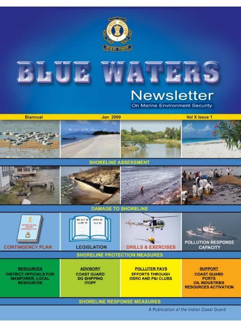
Biannual <strong>Jan</strong> <strong>2009</strong> Vol X Issue 1<br />
A Publication of the <strong>Indian</strong> <strong>Coast</strong> <strong>Guard</strong>
From the Director General’s Desk<br />
This <strong>edition</strong> of ‘Blue Waters’, deals with issues related to ‘<strong>Coast</strong>line Protection’ and is aimed at<br />
sharing the information with readers to create awareness on the ongoing efforts related to ‘Marine<br />
Environment Protection’ being undertaken by the <strong>Indian</strong> <strong>Coast</strong> <strong>Guard</strong> at national and international levels.<br />
There is a genuine concern today on the effects of global warming and the degradation to our<br />
marine environment. The Government of India and various other agencies are continually developing<br />
plans for environment friendly growth, by adopting green practices and clean development<br />
mechanisms. Since its inception, the <strong>Indian</strong> <strong>Coast</strong> <strong>Guard</strong> has always observed environment friendly<br />
practices and assisted the oil industry, ports and other agencies in establishing contingency plans and<br />
adopting preventive actions and best practices. The ICG has also coordinated with various agencies for<br />
preventing operation of substandard ships, pollution prevention efforts for pollutants other than oil, and<br />
coastal-cleanup measures. The conservation programme established by the <strong>Indian</strong> <strong>Coast</strong> <strong>Guard</strong> for the<br />
endangered ‘Olive Ridley’ species since the late eighties, has been rewarded by the Bombay Natural<br />
History Society (BNHS), Mumbai by conferring the ‘Green Governance Award’ for the year 2008.<br />
Today we are witness to large scale maritime development which makes our coastline prone to<br />
environmental degradation. The <strong>Indian</strong> <strong>Coast</strong> <strong>Guard</strong> will be however relentless in its pursuit of<br />
implementing total environment protection, and requests support and assistance from various<br />
departments, State Govts, ports and oil-handling agencies in establishing the necessary contingency<br />
measures to meet any exigencies, and also to prevent accidents taking place at sea. I am certain that a<br />
proactive approach by all concerned will pave the way for achieving pollution-free maritime development.<br />
I wish all a very happy and prosperous <strong>2009</strong>. Jai Hind.<br />
New Delhi<br />
31 <strong>Jan</strong> 09<br />
(Anil Chopra)<br />
Vice Admiral<br />
Director General<br />
<strong>Indian</strong> <strong>Coast</strong> <strong>Guard</strong>
<strong>Jan</strong> <strong>2009</strong> Vol X Issue 1<br />
Editorial<br />
In this issue of Blue Waters, the theme adopted is<br />
‘Shoreline protection measures’ an important subject<br />
which did not receive much attention that it deserves<br />
over the years. There has been encouraging response<br />
from the readers who have contributed articles and<br />
has been accordingly included in this issue. The <strong>Indian</strong><br />
<strong>Coast</strong> <strong>Guard</strong> being the national coordinating authority<br />
for responding to oil spills is making a concerted effort<br />
to assist the coastal states to adopt shoreline<br />
assessment process and establish environment<br />
sensitive index. A Manual on Shoreline Assessment<br />
and Response prepared by the <strong>Indian</strong> <strong>Coast</strong> <strong>Guard</strong> is<br />
likely to be issued shortly to assist them in establishing<br />
necessary coastline protection measures.<br />
The analysis of previous oil spill incidents that<br />
occurred in and around <strong>Indian</strong> coastline indicates that<br />
the spills were predominantly of that of Bunker oil.<br />
The IMO which adopted the Bunkers Convention in<br />
2001, has entered into force on 21 Nov 08. The current<br />
IMO regimes signed by India for liability and<br />
compensation for pollution damage covering oil spills<br />
do not include bunker oil spills from vessels other than<br />
tankers. The key elements include compulsory<br />
insurance cover for right of direct action and principle<br />
of strict liability which obviates the need to prove<br />
negligence. MoS should consider this convention<br />
positively for accession by India for claiming damages<br />
and to avoid substandard ships operating around the<br />
<strong>Indian</strong> coasts.<br />
Measures discussed during the 12 th NOSDCP<br />
meeting need to be taken by all concerned for<br />
establishing necessary oil spill response capability in<br />
ports and oil handling facilities. The IMO Level-1 oil<br />
spill response training programme for the year has<br />
been drawn up for conduct of training in all three<br />
<strong>Coast</strong> <strong>Guard</strong> Regions and the resource agencies may<br />
benefit from the <strong>Coast</strong> <strong>Guard</strong> efforts by sending their<br />
representatives for the training.<br />
(Donny Michael)<br />
Commandant<br />
Joint Director (Environment)<br />
CONTENTS<br />
ARTICLES<br />
Shoreline Assessment and 3<br />
Cleanup Measures<br />
Marine Pollution in Gujarat 8<br />
Beach Protection 13<br />
Measures<br />
IMO NEWS<br />
Bunker Convention – 2001 15<br />
Anti-Fouling Systems 16<br />
Convention<br />
Revised MARPOL Annex II 17<br />
REPORTS<br />
World Watch<br />
Oil Spill by Princess of the Stars 18<br />
India Watch 18<br />
EVENTS<br />
International <strong>Coast</strong>al Cleanup Day 18<br />
12 th NOS-DCP Meeting 18<br />
Green Governance Award-2008 20<br />
INFORMATIONS<br />
Grounding & Sinking incidents 20<br />
of Merchant Vessels in<br />
<strong>Indian</strong> waters in 2008<br />
Pollution Response Training 21<br />
Programme for the year <strong>2009</strong><br />
Minor and Major Oil Spills 22<br />
in <strong>Indian</strong> waters (since 1982)
ARTICLES<br />
<strong>Jan</strong> <strong>2009</strong> Vol X Issue 1<br />
SHORELINE ASSESSMENT AND<br />
CLEANUP MEASURES<br />
Commandant Donny Michael<br />
Joint Director (Environment)<br />
When spilled oil contaminates shoreline habitats in a<br />
large coastline such as India, the responders must survey<br />
the affected areas to determine the appropriate response.<br />
Presently, in <strong>Indian</strong> context the responsibility of shoreline<br />
cleanup comes under the jurisdiction of the District<br />
Collectorate who can in turn make the polluter to make<br />
necessary arrangements for the cleanup and pay<br />
compensation to the affected parties. The <strong>Indian</strong> <strong>Coast</strong><br />
<strong>Guard</strong> is mandated to respond to oil spills that occur in<br />
the maritime zones, the <strong>Coast</strong> <strong>Guard</strong> generally provides<br />
expert advice to the authorities ashore and to the State<br />
Pollution Control Boards during an oil spill which has<br />
washed ashore. The recent spill that affected the <strong>Indian</strong><br />
<strong>Coast</strong> line is the 300 tons oil spill that washed ashore<br />
during the stranding of MV Ocean Seraya off Karwar in<br />
Jun 2006. There were many lessons learnt and the<br />
important lesson learnt was that it is essential that the<br />
shoreline assessment should be made immediately after<br />
the impact of oil spill on the shore and determine the<br />
appropriate response in consultation with the experts and<br />
the scientific community.<br />
The coastline of India varies from mudflats to rocky<br />
shores and sea grass to mangroves. When oil spill affects<br />
the shoreline habitats, the appropriate response methods,<br />
the necessary approvals or decision tools for using shoreline<br />
clean-up methods can be developed during planning stages<br />
by the responders. The shoreline assessment team<br />
members should be trained properly to decide on the<br />
response options. Specific clean-up recommendations must<br />
integrate field data on shoreline habitats, type, and degree<br />
of shoreline contamination, and spill-specific physical<br />
processes. Clean-up endpoints must be established early<br />
so that appropriate clean-up methods can be selected to<br />
meet the clean-up objectives. Shoreline surveys must be<br />
conducted systematically because they are crucial<br />
components of effective decisions. Also, repeated<br />
surveys are needed to monitor the effectiveness and<br />
effects of ongoing treatment methods (changes in<br />
shoreline oiling conditions, as well as natural recovery), so<br />
that the need for changes in methodology, additional<br />
treatment, or constraints can be evaluated.<br />
3
<strong>Jan</strong> <strong>2009</strong> Vol X Issue 1<br />
Shoreline Assessment process<br />
During a spill response, shoreline assessment forms<br />
an integral component of the response organization.<br />
Shoreline assessment teams are often made up of<br />
representatives from governmental agencies, the<br />
responsible party, and other specialists. Members of the<br />
team should be trained and knowledgeable in their roles,<br />
which include: shoreline assessment coordinator; shoreline<br />
assessment team Leader; and team members. Shoreline<br />
assessment teams should collect the data needed to<br />
develop a shoreline clean-up plan that maximizes the<br />
recovery of oiled habitats and resources, while minimizing<br />
the risk of injury from clean-up efforts. Consideration<br />
should always be given to the potential for human<br />
exposure, by direct contact or by eating contaminated<br />
seafood, the extent and duration of environmental impacts<br />
if the oil is not removed, natural removal rates, potential<br />
for re-mobilised oil to affect other sensitive resources and<br />
likelihood of clean-up to cause greater harm than the oil<br />
alone. Information from these assessments must meet<br />
the requirements of the clean-up operation, being both<br />
timely and of uniform quality and content. Finally, the<br />
teams must coordinate their field activities with the cleanup<br />
managers working in the areas being assessed. This<br />
by IMO and the USCG that are aimed at providing practical<br />
and technical information to carry out shoreline surveys.<br />
Shoreline Surveys<br />
The Objective of the shoreline survey is to collect data<br />
on shoreline types, oiling conditions, and ecological and<br />
human-use resources for specific segments. The survey<br />
team should reach an agreement on clean-up<br />
recommendations for specific segments and also confirm<br />
that recommendations are effective and beneficial to the<br />
environment.<br />
The shoreline assessment team during their survey<br />
should carry out following:<br />
• Confirm segment boundaries.<br />
• Conduct survey to identify shoreline types and<br />
extent of oiling.<br />
• Describe the shoreline characteristics, surface oil<br />
conditions, buried oil conditions, and special<br />
considerations (ecological, recreational, cultural) using<br />
standard terms and codes.<br />
• Sketch the segment, if appropriate, focusing on<br />
the oil distribution and special considerations.<br />
• Note presence of submerged oil in near shore<br />
zone for spills of heavy oil.<br />
• Log and locate all photographs taken, and note<br />
the objective of each photograph.<br />
• Collect oil and/or sediment samples based on<br />
identified needs.<br />
ensures that all operations are conducted safely and that<br />
important information is exchanged. Several guidelines<br />
and studies on shoreline assessment have been developed<br />
• Discuss and agree on clean-up recommendations<br />
and priorities.<br />
• Complete the surveys each day in time to meet<br />
reporting deadlines.<br />
4
<strong>Jan</strong> <strong>2009</strong> Vol X Issue 1<br />
Some of the shoreline cleanup methods are as follows :-<br />
Shoreline Clean-up Methods<br />
(a) Natural Recovery : No attempt to remove any<br />
stranded oil in order to minimize impact to the environment,<br />
or because there is no effective method for clean-up. Oil<br />
is left in place to degrade naturally. This type of cleanup<br />
measure is used when the natural removal rates are fast<br />
(e.g., gasoline evaporation, high energy coastlines), when<br />
the degree of oiling is light, or when clean-up actions will<br />
do more harm than natural removal. This method may be<br />
inappropriate for areas used by high numbers of mobile<br />
animals (birds, marine mammals) or endangered species.<br />
(b) Barriers/Berms : This method is adopted to prevent<br />
entry of oil into a sensitive area or to divert oil to a collection<br />
area. In this method a physical barrier (other than a boom)<br />
is placed across an area to prevent oil from passing. Barriers<br />
can consist of earthen berms, trenching, or filter fences.<br />
When it is necessary for water to pass because of water<br />
volume, underflow or overflow dams are used.<br />
The shoreline cleanup methods vary from shore to<br />
shore. A problem which occurs after all major oil spills is<br />
that there is a large quantity of oily wastes and debris<br />
that is generated must be dealt with as part of the<br />
response action. A clean-up strategy that minimizes<br />
the impact to all sensitive aspects of the environment<br />
and minimizes the amount of oily wastes is the most<br />
optimal. History has shown that oily wastes or debris<br />
that has been buried inappropriately can result in<br />
formation of leachates that contaminate surface and<br />
groundwater resources. Each clean-up option should be<br />
examined with the problem of waste generation and<br />
disposal in mind.<br />
(c) Physical Herding : In a method to free any oil<br />
trapped in debris or vegetation on water; or to direct<br />
floating oil towards containment and recovery devices; or<br />
to divert oil from sensitive areas. Plunging water jets,<br />
water or air hoses, and propeller wash can be used to<br />
dislodge trapped oil and divert or herd it to containment<br />
and recovery areas may emulsify the oil. It is carried out<br />
in near shore areas where there are little or no currents,<br />
5
<strong>Jan</strong> <strong>2009</strong> Vol X Issue 1<br />
and in and around man-made structures such as<br />
wharves and piers.<br />
(d) Manual Oil Removal/Cleaning : This method is<br />
adopted to remove oil with hand tools and manual<br />
labour. Removal of surface oil using hands, rakes,<br />
shovels, buckets, scrapers, sorbents, pitch forks, etc., and<br />
placing in containers. No mechanized equipment is used<br />
except for transport of collected oil and debris. Includes<br />
underwater recovery of submerged oil by divers, for<br />
example, with hand tools. This method is adopted<br />
whenever there is light to moderate oiling conditions for<br />
stranded oil, or heavy oils on water or submerged on<br />
the bottom, that have formed semi-solid or solid masses<br />
and that can be picked up manually.<br />
(f) Use of Sorbents : This method is adopted to remove<br />
surface oil by absorption by oleophilic (oil-attracting)<br />
material placed in water or at the waterline. Sorbent<br />
material is placed on the floating oil or water surface,<br />
allowing it to absorb oil or is used to wipe or dab stranded<br />
oil. Forms include sausage boom, pads, rolls, sweeps,<br />
snares, and loose granules or particles. These products<br />
can be synthetically produced or be natural substances.<br />
Efficacy depends on the capacity of the particular sorbent,<br />
wave or tidal energy available for lifting the oil off the<br />
substrate, and oil type and stickiness. Recovery of all<br />
sorbent material is mandatory. Loose particulate sorbents<br />
must be contained in a mesh or other material.<br />
(g) Vacuum : This method is adopted to remove oil<br />
pooled on a shoreline substrate or sub-tidal sediments. A<br />
vacuum unit such as Linductor of the <strong>Coast</strong> <strong>Guard</strong><br />
inventory is attached via a flexible hose to a suction<br />
(e) Mechanical Oil Removal : This method is adopted<br />
to remove oil from shorelines, and bottom sediments using<br />
mechanical equipment. Oil and oiled sediments are<br />
collected and removed using mechanical equipment not<br />
specifically designed for pollution response, such as<br />
backhoes, graders, bulldozers, dredges, draglines, etc.<br />
Requires systems for temporary storage, transportation<br />
and final treatment and disposal. Care should be taken<br />
to remove sediments only to the depth of oil penetration,<br />
which can be difficult with heavy equipment. The heavy<br />
equipment should be used carefully where excessive<br />
sediment removal may erode the beach or shore.<br />
head that recovers free oil. The equipment can range<br />
from small, portable units that fill individual drums to<br />
large super suckers that are truck or vessel-mounted<br />
and can generate enough suction to lift large rocks.<br />
Removal rates from substrates can be extremely slow.<br />
Collected oil and or oil/water mix will need to be stored<br />
temporarily prior to recycling or disposal. Oil may be<br />
recyclable; if not, it will require disposal in accordance<br />
6
<strong>Jan</strong> <strong>2009</strong> Vol X Issue 1<br />
with local regulations. Large amounts of water are often<br />
recovered, requiring separation and treatment.<br />
(h) Vegetation Cutting/Removal : This method is<br />
adopted to remove portions of oiled vegetation or oil<br />
trapped in vegetation to prevent oiling of wildlife or<br />
secondary oil releases.<br />
Oiled vegetation is cut<br />
with weed trimmers,<br />
blades, etc., and picked<br />
or raked up and bagged<br />
for disposal. Vegetation removal will destroy habitat for<br />
many animals. Cut areas will have reduced plant growth<br />
and, in some instances, plants may be killed. Cutting at<br />
the base of the plant stem may allow oil to penetrate<br />
the substrate, causing sub-surface contamination.<br />
Along exposed sections of shoreline, the vegetation may<br />
not recover, resulting in erosion and habitat loss.<br />
Trampled areas will recover much more slowly.<br />
(j) Low-Pressure, Ambient Water Flushing : This<br />
method is adopted to remove fluid oil that has adhered<br />
to the substrate or man-made structures, pooled on the<br />
surface, or become<br />
trapped in vegetation.<br />
Ambient-temperature<br />
water is sprayed at low<br />
pressures (
<strong>Jan</strong> <strong>2009</strong> Vol X Issue 1<br />
submerged by tides and waves and if maximum biostimulation<br />
is desired. If the impacted area gets submerged<br />
only during spring tides, the frequency of nutrient<br />
addition will be determined by the intertidal zone water<br />
coverage. Using slow-release granular or encapsulated<br />
nutrients or oleophilic fertilizer (which adheres to the oil<br />
residue on the surface) should require less frequent<br />
addition, but time-series monitoring of interspatial pore<br />
water nutrient levels is needed to ensure target levels<br />
are being maintained, especially throughout the depth<br />
of the impacted intertidal zone.<br />
(p) Natural Microbe Seeding (Bio-augmentation):<br />
A form of bioremediation used to accelerate natural<br />
microbial degradation of oil by adding high numbers of<br />
oil-degrading microorganisms. Formulations containing<br />
specific hydrocarbon-degrading microbes are added to the<br />
oiled area because indigenous hydrocarbon degraders are<br />
low in number, or, those that are present cannot degrade<br />
the oil effectively. Because microbes require nitrogen and<br />
phosphorus to convert hydrocarbons to biomass,<br />
formulations must also contain adequate nutrients. The<br />
number of microbial organisms achievable will determine<br />
the biodegradation rate. If nutrients are sufficient to<br />
maximize that rate, bio-augmentation will not further<br />
increase the biodegradation rate. Research studies<br />
conducted with bioengineered organisms or organisms<br />
enriched from different environments, grown in the<br />
laboratory to high numbers, and applied to an oiled beach<br />
to stimulate rapid biodegradation, have failed to prove<br />
conclusively that seeding is effective. Bio-augmentation<br />
appears less effective than bio-stimulation because of the<br />
low level degraders.<br />
The oil can be contained in fire-resistant booms, or by<br />
natural barriers such as ice or the shoreline. On land, oil<br />
can be burned when it is on a combustible substrate such<br />
as vegetation, logs, and other debris. Oil can be burned<br />
from non-flammable substrates using a burn promoter.<br />
On sedimentary substrates, it may be necessary to<br />
dig trenches for oil to accumulate in pools to a thickness<br />
that will sustain burning. Heavy oils are difficult to ignite<br />
but can sustain a burn once ignited. Emulsified oils may<br />
not ignite or sustain a burn when the water content is<br />
great than about 25 per cent.<br />
MARINE POLLUTION IN GUJARAT<br />
Introduction<br />
❖ ❖ ❖<br />
Asst Commandant JD Dhayalan (0664-J)<br />
Gujarat state has 1600 km long <strong>Coast</strong>al region.<br />
On one hand the state government intends to develop<br />
variety of industries by liberalisation of specific regulations<br />
and providing single window system of environmental and<br />
other clearances while on the other hand environmental<br />
degradation has been an obvious consequence of rapid<br />
urbanisation and industrial growth. With the advent of<br />
globalization and the potential availability of finance,<br />
manpower and government approvals, there has been a<br />
phenomenal rise in the industries that has sprung all along<br />
(q) In-situ Burning : This method is adopted to<br />
remove oil from the water surface or habitat by burning<br />
it in place. Oil floating on the water surface is collected<br />
into slicks at least 2-3 milli-metres (mm) thick and ignited.<br />
8
<strong>Jan</strong> <strong>2009</strong> Vol X Issue 1<br />
the coast of Gujarat. The new captive ports in the<br />
environmentally sensitive Gulf of Kutch area and the<br />
development of petro chemical industries coupled with<br />
the increasing movements of large crude carriers and other<br />
vessels makes the coast of Gujarat very vulnerable to<br />
pollution threats.<br />
Ecologically Important <strong>Coast</strong>al Areas<br />
identified in Gujarat coast<br />
Site Ecological Geographic Area <strong>Coast</strong>al<br />
Importance Location in Length<br />
km² km<br />
Gulf Mangrove 20º15' to 1307.8 131.4 Km<br />
Kachchh 23º35' N (Mangrove) (Mangrove)<br />
Coral Reef 60º05' to 406.5 94.91km<br />
70º22' E (Coral) (Coral Main)<br />
75.4 Km<br />
(Coral Island)<br />
Gulf of Estuary 22 º15'- 6.4 2.63 km<br />
Khambat 22º 30’N (Mangrove) (Mangrove)<br />
72º 15'-<br />
72º 30’E<br />
Gulf of Kachchh, the largest coastal habitat in the West<br />
coast of India in the state of Gujarat (20º15' to 23º35' N<br />
and 60º05' to 70º22' E) is encompassing nearly 1000 km<br />
long shoreline covers an area of 7350 square kilometers.<br />
It is a shallow water body with depth extending from 60<br />
m at the mouth to less than 20 m at the head of the Gulf.<br />
While the average depth is 30 m, the minimum depth is<br />
fringed with mangroves which provide a disturbance free<br />
habitats for many species of nesting birds. Besides these<br />
islands, there are a number of wave-cuts, eroded shallow<br />
banks like the Pirothan, Deda, Donna, Sankhodhar Beyt,<br />
Paga, Adatra and Boria, which supports coral reef<br />
development and a vide variety of aquatic species.<br />
Due to availability deep channel and the proximity<br />
to the hinterland, the coastline between Jamnagar and<br />
Salaya off the Gulf of Kutch is a favorite location these<br />
days for industrial development. Many mega industries<br />
have been set up like Integrated Petrochemical Refinery<br />
at Sikka (RPL) and Vadinar (ESSAR, IOC); Thermal Power<br />
Project, Cement Factory & Fertilizer Factory at Sikka, etc.<br />
The operation of these mega industries and associated<br />
factories, which are cropping up around the areas pose a<br />
severe threat to the fragile marine ecosystem of the Gulf<br />
upto 5 m, around Lushington Island. The Gulf is delimited<br />
in the north by the Kachchh region and in the south by<br />
the Saurashtra region. The Marine National Park and Marine<br />
Sanctuary are situated along the southern shore of Gulf<br />
from Okha (22º30’N, 69º00’E) and extends eastwards to<br />
the vicinity of Khijadia (22º30’N, 70º40’E). This include<br />
42 islands and a complex of fringing reefs backed by<br />
mudflats, sand flats, coastal salt marsh, mangrove forests,<br />
sand and rocky beaches which support a great diversity<br />
of fauna and flora. The area also has many coral islands<br />
9
<strong>Jan</strong> <strong>2009</strong> Vol X Issue 1<br />
of Kutch. The permission granted by the state government<br />
for the industries to be developed around these areas has<br />
not catered for protection measures of the sensitive<br />
environment. Noticing this trend with alarm, even the<br />
World Bank has stepped in to fund for development of<br />
Integrated <strong>Coast</strong>al Zone Management in the Gulf of Kutch.<br />
With the changing scenario of rapid industrialization of<br />
Saurashtra coastline, it is absolutely necessary to obtain a<br />
baseline data on the status of the marine fauna and the<br />
ecosystem present today, before it is too late. This database<br />
will be a vital component to assess the impact of the<br />
industries and human pressure on the marine biota, in<br />
time to come.<br />
Marine operations based pollution<br />
affecting Gujarat <strong>Coast</strong><br />
Marine Pollution is defined as discharge of waste into<br />
the sea resulting in harm to living resources, hazards to<br />
human health, hindrance to fishery & impairment of<br />
quality for use of seawater. Marine pollution is associated<br />
with the changes in the physical, chemical & biological<br />
conditions of seawater. The major sources of marine<br />
pollution to the Gujarat coast can be categorised as<br />
under :-<br />
(a)<br />
Operational and accidental discharge of ship<br />
borne pollutants.<br />
(b)<br />
Oil spills due to faulty<br />
handling of SBM operation<br />
in the Gulf of Kutch.<br />
(c)<br />
Maritime accidents<br />
due to collision, fire,<br />
explosion or grounding<br />
which results in the<br />
release of oil, either from<br />
the ship or from the cargo tank.<br />
(d)<br />
Intentional discharges of oil or oily waste from<br />
the pumping of bilges or de-ballasting cargo tanks<br />
or from tank washing.<br />
Land based marine pollution to the<br />
Gujarat <strong>Coast</strong><br />
Disposal of sewage, industrial effluents and agricultural<br />
wastes contributes a major chunk of pollutants entering<br />
the sea water in the coast of Gujarat. Pesticides &<br />
Insecticides are used in agriculture & tons of synthetic<br />
detergents are consumed for washing & cleaning purposes<br />
in coastal areas of Gujarat every year. Twenty four percent<br />
of these chemicals can be expected to find their way into<br />
the coastal marine environment.<br />
Ocean disposal is the convenient method of pesticide<br />
waste disposal for manufacturing plants located near the<br />
10
<strong>Jan</strong> <strong>2009</strong> Vol X Issue 1<br />
seas. The large amounts of suspended solids deposition<br />
may be detrimental to the biota that grows on the seabed<br />
and it poses severe threat to the bottom dwellers to sustain<br />
with the suspended pollutants that does not dissolve easily.<br />
The fertilizer industry, along with hazardous chemical<br />
and petro-chemical industries also pose a threat of marine<br />
pollution of different dimension. Fertilizer factories produce<br />
large quantities of wastes, which contain a variety of<br />
substances such as Oil, Carbon slurry, Ammonia, Urea,<br />
Ammonium Sulphate, Phosphate & Fluorides, Acid, Alkali,<br />
Arsenic, Caustic, Potassium Carbonate etc.<br />
There are many industries functioning near Hazira,<br />
such as Oil & Natural Gas Corporation (ONGC), <strong>Indian</strong> Oil<br />
Corporation (IOC), Gas Authority of India Limited, ESSAR<br />
Limited, Heavy Engineering Plant, Reliance Petrochemical<br />
Complexes, National Thermal Power Corporation Limited,<br />
KRIBHCO Limited. Due to the proximity these industries<br />
close to the sea, a large quantity of effluents are discharged<br />
in the nearby areas of Tapi estuaries and ultimately the<br />
effluent reaches the sea causing bio pollution. The same<br />
situation is also arising in the nearby region of Amla Khadi<br />
due to industrial expansion of Nandesari and surrounding<br />
areas.<br />
Ship Breaking Activities<br />
Ship breaking is an important activity along the West<br />
<strong>Coast</strong> of India especially in Gujarat. Alang, a small coastal<br />
town in the state, houses<br />
the world’s largest ship<br />
breaking yard. Forty five<br />
thousand workers recycle<br />
about 200 ships in this yard<br />
each year. This produces<br />
2.6 million tons of scrap steel per year, equivalent to 15 %<br />
of the country’s total steel production.<br />
Ship breaking industry creates numerous hazards for<br />
the coastal and marine environment. Due to the activity<br />
of ship breaking large number of dangerous pollutants<br />
including toxic waste, oil, polychlorinated bi phenyls and<br />
heavy metals are released in the surrounding coastal area<br />
which ultimately reaches the sea due to very high tidal<br />
range. While most of the oil is removed before a ship is<br />
scrapped, the sand and other sorbents which are used to<br />
mop up the remaining oil are not disposed off in an<br />
environmental friendly manner. High concentration of oil,<br />
and other non degradable items ultimately reach the sea<br />
as they are far removed from the public eyes.<br />
Other sources of marine pollution<br />
Cooling water from thermal power plants & nuclear<br />
installations has also adverse effects on the coastal marine<br />
fauna. The largest single source of radioactive liquid waste<br />
is probably the water used for cooling reactors.<br />
Adverse Impact of Marine Pollution:<br />
(a) Loss of Corals Reefs<br />
There are more than 15 coral islands situated between<br />
Akho to Jodiya in the Gulf of Kutch. Both, the mangrove<br />
and coral ecosystems are under severe threat due to<br />
anthropogenic pollutant influences. In earlier days the<br />
activity of extracting lime from dried coral rock took<br />
place causing severe destruction of coastal habitats<br />
but due to pressure from NGOs and from the public<br />
11
<strong>Jan</strong> <strong>2009</strong> Vol X Issue 1<br />
in the environmentally sensitive areas of Gujarat coast.<br />
Between the years 1960-1993, there has been a<br />
reported decrease of 96 percent in the mangroves in<br />
the areas near the Gulf of Khambhat. There has been<br />
a corresponding decrease in the Gulf of Kutch area<br />
where it was estimated that about 72.5 percent of<br />
mangroves has been destroyed Several species of<br />
mangroves has been lost irretrievably around these<br />
areas.<br />
those activities have been stopped. However the<br />
damage is already done and there is a constant<br />
decrease in the coral development in the areas. Added<br />
to the physical destruction, the soft killing of coral<br />
also takes place due to the discharge of industrial and<br />
domestic waste in the surrounding sea areas and has<br />
made the coral islands in the worst environmental<br />
condition.<br />
As a result of these, the abundance of fishes and other<br />
marine species near the coral islands are diminishing<br />
continuously and a consequence the fishermen are<br />
not provided with the opportunity to harvest fish<br />
around these areas and thereby causing sever<br />
economical hardship to them.<br />
(b) Loss of Mangroves<br />
Mangroves provide a natural habitat for many fauna<br />
At present Kori Creek and marine National Park are<br />
the two locations in the State where Mangroves<br />
cover 78% area. This has been achieved due to<br />
efforts made by the environment NGOs and the<br />
assistance provided by the Central Government.<br />
Increasing Salinity of ground water<br />
resources<br />
To satisfy the need of water for domestic use and for<br />
irrigation purpose there are many bore-well operated<br />
around the areas and due to this operation of bore<br />
wells the level of ground water has been decreased<br />
considerably. The coast line starting from Bhavnagar to<br />
Una, from Una to Madhavpur, from Madhavpur to<br />
Maliya and from Maliya to Lakhpat, the problem of salinity<br />
increase in the water bed resurces has affected the local<br />
populace. In view of salinity increase, the 2/3 crop<br />
12
<strong>Jan</strong> <strong>2009</strong> Vol X Issue 1<br />
production has decreased and due such factor, the coastal<br />
areas are becoming barren. These barren areas are<br />
thereafter used for construction of chemical factories<br />
and large industrial effluents containing high amount of<br />
T.D.S is discharged in the sea from the various regions<br />
such as Motikhavdi and Sikka near the Gulf of Kutch. As a<br />
result of the effluent discharged the local marine ecology<br />
has been disturbed to a large extent.<br />
BEACH PROTECTION MEASURES<br />
Commandant HC Upadhyay (0413-M)<br />
Conclusion<br />
Strict anti-pollution efforts should be put in place<br />
and laws relating to environment conservation especially<br />
in the Gulf of Kutch and Gulf of Khambat are to be<br />
promulgated. There should be strict application of<br />
polluter pays principle by way of charging one-time<br />
fees to cover the costs of administrative supervision of<br />
the coastal environment.<br />
The river run of containing fertilizers, chemicals and<br />
pesticides used for agriculture should be recycled and<br />
treated prior being discharged in a river which ultimately<br />
reaches the seas.<br />
Mass education in environmental matters is essential<br />
in order to improve the environment and ecology of<br />
coastal region. There should be strict implementation<br />
of the laws relating to the prevention of coastal<br />
management especially coastal Regulation Zone<br />
notification-1991, before establishing new industrial<br />
units on the seacoast.<br />
A beach is defined as an accumulation of sediment,<br />
usually sand or gravel that occupies a portion of the coast.<br />
The active beach, an area of loose sediment subject to<br />
transport by wind, waves, and currents, is divided into<br />
three regions: the backshore, the foreshore, and the<br />
offshore area. The active beach is backed by the coastal<br />
upland, which can be a dune, a cliff, a soil embankment,<br />
a fossil beam, or an engineering structure such as a<br />
seawall or a revetment. Common geomorphic features<br />
of the beach include beams, scarps, and offshore sand<br />
bars.<br />
The amounts and fluxes of sediment in a beach are<br />
collectively known as the littoral budget. Healthy beaches<br />
State government is keen to develop silver corridor<br />
for industrial development by providing common waste<br />
disposal facilities at coastal line of Gujarat. Conceptually<br />
it is perfect idea but existing common waste disposal<br />
facilities will not be successful without feasibility studies<br />
and consequent amendment to the existing laws.<br />
Common beach features<br />
13
<strong>Jan</strong> <strong>2009</strong> Vol X Issue 1<br />
Shoreline Protection and <strong>Coast</strong>al Erosion<br />
Hazard Data<br />
The intent of shoreline setbacks is to establish a<br />
coastal-hazard buffer zone to protect beach-front<br />
development from high-wave events and coastal erosion.<br />
Adequate setbacks allow the natural erosion and accretion<br />
cycles to occur and help maintain lateral beach access.<br />
Furthermore, setbacks provide open space for the<br />
enjoyment of the natural shoreline environment.<br />
are in a state of dynamic equilibrium, where the net influx<br />
of sediment or sources, equals the net loss of sediment or<br />
sinks. Sources of beach sediment include skeletal material<br />
from coral reef ecosystems, onshore transport of sand,<br />
long shore transport, headland erosion, volcanic glass, river<br />
input, and erosion (scarping) of the coastal upland.<br />
Sediment sinks include loss to deep water, harbors, and<br />
channels, offshore transport, long shore transport,<br />
impoundment by engineering structures, and storm surge<br />
over wash. When there is an imbalance between sources<br />
and sinks, the beach will either erode or accrete.<br />
<strong>Coast</strong>al processes such as erosion and accretion<br />
are site-specific, season specific, and inter annual. Different<br />
beaches have different geomorphic characteristics and are<br />
subject to different oceanographic conditions. Beach<br />
processes can vary dramatically from one end of a<br />
particular beach to the other. Site-specific factors such as<br />
extent and health of coral reefs, alterations to dune<br />
systems, sediment runoff from upland areas, and other<br />
human activities also affect coastal processes. Wave and<br />
current patterns change dramatically from season to<br />
season, and from swell to swell. Because of these<br />
variations, each segment of each beach will have its own<br />
history of erosion and accretion trends.<br />
An analysis of coastal erosion trends would provide<br />
data on a property scale to enhance decision making in<br />
the coastal zone area. <strong>Coast</strong>al and marine environments<br />
are greatly influenced by the activities of humankind.<br />
Increasing public awareness of the sensitivity of these<br />
environments would sharply decrease human impacts.<br />
Policy makers and agency personnel should be provided<br />
with guidance for more effective beach management<br />
practices. Equally important is increasing awareness and<br />
education of general public. Involvement of both the<br />
private and public sector will further strengthen the<br />
whole system.<br />
Policy makers and agency personnel need to be better<br />
informed so that their decisions are environmentally and<br />
economically responsible. The same applies to developers<br />
and contractors, especially those working at shoreline<br />
properties. A better informed public will support decisions<br />
that need to be made.<br />
Further more a beach management or a shoreline<br />
protection plan can be put into force which will not<br />
only study the present threat and its remedies but also<br />
the future consequences and its effect in the area.<br />
The recommendations can be used as a guide line for<br />
better law formulation, its implementation, and its<br />
execution.<br />
14
IMO NEWS<br />
<strong>Jan</strong> <strong>2009</strong> Vol X Issue 1<br />
BUNKER CONVENTION – 2001<br />
ENTERS INTO FORCE ON<br />
21 NOVEMBER 2008<br />
Pollution damage from fuel oil carried on ships will be<br />
covered in 2008 with entry into force of international<br />
bunkers liability and compensation convention. The<br />
last significant gap in the international regime for<br />
compensating victims of oil spills from ships is set to<br />
be closed, with the entry into force on 21 November 2008<br />
of an international treaty covering liability and<br />
compensation for pollution damage caused by spills<br />
of oil, when carried as fuel in ships’ bunkers. Current<br />
regimes covering oil spills do not include bunker oil<br />
spills from vessels other than tankers. Criteria for entry<br />
into force of the International Convention on Civil<br />
Liability for Bunker Oil Pollution Damage, 2001 were met<br />
on 21 November 2007, following accession to the treaty<br />
by Sierra Leone. The Convention was adopted in 2001<br />
by the International Maritime Organization (IMO), the<br />
The convention stipulates that ships over 1,000 gross<br />
tonnage registered in a State Party to the Convention will<br />
be required to carry on board a certificate certifying that<br />
the ship has insurance or other financial security, such as<br />
the guarantee of a bank or similar financial institution, to<br />
cover the liability of the registered owner for pollution<br />
damage in an amount equal to the limits of liability under<br />
the applicable national or international limitation regime.<br />
In all cases, this amount should not exceed an amount<br />
calculated in accordance with the Convention on Limitation<br />
of Liability for Maritime Claims, 1976, as amended. The<br />
Convention will make the ship owner, defined broadly so<br />
as to include the owner, registered owner, bareboat<br />
charterer, manager and operator of a ship, liable to pay<br />
compensation for pollution damage (including the costs<br />
of preventative measures) caused in the territory, including<br />
the territorial sea of a State Party, as well as in its exclusive<br />
economic zone, or if a State Party has not established<br />
one, in an equivalent area.<br />
United Nations specialized agency with responsibility for<br />
the safety and security of shipping and the prevention of<br />
marine pollution by ships.<br />
The Bunkers Convention, which is a free-standing<br />
instrument covering pollution damage, is modeled on the<br />
International Convention on Civil Liability for Oil Pollution<br />
15
<strong>Jan</strong> <strong>2009</strong> Vol X Issue 1<br />
Damage, 1969 (CLC). Key elements of both include the<br />
need for the registered owner of a vessel to maintain<br />
compulsory insurance cover; the right of direct action,<br />
which would allow a claim for compensation for pollution<br />
damage to be brought directly against an insurer; and<br />
the principle of strict liability, which obviates the need to<br />
prove negligence. Oil fuel tank protection Rules to limit<br />
the size of oil fuel tanks on new ships and ensure they<br />
are protectively located are included in the International<br />
Convention for the Prevention of Pollution from Ships<br />
(MARPOL Convention). A new regulation on oil fuel tank<br />
protection was adopted in 2004 and entered into force<br />
on 01 <strong>Jan</strong>uary 2007.<br />
The regulation applies to all ships delivered on or after<br />
01 August 2010 with an aggregate oil fuel capacity of<br />
600 m 3 and above. It includes requirements for the<br />
protected location of the fuel tanks and performance<br />
standards for accidental oil fuel outflow. A maximum<br />
capacity limit of 2,500 m 3 per oil fuel tank is included<br />
in the regulation, which also requires administrations<br />
(flag States) to consider general safety aspects, including<br />
the need for maintenance and inspection of wing and<br />
double-bottom tanks or spaces, when approving the<br />
design and construction of ships in accordance with the<br />
regulation.<br />
ANTI-FOULING SYSTEMS<br />
CONVENTION<br />
The entry into force requirements for the AFS<br />
Convention has now been met, following the accession to<br />
the treaty by Panama. The Convention has entered into<br />
force internationally on 17 September 2008. A “harmful<br />
anti-fouling system” is currently defined as any system<br />
that includes organotin compounds which act as biocides,<br />
although there is provision for additional harmful systems<br />
to be included in the future.<br />
Compliance with the convention is achieved if the ship:<br />
• Does not bear such compounds on its hull or<br />
external parts or surfaces; or<br />
• Bears a coating that forms a barrier to such<br />
compounds leaching from the underlying noncompliant<br />
anti-fouling systems.<br />
This applies to all ships except fixed or floating<br />
platforms, floating storage units (FSUs), and floating<br />
production storage and off-loading units (FPSOs) that<br />
have been constructed prior to 01 <strong>Jan</strong>uary 2003 and that<br />
have not been in dry-dock on or after 01 <strong>Jan</strong>uary 2003.<br />
While fixed<br />
or floating<br />
platforms,<br />
FSUs and<br />
FPSO which<br />
have been<br />
constructed<br />
prior to 01 July<br />
2003, but have not been into dry dock on or after<br />
that date, are not legally required to comply with the<br />
ban on bearing TBT compounds, it is recommended that<br />
they do so as soon as is reasonably practicable.<br />
Survey and Certification<br />
Only ships of 400 gross tonnage and above (excluding<br />
fixed, floating platforms, FSUs and FPSOs) engaged in<br />
international voyages are subject to surveys under the<br />
Convention. Surveys are required as follows :<br />
• An initial survey before the ship is put into service<br />
or before the International Anti-Fouling System<br />
Certificate is issued for the first time; and<br />
• A survey when the anti-fouling systems are<br />
changed or replaced, undertaken to enable the<br />
endorsement of the Anti-Fouling System Certificate.<br />
16
<strong>Jan</strong> <strong>2009</strong> Vol X Issue 1<br />
Similarly, only ships of 400 gross tonnage and above<br />
engaged in international voyages are required to have an<br />
International Anti-Fouling System Certificate. These<br />
certificates will be issued after a required survey, as<br />
outlined above, is completed.<br />
Ships of 24 metres or more in length but less than<br />
400 gross tonnage (excluding fixed or floating platforms,<br />
FSUs and FPSOs) must carry a declaration on Anti-Fouling<br />
Systems signed by the owner or authorized agent. The<br />
declaration will have to be accompanied by appropriate<br />
documentation supporting the fact that the ships’ antifouling<br />
system is compliant with the AFS Convention,<br />
e.g. a paint receipt or contractor invoice.<br />
REVISED MARPOL ANNEX II<br />
(NOXIOUS LIQUID SUBSTANCES<br />
CARRIED IN BULK)<br />
The revised Annex II Regulations for the control of<br />
pollution by noxious liquid substances in bulk includes a<br />
new four-category categorization system for noxious and<br />
liquid substances.<br />
The new categories are :<br />
• Category X:<br />
Noxious Liquid Substances which, if discharged<br />
into the sea from tank cleaning or deballasting<br />
operations, are deemed to present a major hazard<br />
to either marine resources or human health and,<br />
therefore, justify the prohibition of the discharge<br />
into the marine environment;<br />
• Category Y:<br />
Noxious Liquid Substances which, if discharged into<br />
the sea from tank cleaning or deballasting operations,<br />
are deemed to present a hazard to either marine<br />
resources or human health or cause harm to<br />
amenities or other legitimate uses of the sea<br />
and therefore justify a limitation on the quality and<br />
quantity of the discharge into the marine environment;<br />
• Category Z:<br />
Noxious Liquid Substances which, if discharged into<br />
the sea from tank cleaning or deballasting operations,<br />
are deemed to present a minor hazard to either marine<br />
resources or human health and therefore justify less<br />
stringent restrictions on the quality and quantity of<br />
the discharge into the marine environment; and<br />
• Other Substances:<br />
Substances which have been evaluated and found to<br />
fall outside Categories X, Y or Z because they are<br />
considered to present no harm to marine resources,<br />
human health, amenities or other legitimate uses of<br />
the sea when discharged into the sea from tank<br />
cleaning of deballasting operations. The discharge of<br />
bilge or ballast water or other residues or mixtures<br />
containing these substances are not subject to any<br />
discharge requirements of MARPOL Annex II.<br />
The revised annex includes a number of other<br />
significant changes. Improvements in ship technology,<br />
such as efficient stripping techniques, has made possible<br />
significantly lower permitted discharge levels of certain<br />
products which have been incorporated into Annex II.<br />
For ships constructed on or after 01 <strong>Jan</strong>uary 2007, the<br />
maximum permitted residue in the tank and its associated<br />
piping left after discharge will be set at a maximum of<br />
75 litres for products in categories X, Y and Z - compared<br />
with previous limits which set a maximum of 100 or 300<br />
litres, depending on the product category.<br />
17
REPORTS<br />
WORLD WATCH<br />
OIL SPILL BY PRINCESS<br />
OF THE STARS<br />
T h e<br />
EVENTS<br />
<strong>Jan</strong> <strong>2009</strong> Vol X Issue 1<br />
INTERNATIONAL<br />
COASTAL CLEANUP DAY<br />
<strong>Indian</strong><br />
C o a s t<br />
<strong>Guard</strong> is<br />
the<br />
lead<br />
agency in<br />
coordinating International Cleanup every year. ICG<br />
coordinated the event in India to mark the occasion of<br />
International <strong>Coast</strong>al Clean up day on 20 Sep 08 under the<br />
aegis of United Nations Environmental Programme (UNEP)<br />
– South Asia Cooperative Environmental Programme<br />
(SACEP) as a part of regional environmental programme<br />
on marine litter activity.<br />
The Princess of the Stars ferry sank with 850 people<br />
onboard due to Typhoon Fengshen off the coast of Sibuyan<br />
Island on 21 Jun 08. Many people lost their lives and<br />
numerous bodies remained trapped in the wreck. Five<br />
highly toxic pesticides were being transported in two<br />
containers onboard the ferry. The operations to recover<br />
the bodies were suspended due to the presence of<br />
containers of pesticides onboard liable to release these<br />
chemicals. A 5 km exclusion zone around the wreck,<br />
where fishing and aquaculture activities were prohibited,<br />
was set up by the Philippine authorities.<br />
On 11 Jul 08, a fuel slick was reported from the wreck.<br />
INDIA WATCH<br />
No oil spill incident has occurred in our region in the<br />
since <strong>Jan</strong>uary 2008. However seven grounding/ sinking<br />
around <strong>Indian</strong> coasts has been reported in this period.<br />
Personnel from <strong>Coast</strong> <strong>Guard</strong> and their families,<br />
Military, Para military services, Police, Schools, Colleges,<br />
Educational Institutions, State/Central NGO’s took part in<br />
the event which covered large beach tracts in the West<br />
and East <strong>Coast</strong> of India and the island territories of<br />
Andaman and Nicobar Islands.<br />
TWELFTH NATIONAL OIL SPILL<br />
DISASTER CONTINGENCY PLAN<br />
(NOS-DCP) AND PREPAREDNESS<br />
MEETING<br />
The 12 th National Oil Spill Disaster Contingency Plan<br />
and Preparedness meeting, the second bi-annual meeting<br />
of 2008 was held at Jawaharlal Nehru Port Trust, Navi<br />
Mumbai on 24 Oct 08. Vice Admiral RF Contractor, AVSM,<br />
NM, the Chairman, NOSDCP chaired the meeting. A total<br />
of 56 delegates from various Govt Departments, Ports<br />
and Oil Companies have attended the meeting.<br />
18
<strong>Jan</strong> <strong>2009</strong> Vol X Issue 1<br />
developments at the national level since last NOS-DCP<br />
meeting.<br />
The Chairman, Jawaharlal Nehru Port Shri Shahzad<br />
Hussain, IAS welcomed all the delegates and gave the<br />
opening address stating the importance of environment<br />
protection in the overall component of the growth of the<br />
nation.<br />
The Chairman NOSDCP in his inaugural address<br />
reiterated the purpose and objective of the NOSDCP<br />
meeting and requested the resource agencies to review<br />
their preparedness and response capabilities with a view<br />
to prepare themselves to respond to any contingency which<br />
may arise out at sea or port areas He stated that the<br />
forum did not achieve much headway in two vital issues<br />
i.e. establishing of Tier-1 response facilities and state level<br />
contingency plans although some ports have signed the<br />
MoUs for establishing tier-I facilities. He requested the<br />
port authorities to resolve the issues pertaining to MoU<br />
with port users or else establish the Tier-1 facility of<br />
their own and charge the users accordingly.<br />
There were two presentations arranged for the benefit<br />
of the members during the meeting. The first presentation<br />
was on “Oil Spill Impact on Coral Reefs and Sensitive<br />
Island Ecosystem” by Dr MVM Wafar, Scientist E II, NIO,<br />
Goa. The second presentation was on “Reliance KG Basin<br />
FPSO Oil Handling Operations and Marine<br />
Environment Protection Efforts” by Dr PK Pant,<br />
Sr Vice President-QHSE, Reliance Industries Ltd, Mumbai.<br />
The important issues which were discussed and<br />
deliberated upon during the meeting included the major<br />
oil spill exercise and training, establishing Tier-I facilities,<br />
use of oil spill dispersant, preparation of Local Contingency<br />
Plan, procurement of pollution control vessels for ports,<br />
inclusion of new ports under NOSDCP, oil spill response<br />
centre at Gulf of Kutch region, revolving trophies for best<br />
port and best oil handling agency, Prevention of oil spillage<br />
in water, use of oil pollution cess etc.<br />
The Chairman while summing up, thanked all<br />
stakeholders for attending this meeting and lauded the<br />
efforts put in by the representatives of NIO and Reliance<br />
Industries Ltd for their informative presentations. He<br />
emphasized the need to follow up various decisions<br />
which have been taken during the meeting in order<br />
to enhance synergised preparedness to combat oil<br />
spills in <strong>Indian</strong> waters.<br />
The Chairman called upon the port and oil handling<br />
agencies to take actions for acquisition of Tier-1 facilities<br />
in a time bound manner and the non major ports and the<br />
State Governments to develop oil spill contingency plan<br />
in their areas of jurisdiction so as to establish necessary<br />
preparedness measures.<br />
The Secretary, NOS-DCP & Director (Fisheries and<br />
Environment), CGHQ briefed the participants about the<br />
19
<strong>Jan</strong> <strong>2009</strong> Vol X Issue 1<br />
GREEN GOVERNANCE AWARD -2008<br />
The Bombay Natural History Society (BNHS), a largest<br />
nongovernmental organisation in the <strong>Indian</strong> subcontinent<br />
engaged in nature conservation and research has since<br />
1883 has been committed to the conservation of India’s<br />
natural wealth, protection of the environment and<br />
sustainable use of natural resources for a balanced and<br />
healthy development of the future generation.<br />
Identifying that the corporate, and governmental<br />
institutions are emerging as critical players for conservation<br />
activities, the BNHS in order to provide the impetus to<br />
encourage the environment protection initiatives has<br />
instituted the Green Governance Award to recognise and<br />
appreciate the organisation’s effort that are taken beyond<br />
the statutory compliance for protection and conservation<br />
of the environment.<br />
His Excellency Shri Raj Mohan Gandhi, Governor, State of West Bengal<br />
presenting the Green Governance Award to the Inspector General<br />
SPS Basra YSM, PTM ,TM, Commander <strong>Coast</strong> <strong>Guard</strong> Region (East)<br />
at Raj Bhavan Kolkata on 03 <strong>Jan</strong> 09.<br />
In recognizing the <strong>Indian</strong> <strong>Coast</strong> <strong>Guard</strong>’s conservation<br />
effort for the endangered ‘Olive Ridley’ species, the BNHS<br />
conferred the <strong>Indian</strong> <strong>Coast</strong> <strong>Guard</strong> with the Green<br />
Governance Award -2008 in the Government Organisation<br />
category.<br />
GROUNDING & SINKING INCIDENTS OF MERCHANT VESSELS<br />
IN INDIAN WATERS IN 2008<br />
S. Date of Name of Vessel Flag Area of Incident Nature of<br />
No. Incident Incident<br />
01 07.01.08 MV Robert <strong>Indian</strong> Off Androth Island Sunk<br />
02 22.03.08 MV CS Signe Panama Budge Budge Harbour, Grounding<br />
Kolkatta<br />
03 13.05.08 MV Al Manara St Kitts Off Murud Grounding<br />
04 04.06.08 Barge Al Murtaza <strong>Indian</strong> Off Alang Grounding<br />
05 23.06.08 Barge MV Nilan Bangladesh Nurpur, Kolkatta Port Sunk<br />
06 05.07.08 MV Golden Star-1 Panama Paradip Port Grounding<br />
07 18.09.08 MV Homi Bhabha - Off Alang Grounding<br />
20
<strong>Jan</strong> <strong>2009</strong> Vol X Issue 1<br />
POLLUTION RESPONSE TRAINING PROGRAMME FOR THE YEAR <strong>2009</strong><br />
CGRHQ (East)<br />
DATE TRAINING VENUE COORDINATED BY<br />
24-26 Feb 09 IMO Level-I PR Training Chennai PRT(East)<br />
22-28 Apr 09 IMO Level-II PR Training Chennai PRT(East)<br />
18-20 Aug 09 IMO Level-I PR Training Chennai PRT(East)<br />
CGRHQ (West)<br />
DATE TRAINING VENUE COORDINATED BY<br />
23-27 Feb 09 IMO Level-I PR Training Mumbai PRT(West)<br />
23-27 Feb 09 IMO Level-I PR Training Kochi CGDHQ-4<br />
13-17 Mar 09 IMO Level-I PR Training Vadinar ICGS Vadinar<br />
05-09 Oct 09 IMO Level-I PR Training Mumbai PRT(West)<br />
12-16 Nov 09 IMO Level-I PR Training Vadinar ICGS Vadinar<br />
26-29 Nov 09 IMO Level-I PR Training Kochi CGDHQ-4<br />
CGRHQ (A&N)<br />
DATE TRAINING/EXERCISE VENUE COORDINATED BY<br />
16-18 Feb 09 PR Training Port Blair PRT(A&N)<br />
17 Mar 09 Mock drill/PR exercise including Port Blair RHQ(A&N)<br />
Table Top exercise<br />
18-20 May 09 PR Training Port Blair PRT(A&N)<br />
25 Jun 09 Mock drill/PR exercise including Port Blair RHQ(A&N)<br />
Table Top exercise<br />
10-12 Aug 09 PR Training Port Blair PRT(A&N)<br />
17 Sep 09 Mock drill/PR exercise including Port Blair RHQ(A&N)<br />
Table Top exercise<br />
16-18 Nov 09 PR Training Port Blair PRT(A&N)<br />
21 Dec 09 Mock drill/PR exercise including Port Blair RHQ(A&N)<br />
Table Top exercise<br />
21
MINOR & MAJOR OIL SPILLS IN INDIAN WATERS (SINCE 1982)<br />
S. No. Date Qty and Type of Spill Location Spilled by<br />
(Tonnes)<br />
01 1982 Not Assessed West <strong>Coast</strong> Sagar Vikas<br />
02 24/10/88 1000 Bombay Harbour Lajpat Rai<br />
03 1989 Not Assessed West <strong>Coast</strong> SEDCO 252<br />
04 1989 5500/Diesel Oil 795 nm SW of Bombay MT Puppy<br />
05 04/8/1989 Not Assessed Bombay Harbour ONGC Tanker<br />
06 29/8/1989 Not Assessed Saurashtra coast Merchant ship<br />
07 29/8/1989 Not Assessed Bombay Harbour Unknown<br />
08 22/3/1990 Not Assessed NW of Cochin Merchant Ship<br />
09 07/9/1991 692/FO Gulf of Mannar MT Jayabola<br />
10 14/11/1991 40000/Crude Bombay High MT Zakir Hussain<br />
11 22/2/1992 Tanker wash 40 NM S of New Moore Is Unknown<br />
12 2/4/1992 1000/Crude 54 NM west of Kochi MT Homi Bhabha<br />
13 16/8/1992 1060/SKO Madras Harbour MT Albert Ekka<br />
14 17/11/1992 300/FO Bombay Harbour MV Moon River<br />
15 21/1/1993 40000 Off Nicobar Islands Maersk Navigator<br />
16 28/3/1993 NK/Crude Off Narsapur ONGC shore rig at Kumarada<br />
17 29/4/1993 110/Crude Bombay Harbour MT Nand Shivchand<br />
18 10/5/1993 90/FO Bhavnagar MV Celelia<br />
19 17/5/1993 6000/Crude Bombay High BHN Riser pipe rupture<br />
20 02/8/1993 260/FO Off New Mangalore MV Challenge<br />
21 01/10/1993 90/Crude Cochin Harbour MT Nand Shiv Chand<br />
22 12/5/1994 1600/Crude Off Sacromento Pt. Innovative-1<br />
23 12/5/1994 Not Assessed/FO 360 NM SW of Porbandar MV Stolidi<br />
24 05/6/1994 1025/Crude Off Aguada Lt MV Sea Transporter<br />
25 20/7/1994 100/FO Bombay Harbour MV Maharshi Dayanand<br />
26 27/11/1994 288/HO Off Madras MV Sagar<br />
27 26/3/1995 200/Diesel Off Vizag Dredger Mandovi-2<br />
28 24/9/1995 Not Assessed/FO Off Dwaka MC Pearl<br />
29 13/11/1995 Tanker wash Eliot beach,Madras Unknown<br />
30 21/5/1996 370 FO Hooghly River MV Prem Tista<br />
31 16/6/1996 120 /FO Off Prongs, Mumbai MV Tupi Buzios<br />
32 18/6/1996 132 /FO Off Bandra, Mumbai MV Zhen Don<br />
33 18/6/1996 128 /FO Off Karanja, Mumbai MV <strong>Indian</strong> Prosperity<br />
34 23/6/1996 110/FO Off Worli, Mumbai MV Romanska<br />
<strong>Jan</strong> <strong>2009</strong> Vol X Issue 1<br />
22
S. No. Date Qty and Type of Spill Location Spilled by<br />
(Tonnes)<br />
35 16/8/1996 124/FO Malabar <strong>Coast</strong> MV Al-Hadi<br />
36 25/1/1997 Tank wash Kakinada <strong>Coast</strong> Unknown<br />
37 19/6/1997 210/FO Off Prongs Lt, Mumbai MV Arcadia Pride<br />
38 19/6/1997 Not Assessed Hooghly river MV Green Opal<br />
39 14/9/1997 Naptha, DieselPetrol Vizag HPC refinery<br />
40 02/8/1997 70/FO Off Mumbai MV Sea Empress<br />
41 10/3/1998 Gas leak Bombay High Drill Rig Noble<br />
42 12/5/1998 Gas Leak Bombay High Bombay High platform<br />
43 01/6/1998 20/Crude Off Vadinar Vadinar,SBM<br />
44 09/6/1998 Not Assessed Off Porbandar Ocean Barge<br />
45 09/6/1998 Not Assessed Off Veraval Ocean Pacific<br />
46 08/7/1999 500/FO Mul Dwarka MV Pacific Acadian<br />
47 19/7/2000 Not Assessed Off Sagar Island MV Prime Value<br />
48 8/9/2000 Not Assessed Off Fort Aguada MV River Princess<br />
49 17/12/2000 1/FO Bombay Harbour MV STonnesewall Jackson<br />
50 08/6/2001 Not Assessed Vadinar Gulf of kutch Not known<br />
51 10/7/2001 1305/Diesel Oil Hooghly river MV Lucnam<br />
52 23/09/2002 Not Assessed Off Pt Calimare 220 NM MV HIDERBAHY<br />
53 29/04/2003 2000 Ltrs of Arab O5 miles off Kochi MT BR AMBEDKAR<br />
light crude oil<br />
54 09/05/2003 2000/Naphtha Mumbai harbour MT UPCO_III<br />
(sw of west Colaba Pt.)<br />
55 18/05/2003 145/FFO Off Haldia MV SEGITEGA BIRU<br />
56 10/08/2003 300/Crude Oil ONGC Rig (BHN) URAN Pipe Line<br />
57 28/02/2004 01/Crude Oil 36 inches ONGC pipe line During Cruide oil trasfer from<br />
at MPT Oil Jetty<br />
Jawahar Dweep to ONGC<br />
(Tata Jetty -OPL PIRPAU) -Trombay through 36 ‘ pipe<br />
58 01/10/2004 500 to 600 Ltrs Berth – MPT – 8 Goa During oil transfer<br />
59 23/03/2005 110 Off Goa (Aguada Lt) MV Maritime Wisdom<br />
off Aguada Lt.<br />
60 27/07/2005 80 Fire taken place on oil BHN Platform<br />
platform off Bombay high Bombay High<br />
61 30/08/2005 08 Sunken Ship off Tuticorin MV IIDA<br />
62 21/04/2006 90 Sunken Ship off Goa INS Prahar<br />
63 06/05/2006 Minor spill (less than Sunken Tug off Pt. Calimer DCI Tug-IV<br />
100 ltrs) Tamilnadu<br />
64 30/05/2006 70 tons of Furnace Grounded off Karawar Port MV Ocean Seraya<br />
Fuel Oil<br />
65 14/08/2006 4500 Outside <strong>Indian</strong> EEZ MV Bright Artemis &<br />
near A&N Islands<br />
MV Amar<br />
66 15/10/07 13.9/FO Off Jakhau MV Star Leikanger & barge<br />
Dhan Lakshmi due to collision<br />
67 17/10/07 Not assessed S Yanam Beach, Kakinada Oil drifted to shore from oil rigs<br />
Editorial Directorate of Fisheries & Environment<br />
Office : <strong>Coast</strong> <strong>Guard</strong> Headquarters, National Stadium Complex, New Delhi – 110 001, India<br />
Tel : (+91)(11) 23388668 Fax: (+91)(11) 23074131<br />
E-Mail: vprotect@vsnl.com, dfecghq@yahoo.co.in Website : www.indiancoastguard.nic.in<br />
... the updates will continue …