eastern region oil spill disaster contingency plan - Indian Coast Guard
eastern region oil spill disaster contingency plan - Indian Coast Guard
eastern region oil spill disaster contingency plan - Indian Coast Guard

Create successful ePaper yourself
Turn your PDF publications into a flip-book with our unique Google optimized e-Paper software.
- 1 -<br />
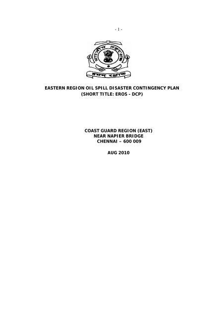
EASTERN REGION OIL SPILL DISASTER CONTINGENCY PLAN<br />
(SHORT TITLE: EROS - DCP)<br />
COAST GUARD REGION (EAST)<br />
NEAR NAPIER BRIDGE<br />
CHENNAI – 600 009<br />
AUG 2010
- 2 -<br />
EASTERN REGION OIL SPILL DISASTER CONTINGENCY PLAN<br />
SHORT TITLE : EROS – DCP<br />
LIST OF CONTENTS<br />
S.No. Contents Page<br />
01 Preamble I<br />
02 Record of Amendments II-III<br />
03 Record of Supplements iv-v<br />
CHAPTER – I<br />
Paragraphs<br />
04 Introduction 1.1 to 1.2<br />
05 Scope 1.3 to 1.6<br />
06 Authority 1.7<br />
07 Regional Oil Spill Policy 1.8<br />
08 Area of Jurisdiction 1.9<br />
09 Objectives 1.10<br />
10 Command and Control 1.11 to 1.12<br />
11 Area of Responsibility 1.13 to 1.14<br />
12 Tired response 1.15<br />
13 Response Organisation – EROS – DCP 1.16 to 1.22<br />
14 Function of departments and agencies 1.22 to 1.40<br />
15 Training and exercise 1.41 to 1.56<br />
16 Functional responsibilities Appendix – 'A'<br />
17 Oil <strong>spill</strong> exercise documentation Appendix – 'B'<br />
CHAPTER – II<br />
18 Introduction 2.1 to 2.3<br />
19 Phase I : Notification 2.4 to 2.7<br />
20 Phase II : Activation of Regional Control Centre 2.8<br />
21 Phase III : Assessment, surveillance and 2.9 to 2.15<br />
Evaluation<br />
22 Phase IV : Response Decision and Mobilisation 2.16 to 2.24<br />
23 Phase IVA : Termination of Response 2.25<br />
24 Phase V: Record Keeping and Preparation of 2.26 to 2.27<br />
Claims<br />
Phase VI : Legal 2.28<br />
25 Priorities of protection 2.29<br />
26 <strong>Coast</strong>al sensitivity mapping 2.30<br />
27 East <strong>Coast</strong> Profile and economic activity 2.31 to 2.53<br />
ANNEXURES
- 3 -<br />
28 Oil Spill Report Form ANNEX - 1<br />
29 POLREP Message Format ANNEX - 1A<br />
30 List of Pre Designated OSCs ANNEX - 2<br />
31 Regional and district jurisdictions ANNEX - 3<br />
32 Possible source of <strong>oil</strong> <strong>spill</strong> ANNEX - 4<br />
33 environmentally sensitive areas ANNEX - 4A<br />
34 Other sensitive areas ANNEX - 4B<br />
35 Communication <strong>plan</strong> ANNEX - 5<br />
36 Details of <strong>oil</strong> pollution response ANNEX - 6<br />
equipment<br />
37 Check off list to deal with incidents of ANNEX - 7<br />
<strong>oil</strong> pollution<br />
38 Synoptic and climatological features ANNEX - 8<br />
39 Standard operating procedures for<br />
minor <strong>spill</strong>s<br />
ANNEX - 9
- 4 -<br />
EASTERN REGION OIL SPILL DISASTER CONTINGENCY PLAN<br />
(EROS - DCP)<br />
Preamble<br />
1. The Director General, <strong>Indian</strong> <strong>Coast</strong> <strong>Guard</strong> Headquarters, New Delhi<br />
(DGICG) is the Central Co-coordinating Authority (CCA) for major <strong>oil</strong> <strong>spill</strong><br />
<strong>disaster</strong>s and has the overall responsibility to ensure that appropriate response is<br />
made to any incidence in the sea around India. The National Oil Spill Disaster<br />
Contingency Plan (NOS - DCP) promulgated by <strong>Coast</strong> <strong>Guard</strong> Headquarters has<br />
been designed to provide a simple and operationally flexible <strong>plan</strong> to combat an<br />
<strong>oil</strong> <strong>spill</strong> <strong>disaster</strong> in the Maritime Zones of India.<br />
2 The NOS - DCP as envisaged the role of the Regional Commanders with<br />
the task to ensure prompt and effective response to prevent, control and Combat<br />
<strong>oil</strong> pollution on and round their respective Regions. The scope of the Eastern<br />
Region Oil Spill Disaster Contingency Plan (Short title EROS - DCP) has also been<br />
designed to provide an action oriented response <strong>contingency</strong> to cover such<br />
aspects as notification, activation, assessment, evaluation, resource mobilization,<br />
termination and claims, and finally legal sanctions to be established thereof<br />
under the laws of the Administration of ship concerned wherever the violation<br />
occurs wand with respect to the national statutory provisions in force.<br />
3. The EROS - DCP has also relied considerably on the <strong>contingency</strong> <strong>plan</strong>s<br />
envisaged in the NOS - DCP with the sole purpose of east and common access to<br />
the general frame work of formatted responses to avoid ambiguity in reports<br />
amongst various coordinating agencies. In general, EROS - DCP follows a similar<br />
layout of the NOS- DCP, though its length and content will vary with the size of<br />
the area covered and degree of perceived threat and risk. The EROS - DCP also<br />
strives to assist compatibility to ensure a smooth transition from one level to<br />
another in course of the response.
- 5 -<br />
S.No<br />
Amendment<br />
Number<br />
Details of<br />
Amendment<br />
(ii)<br />
RECORD OF AMENDMENTS<br />
Authority Date Name & Signature of<br />
the person who carried<br />
out the amendment
- 6 -<br />
S. No. Amendment<br />
Number<br />
(iii)<br />
RECORD OF AMENDMENTS<br />
Details of Authority Date Name & Signature of<br />
Amendment<br />
the person who carried<br />
out the amendment
- 7 -<br />
Sl. No.<br />
Latest<br />
Supplement<br />
Number<br />
(iv)<br />
RECORD OF SUPPLEMENTS<br />
Details of Authority Date Name & Signature of<br />
Supplement<br />
the person who<br />
carried out the<br />
amendment<br />
(v)<br />
RECORD OF SUPPLEMENTS<br />
S.No.<br />
Latest<br />
Supplement<br />
Number<br />
Details of<br />
Supplement<br />
Authority Date Name & Signature of<br />
the person who<br />
carried out the<br />
amendment
- 8 -
- 9 -<br />
EASTERN REGION OIL SPILL DISASTER CONTINGENCY PLAN<br />
(EROS – DCP)<br />
Introduction<br />
1.1. The <strong>Indian</strong> Ocean is closed by landmass on the north, but towards the<br />
east and west, there are entries and exists through very narrow restricted water,<br />
namely, the Gulf of Aden and Straits of Malacca. Almost all ship- borne<br />
movements from east to west and vice versa must therefore transit across the<br />
<strong>Indian</strong> Ocean. As many as 200 ships pass through these waters every day,<br />
carrying over 90% of world trade, including <strong>oil</strong>. Further the economic status of<br />
India has been considerably enhanced with major <strong>oil</strong> exploration, production and<br />
refining facilities within the EEZ, making it highly desirable to cater for the<br />
<strong>contingency</strong> of major <strong>oil</strong> <strong>spill</strong> within the EEZ.<br />
1.2. The Eastern <strong>Coast</strong> supports a number of coral reefs, marine like.<br />
Mangroves forests and variety of fish on the <strong>eastern</strong> sea board which need to be<br />
protected against the detrimental effects of <strong>oil</strong> pollution. The coastal<br />
environment is a complex, sensitive and dynamic Eco-system, which demands an<br />
appropriate, compatibility and effective response in the event of an <strong>oil</strong> <strong>spill</strong>.<br />
Scope<br />
1.3. To combat an <strong>oil</strong> <strong>spill</strong> in the Bay of Bengal, it is desirable to co-ordinate<br />
pollution response activities amongst various government and non-government<br />
agencies. The <strong>contingency</strong> <strong>plan</strong> is intended to identify the capabilities and<br />
resources in order to establish an organizational structure to combat marine<br />
pollution, so that focal points and lead agencies are clearly identified for an<br />
appropriate and affect the pollution control response.<br />
1.4. The Eastern Regional Headquarters has been vested with the role and<br />
responsibility to prepare for combating a major <strong>oil</strong> <strong>spill</strong> up to 10,000 tonnes in<br />
her maritime area. Any requirement of combating a major <strong>oil</strong> <strong>spill</strong> above 10,000<br />
tonnes would be undertaken by consolidating all the available resources and<br />
equipment from other Regions.<br />
1.5. The EROS-DCP also provides the frame work for co-coordinated integrated<br />
response by various government agencies that are functionally responsible for<br />
monitoring, control and combating marine pollution by <strong>spill</strong>age of <strong>oil</strong> around their<br />
areas of operation. However, the <strong>Coast</strong> <strong>Guard</strong> shall remain as the Central Cocoordinating<br />
Authority in combating <strong>oil</strong> pollution during major <strong>oil</strong> <strong>spill</strong>s.
- 10 -<br />
1.6. The EROS –DCP also intends to promote the development of the District<br />
Contingency Plan within the four <strong>Coast</strong> <strong>Guard</strong> Districts and three <strong>Coast</strong> <strong>Guard</strong><br />
stations in the <strong>region</strong> in co-ordination with the respective ports, offshore<br />
exploration and <strong>oil</strong> handling agencies falling within their area of jurisdiction in the<br />
District/Station.<br />
Authority<br />
1.7. The committee of Secretaries to the Government of India while allocating<br />
functional responsibilities to various Ministries and Departments for Oil Spill<br />
Response in the maritime zones of India, have approved on 04 Nov 93, the<br />
National Oil Spill Disaster Contingency Plan (NOS – DCP). EROS -DCP is drawn in<br />
pursuance of the directives and objectives of NOS –DCP. The ROS-DCP (East) is<br />
binding in its operational phase. Consistent with the NOS –DCP, the Commander<br />
<strong>Coast</strong> <strong>Guard</strong> Region (East) is responsible to the Director General <strong>Coast</strong> <strong>Guard</strong><br />
(DGICG) in centrally coordinating marine <strong>oil</strong> <strong>spill</strong> response activities in the<br />
Eastern Region.<br />
Regional Oil Spill Response Policy<br />
1.8. This policy is drawn in pursuance of the directives and objectives of NOS –<br />
DCP. This <strong>plan</strong> needs a review/update every six months/one year and an assets<br />
holding update every three months.<br />
Area of Jurisdiction<br />
1.9. The Commander, <strong>Coast</strong> <strong>Guard</strong> Region (east) Regions exercises the<br />
jurisdiction on the <strong>eastern</strong> sea board from the IMBL with Bangladesh in Bay of<br />
Bengal to 180 – Muttam point in the <strong>Indian</strong> Ocean up to the Exclusive Economic<br />
Zone of maritime zones of <strong>eastern</strong> coast of India. District headquarters of West<br />
Bengal, Orissa, Andhra Pradesh, Tamil Nadu and union territory of Pondicherry<br />
exercises the jurisdiction with as exception of IMBL between India and Srilanka.<br />
Under the District Headquarters are located the shore stations within a state at<br />
the important locations along with coast to assist the District Headquarters.<br />
Objectives<br />
1.10. The objectives of the EROS – DCP are :-<br />
(a) To develop appropriate and effective system for the detection and<br />
reporting of <strong>spill</strong>age of <strong>oil</strong>.<br />
(b) To ensure prompt responses to prevent control and com bat <strong>oil</strong><br />
pollution.
- 11 -<br />
(c) To ensure that adequate protection is provided for the public health<br />
and welfare and the marine environment.<br />
(d) To ensure that appropriate response techniques are employed to<br />
prevent, control and combat <strong>oil</strong> pollution, and dispose off recovered<br />
material in an environmentally accepted manner.<br />
(e) To ensure that complete and accurate records are maintained of all<br />
expenditure to facilitate cost recovery.
- 12 -<br />
Command and Control<br />
1.11. The Commander, <strong>Coast</strong> <strong>Guard</strong> Region (East) shall exercise complete<br />
command and control for all functional response operations of monitoring control<br />
and combating marine <strong>oil</strong> pollution by <strong>spill</strong>age of <strong>oil</strong> within the area of jurisdiction<br />
vested with the <strong>Coast</strong> <strong>Guard</strong> in the east coast of India and shall be designated as<br />
the Regional Coordinating Authority (RCA)<br />
1.12. Any specific requests for assistance from the delineated field agencies<br />
within their area of jurisdiction and functional responsibility shall be extended to<br />
the extent feasible and appropriate. In the event of a major <strong>oil</strong> <strong>spill</strong> in the seas<br />
around India, <strong>Coast</strong> <strong>Guard</strong> shall assume the role of the central co-ordinating<br />
authority (CCA) and the RCA shall assist the various aspects of the operations as<br />
directed by the CCA.<br />
Area of Responsibility<br />
1.13. The functional responsibilities for monitoring, control and combating<br />
marine pollution by <strong>spill</strong>age of <strong>oil</strong> have been delineated by areas of activity with<br />
respect to the Exclusive Economic Zone and areas therein. The concerned field<br />
agency responsibility has been fixed with respect to the area of activity and its<br />
distance from land extending seaward upto Exclusive Economic Zone on <strong>eastern</strong><br />
coast of India.<br />
1.14. Oil <strong>spill</strong>s up to Tier–I will be responsibility of the agencies as mentioned<br />
below.<br />
(a) Port. Area in and around port upto port limits including anchorage.<br />
(b) Oil Handling Agencies. With in the area of operation.<br />
(c) State Government. Shoreline cleanup including inland waters.<br />
Tiered Response<br />
1.15. There is no mathematical co–relation on quantum of <strong>oil</strong> to inventory<br />
holdings. The relationship is determined by quantum of <strong>oil</strong>, distance of<br />
<strong>contingency</strong> from the impact site, response time vice versa flow rate of <strong>oil</strong> being<br />
handled of inventory location/arrival time and priority and number of trained<br />
staff available. These will vary in every incident of <strong>oil</strong> discharge. However, for<br />
administrative and operational reasons, an adhoc- definition is made as follows<br />
as per IMO guidelines:-
- 13 -<br />
(a) Tier-I (Small, up to 700 Tons depending upon threat perception).<br />
The equipment, chemicals and trained manpower required for<br />
compartment of Tier- 1 Spill is the responsibility of the port and for the<br />
owner of the installation.<br />
(b) Tier-II (Medium, above 700 to 10,000 Tons)<br />
(c) Tier-III (Large, above 10,000 Tons)<br />
Response Organisation - EROSDCP<br />
1.16. The RCA shall be the directing and coordinating authority to ensure that<br />
appropriate response is made to any incidence in the seas of the Bay of Bengal<br />
facing with the jurisdiction of the Eastern Region.<br />
RCA<br />
OSC<br />
(RPRO)<br />
OCA<br />
(COMDIS/ STN CDR)<br />
DOSC<br />
(PRO)<br />
1.17. The RCA shall appoint a Regional Pollution Response Officer (RPRO) who<br />
shall be the On Scene Commander (OSC) and act as a representative of the RCA<br />
to co-ordinate all activities of pollution response at the area of field activity.<br />
1.18. The RPRO shall co - ordinate and authorize activity as required for the<br />
pollution response through the District Commander (COMDIS) in whose <strong>region</strong>/<br />
area/state the field activity occurs. The COMDIS shall automatically become the<br />
Operation Control Officer (OCA)<br />
1.19. As far as feasible, the RCA shall depute the RPRO expeditiously as the OSC<br />
to the area of field activity at first instance. In the event of pollution response<br />
activity request being received from another agency of functional responsibility<br />
or an incident within the local area of District Commander, the District<br />
Commander /OCA shall designate one officer as pollution Response Officer (PRO)<br />
for the District who shall act as the Deputy on scene commander (DOSC) and
- 14 -<br />
lead the initial response team to the scene of incidence. The RCA may also<br />
designate the District Commander to act as OSCs for any <strong>oil</strong> <strong>spill</strong> contingencies<br />
within the respective District/ Maritime state. The list of pre-designated OSCs of<br />
Eastern Region is placed at Appendix –"C"<br />
1.20. The RCA shall constitute and activate the Regional Response Cell (RRC).<br />
The Regional Headquarters, which shall act as the nodal centre for all pollution<br />
response operations. The RCA shall incorporate and constitute the RRC with staff<br />
as deemed fit under the overall supervision of the Chief Staff Officer (Operations)<br />
{CSO (OPS)}.<br />
1.21. The schematic representation of the RCC will be as follows and the OSC<br />
will be assisted by the EROS –DCP Team vested with duties as outlined:-
- 15 -<br />
RCA<br />
OSC<br />
PRT (E)<br />
Techno logistic, Operational<br />
and Scientific advice<br />
CSO(OPS)<br />
Sea Unit & Air Craft<br />
Control<br />
RRC<br />
CSO(P&A)<br />
Administration<br />
• Communication<br />
• Legal<br />
• Liaison<br />
• Claims<br />
• Progress & Plan<br />
Review<br />
• logistics<br />
• Manpower<br />
• Mobilisation<br />
• Transportation<br />
• Finance<br />
• Public Relation<br />
Note : Additional duties will be incorporated as per <strong>contingency</strong> requirements<br />
Detailed Functions of Various Departments / Agencies<br />
1.22. Ministry of Home. Since 2003, the NOSDCP has come under the<br />
purview of the National Disaster Management Authority, Ministry of Home Affairs<br />
under Marine Oil Spill Management in India. It is the nodal ministry for <strong>oil</strong> <strong>spill</strong><br />
response activities.<br />
1.23. Ministry of Defence. The Ministry of Defence shall be the<br />
administrative Ministry for implementation of Contingency Plan by the <strong>Indian</strong><br />
<strong>Coast</strong> <strong>Guard</strong> and for coordinating with other ministries of the Central<br />
Government.<br />
1.24. Commander, <strong>Coast</strong> <strong>Guard</strong> Region (East).
- 16 -<br />
(a) Receiving reports of <strong>oil</strong> pollution at sea<br />
(b) Coordinating the activities of RCC when activated.<br />
(c) Keeping the Director General, <strong>Coast</strong> <strong>Guard</strong> apprised of<br />
developments.<br />
(d) Processing and co-ordinating claims of the affected parities and<br />
participating agencies with a view to compilation for processing by DG<br />
Shipping.<br />
(e) Mobilizing coast guard resources to support CSC action at <strong>spill</strong> area.<br />
(f) Maintaining the RCP and forward revised <strong>plan</strong>s to members as may<br />
be required by RCC.<br />
(g) Receiving periodic reports from resource agencies on account of<br />
pollution response equipment and material with a view to have an upto<br />
date inventory list in the coast guard western <strong>region</strong>, <strong>eastern</strong> <strong>region</strong> and<br />
Andaman and Nicobar Region.<br />
(h) Providing the administrative infrastructure to the RCC for conduct of<br />
routine and operational tasks.<br />
(j) Providing additional sampling effort during <strong>spill</strong>s when requested by<br />
OSC.<br />
(k) Maintaining a list of national and international agencies that may be<br />
called upon to assist for pollution response at the discretion of RCC.<br />
(l) Arranging for periodical exercises in pollution response<br />
(m) Providing sensor data to RCC /OSC as required<br />
(n) Pre-designating a <strong>Coast</strong> <strong>Guard</strong> OSC.<br />
1.25. <strong>Indian</strong> Navy / <strong>Indian</strong> Air Force in the Region<br />
(a) Augment aerial surveillance capability of <strong>Coast</strong> <strong>Guard</strong> as necessary<br />
in the area when <strong>oil</strong> <strong>spill</strong> has occurred.<br />
(b) To make arrangement for <strong>oil</strong> transshipment operations form any<br />
tanker which has caused or is causing or is expected to cause <strong>oil</strong> <strong>spill</strong>age.<br />
(c) Promulgate general cautionary messages.<br />
1.26. Department of Ocean Development.<br />
(a) Mapping of ecologically sensitive areas in the coastal and offshore in<br />
consultation with Ministry of Environment and Forest.<br />
(b) Review of the sensitivity mapping listed by other agencies<br />
(c) To provide scientific support through <strong>Coast</strong>al Ocean Monitoring and<br />
prediction system (COMAPS) centre and units in investigations of <strong>oil</strong>
- 17 -<br />
pollution monitoring during the <strong>oil</strong> <strong>spill</strong>s and also deployment of its<br />
research vessels for this purpose, whenever, necessary.<br />
(d) To organize research on impact of <strong>oil</strong> pollution marine living<br />
resources through appropriate scientific programmer / projects.<br />
(e) To organize follow-up research works on the ecological effect of<br />
actual <strong>oil</strong> pollution incidents.<br />
1.27. Department of Environment and Forest.<br />
(a) Determining policy for usage of dispersant in the sea areas of the<br />
territorial waters over which the state exercises jurisdiction.<br />
(b) Mapping of ecologically sensitive areas and biosphere reserve along<br />
the coastal areas of the country.<br />
1.28. Department of Agriculture and Co-Operation.<br />
(a) To arrange for suitable fishing vessels on which <strong>oil</strong> dispersant<br />
equipment can be mounted if the local action group concern is unable to<br />
mobilize this requirement locally.<br />
(b) Sensitivity mapping of the sea areas within the territorial water of<br />
the state with specific information on fish breeding grounds.<br />
1.29. ONGC/ Oil Platforms in the <strong>region</strong>.<br />
(a) To assist for chartering of tankers when required by the Regional<br />
Headquarters in consultation with DG Shipping for the <strong>oil</strong> transshipment<br />
operations.<br />
(b) To make available to the Regional Headquarters concerned antipollution<br />
equipment chemicals as are available with them.<br />
(c) To assist in the storage ashore of <strong>oil</strong> transshipped from wrecked or<br />
damaged tanker<br />
(d) To assist in the assessment of the value of the <strong>oil</strong> transshipped.<br />
1.30. Ministry of Food Processing Industries. To direct Fishery Survey<br />
of India arrange for suitable fishing vessels on which <strong>oil</strong> dispersant equipment<br />
can be mounted if the local action group concerned is unable to mobilize this<br />
requirement locally.<br />
1.31. Director General Shipping.<br />
(a) To assist <strong>Coast</strong> <strong>Guard</strong> or monitoring pollution from ships.<br />
(b) To keep the Ministry of Surface Transport apprised of the<br />
development on receipt of information from <strong>Coast</strong> <strong>Guard</strong>.
- 18 -<br />
(c) Initiation of reports emphasized in Merchant Shipping Act 1958 on<br />
receiving reports from <strong>Coast</strong> <strong>Guard</strong> regarding <strong>oil</strong> pollution.<br />
(d) Collection of evidence relating to <strong>oil</strong> pollution as envisaged in MS act<br />
1958 collating evidence collected by <strong>Coast</strong> <strong>Guard</strong> or other agencies<br />
relating to <strong>oil</strong> pollution with a view to prosecuting a polluter.<br />
(e) To serve as legal advisor to the RCC /OSC in matters related to <strong>oil</strong><br />
pollution and response at sea.<br />
(f) To advise the appropriate receiver of Wrecks as regards action to be<br />
taken.<br />
(g) To arrange for chartering of tankers when <strong>oil</strong> transshipment<br />
operations are considered necessary by RCC.<br />
(h) To take whatever action is necessary to realize the claims from<br />
parties responsible for the <strong>oil</strong> <strong>spill</strong>age through the TOVALOP agreement or<br />
through any other manner.<br />
1.32. Shipping Corporation of India.<br />
(a) To arrange for tankers of ships or tank barges for transport and<br />
collection of recovered <strong>oil</strong>.<br />
(b) To arrange for any personnel required to assist <strong>oil</strong> transshipment<br />
operation or to assist otherwise as may be required.<br />
1.33. Major Ports in <strong>region</strong>.<br />
(a) To be in charge of the overall co-ordination of actions in the area<br />
within port limits as regards to anti- <strong>oil</strong> pollution measures and actions to<br />
prevent, contain, and mitigate <strong>oil</strong> pollution. In this arrange for the<br />
preparation of a local <strong>contingency</strong> <strong>plan</strong> in consultation with the Regional<br />
Headquarters / Central Co-ordinating Authority.<br />
(b) To identify a suitable sea going craft as and when required for the<br />
operations.<br />
(c) To identify a suitable crafts (I) on which dispersant spraying<br />
equipment can be mounted (ii) which can be used for rigging the boom<br />
etc.,<br />
(d) To ensure that for the purpose of Part XIII of the Merchant Shipping<br />
Act 1958 actions are taken by various authorities under the overall legal<br />
responsibility of the Receiver of wrecks and dock concerned.<br />
(e) To ensure that at least the following minimum equipment are kept<br />
available locally at all times :-
- 19 -<br />
(i) Inflatable boom<br />
(ii) Dispersant spraying equipment capable of being mounted on<br />
surface craft.<br />
(iii) Suitable dispersant chemicals of the nature and quantity<br />
estimated as requirement of the Local Action Group as part of the<br />
Local Contingency <strong>plan</strong>.<br />
(iv) Oil Skimmer<br />
(v) Surface craft on which above dispersant equipment can be<br />
mounted and can be used for rigging boom etc.<br />
(f) To arrange for training of personnel expected to be engaged in<br />
above operations.<br />
(g) To arrange for periodical exercise under the guidance of the RCC to<br />
keep equipment and personnel on continuous readiness for <strong>oil</strong> <strong>spill</strong><br />
response operations.<br />
(h) To consult the CG, the DGS, or any other authority, when further<br />
assistance is required.<br />
(j) To keep the CG apprised of actions being taken.<br />
1.34. <strong>Coast</strong>al State Government – State Pollution Control Boards.<br />
(a) To take all suitable measures to prevent pollution on shoreline<br />
(b) To render all possible assistance to the coordinator of the On Scene<br />
Commander, Local Action Group and District Commander particularly in<br />
accordance with the <strong>contingency</strong> <strong>plan</strong>.<br />
(c) To maintain adequate quantity of basic pollution response<br />
equipment like deflective booms, fence booms, spray equipment along<br />
with specialized equipment for beach protection and shoreline cleanup.<br />
(d) To identify suitable type of tug / boat / fishing vessel in consultation<br />
with On Scene Commander / <strong>Coast</strong> <strong>Guard</strong> for mounting the dispersant<br />
spraying equipment.<br />
(e) To identify places for waste <strong>oil</strong> disposal / pits.<br />
1.35. Mercantile Marine Department.<br />
(a) To render all possible assistance to the co-ordinator of the local<br />
<strong>contingency</strong>/action <strong>plan</strong>.<br />
(b) To provide technical advise to Local Action Group and CCA<br />
(c) To assist local action group in identifying surface craft suitable for<br />
mounting dispersant spraying equipment
- 20 -<br />
(d) To assist local action group in preparation of local <strong>contingency</strong> /<br />
action <strong>plan</strong>.<br />
(e) To assist the CG/RCC in examining ships for efficiency of antipollution<br />
equipment fitted on board as per Merchant Shipping Act 1958.<br />
(f) If deemed necessary, to restrict movement /arresting of ships and<br />
personnel involved in <strong>oil</strong> pollution on receipt of related information.<br />
1.36. Local Fisheries Department.<br />
(a) To assist /advise local action group in identifying the rich fishing<br />
grounds so as to give priority for protection of such grounds from <strong>oil</strong> <strong>spill</strong>s<br />
as well as use of dispersants.<br />
(b) The local action groups in consultation with <strong>Coast</strong> <strong>Guard</strong> Regional<br />
Headquarters to identify the fishing vessels suitable for mounting the <strong>oil</strong><br />
<strong>spill</strong> dispersant equipment.<br />
1.37. <strong>Coast</strong>al Oil Refineries and Crude Unloading Terminals.<br />
(a) To assist the local action group in implementation of the Local<br />
Action Plan.<br />
(b) To assist Local Action Group in obtaining from their headquarters<br />
available additional equipment and chemicals as and when required.<br />
(c) To assist in chartering of tankers to undertake transportation /<br />
transshipment operations.<br />
(d) To arrange for the storage of <strong>oil</strong> transshipped.<br />
(e) To make assessment of the value of the <strong>oil</strong> transshipped and cost of<br />
refining or disposal as the case may be.<br />
1.38. Oil And Natural Gas Commission. ONGC can decide their own<br />
requirement of equipment and facilities keeping in view the Govt / <strong>Coast</strong> <strong>Guard</strong><br />
suggestions from time to time regarding the type of equipment suitable in <strong>Indian</strong><br />
conditions.<br />
(a) Periodically forwarding a list of response inventory to the RCC for<br />
scrutiny, evaluation and updating holdings.<br />
(b) Providing response equipment, material trained personnel and ships<br />
when required by the RCC /OSC as on available basis and without affecting<br />
their operation or their safety.<br />
(c) ONGC will also immediately respond for combating <strong>oil</strong> pollution<br />
around its installations upto 500 Mtrs and will continue to provide<br />
equipment, material, trained manpower sampling efforts and vessels as
- 21 -<br />
may be required by RCC /OSC when such <strong>oil</strong> <strong>spill</strong> will spread beyond 500<br />
mtrs.<br />
(d) Providing data on crude <strong>oil</strong> and <strong>oil</strong> discharges.<br />
(e) Providing data on subsea pipelines which may required by RCC /OSC<br />
(f) Providing <strong>oil</strong> transshipment facilities in case of ONGC or any agency<br />
under its control being the polluter.<br />
(g) Provide staging facilitates for helicopters in the offshore areas when<br />
engaged in pollution response in the vicinity whether or not ONCG and<br />
agencies under its control are the polluters.<br />
1.39. Receiver of Wrecks.<br />
(a) To assist Local Action “Group in whatever manner necessary and<br />
possible.<br />
(b) To take all actions necessary under part XIII of the Merchant<br />
Shipping Act 1958 (in this connection the Receiver of Wreck shall consult<br />
the DGS, as and when required).<br />
(c) In situations where he has the local responsibility for certain actions<br />
and /or operations, he may authorize other agencies, which are better<br />
equipped.<br />
1.40. Only Regional public Relation Officer or the officer nominated by RCA will<br />
interact with media on issues pertaining to pollution response. During interaction<br />
with the media following information may be provided.<br />
(a) Cause of the incident and action taken<br />
(b) Damages and <strong>spill</strong> response status, areas threatened<br />
(c) Environmental damages and action taken<br />
(d) Cleanup activities<br />
Training and Exercise<br />
1.41. When <strong>oil</strong> <strong>spill</strong> incident occurs, decisions have to be made quickly and<br />
equipment must be ready for deployment at very short notice. The only reliable<br />
way for this to be achieved is to develop local <strong>contingency</strong> <strong>plan</strong>s, conduct<br />
exercises to validate, maintain pollution response equipment and train personnel<br />
in its use. The adequacy of such preparations should be tested thoroughly in full<br />
scale desktop and practical exercises and the lessons learnt from actual marine<br />
<strong>oil</strong> <strong>spill</strong>s should be fed back to improve the <strong>contingency</strong> <strong>plan</strong> and the exercise<br />
programme. Towards this effort, an <strong>oil</strong> <strong>spill</strong> response exercise guidelines<br />
(OSREG) have been formulated by CGHQ.
- 22 -<br />
1.42. The RCA will conduct regular Level -1 and Level – 2 exercises/Mockdrills in<br />
accordance with OSREG for <strong>oil</strong> / marine pollution response exercises as part of<br />
annual training programme. It is intended for continuous improvement of the<br />
<strong>contingency</strong> <strong>plan</strong>s and the response system to involve all the stakeholders in an<br />
area level exercise / local level exercise like ports, <strong>oil</strong> handling companies, Sub<br />
contracted parties, Oil Spill Removal Organisation (OSRO), <strong>Coast</strong>al State<br />
Authorities including Pollution Control Boards and make the respective<br />
<strong>contingency</strong> <strong>plan</strong> holder responsible for addressing any issues that may arise.<br />
Exercise Contingency Plan Components<br />
1.43. The following are the basic <strong>plan</strong> components that will be exercised during<br />
Level 1 and Level 2 exercise programme.<br />
(a) Organisation<br />
(b) Notifications<br />
(c) Staff mobilizations<br />
(d) Equipment / material mobilization<br />
(e) Operational Response<br />
(f) Discharge control<br />
(g) Assessment of discharge<br />
(h) Protection of sensitive areas<br />
(i) Containment of discharge<br />
(j) Recovery of <strong>spill</strong>ed <strong>oil</strong><br />
(k) Disposal of recovered material<br />
(l) Protection of personnel engaged in <strong>spill</strong> response<br />
(m) Response Support<br />
(n) Communication<br />
(o) Immediate mobilisation of sea assets for marine pollution response<br />
(p) Equipment maintenance and support<br />
(q) Participation of other resource agencies with assets and equipment<br />
(r) Involvement of NIOT, INCOIS for <strong>spill</strong> tracking, NIO for OSD<br />
application and scientific laboratories for water sampling<br />
(s) Documentation<br />
1.44. In certain cases, it may not be possible to exercise all the <strong>plan</strong><br />
components at the same time. In such cases, the <strong>plan</strong> will be exercised in<br />
segments. The required exercise should be designed and developed by the<br />
coordinating units to ensure that each component of the <strong>plan</strong> is addressed and
- 23 -<br />
exercised from the evaluation of the exercises and for making necessary changes<br />
to the response <strong>plan</strong>s to ensure the highest level of preparedness.<br />
Participation in Exercises<br />
1.45. The exercises will be programmed by RCA and coordinated by Dist<br />
Headquarters / stations under jurisdiction from the stakeholders control centre in<br />
order to assess their capability on communication and response action. As far as<br />
possible all stakeholders within the area will be involved in conduct the exercise.<br />
The DOS DCP should form an umbrella <strong>plan</strong> to work up individual resource<br />
agency <strong>contingency</strong> <strong>plan</strong> and thereafter evaluation should be carried out for<br />
further amendments for improvement. Efforts should be made to involve<br />
volunteer organisation for simulating shoreline clean up measures with active<br />
participation of State Pollution Control Board, District Collectorate, Scientific<br />
Organisation etc. The revenue officials of the district will play a major role during<br />
<strong>oil</strong> <strong>spill</strong> crisis and all effort to be made to involve them in exercises and also carry<br />
out the state <strong>contingency</strong> <strong>plan</strong> actions.<br />
Level of Exercises<br />
1.46. The level of exercises ranges from table top exercise, exercising<br />
communication links and extent upto full mobilisation and deployment of<br />
equipment. The level at which an exercise is conducted normally depends on the<br />
size, threat and likely consequences of a <strong>spill</strong>. The features of each exercise<br />
levels are:-<br />
(a) Level 1. Spill scenarios are focused on smaller, higher<br />
probability, operational type <strong>spill</strong>s. The operational exercises are focused<br />
on port/<strong>oil</strong> handling company's <strong>contingency</strong> <strong>plan</strong>s, their emergency<br />
operating procedures. Initial response actions, on-site equipment<br />
readiness and equipment deployment. ICG assets may be used for overall<br />
training exposure but the priority should be made to evaluate the resource<br />
agency <strong>plan</strong>s and their response system.<br />
(b) Level 2. Spill scenarios involve, collision, grounding of tankers or<br />
rapture of pipelines or <strong>spill</strong> from offshore installations or FPSO units and<br />
involve the need for assistance and additional resources from outside the<br />
individual organisation. ICG assets are to be utilized in addition to<br />
mobilisation of resources from all other agencies in the area. During this<br />
exercise, salvage tugs, shoreline cleanup organizations may also be<br />
involved for evaluating response actions. The Level 2 exercise would
- 24 -<br />
involve actions as per ROSDCP and generally to cover the initial part in<br />
table top exercise for altering, notification quantification assessment of<br />
response actions and the deployment for containment, recovery, transport,<br />
disposal, shoreline cleanup and claims preparation should be worked up as<br />
practical exercise.<br />
(c) Level 3. Spill scenarios reflecting an incident of significance to<br />
generally wider area response calls for invoking of NOSDCP. As invoking<br />
NOSDCP involves invoking national <strong>disaster</strong> management <strong>plan</strong>, these<br />
exercises will be coordinated from CGHQ.<br />
1.47. The Level-1 and Level -2 exercises can be preceded by table Top exercise<br />
and Mock Drills, if the level of knowledge of the personnel taking part in the<br />
exercise is not adequate enough to understand the procedures that are followed<br />
after a <strong>spill</strong> occurs in the site.<br />
Periodicity of Exercise<br />
1.48. Level 1 and Level 2 exercises are promulgated as part of annual training<br />
programme. Participation in Level 3 exercise will be as per the schedule<br />
promulgated by CGHQ.<br />
Planning Exercise<br />
1.49. The Coordinating <strong>Coast</strong> <strong>Guard</strong> unit to conduct the exercise as per the<br />
annual training programme in consultation with stake holders emphasizing<br />
stages of exercise <strong>plan</strong>ning as per OSREG.<br />
Equipment Deployment<br />
1.50. The purpose of the equipment deployment exercise is to validate that the<br />
equipment is appropriate for the operating environment in which it is intended to<br />
be used and that operating personnel are trained and capable of its deployment<br />
and operation.<br />
Documentation<br />
1.51. Proper Documentation for evaluation should include the following<br />
information:-<br />
(a) Type of exercise<br />
(b) Date and time of the exercise<br />
(c) A detailed description of the exercise<br />
(d) Objectives achieved during the exercise<br />
(e) The components of the response <strong>plan</strong> exerdis3ed
- 25 -<br />
(f) Lessons learnt<br />
1.52. This documentation must be in writing in accordance with the format<br />
provided at Appendix ‘B’. The aim of documentation is to practice corrective<br />
action and also for recovery from polluter for legal requirement.<br />
Report<br />
1.53. The entire proceedings of the exercise along with relevant documentation<br />
are to be forwarded to RHQ (E) within one month on completion of the exercise<br />
by the respective unit.<br />
Check off List for Oil Spill Exercise<br />
1.54. Actions Prior Exercise Programme by coordinating unit.<br />
(a) Schedule the programme for exercise on receipt of Annual Training<br />
Programme.<br />
(b) Select the components to be exercised<br />
(c) Inform all resource agencies and stakeholders for their roles<br />
expected during the exercise at least two months in advance<br />
(d) Obtain all resource information and their operational conditions.<br />
(e) Obtain the list of key personnel<br />
(f) Establish communication procedures and designated control<br />
frequencies.<br />
(g) Inform NIOT, INCOIS, NRSA and Meteorology Dept regarding<br />
providing inputs for <strong>spill</strong> tracking will in advance.<br />
(h) Prepare area sensitivity map well in advance to protect vital areas<br />
during <strong>spill</strong> scenario<br />
(i) Keep a copy of all stake holders <strong>contingency</strong> <strong>plan</strong>ts who are<br />
participating in the exercise and make sure they are current.<br />
(j) Establish an organisation tree for effective command and control<br />
1.55. Actions During Exercise.<br />
(a) Raising POLREP to ICG Ops Centre/MRCC<br />
(b) Notify all stakeholders regarding the incident<br />
(c) Inform DG Shipping<br />
(d) Send notice to ship owner IAW section 356J of MSA 1958 to the<br />
party that has been responsible for the <strong>spill</strong><br />
(e) Inform the relevant District Collectorate, State Pollution Control<br />
Boards, Fisheries Associations, Fisheries Dept, Hotel Owners and
- 26 -<br />
recreational facilities and centers about the incident and the restricted<br />
area.<br />
(f) Control of discharge – ICG or other units can perform damage<br />
control and prevent further discharge<br />
(g) Ascertain the quantity of <strong>oil</strong> discharged.<br />
(h) Obtain weather and oceanographic inputs like current, tidal<br />
conditions and wind parameters<br />
(i) Ascertain physical and chemical characteristics of <strong>oil</strong><br />
(j) Carryout aerial assessment and issue necessary orders<br />
(k) Start a log for actions taken and assets utilized for processing claims<br />
(l) Send out communication for mobilisation of PR equipment<br />
(m) Send out communication to relevant authorities to provide for<br />
support utilities like barges, tugs, small tankers for transfer of cargo, other<br />
material and men required through sub-contractors etc.<br />
(n) Send information to NAVAREA Coordinator for restriction of area<br />
(o) On obtaining inputs, carryout assessment of the <strong>spill</strong>, likely<br />
movement and the area likely to be affected with the core team.<br />
(p) Calculate the time and space for effective deployment of boom for<br />
containment or diversion of slick<br />
(q) Carryout preventive booming in sensitive areas<br />
(r) Carryout Net Environment Benefit Analysis and establish the best<br />
possible response with regard to time and space.<br />
(s) If time and space does not permit deployment of boom and recovery<br />
of <strong>oil</strong>, decide for the best alternative response measure available after<br />
weighting the cost benefit analysis. In some cases shore booming and<br />
deviation methods are effective to collect <strong>oil</strong> on shore than on sea.<br />
(t) Deploy necessary personnel and equipment for shoreline cleanup, if<br />
required.<br />
(u) Assume <strong>oil</strong> drifted to respective <strong>oil</strong> handling agencies control areas<br />
and exercise the <strong>plan</strong> holders to mobilize their PR equipment.<br />
(v) All <strong>plan</strong> holders should exercise their respective procedures for<br />
cleanup their water (upto 500 m) around <strong>oil</strong> rigs, SBMs etc and the entire<br />
port limit by respective port).<br />
(w) The shore line cleanup team should identify dispersal area and wear<br />
protective clothing.
- 27 -<br />
(x) If the <strong>oil</strong> does not hit the coast immediately and if time and space<br />
permit, the possibility of application of OSD to be examined, subject to<br />
strict adherence to OSD guidelines 2009 for application<br />
(y) Check availability of air and surface assets for OSD application<br />
(z) Mobilise OSD to the place of embarkation (port or airfield etc)<br />
(aa) Carry out continuous aerial surveillance for assessment and<br />
dispersion details of <strong>oil</strong><br />
(bb) Carryout resource damage assessment with scientific community<br />
(cc) Carryout documentation<br />
(dd) Carryout claims processing<br />
(ee) Forward claims to DG Shipping for award of compensation and clean<br />
up cost.<br />
(ff) Complete the documentation of the exercise as per para 1.34.<br />
(gg) Evaluation team to provide details of the short comings as per para<br />
1.32. (j) of the response action of participating agencies<br />
(hh) Issue stand down notice to all agencies<br />
1.56. Post Exercise.<br />
(a) Carry out debrief with photo and videographic evidence<br />
(b) Issue recommendations and an evaluation report to participating<br />
resource agencies and Regional Headquarters.
- 28 -<br />
Appendix –‘A’<br />
FUNCTIONAL RESPONSIBILITIES FOR MONITORING CONTROL AND<br />
COMBATING MARINE POLLUTION BY SPILLAGE OF OIL<br />
Department/Agency Responsibilities as Functional Responsibilities<br />
per allocation of Allocated<br />
Business Rules<br />
1 2 3<br />
<strong>Coast</strong>al State<br />
Environment and 1. Enactment of legislation for<br />
Authorities<br />
ecology, including prevention and control of<br />
environment in coastal marine pollution from land and<br />
waters, in mangroves, sea based sources.<br />
coral reef but excluding 2. Prevention and control of<br />
marine environment on marine pollution at source, on<br />
the high seas.<br />
land or the sea.<br />
3. Monitoring of pollution upto<br />
the shore.<br />
4. Cleaning of beaches affected<br />
by <strong>oil</strong> pollution through coastal<br />
states and Union Territories.<br />
Director General of<br />
Shipping / Ports in the<br />
Eastern Region<br />
1. Maritime Shipping<br />
And Navigation.<br />
2. Administration of<br />
<strong>Indian</strong> ports Act. 1908<br />
and ports declared as<br />
major ports.<br />
1. Prevention and control of<br />
pollution arising from ships all<br />
over the sea including the<br />
major ports areas.<br />
2. Enactment and<br />
administration of the legislation<br />
related to prevention, control<br />
and combating of pollution<br />
arising from ships.<br />
3. To comply with provision<br />
made in section 356 G(1) and<br />
(2) of Merchant Shipping Act,<br />
1958 (Amendment) for the<br />
Purpose of
- 29 -<br />
(a) Inspection of<br />
construction of ships and<br />
takers in order to comply<br />
with provision of<br />
MARPOL73/78 or of the<br />
other convention on<br />
maritime<br />
pollution<br />
formulated by IMO and/ or<br />
other related bodies,<br />
Merchant Shipping Act and<br />
issue of necessary<br />
certificates, and<br />
(b) Penalising the offenders<br />
apprehended by the <strong>Indian</strong><br />
<strong>Coast</strong> <strong>Guard</strong> and port<br />
authority for violations of<br />
the above provisions of the<br />
Act, including processing of<br />
pollution damage claims etc.<br />
4. Function through major ports<br />
authorities within port limits<br />
(a) Inspection of <strong>oil</strong> record<br />
books<br />
(b) Apprehending of<br />
violators of anti-pollution<br />
provisions mentioned under<br />
section 356 G(1) and (2) of<br />
the Merchant Shipping Act.<br />
(c) Checking of vessels for<br />
carrying necessary<br />
insurance certificates<br />
against <strong>oil</strong> pollution<br />
damage.<br />
(d) Empowered to handle<br />
necessary anti pollution
- 30 -<br />
Oil<br />
Terminals<br />
Exploration<br />
INCOIS, Hydrabed<br />
NIOT and ICMAM<br />
1. Exploration for and<br />
exploitation of<br />
petroleum resources<br />
including Natural Gas<br />
2. Planning,<br />
development and<br />
regulation of <strong>oil</strong> field<br />
services<br />
3. Oil refineries,<br />
including lube <strong>plan</strong>ts<br />
1. Policies including<br />
co-ordination<br />
regulatory measures<br />
and development<br />
relating to prevention,<br />
conservation and<br />
protection of oceans<br />
Ministry of Defence <strong>Indian</strong> <strong>Coast</strong> <strong>Guard</strong><br />
(RCA)<br />
provisions mentioned under<br />
<strong>Indian</strong> Ports Act, 1908<br />
(Amendment)<br />
(e) Monitoring and<br />
combating of <strong>oil</strong> pollution in<br />
the port areas.<br />
1. Combating of <strong>oil</strong> pollution<br />
around offshore exploration and<br />
production platforms upto 500<br />
mtrs<br />
2. Combating of <strong>oil</strong> pollution<br />
around coastal refineries<br />
through the concerned<br />
refineries.<br />
Scientific monitoring of marine<br />
pollution arising from land<br />
based ship-based and other<br />
resources in various maritime<br />
zones including coastal waters,<br />
but excluding monitoring of <strong>oil</strong><br />
pollution within the limits of<br />
major ports, <strong>oil</strong> platforms,<br />
installations and structures.<br />
1. Surveillance of maritime<br />
zones of Eastern Region against<br />
<strong>oil</strong> <strong>spill</strong>s.<br />
2. Combating <strong>oil</strong> <strong>spill</strong>s in<br />
juridication except in the waters<br />
of major ports in juridiction<br />
3. Regional Co-coordinating<br />
Agency / authority for<br />
combating of <strong>oil</strong> pollution in the<br />
coast and marine environment
- 31 -<br />
<strong>Coast</strong>al State Pollution<br />
Control Board of West<br />
Bengal, Orissa, Andhra<br />
Pradesh and Tamil<br />
Nadu<br />
State Pollution Control<br />
Board<br />
of maritime zones of the<br />
Eastern Region.<br />
4. Implementation of national<br />
<strong>contingency</strong> <strong>plan</strong> for <strong>oil</strong> <strong>spill</strong><br />
<strong>disaster</strong>.<br />
5. (Following) controlling<br />
activities in Eastern Region<br />
maritime zone except within the<br />
limits major ports:-<br />
(a) Inspection of <strong>oil</strong><br />
record books.<br />
(b) Apprehending violators<br />
of anti-pollution provisions<br />
mentioned under Sections<br />
356 G(1) and (2) of the<br />
Merchant Shipping Act.<br />
(c) Checking of vessels for<br />
carrying necessary<br />
insurance certificates<br />
against <strong>oil</strong> pollution<br />
damage.<br />
1. To take all suitable<br />
measures to prevent pollution<br />
of shoreline.<br />
2. To render all possible<br />
assistance to the coordinator of<br />
the On Scene Commander,<br />
Local Action Group and District<br />
Commander particularly in<br />
accordance with the<br />
<strong>contingency</strong> <strong>plan</strong>.<br />
3. To maintain adequate<br />
quantity of basic pollution<br />
response equipment like<br />
deflective booms, fence booms,
- 32 -<br />
spray equipment alongwith<br />
specialize equipment for beach<br />
protection and shoreline<br />
cleanup.<br />
4. To identity suitable type of<br />
tug/ boat/ fishing vessel in<br />
consultation with On Scene<br />
Commander/ <strong>Indian</strong> <strong>Coast</strong><br />
<strong>Guard</strong> for mounting the<br />
dispersant spraying equipment.<br />
5. To identity places for waste<br />
places for waste <strong>oil</strong> disposal/<br />
pitts.
- 33 -<br />
Oil Spill Exercise Documentation<br />
Appendix –‘B’<br />
1. Date _______________________________________________________<br />
2. Location _____________________________________________________<br />
3. (a) Time Started ___________________________________________<br />
(b) Time completed _________________________________________<br />
4. Description of exercise _________________________________________<br />
_________________________________________________________________<br />
_________________________________________________________________<br />
_________________________________________________________________<br />
5. Identify which of the <strong>plan</strong> components (para 1.26) were exercised during<br />
this particular exercise ______________________________________________<br />
_________________________________________________________________<br />
_________________________________________________________________<br />
_________________________________________________________________<br />
6. No. of agencies participated ____________________________________<br />
7. Equipment deployed ______________________________________<br />
8. Attach a description of lessons learned and steps taken as corrective<br />
measures
- 34 -<br />
Appendix –‘C’<br />
LIST OF PRE – DESIGNATED OSCs ( EASTERN REGION)<br />
Area Name Address Emergency Call<br />
Tamil Nadu<br />
1. COMDIS -5 Headquarters<br />
<strong>Coast</strong> <strong>Guard</strong> District No.5<br />
Fort St.George<br />
Chennai – 600 009<br />
2. TNPCB 76, Mount Salai, Guindy<br />
Chennai – 600 032<br />
3. Chennai Port Rajaji Salai<br />
Trust<br />
Chennai 600 001<br />
4. Ennore Port 23 Rajaji Sala<br />
Chennai -600 001<br />
Andhra Pradesh<br />
1. COMDIS- 6 Headquarters<br />
<strong>Coast</strong> <strong>Guard</strong> District No.6<br />
C/o Fleet Mail Office<br />
Visakhapatnam<br />
2. APPCB Paryavarana Bhavan<br />
A-3 Industrial Estate<br />
Sanathnagar<br />
Hydrabad – 500 018<br />
3. Vishakhapatnam<br />
Port trust<br />
Orissa<br />
1. COMDIS- 7 Headquarters<br />
<strong>Coast</strong> <strong>Guard</strong> District No.7<br />
Badapadia<br />
Paradip – 754 142<br />
Tele:044-23460451<br />
Telefax : 044-23460456<br />
044-22352647<br />
044-25361228<br />
044-25251665<br />
Telefax: 0891-2568875<br />
040-23815631<br />
0891-2562758<br />
Tele :06722-222712<br />
Telefax :06722-223359<br />
2. PCB 06722-2562822<br />
3. Paradip Port Paradip Port Trust 06722-222025<br />
Trust<br />
Paradip<br />
West Bengal<br />
1. COMDIS -8 Headquarters<br />
<strong>Coast</strong> <strong>Guard</strong> Dist No.8<br />
Anchorage Camp<br />
Haldia – 721 607<br />
Tele :03224-263404<br />
Telefax:03224 -263217<br />
2. WBPCB 033-23356730
- 35 -<br />
3 KoPT 033-2205370
- 36 -<br />
CHAPTER -II<br />
Introduction<br />
2.1. The <strong>oil</strong> <strong>spill</strong> <strong>contingency</strong> <strong>plan</strong> envisages consideration or broad guidelines<br />
for a <strong>contingency</strong> <strong>plan</strong>. As appreciable, not all factors are necessarily relevant to<br />
a given situation and therefore selection of a response should be made with<br />
respect to those factors which are relevant and appropriate to the <strong>oil</strong> sp<strong>oil</strong>. There<br />
has never been one <strong>spill</strong> like another.<br />
2.2. Since the EROS - DCP also considers a gradual build up of pollution<br />
response potential and capability to deal with major <strong>oil</strong> <strong>spill</strong>s upto 10,000 tonnes,<br />
an initial evaluation of the following strategic issues as examined in succeeding<br />
paragraphs, would provide the background and basics for formulate a<br />
<strong>contingency</strong> <strong>plan</strong> which may also impose constraints. Considering existing<br />
potential, local, national and international regulations and authorities, particularly<br />
those vested with delineated responsibilities to ascertain their capabilities and<br />
limitations in accordance with the national legislations. Maintain close and<br />
continuous liaison with identified and delineated agencies for current update on<br />
potential and capabilities of these agencies. An update of the existing pollution<br />
response <strong>contingency</strong> <strong>plan</strong>s drawn up by individual field agencies is also to be<br />
periodically validated. Identify areas of potential ecological sensitivity from local<br />
and government authorities and form the field agencies within their areas of<br />
operations. Assess geographical limits for logistic for management, resource<br />
mobilization activity and positioning pollution response equipment adjacent to<br />
high risk areas of local operation for <strong>oil</strong> <strong>spill</strong> <strong>disaster</strong>s. Assess land and coastal<br />
features on Eastern sea board and seasonal marine data such as tides, currents,<br />
winds, density of water, environment sensitivity etc. for facilitation of natural<br />
degradation of <strong>oil</strong> <strong>spill</strong>.<br />
2.3. The EROS –DCP has been drawn up basically as an action oriented<br />
<strong>contingency</strong> <strong>plan</strong> for a simple yet systematic response based on two basic criteria<br />
such as overall strategy and operational <strong>plan</strong> comprising of the following phases<br />
of execution of <strong>oil</strong> <strong>spill</strong> response.<br />
Phase I: Notification (Reporting and Alerting Procedures)<br />
2.4. Oil <strong>spill</strong> can occur anywhere on land or sea and so often with little or no<br />
warning. The first information of an <strong>oil</strong> <strong>spill</strong> may come from any one of number<br />
of sources including general public but most invariably comes from a passing
- 37 -<br />
ship or aircraft, since there exists at present no dedicated watching agency for<br />
the purpose. The agencies operating on sea or over flying sea routes are to keep<br />
sharp look out and to report any incident of <strong>oil</strong> <strong>spill</strong> expeditiously to the nearest<br />
Civil /<strong>Coast</strong> <strong>Guard</strong> authority.
- 38 -<br />
2.5. The District Commanders /OCA are to maintain close liaison directly with<br />
local civil authorities to assist in early notification of an <strong>oil</strong> <strong>spill</strong> incident. The<br />
District Commanders / OCA are to receive such notification on 24 hour basis.<br />
The primary agency reporting the <strong>oil</strong> <strong>spill</strong> incident is to do so on the <strong>oil</strong> <strong>spill</strong><br />
report form placed at Annexure -1.<br />
Communication<br />
2.6. The District Commander is to tender an amplifying report on the incident<br />
to the RCA on the POLREP message format placed at Annexure-1. POLREP<br />
constitutes accurate information at Part I and II of POLREP. This information is<br />
vital for an accurate assessment of the <strong>oil</strong> <strong>spill</strong> incident any pollution response is<br />
therefore directly dependent on the qualitative information available on the<br />
POLREP.<br />
2.7. <strong>Coast</strong> <strong>Guard</strong> and Naval ships / aircraft’s are to report sighting of <strong>oil</strong> <strong>spill</strong>s<br />
through established <strong>Coast</strong> <strong>Guard</strong> and Naval channels of communication by an<br />
OPS IMMEDIATE signal giving maximum information and details on the Oil Spill<br />
Report Form (OSRF). Subsequent amplifying reports are to be signaled by<br />
PRIORITY signal on the POLREP format. All reports rendered are to be addressed<br />
to the RCA with information to the CCA and OCA within whose District /Maritime<br />
State the <strong>oil</strong> <strong>spill</strong> incident occurs.<br />
Phase II : Activation of Regional Response Centre (RRC)<br />
2.8. On receipt of POLREP, activate the <strong>Coast</strong> <strong>Guard</strong> Regional Headquarters<br />
Check off List to deal with the <strong>oil</strong> pollution. The check off List to be activated as<br />
follows :-<br />
(a) Execute POLRES (Pollution Response)<br />
(b) Man <strong>Coast</strong> <strong>Guard</strong> Ops-room continuously.<br />
(c) Inform following local authorities to intimate by fastest means any<br />
sign of pollution of the sea by <strong>oil</strong> along the coast and request them to<br />
keep Regional Commanders informed.<br />
(i) Port officers of the major and minor ports<br />
(ii) District Collectors<br />
(iii) Authorities at fish landing ports<br />
(iv) <strong>Coast</strong>al State Pollution Control Boards<br />
(d) Requisition of additional communication sets as required.<br />
(e) Ensure availability of the information regarding capabilities of ships,<br />
and Naval and <strong>Coast</strong> <strong>Guard</strong> aircrafts.
- 39 -<br />
(f) Ensure availability of ONGC ships with suitable equipment on board.<br />
(g) Request MMD/SCI for chartering of ships for <strong>oil</strong> transhipment.<br />
(h) Request DG shipping / MMD for appointment of receiver of wreck as<br />
per Merchant Shipping Act.<br />
(j) Send regular SITREP to CGHQ and all concerned.<br />
(k) Requisition for pollution response equipment held with ONGC, <strong>oil</strong><br />
platforms, and port trusts as necessary.<br />
Phase III : Assessment, Surveillance and Evaluation<br />
2.9. The Regional Headquarters of the <strong>Coast</strong> <strong>Guard</strong> are prepared for combating<br />
a major <strong>oil</strong> <strong>spill</strong> upto 10,000 tonnes. The requirement of combating a major <strong>oil</strong><br />
<strong>spill</strong> above 10,000 tonnes will be undertaken by pooling all available resources<br />
and equipment in the Country.<br />
2.10. An accurate assessment and evaluation of <strong>oil</strong> <strong>spill</strong> incident is essential prior<br />
to any appropriate <strong>spill</strong> control and clean up procedure and response can be<br />
activated. The basic issues need to be addressed towards a realistic assessment<br />
of the nature and size of the possible threat and of the resources most at risk<br />
bearing in mind the probable movement and expected trajectory of the <strong>spill</strong> as<br />
controlled by the forces of nature.<br />
2.11. OSC/OCA is to expeditiously deploy an aircraft from the nearest <strong>Coast</strong><br />
<strong>Guard</strong> Air station for an aerial surveillance over the area of reported <strong>spill</strong>. The<br />
aerial surveillance report should amplify such information as extent of <strong>spill</strong><br />
blanket, <strong>spill</strong> profile, type of <strong>oil</strong> <strong>spill</strong>, identify source of <strong>spill</strong>, assess geographical<br />
features of land, identify potential ecological sensitive areas adjoining the area of<br />
<strong>spill</strong> and marine weather parameters to verify predictions. The surveillance may<br />
utilize IR/UV coverage to record ground realities of <strong>spill</strong> for analysis.<br />
2.12. The OSA /OCA is to evaluate the probable fate of the <strong>oil</strong> <strong>spill</strong> in relation to<br />
the type of <strong>oil</strong> spilt and the prevailing seasonal and weather conditions. The<br />
movement of the <strong>oil</strong> is to be predicted from data of local weather phenomena<br />
and from a full knowledge of coastal topography, tide and currents, wind speed<br />
and direction and other marine weather data.<br />
2.13. The OSC must evaluate with a fair degree of accuracy the expected<br />
trajectory with a fair degree of accuracy the expected trajectory and probable<br />
fate of the <strong>oil</strong> <strong>spill</strong>. If the <strong>oil</strong> slick is moving off shore towards the open sea and if<br />
no key resources are threatened, then no response may be necessary beyond<br />
monitoring on a regular basis the movement and behavior of the slick and is to
- 40 -<br />
be the preferred response operation. If the <strong>oil</strong> slick is moving onshore, then the<br />
response could be either containment or recovery dispersion or shoreline<br />
cleanup.<br />
2.14. The OSC must evaluate the existing in-house response capability and<br />
assess their effectiveness to combat the <strong>contingency</strong> on hand. The OSC is to<br />
assess and evaluate the capabilities available with other departments and<br />
agencies and is to recommend the degree of understanding and co-operation<br />
required to be worked out in the event any required response is being<br />
requisitioned from outside sources. The details of pollution response capabilities<br />
presently available with the various government and non –government agencies<br />
in accordance with the field of activity is placed at Annexure-6.<br />
2.15. Based on the assessment and evaluation, the response decision would be<br />
ordered by the RCA. The response decision would lay emphasis on a central coordination<br />
under a single Organisation for handling the operation. In case this<br />
scenario is not feasible, the RCA shall lay down the procedures for co-ordination<br />
between the various groups associated with the response <strong>contingency</strong>. It is to be<br />
noted here that there seldom exists ‘the right approach’ but, if ever only’ the<br />
best approach’ to the given situation, The response decision would also attempt<br />
to select equipment on a total solution basis rather than an option wherein each<br />
operation is to be considered separately.<br />
Phase IV : Response Decision and Mobilisation<br />
2.16. As previously described, the response decision will be broadly classified<br />
into three aspects:-<br />
(a) Monitoring if no threat exists<br />
(b) Contain recover and clean-up<br />
(c) Application of OSD<br />
2.17. In case of threat perception, the response decision is to be arrived at after<br />
prioritising the threat perception and areas where the threat perception is likely<br />
to cause maximum damage. Certain ‘sacrificial areas’ may have to be considered<br />
for the overall response to the threat perception. The general strategy would be<br />
ordered for containment and recovery using existing techniques, which may<br />
involve mechanical recovery equipment or use of chemical dispersants. The<br />
details of the various methods of operation of mechanical recovery equipment<br />
are available in the manuals and publications of the response equipment held<br />
with the concerned agencies.
- 41 -<br />
2.18. The OSC is to project the desired response equipment top the RCA who<br />
shall arrange mobilization of the desired response equipment most expeditiously.<br />
The <strong>Indian</strong> Air Force may be approached for transport aircrafts to mobilize the<br />
equipment. The key to the success to a response operation of containment<br />
recovery lies in the speed of mobilization of the desired pollution response<br />
equipment. Adequate equipment knowledge, effective use and trained personnel<br />
play vital roles for effective containment and recovery. The OSC / District<br />
Commander /DCSA are to identify specialist trained personnel form within the<br />
Region for the purpose of response operation.<br />
2.19. The District Commander /OCA will provide all logistics and administrative<br />
support for the <strong>Coast</strong> <strong>Guard</strong> Pollution Response Team at the field of activity. Any<br />
shortcomings or limitations are to be projected expeditiously to the RCA for<br />
reinforcement. The availability of back up resources such as additional<br />
equipment and materials, transport and change around crew is to be ensured at<br />
all times by the OSC /OCA.<br />
2.20. The response decision for use of chemical dispersants is to be arrived at<br />
after a consideration of potential ecologically sensitive areas, which may be<br />
threatened by the use of chemical dispersant. The prevailing weather parameters<br />
such as wind direction and velocity, tides and currents and the time of use are to<br />
be adequately considered prior to chemical response decision. It is an accepted<br />
fact that the short term as well as long term impact on the ecology by the use of<br />
chemical dispersants is combined with the high degree of uncertainty. The<br />
OSC/OCA is to obtain the express approval from the RCA prior to any chemical<br />
response in the field of activity. The application of OSD in the area by OSC shall<br />
be guided by the "OSD GUIDELINES 2009" promulgated by CGHQ.<br />
2.21. The selection of techniques for the clean-up should be determined by the<br />
OSC in relation to the assessment of the risk <strong>spill</strong>s and to the defence of agreed<br />
priorities for protection. The limitations of the <strong>spill</strong> control techniques must be<br />
appreciated and the most suitable equipment should be selected for the clean-up<br />
strategy.<br />
Cleanup Operation<br />
2.22. Any cleanup operation is manpower and labour intensive. The OSC is to<br />
estimate the manpower requirement to undertake the cleanup operation and is<br />
to recommend the extent to which the requirement can be met through<br />
contractual parties. The OCA is to study the sources of back up labour from
- 42 -<br />
contractors and government departments and is to provide the required<br />
manpower to the OSC.<br />
2.23. Any cleanup operation on shore line beaches shall be the responsibility of<br />
the respective <strong>Coast</strong>al States of the Eastern Region. Any specific requests from<br />
the local government authority for cleanup and disposal of <strong>oil</strong> shall be considered<br />
by the RCA to the extent as appropriate and possible.<br />
Disposal of Recovered Oil and Oily Debris<br />
2.24. The OSC /OCA shall coordinate with the state Govt. authorities /State<br />
Pollution Control Boards for disposal of <strong>oil</strong> debris and waste <strong>oil</strong> in the vicinity of<br />
locations close to the areas of greater risk for expeditious cleanup. The express<br />
approval of the RCA is to be obtained for the proposed disposal methods<br />
selected by the OSC.<br />
Phase IV A : Termination of <strong>oil</strong> <strong>spill</strong><br />
2.25. On successful completion of <strong>oil</strong> <strong>spill</strong> response operation or after the desired<br />
objectives have been achieved, the Regional Coordinating Authority (RCA) shall<br />
terminate the <strong>oil</strong> <strong>spill</strong> response operation. The OSC is to ensure that all pollution<br />
response equipment and machinery utilized during the operation are restored to<br />
operational capability and mobilization for future <strong>contingency</strong>.<br />
Phase V: Record Keeping and Preparation of Claims<br />
2.26. The OSC is to submit the detailed documentation of actions and records<br />
regarding the use of <strong>Coast</strong> <strong>Guard</strong> infrastructure, equipment and materials,<br />
manpower and logistics and all other relevant data required for the purpose of<br />
calculation of capitation fees for the complete operation. The OSC is to ensure<br />
accurate and good documentation to facilitate claims submission expeditiously.<br />
2.27. The OSC is to update the EROS-DCP from the lessons learnt during the<br />
<strong>contingency</strong> operation and render specific recommendations for updating<br />
<strong>contingency</strong> <strong>plan</strong>s of other field agencies associated with the operation and to<br />
eradicate bottlenecks.<br />
Phase VI : Legal<br />
2.28. Legal action against the owner or master of the vessel or directors /<br />
owners of the company involved in the causes for the <strong>oil</strong> <strong>spill</strong> <strong>disaster</strong> is to be<br />
initiated by the <strong>region</strong>al Law Officer under the relevant provisions for violations<br />
of statutory national and international legislation. All cases of legal action are to<br />
be duly approved by <strong>Coast</strong> <strong>Guard</strong> Headquarters. The details of the complete
- 43 -<br />
response operation is to be provided by the OSC to the Regional Law Officer for<br />
preparation and presentation of the case.<br />
National Laws-Empowerment to <strong>Coast</strong> <strong>Guard</strong><br />
• Section 356G - Powers to inspect Tankers and ORB<br />
• Section 356J - Power to give Notice to polluting ship and Penalty section<br />
of MS Act has provisions to arrest Master or Operator if no<br />
action is taken under section 356J<br />
• Section 356K - Power to take measures for preventing or containing <strong>oil</strong><br />
pollution and Powers to detain ship – the cost of clean up<br />
measures – Debt to Government of India.<br />
Priorities for Protection<br />
2.29. Priorities for protection and prevention will be accorded by the <strong>Coast</strong><br />
<strong>Guard</strong> OSC. On arrival of assistance to bolster local capacity, items will be<br />
attended to on the basis of priority. Priority list may be formed by Dist<br />
Headquarters as it is required to be formed as per sensitivity mapping / criterion<br />
for the area. The threat perception through the sources which may lead to an <strong>oil</strong><br />
<strong>spill</strong> in the port area as well as at the anchorage: The under mentioned sources<br />
may cause an <strong>oil</strong> <strong>spill</strong> in the port area as well as at anchorage in the Eastern<br />
<strong>Coast</strong> of India : -<br />
(a) Bunkering off port<br />
(b) Loading/ Unloading of <strong>oil</strong> at <strong>oil</strong> jetty<br />
(c) Transhipment of <strong>oil</strong> through <strong>oil</strong> tankers across the coast including at<br />
high seas as envisaged in provisions of Mid Sea bunkering.<br />
(d) Oil refineries on the East <strong>Coast</strong>.<br />
(e) External damage to vessels entering/ leaving Harbour due to<br />
collision grounding etc.<br />
(f) Accidental leakage from vessel berthed alongside due to fire<br />
explosion etc.<br />
(g) Intentional discharge of <strong>oil</strong> or <strong>oil</strong>y ballast water and tank washing or<br />
by any other means within port limits/ territorial waters.<br />
(h) SPM at Paradip and pipeline from Paradip to Haldia (In its full<br />
capacity to reach up to 50 million tons by 2018 as per the present <strong>plan</strong>).<br />
(j) Residual Oil contained in connecting pipes from shore to SPM at a<br />
distance of 12 Km from shore.<br />
(k) Oil exploration off the East <strong>Coast</strong>
- 44 -<br />
<strong>Coast</strong>al Sensitivity Mapping<br />
2.30. Maps showing possible sources of <strong>oil</strong> <strong>spill</strong> is placed at Annexure – 4 and<br />
environmentally sensitivity areas are placed at Annexure – 4A and 4B,<br />
East <strong>Coast</strong> Profile and Economic Activity<br />
2.31. The East <strong>Coast</strong> of India generally shelved with beaches, lagoons deltas<br />
and marshes. It is also relatively low lying with extensive alluvial plains and<br />
deltas.<br />
Gulf of Mannar<br />
2.32. The Gulf of Mannar from Kanyakumari to Dhanush Kodi is a stretch of<br />
sandy beach supporting the sensitive and delicate coral beds. The area is close<br />
to the international shipping route and is therefore very high risk areas so for as<br />
pollution is concerned. Apart from fishing on a regular basis the areas is also<br />
used for pearl culture. The area also attracts tourist especially at Kanyakumari<br />
where the three seas surrounding the India Peninsula meet. The Government of<br />
India has been considering the proposal to declare this area as a protected<br />
biosphere. There are a number of islands south of Mandapam and Pamban pass.<br />
2.33. Tuticorin. Tuticorin is major industrial town and is being developed as<br />
major port in this area. The number of ships moving to and from Tuticorin is<br />
therefore on the increase. Though presently only cargo ships in this area<br />
possibility of tanker movement in future cannot be ruled out.<br />
2.34. Palkbay. The Northern side of Dhanush Kodi to point Calimere forms a<br />
Bay. The coast line is mostly sandy with almost calm waters. Rameswaram is<br />
major religious center and therefore attracts a number of tourist both foreign<br />
and <strong>Indian</strong>. The beach area between Rameswaram and Dhanush Kodi is<br />
generally deserted and is not being utilized for social or economic purpose at<br />
present. There are delicate coral reefs in the bay.<br />
2.35. The area within the bay is utilized for fishing only. There is almost no<br />
movement of ships in this area . However, all mechanized boars are abundant all<br />
along the coast. ‘There is no major harbour in this area. The bay does support<br />
protected species of marine life specially the Dugong. The government is<br />
considering proposal to declare this as a protected area.<br />
Point Calimere to Pondicherry<br />
2.36. The <strong>Coast</strong>line from PT Calimere to Pondicherry is mostly low and frigned<br />
with groups and casuarinas trees. Nagapattinam and Cuddalore are low principal<br />
port in this stretch of coastline. The Nagapattinam shoal lies 4 NM offshore and
- 45 -<br />
Stretches 8 miles in lengths in parallel to the coastal line and is located 6 NM SE<br />
of Nagapattinam. Several sandy shoals 2.5 offshore exists between<br />
Nagapattinam and Nagore. A number of small rivers which bifurcate from the<br />
Cauvery itself entering the sea near Chidambaram. A number of towns and minor<br />
fishing harbours are seen along this coast.<br />
2.37. Economically fishing is the only major industry along this except<br />
Nagapattinam where movement of ships does take place. However no tanker<br />
movement takes place in these ports.<br />
2.38. The sea routes moving north to south are established 20-25 mm east of<br />
this coast.<br />
Pondichery to Kakinada<br />
2.39. The coastline along Pondicherry is mostly rocky in some area 3 to 5 NM N<br />
to Pondicherry with hill 7- 200 meters high. There are hills 3 to 5 Nm land<br />
around along this coast. In other area there are low sandy beaches with breakers<br />
extending 3 to 4 cables seawards.<br />
2.40. Oil exploration in this area is in progress. The actual operations has<br />
commenced as yet. Mahabalipuram the beach around this are up Chennai<br />
(Madras) is a tourist attraction and draw a number of both international and<br />
national tourist. The beaches along this coast are therefore high priority on the<br />
economic Charts.<br />
2.41. The Kalpakkam power station is located South of Chennai and need<br />
pollution free sea water for its functioning.<br />
2.42. Chennai is a major port on this coastline where all types of charges are<br />
handled including <strong>oil</strong> and its products. There is fisheries harbour north of the<br />
main harbour. North of Chennai harbour lies Ennore with extensive backwaters.<br />
The Ennore shoals lie 3 miles NNE of the Ennore with extensive backwaters of<br />
Ennore Shoals is a chain of land sandy patches called the Pulicat shoals. The<br />
pulicat lake is an extensive salt water lagoon. A number of industries exits<br />
together with fishing villages between Chennai and Pulicat. Fishing is the major<br />
economic activity in this area.<br />
2.43. Sriharikota the prime launching site in India is located in this area needs<br />
pollution free area to avoid disturbances to scientific research.<br />
<strong>Coast</strong> of Andhra Pradesh.<br />
2.44. The East coast of India lies with its coastline of about 3618 kms extending<br />
along the Eastern shore of the Bay of Bengal between parallel 13deg 40 min N,
- 46 -<br />
and 19 deg 40 min N. Eastern Region is a major maritime zone of India. These<br />
are the Major and minor Ports ports are situated at east coast of Visakhapatnam<br />
caters to Madhya Pradesh and Orissa too. Andhra Pradesh is known as the River<br />
state of South India comprising 09 coastal districts. The Major Port in the state is<br />
Visakhapatnam. The minor ports are Kakinada, Krishnapatnam, Vadarevu,<br />
Machilipatnam, Narsapur, Bhimunipatnam and Kalingapatnam. Andhra Pradesh<br />
being a coastal state with major vibrant port such as Visakhapatnam and<br />
developing ports with <strong>oil</strong>rigs such as Kakinada needs to have a Disaster<br />
Contingency Plan to preserve and protect marine environment, and prevent and<br />
control marine pollution by many <strong>oil</strong> tankers that transit daily all along the<br />
coastline of approximately 974 kms. Since one of the main revenues of the state<br />
is from marine resources, it is all the more reasonable to have a Disaster<br />
Contingency Plan at hand as a pre-emptive exercise. The high risk areas such as<br />
<strong>oil</strong>rigs off Kakinada, Marine Protected Areas (MPAs) such as wildlife sanctuaries<br />
in Coringa and Krishna, bird sanctuary such as Pulicat, and deltaic mangroves<br />
situated on the Krishna - Godavri delta <strong>region</strong> need to be protected by such<br />
timely measures that their assets are protected in times of major <strong>oil</strong> <strong>spill</strong>s. The<br />
<strong>oil</strong> pollution from blow-out, collision, stranding, and other marine accidents can<br />
threaten marine life in the inter-tidal zones, fisheries, seabirds, recreational<br />
beaches and tourism with subsequent loss of revenue. The threat potential to<br />
the Andhra Pradesh coast is considerable taking into account the movement of<br />
tankers and the operations of <strong>oil</strong> platforms in the Ravva <strong>oil</strong> fields and the<br />
Krishna- Godavri basin. A major <strong>spill</strong> could affect several areas around the coast<br />
including the ports, thereby making it essential to coordinate activities amongst<br />
the number of agencies involved. The density of merchant traffic especially <strong>oil</strong><br />
tankers entering/leaving the Ravva <strong>oil</strong> field is substantial.<br />
<strong>Coast</strong> of Orissa<br />
2.45. Paradip is a major port, which is involved in transfer of <strong>oil</strong> using Single<br />
Point Mooring (SPM). A minor <strong>spill</strong> could affect several areas around the coast, in<br />
port area making it essential to coordinate activities, amongst a numbers of<br />
agencies. The density of merchant traffic especially <strong>oil</strong> tankers bunkering and <strong>oil</strong><br />
tankers coming to Paradip has increased consequent to the installation of the<br />
SPM and hence Orissa coast has become a high risk area with respect to <strong>oil</strong> <strong>spill</strong>.<br />
<strong>Coast</strong> of West Bengal
- 47 -<br />
2.46. Haldia is a major port, which deals with transfer of <strong>oil</strong>. A major <strong>spill</strong> could<br />
affect several areas around the coast, in port area making it essential to<br />
coordinate activities amongst a number of agencies. The density of merchant<br />
traffic especially <strong>oil</strong> tankers coming to Haldia makes West Bengal coast high risk<br />
area.<br />
Sensitive Areas in East<br />
2.47. The Gulf of Mannar, Palk bay support coral reef and therefore are sensitive<br />
to changes in the maritime environment in the area. The Dugong, an<br />
endangered species of aquatic mammal has its natural habitant in the palk bay.<br />
The delicate system that exists in the two areas is therefore under consideration<br />
of the Ministry of environment. The areas are likely to be declared as protected<br />
biosphere. The area off Kalpakkam and the inland water in that area are<br />
necessary for sustaining the center and it operations on the water is used for the<br />
reactors. This area therefore needs to be highly protected area.<br />
2.48. Chennai harbour and fisheries harbour are active parts with a very high<br />
route of cargo maintenance and movement.<br />
2.49. The delta area off Godavai river from false dever point to Yanam is used<br />
for prawn culture and prawn seed collection. The area therefore sensitive to <strong>oil</strong><br />
pollution.<br />
2.50. The beach area from Paradip to wheeler island is breeding area for the<br />
Ridley Turtles between Jan to early Apr. The area therefore is sensitive to wild<br />
life conservation and need pollution free water during this period. The area is<br />
therefore semi-sensitive to marine pollution.<br />
2.51. The delta <strong>region</strong> of the Ganges support a number of marine and<br />
amphibian animals especially near sugar Island. These areas are also the<br />
entrance to Kolkatta harbour and have relative strong currents / tidal<br />
maintenance. The area around this <strong>region</strong> therefore needs protection.<br />
High Spill Risk Area<br />
2.52. The east coast of India is well marked with sanctuaries from north to<br />
south and <strong>oil</strong> refineries all along the coast. The details of high <strong>spill</strong> risk areas on<br />
the east coast are enumerated below :-<br />
2.53. The following major resources are at risks in case of <strong>oil</strong> <strong>spill</strong>: -<br />
(a) West Bengal.<br />
(i) Port including ships at anchorage<br />
(ii) Sunderbans Mangroves
- 48 -<br />
(iii)<br />
(iv)<br />
(v)<br />
(vi)<br />
Fish spawning area<br />
Water intakes of power <strong>plan</strong>ts & industrial units<br />
Marine environment & birds<br />
Recreational beaches viz. Digha<br />
(b) Orissa. It is a focal point for Olive Ridley turtles for mass<br />
nesting along the coast of Orissa. The following major resources are at risk<br />
in case of <strong>oil</strong> <strong>spill</strong> occurs along the coast of Orissa.<br />
(i) Paradip Port, including ships at anchorage.<br />
(ii) Rajnagar Mangroves.<br />
(iii) Fish spawning area.<br />
(iv) Water intakes of power <strong>plan</strong>ts and industrial units.<br />
(v) Marine environment birds and Oliver Ridely Turtles.<br />
(vi) Recreational beaches viz. Puri, Konark, Gopalpur & Paradip<br />
etc.<br />
(vii) Rookeries at Gahirmatha area, Devi River Mouth, Rushikulya<br />
River and Bhitarkanika Wildlife Sanctuary.<br />
(c)<br />
(d)<br />
Andhra Pradesh.<br />
(i) Visakhapatnam, Kakinada Port & Gangavaram Port including<br />
ships at anchorage<br />
(ii) Fish spawning areas<br />
(iii) Water intakes of power <strong>plan</strong>ts & industrial units<br />
(iv) Marine environment & birds<br />
(v) Recreational beaches viz Ramakrishna & Yerrada<br />
(vi) KG Basin<br />
(vii) Coringa Wildlife Sanctuary (East Godavari District)<br />
(viii) Krishna Wildlife Sanctuary (Krishna/ Guntur)<br />
(ix) Pulicat Lake Bird Sanctuary (Nellore)<br />
(x) Kolleru Wildlife Sanctuary (WG Dist)<br />
(xi) Sriharikota the prime launching site<br />
Tamil Nadu.<br />
(i) Chennai Port, Ennore Port, Puducheery Port, Nagapatnam Port<br />
and Tuticorin Port including ships at anchorage.
- 49 -<br />
(ii) Mangroves at Pirchavaram, Muthupet, Ramnad, Point<br />
Calimere and Pulicat.<br />
(iii) Fish spawning areas<br />
(iv) Point Calimere, Pulicat lake bird Sanctuary, Tiruvellore, Gulf of<br />
mannar marine national park in Ramanathpuram and Tuticorin.<br />
(v) Water intakes of power <strong>plan</strong>ts & industrial units.<br />
(vi) Recreational beaches along the coast of Tamil Nadu<br />
(vii) Kalpakkam power station located South of Chennai
- 50 -<br />
OIL SPILL REPORT FORM<br />
ANNEX -1<br />
a. Particulars of Person / Organization Reporting Incident<br />
b. Title :<br />
c. Company :<br />
d. Telephone / Telefax Number :<br />
e. Date / Time :<br />
f. Spill Location :<br />
g. Type and quantity of <strong>oil</strong> Spill :<br />
h. Cause of <strong>spill</strong> :<br />
j. Response to Spillage, if any :<br />
k. Any other information :
- 51 -<br />
POL REP MESSAGES FORMAT<br />
Reference : IMO – 560 (1995)<br />
ANNEX -1A<br />
Part-I<br />
(POLWARN)<br />
Part-II<br />
(POLINF)<br />
Part –III<br />
(POLFAC)<br />
Address From To<br />
Date<br />
Identification<br />
Serial Number<br />
1. Date and Time<br />
2. Position<br />
3. Incident<br />
4. Outflow<br />
5. Acknowledge<br />
40. Date and Time<br />
41 Position<br />
42 Characteristics of Pollution<br />
43 Source and cause of Pollution<br />
44 Wind direction and speed<br />
45 Current of Tide<br />
46 Sea state and Visibility<br />
47 Drift of pollution<br />
48 Forecast<br />
49 Identify of observer and ships on scene<br />
50 Action taken<br />
51 Photographs or sample<br />
52 Names of other agencies informed<br />
53-59 Spare<br />
60 Acknowledge<br />
80 Date and Time<br />
81 Request for assistance<br />
82 Cost<br />
83 Pre-arrangements for delivery<br />
84 Assistance to where and how<br />
85 Other agencies requested<br />
86 Challenge of Command<br />
87 Exchange of information<br />
88 Names and number of<br />
89 Description of equipment<br />
90 ETA and arrival information<br />
91 Place of embarkation<br />
92 Place of disembarkation<br />
93-98 Spare<br />
Time Group
- 52 -<br />
LIST OF PRE-DESIGNATED OSCs (EASTERN REGION)<br />
Annex –‘2’<br />
Name Address Emergency Call<br />
<strong>Coast</strong> <strong>Guard</strong> Region (East)<br />
COMCG (East) <strong>Coast</strong> <strong>Guard</strong> Region (East), Chennai 044 25395011/<br />
23460400<br />
Chief Staff Officer -DO- 044 23460403<br />
(Ops)<br />
Regional Pollution -DO- 044 23460404<br />
Response Officer<br />
Officer-in-Charge Pollution Response Team<br />
C/o CGRHQ (E)<br />
044 23460465<br />
TAMIL NADU<br />
COMDIS -5<br />
TUTICORIN<br />
MANDAPAM<br />
TNPCB, Chennai<br />
<strong>Coast</strong> <strong>Guard</strong> Dist Hqrs. NO.5 Fort St.<br />
.George Chennai – 600 009<br />
The Commanding Officer<br />
CGS Tuticorin, Harbour Estate, Tuticorin<br />
The Commanding Officer<br />
CGS Mandapam<br />
Tamilnadu State Pollution Control Board,<br />
76, Mount Salai, Guindy, Chennai<br />
044 -23460456<br />
0461-2353503/ 2352199<br />
(04573) 241519<br />
044-22352647<br />
22353134<br />
Chennai Port Trust Rajaji Salai, Chennai 044-25362201(Ext.2269)<br />
25361652<br />
Tuticorin Port Trust The Chairman, Tuticorin Port Trust,<br />
Tuticorin<br />
Puducherry<br />
Commanding Officer<br />
ICGS Puducherry<br />
P.B.No.1718, Ariyankuppam, Puducherry<br />
0461-2352500<br />
0413-2602499<br />
PCB 0413-2203494<br />
Andhra Pradesh<br />
COMDIS – 6<br />
<strong>Coast</strong> <strong>Guard</strong> Dist Hqrts.6<br />
Naval Base, Visakhapatnam<br />
(Telefax)0891-2568875<br />
E-Mail: dhqvsp@sify.com<br />
CGS Kakinada The Commanding Officer<br />
CGS Kakinada<br />
0884-2342172<br />
0884-2342171(Telefax)<br />
0884-2342175<br />
APPCB<br />
AP PCB Zonal Office, 6th Floor, Udyog<br />
Bhavan Complex, Sripuram Junction,<br />
Visakhapatnam<br />
The Chairman, Visakhapatnam Port Trust,<br />
Visakhapatnam<br />
0891-2719480<br />
27919380/480/481<br />
Visakhapatnam Port<br />
0891-5265042<br />
Trust<br />
Kakinada Sea Port Dir of Ports, Kakinada 0884-2363825<br />
Orissa<br />
COMDIS -7<br />
Headquarters<br />
<strong>Coast</strong> <strong>Guard</strong> DHQ-7<br />
Badapadia,<br />
Paradip – 754 14<br />
(TELE FAX) 06722 -220174<br />
06722 -223359
- 53 -<br />
Orissa PCB 0674-2562822/2560955<br />
Paradip Port Trust The Chairman, Paradip Port Trust, Paradip 06722-222127<br />
West Bengal<br />
COMDIS – 8<br />
<strong>Coast</strong> <strong>Guard</strong> Dist Hqs.8<br />
Anchorage Camp, Post Midnapur<br />
Haldia – 721 607<br />
03224 – 263404<br />
03224 – 263407<br />
FAX – 03224 - 263217<br />
WBPCB Parivesh Bhavan, Salt Lake, Kolkata 033-23356730<br />
Kolkata Port Trust Chairman, Kolkata Port Trust, Kolkata 033-2205370<br />
Haldia Dock Complex Dy Chairman, Haldia Dock Complex, 236209<br />
Haldia
- 54 -<br />
Annexure-3<br />
REGIONAL AND DISTRICT JURIDICTION AND AREA OF RESPONSIBILITY FOR<br />
PARTICIPATING AGENCIES<br />
Jurisdiction<br />
1. The Commander <strong>Coast</strong> <strong>Guard</strong> Region (East) Region exercises jurisdiction<br />
on the <strong>eastern</strong> seaboard for the execution of the <strong>Coast</strong> <strong>Guard</strong> Charter of duties<br />
as per section 14 of the <strong>Indian</strong> <strong>Coast</strong> guard act 1978 from the IMBL with<br />
Bangladesh in bay of Bengal to 180– Muttam point in the <strong>Indian</strong> Ocean upto the<br />
EEZ of maritime states of <strong>eastern</strong> coast of India. District Headquarters in the<br />
states of West Bengal, Orissa, Andhra Pradesh, Tamil Nadu and union territory of<br />
Pondicherry exercises the jurisdiction with an exception of IMBL between India<br />
and Srilanka. Under the District Headquarters are located the shore stations<br />
within a state at important locations along the coast to assist the District<br />
Headquarters in the execution of the <strong>Coast</strong> <strong>Guard</strong> Charter of Duties.<br />
2. Interstate boundaries for exercise of <strong>Coast</strong>al District jurisdiction are as<br />
follows: -<br />
a) Orissa West-Bengal Border<br />
i) OWB1 21 09’.0 87 37’.0<br />
ii) OWB2 21 36’.6 87 29’.2<br />
b) Andhra-Orissa Border<br />
i) AQ1 18 50’.0 85 07’.0<br />
ii) AQ2 19 04’.6 84 46’.0<br />
c) Tamil Nadu-Andhra Border<br />
i) TA1 13 33’.8 80 48’.0<br />
ii) TA2 13 33’.8 80 16’.5<br />
d) Kerala-Tamil Nadu Border<br />
i) KIT 1 08 17’.5 77 05’.9<br />
ii) KIT 2 08 07’.4 77 19’.1<br />
iii) KIT 3 07 48’.5 77 50’.5
- 55 -<br />
Area of Responsibility<br />
3. Oil <strong>spill</strong>s up to Tier –I will be responsibility of the agencies as mentioned<br />
below.<br />
(a) Port. Area in and around port upto port limits including anchorage.<br />
(b) Oil Handling Agencies. With in the area of operation.<br />
(c) State Government. Shore line cleanup including inland waters.
- 56 -<br />
POSSIBLE SOURCE OF OIL SPILLS<br />
Annexure-4<br />
1. OIL EXPLORATION<br />
2. Oil Tanker Movement
- 57 -
- 58 -<br />
Annexure-4A<br />
ENVIRONMENTALLY SENSITIVE AREAS
- 59 -
- 60 -<br />
Annexure-4B<br />
OTHER SENSITIVE AREAS
- 61 -<br />
ANNEX – 5<br />
COMMUNICATION PLAN<br />
IMPORTANT TELEPHONE NUMBERS<br />
INDIAN COAST GUARD (CHENNAI) [STD CODE: 044]<br />
Name Office Residential<br />
CGRHQ (E) COMCG (East) 25395011/<br />
23460500<br />
23460400<br />
COS 23460402 23460521<br />
CSO(Ops) 23460403 23460503<br />
CSO(Tech) 23460415 23460515<br />
ROPO/RPRO 23460404 --<br />
Regional Operation Center 23460404/<br />
-----<br />
25395016<br />
MSO 25395019 -----<br />
CGDHQ -5 Commander(TN) 25672534 24871789<br />
PRT (E) OIC 23460465 23460576<br />
DY OI/C 23460466 24423633<br />
DHQ-5<br />
DHQ-5 District Commander 23460451 23460551<br />
Executive Officer 23460452 23460552<br />
District Ops & <strong>plan</strong>s Officer 25670370 20012002<br />
Dist. Technical Officer 23460453 23460553<br />
Dist. Medical Officer 23460454<br />
MSO 25671718 23460456 (Telefax)<br />
Ops Centre 25670730<br />
Exchange 25671718<br />
Naval Officer NOIC (T N) 20024212<br />
In Charge (TN)<br />
Staff Officer (Ops) 25394240<br />
Naval Exchange 25395031-32<br />
Chennai Port Chairman 25361086<br />
Trust<br />
Deputy Conservator 25360833 25360925<br />
Resource Terminal Manager, IOC 25980432 9444085727<br />
Agencies<br />
Deputy GM CPCL 25944000<br />
Manager (F & S) CPCL 25944356<br />
Director Fisheries 24336311 24320791<br />
Asst Director, Fisheries 25951697<br />
President & CEO (Hardy 28471990 24311274/9841078067<br />
exploration)<br />
Duty Radio Officer(24 Hrs) 28471990 28471064 (Tele fax)<br />
9841075212<br />
Manager (SCI) 25231401<br />
CMFRI 24320791<br />
Department of Ocean 22301844<br />
Development<br />
Principal Officer MMD 25251108
- 62 -<br />
Tuticorin Port Deputy Conservator 2352313 9443389507<br />
Trust (Std<br />
Code – 0461)<br />
Harbour Master 2352423 94433899512<br />
State<br />
District Collector (CH) 044-25228085<br />
25228024/9841622255<br />
Authorities<br />
(Extn) 304<br />
25234403<br />
Dist . Collector Cuddalore 0412- 230999<br />
(Extn 211)<br />
230777<br />
9443332310<br />
Dist. Collector Nagapatinam 04365-252700<br />
247800/247400<br />
(Extn 201)<br />
Dist Collector Ramnad 04567-231220<br />
(Extn 201)<br />
221349/220648<br />
9443131220<br />
Dist Collector Tuticorin 0461- 2340600<br />
(Extn 201)<br />
2320050/23267479443342<br />
544<br />
Dist Collector Kanyakumari 04652-279555<br />
260666/999/9360801352<br />
& Nagarc<strong>oil</strong><br />
(Extn 301)<br />
Tamil Nadu State<br />
22352647 22353134<br />
Pollution Control Board<br />
PUDUCHERRY STD CODE- 0413<br />
ICGS Puducherry Commanding Officer 2602499 2253994<br />
Executive Officer 2600095 2918290<br />
OPS Room/MSO 2602498<br />
Puducherry Port Director of Port 2338092/2337114<br />
Executive Engineer 2336842<br />
Secretariat Port 2334484<br />
Fisheries<br />
Director of Fisheries 2228761/2220614(fax) 9443349445<br />
Puducherry<br />
Dy Director (Mech) 2336708/2220623(fax) 9944540546<br />
Karaikal Port, STD General Manager 256612<br />
Code- 04365<br />
Manager Marine<br />
(Operation)<br />
256610-11<br />
Chemplast Sanmar<br />
Limited, Karaikal<br />
Plant STD Code-<br />
04365<br />
Collectorate ,<br />
Puducherry, STD<br />
Code- 0413<br />
Collectorate,<br />
Karaikal, STD<br />
Code- 04368<br />
Fisheries Karaikal ,<br />
STD Code- 04368<br />
Pollution Control<br />
Committee,<br />
Puducherry, STD<br />
Code- 0413<br />
Vice President<br />
(Operation)<br />
256475 (Extn 100)<br />
PFSO 256476/256473(Fax) 9894656232<br />
District Collector<br />
2231200-100<br />
Puducherry<br />
Sub Collector 2248673-759<br />
District Collector Karaikal 222025/228070 (fax)<br />
Dy Director of Fisheries 222616/222630(fax) 9944540546<br />
Member Secretary<br />
Pollution control<br />
committee<br />
2203494
- 63 -<br />
C P C L<br />
Nagapattinam STD<br />
Code- 04365<br />
PPN,<br />
Thirukkadaiyur STD<br />
Code-04364<br />
Cuddalore Port,<br />
Cuddalore, STD<br />
Code-04142<br />
General Manager 256402<br />
256414 (Fax)<br />
DGM<br />
MANDAPAM (STD CODE -04573)<br />
<strong>Coast</strong> <strong>Guard</strong><br />
Station<br />
287002/287283 (fax)<br />
287040<br />
9444390019<br />
9952536026<br />
Port and shipping Officer 238026 (fax) 238025 9442243225<br />
Commanding Officer 241519 242215/<br />
9486905530<br />
Executive Officer 242206 241065<br />
SO Ops 241634<br />
MSO/EPABAX 241718/242020<br />
241142(fax)<br />
Ops Room 241634<br />
Collector Ramnad 231220 221349/220648<br />
Collector - ISDN 33900<br />
Asst Commissioner<br />
(Excise)<br />
220798<br />
Public Relation Officer 230034 220460<br />
Dist. Rehabilitation<br />
Officer<br />
231410<br />
Police Department D.I.G 220780 231310<br />
S.P 231380 231350/230749<br />
Police Control Room 220759<br />
TUTICORIN (STD CODE -0461)<br />
<strong>Coast</strong> <strong>Guard</strong> Commanding Officer 2352567 9443349663<br />
Station<br />
EXO 2353907<br />
MSO 2352199 – 206<br />
OPS ROOM 2352046<br />
Port Trust Chairman 2352500<br />
Dy Conservator 09443389507<br />
Agencies Collector 2340600<br />
Superintendent of Police 2340200<br />
Asst Director Fisheries 2320458<br />
IOC Tuticorin 2352401<br />
Executive Director SPIC 2355577<br />
Manager(Safety &<br />
2355401<br />
Environment) SPIC<br />
DCW 04639– 281181<br />
04639 – 280231<br />
Sterlite Industries 09840463354<br />
DHQ -6<br />
CGDHQ-6 COMDIS -6 0891-2568875<br />
OPS Room (V) 0891-<br />
2547266/2741060<br />
COMSTAN (V) 0891-2568879
- 64 -<br />
<strong>Indian</strong> Navy FOCINC (E) 99499 93135<br />
2812277/2577168<br />
Visakhapatnam<br />
Port Trust<br />
Chairman 2562791/2875502/<br />
2562758<br />
Dy Conservator 2565042<br />
Kakinada Port Dy Conservator 0884-2385402/03/04<br />
Gangavaram Port Dy Conservator 040-443499999<br />
Central Excise Customs Chief Commissioner 90522 99001<br />
2562966/2564552<br />
25024451/2562613<br />
The Senior Intelligence 94403 85250<br />
Officer<br />
94407 00114<br />
2783877/2783877<br />
98480 29484<br />
98481 97595<br />
Fisheries Joint Director 0440814717 /<br />
2502953/2739840<br />
Dist Collector Visakhapatnam 0891-2563257<br />
Srikakulam 08942- 222555<br />
/222208<br />
East Godavari 0884-2361200 2381300<br />
West Godavari 08812-230051<br />
Krishna 08672/0866-252668, 2577159<br />
252882,2478090<br />
Guntur 0863-2234458,2234200 2234550<br />
Prakasam 08592-231222 08592-231443<br />
Nellore 0861-2331999 0861-2331235<br />
Vizayanagaram 08922-276720 276177/278876<br />
IOC Area Manager 0891-2741269<br />
M/S Cairn Energy Ltd Sr Administrative 08856-256584<br />
Officer,<br />
M/S KEI-RSOS Marine Pvt Base Manager 0884-2306090/90<br />
Ltd, Kakinada<br />
Gujarat<br />
Shore Base Manager 0884-2346887<br />
State Petroleum<br />
Corporation<br />
Reliance<br />
Base Manager, 0884-2974241<br />
Industries, Kakinada<br />
ONGC Cell Rajahmundry DGM(P) 0883-2494418<br />
HPCL, Vizag Sr Manager, 0891-2894809/2844841<br />
Pollution Control Board Visakhapatnam 0891-2719380<br />
KAKINADA<br />
<strong>Indian</strong> <strong>Coast</strong> <strong>Guard</strong> CO ICGS Kakinada 0884-2342172<br />
ICGS Kakinada Ops 0884-2342171<br />
Room<br />
(Fax)0884-2342175<br />
Director of Ports Dir of Ports 0884-2363825<br />
Fax 0884- 2376055<br />
Port Officer 0884-2376129<br />
SP CB<br />
Chief Executive 0844-2374066<br />
Kakinada<br />
Engineer<br />
Fax - 08842374291<br />
ONGC Executive Director 0883-2424348,
- 65 -<br />
(Rajahmundry) Fax 0883-2427788<br />
General Manager 0883-2438632<br />
(Surface)<br />
ONGC KAKINADA Radio Room Kakinada 0884-2373004/5<br />
Shore Base Office 0884-2368379<br />
Kakinada<br />
KSPL Controller 09866556683<br />
Dy Controller 09866556682<br />
09866556709<br />
GSPC Managing director 079-66701301, 23236371<br />
Shore base office 0884-2343887/997 Fax<br />
Kakinada<br />
0884-2343449<br />
RIL Shore base General 0884-2346887/997<br />
Manager<br />
Shore base radio room 0884-2332070/72/<br />
23623002377200/297420<br />
1/202<br />
Cairn Energy India Pvt Site Office Kakinada 0884-256584/503 Fax<br />
Ltd<br />
0884-230667, 256601<br />
Radio Room Yanam 0884-256584/600/603<br />
DHQ -7 (Std Code: 06722)<br />
<strong>Indian</strong> <strong>Coast</strong> <strong>Guard</strong> Commander (Orissa) 222712/ 222330 222215<br />
(Paradip)<br />
Executive Officer 222328 221083<br />
District Technical 223338 220439<br />
Officer<br />
District Medical Officer 220246 222410<br />
MSO 220174 (Telefax) -------<br />
Ops Centre 223359 ------<br />
Exchange 223380 ------<br />
Navy(Chilka) NOIC (Orissa) 06756-272231 272213<br />
Staff Officer (Ops) 227085 --------<br />
Naval Exchange 227235/ 227285 -------<br />
Paradip Port Trust Chairman 222127/ 222256(Fax) 222001<br />
Deputy Conservator 222025 222437<br />
Terminal Manager, 223201/ 222473 222634<br />
IOC<br />
Terminal Manager, 222852/ 222624 222641<br />
HPCL<br />
State Authorities Deputy Collector 06724-220147 220212<br />
Jagatsinghpur<br />
Deputy Collector Puri 06752-222061 223255<br />
Deputy Collector 06782-262052 262323<br />
Balasore<br />
Deputy Collector 0680-2200413 220212<br />
Ganjam<br />
Deputy Collector 06727-232201 232680<br />
Kendrapara<br />
Orissa State PC Board 0674-2562822/2560955
- 66 -<br />
CG DHQ -8<br />
<strong>Coast</strong> <strong>Guard</strong><br />
Commander (WB) 263404/ 263217 263254<br />
(Haldia)<br />
Executive Officer 264077 263483<br />
MSO 263407<br />
Ops Centre 267755<br />
Navy (Kolkata) NOIC (WB) 22420446<br />
Staff Officer (Ops) 24016772<br />
Naval Exchange 22420430 to 41<br />
KoPT EPABX 22303451<br />
Chairman 2205370 24798668<br />
Director 22303214 24943003<br />
HDC Dy Chairman 263209/ 263114 263206<br />
GM Operation 263232 263423<br />
IOC Executive Director 252151 263210/ 263216<br />
Dy GM (T) 252249 263297<br />
State Pollution Control Fire Station 252218 252500<br />
Board<br />
Police SDPO 274878 274147<br />
Shipping Corporation Of Asst General Manager 263796 263130<br />
India<br />
Manager 263359<br />
Hindustan Petroleum Terminal Manager 252239 263639<br />
Corporation<br />
Executive Officer 252933 263195 Extn 201
- 67 -<br />
Annex - 6<br />
DETAILS OF OIL POLLUTION RESPONSE EQUIPMENT<br />
HELD WITH COAST GUARD<br />
S.No. Equipment Qty<br />
POLLUTION RESPONSE TEAM (EAST)<br />
01 DS250 (WEIR type skimmer) 01<br />
02 SS 50-Sea Skimmer (Disc Type) 01<br />
03 Destr<strong>oil</strong> Skimmer 02<br />
04 Oil Mop MK II 01<br />
05 RO Boom 09<br />
06 RO Boom Power Pack 01<br />
07 Hi – Sprint Boom 01<br />
08 RO Trawl 01<br />
09 RO Sweep 01<br />
10 Thune Eureka (CCN Pump) 01<br />
11 TC – III Bucket 05<br />
12 Heli Skimmer 01<br />
13 Spill Spray System 02<br />
14 Beach Cleaning Unit 01<br />
15 River Boom Blower 01<br />
16 RO Clean Unit 01<br />
17 HP Cleaner 03<br />
18 Hot Water Cleaner 01<br />
19 Settling Tank 01<br />
COAST GUARD DIST. HQ NO.6<br />
01 Heliskimmer 01<br />
02. TC –III 01<br />
03. ROTO TEC Boom 01<br />
04. Spill Response Kit 01<br />
LIST OF PR EQUIPMENT HELD WITH RESOURCE AGENCIES<br />
S.No Equipment Qty<br />
TAMIL NADU<br />
Chennai Port Trust<br />
01 Inflatable boom in reel with power pack 100 mtrs<br />
02 Sweeping arm 25 mtrs<br />
03 Permanent boom 600 mtrs<br />
04 Inflatable Pnematic boom 400 mtrs<br />
05 Boom storage reel for inflatable boom 2 nos<br />
06 Spill spray unit with spry arm 1 set<br />
07 Oil skimmer interchangeable with drum cap. 20 kl/hr approx 1 no<br />
08 Drum skimmer of capacity 7 KL/hr 1 no<br />
09 Weir type skimmer of capacity 30 KL/hr 1 no<br />
10 Power sprayer 1 no<br />
11 Oil Absorbent pads 1000 nos<br />
12 Oil <strong>spill</strong> dispersent 2000 ltrs<br />
Ennore Port Limited
- 68 -<br />
01 Sea going tugs(Ilango, Kamber, Pugazhendhi) 3 nos<br />
02 Pilot launch Surface crafts (Arani, Kortaliyar) 2 nos<br />
03 Mooring launches (Cheran, Chozhan, Pandiyan) 3 nos<br />
04 Oil Containment Boom Globe Model ED -24 in 30.5 m section with 1 no<br />
slide end connectors as per ASTM ‘Z’ Specifications<br />
05 Oil Skimmer 1 no<br />
06 Portable Compressor 1 no<br />
Tuticorin Port Trust<br />
01 Permanent boom 100 mtr<br />
02 Rapid Deployment Boom 500 mtr<br />
03 Boom Storage Reel 2 nos<br />
04 Tide Slides 10 sets<br />
05 Mooring Kits 10 sets<br />
06 Tow bridle 4 sets<br />
07 Hydraulic operated Oil Skimmer 1 no<br />
08 5T Tow Tank 2 nos<br />
09 Oil absorbent pad 1,860 nos<br />
10 Portable dispersant sprayer 2 nos<br />
11 Work Boat 1 no<br />
12 Oil Spill Dispersant 1,000 ltrs<br />
Nagapatnam Port<br />
01 Containment boom 500 mtrs<br />
02 Fencing boom 150 mtrs<br />
03 Oil absorbent pads 100 mtrs<br />
04 Boom inflating blowers 2 nos<br />
05 Hydraulic disc skimmer 1 no<br />
Thirukkadaiyur Port<br />
01 Boom 170 mtr<br />
02 Skimmers(45 tons/hr 01<br />
03 Oil <strong>spill</strong> dispersant – 5000 Ltrs 1000 Ltrs<br />
ONGC , SR (RAVVA Field)<br />
01 Various types of booms 1776 mtr<br />
02 Rope Mope Skimmer 01<br />
03 multipurpose vessel 05<br />
CAIRN Energy India Pvt. Ltd Chennai<br />
01 River boom 608 mtr<br />
02 Inter tidal boom 160 mtr<br />
03 Oil <strong>spill</strong> dispersant 5250 Ltrs<br />
CPCL Chennai<br />
01 Oil Spill Containment boom suitable for open sea jetty as 500 mtrs<br />
acceptable to NIO, Goa and <strong>Indian</strong> <strong>Coast</strong> <strong>Guard</strong><br />
02 Fencing / Intertidal boom to deploy at the creek mouth 150 mtrs<br />
03 Tow Bridles for Booms 04 Nos<br />
04 Boom repair kit 02 Nos<br />
05 Ground clothes for quick Tank Qet 1400 Gc 04 Nos<br />
06 PVC Hand Gloves- Small 14" 60 Nos<br />
07 Mops with handle 20 Nos<br />
08 Hand shovel with wooden handle 20 Nos
- 69 -<br />
09 Wheel barrow 10 Nos<br />
10 Rake with handle 10 Nos<br />
11 Tarpaulin standard size 30'x27' 04 Nos<br />
12 Gunny bags 50 Nos<br />
13 HDPE bags 50 Nos<br />
14 Safety helmets 15 Nos<br />
15 Liquid soap 50 Ltrs<br />
16 Coleman water flask(20 ltrs) 02 Nos<br />
17 Saw Dust packed in gunny bags 100 Kg<br />
18 Disposal coveralls – small 10 Nos<br />
19 Disposal coveralls – Medium 20 Nos<br />
20 Disposal coveralls – Large 20 Nos<br />
21 Disposal coveralls – Extra Large 20 Nos<br />
22 Gum Boots - Small 10 Nos<br />
23 Gum Boots – Medium 10 Nos<br />
24 Gum Boots – Large 10 Nos<br />
25 Plastic Buckets – 10 Ltrs 15 Nos<br />
26 Plastic Buckets – 20 Ltrs 15 Nos<br />
27 Plastic Mugs – 01 Ltrs 15 Nos<br />
28 Cotton Rag 100 Kgs<br />
29 Trolleys 03 Nos<br />
30 Detergent Powder 25 Kgs<br />
31 Disposal cups 50 Nos<br />
32 Work / Life Vests 04 Nos<br />
33 Danforth Anchors with shackle – 60 Kg 03 Nos<br />
34 Interconnecting chain for above Anchors 02 Nos<br />
35 Oil Absorbent pads 100 Nos<br />
36 Boom Inflating Blowers 02 Nos<br />
37 Oil Spill Dispersant 1000 Ltrs<br />
38 Boom connectors and Buoys 02 Nos<br />
39 Hydraulic disc skimmer, capacity 30 Mt/Hr complete with following 01 Set<br />
: Skimmer head with storage and transit cover Hydraulic power<br />
pack. Hydraulic hoses of suitable length for work. discharge hose<br />
kit suitable length for works with quick disconnect fittings. Tool<br />
kit.<br />
40 Hydraulic disc skimmer spares 01 No<br />
PPN Power Generating Company Pvt.Ltd<br />
01 Oil Spill containment boom 575 mtrs<br />
02 Tow Bridles for booms 02 nos<br />
03 Boom repair kit 02 nos<br />
04 Ground cloths for quick tank Qet 1400-Gc 04 nos<br />
05 PVC Hand Gloves-Small 14’’ 20 nos<br />
06 PVC Hand Gloves-Small 16’’ 20 nos<br />
07 PVC Hand Gloves-Small 18’’ 20 nos<br />
08 Mops with Handle 20 nos<br />
09 Hand shovel with wooden handle 20 nos<br />
10 Wheel barrow 09 nos<br />
11 Rake with handle 10 nos<br />
12 Tarpaulin Standard size 30’ X 27’ 10 nos<br />
13 Gunny Bags 02 nos
- 70 -<br />
14 HDPE Bags 20 nos<br />
15 Safety Helmets 20 nos<br />
16 Liquid Soap 15 nos<br />
17 Coleman water flask (20 Ltrs) 02 nos<br />
18 Saw Dust packed in gunny bags 80 kg<br />
19 Gum Boots – Small 10 nos<br />
20 Gum Boots – Medium 10 nos<br />
21 Gum Boots – Large 10 nos<br />
22 Plastic Buckets 10 lts 05 nos<br />
23 Plastic Buckets 20 lts 05 nos<br />
24 Plastic Mugs 1 lts 05 nos<br />
25 Cotton rag 100 kg<br />
26 Trolleys 02 nos<br />
27 Detergent Powder 05 kg<br />
28 Disposable Cups 50 nos<br />
29 Work / Life vests 04 nos<br />
30 Oil Absorbent Pads 100 nos<br />
31 Hydraulic disc Skimmer 1 set<br />
32 Boom Connectors and Buoys 02 nos<br />
33 Hydraulic Disc Skimmer, Capacity 30 MT/Hr complete with<br />
following<br />
a) Hydraulic power pack<br />
b) Hydraulic hoses of suitable length for work<br />
c) Discharge hose kit suitable length for works with quick<br />
d) Disconnect fittings<br />
e) Transfer pumps<br />
HARDY Exploration (List Of Offshore Equipments)<br />
At floating production unit : FPU TAHARA<br />
01 Oil <strong>spill</strong> containment boom 213 m<br />
02 Canadyne Air boom – SCS 200 m<br />
03 Tow bridles for maximax (1) booms 2<br />
04 Tow bridles for Canadyne booms 2<br />
05 Canadyne inflation blower 2<br />
06 Hydraulic boom reel for Canadyne air boom 1<br />
07 Magnetic hull connector C/W 13000 LBS force 2<br />
08 Elastic Hydraulic drum skimmer- TDS 136 cap. 16 ton/hr 1 Set<br />
09 Canadyne multi skimmer 20 ton capacity 1 Set<br />
10 Elastic Hydraulic drum skimmer spares 1 Set<br />
11 Container 20 Ft for offshore storage 1<br />
12 Steel wire single sling 2<br />
13 Four legged steel wire sling 1<br />
14 C<strong>oil</strong> of 1-1 ¼ “ PP rope about 30 meters 1 length<br />
15 Oil <strong>spill</strong> dispersant Chemical (SPILCARE) 3000 ltrs<br />
16 Tow tank – 10 tons capacity + accessories 1<br />
At floating storage offtake (FSO) Vessel – “Endeavour”<br />
01 Absorbent sock 1bundle<br />
02 Absorbent Pads 8 nos<br />
03 CEP –B 810 (Boom) 2 nos<br />
04 Absorbent granules 39 bags<br />
05 Saw dust 40 bags<br />
06 Degreaser 720 lts
- 71 -<br />
07 Liquid splits 400 lts<br />
08 Liquid coolant 200 lts<br />
09 TC 4 tank cleaner 60 lts<br />
10 Empty steel barrels 6 nos<br />
11 Blue fibber drums 3 nos<br />
12 Saw dust 12 bags<br />
13 Absorbent socks 12 nos<br />
14 Absorbent pads 1 pkt<br />
15 Buckets 2 nos<br />
16 Squeeze 1no<br />
17 Hand hard brush 2 nos<br />
18 Broom 1no<br />
19 Shovels 4 nos<br />
20 Pan with handle 3 nos<br />
21 Absorbent pans 4 nos<br />
22 Rubber gloves 1 pair<br />
23 Oil <strong>spill</strong> dispersant 600 lts<br />
24 Rags 3 Sacks<br />
HARDY Exploration (List Of Onshore Equipments)<br />
01 Oil <strong>spill</strong> containment boom section of 50 198 mtrs<br />
02 Tow bridles for maximax (I) booms 2<br />
03 Ground cloths for quick tanks 4<br />
04 PVC hand gloves 37<br />
05 Mops with handle 20<br />
06 Hand shovel with wooden handle 20<br />
07 Wheel barrow 10<br />
08 Rake with handle 10<br />
09 Tarpaulin standard size 30 X 27 4<br />
10 Safety Helmets 14<br />
11 Saw dust packed in gunny bags 100 kg<br />
12 Disposable Coveralls 40<br />
13 Gum Boots 30<br />
14 Plastic bucket 30<br />
15 Plastic Mug 1 ltr 9<br />
16 Cotton rag 100 kg<br />
17 Trolleys 3<br />
18 Shore Anchors 1<br />
19 Work Vest 4<br />
Note : (i) At Offshore supply Vessel (OSV) – Gal Beaufort Sea Oil dispersant booms &<br />
accessories both at Starboard & Port side Waste <strong>oil</strong> recovery tank 140 ton capacity.<br />
(ii) At Offshore supply Vessel (OSV) – Garnet Oil dispersant booms & accessories both at<br />
Starboard & Port side<br />
ANDHRA PRADESH<br />
Visakhapatnam Port Trust<br />
01 Oil recovery and pollution control vessel with pollution control 01 no<br />
equipment<br />
02 Hired launch for collection of Garbage and floating debris 01 no
- 72 -<br />
03 Oil boom 480 mtrs<br />
04 Masonry tank to store <strong>oil</strong>y water (100 Cum) capacity 01 no<br />
05 Absorbent Material (Waste Cotton) 12 bags<br />
06 Scoops 08 nos<br />
07 Portable Sprayers 04 nos<br />
08 Oil absorbent pads 48 nos<br />
09 Protective clothing (Rubberized Hand/ Body Glove system) 2 sets<br />
10 Saw Dust 50 Kg each 8 Bags<br />
11 Oil Spill Dispersant 400 ltrs<br />
12 Chemical Dispersant Oil Spill – O –Care 1000 Ltrs<br />
13 Buckets non sparking 04 Nos<br />
14 Gloves 04 Pairs<br />
15 Suit 01 No<br />
16 Gunny Bags 10 Nos<br />
17 Waste Cotton 400 Kgs<br />
Kakinada Sea Port Pvt Ltd, Kakinada<br />
01 All tugs fitted with dispersant spray system 01<br />
02 Dispersant Oil 1400 Ltrs<br />
03 Saw dust & Cotton waste 100 Kgs<br />
04 Empty Drums & Containers 100 Nos<br />
05 tugs with OSD booms 03<br />
06 French booms 600 mtrs<br />
07 Intertidal boom 450 mtrs<br />
08 Skimmers(wire type) 04 Nos<br />
Gangavaram Port Ltd<br />
01 Floating Oil Spill Containment Boom with connectors and magnetic 300 mtrs<br />
end connectors<br />
02 Oil Dispersant – Chemical Spray Unit with arms 02 Nos.<br />
03 Oil Skimmer (Capacity 25m³/Hr)<br />
04 Absorbent Rolls 0.6 M widths x 15M length 04 Nos.<br />
05 Oil dispersant Chemical Type 2 & 3 2000 ltrs<br />
06 Launch pad 02 Nos.<br />
07 Saw Dust & Rags<br />
Reliance Industries Ltd, Kakinada<br />
01 OSV with Dispersant spray sets 05<br />
02 PSV with one skimmer, one dispersant spray unit, two tanks 02<br />
of 25 tons capacity<br />
03 offshore patrolling vessels for boom and dispersant application 06<br />
support<br />
04 <strong>oil</strong> containment boom with <strong>oil</strong> skimmer and dispersant spray set 250 mtrs<br />
05 Dispersant chemicals and sorbents 7 Kl<br />
06 <strong>spill</strong> care o neat concentrate (type 2/3) 3500 ltrs<br />
ONGC Ltd, Kakinada<br />
SCI - 02<br />
01 SOPEP - Saw dust bags 10 Nos<br />
02 Sand Bag 10 Nos<br />
03 Scoops 04 Nos<br />
04 Pneumatic Pump<br />
05 Dispersant Oil chemicals 50 Ltrs<br />
Malaviya - 10<br />
01 SOPEP - Saw dust bags 10 Nos
- 73 -<br />
02 Sand Bag 10 Nos<br />
03 Scoops 04 Nos<br />
04 Pneumatic Pump<br />
05 Dispersant Oil chemicals 50 Ltrs<br />
MV CS Topper<br />
01 Storage unit – fiberglass yellow lid and grey body, hasp and 02 Sets<br />
staple, padlock, gas struts<br />
02 Heavy duty plastic bags (1 bag =10 Pcs) 02 Pcs<br />
03 Plastic bag with draw cord 10 Pcs<br />
04 Tyvek white overalls 04 Pcs<br />
05 Safety wellingtons – steel toe cup, <strong>oil</strong> resistant, non slip sole. 04 Pairs<br />
06 Gloves PVC (1 Set = 4 pairs) 04 Pairs<br />
07 2 gallon heavy duty basket bucket 02 Pcs<br />
08 24” head squeegee blades with wooden handle 02 Pcs<br />
09 Plastic scoop 02 Pcs<br />
10 Plastic shovel 02 Pcs<br />
11 Polypropylene wringer bucket, foot operated 01 Pc<br />
12 Polypropylene mop head 02 Pcs<br />
13 Wooden handle for mop head 02 Pcs<br />
14 3M sorbent pads T156- (1 pack = 100 pcs) 02 Pcs<br />
15 3M sorbent boom T270 –(1 Pack =4X3 mtrs) 02 Pcs<br />
16 Sorbaide “Porn Porns” 1 box=100 pcs, stored separately 04 Pcs<br />
17 Clay replacement absorbent 20 Kgs<br />
18 Contents list for <strong>oil</strong> <strong>spill</strong> kit 02 Pcs<br />
GSPC Ltd<br />
01 Dispersant 12 Barrels<br />
02 Sheet – 41 cm X 51 cm 200 Sheets<br />
03 Socks – 7.6 cm X 122 cm 10 Socks<br />
04 Pads – 23 cm X 23 cm 36 Pads<br />
05 Pillow – 46 cm X 46 cm 20 Pillows<br />
06 Booms – 13 cm X 3 m 6 Booms<br />
07 Absorbent Universal Granules (20 Kgs bag) 04 Bags<br />
08 Dispersant – Sea – o - care OSD 50 Ltrs<br />
09 Hand Sprayer for dispersant (6 Ltrs Capacity) 01 Each<br />
10 Chemical resistant Rubber Gloves 12 pairs<br />
11 Rubber Boots 03 Pairs<br />
12 Non Spark Shovels 03 Each<br />
13 Hand Scrubs 06 Pkts<br />
14 H.D Bin Liners 04 Pkts<br />
15 ABSORBS 1500 Ltrs<br />
16 2X6 Mtrs long Boom for spraying Dispersant 01 Pair<br />
17 Pump Capacity( 135 Ltrs /Min, Head 15-20 Mtrs) 01 No<br />
18 Tank Capacity (1.4 CU Mtr/5.32 MT) 01 No<br />
19 Chemical Inductor (in line inductor, Type PL-95 and Maximum 01 No<br />
capacity 175 Ltrs/Min)<br />
GSPC, Kakinada (List of Offshore Equipments)<br />
Pollution Response Equipment –Atwood Beacon<br />
01 Polycoveralls 2 Prs<br />
02 Goggles 2 Prs<br />
03 Nitrile gloves 2 Prs<br />
04 Absorbent pillow 40 Nos
- 74 -<br />
05 Absorbent Boom 6 Nos<br />
06 Absorbent sock 30 Nos<br />
07 Absorbent pad 600 Nos<br />
08 Oiled waste temporary storage bag 4 Nos<br />
09 Transfer pump 1 No<br />
10 Polyurethane bucket 1 No<br />
11 Anti state shovel 1 No<br />
12 Polypropylene scoop 1 No<br />
13 Emulsifier 1 Gallon<br />
Pollution Response Equipment – PN 3<br />
01 Absorbent sheet 200 Nos<br />
02 Absorbent pad 36 Nos<br />
03 Absorbent sock 10 Nos<br />
04 Absorbent pillow 20 Nos<br />
05 Absorbent boom 6 Nos<br />
06 Absorbent granules 20 kg (deck use) 4 bags<br />
07 Sea care OSD Dispersant (25 kg) 2 Nos<br />
08 Dispersant hand sprayer 1 No<br />
09 Gloves 12 Prs<br />
10 Rubber boot 3 Prs<br />
11 Anti static shovel 3 Nos<br />
12 Oiled waste temporary storage bag 80 Nos<br />
13 Hand scrubs 6 Pkts<br />
Pollution Response Equipment – Drive Bonavista<br />
01 APC OPA 90-1 Oil Spill Kit 1 No<br />
02 Heavy duty booms 8 Nos<br />
03 Sorbent socks 12 Nos<br />
04 Sorbent pillows 10 Nos<br />
05 Sorbent pads 400 Nos<br />
06 Gloves 2 Nos<br />
07 Disposable coveralls 2 Nos<br />
08 Heavy duty dispersant bags with ties 10 Nos<br />
09 Polytex heavy duty wipes 50 Nos<br />
10 One ton heavy duty bags 1 Nos<br />
11 Pump 1 Nos<br />
12 Buckets 2 Nos<br />
13 Scoops 2 Nos<br />
14 Shovels 2 Nos<br />
15 Sawdust 10 kg bags 10 Nos<br />
16 Boom 1 Nos<br />
17 Long rubber boots 2 Nos<br />
Pollution Response Equipment – Malviya 23<br />
01 Absorbent material 6 bags<br />
02 Absorbent pads 100 Nos<br />
03 Absorbent sock 6 Nos<br />
04 Shovel 2 Nos<br />
05 Rubber bucket 2 Nos<br />
06 Temporary storage 205 Ltrs 2 Nos<br />
07 Chemical suit 1 No<br />
08 Oiled temporary storage bag 3 Nos
- 75 -<br />
Pollution response equipment – Greatship Diya<br />
01 Sawdust 2 bags<br />
02 Sand deck use 2 bags<br />
03 Shovels 4 Nos<br />
04 Cotton rag 50 kg<br />
05 Dispersant 200 ltrs<br />
06 Bucket 2 Nos<br />
07 Scoop 4 Nos<br />
08 Broom 4 Nos<br />
09 Pump 1 No<br />
10 Empty drum 205 ltrs 2 Nos<br />
11 Dispersant DREW clean EOSD 1000 ltrs<br />
CAIRN Energy India Pvt Ltd – RAVVA Terminal, Kakinada:<br />
01 Water ballast pumps 02 Nos<br />
02 Air inflators 03 Nos<br />
03 RO Clean OM 140 D Model rope mop pumps 02 Nos<br />
04 Boom connectors (2 Nos each of foam sheets, pillows and<br />
connecting rods)<br />
05 Towing bridles with float 04 Set<br />
06 Oil absorbent pillows 02 Nos<br />
07 Absorbent pads (45 cm + 45 cm) 165 Nos<br />
08 Tidal Booms 05 Nos<br />
09 Fast tanks 04 Nos<br />
10 Repair kit 03 Boxes<br />
11 Skimmer pumps 04 Nos<br />
12 River booms 40 Nos<br />
13 Hoses (suction & discharge) 10 Nos<br />
14 Tidal Booms 11 Nos<br />
15 Hammer 32 Nos<br />
16 Scrappers 20 Nos<br />
17 Oil snare on rope (rolls) 07 Nos<br />
18 Towing bridals 02 Nos<br />
19 Oil absorbent rolls 04 Nos<br />
20 R.O clean rollers 02 Nos<br />
21 Tr<strong>oil</strong> boom beach 15 Mtrs 30 PC<br />
22 Tow set for tr<strong>oil</strong> boom beach 02 Set<br />
23 8’ Container 02 PC<br />
24 Winder – Hydro for tr<strong>oil</strong> boom 02 PC<br />
25 Water pump – 2” with 2X1 ½” outlets for tr<strong>oil</strong> boom beach 01 PC<br />
26 Air blower – petrol driven with hoses fro tr<strong>oil</strong> boom beach 01 PC<br />
27 Carry bag for 15 Mtrs tr<strong>oil</strong> boom beach 01 PC<br />
28 Repair kit for tr<strong>oil</strong> boom beach 01 Set<br />
ORISSA<br />
Paradip Port Trust<br />
01 Rigid Oil containment boom on hydraulically operated reel on<br />
“KALI”<br />
02 Inflatable Oil containment boom 350 M each on hydraulically<br />
operated reel with blower and portable blower (2 sets on 2 pull<br />
500 M<br />
700 M
- 76 -<br />
back tugs )<br />
03 Conveyor type Skimmer 30 cu. M/hr capacity 1 on tug DURGA & 1 2 nos<br />
on tug PARVATI<br />
04 Portable Skimmer 2 nos<br />
05 Oil reception capacity 300 MT<br />
06 Oil <strong>spill</strong> dispersant 1000 ltrs<br />
07 Oil Containment Boom 500 M<br />
08 Oil Spill Dispersant Chemical 400 Liters<br />
09 Oil Reception Barge (300 T) 1<br />
10 Storage Barge (100 T) 1<br />
11 Pollution Control Vessel fitted with Skimmer and Dispersant 1<br />
Spraying System<br />
12 Towing Launch 1<br />
13 Pressure Inflatable Boom (Sea Boom) with Boom Reel and other 700 M<br />
accessories (Inflation Blower, Towing Sets, Repair Kit, Hydraulic<br />
Power Unit)<br />
14 Skimmer with Brush Module (20 T/Hour) 2 Nos<br />
15 Portable Mini Skimmer (1-3 T/Hour Capacity) 1 No<br />
Kolkata Port Trust<br />
01 Garbage Bins<br />
WEST BENGAL<br />
02 Port reception facility<br />
03 Oil storage facility 30cu. mtr<br />
04 Garbage storage facility 5 cu. mtr<br />
05 Oil skimmer, dispersant spray system & garbage lifting equipment<br />
fitted on board <strong>oil</strong> recovery-cum garbage collection vessel<br />
‘Dharampal’<br />
Haldia Dock Complex<br />
01 Side sweeping system 40-50 TPH 1 set<br />
02 Power pack to run this system 1 set<br />
03 Towable floating tanks of 25 Cu mtr capacity 2 set<br />
04 High pressure and hot water cleaning equipment 1 set<br />
05 Oil <strong>spill</strong>- personnel protection kits 10 set<br />
06 Spray able – absorbent system 10 set<br />
IOCL, Haldia<br />
01 Oil sorbent boom (dia 20 cms & length 3 mtrs) 05 nos<br />
02 Oil dispersant chemical 1000 ltrs<br />
03 Oil sorbent sheet (48 X 43 cms) 50 nos<br />
04 Oil sorbent pillow (38 X 55 X 12 cms) 03 nos<br />
IOCL, HPCL, BPCL - Budge Budge<br />
01 Oil sorbent sheet (IOCL) 80 nos<br />
02 Oil dispersant chemical (IOCL) 400 ltrs<br />
03 Oil dispersant chemical (HPCL) 400 ltrs<br />
04 Oil dispersant chemical (BPCL) 400 ltrs
- 77 -
- 78 -<br />
Annex - 7<br />
CHECK OFF LIST TO DEAL WITH INCIDENTS OF OIL POLLUTION /<br />
LIKELY THREAT OF OIL SPILL<br />
Introduction<br />
1. <strong>Indian</strong> <strong>Coast</strong> <strong>Guard</strong> being the national operational conduct point for<br />
receiving reports of maritime pollution, any incident occurring at sea which could<br />
result in <strong>oil</strong> <strong>spill</strong> is to be reported by the <strong>Indian</strong> flag ship master, offshore<br />
platform operators and pilots of the ports as well as by the CG ships and aircrafts<br />
to the respective <strong>Coast</strong> <strong>Guard</strong> Regional operational centre in the prescribed<br />
format through a POL-REP message.<br />
Powers Delegated to CG Officers Under MS ACT<br />
2. Relating to power to give notice to owner, agent, master or charterer of<br />
the polluting ship/ship likely to cause pollution or owner, operator, lessee or<br />
licensee of polluting off-shore installations. Powers delegated to CG officers of<br />
the rank of Dy. Comdt. And vide SO 2148 dated 24 Jul 1990.<br />
3. 356 J – (1) – Where the Central Government is satisfied that –<br />
(a) Oil is escaping or is likely to escape from a tanker, ship other than a<br />
tanker or any off-shore installation; and<br />
(b) The <strong>oil</strong> so escaped or likely to escape is causing or threatens to<br />
cause pollution of any part of coasts or coastal waters of India.<br />
it may, for the purpose of minimizing the pollution already caused, or for<br />
preventing the pollution threatened to be caused, require –<br />
(i) The owner, agent, master or charterer of the tanker<br />
(ii) The owner agent, master or charterer of the ship other than a<br />
tanker<br />
(iii) The owner, agent, master, charterer or operator of a mobile<br />
offshore installation<br />
(iv) The owner, operator, lessees or, licensee of offshore installation<br />
of any other type<br />
or all or any of them, be notice served on him or as the<br />
case may be on them, to take such action in relation to the tanker,<br />
ship other than a tanker, mobile off-shore installation, or, as the
- 79 -<br />
case may be, off-shore installation or any other type or its cargo or<br />
in relation to both, as may be specified in such notice<br />
(2) Without prejudice to the generality of sub-section (1), the notice issued<br />
under that sub-section may require the person or persons on whom such notice<br />
is served to take action relating to any or all of the following matters, namely:<br />
(a) Action for removing <strong>oil</strong> from the tanker, ship other than a tanker,<br />
mobile offshore installation or offshore installation of any other type<br />
(b) Action for removing <strong>oil</strong> from the tanker, ship other than a tanker,<br />
mobile offshore installation or offshore installation of any other type in<br />
such manner, if any, and to such place, if any, as may be specified in the<br />
notice<br />
(c) Action for removal of the tanker ship other than a tanker, mobile<br />
offshore installation or offshore installation of any other type to a place, if<br />
any, as may be specified in the notice<br />
(d) Action for removal of the <strong>oil</strong> slicks on the surface of the sea in such<br />
manner, if any, as may be specified in the notice<br />
(e) Action to disperse the <strong>oil</strong> slicks on the surface of the sea in such<br />
manner, if any, as any be specified in the notice<br />
(3) The Central Govt. may, by any notice issued under sub-section (1), prohibit<br />
the removal<br />
(a) Of the tanker, ship other than a tanker, mobile offshore installation or<br />
offshore installation of any other type, from a place specified in the notice<br />
(b) From the tanker, ship other than a tanker, mobile offshore installation<br />
or offshore installation of any other type, of any cargo or stores as may be<br />
specified in the notice<br />
Except with its previous permission and upon such conditions, if any,<br />
as may be specified in the notice.<br />
(4) Notwithstanding anything contained in sub-section (2), the Central<br />
Government may, if it is of the opinion that the pollution caused or likely to be<br />
caused has or may present a grave emergency, proceed to take such measures<br />
as may be deemed necessary and any measures so taken shall be deemed to<br />
have been taken under section 356 K.<br />
Actions by DSO / CSO (OPS) / RPRO<br />
1. Inform COMCG/COS/CSO (Ops)/ O/i C PRT (E).
- 80 -<br />
2. Execute POLRES (Pollution Response).<br />
3. Issue warning in accordance with Sec. 356 J of MS Act 1958.<br />
4. Staff <strong>Coast</strong> <strong>Guard</strong> Operation Centre continuously.<br />
5. Record events in a response log book.<br />
6. Activate concerned RCC, as required.<br />
7. Establish communication with various <strong>Coast</strong> <strong>Guard</strong> units and concerned<br />
government agencies as per list attached.<br />
8. Bring the <strong>Coast</strong> <strong>Guard</strong> ships in harbour to immediate notice.<br />
9. Launch aircraft for recee and identify extent of pollution.<br />
10. Request <strong>Indian</strong> Navy/RCC to nominate ships for combating <strong>oil</strong> pollution.<br />
11. Request naval authorities as necessary to bring the naval ships as required<br />
to immediate notice.<br />
12. Requisition <strong>Coast</strong> <strong>Guard</strong> and Naval aircraft and helicopters as required.<br />
13. Inform CGHQ by signal and all concerned stating initial situation as per<br />
enclosed Oil Spill Report form.<br />
14. Predict movement of <strong>oil</strong> <strong>spill</strong> from available meteorological and<br />
oceanographic data.<br />
15. Keep all the equipment available with various agencies on immediate<br />
notice.<br />
16. Embark equipment as required for transportation by ships.<br />
17. Ships ordered for deployment, are to embark logistics, including antipollution<br />
and firefighting equipment, fuel, water and rations to maximum<br />
capacity.<br />
18. Requisition for additional equipment as required from various other<br />
agencies like ONGC and Port Trust.<br />
19. Sail ships as necessary to the scene of <strong>contingency</strong> after embarking<br />
pollution control equipment.
- 81 -<br />
20. Inform following local authorities by fastest means any sign of pollution of<br />
the sea by <strong>oil</strong> along the coast and request them to keep Regional Commander<br />
informed :-<br />
(a)<br />
(b)<br />
(c)<br />
Port offers of the major and minor ports.<br />
District collectors<br />
Authorities at fish landing ports.<br />
21. Requisition additional communication sets as required.<br />
22. Ensure availability of the information regarding capabilities of ships, and<br />
Naval and <strong>Coast</strong> <strong>Guard</strong> aircraft.<br />
23. Ensure availability of ONGC ships with suitable equipment on board<br />
24. Request MMD/SCI for chartering of ships for <strong>oil</strong> transhipment.<br />
25. Request DG Shipping/MMD for appointment of receiver of wreck as per<br />
Merchant Shipping Act.<br />
26. Send regular sitrep to CGHQ and all concerned.<br />
27. Requisition pollution response equipment held with ONGC, <strong>oil</strong> platforms,<br />
and port trusts as necessary.<br />
Notes.<br />
(a) In term of NOS-DCP, specific approval of <strong>Coast</strong> <strong>Guard</strong> must be<br />
obtained prior using any <strong>oil</strong> treatment product i.e dispersants and surface<br />
cleaners or any such product that would perform the same function as<br />
these, in <strong>Indian</strong> waters including any use in tidal docks and locks, on<br />
beaches, shorelines or structures such as piers and breakwaters and<br />
waters which are less than 20m in depth.<br />
(b) In a situation of force measure, <strong>oil</strong> <strong>spill</strong> treatment products approved<br />
by <strong>Coast</strong> <strong>Guard</strong> can be used without prior consultation. Any such use<br />
should, however, be restricted to a situation where there is a genuine risk<br />
to human life or to the safety of an installation or vessel or where there is<br />
a serious danger from fire or explosion.
- 82 -<br />
(c) Since, use of <strong>oil</strong> treatment products in deeper waters is less likely to<br />
cause damage; the approval will not be subject to restrictions as applicable<br />
for inshore use. Any request for use should be submitted to nearest CG<br />
Spill Notification Centre.
- 83 -<br />
CHAPTER III<br />
Annex-8<br />
SYNOPTIC AND CLIMATOLOGICAL FEATURES IN EASTERN REGION<br />
January<br />
1. General. The month of January and February constitute the winter<br />
season. However, of the northern India, December is also considered as winter<br />
month. The weather is usually fine over most ports of the Bat of Bengal with<br />
steady NEly winds. Equally weather accompanied by thunder activity may occur<br />
off East <strong>Coast</strong> particularly along with Andhra to North Tamil Nadu coast becomes<br />
insignificant in this month, During this season rainfall mainly occurs over the<br />
Northern and Central parts of the Country and is mainly associated with the<br />
passage of Western Disturbances and induced laws.<br />
2. Surface Pressure Pattern. The pressure gradient continues to be<br />
weak over the entire country as in the month of December, with the features<br />
high pressure cell in the northern parts and low pressures over southern parts of<br />
India. A ridgeline running along the East <strong>Coast</strong> of Peninsula and two well-marked<br />
trough one extending from Gujarat to Kerala and another along the Tenassarim<br />
coast are the seasonal features.<br />
3. Surface Wind & Visibility. The winds blow chiefly from NEly all over the<br />
Bay of Bengal with speeds of the order of 5-10 kts over north Bay and 10-15<br />
kms. Over Central Bay, South Bay and Andaman sea. Visibility is generally good<br />
except for fog and haze off West Bengal and Orissa coast due to passage of<br />
Western Disturbance over the sea.<br />
4. Cyclonic Storms and Depression : Cyclonic. storms and Depression<br />
normally do not form in the Arabian sea during this season. In the Bay of<br />
Bengal, they are very few. They usually originate between latitude 5 deg to 9<br />
deg North and west of longitude 92 deg East during the winter season. The<br />
frequency of formation of Cyclone and Depression per year is 0.14 and 0.16<br />
respectively. They move in Westerly/Northwesterly direction and strike the North<br />
Tamil Nadu coast or East coast of Sri Lanka. They bend to weaken at times over<br />
the sea areas during the course of their movement. Heavy rainfall occurs over<br />
North Eastern sector of the track of system.<br />
5. Western Disturbances. The normal fine to fair weather of the<br />
Northern India and Northern parts of Bay and Arabian Sea occasionally changes
- 84 -<br />
with passage of weather systems approaching from the west. These weather<br />
systems are known as western Disturbances (WDs) and are noticed on synoptic<br />
charts as low level cyclonic circulation’s Through, Low Pressure areas or<br />
Depressions and induced systems there of. These systems given rainfall all along<br />
their tracks followed by cold wave conditions at the rear of them Usually 2 to 3<br />
Western Disturbances are expected in each of the winter months and affect the<br />
weather of North Bay off West Bengal and Orissa <strong>Coast</strong>.<br />
6. Currents Off Orissa, Andhra Pradesh and Tamil Nadu <strong>Coast</strong>: In the open<br />
parts of Bay of Bengal surface water currents flow 15 to 30 deg to the right of<br />
the prevailing winds. These currents get modified as they approach the East<br />
<strong>Coast</strong> of India. A clock wise gradient usually found over West central and<br />
Northwest Bay. The currents off north AP and Orissa / west Bengal <strong>Coast</strong>s are<br />
directed NE wards and their speed is of the order of ¼ kt. In the East Central<br />
bay the currents are mainly directed towards SSWly and the speed is about<br />
1/4kt. South of 15 deg north, the mean surface current in the open sea is<br />
directed towards the extreme parts of the South Bay. However near to the<br />
remaining part of East <strong>Coast</strong> of India and east coast of Sri Lanka, the currents<br />
are directed from N – NE to S-SW direction.<br />
February<br />
7. General. February is the last month of winter season. Basic conditions<br />
remain the same as in January. The low level circulation over the central parts of<br />
country during the month of February is 5 is anti cyclonic because of which dry<br />
weather and low temperatures continue to prevail over most parts of land and<br />
sea areas of the <strong>region</strong>. However equally weather accompanied by thunder<br />
activity is often observed over the southern parts of South Bay and Southern<br />
Andaman Sea. At times the weather over these parts deteriorate due to passage<br />
of waves in <strong>eastern</strong> lies which move from east to west over the low latitudes,<br />
giving rise to rainfall activity over coastal Tamil Nadu coastal Srilanka, South Bay<br />
and South Andaman Sea. The general fine weather over the North Bay and<br />
adjoining coastal areas is replaced at times, with passage of Western<br />
Disturbances resulting in rainfall activity. The average surface winds are mainly<br />
NE-ENE Ly / 10-15 Kts over Central Bay and South Bay and NW-N Ly /05-10 kts<br />
over North Bay. Accordingly the state of sea is normally between calm to slight<br />
visibility is generally good in afternoon and evening hours. However it may<br />
reduce to 3000 M or less in morning haze / fog along the coast. The ocean
- 85 -<br />
surface currents over the Bay of Bengal of Bengal remain the same as that of<br />
month of January.<br />
8. Cyclonic Storms and Depressions. The Arabian sea is practically free<br />
from tropical storms in this month. In Bay of Bengal they are very few. They<br />
usually originate between latitude 5 deg to 9 deg North and west of longitude 92<br />
deg East during the winter season. The frequency of formation of Cyclone and<br />
Depression per year is 0.04. These systems initially move NW-Nly direction and<br />
cross the Tamil Nadu or East <strong>Coast</strong> of Srilanka. However, on some occasions<br />
after initial movement they may recurve and move in N-NNEly direction and<br />
strike the Arakkan <strong>Coast</strong>.<br />
March<br />
9. General. The month of March, April and May constitute the premonsoon<br />
season also called as Hot weather period. The main synoptic features<br />
that are generally observed during these months, with a special reference to<br />
coastal areas are given in the succeeding paragraphs.<br />
10. Synoptic Features. During the month of March, a Heat low establishes<br />
itself over the southern peninsula as a result of heating of the interior<br />
landmasses. The heat low is shallow with no well-defined upper air circulation. It<br />
is well marked only during the afternoon / evening hours.<br />
11. Pressure Pattern. The pressure gradient over the entire country is<br />
slack. The pressures are however slightly higher over <strong>Indian</strong> sea areas. The<br />
center of high pressure cells, during the month lies at about 18 Deg North / 60<br />
Deg East in the Arabian sea and 16 Deg North / 90 Deg East in the Bay of<br />
Bengal.<br />
12. Wind Discontinuity: In association with the high pressure cells over<br />
Arabian sea of Bay of Bengal, a North –South wind discontinuity line develops<br />
over the central parts of India with N/NWly winds on one side and S/SEly wind<br />
on the other side. It normally joins with another discontinuity line is potential<br />
area of thunderstorm / thunders activity.<br />
13. Land and Sea Breeze. Since the pressure gradient over the country is<br />
slack during March and sea breezes become pronounce in the coastal areas,<br />
particularly in the late afternoon hours.<br />
14. Thunder Storms. During the Hot Water Period extensive connective<br />
activities occur causing thunderstorms hailstorms and dust storms, on days<br />
having favorable synoptic situation. In general, thunder activity starts by March
- 86 -<br />
and gradually increases till the hot weather period is terminated by the on set of<br />
South West Monsoon. A brief description of significant weather expected over<br />
the areas of interest is given below:-<br />
(a) Andhra Pradesh and East Tamil Nadu. Thunderstorm activity<br />
over coastal Andhra and east Tamil Nadu is less. On an average the<br />
number of days of thunder activity over Visakhapatnam during march is<br />
one and the frequency increases to 04 and 07 during the months of April<br />
and May respectively.<br />
(b) Gangetic West Bengal Bihar & Orissa. These <strong>region</strong>s<br />
experience high frequency of thunderstorms, which are accompanied by<br />
moderate to severe squalls approaching from northwesterly direction. They<br />
are known as Northwesters and are associated with high wind speeds of<br />
the order of 140-150 Km/h and result in considerable damage to property<br />
and lo0ss of life., These systems are also known as ‘Kal – Baisakhies’.<br />
(c) Occurrence. The Norwesters activity is very less during March<br />
starts mainly during the moth of April and reaches its peak towards the<br />
end of hot weather period. Movement the Norwesters normally develop<br />
Bihar plateau, adjoining southeast Madhya Pradesh and west Orissa in the<br />
afternoon hours and move towards Gangetic west Bengal and Head of Bay<br />
of Bengal. They advance upto 80 to 100 miles into the sea.<br />
15. Sub –Tropical Jet Stream. The sub tropical jet streams (35,000 to<br />
40000). Though winter phenomenon, continues to be another prominent<br />
synoptic feature occurring over North, North East India during the month of<br />
March. The occurrence of weather in the form of thunder activity as a result of<br />
the super imposition of the jet stream over a western disturbance or an induced<br />
low moving across Northern and central parts of India is a normal phenomenon<br />
during the month of March. In addition on large Gangetic West Bengal, Bihar and<br />
Orissa and thunder activity over Assam and adjoining states are also closely<br />
related to the presence of jet stream over these areas.<br />
16. Cold Wave. The occurrence of cold waves in the Central parts of the<br />
country during the month of March reduces appreciably. The peninsular India<br />
virtually becomes free from cold wave activity.<br />
17. Cyclonic Storms / Depressions. They form between 5 Deg to 8Deg<br />
North and East of 85 Deg East in the South Bay of Bengal. The frequency of<br />
formation of Cyclone and Depression per year is 0.38 and 0.48 respectively.
- 87 -<br />
However in the last 20 years there has been no depression /Cyclonic storm<br />
formed over Bay of Bengal and Arabian Sea. They have the tendency to move in<br />
a westerly to Northwesterly direction and dissipate over the sea area without<br />
approaching the East <strong>Coast</strong> of India.<br />
18. Currents Off Orissa, Andhra and Tamil Nadu <strong>Coast</strong>s. The currents<br />
off Orissa, Andhra and Tamil Nadu <strong>Coast</strong> continue to maintain their constancy of<br />
flow towards Northeast with an average speed of 0.75 Kts. The strongest<br />
currents however develop off Andhra and 1'amil Nadu coasts where their speeds<br />
may exceed 1 Kt.<br />
19. Weather Summary. During the month of March, the pressure gradient<br />
over the country is slack making the land and sea breeze effect very much<br />
pronounced. Anti cyclonic circulations predominate over the Arabian Sea and Bay<br />
of Bengal and the weather is generally fair over most parts of the seas. Storm<br />
formation is practically nil in March. The surface temperature starts rising and by<br />
the end of March, upper atmosphere becomes unstable as a result of large lapse<br />
rates.<br />
April<br />
20. General Weather. April is the middle month of the Hot Weather<br />
season or the Pre-monsoon season. April is also taken as the representative<br />
month of this season. The main Synoptic features of this season are the intense<br />
insolation (surface heating) large diurnal variation of meteorological parameters,<br />
formation of Heat Lows over the interior parts of the country very high instability<br />
in the atmosphere, weak to moderate lower troposphere winds, pronounced<br />
seal/land breezes and general lack of moisture except in lower levels. The most<br />
important weather that occurs in this season due to high instability is the<br />
thunder storm/dust storm / hail storm activity. In addition Depressions and<br />
Cyclonic storms occasionally form over the <strong>Indian</strong> seas and move over the land<br />
affecting the general dry weather of the <strong>region</strong>.<br />
21. Mean sea level pressure Pattern. With the movement of the Sun<br />
towards the Northern the surface air temperature of interior landmasses of the<br />
Peninsula increases rapidly. As a result Heat Lows from initially over the<br />
Southern peninsula and the same shifts northwards as the season advances. The<br />
Heat Low's during April usually establish over NE Madhya Pradesh. These Heat<br />
Lows are very shallow and have no well-defined upper air circulations. A through
- 88 -<br />
of low pressure running from Bihar plateau to extreme South peninsula is a<br />
general feature of the month. A similar trough is also seen from Bihar plateau to<br />
Northeast India as the season progresses. Two high pressures cells one each<br />
over Bay of Bengal and Arabian sea are typical features. The pressure gradient<br />
over the country continues to bed slack except near the coastal area where by<br />
the end of the month, strong pressure gradient prevails. In general the pressure<br />
field over the entire country is diffused and the difference in pressure from<br />
extreme north and south of the subcontinent is of the order of 2 to 3 millibars. A<br />
single isobar is generally seen running parallel to the coastal line of the country<br />
in the month of April.<br />
22. Winds. A common observation during this month is the wind<br />
discontinuity line along longitude 78-degree East. The surface winds along the<br />
East <strong>Coast</strong> are generally light and blow from SEly / SWly direction. Land and sea<br />
breezes are very prominent in this month due to the strong pressure gradient<br />
along the coast. The surface winds over the open waters follow clockwise<br />
circulation with its central <strong>region</strong> near East central and adjoining South East Bay.<br />
23. Sea State. Average sea state is 2-3 over North Bay, Central Bay and<br />
Northern parts of South Bay and greater than and equal to 3 over Southern parts<br />
of South Bay greater than and equal to 3 over Southern parts of South Bay. Sea<br />
State may worsen in case of a Depression /Storm.<br />
24. Visibility: Visibility is generally good except when restricted by falling<br />
rains of a thunderstorm activity over the Head Bay <strong>region</strong> and formation of<br />
Depression / Cyclonic Storms over Bay.<br />
25. Thunder Storm Activity. This is the main weather phenomenon of<br />
the Pre-monsoon period. It is confined to the land / coastal areas. An increase in<br />
the frequency, intensity and special distribution of the Thunder Storm activity is<br />
generally observed as the season progresses. Preferred areas of this activity are<br />
Madhya Pradesh in Central India, Orissa, Bihar, Gangetic West Bengal and<br />
adjoining states of NE India.<br />
26. Norwesters. The frequency of Norwesters over Gangetic West<br />
Bengal and adjoining states also increases and these are accompanied by<br />
stronger thunder squalls during the month. On rare occasions they attain the<br />
intensity of Tornado.<br />
27. Squalls. Thunderstorms during pre-monsoon period are mostly<br />
accompanied by squalls. In the central parts of the country and over peninsula
- 89 -<br />
the wind speed may reach to a value of 30-50 kts. Squalls accompanying<br />
Norwesters over Gangetic West Bengal are severe the maximum speed of which<br />
is of the order of70-75 kts.<br />
28. Low Pressure System. In the month of April the formation of "Low<br />
Pressure Areas/ Depressions over the <strong>Indian</strong> Seas commences. The number of<br />
systems forming is comparatively more in the second half of the month. Bay of<br />
Bengal is more prone to Cyclonic storms than the Arabian sea. A majority of<br />
these Low Pressure Areas/ Depressions intensify into Cyclonic Storms. In the Bay<br />
of Bengal Low Pressure Areas! Depressions form mainly south of Lat 15 deg<br />
North and of Long 85 deg East. The frequency of formation of Cyclone Storms,<br />
Severe Cyclonic Storms and Depression per year is 0.08 respectively. Majority of<br />
these disturbances move initially in Northerly/ Northwesterly direction and<br />
later recurve to strike Bangladesh / Arakkan <strong>Coast</strong>.<br />
29. Currents off Orissa, Andhra and Tamil Nadu coast. Along<br />
Andhra, Orissa <strong>Coast</strong>s surface water currents flow towards NEly direction with<br />
average speed of the order of ½ - ¾ kts file along Tamil Nadu coast they are<br />
generally towards NNEly / NEly with speeds reaching ¾ Kts.<br />
May<br />
30. General. May is the last month of the, ''Hot Weather Period" i.e Pre<br />
Monsoon Season”.<br />
31. Heat Low. The shallow heat low which establishes itself over NE<br />
Madhya Pradesh adjoining Uttar Pradesh and Bihar m. the month of April shifts<br />
to North-Western parts of the <strong>Indian</strong> Sub-Continent and establishes itself near 30<br />
deg N and 75 Deg E by end of May.<br />
32. Isobaric Pattern. In the beginning of May the isobars continue to<br />
run parallel to the coast as in the month of April. However with the shift of the<br />
heat low to the North - Western pats of the country, the isobaric configuration<br />
undergoes significant changes towards end May. By this time, the isobars<br />
become East -West oriented with pressures decreasing towards the North.<br />
33. Pressure Gradient. The pressure gradient along the East and West<br />
<strong>Coast</strong>s also becomes steep. Besides, m. the case of an early advance of the SW<br />
Monsoon the weak high pressure cell (anticyclone) over the Arabian sea which is<br />
normally prevalent through the month of May, suddenly collapses.<br />
34. Surface Wind. S/SW winds predominate along and off the coastal<br />
areas of Andhra Pradesh. The mean wind force during the month of May is 3 to 4
- 90 -<br />
on the beau fort scale. However the surface winds are generally light and<br />
variable during late night/early morning hours.<br />
35. Cyclonic Storms I Depressions. Other than October and November<br />
(Post Monsoon Period) the month of May (Pre Monsoon Season) is the period of<br />
the cyclonic activity. The whole of Bay of Bengal to the North of 10 degree is<br />
susceptible to the formation of depressions. The depressions storms which form<br />
in the later part of this month at times are responsible for the advancement of<br />
SW Monsoon over the <strong>Indian</strong> pennisu1a earlier than schedule. The depressions /<br />
storms of the pre-monsoon season generally form in situ in the <strong>Indian</strong> sea areas.<br />
These systems form when the East West oriented trough intensifies. The<br />
frequency of formation of Cyclone Storms, Severe Cyclonic Storms and<br />
Depression per year is .48, .40 and .64respectively. They move in NW /NHWly<br />
direction and later on recurve in NJE direction. The system generally does not<br />
recurve when it is west of 85 degree East.<br />
36. Thunder Storm Activity. Due to intense heating over land and<br />
presence of anticyclone over control Bay during the month, the thunder storm<br />
activity reaches its peak in the month of May over the entire East <strong>Coast</strong>.<br />
(a) Areas of Thunderstorm Activity. The areas of Occurrence of<br />
thunder activity during the month of May remain the same as in the month<br />
of April, Viz. Gangetic West Bengal, Bihar, Orissa, Assam and adjoining<br />
states in the WE India, Madhya Pradesh, Vidarbha in the central parts of<br />
the country and Kerala, Karnataka and Tamil Nadu in the southern<br />
peninsula. It also occurs though with a low frequency, in the coastal areas<br />
of Andhra Pradesh.<br />
(b) Frequency. Thunder Storm activity in Assam and adjoining areas<br />
and Kerala may be as high as 14-16 days during the month of May. The<br />
number of Thunder activity over <strong>Coast</strong>al Andhra Pradesh is 7-8 days<br />
during this month.<br />
37. Heat Waves. The significant departures of temperatures above<br />
normal causes hot weather spells, which are also termed as Heat Waves. They<br />
generally occurs during the later part of the hot weather period as well as the<br />
during the month of June and July in some parts of the country.<br />
(a) Classification. The heat waves are classified based on the<br />
departure of the maximum temperature above the normal values. If the
- 91 -<br />
maximum temperature is 6ْ Deg C to 7ْDeg C above normal it is termed as<br />
Moderate Heat Wave. If the maximum temperatures is 8ْ degree Celsius on<br />
more above normal, it is known as Serve Heat Wave.<br />
(b) Areas of Occurrence. The heat wave generally occurs in north<br />
India and even the interior areas mostly come under the grip of heat<br />
waves. The coastal areas, J & K East up East Madhya Pradesh, Punjab,<br />
Haryana and Bihar are the most favorable <strong>region</strong>s for the occurrence of<br />
the heat waves every year. Lakshadweep Bay Islands, Kerala <strong>Coast</strong>al<br />
Karnataka are generally not affected by heat wave.<br />
(c) Frequency. The Frequency of heat waves is maximum.<br />
During the month of June, but it is quite significant in the month of May<br />
too. While 54% of heat waves occur in June, their frequency is only 10%<br />
during the month of May. During the period from 1911 to 1967, the<br />
coastal areas of Andhra Pradesh experienced 4 and 13 severe heat waves<br />
during the month of May and June respectively. As the SW Monsoon<br />
advances, the activity of heat waves also shifts from <strong>eastern</strong> to western<br />
part of the country.<br />
d) Duration. The normal duration of heat waves over the country is<br />
not more than 4-5 days, but they may not last for more than 1 or 2 days<br />
in a <strong>region</strong>. However the only exception is the Bihar Plateau where sever<br />
heat wave may last as long 4 to 5 days.<br />
38. General Weather Summary. May is the hottest month of the year<br />
along the whole of the East <strong>Coast</strong> of India and the highest day temperatures are<br />
recorded in may parts of the country during the month. Consequently the heat<br />
waves sweep over many parts of India, including coastal Andhra Pradesh.<br />
Weather is generally fair becomes cloudy towards evening. The clouds during the<br />
month of May are generally of cumulus type; develop into the thunder clouds<br />
(CB) by afternoon/evening hours. The rainfall which occurs in association with<br />
the thunderstorms activity is generally isolated/scattered over the area.<br />
39. Currents Off East <strong>Coast</strong>. The general Pattern of currents over Bay of<br />
Bengal during the month of May is influenced by setting in and strengthening of<br />
SWly winds. The surface water current in May mainly follow NE-ENEly direction<br />
the average speeds of the currents are 0.5 and 0.75. in the open sea, the
- 92 -<br />
surface currents have a tendency of flowing towards NE-Ely direction with<br />
speeds of the order of 0.25 and 0.5 kts.<br />
June and July<br />
40. General. July is the cloudiest month of the year with sky cloudy to<br />
overcast over most parts of the country and adjoining sea areas. The Southwest<br />
monsoon normally establishes over the entire by the first week of this month.<br />
The SWly winds with mean speed of 15-20 Kts are persistent over Bay of Bengal<br />
and Andaman Sea.<br />
41. Monsoon Trough. A trough of low pressure originating nom the<br />
Northwestern parts of the country extends Southeast wards up to Head Bay. This<br />
trough is known as 'Monsoon Trough' Monsoon Trough normally passes through<br />
Ganganagar, New Delhi, Allahabad and Calcutta. Whenever Monsoon Trough<br />
shifts to north or south of its normal position the strength of the monsoon varies.<br />
Whenever the trough shifts southwards from normal position monsoon over<br />
India strengthens and whenever weekends and Break Monsoon conditions are<br />
experienced over the country.<br />
42. Monsoon Lows /Depressions. Monsoon Lows/depressions form in<br />
the North Bay near the end of the monsoon trough and travel normally along the<br />
monsoon trough. Active monsoon conditions are associated with these monsoon<br />
lows/ depressions. July is the most favorable month for the formation monsoon<br />
depressions over Bay, North of 18 deg North. The frequency of formation of<br />
Cyclone Storms and Depressions per year is 0.08 and .66 respectively.<br />
43. Break Monsoon. When the Monsoon trough shifts towards the foothills of<br />
Himalaya rainfall over most parts of the country decreases significantly and<br />
rainfall increases along the foothills of Himalayas.<br />
(a) Frequency of Break Monsoon. On an average there is one<br />
break in the month of July.<br />
(b) Duration. The duration of the break may vary 3 to 13 days. The<br />
breaks, which occur in July, are short lived and generally last for 3 to 4<br />
days. They are most frequent in the beginning of July and end of August.<br />
(c) Synoptic Features. The synoptic features associated with the<br />
Break Monsoon are given below:<br />
(i) Northward shift of the Monsoon trough towards the foothills<br />
of the Himalayas.
- 93 -<br />
(ii) The pressure over most parts of the country are above normal<br />
except over South<strong>eastern</strong> Peninsula and Northern India extending<br />
from Punjab to Northeast India.<br />
(iii) Establishment of an area of relatively high pressure over<br />
Western India.<br />
(iv) The surface winds become SW to WSWly over entire parts of<br />
the country including sea areas during a break monsoon.<br />
d) Termination of Breaks. The Break Monsoon conditions generally<br />
terminate with the formation of a low or depression over Southwest and<br />
adjoining West Central Bay. The axis of the monsoon trough swings<br />
southward to its normal position and the rainfall activity over the country<br />
once again revives.<br />
44. Currents in the Bay of Bengal. During this month an anti-clockwise<br />
gyre forms at the Head Bay. The currents off Orissa North Andhra Pradesh coast<br />
are from SWly to Sly with the length of l/4 to 1/2 Kt. However, the currents off<br />
Tamil Nadu South Andhra Pradesh coast have a tendency to be directed to and<br />
NEly direction with the strength of 1/4 to 1/2 to 3/4 kt. In Central Bay, current<br />
mainly flows along ENEly direction with average strength of 1/2 Kt.<br />
45. Sea State. Sea state is generally 3-4 over Bay of Bengal. Sea State<br />
may increase to 4 to 5 during the formation of Low-pressure area/depression<br />
over Head Bay. Off and along East, south of Gopalpur latitude the Sea State is of<br />
the order of 3.<br />
September<br />
46. General: September is the last month of the South West Monsoon<br />
season for the country. By the first half of this month, the SW Monsoon starts<br />
withdrawing from the northwestern parts of the country. As a result of general<br />
decreases in the cloudiness over most parts of the country the day temperatures<br />
start rising except over Andaman and Nicobar Islands where September is the<br />
month of lowest maximum temperatures. Thunderstorm activity over the north<br />
peninsula increases during this month since the East West oriented trough line<br />
passes through latitudes.<br />
47. Sea Level Pressure &. Wind. Pressure gradient starts weakening<br />
during the month and accordingly the surface winds start weakening over land<br />
as well as over sea areas. The average speed of surface wind is about 05-10 kts
- 94 -<br />
over land and over Bay of Bengal the speed is about 10-15 kts except over the<br />
central parts of Bay where it may reach to more than 15kts.<br />
48. Low Pressure systems/ Cyclones. During this month, Low<br />
pressure Areas and Depressions form over Bay of Bengal at relatively southerly<br />
latitudes than in July or Aug. Most of the cyclonic disturbances originate in the<br />
area North of 15 Deg North and west of 90 Deg East. The more favorable <strong>region</strong>,<br />
for the formation of disturbance is West Central Bay off coastal Andhra Pradesh.<br />
Some storms originating in China sea travel across South China and enter the<br />
Bay very few of them intensify into cyclonic storms but they are generally of<br />
slight intensity. The frequency of formation of Cyclonic storm and Depressions<br />
per year is 0.39 and 0.75 respectively. During this month, Low pressure Areas<br />
and depressions initially move in westerly to northwesterly direction and later on<br />
recurve in N/NEly direction. Their recurving may, at times, result in the<br />
termination of the SW Monsoon in the NE and Central parts of the country.<br />
49. Withdrawal of SW Monsoon: Normally, withdrawal of SW Monsoon<br />
starts from West Rajasthan and adjoining areas of Pakistan during the first week<br />
of September. By the end of the month, it completely withdraws from the<br />
Northwestern and Central parts of the country comprising of Rajasthan, Haryana,<br />
Punjab, Himachal Pradesh, Jammu & Kashmir, Gujarat, <strong>Coast</strong>al Maharashtra,<br />
Western parts of Madhya Pradesh and Uttar Pradesh. The normal dates of<br />
withdrawal of SW monsoon is given at enclosure VI.<br />
50. Currents in Bay of Bengal. South of 15 Deg North and East of 85 Deg<br />
East, the direction of the surface current is east wards to ENE Wards south of 15<br />
Deg North and West of 85 Deg East, the direction of current is variable. The<br />
strength of these currents are expected to be on higher side of about Y2 Kt at<br />
lower latitudes than at higher latitudes (of about 114 kt) north Of 15 Deg North,<br />
the anticlockwise gyre will be well established as compared to the preceding<br />
months of this season. The western part of the gyre will be well established as<br />
compared to the preceding months of this season. The western part of the gyre<br />
which graces the coastal West Bengal, Orissa and Andhra Pradesh coast is<br />
expected to have strength of 1/2 to 3/4 Kt and flows mainly from NEly direction.<br />
While the <strong>eastern</strong> part of it flows towards NE to Nly direction with speed of the<br />
order of 1/4 to 1/2 Kt.<br />
October
- 95 -<br />
51. North East Monsoon Season. The period from October to<br />
December is termed as the ‘Post Monsoon Season". It is also known as the '<br />
North East Monsoon Season". There are no well established criteria for declaring<br />
the outset of NE Monsoon. However a sudden increase in rainfall activity along<br />
Andhra and Tamil Nadu coast by about middle of October and reversal of surface<br />
wind form SWly to NNEly are generally considered as the general criteria of<br />
setting of the NE Monsoon. During the first week of September the South West<br />
Monsoon starts withdrawing from the extreme northern and north - western<br />
parts of the country, between second half of September and first half of October<br />
it withdraws from the entries northern, North-Western most parts of central and<br />
Northern parts of peninsular India. When the Southwesterly winds retreat<br />
southwards down the Bay of Bengal, they are replaced by winds from the<br />
Northeasterly and while withdrawing the Monsoon gives considerable rainfall to<br />
the South Peninsula and for this reason the period from October to December is<br />
also known as the retreating Monsoon Season.<br />
52. During this season Mean Sea Level Pressure, Surface Air temperature and<br />
Upper wind circulation patterns over the <strong>Indian</strong> Sub continent and the <strong>Indian</strong><br />
seas undergo rapid changes from the summer type to the winter type. The<br />
month of October is considered as the transitional period between Monsoons.<br />
This month is also considered as the representative month of this reason. During<br />
this period, the seasonal Low pressure is of South West Monsoon Season over<br />
North West India becomes unimportant. A shallow Low pressure Area appears<br />
over west Central and adjoining South West oriented trough line through this<br />
seasonal Low pressure area from Bay of Bengal to the Arabian Sea across the<br />
land areas in noticed. The seasonal Low-pressure area and the associated trough<br />
line shifts southerly as the NE Monsoon Season progresses. Most of the Low<br />
Pressure Areas/ Depressions develop in Bay of Bengal over the East-West<br />
oriented trough.<br />
53. Rain fall and Surface winds. During this season the south<br />
peninsular India Comprising the Meteorological sub divisions of coastal Andhra<br />
Pradesh, Rayalaseema, Tamil Nadu and Kerala experiences significant rainfall.<br />
The southern peninsula particularly the Meteorological subdivisions along the<br />
East <strong>Coast</strong> namely <strong>Coast</strong>al Andhra Pradesh and Tamil Nadu get considerable<br />
amounts of rainfall of the year during this season. For the state of Tamil Nadu<br />
this is the main rainfall season. This rainfall in the beginning of the season
- 96 -<br />
mainly occurs in the evening and early parts of the night and as the season<br />
advances the rainfall increases and particularly becomes pronounced during<br />
night and early morning hours. An increase in the frequency of thunderstorm<br />
activity is generally observed during the month of October as compared to the<br />
preceding months. The rainfall increases significantly along the coast in<br />
association with formation of a Low Pressure Area over Bay of Bengal and its<br />
intensification. A reversal of wind flow from the South-Westerly to the North-<br />
Easterly in the lower levels takes place signifying the seasonal feature of the NE<br />
Monsoon season which is fully established as the season progresses.<br />
54. Low Pressure Areas/ Depressions Cyclonic Storms: The <strong>Indian</strong><br />
seas, particularly Bay of Bengal experience maximum frequency of<br />
Depressions/Cyclonic Storms. Though the whole of the Bay of Bengal is<br />
susceptible for cyclones, the cyclonic disturbances mostly take place south of 15<br />
degree North in October. They form in more southerly latitudes as the season<br />
advances. West central and adjoining South west Bay are the most favorable<br />
<strong>region</strong>s for formation of a Low Pressure Areas and a majority of them intensify<br />
into Depressions and a good number of them further intensify into a Cyclonic<br />
Storms. As in the previous months, there may be few remnants from South<br />
China Sea and Gulf of Thailand, which after crossing the Malaya Peninsula<br />
appear over the Andaman Sea and intensify in to low/depression/cyclonic storm.<br />
“In October the Low Pressure Areas Depressions and Cyclonic storms move<br />
initially in a WNW -NWly direction and cross North Tamil Nadu or South Andhra<br />
<strong>Coast</strong> and weaken gradually. A few of them travel across the peninsula, emerge<br />
into Arabian Sea and intensify subsequently. At times some of the Bay systems<br />
come close to Tamil Nadu Andhra <strong>Coast</strong> and travel along the <strong>Coast</strong> northwards<br />
and finally cross Orissa West Bengali Bangladesh <strong>Coast</strong>. However, some of the<br />
Bay systems, which develop at more Northerly latitudes, follow a NW-NLY course<br />
and later recurve and move in a NEly direction. These systems may finally cross<br />
the Bangladesh <strong>Coast</strong>/ Myanmar and weaken.<br />
November<br />
55. General. The North East Monsoon gets well established during the<br />
month of November. The weather over the <strong>Indian</strong> seas is generally fair to cloudy<br />
and cyclonic storms are common during this month over Bay of Bengal. The
- 97 -<br />
northern parts of the <strong>Indian</strong> seas at times come under the influence of passing<br />
western disturbances and their induce Lows, while the southern parts are<br />
affected by troughs in Easter lies frequently. The surface winds are generally<br />
NE/E 1 Y with mean force of3 to 4 on the Beaufort scale over most parts of<br />
peninsular India and Bay of Bengal The coastal areas usually experience sea and<br />
land breezes. The rainfall over the coastal Andhra Pradesh during November<br />
considerably reduces as compared to the month of October. However the coastal<br />
districts of Tamil Nadu get more rainfall in November than in October. The<br />
interior districts of Tamil Nadu and Kerala generally experience reduced rainfall<br />
activity in this month. The rainfall in November mostly occurs during night and<br />
morning hours unless it is associated with a depression/cyclonic storm. There will<br />
be a significant increase in the rainfall amount in the event of a pressure<br />
disturbance. Visibility is generally good but the northern parts of coastal areas<br />
experience poor visibility in the morning hours due to haze/mist.<br />
56. Synoptic Features. The seasonal Low Pressure Area of the preceding<br />
month over West Central and adjoining south west Bay and East-West oriented<br />
trough from this Low extending to the Arabian sea across the land areas, shifts<br />
South - wards with the progress of the season during this month. A down -<br />
wards with the isobar enclosing the seasonal Low is often noticed on the<br />
synoptic charts. The pressure gradient over the entire <strong>region</strong> continues to<br />
weaken in the month of November.<br />
57. Low Pressure Areas, Depressions and Cyclonic Storms.<br />
(a) In November the areas formation of Low Pressure Areas are further<br />
to the South than in October. Majority of the Low Pressure Areas in this<br />
month form between 08 degree North and 13 degree North over Bay west<br />
of 90 degree East. The chances of intensification of these lows into<br />
Depressions and Cyclonic Storms/Severe Cyclonic Storms are very high<br />
during November. The classification of Low pressure Areas over the Sea<br />
area is done on the basis of wind speed in Knots as given below:<br />
Low Pressure Area up to 16 Kts<br />
Depression<br />
17-26 Kts<br />
Deep Depression 28-33 Kts<br />
Cyclone<br />
Severe cyclone<br />
34-47 Kts<br />
48-63 Kts
- 98 -<br />
(b) The frequency of formation of Depressions, Cyclonic Storms and<br />
Severe Cyclonic storm per year are 0.4, .036 and 0.80 respectively. The<br />
tracks of storms in the month of November are very regular and any part<br />
of the Bay of Bengal may be affected. In majority of the cases<br />
Depressions/ Cyclonic storms initially move in WNWly direction, strike<br />
Tamil Nadu South Andhra <strong>Coast</strong>, Pass across the land and emerge into the<br />
Arabian Sea and re-intensify. During period from 1892 to 1991, 70% of<br />
the Depressions and Cyclonic Storms crossed the East <strong>Coast</strong> of India<br />
between 10 degrees and 16 degree North. The Storms which form in more<br />
northerly latitudes move in NWly direction graze along the coast and later<br />
recurve north - eastwards.<br />
(c) Life Span: The average life span of the Depression / Cyclonic Storm in<br />
the Bay of Bengal is 4 to 6 days during this month.<br />
(d) Rainfall: Wide spread heavy rain generally occurs close and to the<br />
North of the track of the system. As a general rule, area of heavy rainfall<br />
extends up to 4 to 6 degree to the North form the center of a storm while<br />
in the South it may extend up to only 1 degree. Heavy rainfall also extends<br />
3 to 4 degree to the East and 1 degree to the west.<br />
(e) Storm Surges: In addition to the very strong winds reaching up<br />
to hurricane intensity, storm surges are observed whenever a Cyclonic<br />
/Serve Cyclonic Storm crosses or grazes the coast:. The devastating<br />
effects associated with storm surges depend on many factors such as the<br />
configuration of the coast the topography of the sea bottom, phase of the<br />
Moon etc. the coastal of South Andhra Pradesh North Tamil Nadu and<br />
North Orissa and West Bengal are more prone to high storm surges.<br />
58. Easterly Waves: Waves are observed frequently in the lower troposphere<br />
Easterly wind flow over Bay of Bengal. These are known as Easterly Waves and<br />
they generally form over the west Central and South bay. These waves generally<br />
move in westerly direction and give weather over Tamil Nadu and Andhra<br />
Pradesh coast.<br />
59. Currents in the Bay of Bengal. During the month of November a weak<br />
gyre is seen in south west bay off Tamil Nadu and Sri Lanka coast. The coastal<br />
currents become predominantly strong. Particularly, off Tamil Nadu and Sri<br />
Lanka coast with average rate of currents being more than 01 kts. The currents
- 99 -<br />
off south Andhra Pradesh coast are Southerly 0.5 to 0.75 Kts the currents off<br />
North Andhra Pradesh and Orissa coast are SW/SSW-IY 0.25 to<br />
December<br />
60. General. December is the last month of the northeast monsoon season.<br />
The synoptic features of December are generally same as that of November.<br />
However, in the month of December the seasonal low pressure area further<br />
shifts southwards and the Northeast Monsoon activity is mainly restricted to<br />
South Bay. The temperature field over the North Bay follows the decreasing<br />
trend and with the result, the frequency of morning fog and have will increase.<br />
Northeasterly winds blow over the entire Bay except over the extreme parts of<br />
South Bay where the Westerly component of wind is more prevalent. The rainfall<br />
activity is generally confined to south <strong>Coast</strong>al Tamil Nadu and southern parts of<br />
South Bay.<br />
61. Depressions and Cyclonic Storms. There is an appreciable<br />
decrease in the frequency of storms from November to December. Most of the<br />
storms originate over the Southwest Bay of Bengal between 5 Deg North and 10<br />
Deg North. Those which originate over the southwest Bay more initially in<br />
northwest direction and later recurve towards Northeast. During their<br />
northeasterly course, they show a tendency to weaken and dissipate.<br />
62. Currents off Orissa Andhra Pradesh and Tamil Nadu. <strong>Coast</strong>al<br />
Currents off Orissa and Andhra are generally Southerly with how strength of 0.5<br />
to 0.5 knot which increases to 1 foot off Tamil Nadu <strong>Coast</strong>.
- 100 -<br />
Figure-1<br />
TRACKS OF STORMS / DEPRESSION<br />
JANUARY<br />
LEGEND<br />
- - - - Depression<br />
_____ __ Cyclonic Storm<br />
====== Severe Cyclonic Strom
- 101 -<br />
Figure-2<br />
TRACKS OF STORMS / DEPRESSIONS<br />
FEBRUARY<br />
LEGEND<br />
- - - - Depression<br />
_____ __ Cyclonic Storm<br />
====== Severe Cyclonic Strom
- 102 -<br />
Figure-3<br />
TRACKS OF STORMS / DEPRESSIONS<br />
MARCH<br />
LEGEND<br />
- - - - Depression<br />
_____ __ Cyclonic Storm<br />
====== Severe Cyclonic Strom
- 103 -<br />
Figure-4<br />
TRACKS OF STORMS / DEPRESSIONS<br />
APRIL<br />
LEGEND<br />
- - - - Depression<br />
_____ __ Cyclonic Storm<br />
====== Severe Cyclonic Strom
- 104 -<br />
Figure-5<br />
TRACKS OF STORMS / DEPRESSIONS<br />
MAY<br />
LEGEND<br />
- - - - Depression<br />
_____ __ Cyclonic Storm<br />
====== Severe Cyclonic Strom
- 105 -<br />
Figure-6<br />
TRACKS OF STORMS / DEPRESSIONS<br />
JULY<br />
LEGEND<br />
- - - - Depression<br />
_____ __ Cyclonic Storm<br />
====== Severe Cyclonic Strom
- 106 -<br />
Figure-6<br />
TRACKS OF STORMS / DEPRESSIONS<br />
SEPTEMBER<br />
LEGEND<br />
- - - - Depression<br />
_____ __ Cyclonic Storm<br />
====== Severe Cyclonic Strom
- 107 -<br />
Figure-7<br />
TRACKS OF STORMS / DEPRESSIONS<br />
01-15 OCTOBER<br />
LEGEND<br />
====== Depression<br />
. . . . .. . . Deep Depression<br />
_______ Cyclonic Strom
- 108 -<br />
Figure-8<br />
TRACKS OF STORMS / DEPRESSIONS<br />
15 – 31 OCTOBER<br />
LEGEND<br />
====== Depression<br />
. . . . .. . . Deep Depression<br />
_______ Cyclonic Strom
- 109 -<br />
Figure-9<br />
TRACKS OF STORMS / DEPRESSIONS<br />
01-15 NOVEMBER<br />
LEGEND<br />
====== Depression<br />
. . . . .. . . Deep Depression<br />
_______ Cyclonic Strom
- 110 -<br />
Figure-10<br />
MEAN SEA LEVEL PRESSURE AND SURFACE WIND DISTRIBUTION<br />
JANUARY
- 111 -<br />
Figure-11<br />
MEAN SEA LEVEL PRESSURE AND SURFACE WIND DISTRIBUTION<br />
FEBRUARY
- 112 -<br />
Figure-12<br />
MEAN SEA LEVEL PRESSURE AND SURFACE WIND DISTRIBUTION<br />
MARCH
- 113 -<br />
Figure-13<br />
MEAN SEA LEVEL PRESSURE AND SURFACE WIND DISTRIBUTION<br />
APRIL
- 114 -<br />
Figure-14<br />
MEAN SEA LEVEL PRESSURE AND SURFACE WIND DISTRIBUTION<br />
MAY
- 115 -<br />
Figure-15<br />
MEAN SEA SURFACE TEMPERATURE ( O C) - FEBRUARY
- 116 -<br />
Figure-16<br />
MEAN SEA SURFACE TEMPERATURE ( O C) - MAY
- 117 -<br />
Figure-17<br />
MEAN SEA SURFACE TEMPERATURE ( O C) - AUGUST
- 118 -<br />
Figure-18<br />
MEAN SEA SURFACE TEMPERATURE ( O C) - NOVEMBER
- 119 -<br />
Figure-19<br />
SEA STATE ANALYSIS - JANUARY
- 120 -<br />
Figure-20<br />
SEA STATE ANALYSIS - FEBRUARY
- 121 -<br />
Figure-21<br />
SEA STATE ANALYSIS - MARCH
- 122 -<br />
Figure-22<br />
SEA STATE ANALYSIS - APRIL
- 123 -<br />
Figure-23<br />
SEA STATE ANALYSIS - MAY
- 124 -<br />
Figure-24<br />
SEA STATE ANALYSIS - JULY
- 125 -<br />
Figure-25<br />
SEA STATE ANALYSIS - SEPTEMBER
- 126 -<br />
Figure-26<br />
SEA STATE ANALYSIS - OCTOBER
- 127 -<br />
Figure-27<br />
SEA STATE ANALYSIS - NOVEMBER
- 128 -<br />
Figure-28<br />
VECTOR – MEAN CURRENTS DURING JANUARY
- 129 -<br />
Figure-29<br />
VECTOR – MEAN CURRENTS DURING MARCH
- 130 -<br />
Figure-30<br />
VECTOR – MEAN CURRENTS DURING MAY
- 131 -<br />
Figure-31<br />
VECTOR – MEAN CURRENTS DURING JULY
- 132 -<br />
Figure-32<br />
VECTOR – MEAN CURRENTS DURING SEPTEMBER
- 133 -<br />
Figure-33<br />
VECTOR – MEAN CURRENTS DURING NOVEMBER
- 134 -<br />
Annex -9<br />
Standard Operating Procedure (SOP) for Minor Spills.<br />
1. It is not possible to produce a standard OSCP to respond to all <strong>oil</strong> <strong>spill</strong><br />
Scenarios. Each <strong>plan</strong> must be customized to reflect the locally identified risks<br />
posed by the installation and/or operation. A range of factors will affect the<br />
response to an <strong>oil</strong> <strong>spill</strong>. These include the quantity of <strong>oil</strong> <strong>spill</strong>ed, the type of <strong>oil</strong>,<br />
the location of the <strong>spill</strong>, the depth of water, distance to the shoreline, the<br />
prevailing weather and tides, the time of day or year, the environmental<br />
sensitivity of the area, the organisational structure of the operator, availability of<br />
equipment and level of training of personnel.<br />
2. This matrix should be used to determine response times and levels for<br />
exploration and production operations located outside 'Essential Element' blocks<br />
and located outside any block wholly or partly within 25 miles of the coastline.<br />
While the matrix inherently combines elements of prescription and risk<br />
assessment, may occasionally require or accept variations on a case by case<br />
basis. The table takes into account the increased response time necessary to<br />
deploy equipment associated with larger <strong>spill</strong>s<br />
Spill<br />
Quantity<br />
0 to 25<br />
tonnes<br />
25-100<br />
tons<br />
Oil Type 1 All other<br />
categories<br />
1 Monitor and<br />
natural dispersion<br />
Monitor and<br />
natural dispersion<br />
2 Within 1 hr<br />
(average combat<br />
No 1 hour<br />
Requirement<br />
rate 10 tonnes/hr)<br />
3 Within 1 hr<br />
(average combat<br />
No 1 hour<br />
Requirement<br />
rate 10 tonnes/hr)<br />
4 Within 1 hr<br />
(average combat<br />
rate 10 tonnes/hr)<br />
No 1 hour<br />
Requirement<br />
1 Monitor and Monitor and<br />
natural dispersion natural dispersion<br />
2 Monitor and Monitor and
- 135 -<br />
natural dispersion<br />
3 Within 2 hours<br />
(average combat<br />
rate 10<br />
tonnes/hr)<br />
4 Within 2 hours<br />
(average combat<br />
rate 10<br />
tonnes/hr)<br />
100- 500 1 Monitor and<br />
natural dispersion<br />
2 Within 6 hours<br />
(average combat<br />
rate 50 tonnes/hr)<br />
3 Within 6 hours<br />
(average combat<br />
rate 50 tonnes/hr)<br />
4 Within 6 hours<br />
(average combat<br />
rate 50 tonnes/hr)<br />
natural dispersion<br />
Within 2 hours<br />
(average combat<br />
rate 10<br />
tonnes/hr)<br />
Within 2 hours<br />
(average combat<br />
rate 10<br />
tonnes/hr)<br />
Monitor and<br />
natural dispersion<br />
Within 6 hours<br />
(average combat<br />
rate 50 tonnes/hr)<br />
Within 6 hours<br />
(average combat<br />
rate 50 tonnes/hr)<br />
Within 6 hours<br />
(average combat<br />
rate 50 tonnes/hr)<br />
Key for <strong>oil</strong> types (Ref. 4)<br />
4 = ITOPF category Group IV Sg> 0.95 or PP > 30 degrees C<br />
3 = ITOPF category Group III Sg 0.85-0.95 e.g. medium crude<br />
2 = ITOPF category Group II Sg 0.8-0.85 e.g. light crude, gas <strong>oil</strong>s<br />
1 = ITOPF category Group I Sg < 0.8 e.g. Kerosenes / Gasolines<br />
NB. When ambient temperatures are at or below the <strong>oil</strong>'s pour point then group<br />
2 <strong>oil</strong>s behave as group 3 or 4 and response measures should be altered<br />
accordingly.<br />
Key for <strong>oil</strong> types (Ref. 4)<br />
4 = ITOPF category Group IV Sg> 0.95 or PP > 30 degrees C<br />
3 = ITOPF category Group III Sg 0.85-0.95 e.g. medium crude<br />
2 = ITOPF category Group II Sg 0.8-0.85 e.g. light crude, gas <strong>oil</strong>s<br />
NB. When ambient temperatures are at or below the <strong>oil</strong>'s pour point then group<br />
2 <strong>oil</strong>s behave as group 3 or 4 and response measures should be altered
accordingly.<br />
- 136 -