Admiralty Lists of Radio Signals - The Tyneside Nautical Charts ...
Admiralty Lists of Radio Signals - The Tyneside Nautical Charts ...
Admiralty Lists of Radio Signals - The Tyneside Nautical Charts ...

You also want an ePaper? Increase the reach of your titles
YUMPU automatically turns print PDFs into web optimized ePapers that Google loves.
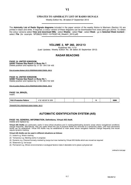
VI<br />
UPDATES TO ADMIRALTY LIST OF RADIO SIGNALS<br />
Weekly Edition No. 39 dated 27 September 2012<br />
<strong>The</strong> <strong>Admiralty</strong> List <strong>of</strong> <strong>Radio</strong> <strong>Signals</strong> diagrams included in the paper version <strong>of</strong> the weekly Notice to Mariners (Section VI) are<br />
printed in black and white. If required, a colour version <strong>of</strong> these diagrams can be downloaded from www.ukho.gov.uk/msi. To obtain<br />
the colour versions select View and download NMs - select Weekly - select Year - select Week -gotoSelected Week Content -<br />
select File (for example: NP286(3)-WK01-10-PAGE149_Week01_2012.pdf)<br />
VOLUME 2, NP 282, 2012/13<br />
Published Wk 11/12<br />
(Last Updates: Weekly Edition No. 38 dated 20 September 2012)<br />
RADAR BEACONS<br />
PAGE 16, UNITED KINGDOM.<br />
52040 Thames Sea Reach Lt Buoy No 7.<br />
Delete position and replace by: 51°30′·13N 0°36′·40E<br />
Port <strong>of</strong> London Notice L16/12 (RSDRA2012000175023) 39/12<br />
PAGE 16, UNITED KINGDOM.<br />
52080 Thames Sea Reach Lt Buoy No 1.<br />
Delete position and replace by: 51°29′·49N 0°52′·63E<br />
Port <strong>of</strong> London Notice L16/12 (RSDRA2012000175023) 39/12<br />
PAGE 134, BRAZIL.<br />
Insert:<br />
PAG II Production Platform 4°52′⋅45S 36°16′⋅22W N 93885<br />
TRANSPETRO (RSDRA2012000176359) 39/12<br />
AUTOMATIC IDENTIFICATION SYSTEM (AIS)<br />
PAGE 155, GENERAL INFORMATION, Definitions, Virtual AIS AtoN.<br />
Delete and replace by:<br />
Virtual AIS AtoNs are particularly useful in time-critical situations and in marking/delineating dynamic areas where navigational conditions<br />
change frequently. Alternatively, they are useful where the use <strong>of</strong> physical AtoNs are removed on a temporary basis, until more permanent<br />
AtoNs can be established. Virtual AIS AtoNs may be established to mark areas where navigation features change frequently and would<br />
require dynamic marking.<br />
Virtual AIS AtoNs can be used in different situations as follows:<br />
(1) Instant e.g. Wreck marking<br />
(2) Temporary e.g. Marking works in progress<br />
(3) Dynamic e.g. Channel formerly marked by buoys but now marked by Virtual AIS AtoNs which are moved as required<br />
(4) Seasonal e.g. Ice buoys<br />
(5) Permanent e.g. Where environmental or ecological factors make it desirable not to place a physical aid<br />
continued on next page<br />
6.1<br />
Wk39/12
VI<br />
Australia - Broome Port Authority is currently trialling a mix <strong>of</strong> Virtual and Synthetic AIS AtoNs.<br />
Brazil is currently undertaking Virtual AIS AtoN trials.<br />
China - Virtual AIS AtoNs depicted on Chinese charts are not listed in this edition <strong>of</strong> NP282 (2012/13). <strong>The</strong>se aids are updated by Chinese<br />
Temporary (T) Notices to Mariners which are re-issued in <strong>Admiralty</strong> Temporary (T) Notices to Mariners. China also promulgate Temporary<br />
(T) Notices to Mariners for Virtual AIS AtoNs marking isolated danger marks and for Virtual AIS AtoNs which supplement existing buoyage<br />
marking fairways.<br />
Denmark has completed Virtual AIS AtoN trials.<br />
France is using Virtual AIS AtoNs to temporarily replace missing navigational aids.<br />
Ireland has completed Virtual AIS AtoN trials.<br />
United Kingdom - For symbols and abbreviations used on <strong>Admiralty</strong> paper charts see NP5011 S18.1 and S18.2. For ENC symbols used in<br />
ECDIS see NP5012.<br />
UKHO 39/12<br />
PAGE 156, IMPORTANT INFORMATION, lines 2 and 3.<br />
Delete:<br />
Virtual AIS AtoNs ..... to ..... Notice to Mariners<br />
UKHO 39/12<br />
PAGE 160, AUSTRALIA, above Mermaid Strait Lt Buoy entry.<br />
Insert:<br />
Goods Island<br />
Rear Ldg Lt<br />
10°33′⋅91S 142°09′⋅13E 995031023 Real<br />
Auscoast Warning 234/12 (RSDRA2012000182882) 39/12<br />
PAGE 160, AUSTRALIA, below Pluto A Platform entry.<br />
Insert:<br />
Point Richards Channel<br />
Entrance Lt Bn<br />
Point Richards Channel<br />
4A<br />
Point Richards Channel<br />
6A<br />
38°04′⋅95S 144°39′⋅94E 995031042 Real<br />
38°05′⋅34S 144°37′⋅32E 995036038 Port Hand Mark Virtual<br />
38°05′⋅57S 144°36′⋅50E 995036039 Port Hand Mark Virtual<br />
Australian Notice 18/893/12 (RSDRA2012000182882) and Victorian Notice 115/12 (RSDRA2012000183405) 39/12<br />
PAGE 168, CHINA.<br />
Meizhou Wan Lt Buoy No 39, column 2.<br />
Delete position and replace by: 25°11′·41N 119°00′·54E<br />
Chinese Notice 36/1381/12 (RSDRA2012000182417) 39/12<br />
PAGE 182, IRELAND.<br />
Killard Datawell Waverider Buoy, columns 2 and 3.<br />
Delete position and replace by: 52°46′·00N 9°34′·74W<br />
Insert MMSI 992501307<br />
(former updates 14/12 & 31/12)<br />
Commissioners <strong>of</strong> Irish Lights (RSDRA2012000172468) 39/12<br />
Wk39/12<br />
6.2
VI<br />
PAGE 198, POLAND.<br />
Delete section and replace by:<br />
POLAND (261)<br />
10 Lt Buoy 54°26′⋅87N 19°43′⋅57E 992611130 Synthetic 21<br />
GD Lt Buoy 54°32′⋅05N 18°39′⋅84E 992611900 Synthetic<br />
G-E Dolphin 54°22′⋅41N 18°52′⋅25E 992611500 Real<br />
GN Lt Buoy 54°31′⋅91N 18°47′⋅99E 992611700 Real<br />
GS Lt Buoy 54°30′⋅90N 18°33′⋅59E 992611140 Real 621<br />
Hel Lt Buoy 54°35′⋅43N 18°53′⋅29E 992611600 Real 21<br />
N-2 Lt Buoy 54°14′⋅68N 14°11′⋅01E 992611400 Real 821<br />
NP Lt Buoy 54°27′⋅90N 18°42′⋅05E 992611110 Synthetic<br />
ZN Lt Buoy 54°36′⋅80N 19°06′⋅10E 992611200 Real 21<br />
ZS Lt Buoy 54°26′⋅59N 18°57′⋅69E 992611300 Synthetic 21<br />
(former update 31/12)<br />
Polish Notices 36/12 (RSDRA2012000183327) 39/12<br />
6.3<br />
Wk39/12
VI<br />
VOLUME 6, PART 2, NP 286(2), 2012/13<br />
Published Wk 19/12<br />
––––––––––––––––––<br />
(Last Updates: Weekly Edition No. 38 dated 20 September 2012)<br />
PAGE 345, SWEDEN, GÖTEBORG (GOTHENBURG), Pilots,<br />
PROCEDURE, section (6).<br />
Delete and replace by:<br />
(6) Pilot boards in the following positions:<br />
(a) No 1: 57°34′·50N 11°38′·80E (1·2 n miles SE <strong>of</strong> Trubaduren)<br />
(b) No 2: 57°37′·00N 11°31′·90E (2·5 n miles SW <strong>of</strong> Vinga)<br />
(c) No 3: 57°38′·80N 11°32′·50E (2 n miles WNW <strong>of</strong> Vinga)<br />
(d) VLCC: 57°38′·50N 11°29′·50E<br />
(e) 57°40′·20N 11°47′·60E (Rivö fjord)<br />
(f) Skandiahamnen: 57°41′·18N 11°52′·12E<br />
Swedish Notice 416/8141/12, (RSDRA2012000182424), 39/12<br />
––––––––––––––––––––––––––––––<br />
VOLUME 6, PART 3, NP 286(3), 2012/13<br />
Published Wk 27/12<br />
––––––––––––––––––<br />
(Last Updates: Weekly Edition No. 29 dated 19 July 2012)<br />
PAGE 303, RUSSIA (Black Sea Coast), SOCHI, Pilots and Port,<br />
PROCEDURE, section (8).<br />
Delete and replace by:<br />
(8) Pilot boards in the following positions:<br />
(a) 43°32′·70N 39°43′·00E<br />
(b) Port <strong>of</strong> Adler: 43°23′·95N 39°54′·42E<br />
Russian Notice 37/5467/12, (RSDRA2012000183586), 39/12<br />
––––––––––––––––––––––––––––––<br />
VOLUME 6, PART 4, NP 286(4), 2012/13<br />
Published Wk 31/12<br />
––––––––––––––––––<br />
(Last Updates: Weekly Edition No. 37 dated 13 September 2012)<br />
PAGE 141, INDIA, HUGLI RIVER, Pilots and Vessel Traffic Management<br />
System sections.<br />
Delete and replace by:<br />
Pilots<br />
CONTACT DETAILS:<br />
Pilot Station, Sagar<br />
Call: Sagar Pilot Station<br />
Sandheads Pilot<br />
VHF Channel: Ch 16; 68<br />
RT Frequency (kHz): 4147·4 8295·4<br />
Telephone: +91(0)32 10240348<br />
Hr Mr Office<br />
Telephone: +91(0)33 24391884<br />
Fax: +91(0)33 24391853<br />
continued on next column<br />
HOURS: 4147·4 kHz: 0500-0900 & 1600-2200 LT<br />
8295·5 kHz: 1000-1630 LT<br />
Ch 16: H24<br />
PROCEDURE:<br />
(1) Pilotage is compulsory for vessels over 100 gt.<br />
(2) No vessel should attempt to navigate the Hugli River without a Pilot.<br />
(3) Vessels should send their ETA at Eastern Channel Lt V well in advance to the Pilot<br />
Station, stating the following information:<br />
(a) Vessel’s name, call sign and MMSI<br />
(b) Number <strong>of</strong> working VHF radios on board<br />
(c) If AIS onboard and operational<br />
(d) gt and nt<br />
(e) FW draught (forward and aft)<br />
(f) Speed<br />
(g) LOA<br />
(h) Cargo on board (type and quantity)<br />
(4) Vessels approaching Sandheads in the vicinity <strong>of</strong> the Eastern Channel Lt V are<br />
required to contact the Pilot Station on Sagar Island (Sandheads Pilot) and await<br />
instructions.<br />
(5) <strong>The</strong> Pilot Station will advise vessels <strong>of</strong> the following information:<br />
(a) Convoy number<br />
(b) Number <strong>of</strong> vessels in convoy<br />
(c) Name <strong>of</strong> preceding and succeeding vessel<br />
(d) Which side pilot ladder required<br />
(e) Lower Gasper reporting time<br />
(f) Upper Gasper reporting time<br />
(6) <strong>The</strong> pilotage limits on the approaches to the River Hugli have been moved to Sagar<br />
Roads N <strong>of</strong> Middleton Fairway (21°37′·00N).<br />
(7) For the voyage from Sandheads to the Pilot boarding position <strong>of</strong>f Sagar Island, all<br />
vessels are provided with remote pilotage through the VTMS.<br />
(8) A Pilot Vessel is stationed between Gasper Channel and Sagar Island. Two fast<br />
motor launches are used for embarking and disembarking Pilots.<br />
(9) River Pilot boards at the Pilot boarding position <strong>of</strong>f Sagar Island (in the vicinity<br />
<strong>of</strong> Middleton Point (approximately 21°35′·00N 88°05′·00E)). For vessels longer than<br />
160m, and in particular tankers, Pilots may board or disembark further S than usual<br />
depending on weather conditions. Harbour Pilots board at Garden Reach in position<br />
22°33′·00N 88°19′·00E.<br />
NOTE:<br />
Provides pilotage for BajBaj, Diamond Harbour, HALDIA, KOLKATA (CALCUTTA) and<br />
Sagar.<br />
Vessel Traffic Management System<br />
DESCRIPTION:<br />
This system is designed to improve the safety <strong>of</strong> vessels entering the Ports <strong>of</strong> Kolkata<br />
(Calcutta) and Haldia.<br />
CONTACT DETAILS:<br />
Call: VTMS Control<br />
VHF Channel: Ch 68 (All Channels available)<br />
PROCEDURE:<br />
(1) Vessels are required to contact VTMS Control as follows:<br />
(a) On arrival at Sandheads providing LOA, breadth, nt and draught<br />
(b) On anchoring at Sandheads providing anchoring time and position<br />
(c) When weighing anchor and time underway<br />
(d) When passing the following lines <strong>of</strong> latitude:<br />
(i) 21°10′·00N<br />
(ii) Jonaki Lt Vessel (21°17′·00N)<br />
(iii) Lower Gasper Lt Vessel (21°22′·00N)<br />
(2) VTMS guidance is not available N <strong>of</strong> Middleton Lt buoy.<br />
(3) Vessels at anchor are required to maintain an H24 listening watch on VHF.<br />
RADAR SURVEILLANCE:<br />
Three radar surveillance navigation systems located at Sagar Island, Frasergunj and<br />
Haldia will allow vessels to enter the navigation channel safely on the Hugli Delta<br />
between Jonaki Lt F in position 21°17′·00N 88°11′·50E and the Pilot boarding ground.<br />
<strong>The</strong> VTMS guidance is provided by Hugli River Pilots.<br />
Kolkata Port & Bay <strong>of</strong> Bengal Pilot, (RSDRA2012000174033 & RSDRA2007000041517), 39/12<br />
Wk39/12<br />
6.4
VI<br />
VOLUME 6, PART 5, NP 286(5), 2012/13<br />
Published Wk 39/12<br />
––––––––––––––––––<br />
(First Updates to publication Wk 39/12)<br />
Insert:<br />
<strong>The</strong> 2011/12 edition is cancelled<br />
PAGE ii, RECORD OF UPDATES<br />
NEW EDITION, First Updates box<br />
This edition was published in week 39/12. <strong>The</strong> first<br />
Weekly Notice to Mariners was issued in week 39/12.<br />
UKHO, 39/12<br />
PAGE 276, UNITED STATES (Pacific Coast), COLUMBIA RIVER,<br />
Columbia River Bar Pilots, PROCEDURE, section (6).<br />
Delete and replace by:<br />
(6) Pilot boards in the following positions:<br />
(a) By helicopter: Within 4-10 n miles NW to SW <strong>of</strong> the Approach Lt buoy CR<br />
(46°11′·07N 124°11′·04W)<br />
(b) By PV: In a position agreed between the vessel and Pilot, dependent on weather<br />
and direction <strong>of</strong> approach<br />
Columbia River Bar Pilots, (RSDRA2012000170256 & RSDRA2012000176231), 39/12<br />
––––––––––––––––––––––––––––––<br />
VOLUME 6, PART 7, NP 286(7), 2011/12<br />
Published Wk 48/11<br />
––––––––––––––––––<br />
(Last Updates: Weekly Edition No. 35 dated 30 August 2012)<br />
PAGE 205, SAINT LUCIA, GENERAL NOTES.<br />
Delete and replace by:<br />
GENERAL NOTES<br />
ISPS DESIGNATED AUTHORITY:<br />
CONTACT DETAILS:<br />
Royal Saint Lucia Police Force (Marine Unit)<br />
Telephone: +1 758 4563879<br />
+1 758 4563871<br />
Fax: +1 758 4522261<br />
E-mail: pmu@rslpf.com<br />
Website: www.rslpf.com<br />
CARICOM (CARIBBEAN COMMUNITY) ADVANCE PASSENGER<br />
INFORMATION SYSTEM (APIS):<br />
For details see SHIP REPORTING SYSTEMS.<br />
Royal Saint Lucia Police Force, (RSDRA2012000183323), 39/12<br />
––––––––––––––––––––––––––––––<br />
6.5<br />
Wk39/12
VI<br />
ADMIRALTY LIST OF RADIO SIGNALS CUMULATIVE LIST OF UPDATES<br />
RADAR BEACONS<br />
CORRECT TO Wk 39/12<br />
This list is a summary <strong>of</strong> the entries in the current editions <strong>of</strong> the <strong>Admiralty</strong> List <strong>of</strong><br />
<strong>Radio</strong> <strong>Signals</strong> which have had updates issued in Section VI <strong>of</strong> the Weekly Edition <strong>of</strong><br />
Notices to Mariners.<br />
<strong>The</strong> entries affected are shown in bold type followed by the numbers <strong>of</strong> the Weekly<br />
Editions in which updates for that station were issued.<br />
<strong>The</strong>se summaries are issued on a quarterly basis.<br />
VOLUME 1, PART 1, NP 281(1), 2012/13<br />
Published Wk 35/12<br />
MARITIME RADIO STATIONS<br />
INDIA (North Western Region) 35<br />
INDIA (Western Region) 35<br />
INDIA (Eastern Region (Including Bay <strong>of</strong> Bengal)) 35<br />
INDIA (Andaman & Nicobar Region) 35<br />
IRAN 36<br />
NETHERLANDS 35<br />
RÉUNION (France) 35<br />
ROMANIA 35<br />
UNITED KINGDOM 35<br />
CANADA (Great Lakes) 38<br />
CANADA (Pacific Coast) 38<br />
FRENCH POLYNESIA 38<br />
11,12<br />
VOLUME 1, PART 2, NP 281(2), 2012/13<br />
Published Wk 38/12<br />
MARITIME RADIO STATIONS<br />
VOLUME 2, NP 282, 2012/13<br />
Published Wk 11/12<br />
PRELIMINARY PAGES<br />
51050 11<br />
51160 23<br />
52040 39<br />
52080 39<br />
55650 11<br />
56560 12<br />
57870 33<br />
58620 38<br />
62650 13<br />
64895 11<br />
67010 22<br />
70300 14<br />
70420 23<br />
70630 17<br />
70640 17<br />
74830 11<br />
74860 11<br />
74920 11<br />
74950 11<br />
76645 30<br />
78570 18<br />
78710 23<br />
78720 23<br />
78730 23<br />
78950 32<br />
79200 30<br />
79210 11<br />
80810 23<br />
80850 11<br />
80913 22<br />
80915 22<br />
81005 18<br />
81097 18<br />
81230 22<br />
81284 19<br />
81445 12<br />
81510.5 14<br />
81720 26<br />
81775 31<br />
81948.7 11<br />
81958 18<br />
81972 11<br />
81992.5 11<br />
81992.7 11<br />
82063 11<br />
82132 31<br />
82145 11<br />
82148 24<br />
82185 11<br />
82186 24<br />
82187 24<br />
82194 24<br />
82300 11<br />
82655 30<br />
82665 31<br />
82812 33<br />
82813 33<br />
84960 14<br />
85260 38<br />
85420 27<br />
85450 27<br />
85490 27<br />
88560 11<br />
90230 11<br />
91440 11<br />
AUTOMATIC IDENTIFICATION SYSTEM (AIS)<br />
GENERAL INFORMATION, Definitions 39<br />
IMPORTANT INFORMATION 39<br />
ANGOLA 11<br />
ANTARCTICA 30<br />
AUSTRALIA 15, 23, 31, 39<br />
CEUTA (Spain) 12<br />
CHINA 11, 12, 15, 22, 24, 26, 27, 30, 31, 33, 34, 35, 36, 39<br />
DENMARK 11<br />
FRANCE (English Channel) 11<br />
GERMANY (North Sea Coast) 18, 24, 35<br />
IRELAND 14, 22, 24, 25, 26, 28, 31, 39<br />
KOREA, SOUTH 11, 35<br />
LATVIA 11<br />
MALTA 13, 15<br />
NETHERLANDS 13, 18, 38<br />
PERU 18<br />
POLAND 31, 39<br />
SPAIN (Mediterranean Coast) 38<br />
SPAIN (North Coast) 26<br />
SPAIN (South Coast) 15<br />
SPAIN (South West Coast) 12, 26<br />
SWEDEN 16<br />
UNITED ARAB EMIRATES (Persian Gulf Coast) 17<br />
UNITED KINGDOM 11, 22, 23, 25, 36<br />
UNITED KINGDOM (Northern Ireland) 27, 31, 35<br />
UNITED STATES (Gulf Coast) 26<br />
19, 21, 22<br />
STANDARD TIMES<br />
LEGAL TIME<br />
ARMENIA 15<br />
CHILE 13<br />
CUBA 13<br />
EASTER ISLAND (Isla de Pascua) (Chile) 13<br />
FIJI 11<br />
HAITI 14<br />
JORDAN 11<br />
MOROCCO 20<br />
SAMOA 11<br />
91600 33<br />
91660 33<br />
91795 11<br />
91810 13<br />
92257 11<br />
93220 11<br />
93885 39<br />
94170 38<br />
94360 32<br />
94683 18, 37<br />
94685 11<br />
94870 11<br />
95530 28, 30<br />
97100 33<br />
99855 27<br />
99880 27<br />
Wk39/12<br />
6.6
VI<br />
19, 31, 35<br />
2012 32<br />
2012 2, 14<br />
49, 52 2012 2, 3, 6<br />
49 2012 28, 30<br />
UNIVERSAL TIME<br />
VOLUME 3, PART 1, NP 283(1), 2011/12<br />
Published Wk 49/11<br />
MARITIME SAFETY INFORMATION<br />
SAFETYNET<br />
NAVTEX<br />
RADIO-FACSIMILE<br />
RADIO WEATHER SERVICES AND NAVIGATIONAL WARNINGS<br />
AZERBAIJAN 2012 35<br />
BELGIUM 2012 10, 11<br />
FRANCE (Mediterranean Coast) 2012 25<br />
ISRAEL 2012 2<br />
ITALY 49, 52 2012 2, 5, 6<br />
MALTA 2012 18<br />
NORWAY 2012 6, 10, 17, 19<br />
RUSSIA (Arctic Coast) 2012 6, 15, 23<br />
SENEGAL 2012 38<br />
SOUTH AFRICA 2012 30<br />
SWEDEN 49<br />
TUNISIA 2012 3<br />
UNITED KINGDOM 2012 12, 18<br />
DIAGRAMS<br />
Page 27 NAVTEX - MSI BROADCASTS, North Atlantic and Arctic 2012 6, 15, 19<br />
Page 28 NAVTEX - MSI BROADCASTS, North West Europe 2012 10<br />
Page 29 NAVTEX - MSI BROADCASTS, North Atlantic - East 2012 38<br />
Page 30 NAVTEX - MSI BROADCASTS, Western Mediterranean 49, 52 2012 2, 3, 5<br />
Page 31 NAVTEX - MSI BROADCASTS, Eastern Mediterranean, Black Sea and<br />
Caspian Sea 2012 35<br />
Page 86 FRANCE, AVURNAV, Brest and Cherbourg 49<br />
Page 90 FRANCE, AVURNAV, Toulon 49<br />
Page 123 ITALY, MARITIME RADIO STATIONS 49, 52 2012 2, 6<br />
VOLUME 3, PART 2, NP 283(2), 2011/12<br />
Published Wk 52/11<br />
MARITIME SAFETY INFORMATION<br />
RADIO - FACSIMILE<br />
BOSTON 2012 8<br />
INUVIK (CANADIAN COAST GUARD) 2012 21<br />
NEW ORLEANS 2012 13<br />
RADIO WEATHER SERVICES AND NAVIGATIONAL WARNINGS<br />
CANADA (Arctic Coast, Atlantic Coast and St. Lawrence River) 2012 21<br />
CANADA (Great Lakes) 2012 15<br />
CANADA (Pacific Coast) 2012 21<br />
CHINA 2012 27<br />
GREENLAND 52<br />
GUAM (USA) 2012 34<br />
PHILIPPINES 2012 29<br />
PUERTO RICO (USA) 2012 34<br />
UNITED STATES (Alaska) 2012 34<br />
UNITED STATES (Atlantic Coast) 2012 34<br />
UNITED STATES (Gulf Coast) 2012 34<br />
UNITED STATES (Hawaii) 2012 34<br />
UNITED STATES (Pacific Coast) 2012 34<br />
URUGUAY 2012 23<br />
VIETNAM 52<br />
DIAGRAMS<br />
Page 35 NAVTEX - Index <strong>of</strong> Diagrams 2012 2<br />
Page 36 NAVTEX - MSI BROADCASTS, South East Asia 52, 2012 29<br />
Page 40 NAVTEX - MSI BROADCASTS, Greenland 52<br />
Page 40 NAVTEX - MSI BROADCASTS, South America - Atlantic Ocean 2012 38<br />
Page 239 UNITED STATES, ATLANTIC and GULF COAST, OFFSHORE FORECAST<br />
AREAS 2012 13<br />
Page 239 UNITED STATES, ATLANTIC COAST, OFFSHORE FORECAST AREAS<br />
2012 13<br />
Page 239 UNITED STATES, GULF, CARIBBEAN AND TROPICAL ATLANTIC<br />
COASTS, OFFSHORE FORECAST AREAS 2012 13<br />
Page 239 UNITED STATES, GULF, CARIBBEAN AND TROPICAL ATLANTIC<br />
COASTS, HF FORECAST AREAS 2012 13<br />
VOLUME 5, NP 285, 2012/13<br />
Published Wk 23/12<br />
GLOBAL MARITIME DISTRESS AND SAFETY SYSTEM (GMDSS)<br />
Section 2: COMMUNICATIONS SYSTEMS FOR USE IN THE GLOBAL SYSTEM 32<br />
Section 9: VHF DSC, LIST OF COAST STATIONS FOR SEA AREA A1 23, 29, 35<br />
Section 10: MF DSC, LIST OF COAST STATIONS FOR SEA AREA A2 23, 29<br />
Section 11: HF DSC, LIST OF COAST STATIONS FOR SEA AREAS A3 AND A4 29<br />
Section 12: INMARSAT 35<br />
Section 13: MARITIME SAFETY INFORMATION (MSI) UNDER THE GMDSS 23, 32,<br />
35, 36<br />
Section 15: NAVTEX, STATIONS WITH OPERATIONAL NAVTEX FACILITIES 23, 25,<br />
27, 29, 31, 32, 34, 35, 36, 38<br />
Section 16: DISTRESS, SEARCH AND RESCUE 23, 29, 30, 32, 33, 35, 38<br />
DIAGRAMS<br />
2012 32<br />
2012 2, 14<br />
52 2012 2, 29<br />
SAFETYNET<br />
NAVTEX<br />
Page 171 SOUTH-EAST ASIA Digital Selective Calling (DSC) Limits <strong>of</strong> Sea Areas 29<br />
Page 185 Operational HF DSC Stations with MMSI numbers for Sea Areas A3 and A4<br />
29<br />
Page 287 NAVTEX - MSI BROADCASTS, North Atlantic and Arctic 23<br />
Page 289 NAVTEX - MSI BROADCASTS, North Atlantic - East 38<br />
Page 291 NAVTEX - MSI BROADCASTS, Eastern Mediterranean, Black Sea and<br />
Caspian Sea 35<br />
Page 293 NAVTEX - MSI BROADCASTS, South East Asia 29<br />
Page 297 NAVTEX - MSI BROADCASTS, South America - Atlantic Ocean 38<br />
6.7<br />
Wk39/12
VI<br />
Page 424 NORTH ATLANTIC - WEST, Maritime Search and Rescue Regions (SRR)<br />
30<br />
Page 427 MEDITERRANEAN - WEST, Maritime Search and Rescue Regions (SRR)<br />
23<br />
Page 437 SOUTH-EAST ASIA Maritime Search and Rescue Regions (SRR) 29<br />
VOLUME 6, PART 1, NP 286(1), 2012/13<br />
Published Wk 14/12<br />
PILOT SERVICES, VESSEL TRAFFIC SERVICES and PORT OPERATIONS<br />
AÇORES (Portugal) 26<br />
BELGIUM 31<br />
BELGIUM AND NETHERLANDS 31<br />
MADEIRA (Portugal) 26<br />
NETHERLANDS 23, 37<br />
PORTUGAL 26<br />
SHIP REPORTING SYSTEMS 14<br />
SPAIN (North Coast) 21<br />
UNITED KINGDOM 15, 20, 21, 23, 25, 29, 30, 31, 32, 33<br />
DIAGRAMS<br />
Page 19 VESSEL TRAFFIC SERVICE SCHELDEMOND (VTS-SM) 31<br />
Page 194 IN THE STRAIT OF GIBRALTAR VESSEL TRAFFIC SERVICE (GIBREP) 14<br />
Page 322 LIVERPOOL VESSEL TRAFFIC SERVICE 29<br />
Page 370 PLYMOUTH VESSEL TRAFFIC SERVICE 15<br />
VOLUME 6, PART 2, NP 286(2), 2012/13<br />
Published Wk 19/12<br />
PILOT SERVICES, VESSEL TRAFFIC SERVICES and PORT OPERATIONS<br />
BALTIC SEA 20<br />
DENMARK 20, 22, 24, 25<br />
FINLAND 28<br />
GERMANY 19, 29, 38<br />
LATVIA 31<br />
NORWAY 29, 33, 37<br />
RUSSIA (Baltic Coast) 19, 29<br />
SWEDEN 19, 20, 38, 39<br />
DIAGRAMS<br />
Page 182 WOLGAST VESSEL TRAFFIC SERVICE 19<br />
Page 230 GRENLAND VESSEL TRAFFIC SERVICE 33<br />
Page 309 SAINT PETERSBURG (SANKT PETERBURG) VESSEL TRAFFIC<br />
SERVICES 19<br />
DIAGRAMS<br />
Page 408 TURKISH STRAITS VESSEL TRAFFIC SERVICE (TSVTS) 27<br />
VOLUME 6, PART 4, NP 286(4), 2012/13<br />
Published Wk 31/12<br />
PILOT SERVICES, VESSEL TRAFFIC SERVICES and PORT OPERATIONS<br />
AUSTRALIA 33, 34, 35<br />
INDIA 34, 36, 39<br />
MALAYSIA 32<br />
NEW ZEALAND 36<br />
OMAN 31<br />
PHILIPPINES 35, 37<br />
UNITED ARAB EMIRATES 35<br />
Page 9 AUSREP Reporting Sequence 34<br />
DIAGRAMS<br />
VOLUME 6, PART 5, NP 286(5), 2012/13<br />
Published Wk 39/12<br />
PILOT SERVICES, VESSEL TRAFFIC SERVICES and PORT OPERATIONS<br />
UNITED STATES (Pacific Coast) 39<br />
VOLUME 6, PART 6, NP 286(6), 2011/12<br />
Published Wk 46/11<br />
PILOT SERVICES, VESSEL TRAFFIC SERVICES and PORT OPERATIONS<br />
CHINA 46, 49 2012 12, 14, 15, 20, 21, 24, 28, 29, 32, 33<br />
JAPAN 2012 11, 31<br />
KOREA, SOUTH 51 2012 3<br />
RUSSIA (Pacific Coast) 2012 32<br />
VIETNAM 46 2012 26, 38<br />
DIAGRAMS<br />
Page 85 SHANGHAI VESSEL TRAFFIC SERVICE 46<br />
Page 108 YANGSHAN VESSEL TRAFFIC SERVICE 46<br />
Page 231 DAESAN PILOTS & VESSEL TRAFFIC SERVICE 51<br />
Page 237 INCHEON and PYEONGTAEK PILOTS & VESSEL TRAFFIC SERVICE 51<br />
Page 288 ZALIV PETRA VELIKOGO (PETER THE GREAT BAY) VESSEL TRAFFIC<br />
SERVICE 2012 32<br />
VOLUME 6, PART 3, NP 286(3), 2012/13<br />
Published Wk 27/12<br />
PILOT SERVICES, VESSEL TRAFFIC SERVICES and PORT OPERATIONS<br />
ANGOLA 27<br />
GHANA 29<br />
MOZAMBIQUE 27<br />
RUSSIA (Black Sea Coast) 39<br />
SOUTH AFRICA 27<br />
TURKEY 27<br />
VOLUME 6, PART 7, NP 286(7), 2011/12<br />
Published Wk 48/11<br />
PILOT SERVICES, VESSEL TRAFFIC SERVICES and PORT OPERATIONS<br />
ARGENTINA 2012 13<br />
BRAZIL 48 2012 18<br />
CHILE 48, 2012 2, 19, 26, 35<br />
COLOMBIA 2012 1, 11<br />
PERU 2012 3<br />
SAINT LUCIA 2012 39<br />
Wk39/12<br />
6.8<br />
Printed in the United Kingdom for the UKHO
VI<br />
UPDATES TO ADMIRALTY LIST OF RADIO SIGNALS<br />
Weekly Edition No. 38 dated 20 September 2012<br />
<strong>The</strong> <strong>Admiralty</strong> List <strong>of</strong> <strong>Radio</strong> <strong>Signals</strong> diagrams included in the paper version <strong>of</strong> the weekly Notice to Mariners (Section VI) are<br />
printed in black and white. If required, a colour version <strong>of</strong> these diagrams can be downloaded from www.ukho.gov.uk/msi to obtain<br />
the colour versions select View and download NMs - select Weekly - select Year - select Week -gotoSelected Week Content -<br />
select File (for example: NP286(3)-WK01-10-PAGE149_Week01_2012.pdf)<br />
VOLUME 1, PART 2, NP 281(2), 2011/12<br />
Published Wk 40/11<br />
(Last Updates: Weekly Edition No. 33 dated 16 August 2012)<br />
THE 2012/13 EDITION OF THIS VOLUME HAS NOW BEEN PUBLISHED<br />
THE 2011/12 EDITION IS CANCELLED<br />
PAGE ii, NEW EDITION, First Updates.<br />
Insert:<br />
VOLUME 1, PART 2, NP 281(2), 2012/13<br />
Published Wk 38/12<br />
RECORD OF UPDATES<br />
This edition was published in week 38/12.<br />
<strong>The</strong> first Weekly Notice to Mariners was issued in week 38/12.<br />
UKHO 38/12<br />
MARITIME RADIO STATIONS<br />
PAGE 84, CANADA (Great Lakes), THUNDER BAY (CANADIAN COAST GUARD) (VBA), Contacts table, row 1, column 6.<br />
Delete Diagrams pages 73 & 83 and replace by: Diagram page 83<br />
UKHO 38/12<br />
PAGE 90, CANADA (Pacific Coast) , VICTORIA (CANADIAN COAST GUARD) (VAK), Contacts table, rows 2 to 4.<br />
Delete and replace by:<br />
℡ +1 250 3636836 (Administration)<br />
+1 250 3636611 (MCTS Operations)<br />
+1 250 3636333 (Shift Supervisor)<br />
+1 250 3636818 (Officer-in-Charge)<br />
+1 250 3636880 (Continuous Marine Broadcast (CMB)<br />
or Mount Helmcken)<br />
+1 250 3636492 (Continuous Marine Broadcast (CMB)<br />
+1 604 6663655 (Bowen Island / Mount Parke)<br />
+1-800-661-9202 Toll Free MCTS Operation (only within BC)<br />
+1 250 4138933 (JRCC)<br />
CALL: For <strong>Radio</strong> Services CALL: Victoria Coast Guard <strong>Radio</strong><br />
For Vessel Traffic Services CALL: Victoria Traffic<br />
+1 250 363 6556 (Operations)<br />
+1 250 363 6597 (Administration)<br />
email: mctsvictoria@dfo-mpo.gc.ca<br />
jrccvictoria@sarnet.dnd.ca (JRCC)<br />
WEBSITE: www.ccg-gcc.gc.ca/e0003906<br />
Canadian Notice 7/706/12 (RSDRA2012000147469) 38/12<br />
Wk38/12<br />
6.1
VI<br />
PAGE 145, FRENCH POLYNESIA, PAPEETE MRCC, Contacts table, row 2.<br />
Delete and replace by:<br />
℡ +689 541616 (Emergency)<br />
+689 541615 (Information)<br />
+689 541617 (Office H24)<br />
+881 641 425630 (Iridium)<br />
+689 423915 (H24)<br />
+689 829610 (Secondary)<br />
French <strong>Radio</strong> List Correction 28/12 (RSDRA2012000143211) 38/12<br />
VOLUME 2, NP 282, 2012/13<br />
Published Wk 11/12<br />
(Last Updates: Weekly Edition No. 37 dated 13 September 2012)<br />
RADAR BEACONS<br />
PAGE 28, FINLAND.<br />
58620 Lålätta Lt.<br />
Delete entry<br />
Finnish Notice 21/224/12 (RSDRA2012000154392) 38/12<br />
PAGE 110, RUSSIA (Pacific Coast).<br />
Insert:<br />
Berkut Platform 52°27′⋅89N 143°38′⋅97E 85260<br />
Russian Notice 35/5149/12 (RSDRA2012000170908) 38/12<br />
PAGE 134, BRAZIL.<br />
94170 Soure Lt.<br />
Delete entry<br />
Brazilian Notice 15/80/12 (RSDRA2012000170130) 38/12<br />
AUTOMATIC IDENTIFICATION SYSTEM (AIS)<br />
PAGE 196, NETHERLANDS, Ellemeet.<br />
Delete entry<br />
Netherlands Hydrographic Office (RSDRA2012000064038) 38/12<br />
PAGE 196, NETHERLANDS, Geulhaven (Traffic Centre Rotterdam).<br />
Delete entry<br />
Netherlands Hydrographic Office (RSDRA2012000064038) 38/12<br />
PAGE 196, NETHERLANDS, Hoek van Holland (Traffic Centre Hook).<br />
Delete entry<br />
Netherlands Hydrographic Office (RSDRA2012000064038) 38/12<br />
6.2<br />
Wk38/12
VI<br />
PAGE 196, NETHERLANDS, Lekhaven (Traffic Centre City).<br />
Delete entry<br />
Netherlands Hydrographic Office (RSDRA2012000064038) 38/12<br />
PAGE 196, NETHERLANDS, Terschelling.<br />
Delete entry<br />
Netherlands Hydrographic Office (RSDRA2012000064038) 38/12<br />
PAGE 200, SPAIN (Mediterranean Coast), above Tarragona Pipeline Lt Buoy entry.<br />
Insert:<br />
Castor Platform 40°23′⋅68N 0°42′⋅55E Real<br />
Spanish Notice 34/232/12 (RSDRA2012000174948) 38/12<br />
VOLUME 3, PART 1, NP 283(1), 2011/12<br />
Published Wk 49/11<br />
(Last Updates: Weekly Edition No. 35 dated 30 August 2012)<br />
RADIO WEATHER SERVICES AND NAVIGATIONAL WARNINGS<br />
PAGE 29, diagram X3 NAVTEX - MSI BROADCASTS, North Atlantic - East, Dakar [C] [M].<br />
Insert in approximate position 14°46′N 17°20′W:<br />
Temporarily inoperative March 2012.<br />
Navarea II Coordinator (RSDRA2012000173685) 38/12<br />
PAGE 160, SENEGAL, NAVTEX.<br />
Insert note:<br />
NOTE: Temporarily inoperative March 2012.<br />
Navarea II Coordinator (RSDRA2012000173685) 38/12<br />
VOLUME 3, PART 2, NP 283(2), 2011/12<br />
Published Wk 52/11<br />
(Last Updates: Weekly Edition No. 34 dated 23 August 2012)<br />
RADIO WEATHER SERVICES AND NAVIGATIONAL WARNINGS<br />
PAGE 40, diagram X11 NAVTEX - MSI BROADCASTS, South America - Atlantic Ocean, Dakar [C] [M].<br />
Insert in approximate position 14°46′N 17°20′W:<br />
Temporarily inoperative March 2012.<br />
Navarea II Coordinator (RSDRA2012000173685) 38/12<br />
Wk38/12<br />
6.3
VI<br />
VOLUME 5, NP 285, 2012/13<br />
Published Wk 23/12<br />
(Last Updates: Weekly Edition No. 36 dated 6 September 2012)<br />
SECTION 15: NAVTEX, STATIONS WITH OPERATIONAL NAVTEX FACILITIES<br />
PAGE 278, SENEGAL, Dakar [C] [M].<br />
Insert note below country name:<br />
NOTE: Temporarily inoperative March 2012.<br />
Navarea II Coordinator (RSDRA2012000173685) 38/12<br />
PAGE 289, diagram X3 NAVTEX - MSI BROADCASTS, North Atlantic - East, Dakar [C] [M].<br />
Insert in approximate position 14°46′N 17°20′W:<br />
Temporarily inoperative March 2012.<br />
Navarea II Coordinator (RSDRA2012000173685) 38/12<br />
PAGE 297, diagram X11 NAVTEX - MSI BROADCASTS, South America - Atlantic Ocean, Dakar [C] [M].<br />
Insert in approximate position 14°46′N 17°20′W:<br />
Temporarily inoperative March 2012.<br />
Navarea II Coordinator (RSDRA2012000173685) 38/12<br />
SECTION 16: DISTRESS, SEARCH AND RESCUE<br />
PAGE 402, PHILIPPINES.<br />
Delete entry and replace by:<br />
PHILIPPINES<br />
See diagram R14<br />
National SAR Agency: Manila Rescue Coordination Centre, Headquarters, Philippine Coast Guard (HPCG)<br />
Address: 139 25th Street, Port Area, Manila, Philippines<br />
Tel: +63 2 5273880<br />
Others: AFTN; RPMMYCYX<br />
<strong>The</strong> Manila Rescue Coordination Centre at the Headquarters <strong>of</strong> the Philippine Coast Guard is responsible for coordinating Search and<br />
Rescue operations. <strong>The</strong>re are twelve District Commanders situated at MRSCs: Manila, Cebu, Zamboanga, Palawan, Batangas, Iloilo, La<br />
Union, Dava, Bicol, Cagayan de Oro, Tacloban and Aparri. A network <strong>of</strong> Coast <strong>Radio</strong> Stations maintains a continuous listening watch on<br />
international distress frequencies.<br />
Telephone +63 Fax +63 Others<br />
MRCC PHILIPPINES 2 5273880<br />
2 5273877 email cgac@coastguard.gov.ph<br />
2 5278481 to 89<br />
MRSC MANILA - 1st District 2 2430465 2 2430465 email cgdncrcl@yahoo.com<br />
cgdncrcl@coastguard.gov.ph<br />
MRSC CEBU - 2nd District 32 2533510 32 4166566 email viscom_opn@yahoo.com<br />
cgdcev@coastguard.gov.ph<br />
MRSC ZAMBOANGA - 3rd District 62 9914379 62 9931004 email hcgd@yahoo.com<br />
cgdswm@coastguard.gov.ph<br />
MRSC PALAWAN - 4th District 48 4332974 48 4332974 email cgdpal@coastguard.gov.ph<br />
continued on next page<br />
6.4<br />
Wk38/12
VI<br />
MRSC BATANGAS - 5th District 43 7233048 43 3002949 email hcgdstl_opn@yahoo.com<br />
cgdstl@coastguard.gov.ph<br />
MRCC ILOILO - 6th District 33 3376029 33 3376029 email cgdwv_iloilo@yahoo.com<br />
cgdwv@coastguard.gov.ph<br />
MRSC LA UNION<br />
(SAN FERNANDO) - 7th District<br />
72 413402 72 7004477 email cgdnorthernluzon@yahoo.com<br />
cgdnorthernluzon@coastguard.gov.ph<br />
MRSC DAVAO - 8th District 82 2343741 82 2350002 email cgdsem@yahoo.com<br />
cgdsem@coastguard.gov.ph<br />
MRSC BICOL (LEGASPI) - 9th District 929 6742309 email cgdbicol@yahoo.com<br />
cgdbcl@coastguard.gov.ph<br />
MRSC CAGAYAN DE ORO - 10th<br />
District<br />
88 2316634 88 2316634 email cgdnm09@yahoo.com<br />
cgdnm@coastguard.gov.ph<br />
MRSC TACLOBAN - 11th District 53 5614213 53 5614213 email coastguardev@yahoo.com<br />
MRSC APARRI - 12th District 78 8880320 78 8880320 email cgdnortheasternluzon@yahoo.com<br />
Philippines Coastguard (RSDRA2012000180785) 38/12<br />
Wk38/12<br />
6.5
VI<br />
VOLUME 6, PART 2, NP 286(2), 2012/13<br />
Published Wk 19/12<br />
––––––––––––––––––<br />
(Last Updates: Weekly Edition No. 37 dated 13 September 2012)<br />
PAGE 120, GERMANY, EMS, Pilots, CONTACT DETAILS.<br />
Delete and replace by:<br />
CONTACT DETAILS:<br />
Pilot Station (inward-bound)<br />
Call: Emden Pilot<br />
VHF Channel: Ch 09<br />
Telephone: +49(0)4922 92358936<br />
Fax: +49(0)4922 92358937<br />
E-mail: borkumstation@emspilots.de<br />
Pilot Station (outward-bound)<br />
Call: Emden Pilot<br />
VHF Channel: Ch 12<br />
Telephone: +49(0)4921 24000<br />
Fax: +49(0)4921 32919<br />
E-mail: pilotstation@emspilots.de<br />
Office<br />
Telephone: +49(0)4921 5821110<br />
Fax: +49(0)4921 5821119<br />
E-mail: emspilot1@aol.com<br />
Website: www.emspilots.de<br />
VOLUME 6, PART 5, NP 286(5), 2011/12<br />
Published Wk 43/11<br />
––––––––––––––––––<br />
(Last Updates: Weekly Edition No. 27 dated 5 July 2012)<br />
PAGE 274, UNITED STATES (Pacific Coast), COLUMBIA RIVER,<br />
Columbia River Bar Pilots, PROCEDURE, section (6).<br />
Delete and replace by:<br />
(6) Pilot boards in the following positions:<br />
(a) By helicopter: Within 4-10 n miles NW to SW <strong>of</strong> the Approach Lt buoy CR<br />
(46°11′·07N 124°11′·04W)<br />
(b) By PV: In a position agreed between the vessel and Pilot, dependent on weather<br />
and direction <strong>of</strong> approach<br />
Columbia River Bar Pilots, (RSDRA2012000170256 & RSDRA2012000176231), 38/12<br />
––––––––––––––––––––––––––––––<br />
VOLUME 6, PART 6, NP 286(6), 2011/12<br />
Published Wk 46/11<br />
––––––––––––––––––<br />
(Last Updates: Weekly Edition No. 33 dated 16 August 2012)<br />
PAGE 306, VIETNAM, BA NGOI, Pilots and Port, PROCEDURE.<br />
Delete and replace by:<br />
German Notice 35/12, (RSDRA2012000175314), 38/12<br />
PAGE 354, SWEDEN, HUDIKSVALL, Reporting (Sea <strong>of</strong> Bothnia),<br />
REPORTING POINTS, table.<br />
Delete:<br />
41 (Britas klack) 61°53′·10N 17°27′·70E Stocka<br />
PROCEDURE:<br />
Pilot boards in position 11°48′·70N 109°13′·00E.<br />
Southern Vietnam Maritime Safety Corporation Notice 90/11, (RSDRA2012000166413), 38/12<br />
PAGE 309, VIETNAM, CAM RANH, Pilots and Port, PROCEDURE.<br />
Delete and replace by:<br />
Swedish Notice 414/8091/12, (RSDRA2012000170261), 38/12<br />
PAGE 403, SWEDEN, STOCKHOLM, Danviksbroarna (Rail Bridge),<br />
HOURS section.<br />
Delete and replace by:<br />
PROCEDURE:<br />
Pilot boards in position 11°48′·70N 109°13′·00E.<br />
Southern Vietnam Maritime Safety Corporation Notice 90/11, (RSDRA2012000166413), 38/12<br />
––––––––––––––––––––––––––––––<br />
HOURS: Weekdays: Hourly between 0930-1530 1830-2330 LT<br />
Sat, Sun and holidays: Hourly between 0630-2330 LT<br />
Bridge will also be opened at 0330 and 0530 LT (between 1 Oct and 30 Apr<br />
on request by telephone).<br />
Swedish Notice 415/8137/12, (RSDRA2012000175298), 38/12<br />
––––––––––––––––––––––––––––––<br />
6.6<br />
Printed in the United Kingdom for the UKHO<br />
Wk38/12
VI<br />
UPDATES TO ADMIRALTY LIST OF RADIO SIGNALS<br />
Weekly Edition No. 37 dated 13 September 2012<br />
<strong>The</strong> <strong>Admiralty</strong> List <strong>of</strong> <strong>Radio</strong> <strong>Signals</strong> diagrams included in the paper version <strong>of</strong> the weekly Notice to Mariners (Section VI) are<br />
printed in black and white. If required, a colour version <strong>of</strong> these diagrams can be downloaded from www.ukho.gov.uk/msi to obtain<br />
the colour versions select View and download NMs - select Weekly - select Year - select Week -gotoSelected Week Content -<br />
select File (for example: NP286(3)-WK01-10-PAGE149_Week01_2012.pdf)<br />
VOLUME 2, NP 282, 2012/13<br />
Published Wk 11/12<br />
(Last Updates: Weekly Edition No. 36 dated 6 September 2012)<br />
RADAR BEACONS<br />
PAGE 136, VENEZUELA.<br />
94683 Puerto Borburata Landfall Lt Buoy.<br />
Delete position and replace by: 10°30′·00N 67°59′·92W<br />
(former update 18/12)<br />
Venezuelan Notice 47/10 (RSDRA2010000207894) 37/12<br />
Wk37/12<br />
6.1
VI<br />
VOLUME 6, PART 1, NP 286(1), 2012/13<br />
Published Wk 14/12<br />
––––––––––––––––––<br />
(Last Updates: Weekly Edition No. 33 dated 16 August 2012)<br />
PAGE 128, NETHERLANDS, AMSTERDAM, Noordzeekanaal, Pilots,<br />
PROCEDURE, section (1).<br />
Delete and replace by:<br />
(1) Pilotage is compulsory in IJmuiden Approach and the Noordzeekanaal for the<br />
following:<br />
(a) All vessels carrying dangerous cargoes<br />
(b) All vessels over 75m LOA<br />
(c) All vessels between 75m and 95m LOA unless dispensation has been granted<br />
Loodswezen Amsterdam Ijmond, (RSDRA2012000174954), 37/12<br />
VOLUME 6, PART 4, NP 286(4), 2012/13<br />
Published Wk 31/12<br />
––––––––––––––––––<br />
(Last Updates: Weekly Edition No. 36 dated 6 September 2012)<br />
PAGE 307, PHILIPPINES, DUMAGUETE, Negros, Pilots, PROCEDURE,<br />
section (3).<br />
Delete and replace by:<br />
(3) Pilot boards in position 9°18′·85N 123°19′·20E (approximately 0·5 n miles E <strong>of</strong><br />
the port).<br />
Philippine Notice 141/7/12, (RSDRA2012000160709), 37/12<br />
––––––––––––––––––––––––––––––<br />
PAGE 138, NETHERLANDS, DEN HELDER, Pilots, PROCEDURE,<br />
section (3).<br />
Delete and replace by:<br />
(3) Pilot Ordering:<br />
(a) Inward-bound:<br />
(i) Vessels subject to compulsory pilotage should send pilotage requests<br />
to VTS IJmuiden at least 6h in advance <strong>of</strong> arrival at the Pilot boarding<br />
position. Orders should be confi rmed 3h and 1h before arrival, deviations<br />
<strong>of</strong> more than ½h must be reported.<br />
(ii) Vessels not subject to compulsory pilotage should send ETA to Traffi c<br />
Centre Den Helder 2h before arrival at the Pilot boarding position<br />
(b) Outward-bound:<br />
(i) Vessels subject to compulsory pilotage should send a pilotage request<br />
to VTS IJmuiden at least 4h in advance <strong>of</strong> ETD and confi rmed 2h before<br />
departure<br />
(ii) Vessels not subject to compulsory pilotage should send ETD to Traffi c<br />
Centre Den Helder 1½h before departure<br />
(former update 23/12)<br />
Loodswezen Amsterdam Ijmond, (RSDRA2012000174954), 37/12<br />
––––––––––––––––––––––––––––––<br />
VOLUME 6, PART 2, NP 286(2), 2012/13<br />
Published Wk 19/12<br />
––––––––––––––––––<br />
(Last Updates: Weekly Edition No. 33 dated 16 August 2012)<br />
PAGE 240, NORWAY, KVITSØY, Vessel Traffic Service, CONTACT<br />
DETAILS, E-mail section.<br />
Delete and replace by:<br />
E-mail: vts.kvitsoy@kystverket.no<br />
SSCV Thialf, (RSDRA2012000169995), 37/12<br />
––––––––––––––––––––––––––––––<br />
6.2<br />
Printed in the United Kingdom for the UKHO<br />
Wk37/12
VI<br />
UPDATES TO ADMIRALTY LIST OF RADIO SIGNALS<br />
Weekly Edition No. 36 dated 6 September 2012<br />
<strong>The</strong> <strong>Admiralty</strong> List <strong>of</strong> <strong>Radio</strong> <strong>Signals</strong> diagrams included in the paper version <strong>of</strong> the weekly Notice to Mariners (Section VI) are<br />
printed in black and white. If required, a colour version <strong>of</strong> these diagrams can be downloaded from www.ukho.gov.uk/msi to obtain<br />
the colour versions select View and download NMs - select Weekly - select Year - select Week -gotoSelected Week Content -<br />
select File (for example: NP286(3)-WK01-10-PAGE149_Week01_2012.pdf)<br />
VOLUME 1, PART 1, NP 281(1), 2012/13<br />
Published Wk 35/12<br />
(Last Updates: Weekly Edition No. 35 dated 30 August 2012)<br />
MARITIME RADIO STATIONS<br />
PAGE 112, IRAN, ARVAND KEN†R RADIO (EQN3), Contacts table, row 1.<br />
Delete and replace by:<br />
29°58′⋅07N 48°30′⋅45E MMSI 004225106 DSC VHF OBS Diagram page 110<br />
Ports and Maritime Organisation, Iran (RSDRA2012000162125) 36/12<br />
VOLUME 2, NP 282, 2012/13<br />
Published Wk 11/12<br />
(Last Updates: Weekly Edition No. 35 dated 30 August 2012)<br />
AUTOMATIC IDENTIFICATION SYSTEM (AIS)<br />
PAGE 164, CHINA, below Changjiang Kou Lt Buoy D10 entry.<br />
Insert:<br />
Changjiang Kou<br />
Lt Buoy No 68<br />
31°25′⋅38N 121°29′⋅75E 999412273 Broadcasts every 3 minutes Real<br />
Chinese Notice 33/1205/12 (RSDRA2012000165054) 36/12<br />
PAGE 164, CHINA, below Changjiang Kou Lt Buoy No 77 entry.<br />
Insert:<br />
Changjiang Kou<br />
Lt Buoy No 78<br />
Changjiang Kou<br />
Lt Buoy No 79<br />
31°29′⋅59N 121°25′⋅42E 999412278 Broadcasts every 3 minutes Real<br />
31°30′⋅00N 121°25′⋅83E 999412279 Broadcasts every 3 minutes Real<br />
Chinese Notice 33/1205/12 (RSDRA2012000165054) 36/12<br />
Wk36/12<br />
6.1
VI<br />
PAGE 166, CHINA, below Daji Yang Lt Buoy A0 entry.<br />
Insert:<br />
Daji Yang Lt Buoy Y36 30°46′⋅67N 122°09′⋅61E 999412272 Broadcasts every 3 minutes Real<br />
Chinese Notice 33/1206/12 (RSDRA2012000165054) 36/12<br />
PAGE 166, CHINA, below Hengsha Tongdao Lt Buoy No 600 entry.<br />
Insert:<br />
Hengsha Tongdao<br />
Lt Buoy No 611<br />
31°23′⋅09N 121°47′⋅07E 999412280 Broadcasts every 3 minutes Real<br />
Chinese Notice 33/1205/12 (RSDRA2012000165054) 36/12<br />
PAGE 172, CHINA, below Wu Jiao Lt entry.<br />
Insert:<br />
Wusong Kou Hetang Lt 31°23′⋅79N 121°31′⋅14E 999412212 Broadcasts every 3 minutes Real<br />
Chinese Notice 33/1205/12 (RSDRA2012000165054) 36/12<br />
PAGE 172, CHINA, below Xiamen Gang Lt Buoy No 29 entry.<br />
Insert:<br />
Xiamen Gang<br />
Lt Buoy No 201<br />
Xiamen Gang<br />
Lt Buoy No 209<br />
Xiamen Gang<br />
Lt Buoy No 219<br />
24°17′⋅90N 118°12′⋅92E 999412648 Broadcasts every 3 minutes Real<br />
24°25′⋅81N 118°11′⋅03E 999412649 Broadcasts every 3 minutes Real<br />
24°31′⋅14N 118°13′⋅61E 999412650 Broadcasts every 3 minutes Real<br />
Chinese Notice 33/1221/12 (RSDRA2012000165054) 36/12<br />
PAGE 202, UNITED KINGDOM, below Britannia Platform entry.<br />
Insert:<br />
Brough <strong>of</strong> Birsay Lt 59°08′⋅21N 3°20′⋅36W 992351101 Real<br />
Northern Lighthouse Board Notice 17/12 (RSDRA2012000165392) 36/12<br />
6.2<br />
Wk36/12
VI<br />
VOLUME 5, NP 285, 2012/13<br />
Published Wk 23/12<br />
(Last Updates: Weekly Edition No. 35 dated 30 August 2012)<br />
SECTION 13: MARITIME SAFETY INFORMATION (MSI) UNDER THE GMDSS<br />
PAGE 212, NAVAREA VIII (India), NATIONAL COORDINATORS.<br />
Delete table and replace by:<br />
National Coordinators<br />
COUNTRY TELEPHONE FACSIMILE EMAIL OTHER<br />
Bangladesh +880 2 8811844 +880 2 8823358 opsbn@bttb.net.bd<br />
Burma +95 31 31669 +95 31 31669 hydro.navy.ygn@mptmail.net.mm<br />
Kenya +41 2318398 / 9 +41 2318397 info@maritimeauthority.co.ke<br />
Mauritius +230 2085950 +230 2110838 3bm.mrs@mauritiustelecom.com<br />
Seychelles +248 224701 +248 224004 hm@seychellesport.sc<br />
Sri Lanka +94 11 2385401<br />
+94 11 2435127<br />
+94 11 2327160<br />
+94 11 2435160<br />
ravi@slpa.lk<br />
dmsmos@sltnet.lk<br />
Tanzania +255 22 2117394 +255 22 2113938 do@tanzaniaports.com<br />
Indian List <strong>of</strong> <strong>Radio</strong> <strong>Signals</strong> Volume 5 (RSDRA2012000162050) 36/12<br />
SECTION 15: NAVTEX, STATIONS WITH OPERATIONAL NAVTEX FACILITIES<br />
PAGE 303, 518 kHz NAVTEX BROADCAST SCHEDULES BY NAVAREA. NAVAREA XI, line 4.<br />
Delete and replace by:<br />
XI<br />
GUAM (NORTHERN MARIANA ISLANDS)<br />
(USA)<br />
Guam [V] 0330, 0730, 1130, 1530, 1930, 2330<br />
UKHO 36/12<br />
Wk36/12<br />
6.3
VI<br />
VOLUME 6, PART 4, NP 286(4), 2012/13<br />
Published Wk 31/12<br />
––––––––––––––––––<br />
(Last Updates: Weekly Edition No. 35 dated 30 August 2012)<br />
PAGE 155, INDIA, above KOCHI (COCHIN) entry.<br />
Insert:<br />
KĀTTUPALLI<br />
Pilots<br />
13°19′N 80°22′E<br />
PROCEDURE:<br />
(1) Pilotage is compulsory for vessels over 100 gt.<br />
(2) Pilot boards in position 13°18′·33N 80°23′·41E.<br />
NOTE:<br />
Pilots may be contacted via Port Control.<br />
Port<br />
CONTACT DETAILS:<br />
Port Control<br />
VHF Channel: Ch 16; 73<br />
Telephone: +91(0)44 27968105<br />
+91(0)44 27968500<br />
Fax: +91(0)44 27968515<br />
E-mail: marine@intkattupalliport.com<br />
L & T Ports Kāttupalli & ENC IN63039K, (RSDRA2012000140507 & RSDRA2012000165146),<br />
36/12<br />
PAGE 273, NEW ZEALAND, PICTON (PORT MARLBOROUGH), Pilots,<br />
PROCEDURE, section (3).<br />
Delete and replace by:<br />
(3) Pilot boards in the following positions:<br />
(a) Alpha: 41°04′·62S 174°18′·92E<br />
(b) Bravo: 41°03′·65S 174°19′·85E (heavy weather)<br />
(c) 41°15′·26S 174°22′·16E (Tory Channel)<br />
New Zealand Notice 145/17/12, (RSDRA2012000165047), 36/12<br />
PAGE 277, NEW ZEALAND, TORY CHANNEL, above Reporting<br />
System section.<br />
Insert:<br />
Pilots<br />
For details see PICTON.<br />
New Zealand Notice 145/17/12, (RSDRA2012000165047), 36/12<br />
––––––––––––––––––––––––––––––<br />
6.4<br />
Printed in the United Kingdom for the UKHO<br />
Wk36/12
VI<br />
UPDATES TO ADMIRALTY LIST OF RADIO SIGNALS<br />
Weekly Edition No. 35 dated 30 August 2012<br />
<strong>The</strong> <strong>Admiralty</strong> List <strong>of</strong> <strong>Radio</strong> <strong>Signals</strong> diagrams included in the paper version <strong>of</strong> the weekly Notice to Mariners (Section VI) are<br />
printed in black and white. If required, a colour version <strong>of</strong> these diagrams can be downloaded from www.ukho.gov.uk/msi to obtain<br />
the colour versions select View and download NMs - select Weekly - select Year - select Week -gotoSelected Week Content -<br />
select File (for example: NP286(3)-WK01-10-PAGE149_Week01_2012.pdf)<br />
VOLUME 1, PART 1, NP 281(1), 2011/12<br />
Published Wk 37/11<br />
(Last Updates: Weekly Edition No. 33 dated 16 August 2012)<br />
THE 2012/13 EDITION OF THIS VOLUME HAS NOW BEEN PUBLISHED<br />
THE 2011/12 EDITION IS CANCELLED<br />
PAGE ii, NEW EDITION, First Updates.<br />
Insert:<br />
VOLUME 1, PART 1, NP 281(1), 2012/13<br />
Published Wk 35/12<br />
RECORD OF UPDATES<br />
This edition was published in week 35/12.<br />
<strong>The</strong> first Weekly Notice to Mariners was issued in week 35/12.<br />
UKHO 35/12<br />
MARITIME RADIO STATIONS<br />
PAGE 104, INDIA (North Western Region), DAMAN CGAS, Contacts table, row 1, column 6.<br />
Delete page 104 and replace by: page 106<br />
UKHO 35/12<br />
PAGE 105, INDIA (Western Region), MUMBAI MRCC, Contacts table, row 1, column 6.<br />
Delete page 104 and replace by: page 106<br />
UKHO 35/12<br />
PAGE 105, INDIA (Eastern Region (Including Bay <strong>of</strong> Bengal)), CHENNAI MRCC, Contacts table, row 1, column 6.<br />
Delete page 105 and replace by: page 107<br />
UKHO 35/12<br />
PAGE 109, INDIA (Andaman & Nicobar Region), PORT BLAIR MRCC, Contacts table, row 1, column 6.<br />
Delete page 105 and replace by: page 107<br />
UKHO 35/12<br />
PAGE 157, NETHERLANDS, NETHERLANDS COASTGUARD RADIO (DEN HELDER) (PBK), Contacts table, row 5.<br />
Delete and replace by:<br />
NOTES: 1. <strong>The</strong> Netherlands Coastguard Centre is the JRCC for <strong>The</strong> Netherlands A1 and A2 Sea Areas.<br />
2. During SAR operations it will use the Call “Den Helder Rescue”.<br />
3. Accepts MAS reports.<br />
German Chart 2910 (Mariner’s Routing Guide, German Bight) (RSDRA2012000135642) 35/12<br />
6.1<br />
Wk35/12
VI<br />
PAGE 180, RÉUNION (France), LA RÉUNION (CROSS) MRCC, Contacts table, rows 3 & 4.<br />
Delete and replace by:<br />
CALL: Cross Réunion<br />
TELEX: +961 916140 (COSRU)<br />
e-mail: reunion@mrccfr.eu<br />
lareunion.mrcc@developpement-durable.gouv.fr<br />
crossru@orange.fr (secondary)<br />
French <strong>Radio</strong> List Correction 28/12 (RSDRA2012000143211) 35/12<br />
PAGES 180 & 181, ROMANIA, CONSTAN®A RADIO (YQI).<br />
Delete and replace by:<br />
CONSTAN®A RADIO (YQI)<br />
44°06′⋅18N 28°37′⋅49E MMSI 002640570<br />
DSC VHF MF HF<br />
4, 8 & 12 MHz<br />
OBS Diagram page 216<br />
℡ +40 241 739470, 737102<br />
+40 241 605130, 602781 (secondary)<br />
CALL: Constanòa <strong>Radio</strong><br />
Inmarsat C (AOR-E) 492260041=RDNY X<br />
NOTE: Station accepts Ships’ Weather Reports on MF addressed CONSTAN®A METEO<br />
+40 241 739469, 737103<br />
+40 241 605140, 602789 (secondary)<br />
e-mail: <strong>of</strong>fice@constanta-radio.ro (General communications)<br />
isps@constanta-radio.ro (Arrival information)<br />
arrivalro@constanta-radio.ro (Arrival information)<br />
VHF (Remote Sites)<br />
Agigea Ch 16 24 70 44°06′⋅30N 28°37′⋅82E<br />
Enisala Ch 16 26 70 44°51′⋅25N 28°52′⋅00E<br />
Mahmudia Ch 16 12 24 26 70 44°05′⋅28N 29°04′⋅35E<br />
Sfintu Gheorghe Ch 16 27 70 44°53′⋅95N 29°36′⋅18E<br />
Tuzla Ch 12 16 24 25 43°59′⋅45N 28°40′⋅00E<br />
Sulina Ch 12 16 25 45°08′⋅88N 29°45′⋅55E<br />
HOURS OF WATCH: H24<br />
TRAFFIC LISTS: Ch 12: every even H+03<br />
RT (MF)<br />
Transmits Receives Hours <strong>of</strong> Watch<br />
2182 2182 H24<br />
2748 2332⋅5 0633-1933<br />
TRAFFIC LISTS: 2748 kHz: 0633 0833 1033 1233 1433 1633 1833<br />
RT (HF)<br />
Transmits Receives Hours <strong>of</strong> Watch<br />
4399 (Ch 415) 4107<br />
6507 (Ch 603) 6206<br />
8740 (Ch 808) 8216<br />
8785 (Ch 823) 8261<br />
H24<br />
13104 (Ch 1210) 12257<br />
17305 (Ch 1622) 16423<br />
22792 (Ch 2233) 22096<br />
TRAFFIC LISTS: 8740 8785 13104 kHz: 0630 1030 1430 1830 2230<br />
4399 6507 kHz: 1830 2230<br />
17305 kHz: 0630 1030 1430 1830<br />
22792 kHz: 0630 1030 1430<br />
continued on next page<br />
Wk35/12<br />
6.2
VI<br />
WT (MF)<br />
TRAFFIC LISTS: 446·5 kHz every even H+00<br />
Transmits Receives Hours <strong>of</strong> Watch<br />
446·5 500 500 H24<br />
Romanian Annual Notices 2012 & Constanòa <strong>Radio</strong> (RSDRA2012000129362, RSDRA2012000132397 & RSDRA2012000134204) 35/12<br />
PAGE 241, UNITED KINGDOM, SHETLAND (COASTGUARD MRCC), Contacts table, row 1, column 3.<br />
Delete VHF and replace by: VHF 1<br />
Shetland Coastguard (RSDRA2012000129595) 35/12<br />
PAGE 241, UNITED KINGDOM, SHETLAND (COASTGUARD MRCC), VHF table, column 2.<br />
Delete 16 and replace by: 16 1<br />
Shetland Coastguard (RSDRA2012000129595) 35/12<br />
PAGE 241, UNITED KINGDOM, SHETLAND (COASTGUARD MRCC), VHF table.<br />
Below row 7 Wideford Hill (Orkney) insert:<br />
NOTE: 1 Shetland Coastguard accepts MAREP reports on Ch 16 & 70 for the Pentland Firth. For full operational details <strong>of</strong> MAREP see ALRS Volume 6 (NP286).<br />
Shetland Coastguard (RSDRA2012000129595) 35/12<br />
VOLUME 2, NP 282, 2012/13<br />
Published Wk 11/12<br />
(Last Updates: Weekly Edition No. 34 dated 23 August 2012)<br />
AUTOMATIC IDENTIFICATION SYSTEM (AIS)<br />
PAGE 166, CHINA, below Guangzhou Gang Lt Buoy No 9 entry.<br />
Insert:<br />
Guangzhou Gang<br />
Lt Buoy No 12<br />
22°23′⋅21N 113°46′⋅18E 994131618 Broadcasts every 5 minutes Real<br />
Chinese Notice 32/1141/12 (RSDRA2012000160744) 35/12<br />
PAGE 170, CHINA, below Meizhou Wan Pipe LNG No 3 entry.<br />
Insert:<br />
Mingzhou Daqiao<br />
OpeningLtNo3<br />
29°54′⋅87N 121°39′⋅03E 999412369 Broadcasts every 3 minutes Real<br />
Chinese Notice 32/1135/12 (RSDRA2012000160744) 35/12<br />
PAGE 170, CHINA, above Qingzhou Shuidao Lt Buoy No 2 entry.<br />
Insert:<br />
Qingzhou Shuidao<br />
Lt Buoy No 1<br />
22°11′⋅55N 113°44′⋅20E 994131633 Broadcasts every 5 minutes Real<br />
(former update 30/12)<br />
Chinese Notice 32/11142/12 (RSDRA2012000160744) 35/12<br />
6.3<br />
Wk35/12
VI<br />
PAGE 170, CHINA, above Rudong Wind Tower No 8 Lt Bn entry.<br />
Insert:<br />
Rongshutou Hangdao<br />
Lt Buoy No 1<br />
22°11′⋅21N 113°47′⋅35E 994131629 Broadcasts every 5 minutes Real<br />
(former update 11/12)<br />
Chinese Notice 32/1142/12 (RSDRA2012000160744) 35/12<br />
PAGE 180, GERMANY (North Sea Coast), below Borwin Alpha Platform entry.<br />
Insert:<br />
DolWin alpha Platform 53°59′⋅81N 6°25′⋅24E Real<br />
German Notice 32/(21)50/12 (RSDRA2012000160970) 35/12<br />
PAGE 194, KOREA, SOUTH, below Uihang-ri North Lt Bn entry.<br />
Insert:<br />
Ulmido Lt 36°35′⋅67N 126°11′⋅93E 994402653 Broadcasts every 3 minutes Real<br />
Korean Notice 32/479/12 (RSDRA2012000160793) 35/12<br />
PAGE 204, UNITED KINGDOM (Northern Ireland), below South Rock Lt Buoy entry.<br />
Insert:<br />
Vidal Bank Front Ldg Lt 54°01′⋅80N 6°05′⋅43W 992501237 Real 21<br />
(former update 31/12)<br />
Commissioners <strong>of</strong> Irish Lights (RSDRA2012000160695) 35/12<br />
UNIVERSAL TIME<br />
PAGE 252, LEAP SECONDS, IMPLEMENTATION DATES, TABLE 1.<br />
Insert:<br />
1 July 2012 35 seconds 25 seconds 35/12<br />
International Earth Rotation Service (IERS) Bulletin C 44 (RSDRA2012000163714) 35/12<br />
VOLUME 3, PART 1, NP 283(1), 2011/12<br />
Published Wk 49/11<br />
(Last Updates: Weekly Edition No. 32 dated 9 August 2012)<br />
NAVTEX<br />
PAGE 31, diagram X5, NAVTEX - MSI BROADCASTS, Eastern Mediterranean, Black Sea and Caspian Sea.<br />
Insert in position 40°19′⋅63N 50°36′⋅73E:<br />
D [R] [M] Baku (Chilov)<br />
Insert station range ring <strong>of</strong> 200 n miles centred on position 40°19′⋅63N 50°36′⋅73E.<br />
NAVTEX Coordinator (RSDRA2012000162238) 35/12<br />
Wk35/12<br />
6.4
PAGE 56, above BAHRAIN.<br />
Insert:<br />
VI<br />
RADIO WEATHER SERVICES AND NAVIGATIONAL WARNINGS<br />
AZERBAIJAN<br />
NAVTEX<br />
R<br />
Baku (Chilov)<br />
M<br />
DIAGRAM: page 31<br />
Weather Bulletins<br />
R: 0250 0650 1050 1450 1850 2250 Weather bulletins in English.<br />
M: 0200 0600 1000 1400 1800 2200 Weather bulletins in Azerbaijani.<br />
Navigational Warnings<br />
R: 0250 0650 1050 1450 1850 2250 Navigational Warnings in English.<br />
M: 0200 0600 1000 1400 1800 2200 Navigational Warnings in Azerbaijani.<br />
518 kHz<br />
490 kHz<br />
40°19′⋅63N 50°36′⋅73E<br />
NAVTEX Coordinator (RSDRA2012000162238) 35/12<br />
VOLUME 5, NP 285, 2012/13<br />
Published Wk 23/12<br />
(Last Updates: Weekly Edition No. 34 dated 23 August 2012)<br />
SECTION 9: VHF DSC, LIST OF COAST STATIONS FOR SEA AREA A1<br />
PAGE 119, IRAN.<br />
Insert new entry below Aftab row 3:<br />
Arvand 004225106 29°58′N 48°30′E 30 Operational<br />
Ports and Maritime Organisation (RSDRA2012000162125) 35/12<br />
SECTION 12: INMARSAT<br />
PAGE 200, RESCUE COORDINATION CENTRES (RCCs) ASSOCIATED WITH INMARSAT LAND EARTH STATIONS (LESs).<br />
Delete line 1 and replace by:<br />
Auckland POR New Zealand RCC AUSTRALIA See Section 16 page 398<br />
UKHO 35/12<br />
PAGE 200, RESCUE COORDINATION CENTRES (RCCs) ASSOCIATED WITH INMARSAT LAND EARTH STATIONS (LESs).<br />
Delete line 5 and replace by:<br />
Burum ex Goonhilly<br />
services<br />
AOR-E AOR-W IOR United Kingdom MRCC FALMOUTH See Section 16 page 416<br />
UKHO 35/12<br />
6.5<br />
Wk35/12
VI<br />
SECTION 13: MARITIME SAFETY INFORMATION (MSI) UNDER THE GMDSS<br />
PAGE 208, NAVAREA I (United Kingdom), NATIONAL COORDINATORS.<br />
Delete table and replace by:<br />
National Coordinators<br />
COUNTRY TELEPHONE FACSIMILE EMAIL OTHER<br />
Belgium +32 50558241 +32 50 558748 rmd@mil.be<br />
Denmark +45 89433211 +45 89433230 mas@sok.dk<br />
Faroe Islands +298 351302 +298 351301 mrcc@mrcc.fo<br />
France +33 2 98221667 +33 2 98221432 coord.navarea2@shom.fr<br />
Germany +49 (0) 4927<br />
1877283<br />
+49 (0) 4927<br />
1877288<br />
Iceland +354 5452120 +354 5452147 sjomis@lhg.is<br />
seewarndienst.wsa-emd@t-online.de<br />
Ireland +353 16620922 +353 16620795 mrccdublin@irishcoastguard.ie<br />
Netherlands +31 2 23542300 +31 2 23658358 ccc@kustwacht.nl TELEX:+44 71088 KUSTW NL<br />
Norway +47 22422331 +47 22410491 navco@kystverket.no<br />
United Kingdom +44 1823 353448 +44 1823 322352 navwarnings@btconnect.com<br />
Navarea 1 Coordinator (RSDRA2012000161984) 35/12<br />
PAGE 208, NAVAREA I (United Kingdom), (Baltic Sea Sub-Area Coordinator), NATIONAL COORDINATORS.<br />
Delete line 5 and replace by:<br />
Latvia +371 67062174 +371 67860082 navarea@lhd.lv www.lhd.lv<br />
Latvian Coast Guard (RSDRA2012000161933) 35/12<br />
SECTION 15: NAVTEX, STATIONS WITH OPERATIONAL NAVTEX FACILITIES<br />
PAGE 260, above BAHRAIN.<br />
Insert:<br />
AZERBAIJAN<br />
Baku (Chilov) [R]<br />
NAVTEX [R]<br />
40°19′⋅63N 50°36′⋅73E<br />
Diagram X5<br />
Range: 200 n miles<br />
TIME UT(GMT) WEATHER BULLETINS NAVIGATIONAL WARNINGS<br />
0250 Q Q<br />
0650 Q Q<br />
1050 Q Q<br />
1450 Q Q<br />
1850 Q Q<br />
2250 Q Q<br />
continued on next page<br />
Wk35/12<br />
6.6
VI<br />
Baku (Chilov) [M]<br />
40°19′⋅N63 50°36′⋅73E<br />
Diagram X5<br />
Range: 200 n miles<br />
NAVTEX [M]<br />
Frequency: 490 kHz Language: Azerbaijani<br />
TIME UT(GMT) WEATHER BULLETINS NAVIGATIONAL WARNINGS<br />
0200 Q Q<br />
0600 Q Q<br />
1000 Q Q<br />
1400 Q Q<br />
1800 Q Q<br />
2200 Q Q<br />
NAVTEX Coordinator (RSDRA2012000162238) 35/12<br />
PAGE 291 diagram X5, NAVTEX - MSI BROADCASTS, Eastern Mediterranean, Black Sea and Caspian Sea.<br />
Insert in position 40°19′⋅63N 50°36′⋅73E:<br />
D [R] [M] Baku (Chilov)<br />
Insert station range ring <strong>of</strong> 200 n miles centred on position 40°19′⋅63N 50°36′⋅73E.<br />
NAVTEX Coordinator (RSDRA2012000162238) 35/12<br />
PAGE 300, 518 kHz NAVTEX BROADCAST SCHEDULES BY NAVAREA. NAVAREA III, below line 19.<br />
Insert:<br />
III AZERBAIJAN Baku (Chilov) [R] 0250, 0650, 1050, 1450, 1850, 2250<br />
NAVTEX Coordinator (RSDRA2012000162238) 35/12<br />
PAGE 305, 490 kHz NAVTEX BROADCAST SCHEDULES BY NAVAREA. NAVAREA III, below line 8.<br />
Insert:<br />
III AZERBAIJAN Baku (Chilov) [M] 0200, 0600, 1000, 1400, 1800, 2200<br />
NAVTEX Coordinator (RSDRA2012000162238) 35/12<br />
SECTION 16: DISTRESS, SEARCH AND RESCUE<br />
PAGE 385, IRAN.<br />
Delete National SAR Agency and Notes table and replace by:<br />
National SAR Agency: Ports and Maritime Organization, Director General, Maritime Safety and Marine Protection.<br />
Address: No 1. Shahidi St. Shahid Haghani Highway, Vanak Sq. Tehrºn Iran. Postal Code: 1518663111<br />
Tel: +98 21 84932171 & 84932175<br />
Fax: +98 21 84932190<br />
email: Tehran-mrcc@pmo.ir<br />
<strong>The</strong> ports and maritime organization is responsible for coordinating maritime Search and Rescue operations. A network <strong>of</strong> Coast <strong>Radio</strong><br />
Stations maintain a continuous listening watch on international distress frequencies.<br />
Ports and Maritime Organisation (RSDRA2012000162125) 35/12<br />
6.7<br />
Wk35/12
VI<br />
VOLUME 6, PART 4, NP 286(4), 2012/13<br />
Published Wk 31/12<br />
––––––––––––––––––<br />
(Last Updates: Weekly Edition No. 34 dated 23 August 2012)<br />
PAGE 40, AUSTRALIA, GERALDTON, W.A., Port, CONTACT DETAILS,<br />
Hr Mr, E-mail.<br />
Delete and replace by:<br />
E-mail: harbourmasters@gpa.wa.gov.au<br />
VOLUME 6, PART 7, NP 286(7), 2011/12<br />
Published Wk 48/11<br />
––––––––––––––––––<br />
(Last Updates: Weekly Edition No. 26 dated 28 June 2012)<br />
PAGE 86, CHILE, CORONEL, Pilots and Port, PROCEDURE, section<br />
(3).<br />
Delete and replace by:<br />
(3) Pilot boards in position 37°03′·00S 73°10′·60W.<br />
Port <strong>of</strong> Geraldton, (RSDRA2012000159143), 35/12<br />
PAGE 317, PHILIPPINES, below SANTA CRUZ, Luzon entry.<br />
Insert:<br />
Chilean Notice 7/93/12, (RSDRA2012000159653), 35/12<br />
––––––––––––––––––––––––––––––<br />
SIBUTU PASSAGE<br />
Reporting System<br />
4°50′N 119°37′E<br />
CONTACT DETAILS:<br />
Call: Coast Watch Bongao<br />
VHF Channel: Ch 16; 12<br />
PROCEDURE:<br />
Vessels should establish contact on entering the Sibutu Passage or passing the Bongao<br />
Coast Watch Station (5°01′·90N 119°46′·20E)<br />
NOTE:<br />
Station is operated by the Philippine Navy.<br />
REPORTING:<br />
Vessels should report the following information:<br />
(1) Vessel’s name<br />
(2) Call sign<br />
(3) Course and speed<br />
(4) Port <strong>of</strong> registry/nationality<br />
(5) Type <strong>of</strong> vessel<br />
(6) Type <strong>of</strong> cargo on board<br />
(7) Port <strong>of</strong> destination and ETA<br />
(8) Last port <strong>of</strong> call<br />
(9) Number <strong>of</strong> crew on board<br />
(10) Master’s name<br />
(11) Nationalities <strong>of</strong> Master and crew<br />
MV British Trader, (RSDRA2012000151563), 35/12<br />
PAGE 381, UNITED ARAB EMIRATES, DAS, JAZĪRAT (DAS ISLAND),<br />
Pilots, PROCEDURE, section (2).<br />
Delete and replace by:<br />
(2) Pilot boards in the following positions:<br />
(a) Zaqqum TSS (vessels arriving from the S): 25°00′·00N 53°02′·50E<br />
(b) Das Deepwater Channel (vessels arriving from the N): 25°10′·00N<br />
52°56′·00E<br />
ADNOC-Petroleum Port Authority, (RSDRA2012000160975), 35/12<br />
––––––––––––––––––––––––––––––<br />
Wk35/12<br />
6.8<br />
Printed in the United Kingdom for the UKHO
VI<br />
UPDATES TO ADMIRALTY LIST OF RADIO SIGNALS<br />
Weekly Edition No. 34 dated 23 August 2012<br />
<strong>The</strong> <strong>Admiralty</strong> List <strong>of</strong> <strong>Radio</strong> <strong>Signals</strong> diagrams included in the paper version <strong>of</strong> the weekly Notice to Mariners (Section VI) are<br />
printed in black and white. If required, a colour version <strong>of</strong> these diagrams can be downloaded from www.ukho.gov.uk/msi to obtain<br />
the colour versions select View and download NMs - select Weekly - select Year - select Week -gotoSelected Week Content -<br />
select File (for example: NP286(3)-WK01-10-PAGE149_Week01_2012.pdf)<br />
VOLUME 2, NP 282, 2012/13<br />
Published Wk 11/12<br />
(Last Updates: Weekly Edition No. 33 dated 16 August 2012)<br />
AUTOMATIC IDENTIFICATION SYSTEM (AIS)<br />
PAGE 172, CHINA, below Weitou Wan Lt Buoy No 18 entry.<br />
Insert:<br />
Wenwei Zhou Lt 21°48′⋅82N 113°56′⋅26E 999413097 Broadcasts every 3 minutes Real 21<br />
Chinese Notice 31/1043/12 (RSDRA2012000154511) 34/12<br />
PAGE 162, GUAM (USA), NAVTEX.<br />
Delete entry and replace by:<br />
VOLUME 3, PART 2, NP 283(2), 2011/12<br />
Published Wk 52/11<br />
(Last Updates: Weekly Edition No. 32 dated 9 August 2012)<br />
RADIO WEATHER SERVICES AND NAVIGATIONAL WARNINGS<br />
NAVTEX<br />
V Guam 518 kHz 13°29′N 144°50′E<br />
DIAGRAM: page 36<br />
Weather Bulletins<br />
V: 0330 0730 1130 1530 1930 2330 Weather forecast for Guam and N Mariana Islands.<br />
Navigational Warnings<br />
V: 0330 0730 1130 1530 1930 2330 Gale and Navigational Warnings for Guam and N Mariana Islands.<br />
NOTE: Broadcasts are remotely controlled from CAMSPAC (Point Reyes).<br />
US Notice 32/12 (RSDRA2012000156463) 34/12<br />
Wk34/12<br />
6.1
VI<br />
PAGE 193, PUERTO RICO (USA), NAVTEX.<br />
Delete entry and replace by:<br />
NAVTEX<br />
R San Juan 518 kHz 18°28′N67°04′W<br />
DIAGRAMS: pages 6 and 38<br />
Weather Bulletins<br />
R: 0650 1050 1850 2250 Weather forecast.<br />
Navigational Warnings<br />
R: 0250 0650 1050 1450 1850 2250 Weather and Navigational Warnings.<br />
US Notice 32/12 (RSDRA2012000156463) 34/12<br />
PAGE 224, UNITED STATES (Alaska), NAVTEX.<br />
Delete entry and replace by:<br />
NAVTEX<br />
J<br />
X<br />
Kodiak 518 kHz 57°46′N 152°34′W<br />
DIAGRAMS: pages 38, 227, 228 and 229<br />
Weather Bulletins<br />
J: 0130 0530 1330 1730 Weather forecast for Sea Areas east <strong>of</strong> Kodiak.<br />
X: 0350 0750 1550 1950 Weather forecast for Sea Areas west <strong>of</strong> Kodiak.<br />
Navigational Warnings<br />
J: 0130 0530 0930 1330 1730 2130 Weather and Navigational Warnings for Sea Areas east <strong>of</strong> Kodiak.<br />
X: 0350 0750 1150 1550 1950 2350 Weather and Navigational Warnings for Sea Areas west <strong>of</strong> Kodiak.<br />
US Notice 32/12 (RSDRA2012000156463) 34/12<br />
PAGE 231, UNITED STATES (Atlantic Coast), NAVTEX.<br />
Delete entry and replace by:<br />
NAVTEX<br />
F<br />
Boston<br />
41°43′N70°30′W<br />
N CAMSLANT (Portsmouth) 36°43′N76°00′W<br />
518 kHz<br />
A Miami 25°37′N80°23′W<br />
E Charleston 32°08′N81°42′W<br />
DIAGRAMS: pages 38, 210 - 214 and 239<br />
Weather Bulletins<br />
F: 0050 0450 1250 1650<br />
N: 0210 0610 1410 1810<br />
A: 0000 0400 1200 1600<br />
Weather forecast.<br />
E: 0040 0440 1240 1640<br />
Navigational Warnings<br />
F: 0050 0450 0850 1250 1650 2050 Weather and Navigational Warnings and International Ice Patrol Bulletin (Feb-July approx).<br />
N: 0210 0610 1010 1410 1810 2210<br />
A: 0000 0400 0800 1200 1600 2000<br />
Weather and Navigational Warnings.<br />
E: 0040 0440 0840 1240 1640 2040 Weather and Navigational Warnings and Right Whale shoal warnings.<br />
NOTE: Broadcasts remotely controlled from CAMSLANT.<br />
US Notice 32/12 (RSDRA2012000156463) 34/12<br />
6.2<br />
Wk34/12
VI<br />
PAGE 236, UNITED STATES (Gulf Coast), NAVTEX.<br />
Delete entry and replace by:<br />
NAVTEX<br />
G New Orleans 518 kHz 29°53′N89°57′W<br />
DIAGRAMS: pages 38, 215, 216 and 239<br />
Weather Bulletins<br />
G: 0500 0900 1700 2100 Weather forecast.<br />
Navigational Warnings<br />
G: 0100 0500 0900 1300 1700 2100 Weather and Navigational Warnings.<br />
US Notice 32/12 (RSDRA2012000156463) 34/12<br />
PAGE 240, UNITED STATES (Hawaii), NAVTEX.<br />
Delete entry and replace by:<br />
NAVTEX<br />
O Honolulu 518 kHz 21°26′N 158°09′W<br />
O: 0220 0620 1420 1820 Weather forecast.<br />
O: 0220 0620 1020 1420 1820 2220<br />
US Notice 32/12 (RSDRA2012000156463) 34/12<br />
Storm and Navigational Warnings.<br />
Electronic Navigation Advisories.<br />
DIAGRAM: page 38<br />
Weather Bulletins<br />
Navigational Warnings<br />
PAGE 242, UNITED STATES (Pacific Coast), NAVTEX.<br />
Delete entry and replace by:<br />
NAVTEX<br />
W<br />
Astoria<br />
46°12′N 123°57′W<br />
Q Long Beach (Cambria)<br />
518 kHz<br />
35°31′N 121°03′W<br />
C<br />
CAMSPAC, Point Reyes<br />
(San Francisco)<br />
37°56′N 122°44′W<br />
DIAGRAMS: pages 38, 217, 218, 219 and 244<br />
Weather Bulletins<br />
W: 0340 0740 1540 1940<br />
Q: 0240 1040 1440 2240<br />
Weather forecast<br />
C: 0020 0820 1220 2020<br />
Navigational Warnings<br />
Navigational and weather warnings.<br />
W: 0340 0740 1140 1540 1940 2340<br />
Electronic Navigation Advisories.<br />
Q: 0240 0640 1040 1440 1840 2240 Navigational and weather warnings.<br />
Navigational and weather warnings.<br />
C: 0020 0420 0820 1220 1620 2020<br />
Electronic Navigation Advisories.<br />
US Notice 32/12 (RSDRA2012000156463) 34/12<br />
Wk34/12<br />
6.3
VI<br />
VOLUME 5, NP 285, 2012/13<br />
Published Wk 23/12<br />
(Last Updates: Weekly Edition No. 33 dated 16 August 2012)<br />
SECTION 15: NAVTEX, STATIONS WITH OPERATIONAL NAVTEX FACILITIES<br />
PAGE 258, ALASKA (USA), Kodiak [J] [X]<br />
Delete broadcast schedules and replace by:<br />
NAVTEX [J] - Area East <strong>of</strong> Kodiak<br />
TIME UT(GMT) WEATHER BULLETINS NAVIGATIONAL WARNINGS<br />
0130 Q Q<br />
0530 Q Q<br />
0930 Q 1<br />
1330 Q Q<br />
1730 Q Q<br />
2130 Q 1<br />
1 Repeated Navigational Warnings<br />
NAVTEX [X] - Area West <strong>of</strong> Kodiak<br />
TIME UT(GMT) WEATHER BULLETINS NAVIGATIONAL WARNINGS<br />
0350 Q Q<br />
0750 Q Q<br />
1150 Q 1<br />
1550 Q Q<br />
1950 Q Q<br />
2350 Q 1<br />
1 Repeated Navigational Warnings<br />
US Notice 32/12 (RSDRA2012000156463) 34/12<br />
PAGE 268, GUAM (Northern Mariana Islands) (USA), Guam [V].<br />
Delete broadcast schedule and replace by:<br />
NAVTEX [V]<br />
TIME UT(GMT) WEATHER BULLETINS NAVIGATIONAL WARNINGS<br />
0330 Q Q<br />
0730 Q Q<br />
1130 Q Q<br />
1530 Q Q<br />
1930 Q Q<br />
2330 Q Q<br />
US Notice 32/12 (RSDRA2012000156463) 34/12<br />
PAGE 268, HAWAII (USA), Honolulu [O].<br />
Delete broadcast schedule and replace by:<br />
NAVTEX [O]<br />
TIME UT(GMT) WEATHER BULLETINS NAVIGATIONAL WARNINGS<br />
0220 Q Q<br />
0620 Q Q<br />
1020 Q 1<br />
1420 Q Q<br />
1820 Q Q<br />
2220 Q 1<br />
1 Repeated Navigational Warnings<br />
US Notice 32/12 (RSDRA2012000156463) 34/12<br />
6.4<br />
Wk34/12
VI<br />
PAGE 276, PUERTO RICO (USA), San Juan [R].<br />
Delete broadcast schedule and replace by:<br />
NAVTEX [R] Isabella (18°28′N 67°04′W)<br />
TIME UT(GMT) WEATHER BULLETINS NAVIGATIONAL WARNINGS<br />
0250 Q 1<br />
0650 Q Q<br />
1050 Q Q<br />
1450 Q 1<br />
1850 Q Q<br />
2250 Q Q<br />
1 Repeated Navigational Warnings<br />
US Notice 32/12 (RSDRA2012000156463) 34/12<br />
PAGE 283, UNITED STATES (Atlantic Coast), Boston [F].<br />
Delete broadcast schedule and replace by:<br />
NAVTEX [F]<br />
TIME UT(GMT)<br />
WEATHER<br />
BULLETINS<br />
NAVIGATIONAL<br />
WARNINGS<br />
ICE<br />
REPORTS 1<br />
0050 Q Q Q<br />
0450 Q Q Q<br />
0850 Q 2 Q<br />
1250 Q Q Q<br />
1650 Q Q Q<br />
2050 Q 2 Q<br />
1 February to July approx<br />
2 Repeated Navigational Warnings<br />
US Notice 32/12 (RSDRA2012000156463) 34/12<br />
PAGE 284, UNITED STATES (Atlantic Coast), CAMSLANT (Portsmouth) [N].<br />
Delete broadcast schedule and replace by:<br />
NAVTEX [N] (36°44′N 76°01′W)<br />
TIME UT(GMT) WEATHER BULLETINS NAVIGATIONAL WARNINGS<br />
0210 Q Q<br />
0610 Q Q<br />
1010 Q 1<br />
1410 Q Q<br />
1810 Q Q<br />
2210 Q 1<br />
1 Repeated Navigational Warnings<br />
US Notice 32/12 (RSDRA2012000156463) 34/12<br />
PAGE 284, UNITED STATES (Gulf Coast), New Orleans [G].<br />
Delete broadcast schedule and replace by:<br />
NAVTEX [G]<br />
TIME UT(GMT) WEATHER BULLETINS NAVIGATIONAL WARNINGS<br />
0100 Q 1<br />
0500 Q Q<br />
0900 Q Q<br />
1300 Q 1<br />
1700 Q Q<br />
2100 Q Q<br />
1 Repeated Navigational Warnings<br />
US Notice 32/12 (RSDRA2012000156463) 34/12<br />
Wk34/12<br />
6.5
VI<br />
PAGE 284, UNITED STATES (Pacific Coast), Astoria [W].<br />
Delete broadcast schedule and replace by:<br />
NAVTEX [W]<br />
TIME UT(GMT) WEATHER BULLETINS NAVIGATIONAL WARNINGS<br />
0340 Q Q<br />
0740 Q Q<br />
1140 Q 1<br />
1540 Q Q<br />
1940 Q Q<br />
2340 Q 1<br />
1 Repeated Navigational Warnings<br />
US Notice 32/12 (RSDRA2012000156463) 34/12<br />
PAGE 284, UNITED STATES (Pacific Coast), CAMSPAC (Point Reyes) (San Francisco) [C].<br />
Delete broadcast schedule and replace by:<br />
NAVTEX [C]<br />
TIME UT(GMT) WEATHER BULLETINS NAVIGATIONAL WARNINGS<br />
0020 Q Q<br />
0420 Q 1<br />
0820 Q Q<br />
1220 Q Q<br />
1620 Q 1<br />
2020 Q Q<br />
1 Repeated Navigational Warnings<br />
US Notice 32/12 (RSDRA2012000156463) 34/12<br />
PAGE 284, UNITED STATES (Pacific Coast), Long Beach (Cambria) [Q].<br />
Delete broadcast schedule and replace by:<br />
NAVTEX [Q] Cambria (35°31′N 121°03′W)<br />
TIME UT(GMT) WEATHER BULLETINS NAVIGATIONAL WARNINGS<br />
0240 Q Q<br />
0640 Q 1<br />
1040 Q Q<br />
1440 Q Q<br />
1840 Q 1<br />
2240 Q Q<br />
1 Repeated Navigational Warnings<br />
US Notice 32/12 (RSDRA2012000156463) 34/12<br />
PAGE 301, 518 kHz NAVTEX BROADCAST SCHEDULES BY NAVAREA. NAVAREA IV, lines 5 & 6.<br />
Delete and replace by:<br />
IV UNITED STATES OF AMERICA Boston [F] 0050, 0450, 0850, 1250, 1650,<br />
2050<br />
IV UNITED STATES OF AMERICA New Orleans [G] 0100, 0500, 0900, 1300, 1700,<br />
2100<br />
US Notice 32/12 (RSDRA2012000156463) 34/12<br />
PAGE 301, 518 kHz NAVTEX BROADCAST SCHEDULES BY NAVAREA. NAVAREA IV, line 10.<br />
Delete and replace by:<br />
IV UNITED STATES OF AMERICA Portsmouth [N] 0210, 0610, 1010, 1410, 1810,<br />
2210<br />
US Notice 32/12 (RSDRA2012000156463) 34/12<br />
6.6<br />
Wk34/12
VI<br />
PAGE 301, 518 kHz NAVTEX BROADCAST SCHEDULES BY NAVAREA. NAVAREA IV, line 14.<br />
Delete and replace by:<br />
IV PUERTO RICO (USA) Isabella - San Juan [R] 0250, 0650, 1050, 1450, 1850,<br />
2250<br />
US Notice 32/12 (RSDRA2012000156463) 34/12<br />
PAGE 303, 518 kHz NAVTEX BROADCAST SCHEDULES BY NAVAREA. NAVAREA XII, line 1.<br />
Delete and replace by:<br />
XII UNITED STATES OF AMERICA San Francisco (Point Reyes) [C] 0020, 0420, 0820, 1220, 1620,<br />
2020<br />
US Notice 32/12 (RSDRA2012000156463) 34/12<br />
PAGE 303, 518 kHz NAVTEX BROADCAST SCHEDULES BY NAVAREA. NAVAREA XII, line 4.<br />
Delete and replace by:<br />
XII ALASKA (USA) Kodiak (Area East <strong>of</strong><br />
Kodiak)<br />
[J] 0130, 0530, 0930, 1330, 1730,<br />
2130<br />
US Notice 32/12 (RSDRA2012000156463) 34/12<br />
PAGE 303, 518 kHz NAVTEX BROADCAST SCHEDULES BY NAVAREA. NAVAREA XII, lines 6,7,8 and 9.<br />
Delete and replace by:<br />
XII HAWAII (USA) Honolulu [O] 0220, 0620, 1020, 1420, 1820,<br />
2220<br />
XII UNITED STATES OF AMERICA Long Beach, CA (Cambria) [Q] 0240, 0640, 1040, 1440, 1840,<br />
2240<br />
XII UNITED STATES OF AMERICA Astoria [W] 0340, 0740, 1140, 1540, 1940,<br />
2340<br />
XII ALASKA (USA) Kodiak (Area West <strong>of</strong><br />
Kodiak)<br />
[X] 0350, 0750, 1150, 1550, 1950,<br />
2350<br />
US Notice 32/12 (RSDRA2012000156463) 34/12<br />
Wk34/12<br />
6.7
VI<br />
VOLUME 6, PART 4, NP 286(4), 2012/13<br />
Published Wk 31/12<br />
––––––––––––––––––<br />
(Last Updates: Weekly Edition No. 33 dated 16 August 2012)<br />
PAGES 7 & 10 to 20, AUSTRALIA, AUSTRALIA - SHIP REPORTING<br />
SYSTEM (AUSREP), Australian Ship Reporting System (AUSREP).<br />
Delete and replace by:<br />
Australian Ship Reporting System (AUSREP)<br />
USER DEFINITIONS:<br />
Glossary<br />
AIS<br />
AMSA<br />
AUSREP<br />
DR<br />
DSC<br />
FR<br />
GMDSS<br />
IMO<br />
LES<br />
MMSI<br />
Polling<br />
PR<br />
RCC<br />
Australia<br />
REEFVTS<br />
SAC<br />
SAR<br />
SOLAS<br />
SP<br />
SRR<br />
Automatic Identifi cation System required to be operated in<br />
accordance with SOLAS Regulation 19.2.4<br />
Australian Maritime Safety Authority established under the Australian<br />
Maritime Safety Authority Act 1990<br />
<strong>The</strong> Australian Ship Reporting System established under Division 14<br />
<strong>of</strong> Part IV <strong>of</strong> the Navigation Act 1912<br />
Deviation Report – sent when voyage details change or an estimate<br />
previously given for a position varies by more than 2 hours steaming<br />
time<br />
Digital Selective Calling<br />
Final Report – ends an AUSREP voyage<br />
Global Maritime Distress and Safety System<br />
International Maritime Organization<br />
Land Earth Station<br />
Maritime Mobile Service Identity<br />
Automatic position reporting using Inmarsat C data packets<br />
Position Report<br />
<strong>The</strong> Rescue Coordination Centre located in Canberra, Australia<br />
responsible for coordinating search and rescue across the Australian<br />
SRR<br />
<strong>The</strong> Great Barrier Reef and Torres Strait Vessel Traffi c Service<br />
established by Australia as a means <strong>of</strong> enhancing navigational safety<br />
and environmental protection in Torres Strait and the Great Barrier<br />
Reef<br />
Special Access Code<br />
Search and Rescue<br />
International Convention for the Safety <strong>of</strong> Life at Sea<br />
Sailing Plan - initiates AUSREP voyage<br />
Search and Rescue Region<br />
AUSTRALIAN SHIP REPORTING SYSTEM (AUSREP):<br />
(1) AUSREP is a Ship Reporting System designed to contribute to safety <strong>of</strong> life at<br />
sea and is operated by the Australian Maritime Safety Authority (AMSA) through the<br />
Australian Rescue Coordination Centre (RCC Australia) in Canberra. Participation<br />
in AUSREP is mandatory for certain ships but other commercial ships visiting<br />
Australia or transiting Australian Waters are encouraged to participate voluntarily.<br />
(2) AUSREP was established in 1973 in accordance with the International Convention<br />
for the Safety <strong>of</strong> Life at Sea (SOLAS). SOLAS required signatories to that Convention<br />
to provide maritime Search and Rescue (SAR) services and in accordance with this<br />
requirement, Australia established AUSREP as a source <strong>of</strong> ship position data.<br />
(3) <strong>The</strong> International Convention on Maritime Search and Rescue was opened for<br />
signature in 1979 and, by becoming a signatory to the SAR Convention, Australia<br />
has accepted SAR responsibility for the area shown in the diagram Australian Ship<br />
Reporting System (AUSREP). <strong>The</strong> AUSREP system has been continued to ensure<br />
Australia meets its obligations under Chapter 5 <strong>of</strong> the Annex to the SAR Convention as<br />
it relates to Ship Reporting Systems.<br />
continued on next column<br />
(4) Ships participating in AUSREP are provided with a positive SAR watch within the<br />
Australian Search and Rescue Region (SRR). This means that if a Position Report<br />
or Final Report is not received within 24h <strong>of</strong> the last report, RCC Australia will initiate<br />
communication checks to establish the safety <strong>of</strong> the ship. <strong>The</strong>se checks are aimed<br />
solely at establishing whether a ship and its crew are safe. <strong>The</strong> checks include direct<br />
communications with the ship, broadcasts to shipping and communications with<br />
owners, agents and/or charterers as necessary. If these checks are unsuccessful, then<br />
an air search may be started. As a positive system, it is vital that Masters comply with<br />
the defi ned procedures as closely as circumstances permit.<br />
(5) AUSREP provides positional data on ships transiting Australia’s region and allows<br />
the Rescue Coordination Centre to determine what ships that could render assistance<br />
are in the vicinity <strong>of</strong> SAR incidents. <strong>The</strong> Search and Rescue Offi cers conducting such<br />
operations in the Australian region routinely use this facet <strong>of</strong> AUSREP. Given the<br />
expansiveness <strong>of</strong> Australia’s Search and Rescue Region, merchant ships are <strong>of</strong>ten the<br />
only resources available that can quickly respond to an incident.<br />
AUSREP COVERAGE AREA:<br />
(1) <strong>The</strong> area <strong>of</strong> coverage for AUSREP and for the Australian Search and Rescue<br />
Region (SRR) are identical.<br />
(2) Coordinates <strong>of</strong> this area are:<br />
(a) <strong>The</strong> coast <strong>of</strong> the Antarctic continent in longitude 75°00′·00E thence<br />
(b) 6°00′·00S 75°00′·00E<br />
(c) 2°00′·00S 78°00′·00E<br />
(d) 2°00′·00S 92°00′·00E<br />
(e) 12°00′·00S 107°00′·00E<br />
(f) 12°00′·00S 123°20′·00E<br />
(g) 9°20′·00S 126°50′·00E<br />
(h) 7°00′·00S 135°00′·00E<br />
(i) 9°50′·00S 139°40′·00E<br />
(j) 9°50′·00S 141°00′·00E<br />
(k) 9°37′·00S 141°02′·00E<br />
(l) 9°08′·00S 143°53′·00E<br />
(m) 9°24′·00S 144°13′·00E<br />
(n) 12°00′·00S 144°00′·00E<br />
(o) 12°00′·00S 155°00′·00E<br />
(p) 14°00′·00S 155°00′·00E<br />
(q) 14°00′·00S 161°15′·00E<br />
(r) 17°40′·00S 163°00′·00E<br />
(s) <strong>The</strong>nce to the coast <strong>of</strong> the Antarctic continent in longitude 163°00′·00E<br />
COMPETENT AUTHORITY:<br />
<strong>The</strong> Australian Maritime Safety Authority operates AUSREP and is the competent<br />
authority for both SOLAS and SAR Convention purposes.<br />
ADMINISTRATION:<br />
AUSREP is operated by AMSA as part <strong>of</strong> the services <strong>of</strong>f ered by the Rescue<br />
Coordination Centre (RCC Australia). RCC Australia is manned H24.<br />
MANDATORY REPORTING REQUIREMENTS:<br />
(1) <strong>The</strong> Commonwealth <strong>of</strong> Australia Navigation Act 1912 (Division 14 Part IV) makes<br />
participation in AUSREP mandatory for certain ships.<br />
(2) <strong>The</strong> following ships must report to AUSREP:<br />
(a) All Australian registered ships engaged in interstate or overseas trade and<br />
commerce, while in the AUSREP area;<br />
(b) Ships not registered in Australia, but engaged in the coasting trade between<br />
Australia and an external territory, or between external territories, while in the<br />
AUSREP area;<br />
(c) Ships not registered in Australia, but demised or as arranged under charter<br />
parties to charterers whose residence or principal places <strong>of</strong> business are in<br />
Australia, while in the AUSREP area;<br />
(d) Foreign ships, other than the above mentioned ships, from their arrival at their<br />
fi rst Australian port until their departure from their fi nal Australian port. However,<br />
they are encouraged to participate in AUSREP from their entry into and fi nal<br />
departure from the AUSREP area; and<br />
(e) Australian fi shing vessels which are:<br />
(i) GMDSS compatible and<br />
(ii) Are required to be fi tted with SOLAS AIS, and<br />
(iii) Are proceeding on overseas voyages, while in the AUSREP area<br />
continued on next page<br />
6.8<br />
Wk34/12
VI<br />
This does not include those vessels operating from Queensland ports, which may call<br />
at ports in Papua New Guinea as an incidental part <strong>of</strong> their fi shing operation.<br />
(3) A defi nition <strong>of</strong> “overseas voyage” is given in section 6 (1) <strong>of</strong> the Navigation Act<br />
1912.<br />
VOLUNTARY PARTICIPATION:<br />
(1) Ships participating in AUSREP will have their positions plotted for search and<br />
rescue reasons. Not only does this enable the RCC to maintain a positive SAR watch<br />
on the ship but also allows for ships in the vicinity <strong>of</strong> search and rescue incidents to be<br />
determined.<br />
(2) To assist AMSA in achieving its purpose, Masters are strongly encouraged to report<br />
to AUSREP voluntarily even where it is not mandated. Such participation will enhance<br />
the safety <strong>of</strong> reporting ships and that <strong>of</strong> others operating in the Australian SRR.<br />
SMALL CRAFT AUSREP:<br />
(1) Small craft may use AUSREP provided:<br />
(a) <strong>The</strong> voyage is 200 n miles or more; or<br />
(b) <strong>The</strong> voyage will take longer than 24h; and<br />
(c) <strong>The</strong> appropriate communications equipment is carried (see Section<br />
COMMUNICATIONS WITH RCC AUSTRALIA).<br />
(2) Position reports must be sent via the ship’s AIS (See SHIP REPORTING<br />
OBLIGATIONS section).<br />
REEFVTS INTERACTION:<br />
(1) Ships transiting through the Great Barrier Reef and the Torres Strait must report to<br />
the REEFVTS.<br />
(2) Ships participating in AUSREP will continue to transmit their AIS positions while<br />
transiting the REEFVTS area.<br />
(3) When a ship departs a port within the REEFVTS area and intends to report to<br />
AUSREP upon exiting the REEFVTS area, a Sailing Plan should be sent to RCC<br />
Australia within 2 hours <strong>of</strong> departure from the port.<br />
(4) When a ship departs the REEFVTS area and is reporting to AUSREP, the ship’s<br />
AIS will continue transmitting and be processed by AUSREP until the ship departs from<br />
the AUSREP area, where the Master must submit a FR.<br />
(5) Procedures for reporting to the REEFVTS are provided in the Great Barrier Reef<br />
and Torres Strait Vessel Traffi c Service (REEFVTS) User Guide available from AMSA<br />
and Maritime Safety Queensland <strong>of</strong>fi ces. An electronic copy <strong>of</strong> the user manual is also<br />
located on the AMSA and MSQ websites.<br />
(6) See also GREAT BARRIER REEF AND TORRES STRAIT (REEFVTS).<br />
COMMUNICATIONS WITH RCC AUSTRALIA:<br />
(1) Primary Communications:<br />
(a) Ships participating in AUSREP are required to be GMDSS compliant and<br />
transmit position reports with fi tted AIS as required by SOLAS Chapter 5,<br />
Regulation 19.2.4.<br />
(b) Ships are required to provide several reports (Sailing Plans, Position Reports<br />
(these will be obtained automatically from the ship’s AIS transmitted), Deviation<br />
Reports and Final Reports).<br />
(c) <strong>The</strong> primary means <strong>of</strong> communication with AUSREP for reporting purposes is<br />
Inmarsat C. Messages sent to AUSREP using special access code (SAC 1243)<br />
via the Perth LES (Pacifi c 212 or Indian 312 Ocean Region satellites) will be<br />
reverse charged to RCC Australia and are free <strong>of</strong> charge to ships.<br />
(d) If Inmarsat C reports are not sent using SAC 1243 via 212 or 312 it<br />
is likely that the message will not be received by RCC Australia and<br />
charges will apply to the ship.<br />
(e) While reporting to AUSREP, Masters should ensure that the ship’s Inmarsat<br />
C equipment remains active in the ‘LOGIN’ mode at all times. Masters <strong>of</strong><br />
vessels are required to set up their Inmarsat C terminal’s address book with<br />
the new Special Access Code (SAC) 1243 via Perth LES 212 (Pacifi c Ocean),<br />
or 312 (Indian Ocean). When setting up the address book entry for sending to<br />
SAC 1243, ASCII, 7-bit or IA5 needs to be selected for data presentation or<br />
character code.<br />
(f) AIS. Ship’s AIS must be operated in accordance with SOLAS, Chapte 5,<br />
Regulation 19.2.4.<br />
(2) Alternative Communications:<br />
If for any reason communications are not possible via Inmarsat C, the required<br />
information must be passed by alternative means to RCC Australia using one <strong>of</strong> the<br />
following:<br />
continued on next column<br />
(a) HF DSC. Messages sent via the AMSA HF DSC network will be free <strong>of</strong> charge.<br />
Initial contact through the AMSA HF DSC station is made by using a DSC safety<br />
priority call to MMSI 005030001. <strong>The</strong> AUSREP message can then be passed<br />
on an appropriate RT frequency. All reports sent by voice should include the<br />
mandatory format fi elds including the identifying letter.<br />
(b) E-mail. <strong>The</strong> e-mail address to be used is rccaus@amsa.gov.au (ships are<br />
advised that e-mail is a non-confi rmed delivery communication mechanism and<br />
as such positive receipt cannot be guaranteed).<br />
SHIP REPORTING OBLIGATIONS:<br />
(1) AUSREP reporting: <strong>The</strong> following Main Report Types must be provided to<br />
AUSREP:<br />
(a) Sailing Plan (SP)<br />
(b) Position Reports (PR) (these will be obtained automatically from the ship’s AIS<br />
transmitter)<br />
(c) Deviation Reports (DR), where applicable<br />
(d) Final Report (FR)<br />
(e) Special Report Types, where applicable:<br />
(i) Dangerous Goods report (DG)<br />
(ii) Harmful Substances report (HS)<br />
(iii) Marine Pollutants report (MP)<br />
(2) Detailed reporting requirements for special report types are listed in Appendix A.<br />
DEFECTS, DAMAGE, DEFICIENCIES OR OTHER LIMITATIONS:<br />
(1) Masters should advise RCC Australia or the ReefVTS (if in the REEFVTS area) by<br />
using the Special Report Types when:<br />
(a) Damage to the ship or its equipment will aff ect its operation and/or<br />
seaworthiness; or<br />
(b) Damage to the ship or its equipment means that a loss <strong>of</strong> cargo or pollution<br />
from the ship is about to, or is likely to happen.<br />
(2) Examples <strong>of</strong> such incidents include, but are not limited to, the following: failure or<br />
breakdown <strong>of</strong> steering gear, propulsion plant, electrical generating system, essential<br />
shipboard navigational aids, collision, grounding, fi re, explosion, structural failure,<br />
fl ooding, cargo shifting, Automatic Identifi cation System (AIS).<br />
(3) When making reports about the likelihood <strong>of</strong> a discharge, Masters should take into<br />
account the sea and wind state and also traffi c density in the area at the time and place<br />
<strong>of</strong> the incident.<br />
REPORT FORMATS:<br />
<strong>The</strong> Sailing Plan, Deviation Reports and Final Reports should all be sent using selected<br />
standard IMO message format fi elds (Appendix B). Position Reports will be transmitted<br />
by the ship’s AIS in accordance with SOLAS V, Regulation 19.2.4.<br />
OVERDUE AUSREP REPORTS:<br />
AUSREP is a positive reporting system. If a PR or a ship’s FR is not received by RCC<br />
Australia within 24h <strong>of</strong> the last report, action is taken to ascertain the ship’s whereabouts<br />
and confi rm the safety <strong>of</strong> the crew.<br />
WHAT IF A REPORT CANNOT BE SENT:<br />
(1) If, for any reason, a Master is unable to transmit a PR due to a defi ciency in the<br />
shipboard AIS, the Master must report the defi ciency. A failure <strong>of</strong> the ship’s AIS will<br />
result in termination <strong>of</strong> the SAR Watch.<br />
(2) If, for any reason, a Master is unable to send a FR they should attempt to pass a<br />
message through available communications, another ship or harbour or other shore<br />
authority as appropriate.<br />
ACTION TAKEN BY RCC AUSTRALIA IN THE EVENT OF AN OVERDUE<br />
REPORT:<br />
(1) <strong>The</strong> action taken by RCC Australia if your report is not received as expected will<br />
depend upon prevailing circumstances, but will generally include:<br />
(a) Internal checks to establish if your ship’s report has been received by RCC<br />
Australia<br />
(b) For Inmarsat equipped ships, attempts to contact the ship directly<br />
(c) Electronic communications, including e-mail, Inmarsat and LRIT polling<br />
(d) Attempt to contact the ship directly by calling on HF DSC to ship’s MMSI<br />
(e) An all station broadcast indicating concern for the safety <strong>of</strong> the ship due to nonreceipt<br />
<strong>of</strong> the PR or FR<br />
(f) Extensive communication checks with overseas Coast <strong>Radio</strong> Stations, owners,<br />
agents and other ships are carried out to trace the last sighting or contact with<br />
the ship, and<br />
continued on next page<br />
Wk34/12<br />
6.9
VI<br />
(g) At twenty-one hours overdue an Urgency Signal PAN PAN will be broadcast<br />
(2) By the time the report is twenty-four hours overdue, positive SAR action will have<br />
been started to locate the ship. This action may include the launching <strong>of</strong> search<br />
aircraft. (Note: <strong>The</strong> resources available for an air search decrease with distance from<br />
an Australian base).<br />
REPORTS TO OTHER REPORTING SYSTEMS:<br />
(1) Reports from ships to other Reporting Systems (AMVER, JASREP etc) will not be<br />
forwarded by RCC Australia. Ships are requested to pass these reports direct.<br />
(2) Masters <strong>of</strong> ships outside the AUSREP area are encouraged to make reports to<br />
AMVER by e-mail addressed to amvermsg@amver.org or transmit Inmarsat C<br />
message through TELENOR using Aussaguel LES (321) when in the Indian Ocean<br />
Region and Santa Paula LES (201) when in the Pacifi c Ocean Region to ensure the<br />
reports are received by AMVER.<br />
SAILING PLAN:<br />
(1) <strong>The</strong> Sailing Plan (SP) contains information necessary to initiate a plot and gives<br />
an outline <strong>of</strong> the intended passage. <strong>The</strong> AUSREP SP should be sent up to 24h prior<br />
to leaving an Australian port or entering the AUSREP area or within 2h <strong>of</strong> leaving port<br />
or crossing the AUSREP boundary. If the ship does not sail or crosses the boundary<br />
more than 2h after the time specifi ed in the SP, the SP is deemed to be cancelled and<br />
another sent within 2h <strong>of</strong> the revised time.<br />
(2) An SP must contain the following mandatory fi elds: A, F, H, K, L, M, U and V. <strong>The</strong><br />
additional fi elds G, I, N, Q, R, and X should be added if applicable.<br />
(3) Automated reports by AIS: <strong>The</strong> use <strong>of</strong> a correct IMO number, callsign and MMSI<br />
will ensure the ship is correctly identifi ed and the automatic PR’s are correlated. If a<br />
ship’s AIS is not operational, this defi ciency must be reported in fi eld ‘Q’ in addition to<br />
normal defi ciency. A vessel with a faulty AIS will not be provided with a SAR<br />
watch.<br />
(4) Port names: Use the actual port name only, do not include additional items such<br />
as PBG or Pilotage Boarding Ground.<br />
(5) Example AUSREP SP: <strong>The</strong> HESPERUS (BCBC), a container ship, is making for<br />
Sydney from Melbourne. She departs Melbourne at 0700 on the 2nd and arrives in<br />
Sydney 1300 on the 3rd <strong>of</strong> the month. She has a speed <strong>of</strong> advance <strong>of</strong> 18 knots. <strong>The</strong><br />
ship is fi tted with Inmarsat C and has a functional AIS.<br />
ID System identified and Message type AUSREP/SP//<br />
A/HESPERUS/<br />
A Ship Name/Callsign/IMO number<br />
BCBC/8502458//<br />
F Speed F/18//<br />
Name <strong>of</strong> last non-Australian Port <strong>of</strong> Call (if<br />
G<br />
G/Auckland//<br />
applicable)<br />
H<br />
I<br />
K<br />
L<br />
M<br />
N<br />
Q<br />
Date/Time and point joining the AUSREP<br />
system. e.g. Either Lat/Long <strong>of</strong> point <strong>of</strong><br />
entry to AUSREP area or Australian port <strong>of</strong><br />
departure<br />
Next non-Australian Port <strong>of</strong> Call and ETA (if<br />
applicable)<br />
Date/Time <strong>of</strong> point <strong>of</strong> departure from the<br />
AUSREP system. e.g. Either Lat/Long<br />
<strong>of</strong> point <strong>of</strong> exit from AUSREP area or<br />
Australian port ship is making for<br />
Route information<br />
Communications arrangements. Coast<br />
<strong>Radio</strong> Stations monitored, Inmarsat/DSC<br />
numbers<br />
This item is left blank; or If no Final Report<br />
is to be sent by the Master <strong>of</strong> an outbound<br />
voyage (other than an Australian ship), the<br />
code ‘NOREP’ is to be inserted<br />
Details <strong>of</strong> defects or other limitations<br />
(if any), for example damage, failure or<br />
breakdown aff ecting the safety <strong>of</strong> the ship<br />
and; if the ship’s AIS is not operational this<br />
defi ciency must be reported. As AIS reports<br />
will not be transmitted, no SAR watch will<br />
be maintained during the voyage.<br />
H/020700UTC/35065/<br />
15130E// or H/020700UTC/<br />
Melbourne<br />
I/UJANG PANDUNG/<br />
080100UTC//<br />
K/031300UTC/12005/<br />
15100E// or K/031300UTC/<br />
Sydney<br />
L/Sydney/direct coastal<br />
route//<br />
M/HLS/ZLM/INMARSAT B<br />
322443110/INMARSAT C<br />
422446210//<br />
Q/FWD HOLD CRANE<br />
DAMAGE DUE TO WHARF<br />
COLLISION//<br />
ID System identified and Message type AUSREP/SP//<br />
U<br />
Ship type, length (metres) and gross<br />
tonnage<br />
U/CONTAINER/150/98800//<br />
V Medical Personnel V/NO MEDIC//<br />
X<br />
Remarks<br />
X/NAME CALLSIGN<br />
CHANGED FROM<br />
SWEETAPPLE/ABAB SINCE<br />
LAST VOYAGE//<br />
SHIPS NOT INTENDING TO SEND A FINAL REPORT (NOREP):<br />
(1) If the Master <strong>of</strong> a foreign ship departing on an overseas voyage from an Australian<br />
port does not intend sending AUSREP fi nal report, an SP must be sent to RCC<br />
Australia and include the word NOREP in format fi eld ‘N’. Amplifying remarks may be<br />
included in fi eld ‘X’ if required.<br />
(2) Under this option RCC Australia will not undertake any ‘positive checks’ regarding<br />
the ship’s safety. A NOREP ship must comply with the mandatory AIS transmission<br />
requirements as specifi ed in SOLAS regulation 19.2.4.<br />
POSITION REPORTS:<br />
(1) Position Reports will be obtained using fi tted Automatic Identifi cation System (AIS)<br />
transmissions in accordance with SOLAS V, Regulation 19.2.4. Masters are required<br />
to ensure an operational AIS transmitter.<br />
(2) If a ship’s AIS is not operational, then the defi ciency must be reported. A vessel<br />
with a faulty AIS will not be provided with a SAR watch.<br />
(3) A Position Report transmitted by AIS should include the following information:<br />
(a) Static information:<br />
(i) Identity, including IMO number, call sign and name<br />
(ii) Length and beam<br />
(iii) Type <strong>of</strong> ship<br />
(b) Dynamic:<br />
(i) Ship’s position<br />
(ii) Time in UTC<br />
(iii) Course over ground<br />
(iv) Speed over ground<br />
(v) Navigational status (e.g. NUC, at anchor, etc. - manual input)<br />
(c) Voyage related:<br />
(i) Ship’s draught<br />
(ii) Destination and ETA<br />
(4) UN/LOCODE: IMO AIS guidance is to use the UN/LOCODE system to indicate<br />
the destination port. <strong>The</strong>se UN/LOCODEs are listed in <strong>Admiralty</strong> List <strong>of</strong> <strong>Radio</strong> <strong>Signals</strong><br />
Volume 6 for each port.<br />
DEVIATION REPORTS:<br />
(1) A Deviation Report (DR) must be sent when a ship is more than 2h steaming from<br />
the position that would be predicted from the ship’s voyage plan. A DR can also be sent<br />
when any other voyage details are altered.<br />
(2) <strong>The</strong> mandatory fi elds for a DR are: A, B, C, N and X. Additional fi elds should be<br />
included where applicable. <strong>The</strong> reason for the deviation should be included in Field X.<br />
(3) Example AUSREP DR:<br />
ID System identifier and message type AUSREP/DR//<br />
A Ship name/call sign/IMO No<br />
A/HESPERUS/<br />
BCBC/8502458//<br />
B Date/time <strong>of</strong> event B/050200UTC//<br />
C Position - lat/long C/3900S/14500E//<br />
F Speed F/6//<br />
I Next port <strong>of</strong> destination and ETA (UTC) I/ADELAIDE/080200UTC//<br />
N Date/time <strong>of</strong> next report N/060200UTC//<br />
X Remarks<br />
X/REDUCED SPEED<br />
DUE TO MAIN ENGINE<br />
PROBLEMS//<br />
continued on next page<br />
6.10<br />
Wk34/12
VI<br />
FINAL REPORTS:<br />
(1) An AUSREP Final Report (FR) should be sent:<br />
(a) For ships en route overseas and departing the AUSREP area, at the AUSREP<br />
boundary.<br />
(b) For ships ending a voyage at an Australian port within the REEFREP area, at<br />
the last REEFVTS reporting point.<br />
(c) For ships ending a voyage at any other Australian port, when within 2h steaming<br />
<strong>of</strong> the port or Pilot Station.<br />
(2) When a ship approaches an Australian destination and arrives at a position where<br />
VHF contact is made with the local Harbour Authority or Pilot Station, which under<br />
normal circumstances is within 2h steaming <strong>of</strong> the pilotage, an FR is to be sent to RCC<br />
Australia.<br />
(3) Mandatory fi elds for an FR are A and K.<br />
(4) Masters must ensure that an FR is always sent to RCC Australia to prevent<br />
unnecessary SAR action and a waste <strong>of</strong> valuable resources.<br />
(5) Example Final Report:<br />
ID System identifier and message type AUSREP/FR//<br />
A/HESPERUS/<br />
A Ship name/call sign/IMO No<br />
BCBC/8502458//<br />
Date, time and point <strong>of</strong> exit from AUSREP<br />
K<br />
K/080200UTC/ADELAIDE//<br />
area or Australian port <strong>of</strong> arrival<br />
APPENDIX A - SPECIAL REPORT TYPES DETAILED REPORTING<br />
REQUIREMENTS:<br />
(1) Dangerous Goods (DG) Reports: When an incident takes place involving the<br />
loss or likely loss overboard <strong>of</strong> packaged dangerous goods, including those in freight<br />
containers, portable tanks, road and rail vehicles and shipborne barges into the sea.<br />
<strong>The</strong> primary report should contain message format fi elds A, B, C, M, Q, R, S, T, U <strong>of</strong><br />
the standard reporting format. If the condition <strong>of</strong> the ship is such that there is danger <strong>of</strong><br />
further loss <strong>of</strong> packaged dangerous goods into the sea, fi elds P and Q <strong>of</strong> the standard<br />
reporting format should be reported.<br />
Example <strong>of</strong> Dangerous Goods (DG) Report:<br />
Dangerous Goods (DG) Report<br />
ID System identifier and message type<br />
A Ship name/call sign/IMO No<br />
B Date/time <strong>of</strong> position<br />
C Position<br />
M Coast <strong>Radio</strong> Stations monitored/Inmarsat numbers<br />
P<br />
Q<br />
P1 Correct technical name or names <strong>of</strong> goods<br />
P2 UN number or numbers<br />
P3 IMO hazard class or classes<br />
P4 Names <strong>of</strong> manufacturers <strong>of</strong> goods when known, or consignee or<br />
consignor<br />
P5 Types <strong>of</strong> packages including identifi cation marks. Specify whether<br />
portable tank or tank vehicle, or whether vehicle or freight container or other<br />
cargo transport unit containing packages. Include <strong>of</strong>fi cial registration marks<br />
and numbers assigned to the unit<br />
P6 An estimate <strong>of</strong> the quantity and likely condition <strong>of</strong> the goods<br />
Q1 An assessment <strong>of</strong> the defects and damage<br />
Q2 <strong>The</strong> ability <strong>of</strong> the ship to transfer cargo and ballast or fuel<br />
R<br />
S<br />
T<br />
U<br />
R1 Correct technical name or names <strong>of</strong> goods<br />
R2 UN number or numbers<br />
R3 IMO hazard class or classes<br />
R4 Names <strong>of</strong> manufacturers <strong>of</strong> goods when known, or consignee or<br />
consignor<br />
R5 Types <strong>of</strong> packages including identifi cation marks. Specify whether<br />
portable tank or tank vehicle, or whether vehicle or freight container or other<br />
cargo transport unit containing packages. Include <strong>of</strong>fi cial registration marks<br />
and numbers assigned to the unit<br />
R6 An estimate <strong>of</strong> the quantity and likely condition <strong>of</strong> the goods<br />
R7 Whether lost goods fl oated or sank<br />
R8 Whether loss is continuing<br />
R9 Cause <strong>of</strong> loss<br />
Prevailing weather conditions<br />
Name, address, phone number and e-mail address (if applicable) <strong>of</strong> the<br />
ship’s owners and representatives (charterer, manager or agent)<br />
Ship size and type. Details <strong>of</strong> length, breadth, tonnage etc<br />
Particulars not immediately available should be inserted in a supplementary message<br />
or messages.<br />
(2) Harmful Substances (HS) Reports: When an incident takes place involving the<br />
discharge or probable discharge <strong>of</strong> oil (Annex I <strong>of</strong> MARPOL 73/78) or noxious liquid<br />
substances in bulk (Annex II <strong>of</strong> MARPOL 73/78). In the case <strong>of</strong> actual discharge the<br />
primary report should contain message format fi elds A, B, C, E, F, L, M, N, Q, R, S, T,<br />
U, X <strong>of</strong> the standard reporting format. In the case <strong>of</strong> probable discharge, fi eld B should<br />
also be included.<br />
Example <strong>of</strong> Harmful Substances (HS) Report:<br />
Harmful Substances (HS) Report<br />
ID System identifier and message type<br />
A Ship name/call sign/IMO No<br />
B Date/time <strong>of</strong> position<br />
C Position<br />
E Course<br />
F Speed<br />
L Route<br />
M Coast <strong>Radio</strong> Stations monitored/Inmarsat numbers<br />
N Nominated daily reporting time<br />
P<br />
Q<br />
P1 Type <strong>of</strong> oil or the correct technical name <strong>of</strong> the noxious liquid substances<br />
on board<br />
P2 UN number or numbers<br />
P3 Pollution category (A, B, C or D), for noxious liquid substances<br />
P4 Names <strong>of</strong> manufacturers <strong>of</strong> substances, if appropriate, where they are<br />
known, or consignee or consignor<br />
P5 Quantity<br />
Q1 An assessment <strong>of</strong> the defects and damage<br />
Q2 Ability to transfer cargo and ballast or fuel<br />
Wk34/12<br />
6.11
VI<br />
R<br />
S<br />
T<br />
U<br />
X<br />
R1 Type <strong>of</strong> oil or the correct technical name <strong>of</strong> the noxious liquid discharged<br />
into the sea<br />
R2 UN number or numbers<br />
R3 Pollution category (A, B, C or D), for noxious liquid substances<br />
R4 Names <strong>of</strong> manufacturers <strong>of</strong> substances, if appropriate, where they are<br />
known, or consignee or consignor<br />
R5 An estimate <strong>of</strong> the quantity <strong>of</strong> the substances<br />
R6 Whether lost substances fl oated or sank<br />
R7 Whether loss is continuing<br />
R8 Cause <strong>of</strong> loss<br />
R9 Estimate <strong>of</strong> movement <strong>of</strong> the discharge or lost substances, giving current<br />
conditions if known<br />
R10 Estimate <strong>of</strong> the surface area <strong>of</strong> the spill if possible<br />
Prevailing weather conditions<br />
Name, address, phone number and e-mail address (if applicable) <strong>of</strong> the<br />
ship’s owner and representatives (charterer, manager or agent)<br />
Ship size and type. Details <strong>of</strong> length, breadth, tonnage etc<br />
X1 Actions being taken with regard to the discharge and the movement <strong>of</strong><br />
the ship<br />
X2 Assistance or salvage eff orts which have been requested or which have<br />
been provided by others<br />
X3 <strong>The</strong> Master <strong>of</strong> an assisting or salvaging ship should report the particulars<br />
<strong>of</strong> the action undertaken or planned<br />
Particulars not immediately available should be inserted in a supplementary message<br />
or messages.<br />
(3) Assisting Ships: <strong>The</strong> Master <strong>of</strong> any ship engaged in, or requested to engage<br />
in an operation to render assistance or undertake salvage should report, as far as<br />
practicable, fi elds A, B, C, E, F, L, M, N, P, Q, R, S, T, U, X <strong>of</strong> the standard reporting<br />
format.<br />
(4) Marine Pollutants (MP) Reports: In the case <strong>of</strong> loss or likely loss overboard <strong>of</strong><br />
harmful substances in packaged form including those in freight containers, portable<br />
tanks, road and rail vehicles and shipborne barges, identifi ed in the International<br />
Maritime Dangerous Goods Code as marine pollutants (Annex III <strong>of</strong> MARPOL 73/78).<br />
In the case <strong>of</strong> actual discharges the primary report should contain message format<br />
fi elds A, B, C, M, Q, R, S, T, U, X <strong>of</strong> the standard reporting format. In the case <strong>of</strong><br />
probable discharge, fi eld P should also be included.<br />
Example <strong>of</strong> Marine Pollutants (MP) Report:<br />
Marine Pollutants (MP) Report<br />
ID System identifier and message type<br />
A Ship name/call sign/IMO No<br />
B Date/time <strong>of</strong> position<br />
C Position<br />
M Coast <strong>Radio</strong> Stations monitored/Inmarsat numbers<br />
P<br />
Q<br />
P1 Correct technical name or names <strong>of</strong> goods<br />
P2 UN number or numbers<br />
P3 IMO hazard class or classes<br />
P4 Names <strong>of</strong> manufacturers <strong>of</strong> goods when known, or consignee or<br />
consignor<br />
P5 Types <strong>of</strong> packages including identifi cation marks. Specify whether<br />
portable tank or tank vehicle, or whether vehicle or freight container or other<br />
cargo transport unit containing packages. Include <strong>of</strong>fi cial registration marks<br />
and numbers assigned to the unit<br />
P6 An estimate <strong>of</strong> the quantity and likely condition <strong>of</strong> the goods<br />
Q1 An assessment <strong>of</strong> the defects and damage<br />
Q2 Ability to transfer cargo-ballast-fuel<br />
R<br />
S<br />
T<br />
U<br />
X<br />
R1 Correct technical name or names <strong>of</strong> goods<br />
R2 UN number or numbers<br />
R3 IMO hazard class or classes<br />
R4 Names <strong>of</strong> manufacturers <strong>of</strong> substances, if appropriate, where they are<br />
known, or consignee or consignor<br />
R5 Types <strong>of</strong> packages including identifi cation marks. Specify whether<br />
portable tank or tank vehicle, or whether vehicle or freight container or other<br />
cargo transport unit containing packages. Include <strong>of</strong>fi cial registration marks<br />
and numbers assigned to the unit<br />
R6 An estimate <strong>of</strong> the quantity and likely condition <strong>of</strong> the goods<br />
R7 Whether lost goods fl oated or sank<br />
R8 Whether loss is continuing<br />
R9 Cause <strong>of</strong> loss<br />
Prevailing weather conditions<br />
Name, address, phone number and e-mail address (if applicable) <strong>of</strong> the<br />
ship’s owner and representatives (charterer, manager or agent)<br />
Ship size and type. Details <strong>of</strong> length, breadth, tonnage etc<br />
X1 Actions being taken with regard to the discharge and the movement <strong>of</strong><br />
the ship<br />
X2 Assistance or salvage eff orts which have been requested or which have<br />
been provided by others<br />
X3 <strong>The</strong> Master <strong>of</strong> an assisting or salvaging ship should report the particulars<br />
<strong>of</strong> the action undertaken or planned<br />
Particulars not immediately available should be inserted in a supplementary message<br />
or messages. <strong>The</strong> Master <strong>of</strong> any ship engaged in or requested to engage in an operation<br />
to render assistance or undertake salvage should report, as far as practicable, fi elds A,<br />
B, C, M, P, Q, R, S, T, U, X <strong>of</strong> the standard reporting format.<br />
APPENDIX B - IMO MESSAGE FORMAT FIELDS FOR AUSREP REPORTS:<br />
<strong>The</strong> message format fi elds listed below comply with IMO Resolution A648(16) <strong>of</strong> 19th<br />
October 1989 and are described in a manner suitable for them to be used by the<br />
AUSREP Ship Reporting System.<br />
System Identifi er: AUSREP<br />
Message Type Identifi ers: SP, PR, DR or FR as appropriate.<br />
ID Information Required<br />
A 1 - Ship name; 2 - callsign; 3 - IMO No<br />
B Date/Time <strong>of</strong> event (UTC)<br />
C Position (latitude and longitude in degrees and minutes)<br />
D (Not to be used in AUSREP messages)<br />
E Course<br />
Speed (ship’s anticipated average speed until next report - in knots &<br />
F<br />
decimals to the nearest tenth <strong>of</strong> knots)<br />
G Name <strong>of</strong> last non-Australian port <strong>of</strong> call<br />
H<br />
I<br />
J<br />
K<br />
L<br />
M<br />
Date/Time (UTC) and point <strong>of</strong> joining the AUSREP system. <strong>The</strong> point <strong>of</strong><br />
joining must be either the Australian port the ship is departing from, or<br />
if joining from overseas, the latitude/longitude <strong>of</strong> crossing the AUSREP<br />
boundary<br />
Next non-Australian port <strong>of</strong> destination and estimated time <strong>of</strong> arrival at that<br />
port<br />
Coastal pilotage details: 1 - Yes/No; 2 - last name <strong>of</strong> Pilot; 3 - licence<br />
number <strong>of</strong> Pilot<br />
Date/Time (UTC) and point <strong>of</strong> exit from the AUSREP system (point <strong>of</strong> exit<br />
is either the latitude/longitude <strong>of</strong> crossing the AUSREP boundary or the<br />
Australian port to which the ship is bound)<br />
Route information<br />
<strong>Radio</strong>communications arrangements. State in full: names <strong>of</strong> stations/<br />
frequencies guarded including MMSI and Inmarsat numbers (B, C, F77<br />
etc).<br />
6.12<br />
Wk34/12
VI<br />
ID Information Required<br />
This item is left blank; or, if no Final Report is to be sent by the Master <strong>of</strong><br />
N an outbound voyage (other than an Australian ship), the code ‘NOREP’ is<br />
to be inserted<br />
O Draught (forward and aft in metres and tenths <strong>of</strong> metres)<br />
Cargo information may be passed by non-voice means if required. 1<br />
P 1 - Normal name <strong>of</strong> the Cargo; 2 - indicate Yes or No if cargo is classifi ed as<br />
hazardous<br />
Defects or other limitations such as damage, failure or breakdown aff ecting<br />
Q 1<br />
the safety <strong>of</strong> the ship, including any AIS malfunction<br />
Brief details <strong>of</strong> type <strong>of</strong> pollution lost overboard (oil, chemicals, etc) and also<br />
R 1<br />
report if any pollution sighted<br />
S Weather conditions in area<br />
T Ship’ s agents<br />
U 1 - Ship type; 2 - ship length (metres); 3 - gross tonnage<br />
V Medical personnel carried<br />
W Number <strong>of</strong> persons on board<br />
X Remarks. If polling, report make and type <strong>of</strong> Inmarsat C terminal<br />
1<br />
Refer to Appendix A for “Detailed Reporting Requirements” for Dangerous Goods<br />
(DG), Harmful Substances (HS), Marine Pollutants (MP).<br />
APPENDIX C - NOTES ON FORMAT FIELDS AND PROCEDURES:<br />
(1) To enable effi cient processing by RCC Australia computer systems, Masters are<br />
encouraged to send reports in IMO format. Message format fi elds should be clearly<br />
identifi ed by the relevant alphabetical letter.<br />
(2) Date/Time Group: Dates and times contained in AUSREP reports are to be in<br />
Universal Coordinated Time (UTC) and must include the suffi x ‘UTC’. Example: 5<br />
November 2100UTC transmitted as 052100UTC.<br />
(3) Latitude/Longitude:<br />
(a) Latitude: Four fi gure group indicated by suffi x ‘S’ (south) with seconds<br />
rounded to nearest minute<br />
(b) Longitude: Five fi gure group indicated by suffi x ‘E’ (east) with seconds<br />
rounded up or down to nearest minute<br />
(c) Example: Latitude 13°15′46″S transmitted as 13 16S Longitude 152°06′24″E<br />
transmitted as 152 06E<br />
(4) Intended Route: Indicate Great Circle or Rhumb Line with way points being<br />
followed, expressed in latitude or longitude. Courses are not required if way points are<br />
mentioned.<br />
(5) Speed: Anticipated average speed ship will make till next report. Must be specifi ed<br />
in knots and decimals <strong>of</strong> knots to the nearest tenth <strong>of</strong> a knot. e.g. 13.74 would be sent<br />
as 13.7; and 13.77 would be sent as 13.8.<br />
(6) Course: True course anticipated until next reporting time. Must be written as three<br />
digits; e.g. 073. When more than one course will be steered enter ‘various’.<br />
(7) Rules for DRs: AUSREP - Should a ship, at any time, be in a position more than<br />
2h steaming from the position that would be predicted a DR MUST BE SENT.<br />
(8) <strong>Radio</strong> Stations Monitored: Identifi cation details should be provided on those<br />
CRS which the ship normally works for commercial radio communications. If the ship<br />
is fi tted with satellite communications, the station identity number(s) should also be<br />
included.<br />
APPENDIX D - CHECK LIST FOR AUSREP REPORTS:<br />
X = Mandatory fi eld<br />
* = Optional fi eld as appropriate to circumstances<br />
SP PR DR FR<br />
A X X X<br />
B<br />
C<br />
D<br />
E<br />
X<br />
X<br />
* Required if<br />
aff ected by<br />
deviation<br />
SP PR DR FR<br />
* Required if<br />
F X<br />
aff ected by<br />
deviation<br />
G<br />
* Required<br />
when entering<br />
AUSREP<br />
system from<br />
overseas<br />
H<br />
I<br />
J<br />
K<br />
L<br />
M<br />
N<br />
Q<br />
R<br />
U<br />
V<br />
X<br />
X<br />
* Required<br />
when leaving<br />
AUSREP<br />
system<br />
X<br />
X<br />
X<br />
* Details as<br />
required<br />
* Details as<br />
required<br />
X<br />
X<br />
* Details as<br />
required<br />
AUSREP Manual 2012, (RSDRA2012000151635), 34/12<br />
* Required if<br />
aff ected by<br />
deviation<br />
* Required if<br />
aff ected by<br />
deviation<br />
* Required if<br />
aff ected by<br />
deviation<br />
* Required if<br />
aff ected by<br />
deviation<br />
* Required if<br />
aff ected by<br />
deviation<br />
X<br />
* Reason for<br />
deviation<br />
PAGE 9, AUSTRALIA, AUSTRALIA - SHIP REPORTING SYSTEM<br />
(AUSREP), diagram AUSREP Reporting Sequence.<br />
Delete and replace by diagram AUSREP Reporting Sequence on page 6.14<br />
AUSREP Manual 2012, (RSDRA2012000151635), 34/12<br />
X<br />
Wk34/12<br />
6.13
VI<br />
AUSREP<br />
Reporting Sequence<br />
Ship about to enter the AUSREP ship reporting area<br />
- at the AUSREP boundary, or<br />
- on departure from an Australian port<br />
Ship intends reporting to AUSREP<br />
YES<br />
NO<br />
Send AUSREP SP<br />
with NOREP in field N<br />
(See Note 1)<br />
V6(4)AUSREPFLOW V004 02/08/12<br />
Send AUSREP SP<br />
You may send your AUSREP SP:<br />
- up to 24 hrs prior to joining the system;<br />
- at ports within the REEFVTS area and at other<br />
Australian ports, the SP may be sent up to 2 hrs<br />
after departure.<br />
When joining AUSREP at the ocean boundary the<br />
SP may be sent 24 hrs prior to entering the area<br />
or up to 2 hrs after crossing the boundary.<br />
Send AUSREP<br />
new SP with updated<br />
ETD, cancelling<br />
original SP in field X.<br />
NO<br />
Ship joins AUSREP within 2 hrs <strong>of</strong> the time<br />
stated in field “H” <strong>of</strong> the SP<br />
Time between<br />
reports not to<br />
exceed 24 hours<br />
Position Reports transmitted by AIS<br />
Dangerous Goods<br />
Report<br />
Send a deviation report (DR) if ship’s position<br />
is more than two hours from a position which<br />
would be predicted from the SP or last PR<br />
Harmful<br />
Substances Report<br />
YES<br />
During voyage special reports required<br />
Marine Pollutants<br />
Report<br />
NO<br />
Amplifying remarks only in fields P, Q, R, X if required<br />
(See Note 2)<br />
Voyage completed<br />
Send AUSREP FR<br />
No further action required<br />
Note 1: Foreign ships may only use NOREP procedures on transit from and to the AUSREP boundary.<br />
All ships must use AIS positional reporting between Australian ports.<br />
Note 2: Any defects <strong>of</strong> shipboard AIS must be reported in field Q <strong>of</strong> the Sailing Plan. A vessel with a<br />
faulty AIS will not be provided with a SAR Watch.<br />
6.14 Wk34/12
VI<br />
PAGE 155, INDIA, KOCHI (COCHIN), below Port section.<br />
Insert:<br />
SPM<br />
LOCATION: 9°59′·83N 76°02′·52E<br />
CONTACT DETAILS:<br />
BPCL Control & Tugs<br />
VHF Channel: Ch 13<br />
PROCEDURE:<br />
(1) Vessel mooring will be undertaken during daylight hours only, therefore a vessel<br />
should arrive and board the Pilot before 1600 LT to be able to berth. Vessels arriving<br />
after that time would be berthed after 0600 LT.<br />
(2) Unmooring takes place H24.<br />
(3) Vessels arriving for discharge at the SPM should anchor in position 2·5 n miles S<br />
<strong>of</strong> the SPM.<br />
(4) Pilot boards 2·5 n miles from the SPM and appropriate instructions will be given<br />
to the vessel by the Pilot/Port Control on VHF.<br />
NOTE:<br />
<strong>The</strong> SPM is operated by Bharat Petroleum Corporation Ltd, Kochi Refi nery (BPCL.<br />
KR).<br />
Port <strong>of</strong> Kochi, (RSDRA2012000151521), 34/12<br />
––––––––––––––––––––––––––––––<br />
Wk34/12<br />
6.15<br />
Printed in the United Kingdom for the UKHO
VI<br />
UPDATES TO ADMIRALTY LIST OF RADIO SIGNALS<br />
Weekly Edition No. 33 dated 16 August 2012<br />
<strong>The</strong> <strong>Admiralty</strong> List <strong>of</strong> <strong>Radio</strong> <strong>Signals</strong> diagrams included in the paper version <strong>of</strong> the weekly Notice to Mariners (Section VI) are<br />
printed in black and white. If required, a colour version <strong>of</strong> these diagrams can be downloaded from www.ukho.gov.uk/msi to obtain<br />
the colour versions select View and download NMs - select Weekly - select Year - select Week -gotoSelected Week Content -<br />
select File (for example: NP286(3)-WK01-10-PAGE149_Week01_2012.pdf)<br />
VOLUME 1, PART 1, NP 281(1), 2011/12<br />
Published Wk 37/11<br />
(Last Updates: Weekly Edition No. 31 dated 2 August 2012)<br />
MARITIME RADIO STATIONS<br />
PAGE 154, NETHERLANDS, NETHERLANDS COASTGUARD RADIO (DEN HELDER) (PBK), Contacts table, row 5.<br />
Delete and replace by:<br />
NOTES: 1. <strong>The</strong> Netherlands Coastguard Centre is the JRCC for <strong>The</strong> Netherlands A1 and A2 Sea Areas.<br />
2. During SAR operations it will use the Call “Den Helder Rescue”.<br />
3. Accepts MAS reports.<br />
German Chart 2910 (Mariner’s Routing Guide, German Bight) (RSDRA2012000135642) 33/12<br />
VOLUME 1, PART 2, NP 281(2), 2011/12<br />
Published Wk 40/11<br />
(Last Updates: Weekly Edition No. 32 dated 9 August 2012)<br />
MARITIME RADIO STATIONS<br />
PAGE 87, CANADA (Pacific Coast), VICTORIA (CANADIAN COAST GUARD) (VAK), Contacts table, rows 2 to 4.<br />
Delete and replace by:<br />
℡ +1 250 3636836 (Administration)<br />
+1 250 3636611 (MCTS Operations)<br />
+1 250 3636333 (Shift Supervisor)<br />
+1 250 3636818 (Officer-in-Charge)<br />
+1 250 3636880 (Continuous Marine Broadcast (CMB)<br />
or Mount Helmcken)<br />
+1 250 3636492 (Continuous Marine Broadcast (CMB)<br />
+1 604 6663655 (Bowen Island / Mount Parke)<br />
+1-800-661-9202 Toll Free MCTS Operation (only within BC)<br />
+1 250 4138933 (JRCC)<br />
CALL: For <strong>Radio</strong> Services CALL: Victoria Coast Guard <strong>Radio</strong><br />
For Vessel Traffic Services CALL: Victoria Traffic<br />
+1 250 363 6556 (Operations)<br />
+1 250 363 6597 (Administration)<br />
email: mctsvictoria@dfo-mpo.gc.ca<br />
jrccvictoria@sarnet.dnd.ca (JRCC)<br />
WEBSITE: www.ccg-gcc.gc.ca/e0003906<br />
Canadian Notice 7/706/12 (RSDRA2012000147469) 33/12<br />
6.1<br />
Wk33/12
VI<br />
VOLUME 2, NP 282, 2012/13<br />
Published Wk 11/12<br />
(Last Updates: Weekly Edition No. 32 dated 9 August 2012)<br />
RADAR BEACONS<br />
PAGE 28, LATVIA.<br />
57870 DaugavgrØvas Lt.<br />
Delete entry<br />
Latvian Notice 7/167/12 (RSDRA2012000149907) 33/12<br />
PAGE 106, KOREA, SOUTH.<br />
82812 Anjeong Hang Lt Buoy No 27.<br />
Delete entry<br />
Korean Notice 30/427/12 (RSDRA2012000150499) 33/12<br />
PAGE 106, KOREA, SOUTH.<br />
Insert:<br />
Anjeong Hang Lt Buoy No 1 35°00′⋅30N 128°34′⋅78E 3&10cm 360° 10nmiles M 82813<br />
Korean ENC KR5G3A43 33/12<br />
PAGE 128, COLOMBIA (Pacific Coast).<br />
91600 Bahía Málaga Lt Buoy.<br />
Delete entry<br />
Colombian Hydrographic Office (RSDRA2012000144688) 33/12<br />
PAGE 128, COLOMBIA (Pacific Coast).<br />
91660 Buenaventura Approach Lt Buoy.<br />
Delete entry<br />
Colombian Hydrographic Office (RSDRA2012000144688) 33/12<br />
PAGE 144, UNITED STATES (Atlantic Coast).<br />
97100 Hudson Canyon Traffic Lane Lt Buoy HA.<br />
Delete entry<br />
United States Local Notices 28/12 (RSDRA2012000144702) 33/12<br />
AUTOMATIC IDENTIFICATION SYSTEM (AIS)<br />
PAGE 168, CHINA, above Jiannang Jiao Lt Buoy entry.<br />
Insert:<br />
HutouJiaoLtBuoy 23°01′⋅52N 116°36′⋅12E 994121603 Broadcasts every 3 minutes Real<br />
Chinese Notice 30/979/12 (RSDRA2012000150158) 33/12<br />
Wk33/12<br />
6.2
PAGE 365, CANADA, Pacific Coast, JRCC VICTORIA.<br />
Delete and replace by:<br />
Pacific Coast<br />
VI<br />
VOLUME 5, NP 285, 2012/13<br />
Published Wk 23/12<br />
(Last Updates: Weekly Edition No. 32 dated 9 August 2012)<br />
SECTION 16: DISTRESS, SEARCH AND RESCUE<br />
JRCC VICTORIA<br />
(Pacific Region only)<br />
Telephone +1 Fax +1 Others<br />
250 4138933 email jrccvictoria@sarnet.dnd.ca<br />
(former update 30/12)<br />
Canadian Notice 7/720/12 (RSDRA2012000147469) 33/12<br />
6.3<br />
Wk33/12
VI<br />
VOLUME 6, PART 1, NP 286(1), 2012/13<br />
Published Wk 14/12<br />
––––––––––––––––––<br />
(Last Updates: Weekly Edition No. 32 dated 9 August 2012)<br />
PAGE 399, UNITED KINGDOM, SOUTHAMPTON, Pilots, PROCEDURE,<br />
section (8).<br />
Delete and replace by:<br />
(8) Western Approach: Pilot boarding: All vessels subject to compulsory pilotage:<br />
50°45′·43N 1°21′·64W (Lepe Pilot Boarding Position). (Pilot disembarks in position<br />
50°46′·57N 1°19′·91W).<br />
ABP Southampton, (RSDRA2012000144004), 33/12<br />
––––––––––––––––––––––––––––––<br />
VOLUME 6, PART 6, NP 286(6), 2011/12<br />
Published Wk 46/11<br />
––––––––––––––––––<br />
(Last Updates: Weekly Edition No. 32 dated 9 August 2012)<br />
PAGE 120, CHINA, ZHOUSHAN, Pilots and Port, PROCEDURE,<br />
section (3) (b).<br />
Delete and replace by:<br />
(b) Daishan:<br />
(i) 30°16′·71N 121°55′·23E<br />
(ii) 30°09′·11N 122°15′·40E<br />
Chinese Chart 13359, (RSDRA2012000124129), 33/12<br />
––––––––––––––––––––––––––––––<br />
VOLUME 6, PART 2, NP 286(2), 2012/13<br />
Published Wk 19/12<br />
––––––––––––––––––<br />
(Last Updates: Weekly Edition No. 31 dated 2 August 2012)<br />
PAGE 229, NORWAY, GRENLAND, Vessel Traffic Service, AREA.<br />
Delete and replace by:<br />
AREA:<br />
<strong>The</strong> Grenland VTS zone is bounded by the waters N <strong>of</strong> the following:<br />
(1) A straight line joining Nevlunghavn Lt (58°57′·90N 9°52′·10E) to Steinbrotter<br />
(58°56′·00N 9°56′·00E).<br />
(2) <strong>The</strong>n along the baseline to 58°51′·80N 9°40′·00E.<br />
(3) <strong>The</strong>n W to Jomfruland Lt (58°51′·80N 9°36′·20E).<br />
(4) <strong>The</strong>n to the southernmost point <strong>of</strong> Eksetangen (58°55′·50N 9°34′·80E).<br />
Grenland Vessel Traffi c Service, (RSDRA2012000144257), 33/12<br />
PAGE 230, NORWAY, GRENLAND, diagram GRENLAND VESSEL<br />
TRAFFIC SERVICE.<br />
Delete and replace by diagram GRENLAND VESSEL TRAFFIC SERVICE<br />
on page 6.5<br />
Grenland Vessel Traffi c Service, (RSDRA2012000144257), 33/12<br />
––––––––––––––––––––––––––––––<br />
VOLUME 6, PART 4, NP 286(4), 2012/13<br />
Published Wk 31/12<br />
––––––––––––––––––<br />
(Last Updates: Weekly Edition No. 32 dated 9 August 2012)<br />
PAGE 79, AUSTRALIA, PORT HEDLAND, W.A., Port, PROCEDURE,<br />
section (2).<br />
Delete and replace by:<br />
(2) Inward-bound vessels should contact Shipping Control Tower on VHF for details <strong>of</strong><br />
movements <strong>of</strong> outward-bound vessels and should also report at the beginning <strong>of</strong> the<br />
recommended inward passage track in the following positions:<br />
(a) 19°57′·20S 118°28′·50E<br />
(b) 19°56′·80S 118°27′·60E<br />
Australian Notice 15/724/12, (RSDRA2012000150561), 33/12<br />
––––––––––––––––––––––––––––––<br />
Wk33/12<br />
6.4
VI<br />
04´<br />
34´<br />
38´<br />
42´<br />
46´<br />
9°50´ 54´<br />
04´<br />
V6(2)GRENLAND1 V003 24/07/12<br />
BREVIKFJORDEN<br />
02´<br />
GRENLAND<br />
VESSEL TRAFFIC SERVICE<br />
02´<br />
59°<br />
00´<br />
59°<br />
00´<br />
HELGEROFJORDEN<br />
58´<br />
LANGESUNDSBUKTA<br />
Nevlunghavn<br />
58´<br />
Steinbrotter<br />
56´<br />
56´<br />
Eksetangan<br />
54´<br />
Limit <strong>of</strong> Grenland VTS Area<br />
54´<br />
52´<br />
34´<br />
Jomfruland<br />
38´<br />
58°51´·80E<br />
9°40´·00E<br />
42´<br />
46´<br />
9°50´ 54´<br />
52´<br />
6.5<br />
Printed in the United Kingdom for the UKHO<br />
Wk33/12
VI<br />
UPDATES TO ADMIRALTY LIST OF RADIO SIGNALS<br />
Weekly Edition No. 32 dated 9 August 2012<br />
<strong>The</strong> <strong>Admiralty</strong> List <strong>of</strong> <strong>Radio</strong> <strong>Signals</strong> diagrams included in the paper version <strong>of</strong> the weekly Notice to Mariners (Section VI) are<br />
printed in black and white. If required, a colour version <strong>of</strong> these diagrams can be downloaded from the UKHO website. To obtain a<br />
colour version <strong>of</strong> these diagrams go to: www.ukho.gov.uk - select PRODUCTS AND SERVICES - select Maritime Safety Info -<br />
select View and download NMs - select Weekly - select Year - select Week -gotoSelected Week Content - select File (for<br />
example: NP286(3)-WK01-10-PAGE149_Week01_2010.pdf)<br />
VOLUME 1, PART 2, NP 281(1), 2011/12<br />
Published Wk 40/11<br />
(Last Updates: Weekly Edition No. 27 dated 5 July 2012)<br />
MARITIME RADIO STATIONS<br />
PAGE 143, FRENCH POLYNESIA, PAPEETE MRCC, Contacts table, row 2.<br />
Delete and replace by:<br />
℡ +689 541616 (Emergency)<br />
+689 541615 (Information)<br />
+689 541617 (Office H24)<br />
+881 641 425630 (Iridium)<br />
+689 423915 (H24)<br />
+689 829610 (Secondary)<br />
French <strong>Radio</strong> List Correction 28/12 (RSDRA2012000143211) 31/12<br />
VOLUME 2, NP 282, 2012/13<br />
Published Wk 11/12<br />
(Last Updates: Weekly Edition No. 31 dated 2 August 2012)<br />
RADAR BEACONS<br />
PAGE 72, INDIA<br />
78950 Savºi Bet Lt, Morse column.<br />
Delete N and replace by: M<br />
Indian Notice 14/173/12 (RSDRA2012000145253) & Indian Correction to List <strong>of</strong> <strong>Radio</strong> <strong>Signals</strong> 14/12 (RSDRA2012000145267) 32/12<br />
PAGE 134, JAMAICA.<br />
94360 Kingston Harbour East Channel Lt Buoy No 2.<br />
Delete entry<br />
Port Authority <strong>of</strong> Jamaica (RSDRA2012000147621) 32/12<br />
6.1<br />
Wk32/12
VI<br />
VOLUME 3, PART 1, NP 283(1), 2011/12<br />
Published Wk 49/11<br />
(Last Updates: Weekly Edition No. 30 dated 26 July 2012)<br />
MARITIME SAFETY INFORMATION<br />
PAGE 10, NAVAREA COORDINATORS table, Navarea XIX (Norway), INTERNET LINK.<br />
Delete Not yet available and replace by:<br />
http://www.kystverket.no/en/EN_Maritime-Services/Reporting-and-Information-Services/NAVAREA-XIX-Warnings/<br />
http://www.navarea-xix.no/<br />
Quest for Adventure (RSDRA2012000144581) 32/12<br />
VOLUME 3, PART 2, NP 283(2), 2011/12<br />
Published Wk 52/11<br />
(Last Updates: Weekly Edition No. 29 dated 19 July 2012)<br />
MARITIME SAFETY INFORMATION<br />
PAGE 12, NAVAREA COORDINATORS table, Navarea XIX (Norway), INTERNET LINK.<br />
Delete Not yet available and replace by:<br />
http://www.kystverket.no/en/EN_Maritime-Services/Reporting-and-Information-Services/NAVAREA-XIX-Warnings/<br />
http://www.navarea-xix.no/<br />
Quest for Adventure (RSDRA2012000144581) 32/12<br />
VOLUME 5, NP 285, 2012/13<br />
Published Wk 23/12<br />
(Last Updates: Weekly Edition No. 31 dated 2 August 2012)<br />
SECTION 2: COMMUNICATIONS SYSTEMS FOR USE IN THE GLOBAL SYSTEM<br />
PAGE 31, table, POINTS OF CONTACT FOR COSPAS-SARSAT INTERNATIONAL 406 MHz BEACON REGISTRATION, row 15,<br />
Turkey [271].<br />
Delete and replace by:<br />
Turkey<br />
[271]<br />
Directorate General <strong>of</strong> Maritime and Inland<br />
Waters Regulation (Republic <strong>of</strong> Turkey,<br />
Ministry <strong>of</strong> Transport Maritime Affairs and<br />
Communications).<br />
Gazi Mustafa Kemal Bulvarü<br />
No: 128 Maltepe / Ankara<br />
Turkey<br />
+90 312 2319105<br />
+90 312 2313374<br />
+607 44144 DZMS TR<br />
Inmarsat C 427122324<br />
trmrcc@denizcilik.gov.tr<br />
+90 312 2320823<br />
+90 312 2312902<br />
MSRCC Ankara (RSDRA2012000144582) 32/12<br />
SECTION 13: MARITIME SAFETY INFORMATION (MSI) UNDER THE GMDSS,<br />
NAVAREA COORDINATORS<br />
PAGE 209, NAVAREA lI (France), National Coordinators table, row 4.<br />
Delete and replace by:<br />
Congo +242 940052 +242 942042 info@papn-cg.com<br />
French <strong>Radio</strong> List Correction 28/12 (RSDRA2012000143211) 32/12<br />
Wk32/12<br />
6.2
VI<br />
PAGE 217, NAVAREA COORDINATORS table, Navarea XIX (Norway), INTERNET LINK.<br />
Delete Not yet available and replace by:<br />
http://www.kystverket.no/en/EN_Maritime-Services/Reporting-and-Information-Services/NAVAREA-XIX-Warnings/<br />
http://www.navarea-xix.no/<br />
Quest for Adventure (RSDRA2012000144581) 32/12<br />
SECTION 15: NAVTEX, STATIONS WITH OPERATIONAL NAVTEX FACILITIES<br />
PAGE 263, CHILE, Ant<strong>of</strong>agasta [A] [H] (MRSC)<br />
Delete 23°38′⋅93N, 70°24′⋅02W and replace by 23°38′⋅93S, 70°24′⋅02W<br />
UKHO 32/12<br />
SECTION 16: DISTRESS, SEARCH AND RESCUE<br />
PAGE 376, FRENCH POLYNESIA, contacts table, row 2.<br />
Delete and replace by:<br />
MRCC PAPEETE 541616<br />
(Emergency)<br />
541615<br />
(Information)<br />
541617<br />
(Office H24)<br />
423915<br />
829610<br />
(Secondary)<br />
AFTN NTAAYCYX<br />
Inmarsat C 422799192<br />
Iridium +881 641 425630<br />
email mrccpapeete@mail.pf<br />
French <strong>Radio</strong> List Correction 28/12 (RSDRA2012000143211) 32/12<br />
PAGE 404, RÉUNION (France), contacts table, row 2.<br />
Delete and replace by:<br />
MRCC RÉUNION (COSRU)<br />
Officer <strong>of</strong> the Watch<br />
(Cospas-Sarsat SPOC)<br />
262 434343<br />
262 711468<br />
262 711595 Telex +961 916140 COSRU<br />
Inmarsat C 422799193<br />
Iridium +881 631 448080<br />
email<br />
reunion@mrccfr.eu<br />
lareunion.mrcc@developpement-durable.gouv.fr<br />
crossru@orange.fr (secondary)<br />
French <strong>Radio</strong> List Correction 28/12 (RSDRA2012000143211) 32/12<br />
PAGE 414, TURKEY, table, rows 1 & 2, National SAR Agency.<br />
Delete and replace by:<br />
National SAR Agency: Directorate General <strong>of</strong> Maritime and Inland Waters Regulation (Republic <strong>of</strong> Turkey, Ministry <strong>of</strong> Transport Maritime<br />
Affairs and Communications).<br />
Address: Gazi Mustafa Kemal Bulvari No. 128A, Maltepe, Ankara, Turkey<br />
Tel: +90 312 2319105 & 312 2324783<br />
Fax: +90 312 2320823<br />
Telex: +607 44144 DZMS TR<br />
email trmrcc@denizcilik.gov.tr<br />
<strong>The</strong> Directorate General <strong>of</strong> Maritime and Inland Waters Regulation (Republic <strong>of</strong> Turkey, Ministry <strong>of</strong> Transport Maritime Affairs and<br />
Communications), in conjunction with regional Turkish Coast Guard centres, are responsible for the coordination <strong>of</strong> all maritime distress<br />
and safety incidents within the Maritime Search and Rescue Region <strong>of</strong> Turkey. A network <strong>of</strong> Coast <strong>Radio</strong> Stations maintains a continuous<br />
listening watch on international distress frequencies, including VHF, MF and HF DSC. Preferred inter RCC language is English.<br />
MSRCC Ankara (RSDRA2012000144582) 32/12<br />
6.3<br />
Wk32/12
VI<br />
VOLUME 6, PART 1, NP 286(1), 2012/13<br />
Published Wk 14/12<br />
––––––––––––––––––<br />
(Last Updates: Weekly Edition No. 31 dated 2 August 2012)<br />
PAGE 275, UNITED KINGDOM, FASLANE.<br />
Delete entry and replace by:<br />
FASLANE<br />
UNCTAD LOCODE: GB FAS<br />
Pilots<br />
PROCEDURE:<br />
(1) Pilotage is provided by MOD <strong>Admiralty</strong> Pilots.<br />
(2) Pilot boards in position 55°58′·30N 4°49′·90W.<br />
Local Port Service<br />
For details see CLYDEPORT.<br />
Naval Base (Dockyard Port)<br />
CONTACT DETAILS:<br />
Call: QHM<br />
VHF Channel: Ch 73<br />
Telephone: +44(0)1436 677280<br />
HOURS: H24<br />
56°04′N 4°49′W<br />
PROCEDURE:<br />
Reporting: All power driven vessels greater than 25m LOA entering or departing from<br />
the area should report to QHM on VHF Ch 73 when passing the following Reporting<br />
Points:<br />
Reporting Point Position<br />
Inward-bound or<br />
Outward-bound<br />
Lower Loch Long Lt buoy 55°59′·10N 4°52′·30W<br />
Inward-bound and<br />
Outward-bound<br />
Ardmore Channel West 55°58′·30N 4°49′·90W<br />
Inward-bound (Gareloch<br />
only)<br />
Perch Rock<br />
Inward-bound and<br />
55°59′·40N 4°45′·30W<br />
Outward-bound<br />
Gully Bridge 56°01′·60N 4°48′·35W Outward-bound<br />
HMNB Clyde, (RSDRA2012000145310), 32/12<br />
––––––––––––––––––––––––––––––<br />
VOLUME 6, PART 4, NP 286(4), 2012/13<br />
Published Wk 31/12<br />
––––––––––––––––––<br />
(Last Updates: Weekly Edition No. 31 dated 2 August 2012)<br />
PAGE 247, MALAYSIA, PELABUHAN KLANG (PORT KLANG), Pilots,<br />
PROCEDURE, section (10).<br />
Delete and replace by:<br />
(10) Pilot boards in the following positions:<br />
(a) Northern Approach (Pulau Angsa): 3°12′·00N 101°13′·10E (approximately 1 n<br />
mile N <strong>of</strong> Pulau Angsa Lt)<br />
(b) Southern Approach (Pintu Gedong): 2°50′·00N 101°15′·13E<br />
Malaysian Notice 6/117/12, (RSDRA2012000144050), 32/12<br />
––––––––––––––––––––––––––––––<br />
VOLUME 6, PART 6, NP 286(6), 2011/12<br />
Published Wk 46/11<br />
––––––––––––––––––<br />
(Last Updates: Weekly Edition No. 31 dated 2 August 2012)<br />
PAGE 31, CHINA, FANGCHENG, Pilots and Port, PROCEDURE,<br />
section (4).<br />
Delete and replace by:<br />
(4) Pilot boards in the following positions:<br />
(a) 21°23′·80N 108°22′·70E (Capesize vessels)<br />
(b) In the vicinity <strong>of</strong> Lt buoy 0 (21°27′·00N 108°23′·42E)<br />
(former update 12/12)<br />
Chinese Chart 16791, (RSDRA2012000122767), 32/12<br />
PAGE 280, RUSSIA (Pacific Coast), SLAVYANKA, Vessel Traffic<br />
Service, NOTE.<br />
Delete and replace by:<br />
NOTE:<br />
<strong>The</strong> Port <strong>of</strong> Slavyanka is located within Sector 4 <strong>of</strong> the Zaliv Petra Velikogo VTS (for<br />
further information see ZALIV PETRA VELIKOGO (PETER THE GREAT BAY)) and<br />
VLADIVOSTOK.<br />
Nakhodka VTS, (RSDRA2012000143957), 32/12<br />
PAGES 284 & 286, RUSSIA (Pacifi c Coast), VLADIVOSTOK, Vessel<br />
Traffic Service.<br />
Delete and replace by:<br />
Vessel Traffic Service<br />
AREA:<br />
Vladivostok VTS is an integrated part <strong>of</strong> Zaliv Petra Velikogo VTS and comprises<br />
Sector 3 (Port <strong>of</strong> Vladivostok with approaches) and Sector 4 (Slavyanka Port with<br />
approaches).<br />
DESCRIPTION:<br />
<strong>The</strong> VTS provides the following services:<br />
(1) Information Service<br />
(2) Traffi c Organisation Service<br />
(3) Navigational Assistance Service (within the port harbours and their approaches)<br />
(4) <strong>The</strong> Vladivostok VTS areas are sectors 3 and 4 <strong>of</strong> the Zaliv Petra Velikogo VTS (for<br />
further information see ZALIV PETRA VELIKOGO (PETER THE GREAT BAY)).<br />
CONTACT DETAILS:<br />
Call: Vladivostok Traffi c<br />
VHF Channel: Ch 16; 67 (Sector 3) 71 (Sector 4)<br />
Telephone: +7(8)4232 498400<br />
Fax: +7(8)4232 498438<br />
E-mail: vts.vldv@norfes.ru<br />
HOURS: H24<br />
PROCEDURE:<br />
(1) Participation: Participation is mandatory for the following:<br />
(a) All vessels more than 20m LOA<br />
(b) All foreign vessels<br />
(c) All vessels carrying dangerous cargo<br />
(d) All oil tankers<br />
(e) All vessels carrying 12 or more passengers<br />
(2) Reporting: Vessels should report to Vladivostok Traffi c on the dedicated VHF<br />
Channel as stated below.<br />
continued on next page<br />
Wk32/12<br />
6.4
VI<br />
(3) Pre-Entry Report: To vessel’s agent in accordance with port regulations.<br />
(4) Entry Report: To Vladivostok Traffi c on VHF Ch 67 when entering VTS area<br />
Sector 3, or VHF Ch 71 when entering VTS area 4, stating IMO SRS items A, C or D,<br />
and I. Reporting Points are located as follows:<br />
Reporting<br />
Description<br />
Point Number<br />
1 On passing position 42°46′·20N 131°34′·00E<br />
2 On passing position 42°55′·80N 132°06′·80E<br />
3 On passing position 42°50′·00N 131°47′·40E<br />
(5) Movement Report: To Vladivostok Traffi c on VHF Ch 71 on crossing the<br />
boundary between Sectors 3 and 4 (see ZALIV PETRA VELIKOGO (PETER THE<br />
GREAT BAY)).<br />
(6) Departure Report: To Vladivostok Traffi c on VHF Ch 71 not less than 15<br />
mins before departing the berth or anchorage, stating IMO SRS items A, I (port <strong>of</strong><br />
destination), O, P, T, W and X (Port Clearance No).<br />
(7) All vessels should maintain a continuous listening watch on the VHF Channel<br />
allocated to the Sector.<br />
(8) Permission to cease VHF watch or to change a VHF Channel should be obtained<br />
from the VTS.<br />
Nakhodka VTS, (RSDRA2012000143957), 32/12<br />
PAGES 287 & 289, RUSSIA (Pacifi c Coast), ZALIV PETRA VELIKOGO<br />
(PETER THE GREAT BAY), Vessel Traffic Service.<br />
Delete and replace by:<br />
Vessel Traffic Service<br />
AREA:<br />
(1) Zaliv Petra Velikogo VTS comprises Nakhodka VTS and Vladivostok VTS.<br />
(2) <strong>The</strong> VTS area comprises the water area <strong>of</strong> Zaliv Petra Velikogo (Peter the Great<br />
Bay) and the adjacent territorial waters <strong>of</strong> the Russian Federation.<br />
DESCRIPTION:<br />
<strong>The</strong> VTS provides the following services:<br />
(1) Information Service.<br />
(2) Traffi c Organisation Service.<br />
(3) Navigational Assistance Service (within the port harbours and their approaches).<br />
SECTORS:<br />
<strong>The</strong> VTS area comprises 6 sectors:<br />
(1) Sector 1A (Vladivostok Traffic, VHF Ch 71): <strong>The</strong> area within the territorial sea<br />
border <strong>of</strong> the Russian Federation and the boundaries <strong>of</strong> Sectors 1B, 3, 4 and 5.<br />
(2) Sector 1B (Nakhodka Traffic, VHF Ch 09): <strong>The</strong> area within the territorial sea<br />
border <strong>of</strong> the Russian Federation and the boundaries <strong>of</strong> Sectors 1A and 2.<br />
(3) Sector 2 (Nakhodka Traffic, VHF Ch 13): <strong>The</strong> area in Nakhodka Bay N <strong>of</strong> the line<br />
joining Mys Povorotnyy (42°20′·44N 133°02′·57E) and Mys Likhachyova (42°44′·10N<br />
132°51′·00E).<br />
(4) Sector 3 (Vladivostok Traffic, VHF Ch 67): <strong>The</strong> harbour waters <strong>of</strong> the Port <strong>of</strong><br />
Vladivostok and approaches.<br />
(5) Sector 4 (Vladivostok Traffic, VHF Ch 71): <strong>The</strong> harbour waters <strong>of</strong> the Port <strong>of</strong><br />
Slavyanka and approaches.<br />
(6) Sector 5 (Vladivostok Traffic, VHF Ch 71): <strong>The</strong> area in Zaliv Pos’yeta N <strong>of</strong> the<br />
line joining Mys Gamova (42°33′·43N 131°13′·16E) and Mys Suslova (42°30′·92N<br />
130°51′·82E).<br />
CONTACT DETAILS:<br />
Nakhodka Traffic<br />
VHF Channel: Ch 09 (Sector 1B) 13 (Sector 2)<br />
Vladivostok Traffic<br />
VHF Channel: Ch 67 (Sector 3) 71 (Sectors 1A , 4 & 5)<br />
HOURS: H24<br />
PROCEDURE:<br />
(1) Participation: Participation is mandatory for the following:<br />
(a) All vessels more than 20m LOA<br />
(b) All foreign vessels<br />
(c) All vessels carrying dangerous cargo<br />
(d) All oil tankers<br />
(e) All vessels carrying 12 or more passengers<br />
(2) Reporting: Vessels should report as follows:<br />
(a) Entry and Exit Reports:<br />
(i) To Vladivostok Traffi c on VHF Ch 71, on crossing the territorial sea border<br />
<strong>of</strong> the Russian Federation arriving/departing Sector 1A, stating IMO SRS<br />
items A, C or D, and I<br />
(ii) To Nakhodka Traffi c on VHF Ch 09 on crossing the territorial sea border<br />
<strong>of</strong> the Russian Federation arriving/departing Sector 1B stating IMO SRS<br />
items A, C or D, and I<br />
(b) Movement Reports: To Vladivostok Traffi c or Nakhodka Traffi c on crossing<br />
any sector boundary and when ceasing or restarting movement, stating IMO<br />
SRS items A, C or D, and I. Reports should be made on the following VHF<br />
Channels:<br />
(i) VHF Chs 09 and 71: On crossing the boundary between Sectors 1A and<br />
1B<br />
(ii) VHF Chs 09 and 13: On crossing the boundary between Sectors 1B and<br />
2<br />
(iii) VHF Chs 67 and 71: On crossing the boundary between Sectors 1A and<br />
3<br />
(iv) VHF Ch 71: On crossing the boundary between Sectors 3 and 4<br />
(v) VHF Ch 71: On crossing the boundary beween Sectors 1A, 4 and 5<br />
(c) Incident Report: Vessels involved in a collision or running aground,<br />
committing or detecting sea pollution, must inform the VTS <strong>of</strong> the incident on<br />
the appropriate Sector VHF Channel without delay<br />
(d) Other Reports: All vessels must report any event aff ecting safety <strong>of</strong> navigation<br />
and when requested by the VTS<br />
(3) Vessels should maintain a continuous listening watch on the VHF Channel allocated<br />
for the appropriate Sector.<br />
(4) All vessels should report to the VTS when entering or leaving the VTS area or when<br />
ceasing or restarting movement.<br />
(5) Onboard AIS equipment should be in operation.<br />
(6) For further details see NAKHODKA and VLADIVOSTOK.<br />
Nakhodka VTS, (RSDRA2012000143957), 32/12<br />
PAGE 288, RUSSIA (Pacific Coast), ZALIV PETRA VELIKOGO (PETER<br />
THE GREAT BAY), diagram ZALIV PETRA VELIKOGO (PETER THE<br />
GREAT BAY) VESSEL TRAFFIC SERVICE.<br />
Delete and replace by diagram ZALIV PETRA VELIKOGO (PETER THE<br />
GREAT BAY) VESSEL TRAFFIC SERVICE on page 6.6<br />
Nakhodka VTS, (RSDRA2012000143957), 32/12<br />
––––––––––––––––––––––––––––––<br />
continued on next column<br />
6.5<br />
Wk32/12
VI<br />
ZALIV PETRA VELIKOGO<br />
(PETER THE GREAT BAY)<br />
VESSEL TRAFFIC SERVICE<br />
Vladivostok<br />
Sector 3<br />
VHF Ch 67<br />
Sector 4<br />
VHF Ch 71<br />
Slavyanka<br />
Nakhodka<br />
Pos’yet<br />
Mys Suslova<br />
Sector 5<br />
VHF Ch 71<br />
RUSSIA<br />
131° 132° 133°<br />
Zarubino<br />
Mys Gamova<br />
Zaliv Petra Velikogo<br />
Bukhta Novitskogo Oil Terminal<br />
Mys Likhachyova<br />
30´<br />
Sector 1B<br />
VHF Ch 09<br />
43°N<br />
Sector 2<br />
VHF Ch 13<br />
Vostochnyy Port<br />
Mys Povorotnyy<br />
Sector 1<br />
VHF Ch 71<br />
131°<br />
30´<br />
43°N<br />
30´<br />
V6(6)ZALIVPETRA V003 19/07/12<br />
132° 133°<br />
Wk32/12<br />
++++<br />
6.6<br />
Printed in the United Kingdom for the UKHO<br />
+++++<br />
+++++<br />
+++++<br />
CHINA<br />
+<br />
++++++<br />
+++++<br />
++++<br />
30´<br />
NORTH<br />
KOREA
VI<br />
UPDATES TO ADMIRALTY LIST OF RADIO SIGNALS<br />
Weekly Edition No. 31 dated 2 August 2012<br />
<strong>The</strong> <strong>Admiralty</strong> List <strong>of</strong> <strong>Radio</strong> <strong>Signals</strong> diagrams included in the paper version <strong>of</strong> the weekly Notice to Mariners (Section VI) are<br />
printed in black and white. If required, a colour version <strong>of</strong> these diagrams can be downloaded from the UKHO website. To obtain a<br />
colour version <strong>of</strong> these diagrams go to: www.ukho.gov.uk - select PRODUCTS AND SERVICES - select Maritime Safety Info -<br />
select View and download NMs - select Weekly - select Year - select Week -gotoSelected Week Content - select File (for<br />
example: NP286(3)-WK01-10-PAGE149_Week01_2010.pdf)<br />
VOLUME 1, PART 1, NP 281(1), 2011/12<br />
Published Wk 37/11<br />
(Last Updates: Weekly Edition No. 30 dated 26 July 2012)<br />
MARITIME RADIO STATIONS<br />
PAGE 177, RÉUNION (France), LA RÉUNION (CROSS) MRCC, Contacts table, rows 3 & 4.<br />
Delete and replace by:<br />
CALL: Cross Réunion<br />
TELEX: +961 916140 (COSRU)<br />
email:<br />
reunion@mrccfr.eu<br />
lareunion.mrcc@developpement-durable.gouv.fr<br />
crossru@orange.fr (secondary)<br />
French <strong>Radio</strong> List Correction 28/12 (RSDRA2012000143211) 31/12<br />
VOLUME 2, NP 282, 2012/13<br />
Published Wk 11/12<br />
(Last Updates: Weekly Edition No. 30 dated 26 July 2012)<br />
RADAR BEACONS<br />
PAGE 92, CHINA.<br />
81775 Dajinshan Dao Lt Bn.<br />
Delete entry<br />
Chinese Notice 28/867/12 (RSDRA2012000139459) 31/12<br />
PAGE 100, CHINA.<br />
Insert:<br />
Tianjin Gang North Breakwater Lt 38°57′⋅48N 117°54′⋅10E Z 82132<br />
Chinese Notice 28/863/12 (RSDRA2012000139459) 31/12<br />
PAGE 106, KOREA, SOUTH.<br />
Insert:<br />
Juinyeo Lt Bn 34°27′⋅19N 127°33′⋅78E 3&10cm 10nmiles M 82665<br />
Korean Notice 27/385/12 (RSDRA2012000134621) 31/12<br />
Wk31/12<br />
6.1
VI<br />
AUTOMATIC IDENTIFICATION SYSTEM (AIS)<br />
PAGE 160, AUSTRALIA, below Darwin Lt Buoy No 12 entry.<br />
Insert:<br />
Douglas Shoal Lt Buoy<br />
23°06′⋅21S 151°38′⋅72E<br />
Australian Notice 14/676/12 (RSDRA2012000139933) 31/12<br />
PAGE 160, AUSTRALIA, below Pluto A Platform entry.<br />
Insert:<br />
Polmaise Reef Lt Buoy<br />
23°31′⋅90S 151°36′⋅11E<br />
Australian Notice 14/676/12 (RSDRA2012000139933) 31/12<br />
PAGE 160, AUSTRALIA, below Pyrenees Venture FPSO entry.<br />
Insert:<br />
Rock Cod Shoal Lt Buoy<br />
23°39′⋅75S 151°34′⋅59E<br />
Australian Notice 14/676/12 (RSDRA2012000139933) 31/12<br />
PAGE 172, CHINA, above Wu Jiao Lt entry.<br />
Insert:<br />
Wugang Lt Buoy No 1 29°44′⋅77N 122°10′⋅16E 999412358 Broadcasts every 3 minutes Real<br />
Wugang Lt Buoy No 2 29°44′⋅30N 122°10′⋅24E 999412357 Broadcasts every 3 minutes Real<br />
Wugang Lt Buoy No 3 29°43′⋅76N 122°11′⋅22E 999412356 Broadcasts every 3 minutes Real<br />
Chinese Notice 28/868/12 (RSDRA2012000139459) 31/12<br />
PAGE 182, IRELAND.<br />
Delete section and replace by:<br />
IRELAND (250)<br />
Achillbeg Island Lt 53°51′⋅51N 9°56′⋅84W 992501181 Real 21<br />
Achill Datawell Waverider<br />
Buoy<br />
53°51′⋅85N 10°03′⋅09W Real 21<br />
Amelia Rock Lt Buoy 51°29′⋅98N 9°31′⋅46W 992501120 Real 21<br />
Aranmore Lt Buoy 55°00′⋅90N 8°33′⋅67W 992501205 Real 21<br />
Arklow Bank<br />
Wind Turbine Lt No 1<br />
Arklow Bank<br />
Wind Turbine Lt No 7<br />
52°46′⋅47N 5°57′⋅10W 992501303 Real 21<br />
52°48′⋅47N 5°56′⋅58W 992501302 Real 21<br />
Ballycotton Lt 51°49′⋅52N 7°59′⋅17W 992501093 Real 21<br />
Barrels Lt Buoy 52°08′⋅36N 6°22′⋅11W 992501070 Real 21<br />
Bennet Bank Lt Buoy 53°20′⋅17N 5°55′⋅13W 992501012 Real 21<br />
Bore Rocks Lt Buoy 52°06′⋅07N 6°31′⋅87W 992501072 Real 21<br />
continued on next page<br />
6.2<br />
Wk31/12
VI<br />
Bullockmore Lt Buoy 54°33′⋅99N 8°30′⋅15W 992501198 Real 21<br />
Codling Lt Buoy 53°03′⋅02N 5°40′⋅82W 992501028 Real 21<br />
Coningbeg Lt Buoy 52°03′⋅20N 6°38′⋅57W 992501074 Real 21<br />
Cork Lt Buoy 51°42′⋅94N 8°15′⋅60W 992501100 Real 21<br />
Dinish Island<br />
Directional Lt<br />
51°38′⋅78N 9°54′⋅32W 992501125 Real 21<br />
Dublin Bay Lt Buoy 53°19′⋅91N 6°04′⋅65W 992501301 Real 21<br />
East Codling Lt Buoy 53°08′⋅52N 5°47′⋅13W 992501024 Real 21<br />
Fanad Head Lt 55°16′⋅58N 7°37′⋅92W 992501215 Real 21<br />
Fastnet Rock Lt 51°23′⋅36N 9°36′⋅18W 992501123 Real 21<br />
Finnis Lt Buoy 53°02′⋅81N 9°29′⋅13W 992501164 Real 21<br />
Haulbowline Lt 54°01′⋅20N 6°04′⋅74W 992501235 Real 21<br />
Hook Head Lt 52°07′⋅42N 6°55′⋅77W 992501079 Real 21<br />
Horseshoe Lt Buoy 52°56′⋅84N 5°58′⋅45W 992501032 Real 21<br />
Howth Lt Buoy 53°23′⋅73N 6°03′⋅59W 992501250 Real 21<br />
Inisheer Lt 53°02′⋅80N 9°31′⋅61W 992501165 Real 21<br />
Inishgort Lt 53°49′⋅59N 9°40′⋅26W 992501179 Real 21<br />
Inishtrahull Lt 55°25′⋅86N 7°14′⋅63W 992501229 Real 21<br />
Killard Datawell<br />
Waverider Lt Buoy<br />
52°45′⋅93N 9°34′⋅70W Real 21<br />
Killeaney Lt Buoy 53°07′⋅26N 9°38′⋅23W 992501166 Real 21<br />
Kilstiffin Lt Buoy 52°33′⋅80N 9°43′⋅84W 992501148 Real 21<br />
Kish Bank Lt 53°18′⋅65N 5°55′⋅54W 992501017 Real 21<br />
Limeburner Lt Buoy 55°18′⋅55N 7°48′⋅43W 992501214 Real 21<br />
North Burford Lt Buoy 53°20′⋅51N 6°01′⋅49W 992501016 Real 21<br />
Old Head <strong>of</strong> Kinsale Lt 51°36′⋅29N 8°32′⋅02W 992501107 Real 21<br />
Red Bank Lt Buoy 52°04′⋅50N 6°41′⋅65W 992501076 Real 21<br />
Roancarrigmore Lt 51°39′⋅18N 9°44′⋅82W 992501130 Real 21<br />
Saint John’s Point Lt 54°34′⋅16N 8°27′⋅66W 992501197 Real 21<br />
South Arklow Lt Buoy 52°40′⋅20N 5°58′⋅89W 992501040 Real 21<br />
South Burford Lt Buoy 53°18′⋅06N 6°01′⋅30W 992501018 Real 21<br />
South-East Blackwater<br />
Superbuoy<br />
52°25′⋅64N 6°08′⋅42W 992501050 Real 21<br />
South Rock Lt Buoy 52°10′⋅81N 6°12′⋅85W 992501068 Real 21<br />
Tail <strong>of</strong> Beal Lt Buoy 52°34′⋅39N 9°40′⋅75W 992501150 Real 21<br />
WT2 Lt Buoy 54°17′⋅05N 10°16′⋅82W 992501304 Real 21<br />
Commissioners <strong>of</strong> Irish Lights Notice 10/12 (RSDRA2012000130782) 31/12<br />
Wk31/12<br />
6.3
VI<br />
PAGE 198, POLAND, above GP Lt Buoy entry.<br />
Insert:<br />
GN Lt Buoy 54°31′⋅91N 18°47′⋅99E 992611700 Real<br />
Polish Notices 26/12 (RSDRA2012000134119) & 28/12 (RSDRA2012000139848) 31/12<br />
PAGE 204, UNITED KINGDOM (Northern Ireland).<br />
Delete section and replace by:<br />
UNITED KINGDOM (Northern Ireland) (232) (233) (234) (235)<br />
Black Head Lt 54°46′⋅02N 5°41′⋅34W 992351002 Real 21<br />
East Maiden Lt 54°55′⋅75N 5°43′⋅67W 992351110 Real 21<br />
Hellyhunter Lt Buoy 54°00′⋅35N 6°02′⋅05W 992351009 Real 21<br />
Mew Island Lt 54°41′⋅92N 5°30′⋅82W 992351109 Real 21<br />
Rathlin West Lt 55°18′⋅05N 6°16′⋅82W 992351000 Real 21<br />
Saint John’s Point Lt 54°13′⋅61N 5°39′⋅61W 992351005 Real 21<br />
South Hunter Rock<br />
Lt Buoy<br />
54°52′⋅69N 5°45′⋅28W 992351007 Real 21<br />
South Rock Lt Buoy 54°24′⋅48N 5°21′⋅99W 992351004 Real 21<br />
Commissioners <strong>of</strong> Irish Lights Notice 10/12 (RSDRA2012000130782) 31/12<br />
UNIVERSAL TIME<br />
PAGE 253, LEAP SECONDS, IMPLEMENTATION DATES, TABLE 2.<br />
Insert:<br />
0 hours 1 July 2012 +0⋅4 seconds 31/12<br />
French Notices 28/12 (RSDRA2012000143211) 31/12<br />
VOLUME 5, NP 285, 2012/13<br />
Published Wk 23/12<br />
(Last Updates: Weekly Edition No. 30 dated 26 July 2012)<br />
SECTION 15: NAVTEX, STATIONS WITH OPERATIONAL NAVTEX FACILITIES<br />
PAGE 279, SPAIN (North Coast).<br />
Above Tarifa delete SPAIN (North Coast) and replace by: SPAIN (South Coast)<br />
UKHO 31/12<br />
6.4<br />
Wk31/12
VI<br />
VOLUME 6, PART 1, NP 286(1), 2012/13<br />
Published Wk 14/12<br />
––––––––––––––––––<br />
(Last Updates: Weekly Edition No. 30 dated 26 July 2012)<br />
PAGE 9, BELGIUM, GENERAL NOTES, PILOTAGE, PROCEDURE,<br />
section (5) (c), (xiv) (xv) & (xvi).<br />
Delete and replace by:<br />
(xiv)<br />
Special remarks concerning manoeuvrability, damage to vessel or delay<br />
at the Pilot Station<br />
Belgium Notice 214/14/12, (RSDRA2012000134902), 31/12<br />
PAGE 9, BELGIUM, GENERAL NOTES, PILOTAGE, PROCEDURE,<br />
section (6) (c), (xiii) (xiv) & (xv).<br />
Delete and replace by:<br />
(xiii)<br />
Special remarks concerning manoeuvrability, damage to vessel or delay<br />
at the Pilot Station<br />
Belgium Notice 214/14/12, (RSDRA2012000134902), 31/12<br />
PAGE 19, BELGIUM AND NETHERLANDS, diagram VESSEL TRAFFIC<br />
SERVICE SCHELDEMOND (VTS-SM).<br />
Delete and replace by diagram VESSEL TRAFFIC SERVICE SCHELDEMOND<br />
(VTS-SM) on page 6.6<br />
Belgium Notice 214/14/12, (RSDRA2012000134902), 31/12<br />
PAGE 23, BELGIUM AND NETHERLANDS, WESTERSCHELDE,<br />
Pilotage, PROCEDURE, section (3) (c), (xiv) (xv) & (xvi).<br />
Delete and replace by:<br />
(xiv)<br />
Special remarks concerning manoeuvrability, damage to vessel or delay<br />
at the Pilot Station<br />
Belgium Notice 214/14/12, (RSDRA2012000134902), 31/12<br />
PAGE 23, BELGIUM AND NETHERLANDS, WESTERSCHELDE,<br />
Pilotage, PROCEDURE, section (4) (c), (xiii) (xiv) & (xv).<br />
Delete and replace by:<br />
(xiii)<br />
Special remarks concerning manoeuvrability, damage to vessel or delay<br />
at the Pilot Station<br />
Belgium Notice 214/14/12, (RSDRA2012000134902), 31/12<br />
PAGE 25, BELGIUM AND NETHERLANDS, WESTERSCHELDE, Pilots<br />
Transported by Helicopter.<br />
Delete section.<br />
PAGE 26, BELGIUM AND NETHERLANDS, WESTERSCHELDE, Shore<br />
Based Pilotage, DESCRIPTION, section (2).<br />
Delete and replace by:<br />
(2) In the event <strong>of</strong> Pilot Stations Wandelaar and Steenbank being suspended due to<br />
bad weather, Masters <strong>of</strong> vessels subject to compulsory pilotage will be notifi ed <strong>of</strong> the<br />
following options available prior to entering the VTS area:<br />
(a) Pilotage with an alternative Pilot Station (e.g. Swath vessel)<br />
(b) Shore Based Pilotage (SBP)<br />
(c) Waiting or anchoring <strong>of</strong>f shore<br />
Belgium Notice 214/14/12, (RSDRA2012000134902), 31/12<br />
PAGE 338, UNITED KINGDOM, LONDON, Vessel Traffic Service,<br />
above BOW CREEK - NAVIGATION REGULATIONS section.<br />
Insert:<br />
CABLE CAR REPORTING REQUIREMENTS:<br />
To facilitate the safety <strong>of</strong> navigation in conjunction with the Cable Car operating across<br />
Bugsbys Reach, it is necessary for vessels to report as follows:<br />
(1) Large Vessels<br />
(a) Vessels over 130m LOA with an air draught <strong>of</strong> less than 55·1m planning to pass<br />
underneath the Cable Car are required to report to London VTS as follows:<br />
(i) A provisional ETA at the Cable Car to be advised 24h in advance <strong>of</strong> the<br />
planned transit for inward-bound and outward-bound vessels. Where the<br />
berth <strong>of</strong> departure is less than 24h then not less than 12h notice shall be<br />
provided.<br />
(ii) A confi rmed ETA at the Cable Car to be advised 30 mins prior to arrival<br />
for inward-bound and outward-bound vessels, including those departing<br />
docks or berths. Changes to the declared ETA by more than 5 mins must<br />
be notifi ed to London VTS in order for the Cable Car control room to<br />
be notifi ed. Updates can be accepted up to 15 mins before the ETA at<br />
the Cable Car after which time the vessel’s speed must be adjusted to<br />
maintain the declared ETA.<br />
(iii) On receipt <strong>of</strong> the confi rmed 30 mins ETA, the Cable Car control room will<br />
maintain a listening watch on VHF Ch 14 as an emergency communication<br />
link in event <strong>of</strong> telephone failure or occupancy.<br />
(2) High Air Draught Vessels (Air Draught over 55·1m)<br />
(a) Vessels with an air draught <strong>of</strong> over 55·1m up to 60m planning to pass underneath<br />
the Cable Car are required to report to London VTS as follows:<br />
(i) A provisional ETA at the Cable Car to be advised 24h in advance <strong>of</strong> the<br />
planned transit for inward-bound and outward-bound vessels. Where the<br />
berth <strong>of</strong> departure is less than 24h then not less than 12h notice shall be<br />
provided.<br />
(ii) A confi rmed ETA at the Cable Car to be advised 1h prior to arrival for<br />
inward-bound and outward-bound vessels, including those departing<br />
docks or berths. Changes to the declared ETA by more than 5 mins must<br />
be notifi ed to London VTS in order for the Cable Car control room to<br />
be notifi ed. Updates can be accepted up to 30 mins before the ETA at<br />
the Cable Car after which time the vessel’s speed must be adjusted to<br />
maintain the declared ETA.<br />
(iii) On receipt <strong>of</strong> the confi rmed 1h ETA, the Cable Car control room will<br />
maintain a listening watch on VHF Ch 14 as an emergency communication<br />
link in event <strong>of</strong> telephone failure or occupancy.<br />
Port <strong>of</strong> London Notice 33/12, (RSDRA2012000135577), 31/12<br />
––––––––––––––––––––––––––––––<br />
Belgium Notice 214/14/12, (RSDRA2012000134902), 31/12<br />
Wk31/12<br />
6.5
VI<br />
20´ 30´<br />
40´ 50´<br />
3°<br />
10´ 20´ 30´ 40´ 50´ 4°<br />
10´ 20´<br />
50´<br />
8´<br />
LNG Vessels<br />
SZ<br />
10´<br />
12´<br />
ZEEBRUGGE<br />
14´<br />
51°50´·00N<br />
3°08´·38E<br />
VHF Ch 64<br />
SBO<br />
50´<br />
51°<br />
23´<br />
LNG Vessels<br />
Z<br />
51°<br />
23´<br />
Schouwenbank<br />
VHF Ch 19<br />
40´<br />
Ooste<br />
rschelde<br />
21´<br />
LNG<br />
Vessels<br />
8´ 3°10´ 12´<br />
14´<br />
21´<br />
VHF Ch 64<br />
51°34´·60N<br />
3°08´·38E<br />
VHF Ch 69<br />
TRAFFIC AREA STEENBANK<br />
Traffic Centre Steenbank<br />
VHF Ch 64<br />
VHF Ch 64<br />
Westpit<br />
40´<br />
NETHERLANDS<br />
51°<br />
30´<br />
SW Thornton<br />
51°28´·75N<br />
2°56´·00E<br />
VHF Ch 69<br />
Westkapelle<br />
OG OG 17 OG 8<br />
See Diagram 1B<br />
Kanaal door<br />
Z. Beveland<br />
Tholen<br />
See Diagram 1C<br />
51°<br />
30´<br />
VHF Ch 65<br />
LNG Vessels<br />
Westerschelde<br />
20´<br />
51°23´·60N<br />
2°19´·20E<br />
VHF Ch 60<br />
VHF Ch 60<br />
51°25´·95N<br />
2°27´·50E<br />
VHF Ch 60<br />
VHF Ch 65<br />
Oost<br />
Dyck<br />
AN<br />
AZ<br />
TRAFFIC AREA<br />
WANDELAAR APPROACH<br />
Wandelaar Approach<br />
VHF Ch 60<br />
A1<br />
TRAFFIC AREA WANDELAAR<br />
LNG Vessels Traffic Centre Wandelaar<br />
Middelkerkebank VHF Ch 65<br />
Nieuwpoort<br />
OBST 14<br />
VG6 TRAFFIC AREA ZEEBRUGGE<br />
Traffic Centre Zeebrugge<br />
VHF Ch 69<br />
S2<br />
VHF Ch 65<br />
See Plan<br />
VHF Ch 69<br />
A1 bis<br />
Zeebrugge<br />
W4<br />
W5<br />
Braakmanhaven<br />
Terneuzen-Gent<br />
Canal<br />
NETHERLANDS<br />
TRAFFIC AREA GENT / TERNEUZEN<br />
(Terneuzen - Gent Canal)<br />
Havendienst Terneuzen<br />
Uitkijk Zelzate<br />
Havendienst Gent<br />
VHF Ch 11<br />
Zelzate<br />
Bridge<br />
Sifferdock<br />
Sluiskil Bridge<br />
Driekwart<br />
Sas van Gent<br />
Bridge<br />
BELGIUM<br />
Schelde-<br />
Rijnkanaal<br />
See Diagram 1D<br />
Antwerpen<br />
Gent<br />
BELGIUM<br />
Westende<br />
Oostende<br />
1A<br />
VESSEL TRAFFIC SERVICE<br />
SCHELDEMOND (VTS-SM)<br />
TRAFFIC AREAS<br />
including<br />
Reporting Points for<br />
Vlissingen<br />
Terneuzen<br />
Sidmar Zuid<br />
Belgium - France Border<br />
10´<br />
THE TERNEUZEN-GENT CANAL, THE<br />
SCHELDE-RIJNKANAAL, THE<br />
BRAAKMANHAVEN SYSTEMS AND<br />
LNG VESSELS bound ZEEBRUGGE<br />
Limits <strong>of</strong> Traffic Areas<br />
Reporting Points<br />
20´<br />
10´<br />
20´<br />
30´<br />
40´ 50´<br />
3°<br />
10´<br />
20´<br />
30´ 40´<br />
50´ 4°<br />
10´ 20´<br />
V6(1)SCHELDEA V013 12/07/12<br />
6.6 Wk31/12
VI<br />
VOLUME 6, PART 2, NP 286(2), 2012/13<br />
Published Wk 19/12<br />
––––––––––––––––––<br />
(Last Updates: Weekly Edition No. 29 dated 19 July 2012)<br />
PAGES 199 & 200, LATVIA, GENERAL NOTES.<br />
Delete and repace by:<br />
GENERAL NOTES<br />
ISPS DESIGNATED AUTHORITY:<br />
CONTACT DETAILS:<br />
Ship and Port Security Inspectorate, Maritime Administration <strong>of</strong> Latvia<br />
Telephone: +371 67 062129<br />
+371 26596792 (Mobile)<br />
Fax: +371 67 860082<br />
E-mail: harijs.arnicans@lja.lv<br />
Website: www.lja.lv<br />
IMO RECOMMENDATION ON NAVIGATION THROUGH THE ENTRANCES TO<br />
THE BALTIC SEA:<br />
(1) Route T: Vessels with a draught <strong>of</strong> 11m or more, and vessels irrespective <strong>of</strong> size<br />
or draught, carrying a shipment <strong>of</strong> irradiated nuclear fuel, plutonium and high-level<br />
radioactive wastes (INF-cargoes) should use the pilotage services locally established<br />
by the coastal states between Gedser to Skagen or vice-versa.<br />
(2) <strong>The</strong> Sound: Loaded oil tankers with a draught <strong>of</strong> 7m or more, loaded chemical<br />
tankers and gas carriers irrespective <strong>of</strong> size, and vessels carrying a shipment <strong>of</strong><br />
irradiated nuclear fuel, plutonium and high-level radioactive wastes (INF-cargoes),<br />
when navigating <strong>The</strong> Sound between a line connecting Svinbadån Lt and Hornbæk<br />
Harbour, and a line connecting Skanör Harbour and Afl andshage (the southernmost<br />
point <strong>of</strong> Amager Island) should use the pilotage services locally established by the<br />
Governments <strong>of</strong> Denmark and Sweden.<br />
INFORMATION FOR VESSELS BOUND FOR LATVIAN PORTS:<br />
CONTACT DETAILS:<br />
Ice-breaker “Varma” (YLKV)<br />
VHF Channel: Ch 16; 13<br />
Telephone: +371 29341982<br />
+371 29272477<br />
Fax: +371 29344270<br />
PROCEDURE:<br />
(1) ETA: Vessels should send ETA to the respective Hr Mr through the local agent 24h<br />
and 4h in advance.<br />
(2) Pilotage is compulsory for entry to, and departure from all Latvian ports and for<br />
mooring and casting <strong>of</strong>f . Pilots should be ordered through the local agent 4h in advance<br />
and confi rmed 1h in advance, unless stated otherwise in station entry.<br />
(3) Deep Sea Pilots: Vessels requiring a licensed Deep Sea Pilot in the Baltic Sea<br />
area should send request to VENTSPILS or RĪGA.<br />
(4) Ice-breaking Service:<br />
(a) During the ice navigation season all vessels bound for the Port <strong>of</strong> Rīga or ports<br />
on the coastline <strong>of</strong> Latvia in the Gulf <strong>of</strong> Rīga are prohibited from entering the<br />
Irbe Strait and the Gulf <strong>of</strong> Rīga or to leave these ports independently, without a<br />
special permit issued each time by the Captain <strong>of</strong> the ice-breaker “Varma”. <strong>The</strong><br />
special permit takes into account the real ice conditions in this area after being<br />
approved by the Port <strong>of</strong> Rīga Hr Mr.<br />
(b) Vessels approaching the Irbe Strait and the Gulf <strong>of</strong> Rīga from the Baltic Sea<br />
should report to Ice-breaker “Varma” (see CONTACT DETAILS) and Rīga VTS<br />
(see Rīga Vessel Traffi c Services)<br />
REPORTING REQUIREMENTS FOR VESSELS CARRYING DANGEROUS OR<br />
POLLUTING CARGOES<br />
(1) Operators, agents or Masters <strong>of</strong> any vessel on departure from a port outside <strong>of</strong> the<br />
European Union bound for or before leaving a port or anchorage in the territorial sea<br />
or internal waters <strong>of</strong> the Republic <strong>of</strong> Latvia, if carrying dangerous or polluting cargoes,<br />
shall forward a Pre-Entry Report to the national SafeSeaNet system via the website<br />
www.safeseanet.lv (pre-registration required).<br />
(2) <strong>The</strong> Report must contain the following information:<br />
(a) Vessel’s name, call sign, IMO number or MMSI<br />
(b) Port <strong>of</strong> destination<br />
(c) ETA at port <strong>of</strong> destination in Latvia or ETD from Latvian port<br />
(d) Total number <strong>of</strong> persons onboard<br />
(e) Correct technical name <strong>of</strong> cargo<br />
(f) Cargo UN number where appropriate<br />
(g) IMO hazard classes in accordance with the IMDG, IBC, IMSBC and ICG<br />
Codes<br />
(h) Class <strong>of</strong> vessel as defi ned by the INF Code, where appropriate<br />
(i) Quantities <strong>of</strong> cargo<br />
(j) Location <strong>of</strong> cargo onboard<br />
(k) If cargoes are being carried in cargo transport units other than tanks, the<br />
identifi cation number there<strong>of</strong><br />
(l) Confi rmation that the vessel carries a list, manifest or appropriate loading plan<br />
giving details and <strong>of</strong> the location <strong>of</strong> the dangerous or polluting cargoes carried<br />
(m) Contact details <strong>of</strong> person from which detailed information on the cargo may be<br />
obtained<br />
EUROPEAN COUNCIL DIRECTIVE 2002/59/EC:<br />
<strong>The</strong> European Council Directive 2002/59/EC (as amended) relates to vessels over<br />
300 gt and any vessel carrying dangerous or polluting goods bound for or leaving EU<br />
ports. Such vessels should submit reports to the relevant Port Authority at least 24h in<br />
advance through the national SafeSeaNet system.<br />
PORT STATE NOTIFICATIONS:<br />
(1) Under European Union (EU) Directive 2009/16/EC, the EU has introduced<br />
a reporting system to be complied with for all vessels arriving or leaving a port or<br />
anchorage within the EU Region. This new legislation came into eff ect on the 1st<br />
January 2011.<br />
(2) <strong>The</strong> operator, agent or Master shall notify, 72h in advance or at the latest, at the<br />
time the vessel leaves the previous port, if the voyage time is less than 72h, or if the<br />
port <strong>of</strong> call is not known or is changed during the voyage; as soon as the information<br />
is available <strong>of</strong> arrival in port, if vessels are eligible for an expanded inspection (3 days<br />
pre-arrival notifi cation).<br />
(3) Vessels subject to expanded inspections are:<br />
(a) All vessels with a high risk pr<strong>of</strong>i le<br />
(b) Any passenger vessel, oil tanker, gas or chemical tanker or bulk carrier, older<br />
than 12 years <strong>of</strong> age<br />
(4) Directive 2009/16/EC also recalls the obligation to notify, 24h in advance, for<br />
vessels bound for a Member States port (24h pre-arrival notifi cations) or at the latest,<br />
at the time the vessel leaves the previous port, if the voyage time is less than 24h<br />
or if the port <strong>of</strong> call is not known or it is changed during the voyage, as soon as this<br />
information is available. This obligation falls under Directive 2002/59/EC establishing<br />
a common vessel traffi c monitoring and information system throughout European<br />
Community (EC) waters.<br />
(5) <strong>The</strong> reports shall be submitted through the vessel’s agent to the national vessel<br />
traffi c monitoring and information system via the national SafeSeaNet system (preregistration<br />
required).<br />
(6) Failure to report the requested information is an <strong>of</strong>f ence and may also cause a<br />
vessel to be targeted for inspection.<br />
continued on next page<br />
continued on next column<br />
Wk31/12<br />
6.7
VI<br />
(7) A list <strong>of</strong> participating EC countries is shown in the following table:<br />
PARTICIPATING EC COUNTRIES<br />
Belgium<br />
Bulgaria<br />
Cyprus<br />
Denmark<br />
Estonia<br />
Finland<br />
France<br />
Germany<br />
Greece<br />
Iceland<br />
Ireland<br />
Italy<br />
Latvia<br />
Lithuania<br />
Malta<br />
Netherlands<br />
Norway<br />
Poland<br />
Portugal<br />
Romania<br />
Slovenia<br />
Spain<br />
Sweden<br />
United Kingdom<br />
(8) Further details <strong>of</strong> the legislation may be found at www.emsa.eu.<br />
Maritime Administration <strong>of</strong> Latvia, (RSDRA2012000135717), 31/12<br />
Insert:<br />
––––––––––––––––––––––––––––––<br />
VOLUME 6, PART 4, NP 286(4), 2012/13<br />
Published Wk 31/12<br />
––––––––––––––––––<br />
(First Updates to publication Wk 31/12)<br />
<strong>The</strong> 2011/12 edition is cancelled<br />
PAGE ii, RECORD OF AMENDMENTS<br />
NEW EDITION, First Amendments box<br />
This edition was published in week 31/12. <strong>The</strong> first<br />
Weekly Notice to Mariners was issued in week 31/12.<br />
UKHO, 31/12<br />
PAGE 282, OMAN, DUQM, Pilots and Port sections.<br />
Delete and replace by:<br />
Pilots<br />
CONTACT DETAILS:<br />
VHF Channel: Ch 06 08<br />
E-mail: pilot@portduqm.com<br />
HOURS: H24<br />
PROCEDURE:<br />
(1) Pilotage is compulsory for all vessels over 200 gt entering or leaving the port<br />
and is available H24.<br />
(2) Pilotage is exempt for vessels in the services <strong>of</strong> the Sultanate <strong>of</strong> Oman.<br />
(3) Pilotage exemption is also available on an ad hoc basis after consultation with<br />
the Hr Mr. Notwithstanding the above, the Hr Mr may insist on the use <strong>of</strong> a Pilot in the<br />
interest <strong>of</strong> port safety.<br />
(4) Pilot boards in the following positions:<br />
(a) Vessels with a draught <strong>of</strong> more than 8·4m: In the vicinity <strong>of</strong> the Fairway Lt buoy<br />
(19°42′·87N 57°48′·82E)<br />
(b) 19°42′·25N 57°45′·30E<br />
Port<br />
CONTACT DETAILS:<br />
Call: Port Control Duqm<br />
VHF Channel: Ch 16; 06 08 14<br />
Telephone: +968 24342800<br />
E-mail: marine@portduqm.com<br />
HOURS: H24<br />
PROCEDURE:<br />
(1) Notice <strong>of</strong> ETA: Vessels should send ETA 48h, 24h, 12h and 6h in advance via<br />
e-mail to pilot@portduqm.com and update on VHF Ch 16, 2h in advance. ETA should<br />
be confi rmed on VHF Ch 14.<br />
(2) <strong>The</strong> 48h notice should contain the following information:<br />
(a) Vessel’s name<br />
(b) Call sign<br />
(c) Flag<br />
(d) IMO No<br />
(e) MMSI No<br />
(f) LOA<br />
(g) Draught on arrival<br />
(h) gt and nt<br />
(i) Displacement<br />
(j) Last port <strong>of</strong> call<br />
(k) Next port <strong>of</strong> call<br />
(l) IMDG - class, UN No, quantities<br />
(m) ETA at Pilot Station<br />
(3) <strong>The</strong> 24h, 12h and 6h notices should contain the following information:<br />
(a) Vessel’s name<br />
(b) Call sign<br />
(c) MMSI No<br />
(d) ETA at Pilot Station<br />
(4) Notice <strong>of</strong> ETD: Vessels should send notice via email to pilot@portduqm.com at<br />
the following times:<br />
(a) 48h, 24h, 12h, 6h and 3h in advance (Oman Drydock facilities)<br />
(b) On arrival, 3h and 2h in advance (Commercial Quay). <strong>The</strong> 2h notice should be<br />
advised on VHF Ch 14.<br />
(5) Only the vessel’s agent is entitled to order a Pilot for departure.<br />
(6) Whilst in port, in case <strong>of</strong> emergencies, vessels should contact Port Control on VHF<br />
Ch 16.<br />
(7) VHF Ch 08 is exclusively to be used by Dry Dock Masters or Mooring Masters <strong>of</strong><br />
Oman Drydock Company berths or quays and the Pilots and/or tugs.<br />
(8) VHF Ch 06 is exclusively to be used by Commercial Quay Master or Mooring<br />
Masters <strong>of</strong> the Commercial Port berths or quays and the Pilots and/or tugs.<br />
Oman Notice 6/12, (RSDRA2012000134878), 31/12<br />
––––––––––––––––––––––––––––––<br />
continued on next column<br />
6.8<br />
Wk31/12
VI<br />
VOLUME 6, PART 6, NP 286(6), 2011/12<br />
Published Wk 46/11<br />
––––––––––––––––––<br />
(Last Updates: Weekly Edition No. 29 dated 19 July 2012)<br />
PAGE 173, JAPAN, MISUMI, Kyushu, Pilots and Japan Coast Guard<br />
(JCG) sections.<br />
Delete and replace by:<br />
Pilots<br />
CONTACT DETAILS:<br />
Telephone: +81(0)944 531405<br />
Fax: +81(0)944 513529<br />
PROCEDURE:<br />
(1) Pilotage is not compulsory.<br />
(2) Pilot boards in the following positions:<br />
(a) N approach: In the vicinity <strong>of</strong> the Quarantine Anchorage (32°38′·00N<br />
130°26′·90E)<br />
(b) S approach: In the vicinity <strong>of</strong> the Quarantine Anchorage (32°33′·50N<br />
130°29′·50E)<br />
(c) Miike Ko and Misumi Ko: 32°35′·00N 130°12′·00E<br />
NOTE:<br />
Shimabara Bay Pilot Association provides pilotage for Miike Ko and Misumi Ko.<br />
Port<br />
CONTACT DETAILS:<br />
Port Authority<br />
Telephone: +81(0)96 4523105<br />
Fax: +81(0)96 4523105<br />
Japan Coast Guard<br />
CONTACT DETAILS:<br />
Call: Kagoshima Coast Guard <strong>Radio</strong><br />
VHF Channel: Ch 16<br />
Telephone: +81(0)96 4523105<br />
Fax: +81(0)96 4523105<br />
Shimabara Bay Pilot Association, (RSDRA2012000135391), 31/12<br />
––––––––––––––––––––––––––––––<br />
Wk31/12<br />
6.9<br />
Printed in the United Kingdom for the UKHO
VI<br />
UPDATES TO ADMIRALTY LIST OF RADIO SIGNALS<br />
Weekly Edition No. 30 dated 26 July 2012<br />
<strong>The</strong> <strong>Admiralty</strong> List <strong>of</strong> <strong>Radio</strong> <strong>Signals</strong> diagrams included in the paper version <strong>of</strong> the weekly Notice to Mariners (Section VI) are<br />
printed in black and white. If required, a colour version <strong>of</strong> these diagrams can be downloaded from the UKHO website. To obtain a<br />
colour version <strong>of</strong> these diagrams go to: www.ukho.gov.uk - select PRODUCTS AND SERVICES - select Maritime Safety Info -<br />
select View and download NMs - select Weekly - select Year - select Week -gotoSelected Week Content - select File (for<br />
example: NP286(3)-WK01-10-PAGE149_Week01_2010.pdf)<br />
PAGE 178, ROMANIA, CONSTAN®A RADIO (YQI).<br />
Delete and replace by:<br />
VOLUME 1, PART 1, NP 281(1), 2011/12<br />
Published Wk 37/11<br />
(Last Updates: Weekly Edition No. 23 dated 7 June 2012)<br />
MARITIME RADIO STATIONS<br />
CONSTAN®A RADIO (YQI)<br />
44°06′⋅18N 28°37′⋅49E MMSI 002640570<br />
DSC VHF MF HF<br />
4, 8 & 12 MHz<br />
OBS Diagram page 216<br />
℡ +40 241 739470, 737102<br />
+40 241 605130, 602781 (secondary)<br />
CALL: Constanòa <strong>Radio</strong><br />
Inmarsat C (AOR-E) 492260041=RDNY X<br />
NOTE: Station accepts Ships’ Weather Reports on MF addressed CONSTAN®A METEO<br />
+40 241 739469, 737103<br />
+40 241 605140, 602789 (secondary)<br />
email: <strong>of</strong>fice@constanta-radio.ro (General communications)<br />
isps@constanta-radio.ro (Arrival information)<br />
arrivalro@constanta-radio.ro (Arrival information)<br />
VHF (Remote Sites)<br />
Agigea Ch 16 24 70 44°06′⋅30N 28°37′⋅82E<br />
Enisala Ch 16 26 70 44°51′⋅25N 28°52′⋅00E<br />
Mahmudia Ch 16 12 24 26 70 44°05′⋅28N 29°04′⋅35E<br />
Sfintu Gheorghe Ch 16 27 70 44°53′⋅95N 29°36′⋅18E<br />
Tuzla Ch 12 16 24 25 43°59′⋅45N 28°40′⋅00E<br />
Sulina Ch 12 16 25 45°08′⋅88N 29°45′⋅55E<br />
HOURS OF WATCH: H24<br />
TRAFFIC LISTS: Ch 12: every even H+03<br />
RT (MF)<br />
Transmits Receives Hours <strong>of</strong> Watch<br />
2182 2182 H24<br />
2748 2332⋅5 0633-1933<br />
TRAFFIC LISTS: 2748 kHz: 0633 0833 1033 1233 1433 1633 1833<br />
continued on next page<br />
Wk30/12<br />
6.1
VI<br />
RT (HF)<br />
TRAFFIC LISTS: 8740 8785 13104 kHz: 0630 1030 1430 1830 2230<br />
4399 6507 kHz: 1830 2230<br />
17305 kHz: 0630 1030 1430 1830<br />
22792 kHz: 0630 1030 1430<br />
Transmits Receives Hours <strong>of</strong> Watch<br />
4399 (Ch 415) 4107<br />
6507 (Ch 603) 6206<br />
8740 (Ch 808) 8216<br />
8785 (Ch 823) 8261<br />
13104 (Ch 1210) 12257<br />
17305 (Ch 1622) 16423<br />
22792 (Ch 2233) 22096<br />
H24<br />
WT (MF)<br />
TRAFFIC LISTS: 446·5 kHz every even H+00<br />
Transmits Receives Hours <strong>of</strong> Watch<br />
446·5 500 500 H24<br />
Romanian Annual Notices 2012 & Constanòa <strong>Radio</strong> (RSDRA2012000129362, RSDRA2012000132397 & RSDRA2012000134204) 30/12<br />
PAGE 216, diagram, BLACK SEA, BULGARIA, GEORGIA, ROMANIA, RUSSIA, TURKEY AND UKRAINE, MARITIME<br />
RADIO STATIONS, MRCC & MRSC.<br />
Delete diagram and replace by diagram on page 6.3<br />
(former update 18/12)<br />
Romanian Annual Notices 2012 & Constanòa <strong>Radio</strong> (RSDRA2012000129362, RSDRA2012000132397 & RSDRA2012000134204) 30/12<br />
PAGE 237, UNITED KINGDOM, SHETLAND (COASTGUARD MRCC), Contacts table, row 1, column 3.<br />
Delete VHF and replace by: VHF 1<br />
Shetland Coastguard (RSDRA2012000129595) 30/12<br />
PAGE 237, UNITED KINGDOM, SHETLAND (COASTGUARD MRCC), VHF table, column 2.<br />
Delete 16 and replace by: 16 1<br />
Shetland Coastguard (RSDRA2012000129595) 30/12<br />
PAGE 237, UNITED KINGDOM, SHETLAND (COASTGUARD MRCC), VHF table.<br />
Below row 7 Wideford Hill (Orkney) insert:<br />
NOTE: 1 Shetland Coastguard accepts MAREP reports on Ch 16 & 70 for the Pentland Firth. For full operational details <strong>of</strong> MAREP see ALRS Volume 6 (NP286).<br />
Shetland Coastguard (RSDRA2012000129595) 30/12<br />
VOLUME 2, NP 282, 2012/13<br />
Published Wk 11/12<br />
(Last Updates: Weekly Edition No. 28 dated 12 July 2012)<br />
RADAR BEACONS<br />
PAGE 66, UNITED ARAB EMIRATES (East Coast).<br />
Insert:<br />
Fujairah SPM Channel<br />
Lt Buoy No 1<br />
25°19′⋅40N 56°33′⋅39E M 76645<br />
Port <strong>of</strong> Fujairah (RSDRA2012000130209) 30/12<br />
6.2<br />
Wk30/12
VI<br />
BULGARIYA<br />
(BULGARIA)<br />
Odesa MRCC<br />
DSC VHF MF MMSI 002723660<br />
+380 48 7776609<br />
Telex: +680 232139 ODRCC UX<br />
E-mail: mrcc@morcom.org.ua<br />
Inmarsat C (AOR-E) 492550019=MORC X<br />
ROMÂNIA<br />
Odesa<br />
Constanta MRCC (YQT)<br />
DSC VHF MMSI 002640579<br />
+40 241 615949<br />
E-mail: mrcc@rna.ro<br />
Mahmudia<br />
Enisala<br />
Agigea<br />
Tuzla<br />
30° 35° Taganrog<br />
40°<br />
Mariupol’ MRSC<br />
DSC VHF MF MMSI 002734487<br />
DSC VHF MMSI 002723650 Yeysk<br />
DSC VHF MMSI 002734422<br />
+380 629 408680<br />
Sulina<br />
Sfintu Gheorghe<br />
+40 241 739470<br />
Varna MRCC<br />
DSC VHF MMSI 207223000<br />
+359 52 603268 & 633067<br />
E-mail: mrcc_vn@marad.bg<br />
Inmarsat C (AOR-E) 420722210=MRCC X<br />
Telex: +680 107294 MAST UX<br />
E-mail: mrcc@marport.net<br />
Kherson<br />
Constan∏a (YQI)<br />
DSC VHF MF HF MMSI 002640570<br />
E-mail: arrivalro@constanta-radio.ro<br />
Inmarsat C (AOR-E) 492260041=RDNY X<br />
Varna<br />
DSC VHF MF HF MMSI 002070810<br />
Zonguldak<br />
DSC<br />
UKRAYINA<br />
(UKRAINE)<br />
Feodosia<br />
VHF MMSI 002723663<br />
Kerch MRSC<br />
DSC VHF MMSI 002723659<br />
+380 656 166254<br />
Telex: +680 222377 NAUKA UX<br />
E-mail: info@portkerch.com<br />
Kerch<br />
B L A C K S E A<br />
Inebolu<br />
Dütmen<br />
SEA OF AZOV<br />
Taman MRSC<br />
Rostov-Na-Donu<br />
DSC VHF MMSI 002734422<br />
Novorossiysk Port<br />
DSC VHF MMSI 002734425<br />
+7 8617 604882<br />
+7 8617 676417<br />
E-mail: mrcc3@ampnovo.ru<br />
Inmarsat B (IOR) 327325510<br />
ROSSIYA<br />
(RUSSIA)<br />
Novorossiysk MRCC<br />
DSC VHF MF MMSI 002734411<br />
BLACK SEA<br />
BULGARIA, GEORGIA,<br />
ROMANIA, RUSSIA,<br />
TURKEY AND UKRAINE<br />
MARITIME RADIO STATIONS<br />
MRCC & MRSC<br />
KEY: Dikmen = VHF remote site<br />
Tuzla = VHF remote site<br />
Digital Selective Calling (DSC)<br />
Band DSC Voice SITOR<br />
VHF Ch 70 Ch 16<br />
MF 2187·5 kHz 2182 kHz 2174·5 kHz<br />
HF4 4207·5 kHz 4125 kHz 4177·5 kHz<br />
HF6 6312·0 kHz 6215 kHz 6268 kHz<br />
HF8 8414·5 kHz 8291 kHz 8376·5 kHz<br />
HF12 12577·0 kHz 12290 kHz 12520 kHz<br />
HF16 16804·5 kHz 16420 kHz 16695 kHz<br />
Sochi<br />
Kulevi MRSC<br />
DSC VHF MMSI 002130400<br />
Poti MRSC<br />
DSC VHF MMSI 002130300<br />
Batumi MRSC<br />
DSC VHF MMSI 002130200<br />
Tuapse<br />
DSC VHF MMSI 002734413<br />
SAK’ART’VELO<br />
(GEORGIA)<br />
45°<br />
Yildiztepe<br />
Samsun<br />
Akçabat Pazar<br />
Dikmen<br />
Refer to diagram:<br />
Turkey - Aegean Sea<br />
and Istanbul Bogazi<br />
TÜRKIYE<br />
(TURKEY)<br />
Samsun MRCC<br />
DSC VHF MF MMSI 002712000<br />
+903 624 452908<br />
Georgia MRCC<br />
DSC VHF MF MMSI 002130100<br />
+995 422 73913<br />
E-mail: mrcc@maradgeorgia.org<br />
40°<br />
30° 35° 40°<br />
V1(1)BLACKSEA V006 09/07/12<br />
45°<br />
40°<br />
Wk30/12<br />
6.3
VI<br />
PAGE 74, INDIA.<br />
79200 Pºrºdip Lt.<br />
Delete position and replace by: 20°15′·32N 86°39′·38E<br />
Indian <strong>Radio</strong> List 13/12 (RSDRA2012000134955) 30/12<br />
PAGE 106, KOREA, SOUTH.<br />
Insert:<br />
Geogeumdaegyo (Bridge) Lt 34°29′⋅66N 127°07′⋅63E 3&10cm 5nmiles 60s T 82655<br />
Korean Notice 26/364/12 (RSDRA2012000129010) 30/12<br />
PAGE 138, MEXICO (Gulf Coast).<br />
95530 Bajo de Tuxpan Lt, Morse column.<br />
Delete Q and replace by: X<br />
Delete Note: Reported transmitting morse ident X<br />
(former update 28/12)<br />
Mexican Hydrographic Office (RSDRA2012000118403) 30/12<br />
AUTOMATIC IDENTIFICATION SYSTEM (AIS)<br />
PAGE 158, above ARGENTINA section.<br />
Insert:<br />
ANTARCTICA<br />
Orcadas Base 60°44′⋅29S 44°44′⋅25W Real<br />
Argentine Hydrographic Office (RSDRA2012000131138) 30/12<br />
PAGE 166, CHINA, above Guangzhou Gang Lt Buoy No 42 entry.<br />
Insert:<br />
Guangzhou Gang Area B<br />
Crossing Lt Buoy No 4<br />
Guangzhou Gang<br />
Lt Buoy No 8<br />
Guangzhou Gang<br />
Lt Buoy No 9<br />
Guangzhou Gang<br />
Lt Buoy No 20<br />
Guangzhou Gang<br />
Lt Buoy No 22<br />
Guangzhou Gang<br />
Lt Buoy No 23<br />
Guangzhou Gang<br />
Lt Buoy No 26<br />
22°58′⋅09N 113°32′⋅40E 994131640 Broadcasts every 5 minutes Real<br />
22°21′⋅25N 113°47′⋅33E 994131616 Broadcasts every 5 minutes Real<br />
22°22′⋅31N 113°46′⋅92E 994131617 Broadcasts every 5 minutes Real<br />
22°27′⋅26N 113°45′⋅14E 994131619 Broadcasts every 5 minutes Real<br />
22°28′⋅29N 113°45′⋅00E 994131620 Broadcasts every 5 minutes Real<br />
22°29′⋅21N 113°45′⋅15E 994131621 Broadcasts every 5 minutes Real<br />
22°30′⋅26N 113°44′⋅57E 994131622 Broadcasts every 5 minutes Real<br />
(former update 12/12)<br />
Chinese Notices 26/814/12 & 26/816/12 (RSDRA2012000128459) 30/12<br />
6.4<br />
Wk30/12
VI<br />
PAGE 166, CHINA, above Guangzhou Gang Lt Buoy No 55 entry.<br />
Insert:<br />
Guangzhou Gang<br />
Lt Buoy No 52<br />
Guangzhou Gang<br />
Lt Buoy No 54<br />
22°42′⋅47N 113°40′⋅56E 994131623 Broadcasts every 5 minutes Real<br />
22°46′⋅77N 113°37′⋅62E 994131635 Broadcasts every 5 minutes Real<br />
Chinese Notice 26/815/12 (RSDRA2012000128459) 30/12<br />
PAGE 166, CHINA, below Guangzhou Gang Lt Buoy No 55 entry.<br />
Insert:<br />
Guangzhou Gang<br />
Lt Buoy No 58<br />
Guangzhou Gang<br />
Lt Buoy No 64<br />
Guangzhou Gang<br />
Lt Buoy No 72<br />
22°51′⋅54N 113°33′⋅68E 994131624 Broadcasts every 5 minutes Real<br />
22°57′⋅01N 113°32′⋅53E 994131625 Broadcasts every 5 minutes Real<br />
23°00′⋅91N 113°30′⋅94E 994131626 Broadcasts every 5 minutes Real<br />
Chinese Notices 26/814/12 & 26/815/12 (RSDRA2012000128459) 30/12<br />
PAGE 166, CHINA, below Huangze Yang Lt Vessel entry.<br />
Insert:<br />
Humen Shuidao<br />
Lt Buoy No 1<br />
22°46′⋅36N 113°38′⋅80E 994131630 Broadcasts every 5 minutes Real<br />
Chinese Notice 25/763/12 (RSDRA2012000123831) 30/12<br />
PAGE 168, CHINA, below Langqi Sha Lt Buoy entry.<br />
Insert:<br />
Lantau Island TSS<br />
Lt Buoy No 1<br />
22°13′⋅95N 113°49′⋅05E 994131632 Broadcasts every 5 minutes Real<br />
Chinese Notice 26/817/12 (RSDRA2012000128459) 30/12<br />
PAGE 170, CHINA, below Qian Yu Lt Buoy entry.<br />
Insert:<br />
Qingzhou Shuidao<br />
Lt Buoy No 2<br />
22°10′⋅95N 113°40′⋅50E 994131634 Broadcasts every 5 minutes Real<br />
Chinese Notice 26/817/12 (RSDRA2012000128459) 30/12<br />
PAGE 172, CHINA, below Xianqian Lt Vessel entry.<br />
Insert:<br />
Xiaochuan Channel<br />
Lt Buoy No 12<br />
22°54′⋅61N 113°33′⋅33E 994131631 Broadcasts every 5 minutes Real<br />
Chinese Notice 26/814/12 (RSDRA2012000128459) 30/12<br />
Wk30/12<br />
6.5
VI<br />
PAGE 174, CHINA, below Yantian Gang Lt Buoy No 1 entry.<br />
Insert:<br />
Yeding Jiao Lt Buoy 22°03′⋅70N 113°41′⋅93E 994131639 Broadcasts every 5 minutes Real<br />
Chinese Notice 26/817/12 (RSDRA2012000128459) 30/12<br />
PAGES 39 & 40, NORTHWOOD, Schedule.<br />
Delete and replace by:<br />
VOLUME 3, PART 1, NP 283(1), 2011/12<br />
Published Wk 49/11<br />
(Last Updates: Weekly Edition No. 28 dated 12 July 2012)<br />
RADIO-FACSIMILE<br />
Schedule<br />
Surface analysis 0000(18) 1200(06)<br />
24 hour surface prognosis 0012(18) 1212(06)<br />
24 hour 850 hPa WBPT / PPTN 0024(18) 1224(06)<br />
24 hour OAT / TD 0036(18) 1236(06)<br />
Ship ice accretion 0048(12) 1248(00)<br />
Schedule 0100 1300<br />
QSL report 0124<br />
Ocean fronts 0136 1336<br />
300 hPa GPH 0148(18) 1348(06)<br />
Symbology 0212<br />
Surface analysis 0236(00)<br />
Sea surface temperature 1400(00)<br />
Surface analysis 0300(00) 1436(12)<br />
Surface analysis 0400(00) 1500(12)<br />
24 hour ANPS prognosis 1512(00)<br />
120 hour ANPS prognosis 1524(00)<br />
Surface analysis 1600(12)<br />
24 hour OAT and TD 0412(00) 1612(12)<br />
24 hour 850 hPa WBPT / PPTN 0424(00) 1624(12)<br />
24 hour surface prognosis 0436(00) 1636(12)<br />
SCEXAS TAFS 0448(06) 1648(18)<br />
Surface analysis 0500(00) 1700(12)<br />
24 hour surface prognosis 0512(00) 1712(12)<br />
48 hour surface prognosis 0524(00) 1724(12)<br />
SCEXAS TAFS 0536(06) 1736(18)<br />
NWEXAS TAF collective 0600<br />
Surface analysis 0612(00) 1800(12)<br />
24 hour surface prognosis 0624(00) 1812(12)<br />
NWEXAS TAF collective 1824<br />
SCEXAS TAFS 0648(07) 1848(19)<br />
120/576<br />
continued on next page<br />
6.6<br />
Wk30/12
VI<br />
Thickness / GPH analysis 1900(12)<br />
24 hour significant winds 0712(00) 1912(12)<br />
48 hour surface prognosis 0724(00) 1924(12)<br />
72 hour surface prognosis 0736(00) 1936(12)<br />
96 hour surface prognosis 0748(00) 1948(12)<br />
120 hour surface prognosis 0800(00) 2012(12)<br />
Thickness / GPH analysis 0812(00)<br />
48 hour significant winds 0824(00) 2024(12)<br />
72 hour significant winds 0836(00) 2036(12)<br />
96 hour significant winds 0848(00) 2048(12)<br />
Surface analysis 0900(06) 2100(18)<br />
Thickness / GPH analysis 0912(00) 2112(12)<br />
24 hour thickness / GPH prognosis 0924(00) 2124(12)<br />
24 hour 850 hPa spot winds 0936(00) 2136(12)<br />
24 hour 700 hPa spot winds 0948(00) 2148(12)<br />
Surface analysis 1000(06) 2200(18)<br />
24 hour surface prognosis 1012(06) 2212(18)<br />
24 hour reduced visibility 1024(06) 2224(18)<br />
24 hour 850 hPa WBPT / PPTN 1036(06) 2236(18)<br />
24 hour OAT / TD contour 1048(06) 2248(18)<br />
Surface analysis 1100(06)<br />
24 hour surface prognosis 1112(06)<br />
24 hour sea and swell 1124(06) 2336(18)<br />
24 hour thickness / GPH prognosis 1136(00)<br />
Abbreviations used above:<br />
GPH Geopotential Height<br />
OAT Outside Air Temperature<br />
PPTN Precipitation<br />
SCEXAS TAFS South Coast Exercise Areas Terminal Aerodrome Forecasts<br />
TD Dewpoint Temperature<br />
WBPT Wet Bulb Potential Temperature<br />
120/576<br />
(former update 49/11)<br />
Joint Operational Meteorology and Oceanography Centre, Northwood (RSDRA2012000135748) 30/12<br />
RADIO WEATHER SERVICES AND NAVIGATIONAL WARNINGS<br />
PAGE 163, SOUTH AFRICA, CAPE TOWN, Weather Bulletins and Navigational Warnings sections.<br />
Delete and replace by:<br />
Weather Bulletins<br />
1015 1815 Storm, gale and cyclone warnings, weather synopsis and forecast for Sea Areas 3-5, 11, 12, 14 and 15.<br />
1333 Coastal weather reports comprising 1200 UTC observations from various stations combined and presented as one broadcast.<br />
On request<br />
High seas weather forecasts.<br />
Navigational Warnings<br />
On receipt on Ch 16 & 2182<br />
Storm warnings.<br />
kHz<br />
On receipt<br />
1015 1815<br />
Coastal warnings.<br />
(after weather bulletin)<br />
NOTE: VHF broadcasts are announced simultaneously through VHF Ch 16 before being broadcast through the allocated remote transmitter site(s).<br />
South Africa Navarea VII 152/12 (RSDRA2012000129378) 30/12<br />
Wk30/12<br />
6.7
VI<br />
VOLUME 5, NP 285, 2012/13<br />
Published Wk 23/12<br />
(Last Updates: Weekly Edition No. 29 dated 19 July 2012)<br />
SECTION 16: DISTRESS, SEARCH AND RESCUE<br />
PAGE 365, CANADA.<br />
Delete entry and replace by:<br />
CANADA<br />
National SAR Agency: Canadian Coast Guard Headquarters<br />
Address: 5th Floor, Station SO41, 200 Kent Street, Director Search and Rescue, Ottawa, Ontario, Canada, K1A 0E6<br />
Tel: +1 613 990 3119 (Mon-Fri Office Hours)<br />
Fax: +1 613 996 8902 (Mon-Fri Office Hours)<br />
www.ccg-gcc.gc.ca<br />
See diagrams R3, R4, R16 & R18<br />
<strong>The</strong> Canadian Forces (CF) have overall responsibility for coordination <strong>of</strong> Search and Rescue (SAR) activities in Canada, including<br />
Canadian waters and adjacent seas <strong>of</strong>f the coast <strong>of</strong> Canada, and for the provision <strong>of</strong> dedicated SAR aircraft in support <strong>of</strong> maritime SAR<br />
incidents. <strong>The</strong> Canadian Coast Guard (CCG) coordinates maritime SAR activities within this SAR zone, in co-operation with CF, and<br />
provides dedicated maritime SAR vessels in strategic locations. Joint Rescue Coordination Centres (JRCC) are maintained at Victoria,<br />
B.C., Trenton, Ont. and Halifax, N.S. <strong>The</strong>se centres are manned H24 by CF and CCG personnel. A Marine Rescue Sub-Centre (MRSC) is<br />
also located in Québec City, Québec to coordinate local SAR operations. Contact is established through the Canadian Coast Guard <strong>Radio</strong><br />
Stations which provide coverage on all marine distress frequencies or through Inmarsat.<br />
TeleMedical Assistance Service: Contact any Canadian CRS, JRC / MRSC -Prefix the message “<strong>Radio</strong> Medico” medical advice will be<br />
provided by any regional hospital. Possible consultation languages: English and French. Interpreters may be provided for other languages.<br />
Telephone +1 Fax +1 Others<br />
CMCC<br />
(Cospas - Sarsat) SPOC<br />
Pacific Coast<br />
JRCC VICTORIA<br />
(Pacific Region only)<br />
Atlantic Coast<br />
JRCC HALIFAX<br />
(Maritimes Region)<br />
S. Lawrence River<br />
MRSC QUÉBEC<br />
(Québec Region only)<br />
Great Lakes<br />
JRCC TRENTON<br />
(Central Canada only)<br />
613 9657265 613 9657494 AFTN CYTRYCYT<br />
email cmcchp@sarnet.dnd.ca<br />
Telephone +1 Fax +1 Others<br />
250 3632333 250 3632944 email jrccvictoria@sarnet.dnd.ca<br />
Telephone +1 Fax +1 Others<br />
902 4278200 902 4272114 email jrcchalifax@sarnet.dnd.ca<br />
Telephone +1 Fax +1 Others<br />
418 6483599 418 6483614 email mrscqbc@dfo-mpo.gc.ca<br />
Telephone +1 Fax +1 Others<br />
613 9653870 613 9657190 email jrcctrenton@sarnet.dnd.ca<br />
JRCC Halifax (RSDRA2012000137705) 30/12<br />
PAGE 424, diagram R3, NORTH ATLANTIC - WEST Maritime Search and Rescue Regions (SRR).<br />
Delete S.John’s in approximate position 47°30′N 52°40′W.<br />
JRCC Halifax (RSDRA2012000137705) 30/12<br />
6.8<br />
Wk30/12
VI<br />
VOLUME 6, PART 1, NP 286(1), 2012/13<br />
Published Wk 14/12<br />
––––––––––––––––––<br />
(Last Updates: Weekly Edition No. 29 dated 19 July 2012)<br />
PAGE 367, UNITED KINGDOM, PENTLAND FIRTH, Reporting System,<br />
CONTACT DETAILS, HOURS and PROCEDURE sections.<br />
Delete and replace by:<br />
CONTACT DETAILS:<br />
Call: Shetland Coastguard<br />
VHF Channel: Ch 16 70 (DSC)<br />
Telephone: +44(0)1595 692976 (Operations)<br />
Fax: +44(0)1595 693634<br />
E-mail: shetlandcoastguard@mcga.gov.uk<br />
MMSI: 002320001<br />
HOURS: H24<br />
PROCEDURE:<br />
(1) Reporting: Tankers and all laden commercial vessels may report to Shetland<br />
Coastguard on VHF Ch 16 or 70 at least 1h before ETA and on fi nal departure <strong>of</strong> the<br />
Pentland Firth (see NOTE).<br />
(2) <strong>The</strong> report will be passed on a working VHF Channel as advised by Shetland<br />
Coastguard, and should be in the following format:<br />
ID Information required<br />
A Vessel’s name, call sign, MMSI, Port <strong>of</strong> Registry and Flag State<br />
Day <strong>of</strong> month (two fi gures) and time in hours and minutes (UT(GMT) in four<br />
B<br />
fi gures)<br />
C Latitude (4 fi gures N or S) and longitude (5 fi gures E or W)<br />
True bearing (fi rst 3 fi gures) and distance in nautical miles from identifi ed<br />
D<br />
landmark<br />
E True course in degrees (3 fi gures)<br />
F Speed in knots and decimal <strong>of</strong> knots (3 fi gures)<br />
G Last port <strong>of</strong> call<br />
I Destination<br />
M VHF Channels monitored<br />
O Deepest draught in metres and centimetres<br />
P Type and quantity (tonnes) <strong>of</strong> cargo<br />
Q Brief details <strong>of</strong> damage/defi ciency/other limitations<br />
Shetland Coastguard, (RSDRA2012000129595), 30/12<br />
––––––––––––––––––––––––––––––<br />
Wk30/12<br />
6.9<br />
Printed in the United Kingdom for the UKHO
VI<br />
UPDATES TO ADMIRALTY LIST OF RADIO SIGNALS<br />
Weekly Edition No. 29 dated 19 July 2012<br />
<strong>The</strong> <strong>Admiralty</strong> List <strong>of</strong> <strong>Radio</strong> <strong>Signals</strong> diagrams included in the paper version <strong>of</strong> the weekly Notice to Mariners (Section VI) are<br />
printed in black and white. If required, a colour version <strong>of</strong> these diagrams can be downloaded from the UKHO website. To obtain a<br />
colour version <strong>of</strong> these diagrams go to: www.ukho.gov.uk - select PRODUCTS AND SERVICES - select Maritime Safety Info -<br />
select View and download NMs - select Weekly - select Year - select Week -gotoSelected Week Content - select File (for<br />
example: NP286(3)-WK01-10-PAGE149_Week01_2010.pdf)<br />
VOLUME 3, PART 2, NP 283(2), 2011/12<br />
Published Wk 52/11<br />
(Last Updates: Weekly Edition No. 27 dated 5 July 2012)<br />
NAVTEX<br />
PAGE 36, diagram, X7, NAVTEX - MSI BROADCASTS, South East Asia.<br />
Insert Manila [J] in position 14°30′⋅00N 121°04′⋅00E<br />
Philippines Maritime Communications (RSDRA2012000123690) 29/12<br />
PAGE 191, PHILIPPINES.<br />
Insert section above Manila:<br />
RADIO WEATHER SERVICES AND NAVIGATIONAL WARNINGS<br />
NAVTEX<br />
J Manila 518 kHz 14°30′⋅00N 121°04′⋅00E<br />
DIAGRAM: page 36<br />
Weather Bulletins<br />
J: 0130 0530 0930 1330 1730 2130 Weather bulletins.<br />
Navigational Warnings<br />
J: 0130 0530 0930 1330 1730 2130 Navigational Warnings.<br />
Philippines Maritime Communications (RSDRA2012000123690) 29/12<br />
VOLUME 5, NP 285, 2012/13<br />
Published Wk 23/12<br />
(Last Updates: Weekly Edition No. 27 dated 5 July 2012)<br />
SECTION 9: VHF DSC, LIST OF COAST STATIONS FOR SEA AREA A1<br />
PAGE 127, below Peru.<br />
Insert new entry:<br />
Philippines<br />
Manila 005480020 14°35′N 121°02′E 25 Operational (MRCC Manila)<br />
Bataan NI 14°38′N 120°29′E 25 Operational (MRCC Manila)<br />
Subic NI 14°53′N 120°18′E 25 Operational (MRCC Manila)<br />
Batangas NI 13°45′N 121°03′E 25 Operational (MRCC Batangas)<br />
Lucena NI 13°55′N 121°37′E 25 Operational (MRCC Batangas)<br />
Calapan NI 13°26′N 121°12′E 25 Operational (MRCC Batangas)<br />
continued on next page<br />
6.1<br />
Wk29/12
VI<br />
San Jose NI 12°20′N 121°05′E 25 Operational (MRCC Batangas)<br />
Romblon NI 12°35′N 122°16′E 25 Operational (MRCC Batangas)<br />
Puerto Real NI 14°40′N 121°37′E 25 Operational (MRCC Batangas)<br />
Iloilo NI 10°41′N 122°34′E 25 Operational (MRCC Iloilo)<br />
Bacolod NI 10°29′N 123°25′E 25 Operational (MRCC Iloilo)<br />
Roxas NI 11°36′N 122°43′E 25 Operational (MRCC Iloilo)<br />
Caticlan NI 11°56′N 121°57′E 25 Operational (MRCC Iloilo)<br />
San Jose de Buenavista NI 10°44′N 121°56′E 25 Operational (MRCC Iloilo)<br />
San Fernando NI 16°37′N 120°18′E 25 Operational (MRCC San Fernando)<br />
Sual NI 16°05′N 120°29′E 25 Operational (MRCC San Fernando)<br />
Currimao NI 17°59′N 120°29′E 25 Operational (MRCC San Fernando)<br />
Aparri NI 18°22′N 121°38′E 25 Operational (MRCC Aparri)<br />
Basco NI 20°27′N 121°58′E 25 Operational (MRCC Aparri)<br />
Legaspi NI 13°09′N 123°46′E 25 Operational (MRCC Legaspi)<br />
Masbate NI 12°22′N 123°37′E 25 Operational (MRCC Legaspi)<br />
Sorsogon NI 12°58′N 124°00′E 25 Operational (MRCC Legaspi)<br />
Davao NI 7°05′N 125°38′E 25 Operational (MRCC Davao)<br />
General Santos NI 6°06′N 125°09′E 25 Operational (MRCC Davao)<br />
Sarangani NI 5°25′N 125°26′E 25 Operational (MRCC Davao)<br />
Mati NI 6°57′N 126°13′E 25 Operational (MRCC Davao)<br />
Bislig NI 8°13′N 126°23′E 25 Operational (MRCC Davao)<br />
Puerto Princesa NI 9°45′N 118°44′E 25 Operational (MRCC Puerto Princesa)<br />
Cuyo NI 10°51′N 121°00′E 25 Operational (MRCC Puerto Princesa)<br />
Coron NI 11°59′N 120°13′E 25 Operational (MRCC Puerto Princesa)<br />
Liminang Cong NI 10°50′N 119°31′E 25 Operational (MRCC Puerto Princesa)<br />
Brooke’s Point NI 8°46′N 117°50′E 25 Operational (MRCC Puerto Princesa)<br />
Cebu NI 10°16′N 123°54′E 25 Operational (MRCC Cebu)<br />
Tacloban NI 11°04′N 125°01′E 25 Operational (MRCC Cebu)<br />
Maasin NI 10°08′N 124°50′E 25 Operational (MRCC Cebu)<br />
Catbalogan NI 11°46′N 124°53′E 25 Operational (MRCC Cebu)<br />
Tagbilaran NI 9°39′N 123°51′E 25 Operational (MRCC Tagbilaran)<br />
Zamboanga NI 6°54′N 122°04′E 25 Operational (MRCC Zamboanga)<br />
Jolo NI 6°03′N 121°00′E 25 Operational (MRCC Zamboanga)<br />
Pagadian NI 7°49′N 123°26′E 25 Operational (MRCC Zamboanga)<br />
Mapun NI 6°58′N 118°31′E 25 Operational (MRCC Zamboanga)<br />
Cotabato NI 7°12′N 124°10′E 25 Operational (MRCC Zamboanga)<br />
Cagayan de Oro NI 8°30′N 124°40′E 25 Operational (MRCC Cagayan de Oro)<br />
Ozamis NI 8°08′N 123°51′E 25 Operational (MRCC Cagayan de Oro)<br />
Dapitan NI 8°38′N 123°24′E 25 Operational (MRCC Cagayan de Oro)<br />
Butuan NI 8°57′N 125°33′E 25 Operational (MRCC Cagayan de Oro)<br />
Surigao NI 9°47′N 125°30′E 25 Operational (MRCC Cagayan de Oro)<br />
Iligan NI 8°14′N 124°14′E 25 Operational (MRCC Cagayan de Oro)<br />
Note: <strong>The</strong> diagrams on page 171 R14-A and page 437 R14 will be updated for VHF stations in the 2013/14 edition <strong>of</strong> ALRS Volume 5.<br />
Philippines Maritime Communications (RSDRA2012000123690) 29/12<br />
Wk29/12<br />
6.2
VI<br />
SECTION 10: MF DSC, LIST OF COAST STATIONS FOR SEA AREA A2<br />
PAGE 149, below Peru.<br />
Insert new entry:<br />
Philippines<br />
Manila 005480020 14°30′N 121°04′E 300 Operational (MRCC Manila)<br />
Philippines Maritime Communications (RSDRA2012000123690) 29/12<br />
PAGE 171, diagram R14-A, SOUTH-EAST ASIA Digital Selective Calling (DSC) Limits <strong>of</strong> Sea Areas.<br />
Insert green Sea Area A2 shading centred on 14°35′N 121°02′E with range <strong>of</strong> 300 n miles:<br />
Insert in approximate position 14°35′N 121°02′E:<br />
QManila 005480020<br />
Note: This diagram will be updated for VHF stations in the 2013/14 edition <strong>of</strong> ALRS Volume 5.<br />
Philippines Maritime Communications (RSDRA2012000123690) 29/12<br />
SECTION 11: HF DSC, LIST OF COAST STATIONS FOR SEA AREAS A3 AND A4<br />
PAGE 183, below Peru.<br />
Insert new entry:<br />
Philippines<br />
Manila 005480020 4,6,8,12 & 16 MHz Operational (MRCC Manila)<br />
Philippines Maritime Communications (RSDRA2012000123690) 29/12<br />
PAGE 185, diagram Figure 13 - Operational HF DSC Stations with MMSI numbers for Sea Areas A3 and A4.<br />
Insert in approximate position 14°30′N 121°04′E:<br />
DManila 005480020<br />
Philippines Maritime Communications (RSDRA2012000123690) 29/12<br />
SECTION 15: NAVTEX, STATIONS WITH OPERATIONAL NAVTEX FACILITIES<br />
PAGE 276, above PORTUGAL.<br />
Insert new entry:<br />
PHILIPPINES<br />
Manila [J]<br />
NAVTEX [J]<br />
Diagram X4<br />
Range: 320 n miles<br />
14°30′N 121°04′E<br />
TIME UT(GMT) WEATHER BULLETINS NAVIGATIONAL WARNINGS<br />
0130 Q Q<br />
0530 Q Q<br />
0930 Q Q<br />
1330 Q Q<br />
1730 Q Q<br />
2130 Q Q<br />
Philippines Maritime Communications (RSDRA2012000123690) 29/12<br />
6.3<br />
Wk29/12
VI<br />
PAGE 293, diagram X7 NAVTEX - MSI BROADCASTS, South East Asia.<br />
Insert in approximate position 14°30′N 121°04′E with range <strong>of</strong> 320 n miles:<br />
[J] Manila<br />
Philippines Maritime Communications (RSDRA2012000123690) 29/12<br />
PAGE 302, 518 kHz NAVTEX BROADCAST SCHEDULES BY NAVAREA. NAVAREA XI, after line 12.<br />
Insert:<br />
XI PHILIPPINES Manila [J] 0130, 0530, 0930, 1330, 1730, 2130<br />
Philippines Maritime Communications (RSDRA2012000123690) 29/12<br />
SECTION 16: DISTRESS, SEARCH AND RESCUE<br />
PAGE 437, diagram R14, SOUTH-EAST ASIA Maritime Search and Rescue Regions (SRR).<br />
Insert green Sea Area A2 shading centred on approximate position 14°30′N 121°04′E with range <strong>of</strong> 300 n miles.<br />
Note: This diagram will be updated for VHF stations in the 2013/14 edition <strong>of</strong> ALRS Volume 5.<br />
Philippines Maritime Communications (RSDRA2012000123690) 29/12<br />
Wk29/12<br />
6.4
VI<br />
VOLUME 6, PART 1, NP 286(1), 2012/13<br />
Published Wk 14/12<br />
––––––––––––––––––<br />
(Last Updates: Weekly Edition No. 26 dated 28 June 2012)<br />
PAGE 322, UNITED KINGDOM, LIVERPOOL, diagram LIVERPOOL<br />
VESSEL TRAFFIC SERVICE.<br />
Delete and replace by diagram LIVERPOOL VESSEL TRAFFIC SERVICE<br />
on page 6.6<br />
Peel Ports, (RSDRA2012000128434), 29/12<br />
PAGE 325, UNITED KINGDOM, LIVERPOOL, Vessel Traffic Service,<br />
REPORTING POINTS, below section (1) (d).<br />
Insert:<br />
(e) Brombro Lt buoy (53°21′·83N 2°58′·67W)<br />
Peel Ports, (RSDRA2012000128434), 29/12<br />
––––––––––––––––––––––––––––––<br />
VOLUME 6, PART 2, NP 286(2), 2012/13<br />
Published Wk 19/12<br />
––––––––––––––––––<br />
(Last Updates: Weekly Edition No. 28 dated 12 July 2012)<br />
PAGE 136, GERMANY, KIELER BUCHT, including Flensburger Förde<br />
(KIEL BIGHT), Pilots, CONTACT DETAILS, Kiel-Holtenau Pilots, E-<br />
mail.<br />
Delete and replace by:<br />
E-mail: etainfo@holtenaupilot.de<br />
Federal Maritime and Hydrographic Agency, (RSDRA2012000129616), 29/12<br />
PAGE 137, GERMANY, KIELER FÖRDE, Pilots, CONTACT DETAILS,<br />
Kiel-Holtenau Pilots, E-mail.<br />
Delete and replace by:<br />
E-mail: etainfo@holtenaupilot.de<br />
Federal Maritime and Hydrographic Agency, (RSDRA2012000129616), 29/12<br />
PAGE 144, GERMANY, NORD-OSTSEE KANAL (KIEL CANAL), Kiel-<br />
Holtenau Pilots, CONTACT DETAILS, Kiel-Holtenau Pilots, E-mail.<br />
Delete and replace by:<br />
PAGE 219, NORWAY, ALTA, above Port section.<br />
Insert:<br />
Reporting<br />
CONTACT DETAILS:<br />
Control Tower<br />
VHF Channel: Ch 12<br />
PROCEDURE:<br />
All vessels with a height greater than 12m planning to enter the cautionary area close to<br />
Alta Airport must report to the Control Tower on VHF Ch 12 when passing the following<br />
Reporting Points:<br />
(1) 70°02′·08N 23°14′·88E<br />
(2) 69°59′·84N 23°19′·61E<br />
Norwegian Notice 12/44278/12, (RSDRA2012000128544), 29/12<br />
PAGE 306, RUSSIA (Baltic Coast), PRIMORSK, Pilots and Port,<br />
PROCEDURE, below section (6) (c).<br />
Insert:<br />
(d) Vessels proceeding through Proliv B’yorkyozund (Fairway No 5):<br />
(i) In SE direction: 60°22′·40N 28°34′·43E<br />
(ii) In NW direction: 60°14′·72N 28°50′·74E<br />
Department <strong>of</strong> Navigation and Oceanography, Russia, (RSDRA2012000125618), 29/12<br />
––––––––––––––––––––––––––––––<br />
VOLUME 6, PART 3, NP 286(3), 2012/13<br />
Published Wk 27/12<br />
––––––––––––––––––<br />
(Last Updates: Weekly Edition No. 27 dated 5 July 2012)<br />
PAGE 105, GHANA, above TAKORADI entry.<br />
Insert:<br />
JUBILEE TERMINAL<br />
UNCTAD LOCODE: GH JUB<br />
Pilots and Terminal<br />
LOCATION: FPSO Kwame Nkrumah MV21<br />
4°36′N 2°53′W<br />
CONTACT DETAILS:<br />
Call: FPSO Control (3ECC9)<br />
VHF Channel: Ch 09 (FPSO & Supply/Standby vessel operations)<br />
Telephone: +44(0)1224 349425<br />
E-mail: gh_fpsomooringmaster@tullowoil.com<br />
jubileecoordination@tullowoil.com (Jubilee Off take Coordinator (JOC))<br />
MMSI: 311021800<br />
HOURS: H24<br />
E-mail: etainfo@holtenaupilot.de<br />
Federal Maritime and Hydrographic Agency, (RSDRA2012000129616), 29/12<br />
continued on next page<br />
6.5<br />
Wk29/12
VI<br />
25´<br />
20´<br />
Bar<br />
10m<br />
Q1<br />
15´<br />
Q2<br />
Queens<br />
Channel<br />
10´<br />
05´<br />
Crosby<br />
3° 55´<br />
V6(1)LPL V009 29/06/12<br />
53°<br />
30´<br />
53 °<br />
30´<br />
LIVERPOOL<br />
VESSEL TRAFFIC SERVICE<br />
10m<br />
Brazil<br />
Rock Lt Ho<br />
Liverpool Port Radar<br />
C22<br />
Gladstone Dock<br />
Langton Dock<br />
River Mersey<br />
25´<br />
25´<br />
Alfred Dock<br />
Woodside Stage<br />
Canning Half-Tide<br />
Lock<br />
Dee<br />
HE4<br />
BIRKENHEAD<br />
Tranmere Stages<br />
Dukes<br />
LIVERPOOL<br />
Brombro<br />
Mersey Wharf<br />
Garston<br />
Dock<br />
River Dee<br />
20´<br />
20´<br />
Mostyn<br />
Eastham Locks<br />
Manchester Ship<br />
Canal<br />
25´<br />
20´<br />
15´<br />
10´<br />
05´<br />
3° 55´<br />
Wk29/12<br />
6.6
VI<br />
PROCEDURE:<br />
(1) Pilotage is compulsory.<br />
(2) Notice <strong>of</strong> ETA: Vessels should advise ETA to the Jubilee Terminal by e-mail<br />
(copied to the vessel’s agent and Jubilee Off take Coordinator (JOC)) as follows:<br />
(a) 7 days prior to arrival, or upon clearing last port if there is less than 7 days<br />
nominal steaming time before ETA<br />
(b) 72h, 48h, 24h and 12h prior to arrival<br />
(c) At any other time after the 72h ETA notice if the ETA is to be revised by more<br />
than 2h<br />
(3) If the ETA changes by 2h or more following the 12h ETA notice, the vessel should<br />
promptly notify the FPSO <strong>of</strong> the revised ETA.<br />
(4) All cargo-related messages sent to the Jubilee Terminal should be addressed for<br />
the attention <strong>of</strong> the Mooring Master and Marine Superintendent (Jubilee Terminal).<br />
(5) Vessels should contact the Jubilee Terminal Control on VHF Ch 09 when within<br />
range and pass actual ETA for arrival at the anchorage/waiting area (4°40′·00N<br />
2°40′·00W). Berthing prospects will be advised. Once the vessel has established initial<br />
communications with the terminal, the vessel will be directed to communicate with<br />
FPSO Control on VHF Ch 09. <strong>The</strong>reafter, vessels must request permission from FPSO<br />
Control prior to entry into either the Area To Be Avoided and/or the terminal exclusion<br />
zone.<br />
(6) An Area To Be Avoided (ATBA) has been established with a radius <strong>of</strong> 5 n miles<br />
centred on the operational wellhead J-09 in position 4°32′·10N 2°54′·60W.<br />
(7) <strong>The</strong> Reporting Zone is an area <strong>of</strong> 10 n miles radius from the FPSO.<br />
(8) <strong>The</strong> anchorage/waiting area is a circle <strong>of</strong> radius 3 n miles centred on position<br />
4°40′·00N 2°40′·00W.<br />
(9) A Safety Zone <strong>of</strong> 500m radius exists around the FPSO. Only vessels that have<br />
been cleared by the FPSO Off shore Installation Manager (OIM) to conduct activities<br />
within the Safety Zone will be permitted to enter the Safety Zone.<br />
(10) Berthing <strong>of</strong> Export Tankers will only take place in daylight hours between 0700 and<br />
1800.<br />
(11) <strong>The</strong> Mooring Master will board at the anchorage/waiting area unless the<br />
attending vessel is otherwise advised.<br />
Jubilee Terminal Handbook, (RSDRA2012000122777), 29/12<br />
––––––––––––––––––––––––––––––<br />
VOLUME 6, PART 6, NP 286(6), 2011/12<br />
Published Wk 46/11<br />
––––––––––––––––––<br />
(Last Updates: Weekly Edition No. 28 dated 12 July 2012)<br />
PAGES 39 & 42, CHINA, HONG KONG, Pilots, CONTACT DETAILS.<br />
Delete and replace by:<br />
CONTACT DETAILS:<br />
Call: Hong Kong Pilots<br />
VHF Channel: Ch 11<br />
E-mail: hkpilots@hkpilots.com<br />
Website: www.hkpilots.com<br />
Operations<br />
Telephone: +852 28030003 (H24)<br />
Fax: +852 28030860<br />
+852 28030861<br />
Hong Kong Pilots Association<br />
Telephone: +852 28030840 (Offi ce Hours)<br />
Fax: +852 28030859<br />
Hong Kong Pilots Association, (RSDRA2012000128473), 29/12<br />
––––––––––––––––––––––––––––––<br />
6.7<br />
Printed in the United Kingdom for the UKHO<br />
Wk29/12
VI<br />
AMENDMENTS TO<br />
ADMIRALTY LIST OF RADIO SIGNALS<br />
Weekly Edition No. 28 dated 12 July 2012<br />
<strong>The</strong> <strong>Admiralty</strong> List <strong>of</strong> <strong>Radio</strong> <strong>Signals</strong> diagrams included in the paper version <strong>of</strong> the weekly Notice to Mariners (Section VI) are<br />
printed in black and white. If required, a colour version <strong>of</strong> these diagrams can be downloaded from the UKHO website. To obtain a<br />
colour version <strong>of</strong> these diagrams go to: www.ukho.gov.uk - select PRODUCTS AND SERVICES - select Maritime Safety Info -<br />
select View and download NMs - select Weekly - select Year - select Week -gotoSelected Week Content - select File (for<br />
example: NP286(3)-WK01-10-PAGE149_Week01_2010.pdf)<br />
VOLUME 2, NP 282, 2012/13<br />
Published Wk 11/12<br />
(Last Amendments: Weekly Edition No. 27 dated 5 July 2012)<br />
RADAR BEACONS<br />
PAGE 138, MEXICO (Gulf Coast).<br />
95530 Bajo de Tuxpan Lt.<br />
Add note:<br />
Note: Reported transmitting morse ident X<br />
MT Ardmore Seatrader (RSDRA2012000118403) 28/12<br />
AUTOMATIC IDENTIFICATION SYSTEM (AIS)<br />
PAGE 182, IRELAND, below East Codling Lt Buoy entry.<br />
Insert:<br />
Finnis Lt Buoy 53°02′⋅80N 9°29′⋅13W 992501164<br />
(former amendments 22/12 & 25/12)<br />
Commissioners <strong>of</strong> Irish Lights (RSDRA2012000120192) 28/12<br />
Wk28/12<br />
6.1
VI<br />
VOLUME 3, PART 1, NP 283(1), 2011/12<br />
Published Wk 49/11<br />
(Last Amendments: Weekly Edition No. 25 dated 21 June 2012)<br />
RADIO WEATHER SERVICES AND NAVIGATIONAL WARNINGS<br />
PAGES 42 & 43, OFFENBACH (MAIN) / PINNEBERG.<br />
Delete and replace by:<br />
PINNEBERG<br />
BQ1<br />
NA<br />
NT4<br />
(c)<br />
58°N.08°E 58°N.16°E<br />
53°N.08°E 53°N.16°E<br />
1:20,000,000 (c)<br />
1:15,000,000 (c)<br />
43°N.67°W 61°N.79°E<br />
19°N.27°W 27°N.33°E<br />
1:15,000,000 (c)<br />
48°N.117°W 63°N. 42°E<br />
05°N. 63°W 10°N.18°W<br />
BQ2<br />
NT1<br />
3855<br />
7880<br />
13882⋅5<br />
DIAGRAMS: pages 36, 44 and 45<br />
Map Areas<br />
BQ3<br />
(a)<br />
66°N.12°E 66°N.30°E<br />
57°N.12°E 57°N.30°E<br />
1:15,000,000 (c)<br />
41°N.114°W 60°N. 36°E<br />
14°N. 70°W 21°N.13°W<br />
NT2<br />
(a)<br />
58°N.08°E 58°N.22°E<br />
54°N.08°E 54°N.22°E<br />
(c)<br />
59°N.82°W 61°N.28°W<br />
43°N.70°W 44°N.35°W<br />
Schedule<br />
H+96 (GSM) sea and swell, wind direction (10m) 1212(00)<br />
Ice chart Northwest Atlantic (Canadian Ice Service or<br />
International Ice patrol)<br />
1224(00)<br />
Western Baltic ice chart (only, if required by ice conditions) 1236(00)<br />
Rebroadcast <strong>of</strong> 0512 chart 1 1257(18)<br />
Rebroadcast <strong>of</strong> 0730 chart 1314(00)<br />
Rebroadcast <strong>of</strong> 0830 chart 1325(00)<br />
Rebroadcast <strong>of</strong> 0855 chart 1337(00)<br />
Rebroadcast <strong>of</strong> 0931 chart 1349(00)<br />
Swedish Baltic Sea ice chart (only, if required by ice<br />
conditions), or special area ice charts (BSH)<br />
1520(09)<br />
European Arctic ice chart 1540(09)<br />
Surface analysis with station records, North Atlantic, Europe 0430(00) 1600(12)<br />
H+00, H+24 (ECMF) surface pressure, wind (10m) 1 0500(12)<br />
H+30 surface forecast 1 0512(18)<br />
North Atlantic surface analysis with arrows showing the<br />
movement <strong>of</strong> pressure systems, significant weather, ice.<br />
0525(00) 1800(12)<br />
Information about North Atlantic tropical storms during the<br />
season<br />
0546(03) 1821(15)<br />
H+12, H+24 (GME) 500 hPa (H+T), surface pressure 0559(00)<br />
H+12, H+24 (GME) 850 hPa (H+T), 700 hPa relative humidity 0612(00)<br />
H+36, H+48 (GME) 500 hPa (H+T), surface pressure 0625(00)<br />
H+36, H+48 (GME) 850 hPa (H+T), 700 hPa relative humidity 0638(00)<br />
H+60, H+72 (GME) 500 hPa (H+T), surface pressure 0651(00)<br />
H+60, H+72 (GME) 850 hPa (H+T), 700 hPa relative humidity 0704(00)<br />
Rebroadcast <strong>of</strong> 0512 chart 1 0717(18)<br />
H+24 surface forecast 1834(12)<br />
H+48 surface forecast 0730(00) 1847(12)<br />
Rebroadcast <strong>of</strong> 0525 chart 0743(00)<br />
H+84 surface forecast 0804(00) 1900(12)<br />
EN<br />
NT3<br />
53°43′⋅00N 9°55′⋅00E<br />
1:2,000,000 (c)<br />
60°N.09°W 62°N.12°E<br />
50°N.04°W 51°N.12°E<br />
(c)<br />
53°N.70°W 52°N.26°W<br />
36°N.63°W 36°N.33°W<br />
120/576<br />
continued on next page<br />
6.2<br />
Wk28/12
VI<br />
H+108 surface forecast 0817(00)<br />
H+00, H+24 (ECMF) surface pressure, wind (10m) 2 0830(00) 1912(12)<br />
Analysis 500 hPa height (ECMF) 2 0843(00) 1924(12)<br />
H+36, H+48 (ECMF) surface pressure, wind (10m) 2 0855(00) 1936(12)<br />
H+24 (ECMF) 925 hPa, 700 hPa relative humidity 2 0907(00) 1948(12)<br />
H+36 (ECMF) 925 hPa, 700 hPa relative humidity 2 0919(00) 2000(12)<br />
H+72, H+96 (ECMF) surface pressure, wind (10m) 2 0931(00) 2012(12)<br />
H+24 (GSM) sea and swell, wind direction (10m) 0943(00) 2024(12)<br />
Sea surface temperature North Sea 0955(00)<br />
H+48 (GSM) sea and swell, wind direction (10m) 1016(00) 2036(12)<br />
H+72 (GSM) sea and swell, wind direction (10m) 1028(00) 2048(12)<br />
Ice chart Northwest Atlantic (Canadian Ice Service or<br />
International Ice patrol)<br />
2100(12)<br />
Swedish Baltic Sea ice chart (only, if required by ice<br />
conditions), or special area ice charts (BSH)<br />
2115(15)<br />
H+48 sea state forecast, North Atlantic 1040(00) 2137(12)<br />
Surface analysis with station records, North Atlantic, Europe 1100(06) 2200(18)<br />
Transmission Schedule part 1 1120<br />
Transmission Schedule part 2 1139<br />
Rebroadcast <strong>of</strong> 1100 chart 1152(06)<br />
1 Model from previous day<br />
2 Special programs for German research vessels<br />
Abbreviations used above:<br />
ECMFEuropean Prediction Model<br />
GME Global Model<br />
GSM Global Wave Model<br />
H+T height + temperature<br />
120/576<br />
(former amendment 49/11)<br />
German Notices to Mariners 25/12 (RSDRA2012000123117) 28/12<br />
Wk28/12<br />
6.3
VI<br />
VOLUME 6, PART 2, NP 286(2), 2012/13<br />
Published Wk 19/12<br />
––––––––––––––––––<br />
(Last Amendments: Weekly Edition No. 25 dated 21 June 2012)<br />
PAGE 76, FINLAND, HELSINKI, Pilots, PROCEDURE, section (1).<br />
Delete and replace by:<br />
(1) Pilotage is compulsory for:<br />
(a) A vessel or a vessel combination with a maximum LOA <strong>of</strong> more than 70m or<br />
a maximum width <strong>of</strong> more than 14m or a maximum authorised summer load<br />
draught in saline water <strong>of</strong> more than 4·5m when operating in Finnish territorial<br />
waters and a maximum length <strong>of</strong> more than 25m in the Saimaa waterways or<br />
the Saimaa Canal<br />
(b) A vessel carrying oil, liquefi ed gas, noxious liquid substances or dangerous<br />
goods in solid form in bulk<br />
(c) A vessel carrying INF cargo<br />
Helsinki VTS Master’s Guide, (RSDRA2012000123172), 28/12<br />
PAGE 78, FINLAND, HELSINKI, Vessel Traffic Service, PROCEDURES<br />
IN THE VUOSAARI CHANNEL section.<br />
Delete and replace by:<br />
PASSING AND OVERTAKING PROHIBITIONS:<br />
<strong>The</strong>re are permanent passing and overtaking prohibitions in Helsinki VTS area 1 as<br />
follows:<br />
(1) In the 9·6m channel in the northern part <strong>of</strong> the Vuosaari Channel between latitudes<br />
60°11′·10N and 60°12′·50N.<br />
(2) In the 7·9m channel in Särkänsalmi Strait between latitudes 60°08′·80N and<br />
60°09′·10N.<br />
(3) In the Kustaanmiekka Strait between latitudes 60°08′·10N and 60°08′·60N.<br />
NOTICES OF DEPARTURE:<br />
(1) All vessels, except those in liner traffi c sailing according to a published timetable,<br />
must give a preliminary notice <strong>of</strong> departure after berthing. Any changes to the time <strong>of</strong><br />
departure indicated in the notice <strong>of</strong> departure or in the published liner traffi c timetable<br />
must be reported to VTS as soon as possible. If a vessel departs later than the time<br />
reported in the notice <strong>of</strong> departure the vessel must immediately report this to the<br />
VTS.<br />
(2) <strong>The</strong> VTS uses the data in the notice <strong>of</strong> departure for advance planning <strong>of</strong> the use <strong>of</strong><br />
the fairway and the ice-breaking in the harbour area. <strong>The</strong> procedure <strong>of</strong> giving a notice<br />
<strong>of</strong> departure does not apply to piloted vessels.<br />
PROCEDURES IN THE APPROACH CHANNEL TO HELSINKI WEST<br />
HARBOUR:<br />
(1) Helsinki VTS organises inward-bound and outward-bound vessels to the West<br />
Harbour according to the schedules submitted by the vessels in advance.<br />
(2) Vessels leaving the Helsinki West Harbour must submit a departure report in order<br />
to be granted permission to depart by the VTS. During strong winds (maximum wind<br />
speed 15 m/s) the vessel will not be granted permission to depart if another vessel,<br />
with a length over 200m, is already in or about to enter the manoeuvring basin.<br />
(3) Inward-bound vessels are advised well in advance on the order in which to enter<br />
the channel. <strong>The</strong> order is based on the agreed berthing times obtained by the Port <strong>of</strong><br />
Helsinki.<br />
Helsinki VTS Master’s Guide, (RSDRA2012000123172), 28/12<br />
––––––––––––––––––––––––––––––<br />
VOLUME 6, PART 6, NP 286(6), 2011/12<br />
Published Wk 46/11<br />
––––––––––––––––––<br />
(Last Amendments: Weekly Edition No. 26 dated 28 June 2012)<br />
PAGE 57, CHINA, JINZHOU, Pilots and Port, PROCEDURE, section<br />
(5).<br />
Delete and replace by:<br />
(5) Pilot boards in the following positions:<br />
(a) 40°32′·02N 121°05′·01E<br />
(b) 40°35′·00N 121°04′·50E<br />
(c) 40°41′·50N 121°03′·50E<br />
(d) 40°42′·40N 121°06′·50E (Quarantine anchorage No 1)<br />
Chinese Chart 11510, (RSDRA2012000124372), 28/12<br />
––––––––––––––––––––––––––––––<br />
PROCEDURES IN THE VUOSAARI CHANNEL:<br />
(1) In order to ensure the safe and smooth fl ow <strong>of</strong> traffi c, the VTS organises the<br />
traffi c entering the area where passing and overtaking is prohibited. <strong>The</strong> organisation<br />
<strong>of</strong> vessel traffi c departing from Vuosaari Harbour includes a procedure for issuing<br />
clearance for departure.<br />
(2) When a vessel gives a binding departure report 15 mins prior to unmooring, the<br />
VTS grants or denies clearance for departure depending on the traffi c situation. <strong>The</strong><br />
VTS does not grant clearance for departure if there is an inward-bound vessel in the<br />
channel, which has passed Itätoukki, reported 15 mins to Kuiva Hevonen or entered<br />
the area from the E from another sector.<br />
(3) If the vessel is not ready to depart within 15 mins and there is other traffi c waiting<br />
for its turn to enter the area where passing and overtaking is prohibited, the vessel<br />
loses its turn. In this case the vessel must give a new report to the VTS before being<br />
granted clearance for departure. <strong>The</strong> procedure regarding permission to depart also<br />
applies to vessels moving from one berth to another berth in the harbour area.<br />
(4) Vessels reporting at Itätoukki, entering Sector 1 area from the E or reporting 15<br />
mins prior to passing Kuiva Hevonen, will be given information by the VTS about<br />
meeting traffi c and other information relevant for the safe passage <strong>of</strong> the vessel.<br />
(5) In strong winds (mean wind speed 13 m/s or more), the VTS recommends that<br />
vessels in the Vuosaari Channel only meet south <strong>of</strong> Östra Rödhällen. <strong>The</strong> VTS does<br />
not organise vessels meeting outside the passing and overtaking prohibition area, but<br />
vessels are requested to agree among themselves on safe passage.<br />
continued on next column<br />
6.4<br />
Printed in the United Kingdom for the UKHO<br />
Wk28/12
VI<br />
AMENDMENTS TO<br />
ADMIRALTY LIST OF RADIO SIGNALS<br />
Weekly Edition No. 27 dated 5 July 2012<br />
<strong>The</strong> <strong>Admiralty</strong> List <strong>of</strong> <strong>Radio</strong> <strong>Signals</strong> diagrams included in the paper version <strong>of</strong> the weekly Notice to Mariners (Section VI) are<br />
printed in black and white. If required, a colour version <strong>of</strong> these diagrams can be downloaded from the UKHO website. To obtain a<br />
colour version <strong>of</strong> these diagrams go to: www.ukho.gov.uk - select PRODUCTS AND SERVICES - select Maritime Safety Info -<br />
select View and download NMs - select Weekly - select Year - select Week -gotoSelected Week Content - select File (for<br />
example: NP286(3)-WK01-10-PAGE149_Week01_2010.pdf)<br />
VOLUME 1, PART 2, NP 281(2), 2011/12<br />
Published Wk 40/11<br />
(Last Amendments: Weekly Edition No. 25 dated 21 June 2012)<br />
MARITIME RADIO STATIONS<br />
PAGE 64, CANADA (Arctic Coast, Atlantic Coast and Saint Lawrence River), HALIFAX (CANADIAN COAST GUARD)<br />
(VCS), Contacts table, rows 3 & 4.<br />
Delete and replace by:<br />
CALL: For <strong>Radio</strong> Service CALL: Halifax Coast Guard <strong>Radio</strong><br />
For Vessel Traffic Services CALL: Halifax Traffic<br />
TELEX: +21 1922510 CCG MRHQ DRT<br />
email:<br />
jrcchalifax@sarnet.dnd.ca (JRCC)<br />
hlxecareg1@innav.gc.ca (ECAREG)<br />
Halifax JRCC (RSDRA201000117276) 27/12<br />
VOLUME 2, NP 282, 2012/13<br />
Published Wk 11/12<br />
(Last Amendments: Weekly Edition No. 26 dated 28 June 2012)<br />
RADAR BEACONS<br />
PAGE 112, RUSSIA (Arctic Coast).<br />
85420 Ostrov Malyy Korsakovskiy Lt.<br />
Delete entry<br />
Russian Notice 25/3652/12 (RSDRA2012000120267) 27/12<br />
PAGE 112, RUSSIA (Arctic Coast).<br />
85450 Mys Shaytanskiy Lt.<br />
Delete entry<br />
Russian Notice 25/3652/12 (RSDRA2012000120267) 27/12<br />
PAGE 112, RUSSIA (Arctic Coast).<br />
85490 Ostrov Vil’kitskogo Lt.<br />
Delete entry<br />
Russian Notice 25/3652/12 (RSDRA2012000120267) 27/12<br />
Wk27/12<br />
6.1
VI<br />
PAGE 152, ICELAND.<br />
Insert:<br />
Grótta Lt 64°09′⋅90N 22°01′⋅32W 3&10cm 360° 11-20nmiles 60s K 99855<br />
Icelandic Notice 2/9/12 (RSDRA2012000116989) 27/12<br />
PAGE 152, ICELAND.<br />
99880 ThormóÉssker Lt.<br />
Delete entry<br />
Icelandic Notice 2/8/12 (RSDRA2012000116988) 27/12<br />
AUTOMATIC IDENTIFICATION SYSTEM (AIS)<br />
PAGE 166, CHINA, below Guancai Jiao Lt Bn entry.<br />
Insert:<br />
Guangzhou Gang<br />
E River Lt Buoy No 1<br />
Guangzhou Gang<br />
E River Lt Buoy No 12<br />
23°04′⋅48N 113°28′⋅43E 994131627 Broadcasts every 5 minutes Real<br />
23°06′⋅67N 113°23′⋅05E 994131628 Broadcasts every 5 minutes Real<br />
Chinese Notice 24/732/12 (RSDRA2012000117304) 27/12<br />
PAGE 166, CHINA, below Haimen Gang Quarantine Anchorage Lt Buoy entry.<br />
Insert:<br />
Haixingang Daqiao<br />
Lt Buoy No 1<br />
23°02′⋅12N 113°22′⋅72E 994131641 Broadcasts every 5 minutes Real<br />
Chinese Notice 24/732/12 (RSDRA2012000117304) 27/12<br />
PAGE 174, CHINA, below Zhalan Jiao Lt entry.<br />
Insert:<br />
Zhengmen Jiao Lt Buoy 22°14′⋅83N 113°36′⋅26E 994131638 Broadcasts every 5 minutes Real<br />
Chinese Notice 24/736/12 (RSDRA2012000117304) 27/12<br />
PAGE 204, UNITED KINGDOM (Northern Ireland), above South Hunter Rock Lt Buoy entry.<br />
Insert:<br />
Saint John’s Point Lt 54°13′⋅61N 5°39′⋅61W 992351005<br />
Commissioners <strong>of</strong> Irish Lights (RSDRA2012000117019) 27/12<br />
6.2<br />
Wk27/12
PAGE 137, CHINA, NAVTEX.<br />
Delete and replace by:<br />
VI<br />
VOLUME 3, PART 2, NP 283(2), 2011/12<br />
Published Wk 52/11<br />
(Last Amendments: Weekly Edition No. 23 dated 7 June 2012)<br />
RADIO WEATHER SERVICES AND NAVIGATIONAL WARNINGS<br />
NAVTEX<br />
R<br />
Dalian<br />
38°52′⋅00N 121°31′⋅00E<br />
O Fuzhou 26°00′⋅00N 119°26′⋅00E<br />
N Guangzhou 23°09′⋅00N 113°30′⋅00E<br />
518 kHz<br />
L Hong Kong 22°13′⋅00N 114°15′⋅00E<br />
M Sanya 18°14′⋅00N 109°30′⋅00E<br />
Q Shanghai 31°07′⋅00N 121°33′⋅00E<br />
DIAGRAMS: pages 36, 37, 138, 140 and 141<br />
Weather Bulletins<br />
L: 0150 0550 0950 1350 1750 2150<br />
Storm warnings and weather synopsis for 10°N-30°N, 105°E-125°E and 24 hour forecast for Sea Areas 5-10 and 14-17 (see<br />
diagram on page 138).<br />
N: 0210 0610 1010 1410 1810 2210 Tropical storm warnings (see diagram on page 140).<br />
N: 0210 1410 24 hour forecast (see diagram on page 140).<br />
Gale warnings and weather synopsis for East Asia, 24 hour forecast for Sea Areas 1-14 and Shanghai Harbour (see diagram on<br />
Q: 0240 1040<br />
page 141).<br />
R: 0250 1050 Gale warnings, weather situation and 24 hour forecast for Sea Areas 1-4 (see diagram on page 141).<br />
Navigational Warnings<br />
L: 0150 0550 0950 1350 1750 2150<br />
M: 0200 0600 1000 1400 1800 2200<br />
N: 0610 1410 1810 2210<br />
Navigational Warnings.<br />
O: 0220 0620 1020 1420 1820 2220<br />
Q: 0640 1440 1840 2240<br />
R: 0650 1450 1850 2250<br />
Guangzhou <strong>Radio</strong> (RSDRA2012000121472) 27/12<br />
Wk27/12<br />
6.3
VI<br />
VOLUME 5, NP 285, 2012/13<br />
Published Wk 23/12<br />
(Last Amendments: Weekly Edition No. 25 dated 21 June 2012)<br />
SECTION 15: NAVTEX, STATIONS WITH OPERATIONAL NAVTEX FACILITIES<br />
PAGE 265, CHINA, Guangzhou [N].<br />
Delete entry and replace by:<br />
Guangzhou [N]<br />
TELEPHONE: +86 20 84102403<br />
FAX: +86 20 84428954<br />
EMAIL: gzrdoxsq@163.net<br />
TELEX: +85 441200 GZRDO CN<br />
MMSI: 004123100<br />
23°09′N 113°30′E<br />
Diagram X7<br />
Range: 250-400 n miles<br />
NAVTEX [N] Language: English<br />
TIME UT(GMT) WEATHER BULLETINS NAVIGATIONAL WARNINGS<br />
0210 Q<br />
0610 Q<br />
1010<br />
1410 Q Q<br />
1810 Q<br />
2210 Q<br />
Guangzhou <strong>Radio</strong> (RSDRA2012000121472) 27/12<br />
6.4<br />
Wk27/12
VI<br />
Insert:<br />
VOLUME 6, PART 3, NP 286(3), 2012/13<br />
Published Wk 27/12<br />
––––––––––––––––––<br />
(First amendments to publication Wk 27/12)<br />
<strong>The</strong> 2011/12 edition is cancelled<br />
PAGE ii, RECORD OF AMENDMENTS<br />
NEW EDITION, First Amendments box<br />
This edition was published in week 27/12. <strong>The</strong> first<br />
Weekly Notice to Mariners was issued in week 27/12.<br />
UKHO, 27/12<br />
PAGE 17, ANGOLA, above SANHA LPG TERMINAL, Cabinda entry.<br />
Insert:<br />
PSVM TERMINAL<br />
Pilots and Terminal<br />
LOCATION: FPSO PSVM: 6°14′·60S 10°43′·90E.<br />
CONTACT DETAILS:<br />
Terminal<br />
VHF Channel: Ch 09<br />
Telephone: +244(0)222 637300<br />
Fax: +244(0)222 637386<br />
E-mail: aglapsvmtrmnl@za.bp.com<br />
FPSO Marine Superintendent<br />
Telephone: +44(0)20 30094806<br />
+870 765083419 (Inmarsat)<br />
E-mail: psvmmarinesuptd@uk.bp.com<br />
HOURS: H24<br />
6°15′S 10°44′E<br />
PROCEDURE:<br />
(1) Pilotage is compulsory except when arriving or departing the Designated<br />
Waiting Area (10 n mile diameter circle centred on position 6°07′·50S 10°36′·70E).<br />
(2) Notice <strong>of</strong> ETA: Vessels should advise ETA via e-mail or fax to the terminal on<br />
commencement <strong>of</strong> voyage from previous port. ETA updates should also be sent 96h,<br />
72h, 48h, 24h and 4h before arrival confi rming the fi rm ETA. Further ETA updates<br />
should be made when within VHF range.<br />
(3) An immediate ETA should be sent if the vessel’s ETA varies by more than 6h from<br />
the original ETA.<br />
(4) An immediate ETA should be sent if the vessel’s ETA varies by more than 1h<br />
following transmission <strong>of</strong> the 24h ETA.<br />
(5) Vessels should notify the terminal <strong>of</strong> any signifi cant changes in ETA, or in the<br />
availability <strong>of</strong> the vessel to commence loading upon arrival, where there is any potential<br />
for negative impact on the timing <strong>of</strong> terminal operations.<br />
(6) Upon receipt <strong>of</strong> the terminal standard message, vessels should advise by e-<br />
mail (angolab31psvmterm@bp.com) and/or fax (+244(0)222 638080), the following<br />
information:<br />
(a) ETA and intended NOR<br />
(b) Cargo requirements in bbls, nominated disports<br />
(c) Confi rm vessel bow is fully OCIMF compliant with SBM recommendations and<br />
advise number, type, size and SWL <strong>of</strong> bow stoppers<br />
(d) Oil pollution certifi cate details (CLC + IOPPC)<br />
(e) Last port and expected volume OBQ/slops on arrival<br />
(f) Owner, operator, charterer<br />
(g) Address and telephone number <strong>of</strong> owner, operator, charterer<br />
(h) Flag, port <strong>of</strong> registry<br />
(j) SDWT, max summer draught, gt, nt, LOA, beam, year built, call sign<br />
(k) Master’s full name as to appear on Bill <strong>of</strong> Lading<br />
(l) Last 10 cargoes<br />
(m) SCAC code (if required) - confi rm date element reference to charter party or Bill<br />
<strong>of</strong> Lading date<br />
(n) Arrival draughts forward and aft and expected departure draughts forward and<br />
aft<br />
(p) ISPS security level, name and rank <strong>of</strong> SSO<br />
(q) Confi rm 220V available in Pilot cabin or provision <strong>of</strong> transformer to convert to<br />
220V<br />
(r) Volume <strong>of</strong> ballast onboard and volume to be discharged, time required if not<br />
concurrent<br />
(s) Confi rm equipment to measure O 2<br />
, H 2<br />
S and mercaptan are available, calibrated<br />
and operational<br />
(t) Confi rm cargo tanks to be loaded less than 8% O 2<br />
and less than 5PPM H 2<br />
S and<br />
less than 0·5PPM mercaptan<br />
(u) Name <strong>of</strong> agent<br />
(v) LR/IMO number<br />
(w) Vessel capacity at 98%<br />
(x) Cargo stowage plan<br />
(y) Telephone, e-mail and fax details <strong>of</strong> vessel<br />
(z) Initial/maximum and topping <strong>of</strong>f loading rates using two x 16” connections<br />
(7) Upon arrival at the Designated Waiting Area, the vessel will be advised <strong>of</strong> the<br />
anticipated date and time <strong>of</strong> the berthing operation. Mooring operations are normally<br />
conducted between 0600 LT and 1500 LT with unmooring H24.<br />
(8) Vessels are prohibited from approaching within 5 n miles <strong>of</strong> the FPSO without the<br />
Pilot or Terminal Representative onboard.<br />
(9) Pilot boards in position 6°10′·90S 10°40′·30E.<br />
NOTE:<br />
Terminal is operated by BP Exploration (Angola) Ltd.<br />
PSVM Terminal, (RSDRA2012000012504 & RSDRA2012000108227), 27/12<br />
PAGE 267, MOZAMBIQUE, QUELIMANE, Pilots and Port,<br />
PROCEDURE, section (4).<br />
Delete and replace by:<br />
(4) Pilot boards in position 18°03′·70S 37°01′·34E.<br />
Port <strong>of</strong> Quelimane, (RSDRA2012000084532), 27/12<br />
PAGE 349, SOUTH AFRICA, EAST LONDON, Reporting System,<br />
REPORTING.<br />
Delete section and replace by:<br />
REPORTING:<br />
(1) <strong>The</strong>re is a Position Reporting Line <strong>of</strong> radius 10 n miles centred on the East London<br />
Harbour South Breakwater Lt (33°01′·68S 27°55′·50E).<br />
(2) Inward-bound and outward-bound vessels should report to Port Control on passing<br />
the Position Reporting Line.<br />
South African Notice 5/59/12, (RSDRA2012000112875 & RSDRA2012000115565), 27/12<br />
PAGE 408, TURKEY, CANAKKALE BOĞAZI AND ISTANBUL BOĞAZI<br />
(DARDANELLES AND BOSPORUS), diagram TURKISH STRAITS<br />
VESSEL TRAFFIC SERVICE (TSVTS), legend SECTOR MARMARA<br />
VHF CH 10 in approx position 40°50′·00N 28°30′·00E.<br />
Delete and replace by legend SECTOR MARMARA VHF CH 14<br />
UKHO, 27/12<br />
––––––––––––––––––––––––––––––<br />
continued on next column<br />
Wk27/12<br />
6.5
VI<br />
VOLUME 6, PART 4, NP 286(4), 2011/12<br />
Published Wk 34/11<br />
––––––––––––––––––<br />
(Last Amendments: Weekly Edition No. 26 dated 28 June 2012)<br />
PAGE 149, INDIA, MUNDRA, below Pilots and Port section.<br />
Insert:<br />
Vessel Traffic Management Service<br />
For details see GULF OF KACHCHH VTMS.<br />
(former amendment 4/12)<br />
Indian Notice 8/12 & Indian Hydrographic Offi ce, (RSDRA2012000084329 & RSDRA2012000107638),<br />
27/12<br />
––––––––––––––––––––––––––––––<br />
VOLUME 6, PART 5, NP 286(5), 2011/12<br />
Published Wk 43/11<br />
––––––––––––––––––<br />
(Last Amendments: Weekly Edition No. 23 dated 7 June 2012)<br />
PAGE 278, UNITED STATES (Pacific Coast), JUAN DE FUCA STRAIT<br />
- PILOTS, Pilots, PROCEDURE, section (7).<br />
Delete and replace by:<br />
(7) Pilot boards as follows:<br />
(a) Loaded petroleum tankers: 48°09′·90N 123°24′·31W (1·5 n miles N <strong>of</strong> E end<br />
<strong>of</strong> Ediz Hook)<br />
(b) Other vessels: 48°09′·40N 123°24′·00W (1·0 n miles N <strong>of</strong> E end <strong>of</strong> Ediz<br />
Hook)<br />
Puget Sound Pilots, (RSDRA2012000112821), 27/12<br />
––––––––––––––––––––––––––––––<br />
6.6<br />
Printed in the United Kingdom for the UKHO<br />
Wk27/12
VI<br />
AMENDMENTS TO<br />
ADMIRALTY LIST OF RADIO SIGNALS<br />
Weekly Edition No. 26 dated 28 June 2012<br />
<strong>The</strong> <strong>Admiralty</strong> List <strong>of</strong> <strong>Radio</strong> <strong>Signals</strong> diagrams included in the paper version <strong>of</strong> the weekly Notice to Mariners (Section VI) are<br />
printed in black and white. If required, a colour version <strong>of</strong> these diagrams can be downloaded from the UKHO website. To obtain a<br />
colour version <strong>of</strong> these diagrams go to: www.ukho.gov.uk - select PRODUCTS AND SERVICES - select Maritime Safety Info -<br />
select View and download NMs - select Weekly - select Year - select Week -gotoSelected Week Content - select File (for<br />
example: NP286(3)-WK01-10-PAGE149_Week01_2010.pdf)<br />
VOLUME 2, NP 282, 2012/13<br />
Published Wk 11/12<br />
(Last Amendments: Weekly Edition No. 25 dated 21 June 2012)<br />
RADAR BEACONS<br />
PAGE 92, CHINA.<br />
81720 Xiazhi Men LANBY.<br />
Delete position and replace by: 29°40′·83N 122°33′·01E<br />
Chinese Notice 23/692/12 (RSDRA2012000112059) 26/12<br />
AUTOMATIC IDENTIFICATION SYSTEM (AIS)<br />
PAGE 170, CHINA.<br />
Ou Jiang Lt Buoy No 17, column 2.<br />
Delete position and replace by: 27°57′·87N 120°57′·55E<br />
Chinese Notice 23/693/12 (RSDRA2012000112059) 26/12<br />
PAGE 172, CHINA, below Shantou Gang Lt Buoy No 11 entry.<br />
Insert:<br />
Shekou Gangqu<br />
Lt Buoy No 1<br />
Shekou Gangqu<br />
Lt Buoy No 2<br />
22°26′⋅56N 113°52′⋅09E 994131637 Broadcasts every 3 minutes Real<br />
22°26′⋅72N 113°53′⋅16E 994131636 Broadcasts every 3 minutes Real<br />
Chinese Notice 23/696/12 (RSDRA2012000112059) 26/12<br />
PAGE 172, CHINA.<br />
Xiazhi Men LANBY, column 2.<br />
Delete position and replace by: 29°40′·83N 122°33′·01E<br />
Chinese Notice 23/692/12 (RSDRA2012000112059) 26/12<br />
6.1<br />
Wk26/12
VI<br />
PAGE 172, CHINA, below Xiazhi Men LANBY entry.<br />
Insert:<br />
Ziazhi Men Lt Buoy No 1 29°41′⋅70N 122°30′⋅31E 999412365 Broadcasts every 3 minutes Real<br />
Ziazhi Men Lt Buoy No 2 29°41′⋅57N 122°29′⋅62E 999412364 Broadcasts every 3 minutes Real<br />
Ziazhi Men Lt Buoy No 3 29°42′⋅40N 122°27′⋅65E 999412363 Broadcasts every 3 minutes Real<br />
Ziazhi Men Lt Buoy No 4 29°42′⋅27N 122°26′⋅96E 999412362 Broadcasts every 3 minutes Real<br />
Ziazhi Men Lt Buoy No 5 29°43′⋅17N 122°24′⋅72E 999412361 Broadcasts every 3 minutes Real<br />
Ziazhi Men Lt Buoy No 6 29°43′⋅04N 122°24′⋅03E 999412360 Broadcasts every 3 minutes Real<br />
Ziazhi Men Lt Buoy No 8 29°43′⋅68N 122°21′⋅63E 999412359 Broadcasts every 3 minutes Real<br />
Chinese Notice 23/692/12 (RSDRA2012000112059) 26/12<br />
PAGE 182, IRELAND, above Kish Bank Lt entry.<br />
Insert:<br />
Killeaney Lt Buoy 53°07′⋅26N 9°38′⋅23W 992501166<br />
Commissioners <strong>of</strong> Irish Lights (RSDRA2012000107015) 26/12<br />
PAGE 200, SPAIN (North Coast), above Pasajes Approach Lt Buoy entry.<br />
Insert:<br />
Cabo Correbedo Lt 42°34′⋅57N 9°05′⋅39W Synthetic<br />
Cabo Ortegal Lt 43°46′⋅27N 7°52′⋅18W Synthetic<br />
Cabo Villano Lt 43°09′⋅63N 9°12′⋅69W Synthetic<br />
Isla Ons Lt 42°22′⋅95N 8°56′⋅19W Real<br />
Isla Rúa Lt 42°32′⋅96N 8°56′⋅38W Synthetic<br />
Isla Sálvora Lt 42°27′⋅97N 9°00′⋅81W Real<br />
Monte Faro Lt 42°12′⋅85N 8°54′⋅90W Synthetic<br />
Spanish Lights List Corrections 19/12 & 20/12 (RSDRA2012000108035 & RSDRA2012000108134) 26/12<br />
PAGE 200, SPAIN (North Coast), below Pasajes Approach Lt Buoy entry.<br />
Insert:<br />
Punta Candelaria Lt 43°42′⋅67N 8°02′⋅95W Synthetic<br />
Punta Estaca de Bares Lt 43°47′⋅18N 7°41′⋅05W Synthetic<br />
Torre de Hércules Lt 43°23′⋅16N 8°24′⋅39W Synthetic<br />
Spanish Lights List Corrections 19/12 (RSDRA2012000108035) & Spanish Notice 21/134/12 (RSDRA2012000108234) 26/12<br />
Wk26/12<br />
6.2
VI<br />
PAGE 200, SPAIN (South West Coast), below C¿diz Approach Lt Buoy entry.<br />
Insert:<br />
Picacho Lt 37°08′⋅11N 6°49′⋅56W Synthetic<br />
Puerto de Huelva West<br />
Cardinal Lt Buoy<br />
37°05′⋅55N 6°49′⋅08W<br />
Real<br />
Puerto de Rota Lt 36°36′⋅95N 6°21′⋅44W Synthetic<br />
Spanish Lights List Corrections 21/12 (RSDRA2012000108240) 26/12<br />
PAGE 200, SPAIN (South West Coast), Punta del Perro Lt, column 5.<br />
Delete Real and replace by: Synthetic<br />
Spanish Lights List Corrections 21/12 (RSDRA2012000108240) 26/12<br />
PAGE 204, below UNITED KINGDOM (Northern Ireland) section.<br />
Insert:<br />
UNITED STATES (Gulf Coast) (338) (366) (367) (368) (369)<br />
Southwest Pass<br />
Entrance Lt<br />
28°54′⋅36N 89°25′⋅72W<br />
Real<br />
United States Coast Guard Lights List Volume IV (RSDRA2012000074965) 26/12<br />
6.3<br />
Wk26/12
VI<br />
VOLUME 6, PART 1, NP 286(1), 2012/13<br />
Published Wk 14/12<br />
––––––––––––––––––<br />
(Last Amendments: Weekly Edition No. 25 dated 21 June 2012)<br />
PAGE 1, AÇORES (Portugal), GENERAL NOTES, ISPS DESIGNATED<br />
AUTHORITY, CONTACT DETAILS section.<br />
Delete and replace by:<br />
CONTACT DETAILS:<br />
Instituto Portuário e dos Transportes Maritimos<br />
Telephone: +351 214 464830<br />
Fax: +351 214 464848<br />
E-mail: iptm.isps@imarpor.pt<br />
Website: www.imarpor.pt<br />
Instituto Portuário e dos Transportes Maritimos, (RSDRA2012000112830), 26/12<br />
PAGE 122, MADEIRA (Portugal), GENERAL NOTES, ISPS<br />
DESIGNATED AUTHORITY, CONTACT DETAILS section.<br />
Delete and replace by:<br />
CONTACT DETAILS:<br />
Instituto Portuário e dos Transportes Maritimos<br />
Telephone: +351 214 464830<br />
Fax: +351 214 464848<br />
E-mail: iptm.isps@imarpor.pt<br />
Website: www.imarpor.pt<br />
Instituto Portuário e dos Transportes Maritimos, (RSDRA2012000112830), 26/12<br />
PAGE 167, PORTUGAL, GENERAL NOTES, ISPS DESIGNATED<br />
AUTHORITY, CONTACT DETAILS section.<br />
Delete and replace by:<br />
CONTACT DETAILS:<br />
Instituto Portuário e dos Transportes Maritimos<br />
Telephone: +351 214 464830<br />
Fax: +351 214 464848<br />
E-mail: iptm.isps@imarpor.pt<br />
Website: www.imarpor.pt<br />
Instituto Portuário e dos Transportes Maritimos, (RSDRA2012000112830), 26/12<br />
PAGE 398, TURKEY, CANAKKALE BOĞAZI AND ISTANBUL BOĞAZI<br />
(DARDANELLES AND BOSPORUS), diagram TURKISH STRAITS<br />
VESSEL TRAFFIC SERVICE (TSVTS), legend SECTOR MARMARA<br />
VHF CH 10 in approx position 40°50′·00N 28°30′·00E.<br />
Delete and replace by legend SECTOR MARMARA VHF CH 14<br />
(former amendments 29/11 & 52/11)<br />
UKHO, 26/12<br />
––––––––––––––––––––––––––––––<br />
VOLUME 6, PART 4, NP 286(4), 2011/12<br />
Published Wk 34/11<br />
––––––––––––––––––<br />
(Last Amendments: Weekly Edition No. 24 dated 14 June 2012)<br />
PAGE 23, AUSTRALIA, BOTANY BAY, N.S.W., Vessel Traffic Service,<br />
REPORTING POINTS section.<br />
Delete and replace by:<br />
REPORTING POINTS:<br />
Inward-bound and outward-bound vessels, unless fi tted with AIS, are required to report<br />
to Sydney Ports VTS on VHF Ch 13 when passing the following positions:<br />
(1) 34°00′·50S 151°14′·25E (S <strong>of</strong> Henry Head)<br />
(2) 33°59′·27S 151°12′·61E (S <strong>of</strong> Molineux Pt)<br />
(3) 33°59′·36S 151°09′·84E (N <strong>of</strong> Towra Pt) (outward-bound only)<br />
(former amendment 4/12)<br />
Australian Notice 533/11/12, (RSDRA2012000108303), 26/12<br />
PAGE 89, AUSTRALIA, SYDNEY, N.S.W. (PORT JACKSON), diagram<br />
SYDNEY (PORT JACKSON) VESSEL TRAFFIC SERVICE.<br />
Insert Reporting Point symbol orientation 105° in position 33°49′·25S<br />
151°16′·28E.<br />
(former amendment 4/12)<br />
Australian Notice 535/11/12, (RSDRA2012000108303), 26/12<br />
PAGE 90, AUSTRALIA, SYDNEY, N.S.W. (PORT JACKSON), Vessel<br />
Traffic Service, REPORTING POINTS, table.<br />
Delete and replace by:<br />
––––––––––––––––––––––––––––––<br />
VOLUME 6, PART 3, NP 286(3), 2011/12<br />
Published Wk 29/11<br />
––––––––––––––––––<br />
(Last Amendments: Weekly Edition No. 20 dated 17 May 2012)<br />
PAGE 341, SOUTH AFRICA, EAST LONDON, Reporting System,<br />
REPORTING.<br />
Delete section and replace by:<br />
Reporting Points<br />
North Head<br />
North <strong>of</strong> Middle Head (outward-bound<br />
only)<br />
Junction buoy<br />
Bradley’s Head<br />
Fort Denison<br />
Longnose Point<br />
Looking Glass Point<br />
Wentworth Point<br />
Position<br />
33°49′·80S 151°17′·73E<br />
33°49′·25S 151°16′·28E<br />
33°49′·86S 151°16′·31E<br />
33°51′·43S 151°14′·90E<br />
33°51′·30S 151°13′·47E<br />
33°50′·76S 151°11′·12E<br />
33°50′·65S 151°07′·44E<br />
33°49′·39S 151°04′·90E<br />
REPORTING:<br />
(1) <strong>The</strong>re is a Position Reporting Line <strong>of</strong> radius 10 n miles centered on the East London<br />
Harbour South Breakwater Lt (33°01′·68S 27°55′·50E).<br />
(2) Inward-bound and outward-bound vessels should report to Port Control on passing<br />
the Position Reporting Line.<br />
(former amendment 4/12)<br />
Australian Notice 535/11/12, (RSDRA2012000108303), 26/12<br />
South African Notice 5/59/12, (RSDRA2012000112875 & RSDRA2012000115565), 26/12<br />
Wk26/12<br />
6.4
VI<br />
PAGE 120, INDIA, BEDI BANDAR, Gulf <strong>of</strong> Kachchh, below Pilots and<br />
Port section.<br />
Insert:<br />
Vessel Traffic Management Service<br />
For details see GULF OF KACHCHH VTMS.<br />
Indian Notice 8/12 & Indian Hydrographic Offi ce, (RSDRA2012000084329 & RSDRA2012000107638),<br />
26/12<br />
PAGE 126, INDIA, below GOPALPUR entry.<br />
Insert:<br />
GULF OF KACHCHH VTMS<br />
22°54′N 69°23′E<br />
See diagram GULF OF KACHCHH VESSEL TRAFFIC MANAGEMENT SERVICE.<br />
Vessel Traffic Management Service<br />
AREA:<br />
(1) <strong>The</strong> operational area <strong>of</strong> the Gulf <strong>of</strong> Kachchh VTMS covers the waters between<br />
the latitudes <strong>of</strong> 22°14′·50N to 23°34′·00N and the longitudes <strong>of</strong> 68°16′·00E to<br />
70°30′·00E.<br />
(2) <strong>The</strong> operational area <strong>of</strong> the VTMS is divided into 4 sectors:<br />
(a) Sector 1; VHF Ch 69:<br />
(i) 23°34′·00N 68°16′·00E<br />
(ii) 23°00′·00N 68°16′·00E<br />
(iii) 22°30′·00N 68°30′·00E<br />
(iv) 22°58′·20N 68°57′·80E<br />
(b) Sector 2; VHF Ch 71:<br />
(i) 22°30′·00N 68°30′·00E<br />
(ii) 22°58′·20N 68°57′·80E<br />
(iii) 22°14′·50N 68°58′·00E<br />
(iv) 22°16′·40N 69°16′·00E<br />
(v) 22°49′·60N 69°16′·00E<br />
(c) Sector 3; VHF Ch 17:<br />
(i) 22°16′·40N 69°16′·00E<br />
(ii) 22°49′·60N 69°16′·00E<br />
(iii) 22°21′·00N 69°36′·00E<br />
(iv) 22°33′·30N 69°36′·00E<br />
(v) 22°46′·70N 69°57′·00E<br />
(vi) 22°54′·40N 70°00′·00E<br />
(d) Sector 4; VHF Ch 73:<br />
(i) 22°21′·00N 69°36′·00E<br />
(ii) 22°33′·30N 69°36′·00E<br />
(iii) 22°46′·70N 69°57′·00E<br />
(iv) 22°54′·40N 70°00′·00E to landfall<br />
CONTACT DETAILS:<br />
Master Control Centre (MCC) Kandla<br />
Call: VTS Gulf <strong>of</strong> Kachchh<br />
VHF Channel: Ch 16; 17 69 71 73<br />
Telephone: +91(0)2836 270130<br />
+91(0)846 9763555 (Mobile)Fax: +91(0)2836 270130<br />
E-mail: vtsgok@yahoo.com<br />
vtsmanagergulf<strong>of</strong>kutch@yahoo.com<br />
HOURS: H24<br />
PROCEDURE:<br />
(1) <strong>The</strong> system is mandatory for the following:<br />
(a) Vessels over 300 gt<br />
(b) All passenger vessels<br />
(2) Notice <strong>of</strong> ETA: Vessels shall send a Pre Arrival/Departure Report to MCC<br />
Kandla at least 24h prior to arrival. A vessel arriving from a port with less than 24h<br />
steaming time shall notify MCC Kandla by e-mail or fax immediately on departure from<br />
previous port.<br />
continued on next column<br />
(3) <strong>The</strong> Report should contain the following information:<br />
(a) Vessel’s name and call sign<br />
(b) IMO and MMSI numbers<br />
(c) ETA at entry point<br />
(d) Destination port and ETA<br />
(e) Year <strong>of</strong> build<br />
(f) Flag<br />
(g) Port <strong>of</strong> registry<br />
(h) gt and nt<br />
(i) dwt<br />
(j) LOA<br />
(k) Beam<br />
(l) Summer draught<br />
(m) Moulded depth<br />
(n) Draught; forward, midships, aft<br />
(o) Port <strong>of</strong> loading<br />
(p) Last port <strong>of</strong> call<br />
(q) Destination port<br />
(r) Next port after destination port<br />
(s) Type <strong>of</strong> cargo: Hazardous/non hazardous<br />
(t) If carrying hazardous cargo: Quantity on board<br />
(u) Class and quantity <strong>of</strong> dangerous goods or pollutants<br />
(v) Estimated fuel on arrival at VTS: HFO, DO, lub oil, FW<br />
(w) Name <strong>of</strong> consignee<br />
(x) Details <strong>of</strong> local agent<br />
(y) Number and nationality <strong>of</strong> crew and passengers on: Arrival/departure<br />
(z) Master’s name and nationality<br />
(aa) Security level on board<br />
(bb) Any disabilities/defi ciencies to the vessel<br />
(cc) Any cases <strong>of</strong> swine fl u or other health issues<br />
(dd) Name <strong>of</strong> P& I Club<br />
(ee) Cause <strong>of</strong> wreck removal and Pollution in P & I: Yes/no<br />
(ff) If yes: Validity <strong>of</strong> premium paid<br />
(gg) CLC validity period<br />
REPORTING:<br />
Vessels must report to MCC Kandla at the following times:<br />
(1) An initial call on VHF Ch 16 when entering the VTMS area.<br />
(2) On the relevant Sector VHF Channel when entering or leaving a Sector.<br />
Indian Notice 8/12 & Indian Hydrographic Offi ce, (RSDRA2012000084329 & RSDRA2012000107638),<br />
26/12<br />
PAGE 126, INDIA, GULF OF KACHCHH.<br />
Insert diagram GULF OF KACHCHH VESSEL TRAFFIC MANAGEMENT<br />
SERVICE on page 6.6<br />
Indian Notice 8/12 & Indian Hydrographic Offi ce, (RSDRA2012000084329, RSDRA2012000107638<br />
& RSDRA2012000112659), 26/12<br />
PAGE 141, INDIA, JAKHĀU, below Port section.<br />
Insert:<br />
Vessel Traffic Management Service<br />
For details see GULF OF KACHCHH VTMS.<br />
Indian Notice 8/12 & Indian Hydrographic Offi ce, (RSDRA2012000084329 & RSDRA2012000107638),<br />
26/12<br />
PAGE 143, INDIA, KANDLA, Gulf <strong>of</strong> Kachchh, below Pilots and Port<br />
section.<br />
Insert:<br />
Vessel Traffic Management Service<br />
For details see GULF OF KACHCHH VTMS.<br />
Indian Notice 8/12 & Indian Hydrographic Offi ce, (RSDRA2012000084329 & RSDRA2012000107638),<br />
26/12<br />
6.5<br />
Wk26/12
VI<br />
30´ 69° 30´<br />
70°<br />
30´<br />
30´<br />
GULF OF KACHCHH<br />
VESSEL TRAFFIC MANAGEMENT SERVICE<br />
Limits <strong>of</strong> Vessel Traffic Management Service Sectors<br />
Jakhºu<br />
23° SECTOR 1<br />
Kandla 23°<br />
VHF Ch 69<br />
Mandvi<br />
SECTOR 3<br />
VHF Ch 17<br />
Mundra<br />
SECTOR 4<br />
VHF Ch 73<br />
SECTOR 2<br />
VHF Ch 71<br />
Bedi Bandar<br />
30´ VºdØnºr<br />
Okha<br />
30´<br />
Terminal Jamnagar Terminal<br />
Salaya<br />
Sikka<br />
Dwºrka Point<br />
30´<br />
69° 30´<br />
70°<br />
V6(4)KACHCHH V001 29/05/12<br />
Wk26/12<br />
6.6
VI<br />
PAGE 146, INDIA, MANDVI, below Pilots and Port section.<br />
Insert:<br />
Vessel Traffic Management Service<br />
For details see GULF OF KACHCHH VTMS.<br />
Indian Notice 8/12 & Indian Hydrographic Offi ce, (RSDRA2012000084329& RSDRA2012000107638),<br />
26/12<br />
PAGE 150, INDIA, NAVLAKHI, Gulf <strong>of</strong> Kachchh, below Pilots and Port<br />
section.<br />
Insert:<br />
Vessel Traffic Management Service<br />
For details see GULF OF KACHCHH VTMS.<br />
Indian Notice 8/12 & Indian Hydrographic Offi ce, (RSDRA2012000084329 & RSDRA2012000107638),<br />
26/12<br />
PAGE 151, INDIA, OKHA, below Pilots and Port section.<br />
Insert:<br />
Vessel Traffic Management Service<br />
For details see GULF OF KACHCHH VTMS.<br />
Indian Notice 8/12 & Indian Hydrographic Offi ce, (RSDRA2012000084329 & RSDRA2012000107638),<br />
26/12<br />
PAGE 155, INDIA, RELIANCE JAMNAGAR MARINE TERMINAL, Gulf<br />
<strong>of</strong> Kachchh, below Pilots and Terminal section.<br />
Insert:<br />
Vessel Traffic Management Service<br />
For details see GULF OF KACHCHH VTMS.<br />
Indian Notice 8/12 & Indian Hydrographic Offi ce, (RSDRA2012000084329 & RSDRA2012000107638),<br />
26/12<br />
PAGE 155, INDIA, SALĀYA, below Pilots and Port section.<br />
Insert:<br />
Vessel Traffic Management Service<br />
For details see GULF OF KACHCHH VTMS.<br />
Indian Notice 8/12 & Indian Hydrographic Offi ce, (RSDRA2012000084329 & RSDRA2012000107638),<br />
26/12<br />
PAGE 156, INDIA, SIKKA, below Pilots and Terminals section.<br />
Insert:<br />
Vessel Traffic Management Service<br />
For details see GULF OF KACHCHH VTMS.<br />
Indian Notice 8/12 & Indian Hydrographic Offi ce, (RSDRA2012000084329 & RSDRA2012000107638),<br />
26/12<br />
PAGE 157, INDIA, VĀDĪNĀR OFFSHORE TERMINAL, below Terminal<br />
section.<br />
Insert:<br />
PAGE 353, UNITED ARAB EMIRATES, FUJAIRAH (FUJAYRAH), Pilots<br />
and Port, PROCEDURE, section (7).<br />
Delete and replace by:<br />
(7) Pilot boards in the following positions:<br />
(a) 25°08′·80N 56°24′·00E<br />
(b) 25°18′·90N 56°35′·00E (SPM Terminals)<br />
(former amendment 34/11)<br />
Port <strong>of</strong> Fujairah SPM Terminal Handbook 2012, (RSDRA2012000106511), 26/12<br />
––––––––––––––––––––––––––––––<br />
VOLUME 6, PART 6, NP 286(6), 2011/12<br />
Published Wk 46/11<br />
––––––––––––––––––<br />
(Last Amendments: Weekly Edition No. 24 dated 14 June 2012)<br />
PAGE 327, VIETNAM, above THANH HOA entry.<br />
Insert:<br />
TE GIAC TRANG TERMINAL<br />
Pilots and Terminal<br />
LOCATION: FPSO Armada TGT 1 (9°58′·30N 107°58′·35E)<br />
CONTACT DETAILS:<br />
FPSO<br />
Call: TGT Terminal (V7TW7)<br />
VHF Channel: Ch 06 16<br />
Telephone: +870 773175414 (Inmarsat)<br />
+870 765072375 (Inmarsat)<br />
Telex: +583 453836517 (Inmarsat C)<br />
+583 453836518 (Inmarsat C)<br />
HOURS: H24<br />
9°58′N 107°58′E<br />
PROCEDURE:<br />
(1) Pilotage is compulsory by the Mooring Master and Vietnamese Pilot.<br />
(2) <strong>The</strong> terminal will endeavour to moor the Off take Tanker upon arrival during daylight,<br />
weather permitting. Night time berthing shall only be permitted at the discretion <strong>of</strong> the<br />
FPSO Manager.<br />
(3) A Marine Exclusion Zone (MEZ) has been established around the terminal,<br />
bounded by the following positions:<br />
(a) 10°01′·15N 107°58′·02E<br />
(b) 9°58′·64N 108°00′·48E<br />
(c) 9°53′·39N 107°57′·73E<br />
(d) 9°54′·37N 107°54′·75E<br />
(e) 10°00′·37N 107°56′·05E<br />
(4) Anchoring within the MEZ shall only be permitted with the prior consent <strong>of</strong> the TGT<br />
Off shore Installation Manager (OIM). Anchoring outside the MEZ is at the discretion<br />
<strong>of</strong> the Off take Tanker Master, however, the Off take Tanker should remain within VHF<br />
communication range, taking into account positions <strong>of</strong> the gas pipeline between TGT<br />
and Bach Ho oil fi elds.<br />
(5) Notice <strong>of</strong> ETA: Vessels should advise ETA 72h, 48h, 24h, 12h and 4h prior to<br />
arrival (UTC or LT). On receipt <strong>of</strong> the 72h ETA notice, the terminal shall respond to the<br />
Off take Tanker advising preliminary terminal requirements.<br />
(6) Once the Off take Tanker is within 4h <strong>of</strong> the terminal, communications should be<br />
established on VHF Ch 06 or 16.<br />
(7) Mooring Master and Pilot boards in position 10°00′·00N 107°55′·00E.<br />
Vessel Traffic Management Service<br />
For details see GULF OF KACHCHH VTMS.<br />
continued on next page<br />
Indian Notice 8/12 & Indian Hydrographic Offi ce, (RSDRA2012000084329 & RSDRA2012000107638),<br />
26/12<br />
6.7<br />
Wk26/12
VI<br />
NOTES:<br />
(1) <strong>The</strong> Mooring Master and Pilot may board the Off take Tanker when it reaches a<br />
position appointed by the Mooring Master inside the MEZ or, if at the Vung Tau Pilot<br />
boarding area, at a location selected by the Vung Tau Maritime Administration.<br />
(2) Terminal is operated by Hoang Long Joint Operating company (HLJOC).<br />
Te Giac Trang Terminal, (RSDRA2012000098837), 26/12<br />
––––––––––––––––––––––––––––––<br />
VOLUME 6, PART 7, NP 286(7), 2011/12<br />
Published Wk 48/11<br />
––––––––––––––––––<br />
(Last Amendments: Weekly Edition No. 19 dated 10 May 2012)<br />
PAGES 91 & 92, CHILE, MEJILLONES, Pilots and Port section.<br />
Delete and replace by:<br />
Pilots<br />
NOTE:<br />
Pilotage is provided by ANTOFAGASTA.<br />
CONTACT DETAILS:<br />
VHF Channel: Ch 68<br />
PROCEDURE:<br />
(1) Pilotage is compulsory for all vessels.<br />
(2) Pilot boards in the following positions:<br />
(a) ZEP-1: 23°04′·00S 70°25′·50W<br />
(b) ZEP-2: 23°03′·20S 70°24′·30W<br />
(c) Michilla Terminal: 22°42′·42S 70°19′·10W<br />
(d) LNG Terminal: 23°02′·02S 70°24′·37W<br />
Vessel Traffic Service<br />
AREA:<br />
<strong>The</strong> area covered by the VTS includes Mejillones del Sur Bay and the oceanic area<br />
delimited by the following positions:<br />
(1) 23°01′·50S 70°30′·48W<br />
(2) 23°01′·50S 70°35′·91W<br />
(3) 22°50′·77S 70°41′·33W<br />
(4) 22°44′·80S 70°35′·13W<br />
(5) 22°40′·90S 70°27′·14W<br />
(6) 22°40′·90S 70°16′·79W<br />
SERVICES:<br />
<strong>The</strong> VTS provides an Information Service.<br />
CONTACT DETAILS:<br />
Call: Mejillones <strong>Radio</strong> (CBA22)<br />
VHF Channel: Ch 16; 14<br />
Telephone: +56(0)55 621513<br />
Fax: +56(0)55 623279<br />
E-mail: vtsmejillones@directemar.cl<br />
MMSI: 007250040<br />
PROCEDURE:<br />
(1) Participation in the VTS is mandatory for the following:<br />
(a) All vessels in transit towards Mejillones Bay<br />
(b) Vessels entering or leaving the bay<br />
(c) Vessels anchoring within the port limits<br />
(2) Vessels must keep a permanent listening watch on VHF Ch 16<br />
(3) Vessels should confi rm ETA 1h before arrival to Mejillones <strong>Radio</strong> via VHF Ch 16.<br />
(4) Participation in the VTS is voluntary for vessels transiting the VTS area from the<br />
N, S or W but they must keep their AIS systems in operation.<br />
REPORTING:<br />
(1) On entering the VTS area vessels should establish communication with Mejillones<br />
<strong>Radio</strong> stating the following information:<br />
(a) Vessel’s name<br />
(b) Call sign<br />
(c) ETA at the Pilot boarding position<br />
(2) Vessels in transit, outside <strong>of</strong> the port limits, should include in their report:<br />
(a) Vessel’s name<br />
(b) Departure time from last port<br />
(c) Destination port and ETA<br />
Port<br />
CONTACT DETAILS:<br />
Port <strong>Radio</strong><br />
Call: Mejillones <strong>Radio</strong> (CBA22)<br />
VHF Channel: Ch 16; 09 14<br />
RT Frequency (kHz): 2182; 2738<br />
Telephone: +56(0)55 621513<br />
Fax: +56(0)55 621513<br />
MMSI: 007250040<br />
Hr Mr<br />
Telephone: +56(0)55 621513<br />
Fax: +56(0)55 621513<br />
E-mail: cpmejillones@directemar.cl<br />
Enaex Terminal<br />
Telephone: +56(0)55 621511<br />
+56(0)55 621831<br />
E-mail: rvisedo@enaex.cl<br />
Mejillones Terminal<br />
Telephone: +56(0)55 621140<br />
E-mail: lackermann@puertomejillones.cl<br />
Interacid Terminal<br />
Telephone: +56(0)55 621792<br />
Fax: +56(0)55 621960<br />
E-mail: interacid@entelchile.cl<br />
Michilla Terminal<br />
Telephone: +56(0)55 637617<br />
E-mail: jagurto@michilla.cl<br />
jotero@michilla.cl<br />
Puerto Angamos<br />
Telephone: +56(0)55 357070<br />
+56(0)55 357084<br />
Fax: +56(0)55 357014<br />
E-mail: abaus@puertoangamos.cl<br />
gzamoreno@puertoangamos.cl<br />
Website: www.puertoangamos.cl<br />
Port Authority<br />
Website: www.mejillones.com<br />
HOURS: Mejillones Terminal, Interacid Terminal & Puerto Angamos: H24<br />
Enaex Terminal & Michilla Terminal: HJ<br />
PROCEDURE:<br />
Notice <strong>of</strong> ETA: Vessels should send ETA and pre-arrival report via their agent to the<br />
Port Captain 24h prior to arrival.<br />
(former amendment 19/12)<br />
Chilean Notice 4/2012, (RSDRA2012000099495), 26/12<br />
continued on next column<br />
Wk26/12<br />
6.8
VI<br />
PAGE 96, CHILE, PUERTO VENTANAS, below Pilots section.<br />
Insert:<br />
Vessel Traffic Service<br />
For details see QUINTERO.<br />
Chilean Notice 4/2012, (RSDRA2012000099495), 26/12<br />
PAGE 98, CHILE, QUINTERO, Pilots and Port section.<br />
Delete and replace by:<br />
Pilots<br />
CONTACT DETAILS:<br />
Pilots<br />
VHF Channel: Ch 16; 08 13 68 69 74 75 76<br />
E-mail: praccpqtr@directemar.cl<br />
HOURS: H24<br />
PROCEDURE:<br />
(1) Pilotage is compulsory.<br />
(2) Pilot ordering: Vessels must order Pilots via agents at least 2h before arrival,<br />
stating:<br />
(a) Position<br />
(b) Course<br />
(c) Speed<br />
(3) Pilot boards within an area <strong>of</strong> radius <strong>of</strong> 500m centred on position 32°44′·90S<br />
71°31′·90W.<br />
Vessel Traffic Service<br />
AREA:<br />
<strong>The</strong> area covered by the VTS includes Quintero Bay and the oceanic area delimited by<br />
the following positions:<br />
(1) 32°25′·95S 71°25′·63W<br />
(2) 32°25′·85S 71°40′·53W<br />
(3) 32°31′·72S 71°49′·50W<br />
(4) 32°45′·53S 71°49′·65W<br />
(5) 32°56′·92S 71°43′·33W<br />
(6) 33°01′·08S 71°38′·35W<br />
SERVICES:<br />
<strong>The</strong> VTS provides an Information Service.<br />
CONTACT DETAILS:<br />
Call: Quintero <strong>Radio</strong> (CBV21)<br />
VHF Channel: Ch 16; 14<br />
Telephone: +56(0)32 2930057<br />
+56(0)32 2931559<br />
+56(0)32 2934126<br />
Fax: +56(0)32 2934296<br />
E-mail: capuertoqui@directemar.cl<br />
vtsquintero@directemar.cl<br />
MMSI: 007250125<br />
PROCEDURE:<br />
(1) Participation in the VTS is mandatory for the following:<br />
(a) All vessels in transit towards Quintero Bay<br />
(b) Vessels entering or leaving the bay<br />
(c) Vessels anchoring within the port limits<br />
(2) Vessels must keep a permanent listening watch on VHF Ch 16.<br />
(3) Vessels should confi rm ETA 1h before arrival to Quintero <strong>Radio</strong> via VHF Ch 16.<br />
(4) Participation in the VTS is voluntary for vessels transiting the VTS area from the<br />
N, S or W but they must keep their AIS systems in operation.<br />
REPORTING:<br />
(1) On entering the VTS area vessels should establish communication with Quintero<br />
<strong>Radio</strong> stating the following information:<br />
(a) Vessel’s name<br />
(b) Call sign<br />
(c) ETA at the Pilot boarding position<br />
(2) Vessels in transit, outside <strong>of</strong> the port limits, should include in their report:<br />
(a) Vessel’s name<br />
(b) Departure time from last port<br />
(c) Destination port and ETA<br />
Port<br />
CONTACT DETAILS:<br />
Port <strong>Radio</strong><br />
Call: Quintero <strong>Radio</strong> (CBV21)<br />
VHF Channel: Ch 16; 09 14<br />
Telephone: +56(0)32 2934127<br />
Fax: +56(0)32 2930886<br />
Hr Mr<br />
VHF Channel: Ch 16<br />
Telephone: +56(0)32 2931559<br />
Fax: +56(0)32 2931559<br />
E-mail: cpquintero@directemar.cl<br />
MMSI: 007250125<br />
HOURS: H24<br />
PROCEDURE:<br />
(1) Notice <strong>of</strong> ETA: Vessels should send ETA and pre-arrival report to the agent 72h<br />
in advance with confi rmation 24h in advance.<br />
(2) Vessels should contact the Hr Mr on VHF Ch 16, 1h before arrival.<br />
Chilean Notice 4/2012, (RSDRA2012000099495), 26/12<br />
PAGE 102, CHILE, VALPARAÍSO, below Pilots and Port section.<br />
Insert:<br />
Vessel Traffic Service<br />
For details see QUINTERO.<br />
Chilean Notice 4/2012, (RSDRA2012000099495), 26/12<br />
––––––––––––––––––––––––––––––<br />
continued on next column<br />
6.9<br />
Wk26/12
VI<br />
ADMIRALTY LIST OF RADIO SIGNALS CUMULATIVE LIST OF AMENDMENTS<br />
CORRECT TO Wk 26/12<br />
This list is a summary <strong>of</strong> the entries in the current editions <strong>of</strong> the <strong>Admiralty</strong> List <strong>of</strong><br />
<strong>Radio</strong> <strong>Signals</strong> which have had amendments issued in Section VI <strong>of</strong> the Weekly<br />
Edition <strong>of</strong> Notices to Mariners.<br />
<strong>The</strong> entries affected are shown in bold type followed by the numbers <strong>of</strong> the Weekly<br />
Editions in which amendments for that station were issued.<br />
<strong>The</strong>se summaries are issued on a quarterly basis.<br />
46<br />
VOLUME 1, PART 1, NP 281(1), 2011/12<br />
Published Wk 37/11<br />
GLOBAL COMMUNICATION NETWORKS<br />
DIAGRAMS<br />
Page 35 AÇORES, MARITIME RADIO STATIONS, MRCC & MRSC 2012 11<br />
Page 69 BALTIC SEA, ESTONIA, LATVIA & RUSSIA, MARITIME RADIO STATIONS,<br />
JRCC MRCC & MRSC 2012 7<br />
Page 73 FINLAND, MRCC & MRSC 2012 15<br />
Page 78 FRANCE, CHANNEL COAST, CENTRES RÉGIONAUX OPÉRATIONNELS<br />
DE SURVEILLANCE ET DE SAUVETAGE (CROSS) 2012 20<br />
Page 104 INDIA WEST COAST AND PAKISTAN, MARITIME RADIO STATIONS,<br />
MRCC & MRSC 42<br />
Page 105 BANGLADESH, INDIA EAST COAST AND SRI LANKA, MARITIME RADIO<br />
STATIONS, MRCC & MRSC 42<br />
Page 126 ITALY MRCC & MRSC 2012 22<br />
Page 134 EAST AFRICA AND THE SEYCHELLES 2012 4, 6, 12<br />
Page 206 SWEDEN, MARITIME RADIO STATIONS, MRCC 43<br />
Page 216 BLACK SEA, BULGARIA, GEORGIA, ROMANIA, RUSSIA, TURKEY AND<br />
UKRAINE, MARITIME RADIO STATIONS, MRCC & MRSC 2012 18<br />
Page 223 UNITED KINGDOM 2012 10<br />
Page 227 UNITED KINGDOM 2012 10<br />
Page 228 UNITED KINGDOM 2012 10<br />
MARITIME RADIO STATIONS<br />
AÇORES (Portugal) 2012 11<br />
BAHRAIN 2012 6<br />
CROATIA 2012 23<br />
DENMARK 2012 18<br />
DJIBOUTI 2012 10<br />
FINLAND 2012 15<br />
FRANCE (Atlantic Coast) 2012 20<br />
GEORGIA 2012 18<br />
GREECE 37<br />
INDIA (North Western Region) 37, 42<br />
INDIA (Western Region) 37, 42<br />
INDIA (Eastern Region (Including Bay <strong>of</strong> Bengal) 37, 42<br />
INDIA (Andaman and Nicobar Region) 38, 42<br />
IRAN 2012 5<br />
ITALY 49 2012 22<br />
MADAGASCAR 2012 4, 6, 12<br />
PORTUGAL 2012 11<br />
QATAR 50<br />
RUSSIA (Arctic Coast) 2012 15<br />
RUSSIA (Baltic Coast) 2012 7<br />
RUSSIA (Black Sea Coast) 2012 6, 7<br />
SENEGAL 42<br />
SWEDEN 37, 43<br />
TURKEY 51<br />
UNITED KINGDOM 38 2012 10<br />
43<br />
2012 22<br />
41<br />
ANTI-PIRACY<br />
CENTRO INTERNAZIONALE RADIO MEDICO (C.I.R.M.)<br />
MARITIME DECLARATION OF HEALTH FORM AND RADIO QUARANTINE<br />
REPORTING CODES<br />
46<br />
VOLUME 1, PART 2, NP 281(2), 2011/12<br />
Published Wk 40/11<br />
ANTARCTICA 2012 4, 5<br />
CANADA 2012 23<br />
CHILE 40<br />
CHINA 2012 25<br />
GREENLAND 45<br />
GUAM 2012 10<br />
KOREA, SOUTH 44<br />
NEW ZEALAND 40<br />
PHILIPPINES 49<br />
TAIWAN 2012 4, 6<br />
UNITED STATES (Alaska) 40 2012 9<br />
VIETNAM 46<br />
43<br />
2012 22<br />
GLOBAL COMMUNICATION NETWORKS<br />
MARITIME RADIO STATIONS<br />
ANTI-PIRACY<br />
CENTRO INTERNAZIONALE RADIO MEDICO (C.I.R.M.)<br />
DIAGRAMS<br />
Page 37 ANTARCTICA, MARITIME RADIO STATIONS, MRCC & MRSC 2012 4<br />
Page 144 GREENLAND, MARITIME RADIO STATIONS, ISLAND COMMANDER<br />
GREENLAND 45<br />
Page 197 KOREA (NORTH) & KOREA (SOUTH), MARITIME RADIO STATIONS,<br />
MRCC & MRSC 44<br />
Page 248 UNITED STATES, GULF OF ALASKA, WEATHER SERVICE OFFICES<br />
(WSO), US COASTGUARD 2012 9<br />
Page 271 VIETNAM - NORTH, MARITIME RADIO STATIONS 46<br />
Page 272 VIETNAM - SOUTH, MARITIME RADIO STATIONS 46<br />
Wk26/12<br />
6.10
VI<br />
VOLUME 2, NP 282, 2012/13<br />
Published Wk 11/12<br />
VOLUME 3, PART 1, NP 283(1), 2011/12<br />
Published Wk 49/11<br />
PRELIMINARY PAGES<br />
SAFETYNET<br />
11,12<br />
2012 2, 14<br />
51050 11<br />
51160 23<br />
55650 11<br />
56560 12<br />
62650 13<br />
64895 11<br />
67010 22<br />
70300 14<br />
70420 23<br />
70630 17<br />
70640 17<br />
74830 11<br />
74860 11<br />
74920 11<br />
74950 11<br />
78570 18<br />
78710 23<br />
78720 23<br />
78730 23<br />
79210 11<br />
80810 23<br />
80850 11<br />
RADAR BEACONS<br />
80913 22<br />
80915 22<br />
81005 18<br />
81097 18<br />
81230 22<br />
81284 19<br />
81445 12<br />
81510.5 14<br />
81720 26<br />
81948.7 11<br />
81958 18<br />
81972 11<br />
81992.5 11<br />
81992.7 11<br />
82063 11<br />
82145 11<br />
82148 24<br />
82185 11<br />
82186 24<br />
82187 24<br />
82194 24<br />
82300 11<br />
AUTOMATIC IDENTIFICATION SYSTEM (AIS)<br />
ANGOLA 11<br />
AUSTRALIA 15, 23<br />
CEUTA (Spain) 12<br />
CHINA 11, 12, 15, 22, 24, 26<br />
DENMARK 11<br />
FRANCE (English Channel) 11<br />
GERMANY (North Sea Coast) 18, 24<br />
IRELAND 14, 22, 24, 25, 26<br />
KOREA, SOUTH 11<br />
LATVIA 11<br />
MALTA 13, 15<br />
NETHERLANDS 13, 18<br />
PERU 18<br />
SPAIN (North Coast) 26<br />
SPAIN (South Coast) 15<br />
SPAIN (South West Coast) 12, 26<br />
SWEDEN 16<br />
UNITED ARAB EMIRATES (Persian Gulf Coast) 17<br />
UNITED KINGDOM 11, 22, 23, 25<br />
UNITED STATES (Gulf Coast) 26<br />
19, 21, 22<br />
STANDARD TIMES<br />
LEGAL TIME<br />
ARMENIA 15<br />
CHILE 13<br />
CUBA 13<br />
EASTER ISLAND (Isla de Pascua) (Chile) 13<br />
FIJI 11<br />
HAITI 14<br />
JORDAN 11<br />
MOROCCO 20<br />
SAMOA 11<br />
19<br />
UNIVERSAL TIME<br />
84960 14<br />
88560 11<br />
90230 11<br />
91440 11<br />
91795 11<br />
91810 13<br />
92257 11<br />
93220 11<br />
94683 18<br />
94685 11<br />
94870 11<br />
49, 52 2012 2, 3, 6<br />
49<br />
NAVTEX<br />
RADIO-FACSIMILE<br />
RADIO WEATHER SERVICES AND NAVIGATIONAL WARNINGS<br />
BELGIUM 2012 10, 11<br />
FRANCE (Mediterranean Coast) 2012 25<br />
ISRAEL 2012 2<br />
ITALY 49, 52 2012 2, 5, 6<br />
MALTA 2012 18<br />
NORWAY 2012 6, 10, 17, 19<br />
SWEDEN 49<br />
RUSSIA (Arctic Coast) 2012 6, 15, 23<br />
TUNISIA 2012 3<br />
UNITED KINGDOM 2012 12, 18<br />
DIAGRAMS<br />
Page 27 NAVTEX - MSI BROADCASTS, North Atlantic and Arctic 2012 6, 15, 19<br />
Page 28 NAVTEX - MSI BROADCASTS, North West Europe 2012 10<br />
Page 30 NAVTEX - MSI BROADCASTS, Western Mediterranean 49, 52 2012 2, 3 , 5<br />
Page 86 FRANCE, AVURNAV, Brest and Cherbourg 49<br />
Page 90 FRANCE, AVURNAV, Toulon 49<br />
Page 123 ITALY, MARITIME RADIO STATIONS 49, 52 2012 2, 6<br />
2012 2, 14<br />
52 2012 2<br />
VOLUME 3, PART 2, NP 283(2), 2011/12<br />
Published Wk 52/11<br />
SAFETYNET<br />
NAVTEX<br />
RADIO - FACSIMILE<br />
BOSTON 2012 8<br />
INUVIK (CANADIAN COAST GUARD) 2012 21<br />
NEW ORLEANS 2012 13<br />
RADIO WEATHER SERVICES AND NAVIGATIONAL WARNINGS<br />
CANADA (Arctic Coast, Atlantic Coast and St. Lawrence River) 2012 21<br />
CANADA (Pacific Coast) 2012 21<br />
CANADA (Great Lakes) 2012 15<br />
GREENLAND 52<br />
URUGUAY 2012 23<br />
VIETNAM 52<br />
6.11<br />
Wk26/12
VI<br />
DIAGRAMS<br />
Page 35 NAVTEX - Index <strong>of</strong> Diagrams 2012 2<br />
Page 36 NAVTEX - MSI BROADCASTS, South East Asia 52<br />
Page 40 NAVTEX - MSI BROADCASTS, Greenland 52<br />
Page 239 UNITED STATES, ATLANTIC and GULF COAST, OFFSHORE FORECAST<br />
AREAS 2012 13<br />
Page 239 UNITED STATES, ATLANTIC COAST, OFFSHORE FORECAST AREAS<br />
2012 13<br />
Page 239 UNITED STATES, GULF, CARIBBEAN AND TROPICAL ATLANTIC<br />
COASTS, OFFSHORE FORECAST AREAS 2012 13<br />
Page 239 UNITED STATES, GULF, CARIBBEAN AND TROPICAL ATLANTIC<br />
COASTS, HF FORECAST AREAS 2012 13<br />
VOLUME 5, NP 285, 2012/13<br />
Published Wk 23/12<br />
GLOBAL MARITIME DISTRESS AND SAFETY SYSTEM (GMDSS)<br />
Section 9: VHF DSC, LIST OF COAST STATIONS FOR SEA AREA A1 23<br />
Section 10: MF DSC, LIST OF COAST STATIONS FOR SEA AREA A2 23<br />
Section 13: MARITIME SAFETY INFORMATION (MSI) UNDER THE GMDSS 23<br />
Section 15: NAVTEX, STATIONS WITH OPERATIONAL NAVTEX FACILITIES 23, 25<br />
Section 16: DISTRESS, SEARCH AND RESCUE 23<br />
DIAGRAMS<br />
Page 287 NAVTEX - MSI BROADCASTS, North Atlantic and Arctic 23<br />
Page 427 MEDITERRANEAN - WEST, Maritime Search and Rescue Regions (SRR)<br />
23<br />
VOLUME 6, PART 1, NP 286(1), 2012/13<br />
Published Wk 14/12<br />
PILOT SERVICES, VESSEL TRAFFIC SERVICES and PORT OPERATIONS<br />
AÇORES (Portugal) 26<br />
MADEIRA (Portugal) 26<br />
NETHERLANDS 23<br />
PORTUGAL 26<br />
SHIP REPORTING SYSTEMS 14<br />
SPAIN (North Coast) 21<br />
UNITED KINGDOM 15, 20, 21, 23, 25<br />
DIAGRAMS<br />
Page 194 IN THE STRAIT OF GIBRALTAR VESSEL TRAFFIC SERVICE (GIBREP) 14<br />
Page 370 PLYMOUTH VESSEL TRAFFIC SERVICE 15<br />
VOLUME 6, PART 2, NP 286(2), 2012/13<br />
Published Wk 19/12<br />
PILOT SERVICES, VESSEL TRAFFIC SERVICES and PORT OPERATIONS<br />
BALTIC SEA 20<br />
DENMARK 20, 22, 24, 25<br />
GERMANY 19<br />
RUSSIA (Baltic Coast) 19<br />
SWEDEN 19, 20<br />
DIAGRAMS<br />
Page 182 WOLGAST VESSEL TRAFFIC SERVICE 19<br />
Page 309 SAINT PETERSBURG (SANKT PETERBURG) VESSEL TRAFFIC<br />
SERVICES 19<br />
VOLUME 6, PART 3, NP 286(3), 2011/12<br />
Published Wk 29/11<br />
PILOT SERVICES, VESSEL TRAFFIC SERVICES and PORT OPERATIONS<br />
ANGOLA 47<br />
CROATIA 2012 13<br />
EQUATORIAL GUINEA 29<br />
GREECE 29<br />
ITALY 29, 30, 46<br />
MOROCCO 2012 4<br />
MOZAMBIQUE 2012 20<br />
NAMIBIA 36<br />
ROMANIA 29<br />
SAUDI ARABIA 43<br />
SOUTH AFRICA 39 2012 4, 10, 26<br />
SPAIN (Mediterranean Coast) 29<br />
TURKEY 29, 46, 52 2012 10<br />
UKRAINE 29, 30, 43 2012 3<br />
DIAGRAMS<br />
Page 153 BRINDISI VESSEL TRAFFIC SERVICE 46<br />
Page 162 GENOVA (GENOA) VESSEL TRAFFIC SERVICE 30<br />
Page 211 TARANTO VESSEL TRAFFIC SERVICE 29<br />
Page 342 MOSSEL BAY (MOSSELBAAI) VESSEL REPORTING 2012 4<br />
Page 398 TURKISH STRAITS VESSEL TRAFFIC SERVICE (TSVTS) 29, 52 2012 26<br />
Page 399 ÇANAKKALE BOFAZI (THE DARDANELLES) TURKISH STRAITS<br />
VESSEL TRAFFIC SERVICE (TSVTS) & REPORTING SYSTEM (TÜBRAP) 29<br />
Page 400 ISTANBUL BOFAZI (THE BOSPORUS) TURKISH STRAITS VESSEL<br />
TRAFFIC SERVICE (TSVTS) & REPORTING SYSTEM (TÜBRAP) 29, 52<br />
Page 440 MARIUPOL’ VESSEL TRAFFIC SERVICE and KERCH STRAIT VESSEL<br />
TRAFFIC SERVICE 43<br />
VOLUME 6, PART 4, NP 286(4), 2011/12<br />
Published Wk 34/11<br />
PILOT SERVICES, VESSEL TRAFFIC SERVICES and PORT OPERATIONS<br />
AUSTRALIA 34, 39, 40, 44 2012 4, 7, 11, 19, 20, 26<br />
INDIA 42, 48 2012 4, 10, 11, 17, 26<br />
INDONESIA 2012 13<br />
NEW ZEALAND 2012 24<br />
OMAN 34<br />
PAPUA NEW GUINEA 17<br />
QATAR 38<br />
SAUDI ARABIA (Persian Gulf Coast) 42<br />
SINGAPORE 49<br />
UNITED ARAB EMIRATES 34 2012 26<br />
Wk26/12<br />
6.12
VI<br />
DIAGRAMS<br />
Page 42GREAT BARRIERREEF ANDTORRES STRAIT VESSEL TRAFFICSERVICE<br />
(VTS) - REEFVTS 34<br />
Page 43GREAT BARRIERREEF ANDTORRES STRAIT VESSEL TRAFFICSERVICE<br />
(VTS) - REEFVTS 34<br />
Page 43GREAT BARRIERREEF ANDTORRES STRAIT VESSEL TRAFFICSERVICE<br />
(VTS) - REEFVTS 34<br />
Page 81 QUEENSLAND COAST AND TORRES STRAIT PILOTAGE 2012 20<br />
Page 89 SYDNEY (PORT JACKSON) REPORTING SYSTEM 2012 4, 26<br />
Page 126 GULF OF KACHCHH VESSEL TRAFFIC MANAGEMENT SERVICE 2012 26<br />
Page 322 SINGAPORE PORT OPERATIONS (Including EAST JOHOR STRAIT<br />
Vessel Traffic Information System) 49<br />
VOLUME 6, PART 5, NP 286(5), 2011/12<br />
Published Wk 43/11<br />
PILOT SERVICES, VESSEL TRAFFIC SERVICES and PORT OPERATIONS<br />
BERMUDA (UK) 43<br />
CANADA (Pacific Coast) 2012 23<br />
UNITED STATES (Atlantic Coast) 2012 22<br />
UNITED STATES (Gulf Coast) 2012 11<br />
VOLUME 6, PART 6, NP 286(6), 2011/12<br />
Published Wk 46/11<br />
PILOT SERVICES, VESSEL TRAFFIC SERVICES and PORT OPERATIONS<br />
CHINA 46, 49 2012 12, 14, 15, 20, 21, 24<br />
JAPAN 2012 11<br />
KOREA, SOUTH 51 2012 3<br />
VIETNAM 46 2012 26<br />
DIAGRAMS<br />
Page 85 SHANGHAI VESSEL TRAFFIC SERVICE 46<br />
Page 108 YANGSHAN VESSEL TRAFFIC SERVICE 46<br />
Page 231 DAESAN PILOTS & VESSEL TRAFFIC SERVICE 51<br />
Page 237 INCHEON and PYEONGTAEK PILOTS & VESSEL TRAFFIC SERVICE 51<br />
VOLUME 6, PART 7, NP 286(7), 2011/12<br />
Published Wk 48/11<br />
PILOT SERVICES, VESSEL TRAFFIC SERVICES and PORT OPERATIONS<br />
ARGENTINA 2012 13<br />
BRAZIL 48 2012 18<br />
CHILE 48, 2012 2, 19, 26<br />
COLOMBIA 2012 1, 11<br />
PERU 2012 3<br />
6.13<br />
Printed in the United Kingdom for the UKHO<br />
Wk26/12
VII<br />
AMENDMENTS TO MISCELLANEOUS ADMIRALTY NAUTICAL PUBLICATIONS<br />
AMENDMENTS TO MISCELLANEOUS PUBLICATIONS<br />
[26/12]<br />
NP no<br />
Page(s)<br />
Title<br />
In force 28 June 2012<br />
Weekly<br />
Edition<br />
100 <strong>The</strong> Mariner’s<br />
9th Edition (2009) 50/09<br />
Handbook<br />
39 ECDIS 51/11<br />
60 Navigational Warnings — Different types 10/10<br />
60-62, 61, 63 NAVAREAS/METAREAS 41/10<br />
65 <strong>Admiralty</strong> Notices to Mariners – Structure <strong>of</strong> Weekly Edition — Section III – Reprints 25/11<br />
<strong>of</strong> Navigational Warnings<br />
209 MARPOL 73/78 — Special Areas 50/10<br />
209 MARPOL – Environmental Control Areas (ECAs) — North American and US<br />
08/12<br />
Caribbean Areas<br />
210 MARPOL 73/78 – Annex II — Categorisation <strong>of</strong> Noxious Liquid Substances 03/10<br />
220 Loran-C — Discontinuation <strong>of</strong> US and Canadian signals 07/10<br />
224 NAVSTAR Global Positioning System (GPS) — Gaps in coverage 08/10<br />
315<br />
IALA Maritime Buoyage System – Lateral Marks – Region B – Preferred channels — 07/10<br />
characteristics <strong>of</strong> buoys<br />
315<br />
IALA Maritime Buoyage System – Lateral Marks – Region B – Preferred channels — 10/10<br />
characteristics <strong>of</strong> buoys<br />
136 Ocean Passages for the 5th Edition (2004) 24/04<br />
World<br />
168 Singapore ⇒ Hong Kong – Routes — Low-powered vessels; distance 26/04<br />
294 How to Keep Your 6th Edition (2011) 51/11<br />
<strong>Admiralty</strong> Products<br />
Up-to-Date<br />
15<br />
Chapter 2, Information available from Weekly Edition <strong>of</strong> <strong>Admiralty</strong> Notices to<br />
23/12<br />
Mariners<br />
22 Chapter 4, Equipment – Publications - NP5011 23/12<br />
Wk26/12<br />
7.1
VI<br />
AMENDMENTS TO<br />
ADMIRALTY LIST OF RADIO SIGNALS<br />
Weekly Edition No. 25 dated 21 June 2012<br />
<strong>The</strong> <strong>Admiralty</strong> List <strong>of</strong> <strong>Radio</strong> <strong>Signals</strong> diagrams included in the paper version <strong>of</strong> the weekly Notice to Mariners (Section VI) are<br />
printed in black and white. If required, a colour version <strong>of</strong> these diagrams can be downloaded from the UKHO website. To obtain a<br />
colour version <strong>of</strong> these diagrams go to: www.ukho.gov.uk - select PRODUCTS AND SERVICES - select Maritime Safety Info -<br />
select View and download NMs - select Weekly - select Year - select Week -gotoSelected Week Content - select File (for<br />
example: NP286(3)-WK01-10-PAGE149_Week01_2010.pdf)<br />
VOLUME 1, PART 2, NP 281(2), 2011/12<br />
Published Wk 40/11<br />
(Last Amendments: Weekly Edition No. 23 dated 7 June 2012)<br />
MARITIME RADIO STATIONS<br />
PAGE 122, CHINA, GUANGZHOU (XSQ) [2017], Contact, VHF, RT(MF) & RT(HF) tables.<br />
Delete and replace by:<br />
GUANGZHOU (XSQ) [2017]<br />
23°09′N 113°30′E MMSI 004123100 DSC VHF MF OBS Diagram page 118<br />
℡ +86 20 84102403 +86 20 84428954<br />
CALL: Guangzhou <strong>Radio</strong><br />
TELEX: +85 441200 GZRDO CN & 440212 GUMAT CN<br />
email:<br />
gzrdoxsq@163.net<br />
xsq@gzrdo.com<br />
NOTE:<br />
Station accepts Ships’ Weather Reports addressed METEO GUANGZHOU.<br />
VHF<br />
Dangandao Ch 16 25 23°03′N 114°18′E<br />
Daxingshan Ch 16 04 70 23°34′N 114°54′E<br />
Gaolandao Ch 16 18 70 21°53′N 113°15′E<br />
Guishandao Ch 16 65 22°08′N 113°49′E<br />
Huangpu Ch 16 27 65 70 23°05′N 113°31′E<br />
Huangshanlu Ch 16 19 22 70 22°47′N 113°33′E<br />
Xiachuandao Ch 16 65 22°41′N 113°39′E<br />
Zhuhai Ch 16 18 23 25 61 70 22°25′N 113°39′E<br />
HOURS OF WATCH: H24<br />
TRAFFIC LISTS: All working Channels: H+10<br />
RT (MF)<br />
Transmits Receives Hours <strong>of</strong> Watch<br />
2182 2620 2182 H24<br />
continued on next page<br />
Wk25/12<br />
6.1
VI<br />
RT (HF)<br />
Transmits Receives Hours <strong>of</strong> Watch<br />
4384 (Ch 410) 4092<br />
6510 (Ch 604) 6209<br />
On request<br />
8782 (Ch 822) 8258<br />
13107 (Ch 1211) 12260 H24<br />
13149 (Ch 1225) 12302<br />
13182 (Ch 1236) 12335<br />
13194 (Ch 1240) 12347<br />
On request<br />
17281 (Ch 1614) 16399<br />
17287 (Ch 1616) 16405<br />
17398 (Ch 1653) 16516<br />
19770 (Ch 1806) 18795<br />
H24<br />
19794 (Ch 1814) 18819 2200-1600<br />
22735 (Ch 2214) 22039 H24<br />
22753 (Ch 2220) 22057 On Request<br />
TRAFFIC LISTS: 6510 17398 kHz: every H+10 between 0000-1000.<br />
Guangzhou Coast <strong>Radio</strong> Station (RSDRA2012000101364 & RSDRA2012000103413) 25/12<br />
PAGE 123, CHINA, GUANGZHOU (XSQ) [2017], <strong>Radio</strong>telex table, row 17, Transmits column.<br />
Delete 16854 and replace by: 16854<br />
Guangzhou Coast <strong>Radio</strong> Station (RSDRA2012000101364 & RSDRA2012000103413) 25/12<br />
PAGE 123, CHINA, GUANGZHOU (XSQ) [2017], <strong>Radio</strong>telex table, row 22, TRAFFIC LISTS.<br />
Delete ,also included in WT traffic lists<br />
Guangzhou Coast <strong>Radio</strong> Station (RSDRA2012000101364 & RSDRA2012000103413) 25/12<br />
PAGE 124, CHINA, GUANGZHOU (XSQ) [2017], WT(MF) & WT(HF) tables.<br />
Delete<br />
Guangzhou Coast <strong>Radio</strong> Station (RSDRA2012000101364 & RSDRA2012000103413) 25/12<br />
VOLUME 2, NP 282, 2012/13<br />
Published Wk 11/12<br />
(Last Amendments: Weekly Edition No. 24 dated 14 June 2012)<br />
AUTOMATIC IDENTIFICATION SYSTEM (AIS)<br />
PAGE 182, IRELAND, Bullockmore Lt Buoy, column 3.<br />
Insert MMSI 992501198<br />
(former amendment 22/12)<br />
Commissioners <strong>of</strong> Irish Lights (RSDRA2012000104320) 25/12<br />
PAGE 182, IRELAND, East Codling Lt Buoy, column 3.<br />
Insert MMSI 992501024<br />
(former amendment 22/12)<br />
Commissioners <strong>of</strong> Irish Lights (RSDRA2012000104320) 25/12<br />
6.2<br />
Wk25/12
VI<br />
PAGE 182, IRELAND, Horseshoe Lt Buoy, column 3.<br />
Insert MMSI 992501032<br />
(former amendment 22/12)<br />
Commissioners <strong>of</strong> Irish Lights (RSDRA2012000104320) 25/12<br />
PAGE 182, IRELAND, Howth Lt Buoy, column 3.<br />
Insert MMSI 992501250<br />
(former amendment 22/12)<br />
Commissioners <strong>of</strong> Irish Lights (RSDRA2012000104320) 25/12<br />
PAGE 182, IRELAND, Kilstiffin Lt Buoy, column 3.<br />
Insert MMSI 992501148<br />
(former amendment 22/12)<br />
Commissioners <strong>of</strong> Irish Lights (RSDRA2012000104320) 25/12<br />
PAGE 182, IRELAND, South Rock Lt Buoy, column 3.<br />
Insert MMSI 992501068<br />
(former amendment 22/12)<br />
Commissioners <strong>of</strong> Irish Lights (RSDRA2012000104320) 25/12<br />
PAGE 182, IRELAND, Tail <strong>of</strong> Beal Lt Buoy, column 3.<br />
Insert MMSI 992501150<br />
(former amendment 22/12)<br />
Commissioners <strong>of</strong> Irish Lights (RSDRA2012000104320) 25/12<br />
PAGE 204, UNITED KINGDOM (Northern Ireland), Hellyhunter Lt Buoy, column 3.<br />
Insert MMSI 992351009<br />
(former amendment 22/12)<br />
Commissioners <strong>of</strong> Irish Lights (RSDRA2012000104320) 25/12<br />
VOLUME 3, PART 1, NP 283(1), 2011/12<br />
Published Wk 49/11<br />
(Last Amendments: Weekly Edition No. 23 dated 7 June 2012)<br />
RADIO WEATHER SERVICES AND NAVIGATIONAL WARNINGS<br />
PAGE 89, FRANCE (Mediterranean Coast), NAVTEX (CROSS), Weather Bulletins, broadcast times.<br />
Delete S: 0700 1900 and replace by: S: 1100 2300<br />
Meteo France (RSDRA2012000111696) 25/12<br />
PAGES 91 & 92 FRANCE (Mediterranean Coast), LA GARDE (CROSS) (MRCC).<br />
Delete and replace by:<br />
LA GARDE (CROSS) (MRCC)<br />
A<br />
1696<br />
2677<br />
43°06′⋅29N 5°59′⋅40E<br />
RT (MF) La Garde 43°06′⋅29N 5°59′⋅40E<br />
continued on next page<br />
Wk25/12<br />
6.3
VI<br />
B<br />
Ch 79<br />
Néoulos / Port Vendres 42°29′⋅00N 2°57′⋅00E<br />
C (Languedoc Roussillon)<br />
Agde 43°17′⋅94N 3°30′⋅08E<br />
D<br />
Planier<br />
43°11′⋅93N 5°13′⋅84E<br />
E<br />
Ch 80<br />
(Provence)<br />
Coudon / Toulon 43°09′⋅62N 6°00′⋅48E<br />
F Pic de l’Ours / Cannes 43°28′⋅58N 6°54′⋅33E<br />
G<br />
H<br />
Ch 80<br />
(Cote d’Azur)<br />
VHF<br />
Pic de l’Ours / Cannes<br />
Ersa / Cap Corse<br />
43°28′⋅58N 6°54′⋅33E<br />
42°58′⋅15N 9°22′⋅80E<br />
I Serra di Pigno / Bastia 42°41′⋅66N 9°23′⋅97E<br />
J Ch 79<br />
Conça/PortoVecchio 41°44′⋅30N 9°23′⋅25E<br />
K<br />
(Corse)<br />
Serragia / Pointe Roccapina 41°30′⋅89N 8°58′⋅67E<br />
L Punta / Ajaccio 41°57′⋅21N 8°41′⋅94E<br />
M Piana / Golfe de Porto 42°14′⋅35N 8°37′⋅30E<br />
N<br />
O<br />
P<br />
Q<br />
R<br />
S<br />
Ch 16<br />
DIAGRAMS: pages 84, 90 and 93<br />
Weather Bulletins<br />
Béar<br />
Cap Corse<br />
Cépet<br />
Pertusato<br />
Leucate<br />
Porquerolles<br />
Sagro<br />
Alistro<br />
Camarat<br />
Sète<br />
Chiappa<br />
Dramont<br />
Espiguette<br />
Couronne<br />
La Garoupe<br />
Parata<br />
Bec de l’Aigle<br />
Ferrat<br />
Île Rousse<br />
A: 1000 1600 2200 Weather bulletins for Sea Areas 514-516, 521-523 and 531-534 in French and English.<br />
B: 0703 1518 1903 LT<br />
C: 0715 1530 1915 LT<br />
D: 0733 1548 1933 LT<br />
E: 0745 1600 1945 LT<br />
F: 0746 1601 1946 LT<br />
Coastal bulletin from Cerbère to Port-Camargue in French.<br />
Weather synopsis and 24 hour forecast for coast from Port-Camargue to Saint-Raphaël in French.<br />
G: 0803 1618 2003 LT Coastal bulletin from Saint-Raphaël to Menton in French.<br />
H: 0733 1518 1933 LT<br />
I: 0745 1530 1945 LT<br />
J: 0803 1548 2003 LT<br />
K: 0815 1600 2015 LT<br />
L: 0833 1618 2033 LT<br />
M: 0845 1630 2045 LT<br />
Coastal bulletin for the Corsican Coast in French.<br />
42°30′⋅97N 3°08′⋅00E<br />
43°00′⋅41N 9°25′⋅58E<br />
43°04′⋅13N 5°56′⋅55E<br />
41°22′⋅05N 9°11′⋅07E<br />
42°55′⋅00N 3°03′⋅00E<br />
43°00′⋅00N 6°13′⋅61E<br />
42°47′⋅85N 9°29′⋅30E<br />
42°15′⋅00N 9°32′⋅00E<br />
43°12′⋅10N 6°40′⋅55E<br />
43°23′⋅82N 3°41′⋅54E<br />
41°35′⋅77N 9°21′⋅83E<br />
43°24′⋅91N 6°51′⋅25E<br />
43°29′⋅26N 4°08′⋅50E<br />
43°20′⋅00N 5°03′⋅13E<br />
43°33′⋅87N 7°07′⋅99E<br />
41°54′⋅57N 8°37′⋅16E<br />
43°10′⋅37N 5°34′⋅35E<br />
43°40′⋅95′N7°19′⋅63E<br />
42°36′⋅06N 8°55′⋅10E<br />
continued on next page<br />
6.4<br />
Wk25/12
VI<br />
Navigational Warnings<br />
A: On receipt<br />
0103 0503 0903 1303 1703<br />
2103 LT<br />
B-M: On receipt<br />
B-G: H+03<br />
H-M: H+10 (in Corse)<br />
BMS for Sea Areas 514-516, 521-523 and 531-534 in French.<br />
Coastal BMS for Mediterranean Coast <strong>of</strong> France and Corse in French<br />
A: 0833 1603 LT Coastal and local AVURNAVS<br />
N: 0915 1400 LT<br />
O: 0930 1415 LT<br />
P: 0945 1430 LT<br />
Local AVURNAVS.<br />
Q: 1000 1445 LT<br />
R: 1015 1500 LT<br />
S: 1030 1515 LT<br />
NOTE: After prior announcement on 2182 kHz and VHF Ch 16.<br />
Meteo France (RSDRA2012000111696) 25/12<br />
VOLUME 5, NP 285, 2012/13<br />
Published Wk 23/12<br />
(Last Amendments: Weekly Edition No. 23 dated 7 June 2012)<br />
SECTION 15: NAVTEX, STATIONS WITH OPERATIONAL NAVTEX FACILITIES<br />
PAGE 267, FRANCE (Mediterranean Coast).<br />
Delete entry and replace by:<br />
FRANCE (Mediterranean Coast)<br />
La Garde [W] [S] (CROSS) (MRCC)<br />
TELEPHONE: +33 4 94617110<br />
FAX: +33 4 94271149<br />
EMAIL: lagarde@mrccfr.eu<br />
TELEX: +42 430 024 CROMD B<br />
MMSI: 002275400<br />
NAVTEX [W]<br />
43°06′N 5°59′E<br />
Diagram X4<br />
Range: 250 n miles<br />
TIME UT(GMT) WEATHER BULLETINS NAVIGATIONAL WARNINGS<br />
0340 Q<br />
0740 Q<br />
1140 Q Q<br />
1540 Q<br />
1940 Q<br />
2340 Q Q<br />
NAVTEX [S]<br />
Frequency: 490 kHz<br />
Language: French (local bcst)<br />
TIME UT(GMT) WEATHER BULLETINS NAVIGATIONAL WARNINGS<br />
0300 Q<br />
0700 Q<br />
1100 Q Q<br />
1500 Q<br />
1900 Q<br />
2300 Q Q<br />
Meteo France (RSDRA2012000111696) 25/12<br />
Wk25/12<br />
6.5
VI<br />
VOLUME 6, PART 1, NP 286(1), 2012/13<br />
Published Wk 14/12<br />
––––––––––––––––––<br />
(Last Amendments: Weekly Edition No. 23 dated 7 June 2012)<br />
PAGES 239 & 240, UNITED KINGDOM, BARROW-IN-FURNESS, Pilots<br />
and Port & Local Port Service sections.<br />
Delete and replace by:<br />
Pilots and Port<br />
CONTACT DETAILS:<br />
Call: Barrow Port <strong>Radio</strong><br />
VHF Channel: Ch 16; 12<br />
Telephone: +44(0)1229 822911<br />
Fax: +44(0)1229 835822<br />
E-mail: barrowmc@abports.co.uk<br />
Website: www.abports.co.uk<br />
HOURS: H24<br />
PROCEDURE:<br />
(1) Pilotage is compulsory and is available H24 for the following:<br />
(a) Vessels <strong>of</strong> 50m LOA and over<br />
(b) All vessels carrying dangerous substances<br />
(c) All vessels carrying more than 12 passengers<br />
(2) Notice <strong>of</strong> ETA at Pilot boarding position should be sent to the Hr Mr either directly<br />
or through their local agent at least 24h in advance.<br />
(3) If necessary later corrections to ETA should be sent direct to Barrow Port <strong>Radio</strong>.<br />
(4) Vessels with an ETA between 1600 LT on a Friday and 0745 LT the following<br />
Monday (or 0745 LT on the following Tuesday in the case <strong>of</strong> Bank Holiday weekends)<br />
must give at least 36h notice <strong>of</strong> their arrival in order to ensure the availability <strong>of</strong> a<br />
Pilot.<br />
(5) Vessels should communicate their ETD to the Hr Mr via Barrow Port <strong>Radio</strong> as soon<br />
as possible before sailing to ensure the availability <strong>of</strong> a Pilot.<br />
(6) Pilot boards close SW <strong>of</strong> Lightning Knoll Lt buoy (53°59′·84N 3°14′·28W).<br />
Local Port Service<br />
AREA:<br />
<strong>The</strong> Local Port Service covers the area from Lightning Knoll Pilot boarding position up<br />
into Ramsden Dock and up into the upper reaches <strong>of</strong> the Walney Channel where the<br />
windfarm vessels berths are located.<br />
(5) Barrow Port <strong>Radio</strong> will provide the following details on request:<br />
(a) Any planned traffi c movements<br />
(b) Any known defects to aids to navigation<br />
(c) Berth allocation<br />
(d) Tidal and/or weather information<br />
(e) Other specifi c information (speed reductions required, dredging work, diving<br />
operations in progress etc.)<br />
ABP Barrow Notice 12/12, (RSDRA2012000105671), 25/12<br />
––––––––––––––––––––––––––––––<br />
VOLUME 6, PART 2, NP 286(2), 2012/13<br />
Published Wk 19/12<br />
––––––––––––––––––<br />
(Last Amendments: Weekly Edition No. 24 dated 14 June 2012)<br />
PAGE 10, DENMARK, AALBORG, Limfjorden, Pilots, PROCEDURE,<br />
section (1).<br />
Delete and replace by:<br />
(1) Pilotage is compulsory through the railway bridge, Jernbanebroen, for vessels <strong>of</strong><br />
over 53m LOA. Vessels with a draught <strong>of</strong> 6m and over shall use a Pilot when navigating<br />
between Hals Barre Lt Ho and Aalborg Port.<br />
Danish Notice 21/570/12, (RSDRA2012000104299), 25/12<br />
––––––––––––––––––––––––––––––<br />
CONTACT DETAILS:<br />
Call: Barrow Port <strong>Radio</strong><br />
VHF Channel: Ch 12<br />
Telephone: +44(0)1229 822911<br />
E-mail: barrowmc@abports.co.uk<br />
HOURS: H24<br />
PROCEDURE:<br />
(1) Reporting is compulsory for the following:<br />
(a) All vessels <strong>of</strong> 20m LOA and over<br />
(b) All vessels carrying 12 or more passengers<br />
(c) All vessels carrying dangerous cargo<br />
(d) Windfarm crew transfer vessels, and similar small work boats, inward-bound<br />
only.<br />
(2) Reporting: Vessels should report both inward-bound and outward-bound to<br />
Barrow Port <strong>Radio</strong> on VHF Ch 12 when passing position 54°03′·00N 3°10′·00W<br />
(abeam Haws Point).<br />
(3) <strong>The</strong> report should include the following information:<br />
(a) Vessel’s name<br />
(b) Intended passage<br />
(c) Other information requested<br />
(4) Vessels, including windfarm crew transfer vessels and similar small work boats,<br />
should also report prior to leaving any berth or anchorage within the port.<br />
continued on next column<br />
6.6<br />
Printed in the United Kingdom for the UKHO<br />
Wk25/12
VI<br />
AMENDMENTS TO<br />
ADMIRALTY LIST OF RADIO SIGNALS<br />
Weekly Edition No. 24 dated 14 June 2012<br />
<strong>The</strong> <strong>Admiralty</strong> List <strong>of</strong> <strong>Radio</strong> <strong>Signals</strong> diagrams included in the paper version <strong>of</strong> the weekly Notice to Mariners (Section VI) are<br />
printed in black and white. If required, a colour version <strong>of</strong> these diagrams can be downloaded from the UKHO website. To obtain a<br />
colour version <strong>of</strong> these diagrams go to: www.ukho.gov.uk - select PRODUCTS AND SERVICES - select Maritime Safety Info -<br />
select View and download NMs - select Weekly - select Year - select Week -gotoSelected Week Content - select File (for<br />
example: NP286(3)-WK01-10-PAGE149_Week01_2010.pdf)<br />
VOLUME 2, NP 282, 2012/13<br />
Published Wk 11/12<br />
(Last Amendments: Weekly Edition No. 23 dated 7 June 2012)<br />
RADAR BEACONS<br />
PAGE 100, CHINA.<br />
Insert:<br />
Ca<strong>of</strong>eidian Gangqu<br />
Lt Buoy No 201<br />
38°55′⋅76N 118°25′⋅30E G 82148<br />
Chinese Notice 21/636/12 (RSDRA2012000103711) 24/12<br />
PAGE 100, CHINA.<br />
Insert:<br />
Panjin Gang Rongxing Gangqu<br />
Lt Buoy No 5<br />
40°27′⋅63N 121°54′⋅89E D 82186<br />
Chinese Notice 21/634/12 (RSDRA2012000103711) 24/12<br />
PAGE 100, CHINA.<br />
Insert:<br />
Panjin Gang Rongxing Gangqu<br />
Lt Buoy No 35<br />
40°39′⋅53N 121°58′⋅39E K 82187<br />
Chinese Notice 21/634/12 (RSDRA2012000103711) 24/12<br />
PAGE 100, CHINA.<br />
Insert:<br />
Bayuquan Gangqu Lt Buoy No 15 40°16′⋅86N 121°51′⋅21E Z 82194<br />
Chinese Notice 21/635/12 (RSDRA2012000103711) 24/12<br />
6.1<br />
Wk24/12
VI<br />
AUTOMATIC IDENTIFICATION SYSTEM (AIS)<br />
PAGE 170, CHINA, below Ou Jiang Lt Buoy No 30 entry.<br />
Insert:<br />
Panjin Gang Rongxing<br />
Gangqu Lt Buoy No 1<br />
40°26′⋅44N 121°53′⋅59E 994131203 Broadcasts every 3 minutes Real<br />
Chinese Notice 21/634/12 (RSDRA2012000103711) 24/12<br />
PAGE 180, GERMANY (North Sea Coast), below Platform A6-A entry.<br />
Insert:<br />
R-E Lt Buoy<br />
R-N1 Lt Buoy<br />
R-N2 Lt Buoy<br />
R-S1 Lt Buoy<br />
R-S2 Lt Buoy<br />
R-W Lt Buoy<br />
53°41′⋅98N 6°31′⋅61E<br />
53°42′⋅24N 6°27′⋅16E<br />
53°42′⋅53N 6°29′⋅22E<br />
53°40′⋅85N 6°29′⋅89E<br />
53°40′⋅56N 6°27′⋅85E<br />
53°41′⋅11N 6°25′⋅44E<br />
(former amendment 18/12)<br />
German Notices 20/84/12 20/87/12 & 20/90/12 (RSDRA2012000098638) 24/12<br />
PAGE 182, IRELAND, below Achill Datawell Waverider Buoy entry.<br />
Insert:<br />
Amelia Rock Lt Buoy 51°29′⋅98N 9°31′⋅46W 992501120<br />
Commissioners <strong>of</strong> Irish Lights (RSDRA2012000101121) 24/12<br />
Wk24/12<br />
6.2
VI<br />
VOLUME 6, PART 2, NP 286(2), 2012/13<br />
Published Wk 19/12<br />
––––––––––––––––––<br />
(Last Amendments: Weekly Edition No. 22 dated 31 May 2012)<br />
PAGE 9, DENMARK, GENERAL NOTES, REQUIREMENTS FOR<br />
VESSELS BOUND FOR OR LEAVING DANISH PORTS AND CARRYING<br />
DANGEROUS OR POLLUTING GOODS, CONTACT DETAILS, Naval<br />
District Kattegat section.<br />
Delete and replace by:<br />
Maritime Surveillance Centre North<br />
Telephone: +45 99 221600 (Offi ce hours)<br />
+45 99 221520 (AOH)<br />
Fax: +45 99 221538<br />
E-mail: mocn@mil.dk (Offi ce hours)<br />
mocn-orum@mil.dk (H24)<br />
VOLUME 6, PART 6, NP 286(6), 2011/12<br />
Published Wk 46/11<br />
––––––––––––––––––<br />
(Last Amendments: Weekly Edition No. 21 dated 24 May 2012)<br />
PAGE 110, CHINA, YANTAI, Pilots, PROCEDURE, section (5).<br />
Delete and replace by:<br />
(5) Pilot boards in the following positions:<br />
(a) No 1 Quarantine Anchorage: Centred on 37°33′·92N 121°25′·27E<br />
(b) No 2 Quarantine Anchorage: Centred on 37°39′·78N 121°30′·55E<br />
(c) No 5 Quarantine Anchorage: Centred on 37°49′·50N 121°17′·50E (general<br />
cargo vessels under 100 000 gt)<br />
(d) No 6 Quarantine Anchorage: Centred on 37°50′·25N 121°07′·60E (dangerous<br />
cargo vessels under 100 000 gt)<br />
Chinese Notice 20/12, (RSDRA2012000098907), 24/12<br />
(former amendment 20/12)<br />
Admiral Danish Fleet, (RSDRA2012000068747), 24/12<br />
––––––––––––––––––––––––––––––<br />
VOLUME 6, PART 4, NP 286(4), 2011/12<br />
Published Wk 34/11<br />
––––––––––––––––––<br />
(Last Amendments: Weekly Edition No. 20 dated 17 May 2012)<br />
PAGE 250, NEW ZEALAND, PICTON (PORT MARLBOROUGH), Pilots,<br />
PROCEDURE.<br />
Delete and replace by:<br />
PAGE 110, CHINA, YANTAI, Vessel Traffic Service, PROCEDURE,<br />
section (5).<br />
Delete and replace by:<br />
(5) Vessels shall contact Yantai VTS on VHF Ch 09, 1h before entering an anchorage.<br />
After berthing or anchoring, vessels must report their berth or anchorage number to<br />
Yantai VTS.<br />
Chinese Notice 20/12, (RSDRA2012000098907), 24/12<br />
––––––––––––––––––––––––––––––<br />
PROCEDURE:<br />
(1) Pilotage is compulsory for all vessels over 500 gt within the entire Queen<br />
Charlotte Sound and Tory Channel, subject to exemption by law.<br />
(2) Pilot ordering: Vessels should send request for Pilots at least 12h in advance and<br />
by 1530 LT on working day before that <strong>of</strong> arrival.<br />
(3) Pilot boards in position 41°04′·62S 174°18′·92E (at the entrance to Queen<br />
Charlotte Sound).<br />
Hr Mr, Marlborough District Council, (RSDRA2012000103843), 24/12<br />
PAGE 251, NEW ZEALAND, PICTON (PORT MARLBOROUGH), Port,<br />
CONTACT DETAILS, Hr Mr (Marlborough District Council).<br />
Delete and replace by:<br />
Hr Mr (Marlborough District Council)<br />
Telephone: +64(0)3 5207400<br />
Fax: +64(0)3 5739056<br />
E-mail: harbours@marlborough.govt.nz<br />
Hr Mr, Marlborough District Council, (RSDRA2012000103843), 24/12<br />
––––––––––––––––––––––––––––––<br />
6.3<br />
Printed in the United Kingdom for the UKHO<br />
Wk24/12
VI<br />
AMENDMENTS TO<br />
ADMIRALTY LIST OF RADIO SIGNALS<br />
Weekly Edition No. 23 dated 7 June 2012<br />
<strong>The</strong> <strong>Admiralty</strong> List <strong>of</strong> <strong>Radio</strong> <strong>Signals</strong> diagrams included in the paper version <strong>of</strong> the weekly Notice to Mariners (Section VI) are<br />
printed in black and white. If required, a colour version <strong>of</strong> these diagrams can be downloaded from the UKHO website. To obtain a<br />
colour version <strong>of</strong> these diagrams go to: www.ukho.gov.uk - select PRODUCTS AND SERVICES - select Maritime Safety Info -<br />
select View and download NMs - select Weekly - select Year - select Week -gotoSelected Week Content - select File (for<br />
example: NP286(3)-WK01-10-PAGE149_Week01_2010.pdf)<br />
VOLUME 1, PART 1, NP 281(1), 2011/12<br />
Published Wk 37/11<br />
(Last Amendments: Weekly Edition No. 22 dated 31 May 2012)<br />
MARITIME RADIO STATIONS<br />
PAGE 57, CROATIA, DUBROVNIK RADIO (9AD), Contacts table, row 3, column 2.<br />
Delete orpdubrovnik@plovput.hr and replace by orp.dubrovnik@plovput.hr<br />
Mariners <strong>Radio</strong>service Handbook 2012, Croatia (RSDRA2012000093241) 23/12<br />
PAGE 59, CROATIA, RIJEKA RADIO (9AR), Contacts table, row 3, column 2.<br />
Delete orprijeka@plovput.hr and replace by orp.rijeka@plovput.hr<br />
Mariners <strong>Radio</strong>service Handbook 2012, Croatia (RSDRA2012000093241) 23/12<br />
PAGE 60, CROATIA, SPLIT RADIO (9AS), Contacts table, rows 2 & 3.<br />
Delete and replace by:<br />
℡ +385 21 389187 +385 21 389187 & 389190<br />
CALL: Split <strong>Radio</strong> email: orp.split@plovput.hr<br />
Mariners <strong>Radio</strong>service Handbook 2012, Croatia (RSDRA2012000093241) 23/12<br />
VOLUME 1, PART 2, NP 281(2), 2011/12<br />
Published Wk 40/11<br />
(Last Amendments: Weekly Edition No. 22 dated 31 May 2012)<br />
MARITIME RADIO STATIONS<br />
PAGE 86, CANADA (Pacific Coast), TORFINO (CANADIAN COAST GUARD) (VAE), Contacts table, row 3, column 2.<br />
Delete mcts_t<strong>of</strong>ino@telus.net and replace by mctst<strong>of</strong>ino@dfo-mpo,gc.ca<br />
T<strong>of</strong>ino MCTS (RSDRA2012000103321) 23/12<br />
6.1<br />
Wk23/12
VI<br />
PAGE 14, UNITED KINGDOM.<br />
Insert:<br />
VOLUME 2, NP 282, 2012/13<br />
Published Wk 11/12<br />
(Last Amendments: Weekly Edition No. 22 dated 31 May 2012)<br />
RADAR BEACONS<br />
West Franklin Field, Platform 56°57′⋅60N 1°48′⋅43E 3&10cm 14nmiles O 2⋅0nmiles 51160<br />
TOTALE&PUK(RSDRA2012000098436) 23/12<br />
PAGE 50, ITALY.<br />
70420 Trieste, Diga Nord South Lt.<br />
Delete entry<br />
Italian Notice 9/11/12 (RSDRA2012000099295) 23/12<br />
PAGE 70, above INDIA section.<br />
Insert:<br />
IRAQ<br />
Al Baîrah (Al Bakr) SPM1 29°42′⋅26N 48°47′⋅97E 3cm U 78710<br />
Al Baîrah (Al Bakr) SPM2 29°40′⋅00N 48°49′⋅70E 3cm 78720<br />
Al Baîrah (Al Bakr) SPM3 29°38′⋅30N 48°51′⋅50E 3cm U 78730<br />
MENAS (RSDRA2012000071483) and MV Maersk Regensburg (RSDRA2012000079788) 23/12<br />
PAGE 78, TAIWAN.<br />
80810 Kao-hsiung Second Entrance Lt Buoy.<br />
Delete position and replace by: 22°32′·30N 120°13′·18E<br />
Taiwanese Notice 65/12 (RSDRA2012000090862) 23/12<br />
AUTOMATIC IDENTIFICATION SYSTEM (AIS)<br />
PAGE 160, AUSTRALIA, above Fremantle Fairway Lt Buoy entry.<br />
Insert:<br />
Fremantle Approach<br />
Channel Lt Buoy B<br />
Fremantle Approach<br />
Channel Lt Buoy No 3<br />
32°00′⋅06S 115°41′⋅77E<br />
32°00′⋅05S 115°41′⋅50E<br />
Australian Notice 10/493/12 (RSDRA2012000098839) 23/12<br />
PAGE 204, UNITED KINGDOM, below Sumburgh Head Lt entry.<br />
Insert:<br />
Wave Hub NW Lt Buoy 50°23′⋅06N 5°38′⋅24W 992351107 Real<br />
Wave Hub (RSDRA2012000089250) 23/12<br />
Wk23/12<br />
6.2
VI<br />
VOLUME 3, PART 1, NP 283(1), 2011/12<br />
Published Wk 49/11<br />
(Last Amendments: Weekly Edition No. 19 dated 10 May 2012)<br />
RADIO WEATHER SERVICES AND NAVIGATIONAL WARNINGS<br />
PAGE 156, RUSSIA (Arctic Coast), NAVTEX.<br />
Delete entry and replace by:<br />
NAVTEX<br />
L<br />
Arkhangel’sk<br />
64°33′⋅00N 40°33′⋅00E<br />
K Murmansk 518 kHz<br />
68°58′⋅00N 33°05′⋅00E<br />
Q Tiksi 1 71°38′⋅00N 128°50′⋅00E<br />
DIAGRAM: page 27<br />
Weather Bulletins<br />
K: 0140 0540 0940 1340 1740 2140 Ice forecast for Barents Sea (except SE part), Norwegian Coast, Kol’skiy Poluostrov and Kol’skiy Zaliv.<br />
L: 0150 0550 0950 1350 1750 2150 Synopsis and forecast for Beloye More (White Sea) and SE Barents Sea.<br />
Q: 0240 0640 1040 1440 1840 2240 Weather forecast<br />
Navigational Warnings<br />
K: 0140 0540 0940 1340 1740 2140 Coastal warnings for Russian waters in the Barents Sea.<br />
L: 0150 0550 0950 1350 1750 2150 Coastal warnings for Beloye More (White Sea).<br />
Q: 0240 0640 1040 1440 1840 2240 Navigational Warnings<br />
1 Seasonal operation 1 Jul - 30 Oct.<br />
(former amendment 15/12)<br />
IMO (RSDRA2012000098874) 23/12<br />
VOLUME 3, PART 2, NP 283(2), 2011/12<br />
Published Wk 52/11<br />
(Last Amendments: Weekly Edition No. 21 dated 24 May 2012)<br />
PAGE 251, URUGUAY, COLONIA PREFECTURA RADIO (CWC 23).<br />
Delete entry and replace by:<br />
COLONIA PREFECTURA RADIO (CWC 23)<br />
Ch 15<br />
2722⋅1<br />
0330 1330 2100 Weather bulletins.<br />
0330 1330 2100 Navigational Warnings.<br />
VHF<br />
RT (MF)<br />
DIAGRAM: page 250<br />
Weather Bulletins<br />
Navigational Warnings<br />
34°28′⋅20S 57°51′⋅10W<br />
Uruguay Notices 1/12 (RSDRA2012000093886) 23/12<br />
6.3<br />
Wk23/12
VI<br />
VOLUME 5, NP 285, 2011/12<br />
Published Wk 27/11<br />
(Last Amendments: Weekly Edition No. 22 dated 31 May 2012)<br />
THE 2012/13 EDITION OF THIS VOLUME HAS NOW BEEN PUBLISHED<br />
THE 2011/12 EDITION IS CANCELLED<br />
PAGE ii, NEW EDITION, First Amendments.<br />
Insert:<br />
VOLUME 5, NP 285, 2012/13<br />
Published Wk 23/12<br />
RECORD OF AMENDMENTS<br />
This edition was published in week 23/12.<br />
<strong>The</strong> first Weekly Notice to Mariners was issued in week 23/12.<br />
UKHO 23/12<br />
PAGES 113 and 114, Finland.<br />
Delete section and replace by:<br />
Finland<br />
MRCC Turku<br />
Remotely controlled stations:-<br />
SECTION 9: VHF DSC, LIST OF COAST STATIONS FOR SEA AREA A1<br />
002301000 Operational (MRCC Turku)<br />
Brandö 002301000 60°25′N 21°03′E 25 (MRCC Turku)<br />
Enskär 002301000 60°13′N 19°19′E 38 (MRCC Turku)<br />
Geta 002301000 60°23′N 19°51′E 38 (MRCC Turku)<br />
Hailuoto 002301000 65°02′N 24°36′E 27 (MRCC Turku)<br />
Järsö 002301000 60°01′N 20°00′E 36 (MRCC Turku)<br />
Kalajoki 002301000 64°11′N 24°45′E 47 (MRCC Turku)<br />
Kemi 002301000 65°49′N 24°30′E 30 (MRCC Turku)<br />
Kökar 002301000 59°56′N 20°52′E 30 (MRCC Turku)<br />
Kokkola 002301000 63°50′N 23°09′E 34 (MRCC Turku)<br />
Korppoo 002301000 60°10′N 21°33′E 30 (MRCC Turku)<br />
Kristiinankaupunki 002301000 62°16′N 21°24′E 36 (MRCC Turku)<br />
Kuusisto 002301000 60°23′N 22°20′E 36 (MRCC Turku)<br />
Örö 002301000 59°49′N 22°19′E 16 (MRCC Turku)<br />
Pori 002301000 61°36′N 21°28′E 16 (MRCC Turku)<br />
Raippaluoto 002301000 63°22′N 21°18′E 32 (MRCC Turku)<br />
Rauma 002301000 61°05′N 21°18′E 28 (MRCC Turku)<br />
Utö 002301000 59°47′N 21°22′E 23 (MRCC Turku)<br />
Uusikaupunki 002301000 60°38′N 21°13′E 32 (MRCC Turku)<br />
MRSC Helsinki<br />
002302000 Operational (MRSC Helsinki)<br />
Remotely controlled stations:-<br />
Emäsalo 002302000 60°12′N 25°38′E 26 (MRSC Helsinki)<br />
Haapasaari 002302000 60°17′N 27°11′E 26 (MRSC Helsinki)<br />
Hanko 002302000 59°46′N 22°57′E 26 (MRSC Helsinki)<br />
Isosaari 002302000 60°06′N 25°03′E 26 (MRSC Helsinki)<br />
Jussarö 002302000 59°49′N 23°35′E 26 (MRSC Helsinki)<br />
continued on next page<br />
Wk23/12<br />
6.4
VI<br />
Kotka 002302000 60°27′N 26°54′E 29 (MRSC Helsinki)<br />
Orrengrund 002302000 60°16′N 26°27′E 26 (MRSC Helsinki)<br />
Porkkala 002302000 60°02′N 24°21′E 30 (MRSC Helsinki)<br />
Santio 002302000 60°27′N 27°43′E 30 (MRSC Helsinki)<br />
FICORA (RSDRA2012000046585) 23/12<br />
PAGE 115, Georgia.<br />
Delete section and replace by:<br />
.<br />
Georgia<br />
Batumi MRCC 002130100 41°39′N 41°39′E 30 Operational (State MRCC Georgia)<br />
Batumi Harbour Master 002130200 41°39′N 41°39′E 25 Operational (RSC Batumi)<br />
Poti Harbour Master 002130300 42°09′N 41°39′E 25 Operational (RSC Poti)<br />
Kulevi Harbour Master 002130400 42°16′N 41°38′E 25 Operational (RSC Kulevi)<br />
Maritime Transport Agency Georgia (RSDRA2012000071085) 23/12<br />
PAGE 142, Finland.<br />
Delete section and replace by:<br />
Finland 1<br />
MRCC Turku<br />
Remotely controlled stations:-<br />
SECTION 10: MF DSC, LIST OF COAST STATIONS FOR SEA AREA A2<br />
002301000 Operational<br />
Hailuoto 002303000 65°02′N 24°36′E 185 Operational (MRCC Turku)<br />
Geta 002301000 60°23′N 19°51′E 185 Operational (MRCC Turku)<br />
Raippaluoto 002303000 63°22′N 21°18′E 185 Operational (MRCC Turku)<br />
1 MRCC Turku maintains a H24 watch on DSC 2187·5 kHz.<br />
FICORA (RSDRA2012000046585 & RSDRA2012000054061) 23/12<br />
SECTION 13: MARITIME SAFETY INFORMATION (MSI) UNDER THE GMDSS<br />
PAGE 205, HF NBDP MARITIME SAFETY INFORMATION BROADCAST SERVICE, NORWAY.<br />
Delete entry and replace by:<br />
NORWAY<br />
SVALBARD (REMOTELY CONTROLLED FROM VARDØ RADIO)<br />
A 4210 RADIO-TELEX<br />
B 8416⋅5 RADIO-TELEX<br />
Weather Bulletins<br />
78°03′N 13°37′E<br />
A: 1115 2315 METAREA XIX weather and ice bulletins for arctic waters that are not covered by the INMARSAT SafetyNet<br />
service.<br />
B: 1100 2300 METAREA XIX weather and ice bulletins for arctic waters that are not covered by the INMARSAT SafetyNet<br />
service.<br />
Navigational Warnings<br />
A: 0645 1845 NAVAREA XIX warnings are broadcast twice a day for arctic waters that are not covered by the INMARSAT<br />
SafetyNet service.<br />
B: 0630 1830 NAVAREA XIX warnings are broadcast twice a day for arctic waters that are not covered by the INMARSAT<br />
SafetyNet service.<br />
Department for Maritime Safety, Norwegian Coastal Administration (RSDRA2012000071816) 23/12<br />
6.5<br />
Wk23/12
VI<br />
SECTION 15: NAVTEX, STATIONS WITH OPERATIONAL NAVTEX FACILITIES<br />
PAGE 261, CANADA (Atlantic Coast), Iqaluit [T] [S] & Sydney Nova Scotia [Q] [J]<br />
Delete entries and replace by:<br />
CANADA (Atlantic Coast)<br />
Iqaluit [T] [S] (Canadian Coast Guard)<br />
Operational between June and December only<br />
TELEPHONE: +1 867 9795269<br />
FAX: +1 867 9794264<br />
TELEX: +63 15529 NORDREG CDA<br />
EMAIL: iqanordreg@innav.gc.ca<br />
MMSI: 003160023<br />
NAVTEX [T]<br />
TIME UT(GMT)<br />
WEATHER<br />
BULLETINS<br />
NAVIGATIONAL<br />
WARNINGS<br />
63°44′N 68°33′W<br />
Diagram X9<br />
Range: 300 n miles<br />
ICE REPORTS<br />
0310 Q<br />
0710 Q Q<br />
1110 Q<br />
1510 Q<br />
1910 Q Q<br />
2310 Q<br />
NAVTEX [S] Frequency: 490 kHz<br />
TIME UT(GMT)<br />
WEATHER<br />
BULLETINS<br />
Language: French<br />
NAVIGATIONAL<br />
WARNINGS<br />
ICE REPORTS<br />
0300 Q<br />
0700 Q Q<br />
1100 Q<br />
1500 Q<br />
1900 Q Q<br />
2300 Q<br />
Station broadcasts mid June to late November approximately<br />
SydneyNovaScotia[Q][J]<br />
(Canadian Coast Guard)<br />
46°10′N 60°00′W<br />
TELEPHONE: +1 902 5647751<br />
Diagram X9<br />
FAX: +1 902 5647662<br />
Range: 300 n miles<br />
EMAIL: ccgops@elsmail.net & hlxecareg1@innav.gc.ca<br />
MMSI: 003160017<br />
NAVTEX [Q]<br />
TIME UT(GMT)<br />
1 Winter only<br />
WEATHER<br />
BULLETINS<br />
NAVIGATIONAL<br />
WARNINGS<br />
ICE REPORTS<br />
0240 Q<br />
0640 Q<br />
1040 Q<br />
1440 Q<br />
1840 Q<br />
2240 Q Q 1<br />
NAVTEX [J]<br />
Frequency: 490 kHz<br />
TIME UT(GMT)<br />
1 Winter only<br />
Language: French<br />
WEATHER<br />
BULLETINS<br />
NAVIGATIONAL<br />
WARNINGS<br />
ICE REPORTS<br />
0255 Q<br />
0655 Q<br />
1055 Q<br />
1455 Q<br />
1855 Q<br />
2255 Q Q 1<br />
Canadian <strong>Radio</strong> Aids to Marine Navigation 2012 (RSDRA2012000075593) 23/12<br />
Wk23/12<br />
6.6
VI<br />
PAGE 262, CANADA (Atlantic Coast), St. John’s [O]<br />
Delete entry and replace by:<br />
St. John’s [O] (Canadian Coast Guard)<br />
TELEPHONE: +1 709 7722106<br />
FAX: +1 709 7725369<br />
EMAIL: ecaregsnf@innav.gc.ca<br />
MMSI: 003160020<br />
NAVTEX [O]<br />
47°36′N 52°40′W<br />
Diagram X9<br />
Range: 300 n miles<br />
TIME UT(GMT)<br />
WEATHER<br />
BULLETINS<br />
NAVIGATIONAL<br />
WARNINGS<br />
ICE REPORTS<br />
0220 Q<br />
0620 Q Q 2<br />
1020 Q Q 1<br />
1420 Q<br />
1820 Q 3 Q 3<br />
2220 Q 2 Q 1 Q 1<br />
1 Only in summer<br />
2 Only in winter<br />
3 Weather and wave heights in summer, ice in winter<br />
Canadian <strong>Radio</strong> Aids to Marine Navigation 2012 (RSDRA2012000075593) 23/12<br />
PAGE 262, CANADA (Pacific Coast), Prince Rupert [D] &<br />
T<strong>of</strong>ino [H]<br />
Delete entries and replace by:<br />
CANADA (Pacific Coast)<br />
Prince Rupert [D] (Canadian Coast Guard)<br />
TELEPHONE: +1 250 6273074<br />
FAX: +1 250 6249075<br />
EMAIL: mctsprincerupert@dfo-mpo.gc.ca<br />
MMSI: 003160013<br />
NAVTEX [D]<br />
54°17′N 130°25′W<br />
Diagram X9<br />
Range: 300 n miles<br />
TIME UT(GMT) WEATHER BULLETINS NAVIGATIONAL WARNINGS<br />
0030 Q<br />
0430 Q<br />
0830 Q<br />
1230 Q<br />
1630 Q<br />
2030 Q<br />
T<strong>of</strong>ino [H] (Canadian Coast Guard)<br />
TELEPHONE: +1 250 726 7777<br />
FAX: +1 250 726 4474<br />
EMAIL: mctst<strong>of</strong>ino@dfo-mpo.gc.ca<br />
MMSI: 003160012<br />
NAVTEX [H]<br />
48°55′N 125°32′W<br />
Diagram X9<br />
Range: 300 n miles<br />
TIME UT(GMT) WEATHER BULLETINS NAVIGATIONAL WARNINGS<br />
0110 Q Q<br />
0510 Q<br />
0910 Q<br />
1310 Q Q<br />
1710 Q<br />
2110 Q<br />
Canadian <strong>Radio</strong> Aids to Marine Navigation 2012 (RSDRA2012000075593) 23/12<br />
6.7<br />
Wk23/12
VI<br />
PAGE 263, CANADA (S. Lawrence River), Rivière-au-Renard<br />
[C] [D]<br />
Delete entries and replace by:<br />
CANADA (S. Lawrence River)<br />
Rivière-au-Renard [C] [D] (Canadian Coast Guard)<br />
TELEPHONE: +1 418 2695686<br />
49°00′N 64°00′W<br />
FAX: +1 418 2695514<br />
Diagram X9<br />
EMAIL: rarecareg@innav.gc.ca<br />
Range: 300 n miles<br />
MMSI: 003160025<br />
NAVTEX [C]<br />
TIME UT(GMT)<br />
WEATHER<br />
BULLETINS<br />
NAVIGATIONAL<br />
WARNINGS<br />
ICE REPORTS<br />
0020 1 Q Q<br />
0420 Q<br />
0820 Q<br />
1220 Q<br />
1620 Q<br />
2020 Q<br />
1 Marine forecasts are replaced by Ice information during ice season only.<br />
NAVTEX [D]<br />
Frequency: 490 kHz<br />
Language: French<br />
TIME UT(GMT)<br />
WEATHER<br />
BULLETINS<br />
NAVIGATIONAL<br />
WARNINGS<br />
ICE REPORTS<br />
0035 1 Q Q<br />
0435 Q<br />
0835 Q<br />
1235 Q<br />
1635 Q<br />
2035 Q<br />
1 Marine forecasts are replaced by Ice information during ice season only.<br />
Canadian <strong>Radio</strong> Aids to Marine Navigation 2012 (RSDRA2012000075593) 23/12<br />
PAGE 275, NORWAY, Vardø [V]<br />
Delete entry and replace by:<br />
Vardø [C]<br />
Remotely controlled from Bodø<br />
TELEPHONE: +47 78988231<br />
FAX: +47 78988331<br />
EMAIL: vardo.radio@telenor.com<br />
MMSI: 002570800<br />
NAVTEX [C]<br />
70°22′N 31°06′E<br />
Diagram X1<br />
Range: 450 n miles<br />
TIME UT(GMT)<br />
WEATHER<br />
BULLETINS<br />
NAVIGATIONAL<br />
WARNINGS<br />
ICE REPORTS<br />
0020 Q<br />
0420 Q<br />
0820 Q Q<br />
1220 Q<br />
1620 Q Q 1<br />
2020 Q Q<br />
1 Every Tuesday<br />
Norwegian Notice 7/12 (RSDRA2012000075783) & Telenor (RSDRA2012000079405) 23/12<br />
Wk23/12<br />
6.8
VI<br />
PAGE 277, Russia (Barents Sea Coast), Murmansk [C]<br />
Delete and replace by:<br />
Murmansk [K]<br />
68°46′N 32°58′E<br />
TELEPHONE: +7 815 288110, 288200 & 288202 Diagram X1<br />
FAX: +7 815 2 288210<br />
Range: 300 n miles<br />
EMAIL: rshrs@mtf.ru<br />
MMSI: 002734420<br />
NAVTEX [K]<br />
TIME UT(GMT) WEATHER BULLETINS 1 NAVIGATIONAL WARNINGS<br />
0140 Q Q<br />
0540 Q Q<br />
0940 Q Q<br />
1340 Q Q<br />
1740 Q Q<br />
2140 Q Q<br />
1 When details are available<br />
<strong>Radio</strong>center MTF Russia (RSDRA2012000064095) 23/12<br />
PAGE 277, Russia, after (Barents Sea Coast), Murmansk [C].<br />
Insert new entry:<br />
RUSSIA (Laptev Sea Coast)<br />
Tiksi [Q]<br />
NAVTEX [Q]<br />
71°38′N 128°50′E<br />
Range: 300 n miles<br />
TIME UT(GMT) WEATHER BULLETINS NAVIGATIONAL WARNINGS<br />
0240 Q Q<br />
0640 Q Q<br />
1040 Q Q<br />
1440 Q Q<br />
1840 Q Q<br />
2240 Q Q<br />
Station is in operation between 1 July and 30 October<br />
IMO (RSDRA2012000098874) 23/12<br />
PAGE 287 diagram X1, NAVTEX - MSI BROADCASTS, North Atlantic and Arctic.<br />
Delete Vardø [V] in position 70°22′⋅25N 31°05′⋅85E and replace by: Vardø [C]<br />
Delete [V] in position 72°30N 23°00′E and replace by: [C]<br />
Norwegian Notice 7/12 (RSDRA2012000075783) 23/12<br />
PAGE 287, diagram, X1, NAVTEX - MSI BROADCASTS, North Atlantic and Arctic.<br />
Delete Murmansk [C] in 68°46′N 32°58′E and replace by:<br />
Murmansk [K].<br />
IMO (RSDRA2012000098874) 23/12<br />
PAGE 299, 518 kHz NAVTEX BROADCAST SCHEDULES BY NAVAREA. NAVAREA I, line 1, Norway, Svalbard.<br />
Delete entry<br />
UKHO 23/12<br />
PAGE 299, 518 kHz NAVTEX BROADCAST SCHEDULES BY NAVAREA. NAVAREA I, line 2, Norway, Bodø.<br />
Delete entry<br />
UKHO 23/12<br />
6.9<br />
Wk23/12
VI<br />
PAGE 299, 518 kHz NAVTEX BROADCAST SCHEDULES BY NAVAREA. NAVAREA I, line 3, Russia, Murmansk.<br />
Delete entry<br />
UKHO 23/12<br />
PAGE 299, 518 kHz NAVTEX BROADCAST SCHEDULES BY NAVAREA. NAVAREA I, line 6, Russia, Arkhangel’sk.<br />
Delete entry<br />
UKHO 23/12<br />
PAGE 299, 518 kHz NAVTEX BROADCAST SCHEDULES BY NAVAREA. NAVAREA I, line 23 Norway, Vardø.<br />
Delete entry<br />
UKHO 23/12<br />
PAGE 304, 518 kHz NAVTEX BROADCAST SCHEDULES BY NAVAREA, below NAVAREA XVIII entry.<br />
Insert:<br />
NAVAREA XIX<br />
XIX NORWAY Svalbard [A] 0000, 0400, 0800, 1200, 1600, 2000<br />
XIX NORWAY Bodø [B] 0010, 0410, 0810, 1210, 1610, 2010<br />
XIX NORWAY Vardø [C] 0020, 0420, 0820, 1220, 1620, 2020<br />
NAVAREA XX<br />
XX RUSSIA Murmansk [K] 0140, 0540, 0940, 1340, 1740, 2140<br />
XX RUSSIA Arkhangelsk [L] 0150, 0550, 0950, 1350, 1750, 2150<br />
NAVAREA XXI<br />
XXI RUSSIA Tiksi [Q] 0240, 0640, 1040, 1440, 1840, 2240<br />
UKHO 23/12<br />
PAGE 375, FINLAND.<br />
Delete entry and replace by:<br />
SECTION 16: DISTRESS, SEARCH AND RESCUE<br />
FINLAND<br />
National SAR Agency: Finnish Border Guard Headquarters, SAR Branch<br />
Address: P.O. Box 3, FIN-00131 Helsinki, Finland<br />
Tel: +358 71 872 1000<br />
Fax: +358 71 872 1109<br />
email: rajavartiolaitos@raja.fi<br />
www.raja.fi / www.mrcc.fi / www.coastguard.fi<br />
See diagram R2<br />
<strong>The</strong> authority responsible for the Maritime Search and Rescue Service in Finland is the Border Guard.<br />
Organisationally the Search and Rescue Service is identical with the Coast Guard Districts <strong>of</strong> the Border Guard. <strong>The</strong> top level is formed by<br />
the Border Guard HQ. <strong>The</strong> Search and Rescue Service is assisted by a national maritime Search and Rescue committee, a body under the<br />
Border Guard HQ. MRCC TURKU is the central point <strong>of</strong> contact in operational maritime Search and Rescue matters.<br />
MRCC Turku and MRSC Helsinki maintain a continuous listening watch on international distress frequencies including VHF DSC Ch 70,<br />
VHF Ch 16 and MF DSC 2187⋅5 kHz. <strong>The</strong> call by radio is “Rescue Centre” Turku or Helsinki.<br />
TeleMedical Assistance Service: Contact via MRCC Turku or MRSC Helsinki. Possible consultation languages: English, Finnish and<br />
Swedish. <strong>The</strong> social and health authorities provide advice.<br />
West Finland Coast Guard District<br />
MRCC TURKU<br />
(Cospas-Sarsat SPOC)<br />
Maritime Assistance Service (MAS)<br />
Telephone +358 Fax +358 Others<br />
204 1001<br />
718720109<br />
Inmarsat C 423002211<br />
204 1000<br />
email mrcc@raja.fi<br />
7187 20111<br />
718727019<br />
MMSI 002301000<br />
Gulf <strong>of</strong> Finland Coast Guard District<br />
MRSC HELSINKI<br />
Telephone +358 Fax +358 Others<br />
20 41002 (alert)<br />
718720200 (other)<br />
718720209 email mrsc.helsinki@raja.fi<br />
MMSI 002302000<br />
FICORA (RSDRA2012000046585) 23/12<br />
Wk23/12<br />
6.10
VI<br />
PAGE 377, GEORGIA.<br />
Delete entry and replace by:<br />
GEORGIA<br />
See diagram R6<br />
National SAR Agency: SMRCC Georgia, Maritime Transport Agency <strong>of</strong> Georgia, Ministry <strong>of</strong> Economy and Sustainable Development <strong>of</strong><br />
Georgia<br />
Address: 23,Ninoshvili Street, Batumi 6000, Georgia<br />
Tel: +995 422 274925 & 422 273913<br />
Fax: +995 422 273929<br />
email: info@mta.gov.ge msd@mta.gov.ge mrcc@mta.gov.ge mrcc@maradgeorgia.org<br />
Website: www.mta.gov.ge<br />
<strong>The</strong> State Coordination Rescue Centre (SMRCC GEORGIA) is based in the Maritime Transport Agency in Batumi and is responsible for<br />
the coordination <strong>of</strong> all maritime distress and safety incidents within the Maritime Search and Rescue Region <strong>of</strong> Georgia. <strong>The</strong> Harbour<br />
Master’s Offices in the ports <strong>of</strong> Batumi, Poti and Kulevi are designated as Rescue Sub-Centres for the areas up to 12 n miles from the<br />
respective ports.<br />
TeleMedical Assistance Service: Maritime Medical Centre provide assistance. Contact via MRCC Georgia.<br />
Possible consultation language is English.<br />
Telephone +995 Fax +995 Others<br />
MRCC GEORGIA<br />
(Batumi)<br />
(Cospas-Sarsat SPOC)<br />
RSC BATUMI<br />
(Harbour Master)<br />
RSC POTI<br />
(Harbour Master)<br />
RSC KULEVI<br />
(Harbour Master)<br />
422 273913 H24<br />
422 274925<br />
422 273905 H24<br />
422 273925<br />
email<br />
mrcc@mta.gov.ge<br />
mrcc@maradgeorgia.org<br />
msd@mta.gov.ge<br />
info@mta.gov.ge<br />
422 276792 H24 422 276792 H24 email hmbatumi@maradgeorgia.org<br />
hmbatumi@mta.gov.ge<br />
493 222818 H24 493 222818 H24 email hmpoti@maradgeorgia.org<br />
hmpoti@mta.gov.ge<br />
32 2243828 H24 32 2243828 H24 email hmkulevi@mta.gov.ge<br />
hmkulevi@maradgeorgia.org<br />
Maritime Transport Agency Georgia (RSDRA2012000071085) 23/12<br />
PAGE 386, ITALY. TeleMedical Assistance Service.<br />
Delete entry and replace by:<br />
TeleMedical Assistance Service: Centro Internazionale <strong>Radio</strong> Medico - (C.I.R.M.) - Rome<br />
Tel: +39 06 59290263<br />
Mobile: +39 348 3984229<br />
Fax: +39 06 5923333<br />
Telex: +43 612068 CIRM I<br />
email: telesoccorso@cirm.it<br />
Web: www.cirm.it<br />
C.I.R.M. can also be contacted via any Italian Coast <strong>Radio</strong> Station or MRCC / MRSC.<br />
Possible consultation languages: Italian, French and English.<br />
Italian Notice 8/26/12 (RSDRA2012000094006) 23/12<br />
PAGE 418, UNITED STATES OF AMERICA, Pacific Coast, table, JRCC ALAMEDA (11th district), column 4.<br />
Delete Telex +203 712343 CG ALDA and replace by:<br />
Telex +230 172343 CG ALDA<br />
UKHO 23/12<br />
6.11<br />
Wk23/12
VI<br />
PAGE 418, URUGUAY.<br />
Delete entry and replace by:<br />
URUGUAY<br />
National SAR Agency: MRCC URUGUAY<br />
Address: Rambla, 25 de Agosto de 1825 S/N, Hangar B, CP 11.000, Montevideo, Uruguay<br />
Tel: +598 2 9161389<br />
Fax: +598 2 9161389 & 2 9167922<br />
email comflo_radio@armada.gub.uyl jesar@armada.gub.uy<br />
See diagram R8<br />
MRCC Uruguay is responsible for coordinating Search and Rescue operations. A network <strong>of</strong> Coast <strong>Radio</strong> Stations maintains a continuous<br />
listening watch on international distress frequencies.<br />
TeleMedical Assistance Service: Contact via MRCC Uruguay Possible consultation language: Spanish.<br />
Telephone +598 Fax +598 Others<br />
RCC CARRASCO<br />
(Cospas-Sarsat SPOC)<br />
2 6040297<br />
21702<br />
MRCC URUGUAY 2 9161389 2 9161389<br />
2 9167922<br />
Asociación Honoraria de Salvamentos<br />
Marítimos y Fluviales<br />
(ADES) (ILF)<br />
2 6040112 AFTN SUMUYCYX<br />
email ccrfau@adinet.com<br />
Inmarsat C 497480210<br />
email mrccuruguay@gmail.com<br />
2 1767 2 6280999 email sosades@adinet.com.uy<br />
MRCC Falmouth (RSDRA2012000093725) 23/12<br />
PAGE 419, VENEZUELA.<br />
Delete entry and replace by:<br />
VENEZUELA<br />
National SAR Agency: Instituto Nacional de los Espacios Acuáticos (INEA) National Authority<br />
Address: Av. Orinoco, entre Perijá y Mucuchies. Edif. INEA, Las Mercedes, Dtto. Capital, Venezuela<br />
Tel: +58 212 9091430<br />
Fax: +58 212 9091429<br />
Website: www.inea.gob.ve<br />
Port Authorities maintain a continuous listening watch on VHF Ch 16 only during working hours.<br />
Government Entities Telephone +58 Fax +58 Others<br />
MRCC VENEZUELA 212 3034511 212 3551518 AFTN SVMIZSZX<br />
email sar@inac.gob.ve<br />
RCC MAIQUETÍA 212 3551920 212 3551518 email sar@inac.gob.ve<br />
MRSC MARACAIBO 261 721188 261 7226480<br />
MRSC PUERTO CABELLO 242 3618448 212 3616353<br />
MRSC LA GUAIRA 212 3323115 212 3326148<br />
MRSC CARENERO 234 4744408 234 3230950<br />
MRSC PUERTO LA CRUZ 281 2677932 281 2677452 email capitaniaplc@gmail.com<br />
MRSC PAMPATAR 295 2621454 295 2626377<br />
MRSC CIUDAD GUAYANA 286 9303549 286 9237228<br />
COAST GUARD (military) 212 3327387 212 3322891 email guardiacguard@gmail.com<br />
CG PUERTO CABELLO (military) 242 3601230 212 3601245 email epgpc@hotmail.com<br />
CG PUNTO FIJO (military) 269 2502373 269 2502372 email guadacostaspf@hotmail.com<br />
Non Government Entities Telephone +58 Fax +58 Others<br />
ONSA VENEZUELA 212 7157105<br />
424 1808189<br />
RESCATE HUMBOLDT<br />
(aeronautical)<br />
ONSA VENEZUELA (RSDRA2012000089760) 23/12<br />
212 2375572 email sar@onsa.org.ve<br />
Website: www.onsa.org.ve<br />
416 7090239 212 2375572 email rescatehumboldt@hotmail.com<br />
Website: www.rescate.com<br />
See diagram R7<br />
PAGE 427, diagram R6 MEDITERRANEAN - WEST, Maritime Search and Rescue Regions (SRR).<br />
In position 42°16′N 41°38′E insert Kulevi <br />
Maritime Transport Agency Georgia (RSDRA2012000071085) 23/12<br />
Wk23/12<br />
6.12
VI<br />
VOLUME 6, PART 1, NP 286(1), 2012/13<br />
Published Wk 14/12<br />
––––––––––––––––––<br />
(Last Amendments: Weekly Edition No. 21 dated 24 May 2012)<br />
PAGE 137, NETHERLANDS, DEN HELDER, diagram DEN HELDER<br />
VESSEL TRAFFIC SERVICE.<br />
Delete Pilot boarding symbol in position 52°58′·38N 4°44′·21E and insert<br />
Pilot boarding symbol in position 52°57′·00N 4°41′·50E.<br />
Netherlands Notice 20/247/12, (RSDRA2012000098643), 23/12<br />
PAGE 138, NETHERLANDS, DEN HELDER, Pilots, PROCEDURE.<br />
Delete section (1) and replace by:<br />
(1) Pilotage is compulsory for the following:<br />
(a) Fairway (Texel Roads to Den Helder):<br />
(i) Nieuwe Diep: Vessels over 95m LOA and 7m draught<br />
(ii) Koopvaardersbinnenhaven: Vessels over 95m LOA and 5m draught<br />
(b) Fairway (Den Helder to Kornwerderzand): Vessels over 65m LOA or 4m<br />
draught<br />
(c) Fairway (Den Helder to Den Oever) and other harbours in the Waddenzee:<br />
Vessels over 60m LOA or 2·5m draught<br />
Netherlands Notice 20/247/12, (RSDRA2012000098643), 23/12<br />
PAGE 138, NETHERLANDS, DEN HELDER, Pilots, PROCEDURE.<br />
Delete section (5) and replace by:<br />
(5) Pilot boards in position 52°57′·00N 4°41′·50E.<br />
Netherlands Notice 20/247/12, (RSDRA2012000098643), 23/12<br />
PAGE 243, UNITED KINGDOM, BOSTON, Pilots, below PROCEDURE<br />
section.<br />
Insert:<br />
NOTE:<br />
No commercial vessel is to enter the river without contacting Boston Port Control on<br />
VHF Ch 12 or Boston Pilots on telephone 07966 244341.<br />
Port <strong>of</strong> Boston, (RSDRA2012000096763), 23/12<br />
––––––––––––––––––––––––––––––<br />
VOLUME 6, PART 5, NP 286(5), 2011/12<br />
Published Wk 43/11<br />
––––––––––––––––––<br />
(Last Amendments: Weekly Edition No. 22 dated 31 May 2012)<br />
PAGE 93, CANADA (Pacific Coast), TOFINO TRAFFIC ZONE, British<br />
Columbia, Vessel Traffic Service, CONTACT DETAILS, E-mail.<br />
Delete and replace by:<br />
E-mail: mctst<strong>of</strong>i no@dfo-mpo.gc.ca<br />
T<strong>of</strong>i no MCTS, (RSDRA2012000103321), 23/12<br />
––––––––––––––––––––––––––––––<br />
6.13<br />
Printed in the United Kingdom for the UKHO<br />
Wk23/12
VI<br />
AMENDMENTS TO<br />
ADMIRALTY LIST OF RADIO SIGNALS<br />
Weekly Edition No. 22 dated 31 May 2012<br />
<strong>The</strong> <strong>Admiralty</strong> List <strong>of</strong> <strong>Radio</strong> <strong>Signals</strong> diagrams included in the paper version <strong>of</strong> the weekly Notice to Mariners (Section VI) are<br />
printed in black and white. If required, a colour version <strong>of</strong> these diagrams can be downloaded from the UKHO website. To obtain a<br />
colour version <strong>of</strong> these diagrams go to: www.ukho.gov.uk - select PRODUCTS AND SERVICES - select Maritime Safety Info -<br />
select View and download NMs - select Weekly - select Year - select Week -gotoSelected Week Content - select File (for<br />
example: NP286(3)-WK01-10-PAGE149_Week01_2010.pdf)<br />
VOLUME 1, PART 1, NP 281(1), 2011/12<br />
Published Wk 37/11<br />
(Last Amendments: Weekly Edition No. 20 dated 17 May 2012)<br />
MARITIME RADIO STATIONS<br />
PAGE 123, ITALY, MARITIME TELEMEDICAL ASSISTANCE SERVICE (TMAS), Contacts table, row 3, column 1.<br />
Delete +39 06 54223045 and replace by +39 06 59290263<br />
Italian Notice 8/26/12 (RSDRA2012000094006) 22/12<br />
PAGE 126, diagram, ITALY, MRCC & MRSC, Centro Internazionale <strong>Radio</strong> Medico (CIRM), in approximate position<br />
41°40′N, 9°45′E, Centro Internazionale <strong>Radio</strong> Medico (CIRM), contacts table.<br />
Delete +39 06 54223045 and replace by +39 06 59290263<br />
Italian Notice 8/26/12 (RSDRA2012000094006) 22/12<br />
CENTRO INTERNAZIONALE RADIO MEDICO (C.I.R.M.)<br />
PAGE 249, MARITIME TELEMEDICAL ASSISTANCE SERVICE (TMAS), Contacts table, row 3, column 1.<br />
Delete +39 06 54223045 and replace by +39 06 59290263<br />
Italian Notice 8/26/12 (RSDRA2012000094006) 22/12<br />
VOLUME 1, PART 2, NP 281(2), 2011/12<br />
Published Wk 40/11<br />
(Last Amendments: Weekly Edition No. 10 dated 8 March 2012)<br />
CENTRO INTERNAZIONALE RADIO MEDICO (C.I.R.M.)<br />
PAGE 285, MARITIME TELEMEDICAL ASSISTANCE SERVICE (TMAS), Contacts table, row 3, column 1.<br />
Delete +39 06 54223045 and replace by +39 06 59290263<br />
Italian Notice 8/26/12 (RSDRA2012000094006) 22/12<br />
Wk22/12<br />
6.1
VI<br />
VOLUME 2, NP 282, 2012/13<br />
Published Wk 11/12<br />
(Last Amendments: Weekly Edition No. 21 dated 24 May 2012)<br />
RADAR BEACONS<br />
PAGE 46, FRANCE (English Channel).<br />
67010 Rouen Access Channel, Lt Buoy No 2.<br />
Delete position and replace by: 49°27′·70N 0°00′·60E<br />
French Notice 19/28/12 (RSDRA2012000094456) 22/12<br />
PAGE 80, CHINA.<br />
Insert:<br />
Fangcheng Gang Lt Buoy No 4 21°23′⋅81N 108°21′⋅20E C 80913<br />
Chinese Notice 18/526/12 (RSDRA2012000089524) 22/12<br />
PAGE 80, CHINA.<br />
80915 Fangcheng Lt Buoy No 8.<br />
Delete entry<br />
Chinese Notice 18/526/12 (RSDRA2012000089524) 22/12<br />
PAGE 82, CHINA.<br />
81230 Gaolan Gangqu Lt Buoy No 1.<br />
Delete position and replace by: 21°48′·80N 113°13′·70E<br />
Chinese Notice 19/566/12 (RSDRA2012000093734) 22/12<br />
AUTOMATIC IDENTIFICATION SYSTEM (AIS)<br />
PAGE 168, CHINA, below Meizhou Wan Lt Buoy No 39 entry.<br />
Insert:<br />
Meizhou Wan<br />
Lt Buoy No 302<br />
25°01′⋅73N 119°03′⋅22E 999412651 Broadcasts every 3 minutes Real<br />
Chinese Notice 18/522/12 (RSDRA2012000089524) 22/12<br />
PAGE 182, IRELAND, below Bore Rocks Lt Buoy entry.<br />
Insert:<br />
Bullockmore Lt Buoy<br />
54°33′⋅99N 8°30′⋅15W<br />
Commissioners <strong>of</strong> Irish Lights (RSDRA2012000090606) 22/12<br />
6.2<br />
Wk22/12
VI<br />
PAGE 182, IRELAND, below Dublin Bay Lt Buoy entry.<br />
Insert:<br />
East Codling Lt Buoy<br />
Horseshoe Lt Buoy<br />
Howth Lt Buoy<br />
53°08′⋅52N 5°47′⋅13W<br />
52°56′⋅84N 5°58′⋅45W<br />
53°23′⋅73N 6°03′⋅59W<br />
Commissioners <strong>of</strong> Irish Lights (RSDRA2012000090068) 22/12<br />
PAGE 182, IRELAND, above Kish Bank Lt entry.<br />
Insert:<br />
Kilstiffin Lt Buoy<br />
52°33′⋅80N 9°43′⋅84W<br />
Commissioners <strong>of</strong> Irish Lights (RSDRA2012000090068) 22/12<br />
PAGE 182, IRELAND, above WT2 Lt Buoy entry.<br />
Insert:<br />
South Rock Lt Buoy<br />
Tail <strong>of</strong> Beal Lt Buoy<br />
52°10′⋅81N 6°12′⋅85W<br />
52°34′⋅39N 9°40′⋅75W<br />
Commissioners <strong>of</strong> Irish Lights (RSDRA2012000090068) 22/12<br />
PAGE 204, UNITED KINGDOM (Northern Ireland), above South Hunter Rock Lt Buoy entry.<br />
Insert:<br />
Hellyhunter Lt Buoy<br />
54°00′⋅35N 6°02′⋅05W<br />
Commissioners <strong>of</strong> Irish Lights (RSDRA2012000090068) 22/12<br />
STANDARD TIMES<br />
PAGE 239, STANDARD TIME ZONE CHART OF EUROPE & N. AFRICA.<br />
Delete and replace by chart which is printed with the chart block amendments at the end <strong>of</strong> Section II.<br />
(former amendment 19/12)<br />
OAG Worldwide Limited (RSDRA2012000075267) 22/12<br />
VOLUME 5, NP 285, 2011/12<br />
Published Wk 27/11<br />
(Last Amendments: Weekly Edition No. 21 dated 24 May 2012)<br />
SECTION 15: NAVTEX, STATIONS WITH OPERATIONAL NAVTEX FACILITIES<br />
PAGE 294, 518 kHz NAVTEX BROADCAST SCHEDULES BY NAVAREA. NAVAREA I, line 1 Norway, Svalbard.<br />
Delete entry.<br />
UKHO 22/12<br />
Wk22/12<br />
6.3
VI<br />
PAGE 294, 518 kHz NAVTEX BROADCAST SCHEDULES BY NAVAREA. NAVAREA I, line 2 Norway, Bodø.<br />
Delete entry.<br />
UKHO 22/12<br />
PAGE 294, 518 kHz NAVTEX BROADCAST SCHEDULES BY NAVAREA. NAVAREA I, line 22 Norway, Vardø.<br />
Delete entry.<br />
(former amendment 19/12)<br />
UKHO 22/12<br />
PAGE 298, 518 kHz NAVTEX BROADCAST SCHEDULES BY NAVAREA, below NAVAREA XVIII entry.<br />
Insert:<br />
NAVAREA XIX<br />
XIX NORWAY Svalbard [A] 0000, 0400, 0800, 1200, 1600, 2000<br />
XIX NORWAY Bodø [B] 0010, 0410, 0810, 1210, 1610, 2010<br />
XIX NORWAY Vardø [C] 0020, 0420, 0820, 1220, 1620, 2020<br />
UKHO 22/12<br />
PAGES 378, ITALY. TeleMedical Assistance Service.<br />
Delete entry and replace by:<br />
SECTION 16: DISTRESS, SEARCH AND RESCUE<br />
TeleMedical Assistance Service: Centro Internazionale <strong>Radio</strong> Medico - (C.I.R.M.) - Rome<br />
Tel: +39 06 59290263<br />
Mobile: +39 348 3984229<br />
Fax: +39 06 5923333<br />
Telex: +43 612068 CIRM I<br />
email: telesoccorso@cirm.it<br />
Web: www.cirm.it<br />
C.I.R.M. can also be contacted via any Italian Coast <strong>Radio</strong> Station or MRCC / MRSC.<br />
Possible consultation languages: Italian, French and English.<br />
(former amendment 32/11)<br />
Italian Notice 8/26/12 (RSDRA2012000094006) 22/12<br />
PAGE 410, URUGUAY. MRCC URUGUAY.<br />
Delete entry and replace by:<br />
URUGUAY<br />
National SAR Agency: MRCC URUGUAY<br />
Address: Rambla, 25 de Agosto de 1825 S/N, Hangar B, CP 11.000, Montevideo, Uruguay<br />
Tel: +598 2 9161389<br />
Fax: +598 2 9161389 & 2 9167922<br />
email comflo_radio@armada.gub.uyl jesar@armada.gub.uy<br />
See diagram R8<br />
MRCC Uruguay is responsible for coordinating Search and Rescue operations. A network <strong>of</strong> Coast <strong>Radio</strong> Stations maintains a continuous<br />
listening watch on international distress frequencies.<br />
TeleMedical Assistance Service: Contact via MRCC Uruguay Possible consultation language: Spanish.<br />
Telephone +598 Fax +598 Others<br />
RCC CARRASCO<br />
(Cospas-Sarsat SPOC)<br />
2 6040297<br />
21702<br />
MRCC URUGUAY 2 9161389 2 9161389<br />
2 9167922<br />
Asociación Honoraria de Salvamentos<br />
Marítimos y Fluviales<br />
(ADES) (ILF)<br />
2 6040112 AFTN SUMUYCYX<br />
email ccrfau@adinet.com<br />
Inmarsat C 497480210<br />
email mrccuruguay@gmail.com<br />
2 1767 2 6280999 email sosades@adinet.com.uy<br />
MRCC Falmouth (RSDRA2012000093725) 22/12<br />
6.4<br />
Wk22/12
VI<br />
VOLUME 6, PART 2, NP 286(2), 2012/13<br />
Published Wk 19/12<br />
––––––––––––––––––<br />
(Last Amendments: Weekly Edition No. 20 dated 17 May 2012)<br />
PAGE 22, DENMARK, HUNDESTED, Sjælland, Pilots, PROCEDURE,<br />
section (2).<br />
Delete and replace by:<br />
(2) Pilot boards in position 55°59′·80N 11°51′·00E for vessels bound for Hundested<br />
and ports in Isefjord.<br />
Danish Notice 19/493/12, (RSDRA2012000094214), 22/12<br />
––––––––––––––––––––––––––––––<br />
VOLUME 6, PART 5, NP 286(5), 2011/12<br />
Published Wk 43/11<br />
––––––––––––––––––<br />
(Last Amendments: Weekly Edition No. 11 dated 15 March 2012)<br />
PAGE 181, UNITED STATES (Atlantic Coast), GLOUCESTER,<br />
Massachusetts, Pilots, PROCEDURE, section (4) (a).<br />
Delete and replace by:<br />
(a) Gloucester: 42°33′·00N 70°40′·00W<br />
US Coast Pilot 1, (RSDRA2012000060707), 22/12<br />
––––––––––––––––––––––––––––––<br />
Wk22/12<br />
6.5<br />
Printed in the United Kingdom for the UKHO
VI<br />
AMENDMENTS TO<br />
ADMIRALTY LIST OF RADIO SIGNALS<br />
Weekly Edition No. 21 dated 24 May 2012<br />
<strong>The</strong> <strong>Admiralty</strong> List <strong>of</strong> <strong>Radio</strong> <strong>Signals</strong> diagrams included in the paper version <strong>of</strong> the weekly Notice to Mariners (Section VI) are<br />
printed in black and white. If required, a colour version <strong>of</strong> these diagrams can be downloaded from the UKHO website. To obtain a<br />
colour version <strong>of</strong> these diagrams go to: www.ukho.gov.uk - select PRODUCTS AND SERVICES - select Maritime Safety Info -<br />
select View and download NMs - select Weekly - select Year - select Week -gotoSelected Week Content - select File (for<br />
example: NP286(3)-WK01-10-PAGE149_Week01_2010.pdf)<br />
VOLUME 2, NP 282, 2012/13<br />
Published Wk 11/12<br />
(Last Amendments: Weekly Edition No. 20 dated 17 May 2012)<br />
STANDARD TIMES<br />
PAGE 238, STANDARD TIME ZONE CHART OF THE WORLD.<br />
Delete and replace by chart which is printed with the chart block amendments at the end <strong>of</strong> Section II.<br />
UKHO 21/12<br />
PAGE 55, INUVIK (CANADIAN COAST GUARD).<br />
Delete entry and replace by:<br />
VOLUME 3, PART 2, NP 283(2), 2011/12<br />
Published Wk 52/11<br />
(Last Amendments: Weekly Edition No. 15 dated 12 April 2012)<br />
RADIO-FACSIMILE<br />
INUVIK (CANADIAN COAST GUARD)<br />
A<br />
B<br />
B<br />
4290⋅1(USB) 4292(FSK)<br />
8454⋅1(USB) 8456(FSK)<br />
DIAGRAM: page 44<br />
Schedule<br />
Marine wind prognosis (availability <strong>of</strong> charts may vary<br />
depending on shipping).<br />
0200<br />
Ice analysis (mid July to 15 Oct) Amundsen Gulf,<br />
Queen Maud and McClure Strait.<br />
0200 1630<br />
Ice analysis Beaufort Sea / Alaskan Coast.<br />
Marine surface analysis (availability <strong>of</strong> charts may vary<br />
depending on shipping).<br />
1630<br />
68°19′⋅50N 133°35′⋅78W<br />
120/576<br />
continued on next page<br />
6.1<br />
Wk21/12
VI<br />
A<br />
Marine wind prognosis (availability <strong>of</strong> charts may vary<br />
depending on shipping).<br />
Ice analysis (mid July to 15 Oct) Amundsen Gulf,<br />
Queen Maud and McClure Strait.<br />
Ice analysis Beaufort Sea / Alaskan Coast.<br />
0600<br />
0600 2100<br />
Marine surface analysis (availability <strong>of</strong> charts may vary<br />
2100<br />
depending on shipping).<br />
NOTES: (1) For correct reception <strong>of</strong> this broadcast on WMO standard facsimile recorders requiring 2300 Hz for white and 1500 Hz for black, 1900 Hz centre frequency,<br />
radio receivers should be tuned in the Upper Side Band mode (USB) to the above frequencies.<br />
(2) Station only open from approximately mid May until late Oct.<br />
(3) All broadcast information is available on request.<br />
Canadian <strong>Radio</strong> Aids to Marine Navigation 2012 (RSDRA2012000075593) 21/12<br />
RADIO WEATHER SERVICES AND NAVIGATIONAL WARNINGS<br />
PAGES 106 & 107, CANADA (Arctic Coast, Atlantic Coast and St. Lawrence River), NAVTEX (CANADIAN COAST GUARD).<br />
Delete entry and replace by:<br />
120/576<br />
NAVTEX (CANADIAN COAST GUARD)<br />
U<br />
Fundy<br />
43°44′⋅65N 66°07′⋅35W<br />
T Iqaluit 63°43′⋅70N 68°33′⋅00W<br />
X Labrador 53°42′50N 57°01′⋅28W<br />
518 kHz<br />
C Rivière-au-Renard 50°11′⋅00N 66°07′⋅00W<br />
O St. John’s 47°30′⋅00N 52°40′⋅00W<br />
Q Sydney 46°10′⋅00N 60°00′⋅00W<br />
V<br />
Fundy<br />
43°44′⋅65N 66°07′⋅35W<br />
S Iqaluit 63°43′⋅70N 68°33′⋅00W<br />
490 kHz<br />
D Rivière-au-Renard 50°11′⋅00N 66°07′⋅00W<br />
J Sydney 46°10′⋅00N 60°00′⋅00W<br />
DIAGRAMS: pages 38, 109, 110, 117, 118 and 121<br />
Weather Bulletins<br />
C: 0820 1220 2020<br />
C: 0020 (summer)<br />
Weather forecasts for Sea Areas 215, 217-222 and 301-304 in English.<br />
O: 0220 0620 1420 (summer)<br />
O: 0220 1020 1420 2220 (winter)<br />
Weather forecasts for Sea Areas 232-238 in English.<br />
O: 1820 (summer) Weather and wave height forecasts in English.<br />
Q: 0640 1040 1840<br />
Q: 2240 (summer)<br />
Weather forecasts in English.<br />
T: 0310 1110 1510 2310<br />
(mid June - late Nov approx)<br />
Weather forecasts for Sea Areas 143-145 and 147-150 in English.<br />
U: 0720 Weather and wave height forecasts in English.<br />
U: 1120 1920 2320 Weather and seastate forecasts in English.<br />
X: 0350 0750 1550 1950 Weather forecasts in English.<br />
X: 0910 2110 Arctic weather for Sea Areas 141, 142, 144 and 145 in English.<br />
D: 0835 1235 2035<br />
D: 0035 (summer)<br />
Weather forecasts for Sea Areas 215, 217-222 and 301-304 in French.<br />
J: 0655 1055 1855<br />
J: 2255 (summer)<br />
Weather forecasts in French.<br />
S: 0300 1100 1500 2300<br />
(mid June - late Nov approx)<br />
Weather forecasts for Sea Areas 143-145 and 147-150 in French.<br />
V: 0735 Weather and wave height forecasts in French.<br />
V: 1135 1935 2335 Weather and seastate forecasts in French.<br />
Navigational Warnings<br />
C: 0020 (ice season) Ice information in English.<br />
C: 0420 1620 Notices to shipping in English.<br />
O: 0620 (winter)<br />
O: 1020 2220 (summer)<br />
Notices to shipping in English.<br />
continued on next page<br />
Wk21/12<br />
6.2
VI<br />
O: 1820 (winter)<br />
2220 (summer)<br />
Ice bulletins in English.<br />
Q: 0240 1440 Notices to shipping in English.<br />
Q: 2240 (winter) Ice bulletins in English.<br />
T: 0710 1910<br />
(mid June - late Nov approx)<br />
U: 0320 1520 Notices to shipping in English.<br />
X: 1150<br />
X: 2350 (summer)<br />
Notices to shipping in English.<br />
X: 2350 (winter) Ice bulletins in English.<br />
D: 0035 (ice season) Ice information in French.<br />
D: 0435 1635 Notices to shipping in French.<br />
J: 0255 1455 Notices to shipping in French.<br />
J: 2255 (winter) Ice bulletins in French.<br />
S: 0700 1900<br />
(mid June - late Nov approx)<br />
V: 0335 1535 Notices to shipping in French.<br />
Notices to shipping for NORDREG waters, east <strong>of</strong> 106°W and Labrador Coast southward to 58°N in English.<br />
(For full details <strong>of</strong> NORDREG see ALRS Volume 6(5) (NP286(5)).<br />
Ice hazard bulletins for eastern Arctic waters in English.<br />
Notices to shipping for NORDREG waters east <strong>of</strong> 106°W and Labrador Coast southward to 58°N in French.<br />
(For full details <strong>of</strong> NORDREG see ALRS Volume 6(5) (NP286(5)).<br />
Ice hazard bulletins for eastern Arctic waters in French.<br />
Canadian <strong>Radio</strong> Aids to Marine Navigation 2012 (RSDRA2012000075593) 21/12<br />
PAGE 108, CANADA, IQALUIT (CANADIAN COAST GUARD).<br />
Delete entry and replace by:<br />
IQALUIT (CANADIAN COAST GUARD) (VFF)<br />
63°43′⋅87N 68°32′⋅53W<br />
A 8416⋅5 RADIO-TELEX Iqaluit 1 63°43′⋅87N 68°32′⋅53W<br />
B<br />
Coral Harbour 2<br />
64°09′⋅02N 83°22′⋅37W<br />
2514<br />
C Killinek 3 60°25′⋅45N 64°50′⋅50W<br />
RT (MF)<br />
D<br />
Iqaluit 1<br />
63°43′⋅87N 68°32′⋅53W<br />
2582<br />
E Resolute 2 74°44′⋅78N 95°00′⋅18W<br />
F<br />
Iqaluit 1<br />
63°43′⋅87N 68°32′⋅53W<br />
4363 (403)<br />
G Resolute 2 74°44′⋅78N 95°00′⋅18W<br />
RT (HF)<br />
H<br />
Iqaluit 1<br />
63°43′⋅87N 68°32′⋅53W<br />
6507 (603)<br />
I Coral Harbour 2 64°09′⋅02N 83°22′⋅37W<br />
J<br />
Iqaluit 1<br />
63°43′⋅87N 68°32′⋅53W<br />
Ch 26<br />
VHF<br />
K Resolute 2 74°44′⋅78N 95°00′⋅18W<br />
DIAGRAMS: pages 110, 117, 118 and 119<br />
Weather Bulletins<br />
A: 0330 1530 METAREA bulletins for Sea Areas 100-108, 111-142, 153, 154, 170-173 and 175-177.<br />
B, I: 0110 1320<br />
Weather synopsis and forecasts for Sea Areas 150, 155-159, 162, 163, 310, 311 and 312 in English and French.<br />
Weather synopsis and forecasts for Sea Areas 151-154, 160, 161 and 164 on request.<br />
E, G, K: 1240 2310<br />
Weather synopsis and forecasts for Sea Areas 125 and 135-138 in English and French.<br />
Weather forecasts and summaries for other areas are available on request.<br />
C, D, F, H, J: 1410 2235<br />
Weather synopsis and forecasts for Sea Areas 139-149 and 228-230 in English and French.<br />
Weather synopsis and forecasts for Sea Areas 137, 138 and 150 on request.<br />
Navigational Warnings<br />
A: 0330 1530 NAVAREA XVII and XVIII warnings.<br />
B, I: 0110 1320<br />
E, G, K: 1240 2310<br />
C, D, F, H, J: 1410 2235<br />
Notices to shipping for all NORDREG waters east <strong>of</strong> 106°W and along the Labrador Coast southward to 58°N in English and French.<br />
For full details <strong>of</strong> NORDREG see ALRS Volume 6(5) (NP286(5)).<br />
C, D, F, H, J: 1410 2235 Notices to fishermen when available in English and French.<br />
continued on next page<br />
6.3<br />
Wk21/12
VI<br />
Ice boundary information in English and French.<br />
Ice forecasts for Eastern and Northern Arctic in English and French.<br />
B-K: 0205 1705<br />
Ice forecasts for Hudson Bay and Foxe Basin in English and French.<br />
Other bulletins on request.<br />
1 Operational mid June to late Nov approximately.<br />
2 Operational mid July to late Oct approximately.<br />
3 Operational early July to late Oct approximately.<br />
Canadian <strong>Radio</strong> Aids to Marine Navigation 2012 (RSDRA2012000075593) 21/12<br />
PAGE 124, CANADA (Pacific Coast), NAVTEX (CANADIAN COAST GUARD).<br />
Delete entry and replace by:<br />
NAVTEX (CANADIAN COAST GUARD)<br />
D<br />
Prince Rupert<br />
54°17′⋅85N 130°25′⋅10W<br />
518 kHz<br />
H T<strong>of</strong>ino 48°55′⋅52N 125°32′⋅42W<br />
DIAGRAMS: pages 125, 126 and 127<br />
Weather Bulletins<br />
D: 0030 0430 1230 1630 Marine forecast for Sea Areas 2-5 and 13-17, automated reports, ocean buoy reports.<br />
H: 0110 0510 0910 1310 1710 2110 Marine forecast for Sea Areas 1 and 6-13, automated reports, ocean buoy reports.<br />
Navigational Warnings<br />
D: 0830 2030<br />
Notices to shipping.<br />
H: 0110 1310<br />
Canadian <strong>Radio</strong> Aids to Marine Navigation 2012 (RSDRA2012000075593) 21/12<br />
Wk21/12<br />
6.4
VI<br />
VOLUME 5, NP 285, 2011/12<br />
Published Wk 27/11<br />
(Last Amendments: Weekly Edition No. 19 dated 10 May 2012)<br />
SECTION 15: NAVTEX, STATIONS WITH OPERATIONAL NAVTEX FACILITIES<br />
PAGE 259, CANADA (Atlantic Coast), Iqaluit [T] [S] & Sydney Nova Scotia [Q] [J]<br />
Delete entries and replace by:<br />
CANADA (Atlantic Coast)<br />
Iqaluit [T] [S] (Canadian Coast Guard)<br />
Operational between June and December only<br />
TELEPHONE: +1 867 9795269<br />
FAX: +1 867 9794264<br />
TELEX: +63 15529 NORDREG CDA<br />
EMAIL: iqanordreg@innav.gc.ca<br />
MMSI: 003160023<br />
NAVTEX [T]<br />
TIME UT(GMT)<br />
WEATHER<br />
BULLETINS<br />
NAVIGATIONAL<br />
WARNINGS<br />
63°44′N 68°33′W<br />
Diagram X9<br />
Range: 300 n miles<br />
ICE REPORTS<br />
0310 Q<br />
0710 Q Q<br />
1110 Q<br />
1510 Q<br />
1910 Q Q<br />
2310 Q<br />
NAVTEX [S] Frequency: 490 kHz<br />
TIME UT(GMT)<br />
WEATHER<br />
BULLETINS<br />
Language: French<br />
NAVIGATIONAL<br />
WARNINGS<br />
ICE REPORTS<br />
0300 Q<br />
0700 Q Q<br />
1100 Q<br />
1500 Q<br />
1900 Q Q<br />
2300 Q<br />
Station broadcasts mid June to late November approximately<br />
SydneyNovaScotia[Q][J]<br />
(Canadian Coast Guard)<br />
46°10′N 60°00′W<br />
TELEPHONE: +1 902 5647751<br />
Diagram X9<br />
FAX: +1 902 5647662<br />
Range: 300 n miles<br />
EMAIL: ccgops@elsmail.net & hlxecareg1@innav.gc.ca<br />
MMSI: 003160017<br />
NAVTEX [Q]<br />
TIME UT(GMT)<br />
1 Winter only<br />
WEATHER<br />
BULLETINS<br />
NAVIGATIONAL<br />
WARNINGS<br />
ICE REPORTS<br />
0240 Q<br />
0640 Q<br />
1040 Q<br />
1440 Q<br />
1840 Q<br />
2240 Q Q 1<br />
NAVTEX [J]<br />
Frequency: 490 kHz<br />
TIME UT(GMT)<br />
1 Winter only<br />
Language: French<br />
WEATHER<br />
BULLETINS<br />
NAVIGATIONAL<br />
WARNINGS<br />
ICE REPORTS<br />
0255 Q<br />
0655 Q<br />
1055 Q<br />
1455 Q<br />
1855 Q<br />
2255 Q Q 1<br />
Canadian <strong>Radio</strong> Aids to Marine Navigation 2012 (RSDRA20120000075593) 21/12<br />
6.5<br />
Wk21/12
VI<br />
PAGE 260, CANADA (Atlantic Coast), St. John’s [O]<br />
Delete entry and replace by:<br />
St. John’s [O] (Canadian Coast Guard)<br />
TELEPHONE: +1 709 7722106<br />
FAX: +1 709 7725369<br />
EMAIL: ecaregsnf@innav.gc.ca<br />
MMSI: 003160020<br />
NAVTEX [O]<br />
47°36′N 52°40′W<br />
Diagram X9<br />
Range: 300 n miles<br />
TIME UT(GMT)<br />
WEATHER<br />
BULLETINS<br />
NAVIGATIONAL<br />
WARNINGS<br />
ICE REPORTS<br />
0220 Q<br />
0620 Q Q 2<br />
1020 Q Q 1<br />
1420 Q<br />
1820 Q 3 Q 3<br />
2220 Q 2 Q 1 Q 1<br />
1 Only in summer<br />
2 Only in winter<br />
3 Weather and wave heights in summer, ice in winter<br />
Canadian <strong>Radio</strong> Aids to Marine Navigation 2012 (RSDRA20120000075593) 21/12<br />
PAGE 260, CANADA (Pacific Coast), Prince Rupert [D] &<br />
T<strong>of</strong>ino [H]<br />
Delete entries and replace by:<br />
CANADA (Pacific Coast)<br />
Prince Rupert [D] (Canadian Coast Guard)<br />
TELEPHONE: +1 250 6273074<br />
FAX: +1 250 6249075<br />
EMAIL: mctsprincerupert@dfo-mpo.gc.ca<br />
MMSI: 003160013<br />
NAVTEX [D]<br />
54°17′N 130°25′W<br />
Diagram X9<br />
Range: 300 n miles<br />
TIME UT(GMT) WEATHER BULLETINS NAVIGATIONAL WARNINGS<br />
0030 Q<br />
0430 Q<br />
0830 Q<br />
1230 Q<br />
1630 Q<br />
2030 Q<br />
T<strong>of</strong>ino [H] (Canadian Coast Guard)<br />
TELEPHONE: +1 250 726 7777<br />
FAX: +1 250 726 4474<br />
EMAIL: mctst<strong>of</strong>ino@dfo-mpo.gc.ca<br />
MMSI: 003160012<br />
NAVTEX [H]<br />
48°55′N 125°32′W<br />
Diagram X9<br />
Range: 300 n miles<br />
TIME UT(GMT) WEATHER BULLETINS NAVIGATIONAL WARNINGS<br />
0110 Q Q<br />
0510 Q<br />
0910 Q<br />
1310 Q Q<br />
1710 Q<br />
2110 Q<br />
Canadian <strong>Radio</strong> Aids to Marine Navigation 2012 (RSDRA20120000075593) 21/12<br />
Wk21/12<br />
6.6
VI<br />
PAGE 261, CANADA (S. Lawrence River), Rivière-au-Renard<br />
[C] [D]<br />
Delete entries and replace by:<br />
CANADA (S. Lawrence River)<br />
Rivière-au-Renard [C] [D] (Canadian Coast Guard)<br />
TELEPHONE: +1 418 2695686<br />
49°00′N 64°00′W<br />
FAX: +1 418 2695514<br />
Diagram X9<br />
EMAIL: rarecareg@innav.gc.ca<br />
Range: 300 n miles<br />
MMSI: 003160025<br />
NAVTEX [C]<br />
TIME UT(GMT)<br />
WEATHER<br />
BULLETINS<br />
NAVIGATIONAL<br />
WARNINGS<br />
ICE REPORTS<br />
0020 1 Q Q<br />
0420 Q<br />
0820 Q<br />
1220 Q<br />
1620 Q<br />
2020 Q<br />
1 Marine forecasts are replaced by Ice information during ice season only.<br />
NAVTEX [D]<br />
Frequency: 490 kHz<br />
Language: French<br />
TIME UT(GMT)<br />
WEATHER<br />
BULLETINS<br />
NAVIGATIONAL<br />
WARNINGS<br />
ICE REPORTS<br />
0035 1 Q Q<br />
0435 Q<br />
0835 Q<br />
1235 Q<br />
1635 Q<br />
2035 Q<br />
1 Marine forecasts are replaced by Ice information during ice season only.<br />
Canadian <strong>Radio</strong> Aids to Marine Navigation 2012 (RSDRA20120000075593) 21/12<br />
SECTION 16: DISTRESS, SEARCH AND RESCUE<br />
PAGE 409, UNITED STATES OF AMERICA, Pacific Coast, table, JRCC ALAMEDA (11th district), column 4.<br />
Delete Telex +203 712343 CG ALDA and replace by:<br />
Telex +230 172343 CG ALDA<br />
UKHO 21/12<br />
6.7<br />
Wk21/12
VI<br />
PAGE 410, VENEZUELA.<br />
Delete entry and replace by:<br />
VENEZUELA<br />
National SAR Agency: Instituto Nacional de los Espacios Acuáticos (INEA) National Authority<br />
Address: Av. Orinoco, entre Perijá y Mucuchies. Edif. INEA, Las Mercedes, Dtto. Capital, Venezuela<br />
Tel: +58 212 9091430<br />
Fax: +58 212 9091429<br />
Website: www.inea.gob.ve<br />
Port Authorities maintain a continuous listening watch on VHF Ch 16 only during working hours.<br />
Government Entities Telephone +58 Fax +58 Others<br />
MRCC VENEZUELA 212 3034511 212 3551518 AFTN SVMIZSZX<br />
email sar@inac.gob.ve<br />
RCC MAIQUETÍA 212 3551920 212 3551518 email sar@inac.gob.ve<br />
MRSC MARACAIBO 261 721188 261 7226480<br />
MRSC PUERTO CABELLO 242 3618448 212 3616353<br />
MRSC LA GUAIRA 212 3323115 212 3326148<br />
MRSC CARENERO 234 4744408 234 3230950<br />
MRSC PUERTO LA CRUZ 281 2677932 281 2677452 email capitaniaplc@gmail.com<br />
MRSC PAMPATAR 295 2621454 295 2626377<br />
MRSC CIUDAD GUAYANA 286 9303549 286 9237228<br />
COAST GUARD (military) 212 3327387 212 3322891 email guardiacguard@gmail.com<br />
CG PUERTO CABELLO (military) 242 3601230 212 3601245 email epgpc@hotmail.com<br />
CG PUNTO FIJO (military) 269 2502373 269 2502372 email guadacostaspf@hotmail.com<br />
Non Government Entities Telephone +58 Fax +58 Others<br />
ONSA VENEZUELA 212 7157105<br />
424 1808189<br />
RESCATE HUMBOLDT<br />
(aeronautical)<br />
212 2375572 email sar@onsa.org.ve<br />
Website: www.onsa.org.ve<br />
416 7090239 212 2375572 email rescatehumboldt@hotmail.com<br />
Website: www.rescate.com<br />
See diagram R7<br />
ONSA VENEZUELA (RSDRA2012000089760) 21/12<br />
Wk21/12<br />
6.8
VI<br />
VOLUME 6, PART 1, NP 286(1), 2012/13<br />
Published Wk 14/12<br />
––––––––––––––––––<br />
(Last Amendments: Weekly Edition No. 20 dated 17 May 2012)<br />
PAGE 204, SPAIN (North Coast), BERMEO, Pilots, CONTACT<br />
DETAILS.<br />
Delete and replace by:<br />
CONTACT DETAILS:<br />
VHF Channel: Ch 16; 09<br />
Telephone: +34 94 4159837<br />
+34 650 404064<br />
Fax: +34 946 876770<br />
Bermeo Pilots, (RSDRA2012000088413), 21/12<br />
PAGE 372, UNITED KINGDOM, PLYMOUTH, Vessel Traffic Service,<br />
PROCEDURE, section (2).<br />
Delete and replace by:<br />
(2) <strong>The</strong> preferred route for entering and exiting the port is via the Western Channel.<br />
Vessels over 25m wishing to use the Eastern Channel should contact the VTS for<br />
permission.<br />
(3) <strong>The</strong> following procedures are mandatory for vessels carrying dangerous cargoes:<br />
Comply with (1) (a) and (b) above and in addition send ETA 48h in advance, including<br />
description <strong>of</strong> cargo, substance identifi cation number, quantity or weight, and the<br />
appropriate classifi cation in accordance with the Dangerous Substances in<br />
Harbour Areas (DSHA) Regulations 1987 (see GENERAL NOTES).<br />
(former amendment 15/12)<br />
Cattewater Harbour Commissioners, (RSDRA2012000089231), 21/12<br />
––––––––––––––––––––––––––––––<br />
VOLUME 6, PART 6, NP 286(6), 2011/12<br />
Published Wk 46/11<br />
––––––––––––––––––<br />
(Last Amendments: Weekly Edition No. 20 dated 17 May 2012)<br />
PAGE 35, CHINA, GAOLAN, Pilots and Port, PROCEDURE, below<br />
section (3).<br />
Insert:<br />
(4) 21°53′·48N 113°13′·52E<br />
Chinese Chart 15511, (RSDRA2012000048624), 21/12<br />
PAGE 37, CHINA, GUANGZHOU, including Huangpu and Nansha,<br />
Pilots and Port, PROCEDURE, section (2).<br />
Delete and replace by:<br />
(2) Pilot boards as follows:<br />
(a) Dazhizhou South: 22°05′·00N 113°51′·00E (applicable to all vessels entering<br />
or leaving via Tonggu Fairway)<br />
(b) Guangzhou & Huangpu Quarantine Anchorage: Centred on 22°07′·93N<br />
113°46′·88E<br />
(c) Macao, Guangzhou & Jiuzhou Quarantine Anchorage: Centred on 22°07′·63N<br />
113°40′·49E<br />
(d) Dadanwei Pilot Anchorage (Large vessels): Centred on 21°57′·60N<br />
113°59′·10E<br />
(e) Wai Lingding Works Area Pilot Anchorage: Centred on 22°05′·50N<br />
114°00′·50E<br />
(f) Wanshan Qundao: 21°59′·00N 113°43′·03E<br />
(g) Guishan Dao: 22°08′·98N 113°50′·03E<br />
(h) Wanqing Sha No 27LD Anchorage: Centred on 22°25′·00N 113°42′·32E<br />
(liquefi ed gas vessels)<br />
(i) Guangzhou & Huangpu Large Vessels & Typhoon Shelter Quarantine<br />
Anchorage: Centred on 22°04′·75N 113°53′·22E<br />
(j) 22°05′·98N 113°50′·03E<br />
(k) Explosives Anchorage: Centred on 22°22′·23N 113°38′·19E<br />
(former amendments 46/11, 15/12 & 20/12)<br />
Chinese <strong>Charts</strong> 15435 & 15436, (RSDRA2012000046401 & RSDRA2012000046438),<br />
21/12<br />
PAGE 72, CHINA, QINGDAO, Pilots, PROCEDURE, below section (7)<br />
(b).<br />
Insert:<br />
(c) Lingshan Wan:<br />
(i) No 1: 35°50′·02N 120°16′·03E<br />
(ii) No 2: 35°48′·50N 120°16′·04E<br />
(iii) No 3: 35°46′·99N 120°15′·03E<br />
Chinese Chart 12339-12, (RSDRA2012000080240), 21/12<br />
––––––––––––––––––––––––––––––<br />
6.9<br />
Printed in the United Kingdom for the UKHO<br />
Wk21/12
VI<br />
AMENDMENTS TO<br />
ADMIRALTY LIST OF RADIO SIGNALS<br />
Weekly Edition No. 20 dated 17 May 2012<br />
<strong>The</strong> <strong>Admiralty</strong> List <strong>of</strong> <strong>Radio</strong> <strong>Signals</strong> diagrams included in the paper version <strong>of</strong> the weekly Notice to Mariners (Section VI) are<br />
printed in black and white. If required, a colour version <strong>of</strong> these diagrams can be downloaded from the UKHO website. To obtain a<br />
colour version <strong>of</strong> these diagrams go to: www.ukho.gov.uk - select PRODUCTS AND SERVICES - select Maritime Safety Info -<br />
select View and download NMs - select Weekly - select Year - select Week -gotoSelected Week Content - select File (for<br />
example: NP286(3)-WK01-10-PAGE149_Week01_2010.pdf)<br />
VOLUME 1, PART 1, NP 281(1), 2011/12<br />
Published Wk 37/11<br />
(Last Amendments: Weekly Edition No. 18 dated 3 May 2012)<br />
MARITIME RADIO STATIONS<br />
PAGE 78, diagram, FRANCE, Channel Coast, Centres Régionaux Opérationnels de Surveillance et de Sauvetage<br />
(CROSS), in position 50°06′N 1°27′E.<br />
Insert the symbol (triangular shape) with the legend Ault, for a Gris-Nez remote station.<br />
Maritime <strong>Radio</strong>communications Publication 92.1, 2010 Edition, France (RSDRA2012000079476) 20/12<br />
PAGE 82, FRANCE (Atlantic Coast), GRIS-NEZ (CROSS) MRCC, VHF table.<br />
Delete and replace by:<br />
VHF<br />
Distress and Safety Ch 16 67 68<br />
HOURS OF WATCH: Ch 16 H24 (apart from Ault)<br />
SURNAV / MAREP Messages<br />
Ault<br />
Dunkerque<br />
Gris-Nez<br />
L’Ailly<br />
Saint Frieux<br />
Ch 13 79<br />
Pollution Reports Ch 73<br />
HOURS OF WATCH: HX<br />
50°06′⋅00N 1°27′⋅00E<br />
51°02′⋅59N 2°21′⋅56E<br />
50°52′⋅08N 1°35′⋅02E<br />
49°53′⋅00N 0°57′⋅35E<br />
50°36′⋅39N 1°36′⋅34E<br />
Maritime <strong>Radio</strong>communications Publication 92.1, 2010 Edition, France (RSDRA2012000079476) 20/12<br />
PAGE 245, Morocco.<br />
Delete entry and replace by:<br />
VOLUME 2, NP 282, 2012/13<br />
Published Wk 11/12<br />
(Last Amendments: Weekly Edition No. 19 dated 10 May 2012)<br />
LEGAL TIME<br />
Morocco 0 -1 Last Sunday in April 0200h Last Sunday in September 0300h<br />
OAG Worldwide Limited (RSDRA2012000084349) 20/12<br />
6.1<br />
Wk20/12
VI<br />
VOLUME 6, PART 1, NP 286(1), 2012/13<br />
Published Wk 14/12<br />
––––––––––––––––––<br />
(Last Amendments: Weekly Edition No. 15 dated 12 April 2012)<br />
PAGE 240, UNITED KINGDOM, BARRY, Pilots, CONTACT DETAILS,<br />
HOURS.<br />
Delete and replace by:<br />
HOURS: HW Barry -4h to HW Barry +4h<br />
AB Ports South Wales, (RSDRA2012000039773), 20/12<br />
PAGE 256, UNITED KINGDOM, CARDIFF, Pilots, CONTACT DETAILS,<br />
HOURS.<br />
Delete and replace by:<br />
HOURS: HW Barry -4h to HW Barry +4h<br />
AB Ports South Wales, (RSDRA2012000039773), 20/12<br />
PAGE 295, UNITED KINGDOM, HARWICH, Haven Pilot Station,<br />
NOTES, section (2).<br />
Delete and replace by:<br />
(2) Should only be used by vessels under 180m LOA.<br />
Harwich Haven Authority, (RSDRA2012000084978), 20/12<br />
PAGE 360, UNITED KINGDOM, NEWPORT, Bristol Channel, Pilots,<br />
CONTACT DETAILS, HOURS.<br />
Delete and replace by:<br />
VOLUME 6, PART 2, NP 286(2), 2012/13<br />
Published Wk 19/12<br />
––––––––––––––––––<br />
(Last Amendments: Weekly Edition No. 19 dated 10 May 2012)<br />
PAGE 1, BALTIC SEA, BALTIC SEA DEEP SEA PILOTS, Deep Sea<br />
Pilots, BALTIC DEEP SEA PILOTAGE, section (2) (a) and (b).<br />
Delete and replace by:<br />
(2) Pilot ordering:<br />
(a) Vessels entering the Baltic Sea via the Belts and the Sound (Danish<br />
Pilots): When coming from the North Sea and intending to pass the Skaw-<br />
Vinga line, Deep Sea Pilots may be ordered via DanPilot, 18h in advance:<br />
VHF Frequency: Ch 87<br />
Telephone: +45 63 256666<br />
Fax: +45 63 256649<br />
E-mail: danpilot@danpilot.dk<br />
(b) Vessels entering the Baltic Sea via the Belts and the Sound (Danish<br />
Pilots): Vessels intending to enter the Baltic Sea through the Sound, Deep Sea<br />
Pilots may be ordered via DanPilot, 18h in advance:<br />
VHF Frequency: Ch 87<br />
Telephone: +45 63 256666<br />
Fax: +45 63 256649<br />
E-mail: danpilot@danpilot.dk<br />
DanPilot, (RSDRA2012000084618), 20/12<br />
PAGES 6 & 7, DENMARK, GENERAL NOTES, PILOTAGE, PROCEDURE,<br />
section (5).<br />
Delete and replace by:<br />
(5) Pilot ordering: Ordering <strong>of</strong> transit pilotage (DanPilot only) or deep sea/harbour<br />
Pilots can be carried out directly with the State Pilot service or with a private pilotage<br />
service provider. <strong>The</strong> ordering <strong>of</strong>fi ces who will accept Pilot bookings are as follows:<br />
continued on next page<br />
HOURS: HW Barry -4h to HW Barry +4h<br />
AB Ports South Wales, (RSDRA2012000039773), 20/12<br />
––––––––––––––––––––––––––––––<br />
Wk20/12<br />
6.2
VI<br />
Pilotage<br />
Company<br />
Contact Details<br />
Ports served<br />
Pilotage<br />
Company<br />
Contact Details<br />
Ports served<br />
DanPilot<br />
Ordering<br />
Centre<br />
Call: (name <strong>of</strong> Pilot Station)<br />
Pilot<br />
VHF Frequency: Ch 87<br />
Tel: +45 63 256666<br />
Fax: +45 63 256649<br />
E-mail: danpilot@danpilot.dk<br />
Website: www.danpilot.dk<br />
DanPilot Main<br />
Administration<br />
Tel: +45 63 256600<br />
E-mail: account@danpilot.dk<br />
AABENRAA<br />
AALBORG, Limfjorden<br />
ÆRØSKØBING, Ærø<br />
AGGERSUND, Limfjorden<br />
ALLINGE, Bornholm<br />
ASNÆSVERKET, Sjaelland<br />
ASSENS, Fyn<br />
BANDHOLM, Lolland<br />
DRAGØR, Sjælland<br />
DROGDEN<br />
ENSTEDSVÆRKET<br />
ESBJERG<br />
FAABORG, Fyn<br />
FREDERICIA<br />
FREDERIKSHAVN<br />
FREDRIKSSUND<br />
FREDRIKSVÆRK<br />
(STALVALSVÆRKS HAVN)<br />
FUR HAVN, Limfjorden<br />
GEDSER<br />
GRENAA<br />
HADSUND, Mariager Fjord<br />
HELSINGØR (ELSINORE,<br />
Sjælland)<br />
HOBRO, Mariager Fjord<br />
HOLSTEBRO-STRUER,<br />
Limfjorden<br />
HORSENS<br />
HUNDESTED, Sjælland<br />
KALUNDBORG, Sjælland<br />
KØBENHAVN, Sjælland<br />
KØGE, Sjælland<br />
KOLDING<br />
KONGSDAL, Mariager Fjord<br />
KØRSOR, Sjælland<br />
LEMVIG, Limfjorden<br />
LØGSTØR, Limfjorden<br />
MARIAGER FJORD<br />
MARSTAL, Ærø<br />
MIDDELFART, Fyn<br />
NAKSKOV, Lolland<br />
NORDJYLLANDSVÆRKET,<br />
Limfjorden<br />
NYBORG, Fyn<br />
NYKØBING, Falster<br />
NYKØBING, Limfjorden<br />
NÆSTVED, Karrabæk Fjord<br />
ODDESUND, Limfjorden<br />
ODENSE, Fyn<br />
OREHOVED, Falster<br />
RANDERS<br />
RØDBYHAVN, Lolland<br />
SKAGEN (THE SKAW)<br />
SKIVE, Limfjorden<br />
STEVNS PIER, Sjælland<br />
STIGNÆS, including Gulfhavn,<br />
Sjælland<br />
STOREBÆLT (GREAT BELT)<br />
STUDSTRUPVÆRKET<br />
SVENDBORG, Fyn<br />
SØBY, Ærø<br />
SØNDERBORG<br />
THISTED, Limfjorden<br />
THYBORØN, Limfjorden<br />
TUBORG, Sjælland<br />
VEJLE<br />
VILSUND, Limfjorden<br />
VORDINGBORG, Sjælland<br />
Danish Pilot<br />
Service A/S<br />
VHF Frequency: Ch 16; 12<br />
Tel: +45 75 914496<br />
Fax: +45 75 914493<br />
E-mail: info@<br />
danishpilotservice.dk<br />
Website: www.<br />
danishpilotservice.dk<br />
DanPilot, (RSDRA2012000084618), 20/12<br />
AABENRAA (Sea and harbour<br />
pilotage)<br />
AALBORG, Limfjorden<br />
AGGERSUND, Limfjorden<br />
ÅRHUS (Sea pilotage)<br />
ENSTEDSVÆRKET (Sea and<br />
harbour pilotage)<br />
FREDERICIA (Sea and harbour<br />
pilotage)<br />
FUR HAVN, Limfjorden<br />
GULFHAVN (Sea pilotage)<br />
HOLSTEBRO-STRUER,<br />
Limfjorden<br />
KALUNDBORG (Sea and<br />
harbour pilotage)<br />
LEMVIG, Limfjorden<br />
LØGSTØR, Limfjorden<br />
NORDJYLLANDSVÆRKET,<br />
Limfjorden<br />
NYKØBING, Limfjorden<br />
ODDESUND, Limfjorden<br />
SKIVE, Limfjorden<br />
STIGSNÆS (Sea pilotage)<br />
THISTED, Limfjorden<br />
THYBORØN, Limfjorden<br />
VILSUND, Limfjorden<br />
PAGE 39, DENMARK, STOREBÆLT (GREAT BELT), Pilots, CONTACT<br />
DETAILS, DanPilot Ordering Centre.<br />
Delete section and replace by:<br />
DanPilot Ordering Centre<br />
Call: DanPilot Great Belt<br />
VHF Channel: Ch 87<br />
Telephone: +45 63 256666<br />
Fax: +45 63 256649<br />
E-mail: danpilot@danpilot.dk<br />
Website: www.danpilot.dk<br />
DanPilot, (RSDRA2012000084618), 20/12<br />
PAGE 370, SWEDEN, MÄLAREN LANDSORT, Pilots, PROCEDURE,<br />
section (7).<br />
Delete and replace by:<br />
(7) Pilot boards in the following positions:<br />
(a) 58°42′·16N 17°52′·14E<br />
(b) 58°44′·42N 18°09′·52E for VLCCs<br />
(c) Slussbron Lock (59°11′·44N 17°37′·95E) on the Södertälje Kanal for Pilot<br />
exchange for ports in Lake Mälaren<br />
Swedish Chart 617 & East Coast Pilots, (RSDRA2012000064422 & RSDRA2012000085825),<br />
20/12<br />
6.3<br />
Wk20/12
VI<br />
PAGE 380, SWEDEN, NYNÄSHAMN, Pilots, PROCEDURE, section<br />
(6).<br />
Delete and replace by:<br />
(6) Pilot boards in the following positions:<br />
(a) 58°42′·16N 17°52′·14E<br />
(b) 58°44′·42N 18°09′·52E for VLCCs<br />
Swedish Chart 617 & East Coast Pilots, (RSDRA2012000064422 & RSDRA2012000085825),<br />
20/12<br />
PAGE 392, SWEDEN, SÖDERTÄLJE KANAL, Pilots, PROCEDURE,<br />
section (6).<br />
Delete and replace by:<br />
(6) Pilot boards in the following positions:<br />
(a) 58°42′·16N 17°52′·14E<br />
(b) Slussbron Lock (59°11′·44N 17°37′·95E) on the Södertälje Kanal for Pilot<br />
exchange for ports in Lake Mälaren<br />
Swedish Chart 617 & East Coast Pilots, (RSDRA2012000064422 & RSDRA2012000085825),<br />
20/12<br />
––––––––––––––––––––––––––––––<br />
VOLUME 6, PART 3, NP 286(3), 2011/12<br />
Published Wk 29/11<br />
––––––––––––––––––<br />
(Last Amendments: Weekly Edition No. 13 dated 29 March 2012)<br />
PAGE 261, MOZAMBIQUE, QUELIMANE, Pilots and Port,<br />
PROCEDURE, section (4).<br />
Delete and replace by:<br />
(4) Pilot boards in position 18°03′·70S 37°01′·34E.<br />
Port <strong>of</strong> Quelimane, (RSDRA2012000084532), 20/12<br />
––––––––––––––––––––––––––––––<br />
VOLUME 6, PART 4, NP 286(4), 2011/12<br />
Published Wk 34/11<br />
––––––––––––––––––<br />
(Last Amendments: Weekly Edition No. 19 dated 10 May 2012)<br />
PAGE 80, AUSTRALIA, QUEENSLAND COAST AND TORRES STRAIT<br />
PILOTAGE, Pilots, AREA.<br />
Delete and replace by:<br />
AREA:<br />
<strong>The</strong> major channels available for shipping through the Great Barrier Reef are as<br />
follows:<br />
(1) Inner Route - between the Great Barrier Reef and the Queensland Coast<br />
(2) Great North East Channel - between the Great Barrier Reef and the Papua New<br />
Guinea coast<br />
(3) Hydrographer’s Passage<br />
(4) Palm Passage<br />
(5) Grafton Passage<br />
(6) Jomard Entrance/Hydrographers Passage<br />
PAGES 80 and 83, AUSTRALIA, QUEENSLAND COAST AND TORRES<br />
STRAIT PILOTAGE, Australian Reef Pilots (ARP), CONTACT DETAILS,<br />
PROCEDURE and PILOT BOARDING POSITIONS sections.<br />
Delete and replace by:<br />
Australian Reef Pilots (ARP)<br />
CONTACT DETAILS:<br />
Call: Reef Pilots<br />
ARP Operations<br />
Telephone: +61(0)7 36664041<br />
+61(0) 413 878792 (Mobile)<br />
Fax: +61(0)7 36664040<br />
Telex: +51 94076260 ARPB G<br />
E-mail: operations@reefpilots.com.au<br />
ARP Head Office<br />
Telephone: +61(0)7 36664000<br />
Fax: +61(0)7 36664040<br />
E-mail: admin@reefpilots.com.au<br />
Website: www.reefpilots.com.au<br />
Mackay Pilot Station (for Hydrographer’s Passage)<br />
Telephone: +61(0)7 49574877<br />
Fax: +61(0)7 49530736<br />
Telex: +51 94076257 ARPM G<br />
E-mail: mky@reefpilots.com.au<br />
Cairns Pilot Station (for Inner Route Great Barrier Reef)<br />
Telephone: +61(0)7 40558311<br />
Fax: +61(0)7 40557828<br />
Telex: +51 94076258 ARPC G<br />
E-mail: cns@reefpilots.com.au<br />
Thursday Island Pilot Station (for Inner Route Great Barrier Reef and Torres<br />
Strait)<br />
Telephone: +61(0)7 40691570<br />
Fax: +61(0)7 40691812<br />
Telex: +51 94076256 ARPT G<br />
E-mail: tis@reefpilots.com.au<br />
Yorke Island Pilot Station (For Great North East Channel - Torres Strait)<br />
Telephone: +61(0)427 726966<br />
E-mail: yki@reefpilots.com.au<br />
Jomard Pilot Station (for Hydrographers Passage, Grafton Passage, Palm<br />
Passage, 2 Mile Opening into Cape Flattery)<br />
Telephone: +870 773202288<br />
+870 776391129<br />
E-mail: jomard@reefpilots.com.au<br />
PROCEDURE:<br />
(1) Torres Strait (including the Great North East Channel) and the Inner<br />
Route:<br />
(a) Vessels inward-bound should order a Pilot by contacting ARP Operations 5<br />
days (if possible) before arrival, stating the following information:<br />
(i) Vessel’s name, IMO Number, Call Sign<br />
(ii) Required boarding ground<br />
(iii) ETA (UTC+10h)<br />
(iv) Deepest draught<br />
(v) Sea speed<br />
(vi) Destination and intended route<br />
(b) Vessels outward-bound should order a Pilot by contacting ARP Operations<br />
Australian Reef Pilots, (RSDRA2012000084787), 20/12<br />
continued on next page<br />
Wk20/12<br />
6.4
VI<br />
(2) Hydrographer’s Passage:<br />
(a) Vessels inward-bound should order a Pilot by contacting ARP Operations 5<br />
days before arrival, advising ETA (UTC+10h) at the Pilot boarding position and<br />
confi rming that the vessel is suitable for a land-on helicopter<br />
(b) <strong>The</strong> Reef Pilot helicopter will call on VHF Ch 16, 30 to 40 mins before the given<br />
ETA, changing to VHF Ch 09 to give advice on Pilot boarding procedures<br />
(c) Vessels outward-bound should order a Pilot by contacting ARP Operations<br />
(3) Hydrographer’s Passage via Jomard (Lunn Island):<br />
(a) Vessels inward-bound should order a Pilot by contacting ARP Operations 7<br />
days before arrival, stating the following information:<br />
(i) IMO number/call sign<br />
(ii) ETA Lunn Island (GMT/UTC+10h)<br />
(iii) Maximum draught<br />
(iv) Destination<br />
(v) Sea speed<br />
(b) Pilot Station can be contacted on VHF Ch 16, approximately 20 n miles from<br />
boarding position<br />
(c) Vessels outward-bound should order a Pilot by contacting ARP Operations<br />
with as much notice as possible<br />
PILOT BOARDING POSITIONS:<br />
Torres Strait (including the Great North East Channel) and the Inner Route: Pilot<br />
boarding may be arranged for any Queensland, New South Wales, Northern Territory<br />
or Papua New Guinea port at any <strong>of</strong> the following Pilot boarding positions:<br />
Location<br />
Position<br />
VHF<br />
Channel<br />
Method<br />
Brisbane (Point Cartwright)<br />
26°43′·00S<br />
153°11′·00E<br />
16 PV<br />
Gladstone (North Point)<br />
Hydrographer’s Passage (Lunn<br />
Island)<br />
Hydrographer’s Passage<br />
(Blossom Bank)<br />
Whitsunday (Penrith Island)<br />
Whitsunday (Bailey Island)<br />
Palm Passage (Pith Reef)<br />
Cairns (Yorkeys Knob)<br />
Grafton Passage (Euston Reef)<br />
Torres Strait (Goods Island)<br />
Torres Strait (Booby Island)<br />
Great NE Channel (Dalrymple<br />
Island)<br />
Gove<br />
23°44′·00S<br />
151°22′·00E<br />
10°43′·50S<br />
152°01′·50E<br />
19°43′·60S<br />
150°25′·90E<br />
21°00′·00S<br />
149°57′·00E<br />
21°00′·00S<br />
149°36′·00E<br />
18°13′·00S<br />
147°07′·00E<br />
16°44′·00S<br />
145°45′·00E<br />
16°39′·00S<br />
146°14′·00E<br />
10°33′·99S<br />
142°04′·34E<br />
10°36′·30S<br />
141°49′·80E<br />
9°34′·00S<br />
143°24′·50E<br />
11°56′·00S<br />
136°49′·00E<br />
16; 12<br />
16; 11 PV<br />
PV or<br />
Helicopter<br />
16; 09 Helicopter<br />
16; 09 Helicopter<br />
16; 09 Helicopter<br />
16; 09 Via Jomard<br />
20<br />
20<br />
20<br />
20<br />
20 PV<br />
16<br />
PV or<br />
Helicopter<br />
PV or<br />
Helicopter<br />
PV or<br />
Helicopter<br />
PV or<br />
Helicopter<br />
PV or<br />
Helicopter<br />
PAGE 81, AUSTRALIA, QUEENSLAND COAST AND TORRES STRAIT<br />
PILOTAGE, diagram QUEENSLAND COAST AND TORRES STRAIT<br />
PILOTAGE, in approx position 11°50′S 151°00E.<br />
Delete legend (Torlesse Islands) and replace by legend:<br />
(Lunn Island)<br />
Australian Reef Pilots, (RSDRA2012000084787), 20/12<br />
––––––––––––––––––––––––––––––<br />
VOLUME 6, PART 6, NP 286(6), 2011/12<br />
Published Wk 46/11<br />
––––––––––––––––––<br />
(Last Amendments: Weekly Edition No. 15 dated 12 April 2012)<br />
PAGE 37, CHINA, GUANGZHOU, including Huangpu and Nansha,<br />
Pilots and Port, PROCEDURE, after section (k).<br />
Insert:<br />
(l) Anchorage 26TJ: Centred on 22°22′·23N 113°38′·19E<br />
(former amendments 46/11 & 15/12)<br />
Chinese Chart 15435, (RSDRA2012000049810), 20/12<br />
––––––––––––––––––––––––––––––<br />
Australian Reef Pilots, (RSDRA2012000084787), 20/12<br />
6.5<br />
Printed in the United Kingdom for the UKHO<br />
Wk20/12
VI<br />
AMENDMENTS TO<br />
ADMIRALTY LIST OF RADIO SIGNALS<br />
Weekly Edition No. 19 dated 10 May 2012<br />
<strong>The</strong> <strong>Admiralty</strong> List <strong>of</strong> <strong>Radio</strong> <strong>Signals</strong> diagrams included in the paper version <strong>of</strong> the weekly Notice to Mariners (Section VI) are<br />
printed in black and white. If required, a colour version <strong>of</strong> these diagrams can be downloaded from the UKHO website. To obtain a<br />
colour version <strong>of</strong> these diagrams go to: www.ukho.gov.uk - select PRODUCTS AND SERVICES - select Maritime Safety Info -<br />
select View and download NMs - select Weekly - select Year - select Week -gotoSelected Week Content - select File (for<br />
example: NP286(3)-WK01-10-PAGE149_Week01_2010.pdf)<br />
VOLUME 2, NP 282, 2012/13<br />
Published Wk 11/12<br />
(Last Amendments: Weekly Edition No. 18 dated 3 May 2012)<br />
RADAR BEACONS<br />
PAGE 82, CHINA.<br />
Insert:<br />
Macao Exterior Mole DS1 Lt 22°10′⋅66N 113°34′⋅82E M 81284<br />
Chinese Chart 15435 (RSDRA2012000046401) 19/12<br />
STANDARD TIMES<br />
PAGE 238, STANDARD TIME ZONE CHART OF THE WORLD.<br />
<strong>The</strong> chart printed with the chart block amendments at the end <strong>of</strong> Section II is to be disregarded. A new chart block amendment<br />
will be issued in week 21/12.<br />
UKHO 19/12<br />
PAGE 239, STANDARD TIME ZONE CHART OF EUROPE & N. AFRICA.<br />
Delete and replace by chart which is printed with the chart block amendments at the end <strong>of</strong> Section II.<br />
OAG Worldwide Limited (RSDRA2012000075267) 19/12<br />
UNIVERSAL TIME<br />
PAGE 253, LEAP SECONDS, IMPLEMENTATION DATES, TABLE 2.<br />
Insert:<br />
0 hours 9 Feb 2012 -0⋅5 seconds 19/12<br />
0 hours 10 May 2012 -0⋅6 seconds 19/12<br />
International Earth Rotation and Reference Systems Service (IERS)<br />
Bulletins D110 (RSDRA2012000082592) & D111 (RSDRA2012000082253) 19/12<br />
Wk19/12<br />
6.1
VI<br />
VOLUME 3, PART 1, NP 283(1), 2011/12<br />
Published Wk 49/11<br />
(Last Amendments: Weekly Edition No. 18 dated 3 May 2012)<br />
NAVTEX<br />
PAGE 27, diagram X1, NAVTEX - MSI BROADCASTS, North Atlantic and Arctic.<br />
Delete Vardø [V] in position 70°22′⋅25N 31°05′⋅85E and replace by: Vardø [C]<br />
Delete [V] in position 72°30N 23°00′E and replace by: [C]<br />
(former amendment 15/12)<br />
Norwegian Notice 7/12 (RSDRA2012000075783) 19/12<br />
RADIO WEATHER SERVICES AND NAVIGATIONAL WARNINGS<br />
PAGE 137, NORWAY, NAVTEX.<br />
Delete section and replace by:<br />
NAVTEX<br />
A: 0000 1200<br />
B: 0010 1210<br />
C: 0820 2020<br />
L: 0150 1350<br />
M: 0200 1400<br />
N: 0210 1410<br />
A: 0000 0400 0800 1200 1600 2000<br />
B: 0010 0410 0810 1210 1610 2010<br />
C: 0020 0420 0820 1220 1620 2020<br />
L: 0150 0550 0950 1350 1750 2150<br />
M: 0200 0600 1000 1400 1800 2200<br />
N: 0210 0610 1010 1410 1810 2210<br />
A: 0800<br />
C: 1620 (Tues only)<br />
B<br />
Bodø<br />
67°16′⋅00N 14°23′⋅00E<br />
M Jeløya 59°26′⋅08N 10°35′⋅48E<br />
N Ørlandet 63°40′⋅98N 09°35′⋅00E<br />
518 kHz<br />
L Rogaland 58 °39′⋅50N 05°36 ′⋅30E<br />
A Svalbard 78°03′⋅70N 13°37′⋅26E<br />
C Vardø 70°22′⋅25N 31°05′⋅85E<br />
DIAGRAMS: pages 27, 28, 138 and 139<br />
Weather Bulletins<br />
Weather bulletin.<br />
Navigational Warnings<br />
Navigational Warnings for Norwegian coastal areas and adjacent seas.<br />
Ice reports.<br />
(former amendment 10/12)<br />
Norwegian Notice 7/12 (RSDRA2012000075783) & Telenor (RSDRA2012000079405) 19/12<br />
6.2<br />
Wk19/12
VI<br />
VOLUME 5, NP 285, 2011/12<br />
Published Wk 27/11<br />
(Last Amendments: Weekly Edition No. 18 dated 3 May 2012)<br />
SECTION 15: NAVTEX, STATIONS WITH OPERATIONAL NAVTEX FACILITIES<br />
PAGE 272, NORWAY, Vardø [V]<br />
Delete entry and replace by:<br />
Vardø [C]<br />
Remotely controlled from Bodø<br />
TELEPHONE: +47 78988231<br />
FAX: +47 78988331<br />
EMAIL: vardo.radio@telenor.com<br />
MMSI: 002570800<br />
NAVTEX [C]<br />
70°22′N 31°06′E<br />
Diagram X1<br />
Range: 450 n miles<br />
TIME UT(GMT)<br />
WEATHER<br />
BULLETINS<br />
NAVIGATIONAL<br />
WARNINGS<br />
ICE REPORTS<br />
0020 Q<br />
0420 Q<br />
0820 Q Q<br />
1220 Q<br />
1620 Q Q 1<br />
2020 Q Q<br />
1 Every Tuesday<br />
Norwegian Notice 7/12 (RSDRA2012000075783) & Telenor (RSDRA2012000079405) 19/12<br />
PAGE 283, diagram X1, NAVTEX - MSI BROADCASTS, North Atlantic and Arctic.<br />
Delete Vardø [V] in position 70°22′⋅25N 31°05′⋅85E and replace by: Vardø [C]<br />
Delete [V] in position 72°30N 23°00′E and replace by: [C]<br />
(former amendment 15/12)<br />
Norwegian Notice 7/12 (RSDRA2012000075783) 19/12<br />
PAGE 294, 518 kHz NAVTEX BROADCAST SCHEDULES BY NAVAREA. NAVAREA I, line 22.<br />
Delete and replace by:<br />
I NORWAY Vardø [C] 0020, 0420, 0820, 1220, 1620, 2220<br />
Norwegian Notice 7/12 (RSDRA2012000075783) & Telenor (RSDRA2012000079405) 19/12<br />
Wk19/12<br />
6.3
VI<br />
VOLUME 6, PART 2, NP 286(2), 2012/13<br />
Published Wk 19/12<br />
––––––––––––––––––<br />
(First amendments to publication Wk 19/12)<br />
<strong>The</strong> 2011/12 edition is cancelled<br />
PAGE ii, DIRECTIONS FOR UPDATING THIS VOLUME,<br />
below,<br />
Insert:<br />
RECORD OF AMENDMENTS<br />
Weekly Notices to Mariners (Section VI)<br />
This edition was published in week 19/12. <strong>The</strong> first<br />
Weekly Notice to Mariners was issued in week 19/12.<br />
UKHO, 19/12<br />
PAGE 181, GERMANY, WOLGAST, Vessel Traffic Service, REPORTING,<br />
section (1).<br />
Delete and replace by:<br />
(1) Sailing Plan (SP): A SP must be sent to VTS Centre Wolgast Traffi c on VHF Ch<br />
09 as follows:<br />
(a) On entering the VTS area <strong>of</strong> Wolgast from seaward; 30 mins before passing<br />
Osttief Lt buoy, Landtief B Lt buoy or PN Süd/H1 Lt buoy<br />
(b) On entering the VTS area <strong>of</strong> Wolgast from Strelasund; when changing the area<br />
at Lt buoys Nos 3/4<br />
(c) Before leaving a harbour or berth within the VTS area <strong>of</strong> Wolgast<br />
German Notice (16)/1512/10/12, (RSDRA2012000050185), 19/12<br />
PAGE 182, GERMANY, WOLGAST, diagram (17) WOLGAST VESSEL<br />
TRAFFIC SERVICE.<br />
Delete and replace by diagram (17) WOLGAST VESSEL TRAFFIC SERVICE<br />
on page 6.5<br />
German Notice (16)/1512/10/12, (RSDRA2012000050185), 19/12<br />
PAGE 183, GERMANY, WOLGAST, Vessel Traffic Service, REPORTING<br />
POINTS, table.<br />
Delete and replace by:<br />
Reporting Point<br />
Position<br />
Landtief Channel<br />
Landtief B Lt buoy<br />
54°17′·19N 13°45′·81E<br />
Lt buoys No L11/L12<br />
54°14′·19N 13°41′·73E<br />
Osttief Channel<br />
Osttief Lt buoy<br />
54°13′·54N 13°59′·67E<br />
Wolgast, Peenestrom and Kleines Haff<br />
Lt buoys PN5/KR13<br />
54°09′·86N 13°44′·82E<br />
Zecherin Road Bridge<br />
53°51′·96N 13°49′·70E<br />
Lt buoy Peenestrom Süd/H1<br />
53°49′·47N 13°57′·55E<br />
Haff Lt buoy<br />
53°47′·23N 14°16′·23E<br />
German Notice (16)/1512/10/12, (RSDRA2012000050185), 19/12<br />
PAGE 307, RUSSIA (Baltic Coast), SAINT PETERSBURG (SANKT<br />
PETERBURG), Pilots, PROCEDURE, section (5).<br />
Delete and replace by:<br />
(5) In bad weather, vessels may be required to follow the PV until Pilot can board.<br />
(6) Pilot boards in the following positions:<br />
(a) Near Sankt Peterburgskiy Lt buoy (60°01′·59N 29°25′·88E)<br />
(b) Near Lt buoy No 2 (60°05′·18N 29°48′·03E)<br />
Russian Chart 28003, (RSDRA2012000050155), 19/12<br />
PAGE 309, RUSSIA (Baltic Coast), SAINT PETERSBURG (SANKT<br />
PETERBURG), diagram SAINT PETERSBURG (SANKT PETERBURG)<br />
VESSEL TRAFFIC SERVICES.<br />
Delete and replace by diagram SAINT PETERSBURG (SANKT PETERBURG)<br />
VESSEL TRAFFIC SERVICES on page 6.6<br />
Russian Chart 28003, (RSDRA2012000050155), 19/12<br />
PAGE 342, SWEDEN, FALKENBERG, Pilots, CONTACT DETAILS.<br />
Delete and replace by:<br />
CONTACT DETAILS:<br />
Pilot Ordering Centre<br />
Call: Falkenberg Pilot<br />
VHF Channel: Ch 18<br />
Telephone: +46(0)771 630650<br />
E-mail: westcoastpilot@sj<strong>of</strong>artsverket.se<br />
Website: www.sj<strong>of</strong>artsverket.se<br />
Swedish Notice 393/7745/12, (RSDRA2012000050177), 19/12<br />
PAGE 349, SWEDEN, HALMSTAD, Pilots, CONTACT DETAILS.<br />
Delete and replace by:<br />
CONTACT DETAILS:<br />
Pilot Ordering Centre<br />
Call: Halmstad Pilot<br />
VHF Channel: Ch 18<br />
Telephone: +46(0)771 630650<br />
E-mail: westcoastpilot@sj<strong>of</strong>artsverket.se<br />
Website: www.sj<strong>of</strong>artsverket.se<br />
Swedish Notice 393/7745/12, (RSDRA2012000050177), 19/12<br />
PAGE 412, SWEDEN, VARBERG, Pilots, CONTACT DETAILS.<br />
Delete and replace by:<br />
CONTACT DETAILS:<br />
Pilot Ordering Centre<br />
Call: Varberg Pilot<br />
VHF Channel: Ch 19<br />
Telephone: +46(0)771 630650<br />
E-mail: westcoastpilot@sj<strong>of</strong>artsverket.se<br />
Website: www.sj<strong>of</strong>artsverket.se<br />
Swedish Notice 393/7745/12, (RSDRA2012000050177), 19/12<br />
––––––––––––––––––––––––––––––<br />
6.4<br />
Wk19/12
VI<br />
30´ 14°<br />
30´<br />
Landtief B<br />
GREIFSWALDER OIE<br />
SP<br />
15´ 15´<br />
RÜGEN<br />
RUDEN<br />
L11/12<br />
Osttief<br />
SP No 3<br />
See Diagram 15<br />
No 4<br />
02<br />
LANDTIEF<br />
STRELASUND<br />
PN 5/KR 13<br />
Peenemünde<br />
Greifswald<br />
Wolgast<br />
Wolgast<br />
Road Bridge<br />
SP<br />
SP<br />
USEDOM<br />
54°<br />
54°<br />
SWINA<br />
17<br />
Schematic Diagram<br />
<strong>of</strong> the<br />
WOLGAST<br />
VESSEL TRAFFIC SERVICE<br />
Anklam<br />
VTS<br />
Wolgast Traffic<br />
VHF Ch 09<br />
Zecherin<br />
Road Bridge<br />
Swinoujscie<br />
WOLIN<br />
SP<br />
Limits <strong>of</strong> VTS<br />
Fairways/Channels<br />
Sailing Plan<br />
PN Süd/H1<br />
Haff<br />
SP<br />
45´ 45´<br />
SP<br />
ODRA<br />
Ueckermünde<br />
30´<br />
14° 30´<br />
V6(2)WOLGAST V007 22/03/12<br />
Wk19/12<br />
6.5
VI<br />
05´<br />
60°<br />
55´<br />
30´<br />
30´<br />
40´<br />
40´<br />
Ostrov<br />
Kotlin<br />
50´<br />
50´<br />
30°<br />
10´<br />
05´<br />
60°<br />
NEVSKAYA<br />
GUBA<br />
Morskoy Kanal<br />
Sankt Peterburgskiy<br />
55´<br />
30°<br />
10´<br />
Sankt Peterburgskiy<br />
Lomonosov<br />
No 24<br />
Saint Petersburg<br />
Port VTS Centre<br />
SAINT PETERSBURG (SANKT PETERBURG)<br />
VESSEL TRAFFIC SERVICES<br />
Bora Gorskaya<br />
M. Lisiy Nos<br />
No 30<br />
Leytenanta<br />
Schmidta Bridge<br />
Nevskiye<br />
Vorota SS<br />
Reyd Lesnogo<br />
Mola<br />
Internal<br />
Port Traffic<br />
Control Centre<br />
Saint<br />
Petersburg<br />
V6(2)SANKTPRG V003 27/03/12<br />
Kronshtadskiy Korabel´nyy Farvator<br />
VHF Ch 09<br />
VHF Ch 09<br />
VHF Ch 09<br />
No 2<br />
VHF Ch 09<br />
Internal Port VTS waters VHF Ch 09<br />
Reporting Points<br />
VHF Ch 09<br />
Zolotyye Vorota<br />
Fairway No 13<br />
6.6 Wk19/12
VI<br />
VOLUME 6, PART 4, NP 286(4), 2011/12<br />
Published Wk 34/11<br />
––––––––––––––––––<br />
(Last Amendments: Weekly Edition No. 17 dated 26 April 2012)<br />
PAGE 64, AUSTRALIA, MACKAY, Queensland, Pilots, Vessel Traffic<br />
Service and Port, PROCEDURE, section (10).<br />
Delete and replace by:<br />
(10) Pilot boards from PV or helicopter in position 21°07′·03S 149°17′·14E (3 n miles<br />
ESE <strong>of</strong> the Southern Breakwater).<br />
Maritime Safety Queensland Notice 298/2012, (RSDRA2012000080233), 19/12<br />
––––––––––––––––––––––––––––––<br />
VOLUME 6, PART 7, NP 286(7), 2011/12<br />
Published Wk 48/11<br />
––––––––––––––––––<br />
(Last Amendments: Weekly Edition No. 18 dated 3 May 2012)<br />
PAGE 92, CHILE, MEJILLONES, Pilots and Port, PROCEDURE, section<br />
(3) (a) & (b).<br />
Delete and replace by:<br />
(a) ZEP-1: 23°04′·00S 70°25′·50W<br />
(b) ZEP-2: 23°03′·20S 70°24′·30W<br />
Chilean Chart 1331, (RSDRA2012000058488), 19/12<br />
––––––––––––––––––––––––––––––<br />
Wk19/12<br />
6.7<br />
Printed in the United Kingdom for the UKHO
VI<br />
AMENDMENTS TO<br />
ADMIRALTY LIST OF RADIO SIGNALS<br />
Weekly Edition No. 18 dated 3 May 2012<br />
<strong>The</strong> <strong>Admiralty</strong> List <strong>of</strong> <strong>Radio</strong> <strong>Signals</strong> diagrams included in the paper version <strong>of</strong> the weekly Notice to Mariners (Section VI) are<br />
printed in black and white. If required, a colour version <strong>of</strong> these diagrams can be downloaded from the UKHO website. To obtain a<br />
colour version <strong>of</strong> these diagrams go to: www.ukho.gov.uk - select PRODUCTS AND SERVICES - select Maritime Safety Info -<br />
select View and download NMs - select Weekly - select Year - select Week -gotoSelected Week Content - select File (for<br />
example: NP286(3)-WK01-10-PAGE149_Week01_2010.pdf)<br />
VOLUME 1, PART 1, NP 281(1), 2011/12<br />
Published Wk 37/11<br />
(Last Amendments: Weekly Edition No. 15 dated 12 April 2012)<br />
MARITIME RADIO STATIONS<br />
PAGE 62, DENMARK, DENMARK JRCC, Contacts table, row 3.<br />
Delete and replace by:<br />
Inmarsat C (AOR-E) 492380442=MRCC X<br />
email: Denmark JRCC: jrcc@sok.dk & mas@sok.dj (MAS)<br />
BornholmMRSC: bhm@mil.dk<br />
Kattegat MRSC: mocn-orum@mil.dk<br />
Maritime Assistance Service, Denmark (RSDRA2012000068747) 18/12<br />
PAGES 87 & 88, GEORGIA.<br />
Delete (except for PRE-ARRIVAL QUARANTINE REPORTING section) and replace by:<br />
MARITIME TELEMEDICAL ASSISTANCE SERVICE (TMAS)<br />
Usual name <strong>of</strong> centre<br />
Communications<br />
℡ MRCC Georgia<br />
MRSC Batumi<br />
MRSC Kulevi:<br />
MRSC Poti<br />
Associated MRCC or<br />
JRCC<br />
Consultation Languages<br />
Remarks<br />
Maritime Medical Centre, Batumi, Georgia<br />
MRCC Georgia DSC A1 A2 MMSI 002130100<br />
MRSC Batumi DSC A1 MMSI 002130200<br />
MRSC Kulevi DSC A1 MMSI 002130400<br />
MRSC Poti DSC A1 MMSI 002130300<br />
+995 422 273913 (H24)<br />
+995 422 276792 (H24)<br />
+995 322 243828 (H24)<br />
+995 493 222818 (H24)<br />
MRCC Georgia +995 422 273905 (H24)<br />
MRSC Batumi +995 422 276792 (H24)<br />
MRSC Kulevi +995 322 243828 (H24)<br />
MRSC Poti +995 493 222818 (H24)<br />
email: mrcc@mta.gov.ge<br />
mrcc@maradgeorgia.org<br />
MRCC Georgia<br />
MRSC Batumi<br />
MRSC Kulevi<br />
MRSC Poti<br />
English<br />
Attention is drawn to the International Code <strong>of</strong> <strong>Signals</strong>, Medical Section. Unless otherwise stated there is no charge for any medical advice<br />
received.<br />
continued on next page<br />
6.1<br />
Wk18/12
VI<br />
BATUMI MRSC<br />
41°39′N 41°39′E MMSI 002130200 DSC VHF Diagram page 216<br />
℡ +995 422 276792 (H24)<br />
+995 422 276792 (H24)<br />
CALL: Batumi Port Control/Batumi 5 email: hmbatumi@mta.gov.ge & hmbatumi@maradgeorgia.org<br />
NOTE: <strong>The</strong> Harbour Master’s <strong>of</strong>fice in the port <strong>of</strong> Batumi is designated as a rescue sub-centre for an area <strong>of</strong> 12 nautical miles from the port.<br />
VHF<br />
Ch 06 13 16 68 77<br />
H24<br />
GEORGIA MRCC<br />
41°39′N 41°39′E MMSI 002130100 DSC VHF MF Diagram page 216<br />
℡ +995 422 273913 (H24)<br />
NOTES:<br />
VHF<br />
1. Station accepts GEOREP reports.<br />
2. For information on Sokhumi Port contact MRCC Georgia.<br />
+995 422 273905 (H24)<br />
email: mrcc@mta.gov.ge & mrcc@maradgeorgia.org<br />
Ch 06 13 16 68 77<br />
H24<br />
RT (MF)<br />
Transmits Receives Hours <strong>of</strong> Watch<br />
2182 2182 H24<br />
KULEVI MRSC<br />
42°16′N 41°38′E MMSI 002130400 DSC VHF Diagram page 216<br />
℡ +995 322 243828 (H24)<br />
+995 322 243828 (H24)<br />
CALL: Kulevi Port Control/Kulevi 5 email: hmkulevi@mta.gov.ge & hmkulevi@maradgeorgia.org<br />
NOTE: <strong>The</strong> Harbour Master’s <strong>of</strong>fice in the port <strong>of</strong> Kulevi is designated as a rescue sub-centre for an area <strong>of</strong> 12 nautical miles from the port.<br />
VHF<br />
Ch 06 13 16 68 77<br />
H24<br />
POTI MRSC<br />
42°09′N 41°39′E MMSI 002130300 DSC VHF Diagram page 216<br />
℡ +995 493 222818 (H24)<br />
+995 493 222818 (H24)<br />
CALL: Poti Port Control/Poti 5 email: hmpoti@mta.gov.ge & hmpoti@maradgeorgia.org<br />
NOTE: <strong>The</strong> Harbour Master’s <strong>of</strong>fice in the port <strong>of</strong> Poti is designated as a rescue sub-centre for an area <strong>of</strong> 12 nautical miles from the port.<br />
VHF<br />
Ch 06 13 16 68 77<br />
H24<br />
continued on next page<br />
Wk18/12<br />
6.2
VI<br />
POLLUTION REPORTING<br />
GEOPOLREP<br />
℡ Georgia MRCC: +995 422 273913 (H24) Georgia MRCC: +995 422 273905 (H24)<br />
email:<br />
mrcc@mta.gov.ge & mrcc@maradgeorgia.org<br />
PROCEDURE: All vessels and aircraft in the Georgian SRR are requested to report oil pollution and accidents which could lead to pollution. <strong>The</strong> report, which is free <strong>of</strong> charge,<br />
should be sent through Georgia MRCC.<br />
CONTENT OF REPORT:<br />
<strong>The</strong> message should commence with the word “GEOPOLREP” and contain the following information:<br />
(a) Date and name <strong>of</strong> oil pollution.<br />
(b) Position.<br />
(c) Wind direction and speed at sea surface.<br />
(d) Sea state.<br />
(e) Origin <strong>of</strong> pollution, e.g. collision, stranding.<br />
(f) Name, tonnage and nationality <strong>of</strong> vessel causing pollution.<br />
(g) Names <strong>of</strong> vessels in the vicinity.<br />
(h) Information on type <strong>of</strong> oil.<br />
(i) Dimensions <strong>of</strong> oil slick (width and length), estimated amount <strong>of</strong> oil spilled, any possible information on thickness <strong>of</strong> oil layer.<br />
(j) Measures already taken by the Captain to stop further escape <strong>of</strong> oil or to combat floating oil.<br />
(k) Details <strong>of</strong> observer.<br />
REMARKS: Additional communication facilities available - see Maritime <strong>Radio</strong> Stations section.<br />
Maritime Transport Agency, Georgia (RSDRA2012000071085) 18/12<br />
PAGE 216, diagram, BLACK SEA, BULGARIA, GEORGIA, ROMANIA, RUSSIA, TURKEY AND UKRAINE, MARITIME RADIO<br />
STATIONS, MRCC & MRSC.<br />
Delete diagram and replace by diagram on page 6.4<br />
Maritime Transport Agency, Georgia (RSDRA2012000071085) 18/12<br />
VOLUME 2, NP 282, 2012/13<br />
Published Wk 11/12<br />
(Last Amendments: Weekly Edition No. 17 dated 26 April 2012)<br />
RADAR BEACONS<br />
PAGE 70, IRAN.<br />
78570 Chºbahºr Lt.<br />
Delete entry<br />
Aids to Navigation and VTS Expert, Iran (RSDRA2008000038840) 18/12<br />
PAGE 80, CHINA.<br />
Insert:<br />
Bo’ao Lt 19°10′⋅07N 110°35′⋅22E Y 81005<br />
Chinese Notice 15/423/12 (RSDRA2012000074947) 18/12<br />
PAGE 80, CHINA.<br />
Insert:<br />
Dachan Tou Lt 19°41′⋅12N 109°06′⋅12E C 81097<br />
Chinese Notice 15/424/12 (RSDRA2012000074947) 18/12<br />
6.3<br />
Wk18/12
VI<br />
ROMÂNIA<br />
BULGARIYA<br />
(BULGARIA)<br />
UKRAYINA<br />
(UKRAINE)<br />
S E A O F A Z O V<br />
ROSSIYA<br />
(RUSSIA)<br />
SAK’ART’VELO<br />
(GEORGIA)<br />
TÜRKIYE<br />
(TURKEY)<br />
V1(1)BLACKSEA V005 12/04/12<br />
45°<br />
40°<br />
30°<br />
Odesa MRCC<br />
DSC VHF MF MMSI 002723660<br />
+380 48 7776609<br />
Telex: +680 232139 ODRCC UX<br />
E-mail: mrcc@morcom.org.ua<br />
Inmarsat C (AOR-E) 492550019=MORC X<br />
Odesa<br />
Constanta MRCC (YQT)<br />
DSC VHF MMSI 002640579<br />
+40 241 615949<br />
E-mail: mrcc@rna.ro<br />
Constan∏a (YQI)<br />
DSC VHF MF HF MMSI 002640570<br />
+40 241 739470<br />
E-mail: arrivalro@constanta-radio.ro<br />
Inmarsat C (AOR-E) 492260041=RDNY X<br />
Varna MRCC<br />
DSC VHF MMSI 207223000<br />
+359 52 603268 & 633067<br />
E-mail: mrcc_vn@marad.bg<br />
Inmarsat C (AOR-E) 420722210=MRCC X<br />
Varna<br />
DSC VHF MF HF MMSI 002070810<br />
Zonguldak<br />
Refer to diagram:<br />
Turkey - Aegean Sea<br />
and Istanbul Bogazi<br />
30°<br />
35°<br />
Mariupol’ MRSC<br />
DSC VHF MMSI 002723650 Yeysk<br />
DSC VHF MMSI 002734422<br />
+380 629 408680<br />
Telex: +680 107294 MAST UX<br />
E-mail: mrcc@marport.net<br />
Kherson<br />
DSC<br />
Feodosia<br />
VHF MMSI 002723663<br />
Kerch MRSC<br />
DSC VHF MMSI 002723659<br />
+380 656 166254<br />
Telex: +680 222377 NAUKA UX<br />
E-mail: info@portkerch.com<br />
Kerch<br />
Taman MRSC<br />
Rostov-Na-Donu<br />
DSC VHF MMSI 002734422<br />
Novorossiysk Port<br />
DSC VHF MMSI 002734425<br />
+7 8617 604882<br />
Novorossiysk MRCC<br />
DSC VHF MF MMSI 002734411<br />
+7 8617 676417<br />
E-mail: mrcc3@ampnovo.ru<br />
Inmarsat B (IOR) 327325510<br />
Taganrog<br />
DSC VHF MF MMSI 002734487<br />
BLACK SEA<br />
BULGARIA, GEORGIA,<br />
ROMANIA, RUSSIA,<br />
TURKEY AND UKRAINE<br />
MARITIME RADIO STATIONS<br />
MRCC & MRSC<br />
KEY:<br />
40°<br />
Dikmen<br />
Digital Selective Calling (DSC)<br />
Band DSC Voice SITOR<br />
VHF Ch 70 Ch 16<br />
MF 2187·5 kHz 2182 kHz 2174·5 kHz<br />
HF4 4207·5 kHz 4125 kHz 4177·5 kHz<br />
HF6 6312·0 kHz 6215 kHz 6268 kHz<br />
HF8 8414·5 kHz 8291 kHz 8376·5 kHz<br />
HF12 12577·0 kHz 12290 kHz 12520 kHz<br />
HF16 16804·5 kHz 16420 kHz 16695 kHz<br />
Tuapse<br />
DSC VHF MMSI 002734413<br />
Sochi<br />
= VHF remote site<br />
45°<br />
B L A C K S E A<br />
Inebolu<br />
Dütmen<br />
Kulevi MRSC<br />
DSC VHF MMSI 002130400<br />
Poti MRSC<br />
DSC VHF MMSI 002130300<br />
Batumi MRSC<br />
DSC VHF MMSI 002130200<br />
Yildiztepe<br />
Samsun<br />
Akçabat Pazar<br />
Dikmen<br />
Samsun MRCC<br />
DSC VHF MF MMSI 002712000<br />
+903 624 452908<br />
Georgia MRCC<br />
DSC VHF MF MMSI 002130100<br />
+995 422 73913<br />
E-mail: mrcc@maradgeorgia.org<br />
40°<br />
35°<br />
40°<br />
Wk18/12<br />
6.4
VI<br />
PAGE 96, CHINA.<br />
Insert:<br />
Guanhe Kou Lt Buoy 34°38′⋅29N 119°59′⋅57E M 81958<br />
Chinese Notice 14/379/12 (RSDRA2012000071147) 18/12<br />
PAGE 136, VENEZUELA.<br />
94683 Puerto Borburata Landfall Lt Buoy.<br />
Delete position and replace by: 10°29′·88N 67°59′·95W<br />
Venezuelan <strong>Charts</strong> 303, 304 & 319 (RSDRA2012000055634) 18/12<br />
AUTOMATIC IDENTIFICATION SYSTEM (AIS)<br />
PAGE 180, GERMANY (North Sea Coast), below Fino 3 Platform entry.<br />
Insert:<br />
Platform A6-A 55°47′⋅44N 3°59′⋅57E 002442020 Real<br />
Netherlands Notices 15/12 (RSDRA2012000075113) 18/12<br />
PAGE 196, NETHERLANDS, below Ellemeet entry.<br />
Insert:<br />
Europlatform 51°59′⋅84N 3°16′⋅52E 002442019 Real<br />
Netherlands Notices 15/12 (RSDRA2012000075113) 18/12<br />
PAGE 196, NETHERLANDS, below Hoek van Holland (Traffic Centre Hook) entry.<br />
Insert:<br />
Horizon P9-6 Platform 52°33′⋅15N 3°44′⋅46E 002442025 Real<br />
Netherlands Notices 15/12 (RSDRA2012000075113) 18/12<br />
PAGE 196, NETHERLANDS, above Platform D15-FA-1 entry.<br />
Insert:<br />
Platform A12-CPP 55°23′⋅94N 3°48′⋅61E 002442009 Real<br />
Netherlands Notices 15/12 (RSDRA2012000075113) 18/12<br />
PAGE 196, NETHERLANDS, below Platform F3-FB-1 entry.<br />
Insert:<br />
Platform F16-A 54°06′⋅96N 4°00′⋅67E 002442021 Real<br />
Platform K13-A 53°13′⋅03N 3°13′⋅14E 002442022 Real<br />
Platform P6-A 52°45′⋅32N 3°45′⋅37E 002442023 Real<br />
Platform P11-B De Ruyter 52°21′⋅60N 3°20′⋅52E 002442018 Real<br />
Netherlands Notices 15/12 (RSDRA2012000075113) 18/12<br />
6.5<br />
Wk18/12
VI<br />
PAGE 198, above POLAND section.<br />
Insert:<br />
PERU (760)<br />
Ancón Lt 11°46′⋅39S 77°11′⋅61W 997601001 Broadcasts every 3 minutes Real<br />
Bahía de Callao, Traffic<br />
Separation Lt Buoy<br />
12°02′⋅19S 77°13′⋅63W 997606001 Broadcasts every 3 minutes Synthetic<br />
DHN Test Signal 12°03′⋅91S 77°09′⋅37W 997601003 Broadcasts every 3 minutes Real<br />
Gran Almirante Grau Lt 12°03′⋅76S 77°14′⋅76W 997601002 Broadcasts every 3 minutes Real<br />
Isla Chilca Lt 12°28′⋅53S 76°48′⋅11W 997601004 Broadcasts every 3 minutes Real<br />
Isla Hormigas de Afuera<br />
Lt<br />
11°57′⋅49S 77°43′⋅98W 997606004 Broadcasts every 3 minutes Synthetic<br />
Islotes Palomina Lt 12°07′⋅71S 77°13′⋅95W 997606005 Broadcasts every 3 minutes Synthetic<br />
La Marina Lt 12°07′⋅42S 77°02′⋅41W 997606003 Broadcasts every 3 minutes Synthetic<br />
La Punta Lt 12°04′⋅31S 77°09′⋅98W 997606002 Broadcasts every 3 minutes Synthetic<br />
Puerto Callao North<br />
Breakwater Lt<br />
Puerto Callao South<br />
Breakwater Lt<br />
12°02′⋅78S 77°09′⋅34W 997606006 Broadcasts every 3 minutes Synthetic<br />
12°02′⋅96S 77°09′⋅29W 997606007 Broadcasts every 3 minutes Synthetic<br />
Punta Chancay Lt 11°35′⋅22S 77°16′⋅93W 997601005 Broadcasts every 3 minutes Real<br />
Peruvian Notices March 2012 (RSDRA2012000045344) 18/12<br />
PAGE 132, MALTA.<br />
Below MALTA RCC insert:<br />
VOLUME 3, PART 1, NP 283(1), 2011/12<br />
Published Wk 49/11<br />
(Last Amendments: Weekly Edition No. 17 dated 26 April 2012)<br />
RADIO WEATHER SERVICES AND NAVIGATIONAL WARNINGS<br />
VALLETTA VTS<br />
Ch 11<br />
VHF<br />
Weather Bulletins<br />
0803 1203 1803 2303 LT Weather forecast for coastal waters <strong>of</strong> Malta up to 50 n miles <strong>of</strong>fshore.<br />
NOTE: After prior announcement on VHF Chs 12, 14 and 16.<br />
35°54′⋅00N 14°32′⋅00E<br />
Ports and Yachting Directorate, Malta, NM 10/2012 (RSDRA2012000075215)18/12<br />
PAGE 202, UNITED KINGDOM, HOLYHEAD (COASTGUARD MRCC), Weather Bulletins section.<br />
Delete and replace by:<br />
Weather Bulletins<br />
0750 1950 LT Shipping forecast for Sea Area Irish Sea.<br />
0150 0750 1350 1950 LT Inshore waters forecast and outlook for Sea Areas 10 and 11.<br />
0450 1050 1650 2250 LT Repetition <strong>of</strong> previous inshore waters forecast and outlook.<br />
Maritime and Coastguard Agency (RSDRA2012000078269) 18/12<br />
Wk18/12<br />
6.6
PAGE 115, Georgia.<br />
Delete section and replace by:<br />
.<br />
Georgia<br />
VI<br />
VOLUME 5, NP 285, 2011/12<br />
Published Wk 27/11<br />
(Last Amendments: Weekly Edition No. 17 dated 26 April 2012)<br />
SECTION 9: VHF DSC, LIST OF COAST STATIONS FOR SEA AREA A1<br />
Batumi MRCC 002130100 41°39′N 41°39′E 30 Operational (State MRCC Georgia)<br />
Batumi Harbour Master 002130200 41°39′N 41°39′E 25 Operational (RSC Batumi)<br />
Poti Harbour Master 002130300 42°09′N 41°39′E 25 Operational (RSC Poti)<br />
Kulevi Harbour Master 002130400 42°16′N 41°38′E 25 Operational (RSC Kulevi)<br />
Maritime Transport Agency Georgia (RSDRA2012000071085) 18/12<br />
PAGE 369, GEORGIA.<br />
Delete entry and replace by:<br />
SECTION 16: DISTRESS, SEARCH AND RESCUE<br />
GEORGIA<br />
See diagram R6<br />
National SAR Agency: SMRCC Georgia, Maritime Transport Agency <strong>of</strong> Georgia, Ministry <strong>of</strong> Economy and Sustainable Development <strong>of</strong><br />
Georgia<br />
Address: 23,Ninoshvili Street, Batumi 6000, Georgia<br />
Tel: +995 422 274925 & 422 273913<br />
Fax: +995 422 273929<br />
email: info@mta.gov.ge msd@mta.gov.ge mrcc@mta.gov.ge mrcc@maradgeorgia.org<br />
Website: www.mta.gov.ge<br />
<strong>The</strong> State Coordination Rescue Centre (SMRCC GEORGIA) is based in the Maritime Transport Agency in Batumi and is responsible for<br />
the coordination <strong>of</strong> all maritime distress and safety incidents within the Maritime Search and Rescue Region <strong>of</strong> Georgia. <strong>The</strong> Harbour<br />
Master’s Offices in the ports <strong>of</strong> Batumi, Poti and Kulevi are designated as Rescue Sub-Centres for the areas up to 12 n miles from the<br />
respective ports.<br />
TeleMedical Assistance Service: Maritime Medical Centre provide assistance. Contact via MRCC Georgia.<br />
Possible consultation language is English.<br />
Telephone +995 Fax +995 Others<br />
MRCC GEORGIA<br />
(Batumi)<br />
(Cospas-Sarsat SPOC)<br />
RSC BATUMI<br />
(Harbour Master)<br />
RSC POTI<br />
(Harbour Master)<br />
RSC KULEVI<br />
(Harbour Master)<br />
422 273913 H24<br />
422 274925<br />
422 273905 H24<br />
422 273925<br />
email<br />
mrcc@mta.gov.ge<br />
mrcc@maradgeorgia.org<br />
msd@mta.gov.ge<br />
info@mta.gov.ge<br />
422 276792 H24 422 276792 H24 email hmbatumi@maradgeorgia.org<br />
hmbatumi@mta.gov.ge<br />
493 222818 H24 493 222818 H24 email hmpoti@maradgeorgia.org<br />
hmpoti@mta.gov.ge<br />
32 2243828 H24 32 2243828 H24 email hmkulevi@mta.gov.ge<br />
hmkulevi@maradgeorgia.org<br />
Maritime Transport Agency Georgia (RSDRA2012000071085) 18/12<br />
PAGE 419, diagram R6 MEDITERRANEAN - WEST, Maritime Search and Rescue Regions (SRR).<br />
In position 42°16′N 41°38′E insert: Kulevi<br />
Maritime Transport Agency Georgia (RSDRA2012000071085) 18/12<br />
6.7<br />
Wk18/12
VI<br />
VOLUME 6, PART 7, NP 286(7), 2011/12<br />
Published Wk 48/11<br />
––––––––––––––––––<br />
(Last Amendments: Weekly Edition No. 13 dated 29 March 2012)<br />
PAGE 47, BRAZIL, ITAQUI, including São Luís, Pilots and Port,<br />
PROCEDURE, section (3).<br />
Delete and replace by:<br />
(3) Pilot boards in the following positions:<br />
(a) 2°28′·90S 44°22′·20W, for vessels <strong>of</strong> 11m or less draught<br />
(b) 2°26′·00S 44°20′·60W, for vessels <strong>of</strong> over 100 000 dwt, or over 11m draught<br />
(c) If requested in advance pilotage can be provided from the Recife Manoel Luís<br />
(BF-1) Lt F (0°49′·00S 44°16′·00W)<br />
Centro de Hidrografi a da Marinha Notice 10/84/11, (RSDRA2012000073726), 18/12<br />
PAGE 56, BRAZIL, PONTA DA MADEIRA TERMINAL, Pilots and<br />
Terminal, PROCEDURE, section (5).<br />
Delete and replace by:<br />
(5) Pilot boards in the following positions:<br />
(a) 2°28′·90S 44°22′·20W, for vessels <strong>of</strong> 11m or less draught<br />
(b) 2°26′·00S 44°20′·60W, for vessels <strong>of</strong> over 100 000 dwt, or over 11m draught<br />
(c) If requested in advance pilotage can be provided from the Recife Manoel Luís<br />
(BF-1) Lt F (0°49′·00S 44°16′·00W)<br />
Centro de Hidrografi a da Marinha Notice 10/84/11, (RSDRA2012000073726), 18/12<br />
––––––––––––––––––––––––––––––<br />
Wk18/12<br />
6.8<br />
Printed in the United Kingdom for the UKHO
VI<br />
AMENDMENTS TO<br />
ADMIRALTY LIST OF RADIO SIGNALS<br />
Weekly Edition No. 17 dated 26 April 2012<br />
<strong>The</strong> <strong>Admiralty</strong> List <strong>of</strong> <strong>Radio</strong> <strong>Signals</strong> diagrams included in the paper version <strong>of</strong> the weekly Notice to Mariners (Section VI) are<br />
printed in black and white. If required, a colour version <strong>of</strong> these diagrams can be downloaded from the UKHO website. To obtain a<br />
colour version <strong>of</strong> these diagrams go to: www.ukho.gov.uk - select PRODUCTS AND SERVICES - select Maritime Safety Info -<br />
select View and download NMs - select Weekly - select Year - select Week -gotoSelected Week Content - select File (for<br />
example: NP286(3)-WK01-10-PAGE149_Week01_2010.pdf)<br />
VOLUME 2, NP 282, 2012/13<br />
Published Wk 11/12<br />
(Last Amendments: Weekly Edition No. 16 dated 19 April 2012)<br />
RADAR BEACONS<br />
PAGE 50, GREECE.<br />
70630 <strong>The</strong>ssaloníki Red Lt Buoy.<br />
Delete position and replace by: 40°34′·88N 22°53′·02E<br />
ENC GR3CG42G (RSDRA2012000066271) 17/12<br />
PAGE 50, GREECE.<br />
70640 Ákra Mikrón Émvolo Lt Buoy.<br />
Delete position and replace by: 40°34′·98N 22°55′·30E<br />
ENC GR3CG42G (RSDRA2012000066271) 17/12<br />
AUTOMATIC IDENTIFICATION SYSTEM (AIS)<br />
PAGE 202, UNITED ARAB EMIRATES (Persian Gulf Coast), below DYNA 1 Lt Bn entry.<br />
Insert:<br />
Yasat Ali Lt 24°22′⋅42N 52°00′⋅86E 994701040 Real<br />
Safe Sea Services (RSDRA2012000066265) 17/12<br />
6.1<br />
Wk17/12
PAGE 143, NORWAY, VARDØ.<br />
Delete station and replace by:<br />
VI<br />
VOLUME 3, PART 1, NP 283(1), 2011/12<br />
Published Wk 49/11<br />
(Last Amendments: Weekly Edition No. 15 dated 12 April 2012)<br />
RADIO WEATHER SERVICES AND NAVIGATIONAL WARNINGS<br />
VARDØ<br />
70°22′⋅25N 31°05′⋅85E<br />
A 4210<br />
RADIO-TELEX Svalbard 78°03′⋅70N 13°36′⋅98E<br />
B<br />
8416⋅5<br />
1635 RT (MF) Hammerfest 70°39′⋅88N 23°40′⋅71E<br />
C<br />
1695<br />
Berlevåg<br />
70°52′⋅00N 29°04′⋅00E<br />
RT (MF)<br />
1713 Vardø 70°22′⋅25N 31°05′⋅85E<br />
Ch 28<br />
Alta, Helligfjell<br />
70°06′⋅78N 22°56′⋅03E<br />
Ch 27 Båtsfjord, Hamnefjell 70°40′⋅17N 29°42′⋅65E<br />
Ch 07 Berlevåg, Berlevågfjell 70°51′⋅78N 29°04′⋅57E<br />
Ch 27 Hammerfest, Hammerfjell 70°40′⋅63N 23°40′⋅53E<br />
Ch 22 Hammerfest, Tyven 70°38′⋅37N 23°41′⋅78E<br />
Ch 78 Hasvik, Fuglen 70°39′⋅33N 21°57′⋅82E<br />
Ch 21 Havøysund, Havøygavlen 71°00′⋅27N 24°35′⋅75E<br />
Ch 20 Karlsoy, Torsvåg 70°14′⋅84N 19°29′⋅96E<br />
D<br />
Ch 28 VHF<br />
Kirkenes 69°45′⋅03N 30°07′⋅90E<br />
Ch 20 Lebesby, Oksen 70°57′⋅08N 27°20′⋅98E<br />
Ch 78 Mehamn, Trollhetta 71°02′⋅75N 28°05′⋅95E<br />
Ch 79 Nordkapp, Honningsvåg 70°59′⋅08N 25°53′⋅98E<br />
Ch 79 Skjervøy, Stussnesfjell 70°01′⋅45N 20°58′⋅95E<br />
Ch 66 Skjervøy, Trolltind 70°04′⋅57N 20°25′⋅83E<br />
Ch 66 Tana, Algasvarre 70°28′⋅12N 28°14′⋅05E<br />
Ch 60 Varangerfjord, Torsvarde 70°05′⋅83N 29°49′⋅10E<br />
Ch 01 Vardø, Domen 70°20′⋅13N 31°01′⋅98E<br />
DIAGRAMS: pages 23, 138 and 139<br />
Weather Bulletins<br />
B: 1100 2300<br />
METAREA XIX bulletins for arctic waters that are not covered by the INMARSAT SafetyNet service.<br />
A: 1115 2315<br />
Weather forecast in English and Norwegian for coastal waters <strong>of</strong>f northern Norway (65°Nto70°N and from 0° to 10°W). Area north and<br />
C: 1203 2303<br />
north-east <strong>of</strong> Iceland and north-eastern part <strong>of</strong> Denmark Strait. Norwegian, Arctic and Barents Seas (north <strong>of</strong> 70°N).<br />
D: On request Local Weather.<br />
Navigational Warnings<br />
C, D: On receipt<br />
0233 0633 1033 1433<br />
1833 2233<br />
B: 0630 1830<br />
A: 0645 1845<br />
B: 1100 2300<br />
A: 1115 2315<br />
Storm and gale warnings for coastal waters and adjoining Sea Areas in English and Norwegian.<br />
Navigational Warnings in English and Norwegian.<br />
All Navigational Warnings are repeated daily at 1033 for 7 days.<br />
NAVAREA XIX warnings are broadcast twice a day for arctic waters that are not covered by the INMARSAT SafetyNet service.<br />
Ice reports.<br />
C, D: On request Storm and gale warnings, Navigational Warnings and ice reports.<br />
(former amendment 6/12)<br />
Department for Maritime Safety, Norwegian Coastal Administration (RSDRA2012000071816)17/12<br />
Wk17/12<br />
6.2
VI<br />
VOLUME 5, NP 285, 2011/12<br />
Published Wk 27/11<br />
(Last Amendments: Weekly Edition No. 15 dated 12 April 2012)<br />
SECTION 13: MARITIME SAFETY INFORMATION (MSI) UNDER THE GMDSS<br />
PAGE 203, HF NBDP MARITIME SAFETY INFORMATION BROADCAST SERVICE, NORWAY.<br />
Delete entry and replace by:<br />
NORWAY<br />
SVALBARD (REMOTELY CONTROLLED FROM VARDØ RADIO)<br />
A 4210<br />
B<br />
8416⋅5<br />
Weather Bulletins<br />
RADIO-TELEX<br />
78°03′N 13°37′E<br />
A: 1115 2315 METAREA XIX weather and ice bulletins for arctic waters that are not covered by the INMARSAT SafetyNet<br />
service.<br />
B: 1100 2300 METAREA XIX weather and ice bulletins for arctic waters that are not covered by the INMARSAT SafetyNet<br />
service.<br />
Navigational Warnings<br />
A: 0645 1845 NAVAREA XIX warnings are broadcast twice a day for arctic waters that are not covered by the INMARSAT<br />
SafetyNet service.<br />
B: 0630 1830 NAVAREA XIX warnings are broadcast twice a day for arctic waters that are not covered by the INMARSAT<br />
SafetyNet service.<br />
(former amendment 6/12)<br />
Department for Maritime Safety, Norwegian Coastal Administration (RSDRA2012000071816)17/12<br />
6.3<br />
Wk17/12
VI<br />
VOLUME 6, PART 4, NP 286(4), 2011/12<br />
Published Wk 34/11<br />
––––––––––––––––––<br />
(Last Amendments: Weekly Edition No. 13 dated 29 March 2012)<br />
PAGE 144, INDIA, KOCHI (COCHIN), Pilots and Port, PROCEDURE,<br />
section (7).<br />
Delete and replace by:<br />
(7) Pilot boards in the following positions:<br />
(a) North (N): 9°58′·30N 76°08′·70E<br />
(b) South (S): 9°57′·30N 76°08′·70E<br />
(c) West (W): 9°57′·50N 76°05′·50E<br />
Indian Notice 99/7/12, (RSDRA2012000070694), 17/12<br />
PAGE 271, PAPUA NEW GUINEA, LAE, Pilots and Port, PROCEDURE,<br />
section (3).<br />
Delete and replace by:<br />
(3) Pilot boards in position 6°45′·50S 147°00′·10E.<br />
Australian Notice 7/322/12, (RSDRA2012000071081), 17/12<br />
––––––––––––––––––––––––––––––<br />
Wk17/12<br />
6.4<br />
Printed in the United Kingdom for the UKHO
VI<br />
AMENDMENTS TO<br />
ADMIRALTY LIST OF RADIO SIGNALS<br />
Weekly Edition No. 16 dated 19 April 2012<br />
<strong>The</strong> <strong>Admiralty</strong> List <strong>of</strong> <strong>Radio</strong> <strong>Signals</strong> diagrams included in the paper version <strong>of</strong> the weekly Notice to Mariners (Section VI) are<br />
printed in black and white. If required, a colour version <strong>of</strong> these diagrams can be downloaded from the UKHO website. To obtain a<br />
colour version <strong>of</strong> these diagrams go to: www.ukho.gov.uk - select PRODUCTS AND SERVICES - select Maritime Safety Info -<br />
select View and download NMs - select Weekly - select Year - select Week - go to Selected Week Content - select File (for<br />
example: NP286(3)-WK01-10-PAGE149_Week01_2010.pdf)<br />
VOLUME 2, NP 282, 2012/13<br />
Published Wk 11/12<br />
(Last Amendments: Weekly Edition No. 15 dated 12 April 2012)<br />
AUTOMATIC IDENTIFICATION SYSTEM (AIS)<br />
PAGE 200, SWEDEN, below ODAS Lt Buoy entry.<br />
Insert:<br />
Södra Midsjöbanken<br />
Platform<br />
55°43ʹ⋅20N 17°19ʹ⋅98E<br />
Real<br />
Swedish Notice 396/7793/12 (RSDRA2012000064614) 16/12<br />
Wk16/12<br />
6.1<br />
Printed in the United Kingdom for the UKHO
VI<br />
AMENDMENTS TO<br />
ADMIRALTY LIST OF RADIO SIGNALS<br />
Weekly Edition No. 15 dated 12 April 2012<br />
<strong>The</strong> <strong>Admiralty</strong> List <strong>of</strong> <strong>Radio</strong> <strong>Signals</strong> diagrams included in the paper version <strong>of</strong> the weekly Notice to Mariners (Section VI) are<br />
printed in black and white. If required, a colour version <strong>of</strong> these diagrams can be downloaded from the UKHO website. To obtain a<br />
colour version <strong>of</strong> these diagrams go to: www.ukho.gov.uk - select PRODUCTS AND SERVICES - select Maritime Safety Info -<br />
select View and download NMs - select Weekly - select Year - select Week -gotoSelected Week Content - select File (for<br />
example: NP286(3)-WK01-10-PAGE149_Week01_2010.pdf)<br />
VOLUME 1, PART 1, NP 281(1), 2011/12<br />
Published Wk 37/11<br />
(Last Amendments: Weekly Edition No. 12 dated 22 March 2012)<br />
MARITIME RADIO STATIONS<br />
PAGE 72, FINLAND, TELEMEDICAL MARITIME ADVICE SERVICE (TMAS), Contacts table, rows 2 to 5.<br />
Delete and replace by:<br />
Communications<br />
<strong>The</strong> National alarm number +358 2041000 always connects to the nearest MRCC or MRSC<br />
Or telephone via MRCC Turku or MRSC Helsinki<br />
℡ MRCC Turku +358 2041001<br />
MRSC Helsinki +358 2041002<br />
MRCC Turku +358 718720109<br />
MRSC Helsinki +358 718720209<br />
Inmarsat C (AOR-E) 423002211 = MRCC Turku email: mrcc@raja.fi<br />
Associated MRCC or<br />
JRCC<br />
MRCC Turku DSC A1 A2 MMSI 002301000<br />
MRSC Helsinki DSC A1 MMSI 002302000<br />
FICORA (RSDRA2012000046585) 15/12<br />
PAGE 72, FINLAND, HELSINKI MRSC, Contacts table, row 1, column 3.<br />
Delete MF from DSC section<br />
FICORA (RSDRA2012000046585) 15/12<br />
PAGE 72, FINLAND, HELSINKI MRSC, RT MF table.<br />
Delete<br />
FICORA (RSDRA2012000046585 & RSDRA2012000054061) 15/12<br />
PAGE 73, diagram, FINLAND, MRCC & MRSC, Distress <strong>Radio</strong> Network.<br />
Delete diagram and replace by diagram on page 6.2<br />
FICORA (RSDRA2012000046585) 15/12<br />
6.1<br />
Wk15/12
VI<br />
66°<br />
20° 22° 24° 26° 28°<br />
Kemi<br />
FINLAND<br />
MRCC & MRSC<br />
Distress <strong>Radio</strong> Network<br />
66°<br />
V1(1)FINDISTRESS V003 19/03/12<br />
KEY:<br />
MRCC & MRSC<br />
Remote Sites<br />
65°<br />
Hailuoto<br />
65°<br />
SWEDEN<br />
Digital Selective Calling (DSC)<br />
64°<br />
i a<br />
G u l f o f B o t h n<br />
Kalajoki<br />
Kokkola<br />
Band DSC Voice SITOR<br />
VHF Ch 70 Ch 16<br />
MF 2187·5 kHz 2182 kHz 2174·5 kHz<br />
HF4 4207·5 kHz 4125 kHz 4177·5 kHz<br />
HF6 6312·0 kHz 6215 kHz 6268 kHz<br />
HF8 8414·5 kHz 8291 kHz 8376·5 kHz<br />
HF12 12577·0 kHz 12290 kHz 12520 kHz<br />
HF16 16804·5 kHz 16420 kHz 16695 kHz<br />
64°<br />
Raippaluoto<br />
63°<br />
63°<br />
Kristiinankaupunki<br />
62°<br />
FINLAND<br />
62°<br />
Pori<br />
61°<br />
Rauma<br />
61°<br />
Turku MRCC<br />
Geta<br />
Enskär<br />
60° Järsö<br />
Uusikaupunki<br />
Brändö<br />
Kökar<br />
Korppoo<br />
Utö Örö<br />
DSC VHF<br />
MF<br />
Kuusisto<br />
Helsinki MRSC<br />
DSC VHF<br />
Emäsalo<br />
Porkkala<br />
Isosaari<br />
Santio<br />
Kotka<br />
Haapasaari<br />
Orrengrund<br />
60°<br />
Utö<br />
Hanko<br />
Jussarö<br />
59°<br />
20° 22° 24° 26° 28°<br />
59°<br />
Wk15/12<br />
6.2
VI<br />
PAGE 74, FINLAND, TURKU MRCC, VHF table.<br />
Delete and replace by:<br />
VHF (Remote sites)<br />
Brändö Ch 14 16 60°24′⋅82N 21°02′⋅80E<br />
Enskär Ch 14 16 60°12′⋅92N 19°19′⋅15E<br />
Geta Ch 14 16 60°23′⋅10N 19°50′⋅88E<br />
Hailuoto Ch 14 16 65°01′⋅80N 24°36′⋅32E<br />
Järsö Ch 14 16 60°01′⋅15N 20°00′⋅27E<br />
Kalajoki Ch 14 16 64°11′⋅41N 24°45′⋅01E<br />
Kemi Ch 14 16 65°49′⋅29N 24°29′⋅52E<br />
Kökar Ch 14 16 59°55′⋅73N 20°51′⋅60E<br />
Kokkola Ch 14 16 63°49′⋅97N 23°08′⋅30E<br />
Korppoo Ch 14 16 60°10′⋅08N 21°32′⋅82E<br />
Kristiinankaupunki Ch 14 16 62°16′⋅08N 21°24′⋅15E<br />
Kuusisto Ch 14 16 60°22′⋅62N 22°20′⋅10E<br />
Örö Ch 14 16 59°48′⋅75N 22°18′⋅87E<br />
Pori Ch 14 16 61°35′⋅34N 21°27′⋅41E<br />
Raippaluoto Ch 14 16 63°21′⋅48N 21°18′⋅30E<br />
Rauma Ch 14 16 61°05′⋅11N 21°18′⋅11E<br />
Utö Ch 14 16 59°46′⋅85N 21°22′⋅07E<br />
Uusikaupunki Ch 14 16 60°38′⋅21N 21°13′⋅26E<br />
FICORA (RSDRA2012000046585) 15/12<br />
PAGE 76, FINLAND, VAASA MRSC.<br />
Delete entry<br />
FICORA (RSDRA2012000046585) 15/12<br />
PAGE 181, RUSSIA (Arctic Coast), below MURMANSK (UDK2) [3744].<br />
Insert:<br />
TIKSI MRSC<br />
71°38′⋅00N 128°51′⋅00E<br />
℡ +7 41167 53065 & 924 321 2090 (Mobile) +7 41167 52390<br />
Inmarsat B-GAN 772318736 (Voice)<br />
Inmarsat B-GAN 782295750 (Fax)<br />
e-mail: mspc-tiksi@mail.ru<br />
Inmarsat mini-C 427351446<br />
NOTE: In service during summer navigation period (approximately from July to October).<br />
RT (HF)<br />
Transmits Receives Hours <strong>of</strong> Watch<br />
4351 (Ch 428) 4015<br />
6522 (Ch 608) 6221<br />
IMO document MSC-MEPC.6/Circ 10 & State Marine Pollution Control, Russian Federation (RSDRA2012000054540) 15/12<br />
6.3<br />
Wk15/12
VI<br />
VOLUME 2, NP 282, 2012/13<br />
Published Wk 11/12<br />
(Last Amendments: Weekly Edition No. 14 dated 5 April 2012)<br />
AUTOMATIC IDENTIFICATION SYSTEM (AIS)<br />
PAGE 160, AUSTRALIA, below Pyrenees Venture FPSO entry.<br />
Insert:<br />
Quetta Lt Buoy<br />
10°40′⋅25S 142°37′⋅50E<br />
Australian Notice 6/283/12 (RSDRA2012000059836) 15/12<br />
PAGE 164, CHINA, below Beicao Shuidao Lt Buoy No 47 entry.<br />
Insert:<br />
Beidi Warning Lt Buoy No 1 31°07′⋅74N 122°19′⋅33E 999412245 Broadcasts every 3 minutes Real<br />
Chinese Notice 12/319/12 (RSDRA2012000057417) 15/12<br />
PAGE 196, MALTA section.<br />
Delete and replace by:<br />
MALTA (215) (229) (248) (249) (256)<br />
Valletta Wave Data<br />
Lt Buoy (TM MWS1)<br />
35°54′⋅72N 14°32′⋅38E<br />
Real<br />
(former amendment 13/12)<br />
Transport Malta Notice 7/12 (RSDRA2012000060719) 15/12<br />
PAGE 200, SPAIN (South Coast), below Algeciras Lt Buoy entry.<br />
Insert:<br />
Gibraltar Bay ODAS Lt Buoy<br />
36°03′⋅97N 5°24′⋅98W<br />
Spanish Notice 11/60/12 (RSDRA2012000057760) 15/12<br />
LEGAL TIME<br />
PAGE 240, Armenia.<br />
Delete entry and replace by:<br />
Armenia -4 *<br />
OAG Worldwide Limited (RSDRA2012000063601) 15/12<br />
Wk15/12<br />
6.4
VI<br />
VOLUME 3, PART 1, NP 283(1), 2011/12<br />
Published Wk 49/11<br />
(Last Amendments: Weekly Edition No. 14 dated 5 April 2012)<br />
NAVTEX<br />
PAGE 27, diagram X1, NAVTEX - MSI BROADCASTS, North Atlantic and Arctic.<br />
Delete Murmansk [C] in position 68°58′⋅00N 33°05′⋅00E and replace by:<br />
Murmansk [K]<br />
(former amendment 6/12)<br />
<strong>Radio</strong>center MTF Russia (RSDRA2012000064095) 15/12<br />
RADIO WEATHER SERVICES AND NAVIGATIONAL WARNINGS<br />
PAGE 156, RUSSIA (Arctic Coast), NAVTEX.<br />
Delete entry and replace by:<br />
NAVTEX<br />
K<br />
Murmansk<br />
68°58′⋅00N 33°05′⋅00E<br />
518 kHz<br />
L Arkhangel’sk 64°33′⋅00N 40°33′⋅00E<br />
DIAGRAM: page 27<br />
Weather Bulletins<br />
K: 0140 0540 0940 1340 1740 2140 Ice forecast for Barents Sea (except SE part), Norwegian Coast, Kol’skiy Poluostrov and Kol’skiy Zaliv.<br />
L: 0150 0550 0950 1350 1750 2150 Synopsis and forecast for Beloye More (White Sea) and SE Barents Sea.<br />
Navigational Warnings<br />
K: 0140 0540 0940 1340 1740 2140 Coastal warnings for Russian waters in the Barents Sea.<br />
L: 0150 0550 0950 1350 1750 2150 Coastal warnings for Beloye More (White Sea).<br />
(former amendment 6/12)<br />
<strong>Radio</strong>center MTF Russia (RSDRA2012000064095) 15/12<br />
VOLUME 3, PART 2, NP 283(2), 2011/12<br />
Published Wk 52/11<br />
(Last Amendments: Weekly Edition No. 14 dated 5 April 2012)<br />
RADIO WEATHER SERVICES AND NAVIGATIONAL WARNINGS<br />
PAGE 123, CANADA (Great Lakes), PRESCOTT MCTS CENTRE MARINE FACSIMILE PACKAGE.<br />
Delete entry<br />
Canadian Notices to Mariners 3/303/12 (RSDRA2012000060469 & RSDRA2012000060470) 15/12<br />
6.5<br />
Wk15/12
PAGES 113 and 114, Finland.<br />
Delete section and replace by:<br />
VI<br />
VOLUME 5, NP 285, 2011/12<br />
Published Wk 27/11<br />
(Last Amendments: Weekly Edition No. 14 dated 5 April 2012)<br />
SECTION 9: VHF DSC, LIST OF COAST STATIONS FOR SEA AREA A1<br />
Finland<br />
MRCC Turku<br />
Remotely controlled stations:-<br />
002301000 Operational (MRCC Turku)<br />
Brandö 002301000 60°25′N 21°03′E 25 (MRCC Turku)<br />
Enskär 002301000 60°13′N 19°19′E 38 (MRCC Turku)<br />
Geta 002301000 60°23′N 19°51′E 38 (MRCC Turku)<br />
Hailuoto 002301000 65°02′N 24°36′E 27 (MRCC Turku)<br />
Järsö 002301000 60°01′N 20°00′E 36 (MRCC Turku)<br />
Kalajoki 002301000 64°11′N 24°45′E 47 (MRCC Turku)<br />
Kemi 002301000 65°49′N 24°30′E 30 (MRCC Turku)<br />
Kökar 002301000 59°56′N 20°52′E 30 (MRCC Turku)<br />
Kokkola 002301000 63°50′N 23°09′E 34 (MRCC Turku)<br />
Korppoo 002301000 60°10′N 21°33′E 30 (MRCC Turku)<br />
Kristiinankaupunki 002301000 62°16′N 21°24′E 36 (MRCC Turku)<br />
Kuusisto 002301000 60°23′N 22°20′E 36 (MRCC Turku)<br />
Örö 002301000 59°49′N 22°19′E 16 (MRCC Turku)<br />
Pori 002301000 61°36′N 21°28′E 16 (MRCC Turku)<br />
Raippaluoto 002301000 63°22′N 21°18′E 32 (MRCC Turku)<br />
Rauma 002301000 61°05′N 21°18′E 28 (MRCC Turku)<br />
Utö 002301000 59°47′N 21°22′E 23 (MRCC Turku)<br />
Uusikaupunki 002301000 60°38′N 21°13′E 32 (MRCC Turku)<br />
MRSC Helsinki<br />
Remotely controlled stations:-<br />
002302000 Operational (MRSC Helsinki)<br />
Emäsalo 002302000 60°12′N 25°38′E 26 (MRSC Helsinki)<br />
Haapasaari 002302000 60°17′N 27°11′E 26 (MRSC Helsinki)<br />
Hanko 002302000 59°46′N 22°57′E 26 (MRSC Helsinki)<br />
Isosaari 002302000 60°06′N 25°03′E 26 (MRSC Helsinki)<br />
Jussarö 002302000 59°49′N 23°35′E 26 (MRSC Helsinki)<br />
Kotka 002302000 60°27′N 26°54′E 29 (MRSC Helsinki)<br />
Orrengrund 002302000 60°16′N 26°27′E 26 (MRSC Helsinki)<br />
Porkkala 002302000 60°02′N 24°21′E 30 (MRSC Helsinki)<br />
Santio 002302000 60°27′N 27°43′E 30 (MRSC Helsinki)<br />
FICORA (RSDRA2012000046585) 15/12<br />
Wk15/12<br />
6.6
VI<br />
SECTION 10: MF DSC, LIST OF COAST STATIONS FOR SEA AREA A2<br />
PAGE 141, Finland.<br />
Delete section and replace by:<br />
Finland 1<br />
MRCC Turku<br />
002301000 Operational<br />
Remotely controlled stations:-<br />
Hailuoto 002303000 65°02′N 24°36′E 185 Operational (MRCC Turku)<br />
Geta 002301000 60°23′N 19°51′E 185 Operational (MRCC Turku)<br />
Raippaluoto 002303000 63°22′N 21°18′E 185 Operational (MRCC Turku)<br />
1 MRCC Turku maintains a H24 watch on DSC 2187·5 kHz.<br />
FICORA (RSDRA2012000046585 & RSDRA2012000054061) 15/12<br />
SECTION 15: NAVTEX, STATIONS WITH OPERATIONAL NAVTEX FACILITIES<br />
PAGE 273, Russia (Barents Sea Coast), Murmansk [C]<br />
Delete and replace by:<br />
Murmansk [K]<br />
68°46′N 32°58′E<br />
TELEPHONE: +7 815 288110, 288200 & 288202 Diagram X1<br />
FAX: +7 815 2 288210<br />
Range: 300 n miles<br />
EMAIL: rshrs@mtf.ru<br />
MMSI: 002734420<br />
NAVTEX [C]<br />
TIME UT(GMT) WEATHER BULLETINS 1 NAVIGATIONAL WARNINGS<br />
0140 Q Q<br />
0540 Q Q<br />
0940 Q Q<br />
1340 Q Q<br />
1740 Q Q<br />
2140 Q Q<br />
1 When details are available<br />
<strong>Radio</strong>center MTF Russia (RSDRA2012000064095) 15/12<br />
PAGE 283, diagram X1, NAVTEX - MSI BROADCASTS, North Atlantic and Arctic.<br />
Delete Murmansk [C] in position 68°58′N 33°05′E and replace by:<br />
Murmansk [K].<br />
(former amendment 6/12)<br />
<strong>Radio</strong>center MTF Russia (RSDRA2012000064095) 15/12<br />
PAGE 294, 518 kHz NAVTEX BROADCAST SCHEDULES BY NAVAREA. NAVAREA I, row 3.<br />
Delete and replace by:<br />
I RUSSIA Murmansk [K] 0140, 0540, 0940, 1340, 1740, 2140<br />
<strong>Radio</strong>center MTF Russia (RSDRA2012000064095) 15/12<br />
6.7<br />
Wk15/12
VI<br />
SECTION 16: DISTRESS, SEARCH AND RESCUE<br />
PAGE 367, FINLAND.<br />
Delete entry and replace by:<br />
FINLAND<br />
National SAR Agency: Finnish Border Guard Headquarters, SAR Branch<br />
Address: P.O. Box 3, FIN-00131 Helsinki, Finland<br />
Tel: +358 71 872 1000<br />
Fax: +358 71 872 1109<br />
email: rajavartiolaitos@raja.fi<br />
www.raja.fi / www.mrcc.fi / www.coastguard.fi<br />
See diagram R2<br />
<strong>The</strong> authority responsible for the Maritime Search and Rescue Service in Finland is the Border Guard.<br />
Organisationally the Search and Rescue Service is identical with the Coast Guard Districts <strong>of</strong> the Border Guard. <strong>The</strong> top level is formed by<br />
the Border Guard HQ. <strong>The</strong> Search and Rescue Service is assisted by a national maritime Search and Rescue committee, a body under the<br />
Border Guard HQ. MRCC TURKU is the central point <strong>of</strong> contact in operational maritime Search and Rescue matters.<br />
MRCC Turku and MRSC Helsinki maintain a continuous listening watch on international distress frequencies including VHF DSC Ch 70,<br />
VHF Ch 16 and MF DSC 2187⋅5 kHz. <strong>The</strong> call by radio is “Rescue Centre” Turku or Helsinki.<br />
TeleMedical Assistance Service: Contact via MRCC Turku or MRSC Helsinki. Possible consultation languages: English, Finnish and<br />
Swedish. <strong>The</strong> social and health authorities provide advice.<br />
West Finland Coast Guard District<br />
MRCC TURKU<br />
(Cospas-Sarsat SPOC)<br />
Maritime Assistance Service (MAS)<br />
Telephone +358 Fax +358 Others<br />
204 1001<br />
718720109<br />
Inmarsat C 423002211<br />
204 1000<br />
email mrcc@raja.fi<br />
7187 20111<br />
718727019<br />
MMSI 002301000<br />
Gulf <strong>of</strong> Finland Coast Guard District<br />
MRSC HELSINKI<br />
Telephone +358 Fax +358 Others<br />
20 41002 (alert)<br />
718720200 (other)<br />
718720209 email mrsc.helsinki@raja.fi<br />
MMSI 002302000<br />
FICORA (RSDRA2012000046585) 15/12<br />
Wk15/12<br />
6.8
VI<br />
VOLUME 6, PART 1, NP 286(1), 2012/13<br />
Published Wk 14/12<br />
––––––––––––––––––<br />
(Last Amendments: Weekly Edition No. 14 dated 5 April 2012)<br />
PAGE 261, UNITED KINGDOM, CLYDEPORT, Pilots, PROCEDURE,<br />
section (1) (a).<br />
Delete and replace by:<br />
(a) Within both pilotage areas for:<br />
(i) Passenger vessels 25m LOA and over carrying in excess <strong>of</strong> 12<br />
passengers<br />
(ii) Passenger vessels proceeding to Loch Fyne or Kyles <strong>of</strong> Bute within the<br />
pilotage district<br />
(iii) Vessels 15m LOA and over carrying in excess <strong>of</strong> 12 passengers, navigating<br />
E <strong>of</strong> Lt buoy No 1 (55°57′·60N 4°45′·95W)<br />
(iv) Timetabled ferry services operating within the Firth <strong>of</strong> Clyde pilotage<br />
areas<br />
(v) Vessels carrying dangerous substances in bulk as defi ned in the<br />
Dangerous Substances in Harbour Areas Regulations 1987 (see<br />
GENERAL NOTES), and all vessels which are not gas-free<br />
Clydeport Notice 2/12 R1, (RSDRA2012000051495), 15/12<br />
PAGE 370, UNITED KINGDOM, PLYMOUTH, diagram PLYMOUTH<br />
VESSEL TRAFFIC SERVICE.<br />
Delete Pilot boarding symbol and legend Vessels under 150m<br />
LOA in approximate position 50°19′·60N 4°10′·50W.<br />
Harbour Master, Cattewater Harbour Commissioners, (RSDRA2012000060493), 15/12<br />
PAGE 371, UNITED KINGDOM, PLYMOUTH, Pilots, PROCEDURE,<br />
section (4).<br />
Delete and replace by:<br />
(4) Pilot boards in position 50°18′·50N 4°10′·50W.<br />
Harbour Master, Cattewater Harbour Commissioners, (RSDRA2012000060493), 15/12<br />
––––––––––––––––––––––––––––––<br />
VOLUME 6, PART 2, NP 286(2), 2011/12<br />
Published Wk 21/11<br />
––––––––––––––––––<br />
(Last Amendments: Weekly Edition No. 13 dated 29 March 2012)<br />
PAGE 182, GERMANY, WOLGAST, diagram (18) WOLGAST VESSEL<br />
TRAFFIC SERVICE.<br />
Delete and replace by diagram (17) WOLGAST VESSEL TRAFFIC SERVICE<br />
on page 6.10<br />
(former amendment 25/11)<br />
German Notice (16)/1512/10/12, (RSDRA2012000050185), 15/12<br />
PAGE 183, GERMANY, WOLGAST, Vessel Traffic Service, REPORTING,<br />
section (1).<br />
Delete and replace by:<br />
(1) Sailing Plan (SP): A SP must be sent to VTS Centre Wolgast Traffi c on VHF Ch<br />
09 as follows:<br />
(a) On entering the VTS area <strong>of</strong> Wolgast from seaward; 30 mins before passing<br />
Osttief Lt buoy, Landtief B Lt buoy or PN Süd/H1 Lt buoy<br />
(b) On entering the VTS area <strong>of</strong> Wolgast from Strelasund; when changing the area<br />
at Lt buoys Nos 3/4<br />
(c) Before leaving a harbour or berth within the VTS area <strong>of</strong> Wolgast<br />
(former amendment 25/11)<br />
German Notice (16)/1512/10/12, (RSDRA2012000050185), 15/12<br />
PAGES 183 & 184, GERMANY, WOLGAST, Vessel Traffic Service,<br />
REPORTING POINTS, table.<br />
Delete and replace by:<br />
Reporting Point<br />
Position<br />
Landtief Channel<br />
Landtief B Lt buoy<br />
54°17′·19N 13°45′·81E<br />
Lt buoys No L11/L12<br />
54°14′·19N 13°41′·73E<br />
Osttief Channel<br />
Osttief Lt buoy<br />
54°13′·54N 13°59′·67E<br />
Wolgast, Peenestrom and Kleines Haff<br />
Lt buoys PN5/KR13<br />
54°09′·86N 13°44′·82E<br />
Zecherin Road Bridge<br />
53°51′·96N 13°49′·70E<br />
Lt buoy Peenestrom Süd/H1<br />
53°49′·47N 13°57′·55E<br />
Haff Lt buoy<br />
53°47′·23N 14°16′·23E<br />
(former amendment 25/11)<br />
German Notice (16)/1512/10/12, (RSDRA2012000050185), 15/12<br />
––––––––––––––––––––––––––––––<br />
VOLUME 6, PART 6, NP 286(6), 2011/12<br />
Published Wk 46/11<br />
––––––––––––––––––<br />
(Last Amendments: Weekly Edition No. 14 dated 5 April 2012)<br />
PAGE 37, CHINA, GUANGZHOU, including Huangpu and Nansha,<br />
Pilots and Port, PROCEDURE, below section (2) (j).<br />
Insert the following:<br />
(k) 22°05′·98N 113°50′·03E<br />
(former amendment 46/11)<br />
Chinese Chart 15379-11, (RSDRA2012000046508), 15/12<br />
––––––––––––––––––––––––––––––<br />
6.9<br />
Wk15/12
VI<br />
30´ 14°<br />
30´<br />
Landtief B<br />
GREIFSWALDER OIE<br />
SP<br />
15´ 15´<br />
RÜGEN<br />
RUDEN<br />
L11/12<br />
Osttief<br />
SP No 3<br />
See Diagram 15<br />
No 4<br />
02<br />
LANDTIEF<br />
STRELASUND<br />
PN 5/KR 13<br />
Peenemünde<br />
Greifswald<br />
Wolgast<br />
Wolgast<br />
Road Bridge<br />
SP<br />
SP<br />
USEDOM<br />
54°<br />
54°<br />
SWINA<br />
17<br />
Schematic Diagram<br />
<strong>of</strong> the<br />
WOLGAST<br />
VESSEL TRAFFIC SERVICE<br />
Anklam<br />
VTS<br />
Wolgast Traffic<br />
VHF Ch 09<br />
Zecherin<br />
Road Bridge<br />
Swinoujscie<br />
WOLIN<br />
SP<br />
Limits <strong>of</strong> VTS<br />
Fairways/Channels<br />
Sailing Plan<br />
PN Süd/H1<br />
Haff<br />
SP<br />
45´ 45´<br />
SP<br />
ODRA<br />
Ueckermünde<br />
30´<br />
14° 30´<br />
V6(2)WOLGAST V007 22/03/12<br />
Wk15/12<br />
6.10<br />
Printed in the United Kingdom for the UKHO
VI<br />
AMENDMENTS TO<br />
ADMIRALTY LIST OF RADIO SIGNALS<br />
Weekly Edition No. 14 dated 5 April 2012<br />
<strong>The</strong> <strong>Admiralty</strong> List <strong>of</strong> <strong>Radio</strong> <strong>Signals</strong> diagrams included in the paper version <strong>of</strong> the weekly Notice to Mariners (Section VI) are<br />
printed in black and white. If required, a colour version <strong>of</strong> these diagrams can be downloaded from the UKHO website. To obtain a<br />
colour version <strong>of</strong> these diagrams go to: www.ukho.gov.uk - select PRODUCTS AND SERVICES - select Maritime Safety Info -<br />
select View and download NMs - select Weekly - select Year - select Week -gotoSelected Week Content - select File (for<br />
example: NP286(3)-WK01-10-PAGE149_Week01_2010.pdf)<br />
VOLUME 2, NP 282, 2012/13<br />
Published Wk 11/12<br />
(Last Amendments: Weekly Edition No. 13 dated 29 March 2012)<br />
RADAR BEACONS<br />
PAGE 50, ITALY.<br />
70300 Punta della Maestra Lt.<br />
Delete entry<br />
Italian Notice 4/29/12 (RSDRA2012000050235) 14/12<br />
PAGE 86, CHINA.<br />
Insert:<br />
Jian Yu Lt 25°09′⋅71N 119°16′⋅50E G 81510·5<br />
Chinese Notice 11/295/12 (RSDRA2012000053391) 14/12<br />
PAGE 110, JAPAN.<br />
84960 Kanmon Passage 2, Lt Buoy No 10, Morse column.<br />
Wef May 2012 delete morse ident OE and replace by: G<br />
Kanmon Port Navigation Rules (RSDRA2012000051431) 14/12<br />
AUTOMATIC IDENTIFICATION SYSTEM (AIS)<br />
PAGE 182, IRELAND.<br />
Killard Datawell Waverider Buoy, column 2.<br />
Delete position and replace by: 52°45′·93N 9°34′·70W<br />
Commissioners <strong>of</strong> Irish Lights (RSDRA2012000050666) 14/12<br />
PAGE 243, Haiti.<br />
Delete entry and replace by:<br />
LEGAL TIME<br />
Haiti +5 +4 11 March 2012 0200h 4 November 2012 0200h<br />
OAG Worldwide Limited (RSDRA2012000051436) 14/12<br />
Wk14/12<br />
6.1
VI<br />
VOLUME 3, PART 1, NP 283(1), 2011/12<br />
Published Wk 49/11<br />
(Last Amendments: Weekly Edition No. 12 dated 22 March 2012)<br />
SAFETYNET<br />
PAGE 15, table, EGC SAFETYNET SYSTEM, Transmission schedule for full GMDSS service, NAV information, NAVAREA XVI,<br />
Peru, row 16, column 3.<br />
Delete 0519, 1119, 1719, 2319 (AOR-W) and replace by:<br />
0500, 1700 (AOR-W)<br />
Jefe del Departmento de Navegación (RSDRA2012000055314) 14/12<br />
VOLUME 3, PART 2, NP 283(2), 2011/12<br />
Published Wk 52/11<br />
(Last Amendments: Weekly Edition No. 13 dated 29 March 2012)<br />
SAFETYNET<br />
PAGE 17, table, EGC SAFETYNET SYSTEM, Transmission schedule for full GMDSS service, NAV information, NAVAREA XVI,<br />
Peru, row 16, column 3.<br />
Delete 0519, 1119, 1719, 2319 (AOR-W) and replace by:<br />
0500, 1700 (AOR-W)<br />
Jefe del Departmento de Navegación (RSDRA2012000055314) 14/12<br />
VOLUME 5, NP 285, 2011/12<br />
Published Wk 27/11<br />
(Last Amendments: Weekly Edition No. 10 dated 8 March 2012)<br />
SECTION 14: SAFETYNET<br />
PAGE 227, table, EGC SAFETYNET SYSTEM, Transmission schedule for full GMDSS service, NAV information, NAVAREA XVI,<br />
Peru, row 16, column 3.<br />
Delete 0519, 1119, 1719, 2319 (AOR-W) and replace by:<br />
0500, 1700 (AOR-W)<br />
Jefe del Departmento de Navegación (RSDRA2012000055314) 14/12<br />
PAGE 248, diagram, Figure SN-16, SafetyNET, NAV/METAREA XVI - AOR - W, PERU AREA, row 3, NAV information.<br />
Delete and replace by:<br />
NAV information: scheduled broadcast 0500, 1700 UTC (AOR-W)<br />
Jefe del Departmento de Navegación (RSDRA2012000055314) 14/12<br />
6.2<br />
Wk14/12
VI<br />
VOLUME 6, PART 1, NP 286(1), 2012/13<br />
Published Wk 14/12<br />
––––––––––––––––––<br />
(First amendments to publication Wk 14/12)<br />
<strong>The</strong> 2011/12 edition is cancelled<br />
PAGE ii, DIRECTIONS FOR UPDATING THIS VOLUME,<br />
below,<br />
Insert:<br />
RECORD OF AMENDMENTS<br />
Weekly Notices to Mariners (Section VI)<br />
This edition was published in week 14/12. <strong>The</strong> first<br />
Weekly Notice to Mariners was issued in week 14/12.<br />
UKHO, 14/12<br />
PAGE 192, SHIP REPORTING SYSTEMS, AMVER, lines 6 and 7.<br />
Delete and replace by:<br />
AMVER VOYAGE REPORT TYPES:<br />
UKHO, 14/12<br />
PAGE 194, SHIP REPORTING SYSTEMS, IN THE STRAIT OF<br />
GIBRALTAR VESSEL TRAFFIC SERVICE (GIBREP), diagram STRAIT<br />
OF GIBRALTAR (Tarifa) VESSEL TRAFFIC SERVICE.<br />
Delete and replace by diagram IN THE STRAIT OF GIBRALTAR VESSEL<br />
TRAFFIC SERVICE (GIBREP) on page 6.4<br />
UKHO, 14/12<br />
––––––––––––––––––––––––––––––<br />
VOLUME 6, PART 6, NP 286(6), 2011/12<br />
Published Wk 46/11<br />
––––––––––––––––––<br />
(Last Amendments: Weekly Edition No. 12 dated 22 March 2012)<br />
PAGE 83, CHINA, SANYA, Hai-Nan Tao, Pilots and Port, PROCEDURE,<br />
section (4).<br />
Delete and replace by:<br />
(4) Pilot boards in the following positions:<br />
(a) <strong>The</strong> Quarantine Anchorage (18°11′·10N 109°26′·00E)<br />
(b) Anchorage No 3 (18°14′·05N 109°27′·83E)<br />
Chinese Chart 16341, (RSDRA2012000048999), 14/12<br />
––––––––––––––––––––––––––––––<br />
Wk14/12<br />
6.3
VI<br />
6°<br />
10´<br />
50´<br />
40´ 30´ 20´<br />
IN THE STRAIT OF GIBRALTAR<br />
VESSEL TRAFFIC SERVICE (GIBREP)<br />
1<br />
Limits <strong>of</strong> Vessel Traffic Service<br />
Report to Tarifa Traffic<br />
Gibraltar<br />
Bay<br />
10´<br />
V6(1)TARIFA V007 28/02/11<br />
2<br />
Report to Tangier Traffic<br />
S u<br />
a r<br />
R a d<br />
r v e i l l a n c e<br />
1 Europa Pt<br />
Pta. Carnero<br />
1<br />
36° 36°<br />
I n s h<br />
S P A I N<br />
o r<br />
Tarifa VTS<br />
1<br />
e T<br />
r a f f i c Z o n e<br />
5°15´·00W<br />
L i m i t<br />
o f R a d a r S u r v e i<br />
2<br />
m i t o f<br />
L i<br />
5°58´·00W<br />
I n s<br />
h o r<br />
e T r a<br />
f f i c Z o n e<br />
2<br />
Tanger-Mediterranée<br />
Ceuta<br />
1<br />
l l a n c e<br />
Pta. Almina<br />
50´<br />
50´<br />
Cap Spartel<br />
6°<br />
Tanger<br />
50´<br />
2<br />
Tangier VTS<br />
40´<br />
M O R O C C O<br />
30´<br />
20´<br />
6.4<br />
Printed in the United Kingdom for the UKHO<br />
Wk14/12
VI<br />
AMENDMENTS TO<br />
ADMIRALTY LIST OF RADIO SIGNALS<br />
Weekly Edition No. 13 dated 29 March 2012<br />
<strong>The</strong> <strong>Admiralty</strong> List <strong>of</strong> <strong>Radio</strong> <strong>Signals</strong> diagrams included in the paper version <strong>of</strong> the weekly Notice to Mariners (Section VI) are<br />
printed in black and white. If required, a colour version <strong>of</strong> these diagrams can be downloaded from the UKHO website. To obtain a<br />
colour version <strong>of</strong> these diagrams go to: www.ukho.gov.uk - select PRODUCTS AND SERVICES - select Maritime Safety Info -<br />
select View and download NMs - select Weekly - select Year - select Week - go to Selected Week Content - select File (for<br />
example: NP286(3)-WK01-10-PAGE149_Week01_2010.pdf)<br />
VOLUME 2, NP 282, 2012/13<br />
Published Wk 11/12<br />
(Last Amendments: Weekly Edition No. 12 dated 22 March 2012)<br />
RADAR BEACONS<br />
PAGE 34, SWEDEN.<br />
Insert:<br />
Kungshamnsgrundet Lt 58°36ʹ⋅95N 17°02ʹ⋅08E 30s T 62650<br />
Swedish Notice 393/7758/12 (RSDRA2012000050177) 13/12<br />
PAGE 130, PERU.<br />
91810 Punta Pariñas Lt.<br />
Delete entry<br />
Peruvian Notice 10/12 (RSDRA2012000050178) 13/12<br />
AUTOMATIC IDENTIFICATION SYSTEM (AIS)<br />
PAGE 196, MALTA, Valetta Marine Weather Lt Buoy.<br />
Delete entry<br />
Transport Malta Notice 4/12 (RSDRA2012000042335) 13/12<br />
PAGE 242, Chile.<br />
Delete entry and replace by:<br />
LEGAL TIME<br />
Chile +4 +3 21 August 2011 0000h<br />
2 September 2012 0000h<br />
13 October 2013 0000h<br />
28 April 2012 2400h<br />
9 March 2013 2400h<br />
8 March 2014 2400h<br />
OAG Worldwide Limited (RSDRA2012000050489) 13/12<br />
Wk13/12<br />
6.1
VI<br />
PAGE 242, Cuba.<br />
Delete entry and replace by:<br />
Cuba +5 +4 1 April 2012 0000h<br />
10 March 2013 0000h<br />
16 March 2014 0000h<br />
11 November 2012 0100h<br />
10 November 2013 0100h<br />
9 November 2014 0100h<br />
OAG Worldwide Limited (RSDRA2012000050461) 13/12<br />
PAGE 242, Easter Island (Isla de Pascua) (Chile).<br />
Delete entry and replace by:<br />
Easter Island (Isla de Pascua) (Chile) +6 +5 20 August 2011 2200h<br />
1 September 2012 2200h<br />
12 October 2013 2200h<br />
28 April 2012 2200h<br />
9 March 2013 2200h<br />
8 March 2014 2200h<br />
OAG Worldwide Limited (RSDRA2012000050489) 13/12<br />
PAGE 62, NEW ORLEANS, Schedule.<br />
Delete and replace by:<br />
VOLUME 3, PART 2, NP 283(2), 2011/12<br />
Published Wk 52/11<br />
(Last Amendments: Weekly Edition No. 8 dated 23 February 2012)<br />
RADIO-FACSIMILE<br />
Schedule<br />
Test pattern 0000 1200<br />
1 US / tropical surface analysis (W half) 0005(18) 1205(06)<br />
2 Tropical surface analysis (E half) 0020(18) 1220(06)<br />
Rebroadcast <strong>of</strong> 1925 / 0725 (24 hour wind / wave) 0035(12) 1235(00)<br />
Rebroadcast <strong>of</strong> 1950 / 0750 (48 hour wind / wave) 0045(12) 1245(00)<br />
3<br />
Rebroadcast <strong>of</strong> 2015 / 0815 (72 hour wind / wave) 0055(12) 1255(00)<br />
Rebroadcast <strong>of</strong> 1855 / 0655 (24 hour surface) 0105(12) 1305(00)<br />
Rebroadcast <strong>of</strong> 1905 / 0705 (48 hour surface) 0115(12) 1315(00)<br />
Rebroadcast <strong>of</strong> 1915 / 0715 (72 hour surface) 0125(12) 1325(00)<br />
6 Cyclone danger area or high wind / waves 2 0135(21) 1335(09)<br />
3<br />
Rebroadcast <strong>of</strong> 0825 (72 hour wave period / swell) 0150(00)<br />
36 hour wind / wave forecast 1350(12)<br />
4 GOES infra-red tropical satellite image 0200(00) 1400(12)<br />
3 Sea state analysis 0215(00) 1415(12)<br />
Request for comments / product notice 0225 1425<br />
5 High seas forecast (in English) 0245(22) 1445(10)<br />
Test Pattern 0600 1800<br />
1 US / tropical surface analysis (W half) 0605(00) 1805(12)<br />
2 Tropical surface analysis (E half) 0620(00) 1820(12)<br />
120/576<br />
continued on next page<br />
6.2<br />
Wk13/12
VI<br />
3<br />
48 hour wave period / swell direction 0635(00) 1835(12)<br />
Rebroadcast <strong>of</strong> 0215 / 1415 (sea state analysis) 0645(00) 1845(12)<br />
24 hour wind / wave forecast 0655(00) 1855(12)<br />
48 hour surface forecast 0705(00) 1905(12)<br />
72 hour surface forecast 0715(00) 1915(12)<br />
24 hour wind / wave forecast 0725(00) 1925(12)<br />
6 Cyclone danger area or high wind / waves 2 0735(03) 1935(15)<br />
3 48 hour wind / wave forecast 0750(00) 1950(12)<br />
4 GOES infra-red tropical satellite image 0800(07) 2000(18)<br />
3<br />
72 hour wind / wave forecast 0815(00) 2015(12)<br />
72 hour wave period / swell direction 0825(00)<br />
Rebroadcast <strong>of</strong> 0215 (sea state analysis) 0835(00)<br />
Broadcast schedule 2025<br />
5 High seas forecast (in English) 0845(04) 2045(16)<br />
NOTES: (1) Carrier frequency is 1⋅9 kHz below the assigned frequency.<br />
(2) Tropical cyclone danger area chart replaced by 48 hour high wind / wave warning chart 1 Dec - 14 May. Valid times 0000, 0600, 1200 and 1800 UTC.<br />
Map area 5°N - 40°N, 35°W - 100°W.<br />
120/576<br />
NOAA (RSDRA2012000027058) 13/12<br />
RADIO WEATHER SERVICES AND NAVIGATIONAL WARNINGS<br />
PAGE 239, diagram, UNITED STATES, ATLANTIC and GULF COAST, OFFSHORE FORECAST AREAS.<br />
Delete diagram and replace by three diagrams on pages 6.4, 6.5 and 6.6.<br />
NOAA (RSDRA2012000049902) 13/12<br />
Wk13/12<br />
6.3
V3(2)USAGCA V001 13/03/12<br />
VI<br />
30°<br />
20°<br />
10°<br />
90° 80° 70° 60°<br />
UNITED STATES<br />
GULF, CARIBBEAN AND TROPICAL ATLANTIC COASTS<br />
OFFSHORE FORECAST AREAS<br />
AMZ 111<br />
AMZ 113 AMZ 115<br />
GMZ 011 GMZ 013 GMZ 015<br />
AMZ 119 AMZ 121<br />
GMZ 017 GMZ 019<br />
GMZ 021<br />
AMZ 117<br />
GMZ 023 GMZ 025<br />
AMZ 123 AMZ 125 AMZ 127<br />
AMZ 011<br />
AMZ 013<br />
AMZ 015<br />
AMZ 025<br />
AMZ 017<br />
AMZ 019 AMZ 021<br />
AMZ 023<br />
AMZ 029 AMZ 031<br />
AMZ 033<br />
AMZ 035<br />
AMZ 039<br />
90° 80° 70° 60°<br />
AMZ 027<br />
AMZ 037<br />
30°<br />
20°<br />
10°<br />
6.4<br />
Wk13/12
V3(2)USAHFFA V000 13/03/12<br />
VI<br />
30°<br />
20°<br />
10°<br />
90°<br />
80°<br />
UNITED STATES<br />
GULF, CARIBBEAN AND TROPICAL ATLANTIC COASTS<br />
HF FORECAST AREAS<br />
Atlantic Waters<br />
from<br />
27°N to 31°N<br />
W <strong>of</strong> 77°W<br />
Gulf <strong>of</strong> Mexico N <strong>of</strong> 26°N<br />
W <strong>of</strong> 87°W<br />
Gulf <strong>of</strong> Mexico<br />
E <strong>of</strong> 87°W<br />
Gulf <strong>of</strong> Mexico from 22°N to 26°N<br />
W <strong>of</strong> 87°W<br />
Bahamas N <strong>of</strong> 22°N<br />
SW Gulf <strong>of</strong> Mexico S <strong>of</strong> 22°N<br />
W <strong>of</strong> 87°W<br />
NW<br />
Caribbean<br />
W <strong>of</strong> 85°W<br />
Caribbean N <strong>of</strong> 15°N<br />
between 72°W and 85°W<br />
Caribbean from 11°N to 15°N<br />
between 72°W and 85°W<br />
SW Caribbean S <strong>of</strong> 11°N<br />
90°<br />
80°<br />
70°<br />
60°<br />
Atlantic Waters from 27°N to 31°N<br />
between 65°W and 77°W<br />
Atlantic Waters from 22°N to 27°N<br />
between 65°W and the Bahamas<br />
Atlantic Waters S <strong>of</strong> 22°N W <strong>of</strong> 65°W Atlantic Waters from 19°N to 22°N<br />
between 55°W and 65°W<br />
Offshore Leeward Islands and<br />
adjacent Atlantic Waters from<br />
15°N to 19°N W <strong>of</strong> 55°W<br />
Caribbean between<br />
64°W and 72°W<br />
Offshore Windward Islands<br />
and adjacent Atlantic Waters<br />
from 7°N to 15°N W <strong>of</strong> 55°W<br />
70°<br />
60°<br />
30°<br />
20°<br />
10°<br />
Wk13/12<br />
6.5
V3(2)USALANT V001 13/03/12<br />
VI<br />
45°<br />
80°<br />
UNITED STATES<br />
ATLANTIC COAST<br />
OFFSHORE FORECAST AREAS<br />
KEY:<br />
ANZ 081 Gulf <strong>of</strong> Maine<br />
ANZ 082 Georges Bank<br />
ANZ 083 South <strong>of</strong> New England<br />
ANZ 084 Hudson Canyon to Baltimore Canyon<br />
ANZ 085 Baltimore Canyon to Hatteras Canyon<br />
ANZ 086 Hatteras Canyon to Cape Fear<br />
ANZ 088 Cape Fear to 31°N<br />
ANZ 094 Baltimore Canyon to the Hague Line South <strong>of</strong> 1000 fm<br />
40°<br />
35°<br />
ANZ 088<br />
80°<br />
70°<br />
ANZ<br />
081<br />
ANZ 083<br />
ANZ 084 ANZ 094<br />
ANZ 085<br />
ANZ 086<br />
70°<br />
ANZ<br />
082<br />
60°<br />
60°<br />
45°<br />
40°<br />
35°<br />
6.6<br />
Wk13/12
VI<br />
VOLUME 6, PART 2, NP 286(2), 2011/12<br />
Published Wk 21/11<br />
––––––––––––––––––<br />
(Last Amendments: Weekly Edition No. 12 dated 22 March 2012)<br />
PAGE 340, SWEDEN, FALKENBERG, Pilots, CONTACT DETAILS.<br />
Delete and replace by:<br />
CONTACT DETAILS:<br />
Pilot Ordering Centre<br />
Call: Falkenberg Pilot<br />
VHF Channel: Ch 18<br />
Telephone: +46(0)771 630650<br />
E-mail: westcoastpilot@sj<strong>of</strong>artsverket.se<br />
Website: www.sj<strong>of</strong>artsverket.se<br />
(former amendment 30/11)<br />
Swedish Notice 393/7745/12, (RSDRA2012000050177), 13/12<br />
PAGE 347, SWEDEN, HALMSTAD, Pilots, CONTACT DETAILS.<br />
Delete and replace by:<br />
CONTACT DETAILS:<br />
Pilot Ordering Centre<br />
Call: Halmstad Pilot<br />
VHF Channel: Ch 18<br />
Telephone: +46(0)771 630650<br />
E-mail: westcoastpilot@sj<strong>of</strong>artsverket.se<br />
Website: www.sj<strong>of</strong>artsverket.se<br />
(former amendment 31/11)<br />
Swedish Notice 393/7745/12, (RSDRA2012000050177), 13/12<br />
PAGE 410, SWEDEN, VARBERG, Pilots, CONTACT DETAILS.<br />
Delete and replace by:<br />
CONTACT DETAILS:<br />
Pilot Ordering Centre<br />
Call: Varberg Pilot<br />
VHF Channel: Ch 19<br />
Telephone: +46(0)771 630650<br />
E-mail: westcoastpilot@sj<strong>of</strong>artsverket.se<br />
Website: www.sj<strong>of</strong>artsverket.se<br />
(former amendment 33/11)<br />
Swedish Notice 393/7745/12, (RSDRA2012000050177), 13/12<br />
––––––––––––––––––––––––––––––<br />
VOLUME 6, PART 3, NP 286(3), 2011/12<br />
Published Wk 29/11<br />
––––––––––––––––––<br />
(Last Amendments: Weekly Edition No. 10 dated 8 March 2012)<br />
PAGE 47, CROATIA, ZADAR, Pilots and Port, PROCEDURE, section<br />
(3) (a).<br />
Delete and replace by:<br />
(a) Zadar: 44°07′·80N 15°10′·52E<br />
Croatian Notice 1/2/12, (RSDRA2012000046600), 13/12<br />
––––––––––––––––––––––––––––––<br />
VOLUME 6, PART 4, NP 286(4), 2011/12<br />
Published Wk 34/11<br />
––––––––––––––––––<br />
(Last Amendments: Weekly Edition No. 11 dated 15 March 2012)<br />
PAGE 161, INDONESIA, BANJARMASIN, Kalimantan, Pilots and Port,<br />
PROCEDURE, section (4).<br />
Delete and replace by:<br />
(4) Pilot boards in position 3°40′·00S 114°24′·02E.<br />
Indonesian Chart 289, (RSDRA2011000235523), 13/12<br />
––––––––––––––––––––––––––––––<br />
VOLUME 6, PART 7, NP 286(7), 2011/12<br />
Published Wk 48/11<br />
––––––––––––––––––<br />
(Last Amendments: Weekly Edition No. 11 dated 15 March 2012)<br />
PAGE 1, ARGENTINA, GENERAL NOTES, ISPS DESIGNATED<br />
AUTHORITY, Prefectura Naval Argentina section.<br />
Delete and replace by:<br />
Prefectura Naval Argentina.<br />
Telephone: +54(0)11 43187522<br />
Fax: +54(0)11 43140317<br />
E-mail: cfernandez@prefecturanaval.gov.ar<br />
Website: www.prefecturanaval.gov.ar<br />
MV Bunga Lotus, (RSDRA2012000050714), 13/12<br />
––––––––––––––––––––––––––––––<br />
Wk13/12<br />
6.7
VI<br />
ADMIRALTY LIST OF RADIO SIGNALS CUMULATIVE LIST OF AMENDMENTS<br />
CORRECT TO Wk 13/12<br />
This list is a summary <strong>of</strong> the entries in the current editions <strong>of</strong> the <strong>Admiralty</strong> List <strong>of</strong><br />
<strong>Radio</strong> <strong>Signals</strong> which have had amendments issued in Section VI <strong>of</strong> the Weekly<br />
Edition <strong>of</strong> Notices to Mariners.<br />
<strong>The</strong> entries affected are shown in bold type followed by the numbers <strong>of</strong> the Weekly<br />
Editions in which amendments for that station were issued.<br />
<strong>The</strong>se summaries are issued on a quarterly basis.<br />
46<br />
VOLUME 1, PART 1, NP 281(1), 2011/12<br />
Published Wk 37/11<br />
GLOBAL COMMUNICATION NETWORKS<br />
MARITIME RADIO STATIONS<br />
AÇORES (Portugal) 2012 11<br />
BAHRAIN 2012 6<br />
DJIBOUTI 2012 10<br />
GREECE 37<br />
INDIA (North Western Region) 37, 42<br />
INDIA (Western Region) 37, 42<br />
INDIA (Eastern Region (Including Bay <strong>of</strong> Bengal) 37, 42<br />
INDIA (Andaman and Nicobar Region) 38, 42<br />
IRAN 2012 5<br />
ITALY 49<br />
MADAGASCAR 2012 4, 6, 12<br />
PORTUGAL 2012 11<br />
QATAR 50<br />
RUSSIA (Baltic Coast) 2012 7<br />
RUSSIA (Black Sea Coast) 2012 6, 7<br />
SENEGAL 42<br />
SWEDEN 37, 43<br />
TURKEY 51<br />
UNITED KINGDOM 38 2012 10<br />
43<br />
41<br />
ANTI-PIRACY<br />
MARITIME DECLARATION OF HEALTH FORM AND RADIO QUARANTINE<br />
REPORTING CODES<br />
DIAGRAMS<br />
Page 35 AÇORES, MARITIME RADIO STATIONS, MRCC & MRSC 2012 11<br />
Page 69 BALTIC SEA, ESTONIA, LATVIA & RUSSIA, MARITIME RADIO STATIONS,<br />
JRCC MRCC & MRSC 2012 7<br />
Page 104 INDIA WEST COAST AND PAKISTAN, MARITIME RADIO STATIONS,<br />
MRCC & MRSC 42<br />
Page 105 BANGLADESH, INDIA EAST COAST AND SRI LANKA, MARITIME RADIO<br />
STATIONS, MRCC & MRSC 42<br />
Page 134 EAST AFRICA AND THE SEYCHELLES 2012 4, 6, 12<br />
Page 206 SWEDEN, MARITIME RADIO STATIONS, MRCC 43<br />
Page 223 UNITED KINGDOM 2012 10<br />
Page 227 UNITED KINGDOM 2012 10<br />
Page 228 UNITED KINGDOM 2012 10<br />
46<br />
VOLUME 1, PART 2, NP 281(2), 2011/12<br />
Published Wk 40/11<br />
ANTARCTICA 2012 4, 5<br />
CHILE 40<br />
GREENLAND 45<br />
GUAM 2012 10<br />
KOREA, SOUTH 44<br />
NEW ZEALAND 40<br />
PHILIPPINES 49<br />
TAIWAN 2012 4, 6<br />
UNITED STATES (Alaska) 40 2012 9<br />
VIETNAM 46<br />
43<br />
GLOBAL COMMUNICATION NETWORKS<br />
MARITIME RADIO STATIONS<br />
ANTI-PIRACY<br />
DIAGRAMS<br />
Page 37 ANTARCTICA, MARITIME RADIO STATIONS, MRCC & MRSC 2012 4<br />
Page 144 GREENLAND, MARITIME RADIO STATIONS, ISLAND COMMANDER<br />
GREENLAND 45<br />
Page 197 KOREA (NORTH) & KOREA (SOUTH), MARITIME RADIO STATIONS,<br />
MRCC & MRSC 44<br />
Page 248 UNITED STATES, GULF OF ALASKA, WEATHER SERVICE OFFICES<br />
(WSO), US COASTGUARD 2012 9<br />
Page 271 VIETNAM - NORTH, MARITIME RADIO STATIONS 46<br />
Page 272 VIETNAM - SOUTH, MARITIME RADIO STATIONS 46<br />
11,12<br />
51050 11<br />
55650 11<br />
56560 12<br />
62650 13<br />
64895 11<br />
74830 11<br />
74860 11<br />
74920 11<br />
74950 11<br />
79210 11<br />
80850 11<br />
81445 12<br />
ANGOLA 11<br />
CEUTA (Spain) 12<br />
CHINA 11, 12<br />
DENMARK 11<br />
FRANCE (English Channel) 11<br />
KOREA, SOUTH 11<br />
LATVIA 11<br />
MALTA 13<br />
SPAIN (South West Coast) 12<br />
UNITED KINGDOM 11<br />
VOLUME 2, NP 282, 2012/13<br />
Published Wk 11/12<br />
PRELIMINARY PAGES<br />
RADAR BEACONS<br />
81948.7 11<br />
81972 11<br />
81992.5 11<br />
81992.7 11<br />
82063 11<br />
82145 11<br />
82185 11<br />
82300 11<br />
88560 11<br />
90230 11<br />
91440 11<br />
91795 11<br />
AUTOMATIC IDENTIFICATION SYSTEM (AIS)<br />
91810 13<br />
92257 11<br />
93220 11<br />
94685 11<br />
94870 11<br />
6.8<br />
Wk13/12
VI<br />
LEGAL TIME<br />
CHILE 13<br />
CUBA 13<br />
EASTER ISLAND (Isla de Pascua) (Chile) 13<br />
FIJI 11<br />
JORDAN 11<br />
SAMOA 11<br />
2012 2<br />
VOLUME 3, PART 1, NP 283(1), 2011/12<br />
Published Wk 49/11<br />
SAFETYNET<br />
GREENLAND 52<br />
VIETNAM 52<br />
RADIO WEATHER SERVICES AND NAVIGATIONAL WARNINGS<br />
DIAGRAMS<br />
Page 35 NAVTEX - Index <strong>of</strong> Diagrams 2012 2<br />
Page 36 NAVTEX - MSI BROADCASTS, South East Asia 52<br />
Page 40 NAVTEX - MSI BROADCASTS, Greenland 52<br />
Page 239 UNITED STATES, ATLANTIC and GULF COAST, OFFSHORE FORECAST<br />
AREAS 2012 13<br />
Page 239 UNITED STATES, ATLANTIC COAST, OFFSHORE FORECAST AREAS<br />
2012 13<br />
Page 239 UNITED STATES, GULF, CARIBBEAN AND TROPICAL ATLANTIC<br />
COASTS, OFFSHORE FORECAST AREAS 2012 13<br />
Page 239 UNITED STATES, GULF, CARIBBEAN AND TROPICAL ATLANTIC<br />
COASTS, HF FORECAST AREAS 2012 13<br />
49, 52 2012 2, 3, 6<br />
49<br />
NAVTEX<br />
RADIO-FACSIMILE<br />
VOLUME 5, NP 285, 2011/12<br />
Published Wk 27/11<br />
GLOBAL MARITIME DISTRESS AND SAFETY SYSTEM (GMDSS)<br />
RADIO WEATHER SERVICES AND NAVIGATIONAL WARNINGS<br />
BELGIUM 2012 10, 11<br />
ISRAEL 2012 2<br />
ITALY 49, 52 2012 2, 5, 6<br />
NORWAY 2012 6, 10<br />
SWEDEN 49<br />
RUSSIA (Arctic Coast) 2012 6<br />
TUNISIA 2012 3<br />
UNITED KINGDOM 2012 12<br />
DIAGRAMS<br />
Page 27 NAVTEX - MSI BROADCASTS, North Atlantic and Arctic 2012 6<br />
Page 28 NAVTEX - MSI BROADCASTS, North West Europe 2012 10<br />
Page 30 NAVTEX - MSI BROADCASTS, Western Mediterranean 49, 52 2012 2, 3 , 5<br />
Page 86 FRANCE, AVURNAV, Brest and Cherbourg 49<br />
Page 90 FRANCE, AVURNAV, Toulon 49<br />
Page 123 ITALY, MARITIME RADIO STATIONS 49, 52 2012 2, 6<br />
2012 2<br />
52 2012 2<br />
BOSTON 2012 8<br />
NEW ORLEANS 2012 13<br />
VOLUME 3, PART 2, NP 283(2), 2011/12<br />
Published Wk 52/11<br />
SAFETYNET<br />
NAVTEX<br />
RADIO - FACSIMILE<br />
Section 2: COMMUNICATIONS SYSTEMS FOR USE IN THE GLOBAL SYSTEM 42<br />
Section 9: VHF DSC, LIST OF COAST STATIONS FOR SEA AREA A1 32, 46 2012 5, 8<br />
Section 10: MF DSC, LIST OF COAST STATIONS FOR SEA AREA A2 42, 45, 46 2012<br />
10<br />
Section 11: HF DSC, LIST OF COAST STATIONS FOR SEA AREA A3/A4 42, 46<br />
Section 13: MARITIME SAFETY INFORMATION(MSI) UNDERTHE GMDSS 29, 38,45<br />
2012 6<br />
Section 14: SAFETYNET 27, 29, 42 2012 2<br />
Section 15: NAVTEX 29, 34, 42, 46, 49, 52 2012 2, 3, 5, 6, 10<br />
Section 16: DISTRESS, SEARCH AND RESCUE 27, 32, 33, 38, 40, 42, 43, 46, 48 2012<br />
3, 5, 6, 10<br />
DIAGRAMS<br />
Page 156 R1-A - BRITISH ISLES AND NORTH WEST EUROPE, Digital Selective<br />
Calling (DSC) Limits <strong>of</strong> Sea Areas 2012 10<br />
Page 158 R3-A - NORTH ATLANTIC -WEST, Digital Selective Calling (DSC) Limits <strong>of</strong><br />
Sea Areas 45<br />
Page 159 R4-A - NORTH ATLANTIC - EAST, Digital Selective Calling (DSC) Limits <strong>of</strong><br />
Sea Areas 45<br />
Page 167 PERSIAN GULF SEA Digital Selective Calling (DSC) Limits <strong>of</strong> Sea Areas<br />
2012 5, 8<br />
Page 178 R18-A - ARCTIC, Digital Selective Calling (DSC) Limits <strong>of</strong> Sea Areas 45<br />
Page 185 Operational HF DSC Stations with MMSI numbers for Sea AreasA3 and A4<br />
42<br />
Page 229 SafetyNET, NAV/METAREA I - AOR-E & AOR-W UNITED KINGDOM 27, 29<br />
Page 230 SafetyNET, NAV/METAREA II - AOR-E & AOR-W France 2012 2<br />
Page 238 SafetyNET, NAV/METAREA VIII - IOR, INDIA & MAURITIUS/RÉUNION 42<br />
Page 283 NAVTEX - MSI BROADCASTS North Atlantic and Arctic 29 2012 6<br />
Page 284 NAVTEX - MSI BROADCASTS North West Europe 2012 10<br />
Page 286 NAVTEX - MSI BROADCASTS Western Mediterranean 49, 52 2012 2, 3, 5<br />
Page288NAVTEX -MSI BROADCASTSSouthern Africa,Indian Ocean,Red Seaand<br />
Persian Gulf 46, 52<br />
Page 289 NAVTEX - MSI BROADCASTS South East Asia 46, 52<br />
Page 293 NAVTEX - MSI BROADCASTS Greenland 52<br />
Wk13/12<br />
6.9
VI<br />
VOLUME 6, PART 1, NP 286(1), 2011/12<br />
Published Wk 17/11<br />
VOLUME 6, PART 3, NP 286(3), 2011/12<br />
Published Wk 29/11<br />
PILOT SERVICES, VESSEL TRAFFIC SERVICES and PORT OPERATIONS<br />
PILOT SERVICES, VESSEL TRAFFIC SERVICES and PORT OPERATIONS<br />
BELGIUM 17, 29<br />
BELGIUM AND NETHERLANDS 50<br />
CHANNEL ISLANDS (UK) 17<br />
FRANCE (Atlantic and English Channel Coasts) 45<br />
IRELAND 19, 46, 51<br />
NETHERLANDS 17, 50<br />
PORTUGAL 35<br />
UNITED KINGDOM 18, 21, 22, 24, 26, 29, 30, 33, 35, 36, 38, 41, 48, 52 2012 5<br />
DIAGRAMS<br />
Page 152 APPROACHES TO NIEUWE WATERWEG VESSEL TRAFFIC SERVICES<br />
AND PILOTAGE 17<br />
Page 279 FORTH PORTS PLC VESSEL TRAFFIC SERVICE 26<br />
ANGOLA 47<br />
CROATIA 2012 13<br />
EQUATORIAL GUINEA 29<br />
GREECE 29<br />
ITALY 29, 30, 46<br />
MOROCCO 2012 4<br />
NAMIBIA 36<br />
ROMANIA 29<br />
SAUDI ARABIA 43<br />
SOUTH AFRICA 39 2012 4, 10<br />
SPAIN (Mediterranean Coast) 29<br />
TURKEY 29, 46, 52 2012 10<br />
UKRAINE 29, 30, 43 2012 3<br />
DIAGRAMS<br />
VOLUME 6, PART 2, NP 286(2), 2011/12<br />
Published Wk 21/11<br />
PILOT SERVICES, VESSEL TRAFFIC SERVICES and PORT OPERATIONS<br />
DENMARK 43, 44, 46, 49<br />
FINLAND 24, 32, 37, 50, 51 2012 4, 7<br />
GERMANY 25, 33, 41, 42, 44 2012 12<br />
ICELAND 21<br />
POLAND 41<br />
SHIP REPORTING SYSTEMS 21, 31, 43<br />
SWEDEN 22, 30, 31, 32, 33, 34, 35, 39, 44, 51 2012 8, 9, 11, 12, 13<br />
DIAGRAMS<br />
Page 67 ARCHIPELAGO (SAARISTOMERI) VESSEL TRAFFIC SERVICE 24, 32<br />
Page 76 HELSINKI VESSEL TRAFFIC SERVICE 51<br />
Page 81 KOTKA VESSEL TRAFFIC SERVICE 50<br />
Page 95 WEST COAST VESSEL TRAFFIC SERVICE 50<br />
Page 155 STRALSUND VESSEL TRAFFIC SERVICE 25<br />
Page 159 TRAVEMÜNDE and LÜBECK VESSEL TRAFFIC SERVICE 42<br />
Page 182 WOLGAST VESSEL TRAFFIC SERVICE 25<br />
Page 193 OFF THE SOUTH AND SOUTH WEST COAST OF ICELAND 21<br />
Page 324 IN THE SOUND BETWEEN DENMARK AND SWEDEN (SOUNDREP) 31<br />
Page 333 SWEDEN PILOT STATIONS 30 2012 9<br />
Page 153 BRINDISI VESSEL TRAFFIC SERVICE 46<br />
Page 162 GENOVA (GENOA) VESSEL TRAFFIC SERVICE 30<br />
Page 211 TARANTO VESSEL TRAFFIC SERVICE 29<br />
Page 342 MOSSEL BAY (MOSSELBAAI) VESSEL REPORTING 2012 4<br />
Page 398 TURKISH STRAITS VESSEL TRAFFIC SERVICE (TSVTS) 29, 52<br />
Page 399 ÇANAKKALE BOFAZI (THE DARDANELLES) TURKISH STRAITS<br />
VESSEL TRAFFIC SERVICE (TSVTS) & REPORTING SYSTEM (TÜBRAP) 29<br />
Page 400 ISTANBUL BOFAZI (THE BOSPORUS) TURKISH STRAITS VESSEL<br />
TRAFFIC SERVICE (TSVTS) & REPORTING SYSTEM (TÜBRAP) 29, 52<br />
Page 440 MARIUPOL’ VESSEL TRAFFIC SERVICE and KERCH STRAIT VESSEL<br />
TRAFFIC SERVICE 43<br />
VOLUME 6, PART 4, NP 286(4), 2011/12<br />
Published Wk 34/11<br />
PILOT SERVICES, VESSEL TRAFFIC SERVICES and PORT OPERATIONS<br />
AUSTRALIA 34, 39, 40, 44 2012 4, 7, 11<br />
INDIA 42, 48 2012 4, 10, 11<br />
INDONESIA 2012 13<br />
OMAN 34<br />
QATAR 38<br />
SAUDI ARABIA (Persian Gulf Coast) 42<br />
SINGAPORE 49<br />
UNITED ARAB EMIRATES 34<br />
DIAGRAMS<br />
Page 42GREAT BARRIERREEF ANDTORRES STRAIT VESSEL TRAFFICSERVICE<br />
(VTS) - REEFVTS 34<br />
Page 43GREAT BARRIERREEF ANDTORRES STRAIT VESSEL TRAFFICSERVICE<br />
(VTS) - REEFVTS 34<br />
Page 43GREAT BARRIERREEF ANDTORRES STRAIT VESSEL TRAFFICSERVICE<br />
(VTS) - REEFVTS 34<br />
Page 89 SYDNEY (PORT JACKSON) REPORTING SYSTEM 2012 4<br />
Page 322 SINGAPORE PORT OPERATIONS (Including EAST JOHOR STRAIT<br />
Vessel Traffic Information System) 49<br />
6.10<br />
Wk13/12
VI<br />
VOLUME 6, PART 5, NP 286(5), 2011/12<br />
Published Wk 43/11<br />
PILOT SERVICES, VESSEL TRAFFIC SERVICES and PORT OPERATIONS<br />
BERMUDA (UK) 43<br />
UNITED STATES (Gulf Coast) 2012 11<br />
VOLUME 6, PART 6, NP 286(6), 2011/12<br />
Published Wk 46/11<br />
PILOT SERVICES, VESSEL TRAFFIC SERVICES and PORT OPERATIONS<br />
CHINA 46, 49 2012 12<br />
JAPAN 2012 11<br />
KOREA, SOUTH 51 2012 3<br />
VIETNAM 46<br />
DIAGRAMS<br />
Page 85 SHANGHAI VESSEL TRAFFIC SERVICE 46<br />
Page 108 YANGSHAN VESSEL TRAFFIC SERVICE 46<br />
Page 231 DAESAN PILOTS & VESSEL TRAFFIC SERVICE 51<br />
Page 237 INCHEON and PYEONGTAEK PILOTS & VESSEL TRAFFIC SERVICE 51<br />
VOLUME 6, PART 7, NP 286(7), 2011/12<br />
Published Wk 48/11<br />
PILOT SERVICES, VESSEL TRAFFIC SERVICES and PORT OPERATIONS<br />
ARGENTINA 2012 13<br />
BRAZIL 48<br />
CHILE 48, 2012 2<br />
COLOMBIA 2012 1, 11<br />
PERU 2012 3<br />
Wk13/12<br />
6.11<br />
Printed in the United Kingdom for the UKHO
VI<br />
AMENDMENTS TO<br />
ADMIRALTY LIST OF RADIO SIGNALS<br />
Weekly Edition No. 12 dated 22 March 2012<br />
<strong>The</strong> <strong>Admiralty</strong> List <strong>of</strong> <strong>Radio</strong> <strong>Signals</strong> diagrams included in the paper version <strong>of</strong> the weekly Notice to Mariners (Section VI) are<br />
printed in black and white. If required, a colour version <strong>of</strong> these diagrams can be downloaded from the UKHO website. To obtain a<br />
colour version <strong>of</strong> these diagrams go to: www.ukho.gov.uk - select PRODUCTS AND SERVICES - select Maritime Safety Info -<br />
select View and download NMs - select Weekly - select Year - select Week -gotoSelected Week Content - select File (for<br />
example: NP286(3)-WK01-10-PAGE149_Week01_2010.pdf)<br />
VOLUME 1, PART 1, NP 281(1), 2011/12<br />
Published Wk 37/11<br />
(Last Amendments: Weekly Edition No. 11 dated 15 March 2012)<br />
MARITIME RADIO STATIONS<br />
PAGE 134, diagram, EAST AFRICA AND THE SEYCHELLES, MARITIME RADIO STATIONS, MRCC & MRSC.<br />
Delete diagram and replace by diagram on page 6.2<br />
(former amendment 6/12)<br />
APMF, Madagascar (RSDRA2012000040515 & RSDRA2012000043230) 12/12<br />
PAGE 139, MADAGASCAR.<br />
Delete (except for POLLUTION REPORTING) and replace by:<br />
MADAGASCAR<br />
ANTANANARIVO JRCC<br />
18°48′⋅03S 47°28′⋅57E Diagram page 134<br />
℡ +261 20 2244410 & 32 1125743 (Mobile) +261 20 2245909<br />
Inmarsat C: 464700139<br />
Inmarsat: +870 772505563 & 772505564<br />
e-mail:<br />
jrccmad@skyfile-c.com<br />
jrccmad@moov.mg (Distress)<br />
NOTE: A network <strong>of</strong> Coast <strong>Radio</strong> Stations maintains a continuous listening watch on international distress frequencies.<br />
ANTALAHA<br />
14°54′⋅12S 50°16′⋅98E Diagram page 134<br />
VHF<br />
Ch 16<br />
H24<br />
ANTSIRANANA<br />
12°21′S 49°17′E Diagram page 134<br />
VHF<br />
Ch 16<br />
H24<br />
ÎLE SAINTE MARIE<br />
17°00′⋅27S 49°50′⋅71E Diagram page 134<br />
VHF<br />
Ch 16<br />
H24<br />
continued on page 6.3<br />
Wk12/12<br />
6.1
VI<br />
5°<br />
35° 40° 45° 50°<br />
SOMALIA<br />
EAST AFRICA AND THE<br />
SEYCHELLES<br />
55° 30´<br />
4°<br />
SEYCHELLES GR OU P<br />
56 °<br />
4°<br />
5°<br />
V1(1)EASTAFRIC V004 02/03/12<br />
MARITIME RADIO STATIONS<br />
MRCC & MRSC<br />
Prasli n<br />
0°<br />
5°<br />
Digital Selective Calling (DSC)<br />
Band DSC Voice SITOR<br />
VHF Ch 70 Ch 16<br />
MF<br />
HF4<br />
2187·5 kHz<br />
4207·5 kHz<br />
2182 kHz<br />
4125 kHz<br />
HF6 6312·0 kHz 6215 kHz<br />
HF8 8414·5 kHz 8291 kHz<br />
HF12 12577·0 kHz 12290 kHz<br />
HF16 16804·5 kHz 16420 kHz<br />
KENYA<br />
Mombasa MRCC<br />
Operations: +254 41 2131100<br />
Manager: Mobile +254 41 723745487<br />
E-Mail: rmrcc_kmamsa06@yahoo.com<br />
(IOR) 764626657<br />
Inmarsat mini M<br />
(AOR-E) 764626655<br />
2174·5 kHz<br />
4177·5 kHz<br />
6268 kHz<br />
8376·5 kHz<br />
12520 kHz<br />
16695 kHz<br />
Silhouette<br />
30´ 30´<br />
5°<br />
55 °<br />
Seychelles (S7Q)<br />
+248 4375733<br />
Mahé<br />
Telex +965 2263 SEYCS SZ<br />
E-Mail: shipshore@cws.cwplc.com<br />
RT (MF) 2182 kHz<br />
RT (HF)<br />
VHF<br />
Ch 16<br />
30´<br />
La Digu e<br />
Seychelles MRCC<br />
+248 4224411<br />
5°<br />
56 °<br />
0°<br />
5°<br />
(IOR) 764626658<br />
Inmarsat mini M<br />
(AOR-E) 764626656<br />
TANZANIA<br />
Dar es Salaam MRSC<br />
INDIAN<br />
OCEAN<br />
10°<br />
10°<br />
DSC MF<br />
Pemba<br />
MMSI 006507000<br />
COMORES<br />
Antsiranana<br />
VHF Ch 16<br />
Nacala<br />
15°<br />
DSC MF MMSI 006506000<br />
Angoche<br />
Maintirano<br />
DSC MF MMSI 006505000<br />
VHF Ch 16<br />
Quelimane<br />
MOZAMBIQUE<br />
DSC MF MMSI 006504000<br />
MOZAMBIQUE<br />
Beira<br />
20°<br />
DSC MF MMSI 006503000 CHANNEL<br />
Nosy Be<br />
VHF Ch 16<br />
Mahajanga<br />
VHF Ch 16<br />
MADAGASCAR<br />
Antananarivo JRCC<br />
+261 20 2244410<br />
+261 20 2245909<br />
Vohemar<br />
VHF Ch 16<br />
Antalaha<br />
15°<br />
VHF Ch 16<br />
Île Sainte Marie<br />
VHF Ch 16<br />
Toamasina<br />
VHF Ch 16<br />
20°<br />
DSC<br />
Inhambane<br />
MF MMSI 006502000<br />
E-Mail: jrccmad@skyfile-c.com<br />
jrccmad@moov.mg (Distress)<br />
Inmarsat C 464700139<br />
Inmarsat +870 772505564<br />
+870 772505563<br />
25°<br />
Maputo MRCC<br />
DSC MF MMSI 006501000<br />
+258 21494396<br />
E-Mail: safmar@zebra.uem.mz<br />
VHF Ch 16<br />
RT (MF) 2182 kHz<br />
Toliara<br />
VHF Ch 16<br />
RT (MF) 2182 kHz (HX)<br />
35° 40° 45° 50°<br />
25°<br />
6.2 Wk12/12
VI<br />
MAHAJANGA<br />
15°40′S 46°21′E Diagram page 134<br />
VHF<br />
Ch 16<br />
H24<br />
MAINTIRANO<br />
18°03′⋅70S 44°01′⋅28E Diagram page 134<br />
VHF<br />
Ch 16<br />
H24<br />
NOSY BE<br />
13°24′⋅42S 48°16′⋅73E Diagram page 134<br />
VHF<br />
Ch 16<br />
H24<br />
TOAMASINA (5RS)<br />
18°07′S 49°24′E Diagram page 134<br />
VHF<br />
Ch 16<br />
H24<br />
TOLIARA<br />
23°21′S 43°40′E Diagram page 134<br />
VHF<br />
Ch 16<br />
H24<br />
RT (MF)<br />
Transmits Receives Hours <strong>of</strong> Watch<br />
2182 2579 2182 0445-0500 1300-1315<br />
NOTE: MF is reported to be out <strong>of</strong> service.<br />
VOHEMAR<br />
13°21′⋅21S 50°00′⋅48E Diagram page 134<br />
VHF<br />
(former amendment 6/12)<br />
APMF, Madagascar (RSDRA2012000040515 & RSDRA2012000043230) 12/12<br />
Ch 16<br />
H24<br />
VOLUME 2, NP 282, 2012/13<br />
Published Wk 11/12<br />
(Last Amendments: Weekly Edition No. 11 dated 15 March 2012)<br />
PAGES xiii and xiv, INDEX OF GEOGRAPHICAL SECTIONS FOR RADIO AIDS TO NAVIGATION.<br />
Delete and replace by pages 6.4 and 6.5<br />
UKHO 12/12<br />
Wk12/12<br />
6.3
VI<br />
INDEX OF GEOGRAPHICAL SECTIONS<br />
FOR RADIO AIDS TO NAVIGATION<br />
Country<br />
<strong>Radio</strong><br />
DF Stations<br />
Page Numbers<br />
Radar<br />
Beacons<br />
AIS<br />
Country<br />
<strong>Radio</strong><br />
DF Stations<br />
Page Numbers<br />
Radar<br />
Beacons<br />
AIS<br />
Albania 50<br />
Andaman Islands (India) 76<br />
Angola 58 158<br />
Angola (Cabinda) 58<br />
Anguilla (UK) 136<br />
Antarctica 132<br />
Argentina 132 158<br />
Australia 118 160<br />
Bahrain 68 160<br />
Baleares, Islas (Spain) 359<br />
Bangladesh 74<br />
Belgium 20<br />
Benin 56 160<br />
Bermuda (UK) 142<br />
Brazil 132<br />
Brunei 112<br />
Cameroon 58<br />
Canada (Atlantic Coast) 5 144<br />
Canada (Northern Coast) 148<br />
Canada (Pacific Coast) 5 124<br />
Canarias, Islas (Spain) 56<br />
Cape Verde 56<br />
Ceuta (Spain) 56<br />
Channel Islands (UK) 18<br />
Chile 130 162<br />
China 80 162<br />
Colombia (Pacific Coast) 128<br />
Colombia (Caribbean Coast) 136<br />
Corse (France) 48<br />
Croatia 50<br />
Cyprus 54<br />
Denmark 22 174<br />
Egypt (Red Sea Coast) 60, 64<br />
Egypt (Suez Canal) 64<br />
Equatorial Guinea (Bioko) 58<br />
Estonia 28<br />
Finland 28<br />
France (Atlantic Coast) 46 178<br />
France (English Channel) 44 180<br />
France (Mediterranean Coast) 48 180<br />
Gambia, <strong>The</strong> 56<br />
Georgia 52<br />
Germany (Baltic Coast) 28 180<br />
Germany (North Sea Coast) 22 180<br />
Ghana 56 182<br />
Greece 50<br />
Greenland 148<br />
Guinea 56<br />
Guinea-Bissau 56<br />
Iceland 150<br />
India 70<br />
Indonesia (Jawa) 116<br />
Indonesia (Kalimantan) 114<br />
Indonesia (Maluku) 118<br />
Indonesia (Nusa Tenggara) 116<br />
Indonesia (Papua) 118<br />
Indonesia (Sulawesi) 118<br />
Indonesia (Sumatera) 114<br />
Iran 70<br />
Ireland 18 182<br />
Israel 184<br />
Italy 48<br />
Ivory Coast 56<br />
Djibouti 60<br />
Jamaica 134<br />
Ecuador 128<br />
Egypt (Mediterranean Coast) 54<br />
Japan 108<br />
Japan (Nansei Shoto) 108<br />
6.4 Wk12/12
VI<br />
Country<br />
<strong>Radio</strong><br />
DF Stations<br />
Page Numbers<br />
Radar<br />
Beacons<br />
AIS<br />
Country<br />
<strong>Radio</strong><br />
DF Stations<br />
Page Numbers<br />
Radar<br />
Beacons<br />
AIS<br />
Kenya 184<br />
Russia (Sea <strong>of</strong> Azov) 52<br />
Korea, South 102 184<br />
Kuwait 70<br />
Sardegna (Italy) 48<br />
Saudi Arabia (Persian Gulf Coast) 68<br />
Latvia 28 194<br />
Libya 54<br />
Saudi Arabia (Red Sea Coast) 64<br />
Sicilia (Italy) 48<br />
Singapore 76 198<br />
Malaysia (East Coast) 76 194<br />
Malaysia (West Coast) 76<br />
Malaysia (Sabah) 112 194<br />
Malaysia (Sarawak) 114<br />
Malta 196<br />
Mauritania 56<br />
Mauritius 60<br />
Mexico (Gulf Coast) 138 196<br />
Mexico (Pacific Coast) 128 196<br />
Morocco 56 196<br />
Mozambique 60<br />
South Africa 58<br />
South Shetland Islands (UK) 132<br />
Spain (Islas Baleares) 48<br />
Spain (Mediterranean Coast) 48 200<br />
Spain (North Coast) 46 200<br />
Spain (South Coast) 200<br />
Spain (South West Coast) 48 200<br />
Sri Lanka 74<br />
Sudan 66<br />
Svalbard (Norway) 150<br />
Sweden 32 200<br />
Syria 54<br />
Namibia 58<br />
Netherlands 20 196<br />
New Caledonia (France) 122<br />
Nicobar Islands (India) 76<br />
Nigeria 56 196<br />
Norway 38 196<br />
Oman (Arabian Sea and<br />
Gulf <strong>of</strong> Oman Coasts) 66<br />
Oman (Strait <strong>of</strong> Hormuz Coast) 66<br />
Panama (Caribbean Coast) 138<br />
Panama (Pacific Coast) 128<br />
Papua New Guinea 118<br />
Peru 130<br />
Philippine Islands 118<br />
Poland 28 198<br />
Portugal 46<br />
Taiwan 78<br />
Thailand (East Coast) 78<br />
Togo 200<br />
Trinidad and Tobago 136<br />
Turkey (Aegean Coast) 50<br />
Turkey (Black Sea Coast) 52 202<br />
Turkey (Marmara Denizi) 52 202<br />
Ukraine 52<br />
United Arab Emirates (East Coast) 66<br />
United Arab Emirates 66 202<br />
(Persian Gulf Coast)<br />
United Kingdom 12 202<br />
United Kingdom (Northern Ireland) 18 204<br />
United States (Alaska) 124<br />
United States (Atlantic Coast) 142<br />
United States (Gulf Coast) 138<br />
United States (Hawaii) 122<br />
United States (Pacific Coast) 126<br />
Qatar 68 198<br />
Uruguay 132<br />
Romania 52<br />
Russia (Arctic Coast) 112<br />
Venezuela 136<br />
Vietnam 78<br />
Russia (Baltic Coast) 28<br />
Russia (Pacific Coast) 110<br />
Yemen 66<br />
Wk12/12<br />
6.5
VI<br />
RADAR BEACONS<br />
PAGE 26, DENMARK.<br />
56560 Langelandsdælt South Lt DW 54.<br />
Delete entry<br />
Danish Notice 8/59/12 (RSDRA2012000046343) 12/12<br />
PAGE 84, CHINA.<br />
Insert:<br />
Xiamengang Kou Lt Buoy 24°11′⋅77N 118°17′⋅57E G 81445<br />
Chinese Notice 9/244/12 (RSDRA2012000045363) 12/12<br />
AUTOMATIC IDENTIFICATION SYSTEM (AIS)<br />
PAGE 162, above CHILE section.<br />
Insert:<br />
CEUTA (Spain)<br />
Punta Almina Lt 35°53′⋅91N 5°16′⋅85W Synthetic<br />
Spanish Lights List Corrections 8/12 (RSDRA2012000045344) 12/12<br />
PAGE 166, CHINA, above Guangzhou Gang Lt Buoy No 55 entry.<br />
Insert:<br />
Guangzhou Gang<br />
Lt Buoy No 42<br />
22°38′⋅55N 113°41′⋅61E 999413042 Broadcasts every 3 minutes Real<br />
Chinese Notice 9/251/12 (RSDRA2012000045363) 12/12<br />
PAGE 166, CHINA, Hao Deng Fu Lt Buoy No 1.<br />
Delete entry<br />
Chinese Notice 9/244/12 (RSDRA2012000045363) 12/12<br />
PAGE 166, CHINA, Hao Deng Fu Lt Buoy No 6.<br />
Delete entry<br />
Chinese Notice 9/244/12 (RSDRA2012000045363) 12/12<br />
PAGE 166, CHINA, Hao Deng Fu Lt Buoy No 11.<br />
Delete entry<br />
Chinese Notice 9/244/12 (RSDRA2012000045363) 12/12<br />
PAGE 170, CHINA, Nansha Gang Lt Buoy No 42.<br />
Delete entry<br />
Chinese Notice 9/251/12 (RSDRA2012000045363) 12/12<br />
6.6<br />
Wk12/12
VI<br />
PAGE 172, CHINA, above Xiamen Gang Lt Buoy No 15 entry.<br />
Insert:<br />
Xiamen Gang Lt Buoy No 4 24°13′⋅45N 118°16′⋅41E 999412644 Broadcasts every 3 minutes Real<br />
Xiamen Gang Lt Buoy No 11 24°19′⋅33N 118°11′⋅29E 999412601 Broadcasts every 3 minutes Real<br />
Chinese Notice 9/244/12 (RSDRA2012000045363) 12/12<br />
PAGE 172, CHINA, below Xiamen Gang Lt Buoy No 29 entry.<br />
Insert:<br />
Xiamen Gang Lt Buoy Y1 24°13′⋅75N 118°13′⋅86E 999412699 Broadcasts every 3 minutes Real<br />
Xiamen Gang Lt Buoy Y6 24°15′⋅26N 118°10′⋅88E 999412607 Broadcasts every 3 minutes Real<br />
Chinese Notice 9/244/12 (RSDRA2012000045363) 12/12<br />
PAGE 200, SPAIN (South West Coast), above Punta del Perro Lt entry.<br />
Insert:<br />
PuntadeGraciaLt 36°05′⋅40N 5°48′⋅57W Synthetic<br />
Spanish Lights List Corrections 8/12 (RSDRA2012000045344) 12/12<br />
VOLUME 3, PART 1, NP 283(1), 2011/12<br />
Published Wk 49/11<br />
(Last Amendments: Weekly Edition No. 11 dated 15 March 2012)<br />
RADIO WEATHER SERVICES AND NAVIGATIONAL WARNINGS<br />
PAGE 198, UNITED KINGDOM, BELFAST (COASTGUARD MRCC).<br />
Delete station and replace by:<br />
BELFAST (COASTGUARD MRCC)<br />
54°40′⋅00N 5°40′⋅00W<br />
A 1883 RT (MF) Tiree 56°30′⋅00N 6°59′⋅00W<br />
B<br />
Ch 23<br />
Black Mountain<br />
54°35′⋅27N 6°01′⋅18W<br />
Ch 84 Limavady 55°06′⋅55N 6°53′⋅19W<br />
Ch 86 Navar 54°28′⋅00N 7°54′⋅00W<br />
VHF<br />
Ch 84 Orlock Head 54°40′⋅43N 5°35′⋅06W<br />
Ch 86 Slieve Martin 54°05′⋅62N 6°09′⋅61W<br />
Ch 86 West Torr 55°11′⋅90N 6°05′⋅68W<br />
DIAGRAMS: pages 195, 199 and 207<br />
Weather Bulletins<br />
A: 0810 2010 LT<br />
Shipping forecast for Areas Rockall, Malin, Hebrides and Bailey.<br />
Inshore waters forecast and outlook for Areas 14 and 15.<br />
B: 0710 1910 LT Shipping forecast for Sea Areas Irish Sea and Malin.<br />
B: 0110 0710 1310 1910 LT Inshore waters forecast and outlook for Sea Areas 12-14.<br />
B: 0410 1010 1610 2210 LT Repetition <strong>of</strong> previous inshore waters forecast and outlook.<br />
continued on next page<br />
Wk12/12<br />
6.7
VI<br />
A: On receipt<br />
B: On receipt<br />
Navigational Warnings<br />
Gale warnings for Sea Areas Rockall, Malin, Hebrides and Bailey.<br />
Coastal (WZ) warnings for Sea Areas 14 and 15.<br />
Gale warnings for Sea Areas Irish Sea and Malin.<br />
Coastal (WZ) warnings for Sea Areas 12-14.<br />
A, B: On receipt Strong wind warnings.<br />
A: 0810 2010 LT<br />
Gale warnings for Sea Areas Rockall, Malin, Hebrides and Bailey.<br />
Coastal (WZ) warnings for Sea Areas 14 and 15.<br />
Submarine / gunnery exercises (SUBFACTS / GUNFACTS) as required.<br />
B: 0110 0710 1310 1910 LT Gale warnings for Sea Areas Irish Sea and Malin.<br />
A: 0210 1410 LT Repetition <strong>of</strong> gale warnings and inshore waters forecast made only if there are gale warnings in force.<br />
B: 0410 1010 1610 2210 LT Repetition <strong>of</strong> previous gale warnings and new strong wind warnings.<br />
B: 0710 1910 LT<br />
Coastal (WZ) warnings for Sea Areas 12-14.<br />
Submarine / gunnery exercises (SUBFACTS / GUNFACTS) as required.<br />
NOTE: Vessels should listen to the MSI announcement on VHF Ch 16 for details <strong>of</strong> the working channel to be used for the broadcast.<br />
Maritime Coast Guard Agency (RSDRA2012000035612 & RSDRA2012000045549) 12/12<br />
PAGE 200, UNITED KINGDOM, CLYDE (COASTGUARD MRCC).<br />
Delete station and replace by:<br />
CLYDE (COASTGUARD MRCC)<br />
Ch 84<br />
55°58′⋅00N 4°49′⋅00W<br />
Ch 86 Law Hill 55°41′⋅75N 4°50′⋅53W<br />
Ch 10<br />
VHF<br />
Rhu Staffnish 55°22′⋅27N 5°31′⋅95W<br />
Clyde<br />
55°57′⋅00N 4°47′⋅72W<br />
Ch 23 Glengorm 56°37′⋅95N 6°07′⋅97W<br />
Ch 84 Kilchiaran 55°45′⋅90N 6°27′⋅29W<br />
Ch 23 South Knapdale 55°55′⋅05N 5°27′⋅80W<br />
Ch 86 Tiree 56°30′⋅23N 6°57′⋅83W<br />
Ch 10 Torosay 56°27′⋅50N 5°43′⋅76W<br />
DIAGRAMS: pages 195, 199 and 207<br />
Weather Bulletins<br />
0810 2010 LT Shipping forecast for Areas Rockall, Malin, Hebrides and Bailey.<br />
0210 0810 1410 2010 LT Inshore waters forecast and outlook for Areas 14 and 15.<br />
0510 1110 1710 2310 LT Repetition <strong>of</strong> previous inshore waters and outlook forecast.<br />
On receipt<br />
Navigational Warnings<br />
Gale warnings for Sea Areas Rockall, Malin, Hebrides and Bailey.<br />
Strong wind warnings.<br />
Coastal (WZ) warnings for Sea Areas 14 and 15.<br />
0210 0810 1410 2010 LT Gale warnings for Sea Areas Rockall, Malin, Hebrides and Bailey.<br />
0510 1110 1710 2310 LT Repetition <strong>of</strong> previous gale warnings and new strong wind warnings.<br />
0810 2010 LT<br />
Coastal (WZ) warnings for Sea Areas 14 and 15.<br />
Submarine / gunnery exercises (SUBFACTS / GUNFACTS) as required.<br />
NOTE: Vessels should listen to the MSI announcement on VHF Ch 16 for details <strong>of</strong> the working channel to be used for the broadcast.<br />
Maritime Coast Guard Agency (RSDRA2012000035612 & RSDRA2012000045549) 12/12<br />
6.8<br />
Wk12/12
VI<br />
VOLUME 6, PART 2, NP 286(2), 2011/12<br />
Published Wk 21/11<br />
––––––––––––––––––<br />
(Last Amendments: Weekly Edition No. 11 dated 15 March 2012)<br />
PAGE 118, GERMANY, EMS, Pilots, CONTACT DETAILS.<br />
Delete and replace by:<br />
CONTACT DETAILS:<br />
Pilot Station<br />
Call: Emden Pilot<br />
VHF Channel: Ch 09<br />
Telephone: +49(0)4921 24000<br />
Fax: +49(0)4921 32919<br />
E-mail: pilotstation@emspilots.de<br />
Office<br />
Telephone: +49(0)4921 5821110<br />
Fax: +49(0)4921 5821119<br />
E-mail: emspilot1@aol.com<br />
Website: www.emspilots.de<br />
(former amendment 33/11)<br />
Ems Pilots, (RSDRA2012000043525), 12/12<br />
PAGE 373, SWEDEN, MALMÖ, Pilots, PROCEDURE, section (6) (f).<br />
Delete and replace by:<br />
(f) 55°46′·65N 12°51′·74E (for all vessels over 9·0m draught bound Malmö)<br />
(former amendments 32/11 & 34/11)<br />
Swedish Notice 392/7738/12, (RSDRA2012000045644), 12/12<br />
––––––––––––––––––––––––––––––<br />
VOLUME 6, PART 6, NP 286(6), 2011/12<br />
Published Wk 46/11<br />
––––––––––––––––––<br />
(Last Amendments: Weekly Edition No. 11 dated 15 March 2012)<br />
PAGE 31, CHINA, FANGCHENG, Pilots and Port, PROCEDURE,<br />
section (4).<br />
Delete and replace by:<br />
(4) Pilot boards in position 21°23′·80N 108°22′·70E (Capesize vessels).<br />
Chinese Chart 16700, (RSDRA2010000059238), 12/12<br />
PAGE 77, CHINA, QINZHOU, Pilots and Port, PROCEDURE, section<br />
(2).<br />
Delete and replace by:<br />
(2) Pilot boards in the vicinity <strong>of</strong> Lt buoy No 0 (21°25′·10N 108°38′·12E).<br />
Chinese Chart 16700, (RSDRA2010000059238), 12/12<br />
––––––––––––––––––––––––––––––<br />
Wk12/12<br />
6.9<br />
Printed in the United Kingdom for the UKHO
VI<br />
AMENDMENTS TO<br />
ADMIRALTY LIST OF RADIO SIGNALS<br />
Weekly Edition No. 11 dated 15 March 2012<br />
<strong>The</strong> <strong>Admiralty</strong> List <strong>of</strong> <strong>Radio</strong> <strong>Signals</strong> diagrams included in the paper version <strong>of</strong> the weekly Notice to Mariners (Section VI) are<br />
printed in black and white. If required, a colour version <strong>of</strong> these diagrams can be downloaded from the UKHO website. To obtain a<br />
colour version <strong>of</strong> these diagrams go to: www.ukho.gov.uk - select PRODUCTS AND SERVICES - select Maritime Safety Info -<br />
select View and download NMs - select Weekly - select Year - select Week -gotoSelected Week Content - select File (for<br />
example: NP286(3)-WK01-10-PAGE149_Week01_2010.pdf)<br />
VOLUME 1, PART 1, NP 281(1), 2011/12<br />
Published Wk 37/11<br />
(Last Amendments: Weekly Edition No. 10 dated 8 March 2012)<br />
MARITIME RADIO STATIONS<br />
PAGE 34, AÇORES (Portugal), FAIAL (Remotely controlled from Lisboa), RT(MF) & (HF) tables.<br />
Delete<br />
Lisboa <strong>Radio</strong> (RSDRA2012000039932) 11/12<br />
PAGE 35, diagram, AÇORES, MARITIME RADIO STATIONS, MRCC & MRSC, in approximate position 38°15′N, 29°30′W,<br />
Faial.<br />
Delete rows 2 & 3, RT(MF) & RT (HF)<br />
Lisboa <strong>Radio</strong> (RSDRA2012000039932) 11/12<br />
PAGE 174, PORTUGAL, LISBOA [3560], Contact table.<br />
Delete and replace by:<br />
LISBOA [3560]<br />
38°44′N9°14′W Diagram page 173<br />
℡ +351 214 190424 +351 214 199900<br />
CALL: Lisboa <strong>Radio</strong> or (remote site name) <strong>Radio</strong> email: lisboa.radio@telecom.pt<br />
Lisboa <strong>Radio</strong> (RSDRA2012000039932) 11/12<br />
PAGE ii, NEW EDITION, First Amendments.<br />
Insert:<br />
This edition was published in Wk 11/12.<br />
First amendments issued in Wk 11/12.<br />
UKHO 11/12<br />
VOLUME 2, NP 282, 2012/13<br />
Published Wk 11/12<br />
First amendments in Wk 11/12<br />
<strong>The</strong> 2011/12 edition is cancelled<br />
RECORD OF AMENDMENTS<br />
Wk11/12<br />
6.1
VI<br />
PAGE vii, ADMIRALTY DIGITAL PUBLICATIONS (ADP) RADIO SIGNALS (VOLUME 6) (ADRS6), line 12.<br />
Delete: Check depth 100mm Min<br />
UKHO 11/12<br />
RADAR BEACONS<br />
PAGE 14, UNITED KINGDOM.<br />
Insert:<br />
Halliman Lt Buoy 57°44′⋅33N 3°18′⋅57W 3cm 9nmiles 20s M 2⋅0nmiles 51050<br />
Northern Lighthouse Board Notice 4/12 (RSDRA2012000026784) 11/12<br />
PAGE 22, DENMARK.<br />
55650 Regnar Oil Field Superbuoy.<br />
Delete entry<br />
Danish Notice 5/19/12 (RSDRA2012000031065) 11/12<br />
PAGE 40, NORWAY.<br />
Insert:<br />
Søndre Katland Lt 58°03′⋅41N 6°50′⋅42E K 1⋅0nmiles 64895<br />
Norwegian Notice 2/42135(P)/12 (RSDRA2012000026352) 11/12<br />
PAGE 62, EGYPT (Red Sea Coast).<br />
74830 Ayn Sukhna South AS Lt Float.<br />
Add note:<br />
Note: Reported inoperative<br />
MS Thomson Celebration (RSDRA2012000040671) 11/12<br />
PAGE 62, EGYPT (Red Sea Coast).<br />
74860 Ayn Sukhna North AS Lt Float.<br />
Add note:<br />
Note: Reported inoperative<br />
MS Thomson Celebration (RSDRA2012000040671) 11/12<br />
PAGE 62, EGYPT (Red Sea Coast).<br />
74920 Ayn Sukhna Lt Float No 1.<br />
Add note:<br />
Note: Reported inoperative<br />
MS Thomson Celebration (RSDRA2012000040671) 11/12<br />
6.2<br />
Wk11/12
VI<br />
PAGE 62, EGYPT (Red Sea Coast).<br />
74950 Ayn Sukhna Lt Float No 2.<br />
Add note:<br />
Note: Reported inoperative<br />
MS Thomson Celebration (RSDRA2012000040671) 11/12<br />
PAGE 74, INDIA.<br />
Insert:<br />
Dhºmra Lt Buoy 20°55′⋅46N 87°07′⋅12E D 79210<br />
Indian Notice 4/71/12 (RSDRA2012000039462) 11/12<br />
PAGE 78, TAIWAN.<br />
80850 Wen-kan Tui Lt.<br />
Delete entry<br />
Taiwanese Notice 12/12 (RSDRA2012000030349) 11/12<br />
PAGE 96, CHINA.<br />
Insert:<br />
Yangkou Gang LNG Pier Lt 32°32′⋅90N 121°25′⋅95E G 81948·7<br />
Chinese Notice 1/4/12 (RSDRA2012000003546) 11/12<br />
PAGE 96, CHINA.<br />
81972 Lianyungang Gang Entrance LANBY.<br />
Delete position and replace by: 34°55′·58N 119°57′·53E<br />
Chinese Notice 5/135/12 (RSDRA2012000025972) 11/12<br />
PAGE 96, CHINA.<br />
Insert:<br />
Lanshan Gang Lt Buoy No 113 35°03′⋅14N 119°29′⋅99E X 81992·5<br />
Pacific Basin Shipping (HK) Limited (RSDRA2012000016659) 11/12<br />
PAGE 96, CHINA.<br />
Insert:<br />
Lanshan Gang Lt Buoy No 126 35°03′⋅08N 119°25′⋅06E Z 81992·7<br />
Pacific Basin Shipping (HK) Limited (RSDRA2012000016659) 11/12<br />
PAGE 98, CHINA.<br />
Insert:<br />
Nü Dao Lt 36°22′⋅30N 120°51′⋅25E G 82063<br />
Chinese Notice 8/207/12 (RSDRA2012000040269) 11/12<br />
Wk11/12<br />
6.3
VI<br />
PAGE 100, CHINA.<br />
Insert:<br />
Nanbao No 1-3 Cultural Island<br />
Embarking Point Lt<br />
38°59′⋅08N 118°16′⋅17E X 82145<br />
Chinese Notice 8/205/12 (RSDRA2012000040269) 11/12<br />
PAGE 100, CHINA.<br />
Insert:<br />
Huludao Beigang Lt Buoy No 2 40°43′⋅98N 121°02′⋅45E Z 82185<br />
Chinese Notice 52/1967/11 (RSDRA2011000240256) 11/12<br />
PAGE 102, KOREA, SOUTH.<br />
82300 Incheon Directional Lt.<br />
Delete entry<br />
Korean Notice 50/860/11 (RSDRA2011000234881) 11/12<br />
PAGE 124, UNITED STATES (Hawaii).<br />
88560 Barbers Point Harbor, Entrance Channel Lt Buoy No 2.<br />
Delete entry<br />
United States Notice 1/19362/12 (RSDRA2012000003220) 11/12<br />
PAGE 126, UNITED STATES (Pacific Coast).<br />
90230 Puget Sound Lt Buoy SE.<br />
Delete entry<br />
United States Local Notices 8/18440/12, 8/18445/12 & 8/18473/12 (RSDRA2012000040195) 11/12<br />
PAGE 128, MEXICO (Pacific Coast).<br />
91440 Puerto Lazaro Cardenas Lt.<br />
Delete entry<br />
Mexican Chart 513.3 (RSDRA2012000013861) 11/12<br />
PAGE 128, ECUADOR.<br />
91795 Canal de Jambelí Sea Lt Buoy.<br />
Delete morse ident Q and replace by J<br />
Ecuadorian Chart 108 (RSDRA2011000038873) 11/12<br />
PAGE 130, CHILE.<br />
Insert:<br />
Islotes Salientes Lt 55°06′⋅80S 70°14′⋅40W O 92257<br />
Chilean Notice 11/145/11 (RSDRA2011000235302) 11/12<br />
6.4<br />
Wk11/12
VI<br />
PAGE 132, URUGUAY.<br />
Insert:<br />
Montevideo Entrance Channel,<br />
Lt Buoy Km 42·4<br />
35°03′⋅40S 55°51′⋅30W 3&10cm N 93220<br />
Uruguayan Notice 12/79/11 (RSDRA2012000004949) 11/12<br />
PAGE 136, VENEZUELA.<br />
94685 Punta Brava Lt.<br />
Delete entry<br />
Venezuelan Chart DHN-313 (RSDRA2012000022455) & Venezuelan Lights List (RSDRA2011000110105) 11/12<br />
PAGE 136, COLOMBIA (Caribbean Coast).<br />
Insert:<br />
Pozos Colorados Lt Buoy 11°09′⋅35N 74°15′⋅21W 3&10cm C 94870<br />
Colombian Chart 244 (RSDRA2012000026409) 11/12<br />
AUTOMATIC IDENTIFICATION SYSTEM (AIS)<br />
PAGE 158, ANGOLA, below Dalia FPSO entry.<br />
Insert:<br />
PSVM Terminal 6°14′⋅60S 10°43′⋅90E Real<br />
BP Angola (RSDRA2011000200781) 11/12<br />
PAGE 162, CHINA, above Bai Yu Lt Bn entry.<br />
Insert:<br />
Baimutian Jiao Lt Buoy 30°26′⋅31N 122°04′⋅75E 999412380 Broadcasts every 3 minutes Real<br />
Chinese Notice 7/182/12 (RSDRA2012000035900) 11/12<br />
PAGE 168, CHINA, below Laolongtou Lt entry.<br />
Insert:<br />
Laoniu Jiao Lt 23°31′⋅57N 117°12′⋅09E 994121602 Broadcasts every 3 minutes Real<br />
Chinese Notice 8/208/12 (RSDRA2012000040269) 11/12<br />
PAGE 168, CHINA.<br />
Lianyungang Gang Entrance LANBY, column 2.<br />
Delete position and replace by: 34°55′·58N 119°57′·53E<br />
Chinese Notice 5/135/12 (RSDRA2012000025972) 11/12<br />
Wk11/12<br />
6.5
VI<br />
PAGE 168, CHINA, below Luyu Jiao Lt Bn entry.<br />
Insert:<br />
Ma’ao Lt Buoy No 1 30°09′⋅65N 122°04′⋅99E 999412368 Broadcasts every 3 minutes Real<br />
Chinese Notice 50/1873/11 (RSDRA2011000234585) 11/12<br />
PAGE 168, CHINA, below Mantou Shan Lt Bn entry.<br />
Insert:<br />
Maozhua Jiao Lt Buoy 30°50′⋅01N 122°35′⋅09E 999412370 Broadcasts every 3 minutes Real<br />
Chinese Notice 3/74/12 (RSDRA2012000016019) 11/12<br />
PAGE 170, CHINA, below Quanzhou Wan Lt Buoy No 21 entry.<br />
Insert:<br />
Rudong Wind Tower<br />
No 8 Lt Bn<br />
32°39′⋅70N 121°43′⋅69E 999412124 Broadcasts every 3 minutes Real<br />
Chinese Notice 4/111/12 (RSDRA2012000020505) 11/12<br />
PAGE 172, CHINA, above Shantou Gang Lt Buoy No 11 entry.<br />
Insert:<br />
Shantou Gang<br />
Lt Buoy No 5<br />
23°17′⋅31N 116°47′⋅54E 994121601 Broadcasts every 3 minutes Real<br />
Chinese Notice 8/209/12 (RSDRA2012000040269) 11/12<br />
PAGE 172, CHINA, above Weijia Dao Lt entry.<br />
Insert:<br />
Waishuai Jiao<br />
(Liangxiongdi Yu) Lt<br />
30°10′⋅21N 122°56′⋅68E 999412382 Broadcasts every 3 minutes Real<br />
Chinese Notice 3/76/12 (RSDRA2012000016019) 11/12<br />
PAGE 174, CHINA, below Yandun Gang Lt Buoy No 14 entry.<br />
Insert:<br />
Yangkou Gang LNG<br />
Water Intake Lt<br />
32°31′⋅94N 121°25′⋅90E 999412117 Broadcasts every 3 minutes Real<br />
Chinese Notice 1/4/12 (RSDRA2011000003546) 11/12<br />
PAGE 174, CHINA, above Zhalan Jiao Lt entry.<br />
Insert:<br />
Yuxingnao Dao Lt 30°20′⋅82N 121°51′⋅59E 999412383 Broadcasts every 3 minutes Real<br />
Chinese Notice 3/75/12 (RSDRA2012000016019) 11/12<br />
6.6<br />
Wk11/12
VI<br />
PAGE 176, DENMARK, Østerrenden North Lt W26.<br />
Delete entry<br />
Danish Notice 5/192/12 (RSDRA2012000030100) 11/12<br />
PAGE 180, FRANCE (English Channel), above La Jument des Heux Lt Buoy entry.<br />
Insert:<br />
Hinder 1 Lt Buoy 51°20′⋅80N 2°11′⋅00E 992271114 Synthetic<br />
Avurnav Cherbourg 8/12 (RSDRA2012000027613) 11/12<br />
PAGE 188, KOREA, SOUTH, below Geomeunyeo Lt Bn entry.<br />
Insert:<br />
Geunheung Lt Bn 36°40′⋅18N 126°11′⋅70E 004406457 Real<br />
Korean Notice 2/39/12 (RSDRA2012000011739) 11/12<br />
PAGE 190, KOREA, SOUTH, Mineotan Lt Buoy.<br />
Delete entry<br />
Korean Notice 1/24/12 (RSDRA2012000004534) 11/12<br />
PAGE 192, KOREA, SOUTH, Ongdo Lt Buoy.<br />
Delete entry<br />
Korean Notice 1/23/12 (RSDRA2012000004534) 11/12<br />
PAGE 194, LATVIA, below Akmeàraga Lt entry.<br />
Insert:<br />
DaugavgrØvas Lt 57°03′⋅57N 24°01′⋅30E 992751075 Real<br />
Latvian Notice 1/5/12 (RSDRA2011000004748) 11/12<br />
PAGE 204, UNITED KINGDOM, Orford Ness Lt.<br />
Delete entry<br />
Trinity House Notice 10/12 (RSDRA2012000027494) 11/12<br />
PAGE 243, Fiji.<br />
Delete entry and replace by:<br />
LEGAL TIME<br />
Fiji -12 -13 21 October 2012 0200h 27 January 2013 0300h<br />
timeanddate.com (RSDRA2012000026050) 11/12<br />
Wk11/12<br />
6.7
VI<br />
PAGE 244, Jordan.<br />
Delete entry and replace by:<br />
Jordan -2 -3 30 March 2012 0000h<br />
28 March 2013 0000h<br />
Last Thursday in October 2400h<br />
OAG Worldwide Limited (RSDRA2012000000655) 11/12<br />
PAGE 247, Samoa.<br />
Delete entry and replace by:<br />
Samoa -13 -14 30 December 2011 0000h<br />
30 September 2012 0300h<br />
29 September 2013 0300h<br />
1 April 2012 0400h<br />
7 April 2013 0400h<br />
6 April 2014 0400h<br />
OAG Worldwide Limited (RSDRA2012000000659) 11/12<br />
PAGE 57, BELGIUM, OOSTENDE.<br />
Delete station and replace by:<br />
VOLUME 3, PART 1, NP 283(1), 2011/12<br />
Published Wk 49/11<br />
(Last Amendments: Weekly Edition No. 10 dated 8 March 2012)<br />
RADIO WEATHER SERVICES AND NAVIGATIONAL WARNINGS<br />
OOSTENDE (OST) (OSU)<br />
0720 LT<br />
0820 1720<br />
On receipt<br />
After the first H+03, H+33<br />
0233 0633 1033 1433 1833<br />
2233<br />
2761 RT (MF)<br />
Ch 27<br />
VHF<br />
DIAGRAMS: pages 199, 207 and 265<br />
Weather Bulletins 1<br />
Weather forecast for Sea Areas Dover and Thames in English and Dutch.<br />
Navigational Warnings 2<br />
Storm warnings when wind speed is expected to reach Beaufort Force 8 or above.<br />
Navigational Warnings in English and Dutch.<br />
Warnings <strong>of</strong> unexpected storms for coastal fishing in Dutch 3 .<br />
Navigational Warnings in English and Dutch.<br />
0103 0503 0903 1303 1703<br />
2103<br />
Ice reports for Netherlands Area Group GG in English.<br />
1 After prior announcement on 2182 kHz and VHF Ch 16 in English and Dutch and 2484 kHz in Dutch.<br />
2 After prior announcement on DSC VHF Ch 70 and 2187⋅5 kHz; 2182 kHz and VHF Ch 16 in English and Dutch and 2484 kHz in Dutch.<br />
3 After prior announcement on 2182 kHz and 2484 kHz and VHF Ch 16.<br />
51°11′⋅00N 2°48′⋅38E<br />
Belgium Annual NM 1/12 (RSDRA2012000022493) 11/12<br />
6.8<br />
Wk11/12
VI<br />
VOLUME 6, PART 2, NP 286(2), 2011/12<br />
Published Wk 21/11<br />
––––––––––––––––––<br />
(Last Amendments: Weekly Edition No. 9 dated 1 March 2012)<br />
PAGE 343, SWEDEN, GÖTEBORG (GOTHENBURG), Pilots, CONTACT<br />
DETAILS,<br />
Delete and replace by:<br />
CONTACT DETAILS:<br />
Pilot Ordering Centre<br />
Call: Gothenburg Pilot<br />
VHF Channel: Ch 11<br />
Telephone: +46(0)771 630670<br />
Fax: +46(0)31 647779<br />
E-mail: gothenburgpilot@sj<strong>of</strong>artsverket.se<br />
Website: www.sj<strong>of</strong>artsverket.se<br />
(former amendments 31/11 & 9/12)<br />
Swedish Notice 390/7701(P)/12, (RSDRA2012000035205), 11/12<br />
PAGE 345, SWEDEN, GÖTEBORG (GOTHENBURG), Vessel Traffic<br />
Service, CONTACT DETAILS.<br />
Delete and replace by:<br />
CONTACT DETAILS:<br />
Call: VTS Göteborg<br />
VHF Channel: Ch 13<br />
Telephone: +46(0)771 630660<br />
Fax: +46(0)31 647779<br />
E-mail: vtswc@sj<strong>of</strong>artsverket.se<br />
PAGE 374, SWEDEN, MARSTRAND, Pilots, CONTACT DETAILS.<br />
Delete and replace by:<br />
CONTACT DETAILS:<br />
Pilot Ordering Centre<br />
Call: Marstrand Pilot<br />
VHF Channel: Ch 10<br />
Telephone: +46(0)771 630650<br />
Fax: +46(0)31 647779<br />
E-mail: westcoastpilot@sj<strong>of</strong>artsverket.se<br />
Website: www.sj<strong>of</strong>artsverket.se<br />
(former amendments 32/11 and 9/12)<br />
Swedish Notice 390/7701(P)/12, (RSDRA2012000035205), 11/12<br />
––––––––––––––––––––––––––––––<br />
VOLUME 6, PART 4, NP 286(4), 2011/12<br />
Published Wk 34/11<br />
––––––––––––––––––<br />
(Last Amendments: Weekly Edition No. 10 dated 8 March 2012)<br />
PAGE 84, AUSTRALIA, QUEENSLAND COAST AND TORRES STRAIT<br />
PILOTAGE, Torres Pilots PTY Ltd, PILOT BOARDING POSITIONS,<br />
Table, Cairns (Cairns Fairway) section.<br />
Delete and replace by:<br />
Cairns (Cairns Fairway)<br />
16°45′·00S<br />
145°50′·00E<br />
Australian Notice 4/187/12, (RSDRA2012000040337), 11/12<br />
79<br />
PV or<br />
Helicopter<br />
(former amendments 31/11 & 9/12)<br />
Swedish Notice 390/7701(P)/12, (RSDRA2012000035205), 11/12<br />
PAGE 364, SWEDEN, LYSEKIL, Pilots, CONTACT DETAILS.<br />
Delete and replace by:<br />
CONTACT DETAILS:<br />
Pilot Ordering Centre<br />
Call: Lysekil Pilot<br />
VHF Channel: Ch 10<br />
Telephone: +46(0)771 630650<br />
Fax: +46(0)31 647779<br />
E-mail: westcoastpilot@sj<strong>of</strong>artsverket.se<br />
Website: www.sj<strong>of</strong>artsverket.se<br />
(former amendments 32/11 and 9/12)<br />
Swedish Notice 390/7701(P)/12, (RSDRA2012000035205), 11/12<br />
PAGE 123, INDIA, DHĀMRA, Pilots and Port, PROCEDURE, section<br />
(6).<br />
Delete and replace by:<br />
(6) Pilot boards in position 20°56′·80N 87°08′·20E.<br />
Indian Notice 4/71/12, (RSDRA2012000039462), 11/12<br />
––––––––––––––––––––––––––––––<br />
VOLUME 6, PART 5, NP 286(5), 2011/12<br />
Published Wk 43/11<br />
––––––––––––––––––<br />
(Last Amendments: Weekly Edition No. 43 dated 27 October 2011)<br />
PAGE 250, UNITED STATES (Gulf Coast), PORT MANATEE, Florida,<br />
Navigational Advisory Broadcast System and Vessel Traffic Advisory<br />
System.<br />
Delete title and replace by:<br />
Navigational Advisory Broadcast System and Cooperative Vessel<br />
Traffic Service (CVTS)<br />
Tampa Port Authority, (RSDRA2012000008690), 11/12<br />
Wk11/12<br />
6.9
VI<br />
PAGES 255 & 256, UNITED STATES (Gulf Coast), TAMPA BAY, Florida,<br />
Vessel Traffic Advisory System section.<br />
Delete and replace by:<br />
Cooperative Vessel Traffic Service (CVTS)<br />
DESCRIPTION:<br />
This is a voluntary system which enables Masters and Pilots to determine the safest<br />
location for meeting or passing other vessels whilst transiting Tampa Bay.<br />
CONTACT DETAILS:<br />
Tampa Port Authority<br />
Call: Tampa Traffi c<br />
VHF Channel: Ch 16; 12 13<br />
Telephone: +1 813 2411886<br />
Fax: +1 813 2411810<br />
E-mail: tampavtis@tampaport.com<br />
US Coast Guard<br />
Telephone: +1 813 2421600<br />
E-mail: d07-dg-ssp-cvts@uscg.mil<br />
HOURS: H24<br />
PROCEDURE:<br />
Participation: <strong>The</strong> following should participate in the system:<br />
(1) Vessels subject to the Vessel Movement Reporting System as defi ned in 33 CFR<br />
161.16;<br />
(a) All power driven vessels <strong>of</strong> 40m or more LOA, while navigating<br />
(b) All towing vessels <strong>of</strong> 8m or more LOA, while navigating<br />
(c) All vessels for hire certifi ed to carry 50 or more passengers, when engaged in<br />
trade<br />
(2) Vessels subject to Bridge to Bridge <strong>Radio</strong>, as defi ned in 33 CFR 161.16 telephone<br />
act as defi ned in 33 CFR 26.05;<br />
(a) All power driven vessels <strong>of</strong> 20m or more LOA, while navigating<br />
(b) All vessels <strong>of</strong> 100 gt or more carrying 1 or more passengers for hire, while<br />
navigating<br />
(c) Every towing vessel <strong>of</strong> 8m or more LOA while navigating, towing alongside,<br />
astern or pushing ahead<br />
(d) Every dredge or fl oating plant<br />
(3) Notice <strong>of</strong> ETA/ETD: All vessels should give the CVTS 24h and 4h notice, prior to<br />
arrival at the sea buoy and 4h and 2h prior departure or shift from a berth.<br />
REPORTING:<br />
Vessels should submit a Sailing Plan to CVTS on VHF Ch 12 as follows:<br />
(1) Sailing Plan inward-bound: 15 mins before arrival at Lt buoy T (27°35′·31N<br />
83°00′·71W), the following information should be provided:<br />
(a) Vessel’s name<br />
(b) Position<br />
(c) Destination<br />
(d) Length/beam<br />
(e) ETA Sunshine Skyway Bridge<br />
(f) Alongside berth time<br />
(g) Tugs with tows should indicate if the barge is in the notch, on the head or on the<br />
wire and if they will make a transition during transit<br />
(2) Sailing Plan shifting: 15 mins prior to getting underway from a berth to shift to<br />
another berth or port in Tampa Bay, the following information should be provided:<br />
(a) Vessel’s name<br />
(b) Location<br />
(c) Destination<br />
(d) Length/beam<br />
(e) Deepest draught<br />
(f) Alongside berth time<br />
(3) Sailing Plan outward-bound: 15 mins prior to getting underway from a berth<br />
bound for sea, the following information should be provided:<br />
(a) Vessel’s name<br />
(b) Location<br />
(c) Destination<br />
(d) Length/beam<br />
(e) ETA Sunshine Skyway Bridge<br />
(f) Tugs with tows should indicate if the barge is in the notch, on the head or on the<br />
wire and if they will make a transition during transit<br />
(g) All clear passing Lt buoy T<br />
NOTE:<br />
<strong>The</strong> system is controlled by Tampa Port Authority. For further information relating to this<br />
system, see United States Coast Pilot 5.<br />
Tampa Port Authority, (RSDRA2012000008690), 11/12<br />
PAGE 256, UNITED STATES (Gulf Coast), TAMPA, Florida, Navigational<br />
Advisory Broadcast System and Vessel Traffic Advisory System.<br />
Delete title and replace by:<br />
Navigational Advisory Broadcast System and Cooperative Vessel<br />
Traffic Service (CVTS)<br />
Tampa Port Authority, (RSDRA2012000008690), 11/12<br />
––––––––––––––––––––––––––––––<br />
VOLUME 6, PART 6, NP 286(6), 2011/12<br />
Published Wk 46/11<br />
––––––––––––––––––<br />
(Last Amendments: Weekly Edition No. 3 dated 19 January 2012)<br />
PAGE 147, JAPAN, ISHINOMAKI, Honshu, Pilots and Port,<br />
PROCEDURE, section (2).<br />
Delete and replace by:<br />
(2) Pilot boards in position 38°21′·70N 141°15′·80E.<br />
ENC JP4458HK, 11/12<br />
PAGE 150, JAPAN, KAGOSHIMA, Kyushu, Pilots and Port,<br />
PROCEDURE, after section (4) (b).<br />
Insert:<br />
(c) In position 31°28′·98N 130°33′·87E<br />
Japanese Notice 8/171/12, (RSDRA2012000035198), 11/12<br />
PAGE 210, JAPAN, TOKYO WAN, Honshu, Traffic Advisory Service<br />
(TAS), REPORTING LINES, table, Tokyo Wan North section.<br />
Delete and replace by:<br />
Tokyo Wan North<br />
BN<br />
Vessels leaving<br />
Tokyo, Funabashi<br />
and Chiba<br />
Passages<br />
A line connecting<br />
positions 35°34′·05N<br />
139°47′·58E<br />
and 35°34′·05N<br />
140°02′·45E<br />
Japanese Notice 8/12, (RSDRA2012000035198), 11/12<br />
Continued on next column<br />
––––––––––––––––––––––––––––––<br />
6.10<br />
Wk11/12
VI<br />
VOLUME 6, PART 7, NP 286(7), 2011/12<br />
Published Wk 48/11<br />
––––––––––––––––––<br />
(Last Amendments: Weekly Edition No. 3 dated 19 January 2012)<br />
PAGE 105, COLOMBIA, POZOS COLORADOS TERMINAL, Pilots and<br />
Port, PROCEDURE, section (3).<br />
Delete and replace by:<br />
(3) Pilot boards in position 11°11′·12N 74°15′·00W (<strong>of</strong>f Punta Gloria).<br />
Colombian Chart 244, (RSDRA2012000026409), 11/12<br />
PAGE 106, COLOMBIA, PUERTO DRUMMOND, Pilots, PROCEDURE,<br />
section (4) (b).<br />
Delete and replace by:<br />
(b) 11°11′·12N 74°15′·00W (<strong>of</strong>f Punta Gloria)<br />
Colombian Chart 244, (RSDRA2012000026409), 11/12<br />
PAGE 106, COLOMBIA, PUERTO PRODECO (PUERTO ZUÑIGA), Pilots,<br />
PROCEDURE, section (2) (b).<br />
Delete and replace by:<br />
(b) 11°11′·12N 74°15′·00W (<strong>of</strong>f Punta Gloria)<br />
Colombian Chart 244, (RSDRA2012000026409), 11/12<br />
––––––––––––––––––––––––––––––<br />
Wk11/12<br />
6.11<br />
Printed in the United Kingdom for the UKHO
VI<br />
AMENDMENTS TO<br />
ADMIRALTY LIST OF RADIO SIGNALS<br />
Weekly Edition No. 10 dated 8 March 2012<br />
<strong>The</strong> <strong>Admiralty</strong> List <strong>of</strong> <strong>Radio</strong> <strong>Signals</strong> diagrams included in the paper version <strong>of</strong> the weekly Notice to Mariners (Section VI) are<br />
printed in black and white. If required, a colour version <strong>of</strong> these diagrams can be downloaded from the UKHO website. To obtain a<br />
colour version <strong>of</strong> these diagrams go to: www.ukho.gov.uk - select PRODUCTS AND SERVICES - select Maritime Safety Info -<br />
select View and download NMs - select Weekly - select Year - select Week -gotoSelected Week Content - select File (for<br />
example: NP286(3)-WK01-10-PAGE149_Week01_2010.pdf)<br />
VOLUME 1, PART 1, NP 281(1), 2011/12<br />
Published Wk 37/11<br />
(Last Amendments: Weekly Edition No. 7 dated 16 February 2012)<br />
MARITIME RADIO STATIONS<br />
PAGE 64, DJIBOUTI, DJIBOUTI (J2A) [4680], Contacts table, row 2.<br />
Delete and replace by:<br />
℡ +253 21350489, 21350498 & 21351501 +253 21355900<br />
ITU Operational Bulletin 998 (RSDRA2012000035596) 10/12<br />
PAGE 223, diagram, UNITED KINGDOM, HM Coastguard, in approximate position 60°00′N, 10°00′W, amend Frequency<br />
Table.<br />
Row 2 Belfast, column 3, add 2187⋅5<br />
Row 4 Clyde, column 3, delete 2187⋅5<br />
Maritime Coast Guard Agency (RSDRA2012000035612) 10/12<br />
PAGE 223, diagram, UNITED KINGDOM, HM Coastguard, in position 55°58′N, 4°49′W, Clyde MMSI 002320022.<br />
Delete symbol and legend<br />
Maritime Coast Guard Agency (RSDRA2012000035612) 10/12<br />
PAGE 227, diagram, UNITED KINGDOM, HM COASTGUARD, ENGLAND - WEST COAST AND NORTHERN IRELAND, in<br />
approximate position 54°50′N, 6°30′W, Belfast Coastguard MRCC.<br />
Row 1, add symbol for DSC MF<br />
Maritime Coast Guard Agency (RSDRA2012000035612) 10/12<br />
PAGE 228, diagram, UNITED KINGDOM, HM COASTGUARD, SCOTLAND - WEST COAST, in approximate position<br />
56°15′N, 5°00′W, Clyde Coastguard MRCC.<br />
Row 1, delete symbol for DSC MF<br />
Maritime Coast Guard Agency (RSDRA2012000035612) 10/12<br />
PAGE 233, UNITED KINGDOM, BELFAST (COASTGUARD MRCC), Contacts table, row 1, column 3.<br />
Add legend MF to DSC<br />
Maritime Coast Guard Agency (RSDRA2012000035612) 10/12<br />
PAGE 233, UNITED KINGDOM, BELFAST (COASTGUARD MRCC), RT(MF) table.<br />
Delete and replace by:<br />
RT (MF)<br />
Transmits Receives Hours <strong>of</strong> Watch<br />
2182 2182<br />
Tiree 56°30′N 6°59′W 2182 1883<br />
Maritime Coast Guard Agency (RSDRA2012000035612) 10/12<br />
Wk10/12<br />
6.1
VI<br />
PAGE 234, UNITED KINGDOM, CLYDE (COASTGUARD MRCC), Contacts table, row 1, column 3.<br />
Delete legend MF from DSC<br />
Maritime Coast Guard Agency (RSDRA2012000035612) 10/12<br />
PAGE 234, UNITED KINGDOM, CLYDE (COASTGUARD MRCC), RT(MF) table.<br />
Delete<br />
Maritime Coast Guard Agency (RSDRA2012000035612) 10/12<br />
VOLUME 1, PART 2, NP 281(2), 2011/12<br />
Published Wk 40/11<br />
(Last Amendments: Weekly Edition No. 9 dated 1 March 2012)<br />
MARITIME RADIO STATIONS<br />
wef 31 March 2012<br />
PAGE 148, GUAM (Northern Mariana Islands - USA), GUAM [NRV] (US COAST GUARD), <strong>Radio</strong>telex [1096].<br />
Delete section<br />
US Coast Guard (RSDRA2012000033783) 10/12<br />
VOLUME 2, NP 282, 2011/12<br />
Published Wk 11/11<br />
(Last Amendments: Weekly Edition No. 9 dated 1 March 2012)<br />
RADAR BEACONS<br />
PAGE 23, DENMARK.<br />
55650 Regnar Oil Field Superbuoy.<br />
Delete entry<br />
Danish Notice 5/19/12 (RSDRA2012000031065) 10/12<br />
PAGE 125, VENEZUELA.<br />
94685 Punta Brava Lt.<br />
Delete entry<br />
Venezuelan Chart DHN-313 (RSDRA2012000022455)<br />
& Venezuelan Lights List (RSDRA2011000110105) 10/12<br />
PAGE 126, COLOMBIA (Caribbean Coast).<br />
Insert:<br />
Pozos Colorados Lt Buoy Racon 11°09′⋅35N 74°15′⋅21W 94870<br />
C<br />
Colombian Chart 244 (RSDRA2012000026409) 10/12<br />
PAGE 126, COLOMBIA (Caribbean Coast).<br />
Insert:<br />
Bocas de Ceniza Racon 11°06′⋅38N 74°51′⋅28W 94880<br />
West Breakwater Lt F2<br />
(3 & 10 cm) B<br />
(former amendment 4/12)<br />
Colombian Notice 20/12 (RSDRA2012000035500) 10/12<br />
6.2<br />
Wk10/12
VI<br />
AUTOMATIC IDENTIFICATION SYSTEM (AIS)<br />
PAGE 145, ANGOLA, after Dalia FPSO entry.<br />
Insert:<br />
PSVM Terminal 6°14′⋅60S 10°43′⋅90E Real<br />
BP Angola (RSDRA2011000200781) 10/12<br />
PAGE 149, CHINA, before Bai Yu Lt Bn entry.<br />
Insert:<br />
Baimutian Jiao Lt Buoy 30°26′⋅31N 122°04′⋅75E 999412380 Broadcasts every 3 minutes Real<br />
Chinese Notice 7/182/12 (RSDRA2012000035900) 10/12<br />
VOLUME 3, PART 1, NP 283(1), 2011/12<br />
Published Wk 49/11<br />
(Last Amendments: Weekly Edition No. 6 dated 9 February 2012)<br />
NAVTEX<br />
wef 2 April 2012<br />
PAGE 28, diagram X2, NAVTEX - MSI BROADCASTS, North West Europe.<br />
Delete diagram and replace by diagram on page 6.4<br />
IMO Navtex Coordinating Panel (RSDRA2012000019169) 10/12<br />
Wk10/12<br />
6.3
VI<br />
[H] Bjuröklubb<br />
Grindavik [X] [K]<br />
[N] Ørlandet<br />
Tórshavn [D]<br />
I<br />
United Kingdom<br />
Jeløya [M]<br />
Rogaland [L]<br />
Grimeton [I]<br />
Tallinn [U]<br />
Cullercoats [G] [U]<br />
Gislövshammar [J]<br />
Portpatrick [O] [C]<br />
65°<br />
60°<br />
55°<br />
50°<br />
20° 15° 10° 5° 0° XIX 5° [B] 10° 15° 20° 25° 30°<br />
Norway<br />
65°<br />
[N]<br />
[D]<br />
[H]<br />
[X]<br />
[Q]<br />
[O]<br />
[G] [L]<br />
[M]<br />
[I]<br />
[U]<br />
60°<br />
[A] [Q] Malin Head<br />
[S]<br />
[J]<br />
55°<br />
[P]<br />
Pinneberg [S] [L]<br />
[W]<br />
[W] Valentia<br />
II<br />
France<br />
[I] [T] [E] [K] Niton<br />
[E] [K]<br />
Corsen (CROSS) [A] [E]<br />
[V]<br />
[T]<br />
Netherlands Coastguard [P]<br />
Oostende [T] [V] [B]<br />
NAVTEX - MSI BROADCASTS<br />
North West Europe<br />
For full operational details see relevant station in ALRS volumes NP283 or NP285<br />
KEY:<br />
=<br />
[A] =<br />
[E] =<br />
=<br />
=<br />
=<br />
NAVTEX stations<br />
International NAVTEX (518 kHz)<br />
National NAVTEX<br />
Approximate International NAVTEX (518 kHz) coverage<br />
Limits <strong>of</strong> NAVAREAS<br />
Limits <strong>of</strong> service areas<br />
20° 15° 10° 5° 0° 5° 10° 15° 20° 25° 30°<br />
50°<br />
V3(1)XNWE V006 14/02/12<br />
X2<br />
6.4<br />
Wk10/12
wef 2 April 2012<br />
PAGE 56, BELGIUM, NAVTEX.<br />
Delete section and replace by:<br />
VI<br />
RADIO WEATHER SERVICES AND NAVIGATIONAL WARNINGS<br />
NAVTEX<br />
T<br />
518 kHz<br />
V<br />
Oostende<br />
B<br />
490 kHz<br />
DIAGRAMS: pages 28, 199, 207 and 265<br />
Weather Bulletins<br />
T: 0710 1910 Weather forecast for Sea Areas Dover and Thames in English.<br />
B: 0810 1210 1610 2010 Weather bulletins in Dutch, sometimes in English.<br />
Navigational Warnings<br />
Navigational Warnings and gale warnings for Sea Areas Dover and Thames in English.<br />
T: 0310 0710 1110 1510 1910 2310<br />
Baltic Ice Code for Netherlands Area Group GG in English.<br />
V: 0330 0730 1130 1530 1930 2330 UK Coastal (WZ) Navigational Warnings in English.<br />
B: 0010 0410 0810 1210 1610 2010 Navigational Warnings in Dutch, sometimes in English.<br />
51°11′⋅00N 02°48′⋅00E<br />
IMO Navtex Coordinating Panel (RSDRA2012000019169) and Belgian Annual NM 1/12 (RSDRA2012000022493) 10/12<br />
wef 2 April 2012<br />
PAGE 137, NORWAY, NAVTEX.<br />
Delete section and replace by:<br />
NAVTEX<br />
A: 0000 1200<br />
B: 0010 1210<br />
L: 0150 1350<br />
M: 0200 1400<br />
N: 0210 1410<br />
V: 1130 2330<br />
B<br />
Bodø<br />
67°16′⋅00N 14°23′⋅00E<br />
M Jeløya 59°26′⋅11N 10°34′⋅60E<br />
N Ørlandet 63°40′⋅98N 09°35′⋅00E<br />
518 kHz<br />
L Rogaland 58 °39′⋅50N 05°36 ′⋅30E<br />
A Svalbard 78°03′⋅70N 13°37′⋅26E<br />
V Vardø 70°22′⋅25N 31°05′⋅85E<br />
A: 0000 0400 0800 1200 1600 2000<br />
B: 0010 0410 0810 1210 1610 2010<br />
L: 0150 0550 0950 1350 1750 2150<br />
M: 0200 0600 1000 1400 1800 2200<br />
N: 0210 0610 1010 1410 1810 2210<br />
V: 0330 0730 1130 1530 1930 2330<br />
A: 0800<br />
V: 1530 (Tues only)<br />
Weather bulletin.<br />
DIAGRAMS: pages 27, 28, 138 and 139<br />
Weather Bulletins<br />
Navigational Warnings<br />
Navigational Warnings for Norwegian coastal areas and adjacent seas.<br />
Ice reports.<br />
IMO Navtex Coordinating Panel (RSDRA2012000019169) 10/12<br />
Wk10/12<br />
6.5
VI<br />
VOLUME 5, NP 285, 2011/12<br />
Published Wk 27/11<br />
(Last Amendments: Weekly Edition No. 8 dated 23 February 2012)<br />
SECTION 10: MF DSC, LIST OF COAST STATIONS FOR SEA AREA A2<br />
PAGE 152, United Kingdom, Clyde.<br />
Delete section and replace by:<br />
Belfast<br />
Remotely controlled station:-<br />
002320021 Operational (MRCC Belfast)<br />
Tiree (Tx/Rx) 56°32′N 6°48′W 150<br />
Maritime and Coast Guard Agency (RSDRA2012000035612) 10/12<br />
PAGE 156, diagram R1-A, BRITISH ISLES AND NORTH WEST EUROPE Digital Selective Calling (DSC) Limits <strong>of</strong> Sea Areas.<br />
Delete Clyde 002320022 in approximate position 55°54′N 4°25′W<br />
Insert Q Belfast 002320021 in approximate position 54°38′N 5°55′W<br />
Maritime and Coast Guard Agency (RSDRA2012000035612) 10/12<br />
SECTION 15: NAVTEX, STATIONS WITH OPERATIONAL NAVTEX FACILITIES<br />
wef 2 April 2012<br />
PAGE 258, BELGIUM, Oostende [T] [M] [B]<br />
Delete and replace by:<br />
Oostende [T] [V] [B]<br />
TELEPHONE: +32 50 558241<br />
FAX: +32 50 558748<br />
EMAIL rmd@mil.be<br />
MMSI: 002050480<br />
NAVTEX [T]<br />
51°11′N 2°48′ E<br />
Diagram X2<br />
Range: [ T ] 55 n miles<br />
[ V ] 150 n miles<br />
[B]55nmiles<br />
TIME UT(GMT)<br />
WEATHER<br />
BULLETINS<br />
NAVIGATIONAL<br />
WARNINGS<br />
ICE REPORTS<br />
0310 Q Q<br />
0710 Q Q Q<br />
1110 Q Q<br />
1510 Q Q<br />
1910 Q Q Q<br />
2310 Q Q<br />
NAVTEX [V]<br />
TIME UT(GMT)<br />
NAVIGATIONAL WARNINGS<br />
0330 Q<br />
0730 Q<br />
1130 Q<br />
1530 Q<br />
1930 Q<br />
2330 Q<br />
NAVTEX [B]<br />
Frequency: 490 kHz<br />
Language: Dutch<br />
TIME UT(GMT) WEATHER BULLETINS NAVIGATIONAL WARNINGS<br />
0010 Q<br />
0410 Q<br />
0810 Q Q<br />
1210 Q Q<br />
1610 Q Q<br />
2010 Q Q<br />
IMO Navtex Coordinating Panel (RSDRA2012000019169) and Belgian Annual NM 1/12 (RSDRA2012000022493) 10/12<br />
6.6<br />
Wk10/12
VI<br />
wef 2 April 2012<br />
PAGE 272, NORWAY, before Rogaland [L].<br />
Insert new station Jeløya [M].<br />
Jeløya [M]<br />
TELEPHONE:+47 51690044<br />
FAX: +47 51683620<br />
EMAIL: rogaland.radio@telenor.com<br />
MMSI: 002570300<br />
NAVTEX [M]<br />
59°26′⋅11N 10°34′⋅60E<br />
Diagram X2<br />
Range: 200 n miles<br />
TIME UT(GMT) WEATHER BULLETINS NAVIGATIONAL WARNINGS<br />
0200 Q Q<br />
0600 Q<br />
1000 Q<br />
1400 Q Q<br />
1800 Q<br />
2200 Q<br />
IMO Navtex Coordinating Panel (RSDRA2012000019169) 10/12<br />
wef 2 April 2012<br />
PAGE 284, diagram X2, NAVTEX - MSI BROADCASTS, North West Europe.<br />
Delete diagram and replace by diagram on page 6.8<br />
IMO Navtex Coordinating Panel (RSDRA2012000019169) 10/12<br />
wef 2 April 2012<br />
PAGE 294, 518 kHz NAVTEX BROADCAST SCHEDULES BY NAVAREA. NAVAREA I, line 13.<br />
Delete and replace by:<br />
I BELGIUM Oostende (Thames) [V] 0330, 0730, 1130, 1530, 1930,<br />
2330<br />
IMO Navtex Coordinating Panel (RSDRA2012000019169) 10/12<br />
PAGE 294, 518 kHz NAVTEX BROADCAST SCHEDULES BY NAVAREA. NAVAREA I, after line 13.<br />
Insert new entry<br />
I NORWAY Jeløya [M] 0200, 0600, 1000, 1400, 1800,<br />
2200<br />
IMO Navtex Coordinating Panel (RSDRA2012000019169) 10/12<br />
PAGE 364, DJIBOUTI.<br />
Delete entry and replace by:<br />
SECTION 16: DISTRESS, SEARCH AND RESCUE<br />
DJIBOUTI See diagram R11-1<br />
National SAR Agency: Unknown<br />
Djibouti (J2A) maintains a continuous listening watch on VHF Ch 16 for distress calls.<br />
Telephone +253 Fax +253 Others<br />
RSC DJIBOUTI<br />
(Cospas-Sarsat SPOC)<br />
21341646 AFTN HDAMYDYD<br />
AGENCE MARITIME 21351150 21355623 email marill.d@intnet..dj<br />
DJIBOUTI (J2A) 21351501<br />
21350489<br />
21350498<br />
21355900 Telex +979 5868 DJ RADIO<br />
email djradioj2a@hotmail.fr<br />
ITU Operational Bulletin 998 (RSDRA2012000035596) 10/12<br />
Wk10/12<br />
6.7
VI<br />
[H] Bjuröklubb<br />
Grindavik [X] [K]<br />
[N] Ørlandet<br />
Tórshavn [D]<br />
I<br />
United Kingdom<br />
Jeløya [M]<br />
Rogaland [L]<br />
Grimeton [I]<br />
Tallinn [U]<br />
Cullercoats [G] [U]<br />
Gislövshammar [J]<br />
Portpatrick [O] [C]<br />
65°<br />
60°<br />
55°<br />
50°<br />
20° 15° 10° 5° 0° XIX 5° [B] 10° 15° 20° 25° 30°<br />
Norway<br />
65°<br />
[N]<br />
[D]<br />
[H]<br />
[X]<br />
[Q]<br />
[O]<br />
[G] [L]<br />
[M]<br />
[I]<br />
[U]<br />
60°<br />
[A] [Q] Malin Head<br />
[S]<br />
[J]<br />
55°<br />
[P]<br />
Pinneberg [S] [L]<br />
[W]<br />
[W] Valentia<br />
II<br />
France<br />
[I] [T] [E] [K] Niton<br />
[E] [K]<br />
Corsen (CROSS) [A] [E]<br />
[V]<br />
[T]<br />
Netherlands Coastguard [P]<br />
Oostende [T] [V] [B]<br />
NAVTEX - MSI BROADCASTS<br />
North West Europe<br />
For full operational details see relevant station in ALRS volumes NP283 or NP285<br />
KEY:<br />
=<br />
[A] =<br />
[E] =<br />
=<br />
=<br />
=<br />
NAVTEX stations<br />
International NAVTEX (518 kHz)<br />
National NAVTEX<br />
Approximate International NAVTEX (518 kHz) coverage<br />
Limits <strong>of</strong> NAVAREAS<br />
Limits <strong>of</strong> service areas<br />
20° 15° 10° 5° 0° 5° 10° 15° 20° 25° 30°<br />
50°<br />
V5XNWE V005 14/02/12<br />
X2<br />
6.8<br />
Wk10/12
VI<br />
VOLUME 6, PART 3, NP 286(3), 2011/12<br />
Published Wk 29/11<br />
––––––––––––––––––<br />
(Last Amendments: Weekly Edition No. 4 dated 26 January 2012)<br />
PAGE 342, SOUTH AFRICA, MOSSEL BAY (MOSSELBAAI), Pilots and<br />
Port, PROCEDURE, section (6).<br />
Delete and replace by:<br />
(6) Pilot boards in position 34°10′·51S 22°11′·23E.<br />
(former amendment 4/12)<br />
South African Hydrographic Offi ce, (RSDRA2012000036208), 10/12<br />
PAGE 407, TURKEY, DARICA, Dekaş (Maritime Pilotage Inc.),<br />
PROCEDURE, section (6) and NOTE .<br />
Delete and replace by:<br />
(6) Pilot boards in position 40°43′·34N 29°21′·39E (Pilot disembarks in position<br />
40°44′·33N 29°21′·39E).<br />
NOTE:<br />
Provides pilotage for AKSA/YALOVA, ALEMDAR, DERINCE, DİLİSKELESİ (DILOVASİ),<br />
EVYAP, HEREKE (Karamürsel), İZMİT, TÜTÜNÇİFTLİK REFINERY and YARIMCA.<br />
ENC TR400291, (RSDRA2011000224351), 10/12<br />
PAGE 407, TURKEY, DARICA, Med Marine (Pilotage and Towage Inc.),<br />
PROCEDURE, section (6) and NOTE.<br />
Delete and replace by:<br />
(6) Pilot boards in position 40°43′·34N 29°21′·39E (Pilot disembarks in position<br />
40°44′·33N 29°21′·39E).<br />
NOTE:<br />
Provides pilotage for AKSA/YALOVA, ALEMDAR, DERINCE, DİLİSKELESİ (DILOVASİ),<br />
EVYAP, HEREKE (Karamürsel), İZMİT, TÜTÜNÇİFTLİK REFINERY and YARIMCA.<br />
ENC TR400291, (RSDRA2011000224351), 10/12<br />
––––––––––––––––––––––––––––––<br />
VOLUME 6, PART 4, NP 286(4), 2011/12<br />
Published Wk 34/11<br />
––––––––––––––––––<br />
(Last Amendments: Weekly Edition No. 7 dated 16 February 2012)<br />
PAGE 131, INDIA, INDIA - SHIP POSITION AND INFORMATION<br />
REPORTING SYSTEM (INSPIRES), Indian Ship Position and<br />
Information System (INSPIRES), CONTACT DETAILS, E-mail:<br />
nscomb@vsnl.net.<br />
Delete and replace by:<br />
E-mail: ncsomb@vsnl.net<br />
Indian Ship Position and Information Reporting System (INSPIRES), (RSDRA2012000036192),<br />
10/12<br />
––––––––––––––––––––––––––––––<br />
Wk10/12<br />
6.9<br />
Printed in the United Kingdom for the UKHO
VI<br />
AMENDMENTS TO<br />
ADMIRALTY LIST OF RADIO SIGNALS<br />
Weekly Edition No. 9 dated 1 March 2012<br />
<strong>The</strong> <strong>Admiralty</strong> List <strong>of</strong> <strong>Radio</strong> <strong>Signals</strong> diagrams included in the paper version <strong>of</strong> the weekly Notice to Mariners (Section VI) are<br />
printed in black and white. If required, a colour version <strong>of</strong> these diagrams can be downloaded from the UKHO website. To obtain a<br />
colour version <strong>of</strong> these diagrams go to: www.ukho.gov.uk - select PRODUCTS AND SERVICES - select Maritime Safety Info -<br />
select View and download NMs - select Weekly - select Year - select Week -gotoSelected Week Content - select File (for<br />
example: NP286(3)-WK01-10-PAGE149_Week01_2010.pdf)<br />
VOLUME 1, PART 2, NP 281(2), 2011/12<br />
Published Wk 40/11<br />
(Last Amendments: Weekly Edition No. 6 dated 9 Febuary 2012)<br />
MARITIME RADIO STATIONS<br />
PAGE 246, UNITED STATES (Alaska), after US COAST GUARD entry.<br />
Insert:<br />
ANCHORAGE (NOJ3) (US COAST GUARD)<br />
61°13′N 149°54′W Diagram page 248<br />
℡ +1 907 2716700 +1 907 2716765<br />
NOTE: Area <strong>of</strong> Responsibility (AOR) is Western Alaska.<br />
VHF<br />
RT (MF)<br />
Ch61622A<br />
H24<br />
Transmits Receives Hours <strong>of</strong> Watch<br />
2182 2670 H24<br />
US Coast Guard Kodiak (RSDRA2012000030012) 9/12<br />
PAGE 248, diagram, UNITED STATES, GULF OF ALASKA, WEATHER SERVICE OFFICES (WSO), US COASTGUARD.<br />
Delete diagram and replace by diagram on page 6.2<br />
US Coast Guard Kodiak (RSDRA2012000030012) 9/12<br />
6.1<br />
Wk09/12
VI<br />
60°<br />
55°<br />
150° 145° 140° 135° 130°<br />
UNITED STATES<br />
OF<br />
Anchorage (NOJ3)<br />
U.S. Coast Guard<br />
AMERICA CANADA<br />
+1 907 2716700<br />
+1 907 2716765<br />
60°<br />
Yakutat<br />
GULF<br />
OF<br />
UNITED STATES<br />
GULF OF ALASKA<br />
Juneau(NMJ) (U.S. Coastguard)<br />
& JRCC<br />
+1 907 4632980 (Coastguard)<br />
& 4632000 (JRCC)<br />
+1 907 4632023 (CG & JRCC)<br />
Kodiak<br />
ALASKA<br />
WEATHER SERVICE OFFICES<br />
(WSO)<br />
US COASTGUARD<br />
Kodiak (NOJ)<br />
U.S. Coast Guard<br />
All U.S. Coast Guard stations MMSI 003669999<br />
DSC MF HF<br />
+1 907 4875778<br />
+1 907 4875430<br />
MMSI 003669899<br />
Digital Selective Calling (DSC)<br />
Band DSC Voice SITOR<br />
VHF Ch 70 Ch 16<br />
MF 2187·5 kHz 2182 kHz 2174·5 kHz<br />
HF4 4207·5 kHz 4125 kHz 4177·5 kHz<br />
HF6 6312·0 kHz 6215 kHz 6268 kHz<br />
HF8 8414·5 kHz 8291 kHz 8376·5 kHz<br />
HF12 12577·0 kHz 12290 kHz 12520 kHz<br />
HF16 16804·5 kHz 16420 kHz 16695 kHz<br />
ALASKA<br />
Annette<br />
55°<br />
150° 145° 140° 135° 130°<br />
V1(2)JUNEAU V003 14/02/12<br />
Wk09/12<br />
6.2
VI<br />
PAGE 249, UNITED STATES (Alaska), JRCC JUNEAU (US COAST GUARD).<br />
Delete entry and replace by:<br />
JUNEAU (NMJ) (US COAST GUARD) & JRCC<br />
58°18′N 134°25′W<br />
MMSI 003669959<br />
(Pre Operational)<br />
DSC MF Pre Operational Diagram page 248<br />
℡ +1 907 4632980 (Coast Guard)<br />
+1 907 4632000 & +1 800 478555 (JRCC)<br />
+1 907 4632023 (Coast Guard & JRCC)<br />
e-mail: JRCCJuneau@uscg.mil (JRCC)<br />
NOTES: 1. <strong>The</strong> US Coast Guard National VHF Distress System provides continuous coastal coverage outwards to 20 n miles on VHF Ch 16. After contact on Ch 16,<br />
communications with the Coast Guard should be on Ch 22A. Vessels not equipped with Ch 22A should use Ch 12.<br />
2. Juneau Coast Guard’s area <strong>of</strong> responsibility (AOR) is Eastern Alaska (Panhandle <strong>of</strong> Alaska).<br />
3. JRCC Juneau is US Coast Guard’s District 17 Command Centre.<br />
VHF<br />
Ch6121622A<br />
H24<br />
NOTE: Watch maintained by Juneau Coast Guard (NMJ). JRCC Juneau has no radio facilities.<br />
RT (MF)<br />
Transmits Receives Hours <strong>of</strong> Watch<br />
2182 2670 H24<br />
NOTE: Watch maintained by Juneau Coast Guard (NMJ). JRCC Juneau has no radio facilities.<br />
US Coast Guard Kodiak (RSDRA2012000030012) 9/12<br />
PAGE 249, UNITED STATES (Alaska), KETCHIKAN (US COAST GUARD).<br />
Delete entry<br />
US Coast Guard Kodiak (RSDRA2012000030012) 9/12<br />
PAGE 250, UNITED STATES (Alaska), KODIAK (NOJ) (US COAST GUARD), RT(MF) table, row 3, beginning NOTE:<br />
Delete row<br />
US Coast Guard Kodiak (RSDRA2012000030012) 9/12<br />
PAGE 250, UNITED STATES (Alaska), VALDEZ (US COAST GUARD).<br />
Delete entry<br />
US Coast Guard Kodiak (RSDRA2012000030012) 9/12<br />
PAGE 14, UNITED KINGDOM.<br />
Insert:<br />
VOLUME 2, NP 282, 2011/12<br />
Published Wk 11/11<br />
(Last Amendments: Weekly Edition No. 8 dated 23 February 2012)<br />
Halliman Lt Buoy Racon 57°44′⋅33N 3°18′⋅57W 51050<br />
20s 9 n miles M (2·0nmiles)<br />
Northern Lighthouse Board Notice 4/12 (RSDRA2012000026784) 9/12<br />
RADAR BEACONS<br />
PAGE 73, TAIWAN.<br />
80850 Wen-kan Tui Lt.<br />
Delete entry<br />
Taiwanese Notice 12/12 (RSDRA2012000030349) 9/12<br />
6.3<br />
Wk09/12
VI<br />
AUTOMATIC IDENTIFICATION SYSTEM (AIS)<br />
PAGE 159, DENMARK, Østerrenden North Lt W26.<br />
Delete entry<br />
Danish Notice 5/192/12 (RSDRA2012000030100) 9/12<br />
PAGE 161, FRANCE (English Channel), before La Jument des Heux Lt Buoy entry.<br />
Insert:<br />
Hinder 1 Lt Buoy 51°20′⋅80N 2°11′⋅00E 992271114 Synthetic<br />
Avurnav Cherbourg 8/12 (RSDRA2012000027613) 9/12<br />
PAGE 173, UNITED KINGDOM, Orford Ness Lt.<br />
Delete entry<br />
Trinity House Notice 10/12 (RSDRA2012000027494) 9/12<br />
Wk09/12<br />
6.4
VI<br />
VOLUME 6, PART 2, NP 286(2), 2011/12<br />
Published Wk 21/11<br />
––––––––––––––––––<br />
(Last Amendments: Weekly Edition No. 8 dated 23 February 2012)<br />
wef 8 March 2012<br />
PAGE 333, SWEDEN, GENERAL NOTES, diagram SWEDEN PILOT<br />
STATIONS.<br />
Delete legend Sea <strong>of</strong> Bothnia Pilot in approximate position 61°N 18°E and<br />
replace by legend:<br />
North Coast Pilot<br />
(former amendment 30/11)<br />
Swedish Notice 389/7680/12, (RSDRA2012000030084), 9/12<br />
wef 8 March 2012<br />
PAGE 334, SWEDEN, GENERAL NOTES, DEEP SEA PILOTAGE,<br />
Section (3), Sea <strong>of</strong> Bothnia Pilots.<br />
Delete section and replace by:<br />
wef 15 March 2012, 1100 UTC<br />
PAGE 343, SWEDEN, GÖTEBORG (GOTHENBURG), Pilots, CONTACT<br />
DETAILS.<br />
Delete and replace by:<br />
CONTACT DETAILS:<br />
Pilot Ordering Centre<br />
VHF Frequency: Ch 11<br />
Telephone: +46(0)31 647770 (Göteborg)<br />
+46(0)31 647772 (Halmstad, Lysekil and Marstrand)<br />
Fax: +46(0)31 647779<br />
E-mail: westcoastpilot@sj<strong>of</strong>artsverket.se<br />
Website: www.sj<strong>of</strong>artsverket.se<br />
Göteborg Pilot Area<br />
Call: Göteborg Pilot<br />
VHF Frequency: Ch 11<br />
Telephone: +46(0)31 647700<br />
Fax: +46(0)31 647710<br />
E-mail: goteborg@sj<strong>of</strong>artsverket.se<br />
(former amendment 31/11)<br />
Swedish Notice 389/7700(P)/12, (RSDRA2012000030084), 9/12<br />
North Coast Pilots<br />
Telephone: +46(0)771 630620 (North <strong>of</strong> 62°30′·00N)<br />
+46(0)771 630610 (Between 62°30′·00N and 60°36′·00N)<br />
Fax: +46(0)26 99469<br />
E-mail: northcoastpilot@sj<strong>of</strong>artsverket.se<br />
wef 8 March 2012<br />
PAGE 349, SWEDEN, HÄRNÖSAND, Pilots, CONTACT DETAILS.<br />
Delete and replace by:<br />
(former amendment 30/11)<br />
Swedish Notice 389/7680/12, (RSDRA2012000030084), 9/12<br />
wef 8 March 2012<br />
PAGE 334, SWEDEN, GENERAL NOTES, PILOT ORDERING, Section<br />
(4), Line 1.<br />
Delete and replace by:<br />
(4) North Coast Pilots: Provides pilotage for:<br />
CONTACT DETAILS:<br />
Pilot Ordering Centre<br />
Call: North Coast Pilot<br />
VHF Frequency: Ch 13 16<br />
Telephone: +46(0)771 630620<br />
Fax: +46(0)26 99469<br />
E-mail: northcoastpilot@sj<strong>of</strong>artsverket.se<br />
Website: www.sj<strong>of</strong>artsverket.se<br />
(former amendment 31/11)<br />
Swedish Notice 389/7680/12, (RSDRA2012000030084), 9/12<br />
(former amendment 30/11)<br />
Swedish Notice 389/7680/12, (RSDRA2012000030084), 9/12<br />
wef 8 March 2012<br />
PAGE 342, SWEDEN, GÄVLE, Pilots, CONTACT DETAILS, Pilot<br />
Ordering Centre.<br />
Delete and replace by:<br />
Pilot Ordering Centre<br />
Call: North Coast Pilot<br />
VHF Frequency: Ch 13<br />
Telephone: +46(0)771 630610<br />
Fax: +46(0)26 99469<br />
E-mail: northcoastpilot@sj<strong>of</strong>artsverket.se<br />
Website: www.sj<strong>of</strong>artsverket.se<br />
wef 8 March 2012<br />
PAGE 352, SWEDEN, HUDIKSVALL, Pilots, CONTACT DETAILS.<br />
Delete and replace by:<br />
CONTACT DETAILS:<br />
Pilot Ordering Centre<br />
Call: North Coast Pilot<br />
VHF Frequency: Ch 13 16<br />
Telephone: +46(0)771 630610<br />
Fax: +46(0)26 99469<br />
E-mail: northcoastpilot@sj<strong>of</strong>artsverket.se<br />
Website: www.sj<strong>of</strong>artsverket.se<br />
(former amendment 32/11)<br />
Swedish Notice 389/7680/12, (RSDRA2012000030084), 9/12<br />
(former amendment 31/11)<br />
Swedish Notice 389/7680/12, (RSDRA2012000030084), 9/12<br />
6.5<br />
Wk09/12
VI<br />
wef 8 March 2012<br />
PAGE 353, SWEDEN, IGGESUND, Pilots, CONTACT DETAILS.<br />
Delete and replace by:<br />
CONTACT DETAILS:<br />
Pilot Ordering Centre<br />
Call: North Coast Pilot<br />
VHF Frequency: Ch 13 16<br />
Telephone: +46(0)771 630610<br />
Fax: +46(0)26 99469<br />
E-mail: northcoastpilot@sj<strong>of</strong>artsverket.se<br />
Website: www.sj<strong>of</strong>artsverket.se<br />
(former amendment 32/11)<br />
Swedish Notice 389/7680/12, (RSDRA2012000030084), 9/12<br />
wef 15 March 2012, 1100 UTC<br />
PAGE 374, SWEDEN, MARSTRAND, Vessel Traffic Service, CONTACT<br />
DETAILS, VHF Frequency.<br />
Delete and replace by:<br />
VHF Frequency: Ch 10<br />
(former amendment 32/11)<br />
Swedish Notice 389/7700(P)/12, (RSDRA2012000030084), 9/12<br />
wef 8 March 2012<br />
PAGE 379, SWEDEN, ÖRNSKÖLDSVIK, Pilots, CONTACT DETAILS,<br />
Pilot Ordering Centre.<br />
Delete and replace by:<br />
wef 8 March 2012<br />
PAGE 359, SWEDEN, KÖPMANHOLMEN, Pilots, CONTACT DETAILS,<br />
Pilot Ordering Centre.<br />
Delete and replace by:<br />
Pilot Ordering Centre<br />
Call: North Coast Pilot<br />
VHF Frequency: Ch 11<br />
Telephone: +46(0)771 630620<br />
Fax: +46(0)26 99469<br />
E-mail: northcoastpilot@sj<strong>of</strong>artsverket.se<br />
Website: www.sj<strong>of</strong>artsverket.se<br />
(former amendment 34/11)<br />
Swedish Notice 389/7680/12, (RSDRA2012000030084), 9/12<br />
wef 8 March 2012<br />
PAGE 385, SWEDEN, PITEÅ, including Haraholmen, Pilots, CONTACT<br />
DETAILS, Pilot Ordering Centre.<br />
Delete and replace by:<br />
wef 8 March 2012<br />
PAGE 360, SWEDEN, LULEÅ, Pilots, CONTACT DETAILS, Pilot<br />
Ordering Centre.<br />
Delete and replace by:<br />
Pilot Ordering Centre<br />
Call: North Coast Pilot<br />
VHF Frequency: Ch 11<br />
Telephone: +46(0)771 630620<br />
Fax: +46(0)26 99469<br />
E-mail: northcoastpilot@sj<strong>of</strong>artsverket.se<br />
Website: www.sj<strong>of</strong>artsverket.se<br />
(former amendment 34/11)<br />
Swedish Notice 389/7680/12, (RSDRA2012000030084), 9/12<br />
wef 8 March 2012<br />
PAGE 388, SWEDEN, SKELLEFTEHAMN, Pilots, CONTACT DETAILS,<br />
Pilot Ordering Centre.<br />
Delete and replace by:<br />
wef 15 March 2012, 1100 UTC<br />
PAGE 365, SWEDEN, LYSEKIL, Vessel Traffic Service, CONTACT<br />
DETAILS, VHF Frequency.<br />
Delete and replace by:<br />
VHF Frequency: Ch 10<br />
(former amendment 32/11)<br />
Swedish Notice 389/7700(P)/12, (RSDRA2012000030084), 9/12<br />
Pilot Ordering Centre<br />
Call: North Coast Pilot<br />
VHF Frequency: Ch 11<br />
Telephone: +46(0)771 360620<br />
Fax: +46(0)26 99469<br />
E-mail: northcoastpilot@sj<strong>of</strong>artsverket.se<br />
Website: www.sj<strong>of</strong>artsverket.se<br />
(former amendment 34/11)<br />
Swedish Notice 389/7680/12, (RSDRA2012000030084), 9/12<br />
Wk09/12<br />
6.6
VI<br />
wef 8 March 2012<br />
PAGE 389, SWEDEN, SÖDERHAMN, Pilots, CONTACT DETAILS.<br />
Delete and replace by:<br />
CONTACT DETAILS:<br />
Pilot Ordering Centre<br />
Call: North Coast Pilot<br />
VHF Frequency: Ch 13 16<br />
Telephone: +46(0)771 630610<br />
Fax: +46(0)26 99469<br />
E-mail: northcoastpilot@sj<strong>of</strong>artsverket.se<br />
Website: www.sj<strong>of</strong>artsverket.se<br />
(former amendment 33/11)<br />
Swedish Notice 389/7680/12, (RSDRA2012000030084), 9/12<br />
wef 8 March 2012<br />
PAGE 404, SWEDEN, SUNDSVALL, Pilots, CONTACT DETAILS.<br />
Delete and replace by:<br />
CONTACT DETAILS:<br />
Pilot Ordering Centre<br />
Call: North Coast Pilot<br />
VHF Frequency: Ch 13 16<br />
Telephone: +46(0)771 630610<br />
Fax: +46(0)26 99469<br />
E-mail: northcoastpilot@sj<strong>of</strong>artsverket.se<br />
Website: www.sj<strong>of</strong>artsverket.se<br />
Swedish Notice 389/7680/12, (RSDRA2012000030084), 9/12<br />
wef 8 March 2012<br />
PAGE 409, SWEDEN, UMEÅ, Pilots, CONTACT DETAILS, Pilot<br />
Ordering Centre.<br />
Delete and replace by:<br />
Pilot Ordering Centre<br />
Call: North Coast Pilot<br />
VHF Frequency: Ch 11<br />
Telephone: +46(0)771 630620<br />
Fax: +46(0)26 99469<br />
E-mail: northcoastpilot@sj<strong>of</strong>artsverket.se<br />
Website: www.sj<strong>of</strong>artsverket.se<br />
(former amendment 34/11)<br />
Swedish Notice 389/7680/12, (RSDRA2012000030084), 9/12<br />
––––––––––––––––––––––––––––––<br />
6.7<br />
Printed in the United Kingdom for the UKHO<br />
Wk09/12
VI<br />
AMENDMENTS TO<br />
ADMIRALTY LIST OF RADIO SIGNALS<br />
Weekly Edition No. 8 dated 23 February 2012<br />
<strong>The</strong> <strong>Admiralty</strong> List <strong>of</strong> <strong>Radio</strong> <strong>Signals</strong> diagrams included in the paper version <strong>of</strong> the weekly Notice to Mariners (Section VI) are<br />
printed in black and white. If required, a colour version <strong>of</strong> these diagrams can be downloaded from the UKHO website. To obtain a<br />
colour version <strong>of</strong> these diagrams go to: www.ukho.gov.uk - select PRODUCTS AND SERVICES - select Maritime Safety Info -<br />
select View and download NMs - select Weekly - select Year - select Week -gotoSelected Week Content - select File (for<br />
example: NP286(3)-WK01-10-PAGE149_Week01_2010.pdf)<br />
PAGE 38, NORWAY.<br />
Insert:<br />
VOLUME 2, NP 282, 2011/12<br />
Published Wk 11/11<br />
(Last Amendments: Weekly Edition No. 7 dated 16 February 2012)<br />
Søndre Katland Lt Racon 58°03′⋅41N 6°50′⋅42E 64895<br />
K (1⋅0nmiles)<br />
Norwegian Notice 2/42135(P)/12 (RSDRA2012000026352) 8/12<br />
RADAR BEACONS<br />
PAGE 88, CHINA.<br />
81972 Lianyungang Gang Entrance LANBY.<br />
Delete position and replace by: 34°55′·58N 119°57′·53E<br />
Chinese Notice 5/135/12 (RSDRA2012000025972) 8/12<br />
AUTOMATIC IDENTIFICATION SYSTEM (AIS)<br />
PAGE 151, CHINA.<br />
Lianyungang Gang Entrance LANBY, column 2.<br />
Delete position and replace by: 34°55′·58N 119°57′·53E<br />
Chinese Notice 5/135/12 (RSDRA2012000025972) 8/12<br />
Wk08/12<br />
6.1
VI<br />
PAGE 50, BOSTON (NMF), Schedule.<br />
Delete and replace by:<br />
VOLUME 3, PART 2, NP 283(2), 2011/12<br />
Published Wk 52/11<br />
(Last Amendments: Weekly Edition No. 2 dated 12 January 2012)<br />
RADIO-FACSIMILE<br />
Schedule<br />
Test pattern 0230 1400<br />
1 Preliminary surface analysis 0233(00)<br />
Broadcast schedule (part 1) 0243 1405<br />
Broadcast schedule (part 2) 0254 1420<br />
Request for comments 0305 1433<br />
Product notice bulletin 1443<br />
1 Preliminary surface analysis 1453(12)<br />
5 Satellite image 1503(12)<br />
8 Wind / wave analysis 0315(00) 1515(12)<br />
2 Surface analysis (part 1 NE Atlantic) 0325(00) 1525(12)<br />
3 Surface analysis (part 2 NW Atlantic) 0338(00) 1538(12)<br />
5 Satellite image 0351(00)<br />
Ice chart (rebroadcast) 1600(21)<br />
Test pattern 1720<br />
2 Rebroadcast <strong>of</strong> 0325 / 1525 (NE Atlantic) 0402(00) 1723(12)<br />
3 Rebroadcast <strong>of</strong> 0338 / 1538 (NW Atlantic) 0415(00) 1736(12)<br />
4<br />
500 hPa analysis 0428(00) 1749(12)<br />
Sea state analysis 1759(12)<br />
Ice chart (rebroadcast) 0438(21)<br />
Spare or experimental 1810<br />
7 Cyclone danger area or 48 hour high wind / waves 2 0452(03) 1824(15)<br />
Test pattern 0745 1900<br />
1 Preliminary surface analysis 0755(06)<br />
120/576<br />
8<br />
24 hour surface forecast 0805(00) 1905(12)<br />
24 hour wind / wave forecast 0815(00) 1915(12)<br />
24 hour 500 hPa forecast 0825(00) 1925(12)<br />
36 hour 500 hPa forecast 0835(12) 1935(00)<br />
4<br />
48 hour 500 hPa forecast 0845(00) 1945(12)<br />
48 hour surface forecast 0855(00) 1955(12)<br />
48 hour wind / wave forecast 0905(00) 2005(12)<br />
48 hour wave period forecast 0915(00) 2015(12)<br />
1 Preliminary surface analysis 2025(18)<br />
96 hour 500 hPa forecast 2035(12)<br />
96 hour surface forecast 2045(12)<br />
4 96 hour wind / wave forecast 2055(12)<br />
96 hour wave period forecast 2105(12)<br />
Rebroadcast <strong>of</strong> 2045 (96 hour surface) 2115(12)<br />
2 Surface analysis (part 1 NE Atlantic) 0925(06) 2125(18)<br />
3 Surface analysis (part 2 NW Atlantic) 0938(06) 2138(18)<br />
6 Satellite image 0951(06) 2151(18)<br />
2 Rebroadcast <strong>of</strong> 0925 / 2125 (NE Atlantic) 1002(06) 2202(18)<br />
3 Rebroadcast <strong>of</strong> 0938 / 2138 (NW Atlantic) 1015(06) 2215(18)<br />
7 Cyclone danger area or 48 hour high wind / waves 2 1028(09) 2228(21)<br />
Rebroadcast / N American Ice Service Chart 1039(21) 2239(21)<br />
NOTES: (1) Carrier frequency is 1⋅9 kHz below the assigned frequency.<br />
(2) Tropical cyclone danger area chart replaced by 48 hour high wind / wave warning chart 1 Dec - 14 May. Valid times 0000, 0600, 1200 and 1800 UTC.<br />
Maparea5°N-40°N, 35°W-100°W.<br />
NOAA (RSDRA201200027058) 8/12<br />
6.2<br />
Wk08/12
VI<br />
VOLUME 6, PART 2, NP 286(2), 2011/12<br />
Published Wk 21/11<br />
––––––––––––––––––<br />
(Last Amendments: Weekly Edition No. 7 dated 16 February 2012)<br />
wef 15 March 2012<br />
PAGE 341, SWEDEN, FALSTERBO KANAL, Canal, CONTACT DETAILS,<br />
VHF Frequency.<br />
Delete and replace by:<br />
VHF Frequency: Ch 16; 11<br />
(former amendment 30/11)<br />
Swedish Notice 388/7669(P)/12, (RSDRA2012000026190), 8/12<br />
wef 15 March 2012<br />
PAGE 341, SWEDEN, FALSTERBO KANAL, Canal, PROCEDURE,<br />
section (1).<br />
Delete and replace by:<br />
(1) Communication with the Control Tower should be made on VHF Ch 11 (continuous<br />
watch to be maintained during passage) or by telephone.<br />
(former amendment 30/11)<br />
Swedish Notice 388/7669(P)/12, (RSDRA2012000026190), 8/12<br />
––––––––––––––––––––––––––––––<br />
6.4<br />
Printed in the United Kingdom for the UKHO<br />
Wk08/12
VI<br />
VOLUME 5, NP 285, 2011/12<br />
Published Wk 27/11<br />
(Last Amendments: Weekly Edition No. 6 dated 9 February 2012)<br />
SECTION 9: VHF DSC, LIST OF COAST STATIONS FOR SEA AREA A1<br />
PAGE 119, IRAN, row 20, Tiyab.<br />
Delete and replace by:<br />
Tiyab 004225309 27°07′N 56°52′E 30 Operational<br />
(former amendment 5/12)<br />
UKHO 8/12<br />
PAGE 167, diagram PERSIAN GULF SEA Digital Selective Calling (DSC) Limits <strong>of</strong> Sea Areas.<br />
Delete DSC station Tiyab in position 26°07′N 56°52′E with 30 n mile range limit.<br />
Insert DSC station Tiyab in position 27°07′N 56°52′E with 30 n mile range limit.<br />
(former amendment 5/12)<br />
UKHO 8/12<br />
Wk08/12<br />
6.3
VI<br />
AMENDMENTS TO<br />
ADMIRALTY LIST OF RADIO SIGNALS<br />
Weekly Edition No. 7 dated 16 February 2012<br />
<strong>The</strong> <strong>Admiralty</strong> List <strong>of</strong> <strong>Radio</strong> <strong>Signals</strong> diagrams included in the paper version <strong>of</strong> the weekly Notice to Mariners (Section VI) are<br />
printed in black and white. If required, a colour version <strong>of</strong> these diagrams can be downloaded from the UKHO website. To obtain a<br />
colour version <strong>of</strong> these diagrams go to: www.ukho.gov.uk - select PRODUCTS AND SERVICES - select Maritime Safety Info -<br />
select View and download NMs - select Weekly - select Year - select Week -gotoSelected Week Content - select File (for<br />
example: NP286(3)-WK01-10-PAGE149_Week01_2010.pdf)<br />
VOLUME 1, PART 1, NP 281(1), 2011/12<br />
Published Wk 37/11<br />
(Last Amendments: Weekly Edition No. 6 dated 9 February 2012)<br />
MARITIME RADIO STATIONS<br />
PAGE 69, diagram, BALTIC SEA, ESTONIA, LATVIA & RUSSIA, MARITIME RADIO STATIONS, JRCC MRCC & MRSC, in<br />
approximate position 59°30′N, 30°00′E, Sankt Peterburg MRCC.<br />
Row 1, add symbol for DSC MF<br />
Russian Notice 1/12 (RSDRA2012000240208) 7/12<br />
PAGE 183, RUSSIA (Baltic Coast), SANKT PETERBURG MRCC, Contacts table, row 1.<br />
Delete and replace by:<br />
59°53′N30°13′E MMSI 002733700 DSC VHF MF Diagram page 69<br />
Russian Notice 1/12 (RSDRA2012000240208) 7/12<br />
PAGE 184, RUSSIA (Black Sea Coast), SOCHI, below VHF table.<br />
Insert:<br />
RT (MF)<br />
Transmits Receives Hours <strong>of</strong> Watch<br />
2310 2310 H24<br />
Russian Notice 1/12 (RSDRA2012000240208) 7/12<br />
Wk07/12<br />
6.1
VI<br />
VOLUME 2, NP 282, 2011/12<br />
Published Wk 11/11<br />
(Last Amendments: Weekly Edition No. 6 dated 9 February 2012)<br />
RADAR BEACONS<br />
PAGE 89, CHINA.<br />
Insert:<br />
Lanshan Gang Lt Buoy No 113 Racon 35°03′⋅14N 119°29′⋅99E 81992·5<br />
X<br />
Pacific Basin Shipping (HK) Limited (RSDRA2012000016659) 7/12<br />
PAGE 89, CHINA.<br />
Insert:<br />
Lanshan Gang Lt Buoy No 126 Racon 35°03′⋅08N 119°25′⋅06E 81992·7<br />
Z<br />
Pacific Basin Shipping (HK) Limited (RSDRA2012000016659) 7/12<br />
PAGE 118, MEXICO (Pacific Coast).<br />
91440 Puerto Lazaro Cardenas Lt.<br />
Delete entry<br />
Mexican Chart 513.3 (RSDRA2012000013861) 7/12<br />
AUTOMATIC IDENTIFICATION SYSTEM (AIS)<br />
PAGE 155, CHINA, after Quanzhou Wan Lt Buoy No 21 entry.<br />
Insert:<br />
Rudong Wind Tower No 8 Lt Bn 32°39′⋅70N 121°43′⋅69E 999412124 Broadcasts every 3 minutes Real<br />
Chinese Notice 4/111/12 (RSDRA2012000020505) 7/12<br />
6.2<br />
Wk07/12
VI<br />
VOLUME 6, PART 2, NP 286(2), 2011/12<br />
Published Wk 21/11<br />
––––––––––––––––––<br />
(Last Amendments: Weekly Edition No. 4 dated 26 January 2012)<br />
PAGE 69, FINLAND, ARCHIPELAGO SEA, Finland (SAARISTOMERI),<br />
Archipelago Vessel Traffic Service, PROCEDURE, section (8).<br />
Delete and replace by:<br />
(8) Vessels must report to Archipelago VTS on VHF Ch 71 as follows:<br />
(a) 12 n miles before passing Utö Island (inward-bound) (59°46′·80N<br />
21°22′·10E)<br />
(b) 12 n miles before passing Isokari Island (inward-bound) (60°43′·10N<br />
21°00′·70E)<br />
(c) 4 n miles before passing Marhällan Island (inward-bound) (60°01′·85N<br />
19°52′·30E)<br />
(d) 4 n miles before passing Nyhamn Island (inward-bound) (59°57′·60N<br />
19°57′·30E)<br />
(e) Orhisaari (westbound vessels reporting selected route at Lövskär) (59°55′·00N<br />
19°51′·00E)<br />
(f) Ykskari (60°22′·50N 21°35′·60E)<br />
(former amendments 24/11, 32/11 and 4/12)<br />
Archipelago VTS Guide 2012, (RSDRA2012000021957), 7/12<br />
PAGE 85, FINLAND, OULU, Pilots, PROCEDURE.<br />
Delete and replace by:<br />
PROCEDURE:<br />
Pilot boards in the following positions:<br />
(1) 65°10′·95N 24°20′·70E (Oulu N)<br />
(2) 65°07′·14N 24°16′·57E (Oulu S)<br />
(former amendment 32/11)<br />
Finnish Notice 23/3/12, (RSDRA2012000022573), 7/12<br />
––––––––––––––––––––––––––––––<br />
VOLUME 6, PART 4, NP 286(4), 2011/12<br />
Published Wk 34/11<br />
––––––––––––––––––<br />
(Last Amendments: Weekly Edition No. 4 dated 26 January 2012)<br />
PAGE 71, AUSTRALIA, NEWCASTLE, N.S.W., Port Operations and<br />
Information Service.<br />
Delete section.<br />
Sydney Ports Corporation, (RSDRA2012000004921), 7/12<br />
PAGE 77, AUSTRALIA, PORT KEMBLA, N.S.W., Port Operations and<br />
Information Service.<br />
Delete section.<br />
Sydney Ports Corporation, (RSDRA2012000004921), 7/12<br />
––––––––––––––––––––––––––––––<br />
Wk07/12<br />
6.3<br />
Printed in the United Kingdom for the UKHO
VI<br />
AMENDMENTS TO<br />
ADMIRALTY LIST OF RADIO SIGNALS<br />
Weekly Edition No. 6 dated 9 February 2012<br />
<strong>The</strong> <strong>Admiralty</strong> List <strong>of</strong> <strong>Radio</strong> <strong>Signals</strong> diagrams included in the paper version <strong>of</strong> the weekly Notice to Mariners (Section VI) are<br />
printed in black and white. If required, a colour version <strong>of</strong> these diagrams can be downloaded from the UKHO website. To obtain a<br />
colour version <strong>of</strong> these diagrams go to: www.ukho.gov.uk - select PRODUCTS AND SERVICES - select Maritime Safety Info -<br />
select View and download NMs - select Weekly - select Year - select Week -gotoSelected Week Content - select File (for<br />
example: NP286(3)-WK01-10-PAGE149_Week01_2010.pdf)<br />
VOLUME 1, PART 1, NP 281(1), 2011/12<br />
Published Wk 37/11<br />
(Last Amendments: Weekly Edition No. 5 dated 2 February 2012)<br />
MARITIME RADIO STATIONS<br />
PAGE 42, BAHRAIN.<br />
Above entry for BAHRAIN (A9M) [4650].<br />
Insert:<br />
MARITIME TELEMEDICAL ASSISTANCE SERVICE (TMAS)<br />
Usual name <strong>of</strong> centre<br />
Communications<br />
Salmanya Medical Centre<br />
Bahrain <strong>Radio</strong> (A9M) VHF & MF<br />
℡ Bahrain <strong>Radio</strong> (A9M) +973 17 252047 & 883939 Bahrain <strong>Radio</strong> (A9M) +973 17 242676<br />
Consultation Languages<br />
Remarks<br />
English and Arabic<br />
Attention is drawn to the International Code <strong>of</strong> <strong>Signals</strong>, Medical Section. Unless otherwise stated there is no charge for any medical advice<br />
received.<br />
Bahrain Telecommunication Company BSC (RSDRA2012000015732) 6/12<br />
PAGE 42, BAHRAIN (A9M) [4650], Contacts table, row 1.<br />
Delete and replace by:<br />
26°09′N 50°28′E Diagram page 108<br />
Bahrain Telecommunication Company BSC (RSDRA2012000015732) 6/12<br />
PAGE 134, diagram, EAST AFRICA AND THE SEYCHELLES, MARITIME RADIO STATIONS, MRCC & MRSC, in approximate<br />
position 18°54′S 47°32′E, Antananarivo JRCC, row 3.<br />
Delete ctop@acm.mg and replace by: jrccmad@moov.mg (Distress)<br />
(former amendment 4/12)<br />
JRCC Antananarivo (RSDRA2012000012250) 6/12<br />
PAGE 139, MADAGASCAR, ANTANANARIVO JRCC, row 3, column 2.<br />
Delete ctop@acm.mg and replace by: jrccmad@moov.mg (Distress)<br />
(former amendment 4/12)<br />
JRCC Antananarivo (RSDRA2012000012250) 6/12<br />
PAGE 184, RUSSIA (Black Sea Coast), NOVOROSSIYSK MRCC, Contacts table, row 2.<br />
Delete and replace by:<br />
℡ +7 8617 675543, 676417 & 676418 +7 8617 619424 & 676420<br />
MRCC Novorossiysk (RSDRA2012000016707) 6/12<br />
Wk06/12<br />
6.1
VI<br />
PAGE 184, RUSSIA (Black Sea Coast), TAMAN MRSC, Contacts table, rows 2 & 3.<br />
Delete and replace by:<br />
℡ +7 929 8467886 +7 928 2093300<br />
CALL: Taman Rescue Sub Centre email: mrsc3@amptaman.ru<br />
MRCC Novorossiysk (RSDRA2012000016707) 6/12<br />
PAGE 243, TAIWAN, CHI-LUNG (XSX) [2019], VHF table.<br />
Insert after row 11 Shou Shan:<br />
VOLUME 1, PART 2, NP 281(2), 2011/12<br />
Published Wk 40/11<br />
(Last Amendments: Weekly Edition No. 5 dated 2 February 2012)<br />
MARITIME RADIO STATIONS<br />
Suao Ch 16 24 24°37′N 121°52′E<br />
(former amendment 4/12)<br />
Chi-Lung <strong>Radio</strong>, Taiwan (RSDRA2012000012153) 6/12<br />
VOLUME 2, NP 282, 2011/12<br />
Published Wk 11/11<br />
(Last Amendments: Weekly Edition No. 5 dated 2 February 2012)<br />
AUTOMATIC IDENTIFICATION SYSTEM (AIS)<br />
PAGE 153, CHINA, after Mantou Shan Lt Bn entry.<br />
Insert:<br />
Maozhua Jiao Lt Buoy 30°50′⋅01N 122°35′⋅09E 999412370 Broadcasts every 3 minutes Real<br />
Chinese Notice 3/74/12 (RSDRA2012000016019) 6/12<br />
PAGE 155, CHINA, before Weijia Dao Lt entry.<br />
Insert:<br />
Waishuai Jiao<br />
(Liangxiongdi Yu) Lt<br />
30°10′⋅21N 122°56′⋅68E 999412382 Broadcasts every 3 minutes Real<br />
Chinese Notice 3/76/12 (RSDRA2012000016019) 6/12<br />
PAGE 157, CHINA, before Zhongsha Lt Buoy No 3 entry.<br />
Insert:<br />
Yuxingnao Dao Lt 30°20′⋅82N 121°51′⋅59E 999412383 Broadcasts every 3 minutes Real<br />
Chinese Notice 3/75/12 (RSDRA2012000016019) 6/12<br />
6.2<br />
Wk06/12
VI<br />
VOLUME 3, PART 1, NP 283(1), 2011/12<br />
Published Wk 49/11<br />
(Last Amendments: Weekly Edition No. 5 dated 2 February 2012)<br />
NAVTEX<br />
PAGE 27, diagram X1, NAVTEX - MSI BROADCASTS, North Atlantic and Arctic.<br />
Delete Arkhangel’sk [F] in position 64°51′N 40°17′E and replace by:<br />
Arkhangel’sk [L] in position 64°51′N 40°17′E.<br />
IMO Navtex Coordinating Panel (RSDRA2012000019169) 6/12<br />
RADIO WEATHER SERVICES AND NAVIGATIONAL WARNINGS<br />
PAGE 123, diagram ITALY, MARITIME RADIO STATIONS.<br />
Delete diagram and replace by diagram on page 6.4<br />
(former amendment 2/12)<br />
Italian Coast Guard (RSDRA2012000010582) 6/12<br />
PAGE 143, NORWAY, VARDØ.<br />
Delete station and replace by:<br />
VARDØ<br />
70°22′⋅25N 31°05′⋅85E<br />
A 8416⋅5 RADIO-TELEX Vardø 70°22′⋅25N 31°05′⋅85E<br />
B<br />
C<br />
1635 RT (MF) Hammerfest 70°39′⋅88N 23°40′⋅71E<br />
1695<br />
Berlevåg<br />
70°52′⋅00N 29°04′⋅00E<br />
RT (MF)<br />
1713 Vardø 70°22′⋅25N 31°05′⋅85E<br />
Ch 28<br />
Alta, Helligfjell<br />
70°06′⋅78N 22°56′⋅03E<br />
Ch 27 Båtsfjord, Hamnefjell 70°40′⋅17N 29°42′⋅65E<br />
Ch 07 Berlevåg, Berlevågfjell 70°51′⋅78N 29°04′⋅57E<br />
Ch 27 Hammerfest, Hammerfjell 70°40′⋅63N 23°40′⋅53E<br />
Ch 22 Hammerfest, Tyven 70°38′⋅37N 23°41′⋅78E<br />
Ch 78 Hasvik, Fuglen 70°39′⋅33N 21°57′⋅82E<br />
Ch 21 Havøysund, Havøygavlen 71°00′⋅27N 24°35′⋅75E<br />
Ch 20 Karlsoy, Torsvåg 70°14′⋅84N 19°29′⋅96E<br />
Ch 28 VHF<br />
Kirkenes 69°45′⋅03N 30°07′⋅90E<br />
Ch 20 Lebesby, Oksen 70°57′⋅08N 27°20′⋅98E<br />
Ch 78 Mehamn, Trollhetta 71°02′⋅75N 28°05′⋅95E<br />
Ch 79 Nordkapp, Honningsvåg 70°59′⋅08N 25°53′⋅98E<br />
Ch 79 Skjervøy, Stussnesfjell 70°01′⋅45N 20°58′⋅95E<br />
Ch 66 Skjervøy, Trolltind 70°04′⋅57N 20°25′⋅83E<br />
Ch 66 Tana, Algasvarre 70°28′⋅12N 28°14′⋅05E<br />
Ch 60 Varangerfjord, Torsvarde 70°05′⋅83N 29°49′⋅10E<br />
Ch 01 Vardø, Domen 70°20′⋅13N 31°01′⋅98E<br />
DIAGRAMS: pages 23, 138 and 139<br />
Weather Bulletins<br />
A: 1100 2300 METAREA XIX bulletins for arctic waters that are not covered by the INMARSAT SafetyNet service.<br />
B: 1203 2303<br />
C: On request Local Weather.<br />
Weather forecast in English and Norwegian for coastal waters <strong>of</strong>f northern Norway (65°Nto70°N and from 0° to 10°W). Area north and<br />
north-east <strong>of</strong> Iceland and north-eastern part <strong>of</strong> Denmark Strait. Norwegian, Arctic and Barents Seas (north <strong>of</strong> 70°N).<br />
Navigational Warnings<br />
A: 0630 2300 NAVAREA XIX warnings are broadcast twice a day for arctic waters that are not covered by the INMARSAT SafetyNet service.<br />
B, C: On receipt<br />
0233 0633 1033 1433<br />
1833 2233<br />
Storm and gale warnings for coastal waters and adjoining Sea Areas in English and Norwegian.<br />
Navigational Warnings in English and Norwegian.<br />
All Navigational Warnings are repeated daily at 1033 for 7 days.<br />
B, C: On request Storm and gale warnings, Navigational Warnings and ice reports.<br />
Telenor Norway (RSDRA2012000015986) 6/12<br />
Wk06/12<br />
6.3
8° 10°<br />
12°<br />
14° 16° 18°<br />
ITALY<br />
MARITIME RADIO STATIONS<br />
VI<br />
KEY:<br />
= Roma remote sites<br />
Piancavallo<br />
VHF<br />
46°<br />
[A] = Trieste<br />
International NAVTEX (518 kHz)<br />
RT (MF)<br />
[E] = National NAVTEX (490 kHz)<br />
Conconello<br />
VHF<br />
46°<br />
V3(1)ITAIMSI V003 05/01/12<br />
Castellaccio<br />
VHF<br />
44°<br />
42°<br />
40°<br />
38°<br />
36°<br />
M. Bignone<br />
VHF<br />
Porto Torres<br />
RT (MF)<br />
Osilo<br />
VHF<br />
Badde Urbara<br />
VHF<br />
P. Campu Spina<br />
VHF<br />
Gorgona<br />
VHF<br />
Genova<br />
RT (MF)<br />
Zoagli<br />
VHF<br />
M. Argentario<br />
VHF<br />
La Maddalena [R] [I]<br />
Porto Cervo<br />
VHF<br />
M. Moro<br />
VHF<br />
M. Limbara<br />
VHF<br />
M. Tului<br />
VHF<br />
M. Serpeddí<br />
VHF<br />
Cagliari<br />
RT (MF)<br />
Margine Rosso<br />
VHF<br />
[E]<br />
Monte Nero<br />
VHF<br />
Livorno<br />
RT (MF)<br />
Civitavecchia<br />
RT (MF)<br />
M. Cero<br />
VHF<br />
M.Paradiso<br />
VHF<br />
[U] Mondolfo<br />
M. Cavo<br />
VHF<br />
Erice<br />
VHF<br />
Mazara del Vallo<br />
RT (MF), VHF<br />
Palermo<br />
RT (MF)<br />
Pantelleria<br />
VHF<br />
Ravenna<br />
VHF<br />
M. San Calogero<br />
VHF<br />
Formia<br />
VHF<br />
Posillipo<br />
VHF<br />
Ustica<br />
VHF<br />
Capri<br />
VHF<br />
Fte. Garibaldi<br />
VHF<br />
Gela<br />
VHF<br />
Ancona<br />
RT (MF)<br />
M. Conero<br />
VHF<br />
M. Secco<br />
VHF<br />
S. Benedetto<br />
RT (MF)<br />
˜<br />
Cefalù<br />
VHF<br />
Silvi<br />
VHF<br />
Serra del Tuono<br />
VHF<br />
M. Pellegrino<br />
VHF<br />
Messina<br />
RT (MF)<br />
M. Calvario<br />
VHF<br />
Napoli<br />
RT (MF)<br />
M. Mancuso<br />
VHF<br />
Forte Spuria<br />
VHF<br />
M. Lauro<br />
VHF<br />
Varco del Salice<br />
VHF<br />
Campo Lato Alto<br />
VHF<br />
Augusta<br />
RT (MF)<br />
Siracusa<br />
VHF<br />
Casa d’Orso<br />
VHF<br />
Capo dell’Armi<br />
VHF<br />
Bari<br />
RT (MF), VHF<br />
Monteparano<br />
VHF<br />
M. Titolo<br />
VHF<br />
Abbate Argento<br />
VHF<br />
44°<br />
42°<br />
40°<br />
M. Sardo<br />
VHF<br />
Capo Colonna<br />
VHF<br />
Crotone<br />
RT (MF)<br />
P. Stilo<br />
VHF Sellia Marina [V] [W]<br />
38°<br />
36°<br />
Lampedusa Ponente<br />
RT (MF), VHF<br />
Grecale<br />
VHF<br />
34°<br />
34°<br />
8° 10°<br />
12°<br />
14° 16° 18°<br />
6.4 Wk06/12
VI<br />
PAGE 156, RUSSIA (Arctic Coast), NAVTEX.<br />
Delete entry and replace by:<br />
NAVTEX<br />
C<br />
Murmansk<br />
68°58′⋅00N 33°05′⋅00E<br />
518 kHz<br />
L Arkhangel’sk 64°33′⋅00N 40°33′⋅00E<br />
DIAGRAM: page 27<br />
Weather Bulletins<br />
C: 0020 0420 0820 1220 1620 2020 Ice forecast for Barents Sea (except SE part), Norwegian Coast, Kol’skiy Poluostrov and Kol’skiy Zaliv.<br />
L: 0150 0550 0950 1350 1750 2150 Synopsis and forecast for Beloye More (White Sea) and SE Barents Sea.<br />
Navigational Warnings<br />
C: 0020 0420 0820 1220 1620 2020 Coastal warnings for Russian waters in the Barents Sea.<br />
L: 0150 0550 0950 1350 1750 2150 Coastal warnings for Beloye More (White Sea).<br />
IMO Navtex Coordinating Panel (RSDRA2012000019169) 6/12<br />
VOLUME 5, NP 285, 2011/12<br />
Published Wk 27/11<br />
(Last Amendments: Weekly Edition No. 5 dated 2 February 2012)<br />
SECTION 13: MARITIME SAFETY INFORMATION (MSI) UNDER THE GMDSS<br />
PAGE 203, HF NBDP MARITIME SAFETY INFORMATION BROADCAST SERVICE, after CANADA entry.<br />
Insert:<br />
NORWAY<br />
VARDØ RADIO<br />
A 8416⋅5 RADIO-TELEX<br />
Weather Bulletins<br />
70°22′⋅25N 31°05′⋅85E<br />
A: 1100 2300 METAREA XIX bulletins for arctic waters that are not covered by the INMARSAT SafetyNet service.<br />
Navigational Warnings<br />
A: 0630 2300 NAVAREA XIX warnings are broadcast twice a day for arctic waters that are not covered by the INMARSAT<br />
SafetyNet service.<br />
Telenor Norway (RSDRA2012000015986) 6/12<br />
SECTION 15: NAVTEX, STATIONS WITH OPERATIONAL NAVTEX FACILITIES<br />
PAGE 269, ITALY. (Sellia Marina [W]), table, row 7, column 1.<br />
Delete 2140 and replace by 2340.<br />
(former amendment 5/12)<br />
UKHO 6/12<br />
Wk06/12<br />
6.5
VI<br />
PAGE 273, RUSSIA (White Sea Coast), Arkhangel’sk [F].<br />
Delete entry and replace by:<br />
Arkhangel’sk [L]<br />
64°51′N 40°17′E<br />
TELEPHONE: +7 818 2 208882<br />
Diagram X1<br />
FAX: +7 818 2 637460<br />
Range: 300 n miles<br />
EMAIL: navtex@mapa.ru<br />
MMSI: 002734414<br />
NAVTEX [L] Languages: English and Russian<br />
TIME UT(GMT) WEATHER BULLETINS 1 NAVIGATIONAL WARNINGS<br />
0150 Q Q<br />
0550 Q Q<br />
0950 Q Q<br />
1350 Q Q<br />
1750 Q Q<br />
2150 Q Q<br />
1 When details are available<br />
IMO Navtex Coordinating Panel (RSDRA2012000019169) 6/12<br />
PAGE 283, RUSSIA, diagram NAVTEX - MSI BROADCASTS, North Atlantic and Arctic.<br />
Delete Arkhangel’sk [F] in position 64°51′N 40°17′E and replace by:<br />
Arkhangel’sk [L].<br />
(former amendment 29/11)<br />
IMO Navtex Coordinating Panel (RSDRA2012000019169) 6/12<br />
PAGE 294, 518 kHz NAVTEX BROADCAST SCHEDULES BY NAVAREA. NAVAREA I, line 6.<br />
Delete and replace by:<br />
I RUSSIA Arkhangel’sk [L] 0150, 0550, 0950, 1350, 1750, 2150<br />
IMO Navtex Coordinating Panel (RSDRA2012000019169) 6/12<br />
PAGE 299, 490 kHz NAVTEX BROADCAST SCHEDULES BY NAVAREA. NAVAREA III.<br />
Delete section and replace by:<br />
NAVAREA III<br />
III TURKEY Turkish Samsun [A] 0000, 0400, 0800, 1200, 1600, 2000<br />
III TURKEY Turkish Istanbul [B] 0010, 0410, 0810, 1210, 1610, 2010<br />
III TURKEY Turkish Izmir [C] 0020, 0420, 0820, 1220, 1620, 2020<br />
III TURKEY Turkish Antalya [D] 0030, 0430, 0830, 1230, 1630, 2030<br />
III ITALY Italian Mondolfo [E] 0040, 0440, 0840, 1240, 1640, 2040<br />
III ITALY Italian La Maddalena (Sardegna) [I] 0120, 0520, 0920, 1320, 1720, 2120<br />
III IRAN Persian Ferydūn Kenār [J] 0130, 0530, 0930, 1330, 1730, 2130<br />
III ROMANIA Romanian Constanòa <strong>Radio</strong> [L] 0150, 0550, 0950, 1350, 1750, 2150<br />
III FRANCE French CROSS La Garde [S] 0300, 0700, 1100, 1500, 1900, 2300<br />
III UKRAINE English Kerch [U] 0320, 0720,1120, 1520, 1920, 2320<br />
III ITALY Italian Sellia Marina [W] 0340, 0740, 1140, 1540, 1940, 2340<br />
III UKRAINE English Odesa [X] 0350, 0750, 1150, 1550, 1950, 2350<br />
IMO Navtex Coordinating Panel (RSDRA2012000010582) 6/12<br />
6.6<br />
Wk06/12
VI<br />
SECTION 16: DISTRESS, SEARCH AND RESCUE<br />
PAGE 390, NETHERLANDS, contacts table, row 1, column 4.<br />
Delete Inmarsat C to .... (Back up facility) SARNET only.<br />
JRCC Den Helder (RSDRA2012000017082) 6/12<br />
PAGES 396 & 397, RUSSIA, Arctic Coast, Caspian Sea Coast and Pacific Coast sections.<br />
Delete and replace by:<br />
Arctic Coast<br />
Telephone +7 Fax +7 Others<br />
MRCC MURMANSK 8152 428307 8152 423256 Telex +64 126178 MAPMU RU<br />
Inmarsat mini-M +870 762137155 (Tel)<br />
Inmarsat mini-M +870 762137157 (Fax)<br />
email rcc@mapm.ru<br />
MRSC ARKHANGEL’SK 8182 637100<br />
8182 208921<br />
8182 637460 Inmarsat C 492509110<br />
email rcc@mapa.ru<br />
Black Sea Coast<br />
MRCC NOVOROSSIYSK 8617 676417<br />
8617 676418<br />
8617 675543<br />
Telephone +7 Fax +7 Others<br />
8617 676420<br />
8617 619424<br />
Inmarsat B +870 327325510 (Tel)<br />
Inmarsat B +870 327325515 (Fax)<br />
Inmarsat B +870 327325518 (Telex)<br />
email mrcc3@ampnovo.ru<br />
MRSC TAMAN 929 8467886 928 209 3300 email mrsc3@amptaman.ru<br />
Pacific Coast<br />
MRCC VLADIVOSTOK 4232 495522<br />
4232 227782<br />
Telephone +7 Fax +7 Others<br />
4232 495895 Telex +64 213115 MRF RU<br />
Inmarsat C 492500379<br />
Inmarsat mini-M +870 761320633<br />
email vldvmrcc@vld.pma.ru<br />
MRSC<br />
4152 412880 4152 412397 email spc@mappk.kamchatka.ru<br />
PETROPAVLOVSK-KAMCHATSKIY<br />
MRSC YUZHNO-SAKHALINSK 4242 785704 4242 722341 Telex: +64 152068 GMDSS RU<br />
Inmarsat C 427311122<br />
email mspc@sakhalin.ru<br />
MRCC Novorossiysk (RSDRA2012000016707) 6/12<br />
Wk06/12<br />
6.7<br />
Printed in the United Kingdom for the UKHO
VI<br />
AMENDMENTS TO<br />
ADMIRALTY LIST OF RADIO SIGNALS<br />
Weekly Edition No. 5 dated 2 February 2012<br />
<strong>The</strong> <strong>Admiralty</strong> List <strong>of</strong> <strong>Radio</strong> <strong>Signals</strong> diagrams included in the paper version <strong>of</strong> the weekly Notice to Mariners (Section VI) are<br />
printed in black and white. If required, a colour version <strong>of</strong> these diagrams can be downloaded from the UKHO website. To obtain a<br />
colour version <strong>of</strong> these diagrams go to: www.ukho.gov.uk - select PRODUCTS AND SERVICES - select Maritime Safety Info -<br />
select View and download NMs - select Weekly - select Year - select Week -gotoSelected Week Content - select File (for<br />
example: NP286(3)-WK01-10-PAGE149_Week01_2010.pdf)<br />
PAGES 107 to 118, IRAN & IRAN (Caspian Sea).<br />
Delete (except for diagrams) and replace by:<br />
VOLUME 1, PART 1, NP 281(1), 2011/12<br />
Published Wk 37/11<br />
(Last Amendments: Weekly Edition No. 4 dated 26 January 2012)<br />
MARITIME RADIO STATIONS<br />
IRAN<br />
MARITIME TELEMEDICAL ASSISTANCE SERVICE (TMAS)<br />
Usual name <strong>of</strong> centre<br />
Communications<br />
Provisional arrangements via MRCCs & Coast <strong>Radio</strong> Stations, Iran<br />
Coast <strong>Radio</strong> VHF DSC:<br />
Bandar-e-Emºm KhomeynØ MMSI 004225100<br />
Bandar-e ShahØd Rajº’Ø MMSI 004225300<br />
Bøshehr MMSI 004225200<br />
Chºbahºr MMSI 004225400<br />
AnzalØ (Caspian Sea) MMSI 004225500<br />
AmØrºbºd (Caspian Sea) MMSI 004225601<br />
Now Shahr (Caspian Sea) MMSI 004225600<br />
TELEX: +88 612051 BNDR IR<br />
Associated MRCC or JRCC<br />
Consultation Languages<br />
Remarks<br />
For Coast <strong>Radio</strong> Station & MRCC Phone, Fax & email details: see under individual stations.<br />
ARCC Tehran email: Tehran-mrcc@ir-pso.com<br />
English and Persian<br />
Attention is drawn to the International Code <strong>of</strong> <strong>Signals</strong>, Medical Section. Unless otherwise stated there is no charge for any medical<br />
advice received.<br />
†B†D†N RADIO (EQA)<br />
30°19′⋅75N 48°16′⋅92E MMSI 004224102 DSC VHF OBS Diagram page 108<br />
℡ +98 631 2242025 +98 631 2242025<br />
CALL: †bºdºn <strong>Radio</strong> e-mail: khomeiniradio@pmo.ir<br />
VHF<br />
Ch 06 07 16 17 21<br />
HOURS OF WATCH: Ch 16 (H24)<br />
6.1<br />
Wk05/12
VI<br />
AB³ M³SÁ RADIO (EQI10)<br />
25°52′⋅23N 55°00′⋅63E MMSI 004225310 DSC VHF OBS Diagram page 109<br />
℡ +98 761 4514032 +98 761 4514036<br />
CALL: Abø Møsá <strong>Radio</strong> e-mail: abbasradio@pmo.ir<br />
VHF<br />
Ch 06 16 18 74<br />
HOURS OF WATCH: Ch 16 (H24)<br />
AFTAB RADIO (EQI11)<br />
26°43′⋅17N 53°55′⋅52E MMSI 004224311 DSC VHF OBS Diagram page 109<br />
℡ +98 764 4225140 +98 764 4225043<br />
CALL: Aftab <strong>Radio</strong> e-mail: abbasradio@pmo.ir<br />
VHF<br />
Ch 06 16 18 74<br />
HOURS OF WATCH: Ch 16 (H24)<br />
ARVAND KEN†R RADIO (EQN3)<br />
29°58′⋅07N 48°30′⋅45E OBS Diagram page 108<br />
℡ +98 632 2722688 +98 632 2722688<br />
CALL: Arvand <strong>Radio</strong> e-mail: khomeiniradio@pmo.ir<br />
VHF<br />
Ch 06 16 18 21 69 77 84<br />
HOURS OF WATCH: Ch 16 (H24)<br />
’ASAL³YEH RADIO (EQP)<br />
27°32′⋅43N 52°33′⋅03E MMSI 004225202 DSC VHF OBS<br />
℡ +98 772 7325521 +98 772 7325492<br />
CALL: ’Asaløyeh <strong>Radio</strong> e-mail: asaluyehradio@pmo.ir<br />
VHF<br />
Ch 04 05 06 07 13 16 18<br />
HOURS OF WATCH: Ch 16 (H24)<br />
BANDAR-E EM†M KHOMEYN— MRCC<br />
30°25′⋅32N 49°03′⋅90E MMSI 004224100 Diagram page 108<br />
℡ +98 652 2522452-4<br />
+98 651 2226902<br />
TELEX: +88 612051 BNDR IR<br />
+98 651 2226902<br />
+98 652 2522456<br />
BANDAR-E EM†M KHOMEYN— RADIO (EQN)<br />
30°25′⋅32N 49°03′⋅90E MMSI 004225100 DSC VHF MF HF OBS Diagram page 108<br />
℡ +98 652 2522451 & 2522452(TMAS) +98 651 2226902<br />
CALL: KhomeynØ <strong>Radio</strong> e-mail: khomeiniradio@pmo.ir<br />
VHF<br />
Ch 06 13 14 16 18 19 21 23 26 60 69 80<br />
HOURS OF WATCH: Ch 16 (H24)<br />
continued on next page<br />
Wk05/12<br />
6.2
VI<br />
RT (MF)<br />
RT (HF)<br />
Transmits Receives Hours <strong>of</strong> Watch<br />
2182 2182 H24<br />
Transmits Receives Hours <strong>of</strong> Watch<br />
4402 (Ch 416) 4110<br />
6501 (Ch 601) 6200<br />
8776 (Ch 820) 8252<br />
8797 (Ch 827) 8273 H24<br />
13140 (Ch 1222) 12293<br />
13167 (Ch 1231) 12320<br />
17278 (Ch 1613) 16396<br />
17287 (Ch 1616) 16405<br />
22735 (Ch 2214) 22039<br />
BANDAR-E SHAH—D B†HONAR RADIO (EQI3)<br />
27°07′⋅75N 56°12′⋅25E MMSI 004224301 DSC VHF OBS Diagram page 109<br />
℡ +98 761 5555030 +98 761 4513383<br />
CALL: Bºhonar <strong>Radio</strong> e-mail: abbasradio@pmo.ir<br />
VHF<br />
Ch 06 11 16 18 64 79<br />
HOURS OF WATCH: Ch 16 (H24)<br />
BANDAR-E SHAH—D RAJ†’— MRCC<br />
27°06′⋅23N 56°04′⋅67E MMSI 004224300 Diagram page 109<br />
℡ +98 761 4514032-5 +98 761 4514036<br />
TELEX: +88 214278 & 214287<br />
BANDAR-E SHAH—D RAJ†’— (EQI) [5300]<br />
27°05′⋅28N 56°04′⋅23E MMSI 004225300 DSC VHF MF HF OBS Diagram page 109<br />
℡ +98 761 4514032-4 +98 761 4514036<br />
CALL: Abbas <strong>Radio</strong> e-mail: abbasradio@pmo.ir<br />
VHF<br />
Ch 06 13 16 18 19 21 25 69<br />
HOURS OF WATCH: Ch 16 (H24)<br />
RT (HF)<br />
Transmits Receives Hours <strong>of</strong> Watch<br />
4366 (Ch 404) 4074<br />
4399 (Ch 415) 4107<br />
4414 (Ch 420) 4122<br />
8803 (Ch 829) 8279 H24<br />
8809 (Ch 831) 8285<br />
13095 (Ch 1207) 12248 H24<br />
13116 (Ch 1214) 12269<br />
13134 (Ch 1220) 12287<br />
17278 (Ch 1613) 16396<br />
17284 (Ch 1615) 16402<br />
17290 (Ch 1617) 16408<br />
22702 (Ch 2203) 22006<br />
22798 (Ch 2235) 22102<br />
continued on next page<br />
6.3<br />
Wk05/12
VI<br />
<strong>Radio</strong>telex [5300]<br />
Transmits Receives Hours <strong>of</strong> Watch<br />
4218 (Ch 417) 4180·5 1430-1830<br />
8422 (Ch 812) 8382 0530-1230<br />
12619 (Ch 1280) 12516·5 0830-1030<br />
B³SHEHR MRCC<br />
28°59′⋅87N 50°50′⋅00E MMSI 004224200 Diagram page 108<br />
℡ +98 771 2566449 & 2530075 +98 771 2530077 & 253079<br />
TELEX: +88 222208<br />
B³SHEHR RADIO (EQM)<br />
28°59′⋅29N 50°50′⋅08E MMSI 004225200 DSC VHF OBS Diagram page 108<br />
℡ +98 771 2530075 & 2530074(TMAS) +98 771 2530077<br />
CALL: Bøshehr <strong>Radio</strong><br />
e-mail: bushehrradio@pmo.ir<br />
VHF<br />
Ch 04 05 06 07 16 18 19 20 25 69 80 81 82<br />
HOURS OF WATCH: Ch 16 (H24)<br />
RT (HF)<br />
Transmits Receives Hours <strong>of</strong> Watch<br />
4366 (Ch 404) 4074<br />
4369 (Ch 405) 4077<br />
6513 (Ch 605) 6212<br />
8746 (Ch 810) 8222<br />
8803 (Ch 829) 8279<br />
13134 (Ch 1220) 12287<br />
13152 (Ch 1226) 12305<br />
17254 (Ch 1605) 16372<br />
22708 (Ch 2205) 22012<br />
CH†BAH†R MRCC<br />
25°18′⋅02N 60°35′⋅83E MMSI 004224401 Diagram page 109<br />
℡ +98 545 2221415 & 2221215 +98 545 2221215<br />
CH†BAH†R RADIO (EQJ)<br />
25°17′⋅50N 60°36′⋅50E MMSI 004225400 DSC VHF OBS Diagram page 109<br />
℡ +98 545 2221415 +98 545 2221215<br />
CALL: Chºbahºr <strong>Radio</strong> e-mail: chabaharradio@pmo.ir<br />
VHF<br />
Ch 06 08 09 10 12 13 16 17 18 21 24 66 67 68 69 81<br />
HOURS OF WATCH: Ch 16 (H24)<br />
continued on next page<br />
Wk05/12<br />
6.4
VI<br />
RT (HF)<br />
Transmits Receives Hours <strong>of</strong> Watch<br />
4360 (Ch 402) 4068<br />
4375 (Ch 407) 4083<br />
6504 (Ch 602) 6203<br />
8731 (Ch 805) 8207<br />
8782 (Ch 822) 8258<br />
13113 (Ch 1213) 12266<br />
H24<br />
13122 (Ch 1216) 12275<br />
17314 (Ch 1625) 16432<br />
17326 (Ch 1629) 16444<br />
22744 (Ch 2217) 22048<br />
CHOEBDEH RADIO (EQN5)<br />
30°10′⋅07N 48°35′⋅33E OBS Diagram page 108<br />
℡ +98 631 2247690 +98 631 2247690<br />
CALL: Choebdeh <strong>Radio</strong> e-mail: khomeiniradio@pmo.ir<br />
VHF<br />
Ch 09 16 26 66<br />
HOURS OF WATCH: Ch 16 (H24)<br />
DAYYER RADIO (EQM5)<br />
27°49′⋅60N 51°55′⋅65E MMSI 004225203 DSC VHF OBS Diagram page 108<br />
℡ +98 772 8226210 +98 772 8226210<br />
CALL: Dayyer <strong>Radio</strong> e-mail: bushehrradio@pmo.ir<br />
VHF<br />
Ch 06 09 16 18 23 24 69<br />
HOURS OF WATCH: Ch 16 (H24)<br />
DEYLAM RADIO (EQM3)<br />
30°03′⋅53N 50°08′⋅32E MMSI 004225205 DSC VHF OBS Diagram page 108<br />
℡ +98 772 4256511 +98 772 4256510<br />
CALL: Deylam <strong>Radio</strong> e-mail: bushehrradio@pmo.ir<br />
VHF<br />
Ch 06 13 16 18 23 24 69<br />
HOURS OF WATCH: Ch 16 (H24)<br />
GEN†VEH RADIO (EQM2)<br />
29°33′⋅50N 50°30′⋅82E MMSI 004225206 DSC VHF OBS Diagram page 108<br />
℡ +98 772 3227383 +98 772 3227383<br />
CALL: Genºveh <strong>Radio</strong> e-mail: bushehrradio@pmo.ir<br />
VHF<br />
Ch 06 09 16 18 26 27 69<br />
HOURS OF WATCH: Ch 16 (H24)<br />
6.5<br />
Wk05/12
VI<br />
J†SK RADIO (EQT)<br />
25°38′⋅97N 57°45′⋅84E MMSI 004225308 VHF DSC Diagram page 109<br />
℡ +98 766 5222392 +98 766 5222790<br />
CALL: Jºsk Control e-mail: abbasradio@pmo.ir<br />
VHF<br />
Ch 06 12 16 18 19 69<br />
HOURS OF WATCH: Ch 16 (H24)<br />
KH†RK RADIO (EQQ)<br />
29°13′⋅83N 50°20′⋅37E MMSI 004225201 DSC VHF OBS Diagram page 108<br />
℡ +98 772 2822680 +98 772 2822680<br />
CALL: Khºrk <strong>Radio</strong> e-mail: bushehrradio@pmo.ir<br />
VHF<br />
Ch 06 16 18 21 22 69<br />
HOURS OF WATCH: Ch 16 (H24)<br />
KHORRAMSHAHR RADIO (EQK)<br />
30°25′⋅48N 48°09′⋅35E MMSI 004225101 DSC VHF OBS Diagram page 108<br />
℡ +98 632 4221525 +98 632 4221525<br />
CALL: Khorramshahr <strong>Radio</strong> e-mail: khorramshahrradio@pmo.ir<br />
VHF<br />
Ch 06 13 16 18 25 27<br />
HOURS OF WATCH: Ch 16 (H24)<br />
KHOWR-E M³SÁ RADIO (EQN2)<br />
30°06′⋅03N 49°05′⋅75E DSC VHF OBS Diagram page 108<br />
℡ +98 652 2524107 +98 652 2524107<br />
CALL: Bik Pailot Station email: khomeiniradio@pmo.ir<br />
VHF<br />
Ch 13 16<br />
HOURS OF WATCH: Ch 16 (H24)<br />
LAVAN RADIO (EQR)<br />
26°47′⋅72N 53°23′⋅22E<br />
OBS<br />
℡ +98 764 4490031 +98 764 4490231<br />
CALL: Lavan <strong>Radio</strong> email: abbasradio@pmo.ir<br />
VHF<br />
Ch 06 12 16 18<br />
HOURS OF WATCH: Ch 16 (H24)<br />
L†VAR-E S†–EL— RADIO (EQM4)<br />
28°15′⋅08N 51°15′⋅95E MMSI 004225204 DSC VHF OBS Diagram page 108<br />
℡ +98 772 6412368 +98 772 6412369<br />
CALL: Lºvar <strong>Radio</strong> email: bushehrradio@pmo.ir<br />
VHF<br />
Ch 06 09 13 16 18 20 22 25 69<br />
HOURS OF WATCH: Ch 16 (H24)<br />
Wk05/12<br />
6.6
VI<br />
LENGEH RADIO (EQI2)<br />
26°32′⋅77N 54°53′⋅25E MMSI 004224302 DSC VHF OBS Diagram page 109<br />
℡ +98 762 2240387 +98 762 2240387<br />
CALL: Lengeh <strong>Radio</strong> email: abbasradio@pmo.ir<br />
VHF<br />
Ch 06 12 16 18 20 22 24 65 69<br />
HOURS OF WATCH: Ch 16 (H24)<br />
QESHM RADIO (EQI5)<br />
26°56′⋅83N 56°17′⋅12E MMSI 004224304 DSC VHF OBS Diagram page 109<br />
℡ +98 763 5241135 +98 763 5241136<br />
CALL: Qeshm Control email: abbasradio@pmo.ir<br />
VHF<br />
Ch 06 09 16 18 69<br />
HOURS OF WATCH: Ch 16 (H24)<br />
QEYS RADIO (EQI4)<br />
26°34′⋅25N 54°00′⋅40E MMSI 004224303 DSC VHF OBS Diagram page 109<br />
℡ +98 764 4450833 +98 764 4450833 & 917 5250935<br />
CALL: Qeys Control email: abbasradio@pmo.ir<br />
VHF<br />
Ch 06 11 16 18 69<br />
HOURS OF WATCH: Ch 16 (H24)<br />
SAJAFI RADIO (EQN4)<br />
30°04′⋅24N 49°33′⋅57E OBS Diagram page 108<br />
℡ +98 652 2525858 +98 652 2524107<br />
CALL: Sajafi <strong>Radio</strong> email: khomeiniradio@pmo.ir<br />
VHF<br />
Ch 06 16 18 28 67 69 78<br />
HOURS OF WATCH: Ch 16 (H24)<br />
SIRR— RADIO (EQS)<br />
25°53′⋅67N 54°33′⋅23E OBS Diagram page 109<br />
℡ +98 762 2221682 +98 213 3130303<br />
CALL: SirrØ <strong>Radio</strong><br />
VHF<br />
Ch 06 16 18 69 74<br />
HOURS OF WATCH: Ch 16 (H24)<br />
6.7<br />
Wk05/12
VI<br />
TI†B RADIO (EQI9)<br />
27°06′⋅82N 56°52′⋅02E MMSI 004225309 DSC VHF Diagram page 109<br />
℡ +98 765 2563433 +98 765 2563433<br />
CALL: Tiºb Control email: abbasradio@pmo.ir<br />
VHF<br />
Ch 06 16 18 69 73<br />
HOURS OF WATCH: Ch 16 (H24)<br />
IRAN (Caspian Sea)<br />
ANZAL— MRCC<br />
37°28′⋅93N 49°27′⋅72E MMSI 004224500<br />
℡ +98 181 3225540 +98 181 3223902<br />
TELEX: +88 232199<br />
ANZAL— RADIO (EQL)<br />
37°28′⋅93N 49°27′⋅72E MMSI 004225500 DSC VHF MF HF OBS<br />
℡ +98 181 3225540 +98 181 3241303<br />
CALL: AnzalØ <strong>Radio</strong> e-mail: anzaliradio@pmo.ir<br />
VHF<br />
Ch 01 02 03 13 14 16 18 20 22 25 66 86<br />
HOURS OF WATCH: Ch 16 (H24)<br />
RT (MF)<br />
RT (HF)<br />
Transmits Receives Hours <strong>of</strong> Watch<br />
2182 2182 H24<br />
Transmits Receives Hours <strong>of</strong> Watch<br />
4378 (Ch 408) 4086<br />
4402 (Ch 416) 4110<br />
6510 (Ch 604) 6209<br />
8788 (Ch 824) 8264 H24<br />
8806 (Ch 830) 8282<br />
AM—R†B†D MRCC<br />
36°51′⋅77N 53°22′⋅40E MMSI 004225601<br />
℡ +98 152 5462019 +98 152 5462019<br />
TELEX: +88 215124<br />
AM—R†B†D RADIO (EQC)<br />
36°51′⋅15N 53°21′⋅79E MMSI 004225601 DSC VHF MF HF OBS<br />
℡ +98 152 5462019 & 5462511(TMAS)<br />
+98 152 5462019 & 5462501(TMAS)<br />
CALL: AmØrºbºd <strong>Radio</strong> e-mail: amirabadradio@pmo.ir<br />
VHF<br />
Ch 08 12 15 16 18 21 69 86<br />
HOURS OF WATCH: Ch 16 (H24)<br />
continued on next page<br />
Wk05/12<br />
6.8
VI<br />
RT (MF)<br />
RT (HF)<br />
Transmits Receives Hours <strong>of</strong> Watch<br />
2182 2182 H24<br />
Transmits Receives Hours <strong>of</strong> Watch<br />
4384 (Ch 410) 4092<br />
4387 (Ch 411) 4095<br />
6507 (Ch 603) 6206<br />
8776 (Ch 820) 8252 H24<br />
8791 (Ch 825) 8267<br />
13128 (Ch 1218) 12281<br />
17260 (Ch 1607) 16378<br />
22810 (Ch 2239) 22114<br />
FEREYD³N KEN†R RADIO (EQO4)<br />
36°42′⋅07N 52°33′⋅56E<br />
OBS<br />
℡ +98 112 5664503 +98 112 5664504<br />
CALL: FereydønKenºr <strong>Radio</strong> e-mail: nowshahrradio@pmo.ir<br />
VHF<br />
Ch 11 14 16 28 80<br />
HOURS OF WATCH: Ch 16 (H24)<br />
NEK†’ RADIO (EQO2)<br />
36°50′⋅35N 53°16′⋅41E MMSI 004224602 DSC VHF OBS<br />
℡ +98 152 5522282 +98 152 5522281 & 5522675<br />
CALL: Nekº’ <strong>Radio</strong> email: nekaradio@pmo.ir<br />
VHF<br />
Ch 10 14 16 18 19 20 69<br />
HOURS OF WATCH: Ch 16 (H24)<br />
NOW SHAHR MRCC<br />
36°39′⋅68N 51°30′⋅67E MMSI 004224600<br />
℡ +98 191 3250984<br />
+98 191 3250986 (MRCC)<br />
email:<br />
nowshahrmrcc@nowshahport.ir<br />
TELEX: +88 216643<br />
NOW SHAHR RADIO (EQO)<br />
36°39′⋅68N 51°30′⋅67E<br />
MMSI 004225600<br />
DSC VHF HF<br />
OBS<br />
℡ +98 191 3250984<br />
+98 191 3233120 & 3250986(TMAS)<br />
CALL: Now Shahr <strong>Radio</strong> email: nowshahrradio@pmo.ir<br />
VHF<br />
Ch 13 14 16 18 25 63 84<br />
HOURS OF WATCH: Ch 16 (H24)<br />
continued on next page<br />
6.9<br />
Wk05/12
VI<br />
RT (HF)<br />
Transmits Receives Hours <strong>of</strong> Watch<br />
4369 (Ch 405) 4077<br />
4414 (Ch 420) 4122<br />
6513 (Ch 605) 6212<br />
8746 (Ch 810) 8222 H24<br />
8767 (Ch 817) 8243<br />
17254 (Ch 1605) 16372<br />
TORKAM†N RADIO (EQO3)<br />
36°53′⋅83N 54°02′⋅50E<br />
OBS<br />
℡ +98 173 4225961 +98 173 4225967<br />
CALL: Torkamºn <strong>Radio</strong> email: nowshahrradio@pmo.ir<br />
VHF<br />
Ch 09 16 26 66<br />
HOURS OF WATCH: Ch 16 (H24)<br />
POLLUTION REPORTING<br />
DEPARTMENT OF SAFETY AND MARINE ENVIRONMENT PROTECTION<br />
℡ Ports & Maritime Organization: +98 21 84932192 & 84932141 Ports & Shipping Organization: +98 21 84932190 & 84932675<br />
email:<br />
PORT ℡ <br />
aparhizi@pso.ir<br />
derakhshannik@yahoo.com<br />
’Asaløyeh +98 772 7324227 +98 772 7376631<br />
Bandar-e-Emºm KhomeynØ +98 652 2522451-3 +98 651 2226902<br />
Bandar-e ShahØd Rajº’Ø +98 761 4514032-5 +98 761 4514036<br />
Bøshehr +98 771 2530074-5 +98 771 2530077<br />
Chºbahºr +98 545 2221415 +98 545 2221215<br />
PROCEDURE: <strong>The</strong> National Coordination Center for Oil Pollution Preparedness and Co-operation is managed by the PSO Deputy for Maritime Affairs. Pollution reports (in<br />
particular; oil slicks) in Iranian territorial waters should be sent to any <strong>of</strong> the above contacts.<br />
Remarks: Additional communication facilities - see Maritime <strong>Radio</strong> Stations section.<br />
PRE-ARRIVAL QUARANTINE REPORTING<br />
QUARANTINE<br />
PORTS: †bºdºn, ’Asaløyeh, Bandar-e-Emºm KhomeynØ, Bandar-e ShahØd Bºhonar, Bandar-e ShahØd Rajº’Ø, Bøshehr, Chºbahºr, Choebdeh, Deylam, Ganºveh,<br />
Khorramshahr, Lavan, Lengeh, Mahshahr, Qeshm, Qeys.<br />
AnzalØ,AmØrºbºd, Now Shahr (Caspian Sea).<br />
PROCEDURE: Requests for Free Pratique should be made 24 hours before ETA. Messages should state:<br />
(a) Name <strong>of</strong> vessel and nationality.<br />
(b) Last port <strong>of</strong> call.<br />
(c) Total number <strong>of</strong> crew including Master.<br />
(d) Master’s name.<br />
(e) NT.<br />
(f) Any illness or disease onboard.<br />
REMARKS: Additional communication facilities available - see Maritime <strong>Radio</strong> Station section.<br />
NOTE: A copy <strong>of</strong> the Maritime Declaration <strong>of</strong> Health form and radio quarantine reporting codes are listed at the end <strong>of</strong> the Maritime <strong>Radio</strong> Stations section.<br />
Ports and Maritime Organisation, Iran (RSDRA2012000004914)<br />
Wk05/12<br />
6.10
VI<br />
VOLUME 1, PART 2, NP 281(2), 2011/12<br />
Published Wk 40/11<br />
(Last Amendments: Weekly Edition No. 4 dated 26 January 2012)<br />
MARITIME RADIO STATIONS<br />
PAGE 36, ANTARCTICA, BAHÍA PARAÍSO (CBZ21) (CHILE), above RT(MF) table.<br />
Insert:<br />
VHF<br />
NOTE: HX watch kept on Ch 09 14<br />
Ch 09 14 16<br />
H24<br />
Chilean Notice 12/12 (RSDRA2011000011781) 5/12<br />
VOLUME 2, NP 282, 2011/12<br />
Published Wk 11/11<br />
(Last Amendments: Weekly Edition No. 4 dated 26 January 2012)<br />
RADAR BEACONS<br />
PAGE 122, URUGUAY.<br />
Insert:<br />
Montevideo Entrance Channel, Racon 35°03′⋅40S 55°51′⋅30W 93220<br />
Lt Buoy Km 42·4<br />
(3 & 10 cm) N<br />
Uruguayan Notice 12/79/11 (RSDRA2012000004949) 5/12<br />
AUTOMATIC IDENTIFICATION SYSTEM (AIS)<br />
PAGE 163, LATVIA, after Akmeàraga Lt entry.<br />
Insert:<br />
DaugavgrØvas Lt 57°03′⋅57N 24°01′⋅30E 992751075 Real<br />
Latvian Notice 1/5/12 (RSDRA2011000004748) 5/12<br />
VOLUME 3, PART 1, NP 283(1), 2011/12<br />
Published Wk 49/11<br />
(Last Amendments: Weekly Edition No. 3 dated 19 January 2012)<br />
NAVTEX<br />
PAGE 30, diagram, X4, NAVTEX - MSI BROADCASTS, Western Mediterranean.<br />
Delete diagram and replace by diagram on page 6.12<br />
(former amendment 3/12)<br />
Italian Coast Guard (RSDRA2012000010582) 5/12<br />
6.11<br />
Wk05/12
VI<br />
[T] [G] Tarifa<br />
II<br />
France<br />
[E] [U] Mondolfo<br />
La Garde (CROSS) [W] [S]<br />
[Q] Split<br />
III<br />
Spain<br />
La Maddalena [R] [I]<br />
40°<br />
Kérkyra [K]<br />
Valencia<br />
(Cabo de la Nao) [X] [M]<br />
Sellia Marina [V] [W]<br />
[K]<br />
Kelibia [T]<br />
Bordj el Kiffan [B] [V]<br />
Malta [O]<br />
NAVTEX - MSI BROADCASTS<br />
Western Mediterranean<br />
For full operational details see relevant station in ALRS volumes NP283 or NP285<br />
KEY:<br />
=<br />
[A] =<br />
[E] =<br />
=<br />
=<br />
=<br />
NAVTEX stations<br />
International NAVTEX (518 kHz)<br />
National NAVTEX<br />
Approximate International NAVTEX (518 kHz) coverage<br />
Limits <strong>of</strong> NAVAREAS<br />
Limits <strong>of</strong> service areas<br />
V3(1)XWMED V009 05/01/12<br />
45°<br />
40°<br />
35°<br />
5° 0° 5° 10° 15° 20°<br />
45°<br />
35°<br />
5° 0° 5° 10° 15° 20°<br />
X4<br />
Wk05/12<br />
6.12
PAGE 120, ITALY, NAVTEX.<br />
Delete section and replace by:<br />
VI<br />
RADIO WEATHER SERVICES AND NAVIGATIONAL WARNINGS<br />
NAVTEX<br />
R: 0650 1850<br />
U: 0720 1920<br />
V: 0730 1930<br />
I: 0920 2120<br />
E: 0840 2040<br />
W: 0740 1940<br />
R: 0250 1050 1450 2250<br />
U: 0320 1120 1520 2320<br />
V: 0330 1130 1530 2330<br />
I: 0120 0520 1320 1720<br />
E: 0040 0440 1240 1640<br />
W: 0340 1140 1540 2340<br />
R<br />
La Maddalena<br />
41°13′⋅37N 9°23′⋅95E<br />
U Mondolfo 518 kHz<br />
43°44′⋅85N 13°08′⋅55E<br />
V Sellia Marina 38°52′⋅35N 16°43′⋅01E<br />
I<br />
La Maddalena<br />
41°13′⋅37N 9°23′⋅95E<br />
E Mondolfo 490 kHz<br />
43°44′⋅85N 13°08′⋅55E<br />
W Sellia Marina 38°52′⋅35N 16°43′⋅01E<br />
DIAGRAMS: pages 30 and 123<br />
Weather Bulletins<br />
(former amendment 2/12)<br />
Italian Coast Guard (RSDRA2012000010582) 5/12<br />
Weather forecasts in English.<br />
Weather forecasts in Italian.<br />
Navigational Warnings in English.<br />
Navigational Warnings in Italian.<br />
Navigational Warnings<br />
VOLUME 5, NP 285, 2011/12<br />
Published Wk 27/11<br />
(Last Amendments: Weekly Edition No. 3 dated 19 January 2012)<br />
SECTION 9: VHF DSC, LIST OF COAST STATIONS FOR SEA AREA A1<br />
PAGE 119, IRAN, after row 19, Qeys.<br />
Insert new line:<br />
Tiyab 004225309 26°07′N 56°52′E 30 Operational<br />
Ports and Maritime Organisation, Iran (RSDRA2012000004914) 5/12<br />
PAGE 167, diagram PERSIAN GULF SEA Digital Selective Calling (DSC) Limits <strong>of</strong> Sea Areas.<br />
Insert DSC station Tiyab in position 26°07′N 56°52′E with 30 n mile range limit.<br />
Ports and Maritime Organisation, Iran (RSDRA2012000004914) 5/12<br />
6.13<br />
Wk05/12
VI<br />
SECTION 15: NAVTEX, STATIONS WITH OPERATIONAL NAVTEX FACILITIES<br />
PAGE 269, ITALY.<br />
Delete entry and replace by:<br />
ITALY<br />
Roma 518 kHz [R] [U] [V]<br />
Roma 490 kHz [I] [E] [W]<br />
TELEPHONE: +39 06 59083226 & 5924145<br />
FAX: +39 06 5922737 & 59084793<br />
EMAIL: navtex@guardiacostiera.it<br />
NAVTEX [R] [I]<br />
(La Maddalena (Sardegna) [R])<br />
Diagram X4<br />
Range: 320 n miles<br />
41°13′⋅37N 9°23′⋅95E<br />
TIME UT(GMT) WEATHER BULLETINS NAVIGATIONAL WARNINGS<br />
0250 Q<br />
0650 Q<br />
1050 Q<br />
1450 Q<br />
1850 Q<br />
2250 Q<br />
(La Maddalena (Sardegna) [I])<br />
Frequency: 490 kHz Language: Italian<br />
41°13′⋅37N 9°23′⋅95E<br />
TIME UT(GMT) WEATHER BULLETINS NAVIGATIONAL WARNINGS<br />
0120 Q<br />
0520 Q<br />
0920 Q<br />
1320 Q<br />
1720 Q<br />
2120 Q<br />
NAVTEX [U] [E]<br />
(Mondolfo [U])<br />
43°44′⋅85N 13°08′⋅55E<br />
TIME UT(GMT) WEATHER BULLETINS NAVIGATIONAL WARNINGS<br />
0320 Q<br />
0720 Q<br />
1120 Q<br />
1520 Q<br />
1920 Q<br />
2320 Q<br />
(Mondolfo [E])<br />
Frequency: 490 kHz Language: Italian<br />
43°44′⋅85N 13°08′⋅55E<br />
TIME UT(GMT) WEATHER BULLETINS NAVIGATIONAL WARNINGS<br />
0040 Q<br />
0440 Q<br />
0840 Q<br />
1240 Q<br />
1640 Q<br />
2040 Q<br />
NAVTEX [V] [W]<br />
(Sellia Marina [V])<br />
38°52′⋅35N 16°43′⋅01E<br />
TIME UT(GMT) WEATHER BULLETINS NAVIGATIONAL WARNINGS<br />
0330 Q<br />
0730 Q<br />
1130 Q<br />
1530 Q<br />
1930 Q<br />
2330 Q<br />
(Sellia Marina [W])<br />
Frequency: 490 kHz Language: Italian<br />
38°52′⋅35N 16°43′⋅01E<br />
TIME UT(GMT) WEATHER BULLETINS NAVIGATIONAL WARNINGS<br />
0340 Q<br />
0740 Q<br />
1140 Q<br />
1540 Q<br />
1940 Q<br />
2140 Q<br />
(former amendment 52/11)<br />
Italian Coast Guard (RSDRA2012000010582) 5/12<br />
PAGE 286, ITALY, diagram NAVTEX - MSI BROADCASTS, Western Mediterranean.<br />
Delete and replace by diagram on page 6.15<br />
(former amendment 3/12)<br />
Italian Coast Guard (RSDRA2012000010582) 5/12<br />
SECTION 16: DISTRESS, SEARCH AND RESCUE<br />
PAGE 384, MADAGASCAR, contacts table, row 1, column 4, JRCC ANTANANARIVO email ctop@acm.mg.<br />
Delete and replace by:<br />
jrccmad@moov.mg<br />
(former amendment 3/12)<br />
JRCC Antananarivo (RSDRA2012000012250) 5/12<br />
Wk05/12<br />
6.14
VI<br />
[T] [G] Tarifa<br />
II<br />
France<br />
[E] [U] Mondolfo<br />
La Garde (CROSS) [W] [S]<br />
[Q] Split<br />
III<br />
Spain<br />
La Maddalena [R] [I]<br />
40°<br />
Kérkyra [K]<br />
Valencia<br />
(Cabo de la Nao) [X] [M]<br />
Sellia Marina [V] [W]<br />
[K]<br />
Kelibia [T]<br />
Bordj el Kiffan [B] [V]<br />
Malta [O]<br />
NAVTEX - MSI BROADCASTS<br />
Western Mediterranean<br />
For full operational details see relevant station in ALRS volumes NP283 or NP285<br />
KEY:<br />
=<br />
[A] =<br />
[E] =<br />
=<br />
=<br />
=<br />
NAVTEX stations<br />
International NAVTEX (518 kHz)<br />
National NAVTEX<br />
Approximate International NAVTEX (518 kHz) coverage<br />
Limits <strong>of</strong> NAVAREAS<br />
Limits <strong>of</strong> service areas<br />
V5XWMED V009 05/01/12<br />
45°<br />
40°<br />
35°<br />
5° 0° 5° 10° 15° 20°<br />
45°<br />
35°<br />
5° 0° 5° 10° 15° 20°<br />
X4<br />
6.15<br />
Wk05/12
VI<br />
VOLUME 6, PART 1, NP 286(1), 2011/12<br />
Published Wk 17/11<br />
––––––––––––––––––<br />
(Last Amendments: Weekly Edition No. 52 dated 29 December 2011)<br />
PAGE 434, UNITED KINGDOM, WISBECH, Pilots and Port,<br />
PROCEDURE, section (4).<br />
Delete and replace by:<br />
(4) Pilot boards in position 52°54′·43N 0°14′·79E (in bad weather Pilot boards in<br />
position S <strong>of</strong> RAF No 4 buoy).<br />
Port <strong>of</strong> Wisbech Authority Notice 13/01/12, (RSDRA2012000012068), 5/12<br />
––––––––––––––––––––––––––––––<br />
Wk05/12<br />
6.16<br />
Printed in the United Kingdom for the UKHO
VI<br />
AMENDMENTS TO<br />
ADMIRALTY LIST OF RADIO SIGNALS<br />
Weekly Edition No. 4 dated 26 January 2011<br />
<strong>The</strong> <strong>Admiralty</strong> List <strong>of</strong> <strong>Radio</strong> <strong>Signals</strong> diagrams included in the paper version <strong>of</strong> the weekly Notice to Mariners (Section VI) are<br />
printed in black and white. If required, a colour version <strong>of</strong> these diagrams can be downloaded from the UKHO website. To obtain a<br />
colour version <strong>of</strong> these diagrams go to: www.ukho.gov.uk - select PRODUCTS AND SERVICES - select Maritime Safety Info -<br />
select View and download NMs - select Weekly - select Year - select Week -gotoSelected Week Content - select File (for<br />
example: NP286(3)-WK01-10-PAGE149_Week01_2010.pdf)<br />
VOLUME 1, PART 1, NP 281(1), 2011/12<br />
Published Wk 37/11<br />
(Last Amendments: Weekly Edition No. 51 dated 22 December 2011)<br />
MARITIME RADIO STATIONS<br />
PAGE 134, diagram, EAST AFRICA AND THE SEYCHELLES, in position 18°54′S 47°32′E.<br />
Insert :<br />
Antananarivo JRCC<br />
℡ +261 20 2244410 & 2245909<br />
+261 20 224509<br />
e-mail: jrccmad@skyfile-c.com<br />
ctop@acm.mg<br />
Inmarsat +870 772505564<br />
+870 772505563<br />
Centre de Télécommunication Madagascar (RSDRA2011000240234) 4/12<br />
PAGE 139, MADAGASCAR.<br />
Under heading insert:<br />
ANTANANARIVO JRCC<br />
18°54′S 47°32′E Diagram page 134<br />
℡ +261 20 2244410, 20 2245909 & 32 0745909 (Mobile) +261 20 2245909<br />
Inmarsat: +870 772505564 & 772505563<br />
e-mail:<br />
jrccmad@skyfile-c.com<br />
ctop@acm.mg<br />
NOTE: A network <strong>of</strong> Coast <strong>Radio</strong> Stations maintains a continuous listening watch on international distress frequencies.<br />
Centre de Télécommunication Madagascar (RSDRA2011000240234) 4/12<br />
VOLUME 1, PART 2, NP 281(2), 2011/12<br />
Published Wk 40/11<br />
(Last Amendments: Weekly Edition No. 49 dated 8 December 2011)<br />
MARITIME RADIO STATIONS<br />
PAGE 37, diagram ANTARCTICA, MARITIME RADIO STATIONS, MRCC & MRSC, in position 60°43′S 44°46′W.<br />
Insert legend: Destacamento Naval Orcadas <strong>Radio</strong> (Argentina).<br />
National SAR Agency, Argentina (RSDRA2011000240363) 4/12<br />
6.1<br />
Wk04/12
VI<br />
PAGE 39, ANTARCTICA, after DAVIS (AUSTRALIA) entry.<br />
Insert new entry:<br />
DESTACAMENTO NAVAL ORCADAS RADIO (LOK) (ARGENTINA)<br />
60°43′S 44°46′W Diagram page 37<br />
℡ +54 11 4802 0909 (through MRCC Ushuaia)<br />
NOTE: Associated with MRCC Ushuaia<br />
VHF<br />
+54 11 4802 1180 (through MRCC Ushuaia)<br />
email: baseorcadas@gmail.com<br />
Ch 16<br />
H24<br />
RT (MF)<br />
Transmits Receives Hours <strong>of</strong> Watch<br />
2182 2182<br />
(Restricted/SAR units only) 3023 3023<br />
H24<br />
RT (HF)<br />
Transmits Receives Hours <strong>of</strong> Watch<br />
(Restricted/SAR units only) 5680 5680 H24<br />
WT (MF)<br />
Transmits Receives Hours <strong>of</strong> Watch<br />
500 500 H24<br />
National SAR Agency, Argentina (RSDRA2011000240363) 4/12<br />
PAGE 243, TAIWAN, CHI-LUNG (XSX) [2019], VHF table.<br />
Delete and replace by:<br />
VHF<br />
Anmashan (West) Ch 05 07 16 23 24 25 26 28 24°16′N 121°01′E<br />
Anmashan (North) Ch 05 07 16 23 24 25 26 28 24°16′N 121°01′E<br />
Chi-lung Ch 16 24 26 28 25°08′N 121°45′E<br />
Chinmen (Mainland) Ch 16 24°28′N 118°25′E<br />
Fukueichiao Ch 16 26 25°15′N 121°32′E<br />
Hotien Shan Ch 16 24 26 23°53′N 121°35′E<br />
Hsichuan Shuan Ch 16 26 22°41′N 121°02′E<br />
Lung Chuan Ch 16 22°56′N 120°26′E<br />
Matsu (Mainland) Ch 16 26°14′N 119°59′E<br />
San-I Ch 16 24°24′N 120°45′E<br />
Shou Shan Ch 07 16 24 26 27 22°39′N 120°16′E<br />
Taiho Shan Ch 16 22°14′N 120°52′E<br />
Taping Ch 16 24 23°34′N 120°36′E<br />
Taping Ting Ch 16 24 22°01′N 120°42′E<br />
Tsaoshan Ch 16 25°06′N 121°52′E<br />
Yingtzuling (North East) Ch 07 16 23 24 26 27 28 24°54′N 121°48′E<br />
Yingtzuling (South East) Ch 07 16 23 24 26 27 28 24°54′N 121°48′E<br />
HOURS OF WATCH: H24<br />
NOTE: Channels shown in bold accept public correspondence.<br />
Chi-Lung <strong>Radio</strong>, Taiwan (RSDRA2012000003619) 4/12<br />
Wk04/12<br />
6.2
VI<br />
PAGE 243, TAIWAN, CHI-LUNG (XSX) [2019], below VHF table.<br />
Insert:<br />
<strong>Radio</strong>telex<br />
HOURS OF WATCH: H24<br />
Transmits<br />
Receives<br />
Linyuan 8428 (Ch 824) 8388 22°29′N 120°24′E<br />
Chi-Lung <strong>Radio</strong>, Taiwan (RSDRA2012000003619) 4/12<br />
PAGE 87, CHINA.<br />
Insert:<br />
VOLUME 2, NP 282, 2011/12<br />
Published Wk 11/11<br />
(Last Amendments: Weekly Edition No. 3 dated 19 January 2012)<br />
Yangtou Gang LNG Pier Lt Racon 32°32′⋅90N 121°25′⋅95E 81948·7<br />
G<br />
Chinese Notice 1/4/12 (RSDRA2012000003546) 4/12<br />
RADAR BEACONS<br />
PAGE 94, KOREA, SOUTH.<br />
Insert:<br />
Budo Lt Racon 37°08′⋅99N 126°20′⋅85E 82370<br />
40s 360° 10nmiles B<br />
(former amendment 2/12)<br />
Korean Notice 52/896/11 (RSDRA2012000000131) 4/12<br />
PAGE 113, UNITED STATES (Hawaii).<br />
88560 Barbers Point Harbor, Entrance Channel Lt Buoy No 2.<br />
Delete entry<br />
United States Notice 1/19362/12 (RSDRA2012000003220) 4/12<br />
PAGE 126, COLOMBIA (Caribbean Coast).<br />
94880 Bocas de Ceniza West Breakwater Lt F2.<br />
Delete entry<br />
Colombian Chart 253 (RSDRA2012000004673) 4/12<br />
AUTOMATIC IDENTIFICATION SYSTEM (AIS)<br />
PAGE 157, CHINA, after Yangshan Gangqu Lt Buoy Y8 entry.<br />
Insert:<br />
Yangtou Gang LNG<br />
Water Intake Lt<br />
32°31′⋅94N 121°25′⋅90E 999412117 Broadcasts every 3 minutes Real<br />
Chinese Notice 1/4/12 (RSDRA2011000003546) 4/12<br />
6.3<br />
Wk04/12
VI<br />
PAGE 163, KOREA, SOUTH, Mineotan Lt Buoy.<br />
Delete entry<br />
(former amendment 43/11)<br />
Korean Notice 1/24/12 (RSDRA2012000004534) 4/12<br />
PAGE 163, KOREA, SOUTH, Ongdo Lt Buoy.<br />
Delete entry<br />
(former amendment 43/11)<br />
Korean Notice 1/23/12 (RSDRA2012000004534) 4/12<br />
PAGE 211, Fiji.<br />
Delete entry and replace by:<br />
LEGAL TIME<br />
Fiji -12 -13 23 October 2011 0200h 22 January 2012 0300h<br />
(former amendment 43/11)<br />
OAG Worldwide Limited (RSDRA2012000004930) 4/12<br />
PAGE 212, Jordan.<br />
Delete entry and replace by:<br />
Jordan -2 -3 30 March 2012 0000h<br />
28 March 2013 0000h<br />
Last Thursday in October 2400h<br />
(former amendment 11/11)<br />
OAG Worldwide Limited (RSDRA2012000000655) 4/12<br />
PAGE 215, Samoa.<br />
Delete entry and replace by:<br />
Samoa -13 -14 30 December 2011 0000h<br />
30 September 2012 0300h<br />
29 September 2013 0300h<br />
1 April 2012 0400h<br />
7 April 2013 0400h<br />
6 April 2014 0400h<br />
(former amendment 41/11)<br />
OAG Worldwide Limited (RSDRA2012000000659) 4/12<br />
Wk04/12<br />
6.4
VI<br />
VOLUME 6, PART 2, NP 286(2), 2011/12<br />
Published Wk 21/11<br />
––––––––––––––––––<br />
(Last Amendments: Weekly Edition No. 51 dated 22 December 2011)<br />
PAGE 68, FINLAND, ARCHIPELAGO SEA, Finland (SAARISTOMERI),<br />
Archipelago Vessel Traffic Service, CONTACT DETAILS.<br />
Delete section and replace by:<br />
CONTACT DETAILS:<br />
Call: Archipelago VTS<br />
VHF Frequency: Ch 71<br />
Telephone: +358(0)204 486521<br />
Fax: +358(0)204 486434<br />
E-mail: archipelago.vts@liikennevirasto.fi<br />
Archipelago VTS Guide 2012, (RSDRA2011000239436), 4/12<br />
PAGE 84, FINLAND, NAANTALI, Pilots.<br />
Delete section and replace by:<br />
Pilots<br />
NOTE:<br />
(1) Pilot ordering: Pilotage is ordered via the Finnpilot Order Centre, Western<br />
Pilotage Zone (see GENERAL NOTES, PILOTAGE (FINNPILOT)).<br />
(2) For Pilot boarding positions see TURKU.<br />
Archipelago VTS Guide 2012, (RSDRA2011000239436), 4/12<br />
PAGE 85, FINLAND, NAANTALI, Port.<br />
Delete section and replace by:<br />
Port<br />
CONTACT DETAILS:<br />
Call: Naantali Port Control<br />
VHF Frequency: Ch 16; 11 12 13<br />
Telephone: +358(0)44 7334550 (Mobile)<br />
+358(0)2 4375515<br />
Fax: +358(0)2 4351420<br />
E-mail: portcontrol@naantali.fi<br />
Website: www.naantali.fi /satama<br />
HOURS: H24<br />
PROCEDURE:<br />
(1) Vessels are required to maintain a listening watch on VHF Ch 11 whilst in the<br />
harbour area.<br />
(2) Vessels at anchor must report to Naantali Port Control 20 mins prior to weighing<br />
anchor.<br />
Archipelago VTS Guide 2012, (RSDRA2011000239436), 4/12<br />
PAGE 92, FINLAND, TURKU, Vessel Traffic Service, PROCEDURE,<br />
section (1).<br />
Delete and replace by:<br />
(1) Vessels inward-bound to Turku, Pansio and the Perno Dock Channel must report to<br />
Turku Port Control 1h prior to arrival.<br />
(former amendment 32/11)<br />
Archipelago VTS Guide 2012, (RSDRA2011000239436), 4/12<br />
PAGES 92 and 93, FINLAND, TURKU, Port, CONTACT DETAILS.<br />
Delete section and replace by:<br />
CONTACT DETAILS:<br />
Call: Turku Port Control<br />
VHF Frequency: Ch 16; 12 71<br />
Telephone: +358(0)2 2674122<br />
Fax: +358(0)2 2674124<br />
E-mail: portcontrol@turku.fi<br />
Website: www.port<strong>of</strong>turku.fi<br />
Hr Mr<br />
Telephone: +358(0)2 2674123<br />
(former amendment 32/11)<br />
Archipelago VTS Guide 2012, (RSDRA2011000239436), 4/12<br />
––––––––––––––––––––––––––––––<br />
VOLUME 6, PART 3, NP 286(3), 2011/12<br />
Published Wk 29/11<br />
––––––––––––––––––<br />
(Last Amendments: Weekly Edition No. 3 dated 19 January 2012)<br />
PAGE 252, MOROCCO, CASABLANCA, Pilots, AREA section.<br />
Delete and replace by:<br />
AREA:<br />
<strong>The</strong> compulsory pilotage area is bounded by the port area limits as follows:<br />
(1) E limit: <strong>The</strong> meridian <strong>of</strong> Table d’Oukacha (7°33′·83W).<br />
(2) W limit: <strong>The</strong> meridian through the root <strong>of</strong> Jetée Moulay Youssef (7°37′·17W).<br />
(3) N limit: Parallel <strong>of</strong> Lt buoy CA3 (33°37′·90N).<br />
French <strong>Radio</strong>signaux 93 2010 Edition, (RSDRA2010000110966), 4/12<br />
PAGES 341 and 342, SOUTH AFRICA, MOSSEL BAY (MOSSELBAAI).<br />
Delete entry and replace by:<br />
MOSSEL BAY (MOSSELBAAI)<br />
UNCTAD LOCODE: ZA MZY<br />
See diagram MOSSEL BAY (MOSSELBAAI) VESSEL REPORTING.<br />
Pilots and Port<br />
CONTACT DETAILS:<br />
Port Control<br />
Call: Mossel Bay Port Control<br />
VHF Frequency: Ch 16; 12<br />
RT Frequency (kHz): 2182<br />
Port<br />
Telephone: +27(0)44 6046271<br />
Fax: +27(0)44 6046232<br />
Hr Mr<br />
Telephone: +27(0)44 6046287<br />
Fax: +27(0)44 6046278<br />
PSO<br />
Telephone: +27(0)44 6046273<br />
Fax: +27(0)44 6046232<br />
34°11′S 22°09′E<br />
continued on next page<br />
6.5<br />
Wk04/12
VI<br />
Tugs<br />
VHF Frequency: Ch 16; 09 11 12<br />
HOURS: H24<br />
PROCEDURE:<br />
(1) Pilotage is compulsory except for vessels granted pilotage exemption by the<br />
National Port Authority in writing.<br />
(2) All vessels required to comply with ISPS regulations are required to send their<br />
pre-arrival notifi cation to the MRCC Port Security Offi cer (PSO) 96h in advance <strong>of</strong> their<br />
arrival.<br />
(3) Notice <strong>of</strong> ETA: All vessels are required to send ETA 72h, 48h, 24h and 12h in<br />
advance.<br />
(4) Vessels are required to contact the Hr Mr on VHF Ch 16 when passing the 12<br />
n mile Position Reporting Line and then again when passing the 6 n mile Position<br />
Reporting Line, both centred on Mossel Bay Harbour East Breakwater Lt (34°10′·50S<br />
22°08′·82E).<br />
(5) Vessels are required to contact Port Control prior to any movement within the port<br />
limits.<br />
(6) Pilot boards in the following positions:<br />
(a) Port: 34°09′·18S 22°09′·37E (2 n miles N <strong>of</strong> Cape S. Blaize Lt)<br />
(b) Oil Terminal: 34°08′·66S 22°10′·89E (2 n miles E <strong>of</strong> the CBM)<br />
NOTE:<br />
Mossel Bay Port Control is available H24 for emergencies on VHF Ch 16 and reporting<br />
on VHF Ch 12.<br />
South African Notice 82/Nov/11, (RSDRA2011000229900), 4/12<br />
PAGE 342, SOUTH AFRICA, MOSSEL BAY (MOSSELBAAI).<br />
Insert diagram MOSSEL BAY (MOSSELBAAI) VESSEL REPORTING on<br />
page 6.7<br />
South African Notice 82/Nov/11, (RSDRA2011000229900), 4/12<br />
––––––––––––––––––––––––––––––<br />
VOLUME 6, PART 4, NP 286(4), 2011/12<br />
Published Wk 34/11<br />
––––––––––––––––––<br />
(Last Amendments: Weekly Edition No. 49 dated 8 December 2011)<br />
PAGES 22 and 23, AUSTRALIA, BOTANY BAY, N.S.W.<br />
Delete entry and replace by:<br />
BOTANY BAY, N.S.W.<br />
UNCTAD LOCODE: AU BTB<br />
Pilots<br />
CONTACT DETAILS:<br />
Pilots<br />
Telephone: +61(0)2 92964888<br />
Fax: +61(0)2 92964744<br />
E-mail: pilotenquiries@sydneyports.com.au<br />
Pilot Boarding<br />
VHF Frequency: Ch 06<br />
HOURS: H24<br />
34°00′S 151°14′E<br />
PROCEDURE:<br />
(1) Inward-bound vessels:<br />
(a) Pilotage is compulsory for all commercial vessels (unless specifi cally<br />
exempted).<br />
(b) Pilot ordering: Preliminary arrangements for a Pilot must be made through a<br />
local agent registered with the Corporation.<br />
(2) <strong>The</strong> Pilot will establish radio contact with the inward-bound vessel on VHF Ch 13<br />
before transferring to VHF Ch 06 for boarding instructions and operation.<br />
(3) Pilot boards in position 34°01′·02S 151°18′·88E (4·15 n miles due E <strong>of</strong> Cape<br />
Solander).<br />
(4) Outward-bound vessels:<br />
(a) <strong>The</strong> Pilot, on boarding an outward-bound vessel, will contact Sydney Ports VTS<br />
on VHF Ch 13 to confi rm the vessels readiness to depart. <strong>The</strong> vessel will be in<br />
radio communication from this time.<br />
(b) An exempt Master shall contact Sydney Ports VTS on VHF Ch 13, 15 mins prior<br />
to departure to confi rm readiness to depart and to request departure clearance.<br />
<strong>The</strong> vessel will be in radio communication from this time.<br />
(c) Immediately prior to departure, the vessel should contact Sydney Ports VTS on<br />
VHF Ch 13 for fi nal departure clearance.<br />
Vessel Traffic Service<br />
AREA:<br />
Sydney Ports VTS covers the following areas:<br />
(1) Sydney: From the port limits to Longnose Point (33°50′·76S 151°11′·12E)<br />
excluding Middle Harbour W <strong>of</strong> Dobroyd Head (33°48′·75S 151°16′·38E).<br />
(2) Botany: From the port limits to a line from Bonna Point (34°00′·47S 151°11′·25E)<br />
to the Georges River Channel Pile (33°05′·44S 151°09′·80E).<br />
DESCRIPTION:<br />
(1) Sydney Ports VTS provides a Traffi c Organisation Service requiring participating<br />
vessels to seek clearance to enter, leave or move within the VTS area and to report<br />
when passing reporting points.<br />
(2) Sydney Ports VTS will:<br />
(a) Monitor all movements <strong>of</strong> participating vessels<br />
(b) Provide vessel movement updates and information<br />
(c) Direct vessels as required<br />
(d) Provide an effi cient communications base during any emergency situation<br />
which may develop in these ports<br />
(e) Advise mariners on the initiation, continuation and termination <strong>of</strong> activities<br />
within the port area which may aff ect the safe passage <strong>of</strong> vessels<br />
(f) Provide navigational information and warnings to mariners<br />
CONTACT DETAILS:<br />
Call: Sydney Ports VTS<br />
VHF Frequency: Ch 16; 12 13<br />
Telephone: +61(0)2 92964000<br />
Fax: +61(0)2 92477804<br />
E-mail: vts@sydneyports.com.au<br />
PROCEDURE:<br />
(1) All vessels <strong>of</strong> LOA 30m and over are required to participate in the VTS.<br />
(2) Vessels towing or pushing a tow, where the combined length <strong>of</strong> tug and tow is<br />
equal to or greater than 30m are considered to be participating vessels.<br />
(3) Masters <strong>of</strong> vessels bound for Sydney Harbour and Botany Bay are requested to<br />
send their 4h notice <strong>of</strong> ETA by e-mail to Sydney Ports VTS stating:<br />
(a) ETA<br />
(b) Arrival draught (forward and aft)<br />
(c) Displacement on arrival<br />
(d) Confi rmation that bow thruster, if fi tted, is 100% operational<br />
(4) On receipt <strong>of</strong> the 4h ETA notice, Sydney Ports VTS will advise Pilot boarding time<br />
and pilot ladder information by return e-mail.<br />
continued on next column<br />
continued on next page<br />
Wk04/12<br />
6.6
VI<br />
MOSSEL BAY (MOSSELBAAI)<br />
VESSEL REPORTING<br />
Reporting Line<br />
MOSSEL BAY<br />
6 n miles Position Reporting Line<br />
12 n miles Position Reporting Line<br />
5´<br />
34°<br />
10´<br />
15´<br />
20´<br />
22° 5´<br />
10´<br />
15´<br />
20 ´<br />
22° 5´<br />
10´<br />
15´<br />
20´<br />
5´<br />
34°<br />
10´<br />
15´<br />
20´<br />
V6(3)MOSSELBAY V001 10/01/12<br />
6.7 Wk04/12
VI<br />
(5) <strong>The</strong> standard response message from Sydney Ports VTS is as follows:<br />
Sir<br />
Your 4h notice <strong>of</strong> ETA has been received.<br />
Your Pilot boarding time is .....<br />
You are requested to call Sydney Ports VTS on VHF Ch 12 when 2h from the Pilot<br />
Boarding Area.<br />
Arrival Requirements:<br />
Engine test: Engines are to be tested astern before the Pilot boards if they have not<br />
been tested in the last 24h.<br />
Pilot ladder: Pilot ladders are to be rigged in strict accordance with SOLAS Regulation<br />
V/23, IMO resolutions and IMPA recommendations.<br />
Pilot ladder to be rigged on the lee side to the swell when approaching the Pilot boarding<br />
position, 2·5/3·5m above the water.<br />
Two proper manropes without knots or monkeys fi sts must be provided.<br />
No tripping lines are to be attached to the pilot ladder below the lowest spreader.<br />
Where the freeboard <strong>of</strong> the vessel exceeds nine metres and the use <strong>of</strong> a combined<br />
accommodation ladder and pilot ladder is necessary, the lower platform <strong>of</strong> the<br />
accommodation laddder should be about six metres above the waterline and, together<br />
with the pilot ladder and manropes, be secured to the vessel’s side.<br />
Pilot hoists are not acceptable as an alternative to a combination ladder and may only<br />
be used with the agreement <strong>of</strong> the Harbour Master.<br />
Failure to comply may delay Pilot boarding.<br />
Anchoring: Refer to Port Procedures for Sydney Harbour and Botany Bay Section 1.<br />
<strong>The</strong>re are no recommended safe anchorages <strong>of</strong>f the coast for vessels waiting to enter<br />
Sydney Harbour or Botany Bay. Anchoring is at the discretion <strong>of</strong> the Master, however it<br />
is highly recommended that vessels remain at least 3 nautical miles from the coastline<br />
and outside port limits.<br />
(6) Vessels should maintain watch on VHF Chs 16, 12 and 13 and confi rm their<br />
position and ETA on VHF Ch 12 to Sydney Ports VTS when 2h and 1h from the Pilot<br />
boarding position.<br />
(7) Vessels should contact Sydney Ports VTS on VHF Ch 13 when 5 n miles from the<br />
Pilot boarding position.<br />
(8) Sydney Ports VTS broadcasts navigational, weather, tidal and shipping movement<br />
information on VHF Ch 13 at H+05. Masters are requested to monitor these broadcasts<br />
while approaching the port to familiarise themselves with local traffi c movements.<br />
(9) Vessels must obtain clearance from Sydney Ports VTS prior to entering port.<br />
(10) Vessels must advise Sydney Ports VTS when secured to a berth or buoy or<br />
brought-up to anchor.<br />
REPORTING POINTS:<br />
Inward-bound and outward-bound vessels, unless fi tted with AIS, are required to report<br />
to Sydney Ports VTS on VHF Ch 13 when passing the following positions:<br />
(1) 34°00′·50S 151°14′·25E (S <strong>of</strong> Henry Head)<br />
(2) 33°59′·27S 151°12′·61E (S <strong>of</strong> Molineux Pt)<br />
Port<br />
CONTACT DETAILS:<br />
Port Authority<br />
Telephone: +61(0)2 92964999<br />
Fax: +61(0)2 92964742<br />
E-mail: enquiries@sydneyports.com.au<br />
Website: www.sydneyports.com.au<br />
Hr Mr<br />
Telephone: +61(0)2 92964650<br />
Fax: +61(0)2 92964744<br />
E-mail: harbourmaster@sydneyports.com.au<br />
Tugs<br />
VHF Frequency: Ch 08 10 68 69 72<br />
Sydney Ports Corporation Notices 15/11 and 16/11, (RSDRA2012000000904), 4/12<br />
PAGES 70 and 71, AUSTRALIA, NEW SOUTH WALES, PORTS OF.<br />
Delete entry.<br />
Sydney Ports Corporation, (RSDRA2012000004921), 4/12<br />
PAGES 88 and 90, AUSTRALIA, SYDNEY, N.S.W. (PORT JACKSON).<br />
Delete entry and replace by:<br />
SYDNEY, N.S.W. (PORT JACKSON)<br />
UNCTAD LOCODE: AU SYD<br />
See diagram SYDNEY (PORT JACKSON) VESSEL TRAFFIC SERVICE.<br />
Pilots<br />
CONTACT DETAILS:<br />
Pilots<br />
Telephone: +61(0)2 92964888<br />
Fax: +61(0)2 92964744<br />
E-mail: pilotenquiries@sydneyports.com.au<br />
Pilot Boarding<br />
VHF Frequency: Ch 06<br />
HOURS: H24<br />
33°51′S 151°13′E<br />
PROCEDURE:<br />
(1) Inward-bound vessels:<br />
(a) Pilotage is compulsory for all seagoing commercial vessels <strong>of</strong> 30m or more<br />
LOA (unless specifi cally exempted)<br />
(b) Pilot ordering: Preliminary arrangements for a Pilot must be made through a<br />
local agent registered with the Corporation<br />
(2) <strong>The</strong> Pilot will establish radio contact with the inward-bound vessel on VHF Ch 13<br />
before transferring to VHF Ch 06 for boarding instructions and operation<br />
(3) Pilot boards in the following positions:<br />
(a) 34°01′·02S 151°18′·88E (4·15 n miles due E <strong>of</strong> Cape Solander)<br />
(b) 33°50′·05S 151°21′·68E (4 n miles E <strong>of</strong> Hornby Lt) (by prior arrangement)<br />
(4) Outward-bound vessels:<br />
(a) <strong>The</strong> Pilot, on boarding an outward-bound vessel, will contact Sydney Ports VTS<br />
on VHF Ch 13 to confi rm the vessel’s readiness to depart. <strong>The</strong> vessel will be in<br />
radio communication from this time.<br />
(b) An exempt Master shall contact Sydney Ports VTS on VHF Ch 13, 15 mins prior<br />
to departure to confi rm readiness to depart and to request departure clearance.<br />
<strong>The</strong> vessel will be in radio communication from this time.<br />
(c) Immediately prior to departure, the vessel should contact Sydney Ports VTS on<br />
VHF Ch 13 for fi nal departure clearance.<br />
(d) Pilot disembarkation is at the Pilot Boarding Area <strong>of</strong>f Port Botany.<br />
Vessel Traffic Service<br />
AREA:<br />
Sydney Ports VTS covers the following areas:<br />
(1) Sydney: From the port limits to Longnose Point (33°50′·76S 151°11′·12E)<br />
excluding Middle Harbour W <strong>of</strong> Dobroyd Head (33°48′·75S 151°16′·38E).<br />
(2) Botany: From the port limits to a line from Bonna Point (34°00′·47S 151°11′·25E)<br />
to the Georges River Channel Pile (33°59′·44S 151°09′·80E).<br />
DESCRIPTION:<br />
(1) Sydney Ports VTS provides a Traffi c Organisation Service requiring participating<br />
vessels to seek clearance to enter, leave or move within the VTS area and to report<br />
when passing Reporting Points.<br />
continued on next page<br />
Wk04/12<br />
6.8
VI<br />
(2) Sydney Ports VTS will:<br />
(a) Monitor all movements <strong>of</strong> participating vessels<br />
(b) Provide vessel movement updates and information<br />
(c) Direct vessels as required<br />
(d) Provide an effi cient communications base during any emergency situation<br />
which may develop in these ports<br />
(e) Advise mariners on the initiation, continuation and termination <strong>of</strong> activities<br />
within the port area which may aff ect the safe passage <strong>of</strong> vessels<br />
(f) Provide navigational information and warnings to mariners<br />
CONTACT DETAILS:<br />
Call: Sydney Ports VTS<br />
VHF Frequency: Ch 16; 12 13<br />
Telephone: +61(0)2 92964000<br />
Fax: +61(0)2 92477804<br />
E-mail: vts@sydneyports.com.au<br />
HOURS: H24<br />
PROCEDURE:<br />
(1) All vessels <strong>of</strong> LOA 30m and over are required to participate in the VTS.<br />
(2) Vessels towing or pushing a tow, where the combined length <strong>of</strong> tug and tow is<br />
equal to or greater than 30m are considered to be participating vessels.<br />
(3) Masters <strong>of</strong> vessels bound for Sydney Harbour and Botany Bay are requested to<br />
send their 4h notice <strong>of</strong> ETA by e-mail to Sydney Ports VTS stating:<br />
(a) ETA<br />
(b) Arrival draught (forward and aft)<br />
(c) Displacement on arrival<br />
(d) Confi rmation that bow thruster, if fi tted, is 100% operational<br />
(4) On receipt <strong>of</strong> the 4h ETA notice, Sydney Ports VTS will advise Pilot boarding time<br />
and pilot ladder information by return e-mail.<br />
(5) <strong>The</strong> standard response message from Sydney Ports VTS is as follows:<br />
Sir<br />
Your 4h notice <strong>of</strong> ETA has been received.<br />
Your Pilot boarding time is .....<br />
You are requested to call Sydney Ports VTS on VHF Ch 12 when 2h from the Pilot<br />
Boarding Area.<br />
Arrival Requirements:<br />
Engine test: Engines are to be tested astern before the Pilot boards if they have not<br />
been tested in the last 24h.<br />
Pilot ladder: Pilot ladders are to be rigged in strict accordance with SOLAS Regulation<br />
V/23, IMO resolutions and IMPA recommendations.<br />
Pilot ladder to be rigged on the lee side to the swell when approaching the Pilot boarding<br />
position, 2·5/3·5m above the water.<br />
Two proper manropes without knots or monkeys fi sts must be provided.<br />
No tripping lines are to be attached to the pilot ladder below the lowest spreader.<br />
Where the freeboard <strong>of</strong> the vessel exceeds nine metres and the use <strong>of</strong> a combined<br />
accommodation ladder and pilot ladder is necessary, the lower platform <strong>of</strong> the<br />
accommodation laddder should be about six metres above the waterline and, together<br />
with the pilot ladder and manropes, be secured to the vessel’s side.<br />
Pilot hoists are not acceptable as an alternative to a combination ladder and may only<br />
be used with the agreement <strong>of</strong> the Harbour Master.<br />
Failure to comply may delay Pilot boarding.<br />
Anchoring: Refer to Port Procedures for Sydney Harbour and Botany Bay Section 1.<br />
<strong>The</strong>re are no recommended safe anchorages <strong>of</strong>f the coast for vessels waiting to enter<br />
Sydney Harbour or Botany Bay. Anchoring is at the discretion <strong>of</strong> the Master, however it<br />
is highly recommended that vessels remain at least 3 nautical miles from the coastline<br />
and outside port limits.<br />
(6) Vessels should maintain watch on VHF Chs 16, 12 and 13 and confi rm their<br />
position and ETA on VHF Ch 12 to Sydney Ports VTS when 2h and 1h from the Pilot<br />
boarding position.<br />
(7) Vessels should contact Sydney Ports VTS on VHF Ch 13 when 5 n miles from the<br />
Pilot boarding position.<br />
(8) Sydney Ports VTS broadcasts navigational, weather, tidal and shipping movement<br />
information on VHF Ch 13 at H+05. Masters are requested to monitor these broadcasts<br />
while approaching the port to familiarise themselves with local traffi c movements.<br />
(9) Vessels must obtain clearance from Sydney Ports VTS prior to entering port.<br />
(10) Vessels must advise Sydney Ports VTS when secured to a berth or buoy or<br />
brought-up to anchor.<br />
REPORTING POINTS:<br />
Vessels should advise Sydney Ports VTS when passing the following Reporting<br />
Points:<br />
Reporting Points<br />
Position<br />
North Head<br />
33°49′·80S 151°17′·73E<br />
Junction buoy<br />
33°49′·86S 151°16′·31E<br />
Bradley’s Head<br />
33°51′·43S 151°14′·90E<br />
Fort Denison<br />
33°51′·30S 151°13′·47E<br />
Longnose Point<br />
33°50′·76S 151°11′·12E<br />
Looking Glass Point<br />
33°50′·65S 151°07′·44E<br />
Wentworth Point<br />
33°49′·39S 151°04′·90E<br />
Port<br />
CONTACT DETAILS:<br />
Port Authority<br />
Telephone: +61(0)2 92964999<br />
Fax: +61(0)2 92964742<br />
E-mail: enquiries@sydneyports.com.au<br />
Website: www.sydneyports.com.au<br />
Hr Mr<br />
Telephone: +61(0)2 92964650<br />
Fax: +61(0)2 92964744<br />
E-mail: harbourmaster@sydneyports.com.au<br />
Tugs<br />
VHF Frequency: Ch 68 69 72<br />
Sydney Ports Corporation Notices 15/11 and 16/11, (RSDRA2012000000904), 4/12<br />
PAGE 89, AUSTRALIA, diagram SYDNEY (PORT JACKSON)<br />
REPORTING SYSTEM.<br />
Amend diagram title to read: SYDNEY (PORT JACKSON) VESSEL TRAFFIC<br />
SERVICE<br />
Sydney Ports Corporation Notices 15/11 and 16/11, (RSDRA2012000000904), 4/12<br />
PAGES 141 and 142, INDIA, JAWAHAR LAL NEHRU PORT (NHĀVA-<br />
SHEVA).<br />
Delete entry and replace by:<br />
JAWAHAR LAL NEHRU PORT<br />
(NHĀVA-SHEVA)<br />
UNCTAD LOCODE: IN NSA<br />
Pilots<br />
NOTE:<br />
For details see MUMBAI (BOMBAY).<br />
18°57′N 72°57′E<br />
continued on next page<br />
continued on next column<br />
6.9<br />
Wk04/12
VI<br />
Vessel Traffic Management System<br />
NOTE:<br />
For details see MUMBAI (BOMBAY)<br />
Port<br />
CONTACT DETAILS:<br />
Port Control<br />
VHF Frequency: Ch 13<br />
Port Authority<br />
Telephone: +91(0)22 27244076<br />
Fax: +91(0)22 27244020<br />
E-mail: jawahar@giasbm01.vsnl.net.in<br />
Website: www.jnport.gov.in<br />
Deputy Conservator<br />
Telephone: +91(0)22 27242301<br />
Fax: +91(0)22 27242886<br />
Nhāva-Sheva International Container Terminal<br />
Telephone: +91(0)22 27243503<br />
Fax: +91(0)22 27243523<br />
Website: www.nsict.co.in<br />
HOURS: H24<br />
NOTES:<br />
(1) Port information may be obtained from Mumbai VTS on VHF Ch 12.<br />
(2) A local Port Information Service is provided by Jawahar Lal Nehru Port Control on<br />
VHF Ch 13 for vessels navigating within the dock and harbour area.<br />
Indian Notice 24/11 & Port Circular, (RSDRA2011000239069 & RSDRA2012000000497), 4/12<br />
PAGE 148, INDIA, MUMBAI (BOMBAY), Pilots and Vessel Traffic<br />
Management System sections.<br />
Delete and replace by:<br />
Pilots<br />
CONTACT DETAILS:<br />
Jawahar Lal Nehru Pilots<br />
Call: JNPT Pilots<br />
VHF Frequency: Ch 13; 12<br />
Mumbai Pilots<br />
Call: Mumbai Pilots<br />
VHF Frequency: Ch 12<br />
HOURS: H24<br />
PROCEDURE:<br />
(1) Pilotage is compulsory for vessels <strong>of</strong> 100 nt and over, and is available H24.<br />
(2) Notice <strong>of</strong> ETA: Vessels should send ETA 96h in advance with confi rmation 48h in<br />
advance to the agents. <strong>The</strong> 96h message should contain the following information:<br />
(a) Master’s name<br />
(b) ETA<br />
(c) Present loaded displacement, draught, gt and nt<br />
(d) Ports visited in last 30 days<br />
(e) Distance manifold from amidships<br />
(f) Cargo quantities on board<br />
(g) Supplies and cash requirements<br />
(3) Vessels should send ETA 24h in advance to the Hr Mr.<br />
(4) Failure to comply with the foregoing could incur berthing delays.<br />
continued on next column<br />
(5) Pilot boards in the following positions:<br />
(a) Mumbai: 18°51′·50N 72°49′·50E (Fair weather)<br />
(b) Jawahar Lal Nehru: 18°50′·50N 72°47′·00E<br />
(c) During the monsoon and rough weather periods, vessels may be directed by<br />
the Pilot in coordination with the VTS, to a safe embarkation/disembarkation<br />
position, usually in the vicinity <strong>of</strong> position 18°53′·00N 72°51′·00E.<br />
Vessel Traffic Management System<br />
AREA:<br />
<strong>The</strong> Mumbai VTS area includes the following:<br />
(1) Longitude 72°40′·90E (W limit <strong>of</strong> Port <strong>of</strong> Mumbai)<br />
(2) Mumbai Pilot Station: 18°51′·50N 72°49′·50E<br />
(3) Precautionary Area “A”<br />
(4) Jawahar Lal Nehru Port (SW limit)<br />
DESCRIPTION:<br />
<strong>The</strong> Vessel Traffi c Management System controls traffi c to both Mumbai and Jawahar<br />
Lal Nehru Ports.<br />
SERVICES:<br />
Mumbai VTS <strong>of</strong>f ers an Information Service.<br />
CONTACT DETAILS:<br />
Call: Mumbai VTS<br />
VHF Frequency: Ch 16; 12 14<br />
Telephone: +91(0)22 66565036<br />
+91(0)22 22601612<br />
Fax: +91(0)22 22664066<br />
E-mail: dmcsmbpt@gmail.com<br />
Website: www.mumbaiport.gov.in<br />
PROCEDURE:<br />
(1) All vessels <strong>of</strong> 300 gt and above, bound to or from or passing through the Mumbai<br />
VTS area and vessels bound to and from anchorages or other locations, are required<br />
to communicate with Mumbai VTS on VHF Ch 12.<br />
(2) Vessels bound to or from Jawahar Lal Nehru Port are to call Mumbai VTS for<br />
instructions on VHF Ch 12 and thereafter inform Jawahar Lal Nehru Port on VHF Ch<br />
13 <strong>of</strong> their schedule/movements.<br />
(3) Vessels navigating or anchored within the Mumbai VTS area are required to<br />
maintain a continuous listening watch on VHF Ch 12.<br />
REPORTING:<br />
Vessels are required to contact Mumbai VTS on VHF Ch 12 as follows:<br />
(1) When 2h from port limits providing vessel’s position.<br />
(2) When passing the Reporting Points as depicted on <strong>Admiralty</strong> <strong>Charts</strong>.<br />
(3) On entry into the VTS area providing the following information:<br />
(a) Vessel’s name<br />
(b) Position<br />
(c) Deepest draught<br />
(d) Manoueuvring speed<br />
(e) Destination and last port <strong>of</strong> call<br />
(f) ETA at the Pilot boarding position or relevant reporting point<br />
(g) Number <strong>of</strong> personnel onboard and nationality<br />
(h) Any defi ciency<br />
(i) Any assistance required<br />
(j) Naval vessels to inform the VTS by HDCC, 1h prior to planned entry<br />
(k) Warships to provide pennant numbers<br />
(l) Merchant vessels to keep their AIS operational on entry or departure from<br />
Mumbai Port<br />
(4) Inward-bound vessels proceeding to the outer anchorages, 1h prior prior to their<br />
arrival in the area.<br />
(5) At the designated anchorage.<br />
(6) On entering the Mumbai Port Channel (Outer Prongs Reef Lt buoy).<br />
(7) On reaching the Pilot Boarding position.<br />
(8) When transiting to Jawahar Lal Nehru Port, crossing the Mumbai/Jawahar Lal<br />
Nehru Port limits.<br />
(9) Vessels proceeding to anchor or leaving the anchorage, at least 1h prior to getting<br />
underway.<br />
continued on next page<br />
Wk04/12<br />
6.10
VI<br />
(10) On departure, at least 30 mins prior to leaving the berth, thence upon leaving the<br />
berth.<br />
(11) Vessels departing from Jawahar Lal Nehru Port, upon leaving the berth.<br />
Indian Notice 24/11 & Port Circular, (RSDRA2011000239069 & RSDRA2012000000497), 4/12<br />
PAGE 149, INDIA, MUNDRA, Pilots and Port, PROCEDURE, section<br />
(5).<br />
Delete and replace by:<br />
(5) Pilot boards in the following positions as instructed by Mundra Port Control:<br />
(a) Port:<br />
(i) Pilot Boarding Position Alpha: 22°42′·20N 69°43′·56E<br />
(ii) Pilot Boarding Position Bravo: 22°42′·20N 69°42′·12E<br />
(b) SPM: Pilot Boarding Ground: 22°38′·90N 69°38′·26E<br />
(c) West Basin: 22°41′·00N 69°33′·55E<br />
Indian Notice 1/32/12, (RSDRA2012000003336), 4/12<br />
––––––––––––––––––––––––––––––<br />
6.11<br />
Printed in the United Kingdom for the UKHO<br />
Wk04/12
VI<br />
AMENDMENTS TO<br />
ADMIRALTY LIST OF RADIO SIGNALS<br />
Weekly Edition No. 3 dated 19 January 2012<br />
<strong>The</strong> <strong>Admiralty</strong> List <strong>of</strong> <strong>Radio</strong> <strong>Signals</strong> diagrams included in the paper version <strong>of</strong> the weekly Notice to Mariners (Section VI) are<br />
printed in black and white. If required, a colour version <strong>of</strong> these diagrams can be downloaded from the UKHO website. To obtain a<br />
colour version <strong>of</strong> these diagrams go to: www.ukho.gov.uk - select PRODUCTS AND SERVICES - select Maritime Safety Info -<br />
select View and download NMs - select Weekly - select Year - select Week -gotoSelected Week Content - select File (for<br />
example: NP286(3)-WK01-10-PAGE149_Week01_2010.pdf)<br />
PAGE 92, CHINA.<br />
Insert:<br />
VOLUME 2, NP 282, 2011/12<br />
Published Wk 11/11<br />
(Last Amendments: Weekly Edition No. 2 dated 12 January 2012)<br />
Huludao Beigang Lt Buoy No 2 Racon 40°43′⋅98N 121°02′⋅45E 82185<br />
Z<br />
Chinese Notice 52/1967/11 (RSDRA2011000240256) 3/12<br />
RADAR BEACONS<br />
VOLUME 3, PART 1, NP 283(1), 2011/12<br />
Published Wk 49/11<br />
(Last Amendments: Weekly Edition No. 2 dated 12 January 2012)<br />
NAVTEX<br />
PAGE 30, diagram, X4, NAVTEX - MSI BROADCASTS, Western Mediterranean.<br />
Insert [T] Kalibia in position 36°48′N 11°02′E with range <strong>of</strong> 270 n miles<br />
(former amendment 52/11)<br />
IMO Navtex Coordinating Panel (RSDRA2011000240231) 3/12<br />
RADIO WEATHER SERVICES AND NAVIGATIONAL WARNINGS<br />
PAGE 181, TUNISIA.<br />
Under heading insert:<br />
NAVTEX<br />
T Kelibia 518 kHz 36°48′⋅00N 11°02′⋅00E<br />
DIAGRAM: page 30<br />
Weather Bulletins<br />
T: 0710 1910 Weather forecasts.<br />
Navigational Warnings<br />
T: 0310 0710 1110 1510 1910 2310 Navigational Warnings and storm warnings.<br />
IMO Navtex Coordinating Panel (RSDRA2011000240231) 3/12<br />
Wk03/12<br />
6.1
VI<br />
VOLUME 5, NP 285, 2011/12<br />
Published Wk 27/11<br />
(Last Amendments: Weekly Edition No. 2 dated 12 January 2012)<br />
SECTION 15: NAVTEX, STATIONS WITH OPERATIONAL NAVTEX FACILITIES<br />
PAGE 277, after THAILAND.<br />
Insert new entry:<br />
TUNISIA<br />
Kelibia [T]<br />
NAVTEX [T]<br />
Diagram X4<br />
Range: 270 n miles<br />
36°48′N 11°02′E<br />
TIME UT(GMT) WEATHER BULLETINS NAVIGATIONAL WARNINGS<br />
0310 Q<br />
0710 Q Q<br />
1110 Q<br />
1510 Q<br />
1910 Q Q<br />
2310 Q<br />
IMO Navtex Coordinating Panel (RSDRA2011000240231) 3/12<br />
PAGE 286, TUNISIA, diagram NAVTEX - MSI BROADCASTS, Western Mediterranean.<br />
Insert [T] Kelibia in position 36°48′N 11°02′E with range <strong>of</strong> 270 n miles<br />
(former amendment 52/11)<br />
IMO Navtex Coordinating Panel (RSDRA2011000240231) 3/12<br />
PAGE 295, 518 kHz NAVTEX BROADCAST SCHEDULES BY NAVAREA. NAVAREA III, after line 20.<br />
Insert new entry:<br />
III TUNISIA Kelibia [T] 0310, 0710, 1110, 1510, 1910, 2310<br />
(former amendment 52/11)<br />
IMO Navtex Coordinating Panel (RSDRA2011000240231) 3/12<br />
PAGE 384, MADAGASCAR.<br />
Delete entry and replace by:<br />
SECTION 16: DISTRESS, SEARCH AND RESCUE<br />
National SAR Agency: Agence Portuaire Maritime et Fluviale (APMF)<br />
Address: P.O. Box 581 Antananarivo (101), Madagascar<br />
Tel: +261 20 2253994, 20 2253995 & 20 2425700<br />
Fax: +261 20 2253934<br />
A network <strong>of</strong> Coast <strong>Radio</strong> Stations maintains a continuous listening watch on international distress frequencies.<br />
Telephone +261 Fax +261 Others<br />
JRCC ANTANANARIVO<br />
(Cospas-Sarsat SPOC)<br />
(This centre does not operate H24 -<br />
hours <strong>of</strong> operation to be confirmed)<br />
20 2245909<br />
20 2244410<br />
32 0745909 (mobile)<br />
20 2245909 AFTN FMMIYCYX<br />
Inmarsat +870 772505564 & 772505563<br />
email ctop@acm.mg<br />
email jrccmad@skyfile-c.com<br />
Centre de Télécommunication Madagascar (RSDRA2011000240234) 3/12<br />
6.2<br />
Wk03/12
VI<br />
VOLUME 6, PART 3, NP 286(3), 2011/12<br />
Published Wk 29/11<br />
––––––––––––––––––<br />
(Last Amendments: Weekly Edition No. 52 dated 29 December 2011)<br />
PAGE 447, UKRAINE, OCHAKIV, Vessel Traffic Service, PROCEDURE,<br />
after section (1).<br />
Insert new section:<br />
(2) Requests for navigation and VTS services within the service areas must be<br />
submitted via the vessels agent to the relevant VTS at least 24h in advance. Vessels<br />
bound for the Bug-Dnieper Estuary and Kherson Sea Channels from ports in the NW<br />
part <strong>of</strong> the Black Sea shall submit requests immediately after departure from the port.<br />
Ukraine Notice 46/298/11, (RSDRA2011000235327), 3/12<br />
PAGES 447 & 448, UKRAINE, OCHAKIV, Vessel Traffic Service,<br />
PROCEDURE.<br />
Renumber existing sections (2), (3) and (4) as (3), (4) and (5).<br />
Ukraine Notice 46/298/11, (RSDRA2011000235327), 3/12<br />
––––––––––––––––––––––––––––––<br />
VOLUME 6, PART 6, NP 286(6), 2011/12<br />
Published Wk 46/11<br />
––––––––––––––––––<br />
(Last Amendments: Weekly Edition No. 51 dated 22 December 2011)<br />
PAGE 237, KOREA, SOUTH, JEJU, Pilots and Port, PROCEDURE,<br />
section (2).<br />
Delete and replace by:<br />
(2) Pilot boards in position 33°33′·50N 126°33′·00E.<br />
Korean Notice 51/875/11, (RSDRA2011000239652), 3/12<br />
––––––––––––––––––––––––––––––<br />
VOLUME 6, PART 7, NP 286(7), 2011/12<br />
Published Wk 48/11<br />
––––––––––––––––––<br />
(Last Amendments: Weekly Edition No. 2 dated 12 January 2012)<br />
PAGE 193, PERU, CALLAO, Pilots and Port, PROCEDURE, section<br />
(3).<br />
Delete and replace by:<br />
(3) Pilot boards in the Pilot Waiting Area bounded by the following positions:<br />
(a) 12°01′·84S 77°11′·67W<br />
(b) 12°02′·11S 77°11′·71W<br />
(c) 12°02′·15S 77°11′·44W<br />
(d) 12°01′·88S 77°11′·40W<br />
Peruvian Notice 73/11, (RSDRA2011000240160), 3/12<br />
––––––––––––––––––––––––––––––<br />
Wk03/12<br />
6.3<br />
Printed in the United Kingdom for the UKHO
VI<br />
AMENDMENTS TO<br />
ADMIRALTY LIST OF RADIO SIGNALS<br />
Weekly Edition No. 2 dated 12 January 2012<br />
<strong>The</strong> <strong>Admiralty</strong> List <strong>of</strong> <strong>Radio</strong> <strong>Signals</strong> diagrams included in the paper version <strong>of</strong> the weekly Notice to Mariners (Section VI) are<br />
printed in black and white. If required, a colour version <strong>of</strong> these diagrams can be downloaded from the UKHO website. To obtain a<br />
colour version <strong>of</strong> these diagrams go to: www.ukho.gov.uk - select PRODUCTS AND SERVICES - select Maritime Safety Info -<br />
select View and download NMs - select Weekly - select Year - select Week -gotoSelected Week Content - select File (for<br />
example: NP286(3)-WK01-10-PAGE149_Week01_2010.pdf)<br />
PAGE 93, KOREA, SOUTH.<br />
82300 Soraep’ogu Lt.<br />
Delete entry<br />
Korean Notice 50/860/11 (RSDRA2011000234881) 2/12<br />
VOLUME 2, NP 282, 2011/12<br />
Published Wk 11/11<br />
(Last Amendments: Weekly Edition No. 1 dated 5 January 2012)<br />
RADAR BEACONS<br />
PAGE 94, KOREA, SOUTH.<br />
82370 Pu Do Lt.<br />
Delete entry<br />
Korean Notice 50/860/11 (RSDRA2011000234881) 2/12<br />
PAGE 119, ECUADOR.<br />
91795 Canal de Jambelí Sea Lt Buoy.<br />
Delete morse ident Q and replace by J<br />
Ecuadorian Chart 108 (RSDRA2011000038873) 2/12<br />
PAGE 120, CHILE.<br />
Insert:<br />
Islotes Salientes Lt Racon 55°06′⋅80S 70°14′⋅40W 92257<br />
O<br />
Chilean Notice 11/145/11 (RSDRA2011000235302) 2/12<br />
VOLUME 3, PART 1, NP 283(1), 2011/12<br />
Published Wk 49/11<br />
(Last Amendments: Weekly Edition No. 52 dated 29 December 2011)<br />
SAFETYNET<br />
Wef 1 February 2012<br />
PAGE 15, EGC SAFETYNET SYSTEM, Transmission schedule for full GMDSS service, table, row 2, NAV/METAREA II,<br />
France.<br />
Delete and replace by:<br />
II France 0430 1630 (AOR-E) II France 1015 2215 (AOR-E / AOR-W)<br />
Meteo France (RSDRA2011000235952) 2/12<br />
6.1<br />
Wk02/12
VI<br />
NAVTEX<br />
PAGE 30, diagram, X4, NAVTEX - MSI BROADCASTS, Western Mediterranean.<br />
Delete [V] Sellia Marina in position 41°48′⋅00N 12°31′⋅00E<br />
Insert [V] Sellia Marina in position 38°53′⋅00N 16°45′⋅00E<br />
(former amendment 52/11)<br />
UKHO 2/12<br />
PAGE 120, ISRAEL, NAVTEX.<br />
Delete section and replace by:<br />
RADIO WEATHER SERVICES AND NAVIGATIONAL WARNINGS<br />
NAVTEX<br />
P •efa (Haifa) 518 kHz 32°54′⋅90N 35°07′⋅10E<br />
DIAGRAMS: pages 18 and 31<br />
Weather Bulletins<br />
P: 0230 0630 1030 1430 1830 2230 Weather synopsis, 12 hour forecast and outlook for a further 12 hours for Sea Areas Delta, Taurus and Crusade.<br />
Navigational Warnings<br />
Gale warnings for Sea Areas Delta, Taurus and Crusade.<br />
P: 0230 0630 1030 1430 1830 2230 Navigational Warnings.<br />
Firing practice warnings, as required.<br />
IMO Navtex Coordinating Panel (RSDRA2011000235873) 2/12<br />
PAGE 120, ITALY, NAVTEX, row 3, Sellia Marina.<br />
Delete position 41°48′⋅00N 12°31′⋅00E and replace by: 38°53′⋅00N 16°45′⋅00E<br />
(former amendment 52/11)<br />
UKHO 2/12<br />
PAGE 123, ITALY, diagram ITALY, MARITIME RADIO STATIONS.<br />
Delete [V] Sellia Marina in position 41°48′⋅00N 12°31′⋅00E<br />
Insert [V] Sellia Marina in position 38°53′⋅00N 16°45′⋅00E<br />
(former amendment 52/11)<br />
UKHO 2/12<br />
VOLUME 3, PART 2, NP 283(2), 2011/12<br />
Published Wk 52/11<br />
(Last Amendments: Weekly Edition No. 52 dated 29 December 2011)<br />
SAFETYNET<br />
Wef 1 February 2012<br />
PAGE 17, EGC SAFETYNET SYSTEM, Transmission schedule for full GMDSS service, table, row 2, NAV/METAREA II,<br />
France.<br />
Delete and replace by:<br />
II France 0430 1630 (AOR-E) II France 1015 2215 (AOR-E / AOR-W)<br />
Meteo France (RSDRA2011000235952) 2/12<br />
PAGE 35, diagram, NAVTEX - Index <strong>of</strong> Diagrams.<br />
Delete diagram and replace by diagram on page 6.3<br />
UKHO 2/12<br />
NAVTEX<br />
Wk02/12<br />
6.2
NAVTEX - Index <strong>of</strong> Diagrams<br />
X12<br />
X8<br />
X9<br />
X8<br />
X9<br />
X7<br />
X10 X11<br />
25<br />
VI<br />
180° 150° 120° 90° 60° 30° 0° 30° 60° 90° 120° 150° 180° 150°<br />
60°<br />
60°<br />
30°<br />
30°<br />
0°<br />
0°<br />
30°<br />
30°<br />
60° 60°<br />
180° 150° 120°<br />
90° 60° 30° 0° 30° 60° 90° 120° 150° 180° 150°<br />
V3(2)XINDEX V007 20/12/11<br />
6.3 Wk02/12
VI<br />
VOLUME 5, NP 285, 2011/12<br />
Published Wk 27/11<br />
(Last Amendments: Weekly Edition No. 52 dated 29 December 2011)<br />
SECTION 14: SAFETYNET<br />
Wef 1 February 2012<br />
PAGE 227, EGC SAFETYNET SYSTEM, Transmission schedule for full GMDSS service table, row 2, NAV/METAREA II, France.<br />
Delete and replace by:<br />
II France 0430 1630 (AOR-E) II France 1015 2215 (AOR-E / AOR-W)<br />
Meteo France (RSDRA2011000235952) 2/12<br />
Wef 1 February 2012<br />
PAGE 230, diagram, SafetyNET, NAV/METAREA II - AOR-E & AOR-W, FRANCE.<br />
Delete Met Information: scheduled broadcast 0900, 2100 UTC (AOR-E / AOR-W) and replace by:<br />
Met Information: scheduled broadcast 1015, 2215 (AOR-E / AOR-W)<br />
Meteo France (RSDRA2011000235952) 2/12<br />
SECTION 15: NAVTEX, STATIONS WITH OPERATIONAL NAVTEX FACILITIES<br />
PAGE 268, ISRAEL (Mediterranean Coast).<br />
Delete entry and replace by:<br />
ISRAEL (Mediterranean Coast)<br />
•efa (Haifa) [P]<br />
32°55′N 35°07′E<br />
TELEPHONE: +972 4 8632145, 8632073 & 8632075 Diagram X5<br />
FAX: +972 4 8632117 & 8590919<br />
Range: 200 n miles<br />
EMAIL: rcc@mot.gov.il<br />
MMSI: 004280001<br />
NAVTEX [P]<br />
TIME UT(GMT) WEATHER BULLETINS NAVIGATIONAL WARNINGS<br />
0230 Q Q<br />
0630 Q1 Q<br />
1030 Q Q<br />
1430 Q Q<br />
1830 Q1 Q<br />
2230 Q Q<br />
1 This time slot always contains a broadcast, other time slots may or may<br />
not be utilised.<br />
IMO Navtex Coordinating Panel (RSDRA2011000235873) 2/12<br />
PAGE 286, ITALY, diagram NAVTEX - MSI BROADCASTS, Western Mediterranean.<br />
Delete [V] Sellia Marina in position 41°48′⋅00N 12°31′⋅00E<br />
Insert [V] Sellia Marina in position 38°53′⋅00N 16°45′⋅00E<br />
(former amendment 52/11)<br />
UKHO 2/12<br />
PAGE 295, 518 kHz NAVTEX BROADCAST SCHEDULES BY NAVAREA. NAVAREA III, line 18.<br />
Delete and replace by:<br />
III ISRAEL Haifa [P] 0230, 0630, 1030, 1430, 1830, 2230<br />
IMO Navtex Coordinating Panel (RSDRA2011000235873) 2/12<br />
Wk02/12<br />
6.4
VI<br />
VOLUME 6, PART 7, NP 286(7), 2011/12<br />
Published Wk 48/11<br />
––––––––––––––––––<br />
(Last Amendments: Weekly Edition No. 1 dated 5 January 2012)<br />
PAGE 76, CHILE, ANGOSTURA GUIA, Reporting, PROCEDURE &<br />
NOTE sections.<br />
Delete and replace by:<br />
PROCEDURE:<br />
(1) Vessels must send a safety alert using DSC techniques on VHF Ch 70, 1h before<br />
commencing navigation in the Angostura Guia.<br />
(2) On completion <strong>of</strong> the safety alert vessels must then broadcast the safety signal<br />
(SECURITE) in Spanish and English on VHF Ch 16. <strong>The</strong> following information must be<br />
transmitted:<br />
(a) Vessel’s name<br />
(b) Position<br />
(c) Direction <strong>of</strong> crossing and passage through which the vessel will be navigating<br />
(d) ETA abeam Punta Porpoise (50°44′·32S 74°31′·12W) and Isla Escala Alta<br />
(50°46′·28S 74°25′·68W)<br />
(3) This information must be repeated every 15 mins until the completion <strong>of</strong> the<br />
passage.<br />
Chilean Notice 11/11, (RSDRA2011000235302), 2/12<br />
PAGE 76, CHILE, ANGOSTURA INGLESA, Reporting, PROCEDURE &<br />
NOTE sections.<br />
Delete and replace by:<br />
PROCEDURE:<br />
(1) Vessels must send a safety alert using DSC techniques on VHF Ch 70, 1h before<br />
commencing navigation in the Angostura Inglesa.<br />
(2) On completion <strong>of</strong> the safety alert vessels must then broadcast the safety signal<br />
(SECURITE) in Spanish and English on VHF Ch 16. <strong>The</strong> following information must be<br />
transmitted:<br />
(a) Vessel’s name<br />
(b) Position<br />
(c) Direction <strong>of</strong> crossing and passage through which the vessel will be navigating<br />
(d) ETA Between Cedar Headland and Clio Islet<br />
(3) This information must be repeated every 15 mins until the completion <strong>of</strong> the<br />
passage.<br />
Chilean Notice 11/11, (RSDRA2011000235302), 2/12<br />
PAGE 79, CHILE, CANAL GRAY, Estrecho de Magallanes, Reporting<br />
System, PROCEDURE & NOTE sections.<br />
Delete and replace by:<br />
PROCEDURE:<br />
(1) Vessels must send a safety alert using DSC techniques on VHF Ch 70, 1h before<br />
commencing navigation in the Canal Gray.<br />
(2) On completion <strong>of</strong> the safety alert vessels must then broadcast the safety signal<br />
(SECURITE) in Spanish and English on VHF Ch 16. <strong>The</strong> following information must be<br />
transmitted:<br />
(a) Vessel’s name<br />
(b) Position<br />
(c) Direction <strong>of</strong> crossing and passage through which the vessel will be navigating<br />
(d) ETA abeam the Vereker SE Shoal (52°22′·35S 73°41′·98W)<br />
(3) This information must be repeated every 15 mins until the completion <strong>of</strong> the<br />
passage.<br />
PAGE 79, CHILE, CANAL JERONIMO, Estrecho de Magallanes,<br />
Reporting System, PROCEDURE section.<br />
Delete and replace by:<br />
PROCEDURE:<br />
(1) Vessels must send a safety alert using DSC techniques on VHF Ch 70, 1h before<br />
commencing navigation in the Canal Jeronimo.<br />
(2) On completion <strong>of</strong> the safety alert vessels must then broadcast the safety signal<br />
(SECURITE) in Spanish and English on VHF Ch 16. <strong>The</strong> following information must be<br />
transmitted:<br />
(a) Vessel’s name<br />
(b) Position<br />
(c) Direction <strong>of</strong> crossing and passage through which the vessel will be navigating<br />
(d) ETA abeam the IslotesTeran (53°25′·10S 72°28′·89W)<br />
(3) This information must be repeated every 15 mins until the completion <strong>of</strong> the<br />
passage.<br />
Chilean Notice 11/11, (RSDRA2011000235302), 2/12<br />
PAGE 79, CHILE, after CANAL O’BRIEN entry.<br />
Insert new entry:<br />
CANAL PICTON<br />
Reporting System<br />
49°33′S 75°23′W<br />
PROCEDURE:<br />
(1) Vessels must send a safety alert using DSC techniques on VHF Ch 70, 1h before<br />
commencing navigation in the Canal Picton.<br />
(2) On completion <strong>of</strong> the safety alert vessels must then broadcast the safety signal<br />
(SECURITE) in Spanish and English on VHF Ch 16. <strong>The</strong> following information must be<br />
transmitted:<br />
(a) Vessel’s name<br />
(b) Position<br />
(c) Direction <strong>of</strong> crossing and passage through which the vessel will be navigating<br />
(d) ETA abeam Peligrosa Headland<br />
(3) This information must be repeated every 15 mins until the completion <strong>of</strong> the<br />
passage.<br />
Chilean Notice 11/11, (RSDRA2011000235302), 2/12<br />
PAGE 79, CHILE, after CANAL PICTON entry.<br />
Insert new entry:<br />
CANAL WIDE<br />
Reporting<br />
49°56′S 74°24′W<br />
PROCEDURE:<br />
(1) Vessels must send a safety alert using DSC techniques on VHF Ch 70, 1h before<br />
commencing navigation in the Abismo Passage or Piloto Pardo Passage.<br />
(2) On completion <strong>of</strong> the safety alert vessels must then broadcast the safety signal<br />
(SECURITE) in Spanish and English on VHF Ch 16. <strong>The</strong> following information must be<br />
transmitted:<br />
(a) Vessel’s name<br />
(b) Position<br />
(c) Direction <strong>of</strong> crossing and passage through which the vessel will be navigating<br />
(d) ETA abeam Centro Islet in the N and Entrada Headland in the S<br />
(3) This information must be repeated every 15 mins until the completion <strong>of</strong> the<br />
passage.<br />
Chilean Notice 11/11, (RSDRA2011000235302), 2/12<br />
Chilean Notice 11/11, (RSDRA2011000235302), 2/12<br />
6.5<br />
Wk02/12
VI<br />
PAGE 91, CHILE, MAGALLANES, ESTRECHO DE, Reporting System,<br />
INGLES AND TORTUOSO PASSAGES section.<br />
Delete and replace by:<br />
INGLES AND TORTUOSO PASSAGES:<br />
(1) Vessels must send a safety alert using DSC techniques on VHF Ch 70, 1h before<br />
commencing navigation in the Ingles and Tortuoso Passages.<br />
(2) On completion <strong>of</strong> the safety alert vessels must then broadcast the safety signal<br />
(SECURITE) in Spanish and English on VHF Ch 16. <strong>The</strong> following information must be<br />
transmitted:<br />
(a) Vessel’s name<br />
(b) Position<br />
(c) Direction <strong>of</strong> passage<br />
(d) ETA abeam Cabo Crosstide (53°33′·67S 72°25′·20W)<br />
(3) This information must be repeated every 15 mins until the completion <strong>of</strong> the<br />
passage.<br />
(former amendment 48/11)<br />
Chilean Notice 11/11, (RSDRA2011000235302), 2/12<br />
PAGE 92, CHILE, PASO SHOAL, Estrecho de Magallanes, Reporting<br />
System, PROCEDURE & NOTE sections.<br />
Delete and replace by:<br />
PROCEDURE:<br />
(1) Vessels must send a safety alert using DSC techniques on VHF Ch 70, 1h before<br />
commencing navigation in the Paso Shoal.<br />
(2) On completion <strong>of</strong> the safety alert vessels must then broadcast the safety signal<br />
(SECURITE) in Spanish and English on VHF Ch 16. <strong>The</strong> following information must be<br />
transmitted:<br />
(a) Vessel’s name<br />
(b) Position<br />
(c) Direction <strong>of</strong> crossing and passage through which the vessel will be navigating<br />
(d) ETA <strong>of</strong> passing Punta George (52°31′·75S 73°37′·31W) and Isla Shoal<br />
(52°32′·93S 73°38′·01W)<br />
(3) This information must be repeated every 15 mins until the completion <strong>of</strong> the<br />
passage.<br />
Chilean Notice 11/11, (RSDRA2011000235302), 2/12<br />
PAGE 92, CHILE, PASO SUMMER, Estrecho de Magallanes, Reporting<br />
System, PROCEDURE & NOTE sections.<br />
Delete and replace by:<br />
PROCEDURE:<br />
(1) Vessels must send a safety alert using DSC techniques on VHF Ch 70, 1h before<br />
commencing navigation in the Paso Summer.<br />
(2) On completion <strong>of</strong> the safety alert vessels must then broadcast the safety signal<br />
(SECURITE) in Spanish and English on VHF Ch 16. <strong>The</strong> following information must be<br />
transmitted:<br />
(a) Vessel’s name<br />
(b) Position<br />
(c) Direction <strong>of</strong> crossing and passage through which the vessel will be navigating<br />
(d) ETA abeam the Summer Shoal (52°19′·06S 73°38′·48W)<br />
(3) This information must be repeated every 15 mins until the completion <strong>of</strong> the<br />
passage.<br />
Chilean Notice 11/11, (RSDRA2011000235302), 2/12<br />
––––––––––––––––––––––––––––––<br />
Wk02/12<br />
6.6<br />
Printed in the United Kingdom for the UKHO
HYDROGRAPHIC NOTE H.102<br />
(ver 4.2 Nov 10)<br />
Forwarding information for <strong>Admiralty</strong> <strong>Charts</strong>, ENCs and <strong>Nautical</strong> Publications<br />
and reporting ENC display issues<br />
Date<br />
Ref. Number<br />
Name <strong>of</strong> ship or sender<br />
Address<br />
Tel/Fax/Telex/E-mail address<br />
<strong>of</strong> sender<br />
General Locality<br />
Subject<br />
Position<br />
(see Instruction 3 below)<br />
<strong>Admiralty</strong> <strong>Charts</strong> affected<br />
Latest Weekly Edition <strong>of</strong><br />
Notice to Mariners held<br />
Replacement copy <strong>of</strong> Chart No<br />
ENCs affected<br />
Latest Update disk held<br />
Latitude<br />
Longitude<br />
GPS Datum Accuracy<br />
Week<br />
Edition<br />
IS/IS NOT required;<br />
(see Instruction 4 below.)<br />
Publications affected<br />
(Edition No.)<br />
Date <strong>of</strong> latest supplement,<br />
page & Light List No. etc<br />
Details:<br />
Signature <strong>of</strong> observer/reporter
HYDROGRAPHIC NOTE H.102<br />
(ver 4.2 Nov 10)<br />
Tick box if not willing to be named as source <strong>of</strong><br />
this information<br />
INSTRUCTIONS:<br />
1. Mariners are requested to notify the United Kingdom Hydrographic Office (UKHO) (by<br />
mail: SDRA, UKHO, <strong>Admiralty</strong> Way, Taunton, Somerset, TAI 2DN, United Kingdom or<br />
by email: hdcfiles@ukho.gov.uk) when new or suspected dangers to navigation are<br />
discovered, changes observed in aids to navigation, or corrections to publications are<br />
seen to be necessary. Mariners can also report any ENC display issues experienced.<br />
<strong>The</strong> Mariner's Handbook (NP100) Chapter 4 gives general instructions. <strong>The</strong><br />
provisions <strong>of</strong> international and national laws should be complied with when forwarding<br />
such reports.<br />
2. This form and its instructions have been designed to help both the sender and the<br />
recipient. It should be used, or followed closely, whenever appropriate. Copies <strong>of</strong><br />
this Form may be obtained gratis from the UKHO at the above address, or from<br />
<strong>Admiralty</strong> Chart Agents (see Annual Notice to Mariners No. 2). This form is also<br />
available on the web: www.ukho.gov.uk/msi<br />
3. Accurate position or knowledge <strong>of</strong> positional error is <strong>of</strong> great importance. Latitude<br />
and longitude should only be used to specifically position the details when they<br />
have been fixed by GPS or Astronomical Observations. A full description <strong>of</strong> the<br />
method, equipment, time, estimated error and datum (where applicable) used should<br />
be given. When position is defined by sextant angles or bearings (true or magnetic to<br />
be specified), more than two should be used in order to provide a redundancy check.<br />
Where position is derived from Electronic Position Fixing (eg LORAN C) or distances<br />
observed by radar, the raw readings <strong>of</strong> the system in use should be quoted wherever<br />
possible. Where position is derived after the event, from other observations and/or<br />
Dead Reckoning, the methodology <strong>of</strong> deriving the position should be included.<br />
4. Paper <strong>Charts</strong>: A cutting from the largest scale chart is the best medium for<br />
forwarding details, the alterations and additions being shown thereon in red. When<br />
requested, a new copy will be sent in replacement <strong>of</strong> a chart that has been used to<br />
forward information, or when extensive observations have involved defacement <strong>of</strong> the<br />
observer's chart. If it is preferred to show the amendments on a tracing <strong>of</strong> the largest<br />
scale chart (rather than on the chart itself) these should be in red as above, but<br />
adequate details from the chart must be traced in black ink to enable the<br />
amendments to be fitted correctly.<br />
ENCs: A screen shot <strong>of</strong> the largest scale usage band ENC with the alterations and<br />
additions being shown thereon in red. If it is to report an issue with the display <strong>of</strong> an<br />
ENC, a screen shot <strong>of</strong> the affected cell should be sent along with details <strong>of</strong> the ECDIS<br />
make and version in use at the time.<br />
5. When soundings are obtained <strong>The</strong> Mariner's Handbook (NP100) should be<br />
consulted. <strong>The</strong> echo sounding trace should be marked with times, depths, etc., and<br />
forwarded with the report. It is important to state whether the echo sounder is set to<br />
register depths below the surface or below the keel; in the latter case the vessel's<br />
draught should be given. Time and date should be given in order that corrections for<br />
the height <strong>of</strong> the tide may be made where necessary. <strong>The</strong> make, name and type <strong>of</strong><br />
set should also be given.
HYDROGRAPHIC NOTE H.102<br />
(ver 4.2 Nov 10)<br />
6. For modern sets that use electronic ‘range gating’, care should be taken that<br />
the correct range scale and appropriate gate width are in use. Older electromechanical<br />
echo sounders frequently record signals from echoes received back after<br />
one or more rotations <strong>of</strong> the stylus have been completed. Thus with a set whose<br />
maximum range is 500m, an echo recorded at 50m may be from depths <strong>of</strong> 50m,<br />
550m or even 1050m. Soundings recorded beyond the set's nominal range can<br />
usually be recognised by the following:<br />
(a) the trace being weaker than normal for the depth recorded;<br />
(b) the trace passing through the transmission line;<br />
(c) the feathery nature <strong>of</strong> the trace.<br />
As a check that apparently shoal soundings are not due to echoes received beyond<br />
the set's nominal range, soundings should be continued until reasonable agreement<br />
with charted soundings is reached. However, soundings received after one or more<br />
rotations <strong>of</strong> the stylus can still be useful and should be submitted if they show<br />
significant differences from charted depths.<br />
7. Reports which cannot be confirmed or are lacking in certain details should not<br />
be withheld. Shortcomings should be stressed and any firm expectation <strong>of</strong> being<br />
able to check the information on a succeeding voyage should be mentioned.<br />
8. Reports <strong>of</strong> shoal soundings, uncharted dangers and aids to navigation out <strong>of</strong> order<br />
should, at the mariner's discretion, also be made by radio to the nearest coast radio<br />
station. <strong>The</strong> draught <strong>of</strong> modern tankers is such that any uncharted depth under<br />
30 metres or 15 fathoms may be <strong>of</strong> sufficient importance to justify a radio message.<br />
9. Changes to Port Information should be forwarded on Form H.102A and any<br />
GPS/Chart Datum observations should be forwarded on Form H.102B together with<br />
Form H.102. Where there is insufficient space on the forms an additional sheet<br />
should be used.<br />
10. Reports on ocean currents should be made in accordance with <strong>The</strong> Mariner's<br />
Handbook (NP100) Chapter 4.<br />
Note. - An acknowledgement or receipt will be sent and the information then used to the best<br />
advantage which may mean immediate action or inclusion in a revision in due course; for<br />
these purposes, the UKHO may make reproductions <strong>of</strong> any material supplied. When a<br />
Notice to Mariners is issued, the sender's ship or name is quoted as authority unless (as<br />
sometimes happens) the information is also received from other authorities or the sender<br />
states that they do not want to be named by using the appropriate tick box on the form. An<br />
explanation <strong>of</strong> the use made <strong>of</strong> contributions from all parts <strong>of</strong> the world would be too great a<br />
task and a further communication should only be expected when the information is <strong>of</strong><br />
outstanding value or has unusual features.
VI<br />
AMENDMENTS TO<br />
ADMIRALTY LIST OF RADIO SIGNALS<br />
Weekly Edition No. 1 dated 5 January 2012<br />
<strong>The</strong> <strong>Admiralty</strong> List <strong>of</strong> <strong>Radio</strong> <strong>Signals</strong> diagrams included in the paper version <strong>of</strong> the weekly Notice to Mariners (Section VI) are<br />
printed in black and white. If required, a colour version <strong>of</strong> these diagrams can be downloaded from the UKHO website. To obtain a<br />
colour version <strong>of</strong> these diagrams go to: www.ukho.gov.uk - select PRODUCTS AND SERVICES - select Maritime Safety Info -<br />
select View and download NMs - select Weekly - select Year - select Week -gotoSelected Week Content - select File (for<br />
example: NP286(3)-WK01-10-PAGE149_Week01_2010.pdf)<br />
VOLUME 2, NP 282, 2011/12<br />
Published Wk 11/11<br />
(Last Amendments: Weekly Edition No. 52 dated 29 December 2011)<br />
AUTOMATIC IDENTIFICATION SYSTEM (AIS)<br />
PAGE 151, CHINA, after Luyu Jiao Lt Bn entry.<br />
Insert:<br />
Ma’ao Lt Buoy No 1 30°09′⋅65N 122°04′⋅99E 999412368 Broadcasts every 3 minutes Real<br />
Chinese Notice 50/1873/11 (RSDRA2011000234585) 1/12<br />
6.1<br />
Wk01/12
VI<br />
VOLUME 6, PART 7, NP 286(7), 2011/12<br />
Published Wk 48/11<br />
––––––––––––––––––<br />
(Last Amendments: Weekly Edition No. 48 dated 1 December 2011)<br />
PAGE 107, COLOMBIA, TUMACO, including Pindo Oil Terminal,<br />
Pilots, Port and Terminal, PROCEDURE, section (4).<br />
Delete and replace by:<br />
(4) Pilot boards in position 1°52′·00N 78°46′·45W.<br />
DIMAR, (RSDRA2011000230994), 1/12<br />
––––––––––––––––––––––––––––––<br />
Wk01/12<br />
6.2<br />
Printed in the United Kingdom for the UKHO
VI<br />
AMENDMENTS TO<br />
ADMIRALTY LIST OF RADIO SIGNALS<br />
Weekly Edition No. 52 dated 29 December 2011<br />
<strong>The</strong> <strong>Admiralty</strong> List <strong>of</strong> <strong>Radio</strong> <strong>Signals</strong> diagrams included in the paper version <strong>of</strong> the weekly Notice to Mariners (Section VI) are<br />
printed in black and white. If required, a colour version <strong>of</strong> these diagrams can be downloaded from the UKHO website. To obtain a<br />
colour version <strong>of</strong> these diagrams go to: www.ukho.gov.uk - select PRODUCTS AND SERVICES - select Maritime Safety Info -<br />
select View and download NMs - select Weekly - select Year - select Week -gotoSelected Week Content - select File (for<br />
example: NP286(3)-WK01-10-PAGE149_Week01_2010.pdf)<br />
VOLUME 2, NP 282, 2011/12<br />
Published Wk 11/11<br />
(Last Amendments: Weekly Edition No. 51 dated 22 December 2011)<br />
RADAR BEACONS<br />
PAGE 55, NAMIBIA.<br />
Delete section and replace by:<br />
NAMIBIA<br />
Kunene River Racon 17°16′⋅05S 11°45′⋅73E 73450<br />
(3 & 10 cm) 360° 12nmiles C<br />
Fria Cove Racon 18°17′⋅75S 11°57′⋅51E 73490<br />
(3 & 10 cm) 360° 12nmiles Y<br />
Pelican Point Lt Racon 22°53′⋅52S 14°26′⋅12E 73650<br />
72s 360° 12nmiles D<br />
Sylvia Hill Racon 25°09′⋅38S 14°50′⋅70E 73720<br />
(3 & 10 cm) 360° 12nmiles M<br />
PAGE 55, SOUTH AFRICA.<br />
Insert:<br />
Ngqura Fairway Lt Buoy Racon 33°51′⋅91S 25°42′⋅58E 73926<br />
(3 & 10 cm) 360° 12nmiles T<br />
South African Notice 11/77/11 (RSDRA2011000230093)<br />
& South Arican <strong>Radio</strong> <strong>Signals</strong> 11/11 (RSDRA2011000230108) 52/11<br />
PAGE 83, CHINA.<br />
Insert:<br />
Wai Jiao Lt Racon 29°41′⋅33N 122°17′⋅40E 81719<br />
N<br />
Chinese Notice 49/1844/11 (RSDRA2011000229857) 52/11<br />
Oranjemund Racon 28°37′⋅22S 16°26′⋅03E 73790<br />
(3 & 10 cm) 360° 12nmiles O<br />
South African Notice 11/77/11 (RSDRA2011000230093)<br />
& South Arican <strong>Radio</strong> <strong>Signals</strong> 11/11 (RSDRA2011000230108) 52/11<br />
AUTOMATIC IDENTIFICATION SYSTEM (AIS)<br />
PAGE 157, CHINA, before Yueqing Wan Lt Buoy Y20 entry.<br />
Insert:<br />
Yueqing Wan Lt Buoy Y13 28°02′⋅93N 121°07′⋅95E 999412413 Broadcasts every 3 minutes Real<br />
Yueqing Wan Lt Buoy Y14 28°03′⋅32N 121°07′⋅58E 999412414 Broadcasts every 3 minutes Real<br />
(former amendment 46/11)<br />
Chinese Notice 49/1845/11 (RSDRA2011000229857) 52/11<br />
PAGE 163, IRELAND, before Arklow Bank Wind Turbine Lt No 1 entry.<br />
Insert:<br />
Achill Datawell Waverider Buoy 53°51′⋅84N 10°03′⋅06W Real<br />
Department <strong>of</strong> Transport, Tourism and Sport Notice 48/11(RSDRA2011000225791) 52/11<br />
6.1<br />
Wk52/11
VI<br />
PAGE 163, IRELAND, before Kish Bank Lt entry.<br />
Insert:<br />
Killard Datawell Waverider Buoy 52°45′⋅68N 9°37′⋅27W Real<br />
Department <strong>of</strong> Transport, Tourism and Sport Notice 48/11(RSDRA2011000225791) 52/11<br />
PAGE 163, after ISRAEL section.<br />
Insert:<br />
KENYA<br />
Mombasa Lt Buoy No 1 4°05′⋅07S 39°42′⋅29E Real<br />
Mombasa Lt Buoy No 2 4°05′⋅31S 39°42′⋅14E Real<br />
Mombasa Lt Buoy No 3 4°04′⋅72S 39°41′⋅72E Real<br />
Mombasa Lt Buoy No 4 4°04′⋅90S 39°41′⋅59E Real<br />
Mombasa Lt Buoy No 5 4°04′⋅38S 39°41′⋅16E Real<br />
Mombasa Lt Buoy No 6 4°04′⋅65S 39°41′⋅06E Real<br />
Mombasa Lt Buoy No 7 4°04′⋅68S 39°40′⋅52E Real<br />
Mombasa Lt Buoy No 8 4°04′⋅83S 39°40′⋅60E Real<br />
Mombasa Lt Buoy No 9 4°04′⋅83S 39°40′⋅16E Real<br />
Mombasa Lt Buoy No 10 4°04′⋅98S 39°40′⋅38E Real<br />
Mombasa Lt Buoy No 12 4°04′⋅85S 39°39′⋅68E Real<br />
Mombasa Lt Buoy No 13 4°04′⋅25S 39°39′⋅38E Real<br />
Mombasa Lt Buoy No 14 4°04′⋅44S 39°39′⋅19E Real<br />
(former amendment 33/11)<br />
Kenyan Maritine Safety Information (RSDRA2010000082530) 52/11<br />
VOLUME 3, PART 1, NP 283(1), 2011/12<br />
Published Wk 49/11<br />
(Last Amendments: Weekly Edition No. 49 dated 8 December 2011)<br />
NAVTEX<br />
PAGE 30, diagram, X4, NAVTEX - MSI BROADCASTS, Western Mediterranean.<br />
Delete [V] Augusta in position 37°14′N 15°14′E<br />
Delete [T] Cagliari in position 39°14′N 9°14′E<br />
Delete [U] Trieste in position 45°41′N 13°46′E<br />
Insert [R] La Maddalena in position 41°13′⋅72N 9°23′⋅40E<br />
Insert [U] Mondolfo in position 43°44′⋅87N 13°08′⋅48E<br />
Insert [V] Sellia Marina in position 41°48′⋅00N 12°31′⋅00E<br />
(former amendment 49/11)<br />
Italian Notice 20.17/11 (RSDRA2011000204086, RSDRA2011000210601 & RSDRA2011000230644) 52/11<br />
Wk52/11<br />
6.2
PAGE 120, ITALY, NAVTEX.<br />
Delete section and replace by:<br />
VI<br />
RADIO WEATHER SERVICES AND NAVIGATIONAL WARNINGS<br />
NAVTEX<br />
R: 0650 1850<br />
U: 0720 1920<br />
V: 0730 1930<br />
R: 0250 1050 1450 2250<br />
U: 0320 1120 1520 2320<br />
V: 0330 1130 1530 2330<br />
R<br />
La Maddalena<br />
41°13′⋅72N 9°23′⋅40E<br />
U Mondolfo 518 kHz<br />
43°44′⋅87N 13°08′⋅48E<br />
V Sellia Marina 41°48′⋅00N 12°31′⋅00E<br />
DIAGRAMS: pages 30 and 123<br />
Weather Bulletins<br />
Weather forecasts.<br />
Navigational Warnings.<br />
Navigational Warnings<br />
(former amendment 49/11)<br />
Italian Notice 20.17/11 (RSDRA2011000204086, RSDRA2011000210601 & RSDRA2011000230644) 52/11<br />
PAGE 123, ITALY, diagram ITALY, MARITIME RADIO STATIONS.<br />
Delete [V] at Augusta in position 37°14′N 15°14′E<br />
Delete [T] at Cagliari in position 39°14′N 9°14′E<br />
Delete [U] at Trieste in position 45°41′N 13°46′E<br />
Insert [R] La Maddalena in position 41°13′⋅72N 9°23′⋅40E<br />
Insert [U] Mondolfo in position 43°44′⋅87N 13°08′⋅48E<br />
Insert [V] Sellia Marina in position 41°48′⋅00N 12°31′⋅00E<br />
(former amendment 49/11)<br />
Italian Notice 20.17/11 (RSDRA2011000204086, RSDRA2011000210601 & RSDRA2011000230644) 52/11<br />
VOLUME 3, PART 2, NP 283(2), 2011/12<br />
Published Wk 52/11<br />
(First amendments to publication Wk 52/11)<br />
<strong>The</strong> 2010/11 edition is cancelled<br />
PAGE ii, RECORD OF AMENDMENTS, above Weekly Notices to Mariners (Section VI).<br />
Insert:<br />
This edition was published in Wk 52/11.<br />
First amendments issued in Wk 52/11.<br />
UKHO 52/11<br />
NAVTEX<br />
PAGE 36, diagram, X7, NAVTEX - MSI BROADCASTS, South East Asia.<br />
Delete [K] Da Nang in position 16°03′⋅53N 108°12′⋅53E and replace by: [F][K] Œa Nang<br />
Delete [W] Hai Phong in position 20°50′⋅92N 106°41′⋅32E and replace by: [M] Hai Phong<br />
Insert [V] Vung Tau in position 10°23′⋅67N 107°08′⋅68E<br />
Insert [C] Nha Trang in position 12°13′⋅33N 109°10′⋅83E<br />
VISHIPEL (RSDRA2011000229825) 52/11<br />
After PAGE 40.<br />
Insert new diagram, X12, NAVTEX - MSI BROADCASTS, GREENLAND on page 6.4<br />
Danish Maritime Authority (RSDRA2011000228471) 52/11<br />
6.3<br />
Wk52/11
VI<br />
110°<br />
100°<br />
75°<br />
90°<br />
80°<br />
XVIII<br />
Canada<br />
[I]<br />
85°<br />
NAVTEX - MSI BROADCASTS<br />
Greenland<br />
For full operational details see relevant station<br />
in ALRS volumes NP283 or NP285<br />
KEY:<br />
= NAVTEX stations<br />
[A] = International NAVTEX (518 kHz)<br />
[E] = National NAVTEX<br />
= Approximate International NAVTEX<br />
(518 kHz) coverage<br />
= Limits <strong>of</strong> NAVAREAS<br />
= Limits <strong>of</strong> service areas<br />
80°<br />
XIX<br />
Norway<br />
20°<br />
Svalbard [A]<br />
10°<br />
75°<br />
0°<br />
V3(2)XGREENLAND V001 28/07/11<br />
70°<br />
80°<br />
Upernavik[I]<br />
[R]<br />
70°<br />
10°<br />
I<br />
United Kingdom<br />
65°<br />
[E] [R] Saudanes<br />
65°<br />
[K] [X] Grindavik<br />
70°<br />
[W]<br />
Kook Island (Nuuk) [W]<br />
[X]<br />
20°<br />
60°<br />
60°<br />
[M1] Simiutaq<br />
IV<br />
United States<br />
[M]<br />
55°<br />
55°<br />
60° 50° 40° 30°<br />
X12<br />
Wk52/11<br />
6.4
PAGE 156, GREENLAND, NAVTEX.<br />
Delete section and replace by:<br />
VI<br />
RADIO WEATHER SERVICES AND NAVIGATIONAL WARNINGS<br />
NAVTEX<br />
X<br />
Grindavik (Iceland)<br />
63°47′N 22°31′W<br />
W Kook Island (Nuuk) 64°04′N 52°01′W<br />
R Saudanes (Iceland) 518 kHz<br />
66°11′N 18°57′W<br />
M Simiutaq 60°41′N 46°35′W<br />
I Upernavik 72°47′N 56°09′W<br />
DIAGRAMS: pages 35, 157 and 158<br />
Weather Bulletins<br />
X: 0350 0750 1150 1550 1950 2350 Weather forecast for Areas 3-5<br />
W: 0340 0740 1140 1540 1940 2340 Weather forecast for Areas 9-11<br />
R: 0250 0650 1050 1450 1850 2250 Weather forecast for Areas 1-3<br />
M: 0200 0600 1000 1400 1800 2200 Weather forecast for Areas 5-8<br />
I: 0120 0520 0920 1320 1720 2120 Weather forecast for Areas 12-14<br />
Navigational Warnings<br />
X: 0350 0750 1150 1550 1950 2350<br />
W: 0340 0740 1140 1540 1940 2340<br />
R: 0250 0650 1050 1450 1850 2250 Storm and Navigational Warnings and ice reports<br />
M: 0200 0600 1000 1400 1800 2200<br />
I: 0120 0520 0920 1320 1720 2120<br />
Danish Maritime Authority (RSDRA2011000228471) 52/11<br />
PAGES 254 & 256, VIETNAM.<br />
Delete section and replace by:<br />
VIETNAM<br />
NAVTEX<br />
K: 0140 1340<br />
X: 1150 2350<br />
F: 0050 1250<br />
M: 1000 2200<br />
V: 1130 2330<br />
C: 0020 1220<br />
K<br />
Œa Nang<br />
16°03′⋅53N 108°12′⋅53E<br />
X Ho Chi Minh<br />
518 kHz<br />
10°23′⋅67N 107°08′⋅68E<br />
F<br />
Œa Nang<br />
16°03′⋅53N 108°12′⋅53E<br />
M Hai Phong 490 kHz<br />
20°50′⋅92N 106°41′⋅32E<br />
V Vung Tau 10°23′⋅67N 107°08′⋅68E<br />
M<br />
Hai Phong<br />
20°50′⋅92N 106°41′⋅32E<br />
4209⋅5 kHz<br />
C Nha Trang 12°13′⋅33N 109°10′⋅83E<br />
DIAGRAMS: pages 35 and 255<br />
Weather Bulletins<br />
Weather bulletins in English.<br />
Weather bulletins in Vietnamese.<br />
continued on next page<br />
6.5<br />
Wk52/11
VI<br />
K: 0540 0940 1740 2140<br />
X: 0350 0750 1550 1950<br />
F: 0450 0850 1650 2050<br />
M: 0200 0600 1400 1800<br />
V: 0330 0730 1530 1930<br />
C: 0420 0820 1620 2020<br />
Navigational Warnings in English.<br />
Navigational Warnings in Vietnamese.<br />
Navigational Warnings<br />
BEN THUY (XVB)<br />
7906 RT(HF)<br />
DIAGRAM: page 255<br />
Weather Bulletins<br />
Every even H+50<br />
Meteorological warnings in Vietnamese and other warnings in Vietnamese and English.<br />
0050 1250 Weather bulletins in Vietnamese.<br />
18°47′⋅68N 105°43′⋅82E<br />
CA MAU (XVA)<br />
7906 RT(HF)<br />
DIAGRAM: page 255<br />
Weather Bulletins<br />
Every odd H+35<br />
Meteorological warnings in Vietnamese and other warnings in Vietnamese and English.<br />
1135 2335 Weather bulletins in Vietnamese.<br />
9°11′⋅33N 105°08′⋅00E<br />
CAM RANH<br />
Ch 16<br />
VHF<br />
DIAGRAM: page 255<br />
Weather Bulletins<br />
Every even H+50<br />
Meteorological warnings in Vietnamese.<br />
1150 2350 Weather bulletins in Vietnamese.<br />
12°04′⋅83N 109°10′⋅90E<br />
CAN THO (XVU)<br />
A 7906 RT(HF)<br />
B Ch 16 VHF<br />
DIAGRAM: page 255<br />
Weather Bulletins<br />
A: Every even H+05 Meteorological warnings in Vietnamese and other warnings in Vietnamese and English.<br />
B: Every even H+20 Meteorological warnings in Vietnamese.<br />
A: 0205 1405<br />
B: 1120 2320<br />
Weather bulletins in Vietnamese.<br />
10°03′⋅90N 105°45′⋅50E<br />
CUA ONG (XVC)<br />
Ch 16<br />
VHF<br />
DIAGRAM: page 255<br />
Weather Bulletins<br />
Every even H+05<br />
Meteorological warnings in Vietnamese.<br />
1105 2305 Weather bulletins in Vietnamese.<br />
21°00′⋅98N 107°21′⋅60E<br />
Wk52/11<br />
6.6
VI<br />
ŒA NANG (XVT)<br />
7906<br />
RT(HF)<br />
8294<br />
DIAGRAM: page 255<br />
Weather Bulletins<br />
Every even H+35<br />
Meteorological warnings in Vietnamese and other warnings in Vietnamese and English.<br />
0035 1235 Weather bulletins in Vietnamese.<br />
16°03′⋅53N 108°12′⋅53E<br />
HAI PHONG (XVG)<br />
7906<br />
RT(HF)<br />
8294<br />
DIAGRAM: page 255<br />
Weather Bulletins<br />
Every even H+05<br />
Meteorological warnings in Vietnamese and other warnings in Vietnamese and English.<br />
0005 1205 Weather bulletins in Vietnamese.<br />
20°50′⋅92N 106°41′⋅32E<br />
HO CHI MINH (XVS)<br />
7906<br />
RT(HF)<br />
8294<br />
DIAGRAM: page 255<br />
Weather Bulletins<br />
Every odd H+05<br />
Meteorological warnings in Vietnamese and other warnings in Vietnamese and English.<br />
0105 1305 Weather bulletins in Vietnamese.<br />
10°23′⋅67N 107°08′⋅68E<br />
HON GAI (XVQ)<br />
A 7906 RT(HF)<br />
B Ch 16 VHF<br />
DIAGRAM: page 255<br />
Weather Bulletins<br />
A: Every odd H+05 Meteorological warnings in Vietnamese and other warnings in Vietnamese and English.<br />
B: Every even H+20 Meteorological warnings in Vietnamese.<br />
A: 1105 2305<br />
B: 1120 2320<br />
Weather bulletins in Vietnamese.<br />
20°57′⋅00N 107°04′⋅00E<br />
HUÉ (XVD)<br />
A 7906 RT(HF)<br />
B Ch 16 VHF<br />
DIAGRAM: page 255<br />
Weather Bulletins<br />
A: Every even H+50 Meteorological warnings in Vietnamese and other warnings in Vietnamese and English.<br />
B: Every even H+05 Meteorological warnings in Vietnamese.<br />
A: 1050 2250<br />
B: 1105 2305<br />
Weather bulletins in Vietnamese.<br />
16°33′⋅03N 107°38′⋅78E<br />
6.7<br />
Wk52/11
VI<br />
KIEN GIANG (XVK)<br />
A 7906 RT(HF)<br />
B Ch 16 VHF<br />
DIAGRAM: page 255<br />
Weather Bulletins<br />
A: Every even H+20 Meteorological warnings in Vietnamese and other warnings in Vietnamese and English.<br />
B: Every even H+35 Meteorological warnings in Vietnamese.<br />
A: 1020 2220<br />
B: 1135 2335<br />
Weather bulletins in Vietnamese.<br />
9°59′⋅83N 105°06′⋅27E<br />
MONG CAI (XVM)<br />
7906 RT(HF)<br />
DIAGRAM: page 255<br />
Weather Bulletins<br />
Every odd H+20<br />
Meteorological warnings in Vietnamese and other warnings in Vietnamese and English.<br />
0120 1320 Weather bulletins in Vietnamese.<br />
21°31′⋅63N 107°58′⋅32E<br />
NHA TRANG (XVN)<br />
7906 RT(HF)<br />
DIAGRAM: page 255<br />
Weather Bulletins<br />
Every odd H+50<br />
Meteorological warnings in Vietnamese and other warnings in Vietnamese and English.<br />
1150 2350 Weather bulletins in Vietnamese.<br />
12°13′⋅33N 109°10′⋅83E<br />
PHAN RANG<br />
A 7906 RT(HF)<br />
B Ch 16 VHF<br />
DIAGRAM: page 255<br />
Weather Bulletins<br />
A: Every odd H+35 Meteorological warnings in Vietnamese and other warnings in Vietnamese and English.<br />
B: Every odd H+05 Meteorological warnings in Vietnamese.<br />
A: 0135 1335<br />
B: 0005 1205<br />
Weather bulletins in Vietnamese.<br />
11°35′⋅38N 109°00′⋅53E<br />
PHAN THIET (XVP)<br />
A 7906 RT(HF)<br />
B Ch 16 VHF<br />
DIAGRAM: page 255<br />
Weather Bulletins<br />
A: Every odd H+50 Meteorological warnings in Vietnamese and other warnings in Vietnamese and English.<br />
B: Every even H+05 Meteorological warnings in Vietnamese.<br />
A: 0150 1350<br />
B: 1105 2305<br />
Weather bulletins in Vietnamese.<br />
10°54′⋅92N 108°06′⋅18E<br />
Wk52/11<br />
6.8
VI<br />
PHU YEN (XVY)<br />
A 7906 RT(HF)<br />
B Ch 16 VHF<br />
DIAGRAM: page 255<br />
Weather Bulletins<br />
A: Every odd H+20 Meteorological warnings in Vietnamese and other warnings in Vietnamese and English.<br />
B: Every even H+35 Meteorological warnings in Vietnamese.<br />
A: 0120 2320<br />
B: 1135 2335<br />
Weather bulletins in Vietnamese.<br />
13°07′⋅07N 109°18′⋅10E<br />
QUY NHON (XVI)<br />
A 7906 RT(HF)<br />
B Ch 16 VHF<br />
DIAGRAM: page 255<br />
Weather Bulletins<br />
A: Every even H+35 Meteorological warnings in Vietnamese and other warnings in Vietnamese and English.<br />
B: Every even H+20 Meteorological warnings in Vietnamese.<br />
A: 1035 2235<br />
B: 1120 2320<br />
Weather bulletins in Vietnamese.<br />
13°46′⋅72N 109°14′⋅65E<br />
THANH HOA<br />
Ch 16<br />
VHF<br />
DIAGRAM: page 255<br />
Weather Bulletins<br />
Every even H+35<br />
Meteorological warnings in Vietnamese.<br />
1135 2335 Weather bulletins in Vietnamese.<br />
19°20′⋅95N 105°20′⋅95E<br />
VUNG TAU (XVR)<br />
7906 RT(HF)<br />
DIAGRAM: page 255<br />
Weather Bulletins<br />
Every even H+20<br />
Meteorological warnings in Vietnamese and other warnings in Vietnamese and English.<br />
0020 1220 Weather bulletins in Vietnamese.<br />
10°23′⋅67N 107°08′⋅68E<br />
VISHIPEL (RSDRA2011000194826 & 2011000229825) 52/11<br />
6.9<br />
Wk52/11
VI<br />
VOLUME 5, NP 285, 2011/12<br />
Published Wk 27/11<br />
(Last Amendments: Weekly Edition No. 49 dated 8 December 2011)<br />
SECTION 15: NAVTEX, STATIONS WITH OPERATIONAL NAVTEX FACILITIES<br />
PAGE 266, GREENLAND.<br />
Delete entry and replace by:<br />
GREENLAND<br />
Upernarvik [I]<br />
TIME UT(GMT)<br />
WEATHER<br />
BULLETINS<br />
72°47′N56°09′W<br />
Diagram X12<br />
Range: 300 n miles<br />
NAVIGATIONAL WARNINGS<br />
0120 Q Q<br />
0520 Q Q<br />
0920 Q Q<br />
1320 Q Q<br />
1720 Q Q<br />
2120 Q Q<br />
Simiutaq [M]<br />
TIME UT(GMT)<br />
WEATHER<br />
BULLETINS<br />
60°41′N46°35′W<br />
Diagram X12<br />
Range: 300 n miles<br />
NAVIGATIONAL WARNINGS<br />
0200 Q Q<br />
0600 Q Q<br />
1000 Q Q<br />
1400 Q Q<br />
1800 Q Q<br />
2200 Q Q<br />
Kook Island [W]<br />
64°04′N52°01′W<br />
TELEPHONE: +299 691911<br />
Diagram X9<br />
FAX: +299 691949<br />
Range: 400 n miles<br />
INMARSAT C: 433116710<br />
NAVTEX [W] (Greenland West Coast)<br />
(for Greenland East Coast see station Iceland, Reykjavik)<br />
TIME UT(GMT)<br />
WEATHER<br />
BULLETINS<br />
NAVIGATIONAL<br />
WARNINGS<br />
ICE REPORTS<br />
0340 Q Q Q<br />
0740 Q Q Q<br />
1140 Q Q Q<br />
1540 Q Q Q<br />
1940 Q Q Q<br />
2340 Q Q Q<br />
Danish Maritime Authority (RSDRA2011000228471) 52/11<br />
Wk52/11<br />
6.10
VI<br />
PAGE 269, ITALY.<br />
Delete entry and replace by:<br />
NAVTEX [R] [U] [V]<br />
(La Maddalena [R])<br />
41°13′N9°24′E<br />
TIME UT(GMT) WEATHER BULLETINS NAVIGATIONAL WARNINGS<br />
0250 Q<br />
0650 Q<br />
1050 Q<br />
1450 Q<br />
1850 Q<br />
2250 Q<br />
(Mondolfo [U])<br />
43°45′N13°05′E<br />
TIME UT(GMT) WEATHER BULLETINS NAVIGATIONAL WARNINGS<br />
0320 Q<br />
0720 Q<br />
1120 Q<br />
1520 Q<br />
1920 Q<br />
2320 Q<br />
(Sellia Marina [V])<br />
38°53′N16°45′E<br />
TIME UT(GMT) WEATHER BULLETINS NAVIGATIONAL WARNINGS<br />
0330 Q<br />
0730 Q<br />
1130 Q<br />
1530 Q<br />
1930 Q<br />
2330 Q<br />
(former amendment 49/11)<br />
Italian Notice 20.17/11 (RSDRA2011000204086, RSDRA2011000210601 & RSDRA2011000230644) 52/11<br />
PAGE 281, VIETNAM. Hai Phong [W] [M]<br />
Delete entry and replace by:<br />
Hai Phong [M]<br />
TELEPHONE: +84 313842066<br />
FAX: +84 31 3842979<br />
MMSI: 005741040<br />
NAVTEX [M]<br />
Frequency: 490 kHz Language Vietnamese<br />
20°51′N 106°42′E<br />
Diagram X7<br />
TIME UT(GMT) WEATHER BULLETINS NAVIGATIONAL WARNINGS<br />
0200 Q<br />
0600 Q<br />
1000 Q<br />
1400 Q<br />
1800 Q<br />
2200 Q<br />
continued on next page<br />
6.11<br />
Wk52/11
VI<br />
NAVTEX [M]<br />
Frequency: 4209⋅5 kHz Language Vietnamese<br />
TIME UT(GMT) WEATHER BULLETINS NAVIGATIONAL WARNINGS<br />
0200 Q<br />
0600 Q<br />
1000 Q<br />
1400 Q<br />
1800 Q<br />
2200 Q<br />
(former amendment 46/11)<br />
VISHIPEL (RSDRA2011000229825) 52/11<br />
PAGE 286, ITALY, diagram NAVTEX - MSI BROADCASTS, Western Mediterranean.<br />
Delete [V] Augusta in position 37°14′N 15°14′E<br />
Delete [T] Cagliari in position 39°14′N 9°14′E<br />
Delete [U] Trieste in position 45°41′N 13°46′E<br />
Insert [R] La Maddalena in position 41°13′⋅72N 9°23′⋅40E<br />
Insert [U] Mondolfo in position 43°44′⋅87N 13°08′⋅48E<br />
Insert [V] Sellia Marina in position 41°48′⋅00N 12°31′⋅00E<br />
(former amendment 49/11)<br />
Italian Notice 20.17/11 (RSDRA2011000204086, RSDRA2011000210601 & RSDRA2011000230644) 52/11<br />
PAGE 288, diagram, X6, NAVTEX - MSI BROADCASTS, Southern Africa, Indian Ocean, Red Sea and Persian Gulf.<br />
Delete [W] [M] Hai Phong in position 20°51′N 106°42′E and replace by: [M] Hai Phong.<br />
(former amendment 46/11)<br />
VISHIPEL (RSDRA2011000229825) 52/11<br />
PAGE 289, diagram, X7, NAVTEX - MSI BROADCASTS, South East Asia.<br />
Delete [W] [M]] Hai Phong in position 20°51′N 106°42′E and replace by: [M] Hai Phong.<br />
(former amendment 46/11)<br />
VISHIPEL (RSDRA2011000229825) 52/11<br />
After PAGE 293.<br />
Insert new diagram, X12, MSI BROADCASTS, GREENLAND on page 6.13<br />
Danish Maritime Authority (RSDRA2011000228471) 52/11<br />
PAGE 295, 518 kHz NAVTEX BROADCAST SCHEDULES BY NAVAREA. NAVAREA III. Lines 20 to 23.<br />
Delete and replace by:<br />
III ITALY La Maddalena [R] 0250, 0650, 1050, 1450, 1850, 2250<br />
III ITALY Mondolfo [U] 0320, 0720, 1120, 1520, 1920, 2320<br />
III ITALY Sellia Marina [V] 0330, 0730, 1130, 1530, 1930, 2330<br />
(former amendment 49/11)<br />
Italian Notice 20.17/11 (RSDRA2011000204086 & RSDRA2011000210601) 52/11<br />
PAGE 296, 518 kHz NAVTEX BROADCAST SCHEDULES BY NAVAREA. NAVAREA IV. After Curaçao Line 2.<br />
Insert:<br />
IV GREENLAND Simiutaq [M] 0200, 0600, 1000, 1400, 1800, 2200<br />
Danish Maritime Authority (RSDRA2011000228471) 52/11<br />
Wk52/11<br />
6.12
VI<br />
110°<br />
100°<br />
75°<br />
90°<br />
80°<br />
XVIII<br />
Canada<br />
[I]<br />
85°<br />
NAVTEX - MSI BROADCASTS<br />
Greenland<br />
For full operational details see relevant station<br />
in ALRS volumes NP283 or NP285<br />
KEY:<br />
= NAVTEX stations<br />
[A] = International NAVTEX (518 kHz)<br />
[E] = National NAVTEX<br />
= Approximate International NAVTEX<br />
(518 kHz) coverage<br />
= Limits <strong>of</strong> NAVAREAS<br />
= Limits <strong>of</strong> service areas<br />
80°<br />
XIX<br />
Norway<br />
20°<br />
Svalbard [A]<br />
10°<br />
75°<br />
0°<br />
V5XGREENLAND V001 28/07/11<br />
70°<br />
80°<br />
Upernavik[I]<br />
[R]<br />
70°<br />
10°<br />
I<br />
United Kingdom<br />
65°<br />
[E] [R] Saudanes<br />
65°<br />
[K] [X] Grindavik<br />
70°<br />
[W]<br />
Kook Island (Nuuk) [W]<br />
[X]<br />
20°<br />
60°<br />
60°<br />
[M1] Simiutaq<br />
IV<br />
United States<br />
[M]<br />
55°<br />
55°<br />
60° 50° 40° 30°<br />
X12<br />
6.13<br />
Wk52/11
VI<br />
PAGE 298, 518 kHz NAVTEX BROADCAST SCHEDULES BY NAVAREA. After NAVAREA XVI section.<br />
Insert:<br />
NAVAREA XVIII<br />
XVII GREENLAND Upernarvik [I] 0120, 0520, 0920, 1320, 1720, 2120<br />
Danish Maritime Authority (RSDRA2011000228471) 52/11<br />
PAGE 300, 490 kHz NAVTEX BROADCAST SCHEDULES BY NAVAREA. NAVAREA XI, VIETNAM.<br />
Delete and replace by:<br />
XI VIETNAM Vietnamese Da Nang <strong>Radio</strong> [F] 0050, 0450, 0850, 1250, 1650, 2050<br />
XI VIETNAM Vietnamese Hai Phong <strong>Radio</strong> [M] 0200, 0600, 1000. 1400, 1800, 2200<br />
XI VIETNAM Vietnamese Vung Tau <strong>Radio</strong> [V] 0330, 0730, 1130, 1530, 1930, 2330<br />
VISHIPEL (RSDRA2011000194826) 52/11<br />
Wk52/11<br />
6.14
VI<br />
VOLUME 6, PART 1, NP 286(1), 2011/12<br />
Published Wk 17/11<br />
––––––––––––––––––<br />
(Last Amendments: Weekly Edition No. 51 dated 22 December 2011)<br />
PAGE 276, UNITED KINGDOM, FLEETWOOD, Pilots, PROCEDURE,<br />
section (3).<br />
Delete and replace by:<br />
(3) Pilot boards in the vicinity <strong>of</strong> the Fairway Lt buoy (53°57′·67N 3°02′·04W).<br />
ABP Barrow & Fleetwood, (RSDRA2011000230166), 52/11<br />
PAGES 250 & 251, UNITED KINGDOM, BRISTOL, including<br />
Avonmouth and Royal Portbury Dock, Vessel Traffic Service, LOCK<br />
COMMUNICATIONS section.<br />
Delete and replace by:<br />
LOCK COMMUNICATIONS:<br />
Vessels entering or departing the locks at Avonmouth or Royal Portbury should use the<br />
following communications procedures.<br />
(1) Vessels must request permission to enter the lock from Bristol VTS on VHF Ch 12,<br />
prior to commencing their approach.<br />
(2) Vessels should then communicate directly with Avonmouth Lock Control or Portbury<br />
Lock Control on VHF Ch 14.<br />
(3) Vessels departing the lock inward-bound must request permission from Avonmouth<br />
Lock Control or Portbury Lock Control before letting go any mooring lines. Subsequently<br />
they should call Avonmouth Dock <strong>Radio</strong> or Royal Portbury Dock <strong>Radio</strong> before moving<br />
ahead for permission to enter the dock, and again when:<br />
(a) <strong>The</strong> vessel is made fast to a berth<br />
(b) Before shutting down their engines/systems<br />
(4) All vessels (with the exception <strong>of</strong> harbour tugs and workboats), must request<br />
permission to leave any dock or berth from Avonmouth Dock <strong>Radio</strong> or Royal Portbury<br />
Dock <strong>Radio</strong>. <strong>The</strong> following information must be passed before permission to leave the<br />
berth is granted:<br />
(a) Maximum draught<br />
(b) Next port <strong>of</strong> call<br />
(c) If piloted, confi rmation that the Master/pilotage exchange has been completed<br />
satisfactorily or;<br />
(d) If not piloted (non-compulsory or pilotage exemption) then confi rmation that a<br />
passage plan has been completed for the immediate voyage<br />
(5) On completion <strong>of</strong> the previous communication (see (4)) and if the vessel is<br />
proceeding to any lock then it should, before departing the berth, contact Avonmouth<br />
Lock Control or Portbury Lock Control on VHF Ch 14 to ascertain lock status and to<br />
receive other information such as wind speed/direction and position in the lock.<br />
(6) Vessels departing the lock outward-bound must request permission from Bristol<br />
VTS on VHF Ch 12 before letting go any mooring lines.<br />
Notes:<br />
(1) Vessels which do not moor in the lock must communicate before moving ahead.<br />
(2) A fl otilla, including tug groups, may communicate as a single unit via the lead<br />
vessel.<br />
PAGE 285, UNITED KINGDOM, GLASSON DOCK, Pilots and Port,<br />
PROCEDURE, section (3).<br />
Delete and replace by:<br />
(3) Pilot boards near River Lune Lt buoy (53°58′·63N 3°00′·05W).<br />
Glasson Dock Port Offi ce, (RSDRA2011000230166), 52/11<br />
––––––––––––––––––––––––––––––<br />
VOLUME 6, PART 3, NP 286(3), 2011/12<br />
Published Wk 29/11<br />
––––––––––––––––––<br />
(Last Amendments: Weekly Edition No. 47 dated 24 November 2011)<br />
PAGE 398, TURKEY, ÇANAKKALE BOĞAZI AND İSTANBUL BOĞAZI<br />
(DARDANELLES AND BOSPORUS), diagram TURKISH STRAITS<br />
VESSEL TRAFFIC SERVICE (TSVTS).<br />
Delete and replace by diagram TURKISH STRAITS VESSEL TRAFFIC<br />
SERVICE (TSVTS) on page 6.16<br />
(former amendment 29/11)<br />
Turkish Straits VTS Guide, (RSDRA2011000229870), 52/11<br />
PAGE 400, TURKEY, ÇANAKKALE BOĞAZI AND İSTANBUL BOĞAZI<br />
(DARDANELLES AND BOSPORUS), diagram İSTANBUL BOĞAZI<br />
(THE BOSPORUS) TURKISH STRAITS VESSEL TRAFFIC SERVICE<br />
(TSVTS) & REPORTING SYSTEM (TŪBRAP).<br />
Delete and replace by diagram İSTANBUL BOĞAZI (THE BOSPORUS)<br />
TURKISH STRAITS VESSEL TRAFFIC SERVICE (TSVTS) & REPORTING<br />
SYSTEM (TŪBRAP) on page 6.17<br />
Bristol Port Company Notice 18/11, (RSDRA2011000220379), 52/11<br />
(former amendment 29/11)<br />
Turkish Straits VTS Guide, (RSDRA2011000229870), 52/11<br />
PAGE 251, UNITED KINGDOM, BRISTOL, including Avonmouth and<br />
Royal Portbury Dock, Port, CONTACT DETAILS, below Royal Portbury<br />
Dock section.<br />
Insert:<br />
Royal Portbury Lock Control<br />
Call: Portbury Lock Control<br />
VHF Frequency: Ch 14<br />
Avonmouth Lock Control<br />
Call: Avonmouth Lock Control<br />
VHF Frequency: Ch 14<br />
Bristol Port Company Notice 18/11, (RSDRA2011000220379), 52/11<br />
6.15<br />
Wk52/11
VI<br />
41°<br />
40°<br />
26°<br />
26°<br />
28°<br />
28°<br />
30°<br />
41°<br />
40°<br />
30°<br />
V6(3)TURKEYC V008 08/12/11<br />
TURKISH STRAITS<br />
VESSEL TRAFFIC SERVICE (TSVTS)<br />
Index <strong>of</strong> Diagrams<br />
1 ÇANAKKALE BOFAZI (THE DARDANELLES)<br />
2<br />
STANBUL BOFAZI (THE BOSPORUS)<br />
VTS Sector Limits<br />
Position Report<br />
Çanakkale<br />
ÇANAKKALE VTS<br />
See Diagram 1<br />
Marmara Ereƒlisi<br />
Bandirma<br />
See Diagram 2<br />
Darica<br />
Gemlik<br />
Mudanya<br />
Izmit<br />
SECTOR GELIBOLU<br />
VHF CH 11<br />
A e g e a n S e a<br />
PR<br />
SECTOR<br />
KUMKALE<br />
PR<br />
Reporting Point<br />
Tekirdaƒ<br />
PR<br />
Gelibolu<br />
SECTOR<br />
NARA<br />
SECTOR MARMARA<br />
VHF CH 10<br />
M a r m a r a D e n i z i<br />
PR<br />
B l a c k S e a<br />
SECTOR<br />
TÜRKELI<br />
Istanbul<br />
Yeniköy<br />
SECTOR<br />
KANDILLI<br />
Kadiköy<br />
ISTANBUL VTS<br />
SECTOR<br />
KADIKÖY<br />
Wk52/11<br />
6.16
VI<br />
50´<br />
29°00´<br />
2<br />
.<br />
ISTANBUL BOFAZI (THE BOSPORUS)<br />
TURKISH STRAITS VESSEL TRAFFIC SERVICE (TSVTS)<br />
& REPORTING SYSTEM (TÜBRAP)<br />
10´<br />
B l a c k<br />
S e a<br />
V6(3)TURKEYB V006 08/12/11<br />
20´<br />
PR<br />
VTS Sector Limits<br />
Traffic Separation Scheme<br />
Position Report<br />
Reporting Point<br />
PR<br />
20´<br />
Embarkation<br />
Türkeli<br />
Disembarkation<br />
SECTOR TÜRKELI<br />
VHF CH 11<br />
Dikilikaya<br />
Feneri<br />
Anadolukavagi ˘<br />
10´<br />
10´<br />
SECTOR<br />
KANDILLI<br />
VHF CH 12<br />
BoÔaziçi<br />
Bridge<br />
41°<br />
00´<br />
41°<br />
00´<br />
Disembarkation<br />
PR<br />
Embarkation<br />
SECTOR KADIKÖY<br />
VHF CH 13<br />
50´<br />
50´<br />
Southern Limit <strong>of</strong> Istanbul VTS<br />
M a r m a r a<br />
D e n i z i<br />
50´<br />
29°00´<br />
10´<br />
6.17 Wk52/11
VI<br />
PAGES 402 & 403, TURKEY, ÇANAKKALE BOĞAZI AND İSTANBUL<br />
BOĞAZI (DARDANELLES AND BOSPORUS), Vessel Traffic Service<br />
and Reporting System (TŪBRAP), REPORTING, section (1) Sailing<br />
Plan (SP1).<br />
Delete section and replace by:<br />
(1) Sailing Plan 1 (SP1):<br />
(a) Masters, owners or agents <strong>of</strong> vessels carrying dangerous cargo or vessels <strong>of</strong><br />
500 gt and over should submit a written Sailing Plan 1 (SP1) to the relevant VTS<br />
Centre (VTSC) at least 24h prior to entry into the Turkish Straits<br />
(b) Masters, owners or agents <strong>of</strong> vessels between 200m and 300m LOA and/or<br />
vessels with a draught over 15m should submit a written SP1 at least 48h prior<br />
to entry<br />
(c) Owners or operators <strong>of</strong> vessels over 300m LOA; vessels propelled by nuclear<br />
power; and vessels carrying nuclear cargo or nuclear waste must provide<br />
information regarding their characteristics and cargo to the Administration<br />
during the planning stage <strong>of</strong> the voyage. <strong>The</strong> TSVTS and, if necessary, the<br />
Administration, based upon this data, shall inform the relevant vessel’s owner,<br />
operator or Master, <strong>of</strong> any requirements and recommendations necessary to<br />
ensure a safe passage through the Turkish Straits. <strong>The</strong>se vessels must submit<br />
a written SP1 at least 72h in advance.<br />
(d) <strong>The</strong> SP1 report shall contain the following information:<br />
ID Information Required<br />
A Vessel’s name, call sign, fl ag, IMO No & MMSI No<br />
B Date and time (UTC)<br />
C Reporting position (lat/long)<br />
F Continuous manoeuvring speed (in knots) including decimals<br />
G Port <strong>of</strong> departure<br />
H Date and time <strong>of</strong> entry into İstanbul Boğazi or Çanakkale Boğazi (UTC)<br />
I Port <strong>of</strong> destination<br />
Request for Pilot (yes/no) for İstanbul Boğazi, Sea <strong>of</strong> Marmara or<br />
J<br />
Çanakkale Boğazi<br />
Draught (forward and aft), maximum air draught (at the entrance to the<br />
O<br />
Strait)<br />
Cargo type and quantity, description <strong>of</strong> dangerous, noxious and pollutant<br />
P goods (UN No, name, class and quantity) (IMDG/IGC/IBC/GC/INF codes).<br />
In case <strong>of</strong> weapon shipment End User Certifi cate, date, number and copy<br />
Q Any defects, damage, defi ciencies or other limitations<br />
Vessel’s agent or representative (including tax number), name and<br />
T<br />
surname <strong>of</strong> Master<br />
Type <strong>of</strong> vessel, LOA & beam (in metres), gt/nt, double or single hull tanker,<br />
U<br />
year <strong>of</strong> construction<br />
W Number <strong>of</strong> crew and passengers<br />
P and I information (club name, policy number & validity) Bunkers onboard<br />
X (FO/DO/LO)<br />
Last PSC date<br />
(e) Vessels carrying dangerous cargo and/or vessels <strong>of</strong> 500 gt and over leaving<br />
ports in the Sea <strong>of</strong> Marmara shall submit an SP1 to the relevant VTSC at least<br />
6h prior to departure<br />
(former amendment 29/11)<br />
Turkish Straits VTS Guide, (RSDRA2011000229870), 52/11<br />
PAGE 403, TURKEY, ÇANAKKALE BOĞAZI AND İSTANBUL BOĞAZI<br />
(DARDANELLES AND BOSPORUS), Vessel Traffic Service and<br />
Reporting System (TŪBRAP), REPORTING, section (4) Call Point<br />
Report.<br />
Delete and replace by:<br />
(4) Call Point Report; Active Participant Vessels should make a Call Point<br />
Report (vessel’s name and position) as follows:<br />
(a) When intending to pass through İstanbul Boğazi and/or Çanakkale Boğazi, at<br />
the entrance and exit <strong>of</strong> each sector, to the relevant VTSC<br />
(b) When passing through the VTS areas in the Black Sea and Aegean Sea but not<br />
intending to pass through İstanbul Boğazi and/or Çanakkale Boğazi, the report<br />
should be sent to the relevant VTSC at the entrance and exit <strong>of</strong> each sector<br />
(former amendment 29/11)<br />
Turkish Straits VTS Guide, (RSDRA2011000229870), 52/11<br />
PAGES 404 & 405, TURKEY, ÇANAKKALE BOĞAZI AND İSTANBUL<br />
BOĞAZI (DARDANELLES AND BOSPORUS), İstanbul Boğazi VTS<br />
Centre.<br />
Delete section and replace by:<br />
İstanbul Boğazi VTS Centre<br />
NOTE:<br />
Sailing Plan 1 (SP1) reports shall be submitted to the VTSC.<br />
CONTACT DETAILS:<br />
Telephone: +90(0)212 3234800 (Switchboard)<br />
Fax: +90(0)212 3234806<br />
+90(0)212 3234807<br />
+90(0)212 3234808<br />
Sector Türkeli<br />
Call: Sector Türkeli<br />
VHF Frequency: Ch 11<br />
Sector Kandilli<br />
Call: Sector Kandilli<br />
VHF Frequency: Ch 12<br />
Sector Kadiköy<br />
Call: Sector Kadiköy<br />
VHF Frequency: Ch 13<br />
Sector Marmara<br />
Call: Sector Marmara<br />
VHF Frequency: Ch 14<br />
VTS SECTOR LIMITS:<br />
(1) <strong>The</strong> N limits <strong>of</strong> the İstanbul VTS comprise a line joining the following positions:<br />
(a) 41°10′·50N 29°35′·00E<br />
(b) 41°32′·50N 29°35′·00E<br />
(c) 41°32′·50N 28°45′·00E<br />
(d) 41°19′·00N 28°45′·00E<br />
(2) <strong>The</strong> S limits <strong>of</strong> the İstanbul VTS comprise a line joining the following positions:<br />
(a) 40°52′·50N 29°13′·80E<br />
(b) 40°48′·50N 29°09′·00E<br />
(c) 40°39′·90N 29°09′·00E<br />
(d) 40°41′·00N 28°10′·00E<br />
(e) 40°51′·60N 28°10′·00E<br />
(f) 40°55′·10N 28°43′·40E<br />
(g) 40°58′·20N 28°43′·40E<br />
Continued on next page<br />
Wk52/11<br />
6.18
VI<br />
(3) <strong>The</strong> sectors in İstanbul Boǧazi are in the following order from N to S:<br />
(a) Sector Türkeli:<br />
(i) N Limit: <strong>The</strong> N Limit <strong>of</strong> the İstanbul VTS<br />
(ii) S Limit: A line joining Anadolukavaği (41°10′·70N 29°05′·19E) and<br />
Dikilikaya Feneri Lt (41°10′·97N 29°04′·73E)<br />
(b) Sector Kandilli:<br />
(i) N Limit: <strong>The</strong> S Limit <strong>of</strong> Sector Türkeli<br />
(ii) S Limit: Boğaziçi Bridge<br />
(c) Sector Kadiköy:<br />
(i) N Limit: Boğaziçi Bridge<br />
(ii) S Limit: A line joining positions 40°52′·50N 29°13′·80E; 40°48′·50N<br />
29°09′·00E; 40°50′·30N 28°52′·00E; 40°55′·10N 28°43′·40E;<br />
40°58′·20N 28°43′·40E<br />
(d) Sector Marmara:<br />
(i) N and E Limits: A line joining positions 40°55′·10N 28°43′·40E; 40°50′·30N<br />
28°52′·00E; 40°48′·50N 29°09′·00E; 40°39′·90N 29°09′·00E<br />
(ii) W Limit: A line joining position 40°41′·00N 28°10′·00E to position<br />
40°51′·60N 28°10′·00E<br />
(former amendment 29/11)<br />
Turkish Straits VTS Guide, (RSDRA2011000229870), 52/11<br />
PAGE 405, TURKEY, ÇANAKKALE BOĞAZI AND İSTANBUL BOĞAZI<br />
(DARDANELLES AND BOSPORUS), Çanakkale Boğazi VTS Centre,<br />
NOTE.<br />
Delete and replace by:<br />
NOTE:<br />
Sailing Plan 1 (SP1) reports shall be submitted to the VTSC.<br />
(former amendment 29/11)<br />
Turkish Straits VTS Guide, (RSDRA2011000229870), 52/11<br />
––––––––––––––––––––––––––––––<br />
6.19<br />
Wk52/11
ADMIRALTY LIST OF RADIO SIGNALS CUMULATIVE LIST OF AMENDMENTS<br />
MARITIME RADIO STATIONS<br />
CORRECT TO Wk 52/11<br />
This list is a summary <strong>of</strong> the entries in the current editions <strong>of</strong> the <strong>Admiralty</strong> List <strong>of</strong><br />
<strong>Radio</strong> <strong>Signals</strong> which have had amendments issued in Section VI <strong>of</strong> the Weekly<br />
Edition <strong>of</strong> Notices to Mariners.<br />
<strong>The</strong> entries affected are shown in bold type followed by the numbers <strong>of</strong> the Weekly<br />
Editions in which amendments for that station were issued.<br />
<strong>The</strong>se summaries are issued on a quarterly basis.<br />
CHILE 40<br />
GREENLAND 45<br />
KOREA, SOUTH 44<br />
NEW ZEALAND 40<br />
PHILIPPINES 49<br />
UNITED STATES (Alaska) 40<br />
VIETNAM 46<br />
43<br />
ANTI-PIRACY<br />
46<br />
VOLUME 1, PART 1, NP 281(1), 2011/12<br />
Published Wk 37/11<br />
GLOBAL COMMUNICATION NETWORKS<br />
MARITIME RADIO STATIONS<br />
DIAGRAMS<br />
Page 144 GREENLAND, MARITIME RADIO STATIONS, ISLAND COMMANDER<br />
GREENLAND 45<br />
Page 197 KOREA (NORTH) & KOREA (SOUTH), MARITIME RADIO STATIONS,<br />
MRCC & MRSC 44<br />
Page 271 VIETNAM - NORTH, MARITIME RADIO STATIONS 46<br />
Page 272 VIETNAM - SOUTH, MARITIME RADIO STATIONS 46<br />
GREECE 37<br />
INDIA (North Western Region) 37, 42<br />
INDIA (Western Region) 37, 42<br />
INDIA (Eastern Region (Including Bay <strong>of</strong> Bengal) 37, 42<br />
INDIA (Andaman and Nicobar Region) 38, 42<br />
ITALY 49<br />
MOROCCO 48<br />
QATAR 50<br />
SENEGAL 42<br />
SWEDEN 37, 43<br />
TURKEY 51<br />
UNITED KINGDOM 38<br />
43<br />
41<br />
ANTI-PIRACY<br />
MARITIME DECLARATION OF HEALTH FORM AND RADIO QUARANTINE<br />
REPORTING CODES<br />
DIAGRAMS<br />
Page 104 INDIA WEST COAST AND PAKISTAN, MARITIME RADIO STATIONS,<br />
MRCC & MRSC 42<br />
Page 105 BANGLADESH, INDIA EAST COAST AND SRI LANKA, MARITIME RADIO<br />
STATIONS, MRCC & MRSC 42<br />
Page 206 SWEDEN, MARITIME RADIO STATIONS, MRCC 43<br />
50270 39<br />
50570 30<br />
51000 11<br />
51695 48<br />
52050 13<br />
52053 13<br />
52057 13<br />
52060 13<br />
52063 13<br />
52065 13<br />
52067 13<br />
52070 13<br />
52073 13<br />
52077 13<br />
52360 29<br />
52800 29<br />
55200 11<br />
56030 11<br />
59820 20<br />
64560 11<br />
66880 29<br />
66920 29<br />
67100 29<br />
67840 41<br />
69500 31<br />
70100 45<br />
70140 45<br />
70730 11<br />
71400 11<br />
71410 11<br />
71485 11<br />
71550 27<br />
72180 11<br />
73105 46<br />
73130 48<br />
73450 52<br />
73490 52<br />
73650 52<br />
73720 52<br />
73790 52<br />
73926 52<br />
74230 49<br />
75200 48<br />
75220 48<br />
76270 22<br />
77000 11<br />
VOLUME 2, NP 282, 2011/12<br />
Published Wk 11/11<br />
RADAR BEACONS<br />
77505 20<br />
77545 20<br />
77550 20<br />
78977 20<br />
79160 30<br />
80430 49<br />
80582 11<br />
81267 15<br />
81289 18<br />
81291 11<br />
81292 11<br />
81293 11<br />
81294 11<br />
81386 43<br />
81405 38<br />
81420 39<br />
81499 32<br />
81500.5 48<br />
81521 38<br />
81522 38<br />
81719 52<br />
81821 22<br />
81824 22<br />
81988 11<br />
81988.5 11<br />
81988.7 11<br />
81989 11<br />
82007 28<br />
82120 39<br />
82152 46<br />
82188 36<br />
82245 11<br />
82597 46<br />
82745 32<br />
82813 30<br />
82828 11<br />
82898 11<br />
85823 50<br />
86270 34<br />
86360 11<br />
86445 31<br />
86447 31<br />
87055 40<br />
87540 26<br />
89480 35<br />
90200 13<br />
90320 41<br />
91368 16<br />
91390 49<br />
91420 48<br />
91821 36<br />
92210 18<br />
92500 44<br />
94400 29<br />
94520 29<br />
94530 29<br />
94660 27<br />
94683 11<br />
94860 42<br />
95050 11<br />
95795 39<br />
95930 11<br />
95940 11<br />
95970 11<br />
96180 49<br />
96270 45<br />
97145 36<br />
VOLUME 1, PART 2, NP 281(2), 2011/12<br />
Published Wk 40/11<br />
GLOBAL COMMUNICATION NETWORKS<br />
46<br />
Wk52/11<br />
6.20
VI<br />
AUTOMATIC IDENTIFICATION SYSTEM (AIS)<br />
ARGENTINA 16, 36<br />
AUSTRALIA 27, 40<br />
CHILE 17, 18, 44, 50<br />
CHINA 11, 12, 15, 16, 17, 18, 20, 22, 23, 24, 27, 30, 32, 34, 36, 39, 41, 46, 48, 49, 51, 52<br />
DENMARK 11<br />
FRANCE (Atlantic Coast) 11, 21, 24, 26<br />
FRANCE (English Channel) 11, 20, 24, 29, 43, 46<br />
FRANCE (Mediterranean Coast) 24<br />
GERMANY (North Sea Coast) 17<br />
IRELAND 33, 38, 52<br />
ISRAEL 33, 36<br />
KENYA 52<br />
KOREA, SOUTH 31, 32, 33, 43<br />
MALTA 11, 32, 51<br />
MEXICO (Pacific Coast) 11<br />
NETHERLANDS 45, 48<br />
POLAND 13, 20<br />
QATAR 25<br />
SINGAPORE 11, 32<br />
SPAIN (Mediterranean Coast) 48<br />
SPAIN (North Coast) 11, 20<br />
SPAIN (South Coast) 45<br />
SWEDEN 11,16, 21, 51<br />
UNITED KINGDOM 15, 27, 29, 36, 39, 42<br />
DIFFERENTIAL GPS (DGPS)<br />
11, 18, 45<br />
49, 52<br />
49<br />
ITALY 49, 52<br />
SWEDEN 49<br />
UNIVERSAL TIME<br />
VOLUME 3, PART 1, NP 283(1), 2011/12<br />
Published Wk 49/11<br />
NAVTEX<br />
RADIO-FACSIMILE<br />
RADIO WEATHER SERVICES AND NAVIGATIONAL WARNINGS<br />
DIAGRAMS<br />
Page 30 NAVTEX - MSI BROADCASTS, Western Mediterranean 49, 52<br />
Page 86 FRANCE, AVURNAV, Brest and Cherbourg 49<br />
Page 90 FRANCE, AVURNAV, Toulon 49<br />
Page 123 ITALY, MARITIME RADIO STATIONS 49, 52<br />
CHINA 11<br />
ESTONIA 11<br />
INDIA 11, 12<br />
INDIA (NICOBAR ISLANDS) 12<br />
INDIA (ANDAMAN ISLANDS) 12<br />
KOREA, SOUTH 11<br />
NETHERLANDS 11<br />
SINGAPORE 11<br />
UKRAINE 11<br />
UNITED STATES (Gulf Coast) 13<br />
52<br />
VOLUME 3, PART 2, NP 283(2), 2011/12<br />
Published Wk 52/11<br />
NAVTEX<br />
RADIO WEATHER SERVICES AND NAVIGATIONAL WARNINGS<br />
DIAGRAMS<br />
Page 192 diagram 1, RADIOBEACONS TRANSMITTING DGPS CORRECTIONS 11<br />
Page 193 diagram 2, RADIOBEACONS TRANSMITTING DGPS CORRECTIONS 11<br />
Page 196 diagram 5, RADIOBEACONS TRANSMITTING DGPS CORRECTIONS 11<br />
Page 198 diagram 7, RADIOBEACONS TRANSMITTING DGPS CORRECTIONS 11,<br />
12<br />
Page 199 diagram 8, RADIOBEACONS TRANSMITTING DGPS CORRECTIONS 11<br />
Page 204 diagram 13, RADIOBEACONS TRANSMITTING DGPS CORRECTIONS 13<br />
LEGAL TIME<br />
BELARUS 42<br />
CHILE 13, 16, 20, 32<br />
CUBA 11, 13, 41<br />
EASTER ISLAND (Isla de Pascua) (Chile) 13, 16, 20, 32<br />
EGYPT 20<br />
FIJI 43<br />
IRAN 11<br />
JORDAN 11<br />
MOROCCO 16, 32<br />
RUSSIA 27, 32<br />
SAMOA 41<br />
SYRIA 51<br />
TURKEY 11<br />
UKRAINE 42, 45<br />
GREENLAND 52<br />
VIETNAM 52<br />
DIAGRAMS<br />
Page 36 NAVTEX - MSI BROADCASTS, South East Asia 52<br />
Page 40 NAVTEX - MSI BROADCASTS, Greenland 52<br />
VOLUME 5, NP 285, 2011/12<br />
Published Wk 27/11<br />
GLOBAL MARITIME DISTRESS AND SAFETY SYSTEM (GMDSS)<br />
Section 2: COMMUNICATIONS SYSTEMS FOR USE IN THE GLOBAL SYSTEM 42<br />
Section 9: VHF DSC, LIST OF COAST STATIONS FOR SEA AREA A1 32, 46<br />
Section 10: MF DSC, LIST OF COAST STATIONS FOR SEA AREA A2 42, 45, 46<br />
Section 11: HF DSC, LIST OF COAST STATIONS FOR SEA AREA A3/A4 42, 46<br />
Section 13: MARITIME SAFETY INFORMATION(MSI) UNDERTHE GMDSS 29, 38, 45<br />
Section 14: SAFETYNET 27, 29, 42<br />
Section 15: NAVTEX 29, 34, 42, 46, 49, 52<br />
Section 16: DISTRESS, SEARCH AND RESCUE 27, 32, 33, 38, 40, 42, 43, 46, 48<br />
6.21<br />
Wk52/11
VI<br />
DIAGRAMS<br />
Page 158 R3-A - NORTH ATLANTIC -WEST, Digital Selective Calling (DSC) Limits <strong>of</strong><br />
Sea Areas 45<br />
Page 159 R4-A - NORTH ATLANTIC - EAST, Digital Selective Calling (DSC) Limits <strong>of</strong><br />
Sea Areas 45<br />
Page 178 R18-A - ARCTIC, Digital Selective Calling (DSC) Limits <strong>of</strong> Sea Areas 45<br />
Page 185 Operational HF DSC Stations with MMSI numbers for Sea Areas A3 and A4<br />
42<br />
Page 229 SafetyNET NAV/METAREA I - AOR-E & AOR-W UNITED KINGDOM 27, 29<br />
Page 238 SafetyNET, NAV/METAREA VIII - IOR, INDIA & MAURITIUS/RÉUNION 42<br />
Page 283 NAVTEX - MSI BROADCASTS North Atlantic and Arctic 29<br />
Page 286 NAVTEX - MSI BROADCASTS Western Mediterranean 49, 52<br />
Page 288NAVTEX -MSI BROADCASTSSouthern Africa,Indian Ocean,Red Seaand<br />
Persian Gulf 46, 52<br />
Page 289 NAVTEX - MSI BROADCASTS South East Asia 46, 52<br />
Page 293 NAVTEX - MSI BROADCASTS Greenland 52<br />
DIAGRAMS<br />
Page 67 ARCHIPELAGO (SAARISTOMERI) VESSEL TRAFFIC SERVICE 24, 32<br />
Page 76 HELSINKI VESSEL TRAFFIC SERVICE 51<br />
Page 81 KOTKA VESSEL TRAFFIC SERVICE 50<br />
Page 95 WEST COAST VESSEL TRAFFIC SERVICE 50<br />
Page 155 STRALSUND VESSEL TRAFFIC SERVICE 25<br />
Page 159 TRAVEMÜNDE and LÜBECK VESSEL TRAFFIC SERVICE 42<br />
Page 182 WOLGAST VESSEL TRAFFIC SERVICE 25<br />
Page 193 OFF THE SOUTH AND SOUTH WEST COAST OF ICELAND 21<br />
Page 324 IN THE SOUND BETWEEN DENMARK AND SWEDEN (SOUNDREP) 31<br />
Page 333 SWEDEN PILOT STATIONS 30<br />
VOLUME 6, PART 3, NP 286(3), 2011/12<br />
Published Wk 29/11<br />
VOLUME 6, PART 1, NP 286(1), 2011/12<br />
Published Wk 17/11<br />
PILOT SERVICES, VESSEL TRAFFIC SERVICES and PORT OPERATIONS<br />
BELGIUM 17, 29<br />
BELGIUM AND NETHERLANDS 50<br />
CHANNEL ISLANDS (UK) 17<br />
FRANCE (Atlantic and English Channel Coasts) 45<br />
IRELAND 19, 46, 51<br />
NETHERLANDS 17, 50<br />
PORTUGAL 35<br />
UNITED KINGDOM 18, 21, 22, 24, 26, 29, 30, 33, 35, 36, 38, 41, 48, 52<br />
DIAGRAMS<br />
Page 152 APPROACHES TO NIEUWE WATERWEG VESSEL TRAFFIC SERVICES<br />
AND PILOTAGE 17<br />
Page 279 FORTH PORTS PLC VESSEL TRAFFIC SERVICE 26<br />
VOLUME 6, PART 2, NP 286(2), 2011/12<br />
Published Wk 21/11<br />
PILOT SERVICES, VESSEL TRAFFIC SERVICES and PORT OPERATIONS<br />
ANGOLA 47<br />
EQUATORIAL GUINEA 29<br />
GREECE 29<br />
ITALY 29, 30, 46<br />
NAMIBIA 36<br />
ROMANIA 29<br />
SAUDI ARABIA 43<br />
SOUTH AFRICA 39<br />
SPAIN (Mediterranean Coast) 29<br />
TURKEY 29, 46, 52<br />
UKRAINE 29, 30, 43<br />
DIAGRAMS<br />
Page 153 BRINDISI VESSEL TRAFFIC SERVICE 46<br />
Page 162 GENOVA (GENOA) VESSEL TRAFFIC SERVICE 30<br />
Page 211 TARANTO VESSEL TRAFFIC SERVICE 29<br />
Page 398 TURKISH STRAITS VESSEL TRAFFIC SERVICE (TSVTS) 29, 52<br />
Page 399 ÇANAKKALE BOFAZI (THE DARDANELLES) TURKISH STRAITS<br />
VESSEL TRAFFIC SERVICE (TSVTS) & REPORTING SYSTEM (TÜBRAP) 29<br />
Page 400 ISTANBUL BOFAZI (THE BOSPORUS) TURKISH STRAITS VESSEL<br />
TRAFFIC SERVICE (TSVTS) & REPORTING SYSTEM (TÜBRAP) 29, 52<br />
Page 440 MARIUPOL’ VESSEL TRAFFIC SERVICE and KERCH STRAIT VESSEL<br />
TRAFFIC SERVICE 43<br />
PILOT SERVICES, VESSEL TRAFFIC SERVICES and PORT OPERATIONS<br />
DENMARK 43, 44, 46, 49<br />
FINLAND 24, 32, 37, 50, 51<br />
GERMANY 25, 33, 41, 42, 44<br />
ICELAND 21<br />
POLAND 41<br />
SHIP REPORTING SYSTEMS 21, 31, 43<br />
SWEDEN 22, 30, 31, 32, 33, 34, 35, 39, 44, 51<br />
VOLUME 6, PART 4, NP 286(4), 2011/12<br />
Published Wk 34/11<br />
PILOT SERVICES, VESSEL TRAFFIC SERVICES and PORT OPERATIONS<br />
AUSTRALIA 34, 39, 40, 44<br />
INDIA 42, 48<br />
OMAN 34<br />
QATAR 38<br />
SAUDI ARABIA (Persian Gulf Coast) 42<br />
SINGAPORE 49<br />
UNITED ARAB EMIRATES 34<br />
Wk52/11<br />
6.22
VI<br />
DIAGRAMS<br />
Page42GREAT BARRIERREEF ANDTORRES STRAIT VESSEL TRAFFICSERVICE<br />
(VTS) - REEFVTS 34<br />
Page43GREAT BARRIERREEF ANDTORRES STRAIT VESSEL TRAFFICSERVICE<br />
(VTS) - REEFVTS 34<br />
Page43GREAT BARRIERREEF ANDTORRES STRAIT VESSEL TRAFFICSERVICE<br />
(VTS) - REEFVTS 34<br />
Page 322 SINGAPORE PORT OPERATIONS (Including EAST JOHOR STRAIT<br />
Vessel Traffic Information System) 49<br />
VOLUME 6, PART 5, NP 286(5), 2011/12<br />
Published Wk 43/11<br />
PILOT SERVICES, VESSEL TRAFFIC SERVICES and PORT OPERATIONS<br />
BERMUDA (UK) 43<br />
VOLUME 6, PART 6, NP 286(6), 2011/12<br />
Published Wk 46/11<br />
PILOT SERVICES, VESSEL TRAFFIC SERVICES and PORT OPERATIONS<br />
CHINA 46, 49<br />
KOREA, SOUTH 51<br />
VIETNAM 46<br />
DIAGRAMS<br />
Page 85 SHANGHAI VESSEL TRAFFIC SERVICE 46<br />
Page 108 YANGSHAN VESSEL TRAFFIC SERVICE 46<br />
Page 231 DAESAN PILOTS & VESSEL TRAFFIC SERVICE 51<br />
Page 237 INCHEON and PYEONGTAEK PILOTS & VESSEL TRAFFIC SERVICE 51<br />
VOLUME 6, PART 7, NP 286(7), 2011/12<br />
Published Wk 48/11<br />
PILOT SERVICES, VESSEL TRAFFIC SERVICES and PORT OPERATIONS<br />
BRAZIL 48<br />
CHILE 48<br />
6.23<br />
Printed in the United Kingdom for the UKHO<br />
Wk52/11
VI<br />
AMENDMENTS TO<br />
ADMIRALTY LIST OF RADIO SIGNALS<br />
Weekly Edition No. 51 dated 22 December 2011<br />
<strong>The</strong> <strong>Admiralty</strong> List <strong>of</strong> <strong>Radio</strong> <strong>Signals</strong> diagrams included in the paper version <strong>of</strong> the weekly Notice to Mariners (Section VI) are<br />
printed in black and white. If required, a colour version <strong>of</strong> these diagrams can be downloaded from the UKHO website. To obtain a<br />
colour version <strong>of</strong> these diagrams go to: www.ukho.gov.uk - select PRODUCTS AND SERVICES - select Maritime Safety Info -<br />
select View and download NMs - select Weekly - select Year - select Week -gotoSelected Week Content - select File (for<br />
example: NP286(3)-WK01-10-PAGE149_Week01_2010.pdf)<br />
VOLUME 1, PART 1, NP 281(1), 2011/12<br />
Published Wk 37/11<br />
(Last Amendments: Weekly Edition No. 50 dated 15 December 2011)<br />
MARITIME RADIO STATIONS<br />
PAGE 218, TURKEY, ANTALYA (TAL), VHF table.<br />
Delete and replace by:<br />
VHF<br />
NOTE: All stations monitor VHF DSC Ch 70 apart from Anamur, Bodrum & Ören.<br />
Anamur Ch 16 25 67 84 36°07′·90N 32°49′·78E<br />
Bodrum Ch 16 27 37°04′·10N 27°26′·62E<br />
Çobandede Ch 04 16 67 82 85 36°31′·13N 36°15′·32E<br />
Dilektepe Ch 06 16 25 67 37°31′·72N 27°15′·52E<br />
Kazakin Ch 16 28 67 36°50′·25N 29°05′·75E<br />
Markiz Ch 16 25 67 83 36°43′·00N 30°29′·00E<br />
Ören Ch 16 27 37°02′·35N 27°57′·32E<br />
Palamut Ch 16 25 67 81 36°45′·43N 28°13′·00E<br />
Yumrutepe Ch 16 24 67 82 36°15′·22N 29°27′·47E<br />
HOURS OF WATCH: Ch 16: H24<br />
Annual Notice 2011, Turkey (RSDRA2011000225378) 51/11<br />
PAGES 218 & 219, TURKEY, STANBUL (TAH) [4360].<br />
Delete entry and replace by:<br />
STANBUL (TAH) [4360]<br />
40°59′N28°49′E MMSI 002711000 DSC VHF MF HF OBS Diagram page 217<br />
℡ +90 212 5989520-29 +90 212 5410338<br />
CALL: Turk <strong>Radio</strong><br />
TELEX: +607 21190 ISTZ TR, 21191 TAHC TR, 21192 TAH TR, 30332 NRST TR<br />
& 21032 RATG TR<br />
email:<br />
ttelsiz@ttnet.net.tr<br />
VHF<br />
Akçakoca Ch 01 16 23 67 40°58′·45N 31°12′·23E<br />
AkdaÔ Ch 02 16 24 67 84 38°33′·00N 26°30′·00E<br />
Ayvalik Ch 16 28 67 39°18′·48N 26°41′·43E<br />
Bandirma Ch 16 28 67 40°21′·18N 27°53′·68E<br />
Çamlica Ch 03 07 16 26 67 41°01′·85N 29°04′·25E<br />
KayalidaÕ Ch 16 25 67 83 39°57′·97N 26°38′·15E<br />
Keltepe Ch 02 16 24 67 81 84 40°38′·60N 30°06′·05E<br />
continued on next page<br />
Wk51/11<br />
6.1
VI<br />
MahyadaÕi Ch 16 25 67 82 41°47′·65N 27°37′·48E<br />
¬arköy Ch 05 16 27 67 40°41′·32N 27°10′·68E<br />
Yuîa Ch 03 07 16 67 41°10′·18N 29°06′·28E<br />
NOTE: Hours <strong>of</strong> watch: Ch 16: H24<br />
Transmits Receives Hours <strong>of</strong> Watch<br />
Public Correspondence Ch 70 Ch 70 H24<br />
RT (MF)<br />
RT (HF)<br />
<strong>Radio</strong>telex [4360]<br />
Transmits Receives Hours <strong>of</strong> Watch<br />
2182 2182<br />
2670 2465<br />
H24<br />
Transmits Receives Hours <strong>of</strong> Watch<br />
4387 (Ch 411) 4095 On Request<br />
4405 (Ch 417) 4113 H24<br />
4414 (Ch 420) 4122<br />
6510 (Ch 604) 6209<br />
On request<br />
8746 (Ch 810) 8222<br />
8749 (Ch 811) 8225 H24<br />
8809 (Ch 831) 8285 On request<br />
8812 (Ch 832) 8288<br />
13128 (Ch 1218) 12281<br />
H24<br />
13140 (Ch 1222) 12293 On request<br />
13173 (Ch 1233) 12326 H24<br />
13191 (Ch 1239) 12344<br />
17257 (Ch 1606) 16375<br />
17272 (Ch 1611) 16390<br />
17293 (Ch 1618) 16411<br />
On request<br />
22735 (Ch 2214) 22039<br />
22762 (Ch 2223) 22026<br />
22783 (Ch 2230) 22087<br />
Transmits Receives Hours <strong>of</strong> Watch<br />
4216 (Ch 413) 4178·5 1600-0700<br />
4219 (Ch 419) 4181·5<br />
8431 (Ch 830) 8391<br />
8434 (Ch 836) 8394<br />
H24<br />
12634⋅5 (Ch 12112)<br />
12532⋅5<br />
12654 (Ch 12151) 12557<br />
16886 (Ch 16160) 16768 0700-1600<br />
Annual Notice 2011, Turkey (RSDRA2011000225378) 51/11<br />
6.2<br />
Wk51/11
VI<br />
PAGE 219, TURKEY, ZMIR (TAN).<br />
Delete entry and replace by:<br />
ZMIR (TAN)<br />
38°21′N26°35′E MMSI 002715000 DSC MF OBS Diagram page 217<br />
℡ +90 232 4833035, 4837790 & 4834022<br />
CALL: zmÝr Turk <strong>Radio</strong><br />
TELEX: +607 53863 SATK TR<br />
NOTE: Remotely controlled from Istanbul Turk <strong>Radio</strong>.<br />
RT (MF)<br />
Transmits Receives Hours <strong>of</strong> Watch<br />
2182 2182<br />
2629 2210<br />
H24<br />
Annual Notice 2011, Turkey (RSDRA2011000225378) 51/11<br />
VOLUME 2, NP 282, 2011/12<br />
Published Wk 11/11<br />
(Last Amendments: Weekly Edition No. 50 dated 15 December 2011)<br />
AUTOMATIC IDENTIFICATION SYSTEM (AIS)<br />
PAGE 149, CHINA, before Axiu Jiao Approach Lt Buoy entry.<br />
Insert:<br />
Aoqian Lt Buoy No 2 25°25′⋅09N 119°50′⋅43E 999412586 Broadcasts every 3 minutes Real<br />
(former amendment 39/11)<br />
Chinese Notice 48/1805/11 (RSDRA2011000225155) 51/11<br />
PAGE 165, MALTA, Wave Energy Converter Lt.<br />
Delete entry<br />
(former amendment 39/11)<br />
Transport Malta Notice 105/11 (RSDRA2011000220093) 51/11<br />
PAGE 169, SWEDEN, after Knolls Grund Lt Buoy entry.<br />
Insert:<br />
ODAS Lt Buoy 57°31′⋅00N 17°37′⋅00E Real<br />
Swedish Notice 381/7567/11 (RSDRA2011000225078) 51/11<br />
PAGE 216, Syria.<br />
Delete entry and replace by:<br />
LEGAL TIME<br />
Syria -2 -3 1 April each year 0000h Last Thursday in October 2400h<br />
OAG Worldwide Limited (RSDRA2011000223129) 51/11<br />
Wk51/11<br />
6.3
VI<br />
VOLUME 6, PART 1, NP 286(1), 2011/12<br />
Published Wk 17/11<br />
––––––––––––––––––<br />
(Last Amendments: Weekly Edition No. 50 dated 15 December 2011)<br />
PAGE 119, IRELAND, SHANNON ESTUARY, Pilots, PROCEDURE,<br />
section (4).<br />
Delete and replace by:<br />
(4) Pilot boards as follows:<br />
(a) Vessels over 13m draught: Pilot boarding area centred on position 52°32′·52N<br />
9°50′·20W (2 n miles W <strong>of</strong> Ballybunnion Lt buoy)<br />
(b) Vessels greater than 20 000 GT: Pilot boarding area centred on position<br />
52°33′·43N 09°43′·76W (see NOTES)<br />
(c) Vessels greater than 5000 GT: Pilot boarding area centred on position<br />
52°35′·34N 09°37′·35W<br />
(d) Vessels less than 5000 GT: 52°36′·10N 09°28′·63W<br />
Shannon Foynes Port Company, (RSDRA2011000216202), 51/11<br />
––––––––––––––––––––––––––––––<br />
VOLUME 6, PART 2, NP 286(2), 2011/12<br />
Published Wk 21/11<br />
––––––––––––––––––<br />
(Last Amendments: Weekly Edition No. 50 dated 15 December 2011)<br />
PAGE 64, FINLAND, GENERAL NOTES, ICE-BREAKING SERVICE,<br />
section (2), table.<br />
Delete and replace by:<br />
Name/Call sign Telephone E-mail<br />
Urho/OHMS<br />
+358(0)30 6207500<br />
+358(0)400 219681 (Mobile)<br />
urho.bridge@arctia.fi<br />
Sisu/OHMW<br />
+358(0)30 6207400<br />
+358(0)400 219682 (Mobile)<br />
sisu.bridge@arctia.fi<br />
Voima/OHLW<br />
+358(0)30 6207650<br />
+358(0)400 318156 (Mobile)<br />
voima.bridge@arctia.fi<br />
Fennica/OJAD<br />
+358(0)30 6207700<br />
+358(0)400 107157 (Mobile)<br />
fennica.bridge@arctia.fi<br />
Nordica/OJAE<br />
+358(0)30 6207800<br />
+358(0)400 246551 (Mobile)<br />
nordica.bridge@arctia.fi<br />
Otso/OIRT<br />
+358(0)30 6207300<br />
+358(0)400 219680 (Mobile)<br />
otos.bridge@arctia.fi<br />
Kontio/OIRV<br />
+358(0)30 6207200<br />
+358(0)400 592747 (Mobile)<br />
kontio.bridge@arctia.fi<br />
Botnica/OJAK<br />
+358(0)30 6207900<br />
+358(0)400 203876 (Mobile)<br />
botnica.bridge@arctia.fi<br />
Zeus/OJHB +358(0)400 184031 (Mobile) tug.zeus@alfonshakans.fi<br />
Finnish Winter Navigation 2011/12, (RSDRA2011000226592), 51/11<br />
PAGE 65, FINLAND, GENERAL NOTES, ICE-BREAKING SERVICE,<br />
section (8) (b) & (c).<br />
Delete and replace by:<br />
(b) Enquiries concerning traffi c restrictions, dispensations, vessel’s suitability<br />
for winter navigation, ice conditions, etc. should be directed to the Finnish<br />
Transport Infrastructure Agency - Winter Navigation Unit.<br />
CONTACT DETAILS:<br />
Telephone: +358(0)206 37373 (Switchboard 0800-1615 LT)<br />
+358(0)206 373322 (Chief Winter Navigation Specialist)<br />
+358(0)206 373323 (Senior Maritime Offi cer - traffi c restrictions)<br />
Fax: +358(0)204 484360<br />
E-mail: winternavigation@fta.fi<br />
Website: www.liikennevirasto.fi<br />
(c) Arctia Shipping is responsible for the operation <strong>of</strong> Ice-breakers. For further<br />
information on ice-breakers, crew exchange schedules, assistance areas etc.<br />
see website.<br />
CONTACT DETAILS:<br />
Telephone: +358(0)46 8767050 (Operations H24)<br />
E-mail: icebreakers@arctia.fi<br />
Website: www.arctia.fi /english<br />
Finnish Winter Navigation 2011/12, (RSDRA2011000226592), 51/11<br />
PAGE 74, FINLAND, HANKO, Vessel Traffic Service.<br />
Delete section and replace by:<br />
Vessel Traffic Service<br />
AREA:<br />
(1) <strong>The</strong> approaches to the Ports <strong>of</strong> Hanko, Koverhar, Lappohja and Pohja, harbour<br />
areas excluded.<br />
(2) <strong>The</strong> area is bounded by the following:<br />
(a) 59°58′·00N 22°50′·20E<br />
(b) 59°40′·50N 22°50′·20E<br />
(c) 59°40′·50N 23°22′·30E<br />
(d) 59°42′·00N 23°33′·00E<br />
(e) 59°52′·10N 23°33′·00E<br />
(f) 59°52′·40N 22°50′·20E (Fläckgrund - Western limit)<br />
(g) Latitude 59°40′·50N (Southern limit)<br />
NOTE:<br />
See also GENERAL NOTES, VESSEL TRAFFIC SERVICE.<br />
SERVICES:<br />
Hanko VTS provides Information, Navigational Assistance and Traffi c Organisation<br />
Services on request or if the VTS considers it necessary.<br />
CONTACT DETAILS:<br />
Call: Hanko VTS<br />
VHF Frequency: Ch 67<br />
Telephone: +358(0)20 4485391<br />
Fax: +358(0)20 4485380<br />
E-mail: supervisors.hki@liikennevirasto.fi<br />
PROCEDURE:<br />
(1) All vessels <strong>of</strong> 24m LOA and above are required to participate in the Hanko VTS.<br />
(2) All vessels operating in the VTS area shall maintain a continuous listening watch on<br />
VHF Ch 67.<br />
REPORTING:<br />
(1) Vessels must report to Hanko VTS on VHF Ch 67 as follows:<br />
(a) On entering the VTS area<br />
(b) Westbound vessels coming from the direction <strong>of</strong> Barösund: 20 mins prior to<br />
passing the Koverhar Channel (Nyberskan)<br />
(c) On anchoring or berthing<br />
(d) Prior to departure from a port or anchorage<br />
continued on next page<br />
6.4<br />
Wk51/11
VI<br />
Note: Westbound vessels report to Archipelago VTS on VHF Ch 71, 20 mins prior to<br />
passing Fläckgrund<br />
(2) Reports shall contain the following information:<br />
(a) Vessel’s name<br />
(b) Position<br />
(c) Destination<br />
(d) Intended route. If an alternative route is selected, this must be reported<br />
(3) Vessels are required to notify Hanko VTS <strong>of</strong> the following:<br />
(a) Any incident or accident aff ecting the vessel’s safety<br />
(b) Any incident or accident endangering the safety <strong>of</strong> navigation<br />
(c) Any circumstance that may cause pollution <strong>of</strong> waters or the coast<br />
(d) Any pollutant spills and containers or packages drifting in the sea<br />
(4) If a vessel anchors or stops for any reason on its way through the VTS area, a<br />
report must be made stating the reason. A report must also be made when underway<br />
again.<br />
(5) Additional reports may be made in order to warn other traffi c.<br />
(former amendment 32/11)<br />
Finnish Notice 29-30/11, (RSDRA2011000200888), 51/11<br />
PAGES 75, 77 & 78, FINLAND, HELSINKI, Vessel Traffic Service.<br />
Delete and replace by:<br />
Vessel Traffic Service<br />
AREA:<br />
(1) Helsinki VTS Sector 1: <strong>The</strong> approaches to the Port <strong>of</strong> Helsinki in the area<br />
between Kytö Lt Ho, Helsinki Caisson and in the E, the area between Kaunissaari and<br />
Kalkkiranta. <strong>The</strong> sector also includes the administrative area <strong>of</strong> the Port <strong>of</strong> Helsinki.<br />
<strong>The</strong> area is bounded by the following:<br />
(a) 60°08′·70N 24°43′·50E<br />
(b) 59°55′·50N 24°43′·50E<br />
(c) 59°58′·20N 25°20′·00E<br />
(d) 60°10′·30N 25°20′·00E<br />
(e) 60°15′·50N 25°25′·00E<br />
(2) Helsinki VTS Sector 2 (Western): Fairways in the Inkoo area, harbour area<br />
excluded. <strong>The</strong> area is bounded by the following:<br />
(a) 59°52′·10N 23°33′·00E<br />
(b) 59°42′·00N 23°33′·00E<br />
(c) 59°55′·50N 24°43′·50E<br />
(d) 60°08′·70N 24°43′·50E<br />
(3) Helsinki VTS Sector 2 (Eastern): Fairways in the Emäsalo area, harbour area<br />
excluded. <strong>The</strong> area is bounded by the following:<br />
(a) 59°58′·20N 25°20′·00E<br />
(b) 60°10′·30N 25°20′·00E<br />
(c) 60°15′·50N 25°25′·00E<br />
(d) 59°59′·50N 25°44′·50E<br />
(e) 60°12′·50N 25°41′·20E<br />
NOTE:<br />
See also GENERAL NOTES, VESSEL TRAFFIC SERVICE.<br />
SERVICES:<br />
Helsinki VTS provides an Information, Navigational Assistance and Traffi c Organisation<br />
Service on request or if the VTS considers it necessary.<br />
CONTACT DETAILS:<br />
Call: Helsinki VTS<br />
Telephone: +358(0)20 4485391<br />
Fax: +358(0)20 4485380<br />
E-mail: supervisors.hki@liikennevirasto.fi<br />
VTS Sector 1<br />
VHF Frequency: Ch 71<br />
VTS Sector 2<br />
VHF Frequency: Ch 09<br />
continued on next column<br />
HOURS: H24<br />
PROCEDURE:<br />
(1) All vessels over 24m LOA and above are required to participate in the Helsinki<br />
VTS.<br />
(2) All vessels operating in the VTS areas shall maintain a continuous listening watch<br />
as follows:<br />
(a) VTS Sector 1: VHF Ch 71<br />
(b) VTS Sector 2: VHF Ch 09<br />
REPORTING:<br />
(1) Vessels must report to Helsinki VTS on the relevant VHF Channel as follows:<br />
(a) On entering the VTS area<br />
(b) On transferring to another VTS area<br />
(c) On anchoring or berthing<br />
(d) Prior to departure from a port or anchorage<br />
(e) Vessels navigating in Helsinki VTS Sector 1:<br />
(i) 15 mins prior to arrival at the Kustaanmiekka or Särkänsalmi Straits<br />
(ii) Northbound vessels report on passing Itätoukki (60°06′·05N 25°11′·64E)<br />
(iii) Eastbound vessels report 15 mins prior to passing Kuiva Hevonen in the<br />
coastal fairway (60°09′·66N 25°13′·04E)<br />
(f) Vessels navigating in Helsinki VTS Sector 2 report 15 mins prior to entering<br />
Barösund<br />
(2) Reports shall contain the following information:<br />
(a) Vessel’s name<br />
(b) Position<br />
(c) Destination<br />
(d) Intended route<br />
(3) Vessels are required to notify Helsinki VTS <strong>of</strong> the following:<br />
(a) Any incident or accident aff ecting the vessel’s safety<br />
(b) Any incident or accident endangering the safety <strong>of</strong> navigation<br />
(c) Any circumstance that may cause pollution <strong>of</strong> waters or the coast<br />
(d) Any pollutant spills and containers or packages drifting in the sea<br />
PROCEDURES IN THE VUOSAARI CHANNEL:<br />
(1) <strong>The</strong>re is a permanent passing and overtaking prohibition in the 11·0m channel<br />
in the northern part <strong>of</strong> the Vuosaari Channel between latitudes 60°11′·10N and<br />
60°12′·50N. This prohibition does not apply to passing and overtaking when one <strong>of</strong><br />
the vessels is a tug.<br />
(2) In order to ensure the safe and smooth fl ow <strong>of</strong> traffi c, the VTS organises the<br />
traffi c entering the area where passing and overtaking is prohibited. <strong>The</strong> organisation<br />
<strong>of</strong> vessel traffi c departing from Vuosaari Harbour includes a procedure for issuing<br />
clearance for departure.<br />
(3) When a vessel gives a binding departure report 15 mins prior to unmooring, the<br />
VTS grants or denies clearance for departure depending on the traffi c situation. <strong>The</strong><br />
VTS does not grant clearance for departure if there is an inward-bound vessel in the<br />
channel, which has passed Itätoukki, reported 15 mins to Kuiva Hevonen or entered<br />
the area from the E from another sector.<br />
(4) If the vessel is not ready to depart within 15 mins and there is other traffi c waiting<br />
for its turn to enter the area where passing and overtaking is prohibited, the vessel<br />
loses its turn. In this case the vessel must give a new report to the VTS before being<br />
granted clearance for departure.<br />
(5) Vessels reporting at Itätoukki, entering Sector 1 area from the E or reporting 15<br />
mins prior to passing Kuiva Hevonen, will be given information by the VTS about<br />
meeting traffi c and other information relevant for the safe passage <strong>of</strong> the vessel.<br />
(6) In strong winds, the VTS recommends that vessels in the Vuosaari Channel only<br />
meet south <strong>of</strong> Östra Rödhällen. <strong>The</strong> VTS does not organise vessels meeting outside<br />
the passing and overtaking prohibition area, but vessels are requested to agree among<br />
themselves on safe passage.<br />
Finnish Notice 29-30/11, (RSDRA2011000200888), 51/11<br />
PAGE 76, FINLAND, HELSINKI, diagram HELSINKI VESSEL TRAFFIC<br />
SERVICE.<br />
Delete and replace by diagram HELSINKI VESSEL TRAFFIC SERVICE on<br />
page 6.6<br />
Finnish Notice 29-30/11, (RSDRA2011000200888), 51/11<br />
Wk51/11<br />
6.5
VI<br />
2 3 ° 2 4 ° 2 5 °<br />
HELSINKI<br />
VESSEL TRAFFIC SERVICE<br />
Limits <strong>of</strong> VTS Sectors<br />
Sector 1<br />
VHF Ch 71<br />
Pohja<br />
Kantvik<br />
Helsinki<br />
6 0 °<br />
Inkoo<br />
Porkkala<br />
Helsinki<br />
Hanko<br />
Lappohja<br />
Koverhar<br />
Porkkala<br />
Inkoo No 2<br />
Jussaro<br />
Lilla<br />
Tärnskär<br />
2 3 ° 2 4 ° 2 5 °<br />
Tolkkinen<br />
Sköldvik<br />
Emäsalo<br />
6 0 °<br />
Kalbådagrund<br />
V6(2)HELSINKI V009 01/12/11<br />
Vuosaari<br />
Hanko Sector<br />
VHF Ch 67<br />
Western<br />
Sector 2<br />
VHF Ch 09<br />
Kytö<br />
Kustaanmiekka or<br />
Särkänsalmi Straits<br />
(15 min)<br />
Kuiva Hevonen<br />
(15 min)<br />
Itätoukki<br />
Barösund<br />
(15 min)<br />
Fläckgrund<br />
Fläckgrund<br />
(20 min)<br />
Nybergskan<br />
(20 min)<br />
Eastern<br />
Sector 2<br />
VHF Ch 09<br />
6.6 Wk51/11
VI<br />
PAGE 336, SWEDEN, GENERAL NOTES, ICE-BREAKING SERVICE,<br />
PROCEDURE, section (4).<br />
Delete and replace by:<br />
(4) Special Reports (during winter):<br />
(a) Arrival reports should be broadcast on VHF Ch 16 preceded by call “Ice Info”<br />
or directly by telephone (+46(0)31 699100), when the vessel is moored, stating<br />
the following information:<br />
(i) Vessel’s name and call sign<br />
(ii) ETD<br />
(iii) Next port <strong>of</strong> destination<br />
(b) Departure reports should be broadcast on VHF Ch 16 preceded by call “Ice<br />
Info” at least 6h prior to departure, or directly by telephone (+46(0)31 699100),<br />
stating the following information:<br />
(i) Vessel’s name and call sign<br />
(ii) ETD/ATD and destination<br />
Swedish Winter Navigation 2011/12, (RSDRA2011000220651), 51/11<br />
PAGE 336, SWEDEN, GENERAL NOTES, ICE-BREAKERS, section<br />
(1), table, line 6.<br />
Delete and replace by:<br />
Ale/SBPQ bridge@ale.sj<strong>of</strong>artsverket.se +46(0)11 191600<br />
Swedish Winter Navigation 2011/12, (RSDRA2011000220651), 51/11<br />
PAGE 337, SWEDEN, GENERAL NOTES, ICE-BREAKERS, section<br />
(1), table, line 8.<br />
Delete and replace by:<br />
Balder Viking/SLKA bridge.balder.viking@rabt.se +46(0)313 344873<br />
Swedish Winter Navigation 2011/12, (RSDRA2011000220651), 51/11<br />
––––––––––––––––––––––––––––––<br />
VOLUME 6, PART 6, NP 286(6), 2011/12<br />
Published Wk 46/11<br />
––––––––––––––––––<br />
(Last Amendments: Weekly Edition No. 49 dated 8 December 2011)<br />
PAGES 230 & 231, KOREA, SOUTH, DAESAN.<br />
Delete entry and replace by:<br />
DAESAN<br />
UNCTAD LOCODE: KR TSN<br />
See diagram DAESAN PILOTS & VESSEL TRAFFIC SERVICE.<br />
37°00′N 126°21′E<br />
See diagram INCHEON and PYEONGTAEK PILOTS & VESSEL TRAFFIC SERVICE<br />
(INCHEON section).<br />
Pilots and Port<br />
AREA:<br />
A compulsory pilotage zone has been established between the Pilot boarding positions<br />
and Daesan Inner Harbour.<br />
continued on next column<br />
CONTACT DETAILS:<br />
Pilot<br />
Call: Daesan Pilot<br />
VHF Frequency: Ch 16; 12<br />
Telephone: +82(0)41 6645684<br />
+82(0)41 6818717<br />
Port Authority<br />
Telephone: +82(0)41 6607700<br />
Fax: +82(0)41 6630356<br />
Website: http://daesan.mltm.go.kr<br />
HOURS: H24<br />
PROCEDURE:<br />
(1) Pilotage is compulsory for all foreign vessels over 500 gt entering or leaving the<br />
port or shifting within the compulsory pilotage zone.<br />
(2) Pilot ordering: Vessels should send requests for Pilots at least 24h before<br />
arrival.<br />
(3) Pilotage is available HJ only.<br />
(4) Pilot boards in the following positions:<br />
(a) 36°11′·30N 126°18′·45E (Boryeong)<br />
(b) 36°51′·78N 126°07′·05E (Sindo)<br />
(c) 37°03′·53N 126°18′·68E (Jangan-Daesan)<br />
Vessel Traffic Service<br />
AREA:<br />
<strong>The</strong> Daesan VTS area comprises the water area bounded by the following:<br />
(1) 36°50′·73N 126°08′·99E<br />
(2) 36°51′·78N 126°07′·05E (Sindo Pilot boarding position)<br />
(3) 36°57′·53N 126°10′·09E (Ando Lt)<br />
(4) 37°02′·57N 126°17′·30E<br />
(5) 37°05′·95N 126°23′·58E (Pungdo)<br />
(6) 37°07′·65N 126°26′·68E (Mallyuk Pilot boarding position)<br />
(7) 37°07′·87N 126°27′·21E<br />
(8) 37°07′·44N 126°27′·51E<br />
(9) 37°06′·49N 126°28′·09E<br />
(10) 37°04′·69N 126°29′·81E<br />
(11) 37°04′·69N 126°31′·51E<br />
(12) 37°03′·13N 126°31′·51E<br />
DESCRIPTION:<br />
(1) Vessels bound for the Ports <strong>of</strong> DAESAN, TAEAN, BORYEONG and DANGJIN<br />
<strong>The</strong>rmal Power Station shall be subject to the Daesan Vessel Traffi c Service.<br />
(2) Vessels transiting the Janganseo area (see JANGAN) shall be subjected to the<br />
Jangan Vessel Traffi c Service.<br />
(3) <strong>The</strong> Boryeong VTS provides radio service only (AIS and radar systems are not<br />
installed).<br />
CONTACT DETAILS:<br />
Daesan VTS<br />
Call: Daesan VTS<br />
VHF Frequency: Ch 16; 12<br />
Telephone: +82(0)41 6607660<br />
Fax: +82(0)41 6630349<br />
Boryeong VTS<br />
Call: Boryeong VTS<br />
VHF Frequency: Ch 16; 67<br />
Jangan VTS<br />
Call: Jangan VTS<br />
VHF Frequency: Ch 16; 67<br />
HOURS: H24<br />
continued on next page<br />
Wk51/11<br />
6.7
VI<br />
PROCEDURE:<br />
(1) Compliance: Participation in the VTS is mandatory for the following:<br />
(a) All ocean-going vessels<br />
(b) Vessels over 300 gt (excluding coastal fi shing vessels)<br />
(c) Vessels carrying dangerous goods<br />
(d) Towing vessels engaged in towing <strong>of</strong> 200m or more in length<br />
(e) Passenger vessels, vessels under pilotage, and tugs used for berthing or<br />
departing from anchorage<br />
(f) Fishing vessels <strong>of</strong> 45m or more in length<br />
(2) Reporting: Vessels are required to report to Daesan VTS as follows:<br />
Report When Required Information Required<br />
Estimated Arrival Report<br />
Passing Report<br />
Arrival Report<br />
Shifting Report<br />
Departure Report<br />
(1) Vessels bound<br />
Daesan or Taean: 1h<br />
prior to arrival at Sindo<br />
Pilot boarding position<br />
(2) Vessels bound<br />
Dangjin <strong>The</strong>rmal<br />
Power Station: 2h prior<br />
to arrival at Jangan-<br />
Daesan Pilot boarding<br />
position<br />
(3) Vessels bound<br />
Boryeong: 1h prior to<br />
arrival at Boryeong Pilot<br />
boarding position<br />
(1) All vessels<br />
subject to mandatory<br />
participation: When<br />
entering the VTS area<br />
(2) Vessels bound<br />
Daesan or Taean: On<br />
passing Lt buoy No 1<br />
(Sindo) (36°53′·18N<br />
126°08′·88E)<br />
(3) Vessels bound<br />
Dangjin <strong>The</strong>rmal<br />
Power Station: On<br />
passing Mallyukdo<br />
(37°07′·00N<br />
126°27′·21E)<br />
(4) Vessels bound<br />
Boryeong: On passing<br />
Boryeong Lt buoy<br />
No 1 (36°11′·75N<br />
126°20′·93E)<br />
When berthing or<br />
anchoring<br />
When shifting or heaving<br />
up anchor<br />
On departure or when<br />
heaving up anchor<br />
(1) Vessel’s name and<br />
call sign<br />
(2) Destination<br />
(3) ETA<br />
(4) Last port <strong>of</strong> call<br />
(1) Vessel’s name<br />
(2) Current position<br />
(1) Vessel’s name and<br />
call sign<br />
(2) Time<br />
(3) Position<br />
(1) Vessel’s name<br />
(2) Position<br />
(3) Destination<br />
(1) Vessel’s name<br />
(2) Current position<br />
(3) ETA<br />
(4) Destination<br />
(3) Vessels should maintain a continuous listening watch on VHF Ch 12 whilst within<br />
the VTS area.<br />
(4) Daesan VTS provides navigational traffi c information on VHF Ch 12.<br />
(5) All vessels are recommended to report immediately to Daesan VTS when<br />
encountering any abnormalities or changes to position <strong>of</strong> aids to navigation.<br />
Republic <strong>of</strong> Korea Notice 35/128/11 & KHOA, (RSDRA2011000164581 & RSDRA2011000206187),<br />
51/11<br />
PAGE 231, KOREA, SOUTH, DAESAN.<br />
Insert new diagram DAESAN PILOTS & VESSEL TRAFFIC SERVICE on<br />
page 6.9<br />
Republic <strong>of</strong> Korea Notices 35/128/11 & 40/160/11,<br />
(RSDRA2011000164581 & RSDRA2011000185112), 51/11<br />
PAGE 236, KOREA, SOUTH, after GWANGYANG entry.<br />
Insert new entry:<br />
GYEONGIN<br />
37°33′N 126°34′E<br />
See diagram INCHEON and PYEONGTAEK PILOTS & VESSEL TRAFFIC SERVICE<br />
(INCHEON section).<br />
See diagram DAESAN PILOTS & VESSEL TRAFFIC SERVICE (DAESAN section).<br />
Vessel Traffic Service<br />
AREA:<br />
<strong>The</strong> Gyeongin VTS area comprises the water area bounded by the following:<br />
(1) 37°35′·60N 126°34′·14E<br />
(2) 37°34′·74N 126°33′·34E<br />
(3) 37°32′·07N 126°30′·88E<br />
(4) 37°30′·60N 126°34′·08E<br />
(5) 37°30′·60N 126°36′·13E<br />
CONTACT DETAILS:<br />
Gyeongin VTS<br />
Call: Gyeongin VTS<br />
VHF Frequency: Ch 09<br />
HOURS: H24<br />
PROCEDURE:<br />
For details see INCHEON.<br />
Republic <strong>of</strong> Korea Notices 40/160/11 & 45/716/11,<br />
(RSDRA2011000185112 & RSDRA2011000210882), 51/11<br />
PAGE 236, KOREA, SOUTH, INCHEON, below UNCTAD LOCODE<br />
section.<br />
Insert:<br />
See diagram INCHEON and PYEONGTAEK PILOTS & VESSEL TRAFFIC SERVICE.<br />
See diagram DAESAN PILOTS & VESSEL TRAFFIC SERVICE (DAESAN section).<br />
Republic <strong>of</strong> Korea Notices 40/128/11, 40/160/11 & 43/680/11, (RSDRA2011000185112,<br />
RSDRA2011000185112 & RSDRA2011000200770), 51/11<br />
PAGE 236, KOREA, SOUTH, INCHEON, Pilots and Port, PROCEDURE,<br />
section (3).<br />
Delete and replace by:<br />
(3) Pilot boards in the following positions:<br />
(a) 37°20′·37N 126°28′·30E (Palmi)<br />
(b) 37°22′·67N 126°32′·38E (Palmi) (bad weather)<br />
(c) 37°13′·83N 126°13′·08E (Dongbaek)<br />
(d) 37°04′·67N 126°16′·08E (Jangan-Incheon)<br />
(e) 37°06′·67N 126°19′·08E (Jangan-Incheon) (bad weather)<br />
(f) 37°07′·65N 126°26′·68E (Mallyuk)<br />
(g) 37°30′·60N 126°35′·93E (Gyeongin)<br />
Republic <strong>of</strong> Korea Notice 43/680/11, (RSDRA2011000200770), 51/11<br />
6.8<br />
Wk51/11
VI<br />
5´<br />
126°10´<br />
Incheon VTS<br />
37°06´·70N<br />
126°12´·50E<br />
Jangan Incheon<br />
(Bad weather)<br />
Jangan<br />
Pyeongtaek<br />
37°07´·87N<br />
126°27´·21E<br />
15´ 20´ 25´ 30´<br />
Mallyuk<br />
Pyeongtaek VTS<br />
5´<br />
Jangan VTS<br />
Jangan VTS<br />
Incheon VTS<br />
Incheon VTS<br />
Jangan<br />
Incheon<br />
Pyeongtaek VTS<br />
Pyeongtaek VTS<br />
Daesan VTS Daesan VTS<br />
5´<br />
Jangan VTS<br />
Jangan VTS<br />
37°03´·57N<br />
126°16´·37E<br />
Jangan VTS<br />
Jangan VTS<br />
Pyeongtaek VTS<br />
Jangan Daesan<br />
Jangan Pyeongtaek<br />
37°02´·57N<br />
126°17´·30E<br />
Dangjin<br />
<strong>The</strong>rmal<br />
Power Stn<br />
37°<br />
37°00´·73N<br />
126°05´·06E<br />
Jangan VTS<br />
Jangan VTS<br />
Daesan VTS<br />
Daesan<br />
37°<br />
DAESAN<br />
PILOTS & VESSEL TRAFFIC SERVICE<br />
Jangan VTS<br />
Ando<br />
Reporting Line<br />
Jangan VTS<br />
55´<br />
Jangan VTS<br />
Jangan VTS<br />
Daesan VTS<br />
55´<br />
Sindo<br />
36°51´·78N<br />
126°07´·05E<br />
Jangan VTS<br />
Daesan VTS<br />
50´<br />
50´<br />
5´ 126°10´<br />
15´ 20´ 25´ 30´<br />
V6(6)DAESANVTS V003 06/12/11<br />
Wk51/11<br />
6.9
VI<br />
PAGE 236, KOREA, SOUTH, INCHEON, Vessel Traffic Service, AREA<br />
section.<br />
Delete and replace by:<br />
AREA:<br />
<strong>The</strong> Incheon VTS area comprises the water area bounded by the following:<br />
(1) 37°30′·60N 126°34′·08E<br />
(2) 37°30′·60N 126°36′·13E<br />
(3) 37°26′·79N 126°29′·18E<br />
(4) 37°21′·69N 126°26′·44E (On harbour limit)<br />
(5) 37°18′·94N 126°28′·83E (On harbour limit)<br />
(6) 37°17′·32N 126°31′·98E<br />
(7) 37°18′·94N 126°28′·83E (On harbour limit)<br />
(8) 37°21′·69N 126°26′·44E (On harbour limit)<br />
(9) 37°20′·07N 126°21′·02E<br />
(10) 37°18′·97N 126°17′·98E<br />
(11) 37°17′·87N 126°16′·05E<br />
(12) 37°16′·67N 126°14′·23E<br />
(13) 37°12′·55N 126°11′·68E<br />
(14) 37°11′·57N 126°11′·02E<br />
(15) 37°09′·73N 126°09′·28E<br />
(16) 37°06′·70N 126°12′·50E<br />
(17) 37°03′·37N 126°16′·37E<br />
(18) 37°10′·49N 126°23′·18E<br />
(19) 37°13′·40N 126°25′·62E<br />
(20) 37°15′·68N 126°25′·68E<br />
(21) 37°16′·47N 126°25′·98E<br />
(22) 37°18′·50N 126°27′·52E<br />
(23) 37°18′·92N 126°28′·80E<br />
Republic <strong>of</strong> Korea Notice 40/160/11, (RSDRA2011000185112), 51/11<br />
PAGE 237, KOREA, SOUTH, INCHEON, Vessel Traffic Service,<br />
PROCEDURE, section (4), table, row 2.<br />
Delete:<br />
PAGE 237, KOREA, SOUTH, after INCHEON entry.<br />
Insert new entry:<br />
JANGAN<br />
37°00′N 126°11′E<br />
See diagram DAESAN PILOTS & VESSEL TRAFFIC SERVICE (DAESAN section).<br />
See diagram INCHEON and PYEONGTAEK PILOTS & VESSEL TRAFFIC SERVICE<br />
(INCHEON section).<br />
Vessel Traffic Service<br />
AREA:<br />
<strong>The</strong> Jangan VTS area comprises the water area bounded by the following:<br />
(1) 36°51′·78N 126°07′·05E (Sindo Pilot boarding position)<br />
(2) 37°00′·73N 126°05′·07E<br />
(3) 37°06′·70N 126°12′·50E<br />
(4) 37°02′·57N 126°17′·30E<br />
(5) 36°57′·53N 126°10′·08E (Ando Lt)<br />
(6) 36°51′·78N 126°07′·05E (Sindo Pilot boarding position)<br />
CONTACT DETAILS:<br />
Jangan VTS<br />
Call: Jangan VTS<br />
VHF Frequency: Ch 16; 67<br />
HOURS: H24<br />
PROCEDURE:<br />
(1) Reporting: Vessels are required to report to Jangan VTS as follows:<br />
Report When Required Information Required<br />
Entry Report<br />
Departure Report<br />
When entering the VTS<br />
area<br />
When leaving the VTS<br />
area<br />
(1) Vessel’s name<br />
(2) Time<br />
(3) Last port <strong>of</strong> call<br />
(4) Destination and ETA<br />
(1) Vessel’s name<br />
(2) Time<br />
Entrance Report (VHF<br />
Ch 14)<br />
When passing Janganseo<br />
(1) Vessel’s name and<br />
call sign<br />
(2) Present position<br />
(3) ETA at Palmido/<br />
Incheon Bridge<br />
(4) ETA at Waiting<br />
Anchorage No 1<br />
(2) For further details see DAESAN.<br />
Republic <strong>of</strong> Korea Notice 35/128/11, (RSDRA2011000164581), 51/11<br />
PAGE 250, KOREA, SOUTH, PYEONGTAEK, below UNCTAD LOCODE<br />
section.<br />
Insert:<br />
and replace by:<br />
See diagram INCHEON and PYEONGTAEK PILOTS & VESSEL TRAFFIC SERVICE<br />
(INCHEON section).<br />
Entrance Report (VHF<br />
Ch 14)<br />
When entering the VTS<br />
area<br />
(1) Vessel’s name and<br />
call sign<br />
(2) Present position<br />
(3) ETA at Palmido/<br />
Incheon Bridge<br />
(4) ETA at Waiting<br />
Anchorage No 1<br />
See diagram DAESAN PILOTS & VESSEL TRAFFIC SERVICE (DAESAN section).<br />
Republic <strong>of</strong> Korea Notices 40/128/11, 40/160/11 & 43/680/11, (RSDRA2011000185112,<br />
RSDRA2011000185112 & RSDRA2011000200770), 51/11<br />
Republic <strong>of</strong> Korea Notice 40/160/11, (RSDRA2011000185112), 51/11<br />
PAGE 237, KOREA, SOUTH, INCHEON.<br />
Insert new diagram INCHEON and PYEONGTAEK PILOTS & VESSEL<br />
TRAFFIC SERVICE on page 6.11<br />
Republic <strong>of</strong> Korea Notices 40/160/11 & 45/716/11,<br />
(RSDRA2011000185112 & RSDRA2011000210882), 51/11<br />
6.10<br />
Wk51/11
10´ 20´ 30´<br />
VI<br />
Gyeongin VTS<br />
V6(6)INCHEONVTS V001 06/12/11<br />
Gyeongin<br />
VTS<br />
37°<br />
30´<br />
Incheon<br />
VTS<br />
37°<br />
30´<br />
INCHEON and PYEONGTAEK<br />
PILOTS & VESSEL TRAFFIC SERVICE<br />
Yeongjongdo<br />
Reporting Line<br />
Incheon VTS<br />
20´<br />
Incheon VTS<br />
Haerido<br />
Incheon<br />
VTS<br />
Incheon<br />
VTS<br />
Palmi<br />
Palmi<br />
(Bad weather)<br />
Incheon VTS<br />
20´<br />
Incheon VTS<br />
Jawoldo<br />
Yeongheungdo<br />
Soyado<br />
Dongbaek<br />
Incheon VTS<br />
Pyeongtaek VTS<br />
10´<br />
Jangan<br />
VTS<br />
37°09´·73N<br />
126°09´·28E<br />
Jangan<br />
VTS<br />
Incheon VTS<br />
Jangan VTS<br />
Jangan VTS<br />
Incheon VTS<br />
Jangan VTS<br />
Jangan Incheon<br />
(Bad weather)<br />
Jangan Incheon<br />
Incheon VTS<br />
Jangan VTS<br />
Pyeongtaek VTS<br />
Jangan<br />
Daesan<br />
Jangan<br />
Pyeongtaek<br />
Jangan<br />
Pyeongtaek<br />
(Bad weather)<br />
Pyeongtaek<br />
VTS<br />
Pyeongtaek VTS<br />
Mallyuk<br />
Pungdo<br />
Daesan VTS<br />
Daesan VTS<br />
Ippa<br />
Pyeongtaek VTS<br />
Ippa<br />
(Bad weather)<br />
10´<br />
Jangan VTS<br />
10´<br />
Daesan VTS<br />
Jangan VTS 126° 20´ 30´<br />
Wk51/11<br />
6.11
VI<br />
PAGE 251, KOREA, SOUTH, PYEONGTAEK, Vessel Traffic Service,<br />
AREA section.<br />
Delete and replace by:<br />
AREA:<br />
<strong>The</strong> Pyeongtaek VTS area comprises the water area bounded by the following:<br />
(1) 37°11′·91N 126°32′·17E<br />
(2) 37°10′·49N 126°23′·18E<br />
(3) 37°03′·37N 126°16′·37E<br />
(4) 37°02′·57N 126°17′·30E<br />
(5) 37°05′·95N 126°23′·58E<br />
(6) 37°07′·65N 126°26′·68E (Mallyuk Pilot boarding position)<br />
(7) 37°07′·87N 126°27′·21E<br />
(8) 37°07′·25N 126°31′·71E<br />
(9) 37°06′·73N 126°32′·41E<br />
(10) 37°03′·70N 126°33′·60E<br />
(11) 37°02′·17N 126°33′·50E<br />
Republic <strong>of</strong> Korea Notice 39/160/11, (RSDRA2011000800000), 51/11<br />
PAGE 251, KOREA, SOUTH, PYEONGTAEK, Vessel Traffic Service,<br />
PROCEDURE, (2), table, rows 2 & 3.<br />
Delete:<br />
Initial Report<br />
Prior to Entry Report<br />
(1) Vessels bound<br />
for Ippado Waiting<br />
Anchorage or Pilot<br />
boarding position: When<br />
passing 2 n miles SW <strong>of</strong><br />
Janganseo Lt<br />
(2) Vessels bound for<br />
Janganseo Waiting<br />
Anchorage or Pilot<br />
boarding position:<br />
When passing latitude<br />
37°00′·00N<br />
Vessels anchoring or<br />
berthing within the port<br />
limits, when passing 2 n<br />
miles SSW <strong>of</strong> Janganseo<br />
Lt<br />
(1) Vessel’s name and<br />
call sign<br />
(2) Previous port <strong>of</strong><br />
departure<br />
(3) ETA<br />
(1) Vessel’s name and<br />
call sign<br />
(2) ETA <strong>of</strong> passing Ippado<br />
Lt buoy No 1<br />
(3) ETA at anchorage<br />
or berth<br />
and replace by:<br />
Initial Report<br />
Prior to Entry Report<br />
When entering the VTS<br />
area<br />
Vessels anchoring or<br />
berthing within the port<br />
limits: When entering the<br />
VTS area<br />
(1) Vessel’s name and<br />
call sign<br />
(2) Previous port <strong>of</strong><br />
departure<br />
(3) ETA<br />
(1) Vessel’s name and<br />
call sign<br />
(2) ETA <strong>of</strong> passing Ippado<br />
Lt buoy No 1<br />
(3) ETA at anchorage<br />
or berth<br />
Republic <strong>of</strong> Korea Notice 39/160/11, (RSDRA2011000800000), 51/11<br />
–––––––––––––––––––––––––––––<br />
6.12<br />
Printed in the United Kingdom for the UKHO<br />
Wk51/11
VI<br />
AMENDMENTS TO<br />
ADMIRALTY LIST OF RADIO SIGNALS<br />
Weekly Edition No. 50 dated 15 December 2011<br />
<strong>The</strong> <strong>Admiralty</strong> List <strong>of</strong> <strong>Radio</strong> <strong>Signals</strong> diagrams included in the paper version <strong>of</strong> the weekly Notice to Mariners (Section VI) are<br />
printed in black and white. If required, a colour version <strong>of</strong> these diagrams can be downloaded from the UKHO website. To obtain a<br />
colour version <strong>of</strong> these diagrams go to: www.ukho.gov.uk - select PRODUCTS AND SERVICES - select Maritime Safety Info -<br />
select View and download NMs - select Weekly - select Year - select Week -gotoSelected Week Content - select File (for<br />
example: NP286(3)-WK01-10-PAGE149_Week01_2010.pdf)<br />
PAGE 176, QATAR, POLLUTION REPORTING, row 2.<br />
Delete and replace by:<br />
VOLUME 1, PART 1, NP 281(1), 2011/12<br />
Published Wk 37/11<br />
(Last Amendments: Weekly Edition No. 49 dated 8 December 2011)<br />
MARITIME RADIO STATIONS<br />
℡ Oil Spill & Emergency Response: +974 40131565<br />
+974 40131566<br />
Qatar Petroleum Major Communication Centre (A7S) +974 44402000<br />
Oil Spill & Emergency Response: +974 44293766<br />
Qatar Petroleum Major Communication Centre (A7S) +974 44402509<br />
Qatar Petroleum (RSDRA2011000215884) 50/11<br />
PAGE 104, MALAYSIA (Sarawak).<br />
Insert:<br />
VOLUME 2, NP 282, 2011/12<br />
Published Wk 11/11<br />
(Last Amendments: Weekly Edition No. 49 dated 8 December 2011)<br />
Helang Offshore Platform Racon 4°47′⋅04N 113°28′⋅41E 85823<br />
Q<br />
MV British Emerald (RSDRA2011000206047) 50/11<br />
RADAR BEACONS<br />
6.1<br />
Wk50/11
VI<br />
AUTOMATIC IDENTIFICATION SYSTEM (AIS)<br />
PAGE 147, CHILE.<br />
Delete section and replace by:<br />
AricaMolodeAbrigoLt 18°28′⋅11S 70°19′⋅66W 997251003 Broadcasts every minute Synthetic<br />
Arica North Mole Lt 18°28′⋅16S 70°19′⋅41W 997251004 Broadcasts every minute Synthetic<br />
Bajo Canal Trinidad 49°57′⋅21S 75°29′⋅78W 997256001 Broadcasts every 3 minutes Virtual<br />
Bajo Satélite Lt 52°33′⋅43S 69°41′⋅66W 997251093 Broadcasts every minute Synthetic<br />
Banco Dirección Lt Bn 52°25′⋅63S 69°30′⋅17W 997251096 Broadcasts every minute Synthetic<br />
Banco Narrow Lt 52°18′⋅92S 69°19′⋅37W 997251098 Broadcasts every minute Synthetic<br />
Banco Orange Lt 52°24′⋅75S 69°21′⋅61W 997251097 Broadcasts every minute Synthetic<br />
Cabo Tudor Lt 50°00′⋅08S 75°22′⋅06W 997251001 Broadcasts every 3 minutes Real<br />
Cerro Dirección Lt 52°21′⋅16S 69°30′⋅37W 997251099 Broadcasts every minute Synthetic<br />
Concordia Lt 18°21′⋅01S 70°21′⋅53W 997251002 Broadcasts every minute Synthetic<br />
Crawford Lt 52°32′⋅75S 69°36′⋅23W 997251094 Broadcasts every minute Synthetic<br />
Islotes Salientes Lt 55°06′⋅80S 70°14′⋅40W 997251007 Broadcasts every 3 minutes Synthetic<br />
Islotes Sandwich Lt 55°12′⋅55S 70°25′⋅80W 997251006 Broadcasts every 3 minutes Real<br />
Peninsula Alacrán Lt 18°28′⋅79S 70°19′⋅97W 997251005 Broadcasts every minute Synthetic<br />
Puerto Progreso Lt Bn 52°28′⋅67S 69°30′⋅13W 997251095 Broadcasts every minute Synthetic<br />
(former amendment 44/11)<br />
Chilean Notice 10/11 (RSDRA2011000215405) 50/11<br />
Wk50/11<br />
6.2
VI<br />
VOLUME 6, PART 1, NP 286(1), 2011/12<br />
Published Wk 17/11<br />
––––––––––––––––––<br />
(Last Amendments: Weekly Edition No. 48 dated 1 December 2011)<br />
LOCKS AND ASSOCIATED VHF CHANNELS:<br />
Name<br />
VHF Channel<br />
Westsluis (Terneuzen West) 06<br />
Middensluis (Terneuzen Central) 06<br />
Oostluis (Terneuzen East) 18<br />
PAGE 16, BELGIUM AND NETHERLANDS, WESTERSCHELDE,<br />
Pilotage, CONTACT DETAILS, Nederlands Loodswezen Vlissingen<br />
BV (via Steenbank), Telephone section.<br />
Delete and replace by:<br />
Telephone: +31(0)118 489501 (Sea pilotage)<br />
+31(0)118 489506 (River pilotage)<br />
+31(0)118 489502 (Ghent-Ternuezen Canal pilotage)<br />
Nederlands Loodswezen, (RSDRA2011000220327), 50/11<br />
PAGES 164 and 165, NETHERLANDS, TERNEUZEN, Westerschelde.<br />
Delete entry and replace by:<br />
TERNEUZEN, Westerschelde<br />
UNCTAD LOCODE: NL TNZ<br />
Pilots and Vessel Traffic Service<br />
NOTE:<br />
For details see BELGIUM AND NETHERLANDS, WESTERSCHELDE.<br />
Port<br />
CONTACT DETAILS:<br />
Port Control<br />
Call: Terneuzen Port Control<br />
VHF Frequency: Ch 11<br />
Port Authority (Zeeland Seaports)<br />
Telephone: +31(0)115 647400<br />
Fax: +31(0)115 647500<br />
E-mail: port@zeeland-seaports.com<br />
Website: www.zeeland-seaports.com<br />
HOURS: H24<br />
51°21′N 3°49′E<br />
PROCEDURE:<br />
(1) Station provides berthing information for vessels bound for Terneuzen Harbour and<br />
locking information for vessels bound for the Terneuzen-Gent Canal.<br />
(2) Vessels in Terneuzen Harbour should send ETD 3h in advance when leaving or<br />
shifting berth.<br />
INFORMATION BROADCASTS:<br />
Every H+00 for vessels in the outer basins and on the Terneuzen-Gent Canal, including<br />
visibility, wind force and direction, position <strong>of</strong> large vessels and pilotage details.<br />
Locks<br />
CONTACT DETAILS:<br />
Locks<br />
Telephone: +31(0)115 612279<br />
Locks Organisation<br />
Telephone: +31(0)115 612279<br />
Nederlands Loodswezen, (RSDRA2011000220327), 50/11<br />
––––––––––––––––––––––––––––––<br />
VOLUME 6, PART 2, NP 286(2), 2011/12<br />
Published Wk 21/11<br />
––––––––––––––––––<br />
(Last Amendments: Weekly Edition No. 49 dated 8 December 2011)<br />
PAGE 81, FINLAND, KOTKA, diagram KOTKA VESSEL TRAFFIC<br />
SERVICE.<br />
Delete and replace by diagram KOTKA VESSEL TRAFFIC SERVICE on page<br />
6.4<br />
Finnish Notice 29-30/11, (RSDRA2011000200888), 50/11<br />
PAGE 82, FINLAND, KOTKA, Vessel Traffic Service.<br />
Delete section and replace by:<br />
Vessel Traffic Service<br />
AREA:<br />
<strong>The</strong> Kotka VTS area includes the approaches to the Ports <strong>of</strong> Kotka, Hamina and Loviisa<br />
and the coastal fairway (harbour areas are excluded) and is bounded by the following<br />
positions:<br />
(1) 60°12′·50N 25°41′·20E<br />
(2) 60°05′·60N 25°43′·00E<br />
(3) 60°10′·30N 26°39′·00E<br />
(4) 60°12′·10N 26°45′·90E<br />
(5) 60°12′·00N 27°17′·60E<br />
(6) <strong>The</strong> maritime boundary between Finland and Russia<br />
NOTE:<br />
See also GENERAL NOTES, VESSEL TRAFFIC SERVICE.<br />
SERVICES:<br />
Kotka VTS provides Information, Navigational Assistance and Traffi c Organisation<br />
Services on request or if the VTS considers it necessary.<br />
CONTACT DETAILS:<br />
Call: Kotka VTS<br />
VHF Frequency: Ch 67<br />
Telephone: +358(0)20 4485391<br />
Fax: +358(0)20 4485380<br />
E-mail: supervisors.hki@liikennevirasto.fi<br />
HOURS: H24<br />
PROCEDURE:<br />
(1) All vessels <strong>of</strong> 24m LOA and above are required to participate in the Kotka VTS.<br />
(2) All vessels operating in the VTS area shall maintain a continuous listening watch on<br />
VHF Ch 67.<br />
continued on next column<br />
continued on next page<br />
6.3<br />
Wk50/11
VI<br />
30´<br />
26°<br />
30´ 27°<br />
30´<br />
KOTKA<br />
VESSEL TRAFFIC SERVICE<br />
Limits <strong>of</strong> VTS Sector<br />
Hamina<br />
Summa<br />
30´<br />
Loviisa<br />
Kotka<br />
Halla<br />
Ruotsinsalmi<br />
(10 min)<br />
Klamila<br />
Santio<br />
30´<br />
Valko<br />
Mussalo<br />
Isnås<br />
Tolkkinen<br />
Skoldvik<br />
Orrengrund<br />
Haapasaari<br />
Kotkan Majakka<br />
60° 60°<br />
30´<br />
26°<br />
30´ 27°<br />
30´<br />
V6(2)KOTKA V008 18/11/11<br />
Wk50/11<br />
6.4
VI<br />
REPORTING:<br />
(1) Vessels must report to Kotka VTS on VHF Ch 67 as follows:<br />
(a) On entering the VTS area<br />
(b) 10 mins prior to entering Ruotsinsalmi<br />
(c) On anchoring or berthing<br />
(d) Prior to departure from a port or anchorage<br />
(2) Reports shall contain the following information:<br />
(a) Vessel’s name<br />
(b) Position<br />
(c) Destination<br />
(d Intended route. If an alternative route is selected, this must be reported<br />
(3) Vessels are required to notify Kotka VTS <strong>of</strong> the following:<br />
(a) Any incident or accident aff ecting the vessel’s safety<br />
(b) Any incident or accident endangering the safety <strong>of</strong> navigation<br />
(c) Any circumstance that may cause pollution <strong>of</strong> waters or the coast<br />
(d) Any pollutant spills and containers or packages drifting in the sea<br />
(4) If a vessel anchors or stops for any reason on its way through the VTS area, a<br />
report must be made stating the reason. A report must also be made when underway<br />
again.<br />
(5) Additional reports may be made in order to warn other traffi c.<br />
NOTE:<br />
VTS radio communications are in English, Finnish and Swedish.<br />
(former amendment 32/11)<br />
Finnish Notice 29-30/11, (RSDRA2011000200888), 50/11<br />
PAGE 94, FINLAND, WEST COAST VTS (Finland), Pilots, NOTE.<br />
Delete and replace by:<br />
NOTE:<br />
Pilot ordering: Pilotage is ordered via the Finnpilot Order Centre, Western Pilotage<br />
Zone (see GENERAL NOTES, PILOTAGE (FINNPILOT)).<br />
Finnish Notice 29-30/11, (RSDRA2011000200888), 50/11<br />
PAGES 94 and 96, FINLAND, WEST COAST VTS (Finland), Vessel<br />
Traffic Service.<br />
Delete section and replace by:<br />
HOURS: H24<br />
PROCEDURE:<br />
(1) All vessels <strong>of</strong> 24m LOA and above are required to participate in the West Coast<br />
VTS.<br />
(2) All vessels operating in the VTS area shall maintain a continuous listening watch on<br />
VHF Ch 09.<br />
REPORTING:<br />
(1) Vessels must report to West Coast VTS on VHF Ch 09 as follows:<br />
(a) On entering the VTS areas<br />
(b) On passing Kalla (61°16′·00N 21°21′·10E)<br />
(c) On anchoring or berthing<br />
(d) Prior to departure from a port or anchorage<br />
(2) Reports shall contain the following information:<br />
(a) Vessel’s name<br />
(b) Position<br />
(c) Destination<br />
(d) Fairway being used<br />
(3) Vessels are required to notify West Coast VTS <strong>of</strong> the following:<br />
(a) Any incident or accident aff ecting the vessel’s safety<br />
(b) Any incident or accident endangering the safety <strong>of</strong> navigation<br />
(c) Any circumstance that may cause pollution <strong>of</strong> waters or the coast<br />
(d) Any pollutant spills and containers or packages drifting in the sea<br />
(4) If a vessel anchors or stops for any reason on its way through the VTS area, a<br />
report must be made stating the reason. A report must also be made when underway<br />
again.<br />
(5) Additional reports may be made in order to warn other traffi c.<br />
Finnish Notice 29-30/11, (RSDRA2011000200888), 50/11<br />
PAGE 95, FINLAND, WEST COAST VTS (Finland), diagram WEST<br />
COAST VESSEL TRAFFIC SERVICE.<br />
Delete and replace by diagram WEST COAST VESSEL TRAFFIC SERVICE<br />
on page 6.6<br />
Finnish Notice 29-30/11, (RSDRA2011000200888), 50/11<br />
––––––––––––––––––––––––––––––<br />
Vessel Traffic Service<br />
AREA:<br />
<strong>The</strong> West Coast VTS area is divided into two sectors:<br />
(1) Pori VTS Sector: An arc <strong>of</strong> 12 n miles radius centered on Kaijakari Lt (61°36′·85N<br />
21°21′·90E) to the administrative area limits <strong>of</strong> the Ports <strong>of</strong> Mäntyluoto and<br />
Tahkoluoto.<br />
(2) Rauma VTS Sector: An arc <strong>of</strong> 12 n miles radius centered on Rauma Lt Ho<br />
(61°09′·00N 21°09′·60E) to the administrative area limits <strong>of</strong> the Ports <strong>of</strong> Rauma,<br />
Eurajoki and Olkiluoto.<br />
NOTE:<br />
See also GENERAL NOTES, VESSEL TRAFFIC SERVICE.<br />
SERVICES:<br />
West Coast VTS provides an Information, Navigational Assistance and Traffi c<br />
Organisation Service on request or if the VTS considers it necessary.<br />
CONTACT DETAILS:<br />
Call: West Coast VTS<br />
VHF Frequency: Ch 09<br />
Telephone: +358(0)20 4486645<br />
Fax: +358(0)20 4486646<br />
E-mail: westcoast.vts@fta.fi<br />
continued on next column<br />
6.5<br />
Wk50/11
10m<br />
VI<br />
50´<br />
21° 10´ 20´ 30´ 40´ 50´ 22°<br />
12n miles Reporting Line<br />
10m<br />
V6(2)WESTCOAST V003 18/11/11<br />
40´<br />
40´<br />
Tahkoluoto<br />
Kaijakari<br />
Mäntyluoto<br />
PORI VTS SECTOR<br />
30´<br />
10m<br />
Pori<br />
30´<br />
F I N L A N D<br />
20´<br />
12n miles Reporting Line<br />
20´<br />
Kalla<br />
Eurajoki<br />
RAUMA VTS SECTOR<br />
10´<br />
10´<br />
Rauman Majakka<br />
Rauma<br />
WEST COAST<br />
VESSEL TRAFFIC SERVICE<br />
61°<br />
10m<br />
61°<br />
10m<br />
10m<br />
50´<br />
21° 10´ 20´ 30´<br />
40´ 50´ 22°<br />
Wk50/11<br />
6.6<br />
Printed in the United Kingdom for the UKHO
VI<br />
AMENDMENTS TO<br />
ADMIRALTY LIST OF RADIO SIGNALS<br />
Weekly Edition No. 49 dated 8 December 2011<br />
<strong>The</strong> <strong>Admiralty</strong> List <strong>of</strong> <strong>Radio</strong> <strong>Signals</strong> diagrams included in the paper version <strong>of</strong> the weekly Notice to Mariners (Section VI) are<br />
printed in black and white. If required, a colour version <strong>of</strong> these diagrams can be downloaded from the UKHO website. To obtain a<br />
colour version <strong>of</strong> these diagrams go to: www.ukho.gov.uk - select PRODUCTS AND SERVICES - select Maritime Safety Info -<br />
select View and download NMs - select Weekly - select Year - select Week -gotoSelected Week Content - select File (for<br />
example: NP286(3)-WK01-10-PAGE149_Week01_2010.pdf)<br />
VOLUME 1, PART 1, NP 281(1), 2011/12<br />
Published Wk 37/11<br />
(Last Amendments: Weekly Edition No. 48 dated 1 December 2011)<br />
MARITIME RADIO STATIONS<br />
wef 1st January 2012<br />
PAGE 123, ITALY, MARITIME TELEMEDICAL ASSISTANCE SERVICE (TMAS), row 8, column 2.<br />
Delete: , RT(HF) and <strong>Radio</strong>telex<br />
Telecom Italia S.p.A (RSDRA2011000212010) 49/11<br />
wef 1st January 2012<br />
PAGE 129, ITALY, ROMA RADIO (IAR), RT (HF) table.<br />
Delete table<br />
Telecom Italia S.p.A (RSDRA2011000212010) 49/11<br />
VOLUME 1, PART 2, NP 281(2), 2011/12<br />
Published Wk 40/11<br />
(Last Amendments: Weekly Edition No. 46 dated 17 November 2011)<br />
MARITIME RADIO STATIONS<br />
PAGE 233, PHILIPPINES, MANILA (DZO), Contact table, rows 1 & 2.<br />
Delete and replace by:<br />
13°55′⋅88N 121°37′⋅03E Diagram page 232<br />
℡ +632 4385301 +632 4214915<br />
Manila <strong>Radio</strong> (RSDRA2011000211553) 49/11<br />
Wk49/11<br />
6.1
VI<br />
VOLUME 2, NP 282, 2011/12<br />
Published Wk 11/11<br />
(Last Amendments: Weekly Edition No. 48 dated 1 December 2011)<br />
RADAR BEACONS<br />
PAGE 56, MOZAMBIQUE.<br />
74230 Beira Fairway Lt Buoy A.<br />
Delete position and replace by: 19°53′·78S 34°59′·21E<br />
Mozambique Notice 9/59/11 (RSDRA2011000185047) 49/11<br />
PAGE 71, MALAYSIA (East Coast).<br />
80430 Lawit A Platform.<br />
Insert:<br />
Note: Reported transmitting morse ident Y<br />
MV Lewek Lynx (RSDRA2011000204884) 49/11<br />
PAGE 117, MEXICO (Pacific Coast).<br />
91390 Mazatlan, Isla Crestón Lt.<br />
Delete entry<br />
Mexican Chart 363 (RSDRA2011000184591) 49/11<br />
PAGE 130, UNITED STATES (Gulf Coast).<br />
Insert:<br />
Energy XXI-MP-61-D Platform Racon 29°19′⋅56N 88°52′⋅62W 96180<br />
(3 & 10 cm) X<br />
United States Local Notice 46/11 (RSDRA2011000214944) 49/11<br />
AUTOMATIC IDENTIFICATION SYSTEM (AIS)<br />
PAGE 151, CHINA, after Gu Yu Lt Bn entry.<br />
Insert:<br />
Haimen Gang Lt Buoy No 3 28°40′⋅35N 121°35′⋅05E 999412417 Broadcasts every 3 minutes Real<br />
Haimen Gang Lt Buoy No 4 28°40′⋅90N 121°32′⋅65E 999412418 Broadcasts every 3 minutes Real<br />
Haimen Gang Lt Buoy No 5 28°40′⋅80N 121°30′⋅95E 999412419 Broadcasts every 3 minutes Real<br />
Haimen Gang Quarantine Anchorage<br />
Lt Buoy<br />
28°40′⋅14N 121°46′⋅12E 999412416 Broadcasts every 3 minutes Real<br />
Chinese Notice 46/1701/11 (RSDRA2011000214202) 49/11<br />
VOLUME 3, PART 1, NP 283(1), 2011/12<br />
Published Wk 49/11<br />
(First amendments to publication Wk 49/11)<br />
<strong>The</strong> 2010/11 edition is cancelled<br />
PAGE ii, RECORD OF AMENDMENTS, above Weekly Notices to Mariners (Section VI).<br />
Insert:<br />
This edition was published in Wk 49/11.<br />
First amendments issued in Wk 49/11.<br />
UKHO 49/11<br />
NAVTEX<br />
PAGE 30, diagram X4, NAVTEX - MSI BROADCASTS, Western Mediterranean.<br />
Delete Roma [R] in position 41° 48′N 12° 31′E<br />
Italian Notice 20.17/11 (RSDRA2011000204086) 49/11<br />
6.2<br />
Wk49/11
VI<br />
RADIO-FACSIMILE<br />
PAGES 39 & 40, NORTHWOOD.<br />
Delete and replace by:<br />
NORTHWOOD<br />
North Atlantic<br />
54°N.82°W 26°N.45°W<br />
54°N.51°E 28°N.12°E<br />
51°37′N 0°25′W<br />
2618⋅5 2000-0600<br />
4610<br />
8040<br />
11085⋅5 0600-2000<br />
DIAGRAMS: pages 36 and 42<br />
Map Areas<br />
Schedule<br />
Surface analysis 0000(18) 1200(06)<br />
24 hour surface prognosis 0012(18) 1212(06)<br />
24 hour 850 hPa WBPT / PPTN 0024(18) 1224(06)<br />
24 hour OAT / TD 0036(18) 1236(06)<br />
Ship ice accretion 0048(12) 1248(00)<br />
Schedule 0100 1300<br />
Symbology 0112<br />
QSL report 0124<br />
Ocean fronts 0136 1336<br />
300 hPa GPH 0148(18) 1348(06)<br />
Surface analysis 0236(00)<br />
Sea surface temperature 1400(00)<br />
Surface analysis 0300(00) 1436(12)<br />
Surface analysis 0400(00) 1500(12)<br />
24 hour ANPS prognosis 1512(00)<br />
120 hour ANPS prognosis 1524(00)<br />
Surface analysis 1600(12)<br />
24 hour OAT and TD 0412(00) 1612(12)<br />
24 hour 850 hPa WBPT / PPTN 0424(00) 1624(12)<br />
24 hour surface prognosis 0436(00) 1636(12)<br />
SCEXAS TAFS 0448(06) 1648(18)<br />
Surface analysis 0500(00) 1700(12)<br />
24 hour surface prognosis 0512(00) 1712(12)<br />
48 hour surface prognosis 0524(00) 1724(12)<br />
SCEXAS TAFS 0536(06) 1736(18)<br />
NWEXAS TAF collective 0600<br />
Surface analysis 0612(00) 1800(12)<br />
24 hour surface prognosis 1812(12)<br />
NWEXAS TAF collective 1824<br />
SCEXAS TAFS 0648(07) 1848(19)<br />
Thickness / GPH analysis 1900(12)<br />
24 hour significant winds 0712(00) 1912(12)<br />
48 hour surface prognosis 0724(00) 1924(12)<br />
72 hour surface prognosis 0736(00) 1936(12)<br />
96 hour surface prognosis 0748(00) 1948(12)<br />
120 hour surface prognosis 0800(00) 2012(12)<br />
H24<br />
120/576<br />
continued on next page<br />
Wk49/11<br />
6.3
VI<br />
Thickness / GPH analysis 0812(00)<br />
48 hour significant winds 0824(00) 2024(12)<br />
72 hour significant winds 0836(00) 2036(12)<br />
96 hour significant winds 0848(00) 2048(12)<br />
Surface analysis 0900(06) 2100(18)<br />
Thickness / GPH analysis 0912(00) 2112(12)<br />
24 hour thickness / GPH prognosis 0924(00) 2124(12)<br />
24 hour 850 hPa spot winds 0936(00) 2136(12)<br />
24 hour 700 hPa spot winds 0948(00) 2148(12)<br />
Surface analysis 1000(06) 2200(18)<br />
24 hour surface prognosis 1012(06) 2212(18)<br />
24 hour reduced visibility 1024(06) 2224(18)<br />
24 hour 850 hPa WBPT / PPTN 1036(06) 2236(18)<br />
24 hour OAT / TD contour 1048(06) 2248(18)<br />
Surface analysis 1100(06)<br />
24 hour surface prognosis 1112(06)<br />
24 hour sea and swell 1124(06) 2336(18)<br />
24 hour thickness / GPH prognosis 1136(00)<br />
Abbreviations used above:<br />
GPH Geopotential Height<br />
OAT Outside Air Temperature<br />
PPTN Precipitation<br />
SCEXAS TAFS South Coast Exercise Areas Terminal Aerodrome Forecasts<br />
TD Dewpoint Temperature<br />
WBPT Wet Bulb Potential Temperature<br />
120/576<br />
Northwood HQ (RSDRA2011000210386) 49/11<br />
PAGES 42 & 43, OFFENBACH (MAIN) / PINNEBERG, Schedule.<br />
Delete and replace by:<br />
Schedule<br />
Rebroadcast <strong>of</strong> 0512 chart 1205(18)<br />
Rebroadcast <strong>of</strong> 0730 chart 1220(00)<br />
Swedish Baltic Sea ice chart (only, if required by ice<br />
conditions) or special ice chart<br />
1520(09)<br />
European Arctic ice chart 1540(09)<br />
Surface weather chart North Atlantic, Europe 0430(00) 1600(12)<br />
H+30 (GME) surface pressure (model from previous day) 0512(18)<br />
North Atlantic surface analysis with arrows showing the<br />
movement <strong>of</strong> pressure systems, significant weather, ice.<br />
0525(00) 1800(12)<br />
Information about tropical storms, North Atlantic (seasonal) 0546(03) 1821(15)<br />
H+12, H+24 (GME) 500 hPa H+T, surface pressure 0559(00)<br />
H+12, H+24 (GME) 850 hPa H+T, 700 hPa relative humidity 0612(00)<br />
H+36, H+48 (GME) 500 hPa H+T, surface pressure 0625(00)<br />
H+36, H+48 (GME) 850 hPa H+T, 700 hPa relative humidity 0638(00)<br />
H+60, H+72 (GME) 500 hPa H+T, surface pressure 0651(00)<br />
H+60, H+72 (GME) 850 hPa H+T, 700 hPa relative humidity 0704(00)<br />
Rebroadcast <strong>of</strong> 0512 chart 0717(18)<br />
H+24 (GME) surface pressure 1834(12)<br />
H+48 (GME) surface pressure 0730(00) 1847(12)<br />
Rebroadcast <strong>of</strong> 0525 chart 0743(00)<br />
H+84 (GME) surface pressure 0804(00) 1900(12)<br />
H+108 (GME) surface pressure 0817(00)<br />
H+24 (GSM) sea and swell, wind direction, direction <strong>of</strong> swell 0830(00) 1913(12)<br />
H+48 (GSM) sea and swell, wind direction, direction <strong>of</strong> swell 0842(00) 1926(12)<br />
H+72 (GSM) sea and swell, wind direction, direction <strong>of</strong> swell 0854(00) 1939(12)<br />
H+96 (GSM) sea and swell, wind direction, direction <strong>of</strong> swell 0906(00)<br />
120/576<br />
continued on next page<br />
6.4<br />
Wk49/11
VI<br />
Northwest Atlantic ice chart 0930(00) 2100(12)<br />
North Sea water temperature 0945(00)<br />
Western Baltic Sea ice chart (only, if required by ice<br />
conditions)<br />
1007(00)<br />
Swedish Western Baltic Sea ice chart (only, if required by ice<br />
conditions)<br />
2115(15)<br />
H+48 wave prediction, North Atlantic 1029(00) 2136(12)<br />
Surface weather chart North Atlantic, Europe 1050(06) 2200(18)<br />
Transmission Schedule 1111<br />
Test Chart 1132<br />
Rebroadcast <strong>of</strong> 1050 chart 1145(06)<br />
Abbreviations used above:<br />
GME Global Model<br />
GSM Global Wave Model<br />
H+T height + temperature<br />
120/576<br />
Handbuch Nautischer Funkdienst 2011/12 (RSDRA2011000199919) 49/11<br />
RADIO WEATHER SERVICES AND NAVIGATIONAL WARNINGS<br />
PAGE 86, diagram FRANCE, AVURNAV Brest and Cherbourg, Coastal and Local Navigational Warning Areas.<br />
Delete diagram and replace by diagram on page 6.6<br />
SHOM <strong>Radio</strong>signaux 92.4, <strong>Radio</strong>communications Maritimes (RSDRA2010000203345) 49/11<br />
PAGE 90, diagram FRANCE, AVURNAV Toulon, Coastal and Local Navigational Warning Areas.<br />
Delete diagram and replace by diagram on page 6.7<br />
French Notice 41/11 (RSDRA2011000195542) 49/11<br />
PAGE 120, ITALY, NAVTEX.<br />
Delete table and replace by:<br />
NAVTEX<br />
V: 0730 1930<br />
T: 0710 1910<br />
U: 0720 1920<br />
V<br />
V: 0330 1130 1530 2330<br />
T: 0310 1110 1510 2310<br />
U: 0320 1120 1520 2320<br />
Augusta<br />
37°14′N15°14′E<br />
T Cagliari 518 kHz<br />
39°14′N09°14′E<br />
U Trieste 45°41′N13°46′E<br />
Weather forecasts.<br />
Navigational Warnings.<br />
Italian Notice 20.17/11 (RSDRA2011000204086) 49/11<br />
DIAGRAMS: pages 30 and 125<br />
Weather Bulletins<br />
Navigational Warnings<br />
PAGE 123, ITALY, diagram ITALY, MARITIME RADIO STATIONS.<br />
Delete ROMA [R] in position 41° 48′N 12° 31′E<br />
Italian Notice 20.17/11 (RSDRA2011000204086) 49/11<br />
PAGE 179, SWEDEN, MSI SWEDEN / STOCKHOLM RADIO, frequency table, East Coast.<br />
Row 7, Kalix, delete Ch 24 and replace by Ch 25<br />
Row 13, Lulea, delete Ch 25 and replace by Ch 24<br />
Swedish Notice 373/7461/11 (RSDRA2011000183782) 49/11<br />
Wk49/11<br />
6.5
VI<br />
51°<br />
50°<br />
49°<br />
48°<br />
47°<br />
46°<br />
45°<br />
44°<br />
12°<br />
12°<br />
11° 10° 9°<br />
8°<br />
FRANCE<br />
AVURNAVS Brest and Cherbourg<br />
Coastal Navigational Warning Areas<br />
= Limit <strong>of</strong> AVURNAVS<br />
KEY:<br />
= Limits <strong>of</strong> NAVTEX warning areas<br />
=<br />
[A] =<br />
[E] =<br />
Niton [K] broadcast service area<br />
International NAVTEX (518 kHz)<br />
National NAVTEX (490 kHz)<br />
SOLE<br />
PAZENN<br />
FINISTERRE<br />
11° 10° 9°<br />
8°<br />
7°<br />
7°<br />
6°<br />
5°<br />
4°<br />
3°<br />
CASQUETS<br />
OUESSANT<br />
Corsen (CROSS)<br />
[A] [E]<br />
IROISE<br />
YEU<br />
AVURNAV<br />
BREST<br />
ROCHEBONNE<br />
CANTABRICO<br />
6°<br />
5°<br />
4°<br />
3°<br />
2°<br />
2°<br />
1°<br />
0°<br />
1°<br />
2°<br />
TAMISE<br />
51°<br />
Niton<br />
[K]<br />
PAS DE<br />
CALAIS<br />
ANTIFER<br />
50°<br />
AVURNAV CHERBOURG<br />
49°<br />
48°<br />
47°<br />
46°<br />
45°<br />
44°<br />
1°<br />
0°<br />
1°<br />
2°<br />
V3(1)AVURNAVS V005 03/11/11<br />
6.6<br />
Wk49/11
V3(1)NTOULAV V004 02/11/11<br />
VI<br />
44°<br />
43°<br />
42°<br />
41°<br />
3° 4° 5° 6° 7° 8° 9° 10°<br />
FRANCE<br />
AVURNAVS Toulon<br />
Coastal Navigational Warning Areas<br />
KEY:<br />
Limit <strong>of</strong> AVURNAV Toulon<br />
44°<br />
Limits <strong>of</strong> NAVTEX warning areas<br />
[A] = International NAVTEX (518 kHz)<br />
43°47´N - 7°32´E<br />
43°45´N - 9°30´E<br />
[E] = National NAVTEX (490 kHz)<br />
43°36´N - 3°53´E<br />
43°26´N - 6°46´E<br />
43°26´N - 9°37´E<br />
LIGURE<br />
La Garde (CROSS) [W]<br />
[S]<br />
43°00´N - 7°30´E 43°00´N - 9°21´E<br />
43°<br />
LION<br />
ELBE<br />
42°26´N - 3°10´E 42°26´N - 3°20´E<br />
PROVENCE<br />
CORSE<br />
42°00´N - 7°18´E<br />
42°00´N - 10°09´E<br />
42°<br />
41°49´N - 3°55´E<br />
MADDALENA<br />
MINORQUE<br />
41°36´N - 5°00´E<br />
41°30´N - 10°20´E<br />
SARDAIGNE<br />
41°19´N - 9°11´E<br />
41°08´N - 8°02´E<br />
41°<br />
40°40´N - 5°00´E<br />
3° 4° 5° 6° 7° 8° 9° 10°<br />
Wk49/11<br />
6.7
VI<br />
VOLUME 5, NP 285, 2011/12<br />
Published Wk 27/11<br />
(Last Amendments: Weekly Edition No. 48 dated 1 December 2011)<br />
SECTION 15: NAVTEX, STATIONS WITH OPERATIONAL NAVTEX FACILITIES<br />
PAGE 269, ITALY.<br />
Delete entry and replace by:<br />
ITALY<br />
NAVTEX ITALY [T] [U] [V]<br />
TELEPHONE: +39 06 59083226 & 5924145<br />
FAX: +39 06 5922737 & 59084793<br />
EMAIL: cgcp3rep4@mit.gov.it<br />
NAVTEX [T] [U] [V]<br />
(Cagliari (Sardegna) [T])<br />
Diagram X4<br />
Range: 320 n miles<br />
39°14′N 9°14′E<br />
TIME UT(GMT) WEATHER BULLETINS NAVIGATIONAL WARNINGS<br />
0310 Q<br />
0710 Q<br />
1110 Q<br />
1510 Q<br />
1910 Q<br />
2310 Q<br />
(Trieste [U])<br />
45°41′N 13°46′E<br />
TIME UT(GMT) WEATHER BULLETINS NAVIGATIONAL WARNINGS<br />
0320 Q<br />
0720 Q<br />
1120 Q<br />
1520 Q<br />
1920 Q<br />
2320 Q<br />
(Augusta (Sicilia) [V])<br />
37°14′N 15°14′E<br />
TIME UT(GMT) WEATHER BULLETINS NAVIGATIONAL WARNINGS<br />
0330 Q<br />
0730 Q<br />
1130 Q<br />
1530 Q<br />
1930 Q<br />
2330 Q<br />
Italian Notice 20.17/11 (RSDRA2011000204086 & RSDRA2011000210601) 49/11<br />
PAGE 286, diagram X4, NAVTEX - MSI BROADCASTS, Western Mediterranean.<br />
Delete Roma [R] in position 41° 48′N 12° 31′E<br />
Italian Notice 20.17/11 (RSDRA2011000204086) 49/11<br />
PAGE 295, 518 kHz NAVTEX BROADCAST SCHEDULES BY NAVAREA, NAVAREA III, row 20.<br />
Delete III ITALY Roma [R] 0250, 0650, 1050, 1450, 1850, 2250.<br />
Italian Notice 20.17/11 (RSDRA2011000204086) 49/11<br />
6.8<br />
Wk49/11
VI<br />
VOLUME 6, PART 2, NP 286(2), 2011/12<br />
Published Wk 21/11<br />
––––––––––––––––––<br />
(Last Amendments: Weekly Edition No. 46 dated 17 November 2011)<br />
PAGE 7, DENMARK, GENERAL NOTES, PILOTAGE, PROCEDURE,<br />
section (5) table.<br />
Delete Danish Pilot Service A/S & Limfjord Pilot ApS sections and replace<br />
by:<br />
Danish Pilot<br />
Service A/S<br />
VHF Frequency: Ch 16; 12<br />
Tel: +45 75 914496<br />
Fax: +45 75 914493<br />
E-mail: info@<br />
danishpilotservice.dk<br />
Website: www.<br />
danishpilotservice.dk<br />
Danish Pilot Service, (RSDRA2011000201221), 49/11<br />
AABENRAA (Sea and harbour<br />
pilotage)<br />
AALBORG, Limfjorden<br />
AGGERSUND, Limfjorden<br />
ÅRHUS (Sea pilotage)<br />
ENSTEDSVÆRKET (Sea and<br />
harbour pilotage)<br />
FREDERICIA (Sea and harbour<br />
pilotage)<br />
FUR HAVN, Limfjorden<br />
GULFHAVN (Sea pilotage)<br />
HOLSTEBRO-STRUER,<br />
Limfjorden<br />
KALUNDBORG (Sea and<br />
harbour pilotage)<br />
LEMVIG, Limfjorden<br />
LØGSTØR, Limfjorden<br />
NORDJYLLANDSVÆRKET,<br />
Limfjorden<br />
NYKØBING, Limfjorden<br />
ODDESUND, Limfjorden<br />
SKIVE, Limfjorden<br />
STIGSNÆS (Sea pilotage)<br />
THISTED, Limfjorden<br />
THYBORØN, Limfjorden<br />
VILSUND, Limfjorden<br />
PAGE 28, DENMARK, LIMFJORDEN (HALS), Pilots, CONTACT<br />
DETAILS section.<br />
Delete and replace by:<br />
CONTACT DETAILS:<br />
Harbour Pilots (DanPilot)<br />
VHF Frequency: Ch 16; 12 13 14<br />
Telephone: +45 63 256666<br />
Fax: +45 62 501528<br />
E-mail: danpilot@danpilot.dk<br />
Website: www.danpilot.dk<br />
Harbour Pilots (Danish Pilot Service A/S)<br />
VHF Frequency: Ch 16; 12<br />
Telephone: +45 75 914496<br />
Fax: +45 75 914493<br />
E-mail: info@danishpilotservice.dk<br />
Website: www.danishpilotservice.dk<br />
(former amendment 44/11)<br />
Danish Pilot Service, (RSDRA2011000201221), 49/11<br />
––––––––––––––––––––––––––––––<br />
VOLUME 6, PART 4, NP 286(4), 2011/12<br />
Published Wk 34/11<br />
––––––––––––––––––<br />
(Last Amendments: Weekly Edition No. 48 dated 1 December 2011)<br />
PAGE 322, SINGAPORE, SINGAPORE, diagram SINGAPORE PORT<br />
OPERATIONS (Including EAST JOHOR STRAIT Vessel Traffic<br />
Information System).<br />
Delete and replace by diagram SINGAPORE PORT OPERATIONS (Including<br />
EAST JOHOR STRAIT Vessel Traffi c Information System) on page 6.10<br />
Maritime and Port Authority <strong>of</strong> Singapore (MPA), (RSDRA2011000206699), 49/11<br />
PAGE 7, DENMARK, GENERAL NOTES, PILOTAGE, PROCEDURE,<br />
section (7), (b) & (c).<br />
Delete and replace by:<br />
(b) Danish Pilot Service:<br />
(i) Skagen, Storebælt South and Gedser: 24h and 12h in advance via e-mail<br />
or telephone, with confi rmation 6h before ETA via telephone<br />
(ii) Pøls Rev, Route T Lt buoy 21, Route T Lt buoy 23, Fredericia Roads,<br />
Kalundborg Roads and Aabenraa Roads: At least 6h in advance via<br />
telephone<br />
(iii) Limfjorden: 6h in advance with confi rmation 3h before ETA at Hals 1, 2 & 3<br />
or the entrance to Limfjorden west<br />
PAGE 329, SINGAPORE, SINGAPORE, Port and Port Operations,<br />
REPORTING POINTS table, row 13.<br />
Delete:<br />
Temasek Fairway Temasek Lt buoy 1°13′·78N 103°39′·50E<br />
Tuas View Lt buoy 1°15′·89N 103°38′·49E<br />
and replace by:<br />
Temasek Fairway Temasek Lt buoy 1°13′·78N 103°39′·50E<br />
Danish Pilot Service, (RSDRA2011000201221), 49/11<br />
PAGE 19, DENMARK, GEDSER, Pilots, PROCEDURE section.<br />
Delete and replace by:<br />
Maritime and Port Authority <strong>of</strong> Singapore (MPA), (RSDRA2011000206699), 49/11<br />
––––––––––––––––––––––––––––––<br />
PROCEDURE:<br />
(1) Pilotage is compulsory for vessels over 500 tons.<br />
(2) Pilot boards in position 54°37′·00N 12°16′·00E (N <strong>of</strong> Lt buoy DW74).<br />
Danish Ministry <strong>of</strong> the Environment, (RSDRA2011000215752), 49/11<br />
Wk49/11<br />
6.9
VI<br />
103° 40´ 45´ 50´<br />
55´ 104° 05´<br />
JOHOR<br />
30´<br />
STRAIT<br />
JOHOR<br />
JOHOR<br />
Causeway<br />
Bridge<br />
Sembawang<br />
Seletar<br />
Pasir Gudang<br />
JOHOR<br />
25´<br />
Second Crossing<br />
Bridge<br />
1°<br />
20´<br />
SINGAPORE ISLAND<br />
Punggol<br />
Squance<br />
Pulau Ubin<br />
Fairy<br />
Bn<br />
Sembawang<br />
Loyang Bn Control<br />
Malang Papan Bn<br />
Paku<br />
Changi<br />
Airport<br />
Tanjong Todak<br />
Malang<br />
Tiga<br />
Angler<br />
Pulau Tekong<br />
Reclaimed<br />
Area<br />
PILOTAGE AREA D<br />
Tg Setapa<br />
Pasir Gudang<br />
(Johor Port)<br />
25´<br />
1°<br />
20´<br />
Western<br />
Y<br />
Western<br />
Boarding<br />
Ground A<br />
Sultan<br />
Shoal<br />
Temasek<br />
Triton<br />
Tuas<br />
View<br />
Western<br />
Boarding<br />
Ground B<br />
Bujor<br />
PILOTAGE<br />
AREA A<br />
Raffles<br />
Sebarok<br />
Gusong<br />
Boarding<br />
Ground<br />
Singapore<br />
Port Operations<br />
Selegi<br />
PILOTAGE<br />
AREA C<br />
Sakijang<br />
Sisters<br />
Southern<br />
Boarding<br />
Ground<br />
Kallang Basin<br />
Outer<br />
Shoal<br />
Sirdhana<br />
Sambu<br />
NE<br />
Corridor<br />
Eastern<br />
Boarding<br />
Ground A<br />
Sambu<br />
PILOTAGE<br />
AREA B<br />
Eastern<br />
Boarding<br />
Ground B<br />
SINGAPORE<br />
PORT OPERATIONS<br />
(Including EAST JOHOR STRAIT<br />
Vessel Traffic Information System)<br />
Tembakul<br />
Salu<br />
Serebut<br />
Pusing<br />
Sawa<br />
W3<br />
Pulau Bukom<br />
Tg Rimau<br />
Amber<br />
Bedok<br />
Airway<br />
Singapore Port Limit<br />
Eastern<br />
E Johor Strait<br />
Boarding Ground<br />
Eastern Fairway<br />
Reclaimed<br />
Area<br />
Corridor Fairway<br />
East Keppel Fairway<br />
15´<br />
Sinki Fairway<br />
Jong Fairway<br />
10´<br />
Outer Limits <strong>of</strong> Traffic Separation Scheme (TSS)<br />
Pilotage District Area Limits<br />
15´<br />
10´<br />
MAIN STRAIT<br />
35´<br />
103° 40´<br />
45´<br />
50´<br />
55´<br />
104°<br />
05´<br />
V6(4)SINGPORT V008 22/11/11<br />
6.10<br />
Wk49/11
VI<br />
VOLUME 6, PART 6, NP 286(6), 2011/12<br />
Published Wk 46/11<br />
––––––––––––––––––<br />
(Last Amendments: Weekly Edition No. 46 dated 17 November 2011)<br />
PAGE 70, CHINA, NINGBO, including Beilun, Vessel Traffic Service,<br />
after PROCEDURE section.<br />
Insert new section:<br />
XIAZHIMEN KOU OUTSIDE DEEP WATER DREDGED CHANNEL:<br />
(1) Very Large Crude Carriers (VLCCs) and Very Large Ore Carriers (VLOCs) intending<br />
to transit the DW channel are required to contact Ningbo VTS as follows:<br />
(a) 72h prior to arrival<br />
(b) If going to anchor, prior to anchoring<br />
(c) If intending to enter the channel, 30 mins prior to entering<br />
(2) Only one vessel is permitted to transit the DW channel at any one time.<br />
(3) Vessels within 2 n miles either side <strong>of</strong> the DW channel are required to monitor<br />
Ningbo VTS on VHF Chs 8 and 16.<br />
UKHO, (RSDRA2011000214775), 49/11<br />
––––––––––––––––––––––––––––––<br />
Wk49/11<br />
6.11<br />
Printed in the United Kingdom for the UKHO
VI<br />
AMENDMENTS TO<br />
ADMIRALTY LIST OF RADIO SIGNALS<br />
Weekly Edition No. 48 dated 1 December 2011<br />
<strong>The</strong> <strong>Admiralty</strong> List <strong>of</strong> <strong>Radio</strong> <strong>Signals</strong> diagrams included in the paper version <strong>of</strong> the weekly Notice to Mariners (Section VI) are<br />
printed in black and white. If required, a colour version <strong>of</strong> these diagrams can be downloaded from the UKHO website. To obtain a<br />
colour version <strong>of</strong> these diagrams go to: www.ukho.gov.uk - select PRODUCTS AND SERVICES - select Maritime Safety Info -<br />
select View and download NMs - select Weekly - select Year - select Week -gotoSelected Week Content - select File (for<br />
example: NP286(3)-WK01-10-PAGE149_Week01_2010.pdf)<br />
VOLUME 1, PART 1, NP 281(1), 2011/12<br />
Published Wk 37/11<br />
(Last Amendments: Weekly Edition No. 46 dated 17 November 2011)<br />
MARITIME RADIO STATIONS<br />
PAGE 146, MOROCCO, MARITIME TELEMEDICAL ASSISTANCE SERVICE (TMAS) (MEDICO).<br />
Delete entry and replace by:<br />
MARITIME TELEMEDICAL ASSISTANCE SERVICE (TMAS) (MEDICO)<br />
Usual name <strong>of</strong> centre<br />
Communications<br />
National Commission for Coordinating Search and Rescue, Marine Fisheries Department,<br />
Rabat, Kingdom <strong>of</strong> Morocco<br />
MRCC Rabat DSC A1 A2 MMSI 002424133<br />
MRSC Agadir DSC A1 A2 MMSI 002424136<br />
MRSC Al Hoceïma DSC A1 A2 MMSI 002424134<br />
MRSC Dakhla DSC A1 A2 MMSI 002424137<br />
MRSC Tanger DSC A1 A2 MMSI 002424135<br />
Diagram page 147<br />
℡ MRCC Rabat: +212 537 625897 & 625877 (Emergency) MRCC Rabat: +212 537 625017<br />
email:<br />
mrcc.rabat@mpm.gov.ma<br />
drissi@mpm.gov.ma<br />
℡ Al Hoceïma MRSC: +212 539 982730 & 982219<br />
Agadir MRSC: +212 528 842964 & 842984<br />
Dakhla MRSC: +212 528 897300<br />
Tanger MRSC: +212 539 932090<br />
Consultation Languages English, French and Arabic<br />
Remarks<br />
Contact MRCC Rabat and prefix communications <strong>Radio</strong>medico. (H24).<br />
Al Hoceïma MRSC: +212 539 982547<br />
Agadir MRSC: +212 528 842820<br />
Dakhla MRSC: +212 528 898381<br />
Tanger MRSC: +212 539 932093<br />
Morocco SAR Coordinator (RSDRA2011000211892) 48/11<br />
PAGE 146, MOROCCO, AGADIR MRSC, Contacts table.<br />
Delete and replace by:<br />
AGADIR MRSC (CNDP)<br />
30°25′⋅61N 9°38′⋅17W MMSI 002424136 DSC VHF MF Diagram page 147<br />
℡ +212 528 842964 & 842984<br />
+212 528 842820 & +212 537 625017 (Emergency)<br />
CALL: MRSC Agadir email: mrsc.agadir@mpm.gov.ma<br />
NOTES: 1. DSC: 0900-1500<br />
2. SAR operations supervised by MRCC Rabat H24. MRSC working hours: 0900-1500<br />
Morocco SAR Coordinator (RSDRA2011000211892) 48/11<br />
Wk48/11<br />
6.1
VI<br />
PAGE 150, MOROCCO, AL HOCEïMA MRSC, Contacts table.<br />
Delete and replace by:<br />
AL HOCEÏMA MRSC (CNCZ)<br />
35°14′⋅82N 3°55′⋅60W MMSI 002424134 DSC VHF MF Diagram page 147<br />
℡ +212 539 982730 & 982219<br />
+212 539 982547 & +212 537 625017 (Emergency)<br />
CALL: MRSC Al Hoceïma email: mrsc.alhoceima@mpm.gov.ma<br />
NOTES: 1. DSC: 0900-1500<br />
2. SAR operations supervised by MRCC Rabat H24. MRSC working hours: 0900-1500<br />
Morocco SAR Coordinator (RSDRA2011000211892) 48/11<br />
PAGE 150, MOROCCO, DAKHLA MRSC, Contacts table.<br />
Delete and replace by:<br />
DAKHLA MRSC (CNEQ)<br />
23°37′⋅67N 15°59′⋅48W MMSI 002424137 DSC VHF MF Diagram page 147<br />
℡ +212 528 897300<br />
+212 528 898381 & +212 537 6250127 (Emergency)<br />
CALL: MRSC Dakhla email: mrsc.dakhla@mpm.gov.ma<br />
NOTES: 1. DSC: 0900-1500<br />
2. SAR operations supervised by MRCC Rabat H24. MRSC working hours: 0900-1500<br />
Morocco SAR Coordinator (RSDRA2011000211892) 48/11<br />
PAGE 151, MOROCCO, RABAT MRCC, Contacts table.<br />
Delete and replace by:<br />
RABAT MRCC (CNAU)<br />
33°49′⋅40N 7°08′⋅70W MMSI 002424133 DSC VHF MF Diagram page 147<br />
℡ +212 537 625897 & 625877 (Emergency) +212 537 625017<br />
CALL: MRCC Rabat email: mrcc.rabat@mpm.gov.ma<br />
Inmarsat C (AOR-E): 424200893<br />
Inmarsat B (AOR-E): 324200022 (Telephone)<br />
324200022 (Fax)<br />
NOTE: DSC & Telephone: H24<br />
Morocco SAR Coordinator (RSDRA2011000211892) 48/11<br />
PAGE 151, MOROCCO, TANGER MRSC, Contacts table.<br />
Delete and replace by:<br />
TANGER MRSC (CNDO)<br />
35°47′⋅08N 5°48′⋅50W MMSI 002424135 DSC VHF MF Diagram page 147<br />
℡ +212 539 932090<br />
+212 539 932093 & +212 537 625017 (Emergency)<br />
CALL: MRSC Tanger email: mrsc.tanger@mpm.gov.ma<br />
NOTES: 1. DSC: 0900-1500<br />
2. SAR operations supervised by MRCC Rabat H24. MRSC working hours: 0900-1500<br />
Morocco SAR Coordinator (RSDRA2011000211892) 48/11<br />
6.2<br />
Wk48/11
VI<br />
VOLUME 2, NP 282, 2011/12<br />
Published Wk 11/11<br />
(Last Amendments: Weekly Edition No. 46 dated 17 November 2011)<br />
RADAR BEACONS<br />
PAGE 15, UNITED KINGDOM.<br />
Insert:<br />
Europa Platform 49/22 Racon 53°14′⋅82N 2°17′⋅74E 51695<br />
U<br />
PAGE 59, EGYPT (Suez Canal).<br />
75220 South Light Lt Buoy.<br />
Delete morse ident S and replace by K<br />
Suez Canal Rules <strong>of</strong> Navigation (RSDRA2011000184971) 48/11<br />
ConocoPhillips UK Ltd (RSDRA2011000210942) 48/11<br />
PAGE 54, ANGOLA.<br />
73130 Xikomba FPSO.<br />
Delete entry<br />
PAGE 78, CHINA.<br />
Insert:<br />
NanwuJiaoLtRacon<br />
X<br />
24°49′⋅62N 118°42′⋅38E 81500⋅5<br />
Esso Exploration Angola (Block 15) Limited (RSDRA2011000201107) 48/11<br />
PAGE 59, EGYPT (Suez Canal).<br />
75200 North Light Lt Buoy.<br />
Delete morse ident N and replace by D<br />
Suez Canal Rules <strong>of</strong> Navigation (RSDRA2011000184971) 48/11<br />
Chinese Notice 45/1667/11 (RSDRA2011000210643) 48/11<br />
PAGE 118, MEXICO (Pacific Coast).<br />
91420 Puerto Vallarta, Escollera Norte Lt.<br />
Delete entry<br />
Mexican Chart 421 (RSDRA2011000184617) 48/11<br />
AUTOMATIC IDENTIFICATION SYSTEM (AIS)<br />
PAGE 149, CHINA, after Changjiang Kou Lt Vessel entry.<br />
Insert:<br />
Changjiang Kou Tide Station<br />
Warning Lt Bn<br />
31°02′⋅24N 122°27′⋅72E 999412221 Broadcasts every 3 minutes Real<br />
Changshan Ba Lt No 1 28°41′⋅46N 121°26′⋅07E 999412420 Broadcasts every 3 minutes Real<br />
Chinese Notices 45/1654/11 & 45/1664/11 (RSDRA2011000210643) 48/11<br />
PAGE 151, CHINA, before Fengchao Yan Lt Bn entry.<br />
Insert:<br />
Dongmopan Jiao Lt 29°33′⋅32N 122°13′⋅00E 999412376 Broadcasts every 3 minutes Real<br />
EJiaoLtBn 29°58′⋅97N 121°48′⋅33E 999412378 Broadcasts every 3 minutes Real<br />
(former amendment 32/11)<br />
Chinese Notices 45/1655/11 & 45/1660/11 (RSDRA2011000210643) 48/11<br />
PAGE 153, CHINA, after Ou Jiang Lt Buoy No 30 entry.<br />
Insert:<br />
Paolu Jiao Lt Buoy 29°27′⋅69N 122°03′⋅28E 999412373 Broadcasts every 3 minutes Real<br />
Chinese Notice 45/1660/11 (RSDRA2011000210643) 48/11<br />
PAGE 155, CHINA, after Wenzhou Wan Lt Buoy Z1 entry.<br />
Insert:<br />
Wu Jiao Lt 29°11′⋅39N 122°04′⋅85E 999412375 Broadcasts every 3 minutes Real<br />
Chinese Notice 45/1661/11 (RSDRA2011000210643) 48/11<br />
Wk48/11<br />
6.3
VI<br />
PAGE 157, CHINA, before Zhongsha Lt Buoy No 3 entry.<br />
Insert:<br />
Zhalan Jiao Lt 29°09′⋅55N 121°58′⋅56E 999412374 Broadcasts every 3 minutes Real<br />
Chinese Notice 45/1662/11 (RSDRA2011000210643) 48/11<br />
PAGE 165, NETHERLANDS, Meteomast MM IJM, columns 3 and 6.<br />
Insert MMSI 992441004 and Transmitted Message Types 21<br />
(former amendment 45/11)<br />
Essent Permit Officer (RSDRA2011000211505) 48/11<br />
PAGE 169, SPAIN (Mediterranean Coast), after Barcelona South Access Channel Lt Buoy Sierra entry.<br />
Insert:<br />
Tarragona Pipeline Lt Buoy 41°04′⋅03N 1°13′⋅21E Real<br />
Spanish Notice 45/337/11 (RSDRA2011000210976) 48/11<br />
PAGE 389, MOROCCO.<br />
Delete entry and replace by:<br />
VOLUME 5, NP 285, 2011/12<br />
Published Wk 27/11<br />
(Last Amendments: Weekly Edition No. 46 dated 17 November 2011)<br />
SECTION 16: DISTRESS, SEARCH AND RESCUE<br />
National SAR Agency: : Marine Fisheries Department, National SAR Coordinator<br />
Address: Rue Mohamed Belhassan El Ouazzani Haut agdal, BP 476, Rabat, Morocco<br />
Tel: +212 5 37 688174<br />
Fax: : +212 5 37 688112<br />
email: drissi@mpmgov.ma<br />
<strong>The</strong> Ocean Fisheries Department is responsible for coordinating Search and Rescue operations.<br />
An Ocean fisheries station maintains a listening watch on international distress frequencies at Rabat.<br />
A Merchant Marine station and a Coast <strong>Radio</strong> station maintain a continuous listening watch on international distress frequencies at<br />
Casablanca.<br />
TeleMedical Assistance Service: Contact any Moroccan MRCC/MRSC and prefix the message with “<strong>Radio</strong> Medico” and telemedical<br />
advice will be provided from a regional public hospital.<br />
Possible consultation languages: Arabic, French and English.<br />
MRCC RABAT<br />
(Cospas-Sarsat SPOC)<br />
Atlantic<br />
Telephone +212 Fax +212 Others<br />
5 37 625877<br />
(Emergency)<br />
5 37 625897<br />
5 37 625017 email: mrcc.rabat@mpm.gov.ma<br />
Inmarsat C: 424200893<br />
Inmarsat B: 324200022<br />
Telephone +212 Fax +212 Others<br />
MRSC TANGER 5 39 932090 5 37 625017<br />
(Emergency)<br />
5 39 932093<br />
email: mrsc.tanger@mpm.gov.ma<br />
MRSC AGADIR 5 28 842964<br />
5 28 842984<br />
5 37 625017<br />
(Emergency)<br />
5 28 842820<br />
MRSC DAKHLA 5 28 897300 5 37 625017<br />
(Emergency)<br />
5 28 898381<br />
email: mrsc.agadir@mpm.gov.ma<br />
email: mrsc.dakhla@mpm.gov.ma<br />
continued on next page<br />
6.4<br />
Wk48/11
VI<br />
Mediterranean<br />
Telephone +212 Fax +212 Others<br />
MRSC AL HOCEÏMA 5 39 982730<br />
5 39 982219<br />
5 37 625017<br />
(Emergency)<br />
5 39 982547<br />
email: mrsc.alhoceima@mpm.gov.ma<br />
Morocco SAR Coordinator (RSDRA2011000211892) 48/11<br />
Wk48/11<br />
6.5
VI<br />
VOLUME 6, PART 1, NP 286(1), 2011/12<br />
Published Wk 17/11<br />
––––––––––––––––––<br />
(Last Amendments: Weekly Edition No. 46 dated 17 November 2011)<br />
PAGE 359, UNITED KINGDOM, NEWHAVEN, Pilots and Port,<br />
CONTACT DETAILS.<br />
Delete and replace by:<br />
CONTACT DETAILS:<br />
Pilots<br />
Telephone: +44(0)1273 515073<br />
+44(0)1273 612926<br />
E-mail: vts@newhavenportauthority.co.uk<br />
Port Control<br />
Call: Newhaven <strong>Radio</strong><br />
VHF Frequency: Ch 12<br />
Telephone: +44(0)1273 612926<br />
+44(0)7850815180 (Mobile)<br />
Fax: +44(0)1273 612878<br />
E-mail: vts@newhavenportauthority.co.uk<br />
Port Operations Supervisors<br />
Telephone: +44(0)1273 616075<br />
Fax: +44(0)1273 612878<br />
E-mail: portsupervisor@newhavenportauthority.co.uk<br />
Hr Mr<br />
Telephone: +44(0)1273 616073<br />
+44(0)1273 612926<br />
+44(0)7969106548 (Mobile)<br />
E-mail: harbour.master@newhavenportauthority.co.uk<br />
Port Authority<br />
Telephone: +44(0)1273 616070<br />
+44(0)1273 616071<br />
+44(0)1273 612900<br />
Fax: +44(0)1273 612910<br />
Website: www.newhavenportauthority.co.uk<br />
(former amendment 35/11)<br />
Newhaven Port Authority, (RSDRA2011000211280 & RSDRA2011000211541), 48/11<br />
––––––––––––––––––––––––––––––<br />
VOLUME 6, PART 4, NP 286(4), 2011/12<br />
Published Wk 34/11<br />
––––––––––––––––––<br />
(Last Amendments: Weekly Edition No. 44 dated 3 November 2011)<br />
PAGE 129, INDIA, HĀZIRA, Pilots, Port and LNG Terminal,<br />
PROCEDURE, section (3).<br />
Delete and replace by:<br />
(3) Pilot boards in the following positions:<br />
(a) 20°54′·00N 72°35′·00E (LNG vessels)<br />
(b) 21°00′·00N 72°35′·60E (other vessels)<br />
Hazira Port Pvt Ltd, (RSDRA2011000210624), 48/11<br />
VOLUME 6, PART 7, NP 286(7), 2011/12<br />
Published Wk 48/11<br />
––––––––––––––––––<br />
(First amendments to publication Wk 48/11)<br />
<strong>The</strong> 2010/11 edition is cancelled<br />
PAGE ii, RECORD OF AMENDMENTS, above Weekly<br />
Notices to Mariners (Section VI).<br />
Insert:<br />
This edition was published in Wk 48/11.<br />
First amendments issued in Wk 48/11.<br />
UKHO, 48/11<br />
PAGE 54, BRAZIL, PARANAGUÁ, Pilots, PROCEDURE, section (3).<br />
Delete and replace by:<br />
(3) Pilot boards in position 25°38′·63S 48°15′·10W.<br />
Brazilian Notice 18/138/11, (RSDRA2011000192171), 48/11<br />
PAGE 65, BRAZIL, SÃO FRANCISCO DO SUL, Pilots, PROCEDURE,<br />
section (4).<br />
Delete and replace by:<br />
(4) Pilot boards in position 26°12′·00S 48°28′·10W.<br />
Brazilian Notice 18/137/11, (RSDRA2011000192170), 48/11<br />
PAGE 67, BRAZIL, SERGIPE TERMINAL (TERMINAL MARÍTIMO<br />
INÁCIO BARBOSA (TMIB)), Pilots and Terminal, PROCEDURE.<br />
Delete section.<br />
Brazilian Notice 18/135/11, (RSDRA2011000192168), 48/11<br />
PAGE 91, CHILE, MAGALLANES, ESTRECHO DE, Reporting System,<br />
TORTUOSO PASSAGE.<br />
Delete and replace by:<br />
INGLES AND TORTUOSO PASSAGES:<br />
(1) Vessels are required to make a security broadcast on VHF Ch 16, 1h prior to<br />
passing Cape Crosstide (approx position 53°33′·62S 72°25′·16W) and then every<br />
15 mins until the transit has been completed. <strong>The</strong> broadcast should state the following<br />
information:<br />
(a) Vessel’s name<br />
(b) Current position<br />
(c) Crossing direction<br />
(d) Estimated time <strong>of</strong> entry into the Passage<br />
(2) Vessels should maintain a continuous listening watch on VHF Ch 16.<br />
Hydrographic and Oceanographic Service <strong>of</strong> the Chilean Navy, (RSDRA2011000191934), 48/11<br />
––––––––––––––––––––––––––––––<br />
––––––––––––––––––––––––––––––<br />
6.6<br />
Printed in the United Kingdom for the UKHO<br />
Wk48/11
VI<br />
AMENDMENTS TO<br />
ADMIRALTY LIST OF RADIO SIGNALS<br />
Weekly Edition No. 47 dated 24 November 2011<br />
<strong>The</strong> <strong>Admiralty</strong> List <strong>of</strong> <strong>Radio</strong> <strong>Signals</strong> diagrams included in the paper version <strong>of</strong> the weekly Notice to Mariners (Section VI) are<br />
printed in black and white. If required, a colour version <strong>of</strong> these diagrams can be downloaded from the UKHO website. To obtain a<br />
colour version <strong>of</strong> these diagrams go to: www.ukho.gov.uk - select PRODUCTS AND SERVICES - select Maritime Safety Info -<br />
select View and download NMs - select Weekly - select Year - select Week -gotoSelected Week Content - select File (for<br />
example: NP286(3)-WK01-10-PAGE149_Week01_2010.pdf)<br />
VOLUME 6, PART 3, NP 286(3), 2011/12<br />
Published Wk 29/11<br />
––––––––––––––––––<br />
(Last Amendments: Weekly Edition No. 46 dated 17 November 2011)<br />
PAGES 18 & 19, ANGOLA, XIKOMBA TERMINAL.<br />
Delete entry<br />
Esso Exploration Angola Ltd, (SDRA2011000183033), 47/11<br />
––––––––––––––––––––––––––––––<br />
Wk47/11<br />
6.1
VI<br />
AMENDMENTS TO<br />
ADMIRALTY LIST OF RADIO SIGNALS<br />
Weekly Edition No. 46 dated 17 November 2011<br />
<strong>The</strong> <strong>Admiralty</strong> List <strong>of</strong> <strong>Radio</strong> <strong>Signals</strong> diagrams included in the paper version <strong>of</strong> the weekly Notice to Mariners (Section VI) are<br />
printed in black and white. If required, a colour version <strong>of</strong> these diagrams can be downloaded from the UKHO website. To obtain a<br />
colour version <strong>of</strong> these diagrams go to: www.ukho.gov.uk - select PRODUCTS AND SERVICES - select Maritime Safety Info -<br />
select View and download NMs - select Weekly - select Year - select Week -gotoSelected Week Content - select File (for<br />
example: NP286(3)-WK01-10-PAGE149_Week01_2010.pdf)<br />
VOLUME 1, PART 1, NP 281(1), 2011/12<br />
Published Wk 37/11<br />
(Last Amendments: Weekly Edition No. 43 dated 27 October 2011)<br />
GLOBAL COMMUNICATION NETWORKS<br />
PAGE 10, LAND EARTH STATION OPERATORS CONTACTS AND SERVICES table, row 10, Hai Phong (IOR) VISHIPEL,<br />
column 5.<br />
Delete and replace by:<br />
Tel: +84 313 880114<br />
Fax: +84 313 981615<br />
email: hples@hples.com.vn<br />
VISHIPEL (RSDRA2011000194826) 46/11<br />
VOLUME 1, PART 2, NP 281(2), 2011/12<br />
Published Wk 40/11<br />
(Last Amendments: Weekly Edition No. 45 dated 10 November 2011)<br />
GLOBAL COMMUNICATION NETWORKS<br />
PAGE 10, LAND EARTH STATION OPERATORS CONTACTS AND SERVICES table, row 10, Hai Phong (IOR) VISHIPEL,<br />
column 5.<br />
Delete and replace by:<br />
Tel: +84 313 880114<br />
Fax: +84 313 981615<br />
email: hples@hples.com.vn<br />
VISHIPEL (RSDRA2011000194826) 46/11<br />
MARITIME RADIO STATIONS<br />
PAGE 270, VIETNAM, MARITIME TELEMEDICAL ASSISTANCE SERVICE (TMAS) table, row 2.<br />
Delete and replace by:<br />
Communications<br />
<strong>The</strong> following Maritime <strong>Radio</strong> Stations operated by Vietnam Shipping Communications and Electronics Company (VISHIPEL):<br />
Ben Thuy, Ca Mau, Cam Ranh, Can Tho, Cua Ong, Da Nang, Hai Phong, Ho Chi Minh, Hon Gai, Hué, Kien Giang, Mong Cai, Nha Trang, Phan<br />
Rang, Phan Thiet, Phu Yen, Quy Nhon, Thanh Hoa, Vung Tau.<br />
VISHIPEL (RSDRA2011000194826) 46/11<br />
6.1<br />
Wk46/11
VI<br />
PAGE 270, VIETNAM, BAC LIÊU & BACH LONG VI.<br />
Delete entries and replace by:<br />
BAC LIEU<br />
09°41′⋅20N 106°34′⋅53E MMSI 005743040 DSC VHF Diagram page 272<br />
℡ +84 74 839087<br />
VHF<br />
Ch 16<br />
H24<br />
BACH LONG VI<br />
20°08′⋅00N 107°44′⋅00E MMSI 005741050 DSC VHF Diagram page 271<br />
VHF<br />
Ch 16<br />
H24<br />
VISHIPEL (RSDRA2011000194826) 46/11<br />
PAGE 271, diagram, VIETNAM - NORTH, MARITIME RADIO STATIONS, MRCC & MRSC.<br />
Delete diagram and replace by diagram on page 6.3<br />
VISHIPEL (RSDRA2011000194826) 46/11<br />
PAGE 272, diagram, VIETNAM - SOUTH, MARITIME RADIO STATIONS, MRCC & MRSC.<br />
Delete diagram and replace by diagram on page 6.4<br />
VISHIPEL (RSDRA2011000194826) 46/11<br />
PAGES 273 to 280 VIETNAM.<br />
Delete and replace by:<br />
BEN THUY (XVB)<br />
18°47′⋅68N 105°43′⋅82E MMSI 005741070 DSC VHF MF Diagram page 271<br />
℡ +84 38 3951577 +84 38 3952177<br />
email:<br />
bthuy_radio@vishipel.com.vn<br />
VHF<br />
Ch 16<br />
H24<br />
RT (HF)<br />
Transmits Receives Hours <strong>of</strong> Watch<br />
7903 7903<br />
H24<br />
7915 7915<br />
7999 7999<br />
CA MAU (XVA)<br />
09°11′⋅33N 105°08′⋅00E MMSI 005743070 DSC VHF MF Diagram page 272<br />
℡ +84 780 3811507 & 3590455 +84 780 3590455<br />
email:<br />
cmau_radio@vishipel.com.vn<br />
VHF<br />
Ch 16<br />
H24<br />
RT (HF)<br />
Transmits Receives Hours <strong>of</strong> Watch<br />
7903 7903<br />
H24<br />
7969 7969<br />
7987 7987<br />
continued on page 6.5<br />
Wk46/11<br />
6.2
VI<br />
105°<br />
DSC VHF<br />
DSC VHF<br />
Hon Gai (XVQ)<br />
MF<br />
106°<br />
Cua Ong (XVC)<br />
MF MMSI 005741020<br />
VHF Ch 16<br />
RT (HF)<br />
VHF Ch 16<br />
RT (HF)<br />
MMSI 005741030<br />
DSC VHF<br />
107°<br />
Mong Cai (XVM)<br />
MF MMSI 005741010<br />
VHF Ch 16<br />
RT (HF)<br />
108°<br />
C H I N A<br />
V1(2)VIETNORTH V002 02/11/11<br />
21°<br />
Hanoi<br />
Hai Phong MRCC<br />
+84 31 3822617<br />
21°<br />
DSC VHF<br />
Hai Phong (XVG)<br />
MF<br />
HF<br />
VHF Ch 16<br />
RT (HF)<br />
MMSI 005741040<br />
20°<br />
20°<br />
Bach Long Vi<br />
DSC VHF MMSI 005741050<br />
VHF Ch 16<br />
DSC VHF<br />
Thanh Hoa<br />
MF MMSI 005741060<br />
VHF Ch 16<br />
RT (HF)<br />
G U L F<br />
19°<br />
DSC VHF<br />
Ben Thuy (XVB)<br />
MF<br />
VHF Ch 16<br />
RT (HF)<br />
MMSI 005741070<br />
O<br />
T O N K I N<br />
F<br />
19°<br />
Hon La<br />
18°<br />
V I E T N A M<br />
DSC VHF<br />
MMSI 005741080<br />
VHF Ch 16<br />
18°<br />
17°<br />
VIETNAM - NORTH<br />
MARITIME RADIO STATIONS<br />
MRCC & MRSC<br />
Remote VHF sites not shown:<br />
Dung Quat<br />
Ly Son<br />
Vietnam MRCC<br />
+84 4 37683050<br />
E-mail: vmrcc@fpt.vn<br />
DSC VHF<br />
Cua Viet<br />
MMSI 005742010<br />
VHF Ch 16<br />
DSC VHF<br />
Hué (XVD)<br />
MF<br />
VHF Ch 16<br />
RT (HF)<br />
17°<br />
MMSI 005742020<br />
16°<br />
Digital Selective Calling (DSC)<br />
Band DSC Voice SITOR<br />
VHF Ch 70 Ch 16<br />
MF 2187·5 kHz 2182 kHz 2174·5 kHz<br />
HF4 4207·5 kHz 4125 kHz 4177·5 kHz<br />
HF6 6312·0 kHz 6215 kHz 6268 kHz<br />
HF8 8414·5 kHz 8291 kHz 8376·5 kHz<br />
HF12 12577·0 kHz 12290 kHz 12520 kHz<br />
HF16 16804·5 kHz 16420 kHz 16695 kHz<br />
DSC VHF<br />
MF<br />
+84 511 3892915<br />
Da Nang (XVT)<br />
HF<br />
6,8 MHz<br />
VHF Ch 16<br />
RT (HF)<br />
Da Nang MRCC<br />
MMSI 005742030<br />
16°<br />
105° 106°<br />
107°<br />
108°<br />
6.3 Wk46/11
VI<br />
14°<br />
13°<br />
105° 106° 107° 108° 109°<br />
VIETNAM - SOUTH<br />
MARITIME RADIO STATIONS<br />
MRCC & MRSC<br />
Digital Selective Calling (DSC)<br />
Band DSC Voice SITOR<br />
VHF Ch 70 Ch 16<br />
MF 2187·5 kHz 2182 kHz 2174·5 kHz<br />
HF4 4207·5 kHz 4125 kHz 4177·5 kHz<br />
HF6 6312·0 kHz 6215 kHz 6268 kHz<br />
HF8 8414·5 kHz 8291 kHz 8376·5 kHz<br />
HF12 12577·0 kHz 12290 kHz 12520 kHz<br />
HF16 16804·5 kHz 16420 kHz 16695 kHz<br />
Quy Nhon (XVI)<br />
DSC VHF MF MMSI 005742060<br />
VHF Ch 16<br />
RT (HF)<br />
V I E T N A M<br />
Phu Yen (XVY)<br />
DSC VHF MF MMSI 005742070<br />
VHF Ch 16<br />
RT (HF)<br />
14°<br />
13°<br />
V1(2)VIETSOUTH V003 02/11/11<br />
Nha Trang (XVN)<br />
12°<br />
K Â M P U C É A<br />
( C A M B O D I A )<br />
Remote VHF sites not shown:<br />
Ha Tien<br />
Phu Quoc<br />
Tho Chu<br />
DSC VHF<br />
MF<br />
HF 4,6,8 MHz<br />
VHF Ch 16<br />
RT (HF)<br />
DSC VHF<br />
MMSI 005742080<br />
Cam Ranh<br />
MF MMSI 005742090<br />
VHF Ch 16<br />
RT (HF)<br />
12°<br />
Phan Rang<br />
11°<br />
DSC VHF MF HF<br />
Ho Chi Minh (XVS)<br />
VHF Ch 16<br />
RT (HF)<br />
MMSI 005743030<br />
DSC VHF<br />
MF MMSI 005742100<br />
VHF Ch 16<br />
RT (HF)<br />
11°<br />
DSC VHF<br />
Can Tho (XVU)<br />
MF MMSI 005743050<br />
VHF Ch 16<br />
RT (HF)<br />
Phan Thiet (XVP)<br />
DSC VHF MF MMSI 005743010<br />
VHF Ch 16<br />
RT (HF)<br />
10°<br />
DSC VHF<br />
9°<br />
Kien Giang (XVK)<br />
MF<br />
VHF Ch 16<br />
RT (HF)<br />
DSC VHF<br />
MMSI 005743080<br />
Bac Lieu<br />
DSC VHF MMSI 005743040<br />
VHF Ch 16<br />
Ca Mau (XVA)<br />
MF MMSI 005743070<br />
VHF Ch 16<br />
RT (HF)<br />
M o u<br />
t h s o<br />
f t h e M e k o n g R i v e r<br />
Vung Tau (XVR)<br />
DSC VHF MF HF 6,8 MHz MMSI 005743020<br />
VHF Ch 16<br />
RT (HF)<br />
Vung Tau MRCC<br />
+84 64 3510285<br />
Con Dao<br />
DSC VHF MMSI 005743060<br />
VHF Ch 16<br />
105° 106° 107° 108° 109°<br />
S O U T H<br />
C H I N A<br />
S E A<br />
10°<br />
9°<br />
Wk46/11<br />
6.4
VI<br />
CAM RANH<br />
12°04′⋅83N 109°10′⋅90E MMSI 005742090 DSC VHF MF Diagram page 272<br />
℡ +84 58 3989181 & 3989148 +84 58 3989181<br />
email:<br />
cranh_radio@vishipel.com.vn<br />
VHF<br />
Ch 16<br />
H24<br />
RT (HF)<br />
Transmits Receives Hours <strong>of</strong> Watch<br />
7903 7903<br />
7948 7948<br />
H24<br />
CAN THO (XVU)<br />
10°03′⋅90N 105°45′⋅50E MMSI 005743050 DSC VHF MF Diagram page 272<br />
℡ +84 710 3841240 +84 710 3841240<br />
email:<br />
ctho_radio@vishipel.com.vn<br />
VHF<br />
Ch 16<br />
H24<br />
RT (HF)<br />
Transmits Receives Hours <strong>of</strong> Watch<br />
6227 6227<br />
7903 7903 H24<br />
7981 7981<br />
8170 8170 H24<br />
CON DAO<br />
08°39′⋅83N 106°46′⋅60E MMSI 005743060 DSC VHF Diagram page 272<br />
℡ +84 64 630468<br />
VHF<br />
Ch 16<br />
H24<br />
CUA ONG (XVC)<br />
21°00′⋅98N 107°21′⋅60E MMSI 005741020 DSC VHF MF Diagram page 271<br />
℡ +84 33 3865513 & 3734785 +84 33 3734785<br />
email:<br />
cuaong_radio@vishipel.com.vn<br />
VHF<br />
Ch 16 25<br />
H24<br />
RT (HF)<br />
Transmits Receives Hours <strong>of</strong> Watch<br />
7903 7903<br />
8143 8143<br />
H24<br />
CUA VIET<br />
16°55′⋅00N 107°12′⋅00E MMSI 005742010 DSC VHF Diagram page 271<br />
℡ +84 53 824292 +84 53 824294<br />
VHF<br />
Ch 16<br />
H24<br />
6.5<br />
Wk46/11
VI<br />
DA NANG (XVT)<br />
16°03′⋅53N 108°12′⋅53E MMSI 005742030<br />
DSC VHF MF HF<br />
(68MHz)<br />
Diagram page 271<br />
℡ +84 511 3650177 & 3650264 +84 511 3650177<br />
email:<br />
dnang_radio@vishipel.com.vn<br />
VHF<br />
16°07′⋅93N 108°15′⋅10E Ch 16 27 H24<br />
RT (HF)<br />
Transmits Receives Hours <strong>of</strong> Watch<br />
7903 7903 H24<br />
7972 7972<br />
8125 8125<br />
8131 8131<br />
8140 8140<br />
8176 8176<br />
8294 8294<br />
8755 (Ch 813) 8231<br />
11456 11456<br />
12359 12359 H24<br />
12365 12365<br />
TRAFFIC LISTS: 12359 kHz: 0003 0203 0803 1003 1603 1803<br />
DUNG QUAT<br />
15°28′⋅62N 108°41′⋅50E MMSI 005742040 DSC VHF<br />
℡ +84 510 872501<br />
VHF<br />
Ch 16<br />
H24<br />
HA TIEN<br />
10°08′⋅77N 104°36′⋅12E MMSI 005743090 DSC VHF<br />
℡ +84 77 854601<br />
VHF<br />
Ch 16<br />
H24<br />
HAI PHONG (XVG)<br />
20°50′⋅92N 106°41′⋅32E MMSI 005741040 DSC VHF MF HF Diagram page 271<br />
℡ +84 31 3842066 +84 31 3842979<br />
email:<br />
hphong_radio@vishipel.com.vn<br />
VHF<br />
20°47′⋅83N 106°42′⋅90E Ch 16 25 H24<br />
continued on next page<br />
Wk46/11<br />
6.6
VI<br />
RT (HF)<br />
Transmits Receives Hours <strong>of</strong> Watch<br />
7903 7903 H24<br />
6522 (Ch 608) 6221<br />
8101 8101<br />
8294 8294<br />
8785 (Ch 823) 8261 H24<br />
11456 11456<br />
12356 12356<br />
12359 12359 H24<br />
13092 (Ch 1206) 12245<br />
13146 (Ch 1224) 12299<br />
13167 (Ch 1231) 12320<br />
13173 (Ch 1233) 12326<br />
13185 (Ch 1237) 12338<br />
13191 (Ch 1239) 12344<br />
17377 (Ch 1646) 16495<br />
18843 18843<br />
TRAFFIC LISTS: 12359 kHz: 0133 0733 0933 1533 1733 2333<br />
HO CHI MINH (XVS)<br />
10°45′⋅06N 106°43′⋅96E MMSI 005743030 DSC VHF MF HF Diagram page 272<br />
℡ +84 8 39404148 & 39404581 +84 8 39404581<br />
email:<br />
hcminh_radio@vishipel.com.vn<br />
VHF<br />
10°21′⋅60N 107°04′⋅07E Ch 16 26 H24<br />
RT (HF)<br />
10°23′⋅67N 107°08′⋅68E Transmits Receives Hours <strong>of</strong> Watch<br />
6510 (Ch 604) 6209<br />
7903 7903 H24<br />
7927 7927<br />
8104 8104<br />
8294 8294<br />
8812 (Ch 832) 8288<br />
11456 11456<br />
12359 12359 H24<br />
13077 (Ch 1201) 12230<br />
13083 (Ch 1203) 12236<br />
13158 (Ch 1228) 12311<br />
13164 (Ch 1230) 12317<br />
13416 13416<br />
18834 18834<br />
TRAFFIC LISTS: 12359 kHz: 0033 0233 0833 1033 1633 1833<br />
6.7<br />
Wk46/11
VI<br />
HON GAI (XVQ)<br />
20°57′⋅00N 107°04′⋅00E MMSI 005741030 DSC VHF MF Diagram page 271<br />
℡ +84 33 3826268 & 3828600 +84 33 3826268<br />
email:<br />
hgai_radio@vishipel.com.vn<br />
VHF<br />
Ch 16<br />
H24<br />
RT (HF)<br />
Transmits Receives Hours <strong>of</strong> Watch<br />
7903 7903<br />
8173 8173<br />
H24<br />
12353 12353<br />
HON LA<br />
18°06′⋅00N 106°23′⋅00E MMSI 005741080 DSC VHF Diagram page 271<br />
℡ +84 39 854202 +84 39 854135<br />
VHF<br />
Ch 16<br />
H24<br />
HUÉ (XVD)<br />
16°33′⋅03N 107°38′⋅78E MMSI 005742020 DSC VHF MF Diagram page 271<br />
℡ +84 54 3856802 +84 54 3856801<br />
email:<br />
hue_radio@vishipel.com.vn<br />
VHF<br />
Ch 16<br />
H24<br />
RT (HF)<br />
Transmits Receives Hours <strong>of</strong> Watch<br />
4447 4447<br />
7903 7903<br />
8149 8149<br />
H24<br />
KIEN GIANG (XVK)<br />
9°59′⋅83N 105°06′⋅27E MMSI 005743080 DSC VHF MF Diagram page 272<br />
℡ +84 77 3812604 & 3812603 +84 77 3812603<br />
email:<br />
kgiang_radio@vishipel.com.vn<br />
VHF<br />
Ch 16<br />
H24<br />
RT (HF)<br />
Transmits Receives Hours <strong>of</strong> Watch<br />
6224 6224<br />
7903 7903 H24<br />
7978 7978<br />
8158 8158 H24<br />
Wk46/11<br />
6.8
VI<br />
LY SON<br />
15°14′⋅90N 108°56′⋅42E MMSI 005742050 DSC VHF<br />
℡ +84 55 626469<br />
VHF<br />
Ch 16<br />
H24<br />
MONG CAI (XVM)<br />
21°31′⋅63N 107°58′⋅32E MMSI 005741010 DSC VHF MF Diagram page 271<br />
℡ +84 33 3886280 +84 33 3881320<br />
email:<br />
mcai_radio@vishipel.com.vn<br />
VHF<br />
Ch 16 27<br />
H24<br />
RT (HF)<br />
Transmits Receives Hours <strong>of</strong> Watch<br />
7903 7903<br />
8155 8155<br />
H24<br />
NHA TRANG (XVN)<br />
12°13′⋅33N 109°10′⋅83E MMSI 005742080<br />
DSC VHF MF HF<br />
(468MHz)<br />
Diagram page 272<br />
℡ +84 58 3590098 & 3590099 +84 58 3590098<br />
email:<br />
ntrang_radio@vishipel.com.vn<br />
VHF<br />
RT (HF)<br />
12°12′⋅75N 109°12′⋅58E Ch 16 71 H24<br />
Transmits Receives Hours <strong>of</strong> Watch<br />
6507 (Ch 603) 6206<br />
7903 7903 H24<br />
7975 7975<br />
7996 7996<br />
8146 8146 H24<br />
8167 8167<br />
8761 (Ch 815) 8237<br />
13116 (Ch 1214) 12269<br />
13422 13422<br />
PHAN RANG<br />
11°35′⋅38N 109°00′⋅53E MMSI 005742100 DSC VHF MF Diagram page 272<br />
℡ +84 68 3839028 & 3839027 +84 68 3839028<br />
email:<br />
phrang_radio@vishipel.com.vn<br />
VHF<br />
Ch 16<br />
H24<br />
RT (HF)<br />
Transmits Receives Hours <strong>of</strong> Watch<br />
7903 7903<br />
7912 7912<br />
H24<br />
6.9<br />
Wk46/11
VI<br />
PHAN THIET (XVP)<br />
10°54′⋅92N 108°06′⋅18E MMSI 005743010 DSC VHF MF Diagram page 272<br />
℡ +84 62 3833092 & 3833085 +84 62 3833085<br />
email:<br />
phthiet_radio@vishipel.com.vn<br />
VHF<br />
Ch 16<br />
H24<br />
RT (HF)<br />
Transmits Receives Hours <strong>of</strong> Watch<br />
7903 7903 H24<br />
7942 7942<br />
7990 7990 H24<br />
PHU QUOC<br />
10°12′⋅98N 103°57′⋅45E MMSI 005743110 DSC VHF<br />
℡ +84 770 848638<br />
VHF<br />
Ch 16<br />
H24<br />
PHU YEN (XVY)<br />
13°07′⋅07N 109°18′⋅10E MMSI 005742070 DSC VHF MF Diagram page 272<br />
℡ +84 57 3842681 +84 57 3842680<br />
email:<br />
phyen_radio@vishipel.com.vn<br />
VHF<br />
Ch 16<br />
H24<br />
RT (HF)<br />
Transmits Receives Hours <strong>of</strong> Watch<br />
5274 5274<br />
7903 7903<br />
7966 7966<br />
H24<br />
8161 8161<br />
QUY NHON (XVI)<br />
13°46′⋅72N 109°14′⋅65E MMSI 005742060 DSC VHF MF Diagram page 272<br />
℡ +84 56 3891333 & 3891334 +84 56 3891333<br />
email:<br />
qnhon_radio@vishipel.com.vn<br />
VHF<br />
Ch 16<br />
H24<br />
RT (HF)<br />
Transmits Receives Hours <strong>of</strong> Watch<br />
7903 7903<br />
H24<br />
7927 7927<br />
7963 7963<br />
Wk46/11<br />
6.10
VI<br />
THANH HOA<br />
19°20′⋅95N 105°20′⋅95E MMSI 005741060 DSC VHF MF Diagram page 271<br />
℡ +84 37 3862584 & 2218281 +84 37 3862584<br />
email:<br />
thanhhoa_radio@vishipel.com.vn<br />
VHF<br />
Ch 16<br />
H24<br />
RT (HF)<br />
Transmits Receives Hours <strong>of</strong> Watch<br />
5271 5271<br />
7903 7903<br />
7960 7960<br />
H24<br />
THO CHU<br />
10°21′⋅93N 104°26′⋅68E MMSI 005743100 DSC VHF<br />
VHF<br />
Ch 16<br />
H24<br />
VIETNAM MRCC<br />
21°01′N 105°51′E Diagram page 271<br />
℡ VMRCC (HA NOI) +84 4 37683050 VMRCC (HA NOI) +84 4 37683048<br />
℡ Da Nang MRCC: +84 511 3892915<br />
Hai Phong MRCC: +84 31 3822617<br />
Vung Tau MRCC: +84 64 3510285 & 3850950<br />
Truong SA MRSC +84 58 3590389<br />
Da Nang MRCC: +84 511 3887132<br />
Hai Phong MRCC: +84 31 3822944<br />
Vung Tau MRCC: +84 64 3810353<br />
Truong SA MRSC +84 58 3590949<br />
email: (VMRCC) vmrcc@fpt.vn<br />
<strong>The</strong> Vietnam National Maritime Bureau (VINAMARINE HA NOI) is responsible for coordinating SAR operations supplemented by three MRCC. Maritime <strong>Radio</strong> Stations<br />
operated by the Vietnam Shipping Communications and Electronics Company (VISHIPEL) maintain a continuous listening watch on international distress frequencies.<br />
VUNG TAU (XVR)<br />
10°23′⋅67N 107°08′⋅68E MMSI 005743020<br />
DSC VHF MF HF<br />
(68MHz)<br />
Diagram page 272<br />
℡ +84 64 3811596 & 3852890 +84 64 3811596<br />
email:<br />
vtau_radio@vishipel.com.vn<br />
VHF<br />
RT (HF)<br />
10°21′⋅58N 107°03′⋅98E Ch 16 25 H24<br />
Transmits Receives Hours <strong>of</strong> Watch<br />
6230 6230<br />
6513 (605) 6212<br />
7903 7903 H24<br />
7954 7954<br />
8137 8137 H24<br />
8806 (Ch 830) 8282<br />
VISHIPEL (RSDRA2011000194826 & RSDRA2011000201970) 46/11<br />
6.11<br />
Wk46/11
VI<br />
VOLUME 2, NP 282, 2011/12<br />
Published Wk 11/11<br />
(Last Amendments: Weekly Edition No. 45 dated 10 November 2011)<br />
RADAR BEACONS<br />
PAGE 54, before CAMEROON section.<br />
Insert:<br />
EQUATORIAL GUINEA (Bioko)<br />
Punta Europa Terminal Racon 3°46′⋅87N 8°41′⋅93E 73105<br />
(3 cm) N<br />
Marathon Oil Company (RSDRA2011000175662) 46/11<br />
PAGE 91, CHINA.<br />
82152 Jintang Gangqu Lt Buoy No 2.<br />
Delete position and replace by: 39°05′·25N 119°09′·27E<br />
Chinese Notices 43/1568/11 & 43/1569/11 (RSDRA2011000199947) 46/11<br />
PAGE 96, KOREA, SOUTH.<br />
Insert:<br />
Hangando Lt Racon 34°19′⋅21N 126°07′⋅82E 82597<br />
(3&10cm) 10nmiles N<br />
Korean Notice 43/676/11 (RSDRA2011000200770) 46/11<br />
AUTOMATIC IDENTIFICATION SYSTEM (AIS)<br />
PAGE 149, CHINA, before Baoshan LANBY entry.<br />
Insert:<br />
Baodian Warning Lt Buoy No 4 31°27′⋅14N 121°26′⋅73E 999412270 Broadcasts every 3 minutes Real<br />
Chinese Lights List G102 43/11 (RSDRA2011000199947) 46/11<br />
PAGE 149, CHINA, before Beibai Yu Lt Bn entry.<br />
Insert:<br />
Beibaimu Jiao Lt Buoy 28°08′⋅20N 121°07′⋅08E 999412421 Broadcasts every 3 minutes Real<br />
Chinese Lights List G102 43/11 (RSDRA2011000199947) 46/11<br />
PAGE 151, CHINA, before Gu Yu Lt Bn entry.<br />
Insert:<br />
Guangzhou Gang Lt Buoy No 55 22°48′⋅34N 113°36′⋅43E 994131612 Broadcasts every 3 minutes Real<br />
Chinese Notice 43/1586/11 (RSDRA2011000199947) 46/11<br />
PAGE 157, CHINA, before Zhongsha Lt Buoy No 3 entry.<br />
Insert:<br />
Yueqing Wan Lt Buoy Y20 28°08′⋅22N 121°06′⋅47E 999412422 Broadcasts every 3 minutes Real<br />
Chinese Lights List G102 43/11 (RSDRA2011000199947) 46/11<br />
continued on next page<br />
Wk46/11<br />
6.12
VI<br />
PAGE 161, FRANCE (English Channel), after Cherbourg Lt Buoy CH1 entry.<br />
Insert:<br />
Dyck Lt Buoy 51°02′⋅98N 1°51′⋅76E 992271109 Real<br />
French Notice 42/11/11 (RSDRA2011000200189) 46/11<br />
VOLUME 3, PART 2, NP 283(2), 2010/11<br />
Published Wk 51/10<br />
(Last Amendments: Weekly Edition No. 45 dated 10 November 2011)<br />
NAVTEX<br />
PAGE 34, diagram, X7, NAVTEX - MSI BROADCASTS, South East Asia.<br />
Delete [K] Da Nang in position 16°03′⋅53N 108°12′⋅53E and replace by: [F][K] Da Nang<br />
Delete [W] Hai Phong in position 20°50′⋅92N 106°41′⋅32E and replace by: [W][M] Hai Phong<br />
Insert [V] Vung Tau in position 10°23′⋅67N 107°08′⋅68E<br />
Insert [C] Nha Trang in position 12°13′⋅33N 109°10′⋅83E<br />
VISHIPEL (RSDRA2011000194826) 46/11<br />
PAGES 254, 256 & 257, VIETNAM.<br />
Delete section and replace by:<br />
RADIO WEATHER SERVICES AND NAVIGATIONAL WARNINGS<br />
VIETNAM<br />
NAVTEX<br />
K: 0140 1340<br />
X: 1150 2350<br />
W: 1140 2340<br />
F: 0050 1250<br />
V: 1130 2330<br />
M: 1000 2200<br />
C: 0020 1220<br />
K<br />
Da Nang<br />
16°03′⋅53N 108°12′⋅53E<br />
X Ho Chi Minh<br />
518 kHz<br />
10°23′⋅67N 107°08′⋅68E<br />
F<br />
Da Nang<br />
16°03′⋅53N 108°12′⋅53E<br />
V Vung Tau<br />
490 kHz<br />
10°23′⋅67N 107°08′⋅68E<br />
W<br />
Hai Phong<br />
20°50′⋅92N 106°41′⋅32E<br />
M<br />
C Nha Trang<br />
4209⋅5 kHz<br />
12°13′⋅33N 109°10′⋅83E<br />
DIAGRAMS: pages 34 and 255<br />
Weather Bulletins<br />
Weather bulletins in English.<br />
Weather bulletins in Vietnamese.<br />
continued on next page<br />
6.13<br />
Wk46/11
VI<br />
K: 0540 0940 1740 2140<br />
X: 0350 0750 1550 1950<br />
W: 0340 0740 1540 1940<br />
F: 0450 0850 1650 2050<br />
V: 0330 0730 1530 1930<br />
M: 0200 0600 1400 1800<br />
C: 0420 0820 1620 2020<br />
Navigational Warnings in English.<br />
Navigational Warnings in Vietnamese.<br />
Navigational Warnings<br />
BEN THUY (XVB)<br />
7906 RT(HF)<br />
DIAGRAM: page 255<br />
Weather Bulletins<br />
Every even H+50<br />
Meteorological warnings in Vietnamese and other warnings in Vietnamese and English.<br />
0050 1250 Weather bulletins in Vietnamese.<br />
18°47′⋅68N 105°43′⋅82E<br />
CA MAU (XVA)<br />
7906 RT(HF)<br />
DIAGRAM: page 255<br />
Weather Bulletins<br />
Every odd H+35<br />
Meteorological warnings in Vietnamese and other warnings in Vietnamese and English.<br />
1135 2335 Weather bulletins in Vietnamese.<br />
9°11′⋅33N 105°08′⋅00E<br />
CAM RANH<br />
Ch 16<br />
VHF<br />
DIAGRAM: page 255<br />
Weather Bulletins<br />
Every even H+50<br />
Meteorological warnings in Vietnamese.<br />
1150 2350 Weather bulletins in Vietnamese.<br />
12°04′⋅83N 109°10′⋅90E<br />
CAN THO (XVU)<br />
A 7906 RT(HF)<br />
B Ch 16 VHF<br />
DIAGRAM: page 255<br />
Weather Bulletins<br />
A: Every even H+05 Meteorological warnings in Vietnamese and other warnings in Vietnamese and English.<br />
B: Every even H+20 Meteorological warnings in Vietnamese.<br />
A: 0205 1405<br />
B: 1120 2320<br />
Weather bulletins in Vietnamese.<br />
10°03′⋅90N 105°45′⋅50E<br />
CUA ONG (XVC)<br />
Ch 16<br />
VHF<br />
DIAGRAM: page 255<br />
Weather Bulletins<br />
Every even H+05<br />
Meteorological warnings in Vietnamese.<br />
1105 2305 Weather bulletins in Vietnamese.<br />
21°00′⋅98N 107°21′⋅60E<br />
Wk46/11<br />
6.14
VI<br />
DA NANG (XVT)<br />
7906<br />
RT(HF)<br />
8294<br />
DIAGRAM: page 255<br />
Weather Bulletins<br />
Every even H+35<br />
Meteorological warnings in Vietnamese and other warnings in Vietnamese and English.<br />
0035 1235 Weather bulletins in Vietnamese.<br />
16°03′⋅53N 108°12′⋅53E<br />
HAI PHONG (XVG)<br />
7906<br />
RT(HF)<br />
8294<br />
DIAGRAM: page 255<br />
Weather Bulletins<br />
Every even H+05<br />
Meteorological warnings in Vietnamese and other warnings in Vietnamese and English.<br />
0005 1205 Weather bulletins in Vietnamese.<br />
20°50′⋅92N 106°41′⋅32E<br />
HO CHI MINH (XVS)<br />
7906<br />
RT(HF)<br />
8294<br />
DIAGRAM: page 255<br />
Weather Bulletins<br />
Every odd H+05<br />
Meteorological warnings in Vietnamese and other warnings in Vietnamese and English.<br />
0105 1305 Weather bulletins in Vietnamese.<br />
10°23′⋅67N 107°08′⋅68E<br />
HON GAI (XVQ)<br />
A 7906 RT(HF)<br />
B Ch 16 VHF<br />
DIAGRAM: page 255<br />
Weather Bulletins<br />
A: Every odd H+05 Meteorological warnings in Vietnamese and other warnings in Vietnamese and English.<br />
B: Every even H+20 Meteorological warnings in Vietnamese.<br />
A: 1105 2305<br />
B: 1120 2320<br />
Weather bulletins in Vietnamese.<br />
20°57′⋅00N 107°04′⋅00E<br />
HUÉ (XVD)<br />
A 7906 RT(HF)<br />
B Ch 16 VHF<br />
DIAGRAM: page 255<br />
Weather Bulletins<br />
A: Every even H+50 Meteorological warnings in Vietnamese and other warnings in Vietnamese and English.<br />
B: Every even H+05 Meteorological warnings in Vietnamese.<br />
A: 1050 2250<br />
B: 1105 2305<br />
Weather bulletins in Vietnamese.<br />
16°33′⋅03N 107°38′⋅78E<br />
6.15<br />
Wk46/11
VI<br />
KIEN GIANG (XVK)<br />
A 7906 RT(HF)<br />
B Ch 16 VHF<br />
DIAGRAM: page 255<br />
Weather Bulletins<br />
A: Every even H+20 Meteorological warnings in Vietnamese and other warnings in Vietnamese and English.<br />
B: Every even H+35 Meteorological warnings in Vietnamese.<br />
A: 1020 2220<br />
B: 1135 2335<br />
Weather bulletins in Vietnamese.<br />
9°59′⋅83N 105°06′⋅27E<br />
MONG CAI (XVM)<br />
7906 RT(HF)<br />
DIAGRAM: page 255<br />
Weather Bulletins<br />
Every odd H+20<br />
Meteorological warnings in Vietnamese and other warnings in Vietnamese and English.<br />
0120 1320 Weather bulletins in Vietnamese.<br />
21°31′⋅63N 107°58′⋅32E<br />
NHA TRANG (XVN)<br />
7906 RT(HF)<br />
DIAGRAM: page 255<br />
Weather Bulletins<br />
Every odd H+50<br />
Meteorological warnings in Vietnamese and other warnings in Vietnamese and English.<br />
1150 2350 Weather bulletins in Vietnamese.<br />
12°13′⋅33N 109°10′⋅83E<br />
PHAN RANG<br />
A 7906 RT(HF)<br />
B Ch 16 VHF<br />
DIAGRAM: page 255<br />
Weather Bulletins<br />
A: Every odd H+35 Meteorological warnings in Vietnamese and other warnings in Vietnamese and English.<br />
B: Every odd H+05 Meteorological warnings in Vietnamese.<br />
A: 0135 1335<br />
B: 0005 1205<br />
Weather bulletins in Vietnamese.<br />
11°35′⋅38N 109°00′⋅53E<br />
PHAN THIET (XVP)<br />
A 7906 RT(HF)<br />
B Ch 16 VHF<br />
DIAGRAM: page 255<br />
Weather Bulletins<br />
A: Every odd H+50 Meteorological warnings in Vietnamese and other warnings in Vietnamese and English.<br />
B: Every even H+05 Meteorological warnings in Vietnamese.<br />
A: 0150 1350<br />
B: 1105 2305<br />
Weather bulletins in Vietnamese.<br />
10°54′⋅92N 108°06′⋅18E<br />
Wk46/11<br />
6.16
VI<br />
PHU YEN (XVY)<br />
A 7906 RT(HF)<br />
B Ch 16 VHF<br />
DIAGRAM: page 255<br />
Weather Bulletins<br />
A: Every odd H+20 Meteorological warnings in Vietnamese and other warnings in Vietnamese and English.<br />
B: Every even H+35 Meteorological warnings in Vietnamese.<br />
A: 0120 2320<br />
B: 1135 2335<br />
Weather bulletins in Vietnamese.<br />
13°07′⋅07N 109°18′⋅10E<br />
QUY NHON (XVI)<br />
A 7906 RT(HF)<br />
B Ch 16 VHF<br />
DIAGRAM: page 255<br />
Weather Bulletins<br />
A: Every even H+35 Meteorological warnings in Vietnamese and other warnings in Vietnamese and English.<br />
B: Every even H+20 Meteorological warnings in Vietnamese.<br />
A: 1035 2235<br />
B: 1120 2320<br />
Weather bulletins in Vietnamese.<br />
13°46′⋅72N 109°14′⋅65E<br />
THANH HOA<br />
Ch 16<br />
VHF<br />
DIAGRAM: page 255<br />
Weather Bulletins<br />
Every even H+35<br />
Meteorological warnings in Vietnamese.<br />
1135 2335 Weather bulletins in Vietnamese.<br />
19°20′⋅95N 105°20′⋅95E<br />
VUNG TAU (XVR)<br />
7906 RT(HF)<br />
DIAGRAM: page 255<br />
Weather Bulletins<br />
Every even H+20<br />
Meteorological warnings in Vietnamese and other warnings in Vietnamese and English.<br />
0020 1220 Weather bulletins in Vietnamese.<br />
10°23′⋅67N 107°08′⋅68E<br />
VISHIPEL (RSDRA2011000194826) 46/11<br />
6.17<br />
Wk46/11
VI<br />
VOLUME 5, NP 285, 2011/12<br />
Published Wk 27/11<br />
(Last Amendments: Weekly Edition No. 45 dated 10 November 2011)<br />
SECTION 9: VHF DSC, LIST OF COAST STATIONS FOR SEA AREA A1<br />
PAGE 138, VIETNAM.<br />
Delete entry and replace by:<br />
Vietnam<br />
Bach Lieu <strong>Radio</strong> 005743040 09°41′N 106°35′E 30 Operational<br />
Bach Long Vi <strong>Radio</strong> 005741050 20°08′N 107°44′E 30 On Trial<br />
Ben Thuy <strong>Radio</strong> 005741070 18°48′N 105°44′E 30 Operational<br />
Ca Mau <strong>Radio</strong> 005743070 9°11′N 105°08′E 30 Operational<br />
Cam Ranh <strong>Radio</strong> 005742090 12°05′N 109°11′E 30 Operational<br />
Can Tho <strong>Radio</strong> 005743050 10°04′N 105°45′E 30 Operational<br />
Con Dao <strong>Radio</strong> 005743060 08°41′N 106°36′E 30 Operational<br />
Cua Ong <strong>Radio</strong> 005741020 21°01′N 107°22′E 30 Operational<br />
Cua Viet <strong>Radio</strong> 005742010 16°55′N 107°12′E 30 Operational<br />
Da Nang <strong>Radio</strong> 005742030 16°08′N 108°15′E 30 Operational (MRCC Da Nang)<br />
Dung Quat <strong>Radio</strong> 005742040 15°29′N 108°41′E 30 Operational<br />
Ha Tien <strong>Radio</strong> 005743090 10°09′N 104°36′E 30 Operational<br />
Hai Phong <strong>Radio</strong> 005741040 20°48′N 106°43′E 30 Operational (MRCC Hai Phong)<br />
Ho Chi Minh-<strong>Radio</strong> 005743030 10°22′N 107°04′E 30 Operational (MRCC Vung Tau)<br />
Hon Gai (Quang Ninh) 005741030 20°57′N 107°04′E 30 Operational<br />
Hon La <strong>Radio</strong> 005741080 18°06′N 106°23′E 30 Operational<br />
Hué <strong>Radio</strong> 005742020 16°33′N 107°39′E 30 Operational<br />
Kien Giang <strong>Radio</strong> 005743080 10°00′N 105°06′E 30 Operational<br />
Ly Son <strong>Radio</strong> 005742050 15°15′N 108°56′E 30 Operational<br />
Mong Cai <strong>Radio</strong> 005741010 21°32′N 107°58′E 30 Operational<br />
Nha Trang <strong>Radio</strong> 005742080 12°13′N 109°13′E 30 Operational (MRCC Da Nang)<br />
Phan Rang <strong>Radio</strong> 005742100 11°35′N 109°01′E 30 Operational<br />
Phan Thiet <strong>Radio</strong> 005743010 10°55′N 108°06′E 30 Operational<br />
Phu Quoc <strong>Radio</strong> 005743110 10°13′N 103°58′E 30 On Trial<br />
Phu Yen <strong>Radio</strong> 005742070 13°07′N 109°18′E 30 Operational<br />
Quy Nhon <strong>Radio</strong> 005742060 13°47′N 109°15′E 30 Operational<br />
Thanh Hoa <strong>Radio</strong> 005741060 19°21′N 105°21′E 30 Operational<br />
Tho Chu <strong>Radio</strong> 005743100 10°22′N 104°27′E 30 On Trial<br />
Vung Tau <strong>Radio</strong> 005743020 10°22′N 107°04′E 30 Operational (MRCC Vung Tau)<br />
VISHIPEL (RSDRA2011000194826) 46/11<br />
Wk46/11<br />
6.18
PAGE 154, VIETNAM.<br />
Delete entry and replace by:<br />
VI<br />
SECTION 10: MF DSC, LIST OF COAST STATIONS FOR SEA AREA A2<br />
Vietnam<br />
Ben Thuy <strong>Radio</strong> 005741070 18°48′N 105°44′E 200 Operational<br />
Ca Mau <strong>Radio</strong> 005743070 9°11′N 105°08′E 200 Operational<br />
Cam Ranh <strong>Radio</strong> 005742090 12°05′N 109°11′E 200 Operational<br />
Can Tho <strong>Radio</strong> 005743050 10°04′N 105°45′E 200 Operational<br />
Cua Ong <strong>Radio</strong> 005741020 21°01′N 107°22′E 200 Operational<br />
Da Nang <strong>Radio</strong> 005742030 16°04′N 108°13′E 200 Operational (MRCC Da Nang)<br />
Hai Phong <strong>Radio</strong> 005741040 20°51′N 106°41′E 200 Operational (MRCC Hai Phong)<br />
Ho Chi Minh <strong>Radio</strong> 005743030 10°24′N 107°09′E 200 Operational (MRCC Vung Tau)<br />
Hon Gai <strong>Radio</strong> 005741030 20°57′N 107°04′E 200 Operational<br />
Hué <strong>Radio</strong> 005742020 16°33′N 107°39′E 200 Operational<br />
Kien Giang <strong>Radio</strong> 005743080 10°00′N 105°06′E 200 Operational<br />
Mong Cai <strong>Radio</strong> 005741010 21°32′N 107°58′E 200 Operational<br />
Nha Trang <strong>Radio</strong> 005742080 12°13′N 109°11′E 200 Operational (MRCC Da Nang)<br />
Phan Rang <strong>Radio</strong> 005742100 11°35′N 109°01′E 200 Operational<br />
Phan Thiet <strong>Radio</strong> 005743010 10°55′N 108°06′E 200 Operational<br />
Phu Yen <strong>Radio</strong> 005742070 13°07′N 109°18′E 200 Operational<br />
Quy Nhon <strong>Radio</strong> 005742060 13°47′N 109°14′E 200 Operational<br />
Thanh Hoa <strong>Radio</strong> 005741060 19°21′N 105°21′E 200 Operational<br />
Vung Tau <strong>Radio</strong> 005743020 10°24′N 107°09′E 200 Operational (MRCC Vung Tau)<br />
VISHIPEL (RSDRA2011000194826) 46/11<br />
SECTION 11: HF DSC, LIST OF COAST STATIONS FOR SEA AREAS A3 AND A4<br />
PAGE 184, VIETNAM.<br />
Delete entry and replace by:<br />
Vietnam<br />
Da Nang <strong>Radio</strong> 005742030 6 & 8 MHz Operational (MRCC Da Nang)<br />
Hai Phong <strong>Radio</strong> 005741040 4,6,8,12 & 16 MHz Operational (MRCC Hai Phong)<br />
Ho Chi Minh <strong>Radio</strong> 005743030 4,6,8,12 & 16 MHz Operational (MRCC Vung Tau)<br />
Nha Trang <strong>Radio</strong> 005742080 4, 6 & 8 MHz Operational (MRCC Da Nang)<br />
Vung Tau <strong>Radio</strong> 005743020 6 & 8 MHz Operational (MRCC Vung Tau)<br />
VISHIPEL (RSDRA2011000194826) 46/11<br />
6.19<br />
Wk46/11
VI<br />
SECTION 15: NAVTEX, STATIONS WITH OPERATIONAL NAVTEX FACILITIES<br />
PAGE 281, VIETNAM.<br />
Delete entry and replace by:<br />
VIETNAM<br />
Da Nang [K] [F]<br />
TELEPHONE: +84 511 3650264<br />
FAX: +84 511 3650177<br />
MMSI: 005742030<br />
NAVTEX [K]<br />
16°04′N 108°13′E<br />
Diagram X7<br />
Range: 400 n miles<br />
TIME UT(GMT) WEATHER BULLETINS NAVIGATIONAL WARNINGS<br />
0140 Q<br />
0540 Q<br />
0940 Q<br />
1340 Q<br />
1740 Q<br />
2140 Q<br />
NAVTEX [F]<br />
Frequency: 490 kHz Language Vietnamese<br />
TIME UT(GMT) WEATHER BULLETINS NAVIGATIONAL WARNINGS<br />
0050 Q<br />
0450 Q<br />
0850 Q<br />
1250 Q<br />
1650 Q<br />
2050 Q<br />
Hai Phong [W] [M]<br />
20°51′N 106°42′E<br />
TELEPHONE: +84 313842066<br />
Diagram X7<br />
FAX: +84 31 3842979<br />
MMSI: 005741040<br />
NAVTEX [W]<br />
Frequency: 4209⋅5 kHz Language English<br />
TIME UT(GMT) WEATHER BULLETINS NAVIGATIONAL WARNINGS<br />
0340 Q<br />
0740 Q<br />
1140 Q<br />
1540 Q<br />
1940 Q<br />
2340 Q<br />
NAVTEX [M]<br />
Frequency: 4209⋅5 kHz Language Vietnamese<br />
TIME UT(GMT) WEATHER BULLETINS NAVIGATIONAL WARNINGS<br />
0200 Q<br />
0600 Q<br />
1000 Q<br />
1400 Q<br />
1800 Q<br />
2200 Q<br />
Ho Chi Minh [X]<br />
10°24′N 107°09′E<br />
TELEPHONE: +848 39404148 & 39404581 Diagrams X6, X7<br />
FAX:+848 39404581<br />
Range: 400 n miles<br />
MMSI: 005743030<br />
NAVTEX [X]<br />
TIME UT(GMT) WEATHER BULLETINS NAVIGATIONAL WARNINGS<br />
0350 Q<br />
0750 Q<br />
1150 Q<br />
1550 Q<br />
1950 Q<br />
2350 Q<br />
Nha Trang [C]<br />
12°13′N 109°11′E<br />
TELEPHONE: +848 3590098 & 3590099<br />
Diagrams X6, X7<br />
FAX:+848 3590098<br />
Range: 400 n miles<br />
MMSI: 005742080<br />
NAVTEX [C]<br />
Frequency: 4209⋅5 kHz Language Vietnamese<br />
TIME UT(GMT) WEATHER BULLETINS NAVIGATIONAL WARNINGS<br />
0020 Q<br />
0420 Q<br />
0820 Q<br />
1220 Q<br />
1620 Q<br />
2020 Q<br />
Vung Tau [V]<br />
10°24′N 107°09′E<br />
TELEPHONE: +848 3811596 & 3852890<br />
Diagrams X6, X7<br />
FAX:+848 3811596<br />
MMSI: 005743020<br />
NAVTEX [V]<br />
Frequency: 490 kHz Language Vietnamese<br />
TIME UT(GMT) WEATHER BULLETINS NAVIGATIONAL WARNINGS<br />
0330 Q<br />
0730 Q<br />
1130 Q<br />
1530 Q<br />
1930 Q<br />
2330 Q<br />
VISHIPEL (RSDRA2011000194826) 46/11<br />
Wk46/11<br />
6.20
VI<br />
PAGE 288, diagram, X6, NAVTEX - MSI BROADCASTS, Southern Africa, Indian Ocean, Red Sea and Persian Gulf.<br />
Insert [F][K] Da Nang in position 16°04′N 108°13′E.<br />
Insert [W][M] Hai Phong in position 20°51′N 106°42′E.<br />
Insert [C] Nha Trang in position 12°13′N 109°11′E.<br />
Insert [V] Vung Tau in position 10°24′N 107°09′E.<br />
VISHIPEL (RSDRA2011000194826) 46/11<br />
PAGE 289, diagram, X7, NAVTEX - MSI BROADCASTS, South East Asia.<br />
Delete [K] Da Nang in position 16°04′N 108°13′E and replace by: [F][K] Da Nang.<br />
Delete [W] Hai Phong in position 20°51′N 106°42′E and replace by: [W][M] Hai Phong.<br />
Insert [C] Nha Trang in position 12°13′N 109°11′E.<br />
Insert [V] Vung Tau in position 10°24′N 107°09′E.<br />
VISHIPEL (RSDRA2011000194826) 46/11<br />
PAGE 411, VIETNAM, Contacts table.<br />
Delete and replace by:<br />
SECTION 16: DISTRESS, SEARCH AND RESCUE<br />
MRCC / MRSC Telephone +84 Fax +84 Other<br />
VIETNAM MRCC 4 37683050 4 37683048 email vmrcc@fpt.vn<br />
HAI PHONG MRCC<br />
31 3822617 31 3822944<br />
(Regional MRCC No I)<br />
DA NANG MRCC<br />
511 3892915 511 3887132<br />
(Regional MRCC No II)<br />
VUNG TAU MRCC<br />
64 3850950<br />
64 3810353<br />
(Regional MRCC No III)<br />
64 3510285<br />
TRUONG SA MRSC 58 3590389 58 3590949<br />
BEN THUY RADIO (XVB) 38 3951577 38 3952177 email bthuy_radio@vishipel.com.vn<br />
CA MAU RADIO 780 3811507 780 3590455 email cmau_radio@vishipel.com.vn<br />
780 3590455<br />
CAM RANH RADIO 58 3989181<br />
58 3989181 email cranh_radio@vishipel.com.vn<br />
58 3989148<br />
CAN THO RADIO (XVU) 710 3841240 710 3841240 email ctho_radio@vishipel.com.vn<br />
CUA ONG RADIO (XVC) 33 3865513<br />
33 3734785 email cuaong_radio@vishipel.com.vn<br />
33 3734785<br />
DA NANG RADIO (XVT) 511 3650177 511 3650177 email dnang_radio@vishipel.com.vn<br />
511 3650264<br />
HAI PHONG RADIO (XVG) 31 3842066 31 3842979 email hphong_radio@vishipel.com.vn<br />
HO CHI MINH RADIO (XVS) 8 39404148<br />
8 39404581 email hcminh_radio@vishipel.com.vn<br />
8 39404581<br />
HON GAI RADIO (XVQ) 33 3826268<br />
33 3828600 email hgai_radio@vishipel.com.vn<br />
33 3828600<br />
HUÉ RADIO (XVD) 54 3856802 54 3856801 email hue_radio@vishipel.com.vn<br />
KIEN GIANG RADIO 77 3812604<br />
77 3812603 email kgiang_radio@vishipel.com.vn<br />
77 3812603<br />
MONG CAI RADIO (XVM) 33 3886280 33 3881320 email mcai_radio@vishipel.com.vn<br />
NHA TRANG RADIO (XVN) 58 3590098<br />
58 3590098 email ntrang_radio@vishipel.com.vn<br />
58 3590099<br />
PHAN RANG RADIO 68 3839028<br />
68 3839028 email phrang_radio@vishipel.com.vn<br />
68 3839027<br />
PHAN THIET RADIO 62 3833092<br />
62 3833085 email phthiet_radio@vishipel.com.vn<br />
62 3833085<br />
PHU YEN RADIO 57 3842681 57 3842680 email phyen_radio@vishipel.com.vn<br />
QUY NHON RADIO (XVI) 56 3891333<br />
56 3891333 email qnhon_radio@vishipel.com.vn<br />
56 3891334<br />
THANH HOA RADIO 37 3862584<br />
37 3862584 email thanhhoa_radio@vishipel.com.vn<br />
37 2218281<br />
VUNG TAU RADIO (XVR) 64 3811596<br />
64 3852890<br />
64 3811596 email vtau_radio@vishipel.com.vn<br />
VISHIPEL (RSDRA2011000194826 & RSDRA2011000201227) 46/11<br />
6.21<br />
Wk46/11
VI<br />
VOLUME 6, PART 1, NP 286(1), 2011/12<br />
Published Wk 17/11<br />
––––––––––––––––––<br />
(Last Amendments: Weekly Edition No. 45 dated 10 November 2011)<br />
PAGE 110, IRELAND, CORK, Pilots and Port, PROCEDURE, section<br />
(14).<br />
Delete and replace by:<br />
(14) Pilot boards in the following positions:<br />
(a) 51°43′·50N 8°15′·00W (No 1) (4 n miles S <strong>of</strong> Roche’s Point Lt): All loaded<br />
crude tankers<br />
(b) 51°45′·10N 8°15′·17W (No 2) (2·5 n miles S <strong>of</strong> Roche’s Point Lt): All vessels<br />
over 130m LOA excluding loaded crude tankers<br />
(c) 51°50′·90N 8°17′·28W (No 3): Vessels less than 130m LOA<br />
Port <strong>of</strong> Cork, (RSDRA2011000199999), 46/11<br />
––––––––––––––––––––––––––––––<br />
VOLUME 6, PART 2, NP 286(2), 2011/12<br />
Published Wk 21/11<br />
––––––––––––––––––<br />
(Last Amendments: Weekly Edition No. 44 dated 3 November 2011)<br />
PAGE 38, DENMARK, STIGSNÆS, Sjælland, Terminals (Gulfhavn<br />
and Oilpier), CONTACT DETAILS and HOURS sections.<br />
Delete and replace by:<br />
CONTACT DETAILS:<br />
Hr Mr<br />
VHF Frequency: Ch 16; 12<br />
Telephone: +45 99 550520<br />
Fax: +45 70 234258<br />
E-mail: gulfhavn@dongenergy.dk<br />
Gulfhavn<br />
VHF Frequency: Ch 16; 12<br />
Oilpier<br />
VHF Frequency: Ch 16; 12 14<br />
HOURS: Hr Mr: HJ<br />
Terminals: H24<br />
Danish Notice 38/140/11, (RSDRA2011000180904), 46/11<br />
––––––––––––––––––––––––––––––<br />
VOLUME 6, PART 3, NP 286(3), 2011/12<br />
Published Wk 29/11<br />
––––––––––––––––––<br />
(Last Amendments: Weekly Edition No. 43 dated 27 October 2011)<br />
PAGE 152, ITALY, BRINDISI, before Pilots section.<br />
Insert:<br />
See diagram BRINDISI VESSEL TRAFFIC SERVICE.<br />
PAGE 153, ITALY, BRINDISI, Maritime Advisory Service section.<br />
Delete and replace by:<br />
Vessel Traffic Service<br />
AREA:<br />
(1) <strong>The</strong> VTS area comprises the water area bounded by the following positions:<br />
(a) 40°45′·50N 17°42′·20E<br />
(b) 40°52′·80N 17°51′·70E<br />
(c) 40°53′·60N 18°05′·40E<br />
(d) 40°47′·00N 18°16′·70E<br />
(e) 40°36′·60N 18°19′·40E<br />
(f) 40°27′·70N 18°12′·70E<br />
(2) An area <strong>of</strong> fi rst contact within which vessels must establish contact with Brindisi<br />
VTS, extends 3 n miles from the outer limits <strong>of</strong> the VTS.<br />
DESCRIPTION:<br />
Brindisi VTS provides the following services:<br />
(1) Information Service<br />
(2) Traffi c Organisation Service<br />
(3) Navigational Assistance Service<br />
CONTACT DETAILS:<br />
Call: Brindisi VTS<br />
VHF Frequency: Ch 16; 10<br />
E-mail: brindisi@guardiacostiera.it<br />
HOURS: H24<br />
PROCEDURE:<br />
(1) Participation in the VTS is mandatory for the following:<br />
(a) All vessels <strong>of</strong> 300 gt and over<br />
(b) Fishing vessels <strong>of</strong> 45m LOA and over<br />
(c) Leisure craft <strong>of</strong> 45m LOA and over<br />
(2) Participation in the VTS is optional for the following:<br />
(a) Warships or auxiliary warships<br />
(b) Vessels belonging to a Member State <strong>of</strong> the European Community employed<br />
and used for a non-commercial public service<br />
(c) Fishing vessels, traditional vessels or leisure craft <strong>of</strong> less than 45m LOA<br />
(3) Reporting: Vessels should report to Brindisi VTS on VHF Ch 10 as follows:<br />
(a) On entering the area <strong>of</strong> fi rst contact, stating:<br />
(i) Vessel’s name, call sign, IMO No, MMSI<br />
(ii) Position and date/time group in UTC<br />
(iii) Course and speed<br />
(iv) Draught<br />
(v) Port <strong>of</strong> destination and ETA<br />
(vi) Cargo and, if dangerous goods onboard, quantity and IMO class<br />
(vii) Characteristics and quantity <strong>of</strong> bunker fuel onboard for vessels carrying<br />
more than 5000 gt<br />
(viii) Address for communication <strong>of</strong> information regarding the cargo<br />
(ix) Number <strong>of</strong> persons onboard<br />
(x) Defects or damages, if present, to the onboard equipment that could aff ect<br />
the vessel’s seaworthiness or safety<br />
(b) On leaving the VTS area<br />
(4) Vessels should immediately communicate any fault, accident or loss <strong>of</strong> polluting<br />
cargo that may occur after the message reporting entry into the VTS area has been<br />
sent.<br />
(5) Vessels should maintain a continuous listening watch on VHF Ch 10 when within<br />
the VTS area.<br />
Maritime Advisory Service<br />
DESCRIPTION:<br />
This service undertakes the monitoring and recording <strong>of</strong> times <strong>of</strong> arrival, departures<br />
and movements <strong>of</strong> merchant vessels and provides a communications service <strong>of</strong> a<br />
commercial nature between vessels and agents.<br />
Italian Notice 16/30/11, (RSDRA2011000172075), 46/11<br />
continued on next page<br />
Wk46/11<br />
6.22
VI<br />
CONTACT DETAILS:<br />
Call: Brindisi Port Informer<br />
VHF Frequency: Ch 16; 11<br />
Telephone: +39 0831 522203<br />
INFORMATION:<br />
<strong>The</strong> Maritime Advisory Service provides information on the following:<br />
(1) <strong>The</strong> arrangements and provisions issued by the Brindisi Port Authority or the Hr Mr<br />
concerning the control <strong>of</strong> activities which can be undertaken within the port limits.<br />
(2) Local meteorological/marine conditions.<br />
(3) Announcements concerning shipping agents and cargoes.<br />
Italian Notice 16/30/11, (RSDRA2011000172075), 46/11<br />
PAGE 153, ITALY, BRINDISI.<br />
Insert diagram BRINDISI VESSEL TRAFFIC SERVICE on page 6.24<br />
PAGE 85, CHINA, SHANGHAI, diagram SHANGHAI VESSEL TRAFFIC<br />
SERVICE.<br />
Delete and replace by diagram on page 6.25<br />
China Navigation Publications Press, (RSDRA2011000183073), 46/11<br />
PAGE 108, CHINA, YANGSHAN, diagram YANGSHAN VESSEL<br />
TRAFFIC SERVICE.<br />
Delete and replace by diagram on page 6.26<br />
China Navigation Publications Press, (RSDRA2011000183073), 46/11<br />
PAGE 109, CHINA, YANGSHAN, Vessel Traffic Service, PROCEDURE<br />
section.<br />
Delete and replace by:<br />
Italian Notice 16/30/11, (RSDRA2011000172075), 46/11<br />
PAGE 414, TURKEY, GÜLLÜK, PROCEDURE, after section (2).<br />
Insert:<br />
(3) Pilot boards in position 37°15′·20N 27°35′·40E.<br />
Turkish Notice 40/197/11, (RSDRA2011000200494), 46/11<br />
––––––––––––––––––––––––––––––<br />
VOLUME 6, PART 6, NP 286(6), 2011/12<br />
Published Wk 46/11<br />
––––––––––––––––––<br />
(First amendments to publication Wk 46/11)<br />
<strong>The</strong> 2010/11 edition is cancelled<br />
PAGE ii, RECORD OF AMENDMENTS, above Weekly<br />
Notices to Mariners (Section VI).<br />
Insert:<br />
This edition was published in Wk 46/11.<br />
First amendments issued in Wk 46/11.<br />
UKHO, 46/11<br />
PAGE 37, CHINA, GUANGZHOU, including Huangpu and Nansha,<br />
Pilots and Port, PROCEDURE, after section (2) (h).<br />
Insert:<br />
(i) Wanqing Sha No 27LD Anchorage: Centred on 22°25′·00N 113°42′·32E<br />
(liquefi ed gas vessels)<br />
(j) Guangzhou & Huangpu Large Vessels & Typhoon Shelter Quarantine<br />
Anchorage: Centred on 22°04′·75N 113°53′·22E<br />
Chinese Chart 15370 & Chinese Chart 15440, (RSDRA2011000149545 & RSDRA2011000150141),<br />
46/11<br />
PROCEDURE:<br />
(1) Participation in the VTS is mandatory for all vessels.<br />
(2) Reporting: Vessels should report to Yangshan VTS on VHF Ch 13 as follows:<br />
(a) On approaching Huangzeyang Lt V (30°30′·29N 122°32′·83E)<br />
(b) On entering or leaving the VTS area<br />
(c) When weighing anchor<br />
NOTE:<br />
It has been reported that vessels may also have to report to Yangshan VTS on VHF Ch<br />
13 when approaching the following positions:<br />
(1) Lt buoy Y5 (30°33′·17N 122°15′·21E)<br />
(2) Lt buoy Y18 (30°32′·44N 122°08′·21E)<br />
(3) Lt buoy Y22 (30°41′·87N 122°15′·23E)<br />
China Navigation Publications Press, (RSDRA2011000183073), 46/11<br />
PAGE 311, VIETNAM, after CHI LINH TERMINAL entry.<br />
Insert new entry:<br />
CHIM SAO MARINE TERMINAL<br />
Pilots and Terminal<br />
7°20′N 108°18′E<br />
LOCATION: FPSO Lewek Emas (7°20′·66N 108°18′·71E); Well Head Platform (WHP)<br />
(7°19′·95N 108°17′·81E)<br />
AREA:<br />
A 2 n mile Maritime Exclusion Zone (MEZ) has been established around the terminal<br />
and well head platform. No unauthorised vessels are allowed to anchor within this<br />
zone.<br />
CONTACT DETAILS:<br />
FPSO Lewek Emas<br />
Call: FPSO Lewek Emas (9V8904)<br />
VHF Frequency: Ch 16<br />
MMSI: 564070000<br />
Operators<br />
Telephone: +84(0)8 39105788<br />
Fax: +84(0)8 39105799<br />
Operations Superintendent<br />
Telephone: +84(0)8 39105788 (ext 2513)<br />
E-mail: cphuong@premier-oil.com<br />
Lifting Coordinator<br />
Telephone: +84(0)8 39105788 (ext 2516)<br />
Fax: +84(0)8 39105799<br />
E-mail: vthuy@premier-oil.com<br />
continued on next page<br />
6.23<br />
Wk46/11
VI<br />
V6(3)BRINDISI V000 27/10/11<br />
40´ 50´<br />
18°<br />
10´<br />
20 ´<br />
40°52´·80N<br />
17°51´·70E<br />
40°53´·60N<br />
18°05´·40E<br />
40°45´·50N<br />
17°42´·20E<br />
40°47´·00N<br />
18°16´·70E<br />
40°36´·60N<br />
18°19´·40E<br />
BRINDISI<br />
VESSEL TRAFFIC SERVICE<br />
VTS Area Limits<br />
Area <strong>of</strong> first contact<br />
40°27´·70N<br />
18°12´·70E<br />
40´ 50´<br />
18°<br />
10´<br />
20 ´<br />
50´<br />
40´<br />
40°<br />
30´<br />
3 n miles<br />
50´<br />
40´<br />
40°<br />
30´<br />
Brindisi<br />
Wk46/11<br />
6.24
VI<br />
L3<br />
Chongming Dao<br />
VHF<br />
Ch 27<br />
No 101<br />
SHANGHAI<br />
VESSEL TRAFFIC SERVICE<br />
Baoshan<br />
Hengsha Dao<br />
Reporting Point<br />
Anchorages<br />
Beigang Shuidao<br />
Hangdao<br />
VHF<br />
Ch 19<br />
Fairways<br />
Traffic Separation Zones<br />
VHF Sector Boundaries<br />
Reporting Lines<br />
Pilot Boarding Position<br />
Changxing Dao<br />
VHF Ch 71<br />
Yuanyuan Sha<br />
Nangang Shuidao<br />
Lt Vessel<br />
Shanghai<br />
C h a n g j i a n g K o u<br />
L1<br />
Beicao Hangdao<br />
VHF Ch 26<br />
VHF<br />
Ch 09<br />
VHF<br />
Ch 08<br />
Changjiang<br />
Kou<br />
No 1<br />
L2<br />
Nanzhi<br />
Lt Vessel<br />
No 1 (S)<br />
No 3 (N)<br />
CJK<br />
Lt Vessel<br />
Nancao Hangdao<br />
Nanzhi Hangdao<br />
30´<br />
20´<br />
10´<br />
31°<br />
50´<br />
2 0´<br />
30´ 40´<br />
50 ´<br />
122° 10´ 20´ 30´ 40´<br />
Huangpu<br />
River<br />
L5<br />
L4<br />
L1<br />
30´<br />
20´<br />
10´<br />
Dazhi River<br />
L2<br />
Yangshan VTS<br />
VHF Ch 13<br />
(see Yangshan)<br />
No 3 (S)<br />
No 1 (N)<br />
Nancao<br />
Lt Vessel<br />
No 2 (N)<br />
No 2 (S)<br />
Changjiang<br />
Kou<br />
No 2<br />
L1<br />
L1<br />
31°<br />
Nanhui Zui<br />
Daji Shan<br />
50´<br />
Yangshan VTS<br />
VHF Ch 13<br />
2 0´<br />
30´ 40´<br />
50 ´<br />
122° 10´ 20´ 30´ 40´<br />
V6(4)SHANG-HAI V010 11/10/11<br />
6.25<br />
Wk46/11
VI<br />
30´<br />
122° 30´<br />
YANGSHAN<br />
VESSEL TRAFFIC SERVICE<br />
Yangshan VTS area boundary<br />
Reporting Points<br />
See Diagram SHANGHAI VESSEL TRAFFIC SERVICE<br />
V6(6)YANGSHAN V005 11/10/11<br />
Chang Jiang<br />
30´<br />
30´<br />
SHANGHAI<br />
Changjiang Kou<br />
31°<br />
31°<br />
Nanhui Zui<br />
Daji Shan<br />
Yangshan<br />
30°35´·77N<br />
121°40´·00E<br />
Tangnao Shan<br />
30´<br />
Ximaan<br />
Dao<br />
Huangzeyang<br />
30´<br />
30´<br />
122° 30´<br />
Wk46/11<br />
6.26
VI<br />
Offshore Installation Manager (OIM)<br />
Telephone: +84(0)31 3632928<br />
Fax: +84(0)31 3632925<br />
E-mail: oim.lewekemas@telaurus.net<br />
HOURS: H24<br />
PROCEDURE:<br />
(1) Pilotage is compulsory.<br />
(2) Berthing takes place HJ only, unberthing H24.<br />
(3) Notice <strong>of</strong> ETA: Vessels should advise ETA to the agents and terminal within 24h<br />
<strong>of</strong> vessel’s acceptance by the terminal. Vessels should also provide their itinerary<br />
and ETA updates weekly thereafter and at 7 days, 4 days, 72h, 48h, 36h and 24h in<br />
advance <strong>of</strong> arrival at the Pilot boarding position.<br />
(4) <strong>The</strong> 72h ETA message to the terminal should include the following information:<br />
(a) Master’s name<br />
(b) Departure draughts<br />
(c) Departure displacement<br />
(d) Quantity <strong>of</strong> cargo to be loaded<br />
(e) Maximum loading rate<br />
(f) Quantity <strong>of</strong> slops onboard (water and oil)<br />
(g) Notifi cation <strong>of</strong> any defects aff ecting the safe operation <strong>of</strong> the vessel<br />
(h) Confi rmation that the inert gas system is fully operational and tank contents do<br />
not exceed 8% oxygen<br />
(i) Security information relating to the last 10 port calls <strong>of</strong> the vessel:<br />
(i) <strong>The</strong> security level at which the vessel operated at the ports<br />
(ii) Any special or additional security measures that were implemented by the<br />
vessel in any port where it conducted a vessel/port interface<br />
(iii) Whether appropriate vessel security procedures were maintained during<br />
any vessel to vessel activity<br />
(5) Any changes in ETA <strong>of</strong> either, greater than 1 day prior to one week arrival, or<br />
greater than 4h within the last week <strong>of</strong> arrival, should be reported immediately by fax or<br />
e-mail to the Operations Superintendent, Lifting Coordinator and FPSO OIM.<br />
(6) Vessels should confi rm berthing prospects when within VHF range <strong>of</strong> the terminal.<br />
Should it be necessary to anchor, the vessel should proceed to the Pilot boarding<br />
position/anchorage.<br />
(7) Pilot boards within a circle <strong>of</strong> radius 0·5 n miles centered on position 7°21′·48N<br />
108°17′·65E.<br />
NOTE:<br />
Terminal is operated by Premier Oil Vietnam Off shore B.V.<br />
Chim Sao Marine Terminal, (RSDRA2011000155859), 46/11<br />
––––––––––––––––––––––––––––––<br />
6.27<br />
Printed in the United Kingdom for the UKHO<br />
Wk46/11