Archaeology in Northumberland
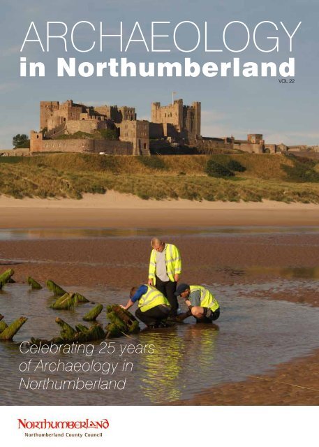
Celebrating 25 years of Archaeology in Northumberland
Celebrating 25 years of Archaeology in Northumberland

You also want an ePaper? Increase the reach of your titles
YUMPU automatically turns print PDFs into web optimized ePapers that Google loves.
<strong>Archaeology</strong><br />
<strong>in</strong> <strong>Northumberland</strong>VOL<br />
22<br />
Celebrat<strong>in</strong>g 25 years<br />
of <strong>Archaeology</strong> <strong>in</strong><br />
<strong>Northumberland</strong>
Foreword<br />
As the Council’s Cab<strong>in</strong>et Member for Economic Growth, I am<br />
delighted to welcome you to the 22nd edition of <strong>Archaeology</strong> <strong>in</strong><br />
<strong>Northumberland</strong>. This issue showcases some of the highlights of recent<br />
archaeological work undertaken <strong>in</strong> <strong>Northumberland</strong> and, remarkably,<br />
celebrates two 25-year anniversaries.<br />
Firstly, it is 25 years s<strong>in</strong>ce the first issue of <strong>Archaeology</strong> <strong>in</strong><br />
<strong>Northumberland</strong> was published <strong>in</strong> 1991. Over these years the magaz<strong>in</strong>e<br />
has seen many changes, <strong>in</strong>clud<strong>in</strong>g embrac<strong>in</strong>g full colour, grow<strong>in</strong>g <strong>in</strong> size<br />
and becom<strong>in</strong>g available onl<strong>in</strong>e, but it cont<strong>in</strong>ues to report on an ever<br />
widen<strong>in</strong>g range of heritage and archaeological activities carried out<br />
across the County. <strong>Archaeology</strong> <strong>in</strong> <strong>Northumberland</strong> has also attracted a<br />
‘Friends of’ group whose members provide <strong>in</strong>valuable support for the<br />
publication of the magaz<strong>in</strong>e.<br />
We are also celebrat<strong>in</strong>g the 25th anniversary of developer-funded<br />
archaeology. When the government <strong>in</strong>troduced guidance on<br />
<strong>Archaeology</strong> and Plann<strong>in</strong>g <strong>in</strong> 1991, it changed the way archaeology<br />
was considered. Instead of rescue operations be<strong>in</strong>g launched,<br />
developers became responsible for ensur<strong>in</strong>g that archaeological rema<strong>in</strong>s<br />
affected by their proposals were properly <strong>in</strong>vestigated. This work<br />
has made a huge contribution to our knowledge and understand<strong>in</strong>g<br />
of the past and revealed many new and excit<strong>in</strong>g discoveries <strong>in</strong><br />
<strong>Northumberland</strong> which have been revisited on pages 4-13.<br />
Alongside this commercially funded work, community <strong>in</strong>terest <strong>in</strong><br />
the heritage of <strong>Northumberland</strong> cont<strong>in</strong>ues to grow. It is particularly<br />
pleas<strong>in</strong>g to see an ever-<strong>in</strong>creas<strong>in</strong>g number of local groups explor<strong>in</strong>g<br />
their heritage and some of the results of this work are published here,<br />
<strong>in</strong>clud<strong>in</strong>g Altogether <strong>Archaeology</strong> (page 42), Flodden 500 (page 18),<br />
Holystone (page 52), Tynedale North of the Wall (page 32) and the<br />
National Park volunteers on the Otterburn Ranges (page 49).<br />
This issue also reports on the f<strong>in</strong>al phase of the multi-million pound<br />
heritage-led regeneration schemes <strong>in</strong> Berwick, where tangible<br />
improvements to shopfronts and build<strong>in</strong>gs have been accompanied<br />
by excit<strong>in</strong>g creative projects record<strong>in</strong>g more ephemeral th<strong>in</strong>gs, like<br />
memories, anecdotes and atmosphere (page 34). With this hugely<br />
successful project near<strong>in</strong>g completion, it gives me great pleasure<br />
to report that significant fund<strong>in</strong>g has been secured for several new<br />
projects <strong>in</strong> the County. In particular, the Heritage Lottery Fund<br />
has awarded £1.8million to the Peregr<strong>in</strong>i L<strong>in</strong>disfarne Landscape<br />
Partnership which started three community projects this year and I<br />
look forward to read<strong>in</strong>g about their results <strong>in</strong> future issues.<br />
Allan Hepple<br />
Portfolio Holder for Economic Growth<br />
<strong>Archaeology</strong> <strong>in</strong> <strong>Northumberland</strong> 1
Welcome<br />
2 <strong>Archaeology</strong> <strong>in</strong> <strong>Northumberland</strong><br />
At last, welcome to the 22nd edition of <strong>Archaeology</strong> <strong>in</strong> <strong>Northumberland</strong>,<br />
which aga<strong>in</strong> has been a long time <strong>in</strong> the mak<strong>in</strong>g. We would like to thank<br />
you for your patience as it is almost two years s<strong>in</strong>ce the last issue was<br />
published and this volume <strong>in</strong>troduces a wide range of work that has been<br />
carried out between 2013 and 2015.<br />
In that time we have faced a number of challenges, not least of which<br />
is the absence of our friend and colleague, Chris Burgess, through long<br />
term illness. Without Chris’s presence and hands-on design <strong>in</strong>put you<br />
will probably notice the look of the magaz<strong>in</strong>e has changed a little but<br />
we hope that you will f<strong>in</strong>d it recognisable and equally attractive. As a<br />
slight departure from the usual format, we have published the list of<br />
archaeological assessments, evaluations and other work (grey literature)<br />
on our website so that we can devote more space <strong>in</strong> the magaz<strong>in</strong>e to<br />
topical pieces.<br />
To celebrate our 25th anniversary, and that of developer-funded archaeology<br />
<strong>in</strong> England, we have compiled a special review which showcases the sites<br />
that have contributed to our grow<strong>in</strong>g knowledge and understand<strong>in</strong>g of<br />
<strong>Northumberland</strong>’s past. It shows the wide range of sites that have been<br />
<strong>in</strong>vestigated and the large number of people and organisations that have<br />
been <strong>in</strong>volved over the years.<br />
We hope you enjoy this issue and would like to thank all the Friends<br />
of <strong>Archaeology</strong> <strong>in</strong> <strong>Northumberland</strong> whose cont<strong>in</strong>ued support<br />
makes it possible to publish this magaz<strong>in</strong>e.<br />
Sara Rushton<br />
Liz Williams
Contents<br />
Celebrat<strong>in</strong>g 25 years of development-led<br />
archaeology 1990-2015 4<br />
New prehistoric rock art discovery at Birney Hill, Ponteland 14<br />
Graz<strong>in</strong>g on Ha’Hill, Morpeth 16<br />
Flodden Hill 2013-15 18<br />
Barmoor W<strong>in</strong>d Farm 20<br />
Iron Age Settlement at St George’s Hospital, Morpeth 22<br />
A NU Young Archaeologists Club for the uplands 24<br />
Rescued from the Sea 25<br />
Investigations at the Premonstratensian<br />
Abbey of Blanchland 26<br />
Medieval Shotton 29<br />
Did Bamburgh shipwreck <strong>in</strong>spire first coastguards? 30<br />
Wilds of Wanney 31<br />
British Rock Art News 31<br />
Community archaeology north of Hadrian’s Wall 32<br />
The Vicar’s Pele, Corbridge 33<br />
Layers of localism and regeneration <strong>in</strong><br />
Berwick-upon-Tweed 34<br />
Europe’s lost frontiers: Doggerland and the<br />
Mesolithic-Neolithic transition 36<br />
Archaeological Investigations at Well Hill, Stann<strong>in</strong>gton 38<br />
New approaches at Yeaver<strong>in</strong>g 40<br />
Altogether <strong>Archaeology</strong> <strong>in</strong> the North Penn<strong>in</strong>es<br />
Area of Outstand<strong>in</strong>g Natural Beauty 42<br />
Belsay Castle 45<br />
Heritage at Risk 46<br />
Excavations at Bolton Chapel 48<br />
Keep<strong>in</strong>g it local 49<br />
Bradford Kaims Wetland Heritage Project 50<br />
In search of Holystone Priory 52<br />
Roman stones at West Uppertown Farm 56<br />
Portable Antiquities <strong>in</strong> <strong>Northumberland</strong> 58<br />
New designations 60<br />
<strong>Archaeology</strong> <strong>in</strong> <strong>Northumberland</strong> 3
Celebrat<strong>in</strong>g 25 years of developme<br />
4 <strong>Archaeology</strong> <strong>in</strong> <strong>Northumberland</strong><br />
As regular readers will know,<br />
<strong>Archaeology</strong> <strong>in</strong> <strong>Northumberland</strong><br />
has been report<strong>in</strong>g news of<br />
archaeological discoveries<br />
<strong>in</strong> the county for 25 years –<br />
co<strong>in</strong>cidentally the same period<br />
that developer-funded archaeology<br />
has been around. In 1990 the<br />
way <strong>in</strong> which archaeological sites<br />
were recorded ahead of their<br />
destruction by development was<br />
fundamentally changed. The issue<br />
of new government guidance on<br />
<strong>Archaeology</strong> and Plann<strong>in</strong>g (PPG<br />
16) set out a clear presumption <strong>in</strong><br />
favour of the physical preservation<br />
of archaeological rema<strong>in</strong>s and<br />
where this was not possible<br />
developers were required to carry<br />
out <strong>in</strong>vestigations at their own<br />
expense. The policy is now built<br />
<strong>in</strong>to the National Plann<strong>in</strong>g Policy<br />
Framework (NPPF).<br />
The follow<strong>in</strong>g synopsis celebrates<br />
25 years s<strong>in</strong>ce archaeology was<br />
made part of the system for<br />
grant<strong>in</strong>g plann<strong>in</strong>g permission.<br />
These discoveries have shed new<br />
light on the county’s ancient<br />
and recent past and have also<br />
contributed to chang<strong>in</strong>g views<br />
of the North East region and our<br />
ideas about England’s past. All<br />
the work described below has<br />
been required by <strong>Northumberland</strong><br />
County Council and its predecessor<br />
local plann<strong>in</strong>g authorities, on<br />
the advice of <strong>Northumberland</strong><br />
Conservation.<br />
An aurochs skull and red deer antlers from Haughton Strother Quarry.<br />
Photo PCA.<br />
A later Neolithic long house at<br />
Cheviot Quarry. Photo ARS.<br />
Cache of fl<strong>in</strong>t<br />
blades from<br />
Akeldsteads.<br />
Photo ARS.<br />
Prehistory<br />
When the last Ice Age ended<br />
12,000 years ago, forests and<br />
grassland established as the<br />
climate warmed, provid<strong>in</strong>g a<br />
rich environment for animals<br />
and people to colonise. A rare<br />
discovery of two Mesolithic<br />
aurochs skulls (a species of wild<br />
cattle) and red deer antler was<br />
made at Haughton Strother Quarry<br />
on the River North Tyne. The skull<br />
dated between 5670 and 5520 BC<br />
and was recovered by Thompsons<br />
of Prudhoe from a palaeochannel<br />
on an ancient river terrace,<br />
previously identified by Newcastle<br />
University. The skulls and antlers<br />
are of great significance <strong>in</strong> regional<br />
terms s<strong>in</strong>ce animal rema<strong>in</strong>s<br />
from the late Mesolithic period,<br />
particularly from <strong>in</strong>land areas, are<br />
scarce and generally very poorly<br />
preserved. Equally rare is evidence<br />
of human settlement – a possible
nt-led archaeology 1990-2015<br />
Iron Age settlement<br />
excavations at Blagdon<br />
(Delhi).<br />
Photo TWM <strong>Archaeology</strong><br />
post-built structure found at<br />
Lanton Quarry <strong>in</strong> excavations for<br />
Tarmac Northern may be evidence<br />
of a small hut similar to that<br />
recorded <strong>in</strong> research excavations<br />
on the coast at Howick.<br />
The transition from the huntergatherer<br />
to farm<strong>in</strong>g way of life took<br />
place slowly from around 4000 BC.<br />
Evidence of this more settled way<br />
of life has been revealed <strong>in</strong> sand<br />
and gravel quarries <strong>in</strong> the Milfield<br />
Bas<strong>in</strong> <strong>in</strong> north <strong>Northumberland</strong><br />
where archaeologists have been<br />
work<strong>in</strong>g with Tarmac Northern<br />
s<strong>in</strong>ce 2005 at two quarries (Cheviot<br />
and Lanton). A unique sequence<br />
of build<strong>in</strong>gs was found at Cheviot<br />
Quarry where two early Neolithic<br />
round houses and three later<br />
Neolithic long houses together<br />
with hearths, pits and other<br />
structures and a great quantity of<br />
pottery, stone tools and objects may<br />
represent the earliest small farm<strong>in</strong>g<br />
settlement <strong>in</strong> <strong>Northumberland</strong>.<br />
What is more remarkable is the<br />
quantity and nature of pottery<br />
from the site, <strong>in</strong>clud<strong>in</strong>g 15 sherds<br />
of Neolithic and Early Bronze Age<br />
beakers from non-grave contexts,<br />
<strong>in</strong>clud<strong>in</strong>g All Over Corded Ware.<br />
Before these excavations there<br />
had been little <strong>in</strong>formation about<br />
the character of early Neolithic<br />
pottery <strong>in</strong> the county. Further<br />
probable Neolithic build<strong>in</strong>gs<br />
with associated hearths, pits and<br />
postholes conta<strong>in</strong><strong>in</strong>g Neolithic<br />
pottery were revealed at Lanton<br />
Quarry. At Milfield village the<br />
rema<strong>in</strong>s of a short-lived Neolithic-<br />
Early Bronze Age dwell<strong>in</strong>g was<br />
found that was <strong>in</strong> use at the<br />
same time as nearby henges and<br />
is the first evidence <strong>in</strong> this area<br />
for where the henge builders<br />
lived. One of the best caches<br />
of Neolithic fl<strong>in</strong>t blades <strong>in</strong> the<br />
county was discovered prior to<br />
gravel extraction at Akeld Steads<br />
by Tarmac. Away from the Milfield<br />
Bas<strong>in</strong>, archaeologists work<strong>in</strong>g on<br />
Holy Island for Nichol, Armstrong<br />
& Lowe uncovered a possible<br />
Neolithic pit and postholes<br />
arrangement which is the earliest<br />
known structure on the island.<br />
The transition to the Bronze Age<br />
occurred around 2500 BC and<br />
pollen analysis shows woods were<br />
disappear<strong>in</strong>g and grassland and<br />
moorland was on the <strong>in</strong>crease as<br />
farm<strong>in</strong>g developed and spread.<br />
The sand and gravel work<strong>in</strong>gs at<br />
Lanton and Cheviot Quarries have<br />
revealed evidence of Bronze Age<br />
settlement and at Cheviot Quarry<br />
archaeologists also found evidence of<br />
massive enclosures, small horseshoeshaped<br />
enclosures and pits, all close<br />
to the ritual monuments of the<br />
Milfield Bas<strong>in</strong>.<br />
Iron began to replace bronze <strong>in</strong> tool<br />
mak<strong>in</strong>g around 1000 BC although<br />
it did not become common until<br />
around 500 BC. The Bronze Age<br />
way of life is thought to have<br />
cont<strong>in</strong>ued relatively unchanged<br />
<strong>in</strong>to the Iron Age – farm<strong>in</strong>g cattle<br />
and sheep, rais<strong>in</strong>g crops and us<strong>in</strong>g<br />
the natural resources of the coast.<br />
However, settlements began to<br />
change from be<strong>in</strong>g open groups of<br />
hut circles to ones surrounded by<br />
banks, ditches or wooden palisades.<br />
<strong>Archaeology</strong> <strong>in</strong> <strong>Northumberland</strong> 5
Celebrat<strong>in</strong>g 25 years of development-led archaeo<br />
Pit alignments. Photo TWM <strong>Archaeology</strong>.<br />
6 <strong>Archaeology</strong> <strong>in</strong> <strong>Northumberland</strong><br />
In south-east <strong>Northumberland</strong><br />
and neighbour<strong>in</strong>g Tyne and Wear,<br />
archaeologists work<strong>in</strong>g on surface<br />
m<strong>in</strong>e and hous<strong>in</strong>g development<br />
sites have made significant<br />
discoveries that have changed<br />
the way we th<strong>in</strong>k about Iron Age<br />
settlement on the coastal pla<strong>in</strong>.<br />
These discoveries have shown a<br />
previously unsuspected density of<br />
settlement activity and the rich<br />
and varied archaeological potential<br />
that survives. The results have been<br />
brought together <strong>in</strong> The Iron Age on<br />
the <strong>Northumberland</strong> Coastal Pla<strong>in</strong>,<br />
published by TWM <strong>Archaeology</strong><br />
and the Arbeia Society <strong>in</strong> 2012.<br />
In south-east <strong>Northumberland</strong>, for<br />
example, large Iron Age enclosed<br />
settlements and a number of<br />
smaller unenclosed settlements<br />
have been excavated at Pegswood<br />
Moor Farm, Blagdon and Shotton<br />
on behalf of Banks M<strong>in</strong><strong>in</strong>g. The<br />
Pegswood Moor Farm example<br />
was an Iron Age and Romano-<br />
British settlement and field system<br />
of a type previously unknown <strong>in</strong><br />
this part of <strong>Northumberland</strong>; and<br />
at Blagdon Park the complete<br />
plan of an Iron Age settlement<br />
was revealed, closely followed by<br />
the discovery of a small Iron Age<br />
settlement at Shotton. The variety<br />
and complexity of these new Iron<br />
Age settlements means that the<br />
typical rectil<strong>in</strong>ear form identified by<br />
George Jobey and Norman McCord<br />
<strong>in</strong> the 1960s and 1970s is now<br />
recognised as only one component<br />
<strong>in</strong> the settlement pattern of the<br />
lowland pla<strong>in</strong>.<br />
Alongside the discovery of<br />
prehistoric settlements, some<br />
remarkable pit alignments spann<strong>in</strong>g<br />
the late Bronze Age to early Iron
logy – 1990-2015<br />
Lanton Iron Age cist and burial.<br />
Photo ARS.<br />
Age periods were found at Blagdon<br />
Park and Shotton. Here, long l<strong>in</strong>es<br />
of pits snaked their way across the<br />
landscape demonstrat<strong>in</strong>g a regular<br />
system of land division, perhaps<br />
demarcat<strong>in</strong>g resources such as<br />
pasture and woodland and access<br />
to the river Blyth for particular<br />
communities or settlements.<br />
One of the greatest gaps <strong>in</strong> our<br />
knowledge of Iron Age people is<br />
where and how they dealt with<br />
their dead. Excavations at Lanton<br />
Quarry revealed the first formal<br />
Iron Age burial from the county,<br />
where rema<strong>in</strong>s of an elderly woman<br />
were found <strong>in</strong> a stone cist set<br />
with<strong>in</strong> a pit.<br />
The natural resources of the<br />
coast were an important part of<br />
prehistoric life. Excavations on the<br />
cliff tops at Needles Eye, Berwick,<br />
<strong>in</strong> advance of an extension<br />
to the North Road Industrial<br />
Estate, found a substantial Iron<br />
Age camp. It may have been<br />
used only seasonally or annually,<br />
because although there was no<br />
evidence of settlement here the<br />
pottery assemblage does suggest<br />
some habitation. The camp<br />
site cont<strong>in</strong>ued <strong>in</strong> use <strong>in</strong>to the<br />
first century AD although the<br />
ditches of the enclosure had<br />
been abandoned by then. In the<br />
abandoned ditches of the camp<br />
a substantial and important<br />
assemblage of Iron Age ceramics<br />
was found, <strong>in</strong>clud<strong>in</strong>g briquetage<br />
(associated with salt production<br />
and trade). The f<strong>in</strong>ds <strong>in</strong>clude one<br />
of the largest assemblages of Iron<br />
Age pottery recovered from a<br />
site <strong>in</strong> <strong>Northumberland</strong> and the<br />
largest assemblage of briquetage<br />
then discovered <strong>in</strong> Brita<strong>in</strong> and the<br />
only evidence for prehistoric salt<br />
process<strong>in</strong>g north of the Fens.<br />
Roman<br />
The advent of Roman Brita<strong>in</strong><br />
followed the <strong>in</strong>vasion of the south<br />
coast of England <strong>in</strong> AD43. In the<br />
early AD70s, the Roman governor<br />
of Brita<strong>in</strong> took over the whole of<br />
the North of England and by AD81<br />
Agricola had advanced the Roman<br />
front l<strong>in</strong>e <strong>in</strong>to Scotland. Gravel<br />
extraction at Wooperton Quarry by<br />
RMC Aggregates (Northern) gave<br />
the opportunity for archaeologists<br />
to <strong>in</strong>vestigate the Devil’s Causeway<br />
Roman road which travels<br />
through the county from north<br />
of Corbridge towards Berwick.<br />
Unexpectedly, as well as sections<br />
of the road, excavations revealed<br />
pit alignments, rectil<strong>in</strong>ear ditches/<br />
gullies, pits and postholes together<br />
with Roman pottery which seem<br />
likely to represent the first recorded<br />
Roman military site north of Low<br />
Learchild fort.<br />
Well-preserved Roman roads have<br />
also been uncovered elsewhere <strong>in</strong><br />
the county. In excavations at Rid<strong>in</strong>g<br />
Mill for Meadowcroft Estates,<br />
Dere Street was found to be <strong>in</strong><br />
a far better state of preservation<br />
than had been anticipated. At<br />
Walwick Hall, excavations on<br />
behalf of Mr G Wylie revealed the<br />
rema<strong>in</strong>s of the Military Way ly<strong>in</strong>g<br />
slightly north of the projected l<strong>in</strong>e<br />
on Ordnance Survey maps and<br />
compris<strong>in</strong>g smooth but irregularshaped<br />
and sized stone slabs, blocks<br />
and cobbles. Its appearance was<br />
considerably different to that of the<br />
same road seen further east on the<br />
western fr<strong>in</strong>ges of Newcastle upon<br />
Tyne.<br />
New and <strong>in</strong>novative techniques<br />
were used by the M<strong>in</strong>istry of<br />
Defence to <strong>in</strong>vestigate Hadrian’s<br />
Wall near Albemarle Barracks.<br />
Rema<strong>in</strong>s of the Wall lie beneath<br />
the B6318 through much of the<br />
county so when the barracks<br />
became a driver-tra<strong>in</strong><strong>in</strong>g facility for<br />
heavy lorries and tracked vehicles<br />
research was commissioned<br />
to see what impact this might<br />
have on the buried rema<strong>in</strong>s.<br />
Us<strong>in</strong>g a comb<strong>in</strong>ation of desk top<br />
assessment, trial trench<strong>in</strong>g, an<br />
eng<strong>in</strong>eer<strong>in</strong>g test called Fall<strong>in</strong>g<br />
Weight Deflectometer and<br />
vibration test<strong>in</strong>g, the results were<br />
reassur<strong>in</strong>g that modern military use<br />
of the old Military Road was not<br />
damag<strong>in</strong>g Hadrian’s Wall.<br />
Work to replace a water ma<strong>in</strong><br />
near Throckley uncovered new<br />
<strong>in</strong>formation about some cunn<strong>in</strong>g<br />
defences along Hadrian’s Wall. A<br />
series pits found between the Wall<br />
and its north ditch are evidence of<br />
entanglements designed to impede<br />
and hold-up attackers and similar<br />
<strong>Archaeology</strong> <strong>in</strong> <strong>Northumberland</strong> 7
Celebrat<strong>in</strong>g 25 years of development-led archaeo<br />
Craml<strong>in</strong>gton at Shotton Surface<br />
M<strong>in</strong><strong>in</strong>g Site, for Banks M<strong>in</strong><strong>in</strong>g,<br />
made an excit<strong>in</strong>g new discovery<br />
when they revealed an unexpected<br />
secular Anglo-Saxon settlement<br />
with a cluster of post-built halls,<br />
sunken floored build<strong>in</strong>gs and<br />
ditched enclosures. The settlement<br />
showed a clear sequence of<br />
development, from an unenclosed<br />
settlement <strong>in</strong> the early Anglo-<br />
Saxon period to one of formalised<br />
farmsteads <strong>in</strong> separate enclosures<br />
by the late seventh century AD.<br />
This site is a very rare example<br />
of an isolated secular settlement<br />
<strong>in</strong> the area stretch<strong>in</strong>g between<br />
north <strong>Northumberland</strong> and North<br />
Yorkshire, and demonstrates how<br />
developer-funded archaeology is<br />
contribut<strong>in</strong>g to a new knowledge<br />
and understand<strong>in</strong>g of our region.<br />
Anglo-Saxon settlement rema<strong>in</strong>s<br />
have also come to light <strong>in</strong> and<br />
around Milfield. At Woodbridge<br />
Farm archaeologists work<strong>in</strong>g for<br />
Tarmac Roadstone found rema<strong>in</strong>s<br />
of timber build<strong>in</strong>gs suggestive of a<br />
small settlement; and at Whitton<br />
Park for Robson Design they<br />
found postholes of a substantial<br />
timber build<strong>in</strong>g that shows that the<br />
Maelm<strong>in</strong> palace complex may be<br />
more extensive than had previously<br />
been recognised.<br />
8 <strong>Archaeology</strong> <strong>in</strong> <strong>Northumberland</strong><br />
Throckley entanglements<br />
to other examples found further<br />
east at Byker <strong>in</strong> Newcastle.<br />
Work to replace a water ma<strong>in</strong><br />
near Throckley uncovered new<br />
<strong>in</strong>formation about some cunn<strong>in</strong>g<br />
defences along Hadrian’s Wall. A<br />
series pits found between the Wall<br />
and its north ditch are evidence of<br />
entanglements designed to impede<br />
and hold-up attackers and similar<br />
to other examples found further<br />
east at Byker <strong>in</strong> Newcastle.<br />
Early Medieval<br />
In the early medieval period<br />
Northumbria was at the<br />
forefront of political, cultural and<br />
<strong>in</strong>tellectual developments. At its<br />
greatest extent <strong>in</strong> the seventh<br />
century the k<strong>in</strong>gdom of Bernicia,<br />
with its capital at Bamburgh,<br />
extended from the Forth to<br />
the Humber. Yet, despite the<br />
importance of the early medieval<br />
period <strong>in</strong> the region, little is known<br />
about its settlement archaeology.<br />
Archaeologists excavat<strong>in</strong>g near<br />
Indications of possible <strong>in</strong>dustrial<br />
activity and large-scale food<br />
process<strong>in</strong>g <strong>in</strong> the 10th and<br />
11th centuries were discovered<br />
by archaeologists work<strong>in</strong>g <strong>in</strong><br />
Heddon-on-the-Wall on behalf of<br />
TTH Architects/NE Plant Sales.<br />
Scientific analysis of environmental<br />
samples taken from fills <strong>in</strong> the<br />
(Roman) vallum ditch revealed a<br />
variety of seeds and plant rema<strong>in</strong>s<br />
some of which showed evidence of
logy 1990-2015<br />
A Saxon house at Shotton.<br />
Photo TWM <strong>Archaeology</strong>.<br />
crop process<strong>in</strong>g – charred chaff and<br />
gra<strong>in</strong>s of oats, wheat and barley,<br />
that suggest this took place on<br />
a large scale. It is suspected that<br />
there was a large kiln or furnace <strong>in</strong><br />
Heddon <strong>in</strong> the 11th century; a date<br />
of AD 1030-1220 was recovered<br />
from a s<strong>in</strong>gle oat gra<strong>in</strong>.<br />
Medieval<br />
Developer-funded archaeology has<br />
revealed much about the medieval<br />
period across <strong>Northumberland</strong>,<br />
especially its towns and villages<br />
where details of build<strong>in</strong>gs, land<br />
division (burgage plots), rubbish<br />
disposal and some <strong>in</strong>dustrial<br />
practices have come to light.<br />
A previously unknown phase of<br />
occupation was found at Ancroft<br />
when archaeologists excavated<br />
a series of medieval build<strong>in</strong>gs for<br />
Edw<strong>in</strong> Thompson & Co. They<br />
uncovered build<strong>in</strong>gs with dwarf<br />
stone walls and clay capp<strong>in</strong>g,<br />
which would have supported a<br />
timber-frame, as well as evidence<br />
of a narrow alley, or street,<br />
runn<strong>in</strong>g between them. In other<br />
parts of the county, development<br />
of vacant plots with<strong>in</strong> and on<br />
the edge of villages has revealed<br />
medieval rema<strong>in</strong>s, for example at<br />
Cornhill-on-Tweed, Embleton and<br />
Alnmouth.<br />
Some villages are only known<br />
from documents, so when a new<br />
bus<strong>in</strong>ess park was proposed at<br />
Dovecote rema<strong>in</strong>s at<br />
West Hartford. Photo<br />
NAA.<br />
<strong>Archaeology</strong> <strong>in</strong> <strong>Northumberland</strong> 9
Celebrat<strong>in</strong>g 25 years of development-led archaeo<br />
10 <strong>Archaeology</strong> <strong>in</strong> <strong>Northumberland</strong><br />
West Hartford, near Craml<strong>in</strong>gton<br />
the opportunity arose to search<br />
for the lost village of Hartford. A<br />
series of <strong>in</strong>vestigations revealed<br />
substantial and extensive rema<strong>in</strong>s<br />
of a medieval rural settlement that<br />
<strong>in</strong>cluded dwell<strong>in</strong>gs, workshops,<br />
enclosures and a dovecote, and<br />
h<strong>in</strong>ted at the presence of a high<br />
status build<strong>in</strong>g nearby. Another<br />
excavation at nearby Shotton<br />
Surface M<strong>in</strong>e Site uncovered<br />
extensive rema<strong>in</strong>s of Shotton<br />
medieval village conta<strong>in</strong><strong>in</strong>g<br />
evidence of domestic and <strong>in</strong>dustrial<br />
activity, <strong>in</strong>clud<strong>in</strong>g a pottery kiln<br />
and a gra<strong>in</strong> dry<strong>in</strong>g kiln or malt<strong>in</strong>g<br />
oven. Evidence for medieval<br />
<strong>in</strong>dustries is limited <strong>in</strong> the region<br />
but some small scale activities have<br />
been found. At North Stobswood<br />
extraction site, work for UK Coal<br />
revealed a series of fire pits across<br />
the site that were used for charcoal<br />
burn<strong>in</strong>g. Excavation on the Bishops<br />
Garage site <strong>in</strong> Corbridge found a<br />
corn dry<strong>in</strong>g kiln that may be part<br />
of a wider and as yet unknown<br />
complex, and <strong>in</strong> Rothbury All<br />
Lime Kiln at All Sa<strong>in</strong>ts, Rothbury. Photo IFA.<br />
Sa<strong>in</strong>ts churchyard archaeologists<br />
found a lime kiln.<br />
Development-led archaeology has<br />
also provided the opportunity for<br />
large-scale open area excavation<br />
<strong>in</strong> some of our towns. Excavations<br />
<strong>in</strong> Berwick for Terrace Hill Projects<br />
exam<strong>in</strong>ed an area of street frontage<br />
on Marygate and discovered timber<br />
build<strong>in</strong>gs, property boundaries and<br />
over 40 pits. F<strong>in</strong>ds <strong>in</strong>cluded pottery<br />
and organic material such as wood,<br />
leather, rich assemblages of fish<br />
and bird bones and plant matter.<br />
The earliest build<strong>in</strong>gs, dat<strong>in</strong>g to<br />
the late 12th century, were situated<br />
Kiln at Bshops<br />
Garage.<br />
Photo NPA.<br />
on the Marygate frontage but<br />
had been abandoned by the 14th<br />
century, possibly as a result of the<br />
hostilities between England and<br />
Scotland. Later medieval build<strong>in</strong>gs<br />
were constructed <strong>in</strong> the backplot.<br />
Well preserved organic rema<strong>in</strong>s<br />
have been found <strong>in</strong> other parts of<br />
Berwick and are a feature of the<br />
town’s archaeology. Excavations<br />
of pits at Woolmarket for Yeoman<br />
Design, found one with a wicker<br />
l<strong>in</strong><strong>in</strong>g. Clues to the uses of some<br />
parts of Berwick have been found<br />
<strong>in</strong> Ravensdowne where excavation<br />
and documentary evidence suggest<br />
the west side was the town’s<br />
rubbish dump (Rotten Row).<br />
Excavations <strong>in</strong> Walkergate for the<br />
Berwick Workspace development<br />
uncovered what may be one of<br />
the town’s lost monastic sites,<br />
or perhaps a hospital or part of<br />
a church or even a rich secular<br />
build<strong>in</strong>g. The build<strong>in</strong>g had been<br />
demolished <strong>in</strong> the late 12th or 13th<br />
century and the f<strong>in</strong>ds <strong>in</strong>cluded<br />
fragments of sta<strong>in</strong>ed w<strong>in</strong>dow glass<br />
and co<strong>in</strong>s. Another lost site is the<br />
Carmelite Friary which may have<br />
been found at Governor’s Gardens<br />
dur<strong>in</strong>g excavations for L<strong>in</strong>disfarne<br />
Homes.<br />
The foundation of religious houses<br />
<strong>in</strong> the county from the mid-12th
logy 1990-2015<br />
Medieval build<strong>in</strong>g at Cornhill. Photo Headland <strong>Archaeology</strong>.<br />
century <strong>in</strong>cluded the Dom<strong>in</strong>ican<br />
Friary at Bamburgh where work<br />
has allowed a more detailed<br />
ground plan to be reconstructed.<br />
At Br<strong>in</strong>kburn, excavations of the<br />
August<strong>in</strong>ian Priory for Landmark<br />
Trust found substantial rema<strong>in</strong>s of<br />
the pr<strong>in</strong>cipal gatehouse that suggest<br />
the layout was very different from a<br />
conventional one.<br />
Sometimes completely unexpected<br />
discoveries are made such as<br />
when build<strong>in</strong>g work started on<br />
a vacant plot on Castle Terrace,<br />
Berwick and a skeleton was<br />
found. Archaeologists went on<br />
to excavate a lost 12th century<br />
church and well-preserved burial<br />
ground which lay outside the walls<br />
of Berwick, <strong>in</strong> the former village of<br />
Bond<strong>in</strong>gton. The church may have<br />
been founded as a hospital and was<br />
probably abandoned when villagers<br />
retreated <strong>in</strong>side the town walls<br />
dur<strong>in</strong>g the Anglo-Scottish wars of<br />
the 14th century.<br />
Other churches and chapels,<br />
together with their burial grounds,<br />
have also disappeared and without<br />
developer-led archaeology would<br />
only be known from documentary<br />
evidence. For example, excavation<br />
of Chev<strong>in</strong>gton chapel, at British<br />
Coal Opencast’s site found an<br />
unusual and <strong>in</strong>terest<strong>in</strong>g example<br />
of w<strong>in</strong>dow tracery, built on the site<br />
of an earlier Iron Age settlement.<br />
Excavations at Tr<strong>in</strong>ity Terrace<br />
<strong>in</strong> Corbridge have regularly<br />
exposed medieval burials from the<br />
graveyard of Holy Tr<strong>in</strong>ity Church.<br />
Post-medieval<br />
Relations between England and<br />
Scotland gradually improved <strong>in</strong><br />
the latter part of the 16th century<br />
culm<strong>in</strong>at<strong>in</strong>g with the Union of the<br />
Crowns <strong>in</strong> 1603. New fortifications<br />
had been built around Berwick but<br />
throughout this period another<br />
form of attack was fought between<br />
local clans, or mosstroopers, along<br />
the Border giv<strong>in</strong>g rise to defensible<br />
build<strong>in</strong>gs called bastles. From the<br />
late 16th century changes started<br />
to take place <strong>in</strong> the organisation<br />
of farm<strong>in</strong>g as fields were enclosed<br />
and arable land was converted to<br />
pasture. New farm<strong>in</strong>g practices<br />
were adopted <strong>in</strong> the 18th century<br />
Wicker-l<strong>in</strong>ed pit <strong>in</strong> Berwick.<br />
Photo The Archaeological Practice.<br />
<strong>Archaeology</strong> <strong>in</strong> <strong>Northumberland</strong> 11
Celebrat<strong>in</strong>g 25 years of development-led archaeo<br />
to <strong>in</strong>crease productivity, especially<br />
<strong>in</strong> Glendale and lowland areas of<br />
the county, where model farms<br />
were built. The uplands were<br />
transformed by enclosure and<br />
dom<strong>in</strong>ated by sheep farm<strong>in</strong>g which<br />
largely replaced the practice of<br />
transhumance.<br />
The post-medieval period was a<br />
time of <strong>in</strong>dustrial development<br />
and growth and <strong>in</strong> the North East<br />
this is especially l<strong>in</strong>ked with coal<br />
m<strong>in</strong><strong>in</strong>g. At Barmoor work on EDF’s<br />
new w<strong>in</strong>d farm found the rema<strong>in</strong>s<br />
of bell pits and m<strong>in</strong>e shafts up to<br />
22m deep. Historic pillar and stall<br />
m<strong>in</strong>e work<strong>in</strong>gs were found dur<strong>in</strong>g<br />
work at Shotton and Blagdon<br />
(Delhi) opencast coal sites,<br />
operated by Banks M<strong>in</strong><strong>in</strong>g.<br />
Many of the bastles <strong>in</strong><br />
<strong>Northumberland</strong> are still <strong>in</strong><br />
domestic or agricultural use and<br />
have been subject to various<br />
plann<strong>in</strong>g applications over the<br />
years, usually relat<strong>in</strong>g to modern<br />
liv<strong>in</strong>g. Archaeological work on<br />
these build<strong>in</strong>gs has <strong>in</strong>cluded both<br />
historic build<strong>in</strong>g record<strong>in</strong>g and<br />
monitor<strong>in</strong>g work. Many of these<br />
<strong>in</strong>vestigations have shown the<br />
surpris<strong>in</strong>gly limited groundworks<br />
<strong>in</strong>volved <strong>in</strong> the construction of<br />
these substantial structures with<br />
their metre thick walls. The<br />
removal of later cement and<br />
mortar at the Golf House Bastle<br />
at Chesterwood uncovered two<br />
previously blocked orig<strong>in</strong>al doors.<br />
Archaeological <strong>in</strong>vestigations<br />
across the county show that limited<br />
foundations appear to be a feature<br />
of many post-medieval build<strong>in</strong>gs<br />
<strong>in</strong> <strong>Northumberland</strong>, with earlier,<br />
medieval rema<strong>in</strong>s still surviv<strong>in</strong>g<br />
beneath these later build<strong>in</strong>gs.<br />
Towns and villages rema<strong>in</strong>ed<br />
largely pre-<strong>in</strong>dustrial <strong>in</strong> character.<br />
While many historic towns <strong>in</strong><br />
<strong>Northumberland</strong> cont<strong>in</strong>ued<br />
the medieval street pattern,<br />
<strong>in</strong>vestigations along Marygate,<br />
Berwick-upon-Tweed and Castle<br />
Street, Warkworth have revealed<br />
medieval settlement rema<strong>in</strong>s,<br />
show<strong>in</strong>g that the streets were<br />
widened <strong>in</strong> the post-medieval<br />
period.<br />
Brick sprung roof of septic tank <strong>in</strong><br />
Berwick. Photo AOC <strong>Archaeology</strong>.<br />
Archaeological discoveries cont<strong>in</strong>ue<br />
to challenge historic documents <strong>in</strong><br />
the post-medieval period with, for<br />
example, the apparent evidence of<br />
a primitive septic tank of late 18thearly<br />
19th century date at 119-125<br />
Marygate, Berwick-upon-Tweed.<br />
Documentary evidence states that<br />
septic tanks were first patented <strong>in</strong><br />
France <strong>in</strong> 1881 and <strong>in</strong>troduced to<br />
England after 1895.<br />
There is a wealth of nonconformist<br />
chapels across <strong>Northumberland</strong>.<br />
12 <strong>Archaeology</strong> <strong>in</strong> <strong>Northumberland</strong><br />
Pillar and stall m<strong>in</strong><strong>in</strong>g rema<strong>in</strong>s at Blagdon (Delhi).<br />
Photo TWM <strong>Archaeology</strong>.
logy 1990-2015<br />
Churchill graffiti at Stann<strong>in</strong>gton.<br />
Photo The Archaeological<br />
Practice.<br />
Wylam waggonway sleeper<br />
and chair.<br />
Photo TWM <strong>Archaeology</strong>.<br />
An assessment of the former<br />
Middle Meet<strong>in</strong>g House on<br />
Chapel Street <strong>in</strong> Berwick-upon-<br />
Tweed concluded that it is the<br />
last surviv<strong>in</strong>g example of an 18th<br />
century meet<strong>in</strong>g house <strong>in</strong> Berwick<br />
and may be the oldest of only a<br />
handful which survive largely<br />
<strong>in</strong>tact <strong>in</strong> the county. Record<strong>in</strong>g of<br />
a small gospel hall at Glanton built<br />
<strong>in</strong> 1904 showed it was formerly<br />
home to the Glanton Brethren – a<br />
nonconformist congregation whose<br />
acceptance of members from the<br />
Alnwick congregation resulted<br />
<strong>in</strong> a controversy that split the<br />
movement worldwide.<br />
The 19th century was a period of<br />
<strong>in</strong>novation, much of it orig<strong>in</strong>at<strong>in</strong>g<br />
<strong>in</strong> <strong>Northumberland</strong> and the<br />
North East. Waggonways were the<br />
precursors of the railways, which<br />
was shown clearly at Wylam,<br />
where archaeological <strong>in</strong>vestigation<br />
work on the old railway l<strong>in</strong>e<br />
revealed two parallel rows of stone<br />
sleeper blocks from the earlier<br />
waggonway which would have<br />
carried the iron plate-way which<br />
replaced the orig<strong>in</strong>al timber rails.<br />
The defence of Brita<strong>in</strong> <strong>in</strong> World War<br />
II is visible <strong>in</strong> the anti-tank traps<br />
and pillboxes which are still visible<br />
with<strong>in</strong> the landscape. The more<br />
human element of wartime has, on<br />
occasion, been found dur<strong>in</strong>g build<strong>in</strong>g<br />
record<strong>in</strong>g. At St Mary’s Hospital<br />
Stann<strong>in</strong>gton, a graffiti caricature<br />
of W<strong>in</strong>ston Churchill from 1943<br />
was recorded, while at Cragend<br />
Farm near Rothbury, WWII graffiti<br />
<strong>in</strong>cluded <strong>in</strong>structions on farm<strong>in</strong>g<br />
practices <strong>in</strong> various languages,<br />
presumably for the <strong>in</strong>struction of<br />
Prisoners of War, as well as other<br />
graffiti left by the British forces<br />
guard<strong>in</strong>g them.<br />
Post-war build<strong>in</strong>gs under threat have<br />
also been recorded by archaeologists<br />
and one the biggest was the former<br />
Blyth Power Station, demolished <strong>in</strong><br />
2003. Built by the newly nationalised<br />
electricity <strong>in</strong>dustry between 1955 and<br />
1966, it was one of a group of power<br />
stations that advanced the <strong>in</strong>dustry’s<br />
technological development. Research<br />
uncovered a vast archive of material<br />
and showed that it was an early<br />
example of the very large post-war<br />
stations built <strong>in</strong> rural sett<strong>in</strong>gs.<br />
Chapel Street Meet<strong>in</strong>g House, Berwick.<br />
Photo The Archaeological Practice.<br />
The work described above was carried<br />
out by <strong>in</strong>dependent archaeological<br />
companies and <strong>in</strong>clude: Alan Williams<br />
<strong>Archaeology</strong>, AOC <strong>Archaeology</strong>,<br />
Archaeological Research Services,<br />
Archaeological Services Durham<br />
University, Bamburgh Research<br />
Project, CFA <strong>Archaeology</strong>, Headland<br />
<strong>Archaeology</strong>, Ian Farmer Associates,<br />
Lancaster University Archaeological<br />
Unit, North Penn<strong>in</strong>es <strong>Archaeology</strong>,<br />
Northern Archaeological Associates,<br />
Peter Ryder, Pre-Construct <strong>Archaeology</strong>,<br />
The Archaeological Practice, Michael<br />
Truman, TWM <strong>Archaeology</strong>, Tyne and<br />
Wear Museums Service.<br />
EW and KD<br />
<strong>Archaeology</strong> <strong>in</strong> <strong>Northumberland</strong> 13
New prehistoric rock art discovery a<br />
In the w<strong>in</strong>ter of 2014 an<br />
archaeological evaluation took<br />
place on land at Birney Hill,<br />
Ponteland. It was required by the<br />
Plann<strong>in</strong>g Service on the advice of<br />
the Conservation Team <strong>in</strong> order to<br />
help <strong>in</strong>form a plann<strong>in</strong>g <strong>in</strong>quiry for<br />
a proposed mixed-use development<br />
at the site.<br />
The proposed development site<br />
comprised 20 fields to the north of<br />
Birney Hill Farm, situated to the<br />
south of the outskirts of Ponteland<br />
(NGR NZ 1497 6992). The work<br />
<strong>in</strong>volved the excavation of 89<br />
trenches <strong>in</strong> total, target<strong>in</strong>g the<br />
areas of greatest impact under the<br />
scheme.<br />
The majority of the proposed<br />
development area has been<br />
agricultural <strong>in</strong> character<br />
throughout the post-medieval<br />
and modern periods, with some<br />
surviv<strong>in</strong>g earthworks relat<strong>in</strong>g<br />
to medieval ridge and furrow<br />
cultivation. Birney Hall, which<br />
is located at the centre of the<br />
site, is a Grade II Listed Build<strong>in</strong>g<br />
constructed <strong>in</strong> the 17th or early<br />
18th century, but is <strong>in</strong> residential<br />
use and was not part of the<br />
proposed development<br />
(HER 14893).<br />
Prior to the fieldwork a deskbased<br />
assessment of the site had<br />
identified that there was evidence<br />
for prehistoric activity <strong>in</strong> the area,<br />
<strong>in</strong>clud<strong>in</strong>g a Bronze Age burial<br />
cairn to the west of the site at<br />
Heddon Laws Farm, located on<br />
top of a natural hill (HER 10867).<br />
Cropmarks had also been recorded<br />
<strong>in</strong> the wider area, which are<br />
<strong>in</strong>dicative of prehistoric or Roman<br />
period settlement.<br />
Archaeological features were<br />
encountered <strong>in</strong> several trenches,<br />
possibly rang<strong>in</strong>g <strong>in</strong> date from<br />
Bronze Age through to the<br />
medieval period. Significantly,<br />
a number of r<strong>in</strong>g ditches were<br />
revealed by the work which are<br />
<strong>in</strong>dicative of prehistoric and/or<br />
Roman period activity. These were<br />
focused <strong>in</strong> two areas of the site,<br />
with a particular concentration of<br />
features west of Birney Hall. The<br />
only dat<strong>in</strong>g evidence recovered<br />
was a small assemblage of first to<br />
second century Roman pottery and<br />
an Anglo-Saxon copper alloy strap<br />
end, although the latter could be a<br />
casual loss.<br />
The assessment of the soil samples<br />
from this site demonstrated that<br />
many of the archaeological features<br />
produced charred plant rema<strong>in</strong>s<br />
which are of archaeobotanicial<br />
<strong>in</strong>terest. These rema<strong>in</strong>s are also<br />
suitable for radiocarbon dat<strong>in</strong>g<br />
<strong>in</strong> many cases, a factor which<br />
might be important for future<br />
14 <strong>Archaeology</strong> <strong>in</strong> <strong>Northumberland</strong><br />
Boulder decorated<br />
with prehistoric cup<br />
and r<strong>in</strong>g mark<strong>in</strong>gs,<br />
from Birney Hill.<br />
work consider<strong>in</strong>g there was<br />
relatively little artefactual evidence<br />
recovered from the site.<br />
Unexpectedly a large decorated<br />
sandstone boulder was also<br />
recovered from a trench north<br />
of Birney Hill Farm, which was<br />
a rare and important f<strong>in</strong>d. One<br />
face of the boulder was covered <strong>in</strong><br />
cup and r<strong>in</strong>g decoration, which is<br />
likely to be of Late Neolithic date.<br />
The boulder measured 1.5m x 1m<br />
x 0.9m, with the upper surface<br />
decorated with over 30 cup-marks,<br />
six of which had r<strong>in</strong>g-marks. The
t Birney Hill, Ponteland<br />
Trial trench<strong>in</strong>g at Birney Hill.<br />
boulder had susta<strong>in</strong>ed some plough<br />
damage, with l<strong>in</strong>ear scars runn<strong>in</strong>g<br />
across the carved panel.<br />
When discovered, the cup and r<strong>in</strong>g<br />
marked panel was fac<strong>in</strong>g north-west<br />
<strong>in</strong> the direction of the Simonside<br />
Hills. However, the boulder was<br />
not believed to be <strong>in</strong> its orig<strong>in</strong>al<br />
location, but rather was buried<br />
with<strong>in</strong> a natural hollow <strong>in</strong> the clay<br />
subsoil, possibly as a result of field<br />
clearance. No other archaeological<br />
f<strong>in</strong>ds or features were associated<br />
with the boulder and it appears to<br />
be unrelated to the r<strong>in</strong>g ditches,<br />
which were located some distance<br />
to the north and south.<br />
Decorated boulders were often<br />
<strong>in</strong>corporated <strong>in</strong>to Bronze Age<br />
monuments, and it has been<br />
speculated that this example could<br />
have been part of a now-destroyed<br />
Bronze Age burial monument.<br />
However, the boulder could also<br />
have been a free-stand<strong>in</strong>g feature.<br />
Similar free-stand<strong>in</strong>g examples<br />
are known from elsewhere <strong>in</strong><br />
<strong>Northumberland</strong> and Cumbria,<br />
<strong>in</strong>clud<strong>in</strong>g the Tortie Stone at<br />
Hallbankgate, near Brampton.<br />
We may never know the orig<strong>in</strong>al<br />
location of the decorated boulder,<br />
unless further archaeological work<br />
is undertaken <strong>in</strong> the surround<strong>in</strong>g<br />
landscape. The f<strong>in</strong>d is now on<br />
display <strong>in</strong> the Great North Museum.<br />
This work was funded by Lugano<br />
Group and undertaken by Wardell<br />
Armstrong <strong>Archaeology</strong>.<br />
Mart<strong>in</strong> Railton<br />
Wardell Armstrong <strong>Archaeology</strong><br />
<strong>Archaeology</strong> <strong>in</strong> <strong>Northumberland</strong> 15
Graz<strong>in</strong>g on Ha’Hill, Morpeth<br />
Ha’ Hill <strong>in</strong> Morpeth is an 11th<br />
century motte and bailey castle.<br />
Located <strong>in</strong> the midst of Carlisle<br />
Park, it is owned and managed by<br />
<strong>Northumberland</strong> County Council<br />
and Active <strong>Northumberland</strong>.<br />
The hill has overseen the<br />
development of Morpeth as a<br />
thriv<strong>in</strong>g and popular market town,<br />
the uproot<strong>in</strong>g of market gardens<br />
to create the park <strong>in</strong> time for its<br />
open<strong>in</strong>g <strong>in</strong> 1929, the <strong>in</strong>stallation<br />
of the William Turner Garden<br />
<strong>in</strong> 2001, and was probably even<br />
traversed by Turner himself <strong>in</strong> the<br />
early 1500s.<br />
But <strong>in</strong> our current health and<br />
safety conscious times it was<br />
prov<strong>in</strong>g a bit of a handful to<br />
ma<strong>in</strong>ta<strong>in</strong> as the ‘grassy mound’<br />
expected of mottes and baileys.<br />
The annual strimm<strong>in</strong>g of the<br />
motte became a much dreaded<br />
ma<strong>in</strong>tenance task, with rabbit<br />
burrows, badger setts and uneven<br />
ground, created by grazers of times<br />
gone by, <strong>in</strong>visible under the dense<br />
carpet of rosebay willowherb,<br />
brambles and blackthorn scrub.<br />
Contractors brought <strong>in</strong> to do the<br />
job soon put up their prices, park<br />
gardeners’ morale slumped and<br />
park managers furrowed their<br />
brows each summer when the hill<br />
needed ma<strong>in</strong>tenance.<br />
Then, <strong>in</strong> 2012, dur<strong>in</strong>g a meet<strong>in</strong>g of<br />
green space managers from around<br />
the North East there was a moment<br />
of epiphany, like the sun ris<strong>in</strong>g over<br />
the hill. The idea to use sheep to<br />
graze the hill was suggested and<br />
like all th<strong>in</strong>gs that are meant to be,<br />
everyth<strong>in</strong>g fell neatly <strong>in</strong>to place to<br />
make it happen.<br />
The sheep are Shetlands and<br />
are provided by Flexigraze, an<br />
<strong>in</strong>novative social enterprise,<br />
16 <strong>Archaeology</strong> <strong>in</strong> <strong>Northumberland</strong><br />
specialis<strong>in</strong>g <strong>in</strong> graz<strong>in</strong>g nature<br />
reserves and important grasslands<br />
throughout North East England.<br />
Flexigraze is not-for-profit,<br />
re<strong>in</strong>vest<strong>in</strong>g any profits back <strong>in</strong>to<br />
local conservation graz<strong>in</strong>g. If you’re<br />
<strong>in</strong>terested <strong>in</strong> f<strong>in</strong>d<strong>in</strong>g out more their<br />
website is http://flexigraze.org.uk.<br />
Hav<strong>in</strong>g the sheep provided<br />
by Flexigraze is what makes<br />
graz<strong>in</strong>g possible at Carlisle Park.<br />
All requirements for shear<strong>in</strong>g,<br />
dipp<strong>in</strong>g, licenc<strong>in</strong>g and movement<br />
are covered by Flexigraze for a<br />
very reasonable fee and annual<br />
membership of the scheme. Daily<br />
care of the sheep consists of feed<strong>in</strong>g<br />
and count<strong>in</strong>g, which is done by<br />
the Carlisle Park gardeners, any<br />
problems are reported to Flexigraze<br />
and are addressed promptly.<br />
The fund<strong>in</strong>g to provide the<br />
stock fenc<strong>in</strong>g for the sheep was<br />
provided by Sita Trust through<br />
the Grow<strong>in</strong>g Wild project that<br />
saw the establishment of wild<br />
flower meadows across south east<br />
<strong>Northumberland</strong> on land that<br />
was, mostly, previously managed<br />
as amenity grassland. Be<strong>in</strong>g part of<br />
the Grow<strong>in</strong>g Wild project means<br />
we have monitored the flora on<br />
the hill, which has changed from<br />
the dom<strong>in</strong>ant species listed earlier,
Sheep graz<strong>in</strong>g on Ha’Hill, Morpeth.<br />
to predom<strong>in</strong>antly grass with a<br />
spectacular display of foxgloves <strong>in</strong><br />
late spr<strong>in</strong>g. Creep<strong>in</strong>g thistle and<br />
nettle have <strong>in</strong>creased <strong>in</strong> places,<br />
but there is now not a rosebay<br />
willowherb or blackthorn sapl<strong>in</strong>g to<br />
be seen. I’ll leave you to consider<br />
the pros and cons of chang<strong>in</strong>g the<br />
dom<strong>in</strong>ant plant species – foxgloves<br />
are excellent for bees and rosebay<br />
willowherb can support up to 19<br />
species of moth and butterfly.<br />
The sheep have had an <strong>in</strong>evitable<br />
effect on the ground of the<br />
hill, which is not desirable for<br />
Scheduled Ancient Monument<br />
management. A pre-exist<strong>in</strong>g gully,<br />
probably created by badgers and<br />
present for decades was efficiently<br />
widened and deepened by the<br />
sheep as they created their own<br />
earth ledges to rest on. We have<br />
filled this abode with brash and<br />
branches from hawthorn to allow<br />
it to regenerate naturally and the<br />
sheep have created a new set of<br />
ledges further round the hill. I<br />
suspect this will be a bit of a process<br />
of eviction and re-establishment <strong>in</strong><br />
future graz<strong>in</strong>g seasons.<br />
And possibly the most important<br />
th<strong>in</strong>g of all, have the sheep been<br />
accepted by visitors to the park?<br />
After much scepticism and doubt<br />
that they would be safe on the hill,<br />
the sheep have now worked for<br />
three successful summers and are<br />
much loved by park staff and visitors<br />
alike. They provide an <strong>in</strong>terest<strong>in</strong>g<br />
attraction for visitors, although we<br />
discourage feed<strong>in</strong>g and encourage<br />
dogs on leads, and the hill provides<br />
enough space for the sheep to<br />
wander off if they feel like it.<br />
If you would like to see the sheep<br />
on the hill, the sheep are here from<br />
around June to November annually.<br />
Emma Evans<br />
<strong>Archaeology</strong> <strong>in</strong> <strong>Northumberland</strong> 17
Flodden Hill 2013-15<br />
18 <strong>Archaeology</strong> <strong>in</strong> <strong>Northumberland</strong><br />
Despite the absence through<br />
illness of Flodden 500 project’s<br />
archaeological director, Chris<br />
Burgess, the f<strong>in</strong>al season of<br />
excavation on Flodden Hill<br />
proceeded <strong>in</strong> 2015 as had been<br />
planned. This, and the 2012-<br />
14 seasons, are summarised<br />
here and previous reports can<br />
be found <strong>in</strong> <strong>Archaeology</strong> <strong>in</strong><br />
<strong>Northumberland</strong> 20.<br />
The ‘Scottish Camp’/<strong>in</strong>ner<br />
rectil<strong>in</strong>ear enclosure<br />
On the southern rampart the<br />
‘parapet wall’ was re-exam<strong>in</strong>ed <strong>in</strong><br />
2015 and shown to be founded at a<br />
lower level than previously thought<br />
and formed a central division<br />
with<strong>in</strong> the rampart. It cut through<br />
and revetted the up-cast subsoil<br />
form<strong>in</strong>g the outer side of the bank<br />
while its <strong>in</strong>ner face was butted by<br />
dark silty stony soils overly<strong>in</strong>g a low<br />
<strong>in</strong>ner revetment and conta<strong>in</strong><strong>in</strong>g<br />
two Iron Age pot sherds. A similar<br />
sequence was seen <strong>in</strong> a new trench<br />
to the east, though here the <strong>in</strong>ner<br />
rampart revetment had been<br />
robbed – two Border Breweries Ltd<br />
bottles (1899-1924) may have been<br />
associated with this activity; other<br />
f<strong>in</strong>ds <strong>in</strong>cluded Iron Age pottery<br />
and two utilised stones.<br />
Excavation of the east-fac<strong>in</strong>g<br />
entrance cont<strong>in</strong>ued <strong>in</strong> 2012-13 and<br />
revealed a partly rock-cut ‘hollow<br />
way’ approach<strong>in</strong>g the entrance to<br />
the enclosure that was def<strong>in</strong>ed by<br />
a dry-stone revetment stand<strong>in</strong>g<br />
two courses high <strong>in</strong> places. The<br />
southern revetment ran westward<br />
through the entrance and was<br />
founded on a ledge cut <strong>in</strong>to the<br />
natural rock but evidence of a<br />
possible earlier timber phase was<br />
found with the discovery of a<br />
post-socket <strong>in</strong> the ledge east of the<br />
surviv<strong>in</strong>g revetment. The surface<br />
of the ‘hollow way’ was patched<br />
with small cobbl<strong>in</strong>g between<br />
upstands of bedrock which had a<br />
worn appearance, which suggests<br />
it had been <strong>in</strong> use longer than the<br />
Scottish army’s occupation of the<br />
hill <strong>in</strong> 1513. No evidence of a ditch<br />
or ditch term<strong>in</strong>als was found.<br />
The northern revetment was more<br />
complex. On the north side, the<br />
entrance was first narrowed and<br />
subsequently completely blocked<br />
with rubble and later, a low stony<br />
bank was constructed across the<br />
<strong>in</strong>ner enclosure, runn<strong>in</strong>g roughly<br />
eastwards through the middle<br />
of the blocked entranceway; no<br />
dat<strong>in</strong>g evidence was found for<br />
these activities. The revetments<br />
both supported rampart term<strong>in</strong>als<br />
which survived as a mass of small<br />
rubble.<br />
At the north-east angle, excavation<br />
<strong>in</strong> 2012 of a possible 1513<br />
corner ‘bastion’ disproved this<br />
<strong>in</strong>terpretation. A little further east<br />
a north-south aligned revetment<br />
of angular rubble was exposed, up<br />
to three courses high, reta<strong>in</strong><strong>in</strong>g a<br />
bank of fractured andesite and clay.<br />
Between this and the enclosure<br />
rampart the natural ground profile<br />
dipped markedly, with dark silty<br />
stony soils fill<strong>in</strong>g the hollow of<br />
what may have been a ditch and<br />
a similar feature was noted to the<br />
south.<br />
Excavation <strong>in</strong> 2013 close to the<br />
north-east corner of the enclosure<br />
identified a culvert-like feature<br />
runn<strong>in</strong>g east-west and cutt<strong>in</strong>g<br />
the rampart. It comprised large,<br />
flattish, side stones and an <strong>in</strong>-situ<br />
capstone and further side stones<br />
were revealed <strong>in</strong> 2014. The side<br />
stones ran westward through the<br />
rampart for about 2.30m, seem<strong>in</strong>g<br />
to blend <strong>in</strong>to a stone revetment<br />
Approach to eastern<br />
entrance <strong>in</strong> Trench 3<br />
show<strong>in</strong>g north and<br />
south revetments and<br />
track surfac<strong>in</strong>g with<br />
volunteer digger!
The southern rampart<br />
<strong>in</strong> Trench 2: extreme<br />
left-<strong>in</strong>ner revetment; centre<br />
– ‘parapet wall’; extreme<br />
right – outer revetment.<br />
which was possibly equivalent to<br />
the ‘parapet’ wall. Two smaller<br />
culvert-like features appear to jo<strong>in</strong>,<br />
or branch from, the first but the<br />
date and function of these rema<strong>in</strong>s<br />
uncerta<strong>in</strong>. They do not appear to<br />
have been flues as, though some<br />
slag-like material was recovered<br />
from one, there were no signs of<br />
direct heat <strong>in</strong> the vic<strong>in</strong>ity and<br />
little charcoal and are too small<br />
to be souterra<strong>in</strong>s. Possibly they are<br />
post-medieval artificial fox-earths,<br />
the estate hav<strong>in</strong>g once been active<br />
hunt<strong>in</strong>g territory, and there are<br />
dist<strong>in</strong>ct similarities between the<br />
Flodden Hill features and published<br />
excavated examples.<br />
Work on the south-west side<br />
of the Hill<br />
Two trenches were dug <strong>in</strong> 2014 to<br />
exam<strong>in</strong>e l<strong>in</strong>ear anomalies revealed<br />
by geophysics. Excavation revealed<br />
one anomaly corresponded<br />
closely to a ‘rumbler’ field dra<strong>in</strong><br />
but a second more substantial<br />
anomaly appeared to co<strong>in</strong>cide<br />
with the ploughed out <strong>in</strong>ner ditch<br />
of a double-ditched rectil<strong>in</strong>ear<br />
enclosure, visible on aerial<br />
photographs and apparently seen<br />
by MacLauchlan <strong>in</strong> about 1852.<br />
Though the form suggests an Iron<br />
Age/Romano-British date, it is<br />
conceivable that an earthwork<br />
which would have been upstand<strong>in</strong>g<br />
<strong>in</strong> 1513 might yield evidence<br />
for re-use by the Scottish army.<br />
Excavation revealed a deep plough<br />
soil cover<strong>in</strong>g the southern edge<br />
of a cut runn<strong>in</strong>g north-east by<br />
south-west filled with layers of<br />
stony silt and clay soils which<br />
suggest the fill of a substantial<br />
feature, perhaps a ditch. The only<br />
f<strong>in</strong>ds were fragments of Iron Age<br />
pottery and work was abandoned<br />
after torrential ra<strong>in</strong> left this area<br />
too waterlogged for mean<strong>in</strong>gful<br />
excavation.<br />
In 2014 a section was also<br />
cut across a low, spread,<br />
embankment runn<strong>in</strong>g west from<br />
the ‘Scottish Camp’, apparently<br />
the ‘l<strong>in</strong>e of entrenchment’ which<br />
MacLauchlan (1863) saw as<br />
connect<strong>in</strong>g two 1513 redoubts.<br />
This was a turf-built dyke, ditched<br />
on both sides. On the south side,<br />
the subsoil was heavily charcoalflecked<br />
but on the north and below<br />
the bank no charcoal was visible;<br />
there were no associated f<strong>in</strong>ds.<br />
M<strong>in</strong>dful of the fir<strong>in</strong>g of rubbish <strong>in</strong><br />
the Scots’ camp on the morn<strong>in</strong>g of<br />
the battle, samples of charcoal from<br />
the southern ground surface were<br />
taken for radiocarbon dat<strong>in</strong>g. The<br />
calibrated results (SUERC-66034<br />
and 66035) however gave dates<br />
of 3794 –3693BC and 1437-<br />
1296BC, spann<strong>in</strong>g the Neolithic to<br />
early Bronze Age! This is further<br />
<strong>in</strong>dication of the time-depth of the<br />
Flodden landscape.<br />
John Nolan<br />
Northern Counties<br />
Archaeological Services<br />
Border Brewery Codd bottle<br />
from Trench 16.<br />
<strong>Archaeology</strong> <strong>in</strong> <strong>Northumberland</strong> 19
Barmoor W<strong>in</strong>d Farm<br />
20 <strong>Archaeology</strong> <strong>in</strong> <strong>Northumberland</strong><br />
M<strong>in</strong>e shaft exposed<br />
<strong>in</strong> plan.<br />
© CFA <strong>Archaeology</strong> Ltd.
W<strong>in</strong>d turb<strong>in</strong>e foundation excavation<br />
show<strong>in</strong>g the depth to the top of the<br />
coal seam.<br />
© CFA <strong>Archaeology</strong> Ltd.<br />
Barmoor W<strong>in</strong>d Farm lies to the west<br />
of Lowick and consists of six turb<strong>in</strong>es<br />
and associated <strong>in</strong>frastructure. It<br />
was the subject of an archaeological<br />
watch<strong>in</strong>g brief dur<strong>in</strong>g construction<br />
which began <strong>in</strong> 2014.<br />
The Ordnance Survey First Edition<br />
map of 1860 depicts ‘old work<strong>in</strong>gs’<br />
and an ‘old coal pit’ close to the<br />
development area to the south-west<br />
of Southmoor Stead<strong>in</strong>g, as well as<br />
a series of tracks criss-cross<strong>in</strong>g the<br />
area; the old work<strong>in</strong>gs and pits are<br />
also visible on satellite imagery<br />
and on the ground. The geological<br />
record shows that sporadic coalbear<strong>in</strong>g<br />
strata are present with<strong>in</strong> the<br />
development area. Drift m<strong>in</strong><strong>in</strong>g is<br />
also known to have occurred near<br />
the development site, with traces of<br />
work<strong>in</strong>gs visible adjacent to some of<br />
the w<strong>in</strong>d farm access tracks.<br />
Previous work by CFA <strong>Archaeology</strong><br />
<strong>in</strong> 2006 identified and recorded<br />
m<strong>in</strong><strong>in</strong>g rema<strong>in</strong>s and further rema<strong>in</strong>s<br />
were found <strong>in</strong> the 2014 watch<strong>in</strong>g<br />
brief.<br />
The watch<strong>in</strong>g brief identified<br />
extensive m<strong>in</strong><strong>in</strong>g rema<strong>in</strong>s <strong>in</strong> the<br />
form of bell pits, m<strong>in</strong>e shafts and<br />
related features, with particular<br />
concentrations seen <strong>in</strong> two locations.<br />
The bell pits are likely to be the<br />
earliest m<strong>in</strong><strong>in</strong>g features and some<br />
may have been exploratory <strong>in</strong> nature.<br />
The shafts represent a second phase<br />
of deeper coal extraction and survive<br />
as oval and sub-oval features rich<br />
<strong>in</strong> shale and coal fragments. They<br />
probably conta<strong>in</strong>ed timber l<strong>in</strong><strong>in</strong>gs<br />
to ma<strong>in</strong>ta<strong>in</strong> their sections to allow<br />
a greater work<strong>in</strong>g depth. Coal was<br />
Surface rema<strong>in</strong>s of a<br />
bell pit or m<strong>in</strong>e shaft <strong>in</strong><br />
proximity to the w<strong>in</strong>d<br />
farm.<br />
© CFA <strong>Archaeology</strong><br />
Ltd.<br />
normally w<strong>in</strong>ched out by hand us<strong>in</strong>g a<br />
w<strong>in</strong>dlass. Unfortunately, the trackways<br />
serv<strong>in</strong>g the old work<strong>in</strong>gs, and<br />
illustrated on the historic maps, have<br />
left no archaeological trace.<br />
The coal seam <strong>in</strong> this area lies close to<br />
the surface and the excavation work<br />
provided <strong>in</strong>formation on its depth with<br />
one shaft measur<strong>in</strong>g 22 metres deep.<br />
The area also conta<strong>in</strong>s evidence of<br />
prehistoric activity <strong>in</strong> the vic<strong>in</strong>ity of<br />
the w<strong>in</strong>d farm, <strong>in</strong> the form of surface<br />
f<strong>in</strong>ds of fl<strong>in</strong>t (HER 1973 & 3692)<br />
and a bronze axe (HER 1951). The<br />
discovery of a small pit conta<strong>in</strong><strong>in</strong>g<br />
prehistoric pottery dur<strong>in</strong>g the 2006<br />
evaluation raised the possibility that<br />
further prehistoric archaeological<br />
features and f<strong>in</strong>ds might be made,<br />
although unfortunately noth<strong>in</strong>g<br />
def<strong>in</strong>itive was recorded <strong>in</strong> the<br />
watch<strong>in</strong>g brief.<br />
The results of the evaluation and<br />
watch<strong>in</strong>g brief, along with the general<br />
archaeological background of the<br />
area, demonstrate that Bar Moor,<br />
South Moor and the surround<strong>in</strong>g area<br />
are particularly rich <strong>in</strong> post-medieval<br />
m<strong>in</strong><strong>in</strong>g rema<strong>in</strong>s of a type known as<br />
bell pits. They were part of a wider<br />
post-medieval <strong>in</strong>dustrial landscape<br />
across South Moor for the extraction<br />
of coal and clay.<br />
This work was funded by EDF Energy<br />
Renewables and undertaken by CFA<br />
<strong>Archaeology</strong>. It was required by the<br />
Plann<strong>in</strong>g Service on the advice of the<br />
Conservation Team.<br />
Melanie Johnson<br />
CFA <strong>Archaeology</strong> Ltd<br />
<strong>Archaeology</strong> <strong>in</strong> <strong>Northumberland</strong> 21
Iron Age Settlement at St George’s<br />
22 <strong>Archaeology</strong> <strong>in</strong> <strong>Northumberland</strong><br />
A detailed assessment of land<br />
proposed for development at St<br />
George’s Hospital, Morpeth, was<br />
commissioned dur<strong>in</strong>g the w<strong>in</strong>ter of<br />
2013 and 2014. The archaeological<br />
work <strong>in</strong>itially consisted of a<br />
geophysical survey which was<br />
conducted <strong>in</strong> the fields south of<br />
the former Victorian psychiatric<br />
hospital. The survey revealed a<br />
sub-rectangular l<strong>in</strong>ear anomaly,<br />
<strong>in</strong>terpreted as a ditched enclosure<br />
<strong>in</strong> the south-western area of<br />
the site. The probable ditched<br />
enclosure measured 115m x 40m<br />
and upon further <strong>in</strong>spection of the<br />
survey results, numerous subcircular<br />
features were identified<br />
<strong>in</strong>side the enclosure’s <strong>in</strong>terior. The<br />
<strong>in</strong>ternal features were <strong>in</strong>terpreted<br />
as roundhouse rema<strong>in</strong>s, <strong>in</strong>ternal<br />
livestock enclosures and associated<br />
storage, or waste, pits.<br />
Consequently, a programme<br />
of archaeological evaluation<br />
trench<strong>in</strong>g took place dur<strong>in</strong>g w<strong>in</strong>ter<br />
2014 <strong>in</strong> order to <strong>in</strong>vestigate and<br />
further characterise the anomalies<br />
identified dur<strong>in</strong>g the geophysical<br />
survey. Thirty-four trenches were<br />
excavated, <strong>in</strong>clud<strong>in</strong>g eight trenches<br />
specifically targeted across the<br />
enclosure ditch and the subcircular<br />
anomalies situated with<strong>in</strong><br />
the settlement <strong>in</strong>terior. Four of<br />
these revealed archaeological<br />
features confirm<strong>in</strong>g the presence<br />
of the ditched enclosure. The<br />
enclosure is situated on a plateau<br />
on a prom<strong>in</strong>ent bluff overlook<strong>in</strong>g<br />
the river Wansbeck that slopes<br />
off steeply on its southern and<br />
western sides. It was noted that<br />
the westernmost enclosure ditches,<br />
overlook<strong>in</strong>g the sharp slopes,<br />
were narrower by an average<br />
0.4m than the eastern ‘landward’<br />
ditches. The relative width of<br />
the ditches suggested that the<br />
prehistoric enclosure would have<br />
been approached from the north<br />
and east sides and that access from<br />
the south and west would be less<br />
desirable due to the steep <strong>in</strong>cl<strong>in</strong>e.<br />
The greater width displayed by the<br />
0 5<br />
25m<br />
Plan of excavated features at St George’s Hospital, Morpeth.<br />
Drawn by ARS.<br />
A fragment of Grooved Ware pottery recovered from a possible<br />
Late Neolithic dra<strong>in</strong>age gully. Photo: ARS.<br />
eastern ditches was <strong>in</strong>terpreted as a<br />
deliberate attempt to form a more<br />
substantial and impressive barrier to<br />
this approach.<br />
The location of roundhouse drip<br />
gullies and probable livestock<br />
enclosure ditches were confirmed<br />
with<strong>in</strong> the enclosure <strong>in</strong>terior and<br />
matched the position of anomalies<br />
identified dur<strong>in</strong>g the geophysical<br />
survey. Furthermore, reference to<br />
the survey results also <strong>in</strong>dicated that<br />
additional sub-circular features,<br />
possibly highlight<strong>in</strong>g the location of<br />
pits or domestic structures, rema<strong>in</strong><br />
buried with<strong>in</strong> both the <strong>in</strong>terior and<br />
exterior of the enclosure.<br />
The form of the St George’s<br />
enclosure and the associated<br />
<strong>in</strong>ternal features are considered<br />
characteristic of <strong>in</strong>digenous<br />
rural settlements situated on the<br />
N
Hospital, Morpeth<br />
The south-western extent of the later prehistoric rectangular enclosure clearly<br />
display<strong>in</strong>g parallel ditches potentially divided by an earthen bank. Photo: ARS.<br />
An Early Neolithic oval shaped enclosure situated at the extreme south-west<br />
of the site on a promontory overlook<strong>in</strong>g the River Wansbeck and Morpeth town<br />
centre. Photo: ARS.<br />
south-eastern <strong>Northumberland</strong><br />
coastal pla<strong>in</strong> dur<strong>in</strong>g the late Iron<br />
Age and early Roman period.<br />
The traditional view, proposed<br />
by George Jobey dur<strong>in</strong>g the<br />
1960s and 1970s, was that the<br />
rectil<strong>in</strong>ear enclosures were Iron<br />
Age rural settlements which later<br />
thrived <strong>in</strong> the h<strong>in</strong>terlands north of<br />
Hadrian’s Wall dur<strong>in</strong>g the second<br />
century AD. However, recent<br />
developer-funded archaeological<br />
excavation of rectil<strong>in</strong>ear enclosures<br />
at Blagdon Park, East Brunton,<br />
West Brunton and the nearby<br />
site at Pegswood Moor have s<strong>in</strong>ce<br />
provided radiocarbon dates which<br />
have changed this understand<strong>in</strong>g.<br />
The radiocarbon dates <strong>in</strong>dicate<br />
that they represent the f<strong>in</strong>al stage<br />
<strong>in</strong> the development of prehistoric<br />
settlements, some of which <strong>in</strong>itially<br />
developed dur<strong>in</strong>g the Bronze Age,<br />
when they were abruptly abandoned<br />
at a date broadly contemporaneous<br />
with the construction of Hadrian’s<br />
Wall (see Nick Hodgson et al The<br />
Iron Age on the <strong>Northumberland</strong><br />
Coastal Pla<strong>in</strong>: Excavations <strong>in</strong><br />
advance of development 2002-<br />
2010, for more <strong>in</strong>formation). It<br />
is unclear if the Roman military<br />
deliberately removed the local<br />
population from the h<strong>in</strong>terlands<br />
immediately north of the wall, or<br />
if traditional tribal farm<strong>in</strong>g and<br />
trad<strong>in</strong>g had become so heavily<br />
disrupted by Roman <strong>in</strong>fluence that<br />
cont<strong>in</strong>ued settlement was rendered<br />
unsusta<strong>in</strong>able. Nevertheless these<br />
f<strong>in</strong>d<strong>in</strong>gs are a significant step<br />
forward <strong>in</strong> our understand<strong>in</strong>g of<br />
the impact of Hadrian’s Wall on<br />
the surround<strong>in</strong>g population and<br />
opens avenues for future research<br />
<strong>in</strong>to the relationships govern<strong>in</strong>g<br />
<strong>in</strong>teractions between the occupy<strong>in</strong>g<br />
Roman forces and the <strong>in</strong>digenous<br />
population.<br />
An archaeological excavation was<br />
conducted at St George’s Hospital<br />
<strong>in</strong> autumn 2015 and analysis of<br />
the results is underway; it is hoped<br />
that further <strong>in</strong>formation can be<br />
atta<strong>in</strong>ed from the site which will<br />
contribute towards understand<strong>in</strong>g<br />
prehistoric settlement with<strong>in</strong> the<br />
Northumbrian coastal pla<strong>in</strong>, and<br />
particularly of the pre-enclosure<br />
phases of settlement.<br />
This work was funded by L<strong>in</strong>den<br />
Homes Ltd and undertaken by<br />
Archaeological Research Services.<br />
It was required by the Plann<strong>in</strong>g<br />
Service on the advice of the<br />
Conservation Team.<br />
Rupert Lother<strong>in</strong>gton<br />
Archaeological Research Services<br />
Ltd<br />
Acknowledgements<br />
Archaeological Research Services Ltd<br />
would like to thank L<strong>in</strong>den Homes Ltd<br />
for the k<strong>in</strong>d support they have provided<br />
throughout the course of the St George’s<br />
Hospital project.<br />
References<br />
Hodgson, N, McKelvey J and Muncaster,<br />
W, 2012. The Iron Age on the <strong>Northumberland</strong><br />
Coastal Pla<strong>in</strong>: Excavations <strong>in</strong><br />
advance of development 2002-2010.<br />
Newcastle upon Tyne: Tyne & Wear<br />
Archives & Museums and the Arbeia Society.<br />
Lother<strong>in</strong>gton, R, 2014. An Archaeological<br />
Evaluation at St George’s Hospital,<br />
Morpeth,<strong>Northumberland</strong>. ARS Report<br />
No. 2015/14. Unpublished Report<br />
<strong>Archaeology</strong> <strong>in</strong> <strong>Northumberland</strong> 23
A NU Young Archaeologists<br />
Club for the uplands....<br />
24 <strong>Archaeology</strong> <strong>in</strong> <strong>Northumberland</strong><br />
In April 2014 the <strong>Northumberland</strong><br />
Uplands and North Penn<strong>in</strong>es<br />
branch of the National Young<br />
Archaeologists Club (YAC) was<br />
launched at Walltown Quarry <strong>in</strong><br />
the <strong>Northumberland</strong> National<br />
Park. The branch was established<br />
follow<strong>in</strong>g discussions between Paul<br />
Frodsham (then of North Penn<strong>in</strong>es<br />
AONB Partnership) and Chris Jones<br />
of the National Park. Established<br />
under the auspices of the AONB’s<br />
Altogether <strong>Archaeology</strong> project, the<br />
process of sett<strong>in</strong>g up the branch from<br />
scratch took several months of form<br />
fill<strong>in</strong>g and child protection tra<strong>in</strong><strong>in</strong>g<br />
for Branch Leaders and Assistants<br />
by National Park Community<br />
Archaeologists Gemma Stewart and<br />
Krissy Moore.<br />
The YAC branch meets on the<br />
third Saturday of the month for a<br />
m<strong>in</strong>imum of six sessions per year,<br />
with sessions tak<strong>in</strong>g place at a<br />
variety of locations across the North<br />
Penn<strong>in</strong>es and <strong>Northumberland</strong><br />
National Park. In 2014 sessions<br />
<strong>in</strong>cluded fl<strong>in</strong>t knapp<strong>in</strong>g at Simonside<br />
and ancient pottery <strong>in</strong> Rothbury, lead<br />
m<strong>in</strong><strong>in</strong>g at Killhope and World War<br />
One at Alston. Members were also<br />
given the opportunity to jo<strong>in</strong> <strong>in</strong> the<br />
Altogether <strong>Archaeology</strong> excavations<br />
at St Botolph’s Chapel, Frosterley.<br />
The 2015 programme has <strong>in</strong>cluded<br />
Dark Skies at Once Brewed,<br />
Medieval Crime and Punishment<br />
at Hexham Gaol and jo<strong>in</strong><strong>in</strong>g the<br />
Flodden branch of the YAC for their<br />
annual “Big Dig”.<br />
The YAC draws members from<br />
across the North Penn<strong>in</strong>es and<br />
<strong>Northumberland</strong> National Park<br />
<strong>in</strong>clud<strong>in</strong>g Alston, Greenhead,<br />
Harbottle and Otterburn as well as<br />
from south-east <strong>Northumberland</strong>.<br />
The need for the YAC was<br />
specifically identified to provide<br />
opportunities for children and<br />
families <strong>in</strong> rural areas. Other YACs<br />
exist <strong>in</strong> Newcastle, Kendal and <strong>in</strong><br />
north <strong>Northumberland</strong>, many of<br />
YAC members at work. © Chris Jones NNPA.<br />
which are oversubscribed, with a<br />
wait<strong>in</strong>g list for new members. The<br />
long term benefits of the YAC are<br />
yet to reveal themselves at this early<br />
stage, but clearly there are significant<br />
opportunities for children to engage<br />
with archaeology across the core<br />
geographic area which would not<br />
have happened otherwise.<br />
Feedback from <strong>in</strong>dividual sessions<br />
has been extremely positive (both<br />
from parents and children). The<br />
new YAC has worked with local<br />
archaeologists, other YACs and local<br />
tourist attractions and providers,<br />
thus mak<strong>in</strong>g a difference to a number<br />
of people. Through careful session<br />
plann<strong>in</strong>g and rigorous adherence<br />
to child protection policy and best<br />
practice, each child has an enjoyable,<br />
<strong>in</strong>formative learn<strong>in</strong>g and fun<br />
experience. It is very early days but it<br />
is hoped that these experiences will<br />
enable YAC children to thrive.<br />
Sessions will be on the third Saturday<br />
of the month through 2016.<br />
Attendance at each session is limited,<br />
but expressions of <strong>in</strong>terest from<br />
parents are welcome. Contact Chris<br />
Jones (chris.jones@nnpa.org.uk),<br />
for further details. Or visit the YAC<br />
website http://www.yac-uk.org/ .<br />
Chris Jones<br />
<strong>Northumberland</strong> National Park
Volunteers work<strong>in</strong>g at Low Hauxley.<br />
Rescued from the Sea<br />
– new book reveals the full story<br />
A popular book provid<strong>in</strong>g a<br />
summary account of the rescue<br />
excavations at Low Hauxley<br />
from an archaeologist’s firsthand<br />
perspective has been<br />
published. Rescued from the Sea.<br />
An Archaeologist’s Tale is 64 pages<br />
<strong>in</strong> length and has full colour<br />
throughout with 78 beautifully<br />
produced images. With sea level<br />
rise accelerat<strong>in</strong>g, archaeologists<br />
are <strong>in</strong> a race aga<strong>in</strong>st time to record<br />
ancient rema<strong>in</strong>s erod<strong>in</strong>g from our<br />
shores before they are destroyed<br />
by the sea. This accessible book<br />
documents a remarkable story<br />
of how a prehistoric site perched<br />
on a cliff edge was discovered<br />
and excavated by professional<br />
archaeologists with the help of<br />
the local community. The results<br />
from this excavation have made<br />
an important contribution to<br />
our national story, as well as for<br />
<strong>Northumberland</strong>, and with an<br />
abundance of illustrations this book<br />
provides a highly visual record of<br />
this excit<strong>in</strong>g work. This is a story of<br />
discovery, persistence and passion<br />
<strong>in</strong> which many hundreds of people<br />
took part. Relive this remarkable<br />
With sea level rise accelerat<strong>in</strong>g, archaeologists are <strong>in</strong> a race aga<strong>in</strong>st time to<br />
excavation record through ancient rema<strong>in</strong>s erod<strong>in</strong>g the from our shores pages before they are of destroyed<br />
by the sea. This accessible book documents a remarkable story of how<br />
a prehistoric site perched on a cliff edge was discovered and excavated by<br />
professional archaeologists with the help of the local community. The results of<br />
this excavation have made an important contribution to our national story, as<br />
this book and<br />
well as for<br />
let<br />
<strong>Northumberland</strong>,<br />
the<br />
and with<br />
story<br />
an abundance of<br />
unfold<br />
illustrations this book<br />
provides a highly visual record of this excit<strong>in</strong>g work. This is a story of discovery,<br />
persistence and passion <strong>in</strong> which many hundreds of people took part. Relive<br />
this remarkable excavation through the pages of this book and let the story<br />
just as it did unfold for just as it did for the excavators.<br />
It can be purchased direct from<br />
the <strong>Northumberland</strong> Wildlife Trust<br />
priced at £10 with all proceeds<br />
go<strong>in</strong>g towards further record<strong>in</strong>g<br />
and monitor<strong>in</strong>g of erod<strong>in</strong>g<br />
archaeological rema<strong>in</strong>s on the<br />
<strong>Northumberland</strong> coast.<br />
www.nwt.org.uk/shop/product/<br />
rescued-sea-archaeologists-tale<br />
RESCUED FROM THE SEA - AN ARCHAEOLOGIST’S TALE CLIVE WADDINGTON<br />
RESCUED FROM THE SEA<br />
An Archaeologist’s Tale<br />
Clive Wadd<strong>in</strong>gton<br />
<strong>Archaeology</strong> <strong>in</strong> <strong>Northumberland</strong> 25
Investigations at the Premonstraten<br />
26 <strong>Archaeology</strong> <strong>in</strong> <strong>Northumberland</strong><br />
Several phases of archaeological<br />
<strong>in</strong>vestigation were carried out <strong>in</strong><br />
advance of, and dur<strong>in</strong>g, groundworks<br />
associated with the redevelopment<br />
of The Lord Crewe Arms by the<br />
Lord Crewe Charity on the site of<br />
the medieval abbey of Blanchland<br />
<strong>in</strong> south <strong>Northumberland</strong>. It was<br />
required by the Plann<strong>in</strong>g Service<br />
on the advice of the Conservation<br />
Team and also required scheduled<br />
monument consent. The fieldwork<br />
comprised assessment, evaluation<br />
excavations <strong>in</strong> March and June 2013,<br />
as well as historic build<strong>in</strong>gs record<strong>in</strong>g<br />
and monitor<strong>in</strong>g work.<br />
Although some evidence po<strong>in</strong>ts to the<br />
possibility of an earlier ecclesiastical<br />
foundation at Blanchland, the<br />
documented abbey was founded for<br />
an abbot and twelve canons by Walter<br />
de Bolbec <strong>in</strong> 1165. From the early<br />
14th century, the wars with Scotland,<br />
followed by the Black Death, reduced<br />
the abbey to an impoverished state<br />
and <strong>in</strong> the period 1478-1500 surviv<strong>in</strong>g<br />
evidence from Visitations shows that<br />
the abbey rema<strong>in</strong>ed poor; numbers<br />
fell to eight, of which three or four<br />
would have been liv<strong>in</strong>g away to serve<br />
as vicars of the parishes to which the<br />
abbey owned the patronage – Bywell,<br />
St Andrew, Heddon-on-the-Wall<br />
and Kirkharle. The abbey build<strong>in</strong>gs<br />
were <strong>in</strong> poor condition, especially the<br />
chapter house and <strong>in</strong> 1539 the Abbey<br />
was f<strong>in</strong>ally dissolved when there was<br />
an abbot, sub-prior, five canons and<br />
two novices.<br />
In 1545 William Farewell purchased<br />
Blanchland and by the early 17th<br />
century the estate had passed by<br />
marriage <strong>in</strong>to the Forster family. In<br />
1704, follow<strong>in</strong>g the death of the<br />
last heir of the Forsters, Nathaniel<br />
Lord Crewe, Bishop of Durham,<br />
purchased the family estates <strong>in</strong>clud<strong>in</strong>g<br />
Blanchland and Bamburgh. On the<br />
death of Lord Crewe <strong>in</strong> 1721, the<br />
Blanchland and Bamburgh Estates<br />
were left to the Trustees of the Lord<br />
Crewe Estate, with which Blanchland<br />
rema<strong>in</strong>s. In 1747 John Wesley<br />
commented that ‘the little town…is<br />
little more than a heap of ru<strong>in</strong>s,’ but<br />
<strong>in</strong> 1752, when Blanchland was made<br />
<strong>in</strong>to a separate parish, the Trustees<br />
created the present church from the<br />
ru<strong>in</strong>s of its monastic predecessor. The<br />
general remodell<strong>in</strong>g of the village<br />
to its present form took place <strong>in</strong> the<br />
later 18th or early 19th century, to<br />
the extent that <strong>in</strong> 1828 Archdeacon<br />
S<strong>in</strong>gleton found the village ‘…the<br />
very gem and emerald of the m<strong>in</strong><strong>in</strong>g<br />
district.’<br />
The pr<strong>in</strong>cipal build<strong>in</strong>gs <strong>in</strong>cluded <strong>in</strong><br />
the <strong>in</strong>vestigations reported here are<br />
the Abbey Church and the West<br />
and South Ranges of the Monastic<br />
Build<strong>in</strong>gs. The Premonstratensian<br />
church was of an unusual and<br />
asymmetric plan, a long and narrow<br />
nave and chancel with a north<br />
transept that had a two-bay aisle on<br />
its east side and, uniquely, a tower at<br />
its north end. The present church is<br />
a 1752 reconstruction <strong>in</strong>corporat<strong>in</strong>g<br />
parts of the medieval chancel and<br />
transept, as well as the virtually <strong>in</strong>tact<br />
tower. The only other above-ground<br />
remnant of the church is the western<br />
part of the south wall of the nave,<br />
partly <strong>in</strong>corporated <strong>in</strong> the Abbot’s<br />
Tower of the Lord Crewe Arms.<br />
Premonstratensian houses as a rule<br />
show no dist<strong>in</strong>ctive variations on the<br />
standard medieval conventual plan,<br />
so there is every reason to believe that<br />
the monastic build<strong>in</strong>gs at Blanchland<br />
followed the usual pattern of a chapter<br />
house and dorter (dormitory) <strong>in</strong> the<br />
east range, a frater (refectory) on<br />
the south, probably with a kitchen<br />
attached at its west end, and a guest<br />
house and possibly abbot’s lodg<strong>in</strong>g<br />
on the west. Blanchland is virtually<br />
unique <strong>in</strong> that the build<strong>in</strong>gs of the<br />
village perpetuate the ground plan<br />
of the medieval monastery. The<br />
present Lord Crewe Arms is an L-plan<br />
structure represent<strong>in</strong>g the western<br />
(Ma<strong>in</strong> Block) and southern (Cottages)<br />
cloister ranges; to the south and west<br />
of this the ‘Square’ (aga<strong>in</strong> L-plan)<br />
appears to be the Abbey’s outer court,<br />
<strong>in</strong>corporat<strong>in</strong>g substantial medieval<br />
structural rema<strong>in</strong>s.<br />
It is clear that the West Range was<br />
largely rebuilt <strong>in</strong> two phases dur<strong>in</strong>g<br />
the 18th century. The reconstruction<br />
of the South Range may have come<br />
later still, and could have been part<br />
of the 1813-18 works when many of<br />
the houses <strong>in</strong> the village may have<br />
been remodelled, although the thicker<br />
walls are probably medieval. The East<br />
Range was probably removed <strong>in</strong> or<br />
before the remodell<strong>in</strong>g of the 18th<br />
century.<br />
A total of six evaluation trenches<br />
were excavated <strong>in</strong> March 2013 with<strong>in</strong><br />
the Scheduled part of the site, with<br />
an additional one adjacent to it, <strong>in</strong><br />
order to <strong>in</strong>vestigate the route of a<br />
proposed service trench (marked <strong>in</strong><br />
blue on the plan). Work revealed<br />
a considerable number and variety<br />
of service pathways through the<br />
development area, pr<strong>in</strong>cipally dra<strong>in</strong>s.<br />
Walls of probable medieval orig<strong>in</strong> were<br />
uncovered alongside and runn<strong>in</strong>g<br />
parallel with the present boundary<br />
wall along the south side of the<br />
cloister and at two po<strong>in</strong>ts branch<strong>in</strong>g<br />
at right angles from it. The latter<br />
conform to the position of the west
sian Abbey of Blanchland<br />
Chapter House plan.<br />
Chapter House from the east.<br />
(front) and east (rear) walls of the<br />
former East Range. The only other<br />
rema<strong>in</strong>s of significance uncovered<br />
were those of a flagged surface <strong>in</strong><br />
the south-west corner of the cloister,<br />
adjacent to the present ma<strong>in</strong> rear<br />
entrance to the Lord Crewe Arms,<br />
but the presence of live dra<strong>in</strong>s there<br />
prevented full excavation.<br />
Further work <strong>in</strong> June 2013 saw the<br />
extension of Trenches 3 and 4. The<br />
cont<strong>in</strong>uation northwards of the west<br />
wall of the East Range was observed <strong>in</strong><br />
Trench 3. A possible cobbled surface<br />
was found on the west (external) side<br />
of the west wall at a depth of some<br />
1.2 metres below a deposit of rubble,<br />
rich <strong>in</strong> mortar and render - the latter<br />
presumably eroded from the walls of<br />
the East Range – with<strong>in</strong> which was<br />
a small number of medieval glass<br />
sherds. East of the wall (i.e. <strong>in</strong>side<br />
the East Range) border<strong>in</strong>g the north<br />
side of the service trench cut was a<br />
wall, <strong>in</strong>terpreted as the north face<br />
of a cross-wall, extend<strong>in</strong>g eastwards<br />
across the build<strong>in</strong>g. In Trench 4,<br />
further excavation revealed the<br />
cont<strong>in</strong>uation of the east wall of the<br />
East Range, with, on its west side,<br />
a surface of fragmentary flagstones,<br />
<strong>in</strong>terpreted as an under-floor for<br />
stone flags. Above this was a deposit<br />
of rubble, rich <strong>in</strong> mortar and render;<br />
the latter presumably eroded from<br />
the walls of the East Range, with<strong>in</strong><br />
which was a considerable deposit<br />
of broken medieval glass of likely<br />
13th century orig<strong>in</strong>. The virtual<br />
absence of lead from the deposit<br />
leads to the conclusion that it is a<br />
destruction deposit associated with<br />
the Dissolution.<br />
In addition to the formal excavations,<br />
several phases of watch<strong>in</strong>g brief were<br />
carried out to the rear of the Lord<br />
Crewe Hotel. Groundworks on the<br />
former tennis courts and east (lower)<br />
lawned garden revealed a burnt, oval<br />
bowl-shaped depression conta<strong>in</strong><strong>in</strong>g<br />
an <strong>in</strong>got of lead or pewter, probably<br />
the product of <strong>in</strong> situ melt<strong>in</strong>g of<br />
material robbed from the monastery<br />
after the Dissolution. Monitor<strong>in</strong>g<br />
work dur<strong>in</strong>g the excavation of service<br />
trenches on the lawned gardens<br />
produced no significant results, but<br />
the monitor<strong>in</strong>g of landscap<strong>in</strong>g work<br />
Excavations of the east wall of<br />
the East Range.<br />
<strong>Archaeology</strong> <strong>in</strong> <strong>Northumberland</strong> 27
Investigations at the Premonstratensian<br />
Abbey of Blanchland<br />
Plan of <strong>in</strong>vestigations.<br />
28 <strong>Archaeology</strong> <strong>in</strong> <strong>Northumberland</strong><br />
on the middle lawned garden revealed<br />
walls of the Chapter House at a very<br />
shallow depth. The exposed rema<strong>in</strong>s<br />
comprised a rectangular structure,<br />
7.59 m N-S by 5.49 m, with the west<br />
wall absent save for two pier bases,<br />
<strong>in</strong>dicat<strong>in</strong>g an arched open<strong>in</strong>g. In the<br />
north-east and south-east corners of<br />
the structure were revealed part of the<br />
stone benches which would orig<strong>in</strong>ally<br />
have been set along the north, east<br />
and south walls.<br />
The fieldwork carried out <strong>in</strong> 2012-<br />
14 is the first to have recorded the<br />
character and state of survival of the<br />
walls of the East Range and Chapter<br />
House of the medieval Blanchland<br />
Abbey, all surviv<strong>in</strong>g rema<strong>in</strong>s of<br />
which are regarded as of national<br />
importance. The rema<strong>in</strong>s of the<br />
Chapter House survive particularly<br />
well; those of the East Range, while<br />
surviv<strong>in</strong>g less well and possibly<br />
overla<strong>in</strong> by later phases of build<strong>in</strong>g,<br />
nevertheless reta<strong>in</strong> traces of medieval<br />
floor surfaces which enhance their<br />
importance. Other rema<strong>in</strong>s, notably<br />
of surfaces and east-west walls along<br />
the south side of the former cloister,<br />
are more difficult to <strong>in</strong>terpret, but<br />
are likely to be associated with the<br />
medieval cloistral walk. With regards<br />
to artefacts uncovered <strong>in</strong> association<br />
with the walls of the East and South<br />
Ranges, little of significance was found<br />
except for architectural fragments<br />
and w<strong>in</strong>dow glass. With respect to<br />
the latter, the dense concentration<br />
of medieval pa<strong>in</strong>ted glass partiallyexcavated<br />
<strong>in</strong> Trench 4 is of<br />
considerable importance <strong>in</strong> extend<strong>in</strong>g<br />
the repertoire of geometric grisaille<br />
design types for the north of England.<br />
Richard Carlton<br />
The Archaeological Practice
Medieval Shotton<br />
Additional work at Shotton Triangle<br />
has revealed more of Shotton<br />
medieval village, near Craml<strong>in</strong>gton. It<br />
was first <strong>in</strong>vestigated <strong>in</strong> 2008 dur<strong>in</strong>g<br />
excavations of Shotton Surface<br />
M<strong>in</strong>e, which led to the discovery<br />
of an Anglo-Saxon settlement that<br />
may be a precursor to the village (see<br />
<strong>Archaeology</strong> <strong>in</strong> <strong>Northumberland</strong> 21)<br />
as well as prehistoric boundaries and<br />
settlement activity.<br />
Previous Work<br />
Today, Shotton village is considerably<br />
smaller than its medieval counterpart,<br />
which documents show had 30<br />
tenements <strong>in</strong> 1325.<br />
The excavations <strong>in</strong> 2008 revealed<br />
that medieval Shotton had a two<br />
row village layout, consist<strong>in</strong>g of a<br />
wide open space, or green, flanked by<br />
two rows of tofts (enclosures with<strong>in</strong><br />
which <strong>in</strong>dividual farms commonly<br />
stood). A rare example of a pottery<br />
kiln was discovered <strong>in</strong> the south<br />
row of tofts and pottery evidence<br />
showed the eastern end of the village<br />
was occupied from the late 12th<br />
century until it contracted <strong>in</strong> the<br />
mid-14th century. Another oven or<br />
kiln was found north of the present<br />
village, which supports documentary<br />
evidence that associates potters with<br />
the village over several generations.<br />
Geophysical survey<br />
and evaluation<br />
In 2013, a proposed extension to<br />
the m<strong>in</strong>e work<strong>in</strong>gs presented the<br />
opportunity for further <strong>in</strong>vestigations<br />
of the medieval village us<strong>in</strong>g<br />
geophysical survey and evaluation<br />
trench<strong>in</strong>g. The survey identified<br />
magnetic anomalies associated with<br />
the south row of village tofts. Whilst<br />
the <strong>in</strong>dividual tofts themselves<br />
were not clearly dist<strong>in</strong>guished, their<br />
southern limit could be broadly<br />
followed, particularly at the eastern<br />
end where a well-def<strong>in</strong>ed l<strong>in</strong>ear<br />
anomaly marked their limit.<br />
A large area of magnetic disturbance<br />
with<strong>in</strong> the tofts suggests another<br />
Fragment of Shotton Ware<br />
pottery vessel.<br />
pottery kiln, with anomalies that<br />
may represent chambers of a kiln and<br />
associated works. However, this lay<br />
beyond the area of proposed m<strong>in</strong>e<br />
work<strong>in</strong>gs and was not <strong>in</strong>vestigated<br />
further. Elsewhere, evidence for a<br />
number of boundary features was<br />
found: to the south a former postmedieval<br />
field boundary and trackway<br />
as well as a feature possibly predat<strong>in</strong>g<br />
ridge and furrow cultivation; and to<br />
the west likely boundary ditches of<br />
possible medieval or prehistoric orig<strong>in</strong>.<br />
Trenches were excavated to test the<br />
results of the geophysical survey and<br />
establish if significant archaeology<br />
occurred <strong>in</strong> areas of the site affected<br />
by the proposed m<strong>in</strong><strong>in</strong>g.<br />
Three pr<strong>in</strong>cipal areas of<br />
archaeological <strong>in</strong>terest<br />
were identified:<br />
1. South-eastern part of the medieval<br />
village: excavated features <strong>in</strong>cluded,<br />
a ditch that appears to represent a<br />
rear toft boundary and other features<br />
of medieval date. Pottery associated<br />
with these features shows them to<br />
date from the same period of activity<br />
associated with the rest of the<br />
medieval village.<br />
2. Western end of the medieval<br />
village: the boundaries identified<br />
by geophysical survey revealed the<br />
hitherto unknown western extent<br />
of the village. Some features suggest<br />
settlement activity, whilst the<br />
presence of medieval plough furrows<br />
beyond the western ditch suggests it<br />
represents the limit of more <strong>in</strong>tensive<br />
activity associated with the village.<br />
3. Undated features and watercourse:<br />
two undated gullies found relatively<br />
close to the Anglo-Saxon settlement<br />
may represent peripheral features<br />
associated with it.<br />
Discussion<br />
Although the rema<strong>in</strong>s at the western<br />
end of the village lie with<strong>in</strong> the<br />
projected north row of tofts, these<br />
were not encountered and the<br />
effect of local topography upon the<br />
earlier village layout is unclear. It is<br />
possible that the plots represented<br />
by the boundaries were focused<br />
along another axis, such as a possible<br />
medieval precursor to Shotton Lane.<br />
At present, with only a small portion<br />
exposed of the western end of the<br />
village, questions rema<strong>in</strong> as to how<br />
this new evidence fits with<strong>in</strong> the<br />
medieval village layout, which only<br />
further <strong>in</strong>vestigation will illum<strong>in</strong>ate.<br />
Archaeological evidence from the<br />
evaluation trenches consisted of<br />
a series of gullies or ditches with<br />
no structural evidence. This is<br />
not necessarily <strong>in</strong>dicative of their<br />
absence but could reflect the limited<br />
archaeological <strong>in</strong>tervention and the<br />
paucity of survival of such rema<strong>in</strong>s at<br />
the site. Indeed very few structures<br />
survived with<strong>in</strong> the fully exposed tofts<br />
at the Site 1 excavation.<br />
Sherds of pottery from the west<br />
end of the village belonged to<br />
a s<strong>in</strong>gle jar of Shotton Ware,<br />
probably manufactured <strong>in</strong> the<br />
village <strong>in</strong> the late 12th to late 13th<br />
century. Although the geophysical<br />
survey suggests that no additional<br />
undiscovered kilns lie with<strong>in</strong> the<br />
western area, the presence of a lump<br />
of slag raises the possibility that, like<br />
the eastern end of the village, the<br />
western end may also have been host<br />
to <strong>in</strong>dustrial activity.<br />
This work was funded by Banks<br />
M<strong>in</strong><strong>in</strong>g and undertaken by AD<br />
<strong>Archaeology</strong>. It was required by the<br />
Plann<strong>in</strong>g Service on the advice of the<br />
Conservation Team.<br />
Warren Muncaster<br />
AD <strong>Archaeology</strong><br />
<strong>Archaeology</strong> <strong>in</strong> <strong>Northumberland</strong> 29
Did Bamburgh shipwreck <strong>in</strong>spire<br />
first coastguards?<br />
30 <strong>Archaeology</strong> <strong>in</strong> <strong>Northumberland</strong><br />
A large Spr<strong>in</strong>g tide <strong>in</strong> 2013 partially<br />
exposed a shipwreck on the beach<br />
below Bamburgh Castle. Bamburgh<br />
residents have reported that this<br />
wreck appears sporadically with<br />
many remember<strong>in</strong>g play<strong>in</strong>g on it as<br />
children <strong>in</strong> the 1960s.<br />
This time however Maritime<br />
<strong>Archaeology</strong> Sea Trust (MAST)<br />
archaeologists Jessica Berry<br />
and Kev<strong>in</strong> Stratford, together<br />
with local archaeologists and<br />
volunteers, took the opportunity<br />
to conduct an extensive survey<br />
<strong>in</strong>clud<strong>in</strong>g dendrochronology. The<br />
work was funded through a grant<br />
from the <strong>Northumberland</strong> Coast<br />
Area of Outstand<strong>in</strong>g Natural<br />
Beauty Partnership’s Susta<strong>in</strong>able<br />
Development Fund.<br />
The shipwreck was <strong>in</strong> the <strong>in</strong>tertidal<br />
zone to the east of Bamburgh Castle<br />
and was only exposed for roughly<br />
one hour either side of low-water<br />
slack. The site itself sits with<strong>in</strong> its<br />
own scour which, along with the<br />
tidal conditions, meant it was never<br />
completely dry. The wreck appeared<br />
to conta<strong>in</strong> the exposed rema<strong>in</strong>s of<br />
the port side of a wooden sail<strong>in</strong>g<br />
vessel ly<strong>in</strong>g on its starboard side<br />
with its stern <strong>in</strong>shore. The exposed<br />
section of the wreck consisted of<br />
the hull structure of the port side<br />
and the exposed deck beams suggest<br />
the possible survival of decks below<br />
the sand.<br />
Excit<strong>in</strong>gly, the dendrochronology<br />
survey yielded a term<strong>in</strong>us post<br />
quem date of 1768 – mean<strong>in</strong>g<br />
that the timber <strong>in</strong> question<br />
was felled <strong>in</strong> or after 1768. The<br />
dendrochronological analysis, which<br />
was conducted by Dr Roderick Bale<br />
of University of Wales Tr<strong>in</strong>ity Sa<strong>in</strong>t<br />
David also established that the<br />
timber orig<strong>in</strong>ates from the East of<br />
England mak<strong>in</strong>g the wreck British.<br />
The date of 1768 is significant as<br />
it means that the ship potentially<br />
sailed along the east coast while<br />
Dr Sharp, one of the trustees of<br />
the Crewe Trust, was <strong>in</strong> residence<br />
at Bamburgh Castle. Dr Sharp<br />
was so concerned for sailors <strong>in</strong><br />
the treacherous waters around<br />
Bamburgh that <strong>in</strong> 1781 he set<br />
up what is recognised as the first<br />
coastguard system <strong>in</strong> the world. The<br />
first coastguard at Bamburgh did<br />
not only warn ships of the coastl<strong>in</strong>e<br />
but also provided refuge at the<br />
castle for shipwrecked sailors, stored<br />
their cargo and buried the dead.<br />
This remarkable survival on the<br />
beach at Bamburgh is not only<br />
extremely rare <strong>in</strong> terms of the<br />
extent of the survival but also<br />
because it could provide a direct<br />
l<strong>in</strong>k to the work of Dr Sharp.<br />
Historic England recognised the<br />
national importance of the wreck<br />
site and added it to the National<br />
Heritage List as a Scheduled<br />
Monument <strong>in</strong> 2014 (https://www.<br />
historicengland.org.uk/list<strong>in</strong>g/thelist/list-entry/1418570).<br />
It is hoped<br />
that further research of historical<br />
maritime documents might<br />
eventually reveal the identity of<br />
the ship.<br />
A massive tidal surge <strong>in</strong> late 2013<br />
resulted <strong>in</strong> a large dump sand <strong>in</strong> the<br />
area of the wreck and, for now, the<br />
wreck is buried once more.<br />
Full report and more <strong>in</strong>formation<br />
available on the MAST website –<br />
www.thisismast.org<br />
Jessica Turner<br />
<strong>Northumberland</strong> Coast AONB
Wilds of Wanney<br />
Local publisher Wilds of Wanney has<br />
a grow<strong>in</strong>g catalogue of small, low cost<br />
books explor<strong>in</strong>g the history, culture<br />
and landscape of <strong>Northumberland</strong>.<br />
Author and publisher Ian Hall has<br />
a particular <strong>in</strong>terest <strong>in</strong> the 20th<br />
century rema<strong>in</strong>s of the county and<br />
has contributed to this magaz<strong>in</strong>e<br />
<strong>in</strong> the past (see <strong>Archaeology</strong> <strong>in</strong><br />
<strong>Northumberland</strong> 20). Recent titles<br />
<strong>in</strong>clude Relics of War: a guide to the<br />
20th century military rema<strong>in</strong>s <strong>in</strong> the<br />
<strong>Northumberland</strong> landscape as well<br />
as a new presentation of Henry<br />
MacLauchlan’s surveys of Watl<strong>in</strong>g<br />
Street and Dere Street. For more<br />
titles see the Wilds of Wanney website<br />
at www.wildsofwanney.co.uk .<br />
British Rock Art News<br />
England’s Rock Art database<br />
and website updated and<br />
expanded<br />
It is now eight years s<strong>in</strong>ce the launch<br />
of the England’s Rock Art (ERA)<br />
website and database <strong>in</strong> 2008.<br />
The site was launched follow<strong>in</strong>g<br />
the Herculean record<strong>in</strong>g efforts of<br />
volunteers who took part <strong>in</strong> the<br />
<strong>Northumberland</strong> and Durham Rock<br />
Art Pilot (NADRAP) Project. A<br />
great deal has happened s<strong>in</strong>ce then<br />
<strong>in</strong> terms of record<strong>in</strong>g technologies,<br />
discoveries, and excavations. The<br />
completion <strong>in</strong> September 2013<br />
of a second record<strong>in</strong>g project <strong>in</strong><br />
West Yorkshire: Carved Stone<br />
Investigations: Rombalds Moor<br />
(CSIRM) provided an opportunity<br />
to update and expand both the<br />
database and the website. An<br />
additional 500 panels have been<br />
added to the orig<strong>in</strong>al 1500 from the<br />
North East, each with extensive<br />
records compris<strong>in</strong>g measurements,<br />
descriptions, draw<strong>in</strong>gs, photographs,<br />
and 3D models. These records<br />
<strong>in</strong>clude comprehensive evaluations of<br />
the current condition of the panels,<br />
and assessments of future risks. This<br />
type of <strong>in</strong>formation helped Historic<br />
England to decide which carv<strong>in</strong>gs<br />
warranted formal Schedul<strong>in</strong>g <strong>in</strong><br />
<strong>Northumberland</strong> and Durham and<br />
it is hoped that the record<strong>in</strong>g carried<br />
out for the West Yorkshire rock art<br />
will be <strong>in</strong>strumental <strong>in</strong> similar<br />
Schedul<strong>in</strong>g <strong>in</strong> this area <strong>in</strong> the future.<br />
Prehistoric rock art at Ketley Crag. Seventeen sites compris<strong>in</strong>g<br />
65 panels of prehistoric carv<strong>in</strong>gs were scheduled follow<strong>in</strong>g work by<br />
the <strong>Northumberland</strong> and Durham Rock Art Project between 2004<br />
and 2009. A diverse range of panels and motifs <strong>in</strong> various locations<br />
have been scheduled <strong>in</strong>clud<strong>in</strong>g Ketley Crag, Buttony, Whitsunbank,<br />
Amerside Law and Lemm<strong>in</strong>gton Wood which also <strong>in</strong>cludes an early<br />
medieval runic <strong>in</strong>scription.<br />
The updated website <strong>in</strong>cludes a<br />
new section on the CSIRM Project,<br />
and updated pages on record<strong>in</strong>g<br />
techniques and recent excavations.<br />
New images of the Rombalds Moor<br />
rock art have been added to the<br />
Gallery pages.<br />
Watch out for more updates at:<br />
http://archaeologydataservice.ac.uk/<br />
era/<br />
Kate Sharpe<br />
<strong>Archaeology</strong> <strong>in</strong> <strong>Northumberland</strong> 31
Community archaeology<br />
north of Hadrian’s Wall<br />
32 <strong>Archaeology</strong> <strong>in</strong> <strong>Northumberland</strong><br />
In 2014 the Tynedale North of<br />
the Wall <strong>Archaeology</strong> Group was<br />
formed, as a direct result of the<br />
North Penn<strong>in</strong>es AONB Partnership’s<br />
Altogether <strong>Archaeology</strong> project. The<br />
group was established to record the<br />
archaeology of all human activity<br />
<strong>in</strong> the area immediately north of<br />
Hadrian’s Wall s<strong>in</strong>ce prehistoric<br />
times. Pr<strong>in</strong>cipally, but not exclusively,<br />
<strong>in</strong>terested <strong>in</strong> prehistory, the group,<br />
whose president is Stan Beckensall,<br />
currently has a membership of 30.<br />
The group carries out detailed<br />
field surveys and reports on their<br />
work on their website, and through<br />
lead<strong>in</strong>g guided walks and provid<strong>in</strong>g a<br />
programme of even<strong>in</strong>g talks.<br />
In 2015 the group, <strong>in</strong>dependently<br />
and also as part of the f<strong>in</strong>al year of<br />
Altogether <strong>Archaeology</strong> fieldwork,<br />
surveyed an area of some 40 hectares<br />
north of Sew<strong>in</strong>gshields Crags. Us<strong>in</strong>g<br />
Historic Environment Record data,<br />
results of Tim Gates’ 2004 aerial<br />
survey, the National Mapp<strong>in</strong>g<br />
Programme (NMP) data with lidar,<br />
the group <strong>in</strong>vestigated a number<br />
of previously known features and<br />
identified new sites, <strong>in</strong>clud<strong>in</strong>g a<br />
potentially large ploughed-out cairn<br />
with a cup-marked boulder on its<br />
Draw<strong>in</strong>g of the cups, grid and<br />
channel motifs by Anne Bowyer<br />
(TNOW).<br />
Decorated boulder revealed dur<strong>in</strong>g detailed survey work by<br />
Altogether <strong>Archaeology</strong> and Tynedale North of the Wall <strong>Archaeology</strong> Group volunteers.<br />
Note the “checkerboard” pattern at the bottom.<br />
south western edge. Further detailed<br />
<strong>in</strong>vestigation of the cup-marked<br />
boulder found the decoration<br />
to have been far more extensive<br />
than previously thought. Careful<br />
exam<strong>in</strong>ation identified a more than<br />
30 simple cup marks and a number<br />
of <strong>in</strong>cised grooves which appear<br />
to be of human orig<strong>in</strong>, rather than<br />
through natural processes. One<br />
of these grooves has a dist<strong>in</strong>ct<br />
serpent<strong>in</strong>e shape with <strong>in</strong>dications of<br />
the groove be<strong>in</strong>g broadened <strong>in</strong>to a<br />
head at its base. In the central area<br />
bounded by these grooves there<br />
is what appears to be a ‘grid’ or<br />
‘checkerboard’ motif. This is of itself<br />
extremely rare with only one other<br />
such example <strong>in</strong> <strong>Northumberland</strong><br />
at Fowberry Enclosure. Our survey<br />
has revealed the Davy’s Lee stone<br />
to be located <strong>in</strong> the perimeter of a<br />
low mound that we believe could be<br />
the rema<strong>in</strong>s of a cairn, truncated by<br />
medieval plough<strong>in</strong>g evidenced by the<br />
10m wide ridge and furrow which<br />
occurs throughout the enclosure.<br />
The work has also cast doubt on<br />
previous <strong>in</strong>terpretations of a stone<br />
circle at the west of the project area,<br />
which may have been a heavily<br />
robbed burial cairn. It has also<br />
identified at least two unrecorded<br />
hut circles outside an enclosure,<br />
tentatively dated to the Bronze Age;<br />
and has provided valuable context<br />
to the previously recorded rema<strong>in</strong>s<br />
through the identification and<br />
record<strong>in</strong>g of numerous field banks.<br />
Phil Bowyer<br />
Tynedale North of the Wall<br />
<strong>Archaeology</strong> Group<br />
http://tynedalearchaeologygroup.<br />
btck.co.uk/
The Vicar’s Pele, Corbridge<br />
The Vicar’s Pele stands on the southeast<br />
side of St Andrew’s churchyard<br />
and on the north side of Corbridge<br />
market place. It is a three-storied<br />
tower house, probably dat<strong>in</strong>g to the<br />
first half of the 14th century. The<br />
entrance to the Pele is through a<br />
doorway <strong>in</strong> the east gable wall, from<br />
which a mural stair rises to first floor<br />
level, and another doorway leads<br />
<strong>in</strong>to a vaulted ground floor chamber.<br />
Apart from a modern ‘m<strong>in</strong>strel’s<br />
gallery’ at the west end, the second<br />
and third floors are miss<strong>in</strong>g. It is<br />
a Scheduled Ancient Monument<br />
and Grade I listed build<strong>in</strong>g and lies<br />
with<strong>in</strong> a Conservation Area.<br />
The Pele was recently sold by<br />
<strong>Northumberland</strong> Estates and work<br />
to convert it <strong>in</strong>to an events venue<br />
was undertaken through Spence and<br />
Dower Architects. The conversion<br />
<strong>in</strong>cluded provision of a toilet with<br />
ma<strong>in</strong>s dra<strong>in</strong>age and water <strong>in</strong> the<br />
south-west angle of the vaulted<br />
ground floor chamber and a steel<br />
gallery with glass balustrad<strong>in</strong>g at<br />
second floor level. Both alterations<br />
were predicated on m<strong>in</strong>imal<br />
<strong>in</strong>tervention <strong>in</strong>to the historic fabric.<br />
To <strong>in</strong>form these works it was<br />
necessary to establish the depth and<br />
character of the tower foundations<br />
and see if there were any surviv<strong>in</strong>g<br />
floor levels by excavat<strong>in</strong>g a test<br />
pit at the south-west corner of the<br />
vaulted chamber.<br />
Below the exist<strong>in</strong>g flagged floor of<br />
the chamber, possibly laid when<br />
the Pele was restored by the Duke<br />
of <strong>Northumberland</strong> <strong>in</strong> 1910, the<br />
excavation revealed significant<br />
post-medieval disturbance and<br />
rais<strong>in</strong>g of floor levels. This may<br />
have occurred when the basement<br />
was refitted as a ‘lock-up’ <strong>in</strong><br />
about 1825. Most of the deposits<br />
consisted of build<strong>in</strong>g rubble,<br />
<strong>in</strong>clud<strong>in</strong>g numerous broken<br />
sandstone roof flags, and sheep<br />
bones (metapodials) which had<br />
been used to hang the flags. Part<br />
of a horse carcass, a cup-marked<br />
West wall of Vicar’s Pele exposed dur<strong>in</strong>g excavations.<br />
Roof flag stone with bone peg.<br />
stone, and a sandstone ‘wrestler’<br />
ridge tile were also recovered.<br />
Apart from vestiges of a construction<br />
cut for the south wall, no <strong>in</strong>-situ<br />
medieval deposits or features<br />
survived with<strong>in</strong> the test pit area.<br />
Some mid-late 13th century pottery<br />
was recovered, all residual <strong>in</strong> postmedieval<br />
contexts. This probably<br />
derived from disturbance to medieval<br />
deposits or features with<strong>in</strong>, or<br />
perhaps even pre-dat<strong>in</strong>g, the Pele.<br />
No dateable material was recovered<br />
which could be firmly associated<br />
with the construction phase of the<br />
build<strong>in</strong>g.<br />
John Nolan<br />
Northern Counties Archaeological<br />
Services<br />
<strong>Archaeology</strong> <strong>in</strong> <strong>Northumberland</strong> 33
Layers of localism and regeneration<br />
34 <strong>Archaeology</strong> <strong>in</strong> <strong>Northumberland</strong><br />
Berwick-upon-Tweed is a unique<br />
place. An historic walled town <strong>in</strong><br />
the far north-east corner of England<br />
at the mouth of the river Tweed,<br />
it sits on an elevated pen<strong>in</strong>sular <strong>in</strong><br />
a dramatic coastal sett<strong>in</strong>g. With<br />
surviv<strong>in</strong>g medieval layout, 400<br />
years of bridge build<strong>in</strong>g, ref<strong>in</strong>ed<br />
domestic and civic architecture and<br />
outstand<strong>in</strong>g military eng<strong>in</strong>eer<strong>in</strong>g, it<br />
has considerable animated variety,<br />
atmosphere, quality and sense of<br />
place. Nikolaus Pevsner described it<br />
as “one of the most excit<strong>in</strong>g towns<br />
<strong>in</strong> England, a real town, with the<br />
strongest sense of enclosure”.<br />
It is a ‘real town’ with people who<br />
care about the town’s historic<br />
legacy but also the provision of local<br />
jobs, affordable homes, an age<strong>in</strong>g<br />
population and struggl<strong>in</strong>g tourist<br />
economy. The succession of defences<br />
and circuit of stone walls, first laid<br />
down by Edward I <strong>in</strong> 1296 and later<br />
subsumed with<strong>in</strong> the magnificent<br />
Elizabethan ramparts, cont<strong>in</strong>ue to<br />
bestow a muscular embrace around<br />
the town.<br />
The Walls however, do not signify<br />
a barrier to change or del<strong>in</strong>eate a<br />
boundary for heritage assets to be<br />
preserved <strong>in</strong> aspic but they do present<br />
modern day challenges if Berwick<br />
is to move forward and grow. The<br />
21st century presents a struggle<br />
of a different k<strong>in</strong>d that requires<br />
<strong>in</strong>tervention and concerted action.<br />
Like many border towns Berwick<br />
has tremendous development and<br />
tourist potential; its built heritage<br />
is recognised as a valuable asset but<br />
requires <strong>in</strong>vestment. The strategic<br />
plann<strong>in</strong>g process identified a need to<br />
deliver an economic transformation<br />
and step change that is so<br />
desperately required.<br />
As a result, a five-year ‘Heritageled<br />
Regeneration Scheme’ has<br />
successfully been delivered by<br />
<strong>Northumberland</strong> County Council<br />
which concludes this year. With<br />
external fund<strong>in</strong>g from the Heritage<br />
Lottery Fund, Historic England and<br />
the former One North East (along<br />
with owner contributions) the<br />
scheme has <strong>in</strong>vested £2.8 million<br />
via a Townscape Heritage Initiative<br />
(THI) and two Area Partnership<br />
Schemes (APS). Community <strong>in</strong>put<br />
has been keenly provided through<br />
the Conservation Area Advisory<br />
Group (CAAG). In existence<br />
s<strong>in</strong>ce 1999, this forum has grown<br />
<strong>in</strong> confidence and stature, and has<br />
been <strong>in</strong>strumental <strong>in</strong> deliver<strong>in</strong>g the<br />
conservation projects.<br />
The comb<strong>in</strong>ed Berwick Historic<br />
Area Improvement Scheme<br />
(BHAIS) has delivered: 11<br />
conservation repair projects<br />
<strong>in</strong> Bridge Street with its high<br />
concentration of listed build<strong>in</strong>gs; 16<br />
repair and enhancement projects <strong>in</strong><br />
Castlegate (a gateway <strong>in</strong>to the town<br />
from the Station approach); and five<br />
substantial THI projects around the<br />
historic junction of Bridge Street<br />
and Berwick Old Bridge (an iconic<br />
‘Lowry view’).<br />
Tradition skills –<br />
shop front repairs<br />
Photography archive student<br />
record<strong>in</strong>g Cowe Build<strong>in</strong>gs<br />
These discrete areas are where the<br />
smaller, locally <strong>in</strong>dependent trades<br />
and people are situated – artisan<br />
bus<strong>in</strong>esses sell<strong>in</strong>g unique items and<br />
products, as well as cafés, restaurants<br />
and a micro pub, all situated on<br />
the periphery of the town centre <strong>in</strong><br />
historic build<strong>in</strong>gs as well as often<br />
liv<strong>in</strong>g over the shop. Many have<br />
taken up former empty premises as<br />
a direct result of the grant scheme,<br />
particularly <strong>in</strong> Years 2 and 3 that saw<br />
the scheme become oversubscribed.<br />
The grant scheme has enabled a<br />
comprehensive ‘top down’ approach<br />
to structural fabric repairs to ensure<br />
the historic build<strong>in</strong>g is secured,<br />
protected and enhanced. This not<br />
only benefits the whole historic<br />
asset and builds up a critical mass of<br />
repaired build<strong>in</strong>gs, it enhances an<br />
important Berwick characteristic –<br />
its roofscape.<br />
Through jo<strong>in</strong>ed-up grant<br />
applications (sometimes divided<br />
between ‘top and bottom’) the<br />
grants have enabled many improved<br />
shop frontages as well as utilis<strong>in</strong>g<br />
traditional repair techniques,<br />
materials and skills. These have<br />
been carried out mostly us<strong>in</strong>g local<br />
contractors who have benefitted<br />
from the conservation work with
<strong>in</strong> Berwick-upon-Tweed<br />
additional skills tra<strong>in</strong><strong>in</strong>g and<br />
partnership work<strong>in</strong>g with the<br />
Conservation Project Officer and<br />
Historic England.<br />
The heritage projects also supported<br />
a number of complementary<br />
<strong>in</strong>itiatives with other funders and<br />
volunteers, <strong>in</strong>clud<strong>in</strong>g: design work<br />
and improvement of the public realm,<br />
facilitat<strong>in</strong>g build<strong>in</strong>g record<strong>in</strong>g and<br />
contribut<strong>in</strong>g to an enhanced Berwick<br />
archive. It has broadened the scope<br />
of understand<strong>in</strong>g by captur<strong>in</strong>g the<br />
ephemeral th<strong>in</strong>gs – the discarded<br />
remnants of past <strong>in</strong>dustries, memory,<br />
anecdotal evidence and ‘atmosphere’,<br />
that can only be experienced by<br />
spend<strong>in</strong>g time <strong>in</strong> a place.<br />
An artist photographer, a writer and<br />
a filmmaker were commissioned<br />
to ‘capture the magic’ of the now<br />
vacant ‘cockle Cowe build<strong>in</strong>gs’ (with<br />
130 years of family history) through a<br />
different creative discipl<strong>in</strong>e. A more<br />
abstract, but no less valuable method<br />
of record<strong>in</strong>g build<strong>in</strong>gs and people, a<br />
book of photographs, poems and film<br />
(that was shown five times <strong>in</strong> one<br />
day to a sold out audience) are both<br />
evocative and stimulat<strong>in</strong>g as they<br />
contemplate the concept of heritage,<br />
memory, bygone times and ‘home’.<br />
Like most projects with<strong>in</strong> the historic<br />
environment we express an overrid<strong>in</strong>g<br />
need to ‘conserve the past for future<br />
generations’, yet so rarely engage the<br />
School project at work<br />
Left:<br />
No 2 Castlegate<br />
before works<br />
BELOW:<br />
No 2 Castlegate<br />
after works<br />
future generations <strong>in</strong> the process.<br />
The THI has also supported two<br />
mentor<strong>in</strong>g schemes with young people<br />
– one with a plann<strong>in</strong>g undergraduate<br />
who worked with Berwick Middle<br />
School and the other a photography<br />
archive student who has been<br />
record<strong>in</strong>g the Cowe build<strong>in</strong>gs.<br />
The school pupils focused on Bridge<br />
Street. Ensur<strong>in</strong>g cross-curriculum<br />
activities, the lesson plans <strong>in</strong>clude<br />
geography, history, design, creative<br />
writ<strong>in</strong>g and IT skills. Expla<strong>in</strong><strong>in</strong>g<br />
‘heritage-led regeneration’ to n<strong>in</strong>e<br />
year olds was both enlighten<strong>in</strong>g and<br />
fasc<strong>in</strong>at<strong>in</strong>g to watch. Their project<br />
entitled ‘Past, Present, Future’ was<br />
presented as an exhibition <strong>in</strong> Year<br />
1 and 2 and they have cont<strong>in</strong>ued<br />
to present their work to the annual<br />
Heritage Day <strong>in</strong> Berwick. The school<br />
has rolled out the project across<br />
five classes as a last<strong>in</strong>g legacy of the<br />
Berwick Historic Area Improvement<br />
Scheme.<br />
The undergraduates who benefitted<br />
from the tra<strong>in</strong><strong>in</strong>g/mentor<strong>in</strong>g<br />
<strong>in</strong>itiative both got first class honours<br />
degrees and cont<strong>in</strong>ue to work <strong>in</strong> the<br />
field of plann<strong>in</strong>g/conservation and<br />
museum/archive record<strong>in</strong>g.<br />
AR<br />
<strong>Archaeology</strong> <strong>in</strong> <strong>Northumberland</strong> 35
Europe’s lost frontiers: Doggerland a<br />
36 <strong>Archaeology</strong> <strong>in</strong> <strong>Northumberland</strong><br />
The only <strong>in</strong>habited lands on Earth<br />
that have not yet been explored<br />
<strong>in</strong> any depth by science are those<br />
that have been lost to the oceans.<br />
Ris<strong>in</strong>g global sea levels at the end<br />
of the last Ice Age <strong>in</strong>undated<br />
vast landscapes on cont<strong>in</strong>ental<br />
shelves that had once been home<br />
to thousands of people. Across the<br />
world, these lands represent one<br />
of the last frontiers of geographical<br />
and archaeological exploration<br />
and Doggerland, occupy<strong>in</strong>g much<br />
of the North Sea bas<strong>in</strong> between<br />
cont<strong>in</strong>ental Europe and Brita<strong>in</strong> and<br />
<strong>in</strong>clud<strong>in</strong>g the Northumbrian coast, is<br />
amongst the most significant of these<br />
lost lands. These Mesolithic, and<br />
earlier, landscapes conta<strong>in</strong> not only<br />
evidence of the flora and fauna that<br />
its hunter-gatherer groups lived on<br />
but probably also provides a unique<br />
opportunity to identify traces of the<br />
<strong>in</strong>troduction of specific Neolithic<br />
practise <strong>in</strong>to north-western Europe.<br />
The potential importance of<br />
Doggerland to understand<strong>in</strong>g the<br />
earlier prehistory of north-west<br />
Europe was <strong>in</strong>itially appreciated by<br />
British geologist Clement Reid who,<br />
<strong>in</strong> 1913, published a book entitled<br />
Submerged Forests. Reid’s study<br />
suggested that “… (<strong>in</strong> these areas)<br />
the geologist should be able to study<br />
ancient changes of sea-level, under<br />
such favourable conditions as to<br />
leave no doubt as to the reality and<br />
exact amount of these changes. The<br />
antiquary should f<strong>in</strong>d the rema<strong>in</strong>s of<br />
ancient races of man, sealed up with<br />
his weapons and tools. Here he will<br />
be troubled by no complications from<br />
rifled tombs, burials <strong>in</strong> older graves,<br />
false <strong>in</strong>scriptions, or accidental<br />
mixture. He ought to here f<strong>in</strong>d also<br />
implements of wood, basketwork,<br />
or objects <strong>in</strong> leather, such as are so<br />
rarely preserved <strong>in</strong> deposits above<br />
the water-level.”<br />
“…however, the submerged<br />
forests seem to be of little<br />
<strong>in</strong>terest … the archaeologist is<br />
<strong>in</strong>cl<strong>in</strong>ed to say that they belong<br />
to the prov<strong>in</strong>ce of geology, and<br />
the geologist remarks that they<br />
are too modern to be worth his<br />
attention; and both pass on.”<br />
Reid’s pessimistic comments were<br />
largely fulfilled until recently. In<br />
1998 a sem<strong>in</strong>al article by Professor<br />
Bryony Coles and an <strong>in</strong>creas<strong>in</strong>g<br />
appreciation of the quantities of<br />
prehistoric material recovered from<br />
the seabed, raised awareness of<br />
these issues. Although established<br />
techniques of archaeological<br />
prospection were not suited to take<br />
such observations further a number<br />
of events changed this situation.<br />
Initially, research at the University<br />
of Birm<strong>in</strong>gham revealed that mar<strong>in</strong>e<br />
seismic reflection surveys could<br />
be used to map the topography<br />
of the drowned landscapes and<br />
45,000km 2 of <strong>in</strong>undated prehistoric<br />
landscape were recorded us<strong>in</strong>g data<br />
collected for energy exploration. A<br />
new European territory, somewhat<br />
larger than the Netherlands, was<br />
revealed along with its rivers, lakes<br />
and hills, coastl<strong>in</strong>es and estuaries,<br />
wetlands and salt marshes. More<br />
recently, pioneer<strong>in</strong>g studies on<br />
the submar<strong>in</strong>e site at Bouldner<br />
Cliff on the Solent used DNA<br />
recovered from archaeological<br />
sediments for palaeoenvironmental<br />
reconstruction. The results<br />
pushed back the presence, if<br />
not cultivation, of domesticated<br />
wheat <strong>in</strong> the UK by 2,000 years –<br />
suggest<strong>in</strong>g that the nature of the<br />
Brita<strong>in</strong> and the North Sea show<strong>in</strong>g the<br />
Dogger Bank.<br />
© North Sea Palaeolandscapes Project.
nd the Mesolithic-Neolithic transition<br />
evidence from <strong>in</strong>undated coastal<br />
sites is different, or better preserved,<br />
than those further <strong>in</strong>land.<br />
In 2016 the European Research<br />
Council will fund a new<br />
Advanced Grant project at the<br />
University of Bradford to build<br />
on these achievements. Cores<br />
will be extracted along two<br />
submar<strong>in</strong>e Holocene river valleys<br />
identified by seismic mapp<strong>in</strong>g<br />
and data from sedimentary<br />
ancient DNA (sedaDNA) and<br />
palaeoenvironmental analysis will<br />
be used to build dynamic models of<br />
the chang<strong>in</strong>g geomorphology and<br />
ecology of Doggerland from around<br />
10,000BC until its eventual total<br />
<strong>in</strong>undation around 5,500BC. In<br />
do<strong>in</strong>g so the project will explore,<br />
<strong>in</strong> a manner never previously<br />
attempted, the re-settlement and<br />
abandonment of a previously<br />
<strong>in</strong>accessible, prehistoric country off<br />
the eastern coasts of England and<br />
<strong>in</strong>vestigate how the transition from a<br />
hunter gatherer economy to farm<strong>in</strong>g<br />
occurred on the great pla<strong>in</strong>s that<br />
were ultimately lost to the sea.<br />
References<br />
Coles, B J, 1998. Doggerland: a<br />
speculative survey. Proceed<strong>in</strong>gs of the<br />
Prehistoric Society 64, p. 45-81.<br />
Gaffney, V, Fitch, S and Smith,<br />
D, 2009. Europe’s Lost World: the<br />
rediscovery of Doggerland, CBA<br />
Research Report 160.<br />
Smith, O, Momber, G, Bates, R,<br />
Garwood, P, Fitch, S, Pallen, M,<br />
Gaffney, V and Allaby, R G, (<strong>in</strong><br />
review). Sedimentary DNA from a<br />
submerged site provides evidence of<br />
wheat <strong>in</strong> the British Isles 8000 years<br />
before present. Science 27 February<br />
2015 Vol 347 Issue 6225 (DOI:<br />
10.1126/science.1261278)<br />
Professor V<strong>in</strong>ce Gaffney<br />
School of Archaeological Sciences<br />
University of Bradford<br />
Map of Eastern Mesolithic Doggerland show<strong>in</strong>g topography and<br />
hydrology. © North Sea Palaeolandscapes Project.<br />
Seismic<br />
view of a<br />
submar<strong>in</strong>e<br />
river valley.<br />
© North Sea<br />
Palaeolandscapes<br />
Project.<br />
<strong>Archaeology</strong> <strong>in</strong> <strong>Northumberland</strong> 37
Archaeological Investigations at We<br />
38 <strong>Archaeology</strong> <strong>in</strong> <strong>Northumberland</strong><br />
Three phases of archaeological<br />
<strong>in</strong>vestigation were carried out <strong>in</strong><br />
advance of, and dur<strong>in</strong>g, groundworks<br />
associated with the development<br />
of Well Hill Surface M<strong>in</strong>e site<br />
west of Stann<strong>in</strong>gton <strong>in</strong> south<br />
<strong>Northumberland</strong>. The fieldwork<br />
comprised two phases of ‘strip,<br />
map and sample’ <strong>in</strong>vestigations<br />
undertaken between July and August<br />
2013 and <strong>in</strong> June 2014, with a phase<br />
of evaluation between March and<br />
April 2014. This <strong>in</strong>vasive scheme of<br />
archaeological evaluation followed<br />
earlier assessment and evaluation<br />
undertaken between 2010 and 2012.<br />
The stripp<strong>in</strong>g process carried out<br />
<strong>in</strong> 2013 revealed the rema<strong>in</strong>s<br />
of extensive ridge and furrow<br />
cultivation features runn<strong>in</strong>g northsouth,<br />
concrete foundations for a<br />
World War Two (WWII) structure<br />
<strong>in</strong> the east part of the site and<br />
a small, concentrated scatter of<br />
extremely coarse pottery of likely<br />
Iron Age orig<strong>in</strong> <strong>in</strong> the centre of the<br />
stripped area.<br />
The evaluation completed <strong>in</strong><br />
April 2014 yielded significant<br />
archaeological results from three<br />
out of the 35 trenches. Towards<br />
the western boundary of the site<br />
this <strong>in</strong>cluded a ditch feature that<br />
orig<strong>in</strong>ated as a likely boundary<br />
feature of some age and <strong>in</strong> the northeast<br />
of the site, <strong>in</strong> Trenches 7 and 8,<br />
were the foundations of the WWII<br />
structure and ditches up to 1 metre<br />
deep, clearly of some antiquity.<br />
The process of ‘strip, map and<br />
sample’ carried out <strong>in</strong> June 2014<br />
<strong>in</strong> order to <strong>in</strong>vestigate the area of<br />
Trench 8 <strong>in</strong> more detail, revealed<br />
numerous features cut and built <strong>in</strong>to<br />
the natural subsoil, pr<strong>in</strong>cipally a<br />
series of large ditches which appear<br />
to form two or more enclosures.<br />
Overly<strong>in</strong>g the ditch fill and also<br />
with<strong>in</strong> the enclosure, were several<br />
spreads of cobbles; one of which, a<br />
broad l<strong>in</strong>ear stone feature conta<strong>in</strong><strong>in</strong>g<br />
an alignment of squared stones<br />
with gaps to <strong>in</strong>dicate possible post<br />
Aerial view from the west (by T Spicer).<br />
Plan of enclosures and associated features recorded follow<strong>in</strong>g site stripp<strong>in</strong>g.
ll Hill, Stann<strong>in</strong>gton<br />
sett<strong>in</strong>gs, may be structural. Elsewhere<br />
<strong>in</strong> the <strong>in</strong>terior of the enclosure were<br />
numerous shallow gullies, some<br />
straight and others curvil<strong>in</strong>ear, some<br />
obscured by later cobble spreads.<br />
The character and scale of most<br />
of the <strong>in</strong>ternal gullies was rather<br />
similar, suggest<strong>in</strong>g that they were<br />
cut for similar purposes, but no<br />
additional evidence was forthcom<strong>in</strong>g<br />
to determ<strong>in</strong>e the nature and date<br />
of their function, ie, whether they<br />
were construction trenches for<br />
(round house) structures or merely<br />
dra<strong>in</strong>age gullies. In general terms, the<br />
distribution of these gullies did not<br />
appear to form a dist<strong>in</strong>ctive pattern<br />
suggestive of structural arrangements<br />
and gives the impression of hav<strong>in</strong>g<br />
been created over a longer timescale,<br />
perhaps <strong>in</strong> phases.<br />
Most of the medieval pottery derived<br />
from the site came from with<strong>in</strong><br />
the <strong>in</strong>ner enclosure. The pottery<br />
fragments <strong>in</strong>cluded parts of a jar<br />
rim and two rod handles, as well<br />
as a large part of a green-glazed<br />
whiteware jug and a possible bowl<br />
or curfew of likely Tyneside orig<strong>in</strong>.<br />
Three other large sherds, <strong>in</strong> a f<strong>in</strong>e<br />
sandy brown fabric, were blackened<br />
on the <strong>in</strong>side, also suggest<strong>in</strong>g a<br />
curfew (or at least some cook<strong>in</strong>grelated<br />
activity); a curfew (from<br />
the French ‘couvre feu’) was a large<br />
domed vessel used to cover fire at<br />
night to reduce the risk of sparks<br />
without hav<strong>in</strong>g to put the fire out.<br />
In addition to the features<br />
represented by, or conta<strong>in</strong>ed with<strong>in</strong>,<br />
the <strong>in</strong>ner and outer ditches, a<br />
number of other features are worthy<br />
of note. Notably, visible on aerial<br />
views of the site is another ditch,<br />
perhaps part of another enclosure<br />
west of that called the ‘outer’ ditch;<br />
this follows a course northwards from<br />
its junction with the southern arm<br />
of the latter and appears to be on a<br />
similar scale.<br />
It is suggested that, while there<br />
is little evidence to determ<strong>in</strong>e<br />
phas<strong>in</strong>g of the substantial ditches<br />
View from north over Trench 8 of ditch features (part of outer enclosure)<br />
exposed dur<strong>in</strong>g evaluation <strong>in</strong> the extreme north-east of the site.<br />
form<strong>in</strong>g possible enclosures, the<br />
most substantial ditch is, <strong>in</strong> form,<br />
similar to late Iron Age enclosures<br />
of a form common <strong>in</strong> the region.<br />
The form of this ditch suggests a<br />
protective function, quite possibly to<br />
corral stock aga<strong>in</strong>st the <strong>in</strong>cursions of<br />
predators, while those to the west,<br />
are much slighter and may have<br />
enclosed agricultural land rather<br />
than stock. The stone spreads and<br />
gullies <strong>in</strong> the <strong>in</strong>terior of the pr<strong>in</strong>cipal<br />
enclosure appear to be later, the<br />
stone spreads probably hav<strong>in</strong>g have<br />
been <strong>in</strong>serted to form hardstand<strong>in</strong>g<br />
for stock management. It is<br />
speculated that an earlier (perhaps<br />
Iron Age) enclosure, was reused<br />
and subsequently extended <strong>in</strong> the<br />
medieval period when it formed part<br />
of a farmstead.<br />
Evidence for later phases of activity<br />
on the site are provided <strong>in</strong> the form<br />
of two small fragments of 19th<br />
century domestic pottery, probably<br />
related to the modern farmstead,<br />
and six fragments of a NAAFI<br />
cup, presumably associated with<br />
the rema<strong>in</strong>s of documented WWII<br />
build<strong>in</strong>gs.<br />
This work was funded by<br />
Hargreaves UK and undertaken<br />
by The Archaeological Practice.<br />
It was required by the Plann<strong>in</strong>g<br />
Service on the advice of the<br />
Conservation Team.<br />
Richard Carlton<br />
The Archaeological Practice<br />
<strong>Archaeology</strong> <strong>in</strong> <strong>Northumberland</strong> 39
New approaches at Yeaver<strong>in</strong>g<br />
40 <strong>Archaeology</strong> <strong>in</strong> <strong>Northumberland</strong><br />
S<strong>in</strong>ce 2005 The Gefr<strong>in</strong> Trust<br />
has supported a range of field<br />
<strong>in</strong>vestigations on the famous<br />
Anglo-Saxon palace site at<br />
Yeaver<strong>in</strong>g <strong>in</strong> north <strong>Northumberland</strong><br />
aimed at test<strong>in</strong>g the viability of<br />
new archaeological applications.<br />
Follow<strong>in</strong>g on from the <strong>in</strong>tegrated<br />
geophysical survey conducted<br />
across 2005-9 (see <strong>Archaeology</strong><br />
<strong>in</strong> <strong>Northumberland</strong> 19), Durham<br />
University has cont<strong>in</strong>ued to fulfil<br />
its role with<strong>in</strong> the Trust <strong>in</strong> apply<strong>in</strong>g<br />
new approaches to the site.<br />
In 2014-15, university research<br />
fund<strong>in</strong>g and fund<strong>in</strong>g from the Trust<br />
facilitated a pilot project. This has<br />
been used to build a geographic<br />
<strong>in</strong>formation system (GIS) of the<br />
site and its h<strong>in</strong>terland, as well<br />
as draw<strong>in</strong>g together a range of<br />
different remote data sources.<br />
Although the work rema<strong>in</strong>s <strong>in</strong><br />
progress, so far a wide range of<br />
data sets have been <strong>in</strong>tegrated and<br />
tested, <strong>in</strong>clud<strong>in</strong>g: LiDAR (Light<br />
Detection and Rang<strong>in</strong>g) digital<br />
surface model data; site plans<br />
produced by Brian Hope-Taylor;<br />
and excavation plans from his<br />
1977 volume. The data was further<br />
ref<strong>in</strong>ed and adjusted to align with<br />
the results of aerial photography<br />
and geophysical survey of the site.<br />
A similar range of data, together<br />
with historic mapp<strong>in</strong>g, has also<br />
been brought together for the land<br />
around Yeaver<strong>in</strong>g Bell. This has<br />
revealed a number of potential<br />
multi-period features, <strong>in</strong>clud<strong>in</strong>g<br />
networks of settlements and field<br />
systems on several sides of the hill.<br />
A more detailed survey of some of<br />
these areas is currently underway,<br />
led by Al Oswald from Sheffield<br />
University and Stewart A<strong>in</strong>sworth<br />
of the University of Chester, who<br />
are work<strong>in</strong>g together with the<br />
Durham University pilot and The<br />
Gefr<strong>in</strong> Trust. This suggests networks<br />
of Bronze Age and Late Iron Age<br />
and/or Romano-British settlements<br />
and field systems, as well as a<br />
barrow and possible stand<strong>in</strong>g<br />
The Grandstand, marked out with an Efco Strimmer.<br />
stone to the south-east. A few of<br />
these early rema<strong>in</strong>s exhibit signs of<br />
remodell<strong>in</strong>g.<br />
In addition, images from the<br />
Hope-Taylor photographic archive<br />
have been reassessed, provid<strong>in</strong>g<br />
a new <strong>in</strong>sight <strong>in</strong>to the processes<br />
and stages of excavation across<br />
Areas A, B and D <strong>in</strong> the 1950s<br />
and 1960s. Us<strong>in</strong>g an aerial drone,<br />
Durham student Darren Oliver,<br />
is also creat<strong>in</strong>g photogrammetric<br />
3D models (<strong>in</strong>clud<strong>in</strong>g <strong>in</strong>frared<br />
photography) of the site taken at<br />
different times of the year, while<br />
at a broader scale, data from the<br />
Historic Environment Record has<br />
been reviewed. Work is underway<br />
to look at the wider multi-period<br />
sites and sequences with a view to<br />
consider<strong>in</strong>g the palace <strong>in</strong> its early<br />
medieval h<strong>in</strong>terland and broader<br />
chronological framework.<br />
The pilot project aims to create<br />
an <strong>in</strong>formed basis from which to<br />
develop a research design for future<br />
exploratory survey and <strong>in</strong>vestigation<br />
on the site and its h<strong>in</strong>terland.<br />
It might seem rather perverse to<br />
claim that the visibility of a few<br />
rema<strong>in</strong>s at a site can actually limit<br />
public understand<strong>in</strong>g of its former<br />
appearance and extent, but we<br />
have all seen sites where casually<br />
spr<strong>in</strong>kled stumps of ‘conserved’<br />
wall<strong>in</strong>g convey little more<br />
than po<strong>in</strong>t<strong>in</strong>g up a place where<br />
someth<strong>in</strong>g old once stood. In one<br />
sense we are fortunate with Ad<br />
Gefr<strong>in</strong>, <strong>in</strong> that it is truly visually a<br />
blank slate, allow<strong>in</strong>g us to ‘draw’<br />
upon it what we wish. We are<br />
limited however, <strong>in</strong> that its status<br />
as a Scheduled Ancient Monument<br />
imposes limitations on the tools<br />
we might use on this ‘blank slate’.<br />
We cannot for example, make<br />
any damag<strong>in</strong>g, <strong>in</strong>delible mark<strong>in</strong>gs<br />
upon it, such as mark<strong>in</strong>g out the<br />
l<strong>in</strong>e of foundation trenches with<br />
embedded concrete, or wood.<br />
However, we have been lightly<br />
mark<strong>in</strong>g out their l<strong>in</strong>e simply by<br />
cutt<strong>in</strong>g the grass with a lawnmower<br />
or strimmer – the equivalent of<br />
a light chalk-l<strong>in</strong>e on the slate. In<br />
2015 we marked out two structures<br />
to trial the method: Edw<strong>in</strong>’s Great<br />
Hall and the Grandstand. Both<br />
were given no more than a second<br />
cut <strong>in</strong> late August; judge the results<br />
for yourself.<br />
For more <strong>in</strong>formation on Ad Gefr<strong>in</strong>,<br />
the work of the trust and updates,<br />
visit www.gefr<strong>in</strong>trust.org.<br />
Dr Sarah Semple, Brian<br />
Buchanan, Darren Oliver,<br />
Al Oswald, Stuart A<strong>in</strong>sworth<br />
and Roger Miket
Edw<strong>in</strong>’s Hall, marked out with a Flymo.<br />
The site of Yeaver<strong>in</strong>g: digitized and geo-rectified plans of the palace complex and associated features.<br />
Use of aerial photograph with k<strong>in</strong>d permission of Tim Gates. Composite image: © The Yeaver<strong>in</strong>g Project<br />
and Tim Gates.<br />
<strong>Archaeology</strong> <strong>in</strong> <strong>Northumberland</strong> 41
Altogether <strong>Archaeology</strong> <strong>in</strong> the North Penn<br />
42 <strong>Archaeology</strong> <strong>in</strong> <strong>Northumberland</strong><br />
Introduction<br />
Altogether <strong>Archaeology</strong> is the<br />
North Penn<strong>in</strong>es AONB Partnership’s<br />
community archaeology project,<br />
largely funded by the Heritage<br />
Lottery Fund. After a pilot phase,<br />
the ma<strong>in</strong> project began <strong>in</strong> 2012<br />
and ran for three years through<br />
until November 2015. Nearly 600<br />
volunteers registered with the<br />
project and took part <strong>in</strong> a wide range<br />
of fieldwork projects and associated<br />
events across the North Penn<strong>in</strong>es<br />
<strong>in</strong> County Durham, Cumbria and<br />
<strong>Northumberland</strong>. The volunteers<br />
have now organised themselves <strong>in</strong>to<br />
a new group, reta<strong>in</strong><strong>in</strong>g the name<br />
‘Altogether <strong>Archaeology</strong>’ (AA).<br />
They aim to cont<strong>in</strong>ue to undertake<br />
survey and excavation projects<br />
throughout the North Penn<strong>in</strong>es <strong>in</strong><br />
years to come; anyone <strong>in</strong>terested <strong>in</strong><br />
the area’s archaeological heritage,<br />
regardless of past experience, is<br />
welcome to jo<strong>in</strong> this group – you can<br />
register your <strong>in</strong>terest by send<strong>in</strong>g an<br />
email to altogetherarchaeology@<br />
gmail.com<br />
In July 2014, at the National<br />
Association of AONBs conference <strong>in</strong><br />
Penrith, the Altogether <strong>Archaeology</strong><br />
project was awarded the prestigious<br />
Bowland Award. This is awarded<br />
annually for the ‘the best project,<br />
best practice or outstand<strong>in</strong>g<br />
contribution to the wellbe<strong>in</strong>g of<br />
Areas of Outstand<strong>in</strong>g Natural<br />
Beauty (AONBs)’. The award is<br />
appropriate acknowledgement of<br />
the fantastic work of the project<br />
volunteers and all the professional<br />
archaeologists who have helped to<br />
deliver the project over recent years.<br />
Kirkhaugh<br />
For a while <strong>in</strong> July 2014, the AA<br />
project was the subject of the most<br />
read story on the entire BBC News<br />
website; a story which must have<br />
been read by millions of people<br />
around the world! This was the<br />
result of the discovery by four local<br />
schoolboys of a priceless gold tressr<strong>in</strong>g<br />
dur<strong>in</strong>g the excavation of a burial<br />
Local schoolboys ….and…. with the newly discovered gold tress-r<strong>in</strong>g<br />
at Kirkhaugh, July 2014. Photo: Marc Johnstone.<br />
mound at Kirkhaugh, near Alston.<br />
The object, one of the earliest metal<br />
objects ever found <strong>in</strong> Brita<strong>in</strong>, was<br />
one of a pair, the other hav<strong>in</strong>g been<br />
found <strong>in</strong> 1935 by the great-great<br />
grandfather of two of the boys! The<br />
burial mound at Kirkhaugh dates<br />
from about 2,400BC. Judg<strong>in</strong>g by the<br />
f<strong>in</strong>ds, which, <strong>in</strong> addition to the gold,<br />
<strong>in</strong>clude jet buttons, top quality fl<strong>in</strong>t<br />
arrowheads, a pottery beaker, and a<br />
‘cushion stone’ (a hand-held portable<br />
anvil, used for work<strong>in</strong>g copper and<br />
gold), the burial was probably that of<br />
an early metalworker who may have<br />
been <strong>in</strong> the area look<strong>in</strong>g for sources<br />
of copper when he died. There is<br />
only one comparable burial <strong>in</strong> the<br />
whole of Brita<strong>in</strong>, the famous example<br />
of the Amesbury Archer from near<br />
Stonehenge, the excavation of which<br />
was directed by Andrew Fitzpatrick,<br />
who also directed the Kirkhaugh<br />
dig (assisted by The Archaeological<br />
Practice, Newcastle upon Tyne).<br />
Analysis of the Amesbury Archer’s<br />
teeth proved that he was born <strong>in</strong> the<br />
Alps, and for some reason travelled<br />
to Stonehenge where he died. Sadly,<br />
the AA excavation of the Kirkhaugh<br />
mound failed to f<strong>in</strong>d any bones or<br />
teeth (they had rotted away due to<br />
the acid soil), so we will probably<br />
never know whether the <strong>in</strong>dividual<br />
buried here had such exotic orig<strong>in</strong>s<br />
as the Amesbury Archer, though<br />
The gold tress-r<strong>in</strong>g from Kirkhaugh.<br />
Photo: Elisabeth Langton-Airey.<br />
there is a fair chance that he did.<br />
In addition to the burial mound, a<br />
sizeable assemblage of Mesolithic<br />
fl<strong>in</strong>t was also recovered dur<strong>in</strong>g the<br />
excavation; clearly there had been a<br />
Mesolithic settlement of some k<strong>in</strong>d<br />
here, perhaps 5,000 years before<br />
the burial mound was built. (See<br />
<strong>Archaeology</strong> <strong>in</strong> <strong>Northumberland</strong> vol<br />
21, for more <strong>in</strong>formation about the<br />
1935 discovery).<br />
Epiacum and Gilderdale Burn<br />
Over recent years much work<br />
has been undertaken at Epiacum<br />
(Whitley Castle) Roman fort,<br />
just north of Alston. A new notfor-profit<br />
company, Epiacum<br />
Heritage Ltd, has been set up to<br />
oversee the future management<br />
of this very important site; much<br />
fasc<strong>in</strong>at<strong>in</strong>g <strong>in</strong>formation is available<br />
on the company website – www.
<strong>in</strong>es Area of Outstand<strong>in</strong>g Natural Beauty<br />
Epiacum molehill survey <strong>in</strong> progress.<br />
A jet bead, one of several<br />
hundred Roman objects found<br />
dur<strong>in</strong>g the Epiacum molehill<br />
survey over the past 5 years<br />
epiacumheritage.org. The Roman<br />
fort, l<strong>in</strong>ked to forts at Carvoran on<br />
Hadrian’s Wall and Kirkby Thore<br />
on the A66 via the road known to<br />
us as the Maiden Way, must have<br />
been sited here <strong>in</strong> order to oversee<br />
lead and silver m<strong>in</strong><strong>in</strong>g <strong>in</strong> the North<br />
Penn<strong>in</strong>es. Detailed archaeological<br />
survey of the fort and its landscape<br />
sett<strong>in</strong>g was undertaken by English<br />
Heritage (now part of Historic<br />
England; download the report at:<br />
http://research.historicengland.org.<br />
uk/ number 89/2009) as part of the<br />
‘M<strong>in</strong>er-Farmer’ project on Alston<br />
Moor. Subsequent work undertaken<br />
by AA volunteers <strong>in</strong> partnership with<br />
Epiacum Heritage has <strong>in</strong>cluded the<br />
annual molehill survey, result<strong>in</strong>g <strong>in</strong><br />
the recovery of hundreds of Roman<br />
artefacts such as pottery, co<strong>in</strong>s, beads<br />
of glass and jet, iron nails and a little<br />
bronze dolph<strong>in</strong>. All objects recovered<br />
dur<strong>in</strong>g the molehill survey, which has<br />
now taken place each spr<strong>in</strong>g for five<br />
years, are recorded and catalogued<br />
with the same precision as if they<br />
were from an excavation and a full<br />
report on the results is <strong>in</strong> preparation.<br />
Dur<strong>in</strong>g the M<strong>in</strong>er-Farmer project,<br />
about twenty previously unrecorded<br />
roundhouse settlements of presumed<br />
Iron Age or Roman date were<br />
recorded by Historic England<br />
with<strong>in</strong> a few kilometres of Epiacum.<br />
Dur<strong>in</strong>g September 2015, an<br />
excavation was completed of one<br />
of these settlements, at Gilderdale<br />
Burn, close by the fort. This was<br />
directed by Stewart A<strong>in</strong>sworth (of<br />
Channel 4’s Time Team and Chester<br />
University) and Richard Carlton<br />
(The Archaeological Practice).<br />
Results suggest that the site dates<br />
from the pre-Roman Iron Age and<br />
was abandoned at about the time<br />
the Roman fort was built. Analysis of<br />
samples from the hearth of a timberbuilt<br />
roundhouse demonstrates<br />
that the people liv<strong>in</strong>g here grew<br />
cereals, <strong>in</strong>clud<strong>in</strong>g spelt wheat and<br />
six-row barley, and also gathered<br />
wild resources <strong>in</strong>clud<strong>in</strong>g hazelnuts.<br />
They presumably also kept cattle,<br />
although no evidence for this was<br />
found. Us<strong>in</strong>g evidence from lidar<br />
(light detection and rang<strong>in</strong>g) survey,<br />
the volunteers also uncovered two<br />
small areas of a well-preserved and<br />
apparently very extensive sandstoneslabbed<br />
surface surviv<strong>in</strong>g apparently<br />
<strong>in</strong>tact to the south of the fort. This<br />
has been <strong>in</strong>terpreted as a largely<br />
<strong>in</strong>tact Roman parade ground (or<br />
waggon park); if the former then it<br />
is a very rare f<strong>in</strong>d with<strong>in</strong> the context<br />
of Roman Brita<strong>in</strong>. Volunteers also<br />
completed a detailed survey of the<br />
ru<strong>in</strong>ed historic farm build<strong>in</strong>g of<br />
Holymire, adjacent to the Roman<br />
Lidar image of Epiacum Roman fort and surround<strong>in</strong>g area. The Maiden Way<br />
Roman road (overla<strong>in</strong> by medieval ridge and furrow) can be clearly seen<br />
pass<strong>in</strong>g north-south to the east of the fort. The roundhouse settlement of<br />
Gilderdale Burn <strong>in</strong> r<strong>in</strong>ged <strong>in</strong> red. (Lidar image © Historic England/North<br />
Penn<strong>in</strong>es AONB).<br />
<strong>Archaeology</strong> <strong>in</strong> <strong>Northumberland</strong> 43
Altogether <strong>Archaeology</strong><br />
44 <strong>Archaeology</strong> <strong>in</strong> <strong>Northumberland</strong><br />
fort, which dates back probably to<br />
the 17th century and <strong>in</strong> the future<br />
may be consolidated and developed<br />
<strong>in</strong>to a visitor centre.<br />
Lidar Landscapes: Allen<br />
Valleys and Hexhamshire<br />
Work<strong>in</strong>g <strong>in</strong> partnership with<br />
Stewart A<strong>in</strong>sworth, a group of AA<br />
volunteers have spent a couple of<br />
years exam<strong>in</strong><strong>in</strong>g lidar maps of the<br />
Allen Valleys and Hexhamshire<br />
<strong>in</strong> the search for previously<br />
unrecognised archaeological sites.<br />
Over 800 ‘new’ sites have been<br />
discovered, <strong>in</strong>clud<strong>in</strong>g roundhouse<br />
settlements of Iron Age and Roman<br />
date, medieval settlements and<br />
extensive field systems of various<br />
dates. In addition to these ‘new’<br />
sites, the lidar survey has uncovered<br />
additional <strong>in</strong>formation about many<br />
sites that were already known but<br />
never previously studied <strong>in</strong> any<br />
detail. As a result of all this work,<br />
the historic environment record of<br />
the Allen Valleys and Hexhamshire,<br />
previously largely dom<strong>in</strong>ated by<br />
post-medieval sites, now <strong>in</strong>cludes a<br />
fasc<strong>in</strong>at<strong>in</strong>g range of sites extend<strong>in</strong>g<br />
back <strong>in</strong>to prehistoric times. All of<br />
this <strong>in</strong>formation will be entered onto<br />
the county Historic Environment<br />
Record and will be accessible<br />
through Keys to the Past. www.<br />
keystothepast.<strong>in</strong>fo<br />
<strong>Northumberland</strong> National<br />
Park landscape surveys<br />
In partnership with the<br />
<strong>Northumberland</strong> National Park<br />
Authority, and the recently<br />
established Tynedale North of the<br />
Wall community archaeology group<br />
(founded by AA volunteer Phil<br />
Bowyer) important archaeological<br />
surveys of extensive landscapes have<br />
been completed at Sew<strong>in</strong>gshields,<br />
Davy’s Lee and Ravensheugh see<br />
p 32. These have <strong>in</strong>cluded the<br />
careful record<strong>in</strong>g of a range of<br />
sites of prehistoric, Roman and<br />
medieval date, demonstrat<strong>in</strong>g<br />
that the land around Hadrian’s<br />
Wall conta<strong>in</strong>s much important<br />
archaeology <strong>in</strong> addition to Roman<br />
military sites. These surveys were<br />
completed <strong>in</strong> partnership with<br />
Oxford <strong>Archaeology</strong> North. The<br />
AA volunteers also completed<br />
geophysical surveys of six milecastles<br />
on Hadrian’s Wall <strong>in</strong> partnership<br />
with Durham University. This<br />
work was designed to improve our<br />
understand<strong>in</strong>g of the purpose of<br />
the milecastles and thus of the way<br />
<strong>in</strong> which the entire Hadrian’s Wall<br />
complex was orig<strong>in</strong>ally <strong>in</strong>tended to<br />
function. Although the results are<br />
variable, they tend to suggest that<br />
many of the milecastles may never<br />
have had substantial roads pass<strong>in</strong>g<br />
through them. The implications of<br />
Gilderdale Burn, Stewart A<strong>in</strong>sworth expla<strong>in</strong><strong>in</strong>g the excavations to visitors,<br />
August 2014.<br />
this require careful thought and<br />
further fieldwork may be justified <strong>in</strong><br />
order to clarify the results.<br />
North Penn<strong>in</strong>es Virtual<br />
Museum (NPVM)<br />
When important f<strong>in</strong>ds are made <strong>in</strong><br />
the North Penn<strong>in</strong>es, they usually<br />
end up <strong>in</strong> museums outside the area;<br />
for example <strong>in</strong> Newcastle, Barnard<br />
Castle, Carlisle, or even London.<br />
The North Penn<strong>in</strong>es Virtual<br />
Museum (NPVM) is an <strong>in</strong>itiative<br />
to br<strong>in</strong>g such f<strong>in</strong>ds together, so<br />
that they can be appreciated by<br />
local people or others with an<br />
<strong>in</strong>terest <strong>in</strong> the area. It has been<br />
set up <strong>in</strong> collaboration with the<br />
Weardale Museum (Ireshopeburn),<br />
with specialist advice from Marc<br />
Johnstone of The Archaeological<br />
Practice. It was officially opened <strong>in</strong><br />
July 2015 and currently <strong>in</strong>cludes<br />
about 60 objects, such as prehistoric<br />
stone axes and carved stones,<br />
Roman altars and co<strong>in</strong>s, early<br />
medieval coff<strong>in</strong>s, rema<strong>in</strong>s associated<br />
with the lead <strong>in</strong>dustry, and the<br />
anchor of the Titanic (partly made<br />
<strong>in</strong> Weardale). Why not take a look<br />
– you can f<strong>in</strong>d it at www.npvm.org.<br />
uk. The virtual museum will never<br />
be ‘full’ – we hope that people will<br />
cont<strong>in</strong>ue to suggest lots more objects<br />
for possible <strong>in</strong>clusion and details of<br />
how to do so can be found on the<br />
website.<br />
Further <strong>in</strong>formation about<br />
the Altogether <strong>Archaeology</strong><br />
project is available on the North<br />
Penn<strong>in</strong>es AONB website (www.<br />
northpenn<strong>in</strong>es.org) where<br />
l<strong>in</strong>ks to all project reports will<br />
eventually be available. Please<br />
note that any questions about<br />
the new Altogether <strong>Archaeology</strong><br />
group should be addressed to<br />
altogetherarchaeology@gmail.com<br />
and not to the AONB Partnership.<br />
Paul Frodsham<br />
North Penn<strong>in</strong>es AONB
Belsay Castle<br />
In 2014, AD <strong>Archaeology</strong> was<br />
commissioned by English Heritage<br />
to undertake an archaeological<br />
excavation <strong>in</strong> advance of the<br />
upgrad<strong>in</strong>g of lightn<strong>in</strong>g protection at<br />
Belsay Castle – a 15 th century tower<br />
house with an attached range of early<br />
17 th century build<strong>in</strong>gs. A series of six<br />
test pits, 1m by 1m <strong>in</strong> size and 0.50m<br />
deep, were hand-excavated adjacent<br />
to the walls and three produced<br />
evidence of archaeological rema<strong>in</strong>s.<br />
A trench adjacent to the southern<br />
wall of the Tower revealed the<br />
foundation pl<strong>in</strong>th and a course of<br />
foundation stones from the southern<br />
face of the Tower. The foundation<br />
pl<strong>in</strong>th, which was only partially<br />
exposed, consisted of two layers of<br />
roughly laid sandstone blocks and<br />
fragments (up to 0.30m by 0.20m <strong>in</strong><br />
size), the lowest of which projected<br />
0.30m south of the l<strong>in</strong>e of the Tower<br />
wall itself. Above the pl<strong>in</strong>th was<br />
a wall foundation layer consist<strong>in</strong>g<br />
of a s<strong>in</strong>gle course of tightly-jo<strong>in</strong>ted<br />
rectangular sandstone blocks, 0.30m<br />
<strong>in</strong> height set <strong>in</strong> a yellow-white<br />
mortar. This wall foundation layer<br />
was overla<strong>in</strong> by a course of th<strong>in</strong>ner<br />
blocks with an offset which stands<br />
exposed above the present ground<br />
level. An east-west stone-capped<br />
dra<strong>in</strong> was located 0.60m south of the<br />
wall. The capp<strong>in</strong>g stones were only<br />
partially exposed but were unworn<br />
suggest<strong>in</strong>g that this was constructed<br />
as a subterranean feature. The dra<strong>in</strong><br />
ran east-west parallel to the l<strong>in</strong>e<br />
of the wall of the Tower and may<br />
represent a feature of medieval date.<br />
A trench next to the northern wall<br />
of the Tower revealed a cobbled<br />
surface of likely medieval date. One<br />
of the connect<strong>in</strong>g trenches to l<strong>in</strong>k<br />
to the cables on the walls exposed<br />
a sandstone structure abutt<strong>in</strong>g the<br />
north wall of the Tower. It consisted<br />
of two dressed sandstone blocks<br />
abutt<strong>in</strong>g the Tower wall, with their<br />
long-axes north-south, set 1.65m<br />
apart. Runn<strong>in</strong>g north-south between<br />
these two blocks was an alignment<br />
of four sandstone blocks, averag<strong>in</strong>g<br />
Probable medieval cobbled surface next to the Tower.<br />
0.40m by 0.30m by 0.35m <strong>in</strong> size.<br />
The southern side of the alignment<br />
of four blocks was 0.35m from the<br />
north wall of the Tower. The stone<br />
structure lay directly beneath the<br />
garderobe chute on the north face of<br />
the Tower and it is probable that it<br />
relates to this feature. One possible<br />
<strong>in</strong>terpretation is that it formed a<br />
foundation for a superstructure<br />
(perhaps <strong>in</strong> timber) to deflect waste<br />
from the garderobe <strong>in</strong>to a dra<strong>in</strong> and<br />
prevent it accumulat<strong>in</strong>g at the base<br />
of the wall.<br />
A trench aga<strong>in</strong>st the western wall of<br />
the North Range revealed a cobbled<br />
surface of probable medieval date at<br />
the base of the trench.<br />
The structural rema<strong>in</strong>s and cobbled<br />
surfaces were not disturbed by the<br />
works. Follow<strong>in</strong>g their record<strong>in</strong>g<br />
they were covered with membrane<br />
and a layer of soil to ensure their<br />
preservation <strong>in</strong> situ. Whilst it is<br />
difficult to <strong>in</strong>terpret features from<br />
such small-scale <strong>in</strong>terventions the<br />
discovery and record<strong>in</strong>g of the<br />
structural elements associated with<br />
the medieval Tower and the location<br />
of the cobbled surfaces represents<br />
Sandstone structure abutt<strong>in</strong>g<br />
the Tower.<br />
a useful contribution to the<br />
understand<strong>in</strong>g of the archaeology of<br />
the site.<br />
Jon McKelvey<br />
AD <strong>Archaeology</strong><br />
<strong>Archaeology</strong> <strong>in</strong> <strong>Northumberland</strong> 45
Heritage at Risk<br />
46 <strong>Archaeology</strong> <strong>in</strong> <strong>Northumberland</strong><br />
Historic England (Historic Build<strong>in</strong>gs<br />
and Monuments Commission for<br />
England) has been campaign<strong>in</strong>g<br />
on behalf of heritage at risk s<strong>in</strong>ce<br />
the creation of their Build<strong>in</strong>gs at<br />
Risk Register <strong>in</strong> 1998. The Register<br />
has expanded s<strong>in</strong>ce then and now<br />
<strong>in</strong>cludes all nationally designated<br />
heritage assets and locally designated<br />
conservation areas (http://www.<br />
historicengland.org.uk/advice/<br />
heritage-at-risk/)<br />
The Heritage at Risk Register<br />
provides an annual snapshot of<br />
historic sites known to be at risk<br />
from neglect, decay or <strong>in</strong>appropriate<br />
development. There are 302 entries<br />
on the North East 2015 Heritage at<br />
Risk Register, mak<strong>in</strong>g up 5.4% of the<br />
national total of 5,534 entries.<br />
Historic England could not<br />
encourage and deliver successful<br />
projects without local partnerships<br />
with owners, local authorities and<br />
other agencies and groups who also<br />
th<strong>in</strong>k it is crucial to tackle heritage<br />
at risk.<br />
The historic build<strong>in</strong>gs and<br />
landscapes of the North East are<br />
under constant attack from an array<br />
of implacable enemies, natural or<br />
otherwise. With will<strong>in</strong>g owners and<br />
partners, we can cont<strong>in</strong>ue to help to<br />
understand the overall condition of<br />
our historic sites and focus attention<br />
on the neediest cases. Critically,<br />
we need to identify issues and<br />
options before repair programmes<br />
start, and br<strong>in</strong>g together <strong>in</strong>dividuals<br />
and organisations to deliver<br />
susta<strong>in</strong>able solutions. Last year we<br />
removed 27 heritage assets from the<br />
Register <strong>in</strong> the North East – 11 <strong>in</strong><br />
<strong>Northumberland</strong> and many of these<br />
feature <strong>in</strong> the pages of this magaz<strong>in</strong>e.<br />
Us<strong>in</strong>g Historic England grant aid<br />
a rare heather thatched barn has<br />
been fully repaired at Tow House,<br />
Bardon Mill, a number of important<br />
structures were repaired, <strong>in</strong>clud<strong>in</strong>g<br />
the monastic cell and tower on<br />
Coquet Island, and vegetation was<br />
cleared at Wark Castle. Other assets<br />
grant-aided by Historic England<br />
recently range from several build<strong>in</strong>gs<br />
with<strong>in</strong> Berwick-upon-Tweed<br />
Conservation Areas to the survey of<br />
important mill mach<strong>in</strong>ery at L<strong>in</strong>nels<br />
Mill and a rare glasshouse at Felton<br />
Park.<br />
Natural England’s Countryside<br />
Stewardship scheme is re-launched<br />
this year and will bolster an already<br />
successful partnership. Last year<br />
their fund<strong>in</strong>g and advice removed<br />
Mohopehead lead m<strong>in</strong>e, West Allen<br />
and the lime kiln at Little Mill,<br />
Longhoughton from the Register.<br />
This year we are fund<strong>in</strong>g a jo<strong>in</strong>t<br />
research project to f<strong>in</strong>d effective<br />
ways of controll<strong>in</strong>g bracken, which<br />
threatens to overwhelm our upland<br />
Felton Park glass house before repairs. Photo by Richard Barnes.<br />
landscapes. Successful clearance<br />
of bracken is already occurr<strong>in</strong>g on<br />
Harehaugh hillfort and sites <strong>in</strong> the<br />
Ingram valley (see <strong>Archaeology</strong> <strong>in</strong><br />
<strong>Northumberland</strong> 21).<br />
We also need to cont<strong>in</strong>ue to work<br />
with those who manage and care for<br />
Places of Worship <strong>in</strong> the region like<br />
the community at Christ Church,<br />
Hepple who successfully removed<br />
their church from the Register last<br />
year. Historic England provides<br />
expert advice to the Heritage Lottery<br />
Fund to enable them to deliver their<br />
Grants for Places of Worship scheme.<br />
The HLF are also support<strong>in</strong>g projects<br />
like Inspired Futures, which builds<br />
local capacity to tackle heritage at<br />
risk.<br />
Encourag<strong>in</strong>gly, there is <strong>in</strong>creas<strong>in</strong>g<br />
awareness amongst community<br />
and volunteer groups that their<br />
contribution <strong>in</strong> the fight to reduce<br />
risks to heritage has a last<strong>in</strong>g legacy<br />
and it is important that we all<br />
cont<strong>in</strong>ue to provide support for the<br />
development of best practice, skills<br />
and events so that we build on our<br />
success and enable more people to<br />
get <strong>in</strong>volved with heritage at risk<br />
projects.<br />
Kate Wilson<br />
Historic England
Felton Park glass house after repairs. Photo by Rob<strong>in</strong> Dower.<br />
Tow House after repairs. Photo © Historic England.<br />
<strong>Archaeology</strong> <strong>in</strong> <strong>Northumberland</strong> 47
Excavations at Bolton Chapel<br />
Archaeological monitor<strong>in</strong>g was<br />
conducted <strong>in</strong> May and June 2013<br />
dur<strong>in</strong>g groundworks associated<br />
with the excavation of trenches<br />
for new services at Bolton Chapel<br />
(NGR NU 10630 13674), near<br />
Glanton <strong>in</strong> <strong>Northumberland</strong>.<br />
Bolton Chapel, a Grade II<br />
Listed Build<strong>in</strong>g, is a chapel-ofease<br />
situated <strong>in</strong> the Parish of<br />
Edl<strong>in</strong>gham and dates to at least<br />
the 12th century. It sits upon a<br />
raised mound and enclosure of<br />
probable prehistoric orig<strong>in</strong> and is<br />
of significant historical <strong>in</strong>terest.<br />
The pr<strong>in</strong>cipal f<strong>in</strong>d<strong>in</strong>gs of the<br />
present series of excavations are<br />
that significant structural rema<strong>in</strong>s<br />
of the medieval period survive <strong>in</strong><br />
the area between the south wall of<br />
the nave and the west wall of the<br />
porch. The excavated rema<strong>in</strong>s <strong>in</strong><br />
this area are <strong>in</strong>terpreted as those<br />
of a 13th century tower, perhaps<br />
a later addition to the Norman<br />
church. Subsequently, the pl<strong>in</strong>th of<br />
the small south-west tower appears<br />
to have been destroyed down to<br />
ground level before the west wall<br />
of the nave was rebuilt at some<br />
time <strong>in</strong> the later medieval period.<br />
Other structural rema<strong>in</strong>s<br />
uncovered dur<strong>in</strong>g these works,<br />
<strong>in</strong>clud<strong>in</strong>g those of a 19th century<br />
boiler room on the north side of<br />
the nave, are of m<strong>in</strong>or significance,<br />
although the <strong>in</strong>vestigation of<br />
the latter did uncover a re-used<br />
carved stone, probably a small<br />
grave slab dat<strong>in</strong>g to the late 13th<br />
or 14th centuries. Elsewhere, the<br />
excavations revealed a number of<br />
burials, some at shallow depths<br />
and very close to the chapel<br />
structure, suggest<strong>in</strong>g that the site<br />
has been used as a burial ground<br />
s<strong>in</strong>ce the medieval period and<br />
graves are likely to occur anywhere<br />
with<strong>in</strong> the bounds of the chapel<br />
and attached burial ground.<br />
The excavations at Bolton Chapel<br />
have <strong>in</strong>creased its structural<br />
and historical complexity and<br />
48 <strong>Archaeology</strong> <strong>in</strong> <strong>Northumberland</strong><br />
Interpretive plan of Bolton Chapel.<br />
enhanced the status of the site,<br />
already known as that of an ‘early’,<br />
probably pre-Christian religious<br />
site. The chapel is now <strong>in</strong>cluded<br />
<strong>in</strong> the Flodden Virtual Museum<br />
site on account of its role as an<br />
overnight rest<strong>in</strong>g station for the<br />
English Army on its way to the<br />
Battle of Flodden <strong>in</strong> 1513.<br />
This work was funded by<br />
Whitt<strong>in</strong>gham Parochial Church<br />
Council and undertaken by The<br />
Archaeological Practice.<br />
Richard Carlton and Peter Ryder<br />
The Archaeological Practice<br />
Inscribed medieval grave cover<br />
discovered dur<strong>in</strong>g the excavations.<br />
View of excavated<br />
rema<strong>in</strong>s from the<br />
south-east.
Keep<strong>in</strong>g it local:<br />
community <strong>in</strong>volvement <strong>in</strong> heritage condition surveys<br />
The Otterburn Ranges occupy some<br />
23,000 hectares of moorland <strong>in</strong> the<br />
southern Cheviots and boasts one of<br />
the highest concentrations of multiperiod<br />
archaeological monuments <strong>in</strong><br />
the country. About 95% of the Ranges<br />
are <strong>in</strong> the <strong>Northumberland</strong> National<br />
Park and it is the shared aim of the<br />
M<strong>in</strong>istry of Defence (MOD) and<br />
the <strong>Northumberland</strong> National Park<br />
Authority (NNPA) to ensure that<br />
the monuments are well managed<br />
and, as far is possible on an active<br />
military tra<strong>in</strong><strong>in</strong>g area, that they are<br />
brought to the attention of the public<br />
at large. Whilst visits to some of the<br />
monuments can be arranged dur<strong>in</strong>g<br />
non-fir<strong>in</strong>g times, over the past few<br />
years some of the archaeological sites<br />
on the Ranges have been brought<br />
to a wider audience by featur<strong>in</strong>g on<br />
television and radio programmes or by<br />
write-ups <strong>in</strong> popular magaz<strong>in</strong>es.<br />
One of the more successful<br />
methods of monument management<br />
has <strong>in</strong>volved members of the<br />
local community who survey the<br />
monuments and produce a condition<br />
assessment report. To understand<br />
how this has come about we must<br />
turn the clock back some four<br />
years when archaeologists from the<br />
National Park, Historic England<br />
and the MOD organised tuition<br />
sessions <strong>in</strong> Monument Condition<br />
Assessments <strong>in</strong> response to requests<br />
from members of the public. Site<br />
recces, case studies, workshops<br />
and safety brief<strong>in</strong>gs were all part of<br />
the tra<strong>in</strong><strong>in</strong>g package, but the ma<strong>in</strong><br />
<strong>in</strong>gredient was, and cont<strong>in</strong>ues to<br />
be, the enthusiasm, goodwill and<br />
archaeological nous of the volunteer<br />
surveyors. Otterburn Ranges is home<br />
to some 75 scheduled monuments,<br />
all of which are subjected to a five<br />
year roll<strong>in</strong>g programme of <strong>in</strong>spection.<br />
This is not too problematic for the<br />
more accessible sites, close to HQ<br />
and situated by the side of a road…<br />
but for those sites situated close to<br />
the Scottish border, well away from<br />
anywhere and anyone, it can take up<br />
Film<strong>in</strong>g Tales from <strong>Northumberland</strong> with Robson Green at the<br />
Otterburn Ranges. Photo: © Phil Abramson.<br />
to five years to organise the logistics<br />
for a site recce. I exaggerate of<br />
course, but there are those amongst<br />
the team who relish the remoteness<br />
and isolation of the far flung sites<br />
and rose to the challenge of the<br />
<strong>in</strong>spection.<br />
One of the sites <strong>in</strong>cluded <strong>in</strong> the<br />
survey was the Roman Camp at<br />
Burdhopecrag, close to the former<br />
Redesdale Camp, just off the A68<br />
at Rochester. Roman camps were<br />
temporary defensive structures,<br />
constructed <strong>in</strong> enemy territory<br />
dur<strong>in</strong>g the army’s campaign<strong>in</strong>g<br />
season. It is thought that a Camp<br />
could have been used for only<br />
a matter of days before it was<br />
abandoned when the army moved<br />
on. Visible clues to a Camp <strong>in</strong>clude<br />
a low earthen rampart and an<br />
outside ditch, but <strong>in</strong>ternal evidence<br />
is very sparse, probably because<br />
the army erected tents rather than<br />
build<strong>in</strong>gs <strong>in</strong> the Camps. At first<br />
glance the Camp at Burdhopecrag<br />
appeared to be <strong>in</strong> good condition,<br />
but on closer <strong>in</strong>spection by the<br />
volunteers it was clear that the<br />
rampart was be<strong>in</strong>g eroded by sheep<br />
hunker<strong>in</strong>g down for shelter from<br />
the w<strong>in</strong>ter storms. A team was<br />
assembled and the erosion scrapes<br />
were cleaned back, recorded and<br />
Volunteers excavat<strong>in</strong>g at<br />
Burdhopecrag.<br />
© Phil Abramson.<br />
then the rampart was re-<strong>in</strong>stated.<br />
The end result is that a monument<br />
which could have been a candidate<br />
for the heritage at risk register has<br />
been conserved <strong>in</strong> perpetuity…or<br />
at least until the next flock of sheep<br />
decides to use it for a w<strong>in</strong>dbreak!<br />
Phil Abramson<br />
DIO <strong>Archaeology</strong> Advisor<br />
<strong>Archaeology</strong> <strong>in</strong> <strong>Northumberland</strong> 49
Bradford Kaims Wetland Heritage P<br />
50 <strong>Archaeology</strong> <strong>in</strong> <strong>Northumberland</strong><br />
The Bamburgh Research Project is<br />
work<strong>in</strong>g with the local community<br />
and universities to <strong>in</strong>vestigate a<br />
truly remarkable ancient wetland<br />
site near the village of Lucker <strong>in</strong><br />
north <strong>Northumberland</strong>, supported<br />
by the Heritage Lottery Fund and<br />
Historic England. The Bamburgh<br />
Research Project began to<br />
<strong>in</strong>vestigate the landscape close to<br />
Bradford Kaims <strong>in</strong> 2009 as the area<br />
looked a promis<strong>in</strong>g candidate for<br />
prehistoric activity. Initial testpitt<strong>in</strong>g<br />
and field walk<strong>in</strong>g quickly<br />
developed <strong>in</strong>to excavation and<br />
ongo<strong>in</strong>g evaluation.<br />
The site is a series of glacial kaims<br />
(Scots kaim: a hill) roll<strong>in</strong>g <strong>in</strong>to an<br />
alkal<strong>in</strong>e peat bog site at Newham<br />
Bog. The peat has created excellent<br />
conditions for preservation of<br />
organic material but the bas<strong>in</strong> water<br />
level has been dropp<strong>in</strong>g over the<br />
last century result<strong>in</strong>g <strong>in</strong> the peat<br />
gradually dry<strong>in</strong>g out. This peat loss<br />
is the primary reason for evaluat<strong>in</strong>g<br />
the site.<br />
The results so far have shown<br />
there is a vast amount of amaz<strong>in</strong>g<br />
archaeology with rema<strong>in</strong>s spann<strong>in</strong>g<br />
the Mesolithic to Bronze Age periods.<br />
The preservation is breath-tak<strong>in</strong>g<br />
and the sheer amount of features<br />
Kaims North excavations <strong>in</strong> 2015.<br />
and artefacts is almost overwhelm<strong>in</strong>g.<br />
This is a brief roundup of the 2014<br />
and 2015 seasons.<br />
Kaims North is an <strong>in</strong>vestigation<br />
of a series of Neolithic and Early<br />
Bronze Age burnt mounds and<br />
an associated extensive, wooden<br />
platform area, which is well<br />
preserved by the peat.<br />
In one trench (6) relationships<br />
between the platform and burnt<br />
mounds have emerged. There seem<br />
to be many phases to both features<br />
and they overlie each other. It is<br />
go<strong>in</strong>g to be a complicated process<br />
unpick<strong>in</strong>g these relationships, but<br />
it provides an opportunity to use<br />
micro-stratigraphy to do the most<br />
<strong>in</strong>-depth analysis of a burnt mound<br />
sequence undertaken anywhere.<br />
Trench 10 near end<br />
of season show<strong>in</strong>g<br />
worked wood <strong>in</strong><br />
abundance.<br />
The burnt mound sequence has<br />
been totally excavated <strong>in</strong> places to<br />
reveal complex features, show<strong>in</strong>g<br />
occupation and <strong>in</strong>dustrial activity<br />
from the Neolithic period. Several<br />
troughs are associated with the<br />
mounds and there are clear signs<br />
of Neolithic build<strong>in</strong>g rema<strong>in</strong>s<br />
beneath the mounds. Further work<br />
will be carried out <strong>in</strong>to the way<br />
burnt mounds are created and the<br />
micro-activity that will allow us to<br />
<strong>in</strong>terpret them better.<br />
Another trench (10) was positioned<br />
to look at the prehistoric platform<br />
and identify how deep it is and<br />
what is made up from. Us<strong>in</strong>g a<br />
comb<strong>in</strong>ation of excavation and<br />
cor<strong>in</strong>g, by Dr Richard Tipp<strong>in</strong>g of<br />
Stirl<strong>in</strong>g University, the platform was<br />
found to measure over 3m deep,<br />
and over 15m wide. It really is vast<br />
and heavily stratified and conta<strong>in</strong>s<br />
a huge amount of worked wood<br />
dat<strong>in</strong>g back to the Neolithic period.<br />
Kaims South is an <strong>in</strong>vestigation of<br />
a Neolithic land surface as it runs<br />
down <strong>in</strong>to a lake edge where the<br />
preservation is fantastic.<br />
In one trench (9) excavation<br />
revealed a complex sequence<br />
of archaeology runn<strong>in</strong>g from a<br />
Neolithic land surface down <strong>in</strong>to<br />
a lake edge. There are hundreds of<br />
stake holes as well as well-preserved<br />
stakes and timbers. A circular<br />
structure was also discovered,<br />
measur<strong>in</strong>g about 2m <strong>in</strong> diameter,<br />
which has <strong>in</strong>itially been <strong>in</strong>terpreted<br />
as a sweat lodge, similar to the
oject<br />
Trench 11 with well-preserved wood and a sand topped palaeochannel.<br />
ones seen <strong>in</strong> North American First<br />
Nation sites; a nearby hearth and<br />
proximity of the water’s edge are<br />
very compell<strong>in</strong>g.<br />
Further well-preserved wood was<br />
revealed <strong>in</strong> another trench (11);<br />
much of it is worked and there are<br />
h<strong>in</strong>ts of trackways runn<strong>in</strong>g back<br />
towards the burnt mounds, or<br />
possible sweat lodge sites.<br />
Experimental <strong>Archaeology</strong><br />
This season has <strong>in</strong>cluded a lot of<br />
experimental archaeology – brew<strong>in</strong>g<br />
beer, bak<strong>in</strong>g almost edible bread,<br />
work<strong>in</strong>g fl<strong>in</strong>t tools and mak<strong>in</strong>g tools<br />
from bone, all us<strong>in</strong>g prehistoric<br />
technology. Arguably the greatest<br />
success came from the woodwork<strong>in</strong>g<br />
where wooden wedges and a stone<br />
axe were used to split logs and make<br />
a function<strong>in</strong>g copy of a paddle<br />
found <strong>in</strong> 2013.<br />
Community <strong>Archaeology</strong><br />
Over 100 community volunteers<br />
have been <strong>in</strong>volved <strong>in</strong> the<br />
latest season, <strong>in</strong>clud<strong>in</strong>g young<br />
archaeologists. They are all from<br />
the local area and are dedicated<br />
and enthusiastic, turn<strong>in</strong>g up <strong>in</strong><br />
all weathers. They really were<br />
a pleasure to have on site and<br />
contributed massively to the<br />
excavation and general on site<br />
atmosphere.<br />
F<strong>in</strong>al thoughts…<br />
Work will cont<strong>in</strong>ue <strong>in</strong> 2016 and<br />
over the next few seasons it is<br />
hoped to complete the evaluation<br />
stage <strong>in</strong> order to assess how much<br />
archaeology is here, what condition<br />
it is <strong>in</strong> and how we can best<br />
approach excavat<strong>in</strong>g, record<strong>in</strong>g and<br />
protect<strong>in</strong>g it. The importance of the<br />
site, together with ongo<strong>in</strong>g gradual<br />
erosion from dra<strong>in</strong>age works, means<br />
action is needed soon.<br />
Paul Geth<strong>in</strong><br />
Bamburgh Research Project<br />
Web:<br />
www.bamburghresearchproject.co.uk<br />
Twitter:<br />
@brparchaeology<br />
Youtube:<br />
/bamburghmedia<br />
Blog:<br />
bamburghresearchproject.wordpress.com<br />
<strong>Archaeology</strong> <strong>in</strong> <strong>Northumberland</strong> 51
In Search of Holystone Priory<br />
52 <strong>Archaeology</strong> <strong>in</strong> <strong>Northumberland</strong><br />
Introduction, by Jan Frazer<br />
For several years the Holystone<br />
<strong>Archaeology</strong> Group has researched<br />
the location of the medieval<br />
nunnery which once stood <strong>in</strong> the<br />
village (HER 1211). From the<br />
few rema<strong>in</strong><strong>in</strong>g documents it was<br />
known to have played an important<br />
role <strong>in</strong> Coquetdale from the 12th<br />
century, though fortunes dw<strong>in</strong>dled<br />
towards its dissolution <strong>in</strong> 1539. The<br />
present church was substantially<br />
rebuilt <strong>in</strong> 1848, but throughout the<br />
village there are clues to someth<strong>in</strong>g<br />
altogether grander, <strong>in</strong>clud<strong>in</strong>g<br />
elaborate grave slabs and worked<br />
stone <strong>in</strong> houses and stone walls.<br />
These accounts generally agree that<br />
the present church is situated on<br />
the site of the nunnery.<br />
The group’s <strong>in</strong>vestigations began<br />
<strong>in</strong> 2005 when a grant was received<br />
to work with a team from Durham<br />
University to carry out geophysical<br />
surveys to the north and south of<br />
the church; the results were, sadly,<br />
<strong>in</strong>conclusive.<br />
However, the group’s <strong>in</strong>terest was<br />
revitalised <strong>in</strong> 2014 when the local<br />
gravedigger revealed parts of a<br />
large wall whilst digg<strong>in</strong>g a number<br />
of new graves, north of the church.<br />
The group was fortunate to be<br />
offered help by Andrew Wilson of<br />
DeepScan AR Ltd, to carry out<br />
ground penetrat<strong>in</strong>g radar of the<br />
site. Once the necessary consents<br />
had been obta<strong>in</strong>ed (the site is a<br />
Scheduled Ancient Monument),<br />
Andrew spent several days<br />
scann<strong>in</strong>g around the church. His<br />
scans revealed several <strong>in</strong>terest<strong>in</strong>g<br />
images on the south side of the<br />
church, which suggested possible<br />
priory walls.<br />
The group then received grants<br />
from the <strong>Northumberland</strong><br />
National Park Authority<br />
and Coquetdale Community<br />
<strong>Archaeology</strong> to carry out a smallscale<br />
excavation. In March 2015,<br />
about 15 people came each day<br />
for five days, the majority from<br />
Probable east wall of an eastern claustral range <strong>in</strong> trench 3.<br />
Holystone itself, and fortunately <strong>in</strong><br />
good weather. Three trenches were<br />
dug <strong>in</strong> the areas that the radar had<br />
shown to look promis<strong>in</strong>g <strong>in</strong> the area<br />
south of the church, and by the first<br />
lunchtime parts of a huge wall were<br />
already emerg<strong>in</strong>g. The walls that<br />
came to light were all substantial<br />
and the work revealed a 2m long<br />
grave slab, decorated with a cross<br />
shaft. Some of the decoration<br />
on the grave slab had been worn<br />
away, probably by the passage of<br />
feet, suggest<strong>in</strong>g it had been reused<br />
outside a blocked doorway. Dig<br />
director Richard Carlton believes<br />
that the substantial wall is likely to<br />
be a southwards cont<strong>in</strong>uation of<br />
the east end of the Priory Church,<br />
form<strong>in</strong>g the external wall to an<br />
eastern cloistral range.<br />
The dig was completed <strong>in</strong> its fiveday<br />
w<strong>in</strong>dow and everyth<strong>in</strong>g tidily<br />
backfilled <strong>in</strong> order to preserve the<br />
rema<strong>in</strong>s.<br />
The Excavations,<br />
by Richard Carlton<br />
The first trench extended from the<br />
south-west corner of the exist<strong>in</strong>g<br />
church and excavations exposed<br />
the nave wall below ground level.<br />
Here, the north side of a splayed<br />
door open<strong>in</strong>g was revealed that<br />
comprised stone blocks with a door<br />
rebate; the door threshold had<br />
been removed together with the<br />
correspond<strong>in</strong>g south side of the<br />
doorway, which must have once<br />
opened from the church <strong>in</strong>to a<br />
room or passage runn<strong>in</strong>g alongside
Medieval grave cover.<br />
earlier date and perhaps associated<br />
with a post-medieval reconstruction<br />
of the church.<br />
A dra<strong>in</strong> found runn<strong>in</strong>g beside the<br />
south wall of the current church<br />
could be associated with a narrow<br />
east-west wall, possibly the sleeper<br />
wall for the north cloister walk. The<br />
stone culvert comprised narrow<br />
flags set on edge, set on well-dressed<br />
(probably reused) flags with rougher<br />
capstones above.<br />
North of the dra<strong>in</strong> feature, at the<br />
same depth as the floor of the<br />
culvert, a medieval cross slab grave<br />
cover was discovered. Although<br />
the damaged east end of the slab<br />
rema<strong>in</strong>ed under the baulk of the<br />
trench, it was possible to determ<strong>in</strong>e<br />
that its length was about 2.15m and<br />
that it was between 0.38 – 0.46m<br />
wide, with quite a broad <strong>in</strong>cised<br />
cross shaft (95mm wide).<br />
This trench also revealed a blocked<br />
doorway <strong>in</strong> the nave wall that<br />
measures 1.15m wide and whose<br />
jambs survive to a height of 1.6m.<br />
A door sill form<strong>in</strong>g the lower part<br />
of the block<strong>in</strong>g may be orig<strong>in</strong>al but<br />
appears somewhat <strong>in</strong>congruous. The<br />
doorway sits below but off-centre of<br />
a blocked two-light w<strong>in</strong>dow, which<br />
<strong>in</strong> turn has been supplanted by a<br />
round-arched 19th-century w<strong>in</strong>dow<br />
Trench plan.<br />
– perhaps <strong>in</strong>to the sacristy or a<br />
passage through the west range, or<br />
the north cloister walk.<br />
The second trench was positioned<br />
aga<strong>in</strong>st the south wall of the church,<br />
close to the east end of the current<br />
nave. Runn<strong>in</strong>g north-south through<br />
the trench was a wall of well-tooled<br />
sandstone ashlar, 0.52m wide and<br />
up to three courses high, sitt<strong>in</strong>g<br />
on a rough cobble foundation or<br />
levell<strong>in</strong>g course. Though well-built<br />
with mortar bond<strong>in</strong>g, the wall was<br />
poorly coursed and appeared to<br />
be made from reused blocks. It is<br />
thought to be of 18th century or<br />
<strong>Archaeology</strong> <strong>in</strong> <strong>Northumberland</strong> 53
In Search of Holystone Priory<br />
54 <strong>Archaeology</strong> <strong>in</strong> <strong>Northumberland</strong><br />
of vaguely Romanesque character.<br />
A third trench extended from the<br />
south-east buttress of the chancel<br />
and excavation revealed a very<br />
substantial wall runn<strong>in</strong>g northsouth.<br />
It was built of large blocks<br />
of tooled sandstone with the upper<br />
course 0.90m wide, but stepped<br />
out by a series of project<strong>in</strong>g pl<strong>in</strong>th<br />
and foundation courses mak<strong>in</strong>g<br />
the base of the wall about 1.54m<br />
wide; the wall survived up to<br />
0.95m deep. The wall is thought<br />
to be the east wall of an eastern<br />
claustral range, <strong>in</strong> l<strong>in</strong>e with the<br />
east end of the medieval church.<br />
A narrower east-west wall, only<br />
0.59m wide, abutted it to the west<br />
and is likely to be associated with<br />
the schoolhouse build<strong>in</strong>g shown<br />
abutt<strong>in</strong>g the south side of the<br />
shortened church on the Tithe<br />
Plan of the 1840s.<br />
As a result of this recent work<br />
another piece of the jigsaw has<br />
been found <strong>in</strong> the quest to piece<br />
together the layout and location<br />
of the medieval priory. Now,<br />
along with evidence from other<br />
observations, this suggests the<br />
presence of a parochial nave,<br />
known from the respond of its<br />
south aisle arcade at the southwest<br />
corner of the present church,<br />
and a Lady Chapel which is known<br />
from grave-digg<strong>in</strong>g on the north<br />
side of the church. In addition,<br />
the south claustral range may<br />
have been represented by a row<br />
of former cottages south of the<br />
church that were demolished <strong>in</strong><br />
the late 19th century. Another,<br />
more-recently abandoned house<br />
on the north side of the row, may<br />
have been founded on rema<strong>in</strong>s of<br />
the Chapter House.<br />
Based on this new <strong>in</strong>formation,<br />
an reconstruction draw<strong>in</strong>g of the<br />
Priory as it may have appeared<br />
<strong>in</strong> the 14th century has been<br />
made, with the parish church and<br />
its tower at the west end of the<br />
complex, the Priory church east of<br />
North-south post-medieval wall <strong>in</strong> Trench 2.
it with Lady Chapel attached to its<br />
north side and on its south side the<br />
cloister and conventual build<strong>in</strong>gs.<br />
So it appears the group has f<strong>in</strong>ally<br />
p<strong>in</strong>ned down the Priory’s exact<br />
location – which it publicised with<br />
a month-long display <strong>in</strong> the church<br />
and a public talk attended by 70<br />
people on a grim wet night <strong>in</strong> July.<br />
Jan Frazer,<br />
Holystone <strong>Archaeology</strong> Group<br />
Richard Carlton,<br />
The Archaeological Practice Ltd<br />
Reconstruction draw<strong>in</strong>g of Holystone Priory, by Peter Ryder.<br />
General view of excavations.<br />
<strong>Archaeology</strong> <strong>in</strong> <strong>Northumberland</strong> 55
Roman stones at West Uppertown F<br />
56 <strong>Archaeology</strong> <strong>in</strong> <strong>Northumberland</strong><br />
In 2015 a number of Roman stones<br />
were recorded <strong>in</strong> farm build<strong>in</strong>gs at<br />
West Uppertown Farm, Simonburn,<br />
<strong>in</strong>clud<strong>in</strong>g an unusual altar. The farm<br />
lies north of Hadrian’s Wall about<br />
1.5km from Turret 30A, 1.75km<br />
north-east of Carrawburgh Roman<br />
fort and 5km north-west of Chesters<br />
Roman fort. It is not known when<br />
the two build<strong>in</strong>gs which <strong>in</strong>corporate<br />
the Roman stones were built but they<br />
appear to be of 19th century date.<br />
The first stone is an altar built <strong>in</strong>to<br />
a barn wall and latterly used as a<br />
chicken step. The altar was laid<br />
horizontally when the barn was<br />
built with the base <strong>in</strong>corporated<br />
<strong>in</strong>to the wall and the capital<br />
project<strong>in</strong>g out to form the step.<br />
There is no discernible decoration<br />
on the visible part of the altar,<br />
although any decoration is likely<br />
to be <strong>in</strong> the body of the barn wall<br />
together with the die, on which any<br />
<strong>in</strong>scription might be carved. The<br />
damaged base of the altar is visible<br />
<strong>in</strong>side the barn allow<strong>in</strong>g its height<br />
to be calculated as 740mm (width:<br />
460mm and depth: 240mm). The<br />
altar is already recorded as RIB 1520<br />
(http://roman<strong>in</strong>scriptionsofbrita<strong>in</strong>.<br />
org/<strong>in</strong>scriptions/1520); it was seen<br />
by Richard Wright <strong>in</strong> 1941 and<br />
presumed to have come orig<strong>in</strong>ally<br />
from Carrawburgh.<br />
The top of the altar has a bossed<br />
focus stand<strong>in</strong>g proud of the flank<strong>in</strong>g<br />
bolsters (fig1) but the fronts of<br />
the bolsters are miss<strong>in</strong>g (fig2). An<br />
irregular lozenge-shaped plaque<br />
decorates the face of the capital with<br />
the higher upper section runn<strong>in</strong>g<br />
up to the lip of the focus and the<br />
shorter lower section project<strong>in</strong>g<br />
down <strong>in</strong>to the otherwise pla<strong>in</strong><br />
capital (fig3). So far no parallel has<br />
been found <strong>in</strong> Roman Brita<strong>in</strong> for this<br />
feature, which takes the place of a<br />
pediment.<br />
The second stone is built <strong>in</strong>to<br />
another barn <strong>in</strong> the farm complex.<br />
It is a socket stone, possibly an altar<br />
base, which has been used as one of<br />
Fig1 Bossed focus on top of altar stand<strong>in</strong>g proud of the flank<strong>in</strong>g bolsters.<br />
Photo by L Allason-Jones<br />
Fig2 Side view show<strong>in</strong>g orig<strong>in</strong>al right bolster.<br />
Photo by L Allason-Jones.
arm<br />
the foundation stones of an external<br />
stair (fig4). Only half of the stone<br />
survives and it measures: height:<br />
280mm, width: 670mm, depth:<br />
330mm. There is no evidence of<br />
decoration but the tool marks are<br />
still visible on the face. Although the<br />
socket measurements reflect those of<br />
the base of the altar described above<br />
it cannot be presumed that the one<br />
was supported by the other.<br />
The same external staircase has also<br />
been built us<strong>in</strong>g at least 13 stones<br />
that resemble Roman voussoir stones<br />
(length: 65cm, widths: taper from<br />
28cm to 22cm); more may be with<strong>in</strong><br />
the stair’s structure. One has four<br />
straight tooled l<strong>in</strong>es on one face;<br />
each l<strong>in</strong>e is about 70mm long and<br />
5mm wide and has been made by a<br />
round-ended, iron tool (fig5). Some<br />
of the other stones have similar<br />
motifs but none as clearly. Dr Roger<br />
Toml<strong>in</strong> visited the site but was<br />
unable to state whether these marks<br />
were <strong>in</strong>tended to provide key<strong>in</strong>g<br />
for mortar (although this is very<br />
different to diamond broach<strong>in</strong>g) or<br />
were numeric quarry marks or guides<br />
to the builders.<br />
There is the question as to<br />
where such voussoirs might have<br />
orig<strong>in</strong>ated. A calculation by<br />
Loic Fields, a civil eng<strong>in</strong>eer with<br />
Ove Arup, confirms that, on the<br />
presumption that the arch is a<br />
constant radius and fills a full<br />
180° the span covered would<br />
be about 4.5m. There would be<br />
some variation, given that the<br />
voussoirs are not precisely the same<br />
measurements and it is unknown<br />
if the jo<strong>in</strong>ts would be mortared or<br />
not. The 4.5m calculation presumes<br />
20mm mortar<strong>in</strong>g; but 4.5m is an<br />
unusual span for Hadrian’s Wall. The<br />
six voussoirs known from the Roman<br />
bridge at Chesters, the closest likely<br />
bridge over a watercourse to West<br />
Uppertown, have an average width<br />
of 43cm taper<strong>in</strong>g to 35cm; the spans<br />
for the Chesters bridge have been<br />
calculated as 10.5m. Milecastle gates<br />
Fig3 Orig<strong>in</strong>al front face of the alter<br />
show<strong>in</strong>g the unusual motif.<br />
Photo by L Allason-Jones.<br />
Fig4 Base stone show<strong>in</strong>g the socket <strong>in</strong> the centre.<br />
Photo by L Allason-Jones.<br />
have an average span of 3m – the<br />
north gate of Milecastle 37, for<br />
example, has a span of 3.1m. The<br />
outer entrance of the pr<strong>in</strong>cipia at<br />
Chesters measures 3m, whilst the<br />
<strong>in</strong>ner entrance measures 3.25m.<br />
However, the distance between<br />
the piers of the cross hall <strong>in</strong> the<br />
basilica of the Chesters pr<strong>in</strong>cipia<br />
measure about 4m and a stone<br />
built with<strong>in</strong> one of the piers has<br />
similar dimensions to those from<br />
West Uppertown. It is possible<br />
that the voussoirs under discussion<br />
could have come from a similar<br />
cross hall at Carrawburgh fort but<br />
the excavations of the pr<strong>in</strong>cipia at<br />
Fig5 End of voussoir show<strong>in</strong>g<br />
<strong>in</strong>cised motif.<br />
Photo by L Allason-Jones.<br />
Carrawburgh did not uncover that<br />
section of the build<strong>in</strong>g. It should<br />
be noted, however, that the overall<br />
dimensions of the <strong>in</strong>ternal build<strong>in</strong>gs<br />
at Carrawburgh fort are smaller than<br />
those at Chesters.<br />
The presumption is that the West<br />
Uppertown voussoirs came from<br />
the pr<strong>in</strong>cipia at Chesters but, <strong>in</strong><br />
the absence of further proof, this<br />
must rema<strong>in</strong> a presumption. A new<br />
English Heritage project on the loose<br />
stones at Chesters may reveal similar<br />
voussoirs from that exercise.<br />
Based on a report by L<strong>in</strong>dsay<br />
Allason-Jones<br />
<strong>Archaeology</strong> <strong>in</strong> <strong>Northumberland</strong> 57
Portable Antiquities <strong>in</strong> Northumberla<br />
In September 2014, the Portable<br />
Antiquities Scheme (PAS)<br />
recorded its one millionth object<br />
and 906 of these have been found<br />
<strong>in</strong> <strong>Northumberland</strong> s<strong>in</strong>ce January<br />
2012. Most objects are still found<br />
by metal detectorists; however<br />
there are also many found by field<br />
walkers and even gardeners. The<br />
objects range <strong>in</strong> date from the<br />
Mesolithic period (about 10,000<br />
BC to 4,000 BC) through to the<br />
post-medieval and modern periods.<br />
The object types range greatly and<br />
all can be seen on the Portable<br />
Antiquities Scheme website www.<br />
f<strong>in</strong>ds.org.uk.<br />
Some of the oldest objects<br />
reported to the PAS are fl<strong>in</strong>t tools<br />
which date to the period about<br />
9,000 to 3,450 BC and a group<br />
of them have been found <strong>in</strong> the<br />
Tyne Valley. Most of this group of<br />
objects are microliths which just<br />
means that they are very small<br />
worked stones and they were used<br />
together to create composite tools,<br />
ma<strong>in</strong>ly projectiles. There are also<br />
more obvious fl<strong>in</strong>t tools from the<br />
area <strong>in</strong>clud<strong>in</strong>g awls (DUR-6B4726)<br />
which were used to create holes <strong>in</strong><br />
hides so that they could be sewn<br />
together.<br />
Most of the objects on the PAS<br />
database are made of metal<br />
and some of the earliest metal<br />
objects are weapons which date<br />
to the Bronze Age <strong>in</strong>clud<strong>in</strong>g this<br />
spearhead (NCL-E6C2CE). It is<br />
one of only five from the county<br />
and dates to the period 1500 to<br />
800 BC. It is nearly complete,<br />
however the blade would have<br />
orig<strong>in</strong>ally been “leaf-shaped”<br />
and larger but, due to its long<br />
life span, the blade is now much<br />
smaller from repeated sharpen<strong>in</strong>g.<br />
It would have had a wooden shaft<br />
fitted <strong>in</strong> the socket and tied to the<br />
spearhead us<strong>in</strong>g the side loops.<br />
The presence of Hadrian’s Wall<br />
<strong>in</strong> the county means that Roman<br />
objects are particularly significant.<br />
After co<strong>in</strong>s, brooches are the most<br />
common Roman f<strong>in</strong>ds and the<br />
1cm<br />
A cast copper-alloy spearhead of Middle-Late Bronze Age<br />
(see https://f<strong>in</strong>ds.org.uk/database/artefacts/record/id/628877).<br />
58 <strong>Archaeology</strong> <strong>in</strong> <strong>Northumberland</strong><br />
1cm<br />
A group of<br />
two fl<strong>in</strong>t awls<br />
of Mesolithic<br />
date<br />
(9000-3450 BC)<br />
from the<br />
Tyne Valley<br />
(see https://<br />
f<strong>in</strong>ds.org.uk/<br />
database/<br />
artefacts/<br />
record/<br />
id/740382).
nd<br />
example shown (NCL-2B2544) is<br />
of a type known as a dragonesque.<br />
It is nearly complete with only<br />
part of the p<strong>in</strong> miss<strong>in</strong>g and, when<br />
first made, it would have been<br />
highly polished mak<strong>in</strong>g it a very<br />
dist<strong>in</strong>ctive piece of jewellery.<br />
Brooches of this type are commonly<br />
found across the country but there<br />
is a concentration <strong>in</strong> the north of<br />
England and south of Scotland.<br />
This style is first used <strong>in</strong> the Iron<br />
Age; however it cont<strong>in</strong>ues to<br />
be used <strong>in</strong>to the Roman period.<br />
This is particularly <strong>in</strong>terest<strong>in</strong>g as<br />
the <strong>in</strong>digenous art style is found<br />
across Roman sites <strong>in</strong> Brita<strong>in</strong> but<br />
often <strong>in</strong>corporates new techniques<br />
brought over from the Cont<strong>in</strong>ent.<br />
Brooches are often used as markers<br />
for identity and the comb<strong>in</strong>ation of<br />
the traditional styles with Roman<br />
techniques suggests a new sense of<br />
be<strong>in</strong>g Romano-British.<br />
One of the most important f<strong>in</strong>ds to<br />
be reported <strong>in</strong> recent years is the<br />
Alnwick Sword (NCL-7EF795).<br />
The sword dates to the period<br />
around AD 550 to 650 and is<br />
made through a process called<br />
pattern weld<strong>in</strong>g. This technique<br />
uses strands of different iron alloys<br />
which are heated and adhered<br />
to the surface of the blade and<br />
once cleaned and polished, this<br />
produces an <strong>in</strong>tricate pattern. Due<br />
to the skill needed for this process,<br />
the result is high status weapons.<br />
Later, this sword was heated <strong>in</strong> a<br />
furnace and folded over on itself<br />
before be<strong>in</strong>g buried. This adds to<br />
the significance of this object as it<br />
suggests that it was “ritually killed”<br />
before be<strong>in</strong>g buried <strong>in</strong> the ground.<br />
The obvious effort required for<br />
this process means that it was<br />
important for the sword to be<br />
taken out of circulation and not<br />
used any longer. There are many<br />
potential reasons for this and one<br />
possibility is that the owner died<br />
and so his sword was killed <strong>in</strong> order<br />
for it to accompany him <strong>in</strong> death.<br />
It is worth not<strong>in</strong>g that the sword<br />
was not found <strong>in</strong> isolation, but near<br />
An early Anglo-Saxon pyramidal mount from a sword-scabbard, made from cast<br />
gilded silver with garnet <strong>in</strong>lay<br />
(see https://f<strong>in</strong>ds.org.uk/database/artefacts/record/id/584446).<br />
to other objects of a similar date<br />
<strong>in</strong>clud<strong>in</strong>g a knife, some brooch<br />
fragments and a shield boss.<br />
Sometimes, small objects can be<br />
just as <strong>in</strong>formative and important<br />
as larger objects or hoards. In<br />
November 2013, an Anglo Saxon<br />
object (NCL-925284) was reported<br />
from north of Hexham. This small<br />
pyramid-shaped object turned out<br />
to be a silver sword mount with<br />
spaces on each side and the top for<br />
small garnets. Some of these are<br />
miss<strong>in</strong>g, however the ones that are<br />
still present show that underneath<br />
is a th<strong>in</strong> sheet of cross-hatched<br />
gold which shows through the<br />
stone. The back of the object is<br />
hollow with a bar runn<strong>in</strong>g from<br />
one side to the other. It is unclear<br />
what these objects were used for<br />
but they were probably attached to<br />
a scabbard us<strong>in</strong>g a leather thong<br />
as an ostentatious show of wealth.<br />
These small scabbard mounts are<br />
not uncommon f<strong>in</strong>ds, with famous<br />
examples from the Sutton Hoo<br />
burial and the Staffordshire Hoard,<br />
however this is the first example<br />
to be reported to the PAS from<br />
<strong>Northumberland</strong>.<br />
The Portable Antiquities Scheme<br />
is still record<strong>in</strong>g f<strong>in</strong>ds from across<br />
1cm<br />
1cm<br />
A cast copper-alloy dragonesque<br />
brooch of the early Roman period,<br />
dat<strong>in</strong>g around AD 50-175<br />
(see https://f<strong>in</strong>ds.org.uk/database/<br />
artefacts/record/id/523573).<br />
England and Wales with a network<br />
of local F<strong>in</strong>ds Liaison Officers. If you<br />
or someone you know has found an<br />
artefact that you would like to have<br />
identified or recorded, please contact<br />
your local F<strong>in</strong>ds Liaison Officer, see<br />
PAS website: www.f<strong>in</strong>ds.org.uk.<br />
Lauren Proctor<br />
F<strong>in</strong>ds Liaison Officer<br />
<strong>Archaeology</strong> <strong>in</strong> <strong>Northumberland</strong> 59
New designations<br />
A number of sites <strong>in</strong> the County have<br />
recently been recognised by Historic<br />
England as nationally important.<br />
They <strong>in</strong>clude an 18th century wreck<br />
site at Bamburgh, a Second World<br />
War and Cold War Heavy Anti-<br />
Aircraft Battery at Gloucester Lodge,<br />
Blyth, prehistoric rock art panels<br />
(see p31), and a medieval monastic<br />
site <strong>in</strong> Berwick identified as Leonard’s<br />
Nunnery. Each of these sites now<br />
enjoys protection as a Scheduled<br />
Monument.<br />
More <strong>in</strong>formation about all these<br />
sites can be found <strong>in</strong> the English<br />
Heritage Designation Yearbook<br />
2013-2104<br />
(https://historicengland.org.<br />
uk/images-books/publications/<br />
designation-yearbook-2013-14/)<br />
and on the National Heritage List<br />
(https://www.historicengland.org.<br />
uk/list<strong>in</strong>g/the-list/)<br />
The Bamburgh wreck was revealed after severe weather <strong>in</strong> June 2013.<br />
The wooden vessel is of carvel construction and lay buried <strong>in</strong> the sand.<br />
Tree-r<strong>in</strong>g studies of some of the timbers <strong>in</strong>dicate that the vessel was probably<br />
built <strong>in</strong>, or shortly after, 1768. By early 2014 the wreck had been reclaimed<br />
by the sand and no trace rema<strong>in</strong>ed exposed.<br />
Pa<strong>in</strong>t<strong>in</strong>g by Thomas Bush Hardy RBA 1842-97.<br />
EW<br />
60 <strong>Archaeology</strong> <strong>in</strong> <strong>Northumberland</strong><br />
St Leonard’s Nunnery site,<br />
Berwick-upon-Tweed was founded<br />
<strong>in</strong> 1140 by K<strong>in</strong>g David of Scotland.<br />
Although little can be seen of the<br />
site today, its rema<strong>in</strong>s have been<br />
recorded from aerial photographs,<br />
geophysics and excavation. The<br />
nunnery was sacked after the<br />
Scottish defeat at the Battle of<br />
Halidon Hill <strong>in</strong> 1333 and appears<br />
never to have recovered.<br />
Photograph: Alan Williams<br />
Gloucester Lodge was one of only a few Second World War sites<br />
reta<strong>in</strong>ed as part of the Nucleus Force and adapted for Cold War use. It was<br />
adapted and re-modelled <strong>in</strong> 1946 and the physical rema<strong>in</strong>s that survive today<br />
are dom<strong>in</strong>ated by the Cold War remodell<strong>in</strong>g.<br />
Aerial photograph of Gloucester Lodge Battery (BKS 18400 1960).
LIST OF CONTRIBUTORS<br />
<strong>Northumberland</strong> Conservation contributors:<br />
Karen Derham, Annette Reeves, Sara Rushton, Jessica Turner,<br />
Liz Williams<br />
Other contributors:<br />
Phil Abramson M<strong>in</strong>istry of Defence, Stuart A<strong>in</strong>sworth<br />
University of Chester, L<strong>in</strong>dsay Allason-Jones,<br />
Phil Bowyer Tynedale North of the Wall <strong>Archaeology</strong> Group,<br />
Brian Buchanan Durham University, Richard Carlton<br />
The Archaeological Practice, Jan Frazer Holystone <strong>Archaeology</strong><br />
Group, Paul Frodsham, V<strong>in</strong>ce Gaffney University of Bradford,<br />
Paul Geth<strong>in</strong> Bamburgh Research Project, Melanie Johnson<br />
CFA <strong>Archaeology</strong>, Chris Jones <strong>Northumberland</strong> National Park,<br />
Rupert Lother<strong>in</strong>gton Archaeological Research Services,<br />
Jon McKelvey AD <strong>Archaeology</strong>, Roger Miket,<br />
Warren Muncaster AD <strong>Archaeology</strong>, John Nolan<br />
Northern Counties Archaeological Services, Darren Oliver<br />
Durham University, Al Oswald Sheffield University,<br />
Lauren Proctor Portable Antiquities Scheme, Mart<strong>in</strong> Railton<br />
Wardell Armstrong <strong>Archaeology</strong>, Peter Ryder, Sarah Semple<br />
Durham University, Kate Sharpe, Kate Wilson Historic England<br />
<strong>Northumberland</strong> Conservation can be<br />
contacted on the follow<strong>in</strong>g telephone numbers<br />
and email addresses:<br />
Chris Burgess & Sara Rushton:<br />
<strong>Northumberland</strong> Conservation Managers and<br />
County Archaeologists (job share)<br />
Tel: (01670) 622650<br />
Email: archaeology@northumberland.gov.uk<br />
Nick Best & Karen Derham:<br />
Assistant County Archaeologists<br />
Development Management and Plann<strong>in</strong>g<br />
Tel: (01670) 622657 / 622655<br />
Email: archaeology@northumberland.gov.uk<br />
Sharon Kelly, Annette Reeves & Val Robson:<br />
Build<strong>in</strong>g Conservation Officers<br />
Listed Build<strong>in</strong>gs and Conservation Areas<br />
Tel: (01670) 622645 / 622659 / 622711<br />
Email: conservation@northumberland.gov.uk<br />
Liz Williams:<br />
Heritage and Historic Environment Record Officer<br />
Historic Environment Record, aerial photographs and<br />
historic landscape character<br />
Tel: (01670) 622656<br />
Email: archaeology@northumberland.gov.uk<br />
John Scott:<br />
Hadrian’s Wall World Heritage Site Management<br />
Plan Co-ord<strong>in</strong>ator<br />
Tel: 07725 957901<br />
Email: archaeology@northumberland.gov.uk<br />
<strong>Northumberland</strong> Conservation, Development<br />
Services, Plann<strong>in</strong>g Economy & Hous<strong>in</strong>g,<br />
<strong>Northumberland</strong> County Council,<br />
County Hall, Morpeth, NE61 2EF<br />
Tel: (01670) 620305,<br />
Email: archaeology@northumberland.gov.uk<br />
Published <strong>in</strong> 2016 by <strong>Northumberland</strong> County Council with the<br />
support of the Friends of <strong>Archaeology</strong> <strong>in</strong> <strong>Northumberland</strong><br />
www.northumberland.gov.uk/archaeology<br />
ISSN 1357 7255<br />
Retail: £5.00