

Accessed online - U.S. Fish and Wildlife Service
Accessed online - U.S. Fish and Wildlife Service
Accessed online - U.S. Fish and Wildlife Service

Create successful ePaper yourself
Turn your PDF publications into a flip-book with our unique Google optimized e-Paper software.
U.S. <strong>Fish</strong> & <strong>Wildlife</strong> <strong>Service</strong><br />
Ridgefield<br />
National <strong>Wildlife</strong> Refuge<br />
Draft Comprehensive Conservation Plan<br />
<strong>and</strong> Environmental Assessment
Our Vision for the Future<br />
Ridgefield National <strong>Wildlife</strong> Refuge is a place where people of all abilities can experience nature<br />
<strong>and</strong> share their outdoor traditions with others. This isl<strong>and</strong> of habitat with its rich diversity<br />
of floodplain forests, freshwater marshes, <strong>and</strong> meadows, will continue to sustain thriving<br />
populations of wintering dusky Canada geese, migrating waterfowl, <strong>and</strong> other wildlife.<br />
With collaboration from our conservation partners, the Refuge will apply sound,<br />
scientific principles to sustain the long-term ecological health <strong>and</strong> integrity of<br />
Lower Columbia River floodplain habitats; exp<strong>and</strong> environmental education;<br />
encourage participation in wildlife-dependent recreational opportunities;<br />
protect <strong>and</strong> interpret unique cultural resources; <strong>and</strong> foster natural <strong>and</strong><br />
cultural resources stewardship. As the rural character of the l<strong>and</strong>scape<br />
changes, the Refuge will become even more important to wildlife <strong>and</strong><br />
those seeking to underst<strong>and</strong> our natural <strong>and</strong> cultural heritage.<br />
Comprehensive Conservation Plans provide long-term guidance for<br />
management decisions <strong>and</strong> set forth goals, objectives, <strong>and</strong> strategies needed to<br />
accomplish refuge purposes <strong>and</strong> identify the U.S. <strong>Fish</strong> <strong>and</strong> <strong>Wildlife</strong> <strong>Service</strong>’s<br />
best estimates of future needs. These plans detail program planning levels that<br />
are sometimes substantially above current budget allocations, <strong>and</strong> as such, are<br />
primarily used for strategic planning <strong>and</strong> program prioritization purposes.<br />
The plans do not constitute a commitment for staffing increases, operational<br />
<strong>and</strong> maintenance increases, or funding for future l<strong>and</strong> acquisition.<br />
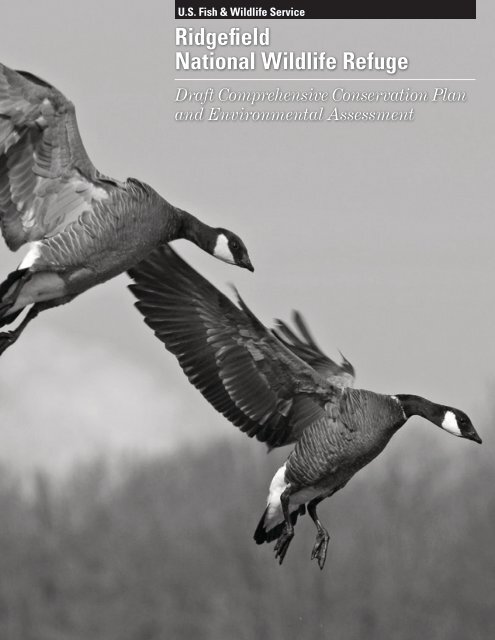
S<strong>and</strong>hill crane<br />
© Roger Windemuth
Ridgefield<br />
National <strong>Wildlife</strong> Refuge<br />
Draft Comprehensive Conservation Plan<br />
<strong>and</strong><br />
Environmental Assessment<br />
Prepared by:<br />
Ridgefield National <strong>Wildlife</strong> Refuge Complex<br />
29808 NW Main Avenue<br />
Ridgefield, Washington 98642<br />
U.S. <strong>Fish</strong> <strong>and</strong> <strong>Wildlife</strong> <strong>Service</strong><br />
Pacific Northwest Planning Team<br />
911 NE 11 th Avenue<br />
Portl<strong>and</strong>, Oregon 97232<br />
May 2010
Ridgefield National <strong>Wildlife</strong> Refuge Draft Comprehensive Conservation Plan <strong>and</strong> Environmental Assessment<br />
Table of Contents<br />
Chapter 1. Introduction <strong>and</strong> Background ............................................................................................ 1-1<br />
1.1 Introduction ......................................................................................................................................... 1-1<br />
1.2 Proposed Action .................................................................................................................................. 1-1<br />
1.3 Purpose <strong>and</strong> Need for the CCP ........................................................................................................... 1-2<br />
1.4 Content <strong>and</strong> Scope of the CCP ............................................................................................................ 1-7<br />
1.5 Refuge Planning <strong>and</strong> Management Guidance ..................................................................................... 1-8<br />
1.5.1 The U.S. <strong>Fish</strong> <strong>and</strong> <strong>Wildlife</strong> <strong>Service</strong> ........................................................................................... 1-8<br />
1.5.2 National <strong>Wildlife</strong> Refuge System .............................................................................................. 1-8<br />
1.5.3 Biological Resource Protection Acts ....................................................................................... 1-12<br />
1.5.4 Historic Preservation Acts ....................................................................................................... 1-13<br />
1.6 Refuge Establishment <strong>and</strong> Refuge Purposes ..................................................................................... 1-14<br />
1.6.1 Refuge Acquisition History <strong>and</strong> Authorities ........................................................................... 1-15<br />
1.6.2 Summary of Purposes <strong>and</strong> Management Direction for the Refuge ......................................... 1-21<br />
1.7 Relationship to Ecosystem Management Goals ................................................................................ 1-22<br />
1.7.1 Regional Setting ...................................................................................................................... 1-22<br />
1.7.2 Regional Conservation Plans ................................................................................................... 1-24<br />
1.7.3 Pacific Flyway Management Plans ......................................................................................... 1-27<br />
1.7.4 Partners in Flight L<strong>and</strong>bird Conservation Plans ...................................................................... 1-30<br />
1.7.5 Recovery Plans ........................................................................................................................ 1-31<br />
1.8 Issues, Concerns <strong>and</strong> Opportunities .................................................................................................. 1-32<br />
1.8.1 Major Issues to be Addressed in the CCP ............................................................................... 1-32<br />
1.8.2 Issues Outside the Scope of the CCP ...................................................................................... 1-33<br />
1.9 Refuge Vision ................................................................................................................................... 1-35<br />
1.10 Refuge Goals ................................................................................................................................... 1-35<br />
1.10.1 <strong>Wildlife</strong> <strong>and</strong> Habitat Goals .................................................................................................... 1-35<br />
1.10.2 Cultural Resources Goal ........................................................................................................ 1-35<br />
1.10.3 Public Use Goals ................................................................................................................... 1-35<br />
1.11 Planning Process ............................................................................................................................. 1-36<br />
1.12 References ....................................................................................................................................... 1-37<br />
Chapter 2. Alternatives, Goals, Objectives, <strong>and</strong> Strategies ................................................................. 2-1<br />
2.1 Consideration in Alternative Designs ................................................................................................. 2-1<br />
2.2 Actions/Alternatives Considered but Not Developed ......................................................................... 2-1<br />
2.3 Alternative Descriptions ..................................................................................................................... 2-3<br />
2.3.1 Features Common to All Alternatives ....................................................................................... 2-3<br />
2.3.2 Alternative Description Summary ............................................................................................. 2-8<br />
2.4 Goals, Objectives, <strong>and</strong> Strategies ...................................................................................................... 2-43<br />
2.4.1 Goal 1: Provide <strong>and</strong> manage a mixture of secure, diverse, productive grassl<strong>and</strong> habitats<br />
for foraging migratory waterfowl <strong>and</strong> grassl<strong>and</strong>-dependent wildlife. ..................................... 2-44<br />
2.4.2 Goal 2: Provide agricultural crops as forage for migratory waterfowl <strong>and</strong> s<strong>and</strong>hill cranes<br />
annually. .................................................................................................................................. 2-50<br />
2.4.3 Goal 3: Provide, manage, <strong>and</strong> enhance a diverse assemblage of wetl<strong>and</strong> habitats<br />
characteristic of the historic lower Columbia River. ............................................................... 2-52<br />
2.4.4 Goal 4: Protect, manage, <strong>and</strong> restore a natural diversity of native floodplain forests<br />
representative of the historic lower Columbia River ecosystem. ............................................ 2-61<br />
Table of Contents i
Ridgefield National <strong>Wildlife</strong> Refuge Draft Comprehensive Conservation Plan <strong>and</strong> Environmental Assessment<br />
2.4.5 Goal 5: Protect, manage, <strong>and</strong> restore a natural diversity of native upl<strong>and</strong> forests<br />
representative of the historic lower Columbia River ecosystem. ............................................ 2-65<br />
2.4.6 Goal 6: Protect, enhance <strong>and</strong> where feasible restore riverine habitat <strong>and</strong> tidal wetl<strong>and</strong>s<br />
representative of the historic lower Columbia River ecosystem, to benefit salmonids <strong>and</strong><br />
other native aquatic species. .................................................................................................... 2-69<br />
2.4.7 Goal 7: Collect scientific information (inventories, monitoring, <strong>and</strong> research) necessary to<br />
support adaptive management decisions on the refuge associated with Goals 1-6. ................ 2-74<br />
2.5 Ridgefield Refuge Cultural Resources Goal <strong>and</strong> Objectives ............................................................. 2-88<br />
2.5.1 Goal 1: The refuge will protect <strong>and</strong> manage its cultural resources for their educational,<br />
scientific, <strong>and</strong> cultural values for the benefit of present <strong>and</strong> future generations of refuge<br />
users <strong>and</strong> communities. ............................................................................................................ 2-88<br />
2.6 Ridgefield Refuge Public Use Goals <strong>and</strong> Objectives ......................................................................... 2-90<br />
2.6.1 Goal 1: Waterfowl hunters of all abilities will enjoy a quality, safe hunting program<br />
that provides a variety of waterfowl hunting experiences, promotes youth hunting,<br />
balances hunt program needs with other public use program needs, <strong>and</strong> reduces impacts to<br />
nontarget species.. .................................................................................................................... 2-90<br />
2.6.2 Goal 2. Visitors of all abilities have the opportunity to participate in safe, quality wildlifedependent<br />
recreation programs, including wildlife observation, photography,<br />
interpretation, <strong>and</strong> fishing, consistent with the needs of other public use programs,<br />
with limited wildlife disturbance ............................................................................................. 2-95<br />
2.6.3 Goal 3: The refuge’s cultural resources <strong>and</strong> the Cathlapotle Plankhouse will be<br />
interpreted to enlighten visitors about the refuge’s unique natural <strong>and</strong> cultural history. ....... 2-105<br />
2.6.4 Goal 4: Through Refuge outreach efforts local residents will have the opportunity to<br />
gain an underst<strong>and</strong>ing of <strong>and</strong> appreciation for the refuge <strong>and</strong> Refuge System mission. ....... 2-108<br />
2.6.5 Goal 5: Students from southwest Washington will participate in quality environmental<br />
education programs on the refuge that meet State educational requirements <strong>and</strong> provide<br />
safe <strong>and</strong> memorable experiences that foster a connection with nature <strong>and</strong> the refuge .......... 2-111<br />
2.7 References ........................................................................................................................................ 2-114<br />
Chapter 3. Physical Environment.......................................................................................................... 3-1<br />
3.1 Climate ................................................................................................................................................ 3-1<br />
3.1.1 Temperature ............................................................................................................................... 3-1<br />
3.1.2 Precipitation ............................................................................................................................... 3-2<br />
3.1.3 Climate Cycles in the Pacific Northwest ................................................................................... 3-2<br />
3.1.4 Floods ........................................................................................................................................ 3-3<br />
3.1.5 Wind <strong>and</strong> Severe Weather Events ............................................................................................. 3-4<br />
3.2 Climate Change ................................................................................................................................... 3-5<br />
3.2.1 Predicted Future Ecological Trends .......................................................................................... 3-5<br />
3.2.2 Detailed Future Climate Change in the Pacific Northwest ........................................................ 3-7<br />
3.2.3 Potential Changes to the Refuge ................................................................................................ 3-8<br />
3.3 Hydrology ........................................................................................................................................... 3-9<br />
3.3.1 Columbia River <strong>and</strong> Changes due to Hydropower Operations ................................................. 3-9<br />
3.3.2 Wetl<strong>and</strong>s Hydrology ................................................................................................................ 3-10<br />
3.3.3 Gee Creek <strong>and</strong> Campbell Slough ............................................................................................ 3-12<br />
3.4 Topography <strong>and</strong> Bathymetry ............................................................................................................ 3-13<br />
3.5 Geology <strong>and</strong> Geomorphology ........................................................................................................... 3-14<br />
3.5.1 Physical Setting ....................................................................................................................... 3-14<br />
3.5.2 Geomorphology ....................................................................................................................... 3-14<br />
3.5.3 Geologic History ..................................................................................................................... 3-15<br />
3.6 Soils .................................................................................................................................................. 3-17<br />
3.7 Environmental Contaminants ............................................................................................................ 3-18<br />
ii Table of Contents
Ridgefield National <strong>Wildlife</strong> Refuge Draft Comprehensive Conservation Plan <strong>and</strong> Environmental Assessment<br />
3.7.1 Air Quality ............................................................................................................................... 3-18<br />
3.7.2 Water Quality <strong>and</strong> Contaminants ............................................................................................ 3-19<br />
3.8 Surrounding L<strong>and</strong> Uses ..................................................................................................................... 3-24<br />
3.9 References ......................................................................................................................................... 3-26<br />
Chapter 4. Refuge Biology <strong>and</strong> Habitat ................................................................................................ 4-1<br />
4.1 Historic <strong>Wildlife</strong> <strong>and</strong> Habitat Conditions <strong>and</strong> Changes Since 1800 ................................................... 4-1<br />
4.1.1 Historic Descriptions of Habitat <strong>and</strong> <strong>Wildlife</strong> ........................................................................... 4-1<br />
4.1.2 Changes to Lower Columbia River <strong>Wildlife</strong> <strong>and</strong> Habitats Since 1850 ..................................... 4-5<br />
4.1.3 History of Refuge Management ................................................................................................ 4-9<br />
4.1.4 Changes in <strong>Wildlife</strong> Populations after Refuge Establishment ................................................. 4-12<br />
4.1.5 Influx of Exotic <strong>and</strong> Invasive Species ..................................................................................... 4-14<br />
4.2 Selection of Priority Resources of Concern ...................................................................................... 4-20<br />
4.2.1 Selection Process ..................................................................................................................... 4-20<br />
4.2.2 Analysis of Priority Resources of Concern ............................................................................. 4-22<br />
4.3 Waterfowl <strong>and</strong> Supporting Habitat-Improved Pasture <strong>and</strong> Cropl<strong>and</strong>s .............................................. 4-23<br />
4.3.1 Description <strong>and</strong> Location ........................................................................................................ 4-23<br />
4.3.2 Condition <strong>and</strong> Trends .............................................................................................................. 4-23<br />
4.3.3 Habitats Utilized ...................................................................................................................... 4-26<br />
4.3.4 Key Ecological Attributes ....................................................................................................... 4-28<br />
4.3.5 Threats ..................................................................................................................................... 4-29<br />
4.4 Native Grassl<strong>and</strong>s ............................................................................................................................. 4-30<br />
4.4.1 Description <strong>and</strong> Location ........................................................................................................ 4-30<br />
4.4.2 Condition <strong>and</strong> Trends .............................................................................................................. 4-30<br />
4.4.3 Associated <strong>Wildlife</strong> ................................................................................................................. 4-31<br />
4.4.4 Key Ecological Attributes ....................................................................................................... 4-32<br />
4.4.5 Threats ..................................................................................................................................... 4-34<br />
4.5 Wetl<strong>and</strong>s <strong>and</strong> Deepwater Habitats .................................................................................................... 4-35<br />
4.5.1 Description <strong>and</strong> Location ........................................................................................................ 4-35<br />
4.5.2 Condition <strong>and</strong> Trends .............................................................................................................. 4-39<br />
4.5.3 Associated <strong>Wildlife</strong> ................................................................................................................. 4-42<br />
4.5.4 Key Ecological Attributes ....................................................................................................... 4-43<br />
4.5.5 Threats ..................................................................................................................................... 4-46<br />
4.6 Riparian <strong>and</strong> Floodplain Forests ....................................................................................................... 4-46<br />
4.6.1 Description <strong>and</strong> Location ........................................................................................................ 4-46<br />
4.6.2 Condition <strong>and</strong> Trends .............................................................................................................. 4-47<br />
4.6.3 Associated <strong>Wildlife</strong> ................................................................................................................. 4-48<br />
4.6.4 Key Ecological Attributes ....................................................................................................... 4-50<br />
4.6.5 Threats ..................................................................................................................................... 4-52<br />
4.7 Oregon White Oak Woodl<strong>and</strong>s, Upl<strong>and</strong> Mixed Woodl<strong>and</strong>s ............................................................. 4-53<br />
4.7.1 Description <strong>and</strong> Location ........................................................................................................ 4-53<br />
4.7.2 Condition <strong>and</strong> Trends .............................................................................................................. 4-54<br />
4.7.3 Associated <strong>Wildlife</strong> ................................................................................................................. 4-55<br />
4.7.4 Key Ecological Attributes ....................................................................................................... 4-55<br />
4.7.5 Threats ..................................................................................................................................... 4-57<br />
4.8 Instream Habitat ................................................................................................................................ 4-58<br />
4.8.1 Description <strong>and</strong> Location ........................................................................................................ 4-58<br />
4.8.2 Condition <strong>and</strong> Trends .............................................................................................................. 4-58<br />
4.8.3 Associated <strong>Wildlife</strong> ................................................................................................................. 4-59<br />
4.8.4 Key Ecological Attributes ....................................................................................................... 4-60<br />
4.8.5 Threats ..................................................................................................................................... 4-61<br />
Table of Contents iii
Ridgefield National <strong>Wildlife</strong> Refuge Draft Comprehensive Conservation Plan <strong>and</strong> Environmental Assessment<br />
4.9 Threatened, Endangered, <strong>and</strong> Sensitive Species ............................................................................... 4-62<br />
4.9.1 State or Federally Listed Species Known to Occur on the Refuge .......................................... 4-62<br />
4.9.2 Condition <strong>and</strong> Trends of Washington State <strong>and</strong> Federally Listed Species <strong>and</strong><br />
Habitats Utilized on the Refuge ............................................................................................... 4-66<br />
4.9.3 Condition <strong>and</strong> Trends of Sensitive Species <strong>and</strong> Habitats Utilized on the Refuge ................... 4-71<br />
4.9.4 Key Ecological Attributes <strong>and</strong> Threats .................................................................................... 4-72<br />
4.10 <strong>Wildlife</strong> <strong>and</strong> Habitat Research <strong>and</strong> Monitoring Efforts .................................................................. 4-73<br />
4.10.1 Waterfowl Surveys ................................................................................................................ 4-73<br />
4.10.2 Surveys for Listed Species <strong>and</strong> Other Species of Management Concern .............................. 4-74<br />
4.10.3 Habitat <strong>and</strong> Vegetation Inventories, Surveys, <strong>and</strong> Monitoring ............................................. 4-74<br />
4.10.4 Habitat Restoration <strong>and</strong> Monitoring (Multi-agency coordination projects) .......................... 4-75<br />
4.10.5 Invasive Species Monitoring <strong>and</strong> Studies of Control Techniques ......................................... 4-75<br />
4.10.6 Baseline Inventories of Major <strong>Fish</strong> <strong>and</strong> <strong>Wildlife</strong> Groups ...................................................... 4-76<br />
4.10.7 Experimental Reintroductions ............................................................................................... 4-76<br />
4.10.8 Other Research Projects ........................................................................................................ 4-77<br />
4.10.9 Contaminants Studies ............................................................................................................ 4-77<br />
4.10.10 Other Monitoring ................................................................................................................. 4-79<br />
4.10.11 References ........................................................................................................................... 4-79<br />
Chapter 5. Refuge Facilities <strong>and</strong> Public Use Programs ....................................................................... 5-1<br />
5.1 Infrastructure <strong>and</strong> Administrative Facilities ....................................................................................... 5-1<br />
5.1.1 Boundary Fences <strong>and</strong> Markers ......................................................................................................... 5-1<br />
5.2 Recreation Overview .......................................................................................................................... 5-6<br />
5.2.1 Open <strong>and</strong> Closed Areas ............................................................................................................. 5-6<br />
5.2.2 Annual Recreation Visitors ....................................................................................................... 5-6<br />
5.2.3 Annual Recreation Visits ........................................................................................................... 5-7<br />
5.2.4 Recreation <strong>and</strong> Entrance Fee Program ...................................................................................... 5-8<br />
5.2.5 Accessibility of Recreation Sites <strong>and</strong> Programs for People with Disabilities ........................... 5-9<br />
5.2.6 Law Enforcement ...................................................................................................................... 5-9<br />
5.3 Waterfowl Hunting ........................................................................................................................... 5-10<br />
5.4 <strong>Fish</strong>ing .............................................................................................................................................. 5-21<br />
5.4.1 Number of Visits ..................................................................................................................... 5-21<br />
5.4.2 Facilities .................................................................................................................................. 5-22<br />
5.5 <strong>Wildlife</strong> Viewing <strong>and</strong> Photography .................................................................................................. 5-22<br />
5.5.1 Number of Visits ..................................................................................................................... 5-22<br />
5.5.2 Facilities .................................................................................................................................. 5-22<br />
5.6 Environmental Education .................................................................................................................. 5-23<br />
5.6.1 Number of Visitors .................................................................................................................. 5-23<br />
5.6.2 Facilities .................................................................................................................................. 5-23<br />
5.6.3 Environmental Education Program Details ............................................................................. 5-23<br />
5.7 Interpretation/Outreach ..................................................................................................................... 5-24<br />
5.8 Cultural Resources Interpretation ..................................................................................................... 5-24<br />
5.9 Nonwildlife-Dependent Recreation .................................................................................................. 5-25<br />
5.9.1 Recreational Boating <strong>and</strong> Waterskiing .......................................................................................... 5-25<br />
5.9.2 Camping, Beach Use, <strong>and</strong> Swimming ..................................................................................... 5-25<br />
5.9.3 Horseback Riding, Bicycling, Jogging, <strong>and</strong> Dog Walking. ..................................................... 5-26<br />
5.10 Illegal Uses ...................................................................................................................................... 5-26<br />
5.11 Area Outdoor Recreational Opportunities <strong>and</strong> Trends .................................................................... 5-26<br />
5.11.1 Nearby Recreational Opportunities ....................................................................................... 5-26<br />
5.11.2 Outdoor Recreation Rates <strong>and</strong> Trends ................................................................................... 5-26<br />
5.12 References ....................................................................................................................................... 5-29<br />
iv Table of Contents
Ridgefield National <strong>Wildlife</strong> Refuge Draft Comprehensive Conservation Plan <strong>and</strong> Environmental Assessment<br />
Chapter 6. Special Designation L<strong>and</strong>s, Cultural Resources, <strong>and</strong> Social/Economic Environment .. 6-1<br />
6.1 Special Designation L<strong>and</strong>s .................................................................................................................. 6-1<br />
6.1.1 National Register of Historic Places .......................................................................................... 6-1<br />
6.1.2 Important Bird Areas (IBA) ...................................................................................................... 6-1<br />
6.1.3 Research Natural Area ............................................................................................................... 6-2<br />
6.2 Archaeological <strong>and</strong> Cultural Resources .............................................................................................. 6-3<br />
6.2.1 Pre-recorded History ................................................................................................................. 6-4<br />
6.2.2 Pre-contact Native American Traditions ................................................................................... 6-5<br />
6.2.3 Post-Contact Traditions ............................................................................................................. 6-6<br />
6.2.4 Recent Settlement <strong>and</strong> Economic Development Period .......................................................... 6-13<br />
6.3 Social/Economic Environment ......................................................................................................... 6-20<br />
6.3.1 Population, Housing, <strong>and</strong> Income ........................................................................................... 6-20<br />
6.3.2 Employment <strong>and</strong> Business ...................................................................................................... 6-22<br />
6.3.3 Refuge Impact on Local Economies ........................................................................................ 6-25<br />
6.4 References ......................................................................................................................................... 6-26<br />
Chapter 7. Environmental Effects ......................................................................................................... 7-1<br />
7.1 Summary of Effects ............................................................................................................................ 7-1<br />
..... 7.1.1 Effects to Waterfowl <strong>and</strong> Some Other Migratory Birds ............................................................ 7-7<br />
..... 7.1.2 Effects to Other Species (nesting great blue herons, shorebirds, marshbirds, songbirds) ....... 7-12<br />
..... 7.1.3 Effects to Federal <strong>and</strong> State Listed Species ............................................................................. 7-14<br />
..... 7.1.4 Effects to Grassl<strong>and</strong> <strong>and</strong> Pasture Habitats <strong>and</strong> Associated <strong>Wildlife</strong> ....................................... 7-17<br />
..... 7.1.5 Effects to Wetl<strong>and</strong> Habitats <strong>and</strong> Associated <strong>Wildlife</strong> ............................................................. 7-19<br />
..... 7.1.6 Effects to Floodplain Forests <strong>and</strong> Associated <strong>Wildlife</strong> ........................................................... 7-25<br />
..... 7.1.7 Effects to Oak Woodl<strong>and</strong>, Mixed Forests, <strong>and</strong> Associated <strong>Wildlife</strong> ....................................... 7-26<br />
..... 7.1.8 Effects to Riverine Habitats <strong>and</strong> Tidal Wetl<strong>and</strong>s, <strong>and</strong> Associated <strong>Wildlife</strong> ............................ 7-27<br />
7.2 Effects to the Physical Environment ................................................................................................. 7-27<br />
..... 7.2.1 Effects to Hydrology ............................................................................................................... 7-27<br />
..... 7.2.2 Effects to Water Quality .......................................................................................................... 7-27<br />
..... 7.2.3 Effects to Air Quality .............................................................................................................. 7-29<br />
..... 7.2.4 Effects to Visual Quality ......................................................................................................... 7-30<br />
7.3 Social Effects .................................................................................................................................... 7-31<br />
..... 7.3.1 Projected User Numbers in 15 Years ...................................................................................... 7-31<br />
..... 7.3.2 Opportunities for Quality <strong>Wildlife</strong> Observation <strong>and</strong> Photography .......................................... 7-33<br />
..... 7.3.3 Opportunities for Quality Hunting .......................................................................................... 7-36<br />
..... 7.3.4 Opportunities for Quality <strong>Fish</strong>ing ........................................................................................... 7-39<br />
..... 7.3.5 Opportunities for Quality Environmental Education ............................................................... 7-40<br />
..... 7.3.6 Opportunities for Quality Interpretation .................................................................................. 7-40<br />
..... 7.3.7 Opportunities for Nonwildlife-Dependent Recreation ............................................................ 7-40<br />
..... 7.3.8 Amount of Illegal Use ............................................................................................................. 7-41<br />
..... 7.3.9 Environmental Justice ............................................................................................................. 7-41<br />
7.4 Economic Effects .............................................................................................................................. 7-42<br />
7.5 Effects to Cultural <strong>and</strong> Historical Resources .................................................................................... 7-43<br />
7.6 Other Effects ..................................................................................................................................... 7-46<br />
..... 7.6.1 Potential Impacts on Adjacent L<strong>and</strong>s <strong>and</strong> their Associated Natural Resources ...................... 7-46<br />
..... 7.6.2 Potential Impacts to Nearby Residents .................................................................................... 7-46<br />
7.7 Cumulative Effects ............................................................................................................................ 7-47<br />
7.8 References ......................................................................................................................................... 7-48<br />
Table of Contents v
Ridgefield National <strong>Wildlife</strong> Refuge Draft Comprehensive Conservation Plan <strong>and</strong> Environmental Assessment<br />
Maps<br />
Map 1. Location map for refuges of the Ridgefield National <strong>Wildlife</strong> Refuge Complex. ......................... 1-3<br />
Map 2. Ridgefield National <strong>Wildlife</strong> Refuge <strong>and</strong> vicinity. ........................................................................ 1-5<br />
Map 3. Refuge Tracts ............................................................................................................................... 1-17<br />
Map 4. Alternative 1 Current Management Wetl<strong>and</strong>s <strong>and</strong> Habitat for the River ‘S’ Unit ...................... 2-13<br />
Map 5. Alternatives 2-4 Future Management Wetl<strong>and</strong>s <strong>and</strong> Habitat for the River ‘S’ Unit ................... 2-15<br />
Map 6. Alternative 1 Current Management Wetl<strong>and</strong>s <strong>and</strong> Habitat for the Bachelor Unit ....................... 2-17<br />
Map 7. Alternatives 2-4 Future Management Wetl<strong>and</strong>s <strong>and</strong> Habitat for the Bachelor Unit .................... 2-19<br />
Map 8. Alternative 1 Current Management Wetl<strong>and</strong>s <strong>and</strong> Habitat for the Carty Unit ............................ 2-21<br />
Map 9. Alternatives 2-4 Future Management Wetl<strong>and</strong>s <strong>and</strong> Habitat for the Carty Unit ......................... 2-23<br />
Map 10. Alternative 1 Current Management Wetl<strong>and</strong>s <strong>and</strong> Habitat for the Roth <strong>and</strong> Ridgeport<br />
Dairy Units ................................................................................................................................ 2-25<br />
Map 11. Alternatives 2-4 Future Management Wetl<strong>and</strong>s <strong>and</strong> Habitat for the Roth <strong>and</strong> Ridgeport<br />
Dairy Units ................................................................................................................................ 2-27<br />
Map 12. Alternative 1 Current Management Public Use for the River ‘S’ Unit ...................................... 2-29<br />
Map 13. Alternative 2 Preferred Alternative Public Use for the River ‘S’ Unit ...................................... 2-31<br />
Map 14. Alternative 3 Public Use for the River ‘S’ Unit ......................................................................... 2-33<br />
Map 15. Alternative 4 Public Use for the River ‘S’ Unit ......................................................................... 2-35<br />
Map 16. Current Public Use Facilities, Access, <strong>and</strong> Regulations ........................................................... 5-11<br />
Tables<br />
Table 1.1 L<strong>and</strong> purchases <strong>and</strong> purchase authorities for Ridgefield Refuge ............................................ 1-19<br />
Table 1.2 Protected Bottoml<strong>and</strong> Habitat in the Portl<strong>and</strong> Basin (Oregon <strong>and</strong> Washington) Area ........... 1-23<br />
Table 2.1 Summary of CCP Actions, By Alternative ............................................................................. 2-37<br />
Table 3.1 Projected Changes in the Pacific Northwest Climate (Data from CIG 2008) ........................... 3-8<br />
Table 4.1 Priority Resources of Concern for the CCP ............................................................................ 4-20<br />
Table 4.2 Habitat Attributes, Indicators, <strong>and</strong> Condition Parameters for Waterfowl* ............................. 4-28<br />
Table 4.3 Habitat Attributes, Indicators, <strong>and</strong> Condition Parameters for Improved Pasture. ................... 4-29<br />
Table 4.4a Upl<strong>and</strong> (Dry) Prairie Ecological Attributes, Indicators, <strong>and</strong> Condition Parameters ............. 4-32<br />
Table 4.4b Bottoml<strong>and</strong> (Wet) Prairie Ecological Attributes, Indicators, <strong>and</strong> Condition Parameters ..... 4-33<br />
Table 4.5 Old Field Ecological Attributes, Indicators, <strong>and</strong> Condition Parameters ................................. 4-34<br />
Table 4.6a Wetl<strong>and</strong> Ecological Attributes, Indicators, <strong>and</strong> Condition Parameters ................................. 4-43<br />
Table 4.6b Ecological Attributes, Indicators, <strong>and</strong> Condition Parameters for Ephemeral Ponds ............ 4-45<br />
Table 4.7 Focal Species for Riparian Woodl<strong>and</strong> <strong>and</strong> Shrub Habitat in Western Oregon <strong>and</strong><br />
Washington ........................................................................................................................... 4-48<br />
Table 4.8 Mean annual capture rates of target l<strong>and</strong>bird species at Bachelor Point MAPS Station,<br />
1993-2003. ............................................................................................................................ 4-49<br />
Table 4.9 Early Successional Floodplain Forest Ecological Attributes, Indicators, <strong>and</strong> Condition<br />
Parameters ............................................................................................................................ 4-50<br />
Table 4.10 Mid-late Successional Floodplain Forest Ecological Attributes, Indicators, <strong>and</strong><br />
Condition Parameters ........................................................................................................... 4-51<br />
Table 4.11 Oregon Ash Floodplain Forest Ecological Attributes, Indicators, <strong>and</strong> Condition<br />
Parameters ............................................................................................................................ 4-52<br />
Table 4.12 Oregon White Oak Woodl<strong>and</strong> Ecological Attributes, Indicators, <strong>and</strong> Condition<br />
Parameters ............................................................................................................................ 4-55<br />
Table 4.13 Upl<strong>and</strong> Mixed Forest Ecological Attributes, Indicators, <strong>and</strong> Condition Parameters. ........... 4-56<br />
Table 4.14 Instream Ecological Attributes, Indicators, <strong>and</strong> Condition Parameters ................................ 4-60<br />
Table 4.15 Special Status Bird Species Known to Occur or Likely to Have Occurred on the Refuge<br />
Historically ........................................................................................................................... 4-62<br />
vi Table of Contents
Ridgefield National <strong>Wildlife</strong> Refuge Draft Comprehensive Conservation Plan <strong>and</strong> Environmental Assessment<br />
Table 4.16 Special Status Mammals Known or Likely to have Occurred on the Refuge Historically ... 4-63<br />
Table 4.17 Special Status Reptiles <strong>and</strong> Amphibians Known to Occur or Likely to Have Occurred<br />
on the Refuge Historically .................................................................................................... 4-64<br />
Table 4.18 Special Status <strong>Fish</strong>es Occurring on the Refuge <strong>and</strong> in Surrounding Waters ........................ 4-64<br />
Table 4.19 Special Status Plants Known to Occur or Likely to have Occurred on the Refuge<br />
Historically ........................................................................................................................... 4-65<br />
Table 4.20 Ecological Attributes, Indicators, <strong>and</strong> Condition Parameters for Great Blue Heron<br />
Nesting Colonies <strong>and</strong> Associated Foraging Areas ............................................................... 4-72<br />
Table 5.1 Participation Frequency for Selected Outdoor Recreational Activities in Washington .......... 5-27<br />
Table 5.2 Projected Future Changes in Participation for Selected Outdoor Recreation Activities ......... 5-29<br />
Table 6.1 Significant Concentrations of Birds Noted to Identify the Ridgefield Refuge as a<br />
Washington State Important Bird Area .................................................................................. 6-2<br />
Table 6.2 Tribal Affiliations With L<strong>and</strong>s Now Part of Ridgefield Refuge ............................................. 6-13<br />
Table 6.3 Selected Population <strong>and</strong> Associated Social Statistics, Local Counties ................................... 6-21<br />
Table 6.4 Clark County Business Statistics ............................................................................................ 6-23<br />
Table 6.5 Clark County Output, Employment, Labor Income, <strong>and</strong> Other Value Added, 2004 .............. 6-23<br />
Table 6.6 Ridgefield Refuge Visitor Recreation-related Expenditures (2004) ....................................... 6-26<br />
Table 6.7 Ridgefield Refuge Economic Effects Associated with Visitation .......................................... 6-26<br />
Table 7.1 Summary of Effects under CCP Alternatives ........................................................................... 7-1<br />
Table 7.2 Waterfowl harvest <strong>and</strong> population at flyway, state, <strong>and</strong> local scales* .................................... 7-11<br />
Table 7.3 Area potentially subject to annual herbicide or pesticide use ................................................. 7-28<br />
Table 7.4 Ridgefield Refuge’s Projected Annual Visitation in 15 Years, by Alternative ...................... 7-33<br />
Table 7.5 Comparison of activities most likely to affect cultural/historic resources. ............................. 7-44<br />
Figures<br />
Figure 5.1 Average annual visitation to Ridgefield Refuge, 1965-2007 .................................................. 5-7<br />
Figure 5.2 Recreational visits to Ridgefield Refuge in fiscal year 2007, by type of visit......................... 5-8<br />
Figure 5.3 Annual number of hunter visits to the refuge, 1965-2007. .................................................... 5-14<br />
Figure 5.4 Annual harvest of birds per hunter at Ridgefield Refuge, 1965-2007. .................................. 5-16<br />
Figure 5.5 Annual number of ducks harvested at the Ridgefield Refuge, 1965-2007. ........................... 5-16<br />
Figure 5.6 Species composition of ducks harvested at Ridgefield Refuge, 1966-2007. ......................... 5-17<br />
Figure 5.7 Annual number of geese harvested at Ridgefield Refuge, 1966-2007. ................................ 5-18<br />
Figure 5.8 Subspecies composition of Canada geese harvested on Ridgefield Refuge, 1966-2007. ...... 5-19<br />
Figure 6.1 William Clark’s map of the “Wapato Valley,” including the site of the<br />
“Quathlapotle nation” ............................................................................................................ 6-10<br />
Figure 6.2 Haying on the John Burrow Ranch on Bachelor Isl<strong>and</strong>, 1912 ............................................... 6-17<br />
Figure 6.3 Farm house built by Simeon Reed <strong>and</strong> William Ladd on Bachelor Isl<strong>and</strong> in the 1870s ....... 6-18<br />
Appendices<br />
Appendix A: Appropriate Uses Determinations ....................................................................................................... A-1<br />
Appendix B: Compatibility Determinations ............................................................................................................. B-1<br />
Appendix C: Birds, Mammals, Reptiles, Amphibians, <strong>and</strong> Plants ........................................................................... C-1<br />
Appendix D: Implementation ................................................................................................................................... D-1<br />
Appendix E: Wilderness Review ............................................................................................................................. E-1<br />
Appendix F: Potential <strong>and</strong> Priority Resources of Concern ....................................................................................... F-1<br />
Appendix G: Compliance ......................................................................................................................................... G-1<br />
Appendix H: Glossary .............................................................................................................................................. H-1<br />
Appendix I: CCP Team Members ............................................................................................................................. I-1<br />
Appendix J: Public Involvement ............................................................................................................................... J-1<br />
Appendix K: IPM Plan ............................................................................................................................................. K-1<br />
Table of Contents vii
Ridgefield National <strong>Wildlife</strong> Refuge Draft Comprehensive Conservation Plan <strong>and</strong> Environmental Assessment<br />
Appendix L: Federal Highways Transportation Access Analysis ............................................................................ L-1<br />
Appendix M: L<strong>and</strong> Protection Plan ......................................................................................................................... M-1<br />
viii Table of Contents
Chapter 1. Introduction <strong>and</strong> Background<br />
Above: Pied-billed grebe/Jim Cruce<br />
Right: An old Oregon white oak on<br />
the Carty Unit/USFWS<br />
A dusky Canada goose spreads its wings/Roger Windemuth
Ridgefield National <strong>Wildlife</strong> Refuge Draft Comprehensive Conservation Plan <strong>and</strong> Environmental Assessment<br />
Chapter 1. Introduction <strong>and</strong> Background<br />
1.1 Introduction<br />
The fertile bottoml<strong>and</strong>s of the lower Columbia River have long been vital to both wildlife <strong>and</strong><br />
people. Over the millennia, the river’s floodwaters altered the l<strong>and</strong>scape by braiding new channels,<br />
refreshing marshes, <strong>and</strong> depositing sediments which created a mosaic of bottoml<strong>and</strong> forests,<br />
meadows, <strong>and</strong> marshes, teeming with a rich diversity of fish <strong>and</strong> wildlife. Native people chose this<br />
strategic place to sustain a thriving population <strong>and</strong> trade goods among Indian tribes along the river.<br />
The wealth <strong>and</strong> prosperity resulting from these abundant natural resources were represented in their<br />
magnificent cedar plank houses <strong>and</strong> canoes. When the Lewis <strong>and</strong> Clark expedition visited the town<br />
of the Cathlapotle nation in 1805 <strong>and</strong> 1806, they noted this prosperity, as well as the abundant<br />
wildlife in the lower reaches of the Columbia River (Moulton 1990, 1991).<br />
The Corps of Discovery’s reports of the West’s vast natural resources brought new immigrants to the<br />
l<strong>and</strong>. The fertile river bottoms were sought out for agricultural uses to feed the burgeoning<br />
population. The cities of Portl<strong>and</strong> <strong>and</strong> Vancouver grew at the confluence of the Columbia <strong>and</strong><br />
Willamette rivers. Dams <strong>and</strong> dikes provided power <strong>and</strong> controlled floods, driving the development<br />
of agriculture <strong>and</strong> industry, but also removing the influence of the river from certain habitats. Today,<br />
only remnants remain of the diverse floodplain habitats that once covered the bottoml<strong>and</strong>s of the<br />
lower Columbia River.<br />
Today, the Ridgefield National <strong>Wildlife</strong> Refuge (refuge) preserves both habitat for wildlife, <strong>and</strong><br />
evidence of the people who once lived here. This isl<strong>and</strong> of habitat with its rich diversity of<br />
floodplain forests, freshwater marshes, <strong>and</strong> meadows, continues to sustain thriving populations of<br />
wintering dusky Canada geese, migrating waterfowl, <strong>and</strong> other wildlife. The refuge also preserves<br />
the most intact archaeological site on the lower Columbia River, <strong>and</strong> evidence of at least 2,300 years<br />
of continuous human occupation. The refuge is a place where people can share a bond with nature,<br />
<strong>and</strong> each other, by passing on outdoor traditions to new generations. As the population of the region<br />
increases, the refuge will become even more important to wildlife <strong>and</strong> those seeking to connect with<br />
nature.<br />
The Ridgefield Refuge’s boundary encompasses 6,170 acres of Columbia River bottoml<strong>and</strong>s <strong>and</strong><br />
upl<strong>and</strong>s in Clark County, Washington (see maps 1 <strong>and</strong> 2). Of that, the refuge manages 5,217.7 acres,<br />
owned in fee title, or managed per agreements or leases. The refuge was established in 1965 for the<br />
conservation of dusky Canada geese <strong>and</strong> other waterfowl. It contains over 5,000 acres of pastures,<br />
wetl<strong>and</strong>s, riparian <strong>and</strong> bottoml<strong>and</strong> forest, <strong>and</strong> oak woodl<strong>and</strong>s. Ridgefield Refuge is part of the<br />
Ridgefield National <strong>Wildlife</strong> Refuge Complex, which also includes Steigerwald Lake, Pierce, <strong>and</strong><br />
Franz Lake National <strong>Wildlife</strong> Refuges.<br />
1.2 Proposed Action<br />
We, the U.S. <strong>Fish</strong> <strong>and</strong> <strong>Wildlife</strong> <strong>Service</strong> (<strong>Service</strong>), manage the Ridgefield Refuge as part of the<br />
National <strong>Wildlife</strong> Refuge System. We propose to adopt <strong>and</strong> implement a Comprehensive<br />
Conservation Plan (CCP) for the refuge. This document is the refuge’s Draft Comprehensive<br />
Conservation Plan <strong>and</strong> Environmental Assessment (Draft CCP/EA). A CCP sets forth management<br />
Chapter 1. Introduction <strong>and</strong> Background 1-1
Ridgefield National <strong>Wildlife</strong> Refuge Draft Comprehensive Conservation Plan <strong>and</strong> Environmental Assessment<br />
guidance for a refuge for a period of 15 years, as required by the National <strong>Wildlife</strong> Refuge System<br />
Administration Act (16 U.S.C. 668dd et seq.) as amended by the National <strong>Wildlife</strong> Refuge System<br />
Improvement Act of 1997 (Public Law 105-57). The Administration Act requires CCPs to identify<br />
<strong>and</strong> describe:<br />
� The purposes of the refuge;<br />
� The fish, wildlife <strong>and</strong> plant populations, their habitats, <strong>and</strong> the archaeological <strong>and</strong> cultural<br />
values found on the refuge;<br />
� Significant problems that may adversely affect wildlife populations <strong>and</strong> habitats <strong>and</strong> ways to<br />
correct or mitigate those problems;<br />
� Areas suitable for administrative sites or visitor facilities; <strong>and</strong><br />
� Opportunities for fish <strong>and</strong> wildlife dependent recreation.<br />
National <strong>Wildlife</strong> Refuge System (Refuge System) planning policy (<strong>Service</strong> Manual Part 602, 602<br />
FW3, June 21, 2000) states that the purpose of CCPs is to: “describe the desired future conditions of<br />
a refuge <strong>and</strong> provide long-range guidance <strong>and</strong> management direction to achieve refuge purposes;<br />
help fulfill the National <strong>Wildlife</strong> Refuge System mission; maintain <strong>and</strong>, where appropriate, restore<br />
the ecological integrity of each refuge <strong>and</strong> the Refuge System; . . . <strong>and</strong> meet other m<strong>and</strong>ates.”<br />
The <strong>Service</strong> has developed <strong>and</strong> examined alternatives for future management of Ridgefield Refuge<br />
through the CCP process. The various alternatives address the major issues <strong>and</strong> relevant m<strong>and</strong>ates<br />
identified during the process <strong>and</strong> are consistent with the principles of sound fish <strong>and</strong> wildlife<br />
management. We evaluated four alternatives for the refuge’s Draft CCP/EA <strong>and</strong> selected Alternative<br />
2 as the preferred alternative.<br />
The draft preferred alternative represents the most balanced approach for: Achieving the refuge’s<br />
purposes, vision, <strong>and</strong> goals; contributing to the Refuge System’s mission; addressing relevant issues<br />
<strong>and</strong> m<strong>and</strong>ates; <strong>and</strong> managing the refuge consistent with the sound principles of fish <strong>and</strong> wildlife<br />
management. However, the draft preferred alternative may be modified between the draft <strong>and</strong> final<br />
documents depending upon comments received from the public or other agencies <strong>and</strong> organizations.<br />
The <strong>Service</strong>’s Regional Director for the Pacific Region will decide which alternative will be<br />
implemented. For details on the specific components <strong>and</strong> actions comprising the range of<br />
alternatives, see Chapter 2.<br />
1.3 Purpose <strong>and</strong> Need for the CCP<br />
The purpose of the CCP is to provide the <strong>Service</strong>, the Refuge System, partners, <strong>and</strong> the public with a<br />
15-year management plan for improving the refuge’s habitat conditions <strong>and</strong> infrastructure, for fish,<br />
wildlife, <strong>and</strong> public use. An approved CCP will ensure that the <strong>Service</strong> manages the refuge to<br />
achieve its purposes, vision, goals, <strong>and</strong> objectives; <strong>and</strong> help fulfill the mission of the Refuge System.<br />
The CCP will provide reasonable, scientifically grounded guidance for the long-term conservation of<br />
native plants <strong>and</strong> animals, with emphasis on migratory birds <strong>and</strong> improving the refuge’s grassl<strong>and</strong>,<br />
wetl<strong>and</strong>, riparian, <strong>and</strong> woodl<strong>and</strong> habitats. The CCP will identify appropriate actions for protecting<br />
<strong>and</strong> sustaining the cultural <strong>and</strong> biological features of the refuge; its wintering waterfowl populations<br />
<strong>and</strong> habitats; the migratory l<strong>and</strong>bird <strong>and</strong> waterbird populations that use the refuge; <strong>and</strong> threatened,<br />
endangered, or rare species. A final purpose of the CCP is to provide guidance <strong>and</strong> evaluate the<br />
priority public use programs on the refuge, including hunting, fishing, wildlife observation,<br />
photography, environmental education <strong>and</strong> interpretation.<br />
1-2 Chapter 1. Introduction <strong>and</strong> Background
Map 1 Regional Context<br />
P a c i f i c O c e a n<br />
FLATTERY<br />
ROCKS<br />
NWR<br />
QUILLAYUTE<br />
NEEDLES<br />
NWR<br />
COPALIS<br />
NWR<br />
GRAYS<br />
HARBOR<br />
NWR<br />
WILLAPA<br />
NWR<br />
RIDGEFIELD<br />
NWR<br />
CAPE MEARES<br />
NWR<br />
THREE ARCH<br />
ROCKS NWR<br />
NESTUCCA<br />
BAY NWR<br />
SILETZ BAY<br />
NWR<br />
BANDON<br />
MARSH<br />
NWR<br />
OREGON<br />
ISLANDS<br />
NWR<br />
SAN JUAN<br />
ISLANDS<br />
NWR<br />
0 Miles<br />
100<br />
0 100<br />
Kilometers<br />
DUNGENESS<br />
NWR<br />
Olympia<br />
Salem<br />
Eugene<br />
PROTECTION<br />
ISLAND<br />
NWR<br />
Seattle<br />
Tacoma<br />
NISQUALLY<br />
NWR<br />
JULIA BUTLER HANSEN<br />
REFUGE FOR THE COLUMBIAN<br />
WHITE-TAILED DEER §¨¦<br />
LEWIS AND CLARK NWR<br />
82<br />
TUALATIN<br />
RIVER<br />
NWR<br />
§¨¦ 5<br />
§¨¦ 5<br />
§¨¦ 90<br />
Portl<strong>and</strong><br />
FRANZ LAKE NWR<br />
PIERCE NWR<br />
STEIGERWALD LAKE NWR<br />
BASKETT SLOUGH NWR<br />
ANKENY NWR<br />
C A L I F O R N I A<br />
W A S H I N G T O N<br />
WILLIAM L. FINLEY NWR<br />
O R E G O N<br />
Pacific<br />
Flyway<br />
Area<br />
Enlarged<br />
Legend<br />
Data Sources: Highways, State <strong>and</strong> Country Boundaries from ESRI; Cities from USGS; USFWS Ecoregions <strong>and</strong> Refuge Boundaries from USFWS/R1<br />
File: 10-035-11<br />
§¨¦ 90<br />
§¨¦ 84<br />
National <strong>Wildlife</strong> Refuge<br />
I D A H O<br />
North Pacific Coast Ecoregion UTM ZONE 10N<br />
NAD 83<br />
_____________________________________________________________________________________________<br />
Chapter 1. Introduction <strong>and</strong> Background<br />
1-3
Ridgefield National <strong>Wildlife</strong> Refuge Draft Comprehensive Conservation Plan <strong>and</strong> Environmental Assessment<br />
To preserve the quality of our map, this side was left blank intentionally.<br />
1-4 Chapter 1. Introduction <strong>and</strong> Background
45°50'0"N<br />
45°45'0"N<br />
1-5<br />
Map 2 Ridgefield National <strong>Wildlife</strong> Refuge <strong>and</strong> Vicinity<br />
Legend<br />
"@<br />
St. Helens<br />
(OR)<br />
T 4 N<br />
T 3 N<br />
FWS Approved Acquisition Boundary<br />
L<strong>and</strong>s Not Managed by FWS<br />
Refuge Headquarters<br />
Produced in the D ivision of R ealty & R efuge Inform ation<br />
Portl<strong>and</strong>, O regon<br />
Data C urrent to: 03/09/09<br />
M ap D ate: 03/18/10<br />
Basem ap: 2006 N AIP<br />
M eridian: W ILLA M E TTE<br />
File: 10-035-9.M XD<br />
R i v e r<br />
S a u v i e<br />
I s l a n d<br />
( O R )<br />
Tur tle Lake<br />
Canvasback<br />
Lake<br />
G ee<br />
Fowler<br />
Lake<br />
Wigeon<br />
Lake<br />
Bachelor<br />
Isl<strong>and</strong><br />
Unit<br />
L ew is Ri ver<br />
Creek<br />
B a c h e l o r I s l a n d<br />
i a<br />
Bo we r<br />
C o l u m b<br />
S l o u g h<br />
Campbell<br />
Post<br />
Office<br />
Lake<br />
Slough<br />
Auto Tour<br />
1:42,000<br />
Carty<br />
Unit<br />
Carty Lake<br />
River S<br />
Unit<br />
S lo ugh<br />
Roth<br />
Unit<br />
122°45'0"W<br />
Route<br />
Rest Lake<br />
Campbell Lake<br />
Ridgeport<br />
Dairy<br />
Unit<br />
"@<br />
N. Main Ave.<br />
L a ke R i v e r<br />
122°45'0"W<br />
R 1 W R 1 E<br />
Ridgefield<br />
(WA)<br />
Green<br />
Lake<br />
R 1 W R 1 E<br />
0 0.5<br />
1 2<br />
M iles<br />
Kilometers<br />
0 1<br />
2<br />
River S<br />
Entrance<br />
SR 501 - Pioneer Street<br />
S. Hill h urst Road<br />
T 4 N<br />
T 3 N<br />
UT M ZO N E 10<br />
NA D 83<br />
45°50'0"N<br />
45°45'0"N
Ridgefield National <strong>Wildlife</strong> Refuge Draft Comprehensive Conservation Plan <strong>and</strong> Environmental Assessment<br />
The CCP is needed for a variety of reasons. Primary among these is the need to provide migration<br />
<strong>and</strong> wintering habitat for dusky Canada geese <strong>and</strong> other waterfowl in the lower Columbia River<br />
region. There is a need to improve habitat conditions on the refuge’s grassl<strong>and</strong>, wetl<strong>and</strong>, riparian,<br />
bottoml<strong>and</strong> forest, <strong>and</strong> oak woodl<strong>and</strong> habitats, many of which are degraded by invasive plants <strong>and</strong><br />
animals. There is a need to address the refuge’s contributions to the recovery of Federal <strong>and</strong> State<br />
listed species native to the lower Columbia River <strong>and</strong> the Willamette Valley-Puget Trough<br />
ecoregion, including Columbian white-tailed deer, water howellia, <strong>and</strong> western pond turtle. There is<br />
a need to protect <strong>and</strong> restore habitat values for other sensitive, rare, <strong>and</strong> declining species of the<br />
lower Columbia River.<br />
There is a need to analyze refuge public use programs for the Refuge System’s wildlife-dependent<br />
priority public uses <strong>and</strong> to determine what improvements or alterations should be made in the pursuit<br />
of compatible, higher quality programs, <strong>and</strong> to accommodate increasing numbers of visitors while<br />
providing for the needs of wildlife. The refuge also includes important archaeological sites, <strong>and</strong><br />
there is a need to address both protection of cultural resources <strong>and</strong> cultural resources education.<br />
1.4 Content <strong>and</strong> Scope of the CCP<br />
This Draft CCP/EA provides guidance for management of refuge habitats <strong>and</strong> wildlife <strong>and</strong><br />
administration of public uses on refuge l<strong>and</strong>s <strong>and</strong> waters. This Draft CCP/EA is intended to comply<br />
with both the Refuge System Administration Act <strong>and</strong> the National Environmental Policy Act<br />
(NEPA), as amended (42 U.S.C. 4321-4347). The Draft CCP/EA includes the following<br />
information.<br />
� An overall vision for the refuge <strong>and</strong> its role in the local ecosystem (Chapter 1).<br />
� Goals <strong>and</strong> objectives for specific habitats, research, inventory, monitoring, <strong>and</strong> public use<br />
programs, as well as strategies for achieving the objectives (Chapter 2).<br />
� A description of the refuge’s physical environment (Chapter 3).<br />
� A description of the refuge’s wildlife species <strong>and</strong> species groups identified as priority<br />
resources of concern <strong>and</strong> their habitats; their condition <strong>and</strong> trends on the refuge <strong>and</strong> within<br />
the local ecosystem; the desired ecological conditions for sustaining them, <strong>and</strong> a short<br />
analysis of threats to resources of concern <strong>and</strong> their habitats (Chapter 4).<br />
� A description of the refuge’s administrative <strong>and</strong> public use facilities, <strong>and</strong> public use programs<br />
(Chapter 5).<br />
� A description of the refuge’s historic <strong>and</strong> cultural resources, socioeconomic environment <strong>and</strong><br />
special designation areas (Chapter 6).<br />
� An analysis of the effects of the proposed action as compared to current management,<br />
including cumulative effects (Chapter 7).<br />
� Evaluations of existing <strong>and</strong> proposed public uses for appropriateness <strong>and</strong> compatibility with<br />
the refuge’s purposes (Appendices A <strong>and</strong> B).<br />
� A comprehensive list of plants <strong>and</strong> vertebrate species known or suspected to occur on the<br />
refuge (Appendix C).<br />
An outline of the projects, staff <strong>and</strong> facilities needed to support the alternatives considered<br />
(Appendix D).<br />
Chapter 1. Introduction <strong>and</strong> Background 1-7
Ridgefield National <strong>Wildlife</strong> Refuge Draft Comprehensive Conservation Plan <strong>and</strong> Environmental Assessment<br />
1.5 Refuge Planning <strong>and</strong> Management Guidance<br />
The refuge is managed as part of the Refuge System within a framework provided by legal <strong>and</strong><br />
policy guidelines. This Draft CCP/EA is primarily guided by the provisions of the mission <strong>and</strong> goals<br />
of the Refuge System, the purposes of the refuge as described in its acquisition authority, <strong>Service</strong><br />
policy, <strong>and</strong> Federal laws. The following summaries are provided as background for the Draft<br />
CCP/EA.<br />
1.5.1 The U.S. <strong>Fish</strong> <strong>and</strong> <strong>Wildlife</strong> <strong>Service</strong><br />
The refuge is managed by the <strong>Service</strong>, an agency within the Department of the Interior. The <strong>Service</strong><br />
is the principal Federal agency responsible for conserving, protecting <strong>and</strong> enhancing the Nation’s fish<br />
<strong>and</strong> wildlife populations, <strong>and</strong> their habitats.<br />
The mission of the <strong>Service</strong> is “working with others, to conserve, protect <strong>and</strong> enhance fish <strong>and</strong><br />
wildlife <strong>and</strong> their habitats for the continuing benefit of the American people.” Although we share<br />
this responsibility with other Federal, state, tribal, local, <strong>and</strong> private entities, the <strong>Service</strong> has specific<br />
trust responsibilities for migratory birds, endangered <strong>and</strong> threatened species, <strong>and</strong> certain anadromous<br />
fish <strong>and</strong> marine mammals. The <strong>Service</strong> has similar trust responsibilities for the l<strong>and</strong>s <strong>and</strong> waters we<br />
administer to support the conservation <strong>and</strong> enhancement of fish, wildlife, plants, <strong>and</strong> their habitats.<br />
The <strong>Service</strong> also enforces Federal wildlife laws <strong>and</strong> international treaties for importing <strong>and</strong> exporting<br />
wildlife, assists with state fish <strong>and</strong> wildlife programs, <strong>and</strong> helps other countries develop wildlife<br />
conservation programs.<br />
1.5.2 National <strong>Wildlife</strong> Refuge System<br />
The <strong>Service</strong> manages the 150-million acre Refuge System. The Refuge System is the world’s largest<br />
network of public l<strong>and</strong>s <strong>and</strong> waters set aside specifically for conserving wildlife <strong>and</strong> protecting<br />
ecosystems. From its inception in 1903, the Refuge System has grown to encompass more than 550<br />
national wildlife refuges; thous<strong>and</strong>s of small wetl<strong>and</strong>s <strong>and</strong> other special management areas; <strong>and</strong><br />
millions of acres of isl<strong>and</strong>s <strong>and</strong> their surrounding marine environments in remote areas of the Pacific<br />
Ocean. The needs of wildlife <strong>and</strong> their habitats come first on refuges, in contrast to other public<br />
l<strong>and</strong>s that are managed for multiple uses.<br />
National <strong>Wildlife</strong> Refuge System Mission <strong>and</strong> Goals. The mission of the Refuge System is:<br />
“to administer a national network of l<strong>and</strong>s <strong>and</strong> waters for the conservation,<br />
management, <strong>and</strong> where appropriate, restoration of the fish, wildlife, <strong>and</strong> plant<br />
resources <strong>and</strong> their habitats within the United States for the benefit of present <strong>and</strong><br />
future generations of Americans” (National <strong>Wildlife</strong> Refuge System Administration<br />
Act of 1966, as amended)(16 U.S.C. 668dd et seq.)<br />
<strong>Wildlife</strong> conservation is the fundamental mission of the Refuge System. The goals of the Refuge<br />
System, as articulated in the Mission Goals <strong>and</strong> Purposes Policy (<strong>Service</strong> Manual Part 601 (601<br />
FW1)) are to:<br />
� Conserve a diversity of fish, wildlife, <strong>and</strong> plants <strong>and</strong> their habitats, including species that are<br />
endangered or threatened with becoming endangered.<br />
1-8 Chapter 1. Introduction <strong>and</strong> Background
Ridgefield National <strong>Wildlife</strong> Refuge Draft Comprehensive Conservation Plan <strong>and</strong> Environmental Assessment<br />
� Develop <strong>and</strong> maintain a network of habitats for migratory birds, anadromous <strong>and</strong> interjurisdictional<br />
fish, <strong>and</strong> marine mammal populations that is strategically distributed <strong>and</strong><br />
carefully managed to meet important life history needs of these species across their ranges.<br />
� Conserve those ecosystems, plant communities, wetl<strong>and</strong>s of national or international<br />
significance, <strong>and</strong> l<strong>and</strong>scapes <strong>and</strong> seascapes that are unique, rare, declining, or<br />
underrepresented in existing protection efforts.<br />
� Provide <strong>and</strong> enhance opportunities to participate in compatible wildlife-dependent recreation<br />
(hunting, fishing, wildlife observation <strong>and</strong> photography, <strong>and</strong> environmental education <strong>and</strong><br />
interpretation).<br />
� Foster underst<strong>and</strong>ing <strong>and</strong> instill appreciation of the diversity <strong>and</strong> interconnectedness of fish,<br />
wildlife, <strong>and</strong> plants <strong>and</strong> their habitats.<br />
Law <strong>and</strong> Policy Pertaining to the Refuge System. Refuges are guided by various Federal laws <strong>and</strong><br />
executive orders, <strong>Service</strong> policies, <strong>and</strong> international treaties. Fundamental to the management of every<br />
refuge are the mission <strong>and</strong> goals of the Refuge System <strong>and</strong> the designated purposes of the refuge unit as<br />
described in establishing legislation, executive orders, or other documents establishing, authorizing, or<br />
exp<strong>and</strong>ing a refuge.<br />
Key concepts <strong>and</strong> guidance of the Refuge System derive from the National <strong>Wildlife</strong> Refuge System<br />
Administration Act of 1966 (Administration Act) as amended (16 U.S.C. 668dd-668ee); the Refuge<br />
Recreation Act of 1962 as amended (16 U.S.C. 460k-460k-4); Title 50 of the Code of Federal<br />
Regulations; <strong>and</strong> the <strong>Service</strong> Manual. The Administration Act is implemented through regulations<br />
covering the Refuge System, published in Title 50, subchapter C of the Code of Federal Regulations<br />
<strong>and</strong> policies contained in the <strong>Service</strong> Manual. These regulations <strong>and</strong> policies govern general<br />
administration of units of the Refuge System.<br />
Many other laws apply to the U.S. <strong>Fish</strong> <strong>and</strong> <strong>Wildlife</strong> <strong>Service</strong> <strong>and</strong> management of Refuge System<br />
l<strong>and</strong>s. Examples include the Endangered Species Act of 1973, as amended, <strong>and</strong> the National Historic<br />
Preservation Act of 1966, as amended. Brief descriptions of laws pertinent to Ridgefield Refuge are<br />
included in this chapter. A complete list of laws pertaining to the <strong>Fish</strong> <strong>and</strong> <strong>Wildlife</strong> <strong>Service</strong> <strong>and</strong> the<br />
Refuge System can be found at http://laws.fws.gov.<br />
Refuge Recreation Act of 1962 (16 U.S.C. 460k-460k-4). The Refuge Recreation Act authorized<br />
the Secretary of the Interior to administer refuges, hatcheries, <strong>and</strong> other conservation areas for<br />
recreational use, when such uses do not interfere with the area’s primary purposes. It provided for<br />
public use fees <strong>and</strong> permits, <strong>and</strong> penalties for violating regulations. It also authorized the acceptance<br />
of donated funds <strong>and</strong> real <strong>and</strong> personal property, to assist in carrying out its purposes. Enforcement<br />
provisions were amended in 1978 <strong>and</strong> 1984 to make violations misdemeanors in accordance with the<br />
uniform sentencing provisions of 18 U.S.C. 3551-3586.<br />
National <strong>Wildlife</strong> Refuge System Administration Act (16 U.S.C. 668dd et seq.) as amended by the<br />
National <strong>Wildlife</strong> Refuge System Improvement Act* (Public Law 105-57). Of all the laws governing<br />
activities on national wildlife refuges, the Refuge Administration Act exerts the greatest influence. The<br />
National <strong>Wildlife</strong> Refuge System Improvement Act of 1997 (Refuge Improvement Act) amended the<br />
Administration Act by defining a unifying mission for all refuges, including a new process for<br />
determining compatible uses on refuges, <strong>and</strong> requiring that each refuge be managed under a<br />
comprehensive conservation plan. Key provisions of the Refuge Administration Act follow.<br />
Chapter 1. Introduction <strong>and</strong> Background 1-9
Ridgefield National <strong>Wildlife</strong> Refuge Draft Comprehensive Conservation Plan <strong>and</strong> Environmental Assessment<br />
� Comprehensive conservation planning. A CCP must be completed for each refuge by the year<br />
2012, as is required by the Refuge Administration Act. Each CCP will be revised every 15 years<br />
or earlier if monitoring <strong>and</strong> evaluation determine that changes are needed to achieve the refuge’s<br />
purposes, vision, goals, or objectives. The Refuge Administration Act also requires that CCPs be<br />
developed with the participation of the public. Public comments, issues, <strong>and</strong> concerns are<br />
considered during the development of a CCP, <strong>and</strong> together, with the formal guidance, can play a<br />
role in selecting the preferred alternative. The CCP provides guidance in the form of goals,<br />
objectives, <strong>and</strong> strategies for refuge programs, but may lack some of the specifics needed for<br />
implementation. Therefore, step-down management plans will be developed for individual<br />
program areas as needed, following completion of the CCP. The step-down plans are founded on<br />
management goals, objectives <strong>and</strong> strategies outlined in a CCP, <strong>and</strong> require appropriate NEPA<br />
compliance.<br />
� <strong>Wildlife</strong> conservation; biological diversity, integrity <strong>and</strong> environmental health. The Refuge<br />
Administration Act expressly states that the conservation of fish, wildlife <strong>and</strong> plants, <strong>and</strong><br />
their habitats is the priority of Refuge System l<strong>and</strong>s, <strong>and</strong> that the Secretary of the Interior<br />
shall ensure that the biological integrity, diversity, <strong>and</strong> environmental health of refuge l<strong>and</strong>s<br />
are maintained. House Report 105–106 accompanying the Improvement Act states ‘‘… the<br />
fundamental mission of our System is wildlife conservation: wildlife <strong>and</strong> wildlife<br />
conservation must come first.’’<br />
� Refuge purposes. Each refuge must be managed to fulfill the Refuge System mission <strong>and</strong> the<br />
specific purpose(s) for which the refuge was established. The purposes of a refuge are<br />
specified in or derived from the law, proclamation, executive order, agreement, public l<strong>and</strong><br />
order, donation document, or administrative memor<strong>and</strong>um establishing, authorizing, or<br />
exp<strong>and</strong>ing a refuge, refuge unit, or refuge subunit. When a conflict exists between the<br />
Refuge System mission <strong>and</strong> the purpose of an individual refuge, the refuge purpose may<br />
supersede the mission.<br />
� Priority public uses on refuges. The Administration Act superseded some key provisions of<br />
the Refuge Recreation Act regarding compatibility, <strong>and</strong> also provided significant additional<br />
guidance regarding recreational <strong>and</strong> other public uses on units of the Refuge System. The<br />
Refuge Administration Act identifies six priority wildlife-dependent recreational uses. These<br />
uses are hunting, fishing, wildlife observation <strong>and</strong> photography, <strong>and</strong> environmental education<br />
<strong>and</strong> interpretation. The <strong>Service</strong> is to grant these six wildlife-dependent public uses special<br />
consideration during planning for, management of, <strong>and</strong> establishment <strong>and</strong> expansion of units<br />
of the Refuge System. When determined compatible on a refuge-specific basis, these six<br />
uses assume priority status among all uses of the refuge in question. The <strong>Service</strong> is to make<br />
extra efforts to facilitate priority wildlife-dependent public use opportunities.<br />
Compatibility <strong>and</strong> Appropriate Refuge Uses Policies (603 FW 2 <strong>and</strong> 1). With few exceptions,<br />
l<strong>and</strong>s <strong>and</strong> waters within the Refuge System are different from multiple-use public l<strong>and</strong>s in that they<br />
are closed to all public access <strong>and</strong> use unless specifically <strong>and</strong> legally opened. No refuge use may be<br />
allowed or continued unless it is determined to be appropriate <strong>and</strong> compatible. Generally, an<br />
appropriate use is one that contributes to fulfilling the refuge purpose(s), the Refuge System mission,<br />
or goals or objectives described in a refuge management plan. A compatible use is a use that in the<br />
sound professional judgment of the refuge manager will not materially interfere with or detract from<br />
the fulfillment of the mission of the Refuge System or the purposes of the refuge.<br />
1-10 Chapter 1. Introduction <strong>and</strong> Background
Ridgefield National <strong>Wildlife</strong> Refuge Draft Comprehensive Conservation Plan <strong>and</strong> Environmental Assessment<br />
The six wildlife-dependent recreational uses described in the Refuge Administration Act (hunting,<br />
fishing, wildlife observation <strong>and</strong> photography, <strong>and</strong> environmental education <strong>and</strong> interpretation) are<br />
defined as appropriate. When determined to be compatible, they receive priority consideration over<br />
other public uses in planning <strong>and</strong> management. Other nonwildlife-dependent uses on a refuge are<br />
reviewed by the refuge manager to determine if the uses are appropriate. If a use is determined<br />
appropriate, then a compatibility determination is completed.<br />
When preparing a CCP, refuge managers must re-evaluate all general public, recreational, <strong>and</strong><br />
economic uses (even those occurring to further refuge habitat management goals) occurring or<br />
proposed on a refuge for appropriateness <strong>and</strong> compatibility. Updated appropriate use <strong>and</strong><br />
compatibility determinations for existing <strong>and</strong> proposed uses for the Ridgefield Refuge are in<br />
Appendices A (Appropriateness) <strong>and</strong> B (Compatibility) of this Draft CCP/EA.<br />
Biological Integrity, Diversity, <strong>and</strong> Environmental Health Policy (601 FW 3). The Refuge<br />
Administration Act directs the <strong>Service</strong> to “ensure that the biological integrity, diversity, <strong>and</strong><br />
environmental health of the National <strong>Wildlife</strong> Refuge System are maintained for the benefit of<br />
present <strong>and</strong> future generations of Americans...” The policy is an additional directive for refuge<br />
managers to follow while achieving refuge purpose(s) <strong>and</strong> the Refuge System mission. It provides<br />
for the consideration <strong>and</strong> protection of a broad spectrum of native fish, wildlife, <strong>and</strong> habitat resources<br />
found on refuges <strong>and</strong> associated ecosystems. When evaluating the appropriate management direction<br />
for refuges (e.g., in compatibility determinations), refuge managers will use sound professional<br />
judgment to determine their refuge’s contribution to biological integrity, diversity, <strong>and</strong> environmental<br />
health at multiple l<strong>and</strong>scape scales. Sound professional judgment incorporates field experience,<br />
knowledge of refuge resources, an underst<strong>and</strong>ing of the refuge’s role within an ecosystem, applicable<br />
laws, <strong>and</strong> best available science, including consultation with others both inside <strong>and</strong> outside the<br />
<strong>Service</strong>. The policy states that “the highest measure of biological integrity, diversity, <strong>and</strong><br />
environmental health is viewed as those intact <strong>and</strong> self-sustaining habitats <strong>and</strong> wildlife populations<br />
that existed during historic conditions.”<br />
<strong>Wildlife</strong>-dependent Recreation Policies (605 FW 1-7). The Refuge Administration Act states that<br />
“compatible wildlife-dependent recreation is a legitimate <strong>and</strong> appropriate general public use of the<br />
System.” A series of recreation policies provide additional guidance <strong>and</strong> requirements to consider<br />
after a recreational use has been determined to be compatible. These policies also establish a quality<br />
st<strong>and</strong>ard for visitor services on national wildlife refuges. Through these policies, we are to<br />
simultaneously enhance wildlife-dependent recreational opportunities, provide access to quality<br />
visitor experiences, <strong>and</strong> manage refuge resources to conserve fish, wildlife, plants, <strong>and</strong> their habitats.<br />
New <strong>and</strong> ongoing recreational uses should help visitors focus on wildlife <strong>and</strong> other natural resources,<br />
<strong>and</strong> provide an opportunity to display resource issues, management plans, <strong>and</strong> how the refuge<br />
contributes to the Refuge System <strong>and</strong> the <strong>Service</strong>’s mission. The policies also require development<br />
of a visitor services plan.<br />
Research Natural Area Policy (8 RM 10). The refuge contains one Research Natural Area (RNA),<br />
the 129-acre Blackwater Isl<strong>and</strong> RNA, established December 1972 (Wiberg <strong>and</strong> Green 1981).<br />
Research Natural Areas have special status on l<strong>and</strong>s managed by the <strong>Service</strong>. Guidance for the<br />
operation of RNAs is provided in Section 8 RM 10 of the <strong>Service</strong>’s Refuge Manual, the purposes of<br />
RNAs are:<br />
Chapter 1. Introduction <strong>and</strong> Background 1-11
Ridgefield National <strong>Wildlife</strong> Refuge Draft Comprehensive Conservation Plan <strong>and</strong> Environmental Assessment<br />
(1) “...to preserve adequate examples of all major ecosystem types or other outst<strong>and</strong>ing physical<br />
or biological phenomena;”<br />
(2) “To provide research <strong>and</strong> educational opportunities for scientists <strong>and</strong> others in the<br />
observation, study, <strong>and</strong> monitoring of the environment;” <strong>and</strong><br />
(3) “...to preserve a full range of genetic <strong>and</strong> behavioral diversity for native plants <strong>and</strong> animals,<br />
including endangered or threatened species...”<br />
The Manual states that “activities on RNAs are limited to research, study, observation, monitoring,<br />
<strong>and</strong> educational activities that are non-destructive, non-manipulative, <strong>and</strong> maintain unmodified<br />
conditions . . . public uses which contribute to modification of a Research Natural Area should be<br />
discontinued or expressly prohibited if such uses threaten serious impairment of research <strong>and</strong><br />
education values” (USFWS 1981).<br />
1.5.3 Biological Resource Protection Acts<br />
The refuge’s plant <strong>and</strong> animal species are protected under several Federal laws, including the<br />
following.<br />
Endangered Species Act of 1973 (16 U.S.C. 1531-1544). Through Federal action <strong>and</strong> by<br />
encouraging the establishment of state programs, the 1973 Endangered Species Act (ESA) provided<br />
for the conservation of ecosystems upon which threatened <strong>and</strong> endangered species of fish, wildlife,<br />
<strong>and</strong> plants depend. The ESA:<br />
� Authorizes the determination <strong>and</strong> listing of species as endangered <strong>and</strong> threatened;<br />
� Prohibits unauthorized taking, possession, sale, <strong>and</strong> transport of endangered species;<br />
� Provides authority to acquire l<strong>and</strong> for the conservation of listed species, using l<strong>and</strong> <strong>and</strong> water<br />
conservation funds;<br />
� Authorizes establishment of cooperative agreements <strong>and</strong> grants-in-aid to States that establish<br />
<strong>and</strong> maintain active <strong>and</strong> adequate programs for endangered <strong>and</strong> threatened wildlife <strong>and</strong><br />
plants;<br />
� Authorizes the assessment of civil <strong>and</strong> criminal penalties for violating the act or regulations;<br />
<strong>and</strong><br />
� Authorizes the payment of rewards to anyone furnishing information leading to arrest <strong>and</strong><br />
conviction for any violation of the act or any regulation issued there under.<br />
Both the <strong>Service</strong> <strong>and</strong> the National Marine <strong>Fish</strong>eries <strong>Service</strong> (NMFS) implement <strong>and</strong> enforce the<br />
ESA. The <strong>Service</strong> has primary responsibility for terrestrial <strong>and</strong> freshwater organisms, while NMFS<br />
has jurisdiction over most marine <strong>and</strong> anadromous fish listed under the ESA. Under the ESA, the<br />
<strong>Service</strong> has primary responsibility for the federally threatened water howellia, <strong>and</strong> NMFS has<br />
primary responsibility for listed anadromous fish, including the Lower Columbia River<br />
Evolutionarily Significant Units (ESU) of Chinook <strong>and</strong> coho salmon. Listed species <strong>and</strong> species of<br />
concern found on the refuge are described in Chapter 4, Section 4.9.<br />
Section 7 of the ESA requires Federal agencies to ensure that actions authorized, funded, or carried<br />
out by them are not likely to jeopardize the continued existence of listed species, or modify critical<br />
habitat. The <strong>Service</strong> will consult with NMFS regarding potential impacts of visitor use on listed<br />
anadromous fish species found within the refuge <strong>and</strong> consult internally regarding terrestrial species.<br />
For c<strong>and</strong>idate species <strong>and</strong> species of concern, refuge management activities are focused on protecting<br />
habitat <strong>and</strong> reducing threats so that these species do not need the protection of the ESA.<br />
1-12 Chapter 1. Introduction <strong>and</strong> Background
Ridgefield National <strong>Wildlife</strong> Refuge Draft Comprehensive Conservation Plan <strong>and</strong> Environmental Assessment<br />
Migratory Bird Treaty Act of 1918 (16 U.S.C. 703-712). The framers of the Migratory Bird Treaty<br />
Act were determined to put an end to the commercial trade in birds, <strong>and</strong> their feathers, that by the<br />
early years of the 20th century had wreaked havoc on the populations of many native bird species.<br />
The Migratory Bird Treaty Act decreed that all migratory birds <strong>and</strong> their parts (including eggs, nests,<br />
<strong>and</strong> feathers) were fully protected. It is the domestic law that affirms or implements the United<br />
States’ commitment to four international conventions (with Canada, Japan, Mexico, <strong>and</strong> Russia) for<br />
the protection of a shared migratory bird resource. Each of the conventions between two nations<br />
protect selected species of birds that are common to both countries (i.e., they occur in both countries<br />
at some point during their annual life cycle). All of the refuge’s bird species are protected under this<br />
act, with the exception of nonnative species (European starling, house sparrow, <strong>and</strong> rock dove).<br />
1.5.4 Historic Preservation Acts<br />
The refuge’s historic resources are protected under several Federal laws.<br />
Archaeological Resources Protection Act of 1979, as amended (16 U.S.C. 470aa-470ll). The<br />
Archaeological Resources Protection Act largely supplanted the resource protection provisions of the<br />
Antiquities Act of 1906 for archaeological items. This act established detailed requirements for<br />
issuance of permits for any excavation for or removal of archaeological resources from Federal or<br />
Indian l<strong>and</strong>s. It also established civil <strong>and</strong> criminal penalties for the unauthorized excavation,<br />
removal, or damage of any such resources; for any trafficking in such resources removed from<br />
Federal or Indian l<strong>and</strong> in violation of any provision of Federal law; <strong>and</strong> for interstate <strong>and</strong> foreign<br />
commerce in such resources acquired, transported, or received in violation of any State or local law.<br />
Public Law 100-588, approved November 3, 1988, (102 Stat. 2983) lowered the threshold value of<br />
artifacts triggering the felony provisions of the act from $5,000 to $500, made attempting to commit<br />
an action prohibited by the act a violation, <strong>and</strong> required the l<strong>and</strong> managing agencies to establish<br />
public awareness programs regarding the value of archaeological resources to the Nation.<br />
Archeological <strong>and</strong> Historic Preservation Act of 1960, as amended (16 U.S.C. 469-469c). To<br />
carry out the policy established by the Historic Sites Act, this Archeological <strong>and</strong> Historic<br />
Preservation Act directed Federal agencies to notify the Secretary of the Interior whenever they find<br />
that a Federal or federally assisted, licensed, or permitted project may cause loss or destruction of<br />
significant scientific, prehistoric, or archaeological data. The act authorized use of appropriated,<br />
donated, <strong>and</strong>/or transferred funds for the recovery, protection, <strong>and</strong> preservation of such data.<br />
Historic Sites, Buildings <strong>and</strong> Antiquities Act of 1935 (16 U.S.C. 461-462, 464-467). This act<br />
declared it a national policy to preserve historic sites <strong>and</strong> objects of national significance, including<br />
those located on refuges. It provided procedures for designation, acquisition, administration, <strong>and</strong><br />
protection of such sites. National Historic <strong>and</strong> Natural L<strong>and</strong>marks are designated under authority of<br />
this act.<br />
National Historic Preservation Act of 1966 (16 U.S.C. 470-470b, 470c-470n). This act provided<br />
for preservation of significant historical features (buildings, objects, <strong>and</strong> sites) through a grant-in-aid<br />
program to the States. It established a National Register of Historic Places <strong>and</strong> a program of<br />
matching grants under the existing National Trust for Historic Preservation (16 U.S.C. 468-468d).<br />
The act established an Advisory Council on Historic Preservation, which was made a permanent<br />
Chapter 1. Introduction <strong>and</strong> Background 1-13
Ridgefield National <strong>Wildlife</strong> Refuge Draft Comprehensive Conservation Plan <strong>and</strong> Environmental Assessment<br />
independent agency in Public Law 94-422, approved September 28, 1976 (90 Stat. 1319). That act<br />
also created the Historic Preservation Fund. Federal agencies are directed to take into account the<br />
effects of their actions on items or sites listed or eligible for listing in the National Register. As of<br />
September 2004, 157 historic sites on national wildlife refuges had been placed on the National<br />
Register. The Basalt Cobblestone Quarries at Ridgefield Refuge were listed on the National Register<br />
of Historic Places in 1981. An additional 229 sites have been identified as eligible for listing,<br />
including the refuge’s Cathlapotle town site.<br />
Native American Graves Protection <strong>and</strong> Repatriation Act of 1990 (25 U.S.C. 3001-13)<br />
This Act establishes requirements for the treatment of Native American human remains <strong>and</strong> sacred or<br />
cultural objects found on Federal l<strong>and</strong>. In any case where human remains or funerary objects can be<br />
associated with specific Tribes or groups of Tribes, the agency is required to provide notice of the<br />
item in question to the Tribe or Tribes. Upon request, each agency is required to return any such item<br />
to any lineal descendant or specific Tribe with whom such item is associated.<br />
Executive Order 11593 Protection <strong>and</strong> Enhancement of the Cultural Environment. Signed May<br />
6, 1971, Executive Order 11593 requires that the Federal government provide leadership in<br />
preserving, restoring, <strong>and</strong> maintaining the historic <strong>and</strong> cultural environment of the Nation. Agencies<br />
of the executive branch of the government must:<br />
1. Administer the cultural properties under their control in a spirit of stewardship <strong>and</strong> trusteeship<br />
for future generations;<br />
2. Initiate measures necessary to direct their policies, plans, <strong>and</strong> programs in such a way that<br />
federally owned sites, structures, <strong>and</strong> objects of historical, architectural, or archaeological<br />
significance are preserved, restored, <strong>and</strong> maintained for the inspiration <strong>and</strong> benefit of the<br />
people; <strong>and</strong><br />
3. In consultation with the Advisory Council on Historic Preservation, institute procedures to<br />
assure that Federal plans <strong>and</strong> programs contribute to the preservation <strong>and</strong> enhancement of<br />
nonfederally owned sites, structures, <strong>and</strong> objects of historical, architectural, or archaeological<br />
significance.<br />
1.6 Refuge Establishment <strong>and</strong> Refuge Purposes<br />
The Refuge Administration Act directs the <strong>Service</strong> to manage refuges to achieve their purposes. The<br />
purposes for which a refuge is established form the foundation for planning <strong>and</strong> management<br />
decisions. Refuge purposes are the driving force in the development of the refuge vision statements,<br />
goals, objectives, <strong>and</strong> strategies in a CCP <strong>and</strong> are critical to determining the compatibility of existing<br />
<strong>and</strong> proposed refuge uses.<br />
The purposes of a refuge are specified in or derived from the law, proclamation, executive order,<br />
agreement, public l<strong>and</strong> order, donation document, or administrative memor<strong>and</strong>um establishing,<br />
authorizing, or exp<strong>and</strong>ing a refuge, refuge unit, or refuge subunit. Unless these documents indicate<br />
otherwise, purposes dealing with the conservation, management, <strong>and</strong> restoration of fish, wildlife, <strong>and</strong><br />
plants, <strong>and</strong> the habitats on which they depend take precedence over other purposes in the<br />
management <strong>and</strong> administration of any unit.<br />
Where a refuge has multiple purposes related to fish, wildlife, <strong>and</strong> plant conservation, the more<br />
specific purpose will take precedence in instances of conflict. When an additional unit is acquired<br />
under an authority different from the authority used to establish the original unit, the addition takes<br />
1-14 Chapter 1. Introduction <strong>and</strong> Background
Ridgefield National <strong>Wildlife</strong> Refuge Draft Comprehensive Conservation Plan <strong>and</strong> Environmental Assessment<br />
on the purpose(s) of the original unit, but the original unit does not take on the purpose(s) of the<br />
newer addition. When a conflict exists between the Refuge System mission <strong>and</strong> the purpose of an<br />
individual refuge, the refuge purpose may supersede the mission. The purposes for Ridgefield<br />
Refuge are described below.<br />
1.6.1 Refuge Acquisition History <strong>and</strong> Authorities<br />
In January 1964, the <strong>Service</strong> completed a Consolidated Report of the Proposed Ridgefield National<br />
<strong>Wildlife</strong> Refuge. The report was considered at a meeting of the Migratory Bird Commission<br />
(MBCC) on February 17, 1964. The report proposed the purchase of 6,538.53 acres of private l<strong>and</strong><br />
in Clark County, Washington, under the funding authority of the Migratory Bird Conservation Act<br />
(MBCA) of 1929 (45 Stat. 1222), as amended, to create the Ridgefield Refuge.<br />
The justification for creating the refuge was that “The Western Canada goose has an extremely<br />
limited winter range, concentrated along the Willamette <strong>and</strong> Lower Columbia rivers. This subspecies<br />
is limited in numbers <strong>and</strong> requires protection <strong>and</strong> habitat to insure its continued existence.” (In the<br />
later 1965 memor<strong>and</strong>um establishing the refuge, “western Canada goose” was amended to read<br />
“dusky Canada goose.”) The report also noted that the human population of the Portl<strong>and</strong>-Vancouver<br />
area was rapidly exp<strong>and</strong>ing <strong>and</strong> river bottom l<strong>and</strong>s were being developed for industry <strong>and</strong> intensive<br />
farming. “This process will continue inevitably until all waterfowl habitat is gone unless the l<strong>and</strong> is<br />
preserved in public ownership.”<br />
Other justifications for establishment of the refuge included providing winter food for waterfowl,<br />
providing public hunting, <strong>and</strong> reducing or insuring against crop depredation by geese <strong>and</strong> “the large<br />
numbers of mallards, pintails, <strong>and</strong> wigeon which winter in this area.” During this time, most of the<br />
acreage within the proposed refuge was used for cattle production, except tracts 23 <strong>and</strong> 23a on<br />
Bachelor Isl<strong>and</strong>, which were used for potato farming, <strong>and</strong> tracts 14, 14a, <strong>and</strong> 24, which were hunting<br />
clubs (see Map 3 for refuge tracts).<br />
The <strong>Service</strong>’s proposed management included creating 1,600 acres of permanent ponds <strong>and</strong> marsh by<br />
placing water control structures on Gee Creek, <strong>and</strong> by diking existing lakes; creating an additional<br />
300 acres of seasonal ponds within diked areas; farming within diked areas; fall planting of alfalfa<br />
<strong>and</strong> grain which, supplemented by native pasture, would provide winter food for geese <strong>and</strong> wigeon;<br />
<strong>and</strong> controlling weed on overgrazed pasture l<strong>and</strong>. Grazing would initially be reduced “until pastures<br />
recover from present over-use” but presumably, would be resumed in the future.<br />
On May 18, 1965, the MBCC under the authority of the MBCA, approved the establishment of<br />
Ridgefield Refuge <strong>and</strong> identified a 6,130.8-acre refuge acquisition boundary. From the MBCC’s<br />
Memor<strong>and</strong>um #1, the purpose of the new refuge was to “Provide wintering habitat for dusky Canada<br />
goose <strong>and</strong> other waterfowl.” The memor<strong>and</strong>um also specified peak populations of migratory<br />
waterfowl, including 3,000 geese <strong>and</strong> 125,000 ducks, <strong>and</strong> that the refuge would also provide<br />
“breeding <strong>and</strong> migration use” for waterfowl. The importance of the refuge to dusky Canada geese<br />
was explicitly recognized: “The dusky Canada goose has an extremely limited winter range,<br />
concentrated along the Willamette <strong>and</strong> lower Columbia rivers. This subspecies is limited in numbers<br />
<strong>and</strong> requires protection <strong>and</strong> habitat to insure its continued existence.” The memor<strong>and</strong>um also<br />
specifically mentioned that the refuge would provide “substantial public shooting.” “A portion of the<br />
area in line with management findings but not to exceed 40 percent will be considered for waterfowl<br />
Chapter 1. Introduction <strong>and</strong> Background 1-15
Ridgefield National <strong>Wildlife</strong> Refuge Draft Comprehensive Conservation Plan <strong>and</strong> Environmental Assessment<br />
hunting in the future.” A number of tracts on the River S <strong>and</strong> Carty units, totaling 2,483.03 acres,<br />
were acquired under this purchasing authority using MBCA funds. Tract 21-I on the Carty Unit<br />
(24.99 acres) was also donated to the <strong>Service</strong> under authority of the MBCA.<br />
Subsequent MBCC memor<strong>and</strong>a (Memor<strong>and</strong>um #4 of August 5, 1965; Memor<strong>and</strong>um #6 of January<br />
22, 1974; Memor<strong>and</strong>um #8 of February 5, 1985) reapproved the purchase price of remaining acreage<br />
within the acquisition boundary, due to increased l<strong>and</strong> values. In all of these memor<strong>and</strong>a, the<br />
justification for acquisition was “To provide resting <strong>and</strong> wintering area for migratory waterfowl.”<br />
Tracts on the Roth Unit totaling 510.4 acres were acquired under this purchasing authority using<br />
MBCA funds.<br />
The Environmental Impact Statement (EIS), L<strong>and</strong> Acquisition—Zimmerly Tract for Addition to<br />
Ridgefield National <strong>Wildlife</strong> Refuge, Washington, dated March 1980, covered the acquisition of<br />
1,610 acres of Bachelor Isl<strong>and</strong> within the approved refuge boundary. In the EIS, the <strong>Service</strong> stated<br />
that its objective for the acquisition was “To preclude uses that would be incompatible with wildlife<br />
use, such as industrial, commercial, or residential development, <strong>and</strong> to gain the capability to manage<br />
the l<strong>and</strong> for increased wildlife benefits.” The EIS mentioned the following species <strong>and</strong> species<br />
groups as priorities for management: wintering waterfowl, bald eagle, s<strong>and</strong>hill crane, <strong>and</strong> great blue<br />
heron.<br />
The Environmental Assessment (EA), Acquisition of Remaining Tracts, Ridgefield National <strong>Wildlife</strong><br />
Refuge, Clark County, Washington, dated December 1983, applied to 1,609.97 acres of Bachelor<br />
Isl<strong>and</strong>, <strong>and</strong> 589.31 acres of the Ridgeport Dairy Unit (the remaining tracts within the approved refuge<br />
boundary). In the EA, the <strong>Service</strong> stated that its objectives for the acquisition were “To preclude<br />
activities, such as industrial, commercial, <strong>and</strong> residential development, that would be incompatible<br />
with wildlife use; to prevent changes in the present pattern of l<strong>and</strong> use; <strong>and</strong> to gain authority to<br />
manage the l<strong>and</strong>s for increased wildlife benefits . . . To increase overwintering carrying capacity for<br />
dabbling ducks . . . To maintain current capacity in support of existing overwintering use by Canada<br />
geese, swans, <strong>and</strong> diving ducks.”<br />
The L<strong>and</strong> Protection Plan (LPP) for Proposed Acquisitions to the Ridgefield National <strong>Wildlife</strong><br />
Refuge, dated November 1984, covered the same areas identified in the December 1983 EA. In the<br />
LPP, the <strong>Service</strong> stated that its objectives for the acquisition were “to preclude human activities that<br />
would be incompatible with wildlife use; to prevent major changes in the present pattern of l<strong>and</strong> use;<br />
<strong>and</strong> to manage added refuge l<strong>and</strong>s for increased wildlife benefits.” The LPP mentioned the following<br />
species <strong>and</strong> species groups as priorities for management: wintering waterfowl, bald eagle, s<strong>and</strong>hill<br />
crane, <strong>and</strong> great blue heron. On February 11, 1985, Tracts 23 <strong>and</strong> 23a (1,609.97 acres) on Bachelor<br />
Isl<strong>and</strong> were purchased from Bachelor Isl<strong>and</strong> Ranch, Inc. with MBCA funds.<br />
The Preliminary Project Proposal (May 1989) <strong>and</strong> the Decision Document (Categorical Exclusion),<br />
Acquisition of Port of Vancouver Tract, Ridgefield National <strong>Wildlife</strong> Refuge, Clark County,<br />
Washington (October 12, 1989) applied to 520.81 acres (Tract 12) of the Ridgeport Dairy Unit.<br />
Described in the Categorical Exclusion for the property transfer, the <strong>Service</strong> stated its objectives for<br />
the acquisition: “To preclude human activities, such as l<strong>and</strong> development <strong>and</strong> commercial enterprise,<br />
(both with potential for altering habitat <strong>and</strong> polluting areas) that would be incompatible with wildlife<br />
use; to prevent major changes in the present pattern of wildlife use; <strong>and</strong> to manage added refuge l<strong>and</strong><br />
for increased wildlife benefits.” The Categorical Exclusion mentioned the following species <strong>and</strong><br />
species groups as priorities for management: “over 20 species of waterfowl wintering along the lower<br />
Columbia River including mallard, pintail, <strong>and</strong> blue winged teal . . .; six subspecies of Canada geese<br />
1-16 Chapter 1. Introduction <strong>and</strong> Background
45°50'0"N<br />
45°45'0"N<br />
1-17<br />
Erratum Notice: Error in map corrected in this version, an expired easement has been deleted (6/16/2010).<br />
Map 122°50'0"W 3 L<strong>and</strong> Status<br />
T 4 N<br />
T 3 N<br />
122°50'0"W<br />
Produced in the Division of Realty & Refuge Information<br />
Portl<strong>and</strong>, Oregon<br />
L<strong>and</strong> Status Current to: 05/20/2010<br />
Map Date: 03/18/2010<br />
Basemap: 24k USGS Quad<br />
Meridian: Boise<br />
File: 10-035-10.mxd<br />
Scale: 1:24,000<br />
T 5 N<br />
T 4 N<br />
UV 20<br />
UV 19<br />
V 23 V 21<br />
V 23a<br />
V 2M<br />
V 2M-1<br />
V 17<br />
V 11b<br />
V 11a<br />
0 1<br />
2<br />
Miles<br />
Kilometers<br />
0 1<br />
2<br />
V 12<br />
UV 21-I<br />
V 25<br />
122°45'0"W<br />
V 11<br />
UV 10R<br />
UV 10M<br />
UV 21a<br />
!@<br />
UV 26<br />
UV 17-I<br />
122°45'0"W<br />
V E1<br />
V E1<br />
UV 12<br />
UV 12<br />
R 1 W R 1 E<br />
UV 14a<br />
UV 14<br />
UV E1<br />
UV2M-3<br />
R 1 W R 1 E<br />
UV 10E<br />
UV 10R-1<br />
UV 17R-1<br />
T 5 N<br />
T 4 N<br />
T 4 N<br />
T 3 N<br />
UTM ZONE 10<br />
NAD 83<br />
45°50'0"N<br />
45°45'0"N
Ridgefield National <strong>Wildlife</strong> Refuge Draft Comprehensive Conservation Plan <strong>and</strong> Environmental Assessment<br />
(Taverner’s, dusky, western, cackling, lesser, <strong>and</strong> the endangered Aleutian); bald eagle; peregrine<br />
falcon; tundra swan; s<strong>and</strong>hill crane; shorebirds; marshbirds; <strong>and</strong> songbirds.” Tract 12 on the<br />
Ridgeport Dairy Unit was purchased from the Port of Vancouver on March 1, 1991, using L<strong>and</strong> <strong>and</strong><br />
Water Conservation Funds (LWCF), under the authority of the <strong>Fish</strong> <strong>and</strong> <strong>Wildlife</strong> Act of 1956. This<br />
is the only portion of the refuge for which we used this funding source, for all other tracts being<br />
purchased, we used MBCA funds.<br />
The MBCC Memor<strong>and</strong>um #10, dated March 21, 1995, approved the purchase price for 68.5 acres<br />
(Tracts 14 <strong>and</strong> 14a) of the Ridgeport Dairy Unit. The purpose of this acquisition was “To preserve a<br />
major wintering area for migratory waterfowl along the Pacific Coast.” These tracts were purchased<br />
from the Campbell Lake Rod <strong>and</strong> Gun Club on September 5, 1995, with MBCA funds.<br />
The Decision Document (Categorical Exclusion), Roth Lowl<strong>and</strong>s Addition to the Ridgefield National<br />
<strong>Wildlife</strong> Refuge (April 24, 2007) exp<strong>and</strong>ed the refuge’s acquisition boundary by 42 acres, to include<br />
tracts between Campbell Lake <strong>and</strong> Lake River. The <strong>Service</strong> stated that its objectives for the<br />
boundary expansion were to: “reduce disturbance to roosting s<strong>and</strong>hill cranes (a State-endangered<br />
species) on Campbell Lake; reduce disturbance to dusky Canada geese <strong>and</strong> other waterfowl using<br />
adjacent pastures <strong>and</strong> wetl<strong>and</strong>s; provide wintering habitat for dusky Canada geese <strong>and</strong> other<br />
migratory birds.”<br />
Table 1.1 L<strong>and</strong> purchases <strong>and</strong> purchase authorities for Ridgefield Refuge<br />
Legal<br />
Date Document Direction<br />
May 18, MBCC The MBCC, acting under authority of the MBCA, authorized the <strong>Service</strong> to<br />
1965 Memo #1 acquire 14 tracts in Clark County, WA, totaling 6,130.08 acres at a price of<br />
$2.2 million, “to provide wintering habitat for dusky Canada geese <strong>and</strong><br />
other waterfowl. Will also provide breeding <strong>and</strong> migration use <strong>and</strong><br />
substantial public shooting in area. Estimated peak population: 125,000<br />
ducks <strong>and</strong> 3,000 geese.”<br />
January Warranty Tracts 21 <strong>and</strong> 21a (655.73 acres) purchased from Mary E. Carty et al. under<br />
27, 1966 Deed authority of the MBCA. Purpose derived from MBCC Memo #1.<br />
January Warranty Tracts 17, 17-I, 17R, 17R-1 (total 1,739.23 acres) purchased from West<br />
31, 1966 Deed Coast Farms Company under authority of the Migratory Bird Hunting <strong>and</strong><br />
Conservation Stamp Act of 1934 (16 U.S.C. 718-718j). Purpose derived<br />
from MBCC Memo #1.<br />
February Warranty Tract 19 (23.83 acres) purchased from James E. Carty with MBCA funds.<br />
14, 1966 Deed Purpose derived from MBCC Memo #1.<br />
March 29, Warranty Tract 20 (11.47 acres) purchased from William E. Carty with MBCA funds.<br />
1966 Deed Purpose derived from MBCC Memo #1.<br />
September Warranty Tract 25 (49.14 acres) purchased from Albert L. Kunz with MBCA funds.<br />
23, 1966 Deed Purpose derived from MBCC Memo #1.<br />
November Warranty Tract 26 (3.63 acres) purchased from Fred <strong>and</strong> Elizabeth Laws with MBCA<br />
17, 1966 Deed funds. Purpose derived from MBCC Memo #1.<br />
November Quitclaim Tract 21-I (24.99 acres) donated to the <strong>Service</strong> by Constance <strong>and</strong> Aubrey<br />
29, 1967 Deed Morgan under the authority of the MBCA of 1929. Purpose derived from<br />
MBCC Memo #1.<br />
Chapter 1. Introduction <strong>and</strong> Background 1-19
Ridgefield National <strong>Wildlife</strong> Refuge Draft Comprehensive Conservation Plan <strong>and</strong> Environmental Assessment<br />
Date<br />
February<br />
22, 1968<br />
August 5,<br />
1969<br />
October<br />
21, 1969<br />
January<br />
13, 1970<br />
March<br />
1972<br />
January<br />
22, 1974<br />
March<br />
1980<br />
December<br />
1983<br />
November<br />
1984<br />
February<br />
5, 1985<br />
February<br />
11, 1985<br />
Legal<br />
Document<br />
Quitclaim<br />
Deed<br />
MBCC<br />
Memo #4<br />
Agreement<br />
Purchase of<br />
L<strong>and</strong>s<br />
Warranty<br />
Deed<br />
MBCC<br />
Memo<br />
(no#)<br />
MBCC<br />
Memo #6<br />
EIS, L<strong>and</strong><br />
Acquisition<br />
Zimmerly<br />
Tract<br />
EA,<br />
Acquisition<br />
of<br />
Remaining<br />
Tracts,<br />
Ridgefield<br />
Refuge<br />
LPP,<br />
Proposed<br />
Acquisitions<br />
to the<br />
Ridgefield<br />
Refuge<br />
MBCC<br />
Memo #8<br />
Warranty<br />
Deed<br />
Direction<br />
Tract 21-I (24.99 acres) donated to the <strong>Service</strong> by Mary E. Carty et al. under<br />
the authority of the MBCA of 1929. Purpose derived from MBCC Memo<br />
#1.<br />
Re-approved purchase of Tracts 11, 12, 14a “to provide resting <strong>and</strong><br />
wintering area for migratory waterfowl.”<br />
Tract 11 (153.78 acres) purchased from Rosa Roth under the authority of<br />
the MBCA of 1929 as described within MBCC Memo #1 <strong>and</strong> #4.<br />
*Agreement for Purchase of L<strong>and</strong>s dated June 16, 1969.<br />
Tracts 11a, b, (356.62 acres) purchased from Rosa Roth under the authority<br />
of the MBCA as described within MBCC Memo #1 <strong>and</strong> #4.<br />
Re-approved purchase “to provide resting <strong>and</strong> wintering area for migratory<br />
waterfowl.”<br />
Re-approved purchase “to provide resting <strong>and</strong> wintering area for migratory<br />
waterfowl.”<br />
Described acquisition of 1,610 acres of Bachelor Isl<strong>and</strong> within the<br />
acquisition boundary “to preclude uses that would be incompatible with<br />
wildlife use, such as industrial, commercial, or residential development, <strong>and</strong><br />
to gain the capability to manage the l<strong>and</strong> for increased wildlife benefits.”<br />
Species or species groups specifically mentioned were wintering waterfowl,<br />
bald eagle, s<strong>and</strong>hill crane, <strong>and</strong> great blue heron.<br />
Covered acquisition of remaining tracts (12, 14, 18, 22, 23, 23a, 24, 27, 42,<br />
41) within the approved refuge boundary “to preclude activities, such as<br />
industrial, commercial, <strong>and</strong> residential development, that would be<br />
incompatible with wildlife use; to prevent changes in the present pattern of<br />
l<strong>and</strong> use; <strong>and</strong> to gain authority to manage the l<strong>and</strong>s for increased wildlife<br />
benefits . . . to increase overwintering carrying capacity for dabbling ducks .<br />
. . to maintain current capacity in support of existing overwintering use by<br />
Canada geese, swans, <strong>and</strong> diving ducks.”<br />
Covered acquisition of tracts 12 (tract 41 is a part of this tract), 14, 18, 22,<br />
23, 23a, 24, 27 <strong>and</strong> 42 within the approved refuge boundary under authority<br />
of the MBCA “to preclude human activities that would be incompatible<br />
with wildlife use; to prevent major changes in the present pattern of l<strong>and</strong><br />
use; <strong>and</strong> to manage added refuge l<strong>and</strong>s for increased wildlife benefits.”<br />
Species <strong>and</strong> species groups specifically mentioned were wintering<br />
waterfowl, bald eagles, s<strong>and</strong>hill cranes, great blue heron.<br />
Reapproved purchase “to provide resting <strong>and</strong> wintering area for migratory<br />
waterfowl.”<br />
Bachelor Isl<strong>and</strong> tracts (23 <strong>and</strong> 23a with 1,609.97 acres) purchased from<br />
Bachelor Isl<strong>and</strong> Ranch Inc. under the authority of the MBCA. Attachment<br />
to deed states acquisition authority for the tract as “Section 5 of the Act of<br />
February 18, 1929 (45 Stat. 1222) as amended by the Improvement Act of<br />
1978 (92 Stat 3110), Section 6 of the Act of February 18, 1929 as amended<br />
by the Section 301 of the Act of June 15, 1935 (49 Stat 381) <strong>and</strong> the<br />
Migratory Bird Hunting Stamp Act of March 16, 1934 as amended.” MBCC<br />
Memos #1, #4, #6, #8 <strong>and</strong> memo of March 1972; EIS of 1980, <strong>and</strong> EA of<br />
1983.<br />
1-20 Chapter 1. Introduction <strong>and</strong> Background
Ridgefield National <strong>Wildlife</strong> Refuge Draft Comprehensive Conservation Plan <strong>and</strong> Environmental Assessment<br />
Date<br />
October<br />
12, 1989<br />
March 1,<br />
1991<br />
March 21,<br />
1995<br />
September<br />
5, 1995<br />
April 24,<br />
2007<br />
Legal<br />
Document<br />
CatEx<br />
(Decision<br />
Document,<br />
Acquisition<br />
of Port of<br />
Vancouver<br />
Tract)<br />
Warranty<br />
Deed<br />
MBCC<br />
Memo #10<br />
Warranty<br />
Deed<br />
CatEx<br />
(Decision<br />
Document,<br />
Roth<br />
Lowl<strong>and</strong>s<br />
Addition<br />
Direction<br />
Purpose of acquisition of Tract 12 “to preclude human activities, such as<br />
l<strong>and</strong> development <strong>and</strong> commercial enterprise, (both with potential for<br />
altering habitat <strong>and</strong> polluting areas) that would be incompatible with<br />
wildlife use; to prevent major changes in the present pattern of wildlife use;<br />
<strong>and</strong> to manage added refuge l<strong>and</strong> for increased wildlife benefits.” Species or<br />
species groups specifically mentioned were “over 20 species of waterfowl<br />
wintering along the lower Columbia River including mallard, pintail, <strong>and</strong><br />
blue winged teal which are listed in the North American Waterfowl<br />
Management Plan;” six subspecies of Canada geese (Taverner’s, dusky,<br />
western, cackling, lesser, <strong>and</strong> the endangered Aleutian); bald eagle;<br />
peregrine falcon; tundra swan; s<strong>and</strong>hill crane; shorebirds; marshbirds; <strong>and</strong><br />
songbirds.<br />
Ridgeport Dairy tract (Tract 12 with 520.81 acres, also called the Port of<br />
Vancouver Tract) purchased from the Port of Vancouver using LWCF<br />
funding under authority of the <strong>Fish</strong> <strong>and</strong> <strong>Wildlife</strong> Act of 1956. The purposes<br />
of l<strong>and</strong>s purchased with LWCF funding are “for the development,<br />
advancement, management, conservation <strong>and</strong> protection of fish <strong>and</strong> wildlife<br />
resources” (<strong>Fish</strong> <strong>and</strong> <strong>Wildlife</strong> Act of 1956, 16 U.S.C 742f(a)(4)). MBCC<br />
Memos #1, #4, #6, #8 <strong>and</strong> memo of March 1972; EA of 1983; CatEx of<br />
October 12, 1989.<br />
Price approval for Tracts 14 <strong>and</strong> 14a (69 acres “to preserve a major<br />
wintering area for migratory waterfowl along the Pacific coast”).<br />
Tracts 14 <strong>and</strong> 14a (68.5 acres) purchased from Campbell Lake Rod <strong>and</strong> Gun<br />
Club under the authority of the MBCA. MBCC Memos #1, #4, #6, #8, #10<br />
<strong>and</strong> memo of March 1972; EA of 1983.<br />
42-acre expansion of acquisition boundary between Campbell Lake <strong>and</strong><br />
Lake River (Tracts 40 <strong>and</strong> 40a). Purpose of addition would be to reduce<br />
disturbance to roosting s<strong>and</strong>hill cranes (a State-endangered species) on<br />
Campbell Lake; reduce disturbance to dusky Canada geese <strong>and</strong> other<br />
waterfowl using adjacent pastures <strong>and</strong> wetl<strong>and</strong>s; provide wintering habitat<br />
for dusky Canada geese <strong>and</strong> other migratory birds.<br />
1.6.2 Summary of Purposes <strong>and</strong> Management Direction for the Refuge<br />
The purposes for Ridgefield Refuge have been identified in legal documentation establishing <strong>and</strong><br />
adding refuge l<strong>and</strong>s. Because the refuge was originally established to “Provide wintering habitat for<br />
dusky Canada goose <strong>and</strong> other waterfowl,” “provide breeding <strong>and</strong> migration use [by waterfowl],”<br />
<strong>and</strong> “provide substantial public shooting opportunities . . . A portion of the area in line with<br />
management findings but not to exceed 40%, will be considered for waterfowl hunting in the future”<br />
(MBCC Memor<strong>and</strong>um 1), these represent the priority for management to achieve refuge purposes.<br />
In accordance with Director’s Order No.132, all l<strong>and</strong>s acquired since the original establishment of<br />
the refuge retain this purpose.<br />
Along with managing for dusky Canada geese <strong>and</strong> other migratory waterfowl to achieve refuge<br />
purposes, legal documentation for including additional l<strong>and</strong>s to the refuge identified the following<br />
purposes for specific refuge units:<br />
Chapter 1. Introduction <strong>and</strong> Background 1-21
Ridgefield National <strong>Wildlife</strong> Refuge Draft Comprehensive Conservation Plan <strong>and</strong> Environmental Assessment<br />
� “to preclude uses that would be incompatible with wildlife use, such as industrial,<br />
commercial, or residential development, <strong>and</strong> to gain the capability to manage the l<strong>and</strong> for<br />
increased wildlife benefits.” (Bachelor Isl<strong>and</strong>, Ridgeport Dairy Units, Tract 14, Roth Unit)<br />
� “to prevent major changes in the present pattern of wildlife use . . .” (Ridgeport Dairy Unit)<br />
� “for the development, advancement, management, conservation <strong>and</strong> protection of fish <strong>and</strong><br />
wildlife resources” (<strong>Fish</strong> <strong>and</strong> <strong>Wildlife</strong> Act of 1956) (Ridgeport Dairy Unit)<br />
� “to preserve a major wintering area for migratory waterfowl along the Pacific coast.” (Roth<br />
Unit, Tracts 14, 14a)<br />
In addition to dusky Canada geese <strong>and</strong> other migratory waterfowl, the following species or species<br />
groups were identified as management priorities for the Bachelor Isl<strong>and</strong> <strong>and</strong> Ridgeport Dairy units,<br />
<strong>and</strong> Tract 14 of the Roth Unit: Bald eagle, S<strong>and</strong>hill crane, Great blue heron, Peregrine falcon,<br />
Shorebirds, Marshbirds, <strong>and</strong> Songbirds.<br />
1.7 Relationship to Ecosystem Management Goals<br />
1.7.1 Regional Setting<br />
The lower Columbia River, defined as the river <strong>and</strong> adjacent bottoml<strong>and</strong>s from Bonneville Dam (at<br />
river mile 145) to the mouth of the Columbia west of Astoria, contains approximately 64,000 acres of<br />
secure habitat, of which more than half is protected by the following national wildlife refuges: Lewis<br />
<strong>and</strong> Clark Refuge (38,000 acres, including 12,167 l<strong>and</strong> acres), Julia Butler Hansen Refuge (6,270<br />
acres), Ridgefield Refuge (5, 218 acres), Franz Lake Refuge (552 acres), Steigerwald Lake Refuge<br />
(1,046 acres), <strong>and</strong> Pierce Refuge (329 acres).<br />
Within the lower Columbia region, the lowl<strong>and</strong>s of the Portl<strong>and</strong> Basin (called the “Wapato Valley”<br />
by Lewis <strong>and</strong> Clark) comprise a unique setting of fertile bottoml<strong>and</strong>s, most of which are now greatly<br />
altered by urban, industrial, <strong>and</strong> agricultural development. The 900-square-mile basin is generally<br />
defined as the area of low topography at the confluence of the Willamette <strong>and</strong> Columbia rivers,<br />
including the region along the Columbia River from the S<strong>and</strong>y River downstream to the Cowlitz<br />
River, <strong>and</strong> the Willamette River north (downstream) from its falls at Oregon City to its confluence<br />
with the Columbia River (Ames 1999). Geologically, the Portl<strong>and</strong> Basin proper begins roughly at<br />
the S<strong>and</strong>y River <strong>and</strong> extends downstream to the confluence of the Lewis <strong>and</strong> Columbia rivers (Evarts<br />
et al. 2009). The Basin is considered part of the Willamette Valley-Puget Trough ecoregion, lying<br />
between the Willamette Valley to the south, <strong>and</strong> the Puget Basin to the north. Historically, the<br />
Portl<strong>and</strong> Basin was an ecologically rich <strong>and</strong> productive environment, a complex of riparian <strong>and</strong><br />
bottoml<strong>and</strong> forests, sloughs, <strong>and</strong> wetl<strong>and</strong>s that supported a wide diversity of wildlife <strong>and</strong> the region’s<br />
densest human population prior to Euro-American contact.<br />
Today much of the Basin is occupied by the Portl<strong>and</strong>-Vancouver metropolitan areas. Outside of<br />
these areas, much of the Columbia River bottoml<strong>and</strong>s, including the larger river isl<strong>and</strong>s, have been<br />
diked <strong>and</strong> converted to farml<strong>and</strong>, <strong>and</strong> in some cases, industrial uses. Approximately 28,000 acres of<br />
bottoml<strong>and</strong> habitat of the Portl<strong>and</strong> Basin are natural areas under Federal, State or local ownership,<br />
including the Ridgefield National <strong>Wildlife</strong> Refuge <strong>and</strong> Shillapoo <strong>Wildlife</strong> Area in Washington; <strong>and</strong><br />
the Sauvie Isl<strong>and</strong> <strong>Wildlife</strong> Area, Smith <strong>and</strong> Bybee Wetl<strong>and</strong>s Natural Area, Government Isl<strong>and</strong>, West<br />
Hayden Isl<strong>and</strong>, <strong>and</strong> the S<strong>and</strong>y River Delta in Oregon (see Table 1.2 below).<br />
1-22 Chapter 1. Introduction <strong>and</strong> Background
Ridgefield National <strong>Wildlife</strong> Refuge Draft Comprehensive Conservation Plan <strong>and</strong> Environmental Assessment<br />
Other areas of special biological significance include Burlington Bottom <strong>Wildlife</strong> Mitigation Area;<br />
McGuire Isl<strong>and</strong>; Gary, Flag, <strong>and</strong> Chatham isl<strong>and</strong>s in the Columbia River northeast of the S<strong>and</strong>y<br />
River Delta; <strong>and</strong> the Rooster Rock State Park wetl<strong>and</strong>s. Most of these natural areas have a l<strong>and</strong> use<br />
history of diking, farming, <strong>and</strong>/or grazing, therefore, habitat has changed significantly from historic<br />
conditions. However, they still have high value to wildlife, including migrating <strong>and</strong> wintering<br />
waterfowl <strong>and</strong> s<strong>and</strong>hill cranes, nesting great blue herons, bald eagle, osprey, <strong>and</strong> anadromous fish.<br />
Other smaller habitat areas in the Portl<strong>and</strong>-Vancouver metro area are protected as state <strong>and</strong> regional<br />
parks <strong>and</strong> green spaces that are managed primarily for recreational use, but also for their scenic <strong>and</strong><br />
wildlife values. Figure 1.2 displays the refuge <strong>and</strong> other conservation areas of the Portl<strong>and</strong> Basin.<br />
Table 1.2 Protected Bottoml<strong>and</strong> Habitat in the Portl<strong>and</strong> Basin (Oregon <strong>and</strong> Washington)<br />
Area Acres Ownership<br />
Ridgefield National <strong>Wildlife</strong> Refuge (WA) 5,218 U.S. <strong>Fish</strong> <strong>and</strong> <strong>Wildlife</strong> <strong>Service</strong><br />
Steigerwald Lake NWR (WA) 1,046 U.S. <strong>Fish</strong> <strong>and</strong> <strong>Wildlife</strong> <strong>Service</strong><br />
Shillapoo <strong>Wildlife</strong> Area (WA) 2,371 (Includes 477-acre Washington Dept. of <strong>Fish</strong> <strong>and</strong><br />
Vancouver Lake Unit) <strong>Wildlife</strong><br />
Sauvie Isl<strong>and</strong> <strong>Wildlife</strong> Area (OR) 11,500 Oregon Dept. of <strong>Fish</strong> <strong>and</strong><br />
<strong>Wildlife</strong><br />
S<strong>and</strong>y River Delta (OR) 1,400 U.S. Forest <strong>Service</strong>/Columbia<br />
River Gorge National Scenic<br />
Area<br />
Burlington Bottoms <strong>Wildlife</strong> Mitigation 417 Bonneville Power<br />
Site<br />
Administration<br />
Reed Isl<strong>and</strong> State Park (WA) 508 Washington State Parks<br />
Rooster Rock State Park (OR) 570 Oregon Dept. of Parks <strong>and</strong> Rec.<br />
Wapato Access Greenway State Park<br />
(Virginia Lakes, OR)<br />
280 Oregon Dept. of Parks <strong>and</strong> Rec.<br />
Vancouver Lake Regional Park (WA) 234 Clark County Parks<br />
Oaks Bottom <strong>Wildlife</strong> Refuge (OR) 160 City of Portl<strong>and</strong><br />
Big Four Corners Natural Area (OR) 165 City of Portl<strong>and</strong><br />
West Hayden Isl<strong>and</strong> (OR) 370* acres proposed to<br />
be maintained as natural<br />
area (of 820 total acres)<br />
(Port of Portl<strong>and</strong> 2009)<br />
Port of Portl<strong>and</strong><br />
Vanport Wetl<strong>and</strong>s Mitigation Area (OR) 70 Port of Portl<strong>and</strong><br />
Government Isl<strong>and</strong>, Lemon Isl<strong>and</strong>, 2,000 (includes 432-acre Port of Portl<strong>and</strong> (leased to<br />
McGuire Isl<strong>and</strong> (OR)<br />
Jewett Lake mitigation Oregon Dept. of Parks <strong>and</strong><br />
area)<br />
Rec.)<br />
Smith <strong>and</strong> Bybee Wetl<strong>and</strong>s Natural Area 2,000 Metro Regional Parks <strong>and</strong><br />
(OR)<br />
Greenspaces<br />
East Government Isl<strong>and</strong> (OR) 224<br />
Total 28,163 acres<br />
*Proposed site not<br />
included in total.<br />
Metro Regional Parks <strong>and</strong><br />
Greenspaces<br />
Chapter 1. Introduction <strong>and</strong> Background 1-23
Ridgefield National <strong>Wildlife</strong> Refuge Draft Comprehensive Conservation Plan <strong>and</strong> Environmental Assessment<br />
1.7.2 Regional Conservation Plans<br />
A brief summary of the major regional conservation plans we considered in the development of this<br />
CCP follows.<br />
Washington Comprehensive <strong>Wildlife</strong> Conservation Strategy (2005) <strong>and</strong> Oregon<br />
Comprehensive <strong>Wildlife</strong> Conservation Strategy (2006). The Washington <strong>and</strong> Oregon<br />
Departments of <strong>Fish</strong> <strong>and</strong> <strong>Wildlife</strong> prepared Comprehensive <strong>Wildlife</strong> Conservation Strategies<br />
(CWCS) (WDFW 2005, <strong>and</strong> ODFW 2006) in response to two Federal programs�the <strong>Wildlife</strong><br />
Conservation <strong>and</strong> Restoration Program <strong>and</strong> the State <strong>Wildlife</strong> Grant Program. The CWCS provide a<br />
strategic framework for the conservation of each State’s wildlife species <strong>and</strong> their habitats. They<br />
include information on the distribution <strong>and</strong> abundance of priority wildlife <strong>and</strong> habitats; provide<br />
strategies for conserving <strong>and</strong> monitoring wildlife <strong>and</strong> habitat; <strong>and</strong> provide for coordination with the<br />
public <strong>and</strong> Federal, state, tribal, <strong>and</strong> local agencies. The CWCS emphasize proactive measures to<br />
conserve declining species <strong>and</strong> habitats, <strong>and</strong> to keep common species common; to “help conserve<br />
wildlife <strong>and</strong> vital natural areas before they become too rare <strong>and</strong> costly to protect” (WDFW 2005).<br />
A number of species that were identified as Species of Greatest Conservation Need (SGCNs) in the<br />
Washington CWCS occur on the refuge, including the great blue heron, northern pintail, lesser scaup,<br />
bald eagle, peregrine falcon, Vaux’s swift, purple martin, <strong>and</strong> slender-billed white-breasted nuthatch.<br />
The SGCNs that may occur on the refuge (suspected but not confirmed) include the Pacific<br />
Townsend’s big-eared bat, Mazama pocket gopher, <strong>and</strong> gray-tailed vole. Other priority species that<br />
were historically present on the refuge include Columbian white-tailed deer, western pond turtle, <strong>and</strong><br />
western gray squirrel.<br />
Washington Natural Heritage Plan (2007) <strong>and</strong> Oregon Natural Heritage Plan (2003). The<br />
Washington Natural Heritage Plan (WDNR 2007) addresses the State’s rare plants, plant associations<br />
<strong>and</strong> l<strong>and</strong>scape features. This program provides the framework for a statewide system of state-owned<br />
natural areas that provide habitat for rare <strong>and</strong> declining species <strong>and</strong> places for healthy, functioning<br />
ecosystems. The primary tool used to develop priorities for individual species is the global <strong>and</strong> state<br />
ranking system used by NatureServe <strong>and</strong> its member Natural Heritage programs. Global <strong>and</strong> state<br />
ranks have also been assigned to all terrestrial ecosystems <strong>and</strong> some of the wetl<strong>and</strong> <strong>and</strong> aquatic<br />
ecosystems. The Oregon Natural Heritage Plan (Oregon Natural Heritage Program 2003) is similar<br />
in scope <strong>and</strong> methodology to the Washington Plan.<br />
The refuge hosts two Washington Priority 1 vertebrate species�short-billed white-breasted nuthatch,<br />
streaked horned lark, <strong>and</strong> Oregon vesper sparrow�although the latter two species are rare; one<br />
Priority 2 species�s<strong>and</strong>hill crane; one Priority 1 ecological community�overflow plain; <strong>and</strong> one<br />
Priority 2 ecological community�Oregon white oak/oval-leaf viburnum/poison oak plant community.<br />
Both priority communities occur on the Carty Unit’s Blackwater Isl<strong>and</strong> RNA.<br />
Willamette Valley–Puget Trough–Georgia Basin Ecoregional Assessment (2004). The Nature<br />
Conservancy, the Washington Department of <strong>Fish</strong> <strong>and</strong> <strong>Wildlife</strong> (WDFW), the Nature Conservancy of<br />
Canada, the Washington Department of Natural Resources (WDNR), <strong>and</strong> other partners have<br />
developed Ecoregional Assessments for each of Washington’s nine ecoregions. The refuge lies<br />
within the area covered by the Willamette Valley–Puget Trough–Georgia Basin Ecoregional<br />
Assessment (Floberg et al. 2004). Ecoregional assessments identify ecologically significant areas for<br />
conservation action with a goal of protecting representative biodiversity. They are the result of<br />
1-24 Chapter 1. Introduction <strong>and</strong> Background
Ridgefield National <strong>Wildlife</strong> Refuge Draft Comprehensive Conservation Plan <strong>and</strong> Environmental Assessment<br />
rigorous scientific analyses, incorporating an extensive expert review. They represent the most<br />
comprehensive effort to set conservation priorities at a regional scale to date. The assessments have<br />
resulted in a series of products useful to those working to conserve biodiversity in the Pacific<br />
Northwest, including:<br />
� A portfolio of priority conservation areas highlighting the most important <strong>and</strong> suitable areas<br />
for conservation of ecoregional biodiversity;<br />
� Maps of relative conservation value of all l<strong>and</strong>s <strong>and</strong> waters in each ecoregion; <strong>and</strong><br />
� A compilation of the comprehensive biodiversity information <strong>and</strong> data that were used to<br />
develop the assessment.<br />
Lower Columbia Salmon Recovery <strong>and</strong> <strong>Fish</strong> <strong>and</strong> <strong>Wildlife</strong> Subbasin Plan (2004). The Northwest<br />
Power <strong>and</strong> Conservation Council (NPCC) was formed by the states of Washington, Oregon, Idaho<br />
<strong>and</strong> Montana to protect <strong>and</strong> mitigate fish <strong>and</strong> wildlife that are affected by development <strong>and</strong> operation<br />
of the Columbia River hydropower system while assuring an adequate power supply. The council<br />
established the Columbia River <strong>Fish</strong> <strong>and</strong> <strong>Wildlife</strong> Program to guide efforts to protect, mitigate, <strong>and</strong><br />
enhance fish <strong>and</strong> wildlife resources. Through the <strong>Fish</strong> <strong>and</strong> <strong>Wildlife</strong> Program, the Columbia basin<br />
was divided into 62 subbasins for planning purposes. A plan was then developed for each subbasin.<br />
These plans contain the strategies that drive the implementation of the Council’s <strong>Fish</strong> <strong>and</strong> <strong>Wildlife</strong><br />
Program (NPCC 2004). Two subbasin plans apply to the refuge, the Mainstem <strong>and</strong> Estuary Subbasin<br />
Plan (vol. II.A) <strong>and</strong> the Lewis Subbasin Plan (vol. II.G) which includes Gee Creek.<br />
The Lewis Subbasin Plan identifies fall Chinook, chum, coho, <strong>and</strong> summer <strong>and</strong> winter steelhead as<br />
focal species. Gee Creek, part of which lies on the refuge, provides some rearing habitat for native<br />
salmonids. The Mainstem Lower Columbia River <strong>and</strong> Columbia Estuary Subbasin Plan identifies<br />
the following focal species: fall Chinook salmon, spring Chinook salmon, chum salmon, coho<br />
salmon, winter <strong>and</strong> summer steelhead, Pacific lamprey, white <strong>and</strong> green sturgeon, northern<br />
pikeminnow, eulachon, river otter, Columbian white-tailed deer, Caspian tern, bald eagle, osprey,<br />
s<strong>and</strong>hill crane, yellow warbler, <strong>and</strong> red-eyed vireo. The focal fish species primarily use waters<br />
adjacent to the refuge as migration habitat, although the refuge provides some rearing habitat for<br />
Chinook salmon. The refuge is an important habitat for the focal bird species listed in the plan.<br />
Lower Columbia River Estuary Partnership Comprehensive Conservation <strong>and</strong> Management<br />
Plan (1999). The Lower Columbia River Estuary Partnership (LCREP) is part of the National<br />
Estuary Program (NEP). The NEP was established to coordinate protection of estuaries of national<br />
significance that are threatened with ecological degradation resulting from human activities. The<br />
NEP focuses its efforts on the tidally influenced portion of the Columbia–from the river’s mouth to<br />
Bonneville Dam.<br />
In response to an agreement between the governors of Oregon <strong>and</strong> Washington, <strong>and</strong> the<br />
Environmental Protection Agency (EPA), the LCREP prepared the Comprehensive Conservation <strong>and</strong><br />
Management Plan for the estuary (LCREP 1999). The goals of the estuary plan include: increasing<br />
habitat <strong>and</strong> habitat functions; preventing toxic <strong>and</strong> conventional pollution; improving l<strong>and</strong> use<br />
practices to protect ecosystems; monitoring the health of the river <strong>and</strong> evaluating the impact of<br />
actions; strengthening coordination between the states in water quality <strong>and</strong> species issues; <strong>and</strong><br />
enhancing educational opportunities about the lower river <strong>and</strong> estuary to build stewardship among all<br />
citizens.<br />
Chapter 1. Introduction <strong>and</strong> Background 1-25
Ridgefield National <strong>Wildlife</strong> Refuge Draft Comprehensive Conservation Plan <strong>and</strong> Environmental Assessment<br />
For each of the estuary plan’s goals, there are specific actions that may be taken to accomplish the<br />
goal. The refuge plays a significant role in achieving the recommended actions, including the<br />
following:<br />
� Protect, conserve <strong>and</strong> enhance identified habitats, particularly wetl<strong>and</strong>s, on the mainstem of<br />
the lower Columbia River.<br />
� Preserve <strong>and</strong>/or restore buffer areas in appropriate locations along tributaries <strong>and</strong> the<br />
mainstem to a condition that is adequate to maintain a healthy, functioning riparian zone for<br />
the lower river <strong>and</strong> estuary.<br />
� Maintain public information <strong>and</strong> education efforts about the lower river <strong>and</strong> estuary that<br />
focus on endangered species, habitat loss <strong>and</strong> restoration, biological diversity, <strong>and</strong> lifestyle<br />
practices <strong>and</strong> connections to the river.<br />
North American Waterfowl Management Plan-Pacific Coast Joint Venture, Lower Columbia<br />
River Focus Area (1994): The North American Waterfowl Management Plan is an international<br />
action plan, signed by the United States, Canada, <strong>and</strong> Mexico, to conserve migratory birds<br />
throughout the continent. The goal of the plan is to return waterfowl populations to their 1970s<br />
levels by conserving wetl<strong>and</strong> <strong>and</strong> upl<strong>and</strong> habitats. Transforming the goals into on-the-ground actions<br />
is accomplished through partnerships called joint ventures. Joint ventures are comprised of<br />
individuals, corporations, conservation organizations, <strong>and</strong> local, state, provincial, <strong>and</strong> Federal<br />
agencies. Habitat joint ventures restore <strong>and</strong> enhance wetl<strong>and</strong>s <strong>and</strong> associated upl<strong>and</strong> habitats.<br />
The refuge falls under a focus area plan for the lower Columbia River developed by the Oregon<br />
Habitat Joint Venture (1994). It is one of a series of Oregon “focus area” plans developed in the<br />
1990s to provide a broad overview of wetl<strong>and</strong> <strong>and</strong> wildlife resources, <strong>and</strong> describe conservation<br />
needs <strong>and</strong> opportunities in general areas identified as “target areas” for Joint Venture action. The<br />
plan included objectives to protect low lying pasturel<strong>and</strong> in private ownership to provide waterfowl<br />
feeding areas; <strong>and</strong> to permanently protect, create, restore, <strong>and</strong> enhance tidal wetl<strong>and</strong>s, freshwater<br />
wetl<strong>and</strong>s, <strong>and</strong> associated upl<strong>and</strong>s.<br />
The plan notes that population goals for most wildlife species are not well defined <strong>and</strong> are better<br />
addressed in terms of habitat goals. The overall objective for waterfowl is to maintain populations<br />
equal to the greatest population since 1970. However the plan did state that the lower Columbia<br />
River focus area should maintain habitat capable of supporting peak populations of 6,500 tundra<br />
swans, 50,000 Canada geese, 90,000 ducks, <strong>and</strong> 150,000 shorebirds. Nesting populations of colonial<br />
birds (for example, great blue herons) should be maintained at or above their present numbers.<br />
In addition to the overall objectives, several of the plan’s recommended actions for wetl<strong>and</strong> habitats<br />
are pertinent to the refuge, for example, restoring diked former tidel<strong>and</strong>s where feasible <strong>and</strong><br />
appropriate; encouraging public use of publicly owned, wetl<strong>and</strong> habitat areas at levels consistent with<br />
protection of resource values; <strong>and</strong> supporting “coordinated resource management planning” <strong>and</strong> other<br />
efforts to control purple loosestrife <strong>and</strong> other invasive, nonnative species. The plan specifically<br />
recommended that the refuge “block-up public ownership with Washington Department of <strong>Wildlife</strong><br />
in Vancouver lowl<strong>and</strong>s to protect <strong>and</strong> enhance existing habitat values.”<br />
Northern Pacific Coast Regional Shorebird Management Plan (2000). The United States<br />
Shorebird Conservation Plan (Brown et al. 2001) includes 11 regional plans reflecting major<br />
shorebird flyways <strong>and</strong> habitats within the United States. The Northern Pacific Regional Working<br />
Group was formed under the auspices of the national plan to formulate shorebird management goals<br />
1-26 Chapter 1. Introduction <strong>and</strong> Background
Ridgefield National <strong>Wildlife</strong> Refuge Draft Comprehensive Conservation Plan <strong>and</strong> Environmental Assessment<br />
for the Northern Pacific Region (NPR), which represents western Washington <strong>and</strong> Oregon. The<br />
purpose of this management plan is to address shorebird management needs on a regional basis while<br />
considering Pacific Flyway <strong>and</strong> national levels of need (Drut <strong>and</strong> Buchanan 2000).<br />
Shorebirds are a minor component of the bird species <strong>and</strong> populations at the refuge, however, drying<br />
<strong>and</strong> shallow wetl<strong>and</strong>s do provide some foraging opportunities for spring <strong>and</strong> fall migrating<br />
shorebirds, especially dunlin, long-billed dowitcher, yellowlegs, western s<strong>and</strong>pipers, <strong>and</strong> least<br />
s<strong>and</strong>pipers. Proposed changes in wetl<strong>and</strong> management under all action alternatives will create<br />
increased shallow water conditions <strong>and</strong> moist soil which will provide foraging habitat for shorebirds.<br />
1.7.3 Pacific Flyway Management Plans<br />
The Pacific Flyway Council is an administrative body that forges cooperation among public wildlife<br />
agencies for the purpose of protecting <strong>and</strong> conserving migratory game birds in western North<br />
America. The Council has prepared numerous management plans to date for most populations of<br />
swans, geese, <strong>and</strong> s<strong>and</strong>hill cranes in the Pacific Flyway (www.pacificflyway.gov). These plans<br />
typically focus on populations, which are the primary unit of management, but may be specific to a<br />
species or subspecies. Management plans serve to:<br />
� Identify common goals;<br />
� Coordinate collection <strong>and</strong> analysis of biological data;<br />
� Establish the priority of management actions <strong>and</strong> responsibility for them; <strong>and</strong><br />
� Emphasize research needed to improve management.<br />
The Council creates flyway management plans to help state <strong>and</strong> Federal agencies cooperatively<br />
manage migratory game birds under common goals. Management strategies are recommendations,<br />
but do not commit agencies to specific actions or schedules. Fiscal, legislative, <strong>and</strong> priority<br />
constraints influence the level <strong>and</strong> timing of implementation. Pacific Flyway plans generally guide<br />
management <strong>and</strong> research for a 5-year planning horizon. Several of these plans pertain to species<br />
found on the refuge. A brief summary of the flyway management plans we considered in the<br />
development of this CCP follows.<br />
Pacific Flyway Management Plan for the Dusky Canada Goose (2008). The Pacific Flyway<br />
Management Plan for the Dusky Canada Goose (Branta canadensis occidentalis) (March 2008) was<br />
adopted by the Pacific Flyway Council <strong>and</strong> is a revision of earlier plans adopted by the Council<br />
(1973, 1985, 1992, <strong>and</strong> 1997). This Management Plan identifies a set of goals <strong>and</strong> objectives to<br />
assist in maintaining <strong>and</strong> enhancing the dusky Canada goose population.<br />
Dusky Canada geese nest on Alaska’s Copper River Delta <strong>and</strong> Middleton Isl<strong>and</strong>, <strong>and</strong> primarily<br />
winter in the Willamette Valley, lower Columbia River, <strong>and</strong> select coastal sites in both Oregon <strong>and</strong><br />
Washington. The population declined steeply in the early 1980s, falling from 26,000 in 1975 to less<br />
than 10,000 in 1984 <strong>and</strong> 1985, as effects of the 1964 Alaska earthquake accelerated changes to<br />
breeding ground habitats on the Copper River Delta. An increase in elevation allowed shrubs <strong>and</strong><br />
trees to establish rapidly, creating conditions favorable to brown bears <strong>and</strong> other mammalian<br />
predators. As a result, predation on nests <strong>and</strong> adult geese increased significantly.<br />
During the 1990s, the population was moderately stable, at about 15,000. In 2009 the population fell<br />
below 10,000, <strong>and</strong> Action Level 2 (see below) <strong>and</strong> appropriate management actions were initiated.<br />
Chapter 1. Introduction <strong>and</strong> Background 1-27
Ridgefield National <strong>Wildlife</strong> Refuge Draft Comprehensive Conservation Plan <strong>and</strong> Environmental Assessment<br />
With ongoing forest succession on the Copper River Delta <strong>and</strong> associated predation on geese,<br />
impaired production will likely limit the population of dusky geese for the long term. Objectives of<br />
this Management Plan are to:<br />
� Manage the number of dusky geese to sustain the population within a range of 10,000 to<br />
20,000 geese, as measured by indices of geese on the Copper River Delta <strong>and</strong> Middleton<br />
Isl<strong>and</strong>, with primary consideration to: Maintain the breeding population on Copper River<br />
Delta; <strong>and</strong> maintain the dusky goose population to withst<strong>and</strong> an incidental harvest of duskys,<br />
when harvests of abundant subspecies are desired to assist in depredation control.<br />
� Maintain <strong>and</strong> enhance breeding ground habitat conditions to achieve average annual<br />
production of 20 percent young, measured as the most recent 10-year average.<br />
� Manage <strong>and</strong> enhance wintering <strong>and</strong> migration habitat for dusky <strong>and</strong> other geese, with an<br />
emphasis on habitat objectives outlined in the Northwest Oregon/Southwest Washington<br />
Canada Goose Agricultural Depredation Control Plan (Pacific Flyway Council 1998).<br />
This Management Plan also identifies three action levels for increasingly intensive management<br />
efforts to benefit the population status of dusky Canada geese. These levels are designed to ensure<br />
adequate time for management actions to take effect, based on biological constraints <strong>and</strong> the<br />
expected response times of dusky Canada geese to the proposed management actions. The three<br />
action levels listed below are population based. Management procedures that relate to the levels are<br />
described in the Management Plan:<br />
� Action Level 1: 20,000–10,000<br />
� Action Level 2: 9,999�5,000<br />
� Action Level 3: Below 5,000<br />
In the event that Action Level 3 is reached, the agencies will initiate a thorough population risk<br />
assessment, review the conservation status of dusky geese, <strong>and</strong> re-evaluate all feasible <strong>and</strong> practical<br />
intensive management options.<br />
As a cooperating wildlife agency for the welfare <strong>and</strong> management of the dusky Canada goose<br />
population, refuge management actions for the benefit of duskys will adhere to the recommendations<br />
prescribed in the Pacific Flyway Management Plan for the Dusky Canada Goose.<br />
Pacific Flyway Management Plan for the Cackling Canada Goose (1999). The cackling Canada<br />
goose, now called the cackling goose a (Branta hutchinsii minima), is unique to the Pacific Flyway.<br />
This subspecies primarily nests in the Yukon-Kuskokwim Delta of Alaska <strong>and</strong> winters from<br />
California to Washington. Between the late 1960s <strong>and</strong> the late 1970s, cackler populations declined<br />
from more than 400,000 birds, to less than 50,000. A record low count of less than 26,000 cacklers<br />
was tallied in the fall of 1984. The steady decline likely resulted from the combined effects of spring<br />
subsistence hunting in Alaska, <strong>and</strong> sport harvest primarily in California. Cooperative conservation<br />
efforts restored the cackling goose population to about 250,000 by the time the cackler plan was<br />
written. However, there was a major shift in wintering areas. Historically, nearly all cackling geese<br />
wintered in the Central Valley of California. Since the early 1990s, the majority of cacklers have<br />
wintered in western Oregon <strong>and</strong> southwest Washington. Today cacklers are by far the most abundant<br />
goose wintering in the Willamette Valley <strong>and</strong> lower Columbia River. Over the past decade, the<br />
cackler population declined <strong>and</strong> is well below the restoration goal. The fall estimate for 2009 was<br />
160,000, 17 percent lower than the 2008 estimate (USFWS 2009).<br />
a In this CCP the term “cackling goose” refers specifically to the subspecies B. hutchinsii minima.<br />
1-28 Chapter 1. Introduction <strong>and</strong> Background
Ridgefield National <strong>Wildlife</strong> Refuge Draft Comprehensive Conservation Plan <strong>and</strong> Environmental Assessment<br />
The major objectives of the cackler plan are to achieve a population of 250,000 cackling geese on<br />
breeding grounds. The plan targets a 5 to 10 percent average annual population increase toward the<br />
population objective. Additional objectives include a distribution of no more than 20 percent of the<br />
population to be wintering in the Willamette Valley <strong>and</strong> lower Columbia River. Where feasible,<br />
nesting, migration, <strong>and</strong> wintering habitat will be maintained, managed, <strong>and</strong> enhanced to meet<br />
population <strong>and</strong> public use goals. Management of habitat <strong>and</strong> harvest for cackling geese will<br />
minimize agricultural depredation complaints.<br />
Pacific Flyway Management Plan for the Pacific Population of Western Canada Geese (2000).<br />
The Pacific population of western Canada geese (Branta canadensis moffitti) nest in central <strong>and</strong><br />
southern British Columbia, northwestern Alberta, northern <strong>and</strong> southwestern Idaho, western<br />
Montana, northwestern Nevada, northern California, <strong>and</strong> throughout Washington <strong>and</strong> Oregon. A<br />
large segment of this population is nonmigratory <strong>and</strong> resident throughout the year. In response to<br />
human activities, such as transplants <strong>and</strong> artificial nesting structures, the population has exp<strong>and</strong>ed its<br />
historic distribution. Agricultural practices, residential expansion, <strong>and</strong> park development has further<br />
exp<strong>and</strong>ed this population. In some urbanized areas, the geese have become acclimated to human<br />
interaction <strong>and</strong> reside in parks.<br />
The goals for the Pacific population of western Canada geese are to maintain a level <strong>and</strong> distribution<br />
that will optimize recreation opportunities <strong>and</strong> minimize depredation <strong>and</strong>/or nuisance problems in<br />
agricultural <strong>and</strong> urban areas. A management plan for the Pacific population of lesser Canada geese<br />
(B. canadensis parvipes) <strong>and</strong> Taverner’s geese (B. hutchinsii taverneri) was in draft in 1994 but was<br />
not finalized.<br />
Pacific Flyway Management Plan for the Pacific Coast Population of S<strong>and</strong>hill Cranes (1983).<br />
The plan objective is to maintain the wintering population in California at the mid-1980s level of<br />
20,000 to 25,000 birds, <strong>and</strong> habitat to support that population. These birds have benefited from<br />
measures taken to manage migratory birds in general; however, their management is complicated<br />
because the relationships between the birds’ breeding areas, migration routes, <strong>and</strong> wintering areas are<br />
poorly defined.<br />
Pacific Flyway Management Plan for the Western Population of Tundra Swans (2001). The<br />
goal of the tundra swan plan is to ensure the maintenance of the western population of tundra swans,<br />
at a size <strong>and</strong> distribution that will provide for all their benefits to society (Pacific Flyway Council<br />
2001). Objectives of the plan include maintaining a population of at least 60,000 swans in their<br />
current geographic distribution to provide suitable public benefits. For the most part, swans use<br />
l<strong>and</strong>s which will continue to be managed for waterfowl in general with consideration being given to<br />
swans <strong>and</strong> other waterfowl species that are more dependent upon natural <strong>and</strong> managed wetl<strong>and</strong>s than<br />
agricultural areas. Refuge wetl<strong>and</strong>s provide wintering habitat for up to 3,000 tundra swans. The<br />
management practices in the CCP will ensure the continuation of that habitat.<br />
Northwest Oregon/Southwest Washington Canada Goose Agricultural Depredation Plan<br />
(1998). This is a comprehensive nine-point plan developed by the <strong>Service</strong>, ODFW, WDFW, Animal<br />
<strong>and</strong> Plant Health Inspection <strong>Service</strong>–<strong>Wildlife</strong> <strong>Service</strong>s, <strong>and</strong> the Oregon <strong>and</strong> Washington Farm<br />
Bureaus to establish a systematic <strong>and</strong> comprehensive approach for minimizing depredation losses<br />
caused by Canada geese in the Willamette Valley–Lower Columbia River (WV-LCR) area. Major<br />
objectives of the plan include the stabilization <strong>and</strong> eventual reduction in the number of wintering<br />
Chapter 1. Introduction <strong>and</strong> Background 1-29
Ridgefield National <strong>Wildlife</strong> Refuge Draft Comprehensive Conservation Plan <strong>and</strong> Environmental Assessment<br />
Canada geese in the WV-LCR. The plan proposes the development <strong>and</strong> implementation of<br />
techniques to assess the population, distribution, <strong>and</strong> survival rates of Canada geese on both the<br />
wintering <strong>and</strong> breeding grounds.<br />
Additionally, public l<strong>and</strong>s in the WV-LCR were to be managed to provide abundant, high quality<br />
goose forage while reducing public use disturbances to increase the amount of geese on public l<strong>and</strong>s,<br />
while subsequently decreasing the amount of geese on private l<strong>and</strong>s. Other key components include<br />
increasing Canada goose hunting opportunities within the harvest guidelines of other Pacific Flyway<br />
population management plans <strong>and</strong> increased efforts to haze geese from private agricultural l<strong>and</strong>s<br />
within the WV-LCR. Specifically, the Federal l<strong>and</strong>s within the WV-LCR are to support the plan’s<br />
objectives:<br />
� To increase the amount of Canada goose use on public l<strong>and</strong>s, while subsequently decreasing<br />
the amount of Canada goose occurrence on private l<strong>and</strong>s;<br />
� To review habitat management programs on refuges <strong>and</strong> wildlife areas to develop programs<br />
to increase <strong>and</strong> improve goose forage; <strong>and</strong><br />
� To decrease disturbance to wintering Canada geese <strong>and</strong> increase goose use of public l<strong>and</strong>s by<br />
implementing public use restrictions.<br />
Strategies identified for the refuge include:<br />
� Implement habitat improvements projects funded as part of the Lower Columbia River-North<br />
American Wetl<strong>and</strong>s Conservation Act (NAWCA) grant.<br />
� Implement farming <strong>and</strong> grazing modifications to provide forage for Canada geese.<br />
1.7.4 Partners in Flight L<strong>and</strong>bird Conservation Plans<br />
Partners in Flight (PIF) is an international coalition of government agencies, conservation groups,<br />
academic institutions, private organizations, <strong>and</strong> citizens dedicated to the long-term maintenance of<br />
healthy populations of native l<strong>and</strong>birds. Partners in Flight focuses their resources toward goals of<br />
improving monitoring <strong>and</strong> inventory, research, management, <strong>and</strong> education programs involving birds<br />
<strong>and</strong> their habitats. The PIF strategy is to stimulate cooperative public <strong>and</strong> private sector efforts in<br />
North America <strong>and</strong> the Neotropics to meet these goals. Specific strategies for accomplishing the<br />
goals are contained in regional l<strong>and</strong>bird conservation plans. These plans describe priority habitats<br />
<strong>and</strong> species, <strong>and</strong> provide recommended management actions to conserve priority habitats <strong>and</strong><br />
species.<br />
The regional plan applicable to the refuge is the Conservation Strategy for L<strong>and</strong>birds in Lowl<strong>and</strong>s<br />
<strong>and</strong> Valleys of Western Oregon <strong>and</strong> Washington (Altman <strong>and</strong> Holmes 2000). This plan identifies<br />
four priority habitats: grassl<strong>and</strong>-savanna (including agricultural grassl<strong>and</strong>s), oak woodl<strong>and</strong>, riparian,<br />
<strong>and</strong> chaparral. Three of these habitats (riparian, oak woodl<strong>and</strong> <strong>and</strong> agricultural grassl<strong>and</strong>s) are found<br />
on the refuge. Eleven riparian focal species, eight oak woodl<strong>and</strong> species <strong>and</strong> four grassl<strong>and</strong> species<br />
identified in the plan occur on the refuge (see Chapter 4). Refuge grassl<strong>and</strong>s are heavily altered by<br />
past grazing <strong>and</strong> cropping practices, <strong>and</strong> are dominated by introduced pasture grasses <strong>and</strong> reed<br />
canarygrass. Most are managed as pastures for the benefit of Canada <strong>and</strong> cackling geese. However,<br />
even in areas dominated by nonnative grasses, suitable habitat for grassl<strong>and</strong> birds exists. Mowing in<br />
managed pastures is generally delayed until July 15 after the young of grassl<strong>and</strong> nesting birds have<br />
fledged. In addition, unmowed buffer areas provide considerable benefit to grassl<strong>and</strong> birds.<br />
1-30 Chapter 1. Introduction <strong>and</strong> Background
Ridgefield National <strong>Wildlife</strong> Refuge Draft Comprehensive Conservation Plan <strong>and</strong> Environmental Assessment<br />
1.7.5 Recovery Plans<br />
Recovery plans are prepared by the <strong>Service</strong> for most endangered species. These plans specify<br />
actions that are believed to be necessary to protect <strong>and</strong> recover the species. States also prepare plans<br />
for state listed species. A brief description of Federal <strong>and</strong> state recovery plans follows.<br />
Water Howellia (Howellia aquatilis) Recovery Plan (public <strong>and</strong> agency review draft 1996). Water<br />
howellia (Howellia aquatilis) was federally listed as threatened in 1994. Critical habitat was not<br />
designated, because the <strong>Service</strong> was concerned about the publication of site-specific maps of critical<br />
habitat (USFWS 1994). A recovery plan has not yet been published for this species; however, a draft<br />
recovery plan was released for public review <strong>and</strong> comment in 1996. Several small ponds containing<br />
water howellia occur on the Carty Unit (see Chapters 2, 4).<br />
Columbian White-tailed Deer Recovery Plan (1983). The Columbian white-tailed deer (CWT<br />
deer) was federally listed as endangered in 1968. The Recovery Plan for the Columbian White-tailed<br />
Deer (USFWS 1983) states that the Columbia River population of the deer may be considered<br />
recovered if a minimum of 400 individuals can be maintained in at least three viable subpopulations<br />
distributed in suitable secure habitat. General guidelines for accomplishing this goal are:<br />
� Maintain overall viability of 400 deer;<br />
� Increase the subpopulation on Tenasillahe Isl<strong>and</strong> to a minimum viable herd of 50; <strong>and</strong><br />
� Secure the habitat of one additional subpopulation.<br />
Listed stepwise under the general guidelines are specific actions that are recommended to accomplish<br />
the deer’s recovery. One action that is potentially applicable to management of the refuge is<br />
“Transplant CWTD to establish new subpopulations within their historical range.” Ridgefield is<br />
within the historic range of CWT deer <strong>and</strong> has been proposed as a potential transplantation site.<br />
Feasibility studies required for establishing a nonessential, experimental population of CWT deer are<br />
included as a strategy in the CCP (see Chapter 2).<br />
Washington State Recovery Plan for the S<strong>and</strong>hill Crane (2002). All subspecies of s<strong>and</strong>hill cranes<br />
are listed as endangered in Washington State. While some argue that the true “endangered”<br />
population in Washington is breeding greater s<strong>and</strong>hills (G. canadensis tabida), the Canadian s<strong>and</strong>hill<br />
(G. c. rowani) is of conservation concern due to its limited numbers, distinct coastal migration path,<br />
<strong>and</strong> habitat issues at breeding, staging, <strong>and</strong> wintering areas (Ivey et al. 2005). The lower Columbia<br />
River region is the only major stopover site for Canadian s<strong>and</strong>hill cranes between their northern<br />
breeding areas <strong>and</strong> wintering sites in California’s Central Valley. In recent years, up to 4,273 cranes<br />
have been counted on the lower Columbia during early fall (Littlefield <strong>and</strong> Ivey 2002). Staging<br />
counts may represent the entire population nesting in coastal B.C. <strong>and</strong> southeast Alaska. The refuge<br />
provides important roosting habitat for approximately 30 percent of this population. Protection of<br />
s<strong>and</strong>hill crane roosts are, therefore, an important management issue.<br />
Washington State Recovery Plan for the Western Pond Turtle (1999). The western pond turtle<br />
was listed as a sensitive species by WDFW in 1981. This status was changed to threatened in 1983,<br />
<strong>and</strong> endangered in November 1993. The Columbia Gorge National Scenic Area Management Plan<br />
has placed a number of identified pond turtle habitats in categories which will protect them from<br />
development <strong>and</strong> alteration. Wetl<strong>and</strong> protection regulations, such as Section 404 of the Clean Water<br />
Act that regulates the discharge of fill, also applies to wetl<strong>and</strong> habitat of pond turtles (Hays et al.<br />
Chapter 1. Introduction <strong>and</strong> Background 1-31
Ridgefield National <strong>Wildlife</strong> Refuge Draft Comprehensive Conservation Plan <strong>and</strong> Environmental Assessment<br />
1999). The refuge lies within the historic range of the western pond turtle. A single individual was<br />
found on the refuge in 2005; however, subsequent surveys failed to locate more individuals.<br />
In 1992, the <strong>Service</strong> conducted a status review for the western pond turtle in response to a petition<br />
(USFWS 1992) to list the species as threatened or endangered under the Endangered Species Act<br />
(ESA). This petition to list the species was denied, because although the turtle has declined <strong>and</strong> is<br />
affected by human activity, it still occurs in 90 percent of its historic range <strong>and</strong> is not in danger of<br />
extinction or likely to become so in the foreseeable future (USFWS 1993a). Though the western<br />
pond turtle is not protected under the Federal ESA, it is a species of special concern for the <strong>Service</strong>.<br />
1.8 Issues, Concerns <strong>and</strong> Opportunities<br />
1.8.1 Major Issues to be Addressed in the CCP<br />
The core planning team evaluated the issues <strong>and</strong> concerns raised during public scoping. Issues are<br />
defined as matters of controversy, dispute, or general concern over resource management activities,<br />
the environment, l<strong>and</strong> uses, or public use activities. Issues are important to the planning process<br />
because they identify topics to be addressed in the CCP, pinpoint the types of information to gather,<br />
<strong>and</strong> help define alternatives for the CCP. Numerous issues, concerns <strong>and</strong> opportunities were raised<br />
during the public scoping process; we addressed them all in some manner in the Draft CCP/EA. It is<br />
the <strong>Service</strong>’s responsibility to focus planning <strong>and</strong> the EA analysis on the major issues. Major issues<br />
typically suggest different actions or alternative solutions, are within the refuge’s jurisdiction, <strong>and</strong><br />
have a positive or negative effect on the resource. Major issues will influence the decisions proposed<br />
in the Draft CCP/EA. The following issues, concerns, <strong>and</strong> opportunities are considered in the Draft<br />
CCP/EA.<br />
<strong>Wildlife</strong> <strong>and</strong> Habitat Management. What actions should the <strong>Service</strong> take to sustain <strong>and</strong> restore<br />
priority species <strong>and</strong> habitats over a period of 15 years? What percentage of the refuge should be<br />
maintained as intensively managed habitats that primarily benefit migrating <strong>and</strong> overwintering<br />
waterfowl, <strong>and</strong> what percentage should be native habitats of the historic lower Columbia River<br />
ecosystem? How can the refuge improve the health <strong>and</strong> productivity of its wetl<strong>and</strong>s, where natural<br />
hydrologic fluctuations no longer exist? Are there opportunities to restore riparian <strong>and</strong> bottoml<strong>and</strong><br />
forest, <strong>and</strong> restore tidal connections to wetl<strong>and</strong>s?<br />
Invasive Species. How will the refuge control invasive species <strong>and</strong> prevent new invasives from<br />
becoming established? What are the most appropriate strategies for controlling invasive species on<br />
the refuge?<br />
Rare <strong>and</strong> Listed Species Recovery. What is the refuge’s role in assisting in the recovery of<br />
threatened <strong>and</strong> endangered species native to the lower Columbia River ecosystem, while at the same<br />
time meeting refuge purposes to provide migration <strong>and</strong> wintering habitat for dusky Canada geese <strong>and</strong><br />
other waterfowl? What opportunities exist to reintroduce rare <strong>and</strong> listed native species to the refuge?<br />
What actions can be taken to protect <strong>and</strong> restore habitat values for other declining species?<br />
Impacts of Development <strong>and</strong> Climate Change. How shall the refuge address the impact of<br />
increasing development of adjacent l<strong>and</strong>s on its wildlife <strong>and</strong> habitat? How will the refuge address<br />
the potential impacts of climate change?<br />
1-32 Chapter 1. Introduction <strong>and</strong> Background
Ridgefield National <strong>Wildlife</strong> Refuge Draft Comprehensive Conservation Plan <strong>and</strong> Environmental Assessment<br />
Contaminants <strong>and</strong> Water Quality. How shall the refuge monitor for contaminants <strong>and</strong> address<br />
contaminant <strong>and</strong> water quality issues? How will the refuge improve conditions in its instream habitat<br />
<strong>and</strong> tidal wetl<strong>and</strong>s for native fish?<br />
Public Use <strong>and</strong> Access. How will the refuge meet the increasing dem<strong>and</strong> for safe, accessible, high<br />
quality wildlife-dependent recreation opportunities in the future? How will the refuge provide<br />
visitors with safe <strong>and</strong> accessible access to the refuge in compliance with the Americans with<br />
Disabilities Act (ADA)? How will the refuge improve the quality of its waterfowl hunt program,<br />
while minimizing impacts to dusky Canada geese? How will the refuge address the impacts of<br />
increasing visitation on wildlife, <strong>and</strong> minimize impacts to purposes species?<br />
Cultural Resources. How shall the refuge protect its significant archaeological <strong>and</strong> historic sites?<br />
What level <strong>and</strong> type of cultural resources education should be provided to the public? How will the<br />
Cathlapotle Plankhouse fit into interpretation <strong>and</strong> education programs on the refuge?<br />
1.8.2 Issues Outside the Scope of the CCP<br />
While CCPs are very comprehensive plans, no single plan can cover all issues. The planning team<br />
has compiled a list of issues which are currently considered to be outside the scope of this CCP.<br />
Nature Center <strong>and</strong> Pedestrian Bridge to Carty Unit. Recently the refuge received funding to plan<br />
a nature center <strong>and</strong> administrative offices, <strong>and</strong> a pedestrian bridge to replace the existing office <strong>and</strong><br />
bridge at the Carty Unit (the existing bridge does not meet ADA st<strong>and</strong>ards). The refuge has prepared<br />
a draft Environmental Assessment (EA) for the construction <strong>and</strong> operation of these facilities. The<br />
EA was prepared because of potential funding timelines. The new facility would provide office<br />
space for refuge staff <strong>and</strong> areas for visitor services <strong>and</strong> educational programs, display areas, <strong>and</strong><br />
storage. Both the new building <strong>and</strong> the bridge would meet current st<strong>and</strong>ards of accessibility. In the<br />
Preferred Alternative, the proposed facility would be located on the Carty Unit southwest of the<br />
existing office trailer, <strong>and</strong> the bridge would be located south of the existing footbridge. A second<br />
alternative proposes a location on Port of Ridgefield property (two other locations, the River ‘S’ Unit<br />
<strong>and</strong> property owned by Taverner LLC, adjacent to Hillhurst Road, were considered but not selected<br />
for detailed analyses). The public comment period for the Draft EA began on March 23, 2010, <strong>and</strong><br />
closed on April 26, 2010.<br />
Expansion of Refuge’s Acquisition Boundary. A proposal to exp<strong>and</strong> the refuge’s acquisition<br />
boundary is not included in this CCP. The <strong>Service</strong> will analyze additional habitat protection needs<br />
<strong>and</strong> possible additions to the approved refuge boundary in future conceptual studies for habitat<br />
protection in the lower Columbia River area. In addition, an expansion will be considered as a part<br />
of a feasibility study for restoring a tidal connection to Post Office Lake (see Chapter 2, Goal 6).<br />
Priorities for acquisition of l<strong>and</strong>s within the current acquisition boundary are described in Appendix<br />
M, L<strong>and</strong> Protection Plan.<br />
City of Ridgefield Sewer Line. In 2005 the City of Ridgefield began preliminary planning to<br />
relocate its existing wastewater treatment plant outfall from its current location in Lake River to a<br />
future location in the Columbia River, in anticipation of future needs for increased capacity. As of<br />
2006, the preliminary preferred route for a pipeline to deliver treated effluent to the Columbia River<br />
was through the refuge. Concerns about this issue were raised during public scoping. Since that<br />
Chapter 1. Introduction <strong>and</strong> Background 1-33
Ridgefield National <strong>Wildlife</strong> Refuge Draft Comprehensive Conservation Plan <strong>and</strong> Environmental Assessment<br />
time, other options for a pipeline route have been developed. Development of a new pipeline <strong>and</strong><br />
outfall would be subject to a separate NEPA process led by the City of Ridgefield. Therefore, this<br />
issue is outside the scope of the CCP.<br />
Eroding County Road (SR501) <strong>and</strong> Dike. Concerns regarding the erosion of the dike road at the<br />
south boundary of the refuge (SR 501) were raised during public scoping. In 2005, the Washington<br />
Department of Transportation (WDOT) ab<strong>and</strong>oned the portion of SR 501 beginning at the refuge<br />
boundary <strong>and</strong> extending north along the dike (Mile Post 11.40 to Mile Post 12.72). The WDOT<br />
concluded, “This road serves no useful function at this time, <strong>and</strong> this portion is unlikely ever to be<br />
extended through the RNWR.” Ownership of the ab<strong>and</strong>oned section reverted to Clark County, which<br />
also owns the dike. The road is barricaded, <strong>and</strong> portions of this segment have washed away, with<br />
significant bank undercutting by the Columbia River. Since the dike <strong>and</strong> road are owned by Clark<br />
County, the <strong>Service</strong> does not have the authority or the obligation to repair the road or dike. Since the<br />
dike is likely to fail in a major flood event, a contingency plan in the case of a dike breach is an<br />
action common to all alternatives (see Chapter 2).<br />
Waterfront Development on Port of Ridgefield Property. The Port of Ridgefield is planning a<br />
mixed use waterfront development on the old Lake River Industrial Park site adjacent to the refuge,<br />
just south of Carty Lake. Redevelopment will be conducted in 7 stages over several years (Port of<br />
Ridgefield 2009). While this facility is not on refuge l<strong>and</strong>s, there are safety, aesthetic, <strong>and</strong> resource<br />
concerns associated with having a high density public use area <strong>and</strong> boat launch adjacent to the<br />
refuge. On the other h<strong>and</strong>, this development would provide opportunities to improve refuge access<br />
by eliminating dangerous in-grade railroad crossings, <strong>and</strong> to create links between the refuge <strong>and</strong> local<br />
trail systems, <strong>and</strong> potentially, with mass transit systems. This issue is outside the scope of the CCP<br />
<strong>and</strong> can be better addressed as part of the planning process for that facility. However trail/access<br />
linkages with the Port of Ridgefield property will be considered in the CCP/EA. Access alternatives,<br />
including an access alternative from the Port of Ridgefield, are considered in the CCP (see Chapter 2,<br />
Alternatives, <strong>and</strong> Appendix L, Transportation Analysis).<br />
Management Issues on Adjacent WDNR L<strong>and</strong>. The Washington Department of Natural<br />
Resources (WDNR) owns Turtle Lake <strong>and</strong> a portion of the shoreline of Bachelor Isl<strong>and</strong>. This area<br />
has become increasingly popular with hunters <strong>and</strong> other recreational users, but to date public use has<br />
been unregulated. Hunting <strong>and</strong> beach use have become a source of disturbance to wildlife on<br />
adjacent refuge l<strong>and</strong>s. Developing a cooperative agreement to manage WDNR l<strong>and</strong> on Bachelor<br />
Isl<strong>and</strong> was considered during alternatives development, however, due to limited refuge law<br />
enforcement staff, it is not feasible at this time. The <strong>Service</strong> will continue ongoing consultation with<br />
WDNR on law enforcement issues.<br />
Floathouses. A floathouse community is located on Lake River adjacent to refuge l<strong>and</strong>s, outside the<br />
refuge boundary. This topic will not be addressed in the CCP because it is outside the <strong>Service</strong>’s<br />
jurisdiction. However, the impacts of refuge access alternatives to the floathouse community were<br />
considered in the development of transportation alternatives for the refuge (see Chapter 2,<br />
Alternatives, <strong>and</strong> Appendix L, Transportation Analysis).<br />
1-34 Chapter 1. Introduction <strong>and</strong> Background
Ridgefield National <strong>Wildlife</strong> Refuge Draft Comprehensive Conservation Plan <strong>and</strong> Environmental Assessment<br />
1.9 Refuge Vision<br />
Our vision of the future refuge follows.<br />
Ridgefield National <strong>Wildlife</strong> Refuge is a place where people of all abilities can experience<br />
nature <strong>and</strong> share their outdoor traditions with others. This isl<strong>and</strong> of habitat with its rich<br />
diversity of floodplain forests, freshwater marshes, <strong>and</strong> meadows, will continue to sustain<br />
thriving populations of wintering dusky Canada geese, migrating waterfowl, <strong>and</strong> other<br />
wildlife. With collaboration from our conservation partners, the refuge will apply sound,<br />
scientific principles to sustain the long-term ecological health <strong>and</strong> integrity of lower<br />
Columbia River floodplain habitats; exp<strong>and</strong> environmental education; encourage<br />
participation in wildlife-dependent recreational opportunities; protect <strong>and</strong> interpret unique<br />
cultural resources; <strong>and</strong> foster natural <strong>and</strong> cultural resources stewardship. As the rural<br />
character of the l<strong>and</strong>scape changes, the refuge will become even more important to wildlife<br />
<strong>and</strong> those seeking to underst<strong>and</strong> our natural <strong>and</strong> cultural heritage.<br />
1.10 Refuge Goals<br />
1.10.1 <strong>Wildlife</strong> <strong>and</strong> Habitat Goals<br />
1. Provide <strong>and</strong> manage a mixture of secure, diverse, productive grassl<strong>and</strong> habitats for foraging<br />
migratory waterfowl <strong>and</strong> grassl<strong>and</strong>-dependent wildlife.<br />
2. Annually provide agricultural crops as forage for migratory waterfowl <strong>and</strong> s<strong>and</strong>hill cranes.<br />
3. Provide, manage, <strong>and</strong> enhance a diverse assemblage of wetl<strong>and</strong> habitats characteristic of the<br />
historic lower Columbia River.<br />
4. Protect, manage, <strong>and</strong> restore a natural diversity of native floodplain forests representative of<br />
the historic lower Columbia River ecosystem.<br />
5. Protect, manage, <strong>and</strong> restore a natural diversity of native upl<strong>and</strong> forests representative of the<br />
historic lower Columbia River ecosystem.<br />
6. Protect, enhance, <strong>and</strong> where feasible, restore riverine habitat <strong>and</strong> tidal wetl<strong>and</strong>s representative<br />
of the historic lower Columbia River ecosystem, to benefit salmonids <strong>and</strong> other native<br />
aquatic species.<br />
7. Collect scientific information (inventories, monitoring, <strong>and</strong> research) necessary to support<br />
adaptive management decisions on the refuge, associated with Goals 1-6.<br />
1.10.2 Cultural Resources Goal<br />
The refuge will protect <strong>and</strong> manage its cultural resources for their educational, scientific, <strong>and</strong> cultural<br />
values for the benefit of present <strong>and</strong> future generations of refuge users <strong>and</strong> communities.<br />
1.10.3 Public Use Goals<br />
1. Waterfowl hunters of all abilities will enjoy a quality, safe hunting program that provides a<br />
variety of waterfowl hunting experiences, promotes youth hunting, balances hunt program<br />
needs with other public use program needs, <strong>and</strong> reduces impacts to nontarget species. As a<br />
Chapter 1. Introduction <strong>and</strong> Background 1-35
Ridgefield National <strong>Wildlife</strong> Refuge Draft Comprehensive Conservation Plan <strong>and</strong> Environmental Assessment<br />
result of participating in the waterfowl hunting program, hunters will gain a better<br />
appreciation of the refuge’s mission <strong>and</strong> its resource management.<br />
2. Visitors of all abilities will have the opportunity to participate in safe, quality wildlifedependent<br />
recreation programs, including wildlife observation, photography, interpretation,<br />
<strong>and</strong> fishing, consistent with the needs of other public use programs, in a manner that limits<br />
wildlife disturbances, even with increasing refuge visitation. These programs will focus on<br />
enhancing public underst<strong>and</strong>ing <strong>and</strong> appreciation of wildlife, <strong>and</strong> building support for the<br />
Ridgefield Refuge.<br />
3. The refuge’s cultural resources <strong>and</strong> the Cathlapotle Plankhouse will be interpreted to<br />
enlighten visitors about the refuge’s unique natural <strong>and</strong> cultural history. Through accurate<br />
interpretive <strong>and</strong> educational opportunities, visitors will gain an underst<strong>and</strong>ing <strong>and</strong><br />
appreciation of the refuge’s natural <strong>and</strong> cultural heritage.<br />
4. Through refuge outreach efforts local residents will have the opportunity to gain an<br />
appreciation <strong>and</strong> underst<strong>and</strong>ing of the refuge <strong>and</strong> Refuge System mission.<br />
5. Environmental Education: Students from southwest Washington will participate in quality<br />
environmental education programs on the refuge that meet State educational requirements,<br />
<strong>and</strong> provide safe <strong>and</strong> memorable experiences that foster a connection with nature <strong>and</strong> the<br />
refuge. As a result of their participation in these programs, students will underst<strong>and</strong> the<br />
refuge’s role in wildlife conservation <strong>and</strong> incorporate a conservation ethic into their everyday<br />
lives. The refuge’s environmental education (EE) program shall:<br />
� Focus on community groups, schools, <strong>and</strong> students in southwest Washington;<br />
� Tier to Washington state educational objectives;<br />
� Balance class facilitation between refuge staff, teachers, volunteers, <strong>and</strong> partners;<br />
� Be fully accessible for all students; <strong>and</strong><br />
� Be coordinated by a permanent full time Environmental Education Specialist.<br />
1.11 Planning Process<br />
A core planning team, consisting of a Project Leader, Refuge Manager, Complex Biologist, Outdoor<br />
Recreation Planner, <strong>and</strong> a Regional Planner, began developing the CCP in the fall of 2005. An<br />
extended team assisted in CCP development, particularly in reviewing preliminary goals, objectives<br />
<strong>and</strong> strategies, <strong>and</strong> in developing alternatives. The extended team consisted of various professionals<br />
from other agencies <strong>and</strong> divisions within the <strong>Service</strong>. A list of core <strong>and</strong> extended team members is<br />
located in Appendix I.<br />
Early in the planning process, the core team identified 15 priority wildlife species (resources of<br />
concern) for the refuge, their associated habitats, <strong>and</strong> other species that would benefit from managing<br />
the resources of concern. These resources of concern are listed in Chapter 4 <strong>and</strong> Appendix F.<br />
<strong>Wildlife</strong> <strong>and</strong> habitat goals <strong>and</strong> objectives were designed directly around the habitat requirements of<br />
species designated as priority resources of concern. The analytical framework for analyzing the<br />
resources of concern <strong>and</strong> for devising appropriate conservation objectives <strong>and</strong> strategies was based<br />
on the <strong>Service</strong>’s Identifying Resources of Concern <strong>and</strong> Management Priorities for a Refuge: A<br />
H<strong>and</strong>book (USFWS 2008). The h<strong>and</strong>book was still in draft form while this CCP was being<br />
developed, however, it had been adopted by the <strong>Service</strong>’s Pacific Region as the process to develop<br />
wildlife <strong>and</strong> habitat goals <strong>and</strong> objectives for CCPs.<br />
Public use planning centered on developing goals, objectives <strong>and</strong> strategies around the “Big Six”<br />
wildlife dependent public uses—hunting, fishing, wildlife observation <strong>and</strong> photography, <strong>and</strong><br />
1-36 Chapter 1. Introduction <strong>and</strong> Background
Ridgefield National <strong>Wildlife</strong> Refuge Draft Comprehensive Conservation Plan <strong>and</strong> Environmental Assessment<br />
environmental education <strong>and</strong> interpretation—<strong>and</strong> the transportation <strong>and</strong> infrastructure needs<br />
associated with those uses.<br />
Public scoping began in the fall of 2006. In September, scoping meetings were held in Ridgefield<br />
<strong>and</strong> Vancouver, Washington. Public commentary was also solicited through distribution of a<br />
planning update to the refuge mailing list. In the spring of 2009 a public open house meeting was<br />
held to gather public comments on preliminary draft alternatives. A summary of public involvement<br />
to date is in Appendix J. An internal draft was distributed to <strong>Service</strong> Region 1 reviewers in January<br />
2010. All changes requested by reviewers <strong>and</strong> extended team members <strong>and</strong> actual changes made<br />
were documented.<br />
1.12 References<br />
Altman, B. 1999. Conservation strategy for l<strong>and</strong>birds in coniferous forests of western Oregon <strong>and</strong><br />
Washington. U.S. <strong>Fish</strong> <strong>and</strong> <strong>Wildlife</strong> <strong>Service</strong>, Migratory Birds <strong>and</strong> Habitat Programs, Portl<strong>and</strong>, OR.<br />
Altman, B. <strong>and</strong> A. Holmes. 2000. Conservation strategy for l<strong>and</strong>birds in lowl<strong>and</strong>s <strong>and</strong> valleys of<br />
western Oregon <strong>and</strong> Washington. U.S. <strong>Fish</strong> <strong>and</strong> <strong>Wildlife</strong> <strong>Service</strong>, Migratory Birds <strong>and</strong> Habitat<br />
Programs, Portl<strong>and</strong>, OR.<br />
Ames, K.M., C.M. Smith, W.L. Cornett, S.C. Hamilton, E.A. Sobel, S.C. Hamilton, J. Wolf <strong>and</strong> D.<br />
Raetz. 1999. Archaeological Investigations at 45CL1 Cathlapotle (1991–1998), Ridgefield <strong>Wildlife</strong><br />
Refuge, Clark County, Washington; A Preliminary Report. Cultural Resource Series Number 13.<br />
U.S. <strong>Fish</strong> <strong>and</strong> <strong>Wildlife</strong> <strong>Service</strong>, Portl<strong>and</strong>, OR. (Wapato Valley Archaeological Project Report #7,<br />
Portl<strong>and</strong> State University, Portl<strong>and</strong>, OR).<br />
Bielke, S. 2001. Burlington Bottoms <strong>Wildlife</strong> Mitigation Site, Project No. 1991-078-00, 24<br />
electronic pages, (BPA Report DOE/BP-00004888-1)<br />
Brown, S., C. Hickey, B. Harrington, <strong>and</strong> R. Gill, eds. 2001. The U.S. Shorebird Conservation Plan,<br />
2nd ed. Manomet Center for Conservation Sciences, Manomet, MA.<br />
Drut, M.S. <strong>and</strong> J.B. Buchanan. 2000. U.S. Shorebird Conservation Plan. Northern Pacific Coast<br />
Regional Shorebird Management Plan. U.S. <strong>Fish</strong> <strong>and</strong> <strong>Wildlife</strong> <strong>Service</strong>, Office of Migratory Bird<br />
Management, Portl<strong>and</strong>, OR.<br />
Evarts, R.C., J.E. O’Connor, R.E. Wells, I.P. Madin. 2009. The Portl<strong>and</strong> Basin: A (big) river runs<br />
through it. GSA Today 19(9): 4-10.<br />
Floberg, J., M. Goering, G. Wilhere, C. MacDonald, C. Chappell, C. Rumsey, Z. Ferdana, A. Holt, P.<br />
Skidmore, T. Horsman, E. Alverson, C. Tanner, M. Bryer, P. Iachetti, A. Harcombe, B. McDonald,<br />
T. Cook, M. Summers, D. Rolph. 2004. Willamette Valley-Puget Trough-Georgia Basin<br />
Ecoregional Assessment, Volume One: Report. Prepared by The Nature Conservancy.<br />
Hays, D.W., K.R. McAllister, S.A. Richardson, <strong>and</strong> D.W. Stinson. 1999. Washington state recovery<br />
plan for the western pond turtle. Washington Dept. of <strong>Fish</strong> <strong>and</strong> <strong>Wildlife</strong>, Olympia, WA.<br />
Chapter 1. Introduction <strong>and</strong> Background 1-37
Ridgefield National <strong>Wildlife</strong> Refuge Draft Comprehensive Conservation Plan <strong>and</strong> Environmental Assessment<br />
Ivey, G.L., C.P. Herziger, <strong>and</strong> T.J. Hoffman. 2005. Annual Movements of Pacific Coast s<strong>and</strong>hill<br />
cranes. Proceedings of the North American Crane Workshop 9:25-35.<br />
Littlefield, C.D. <strong>and</strong> G.L. Ivey. 2002. Washington State Recovery Plan for the S<strong>and</strong>hill Crane.<br />
Washington Department of <strong>Fish</strong> <strong>and</strong> <strong>Wildlife</strong>, Olympia, WA.<br />
Lower Columbia River Estuary Program (LCREP). 1999. Comprehensive Conservation <strong>and</strong><br />
Management Plan. Lower Columbia River Estuary Program, Portl<strong>and</strong>, OR.<br />
Lower Columbia <strong>Fish</strong> Recovery Board. 2004. Lower Columbia Salmon Recovery <strong>and</strong> <strong>Fish</strong> <strong>and</strong><br />
<strong>Wildlife</strong> Subbasin Plan, Vol. II.A. Lower Columbia Mainstem <strong>and</strong> Estuary. URL:<br />
www.subbasins.org/fw/subba-sinplanning/lowerColumbia/plan/Vol%20II%20A--<br />
Col%20Estuary%20mainstem.pdf<br />
Lower Columbia <strong>Fish</strong> Recovery Board. 2004. Lower Columbia Salmon Recovery <strong>and</strong> <strong>Fish</strong> <strong>Wildlife</strong><br />
Subbasin Plan, Vol. II.G. North Fork <strong>and</strong> East Fork Lewis, <strong>and</strong> Salmon-Washougal Rivers (WRIAS<br />
27-28). 354 pp.<br />
http://www.subbasins.org/fw/subbasinplanning/lowerColumbia/plan/Vol%20II%20G--Lewis.pdf<br />
Moulton, Gary E., ed. 1990. The Journals of the Lewis <strong>and</strong> Clark Expedition, Vol. 6, November 2,<br />
1805-March 22, 1806. Meriwether Lewis <strong>and</strong> William Clark. University of Nebraska Press,<br />
Lincoln, NE.<br />
Moulton, Gary E., ed. 1991. The Journals of the Lewis <strong>and</strong> Clark Expedition, Vol. 7, March 23 to<br />
June 9, 1806. Meriwether Lewis <strong>and</strong> William Clark. University of Nebraska Press, Lincoln, NE.<br />
ODFW. 2006. Oregon Conservation Strategy. Oregon Department of <strong>Fish</strong> <strong>and</strong> <strong>Wildlife</strong>, Salem,<br />
OR.<br />
Oregon Habitat Joint Venture. 1994. Joint Venture Implementation Plans, Lower Columbia River.<br />
Oregon Habitat Joint Venture, West Linn, OR.<br />
Oregon Natural Heritage Program. 2003. Oregon Natural Heritage Plan. Department of State<br />
L<strong>and</strong>s, Salem, OR.<br />
Pacific Flyway Council. 1998. Pacific Flyway Management Plan for Northwest Oregon - Southwest<br />
Washington Canada Goose Agricultural Depredation Control. Canada Goose Agricultural<br />
Depredation Working Group. U.S. <strong>Fish</strong> <strong>and</strong> <strong>Wildlife</strong> <strong>Service</strong>, Migratory Birds <strong>and</strong> Habitat<br />
Programs, Portl<strong>and</strong>, OR.<br />
Pacific Flyway Council. 1999. Pacific Flyway Management Plan for the Cackling Canada Goose.<br />
U.S. <strong>Fish</strong> <strong>and</strong> <strong>Wildlife</strong> <strong>Service</strong>, Migratory Birds <strong>and</strong> Habitat Programs, Portl<strong>and</strong>, OR.<br />
Pacific Flyway Council. 2001. Pacific Flyway Management Plan for the Western Population of<br />
Tundra Swans (unpublished report). Pacific Flyway Subcomm. on Tundra Swans. U.S. <strong>Fish</strong> <strong>and</strong><br />
<strong>Wildlife</strong> <strong>Service</strong>, Portl<strong>and</strong>, OR.<br />
1-38 Chapter 1. Introduction <strong>and</strong> Background
Ridgefield National <strong>Wildlife</strong> Refuge Draft Comprehensive Conservation Plan <strong>and</strong> Environmental Assessment<br />
Pacific Flyway Council. 2008. Pacific Flyway management plan for the dusky Canada goose<br />
(unpublished report). Dusky Canada Goose Subcomm., U.S. <strong>Fish</strong> <strong>and</strong> <strong>Wildlife</strong> <strong>Service</strong>, Portl<strong>and</strong>,<br />
OR.<br />
Port of Portl<strong>and</strong>. 2002. Government Isl<strong>and</strong> Management Plan. URL: www.portofportl<strong>and</strong>.com/PDFPOP/Miti_Gvrnmnt_Is.pdf,<br />
acessed December 3, 2009.<br />
Port of Portl<strong>and</strong>. 2004. Vanport Wetl<strong>and</strong>s Comprehensive Management Plan. URL: www.portofportl<strong>and</strong>.com/PDFPOP/Miti_Vanport_Wetl<strong>and</strong>s.pdf,<br />
accessed December 3, 2009.<br />
Port of Portl<strong>and</strong>. 2009. Port of Portl<strong>and</strong> West Hayden Isl<strong>and</strong> Development Scenario: Potential<br />
Natural <strong>and</strong> Cultural Resources Impact <strong>and</strong> Mitigation Evaluation. Technical Memor<strong>and</strong>um. URL:<br />
www.port-ofportl<strong>and</strong>.com/PDFPOP/Prj_Wst_Hydn_IS_Stdy_NRA_Memo.pdf, accessed December<br />
3, 2009.<br />
Port of Ridgefield. 2009. Miller’s L<strong>and</strong>ing Mixed Use Development. URL: www.portridgefield.org/what/current-projects/millers-l<strong>and</strong>ing-development.aspx,<br />
accessed December 9, 2009.<br />
Subcommittee on Dusky Canada Geese. 1992. Pacific Flyway Management Plan for Dusky Canada<br />
Geese (unpublished report). Pacific Flyway Study Comm. U.S. <strong>Fish</strong> <strong>and</strong> <strong>Wildlife</strong> <strong>Service</strong>, Portl<strong>and</strong>,<br />
OR.<br />
Subcommittee on Pacific Population of Western Canada Geese. 2000. Pacific Flyway Management<br />
Plan for the Pacific Population of Western Canada Geese (unpublished report). U.S. <strong>Fish</strong> <strong>and</strong><br />
<strong>Wildlife</strong> <strong>Service</strong>, Portl<strong>and</strong>, OR.<br />
USFWS. 1983. Columbian White-tailed Deer Recovery Plan, First Revision. U.S. <strong>Fish</strong> <strong>and</strong><br />
<strong>Wildlife</strong> <strong>Service</strong>, Portl<strong>and</strong>, OR.<br />
USFWS. 1994. The Plant, Water Howellia (Howellia Aquatilis), Determined To Be a Threatened<br />
Species. Federal Register 59:35860-36864. URL: ecos.fws.gov/docs/frdocs/1994/94-17134.pdf<br />
USFWS. 1996. Water howellia (Howellia aquatilis) recovery plan: public <strong>and</strong> agency review draft.<br />
U.S. <strong>Fish</strong> <strong>and</strong> <strong>Wildlife</strong> <strong>Service</strong>. Helena, MT<br />
USFWS. 2009. Waterfowl Population Status 2009. <strong>Accessed</strong> <strong>online</strong> July 2009<br />
http://www.fws.gov/migratorybirds/NewReportsPublications/PopulationStatus.html<br />
WDFW. 2005. Washington’s Comprehensive <strong>Wildlife</strong> Conservation Strategy. Washington<br />
Department of <strong>Fish</strong> <strong>and</strong> <strong>Wildlife</strong>, Olympia, WA.<br />
Washington Department of Natural Resources (WDNR). 2007. State of Washington Natural<br />
Heritage Plan 2007. Olympia, WA.<br />
WDNR. 2009. State of Washington Natural Heritage Plan 2009 Update. Olympia, WA.<br />
Chapter 1. Introduction <strong>and</strong> Background 1-39
Ridgefield National <strong>Wildlife</strong> Refuge Draft Comprehensive Conservation Plan <strong>and</strong> Environmental Assessment<br />
Wiberg, C. <strong>and</strong> S. Greene. 1981. Blackwater Isl<strong>and</strong> Research Natural Area. Supplement No. 11 to<br />
Franklin, J.F., Hall, F.C., Dyrness, C.T. <strong>and</strong> Maser, C., 1972. Federal Research Natural Areas in<br />
Oregon <strong>and</strong> Washington: A Guidebook for Scientists <strong>and</strong> Educators. USDA Forest <strong>Service</strong>, Pacific<br />
Northwest Forest <strong>and</strong> Range Experiment Station, 498 pp.<br />
1-40 Chapter 1. Introduction <strong>and</strong> Background
Chapter 2. Alternatives, Objectives<br />
<strong>and</strong> Strategies<br />
Refuge staff manages<br />
habitat to benefit both<br />
wildlife <strong>and</strong> people/<br />
USFWS<br />
Mallard pair/Jim Cruce<br />
A dramatic encounter between a rough-legged hawk <strong>and</strong> a red-tailed hawk shows why<br />
Ridgefield is a destination for wildlife watchers <strong>and</strong> photographers. /Jim Cruce
Ridgefield National <strong>Wildlife</strong> Refuge Draft Comprehensive Conservation Plan <strong>and</strong> Environmental Assessment<br />
Chapter 2. Alternatives, Goals, Objectives, <strong>and</strong> Strategies<br />
2.1 Consideration in Alternative Designs<br />
During development of the alternatives for this Draft CCP/EA, the <strong>Service</strong> reviewed <strong>and</strong> considered<br />
a variety of resource, social, economic, <strong>and</strong> organizational aspects important for managing the<br />
refuges. These background conditions are described more fully in Chapters 3, 4, 5, <strong>and</strong> 6. As is<br />
appropriate for a national wildlife refuge, resource considerations were fundamental in designing<br />
alternatives. House Report 105-106 accompanying the Improvement Act states “…the fundamental<br />
mission of our System is wildlife conservation: wildlife <strong>and</strong> wildlife conservation must come first.”<br />
The refuge planning team reviewed available scientific reports <strong>and</strong> studies to better underst<strong>and</strong><br />
ecosystem trends <strong>and</strong> the latest scientific recommendations for species <strong>and</strong> habitats. The team met<br />
with staff from local, state, <strong>and</strong> Federal agencies, <strong>and</strong> elected officials to ascertain priorities <strong>and</strong><br />
problems as perceived by others. Refuge staff met with refuge users, nonprofit groups, <strong>and</strong><br />
community organizations to ensure that their comments <strong>and</strong> ideas were considered during Draft<br />
CCP/EA development. Refuge access emerged as an important issue, therefore, the <strong>Service</strong><br />
commissioned a transportation access analysis that was completed by the Federal Highway<br />
Administration’s Western Federal L<strong>and</strong>s Highway Division (see Appendix L). The study identified<br />
transportation alternatives that were either carried forward in the Draft CCP/EA or dismissed from<br />
further consideration.<br />
2.2 Actions/Alternatives Considered but Not Developed<br />
The details of public participation can be found in Appendix J. During development of the<br />
alternatives, the planning team considered the actions detailed below. All of these actions were<br />
ultimately eliminated for the reasons provided.<br />
Major expansion or reduction of waterfowl hunt program. A significant expansion of the<br />
waterfowl hunt area was suggested during scoping <strong>and</strong> public review of preliminary draft<br />
alternatives. This was not included in the alternatives, because of conflicts with resource protection,<br />
<strong>and</strong> the ability of the refuge to provide adequate sanctuary area for dusky Canada geese, cackling<br />
geese, <strong>and</strong> other species. Establishing a hunt area outside the dike on Bachelor Isl<strong>and</strong>, in conjunction<br />
with closing core dusky Canada goose habitat on the south end of the River ‘S’ Unit to hunting, has<br />
been proposed in Alternative 4; however, the number of hunted acres is only a modest increase (40<br />
acres) over current acreage. The primary rationale for this action is to create a larger contiguous<br />
block of sanctuary area for duskys <strong>and</strong> cranes.<br />
Increasing the number of blinds within the current hunt area was also proposed in public comments<br />
on preliminary draft alternatives. This was not included in the range of alternatives, due to concerns<br />
with safety <strong>and</strong> hunt quality. Closing the refuge to hunting was suggested in public scoping. This<br />
was not included in the range of alternatives because providing waterfowl hunting is one of the<br />
purposes for which the refuge was established (see Chapter 1).<br />
Major expansion or reduction of wildlife observation <strong>and</strong> photography programs. Closing the<br />
auto tour route on hunt days, or for the entire hunting season, was proposed in public comments on<br />
Chapter 2. Alternatives, Goals, Objectives, <strong>and</strong> Strategies 2-1
Ridgefield National <strong>Wildlife</strong> Refuge Draft Comprehensive Conservation Plan <strong>and</strong> Environmental Assessment<br />
the preliminary draft alternatives. This was not included in the alternatives due to the impacts it<br />
would have on the refuge visitors who use the auto tour route to view <strong>and</strong> photograph wildlife during<br />
the waterfowl season.<br />
During scoping, many comments were received requesting the <strong>Service</strong> to build several additional<br />
observation/photography blinds on the River ‘S’ Unit, <strong>and</strong>/or allow the use of hunt blinds for wildlife<br />
observation/photography. These proposals were not included in the range of alternatives due to<br />
conflicts with resource protection. Many comments were also received requesting that the <strong>Service</strong><br />
allow self-guided hiking, wildlife observation, <strong>and</strong> wildlife photography (along with infrastructure to<br />
support these uses) in currently closed areas. These were not included in the range of alternatives<br />
because of impacts to sensitive species. However, guided tours to these areas (which do not require<br />
additional infrastructure) have been included in the range of alternatives.<br />
Allowing certain nonwildlife-dependent uses. The planning team considered the appropriateness<br />
of providing opportunities for various nonwildlife dependent recreational activities suggested during<br />
scoping including bicycling, dog walking, <strong>and</strong> horseback riding. These activities have been shown to<br />
have unacceptable levels of disturbance to wildlife; unacceptable public safety issues; or would<br />
interfere with users engaged in compatible wildlife-dependent uses. Therefore, bicycling, dog<br />
walking, <strong>and</strong> horseback riding were not included in the range of alternatives. Based on policy<br />
guidance in the <strong>Service</strong>’s Appropriate Refuge Uses Policy 603 FW 1 (2006), these uses were<br />
determined not appropriate, <strong>and</strong> are documented on <strong>Service</strong> Form 3-2319 in Appendix A.<br />
Developing a southern access point to the refuge. The planning team considered developing a<br />
southern access point to the refuge, through the Ridgeport Dairy <strong>and</strong> Roth units, to replace the<br />
current entrance road <strong>and</strong> bridge to the River ‘S’ Unit. This was not included in the range of<br />
alternatives because a transportation access analysis (see Appendix L) concluded that such an access<br />
point would result in unacceptable impacts to dusky Canada geese <strong>and</strong> s<strong>and</strong>hill cranes, <strong>and</strong> conflict<br />
with management needs.<br />
Reconnecting Carty Lake to the Columbia River. Although many wetl<strong>and</strong>s on the River ‘S’ <strong>and</strong><br />
Bachelor Isl<strong>and</strong> units are cut off from tidal influence by the refuge’s levee system, most of the water<br />
bodies <strong>and</strong> large wetl<strong>and</strong>s on the Carty, Roth, <strong>and</strong> Ridgeport Dairy units are connected to the<br />
Columbia River <strong>and</strong> their water levels fluctuate with river elevations. These fluctuations are<br />
associated with hydroelectric plant operations, seasonal fluctuations related to precipitation <strong>and</strong><br />
snowpack levels, <strong>and</strong> daily fluctuations associated with tides. The tidal range on the Columbia River<br />
near the refuge is approximately 3.3 feet, but varies with weather patterns <strong>and</strong> lunar phases.<br />
Although these wetl<strong>and</strong>s are tidal, they are situated well above the salt front with salinity levels less<br />
than 1 parts-per-trillion (ppt).<br />
Restoring tidal influence to refuge waterbodies that are currently cut off from the Columbia River<br />
would benefit several fish species such as juvenile coho <strong>and</strong> Chinook salmon, which use tidal<br />
wetl<strong>and</strong>s <strong>and</strong> waterbodies for cover <strong>and</strong> foraging during out-migration. Tidal fluctuations would also<br />
allow periodic drying, nutrient release, <strong>and</strong> organic matter transport which benefits wetl<strong>and</strong> plant<br />
species such as water plaintain <strong>and</strong> smartweeds. The refuge is examining the feasibility of<br />
reconnecting several wetl<strong>and</strong>s <strong>and</strong> waterbodies to the Columbia River (see Chapter 2, Goal 6).<br />
Restoring a tidal connection between Carty Lake <strong>and</strong> the Columbia River was considered but<br />
dismissed as a CCP action for several reasons: The reconnection would require dredging <strong>and</strong> spoil<br />
2-2 Chapter 2. Alternatives, Goals, Objectives, <strong>and</strong> Strategies
Ridgefield National <strong>Wildlife</strong> Refuge Draft Comprehensive Conservation Plan <strong>and</strong> Environmental Assessment<br />
disposal; dredging sediments could release contaminants that originated from the Pacific Wood<br />
Treatment site; although carp currently occur in Carty Lake, their numbers are limited, in part by<br />
reducing the water’s depth during summer <strong>and</strong> early fall; <strong>and</strong> a direct connection to the Columbia<br />
River would allow carp to emigrate into the lake from the river <strong>and</strong> speed recolonization. As the<br />
clean-up of the Pacific Wood Treatment site progresses <strong>and</strong> innovative methods of excluding<br />
undesirable fish species are developed, we may revisit this decision in the future.<br />
2.3 Alternative Descriptions<br />
2.3.1 Features Common to All Alternatives<br />
All alternatives contain some common features. These are presented below to reduce the length <strong>and</strong><br />
redundancy of the individual alternative descriptions.<br />
Implementation subject to funding availability.<br />
After the CCP is completed, actions will be<br />
implemented over a period of 15 years as funding<br />
becomes available. Draft project priorities <strong>and</strong><br />
projected staffing/funding needs are included in<br />
Appendix D.<br />
The CCP sets priorities for<br />
implementation. Actions will be<br />
implemented over a period of 15 years<br />
as funding becomes available.<br />
State coordination. Under all alternatives, the <strong>Service</strong> would continue to maintain regular<br />
discussions with the Washington <strong>and</strong> Oregon Departments of <strong>Fish</strong> <strong>and</strong> <strong>Wildlife</strong> (WDFW <strong>and</strong><br />
ODFW). Key topics of discussion would include management of dusky Canada geese, cackling<br />
geese, <strong>and</strong> other waterfowl; depredation; updates of waterfowl management <strong>and</strong> depredation plans;<br />
wildlife monitoring; hunting <strong>and</strong> fishing seasons <strong>and</strong> regulations; <strong>and</strong> management of Federal <strong>and</strong><br />
State-listed species.<br />
Tribal coordination. The <strong>Service</strong> would coordinate <strong>and</strong> consult with the Cowlitz Tribe <strong>and</strong> the<br />
Chinook Tribe on a regular basis regarding issues of shared interest. Other Tribes with interests<br />
relating to the traditionally shared resource corridors along the lower Columbia River would also be<br />
included in consultations affecting those resources. Local Tribes include the Confederated Tribes of<br />
the Gr<strong>and</strong>e Ronde, the Shoalwater Bay Tribe, the Confederated Tribes of Warm Springs, <strong>and</strong> the<br />
Yakama Tribe. Currently, the <strong>Service</strong> seeks assistance from Tribes on issues related to cultural<br />
resources education <strong>and</strong> interpretation, special programs, <strong>and</strong> the National Historic Preservation Act<br />
(NHPA).<br />
Follow recommendations in the Pacific Flyway Management Plan for the Dusky Canada Goose<br />
(2008). The Pacific Flyway Council (PFC) prepares management plans for most populations of<br />
swans, geese, <strong>and</strong> s<strong>and</strong>hill cranes in the Pacific Flyway (www.pacificflyway.gov). These plans help<br />
state <strong>and</strong> Federal agencies cooperatively manage migratory game birds under common goals. The<br />
Pacific Flyway Management Plan for the Dusky Canada Goose identifies a set of goals <strong>and</strong><br />
objectives to assist in maintaining the dusky Canada goose population within a range of 10,000 to<br />
20,000 (see Chapter 1).<br />
Chapter 2. Alternatives, Goals, Objectives, <strong>and</strong> Strategies 2-3
Ridgefield National <strong>Wildlife</strong> Refuge Draft Comprehensive Conservation Plan <strong>and</strong> Environmental Assessment<br />
The Dusky Canada Goose Plan also identifies three action levels for increasingly intensive<br />
management efforts to benefit the population status of dusky Canada geese. These levels are<br />
designed to ensure that adequate time is taken for management actions to take effect, based on<br />
biological constraints, <strong>and</strong> the expected response times of dusky Canada geese to the proposed<br />
management actions. The action levels listed below are population based, <strong>and</strong> management<br />
procedures that relate to these levels are described in the Dusky Canada Goose Plan:<br />
� Action Level 1: 20,000-10,000<br />
� Action Level 2: 9,999-5,000<br />
� Action Level 3: below 5,000<br />
In 2009 the population fell below 10,000; Action Level 2 <strong>and</strong> appropriate management actions were<br />
initiated. In the event that Action Level 3 is reached, the agencies will initiate a thorough population<br />
risk assessment, review the conservation status of dusky geese, <strong>and</strong> reevaluate all feasible <strong>and</strong><br />
practical intensive management options.<br />
As a cooperating wildlife agency (the <strong>Service</strong>) for the welfare <strong>and</strong> management of the dusky Canada<br />
goose population, refuge management actions for the benefit of duskys will adhere to the<br />
recommendations prescribed in the Pacific Flyway Management Plan for the Dusky Canada Goose.<br />
Management recommendations that will be implemented in all alternatives include:<br />
� Maintaining existing pastures for goose browse: The present acreage of improved pasture<br />
will be maintained to provide forage for migrating <strong>and</strong> wintering geese.<br />
� Continuing to provide sanctuary areas for dusky Canada geese (sanctuary areas are defined<br />
as–areas closed to hunting <strong>and</strong> significant disturbance from other public uses, to provide<br />
resting <strong>and</strong>/or feeding areas for waterfowl during the hunting season);<br />
� Protecting dusky Canada geese, by prohibiting on-refuge goose hunting once the refuge’s<br />
annual dusky harvest quota (assigned by the State) has been reached (see Appendix B,<br />
Compatibility Determination-Waterfowl Hunting).<br />
Follow recommendations in the Pacific Flyway Management Plan for the Cackling Canada<br />
Goose (1999). Major objectives of the cackling goose plan are to achieve a population of 250,000<br />
cackling geese on breeding grounds. The plan targets a 5 to 10 percent average annual population<br />
increase toward the population objective (see Chapter 1). By the time the cackling goose plan was<br />
written, the population was approaching the restoration goal of 250,000. However, populations of<br />
cackling geese have declined over the past decade <strong>and</strong> at the present time are well below the<br />
restoration goal. As a result, providing both forage <strong>and</strong> sanctuary areas for cackling geese in Oregon<br />
<strong>and</strong> Washington is a priority for waterfowl managers. Management recommendations that will be<br />
implemented in all alternatives include:<br />
� Maintaining existing pastures for goose browse: The present acreage of improved pasture<br />
will be maintained to provide forage for migrating <strong>and</strong> wintering cackling geese.<br />
� Continue to provide sanctuary areas for migrating <strong>and</strong> wintering cackling geese.<br />
� Protecting cackling geese by adhering to State bag limits (currently 2 birds with a 4 bird<br />
possession limit) <strong>and</strong> following the recommendations of the Pacific Flyway Management<br />
Plan for the Cackling Canada Goose (See Appendix B, Compatibility Determination-<br />
Waterfowl Hunting).<br />
2-4 Chapter 2. Alternatives, Goals, Objectives, <strong>and</strong> Strategies
Ridgefield National <strong>Wildlife</strong> Refuge Draft Comprehensive Conservation Plan <strong>and</strong> Environmental Assessment<br />
Follow recommendations in the Northwest Oregon/Southwest Washington Canada Goose<br />
Agricultural Depredation Plan (1998). The depredation plan addresses agricultural depredation<br />
caused by the large number of wintering Canada <strong>and</strong> cackling geese in the Willamette Valley-Lower<br />
Columbia River (WV-LCR) area. Public l<strong>and</strong>s in the WV-LCR are to be managed to provide<br />
abundant, high quality goose forage, while reducing public use disturbances, to increase the number<br />
of geese on public l<strong>and</strong>s, while subsequently decreasing the number of geese on private l<strong>and</strong>s.<br />
Specifically, the Federal l<strong>and</strong>s within the WV-LCR are to support the plan’s objectives to:<br />
� Increase the amount of Canada goose use on public l<strong>and</strong>s, while subsequently decreasing the<br />
amount of Canada goose occurrence on private l<strong>and</strong>s;<br />
� Review habitat management programs on refuges <strong>and</strong> wildlife areas to develop programs to<br />
increase <strong>and</strong> improve goose forage; <strong>and</strong><br />
� Decrease disturbance to wintering Canada geese <strong>and</strong> increase goose use of public l<strong>and</strong>s by<br />
implementing public use restrictions.<br />
Management recommendations that will be implemented in all alternatives include:<br />
� Maintaining existing pastures for goose browse: The present acreage of improved pasture<br />
will be maintained to provide green forage for migrating <strong>and</strong> wintering geese <strong>and</strong> reduce<br />
depredation.<br />
� Maintain sanctuary areas for migrating <strong>and</strong> wintering geese.<br />
Invasive Species Control. Because invasive plants <strong>and</strong> animals currently represent the greatest<br />
threat to the refuge’s wildlife <strong>and</strong> habitat, control of invasive species will be a high priority<br />
management activity in all alternatives. Invasive species such as ricefield bulrush, <strong>and</strong> State <strong>and</strong><br />
County-listed noxious weeds, would continue to be a primary management concern. Nonnoxious<br />
weeds such as blackberry, reed canarygrass, <strong>and</strong> teasel, <strong>and</strong> introduced animals such as carp <strong>and</strong><br />
nutria, also limit the refuge’s ability to provide high quality habitat for purposes <strong>and</strong> trust species,<br />
<strong>and</strong> will be controlled to the degree that funding permits. Invasive species control will be initiated<br />
prior to or concurrently with habitat restoration efforts. Within 1 year of CCP completion, an<br />
Integrated Pest Management plan will be developed to address invasive species control on the refuge.<br />
Integrated Pest Management. In accordance with Department of the Interior <strong>and</strong> <strong>Service</strong> policy<br />
(517 DM 1 <strong>and</strong> 7 RM 14), an integrated pest management (IPM) approach would be utilized where<br />
practicable, to eradicate, control, or contain pest <strong>and</strong> invasive species (herein collectively referred to<br />
as pests) on the refuge. An IPM approach would involve using methods based upon effectiveness,<br />
cost, <strong>and</strong> minimal ecological disruption, which considers minimum potential effects to nontarget<br />
species <strong>and</strong> the refuge environment. Pesticides may be used where physical, cultural, <strong>and</strong> biological<br />
methods or combinations thereof, are impractical or incapable of providing adequate control,<br />
eradication, or containment. Furthermore, pesticides would be used primarily to supplement, rather<br />
than as a substitute for practical <strong>and</strong> effective control measures of other types.<br />
If a pesticide is needed on the refuge, the most specific (selective) chemical available for the target<br />
species would be used, unless considerations of persistence or other environmental <strong>and</strong>/or biotic<br />
hazards preclude it. In accordance with 517 DM 1, pesticide usage would be further restricted,<br />
because only pesticides registered with the Environmental Protection Agency (EPA), in full<br />
compliance with the Federal Insecticide, Fungicide, <strong>and</strong> Rodenticide Act, <strong>and</strong> as provided in<br />
regulations, orders, or permits issued by EPA, may be applied on l<strong>and</strong>s <strong>and</strong> waters under refuge<br />
jurisdiction.<br />
Chapter 2. Alternatives, Goals, Objectives, <strong>and</strong> Strategies 2-5
Ridgefield National <strong>Wildlife</strong> Refuge Draft Comprehensive Conservation Plan <strong>and</strong> Environmental Assessment<br />
Environmental harm by pest species would refer to a biologically substantial decrease in<br />
environmental quality as indicated by a variety of potential factors, including declines in native<br />
species populations or communities, degraded habitat quality or long-term habitat loss, <strong>and</strong>/or altered<br />
ecological processes. Environmental harm may result from direct effects to native species from<br />
pests, including preying <strong>and</strong> feeding on native species; causing or vectoring diseases; preventing<br />
natives from reproducing or killing their young; out-competing native species for food, nutrients,<br />
light, nest sites or other vital resources; or hybridizing with natives so frequently that within a few<br />
generations few if any truly native individuals remain.<br />
In contrast, environmental harm can be the result of an indirect effect of pest species. For example,<br />
decreased waterfowl use may result from invasive plant infestations reducing the availability <strong>and</strong>/or<br />
abundance of native wetl<strong>and</strong> plants that provide forage for native species during the winter.<br />
Environmental harm may also include detrimental changes in ecological processes. For example,<br />
reed canarygrass in bottoml<strong>and</strong> ash forest can prevent recruitment of ash, <strong>and</strong> displace native sedges,<br />
grasses, forbs, <strong>and</strong> shrubs.<br />
See Appendix K for the refuge’s IPM program documentation to manage pests. Along with a more<br />
detailed discussion of IPM techniques, this documentation describes the selective use of pesticides<br />
for pest management on the refuge, where necessary. Throughout the life of the CCP, most proposed<br />
pesticide uses on the refuge would be evaluated for potential effects to refuge biological resources<br />
<strong>and</strong> environmental quality. These potential effects would be documented in Chemical Profiles (see<br />
Appendix K). Pesticide uses with appropriate <strong>and</strong> practical best management practices (BMPs) for<br />
habitat management as well as cropl<strong>and</strong>/facilities maintenance would be approved for use on the<br />
refuge where there likely would be only minor, temporary, <strong>and</strong> localized effects to species <strong>and</strong><br />
environmental quality based upon non-exceedance of threshold values in Chemical Profiles.<br />
However, pesticides may be used on a refuge where substantial effects to species <strong>and</strong> the<br />
environment are possible (exceed threshold values) in order to protect human health <strong>and</strong> safety (e.g.,<br />
mosquito-borne disease).<br />
Contingency plan for dike breach. Post Office Lake, on the Ridgeport Dairy Unit, is a 75-acre<br />
former tidal wetl<strong>and</strong> that is now separated from the Columbia River by a dike. The dike is not<br />
owned by the <strong>Service</strong>, <strong>and</strong> is currently in poor condition. The dike is likely to fail during the next<br />
major flood event. A dike breach would re-establish the former tidal connection between the river<br />
<strong>and</strong> the lake. Post Office Lake would be allowed to re-establish a tidal connection to Columbia River<br />
through natural processes in all alternatives. Developing a contingency plan that would take effect in<br />
the event of a dike breach is common to all alternatives. Because the southern tip of the lake is<br />
outside the current refuge boundary, a boundary expansion would need to be considered. This would<br />
be done as part of a larger l<strong>and</strong> protection planning study for the Lower Columbia River area (see<br />
below). As part of this study, we would analyze alternatives for possibly exp<strong>and</strong>ing the refuge’s<br />
boundary to include the southern portion of Post Office Lake <strong>and</strong> adjoining areas.<br />
Participation in Lower Columbia River L<strong>and</strong> Protection Planning. Within 2 years of CCP<br />
completion we will initiate <strong>and</strong> complete a L<strong>and</strong> Protection Planning effort within the Lower<br />
Columbia River area (Bonneville Dam to the mouth of the Columbia) in cooperation with other<br />
refuges, agencies, <strong>and</strong> interested parties to assess <strong>and</strong> identify l<strong>and</strong> conservation priorities. Potential<br />
additions or expansion of the refuges within this focus area, including Ridgefield NWR, <strong>and</strong><br />
examination of various l<strong>and</strong> protection tools will be explored. L<strong>and</strong> Protection as part of the NWRS<br />
may include fee title acquisition, conservation easements <strong>and</strong> cooperative agreements.<br />
2-6 Chapter 2. Alternatives, Goals, Objectives, <strong>and</strong> Strategies
Ridgefield National <strong>Wildlife</strong> Refuge Draft Comprehensive Conservation Plan <strong>and</strong> Environmental Assessment<br />
Nature center <strong>and</strong> pedestrian bridge to the Carty Unit. The refuge is preparing a separate Draft<br />
Environmental Assessment (EA) for the construction <strong>and</strong> operation of an administrative site,<br />
including staff offices, a nature center, <strong>and</strong> a pedestrian bridge to replace the existing office <strong>and</strong><br />
bridge at the Carty Unit (see Chapter 1, Issues Outside the Scope of the CCP). The EA was prepared<br />
in a separate planning effort to meet potential funding timelines. The Draft EA was released for<br />
public review on March 23, 2010, <strong>and</strong> the public comment period closed on April 26, 2010. Because<br />
the refuge has had an ongoing need for staff offices <strong>and</strong> visitor facilities, seeking funding for the<br />
construction of these facilities is common to all alternatives (pending completion of the EA).<br />
Cultural resource protection <strong>and</strong> Section 106 compliance. Actions with the potential to affect<br />
cultural resources will undergo a thorough review before being implemented, as is consistent with the<br />
requirements of cultural resource laws. All ground-disturbing projects will undergo a review under<br />
Section 106 of the National Historic Preservation Act.<br />
Emphasis on wildlife-dependent public uses. With its close proximity to the cities of Portl<strong>and</strong> <strong>and</strong><br />
Vancouver, <strong>and</strong> as the surrounding area is developed, Ridgefield Refuge has become an increasingly<br />
“urban” refuge. Refuge visitation has increased 8-fold since the 1980s when approximately 22,000<br />
people visited the refuge annually. The average annual visitation from 2000 to 2007 has been over<br />
162,000 visitors. Most of this increase has been in visitation for nonconsumptive uses (wildlife<br />
observation <strong>and</strong> photography). There is also considerable dem<strong>and</strong> for environmental education<br />
programs from local schools. Because of its proximity to a large urban area, the potential for the<br />
refuge to connect urban dwellers to nature—<strong>and</strong> thereby build support for the Refuge System<br />
mission—is high. Therefore, providing wildlife dependent public uses is a high priority in all<br />
alternatives.<br />
Maintain waterfowl hunting opportunities. Because providing waterfowl hunting opportunities is<br />
one of the refuge’s establishing purposes, <strong>and</strong> because dem<strong>and</strong> for waterfowl hunting on the refuge<br />
has remained constant over the past 40 years despite declining trends elsewhere in the region, the<br />
refuge will continue to provide, at a minimum, the same hunting opportunities as it currently does.<br />
Location of hunt areas <strong>and</strong> blinds will, however, vary by alternative <strong>and</strong> may be adjusted to improve<br />
wetl<strong>and</strong> habitat management.<br />
Monitor effects of public use programs on wildlife. Monitoring to assess the effects of public use<br />
on wildlife would be conducted. Area, timing, <strong>and</strong>/or conduct of public use would be modified if<br />
disturbance to wildlife or habitat degradation reaches unacceptable levels.<br />
Maintenance <strong>and</strong> updating of existing facilities. Periodic maintenance <strong>and</strong> updating of refuge<br />
buildings <strong>and</strong> facilities will be necessary regardless of the alternative selected. Periodic updating of<br />
facilities is necessary for safety <strong>and</strong> accessibility, reducing the refuge’s carbon footprint, <strong>and</strong> to<br />
support staff <strong>and</strong> management needs; <strong>and</strong> is incorporated in the <strong>Service</strong> Asset Management System.<br />
Reduce the refuge’s carbon footprint. The <strong>Service</strong> has developed a Strategic Plan for Responding<br />
to Accelerating Climate Change in the 21 st Century (2009), <strong>and</strong> a 5 year Action Plan outlining<br />
specific actions needed to implement the Strategic Plan. The Action Plan calls for the <strong>Service</strong> to<br />
make its operations carbon-neutral by 2020. The refuge will work toward this goal by replacing its<br />
current vehicles with more fuel efficient vehicles, <strong>and</strong> by building appropriately sized, energy<br />
efficient facilities, as funding becomes available. The refuge will also reduce the carbon footprint of<br />
l<strong>and</strong> management activities by using energy-efficient techniques, where feasible <strong>and</strong> in line with<br />
Chapter 2. Alternatives, Goals, Objectives, <strong>and</strong> Strategies 2-7
Ridgefield National <strong>Wildlife</strong> Refuge Draft Comprehensive Conservation Plan <strong>and</strong> Environmental Assessment<br />
management goals. The refuge will also explore ways of offsetting any remaining carbon balance,<br />
such as carbon sequestration.<br />
Management of minor recreational uses. Minor recreational activities are occasionally pursued on<br />
the refuge. Such recreational activities not specifically addressed in this document may be allowed<br />
on refuge l<strong>and</strong>s if the Refuge Manager first finds that they are appropriate <strong>and</strong> compatible.<br />
Participation in planning <strong>and</strong> review of regional development activities. The <strong>Service</strong> will<br />
actively participate in planning <strong>and</strong> studies pertaining to future industrial <strong>and</strong> urban development,<br />
transportation, recreation, contamination, <strong>and</strong> other potential concerns that may affect refuge<br />
resources. The <strong>Service</strong> will continue to cultivate working relationships with county, State, <strong>and</strong><br />
Federal agencies to stay abreast of current <strong>and</strong> potential developments; <strong>and</strong> will utilize outreach <strong>and</strong><br />
education as needed to raise awareness of refuge resources <strong>and</strong> dependence on the local environment.<br />
Volunteer opportunities <strong>and</strong> partnerships. Volunteer opportunities <strong>and</strong> partnerships are key<br />
components of the successful management of public l<strong>and</strong>s, <strong>and</strong> are vital to refuge programs, plans,<br />
<strong>and</strong> projects, especially in times of static or declining budgets. Currently the refuge makes extensive<br />
use of volunteers in invasive species control, habitat restoration, <strong>and</strong> public use programs. In the<br />
future, successful implementation of native habitat restoration, survey <strong>and</strong> monitoring activities, <strong>and</strong><br />
environmental education <strong>and</strong> interpretation programs will require the use of partnerships <strong>and</strong><br />
volunteers.<br />
Wilderness review. The <strong>Service</strong>’s CCP policy requires that a wilderness review be completed for<br />
all CCPs. If it is determined that the potential for wilderness designation is found, the process moves<br />
on to the wilderness study phase. As part of the process for this Draft CCP/EA, the planning team<br />
completed a wilderness review which can be found in Appendix E. This review concluded that the<br />
refuge is not suitable for wilderness designation.<br />
2.3.2 Alternative Description Summary<br />
A brief description of each alternative follows. Maps displaying the four alternatives follow the<br />
alternatives descriptions. Maps 4-11 display habitat areas proposed under each alternative, while<br />
maps 12-15 display public use facilities proposed under each alternative.<br />
Alternative 1: No Action Alternative (Current Management)<br />
<strong>Wildlife</strong> <strong>and</strong> Habitat. The refuge protects, maintains, <strong>and</strong> where feasible, restores habitat for priority<br />
species, including dusky Canada geese, other waterfowl, <strong>and</strong> Federal <strong>and</strong> State listed species. Winter<br />
browse (managed pasture) for Canada <strong>and</strong> cackling geese is maintained. Wetl<strong>and</strong>s are maintained,<br />
primarily through water level management. Invasive species <strong>and</strong> State <strong>and</strong> county-listed noxious<br />
weeds in managed pastures <strong>and</strong> wetl<strong>and</strong>s would be a primary management concern. Treatment<br />
would focus on existing populations; however, annual priorities for control could change depending<br />
on the extent of current species coverage <strong>and</strong> the occurrence of new species. Limited invasive<br />
species monitoring/control would take place in forested habitats. Limited restoration of oak<br />
woodl<strong>and</strong> <strong>and</strong> riparian habitat; <strong>and</strong> limited inventory, monitoring, <strong>and</strong> research would occur.<br />
Public Use <strong>and</strong> Access. The River ‘S’ <strong>and</strong> Carty Units are open to public use. The Bachelor Isl<strong>and</strong>,<br />
Roth, <strong>and</strong> Ridgeport Dairy units would be closed to public use to provide sanctuary for wildlife. The<br />
2-8 Chapter 2. Alternatives, Goals, Objectives, <strong>and</strong> Strategies
Ridgefield National <strong>Wildlife</strong> Refuge Draft Comprehensive Conservation Plan <strong>and</strong> Environmental Assessment<br />
existing access point to the River ‘S’ Unit would remain unchanged. The existing one-lane bridge<br />
would be repaired or replaced with a like structure. The entrance road (an easement through private<br />
property) would be maintained in its current condition (one lane, gravel) <strong>and</strong> the at-grade railroad<br />
crossing would be retained. The hunt area would remain at its present size <strong>and</strong> location (790 acres on<br />
River ‘S’ Unit with 21 hunt blinds). The existing auto tour route (4.3 miles) would remain in its<br />
current configuration, <strong>and</strong> open year-round. Existing walking trails would be maintained. Walking<br />
dates on the River ‘S’ Unit would remain the same as current (May 1-Sept 30). The refuge would<br />
coordinate with the Friends group, local educators, <strong>and</strong> Tribes in conducting environmental <strong>and</strong><br />
cultural education <strong>and</strong> interpretation programs. The environmental education program would serve<br />
2,000-3,000 students annually.<br />
Alternative 2: Preferred Alternative<br />
<strong>Wildlife</strong> <strong>and</strong> Habitat. The refuge would continue to protect, maintain, <strong>and</strong> where feasible, restore<br />
habitat for priority species, including dusky Canada geese, other waterfowl, <strong>and</strong> Federal <strong>and</strong> State<br />
listed species. Sanctuary area (area closed to public use) would remain the same as Alternative 1<br />
(see Public Use <strong>and</strong> Access).<br />
Winter browse (managed pasture) for Canada <strong>and</strong> cackling geese would be maintained. The refuge<br />
would provide overwintering <strong>and</strong> migrating waterfowl with high quality, easily accessible food, by<br />
maintaining high quality green forage in improved pastures <strong>and</strong> wet meadows, promoting the growth<br />
of food plants in shallow wetl<strong>and</strong>s, <strong>and</strong> planting crops to supplement natural food production.<br />
Management actions to increase forage quality for dusky Canada geese in their primary-use foraging<br />
habitats receive the highest priority. Approximately 150 acres of old fields are converted to managed<br />
pasture <strong>and</strong> wet meadow to benefit geese. There is an increase in acres managed as cropl<strong>and</strong> (from<br />
the current range of 155-185 acres, to a range of 290-330 acres, including interseeded small grains<br />
<strong>and</strong> corn). These management actions are also expected to benefit s<strong>and</strong>hill cranes.<br />
Wetl<strong>and</strong>s would be maintained, but management would be enhanced to increase productivity.<br />
Managed wetl<strong>and</strong>s would undergo rotation to manage vegetation <strong>and</strong> control invasive species.<br />
Where water control capabilities exist, seasonal wetl<strong>and</strong>s would be managed as moist soil units to<br />
promote growth of native food plants for waterfowl. Incremental floodup of seasonal wetl<strong>and</strong>s<br />
through the fall <strong>and</strong> winter would reduce pumping costs, <strong>and</strong> improve the availability of food for<br />
waterfowl.<br />
Invasive species <strong>and</strong> State <strong>and</strong> county-listed noxious weeds continue to be a primary management<br />
concern. Treatment would focus on existing populations; however, annual priorities for control may<br />
change, depending on the extent of current species coverage <strong>and</strong> the occurrence of new species.<br />
Under this alternative, the refuge increases management to enhance or where feasible, restore native<br />
habitats of the lower Columbia River where this does not conflict with management for purposes <strong>and</strong><br />
trust species. Enhancing <strong>and</strong> restoring riparian/bottoml<strong>and</strong> forest <strong>and</strong> oak woodl<strong>and</strong> receive greater<br />
emphasis than in the No Action alternative. Invasive species monitoring <strong>and</strong> control in forest <strong>and</strong><br />
oak woodl<strong>and</strong> habitats increases. Approximately 160 acres of bottoml<strong>and</strong> forest, 20 acres of oak<br />
woodl<strong>and</strong>, <strong>and</strong> 5 acres of ash forest would be restored over the lifetime of the CCP, mostly on areas<br />
currently in old fields. Restoration projects emphasize habitat connectivity (creating larger blocks of<br />
contiguous habitat). A tidal wetl<strong>and</strong>s restoration plan, <strong>and</strong> habitat assessments of Gee Creek,<br />
Chapter 2. Alternatives, Goals, Objectives, <strong>and</strong> Strategies 2-9
Ridgefield National <strong>Wildlife</strong> Refuge Draft Comprehensive Conservation Plan <strong>and</strong> Environmental Assessment<br />
Campbell Slough, <strong>and</strong> Campbell Lake, would be completed to guide future restoration of instream<br />
<strong>and</strong> tidally influenced habitats.<br />
The refuge contributes to the recovery of threatened, endangered, or rare species of the lower<br />
Columbia River <strong>and</strong> the Willamette Valley-Puget Trough ecoregion. Feasibility studies for the<br />
reintroduction of native species such as Columbian white-tailed deer <strong>and</strong> western pond turtle are<br />
conducted. Working with partners, the refuge would increase inventory <strong>and</strong> monitoring efforts <strong>and</strong><br />
address pressing research needs, for example: inventory <strong>and</strong> monitoring of waterfowl populations<br />
<strong>and</strong> habitat conditions; habitat assessments of woodl<strong>and</strong>, grassl<strong>and</strong>, <strong>and</strong> aquatic habitats; <strong>and</strong> baseline<br />
inventories of small mammals, reptiles, <strong>and</strong> amphibians, <strong>and</strong> other species groups that have been<br />
studied very little to date.<br />
Public Use <strong>and</strong> Access. The River ‘S’ <strong>and</strong> Carty units would be open to public use year-round.<br />
Current wildlife sanctuary areas (areas closed to public use) would be maintained. The Roth,<br />
Ridgeport Dairy, <strong>and</strong> Bachelor Isl<strong>and</strong> units would remain closed to public use. A new access point to<br />
the River ‘S’ Unit would be developed (a 2-lane bridge originating from the Port of Ridgefield<br />
property). The existing bridge to the River ‘S’ Unit would be removed <strong>and</strong> the easement ab<strong>and</strong>oned.<br />
The waterfowl hunt area/location remains the same as in Alternative 1 (790 acres, River ‘S’ Unit).<br />
The hunter check station is moved to the current entrance; Teal Marsh would be rehabilitated, <strong>and</strong> 1<br />
or 2 new blinds established on the west side of the River ‘S’ Unit to compensate for losing blind 4<br />
(lost to new bridge construction). Changes in flooding regime would be expected to benefit food<br />
plants used by waterfowl; therefore, the hunt program would improve over time. The location of<br />
hunting blinds would be adjusted where necessary due to the change in flooding regime.<br />
The existing auto tour route would remain in its current location, <strong>and</strong> open year-round; however, the<br />
length is reduced from 4.3 to 4.0 miles by cutting off a small loop at the southeast corner to provide<br />
contiguous habitat area for dusky Canada geese <strong>and</strong> cranes. Walking dates on the River ‘S’ Unit<br />
would remain the same as current (May 1-Sept 30). A new 1.5- mile (one way) dike-top walking<br />
trail <strong>and</strong> overlook would be constructed on the north end of the River ‘S’ Unit. Environmental<br />
education programs would increase from 2,000-3,000 students served annually to 4,500. Cultural<br />
resources education <strong>and</strong> interpretation programs would increase.<br />
Alternative 3<br />
<strong>Wildlife</strong> <strong>and</strong> Habitat. Actions to protect, maintain, <strong>and</strong> restore habitat for priority species are the<br />
same as Alternative 2. Slightly more acres would be maintained as cropl<strong>and</strong> (340 acres), <strong>and</strong> slightly<br />
more flood-plain forest would be restored (170 acres). Sanctuary area would remain the same as<br />
Alternative 1; however, dusky Canada geese take would be lower than current management (see<br />
Public Use <strong>and</strong> Access).<br />
Public Use <strong>and</strong> Access. The River ‘S’ <strong>and</strong> Carty Units would be open to public use year-round.<br />
Current wildlife sanctuary areas (areas closed to public use) would be maintained. The Roth,<br />
Ridgeport Dairy, <strong>and</strong> Bachelor Isl<strong>and</strong> units would remain closed to public use. The existing River<br />
‘S’ Unit access point would be retained, but a new 2-lane bridge that would eliminate the at-grade<br />
railroad crossing would be constructed <strong>and</strong> the entrance road widened (would require l<strong>and</strong><br />
acquisition or an exp<strong>and</strong>ed/relocated easement). The waterfowl hunt area/location remains the same<br />
as in Alternative 1 (790 acres, River ‘S’ Unit). However, the core dusky habitat on the south end of<br />
the River ‘S’ Unit (207 acres) would be closed to goose hunting, to reduce dusky Canada geese take<br />
2-10 Chapter 2. Alternatives, Goals, Objectives, <strong>and</strong> Strategies
Ridgefield National <strong>Wildlife</strong> Refuge Draft Comprehensive Conservation Plan <strong>and</strong> Environmental Assessment<br />
(may also prevent early closing of goose season due to meeting the dusky quota).<br />
The existing auto tour route would remain in its current configuration, open year-round. Walking<br />
dates on the River ‘S’ Unit would remain the same as current (May 1-Sept 30). A new 1.5- mile (one<br />
way) dike-top walking trail would be constructed on the north end of the River ‘S’ Unit.<br />
Environmental education programs would increase from 2,000-3,000 students served annually to<br />
4,500. Cultural resources education <strong>and</strong> interpretation programs would increase.<br />
Alternative 4<br />
<strong>Wildlife</strong> <strong>and</strong> Habitat. Actions to protect, maintain, <strong>and</strong> restore habitat for priority species would be<br />
the same as in Alternative 2, except more acres would be maintained as cropl<strong>and</strong> (340-385 acres) <strong>and</strong><br />
slightly more acres of floodplain forest would be restored (185 acres). Total wildlife sanctuary (area<br />
closed to public use) would be 40 acres less than in the other alternatives, but this alternative would<br />
provide the largest contiguous sanctuary area for dusky Canada geese <strong>and</strong> s<strong>and</strong>hill cranes in their<br />
core use area on the south end of the refuge (see Public Use <strong>and</strong> Access below).<br />
Public Use <strong>and</strong> Access. The River ‘S’ <strong>and</strong> Carty Units would be open to public use year-round. The<br />
Roth <strong>and</strong> Ridgeport Dairy units <strong>and</strong> most of the Bachelor Isl<strong>and</strong> Unit would remain closed to public<br />
use. A new access point to the River ‘S’ Unit would be developed (a 2-lane bridge originating from<br />
the Port of Ridgefield property). The existing bridge to the River ‘S’ Unit would be removed <strong>and</strong> the<br />
easement ab<strong>and</strong>oned.<br />
The south end of River ‘S’ Unit (207 acres) would be closed to hunting, <strong>and</strong> the south end of the auto<br />
tour route would be closed during the waterfowl season (Oct 1-March 15), reducing its length from<br />
4.3 to 2.6 miles. A cutoff north of Rest Lake would provide a one-way loop route. Historically, the<br />
south end of River ‘S’ has been a core use area for dusky Canada geese <strong>and</strong> s<strong>and</strong>hill cranes, <strong>and</strong> is<br />
also the area where most dusky geese have been taken by hunters. Closing this area to public use<br />
during the waterfowl <strong>and</strong> crane migration season would benefit both dusky Canada geese <strong>and</strong><br />
s<strong>and</strong>hill cranes.<br />
As in Alternative 2, the hunter check station would be moved to the current entrance; Teal Marsh<br />
would be rehabilitated <strong>and</strong> 1-2 new blinds would be established on the west side of the River ‘S’ Unit<br />
to compensate for blind 4 (lost to new bridge construction).<br />
To compensate for the proposed loss of hunting opportunities on the south end of the River ‘S’ Unit,<br />
the <strong>Service</strong> would open 250 acres of Bachelor Isl<strong>and</strong> to waterfowl hunting. The new hunt area would<br />
provide opportunities for open field style goose hunting, which has not been offered on the refuge, as<br />
well as limited duck hunting opportunities. The northern portion of this hunt area will be closed<br />
early to hunting (Jan 15) to prevent disturbance to a great blue heron nesting colony. Overall, this<br />
alternative would provide a small increase in hunt area (from 790 to 830 acres) <strong>and</strong> approximately<br />
the same hunting opportunities as present, although types of opportunities would differ (less duck<br />
hunting, more goose hunting).<br />
A new 1.5- mile (one way) dike-top walking trail would be constructed on the north end of the River<br />
‘S’ Unit. Walking dates on the River ‘S’ Unit would remain the same as current (May 1-Sept 30).<br />
Environmental education programs increase from 2,000-3,000 students served annually to 4,500.<br />
Cultural resources education <strong>and</strong> interpretation programs increase.<br />
Chapter 2. Alternatives, Goals, Objectives, <strong>and</strong> Strategies 2-11
Ridgefield National <strong>Wildlife</strong> Refuge Draft Comprehensive Conservation Plan <strong>and</strong> Environmental Assessment<br />
This page was left blank intentionally.<br />
2-12 Chapter 2. Alternatives, Goals, Objectives, <strong>and</strong> Strategies
Map 4 Alternative 1 Current Management Wetl<strong>and</strong>s <strong>and</strong> Habitat for the 122°45'0"W River S Unit<br />
R 1 W R 1 E<br />
Legend<br />
FWS Approved Acquisition Boundary<br />
L<strong>and</strong>s Not Managed by FWS<br />
Current wetl<strong>and</strong>s <strong>and</strong> habitat conditions<br />
Early successional floodplain forest<br />
Improved pasture - Duskys<br />
Improved pasture - other geese<br />
Old field<br />
! ! ! !<br />
! ! ! ! Managed seasonal wetl<strong>and</strong>s<br />
! ! ! !<br />
! ! ! !<br />
Managed semipermanent wetl<strong>and</strong>s<br />
! ! ! !<br />
! ! ! !<br />
Nonmanaged seasonal wetl<strong>and</strong>s<br />
Permanent non-tidal wetl<strong>and</strong>s<br />
Wet meadow<br />
Mid-late successional floodplain forest<br />
Ash floodplain forest<br />
Bachelor Isl<strong>and</strong><br />
Unit<br />
! ! ! ! ! ! ! !<br />
! ! ! ! ! ! ! !<br />
! ! ! ! ! ! ! ! ! ! ! ! ! ! ! ! ! ! ! ! ! ! ! ! ! ! ! ! ! ! ! !<br />
! ! ! ! ! ! ! ! ! ! ! ! ! ! ! ! ! ! ! ! ! ! ! ! ! ! ! ! ! ! ! !<br />
! ! ! ! ! ! ! ! ! ! ! ! ! ! ! ! ! ! ! ! ! ! ! ! ! ! ! ! ! ! ! !<br />
! ! ! ! ! ! ! ! ! ! ! ! ! ! ! ! ! ! ! ! ! ! ! ! ! ! ! ! ! ! ! !<br />
! ! ! ! ! ! ! ! ! ! ! ! ! ! ! ! ! ! ! ! ! ! ! ! ! ! ! ! ! ! ! !<br />
! ! ! ! ! ! ! ! ! ! ! ! ! ! ! ! ! ! ! ! ! ! ! ! ! ! ! ! ! ! ! !<br />
! ! ! ! ! ! ! ! ! ! ! ! ! ! ! ! ! ! ! ! ! ! ! ! ! ! ! ! ! ! ! !<br />
! ! ! ! ! ! ! ! !<br />
! ! ! ! ! ! ! !<br />
! ! ! ! ! ! ! ! ! ! ! ! ! ! ! !<br />
! ! ! ! ! ! ! ! ! ! ! ! ! ! ! !<br />
! ! ! ! ! ! ! ! ! ! ! ! ! ! ! !<br />
! ! ! ! ! ! ! ! ! ! ! ! ! ! ! !<br />
! ! ! ! ! ! ! ! ! ! ! ! ! ! ! ! ! ! ! ! ! ! ! ! !<br />
! ! ! ! ! !<br />
!<br />
T 4 N ! ! ! ! ! ! ! ! ! ! ! ! ! ! ! ! ! ! ! ! ! ! ! ! !<br />
! ! ! ! ! !<br />
!<br />
T 4 N<br />
C o l u m b i a R i v e r<br />
PRODUCED IN THE DIVISION OF REALTY & REFUGE INFORMATION<br />
PORTLAND, OREGON<br />
DATA CURRENT TO: 03/09/09<br />
MAP DATE: 03/26/10<br />
BASEMAP: 2006 NAIP<br />
MERIDIAN: WILLAMETTE<br />
FILE: 10-035-1.MXD<br />
! ! ! ! !<br />
! ! ! ! !<br />
! ! ! ! !<br />
! ! ! ! !<br />
! ! ! ! !<br />
! ! ! ! ! ! ! ! ! ! ! ! ! ! ! !<br />
! ! ! ! ! ! ! ! ! ! ! ! ! ! ! ! ! ! ! ! ! !<br />
! ! ! ! ! ! ! ! ! ! ! !<br />
! ! ! ! ! ! ! ! ! ! ! ! !<br />
! ! ! ! ! ! ! ! ! !<br />
! ! ! ! ! ! ! ! ! ! ! ! !<br />
! ! ! ! ! ! ! ! ! ! ! ! ! ! ! ! ! ! ! !<br />
! ! ! ! !<br />
! ! ! ! ! ! ! ! ! ! ! ! ! ! ! ! ! ! ! !<br />
! ! ! ! !<br />
! ! ! ! ! ! ! ! ! ! ! ! ! ! ! ! ! ! !<br />
! ! ! !<br />
! ! ! ! ! ! ! ! ! ! ! ! ! ! ! ! ! ! !<br />
! ! ! !<br />
! ! ! ! ! ! ! ! ! ! ! ! ! ! ! ! ! ! !<br />
! ! ! !<br />
! ! ! ! ! ! ! ! ! ! ! ! ! ! ! ! ! ! !<br />
! ! ! !<br />
! ! ! ! ! ! ! ! ! ! ! ! ! ! ! ! ! ! !<br />
! ! ! !<br />
! ! ! ! ! ! ! ! ! ! ! ! ! ! ! ! ! ! !<br />
! ! ! !<br />
! ! ! ! ! ! ! ! ! ! ! ! ! ! ! ! ! ! !<br />
! ! ! !<br />
! ! ! ! ! ! ! ! ! ! ! ! ! ! ! ! ! ! !<br />
! ! ! !<br />
Bachelor Isl<strong>and</strong> Slough<br />
! ! ! ! ! ! ! ! ! ! ! ! ! ! ! ! ! ! !<br />
! ! ! !<br />
! ! ! ! ! ! ! ! ! ! ! ! ! ! ! ! ! ! !<br />
! ! ! !<br />
! ! ! ! ! ! ! ! ! ! ! ! ! ! ! ! ! ! ! ! ! !<br />
! ! ! ! ! ! ! ! ! ! !<br />
! ! ! ! ! ! ! ! ! ! ! ! ! ! ! ! ! ! ! ! ! ! ! ! ! !<br />
! ! ! ! ! ! ! ! ! ! !<br />
! ! ! ! ! ! ! ! ! ! ! ! ! ! ! ! ! ! ! ! ! ! ! ! ! !<br />
! ! ! ! ! ! ! ! ! ! !<br />
! ! ! ! ! ! ! ! ! ! ! ! ! ! ! ! ! ! ! ! ! ! ! ! ! !<br />
! ! ! ! ! ! ! ! ! ! !<br />
! ! ! ! ! ! ! ! ! ! ! ! ! ! ! ! ! ! ! ! ! ! ! ! ! !<br />
! ! ! ! ! ! ! ! ! ! !<br />
! ! ! ! ! ! ! ! ! ! ! ! ! ! ! ! ! ! ! ! ! ! ! ! ! !<br />
! ! ! ! ! ! ! ! ! ! !<br />
! ! ! ! ! ! ! ! ! ! ! ! ! ! ! ! ! ! ! ! ! ! ! ! ! !<br />
! ! ! ! ! ! ! ! ! ! !<br />
! ! ! ! ! ! ! ! ! ! ! ! ! ! ! ! ! ! ! ! ! ! ! ! ! !<br />
! ! ! ! ! ! ! ! ! ! !<br />
! ! ! ! ! ! ! ! ! ! ! ! ! ! ! ! ! ! ! ! ! ! ! ! ! !<br />
! ! ! ! ! ! ! ! ! ! ! !<br />
! ! ! ! ! ! ! ! ! ! ! ! ! ! ! ! ! ! ! ! ! ! ! ! ! !<br />
! ! ! ! ! ! ! ! ! ! ! !<br />
! ! ! ! ! ! ! ! ! ! ! ! ! ! ! ! ! ! ! ! ! ! ! ! ! !<br />
! ! ! ! ! ! ! ! ! ! ! ! ! ! ! ! ! ! ! ! ! ! ! ! ! ! ! ! ! ! ! ! ! ! ! ! ! !<br />
! ! ! ! ! ! ! ! ! ! ! ! ! ! ! ! ! ! ! ! ! ! ! ! ! ! ! ! ! ! ! ! ! ! ! ! ! !<br />
! ! ! ! ! ! ! ! ! ! ! ! ! ! ! ! ! ! ! ! ! ! ! ! ! ! ! ! ! ! ! ! ! ! ! ! ! !<br />
! ! ! ! ! ! ! ! ! ! ! ! ! ! ! ! ! ! ! ! ! ! ! ! ! ! ! ! ! ! ! ! ! ! ! ! ! !<br />
! ! ! ! ! ! ! ! ! ! ! ! ! ! ! ! ! ! ! ! ! ! ! ! ! ! ! ! ! ! ! ! ! ! ! ! ! !<br />
! ! ! ! ! ! ! ! ! ! ! ! ! ! ! ! ! ! ! ! ! ! ! ! ! ! ! ! ! ! ! ! ! ! ! ! ! !<br />
! ! ! ! ! ! ! ! !<br />
! ! ! ! ! ! ! ! ! ! ! ! ! ! ! ! ! ! ! ! ! ! ! ! ! ! ! ! !<br />
! ! ! ! ! ! ! ! ! ! ! ! ! ! ! ! ! ! ! ! ! ! ! ! ! ! ! ! ! ! ! ! ! ! !<br />
! ! ! ! ! ! ! ! ! ! ! ! ! ! ! ! ! ! ! ! ! ! ! ! ! ! ! ! ! ! ! ! ! ! !<br />
! ! ! ! ! ! ! ! ! ! ! ! ! ! ! ! ! ! ! ! ! ! ! ! ! ! ! ! ! ! ! ! ! ! !<br />
! ! ! ! ! ! ! ! ! ! ! ! ! ! ! ! ! ! ! ! ! ! ! ! ! ! ! ! ! ! ! ! ! ! !<br />
! ! ! ! ! ! ! ! ! ! ! ! ! ! ! ! ! ! ! ! ! ! ! ! ! ! ! ! ! ! ! ! ! ! !<br />
! ! ! ! ! ! ! ! ! ! ! ! ! ! ! ! ! !<br />
! ! ! ! ! ! ! ! ! ! ! ! ! ! ! ! ! !<br />
! ! ! ! ! ! ! ! ! ! ! ! ! ! ! ! ! !<br />
! ! ! ! ! ! ! ! ! ! ! ! ! ! ! ! ! !<br />
! ! ! ! ! ! ! ! ! ! ! ! ! ! ! ! ! !<br />
! ! ! ! ! ! ! ! ! ! ! ! ! ! ! ! ! !<br />
! ! ! ! ! ! ! ! ! ! ! ! ! ! ! ! ! !<br />
! ! ! ! ! ! ! ! ! ! ! ! ! ! ! ! ! !<br />
! ! ! ! ! ! ! ! ! ! ! ! ! ! ! ! ! !<br />
! ! ! ! ! ! ! ! ! ! ! ! ! ! ! ! ! !<br />
! ! ! ! ! ! ! ! ! ! ! ! ! ! ! ! ! !<br />
! ! ! ! ! ! ! ! ! ! ! ! ! ! ! ! ! !<br />
! ! ! ! ! ! ! ! ! ! ! ! ! ! ! ! ! !<br />
! ! ! ! ! ! ! ! ! ! ! ! ! ! ! ! ! !<br />
! ! ! ! ! ! ! ! ! ! ! ! ! ! ! ! ! !<br />
! ! ! ! ! ! !<br />
! ! ! ! ! ! !<br />
! ! ! ! ! ! !<br />
! ! ! ! ! ! !<br />
! ! ! ! ! ! !<br />
Carty<br />
Unit<br />
! ! ! ! ! ! ! ! ! ! ! !<br />
! ! ! ! ! ! ! ! !<br />
! ! ! ! ! ! ! ! ! ! ! !<br />
! ! ! ! ! ! ! ! !<br />
! ! ! ! ! ! ! ! ! ! ! ! ! ! ! ! !<br />
! ! ! ! ! ! ! ! ! ! ! ! ! ! ! ! !<br />
! ! ! ! ! ! ! ! ! ! ! ! ! ! ! ! !<br />
! ! ! ! ! ! ! ! ! ! ! ! ! ! ! ! !<br />
! ! ! ! ! ! ! ! ! ! ! ! ! ! ! ! !<br />
! ! ! ! ! ! ! ! ! ! ! ! ! ! ! ! !<br />
! ! ! ! ! ! ! ! ! ! ! ! ! ! ! ! !<br />
! ! ! ! ! ! ! !<br />
! ! ! ! ! ! ! ! ! ! ! ! ! ! ! ! ! !<br />
! ! ! ! ! ! ! !<br />
! ! ! ! ! ! ! ! ! ! ! ! ! ! ! ! ! !<br />
! ! ! ! ! ! ! ! ! ! ! ! ! ! ! ! ! ! ! ! ! ! ! ! ! !<br />
! ! ! ! ! ! ! ! ! ! ! ! ! ! ! ! ! ! ! ! ! ! ! ! ! !<br />
! ! ! ! ! !<br />
! ! ! ! ! ! ! ! ! ! ! ! ! ! ! ! ! ! ! ! ! ! ! ! ! ! ! ! ! !<br />
! ! ! ! ! ! ! ! ! ! ! ! ! ! ! ! !<br />
!<br />
! ! ! ! ! ! ! ! !<br />
! ! ! ! ! ! ! ! !<br />
! ! ! ! ! ! ! ! !<br />
! ! ! ! ! ! ! ! !<br />
! ! ! ! ! ! ! ! !<br />
! ! ! ! ! ! ! ! !<br />
! ! ! ! ! ! ! ! !<br />
River S Unit<br />
! ! ! ! ! ! ! ! !<br />
! ! ! ! ! ! ! ! !<br />
! ! ! ! ! ! ! ! !<br />
! ! ! ! ! ! ! ! !<br />
! ! ! ! ! ! ! ! !<br />
! ! ! ! ! ! ! ! !<br />
! ! ! ! ! ! ! ! !<br />
! ! ! ! ! ! ! ! !<br />
! ! ! ! ! ! ! ! !<br />
! ! ! ! ! ! ! ! !<br />
! ! ! ! ! ! ! ! !<br />
! ! ! ! ! ! ! ! !<br />
! ! ! ! ! ! ! ! !<br />
! ! ! ! ! ! ! ! ! ! ! ! !<br />
! ! ! ! ! ! ! ! ! ! ! ! !<br />
! ! ! ! ! ! ! ! ! ! ! ! !<br />
Roth Unit<br />
122°45'0"W<br />
0 0.25<br />
0.5 1<br />
Miles<br />
Kilom eters<br />
0 0.25 0.5 1<br />
! ! ! ! ! !<br />
!<br />
! ! ! ! ! !<br />
!<br />
! ! ! ! ! !<br />
!<br />
! ! ! ! ! !<br />
!<br />
! ! ! ! ! !<br />
!<br />
! ! ! ! ! !<br />
!<br />
! ! ! ! ! !<br />
!<br />
! ! ! ! ! !<br />
!<br />
! ! ! ! ! !<br />
! ! ! ! ! !<br />
! ! ! ! ! !<br />
! ! ! ! ! !<br />
! ! ! ! ! !<br />
! ! ! ! ! !<br />
! ! ! ! ! !<br />
! ! ! ! ! !<br />
! ! ! ! ! !<br />
Lake River<br />
R 1 W R 1 E<br />
UTM ZONE 10<br />
NAD 83<br />
2-13
Ridgefield National <strong>Wildlife</strong> Refuge Draft Comprehensive Conservation Plan <strong>and</strong> Environmental Assessment<br />
To preserve the quality of our map, this side was left blank intentionally.<br />
2-14 Chapter 2. Alternatives, Goals, Objectives, <strong>and</strong> Strategies
Map 5 Alternatives 2-4 Future Management Wetl<strong>and</strong>s <strong>and</strong> Habitat for 122°45'0"W the River S Unit<br />
R 1 W R 1 E<br />
Legend<br />
FWS Approved Acquisition Boundary<br />
L<strong>and</strong>s Not Managed by FWS<br />
Future wetl<strong>and</strong>s <strong>and</strong> habitat conditions<br />
Early successional floodplain forest<br />
Improved pasture - Duskys<br />
Improved pasture - other geese<br />
Old field<br />
! ! ! !<br />
! ! ! ! Managed seasonal wetl<strong>and</strong>s<br />
! ! ! !<br />
! ! ! !<br />
Managed semipermanent wetl<strong>and</strong>s<br />
! ! ! !<br />
! ! ! !<br />
Permanent non-tidal wetl<strong>and</strong>s<br />
Wet meadow<br />
Mid-late successional floodplain forest<br />
Ash floodplain forest<br />
Bachelor Isl<strong>and</strong><br />
Unit<br />
! ! ! ! ! ! ! !<br />
! ! ! ! ! ! ! !<br />
! ! ! ! ! ! ! ! ! ! ! ! ! ! ! ! ! ! ! ! ! ! ! ! ! ! ! ! ! ! ! !<br />
! ! ! ! ! ! ! ! ! ! ! ! ! ! ! ! ! ! ! ! ! ! ! ! ! ! ! ! ! ! ! !<br />
! ! ! ! ! ! ! ! ! ! ! ! ! ! ! ! ! ! ! ! ! ! ! ! ! ! ! ! ! ! ! !<br />
! ! ! ! ! ! ! ! ! ! ! ! ! ! ! ! ! ! ! ! ! ! ! ! ! ! ! ! ! ! ! !<br />
! ! ! ! ! ! ! ! ! ! ! ! ! ! ! ! ! ! ! ! ! ! ! ! ! ! ! ! ! ! ! !<br />
! ! ! ! ! ! ! ! ! ! ! ! ! ! ! ! ! ! ! ! ! ! ! ! ! ! ! ! ! ! ! !<br />
! ! ! ! ! ! ! ! ! ! ! ! ! ! ! ! ! ! ! ! ! ! ! ! ! ! ! ! ! ! ! !<br />
! ! ! ! ! ! ! ! !<br />
! ! ! ! ! ! ! !<br />
! ! ! ! ! ! ! ! ! ! ! ! ! ! ! !<br />
! ! ! ! ! ! ! ! ! ! ! ! ! ! ! !<br />
! ! ! ! ! ! ! ! ! ! ! ! ! ! ! !<br />
! ! ! ! ! ! ! ! ! ! ! ! ! ! ! ! ! ! ! ! ! ! ! ! !<br />
! ! ! ! ! !<br />
!<br />
T 4 N T 4 N<br />
! ! ! ! ! ! ! ! ! ! ! ! ! ! ! ! ! ! ! ! ! ! ! ! !<br />
! ! ! ! ! !<br />
!<br />
C o l u m b i a R i v e r<br />
PRODUCED IN THE DIVISION OF REALTY & REFUGE INFORMATION<br />
PORTLAND, OREGON<br />
DATA CURRENT TO: 03/09/09<br />
MAP DATE: 03/26/10<br />
BASEMAP: 2006 NAIP<br />
MERIDIAN: WILLAMETTE<br />
FILE: 10-035-8.MXD<br />
! ! ! ! !<br />
! ! ! ! !<br />
! ! ! ! !<br />
! ! ! ! !<br />
! ! ! ! !<br />
! ! ! ! ! ! ! ! ! ! ! ! ! ! ! !<br />
! ! ! ! ! ! ! ! ! ! ! ! ! ! ! !<br />
! ! ! ! ! ! ! ! ! ! ! ! ! ! ! ! ! ! ! ! ! !<br />
! ! ! ! ! ! ! ! ! ! ! !<br />
! ! ! ! ! ! ! ! ! ! ! ! !<br />
! ! ! ! ! ! ! ! ! !<br />
! ! ! ! ! ! ! ! ! ! ! ! !<br />
! ! ! ! ! ! ! ! ! ! ! ! ! ! ! ! ! ! ! !<br />
! ! ! ! !<br />
! ! ! ! ! ! ! ! ! ! ! ! ! ! ! ! ! ! ! !<br />
! ! ! ! !<br />
! ! ! ! ! ! ! ! ! ! ! ! ! ! ! ! ! ! !<br />
! ! ! !<br />
! ! ! ! ! ! ! ! ! ! ! ! ! ! ! ! ! ! !<br />
! ! ! !<br />
! ! ! ! ! ! ! ! ! ! ! ! ! ! ! ! ! ! !<br />
! ! ! !<br />
! ! ! ! ! ! ! ! ! ! ! ! ! ! ! ! ! ! !<br />
! ! ! !<br />
! ! ! ! ! ! ! ! ! ! ! ! ! ! ! ! ! ! !<br />
! ! ! !<br />
! ! ! ! ! ! ! ! ! ! ! ! ! ! ! ! ! ! !<br />
! ! ! !<br />
! ! ! ! ! ! ! ! ! ! ! ! ! ! ! ! ! ! !<br />
! ! ! !<br />
! ! ! ! ! ! ! ! ! ! ! ! ! ! ! ! ! ! !<br />
! ! ! !<br />
Bachelor Isl<strong>and</strong> Slough<br />
! ! ! ! ! ! ! ! ! ! ! ! ! ! ! ! ! ! !<br />
! ! ! !<br />
! ! ! ! ! ! ! ! ! ! ! ! ! ! ! ! ! ! !<br />
! ! ! !<br />
! ! ! ! ! ! ! ! ! ! ! ! ! ! ! ! ! ! ! ! ! !<br />
! ! ! ! ! ! ! ! ! ! !<br />
! ! ! ! ! ! ! ! ! ! ! ! ! ! ! ! ! ! ! ! ! ! ! ! ! !<br />
! ! ! ! ! ! ! ! ! ! !<br />
! ! ! ! ! ! ! ! ! ! ! ! ! ! ! ! ! ! ! ! ! ! ! ! ! !<br />
! ! ! ! ! ! ! ! ! ! !<br />
! ! ! ! ! ! ! ! ! ! ! ! ! ! ! ! ! ! ! ! ! ! ! ! ! !<br />
! ! ! ! ! ! ! ! ! ! !<br />
! ! ! ! ! ! ! ! ! ! ! ! ! ! ! ! ! ! ! ! ! ! ! ! ! !<br />
! ! ! ! ! ! ! ! ! ! !<br />
! ! ! ! ! ! ! ! ! ! ! ! ! ! ! ! ! ! ! ! ! ! ! ! ! !<br />
! ! ! ! ! ! ! ! ! ! !<br />
! ! ! ! ! ! ! ! ! ! ! ! ! ! ! ! ! ! ! ! ! ! ! ! ! !<br />
! ! ! ! ! ! ! ! ! ! !<br />
! ! ! ! ! ! ! ! ! ! ! ! ! ! ! ! ! ! ! ! ! ! ! ! ! !<br />
! ! ! ! ! ! ! ! ! ! !<br />
! ! ! ! ! ! ! ! ! ! ! ! ! ! ! ! ! ! ! ! ! ! ! ! ! !<br />
! ! ! ! ! ! ! ! ! ! ! !<br />
! ! ! ! ! ! ! ! ! ! ! ! ! ! ! ! ! ! ! ! ! ! ! ! ! !<br />
! ! ! ! ! ! ! ! ! ! ! !<br />
! ! ! ! ! ! ! ! ! ! ! ! ! ! ! ! ! ! ! ! ! ! ! ! ! !<br />
! ! ! ! ! ! ! ! ! ! ! ! ! ! ! ! ! ! ! ! ! ! ! ! ! ! ! ! ! ! ! ! ! ! ! ! ! !<br />
! ! ! ! ! ! ! ! ! ! ! ! ! ! ! ! ! ! ! ! ! ! ! ! ! ! ! ! ! ! ! ! ! ! ! ! ! !<br />
! ! ! ! ! ! ! ! ! ! ! ! ! ! ! ! ! ! ! ! ! ! ! ! ! ! ! ! ! ! ! ! ! ! ! ! ! !<br />
! ! ! ! ! ! ! ! ! ! ! ! ! ! ! ! ! ! ! ! ! ! ! ! ! ! ! ! ! ! ! ! ! ! ! ! ! !<br />
! ! ! ! ! ! ! ! ! ! ! ! ! ! ! ! ! ! ! ! ! ! ! ! ! ! ! ! ! ! ! ! ! ! ! ! ! !<br />
! ! ! ! ! ! ! ! ! ! ! ! ! ! ! ! ! ! ! ! ! ! ! ! ! ! ! ! ! ! ! ! ! ! ! ! ! !<br />
! ! ! ! ! ! ! ! !<br />
! ! ! ! ! ! ! ! ! ! ! ! ! ! ! ! ! ! ! ! ! ! ! ! ! ! ! ! !<br />
! ! ! ! ! ! ! ! ! ! ! ! ! ! ! ! ! ! ! ! ! ! ! ! ! ! ! ! ! ! ! ! ! ! !<br />
! ! ! ! ! ! ! ! ! ! ! ! ! ! ! ! ! ! ! ! ! ! ! ! ! ! ! ! ! ! ! ! ! ! !<br />
! ! ! ! ! ! ! ! ! ! ! ! ! ! ! ! ! ! ! ! ! ! ! ! ! ! ! ! ! ! ! ! ! ! !<br />
! ! ! ! ! ! ! ! ! ! ! ! ! ! ! ! ! ! ! ! ! ! ! ! ! ! ! ! ! ! ! ! ! ! !<br />
! ! ! ! ! ! ! ! ! ! ! ! ! ! ! ! ! ! ! ! ! ! ! ! ! ! ! ! ! ! ! ! ! ! !<br />
! ! ! ! ! ! ! ! ! ! ! ! ! ! ! ! ! !<br />
! ! ! ! ! ! ! ! ! ! ! ! ! ! ! ! ! !<br />
! ! ! ! ! ! ! ! ! ! ! ! ! ! ! ! ! !<br />
! ! ! ! ! ! ! ! ! ! ! ! ! ! ! ! ! !<br />
! ! ! ! ! ! ! ! ! ! ! ! ! ! ! ! ! !<br />
! ! ! ! ! ! ! ! ! ! ! ! ! ! ! ! ! !<br />
! ! ! ! ! ! ! ! ! ! ! ! ! ! ! ! ! !<br />
! ! ! ! ! ! ! ! ! ! ! ! ! ! ! ! ! !<br />
! ! ! ! ! ! ! ! ! ! ! ! ! ! ! ! ! !<br />
! ! ! ! ! ! ! ! ! ! ! ! ! ! ! ! ! !<br />
! ! ! ! ! ! ! ! ! ! ! ! ! ! ! ! ! !<br />
! ! ! ! ! ! ! ! ! ! ! ! ! ! ! ! ! !<br />
! ! ! ! ! ! ! ! ! ! ! ! ! ! ! ! ! !<br />
! ! ! ! ! ! ! ! ! ! ! ! ! ! ! ! ! !<br />
! ! ! ! ! ! ! ! ! ! ! ! ! ! ! ! ! !<br />
! ! ! ! ! ! !<br />
! ! ! ! ! ! !<br />
! ! ! ! ! ! !<br />
! ! ! ! ! ! !<br />
! ! ! ! ! ! !<br />
Carty<br />
Unit<br />
! ! ! ! ! ! ! ! ! ! ! !<br />
! ! ! ! ! ! ! ! !<br />
! ! ! ! ! ! ! ! ! ! ! !<br />
! ! ! ! ! ! ! ! !<br />
! ! ! ! ! ! ! ! ! ! ! ! ! ! ! !<br />
! ! ! ! ! ! ! ! ! ! ! ! ! ! ! !<br />
! ! ! ! ! ! ! ! ! ! ! ! ! ! ! !<br />
! ! ! ! ! ! ! ! ! ! ! ! ! ! ! !<br />
! ! ! ! ! ! ! ! ! ! ! ! ! ! ! !<br />
! ! ! ! ! ! ! ! ! ! ! ! ! ! ! !<br />
! ! ! ! ! ! ! ! ! ! ! ! ! ! ! !<br />
! ! ! ! ! ! ! !<br />
! ! ! ! ! ! ! ! ! ! ! ! ! ! ! ! !<br />
! ! ! ! ! ! ! !<br />
! ! ! ! ! ! ! ! ! ! ! ! ! ! ! !<br />
! ! ! ! ! ! ! ! ! ! ! ! ! ! ! ! ! ! ! ! ! ! ! ! !<br />
! ! ! ! ! ! ! ! ! ! ! ! ! ! ! ! ! ! ! ! ! ! ! ! !<br />
! ! ! ! ! !<br />
! ! ! ! ! ! ! ! ! ! ! ! ! ! ! ! ! ! ! ! ! ! ! ! ! ! ! ! ! !<br />
! ! ! ! ! ! ! ! ! ! ! ! ! ! ! ! !<br />
!<br />
! ! ! ! ! ! ! ! !<br />
! ! ! ! ! ! ! ! !<br />
! ! ! ! ! ! ! ! !<br />
! ! ! ! ! ! ! ! !<br />
! ! ! ! ! ! ! ! !<br />
! ! ! ! ! ! ! ! !<br />
! ! ! ! ! ! ! ! !<br />
River S Unit<br />
! ! ! ! ! ! ! ! !<br />
! ! ! ! ! ! ! ! !<br />
! ! ! ! ! ! ! ! !<br />
! ! ! ! ! ! ! ! !<br />
! ! ! ! ! ! ! ! !<br />
! ! ! ! ! ! ! ! !<br />
! ! ! ! ! ! ! ! !<br />
! ! ! ! ! ! ! ! !<br />
! ! ! ! ! ! ! ! !<br />
! ! ! ! ! ! ! ! !<br />
! ! ! ! ! ! ! ! !<br />
! ! ! ! ! ! ! ! !<br />
! ! ! ! ! ! ! ! !<br />
! ! ! ! ! ! ! ! ! ! ! ! !<br />
! ! ! ! ! ! ! ! ! ! ! ! !<br />
! ! ! ! ! ! ! ! ! ! ! ! !<br />
Roth Unit<br />
122°45'0"W<br />
0 0.25<br />
0.5 1<br />
Miles<br />
Kilom eters<br />
0 0.25 0.5 1<br />
! ! ! ! ! !<br />
!<br />
! ! ! ! ! !<br />
!<br />
! ! ! ! ! !<br />
!<br />
! ! ! ! ! !<br />
!<br />
! ! ! ! ! !<br />
!<br />
! ! ! ! ! !<br />
!<br />
! ! ! ! ! !<br />
!<br />
! ! ! ! ! !<br />
!<br />
! ! ! ! ! !<br />
! ! ! ! ! !<br />
! ! ! ! ! !<br />
! ! ! ! ! !<br />
! ! ! ! ! !<br />
! ! ! ! ! !<br />
! ! ! ! ! !<br />
! ! ! ! ! !<br />
! ! ! ! ! !<br />
Lake River<br />
R 1 W R 1 E<br />
UTM ZONE 10<br />
NAD 83<br />
2-15
Ridgefield National <strong>Wildlife</strong> Refuge Draft Comprehensive Conservation Plan <strong>and</strong> Environmental Assessment<br />
To preserve the quality of our map, this side was left blank intentionally.<br />
2-16 Chapter 2. Alternatives, Goals, Objectives, <strong>and</strong> Strategies
45°50'0"N<br />
Map 6 Alternative 1 Current Management Wetl<strong>and</strong>s <strong>and</strong> Habitat for the Bachelor Unit<br />
R 1 W<br />
Legend<br />
FWS Approved Acquisition Boundary<br />
L<strong>and</strong>s Not Managed by FWS<br />
Current wetl<strong>and</strong>s <strong>and</strong> habitat conditions<br />
Early successional floodplain forest<br />
Improved pasture - other geese<br />
Old field<br />
Native grasses<br />
! ! ! !<br />
! ! ! ! Managed semipermanent wetl<strong>and</strong>s<br />
! ! ! !<br />
Nonmanaged seasonal wetl<strong>and</strong>s<br />
Permanent non-tidal wetl<strong>and</strong>s<br />
Permanent tidal wetl<strong>and</strong>s<br />
Wet meadow<br />
Mid-late successional floodplain forest<br />
! ! ! ! ! ! ! ! ! ! ! ! ! ! ! ! ! ! !<br />
! ! ! ! ! ! ! ! ! ! ! ! ! ! ! ! ! ! !<br />
! ! ! ! ! ! ! ! ! ! ! ! ! ! ! ! ! ! !<br />
! ! ! ! ! ! ! ! ! ! ! ! ! ! ! ! ! ! !<br />
! ! ! ! ! ! ! ! ! ! ! ! ! ! ! ! ! ! !<br />
! ! ! ! ! ! ! ! ! ! ! ! ! ! ! ! ! ! !<br />
! ! ! ! ! ! ! ! ! ! ! ! ! ! ! ! !<br />
! ! ! ! ! ! ! ! ! ! ! ! ! !<br />
! ! ! ! ! ! ! ! ! ! ! ! ! !<br />
! ! ! ! ! ! ! ! ! ! ! ! ! !<br />
! ! ! ! ! ! ! ! ! ! ! ! ! !<br />
! ! ! ! ! ! ! ! ! ! ! ! ! !<br />
! ! ! ! ! ! ! ! ! ! ! ! ! !<br />
! ! ! ! ! ! ! ! ! ! ! ! ! !<br />
! ! ! ! ! ! ! ! ! ! ! ! ! !<br />
! ! ! ! ! ! ! ! ! ! ! ! ! !<br />
! ! ! ! ! ! ! ! ! ! ! ! ! !<br />
! ! ! ! ! ! ! ! ! ! ! ! ! !<br />
! ! ! ! ! ! ! ! ! ! ! ! ! !<br />
! ! ! ! ! ! ! ! ! ! ! ! ! !<br />
! ! ! ! ! ! ! ! ! ! ! ! ! !<br />
! ! ! ! ! ! ! ! ! ! ! ! ! !<br />
! ! ! ! ! ! ! ! ! ! ! ! ! !<br />
! ! ! ! ! ! ! ! ! ! ! ! ! !<br />
! ! ! ! ! ! ! ! ! ! ! ! ! !<br />
! ! ! ! ! ! ! ! ! ! ! ! ! !<br />
! ! ! ! ! ! ! ! ! ! ! ! ! !<br />
! ! ! ! ! ! ! ! ! ! ! ! ! !<br />
! ! ! ! ! ! ! ! ! ! ! ! ! !<br />
! ! ! ! ! ! ! ! ! ! ! ! ! !<br />
! ! ! ! ! ! ! ! ! ! ! ! ! !<br />
! ! ! ! ! ! ! ! ! ! ! ! ! !<br />
! ! ! ! ! ! ! ! ! ! ! ! ! !<br />
! ! ! ! !<br />
! ! ! ! !<br />
! ! ! ! !<br />
! ! ! ! !<br />
! ! ! ! !<br />
! ! ! ! !<br />
! ! ! ! !<br />
! ! ! ! !<br />
! ! ! ! !<br />
! ! ! ! !<br />
! ! ! ! !<br />
! ! ! ! !<br />
! ! ! ! !<br />
! ! ! ! !<br />
! ! ! ! !<br />
! ! ! ! ! !<br />
!<br />
T 4 N<br />
! ! ! ! ! !<br />
! ! ! ! ! !<br />
T 4 N<br />
PRODUCED IN THE DIVISION OF REALTY & REFUGE INFORMATION<br />
PORTLAND, OREGON<br />
DATA CURRENT TO: 03/09/09<br />
MAP DATE: 03/18/10<br />
BASEMAP: 2006 NAIP<br />
MERIDIAN: WILLAMETTE<br />
FILE: 10-035-2.MXD<br />
C o l u m b i a R i v e r<br />
Bachelor Isl<strong>and</strong><br />
Unit<br />
! ! ! ! ! ! ! ! ! ! ! ! ! !<br />
! ! ! ! ! ! ! ! ! ! ! ! ! !<br />
! ! ! ! ! ! ! ! ! ! ! ! ! !<br />
! ! ! ! ! ! ! ! ! ! ! ! ! !<br />
! ! ! ! ! ! ! ! ! ! ! ! ! !<br />
! ! ! ! ! ! ! ! ! ! ! ! ! !<br />
! ! ! ! ! ! ! ! ! ! ! ! ! !<br />
! ! ! ! ! ! ! ! ! ! ! ! ! !<br />
! ! ! ! ! ! ! ! ! ! ! ! ! !<br />
! ! ! ! ! ! ! ! ! ! ! ! ! !<br />
! ! ! ! ! ! ! ! ! ! ! ! ! !<br />
! ! ! ! ! ! ! ! ! ! ! ! ! !<br />
! ! ! ! ! ! ! ! ! ! ! ! ! !<br />
! ! ! ! ! ! ! ! ! ! ! ! ! !<br />
R 1 W<br />
0 0.25<br />
0.5 1<br />
Kilom eters<br />
0 0.25 0.5 1<br />
! ! ! ! ! !<br />
! ! ! ! ! !<br />
! ! ! ! ! !<br />
! ! ! ! ! !<br />
! ! ! ! ! !<br />
! ! ! ! ! !<br />
! ! ! ! ! !<br />
Bachelor Isl<strong>and</strong> Slough<br />
Miles<br />
River S Unit<br />
Carty Unit<br />
122°45'0"W<br />
122°45'0"W<br />
UTM ZONE 10<br />
NAD 83<br />
2-17<br />
45°50'0"N
Ridgefield National <strong>Wildlife</strong> Refuge Draft Comprehensive Conservation Plan <strong>and</strong> Environmental Assessment<br />
To preserve the quality of our map, this side was left blank intentionally.<br />
2-18 Chapter 2. Alternatives, Goals, Objectives, <strong>and</strong> Strategies
45°50'0"N<br />
Map 7 Alternatives 2-4 Future Management Wetl<strong>and</strong>s <strong>and</strong> Habitat for the Bachelor Unit<br />
Legend<br />
Future wetl<strong>and</strong>s <strong>and</strong> habitat conditions<br />
! ! ! !<br />
! ! ! !<br />
! ! ! !<br />
FWS Approved Acquisition Boundary<br />
L<strong>and</strong>s Not Managed by FWS<br />
Early successional floodplain forest<br />
Improved pasture - other geese<br />
Old field<br />
Native grasses<br />
Managed semipermanent wetl<strong>and</strong>s<br />
Nonmanaged seasonal wetl<strong>and</strong>s<br />
Permanent non-tidal wetl<strong>and</strong>s<br />
Permanent tidal wetl<strong>and</strong>s<br />
Wet meadow<br />
Mid-late successional floodplain forest<br />
! ! ! ! ! ! ! !<br />
! ! ! ! ! ! !<br />
T 4 N ! ! ! ! ! ! ! !<br />
! ! ! ! ! ! !<br />
T 4 N<br />
PRODUCED IN THE DIVISION OF REALTY & REFUGE INFORMATION<br />
PORTLAND, OREGON<br />
DATA CURRENT TO: 03/09/09<br />
MAP DATE: 03/26/10<br />
BASEMAP: 2006 NAIP<br />
MERIDIAN: WILLAMETTE<br />
FILE: 10-035-7.MXD<br />
C o l u m b i a R i v e r<br />
R 1 W<br />
Bachelor Isl<strong>and</strong><br />
Unit<br />
! ! ! ! ! ! ! ! ! ! ! ! ! ! !<br />
! ! ! ! ! ! ! ! ! ! ! ! ! ! !<br />
! ! ! ! ! ! ! ! ! ! ! ! ! ! !<br />
! ! ! ! ! ! ! ! ! ! ! ! ! ! !<br />
! ! ! ! ! ! ! ! ! ! ! ! ! ! !<br />
! ! ! ! ! ! ! ! ! ! ! ! ! ! !<br />
! ! ! ! ! ! ! ! ! ! ! ! ! ! !<br />
! ! ! ! ! ! ! ! ! ! ! ! ! ! !<br />
! ! ! ! ! ! ! ! ! ! ! ! ! ! !<br />
! ! ! ! ! ! ! ! ! ! ! ! ! ! !<br />
! ! ! ! ! ! ! ! ! ! ! ! ! ! !<br />
! ! ! ! ! ! ! ! ! ! ! ! ! ! !<br />
! ! ! ! ! ! ! ! ! ! ! ! ! ! !<br />
! ! ! ! ! ! ! ! ! ! ! ! ! ! !<br />
R 1 W<br />
! ! ! ! ! ! ! !<br />
! ! ! ! ! ! ! !<br />
! ! ! ! ! ! ! !<br />
! ! ! ! ! ! ! !<br />
! ! ! ! ! ! ! !<br />
! ! ! ! ! ! ! !<br />
! ! ! ! ! ! ! !<br />
! ! ! ! ! ! ! !<br />
! ! ! ! ! ! ! !<br />
! ! ! ! ! ! ! !<br />
! ! ! ! ! ! ! !<br />
! ! ! ! ! ! ! !<br />
! ! ! ! ! ! ! !<br />
! ! ! ! ! ! ! !<br />
! ! ! ! ! ! ! !<br />
! ! ! ! ! ! ! !<br />
! ! ! ! ! ! ! !<br />
0 0.25 0.5 1<br />
! ! ! ! ! ! ! ! ! ! ! ! ! ! ! ! ! ! ! ! !<br />
! ! ! ! ! ! ! ! ! ! ! ! ! ! ! ! ! ! ! ! !<br />
! ! ! ! ! ! ! ! ! ! ! ! ! ! ! ! ! ! ! ! !<br />
! ! ! ! ! ! ! ! ! ! ! ! ! ! ! ! ! ! ! ! !<br />
! ! ! ! ! ! ! ! ! ! ! ! ! ! ! ! ! ! ! ! !<br />
! ! ! ! ! ! ! ! ! ! ! ! ! ! ! ! ! ! ! ! !<br />
! ! ! ! ! ! ! !<br />
! ! ! ! ! ! ! ! ! ! ! ! ! ! ! !<br />
! ! ! ! ! ! ! !<br />
! ! ! ! ! ! ! ! ! ! ! !<br />
! ! ! ! ! ! ! !<br />
! ! ! ! ! ! ! ! ! ! ! !<br />
! ! ! ! ! ! ! !<br />
! ! ! ! ! ! ! ! ! ! ! !<br />
! ! ! ! ! ! ! ! ! ! ! ! ! ! !<br />
! ! ! ! ! ! ! ! ! ! ! ! ! ! !<br />
! ! ! ! ! ! ! ! ! ! ! ! ! ! !<br />
! ! ! ! ! ! ! ! ! ! ! ! ! ! !<br />
! ! ! ! ! ! ! ! ! ! ! ! ! ! !<br />
! ! ! ! ! ! ! ! ! ! ! ! ! ! !<br />
! ! ! ! ! ! ! ! ! ! ! ! ! ! !<br />
! ! ! ! ! ! ! ! ! ! ! ! ! ! !<br />
! ! ! ! ! ! ! ! ! ! ! ! ! ! !<br />
! ! ! ! ! ! ! ! ! ! ! ! ! ! !<br />
! ! ! ! ! ! ! ! ! ! ! ! ! ! !<br />
! ! ! ! ! ! ! ! ! ! ! ! ! ! !<br />
! ! ! ! ! ! ! ! ! ! ! ! ! ! !<br />
! ! ! ! ! ! ! ! ! ! ! ! ! ! !<br />
! ! ! ! ! ! ! ! ! ! ! ! ! ! !<br />
! ! ! ! ! ! ! ! ! ! ! ! ! ! !<br />
! ! ! ! ! ! ! ! ! ! ! ! ! ! !<br />
! ! ! ! ! ! ! ! ! ! ! ! ! ! !<br />
! ! ! ! ! ! ! ! ! ! ! ! ! ! !<br />
! ! ! ! ! ! ! ! ! ! ! ! ! ! !<br />
! ! ! ! ! ! ! ! ! ! ! ! ! ! !<br />
! ! ! ! ! ! ! ! ! ! ! ! ! ! !<br />
! ! ! ! ! ! ! ! ! ! ! ! ! ! !<br />
! ! ! ! ! ! ! ! ! ! ! ! ! ! !<br />
! ! ! ! ! ! ! ! ! ! ! ! ! ! !<br />
Kilom eters<br />
! ! ! ! !<br />
! ! ! ! !<br />
! ! ! ! !<br />
! ! ! ! !<br />
! ! ! ! !<br />
! ! ! ! !<br />
! ! ! ! !<br />
! ! ! ! !<br />
! ! ! ! !<br />
! ! ! ! !<br />
! ! ! ! !<br />
! ! ! ! !<br />
! ! ! ! !<br />
! ! ! ! !<br />
! ! ! ! !<br />
! ! ! ! !<br />
! ! ! ! !<br />
! ! ! ! ! ! !<br />
!<br />
! ! ! ! ! ! !<br />
! ! ! ! ! ! !<br />
! ! ! ! ! ! !<br />
! ! ! ! ! ! !<br />
! ! ! ! ! ! !<br />
! ! ! ! ! ! !<br />
! ! ! ! ! ! !<br />
! ! ! ! ! ! !<br />
Bachelor Isl<strong>and</strong> Slough<br />
0 0.25<br />
0.5 1<br />
Miles<br />
Carty Unit<br />
River S Unit<br />
122°45'0"W<br />
122°45'0"W<br />
UTM ZONE 10<br />
NAD 83<br />
2-19<br />
45°50'0"N
Ridgefield National <strong>Wildlife</strong> Refuge Draft Comprehensive Conservation Plan <strong>and</strong> Environmental Assessment<br />
To preserve the quality of our map, this side was left blank intentionally.<br />
2-20 Chapter 2. Alternatives, Goals, Objectives, <strong>and</strong> Strategies
45°50'0"N<br />
Map 8 Alternative 1 Current Management Wetl<strong>and</strong>s <strong>and</strong> Habitat for the Carty Unit<br />
C o l u m b i a R i v e r<br />
PRODUCED IN THE DIVISION OF REALTY & REFUGE INFORMATION<br />
PORTLAND, OREGON<br />
DATA CURRENT TO: 03/09/09<br />
MAP DATE: 03/26/10<br />
BASEMAP: 2006 NAIP<br />
MERIDIAN: WILLAMETTE<br />
FILE: 10-035-3.MXD<br />
Bachelor Isl<strong>and</strong><br />
Unit<br />
Carty Unit<br />
Bachelor Isl<strong>and</strong> Slough<br />
River S<br />
Unit<br />
122°45'0"W<br />
T 4 N T 4 N<br />
Legend<br />
FWS Approved Acquisition Boundary<br />
L<strong>and</strong>s Not Managed by FWS<br />
Current wetl<strong>and</strong>s <strong>and</strong> habitat conditions<br />
Early successional floodplain forest<br />
Improved pasture - other geese<br />
Old field<br />
Native grasses<br />
Nonmanaged seasonal wetl<strong>and</strong>s<br />
Permanent non-tidal wetl<strong>and</strong>s<br />
Permanent tidal wetl<strong>and</strong>s<br />
Wet meadow<br />
Oak woodl<strong>and</strong><br />
Mid-late successional floodplain forest<br />
Ash floodplain forest<br />
Mixed conifer forest<br />
R 1 W<br />
R 1 W<br />
122°45'0"W<br />
0 0.25<br />
0.5 1<br />
Miles<br />
Kilom eters<br />
0 0.25<br />
0.5 1<br />
UTM ZONE 10<br />
NAD 83<br />
2-21<br />
45°50'0"N
Ridgefield National <strong>Wildlife</strong> Refuge Draft Comprehensive Conservation Plan <strong>and</strong> Environmental Assessment<br />
To preserve the quality of our map, this side was left blank intentionally.<br />
2-22 Chapter 2. Alternatives, Goals, Objectives, <strong>and</strong> Strategies
45°50'0"N<br />
Map 9 Alternatives 2-4 Future Management Wetl<strong>and</strong>s <strong>and</strong> Habitat for the Carty Unit<br />
C o l u m b i a R i v e r<br />
PRODUCED IN THE DIVISION OF REALTY & REFUGE INFORMATION<br />
PORTLAND, OREGON<br />
DATA CURRENT TO: 03/09/09<br />
MAP DATE: 03/26/10<br />
BASEMAP: 2006 NAIP<br />
MERIDIAN: WILLAMETTE<br />
FILE: 10-035-6.MXD<br />
Bachelor Isl<strong>and</strong><br />
Unit<br />
Carty Unit<br />
Bachelor Isl<strong>and</strong> Slough<br />
River S<br />
Unit<br />
122°45'0"W<br />
T 4 N T 4 N<br />
Legend<br />
FWS Approved Acquisition Boundary<br />
L<strong>and</strong>s Not Managed by FWS<br />
Future wetl<strong>and</strong>s <strong>and</strong> habitat conditions<br />
Early successional floodplain forest<br />
Improved pasture - other geese<br />
Native grasses<br />
Nonmanaged seasonal wetl<strong>and</strong>s<br />
Permanent non-tidal wetl<strong>and</strong>s<br />
Permanent tidal wetl<strong>and</strong>s<br />
Oak woodl<strong>and</strong><br />
Mid-late successional floodplain forest<br />
Ash floodplain forest<br />
Mixed conifer forest<br />
R 1 W<br />
R 1 W<br />
122°45'0"W<br />
0 0.25<br />
0.5 1<br />
Miles<br />
Kilom eters<br />
0 0.25<br />
0.5 1<br />
UTM ZONE 10<br />
NAD 83<br />
2-23<br />
45°50'0"N
Ridgefield National <strong>Wildlife</strong> Refuge Draft Comprehensive Conservation Plan <strong>and</strong> Environmental Assessment<br />
To preserve the quality of our map, this side was left blank intentionally.<br />
2-24 Chapter 2. Alternatives, Goals, Objectives, <strong>and</strong> Strategies
45°45'0"N<br />
Map 10 Alternative 1 Current Management Wetl<strong>and</strong>s <strong>and</strong> Habitat 122°45'0"W for the Roth <strong>and</strong> Ridgeport Dairy Units<br />
R 1 W R 1 E<br />
T 4 N<br />
T 3 N<br />
C o l u m b i a R i v e r<br />
Legend<br />
FWS Approved Acquisition Boundary<br />
L<strong>and</strong>s Not Managed by FWS<br />
Current wetl<strong>and</strong>s <strong>and</strong> habitat conditions<br />
Early successional floodplain forest<br />
Improved pasture - Duskys<br />
Improved pasture - other geese<br />
Old field<br />
Permanent non-tidal wetl<strong>and</strong>s<br />
Permanent tidal wetl<strong>and</strong>s<br />
Wet meadow<br />
Mid-late successional floodplain forest<br />
Ash floodplain forest<br />
PRODUCED IN THE DIVISION OF REALTY & REFUGE INFORMATION<br />
PORTLAND, OREGON<br />
DATA CURRENT TO: 03/09/09<br />
MAP DATE: 03/26/10<br />
BASEMAP: 2006 NAIP<br />
MERIDIAN: WILLAMETTE<br />
FILE: 10-035-4.MXD<br />
River S Unit<br />
Roth Unit<br />
Ridgeport<br />
Dairy<br />
Unit<br />
122°45'0"W<br />
Kilom eters<br />
0 0.25 0.5 1<br />
Lake River<br />
0 0.25<br />
0.5 1<br />
R 1 W R 1 E<br />
Miles<br />
T 4 N<br />
T 3 N<br />
UTM ZONE 10<br />
NAD 83<br />
2-25<br />
45°45'0"N
Ridgefield National <strong>Wildlife</strong> Refuge Draft Comprehensive Conservation Plan <strong>and</strong> Environmental Assessment<br />
To preserve the quality of our map, this side was left blank intentionally.<br />
2-26 Chapter 2. Alternatives, Goals, Objectives, <strong>and</strong> Strategies
45°45'0"N<br />
Map 11 Alternatives 2-4 Future Management Wetl<strong>and</strong>s <strong>and</strong> Habitat 122°45'0"Wfor<br />
the Roth <strong>and</strong> Ridgeport Dairy Units<br />
R 1 W R 1 E<br />
T 4 N<br />
T 3 N<br />
C o l u m b i a R i v e r<br />
Legend<br />
FWS Approved Acquisition Boundary<br />
L<strong>and</strong>s Not Managed by FWS<br />
Future wetl<strong>and</strong>s <strong>and</strong> habitat conditions<br />
Early successional floodplain forest<br />
Improved pasture - Duskys<br />
Improved pasture - other geese<br />
Old field<br />
Permanent tidal wetl<strong>and</strong>s<br />
Wet meadow<br />
Mid-late successional floodplain forest<br />
Ash floodplain forest<br />
PRODUCED IN THE DIVISION OF REALTY & REFUGE INFORMATION<br />
PORTLAND, OREGON<br />
DATA CURRENT TO: 03/09/09<br />
MAP DATE: 03/26/10<br />
BASEMAP: 2006 NAIP<br />
MERIDIAN: WILLAMETTE<br />
FILE: 10-035-5.MXD<br />
River S Unit<br />
Roth Unit<br />
Ridgeport<br />
Dairy<br />
Unit<br />
122°45'0"W<br />
Kilom eters<br />
0 0.25 0.5 1<br />
Lake River<br />
R 1 W R 1 E<br />
0 0.25<br />
0.5 1<br />
Miles<br />
T 4 N<br />
T 3 N<br />
UTM ZONE 10<br />
NAD 83<br />
2-27<br />
45°45'0"N
Ridgefield National <strong>Wildlife</strong> Refuge Draft Comprehensive Conservation Plan <strong>and</strong> Environmental Assessment<br />
To preserve the quality of our map, this side was left blank intentionally.<br />
2-28 Chapter 2. Alternatives, Goals, Objectives, <strong>and</strong> Strategies
Map 12 Alternative 1 Current Management Public Use for the River 122°45'0"W 'S' Unit<br />
Bachelor Isl<strong>and</strong><br />
Unit<br />
PRODUCED IN THE DIVISION OF REALTY & REFUGE INFORMATION<br />
PORTLAND, OREGON<br />
DATA CURRENT TO: 04/29/09<br />
MAP DATE: 03/19/10<br />
BASEMAP: 2006 NAIP<br />
MERIDIAN: WILLAMETTE<br />
FILE: 10-096-4.MXD<br />
Bachelor Isl<strong>and</strong> Slough<br />
River 'S' Unit<br />
Carty<br />
Unit<br />
Roth Unit<br />
122°45'0"W<br />
0 0.25<br />
0.5 1<br />
Kilom eters<br />
0 0.25 0.5 1<br />
N. Main Street<br />
R 1 W R 1 E<br />
SR501 - Pioneer Street<br />
Ridgefield<br />
(WA)<br />
Lake River<br />
Miles<br />
S. Hillhurst Road<br />
T 4 N T 4 N<br />
Legend<br />
C o l u m b i a R i v e r<br />
FWS Approved Acquisition Boundary<br />
L<strong>and</strong>s Not Managed by FWS<br />
Waterfowl Hunting Area<br />
Auto Tour Route (Open Year Round)<br />
Kiwa Trail (May 1 - Sept.30)<br />
R 1 W R 1 E<br />
Bridge<br />
(Access to<br />
River 'S' Unit)<br />
UTM ZONE 10<br />
NAD 83<br />
2-29
Ridgefield National <strong>Wildlife</strong> Refuge Draft Comprehensive Conservation Plan <strong>and</strong> Environmental Assessment<br />
To preserve the quality of our map, this side was left blank intentionally.<br />
2-30 Chapter 2. Alternatives, Goals, Objectives, <strong>and</strong> Strategies
Map 13 Alternative 2 Preferred Alternative Public Use for the River 122°45'0"W 'S' Unit<br />
Bachelor Isl<strong>and</strong><br />
Unit<br />
PRODUCED IN THE DIVISION OF REALTY & REFUGE INFORMATION<br />
PORTLAND, OREGON<br />
DATA CURRENT TO: 04/29/09<br />
MAP DATE: 03/19/10<br />
BASEMAP: 2006 NAIP<br />
MERIDIAN: WILLAMETTE<br />
FILE: 10-096-1.MXD<br />
Bachelor Isl<strong>and</strong> Slough<br />
River 'S' Unit<br />
Carty<br />
Unit<br />
Roth Unit<br />
New access<br />
point/bridge<br />
122°45'0"W<br />
0 0.25<br />
0.5 1<br />
Kilom eters<br />
0 0.25 0.5 1<br />
N. Main Street<br />
R 1 W R 1 E<br />
SR501 - Pioneer Street<br />
Ridgefield<br />
(WA)<br />
Lake River<br />
Miles<br />
Remove<br />
existing<br />
bridge<br />
S. Hillhurst Road<br />
T 4 N T 4 N<br />
Legend<br />
C o l u m b i a R i v e r<br />
FWS Approved Acquisition Boundary<br />
L<strong>and</strong>s Not Managed by FWS<br />
Waterfowl Hunting Area<br />
Auto Tour Route (Open Year Round)<br />
Kiwa Trail (May 1 - Sept.30)<br />
Walking Trail (May 1 - Sept.30)<br />
R 1 W R 1 E<br />
UTM ZONE 10<br />
NAD 83<br />
2-31
Ridgefield National <strong>Wildlife</strong> Refuge Draft Comprehensive Conservation Plan <strong>and</strong> Environmental Assessment<br />
To preserve the quality of our map, this side was left blank intentionally.<br />
2-32 Chapter 2. Alternatives, Goals, Objectives, <strong>and</strong> Strategies
Map 14 Alternative 3 Public Use for the River 'S' Unit<br />
Bachelor Isl<strong>and</strong><br />
Unit<br />
PRODUCED IN THE DIVISION OF REALTY & REFUGE INFORMATION<br />
PORTLAND, OREGON<br />
DATA CURRENT TO: 07/28/09<br />
MAP DATE: 03/19/10<br />
BASEMAP: 2006 NAIP<br />
MERIDIAN: WILLAMETTE<br />
FILE: 10-096-2.MXD<br />
Bachelor Isl<strong>and</strong> Slough<br />
River 'S' Unit<br />
Carty<br />
Unit<br />
122°45'0"W<br />
Roth Unit<br />
122°45'0"W<br />
N. Main Street<br />
SR501 - Pioneer Street<br />
Ridgefield<br />
(WA)<br />
Lake River<br />
0 0.25<br />
0.5 1<br />
Miles<br />
Kilom eters<br />
0 0.25 0.5 1<br />
R 1 W R 1 E<br />
Replace<br />
existing<br />
bridge<br />
S. Hillhurst Road<br />
T 4 N T 4 N<br />
Legend<br />
C o l u m b i a R i v e r<br />
FWS Approved Acquisition Boundary<br />
L<strong>and</strong>s Not Managed by FWS<br />
Waterfowl Hunting Area<br />
Duck Hunting Only<br />
Auto Tour Route (Open Year Round)<br />
Kiwa Trail (May 1 - Sept.30)<br />
Walking Trail (May 1 - Sept.30)<br />
R 1 W R 1 E<br />
UTM ZONE 10<br />
NAD 83<br />
2-33
Ridgefield National <strong>Wildlife</strong> Refuge Draft Comprehensive Conservation Plan <strong>and</strong> Environmental Assessment<br />
To preserve the quality of our map, this side was left blank intentionally.<br />
2-34 Chapter 2. Alternatives, Goals, Objectives, <strong>and</strong> Strategies
Map 15 Alternative 4 Public Use for the River 'S' Unit<br />
PRODUCED IN THE DIVISION OF REALTY & REFUGE INFORMATION<br />
PORTLAND, OREGON<br />
DATA CURRENT TO: 04/29/09<br />
MAP DATE: 03/19/10<br />
BASEMAP: 2006 NAIP<br />
MERIDIAN: WILLAMETTE<br />
FILE: 10-096-3.MXD<br />
Bachelor Isl<strong>and</strong><br />
Unit<br />
Bachelor Isl<strong>and</strong> Slough<br />
River 'S' Unit<br />
Carty<br />
Unit<br />
122°45'0"W<br />
New access<br />
point/bridge<br />
Roth Unit<br />
122°45'0"W<br />
N. Main Street<br />
R 1 W R 1 E<br />
SR501 - Pioneer Street<br />
Ridgefield<br />
(WA)<br />
Lake River<br />
0 0.25<br />
0.5 1<br />
Miles<br />
Kilom eters<br />
0 0.25 0.5 1<br />
Remove<br />
existing<br />
bridge<br />
S. Hillhurst Road<br />
T 4 N T 4 N<br />
Legend<br />
C o l u m b i a R i v e r<br />
FWS Approved Acquisition Boundary<br />
L<strong>and</strong>s Not Managed by FWS<br />
Waterfowl Hunting Area<br />
Waterfowl Hunting Area(Early Closure - Jan.15)<br />
Auto Tour Route (March 16 - Sept.30)<br />
Auto Tour Route (Oct.1 - March 15)<br />
Kiwa Trail (May 1 - Sept.30)<br />
Walking Trail (May 1 - Sept.30)<br />
R 1 W R 1 E<br />
UTM ZONE 10<br />
NAD 83<br />
2-35
Ridgefield National <strong>Wildlife</strong> Refuge Draft Comprehensive Conservation Plan <strong>and</strong> Environmental Assessment<br />
To preserve the quality of our map, this side was left blank intentionally.<br />
2-36 Chapter 2. Alternatives, Goals, Objectives, <strong>and</strong> Strategies
______________________________________________________________________________________________<br />
Ridgefield National <strong>Wildlife</strong> Refuge Draft Comprehensive Conservation Plan <strong>and</strong> Environmental Assessment<br />
Alternative 2<br />
(Preferred Alternative) Alternative 3<br />
Alternative 4<br />
� Maintain existing acreage of wetl<strong>and</strong>s (1,700 acres); slight increase in<br />
managed pastures (1,525 acres) to benefit dusky Canada geese <strong>and</strong> other<br />
migrating/over-wintering waterfowl.<br />
� Maintain existing floodplain/riparian forest, oak woodl<strong>and</strong>, <strong>and</strong> mixed<br />
conifer habitat (1,150 acres), <strong>and</strong> restore an additional 160-185 acres, over 15<br />
years.<br />
� Over the lifetime of the CCP, convert 265-280 acres of old fields to other<br />
habitat types: 90 acres to wet meadow, 65 acres to improved pasture, 85-100<br />
acres to floodplain/riparian forest (willow/cottonwood), 20 acres to oak<br />
woodl<strong>and</strong>, <strong>and</strong> 5 acres to ash forest.<br />
� Increase cropl<strong>and</strong> to � Increase cropl<strong>and</strong> � Increase cropl<strong>and</strong> to<br />
290-330 acres to benefit to 340 acres to 340-385 acres to benefit<br />
waterfowl, <strong>and</strong> s<strong>and</strong>hill benefit waterfowl, waterfowl, <strong>and</strong> s<strong>and</strong>hill<br />
cranes.<br />
<strong>and</strong> s<strong>and</strong>hill cranes. cranes. Resume crop<br />
planting (may include<br />
corn) on south end of<br />
River ‘S’ Unit.<br />
Table 2.1 Summary of CCP Actions, By Alternative<br />
Alternative 1<br />
Issue<br />
(Current Management)<br />
How will the refuge Maintain habitats in current status:<br />
maintain <strong>and</strong> � 1,425 acres improved pasture.<br />
manage wildlife � 400 acres old fields.<br />
habitat?<br />
� 150-185 acres cropl<strong>and</strong> (corn, winter<br />
wheat, clover); no crops on south end<br />
What is the<br />
of River ‘S’ Unit.<br />
appropriate balance � 1,700 acres total wetl<strong>and</strong>s including:<br />
of managed habitat - 650 acres managed seasonal <strong>and</strong><br />
(e.g. pastures, semipermanent wetl<strong>and</strong>s.<br />
managed wetl<strong>and</strong>s) - 150 acres unmanaged seasonal<br />
to native habitat? wetl<strong>and</strong>s.<br />
- 150 acres permanent wetl<strong>and</strong>s.<br />
- 450 acres tidal wetl<strong>and</strong>s.<br />
- 300 acres wet meadow.<br />
� 1,060 acres floodplain/riparian forest<br />
habitat, including 330 acres of Oregon<br />
ash forest.<br />
� 70 acres oak woodl<strong>and</strong>.<br />
� 15 acres mixed conifer forest.<br />
� Manage vegetation in wetl<strong>and</strong>s<br />
primarily using water level<br />
manipulation.<br />
� Manage wetl<strong>and</strong>s using drawdowns, disking, mowing, <strong>and</strong> water level<br />
manipulation to improve productivity, manage vegetation, <strong>and</strong> control<br />
undesirable plants.<br />
� Increase monitoring to determine efficacy of habitat management, need for<br />
additional treatments, <strong>and</strong> document wildlife response.<br />
� Hire additional staff to exp<strong>and</strong> volunteer program <strong>and</strong> partnerships (needed<br />
to meet research, monitoring <strong>and</strong> invasive species control goals).<br />
� Maintain/enhance existing floodplain/riparian forest <strong>and</strong> oak woodl<strong>and</strong>.<br />
Allow natural succession of floodplain forest to continue in select wetl<strong>and</strong><br />
basins.<br />
� Restore 165-190 acres of floodplain/riparian forest habitat over lifetime of<br />
CCP.<br />
� Maintain/enhance existing<br />
floodplain/riparian forest <strong>and</strong> oak<br />
woodl<strong>and</strong>.<br />
� Allow natural succession of<br />
floodplain/ riparian forest in select<br />
wetl<strong>and</strong> basins; with no restoration.<br />
How will the refuge<br />
maintain <strong>and</strong> restore<br />
native habitats of the<br />
lower Columbia<br />
River?<br />
_____________________________________________________________________________________________<br />
Chapter 2. Alternatives, Goals, Objectives, <strong>and</strong> Strategies<br />
2-37<br />
� Restore 20 acres of oak woodl<strong>and</strong> over lifetime of CCP.
______________________________________________________________________________________________<br />
Ridgefield National <strong>Wildlife</strong> Refuge Draft Comprehensive Conservation Plan <strong>and</strong> Environmental Assessment<br />
Alternative 2<br />
(Preferred Alternative) Alternative 3<br />
Alternative 4<br />
� Increase efforts to maintain <strong>and</strong> enhance floodplain/riparian forest habitat.<br />
� Investigate techniques to enhance recruitment of ash <strong>and</strong> cottonwood in<br />
older, even-aged st<strong>and</strong>s.<br />
� Conduct habitat assessments <strong>and</strong> baseline inventories of native fish, wildlife<br />
<strong>and</strong> vegetation to guide future management actions.<br />
� Pursue burning permit to manage/restore oak woodl<strong>and</strong> habitat.<br />
� Study feasibility of restoring native wet meadow <strong>and</strong> grassl<strong>and</strong>.<br />
� Continue Current Management <strong>and</strong>:<br />
� Restore tidal connection to Duck Lake.<br />
� Tidal wetl<strong>and</strong> restoration plan <strong>and</strong> feasibility studies (see Instream Habitat).<br />
� Increase monitoring of all habitat types for invasive species, efficacy of<br />
treatment, <strong>and</strong> need for additional treatment<br />
� Conduct studies to investigate control techniques for ricefield bulrush, reed<br />
canarygrass, carp, <strong>and</strong> nutria.<br />
� Increase application of wetl<strong>and</strong> management techniques (flooding, drying,<br />
disking) to reduce reed canarygrass; resume these control methods in areas<br />
where ricefield bulrush has been controlled.<br />
� Annual invasives monitoring <strong>and</strong> control on up to 115 acres (approx 10%) of<br />
floodplain/riparian forest, oak woodl<strong>and</strong>s, <strong>and</strong> upl<strong>and</strong> mixed forest.<br />
Alternative 1<br />
(Current Management)<br />
Issue<br />
� Allow Post Office Lake to reestablish<br />
tidal connection to Columbia<br />
River through natural processes.<br />
� Continue current levels of<br />
monitoring <strong>and</strong> control of invasive<br />
species, e.g. ricefield bulrush.<br />
Native habitats of the<br />
lower Columbia<br />
River continued.<br />
How will the refuge<br />
control invasive<br />
species <strong>and</strong> prevent<br />
new invasives from<br />
becoming<br />
established?<br />
� Continue Current Management <strong>and</strong>:<br />
� Conduct feasibility studies for reintroducing Columbian white-tailed deer<br />
(within 5 years); <strong>and</strong> western pond turtle.<br />
� Conduct baseline surveys to establish presence/absence of rare plants <strong>and</strong><br />
animals.<br />
� Manage vegetation in wetl<strong>and</strong>s<br />
primarily using water level<br />
manipulation.<br />
� Annual invasives control on up to 50<br />
acres (approx. 5%) of floodplain/riparian<br />
forest, oak wood-l<strong>and</strong>s,<br />
<strong>and</strong> upl<strong>and</strong> mixed forest.<br />
� Continue monitoring ponds<br />
containing water howellia.<br />
� Continue partnerships to conduct test<br />
plantings of Bradshaw’s lomatium, <strong>and</strong><br />
Nelson’s checkermallow.<br />
� Continue Current Management <strong>and</strong>:<br />
� Increase habitat connectivity by:<br />
- Restoring riparian habitat to link existing blocks of habitat.<br />
- Initiating a l<strong>and</strong> protection plan study, to analyze alternatives for potentially<br />
exp<strong>and</strong>ing the refuge boundary to include a portion of Post Office Lake <strong>and</strong><br />
� Acquire l<strong>and</strong> within existing<br />
acquisition boundary from willing<br />
sellers if funding is available.<br />
� Use green building technology in<br />
new construction.<br />
How will the refuge<br />
assist in recovery of<br />
endangered <strong>and</strong><br />
threatened native<br />
species of the lower<br />
Columbia River<br />
ecosystem?<br />
How will the refuge<br />
address climate<br />
change impacts, <strong>and</strong><br />
increasing<br />
development on<br />
______________________________________________________________________________________________<br />
2-38<br />
Chapter 2. Alternatives, Goals, Objectives, <strong>and</strong> Strategies
______________________________________________________________________________________________<br />
Ridgefield National <strong>Wildlife</strong> Refuge Draft Comprehensive Conservation Plan <strong>and</strong> Environmental Assessment<br />
Alternative 1<br />
Alternative 2<br />
Issue<br />
(Current Management) (Preferred Alternative) Alternative 3<br />
Alternative 4<br />
surrounding l<strong>and</strong>s? adjoining areas south of the current boundary.<br />
� Monitor changes in migration patterns; monitor climate-sensitive species<br />
(e.g. salmonids) <strong>and</strong> their key habitat parameters (e.g. stream temperature).<br />
� Assist in local/regional planning efforts for facilities that link the refuge to<br />
regional walking/bicycling trails, <strong>and</strong> mass transit.<br />
� Develop partnerships/incentives to decrease emissions from auto tour route.<br />
� Incorporate climate change messages into communications, interpretation,<br />
<strong>and</strong> environmental education.<br />
How will the refuge � Continue Gee Creek watershed � Continue Current Management <strong>and</strong>:<br />
improve instream partnerships.<br />
� Conduct riparian plantings along 0.8-1.25 miles of Gee Creek.<br />
habitat <strong>and</strong> tidal � Conduct riparian plantings along 0.8 � Conduct habitat assessments on Gee Creek, Campbell Slough, <strong>and</strong> Campbell<br />
wetl<strong>and</strong> conditions miles of Gee Creek.<br />
Lake to guide future restoration.<br />
for native fish? � Prepare a dike breach contingency � Develop a tidal wetl<strong>and</strong>s restoration plan.<br />
plan for Post Office Lake.<br />
� Initiate a l<strong>and</strong> protection plan study to analyze alternatives for possible refuge<br />
boundary expansion to include a portion of Post Office Lake.<br />
How will the refuge � Public use footprint (area where � Public use footprint <strong>and</strong> � Public use footprint � Public use footprint is<br />
address the impacts wildlife is potentially disturbed by sanctuary area remains <strong>and</strong> sanctuary area seasonally exp<strong>and</strong>ed, <strong>and</strong><br />
of increasing public use) is on the River ‘S’ <strong>and</strong> same as present. remains the same. sanctuary area reduced<br />
visitation on wildlife, Carty units.<br />
� Hunt area remains at � Hunt area remains by 43 acres, by opening<br />
<strong>and</strong> minimize � The hunt area remains in its present 790 acres in current at present size�790 250 acres on the south<br />
impacts to purposes size (790 acres) <strong>and</strong> location on the location.<br />
acres <strong>and</strong> location, end of Bachelor Isl<strong>and</strong><br />
species?<br />
River ‘S’ Unit.<br />
� Auto tour route remains with duck hunting <strong>and</strong> closing 207 acres on<br />
� Auto tour route remains at current in current location; open only on south end the River ‘S’ Unit’s south<br />
length (4.3 miles) <strong>and</strong> location. year-round; with length (207 acres).<br />
end to waterfowl hunting.<br />
reduced from 4.3-4 miles � Auto tour route � South end of auto tour<br />
by removing the south end remains at current route closed Oct 1–Mar<br />
loop to provide contiguous length (4.3 miles) 15 (reduces length of<br />
habitat for duskys <strong>and</strong> <strong>and</strong> location; open auto route from 4.3-2.6<br />
s<strong>and</strong>hill cranes.<br />
year-round.<br />
miles).<br />
� Retain closure of Roth, Bachelor Continue Current Management <strong>and</strong>:<br />
� Continue Current<br />
Isl<strong>and</strong>, <strong>and</strong> Ridgeport Dairy units to Monitor wildlife response to public use; change Management <strong>and</strong>:<br />
public use, except for guided tours. timing/location of use if unacceptable levels of � Existing closures,<br />
� River ‘S’ Unit closed to walking Oct disturbance occur.<br />
except for 250 acres on<br />
_____________________________________________________________________________________________<br />
Chapter 2. Alternatives, Goals, Objectives, <strong>and</strong> Strategies<br />
2-39
______________________________________________________________________________________________<br />
Ridgefield National <strong>Wildlife</strong> Refuge Draft Comprehensive Conservation Plan <strong>and</strong> Environmental Assessment<br />
Alternative 2<br />
(Preferred Alternative) Alternative 3<br />
Alternative 4<br />
the south end of Bachelor<br />
Isl<strong>and</strong> seasonally open to<br />
waterfowl hunting.<br />
� Monitor wildlife<br />
response to public use;<br />
change timing/location of<br />
use if unacceptable levels<br />
of disturbance occur.<br />
Develop a new access Retain existing Develop a new access<br />
point to the River ‘S’ access point; <strong>and</strong> point to River ‘S’ Unit<br />
Unit from Port of replace bridge with from Port of Ridgefield<br />
Ridgefield property with 2-lane bridge to property with new 2-lane<br />
new 2-lane bridge to eliminate in-grade bridge to eliminate in-<br />
eliminate in-grade railroad crossing grade railroad crossing;<br />
railroad crossing; <strong>and</strong><br />
<strong>and</strong> new 1-mile entrance<br />
new 1-mile entrance road<br />
road<br />
Ab<strong>and</strong>on existing Improve/widen Ab<strong>and</strong>on existing<br />
entrance road <strong>and</strong> entrance road; would entrance road <strong>and</strong><br />
easement to River ‘S’ require easement easement to River ‘S’<br />
Unit; <strong>and</strong> demolish expansion or l<strong>and</strong> ac- Unit; <strong>and</strong> demolish<br />
existing bridge.<br />
quisition (33 acres). existing bridge.<br />
Continue current Continue current Continue current<br />
manage-ment <strong>and</strong>: Create management. management <strong>and</strong>: Create<br />
walking <strong>and</strong> limited<br />
walking <strong>and</strong> limited<br />
(emergency) vehicle<br />
(emergency) vehicle<br />
access to Carty Unit from<br />
access to Carty Unit from<br />
Port site, with small<br />
Port site, with small<br />
bridge over Gee Creek.<br />
bridge over Gee Creek<br />
Continue current management <strong>and</strong>:<br />
� Develop new 1.5-mile dike-top walking trail, running north to an overlook<br />
<strong>and</strong> south to existing River ‘S’ bridge, open May 1-Sep 30 (see maps).<br />
� Implement measures to reduce congestion on auto tour route at peak times<br />
<strong>and</strong> encourage use of walking trails (e.g., provide pedestrian access to refuge<br />
walking trails from Ridgefield)<br />
Alternative 1<br />
(Current Management)<br />
1-April 30.<br />
� Refuge closed to bicycling, dog<br />
walking, <strong>and</strong> horseback riding.<br />
Issue<br />
Retain existing access point to River<br />
‘S’ Unit; replace existing one-lane<br />
bridge with like structure; <strong>and</strong> retain<br />
in-grade railroad crossing.<br />
How will the refuge<br />
provide safe,<br />
accessible, high quality<br />
wildlife-dependent<br />
recreation in the<br />
future?<br />
Visitor access (River<br />
‘S’ Unit)<br />
Retain current easement; <strong>and</strong> maintain<br />
existing one-lane unpaved entrance<br />
road.<br />
� Construct new nature center,<br />
including environment education<br />
classrooms (pending separate EA <strong>and</strong><br />
funding)<br />
� Replace footbridge to Carty Unit<br />
with ADA accessible structure<br />
(pending separate EA <strong>and</strong> funding).<br />
Visitor facilities,<br />
access (Carty Unit)<br />
Trails � Maintain existing walking trails<br />
(Oaks to Wetl<strong>and</strong>s, Kiwa); River ‘S’<br />
Unit open to walking May 1- Sept 30;<br />
<strong>and</strong> Carty Unit open year-round.<br />
______________________________________________________________________________________________<br />
2-40<br />
Chapter 2. Alternatives, Goals, Objectives, <strong>and</strong> Strategies
______________________________________________________________________________________________<br />
Ridgefield National <strong>Wildlife</strong> Refuge Draft Comprehensive Conservation Plan <strong>and</strong> Environmental Assessment<br />
Alternative 2<br />
(Preferred Alternative) Alternative 3<br />
Alternative 4<br />
� Exp<strong>and</strong> EE program to serve 4,500 students annually.<br />
� Hire full time EE coordinator; <strong>and</strong> develop curricula <strong>and</strong> refuge-specific<br />
instructor training.<br />
� Offer 1-2 annual training sessions to prepare teachers to instruct all/portions<br />
of their educational visits<br />
� Recruit <strong>and</strong> train volunteer instructors (with an emphasis on retired<br />
educators) to lead EE activities; maintain 30 trained volunteer instructors.<br />
� Explore options to partner with the Ridgefield School District to integrate<br />
the refuge’s EE programming into the District’s curriculum.<br />
� Provide EE shelter <strong>and</strong> study sites on Carty Unit; <strong>and</strong> EE classrooms as part<br />
of new nature center (pending separate EA <strong>and</strong> funding).<br />
� 790-acre hunt area/ � 790-acre hunt � Hunt area increases by<br />
location remain the same area/location remains 40 acres from 790 to 830<br />
as present.<br />
same as present. acres.<br />
� Move hunter check � Reduce take of � Close core dusky habitat<br />
station to current dusky Canada geese on south end of River ‘S’<br />
entrance; rehabilitate by closing core dusky Unit (207 acres) to<br />
Teal Marsh; <strong>and</strong> establish habitat on south end hunting; open south end of<br />
1-2 new blinds on west of River ‘S’ Unit to Bachelor Isl<strong>and</strong> (250 ac) to<br />
side of River ‘S’ Unit to goose hunting (may waterfowl hunting;<br />
compensate for loss of prevent early closing provide access road, 1-3<br />
blind 4 (lost to new of goose season). parking areas.<br />
bridge construction). � Move blind 15 � Move hunter check<br />
north to reduce take station to current<br />
of dusky geese. entrance; rehab Teal<br />
� Hunter check Marsh; <strong>and</strong> establish 1-2<br />
station remains in new blinds on west side<br />
current location. of River ‘S’ Unit to<br />
compensate for loss of<br />
blind 4 (lost to new<br />
bridge construction)<br />
� Staged floodup of hunt areas to provide more shallow-water habitat (not all<br />
wetl<strong>and</strong>s will have water early in season; reduces pumping needs late in<br />
season).<br />
Alternative 1<br />
(Current Management)<br />
� EE program serves 2,000-3,000<br />
students annually.<br />
� No full time EE coordinator; most<br />
classes led by staff/volunteers.<br />
� EE classrooms as part of new nature<br />
center (pending separate EA <strong>and</strong><br />
funding).<br />
Issue<br />
Environmental<br />
education (EE)<br />
� No change to current hunt<br />
area/location (790 acres).<br />
How will the refuge<br />
improve the quality<br />
of its waterfowl hunt,<br />
while minimizing<br />
impacts to dusky<br />
Canada geese?<br />
� Flood all hunt areas by Oct. 1 to<br />
create relatively deep-water conditions<br />
in many hunt units throughout the hunt<br />
_____________________________________________________________________________________________<br />
Chapter 2. Alternatives, Goals, Objectives, <strong>and</strong> Strategies<br />
2-41
______________________________________________________________________________________________<br />
Ridgefield National <strong>Wildlife</strong> Refuge Draft Comprehensive Conservation Plan <strong>and</strong> Environmental Assessment<br />
Alternative 2<br />
(Preferred Alternative) Alternative 3<br />
Alternative 4<br />
� Provide alternate early/late season hunt blinds, <strong>and</strong>/or movable blinds.<br />
� Wetl<strong>and</strong> rotation to improve productivity <strong>and</strong> habitat conditions for<br />
waterfowl.<br />
� Explore grant to hire full time plankhouse coordinator; within 7 years have<br />
plankhouse staffed at least 4 hours/day on weekends <strong>and</strong> as needed for EE<br />
groups.<br />
� Provide at least 2 cultural events (open to general public) at Cathlapotle<br />
Plankhouse annually.<br />
� Develop interior interpretive plan <strong>and</strong> quality st<strong>and</strong>ards for artifact replicas<br />
used in plankhouse.<br />
� Develop EE program tailored to the Plankhouse.<br />
� Hold semiannual meetings with affected Tribes; <strong>and</strong> establish protocol for<br />
consultation.<br />
� Pursue funding to � Pursue funding to transfer artifact collection to<br />
provide secure artifact Fort Vancouver National Historic Park; transfer<br />
storage <strong>and</strong> curation on the collection ownership to the National Park <strong>Service</strong>.<br />
refuge.<br />
Alternative 1<br />
(Current Management)<br />
Issue<br />
season.<br />
� Fixed blind locations.<br />
� Plankhouse staffed by volunteers as<br />
available.<br />
� Provide 1-2 cultural events at<br />
Cathlapotle Plankhouse annually.<br />
How will the refuge<br />
protect its cultural<br />
resources <strong>and</strong><br />
educate the public<br />
about them?<br />
� Maintain artifact collection from<br />
Cathlapotle archaeological site at<br />
Portl<strong>and</strong> State University.<br />
______________________________________________________________________________________________<br />
2-42<br />
Chapter 2. Alternatives, Goals, Objectives, <strong>and</strong> Strategies
Ridgefield National <strong>Wildlife</strong> Refuge Draft Comprehensive Conservation Plan <strong>and</strong> Environmental Assessment<br />
2.4 Goals, Objectives, <strong>and</strong> Strategies<br />
Goals <strong>and</strong> objectives are the unifying elements of successful refuge management. They identify <strong>and</strong><br />
focus management priorities, resolve issues, <strong>and</strong> link to refuge purposes, <strong>Service</strong> policy, <strong>and</strong> the<br />
Refuge System mission.<br />
A CCP describes management actions that help bring a refuge closer to its vision. A vision broadly<br />
reflects the refuge purposes, the Refuge System mission <strong>and</strong> goals, other statutory requirements, <strong>and</strong><br />
larger-scale plans as appropriate. Goals then define general targets in support of the vision, followed<br />
by objectives that direct effort into incremental <strong>and</strong> measurable steps toward achieving those goals.<br />
Strategies identify specific tools <strong>and</strong> actions to accomplish objectives (USDI 2002).<br />
In the development of this Draft CCP, the <strong>Service</strong> prepared an environmental assessment. The<br />
environmental assessment evaluates alternative sets of management actions derived from a variety of<br />
management goals, objectives, <strong>and</strong> implementation strategies.<br />
The draft goals for Ridgefield Refuge for the 15 years following completion of the CCP are<br />
presented on the following pages, in tables. Each goal is followed by the objectives that pertain to<br />
that goal. Some objectives pertain to multiple goals <strong>and</strong> have simply been placed in the most<br />
reasonable spot. Similarly, some strategies pertain to multiple objectives.<br />
The goal order does not imply any priority in this CCP. Priority actions are identified in the staffing<br />
<strong>and</strong> funding analysis (Appendix D).<br />
Readers, please note the following:<br />
� The objective statements as written apply to the <strong>Service</strong>’s Preferred Alternative, Alternative<br />
2.<br />
� Text underlined <strong>and</strong> italicized in the objective statement indicates specific items (i.e.<br />
acreages) that vary in the other alternatives. How those items vary is displayed in the short<br />
table under each objective statement; as applicable, each other alternative shows substitute<br />
text for the item or items in italics.<br />
� If an objective is not in a particular alternative, a blank is used to indicate that this objective<br />
is not addressed in that alternative.<br />
Below each objective statement are the strategies that could be employed in order to accomplish the<br />
objectives. Note the following:<br />
� Check marks (✓ ) alongside each strategy show which alternatives include that strategy.<br />
� If a column for a particular alternative does not include a check mark for a listed strategy, it<br />
means that strategy will not be used in that alternative.<br />
Other symbols used in the following tables include:<br />
% percent sign<br />
> greater than<br />
< less than<br />
> greater than or equal to<br />
< less than or equal to<br />
Chapter 2. Alternatives, Goals, Objectives, <strong>and</strong> Strategies 2-43
Ridgefield National <strong>Wildlife</strong> Refuge Draft Comprehensive Conservation Plan <strong>and</strong> Environmental Assessment<br />
2.4.1 Goal 1: Provide <strong>and</strong> manage a mixture of secure, diverse, productive<br />
grassl<strong>and</strong> habitats for foraging migratory waterfowl <strong>and</strong> grassl<strong>and</strong>-dependent<br />
wildlife.<br />
Objective 1.1 Enhance/Maintain Improved Pasture for Dusky Canada Geese<br />
Enhance <strong>and</strong> annually maintain 340 acres of improved pasture in core dusky Canada goose use<br />
areas, with the following attributes:<br />
� Field size range from 2 to 45 acres with a minimum predator-detection width of 250 feet.<br />
� Field (or portion of field) should be adjacent to accessible wetl<strong>and</strong>* (within 400 ft) or consist of<br />
hydric soils.<br />
� Short vegetation along the field/wetl<strong>and</strong> interface.<br />
� Mix of desirable, palatable grasses* (e.g., perennial ryegrass, orchardgrass, fescues) <strong>and</strong> forbs<br />
(e.g., clover) with a height of < 4 inches by October 1.<br />
� < 20% cover of invasive species (e.g., Canada thistle, buckhorn plantain, tansy ragwort, teasel).<br />
� No encroaching woody vegetation (e.g., blackberry).<br />
� No false indigo <strong>and</strong> poison hemlock.<br />
� Minimal thatch.*<br />
� Minimal human disturbance when duskys are present (October 1 to April 1) limited to necessary<br />
management activities.<br />
*Definitions:<br />
Accessible wetl<strong>and</strong>: Wetl<strong>and</strong> without fences or vegetative barriers (tall, dense vegetation) at its margins.<br />
Palatable grasses: Short, actively growing grass preferred as forage by geese.<br />
Thatch: The dense covering of cut grass that remains after mowing.<br />
Alternatives Objective as written above is modified by replacing<br />
acres in italics with the text in the alternatives (Alt) columns.<br />
Alt 1<br />
Current<br />
Alt 2<br />
Preferred<br />
Alt 3 Alt 4<br />
Total acreage annually managed as improved pasture for dusky<br />
Canada geese:<br />
186 ac 340 ac<br />
Strategies Applied to Achieve Objective Alt 1 Alt 2 Alt 3 Alt 4<br />
Mow <strong>and</strong>/or hay pastures after July 15, unless surveys indicate a<br />
specific pasture is not being used by nesting grassl<strong>and</strong> birds.<br />
� � � �<br />
Mow after July 15, as needed, to maintain grass palatability <strong>and</strong> � � � �<br />
minimal thatch <strong>and</strong> provide < 4 inch height by October 15.<br />
Graze (domestic animals) between May 1<strong>and</strong> October 1 (after<br />
geese have migrated <strong>and</strong> as field conditions allow) to maintain<br />
grass palatability, minimal thatch, <strong>and</strong> provide < 4 inch height by<br />
October 15. Grazing will only occur in areas where refuge staff<br />
has determined that significant impacts to grassl<strong>and</strong> nesting birds<br />
will not occur.<br />
Hay from July 15-September 30 (as conditions allow) to maintain<br />
grass palatability, minimal thatch, <strong>and</strong> provide < 4 inch height by<br />
October 15.<br />
Use agricultural practices (e.g., seeding, disking, planting cover<br />
crops, fertilizing, soil amendments, <strong>and</strong> herbicides) to rehabilitate<br />
pastures that do not meet the objective.<br />
Use prescribed fire during late summer to eliminate thatch,<br />
invasive plants, <strong>and</strong> rank grasses (contingent upon receiving<br />
Southwest Washington Clean Air permit).<br />
� � � �<br />
� � � �<br />
� � � �<br />
� � �<br />
2-44 Chapter 2. Alternatives, Goals, Objectives, <strong>and</strong> Strategies
Ridgefield National <strong>Wildlife</strong> Refuge Draft Comprehensive Conservation Plan <strong>and</strong> Environmental Assessment<br />
Use IPM strategies including mechanical, biological, <strong>and</strong><br />
chemical means to eradicate, control, or contain invasive plants<br />
(see Appendix K, IPM Program).<br />
Continue to cooperate with the County Weed Board to control<br />
county-listed invasive weeds.<br />
Control weeds in accordance with the refuge’s IPM program<br />
using methods such as crop rotation, mechanical treatment,<br />
biological controls, <strong>and</strong> low toxicity approved pesticides (see<br />
Appendix K).<br />
Pesticide use must be in compliance with the <strong>Service</strong>’s policy<br />
requirements for completing an approved Pesticide Use Proposal,<br />
<strong>and</strong> must meet other State <strong>and</strong> Federal requirements.<br />
Cooperators that conduct haying, mowing, or grazing on the<br />
refuge will only apply herbicides with prior refuge approval <strong>and</strong><br />
will provide a record of herbicides used including chemical<br />
name, amount used, date, location, <strong>and</strong> how applied.<br />
Pursuant to the refuge’s CLMA, cooperators will provide annual<br />
records of animals grazed on <strong>and</strong> plant products removed from<br />
the refuge.<br />
� � � �<br />
� � � �<br />
� � � �<br />
� � � �<br />
� � � �<br />
� � � �<br />
Rationale: The refuge was established to protect <strong>and</strong> provide wintering habitat for the dusky Canada<br />
goose, a subspecies that winters primarily in the Willamette Valley of Washington <strong>and</strong> Oregon. The<br />
dusky Canada goose has experienced substantial declines over the past several decades. While once the<br />
predominant goose in the Willamette Valley, dusky Canada geese now comprise > 5% of the overall<br />
goose population in its Washington winter range. Population declines coupled with loss of breeding <strong>and</strong><br />
wintering habitat, has elevated this subspecies to one of management emphasis by the Federal <strong>and</strong> state<br />
governments (Bromley <strong>and</strong> Rothe 2003, PFC 2008), therefore, they continue to be the primary<br />
management focus for the refuge.<br />
While many Canada <strong>and</strong> cackling geese are readily adaptable to foraging in large open agricultural fields<br />
<strong>and</strong> cropl<strong>and</strong>s, dusky Canada geese in the northern Willamette Valley continue to utilize more natural<br />
habitats reminiscent of the historic Columbia River floodplain. These habitats include small wet<br />
meadows <strong>and</strong> upl<strong>and</strong> grassl<strong>and</strong>s, shorelines <strong>and</strong> seasonal wetl<strong>and</strong>s, frequently interspersed among<br />
riparian bottoml<strong>and</strong> forest. Despite the substantial alterations to the Willamette Valley l<strong>and</strong>scape, dusky<br />
Canada geese continue to prove relatively traditional in their habits, their habitat use, <strong>and</strong> their preference<br />
for maintaining relatively small flock associations. These behaviors <strong>and</strong> preferences negate the ability to<br />
manage goose habitats similarly for the eight species <strong>and</strong> subspecies of geese utilizing the refuge. Due to<br />
the dusky Canada goose’s penchant for using traditional sites, many portions of the refuge with<br />
seemingly suitable habitats are under-utilized. This traditionalism has, however, allowed staff to identify<br />
preferred sites through surveys, <strong>and</strong> focus management on these core use areas. All action alternatives<br />
propose increasing management of improved pasture in core dusky areas to improve quality of green<br />
browse. Wet meadows are also an important foraging habitat for duskys (see Objective 3.6).<br />
Minimizing disturbance in core dusky foraging areas is also a high priority. The most recent update of the<br />
Pacific Flyway Management Plan for the Dusky Canada Goose (2008) proposes that the <strong>Service</strong>, WDFW,<br />
<strong>and</strong> ODFW “Develop new public l<strong>and</strong> management guidelines that result in increased goose food<br />
production <strong>and</strong> reduced disturbance of geese during winter, especially for dusky geese.” Therefore,<br />
Alternative 2 proposes removing a portion of the auto tour route along the south side of Rest Lake on the<br />
River ‘S’ Unit, reducing disturbance from vehicles, <strong>and</strong> creating a larger contiguous sanctuary area for<br />
duskys.<br />
Chapter 2. Alternatives, Goals, Objectives, <strong>and</strong> Strategies 2-45
Ridgefield National <strong>Wildlife</strong> Refuge Draft Comprehensive Conservation Plan <strong>and</strong> Environmental Assessment<br />
Young grass <strong>and</strong> forb shoots are preferred forage of Canada <strong>and</strong> cackling geese. We use management<br />
tools (grazing, mowing <strong>and</strong> haying) in combination to achieve the maximum cover of short, actively<br />
growing grass, where appropriate <strong>and</strong> feasible based on soil condition <strong>and</strong> other factors. Pastures in need<br />
of rehabilitation may be planted with cover crops to break weed cycles (winter wheat, clover, or alfalfa).<br />
This treatment would count toward total crop acreage planted (see Objective 2.1).<br />
Meeting the habitat quality objectives for pastures (< 20% weed cover, height < 4 inches, <strong>and</strong> minimal<br />
thatch) will ensure that the refuge provides high quality goose habitat. The refuge staff assesses fields at<br />
the beginning of the growing season <strong>and</strong> several times during the summer to determine whether these<br />
objectives are being met <strong>and</strong> treating those fields where the objectives are not being met. For example,<br />
thatch inhibits growth of new grass <strong>and</strong> also inhibits goose foraging. Mowing treatments must either be<br />
frequent to minimize thatch, or if less frequent (e.g. once a year) include a means of thatch removal (e.g.,<br />
raking, mulching, burning.) Haying <strong>and</strong> grazing preferred to mowing, where feasible, as these treatments<br />
eliminate thatch. A field with >20% thatch cover <strong>and</strong> visible windrows of thatch would be treated by<br />
grazing, haying, or prescribed fire depending on the field. The specific treatment would depend on site<br />
conditions; a field that is not fenced or not near a water supply would likely be hayed instead of grazed.<br />
Prescribed fire would only be used where it can be accomplished safely, <strong>and</strong> will require approval from<br />
the Southwest Washington Clean Air Agency.<br />
Objective 1.2 Enhance/Maintain Improved Pasture for Other Canada Geese <strong>and</strong> Waterfowl<br />
Enhance <strong>and</strong> annually maintain 1,100 acres of improved pasture for other subspecies of Canada<br />
geese, cackling geese, American wigeon, <strong>and</strong> other migratory birds with the following attributes:<br />
� Field size of >35 acres with a minimum predator-detection width of 450 feet<br />
� Short vegetation along the field/wetl<strong>and</strong> interface<br />
� Mix of desirable, palatable grasses (e.g., perennial ryegrass, orchard grass, fescues) <strong>and</strong> forbs (e.g.,<br />
clover) with a height of
Ridgefield National <strong>Wildlife</strong> Refuge Draft Comprehensive Conservation Plan <strong>and</strong> Environmental Assessment<br />
Hay from July 15 to Sept 30 (as conditions allow) to maintain<br />
grass palatability <strong>and</strong> minimal thatch <strong>and</strong> provide < 4 inch height<br />
by Oct. 15.<br />
Use agricultural practices (e.g., seeding, disking, planting cover<br />
crops, fertilizing, soil amendments, herbicides) to rehabilitate<br />
pastures that do not meet the habitat objective.<br />
Use prescribed fire during late summer to eliminate thatch,<br />
invasive plants, <strong>and</strong> rank grasses (Contingent upon receiving<br />
permit with Southwest Washington Clean Air )<br />
Maintain the between-field contiguity of grassl<strong>and</strong>s <strong>and</strong><br />
cropl<strong>and</strong>s by minimizing new visual barriers such as tall shrubs<br />
<strong>and</strong> trees, where appropriate.<br />
� � � �<br />
� � � �<br />
� � �<br />
� � � �<br />
Use IPM strategies including mechanical, biological, <strong>and</strong><br />
chemical means to eradicate, control, or contain invasive plants<br />
(see Appendix K, IPM Program)<br />
� � � �<br />
Continue to cooperate with the County Weed Board to control<br />
county-listed invasive weeds.<br />
� � � �<br />
Control weeds in accordance with the refuge’s IPM program<br />
using methods such as crop rotation, mechanical treatment,<br />
biological controls, <strong>and</strong> low toxicity approved pesticides (see<br />
Appendix K-IPM Program).<br />
� � � �<br />
Pesticide use must be in compliance with the <strong>Service</strong> policy<br />
requirements for completing an approved Pesticide Use Proposal,<br />
<strong>and</strong> must meet other State <strong>and</strong> Federal requirements.<br />
� � � �<br />
Cooperators that conduct haying, mowing, or grazing on the<br />
Refuge will only apply herbicides with prior refuge approval <strong>and</strong><br />
will provide a record of herbicides used including chemical<br />
name, amount used, date, location, <strong>and</strong> how applied.<br />
� � � �<br />
Pursuant to the refuge’s CLMA, Cooperators will provide an<br />
annual record of animals grazed on, <strong>and</strong> plant products removed<br />
from, the Refuge.<br />
� � � �<br />
In portions of fields where Nelson’s checkermallow was planted,<br />
grazing will not be permitted, mowing will only occur after<br />
checkermallow plants have entered senescence.<br />
� � � �<br />
Rationale: Although Ridgefield NWR was initially established with a focus on management of habitat for<br />
dusky Canada geese, management for all waterfowl <strong>and</strong> their habitats is also a priority. At establishment<br />
in 1965, dusky Canada geese were the primary subspecies of goose wintering in the area. Since then,<br />
other species <strong>and</strong> subspecies of geese, namely cackling geese, <strong>and</strong> Taverner’s <strong>and</strong> lesser Canada geese,<br />
have re-distributed their population region-wide <strong>and</strong> now comprise over 90% of the overall wintering<br />
goose population on Ridgefield NWR. Cackling geese are now a subspecies of management concern since<br />
the wintering population has shifted north from California to the Willamette Valley <strong>and</strong> SW Washington.<br />
Although the population has increased dramatically since 1984, when less than 26,000 birds were counted<br />
in California <strong>and</strong> Oregon, numbers are still below the flyway population objective of 250,000 (USFWS<br />
2008; Pacific Flyway Council 1999). Therefore, providing secure winter habitat for cackling geese has<br />
assumed an increased management priority.<br />
Cackling geese forage in large flocks <strong>and</strong> tend to prefer large, open pastures for foraging. Therefore, this<br />
objective recognizes that larger field sizes with minimal visual barriers are necessary to provide habitat<br />
Chapter 2. Alternatives, Goals, Objectives, <strong>and</strong> Strategies 2-47
Ridgefield National <strong>Wildlife</strong> Refuge Draft Comprehensive Conservation Plan <strong>and</strong> Environmental Assessment<br />
for cackling geese. Issues of grass palatability <strong>and</strong> thatch reduction are the same as for dusky Canada<br />
geese; see discussion in Objective 1.1 above.<br />
This increase in the total goose population has led to increased issues with crop <strong>and</strong> pasture depredations<br />
on private l<strong>and</strong>s along the lower Columbia River. In an effort to alleviate economic losses from<br />
depredation on private l<strong>and</strong>s, the refuge has placed an increased emphasis on management for these geese.<br />
Unlike dusky Canada geese, cackling, Taverner’s <strong>and</strong> lesser Canada geese (the primary geese associated<br />
with depredation issues) prefer large open agricultural fields <strong>and</strong> cropl<strong>and</strong>s. A variety of crops have been<br />
grown on the refuge since 1965 including corn, potatoes, winter wheat, barley, alfalfa, <strong>and</strong> clover. Refuge<br />
studies have shown that these crops, though preferred by geese, were quickly depleted while fall planted<br />
grass crops were pulled out by the roots. This left little forage for geese refuge-wide during the late winter<br />
<strong>and</strong> spring, when off-refuge crop depredations were more prevalent. This prompted a switch in<br />
management during the mid-late 1990s to provide primarily sustainable grass crops (pastures) to target<br />
open pasture feeders such as cackling geese, <strong>and</strong> to ameliorate spring depredation concerns. The impetus<br />
for this switch can be found in the Northwest Oregon/Southwest Washington Canada Goose Agricultural<br />
Depredation Plan (Pacific Flyway Council 1998).<br />
Objective 1.3 Old Fields <strong>and</strong> Old Field/Wetl<strong>and</strong> Borders<br />
Annually maintain up to 140 acres of old fields <strong>and</strong> old field borders to provide thermal cover <strong>and</strong><br />
nesting habitat for migratory birds (e.g., nesting waterfowl, raptors, short-eared owls, western<br />
meadowlarks, savannah sparrows) <strong>and</strong> dispersal habitat for small mammals <strong>and</strong> native<br />
amphibians with the following attributes:<br />
� Mosaic of vegetation heights between 6-24 inches, > 80% cover of desirable grasses (e.g.,<br />
perennial ryegrass, orchardgrass, fescues) <strong>and</strong> forbs (e.g. clover), < 10% cover of shrubs<br />
� > 60% of acres un-manipulated residual cover* remaining annually for nesting species<br />
� Old field size >5 acres<br />
� No poison hemlock <strong>and</strong> false indigo<br />
� < 30% cover of invasive species (e.g., Canada thistle, buckhorn plantain, tansy ragwort, teasel)<br />
*Definition:<br />
Unmanipulated residual cover: Tall decadent grass <strong>and</strong>/or forbs left st<strong>and</strong>ing through the fall <strong>and</strong> winter<br />
seasons.<br />
Alternatives Objective as written above is modified by replacing Alt 1 Alt 2<br />
Alt 3 Alt 4<br />
acres in italics with the text in this row.<br />
Current Preferred<br />
Acres of old fields <strong>and</strong> old field borders: 400 acres 140 acres<br />
Strategies Applied to Achieve Objective Alt 1 Alt 2 Alt 3 Alt 4<br />
Mowing <strong>and</strong> haying will only occur after July 15, unless<br />
surveys indicate that the specific pasture is not being used by<br />
nesting grassl<strong>and</strong> birds.<br />
Use agricultural practice (e.g., seeding, disking, fertilizing, soil<br />
amendments, herbicides) to rehabilitate old fields that do not<br />
meet the habitat objective<br />
To keep fields in appropriate successional stage <strong>and</strong><br />
control/eradicate invasive plants, mow (after July 15) <strong>and</strong>/or<br />
spray herbicides in a 2-3 year rotation (see Appendix K, IPM<br />
Program)<br />
Restore old fields <strong>and</strong> old field/wetl<strong>and</strong> borders that are<br />
adjacent to improved pasture undergoing restoration by<br />
removing invasive plants such as blackberry, teasel, <strong>and</strong> reed<br />
� � � �<br />
� � � �<br />
� � � �<br />
� � � �<br />
2-48 Chapter 2. Alternatives, Goals, Objectives, <strong>and</strong> Strategies
Ridgefield National <strong>Wildlife</strong> Refuge Draft Comprehensive Conservation Plan <strong>and</strong> Environmental Assessment<br />
canarygrass through agricultural practices (see above) <strong>and</strong><br />
supplement native plant regeneration with pasture grasses listed<br />
above, <strong>and</strong> small numbers of shrubs that are appropriate to the<br />
site<br />
Utilize burning regimes where feasible (recommended<br />
frequency is every 2 years). (Contingent upon receiving permit<br />
with Southwest Washington Clean Air )<br />
� � �<br />
Continue to cooperate with the County Weed Board to control<br />
county-listed invasive weeds.<br />
� � � �<br />
Control weeds in accordance with the refuge’s IPM program<br />
using methods such as crop rotation, mechanical treatment,<br />
biological controls, <strong>and</strong> low toxicity approved pesticides (see<br />
Appendix K, IPM Program).<br />
� � � �<br />
Pesticide use must be in compliance with the <strong>Service</strong> policy<br />
requirements for completing an approved Pesticide Use<br />
Proposal, <strong>and</strong> must meet other State <strong>and</strong> Federal requirements.<br />
� � � �<br />
In portions of fields where Nelson’s checkermallow was<br />
planted, grazing will not be permitted, <strong>and</strong> mowing will only<br />
occur after checkermallow plants have entered senescence.<br />
� � � �<br />
Rationale: Old fields are areas formerly used for pasture or crops that are now a mixture of tall decadent<br />
grasses, forbs, <strong>and</strong> shrub. Old field/wetl<strong>and</strong> borders on the Refuge are typically strips of tall decadent<br />
grass <strong>and</strong>/or forbs between fences <strong>and</strong> roads, or on dikes. Most of the vegetation is nonnative. However,<br />
these areas provide nesting <strong>and</strong> foraging habitat for ground-nesting birds, <strong>and</strong> winter thermal cover for<br />
short-eared owls, small mammals, <strong>and</strong> other wildlife. These areas also provide migration or dispersal<br />
corridors for amphibians <strong>and</strong> small mammals. For example, red-legged frogs require dispersal habitat<br />
between wetl<strong>and</strong> breeding areas <strong>and</strong> riparian areas. Old fields require regular treatment for weeds (see<br />
strategies above), otherwise they become infested with invasive plants <strong>and</strong> can become a seed source for<br />
invasive species. Currently the Refuge has approximately 400 acres in this habitat type. In all action<br />
alternatives, those fields <strong>and</strong> field/wetl<strong>and</strong> borders identified as necessary habitat for ground-nesting birds<br />
or as migration/dispersal corridors (140 acres) would be maintained in this habitat type. The remainder<br />
(260 acres) would be converted into other habitat types that will benefit purposes species (e.g. improved<br />
pasture) <strong>and</strong>/or contribute to the Refuge’s biological diversity, integrity <strong>and</strong> environmental health (riparian<br />
habitat, oak woodl<strong>and</strong>).<br />
Objective 1.4 Maintain <strong>and</strong> Enhance Native Grassl<strong>and</strong> Habitat<br />
Enhance <strong>and</strong> annually maintain up to 15 acres of native grassl<strong>and</strong> habitat on the Carty Unit for<br />
grassl<strong>and</strong>-dependent birds <strong>and</strong> native plant species. Native grassl<strong>and</strong> habitat is characterized by the<br />
following attributes:<br />
� Optimal patch size or contiguity with oak woodl<strong>and</strong> habitat is >50 acres<br />
� Mosaic of vegetation heights between 6-36 inches<br />
� >50% cover of native grasses (e.g., Roemer’s fescue, California oatgrass, tufted hairgrass, red<br />
fescue) <strong>and</strong> native forbs (e.g., northwest cinquefoil, common camas, blue eyed Mary, yarrow,<br />
largeleaf lupine)<br />
�
Ridgefield National <strong>Wildlife</strong> Refuge Draft Comprehensive Conservation Plan <strong>and</strong> Environmental Assessment<br />
Strategies Applied to Achieve Objective Alt 1<br />
Current<br />
Alt 2<br />
Preferred<br />
Alt 3 Alt 4<br />
Conduct survey of native plants in grassl<strong>and</strong> areas of the Carty<br />
Unit to determine which native <strong>and</strong> nonnative species are present,<br />
densities, <strong>and</strong> need for treatment (also see Objective 7.4)<br />
� � �<br />
Use IPM strategies including mechanical, biological, <strong>and</strong><br />
chemical means to eradicate, control, or contain invasive plants<br />
(see Appendix K -IPM Program)<br />
� � �<br />
Utilize prescribed fire, where feasible <strong>and</strong> necessary, to maintain<br />
native plant communities. (Contingent upon receiving permit<br />
with Southwest Washington Clean Air )<br />
� � �<br />
Pending survey results, drill native grass seed <strong>and</strong> plant native<br />
forbs (seed or head-started seedlings) to increase proportion of<br />
native to nonnative species<br />
� � �<br />
Conduct site monitoring to determine efficacy of restoration <strong>and</strong><br />
need for follow-up treatments.<br />
� � �<br />
Rationale: Small patches of grassl<strong>and</strong> occur on the Blackwater Isl<strong>and</strong> RNA (approx.15 acres total) as<br />
small openings within oak woodl<strong>and</strong> habitat. These grassl<strong>and</strong>s are dominated by an introduced species<br />
(poverty brome), <strong>and</strong> the native grass component appears to be small. However grassl<strong>and</strong> habitat on the<br />
RNA appears to be an important area for native wildflowers. Soils on RNA grassl<strong>and</strong> are thin, overlying<br />
basalt bedrock, <strong>and</strong> well drained. Because of thin soils, some restoration <strong>and</strong> management techniques that<br />
could be utilized on bottoml<strong>and</strong> grassl<strong>and</strong>s with deeper soils (e.g. grazing, mowing, disking) are not<br />
appropriate here.<br />
Inventories of the Blackwater Isl<strong>and</strong> RNA include vegetation surveys <strong>and</strong> community descriptions<br />
developed from the 1970s through the early 1990s, annual surveys for the federally listed water howellia,<br />
<strong>and</strong> pit trap <strong>and</strong> live trap mammal <strong>and</strong> amphibian surveys conducted in the 1990s. Updated inventories of<br />
native habitats <strong>and</strong> vegetation, <strong>and</strong> habitat conditions (including presence of invasive species) are needed<br />
in order to manage grassl<strong>and</strong>s <strong>and</strong> oak woodl<strong>and</strong> habitat on the RNA (also see Objective 7.4: Conduct<br />
Baseline Inventories of Native Habitats/Vegetation <strong>and</strong> Major <strong>Fish</strong> <strong>and</strong> <strong>Wildlife</strong> Groups.)<br />
2.4.2 Goal 2: Provide agricultural crops as forage for migratory waterfowl<br />
<strong>and</strong> s<strong>and</strong>hill cranes annually.<br />
Objective 2.1 Provide Crops for Waterfowl <strong>and</strong> S<strong>and</strong>hill Cranes<br />
Annually provide 290-330 acres of agricultural crops (e.g., corn, small grains, legumes), including<br />
60-145 acres of corn, as forage for s<strong>and</strong>hill cranes, dusky Canada geese, <strong>and</strong> other waterfowl.<br />
Alternatives Objective as written above is modified by<br />
replacing acres in italics with the text in this row.<br />
Alt 1<br />
Current<br />
Alt 2<br />
Preferred<br />
Alt 3 Alt 4<br />
Total acres of crops: 155-185 290-330 340 340-385<br />
acres acres acres acres<br />
Acres planted in corn (included in total crop acres): 55-85 60-145 60-140 60-200<br />
acres acres acres acres<br />
Strategies Applied to Achieve Objective Alt 1 Alt 2 Alt 3 Alt 4<br />
Plant corn in areas outside the hunt area for use by cranes<br />
<strong>and</strong> dusky Canada geese. The cropping program will consist<br />
of normal planting, normal harvest, <strong>and</strong> normal post-harvest<br />
� � � �<br />
2-50 Chapter 2. Alternatives, Goals, Objectives, <strong>and</strong> Strategies
Ridgefield National <strong>Wildlife</strong> Refuge Draft Comprehensive Conservation Plan <strong>and</strong> Environmental Assessment<br />
manipulation. Corn may be manipulated (knocked down)<br />
after the close of the hunt season to make it more available<br />
to geese.<br />
Use agricultural practices such as seeding, disking, soil<br />
amendments, fertilizing, herbicides, <strong>and</strong> plant cover crop.<br />
Weeds will be controlled in accordance with the refuge’s<br />
IPM program using methods such as crop rotation,<br />
mechanical treatment, biological controls, <strong>and</strong> approved low<br />
toxicity pesticides (see Appendix K).<br />
The refuge will work to prevent the spread of weeds by<br />
cleaning equipment between fields <strong>and</strong> will continue to<br />
cooperate with the County Weed Board to control countylisted<br />
invasive weeds.<br />
Pesticide use must be in compliance with <strong>Service</strong> policy<br />
requirements for completing an approved Pesticide Use<br />
Proposal, <strong>and</strong> must meet other State <strong>and</strong> Federal<br />
requirements.<br />
Rotate cropping patterns with planned rehabilitations of<br />
improved pastures to break weed cycles, fix nitrogen, <strong>and</strong><br />
increase soil tilth where appropriate (see Objectives 1.1-1.2).<br />
If additional crops are planted using disking, use existing<br />
fields, or old fields currently in fallow, weedy condition.<br />
In portions of fields where Nelson’s checkermallow was<br />
planted, no crops will be established.<br />
Continue to pursue cooperative farming agreements (CFA).<br />
When the refuge develops a CFA for crop production, the<br />
cooperator will provide an annual record of planting efforts,<br />
fertilizer <strong>and</strong> herbicide applications, <strong>and</strong> plant products<br />
removed from the refuge. Cooperators will only apply<br />
herbicides <strong>and</strong> fertilizers with prior refuge approval.<br />
Monitoring of the cropl<strong>and</strong> farming program will be<br />
performed by qualified refuge staff.<br />
� � � �<br />
� � � �<br />
� � � �<br />
� � � �<br />
� � � �<br />
� � �<br />
� � � �<br />
� � �<br />
� � � �<br />
Rationale: Cropl<strong>and</strong>s are managed primarily for the benefit of waterfowl <strong>and</strong> s<strong>and</strong>hill cranes, but many<br />
other species benefit such as bald eagles, which rely on refuge waterfowl concentrations. Approximately<br />
158 acres of refuge l<strong>and</strong>s are currently farmed using refuge staff <strong>and</strong> equipment, including 55-85 acres of<br />
corn. Formerly, large areas of the refuge were planted in crops via a cooperative farming program, but<br />
these massive farming efforts were discouraged by the Oregon/Southwest Washington Canada Goose<br />
Agricultural Depredation Plan (PFC 1998). As a result of recommendations in the plan, the refuge began<br />
maintaining large areas of pasture, with scattered crops. By providing a variety of foods within close<br />
proximity to each other, the refuge is able to hold geese throughout the winter months <strong>and</strong> reduce<br />
depredation on adjacent l<strong>and</strong>s. The small overall acreage, small fields, spread out set-up of crop l<strong>and</strong>s, <strong>and</strong><br />
the fact that farmers would have to leave a portion of the crops for wildlife, makes the refuge undesirable<br />
for cooperative farmers. For these reasons the refuge has not prioritized locating cooperative farmers in<br />
the past.<br />
The refuge’s 2004 <strong>Wildlife</strong> <strong>and</strong> Habitat Management Review (USFWS 2004) recommended providing<br />
additional grain for wintering waterfowl <strong>and</strong> cranes. The number of acres planted in corn is limited by<br />
high cost (due to soil prep, fertilizer <strong>and</strong> weed control), the need to rotate crops, <strong>and</strong> the need for increased<br />
weed control activities in fallow cornfields. As a result, the refuge proposes to provide the majority of<br />
Chapter 2. Alternatives, Goals, Objectives, <strong>and</strong> Strategies 2-51
Ridgefield National <strong>Wildlife</strong> Refuge Draft Comprehensive Conservation Plan <strong>and</strong> Environmental Assessment<br />
supplemental food for waterfowl <strong>and</strong> cranes through increased use of interseeding legumes <strong>and</strong> small<br />
grains such as clover <strong>and</strong> winter wheat, or planting less resource intensive crops. However, corn is<br />
preferred by s<strong>and</strong>hill cranes <strong>and</strong> dusky Canada geese; therefore, we propose limited corn planting in key<br />
areas utilized by duskys <strong>and</strong> cranes. Both duskys <strong>and</strong> s<strong>and</strong>hill cranes can access st<strong>and</strong>ing corn (especially<br />
shorter varieties or stunted corn), while the smaller-bodied cackling geese cannot. We propose to increase<br />
the quantity of corn produced on the refuge using irrigation as well as evaluating the use of other grains<br />
such as milo <strong>and</strong> buckwheat to increase forage for duskys <strong>and</strong> cranes. Planting corn outside the hunt area<br />
would also help keep duskys out of the hunt area <strong>and</strong> reduce the harvest of duskys. Given the difficulty in<br />
consistently propagating a productive corn crop, the refuge will examine the feasibility of using a<br />
cooperative farmer to produce a crop, under refuge supervision. The cooperative farmer would be allowed<br />
to remove a predetermined share of the crop as compensation. The refuge’s share of the crop would<br />
remain in field <strong>and</strong> be available to wildlife. If the refuge finds cooperative farming to be feasible, it will<br />
be conducted in accordance with guidelines, best practices, <strong>and</strong> acreages outlined in the existing Cropl<strong>and</strong><br />
Management Plan. Per <strong>Service</strong> law enforcement, hunting can occur on the refuge only if the cropping<br />
program consists of: a normal planting; normal harvest; <strong>and</strong> normal post harvest manipulation. To avoid<br />
any issues associated with baiting, crops cannot be manipulated beyond this during the hunt season,<br />
regardless of location or distance from hunt program.<br />
2.4.3 Goal 3: Provide, manage, <strong>and</strong> enhance a diverse assemblage of wetl<strong>and</strong><br />
habitats characteristic of the historic lower Columbia River.<br />
Objective 3.1 Managed Seasonal Wetl<strong>and</strong>s<br />
Enhance <strong>and</strong> annually maintain a minimum of 445 acres of managed seasonal wetl<strong>and</strong>s for<br />
migratory waterfowl, wading birds, shorebirds, <strong>and</strong> other wetl<strong>and</strong>-dependent wildlife species in the<br />
River ‘S’ Unit. Seasonal wetl<strong>and</strong>s are characterized by the following attributes:<br />
� > 60% cover of desirable <strong>and</strong>/or native wetl<strong>and</strong> plants including moist-soil annuals (e.g.,<br />
smartweeds, wild millet, <strong>and</strong> water plantain), wapato, <strong>and</strong> nutsedges.<br />
� < 20% cover of native emergent species (e.g., cattail, hardstem bulrush) that are > 5 feet tall.<br />
� < 40% cover of undesirable/invasive plants including reed canarygrass <strong>and</strong> ricefield bulrush.<br />
� No purple loosestrife <strong>and</strong> false indigo present.<br />
� During initial flood-up (October to November), water depths of 4-12 inches.<br />
� Water depths 24-30 inches from late January to May; achieve drawdown by June 15.<br />
� Minimal damage to wetl<strong>and</strong> infrastructure by nutria.<br />
*Definition:<br />
Managed seasonal wetl<strong>and</strong>s: Wetl<strong>and</strong>s which have existing infrastructure (pumps, culverts, water<br />
control structures) to manipulate water levels on a seasonal basis, relatively independent of water<br />
conditions in the surrounding watershed.<br />
Strategies Applied to Achieve Objective<br />
Wetl<strong>and</strong> rotation: As needed, rotate 225 acres of seasonal<br />
wetl<strong>and</strong> to semipermanent wetl<strong>and</strong> to control undesirable plants<br />
(e.g. reed canarygrass). Flood wetl<strong>and</strong>s to > 24 inches from late<br />
January to May. Once control is achieved resume management as<br />
seasonal wetl<strong>and</strong>.<br />
Except where needed to control reed canarygrass <strong>and</strong> ricefield<br />
bulrush, incrementally floodup <strong>and</strong> drawdown (e.g., using water<br />
control structures, pumps) to promote waterfowl foraging within<br />
the entire basin, <strong>and</strong> create mudflats for use by shorebirds.<br />
Alt 1<br />
Current<br />
Alt 2<br />
Preferred<br />
�<br />
Alt 3 Alt 4<br />
2-52 Chapter 2. Alternatives, Goals, Objectives, <strong>and</strong> Strategies<br />
�<br />
�<br />
� � �
Ridgefield National <strong>Wildlife</strong> Refuge Draft Comprehensive Conservation Plan <strong>and</strong> Environmental Assessment<br />
Use mechanical techniques (e.g. disking, mowing) to set back<br />
succession of emergent vegetation <strong>and</strong> promote moist-soil <strong>and</strong><br />
native plant production as well as control invasive/undesirable<br />
plants such as reed canarygrass.<br />
Use IPM strategies including mechanical, cultural, biological,<br />
<strong>and</strong> chemical means to eradicate, control, or contain invasive <strong>and</strong><br />
undesirable plants, particularly ricefield bulrush (see Appendix<br />
K, IPM Program)<br />
As needed, reconfigure water delivery system to allow to enhance<br />
water level management<br />
� � �<br />
� � � �<br />
� � �<br />
Use IPM techniques to control beaver <strong>and</strong> nutria from damaging<br />
water control structures <strong>and</strong> dike systems (see Appendix K).<br />
Protect desirable trees from beaver using fencing <strong>and</strong> propagating<br />
a dense shrub layer to exclude them from shorelines. Protect<br />
levees from nutria by periodically lowering water levels where<br />
practicable, <strong>and</strong> by removing animals in accordance with the<br />
refuge’s IPM plan <strong>and</strong> 50 CFR 31.14, Official Animal Control<br />
Operations, which allows the take of animals that are detrimental<br />
to a refuge’s wildlife management program.<br />
� � � �<br />
Partner with counties for education/weed control along refuge<br />
borders <strong>and</strong> reduce sources.<br />
� � �<br />
Rationale: The refuge was established to provide migration <strong>and</strong> wintering habitat, including wetl<strong>and</strong>s for<br />
dusky Canada geese <strong>and</strong> other waterfowl. Providing a diversity of wetl<strong>and</strong>s is vital to the refuge’s<br />
purposes. Yet because of the numerous dams along the length of the Columbia River, <strong>and</strong> the construction<br />
of levees to protect private l<strong>and</strong>owners along the lower river, the natural hydrological processes of a freeflowing<br />
riverine system have been eliminated. Managed seasonal wetl<strong>and</strong>s Refuge waters inside diked<br />
areas of the River ‘S’ Unit (23 wetl<strong>and</strong>s totaling 445 acres) are now intensively managed to mimic natural<br />
disturbance mechanisms, providing <strong>and</strong> maintaining the cyclical aging <strong>and</strong> renewal processes of wetl<strong>and</strong>s<br />
over time. By maintaining the number of acres of open shallow marsh through active management such as<br />
mechanical soil disturbance <strong>and</strong> wetl<strong>and</strong> infrastructure, the refuge can provide a diversity of early<br />
successional vegetation stages that increase overall biodiversity <strong>and</strong> prevent wetl<strong>and</strong> loss over time.<br />
Species benefiting from these seasonal wetl<strong>and</strong> habitats include waterfowl, wading birds, rails, cranes,<br />
shorebirds, amphibians, <strong>and</strong> muskrats.<br />
Currently, the refuge spends approximately $10,000 annually to operate electrical pumps to fill <strong>and</strong><br />
maintain wetl<strong>and</strong> water levels within the waterfowl hunt area on the River ‘S’ Unit during the hunting<br />
season. Water is pumped onto the managed wetl<strong>and</strong>s in early fall (September). As winter rains add more<br />
water to these wetl<strong>and</strong>s, it is necessary to then pump the water off to avoid flooding refuge roads, <strong>and</strong><br />
other infrastructure. Because out-pumping generally cannot keep pace with inflow from rains, this<br />
pumping regime creates relatively deep-water conditions for most of the fall through spring season. Over<br />
time, this has caused changes in wetl<strong>and</strong> vegetation. In addition, these depths are not conducive for most<br />
foraging waterfowl (for example, mallard, wigeon, <strong>and</strong> pintail), but instead favor ducks deft of gathering<br />
food from near the water’s surface (shovellers) <strong>and</strong> diving ducks (ring-necked ducks <strong>and</strong> scaup). In<br />
contrast to current management, a more natural, gradual floodup regime is proposed in the action<br />
alternatives. With gradual floodup these wetl<strong>and</strong>s would support foraging by a wider range of waterfowl<br />
species. This management change will also result in cost savings (less pumping costs) that can be used for<br />
other habitat management activities.<br />
Invasive plants (primarily reed canarygrass) are widespread in many refuge wetl<strong>and</strong>s. Altered plant <strong>and</strong><br />
animal community composition was identified as a very high stress to refuge wetl<strong>and</strong> systems. Invasive<br />
Chapter 2. Alternatives, Goals, Objectives, <strong>and</strong> Strategies 2-53
Ridgefield National <strong>Wildlife</strong> Refuge Draft Comprehensive Conservation Plan <strong>and</strong> Environmental Assessment<br />
plants limit native plant production <strong>and</strong> cause impacts to food, nesting, <strong>and</strong> cover for wildlife. Invasive<br />
plants in wetl<strong>and</strong>s reduce waterfowl food availability during the migration <strong>and</strong> wintering periods.<br />
Limiting invasive species will help the refuge to comply with county <strong>and</strong> state noxious weed ordinances.<br />
In wetl<strong>and</strong> basins, reed canarygrass is best controlled by disking followed by prolonged deep flooding<br />
(Kilbride <strong>and</strong> Paveglio 1999, Paveglio <strong>and</strong> Kilbride 2000, Tu 2004). This has been done in past years;<br />
however, recent infestations of ricefield bulrush have reduced the use of this treatment protocol in many<br />
areas. As a result, reed canarygrass has spread in refuge wetl<strong>and</strong>s. We propose re-initiating reed<br />
canarygrass control in areas with minimal ricefield bulrush <strong>and</strong> monitoring these areas for ricefield<br />
bulrush. A primary method of controlling reed canarygrass <strong>and</strong> other undesirable species will be<br />
periodically managing these wetl<strong>and</strong>s as semipermanent wetl<strong>and</strong>s, with deeper <strong>and</strong> a longer duration of<br />
flooding until control is achieved. Nine wetl<strong>and</strong>s on the River ‘S’ Unit, totaling 225 acres (about half of<br />
the acreage in this habitat type) have sufficient basin depth to allow for this management regime. The<br />
interval of rotation will vary according to the wetl<strong>and</strong>, but could typically be expected to be 4-5 years.<br />
However, 14 seasonal wetl<strong>and</strong>s on the River ‘S’ Unit do not have sufficient basin depth or water control<br />
capability to allow management as semipermanent wetl<strong>and</strong>s. These would be drawn down <strong>and</strong> disked<br />
approximately every 2 years, or as needed.<br />
Lack of staffing <strong>and</strong> funding to contain the expansion of invasive species <strong>and</strong> reduce infested acreage has<br />
been an ongoing issue with all wetl<strong>and</strong> habitats on the refuge. An increase in staffing <strong>and</strong> funding would<br />
be needed to meet this <strong>and</strong> other wetl<strong>and</strong> habitat objectives (see Appendix D, Implementation Analysis).<br />
Objective 3.2 Managed Semi-permanent Wetl<strong>and</strong>s<br />
Enhance <strong>and</strong> annually maintain 228 acres of managed semi-permanent wetl<strong>and</strong>s* for migratory<br />
waterfowl, wading birds, shorebirds, <strong>and</strong> other wetl<strong>and</strong>-dependent wildlife species. Semipermanent<br />
wetl<strong>and</strong>s are characterized by the following attributes:<br />
� 20-30% cover of desirable <strong>and</strong> native wetl<strong>and</strong> plants including moist-soil annuals (e.g.,<br />
smartweeds, wild millet, <strong>and</strong> water plantain).<br />
� 40-50% cover of submergent plants (e.g., pondweeds).<br />
� 20-40% cover of native emergent species (e.g., cattail, hardstem bulrush, wapato, <strong>and</strong> bur-reed)<br />
that are > 5 feet tall.<br />
� < 20% cover of undesirable/invasive plants including reed canarygrass <strong>and</strong> ricefield bulrush.<br />
� No purple loosestrife <strong>and</strong> false indigo present.<br />
� Water depths 24-30 inches by late January to control undesirable plants with no more than 60-<br />
80% of wetl<strong>and</strong> bottoms exposed (dry) by October 1.<br />
� Minimal damage to wetl<strong>and</strong> infrastructure by nutria.<br />
*Definition:<br />
Managed semi-permanent wetl<strong>and</strong>s: Wetl<strong>and</strong>s which have existing infrastructure (pumps, culverts, water<br />
control structures) to manipulate water levels on a seasonal basis, relatively independent of water<br />
conditions in the surrounding watershed.<br />
Alternatives Objective as written above is modified by replacing Alt 1 Alt 2<br />
Alt 3 Alt 4<br />
acres in italics with the text in this row.<br />
Current Preferred<br />
Total acres managed semipermanent wetl<strong>and</strong>s: 190 ac 228 ac<br />
Strategies Applied to Achieve Objective Alt 1 Alt 2 Alt 3 Alt 4<br />
Wetl<strong>and</strong> rotation (definition): Use mechanical techniques (e.g.,<br />
disking <strong>and</strong> mowing) to control undesirable plants, set back<br />
succession to maintain a desirable ratio of robust emergent<br />
vegetation to open water, <strong>and</strong> increase wetl<strong>and</strong> productivity. Use<br />
heavy equipment to remove mineral <strong>and</strong> organic deposits to<br />
deepen wetl<strong>and</strong>s as necessary.<br />
2-54 Chapter 2. Alternatives, Goals, Objectives, <strong>and</strong> Strategies<br />
�<br />
�<br />
�
Ridgefield National <strong>Wildlife</strong> Refuge Draft Comprehensive Conservation Plan <strong>and</strong> Environmental Assessment<br />
Except where needed to control reed canarygrass, use water<br />
control to incrementally flood-up, to promote waterfowl<br />
foraging within the entire basin.<br />
Use water control structures <strong>and</strong> pumping, where possible, to<br />
maintain 24-30 inches water depth by late January.<br />
Use IPM strategies including mechanical, cultural, biological,<br />
<strong>and</strong> chemical means to eradicate, control, or contain invasive<br />
<strong>and</strong> undesirable plants (see Appendix K).<br />
As needed, reconfigure water delivery system to enhance water<br />
level management.<br />
Inventory wetl<strong>and</strong> plant communities <strong>and</strong> annually monitor<br />
effectiveness of invasive plant control measures. Control any<br />
reinvasion by nonnative plants.<br />
Partner with counties for education/weed control along refuge<br />
borders <strong>and</strong> reduce sources.<br />
� � �<br />
� � � �<br />
� � � �<br />
� � �<br />
� � �<br />
� � �<br />
Rationale: The refuge was established to provide migration <strong>and</strong> wintering habitat, including wetl<strong>and</strong>s, for<br />
dusky Canada geese <strong>and</strong> other waterfowl. Providing a diversity of wetl<strong>and</strong>s is vital to the refuge’s<br />
purposes. Yet because of the numerous dams along the length of the Columbia River, <strong>and</strong> the construction<br />
of levees to protect private l<strong>and</strong>owners along the lower Columbia River, the natural hydrological <strong>and</strong><br />
floodplain processes of a free-flowing riverine system have been eliminated. Refuge waters inside diked<br />
areas of the River ‘S’ Unit are now intensively managed to mimic natural disturbance mechanisms,<br />
providing <strong>and</strong> maintaining the cyclical aging <strong>and</strong> renewal processes of wetl<strong>and</strong>s over time.<br />
The Refuge’s managed semi-permanent wetl<strong>and</strong>s include four wetl<strong>and</strong>s, totaling 133 acres, on the River<br />
‘S’ Unit; <strong>and</strong> five wetl<strong>and</strong>s, totaling 58 acres, on the Bachelor Isl<strong>and</strong> Unit. The total acreage in the action<br />
alternatives reflects maintenance of existing managed semi-permanent wetl<strong>and</strong>s, <strong>and</strong> conversion of 37<br />
acres of other wetl<strong>and</strong>s (Wigeon Lake <strong>and</strong> Wetl<strong>and</strong> 013E on Bachelor Isl<strong>and</strong>) to this type.<br />
By maintaining the number of acres of open shallow marsh through active management (e.g. mechanical<br />
disturbance <strong>and</strong> wetl<strong>and</strong> infrastructure), the refuge can provide a mosaic of early to late successional<br />
vegetation stages that increase overall biodiversity <strong>and</strong> prevent wetl<strong>and</strong> loss over time. Species benefiting<br />
from these seasonal wetl<strong>and</strong> habitats include waterfowl, wading birds, rails, shorebirds, amphibians, <strong>and</strong><br />
muskrats.<br />
Currently, water is pumped onto the managed wetl<strong>and</strong>s of the River ‘S’ Unit in early fall (September). As<br />
winter rains add more water to these wetl<strong>and</strong>s, it is necessary to pump the water off to avoid flooding<br />
refuge roads <strong>and</strong> other infrastructure. Because out-pumping generally cannot keep pace with inflow from<br />
rains, this pumping regime creates relatively deep-water conditions for most of the fall through spring<br />
season. These depths are not conducive for most foraging waterfowl. In contrast, a more natural, gradual<br />
floodup regime is proposed in action alternatives. This will also result in cost savings (less pumping costs)<br />
that can be used for other habitat management activities. The depth <strong>and</strong> timing of inundating individual<br />
wetl<strong>and</strong> units will be determined in annual habitat work plans.<br />
In addition, where topography <strong>and</strong> soils are appropriate <strong>and</strong> water management capability exists, we<br />
propose rotating the four semi-permanent wetl<strong>and</strong>s on the River ‘S’ Unit, totaling 133 acres, between<br />
semi-permanent <strong>and</strong> seasonal wetl<strong>and</strong>s. These wetl<strong>and</strong>s would primarily be managed as semi-permanent,<br />
however, wetl<strong>and</strong>s with extensive <strong>and</strong> persistent cover of emergent vegetation, or with more than 50%<br />
open water, would be periodically drawn down, disked, <strong>and</strong>/or mowed to maintain a desirable ratio of<br />
robust emergent vegetation to open water <strong>and</strong> increase wetl<strong>and</strong> productivity. Mineral <strong>and</strong> organic deposits<br />
that lead to filling <strong>and</strong> wetl<strong>and</strong> loss would be removed as necessary. These actions will help mimic natural<br />
Chapter 2. Alternatives, Goals, Objectives, <strong>and</strong> Strategies 2-55
Ridgefield National <strong>Wildlife</strong> Refuge Draft Comprehensive Conservation Plan <strong>and</strong> Environmental Assessment<br />
cycles of flood <strong>and</strong> drought <strong>and</strong> help maintain productivity as organic matter decomposes <strong>and</strong> nutrients<br />
that accumulated during flooded periods are made available to plants during dry periods.<br />
As in Objective 3.1, we propose reinitiating reed canarygrass control in areas where good control of<br />
ricefield bulrush has been achieved, <strong>and</strong> monitoring these areas for presence of ricefield bulrush.<br />
Objective 3.3 Seasonal wetl<strong>and</strong>s<br />
Enhance <strong>and</strong> annually maintain a maximum of 125 acres of seasonal wetl<strong>and</strong>s* for the benefit of<br />
migratory waterfowl, wading birds, shorebirds, <strong>and</strong> other wetl<strong>and</strong>-dependent wildlife species in the Carty<br />
<strong>and</strong> Bachelor Isl<strong>and</strong> units. Seasonal wetl<strong>and</strong>s are characterized by the following attributes:<br />
Water depths range from saturated soils to 12 inches in winter (December-March) from rainfall.<br />
� Naturally dry in summer (June-September).<br />
� 40-60% cover of desirable <strong>and</strong> native wetl<strong>and</strong> plants including moist-soil annuals (e.g.,<br />
smartweeds, wild millet, <strong>and</strong> water plantain).<br />
� < 20% cover of native emergent species (e.g., cattail, hardstem bulrush) that are > 5 feet tall.<br />
� < 40% cover of invasive plants (e.g., reed canarygrass, <strong>and</strong> ricefield bulrush).<br />
� No woody species (e.g., willows).<br />
� No purple loosestrife <strong>and</strong> false indigo present.<br />
*Definition:<br />
Seasonal wetl<strong>and</strong>s: Wetl<strong>and</strong>s that are typically dry in summer (June-September) <strong>and</strong> fill with rainwater<br />
in fall.<br />
Alternatives Objective as written above is modified by replacing<br />
acres in italics with the text in this row.<br />
Alt 1<br />
Current<br />
Alt 2<br />
Preferred<br />
Alt 3 Alt 4<br />
Total acres of seasonal wetl<strong>and</strong>s: 155<br />
acres<br />
125 acres<br />
Strategies Applied to Achieve Objective Alt 1 Alt 2 Alt 3 Alt 4<br />
Allow natural flood-up <strong>and</strong> drawdown (minimal water pumping<br />
on Bachelor Isl<strong>and</strong>, <strong>and</strong> none on Carty Unit).<br />
� � � �<br />
When appropriate, manage water levels of seasonal wetl<strong>and</strong>s on<br />
Bachelor Isl<strong>and</strong> (using water control structures, <strong>and</strong> pumps).<br />
� � � �<br />
Use mechanical techniques such as disking <strong>and</strong> mowing, to set<br />
back succession of emergent vegetation, promote moist-soil <strong>and</strong><br />
native plant production, control invasive/undesirable plants, <strong>and</strong><br />
remove woody species<br />
� � � �<br />
As needed, reconfigure water delivery system to enhance water<br />
level management<br />
� � �<br />
Use IPM strategies including mechanical, biological, <strong>and</strong><br />
chemical means to eradicate, control, or contain invasive <strong>and</strong><br />
undesirable plants (see Appendix K).<br />
� � � �<br />
Rationale: Currently, most of the Refuge’s seasonal wetl<strong>and</strong>s (approximately 120 acres) occur on the<br />
Bachelor Isl<strong>and</strong> Unit. Some smaller seasonal wetl<strong>and</strong>s (approx 20 acres total) occur on the Carty Unit,<br />
<strong>and</strong> one 16-acre seasonal wetl<strong>and</strong> is on the Carty Unit (River ‘S’ point). Seasonal wetl<strong>and</strong>s on Bachelor<br />
Isl<strong>and</strong> are generally not supplemented with pumped water, while there are no capabilities to supplement<br />
wetl<strong>and</strong>s on the Carty Unit. Wetl<strong>and</strong> basins in the Carty Unit may be inundated during unusually high<br />
water events (Columbia River floods), but otherwise are disjunct from the daily fluctuations of the<br />
Columbia River <strong>and</strong> Gee Creek wetl<strong>and</strong> systems. The refuge does not have any capabilities to manage<br />
water on these sites.<br />
2-56 Chapter 2. Alternatives, Goals, Objectives, <strong>and</strong> Strategies
Ridgefield National <strong>Wildlife</strong> Refuge Draft Comprehensive Conservation Plan <strong>and</strong> Environmental Assessment<br />
Wetl<strong>and</strong> restoration projects on Bachelor Isl<strong>and</strong> in the late 1990s have been only partially successful. Soil<br />
porosity coupled with reduced water levels in the Columbia River since the restoration project was<br />
completed, has resulted in some wetl<strong>and</strong> basins having poor water holding capability. Many wetl<strong>and</strong>s are<br />
incapable of retaining water until river levels approach 13 feet mean sea level (MSL). Water retention<br />
increases in late winter (despite low river levels) in some wetl<strong>and</strong>s, probably due to complete soil<br />
saturation <strong>and</strong> regular inputs of precipitation, but retention is generally short term. As a result of this<br />
long-term drying trend, some of these seasonal wetl<strong>and</strong>s are being infested by reed canarygrass <strong>and</strong>/or<br />
upl<strong>and</strong>-adapted invasive plants such as Himalayan blackberry, teasel, tansy ragwort, <strong>and</strong> Canada thistle.<br />
Once established, these invasive plants can only be controlled mechanically or chemically. The River ‘S’<br />
point wetl<strong>and</strong> is undergoing natural succession to riparian forest; this will be allowed to continue (see<br />
Objective 4.1a). Basins with good water holding capabilities will continue to be managed as open,<br />
shallow-water areas. It is possible that over time the water-holding capabilities of some of the wetl<strong>and</strong><br />
basins on Bachelor Isl<strong>and</strong> will improve as a layer of organic material <strong>and</strong> silt builds up.<br />
Objective 3.4 Howellia wetl<strong>and</strong>s<br />
Enhance <strong>and</strong> maintain the four small seasonal wetl<strong>and</strong>s totaling 1.2 acres that support<br />
populations of the federally threatened water howellia (Howellia aquatilis). Howellia wetl<strong>and</strong>s have<br />
the following attributes:<br />
� Water depths range from saturated soils to 20 inches in winter (November-June), drying to<br />
mudflats in late summer <strong>and</strong> fall.<br />
� < 20% cover of emergent wetl<strong>and</strong> plants <strong>and</strong> shrubs.<br />
� 80% open water with Howellia <strong>and</strong> other native submergent plants.<br />
� < 10% cover of invasive/undesirable plants, primarily reed canarygrass.<br />
� Minimal encroachment by woody species (e.g., spirea).<br />
Strategies Applied to Achieve Objective<br />
Alt 1<br />
Current<br />
Alt 2<br />
Preferred<br />
Alt 3 Alt 4<br />
Allow natural flood-up (no pumping capabilities). � � � �<br />
Use IPM strategies including mechanical, physical, biological,<br />
<strong>and</strong> chemical means to eradicate, control, or contain invasive<br />
<strong>and</strong> undesirable plants (see Appendix K). Timing of treatment<br />
(after drying, but before fall rains) <strong>and</strong> minimizing soil<br />
disturbance is critical to protect Howellia seedlings.<br />
� � � �<br />
As needed, h<strong>and</strong>-remove or chemically treat spirea <strong>and</strong> tree<br />
seedlings invading the wetl<strong>and</strong>s. This should be accomplished<br />
with a minimum of soil disturbance <strong>and</strong> conducted after basin<br />
drying has occurred, but before fall rains begin.<br />
� � �<br />
Rationale: Water howellia is a federally threatened, annual submergent plant species that occurs in<br />
ephemeral <strong>and</strong> seasonal wetl<strong>and</strong>s. Federally-listed species are trust resources <strong>and</strong> are essential to<br />
maintaining refuge <strong>and</strong> regional biological integrity. This species is known from only 3 sites in<br />
Washington <strong>and</strong> has been extirpated from much of its historic range. On the refuge, these plants are part<br />
of the submergent plant community, <strong>and</strong> occur along the shorelines of several small, ephemeral ponds on<br />
the Carty Unit. These wetl<strong>and</strong>s fill naturally with rainwater in fall, but dry during the summer months.<br />
These wetl<strong>and</strong>s cannot be supplemented with pumped water or artificially dewatered.<br />
Howellia requires wetl<strong>and</strong>s or wetl<strong>and</strong> edges that dry down in late summer <strong>and</strong> fall, as seed must be<br />
exposed to air for fall germination (USFWS 1996). As an aquatic annual plant, howellia plants are<br />
fragile, vulnerable to destruction by premature wetl<strong>and</strong> drying <strong>and</strong> trampling. Moreover, howellia seed is<br />
not considered to have a long period of viability, so several years of poor seed production can have<br />
negative effects on the population.<br />
Chapter 2. Alternatives, Goals, Objectives, <strong>and</strong> Strategies 2-57
Ridgefield National <strong>Wildlife</strong> Refuge Draft Comprehensive Conservation Plan <strong>and</strong> Environmental Assessment<br />
Howellia does not persist in wetl<strong>and</strong>s overgrown with emergent vegetation, reed canarygrass, or woody<br />
plants. Currently, one of the refuge’s four howellia ponds has been largely taken over by reed<br />
canarygrass, <strong>and</strong> growth of woody vegetation (Spirea) is a problem at another pond. Therefore, removal<br />
of these plants to achieve optimal habitat conditions for howellia is proposed. Because of its life history,<br />
invasive plant control must occur post-drawdown but prior to fall germination; soil disturbance within the<br />
basin should be kept to a minimum during these activities. (Canopy cover from associated upl<strong>and</strong><br />
deciduous trees does not appear to be a limiting factor; in fact one howellia pond on the refuge occurs in a<br />
wooded wetl<strong>and</strong>.)<br />
Objective 3.5 Permanent, nontidal wetl<strong>and</strong>s<br />
Enhance <strong>and</strong> annually maintain 70 acres of permanent wetl<strong>and</strong>s* for the benefit of migratory<br />
waterfowl, wading birds, <strong>and</strong> other wetl<strong>and</strong>-dependent wildlife species. Permanent nontidal<br />
wetl<strong>and</strong>s are characterized by the following attributes:<br />
� Maximum water depths of 24-36 inches with potentially increased depths in winter due to<br />
precipitation.<br />
� Natural drying may occur in summer.<br />
� Open water with native submergent vegetation (e.g., sago pondweed) covering > 75% of<br />
wetl<strong>and</strong> basin.<br />
� < 25% cover of desirable <strong>and</strong> native emergent (e.g., hardstem bulrush, cattails) <strong>and</strong> other<br />
wetl<strong>and</strong> plants (e.g., annual moist-soil plants, wapato).<br />
� < 10% cover of invasive plants (e.g., reed canarygrass, purple loosestrife, <strong>and</strong> milfoil).<br />
*Definition:<br />
Permanent wetl<strong>and</strong>s: Wetl<strong>and</strong>s that rarely dry completely via evaporation during the summer, though<br />
significant reduction in surface area <strong>and</strong> depth may occur.<br />
Alternatives Objective as written above is modified by replacing<br />
acres in italics with the text in this row.<br />
Alt 1<br />
Current<br />
Alt 2<br />
Preferred<br />
Alt 3 Alt 4<br />
Total acres of permanent nontidal wetl<strong>and</strong>s: 150 ac 70 ac (also see Objective<br />
6.2, tidal wetl<strong>and</strong>s)<br />
Strategies Applied to Achieve Objective Alt 4 Alt 1 Alt 2 Alt 3<br />
Maintain/create open water areas: Mechanically reopen areas<br />
that have become vegetated with persistent emergent vegetation,<br />
to set back succession, <strong>and</strong> maintain open, shallow water areas.<br />
� � �<br />
Use heavy equipment to remove silt <strong>and</strong> choking vegetation as<br />
needed, but retain woody debris (e.g. in Bower Slough).<br />
� � � �<br />
Use IPM strategies including mechanical, biological, <strong>and</strong><br />
chemical means to eradicate, control, or contain invasive <strong>and</strong><br />
undesirable plants.<br />
� � �<br />
If needed, utilize appropriate IPM strategies (e.g., drawdown<br />
<strong>and</strong>, if necessary, exclusion followed by rotenone application) to<br />
kill carp populations. For effective use of rotenone, <strong>and</strong><br />
facilitation of equipment needs, exclude any ingress of carp<br />
from the source (river) <strong>and</strong> remove residual vegetation when<br />
appropriate. Coordinate with WDFW on rotenone projects,<br />
funding initiatives, <strong>and</strong> partnerships.<br />
� � �<br />
Rationale: The refuge has substantial wetl<strong>and</strong> resources that provide habitat for wildlife. Refuge<br />
management has traditionally focused on those seasonal <strong>and</strong> semi-permanent wetl<strong>and</strong>s with water<br />
management capabilities. The refuge also contains a system of permanent <strong>and</strong> tidal wetl<strong>and</strong>s that<br />
function somewhat naturally as part of the larger lower Columbia River system.<br />
2-58 Chapter 2. Alternatives, Goals, Objectives, <strong>and</strong> Strategies
Ridgefield National <strong>Wildlife</strong> Refuge Draft Comprehensive Conservation Plan <strong>and</strong> Environmental Assessment<br />
The wetl<strong>and</strong>s in this category include Carty Lake (52 acres) on the Carty Unit, Post Office Lake (74<br />
acres) on the Ridgeport Dairy Unit, <strong>and</strong> Bower-Mallard Slough on the River ‘S’ Unit (part of the refuge’s<br />
water delivery system). Historically these wetl<strong>and</strong>s were connected to the Columbia River, but are now<br />
cut off from the river by dikes <strong>and</strong>/or cessation of major flooding events. The refuge may or may not<br />
have some minimal water management capabilities on these wetl<strong>and</strong>s. The wetl<strong>and</strong>s retain water<br />
throughout the summer, though significant reduction in surface area <strong>and</strong> depth may occur. It appears that<br />
water retention is in part a function of the current water levels within the Columbia River system,<br />
probably due to seepage/groundwater levels. These wetl<strong>and</strong>s are generally capable of supporting<br />
persistent warmwater fish populations; plant communities are primarily comprised of submergent species.<br />
Outside of their extensive use by waterfowl <strong>and</strong> other migratory birds, little is known about the<br />
submerged vegetation <strong>and</strong> other aquatic species inhabiting Carty <strong>and</strong> Post Office Lakes. Bower Slough<br />
contains abundant woody debris <strong>and</strong> gets heavy use by hooded mergansers, wood ducks, <strong>and</strong> waterfowl<br />
broods, <strong>and</strong> is a summer refugium for painted turtles <strong>and</strong> amphibians.<br />
Due to the loss of the connections these wetl<strong>and</strong>s had with the Columbia River system, their functionality<br />
has been reduced, particularly as anadromous fish rearing habitat <strong>and</strong> native mussel beds. Post Office<br />
Lake is currently managed as a nontidal wetl<strong>and</strong>. The dike separating Post Office Lake from the<br />
Columbia River is eroding <strong>and</strong> likely to fail in the next major flood event (the dike is not owned by the<br />
refuge). Dike failure would restore a connection between Post Office Lake <strong>and</strong> the Columbia River (see<br />
Objective 6.2). The refuge proposes to develop a contingency plan for Post Office Lake in the event of a<br />
dike breach, as part of a larger study to evaluate the feasibility of restoring the lake to a more natural tidal<br />
system (see Objective 7.7). As part of the feasibility study, the refuge will examine the potential impacts<br />
<strong>and</strong> benefits of various management actions to fish, waterfowl, amphibians, <strong>and</strong> wetl<strong>and</strong> vegetation.<br />
Carp, which are widespread in permanent wetl<strong>and</strong>s on the refuge, are thought to represent a high threat to<br />
the wetl<strong>and</strong> system’s ecological functions due to their impacts on submergent vegetation <strong>and</strong> water<br />
quality. Carp uproot <strong>and</strong> eliminate submerged vegetation, increase turbidity, <strong>and</strong> decrease the overall<br />
abundance <strong>and</strong> diversity of the invertebrate community (Miller 2006). Treatments using the natural plant<br />
chemical rotenone are expensive, but can be more effective if the amount of water to be treated is<br />
minimal, if carp are concentrated in a small area, <strong>and</strong> if re-establishment can be prohibited through the<br />
installation of carp excluders or similar structures.<br />
Objective 3.6 Wet Meadow Habitat<br />
Enhance <strong>and</strong> annually maintain up to 400 acres of wet meadow habitat to provide feeding <strong>and</strong><br />
resting habitat for dusky Canada geese <strong>and</strong> dabbling ducks <strong>and</strong> migration corridors for native<br />
amphibians <strong>and</strong> reptiles. Restore 90 acres of selected old fields (Widgeon Lake South on Bachelor<br />
Isl<strong>and</strong> <strong>and</strong> Dusky Meadow on the Ridgeport Dairy Unit) to wet meadow habitat. Wet meadow is<br />
characterized by the following attributes:<br />
� Patch size ranges from 2 to 45 acres with a minimum predator-detection width of 250 feet.<br />
� Hydric soils.<br />
� Flat or very gently sloping topography.<br />
� Mix of palatable forage with a height of < 6 inches by October 1<br />
� > 10% cover of native grasses <strong>and</strong> forbs such as Columbia sedge, tufted hairgrass, camas, spike<br />
bentgrass, dense sedge, California oatgrass, annual hairgrass, meadow barley, American<br />
sloughgrass, one-sided sedge, Western mannagrass, spreading rush, wild barley, <strong>and</strong> buttercup.<br />
� < 5% cover of native shrubs.<br />
� < 20% cover of invasive plants (other than mowed/grazed reed canarygrass).<br />
� Water depths range from moist soil to 4 inches from December through at least March.<br />
Chapter 2. Alternatives, Goals, Objectives, <strong>and</strong> Strategies 2-59
Ridgefield National <strong>Wildlife</strong> Refuge Draft Comprehensive Conservation Plan <strong>and</strong> Environmental Assessment<br />
� No willows.<br />
Alternatives Objective as written above is modified by replacing<br />
acres in italics with the text in this row.<br />
Alt 1<br />
Current<br />
Alt 2<br />
Preferred<br />
Alt 3 Alt 4<br />
Total acres of wet meadow: 300 ac 400 ac<br />
Strategies Applied to Achieve Objective Alt 1 Alt 2 Alt 3 Alt 4<br />
Mow between July 15 <strong>and</strong> Oct. 1 to maintain grass palatability,<br />
minimal thatch, <strong>and</strong> provide < 4-inch height prior to flood up<br />
October 1.<br />
� � � �<br />
Graze (e.g., domestic animals) from April 15 to September 30<br />
(as conditions allow) to maintain grass palatability, reduce<br />
thatch, <strong>and</strong> provide < 4 inch vegetation height by October 1.<br />
� �<br />
Hay from mid-May to Sep. 30 (as conditions allow) to maintain<br />
grass palatability, reduce thatch, <strong>and</strong> provide < 4-inch height by<br />
October 1<br />
� � � �<br />
Use IPM strategies including mechanical, physical, biological,<br />
<strong>and</strong> chemical means to eradicate, control, or contain invasive<br />
<strong>and</strong> undesirable plants (see Appendix K. IPM Program).<br />
� � � �<br />
Pending feasibility study (see Objective 7. 7b) use appropriate<br />
restoration techniques to reduce reed canarygrass cover <strong>and</strong><br />
increase cover of native wet meadow vegetation.<br />
� � �<br />
Rationale: Wet meadows are a primary foraging habitat for dusky Canada geese, <strong>and</strong> can also provide<br />
foraging areas for species such as American widgeon, s<strong>and</strong>hill cranes, <strong>and</strong> shorebirds; <strong>and</strong> nesting areas<br />
for northern harrier <strong>and</strong> ducks. The refuge’s current wet meadow sites are overflow sites from lakes or<br />
wetl<strong>and</strong>s. Native wet meadow vegetation may have included Columbia sedge <strong>and</strong> tufted hairgrass, but<br />
these sites have been largely taken over by reed canarygrass on the lower Columbia River (Christy 2004;<br />
<strong>and</strong> Christy <strong>and</strong> Putera 1993). If mowed, canarygrass does provide some value to foraging wildlife,<br />
especially Canada <strong>and</strong> cackling geese. Currently, wet meadows on the refuge do get good dusky Canada<br />
goose use. Widgeon use these areas when they are grazed, possibly because grazing provides shorter<br />
grass than mowing. Target meadows based on dusky Canada goose surveys include: all or portions of<br />
Sora Marsh, East-West Meadow, Twining Field, Midl<strong>and</strong>s Meadow, Ruddy Lake, Outer Swartz Meadow,<br />
Roth Lowl<strong>and</strong>s, South River Pasture, Roth Field, <strong>and</strong> Dusky Marsh.<br />
In the immediate future, management of these areas will focus on annual mowing <strong>and</strong> periodic disking (2<br />
consecutive years repeated every 5 years) of wet meadows to provide short grass for goose browse <strong>and</strong><br />
prevent encroachment of willows. Because mowing may leave significant quantities of thatch, twice<br />
annual mowing in high use dusky Canada goose areas is recommended to enhance decomposition.<br />
However, mowing alone stimulates additional stem production so under this management regime, wet<br />
meadows would continue to be dominated by reed canarygrass. Over the lifetime of the CCP,<br />
approximately 90 acres of selected old fields would be converted to wet meadow habitat as well. Future<br />
management strategies should target reducing reed canarygrass cover <strong>and</strong> increasing cover of the native<br />
grass <strong>and</strong> forb species noted in the objective. However, restoring native wet meadow habitat in areas<br />
dominated by reed canarygrass is time <strong>and</strong> resource-intensive, requiring 2-3 years of initial treatments,<br />
<strong>and</strong> continued monitoring <strong>and</strong> follow-up for 5-10 years to prevent reinfestation (Kilbride <strong>and</strong> Paveglio<br />
1999, Paveglio <strong>and</strong> Kilbride 2000, Tu 2004). Therefore, a feasibility study with test treatments <strong>and</strong><br />
plantings is recommended (see Objective 7.7b).<br />
2-60 Chapter 2. Alternatives, Goals, Objectives, <strong>and</strong> Strategies
Ridgefield National <strong>Wildlife</strong> Refuge Draft Comprehensive Conservation Plan <strong>and</strong> Environmental Assessment<br />
2.4.4 Goal 4: Protect, manage, <strong>and</strong> restore a natural diversity of native<br />
floodplain forests representative of the historic lower Columbia River<br />
ecosystem.<br />
Objective 4.1 Early Successional Floodplain Forest<br />
Protect <strong>and</strong> maintain at least 330 acres of early successional floodplain forest benefiting migratory<br />
<strong>and</strong> resident l<strong>and</strong>birds, native reptiles, <strong>and</strong> native amphibians. Early successional floodplain forest<br />
is characterized by the following attributes:<br />
� Understory with 30-80% cover of native shrubs (3-12 feet tall) such as red-osier dogwood,<br />
willow, snowberry, Douglas’ spirea, serviceberry, red elderberry, Indian-plum, cascara, rose<br />
with scattered openings containing native herbaceous species (e.g., Columbia sedge, greensheathed<br />
sedge, wooly sedge, retrorse sedge, <strong>and</strong> stinging nettle).<br />
� < 30% cover of invasive plants (e.g., reed canarygrass, false indigo, <strong>and</strong> blackberry) in<br />
understory/herbaceous layer.<br />
� < 20% canopy cover of native trees (> 12 feet tall) such as Pacific willow, cottonwood, <strong>and</strong> redosier<br />
dogwood.<br />
Strategies Applied to Achieve Objective Strategy applies to<br />
alternatives (�) or is modified by replacing text in italics with the text<br />
in this row.<br />
Monitor <strong>and</strong> treat up to 10% of early successional forest<br />
annually for invasive plants. Use IPM strategies including<br />
mechanical, physical, biological, <strong>and</strong> chemical means to<br />
eradicate, control, or contain invasive <strong>and</strong> undesirable plants.<br />
Allow natural succession via natural willow/cottonwood<br />
seedfall.<br />
Pump water to mimic floodplain processes in units with water<br />
management capabilities to control invasive plants <strong>and</strong> promote<br />
native seed germination.<br />
Alt 1<br />
Current<br />
Alt 2<br />
Preferred<br />
Alt 3 Alt 4<br />
� � �<br />
Chapter 2. Alternatives, Goals, Objectives, <strong>and</strong> Strategies 2-61<br />
up to<br />
5%<br />
� � � �<br />
� � �<br />
Rationale: In presettlement times, Pacific willow (Salix lucida ssp. lasi<strong>and</strong>ra) swamps were a<br />
widespread plant community along the lower Willamette <strong>and</strong> Columbia rivers. Presettlement components<br />
of this plant community probably included Columbia sedge (Carex aperta), green-sheathed sedge (Carex<br />
feta), wooly sedge (Carex pellita), retrorse sedge (Carex retrorsa), <strong>and</strong> stinging nettle (Urtica dioica)<br />
(Guard 1995). Since the arrival of settlers in the early 1800s, between 50% <strong>and</strong> 90% of riparian habitat in<br />
Washington has been lost or extensively modified (Knutson <strong>and</strong> Naef 1997). This was once a common<br />
habitat type on the refuge <strong>and</strong> contributes to the species diversity. Much of the native understory has<br />
been lost or highly degraded by livestock grazing <strong>and</strong> alterations to natural hydrology (levees, dams).<br />
Today Pacific willow <strong>and</strong> reed canarygrass form a common community type.<br />
Intact riparian areas are important to the conservation of Washington’s vertebrate species. Of the 118<br />
species of l<strong>and</strong>bird migrants occurring in Washington, 67 (57%) use riparian habitat (Andelman <strong>and</strong><br />
Stock 1994). Avian densities in riparian forests along the Columbia River can be as high as 1,500 birds<br />
per 100 acres (Tabor 1976). Approximately 85% of Washington’s terrestrial vertebrate species use<br />
riparian habitat for essential life activities (Knutson <strong>and</strong> Naef 1997). Riparian habitat is additionally<br />
important to supporting healthy native fish populations by benefiting instream characteristics including<br />
temperature, water quality, water chemistry, cover, <strong>and</strong> nutrients.<br />
The refuge contains approximately 1,100 acres of riparian <strong>and</strong>/or floodplain forest habitat in various seral<br />
stages or conditions. Most of this habitat on the refuge is vulnerable <strong>and</strong>/or remains in a degraded<br />
condition due to invasive plants, past grazing practices, alteration of hydrologic regimes, altered river
Ridgefield National <strong>Wildlife</strong> Refuge Draft Comprehensive Conservation Plan <strong>and</strong> Environmental Assessment<br />
levels, <strong>and</strong> poor native plant recruitment/ recovery. The refuge can contribute toward providing habitat or<br />
habitat connectivity for species that are dependent on riparian <strong>and</strong> floodplain forests by enhancing or<br />
restoring a mix of early, mid, <strong>and</strong> late successional floodplain forests on the refuge.<br />
Objective 4.1a Restore Early Successional Floodplain Forest<br />
Within the lifetime of the CCP, restore up to 160 acres of selected old fields, pasture, <strong>and</strong><br />
nonmanaged wetl<strong>and</strong>s to early successional floodplain forest. Restored early successional floodplain<br />
forest is characterized by the following attributes:<br />
� Understory with 30-80% cover of native shrubs (3-12 feet tall) such as red-osier dogwood,<br />
willow, snowberry, Douglas’ spirea, serviceberry, red elderberry, Indian-plum, cascara, <strong>and</strong> rose<br />
with scattered openings containing native herbaceous species (e.g., Columbia sedge, greensheathed<br />
sedge, wooly sedge, retrorse sedge, <strong>and</strong> stinging nettle).<br />
� < 30% cover of invasive plants (e.g., reed canarygrass, false indigo, <strong>and</strong> blackberry) in<br />
understory/herbaceous layer.<br />
� < 20% canopy cover of native trees (> 12 feet tall) such as Pacific willow, cottonwood, <strong>and</strong> redosier<br />
dogwood.<br />
Alternatives Objective as written above is modified by replacing<br />
acres in italics with the text in this row.<br />
Alt 1<br />
Current<br />
Alt 2<br />
Preferred<br />
Alt 3 Alt 4<br />
Acres of early successional floodplain forest restored over 0 ac 160 ac 170 185<br />
lifetime of CCP:<br />
ac ac<br />
Strategies Applied to Achieve Objective Alt 1 Alt 2 Alt 3 Alt 4<br />
Seed or plant willow <strong>and</strong> red-osier dogwood in wetl<strong>and</strong>s,<br />
wetl<strong>and</strong> edges, or other appropriate hydric areas. Incorporate<br />
techniques to remove competing vegetation such as reed<br />
canarygrass by mechanical or chemical methods <strong>and</strong> use fencing<br />
or mats to reduce rodent damage to new plantings. New<br />
plantings will focus on connecting or exp<strong>and</strong>ing existing<br />
riparian st<strong>and</strong>s in areas that are unlikely to be used by focus<br />
species such as dusky Canada goose or cranes.<br />
� � �<br />
Use IPM strategies including mechanical, cultural, biological,<br />
<strong>and</strong> chemical means to eradicate, control, or contain invasive<br />
<strong>and</strong> undesirable plants (see Appendix K).<br />
� � �<br />
Allow natural succession via natural willow/cottonwood<br />
seedfall.<br />
� � � �<br />
Pump water to mimic floodplain processes in units with water<br />
management capabilities to control invasive plants <strong>and</strong> promote<br />
native seed germination <strong>and</strong> survival.<br />
� � �<br />
Rationale: The refuge has an opportunity to restore early successional floodplain (bottoml<strong>and</strong>) forest in<br />
selected old fields, pastures with low productivity, <strong>and</strong> wetl<strong>and</strong> basins with poor water holding<br />
capabilities. Restored early successional floodplain forest benefits migratory <strong>and</strong> resident l<strong>and</strong>birds,<br />
native reptiles, <strong>and</strong> native amphibians. Planting willow <strong>and</strong> red osier dogwood would accelerate<br />
regeneration, enhance habitat quality, <strong>and</strong> provide habitat connectivity with existing floodplain forest.<br />
Highest priority areas for restoration would be based on their size <strong>and</strong> connectivity on <strong>and</strong> off the refuge.<br />
Though these acreages are relatively small, restoration efforts may provide valuable habitat or habitat<br />
connectivity for some species that are dependent on riparian <strong>and</strong> bottoml<strong>and</strong> forests. New plantings will<br />
focus on connecting or exp<strong>and</strong>ing existing riparian st<strong>and</strong>s in areas that are unlikely to be used by focus<br />
species such as dusky Canada geese or cranes. One seasonal wetl<strong>and</strong> on River ‘S’ Point (16 acres) is<br />
undergoing succession to native trees. Under all alternatives this succession would continue; therefore,<br />
this wetl<strong>and</strong> is now included under the early successional floodplain forest habitat type.<br />
2-62 Chapter 2. Alternatives, Goals, Objectives, <strong>and</strong> Strategies
Ridgefield National <strong>Wildlife</strong> Refuge Draft Comprehensive Conservation Plan <strong>and</strong> Environmental Assessment<br />
Objective 4.2 Mid to Late Successional Floodplain Forest<br />
Protect <strong>and</strong> maintain 400 acres of mid to late successional floodplain forest benefiting migratory<br />
<strong>and</strong> resident l<strong>and</strong>birds, native reptiles, <strong>and</strong> native amphibians. Mid to late successional floodplain<br />
forest is characterized by the following attributes:<br />
� Understory with > 50% cover in shrub layer that is primarily (> 75%) native species (e.g., redosier<br />
dogwood, snowberry, Douglas’ spirea, serviceberry, red elderberry, Indian-plum, cascara,<br />
<strong>and</strong> rose).<br />
� > 50% canopy cover of native trees such as black cottonwood, Pacific willow, <strong>and</strong> Oregon ash.<br />
� < 30% cover of invasive plants (e.g., reed canarygrass, blackberry) in understory/herbaceous<br />
layer.<br />
Strategies Applied to Achieve Objective Strategy applies to<br />
alternatives (�) or is modified by replacing text in italics with the text<br />
in this row.<br />
Monitor <strong>and</strong> treat up to 10% of mid to late successional forest<br />
annually for invasive plants. Use IPM strategies including<br />
mechanical, cultural, biological, <strong>and</strong> chemical means to<br />
eradicate, control, or contain invasive <strong>and</strong> undesirable plants<br />
(see Appendix K).<br />
Allow succession of early successional floodplain forest to mid-<br />
late successional forest.<br />
Promote regeneration of black cottonwood woody <strong>and</strong><br />
herbaceous understory, using appropriate forestry techniques. If<br />
shade is restricting shrub growth <strong>and</strong> the regeneration of shade<br />
intolerant tree species, thin the overstory to 50% to 75% cover<br />
<strong>and</strong> remove competing invasive plants such as reed canarygrass.<br />
Consider fencing or tree seedling protection if vole or beaver<br />
gnawing or deer browsing is preventing regeneration.<br />
Endorse <strong>and</strong> partner (where feasible) with public <strong>and</strong> private<br />
agencies <strong>and</strong> adjacent l<strong>and</strong>owners to maintain <strong>and</strong> enhance<br />
connectivity <strong>and</strong> forest habitat quality on adjoining l<strong>and</strong>s.<br />
Alt 1<br />
Current<br />
Alt 2<br />
Preferred<br />
Alt 3 Alt 4<br />
� � �<br />
Chapter 2. Alternatives, Goals, Objectives, <strong>and</strong> Strategies 2-63<br />
up to<br />
5%<br />
� � � �<br />
� � � �<br />
� � �<br />
Rationale: As stated above, at least 50% <strong>and</strong> as much as 90% of riparian habitat in Washington has been<br />
lost or extensively modified since the 1800s (Knutson <strong>and</strong> Naef 1997). Today much of the native<br />
understory has been destroyed by livestock grazing <strong>and</strong> alterations to natural hydrology (levees, dams)<br />
<strong>and</strong> the understory is dominated by reed canarygrass. Pre-settlement components of this plant community<br />
probably included Columbia sedge (Carex aperta), green-sheathed sedge (Carex feta), wooly sedge<br />
(Carex pellita), retrorse sedge (Carex retrorsa), <strong>and</strong> stinging nettle (Urtica dioica) (Guard 1995).<br />
Recruitment of cottonwood in particular, is also low due to alterations in hydrology <strong>and</strong> many st<strong>and</strong>s are<br />
composed of old, even aged trees.<br />
The refuge currently contains approximately 330 acres of mid to late successional floodplain forest<br />
habitat in various conditions. In addition, approximately 70 acres of early successional floodplain forest<br />
would be expected to attain mid-successional status over the lifetime of the CCP. Most of this habitat on<br />
the refuge is threatened <strong>and</strong>/or remains in a degraded condition due to invasive plants, past grazing<br />
practices, alteration of hydrologic regimes, lower river levels, <strong>and</strong> poor native plant recruitment/recovery.<br />
In all action alternatives, management will focus on improving habitat conditions in this existing habitat.
Ridgefield National <strong>Wildlife</strong> Refuge Draft Comprehensive Conservation Plan <strong>and</strong> Environmental Assessment<br />
Objective 4.3 Oregon Ash Floodplain Forest<br />
Protect <strong>and</strong> maintain approximately 330 acres of Oregon ash-dominated floodplain forest for<br />
migratory <strong>and</strong> resident l<strong>and</strong> birds, native reptiles, <strong>and</strong> native amphibians. Oregon Ash Floodplain<br />
forest is characterized by the following attributes:<br />
� Canopy cover > 50% dominated by Oregon ash.<br />
� Shrub layer < 20% cover consisting of native floodplain species such as Douglas’ spirea <strong>and</strong><br />
red-osier dogwood.<br />
� Herbaceous layer > 50% native species (e.g. Columbia sedge, green-sheathed sedge, wooly<br />
sedge, retrorse sedge, <strong>and</strong> stinging nettle).<br />
� < 30% cover of invasive plants (e.g., reed canarygrass, <strong>and</strong> blackberry) in<br />
understory/herbaceous layer..<br />
Strategies Applied to Achieve Objective Strategy applies to<br />
alternatives (�) or is modified by replacing text in italics with the text<br />
in this row.<br />
Monitor <strong>and</strong> treat up to 10% of Oregon ash forest annually for<br />
invasive plants. Use IPM strategies including mechanical,<br />
physical, biological, <strong>and</strong> chemical means to eradicate, control, or<br />
contain invasive <strong>and</strong> undesirable plants (see Appendix K).<br />
Promote regeneration of Oregon ash, <strong>and</strong> woody <strong>and</strong> herbaceous<br />
understory using appropriate forestry techniques such as fencing<br />
to protect existing mature trees <strong>and</strong> natural regeneration,<br />
removing reed canarygrass <strong>and</strong> competing vegetation, <strong>and</strong><br />
supplementing natural re-generation by planting (protect with<br />
tubes or fencing as necessary).<br />
Endorse <strong>and</strong> partner (where feasible) with public <strong>and</strong> private<br />
agencies <strong>and</strong> adjacent l<strong>and</strong>owners to maintain <strong>and</strong> enhance<br />
connectivity <strong>and</strong> forest habitat quality on adjacent l<strong>and</strong>s<br />
Alt 1<br />
Current<br />
up to<br />
5%<br />
Alt 2<br />
Preferred<br />
Alt 3 Alt 4<br />
� � �<br />
� � �<br />
� � �<br />
Rationale: Protecting <strong>and</strong> maintaining Oregon ash floodplain forest is consistent with the <strong>Service</strong>’s<br />
2001policy on Biological Integrity, Diversity, <strong>and</strong> Environmental Health (601 FW 3). In presettlement<br />
times, seasonally flooded Oregon ash forest was a widespread plant community along the Willamette <strong>and</strong><br />
lower Columbia rivers. Early survey records indicate that ash forests were a common plant community<br />
on the bottoml<strong>and</strong>s of Clark County. Since the arrival of settlers in the early 1800s, at least 50% <strong>and</strong> as<br />
much as 90% of riparian habitat in Washington has been lost or extensively modified (Knutson <strong>and</strong> Naef<br />
1997).<br />
The refuge contains 330 acres of Oregon ash forest habitat in various conditions. The native understory<br />
component has been severely degraded by past livestock grazing <strong>and</strong> alterations to natural hydrology<br />
(levees <strong>and</strong> dams) <strong>and</strong> the understory is now dominated by reed canarygrass. Presettlement components<br />
of this plant community probably included Columbia sedge (Carex aperta), green-sheathed sedge (Carex<br />
feta), wooly sedge (Carex pellita), retrorse sedge (Carex retrorsa), <strong>and</strong> stinging nettle (Urtica dioica)<br />
(Guard 1995). Recruitment of ash is also low due to alterations in hydrology <strong>and</strong> many st<strong>and</strong>s on the<br />
refuge are composed of old, even aged trees. Strategies to enhance this habitat could involve thinning<br />
<strong>and</strong> planting of young ash to create multi-aged st<strong>and</strong>s, eradicating invasive species, <strong>and</strong> establishing<br />
native understory in existing ash forests. However, establishing native understory is difficult, <strong>and</strong> study<br />
plots will be needed to determine the most appropriate strategies before they are implemented on a large<br />
scale (see Objective 7.7).<br />
2-64 Chapter 2. Alternatives, Goals, Objectives, <strong>and</strong> Strategies
Ridgefield National <strong>Wildlife</strong> Refuge Draft Comprehensive Conservation Plan <strong>and</strong> Environmental Assessment<br />
Objective 4.3a Restore Oregon Ash Floodplain Forest<br />
Restore up to 5 acres of Oregon ash-dominated floodplain forest for migratory <strong>and</strong> resident l<strong>and</strong><br />
birds, native reptiles, <strong>and</strong> native amphibians. Oregon Ash Floodplain forest is characterized by the<br />
following attributes:<br />
� Canopy cover > 50%, dominated by Oregon ash.<br />
� Shrub layer < 20% cover, consisting of native species such as Douglas’ spirea, <strong>and</strong> red-osier<br />
dogwood.<br />
� Herbaceous layer > 50% native species (e.g. Columbia sedge, green-sheathed sedge, wooly<br />
sedge, retrorse sedge, <strong>and</strong> stinging nettle).<br />
� < 30% cover of invasive plants (e.g., reed canarygrass <strong>and</strong> blackberry) in understory/herbaceous<br />
layer.<br />
Alternatives Objective as written above is modified by replacing<br />
acres in italics with the text in this row.<br />
Alt 1<br />
Current<br />
Alt 2<br />
Preferred<br />
Alt 3 Alt 4<br />
Acres of ash forest restored: 0 ac 5 ac<br />
Strategies Applied to Achieve Objective Alt 1 Alt 2 Alt 3 Alt 4<br />
Use IPM strategies including mechanical, cultural, biological,<br />
<strong>and</strong> chemical means to eradicate, control, or contain invasive <strong>and</strong><br />
undesirable plants (see Appendix K) in restoration area.<br />
� � �<br />
Plant Oregon ash <strong>and</strong> other native trees <strong>and</strong> shrubs, using<br />
exclosures or other devices to protect plantings.<br />
� � �<br />
Endorse <strong>and</strong> partner (where feasible) with public <strong>and</strong> private<br />
agencies <strong>and</strong> adjacent l<strong>and</strong>owners to maintain <strong>and</strong> enhance<br />
connectivity <strong>and</strong> forest habitat quality on adjacent l<strong>and</strong>s.<br />
� � �<br />
Rationale: Restoring Oregon Ash floodplain forest habitat is consistent with the <strong>Service</strong>’s 2001 policy on<br />
Biological Integrity, Diversity, <strong>and</strong> Environmental Health (601 FW 3). In the action alternatives a small<br />
but important area is targeted for ash restoration. Though the acreage is relatively small, restoration<br />
efforts may provide valuable habitat or habitat connectivity for high priority l<strong>and</strong>bird species that are<br />
dependent on riparian <strong>and</strong> floodplain forests, <strong>and</strong> allow refuge staff to evaluate efficacy of restoration<br />
techniques before implementing them on a larger scale.<br />
2.4.5 Goal 5: Protect, manage, <strong>and</strong> restore a natural diversity of native<br />
upl<strong>and</strong> forests representative of the historic lower Columbia River ecosystem.<br />
Objective 5.1 Oregon White Oak Woodl<strong>and</strong>s<br />
Protect <strong>and</strong> maintain 70 acres of oak woodl<strong>and</strong>s benefiting migratory <strong>and</strong> resident l<strong>and</strong> birds (e.g.,<br />
slender-billed white-breasted nuthatch), as well as other native wildlife. Oak woodl<strong>and</strong> has the<br />
following attributes:<br />
� Canopy cover of 30%-80%, with no less than 70% oak canopy cover.<br />
� No conifers.<br />
� Native shrub layer > 40% cover (appropriate native species may include poison oak, snowberry,<br />
rose, spirea, <strong>and</strong> oval-leaf viburnum).<br />
� Mean dbh of oaks > 21 inches, with 20% of oaks > 28 inches.<br />
� < 20% cover of invasive plants (e.g., reed canarygrass <strong>and</strong> blackberry) in understory/herbaceous<br />
layer.<br />
Chapter 2. Alternatives, Goals, Objectives, <strong>and</strong> Strategies 2-65
Ridgefield National <strong>Wildlife</strong> Refuge Draft Comprehensive Conservation Plan <strong>and</strong> Environmental Assessment<br />
Strategies Applied to Achieve Objective Strategy applies to<br />
alternatives (�) or is modified by replacing text in italics with the text<br />
in this row.<br />
Monitor <strong>and</strong> treat up to 10% of Oregon white oak woodl<strong>and</strong>s<br />
annually, for invasive plants. Use IPM strategies including<br />
mechanical, cultural, biological, <strong>and</strong> chemical means to eradicate,<br />
control, or contain invasive <strong>and</strong> undesirable plants.<br />
Use forestry techniques (e.g. h<strong>and</strong>-pull, girdle, cut, <strong>and</strong> spray) to<br />
remove encroaching conifers, another woody vegetation<br />
necessary to maintain canopy dominance of oaks.<br />
In over dense st<strong>and</strong>s, thin overstory trees to achieve 30%-80%<br />
canopy cover.<br />
Alt 1<br />
Current<br />
Alt 2<br />
Preferred<br />
Alt 3 Alt 4<br />
� � �<br />
2-66 Chapter 2. Alternatives, Goals, Objectives, <strong>and</strong> Strategies<br />
up to<br />
5%<br />
� � �<br />
� � �<br />
Evaluate need to gather acorns <strong>and</strong> head-start seedlings for<br />
planting as part of subsequent st<strong>and</strong> maintenance <strong>and</strong> future<br />
habitat expansion.<br />
� � � �<br />
Use prescribed fire to maintain this fire-dependent habitat.<br />
Coordinate with Clean Air District to obtain permit for controlled<br />
burning of oak woodl<strong>and</strong> <strong>and</strong> native grassl<strong>and</strong> habitat.<br />
� � �<br />
Prohibit livestock grazing � � � �<br />
Endorse <strong>and</strong> partner (where feasible) with public <strong>and</strong> private<br />
agencies <strong>and</strong> adjacent l<strong>and</strong>owners to maintain <strong>and</strong> enhance<br />
connectivity <strong>and</strong> forest habitat quality on adjacent l<strong>and</strong>s<br />
� � �<br />
Rationale: Protecting <strong>and</strong> maintaining Oregon white oak woodl<strong>and</strong> habitat is consistent with the<br />
<strong>Service</strong>’s 2001 policy on Biological Integrity, Diversity, <strong>and</strong> Environmental Health (601 FW 3). Oregon<br />
white oak woodl<strong>and</strong>s in the Willamette Valley/Puget Trough ecoregion are threatened <strong>and</strong>/or remain in<br />
degraded conditions due to an extensive history of conversion to agriculture <strong>and</strong> other l<strong>and</strong> uses, grazing,<br />
<strong>and</strong> fire suppression. In the Willamette Valley, 80% of oak woodl<strong>and</strong>s present in 1850 have disappeared<br />
(Floberg et al. 2004; figures are not available for the lower Columbia region). The refuge contains<br />
approximately 70 acres of Oregon white oak woodl<strong>and</strong>, all located in the Carty Unit.<br />
The basalt knobs in the Carty Unit contain a rare plant community, Oregon white oak/oval-leaf<br />
viburnum/poison-oak woodl<strong>and</strong>, which is classified as a Priority 2 ecosystem in the Washington Natural<br />
Heritage Plan (WDNR 2009). Most of this habitat lies within the Blackwater Isl<strong>and</strong> RNA <strong>and</strong> the<br />
Washougal Oaks Natural Area Preserve/Natural Resource Conservation Area. The slender-billed whitebreasted<br />
nuthatch has been confirmed in this habitat. This subspecies has declined significantly in the past<br />
century <strong>and</strong> is now limited to oak woodl<strong>and</strong>s in Clark County. It is currently listed by the <strong>Service</strong> as a<br />
subspecies-of-concern, <strong>and</strong> is a c<strong>and</strong>idate for listing by the WDFW. In addition, a number of rare or<br />
uncommon native wildflowers have been found in this habitat.<br />
Periodic low intensity fire is one of the key ecological processes affecting the viability of the oak<br />
woodl<strong>and</strong> ecosystems. An anthropogenic fire regime by American Indians was probably present<br />
historically. Fire maintained open understory conditions in oak woodl<strong>and</strong>, <strong>and</strong> favored dominance of oak<br />
over Douglas fir. The recent history of fire suppression on the refuge has allowed encroachment of<br />
Douglas fir <strong>and</strong> invasive plants in oak woodl<strong>and</strong>s, <strong>and</strong> may have contributed to a decline in oak<br />
recruitment <strong>and</strong> in native wildflowers. To maintain this rare plant community, control of invasive plants,<br />
<strong>and</strong> planting oak seedlings or saplings, <strong>and</strong> maintaining sufficient forest floor light conditions by thinning<br />
dense, even-aged oak st<strong>and</strong>s may be necessary.
Ridgefield National <strong>Wildlife</strong> Refuge Draft Comprehensive Conservation Plan <strong>and</strong> Environmental Assessment<br />
Objective 5.1a Restore Oak Woodl<strong>and</strong>s<br />
Restore 10-20 acres of oak woodl<strong>and</strong>s benefiting migratory <strong>and</strong> resident l<strong>and</strong> birds, as well as other<br />
native wildlife. Restored oak woodl<strong>and</strong> has the following attributes:<br />
� Total canopy closure of 30%-80%, with no less than 70% oak canopy.<br />
� No conifers.<br />
� Native shrub layer > 40% (appropriate native species may include poison oak, snowberry, rose,<br />
spirea, <strong>and</strong> oval-leafed viburnum).<br />
� Mean diameter breast height (dbh) of oaks > 21 inches, with 20% of oaks > 28 inches.<br />
� < 20% cover of invasive plants (e.g., reed canarygrass <strong>and</strong> blackberry) in understory/herbaceous<br />
layer.<br />
Alternatives Objective as written above is modified by replacing<br />
acres in italics with the text in this row.<br />
Alt 1<br />
Current<br />
Alt 2<br />
Preferred<br />
Alt 3 Alt 4<br />
Acres of oak woodl<strong>and</strong>s restored: 5 acres 10-20 acres<br />
Strategies Applied to Achieve Objective Alt 1 Alt 2 Alt 3 Alt 4<br />
Use IPM strategies including mechanical, cultural, biological,<br />
<strong>and</strong> chemical means to eradicate, control, or contain invasive <strong>and</strong><br />
undesirable plants (see Appendix K).<br />
Use forestry techniques (e.g. h<strong>and</strong>-pull, girdle, cut, <strong>and</strong> spray) to<br />
remove encroaching conifers <strong>and</strong> other woody vegetation as<br />
necessary to maintain canopy dominance of oaks.<br />
� � � �<br />
� � �<br />
Evaluate need to gather acorns <strong>and</strong> head-start seedlings for<br />
planting as part of subsequent st<strong>and</strong> maintenance <strong>and</strong> future<br />
habitat expansion.<br />
� � � �<br />
Use prescribed fire to maintain this fire-dependent habitat.<br />
Coordinate with Clean Air District to obtain permit for controlled<br />
burning of oak woodl<strong>and</strong> <strong>and</strong> native grassl<strong>and</strong> habitat.<br />
� � �<br />
Prohibit livestock grazing. � � � �<br />
Endorse <strong>and</strong> partner (where feasible) with public <strong>and</strong> private<br />
agencies <strong>and</strong> adjacent l<strong>and</strong>owners to maintain <strong>and</strong> enhance<br />
connectivity <strong>and</strong> forest habitat quality on adjacent l<strong>and</strong>s.<br />
� � �<br />
Rationale: Restoring oak woodl<strong>and</strong> habitat is consistent with the <strong>Service</strong>’s 2001policy on Biological<br />
Integrity, Diversity, <strong>and</strong> Environmental Health (601 FW 3). Oak woodl<strong>and</strong> provides habitat for the<br />
slender-billed white-breasted nuthatch, which has declined significantly in the past century <strong>and</strong> is now<br />
limited to oak woodl<strong>and</strong>s in Clark County. It is currently listed by the <strong>Service</strong> as a subspecies-of-concern,<br />
<strong>and</strong> is a c<strong>and</strong>idate for listing by the WDFW. In addition, a number of rare or uncommon native<br />
wildflowers have been found in this habitat. Oregon white oak woodl<strong>and</strong>s in the Willamette Valley/Puget<br />
Trough ecoregion are threatened <strong>and</strong>/or remain in a degraded condition due to an extensive history of<br />
conversion to agriculture <strong>and</strong> other l<strong>and</strong> uses, grazing, <strong>and</strong> fire suppression. In the Willamette Valley 80%<br />
of oak woodl<strong>and</strong>s present in 1850 have disappeared (Floberg et al. 2004; figures are not available for the<br />
lower Columbia region).<br />
Chapter 2. Alternatives, Goals, Objectives, <strong>and</strong> Strategies 2-67
Ridgefield National <strong>Wildlife</strong> Refuge Draft Comprehensive Conservation Plan <strong>and</strong> Environmental Assessment<br />
Objective 5.2 Upl<strong>and</strong> Mixed Forests<br />
Enhance <strong>and</strong> annually maintain 15 acres of upl<strong>and</strong> mixed forest benefiting migratory l<strong>and</strong>birds <strong>and</strong><br />
other native wildlife. Upl<strong>and</strong> mixed forests are characterized by the following attributes:<br />
� > 50% canopy cover of mixed deciduous <strong>and</strong> coniferous forest species (Douglas-fir, western red<br />
cedar, gr<strong>and</strong> fir, Oregon white oak, Oregon ash <strong>and</strong> bigleaf maple).<br />
� > 30% cover of native deciduous shrubs (poison oak, common snowberry, rose, spirea, oval-leafed<br />
viburnum, native Rubus species, ninebark, Indian-plum, tall Oregon grape, <strong>and</strong> elderberry) <strong>and</strong><br />
small sub-canopy trees < 15 feet tall (black hawthorn, vine maple, <strong>and</strong> beaked hazelnut)<br />
collectively cover > 30%.<br />
� > 30% herbaceous cover consisting of native forbs <strong>and</strong> ferns with a major native component of<br />
flowering perennial species (e.g., Solomon’s-seal, trillium, lilies, columbine, <strong>and</strong> sanicle).<br />
� < 20% cover of invasive plants (e.g., reed canarygrass <strong>and</strong> blackberry) in understory/herbaceous<br />
layer<br />
Strategies Applied to Achieve Objective Strategy applies to<br />
alternatives (�) or is modified by replacing text in italics with the text<br />
in this row.<br />
Inventory, prevent further spread of, <strong>and</strong> control encroaching<br />
blackberry <strong>and</strong> other invasive species into existing upl<strong>and</strong> mixed<br />
forests. Assess canopy density to provide a mosaic of shade<br />
tolerant <strong>and</strong> moderately tolerant understory species. Annually<br />
monitor <strong>and</strong> treat approximately 20% of existing upl<strong>and</strong> mixed<br />
forests for blackberry <strong>and</strong> other invasives (see Appendix K).<br />
Blackberry requires methods of control that are both cost <strong>and</strong><br />
labor intensive. Habitat restoration of areas invaded by<br />
blackberry would require cutting <strong>and</strong> spraying for several years in<br />
a row, <strong>and</strong> then planting with native vegetation.<br />
Endorse <strong>and</strong> partner (where feasible) with public <strong>and</strong> private<br />
agencies <strong>and</strong> adjacent l<strong>and</strong>owners to maintain <strong>and</strong> enhance<br />
connectivity <strong>and</strong> forest habitat quality on adjacent l<strong>and</strong>s<br />
Alt 1<br />
Current<br />
Trace<br />
along<br />
trail<br />
edges<br />
Alt 2<br />
Preferred<br />
Alt 3 Alt 4<br />
� � �<br />
� � �<br />
Rationale: Maintaining existing upl<strong>and</strong> mixed forest is consistent with the <strong>Service</strong>’s 2001policy on<br />
Biological Integrity, Diversity, <strong>and</strong> Environmental Health (601 FW 3). This habitat provides thermal<br />
cover, migration <strong>and</strong> dispersal corridors for a diverse assemblage of wildlife species, including<br />
amphibians, reptiles, <strong>and</strong> migratory l<strong>and</strong>birds. A number of rare or uncommon native wildflowers have<br />
been found in this habitat. Blackberry has overtaken native understory vegetation in the native mixed<br />
forest on the Carty Unit, including habitat for the small-flowered trillium, listed as Sensitive in<br />
Washington.<br />
2-68 Chapter 2. Alternatives, Goals, Objectives, <strong>and</strong> Strategies
Ridgefield National <strong>Wildlife</strong> Refuge Draft Comprehensive Conservation Plan <strong>and</strong> Environmental Assessment<br />
2.4.6 Goal 6: Protect, enhance <strong>and</strong> where feasible restore riverine habitat <strong>and</strong><br />
tidal wetl<strong>and</strong>s representative of the historic lower Columbia River ecosystem,<br />
to benefit salmonids <strong>and</strong> other native aquatic species.<br />
Objective 6.1 Instream <strong>and</strong> Riverine Habitats<br />
Enhance <strong>and</strong> improve in-stream <strong>and</strong> riverine conditions of Gee Creek (3.76 miles) <strong>and</strong> Campbell<br />
Slough (2.6 miles) as well as other appropriate areas for the benefit of salmonids <strong>and</strong> other native<br />
aquatic species. Instream <strong>and</strong> Riverine habitat is characterized by the following attributes:<br />
� 7-day mean maximum water temperature < 63.5° F 1 .<br />
� Low turbidity (
Ridgefield National <strong>Wildlife</strong> Refuge Draft Comprehensive Conservation Plan <strong>and</strong> Environmental Assessment<br />
Gee Creek <strong>and</strong> Campbell Slough represent the major riverine habitats within the refuge that are<br />
connected to the Columbia River, <strong>and</strong> the connectivity is not directly affected by dikes. Approximately<br />
3.76 miles of Gee Creek, <strong>and</strong> all of Campbell Slough (2.6 miles) lie within refuge boundaries. The<br />
refuge also includes riparian areas adjacent to Lake River, Bachelor Slough, <strong>and</strong> the Columbia River.<br />
The refuge boundary extends only to mean high tide of Lake River, Bachelor Slough, <strong>and</strong> the Columbia<br />
River. Therefore, these water bodies are outside the refuge’s management control. Watershed-wide<br />
approaches <strong>and</strong> partnerships with private <strong>and</strong> public agencies <strong>and</strong> adjacent l<strong>and</strong>owners would be<br />
necessary to maintain or improve habitat conditions in Lake River <strong>and</strong> Bachelor Slough. Management of<br />
the refuge’s riparian areas adjacent to Lake River, Bachelor Slough, <strong>and</strong> the Columbia River would have<br />
a slight influence on habitat quality, <strong>and</strong> nutrient dynamics of these waters.<br />
By being outside the dikes, Gee Creek <strong>and</strong> Campbell Slough likely possess habitat conditions similar to<br />
those historically present in the lower Columbia River, more so than other areas directly affected by<br />
dikes, <strong>and</strong> offer the best opportunities to restore some historic conditions. A comprehensive assessment<br />
of habitat conditions is needed to prioritize <strong>and</strong> guide restoration efforts (see Objectives 7.4 <strong>and</strong> 7.7).<br />
The present physical, chemical, <strong>and</strong> biological attributes of these habitats, including use by salmonids<br />
<strong>and</strong> other native aquatic species, need to be described <strong>and</strong> quantified to assess their current status.<br />
Implementation of habitat management/restoration strategies under this objective will be contingent upon<br />
the results of these studies.<br />
Several species/stocks of anadromous fish including coastal cutthroat trout, Chinook <strong>and</strong> coho salmon <strong>and</strong><br />
steelhead spend portions of their life history either on or adjacent to refuge waters <strong>and</strong> shorelines on the<br />
Columbia River. Historically, Gee Creek, Campbell Slough, Lake River, Bachelor Slough, <strong>and</strong> shallow<br />
overflow lakes such as Campbell Lake served as nurseries for young developing salmonids. Spawning<br />
chum salmon were noted in a tributary of Gee Creek in the late 1940s, <strong>and</strong> there was an anecdotal account<br />
of coho salmon trying to get past a barrier near Royle Road on Gee Creek “prior to the 1950s.” Trout<br />
(mostly identified as cutthroat) have been reported anecdotally in the creek for many decades (Cornelius<br />
2006).<br />
Surveys in 1995-1997 found cutthroat trout, juvenile steelhead, <strong>and</strong> juvenile salmon (coho <strong>and</strong> Chinook)<br />
in lower Gee Creek. More recent surveys (2002-2005) conducted upstream of the earlier ones have<br />
found only cutthroat trout <strong>and</strong> juvenile coho in Gee Creek (Cornelius 2006). A May 2007 survey found<br />
juvenile Chinook salmon in Campbell Slough. Numbers of cutthroat trout in Gee Creek are low<br />
compared to similar creeks nearby. The creek has stretches of suitable habitat (Hogle 2006), but others<br />
appear to be of marginal quality. In addition to degraded habitat, low cutthroat numbers may be due in<br />
part to the presence of large numbers of warmwater fish, which compete with or prey upon native fish.<br />
The presence <strong>and</strong> size of cutthroat suggests that spawning occurs in the drainage, <strong>and</strong> therefore, habitat<br />
improvements could enhance populations of this species. The source of the juvenile coho in Gee Creek<br />
has not been determined <strong>and</strong> it is possible though unlikely, that coho spawning habitat may exist in the<br />
upper areas of Gee Creek off the refuge.<br />
Although Gee Creek <strong>and</strong> Campbell Slough offer the best opportunities to restore historical habitat<br />
conditions, these areas have been degraded by multiple stressors (both on <strong>and</strong> off the refuge) influencing<br />
water temperature, water quality, sediment transport, habitat complexity, <strong>and</strong> fish passage. Existing <strong>and</strong><br />
new information generated by habitat <strong>and</strong> biological assessments (Objective 7.7) will be used to identify<br />
location-specific (e.g., on a stream or slough basis) habitat objectives for which management strategies<br />
will be developed. Using these strategies, specific management actions (e.g., protecting habitats,<br />
removing fish passage barriers, planting native vegetation, <strong>and</strong> modifying channel form) would be<br />
implemented. This approach would also be applied to areas where it is feasible to establish connectivity<br />
with the Columbia River. Because watersheds represent a natural unit for focusing habitat restoration<br />
2-70 Chapter 2. Alternatives, Goals, Objectives, <strong>and</strong> Strategies
Ridgefield National <strong>Wildlife</strong> Refuge Draft Comprehensive Conservation Plan <strong>and</strong> Environmental Assessment<br />
efforts, the <strong>Service</strong> intends to engage in partnerships at the watershed scale to coordinate activities so that<br />
refuge actions are not negated by other activities within the watershed.<br />
The refuge is currently partnering in a project to improve instream habitat throughout the Gee Creek<br />
watershed. Although Gee Creek <strong>and</strong> Campbell Slough are the top priorities for habitat enhancement <strong>and</strong><br />
restoration, where funding <strong>and</strong> partnership opportunities become available restoration/enhancement could<br />
be undertaken in other tidal <strong>and</strong> riverine habitat on the refuge.<br />
Conserving <strong>and</strong> restoring trout, salmon, <strong>and</strong> steelhead populations is an important regional priority, not<br />
only for protecting the species, but also because of their cultural, historical, <strong>and</strong> ecological value. These<br />
fish are important food sources for numerous wildlife species. Protection <strong>and</strong>/or restoration of instream<br />
habitats <strong>and</strong> tidal wetl<strong>and</strong>s may also benefit turtles, amphibians, <strong>and</strong> waterbirds. Planting shoreline<br />
vegetation will improve water quality by creating shade <strong>and</strong> reducing shoreline erosion; <strong>and</strong> will provide<br />
habitat for migratory <strong>and</strong> resident l<strong>and</strong>birds.<br />
Objective 6.2 Tidal wetl<strong>and</strong>s<br />
Enhance <strong>and</strong> annually maintain 490 acres of tidally influenced freshwater wetl<strong>and</strong>s for the benefit of<br />
anadromous fish, waterfowl, <strong>and</strong> wading birds. Attributes of this habitat include:<br />
� Hydroperiod <strong>and</strong> water depth naturally varies with the Columbia River.<br />
� ≥ 70% open water containing submergent plants (e.g., sago pondweed).<br />
� < 30% cover of tall, native emergent plants creating a mosaic.<br />
� Barrier-free passage for juvenile salmonids between the river/main sloughs <strong>and</strong> the wetl<strong>and</strong>s.<br />
� 7-day mean maximum water temperature < 63.5º F 1 <strong>and</strong> turbidity < 70 Nephelometric Turbidity<br />
Units 2 (NTU) during summer months.<br />
� Carp < 200 pounds per acre.<br />
� < 10% cover of invasive plants (e.g., reed canarygrass).<br />
1<br />
WA water quality st<strong>and</strong>ards for salmonid spawning, rearing, <strong>and</strong> migration (WDOE 2006)<br />
2<br />
Threshold for avoidance by juvenile coho salmon (Bisson <strong>and</strong> Bilby 1982)<br />
Alternatives Objective as written above is modified by replacing<br />
acres in italics with the text in this row.<br />
Alt 1<br />
Current<br />
Alt 2<br />
Preferred<br />
Alt 3 Alt 4<br />
Acres of tidal wetl<strong>and</strong>s: 443 490 490 490<br />
Strategies Applied to Achieve Objective Alt 1 Alt 2 Alt 3 Alt 4<br />
Allow natural processes to re-establish connection between Post<br />
Office Lake (approx 75 acres) <strong>and</strong> the Columbia River. (Also see<br />
tidal wetl<strong>and</strong>s restoration <strong>and</strong> dike breach contingency plans,<br />
� � � �<br />
Objective 7.7)<br />
Within 2 years of CCP completion, initiate a L<strong>and</strong> Protection<br />
Plan study to analyze alternatives for possible refuge boundary<br />
expansion to include the portion of Post Office Lake <strong>and</strong><br />
adjoining areas south of the current approved refuge boundary.<br />
(Also see Actions Common to All Alternatives; tidal wetl<strong>and</strong>s<br />
restoration <strong>and</strong> dike breach contingency plans, Objective 7.7.)<br />
Pending results of habitat assessment (see Objective 7.7),<br />
mechanically reopen areas of Campbell Lake that have become<br />
vegetated with persistent emergent vegetation, in order to set<br />
back succession <strong>and</strong> maintain open, shallow water areas.<br />
� � � �<br />
Chapter 2. Alternatives, Goals, Objectives, <strong>and</strong> Strategies 2-71<br />
�<br />
�<br />
�
Ridgefield National <strong>Wildlife</strong> Refuge Draft Comprehensive Conservation Plan <strong>and</strong> Environmental Assessment<br />
Use IPM strategies including mechanical, cultural, biological,<br />
<strong>and</strong> chemical means to eradicate, control, or contain invasive <strong>and</strong><br />
undesirable plants including knotweeds, reed canarygrass, yellow<br />
flag iris, <strong>and</strong> false indigo-bush (see Appendix K).<br />
Strategically locate water gaps <strong>and</strong> improve fencing along<br />
Campbell Lake to protect bank vegetation from livestock grazing<br />
in improved pastures.<br />
Use rotenone to remove carp from Duck Lake (4.6 acres.). After<br />
carp removal, remove blockages between Duck Lake <strong>and</strong> Gee<br />
Creek to re-establish historic connection. Install adult carp<br />
exclusion device (while permitting passage of juvenile<br />
salmonids) <strong>and</strong> reintroduce native submergent vegetation.<br />
Pending analysis in restoration plan (see Objective 7.7), remove<br />
or upgrade tide gates <strong>and</strong>/or culverts at sites identified as high<br />
priority for restoration, to restore a partial or full hydrologic<br />
connection between tidal wetl<strong>and</strong>s <strong>and</strong> sloughs <strong>and</strong> the Columbia<br />
River.<br />
Pending results of study (see Objective 7.3), implement<br />
techniques (e.g., exclusion devices) to reduce populations <strong>and</strong><br />
reproduction of carp without negatively affecting salmonids.<br />
Coordinate with WDFW on funding initiatives <strong>and</strong> partnerships.<br />
� � � �<br />
� � �<br />
� � �<br />
� �<br />
Rationale: An estimated 90% of tidally influenced freshwater wetl<strong>and</strong>s in the lower Columbia River<br />
region have been lost (Floberg et al. 2004). Diking <strong>and</strong> filling have been a primary cause of decreases in<br />
tidal wetl<strong>and</strong> area in the Columbia River estuary. These actions eliminated most of the natural, tidal<br />
exchange of water, materials, <strong>and</strong> organisms between the Columbia River <strong>and</strong> the adjacent bottoml<strong>and</strong><br />
forests <strong>and</strong> shallow overflow lakes; however, limited exchange occurs through tide gates.<br />
Tidally influenced freshwater wetl<strong>and</strong>s along the lower Columbia River historically provided important<br />
rearing habitat for Chinook <strong>and</strong> coho salmon, cutthroat trout, <strong>and</strong> steelhead. Tidal exchange is important<br />
not only for the access <strong>and</strong> use of these habitats by fish, but also for maintenance of habitat-forming<br />
processes such as sedimentation <strong>and</strong> erosion. By restoring tidal exchange, these processes are restored,<br />
<strong>and</strong> the habitats can develop naturally as well as provide their functions to the ecosystem (Johnson et al.<br />
2003).<br />
Outside the dikes, some refuge wetl<strong>and</strong>s retain tidal connections to the Columbia River. Tidal wetl<strong>and</strong>s<br />
are currently present on the Roth, Ridgeport Dairy, Carty, <strong>and</strong> Bachelor Isl<strong>and</strong> units. About 40% of this<br />
habitat type is one large lake (Campbell Lake is 189.4 acres) on the Roth Unit. Other large tidal wetl<strong>and</strong>s<br />
include Canvasback Lake on Bachelor Isl<strong>and</strong> (52.1 acres), Campbell Slough on the Roth Unit (29.6<br />
acres), <strong>and</strong> South Campbell Lake on the Ridgeport Dairy Unit. Tidal wetl<strong>and</strong>s (a network of sloughs,<br />
channels <strong>and</strong> open lakes) are also located on the Carty Unit, totaling 101.9 acres. However, due to lower<br />
river levels <strong>and</strong> altered flooding regimes, water levels are lower than they were historically <strong>and</strong> some<br />
open water areas are being lost to tall emergents. Campbell Lake, in particular, is a tidal wetl<strong>and</strong> that<br />
supports large numbers of migratory <strong>and</strong> overwintering waterfowl as well as an important roost for<br />
migrating s<strong>and</strong>hill cranes. A current concern is that open water is being lost to tall emergents, impacting<br />
waterfowl <strong>and</strong> crane habitat. Average year-round water levels within Campbell Lake appear to be<br />
consistently lower since the 1996-1997 flood seasons, when Campbell Lake was predominantly<br />
nonvegetated, exposed mudflat. Since then, emergent plant species have colonized much of the shallow<br />
wetl<strong>and</strong>s <strong>and</strong> mudflats once utilized by roosting cranes. The middle <strong>and</strong> northern portions of the lake are<br />
still relatively vegetation-free; however, water levels may be too deep for roosting during the highest<br />
tides. This habitat change in Campbell Lake may account for the some cranes shifting their roosting sites<br />
2-72 Chapter 2. Alternatives, Goals, Objectives, <strong>and</strong> Strategies<br />
�
Ridgefield National <strong>Wildlife</strong> Refuge Draft Comprehensive Conservation Plan <strong>and</strong> Environmental Assessment<br />
to Canvasback Lake beginning in 2003, although additional comprehensive surveys are needed to<br />
delineate the roosting pattern with respect to waterfowl hunt days <strong>and</strong> variable water conditions. It is<br />
expected that if the vegetation trend continues on Campbell Lake, the site may lose its value as roosting<br />
habitat. Protection of current roost sites is essential as they provide unique features such as proper water<br />
depths <strong>and</strong> isolation that are not located elsewhere along the river (Engler et al. 2003). However, to date<br />
little effort has been placed on studying nonmanaged aquatic habitats on the refuge, including Campbell<br />
Lake. Effective restoration techniques rely on valid data <strong>and</strong> knowledge of habitat conditions.<br />
Restoration is likely to be difficult <strong>and</strong> costly. A habitat assessment of Campbell Lake (see Objective<br />
7.7) will be needed to provide refuge staff with necessary scientific information to restore <strong>and</strong> manage<br />
the lake comprehensively.<br />
Post Office Lake is a 73.7-acre permanent wetl<strong>and</strong> on the Ridgeport Dairy Unit. The lake had at least<br />
some tidal connection to the Columbia River as late as the mid-1990s. Formerly, this lake had substantial<br />
use by diving ducks, but use by divers has declined over the past 10 years. Most of the lake lies within<br />
the refuge boundary but a small portion of the lake is on private l<strong>and</strong>. It is separated from the Columbia<br />
River by a dike, which is not owned by the <strong>Service</strong>. The dike is in poor condition <strong>and</strong> is likely to fail<br />
during a major flood event. Dike failure would re-establish the tidal connection between Post Office<br />
Lake <strong>and</strong> the Columbia River, but would also flood private l<strong>and</strong> south of the refuge. Rain-on-snow flood<br />
events are relatively common in western Washington. The last major flood of this type was in 1996 <strong>and</strong><br />
overtopped <strong>and</strong> breached the Bachelor Isl<strong>and</strong> dike (USFWS 1996). Projected warmer, wetter winters<br />
associated with climate change suggest further increases in the risk of winter flooding (Mote et al. 2003).<br />
Because it is possible that a dike breach will occur within the lifetime of the CCP, this lake has been<br />
designated as a tidal wetl<strong>and</strong> in all action alternatives, while the No Action alternative reflects current<br />
conditions. Tidal wetl<strong>and</strong>s restoration planning for the refuge (Objective 7.7) would include a<br />
contingency plan for Post Office Lake in the event of a dike breach, as well as evaluating <strong>and</strong> developing<br />
strategies to maintain <strong>and</strong>/or enhance connectivity between the Columbia River <strong>and</strong> Post Office Lake.<br />
The refuge will also participate in a L<strong>and</strong> Protection Plan study for the Lower Columbia River area,<br />
including options to bring l<strong>and</strong>s currently outside of the refuge boundary, under <strong>Service</strong> management,<br />
either through cooperative agreement, conservation easement, or fee acquisition. A separate planning<br />
process, including public input <strong>and</strong> agency compliance requirements, will accompany this study (see<br />
Actions Common to All Alternatives, page 2-6).<br />
The historic connection between Duck Lake (4.6 acres) <strong>and</strong> Gee Creek would be restored, thereby<br />
converting it from a permanent wetl<strong>and</strong> to a tidal wetl<strong>and</strong>. Before the introduction of carp, Duck Lake had<br />
abundant wapato beds. Wapato could be reestablished here if carp were controlled before reestablishing<br />
the connection to Gee Creek, <strong>and</strong> fish exclusion devices installed thereafter.<br />
Outside of their extensive use by waterfowl <strong>and</strong> other migratory birds, little is known about submerged<br />
vegetation <strong>and</strong> other aquatic species inhabiting refuge wetl<strong>and</strong>s. Carp enter Campbell Lake via Campbell<br />
Slough by the thous<strong>and</strong>s during the breeding season. They probably occur in Post Office Lake as well.<br />
Carp are thought to represent a high threat to the functioning of the wetl<strong>and</strong> system due to their impacts<br />
on submergent vegetation <strong>and</strong> water quality. Carp uproot <strong>and</strong> eliminate submerged vegetation, increase<br />
turbidity, <strong>and</strong> decrease the overall abundance <strong>and</strong> diversity of the invertebrate community (Miller 2006).<br />
However, despite the presence of carp in Campbell Lake, this lake still supports a reasonably high-quality<br />
native plant community <strong>and</strong> receives high waterfowl use. Reducing carp populations <strong>and</strong> reproduction<br />
would be beneficial to these wetl<strong>and</strong>s; however, complete eradication of carp in an open (tidal) system is<br />
probably impractical.<br />
Chapter 2. Alternatives, Goals, Objectives, <strong>and</strong> Strategies 2-73
Ridgefield National <strong>Wildlife</strong> Refuge Draft Comprehensive Conservation Plan <strong>and</strong> Environmental Assessment<br />
2.4.7 Goal 7: Collect scientific information (inventories, monitoring, <strong>and</strong><br />
research) necessary to support adaptive management decisions on the refuge<br />
associated with Goals 1-6.<br />
Objective 7.1 Inventory <strong>and</strong> Monitoring Activities<br />
Throughout the life of the CCP, conduct high-priority inventory <strong>and</strong> monitoring (survey) activities<br />
that evaluate resource management <strong>and</strong> public-use activities to facilitate adaptive management.<br />
These surveys contribute to the enhancement, protection, use, preservation, <strong>and</strong> management of wildlife<br />
populations <strong>and</strong> their habitats on- <strong>and</strong> off-refuge l<strong>and</strong>s. Specifically, they can be used to evaluate<br />
achievement of resource management objectives identified under Goals 1-6.<br />
Strategies Applied to Achieve Objective Strategy as written<br />
below is modified by replacing text in italics with the text in this row.<br />
Alt 1<br />
Current<br />
Alt 2<br />
Preferred<br />
Alt 3 Alt 4<br />
Conduct surveys on goose foraging <strong>and</strong> habitat use in relation to<br />
habitat management objectives <strong>and</strong> techniques. Conduct<br />
vegetation monitoring on goose pastures utilizing established<br />
techniques including but not limited to measuring species<br />
composition, percent of vegetation cover, cover height, <strong>and</strong><br />
palatability.<br />
� � �<br />
Monitor composition <strong>and</strong> distribution of aquatic vegetation in<br />
managed wetl<strong>and</strong>s every 2 to 5 years to determine need for <strong>and</strong>/or<br />
efficacy of treatments, <strong>and</strong> assess benefits to waterfowl.<br />
� � �<br />
Inventory wetl<strong>and</strong> plant communities <strong>and</strong> monitor effectiveness<br />
of invasive plant control measures annually in seasonal <strong>and</strong> semipermanent<br />
wetl<strong>and</strong>s. Control any reinvasion by nonnative plants.<br />
� � �<br />
Monitor water quality <strong>and</strong> temperature in Gee Creek <strong>and</strong><br />
Campbell Slough. Continue work with the Estuary Partnership to<br />
collect <strong>and</strong> analyze water quality data at Campbell Slough.<br />
� � �<br />
Annually monitor vegetation (species composition <strong>and</strong> condition<br />
of plantings) in restored riparian <strong>and</strong> oak woodl<strong>and</strong> habitat.<br />
� � �<br />
Conduct breeding bird surveys, b<strong>and</strong>ing, <strong>and</strong> habitat assessments<br />
for grassl<strong>and</strong>, riparian, <strong>and</strong> woodl<strong>and</strong> species to determine the<br />
effects of restoration activities <strong>and</strong> habitat condition on nesting<br />
success <strong>and</strong> recruitment.<br />
� � �<br />
Monitor <strong>and</strong> treat up to 10% of floodplain/riparian forest, oak<br />
woodl<strong>and</strong>, <strong>and</strong> mixed conifer forest, annually for invasive plants.<br />
Use IPM strategies including mechanical, physical, biological,<br />
<strong>and</strong> chemical means to eradicate, control, or contain invasive <strong>and</strong><br />
undesirable plants (see Appendix K).<br />
up to<br />
5%<br />
� � �<br />
Rationale: Monitoring the wildlife <strong>and</strong> vegetation response to habitat management practices is<br />
necessary to implement adaptive management techniques on the refuge. The Refuge Improvement Act<br />
requires the <strong>Service</strong> to monitor the status <strong>and</strong> trends of fish, wildlife, <strong>and</strong> plants on each refuge. An<br />
inventory <strong>and</strong> monitoring plan needs to be developed, <strong>and</strong> should include as priorities: The monitoring of<br />
vegetation <strong>and</strong> wildlife responses to habitat management activities; <strong>and</strong> the response of vegetation <strong>and</strong><br />
wildlife to habitat restoration projects.<br />
Existing staff <strong>and</strong> funds are prioritized to perform the most pressing habitat management projects on the<br />
refuge, leaving few resources available to conduct studies of the effectiveness of habitat management or<br />
restoration treatments. This lack of data, for managed sites as well as appropriate reference sites that are<br />
necessary to account for variability, hinders the refuge’s ability to use adaptive management to evaluate<br />
2-74 Chapter 2. Alternatives, Goals, Objectives, <strong>and</strong> Strategies
Ridgefield National <strong>Wildlife</strong> Refuge Draft Comprehensive Conservation Plan <strong>and</strong> Environmental Assessment<br />
the effectiveness of its management practices <strong>and</strong> make necessary course corrections. Additional staff<br />
positions needed to conduct inventory <strong>and</strong> monitoring activities are identified in Appendix D.<br />
Vegetation monitoring in goose pastures was conducted using various techniques between 1995 <strong>and</strong><br />
2003. Loss of staff positions <strong>and</strong> funding has prevented data collection on goose use <strong>and</strong> vegetation since<br />
2003. This data is necessary to make decisions regarding management of goose habitat on the refuge.<br />
An opportunity exists to partner with universities <strong>and</strong> other refuges to study the relationship between<br />
forage quality <strong>and</strong> goose use. This information would be extremely useful in making decisions regarding<br />
the management of goose habitat on the refuge, determining carrying capacity, <strong>and</strong> conducting l<strong>and</strong>scape<br />
level management of Canada geese on their wintering grounds in southwest Washington <strong>and</strong> Oregon.<br />
Objective 7.2 Conduct surveys<br />
Conduct surveys for purposes species <strong>and</strong> other species of management concern, including dusky<br />
Canada geese: other subspecies of Canada geese <strong>and</strong> cackling geese; breeding waterfowl; s<strong>and</strong>hill<br />
cranes; bald eagles; <strong>and</strong> great blue herons.<br />
Strategies Applied to Achieve Objective Strategy as written<br />
below is modified by replacing text in italics with the text in this row.<br />
Participate in regionally based waterfowl surveys <strong>and</strong> b<strong>and</strong>ing<br />
studies, such as the mid-winter waterfowl survey, dusky Canada<br />
goose surveys, <strong>and</strong> other specific waterfowl surveys, following<br />
established protocols.<br />
Resume refuge-based goose surveys (all subspecies). Conduct<br />
goose surveys from October through May.<br />
Conduct comprehensive regional roost, habitat use <strong>and</strong><br />
distribution surveys for s<strong>and</strong>hill cranes to determine if vegetation<br />
<strong>and</strong> elevation changes in Campbell Lake are decreasing the value<br />
of the roost.<br />
Continue to partner with the Oregon Zoo <strong>and</strong> other volunteers to<br />
conduct semi-annual great blue heron nesting surveys. Monitor<br />
size of nesting colony, <strong>and</strong> identify potential threats to production<br />
including loss of nesting habitat, contaminants, <strong>and</strong> disturbance.<br />
Conduct breeding waterfowl surveys (pair counts <strong>and</strong><br />
reproduction surveys).<br />
Assist with regional bald eagle nesting surveys. Identify potential<br />
short- <strong>and</strong> long-term threats to production, including<br />
contaminants <strong>and</strong> disturbance.<br />
Coordinate with other refuges <strong>and</strong> state wildlife areas in Oregon<br />
<strong>and</strong> southwest Washington to develop uniform survey protocols<br />
<strong>and</strong> collect data on seasonal use patterns <strong>and</strong> distribution of<br />
Canada <strong>and</strong> cackling geese.<br />
Alt 1<br />
Current<br />
Alt 2<br />
Preferred<br />
Alt 3 Alt 4<br />
� � � �<br />
roost<br />
surveys<br />
only<br />
� � �<br />
� � �<br />
� � � �<br />
� � �<br />
� � � �<br />
� � �<br />
Rationale: Surveys for purposes species <strong>and</strong> species associated with biological diversity, integrity, <strong>and</strong><br />
biological health (BIDEH) are necessary to conduct adaptive management for these species on the refuge.<br />
Dusky Canada Geese: The refuge has participated annually in regional dusky Canada goose surveys.<br />
While these surveys provide a population index for the entire population, they are inadequate to discern<br />
population shifts on a local level. Dusky use of the refuge appears to be declining. Updated information<br />
is needed on seasonal use patterns <strong>and</strong> distribution of dusky Canada geese in Oregon <strong>and</strong> southwest<br />
Washington to underst<strong>and</strong> how geese are redistributing themselves in wintering areas. Combined with<br />
studies of the relationships between goose use <strong>and</strong> habitat type or forage quality, this will help managers<br />
Chapter 2. Alternatives, Goals, Objectives, <strong>and</strong> Strategies 2-75
Ridgefield National <strong>Wildlife</strong> Refuge Draft Comprehensive Conservation Plan <strong>and</strong> Environmental Assessment<br />
develop regional strategies for managing dusky Canada goose wintering habitat.<br />
Other subspecies of Canada geese <strong>and</strong> cackling geese: Although the refuge participates in the Midwinter<br />
Waterfowl Surveys, this survey does not provide a picture of local trends. Data from annual<br />
surveys go to the Migratory Bird Office which only provides the refuge with a flyway population total.<br />
Wintering Canada geese were surveyed between pre-1993 <strong>and</strong> 2004. Monitoring was modified in 1999<br />
to collect additional data on all refuge geese <strong>and</strong> their habitat use. However, these goose surveys were<br />
suspended after 2004 due to funding declines resulting in the loss of the biological technician position<br />
which conducted the daily surveys. As with duskys, updated information is needed on seasonal use<br />
patterns <strong>and</strong> distribution of Canada geese <strong>and</strong> cackling geese in Oregon <strong>and</strong> southwest Washington to<br />
underst<strong>and</strong> how these geese are redistributing themselves in wintering areas. Combined with studies of<br />
the relationships between goose use <strong>and</strong> habitat type or forage quality, this will help managers develop<br />
regional strategies for managing wintering habitat for geese. Although various local surveys have been<br />
done, survey intensity, survey area, <strong>and</strong> protocols have changed considerably over time, rendering a longterm,<br />
direct comparison of survey results on a local basis difficult. A consistent approach <strong>and</strong> data<br />
sharing between refuges <strong>and</strong> wildlife areas in Oregon <strong>and</strong> southwest Washington is needed. Data on<br />
regional <strong>and</strong> state-wide habitat alterations/losses are not collected, so resource managers are unable to<br />
assess how local changes to goose habitat may affect populations <strong>and</strong> distribution.<br />
S<strong>and</strong>hill Cranes: The refuge has partnered with The Nature Conservancy of Oregon to conduct s<strong>and</strong>hill<br />
crane roost surveys since 1991. A number of other surveys, studies, <strong>and</strong> b<strong>and</strong>ing projects were<br />
terminated between 1998 <strong>and</strong> 2002 due to lack of staff. Local concern regarding the viability of the<br />
migrant <strong>and</strong> wintering population of s<strong>and</strong>hill cranes dictates that habitat for this species should be<br />
effectively managed on the refuge.<br />
Great Blue Herons: Until 2009, Bachelor Isl<strong>and</strong> provided nesting habitat for over 400 pairs of great blue<br />
herons <strong>and</strong> great egrets. Only 96 nests were counted on Bachelor Isl<strong>and</strong> in 2009, but no adults were<br />
present during the survey <strong>and</strong> it is unclear if any young were fledged that year. Additional active<br />
colonies were located on the Ridgeport Dairy Unit during the summer of 2009, <strong>and</strong> these will be<br />
monitored in 2010 to confirm use. Potential causes of the colony decline may include lower availability<br />
of prey species, changes to nesting habitat (through natural succession or management changes),<br />
proximity to nesting bald eagles <strong>and</strong> corvids, <strong>and</strong> human recreation/ disturbance. In addition to these<br />
factors, management of water/hydropower, animal <strong>and</strong> human population changes, <strong>and</strong> presence of<br />
contaminants in river waters <strong>and</strong> sediments affect waterbird populations. Therefore, these populations<br />
will continue to change <strong>and</strong> provide a good barometer of habitat integrity. Monitoring these populations<br />
is essential for early identification of issues that may impact these populations.<br />
Bald eagle: The refuge provides nesting <strong>and</strong>/or summer foraging habitat for at least 7 pairs of bald<br />
eagles. The reproductive success of these eagles has been monitored since 1990 by the Oregon<br />
Cooperative <strong>Fish</strong> <strong>and</strong> <strong>Wildlife</strong> Research Unit at Oregon State University, as a part of larger cooperative<br />
state-wide surveys. With the delisting of the bald eagle in 2007, these surveys are expected to be<br />
curtailed. If so, the refuge should initiate efforts to continue monitoring current nest sites <strong>and</strong> expansions<br />
on the refuge to ensure compliance with the Bald Eagle Protection Act, <strong>and</strong> identify potential issues that<br />
may jeopardize nesting eagles.<br />
The refuge also supports migrant <strong>and</strong> wintering bald eagles that utilize the Columbia River floodplain for<br />
foraging on salmonids, Pacific smelt, <strong>and</strong> other fish. The refuge provides a substantial foraging<br />
opportunity for eagles via the high populations of waterfowl that utilize the refuge. This food base is<br />
important, particularly for subadult eagles, <strong>and</strong> in between fish runs, when fish resources are scarcer.<br />
2-76 Chapter 2. Alternatives, Goals, Objectives, <strong>and</strong> Strategies
Ridgefield National <strong>Wildlife</strong> Refuge Draft Comprehensive Conservation Plan <strong>and</strong> Environmental Assessment<br />
Objective 7.3 Partner to conduct invasive species monitoring <strong>and</strong> control, <strong>and</strong> studies of invasive<br />
species control techniques.<br />
Strategies Applied to Achieve Objective<br />
Alt 1<br />
Current<br />
Alt 2<br />
Preferred<br />
Alt 3 Alt 4<br />
Pursue funding for a full time volunteer coordinator position to<br />
locate, train, effectively utilize, <strong>and</strong> retain volunteers to assist<br />
with invasive species monitoring <strong>and</strong> control efforts.<br />
� � �<br />
Conduct a refuge management study to identify appropriate<br />
integrated pest management strategies to control <strong>and</strong>/or eradicate<br />
ricefield bulrush on the refuge.<br />
� � �<br />
Monitor <strong>and</strong> map wetl<strong>and</strong>s for invasive plants such as reed<br />
canarygrass, false indigo-bush, purple loosestrife, knotweeds, <strong>and</strong><br />
yellow flag iris, <strong>and</strong> annually monitor effectiveness of invasive<br />
plant control measures.<br />
� � � �<br />
Annually monitor the presence <strong>and</strong> extent of reed canarygrass,<br />
other invasive species, <strong>and</strong> native shrubs within wetl<strong>and</strong>s<br />
containing water howellia.<br />
� � � �<br />
Partner to conduct invasive mammal (beaver <strong>and</strong> nutria)<br />
monitoring <strong>and</strong> investigate IPM techniques to control damage to<br />
water control structures <strong>and</strong> dike systems.<br />
� � �<br />
Monitor effectiveness of treatment for invasive plants in riparian<br />
<strong>and</strong> woodl<strong>and</strong> areas (see Goals 4, 5).<br />
� � �<br />
Partner with other agencies to monitor refuge waters for exotic<br />
mollusks carried in ship ballast (zebra <strong>and</strong> quagga mussel).<br />
� � �<br />
Partner to conduct carp monitoring to determine current<br />
abundance/biomass, seasonal distribution, <strong>and</strong> spawning habitat.<br />
� � �<br />
Develop <strong>and</strong>/or evaluate suitability of techniques to reduce<br />
populations <strong>and</strong> reproduction of carp <strong>and</strong> other warmwater fish in<br />
wetl<strong>and</strong>s <strong>and</strong> instream habitat, without negatively affecting<br />
salmonids. Coordinate with WDFW on funding initiatives <strong>and</strong><br />
partnerships.<br />
� � �<br />
Rationale: Invasive weeds are the biggest habitat management issue on the refuge (see Chapter 4). A<br />
large percentage of the refuge’s annual operating budget goes towards control of invasive species, which<br />
includes mowing, spraying, disking, water management, <strong>and</strong> h<strong>and</strong> grubbing. Nevertheless, existing<br />
budgets <strong>and</strong> staffing levels do not allow as many acres to be treated for weeds as would be desirable. As<br />
a result, weeds are kept in check on areas of the refuge that receive treatment, but are spreading<br />
elsewhere on the refuge. Volunteers <strong>and</strong> partners will continue to be essential for controlling weeds on<br />
the refuge. However, some significant roadblocks to utilizing volunteers exist. Often the most effective<br />
treatment options involve physically taxing work (such as grubbing or h<strong>and</strong> pulling); application of<br />
herbicides; or using heavy equipment (mowing or disking). The number of volunteers willing or able to<br />
do this physically taxing work, or who have the necessary permits <strong>and</strong> certifications for pesticide<br />
application or heavy equipment operation is limited. Many invasives grants are tied to using volunteers<br />
for invasive treatment, but these grants are often not feasible because volunteers cannot be used for the<br />
most effective treatment options. Finding qualified volunteers, <strong>and</strong> managing those volunteers requires a<br />
significant investment of staff time. A full time volunteer coordinator position is needed to locate, train,<br />
effectively utilize, <strong>and</strong> retain volunteers.<br />
Weeds that have a particularly large impact on refuge habitats include reed canarygrass, Himalayan<br />
blackberry, <strong>and</strong> ricefield bulrush. Teasel, tansy ragwort, Canada thistle, poison hemlock, <strong>and</strong> Italian<br />
Chapter 2. Alternatives, Goals, Objectives, <strong>and</strong> Strategies 2-77
Ridgefield National <strong>Wildlife</strong> Refuge Draft Comprehensive Conservation Plan <strong>and</strong> Environmental Assessment<br />
thistle are a problem in old fields, especially on the south end of the refuge. These invasives are a major<br />
concern for the Clark County Weed Management Program <strong>and</strong> the adjacent l<strong>and</strong>owner. False indigobush<br />
was introduced to the upper Columbia River for bank stabilization <strong>and</strong> has migrated downstream<br />
with floods. Indigo bush lines the majority of suitable shoreline around the refuge. Some aquatic plants,<br />
for example water milfoil <strong>and</strong> curly-leaf potamogeton, are also a problem. Although native, horsetail<br />
(Equisetum) has begun to infest pastures <strong>and</strong> can be found as dominant vegetation in some fields.<br />
Invasive ricefield bulrush (Schoenoplectus mucronatus) was accidentally introduced to refuge wetl<strong>and</strong>s<br />
in 1999, <strong>and</strong> was identified in 2002 (see Chapter 4). Significant refuge resources have been diverted to<br />
fighting this weed. Control methods to date have included h<strong>and</strong> pulling, spraying with herbicide, <strong>and</strong><br />
altering water management in wetl<strong>and</strong>s. H<strong>and</strong> pulling has been successful in eradicating small satellite<br />
populations, <strong>and</strong> therefore, containing spread of ricefield bulrush into new areas. However control of<br />
bulrush in wetl<strong>and</strong>s where it was originally seeded has not been attained. New <strong>and</strong> innovative<br />
eradication techniques (such as fire) may need to be used before eradication can occur. Before<br />
infestation of ricefield bulrush, management <strong>and</strong> restoration of wetl<strong>and</strong>s to control canarygrass had<br />
included water drawdowns by May 1, followed by disking <strong>and</strong> rototilling. After the infestation of<br />
ricefield bulrush was discovered, this disking rotation regime for wetl<strong>and</strong>s was discontinued.<br />
Consequently, canarygrass infestations in refuge wetl<strong>and</strong>s have increased, especially in those units with<br />
bulrush.<br />
Invasive animal species are also a concern (see Chapter 4). Nutria damage wetl<strong>and</strong> management<br />
infrastructure <strong>and</strong> eat native vegetation needed by native species, <strong>and</strong> cause problems with wetl<strong>and</strong><br />
management. Bullfrogs eat or compete with native species such as turtles, ducklings, <strong>and</strong> frogs. Carp<br />
reduce water quality <strong>and</strong> food availability in wetl<strong>and</strong>s for waterfowl, waterbirds, <strong>and</strong> native salmonids.<br />
The refuge is also concerned about the introduction of exotic mollusks carried in ship ballast (zebra <strong>and</strong><br />
quagga mussel). Asian clam is abundant in some areas of the refuge <strong>and</strong> New Zeal<strong>and</strong> mudsnails are<br />
likely to be present. Zebra <strong>and</strong> quagga mussels have not been found in the Columbia Basin to date but<br />
are a serious potential threat; a monitoring program should be implemented.<br />
Objective 7.4 Conduct Baseline Inventories of, <strong>and</strong> Sustain Applied Scientific Research On, Native<br />
Habitats, Vegetation, <strong>and</strong> Major <strong>Fish</strong> <strong>and</strong> <strong>Wildlife</strong> Groups<br />
Conduct baseline inventories of habitat, plant, <strong>and</strong> wildlife resources on the refuge, with particular<br />
emphasis on wetl<strong>and</strong> bathymetry; riparian <strong>and</strong> bottoml<strong>and</strong> forest; the Blackwater Isl<strong>and</strong> RNA; <strong>and</strong><br />
other areas likely to contain remnant native plant communities. Inventories should focus on<br />
determining the presence <strong>and</strong> abundance of birds, mammals, reptiles, amphibians, fish, rare plants <strong>and</strong> any<br />
key functional areas such as nest <strong>and</strong> roost sites. Inventories should also map the occurrence of invasive<br />
species.<br />
Strategies Applied to Achieve Objective<br />
Pursue cooperative funding <strong>and</strong> partner contributions for baseline<br />
inventories.<br />
Develop <strong>and</strong> support research projects that explore factors<br />
affecting focus wildlife species <strong>and</strong> their habitats, with the intent<br />
to increase our underst<strong>and</strong>ing <strong>and</strong> ability to manage these<br />
resources.<br />
Develop program to attract qualified researchers to conduct<br />
monitoring, surveys, <strong>and</strong> other studies on the refuge.<br />
Conduct a wetl<strong>and</strong> basin assessment <strong>and</strong> topographic survey of<br />
aquatic habitats (in conjunction with data collection needed for a<br />
tidal wetl<strong>and</strong>s restoration plan; see Objective 7.7).<br />
Alt 1<br />
Current<br />
Alt 2<br />
Preferred<br />
Alt 3 Alt 4<br />
� � �<br />
� � �<br />
� � �<br />
� � �<br />
2-78 Chapter 2. Alternatives, Goals, Objectives, <strong>and</strong> Strategies
Ridgefield National <strong>Wildlife</strong> Refuge Draft Comprehensive Conservation Plan <strong>and</strong> Environmental Assessment<br />
Update <strong>and</strong> refine wetl<strong>and</strong> bathymetry data <strong>and</strong> maps for use in<br />
annual habitat work plans <strong>and</strong> restoration plans. Obtain<br />
bathymetric (fine contour) data, perform mass point conversions<br />
of existing LIDAR data to obtain 6 inch wetl<strong>and</strong> contours.<br />
Prepare spatial template of slough <strong>and</strong> ditch network, including<br />
passage barriers <strong>and</strong> water control structures, <strong>and</strong> digital<br />
elevation model (DEM) for fine-scale topography mapping.<br />
� � � �<br />
Annually, monitor populations of water howellia during the<br />
blooming season (May-June) to verify population persistence <strong>and</strong><br />
basin conditions.<br />
� � � �<br />
Reinstate l<strong>and</strong>bird monitoring station (MAPS) on Bachelor Point. � � �<br />
Conduct breeding bird surveys for grassl<strong>and</strong> birds to determine<br />
which pastures are primary nesting sites, <strong>and</strong> therefore, should be<br />
mowed late, remain in an unmanaged condition, or receive other<br />
management treatments.<br />
� � �<br />
Conduct surveys of fish species, distribution <strong>and</strong> abundance in<br />
Gee Creek, Campbell Lake, <strong>and</strong> Campbell Slough, with emphasis<br />
on salmonids, lamprey, <strong>and</strong> carp, to assist in identifying habitat<br />
restoration priorities (see Objective 7.7, Habitat Restoration<br />
Studies).<br />
� � �<br />
Conduct aquatic habitat assessments in order to prioritize<br />
instream <strong>and</strong> riverine areas for enhancement or restoration (also<br />
see Objective 7.7, Habitat Restoration Studies).<br />
� � � �<br />
Conduct plant surveys in the Blackwater Isl<strong>and</strong> RNA. � � �<br />
Identify potential habitat areas <strong>and</strong> conduct a targeted inventory<br />
(primarily focused on determining presence/absence <strong>and</strong><br />
indication of breeding) for rare or declining species or species<br />
groups. If species are present, document population information.<br />
After determining species status, determine which, if any, habitat<br />
or population management strategies should be undertaken for<br />
their benefit.<br />
�<br />
Conduct baseline inventory for amphibians <strong>and</strong> reptiles in<br />
priority habitat areas.<br />
�<br />
Conduct baseline inventory in priority habitat areas for small<br />
mammals (e.g., rodents, bats). Map soil types, <strong>and</strong> an overlay<br />
with areas of less-disturbed vegetation cover likely to be suitable<br />
for the Mazama (western) pocket gopher <strong>and</strong> gray-tailed vole, to<br />
prioritize search areas for these species.<br />
�<br />
Conduct baseline inventory of aquatic habitats for native mussel<br />
species.<br />
�<br />
Rationale: The Refuge Improvement Act requires the <strong>Service</strong> to monitor the status <strong>and</strong> trends of fish,<br />
wildlife, <strong>and</strong> plants on each refuge. Existing staff <strong>and</strong> funds are prioritized to perform the most pressing<br />
habitat management projects on the refuge, leaving few resources available to do baseline surveys. Few<br />
biological surveys have been conducted on the refuge in recent years, <strong>and</strong> older surveys are in need of<br />
updating, for example vegetation surveys of the Blackwater Isl<strong>and</strong> RNA <strong>and</strong> riparian areas outside the<br />
dikes are needed. Because there are currently no biologists or biological science technicians solely<br />
dedicated to the refuge, we will need volunteers <strong>and</strong> partnerships to conduct most survey activities.<br />
Although the avifauna of the refuge has been well described, comparatively little information exists on<br />
other fish <strong>and</strong> wildlife groups. Inventories of plant species occurring in native habitats on the refuge<br />
Chapter 2. Alternatives, Goals, Objectives, <strong>and</strong> Strategies 2-79
Ridgefield National <strong>Wildlife</strong> Refuge Draft Comprehensive Conservation Plan <strong>and</strong> Environmental Assessment<br />
needs to be updated. Habitats, areas, or species groups where work is particularly needed follow.<br />
Nonmanaged wetl<strong>and</strong>s <strong>and</strong> instream habitat. Effective restoration techniques rely on valid data <strong>and</strong><br />
knowledge of habitat conditions. To date, little effort has been placed on nonmanaged aquatic habitats on<br />
the refuge, therefore, relatively little is known about their health <strong>and</strong> potential benefits. Habitat<br />
assessments of these systems <strong>and</strong> surveys of aquatic species will provide refuge staff with necessary data<br />
to restore <strong>and</strong> manage these habitats comprehensively.<br />
Water howellia. Howellia aquatilis was surveyed in 1995 <strong>and</strong> again in 1998. The 1995 surveys located<br />
two new populations. This species is re-surveyed every year to assess habitat problems, i.e. reed<br />
canarygrass encroachment.<br />
Wetl<strong>and</strong> plants. Wetl<strong>and</strong> plant composition was conducted annually until the Scirpus issue arose in<br />
2002; the data has never been summarized adequately.<br />
L<strong>and</strong>birds. Winter b<strong>and</strong>ing of songbirds occurred for many years between 1995 <strong>and</strong> 2003, providing<br />
information on species composition <strong>and</strong> some habitat use information. A l<strong>and</strong>bird monitoring station<br />
(MAPS) was maintained on Bachelor Point for 10 years (1993-2003). A study by DeSante et al. (2004)<br />
showed that this station was one of the most productive <strong>and</strong> diverse within the Pacific Northwest.<br />
Grassl<strong>and</strong> Birds: Breeding bird surveys for grassl<strong>and</strong> birds are needed to evaluate impacts on these<br />
species by weed control alternatives <strong>and</strong> pasture management techniques. These surveys would also help<br />
determine which pastures are primary sites for breeding birds, <strong>and</strong> therefore, should be mowed late,<br />
remain in an unmanaged condition, or receive other management treatments.<br />
<strong>Fish</strong> <strong>and</strong> Mollusks. Surveys for fish have occurred over the past 15 years in part through specific<br />
fisheries studies conducted by the <strong>Service</strong>. These studies have occurred primarily on the Carty Unit within<br />
the Gee Creek system. The refuge hosts primarily warmwater, nonnative species but also supports rearing<br />
habitat for salmonids such as coho <strong>and</strong> Chinook salmon, <strong>and</strong> cutthroat trout. Lampreys have also been<br />
identified in Gee Creek. Remaining tidal wetl<strong>and</strong>s on the refuge such as Campbell Lake have not been<br />
fully surveyed for anadromous fish. Managed wetl<strong>and</strong> units have not been surveyed systematically but are<br />
known to host warmwater fishes, as well as native stickleback. Aquatic habitats on the refuge are<br />
potentially suitable for native mussels but a systematic inventory has never been conducted.<br />
Blackwater Isl<strong>and</strong> RNA. The RNA is known to contain rare habitat types (Oregon white oak/ovalleaf<br />
viburnum/poison oak woodl<strong>and</strong>) <strong>and</strong> support rare <strong>and</strong> sensitive species such as water howellia <strong>and</strong> the<br />
slender-billed white breasted nuthatch, which is a Federal species of concern, <strong>and</strong> a c<strong>and</strong>idate for listing in<br />
Washington. There is the potential for several rare species of mammal, reptile, <strong>and</strong> amphibian species to<br />
be present as well. Inventories of the Blackwater Isl<strong>and</strong> RNA include vegetation surveys <strong>and</strong> community<br />
descriptions developed from the 1970s through the early 1990s (Morrison 1973; Tabor 1976a, b; <strong>and</strong><br />
Christy <strong>and</strong> Putera 1993), annual surveys for the federally-listed water howellia, <strong>and</strong> pit trap <strong>and</strong> live trap<br />
mammal <strong>and</strong> amphibian surveys conducted in the 1990s. Updated inventories of native habitats <strong>and</strong><br />
vegetation, <strong>and</strong> habitat conditions (including presence of invasive species) are needed in order to manage<br />
grassl<strong>and</strong>s <strong>and</strong> oak woodl<strong>and</strong> habitat on the RNA.<br />
Small mammals. The refuge lies within the historic range of the western gray squirrel (State threatened,<br />
Federal c<strong>and</strong>idate), the Mazama (Western) pocket gopher (State threatened, Federal c<strong>and</strong>idate), <strong>and</strong> graytailed<br />
vole (State species of concern). Clark County is considered core habitat for the gray-tailed vole.<br />
Suitable habitat for these species may exist on the refuge, but their presence has not been confirmed.<br />
Virtually no information exists on bats occurring on the refuge. Further information would help us to<br />
underst<strong>and</strong> refuge species richness <strong>and</strong> diversity.<br />
2-80 Chapter 2. Alternatives, Goals, Objectives, <strong>and</strong> Strategies
Ridgefield National <strong>Wildlife</strong> Refuge Draft Comprehensive Conservation Plan <strong>and</strong> Environmental Assessment<br />
Native amphibians. The refuge conducted pitfall trapping for amphibians (frogs <strong>and</strong> salam<strong>and</strong>ers) <strong>and</strong><br />
small mammals during 1995-1997 in selected habitats, which provided a good idea of what species occur<br />
<strong>and</strong> what habitats they use. However, not all species are sampled adequately by pitfalls, so gaps remain.<br />
The refuge also conducted frog breeding surveys on the River ‘S’ Unit in 2000; this provided additional<br />
information on habitats utilized for breeding as well as some data on other amphibian species. Painted<br />
turtle trapping occurred from 1996-2000; painted turtle telemetry was conducted in 2001. These studies<br />
provided data on population <strong>and</strong> habitat use on the River ‘S’ <strong>and</strong> Bachelor Isl<strong>and</strong> units. Information on<br />
nesting sites <strong>and</strong> production is lacking. Only the amphibian breeding information has been analyzed with<br />
a report written (Beale <strong>and</strong> Akins 2001).<br />
Objective 7.5 Partner to evaluate feasibility of techniques for reintroduction of rare <strong>and</strong> listed<br />
species native to the lower Columbia River <strong>and</strong> Willamette Valley/Puget Trough ecoregion.<br />
Partner with Recovery Teams <strong>and</strong> State agencies to identify potential habitat areas for the<br />
reintroduction of rare <strong>and</strong> listed species; the feasibility of reintroduction; <strong>and</strong> habitat or population<br />
management strategies. If reintroduction is determined to be feasible, prepare specific habitat <strong>and</strong><br />
wildlife objectives. The following species are currently under consideration for reintroduction:<br />
� Columbian white-tailed deer (lower Columbia River population) (Federal endangered, State<br />
endangered).<br />
� Western pond turtle (Federal species of concern; State endangered).<br />
� Bradshaw’s lomatium (Federal, State endangered).<br />
� Golden paintbrush (Federal threatened, State endangered).<br />
� Nelson’s checkermallow (Federal threatened, State endangered).<br />
Strategies Applied to Achieve Objective<br />
Alt 1 Alt 2<br />
Alt 3 Alt 4<br />
Continue partnership with the Washington Natural Heritage<br />
Program to evaluate feasibility <strong>and</strong> techniques for introducing<br />
Bradshaw’s lomatium <strong>and</strong> Nelson’s checkermallow on the<br />
refuge. Conduct test plantings of rare plant species to determine<br />
suitable reintroduction sites.<br />
Within 5 years, partner with the Columbian White-tailed Deer<br />
Recovery Team to conduct a feasibility study for the<br />
establishment of a nonessential experimental population of CWT<br />
deer on the refuge.<br />
Continue partnership with WDFW to survey for western pond<br />
turtles to determine if this species is successfully breeding on the<br />
refuge, <strong>and</strong> the age structure of the population.<br />
In partnership with WDFW, conduct a feasibility study to<br />
determine whether sufficient habitat exists to establish a breeding<br />
population of western pond turtles on the refuge, including<br />
evaluation of reintroduction sites for head-started turtles.<br />
Current Preferred<br />
� � � �<br />
� � �<br />
� � � �<br />
� � �<br />
Rationale: Restoring populations of species which historically occurred (or may have occurred) on the<br />
refuge is consistent with the <strong>Service</strong>’s 2001policy on Biological Integrity, Diversity, <strong>and</strong> Environmental<br />
Health (601 FW 3). Species were selected for reintroduction feasibility studies primarily due to their<br />
sensitive status (threatened, endangered, etc); because they may have historically occurred on the refuge;<br />
<strong>and</strong>/or because suitable habitat exists on the refuge, <strong>and</strong> therefore, the refuge has an opportunity to<br />
contribute to recovery efforts. Specific information is summarized below.<br />
Listed Willamette Valley Plants: The Draft Recovery Plan for Bradshaw’s lomatium specifies that<br />
Chapter 2. Alternatives, Goals, Objectives, <strong>and</strong> Strategies 2-81
Ridgefield National <strong>Wildlife</strong> Refuge Draft Comprehensive Conservation Plan <strong>and</strong> Environmental Assessment<br />
recovery will require at least two stable populations in permanently protected status in southwest<br />
Washington (USFWS 2007). The Washington Natural Heritage Program is currently partnering with the<br />
refuge to evaluate the feasibility or <strong>and</strong> techniques for introduction of Bradshaw’s lomatium on the refuge.<br />
Test plantings were conducted in February 2007, with an additional planting of seedlings in the winter of<br />
2007-2008 (Arnett 2007). A similar approach should be used to determine suitable reintroduction sites for<br />
other rare plants.<br />
In 2007, the refuge worked with the <strong>Service</strong>’s Ecological <strong>Service</strong>s offices <strong>and</strong> the Washington Natural<br />
Heritage Program to outplant 1,000 seedlings of Nelson’s checkermallow on the refuge. The initial<br />
planting occurred in fall 2007, with subsequent plantings conducted in following years. Experimental<br />
plantings were done in Smith Lake Field (11.5 acres) <strong>and</strong> Hundred Acre Field (43.6 acres) on Bachelor<br />
Isl<strong>and</strong>; <strong>and</strong> Texas Isl<strong>and</strong> <strong>and</strong> the Kiwa Trail on the River ‘S’ Unit. A Section 7 consultation allows for<br />
supplemental plantings only in those plots designated in the original Section 7. Additional plantings<br />
would require a new Section 7 consultation.<br />
Columbian White-tailed Deer (CWT deer): The Columbian White-tailed Deer Recovery Plan<br />
(USFWS 1983) recommends that a minimum of 400 deer be maintained in three viable subpopulations<br />
occupying secure habitat. Currently, most of the secure habitat for the lower Columbia River population<br />
of CWT deer is on the Julia Butler Hansen Refuge. At present, only 1,600 acres of secure habitat exists<br />
outside this refuge. Increasing the deer’s range <strong>and</strong> numbers above the minimum recovery goals would<br />
reduce the risk of catastrophic losses to disease <strong>and</strong> floods, <strong>and</strong> would be consistent with <strong>Service</strong> policy<br />
on biological integrity <strong>and</strong> diversity. Ridgefield Refuge has been proposed as a reintroduction site for<br />
CWT deer.<br />
A strategy in all action alternatives is a study to determine the feasibility of establishing a nonessential<br />
experimental population (NEP) of CWT deer on the refuge. All NEP must be managed as threatened<br />
species on Federal l<strong>and</strong>s. The study would evaluate: Whether the refuge has enough appropriate habitat to<br />
support a self-sustaining CWT deer population; if establishing a NEP would conflict with managing for<br />
refuge purposes; <strong>and</strong> if habitat management for refuge purposes species <strong>and</strong> priority resources of concern<br />
will also meet the needs of CWT deer. Current habitat management for purposes species, <strong>and</strong> habitat<br />
management proposed in the CCP, would support a mix of habitats suitable for CWT deer. The major<br />
issues of concern associated with a reintroduction are:<br />
� Dispersal of deer onto adjacent private l<strong>and</strong>s;<br />
� Presence of predators that could cause undesirable levels of fawn mortality; <strong>and</strong><br />
� The lack of connectivity between the refuge <strong>and</strong> other suitable habitat, leading to an isolated<br />
subpopulation.<br />
Refuge staff supports the reintroduction as long as existing management for purposes species can<br />
continue, <strong>and</strong> staff <strong>and</strong> funding resources are not diverted from purposes species. A NEP designation<br />
would allow more management flexibility should deer move onto private l<strong>and</strong>s adjacent to the refuge.<br />
Western Pond Turtle: The refuge may provide suitable habitat for the western pond turtle, a species<br />
listed as endangered by the State. A single adult western pond turtle was found on the refuge in 2005, but<br />
no others have been found during subsequent trapping. The WDFW has expressed interest in<br />
reintroducing western pond turtles to the refuge. The feasibility of an introduction must be assessed,<br />
including an evaluation of whether sufficient habitat exists to maintain a breeding population; whether<br />
the refuge’s management activities are compatible with establishing a breeding population of pond<br />
turtles, <strong>and</strong> whether establishing a breeding population will materially detract from the purposes for<br />
which the refuge was established.<br />
2-82 Chapter 2. Alternatives, Goals, Objectives, <strong>and</strong> Strategies
Ridgefield National <strong>Wildlife</strong> Refuge Draft Comprehensive Conservation Plan <strong>and</strong> Environmental Assessment<br />
Objective 7.6 Partner to conduct mosquito population surveillance to provide for public<br />
health <strong>and</strong> safety concerns.<br />
Strategies Applied to Achieve Objective<br />
Alt 1<br />
Current<br />
Alt 2<br />
Preferred<br />
Alt 3 Alt 4<br />
Continue to renew Special Use Permits for the Clark County<br />
Mosquito Control District to monitor larvae on the refuge <strong>and</strong><br />
treat ponds for mosquitoes. Follow established <strong>and</strong> current<br />
mosquito surveillance protocols.<br />
� � � �<br />
Continue to allow Clark County Mosquito Control District to<br />
treat ponds on the refuge for mosquitoes, with applications of the<br />
larvicide Bacillus thuringensis var. israelensis (B.t.i) via<br />
backpack or buggy pack, if dip surveys show an average of 5<br />
mosquito larvae in 10 dips.<br />
� � � �<br />
Coordinate with the Clark County Mosquito Control District to<br />
conduct a study to determine if there is a correlation between<br />
mosquito numbers outside the refuge boundary, <strong>and</strong> sites within<br />
the refuge.<br />
�<br />
Rationale: The public is concerned about mosquitoes as a vector for West Nile virus. Mosquitoes can<br />
also be a quality of life issue (a nuisance) when people want to go outside in habitats occupied by<br />
mosquitoes. The Clark County Mosquito Control District has responsibility for mosquito control in the<br />
local area. The District has an annually renewed Special Use Permit that allows mosquito crew members<br />
to visit the refuge to monitor larvae at specific sites <strong>and</strong> during specific time periods during the year.<br />
Monitoring consists of collecting dip samples from target wetl<strong>and</strong>s; when there is an average of 5<br />
mosquito larvae in 10 dips, treatment can occur. The District currently treats wetl<strong>and</strong>s on the refuge that<br />
have been identified through monitoring as significant mosquito breeding sites. Mosquito larvae are<br />
treated with applications of the larvicide Bacillus thuringensis var. israelensis (B.t.i) via backpack or<br />
buggy pack.<br />
The <strong>Service</strong> recognizes that mosquitoes are an integral part of the food chain, both adult <strong>and</strong> larvae,<br />
providing a food resource for a multitude of bird, fish, amphibian, <strong>and</strong> other aquatic species. Mosquito<br />
larvae are an important detritivore in many aquatic systems, <strong>and</strong> therefore, crucial for decomposition of<br />
organic matter <strong>and</strong> ultimately water quality. While difficult to validate in complex aquatic habitats, it can<br />
be surmised from basic ecological principles <strong>and</strong> simplified predator/prey relationships that an abundance<br />
of food (mosquito larvae) translates into increased reproduction <strong>and</strong> survival in predator species. This in<br />
turn, can have a significant beneficial effect up the food chain for many species of wildlife.<br />
Unfortunately, these periods of increased food resources (mosquito outbreaks) also cause the most<br />
consternation with some of the public. The <strong>Service</strong> is, therefore, working to find a balance between the<br />
ecological values of mosquitoes <strong>and</strong> mosquito control.<br />
Objective 7.7 Conduct studies to determine the feasibility, need, <strong>and</strong> priorities for habitat<br />
restoration projects; <strong>and</strong> to develop or refine restoration techniques.<br />
Strategies Applied to Achieve Objective<br />
Alt 1<br />
Current<br />
Alt 2<br />
Preferred<br />
Alt 3 Alt 4<br />
Within 5 years, establish study plots to evaluate techniques for<br />
enhancing ash recruitment <strong>and</strong> restoring native understory in<br />
Oregon ash floodplain forests (also see Objective 4.3).<br />
� � �<br />
Following wetl<strong>and</strong> basin assessment <strong>and</strong> mapping <strong>and</strong> aquatic<br />
habitat assessments (Objective 7.4) develop a tidal wetl<strong>and</strong>s<br />
restoration plan for the refuge. In the plan, evaluate the<br />
� � � �<br />
Chapter 2. Alternatives, Goals, Objectives, <strong>and</strong> Strategies 2-83
Ridgefield National <strong>Wildlife</strong> Refuge Draft Comprehensive Conservation Plan <strong>and</strong> Environmental Assessment<br />
feasibility of, <strong>and</strong> develop strategies to, restore, maintain, <strong>and</strong>/or<br />
enhance connectivity between Columbia River <strong>and</strong> backwater<br />
sloughs, lakes, <strong>and</strong> ponds, including Post Office Lake. This<br />
should include a prioritization of sites for restoration, <strong>and</strong> a<br />
contingency plan in the case of dike breaching caused by a major<br />
flood event (see Objective 6.2).<br />
Assess sedimentation <strong>and</strong> fish passage in lower Gee Creek to<br />
determine potential impediments to fish movement, <strong>and</strong> evaluate<br />
appropriate restoration actions (e.g., deepen channel near the<br />
mouth, excavate historic (1929) channel, <strong>and</strong> other actions).<br />
Assess Campbell Slough relative to salmonid rearing habitat (i.e.,<br />
water temperature, depth, cover, <strong>and</strong> passage) <strong>and</strong> evaluate<br />
appropriate restoration actions (e.g., deepening channel, <strong>and</strong><br />
increasing canopy).<br />
Conduct habitat assessment of Campbell Lake, including<br />
emergent cover <strong>and</strong> sedimentation rates, to determine need for<br />
vegetation removal, dredging, or other habitat enhancement <strong>and</strong><br />
restoration actions.<br />
� � �<br />
� � �<br />
� � �<br />
Rationale: Native habitats along the lower Columbia River have been lost or highly degraded by the<br />
introduction of nonnative plants <strong>and</strong> animals, past l<strong>and</strong> management practices (e.g. livestock grazing, <strong>and</strong><br />
fire suppression) <strong>and</strong> alterations to natural hydrology (levees, <strong>and</strong> dams). Alterations to natural<br />
hydrology have been particularly problematic for riparian habitat; because without seasonal flooding <strong>and</strong><br />
periodic scouring events, recruitment of native trees such as black cottonwood <strong>and</strong> Oregon ash is poor. It<br />
would be desirable to reduce cover of nonnative vegetation <strong>and</strong> increase cover of native species in the<br />
refuge’s extant native plant communities. It would also be desirable to restore historic connections<br />
between former tidal wetl<strong>and</strong>s <strong>and</strong> the Columbia River. However, habitat restoration is both costly <strong>and</strong><br />
labor intensive. Efforts to return highly altered areas to their precontact condition, or to a self-sustaining<br />
system, are fraught with difficulties due to the altered nature of the surrounding environment. In some<br />
cases, altered or heavily managed habitats (e.g. pasture, <strong>and</strong> managed wetl<strong>and</strong>s) can meet habitat<br />
requirements for native species. Therefore, studies to determine the need <strong>and</strong> priorities for restoration,<br />
<strong>and</strong> to investigate the feasibility <strong>and</strong> effectiveness of restoration techniques, are needed before any large<br />
scale actions are undertaken.<br />
Objective 7.7a Grassl<strong>and</strong> restoration feasibility study.<br />
Within 15 years, conduct habitat assessment to determine the feasibility of restoring up to 40 acres<br />
of native grassl<strong>and</strong> habitat for grassl<strong>and</strong>-dependent birds <strong>and</strong> native plant species. Native grassl<strong>and</strong><br />
habitat is characterized by the following attributes:<br />
� Optimal patch size or contiguity with old field/old field border habitat is > 15 acres.<br />
� A mosaic of vegetation heights between 6 <strong>and</strong> 36 inches.<br />
� > 50% cover of native grass (e.g. Roemer’s fescue (Festuca idahoensis var. roemeri), red fescue<br />
(Festuca rubra), prairie junegrass (Koeleria macrantha), slender hairgrass (Deschampsia<br />
elongata), or California oatgrass (Danthonia californica); <strong>and</strong> native forbs (e.g. clover, western<br />
bittercress (Cardamine occidentalis), <strong>and</strong> American vetch (Vicia americana), western wood<br />
strawberry (Fragaria vesca), spring beauty (Claytonia), chickweed (Cerastium), California brome,<br />
<strong>and</strong> blue wild rye.<br />
� < 20% cover of invasive/undesirable nonnative grasses (e.g. reed-canarygrass), forbs (e.g., ox-eye<br />
daisy, thistle <strong>and</strong> trefoil), <strong>and</strong> shrubs (e.g. blackberry).<br />
2-84 Chapter 2. Alternatives, Goals, Objectives, <strong>and</strong> Strategies
Ridgefield National <strong>Wildlife</strong> Refuge Draft Comprehensive Conservation Plan <strong>and</strong> Environmental Assessment<br />
Strategies Applied to Achieve Objective<br />
Within 15 years, conduct habitat assessment to assess the<br />
feasibility of restoring up to 40 acres of native grassl<strong>and</strong> habitat<br />
for grassl<strong>and</strong>-dependent birds <strong>and</strong> native plant species.<br />
To prioritize areas for grassl<strong>and</strong> restoration, conduct surveys<br />
<strong>and</strong>/or test plantings to identify areas with:<br />
� Little goose use;<br />
� High use by ground nesting birds;<br />
� High potential for use by other native species;<br />
� Existing native plant community components;<br />
� Good potential <strong>and</strong> appropriate site conditions for<br />
establishment of native grasses <strong>and</strong> forbs;<br />
� Patch size large enough to benefit native ground nesting<br />
birds, with adequate adjacent dispersal areas for young;<br />
<strong>and</strong><br />
� Inactive, formerly grazed or cultivated l<strong>and</strong>s or areas no<br />
longer needed for crop production.<br />
Alt 1<br />
Current<br />
Alt 2<br />
Preferred<br />
Alt 3 Alt 4<br />
� � �<br />
� � �<br />
Rationale: Currently, approximately 400 acres of old fields (ab<strong>and</strong>oned former pasture <strong>and</strong> agricultural<br />
l<strong>and</strong>s) on the refuge provide nesting habitat for grassl<strong>and</strong>-dependent birds, <strong>and</strong> migration corridors <strong>and</strong><br />
thermal cover for amphibians <strong>and</strong> small mammals. However these fields are dominated by nonnative<br />
grasses <strong>and</strong> forbs, <strong>and</strong> many are currently in rank, weedy condition with limited value to wildlife.<br />
Approximately, 260 acres are suitable for restoration to riparian <strong>and</strong> other habitat types <strong>and</strong> are identified<br />
as such in the Alternatives. The remaining 140 acres of old fields could be restored to a native grassl<strong>and</strong><br />
community. Native grasses <strong>and</strong> forbs would provide improved habitat for native wildlife. Restoration<br />
would involve mechanical <strong>and</strong> chemical weed control, fall native grass drilling, <strong>and</strong> selective plantings of<br />
native forbs. However, relatively little is known about native upl<strong>and</strong> grassl<strong>and</strong> communities on the refuge,<br />
<strong>and</strong> appropriate species for restoration would need to be determined using existing reference sites in the<br />
region with similar soils, hydrology, <strong>and</strong> climate, followed by test plantings of selected species <strong>and</strong> site<br />
monitoring to determine efficacy of restoration <strong>and</strong> need for follow up treatments. The long-term<br />
feasibility of restoring “isl<strong>and</strong>s” of native grassl<strong>and</strong> within large tracts of nonnative pasture grasses should<br />
also be assessed. The needs of high priority grassl<strong>and</strong> wildlife species including nesting <strong>and</strong>/or wintering<br />
waterfowl, raptors, short-eared owls, western meadowlarks, <strong>and</strong> savannah sparrows must also be carefully<br />
considered prior to initiating restoration projects.<br />
Objective 7.7b Wet Meadow/Prairie Restoration Feasibility Study<br />
Within 15 years, conduct a study to assess the feasibility of restoring a native wet meadow plant<br />
community in areas dominated by reed canarygrass. Wet meadow is characterized by the following<br />
attributes:<br />
� Hydric soils.<br />
� Flat or very gently sloping topography.<br />
� > 50% cover of native grasses <strong>and</strong> forbs such as Columbia sedge, tufted hairgrass, camas, spike<br />
bentgrass, dense sedge, California oatgrass, annual hairgrass, meadow barley, American<br />
sloughgrass, one-sided sedge, Western mannagrass, spreading rush, wild barley, <strong>and</strong> buttercup.<br />
� < 5% cover of native shrubs (e.g., willow, <strong>and</strong> Douglas’ spirea).<br />
� < 20% cover of undesirable nonnative grasses (e.g. reed-canarygrass).<br />
� Water depths ranging from moist soil to 4 inches from December through at least March.<br />
� No willows.<br />
Chapter 2. Alternatives, Goals, Objectives, <strong>and</strong> Strategies 2-85
Ridgefield National <strong>Wildlife</strong> Refuge Draft Comprehensive Conservation Plan <strong>and</strong> Environmental Assessment<br />
Strategies Applied to Achieve Objective<br />
Compare the efficacy of techniques to control reed canarygrass<br />
(tillage <strong>and</strong> prolonged flooding, <strong>and</strong> mowing combined with<br />
herbicide treatment).<br />
Identify sites with good potential <strong>and</strong> appropriate site conditions<br />
for native plants by conducting test plantings where reed<br />
canarygrass control has been achieved.<br />
Use site monitoring <strong>and</strong> multiyear follow-up treatments in study<br />
areas.<br />
To prioritize areas for wet meadow restoration, conduct surveys<br />
<strong>and</strong>/or test plantings to identify areas with:<br />
� High use by dusky Canada geese, or appropriate patch<br />
size <strong>and</strong> proximity to wetl<strong>and</strong>s;<br />
� High potential for use by other native species;<br />
� Existing native plant community components;<br />
� Good potential <strong>and</strong> appropriate site conditions to<br />
contribute to native plant recovery.<br />
Alt 1<br />
Current<br />
Alt 2<br />
Preferred<br />
Alt 3 Alt 4<br />
� � �<br />
� � �<br />
� � �<br />
� � �<br />
Rationale: Wet meadow, or prairie, is a primary foraging habitat for dusky Canada geese. It also can<br />
provide foraging areas for species such as American wigeon, s<strong>and</strong>hill cranes, <strong>and</strong> shorebirds; <strong>and</strong> nesting<br />
areas for northern harrier <strong>and</strong> ducks. Wet meadows were once a common habitat type along the lower<br />
Columbia River. Columbia sedge was probably the dominant species; however, today Columbia sedge<br />
meadows are extremely rare, with only one high quality occurrence along the lower Columbia River<br />
(Christy <strong>and</strong> Putera 1993). Other possible wet meadow species include tufted hairgrass, camas, spike<br />
bentgrass, dense sedge, California oatgrass, annual hairgrass, meadow barley, American sloughgrass, onesided<br />
sedge, Western mannagrass, spreading rush, spikerush, sedges, wild barley, <strong>and</strong> buttercup (Campbell<br />
2004; <strong>and</strong> Wilson et al. 1998).<br />
Current wet meadows on the refuge, for example the Carty Unit’s Long Meadow, are overflow sites from<br />
lakes or wetl<strong>and</strong>s. These sites are dominated by reed canarygrass. It would be desirable to reduce reed<br />
canarygrass cover <strong>and</strong> increase cover of native grass <strong>and</strong> forb species. Converting reed canarygrass st<strong>and</strong>s<br />
into native plant communities is time <strong>and</strong> resource-intensive, requiring 2-3 years of initial treatments, <strong>and</strong><br />
continued monitoring <strong>and</strong> follow-up for up to 5-10 years to prevent reinfestation (Kilbride <strong>and</strong> Paveglio<br />
1999; Paveglio <strong>and</strong> Kilbride 2000; <strong>and</strong> Tu 2004); also see recommendations in Campbell (2004) for<br />
restoring native wet prairie. The most effective treatment strategy for controlling reed canarygrass in large<br />
areas involves tillage <strong>and</strong> prolonged deep flooding, which is not practical in the refuge’s wet meadow<br />
areas. Mowing combined with herbicide treatment is another option; however, multiple applications over<br />
several years are likely required to achieve desired habitat conditions. A question remains whether native<br />
plant species are in the seed bank, if not native species would need to be planted.<br />
Native grassl<strong>and</strong> plantings were attempted in Smith Lake Field (11.5 acres), 8 Spit Field (6.7 acres), <strong>and</strong><br />
the far south end of Hundred Acre Field on Bachelor Isl<strong>and</strong>. Smith Lake Field was disked <strong>and</strong> planted to<br />
natives in 2002. The native grasses did not persist, <strong>and</strong> the area was replanted in 2007 before the<br />
experimental Nelson’s checkermallow planting. The native grass plantings on 8 Spit Field <strong>and</strong> the far<br />
south end of Hundred Acre Field (approx 20 acres total) did not persist <strong>and</strong> have not been replanted. Long<br />
Meadow on the Carty Unit (27.7 acres) is an area where restoration of native wet meadow or prairie could<br />
be attempted. Because of the potentially high cost <strong>and</strong> labor intensive nature of wet meadow restoration, a<br />
study to investigate the effectiveness of restoration techniques is recommended before any large scale<br />
action is undertaken.<br />
2-86 Chapter 2. Alternatives, Goals, Objectives, <strong>and</strong> Strategies
Ridgefield National <strong>Wildlife</strong> Refuge Draft Comprehensive Conservation Plan <strong>and</strong> Environmental Assessment<br />
Objective 7.8 Monitor effects of public use programs on the refuge’s wildlife <strong>and</strong> habitat.<br />
Periodically monitor <strong>and</strong> evaluate public use sites <strong>and</strong> programs to determine if objectives<br />
are being met <strong>and</strong> the resource is being degraded.<br />
Strategies Applied to Achieve Objective<br />
Monitor public use levels by activity on the refuge using<br />
established visitor counting techniques; prepare seasonal activity<br />
estimates for visitors by type <strong>and</strong> location.<br />
Monitor effects of visitor activities on wildlife <strong>and</strong> re-evaluate<br />
program every 5 years.<br />
Monitor effects of hunting activities on distribution <strong>and</strong> habitat of<br />
cackling geese <strong>and</strong> dusky Canada geese, <strong>and</strong> re-evaluate goose<br />
hunting program every 5 years.<br />
Monitor effects of auto tour usage on distribution of s<strong>and</strong>hill<br />
cranes, dusky Canada geese, <strong>and</strong> other waterfowl, <strong>and</strong> re-evaluate<br />
auto touring program every 5 years.<br />
Conduct systematic monitoring of trail use to determine the<br />
amount of usage, trail condition, <strong>and</strong> the effects of this use on<br />
wildlife <strong>and</strong> habitat.<br />
Conduct systematic monitoring of free-roam hiking on the Carty<br />
Unit to determine amount of use <strong>and</strong> effects on wildlife <strong>and</strong><br />
habitat.<br />
Further investigate wildlife disturbance effects with on-site<br />
studies. Develop protocol for monitoring impacts to habitats at<br />
public use sites.<br />
Alt 1<br />
Current<br />
Alt 2<br />
Preferred<br />
Alt 3 Alt 4<br />
� � � �<br />
� � � �<br />
� � �<br />
� � �<br />
� � �<br />
� � �<br />
� � �<br />
Rationale: A substantial body of scientific literature has documented the disturbance effects of human<br />
activities, including recreational activities, on wildlife (Owens 1977; Boyle <strong>and</strong> Sampson 1985; Bartelt<br />
1987; Cole <strong>and</strong> Knight 1990; Havera et al. 1992; Klein 1993; Klein et al. 1995; Knight <strong>and</strong> Cole 1995;<br />
Gabrielsen <strong>and</strong> Smith 1995; Madsen 1995; Madsen <strong>and</strong> Fox 1995; Hamann et al. 1999; Pease et al. 2005;<br />
<strong>and</strong> USGS 2006). The refuge is m<strong>and</strong>ated by law to provide wildlife-dependent recreational<br />
opportunities; however, these should not materially interfere with the refuge’s ability to manage for<br />
purposes <strong>and</strong> trust species. Waterfowl, s<strong>and</strong>hill cranes, nesting bald eagles, <strong>and</strong> nesting great blue herons<br />
are species of particular concern because they are especially sensitive to disturbance. Therefore, the<br />
refuge must design public use programs <strong>and</strong> facilities based on the best available science on disturbance<br />
effects, monitor changes in wildlife use patterns following changes to public use programs <strong>and</strong> facilities,<br />
<strong>and</strong> make adjustments as necessary should disturbance reach unacceptable levels.<br />
Chapter 2. Alternatives, Goals, Objectives, <strong>and</strong> Strategies 2-87
Ridgefield National <strong>Wildlife</strong> Refuge Draft Comprehensive Conservation Plan <strong>and</strong> Environmental Assessment<br />
2.5 Ridgefield Refuge Cultural Resources Goal <strong>and</strong> Objectives<br />
2.5.1 Goal 1: The Refuge will protect <strong>and</strong> manage its cultural resources for<br />
their educational, scientific, <strong>and</strong> cultural values for the benefit of present <strong>and</strong><br />
future generations of Refuge users <strong>and</strong> communities.<br />
Objective 1.1 Inventory, evaluate, monitor, <strong>and</strong> protect the Refuge’s cultural resources.<br />
Strategies Applied to Achieve Objective<br />
Identify cultural resources that coincide with existing <strong>and</strong><br />
planned roads, facilities, public uses areas, habitat projects, <strong>and</strong><br />
other undertakings in compliance with Section 106 of the<br />
National Historic Preservation Act (NHPA). Evaluate threatened<br />
<strong>and</strong> impacted sites for eligibility to the National Register of<br />
Historic Places (NRHP). Plan <strong>and</strong> implement activities to avoid<br />
or mitigate impacts to significant cultural resources as necessary.<br />
Evaluate <strong>and</strong> prioritize areas for shoreline protection. Stabilize<br />
cultural resources (as needed) along the banks of Lake River or<br />
the Columbia River that are threatened by bank erosion.<br />
Coordinate with the State Historic Preservation Offices (SHPO)<br />
<strong>and</strong> WDNR to protect cultural resources below mean high tide<br />
along refuge shorelines.<br />
Complete a comprehensive cultural survey of the refuge as called<br />
for in Section 110 of the NHPA, <strong>and</strong> pull together all previous<br />
site surveys, work requests, <strong>and</strong> reports for easy access by<br />
managers.<br />
Submit nomination to place the Cathlapotle village site on the<br />
National Register of Historic Places.<br />
Cooperate with others to conduct archaeological investigations<br />
for the refuge, as appropriate.<br />
Within one year of hiring, train refuge law enforcement officers<br />
in the enforcement of the Archaeological Resources Protection<br />
Act (ARPA), Native American Graves Protection <strong>and</strong><br />
Repatriation Act (NAGPRA), <strong>and</strong> other State <strong>and</strong> Federal cultural<br />
resource regulations.<br />
Conduct periodic visits to known archaeological <strong>and</strong> historic<br />
sites, <strong>and</strong> maintain written records <strong>and</strong> photo documentation.<br />
Bi-annually, provide all refuge staff with 2-4 hours of training on<br />
managing historic, archaeological, <strong>and</strong> cultural resources.<br />
Maintain artifact collection from Cathlapotle archaeological site<br />
at Portl<strong>and</strong> State University.<br />
Pursue funding <strong>and</strong> space to provide secure storage/curation on<br />
the refuge that meets Department of the Interior (DOI) museum<br />
st<strong>and</strong>ards.<br />
Pursue funding to transfer the artifact collection to a nearby<br />
curation facility that meets DOI’s museum st<strong>and</strong>ards,<br />
specifically, Fort Vancouver National Historic Park (FVNHP).<br />
After the collection is accessioned, transfer it to FVNHP for<br />
Alt 1<br />
Current<br />
Alt 2<br />
Preferred<br />
Alt 3 Alt 4<br />
2-88 Chapter 2. Alternatives, Goals, Objectives, <strong>and</strong> Strategies<br />
�<br />
�<br />
�<br />
�<br />
�<br />
�<br />
�<br />
�<br />
�<br />
�<br />
�<br />
�<br />
�<br />
�<br />
�<br />
�<br />
�<br />
�<br />
�<br />
�<br />
�<br />
�<br />
�<br />
�<br />
�<br />
�<br />
�<br />
�<br />
�<br />
�<br />
�<br />
�<br />
� �
Ridgefield National <strong>Wildlife</strong> Refuge Draft Comprehensive Conservation Plan <strong>and</strong> Environmental Assessment<br />
permanent management.<br />
Review, <strong>and</strong> edit if necessary, brochures, flyers, the refuge<br />
website, <strong>and</strong> other outreach materials to strengthen statements on<br />
cultural resources protection.<br />
Rationale: The refuge contains several archeological sites including the Cathlapotle Village site which is<br />
one of the few sites in the lower Columbia River that has not been lost to erosion, development, or looting<br />
(Ames et al. 1999). This site is both regionally <strong>and</strong> nationally important <strong>and</strong> should be nominated for<br />
inclusion in the NRHP. The refuge also contains a historic basalt quarry district which is on the NRHP.<br />
Although further excavations for the purposes of archaeological study are not envisioned, excavations may<br />
occur as needed, at new building sites or to protect cultural resources. All such activities will be<br />
conducted in compliance with NHPA, NAGPRA, <strong>and</strong> other applicable federal laws <strong>and</strong> regulations.<br />
Protection of cultural resources on the refuge from looting or shoreline erosion is also an issue of concern.<br />
Bank stabilization was completed at the Wapato Portage site; however, anglers are causing damage to<br />
riprap placed over the site. Erosion from boat wakes may threaten cultural resources at the refuge. The<br />
refuge should explore the potential for shoreline bank stabilization <strong>and</strong> bioengineering at eroding shoreline<br />
areas to protect cultural resources listed on or eligible for listing on the NRHP.<br />
In 1996, the refuge entered into a Memor<strong>and</strong>um of Underst<strong>and</strong>ing (MOA) with the ACHP <strong>and</strong> the SHPO<br />
which stipulated that the artifacts from Cathlapotle could be housed in a facility on or close to the refuge<br />
should such a facility become available. The refuge is currently in negotiations with FVNHP to accept the<br />
Cathlapotle collection for curation. A stipulation of acceptance is that ownership of the collection will<br />
transfer to FVNHP after five years if an acceptable facility has not been created at the refuge. The Tribes<br />
want to be informed about the location of artifacts recovered from the refuge (for example if they are<br />
loaned out for museum display or study.)<br />
Objective 1.2 Coordinate <strong>and</strong> Consult with Tribes on Cultural Resources Protection.<br />
Strategies Applied to Achieve Objective<br />
Alt 1<br />
Current<br />
Alt 2<br />
Preferred<br />
Alt 3 Alt 4<br />
In partnership with Tribes <strong>and</strong> the Regional Cultural Resources<br />
Team, establish "protocols for consultation" to help managers meet<br />
NHPA <strong>and</strong> NAGPRA requirements including consultation,<br />
identification, inventory, <strong>and</strong> evaluation of projects <strong>and</strong> sites.<br />
� � � �<br />
Establish NAGPRA protocols <strong>and</strong> procedures for h<strong>and</strong>ling<br />
inadvertent discoveries of human remains, burial objects, sacred<br />
objects, <strong>and</strong> objects of cultural patrimony.<br />
� � � �<br />
Meet at least semiannually to discuss programs <strong>and</strong> projects with<br />
cultural resources staff from the Cowlitz Indian Tribe; Chinook<br />
Indian Tribe; <strong>and</strong> Confederated Tribes of the Gr<strong>and</strong> Ronde.<br />
� � � �<br />
Coordinate with the Tribal cultural resources programs to identify<br />
<strong>and</strong> plan for protection of significant sites.<br />
� � � �<br />
Ensure that information generated from archaeological<br />
investigations is shared with Tribes.<br />
� � � �<br />
Rationale: The Chinook Indian Tribe, Cowlitz Indian Tribe, Confederated Tribes of the Gr<strong>and</strong> Ronde,<br />
Shoalwater Bay Tribe, Confederated Tribes of the Warm Springs, <strong>and</strong> the Yakama Indian Nation have a<br />
cultural interest in the refuge, either because the refuge lies on l<strong>and</strong>s historically occupied by these Tribes,<br />
or because these Tribes have descendants of families that once occupied the refuge. Issues of concern to<br />
the Tribes include: Conduct of archaeological investigations, storage of artifacts recovered from the<br />
refuge, cultural resource protection, repatriation of human remains <strong>and</strong> other objects of cultural patrimony,<br />
Chapter 2. Alternatives, Goals, Objectives, <strong>and</strong> Strategies 2-89<br />
�<br />
�<br />
�<br />
�
Ridgefield National <strong>Wildlife</strong> Refuge Draft Comprehensive Conservation Plan <strong>and</strong> Environmental Assessment<br />
<strong>and</strong> education <strong>and</strong> interpretation programs related to Tribal cultures. Although the refuge has had<br />
consultations <strong>and</strong> meetings with Tribes in the past, it is important that communication <strong>and</strong> consultation<br />
become more regular <strong>and</strong> systematic.<br />
At this time, further excavations are not envisioned, except as needed at new building sites or to protect<br />
cultural resources. However, the artifacts recovered from the Cathlapotle site continue to be the subject of<br />
scientific investigations <strong>and</strong> are still yielding important information about the lifeways of the people who<br />
lived at this site for the past 3,000 years.<br />
2.6 Ridgefield Refuge Public Use Goals <strong>and</strong> Objectives<br />
2.6.1 Goal 1: Waterfowl hunters of all abilities will enjoy a quality, safe<br />
hunting program that provides a variety of waterfowl hunting experiences,<br />
promotes youth hunting, balances hunt program needs with other public use<br />
program needs, <strong>and</strong> reduces impacts to nontarget species. As a result of<br />
participating in the waterfowl hunting program, hunters will gain a better<br />
appreciation of the refuge’s mission <strong>and</strong> its resource management.<br />
Objective 1.1a Provide a quality, safe, waterfowl hunt program on 790 acres of the refuge,<br />
capable of supporting approximately 2,000 hunter visits per season, including youth hunts<br />
<strong>and</strong> disabled hunters, <strong>and</strong> reducing conflicts between hunters, adjacent l<strong>and</strong>owners, <strong>and</strong><br />
other user groups.<br />
Objective 1.1b Increase opportunities for duck hunters to hunt desirable waterfowl<br />
species, for example, mallard, wigeon, <strong>and</strong> pintail.<br />
Objective 1.1c Provide goose hunting opportunities on 790 acres of the refuge while<br />
reducing the disturbance to, <strong>and</strong> rate of take of, dusky Canada geese.<br />
Alternatives Objective as written above is modified by replacing type Alt 1 Alt 2 Alt 3 Alt 4<br />
in italics with text in this row.<br />
Current Preferred<br />
1a. Total waterfowl hunting area (ducks <strong>and</strong>/or geese): 790 790 acres 790 830<br />
acres<br />
acres acres<br />
1c. Total goose hunting area: 790 790 acres 583 830<br />
acres<br />
acres acres<br />
Strategies Applied to Achieve Objective Alt 1 Alt 2 Alt 3 Alt 4<br />
Limit disturbance to dusky Canada geese in primary foraging<br />
habitat by maintaining existing total closure to hunting in the<br />
Roth, Ridgeport Dairy, <strong>and</strong> Bachelor Isl<strong>and</strong> units (River ‘S’ Unit<br />
only open to waterfowl hunting).<br />
� � �<br />
Allow both goose <strong>and</strong> duck hunting in south end of River ‘S’<br />
Unit (207 acres, blinds 17-19).<br />
� �<br />
To reduce take of dusky Canada geese, allow duck hunting only<br />
in south end of River ‘S’ Unit (207 acres, blinds 17-19).<br />
�<br />
Move blind 15 (goose blind) north to reduce take of dusky<br />
Canada geese.<br />
�<br />
Limit disturbance to dusky Canada geese in primary foraging �<br />
2-90 Chapter 2. Alternatives, Goals, Objectives, <strong>and</strong> Strategies
Ridgefield National <strong>Wildlife</strong> Refuge Draft Comprehensive Conservation Plan <strong>and</strong> Environmental Assessment<br />
habitat by maintaining existing total closure to hunting in the<br />
Roth <strong>and</strong> Ridgeport Dairy units, <strong>and</strong> closing the south end of the<br />
River ‘S’ Unit (207 acres/blinds 17-19) to waterfowl hunting.<br />
To mitigate for loss of blinds 17-19 in Alternative 4, open a<br />
waterfowl hunt on 250 acres on Bachelor Isl<strong>and</strong>. Conduct habitat<br />
<strong>and</strong> infrastructure improvements in the Bachelor Isl<strong>and</strong> hunt area<br />
(including access road <strong>and</strong> parking) before implementing this<br />
alternative. Early (Jan 15) closure on north end of Bachelor<br />
Isl<strong>and</strong> hunt unit (40 acres) to protect great blue heron colony.<br />
Only ducks, geese, <strong>and</strong> coots may be taken in accordance with<br />
Washington State bag <strong>and</strong> possession limits. Hunters will check<br />
all harvested waterfowl prior to leaving the refuge.<br />
Hunters will use existing open roads <strong>and</strong> parking areas to access<br />
hunting sites. Camping, overnight use, <strong>and</strong> fires are prohibited.<br />
Rehabilitate Teal Marsh <strong>and</strong> establish 1-2 new blinds on west<br />
side of River ‘S’ Unit to compensate for loss of blind 4 to new<br />
bridge construction (see Objective 2.6).<br />
Move hunter check station to visitor contact station; rehabilitate<br />
the old check station site <strong>and</strong> habitat to offer greater flexibility in<br />
blind spacing <strong>and</strong> replacement.<br />
Where feasible, use gradual floodup to create shallow-water areas<br />
on the River ‘S’ Unit to increase habitat for desirable waterfowl<br />
species; as needed, move blinds or use mobile or alternate high<br />
<strong>and</strong> low water blinds.<br />
Every 2 years, reevaluate ADA access at existing hunt blinds; <strong>and</strong><br />
upgrade where feasible. Additionally, reevaluate the rate of<br />
occupancy <strong>and</strong> dem<strong>and</strong> for accessible hunting blinds relative to<br />
number of blinds reserved for hunters with disabilities.<br />
Chapter 2. Alternatives, Goals, Objectives, <strong>and</strong> Strategies 2-91<br />
�<br />
� � � �<br />
� � � �<br />
� �<br />
� �<br />
� � �<br />
� � �<br />
Rationale 1.1a: The waterfowl hunting opportunities that are currently offered at the refuge are quite<br />
popular <strong>and</strong> allow people of all abilities to enjoy hunting. Since 1965 the refuge’s waterfowl hunting<br />
program has served an average of 44.7 hunters per hunt day. Over the last decade, the program serves<br />
45.6 hunters per hunt day. By this measure, dem<strong>and</strong> for waterfowl hunting on the refuge has remained<br />
relatively constant since the refuge was established. The consistency of this data set counters Statewide<br />
projections of declining numbers of waterfowl hunters. This suggests that hunters have moved to<br />
Ridgefield as hunting opportunities elsewhere have declined.<br />
The hunting reservation system is an attractive feature of the refuge’s hunt program. This system<br />
guarantees reservation holders with up to two guests, access to a hunt blind on the day of the reservation.<br />
In addition, the reservation system provides hunters a better selection of blinds <strong>and</strong> avoids delays. The<br />
reservation system is popular with hunters that want assurances they will have access to the blinds on a<br />
specific day. The reservation system is currently attracting approximately 175 reservation requests per<br />
hunting day. With 19 reservations generated per hunting day, an applicant to the reservation system has<br />
about a 1 in 9 chance of being selected on a particular hunting day. It is currently difficult to quantify if<br />
dem<strong>and</strong> for the reservation system is increasing. The reservation application system changed three years<br />
ago from one to three application periods per season, <strong>and</strong> from 10 to 30 maximum picks in the reservation<br />
lottery. Therefore, long term direct trends in the reservation system are problematic. Since the new<br />
reservation system was implemented, there has been an increase in applicants to the reservation system of<br />
approximately 10% over three years. By this measure, the new application system is showing increased<br />
interest by refuge waterfowl hunters.<br />
When the refuge was established, it was assigned a purpose, to provide wintering habitat for dusky Canada
Ridgefield National <strong>Wildlife</strong> Refuge Draft Comprehensive Conservation Plan <strong>and</strong> Environmental Assessment<br />
geese <strong>and</strong> other waterfowl. The importance of the refuge to dusky Canada geese was explicitly<br />
recognized: “The dusky Canada goose has an extremely limited winter range, concentrated along the<br />
Willamette <strong>and</strong> lower Columbia rivers. This subspecies is limited in numbers <strong>and</strong> requires protection <strong>and</strong><br />
habitat to insure its continued existence.” Today, the management of wintering dusky Canada geese <strong>and</strong><br />
their habitat continues to be the refuge’s priority. “Substantial public shooting” was also specifically<br />
mentioned as a refuge purpose. Over the years the refuge has also maintained a quality public waterfowl<br />
hunting season with approximately 1,760 hunt visits during a typical season. The refuge’s waterfowl hunt<br />
program represents one of two public waterfowl hunt programs in Clark County. The refuge uses the only<br />
public hunting advance reservation system in Washington, west of the Cascades. Comparing the refuge’s<br />
average duck harvest from 2003 to 2007 (2,917 ducks) to the projected duck harvest for Clark County<br />
(9,651 ducks) suggests that the refuge’s 790-acre hunt program harvests 30% of all ducks in the 656<br />
square mile county. The refuge has established <strong>and</strong> continues to maintain a substantial public hunt<br />
program within southwest Washington.<br />
A major habitat concern is the loss of suitable habitat for ducks, geese, swans, cranes, <strong>and</strong> other purposes<br />
species. As of the early 1990s over half of the historic riverine wetl<strong>and</strong>s in the lower Columbia River had<br />
been lost or substantially degraded as a result of flow regulation, diking, draining, filling, <strong>and</strong> dredging<br />
(Christy <strong>and</strong> Putera 1993). An estimated 90% of tidally influenced freshwater wetl<strong>and</strong>s in the lower<br />
Columbia River region have been lost (Floberg et al. 2004). Losses within the lower Columbia River<br />
below Portl<strong>and</strong>, Oregon include 52,000 acres of wetl<strong>and</strong>/marsh <strong>and</strong> 27,000 acres of forested wetl<strong>and</strong><br />
habitat; these losses have significantly reduced the ecosystem’s ability to produce <strong>and</strong> sustain wildlife<br />
resources (USACE 2008). Projected population growth over the next 20 years will add 500,000 people to<br />
the Portl<strong>and</strong>-Vancouver metropolitan area. During the life of the CCP, there will be a continuing trend of<br />
loss, degradation, <strong>and</strong> fragmentation of wildlife habitat in the region. This loss will put greater pressure on<br />
wetl<strong>and</strong> obligate species, including swans, ducks, geese, herons, <strong>and</strong> s<strong>and</strong>hill cranes. <strong>Wildlife</strong> will place<br />
higher dem<strong>and</strong>s on the remaining wetl<strong>and</strong>s, as they congregate in greater densities in suitable habitat.<br />
While the Refuge Improvement Act recognizes that wildlife-dependent recreation is an appropriate use of<br />
Refuge System l<strong>and</strong>s, the Act also m<strong>and</strong>ates that the needs of wildlife come first on refuges. Opening<br />
additional refuge wetl<strong>and</strong> areas to any public use through this planning process would effectively reduce<br />
the refuge’s value to wintering waterfowl, dusky Canada geese, <strong>and</strong> other purpose species. Due to current<br />
<strong>and</strong> projected losses of waterfowl habitat in the area related to development <strong>and</strong> increasing dem<strong>and</strong> for all<br />
public uses, it is not feasible to significantly increase the number of acres hunted on the refuge. Safety <strong>and</strong><br />
hunt quality concerns also limit the number of blinds in the existing area. For these reasons, significant<br />
expansion of the size of the hunt area, or increasing the number of blinds within the existing hunt area, was<br />
considered but dismissed.<br />
It is our intent under all alternatives to maintain the current number of hunting blinds, thereby, not<br />
reducing overall hunter opportunity. In Alternative 2 (the Preferred Alternative) <strong>and</strong> 3, the hunt area <strong>and</strong><br />
number of blinds would remain the same as present. The number of ADA accessible blinds (2) is<br />
reasonable <strong>and</strong> meets the current need. Additional ADA accessible blinds or programmatic changes<br />
concerning access to blinds may be needed over the next 15 years to meet the needs of a growing <strong>and</strong><br />
aging population.<br />
Reducing User Group Conflicts: Since the refuge was established over 40 years ago, the local<br />
population surrounding the refuge, <strong>and</strong> nonconsumptive uses of the refuge (wildlife observation <strong>and</strong><br />
photography) have increased significantly. This has led to conflicts between hunters, other user groups,<br />
<strong>and</strong> neighboring l<strong>and</strong>owners. During public scoping, many hunters complained that traffic on the auto tour<br />
route decreases the quality of the hunting experience (desire for solitude free from outside distractions)<br />
<strong>and</strong> causes birds to flare away from blinds. However, it has also been argued that auto tour traffic may<br />
2-92 Chapter 2. Alternatives, Goals, Objectives, <strong>and</strong> Strategies
Ridgefield National <strong>Wildlife</strong> Refuge Draft Comprehensive Conservation Plan <strong>and</strong> Environmental Assessment<br />
benefit hunters by keeping birds moving. Hunters have also complained about shot from other blinds<br />
raining down on them. In the past, houseboat residents have complained about noise <strong>and</strong> pellet spray.<br />
These conflicts have been resolved to some degree as the public use <strong>and</strong> hunt programs have evolved.<br />
Blinds have been spaced to reduce pellet spray <strong>and</strong> where necessary, directional blinds have eliminated<br />
house boat conflicts. Strategies under this objective will further address resolving those conflicts.<br />
Two strategies to reduce hunter conflicts with nonconsumptive users were considered: reducing the length<br />
of the auto tour route during the hunt season; <strong>and</strong> closing the auto tour route on hunt days, or during the<br />
entire hunt season. While Alternative 4 proposes closing the south end of the auto tour route October 1-<br />
March 15, the primary rationale for this seasonal closure, combined with moving the hunt area north, is to<br />
reduce disturbance to duskys <strong>and</strong> cranes in a core use area. This strategy would not address user group<br />
conflicts because auto touring <strong>and</strong> hunting would still be happening concurrently on most of the River ‘S’<br />
Unit. Closing the tour route during all or part of the hunt season would address hunter concerns, but<br />
would have a very large impact on the majority of visitors to the refuge, by severely limiting wildlife<br />
observation <strong>and</strong> photography opportunities during the peak observation season. This strategy was<br />
considered but dismissed.<br />
Rationale 1.1b: Currently the refuge spends approximately $10,000 annually to operate electrical pumps<br />
to fill <strong>and</strong> maintain wetl<strong>and</strong> water levels within the waterfowl hunt area during the hunting season. Water<br />
is pumped onto the managed wetl<strong>and</strong>s in early fall (September). As winter rains add more water to these<br />
wetl<strong>and</strong>s, it is necessary to then pump the water off to avoid flooding refuge roads, <strong>and</strong> other<br />
infrastructure. Because out-pumping generally cannot keep pace with inflow from rains, this pumping<br />
regime creates relatively deep-water conditions for most of the fall through spring season. Water depth<br />
coupled with the availability of vegetative food resources have created conditions within the hunt area that<br />
favor ducks deft of gathering food from near the water’s surface (shovellers) <strong>and</strong> diving ducks (ringnecked<br />
ducks <strong>and</strong> scaup). Currently, shovellers are the primary bird species harvested on the refuge<br />
(30%), whereas statewide, shovellers comprise only 2-3% of hunter bags (USFWS 2005). When the<br />
refuge was established, wigeon were the primary bird taken (40% of bags) with mallard <strong>and</strong> pintail coming<br />
in second. Hunters have reported that water is too deep near the blinds, <strong>and</strong> have expressed a desire for<br />
habitat management to create shallower water that enhances availability of food plants <strong>and</strong> attracts more<br />
desirable species of dabblers. In all alternatives, hunting quality would likely improve because changes in<br />
wetl<strong>and</strong> management (e.g. rotation, gradual floodup, see Habitat Objective 3.1) could be expected to<br />
increase the proportion of desirable species. Savings in pumping costs could be used to address other<br />
habitat management needs.<br />
Rationale 1.1c: Sanctuary Area for Dusky Canada Geese <strong>and</strong> Other Waterfowl: The necessity for<br />
sanctuary areas free from human disturbance has been noted in the Pacific Flyway Management Plan for<br />
the Dusky Canada Goose (PFC 2008) <strong>and</strong> the Pacific Flyway Management Plan for the Cackling Canada<br />
Goose (PFC 1999). Providing secure feeding <strong>and</strong> roosting habitat for duskys is the refuge’s top priority<br />
since it was the primary establishing purpose for the refuge. “Substantial public shooting” is also<br />
specifically mentioned in the refuge’s purpose, including “A portion of the area in line with management<br />
findings, but not to exceed 40%, will be considered for waterfowl hunting in the future” (see Chapter 1).<br />
When the refuge was established both wildlife <strong>and</strong> public use were addressed in the purpose statement.<br />
Since the refuge’s establishment, hunting <strong>and</strong> other wildlife-dependent recreation have been identified as<br />
priority public uses of Refuge System l<strong>and</strong>s to receive enhanced consideration by the Refuge<br />
Improvement Act. Should a conflict arise between a public use <strong>and</strong> biological purposes of the refuge, the<br />
Refuge Improvement Act m<strong>and</strong>ates that the needs of wildlife come first. Additional planning guidance<br />
comes from the Dusky Canada Goose management plan, which proposes that the <strong>Service</strong>, WDFW, <strong>and</strong><br />
ODFW “Develop new public l<strong>and</strong> management guidelines that result in increased goose food production<br />
<strong>and</strong> reduced disturbance of geese during winter, especially for dusky geese.” With the increasing<br />
Chapter 2. Alternatives, Goals, Objectives, <strong>and</strong> Strategies 2-93
Ridgefield National <strong>Wildlife</strong> Refuge Draft Comprehensive Conservation Plan <strong>and</strong> Environmental Assessment<br />
population of southwest Washington <strong>and</strong> loss of waterfowl habitat, providing sanctuary areas for<br />
waterfowl is more critical than ever.<br />
Hunting can alter behavior (e.g., foraging time), population structure, <strong>and</strong> distribution patterns of wildlife<br />
(Owens 1977; Raveling 1979; White-Robinson 1982; Thomas 1983; Bartelt 1987; Madsen 1985; <strong>and</strong><br />
Cole <strong>and</strong> Knight 1990). These impacts can be reduced by the presence of adjacent sanctuary areas closed<br />
to public use. Sanctuaries or nonhunt areas have been identified as the most common solution to<br />
disturbance problems caused from hunting (Havera et al. 1992). Currently, 4,458 acres on the refuge are<br />
closed to waterfowl hunting. Monitoring has shown that geese relocate onto these sanctuary areas of the<br />
refuge during the hunting season <strong>and</strong> most geese stay on the refuge during the hunt season rather than<br />
relocate to other areas (Anderson 2001). They may also relocate to sanctuary areas on nearby refuges<br />
<strong>and</strong> wildlife management areas. The Roth <strong>and</strong> Ridgeport Dairy units, in particular, are heavily utilized<br />
by dusky Canada geese. Some pastures on Bachelor Isl<strong>and</strong> receive use by duskys. Some dusky use has<br />
also been noted north of Rest Lake, on the River ‘S’ Unit outside the hunt area.<br />
The Bachelor Isl<strong>and</strong> Unit is heavily utilized by cackling geese, disturbance to <strong>and</strong> take of cackling geese<br />
is a management concern. Recent concerns over declining numbers of cackling geese have made<br />
providing sanctuary for this subspecies (in order to meet treaty obligations to Native Alaskans) a high<br />
priority for flyway managers. For these reasons, the Preferred Alternative proposes maintaining current<br />
sanctuary areas <strong>and</strong> public use closures, <strong>and</strong> maintaining the hunt area <strong>and</strong> auto tour route in their current<br />
locations.<br />
Reducing take of dusky Canada geese: In 8 of the past 15 seasons, goose hunting has been closed<br />
early on the refuge because the dusky Canada goose quota was met. Duskys have been taken<br />
disproportionately from blinds located on the south end of the River ‘S’ Unit (blinds 15 <strong>and</strong> 17-19).<br />
From 1995 to 1999, four blinds in this area were closed to see if this was effective in reducing take of<br />
duskys. While 2 out of 4 seasons had to be closed prematurely during this period, it took significantly<br />
longer to meet the quota of 10 duskys (an average of 20 days, versus 13 days in the years when these<br />
blinds were not closed.) On the other h<strong>and</strong>, blinds 17-19 are extremely productive <strong>and</strong> popular duck<br />
blinds. For this reason, the Preferred Alternative proposes keeping blinds 17-19 open for both goose <strong>and</strong><br />
duck hunting, with the expectation that goose hunting may be closed early in most years.<br />
The State of Washington implemented additional techniques to reduce the take of dusky Canada geese.<br />
Nearly a decade ago, all goose hunters in Goose Management Area 2 had their goose hunt authorization<br />
revoked. All hunters interested in hunting geese in Management Area 2 in subsequent seasons had to<br />
retest into the program by showing aptitude in goose subspecies identification. This honed hunter<br />
identification skills <strong>and</strong> purged intermittent hunters from the program with presumably less experience or<br />
proficiency in subspecies recognition.<br />
2-94 Chapter 2. Alternatives, Goals, Objectives, <strong>and</strong> Strategies
Ridgefield National <strong>Wildlife</strong> Refuge Draft Comprehensive Conservation Plan <strong>and</strong> Environmental Assessment<br />
2.6.2 Goal 2. Visitors of all abilities have the opportunity to participate in<br />
safe, quality wildlife-dependent recreation programs, including wildlife<br />
observation, photography, interpretation, <strong>and</strong> fishing, consistent with the<br />
needs of other public use programs, with limited wildlife disturbance in the<br />
face of increasing Refuge visitation. These programs will focus on enhancing<br />
public underst<strong>and</strong>ing <strong>and</strong> appreciation of wildlife <strong>and</strong> building support for<br />
the refuge.<br />
Objective 2.1 Provide facilities for self-guided wildlife observation <strong>and</strong> photography<br />
opportunities on the River ‘S’ <strong>and</strong> Carty Units, while limiting the impacts of noise <strong>and</strong><br />
human activity to sensitive species.<br />
Limit disturbance to sensitive species (dusky Canada geese in primary foraging habitat, roosting<br />
s<strong>and</strong>hill cranes, nesting bald eagles, <strong>and</strong> nesting great blue herons) as follows:<br />
� Roth, Ridgeport Dairy, <strong>and</strong> Bachelor Isl<strong>and</strong> Units: Maintain existing total closure to public use,<br />
except for special guided tours.<br />
� River ‘S’ Unit: Closed to walking October 1-April 30.<br />
Alternatives Objective as written is modified by replacing text in<br />
italics above with the text in this row.<br />
Roth, Ridgeport Dairy, <strong>and</strong> Bachelor Isl<strong>and</strong> Units: Maintain<br />
existing total closure of the Roth <strong>and</strong> Ridgeport Dairy Units to<br />
public use, except for special guided tours. Provide special<br />
guided tours <strong>and</strong> allow waterfowl hunting on 250 acres on<br />
Bachelor Isl<strong>and</strong>.<br />
Alt 1<br />
Current<br />
Alt 2<br />
Preferred<br />
Alt 3 Alt 4<br />
Strategies Applied to Achieve Objective Alt 1 Alt 2 Alt 3 Alt 4<br />
Evaluate the impacts, compliance <strong>and</strong> dem<strong>and</strong> <strong>and</strong> determine the<br />
need to exp<strong>and</strong> the photo blind program.<br />
� � �<br />
Improve wetl<strong>and</strong> conditions in the vicinity of the observation<br />
blind to improve photographic <strong>and</strong> wildlife observation<br />
opportunities.<br />
� � �<br />
Where feasible, plant native trees <strong>and</strong> shrubs to create screening<br />
along trails <strong>and</strong> at observation points to reduce disturbance to<br />
wildlife.<br />
� � � �<br />
Require advance reservations for groups over 20 on the River ‘S’<br />
Unit to avoid conflicts with other groups <strong>and</strong> management<br />
activities.<br />
� � �<br />
Require advance reservations for groups requiring staff or<br />
volunteer assistance on the Carty Unit to avoid conflicts with<br />
other groups <strong>and</strong> management activities.<br />
� � �<br />
Prohibit camping, overnight use, fires, <strong>and</strong> littering. � � � �<br />
Prohibit collection of plants <strong>and</strong> animals unless a Special Use<br />
Permit is obtained from the refuge (except for recreational<br />
fishing).<br />
� � � �<br />
Provide signs, pamphlets, <strong>and</strong> verbal instructions from refuge<br />
staff <strong>and</strong> volunteers that promote appropriate use of trails, blinds,<br />
<strong>and</strong> platforms to minimize wildlife <strong>and</strong> habitat disturbance.<br />
These materials will clearly state pertinent refuge-specific<br />
regulations.<br />
� � � �<br />
Chapter 2. Alternatives, Goals, Objectives, <strong>and</strong> Strategies 2-95<br />
�
Ridgefield National <strong>Wildlife</strong> Refuge Draft Comprehensive Conservation Plan <strong>and</strong> Environmental Assessment<br />
Rationale: Along with Sauvie Isl<strong>and</strong>, Jackson Bottoms, <strong>and</strong> the S<strong>and</strong>y River Delta, the refuge is one of<br />
the top birding spots in the Portl<strong>and</strong>-Vancouver area. In public scoping there was a high dem<strong>and</strong> for<br />
increased opportunities to view <strong>and</strong> photograph wildlife on the refuge. Refuge records indicate that<br />
currently 15% of refuge use is on the Carty Unit <strong>and</strong> 85% on the River ‘S’ Unit, mostly on the auto tour<br />
route. Carefully planned, improved, <strong>and</strong> exp<strong>and</strong>ed wildlife viewing facilities would allow the refuge to<br />
manage visitation to limit impacts to wildlife <strong>and</strong> habitats. Improvements to the Carty Unit (Objective<br />
2.3) will help attract visitors, while reducing public use dem<strong>and</strong>s on <strong>and</strong> impacts to the River ‘S’ Unit.<br />
The refuge supports large flocks of migrating or overwintering waterfowl <strong>and</strong> cranes, <strong>and</strong> breeding habitat<br />
for several groups of species, including colonial waterbirds, raptors, <strong>and</strong> waterfowl. The Roth <strong>and</strong><br />
Bachelor Isl<strong>and</strong> units contain important s<strong>and</strong>hill crane roosts, great blue heron nesting colonies, <strong>and</strong> bald<br />
eagle nesting areas.<br />
Sanctuary area <strong>and</strong>/or buffers from human activity were identified as a key ecological attribute supporting<br />
the refuge’s wildlife communities. The necessity for sanctuary areas free from human disturbance have<br />
been noted in the Pacific Flyway Management Plan for the Dusky Canada Goose (PFC 2008) <strong>and</strong> the<br />
Pacific Flyway Management Plan for the Cackling Canada Goose (PFC 1999). Management<br />
recommendations published by WDFW recommend a 1,640-foot buffer from construction activities for<br />
s<strong>and</strong>hill crane roosts, a 2,620-foot buffer from new construction <strong>and</strong> increased traffic for crane feeding<br />
areas, <strong>and</strong> an 820- to 985-foot buffer between the outer edge of great blue heron colonies <strong>and</strong> human<br />
activity from nest initiation (February 15) through fledging (July 31) (WDFW 2004).<br />
Recent literature on wildlife disturbance indicates that of public uses currently or formerly allowed on the<br />
refuge, hunting, foot traffic, <strong>and</strong> bicycling have the greatest disturbance effects on waterfowl <strong>and</strong><br />
waterbirds. People walking or bicycling cause more ducks to fly than vehicular traffic does (Klein 1995;<br />
<strong>and</strong> Pease et al. 2005). Distance from the activity is also a factor. (Flight response is of greatest interest<br />
because it requires the highest energetic output for birds.) To date, public use on the Roth, Ridgeport<br />
Dairy, <strong>and</strong> Bachelor Isl<strong>and</strong> units has been limited to a few guided birding tours annually. Reasons for<br />
limiting public use include providing secure feeding <strong>and</strong> roosting habitat for dusky Canada geese, cackling<br />
geese, <strong>and</strong> for subspecies of Canada geese named in the Canada Goose Depredation Plan (PFC 1998); <strong>and</strong><br />
limiting disturbance of roosting s<strong>and</strong>hill cranes, nesting great blue herons, <strong>and</strong> nesting bald eagles. Effects<br />
of public use programs on wildlife <strong>and</strong> habitat should be monitored <strong>and</strong> programs adjusted, if needed (see<br />
Inventory <strong>and</strong> Monitoring Objective 7.8).<br />
Objective 2.2. Maintain a 4.0-mile year-round auto tour route that provides visitors<br />
opportunities to view <strong>and</strong> photograph wildlife, <strong>and</strong> supports a maximum of 200 vehicles on<br />
peak use days.<br />
Alternatives Objective as written above is modified by Alt 1 Alt 2 Alt 3 Alt 4<br />
replacing text in italics with the text in this row.<br />
Current Preferred<br />
Length of auto tour route <strong>and</strong> dates open: 4.3<br />
miles,<br />
yearround<br />
4.0 miles,<br />
yearround<br />
4.3<br />
miles,<br />
yearround<br />
4.3 miles<br />
Mar 16-Sept<br />
30. 2.6<br />
miles Oct 1-<br />
Mar 15<br />
Strategies Applied to Achieve Objective Alt 1 Alt 2 Alt 3 Alt 4<br />
Auto tour route remains open year-round in current<br />
configuration, except a 0.3 mile section on the southeast<br />
corner is cut off to reduce disturbance to geese <strong>and</strong><br />
cranes using Swartz Pasture.<br />
�<br />
Auto tour route remains open year-round in current � �<br />
2-96 Chapter 2. Alternatives, Goals, Objectives, <strong>and</strong> Strategies
Ridgefield National <strong>Wildlife</strong> Refuge Draft Comprehensive Conservation Plan <strong>and</strong> Environmental Assessment<br />
configuration.<br />
South end of auto tour route closed October 1-March 15<br />
to provide sanctuary areas for dusky Canada geese <strong>and</strong><br />
s<strong>and</strong>hill cranes. Immediately implement strategies to<br />
limit auto tour route use October 1-March 15.<br />
Should regular visitation to the auto tour route regularly<br />
exceed 200 vehicles per day, consider alternatives to<br />
reduce congestion on the tour route (excluding special<br />
events, like BirdFest, that impose anticipated <strong>and</strong><br />
temporary visitation peaks). Strategies to reduce<br />
congestion may include buses, trams, private vehicle<br />
reservations, or permits.<br />
Construct pullouts or passing lanes a minimum of one<br />
every 0.5 mile so that vehicles can pass more easily.<br />
Pave or apply surface treatment to auto tour route using<br />
Refuge Roads funds to minimize summer dust <strong>and</strong><br />
annual maintenance, if daily average during peak season<br />
exceeds 150 cars per day.<br />
Construct a maintenance lane between contact station <strong>and</strong><br />
Roth Gate to allow refuge staff, cooperators, <strong>and</strong><br />
equipment to safely access the southern portions of the<br />
refuge.<br />
� �<br />
� �<br />
� �<br />
� �<br />
Rationale: The looped configuration of the auto tour route, which opened in 1998, has proven to be<br />
extremely popular with wildlife watchers <strong>and</strong> photographers. Refuge records indicate that currently, 85%<br />
of refuge use is on the River ‘S’ Unit, mostly on the auto tour route. After the auto tour route was<br />
established <strong>and</strong> foot traffic on the River ‘S’ Unit was limited to the nonwaterfowl season (May 1-<br />
September 30) <strong>and</strong> on designated trails only (Kiwa Trail <strong>and</strong> auto tour route), visitors reported that they<br />
saw more birds, <strong>and</strong> seemed more satisfied with the quality of wildlife viewing <strong>and</strong> photography<br />
opportunities on the refuge. These observations are consistent with studies of wildlife disturbance that<br />
concluded that many species of waterfowl habituate to vehicle traffic compared with walking <strong>and</strong><br />
bicycling which cause more disturbance (Klein 1995; <strong>and</strong> Pease et al. 2005). Use by some wildlife<br />
species has decreased in the auto tour route area, (e.g. s<strong>and</strong>hill cranes <strong>and</strong> dusky Canada geese), but it is<br />
difficult to establish the cause of these declines. Data that show a direct link between the auto tour route<br />
expansion <strong>and</strong> declines in wildlife use are lacking. Goose surveys before <strong>and</strong> after the tour route was<br />
exp<strong>and</strong>ed to its current configuration do not show a clear trend. It is likely that a combination of factors<br />
including cessation of grain planting in the area, changes in habitat, <strong>and</strong> establishment of the auto tour<br />
route, contributed to declines in use by some wildlife species. The Preferred Alternative proposes<br />
eliminating a short portion of the tour route adjacent to Schwartz Field, which is frequently used by<br />
cranes <strong>and</strong> dusky Canada geese. This would reduce the length of the tour route from 4.3 to 4.0 miles.<br />
The advantages of the auto tour route are that it allows visitors of all abilities to observe wildlife <strong>and</strong> it is<br />
also a convenient way for visitors with limited time or mobility impairments to observe wildlife. As noted<br />
above, slow-moving vehicles cause fewer disturbances to wildlife than pedestrians or bicyclists, <strong>and</strong><br />
therefore, the auto tour offers visitors a high probability of seeing wildlife. The disadvantages are that<br />
auto touring does not provide visitors with a direct, personal experience of nature <strong>and</strong> the solitude that<br />
some prefer. Dust <strong>and</strong> exhaust emissions are environmental impacts of the auto tour route.<br />
Hunters have complained that traffic on the auto tour route decreases the quality of the hunting experience.<br />
Conversely, it has also been argued that auto tour traffic may benefit hunters by keeping birds moving.<br />
Two strategies to reduce conflicts between hunters <strong>and</strong> users of the auto tour route were considered:<br />
Chapter 2. Alternatives, Goals, Objectives, <strong>and</strong> Strategies 2-97<br />
�
Ridgefield National <strong>Wildlife</strong> Refuge Draft Comprehensive Conservation Plan <strong>and</strong> Environmental Assessment<br />
reducing the length of the auto tour route during the hunt season (Alternative 4); <strong>and</strong> closing the auto tour<br />
route on hunt days, or during the entire hunt season. Alternative 4 would not address user group conflicts<br />
because auto touring <strong>and</strong> hunting would still be happening concurrently on most of the River ‘S’ Unit.<br />
Closing the tour route during all or part of the hunt season would address hunter concerns, but would have<br />
a very large impact on the majority of visitors to the refuge, by severely limiting wildlife observation <strong>and</strong><br />
photography opportunities during the peak observation season. This strategy was considered but<br />
dismissed. Due to the fact that the auto tour route allows large numbers of visitors of all ages <strong>and</strong> abilities<br />
to observe <strong>and</strong> photograph wildlife, <strong>and</strong> the lack of clear evidence that the auto tour route has reduced<br />
wildlife use of the area, the Preferred Alternative proposes that the auto tour route remain in its current<br />
location <strong>and</strong> open year-round, except for a eliminating the portion adjacent to Schwartz Field.<br />
Traffic on the auto tour route has been increasing <strong>and</strong> is expected to continue to increase over the next 15<br />
years (see Chapter 5). Heavy traffic on the auto tour route is already a problem on holidays <strong>and</strong> on<br />
weekends during peak waterfowl use times, <strong>and</strong> is likely to increase to the point where a quality wildlife<br />
viewing experience can no longer be provided. In the future there are likely to be increasing conflicts<br />
between wildlife watchers <strong>and</strong> photographers vying for the best viewing sites on the auto tour route. The<br />
strategies above propose ways to limit auto tour traffic once it reaches unacceptable levels. Unacceptable<br />
levels are based on current peak use days associated with special events or attractions. In addition,<br />
wildlife use of the area would be monitored <strong>and</strong> the program re-evaluated as needed (see Inventory <strong>and</strong><br />
Monitoring Objective 7.8).<br />
Objective 2.3. Provide 6.9 miles of seasonal pedestrian access on refuge trails <strong>and</strong> roads<br />
<strong>and</strong> 2 miles of year-round pedestrian access on refuge trails.<br />
Enhance <strong>and</strong> improve wildlife viewing, interpretation, trails, <strong>and</strong> facilities at the Carty <strong>and</strong> River<br />
‘S’ units.<br />
Alternatives Objective as written above applies to alternatives (�) or Alt 1 Alt 2 Alt 3 Alt 4<br />
is modified by replacing text in italics above with the text in this row. Current Preferred<br />
Miles of seasonal trails: 5.4<br />
miles<br />
� � �<br />
Strategies Applied to Achieve Objective Alt 1 Alt 2 Alt 3 Alt 3<br />
Add a 1.5-mile (out <strong>and</strong> back) dike-top walking trail on north end<br />
� � �<br />
of River ‘S’ Unit, open between May 1 <strong>and</strong> September 30.<br />
Construct elevated wildlife viewing platform/observation deck<br />
near the end of the new1.5-mile dike-top trail offering views of<br />
Bachelor Isl<strong>and</strong> Slough <strong>and</strong> remote views of Bachelor Isl<strong>and</strong>,<br />
River ‘S’ Point, <strong>and</strong> River ‘S’ Unit.<br />
Partner with City/County to connect the Carty Unit to the City of<br />
Ridgefield via a trail being developed. Improve existing spur trail<br />
from Gee Creek to the Carty Unit for school groups walking to<br />
the refuge.<br />
Continue to allow free-roam walking on the Carty Unit. If the<br />
number of annual visitors to the Carty Unit exceeds 40,000, or if<br />
resource degradation warrants, limit use through seasonal<br />
closures or a quota/permit system (also see Objective 7.8,<br />
Monitoring).<br />
� � �<br />
� � �<br />
� � � �<br />
Work with the City of Ridgefield, Clark County, <strong>and</strong> other<br />
partners to examine linkages between regional trails <strong>and</strong> refuge<br />
trails, when <strong>and</strong> where they are compatible with refuge purposes.<br />
� � �<br />
Seek joint funding for trail <strong>and</strong> facility construction. � � �<br />
2-98 Chapter 2. Alternatives, Goals, Objectives, <strong>and</strong> Strategies
Ridgefield National <strong>Wildlife</strong> Refuge Draft Comprehensive Conservation Plan <strong>and</strong> Environmental Assessment<br />
Improve the service road around the Plankhouse over Gee Creek<br />
to facilitate all season passage to Carty Field. Pending<br />
development of the Port of Ridgefield property, a trailhead could<br />
be developed at the Port of Ridgefield’s waterfront, <strong>and</strong><br />
connected back to town via a 1.5-mile developed refuge trail.<br />
Given the elevation of this trail, strategies may include board<br />
walks <strong>and</strong> elevated wetl<strong>and</strong> crossings.<br />
� � �<br />
Rationale: Currently, most public use at the refuge is focused on the Carty <strong>and</strong> River ‘S’ units. (A<br />
limited number of guided tours are conducted on the Roth <strong>and</strong> Bachelor Isl<strong>and</strong> Units but no public use<br />
facilities have been developed on these units.) During public scoping there were many requests to allow<br />
self-guided access into areas that are currently seasonally or permanently closed to public use. After<br />
careful consideration, the planning team has recommended that new facilities�new or improved hiking<br />
trails <strong>and</strong> overlooks�should be confined to the existing public use footprint, in order to preserve existing<br />
sanctuary areas. However, guided tours of these areas are proposed under all alternatives (see Objective<br />
2.4). A proposal to build trails <strong>and</strong> viewing platforms in the Roth <strong>and</strong> Ridgeport Dairy units was<br />
considered but not proposed due to impacts to sensitive species. Linkages to trails south of the refuge<br />
would be best accomplished through a cooperative effort to build a trail <strong>and</strong> overlook on nonrefuge l<strong>and</strong><br />
to the east of Lake River. In all alternatives, a variety of tools to prevent trespass into closed areas <strong>and</strong><br />
disturbance to wildlife will be used, including seasonal closures, design <strong>and</strong> placement of trails <strong>and</strong><br />
access points, <strong>and</strong> public education efforts.<br />
The current Oaks to Wetl<strong>and</strong>s Trail on the Carty Unit provides a relatively flat two-mile nature walk<br />
through native oak <strong>and</strong> mixed woodl<strong>and</strong> habitats, <strong>and</strong> along the shores of several wetl<strong>and</strong>s. However, the<br />
trail could be improved with certain modifications. Most pressing is the replacement of an outdated<br />
pedestrian bridge with a bridge that is accessible to all users. This is being considered in a separate EA<br />
due to funding timelines (see Chapter 1). More of the Oaks to Wetl<strong>and</strong>s Trail could be made accessible,<br />
<strong>and</strong> a section of all-weather trail created between Middle <strong>and</strong> Carty Lake. All alternatives proposed<br />
improving accessibility of trails within 1/8 mile of the Plankhouse.<br />
Users also requested enhancement of viewing areas along the south side of the slough, which can be<br />
provided by opening the dense vegetation along the shoreline area. There is an intriguing potential<br />
opportunity to connect the Oaks to Wetl<strong>and</strong>s Trail directly to the City of Ridgefield via the Gee Creek<br />
spur trail. The trail would facilitate safe pedestrian visits <strong>and</strong> local school educational visits to the Carty<br />
Unit from town. The refuge, along with the City of Ridgefield <strong>and</strong> partners, will need to develop bridge<br />
<strong>and</strong> trail accommodations across Gee Creek. Access will also allow bicycle access to the proposed<br />
nature center <strong>and</strong> Carty footbridge. Bicycle access will be limited to the Carty administrative site.<br />
The Carty Unit also provides free-roam walking opportunities year-round. Although much public use on<br />
the refuge is structured through facility or program design, some visitors desire a more unstructured<br />
experience where they can explore the refuge alone or in small groups. They desire an immersion<br />
experience in undeveloped or very lightly developed areas where they can experience solitude, <strong>and</strong><br />
explore the wildlife <strong>and</strong> habitats of the refuge with a minimum of distractions from modern life <strong>and</strong> other<br />
user groups. At the present time, the Carty Unit provides this experience since there are some portions of<br />
this unit where very few people go. However, given increasing visitation <strong>and</strong> development surrounding<br />
the refuge, there is a question as to whether the refuge can realistically continue to provide these<br />
opportunities in the future, while preserving the sanctuary areas necessary to meet wildlife <strong>and</strong> habitat<br />
goals <strong>and</strong> objectives. Monitoring of visitation, wildlife <strong>and</strong> habitat will be necessary to ensure that this<br />
use continues to be compatible with the needs of wildlife (see Inventory <strong>and</strong> Monitoring Goal 7.8).<br />
The River ‘S’ Unit provides excellent viewing of large concentrations of waterfowl in the fall <strong>and</strong> winter<br />
Chapter 2. Alternatives, Goals, Objectives, <strong>and</strong> Strategies 2-99
Ridgefield National <strong>Wildlife</strong> Refuge Draft Comprehensive Conservation Plan <strong>and</strong> Environmental Assessment<br />
from the auto tour route, as well as waterfowl hunting opportunities. A 1.1-mile seasonal walking trail<br />
(Kiwa Trail, open May 1-September 30) is also provided on the River ‘S’ Unit. Walking is allowed on the<br />
4.3-mile auto tour route between May 1 <strong>and</strong> September 30, however, relatively few people use this<br />
opportunity due to the presence of cars on the route. A proposed 1.5-mile dike-top walking trail on the<br />
north end of the River ‘S’ Unit (Alts 2, 3, <strong>and</strong> 4) would provide scenic views of the refuge <strong>and</strong> adjoining<br />
waterways while safely removing hikers from the auto tour route.<br />
The refuge will work with Clark County <strong>and</strong> other partners to plan linkages between local trail systems<br />
<strong>and</strong> refuge trails, when <strong>and</strong> where they are compatible with refuge purposes. Currently, proposed trails<br />
with potential linkages include the Lewis <strong>and</strong> Clark Greenway Trail, a Vancouver to Ridgefield walking<br />
trail (Vancouver-Clark Parks <strong>and</strong> Recreation 2006), <strong>and</strong> a Waterfront Trail at the proposed Miller’s<br />
L<strong>and</strong>ing development at the site of the old Pacific Wood Treatment plant adjacent to the refuge’s Carty<br />
Unit (Port of Ridgefield 2008). The City of Ridgefield has long-term plans to create a passive trail<br />
system along Gee Creek. With several new subdivisions being planned adjacent to Gee Creek, this trail<br />
system could greatly increase visitation to the Carty Unit.<br />
There is also an increasingly popular canoeing <strong>and</strong> kayaking route along the refuge’s shoreline <strong>and</strong><br />
around Bachelor Isl<strong>and</strong> via Bachelor Isl<strong>and</strong> Slough. Although the refuge has no jurisdiction over these<br />
waters, undertaking cooperative efforts to define <strong>and</strong> advertise a canoe/kayak trail along the refuge<br />
shoreline would exp<strong>and</strong> visitor awareness of safe boating opportunities, enhance users’ ability to view<br />
<strong>and</strong> enjoy riparian <strong>and</strong> aquatic birds <strong>and</strong> other wildlife, <strong>and</strong> promote good wildlife viewing ethics.<br />
Objective 2.4. Conduct up to 25 volunteer-guided wildlife tours annually, to provide<br />
visitors with access to areas of the refuge that are otherwise closed to protect sensitive<br />
species. Tours will focus on exp<strong>and</strong>ing visitors’ awareness of the flora <strong>and</strong> fauna of<br />
riparian, grassl<strong>and</strong>, wetl<strong>and</strong>, <strong>and</strong> oak woodl<strong>and</strong> habitats.<br />
Tours will focus on exp<strong>and</strong>ing visitors’ awareness of the flora <strong>and</strong> fauna of riparian, grassl<strong>and</strong>,<br />
wetl<strong>and</strong>, <strong>and</strong> oak woodl<strong>and</strong> habitats.<br />
Alternatives Objective as written above applies to alternatives (�) or Alt 1 Alt 2 Alt 3 Alt 4<br />
is modified by replacing text in italics above with the text in this row. Current Preferred<br />
Number of guided wildlife tours annually: ≤ 10<br />
tours<br />
� � �<br />
Strategies Applied to Achieve Objective Alt 1 Alt 2 Alt 3 Alt 4<br />
Develop st<strong>and</strong>ards <strong>and</strong> requirements for volunteer guides or the<br />
� � �<br />
Friends group’s Naturalist Corps to conduct guided walks.<br />
Authorize non-<strong>Service</strong> organizations (Vancouver <strong>and</strong> Portl<strong>and</strong><br />
Audubon, <strong>and</strong> Friends Groups) to lead guided wildlife<br />
observation <strong>and</strong> photography on designated refuge areas.<br />
Develop periodic programs of scheduled tours focusing on areas<br />
<strong>and</strong> times not currently open to the public, or tours to unique<br />
resource areas. Tours will be led by refuge staff, qualified<br />
volunteers, <strong>and</strong>/or designated content specialists. Tours may<br />
include full moon hikes, night tours for bats/owls, <strong>and</strong> bird call<br />
tours for visually impaired refuge visitors.<br />
Exp<strong>and</strong> current programming for guided natural history hikes,<br />
refuge history hikes, <strong>and</strong> spring/fall guided birding hikes. These<br />
hikes will be conducted by qualified personnel/volunteers <strong>and</strong><br />
will be open to all public at no cost beyond the entrance fee.<br />
� � �<br />
� � �<br />
� � �<br />
2-100 Chapter 2. Alternatives, Goals, Objectives, <strong>and</strong> Strategies
Ridgefield National <strong>Wildlife</strong> Refuge Draft Comprehensive Conservation Plan <strong>and</strong> Environmental Assessment<br />
Rationale: There is considerable dem<strong>and</strong> from birdwatchers to be able to view wildlife on the Roth,<br />
Ridgeport Dairy, <strong>and</strong> Bachelor Isl<strong>and</strong> units. Due to the presence of sensitive species <strong>and</strong> biological<br />
resources, guided/structured wildlife observation <strong>and</strong> photography opportunities will be emphasized on<br />
the Bachelor Isl<strong>and</strong>, Roth, <strong>and</strong> Ridgeport Dairy units. In all alternatives, disturbance to sensitive wildlife<br />
species will be limited by providing reasonable buffers between the visiting public <strong>and</strong> heron <strong>and</strong> egret<br />
colonies, bald eagle nests, crane roosting areas, <strong>and</strong> areas used by dusky Canada geese <strong>and</strong> other<br />
waterfowl. Refuge management will approve special guided tours considering season, resource impacts,<br />
disturbance potential, timing, group size, <strong>and</strong> frequency of tours. Tours will be guided by refuge staff or<br />
authorized representatives that are cognizant of resource concerns <strong>and</strong> will work to minimize the impacts<br />
of each specific tour.<br />
As visitation continues to increase, the refuge needs to consider moving toward the concept of controlled<br />
or structured visitation. Structured opportunities will allow the refuge to manage visitation more<br />
effectively to limit impacts to wildlife <strong>and</strong> habitats, <strong>and</strong> to limit conflicts between user groups. The<br />
refuge may need to limit the amount of self-guided, unstructured use, <strong>and</strong> focus resources on developing<br />
guided/structured activities. In fact, changing the focus to guided activities would allow the refuge to<br />
offer new opportunities in the future, for example allowing public access to trails or viewing areas<br />
currently closed.<br />
Objective 2.5 Improve visitor contact <strong>and</strong> orientation facilities, signage, <strong>and</strong> interpretation<br />
welcoming <strong>and</strong> orienting visitors to the refuge.<br />
Strategies Applied to Achieve Objective<br />
Alt 1<br />
Current<br />
Alt 2<br />
Preferred<br />
Alt 3 Alt 4<br />
Construct a new administrative site, including staff offices <strong>and</strong> a<br />
nature center with environmental education classrooms (pending<br />
EA <strong>and</strong> funding). Final site selection pending EA (see below).<br />
(Also see Environmental Education Objective 5.3.)<br />
� � � �<br />
Co-locate the existing visitor contact station on the River ‘S’ Unit<br />
with the hunter check station (see Objective 1).<br />
� �<br />
With assistance from the Friends group, staff visitor contact<br />
stations with volunteers, ensuring that the stations would be open<br />
consistently, on weekends <strong>and</strong> during peak public visitation<br />
times. Develop a training program <strong>and</strong> St<strong>and</strong>ard Operating<br />
Procedures for volunteers staffing contact stations.<br />
� � �<br />
Maintain up to date signage <strong>and</strong> information brochures with<br />
current public use regulations.<br />
� � � �<br />
Develop an interpretive plan to guide exhibit themes, including<br />
interpretive exhibits <strong>and</strong> associated media at visitor contact<br />
points, observation viewpoints, <strong>and</strong>/or along trails, that increase<br />
awareness of the lower Columbia River ecosystem, the wildlife<br />
<strong>and</strong> habitats of the refuge, <strong>and</strong> instill a sense of stewardship <strong>and</strong><br />
environmental ethics.<br />
� � � �<br />
Develop interpretive <strong>and</strong> orientation exhibits for visitor contact<br />
station <strong>and</strong> kiosks at the River ‘S’ entrance located at the Oaks to<br />
Wetl<strong>and</strong>s Trail head, to orient visitors to the Refuge System, the<br />
refuge’s recreational opportunities, <strong>and</strong> wildlife viewing<br />
tips/ethics.<br />
� � �<br />
Rationale: Staffed visitor contact stations will provide improved service to refuge visitors by providing<br />
easily accessible locations where they can purchase annual passes <strong>and</strong> obtain information. These facilities<br />
Chapter 2. Alternatives, Goals, Objectives, <strong>and</strong> Strategies 2-101
Ridgefield National <strong>Wildlife</strong> Refuge Draft Comprehensive Conservation Plan <strong>and</strong> Environmental Assessment<br />
also increase program visibility, <strong>and</strong> promote visitor compliance with refuge regulations. By creating a<br />
focal point for visitors, these facilities assist refuge staff in gaining a better underst<strong>and</strong>ing of visitors, <strong>and</strong><br />
their use needs <strong>and</strong> patterns. Because of visitor use patterns <strong>and</strong> access issues, it is envisioned that staffed<br />
visitor contact stations will be needed at both the River ‘S’ Unit (where there is a small contact station<br />
currently) <strong>and</strong> the Carty Unit. Most refuge visitors access the refuge via the River ‘S’ Unit. Collocating<br />
the visitor contact station <strong>and</strong> the hunter check station on the River ‘S’ Unit would reduce the public use<br />
footprint by reducing duplicity in parking, restrooms, utilities, <strong>and</strong> structures. Classes participating in EE<br />
programs, visitors to the Cathlapotle Plankhouse, <strong>and</strong> most hikers access the refuge via the Carty Unit.<br />
Visitor <strong>and</strong> EE facilities are also needed on this unit.<br />
The refuge has received funding for planning a new administrative site, which includes staff offices, a<br />
nature center with environmental education classrooms, <strong>and</strong> a new ADA accessible footbridge to the Carty<br />
Unit, to replace the existing bridge which does not meet ADA st<strong>and</strong>ards. Should funding for design <strong>and</strong><br />
construction of these facilities become available, the timeline for obligating <strong>and</strong> spending funds will be<br />
short. Therefore, a separate EA is being prepared it will include an analysis of site alternatives.<br />
Objective 2.6 Improve public facilities<br />
Improve visitor infrastructure to enhance safety, sanitation, comfort, <strong>and</strong> access for the visiting<br />
public, including visitors with disabilities.<br />
Strategies Applied to Achieve Objective<br />
Within the lifetime of the CCP, develop new vehicular access to<br />
the River ‘S’ Unit from the Port of Ridgefield property, including<br />
a 2-lane bridge to eliminate the in-grade railroad crossing, <strong>and</strong> a<br />
new 1-mile entrance road. (See Transportation Access Study,<br />
Appendix L.)<br />
Within the lifetime of the CCP, replace existing vehicle bridge to<br />
River ‘S’ Unit with 2-lane bridge that eliminates the in-grade<br />
railroad crossing; improve/widen existing entrance road (requires<br />
exp<strong>and</strong>ed easement or l<strong>and</strong> acquisition). (See Appendix L.)<br />
Within 10 years, repair/replace existing vehicle bridge to River<br />
‘S’ Unit (Single lane bridge with in-grade railroad crossing; No<br />
Action alternative). (See Appendix L.)<br />
Within 5 years, replace current footbridge to the Carty Unit with<br />
a fully accessible bridge for pedestrians (pending separate EA<br />
<strong>and</strong> funding). (Bridge should be accessible to small emergency<br />
vehicle or ATVs.)<br />
Within 10 years, create walking <strong>and</strong> limited (emergency) vehicle<br />
access to the Carty Unit from the Port site, with a small bridge<br />
over Gee Creek.<br />
Construct 700-foot accessible trail from the Carty Unit bridge to<br />
the Plankhouse.<br />
Upgrade the trail surfaces of the first loop of the Oak to Wetl<strong>and</strong>s<br />
Trail beyond the Plankhouse (approximately 2,500 feet) to allow<br />
a portion of this trail to be ADA accessible (may be compacted<br />
gravel, hardened surface, boardwalk, or a combination thereof).<br />
Establish appropriate resting areas, bump-outs, <strong>and</strong>/or trail widths<br />
as dictated by ADA st<strong>and</strong>ards. Seek funding through National<br />
Recreation Trails program.<br />
Alt 1<br />
Current<br />
Alt 2<br />
Preferred<br />
Alt 3 Alt 4<br />
� �<br />
2-102 Chapter 2. Alternatives, Goals, Objectives, <strong>and</strong> Strategies<br />
�<br />
�<br />
� � � �<br />
� �<br />
� � �<br />
� � �
Ridgefield National <strong>Wildlife</strong> Refuge Draft Comprehensive Conservation Plan <strong>and</strong> Environmental Assessment<br />
Construct secure bicycle parking areas at refuge entrances.<br />
� � �<br />
(Bicycle access would be limited to administrative sites.)<br />
Work with Clark County <strong>and</strong> other partners to address access � � � �<br />
issues along Lower River Road.<br />
Improve <strong>and</strong> pave parking lots as needed using Refuge Roads<br />
� � �<br />
funding.<br />
Address the need for a restroom near Kiwa Trail by constructing<br />
� � �<br />
a trail between the observation blind restroom <strong>and</strong> Kiwa Trail<br />
parking lot.<br />
Add benches on the Kiwa <strong>and</strong> Oaks to Wetl<strong>and</strong>s trails, at a<br />
� � �<br />
minimum one bench for every 1,000 feet of trail.<br />
Review <strong>and</strong> modify public use <strong>and</strong> recreation related facilities, � � � �<br />
interpretive materials, <strong>and</strong> programs, to be accessible to <strong>and</strong><br />
usable by persons with disabilities.<br />
Rationale: Universal safe access is important to the refuge <strong>and</strong> its programs. The refuge faces several<br />
access issues related to its aging infrastructure <strong>and</strong> the lack of funding for major upgrades to existing<br />
facilities. Visitors to the River ‘S’ Unit currently drive along an access road that is not owned by the<br />
refuge. Rather, the refuge holds an easement for using the road. The road is flanked by steep slopes<br />
subject to slides <strong>and</strong> slumps. During the winter of 1996, a slide blocked the road <strong>and</strong> trees fell on refuge<br />
equipment working to clear the debris. This event underscores the potential of this access point (in its<br />
current condition) to fail, trap visitors, preclude access to the refuge, <strong>and</strong> potentially risk the safety of<br />
visitors <strong>and</strong> staff. Currently, this road also requires an at-grade railroad crossing. Dem<strong>and</strong> is increasing<br />
for high-speed rail traffic from Portl<strong>and</strong> to Seattle along this railroad track. While the crossing is regulated<br />
by warning lights <strong>and</strong> crossing arms, train speeds <strong>and</strong> train volume along this track is anticipated to<br />
increase, creating delays <strong>and</strong> safety concerns for visitors to the refuge. Lastly, the current access road<br />
connects to the River ‘S’ Unit by a 40-year-old wooden bridge. In November 2008, the bridge required<br />
major repairs to sufficiently ensure public safety <strong>and</strong> to increase its capacity to support refuge equipment,<br />
delivery trucks, equipment associated with refuge haying/grazing practices, <strong>and</strong> school bus crossings. In<br />
April 2009, the bridge was again closed to make safety improvements to guardrails.<br />
A transportation access study was completed by Federal Highways in 2009 evaluating access alternatives<br />
to the refuge (see Appendix L). This study examined the feasibility of different access alternatives <strong>and</strong><br />
identified alternatives that conflicted with safety, resource protection, <strong>and</strong> management needs. Using this<br />
study, the planning team brought three access alternatives forward. The access alternatives presented here<br />
include a new bridge to the north of the current location from the Port of Ridgefield (Alternative 2, the<br />
Preferred Alternative, <strong>and</strong> Alternative 4), a two lane bridge that eliminates the at-grade crossing in the<br />
current approximate location (Alternative 3), <strong>and</strong> the replacement of the current bridge with an at-grade<br />
crossing at the current approximate location (Alternative 1, Current Management).<br />
Another major access concern for the refuge is foot access to the Carty Unit. Visitors currently access the<br />
Carty Unit via a foot bridge that was constructed in 1981. The bridge is aging, <strong>and</strong> was not built to meet<br />
today’s accessibility st<strong>and</strong>ards. The grade of the bridge makes footing difficult during wet or inclement<br />
weather. Currently, ADA access to the Carty Unit is achieved by allowing visitors to drive to the unit via<br />
a service road, which has an in-grade railroad crossing. As noted above, the refuge has concerns with<br />
continuing to use in-grade crossings. Due to funding timelines, the planning <strong>and</strong> site design of a new<br />
footbridge is being considered in a separate EA (see Chapter 1).<br />
Chapter 2. Alternatives, Goals, Objectives, <strong>and</strong> Strategies 2-103
Ridgefield National <strong>Wildlife</strong> Refuge Draft Comprehensive Conservation Plan <strong>and</strong> Environmental Assessment<br />
Objective 2.7 Maintain access to fishing opportunities at the refuge.<br />
Strategies Applied to Achieve Objective<br />
Allow fishing during the State season, daylight hours only, within<br />
the Carty Unit, a portion of the River ‘S’ Unit adjacent to the<br />
north side of the Lake River bridge, <strong>and</strong> on the bridge once it is<br />
closed to vehicle traffic <strong>and</strong> modified into a fishing pier.<br />
Convert existing bridge to River ‘S’ Unit into a pier after the new<br />
2-lane bridge is constructed <strong>and</strong> the existing bridge is closed to<br />
vehicle traffic.<br />
Allow fishing during the State season, daylight hours only, within<br />
the Carty Unit.<br />
Provide walk-in access to fishing opportunities. Anglers must<br />
park in designated parking areas <strong>and</strong> walk to fishing areas.<br />
Alt 1<br />
Current<br />
Alt 2<br />
Preferred<br />
Alt 3 Alt 4<br />
� �<br />
� �<br />
� �<br />
� � � �<br />
Convert the existing bridge to River ‘S’ Unit into a pier after the<br />
new 2-lane bridge is constructed, <strong>and</strong> the existing bridge is closed<br />
to vehicle traffic.<br />
� �<br />
Explore ADA accessible fishing opportunities. � � �<br />
Create a Web page mapping fishing opportunities at refuge<br />
locations.<br />
� � �<br />
Pursue cooperative efforts to develop a fishing area in<br />
� � �<br />
conjunction with the Port of Ridgefield site development.<br />
Continue to define <strong>and</strong> map fishing locations. Develop tear sheets<br />
for the public, including information such as parking, roads, local<br />
boat launches, <strong>and</strong> ADA accessibility. Seek partnerships with<br />
State <strong>and</strong> private groups for funding <strong>and</strong> publication.<br />
All persons fishing shall be required to have a valid State license<br />
<strong>and</strong> follow applicable refuge <strong>and</strong> Washington State regulations.<br />
Law enforcement patrols will be conducted on a regular basis to<br />
assure compliance with State <strong>and</strong> refuge regulations.<br />
� � �<br />
� � � �<br />
� � � �<br />
Rationale: Currently the refuge provides limited fishing opportunities on Lake River. Because the refuge<br />
has relatively limited potential to provide unique fishing opportunities, <strong>and</strong> because good fishing<br />
opportunities exist on nearby public l<strong>and</strong>s <strong>and</strong> waters, fishing will receive less emphasis than other<br />
wildlife-dependent public uses on the refuge. Anglers on the banks of the Carty Unit have left trash <strong>and</strong><br />
damaged rip-rap protecting the Wapato Portage site. Enhancing communications with the fishing<br />
population would provide an opportunity to inform these users about the refuge <strong>and</strong> Refuge System, <strong>and</strong> to<br />
create greater awareness of good fishing practices.<br />
Objective 2.8 Reduce illegal activities (trespass into closed areas, v<strong>and</strong>alism, trash<br />
dumping).<br />
Strategies Applied to Achieve Objective<br />
Alt 1<br />
Current<br />
Alt 2<br />
Preferred<br />
Alt 3 Alt 4<br />
Close unauthorized routes <strong>and</strong> access points. Sign authorized<br />
entrance point(s) as is appropriate for a national wildlife refuge.<br />
� � � �<br />
Increase law enforcement, signing, <strong>and</strong> education, to cut down on<br />
illegal activity, especially dumping.<br />
� � � �<br />
2-104 Chapter 2. Alternatives, Goals, Objectives, <strong>and</strong> Strategies
Ridgefield National <strong>Wildlife</strong> Refuge Draft Comprehensive Conservation Plan <strong>and</strong> Environmental Assessment<br />
Increase both law enforcement patrols <strong>and</strong> regular (scheduled)<br />
staff presence on the site by all refuge staff <strong>and</strong>/or volunteers.<br />
� � �<br />
Use increased patrols, brochures, leaflets, signing, <strong>and</strong> news<br />
releases to educate refuge users <strong>and</strong> deter illegal public uses.<br />
� � �<br />
Rationale: Problems with illegal trespass <strong>and</strong> shooting, trash dumping, <strong>and</strong> v<strong>and</strong>alism to refuge <strong>and</strong><br />
visitor property appear to be increasing. Zone Officers assigned to multiple refuges <strong>and</strong> large geographic<br />
regions work to enforce special refuge regulations, protect resources, <strong>and</strong> maintain public safety.<br />
However, with the loss of law enforcement officers stationed on the refuge, there has been a reduction of<br />
field patrols <strong>and</strong> officer presence.<br />
State Route 501 (SR 501) on the south end of the refuge has been a popular site for bird watching. The<br />
road is currently eroding <strong>and</strong> has been closed <strong>and</strong> fenced off since 2005 to protect visitors <strong>and</strong> prevent<br />
entry into closed areas of the refuge. However, pedestrians <strong>and</strong> bicyclists routinely trespass into refuge<br />
fields to get around fences <strong>and</strong> eroded areas, <strong>and</strong> continue down the closed portion of SR-501. At the last<br />
turn-around at the refuge’s boundary gate, some pedestrians <strong>and</strong> bicyclists are ignoring boundary signage<br />
<strong>and</strong> gates, <strong>and</strong> trespass along service roads into the Ridgeport Dairy <strong>and</strong> Roth units. This isolated “dead<br />
end” road has also attracted a variety of illegal uses, including shooting <strong>and</strong> trash dumping.<br />
Trespass by boaters does not appear to be a major problem at this time, although anglers on the banks of<br />
the Carty Unit have left trash <strong>and</strong> caused damage to rip-rap protecting Wapato Portage. Bachelor Slough<br />
is not passable in most water levels <strong>and</strong> is signed as a closed area to hunting. However, it is possible that<br />
motorboats may be able to pass at high tide <strong>and</strong> during high run-off.<br />
The s<strong>and</strong> bar on the southwest perimeter of Bachelor Isl<strong>and</strong> is owned by Washington DNR. There is<br />
considerable beach use by campers <strong>and</strong> picnickers on summer weekends <strong>and</strong> by hunters in the fall <strong>and</strong><br />
winter. Much trash is left by visitors. This beach is probably a source of trespass problems on the<br />
refuge. The bald eagles that nest on Turtle Lake appear to be reacting to people using this beach by<br />
repeatedly moving their nests over the past 5 years.<br />
Eliminating illegal uses, defining access routes, <strong>and</strong> permanently closing informal access routes into<br />
closed areas of the refuge, will be necessary to protect sensitive wildlife resources.<br />
2.6.3 Goal 3: The refuge’s cultural resources <strong>and</strong> the Cathlapotle Plankhouse<br />
will be interpreted to enlighten visitors about the refuge’s unique natural <strong>and</strong><br />
cultural history. Through accurate interpretive <strong>and</strong> educational<br />
opportunities, visitors will gain an underst<strong>and</strong>ing <strong>and</strong> appreciation of the<br />
refuge’s natural <strong>and</strong> cultural heritage.<br />
Objective 3.1 Increase public awareness <strong>and</strong> appreciation of the refuge’s historic,<br />
archaeological, <strong>and</strong> cultural resources.<br />
Strategies Applied to Achieve Objective<br />
Alt 1<br />
Current<br />
Alt 2<br />
Preferred<br />
Alt 3 Alt 4<br />
Conduct regular communications with the public through lectures<br />
<strong>and</strong> publications about the refuges archaeological discoveries <strong>and</strong><br />
research.<br />
Where feasible <strong>and</strong> appropriate, produce exhibits (permanent,<br />
� � � �<br />
temporary or traveling) incorporating artifacts found on the<br />
refuge, or replica artifacts.<br />
� � �<br />
Chapter 2. Alternatives, Goals, Objectives, <strong>and</strong> Strategies 2-105
Ridgefield National <strong>Wildlife</strong> Refuge Draft Comprehensive Conservation Plan <strong>and</strong> Environmental Assessment<br />
Continue the partnership with the Friend’s Plankhouse<br />
Committee to share information about the refuge’s archaeological<br />
discoveries with area students <strong>and</strong> community members, through<br />
annual outreach events, educational resource kits, <strong>and</strong> other<br />
public outreach products such as CDs, DVDs, <strong>and</strong> pamphlets.<br />
Partner with Tribes, historical societies, <strong>and</strong> interested groups to<br />
impart the history <strong>and</strong> interpret the cultural resources of the<br />
refuge. Prepare media (pamphlets, exhibits, <strong>and</strong> multimedia<br />
productions) describing the history of American Indians <strong>and</strong> early<br />
settlers in this area, with emphasis on the fish <strong>and</strong> wildlife<br />
resources <strong>and</strong> their historic uses.<br />
Pursue partnerships with Tribes, local <strong>and</strong> regional historical<br />
museums <strong>and</strong> organizations, <strong>and</strong> other Federal agencies to<br />
achieve this objective <strong>and</strong> associated strategies.<br />
Rationale: The refuge preserves a 3,000-year history of human occupation, trade, <strong>and</strong> commerce, <strong>and</strong><br />
the interaction between people <strong>and</strong> their environment (Ames et al. 1999). As a result of sharing<br />
information about the refuge’s unique <strong>and</strong> irreplaceable cultural resources, the public will develop an<br />
underst<strong>and</strong>ing of the importance of these cultural resources <strong>and</strong> play a role in protecting those resources<br />
for future generations.<br />
Objective 3.2 Partner with Tribes, friends groups, <strong>and</strong> volunteers to provide cultural<br />
resources interpretation <strong>and</strong> education programs <strong>and</strong> exhibits for both Tribal members<br />
<strong>and</strong> the general public.<br />
Strategies Applied to Achieve Objective Strategy applies to<br />
alternatives (�) or is modified by replacing text in italics with the text<br />
in this row.<br />
Hire a full time coordinator to conduct programs <strong>and</strong> oversee<br />
maintenance <strong>and</strong> operations of the Cathlapotle Plankhouse.<br />
Explore grants <strong>and</strong>/or partnerships to create an endowment, to<br />
fund the Plankhouse Coordinator <strong>and</strong> other positions.<br />
With assistance from the Friend’s Plankhouse Committee,<br />
develop an interior interpretive plan for the Plankhouse, including<br />
a list of interpretive themes, a prioritized list of replica artifacts<br />
needed to furnish the Plankhouse, <strong>and</strong> detailed plans to protect<br />
exhibitory from the climate <strong>and</strong> secure items from theft.<br />
Work with partners to hold at least 2 cultural events for the<br />
public annually at the Plankhouse that provide authentic<br />
experiences delivered by American Indians exercising <strong>and</strong><br />
demonstrating their culture. Pursue funding for honoraria to<br />
support speakers, performers, artisans, <strong>and</strong> workshop leaders.<br />
Partner with Tribes to develop quality/authenticity st<strong>and</strong>ards (i.e.<br />
approved samples) for artifact replications used in the<br />
Plankhouse.<br />
Work with appropriate artisans to fabricate topical artifact<br />
replicas of high quality <strong>and</strong> accuracy for use in the Plankhouse.<br />
Partner with Tribes to conduct artifact replication workshops.<br />
Workshop products that meet quality/authenticity st<strong>and</strong>ards may<br />
become part of the Plankhouse education collection, used to<br />
furnish <strong>and</strong> interpret the Plankhouse.<br />
Work with all Tribes with cultural interests in the region to<br />
2-106 Chapter 2. Alternatives, Goals, Objectives, <strong>and</strong> Strategies<br />
�<br />
Alt 1<br />
Current<br />
1 event<br />
�<br />
�<br />
�<br />
Alt 2<br />
Preferred<br />
�<br />
�<br />
�<br />
�<br />
�<br />
�<br />
�<br />
�<br />
�<br />
�<br />
�<br />
�<br />
Alt 3 Alt 4<br />
�<br />
�<br />
�<br />
�<br />
�<br />
�<br />
�<br />
�<br />
�<br />
�<br />
�<br />
�
Ridgefield National <strong>Wildlife</strong> Refuge Draft Comprehensive Conservation Plan <strong>and</strong> Environmental Assessment<br />
develop interpretive exhibits on the Carty Unit that increase<br />
awareness of the history <strong>and</strong> cultural resources of the refuge, <strong>and</strong><br />
interactions between wildlife <strong>and</strong> people over time.<br />
� � �<br />
Rationale: The Portl<strong>and</strong>/Vancouver metro area does not have a historical venue that focuses on local<br />
native lifeways of the Columbia River. The Cathlapotle Plankhouse could help fill that gap.<br />
The Chinook Tribe has been a partner in the design, construction, <strong>and</strong> interpretation of the Plankhouse<br />
<strong>and</strong> has a deep interest in <strong>and</strong> connection with the Cathlapotle Village site. Therefore, it is appropriate<br />
that the Chinook Tribe <strong>and</strong> the refuge maintain a cooperative partnership to maintain the cultural<br />
integrity, vision, <strong>and</strong> interpretation of the Plankhouse. Other tribes also have a cultural interest in the<br />
region (such as the Cowlitz Tribe <strong>and</strong> the Confederated Tribes of the Gr<strong>and</strong> Ronde) <strong>and</strong> should also be<br />
included in developing <strong>and</strong> implementing interpretive programs <strong>and</strong> exhibits as they pertain to their<br />
heritage. All existing MOUs will be honored in developing cultural presentations.<br />
The Plankhouse is already nationally recognized for its quality, its artistic merit, <strong>and</strong> its potential for<br />
heritage tourism <strong>and</strong> education. The refuge shall continue to ensure that interpretive products <strong>and</strong><br />
programs delivered at the Plankhouse continue to meet established high st<strong>and</strong>ards of quality <strong>and</strong><br />
accuracy. Currently, the scarcity of trained artisans who can produce high quality artifact replicas has<br />
been an obstacle to furnishing the Plankhouse. Strategies that would allow the refuge to acquire these<br />
furnishings are suggested here.<br />
Objective 3.3 Integrate the Plankhouse into the refuge’s interpretation <strong>and</strong> environmental<br />
education programs.<br />
Integrate the Plankhouse into the refuge’s interpretation <strong>and</strong> environmental education programs<br />
by developing programs that deliver wildlife <strong>and</strong> habitat messages through the lens of cultural<br />
resources. Through participation in this program, visitors can learn about the links between cultures <strong>and</strong><br />
the natural resources they depend upon, <strong>and</strong> develop a lasting bond with the refuge.<br />
Strategies Applied to Achieve Objective<br />
Establish a fulltime position to develop <strong>and</strong> implement an<br />
environmental <strong>and</strong> cultural education program, including teacher<br />
training, classroom materials, <strong>and</strong> site visits. Explore grants<br />
<strong>and</strong>/or partnerships to fund this position.<br />
Utilize volunteers to deliver environmental interpretation <strong>and</strong><br />
education programs at the Cathlapotle Plankhouse. Within 7<br />
years, have the Plankhouse staffed by volunteers <strong>and</strong> grantfunded<br />
staff, at a minimum of 4 hours per day on weekends from<br />
spring through fall, <strong>and</strong> as needed for environmental education<br />
groups.<br />
Work with partners to incorporate environmental education into<br />
educational programs <strong>and</strong> special events held at the Plankhouse.<br />
Develop approved interpretive <strong>and</strong> educational scripts to ensure<br />
the consistency <strong>and</strong> accuracy of messages conveyed to the public.<br />
Develop volunteer training; conduct at least two volunteer<br />
training workshops annually.<br />
Conduct at least 2 summer gathering workshops for plants<br />
traditionally used for food, shelter, <strong>and</strong> tools. Integrate messages<br />
about wildlife, habitat protection, <strong>and</strong> conservation into these<br />
workshops.<br />
Alt 1<br />
Current<br />
Alt 2<br />
Preferred<br />
Alt 3 Alt 4<br />
Chapter 2. Alternatives, Goals, Objectives, <strong>and</strong> Strategies 2-107<br />
�<br />
�<br />
�<br />
�<br />
�<br />
�<br />
�<br />
� � � �<br />
� � � �<br />
� � � �<br />
� � �
Ridgefield National <strong>Wildlife</strong> Refuge Draft Comprehensive Conservation Plan <strong>and</strong> Environmental Assessment<br />
Rationale: From its inception, the Plankhouse was envisioned to serve as a venue where visitors could<br />
discover the refuge’s natural <strong>and</strong> cultural heritage. Therefore, one appropriate use of the Plankhouse is as<br />
a venue to educate visitors about the natural history of the refuge (wildlife <strong>and</strong> habitat, habitat<br />
management <strong>and</strong> change over time) <strong>and</strong> to explore natural themes through the lens of native<br />
cultures�how people used <strong>and</strong> interacted with the local environment. The Plankhouse provides a unique<br />
<strong>and</strong> evocative place to convey these messages. As with cultural programs, all existing MOUs with Tribes<br />
will be honored in developing these presentations.<br />
Given staff <strong>and</strong> budget limitations, implementing the strategies listed above will be contingent upon<br />
having a full-time Plankhouse coordinator. In addition to the Plankhouse Coordinator, a committed corps<br />
of volunteers <strong>and</strong> an active Friends Group will be needed to effectively implement this objective.<br />
Education programs at the Plankhouse should be run by trained educators funded through an endowment.<br />
Other potential sources for staffing <strong>and</strong> volunteers to conduct cultural resources education programs<br />
include AmeriCorps students; university or MA thesis c<strong>and</strong>idates; or the Center for Columbia River<br />
History.<br />
2.6.4 Goal 4: Through Refuge outreach efforts local residents will have the<br />
opportunity to gain an underst<strong>and</strong>ing of <strong>and</strong> appreciation for the refuge <strong>and</strong><br />
Refuge System mission.<br />
Objective 4.1 Conduct Public Outreach.<br />
Provide at least 20 outreach programs annually to inform the public about the refuge <strong>and</strong> help<br />
them underst<strong>and</strong> the differences between national wildlife refuges <strong>and</strong> other public l<strong>and</strong>s, <strong>and</strong> their<br />
respective missions. Engage all staff in face-to-face outreach events/opportunities; talks or briefings<br />
with focus audiences annually.<br />
Alternatives Objective as written above applies to alternatives (�) or Alt 1 Alt 2 Alt 3 Alt 4<br />
is modified by replacing text in italics above with the text in this row. Current Preferred<br />
Number of outreach programs/events annually: ≥10<br />
outreach<br />
programs<br />
/events<br />
� � �<br />
Strategies Applied to Achieve Objective<br />
Designate focus audiences, including adjacent l<strong>and</strong>owners,<br />
Alt 1 Alt 2 Alt 3 Alt 4<br />
watershed interests, community political, economic <strong>and</strong> social<br />
leaders, members of local conservation organizations, <strong>and</strong> interest<br />
groups.<br />
Develop outreach themes focusing on the wildlife, habitat, <strong>and</strong><br />
� � �<br />
conservation needs of the lower Columbia River ecosystem; the<br />
mission of the Refuge System <strong>and</strong> how it differs from that of<br />
other public l<strong>and</strong>s; practical conservation advice <strong>and</strong> tips; <strong>and</strong><br />
how to become involved in conservation efforts both on <strong>and</strong> off<br />
the refuge.<br />
� � �<br />
Develop portable outreach presentation kit. � � �<br />
Develop outreach materials (website) showing local canoeing <strong>and</strong><br />
kayaking opportunities.<br />
� � �<br />
Hire part-time outreach specialist or contractor to perform the<br />
above tasks. Pursue a grant to fund this position.<br />
� � �<br />
Work with the Friends Group to create a volunteer speakers � � �<br />
2-108 Chapter 2. Alternatives, Goals, Objectives, <strong>and</strong> Strategies
Ridgefield National <strong>Wildlife</strong> Refuge Draft Comprehensive Conservation Plan <strong>and</strong> Environmental Assessment<br />
bureau that would give presentations to groups on behalf of the<br />
refuge.<br />
Maintain a refuge presence at community events that have high<br />
potential to deliver refuge messages to key audiences. Staff a<br />
booth at a minimum of 3 events annually. Where possible,<br />
coordinate with friends groups, other natural resource agencies,<br />
<strong>and</strong> <strong>Service</strong> offices to ensure coverage at key events. The refuge<br />
has participated in BirdFest, Ridgefield’s 4 th of July celebration,<br />
the Clark County Fair, Ideas Fair, Wapato Days, Sturgeon<br />
Festival, Earth Day, Heritage Days, <strong>and</strong> Ridgefield Night Out.<br />
Develop a welcome package for new residents inviting them to<br />
the refuge, explaining the refuge’s role <strong>and</strong> mission, <strong>and</strong><br />
articulating public use opportunities on the refuge.<br />
Chapter 2. Alternatives, Goals, Objectives, <strong>and</strong> Strategies 2-109<br />
�<br />
�<br />
�<br />
�<br />
� � �<br />
Update <strong>and</strong> maintain the refuge’s web page. � � � �<br />
Update <strong>and</strong> maintain refuge brochures. � � � �<br />
Rationale: The area surrounding the refuge is becoming increasingly developed; as a result the refuge<br />
has many new neighbors who may have little knowledge of the Refuge System or the differences<br />
between refuges <strong>and</strong> local parks. Outreach is needed to this new <strong>and</strong> growing audience. Outreach<br />
programs are an effective tool in educating the public about how refuges enhance natural resources,<br />
improve water quality, <strong>and</strong> provide educational <strong>and</strong> economic benefits to communities. When the public<br />
knows <strong>and</strong> underst<strong>and</strong>s these qualities, they are more likely to support the refuge. Outreach will also<br />
improve visitors’ awareness of regulations <strong>and</strong> policies, <strong>and</strong> the reasons for them (i.e. closed/sanctuary<br />
areas; why certain activities are not allowed on refuges) <strong>and</strong> hopefully, reduce law enforcement<br />
violations on the refuge.<br />
Objective 4.2 Continue recruiting, training, retaining, <strong>and</strong> utilizing volunteers for support of<br />
refuge programs <strong>and</strong> activities.<br />
Build volunteer participation so that within 7 years, the number of active <strong>and</strong> engaged volunteers<br />
that regularly participate in refuge programs <strong>and</strong> projects on a recurring basis exceeds 150<br />
annually.<br />
Alternatives Objective as written above is modified by replacing text Alt 1 Alt 2 Alt 3 Alt 4<br />
in italics above with the text in this row.<br />
Current Preferred<br />
Number of regularly participating volunteers annually: 100 150 150 150<br />
Strategies Applied to Achieve Objective<br />
Work with the Friends Groups to pursue funding for a full time<br />
Alt 1 Alt 2 Alt 3 Alt 4<br />
position to coordinate volunteers, create work plans for<br />
volunteers, <strong>and</strong> develop training <strong>and</strong> certification. Consider hiring<br />
through the Americorps program. (Note: If this is achieved the<br />
refuge can support a larger volunteer program.)<br />
� � � �<br />
Continue to work with the Friends group to provide volunteer � � � �<br />
coordination.<br />
Hold at least 12 annual community work days for habitat<br />
improvement/restoration projects per year.<br />
Effectively utilize volunteers to maintain <strong>and</strong> improve trails.<br />
Continue volunteer programs with partners to work on at least 2<br />
trails per year.<br />
Create <strong>and</strong> promote opportunities for advanced/master hunters to<br />
donate conservation hours.<br />
5 work<br />
days<br />
� � �<br />
� � �<br />
� � �
Ridgefield National <strong>Wildlife</strong> Refuge Draft Comprehensive Conservation Plan <strong>and</strong> Environmental Assessment<br />
In conjunction with the Friends Groups, develop 5 long-term<br />
volunteer restoration/habitat projects that support refuge needs.<br />
Projects will be led by Friends organizations <strong>and</strong> entirely<br />
dependent upon volunteers in all phases (planning, funding,<br />
implementation, maintenance, monitoring, <strong>and</strong> evaluation).<br />
Train a project leader volunteer via the Friends Groups to<br />
coordinate <strong>and</strong> manage the refuge’s purple martin <strong>and</strong> duck box<br />
nesting programs.<br />
2-110 Chapter 2. Alternatives, Goals, Objectives, <strong>and</strong> Strategies<br />
�<br />
�<br />
�<br />
� � �<br />
Rationale: Currently, more than 500 volunteers participate in refuge programs, or assist with habitat<br />
projects such as tree plantings or invasive species control activities annually. However, most of these<br />
volunteers participate on a one time basis. The number of volunteers that participate on a recurring basis<br />
is estimated at 100. These repeat volunteers have an excellent knowledge of the refuge <strong>and</strong> its resources,<br />
<strong>and</strong> often add value to the programs by working on more than one project <strong>and</strong> better knowing the resource.<br />
For example, in recent years volunteers working on Christmas Bird Counts, also identified invasive<br />
species. Increasing this core of dedicated repeat volunteers would provide major benefits to both habitat<br />
management <strong>and</strong> public use programs.<br />
Objective 4.3 Establish <strong>and</strong> Maintain Partnerships<br />
Establish <strong>and</strong> maintain a diversity of partnerships within the private sector, with nongovernmental<br />
organizations, educational institutions, <strong>and</strong> government agencies that have common goals for the<br />
lower Columbia River ecosystem. Partners could assist the refuge in fundraising <strong>and</strong> providing<br />
matching funds where appropriate.<br />
Strategies Applied to Achieve Objective Strategy applies to<br />
alternatives (�) or is modified by replacing text in italics with the text<br />
in this row.<br />
Through outreach efforts enlist partners to undertake at least 2<br />
refuge conservation or public use projects annually. Focus on<br />
projects that restore, maintain, or improve habitat or public use<br />
facilities.<br />
Facilitate partnerships between hunting <strong>and</strong> birding groups that<br />
emphasize joint interests <strong>and</strong> support refuge programs <strong>and</strong><br />
activities.<br />
Cooperate with the City of Ridgefield to produce interpretive<br />
materials for an off-refuge visitor contact site to interpret the<br />
wildlife, history, <strong>and</strong> cultural resources of the lower Columbia<br />
River. Develop an interpretive prospectus to guide exhibit<br />
themes. (Site may consist of an off-refuge kiosk, booth, or<br />
center.)<br />
Continue programs with waterfowl organizations to work on at<br />
least 4 projects per year to maintain or improve hunting facilities<br />
or habitat in the hunt area.<br />
Create, foster, <strong>and</strong>/or maintain strategic community <strong>and</strong><br />
conservation partnerships to address resource issues impacting<br />
refuge resources beyond the refuge’s jurisdictional boundaries<br />
(e.g. watershed protection, fisheries restoration, habitat<br />
protection).<br />
Work with the City of Ridgefield <strong>and</strong> adjacent l<strong>and</strong>owners to<br />
develop a viewing platform on the bluffs overlooking the refuge’s<br />
east side <strong>and</strong> Campbell Lake.<br />
Alt 1<br />
Current<br />
Alt 2<br />
Preferred<br />
Alt 3 Alt 4<br />
0 2 2 2<br />
� � � �<br />
� � �<br />
2 � � �<br />
� � � �<br />
� � �
Ridgefield National <strong>Wildlife</strong> Refuge Draft Comprehensive Conservation Plan <strong>and</strong> Environmental Assessment<br />
2.6.5 Goal 5: Students from southwest Washington will participate in quality<br />
environmental education programs on the refuge that meet State educational<br />
requirements <strong>and</strong> provide safe <strong>and</strong> memorable experiences that foster a<br />
connection with nature <strong>and</strong> the refuge. As a result of participating in EE<br />
programs, students will underst<strong>and</strong> the refuge’s role in wildlife conservation<br />
<strong>and</strong> incorporate a conservation ethic into their everyday lives.<br />
The refuge’s EE program shall:<br />
� Focus on community groups <strong>and</strong> schools in southwest Washington;<br />
� Tier to the State’s educational objectives;<br />
� Feature class facilitation balanced between refuge staff, teachers, volunteers, <strong>and</strong> partners (<br />
the percentage of classes led by teachers, volunteers, or refuge staff will vary by alternative);<br />
� Be fully accessible for all students; <strong>and</strong><br />
� Be coordinated by a permanent fulltime environmental education specialist.<br />
Objective 5.1 Provide quality environmental education opportunities.<br />
Provide quality environmental education opportunities for up to 4,500 annual student visits from<br />
southwest Washington, tiered to the State’s Essential Academic Learning Requirements (EALRs)<br />
for grades 2 through 12.<br />
Alternatives Objective as written above is modified by replacing<br />
type in italics with text in this row.<br />
Alt 1<br />
Current<br />
Alt 2<br />
Preferred<br />
Alt 3 Alt 4<br />
Number of student visits annually: 2,000-<br />
3,000<br />
4,500 4,500 4,500<br />
Strategies Applied to Achieve Objective Alt 1 Alt 2 Alt 3 Alt 4<br />
Seek grant opportunities to staff a full time EE<br />
� � � �<br />
coordinator/specialist<br />
By the end of 15 years, the refuge will implement measures (e.g.<br />
curricula development, trainings, <strong>and</strong> workshops) needed to<br />
empower teachers to lead 75% of educational visits. Teachers<br />
will lead field activities/lessons for their students; thereby,<br />
reducing the refuge’s EE staffing needs by 25%. (Depending<br />
upon group size, visiting teacher(s) would have to lead 1-3<br />
activities/lessons.)<br />
Within 3 years, refine the refuge’s scope of educational<br />
programming to those Grade Level Expectations (GLEs) <strong>and</strong><br />
EALRs that are best suited for refuge field trips. Eliminate<br />
educational programming that is better suited to other<br />
educational venues or is delivered in other local educational<br />
sites. (Currently the program is too broad)<br />
Within 7 years, develop up-to-date EE curricula to be used with<br />
teacher-led classes. Design instructional materials to encourage<br />
the development of an environmental ethic <strong>and</strong> commitment to<br />
l<strong>and</strong> stewardship in addition to conveying scientific knowledge.<br />
Enlist local teachers to help develop curricula to ensure that<br />
educational requirements are met. (Note: Existing Clark County<br />
education materials could be integrated.)<br />
� � �<br />
� � �<br />
� � �<br />
Chapter 2. Alternatives, Goals, Objectives, <strong>and</strong> Strategies 2-111
Ridgefield National <strong>Wildlife</strong> Refuge Draft Comprehensive Conservation Plan <strong>and</strong> Environmental Assessment<br />
Within 7 years, ensure that all refuge EE curricula is age<br />
appropriate, has clear linkages to age level content, is<br />
supplemented by teacher workshops/trainings, is user-friendly to<br />
the instructor, <strong>and</strong> is supported by backpacks that can be<br />
checked out from the refuge to implement lessons onsite.<br />
During the life of the plan, partner with Ridgefield School<br />
District to develop educational programming for multiple<br />
disciplines <strong>and</strong> grade levels to maximize the refuge as an<br />
educational resource.<br />
Within 5 years, develop refuge specific instructor training for<br />
teachers (“teach the teacher” programs).<br />
Annually offer 2 teacher training workshops <strong>and</strong> establish a<br />
program to encourage <strong>and</strong> select trained teachers to use the<br />
refuge’s facilities, curricula, <strong>and</strong> programs for teacher led EE.<br />
Foster long-term support for environmental education by<br />
ensuring the refuge has a minimum of 10 committed teachers<br />
<strong>and</strong> 30 qualified trained volunteers available for the program.<br />
Develop <strong>and</strong> implement evaluation techniques with volunteers,<br />
students, <strong>and</strong> teachers to maintain program quality.<br />
Every two years, review EE curricula with focus groups of<br />
educators at appropriate levels. Update curricula <strong>and</strong> materials<br />
as necessary to ensure specific, age-appropriate learning<br />
objectives are articulated <strong>and</strong> that proper emphasis is placed on<br />
the Refuge System, current science of lower Columbia River<br />
ecosystems, current management issues, <strong>and</strong> adherence to<br />
current State environmental education st<strong>and</strong>ards.<br />
Develop EE program for children with disabilities (for example<br />
a program for identifying birds by sound).<br />
� � �<br />
� � �<br />
� � �<br />
� � �<br />
� � �<br />
� � �<br />
� � �<br />
� � �<br />
Rationale: Currently the refuge provides EE for 2,000-3,000 students annually, primarily in grades 3-6.<br />
The number of students served is limited by the availability of staff <strong>and</strong> volunteers needed to manage the<br />
program. Existing EE materials need to be reviewed <strong>and</strong> updated. With a rapidly increasing population<br />
in the local area, dem<strong>and</strong> for EE programs on the refuge is increasing.<br />
With limited staff time available to run EE programs, teacher-led programming is needed. An EE program<br />
that focuses on teaching the teacher has the potential to both exp<strong>and</strong> the number of potential students<br />
participating in EE <strong>and</strong> to broaden the base of knowledgeable EE instructors in the community. Indirectly,<br />
this would have the effect of broadening support for the Ridgefield Refuge Complex within the<br />
community. Because it takes time for teachers to receive training <strong>and</strong> become familiar with the<br />
educational materials <strong>and</strong> environment, we anticipate slowly but gradually moving toward a 75% mark<br />
over the life of the CCP. Currently, the Refuge Complex’s Instructional Systems Specialist <strong>and</strong> Volunteer<br />
Coordinator spend approximately 750 hours per year total coordinating <strong>and</strong> implementing the current EE<br />
program. The support needs of the program would be better served by a full time EE Specialist, who<br />
could potentially evaluate, refine, <strong>and</strong> improve the program.<br />
There is an increasing awareness in the <strong>Service</strong> <strong>and</strong> the conservation community, of the need to get<br />
children outdoors to experience nature directly. Today, many children are distanced from nature, which<br />
over time will result in lack of awareness of, <strong>and</strong> support for wildlife conservation. The refuge has a<br />
unique opportunity to reach school children because of its proximity to the town of Ridgefield <strong>and</strong> the<br />
Portl<strong>and</strong>-Vancouver metro area. Therefore, EE will receive high emphasis in all of the alternatives. The<br />
refuge will focus on providing activities that are educational <strong>and</strong> experiential. A scattered approach to<br />
2-112 Chapter 2. Alternatives, Goals, Objectives, <strong>and</strong> Strategies
Ridgefield National <strong>Wildlife</strong> Refuge Draft Comprehensive Conservation Plan <strong>and</strong> Environmental Assessment<br />
environmental education should be avoided. Instead, a progressive EE program that builds a relationship<br />
between the refuge <strong>and</strong> local communities <strong>and</strong> schools should be designed. EE programs on the refuge<br />
should get students outdoors <strong>and</strong> foster a connection with nature. In the future, if resources permit, the<br />
EE program could be exp<strong>and</strong>ed to serve students outside the local area.<br />
Objective 5.2 Effectively utilize volunteers, Friends Groups, <strong>and</strong> partnerships to create a<br />
high quality <strong>and</strong> self-sustaining refuge environmental education program.<br />
Strategies Applied to Achieve Objective<br />
Alt 1<br />
Current<br />
Alt 2<br />
Preferred<br />
Alt 3 Alt 4<br />
Foster long-term support for environmental education by<br />
ensuring that the refuge always has a minimum of 30 committed,<br />
qualified, <strong>and</strong> trained volunteers available to implement highquality<br />
educational experiences for local school visits <strong>and</strong> youth<br />
group outings (e.g. scouts, <strong>and</strong> summer camps).<br />
� � �<br />
With the assistance of the Friends group, hold at least two teacher<br />
workshops per year to train educators <strong>and</strong> facilitators.<br />
� � �<br />
Maintain annual Naturalist Corps training to ensure volunteer<br />
base has skills <strong>and</strong> knowledge necessary to effectively work with<br />
children.<br />
� � �<br />
Maintain Committee for Ridgefield Refuge Environmental<br />
Education Development (CRREED) to improve Ridgefield’s EE<br />
program.<br />
� � � �<br />
Through the Friends Group, seek continued grants to provide<br />
transportation funding for school groups to visit the refuge.<br />
� � � �<br />
Maintain involvement in Clark County’s Environmental<br />
Education Coordination Council (EECC) to assess <strong>and</strong> coordinate<br />
local EE programs, venues, <strong>and</strong> needs.<br />
� � � �<br />
Continue to support the Friends partnership with supplies <strong>and</strong><br />
facility space.<br />
� � � �<br />
Rationale: The Friends group plays a critical role in supporting the refuge’s EE program, annually<br />
funding thous<strong>and</strong>s of dollars of bus transportation to the refuge, acquiring educational materials, funding<br />
educational programs, <strong>and</strong> funding interpretive/educational contract personnel. The Friends group<br />
recently voted to make assisting the refuge with environmental education efforts their main focus for the<br />
near future. With increasing dem<strong>and</strong> for EE, the support of the Friends Group will be more important<br />
than ever. Supporting the Friends with needed office space, supplies, <strong>and</strong> an available staff partnership is<br />
vital to allow the Friends to continue to provide this critical service. In addition, because the Friends<br />
group is comprised mainly of retired citizens, for the long-term health of the EE program it is essential to<br />
recruit <strong>and</strong> maintain additional volunteers.<br />
Objective 5.3 Exp<strong>and</strong> environmental education facilities.<br />
Exp<strong>and</strong> EE facilities on the Carty Unit to support on-refuge EE programs. Within 15 years build a<br />
designated, covered gathering area or classrooms, <strong>and</strong> several study sites in a variety of habitats on<br />
the Carty Unit. These facilities allow use by 2 groups of up to 40 students <strong>and</strong> teachers at a time.<br />
Alternatives<br />
Alt 1<br />
Current<br />
Alt 2<br />
Preferred<br />
Alt 3 Alt 4<br />
Objective as written above applies to alternatives (�) � � �<br />
Strategies Applied to Achieve Objective Alt 1 Alt 2 Alt 3 Alt 4<br />
Build a covered, open-air shelter with seating for EE classes;<br />
shelter should accommodate groups of up to 40.<br />
� � �<br />
Chapter 2. Alternatives, Goals, Objectives, <strong>and</strong> Strategies 2-113
Ridgefield National <strong>Wildlife</strong> Refuge Draft Comprehensive Conservation Plan <strong>and</strong> Environmental Assessment<br />
Within the lifetime of the CCP, build 1-2 EE classrooms as part<br />
of an administrative site (see Objective 2.5), in addition to an<br />
open-air shelter.<br />
Maintain a vault toilet at the main gathering area, <strong>and</strong> maintain<br />
parking areas to accommodate buses.<br />
Maintain four EE study sites, with one in rest/rotation at any<br />
given time.<br />
Utilize alternative funds to construct EE sites at the Carty Unit.<br />
Explore opportunities to apply for wildlife-dependent use grants<br />
through the <strong>Fish</strong> <strong>and</strong> <strong>Wildlife</strong> Foundation.<br />
Tie EE facilities to the proposed trail from Ridgefield to the<br />
Carty Unit (see Objective 2.3).<br />
Develop backpacks with lesson plans <strong>and</strong> materials for each<br />
study site.<br />
Ensure that all EE facilities are accessible to individuals with<br />
disabilities.<br />
� � � �<br />
� � �<br />
� � �<br />
� � �<br />
� �<br />
� � �<br />
� � �<br />
Rationale: The refuge currently lacks facilities dedicated to EE. The EE program is currently<br />
concentrated at the Plankhouse. The refuge has received funding to plan a new administrative site with<br />
EE classrooms (see Objective 2.5). Should funding for design <strong>and</strong> construction of these facilities become<br />
available, the timeline for obligating <strong>and</strong> spending funds will be short. Therefore, a separate EA is being<br />
prepared for the site.<br />
2.7 References<br />
Altman, B. <strong>and</strong> A. Holmes. 2000. Conservation strategy for l<strong>and</strong>birds in lowl<strong>and</strong>s <strong>and</strong> valleys of<br />
western Oregon <strong>and</strong> Washington. American Bird Conservancy <strong>and</strong> Oregon-Washington Partners in<br />
Flight.<br />
Ames, K., C.M. Smith, W.L. Cornett, E.A. Sobel, S.C. Hamilton, J. Wolf, <strong>and</strong> D. Raetz. 1999.<br />
Archaeological Investigations at 45CL1, Cathlapotle (1991–1996), Ridgefield <strong>Wildlife</strong> Refuge, Clark<br />
County, WA, a Preliminary Report. U.S. <strong>Fish</strong> <strong>and</strong> <strong>Wildlife</strong> <strong>Service</strong>, Cultural Resource Series<br />
Number 1. Portl<strong>and</strong>, OR.<br />
Andelman, S.J., <strong>and</strong> A. Stock. 1994. Management, research <strong>and</strong> monitoring priorities for the<br />
conservation of neotropical migratory l<strong>and</strong>birds that breed in Washington. Washington Natural<br />
Heritage Program, Washing Department of Natural Resources, Olympia, WA.<br />
Anderson, E. 2001. Summary of the 1999-2000 Canada Goose Monitoring Program (unpublished<br />
report). Ridgefield National <strong>Wildlife</strong> Refuge, Ridgefield, WA.<br />
Arnett, J. 2007. Lomatium bradshawii (Bradshaw’s lomatium) Ridgefield National <strong>Wildlife</strong> Refuge<br />
Experimental Planting Design (unpublished report). Ridgefield Refuge, Ridgefield, WA.<br />
Bartelt, G.A. 1987. Effects of disturbance <strong>and</strong> hunting on the behavior of Canada goose family<br />
groups in east central Wisconsin. Journal of <strong>Wildlife</strong> Management 51:517-522.<br />
Beale, J. <strong>and</strong> A. Glenn. 2001. Survey of Amphibian Reproduction on Selected Lakes of the<br />
Ridgefield National <strong>Wildlife</strong> Refuge: March-April 2001 (unpublished report). Friends of Ridgefield<br />
National <strong>Wildlife</strong> Refuge, Ridgefield, WA.<br />
2-114 Chapter 2. Alternatives, Goals, Objectives, <strong>and</strong> Strategies
Ridgefield National <strong>Wildlife</strong> Refuge Draft Comprehensive Conservation Plan <strong>and</strong> Environmental Assessment<br />
Bestcha, R., R. Bilby, G. Brown, L. Holtby, <strong>and</strong> T. Hofstra. 1987. Stream temperature <strong>and</strong> aquatic<br />
habitat: fisheries <strong>and</strong> forestry interactions. In Salo, E. <strong>and</strong> T. Cundy, editors: Streamside<br />
Management: Forestry <strong>and</strong> <strong>Fish</strong>ery Interactions. University of Washington, Institute of Forest<br />
Resources, Seattle, WA.<br />
Bettinger, K.A. <strong>and</strong> R. Milner. 2004. S<strong>and</strong>hill crane (Grus canadensis). In Larsen, E.M., J.M.<br />
Azerrad, <strong>and</strong> N. Nordstrom, editors: Management Recommendations for Washington's Priority<br />
Species, Volume IV: Birds. URL: wdfw.wa.gov/hab/phs/vol4/sndhlcrn.htm.<br />
Bisson, P.A., R.E. Bilby, M.D. Bryant, C.A. Dolloff, G.B. Grette, R.A. House, M.L. Murphy, K.V.<br />
Koski, <strong>and</strong> J.R. Sedell. 1987. Large woody debris in forested streams in the Pacific Northwest: past,<br />
present, <strong>and</strong> future. In Salo, E. <strong>and</strong> T. Cundy, editors. Streamside Management: Forestry <strong>and</strong><br />
<strong>Fish</strong>ery Interactions. University of Washington, Institute of Forest Resources, Seattle, WA.<br />
Boyle, S.A. <strong>and</strong> Sampson, F.B. 1985. Effects of nonconsumptive recreation on wildlife: a review.<br />
<strong>Wildlife</strong> Society Bulletin 13: 110-116.<br />
Bromley, R.G., T.C. Rothe. 2003. Conservation assessment for the dusky Canada goose (Branta<br />
canadensis occidentalis Baird). Gen. Tech. Rep. PNW-GTR-591. U.S. Forest <strong>Service</strong>, Pacific<br />
Northwest Research Station, Portl<strong>and</strong>, OR.<br />
Campbell, B.H. 2004. Restoring Rare Native Habitats in the Willamette Valley. Defenders of<br />
<strong>Wildlife</strong>, West Linn, OR, <strong>and</strong> Washington, DC.<br />
Christy, J. <strong>and</strong> J. Putera. 1993. Lower Columbia River Natural Area Inventory 1992. Oregon<br />
Natural Heritage Program. Report to the Nature Conservancy, Washington Field Office, Seattle,<br />
WA.<br />
Christy, J.A. 2004. Native freshwater wetl<strong>and</strong> plant associations of northwestern Oregon. Oregon<br />
Natural Heritage Information Center, Oregon State University, Corvallis, OR.<br />
Cole, D.N. <strong>and</strong> R.L. Knight. 1990. Impacts of recreation on biodiversity in wilderness. Utah State<br />
University, Logan, UT.<br />
Cornelius, L. 2006. Gee Creek Watershed Restoration Background Report (unpublished report).<br />
Ridgefield Refuge, Ridgefield, WA.<br />
DeSante, D.F., M.P. Nott, <strong>and</strong> D.R. Kaschube. 2004. MAPS Stations on National <strong>Wildlife</strong> Refuges<br />
in the USFWS Pacific Region, Current Status <strong>and</strong> Future Direction. The Institute for Bird<br />
Populations, Point Reyes Station, CA.<br />
Engler, J.D., E.D. Anderson, <strong>and</strong> M.A. Stern. 2003. Population Status of Fall-Migrant S<strong>and</strong>hill<br />
Cranes Along the Lower Columbia River (unpublished report). Ridgefield Refuge, Ridgefield, WA.<br />
Floberg, J., et al. 2004. Willamette Valley-Puget Trough-Georgia Basin Ecoregional Assessment,<br />
Volume One: Report. Prepared by The Nature Conservancy with support from The Nature<br />
Conservancy of Canada, WDFW, WDNR (Natural Heritage <strong>and</strong> Nearshore Habitat programs),<br />
Oregon State Natural Heritage Information Center, <strong>and</strong> the British Columbia Conservation Data<br />
Centre.<br />
Chapter 2. Alternatives, Goals, Objectives, <strong>and</strong> Strategies 2-115
Ridgefield National <strong>Wildlife</strong> Refuge Draft Comprehensive Conservation Plan <strong>and</strong> Environmental Assessment<br />
Guard, J.B. 1995. Wetl<strong>and</strong> Plants of Oregon <strong>and</strong> Washington. Lone Pine Publishing, Redmond,<br />
WA.<br />
Hamann, B., H. Johnston, P. McClell<strong>and</strong>, S. Johnson, L. Kelly, <strong>and</strong> J. Gobielle. 1999. Birds. Pages<br />
3.1-3.34 in Joslin G., <strong>and</strong> H. Youmans coordinators: Effects of recreation on Rocky Mountain<br />
wildlife: a review for Montana. Committee on Effects of Recreation on <strong>Wildlife</strong>, Montana Chapter<br />
of the <strong>Wildlife</strong> Society, Bozeman, MT.<br />
Havera, S.P., L.R. Boens, M.M. Georgi, <strong>and</strong> R.T. Shealy. 1992. Human disturbance of waterfowl<br />
on Keokuk Pool, Mississippi River. Wildl. Soc. Bull. 20:290-298.<br />
Hayes, M.P., Rombough, C.J., Engler, J.D., Materna, E.J., <strong>and</strong> Buck, J.A. 2001. Exploratory<br />
Assessment of Malformed Frogs <strong>and</strong> Water Quality on Ridgefield National <strong>Wildlife</strong> Refuge in 2000<br />
(unpublished report). Ridgefield National <strong>Wildlife</strong> Refuge, Ridgefield, WA.<br />
Hogle, J. 2006. U.S. <strong>Fish</strong> <strong>and</strong> <strong>Wildlife</strong> <strong>Service</strong>, Columbia River <strong>Fish</strong>eries Program, phone<br />
communication with Lynn Cornelius, May 18, 2006.<br />
Johnson, G.E., R.M. Thom, A.H. Whiting, G.B. Sutherl<strong>and</strong>, T. Berquam, B.D. Ebberts, N.M. Ricci,<br />
J.A. Southard, <strong>and</strong> J.B. Wilcox. 2003. An ecosystem-based approach to habitat restoration projects<br />
with emphasis on salmonids in the Columbia River estuary. Pacific Northwest National Laboratory,<br />
Richl<strong>and</strong>, WA.<br />
Johnson, J.R., J. Zydlewski, G. Zydlewski, J. Hogle, J. Brunzell, <strong>and</strong> J.M. Hudson. 2008. Coastal<br />
cutthroat trout migration patterns in lower Columbia River tributaries. In Movements of coastal<br />
cutthroat trout (Oncorhynchus clarki clarki) in the lower Columbia River: tributary, mainstem <strong>and</strong><br />
estuary use. Completion Report for U.S. Army Corps of Engineers. U.S. <strong>Fish</strong> <strong>and</strong> <strong>Wildlife</strong> <strong>Service</strong>,<br />
Columbia River <strong>Fish</strong>eries Program Office, Vancouver, WA.<br />
Kilbride, K.M. <strong>and</strong> F.L. Paveglio. 1999. Integrated pest management to control reed canarygrass in<br />
seasonal wetl<strong>and</strong>s of southwestern Washington. <strong>Wildlife</strong> Society Bulletin, 27(2): 292-297.<br />
Klein, M.L. 1993. Waterbird Behavioral Responses to Human Disturbances. <strong>Wildlife</strong> Society<br />
Bulletin 21(1): 31-39.<br />
Klein, M.L., S.R. Humphrey <strong>and</strong> H.F. Percival. 1995. Effects of ecotourism on distribution of<br />
waterbirds in a wildlife refuge. Conservation Biology 9:1059-1071.<br />
Knight, R.L. <strong>and</strong> Cole, D.N. 1995. <strong>Wildlife</strong> responses to recreationists. In Knight, R.L. <strong>and</strong> K.J.<br />
Gutzwiller, editors. <strong>Wildlife</strong> <strong>and</strong> recreationists: coexistence through management <strong>and</strong> research.<br />
Isl<strong>and</strong> Press, Washington, D.C.<br />
Gabrielsen, G.W. <strong>and</strong> E.N. Smith. 1995. Physiological responses of wildlife to disturbance. In<br />
Knight, R.L., <strong>and</strong> K.J. Gutzwiller editors. <strong>Wildlife</strong> <strong>and</strong> recreationists: coexistence through<br />
management <strong>and</strong> research. Isl<strong>and</strong> Press, Washington, D.C.<br />
Knutson, K.L., <strong>and</strong> V.L. Naef. 1997. Management recommendations for Washington’s priority<br />
habitats: riparian. Washington Department of <strong>Fish</strong> <strong>and</strong> <strong>Wildlife</strong>, Olympia, WA.<br />
2-116 Chapter 2. Alternatives, Goals, Objectives, <strong>and</strong> Strategies
Ridgefield National <strong>Wildlife</strong> Refuge Draft Comprehensive Conservation Plan <strong>and</strong> Environmental Assessment<br />
Madsen, J. 1995. Impacts of disturbance on migratory waterfowl. Ibis 137:S67-S74.<br />
Madsen, J. <strong>and</strong> A.D. Fox. 1995. Impacts of hunting disturbance on waterbirds�a review. <strong>Wildlife</strong><br />
Biology 1(4): 193-207.<br />
Miller, S. <strong>and</strong> T. Crowl. 2006. Effects of common carp (Cyprinus carpio) on macrophytes <strong>and</strong><br />
invertebrate communities in a shallow lake. Freshwater Biology 51 (1), 85-94.<br />
Morrison, E. 1973. The Blackwater Isl<strong>and</strong> Research Natural Area-A description of the vegetation<br />
<strong>and</strong> environment. Ridgefield Refuge, Ridgefield, WA.<br />
NAWMP. 2004. North American Waterfowl Management Plan–Strengthening the biological<br />
foundation. Washington, DC.<br />
Noggle, C.C. 1978. Thesis: Behavioral, physiological <strong>and</strong> lethal effects of suspended sediment on<br />
juvenile salmonids. University of Washington. Seattle, WA.<br />
Oregon Natural Heritage Information Center. 2004. Rare, Threatened <strong>and</strong> Endangered Species of<br />
Oregon. Oregon Natural Heritage Information Center, Oregon State University, Portl<strong>and</strong>, OR.<br />
Owens, N.W. 1977. Responses of wintering brant geese to human disturbance. Wildfowl 28:5-14.<br />
PFC (Pacific Flyway Council). 1998. Pacific Flyway management plan for Northwest Oregon-<br />
Southwest Washington Canada goose agricultural depredation control. Canada goose agricultural<br />
depredation working group, Pacific Flyway Study Comm. U.S. <strong>Fish</strong> <strong>and</strong> <strong>Wildlife</strong> <strong>Service</strong>, Portl<strong>and</strong>,<br />
OR.<br />
PFC. 1999. Pacific Flyway Management Plan for the Cackling Canada Goose. U.S. <strong>Fish</strong> <strong>and</strong><br />
<strong>Wildlife</strong> <strong>Service</strong>, Migratory Birds <strong>and</strong> Habitat Programs, Portl<strong>and</strong>, OR.<br />
PFC. 2008. Pacific Flyway management plan for the dusky Canada goose (unpublished report).<br />
Pacific Flyway Study Comm., U.S. <strong>Fish</strong> <strong>and</strong> <strong>Wildlife</strong> <strong>Service</strong>, Portl<strong>and</strong>, OR.<br />
Parametrix. 2005. Draft City of Ridgefield Comprehensive Plan. Prepared by Parametrix, Portl<strong>and</strong>,<br />
OR.<br />
Paveglio, F.L. <strong>and</strong> K.M. Kilbride. 2000. Response of vegetation to control of reed canarygrass in<br />
seasonally managed wetl<strong>and</strong>s of southwestern Washington. <strong>Wildlife</strong> Society Bulletin 28(3): 730-740.<br />
Pease, M.L., R.K. Rose, <strong>and</strong> M.J. Butler. 2005. Effects of Human Disturbances on the Behavior of<br />
Wintering Ducks. <strong>Wildlife</strong> Society Bulletin, 33(1): 103-112.<br />
Port of Ridgefield. 2008. “Miller’s L<strong>and</strong>ing Mixed Use Development.” URL:<br />
www.portridgefield.org/what/current-projects/millers-l<strong>and</strong>ing-development.aspx<br />
Quinn, T., <strong>and</strong> R. Milner. 2004. Great blue heron (Ardea herodias), in Larsen, E.M., J.M. Azerrad,<br />
<strong>and</strong> N. Nordstrom, editors. Management Recommendations for Washington's Priority Species,<br />
Volume IV: Birds. URL: wdfw.wa.gov/hab/phs/vol4/gbheron.htm.<br />
Chapter 2. Alternatives, Goals, Objectives, <strong>and</strong> Strategies 2-117
Ridgefield National <strong>Wildlife</strong> Refuge Draft Comprehensive Conservation Plan <strong>and</strong> Environmental Assessment<br />
Raveling, D.G. 1979. The annual cycle of body composition of Canada geese with special reference<br />
to control of reproduction. Auk 96:234-252.<br />
Tabor, J.E. 1976. Inventory of riparian habitats <strong>and</strong> associated wildlife along the Columbia River.<br />
U.S. Army Corps of Engineers, North Pacific Region, Walla Walla, WA.<br />
Thomas, D.W. 1983. Changes in Columbia River estuary habitat types over the past century.<br />
Columbia River Estuary Data Development Program, Astoria, OR.<br />
Thomas, V.G. 1983. Spring migration: the prelude to goose reproduction <strong>and</strong> a review of its<br />
implication. In Fourth Western Hemispheric Waterfowl <strong>and</strong> Waterbird Symposium, ed., H. Boyd.<br />
Canadian <strong>Wildlife</strong> <strong>Service</strong>, Ottawa, CAN.<br />
Tu, M. 2004. Reed Canarygrass (Phalaris arundinacea L.) Control <strong>and</strong> Management in the Pacific<br />
Northwest. The Nature Conservancy, Oregon Field Office, Portl<strong>and</strong>, OR.<br />
U.S. Army Corps of Engineers. 2008. Lower Columbia River Ecosystem Restoration General<br />
Investigation Feasibility Study <strong>and</strong> Regional Sediment Management. USACE District, Portl<strong>and</strong> OR.<br />
URL: https://www.fbo.gov/index?s=opportunity&mode=form&id=<br />
2ba76b60a446277df65ba60a76611515&tab=core&_cview=1&cck=1&au=&ck=<br />
U.S. Bureau of Reclamation. 2004. Gee Creek Restoration Alternatives at Ridgefield National<br />
<strong>Wildlife</strong> Refuge. U.S. <strong>Fish</strong> <strong>and</strong> <strong>Wildlife</strong> <strong>Service</strong>, Oregon <strong>Fish</strong> <strong>and</strong> <strong>Wildlife</strong> Office, Portl<strong>and</strong>, OR.<br />
U.S. <strong>Fish</strong> <strong>and</strong> <strong>Wildlife</strong> <strong>Service</strong> (USFWS). 1983. Revised Columbian white-tailed deer recovery<br />
plan. U.S. <strong>Fish</strong> <strong>and</strong> <strong>Wildlife</strong> <strong>Service</strong>, Portl<strong>and</strong>, OR.<br />
USFWS. 1994. The Plant, Water Howellia (Howellia Aquatilis), Determined To Be a Threatened<br />
Species. Federal Register 59:35860-36864. URL: ecos.fws.gov/docs/frdocs/1994/94-17134.pdf.<br />
USFWS. 1996. Water howellia (Howellia aquatilis) recovery plan: public <strong>and</strong> agency review draft.<br />
U.S. <strong>Fish</strong> <strong>and</strong> <strong>Wildlife</strong> <strong>Service</strong>, Helena, MT.<br />
USFWS. 1998. Yukon-Kuskowim Delta Goose Management Plan. U.S. <strong>Fish</strong> <strong>and</strong> <strong>Wildlife</strong> <strong>Service</strong>,<br />
Anchorage, AK.<br />
USFWS. 2004. Ridgefield NWR <strong>Wildlife</strong> <strong>and</strong> Habitat Management Review Close Out Issues<br />
(unpublished report). Ridgefield National <strong>Wildlife</strong> Refuge, Ridgefield, WA.<br />
USFWS. 2005. 2005 Pacific Flyway Data Book: Waterfowl Harvest <strong>and</strong> Status, Hunter<br />
Participation <strong>and</strong> Success, <strong>and</strong> Certain Hunting Regulations in the Pacific Flyway <strong>and</strong> United States.<br />
Compiled by R.E. Trost <strong>and</strong> M.S. Drut. U.S. <strong>Fish</strong> <strong>and</strong> <strong>Wildlife</strong> <strong>Service</strong>, Portl<strong>and</strong>, OR.<br />
USFWS. 2007. January revisions to the recovery plan for the prairie species of western Oregon <strong>and</strong><br />
southwestern Washington. Revisions currently in review by the species recovery team. U.S. <strong>Fish</strong><br />
<strong>and</strong> <strong>Wildlife</strong> <strong>Service</strong>, Portl<strong>and</strong>, OR.<br />
USFWS. 2008. Waterfowl population status, 2008. U.S. Department of the Interior, Washington,<br />
DC.<br />
2-118 Chapter 2. Alternatives, Goals, Objectives, <strong>and</strong> Strategies
Ridgefield National <strong>Wildlife</strong> Refuge Draft Comprehensive Conservation Plan <strong>and</strong> Environmental Assessment<br />
U.S. Geological Survey. 1999. Human Disturbances to Waterfowl: An Annotated Bibliography.<br />
URL: www.npwrc.usgs.gov/resource/literatr/disturb/ind_subj.htm Northern Prairie <strong>Wildlife</strong> Research<br />
Center.<br />
Vancouver-Clark Parks <strong>and</strong> Recreation Dept. 2005. Draft Clark County Trail <strong>and</strong> Bikeway Systems<br />
Plan. Vancouver-Clark County Parks <strong>and</strong> Recreation Department, Vancouver, WA.<br />
Vancouver-Clark County Parks <strong>and</strong> Recreation Dept. 2006. Vancouver-Clark Comprehensive<br />
Parks, Recreation, <strong>and</strong> Open Space Plan. Vancouver-Clark County Parks <strong>and</strong> Recreation<br />
Department, Vancouver, WA.<br />
Vennesl<strong>and</strong>, R.G. <strong>and</strong> D.M. Norman. 2006. Survey Protocol for Measurement of Nesting<br />
Productivity at Pacific Great Blue Heron Nesting Colonies. Heron Working Group.<br />
WDFW (Washington Department of <strong>Fish</strong> <strong>and</strong> <strong>Wildlife</strong>). 2004. Management Recommendations for<br />
Washington’s Priority Species: Volume IV: Birds. Larsen, E.M., J.M. Azerrad, <strong>and</strong> N. Nordstrom,<br />
editors. URL: wdfw.wa.gov/hab/phs/vol4/phs_vol4_birds.pdf<br />
WDNR (Washington Department of Natural Resources). 2003. State of Washington Natural<br />
Heritage Plan. Olympia, WA.<br />
WDNR. 2005. State of Washington Natural Heritage Plan 2005 Update. Olympia, WA.<br />
WDNR. 2007. State of Washington Natural Heritage Plan 2007. Olympia, WA.<br />
WDNR. 2009. State of Washington Natural Heritage Plan 2009 Update. Olympia, WA.<br />
White-Robinson, R. 1982. Inl<strong>and</strong> <strong>and</strong> salt marsh feeding of wintering brent geese in Essex.<br />
Wildfowl 33:113-118.<br />
Wiberg, C. <strong>and</strong> S. Greene. 1981. Blackwater Isl<strong>and</strong> Research Natural Area. Supplement No. 11 to<br />
Franklin, J.F., F.C. Hall, C.T. Dyrness, <strong>and</strong> C. Maser. 1972. Federal Research Natural Areas in<br />
Oregon <strong>and</strong> Washington: A Guidebook for Scientists <strong>and</strong> Educators. U.S. Forest <strong>Service</strong>, Pacific<br />
Northwest Forest <strong>and</strong> Range Experiment Station, Portl<strong>and</strong>, OR.<br />
Wilson, M.V., P.C. Hammond, J.A. Christy, D.L. Clark, K. Merrifield, <strong>and</strong> D.H. Wagner. 1998b.<br />
Wetl<strong>and</strong> Prairie. Contributed Chapter: Part I of the U.S. <strong>Fish</strong> <strong>and</strong> <strong>Wildlife</strong> <strong>Service</strong> Willamette Basin<br />
Recovery Plan. U.S. <strong>Fish</strong> <strong>and</strong> <strong>Wildlife</strong> <strong>Service</strong>, Oregon State Office, Portl<strong>and</strong>, OR.<br />
Chapter 2. Alternatives, Goals, Objectives, <strong>and</strong> Strategies 2-119
Ridgefield National <strong>Wildlife</strong> Refuge Draft Comprehensive Conservation Plan <strong>and</strong> Environmental Assessment<br />
2-120 Chapter 2. Alternatives, Goals, Objectives, <strong>and</strong> Strategies
Chapter 3. Physical Environment<br />
Above: A rare tornado damaged<br />
Refuge facilities in 2004.<br />
Right: The Refuge receives snow<br />
about once every six years./USFWS<br />
Gee Creek winds through the Carty Unit/USFWS
Ridgefield National <strong>Wildlife</strong> Refuge Draft Comprehensive Conservation Plan <strong>and</strong> Environmental Assessment<br />
Chapter 3. Physical Environment<br />
3.1 Climate<br />
The maritime climate in Ridgefield, Washington produces mild temperatures, wet winters, <strong>and</strong><br />
relatively dry summers. The region’s climate is greatly influenced by the Pacific Ocean which<br />
moderates temperatures throughout the Pacific Northwest. From fall through early spring, prevailing<br />
winds bring warm, moist, marine air into western Washington. The Coast Range buffers the interior<br />
valleys of western Washington from severe winter storms moving inl<strong>and</strong> from the Pacific. This<br />
results in a predominantly mild <strong>and</strong> rainy winter climate at the refuge.<br />
Periodic cold weather, with temperatures at or below freezing for days or very rarely weeks at a time,<br />
occurs in the winter when cold, dry air from eastern Washington funnels through the Columbia River<br />
Gorge into the valleys of western Washington <strong>and</strong> Oregon. Days with temperatures below 32�F are<br />
infrequent <strong>and</strong> are usually associated with the strong east winds from the Columbia Gorge. When<br />
warm, moist air masses moving onshore from the ocean overtop cold air from the Gorge, snow or ice<br />
storms may occur.<br />
From late spring through September, prevailing winds flow from the northwest. This cold <strong>and</strong><br />
relatively dry air becomes warmer <strong>and</strong> drier as it moves inl<strong>and</strong>, resulting in a dry season from late<br />
spring to September. Summer high temperatures during July <strong>and</strong> August are generally around 80°F.<br />
The drier conditions result in only 20 percent of the annual precipitation occurring between June 1<br />
<strong>and</strong> September 30. Relative humidity is typically high in the winter <strong>and</strong> spring, but can reach single<br />
digits in the summer <strong>and</strong> fall months.<br />
Meteorological measurements have been taken at the St. Helens Meteorological Station in Oregon<br />
since 1971, which lies 5.1 miles from the refuge. This station can be considered representative of the<br />
general climate of the refuge because it is on the Columbia River. Data collected at this station<br />
between 1971 <strong>and</strong> 2006 are used below to discuss weather patterns on the refuge (Oregon Climate<br />
<strong>Service</strong> 2007).<br />
3.1.1 Temperature<br />
Based on data collected from 1971 through 2000, the average monthly temperatures range from a<br />
low of 40�F in January to a high of 69�F in August. The highest average winter temperature<br />
recorded for one month was 44�F in December 1979, <strong>and</strong> the lowest average winter temperature<br />
recorded for one month was 31.6�F in January 1979. The highest summer average temperature<br />
recorded for one month was 73.6�F in July 1996, <strong>and</strong> the lowest average summer temperature was<br />
64�F in July 1993.<br />
Daily maximum temperatures vary from an average of 46�F in late December <strong>and</strong> early January to<br />
83�F in August. There are on average, 2 days between November <strong>and</strong> February with a maximum of<br />
32�F or below. There is an average of 18 days during the summer months with maximum<br />
temperatures of 90�F or above. The greatest number of consecutive days on record with maximum<br />
daily temperatures of 90�F or above was 16 days in 1994. The record maximum temperature was<br />
107�F, recorded on August 10, 1981.<br />
Chapter 3. Physical Environment 3-1
Ridgefield National <strong>Wildlife</strong> Refuge Draft Comprehensive Conservation Plan <strong>and</strong> Environmental Assessment<br />
The average daily minimum in January is 33�F. On average, the daily minimum temperature drops<br />
to 32�F or below 47 days per year, with more than half of these days in December <strong>and</strong> January. The<br />
greatest number of consecutive days on record with minimum daily temperatures of 32�F or below is<br />
28 days in 1979. The record minimum temperature recorded at the St. Helens station was 1�F,<br />
recorded on March 20, 2002.<br />
3.1.2 Precipitation<br />
Annual precipitation at Ridgefield Refuge is approximately 46 inches, the majority (about 80<br />
percent) falling as rain from October through April. More than half of annual rainfall occurs from<br />
November through February, <strong>and</strong> less than 7 percent of annual precipitation falls during June, July,<br />
<strong>and</strong> August. On average, precipitation greater than 0.50 inches occurs 30 days per year. The wettest<br />
season on record was the winter of 1996-1997, with 60.13 inches of precipitation between October<br />
1996 <strong>and</strong> May of 1997. The wettest year on record, 1996, precipitation measured 64.39 inches.<br />
There was widespread flooding in 1996, with the highest floods on record for many southwest<br />
Washington rivers (see below). In 2004, the driest year, only 25 inches of precipitation was<br />
measured. The driest season was the summer of 1987, with only 1.84 inches of precipitation.<br />
Snow events are infrequent. Over the past 30 years, measurable precipitation as snow has occurred<br />
once every 6 years on average, which contributed to a 30 year average of 2.9 inches per year. A<br />
record monthly snowfall of 24.3 inches occurred in January 1980.<br />
3.1.3 Climate Cycles in the Pacific Northwest<br />
Two climate cycles have major influences on the climate <strong>and</strong> hydrologic cycles in the Pacific<br />
Northwest: the El Niño/La Nina Southern Oscillation (ENSO) <strong>and</strong> the Pacific Decadal Oscillation<br />
(PDO). El Niño/La Nina events are linked to ocean temperatures in the tropical Pacific <strong>and</strong> last 6-18<br />
months. In El Niño years, ocean temperatures are warmer than average; in La Nina years, cooler. A<br />
single warm or cool PDO phase lasts 20-30 years, <strong>and</strong> the strongest signal for the PDO is in the north<br />
Pacific. The triggering cause of the PDO phase shift is not understood. The potential for<br />
temperature <strong>and</strong> precipitation extremes increases when ENSO <strong>and</strong> PDO are in the same phases <strong>and</strong><br />
thereby reinforce each other. This additive effect is also seen in the region’s stream flow <strong>and</strong><br />
snowpack. When ENSO <strong>and</strong> PDO are in opposite phases, their opposite effects on temperature <strong>and</strong><br />
precipitation can cancel each other out, but not in all cases <strong>and</strong> not always in the same direction<br />
(Climate Impacts Group 2009b).<br />
The ENSO <strong>and</strong> PDO cycles have significant effects on both Columbia River flows at The Dalles, <strong>and</strong><br />
on sediment transport. For example, Columbia River flows at The Dalles are approximately 25<br />
percent higher during La Niña/cold PDO years than during El Niño/warm PDO years. This effect is<br />
even strong in the Willamette River. La Niña/cold PDO years have more than a 150 percent higher<br />
sediment transport rate than El Niño/warm PDO years. Winter freshets in La Niña/cold PDO years<br />
are especially effective in delivering fine sediment (Jay 2001).<br />
Between 1900 <strong>and</strong> 1998, PDO phase shifts occurred on a 20-30 year cycle. Since 1999, the PDO has<br />
shifted every few years between cool <strong>and</strong> warm phases, making it difficult to determine at this time if<br />
the 1998 shift was a true shift to a cold phase. The 1999-2002 time period was relatively cool, while<br />
2003-2005 was a warm period (Climate Impacts Group 2009a).<br />
3-2 Chapter 3. Physical Environment
Ridgefield National <strong>Wildlife</strong> Refuge Draft Comprehensive Conservation Plan <strong>and</strong> Environmental Assessment<br />
3.1.4 Floods<br />
Northwestern Oregon <strong>and</strong> southwest Washington are one of the most active areas for flooding in the<br />
United States. Flooding is most common during the rainy season (October through April), when<br />
storms from the Pacific Ocean, 60 miles away, bring intense rainfall to the area. The consistent,<br />
drenching rains saturate the soil <strong>and</strong> often fill rivers <strong>and</strong> streams. When rivers <strong>and</strong> streams rise <strong>and</strong><br />
exceed their channel capacity, water spills out onto surrounding floodplains. Larger floods result<br />
from heavy rains that continue over the course of several days, increased by snowmelt at a time when<br />
the soil is near saturation from previous rains. Frozen topsoil also contributes to flooding (Clark<br />
County 2009).<br />
Most of the region’s major flood events since 1860 have been rain-on-snow events that occur during<br />
the winter months, when heavy rainfall over a short period of time accelerates snowmelt runoff.<br />
Periods of intense cold, followed by a rapid transition to a warm <strong>and</strong> wet weather pattern, have<br />
produced the most severe flooding. The floods of February 1996 followed this pattern.<br />
The winter of 1995-1996 was wet, with precipitation in northwest Oregon <strong>and</strong> southwest Washington<br />
at about 125 percent of the average. Soils became saturated <strong>and</strong> streams <strong>and</strong> reservoirs were running<br />
high. Between January 15 <strong>and</strong> 31, average snowpack went from 29 percent of average to 112 percent<br />
of average. An intense cold spell froze soil during the last week of January. From February 6-9, a<br />
warm, moisture-laden air mass from the tropics—the “Pineapple Express”—hit the region, producing<br />
record rainfall. Freezing levels rose to 7,000-8,000 feet <strong>and</strong> nighttime temperatures hit the 50s. This<br />
major rain-on-snow event resulted in significant snowmelt <strong>and</strong> runoff, <strong>and</strong> record flooding (Wilde<br />
2006). Many rivers <strong>and</strong> creeks throughout the region rose to 100-year flood levels. The average<br />
river level for the Columbia River is usually 7-8 feet in winter; it crested at just over 26 feet in<br />
February 1996. Overall damage to Clark County businesses, residences <strong>and</strong> infrastructure was<br />
estimated to be roughly $25 million (Clark County 2009). In the February 1996 flood, the Bachelor<br />
Isl<strong>and</strong> dike was overtopped <strong>and</strong> breached, inundating the entire isl<strong>and</strong> <strong>and</strong> all of its cropl<strong>and</strong>s<br />
(USFWS 1996). Water was 15-20 feet deep in some fields. In December 1996, mild subtropical<br />
moisture once again led to extensive flooding.<br />
While the 1996 floods were devastating, the floods of December1861 (the “Great Flood”), February<br />
1890, <strong>and</strong> December 1964-January 1965 exceeded the 1996 events in terms of velocity <strong>and</strong> volume<br />
of water (Clark County 2009). During the Christmas Flood of 1964, the Columbia River reached<br />
27.6 feet at Vancouver, caused $157 million in damage, <strong>and</strong> the loss of 47 lives in Clark County <strong>and</strong><br />
the Portl<strong>and</strong> metro area.<br />
Major spring floods have also occurred on the Columbia River during years of unusually heavy<br />
snowpack, followed by heavy spring rains. In June 1894 the Columbia River reached 33.6 feet at<br />
Vancouver, the highest flood stage ever recorded there. If the Columbia River dams had been in<br />
place during that event, the river would have reached only a maximum elevation of 26 feet (Port of<br />
Vancouver 1965). During the Memorial Day (Vanport) Flood of May 1948, the river reached 30.2<br />
feet at Vancouver (Taylor <strong>and</strong> Hatton 1999). Columbia River dams <strong>and</strong> flow regulation now make<br />
major spring floods unlikely.<br />
Flood control projects on the refuge: Shortly after construction of the Bonneville Dam on the<br />
mainstem Columbia River, diking projects were initiated on lower Columbia River bottoml<strong>and</strong>s.<br />
Diking of the River ‘S’ Unit was completed by local interests in 1941, protecting 1,565 acres of<br />
Chapter 3. Physical Environment 3-3
Ridgefield National <strong>Wildlife</strong> Refuge Draft Comprehensive Conservation Plan <strong>and</strong> Environmental Assessment<br />
bottoml<strong>and</strong>s from flooding. In 1947, the River ‘S’ dike was strengthened, drainage ditches were<br />
improved, a tide box was installed, <strong>and</strong> an expulsion pump was constructed. The levees were<br />
overtopped in 1948 <strong>and</strong> 1956, with emergency repairs to the dikes <strong>and</strong> pump stations completed by<br />
the Corps after each of these floods. In 1959, interior drainage was improved <strong>and</strong> a new pump was<br />
added to an existing pumping station. During 1963 <strong>and</strong> 1964 the dike was improved to 25.4 feet<br />
National Geodetic Vertical Datum (NGVD) <strong>and</strong> the expulsion pump station was relocated. The last<br />
breach of the River ‘S’ dike occurred in June of 1972. Due to funding constraints, the dike remained<br />
open until late 1974, when repairs were completed by the Army Construction Battalion from Fort<br />
Lewis, Washington. The River ‘S’ dike is considered safe for river levels to 16 feet NGVD (Army<br />
Corps of Engineers 1978). However, in February of 1996 the River ‘S’ dike withstood flooding of<br />
23.0 feet NGVD (USFWS 1996).<br />
On Bachelor Isl<strong>and</strong>, the initial diking started in 1942 with the construction of five miles of levee<br />
protecting 1,120 acres. In 1947 flood prevention activities included strengthening <strong>and</strong> enlarging the<br />
dike, excavating a one-half mile drainage canal, <strong>and</strong> installing an expulsion pump station. During the<br />
Vanport Flood of 1948, the Columbia River reached 32.8 feet NGVD at the Vancouver gage, <strong>and</strong><br />
overtopped the Bachelor Isl<strong>and</strong> dike, damaging it in several locations. From 1950 to 1956 the<br />
owners of Bachelor Isl<strong>and</strong> reinforced <strong>and</strong> raised the levee to approximately 25 feet NGVD. Floods<br />
during 1956, 1964, <strong>and</strong> 1996 breached the Bachelor Isl<strong>and</strong> dike, causing significant damage to<br />
infrastructure <strong>and</strong> facilities. The February 1996 flood overtopped <strong>and</strong> breached the Bachelor Isl<strong>and</strong><br />
dike, inundating the entire isl<strong>and</strong> <strong>and</strong> causing significant damage to infrastructure <strong>and</strong> facilities<br />
(USFWS 1996). The current dike around Bachelor Isl<strong>and</strong> has structural deficiencies relating to free<br />
board, crest width, slope, <strong>and</strong> erosion. While the top elevation of the dike is approximately 25.0<br />
NGVD, it is only operationally safe at river levels of 20.0 feet NGVD (USACE 1978, USFWS<br />
1983).<br />
3.1.5 Wind <strong>and</strong> Severe Weather Events<br />
Prevailing winds over most of Clark County are northwesterly during the summer <strong>and</strong> southeasterly<br />
during the winter. In general, winds are lower from late spring through September <strong>and</strong> higher during<br />
the fall <strong>and</strong> winter. From late spring through September, high pressure over the Pacific Ocean brings<br />
a prevailing flow of cold <strong>and</strong> relatively dry air from the northwest, with the winds being more<br />
moderate than during the winter. From fall through early spring, prevailing winds from the west<br />
bring warm, moist, marine air into western Washington. However, under certain conditions, strong<br />
east winds may occur when an intense pressure gradient develops between a high pressure center<br />
over the Upper Columbia River Basin <strong>and</strong> a strong low pressure area over the eastern Pacific Ocean.<br />
The Columbia Gorge funnels the winds, resulting in strong winds at the exit point of the gorge.<br />
Although high winds can come from the east, the most destructive winds blow from the southwest,<br />
<strong>and</strong> are associated with storms moving into the coast from the Pacific Ocean. On average, south<br />
wind storms that cause significant property damage occur about once every decade. The worst storm<br />
of the 20th century, the Columbus Day storm of October 12, 1962, was a classic example of a south<br />
wind storm. It originated as a tropical storm that formed in the central Pacific Ocean, <strong>and</strong> then<br />
became an extratropical cyclone as it moved into colder waters <strong>and</strong> interacted with the jet stream.<br />
Gusts of 92 mph were recorded in Vancouver <strong>and</strong> 116 mph in Portl<strong>and</strong> (National Weather <strong>Service</strong><br />
2007). A windstorm on Dec 12, 1995, was compared with the Columbus Day storm. Many trees on<br />
the refuge were felled by this storm, including cottonwoods in the heron rookery on Bachelor Isl<strong>and</strong><br />
(USFWS 1996).<br />
3-4 Chapter 3. Physical Environment
Ridgefield National <strong>Wildlife</strong> Refuge Draft Comprehensive Conservation Plan <strong>and</strong> Environmental Assessment<br />
Thunderstorms are infrequent. Tornadoes are infrequent <strong>and</strong> generally small in the northwestern part<br />
of the United States. The worst tornado on record in southwest Washington, with a magnitude of F3,<br />
touched down in Vancouver on April 5, 1972. Six deaths <strong>and</strong> $50 million in property damage were<br />
recorded. On May 31, 1977, a record 6 tornados touched down in Washington in a single day,<br />
including an F0 tornado in Vancouver. On September 13, 2004, a small tornado touched down on<br />
the River ‘S’ Unit. The tornado caused approximately $300,000 in damage to refuge facilities. A<br />
trailer was lifted off its foundation by the tornado <strong>and</strong> moved 30 feet (USFWS 2004, NOAA 2004).<br />
3.2 Climate Change<br />
A growing body of scientific evidence has emerged supporting the theory of human-caused global<br />
climate change. During the 20th century, the global environment experienced increases in average<br />
worldwide temperatures, sea levels, <strong>and</strong> chemical concentrations. Average annual air temperatures<br />
on the earth’s surface have increased by 1.3°F since the mid 19th century (Solomon et al. 2007).<br />
Furthermore, the increasing trend in global temperatures over the last 50 years is approximately twice<br />
the trend of the previous 50 years (IPCC 2007). Globally, during 11 of 12 years from 1995 to 2006,<br />
surface temperatures are the warmest on record since 1850 (IPCC 2007).<br />
During the next 20-40 years, the climate of the Pacific Northwest (Washington <strong>and</strong> Oregon) is<br />
projected to change significantly. Global climate models project mid- 21st century temperatures in<br />
the northwest that are well outside the range of temperature observed in the 20th century. Important<br />
changes in future precipitation are also predicted: nearly all the climate models project wetter winters<br />
<strong>and</strong> drier summers in the 2020s <strong>and</strong> the 2040s (Mote et al. 2003).<br />
3.2.1 Predicted Future Ecological Trends<br />
Projected temperature increases for the coming century are expected to increase the proportion of<br />
winter precipitation falling as rain, increase the frequency of winter flooding, reduce snowpack,<br />
increase winter stream flow, result in earlier peak stream flow, <strong>and</strong> decrease late spring <strong>and</strong> summer<br />
stream flows (Hamlet <strong>and</strong> Lettenmaier 1999, Mote et al. 2003, Payne et al. 2004, Mote et al. 2005,<br />
Hamlet et al. 2007, Tague et al. 2008).<br />
Summer stream flow reduction is expected to continue <strong>and</strong> become more widely spread (Mote et al.<br />
1999, Miles et al. 2000, Snover et al. 2003, Mote 2003, Stewart et al. 2004, Climate Impacts Group<br />
2008, 2009c). For example, July-October decreases in the Tualatin Basin stream flows are expected<br />
to reach 10-20 percent by 2040 (Climate Impacts Group 2008).<br />
While the region is forecasted to become wetter overall, the projected increase in precipitation is less<br />
than the precipitation range associated with natural decadal variability (Hamlet et al. 2005).<br />
Furthermore, most increases in precipitation are projected for the winter months. Likewise, increases<br />
in winter stream flows have the potential to increase the risk of winter floods, <strong>and</strong> streambed<br />
scouring events (Climate Impacts Group 2008, 2009c). Secondary to warmer temperatures, some of<br />
the changes/effects in the Pacific Northwest that we are likely to see over the next 20-40 years follow<br />
(Climate Impacts Group 2008, 2009c):<br />
Chapter 3. Physical Environment 3-5
Ridgefield National <strong>Wildlife</strong> Refuge Draft Comprehensive Conservation Plan <strong>and</strong> Environmental Assessment<br />
Changes in water resources<br />
� Decreased mountain snowpack<br />
� Earlier snowmelt<br />
� Higher winter stream flow in rivers that depend on snowmelt<br />
� Higher winter stream flow in rain-fed river basins if winter precipitation increases in the<br />
future as projected<br />
� Lower summer stream flow in rivers fed by snowmelt (most rivers in the Pacific Northwest)<br />
� Earlier peak (spring) stream flow in rivers fed by snowmelt (most rivers in the Pacific<br />
Northwest)<br />
� Decreased water for irrigation, fish, <strong>and</strong> summertime hydropower production<br />
Changes in salmon<br />
� Increased difficulties due to increased winter floods, decreased summer stream-flow, <strong>and</strong><br />
increased water temperature<br />
Changes in forests<br />
� Tree growth.<br />
� Seed regeneration.<br />
� Potential increases in forest fires.<br />
� Overall increased forest growth region-wide over the next few decades followed by<br />
decreased forest growth as temperature increases overwhelm the ability of trees to make use<br />
of higher winter precipitation <strong>and</strong> higher carbon dioxide.<br />
� Potential for extinction of local tree populations <strong>and</strong> loss of biological diversity if<br />
environmental shifts outpace tree species migration rates <strong>and</strong> interact negatively with<br />
population dynamics.<br />
Changes along the coasts<br />
� Increased coastal erosion <strong>and</strong> beach loss due to rising sea levels.<br />
� Increased l<strong>and</strong>slides due to increased winter rainfall.<br />
� Permanent inundation, especially in south Puget Sound around Olympia.<br />
� Increased coastal flooding due to sea level rise <strong>and</strong> increased winter stream-flow from<br />
interior <strong>and</strong> coastal watershed.<br />
Temperature Changes<br />
� Temperature has increased. Average annual temperature increased 1.5°F in the Pacific<br />
Northwest between 1920 <strong>and</strong> 2003. The warming has been fairly uniform <strong>and</strong> widespread,<br />
with little difference between warming rates at urban <strong>and</strong> rural weather monitoring stations.<br />
Only a h<strong>and</strong>ful of locations recorded cooling. Although the warmest year was 1934, the<br />
warmest decade was the 1990s (Mote et.al. 2003).<br />
� Warming trends have been most evident between 1930 <strong>and</strong> 1995 during the months of<br />
January-March. Minimum daily temperature rose faster than maximum daily temperature<br />
through the mid-20th century. In the second half of the 20th century, minimum <strong>and</strong><br />
maximum temperatures rose at about the same rate (Mote et.al. 2003, Hamlet <strong>and</strong><br />
Lettenmaier 2007).<br />
3-6 Chapter 3. Physical Environment
Ridgefield National <strong>Wildlife</strong> Refuge Draft Comprehensive Conservation Plan <strong>and</strong> Environmental Assessment<br />
Precipitation Changes<br />
� Decadal variability has dominated annual precipitation trends. Annual precipitation<br />
increased 14 percent for the period 1930-1995 for the Pacific Northwest region. Sub-regional<br />
trends ranged from 13 percent-38 percent (Mote et.al. 2003). However, these trends are not<br />
statistically significant <strong>and</strong> depend on the time frame analyzed. Decadal variability is<br />
therefore the most important feature of precipitation during the 20th century.<br />
� Cool season precipitation variability has increased. Cool season precipitation in the Pacific<br />
Northwest is more variable from year to year, displays greater persistence, <strong>and</strong> is more<br />
strongly correlated with other regions in the West since about 1973 (Hamlet <strong>and</strong> Lettenmaier<br />
2007).<br />
� Between 1950 <strong>and</strong> 2000, April 1 snow water equivalent (SWE) declined at nearly all sites in<br />
the Pacific Northwest. The declines are strongest at low <strong>and</strong> middle elevations, <strong>and</strong> can be<br />
explained by observed increases in temperature <strong>and</strong> declines in precipitation over the same<br />
period of record (Mote et al. 2003, Hamlet et al. 2005, Mote 2006). Many low elevation<br />
stations showed SWE declines of 40 percent or more (Mote et al. 2003, Mote et al. 2005).<br />
Timing of peak runoff has shifted. Timing of the center of mass in annual river runoff in<br />
snowmelt basins shifted 0-20 days earlier in much of the Pacific Northwest between 1948<br />
<strong>and</strong> 2002 (Stewart et al. 2005). The largest change in these trends occurred in the Pacific<br />
Northwest, including the mountain plateaus of Washington, Oregon, <strong>and</strong> western Idaho.<br />
These findings are corroborated by modeling studies which show similar changes in runoff<br />
timing (Hamlet et al. 2007).<br />
3.2.2 Detailed Future Climate Change in the Pacific Northwest<br />
Temperature/Precipitation Changes. Global climate models scaled to the Pacific Northwest<br />
project an increase in average temperature on the order of 0.2°-1.0°F (0.1°-0.6°C) per decade<br />
throughout the mid-21st century with a best estimate average of 0.3°C (0.5°F) per decade (Table<br />
3.2). Temperature increases occur across all seasons with the largest increases in summer.<br />
The best estimate rate of warming in the Pacific Northwest through the mid-21st century—0.5°F<br />
(0.3°C) per decade—is three times the rate of change per decade observed in the Pacific Northwest<br />
during the 20th century (0.15°F [0.8°C] per decade). The rate of change per decade for the second<br />
half of the 21st century is dependent on the choice of emissions scenarios.<br />
Precipitation changes are projected to be small compared to the inter-annual <strong>and</strong> decadal variability<br />
observed during the 20th century. Most of the models analyzed by Climate Impacts Group (CIG)<br />
project showed decreases in summer precipitation <strong>and</strong> increases in winter precipitation with little<br />
change in the annual mean. Analysis of future storm tracks indicates a basis for more confidence in<br />
wet season increases, particularly in the second half of the 21st century (Salathé 2006).<br />
Coastal sea surface temperature (SST) helps determine the biological <strong>and</strong> physical conditions of the<br />
marine environment <strong>and</strong> estuaries of the Pacific Northwest. Climate models project warming in<br />
summer SSTs for the 2040s on the order of 2.7°F (1.5°C). This change is somewhat less than the<br />
warming projected in the 2040s for Pacific Northwest l<strong>and</strong> areas (3.5°F [2.0°C]), but is significant<br />
relative to the small inter-annual variability of the ocean.<br />
Chapter 3. Physical Environment 3-7
Ridgefield National <strong>Wildlife</strong> Refuge Draft Comprehensive Conservation Plan <strong>and</strong> Environmental Assessment<br />
Table 3.1 Projected Changes in the Pacific Northwest Climate (Data from CIG 2008)<br />
Changes in Annual Mean<br />
Temperature Precipitation<br />
2020s<br />
Low + 1.1ºF (0.6ºC) - 9%<br />
Average + 2.2ºF (1.2ºC) + 1%<br />
High + 3.4ºF (1.9ºC) + 12%<br />
2040s<br />
Low + 1.6ºF (0.9ºC) - 11%<br />
Average + 3.5ºF (2.0ºC) + 2%<br />
High + 5.2ºF (2.9ºC) + 12%<br />
2080s<br />
Low + 2.8ºF (1.6ºC) - 10%<br />
Average + 5.9ºF (3.3ºC) + 4%<br />
High + 9.7ºF (5.4ºC) + 20%<br />
Average changes in Pacific Northwest climate from 20 climate models <strong>and</strong> two greenhouse gas emissions scenarios (B1 <strong>and</strong><br />
A1B) for the 2020s, 2040s, <strong>and</strong> 2080s (Climate Impacts Group 2008). All changes are benchmarked to average temperature <strong>and</strong><br />
precipitation for 1970-1999. Model values are weighted to produce the “average.”<br />
3.2.3 Potential Changes to the Refuge<br />
There have been no specific studies documenting potential effects to the refuge from future climate<br />
change. There have already been major <strong>and</strong> irreversible changes to refuge habitats <strong>and</strong> wildlife due<br />
to Columbia River flow regulation, diking, introduced species, l<strong>and</strong> conversion to agriculture, <strong>and</strong><br />
surrounding l<strong>and</strong> uses. The impacts of climate change will be difficult to distinguish from these<br />
other impacts, at least in the near term. However based on the various climate modeling scenarios<br />
for the Pacific Northwest, several potential problems are envisioned.<br />
One of the main concerns is the River ‘S’ Unit <strong>and</strong> the Bachelor Isl<strong>and</strong> Unit, which are protected by<br />
flood control dikes. The dikes prevent the Columbia River from flooding the units during periods of<br />
high water. In addition to refuge administrative facilities, critical waterfowl habitat <strong>and</strong> the<br />
infrastructure to maintain that habitat is protected by the dikes. Rain-on-snow events are a normal<br />
feature of Pacific Northwest climate. However, projected warmer, wetter winters associated with<br />
climate change suggest further increases in the risk of winter flooding (Mote et al. 2003). The 1996<br />
flood completely overtopped refuge dikes, <strong>and</strong> breached the Bachelor Isl<strong>and</strong> dike. This dike may be<br />
vulnerable to breaching in future flood events. The dike underlying Lower River Road, which is not<br />
owned by the <strong>Service</strong>, is eroding <strong>and</strong> a breach of this dike is considered likely in the next major flood<br />
event (see Chapter 2).<br />
A recent National <strong>Wildlife</strong> Federation study of potential habitat changes associated with sea-level<br />
rise in coastal Oregon <strong>and</strong> Washington projected that the average sea level at the study locations in<br />
the Willapa Bay, lower Columbia River, <strong>and</strong> Tillamook Estuary could increase by 0.69 meters (27.3<br />
inches) by 2050 (Glick et al. 2007). At Julia Butler Hansen Refuge, approximately 30 river miles<br />
downstream from Ridgefield, managers believe this would cause severe recurring flooding problems<br />
during periods of high tide, <strong>and</strong> likely in time undermine the integrity of the dikes. Projected sea<br />
level rise would probably have little effect on Columbia River levels at Ridgefield in the near future.<br />
Flow regulation (through operation of Columbia River dams) would continue to dominate river<br />
levels.<br />
3-8 Chapter 3. Physical Environment
Ridgefield National <strong>Wildlife</strong> Refuge Draft Comprehensive Conservation Plan <strong>and</strong> Environmental Assessment<br />
A second concern is the increasing temperatures projected by many of the climate models. The CIG<br />
at the University of Washington has averaged a large number of climate models. When averaged, the<br />
predicted average annual temperature increase is 3.5° F by 2040. Numerous changes to the refuge’s<br />
habitat <strong>and</strong> wildlife would likely result from increases in the ambient temperature <strong>and</strong> precipitation<br />
over the next 50 to 100 years. However, until a more detailed analysis of the effects of global<br />
climate change can be completed on specific refuge units, more generalized modeling will continue<br />
to be used to assess how <strong>and</strong> what the refuge should do to prepare for upcoming changes to the<br />
natural environment. While this CCP covers a 15-year time span, it is clear that for us to adequately<br />
plan for climate change, we will have to look further into the future. It is also clear that to address an<br />
issue of this magnitude, l<strong>and</strong> managers must plan collaboratively on a regional level. During the 15year<br />
time span of this CCP, Ridgefield <strong>and</strong> other refuges will develop strategies to address climate<br />
change effects on the lower Columbia River.<br />
3.3 Hydrology<br />
3.3.1 Columbia River <strong>and</strong> Changes due to Hydropower Operations<br />
The Columbia River Basin is the most hydroelectrically developed river system in the world (Center<br />
for Columbia River History 2009). Eleven dams on the mainstem of the Columbia River, <strong>and</strong><br />
hundreds of major <strong>and</strong> modest structures on the Columbia, Snake, <strong>and</strong> their tributaries, now impose<br />
water level fluctuations to meet dem<strong>and</strong> for hydroelectricity, agriculture, navigation, pool recharge,<br />
recreation, fisheries, <strong>and</strong> water quality priorities (Scherer 1991). Rock Isl<strong>and</strong> Dam, completed in<br />
1932, was the first major hydropower producer on the Columbia, followed by the much larger<br />
Bonneville <strong>and</strong> Gr<strong>and</strong> Coulee dams, completed in 1938 <strong>and</strong> 1941, respectively. The last dams built<br />
on the Columbia came on line during the 1960s <strong>and</strong> 1970s. In 1973, Canada completed the last of<br />
the mainstem dams, Mica Dam on the upper river. These dams, along with four dams on the lower<br />
Snake River, created large reservoirs that provide water for vast irrigation systems on the Columbia<br />
Plateau, <strong>and</strong> power that fueled the growth of cities <strong>and</strong> industries in the Pacific Northwest.<br />
Historically, flooding within the Columbia River was the product of regional precipitation, the rate<br />
<strong>and</strong> volume of snowmelt, <strong>and</strong> synchronization of runoff between the Columbia <strong>and</strong> Snake River<br />
drainages. Prior to dam construction, average spring floods (freshets) regularly inundated 170,000<br />
acres of bottoml<strong>and</strong> along the lower Columbia River for periods of up to 60 days. Major spring flood<br />
events would have inundated up to 300,000 acres of the lower Columbia River floodplain (Christy<br />
<strong>and</strong> Putera 1993). The linear, shallow troughs <strong>and</strong> low ridges of Bachelor Isl<strong>and</strong>, which run roughly<br />
parallel to the Columbia River, are relics of high energy floods that occurred prior to flood control.<br />
Due to short <strong>and</strong> long term climate cycles in the Pacific Northwest (ENSO <strong>and</strong> PDO), <strong>and</strong> snowpack,<br />
the volume of the spring freshet varied greatly from year to year, or decade to decade (see section<br />
3.1.C above).<br />
Construction of over 200 dams on the Columbia River <strong>and</strong> its tributaries radically altered the flow<br />
regime of the river during the 20th century. Reservoir storage projects have created an active storage<br />
capacity equivalent to 1/3 of the mean annual flow of the river, as measured at The Dalles, Oregon<br />
(WDOE <strong>and</strong> WDFW 2004). Dams now impose additional water level fluctuations to meet dem<strong>and</strong>s<br />
for hydro-electricity, agriculture, navigation, pool recharge, recreation, fisheries, <strong>and</strong> water quality<br />
priorities. Spring flood elevations on the lower Columbia River average 37 percent lower today than<br />
prior to dam construction (Habegger et al. 1998). Regulated winter flows are typically less than<br />
Chapter 3. Physical Environment 3-9
Ridgefield National <strong>Wildlife</strong> Refuge Draft Comprehensive Conservation Plan <strong>and</strong> Environmental Assessment<br />
200,000 cubic feet per second (cfs). Peak flows in May <strong>and</strong> June have declined from about 600,000<br />
cfs to 350,000 cfs (Christy <strong>and</strong> Putera 1993). In the 30-year period between 1975 <strong>and</strong> 2005, the<br />
historic average annual spring flood level of 21.5 feet was only achieved twice (NOAA 2005).<br />
In the pre-dam era, the river typically had relatively low flows during the fall <strong>and</strong> winter (October<br />
through March) <strong>and</strong> much higher flows during the snowmelt runoff period (the spring freshet) in the<br />
spring <strong>and</strong> summer (April through September). In the post-dam era, normal high water flows have<br />
been reduced with the peaks flattened out. Rather than peaking strongly during late spring <strong>and</strong><br />
summer, spring runoff is contained within numerous storage reservoirs <strong>and</strong> gradually released over<br />
the year. There are now relatively higher flows in the winter, as the stored water is tapped for power<br />
generation, <strong>and</strong> lower summer flows than occurred historically. Figure 3-1 illustrates the change in<br />
the hydrograph from historic to current times.<br />
Today, the lowest river flows occur during September <strong>and</strong> October, when rainfall <strong>and</strong> snowmelt are<br />
lowest (NPCC 2004). The highest flows occur from April to June <strong>and</strong> result from snowmelt runoff.<br />
High flows also occur between November <strong>and</strong> March <strong>and</strong> are caused by heavy winter precipitation.<br />
Discharge at the mouth of the river currently ranges from 100,000 to 500,000 cfs. Historically,<br />
unregulated flows were both lower <strong>and</strong> higher—with lows of 79,000 <strong>and</strong> highs of 1 million cfs,<br />
respectively (Neal 1972 <strong>and</strong> LCREP 2002 as cited in NPCC 2004).<br />
3.3.2 Wetl<strong>and</strong>s Hydrology<br />
The refuge is located within the floodplain of the lower Columbia River near the confluence of the<br />
Willamette River. Historically, the area’s hydrology was dynamic <strong>and</strong> subject to natural influences<br />
including river levels, precipitation, evaporation, tides, runoff, soil saturation, <strong>and</strong> soil permeability.<br />
Before dam construction within the Columbia River system, spring floods would have been the<br />
primary hydrological influence within the lower Columbia River. The average annual spring flood<br />
reached a stage of 21.5 feet at the gage at Vancouver, Washington. The History of Clarke County<br />
(Alley <strong>and</strong> Munro-Fraser 1885) notes that the bottoml<strong>and</strong>s along the Columbia were “subject to the<br />
annual overflow, which reaches its highest in June.” Historically, spring flooding would have<br />
annually inundated most of the refuge, recharging broad, shallow overflow lakes <strong>and</strong> ponds. Deeper<br />
ponds <strong>and</strong> sloughs would have retained water year-round, while shallow overflow lakes would have<br />
dried up by late summer.<br />
Overbank flows, formerly an annual event on the Columbia River bottoml<strong>and</strong>s, occur much less<br />
frequently now than they did historically, in part because flow regulation, water diversions, <strong>and</strong><br />
diking have reduced the number of high flows in the river. The construction of dikes or levees along<br />
the Columbia River <strong>and</strong> its tributaries has also reduced the frequency of overbank flows, because<br />
more river water is needed to cause overbank flow. Historically the bankfull level was 18,000 cubic<br />
meters per second (m3 s-1), while today it is 24,000 m3 s-1—fully one-third more. Only five<br />
overbank events have occurred since 1948 (Kukulka <strong>and</strong> Jay 2003a, b). In the absence of spring<br />
floods, most of the refuge’s wetl<strong>and</strong>s are recharged by precipitation or by pumping from the river.<br />
Today, only the Carty, Roth, <strong>and</strong> portions of the Ridgeport Dairy Units remain in the floodplain of<br />
the Columbia River. Most wetl<strong>and</strong>s in these units are directly or indirectly connected to the<br />
Columbia River. Water level patterns in these wetl<strong>and</strong>s, therefore, generally follow the water level<br />
pattern of the Columbia River. For those wetl<strong>and</strong>s that lack a direct connection to the river, for<br />
3-10 Chapter 3. Physical Environment
Ridgefield National <strong>Wildlife</strong> Refuge Draft Comprehensive Conservation Plan <strong>and</strong> Environmental Assessment<br />
Figure 3.1 Historic <strong>and</strong> Current Hydrograph of the Columbia River<br />
Exceedence curve: A flow exceedence curve shows the percent of time a flow has occurred historically. In this case,<br />
during 50 percent of the years, the flow equaled or exceeded the value shown. Source: Managing the Columbia River:<br />
Instream Flows, Water Withdrawals <strong>and</strong> Salmon Survival (2004) by Committee on Water Resources Management,<br />
Instream Flows, <strong>and</strong> Salmon Survival in the Columbia River Basin, National Research Council, 268 pages.<br />
example Post Office Lake <strong>and</strong> Carty Lake, water fluctuations are generally muted relative to the<br />
river, with increases <strong>and</strong> decreases occurring more gradually.<br />
The River ‘S’ Unit <strong>and</strong> Bachelor Isl<strong>and</strong> were diked while in private ownership to increase the<br />
agricultural values of the lowl<strong>and</strong>s. Diking began in 1941 when 1,565 acres of the River ‘S’ Unit<br />
were diked; in 1942, 1,120 acres of Bachelor Isl<strong>and</strong> were diked. Within the dikes of the River ‘S’<br />
<strong>and</strong> Bachelor Isl<strong>and</strong> units, <strong>and</strong> portions of Ridgeport Dairy Unit, the hydrology is highly manipulated<br />
to provide wetl<strong>and</strong> habitat for migratory waterfowl. The <strong>Service</strong> installed impulsion pumps to<br />
increase wetl<strong>and</strong> habitat on the River ‘S’ unit in 1976. The River ‘S’ system was exp<strong>and</strong>ed in 1999<br />
with the construction of a second pump station. In 1999, water delivery systems <strong>and</strong> pump stations<br />
were also constructed on Bachelor Isl<strong>and</strong> <strong>and</strong> Ridgeport Dairy. Expansion of the irrigation system<br />
allows water manipulation within individual wetl<strong>and</strong> basins to support habitat, wildlife, <strong>and</strong> public<br />
use priorities (for more detail on refuge water control infrastructure, see Chapter 5). However, the<br />
pumping costs <strong>and</strong> efficacy of the delivery system are major limiting factors in the movement of<br />
water within these units. Natural factors including soils, temperature, precipitation, elevation, tides,<br />
<strong>and</strong> river levels impose additional limitations to water delivery <strong>and</strong> retention within the diked units of<br />
the refuge.<br />
Due to their soil composition, some wetl<strong>and</strong> basins within the diked portion of the Bachelor Isl<strong>and</strong><br />
Unit do not retain water unless river levels are high. This is because they have layers of poorly<br />
Chapter 3. Physical Environment 3-11
Ridgefield National <strong>Wildlife</strong> Refuge Draft Comprehensive Conservation Plan <strong>and</strong> Environmental Assessment<br />
drained, clay soils interspersed with permeable layers of s<strong>and</strong>. When river levels are high, this s<strong>and</strong>y<br />
substratum allows water to move underground to interior portions of diked l<strong>and</strong>. The water table<br />
rises <strong>and</strong> the wetl<strong>and</strong>s hold water. Conversely, when river levels are low, water pumped into these<br />
wetl<strong>and</strong>s dissipates rapidly. In most years, these wetl<strong>and</strong>s only hold water in late winter <strong>and</strong> early<br />
spring.<br />
3.3.3 Gee Creek <strong>and</strong> Campbell Slough<br />
Gee Creek, a 4th order tributary of the Columbia River, lies in western Clark County between the<br />
East Fork Lewis River <strong>and</strong> other smaller streams draining to Lake River. Gee Creek occupies a<br />
watershed basin of approximately 12,000-acres in size. The drainage consists of a main stem of<br />
approximately 11.5 miles in length, which branches into headwater tributaries, <strong>and</strong> a small mid-reach<br />
tributary locally named Tee Creek. The headwaters are located in the southernmost portion of the<br />
basin just west of the Interstate 5 freeway (I-5). After following I-5 north for about one mile <strong>and</strong><br />
recrossing the freeway several times, the creek turns northwest through canyons <strong>and</strong> the City of<br />
Ridgefield, crosses Main Street <strong>and</strong> the Burlington Northern Santa Fe (BNSF) Railroad tracks via a<br />
culvert, <strong>and</strong> enters the Columbia River floodplain on the refuge’s Carty Unit. The lower 3.76 miles<br />
of Gee Creek me<strong>and</strong>ers through the refuge in a series of lakes <strong>and</strong> ponds before emptying into the<br />
Columbia River at approximately river mile 87, a ¼ mile upstream from the mouth of the Lewis<br />
River. The lower reach of Gee Creek is tidally influenced. Gee Creek is part of the Terrace<br />
hydrogeologic unit, characterized by rain-dominated precipitation, west to southwesterly trending<br />
groundwater flow, <strong>and</strong> a large delta (now a terrace) formed by glacial floods consisting of gravels,<br />
s<strong>and</strong>, silts <strong>and</strong> clay (WDOE 2007).<br />
The Gee Creek watershed is composed of three subwatersheds: Cathlapotle (the portion of Gee Creek<br />
on the refuge, from its confluence with the Columbia River to Main St. in Ridgefield); Lower Gee<br />
(Main St. to Royle Road); <strong>and</strong> Upper Gee (upstream of Royle Road to the headwaters east of I-5).<br />
The Cathlapotle subwatershed occupies the Columbia flood plain, <strong>and</strong> includes both the Carty Unit<br />
<strong>and</strong> privately held forestl<strong>and</strong> north of refuge l<strong>and</strong>s. Upper <strong>and</strong> Lower Gee are rural <strong>and</strong> urban areas<br />
above the Columbia River flood plain. Lower Gee includes the rapidly growing City of Ridgefield.<br />
The I-5 corridor bisects Upper Gee Creek subwatershed. An assessment of the geomorphology <strong>and</strong><br />
hydrology of the upper Gee Creek watershed was done in 2008 for the Clark County Clean Water<br />
program (Clark County 2008a), but a detailed hydrologic assessment of the other subwatersheds has<br />
not been done.<br />
Portions of Gee Creek upstream from the refuge have been straightened <strong>and</strong>/or channelized. Grading<br />
<strong>and</strong> filling of the original watershed contours began with road <strong>and</strong> bridge construction in the late<br />
1800s, <strong>and</strong> was exp<strong>and</strong>ed with the construction of I-5 in the late 1950s <strong>and</strong> early 1960s. Currently,<br />
Gee Creek is restricted <strong>and</strong> confined by I-5, passing through two culverts, running in the divider<br />
between the north- <strong>and</strong> south-bound lanes for a ½ mile, <strong>and</strong> finally passing through a third culvert<br />
beneath the entire road grade before exiting the freeway corridor. By the 1960s, Gee Creek had been<br />
straightened to accommodate Pioneer Street <strong>and</strong> Abrams Park in Ridgefield. The Main Street<br />
Bridge, which crossed Gee Creek, was replaced with a culvert in the 1950s when the road was<br />
straightened. The Northern Pacific Railroad crosses the Gee Creek floodplain on a fill roadbed-dike<br />
more than 15 feet tall, confining <strong>and</strong> constricting the creek through an 8-foot diameter concrete<br />
culvert as it enters the Columbia River floodplain <strong>and</strong> the refuge (Cornelius 2006).<br />
3-12 Chapter 3. Physical Environment
Ridgefield National <strong>Wildlife</strong> Refuge Draft Comprehensive Conservation Plan <strong>and</strong> Environmental Assessment<br />
The hydrology of Gee Creek is impacted by the reduction in forest cover <strong>and</strong> an increase in the<br />
impervious surface in the watershed compared to historic conditions. Total forest cover in the upper<br />
<strong>and</strong> lower subwatersheds is 18 <strong>and</strong> 29 percent respectively, <strong>and</strong> forest cover in the Cathlapotle<br />
subwatershed is 38 percent (Clark County 2008b). This percent cover is well below the level at<br />
which watershed processes become degraded (less than 65 percent cover, Booth <strong>and</strong> Jackson 1997).<br />
Total impervious area (TIA) in upper <strong>and</strong> lower subwatersheds is 16 <strong>and</strong> 19 percent respectively.<br />
(The NOAA <strong>Fish</strong>eries st<strong>and</strong>ard is less than five percent TIA for fully functional watersheds;<br />
watersheds with greater than 15 percent TIA are considered nonfunctional habitat for anadromous<br />
fish.)<br />
Data from the stream gauge on Gee Creek at Abrams Park, about one stream-mile upstream of the<br />
refuge, suggests that Gee Creek is a relatively flashy stream. Examination of a simple hydrology<br />
metric, the TQmean (percent of a year when mean discharge was exceeded), showed that only 25<br />
percent of the daily flows were greater than the mean daily flow. This is indicative of a flashy urban<br />
or unforested rural watershed (Clark County 2008b). Most reaches of Gee Creek are incised but<br />
relatively stable at present; however, many are susceptible to future erosion. Projected increases in<br />
effective impervious area in the watershed will cause increased rates of channel incision, bank<br />
failures, <strong>and</strong> accelerated channel migration unless adequate runoff controls are in place.<br />
Campbell Slough, which connects Campbell Lake to the Columbia River, was originally a backwater<br />
slough of the Columbia River. The slough is approximately 2.6 miles long <strong>and</strong> lies entirely within<br />
the refuge. Campbell Slough retains its connection to the Columbia River <strong>and</strong> is considered a<br />
permanent tidal riverine system.<br />
3.4 Topography <strong>and</strong> Bathymetry<br />
The topography of Ridgefield Refuge is largely flat to gently rolling, with most areas below 20 feet<br />
in elevation. The topography of the River ‘S’ <strong>and</strong> Bachelor Isl<strong>and</strong> units is generally sloping from<br />
south to north; wetl<strong>and</strong>s fill on the south <strong>and</strong> drain to the north. Bachelor Isl<strong>and</strong> is notable for a<br />
series of roughly north-south trending ridges <strong>and</strong> swales (scroll bars) created by past high-energy<br />
flood events. The Carty Unit is a mosaic of shallow lakes <strong>and</strong> small knolls, with elevations varying<br />
from 0 to 60 feet above mean sea level. This hummocky topography, combined with fluctuating<br />
river levels <strong>and</strong> variable soil permeability, create an exceptionally patchy, fine-grained habitat where<br />
relatively small variations in elevation are associated with major shifts in vegetation type (see<br />
chapter 4).<br />
A l<strong>and</strong> cover mapping project was completed for the Ridgefield Refuge Complex by Ducks<br />
Unlimited in 2000. This included developing l<strong>and</strong> cover maps from Airborne Data Acquisition <strong>and</strong><br />
Registration (ADAR) imagery (2 meter resolution) acquired in 1997. As part of a project plan for<br />
proposed wetl<strong>and</strong> restoration on Bachelor Isl<strong>and</strong>, elevation contours for Bachelor Isl<strong>and</strong> were created<br />
(intermediate contours between 5-foot index contours) <strong>and</strong> 350 acres of wetl<strong>and</strong>s on Bachelor Isl<strong>and</strong><br />
were restored in 1998, including recontouring of several wetl<strong>and</strong> basins. Therefore, mapping does<br />
not reflect current conditions <strong>and</strong> needs to be updated.<br />
Fine scale topographic <strong>and</strong> bathymetric mapping for use in habitat management <strong>and</strong> habitat<br />
restoration plans is identified as a priority in this CCP (see chapter 2, objective 7.4). This would<br />
include collecting fine-contour bathymetric data <strong>and</strong> performing mass point conversions of existing<br />
Chapter 3. Physical Environment 3-13
Ridgefield National <strong>Wildlife</strong> Refuge Draft Comprehensive Conservation Plan <strong>and</strong> Environmental Assessment<br />
Light Detection And Ranging (LIDAR) data to obtain 6-inch wetl<strong>and</strong> contours, <strong>and</strong> preparing a<br />
spatial template of the slough <strong>and</strong> ditch network, including passage barriers <strong>and</strong> water control<br />
structures, <strong>and</strong> digital elevation model (DEM) for fine-scale topography mapping.<br />
3.5 Geology <strong>and</strong> Geomorphology<br />
3.5.1 Physical Setting<br />
The Ridgefield Refuge lies within the lower Columbia River ecosystem, which extends 146 river<br />
miles from Bonneville Dam to the Pacific Ocean. After it emerges from the Columbia River Gorge<br />
at river mile 126, the Columbia River widens to include a broad floodplain, <strong>and</strong> flows west <strong>and</strong> north<br />
through the Portl<strong>and</strong> Basin, the broad, nearly level to undulating valley occupied by Portl<strong>and</strong> <strong>and</strong><br />
Vancouver <strong>and</strong> the confluence of the Columbia <strong>and</strong> Willamette Rivers. The Portl<strong>and</strong> Basin is the<br />
northernmost of several sediment-filled basins that collectively constitute the Willamette Valley<br />
segment of the Puget-Willamette Lowl<strong>and</strong>. The Basin is approximately 37 miles (60 km) long <strong>and</strong><br />
18.6 miles (30 km) wide, with its long dimension oriented northwest. The Basin is flanked on the<br />
west by the uplifted marine rocks of the Coast Range <strong>and</strong> the Willapa Hills, <strong>and</strong> on the east by the<br />
volcanic Cascade Range (Ames 1999).<br />
Elongated isl<strong>and</strong>s divide the Columbia River <strong>and</strong> form sloughs <strong>and</strong> side channels in the formerly<br />
marshy lowl<strong>and</strong>s. Where the Willamette River meets the Columbia, the floodplain exp<strong>and</strong>s. Here,<br />
the sloughs <strong>and</strong> lakes of North Portl<strong>and</strong>, the Vancouver lowl<strong>and</strong>s, Sauvies Isl<strong>and</strong>, <strong>and</strong> Ridgefield<br />
Refuge contain the Portl<strong>and</strong> metropolitan area's last major remnants of the wetl<strong>and</strong> <strong>and</strong> riparian<br />
system formerly nourished by annual flooding of the non-dammed rivers.<br />
About 10 miles (16 km) north of Saint Helens, the Columbia River exits the Portl<strong>and</strong> Basin through a<br />
confined bedrock valley less than 1.5 miles (2.5 km) wide. Here it cuts through the Coast Range, a<br />
passage marked by steep-shouldered bluffs <strong>and</strong> broad alluvial floodplains. The river channel, dotted<br />
with low isl<strong>and</strong>s of deposited sediments throughout its lower reaches, opens out below Skamokawa,<br />
Washington, into several broad bays that extend more than 30 miles to the Pacific Ocean. At its<br />
mouth below Astoria, Oregon, the river passes between two jetties approximately two miles apart as<br />
it enters the Pacific Ocean.<br />
3.5.2 Geomorphology<br />
The l<strong>and</strong>scape of the lower Columbia River Basin, <strong>and</strong> the refuge, is defined by cataclysmic basalt<br />
flows, Ice Age floods, <strong>and</strong> tectonic uplift of the Coast Range. During Pleistocene time, cataclysmic<br />
floods that originated in western Montana when ice dams on Glacial Lake Missoula broke,<br />
periodically flowed down the Columbia River drainage <strong>and</strong> inundated the Willamette Lowl<strong>and</strong>.<br />
These floods deposited up to 250 feet of silt, s<strong>and</strong>, <strong>and</strong> gravel in the Portl<strong>and</strong> Basin (Gannett <strong>and</strong><br />
Caldwell 1999).<br />
The refuge is part of the Willamette Lowl<strong>and</strong>, a 5,680-square-mile trough that lies between uplifted<br />
marine rocks of the Coast Range to the west <strong>and</strong> volcanic rocks of the Cascade Range to the east. In<br />
the northern two-thirds of the lowl<strong>and</strong>, marine sedimentary rocks <strong>and</strong> Cascade Range volcanic rocks<br />
are overlain by up to 1,000 feet of lava of the Columbia River Basalt Group, deposited during mid-<br />
Miocene times. Folding <strong>and</strong> faulting during <strong>and</strong> after incursion of the basalt formed four major<br />
3-14 Chapter 3. Physical Environment
Ridgefield National <strong>Wildlife</strong> Refuge Draft Comprehensive Conservation Plan <strong>and</strong> Environmental Assessment<br />
basins, including the Portl<strong>and</strong> Basin where the refuge lies. Portions of these basins have accumulated<br />
more than 1,600 feet of fluvial sediment derived from the Cascade <strong>and</strong> Coast Ranges, or transported<br />
into the region by the Columbia River.<br />
3.5.3 Geologic History<br />
Basins <strong>and</strong> Ranges Form. The collision of the Juan de Fuca tectonic plate, off the coast of Oregon,<br />
with the North American plate is the dominant geologic force in the region. The Cascadia<br />
subduction zone, where the dense oceanic Juan de Fuca plate subducts, or dives below, the lighter<br />
North American plate, is responsible for producing the broad features of the l<strong>and</strong>scape in western<br />
Oregon <strong>and</strong> Washington: the Willamette-Puget Trough, the Coast Range, <strong>and</strong> the volcanoes of the<br />
Cascade Range. The subduction zone lies 50 miles (80 km) off the West Coast <strong>and</strong> stretches 680<br />
miles (1,094 km) from mid-Vancouver Isl<strong>and</strong> to Northern California. The two plates move at a<br />
relative rate of approximately 0.4 inches (10 mm) per year at a somewhat oblique angle to the<br />
subduction zone (USGS 2004).<br />
The subduction zone began moving north to its current position about 35 million years ago.<br />
Evidence of this northward movement may be seen in the roughly 50 mile (80 km) northward offset<br />
of the Columbia River at Portl<strong>and</strong> (Pacific Northwest Ecosystem Research Consortium 2002). The<br />
volcanoes of the Cascade Range, which formed above the subduction zone, made their first<br />
appearance 36 million years ago. At that time, the ancestral Columbia River drained the relatively<br />
low Columbia River Plateau. As the Cascades rose, the river was able to keep pace, creating the<br />
gorge <strong>and</strong> major pass through the Cascade Range <strong>and</strong> coast ranges seen today (USGS 2004). The<br />
Coast Range rose as sediments carried eastward by the subducting oceanic plate were forced under<br />
the western edge North American plate, pushing it upward. During this process, the future<br />
Willamette Valley also rose. Originally a bay, the valley became dry l<strong>and</strong> about 20 million years<br />
ago.<br />
The Portl<strong>and</strong> Basin began to form about 20 million years ago, as a broad concave fold, or syncline,<br />
related to uplift of the Oregon Coast Range. The Basin formed as the Earth’s crust spread <strong>and</strong> sank<br />
between two fault zones (Thorson et al. 2003, Evarts 2004). Over the course of 20 million years, the<br />
shallow (less than 0.3 mile) basin was filled by sediments deposited by the Columbia River, <strong>and</strong><br />
flows of volcanic material that followed the river’s course (Evarts 2007). Between 5.3 million <strong>and</strong><br />
1.6 million years ago, the Willamette-Puget Lowl<strong>and</strong>, the Cascade Range, <strong>and</strong> the Coast Range were<br />
in their modern locations, although today the original peaks of the Cascades are long gone, replaced<br />
by younger volcanoes.<br />
Subduction Zone Earthquakes. The process of subduction is also responsible for earthquakes that<br />
periodically hit the region. The coastal portion of the Cascadia Subduction Zone, between the<br />
leading edge of the continent <strong>and</strong> the Cascade Mountains, is where the most powerful earthquakes in<br />
the Pacific Northwest occur. In common with most other subduction zones, the outer continental<br />
margin along the Cascadia subduction zone is slowly being compressed, like a giant spring. When<br />
the stored energy is suddenly released by slippage across the fault at irregular intervals, very large<br />
earthquakes can occur. According to the geologic record, subduction earthquakes occur along the<br />
coast of the Pacific Northwest every 200 to 600 years (Dawes <strong>and</strong> Dawes 2001). The magnitude 9<br />
Cascadia earthquake of 1700 is the largest quake known to have occurred along this subduction zone<br />
(USGS 2004). The most recent large earthquake that occurred in the subducting plate was the<br />
Chapter 3. Physical Environment 3-15
Ridgefield National <strong>Wildlife</strong> Refuge Draft Comprehensive Conservation Plan <strong>and</strong> Environmental Assessment<br />
Nisqually earthquake in February of 2001, which knocked down parts of buildings in Olympia <strong>and</strong><br />
Seattle (Dawes <strong>and</strong> Dawes 2001).<br />
Columbia River Basalts Enter the Portl<strong>and</strong> Basin. About 18 million years ago, the Cascades were<br />
in their present location <strong>and</strong> the Columbia River flowed through a pass in the range, to the sea. The<br />
Portl<strong>and</strong> Basin had begun to form, but major uplift of the Coast Range had yet to occur. At this time,<br />
one of the major events to shape the l<strong>and</strong>scape of the Pacific Northwest occurred. Starting in early<br />
Pliocene times (18 million years ago) <strong>and</strong> continuing to the late Miocene (5 million years ago), one<br />
of the largest flood basalts ever to appear on the earth’s surface engulfed about 63,000 square miles<br />
(160,000 km²) of the Pacific Northwest (USGS 2004).<br />
The second-oldest of these flows, 16.5 million to 15.6 million years old, make up the Gr<strong>and</strong> Ronde<br />
Basalt. Geologists estimate that the Gr<strong>and</strong> Ronde Basalt comprises about 85 percent of the total flow<br />
volume. The weight of this flow caused central Washington to sink, creating the broad Columbia<br />
Basin (Carson <strong>and</strong> Pogue 1996, Alt <strong>and</strong> Hyndman 1995). The Gr<strong>and</strong>e Ronde Basalt <strong>and</strong> later flows<br />
travelled down the ancestral Columbia River, traversed the Cascade Range through a broad lowl<strong>and</strong>,<br />
<strong>and</strong> spread out to cover large areas of the Coast Range province. Some of the basalt even reached the<br />
Pacific Ocean <strong>and</strong> flowed into Willapa Bay <strong>and</strong> Grays Harbor (Lasmanis 1991).<br />
Within the Portl<strong>and</strong> Basin, the basalt lies more than 1,000 feet below the surface, <strong>and</strong> may be as<br />
much as 200 meters thick (Evarts 2004). Both upstream <strong>and</strong> downstream from Vancouver, at the<br />
edge of the basin, there are exposures of Columbia River basalt (Lasmanis 1991). At the refuge,<br />
much of the basalt bedrock is overlain by sedimentary deposits. However, basalts in the Carty Unit<br />
were exposed by Ice Age floods (see below). The rock is typically fine-grained, dark gray, <strong>and</strong><br />
dense. Vertical columnar structures with polygonal cross sections formed as the lava cooled. Basalt<br />
provides a good building or foundation material, <strong>and</strong> beginning about 1880, basalt from the refuge’s<br />
Carty Unit was quarried to provide ship ballast <strong>and</strong> cobblestones for Portl<strong>and</strong> streets (see Chapter 6).<br />
After the Columbia River basalts were deposited, the Portl<strong>and</strong> Basin continued to subside, becoming<br />
narrower <strong>and</strong> accumulating several hundred meters of fine-grained Columbia River deposits (S<strong>and</strong>y<br />
River Mudstone), volcanic debris (Rhododendron Formation, 8-13 million years ago), <strong>and</strong> a thick<br />
layer of cobbly gravel (the older part of Troutdale Formation, 1.6-5 million years ago). There<br />
followed an episode of uplift <strong>and</strong> incision by the Columbia River, which narrowed the basin to<br />
approximately its present width (Evarts 2007).<br />
Three to four million years ago, the Simcoe volcanoes to the east erupted. Lava flowed into the<br />
Columbia River where it was explosively quenched, forming volcanic glass (hyaloclastic) s<strong>and</strong>s.<br />
The volcanic s<strong>and</strong> was flushed downstream, creating an alluvial fan (the younger part of Troutdale<br />
Formation) in the eastern Portl<strong>and</strong> Basin. This was followed by a period of volcanic activity around<br />
the margins of the Portl<strong>and</strong> Basin 2.6 to 1.3 million years ago. Subsequent uplift of the Cascade<br />
Range <strong>and</strong> coincident subsidence of the Portl<strong>and</strong> Basin resulted in a westward tilt of the region east<br />
of the basin, causing the river to entrench this fan, <strong>and</strong> creating the modern Columbia River Gorge<br />
(Evarts 2007).<br />
Ice Age Floods. The last major chapter in the story of the Portl<strong>and</strong> Basin was written quite recently<br />
in geologic time. With the beginning of the Pleistocene time (about 1.6 million years ago), cooling<br />
temperatures provided conditions favorable for the creation of continental glaciers. A vast ice sheet<br />
covered part of the North American continent. Enormous pressure on the ice caused it to flow<br />
3-16 Chapter 3. Physical Environment
Ridgefield National <strong>Wildlife</strong> Refuge Draft Comprehensive Conservation Plan <strong>and</strong> Environmental Assessment<br />
outward as glaciers. One such glacier dammed the Clark Fork River in northern Idaho, forming the<br />
huge Glacial Lake Missoula in present-day Montana, the lake is 3,000 square miles (7,770 km²) in<br />
size (Bjornstad 2006).<br />
During multiple ice ages, the last being 18,000 to 12,000 years ago, a series of cataclysmic floods,<br />
popularly called the Spokane, Missoula, or Bretz Floods, inundated large portions of the Pacific<br />
Northwest. Periodically, perhaps every 40 to 140 years, waters from Lake Missoula breached the ice<br />
dams <strong>and</strong> travelled west, scouring the Channeled Scabl<strong>and</strong>s of Washington, <strong>and</strong> eventually emptying<br />
through the Wallula Gap. In a typical release occurring over less than two weeks, a quantity of water<br />
equal to half the present volume of Lake Michigan, more than the modern annual volume of all the<br />
world’s rivers, poured down the Columbia channel (Pacific Northwest Ecosystem Research<br />
Consortium 2002).<br />
On reaching the Columbia River Gorge, the flood waters reached elevations of at least 1,000 feet<br />
(300m). As the floodwaters rose, they were constricted by the narrow reach of the Columbia<br />
downstream of the Portl<strong>and</strong> Basin, the Kalama Gap. This forced flood waters to back up into the<br />
Portl<strong>and</strong> Basin <strong>and</strong> Willamette Valley. At times ponded floodwaters in the Willamette Valley<br />
reached 400 feet (122 m) above current sea level. The suspended load of fine s<strong>and</strong> <strong>and</strong> silt settled<br />
out of the ponded floodwaters, covering the older deposits of the Troutdale Formation. Collectively,<br />
the Ice Age floods deposited up to 250 feet (76m) of well-sorted silt, s<strong>and</strong>, <strong>and</strong> gravel in the Portl<strong>and</strong><br />
Basin, <strong>and</strong> up to 130 feet (40m) of silt elsewhere in the Willamette Lowl<strong>and</strong> (Lasmanis 1991,<br />
Gannett <strong>and</strong> Caldwell 1999). Much of Vancouver, Washington, <strong>and</strong> Portl<strong>and</strong>, Oregon, are built on<br />
s<strong>and</strong> <strong>and</strong> gravel bars left by these Ice Age floods. The basalt quarries on the refuge’s Carty Unit are<br />
an example of Bretz Flood scabl<strong>and</strong>, created when these high energy floods scoured away soil <strong>and</strong><br />
exposed the underlying bedrock.<br />
During the last glacial maximum, sea level was about 394 feet (120m) lower than at present <strong>and</strong> the<br />
Columbia River cut a narrow valley about 246 feet (75m) below the present floodplain. Following<br />
the last Ice Age, sea <strong>and</strong> river levels rose <strong>and</strong> the once deeply entrenched valley of the lower<br />
Columbia River filled with s<strong>and</strong> <strong>and</strong> silt, forming the broad floodplain seen today. Seismic reflection<br />
profiles <strong>and</strong> other studies indicate that as much as 1,800 feet (550m) of late Miocene <strong>and</strong> younger<br />
sediments have accumulated in the deepest part of the Portl<strong>and</strong> Basin near Vancouver; about 230 feet<br />
(70 m) are late Pleistocene <strong>and</strong> Holocene alluvium deposited by the Columbia River <strong>and</strong> its<br />
tributaries after the last glacial period (Evarts 2004). With the exception of areas of exposed Gr<strong>and</strong>e<br />
Ronde basalt on the Carty Unit, the present-day refuge is overlain by alluvium deposited by the<br />
Columbia River after the last glacial period. The Columbia River continued to sculpt the l<strong>and</strong>scape.<br />
A notable recent feature are the parallel, linear ridges <strong>and</strong> swales of Bachelor Isl<strong>and</strong> (scroll bars),<br />
created by past high-energy flood events.<br />
3.6 Soils<br />
Historically, a combination of shallow depressions, poorly drained clay soils, precipitation, elevated<br />
water tables, <strong>and</strong> annual flooding created <strong>and</strong> maintained natural wetl<strong>and</strong> complexes within the<br />
Columbia River bottoml<strong>and</strong>s. Refuge soils are mapped <strong>and</strong> described in the Soil Survey of Clark<br />
County, Washington (NRCS 2007). Most of the soils on the refuge are derived from alluvial<br />
deposition, as fine materials transported by the Columbia River settle out upon the low elevation<br />
bottoml<strong>and</strong>s.<br />
Chapter 3. Physical Environment 3-17
Ridgefield National <strong>Wildlife</strong> Refuge Draft Comprehensive Conservation Plan <strong>and</strong> Environmental Assessment<br />
The principal soil types on the refuge are Sauvie silty clay loam (high in both silt <strong>and</strong> clay with 7-27<br />
percent clay particles, 28-50 percent silt, <strong>and</strong> less than 52 percent s<strong>and</strong>) with slopes of 0-8 percent,<br />
<strong>and</strong> Sauvie silt loam, with slopes of 3-8 percent. These are deep, somewhat poorly to moderately<br />
well-drained alluvial soils. Sauvie silty clay loam has medium texture <strong>and</strong> high clay content, which<br />
results in low permeability <strong>and</strong> high moisture capacity. Below the surface layer of Sauvie silt loam is<br />
a substratum of fine s<strong>and</strong>y loam which occurs at a depth below 36 inches. A 1972 Clark County soil<br />
survey noted that “Diking is difficult on this soil because of the permeable fine s<strong>and</strong>y loam<br />
substratum. If this zone is not cut off in diking, water will move through it <strong>and</strong> break out in areas<br />
known locally as ‘boils’ within the diked area in periods when the water level is high.”<br />
Most of the River ‘S’ unit is Sauvie silt loam, however, on the south end of the unit, Sauvie silty clay<br />
loam is found. The Roth Unit, where most of the refuge’s ash forests occur, is also Sauvie silty clay<br />
loam. On the south end of the refuge, between Post Office Lake <strong>and</strong> Campbell Lake, Newberg silt<br />
loam occurs. This is a deep, well drained alluvial soil on 3-8 percent slopes.<br />
Most of the Carty Unit is composed of Sauvie silty clay loam <strong>and</strong> Sauvie silt loam. A small area of<br />
Gee silt loam occurs where Gee Creek enters the Carty Unit. This is a deep, moderately well drained<br />
alluvial soil found on terraces, with slopes of 0-8 percent. Most soil inside the Bachelor Isl<strong>and</strong> dike<br />
is Sauvie silty clay loam. Some Sauvie silt loam occurs on the east side <strong>and</strong> north tip of the isl<strong>and</strong>.<br />
Accreted dredge spoils on the southwest shoreline of Bachelor Isl<strong>and</strong> (owned by Washington DNR)<br />
are classified as Pilchuck fine s<strong>and</strong>.<br />
Periodically, s<strong>and</strong> transported by the river would deposit in localized areas of the floodplain which<br />
would be subsequently topped with layers of finer sediments. The resulting soils are poorly drained<br />
with interspersed permeable layers. When river levels are high, this s<strong>and</strong>y substratum allows water<br />
to move underground to interior portions of diked l<strong>and</strong>. In extreme examples ‘boils’ will form as the<br />
water surfaces from underground. Boils were noted during the flood of 1996 on the River ‘S’ Unit in<br />
South Big Lake. Conversely, when river levels are low, water pumped into these wetl<strong>and</strong>s dissipates<br />
rapidly. Wetl<strong>and</strong>s with these soil characteristics occur on Bachelor Isl<strong>and</strong>.<br />
The Carty Unit’s soils within the Blackwater Isl<strong>and</strong> Research Natural Area (RNA) are unique<br />
compared to most of the refuge (Wiberg <strong>and</strong> Greene 1981). These elevated terraces are generally<br />
outside the floodplain; therefore, they are not alluvial in origin. These shallow soils overtop basalt<br />
bedrock <strong>and</strong> were formed in place. The soils of the RNA are classified as Olympic very stony clay<br />
loam. This soil type is derived from colluvium <strong>and</strong> residuum from igneous rock <strong>and</strong> is shallow <strong>and</strong><br />
well drained, with slopes of 5-15 percent. It has up to 12 percent basalt fragments by volume <strong>and</strong> an<br />
average depth of 30 inches. Because of its stoniness <strong>and</strong> shallow depth, this soil is very well drained,<br />
<strong>and</strong> supports Oregon white oak woodl<strong>and</strong>s.<br />
3.7 Environmental Contaminants<br />
3.7.1 Air Quality<br />
In summer <strong>and</strong> fall, air inversions <strong>and</strong> idle air masses are common to the valleys of southwest<br />
Washington <strong>and</strong> the Portl<strong>and</strong> metropolitan area. Stagnant air masses can accumulate pollutants <strong>and</strong><br />
emissions to unhealthy levels. These pollutants are largely generated by motor vehicles <strong>and</strong><br />
industries in the Portl<strong>and</strong>-Vancouver Air Quality Maintenance Area. During the summer of 2002,<br />
3-18 Chapter 3. Physical Environment
Ridgefield National <strong>Wildlife</strong> Refuge Draft Comprehensive Conservation Plan <strong>and</strong> Environmental Assessment<br />
Portl<strong>and</strong> exceeded air quality st<strong>and</strong>ards considered safe for some groups on three days. These<br />
patterns are often improved by moderate westwardly breezes which disperse pollutants from the<br />
metropolitan areas up the Columbia River Gorge.<br />
3.7.2 Water Quality <strong>and</strong> Contaminants<br />
Columbia River Mainstem <strong>and</strong> Lake River. Like many sites in the Portl<strong>and</strong>-Vancouver area,<br />
Ridgefield Refuge has contaminant issues related to the Columbia River mainstem <strong>and</strong> Lake River.<br />
<strong>Fish</strong> <strong>and</strong> wildlife in the lower Columbia River are exposed to a range of pollutants known to cause<br />
adverse health effects via contaminated water, sediments, <strong>and</strong> prey. In The Health of the River<br />
(Tetra Tech 1996), the Bi-State Water Quality Program summarized results from a six-year study to<br />
assess the state of the lower Columbia River. Major conclusions of the study were:<br />
� <strong>Fish</strong> <strong>and</strong> wildlife in the Lower Columbia River basin are exposed via water, sediments, <strong>and</strong><br />
prey to a wide range of potentially harmful pollutants. The pollutants include heavy metals,<br />
dioxin <strong>and</strong> related compounds, PCBs, DDT <strong>and</strong> other pesticides.<br />
� Bald eagles nesting along the Columbia are not reproducing as successfully as eagles nesting<br />
in other areas of Oregon <strong>and</strong> Washington. River otter are accumulating contaminants at<br />
levels that are limiting their ability to reproduce.<br />
� The Willamette River is a major source of pollutants to the lower Columbia River <strong>and</strong><br />
contributes pesticides, bacteria, <strong>and</strong> during high river flows, metals. The Columbia River<br />
above Bonneville Dam contributes the majority of metals, dioxins <strong>and</strong> related compounds.<br />
� Most pollutants entering the lower Columbia River come from diffuse sources, such as urban<br />
<strong>and</strong> agricultural runoff. Examples include DDT which has accumulated in soil <strong>and</strong> is<br />
released through erosion, <strong>and</strong> PCBs which come from ab<strong>and</strong>oned l<strong>and</strong>fills <strong>and</strong> hazardous<br />
waste sites. Some pollutants come primarily from industrial <strong>and</strong> municipal wastewater<br />
discharges. These include dioxins <strong>and</strong> related compounds, <strong>and</strong> some heavy metals such as<br />
silver <strong>and</strong> cadmium.<br />
� Bacteria levels in the river are generally not a health hazard for contact recreation except<br />
possibly along shorelines following rain storms. Bacteria comes from many sources<br />
including combined sewer overflows, urban storm runoff, municipal <strong>and</strong> industrial<br />
discharges, septic systems, marinas, boats, <strong>and</strong> other diffuse sources such as agricultural<br />
runoff.<br />
A study of food-chain effects of contaminants in the Columbia River (Buck 2004) found that DDE<br />
<strong>and</strong> DDD were the most commonly detected <strong>and</strong> most elevated compounds in invertebrates, fish, <strong>and</strong><br />
bird eggs collected from or adjacent to the river. Polychlorinated biphenyls (PCBs) were found<br />
frequently in fish <strong>and</strong> bird egg samples, but were rarely detected in sediment or invertebrates. The<br />
PCBs <strong>and</strong> DDE found in most fish samples exceeded estimated guidance values for the protection of<br />
avian predators, <strong>and</strong> concentrations in eggs of some piscivorous birds exceeded estimated noobserved-adverse-effect<br />
levels (NOAELs). Nearly all fish sampled also contained dioxins <strong>and</strong> furans<br />
in excess of guideline values derived for the protection of avian predators, <strong>and</strong> concentrations in eggs<br />
of some piscivorous birds exceeded estimated NOAELs. Although bioaccumulative contaminants<br />
were near or below detection limits in sediment <strong>and</strong> invertebrates, the results documented<br />
biomagnification of some organochlorines to concentrations likely resulting in adverse impacts to<br />
some piscivorous bird species.<br />
The report recommended that refuges located along the Columbia River provide adequate riparian or<br />
vegetative buffers on any l<strong>and</strong> supporting agriculture or pasture, or l<strong>and</strong> formerly used for these<br />
Chapter 3. Physical Environment 3-19
Ridgefield National <strong>Wildlife</strong> Refuge Draft Comprehensive Conservation Plan <strong>and</strong> Environmental Assessment<br />
purposes, to prevent erosion of soil associated with DDT or its metabolites from entering waterways.<br />
The report also recommended that population monitoring or nest counts of breeding terns,<br />
cormorants, <strong>and</strong> bald eagles continue, <strong>and</strong> that eggs of piscivorous birds be monitored for<br />
contaminants every five years.<br />
A 1999 <strong>Fish</strong> <strong>and</strong> <strong>Wildlife</strong> <strong>Service</strong> study reported on the productivity of bald eagles nesting along the<br />
Lower Columbia River, including pairs nesting on Ridgefield Refuge, <strong>and</strong> contaminant levels in eggs<br />
collected in 1994 <strong>and</strong> 1995. Eggshell thickness was determined, <strong>and</strong> egg contents were analyzed for<br />
organochlorine pesticides, total PCBs, polychlorinated dibenzo-p-dioxins (PCDDs), polychlorinated<br />
dibenzofurans (PCDFs), planar PCBs, <strong>and</strong> halogenated dioxin-like compounds. Buck found that<br />
although total productivity increased due to the success of new nesting pairs moving into the region,<br />
organochlorine contaminants were continuing to impact the breeding success of lower Columbia<br />
River eagles (USFWS 1999). A study of contaminant effects on great blue herons nesting along the<br />
lower Columbia <strong>and</strong> Willamette rivers, including the Bachelor Isl<strong>and</strong> colony (Thomas <strong>and</strong> Anthony<br />
1999) found organochlorines (DDE), PCBs, dioxins, furans, <strong>and</strong> trace elements in heron eggs,<br />
however, reproduction at the colony level was not impaired.<br />
Another potential contaminant issue for the refuge is contaminants originating from houseboats.<br />
About 50 residents live in houseboats on Lake River, on moorage leased from WDNR. A<br />
Washington State Department of Ecology (WDOE) study shows a contaminated water site just north<br />
of the houseboats.<br />
Pacific Wood Treatment Site Contaminant Plume <strong>and</strong> Remediation (Carty Lake, Lake River).<br />
The primary contaminant issue at the Ridgefield Refuge is the former Pacific Wood Treating<br />
Corporation (PWT) facility. Several site <strong>and</strong> facility investigations conducted over the years have<br />
shown groundwater contamination on <strong>and</strong> off the PWT site (Hart Crowser 1992, Kleinfelder 1993,<br />
Ecology <strong>and</strong> Environment 1996, Buck 2000.) The site is located directly adjacent to Carty Lake <strong>and</strong><br />
is a Washington State Model Toxics Control Act (MTCA) cleanup site contaminated with woodtreating<br />
related chemicals. The site is located at 111 West Division Street, Ridgefield, Washington.<br />
Burlington Northern Railroad is on the east border of the site, <strong>and</strong> Ridgefield Marina is on the south.<br />
Lake River, a side channel of the Columbia River, forms the west border, <strong>and</strong> Carty Lake <strong>and</strong><br />
Ridgefield Refuge are on the north border. In 1963, the Port of Ridgefield leased a portion of its 39acre<br />
Lake River property to PWT. Wood-treating operations at the PWT site began in 1964 <strong>and</strong><br />
involved a variety of chemical preservatives including penatchlorophenol (PCP), creosote, chromated<br />
copper arsenate, <strong>and</strong> copper napthenate. Until the 1980s, chemicals were allowed to drain directly<br />
onto the open ground as part of the wood treatment process. In 1985, the U.S. Environmental<br />
Protection Agency (EPA) required PWT to begin cleaning up the contamination. Preliminary<br />
investigations on this site began in 1986 when potential contaminants were identified as petroleum<br />
hydrocarbons; volatile <strong>and</strong> semi-volatile organics; chlorinated phenols <strong>and</strong> related compounds; trace<br />
elements such as arsenic, chromium, <strong>and</strong> copper; <strong>and</strong> dioxins <strong>and</strong> furans. A Resource Conservation<br />
<strong>and</strong> Recovery Act (RCRA) facility investigation was conducted in the early 1990s (Kleinfelder 1993;<br />
see Contaminants Investigations below). In 1993, PWT declared bankruptcy <strong>and</strong> ceased operations.<br />
In 1995, the Port <strong>and</strong> WDOE reached an agreement to begin cleaning the site. Cleanup was<br />
implemented by the current l<strong>and</strong>owner, the Port of Ridgefield, under the WDOE Toxics Cleanup<br />
Program <strong>and</strong> the MTCA. In 1996, the Port of Ridgefield signed an Agreed Order with WDOE to<br />
conduct investigations <strong>and</strong> remediation of the site. That year, the Port began removal of onsite<br />
contaminated sediment in the stormwater system. In 1997, some contaminated soils were removed<br />
3-20 Chapter 3. Physical Environment
Ridgefield National <strong>Wildlife</strong> Refuge Draft Comprehensive Conservation Plan <strong>and</strong> Environmental Assessment<br />
<strong>and</strong> others were stockpiled on site in the former tank farm treatment cell. The initial phase of<br />
cleanup (removal of treating chemicals <strong>and</strong> equipment) was completed in 2000. However<br />
contaminants remained in soil <strong>and</strong> groundwater.<br />
In 2001 a Federal Housing <strong>and</strong> Urban Development grant allowed construction of a remediation<br />
system to remove contaminants from soil. Clean-up efforts were focused on the removal of a<br />
contaminant plume estimated to be approximately four acres in size <strong>and</strong> contain some 100,000<br />
gallons of wood treating chemicals. The plume was in a shallow underground aquifer, but threatened<br />
to contaminate a deeper, regional aquifer as well as Carty Lake <strong>and</strong> Gee Creek (Port of Ridgefield<br />
2009a).<br />
The remediation technology involved installation of a vapor <strong>and</strong> liquid extraction system, <strong>and</strong> a<br />
steam injection system for removal of contaminants (Steam Tech 2000). The <strong>Service</strong>’s 2000 report<br />
recommended installing additional groundwater monitoring wells in Carty Lake to evaluate the<br />
success of cleanup efforts, <strong>and</strong> to ensure that operation of the steam remediation system did not<br />
increase contamination of Carty Lake. In the fall of 2000, EPA installed three clusters of monitoring<br />
wells (three wells per cluster) in the south end of Carty Lake. Analytic results from groundwater<br />
collected from the middle well cluster revealed contamination with wood-treating chemicals <strong>and</strong> PCP<br />
exceeded guidance criteria for groundwater. The <strong>Service</strong> installed three new wells in the fall of<br />
2001, two approximately 82 feet (25m) north of the EPA well clusters <strong>and</strong> one south of the EPA<br />
wells <strong>and</strong> closer to the PWT site. Well monitoring showed that the plume of contaminated<br />
groundwater in the shallow aquifer had moved north toward Carty Lake <strong>and</strong> the refuge. Maximum<br />
levels of 16 micrograms per liter of water (µg/L) PCP <strong>and</strong> 9.4 µg/L trichloroethylene (TCE) were<br />
found in off-site groundwater wells near Carty Lake <strong>and</strong> the refuge (Buck 2000, WDOE 2001).<br />
Baseline data was collected from the wells in January 2002, <strong>and</strong> wells were sampled on a quarterly<br />
basis thereafter, until September 2003.<br />
The Port of Ridgefield (Port) has continued surveying for contaminants in the vicinity of the Lake<br />
River Industrial Site. In May 2009, the Port began an assessment along the west side of Lake River<br />
on the refuge to characterize indicator hazardous substances in deep groundwater. In November<br />
2009, the Port collected sediment samples from Carty Lake on the refuge. Results of these sampling<br />
efforts will be provided to the refuge by the Port.<br />
Installation of the steam remediation system began in 2002 <strong>and</strong> was completed in 2004. The first<br />
steam injections took place in May 2004. Cleanup efforts continue to the present, with 2-4 years<br />
estimated to completion (Port of Ridgefield 2009a). The Port of Ridgefield expects that some<br />
cleanup of site soils <strong>and</strong> sediments in Lake River adjacent to the site will likely continue after 2011.<br />
The Port expects that final clean-up of soils <strong>and</strong> sediments will occur simultaneously with site<br />
redevelopment (Port of Ridgefield 2009b).<br />
Contaminants Investigations. A facility investigation conducted by Kleinfelder (1993) documented<br />
onsite contaminants including PCP, volatile <strong>and</strong> semi-volatile organics, copper, chromium, <strong>and</strong><br />
arsenic. It also documented wood-treating chemicals <strong>and</strong> trace elements in sediment <strong>and</strong> water in<br />
<strong>and</strong> around surface water outfalls in both Carty Lake <strong>and</strong> Lake River. While PWT was still in<br />
operation, PCP was detected in sediment samples collected from Lake River <strong>and</strong> the Ridgefield<br />
Refuge. Concentrations of 34 to 38 μg PCP per kg were detected on the refuge <strong>and</strong> near the<br />
stormwater outfall. The highest PCP concentrations were 410 <strong>and</strong> 2,200 μg/kg found in sediment<br />
near two outfalls draining into Lake River. Sediment conditions were evaluated using the State of<br />
Chapter 3. Physical Environment 3-21
Ridgefield National <strong>Wildlife</strong> Refuge Draft Comprehensive Conservation Plan <strong>and</strong> Environmental Assessment<br />
Washington’s Marine Sediment St<strong>and</strong>ards for PCP, <strong>and</strong> equilibrium theory based on chronic ambient<br />
freshwater criteria for comparison. Both comparisons indicated a potential for adverse effects to<br />
benthic organisms from the 2,200 μg/kg concentration. The results from this investigations<br />
documented that contaminants had moved off the PWT site <strong>and</strong> could potentially harm trust<br />
resources.<br />
A study conducted for the EPA in 1996 concluded that contaminants originating from the PWT site<br />
had migrated off-site <strong>and</strong> into refuge l<strong>and</strong>s, including Carty Lake <strong>and</strong> adjacent wetl<strong>and</strong>s (Ecology<br />
<strong>and</strong> Environment 1996). Site contaminants had contacted soil, sediment, surface water, <strong>and</strong><br />
groundwater on the refuge. A single release of a PCP-containing liquid from an overflowing tank<br />
was observed entering the refuge in 1995. Groundwater in wells installed on the border of the refuge<br />
<strong>and</strong> the site at Carty Lake contained up to 12 μg/L of PCP, which was well above the risk-based<br />
concentration for PCP of 0.56 μg/L.<br />
A study was conducted by the <strong>Service</strong> in 1999 to document environmental contaminants which had<br />
entered the refuge from the PWT site through the groundwater or surface water, in order to request<br />
appropriate cleanup activities from the Port of Ridgefield (Buck 2000). In June <strong>and</strong> July 1999,<br />
sediment <strong>and</strong> fish (largescale sucker) were collected from Carty Lake, Lake River adjacent to the<br />
PWT site, <strong>and</strong> a nearby reference area. The fish <strong>and</strong> sediment samples were analyzed for<br />
organochlorine pesticides, total PCBs, PCP, chlorophenoxy acid herbicides, <strong>and</strong> trace elements.<br />
Sediment samples indicated that organochlorine contaminants <strong>and</strong> chlorophenoxy acid herbicides<br />
were at or below detection limits, or similar to concentrations in sediment from the reference area.<br />
However, the results indicated that PCP <strong>and</strong> the trace elements arsenic, chromium, copper <strong>and</strong><br />
possibly lead <strong>and</strong> zinc exceeded guidance values <strong>and</strong> were elevated on the refuge as a result of<br />
migration from the PWT site. In fish tissue samples, most chemical constituents were below<br />
detection limits, or similar to values outside Carty Lake. The data suggested that trace elements are<br />
locked in sediment, <strong>and</strong> therefore, not available to fish in Carty Lake, although sample sizes of fish<br />
were limited.<br />
The results indicated that PCP <strong>and</strong> some trace elements in sediment at the south end of Carty Lake<br />
could be impacting or limiting the occurrence of some benthic fauna in the area adjacent to the PWT<br />
facility. Concentrations of PCP, based on sediment samples from this study <strong>and</strong> water samples from<br />
previous investigations, could also impact fish eggs, developing embryos, or sensitive fish species<br />
such as trout <strong>and</strong> other salmonids. The implication of these findings was that management activities<br />
that disturb sediments in Carty Lake should be avoided. Salmonids are highly sensitive to PCP in the<br />
water column. Contaminant concentrations in Carty Lake currently prevent restoration activities<br />
from occurring at the site, including activities that would benefit listed salmonids (for example,<br />
reestablishing the former connection between Carty Lake <strong>and</strong> the Columbia River). Even if no such<br />
activities take place, salmonids could be exposed to PCP from Carty Lake during periods of overflow<br />
into the outfall area near Gee Creek.<br />
Gee Creek. Under current Washington State water quality st<strong>and</strong>ards, Gee Creek is to be “protected<br />
for the designated uses of: Salmonid spawning, rearing, <strong>and</strong> migration; primary contact recreation;<br />
domestic, industrial, <strong>and</strong> agricultural water supply; stock watering; wildlife habitat; harvesting;<br />
commerce <strong>and</strong> navigation; boating; <strong>and</strong> aesthetic values” (WAC 173-201A-600, WDOE 2006).<br />
In the first county-wide assessment of general water quality (Clark County 2004), overall stream<br />
health in the West Slope Watershed, including Gee Creek, scored in the poor to very poor range.<br />
3-22 Chapter 3. Physical Environment
Ridgefield National <strong>Wildlife</strong> Refuge Draft Comprehensive Conservation Plan <strong>and</strong> Environmental Assessment<br />
Segments of Gee Creek are listed under Section 303(d) of the Clean Water Act: Category 5 (fails to<br />
meet clean water st<strong>and</strong>ards) for fecal coliform, <strong>and</strong> Category 2 listed (waters of concern) for<br />
dissolved oxygen <strong>and</strong> temperature (WDOE 2009). Segments of Gee Creek are also Category 1 listed<br />
(meets tested st<strong>and</strong>ards for clean waters) for dissolved oxygen, pH, <strong>and</strong> ammonia-N (Clark County<br />
2008b).<br />
As part of a subwatershed needs assessment report (Clark County 2008b), existing data on the<br />
geomorphology, hydrology, water quality, <strong>and</strong> macro-invertebrate diversity of Gee Creek were<br />
collected <strong>and</strong> analyzed. Water quality data for the portion of Gee Creek running through the refuge<br />
were not available, however, data collected from two monitoring stations at Abrams Park in<br />
Ridgefield, about one mile upstream of the refuge, were included in the assessment <strong>and</strong> provide an<br />
indication of the impacts of upstream activities on the water quality of Gee Creek as it enters the<br />
refuge. Recent data (2002-2006) from the Abrams Park stations indicate that Gee Creek has<br />
significant water quality issues related to temperature, dissolved oxygen, turbidity, <strong>and</strong> fecal coliform<br />
bacteria. Observed levels of these characteristics were high enough to have negative impacts on<br />
macro-invertebrate populations; salmonid spawning, rearing, <strong>and</strong> migration; primary contact<br />
recreation; wildlife habitat; <strong>and</strong> aesthetic values.<br />
Temperature. Elevated temperatures have a detrimental impact on salmonid rearing, as juveniles are<br />
exposed to elevated summer temperatures. Resident cutthroat trout are exposed at all age classes.<br />
Temperature-related impacts to salmonids begin to occur at stream temperatures greater than 64°F.<br />
Impacts include decreased or lack of metabolic energy for feeding, growth or reproductive behavior;<br />
increased exposure to pathogens; decreased food supply; <strong>and</strong> increased competition from warmwater<br />
tolerant species (ODEQ, 2004 draft). Continuous summer water temperature monitoring from<br />
2002 through 2006 at Abrams Park indicated that temperatures exceeded the state criterion of 63.5° F<br />
for protecting salmonid habitat every year, <strong>and</strong> remained elevated over substantial periods. Sevenday<br />
average maximum temperatures recorded at Abrams Park in the summers of 2002-2006<br />
exceeded the state criterion by 3°F to 8°F. Due to the negative effects of chronic high temperatures<br />
on salmonids <strong>and</strong> other cold-water animals, the amount of time spent with elevated temperatures is<br />
also of interest. The number of days with temperatures exceeding 64° F ranged from 39 to 81 at<br />
Abrams Park over the four years of monitoring (Clark County 2008b).<br />
Turbidity. Turbid water may limit foraging ability of fish, <strong>and</strong> indicates the presence of fine silt that<br />
clogs gills <strong>and</strong> spawning beds. Fine sediment deposits compromise gravel spawning areas, smother<br />
eggs, <strong>and</strong> impact food availability by suppressing benthic macroinvertebrate populations. Natural<br />
background turbidity in most Clark County streams was probably in the range of 0.5 to 2<br />
Nephelometric Turbidity Unit (NTU); currently the summer median for Gee Creek is 4.5 NTU <strong>and</strong><br />
the fall-winter-spring median is 8.5 NTU. Turbidity readings in the 20-40 NTU range are common<br />
during storm events. The primary sources of excessive turbidity <strong>and</strong> silt load in Gee Creek are<br />
probably related to soil <strong>and</strong> bank erosion. Off-site erosion (development, agriculture, recreational<br />
vehicle use), <strong>and</strong> in-stream erosion (bank scour, slumping, re-suspension of sediments during high<br />
flows) likely contribute significantly to the elevated turbidity during rain events. Extremely high<br />
turbidity values have been associated with specific sediment sources during rainfall events. The<br />
highest recorded value in Gee Creek since 2002 was 4,660 NTU, collected at Abrams Park in August<br />
2004. The source of this event was insufficient erosion controls at a subdivision construction project<br />
a mile upstream. The event caused lasting damage to the creek, <strong>and</strong> substantial sediment from this<br />
source is still present (Clark County 2008b).<br />
Chapter 3. Physical Environment 3-23
Ridgefield National <strong>Wildlife</strong> Refuge Draft Comprehensive Conservation Plan <strong>and</strong> Environmental Assessment<br />
Fecal coliform. Elevated counts of fecal coliform bacteria are a concern associated with water-based<br />
recreation, especially during the summer months when the majority of water contact recreation<br />
occurs. A manure spill in 2001 was severe enough to cause a major fish kill in the creek below<br />
Royle Road (Cornelius 2006). Quarterly fecal coliform values from 2003 through 2006 indicate 36<br />
percent of fall-winter-spring (FWS) samples <strong>and</strong> 100 percent of summer samples exceeded 200<br />
cfu/100mL. Ninetieth percentile values for FWS <strong>and</strong> summer seasons were 500 <strong>and</strong> 1,380<br />
cfu/100mL, respectively, 2.5 to 7 times the criterion. The extent of elevated fecal coliform results<br />
during 2007 <strong>and</strong> 2008 suggest the presence of fairly widespread <strong>and</strong> consistent sources that will<br />
likely require considerable effort to control (Clark County 2008b).<br />
Nutrients. Phosphorus <strong>and</strong> nitrogen in excess may contribute to elevated levels of algal or plant<br />
growth, especially in slower moving, low gradient streams or in downstream water bodies. Nutrients<br />
(phosphorus <strong>and</strong> nitrogen) have not been assessed for lower Gee Creek; however, 85 percent of<br />
samples from upper Gee Creek exceeded the EPA criterion of 0.100 mg/L. Groundwater in Gee<br />
Creek is naturally high in phosphorus, tending to increase in the deeper aquifers (Turney 1990). As<br />
shallow sources deplete during the summer, these deeper aquifers contribute a greater share of<br />
surface flows. Naturally elevated concentrations may be augmented by nutrients from fertilizers,<br />
leaking septic tanks <strong>and</strong> sewer infrastructure, wildlife, <strong>and</strong> direct livestock access. Despite high<br />
nutrient levels, algae growth does not appear to contribute greatly to observed turbidity in Gee Creek.<br />
However, the downstream impacts of high phosphorus concentrations may be more significant than<br />
local effects. High nutrients may contribute to blue-green algal blooms in the lower end of the Gee<br />
Creek watershed in the Columbia River floodplain, where high-nutrient water enters slower-moving<br />
areas (Clark County 2008b).<br />
Other Water Quality Issues. Although not a contaminant issue, an associated water quality problem<br />
involves carp, because they stir up the bottom, it prevents establishment of aquatic vegetation <strong>and</strong> the<br />
development of the invertebrate community that would provide a food source for various diving<br />
waterfowl, as well as numerous dabblers during the breeding season.<br />
3.8 Surrounding L<strong>and</strong> Uses<br />
The refuge borders the communities of Ridgefield <strong>and</strong> Vancouver Washington <strong>and</strong> is located within<br />
Clark County Washington. Although the refuge falls outside of the City limits, the community of<br />
Ridgefield borders the south end of Carty Unit <strong>and</strong> is located directly across Lake River from most of<br />
the River ‘S’ Unit. The City of Ridgefield was incorporated in 1909 <strong>and</strong> began as an agricultural <strong>and</strong><br />
forestry based community. In 1964, the Pacific Wood Treatment facility began operations adjacent<br />
to the refuge’s present-day Carty Unit.<br />
Bachelor Isl<strong>and</strong> Unit. Bachelor Isl<strong>and</strong> is bordered by the Columbia River to the west, Bachelor<br />
Slough to the East, <strong>and</strong> Lake River to the Northeast. The closest nonrefuge l<strong>and</strong> use occurs across<br />
the Columbia River on Sauvie Isl<strong>and</strong>, Oregon. Sauvie Isl<strong>and</strong> is a mix of private <strong>and</strong> public l<strong>and</strong><br />
holdings. Oregon Department of <strong>Fish</strong> <strong>and</strong> <strong>Wildlife</strong> manages over 12,000 acres of the isl<strong>and</strong> as<br />
Sauvie Isl<strong>and</strong> <strong>Wildlife</strong> Area. Sauvie Isl<strong>and</strong> is an important stop during fall <strong>and</strong> spring migration of<br />
waterfowl, as well as an important wintering area for several species of cackling <strong>and</strong> Canada geese.<br />
Sauvie Isl<strong>and</strong> <strong>Wildlife</strong> Area works with cooperators to produce wildlife food crops. Waterfowl <strong>and</strong><br />
s<strong>and</strong>hill cranes are known to fly between the refuge <strong>and</strong> Sauvie Isl<strong>and</strong> as disturbance or their food<br />
supply warrants. Public uses such as hunting, hiking, fishing, <strong>and</strong> boating are allowed on this portion<br />
of the isl<strong>and</strong>. Privately held l<strong>and</strong> on Sauvie Isl<strong>and</strong> is still largely agricultural.<br />
3-24 Chapter 3. Physical Environment
Ridgefield National <strong>Wildlife</strong> Refuge Draft Comprehensive Conservation Plan <strong>and</strong> Environmental Assessment<br />
Carty Unit. The Carty Unit “lowl<strong>and</strong>s” are bordered by Lake River to the west, Gee Creek to the<br />
north, the Port of Ridgefield to the south <strong>and</strong> BNSF Railroad tracks to the east. The Morgan family<br />
is the only major l<strong>and</strong>owner between refuge l<strong>and</strong>s of the Carty Unit <strong>and</strong> the Lewis River; a portion of<br />
their property lies within the refuge’s acquisition boundary. The Morgan family primarily utilizes<br />
their 1,500-acre property, purchased in 1941, for livestock grazing <strong>and</strong> tree farming.<br />
The Port of Ridgefield owns the Lake River industrial site, 40 acres of underdeveloped waterfront<br />
property along Lake River in downtown Ridgefield, adjacent to Carty Lake on the Carty Unit. The<br />
property is zoned for waterfront mixed use development under Ridgefield Development Code<br />
Chapter 18.30, <strong>and</strong> the Port has developed a comprehensive plan for the property (Port of Ridgefield<br />
2001, revised 2008). The Port of Ridgefield administrative <strong>and</strong> facilities management offices <strong>and</strong><br />
staff are currently located at this site. Although owned by the Port of Ridgefield, the l<strong>and</strong> bordering<br />
the southern boundary of the Carty Unit was operated by PWT from 1964 until their bankruptcy in<br />
1993. Further development of the Port property cannot occur until remediation of soil <strong>and</strong><br />
groundwater contamination at the PWT site is completed. The City of Ridgefield also owns a small<br />
piece of property adjacent to the Port on the eastern shore of Carty Lake. The property currently<br />
houses the City’s wastewater treatment facility.<br />
The Port’s comprehensive plan was revised in 2008 (Port of Ridgefield 2009b) <strong>and</strong> included the goal<br />
of redeveloping the Lake River property as a ‘mixed-use waterfront employment center’ with a<br />
diversity of job types <strong>and</strong> high-wage jobs. The Miller’s L<strong>and</strong>ing project would be a mixed use<br />
waterfront development including public green spaces, office space, light industrial, moorage, retail,<br />
<strong>and</strong> an Environmental Science research <strong>and</strong> development facility (a cooperative project between<br />
Washington State University, the Port <strong>and</strong> the Confluence Project). Before redevelopment can occur,<br />
individual areas must meet the clean-up criteria set forth by WDOE. The Port is currently pursuing a<br />
“development-based remediation” strategy on the waterfront where final clean up of the Lake River<br />
Industrial Site occurs with redevelopment.<br />
In 2006 the Port began planning a rail overpass to provide new, direct access to the Lake River<br />
waterfront from downtown Ridgefield. The project would extend Pioneer Street to the west via a<br />
curving overpass that would touch-down near Mill Street. This project would allow the at-grade<br />
crossings at Mill <strong>and</strong> Division Streets to be closed. Planning <strong>and</strong> construction of the overpass project<br />
is part of the overall waterfront redevelopment project (Port of Ridgefield 2009b).<br />
The clamor of trains on the BNSF railroad tracks, which separates the main body of the Carty Unit<br />
from the parking area, often disrupts educational programs at the plankhouse <strong>and</strong> can be a general<br />
annoyance for visitors searching for an undisturbed nature walk. The bridge that is necessary to span<br />
the railway is non-ADA compliant <strong>and</strong> acts as a barrier to many visitors with physical disabilities.<br />
Visitors with disabilities must be “flagged” across the at-grade crossing upon request. The refuge<br />
has created conceptual plans for a new ADA accessible bridge. Trains parked in front of the at-grade<br />
crossing have been a barrier to disabled visitors <strong>and</strong> refuge management on the Carty Unit.<br />
The Carty Unit parking area is currently located on the Ridgefield National <strong>Wildlife</strong> Refuge<br />
Complex site. This area is bordered to the north by the Carty family property, to the east by Main<br />
Avenue <strong>and</strong> low-density housing, <strong>and</strong> to the south by Gee Creek.<br />
Ridgeport Dairy Unit. Ridgeport Dairy Unit is bordered on the south by farm l<strong>and</strong> owned by the<br />
Fazio family. Lake River borders the unit to the east with the BNSF railroad tracks running on the<br />
Chapter 3. Physical Environment 3-25
Ridgefield National <strong>Wildlife</strong> Refuge Draft Comprehensive Conservation Plan <strong>and</strong> Environmental Assessment<br />
opposing bank. Developed properties are perched atop steep graded hillsides. The unit is bordered<br />
on the west by the Columbia River, with the closest nonrefuge l<strong>and</strong> use at Sauvie Isl<strong>and</strong> (See<br />
description under Bachelor Isl<strong>and</strong> Unit). A small portion of the northeast corner of the unit is<br />
bordered by cattle grazing property owned by the Roth family.<br />
Lower River Road, owned by Clark County, runs along the levee that separates the southwest portion<br />
of the unit from the Columbia River. In June 1962 the Washington State Department of Highways<br />
published its survey report of the state legislature’s joint fact finding committee on highways, streets,<br />
<strong>and</strong> bridges. The State proposed to upgrade <strong>and</strong> extend River Road, which would have passed<br />
through the middle of the current River ‘S’ Unit, crossed the Lewis River on a new bridge, <strong>and</strong><br />
connected with U.S. 99 at Woodl<strong>and</strong> (Clark County-Vancouver Regional Planning Commission<br />
1963). In 1963 the state legislature authorized the designation of Lower River Road <strong>and</strong> its future<br />
extension as far as Ridgefield as State Highway 1-T. This extension was never completed. Lower<br />
River Road dead-ends within the refuge <strong>and</strong> was utilized by visitors until 2004. At that time,<br />
portions of the levee slumped, causing the road to become impassable. At this time, the county has<br />
no plans for levee or road reconstruction. The road <strong>and</strong> parking area have always been a magnet for<br />
illegal garbage dumping, trespass, <strong>and</strong> v<strong>and</strong>alism. The State of Washington owns a right of way<br />
along the east side of Ridgeport Dairy unit (see Appendix M, Figure 1). This right of way is 140 feet<br />
wide in most places.<br />
River ‘S’ Unit. Lake River <strong>and</strong> Bachelor Slough form most of the west, north, <strong>and</strong> east borders of<br />
this unit. Across Lake River to the east lies the BNSF railway, Port of Ridgefield property (see<br />
description under Carty Unit), McCuddy’s Marina (which provides boat slips <strong>and</strong> houseboat<br />
moorages), <strong>and</strong> steep sloping hillsides. Just beyond the marina <strong>and</strong> Port property lies downtown<br />
Ridgefield. The entrance of the River ‘S’ Unit me<strong>and</strong>ers through a steeply sloping draw with high<br />
density housing developments planned for the upl<strong>and</strong> pastures that surround its intersection with S.<br />
9th Avenue. These developments are currently zoned as UH-10 properties. The population of the<br />
City of Ridgefield in 2004 was estimated at 2,602 residents <strong>and</strong> is projected to hit 26,200 residents by<br />
2024 (City of Ridgefield 2005).<br />
Roth Unit. The Roth Unit is bordered to the east by Lake River <strong>and</strong> the west by the Columbia River.<br />
The north <strong>and</strong> south boundaries of the unit border refuge l<strong>and</strong>s. Forty two acres to the east of<br />
Campbell Lake are owned by the Roth family <strong>and</strong> used primarily for grazing. The BNSF railway<br />
runs along the eastern banks of Lake River. Residential development is located atop the steeply<br />
sloped hillside above the railroad. Sauvie Isl<strong>and</strong> lies on the opposing shores of the Columbia River<br />
(see description under Bachelor Isl<strong>and</strong> Unit). The State of Washington owns a right of way along the<br />
east side of Roth unit. This right of way is 140 feet wide in most places (see Appendix M, Figure 1).<br />
3.9 References<br />
Alley, B.F. <strong>and</strong> J.P. Munro-Fraser. 1885. History of Clarke County, Washington Territory:<br />
compiled from the most authentic sources: also biographical sketches of its pioneers <strong>and</strong> prominent<br />
citizens. The Washington Publishing Company, Portl<strong>and</strong>, OR.<br />
Alt, D. <strong>and</strong> D. Hyndman. 1995. Northwest Exposures: a Geologic Story of the Northwest.<br />
Mountain Press Publishing Company, Missoula, MT.<br />
3-26 Chapter 3. Physical Environment
Ridgefield National <strong>Wildlife</strong> Refuge Draft Comprehensive Conservation Plan <strong>and</strong> Environmental Assessment<br />
Bjornstad, B.N. 2006. On the trail of the Ice Age floods: a geological field guide to the mid-<br />
Columbia basin. S<strong>and</strong>point, ID.<br />
Booth, D.B. <strong>and</strong> C.J. Jackson. 1997. Urbanization of aquatic systems—degradation thresholds,<br />
stormwater detention, <strong>and</strong> the limits of mitigation. Water Resources Bulletin 33: 1077–1090.<br />
Buck, J. 2000. Preliminary Assessment to Determine Superfund Site Impacts on the Ridgefield<br />
National <strong>Wildlife</strong> Refuge. Project ID: 13420-1261-1C58. U.S. <strong>Fish</strong> <strong>and</strong> <strong>Wildlife</strong> <strong>Service</strong>, Portl<strong>and</strong>,<br />
OR. URL: www.fws.gov/pacific/ecoservices/envicon/pim/reports/Portl<strong>and</strong>/ridge.pdf.<br />
Buck J. 2004. Environmental Contaminants in Aquatic Resources from the Columbia River. Study<br />
Identifiers: 1130-1F02 <strong>and</strong> 1261-1N04, On <strong>and</strong> Off-Refuge Investigation. U.S. <strong>Fish</strong> <strong>and</strong> <strong>Wildlife</strong><br />
<strong>Service</strong>, Portl<strong>and</strong>, OR. URL: scholarsbank.uoregon.edu/xmlui/bitstream/h<strong>and</strong>le/1794/9415/Columbia_River_Food_Chain_Study.pdf?sequence=1<br />
Buck, J., R. Gale, <strong>and</strong> T. Donald. 2004. Environmental contaminants in aquatic resources from the<br />
Columbia River. U.S. <strong>Fish</strong> <strong>and</strong> <strong>Wildlife</strong> <strong>Service</strong>, Portl<strong>and</strong>, OR, <strong>and</strong> Columbia Environmental<br />
Research Center, Columbia, MO.<br />
Carson, R.J. <strong>and</strong> K.R. Pogue. 1996. Flood Basalts <strong>and</strong> Glacier Floods: Roadside Geology of Parts of<br />
Walla Walla, Franklin, <strong>and</strong> Columbia Counties, Washington. Washington State Department of<br />
Natural Resources (Washington Division of Geology <strong>and</strong> Earth Resources Information Circular 90).<br />
Olympia, WA.<br />
Clark County. 2004. Clark County Stream Health Report, 2004. URL: www.clark.wa.gov/waterresources/stream.html.<br />
Clark County. 2008a. Geomorphology <strong>and</strong> Hydrology Assessment for Upper Gee Creek. Prepared<br />
by West Consultants, Inc. for Clark County Public Works Clean Water Program. Vancouver, WA.<br />
Clark County. 2008b. 2007 Stormwater Needs Assessment Program, Upper Gee Creek/Lower Gee<br />
Creek/Cathlapotle Subwatershed Needs Assessment Report, Clark County Public Works Clean<br />
Water Program, May 2008. URL: 64.4.176.28/water-resources//documents/<br />
SNAP/GeeCreekSNAPfinal.pdf, accessed December 22, 2009.<br />
Clark County. 2009. Recent Flood Events. URL: www.clark.wa.gov/commdev/engineering/fema/recentfloods.html,<br />
accessed May 12, 2009.<br />
Clark County-Vancouver Regional Planning Commission. 1963. A Planning Report on the<br />
Columbia River Lowl<strong>and</strong>s. Vancouver, WA.<br />
Climate Impacts Group. 2008. Changes in 20th Century Pacific Northwest Climate. Center for<br />
Science in the Earth System, Joint Institute for the Study of the Atmosphere <strong>and</strong> Oceans, University<br />
of Washington, Seattle, WA. URL: cses.washington.edu/cig/pnwc/cc.shtml<br />
Climate Impacts Group. 2009a. About Pacific Northwest Climate: Comparing PDO <strong>and</strong> ENSO.<br />
Center for Science in the Earth System, Joint Institute for the Study of the Atmosphere <strong>and</strong> Oceans,<br />
University of Washington, Seattle, WA. URL: cses.washington.edu/cig/pnwc/compensopdo.shtml<br />
Chapter 3. Physical Environment 3-27
Ridgefield National <strong>Wildlife</strong> Refuge Draft Comprehensive Conservation Plan <strong>and</strong> Environmental Assessment<br />
Climate Impacts Group. 2009b. About Pacific Northwest Climate: Impacts of Natural Climate<br />
Variability on Pacific Northwest Climate. Center for Science in the Earth System, Joint Institute for<br />
the Study of the Atmosphere <strong>and</strong> Oceans, University of Washington, Seattle, WA. URL:<br />
cses.washington.edu/cig/pnwc/clvariability.shtml.<br />
Climate Impacts Group (CIG). 2009c. The Washington Climate Change Impacts Assessment. M.<br />
McGuire Elsner, J. Littell, <strong>and</strong> L. Whitely Binder (eds). Center for Science in the Earth System,<br />
Joint Institute for the Study of the Atmosphere <strong>and</strong> Oceans, University of Washington, Seattle, WA.<br />
Committee on Water Resources Management, Instream Flows, <strong>and</strong> Salmon Survival in the Columbia<br />
River Basin, National Research Council. Managing the Columbia River: Instream Flows, Water<br />
Withdrawals <strong>and</strong> Salmon Survival. The National Academies Press, Washington DC.<br />
Cornelius, L. 2006. Gee Creek Watershed Restoration Background Report. Washington State<br />
University, Vancouver, WA.<br />
Dawes, R.L. <strong>and</strong> C.D. Dawes. 2001. Geology of the Pacific Northwest, Lecture #4. URL:<br />
www.wenval.cc/rdawes/Lectures/lect4.html, accessed August 29, 2007.<br />
Ducks Unlimited. 2000. Ridgefield NWR Complex GIS Metadata. Unpublished report on file at<br />
U.S. <strong>Fish</strong> <strong>and</strong> <strong>Wildlife</strong> <strong>Service</strong>, Portl<strong>and</strong>, OR.<br />
Evarts, R.C. 2004a. Geologic Map of the Saint Helens Quadrangle, Columbia County, Oregon, <strong>and</strong><br />
Clark <strong>and</strong> Cowlitz Counties, Washington: U.S. Geological Survey Scientific Investigations Map<br />
2834. URL: pubs.usgs.gov/sim/2004/2834.<br />
Evarts, R.C. 2004b. Geologic Map of the Ridgefield Quadrangle, Clark <strong>and</strong> Cowlitz Counties,<br />
Washington: U.S. Geological Survey Scientific Investigations Map 2844. URL:<br />
pubs.usgs.gov/sim/2004/2844.<br />
Evarts, Russell C. 2007. Neogene evolution of the Portl<strong>and</strong> Basin. Paper presented at the 103rd<br />
Annual meeting of the U.S. Geological Society, Cordilleran Section, Bellingham, WA. URL:<br />
gsa.confex.com/gsa/2007CD/finalprogram/abstract_120548.htm, accessed August 27, 2007.<br />
Gannett, M.W. <strong>and</strong> R.R. Caldwell. 1999. Geologic Framework of the Willamette Lowl<strong>and</strong> Aquifer<br />
System, Oregon <strong>and</strong> Washington. USGS Professional Paper 1424-A, U.S. Geological Survey,<br />
Denver, CO. URL: or.water.usgs.gov/pubs_ dir/Abstracts/1424a.html, accessed June 20, 2007.<br />
Garono, R.J. <strong>and</strong> R. Robinson. October 2003. Estuarine <strong>and</strong> Tidal Freshwater Habitat Cover Types<br />
Along the Lower Columbia River Estuary Determined from Lansat 7 ETM Imagery. Wetl<strong>and</strong> <strong>and</strong><br />
Watershed Assessment Group, Corvallis, OR. URL:<br />
www.earthdesign.com/lowercolumbia/CR_TM_Classification_Oct_2003.pdf<br />
Glick, P., J. Clough, <strong>and</strong> B. Nunley. 2007. Sea-level rise <strong>and</strong> coastal habitats in the Pacific<br />
Northwest: An analysis for Puget Sound, southwestern Washington, <strong>and</strong> northwestern Oregon.<br />
National <strong>Wildlife</strong> Federation. URL: www.nwf.org/sealevelrise/pdfs/PacificNWSeaLevelRise.pdf,<br />
accessed October 26, 2009.<br />
3-28 Chapter 3. Physical Environment
Ridgefield National <strong>Wildlife</strong> Refuge Draft Comprehensive Conservation Plan <strong>and</strong> Environmental Assessment<br />
Habegger, E. P., W. Dunwiddie, <strong>and</strong> J. Gehring. 1998. Effects of river level on population dynamics<br />
of Rorippa columbiae on Pierce Isl<strong>and</strong>, WA. The Nature Conservancy, Seattle, WA.<br />
Hamlet, A.F., <strong>and</strong> D.P. Lettenmaier. 1999. Effects of Climate Change on Hydrology <strong>and</strong> Water<br />
Resources in the Columbia River Basin. Journal of the American Water Resources Association<br />
35:1597-1623.<br />
Hamlet, A.F., P.W. Mote, M.P. Clark, <strong>and</strong> D.P. Lettenmaier. 2005. Effects of temperature <strong>and</strong><br />
precipitation variability on snowpack trends in the western U.S. Journal of Climate 18 (21): 4545-<br />
4561.<br />
Hamlet, A.F., P.W. Mote, M.P. Clark, <strong>and</strong> D.P. Lettenmaier. 2007. Twentieth-Century Trends in<br />
Runoff, Evapotranspiration, <strong>and</strong> Soil Moisture in the Western United States. Journal of Climate<br />
20:1468-1481.<br />
Hart Crowser, Inc. 1992. RCRA facility investigation site characterization work plan, Pacific Wood<br />
Treating Corporation, Ridgefield, WA. Portl<strong>and</strong>, OR.<br />
Intergovernmental Panel on Climate Change (IPCC). 2007. Climate Change 2007: The Physical<br />
Science Basis. Solomon, S., D. Qin, M. Manning, Z. Chen, M. Marquis, K.B. Averyt, M. Tignor,<br />
<strong>and</strong> H.L. Miller (eds.). Cambridge University Press, Cambridge, UK, <strong>and</strong> New York, NY.<br />
Jay, D.A. 2001. A Perspective on Hydrologic Change in the Columbia River <strong>and</strong> its Estuary.<br />
Presented at the Sustainable Ecosystems Institute (SEI) Science Panel Sediments <strong>and</strong> Sediment<br />
Quality Workshop, June 2001. Washington State University, Vancouver, WA. URL:<br />
www.sei.org/columbia/downloads/jay2.PDF, accessed May 11, 2009.<br />
Kleinfelder, Inc. 1993. Data summary report RFI site characterization, Pacific Wood Treating<br />
Corporation, Ridgefield, Washington. Project Number 60-5014-1. 23 pp.<br />
Kukulka, T., <strong>and</strong> D.A. Jay. 2003a. Impacts of Columbia River discharge on salmonid habitat: 1. A<br />
nonstationary fluvial tide model, J. Geophys. Res., 108(C9), 3293, doi:10.1029/2002JC001382.<br />
Kukulka, T., <strong>and</strong> D.A. Jay. 2003b. Impacts of Columbia River discharge on salmonid habitat: 2.<br />
Changes in shallow-water habitat, J. Geophys. Res., 108(C9), 3294, doi:10.1029/2003JC001829.<br />
Lasmanis, R. 1991. The geology of Washington: Rocks <strong>and</strong> Minerals, v. 66, no. 4, p. 262-277.<br />
Heldref Publications, Birmingham, AL.<br />
McGee, D.A. 1972. Soil Survey report of Clark County, Washington. URL:<br />
soildatamart.nrcs.usda.gov/Manuscripts/WA011/0/wa011_text.pdf<br />
McNeill, L.C., C. Goldfinger, L.D. Kulm, <strong>and</strong> R.S. Yeats. 2000. Tectonics of the Neogene Cascadia<br />
forearc basin: Investigations of a deformed late Miocene unconformity: Geological Society of<br />
America Bulletin, v. 112, p. 1209-1224.<br />
Mote, P.W. 2003. Trends in temperature <strong>and</strong> precipitation in the Pacific Northwest during the<br />
twentieth century. Northwest Science 77(4): 271-282.<br />
Chapter 3. Physical Environment 3-29
Ridgefield National <strong>Wildlife</strong> Refuge Draft Comprehensive Conservation Plan <strong>and</strong> Environmental Assessment<br />
Mote, P.W. 2006. Climate-driven variability <strong>and</strong> trends in mountain snowpack in western North<br />
America. Journal of Climate 19(23): 6209-6220.<br />
Mote, P.W., A.F. Hamlet, M.P. Clark, <strong>and</strong> D.P. Lettenmaier. 2005. Declining mountain snowpack<br />
in western North America. Bulletin of the American Meteorological Society 86:39-49.<br />
Mote, P.W., E.A. Parson, A.F. Hamlet, K.N. Ideker, W.S. Keeton, D.P. Lettenmaier, N.J. Mantua,<br />
E.L. Miles, D.W. Peterson, D.L. Peterson, R. Slaughter, <strong>and</strong> A.K. Snover. 2003. Preparing for<br />
climatic change: The water, salmon, <strong>and</strong> forests of the Pacific Northwest. Climatic Change 61:45-<br />
88.<br />
Mote, P.W., A.F. Hamlet, <strong>and</strong> E.P. Salathé. 2008. Has spring snowpack declined in the Washington<br />
Cascades? Hydrology <strong>and</strong> Earth System Sciences 12: 193-206<br />
Mote, P., A. Petersen, S. Reeder, H. Shipman, <strong>and</strong> L. Whitely-Binder. 2008. Sea level rise in the<br />
coastal waters of Washington State. University of Washington Climate Impacts Group <strong>and</strong> the<br />
Washington Department of Oceanography.<br />
Mote, P.W. <strong>and</strong> E.P. Salathé. 2009. Future Climate in the Pacific Northwest. The Washington<br />
Climate Change Impacts Assessment: Evaluating Washington's Future in a Changing Climate,<br />
Climate Impacts Group, University of Washington, Seattle, WA.<br />
Mote, P.W., <strong>and</strong> E.P. Salathé. 2009. Future climate in the Pacific Northwest. The Washington<br />
Climate Change Impacts Assessment: Evaluating Washington's Future in a Changing Climate,<br />
Climate Impacts Group, University of Washington, Seattle, WA.<br />
National Climatic Data Center. Climate Data Online. URL: cdo.ncdc.noaa.gov, accessed June 12-13,<br />
2007.<br />
NOAA. 2004. Pacific NW Spotter Newsletter. URL:<br />
www.wrh.noaa.gov/pqr/info/pdf/spotfall04.pdf, accessed June 13, 2007.<br />
National Park <strong>Service</strong>. 2007. Lake Roosevelt National Recreation Area. URL:<br />
www.nps.gov/laro/naturescience/geology.htm, accessed August 24, 2007.<br />
National Weather <strong>Service</strong>. Some of the area’s windstorms. URL:<br />
www.wrh.noaa.gov/pqr/paststorms/wind.php, accessed June 14, 2007.<br />
National Weather <strong>Service</strong>. Washington’s Top 10 Weather events of the 1990s. URL:<br />
nimbo.wrh.noaa.gov/pqr/paststorms/washington10.php, accessed June 13, 2007.<br />
National Oceanographic <strong>and</strong> Atmospheric Administration. 2005. Historic Crests for Vancouver on<br />
the Columbia River. URL: ahps.wrh.noaa.gov/pqr/RiverDat/E19s/vanw1.crests, accessed September<br />
14, 2007.<br />
Oregon Climate <strong>Service</strong>, Climate Data, Station Information: St. Helens. URL:<br />
www.ocs.oregonstate.edu/index.html, accessed June 13 2007.<br />
3-30 Chapter 3. Physical Environment
Ridgefield National <strong>Wildlife</strong> Refuge Draft Comprehensive Conservation Plan <strong>and</strong> Environmental Assessment<br />
Oregon Department of Environmental Quality. 2004. Draft Lower Willamette Subbasin TMDL.<br />
Salem, OR.<br />
Oregonian. 2009. Clark County family to preserve its paradise. Portl<strong>and</strong>, OR.<br />
Pacific Northwest Ecosystem Research Consortium. 2002. Willamette River Basin Planning Atlas:<br />
trajectories of environmental <strong>and</strong> ecological change. Oregon State University Press, Corvallis, OR.<br />
URL: www.fsl.orst.edu/pnwerc/wrb/Atlas_web_compressed/PDFtoc.html accessed June 20, 2007.<br />
Payne, J.T., A.W. Wood, A.F. Hamlet, R.N. Palmer, <strong>and</strong> D.P. Lettenmaier. 2004. Mitigating the<br />
Effects of Climate Change on the Water Resources of the Columbia River Basin. Climatic Change<br />
62:233-256.<br />
Port of Ridgefield. 2001. Port of Ridgefield Comprehensive Plan. Ridgefield, WA.<br />
Port of Ridgefield. 2009a. Lake River Industrial Site. URL: www.portridgefield.org/what/currentprojects/lake-river-industrial-site.aspx<br />
accessed November 10, 2009.<br />
Port of Ridgefield. 2009b. Port of Ridgefield Comprehensive Scheme of Harbor Improvements.<br />
URL: www.portridgefield.org/Files/Adopted-2008-Comp-Plan.pdf, accessed November 10, 2009.<br />
Port of Vancouver. 1965. Proposed Columbia River Lowl<strong>and</strong>s/Vancouver Lake “FAIR STUDY.”<br />
Vancouver, WA. URL: www.fishlib.org/library/Bibliographies/VLWP/documents/fairstudy.pdf,<br />
accessed May 12, 2009.<br />
Salathé, E.P. 2006. Influences of a shift in North Pacific storm tracks on western North American<br />
precipitation under global warming. Geophys. Res. Lett., 33.<br />
Salathé, E.P., L.R Leung, Y. Qian, <strong>and</strong> Y. Zhang. 2009. Regional Climate Model Projections for the<br />
State of Washington. Climate Impacts Group, University of Washington, Seattle, WA.<br />
Seattle Ecology <strong>and</strong> Environment, Inc. 1996. Pacific wood treating site assessment report, TDD:96-<br />
02-0024. Prepared for U.S. Environmental Protection Agency. URL:<br />
www.lcrep.org/pdfs/59.%2002939.pdf.<br />
Snover, A.K., P.W. Mote, L. Whitely Binder, A.F. Hamlet, <strong>and</strong> N. J. Mantua. 2005. Uncertain<br />
Future: Climate Change <strong>and</strong> its Effects on Puget Sound. A report for the Puget Sound Action Team<br />
by the Climate Impacts Group. University of Washington, Seattle, WA.<br />
Solomon, S., D. Qin, M. Manning, Z. Chen, M. Marquis, K.B. Averyt, M. Tignor <strong>and</strong> H.L. Miller<br />
(editors). 2007. Climate change 2007: The physical science basis. Contribution of working group I<br />
to the fourth assessment report of the intergovernmental panel on climate change. Fourth assessment<br />
report of the intergovernmental panel on climate change. Cambridge University Press: Cambridge,<br />
UK.<br />
Stewart, I.T., D.R. Cayan, M.D. Dettinger. 2004. Changes in Snowmelt Runoff Timing in Western<br />
North America in a ‘Business As Usual’ Climate Scenario. Climatic Change 62: 217–232<br />
Chapter 3. Physical Environment 3-31
Ridgefield National <strong>Wildlife</strong> Refuge Draft Comprehensive Conservation Plan <strong>and</strong> Environmental Assessment<br />
Tague, C., G. Grant, M. Farrell, J. Choate, <strong>and</strong> A. Jefferson. 2008. Deep groundwater mediates<br />
streamflow response to climate warming in the Oregon Cascades. Climatic Change 86:189-210.<br />
Taylor, G.H., <strong>and</strong> R. Hatton. 1999. The Oregon Weather Book, pp. 96-10.<br />
Tetra Tech. 1996. Lower Columbia River Bi-State Program–The Health of the River, 1990-1996.<br />
Integrated Technical Report. Prepared for Oregon Department of Environmental Quality <strong>and</strong><br />
Washington Department of Ecology. URL: www.lcrep.org/pdfs/59.%2002939.pdf.<br />
Thomas, C.M., <strong>and</strong> R.G. Anthony. 1999. Environmental contaminants in great blue herons (Ardea<br />
herodias) from the lower Columbia <strong>and</strong> Willamette Rivers, Oregon <strong>and</strong> Washington, USA. Environ.<br />
Toxicol. Chem. 18:2804-2816.<br />
Thorson, T.D., S.A. Bryce, D.A. Lammers, A.J. Woods, J.M. Omernik, J. Kagan, D.E. Pater, <strong>and</strong><br />
J.A. Comstock. 2003. Ecoregions of Oregon (color poster with map, descriptive text, summary<br />
tables, <strong>and</strong> photographs). U.S. Geological Survey, Reston, VA.<br />
Turney, G.L. 1990. Quality of Groundwater in Clark County, Washington: U.S. Geological Survey<br />
Water Resource Investigation Report 90-4149.<br />
U.S. Army Corps of Engineers. 1978. Document citing Drainage District Condition Study on Safe<br />
Water Surface Levels.<br />
U.S. Department of Agriculture, Natural Resources Conservation <strong>Service</strong>. Web Soil Survey. URL:<br />
websoilsurvey.nrcs.usda.gov/, accessed June 11, 2007.<br />
U.S. Environmental Protection Agency. 2009. Columbia River Basin: State of the River Report for<br />
Toxics. Report No. EPA 910-R-08-004. URL: yosemite.epa.gov/r10/ECOCOMM.NSF/Columbia/SoRR/$FILE/SORR-columbia-09-Full.pdf,<br />
accessed January, 16, 2009.<br />
U.S. <strong>Fish</strong> <strong>and</strong> <strong>Wildlife</strong> <strong>Service</strong> (USFWS). 1983. Environmental Assessment for the Acquisition of<br />
Remaining Tracts, Ridgefield National <strong>Wildlife</strong> Refuge, Clark County, WA.<br />
USFWS. 1996. Ridgefield NWR, Farm Management Plan, Unpublished document. Ridgefield,<br />
WA.<br />
USFWS. 1999. Changes in productivity <strong>and</strong> environmental contaminants in bald eagles nesting<br />
along the lower Columbia River, final report. Portl<strong>and</strong>, OR.<br />
USFWS. 2004. Ridgefield National <strong>Wildlife</strong> Refuge Accomplishments 2004, A Year in Review.<br />
URL: www.fws.gov/arsnew/regmap.cfm?arskey=14614, accessed June 13, 2007.<br />
USFWS. 2005. Final CAP Report for Ridgefield NWR, Unpublished report. URL:<br />
ecos.fws.gov/cap/summaryReport.do?studyId=1106, accessed July 31,2007<br />
USGS. 2004. Columbia Plateau Province. URL:<br />
wrgis.wr.usgs.gov/docs/parks/province/columplat.html, accessed August 24, 2007.<br />
3-32 Chapter 3. Physical Environment
Ridgefield National <strong>Wildlife</strong> Refuge Draft Comprehensive Conservation Plan <strong>and</strong> Environmental Assessment<br />
USGS. 2004. Pacific Cascades Volcanic Province. URL:<br />
wrgis.wr.usgs.gov/docs/parks/province/cascade2.html, accessed August 24, 2007.<br />
Washington State Department of Ecology <strong>and</strong> Washington Department of <strong>Fish</strong> <strong>and</strong> <strong>Wildlife</strong>. 2004.<br />
Draft Environmental Impact Statement, Columbia River Mainstem Water Management Program.<br />
Publication No. 04-11-031. Olympia, WA.<br />
Washington State Department of Ecology. 2001. Contamination confirmed in Ridgefield<br />
[Washington] refuge. Department of Ecology news release - May 2001. Washington State<br />
Department of Ecology. Olympia, WA.<br />
Washington State Department of Ecology. 2006. Water Quality St<strong>and</strong>ards for Surface Waters of the<br />
State of Washington: Chapter 173-201A WAC. Publication No. 06-10-091. URL:<br />
www.ecy.wa.gov/biblio/0610091.html.<br />
Washington State Department of Ecology. 2007. Draft Watershed Characterization of Clark<br />
County, version 3. URL: www.clark.wa.gov/mop/documents/watershed-characterization.pdf.<br />
Washington State Department of Ecology. 2004. Water quality assessments. URL:<br />
www.ecy.wa.gov/programs/wq/303d/2002/2004_documents/wq_assessment_cats2004.html.<br />
Wilde, T. 2006. Weather Events of Feb 1996 <strong>and</strong> Nov 1996. Presentation for DOGAMI L<strong>and</strong>slide<br />
Forum, Salem, OR. URL: www.oregongeology.org/sub/L<strong>and</strong>slide/forum2006/TyreeWildePresentation.ppt,<br />
accessed May 12, 2009.<br />
Wilson, K.K. 1993. Ridgefield, Washington: a glimpse of history, c. 1800 to 1992. Unpublished<br />
report, Clark County Historical Museum files, Vancouver, WA.<br />
Chapter 3. Physical Environment 3-33
Ridgefield National <strong>Wildlife</strong> Refuge Draft Comprehensive Conservation Plan <strong>and</strong> Environmental Assessment<br />
3-34 Chapter 3. Physical Environment
Chapter 4. Refuge Biology <strong>and</strong> Habitat<br />
Above: Scrub jays help<br />
disperse <strong>and</strong> plant<br />
Oregon white oaks/Jim<br />
Cruce<br />
Above right: A red-tailed<br />
hawk hunts refuge<br />
grassl<strong>and</strong>s/Jim Cruce<br />
Right: A green-backed<br />
heron captures a non-native<br />
bullfrog in a refuge<br />
wetl<strong>and</strong>/Jim Cruce
Ridgefield National <strong>Wildlife</strong> Refuge Draft Comprehensive Conservation Plan <strong>and</strong> Environmental Assessment<br />
Chapter 4. Refuge Biology <strong>and</strong> Habitat<br />
This chapter addresses the biological resources <strong>and</strong> habitats found on the refuge. However, it is not<br />
an exhaustive overview of all species <strong>and</strong> habitats. The chapter begins with a discussion of<br />
biological integrity (historic conditions <strong>and</strong> ecosystem function), as required under the Improvement<br />
Act. The bulk of the chapter is then focused on the presentation of pertinent background information<br />
for habitats used by each of the 15 Priority Resources of Concern (ROCs) <strong>and</strong> other benefitting<br />
species designated under the CCP. That background information includes descriptions, conditions<br />
<strong>and</strong> trends of habitats; key ecological attributes of habitats; <strong>and</strong> finally, threats (stresses <strong>and</strong> sources<br />
of stress) to the habitats <strong>and</strong>/or associated ROCs. This information was used to develop goals <strong>and</strong><br />
objectives for the CCP.<br />
4.1 Historic <strong>Wildlife</strong> <strong>and</strong> Habitat Conditions <strong>and</strong> Changes Since 1800<br />
The lower Columbia River ecosystem, of which Ridgefield Refuge is a part, has undergone dramatic<br />
alteration over the past 200 years. The three most discernible changes include:<br />
The <strong>Service</strong> manages a highly altered ecosystem<br />
at the refuge, due in large part to:<br />
� Artificial river operations;<br />
� Widespread nonnative invasive<br />
species; <strong>and</strong><br />
� Extensive l<strong>and</strong> use conversion <strong>and</strong><br />
fragmentation.<br />
� Changes in the hydrology of the Columbia<br />
River due to dam operations;<br />
� Conversion of Columbia River bottoml<strong>and</strong>s to<br />
agricultural l<strong>and</strong>s (including diking <strong>and</strong><br />
draining) <strong>and</strong> residential, commercial, <strong>and</strong><br />
industrial development; <strong>and</strong><br />
� Loss of native species, accompanied by a<br />
large influx of nonnative <strong>and</strong> invasive plants<br />
<strong>and</strong> animals into the system.<br />
Many habitat changes <strong>and</strong> the spread of invasive species were underway long before dams were built<br />
<strong>and</strong> the refuge was established. This section discusses the connection between these l<strong>and</strong>scape level<br />
changes <strong>and</strong> the current vegetation <strong>and</strong> wildlife on the l<strong>and</strong>s <strong>and</strong> waters occupied by the refuge. This<br />
summary is not a complete analysis of all factors related to changes in native vegetation, fish <strong>and</strong><br />
wildlife. Much of the information presented here is based upon the team’s knowledge of the area.<br />
4.1.1 Historic Descriptions of Habitat <strong>and</strong> <strong>Wildlife</strong><br />
Before dam construction within the Columbia River system, spring floods, or freshets, were the<br />
primary hydrological influence on the lower river. Overbank flooding, scouring <strong>and</strong> sediment<br />
deposition created <strong>and</strong> maintained a mosaic of wetl<strong>and</strong>s <strong>and</strong> bottoml<strong>and</strong> forests along the river. The<br />
average annual spring flood reached a stage of 21.5 feet at the gage at Vancouver, Washington.<br />
Average spring flooding in the lower river would have inundated up to 170,000 acres for periods of<br />
up to 60 days, <strong>and</strong> major floods inundated up to 300,000 acres of bottoml<strong>and</strong> floodplain (Christy <strong>and</strong><br />
Putera 1993). Historically, spring flooding would have annually inundated most of the refuge. The<br />
History of Clarke County (Alley <strong>and</strong> Munro-Fraser 1885) notes that the bottoml<strong>and</strong>s along the<br />
Columbia River were “subject to the annual overflow, which reaches its highest in June . . .”<br />
Vegetation. The earliest written description of refuge l<strong>and</strong>s dates from November 5, 1805, when<br />
Lewis <strong>and</strong> Clark described Bachelor Isl<strong>and</strong> (which they called Green Bryor Isl<strong>and</strong>) as “Covered with<br />
tall trees & green briers” (Moulton 1990). A general description of habitat in the Portl<strong>and</strong> Basin is<br />
Chapter 4. Refuge Biology <strong>and</strong> Habitat 4-1
Ridgefield National <strong>Wildlife</strong> Refuge Draft Comprehensive Conservation Plan <strong>and</strong> Environmental Assessment<br />
found in the journal of another expedition member, John Ordway. On November 3, 1805, he<br />
described Government or McGuire Isl<strong>and</strong>, opposite <strong>and</strong> upstream from present-day Portl<strong>and</strong> as<br />
“mostly prarie <strong>and</strong> large ponds, which is full of Swan Gees brants <strong>and</strong> ducks &C” (Moulton 1996).<br />
Lewis’s journal entry of March 29, 1806, noted that the people of the Cathlapotle nation took “great<br />
quantities” of wapato (Saggitaria latifolia) “from the neighboring ponds, which are numerous <strong>and</strong><br />
extensive in the river bottoms <strong>and</strong> isl<strong>and</strong>s” (Moulton 1991). Clark also made reference to a “large<br />
pond” (Carty Lake) where wapato grew in abundance, <strong>and</strong> a “butifull grassy area” between Carty<br />
Lake <strong>and</strong> Lake River, where the expedition encamped on March 29, 1806 (Moulton 1991). Ordway<br />
described the campsite as “a h<strong>and</strong>som Green where had once been a village” (Moulton 1996). Lewis<br />
described the vegetation of Sauvies Isl<strong>and</strong> (which the expedition called Wapato Isl<strong>and</strong>) in some<br />
detail on March 30: “ . . . the l<strong>and</strong> is high <strong>and</strong> extremly fertile <strong>and</strong> intersected in many parts with<br />
ponds which produce great quantities of the sagittaria Sagittifolia, the bulb of which the natives call<br />
wappetoe. there is a heavy growth of Cottonwood, ash, the large leafed ash <strong>and</strong> sweet willow on<br />
most parts of this isl<strong>and</strong>” (Moulton 1991).<br />
Maps <strong>and</strong> survey notes from the General L<strong>and</strong> Office, made between 1851 <strong>and</strong> 1865, are the only<br />
reliable source for information about original vegetation of the Ridgefield bottoml<strong>and</strong>s; however,<br />
these reports mainly contain information on tree species <strong>and</strong> little information on shrubs <strong>and</strong><br />
herbaceous vegetation. Maps <strong>and</strong> survey notes from the General L<strong>and</strong> Office made in the 1850s<br />
indicate that the present-day refuge contained a mixture of bottoml<strong>and</strong> forest, riparian forest, <strong>and</strong><br />
shallow overflow lakes (Bureau of L<strong>and</strong> Management 2007a, b; <strong>and</strong> Christy <strong>and</strong> Putera 1993). The<br />
vegetation of much of the present day refuge was described as “W. ash, Cotton-wood, willow &c,<br />
undergrowth Grass, Briars, Willows &c.” An August 1853 survey of the area noted “L<strong>and</strong> level<br />
bottoms, subject to inundation from 1 to 4 ft. deep . . . West half prairie or meadow, [remainder]<br />
timbered with ash balmgelead [cottonwood] crabapple & undergrowth willow briers vines &c.”<br />
(BLM 2007b). An 1854 map (Figure 4.1) shows the vegetation of Bachelor Isl<strong>and</strong> (then called<br />
Columbia Isl<strong>and</strong>) as “Balm Gilead, Ash, Thorn with dense undergrowth” (BLM 2007a). Oral<br />
histories of Bachelor Isl<strong>and</strong> described the Isl<strong>and</strong> as a thick bottoml<strong>and</strong> forest cut by me<strong>and</strong>ering<br />
sloughs prior to the 1940s (Cornelius 2006). Shrub swamps were probably another habitat type once<br />
common on the refuge. Christy (2004) noted that “Historically, willow swamps were the second<br />
most abundant wetl<strong>and</strong> vegetation (after wet prairies) [in the Willamette Valley], forming a wet<br />
l<strong>and</strong>scape described by early explorers <strong>and</strong> l<strong>and</strong> surveyors of the region. Many of these systems<br />
were maintained or enhanced by beavers <strong>and</strong> have since been lost to drainage <strong>and</strong> conversion to<br />
farming.”<br />
These early survey notes indicate that much of the present day refuge, like much of the Portl<strong>and</strong>-<br />
Most of today’s refuge was<br />
originally floodplain <strong>and</strong> riparian<br />
forest, interspersed with tidal<br />
sloughs, shallow overflow lakes,<br />
<strong>and</strong> meadows.<br />
Vancouver Basin, was originally covered by bottoml<strong>and</strong><br />
<strong>and</strong> riparian forest dominated by black cottonwood, Oregon<br />
ash <strong>and</strong> willow. The forest was interspersed with tidal<br />
sloughs, wet meadows, <strong>and</strong> broad, shallow overflow lakes<br />
<strong>and</strong> ponds. Most of the area flooded in June when the<br />
Columbia River overflowed its banks.<br />
Little data exists on the original wetl<strong>and</strong> vegetation, except that several early writers noted the<br />
presence of extensive st<strong>and</strong>s of wapato (Saggitaria latifolia) growing in shallow lakes throughout the<br />
region. “Wapato Valley” was the name Lewis <strong>and</strong> Clark gave the region from the downstream end<br />
of the Columbia Gorge to the confluence of the Columbia River with the Cowlitz River at Kelso-<br />
Longview. Lewis <strong>and</strong> Clark reported extensive harvest of this plant from Carty Lake by the<br />
4-2 Chapter 4. Refuge Biology <strong>and</strong> Habitat
Ridgefield National <strong>Wildlife</strong> Refuge Draft Comprehensive Conservation Plan <strong>and</strong> Environmental Assessment<br />
inhabitants of Cathlapotle village (Moulton 1991[7]:26-30). Jewett (1927) reported Canvasback<br />
Lake on Bachelor Isl<strong>and</strong> as “being shallow <strong>and</strong> supporting a wealth of aquatic vegetation, is<br />
essentially a ‘mallard lake.”<br />
Wet meadows on the shallow, drying margins of overflow lakes were probably dominated by<br />
Columbia sedge (Carex aperta), which was described by Piper <strong>and</strong> Beattie (1915) as “the common<br />
‘hay sedge’ of the Columbia River bottoms where it was first collected by Douglas.” Pacific willow<br />
(Salix lasi<strong>and</strong>ra ssp lucida) grew on wet flats along channels <strong>and</strong> around overflow lakes. Oregon ash<br />
(Fraxinus latifolia) occurred on slightly higher sites protected by natural levees. Higher banks <strong>and</strong><br />
the tops of natural levees were dominated by associations of Oregon ash, black cottonwood (Populus<br />
trichocarpa), with red-osier dogwood (Cornus stolonifera), snowberry (Symphoricapos albus) <strong>and</strong><br />
stinging nettle (Urtica dioica) (Christy <strong>and</strong> Putera 1993).<br />
Terraces <strong>and</strong> wetl<strong>and</strong> margins were covered by a mixture of prairie; oak savannah/woodl<strong>and</strong> with<br />
understory dominated by red fescue (Festuca rubra) <strong>and</strong> California oatgrass (Danthonia californica);<br />
Douglas-fir; <strong>and</strong> Oregon ash. It is possible that the prairie <strong>and</strong> oak woodl<strong>and</strong> communities were<br />
maintained by anthropogenic fire, as was the case throughout the Willamette Valley/Puget Trough<br />
region. GLO survey notes from the 1850s (Bureau of L<strong>and</strong> Management 2007b) describe oak<br />
woodl<strong>and</strong>s on higher ground of the present-day Carty Unit.<br />
Little data exists on native prairie vegetation of the present-day refuge. Before flood control, wet<br />
meadows or prairies on the Columbia River bottoms were frequently flooded well into summer, <strong>and</strong><br />
little is known about their original composition, because widespread invasion of reed canarygrass<br />
(Phalaris arundinacea) has displaced many native species. Depending on elevation <strong>and</strong> soil<br />
characteristics, some areas were likely dominated by tufted hairgrass (Deschampsia caespitosa)<br />
while others were dominated by Columbia sedge (Carex aperta) which intergraded with a complex<br />
of marshes <strong>and</strong> sloughs on the river bottoms (Christy 2004).<br />
Chapter 4. Refuge Biology <strong>and</strong> Habitat 4-3
Ridgefield National <strong>Wildlife</strong> Refuge Draft Comprehensive Conservation Plan <strong>and</strong> Environmental Assessment<br />
Figure 4.1 General L<strong>and</strong> Office map of Bachelor Isl<strong>and</strong>, Gee Creek, Sauvie Isl<strong>and</strong>, <strong>and</strong> the<br />
Scappoose Flats, 1854. Source: Bureau of L<strong>and</strong> Management, Oregon State Office, L<strong>and</strong> Status<br />
<strong>and</strong> Cadastral Records, Willamette Meridian-Oregon <strong>and</strong> Washington.<br />
4-4 Chapter 4. Refuge Biology <strong>and</strong> Habitat
Ridgefield National <strong>Wildlife</strong> Refuge Draft Comprehensive Conservation Plan <strong>and</strong> Environmental Assessment<br />
4.1.2 Changes to Lower Columbia River <strong>Wildlife</strong> <strong>and</strong> Habitats Since 1850<br />
Although people have lived on the present-day refuge for at least 2,300 years, the influence of human<br />
activity on the l<strong>and</strong>scape was relatively minimal. Towns were relatively small in size; Lewis <strong>and</strong><br />
Clark reported in 1805 that Cathlapotle, the third largest town on the lower Columbia, had about 900<br />
inhabitants. A limited number of western red cedars were felled to supply materials for houses <strong>and</strong><br />
canoes, but bottoml<strong>and</strong> forests remained largely intact. People may have set fires to manage oak<br />
woodl<strong>and</strong>s <strong>and</strong> grassl<strong>and</strong>s, as was the case elsewhere in the Willamette Valley <strong>and</strong> Puget Trough.<br />
The Fur Trade. The pace of l<strong>and</strong>scape change accelerated rapidly following Euro-American<br />
settlement in the 19 th century. Britain’s Hudson’s Bay Company established a fur-trading post at<br />
Fort Vancouver in 1825. The fur trade affected populations of certain mammals harvested for fur<br />
<strong>and</strong> food, but no species was affected more than the beaver. Beaver were an important factor in the<br />
creation of wetl<strong>and</strong>s, <strong>and</strong> many wetl<strong>and</strong>s developed on sediments trapped by beaver dams.<br />
Historically, willow swamps were the second most abundant habitat (after wet prairies) in the<br />
Willamette Valley <strong>and</strong> probably were common in the Portl<strong>and</strong>-Vancouver Basin as well, forming a<br />
wet l<strong>and</strong>scape described by early explorers <strong>and</strong> l<strong>and</strong> surveyors of the region. Many of these wetl<strong>and</strong><br />
complexes were maintained or enhanced by beavers. Although beavers seem common today, historic<br />
populations in Oregon were probably ten times larger than current. Their numbers were decimated<br />
first by commercial trapping prior to 1845, then by diminishing wetl<strong>and</strong> acreage caused by their<br />
trapping, <strong>and</strong> finally by widespread agricultural drainage projects (Christy 2004).<br />
Agricultural Development. From the mid 1800s on, bottoml<strong>and</strong> forests were gradually cleared for<br />
agriculture, <strong>and</strong> to supply firewood <strong>and</strong> wood products. Cottonwood harvested from Clark County<br />
bottoml<strong>and</strong>s was made into staves <strong>and</strong> barrels (Alley <strong>and</strong> Munro-Fraser 1885) <strong>and</strong> later was used in<br />
paper production. Oregon ash was primarily used for firewood, but it was also made into wagon<br />
frames, furniture, barrel staves, <strong>and</strong> tools. Christy <strong>and</strong> Putera (1993) noted that most present day<br />
st<strong>and</strong>s of Oregon ash on the lower Columbia River appear to have originated between 1910 <strong>and</strong><br />
1930.<br />
Bachelor Isl<strong>and</strong> was settled in the 1850s (see Chapter 6, Refuge History). By the late 1800s much of<br />
Bachelor Isl<strong>and</strong>’s bottoml<strong>and</strong> forest had been logged off, <strong>and</strong> the isl<strong>and</strong> was being used for pasture<br />
<strong>and</strong> for growing hay <strong>and</strong> grain. When Portl<strong>and</strong> businessmen Ladd <strong>and</strong> Reed bought 1,000 acres on<br />
Bachelor Isl<strong>and</strong> in 1876, these uses were well established. In 1942, 1,120 acres of the isl<strong>and</strong> were<br />
diked. Subsequently, the original ridge-<strong>and</strong>-swale topography of the isl<strong>and</strong> was muted by removing<br />
soil on the tops of ridges <strong>and</strong> using it to partially fill the swales. In the early 1980s between 900 <strong>and</strong><br />
1,000 acres of potatoes <strong>and</strong> barley were being grown on the isl<strong>and</strong>. By the time the refuge acquired a<br />
portion of Bachelor Isl<strong>and</strong> in 1985, the original wetl<strong>and</strong>s had been filled <strong>and</strong> drained, <strong>and</strong> the original<br />
ash/cottonwood forest was reduced to a remnant outside the dikes.<br />
In 1872 James E. Carty settled on the area currently known as the Carty Unit. The Carty family<br />
primarily used their l<strong>and</strong> for grazing. Former Refuge Manager Bruce Wiseman reported that the<br />
Carty family had logged cottonwood trees from the high bench ground along Lake River in what is<br />
now the Carty Unit. However, the Carty Unit was never diked, <strong>and</strong> habitats there remained in a<br />
relatively natural condition. The River ‘S’ Unit was diked in 1941, <strong>and</strong> ash forests were logged from<br />
the unit in the 1950s to clear l<strong>and</strong> for pastures. Up to 600 cow/calf pairs, <strong>and</strong> at times hundreds of<br />
sheep, grazed on improved <strong>and</strong> canarygrass pastures.<br />
Chapter 4. Refuge Biology <strong>and</strong> Habitat 4-5
Ridgefield National <strong>Wildlife</strong> Refuge Draft Comprehensive Conservation Plan <strong>and</strong> Environmental Assessment<br />
Livestock grazing had major effects on wildlife <strong>and</strong> habitat. Native grasses <strong>and</strong> forbs were not<br />
adapted to heavy grazing pressure; grazing therefore opened the door to the spread of exotic plant<br />
species. Exotic pasture <strong>and</strong> forage grasses were also intentionally introduced. These grasses had a<br />
competitive advantage under heavy grazing pressure, <strong>and</strong> permanently altered many plant<br />
communities. Livestock grazing in riparian areas allowed exotic reed canarygrass to invade <strong>and</strong><br />
largely replace the native understory plant community.<br />
On the other h<strong>and</strong>, livestock grazing benefitted some native wildlife species. Until the mainstem<br />
Columbia River dams were built, <strong>and</strong> widespread levee construction along the lower Columbia River<br />
was completed, healthy <strong>and</strong> productive wetl<strong>and</strong>s supported large numbers of migrating <strong>and</strong> wintering<br />
waterfowl. The juxtaposition of wetl<strong>and</strong>s <strong>and</strong> adjacent pasture <strong>and</strong> cropl<strong>and</strong>s may have actually been<br />
favorable to geese <strong>and</strong> certain ducks that preferred short, nutritious grasses. During the 1950s <strong>and</strong><br />
1960s, pastures on the present-day refuge were used heavily by migratory <strong>and</strong> wintering Canada<br />
geese (mostly duskys), tens of thous<strong>and</strong>s of American wigeon, <strong>and</strong> other ducks. Some wildlife<br />
species responded to changing l<strong>and</strong> uses by altering their wintering areas <strong>and</strong> migration routes.<br />
Bromley <strong>and</strong> Rothe (2003) discussed changes in the distribution of dusky Canada geese during the<br />
20 th century. A summary follows.<br />
Until the late 1930s, dusky Canada geese apparently wintered primarily along the Oregon coast<br />
(Gabrielson <strong>and</strong> Jewett 1940). From the late 1930s through the mid-1940s, large dark geese,<br />
presumably duskys, were commonly observed spring <strong>and</strong> fall migrants <strong>and</strong> winter visitors in the<br />
southern Willamette Valley (Gullion 1951). Jewett (1953) reported observations <strong>and</strong> harvest of<br />
duskys from the Willamette Valley <strong>and</strong> Sauvie Isl<strong>and</strong>, Oregon, from 1931 through 1952. He noted<br />
that “this coastal species [is] fairly common along the ocean beaches the entire length of Oregon, but<br />
is becoming either better known to hunters, or is actually increasing during the fall <strong>and</strong> winter<br />
months in the Willamette Valley <strong>and</strong> Lower Columbia River Valleys.” Finally, Hansen (1962)<br />
compiled an extensive data set based on more than 1,000 recoveries of duskys b<strong>and</strong>ed on the Copper<br />
River Delta (CRD), <strong>and</strong> demonstrated that CRD duskys wintered primarily in the Willamette Valley.<br />
By the mid-1960s, just prior to the effective establishment of refuges in the Willamette Valley <strong>and</strong><br />
the lower Columbia River, concentrations of duskys wintering in the Willamette Valley had shifted<br />
from the southern end of the valley, to the middle valley near Corvallis <strong>and</strong> Albany (Chapman et al.<br />
1969). In part, this change in distribution may have been due to both increases in pasture, <strong>and</strong> later,<br />
grass seed production in the Willamette Valley <strong>and</strong> lower Columbia River; <strong>and</strong> decreases in suitable<br />
habitat on the coast (Pacific Flyway Council 2008).<br />
Ornithologist Stanley Jewett published a report on waterfowl on Bachelor Isl<strong>and</strong> based on his<br />
observations during the fall <strong>and</strong> winter of 1926-1927. Jewett reported that Canvasback Lake on<br />
Bachelor Isl<strong>and</strong> “is essentially a ‘mallard lake.’ This species outnumbers all other species of ducks<br />
there.” He also noted that pintail, American wigeon, <strong>and</strong> green-winged teal were common; lesser<br />
scaup were somewhat common; <strong>and</strong> that the wood duck was both common <strong>and</strong> a permanent resident.<br />
Ducks which were less common, or of “irregular occurrence” included cinnamon teal, shoveller,<br />
canvasback, [greater] scaup�“nowhere near as plentiful as the [lesser scaup]”�ring-necked duck, <strong>and</strong><br />
ruddy duck (Jewett 1927).<br />
While intensive agricultural development resulted in benefits to geese <strong>and</strong> certain ducks, it had<br />
negative effects on other native species, including salmon <strong>and</strong> trout, l<strong>and</strong>birds associated with large<br />
tracts of riparian forest (e.g. yellow-billed cuckoo), <strong>and</strong> large mammals. Columbian white-tailed<br />
deer, once common in the bottoml<strong>and</strong>s, had become rare in the Ridgefield area by the 1940s. They<br />
4-6 Chapter 4. Refuge Biology <strong>and</strong> Habitat
Ridgefield National <strong>Wildlife</strong> Refuge Draft Comprehensive Conservation Plan <strong>and</strong> Environmental Assessment<br />
did persist in the lowl<strong>and</strong>s further downriver, where they were known to local farmers <strong>and</strong> sportsmen<br />
as “tidel<strong>and</strong>, or cottontail deer” (DOI 1941). The total white-tail population on the lower Columbia<br />
River was estimated at 375 in 1975, with most of the population in Columbia County. The<br />
subspecies was present, but in very low numbers between Bonneville Dam <strong>and</strong> the Columbia County<br />
line. A single white-tailed deer was seen on the refuge during big game surveys in 1974-1975, “in<br />
grazed pasture near ash/cottonwood habitat” (Tabor 1976a).<br />
Historically, the upper reach of Gee Creek was used by chum <strong>and</strong> coho salmon <strong>and</strong> coastal cutthroat<br />
trout for spawning. By the 1940s few salmon utilized the creek, due to forest clearing <strong>and</strong><br />
agricultural activities that reduced water quality, <strong>and</strong> barriers to upstream migration. An oral history<br />
identified a few chum salmon spawning in a tributary of Gee Creek in the 1940s. A second-h<strong>and</strong><br />
story was reported about coho salmon trying to get past a barrier in the upper reach of Gee Creek,<br />
near Royle Road, “prior to the 1950s.” A 1951 fisheries report said that “silvers <strong>and</strong> chums utilize<br />
[Gee Creek]” <strong>and</strong> that “fair to good spawning areas” occurred above the lower two miles of Gee<br />
Creek slough. Cutthroat trout, which had been reported anecdotally in Gee Creek for many years,<br />
declined to very low numbers by the 1990s (Cornelius 2006).<br />
Hydropower Operations <strong>and</strong> Diking. Development of the Columbia River to provide flood control<br />
<strong>and</strong> hydroelectric power began in 1932 with the completion of Rock Isl<strong>and</strong> Dam. Bonneville Dam,<br />
56 river miles upstream from the refuge, was completed in 1938. Construction of dams made large<br />
scale diking projects to exp<strong>and</strong> or protect farml<strong>and</strong> on the lower Columbia River feasible (see chapter<br />
3). On Bachelor Isl<strong>and</strong>, diking started in 1942 with the construction of five miles of levee protecting<br />
1,120 acres. In the 1940s <strong>and</strong> 1950s floods damaged the levees, <strong>and</strong> l<strong>and</strong>owners reinforced <strong>and</strong><br />
raised the levee several times. The River ‘S’ Unit was diked in 1941 with further improvements in<br />
1947, 1963, <strong>and</strong> 1964.<br />
Hydro operations <strong>and</strong> diking contributed to wetl<strong>and</strong> loss in the lower Columbia River bottoml<strong>and</strong>s,<br />
both through direct loss (conversion to agriculture <strong>and</strong> other uses) <strong>and</strong> altered hydrology. Flow<br />
regulation, along with structural modifications to river shorelines <strong>and</strong> channels, has changed patterns<br />
of scouring <strong>and</strong> sediment deposition. Historically, spring flooding of the Columbia River created<br />
tremendous annual scouring with large annual flows flushing out small fine sediments. The lack of<br />
scouring inhibits successional processes. For example, natural cottonwood recruitment has been<br />
greatly reduced, <strong>and</strong> the refuge contains mainly older even-aged st<strong>and</strong>s. Likewise, Oregon ash<br />
forests on the refuge are older, even-aged st<strong>and</strong>s. Overflow lakes formerly dominated by large<br />
expanses of submergent vegetation or open water were gradually overtaken by dense st<strong>and</strong>s of<br />
emergent vegetation (cattail, bulrush) or willow. In 1993, Christy <strong>and</strong> Putera estimated that over half<br />
of the historic riverine wetl<strong>and</strong>s in the lower Columbia River below Bonneville Dam have been lost<br />
or substantially degraded as a result of flow regulation, diking, draining, filling, <strong>and</strong> dredging.<br />
Levee construction has had severe consequences for ocean-type juvenile salmonids, for example,<br />
lower Columbia River fall Chinook. Historically, flows that topped the river’s bank provided<br />
juvenile salmonids with access to low-velocity areas they used as refugia <strong>and</strong> for rearing. Overbank<br />
flows also contributed key food web inputs to the ecosystem <strong>and</strong> influenced wood recruitment,<br />
predation, <strong>and</strong> competition in the estuary (Fresh et al. 2005). The lower Columbia River today serves<br />
mainly as a migration corridor to <strong>and</strong> from the Pacific Ocean for adult <strong>and</strong> juvenile salmonids.<br />
Chapter 4. Refuge Biology <strong>and</strong> Habitat 4-7
Ridgefield National <strong>Wildlife</strong> Refuge Draft Comprehensive Conservation Plan <strong>and</strong> Environmental Assessment<br />
Sediment transport below the dams has been greatly reduced. Since the late nineteenth century,<br />
sediment transport from the interior basin to the Columbia River estuary has decreased by 60 percent<br />
<strong>and</strong> total sediment transport has decreased by 70 percent (Jay <strong>and</strong> Kukulka 2003). This reduction in<br />
the amount of sediment transport has affected habitat-forming processes in the Columbia River<br />
estuary. Food webs are also affected, since sediment provides important nutrients that support food<br />
production. Although the consequences of the reduced transport of sediment through the estuary are<br />
not fully understood, the magnitude of change is very large compared to historical benchmarks<br />
(Fresh et al. 2005).<br />
Urban <strong>and</strong> Industrial Development. Columbia River hydropower stimulated significant economic<br />
growth in the Pacific Northwest. During World War II, electricity from the Columbia River powered<br />
aluminum plants <strong>and</strong> shipyards in the Portl<strong>and</strong>-Vancouver area (Center for Columbia River History<br />
2009). Since 1948, the most notable habitat changes have occurred in the Portl<strong>and</strong>/Vancouver area<br />
(Tetra Tech 1996). Urban <strong>and</strong> other developed habitat has increased dramatically, with a<br />
corresponding decrease in wetl<strong>and</strong>, riparian scrub-shrub, coniferous forest, broadleaf forest, <strong>and</strong><br />
agricultural habitat.<br />
Although the refuge itself maintained its rural character, l<strong>and</strong>s along its eastern boundary have<br />
largely been converted from farm <strong>and</strong> pasture l<strong>and</strong> to residential development, with the pace of<br />
development increasing dramatically in the 1990s. The refuge’s relatively small size, along with<br />
adjacent residential <strong>and</strong> commercial development, <strong>and</strong> the presence of manmade barriers to dispersal<br />
(e.g., roads <strong>and</strong> railroads along the eastern boundary of the refuge), affects the refuge’s future<br />
potential to support some native wildlife species, especially those requiring large contiguous blocks<br />
of habitat, or with limited dispersal ability. Water quality is an ongoing issue associated with urban<br />
<strong>and</strong> industrial development both immediately adjacent to the refuge <strong>and</strong> in the Columbia River<br />
corridor (see Chapter 3).<br />
The Columbia River is a major transportation corridor for barges carrying grain <strong>and</strong> other products<br />
from the interior northwest to worldwide markets. Because of the 40-foot-deep shipping channel in<br />
the lower river, ocean freighters can navigate up the Columbia <strong>and</strong> Willamette rivers to Portl<strong>and</strong>.<br />
Navigation locks on Columbia <strong>and</strong> Snake River dams, <strong>and</strong> slackwater lakes behind the dams, allow<br />
barges to transport goods more than 465 miles from the Pacific to the inl<strong>and</strong> port of Lewiston, Idaho.<br />
Not only does shipping have direct effects on habitat (e.g. shoreline hardening <strong>and</strong> channel dredging)<br />
but waves from commercial <strong>and</strong> recreational boats cause bank erosion. This had been a particular<br />
problem for the refuge on the Carty Unit along Lake River. As the site is located near the Port of<br />
Ridgefield <strong>and</strong> a marina, boat traffic is heavy <strong>and</strong> the damage significant. This site suffered<br />
significant impacts from floods in 1996 which exacerbated the continuing problem of boat wakes.<br />
Large cottonwood trees which protected the site were ripped out of the bank. As of 2004, the steep<br />
cutbank along the site’s western edge was eroding rapidly (USFWS 2004) <strong>and</strong> riprap had to be<br />
placed to stabilize the shoreline. Lake River is also eroding Bachelor Isl<strong>and</strong> <strong>and</strong> closing up its own<br />
outlet into the Columbia River (Oftedahl 2005).<br />
The combined effects of Columbia River hydropower operations, bank hardening <strong>and</strong> stream<br />
channelization, industrial <strong>and</strong> agricultural activity, introduction of exotic species, <strong>and</strong> urbanization,<br />
have led to dramatic changes in historic habitats <strong>and</strong> associated wildlife of the Columbia River <strong>and</strong><br />
its floodplain. The refuge now provides habitat for wildlife in a highly altered system.<br />
4-8 Chapter 4. Refuge Biology <strong>and</strong> Habitat
Ridgefield National <strong>Wildlife</strong> Refuge Draft Comprehensive Conservation Plan <strong>and</strong> Environmental Assessment<br />
4.1.3 History of Refuge Management<br />
By the 1960s, reduction in waterfowl habitat (<strong>and</strong> therefore, waterfowl hunting opportunities) on the<br />
lower Columbia River was noted by the Migratory Bird Conservation Commission (MBCC). The<br />
MBCC noted the limited winter range of the dusky Canada goose <strong>and</strong> the need for protection of<br />
wintering areas. These two factors were the major justifications for the establishment of the refuge<br />
(MBCC 1964).<br />
River S, Roth, Ridgeport Dairy, <strong>and</strong> Carty Units. The <strong>Service</strong> acquired its first Ridgefield Refuge<br />
property in 1965. This property, the River ‘S’ Unit, had historically been a ranch, with extensive<br />
improved <strong>and</strong> canarygrass pastures, which the MBCC noted were in an overgrazed condition. The<br />
Carty Unit was acquired in 1966 <strong>and</strong> had also been used primarily for grazing. Until 1972,<br />
management activities in these units did not change substantially from management under prior<br />
ownership. Grazing pressure was historically heavy on the Carty Unit, but was reduced considerably<br />
after the l<strong>and</strong>s were acquired by the <strong>Service</strong>. However, the unit was still accessible to cattle,<br />
especially during the periods of low water. On the River ‘S’ Unit grazing was used to maintain both<br />
improved (grass-legume) <strong>and</strong> reed canarygrass dominated pastures in short-grass conditions that<br />
favored both Canada geese <strong>and</strong> American wigeon. The 1970 refuge report stated that the “majority<br />
of pintails <strong>and</strong> wetl<strong>and</strong> populations” used Sauvie Isl<strong>and</strong> for “its flooded cropl<strong>and</strong>s, while the refuge<br />
provides for the migration of wigeon, swans, <strong>and</strong> dusky Canada geese” (USFWS 1996a).<br />
Grazing continued as a management tool for maintenance of short-grass habitat for foraging geese<br />
<strong>and</strong> waterfowl until 1972, when flooding destroyed most of the improved pastures on the River ‘S’<br />
Unit. At that time, the River ‘S’ dike failed, <strong>and</strong> for the next 3 years the entire unit flooded annually.<br />
Due to funding constraints, the dike remained open until late 1974 when repairs were completed by<br />
an Army Construction Battalion from Fort Lewis, Washington. The prolonged flooding destroyed<br />
the improved pastures <strong>and</strong> the unit became severely infested with weeds, especially thistle <strong>and</strong> tansy.<br />
After the dike was repaired, more then 600 acres of pasture on River ‘S’ were rehabilitated. Farming<br />
grains <strong>and</strong> hay for waterfowl <strong>and</strong> geese on 600-700 acres of the River ‘S’ Unit was implemented<br />
until the early 1980s. Annual winter grains were planted by cooperative farmers to reduce noxious<br />
weeds prior to planting a pasture mix. This planting was minimally successful because geese<br />
destroyed most of the fall plantings. Corn was then introduced to provide an economically viable<br />
crop for cooperative farmers while at the same time providing weed control <strong>and</strong> winter waterfowl<br />
feed.<br />
As the Flyway’s populations of ducks <strong>and</strong> geese changed, habitat management practices on the<br />
refuge were modified to meet needs identified by flyway managers. Between 1965 <strong>and</strong> 1972, habitat<br />
management was dominated by grazing to provide short grass for dusky Canada geese <strong>and</strong> wigeon.<br />
Because objectives for dusky populations were being met in the late 1970s, refuge management<br />
objectives were rewritten in an attempt to increase habitat <strong>and</strong> food production for dabbling ducks.<br />
During 1980-1981, dusky populations began another serious decline; <strong>and</strong> a low of 10,100 birds was<br />
recorded in the lower Columbia River <strong>and</strong> Willamette Valley in the winter of 1983-1984. Clover <strong>and</strong><br />
alfalfa were planted in 1983 to provide forage for geese. Grazing was reinitiated on the River ‘S’<br />
Unit in 1984 <strong>and</strong> maintained until 1996 to provide short-grass habitat for foraging ducks <strong>and</strong> geese<br />
through grazing reed canarygrass areas. Grazing was also the primary pasture management tool on<br />
the Roth <strong>and</strong> Carty Units until 1996. Between the early 1980s <strong>and</strong> 1996, cattle were turned out about<br />
Chapter 4. Refuge Biology <strong>and</strong> Habitat 4-9
Ridgefield National <strong>Wildlife</strong> Refuge Draft Comprehensive Conservation Plan <strong>and</strong> Environmental Assessment<br />
April 15 <strong>and</strong> removed during October/November. Cattle were rotated through several pastures.<br />
Mowing was used to reduce weeds <strong>and</strong> excessive growth not removed by grazing. Water levels were<br />
drawn down by mid-April to enable cattle to begin grazing in reed canarygrass wetl<strong>and</strong>s. In a 1996<br />
habitat review, the review team found that grazing was an appropriate management tool to provide<br />
short green browse for Canada geese, cranes, <strong>and</strong> other waterfowl. However, they noted several<br />
problems with the grazing program, including impacts to riparian areas (loss of understory<br />
vegetation, loss of tree recruitment, bank erosion, <strong>and</strong> declining water quality in Gee Creek);<br />
disturbance to wildlife in fall; cattle <strong>and</strong> geese competing for forage in late spring; promotion of<br />
monotypic st<strong>and</strong>s of reed canarygrass; <strong>and</strong> other weed problems.<br />
As a result of recommendations made by the habitat review team in 1996, a number of modifications<br />
to the grazing program were made. Grazing on the Carty Unit was phased out; no grazing has<br />
occurred on the Carty Unit since 2001. Grazing on the Ridgeport Dairy Unit was phased out in 1996.<br />
Grazing was removed from all wetl<strong>and</strong> units on the River ‘S’ Unit following the summer of 1999.<br />
Some grazed areas on River ‘S’ were recontoured as wetl<strong>and</strong>s while other pastures were improved.<br />
Most upl<strong>and</strong>s on the River ‘S’ Unit are now mowed to maintain goose browse, <strong>and</strong> wetl<strong>and</strong>s are<br />
drawn down later in the season (or receive supplemental inundation) to suppress reed canarygrass<br />
growth. A very limited cooperative grazing program was reinstated on the River ‘S’, Bachelor<br />
Isl<strong>and</strong>, <strong>and</strong> Ridgeport Dairy units in 2003. A 2004 wildlife <strong>and</strong> habitat management review<br />
recommended that limited grazing be used to maintain desirable conditions in managed pastures. In<br />
2009 236 head of cattle <strong>and</strong> horses were grazed between May <strong>and</strong> October on approximately 1,700<br />
acres of the refuge.<br />
The River ‘S’ Unit has 25 wetl<strong>and</strong>s. Prior to 1998, these wetl<strong>and</strong>s were lacking in effective water<br />
control capabilities, <strong>and</strong> had an inefficient water delivery system. Little vegetation management<br />
occurred. As a result these wetl<strong>and</strong>s were not meeting their potential to provide quality habitat for<br />
migratory birds <strong>and</strong> associated wetl<strong>and</strong> flora <strong>and</strong> fauna. Between 1998 <strong>and</strong> 2000, both the River ‘S’<br />
<strong>and</strong> Ridgeport Dairy units underwent massive wetl<strong>and</strong> restoration efforts to produce <strong>and</strong> maintain<br />
better functioning wetl<strong>and</strong>s near sustainable pastures. These activities included construction <strong>and</strong>/or<br />
rehabilitation of contour dikes, rehabilitation of the main delivery canal, installation of water control<br />
structures, disking of almost 450 acres of reed canarygrass, <strong>and</strong> installation of 6,500 feet of PVC<br />
pipeline with 5 delivery valves. A new pump station providing approximately 15 cubic feet per<br />
second (cfs) of water to the River ‘S’ wetl<strong>and</strong>s via the PVC pipe was installed in July 1999. A new<br />
30 hp expulsion pump was installed during the 2000 field season. This was tied to the western<br />
expulsion pump that is capable of recirculating water out of Bower Slough into Plantain Marsh. As a<br />
result of this rehabilitation, water depths on most wetl<strong>and</strong>s increased. Irrigation within the River ‘S’<br />
Unit was typically initiated four to five weeks prior to the opening day of duck season. However,<br />
with current low river levels, irrigation has started five to six weeks prior to the hunting season to<br />
ensure there are adequate sanctuary wetl<strong>and</strong>s within optimal target levels. In most cases, the initial<br />
irrigation is adequate until late spring when additional inundation is needed to suppress reed<br />
canarygrass growth. Disking to control reed canarygrass was discontinued on the River ‘S’ Unit<br />
when ricefield bulrush was discovered in 2002 (see section 4.5).<br />
Historically, the refuge provided a variety of winter foods for waterfowl <strong>and</strong> cranes (clover, alfalfa,<br />
corn, potatoes, winter grains, orchard grass, <strong>and</strong> perennial ryegrass) through the use of cooperative<br />
farming. As of 1996, several different crops were grown on the River ‘S’ Unit, including corn,<br />
winter wheat, alfalfa, <strong>and</strong> clover. A small amount of grain was grown on the River ‘S’ Unit until<br />
2003, when this was discontinued due to baiting issues. By 2009, less than 50 acres of corn were<br />
4-10 Chapter 4. Refuge Biology <strong>and</strong> Habitat
Ridgefield National <strong>Wildlife</strong> Refuge Draft Comprehensive Conservation Plan <strong>and</strong> Environmental Assessment<br />
grown on the refuge, (15 acres on Bachelor Isl<strong>and</strong>, 2 acres planted on the River ‘S’ Unit, <strong>and</strong> 30<br />
acres on the Ridgeport Dairy Unit). Declines in s<strong>and</strong>hill crane use of the River ‘S’ Unit from the late<br />
1990s on may have been linked to loss of corn <strong>and</strong> other crops.<br />
Bachelor Isl<strong>and</strong> Unit. In 1985 the Bachelor Isl<strong>and</strong> Unit was purchased from the Zimmerly family.<br />
The isl<strong>and</strong> was cooperatively farmed until the end of 1999. When the l<strong>and</strong> was purchased, the<br />
primary crops of potatoes <strong>and</strong> grain (mostly barley) were grown on approximately 900 acres of<br />
cropl<strong>and</strong>. After harvest, waste grain <strong>and</strong> potatoes provided feed for thous<strong>and</strong>s of ducks, geese <strong>and</strong><br />
swans. Within weeks, the birds would strip the fields bare <strong>and</strong> move on. The entire isl<strong>and</strong> was<br />
essentially winter fallowed.<br />
Between the mid 1980s <strong>and</strong> the mid 1990s, goose populations increased by three to four times on the<br />
refuge (USFWS 1996b), concurrently, with the northward shift in the winter range of cackling geese<br />
from California to the Willamette Valley. Canada goose management again became the primary<br />
management objective for the refuge (at that time cackling geese were considered a subspecies of<br />
Canada goose). Beginning in 1986, the refuge began to incorporate grasses <strong>and</strong> clovers into the<br />
cooperative farming program to provide additional green forage to meet Canada goose objectives.<br />
The long range (10 year) goal was to convert most of the farmed acres (1,000 acres) to crops that<br />
would provide sustained green forage for geese. Potatoes were phased out by 1992 <strong>and</strong> red clover<br />
was planted in their place. In 1994, the refuge began to convert crops to approximately 800 acres of<br />
clover <strong>and</strong> 100 acres of grass (orchard grass, annual <strong>and</strong> perennial ryegrass). Some wheat <strong>and</strong> barley<br />
was grown as well. As of 1996, more than half the Bachelor Isl<strong>and</strong> fields were planted in clover <strong>and</strong><br />
the rest were in permanent pasture.<br />
The refuge was also under increasing pressure to provide additional forage to reduce goose<br />
depredation on surrounding private l<strong>and</strong>s. The Northwest Oregon-Southwest Washington Canada<br />
Goose Agricultural Depredation Control Plan (Pacific Flyway Council 1998) m<strong>and</strong>ated that the<br />
refuge provide sustained green forage for Canada geese. In 1998 the refuge converted the 800 acres<br />
of short-lived clover to more sustainable crops of perennial ryegrass <strong>and</strong> pasture mixes. This<br />
decision led to the cooperative farmer terminating his obligations after the 1999 field season. By<br />
2003, the clover fields had been converted to permanent pasture; however, three fields were planted<br />
in corn. The refuge experimented with barley, corn, <strong>and</strong> pea-barley crops in the late 1990s <strong>and</strong> early<br />
2000s, but budget limitations eliminated this management regime from the 2004 field season. By<br />
2009, acres planted in corn on Bachelor Isl<strong>and</strong> had dropped to 15, with two acres planted on the<br />
River ‘S’ Unit <strong>and</strong> 30 acres on the Ridgeport Dairy Unit. After the cooperative grazing program was<br />
reinstated in 2003, the refuge had one cooperative grazer who grazed a few pastures with 12-16 head<br />
of cattle <strong>and</strong> hayed approximately 400 acres on Bachelor Isl<strong>and</strong>, River S, <strong>and</strong> Ridgeport Dairy units.<br />
In 2009, 236 head of cattle <strong>and</strong> horses grazed on approximately 1,700 acres (total for the three units),<br />
between May <strong>and</strong> October.<br />
In 1996, floods breached the Bachelor Isl<strong>and</strong> dike, causing significant damage to infrastructure <strong>and</strong><br />
facilities. In 1998, the refuge worked cooperatively with Ducks Unlimited to restore approximately<br />
350 acres of wetl<strong>and</strong>s on the Bachelor Isl<strong>and</strong> Unit, with the installation of a pumping facility <strong>and</strong><br />
earthwork/water control structures made possible through a North American Wetl<strong>and</strong>s Conservation<br />
Act (NAWCA) grant. However, pumping costs <strong>and</strong> efficacy of the delivery system are major<br />
limiting factors. Natural factors including soils, precipitation, elevation, tides, <strong>and</strong> river levels<br />
impose additional limitations to water delivery <strong>and</strong> retention on Bachelor Isl<strong>and</strong> wetl<strong>and</strong>s. Eight of<br />
Chapter 4. Refuge Biology <strong>and</strong> Habitat 4-11
Ridgefield National <strong>Wildlife</strong> Refuge Draft Comprehensive Conservation Plan <strong>and</strong> Environmental Assessment<br />
these wetl<strong>and</strong>s, totaling approximately 145 acres, exhibit good to excellent water holding tendencies,<br />
<strong>and</strong> have proven to be successful in providing necessary loafing <strong>and</strong> watering areas in close<br />
proximity to productive pastures. Five wetl<strong>and</strong>s have failed to adequately hold water upon irrigation,<br />
four exhibited poor water holding capabilities, <strong>and</strong> three exhibited fair capabilities. Some of these<br />
wetl<strong>and</strong>s are incapable of retaining water until river levels approach 13 feet Mean Sea Level (MSL).<br />
For these wetl<strong>and</strong>s to cost effectively maintain optimal water levels, the Bachelor Slough staff gage<br />
reading must reach 7.00; this has not happened since 2000.<br />
Water retention improves in late winter (despite low river levels) in some wetl<strong>and</strong>s, probably due to<br />
complete soil saturation <strong>and</strong> regular precipitation, but retention is generally short term. With the<br />
current trend of low river levels, irrigating wetl<strong>and</strong>s with fair to poor water holding capabilities is not<br />
cost effective. However, a rain event in February 2003 irrigated Bachelor Isl<strong>and</strong> wetl<strong>and</strong>s to optimal<br />
levels in two to three days (this would have taken weeks to a month of pumping). Currently, five<br />
wetl<strong>and</strong>s totaling approximately 70 acres on Bachelor Isl<strong>and</strong> are irrigated. Wetl<strong>and</strong>s with fair to poor<br />
water holding tendencies fill naturally with rainwater <strong>and</strong> are managed as seasonal wetl<strong>and</strong>s or wet<br />
meadows.<br />
Wetl<strong>and</strong>s on the Bachelor Isl<strong>and</strong> Unit have been primarily managed through water management with<br />
minimal disking of a few designated wetl<strong>and</strong>s prior to 2001. In the summer of 2001 intensive<br />
disking occurred on nine wetl<strong>and</strong> units. In 1999, ricefield bulrush was introduced to one borrow site<br />
(wetl<strong>and</strong> 011) on Bachelor Isl<strong>and</strong> as part of a supplemental seeding. The spread of ricefield bulrush<br />
on Bachelor Isl<strong>and</strong> has been minimal, with 43 plants detected in 2003. However until the refuge staff<br />
is confident that ricefield bulrush is contained, disking on Bachelor Isl<strong>and</strong> will be limited to select<br />
wetl<strong>and</strong>s.<br />
4.1.4 Changes in <strong>Wildlife</strong> Populations after Refuge Establishment<br />
Canada <strong>and</strong> Cackling Geese. Wintering Canada <strong>and</strong> cackling goose populations in the lower<br />
Columbia River <strong>and</strong> Willamette Valley have changed significantly since the refuge was established.<br />
At the time of refuge establishment, the dusky Canada goose (B. canadensis occidentalis) was the<br />
most abundant goose subspecies on the refuge. Total numbers of Canada geese in the Willamette<br />
Valley <strong>and</strong> lower Columbia River were estimated at 20,000-30,000 (mostly duskys) in the mid<br />
1960s. Although the effects of the 1964 Alaska earthquake on dusky breeding habitat would not be<br />
apparent for a decade; managers were already concerned about duskys due to their limited winter<br />
range <strong>and</strong> loss of wintering habitat.<br />
Historically, nearly all cackling geese (B. hutchinsii minima) wintered in California’s Central Valley.<br />
Between the late 1960s <strong>and</strong> the late 1970s, cackler populations declined from more than 400,000<br />
birds, to less than 50,000. A record low count of less than 26,000 cackling geese was tallied in the<br />
fall of 1984. The steady decline likely resulted from the combined effects of spring subsistence<br />
hunting in Alaska, <strong>and</strong> sport harvest primarily in California. Since then, cooperative conservation<br />
efforts have restored the cackling goose population to about 200,000 birds. Since the early 1990s,<br />
the majority of cacklers have wintered in western Oregon <strong>and</strong> southwest Washington. Today<br />
cacklers are by far the most abundant goose wintering in the Willamette Valley <strong>and</strong> lower Columbia<br />
River. The number of Taverner’s geese (B. hutchinsii taverneri) <strong>and</strong> lesser Canada geese (B.<br />
canadensis parvipes) wintering in the Willamette Valley increased in the 1980s. The population of<br />
resident western Canada geese (B. canadensis moffitti) increased steadily.<br />
4-12 Chapter 4. Refuge Biology <strong>and</strong> Habitat
Ridgefield National <strong>Wildlife</strong> Refuge Draft Comprehensive Conservation Plan <strong>and</strong> Environmental Assessment<br />
Historically, midwinter population indices for the dusky goose increased from less than 10,000 in the<br />
early 1950s to over 26,000 in 1975, largely as a result of cooperative harvest management, expansion<br />
of winter foraging habitats, <strong>and</strong> creation of refuges in southwest Washington <strong>and</strong> western Oregon.<br />
The population declined steeply in the early 1980s, falling below 10,000 in 1984 <strong>and</strong> 1985, as effects<br />
of the 1964 Alaska earthquake accelerated changes to breeding ground habitats. The result was an<br />
increase in the elevation of the breeding grounds used by dusky Canada geese. Rapidly exp<strong>and</strong>ing<br />
shrubs <strong>and</strong> trees were favorable to brown bears <strong>and</strong> other mammalian predators that significantly<br />
increased predation on nests <strong>and</strong> adult geese. During the 1990s, low levels of production <strong>and</strong> a<br />
gradual decline in breeding birds resulted in a moderately stable population of about 15,000 duskys.<br />
Over the past five years, annual production has remained low, now primarily from nest predation by<br />
bald eagles, but the population has been maintained by a couple of productive years. In 2009 the<br />
population fell to fewer than 10,000; the total estimated population was 6,709 birds <strong>and</strong> the threeyear<br />
running average was 8,682 birds (USFWS 2009). As a result, Action Level 2 management<br />
actions were initiated, as described in the Pacific Flyway Management Plan for the Dusky Canada<br />
Goose (USFWS 2008). With ongoing forest succession on the Copper River Delta <strong>and</strong> associated<br />
predation on geese, impaired production will likely limit the population of dusky geese for the long<br />
term.<br />
In addition to concerns about the diminished population, management of dusky geese on their<br />
wintering grounds is complicated by the concurrent use by other goose subspecies, including lesser,<br />
Vancouver, <strong>and</strong> western Canada geese; <strong>and</strong> Taverner’s, cackling, <strong>and</strong> Aleutian cackling geese. Large<br />
numbers of mixed white-cheeked geese cause problems in conducting winter inventories, designing<br />
optimal harvest regulations, controlling crop depredation, <strong>and</strong> assessing carrying capacity of winter<br />
habitats for all geese.<br />
Between 1970 <strong>and</strong> 2000, peak numbers of geese using the refuge in winter increased by more than 10<br />
times. As in the Willamette Valley, most of this increase was due to a large influx of cackling geese.<br />
In 1970, weekly surveys documented peak counts of approximately 3,300 geese, of which 60 percent<br />
(approximately 2,000 birds) were duskys. In 1976, surveys estimated a total of 13,000 geese<br />
wintered in the area between Bonneville Dam <strong>and</strong> river mile 79, eight miles north of the refuge<br />
(Tabor 1976). Goose surveys on the refuge from 1999 to 2000 identified peak numbers of<br />
approximately 35,000 geese in mid-November <strong>and</strong> 45,000 in mid-April, 79 percent of which were<br />
cacklers. Approximately 16 percent were Taverners <strong>and</strong> lessers, <strong>and</strong> only 3 percent were duskys<br />
(also see Section 4.3, Waterfowl.)<br />
Other Waterfowl. In 1927, Stanley Jewett noted that the mallard was by far the most common duck<br />
on Bachelor Isl<strong>and</strong> wetl<strong>and</strong>s; pintail, American wigeon, <strong>and</strong> green-winged teal were also common<br />
(Jewett 1927). By the time the refuge was established in the 1960s, American wigeon was the most<br />
common duck <strong>and</strong> the most abundant species harvested on the refuge by hunters. The expansion of<br />
pasture l<strong>and</strong>s on the Ridgefield bottoml<strong>and</strong>s since Jewett’s time favored this species. In the 1960s it<br />
was not uncommon to see flocks of 10,000-20,000 wigeon feeding on the grazed pastures of the<br />
River ‘S’ Unit. In 1970, wigeon accounted for 62 percent of duck use days on the refuge, while<br />
mallard <strong>and</strong> pintail made up only 14 percent <strong>and</strong> 10 percent respectively (USFWS 1973). With the<br />
dike failure in 1972, the subsequent elimination of grazing, <strong>and</strong> conversion of weed-infested pastures<br />
to cropl<strong>and</strong>s, wigeon numbers declined significantly. By 1994 only 124,000 wigeon use days were<br />
recorded, compared to over 900,000 in 1966.<br />
Chapter 4. Refuge Biology <strong>and</strong> Habitat 4-13
Ridgefield National <strong>Wildlife</strong> Refuge Draft Comprehensive Conservation Plan <strong>and</strong> Environmental Assessment<br />
Waterfowl surveys of the lower Columbia River from Bonneville Dam to river mile 79 estimated that<br />
250,000 waterfowl wintered in the area (Tabor 1976); most were on Sauvie Isl<strong>and</strong> but the refuge was<br />
also an important area. The top two species were pintail (58,000 or 23 percent), wigeon (55,000 or<br />
20 percent), <strong>and</strong> mallard (35,000 or 14 percent). For waterfowl trends in recent years, see Section<br />
4.3 below.<br />
4.1.5 Influx of Exotic <strong>and</strong> Invasive Species<br />
One of the most striking features of the refuge is the extent to which invasive plants <strong>and</strong> animals<br />
have taken hold. Invasive plant species displace native vegetation, altering the composition <strong>and</strong><br />
structure of vegetation communities, affecting food webs, <strong>and</strong> modifying ecosystem processes (Olson<br />
1999), resulting in considerable impacts to native wildlife.<br />
Exotic Plants in Upl<strong>and</strong> Habitats. The spread of invasive plant species in upl<strong>and</strong> habitats was<br />
facilitated by the rapid increase in l<strong>and</strong> clearing <strong>and</strong> grazing that followed Euro-American settlement.<br />
By 1825 there was a small herd of cattle at Fort Vancouver; by 1836, the herd had increased enough<br />
to allow cattle to be killed for beef for the first time. In 1839, the Hudson’s Bay Company imported<br />
cattle <strong>and</strong> sheep from California with the objective of exporting wool, hides, <strong>and</strong> tallow. Herds<br />
exp<strong>and</strong>ed rapidly in the 1850s, <strong>and</strong> by 1860 there were nearly 200,000 cattle in Oregon <strong>and</strong> the<br />
territory of Washington (Galbraith <strong>and</strong> Anderson 1971). Cattle have been grazed on Bachelor Isl<strong>and</strong><br />
since the 1850s <strong>and</strong> the Carty Unit since the 1870s. During the first half of the 20 th century, dairy<br />
farming became an important industry in the Ridgefield area. Livestock grazing is a major factor in<br />
habitat change, because native grasses <strong>and</strong> forbs were not adapted to heavy grazing pressure <strong>and</strong> soil<br />
disturbance. This gave exotic grasses <strong>and</strong> forbs a competitive advantage over native species.<br />
Exotic pasture <strong>and</strong> forage grasses were also intentionally introduced. Today, most grasses on the<br />
refuge are introduced “tame” pasture grasses, for example perennial ryegrass, orchardgrass, <strong>and</strong><br />
fescues. These grasses do, however, provide benefits to native wildlife. Short grazed or mowed<br />
pasture grasses are extensively browsed by Canada geese <strong>and</strong> are the most important winter food<br />
source for Canada <strong>and</strong> cackling geese on the refuge. Of the intentional grass introductions, reed<br />
canarygrass has been by far the most problematic. It has become thoroughly entrenched in wetl<strong>and</strong><br />
<strong>and</strong> riparian habitats throughout western Oregon <strong>and</strong> Washington (see below).<br />
State-listed noxious weeds occurring on refuge’s upl<strong>and</strong>s include Canada thistle (Cirsium arvense),<br />
tansy ragwort (Senecio jacobaea) <strong>and</strong> poison hemlock (Conium maculatum). These weeds are<br />
commonly found in pastures, old fields, roadsides <strong>and</strong> dikes, especially on the south end of the<br />
refuge. These invasives are a major concern for the Clark County Weed Management Program <strong>and</strong><br />
the adjacent l<strong>and</strong>owner. Although not classified as a noxious weed, Himalayan blackberry (Rubus<br />
armeniacus) is an introduced species with major impacts to refuge upl<strong>and</strong>s. Repeated treatments<br />
(mechanical <strong>and</strong> chemical) are required to keep it from encroaching into pastures. It has also become<br />
a problem in some woodl<strong>and</strong> areas, especially on the Carty Unit. Horsetail (Equisetum) <strong>and</strong> common<br />
rush (Juncus effusus) are considered undesirable in pastures <strong>and</strong> are a problem in some fields, even<br />
though they are native species.<br />
Exotic Plants in Riparian <strong>and</strong> Wetl<strong>and</strong> Systems. Exotic plants that have proliferated in riparian<br />
<strong>and</strong> wetl<strong>and</strong> areas include reed canary grass (Phalaris arundinacea), yellow flag iris (Iris<br />
pseudacorus), fragrant water lily (Nymphaea odorata ssp. tuberosa), <strong>and</strong> false indigo or indigobush<br />
(Amorpha fruiticosa) which was introduced to the upper Columbia River for bank stabilization <strong>and</strong><br />
4-14 Chapter 4. Refuge Biology <strong>and</strong> Habitat
Ridgefield National <strong>Wildlife</strong> Refuge Draft Comprehensive Conservation Plan <strong>and</strong> Environmental Assessment<br />
has migrated downstream with floods. Indigo bush now lines the majority of suitable shoreline<br />
around the refuge. Purple loosestrife (Lythrum salicaria) was brought onto the refuge in 1993,<br />
probably as seed on hunters’ boots. The plants were removed in 1994 (USFWS 1996). Purple<br />
loosestrife has been detected in low numbers in Bull Lake, a small wetl<strong>and</strong> on the River ‘S’ Unit,<br />
since 1997. As of 2004, 20-30 plants were h<strong>and</strong>-pulled <strong>and</strong> sprayed each year (USFWS 2004).<br />
Scattered Japanese knotweeds (Polygonum cuspidatum) were first noted in the Carty Unit along Gee<br />
Creek in 2000. While numbers on the refuge are low, it is a significant problem in the upper Gee<br />
Creek watershed. Aquatic areas likely host the invasive submergent, Eurasian water milfoil<br />
(Myriophyllum spicatum) <strong>and</strong> curly pondweed (Potamogeton crispus).<br />
Reed canarygrass is the most abundant invasive plant on the refuge, typically forming dense<br />
monocultures in seasonally-flooded wetl<strong>and</strong>s, wet pastures, <strong>and</strong> the understory of open canopy<br />
riparian forests. Based on generalized vegetation mapping conducted in 1997, approximately 390<br />
acres of seasonally- <strong>and</strong> semi-permanently-flooded wetl<strong>and</strong>s, 530 acres of wet meadows, <strong>and</strong> 200<br />
acres of riparian forest support dense st<strong>and</strong>s of reed canarygrass. Reed canarygrass is native to the<br />
Pacific Northwest but its distribution was originally limited to river systems in Montana, Idaho, <strong>and</strong><br />
Wyoming. It is likely that the reed canarygrass that is ubiquitous today in low-lying areas of the<br />
Pacific Northwest descends from European cultivars. Reed canarygrass trials <strong>and</strong> plantings began in<br />
Oregon as early as 1918 for pasture <strong>and</strong> erosion control (Tu 2004). By the time of refuge<br />
establishment this species was well entrenched on bottoml<strong>and</strong>s throughout the lower Columbia<br />
River.<br />
Reed canarygrass is highly competitive in shallow, seasonal wetl<strong>and</strong>s, posing a major threat to native<br />
vegetation. This species often forms monocultural st<strong>and</strong>s in suitable areas. Once established, its<br />
creeping rhizomes typically form a thick sod layer which excludes all other plants (Tu 2004, Kilbride<br />
<strong>and</strong> Paveglio 1999). Some native wetl<strong>and</strong> plants, for example, common spikerush (Eleocharis<br />
palustris), cattail (Typha latifolia), marsh speedwell (Veronica scutellata), <strong>and</strong> Columbia sedge<br />
(Carex aperta) can survive within canarygrass infestations, but wetl<strong>and</strong>s without canarygrass tend to<br />
have a much higher diversity of native species. Reed canarygrass does provide some benefit to<br />
wildlife, for example thermal <strong>and</strong> nesting cover. Short, mowed or grazed reed canarygrass has some<br />
value as goose browse. However it is not preferred by geese <strong>and</strong> they utilize it less than other pasture<br />
grasses.<br />
On the lower Columbia River, the native riparian understory has been almost completely supplanted<br />
by reed canarygrass, <strong>and</strong> it is impossible to reconstruct the species composition of native understory<br />
with any degree of certainty (Christy <strong>and</strong> Putera 1993). Until 1996 grazing occurred in riparian areas<br />
of the refuge. This allowed reed canarygrass to become established in the understory. Following the<br />
1996 habitat review, grazing was discontinued in riparian areas.<br />
Ricefield bulrush, also known as bog bulrush or pointed bulrush (Schoenoplectus mucronatus) is<br />
another introduced species that has had substantial impacts on refuge management. In 1999, ricefield<br />
bulrush was introduced to the refuge as part of a supplemental seeding. In conjunction with a<br />
wetl<strong>and</strong> rehabilitation project on the refuge, rice screenings from California’s San Joaquin Valley<br />
were applied to approximately 51 acres in eight wetl<strong>and</strong>s on the refuge (six on the River ‘S’ Unit <strong>and</strong><br />
one each on the Bachelor Isl<strong>and</strong> <strong>and</strong> Ridgeport Dairy units). Rice screenings are primarily composed<br />
of moist soil plant seeds <strong>and</strong> non-rice vegetation remaining after cleaning <strong>and</strong> processing rice. These<br />
screenings typically contain wild millet <strong>and</strong> smartweeds which are considered high quality waterfowl<br />
Chapter 4. Refuge Biology <strong>and</strong> Habitat 4-15
Ridgefield National <strong>Wildlife</strong> Refuge Draft Comprehensive Conservation Plan <strong>and</strong> Environmental Assessment<br />
foods. These screenings were intended to replenish the seed source lost during wetl<strong>and</strong> expansion<br />
<strong>and</strong> construction. During the spring/summer of 2000, the seeds germinated in refuge wetl<strong>and</strong>s.<br />
Subsequent identification of ricefield bulrush in refuge wetl<strong>and</strong>s was attributed to the applications of<br />
rice screenings. Because this species had not been previously recorded in the Pacific Northwest, this<br />
infestation represented the introduction of a new invasive species in the region. After its accidental<br />
introduction to eight refuge wetl<strong>and</strong>s, ricefield bulrush had exp<strong>and</strong>ed to 14 new wetl<strong>and</strong>s by August<br />
2002. The total extent of ricefield bulrush on the refuge was 78 acres in 2002 (USFWS 2003).<br />
Control efforts, including water level management, h<strong>and</strong> pulling, <strong>and</strong> herbicide application began in<br />
2003. As of 2009, ricefield bulrush was common in two wetl<strong>and</strong>s <strong>and</strong> present in five other wetl<strong>and</strong>s.<br />
The refuge will continue to monitor all 22 wetl<strong>and</strong>s originally infested to ensure that the seedbank is<br />
depleted <strong>and</strong> that there are no new occurrences.<br />
Mammals. Nutria (Myocastor coypus) is a large nonnative, semi-aquatic rodent that is native to<br />
South America. This species was reportedly introduced or escaped into the Pacific Northwest via the<br />
fur farming business during the 1930s to 1950s, <strong>and</strong> now resides along the Columbia River upriver to<br />
at least to the Bonneville Dam <strong>and</strong> northward into the Puget Sound. It also has a disjunct distribution<br />
in the Columbia Basin. Although nutrias are known to occur on all of the refuges managed by the<br />
Ridgefield Refuge Complex, there have been no surveys conducted to document actual numbers. In<br />
Washington, nutria are considered a nonnative, prohibited aquatic animal (WAC 220-12-090).<br />
This species is semi-aquatic, constructing den systems in the sides of stream embankments <strong>and</strong> dike<br />
systems which it enters from beneath the water surface. These large den excavations can contribute<br />
to erosion problems <strong>and</strong> pose significant maintenance <strong>and</strong> budget issues on refuges through dike <strong>and</strong><br />
road damage, unintended water diversions, <strong>and</strong> structural damage to water-control facilities. These<br />
problems also pose significant safety hazards to staff <strong>and</strong> refuge visitors due to dike <strong>and</strong> roadway<br />
collapse. Nutria burrows can undermine roadbeds, stream banks, dams, <strong>and</strong> dikes, which may<br />
collapse when the soil is saturated or when subjected to the weight of heavy objects on the surface,<br />
such as vehicles, farm machinery, or grazing livestock (LeBlanc 1994).<br />
Nutrias are extremely prolific, breeding year-round <strong>and</strong> producing two to three litters per year.<br />
Normal litter size is 4.5 young, but depending on conditions, up to 13 young per litter has been<br />
recorded. They eat tremendous quantities of herbaceous vegetation, plant stems, roots <strong>and</strong> rhizomes,<br />
both in wetl<strong>and</strong>s <strong>and</strong> along the shorelines. At high densities, nutrias can damage st<strong>and</strong>s of desirable,<br />
wetl<strong>and</strong> vegetation used by native wildlife. The destruction of wetl<strong>and</strong> vegetation <strong>and</strong> decline in<br />
general marsh health caused by nutria has been documented throughout the United States. In some<br />
cases, nutria-caused damage to marsh vegetation <strong>and</strong> soils is so severe that these resources are<br />
permanently lost (APHIS 2005). Nutrias have also been implicated in the destruction of seedling<br />
trees <strong>and</strong> shrubs planted for habitat restoration purposes. Nutrias have been documented to cause<br />
significant damage to cropl<strong>and</strong>s in some parts of the country. The nutria’s aggressive behavior can<br />
also eliminate or greatly reduce native muskrat populations where nutrias are established (Bounds<br />
2000, <strong>and</strong> Evans 1970).<br />
Eastern gray squirrels are a nonnative species that occur in oak woodl<strong>and</strong> <strong>and</strong> mixed coniferousdeciduous<br />
forest on the refuge. They compete with native western gray squirrels <strong>and</strong> are considered<br />
to be a factor in the decline of this species (Linders <strong>and</strong> Stinson 2007). Opossum <strong>and</strong> eastern<br />
cottontail are common nonnative mammals on the refuge. Opossums prey on native ground-nesting<br />
birds (Altman <strong>and</strong> Holmes 2000).<br />
4-16 Chapter 4. Refuge Biology <strong>and</strong> Habitat
Ridgefield National <strong>Wildlife</strong> Refuge Draft Comprehensive Conservation Plan <strong>and</strong> Environmental Assessment<br />
Birds. Nonnative bird species occurring on the refuge include house sparrow, rock dove, <strong>and</strong><br />
European starling. House sparrows <strong>and</strong> starlings are both cavity nesting species, <strong>and</strong> compete with<br />
native wildlife for nest locations. As resident species, house sparrows <strong>and</strong> starlings select nesting<br />
territories early in the breeding season. Native cavity nesting birds often arrive from migration to<br />
find prime cavities occupied <strong>and</strong> breeding territories aggressively defended by these species.<br />
Recently, house sparrows have been linked with the spread of human diseases <strong>and</strong> may be a vector in<br />
the transmission of West Nile virus (Pimentel et al. 1999). Control of nonnative birds has not been<br />
conducted on the refuge.<br />
Reptiles <strong>and</strong> Amphibians. Bullfrogs (Rana catesbeiana), native to the eastern United States, were<br />
introduced to the Pacific Northwest in the 1920s or 1930s to be raised as food. Bullfrogs prey on<br />
native amphibians, turtle hatchlings, <strong>and</strong> even ducklings. Bullfrogs introduced in the western United<br />
States have been implicated in localized declines of a number of native amphibian species through<br />
predation <strong>and</strong> competition (Bury <strong>and</strong> Whelan 1984, <strong>and</strong> Kupferberg 1997). A recent study by Pearl<br />
et al. (2005) in the Willamette Valley found little evidence supporting negative effects of the<br />
presence of breeding populations of bullfrog on native amphibians. However, bullfrogs are a known<br />
predator of, <strong>and</strong> threat to the State endangered western pond turtle (Hays et al. 1999). Skink tails<br />
have been found in the stomach contents of bullfrogs captured on the refuge. Control of bullfrogs<br />
has not been conducted on the refuge.<br />
<strong>Fish</strong>. Between 1880 <strong>and</strong> 1930, at least 15 species of exotic, warm water fish species (e.g. bluegill,<br />
crappie, bass, carp) were introduced to the Columbia River <strong>and</strong> its backwater lakes <strong>and</strong> sloughs, with<br />
the original intent of providing food for human consumption, forage for other fish, biological control<br />
of animal or plant pests, or sport-fishing opportunities (Wydoski <strong>and</strong> Whitney 2003). Mainly<br />
transplanted from eastern North America, most of the exotics have been extremely successful in the<br />
relatively warm, slow, backwater habitats of the lower river. The backwater aquatic system has also<br />
been greatly altered in the past 150 years. Diking <strong>and</strong> mainstem dams on the Columbia River greatly<br />
reduce seasonal flooding <strong>and</strong> create conditions that are extremely attractive to exotic fish (Li et al.<br />
1987). These fish may prey directly on adults or juveniles of native species, or compete with them<br />
for food. Pearl et al. (2005) found that the occurrence of two native amphibians, the Pacific chorus<br />
frog (Pseudacris regilla) <strong>and</strong> long-toed salam<strong>and</strong>er (Ambystoma macrodactylum), was best predicted<br />
by the absence of nonnative fish. Largemouth bass also prey on western pond turtle hatchlings.<br />
Nonnative fish are abundant within the waterways of the refuge. Nonnative species found in surveys<br />
of Gee Creek from 1993 on, include brown bullhead (Ameiurus nebulosus), bluegill (Lepomis<br />
macrochirus), pumpkinseed (L. gibbosus), largemouth bass (Micropterus salmoides), smallmouth<br />
bass (M. dolomieu), black crappie (Pomoxis nigromaculatus), <strong>and</strong> goldfish (Carassius auratus). In<br />
addition, carp, black bullhead, mosquitofish, white crappie, walleye, <strong>and</strong> yellow perch have been<br />
reported in Gee Creek (Cornelius 2006). Nonnative species found in fish surveys of Campbell<br />
Slough in 2007-2008 include carp, yellow perch, b<strong>and</strong>ed killifish, crappie, largemouth bass, bluegill,<br />
<strong>and</strong> American shad.<br />
The common carp (Cyprinus carpio), originally native to Eurasia, was introduced as a food fish in<br />
the Pacific Northwest in the late 1800s. It is widespread in the lower Columbia River, <strong>and</strong> is a major<br />
pest in wetl<strong>and</strong>s. Carp consume vegetation <strong>and</strong> invertebrates, competing with native wildlife for<br />
food. Their foraging activities degrade water quality by increasing turbidity (Wydoski <strong>and</strong> Whitney<br />
2003). This has negative effects on both native fish <strong>and</strong> waterfowl. Carp are especially abundant on<br />
Chapter 4. Refuge Biology <strong>and</strong> Habitat 4-17
Ridgefield National <strong>Wildlife</strong> Refuge Draft Comprehensive Conservation Plan <strong>and</strong> Environmental Assessment<br />
the refuge during the spring, as they congregate in Gee Creek <strong>and</strong> Campbell Slough seeking shallow,<br />
warm habitat for spawning. Little control of nonnative fish has been conducted on the refuge;<br />
however, Post Office Lake was drawn down in the summer of 2000 to control carp <strong>and</strong> other rough<br />
fish, <strong>and</strong> allow submergent vegetation to re-establish.<br />
Invertebrates. Exotic mollusks carried in ship ballast (Asian clam, New Zeal<strong>and</strong> mudsnail, zebra<br />
mussel) are a potential threat to wetl<strong>and</strong>s connected to the Columbia River. The Asian clam<br />
(Corbicula fluminea) was introduced to the Columbia River in 1938; it is abundant in some areas of<br />
the refuge. The New Zeal<strong>and</strong> mudsnail (Potamopyrgus antipodarum) was established in the lower<br />
Columbia River by 2002 (Benson <strong>and</strong> Kipp 2010), however, it has not been documented on the<br />
refuge. To date, the zebra mussel (Dreissena polymorpha) <strong>and</strong> the quagga mussel (Dreissena<br />
bugensis) have not invaded the Columbia River basin, but could be introduced via trailered boats;<br />
this is a threat of high concern to river managers.<br />
Control Efforts. In accordance with <strong>Service</strong> policy 7 RM 14 (Pest Control), wildlife <strong>and</strong> plant pests<br />
on units of the Refuge System can be controlled to assure balanced wildlife <strong>and</strong> fish populations in<br />
support of refuge-specific wildlife <strong>and</strong> habitat management objectives. An Integrated Pest<br />
Management (IPM) approach is used, which includes a variety of tools: prevention of new<br />
introductions or the spread of established pests to areas not infested, mechanical or physical control<br />
methods, cultural methods, biological controls, pesticides, <strong>and</strong> habitat restoration/maintenance. The<br />
current draft IPM program for the refuge is included as Appendix K. Control efforts are planned<br />
annually <strong>and</strong> Pesticide Use Proposals (PUPs) are submitted to regional <strong>and</strong>/or national IPM<br />
coordinators for approval.<br />
Reed Canarygrass. In the 1990s a study of reed canarygrass control methods was conducted on<br />
refuge wetl<strong>and</strong>s (Kilbride <strong>and</strong> Paveglio 1999). The authors evaluated mechanical disking or<br />
mowing, chemical applications (Rodeo®), <strong>and</strong> combinations of disking <strong>and</strong> chemical methods, along<br />
with water-level manipulation, for three growing seasons. Canarygrass was reduced most by<br />
spraying <strong>and</strong> disking with a follow-up application of Rodeo during the next growing season. Disking<br />
with a follow-up application of Rodeo during the next growing season generally provided a similar<br />
level of control. Canarygrass that germinated <strong>and</strong> grew from viable rhizomes following drawdown<br />
after the initial Rodeo application or disking made a follow-up treatment with herbicide imperative<br />
for effective control. They recommended that, in order to prevent canarygrass re-infestation,<br />
treatments should not be initiated until managers have the ability to manage consistent water levels in<br />
wetl<strong>and</strong>s throughout the winter <strong>and</strong> early spring.<br />
Before 2003, management <strong>and</strong> restoration of wetl<strong>and</strong>s to control canarygrass included water<br />
drawdowns by May 1, followed by disking <strong>and</strong> rototilling. After ricefield bulrush was accidentally<br />
introduced (see below), this rotation regime for wetl<strong>and</strong>s was discontinued to reduce the potential of<br />
spreading ricefield bulrush. Consequently, canarygrass infestations in the refuge’s wetl<strong>and</strong>s have<br />
increased, especially in those units with bulrush.<br />
Ricefield Bulrush. Significant refuge resources have been diverted to fighting this weed since its<br />
discovery in 2002. Control methods to date have included h<strong>and</strong> pulling, spraying with herbicide, <strong>and</strong><br />
altering water management in wetl<strong>and</strong>s. Since 2003, the refuge has been using staff <strong>and</strong> volunteers<br />
to search for <strong>and</strong> control ricefield bulrush. A volunteer-based control program was initiated in 2004<br />
that consisted of searches, mapping ricefield bulrush occurrences, <strong>and</strong> h<strong>and</strong> pulling nearly 44,000<br />
plants. In addition, herbicide was applied to four wetl<strong>and</strong>s. H<strong>and</strong> pulling has been successful in<br />
4-18 Chapter 4. Refuge Biology <strong>and</strong> Habitat
Ridgefield National <strong>Wildlife</strong> Refuge Draft Comprehensive Conservation Plan <strong>and</strong> Environmental Assessment<br />
eradicating small satellite populations, <strong>and</strong> therefore, containing spread of ricefield bulrush into new<br />
areas, but the technique is inadequate to control larger infestations.<br />
Test plots were established in 2007 to identify effective herbicide treatments, <strong>and</strong> significant<br />
herbicide treatments were initiated in 2009. In 2009, almost 15,000 plants were pulled (down from<br />
nearly 44,000 in 2004). Three wetl<strong>and</strong>s had sufficient populations that herbicide applications were<br />
conducted. Starting in 2010, wetl<strong>and</strong>s with large populations (Wetl<strong>and</strong> #6 <strong>and</strong> Canvasback Lake in<br />
the River ‘S’ Unit) will be treated with herbicide, disked, <strong>and</strong> re-sprouting plants sprayed again in an<br />
attempt to rapidly deplete the seed bank. These efforts will be continued aggressively for several<br />
years, since ricefield bulrush propagules exhibit long-term seedbank viability. The refuge is also<br />
monitoring outfalls <strong>and</strong> adjacent areas in the Columbia River in the vicinity of the refuge to ensure<br />
that this species does not escape the River ‘S’ Unit <strong>and</strong> infest other habitats. This monitoring will<br />
continue annually until the seedbank is depleted <strong>and</strong> the species eradicated. The refuge has hired a<br />
seasonal volunteer coordinator to organize searching <strong>and</strong> h<strong>and</strong>-pulling efforts. These efforts are<br />
coordinated with refuge staff members, who oversee herbicide applications <strong>and</strong> water level control.<br />
Himalayan Blackberry. Repeated treatments (mechanical <strong>and</strong> chemical) are required to keep<br />
blackberry from encroaching into pastures. Mowing following by spraying with glyphosate or<br />
triclopyr has been used to control this species.<br />
Canada Thistle, Poison Hemlock, Tansy Ragwort. Canada thistle (Cirsium arvense), poison hemlock<br />
(Conium maculatum), tansy ragwort (Senecio jacobaea), <strong>and</strong> bull thistle (Cirsium vulgare) have been<br />
designated Class B noxious weeds in Washington, <strong>and</strong> control of these species is m<strong>and</strong>atory in Clark<br />
County. Mowing prior to seed set, or a combination of mowing <strong>and</strong> spraying with 2,4-D <strong>and</strong> Garlon<br />
3A herbicides have been used successfully. Biological control of these weeds was attempted in the<br />
early 1990s. Insects introduced for biological control were thistle stem gall fly (Urophora cardui)<br />
for Canada thistle; seedhead weevil (Larinus planus) for Canada thistle; poison hemlock moth<br />
(Agonopterix alstroemeriana); thistle-feeding shield beetle (Cassida rubignosa); <strong>and</strong> cinnabar moth<br />
(Tyria jacobaeae) for tansy ragwort (USFWS 1996c). No releases of biological control agents have<br />
been made since 2000. Seedhead weevil <strong>and</strong> cinnabar moths are still present on the refuge, but not in<br />
sufficient numbers to significantly reduce the infestation.<br />
Nutria. The refuge has used nonlethal measures, such as dike sloping, to help reduce erosion <strong>and</strong><br />
dike damage caused by nutria, but this is only effective in limited areas <strong>and</strong> is associated with loss of<br />
wetl<strong>and</strong> area. In addition, nonlethal methods do not address habitat degradation or competition with<br />
<strong>and</strong> displacement of native wildlife. Shooting by trained staff members has been used in the past to<br />
reduce the population where substantial dike damage has occurred, while not creating a safety<br />
hazard. In April 2008 a categorical exclusion was signed to reinitiate nutria control throughout the<br />
Ridgefield Refuge Complex. Control activities include shooting <strong>and</strong> carcass removal by staff <strong>and</strong><br />
refuge-authorized agents, such as professionals of the U.S. Department of Agriculture’s <strong>Wildlife</strong><br />
<strong>Service</strong>s Division (USDA), <strong>and</strong> the development <strong>and</strong> initiation of innovative reduction technologies<br />
by USDA. Carcasses, including pelts, are to be disposed of on-refuge to allow scavenging by native<br />
wildlife such as vultures, raptors, <strong>and</strong> coyotes. No carcasses or pelts are be removed from the refuge<br />
or utilized for economic purposes.<br />
Chapter 4. Refuge Biology <strong>and</strong> Habitat 4-19
Ridgefield National <strong>Wildlife</strong> Refuge Draft Comprehensive Conservation Plan <strong>and</strong> Environmental Assessment<br />
4.2 Selection of Priority Resources of Concern<br />
4.2.1 Selection Process<br />
Early in the planning process, the planning team cooperatively identified 15 priority species for the<br />
refuge, as recommended under the <strong>Service</strong>’s Habitat Management Planning policy (620 FW1).<br />
These priority resources of concern (ROCs) frame the development of goals <strong>and</strong> objectives for<br />
wildlife <strong>and</strong> habitat. Resources of concern may be species, species groups, or features that the refuge<br />
will actively manage to conserve <strong>and</strong> restore over the life of the CCP; or species that are indicators of<br />
habitat quality for a larger suite of species (see “Other Benefitting Species,” Table 4.1). Negative<br />
features of the l<strong>and</strong>scape, such as invasive plants, may dem<strong>and</strong> a large part of the refuge management<br />
effort, but are not designated as resources of concern.<br />
The main criteria for selecting priority ROCs included the following requirements.<br />
� The resource must be reflective of the refuge’s establishing purposes <strong>and</strong> the Refuge System<br />
mission.<br />
� The resource must include the main natural habitat types found at the refuge;<br />
� The resource must be recommended as a conservation priority in the <strong>Wildlife</strong> <strong>and</strong> Habitat<br />
Management Review (2004); <strong>and</strong><br />
� The resource must be federally or State listed, a c<strong>and</strong>idate for listing, or a species of concern.<br />
Other criteria that were considered in the selection of the resources of concern included the<br />
following.<br />
� Species groups <strong>and</strong>/or refuge features of special management concern.<br />
� Species contributing to the biological diversity, integrity <strong>and</strong> environmental health of the<br />
lower Columbia River ecosystem.<br />
� Species where it is feasible to estimate population size (needed for future monitoring <strong>and</strong><br />
adaptive management).<br />
Table 4-1 displays the resources of concern that were selected <strong>and</strong> are the main focus of this CCP, as<br />
well as other species that would benefit from management of habitat for the ROCs.<br />
Table 4.1 Priority Resources of Concern for the CCP<br />
Focal Species Habitat Other Benefitting Species<br />
Dusky Canada Improved (agricultural) Other Canada geese, American wigeon, great blue heron,<br />
goose<br />
pastures of small patch American pipit, streaked horned lark, short-eared owl,<br />
size, with adjoining raptors, coyote, great egrets, s<strong>and</strong>hill crane, black-bellied<br />
water<br />
plover, semipalmated plover, Wilson’s phalarope<br />
Wet meadow American wigeon, mallard, rails, herons, snipe, stilt,<br />
shorebirds<br />
Cackling goose Improved (agricultural) Other cackling geese, Canada geese, great blue heron,<br />
(Branta pastures—large patch American pipit, streaked horned lark, short-eared owl,<br />
hutchinsii size<br />
raptors, coyote, great egret, s<strong>and</strong>hill crane, black-bellied<br />
minima)<br />
plover, semipalmated plover, Wilson’s phalarope<br />
Savannah Old fields/buffers (tall Northern harrier, short-eared owl, gray-tailed vole, western<br />
sparrow grass/forbs, nonnative) meadowlark, streaked horned lark, Oregon vesper sparrow,<br />
Upl<strong>and</strong> (dry) prairie<br />
western pond turtle, lazuli bunting, nesting waterfowl<br />
4-20 Chapter 4. Refuge Biology <strong>and</strong> Habitat
Ridgefield National <strong>Wildlife</strong> Refuge Draft Comprehensive Conservation Plan <strong>and</strong> Environmental Assessment<br />
Focal Species Habitat Other Benefitting Species<br />
Northern<br />
harrier<br />
Bottoml<strong>and</strong> (wet)<br />
prairie<br />
Mallard Seasonal emergent<br />
wetl<strong>and</strong>s<br />
Tundra swan<br />
Semi-permanent<br />
emergent wetl<strong>and</strong>s<br />
(Rest Lake, Mantrap<br />
Lake)<br />
Lesser scaup Permanent wetl<strong>and</strong>s<br />
(Post Office Lake,<br />
Canadian<br />
s<strong>and</strong>hill crane<br />
(Grus canaden-<br />
sis rowani)<br />
Water howellia<br />
(Federal<br />
Threatened)<br />
Coastal<br />
cutthroat trout<br />
(SW WA/<br />
Columbia<br />
River ESU)<br />
Willow<br />
flycatcher<br />
Swainson’s<br />
thrush<br />
Carty Lake)<br />
Tidal wetl<strong>and</strong>s (Boot<br />
Lake, Campbell Lake,<br />
Fowler Lake)<br />
Common yellowthroat, American bittern, nesting<br />
waterfowl, dusky Canada goose, rare plant species<br />
(Bradshaw’s lomatium, Nelson’s checkermallow), shorteared<br />
owl, savannah sparrow, common snipe, song<br />
sparrow, western meadowlark<br />
Other dabbling ducks, tundra swans, western painted turtle,<br />
yellow-headed blackbird, common snipe, long-billed<br />
dowitcher, black-necked stilt, rails<br />
Mallard, trumpeter swan, wapato, amphibians, turtles,<br />
yellow-headed blackbird<br />
Ring-necked duck<br />
Coho (Lower Columbia ESU), Chinook salmon (Lower<br />
Columbia ESU), geese, herons, shorebirds, all dabbling<br />
ducks, swans<br />
Agricultural Cropl<strong>and</strong>s Canada geese, American wigeon, mallard<br />
Ephemeral vernal<br />
ponds, Carty Unit<br />
Amphibians<br />
Riverine/Instream<br />
habitats (tidally<br />
connected�Gee Creek,<br />
Campbell Slough)<br />
Early successional<br />
floodplain forest<br />
(willow, red-osier<br />
dogwood)<br />
Mid-late successional<br />
floodplain forest (black<br />
cottonwood, Oregon<br />
ash) (Fraxinus latifolia/<br />
Populus trichocarpa/<br />
Cornus stolonifera/<br />
Urtica dioica)<br />
Bewick’s wren Oregon ash floodplain<br />
forest (Fraxinus latifolia/Carex<br />
deweyana/<br />
Slender-billed<br />
white-breasted<br />
nuthatch<br />
Orangecrowned<br />
warbler<br />
Urtica dioica)<br />
Oregon white oak<br />
woodl<strong>and</strong><br />
Coho (Lower Columbia ESU), Chinook salmon (Lower<br />
Columbia ESU), Pacific lamprey, western brook lamprey,<br />
steelhead, bald eagle (foraging)<br />
Yellow warbler, song sparrow<br />
Song sparrow, Bewick’s wren, house wren, pileated<br />
woodpecker, downy woodpecker, black-headed grosbeak,<br />
red-eyed vireo, Pacific-slope flycatcher, tree swallow, great<br />
blue heron, bald eagle<br />
Slender-billed white-breasted nuthatch, western woodpeewee,<br />
house wren, tree swallow, song sparrow, downy<br />
woodpecker, pileated woodpecker<br />
Western pond turtle, Bewick’s wren, western skink,<br />
northern alligator lizard, western gray squirrel, house wren<br />
Upl<strong>and</strong> mixed forest Rufous hummingbird, Wilson’s warbler, MacGillivray’s<br />
warbler, willow flycatcher, Bewick’s wren, song sparrow,<br />
spotted towhee<br />
Chapter 4. Refuge Biology <strong>and</strong> Habitat 4-21
Ridgefield National <strong>Wildlife</strong> Refuge Draft Comprehensive Conservation Plan <strong>and</strong> Environmental Assessment<br />
4.2.2 Analysis of Priority Resources of Concern<br />
<strong>Wildlife</strong> <strong>and</strong> habitat goals <strong>and</strong> objectives were designed directly around the habitat requirements of<br />
species designated as “priority resources of concern.” (Resources of concern are called conservation<br />
targets in conservation planning methodologies used by other agencies <strong>and</strong> NGOs). In developing<br />
objectives, the team followed the process outlined in the <strong>Service</strong>’s�Identifying Resources of Concern<br />
<strong>and</strong> Management Priorities for a Refuge: A H<strong>and</strong>book (USFWS 2008). While this document was<br />
still in draft form while this CCP was being developed, it had been adopted by the <strong>Service</strong> as the<br />
process to develop wildlife <strong>and</strong> habitat goals <strong>and</strong> objectives for CCPs.<br />
As defined in the <strong>Service</strong>’s Policy on Habitat Management Plans (620 FW 1), resources of concern<br />
are:<br />
“all plant <strong>and</strong>/or animal species, species groups, or communities specifically identified in refuge<br />
purpose(s), System mission, or international, national, regional, State, or ecosystem conservation<br />
plans or acts. For example, waterfowl <strong>and</strong> shorebirds are a resource of concern on a refuge whose<br />
purpose is to protect ‘migrating waterfowl <strong>and</strong> shorebirds.’ Federal or State threatened <strong>and</strong><br />
endangered species on that same refuge are also a resource of concern under terms of the respective<br />
endangered species acts (620 FW 1.4G).”<br />
The H<strong>and</strong>book goes on to say that “Habitats or plant communities are resources of concern when<br />
they are specifically identified in refuge purposes, when they support species or species groups<br />
identified in refuge purposes, when they support NWRS resources of concern, <strong>and</strong>/or when they are<br />
important in the maintenance or restoration of biological integrity, diversity, <strong>and</strong> environmental<br />
health.” Therefore, resources of concern for a refuge may be a species or species group, or the<br />
habitat/plant community that supports a priority species/species group.<br />
In developing its listing of Priority Resources of Concern, the planning team selected not only<br />
species mentioned in establishing documents for the refuge, but also species that captured the<br />
ecological attributes of habitats required by larger suites of species. The team analyzed the<br />
ecological attributes of habitats that are necessary to meet the life history requirements of ROCs, <strong>and</strong><br />
are therefore, critical to sustain the long-term viability of the ROC <strong>and</strong> other benefitting species.<br />
Ecological attributes of habitats include vegetation structure, species composition, age class, <strong>and</strong><br />
seral stage; patch size <strong>and</strong>/or contiguity with other habitats; hydrologic regime; <strong>and</strong> disturbance<br />
events (e.g. flooding, fire). These provide measurable indicators that strongly correlate with the<br />
ability of a habitat to support a given species. Tables listing the desired conditions for habitat types<br />
found on the refuge are included in the following sections of this chapter. “Desired” conditions were<br />
based on scientific literature review <strong>and</strong> team members’ professional judgment. These desired<br />
conditions for specific ecological attributes were then used to help design habitat objectives, as<br />
presented in Chapter 2. However, not all ecological attributes or indicators were deemed ultimately<br />
feasible or necessary to design an objective around. Other factors, such as feasibility <strong>and</strong> the<br />
refuge’s ability to reasonably influence or measure certain indicators, played a role in determining<br />
the ultimate parameters chosen for each habitat objective. Thus, ecological attributes should be<br />
viewed as a step in the planning process. The ultimate design of objectives was subject to further<br />
discussion <strong>and</strong> consideration.<br />
Limiting factors were also considered in developing objectives. A limiting factor is a threat to, or an<br />
impairment or degradation of, the natural processes responsible for creating <strong>and</strong> maintaining plant<br />
<strong>and</strong> animal communities. In developing objectives <strong>and</strong> strategies, the team gave priority to<br />
4-22 Chapter 4. Refuge Biology <strong>and</strong> Habitat
Ridgefield National <strong>Wildlife</strong> Refuge Draft Comprehensive Conservation Plan <strong>and</strong> Environmental Assessment<br />
mitigating or abating limiting factors that presented high risk to ROCs. In many cases limiting<br />
factors occur on a regional or l<strong>and</strong>scape scale <strong>and</strong> are beyond the control of individual refuges.<br />
Therefore, objectives <strong>and</strong> strategies may seek to mimic, rather than restore, natural processes. For<br />
example pumps <strong>and</strong> water control structures may be used to control water levels in wetl<strong>and</strong>s in areas<br />
where natural hydrology has been altered by hydropower operations <strong>and</strong> dike construction. The<br />
structure of plant communities utilized by ROCs can be created, rather than restoring the original<br />
native species composition. For example, mowing <strong>and</strong>/or grazing may be used to maintain a<br />
desirable vegetation structure, when restoring native grassl<strong>and</strong> communities may be impractical.<br />
4.3 Waterfowl <strong>and</strong> Supporting Habitat-Improved Pasture <strong>and</strong><br />
Cropl<strong>and</strong>s<br />
4.3.1 Description <strong>and</strong> Location<br />
Thous<strong>and</strong>s of waterfowl use the refuge during fall, winter, <strong>and</strong> spring. Abundant wintering species<br />
include Canada geese, cackling geese, tundra swan, mallard, American wigeon, gadwall, northern<br />
shoveler, northern pintail, <strong>and</strong> green-winged teal. The refuge also attracts significant numbers of<br />
diving ducks largely ring-necked duck, lesser scaup, <strong>and</strong> bufflehead. Tundra swans are also a<br />
wintering species on the refuge with peak populations of up to 3,000 birds observed.<br />
Western Canada geese are the only resident goose on the refuge. All other geese spend the winter<br />
months on the refuge <strong>and</strong> migrate to nesting areas for the spring <strong>and</strong> summer. Public use is restricted<br />
on the refuge from October 1 to May 1 to limit disturbance to wintering waterfowl. Informal staff<br />
observations of migrating geese since 1994 have noted arrival, departure, <strong>and</strong> peak migration dates<br />
for select waterfowl. Annually, these dates have been variable but are subsequently expressed as an<br />
average date to suggest typical dates for migrational events. The average arrival date for cackling<br />
geese has been September 24 <strong>and</strong> the average departure date has been May 6. The average date for<br />
the peak of goose use on the refuge has been November 1 <strong>and</strong> again on April 20. Dusky Canada<br />
geese have a slightly shorter wintering period on the refuge. The average arrival <strong>and</strong> departure dates<br />
for dusky Canada geese are October 11 <strong>and</strong> April 11, respectively. Tundra swans have a wintering<br />
period that is generally November to March. Arrival <strong>and</strong> departure trends for other migrating<br />
waterfowl are not monitored <strong>and</strong> are presumably variable by species, weather patterns, <strong>and</strong> other<br />
climatic conditions.<br />
The refuge also has several species of duck that nest on the refuge in limited numbers. The most<br />
common nesting waterfowl species include wood duck, mallard, blue-winged teal, <strong>and</strong> cinnamon<br />
teal. Additionally, nesting has been confirmed for gadwall, American wigeon, northern shoveler,<br />
hooded merganser, common merganser, <strong>and</strong> ruddy duck. Production levels are not presumed to be<br />
high compared to other breeding areas along the flyway, but there is little data on this aspect.<br />
4.3.2 Condition <strong>and</strong> Trends<br />
Regular wintering goose surveys were conducted by refuge personnel from 1998 to 2003. Primarily,<br />
these surveys supported regional efforts to obtain information about geese that had been captured <strong>and</strong><br />
fitted with coded plastic neck collars. However, data from these surveys were also used to assess<br />
flock compositions, peak populations, average populations, <strong>and</strong> goose utilization of individual<br />
Chapter 4. Refuge Biology <strong>and</strong> Habitat 4-23
Ridgefield National <strong>Wildlife</strong> Refuge Draft Comprehensive Conservation Plan <strong>and</strong> Environmental Assessment<br />
wetl<strong>and</strong>/field units. These goose surveys have counted an average of more than 13,000 geese on the<br />
refuge during the wintering periods of 1998 to 2003. Peak numbers occur as geese stage on the<br />
refuge during fall <strong>and</strong> spring migration. Goose surveys during 1999 <strong>and</strong> 2000 identified peak geese<br />
numbers of 34,747 in mid-November <strong>and</strong> 45,500 in mid-April. The composition of the goose flock<br />
was calculated using the older naming convention of one Canada goose species with five subspecies<br />
(cackling, Taverner’s, lesser, dusky, <strong>and</strong> western) commonly found on the refuge.<br />
Surveys from the winter of 1999 to the spring of 2000 determined the subspecies composition of<br />
geese examined on the refuge to consist of 3.0 percent dusky Canada geese, 2.3 percent Taverner’s<br />
Canada geese, 0.7 percent lesser Canada geese, 79.3 percent cackling Canada geese, 1.3 percent<br />
western Canada geese, <strong>and</strong> 13.3 percent that were not differentiated between Taverner’s or lesser<br />
Canada geese. With the current naming convention for geese, the cackling <strong>and</strong> Taverner’s<br />
subspecies would be treated under the species of cackling geese. The lesser, dusky, <strong>and</strong> western<br />
subspecies still belong with Canada geese. Recalculation of this data to represent the new naming<br />
convention would be complicated with the large percentage of undifferentiated lesser <strong>and</strong> Taverner’s<br />
Canada geese, which would currently be considered separate species.<br />
Geese in the lower Columbia River have shown a significant change in wintering habitat use patterns<br />
<strong>and</strong> distribution. Documents relating to the establishment of the refuge describe dusky Canada geese<br />
as the primary subspecies. An annual narrative from 1970, noted the composition of dusky Canada<br />
geese on the refuge, which consisted of the Carty <strong>and</strong> River ‘S’ Units, had risen to about 60 percent<br />
in 1970. Refuge surveys from the fall of 1999 to the spring of 2000 determined that dusky Canada<br />
geese comprised approximately 3 percent of the total flock, <strong>and</strong> cackling geese more than 79 percent.<br />
This data shows that cackling geese are more prevalent on the refuge while dusky Canada geese are<br />
less prevalent. This trend is partly due to the shift in migration patterns by cackling geese. Since the<br />
early 1990s cackling geese shifted from wintering in California <strong>and</strong> the Klamath basin to wintering in<br />
the Willamette Valley <strong>and</strong> lower Columbia River (Harb <strong>and</strong> Trost 1995). Therefore, throughout<br />
western Oregon <strong>and</strong> Washington, cackling geese now represented a larger proportion of the overall<br />
goose composition largely due to the influx of wintering cackling geese that formerly wintered<br />
elsewhere. Refuge narrative reports also suggest that fewer dusky Canada geese utilize the refuge<br />
than historically recorded. Weekly surveys conducted during the winter of 1970 documented peak<br />
counts of wintering dusky Canada geese of more than 2,000 birds on the refuge, comprising<br />
approximately 3,000 acres. The average number of dusky Canada geese observed during the surveys<br />
of 1998 to 2003 was 267 birds on the refuge, comprising approximately 5,200 acres.<br />
Midwinter waterfowl surveys have been regularly conducted on the refuge since the 1980s. These<br />
surveys count waterfowl populations utilizing the refuge <strong>and</strong> surrounding area. Since waterfowl are<br />
highly migratory <strong>and</strong> can change wintering locations quickly <strong>and</strong> frequently, the data generated from<br />
these surveys represent a snapshot of the numbers of waterfowl using the refuge on that particular<br />
day of survey <strong>and</strong> do not represent total refuge wintering populations. The cumulative data taken<br />
over the years may provide an index to the numbers of waterfowl the refuge has attracted <strong>and</strong> their<br />
trend over time. The midwinter waterfowl data set contains considerable detail about distribution of<br />
birds at various scales from specific refuge unit to overall region. Figure 4.2 identifies the overall<br />
number of geese, dabbling ducks, swans, <strong>and</strong> diving ducks counted on the entire refuge during a<br />
single flight in January of each particular year. The data for 2004 is an anomaly to the data set.<br />
Weather in 2004 kept the aerial survey from occurring. Therefore, the 2004 data set represent a<br />
ground based count which may not have adequately surveyed remote locations of the refuge.<br />
Additionally, it should be noted the data could not be located for the 2005 survey. The midwinter<br />
4-24 Chapter 4. Refuge Biology <strong>and</strong> Habitat
Ridgefield National <strong>Wildlife</strong> Refuge Draft Comprehensive Conservation Plan <strong>and</strong> Environmental Assessment<br />
waterfowl survey data set shows that the refuge has counted over 33,000 ducks on the refuge during<br />
one flight. Calculating the average number of birds counted since 1998 suggests an average<br />
midwinter population of 1,595 diving ducks, 9,791 dabbling ducks, 8,069 geese, <strong>and</strong> 1,619 swans.<br />
1985<br />
1987<br />
1989<br />
Midwinter Waterfowl Surveys<br />
1991<br />
1993<br />
1995<br />
1997<br />
Year<br />
45000<br />
40000<br />
35000<br />
30000<br />
25000<br />
20000<br />
15000<br />
10000<br />
5000<br />
0 Diving Duck<br />
Swans<br />
Dabbling Duck<br />
Geese<br />
Figure 4.2 Midwinter Waterfowl Populations at Ridgefield Refuge. Source: Midwinter<br />
Waterfowl Survey data, 1985–2007<br />
Contribution to Flyway Management Plans. The Ridgefield Refuge contributes to several<br />
waterfowl management plans developed by the Pacific Flyway Council. A summary <strong>and</strong> the major<br />
goals/objectives of each of the following plans are described in Chapter 1.<br />
� Northwest Oregon/Southwest Washington Canada Goose Agricultural Depredation Plan<br />
(1998)<br />
� Pacific Flyway Management Plan for the Cackling Canada Goose (1999)<br />
� Pacific Flyway Management Plan for the Dusky Canada Goose (2008)<br />
� Pacific Flyway Management Plan for the Pacific Population of Western Canada Geese (2000)<br />
The 2004 Strategic Guidance (NAWMP Committee 2004), a 15-year plan, does contain speciesspecific<br />
population targets as a step-down from the NAWMP <strong>and</strong> evaluations of whether the<br />
continental population is currently short or over the target. There are also flyway goals for<br />
production by species. Annually there are population reports available based on the spring breeding<br />
surveys in the northern U.S. <strong>and</strong> Canada. According to the NAWMP Strategic Plan, pintail <strong>and</strong><br />
scaup are decreasing at the flyway level. The western population of tundra swans exceeds the<br />
population objective by about 22,000. Population objectives have not been established for most of<br />
the Pacific Flyway’s Canada geese subspecies. However consistent with the Pacific Flyway<br />
Management Plan for the Cackling Canada Goose (1999), the population objective for cackling<br />
Canada geese in the 2004 Strategic Guidance is 250,000 birds (autumn population). Dusky Canada<br />
geese have no numeric population objective within the 2004 Strategic Guidance. Rather, the stated<br />
objective of the plan is to avoid listing of dusky Canada geese under the Endangered Species Act.<br />
Chapter 4. Refuge Biology <strong>and</strong> Habitat 4-25<br />
1999<br />
2001<br />
2003<br />
NA<br />
2007
Ridgefield National <strong>Wildlife</strong> Refuge Draft Comprehensive Conservation Plan <strong>and</strong> Environmental Assessment<br />
4.3.3 Habitats Utilized<br />
Wetl<strong>and</strong>s. Waterfowl are a diverse group of birds with widely divergent habitat requirements<br />
throughout the year. Waterfowl utilize both lacustrine <strong>and</strong> palustrine wetl<strong>and</strong> habitats on the refuge.<br />
(For detailed information on management, habitat conditions <strong>and</strong> trends of refuge wetl<strong>and</strong>s, see<br />
section 4.5 of this chapter.) Generally, lacustrine habitats support invertebrates <strong>and</strong>/or submergent<br />
vegetation <strong>and</strong> are utilized by select diving ducks. Diving ducks can utilize food resources in the<br />
deeper water associated with lacustrine wetl<strong>and</strong>s. Select dabblers may consume invertebrates <strong>and</strong><br />
vegetation high in the water column within lacustrine wetl<strong>and</strong>s, but these conditions are not<br />
considered optimal for foraging. With their deep open water, lacustrine wetl<strong>and</strong>s offer long sight<br />
distances <strong>and</strong> are free of mammalian predators. Therefore, they provide important loafing, resting,<br />
<strong>and</strong> roosting habitats for wintering waterfowl.<br />
Healthy <strong>and</strong> productive refuge palustrine wetl<strong>and</strong>s host a rich diversity of emergent wetl<strong>and</strong> plants<br />
including smartweeds, bulrushes, wapato, sedges, rushes, wild millet, bur-reed, cattail, <strong>and</strong> water<br />
plantain. Additionally, floating aquatics such as duckweed <strong>and</strong> water fern are valuable waterfowl<br />
food resources produced within palustrine wetl<strong>and</strong>s. Waterfowl both directly consume wetl<strong>and</strong><br />
vegetation <strong>and</strong> selectively consume portions of plants including seeds, tubers, rhizomes, <strong>and</strong> roots.<br />
The detritus <strong>and</strong> submerged microclimates formed by seasonally flooded, emergent vegetation create<br />
an important substrate for the production of aquatic invertebrates. Consumption of invertebrates for<br />
protein <strong>and</strong> lipid content is seasonally significant to female ducks for egg development <strong>and</strong> laying<br />
(Fredrickson <strong>and</strong> Reed 1988).<br />
Appropriate water depths are important for effective waterfowl management. Geese, especially<br />
dusky Canada geese, frequently forage in shallow wet meadow conditions or sheet water conditions<br />
with less than six inches of water. Management of seasonal wetl<strong>and</strong>s is valuable for producing<br />
emergent wetl<strong>and</strong> vegetation that is a primary food resource for wintering waterfowl. These<br />
wetl<strong>and</strong>s are generally slowly drawn down through the spring, with the intent of creating moist soil<br />
areas where the seeds of annual emergent plants, such as millet <strong>and</strong> smartweed, can germinate. Once<br />
these plants are mature, the basins are reflooded or allowed to flood naturally with rainwater. Water<br />
depths of 2-10 inches are optimal for foraging by dabblers, allowing them access to seed heads.<br />
Various duck species have preferred foraging depths within this range; for example preferred water<br />
depths for mallards are 2.75-5.5 inches, while northern shovellers prefer depths of 6.3-9.5 inches<br />
(Frederickson 1991).<br />
Swans feed on wapato <strong>and</strong> other aquatic tubers. For successful feeding, water depths must allow<br />
swans to reach the submerged tubers with their bills. Conversely, divers including ring-necked ducks<br />
<strong>and</strong> lesser scaup are capable of locating food resources throughout the water column, from near the<br />
surface to depths of many feet.<br />
Managed Pasture. An establishing purpose of the Ridgefield Refuge is to provide migration <strong>and</strong><br />
wintering habitat for waterfowl, especially dusky Canada geese. Additionally, the refuge is<br />
identified within several Flyway goose management plans for its role in attracting <strong>and</strong> supporting<br />
wintering Canada <strong>and</strong> cackling geese. To meet these goals, a primary strategy at Ridgefield is<br />
managing short pastures or grassl<strong>and</strong>s. Wintering geese frequently graze upon large, short-grass<br />
pastures. Presumably, these conditions afford the geese access to young green plants <strong>and</strong> forbs,<br />
improved sight distances for predator detection, reduced concealment cover for predators, <strong>and</strong> clear<br />
flight paths for escape.<br />
4-26 Chapter 4. Refuge Biology <strong>and</strong> Habitat
Ridgefield National <strong>Wildlife</strong> Refuge Draft Comprehensive Conservation Plan <strong>and</strong> Environmental Assessment<br />
The refuge achieves short grass conditions for wintering geese through multiple strategies including<br />
haying, grazing, <strong>and</strong> mowing. Haying <strong>and</strong> grazing are achieved by initiating Cooperative L<strong>and</strong><br />
Management Agreements. In exchange for the grazing <strong>and</strong> haying the refuge, the cooperator repairs<br />
fences, maintains infrastructure, controls weeds, <strong>and</strong> mows additional fields. Ultimately, the refuge<br />
achieves short grass conditions <strong>and</strong> additional improvements without the cost of performing these<br />
activities. The amount of grazing <strong>and</strong> haying is annually variable upon the number of cooperating<br />
farmers participating with the program <strong>and</strong> their annual business obligations. In all the refuge<br />
manages up to 1,432 acres of pastures within 55 fields on all units of the refuge. Generally, refuge<br />
fields are mowed after July 15 to avoid conflicts with ground nesting birds. While late mowing is<br />
favorable for ground nesting birds, it also leaves heavy residual thatch <strong>and</strong> coarse stems after<br />
mowing. Eventually the fields green up during the fall <strong>and</strong> spring, but initially upon the return of<br />
wintering geese the conditions are not optimal for goose browse. Select fields that are considered<br />
core dusky Canada goose wintering habitat are targeted for either grazing or repeat mowing during<br />
the spring <strong>and</strong> summer. These techniques keep the fields low <strong>and</strong> green, recycle nutrients into the<br />
field, <strong>and</strong> reduce heavy thatch accumulations.<br />
Subtle differences exist between the utilization of managed grassl<strong>and</strong>s between cackling geese <strong>and</strong><br />
Canada geese. These differences are likely greatest between cackling geese <strong>and</strong> dusky Canada<br />
geese. Generally, cackling geese use large short-grass pastures. Cackling geese often favor highly<br />
manipulated green fields including cow pastures, golf courses, soccer fields, <strong>and</strong> open parkl<strong>and</strong>s.<br />
These habitats are large open fields with minimal trees <strong>and</strong> shrubs. In many instances, these areas<br />
are used by cackling geese during poor weather or off hours when the public is absent. At the refuge<br />
cackling geese use large open fields but have acclimated to vehicular traffic. Cacklers will feed in<br />
close proximity to the auto tour route <strong>and</strong> often will pick grit off of the road when the road is vacant.<br />
Like cacklers, dusky Canada geese will join into mixed flocks of Canada <strong>and</strong>/or cackling goose<br />
subspecies in large open fields <strong>and</strong> cropl<strong>and</strong>s. However, dusky Canada geese will use small fields in<br />
relatively close proximity to shrub <strong>and</strong> trees. Duskys frequent habitat highly influenced by water<br />
<strong>and</strong> water features, such as wet meadow, sheet water, <strong>and</strong> shorelines. Duskys utilize mosaics of<br />
shallow water <strong>and</strong> roughly cut vegetation, reed canarygrass, <strong>and</strong> spikerush stubble, below six inches<br />
in height. In spring, dusky Canada geese can be found in shallow flooded reed canarygrass, <strong>and</strong> it is<br />
surmised that duskys forage on young green spring growth of canarygrass.<br />
Cropl<strong>and</strong>s. A limited amount of cropl<strong>and</strong>s are annually planted to provide forage for Canada geese<br />
<strong>and</strong> s<strong>and</strong>hill cranes. Generally, the refuge manages approximately 175 acres of cropl<strong>and</strong>s, planting<br />
between 50 <strong>and</strong> 150 acres of crops annually. These crops may include barley, wheat, corn, oats, <strong>and</strong><br />
clover. Cropping has included field planting <strong>and</strong> inter-seeding of small grain into existing pastures.<br />
Interseeded crops are left for geese to consume during the growing season. Field crops, especially<br />
corn, are planted in the spring <strong>and</strong> allowed to grow into the fall. Corn is then mowed in blocks<br />
during fall <strong>and</strong> winter allowing geese, ducks, <strong>and</strong> cranes access to the downed ears. Cropped fields<br />
must be carefully placed on the refuge to avoid baiting violations in both the refuge’s <strong>and</strong><br />
surrounding hunt areas. Cropped l<strong>and</strong>s we intend to mow between September <strong>and</strong> February to<br />
expose waterfowl food must be selected in a manner that does not attract birds to hunted areas.<br />
Cooperative farming was largely practiced on the Bachelor Isl<strong>and</strong> <strong>and</strong> River ‘S’ units until 1996,<br />
with the objective of providing grain <strong>and</strong> green feed to migrating <strong>and</strong> wintering waterfowl. In 1996<br />
approximately 718 acres of winter wheat, corn, clover, <strong>and</strong> alfalfa were planted by cooperative<br />
Chapter 4. Refuge Biology <strong>and</strong> Habitat 4-27
Ridgefield National <strong>Wildlife</strong> Refuge Draft Comprehensive Conservation Plan <strong>and</strong> Environmental Assessment<br />
farmers from the refuge. The crops grown in all the cooperatively farmed fields were mutually<br />
agreed upon by the refuge <strong>and</strong> farmer, with the refuge receiving shares (usually 20 percent). The<br />
refuge’s shares were made up of grains <strong>and</strong> green forage, as determined by the refuge to meet<br />
wildlife objectives, while maintaining a viable cooperative agreement. The refuge received<br />
additional wildlife benefits, although not counted as refuge shares, through the availability of waste<br />
grains, green forage, <strong>and</strong> the growth of understory crops (e.g. clover) following the harvest of the<br />
cooperator’s portion of the crops. Over time the refuge’s farming capacity grew with large<br />
investments in tractors, seeders, sprayers, mowers, tillers, <strong>and</strong> disks. The refuge also constructed a<br />
bridge to Bachelor Isl<strong>and</strong>, eliminating the need to ferry supplies <strong>and</strong> equipment to the isl<strong>and</strong>.<br />
Collectively, the investment in equipment <strong>and</strong> construction of the bridge allowed the refuge to plant,<br />
manage, <strong>and</strong> maintain its own pastures <strong>and</strong> crops. All cropping is now done through force account.<br />
Due to the relatively high cost <strong>and</strong> inputs required to grow corn, only a small acreage is planted.<br />
4.3.4 Key Ecological Attributes<br />
Table 4.2 Habitat Attributes, Indicators, <strong>and</strong> Condition Parameters for Waterfowl*<br />
Key Ecological<br />
Attributes Indicators<br />
Desired Conditions<br />
Upl<strong>and</strong> Food � Green browse<br />
� See Table 4.3 below for pasture habitat attributes<br />
Availability � Crops (corn, small grains, � Mix of corn, small grains, legumes; normal<br />
(Improved legumes)<br />
planting, harvest, <strong>and</strong> post-harvest manipulation<br />
Pasture,<br />
Cropl<strong>and</strong>s)<br />
� Crops provided off-refuge � Corn provided on nearby State wildlife areas<br />
(Shillapoo, WA; Sauvies Isl<strong>and</strong>, OR).<br />
Water depth � Variety of water depths to accommodate swans, dabblers <strong>and</strong> divers; incremental<br />
<strong>and</strong><br />
floodup <strong>and</strong> drawdown to promote waterfowl foraging within entire basin<br />
hydroperiod � Provide managed seasonal wetl<strong>and</strong>s (moist soil units) with water depths of 4-12<br />
inches during initial floodup (Oct-Nov); 24-30 inches late Jan. to May; achieve<br />
drawdown by June 15<br />
� Also see Wetl<strong>and</strong>s Table 4.6 below<br />
Vegetation � Wet meadows with mix of desirable, palatable grasses, sedges <strong>and</strong> rushes; if reed<br />
Diversity, canarygrass is present, mow to shorter than 6 inches<br />
Structure � Managed seasonal wetl<strong>and</strong>s (moist soil units) with more than 60% cover of moistsoil<br />
annuals (e.g., smartweeds, wild millet, water plantain), wapato, <strong>and</strong> nutsedges<br />
� Semipermanent <strong>and</strong> permanent wetl<strong>and</strong>s with less than 40% cover of native<br />
emergent species (e.g., cattail, hardstem bulrush, wapato, bur-reed) <strong>and</strong> more than<br />
60% open water <strong>and</strong> native submergent vegetation<br />
� Minimal woody vegetation (e.g. willow, spirea)<br />
Invertebrate � Macroinvertebrate abundance <strong>and</strong> diversity preferably high; invertebrate diversity<br />
diversity will partially be determined by hydroperiod.<br />
Invasive � Limit or exclude habitat-altering species (e.g. carp, nutria)<br />
plants <strong>and</strong> � Limit or exclude exotic vegetation (e.g. reed canarygrass, yellow flag iris, purple<br />
animals<br />
loosestrife) that form persistent monocultures.<br />
Human � Minimize disturbance to preferred waterfowl feeding, roosting, <strong>and</strong> nesting areas;<br />
Disturbance provide waterfowl sanctuary area during hunt season<br />
Source: Planning Team, Fredrickson <strong>and</strong> Drobney 1979, Fredrickson <strong>and</strong> Reed 1988, Frederickson1991, Korschgen <strong>and</strong><br />
Dahlgren 1992<br />
*Note: For the preceding <strong>and</strong> following tables, not all ecological attributes or indicators were<br />
deemed ultimately feasible or necessary to design a habitat objective around. While the ecological<br />
4-28 Chapter 4. Refuge Biology <strong>and</strong> Habitat
Ridgefield National <strong>Wildlife</strong> Refuge Draft Comprehensive Conservation Plan <strong>and</strong> Environmental Assessment<br />
attribute identifies a desired condition for most indicators, other factors, such as feasibility <strong>and</strong> the<br />
ability to reasonably influence certain indicators, played a role in determining the ultimate<br />
parameters <strong>and</strong> condition levels chosen for habitat objectives (Chapter 2).<br />
Table 4.3 Habitat Attributes, Indicators, <strong>and</strong> Condition Parameters for Improved Pasture<br />
(managed for dusky <strong>and</strong> cackling geese).<br />
Key Ecological<br />
Attributes<br />
Community<br />
Structure<br />
Patch Size<br />
-Dusky pasture<br />
-Cackler pasture<br />
Indicators<br />
� Average grass height<br />
� Thatch<br />
� Shrub cover<br />
� Field/wetl<strong>and</strong> interface<br />
Desired Conditions<br />
� Shorter than 6 inches by October 1<br />
� Minimal<br />
� No encroaching woody vegetation<br />
� Short vegetation along interface<br />
� 2-45 acres (duskys)<br />
� 35 acres or more (cackling geese)<br />
Security � Area clear of tall/ � Predator detection width 250 feet (duskys)<br />
woody vegetation to<br />
allow for predator<br />
detection<br />
� Predator detection width 450 feet (cackling geese)<br />
� Human disturbance � Minimal disturbance in sanctuary areas Oct 1-<br />
April 1 (duskys)<br />
� Minimal disturbance in sanctuary areas Oct 1-<br />
May 1 (cackling geese)<br />
Connectivity Distance to accessible<br />
wetl<strong>and</strong>s<br />
400 feet or less (duskys)<br />
Plant Species � Mix of desirable<br />
palatable grasses <strong>and</strong><br />
forbs<br />
� Perennial ryegrass, orchardgrass, fescues, clover<br />
Source: Planning Team<br />
� Invasive species � Less than 20% cover of invasive species(e.g.<br />
Canada thistle, buckhorn plantain, tansy ragwort,<br />
teasel); no false indigo or poison hemlock<br />
4.3.5 Threats<br />
The lower Columbia River provides important habitat for migrating <strong>and</strong> overwintering waterfowl<br />
that use the Pacific Flyway. Other threats are associated with breeding <strong>and</strong> migration areas in<br />
Canada <strong>and</strong> Alaska, <strong>and</strong> are treated in detail in other documents. Threats to wetl<strong>and</strong> habitat are<br />
discussed in section 4.5. Threats to waterfowl <strong>and</strong> their associated habitats in the lower Columbia<br />
River region follow.<br />
� Loss, degradation, or fragmentation of wetl<strong>and</strong> <strong>and</strong> grassl<strong>and</strong> habitat (see section 4.4 below).<br />
� Development of grassl<strong>and</strong>s or conversion to less suitable or unsuitable agricultural habitats.<br />
� Human disturbance to key foraging <strong>and</strong> roosting areas.<br />
� <strong>Wildlife</strong> diseases.<br />
Specific threats to improved pasture on the refuge include:<br />
� Lack of ability to fully utilize prescribed fire or cooperative grazing <strong>and</strong> haying as<br />
Chapter 4. Refuge Biology <strong>and</strong> Habitat 4-29
Ridgefield National <strong>Wildlife</strong> Refuge Draft Comprehensive Conservation Plan <strong>and</strong> Environmental Assessment<br />
management tools, leading to encroachment by woody plants, thatch accumulation, <strong>and</strong><br />
increased prevalence of invasive <strong>and</strong> noxious weeds that reduce food availability <strong>and</strong><br />
palatability for geese; <strong>and</strong><br />
� Invasive <strong>and</strong> noxious weeds, which compete with or exclude desirable grasses <strong>and</strong> forbs<br />
utilized by waterfowl.<br />
4.4 Native Grassl<strong>and</strong>s<br />
4.4.1 Description <strong>and</strong> Location<br />
Due to changes caused by conversion to agriculture (diking, draining, <strong>and</strong> logging of bottoml<strong>and</strong>s;<br />
soil disturbance; grazing; <strong>and</strong> introduction of exotic grasses), grassl<strong>and</strong>s on the refuge are highly<br />
altered from presettlement conditions. Before Euro-American settlement, most of the refuge was<br />
covered by a mosaic of floodplain forest, wetl<strong>and</strong>s, sedge meadows, <strong>and</strong> wet prairie. Upl<strong>and</strong> (dry)<br />
prairie likely occurred only in small patches of well drained soils in oak woodl<strong>and</strong>, while wet<br />
meadow or prairie likely covered larger tracts of seasonally inundated ground.<br />
Reconstructing the species composition of the refuge’s historic grassl<strong>and</strong> <strong>and</strong> prairie habitats is<br />
difficult due to their early conversion to agriculture. Early survey notes recorded patches of “wet<br />
prairie or meadow” on lower Columbia River bottoml<strong>and</strong>s. Some of these were likely Columbia<br />
sedge meadows (Christy 2004). Another possible vegetation type was native wet prairie dominated<br />
by tufted hairgrass (Deschampsia cespitosa) (Christy 2004).<br />
Small patches (approximately 10 acres total) of unmanipulated upl<strong>and</strong> (dry) grassl<strong>and</strong> occur as<br />
openings in oak woodl<strong>and</strong> habitat in the Carty Unit. These grassl<strong>and</strong> patches occur on shallow, well<br />
drained soil. Characteristic grasses associated with this habitat type include red fescue (Festuca<br />
rubra) <strong>and</strong> California oatgrass (Danthonia californica) (Christy 2004, <strong>and</strong> Altman <strong>and</strong> Holmes<br />
2000). These small patches are dominated by introduced grasses, for example, poverty brome<br />
(Bromus sterilis) <strong>and</strong> orchardgrass (Dactylis glomerata); however, native wildflowers such as camas<br />
<strong>and</strong> Nuttall’s larkspur occur in these grassy openings.<br />
When the refuge was established, much of the area of former riparian forest <strong>and</strong> wetl<strong>and</strong> had been<br />
converted to pastures, hayfields, <strong>and</strong> cropl<strong>and</strong>s. Many wetl<strong>and</strong>s were restored on the refuge, but<br />
agricultural l<strong>and</strong>s continued to be managed as such. Today, most of these l<strong>and</strong>s are managed as<br />
improved pasture. These pastures are dominated by introduced “tame” pasture grasses such as<br />
perennial ryegrass, orchardgrass, <strong>and</strong> fescues, <strong>and</strong> are managed to provide short browse for Canada<br />
<strong>and</strong> cackling geese. Winter wheat, alfalfa, <strong>and</strong>/or clover have been planted in select areas as cover<br />
crops to rehabilitate pastures <strong>and</strong> to provide additional forage for geese <strong>and</strong> s<strong>and</strong>hill cranes.<br />
Management emphasis has been to manipulate vegetation structure through mowing, managed<br />
grazing, <strong>and</strong> other techniques. Ecological attributes, indicators, <strong>and</strong> condition parameters for<br />
improved pastures <strong>and</strong> cropl<strong>and</strong>s are discussed in Section 4.3 (Waterfowl). Some areas (old fields<br />
<strong>and</strong> buffers) have been left unmowed to provide nesting habitat for grassl<strong>and</strong>-dependent birds, such<br />
as savannah sparrow <strong>and</strong> western meadowlark. The refuge currently contains approximately 400<br />
acres of this “old field” habitat (see Table 4.5 below).<br />
4-30 Chapter 4. Refuge Biology <strong>and</strong> Habitat
Ridgefield National <strong>Wildlife</strong> Refuge Draft Comprehensive Conservation Plan <strong>and</strong> Environmental Assessment<br />
4.4.2 Condition <strong>and</strong> Trends<br />
Only small remnants of native grassl<strong>and</strong> still exist in western Oregon <strong>and</strong> Washington. Less than 1<br />
percent of Willamette Valley grassl<strong>and</strong> <strong>and</strong> savannah habitat remains. In western Washington, only<br />
about 8 percent of the original prairie still supports grassl<strong>and</strong> vegetation <strong>and</strong> about 2-3 percent is still<br />
dominated by native prairie vegetation (Stinson 2005). More than 99 percent of the prairies in Clark,<br />
Lewis, <strong>and</strong> Cowlitz Counties have been converted to agriculture <strong>and</strong> other uses (Caplow <strong>and</strong> Miller<br />
2004). As is the case elsewhere in the region, little remains on Ridgefield’s native grassl<strong>and</strong> plant<br />
communities. However, there has been some expansion of suitable habitat for grassl<strong>and</strong> birds<br />
through the creation of agricultural grassl<strong>and</strong> habitat where grassl<strong>and</strong>s did not previously exist. This<br />
occurred primarily from extensive wetl<strong>and</strong> draining, which converted wetl<strong>and</strong>s <strong>and</strong> floodplain forest<br />
into agricultural l<strong>and</strong>s. This also occurred on the refuge; upl<strong>and</strong> grassl<strong>and</strong> has increased as a habitat<br />
type compared to historic conditions due to human modifications of the habitat prior to refuge<br />
establishment (logging followed by diking, draining, introduction of nonnative pasture grasses,<br />
grazing, <strong>and</strong> cropping). The refuge currently manages these l<strong>and</strong>s as improved pasture (see section<br />
4.3, Waterfowl) with some areas left unmowed as habitat for grassl<strong>and</strong>-nesting birds (see table 4.5<br />
below). Columbia sedge meadows, likely a common refuge habitat type historically, have been<br />
almost completely replaced by nonnative reed canarygrass. These areas are mowed to provide short<br />
browse for geese. There is currently no known occurrence of native wet prairie on the refuge.<br />
In select areas, habitat conditions may favor restoration of native grassl<strong>and</strong>. However, such habitat<br />
restoration would be expensive, limiting the size of restored areas; <strong>and</strong> maintaining small patches of<br />
native grassl<strong>and</strong> in a “sea” of pasture dominated by nonnative grasses is problematic. Approximately<br />
30 acres of nonnative pasture areas on Bachelor Isl<strong>and</strong> were planted to native grasses in 2002.<br />
Wetl<strong>and</strong> 8A (12 acres) <strong>and</strong> the southern portion of Wetl<strong>and</strong> 8 (3.2 acres) were planted to a native<br />
moist soil grass community; <strong>and</strong> Smith Lake Field <strong>and</strong> a small portion of South Warehouse (13.5<br />
acres) were planted in a native dry prairie grass community (blue wildrye 60 percent, red fescue 30<br />
percent, <strong>and</strong> California brome, 10 percent). (Note: Portions of Wetl<strong>and</strong>s 8 <strong>and</strong> 8A <strong>and</strong> Hundred Acre<br />
Field were later included in 8 Spit Field (24 ac), under the “old field” habitat designation.) The<br />
native grass plantings on 8 Spit Field <strong>and</strong> Smith Lake did not persist <strong>and</strong> were not replanted. In 2007<br />
experimental plantings of Nelson’s checkermallow, a species native to wet prairie in the Willamette<br />
Valley, were conducted in Smith Lake Field <strong>and</strong> Hundred Acre Field. Vegetation inventories <strong>and</strong><br />
test plantings proposed in Chapter 2 Objectives 7.7a <strong>and</strong> 7.7b, will help identify areas with the best<br />
potential for <strong>and</strong> feasibility of restoration.<br />
4.4.3 Associated <strong>Wildlife</strong><br />
Birds. About 100 bird species can occur in grassl<strong>and</strong> habitats in western Washington <strong>and</strong> Oregon.<br />
Of these, 44 species are highly associated breeding species in grassl<strong>and</strong>s (Altman 1997; <strong>and</strong> Altman<br />
<strong>and</strong> Holmes 2000). Examples of obligate grassl<strong>and</strong> species include western meadowlark, savannah<br />
sparrow, Oregon vesper sparrow, streaked horned lark, grasshopper sparrow, common nighthawk,<br />
western bluebird, lazuli bunting, northern harrier, western kingbird, killdeer, <strong>and</strong> short-eared owl.<br />
Many of the species have shown declining trends for decades, <strong>and</strong> are State listed or c<strong>and</strong>idate<br />
species in Oregon <strong>and</strong>/or Washington. However, the savannah sparrow has shown an increasing<br />
trend (Altman <strong>and</strong> Holmes 2000). Many other birds occur in grassl<strong>and</strong>s, but are not dependent on it,<br />
for example, predator birds (red-tailed hawk) attracted by rodents; generalist or edge species such as<br />
song sparrows; or open-country aerial foragers such as barn swallows (Altman 1997).<br />
Chapter 4. Refuge Biology <strong>and</strong> Habitat 4-31
Ridgefield National <strong>Wildlife</strong> Refuge Draft Comprehensive Conservation Plan <strong>and</strong> Environmental Assessment<br />
Grassl<strong>and</strong>-associated birds known to occur on the refuge are northern harrier, killdeer, short-eared<br />
owl, common nighthawk, western kingbird, streaked horned lark, western bluebird, vesper sparrow,<br />
savannah sparrow, lazuli bunting, <strong>and</strong> western meadowlark. These species utilize improved pasture<br />
<strong>and</strong> old fields. Of these species, only northern harrier, killdeer, <strong>and</strong> savannah sparrow are common<br />
<strong>and</strong> are known to breed on the refuge. Western meadowlark is uncommon but is a confirmed<br />
breeder. The remaining species are occasional to rare, <strong>and</strong> breeding has not been confirmed.<br />
Mammals. Limited data is available on mammals occurring in this habitat. The refuge occurs<br />
within the historic range of the Mazama (western) pocket gopher (Thomomys mazama), Brush Prairie<br />
(northern) pocket gopher (Thomomys talpoides douglassii), <strong>and</strong> gray-tailed vole (Microtus<br />
canicaudus), however, data on their occurrence is lacking. Further work to gather baseline data on<br />
small mammals is needed.<br />
4.4.4 Key Ecological Attributes<br />
Tables 4-4a, b, <strong>and</strong> 4-5 describe key ecological attributes of grassl<strong>and</strong>s <strong>and</strong> old fields, <strong>and</strong> associated<br />
indicators. For each indicator, the conditions that would represent “good” or better are shown.<br />
Table 4.4a Upl<strong>and</strong> (Dry) Prairie Ecological Attributes, Indicators, <strong>and</strong> Condition<br />
Parameters<br />
Key Ecological<br />
Attributes<br />
Vegetation<br />
structure<br />
Indicators<br />
� Average grass/forb heights<br />
� Percent grass/forb cover<br />
Desired Conditions<br />
� Variable grass heights 6-30 in tall<br />
� More than 50% but variable, with areas of bare or<br />
sparsely vegetated ground <strong>and</strong> areas of dense (e.g.<br />
more than 80%) grass cover (western meadowlark)<br />
� Shrub-tree cover less than 10%<br />
Native plant<br />
� Percent woody vegetation<br />
cover<br />
Roemer’s fescue, red fescue, California oatgrass, California brome, blue wild rye,<br />
composition western bittercress, American vetch, western wood strawberry, spring beauty,<br />
chickweed, Nuttall’s larkspur, camas<br />
Invasive Less than 20% cover of invasive/undesirable nonnative grasses (e.g. poverty brome),<br />
species forbs (e.g., ox-eye daisy, thistle <strong>and</strong> trefoil), <strong>and</strong> shrubs (e.g. blackberry)<br />
Soils Well drained soils<br />
Disturbance � Fire intensity<br />
� Low<br />
Events � Fire return interval � Frequent (2-5 years) after July 15; fire is the<br />
preferred tool to maintain habitat where feasible<br />
� Grazing<br />
� Light to moderate non-uniform grazing to meet<br />
desired conditions<br />
� Human disturbance � Minimize management <strong>and</strong> recreational activities<br />
during the breeding season, April 15-July 15.<br />
� Delay mowing, haying until after July 15<br />
Patch Size/ � Patch size<br />
� Larger than 25 ac<br />
Connectivity � Contiguity with<br />
agricultural grassl<strong>and</strong>s<br />
(e.g., fallow fields,<br />
pastures, hayfields)<br />
� Larger than 200 ac (western meadowlark)<br />
Source: Altman <strong>and</strong> Holmes 2000 (Grassl<strong>and</strong>-Savannah Conservation Strategies, pp. 36-40; Biological Objectives for Western<br />
Meadowlark, pp 40-43; Oregon vesper sparrow, p 50), Christy 2004, USFWS 1993, Wilson et al. 1998a, Altman 1999<br />
4-32 Chapter 4. Refuge Biology <strong>and</strong> Habitat
Ridgefield National <strong>Wildlife</strong> Refuge Draft Comprehensive Conservation Plan <strong>and</strong> Environmental Assessment<br />
Table 4.4b Bottoml<strong>and</strong> (Wet) Prairie Ecological Attributes, Indicators, <strong>and</strong> Condition<br />
Parameters<br />
Key Ecological<br />
Attributes<br />
Vegetation<br />
Structure<br />
Indicators<br />
� Average grass/forb heights<br />
� Percent grass/forb cover<br />
� Percent woody vegetation<br />
cover<br />
� Native grass <strong>and</strong> forb species<br />
Desired Conditions<br />
� Short to medium (6-36 inches); mosaic of<br />
vegetation heights<br />
� More than 50%<br />
� Less than 5%; no willows<br />
Native plant<br />
� Mix of grasses <strong>and</strong> forbs including tufted<br />
composition<br />
hairgrass, rushes, sedges, camas, Bradshaw’s<br />
lomatium, Nelson’s checkermallow.<br />
� Native shrub/tree species � Scattered shrub component e.g. Douglas’ spirea<br />
Invasive Less than 20% cover of invasive/undesirable nonnative grasses (reed canarygrass),<br />
species forbs, <strong>and</strong> shrubs<br />
Soils/<br />
� Poorly drained (hydric) soils<br />
Hydrology � Seasonal flooding; water depths range from moist soil to 4 inches from December<br />
through at least March<br />
Disturbance � Fire intensity<br />
� Low<br />
Events � Fire return interval<br />
� Frequent (2-3 times every 6 years needed to<br />
maintain viability of Bradshaw’s lomatium<br />
� Grazing<br />
� No grazing to light rotational grazing depending<br />
on vegetation <strong>and</strong> soil conditions. Limit grazing<br />
during spring <strong>and</strong> early summer in areas where<br />
harriers are nesting to protect nests from trampling<br />
� Human disturbance � Minimize or avoid agricultural field operations<br />
<strong>and</strong> recreational activities during breeding season;<br />
April 15-July 15. Delay mowing/haying until<br />
after July 15.<br />
� Provide a no activity buffer of more than 400 feet<br />
around harrier nests<br />
Patch Size/ � Patch size<br />
� 200 ac (northern harrier, short-eared owl)<br />
Connectivity � Contiguity with wetl<strong>and</strong>, wet � Maintain mosaic of wetl<strong>and</strong>, wet meadow <strong>and</strong><br />
meadow <strong>and</strong> old field non-managed field in greater than 400 acre blocks<br />
habitat<br />
farther than a quarter mile from human<br />
development or recreational activities<br />
Source: Altman <strong>and</strong> Holmes 2000 (Grassl<strong>and</strong>-Savannah Conservation Strategies, pp. 36-40; Biological Objectives for northern<br />
harrier, pp 54-56). Christy 2004, USFWS 1993, Wilson et al. 1998b, Altman 1999<br />
Chapter 4. Refuge Biology <strong>and</strong> Habitat 4-33
Ridgefield National <strong>Wildlife</strong> Refuge Draft Comprehensive Conservation Plan <strong>and</strong> Environmental Assessment<br />
Table 4.5 Old Field Ecological Attributes, Indicators, <strong>and</strong> Condition Parameters<br />
Key Ecological<br />
Attributes<br />
Indicators Desired Conditions<br />
Vegetation � Average grass/forb heights � 6-24 inches<br />
structure � Shrub cover<br />
� Less than 10%<br />
� Grass/forb cover<br />
� More than 80%<br />
� Unmanipulated residual � More than 60% remaining annually (residual duff is<br />
cover<br />
preferred for nesting habitat)<br />
Plant species � Mix of desirable native <strong>and</strong>/or nonnative grasses (e.g., perennial ryegrass,<br />
composition orchardgrass, fescues) <strong>and</strong> forbs (e.g. clover)<br />
Invasive � Less than 30% cover of invasive species (e.g. Canada thistle, buckhorn plantain,<br />
species tansy ragwort, teasel); no false indigo or poison hemlock<br />
Disturbance � Fire intensity<br />
� Frequent<br />
Events � Fire return interval � 2-5 years<br />
� Mowing/Grazing � May be used as management tool after nesting<br />
season; no mowing before July 15; light to moderate<br />
rotational grazing<br />
� Human disturbance � Minimize or avoid agricultural field operations<br />
(mowing, tilling, spraying) <strong>and</strong> recreational activities<br />
during breeding season; April 15-July 15.<br />
Patch Size/ � Minimum Patch Size � 5 ac<br />
Connectivity � Connectivity<br />
� Within or adjacent to managed pasture, cropl<strong>and</strong>s, or<br />
wetl<strong>and</strong>s<br />
� Contiguity with wetl<strong>and</strong> or � Within 200 acre contiguous mosaic of native <strong>and</strong><br />
agricultural grassl<strong>and</strong>s<br />
(fallow fields, pastures,<br />
hayfields)<br />
agricultural grassl<strong>and</strong>s<br />
Source: Planning Team, Altman <strong>and</strong> Holmes 2000<br />
4.4.5 Threats<br />
The following threats to native prairie <strong>and</strong> agricultural grassl<strong>and</strong> habitat are summarized from<br />
Altman <strong>and</strong> Holmes (2000):<br />
� Direct habitat loss from urban, residential, <strong>and</strong> agricultural development;<br />
� Altered fire regimes <strong>and</strong> intensities, leading to habitat issues such as encroachment by woody<br />
plants, thatch accumulation, <strong>and</strong> increased prevalence of exotic plant species;<br />
� Invasion by introduced plant species, which compete with or exclude native plants <strong>and</strong> alter<br />
vegetation structure (e.g., percent cover, vegetation height);<br />
� Conversion of agricultural grassl<strong>and</strong>s (e.g., fields dominated by exotic grasses <strong>and</strong> usually<br />
managed for a crop or for grazing) to less suitable or unsuitable agricultural habitats;<br />
� Habitat fragmentation of remaining grassl<strong>and</strong>s to sizes that may be insufficient to maintain<br />
healthy populations of birds;<br />
� Proximity to agricultural <strong>and</strong> residential areas that may have a high density of nest parasites<br />
(brown-headed cowbird), exotic nest competitors (European starling) <strong>and</strong> predators<br />
(opossums), <strong>and</strong> domestic predators (cats), <strong>and</strong> may be subject to high levels of human<br />
disturbance; <strong>and</strong><br />
� Timing <strong>and</strong> extent of agricultural practices (e.g. mowing, haying, grazing, tilling, pesticide<br />
application) that results in direct <strong>and</strong> indirect reproductive failures of grass-l<strong>and</strong>-nesting birds.<br />
4-34 Chapter 4. Refuge Biology <strong>and</strong> Habitat
Ridgefield National <strong>Wildlife</strong> Refuge Draft Comprehensive Conservation Plan <strong>and</strong> Environmental Assessment<br />
4.5 Wetl<strong>and</strong>s <strong>and</strong> Deepwater Habitats<br />
For the purposes of the CCP, wetl<strong>and</strong>s are defined according to the classification system (Cowardin<br />
et al. 1979) used by the National Wetl<strong>and</strong>s Inventory (NWI), but exclude all riparian habitats which<br />
might be included under this classification, that is, those areas dominated by woody perennial shrubs<br />
or trees. Deepwater habitats are permanently flooded l<strong>and</strong>s lying below the deepwater boundary of<br />
wetl<strong>and</strong>s. According to Cowardin et al. (1979) wetl<strong>and</strong>s are l<strong>and</strong>s transitional between terrestrial <strong>and</strong><br />
aquatic systems where the water table is usually at or near the surface, or the l<strong>and</strong> is covered by<br />
shallow water. A positive indicator of wetl<strong>and</strong> status requires the presence of one of the following:<br />
� hydrophytic plants;<br />
� hydric soils; or<br />
� saturated or flooded soils during part of the growing season.<br />
The key divisions of the NWI classification relevant to the refuge include the lacustrine, palustrine,<br />
<strong>and</strong> riverine systems. Lacustrine wetl<strong>and</strong>s are generally permanently flooded <strong>and</strong> are identified as<br />
those areas lacking trees, shrubs, or emergent vegetation with greater than 30 percent areal coverage<br />
<strong>and</strong> measuring greater than 20 acres. Smaller areas can be defined as lacustrine if the water depth in<br />
the deepest part of the basin exceeds 6.6-feet at low water. Palustrine areas may or may not be<br />
permanently flooded, but they are typically recognized by the presence of trees, shrubs, or<br />
herbaceous emergent vegetation. Under the NWI classification, shallow marsh includes the<br />
following palustrine types:<br />
� Class = Aquatic bed (water regime modifier = permanently flooded)<br />
� Class = Aquatic bed (water regime modifier = semipermanently flooded)<br />
� Class = Emergent wetl<strong>and</strong> (water regime modifier = semipermanently flooded)<br />
� Class = Emergent wetl<strong>and</strong> (water regime modifier = seasonally flooded)<br />
� Class = Emergent wetl<strong>and</strong> (water regime modifier = temporarily flooded)<br />
� Class = Emergent wetl<strong>and</strong> (water regime modifier = seasonal-tidal)<br />
Aquatic bed wetl<strong>and</strong>s are wetl<strong>and</strong>s that are dominated by vegetation that is floating <strong>and</strong>/or<br />
submerged <strong>and</strong> can be either palustrine or lacustrine; however, the refuge contains only the palustrine<br />
type. See the glossary for a complete definition of these three system types according to the NWI.<br />
4.5.1 Description <strong>and</strong> Location<br />
Permanent Wetl<strong>and</strong>s. Permanently flooded wetl<strong>and</strong>s occupy approximately 600 acres of the<br />
refuge. Three of these wetl<strong>and</strong>s fall into the Lacustrine System under the NWI based on size (larger<br />
than 20 acres), <strong>and</strong> lack of persistent woody or emergent vegetation (less than 30% cover):<br />
� Campbell Lake (189 acres) on the Roth Unit;<br />
� Post Office Lake (74 acres) on the Ridgeport Dairy Unit; <strong>and</strong><br />
� Fowler Lake (36 acres) on the Carty Unit.<br />
Lacustrine habitats support fish, aquatic invertebrates <strong>and</strong>/or submergent vegetation <strong>and</strong> are utilized<br />
by diving ducks <strong>and</strong> various fish-eating birds. With their deep open water, lacustrine wetl<strong>and</strong>s offer<br />
long sight distances <strong>and</strong> are free of mammalian predators. Therefore, they provide important loafing,<br />
resting, <strong>and</strong> roosting habitats for wintering waterfowl. Other permanent wetl<strong>and</strong>s fall into the<br />
Chapter 4. Refuge Biology <strong>and</strong> Habitat 4-35
Ridgefield National <strong>Wildlife</strong> Refuge Draft Comprehensive Conservation Plan <strong>and</strong> Environmental Assessment<br />
Palustrine category based on vegetation types. These include Carty Lake (52 acres) on the Carty<br />
Unit <strong>and</strong> Wigeon Lake (25 acres) on the Bachelor Isl<strong>and</strong> Unit. Two other large permanent palustrine<br />
wetl<strong>and</strong>s on Bachelor Isl<strong>and</strong>, Canvasback Lake <strong>and</strong> Turtle Lake, lie mostly or entirely off <strong>Service</strong>owned<br />
l<strong>and</strong>s.<br />
Approximately 450 acres of permanent wetl<strong>and</strong>s lie outside the dikes on the Roth, Ridgeport Dairy,<br />
Carty, <strong>and</strong> Bachelor Isl<strong>and</strong> units, <strong>and</strong> therefore, are tidally influenced. The refuge has no<br />
management control of water levels in these wetl<strong>and</strong>s. These include Campbell Lake (189 acres) <strong>and</strong><br />
Campbell Slough (30 acres) on the Roth Unit; South Campbell Lake (15 acres) on the Ridgeport<br />
Dairy Unit; wetl<strong>and</strong>s in the Gee Creek system on the Carty Unit (approximately 100 acres total); <strong>and</strong><br />
Canvasback Lake-West (52 acres) <strong>and</strong> Wigeon Lake (25 acres) on Bachelor Isl<strong>and</strong>. All of these<br />
wetl<strong>and</strong>s have an unconsolidated bottom, with the exception of Wigeon Lake which is classified as<br />
an aquatic bed in the NWI.<br />
Campbell Lake is a floodplain wetl<strong>and</strong> with direct connection to the Columbia River via Campbell<br />
Slough. Campbell Slough is considered a permanent tidal riverine system in the NWI. Wigeon Lake<br />
<strong>and</strong> Canvasback Lake West are connected to the Columbia River via Canvasback Lake. Gee Creek<br />
winds through the Carty Unit in a network of sloughs, channels <strong>and</strong> open lakes before emptying into<br />
the Columbia River. The larger wetl<strong>and</strong>s in this unit include Fowler Lake (36 acres), Beaver Pond<br />
(18 acres), Middle Lake <strong>and</strong> its channel (19 acres), <strong>and</strong> Quarry Lake (20 acres). The degree <strong>and</strong><br />
timing of inundation of these wetl<strong>and</strong>s depends upon tides, river levels, <strong>and</strong> rainfall.<br />
Permanent nontidal wetl<strong>and</strong>s on the refuge include approximately 150 acres of wetl<strong>and</strong>s <strong>and</strong> slough<br />
remnants historically connected to the Columbia River, but cut off from the river by dikes <strong>and</strong>/or<br />
cessation of major flooding events. These wetl<strong>and</strong>s currently include Post Office Lake (74 acres) on<br />
the Ridgeport Dairy Unit, Carty Lake (52 acres) on the Carty Unit, <strong>and</strong> Bower-Mallard Slough on the<br />
River ‘S’ Unit. Bower Slough was originally a backwater slough of the Columbia River, but was cut<br />
off from the river by diking <strong>and</strong> is now filled through precipitation <strong>and</strong> pumping. It is part of the<br />
water delivery system for managed wetl<strong>and</strong>s on the River ‘S’ Unit. Post Office Lake formerly had a<br />
tidal connection to the Columbia River, but this ceased when a stop log structure was installed in the<br />
mid 1990s. However, the County-owned dike separating Post Office Lake from the Columbia River<br />
is deteriorating <strong>and</strong> will likely breach in the next major flood event.<br />
The refuge may or may not have some minimal water management capabilities on these permanent,<br />
nontidal wetl<strong>and</strong>s. These wetl<strong>and</strong>s rarely dry completely via evaporation during the summer, though<br />
significant reduction in surface area <strong>and</strong> depth may occur. It appears that water retention in these<br />
wetl<strong>and</strong>s is in part a function of the current water levels within the Columbia River system, probably<br />
due to seepage/ground water levels. Post Office Lake has partial water management capabilities in<br />
that it has a water control structure on its drain. Post Office Lake was also fitted with a ‘duckbill’<br />
tide gate in 1999, to prevent floodwater from backfilling into the basin <strong>and</strong> avoid fish entrapment<br />
within the wetl<strong>and</strong>. The <strong>Service</strong>’s ability to manage Post Office Lake is limited because a portion of<br />
the lake is privately owned. Outside of their extensive use by waterfowl <strong>and</strong> other migratory birds,<br />
little is known about the submerged vegetation <strong>and</strong> other aquatic species inhabiting Carty <strong>and</strong> Post<br />
Office Lakes. Bower Slough contains abundant woody debris <strong>and</strong> gets heavy use by hooded<br />
mergansers, wood ducks, <strong>and</strong> waterfowl broods. It is a summer refugium for painted turtles <strong>and</strong><br />
amphibians.<br />
4-36 Chapter 4. Refuge Biology <strong>and</strong> Habitat
Ridgefield National <strong>Wildlife</strong> Refuge Draft Comprehensive Conservation Plan <strong>and</strong> Environmental Assessment<br />
Semipermanent <strong>and</strong> Seasonal Wetl<strong>and</strong>s. Most semipermanent <strong>and</strong> seasonal wetl<strong>and</strong>s on the<br />
refuge are classified as palustrine emergent wetl<strong>and</strong>s in the NWI. Timing <strong>and</strong> depth of inundation<br />
depends on basin depth, rainfall, soil characteristics, <strong>and</strong> water delivery capabilities. Semipermanent<br />
<strong>and</strong> seasonal wetl<strong>and</strong>s occupy approximately 1,100 acres of the refuge <strong>and</strong> offer high habitat values.<br />
These values include productive foraging habitat for seed-eating waterfowl, breeding habitat for<br />
waterfowl, <strong>and</strong> in the spring, muddy exposed substrates which support shorebirds. These wetl<strong>and</strong>s<br />
can be highly productive for various invertebrates because of temperature <strong>and</strong> water fluctuation<br />
cycles <strong>and</strong> decaying vegetation. They include approximately 650 acres of managed seasonal <strong>and</strong><br />
semipermanent wetl<strong>and</strong>s (mostly on the River ‘S’ Unit), 150 acres of nonmanaged seasonal wetl<strong>and</strong>s<br />
(mostly on Bachelor Isl<strong>and</strong>), <strong>and</strong> 300 acres of wet meadow (mostly on the River ‘S’, Roth, <strong>and</strong><br />
Ridgeport Dairy Units).<br />
Managed Seasonal <strong>and</strong> Semipermanent Wetl<strong>and</strong>s. Refuge waters inside diked areas of the River<br />
‘S’, Bachelor Isl<strong>and</strong>, <strong>and</strong> Ridgeport Dairy units are managed to mimic natural disturbance<br />
mechanisms, providing <strong>and</strong> maintaining the cyclical aging <strong>and</strong> renewal processes of wetl<strong>and</strong>s over<br />
time. By maintaining open shallow marsh through artificial means such as mechanical <strong>and</strong><br />
hydrological operations, the refuge can provide a diversity of early successional vegetation stages<br />
that increase overall biodiversity <strong>and</strong> prevent wetl<strong>and</strong> loss over time. Managed seasonal <strong>and</strong><br />
semipermanent wetl<strong>and</strong>s have existing infrastructure (pumps, culverts, water control structures) to<br />
manipulate water levels on a seasonal basis, relatively independent of water conditions in the<br />
surrounding watershed. Because of the widely divergent habitat requirements of waterfowl <strong>and</strong><br />
waterbirds throughout the year (see section 4.3.3 above), refuge wetl<strong>and</strong>s are managed to provide a<br />
range of water depths. Water depths, surface area, <strong>and</strong> hydroperiods within these managed wetl<strong>and</strong>s<br />
can generally be independently regulated with a network of pumps, ditches, <strong>and</strong> water control<br />
structures. In all, the refuge has the ability to manipulate water within 48 individual wetl<strong>and</strong> basins<br />
<strong>and</strong> over 971 surface acres. Generally, managed wetl<strong>and</strong>s are irrigated in the fall <strong>and</strong> winter to<br />
desired depths <strong>and</strong> surface areas. These elevations are maintained until spring. Periodically, spring<br />
water depths within managed wetl<strong>and</strong>s are increased to negatively impact reed canarygrass. Select<br />
basins may be dewatered in early spring to facilitate management actions including dike repair, or<br />
invasive species control measures.<br />
Most of the River ‘S’ wetl<strong>and</strong>s are seasonally flooded with water pumped from Bachelor Slough,<br />
which serves as the reservoir for filling most of the wetl<strong>and</strong>s. Water availability can be limited<br />
during low tides. In recent years, water has been pumped into the wetl<strong>and</strong>s to achieve desired water<br />
depths for the waterfowl hunting program by mid-October. When winter rains commence, the<br />
wetl<strong>and</strong>s can become over-full <strong>and</strong> water must be pumped off the unit. Since the River ‘S’ Unit is<br />
generally sloping from south to north, water is expulsed from pumps on the north end of the unit.<br />
(For detailed information on water control infrastructure, see Chapter 5). The largest wetl<strong>and</strong> on the<br />
River ‘S’ Unit, Rest Lake (86 acres) is classified as a semipermanent emergent wetl<strong>and</strong>, but has<br />
generally been managed as a permanent wetl<strong>and</strong>. However, it may be drawn down when needed for<br />
management purposes (for example, it was drawn down in 1999 for restoration <strong>and</strong> disking).<br />
The River ‘S’ Unit contains most of the refuge’s managed seasonal wetl<strong>and</strong>s, which provide food for<br />
migrating <strong>and</strong> overwintering waterfowl. Managed seasonal wetl<strong>and</strong>s are generally slowly drawn<br />
down through the spring to create moist soil areas where the seeds of annual emergent plants (e.g.,<br />
smartweeds, wild millet, <strong>and</strong> water plantain) can germinate in summer. In fall, the wetl<strong>and</strong> basins<br />
are reflooded or allowed to flood naturally with rainwater. Water depths of 2-10 inches are optimal<br />
Chapter 4. Refuge Biology <strong>and</strong> Habitat 4-37
Ridgefield National <strong>Wildlife</strong> Refuge Draft Comprehensive Conservation Plan <strong>and</strong> Environmental Assessment<br />
for foraging by dabbling ducks. Preferred water depths for foraging waterfowl range from 2.75 to<br />
5.5 inches for mallard <strong>and</strong> 6.3 to 9.5 inches for northern shoveller (Frederickson 1991).<br />
The wetl<strong>and</strong> system on Bachelor Isl<strong>and</strong> was largely redesigned in 1998. New wetl<strong>and</strong>s were created,<br />
other wetl<strong>and</strong> basins were exp<strong>and</strong>ed, <strong>and</strong> several steep banked wetl<strong>and</strong>s were recontoured.<br />
Additional improvements were made to the water delivery <strong>and</strong> control systems. There are 21<br />
wetl<strong>and</strong> basins on Bachelor Isl<strong>and</strong> with water management potential. At full capacity, the refuge<br />
could manage nearly 400 acres of wetl<strong>and</strong>s on Bachelor Isl<strong>and</strong>. However, due to a soil structure of<br />
alternating s<strong>and</strong>y <strong>and</strong> clayey layers, some wetl<strong>and</strong> basins only hold water during high river levels,<br />
when water can percolate through the s<strong>and</strong> layers. When river levels are low, water percolates out<br />
through these same layers, draining the wetl<strong>and</strong>s. The cost of pumping water into these wetl<strong>and</strong>s is<br />
prohibitive. Therefore, active irrigation on Bachelor Isl<strong>and</strong> is reserved for wetl<strong>and</strong>s with proven<br />
water retention capabilities, <strong>and</strong> where good water control capability exists. Most Bachelor Isl<strong>and</strong><br />
wetl<strong>and</strong>s are not actively managed (see below, “Nonmanaged Seasonal Wetl<strong>and</strong>s”).<br />
Wetl<strong>and</strong> improvements were initiated on the Ridgeport Dairy Unit in 1998 with the recontouring <strong>and</strong><br />
disking of the Hillocks, Fingers, <strong>and</strong> Dusky marshes, <strong>and</strong> the installation of a pump station <strong>and</strong> water<br />
delivery system for these marshes. These three basins, totaling 80 acres represent the managed<br />
wetl<strong>and</strong>s of the Ridgeport Dairy Unit. A water control structure on the south end of Campbell Lake<br />
facilitates drainage for the Hillocks <strong>and</strong> Fingers marshes. These shallow wetl<strong>and</strong>s are classified as<br />
wet meadow.<br />
Nonmanaged Seasonal Wetl<strong>and</strong>s. Unmanaged or nonmanaged seasonal wetl<strong>and</strong>s are those that are<br />
typically dry in summer (June-September) <strong>and</strong> fill with rainwater in fall. Most of this wetl<strong>and</strong> type<br />
(approximately 120 acres) occurs on the Bachelor Isl<strong>and</strong> Unit. Some small seasonal wetl<strong>and</strong>s<br />
(approximately 20 acres total) occur on the Carty Unit, <strong>and</strong> one 16-acre seasonal wetl<strong>and</strong> is on the<br />
Carty Unit (River ‘S’ Point). Seasonal wetl<strong>and</strong>s on Bachelor Isl<strong>and</strong> are generally not supplemented<br />
with pumped water, <strong>and</strong> there are no capabilities to supplement wetl<strong>and</strong>s on the Carty Unit. The<br />
small seasonal wetl<strong>and</strong> basins in the Carty Unit may be inundated during unusually high water events<br />
(Columbia River floods) but otherwise are disjunct from the daily fluctuations of the Columbia River<br />
<strong>and</strong> Gee Creek wetl<strong>and</strong> systems.<br />
Most of Bachelor Isl<strong>and</strong> is maintained as managed pasture, however, a series of linear, generally<br />
north-south trending basins contain seasonally flooded emergent wetl<strong>and</strong>s. Formerly, these were<br />
filled by spring floods from the Columbia River <strong>and</strong> by rainwater in winter. These basins are<br />
shallower at present than they were historically. In the 1940s <strong>and</strong> 1950s the low ridges between the<br />
basins were partially leveled to facilitate farming. Soil from the ridge tops was used to partially fill<br />
the basins. This decreased the depth of seasonal wetl<strong>and</strong>s on Bachelor Isl<strong>and</strong> <strong>and</strong> probably affected<br />
their water-holding capabilities as well. Because the cost of pumping water into these wetl<strong>and</strong>s is<br />
prohibitive, the Columbia River’s level, seasonal rainfall, <strong>and</strong> soil characteristics of each wetl<strong>and</strong><br />
basin dictate the overall acreage of wetl<strong>and</strong>s on Bachelor Isl<strong>and</strong>. Most wetl<strong>and</strong> basins on Bachelor<br />
Isl<strong>and</strong> collect water from seasonal rainfall, with approximately 250 acres of wetl<strong>and</strong>s by mid-winter.<br />
Wet Meadows. Wet meadows are shallowly flooded wetl<strong>and</strong> edges with little to no slope. On the<br />
refuge they occur within both managed <strong>and</strong> unmanaged units. Due to the generally short duration<br />
<strong>and</strong> shallow flooding of these sites, reed canarygrass proliferates, <strong>and</strong> little if any native wet meadow<br />
vegetation (e.g. Columbia sedge) persists. However, wet meadow is a favored habitat of dusky<br />
Canada geese, <strong>and</strong> high use of these areas has been documented despite the dominance of reed<br />
4-38 Chapter 4. Refuge Biology <strong>and</strong> Habitat
Ridgefield National <strong>Wildlife</strong> Refuge Draft Comprehensive Conservation Plan <strong>and</strong> Environmental Assessment<br />
canarygrass. The largest contiguous tracts of wet meadow are on the Roth Unit (113 acres) <strong>and</strong> the<br />
Ridgeport Dairy Unit (60 acres). As noted above, the refuge has water management capabilities on<br />
the Ridgeport Dairy wetl<strong>and</strong>s. The River ‘S’ Unit contains about 85 acres of wet meadows, broken<br />
up among several small (10 acres or less) tracts. There is also about 20 acres of this habitat on the<br />
Carty Unit, in the overflow plain north of Carty Lake, but this area receives little goose use.<br />
Howellia Wetl<strong>and</strong>s. Howellia wetl<strong>and</strong>s are generally small, isolated basins that fill with rainwater<br />
in fall <strong>and</strong> dry during the summer months, providing habitat for the endangered water howellia<br />
(Howellia aquatilis). Drying to a mudflat stage in the late summer or early fall is essential for<br />
successful germination of howellia seed. These wetl<strong>and</strong>s cannot be supplemented with pumped<br />
water or artificially dewatered. The Carty Unit contains several small (less than 1 acre) perched<br />
wetl<strong>and</strong>s that contain water howellia. These small wetl<strong>and</strong>s generally contain open water (shallower<br />
than 1 foot) from November through June, with sparse emergent <strong>and</strong> submergent vegetation, e.g.<br />
aquatic grasses, sedges, pondweeds, <strong>and</strong> burreeds. The refuge’s howellia ponds occur in a matrix of<br />
dense forest vegetation, typically Oregon ash with a well-developed shrub component of red-osier<br />
dogwood <strong>and</strong> Douglas’ spirea. Howellia does not persist in wetl<strong>and</strong>s overgrown with emergent<br />
vegetation or woody plants. Deeper ponds that remain wet for the majority of the growing season<br />
may undergo succession to cattail, which eventually excludes howellia; where howellia occurs with<br />
cattail, populations are less vigorous (Shelly <strong>and</strong> Moseley 1988). With increasing sedimentation <strong>and</strong><br />
accumulation of organic matter, <strong>and</strong> the lowering of the water table, shallower ponds eventually<br />
develop into seasonal emergent wetl<strong>and</strong>s dominated by sedges <strong>and</strong> grasses, <strong>and</strong> howellia is not<br />
present. Because howellia habitat is ephemeral, the availability of clusters of closely adjacent ponds<br />
in a variety of successional stages, with corridors between ponds for animal movement to facilitate<br />
seed dispersal, is essential for the persistence of this species (Roe <strong>and</strong> Shelly 1992).<br />
4.5.2 Condition <strong>and</strong> Trends<br />
Construction of dams <strong>and</strong> levees caused several significant changes in wetl<strong>and</strong> habitats along the<br />
lower Columbia River. Natural fluvial processes that occurred along the river were lost, such as<br />
seasonal flooding <strong>and</strong> scouring that helped maintain river-associated wetl<strong>and</strong>s by setting back<br />
succession. The timing of seasonal flows were also severely altered, which prior to the dams,<br />
included high water flows during spring <strong>and</strong> summer <strong>and</strong> low flows during fall <strong>and</strong> winter (see<br />
chapter 3). Under this highly altered system, refuge wetl<strong>and</strong>s lack natural renewing processes <strong>and</strong><br />
will age in terms of succession, unless they are actively managed to set back succession. Diversity in<br />
vegetation structure (e.g. a mix of submergent <strong>and</strong> emergent plants) will gradually give way to<br />
dominant monocultures of tall, persistent emergent plants, that when combined with sedimentation,<br />
causes the infill <strong>and</strong> eventual loss of shallow wetl<strong>and</strong>s.<br />
Permanent Tidal Wetl<strong>and</strong>s. Although some wetl<strong>and</strong>s at the refuge retain tidal connections to the<br />
Columbia River, water levels are lower than they were historically due to lower river levels <strong>and</strong><br />
altered flooding regimes. The presence of nonnative fish, especially carp, has decreased water<br />
quality for native salmonids that use these habitats for rearing, <strong>and</strong> has probably negatively impacted<br />
the native mussel community. The decline of wapato in permanent wetl<strong>and</strong>s is probably due to a<br />
combination of altered hydrology <strong>and</strong> the foraging activities of carp <strong>and</strong> nutria.<br />
Campbell Lake <strong>and</strong> Slough (Roth Unit). Campbell Lake supports large numbers of migratory <strong>and</strong><br />
overwintering waterfowl, as well as being an important roost for migrating s<strong>and</strong>hill cranes. Carp<br />
Chapter 4. Refuge Biology <strong>and</strong> Habitat 4-39
Ridgefield National <strong>Wildlife</strong> Refuge Draft Comprehensive Conservation Plan <strong>and</strong> Environmental Assessment<br />
enter Campbell Lake via Campbell Slough by the thous<strong>and</strong>s during the breeding season. However,<br />
despite the presence of carp, Campbell Lake still supports a reasonably high-quality native plant<br />
community <strong>and</strong> receives high waterfowl use. Average year-round water levels within Campbell<br />
Lake appear to be consistently lower since the 1996-1997 flood seasons, when Campbell Lake was<br />
predominantly a nonvegetated, exposed mudflat. Since then, tall emergent plants have colonized<br />
much of the shallow wetl<strong>and</strong>s <strong>and</strong> mudflats once utilized by roosting cranes. The middle <strong>and</strong><br />
southern portions of the lake are still relatively open; however, water levels may be too deep for<br />
roosting. This habitat change in Campbell Lake may account for the shift in roosting to Canvasback<br />
Lake on Bachelor Isl<strong>and</strong> from 2003 on. If the current vegetation trend continues, the site may lose its<br />
value as roosting habitat.<br />
Canvasback Lake (Bachelor Isl<strong>and</strong> Unit). Historically, Canvasback Lake was a large, shallow lake<br />
heavily used by mallard <strong>and</strong> other dabbling ducks (Jewett 1927). The lake retains some hydrologic<br />
connection to the Columbia River; however, with lower average river levels <strong>and</strong> cessation of annual<br />
spring flooding, the condition of the lake has been gradually deteriorating. The deepest area of the<br />
lakebed holds water year-round, <strong>and</strong> lies on private l<strong>and</strong>. The shallower south end of Canvasback<br />
Lake (approximately 60 acres total) is on refuge l<strong>and</strong>. Because most of the lake, <strong>and</strong> a small dike <strong>and</strong><br />
water control structure, is on private l<strong>and</strong>, the <strong>Service</strong> does not have management control of this lake.<br />
Without the ability to control water levels, the southern portion is now becoming a water smartweed<br />
(Polygonum amphibium) monoculture, <strong>and</strong> yellow flag iris has begun to invade. The southernmost<br />
portion of the wetl<strong>and</strong> is currently in a degraded, weedy condition. Habitat improvement,<br />
specifically the creation of shallow open water areas, could increase waterfowl <strong>and</strong> crane use.<br />
Wigeon Lake (25 acres) is connected to Canvasback Lake <strong>and</strong> is dependent on Columbia River<br />
levels. It is not actively managed at this time. Although it has an independent water delivery system,<br />
a hydraulic <strong>and</strong> topographic survey is needed. The primary vegetation is water smartweed <strong>and</strong><br />
spikerushes. The area surrounding Wigeon Lake is currently in degraded, weedy condition.<br />
Permanent Nontidal Wetl<strong>and</strong>s. Due to the loss of connection permanent nontidal wetl<strong>and</strong>s once<br />
had with the Columbia River system, their functionality has been reduced, particularly with respect<br />
to anadromous fish rearing habitat, wapato beds, <strong>and</strong> native mussel beds.<br />
Post Office Lake (Ridgeport Dairy Unit). For many years Post Office Lake was managed as a<br />
permanent wetl<strong>and</strong> with little submergent vegetation. A “duckbill” tide gate was installed in 1999,<br />
<strong>and</strong> in 2000 the lake was drawn down to control carp <strong>and</strong> other rough fish. It was hoped that this<br />
would allow submergent vegetation to re-establish <strong>and</strong> improve habitat quality for swans, diving<br />
ducks, <strong>and</strong> wading birds. A biological survey is needed to determine the success of the restoration<br />
effort. Formerly, the lake was grazed to the shoreline, which had negative impacts to water quality<br />
but the short, grazed grass did encourage heavy wigeon use. Currently, the lake is surrounded by a<br />
“fence” of tall vegetation which makes the lake less attractive to waterfowl <strong>and</strong> cranes.<br />
Carty Lake (Carty Unit). Carty Lake formerly contained a large wapato bed; currently, wapato is<br />
confined to small areas of the lake. As with other permanent wetl<strong>and</strong>s on the refuge, water quality<br />
<strong>and</strong> aquatic plants have been negatively impacted by carp. Restoring a tidal connection could<br />
improve habitat conditions; however, contaminants present in sediment (see Chapter 3) limits<br />
management options.<br />
4-40 Chapter 4. Refuge Biology <strong>and</strong> Habitat
Ridgefield National <strong>Wildlife</strong> Refuge Draft Comprehensive Conservation Plan <strong>and</strong> Environmental Assessment<br />
Managed Seasonal <strong>and</strong> Semipermanent Wetl<strong>and</strong>s. Between 1998 <strong>and</strong> 2000, many refuge<br />
wetl<strong>and</strong>s on the River ‘S’, Bachelor Isl<strong>and</strong>, <strong>and</strong> Ridgeport Dairy units were restored. Basins were<br />
recontoured, <strong>and</strong> water control infrastructure was repaired or added. An improved water control<br />
infrastructure enhanced the refuge’s ability to manage for desirable, moist-soil plants, <strong>and</strong> also<br />
control reed canarygrass, which had been a persistent management issue since the refuge was<br />
established. The most effective control techniques for reed canarygrass involve dewatering wetl<strong>and</strong><br />
basins, followed by disking <strong>and</strong> multiple herbicide treatments. Extensive disking of wetl<strong>and</strong> basins<br />
was conducted to control reed canarygrass between 1999 <strong>and</strong> 2002, including 450 acres on the River<br />
‘S’ Unit. In many cases, wetl<strong>and</strong> basins responded positively with decreased reed canarygrass cover<br />
<strong>and</strong> an increase in desirable moist-soil plants.<br />
The accidental introduction of ricefield bulrush forced the refuge to change the reed canarygrass<br />
control regime. After ricefield bulrush was discovered in 2002, disking was discontinued in most of<br />
the refuge’s managed wetl<strong>and</strong>s (including most wetl<strong>and</strong>s on the River ‘S’ Unit) to prevent the spread<br />
of this plant. Water management was also changed to prevent the spread of bulrush seed through<br />
delivery/drainage ditches. Where possible, water was not pumped off but rather allowed to recede<br />
only through evaporation, transpiration, or ground water seepage (USFWS 2003). To control reed<br />
canarygrass, water was held in wetl<strong>and</strong> basins for extended periods (until at least June). While this is<br />
an effective control method, it also creates deeper water conditions unfavorable for the production of<br />
moist-soil plants.<br />
In addition, water was pumped onto the managed wetl<strong>and</strong>s of the River ‘S’ Unit in early fall<br />
(September) to ensure that hunt units were flooded by mid-October. As winter rains added more<br />
water to these wetl<strong>and</strong>s, it was necessary to pump the water off to avoid flooding refuge roads, <strong>and</strong><br />
other infrastructure. Because out-pumping generally could not keep pace with inflow from rains, this<br />
pumping regime created relatively deep-water conditions for most of the fall through spring season.<br />
These depths are not conducive for most foraging waterfowl. The combined effects of water<br />
management for the waterfowl hunt program <strong>and</strong> invasive species control have made conditions less<br />
favorable for dabbling ducks. This has been reflected in an increase in species that prefer deeper<br />
water for foraging or are adept at gleaning food from the water’s surface (e.g. northern shoveller,<br />
green-winged teal, American coot, <strong>and</strong> ringneck ducks) <strong>and</strong> a decrease in dabbling ducks that prefer<br />
shallower water (e.g. mallard, American wigeon).<br />
Nonmanaged Seasonal Wetl<strong>and</strong>s. Since these wetl<strong>and</strong>s vary in water-holding capability <strong>and</strong> are<br />
not actively managed, habitat conditions vary. In general, those with fair to poor water holding<br />
capability have a higher abundance of reed canarygrass, while those that hold water for longer<br />
periods have a higher abundance <strong>and</strong> diversity of moist soil plants. Four Bachelor Isl<strong>and</strong> wetl<strong>and</strong>s<br />
with very poor water retention are now classified as wet meadows (see below) <strong>and</strong> two (Wigeon No<br />
Man’s L<strong>and</strong> <strong>and</strong> Canvasback Lake south) are classified as old fields <strong>and</strong> are in rank, weedy<br />
condition. In some cases, shallow wetl<strong>and</strong> benches are undergoing succession to riparian forest.<br />
Ricefield bulrush was introduced to Wetl<strong>and</strong> 11 on Bachelor Isl<strong>and</strong> in 1999 <strong>and</strong> discovered in 2002;<br />
since then the wetl<strong>and</strong> has been managed as a semipermanent wetl<strong>and</strong>.<br />
Wet Meadows. Due to the generally short duration <strong>and</strong> shallow flooding of these sites, reed<br />
canarygrass proliferates <strong>and</strong> little if any native wet meadow vegetation persists. However, areas of<br />
short mowed or grazed reed canarygrass do receive high use by dusky Canada geese. Three seasonal<br />
wetl<strong>and</strong>s on the Ridgeport Dairy Unit (the Hillocks, Fingers, <strong>and</strong> Dusky Marshes, 60 acres) have<br />
Chapter 4. Refuge Biology <strong>and</strong> Habitat 4-41
Ridgefield National <strong>Wildlife</strong> Refuge Draft Comprehensive Conservation Plan <strong>and</strong> Environmental Assessment<br />
water management capabilities, but hold water poorly at low river levels. The Dusky <strong>and</strong> Fingers<br />
marshes quickly become dominated by reed canarygrass without frequent disking <strong>and</strong> rototilling<br />
treatments, while native wetl<strong>and</strong> plants (e.g. knotgrass <strong>and</strong> nodding beggartick) remain common in<br />
Hillocks. Ricefield bulrush was introduced into Fingers Marsh in 1999; subsequent control efforts<br />
favored the dominance of reed canarygrass. The Dusky <strong>and</strong> Hillocks marshes have been important<br />
loafing <strong>and</strong> foraging areas for dusky Canada geese in recent years. Several Bachelor Isl<strong>and</strong> wetl<strong>and</strong>s<br />
(approximately 30 acres total) with shallow basins <strong>and</strong> poor water holding capacity are currently<br />
classified as wet meadows; reed canarygrass dominates in these wetl<strong>and</strong>s.<br />
Howellia Wetl<strong>and</strong>s. Currently, one of the refuge’s four howellia ponds has been largely taken over<br />
by reed canarygrass. Woody vegetation (Douglas’ spirea) is encroaching on another pond.<br />
4.5.3 Associated <strong>Wildlife</strong><br />
Birds. Thous<strong>and</strong>s of waterfowl representing more than 30 species use the refuge during winter or as<br />
stopover sites during spring <strong>and</strong> fall migrations. Twelve species of waterfowl breed on the refuge.<br />
The deeper semipermanent wetl<strong>and</strong>s on the River ‘S’ Unit (Rest Lake <strong>and</strong> Mantrap Lake) are well<br />
known foraging <strong>and</strong> roosting sites for tundra swans (For detailed information on waterfowl use of<br />
wetl<strong>and</strong>s, see section 4.3 of this chapter).<br />
Campbell Lake on the Roth Unit is a regionally significant roosting site for s<strong>and</strong>hill cranes; as many<br />
as 1,500 cranes may use this site in early fall (see section 4.9.2). Refuge wetl<strong>and</strong>s provide both<br />
nesting <strong>and</strong> foraging habitat for marsh birds such as pied-billed grebe, American bittern, American<br />
coot, Virginia rail, <strong>and</strong> sora. Common songbirds breeding in refuge wetl<strong>and</strong>s include marsh wren,<br />
common yellowthroat, red-winged blackbird, <strong>and</strong> yellow-headed blackbird. Refuge wetl<strong>and</strong>s get<br />
limited use by migrating shorebirds (dunlin, western <strong>and</strong> least s<strong>and</strong>pipers, yellowlegs, <strong>and</strong> long-billed<br />
dowitcher). However, killdeer, black-necked stilt, spotted s<strong>and</strong>piper, common snipe, <strong>and</strong> Wilson’s<br />
phalarope are known breeders on the refuge. Other common waterbird species that use refuge<br />
wetl<strong>and</strong>s primarily for foraging <strong>and</strong>/or resting include double crested cormorant, great blue heron,<br />
great egret, ring-billed gull, California gull, Thayer’s gull, <strong>and</strong> glaucous-winged gull.<br />
<strong>Fish</strong>. A number of nonnative warmwater fish are present in the refuge’s permanent wetl<strong>and</strong>s. They<br />
enter Campbell Lake through Campbell Slough, <strong>and</strong> are also common throughout the Gee Creek<br />
system in the Carty Unit. Common introduced fishes include common carp, largemouth bass, brown<br />
bullhead, mosquitofish, black crappie, white crappie, bluegill, <strong>and</strong> yellow perch. It is likely that<br />
refuge lakes with tidal connections were historically used as rearing habitat by juvenile salmonids. A<br />
recent survey (June 2007) found juvenile Chinook salmon (most without fin clips, indicating a wild<br />
origin) in Campbell Slough.<br />
Mammals. American beaver (Castor canadensis), muskrat (Ondatra zibethicus), mink (Mustela<br />
vison), <strong>and</strong> river otter (Lutra canadensis) inhabit wetl<strong>and</strong>s on the refuge. Nonnative nutria<br />
(Myocastor coypus) are the most commonly observed mammal on the River ‘S’ Unit <strong>and</strong> cause<br />
considerable damage to dikes.<br />
Reptiles <strong>and</strong> Amphibians. Species known to occur in suitable habitat include the nonnative<br />
bullfrog (Rana catesbeiana), northern red-legged frog (Rana aurora), western chorus frog<br />
(Pseudacris regilla), northwestern salam<strong>and</strong>er (Ambystoma gracile), long-toed salam<strong>and</strong>er<br />
(Ambystoma macrodactylum), <strong>and</strong> western painted turtle (Chrysemys picta). Red-legged frogs<br />
4-42 Chapter 4. Refuge Biology <strong>and</strong> Habitat
Ridgefield National <strong>Wildlife</strong> Refuge Draft Comprehensive Conservation Plan <strong>and</strong> Environmental Assessment<br />
require relatively long wetl<strong>and</strong> inundation (November-June) while long-toed salam<strong>and</strong>ers <strong>and</strong><br />
western chorus frogs utilize wetl<strong>and</strong>s with a shorter hydroperiod (3-4 months inundation).<br />
Wapato is a good indicator of suitable red-legged frog breeding habitat since it requires a similar<br />
water depth <strong>and</strong> hydroperiod. Permanent wetl<strong>and</strong>s could provide suitable habitat, however, habitat<br />
value is limited by the presence of nonnative warmwater fish, e.g. bluegill <strong>and</strong> pumpkinseed, <strong>and</strong><br />
bullfrogs. Three wetl<strong>and</strong>s on the River ‘S’ Unit have been historically significant in terms of<br />
amphibian production: Southeast Lake, a 14-acre managed semipermanent wetl<strong>and</strong>; Bull Lake, a 15acre<br />
managed seasonal wetl<strong>and</strong>; <strong>and</strong> Middle Lake, a 23-acre managed seasonal wetl<strong>and</strong> (USFWS<br />
2004). Southeast Lake is well known for producing large numbers of red-legged frog egg masses.<br />
Bull Lake has produced northwestern salam<strong>and</strong>ers <strong>and</strong> red-legged frogs, although northwestern<br />
salam<strong>and</strong>er breeding was low as of 2000 (Beale <strong>and</strong> Akins 2001).<br />
Painted turtles use permanent ponds <strong>and</strong> waterways on the refuge; however, they require s<strong>and</strong>y areas<br />
with good sun exposure for nesting. Therefore, scouring events are important in maintaining turtle<br />
nesting habitat. Currently, most western painted turtle nesting occurs on Turtle Lake on Bachelor<br />
Isl<strong>and</strong>, which is owned by WDNR.<br />
Plants. The refuge’s large permanent <strong>and</strong> semipermanent wetl<strong>and</strong>s support st<strong>and</strong>s of persistent<br />
emergent vegetation such as cattail <strong>and</strong> softstem bulrush. Wapato was formerly abundant in refuge<br />
wetl<strong>and</strong>s but habitat conditions do not favor this species at its former abundance. Some st<strong>and</strong>s of<br />
wapato can be found in permanent <strong>and</strong> semipermanent wetl<strong>and</strong>s, including Carty Lake <strong>and</strong> other<br />
Carty Unit wetl<strong>and</strong>s, <strong>and</strong> Mantrap Lake on the River ‘S’ Unit. Common <strong>and</strong> widespread species in<br />
the refuge’s shallower seasonal wetl<strong>and</strong>s include spikerushes (Eleocharis acicularis, E. palustris, E.<br />
ovata), water smartweed, swamp smartweed, nodding beggartick, Mexican mosquitofern, <strong>and</strong><br />
common duckweed. Common species in particular wetl<strong>and</strong> basins include (introduced species are<br />
noted with an *): American waterplantain, common mare's-tail, toad rush, knotgrass, spotted<br />
ladysthumb*, bur-reed, spike bentgrass*, wild millet*, rice cutgrass, western marsh cudweed, marsh<br />
cudweed*, skullcap (or marsh) speedwell, creeping jenny (or moneywort)*, <strong>and</strong> marsh seedbox (or<br />
false loosestrife). Good quantified information on submerged plants is lacking.<br />
4.5.4 Key Ecological Attributes<br />
Table 4.6a Wetl<strong>and</strong> Ecological Attributes, Indicators, <strong>and</strong> Condition Parameters<br />
Key Ecological<br />
Attributes Indicators<br />
Desired Conditions<br />
Hydrology � Natural fluvial cycle approximating natural hydrograph (annual spring flooding with<br />
overbank flows; flood waters peaking in June) or direct artificial manipulation that<br />
mimics this cycle<br />
� Major flood events every 10+ years deposit sediment or rework sediment to create<br />
depressions or use of mechanical techniques (e.g., drawdown, disking, mowing) to<br />
set back succession<br />
Water depth � Wet meadows � Moist soil to shallow sheet water (0-4 inches) Dec-March<br />
<strong>and</strong><br />
� Seasonal wetl<strong>and</strong>s � Early-season flooding <strong>and</strong> summer drying (June-Sept.).<br />
hydroperiod<br />
Incremental floodup; 4-12 inches during initial floodup<br />
(Oct.-Nov.); winter depth 4-18 inches over 75% of wetl<strong>and</strong>;<br />
drawdown by June 15<br />
Chapter 4. Refuge Biology <strong>and</strong> Habitat 4-43
Ridgefield National <strong>Wildlife</strong> Refuge Draft Comprehensive Conservation Plan <strong>and</strong> Environmental Assessment<br />
Key Ecological<br />
Attributes<br />
Vegetation<br />
Diversity,<br />
Structure<br />
Optimal patch<br />
size or<br />
contiguity<br />
with wetl<strong>and</strong>/<br />
riverine<br />
habitat<br />
Invertebrate<br />
diversity<br />
Invasive<br />
plants <strong>and</strong><br />
animals<br />
Indicators<br />
Desired Conditions<br />
� Semi-permanent � Seasonal fluctuations in water levels; 24-30 inches by late<br />
wetl<strong>and</strong>s<br />
Jan; summer depths several inches; no more than 60-80% of<br />
wetl<strong>and</strong> bottoms dry by Oct. 1.<br />
� Permanent wetl<strong>and</strong>s � Maximum water depths 24-36 inches with potentially<br />
(nontidal)<br />
increased depths in winter due to precipitation; natural<br />
drying in summer may reduce depth <strong>and</strong> area of wetl<strong>and</strong>s<br />
� Permanent wetl<strong>and</strong>s � Perennial water flows, wetl<strong>and</strong>s connected to Columbia<br />
(tidal)<br />
River irrigated by daily freshwater tides; hydroperiod <strong>and</strong><br />
depth variable with river.<br />
� Wet meadows � Native grasses <strong>and</strong> forbs, e.g. Columbia sedge, tufted<br />
hairgrass, camas; less than 5% cover of native shrubs; less<br />
than 20% cover of invasive plants (other than mowed/grazed<br />
reed canarygrass); reed canarygrass if present is mowed<br />
(preseason) to shorter than 6 inches.<br />
� Seasonal wetl<strong>and</strong>s � More than 60% cover of moist-soil annuals (e.g., smartweeds,<br />
wild millet, water plantain), wapato, <strong>and</strong> nutsedges;<br />
less than 20% cover of tall persistent emergent species (e.g.,<br />
cattail, hardstem bulrush)<br />
� Semi-permanent � 60%-80% cover of desirable <strong>and</strong> native wetl<strong>and</strong> plants<br />
wetl<strong>and</strong>s<br />
including moist-soil annuals <strong>and</strong> submergent plants (e.g.,<br />
pondweeds); 20%-40% cover of tall persistent emergent<br />
species (e.g., cattail, hardstem bulrush, wapato, bur-reed)<br />
� Permanent wetl<strong>and</strong>s � Open water <strong>and</strong> native submergent vegetation covering more<br />
(nontidal, tidal) than 70-75% of wetl<strong>and</strong> basin during peak water elevations;<br />
less than 25% cover of native emergent vegetation<br />
� Minimal woody vegetation (e.g. willow, spirea)<br />
� All types<br />
� Avoid monocultures of tall persistent emergent vegetation<br />
<strong>and</strong> aggressive smartweeds (e.g. Polygonum amphibium)<br />
� Maintain mosaic of wetl<strong>and</strong>, wet meadow <strong>and</strong> non-managed field in greater than<br />
400-acre blocks.<br />
� Wet meadow patch size ranges from 2 to 45 acres with a minimum predatordetection<br />
width of 250 feet.<br />
� Barrier-free fish passage between permanent tidal wetl<strong>and</strong>s <strong>and</strong> Columbia<br />
River/main sloughs<br />
� Macroinvertebrate abundance <strong>and</strong> diversity preferably high; invertebrate diversity<br />
will partially be determined by hydroperiod.<br />
� Limit or exclude habitat-altering species, e.g. carp, nutria. Carp in permanent<br />
wetl<strong>and</strong>s less than 200 lbs/acre.<br />
� Less than 40% cover of invasive plants (e.g., reed canarygrass, ricefield bulrush) in<br />
wet meadows <strong>and</strong> seasonal wetl<strong>and</strong>s.<br />
� Less than 20% cover of undesirable/invasive plants (e.g., reed canarygrass, ricefield<br />
bulrush) in semipermanent wetl<strong>and</strong>s.<br />
� Less than 10% cover of invasive plants (e.g., reed canarygrass, milfoil) in permanent<br />
wetl<strong>and</strong>s.<br />
� No purple loosestrife <strong>and</strong> false indigo present.<br />
� Limit or exclude exotic vegetation (e.g. reed canarygrass, yellow flag iris) that form<br />
persistent monocultures.<br />
4-44 Chapter 4. Refuge Biology <strong>and</strong> Habitat
Ridgefield National <strong>Wildlife</strong> Refuge Draft Comprehensive Conservation Plan <strong>and</strong> Environmental Assessment<br />
Key Ecological<br />
Attributes Indicators<br />
Desired Conditions<br />
Water quality � Water temperature � 7-DAD Max temperature ≤22°C (71.6°F) <strong>and</strong> the 1-day<br />
(permanent tidal maximum (1-DMax) temperature of 23°C (73.4°F) or less to<br />
wetl<strong>and</strong>s)<br />
protect juvenile salmonids from acute lethality*.<br />
� Turbidity<br />
� Maximum turbidity less than 70 NTU (Threshold for<br />
(permanent tidal avoidance by juvenile coho salmon).<br />
wetl<strong>and</strong>s)<br />
� Toxic substances below levels that would cause acute or<br />
� Toxics (all<br />
wetl<strong>and</strong>s)<br />
chronic toxicity to the most sensitive biota<br />
Source: Planning Team, Frederickson1991, Fredrickson <strong>and</strong> Drobney 1979, Fredrickson <strong>and</strong> Reed 1988, Kilbride <strong>and</strong> Paveglio<br />
1999, Christy 2004, Altman 2000, Wilson 1998, Washington Dept. of Ecology 2006<br />
**WDOE Criterion in water bodies designated for salmonid spawning, rearing <strong>and</strong> migration unless otherwise specified<br />
Table 4.6b Ecological Attributes, Indicators, <strong>and</strong> Condition Parameters for Ephemeral<br />
Ponds (Howellia ponds)<br />
Key Ecological<br />
Attributes<br />
Hydrologic<br />
Regime<br />
Plant<br />
Community<br />
Structure <strong>and</strong><br />
Composition<br />
Disturbance<br />
Events<br />
Indicators<br />
Desired Conditions<br />
� Small (
Ridgefield National <strong>Wildlife</strong> Refuge Draft Comprehensive Conservation Plan <strong>and</strong> Environmental Assessment<br />
4.5.5 Threats<br />
Because of the numerous dams along the length of the Columbia River, <strong>and</strong> the construction of<br />
levees to protect private l<strong>and</strong>owners along the lower Columbia River, the natural fluvial processes of<br />
a free-flowing riverine system have been eliminated. Diking <strong>and</strong> filling, in conjunction with<br />
agricultural development, have been a primary cause of decreases in tidal wetl<strong>and</strong> area in the<br />
Columbia River estuary. These actions eliminated most of the natural, tidal exchange of water,<br />
materials, <strong>and</strong> organisms between the Columbia River <strong>and</strong> the adjacent floodplain forests <strong>and</strong><br />
shallow overflow lakes; however, limited exchange occurs through tide gates. An estimated 90<br />
percent of tidally influenced freshwater wetl<strong>and</strong>s in the lower Columbia River region have been lost<br />
(Floberg et al. 2004). Exchange is important not only for the access <strong>and</strong> use of these habitats by fish,<br />
but also for maintenance of habitat-forming processes such as sedimentation <strong>and</strong> erosion. Even<br />
where tidal connections persist, water levels in refuge wetl<strong>and</strong>s are lower than they were historically<br />
due to lower river levels <strong>and</strong> altered flooding regimes.<br />
Altered plant <strong>and</strong> animal community composition was identified as a very high stress to refuge<br />
wetl<strong>and</strong> systems. Invasive plants limit native plant production <strong>and</strong> cause impacts to food, nesting,<br />
<strong>and</strong> cover for wildlife. Invasive plants in wetl<strong>and</strong>s reduce waterfowl food availability during the<br />
migration <strong>and</strong> wintering periods. Reed canarygrass, in particular, out-competes native wetl<strong>and</strong><br />
vegetation in seasonally flooded areas, often forming dense monotypic st<strong>and</strong>s (see page 15). Lack of<br />
staffing <strong>and</strong> funding to contain the expansion of invasive species <strong>and</strong> reduce infested acreage has<br />
been an ongoing issue with all wetl<strong>and</strong> habitats on the refuge.<br />
Carp, which are widespread in permanent wetl<strong>and</strong>s on the refuge, are a high threat to the ecological<br />
functions of the wetl<strong>and</strong> system, due to their impacts on submergent vegetation <strong>and</strong> water quality.<br />
Carp uproot <strong>and</strong> eliminate submerged vegetation, increase turbidity, <strong>and</strong> decrease the overall<br />
abundance <strong>and</strong> diversity of the invertebrate community (Miller 2006). Some invasive mollusks (e.g<br />
Asian clam) have been present in the Columbia River basin for decades <strong>and</strong> have probably decreased<br />
the abundance or species richness of native mollusks. Other species, such as zebra <strong>and</strong> quagga<br />
mussels, have not been reported to date but represent a serious potential threat in the Columbia River<br />
basin.<br />
4.6 Riparian <strong>and</strong> Floodplain Forests<br />
4.6.1 Description <strong>and</strong> Location<br />
Riparian <strong>and</strong> floodplain forest habitats occupy the edges of some wetl<strong>and</strong>s <strong>and</strong> sloughs, the Columbia<br />
River shoreline of the refuge, <strong>and</strong> most of the Roth Unit. These habitats total approximately 1,060<br />
acres of the refuge. Oregon ash (Fraxinus latifolia), black cottonwood (Populus trichocarpa),<br />
Pacific willow (Salix lasi<strong>and</strong>ra ssp. lucida), other willows (Salix spp.), red-osier dogwood, red alder,<br />
Nootka rose, cascara, western red cedar, snowberry, rose (Douglas’) spirea, <strong>and</strong> red elderberry are<br />
the primary tree <strong>and</strong> shrub species. The three major types include early successional floodplain<br />
forest dominated by Pacific willow <strong>and</strong> other willow species (willow flycatcher was selected as the<br />
ROC for this habitat); mid to late successional floodplain forest dominated by Oregon ash <strong>and</strong> black<br />
cottonwood (Swainson’s thrush was selected as the ROC); <strong>and</strong> Oregon ash floodplain forest<br />
(Bewick’s wren was selected as the ROC).<br />
4-46 Chapter 4. Refuge Biology <strong>and</strong> Habitat
Ridgefield National <strong>Wildlife</strong> Refuge Draft Comprehensive Conservation Plan <strong>and</strong> Environmental Assessment<br />
The CCP team identified several blocks of riparian <strong>and</strong> floodplain forest habitat on the refuge that<br />
merit high consideration for conservation <strong>and</strong> restoration during the life of the CCP. Criteria for<br />
consideration included adjacency to other blocks of riparian habitat; being able to establish<br />
contiguous riparian corridors; contribution to stream conditions that enhance salmonid habitat;<br />
structural condition; size or width; <strong>and</strong>/or degree of exotic invasion.<br />
4.6.2 Condition <strong>and</strong> Trends<br />
Woody riparian habitats, interspersed with sloughs, overflow lakes, sedge meadows, <strong>and</strong> wet prairie<br />
originally covered a large portion of the lower Columbia River floodplain. Prior to 1900, riparian<br />
<strong>and</strong> floodplain habitats occupied a large percentage of bottoml<strong>and</strong>s in the Portl<strong>and</strong>-Vancouver Basin<br />
<strong>and</strong> Willamette Valley (Christy 2004). Clearing, diking <strong>and</strong> draining for agricultural development<br />
are primarily responsible for the decline (Altman <strong>and</strong> Holmes 2000). Likewise, riparian <strong>and</strong><br />
floodplain forests occupy a smaller portion of the refuge than they formerly did, due to agricultural<br />
development prior to refuge establishment.<br />
The condition of the remaining riparian habitat <strong>and</strong> floodplain forest on the refuge has deteriorated<br />
compared to historic conditions. Most st<strong>and</strong>s on the refuge are second growth following clearing,<br />
although some Oregon ash trees are unquestionably older. Historically, Columbia sedge (Carex<br />
aperta) <strong>and</strong> stinging nettle (Urtica dioica) were dominant understory species in Oregon ash<br />
floodplain forests; these have been almost entirely replaced by reed canarygrass (Christy <strong>and</strong> Putera<br />
1993). St<strong>and</strong>s of Oregon ash <strong>and</strong> black cottonwood suffer from poor recruitment due to the<br />
diminishing of flood events caused by dam operations, <strong>and</strong> therefore, the dynamic changes that occur<br />
in natural fluvial systems are being reduced. As a result, ash <strong>and</strong> cottonwood are represented mainly<br />
by dense, even-aged st<strong>and</strong>s. Cottonwood recruitment requires new mineral soil deposited by<br />
flooding events (Braatne <strong>and</strong> Jamieson 2001), but can be stimulated by other means. For example,<br />
cottonwoods <strong>and</strong> willows recruited naturally in Wetl<strong>and</strong> 008 on Bachelor Isl<strong>and</strong> (28 acres), following<br />
soil disturbance (disking associated with a wetl<strong>and</strong> restoration project in 1999).<br />
Early successional floodplain forest has also regenerated in the area west of Wigeon Lake South<br />
(“Wigeon Scrub” approximately 20 acres). North Rookery Field (33 acres) was a thick<br />
cottonwood/ash/ willow forest in the 1960s but was cleared prior to acquisition by the <strong>Service</strong>. By<br />
2004 the extreme western portion had reverted to forest. Smaller areas of regeneration on Bachelor<br />
Isl<strong>and</strong> have occurred in Shop Pond, the south <strong>and</strong> east side of Wetl<strong>and</strong> 11, <strong>and</strong> the northwest edge of<br />
Wetl<strong>and</strong> 12. Natural regeneration <strong>and</strong> high survivorship of willow was noted in the S<strong>and</strong> Pit Ponds<br />
(14.4 acres) on the Ridgeport Dairy Unit in 2004. Intensive wetl<strong>and</strong> <strong>and</strong> pasture management on the<br />
River ‘S’ Unit has largely precluded riparian from establishing, however, the nonmanaged River ‘S’<br />
Point wetl<strong>and</strong> (16 acres) has been undergoing succession to forest. Willows regenerated naturally in<br />
Long Lake after a 2000 drawdown. A small willow st<strong>and</strong> has established in North Quigley Lake, <strong>and</strong><br />
ash trees established naturally in the southwest section of West Hall Pasture, near the Millet Marsh<br />
levee, in 2003-2004.<br />
The refuge has also undertaken a number of riparian <strong>and</strong> floodplain forest restoration projects since<br />
1995. The purposes of these projects have included bank stabilization along Bachelor Slough <strong>and</strong><br />
Wapato Portage; exp<strong>and</strong>ing riparian corridors along Gee Creek, Lake River, <strong>and</strong> the Columbia River;<br />
exp<strong>and</strong>ing nesting habitat for great blue herons <strong>and</strong> bald eagles; <strong>and</strong> buffering public use areas.<br />
Successful plantings include Wetl<strong>and</strong> 14 <strong>and</strong> Great Horned Owl Field on Bachelor Isl<strong>and</strong>; North<br />
Chapter 4. Refuge Biology <strong>and</strong> Habitat 4-47
Ridgefield National <strong>Wildlife</strong> Refuge Draft Comprehensive Conservation Plan <strong>and</strong> Environmental Assessment<br />
River Pasture, Borrow Field, Sora Marsh East <strong>and</strong> Teal Marsh on the River ‘S’ Unit; <strong>and</strong> Gee Creek<br />
on the Carty Unit. The largest tract of Oregon ash floodplain forest is in the Roth Unit, it is<br />
approximately 300 acres. The Oregon ash on the refuge are second growth <strong>and</strong> not especially old,<br />
but if current trends continue, it is likely that older mature trees will not be replaced by new growth.<br />
At higher elevations there is a well developed understory of native shrubs, e.g. snowberry, Nootka<br />
rose, <strong>and</strong> oceanspray, with some nonnative blackberry invading the margins (USFWS 2004).<br />
However, due to past grazing practices, the understory of lower areas is dominated by reed<br />
canarygrass (Phalaris arundinacea), which has almost completely replaced native understory<br />
vegetation.<br />
4.6.3 Associated <strong>Wildlife</strong><br />
Birds. The refuge’s riparian <strong>and</strong> floodplain forests host large numbers of breeding l<strong>and</strong>birds.<br />
Common breeding species in these habitats include downy woodpecker, northern flicker, western<br />
wood-pewee, Pacific slope flycatcher, tree swallow, common bushtit, Bewick’s wren, American<br />
robin, Swainson’s thrush, cedar waxwing, common yellowthroat, Wilson’s warbler, spotted towhee,<br />
song sparrow, <strong>and</strong> black-headed grosbeak. The nest-parasitic brown-headed cowbird commonly<br />
occurs in riparian habitats during spring <strong>and</strong> summer. As many as 50 bald eagles have been sighted<br />
using riparian trees on or near the refuge for roosts from December through March, <strong>and</strong> up to 6 pairs<br />
nest on or near the refuge. Until 2009, cottonwood forest on Bachelor Isl<strong>and</strong> supported one of the<br />
largest nesting colonies of great blue heron on the Columbia River.<br />
Riparian areas are disproportionately important to bird species (Johnson <strong>and</strong> O’Neil 2001). Fortynine<br />
native species are considered to be highly associated breeding species in riparian forest <strong>and</strong><br />
shrub habitats in the Conservation Strategy for L<strong>and</strong>birds in Lowl<strong>and</strong>s <strong>and</strong> Valleys of Western<br />
Oregon <strong>and</strong> Washington (Altman <strong>and</strong> Holmes 2000). The following 11 species are considered by<br />
Altman to be focal species (those species highly associated with important attributes within each<br />
habitat <strong>and</strong> used to represent highly functioning ecosystems) for riparian woodl<strong>and</strong> <strong>and</strong> shrub habitat<br />
in western Oregon <strong>and</strong> Washington (Table 4.2). Nine of the 11 species occur on the refuge <strong>and</strong> five<br />
are confirmed breeders.<br />
Table 4.7 Focal Species for Riparian Woodl<strong>and</strong> <strong>and</strong> Shrub Habitat in Western Oregon<br />
<strong>and</strong> Washington (adapted from Altman <strong>and</strong> Holmes 2000)<br />
Habitat Type Habitat Attribute Species Status on Refuge<br />
Riparian dense shrub layer Willow flycatcher (D)* B, S, F<br />
Shrub<br />
Riparian<br />
Woodl<strong>and</strong><br />
dense shrub layer Yellow-breasted chat S<br />
large canopy trees Red-eyed vireo B, S, F<br />
large canopy trees Bullock’s oriole (D) S, F<br />
subcanopy, tall shrub foliage Yellow warbler B, S<br />
dense shrub understory Swainson’s thrush** (D) B, S, F<br />
dense shrub understory Wrentit (D) Not confirmed<br />
snags Downy woodpecker B, R<br />
Large, structurally diverse patches Yellow-billed cuckoo Historically present in<br />
area; not confirmed<br />
Large, structurally diverse patches Red-shouldered hawk S, F, W<br />
Large, structurally diverse patches Cooper’s hawk R<br />
*Selected as Priority ROC for early successional floodplain forest. **Selected as Priority ROC for mid-late successional<br />
floodplain forest. D=Significantly declining population trend in the Southern Pacific Rainforest BBS Physiographic Region.<br />
Refuge Status: B= Confirmed breeder on Refuge; S,F=Spring/fall migrant; W= winter; R=resident<br />
4-48 Chapter 4. Refuge Biology <strong>and</strong> Habitat
Ridgefield National <strong>Wildlife</strong> Refuge Draft Comprehensive Conservation Plan <strong>and</strong> Environmental Assessment<br />
A Monitoring Avian Productivity <strong>and</strong> Survivorship (MAPS) station operated on Bachelor Point<br />
between 1993 <strong>and</strong> 2003 (also see section 4.10, Research). This station sampled birds in floodplain<br />
forest habitat (cottonwood/ash forest), <strong>and</strong> was a relatively productive station with capture rates <strong>and</strong><br />
number of species captured well above the average for stations in the region (DeSante et al. 2004).<br />
A diverse suite of l<strong>and</strong>birds was captured at this site, included habitat generalists, species associated<br />
with early-successional or disturbed sites, <strong>and</strong> species highly associated with lowl<strong>and</strong> riparian<br />
habitat, such as Swainson’s thrush, Bullock’s oriole, <strong>and</strong> willow flycatcher. These three species are<br />
considered to be focal species for riparian woodl<strong>and</strong> <strong>and</strong> shrub habitat in western Oregon <strong>and</strong><br />
Washington (Altman 2000). The data suggest that although riparian <strong>and</strong> floodplain forest on the<br />
refuge is degraded compared to historic conditions, it nevertheless retains significant value as habitat<br />
for riparian obligate species.<br />
Table 4.8 Mean annual capture rates of target l<strong>and</strong>bird species at Bachelor Point MAPS<br />
Station, 1993-2003.<br />
Population Trend<br />
(Southern Pacific Rainforest BBS<br />
Species<br />
Mean Annual Capture Rate<br />
Region)<br />
(1993-2003)<br />
� = Declining, � = Increasing<br />
Significance Level in ( )<br />
Willow Flycatcher 8.00 � (0.010.10)<br />
American Robin 16.22 � (P>0.10)<br />
Common Yellowthroat 9.56 �<br />
Wilson's Warbler 7.89 � (P≤0.01)<br />
Spotted Towhee 4.67 �<br />
Song Sparrow 47.89 � (P>0.10)<br />
Black-headed Grosbeak 8.22 �<br />
Brown-headed Cowbird 4.67 � (P>0.10)<br />
Bullock's Oriole 6.56 � (P≤0.01)<br />
House Finch 6.33<br />
American Goldfinch 21.00 � (P>0.10)<br />
Total Number of species: 15 Total capture rate 198.67. Capture<br />
Number of target species: 14 rate of target species: 192.34<br />
Species shown in bold are focal species in PIF Bird Conservation Plans in one or more states. Data from DeSante et al. 2004.<br />
Mammals. The most common large mammal occurring on the refuge is the mule deer. Riparian<br />
areas provide both forage <strong>and</strong> cover for this species <strong>and</strong> other mammals. Historically, Columbian<br />
white-tailed deer occurred on the refuge. Carnivores such as coyote (Canis latrans), raccoon<br />
(Procyon lotor), <strong>and</strong> striped skunk (Mephitis mephitis) are frequently seen on the refuge. An<br />
occasional cougar (Felis concolor) may visit the refuge.<br />
Reptiles <strong>and</strong> Amphibians. Red-legged frogs (Rana aurora) use mid to late successional riparian<br />
<strong>and</strong> floodplain forest habitat, especially cottonwood with a relatively sparse, low understory<br />
Chapter 4. Refuge Biology <strong>and</strong> Habitat 4-49
Ridgefield National <strong>Wildlife</strong> Refuge Draft Comprehensive Conservation Plan <strong>and</strong> Environmental Assessment<br />
structure, within 1-2 km of suitable breeding habitat. Many red-legged frogs were noted near the<br />
Bachelor Point MAPS station when it was in operation.<br />
4.6.4 Key Ecological Attributes<br />
Table 4.9 Early Successional Floodplain Forest Ecological Attributes, Indicators, <strong>and</strong><br />
Condition Parameters<br />
Key<br />
Ecological Indicators<br />
Desired Conditions<br />
Attributes<br />
Vegetation<br />
structure<br />
<strong>and</strong> cover<br />
� Mean canopy closure<br />
� Canopy tree heights<br />
� Shrub layer cover (woody veg<br />
3-12 feet tall)<br />
� Openings<br />
� Age classes<br />
� Trees<br />
� Less than 20%<br />
� Taller than 12 feet<br />
� 30%-80%<br />
Native plant<br />
� Scattered openings with herbaceous vegetation<br />
� Persistent early successional shrub<br />
� Primarily Pacific willow; also red-osier<br />
composition<br />
dogwood, young cottonwood.<br />
� Shrubs<br />
� Red-osier dogwood, willow, snowberry,<br />
Douglas’ spirea, serviceberry, red elderberry,<br />
Indian-plum, cascara, rose.<br />
� Herbaceous vegetation � Columbia sedge, green-sheathed sedge, wooly<br />
sedge, retrose sedge, stinging nettle.<br />
Invasive Less than 30% cover of invasive plants (e.g. reed canarygrass, false indigo, <strong>and</strong><br />
species blackberry in understory/herbaceous layer)<br />
Hydrologic � Fluvial processes, timing � River <strong>and</strong> floodplain functions <strong>and</strong> processes<br />
Regime<br />
intact or maintained artificially with structures;<br />
timing follows natural flooding hydrograph<br />
(historically, overbank flooding in spring with<br />
floodwaters persisting through summer)<br />
� Scouring <strong>and</strong> deposition of silts by floods;<br />
deposition occurs in patterns mimicking natural;<br />
no perched floodplain.<br />
� Water table height<br />
� Water table available to trees <strong>and</strong> shrubs for most<br />
of the year<br />
Disturbance � Flooding<br />
� Historically floods were major disturbance event’<br />
Events<br />
major floods every 10+ years<br />
� Public use<br />
� Restricted in breeding season (April 15-July 31)<br />
� Grazing<br />
� None<br />
� Management activities � Conduct habitat restoration, exotics control/eradication<br />
outside nesting season (April 15-July 31)<br />
Patch Size/ � Patch size or contiguity with � Larger than 50 acres<br />
Connectivity other riparian/floodplain forest<br />
� Riparian width<br />
� Greater than 100 feet<br />
� Distance from<br />
� Greater than 0.6 miles from urban/residential<br />
urban/residential areas<br />
areas <strong>and</strong> greater than 3 miles from high-use<br />
cowbird areas<br />
Source: Altman <strong>and</strong> Holmes 2000 (Biological Objectives for Willow Flycatcher, pg 87; General Conservation Strategies for<br />
Riparian Habitat, pp 82-83 ), Altman 1999, Chappell et Al. 2001, Guard 1995.<br />
4-50 Chapter 4. Refuge Biology <strong>and</strong> Habitat
Ridgefield National <strong>Wildlife</strong> Refuge Draft Comprehensive Conservation Plan <strong>and</strong> Environmental Assessment<br />
Table 4.10 Mid-late Successional Floodplain Forest Ecological Attributes, Indicators, <strong>and</strong><br />
Condition Parameters.<br />
Key Ecological<br />
Attributes<br />
Vegetation<br />
structure <strong>and</strong><br />
cover<br />
Native plant<br />
composition<br />
Indicators<br />
� Mean canopy closure<br />
� Dominant tree heights<br />
� Understory (shrub layer)<br />
cover<br />
� Snags <strong>and</strong> woody debris<br />
� Age classes<br />
� Vertical structural complexity<br />
� Canopy tree species<br />
� Subcanopy trees<br />
� Native shrub understory<br />
Desired Conditions<br />
� Greater than 50% (Swainson’s thrush)<br />
� Mean canopy tree height of 50 feet (Bullock’s<br />
oriole)<br />
� Greater than 50%<br />
� More than 1.2 snags/ha (3/ac) greater than 30 cm<br />
(12 in) dbh <strong>and</strong> >6 m (20 ft) high (above water)<br />
(Purple martin)<br />
� Mature forest or a mix of early successional <strong>and</strong><br />
older forest<br />
� Distinct canopy, subcanopy, understory layers,<br />
with a well developed understory shrub layer<br />
comprised primarily of native species<br />
� Black cottonwood, Pacific willow, Oregon ash<br />
� Black hawthorn, vine maple, big leaf maple,<br />
willow, ninebark, hazelnut, <strong>and</strong> young canopy<br />
trees.<br />
� More than 75% native species in shrub layer,<br />
including red-osier dogwood, snowberry,<br />
Douglas’ spirea, serviceberry, red elderberry,<br />
Indian-plum, cascara, Nootka rose, willow, red<br />
alder, <strong>and</strong> saplings of native canopy trees.<br />
Invasive Less than 30% cover of invasive plants (e.g. reed canarygrass, blackberry) in<br />
Species understory/herbaceous layer<br />
Hydrologic � Fluvial processes, timing � As in Early Successional Riparian<br />
Regime � Water table height<br />
Disturbance � Flooding<br />
� Historically floods were major disturbance event;<br />
Events<br />
major floods every 10+ years create areas of bare<br />
mineral soil needed for cottonwood recruitment<br />
� Public use<br />
� Low impact recreational activities that are not<br />
likely to adversely affect wildlife; prohibit public<br />
use in key areas (e.g. heron rookeries) during<br />
breeding season<br />
� Grazing<br />
� None<br />
� Management activities � Conduct habitat restoration, exotics control/<br />
eradication outside the nesting season (i.e., April<br />
15 - July 31)<br />
Patch Size/ � Patch size or contiguity with � Greater than 100 acres, or greater than 0.5 miles<br />
Connectivity other riparian/floodplain<br />
forest<br />
in length (yellow-billed cuckoo)<br />
� Riparian width<br />
� Width of riparian woodl<strong>and</strong> <strong>and</strong> shrub vegetation<br />
zone greater than 330 feet (yellow-billed cuckoo)<br />
Source: Altman <strong>and</strong> Holmes 2000 (Biological Objectives for Swainson’s thrush, pg 94; yellow-billed cuckoo, page 98; Bullock’s<br />
oriole, page 90; purple martin, page 85 ); Chappell et al. 2001, Guard 1995.<br />
Chapter 4. Refuge Biology <strong>and</strong> Habitat 4-51
Ridgefield National <strong>Wildlife</strong> Refuge Draft Comprehensive Conservation Plan <strong>and</strong> Environmental Assessment<br />
Table 4.11 Oregon Ash Floodplain Forest Ecological Attributes, Indicators, <strong>and</strong> Condition<br />
Parameters.<br />
Key Ecological<br />
Attributes<br />
Vegetation<br />
structure <strong>and</strong><br />
cover<br />
Native plant<br />
composition<br />
Indicators<br />
� Mean canopy closure<br />
� Dominant tree heights<br />
� Understory (shrub layer)<br />
cover<br />
� Snags <strong>and</strong> woody debris<br />
� Age classes<br />
� Vertical structure complexity<br />
� Canopy tree species<br />
� Native species in understory<br />
(shrub layer)<br />
� Herbaceous vegetation<br />
Desired Conditions<br />
� >50%<br />
� >12 ft. overstory, large Oregon ash >12” DBH<br />
� 5 snags/ac >6 in dbh<br />
<strong>and</strong> >6 ft tall; of these >2/ac should be >10 in<br />
dbh (downy woodpecker)<br />
� Mix of mature <strong>and</strong> young Oregon ash<br />
� Overstory of Oregon ash with sparse shrub<br />
layer<br />
� Oregon ash is dominant species<br />
� Native floodplain species such as Douglas’<br />
spirea, red-osier dogwood, snowberry, Nootka<br />
rose, <strong>and</strong> young (recruitment) sapling ash<br />
� >50% native species (e.g. stinging nettle,<br />
Columbia sedge, green-sheathed sedge, wooly<br />
sedge, retrorse sedge)<br />
Invasive 50 acres<br />
Connectivity other riparian/floodplain forest<br />
� Riparian width<br />
� >100 feet<br />
Source: Altman <strong>and</strong> Holmes 2000 (Biological Objectives for downy woodpecker, pg 96; purple martin, page 85; General<br />
Conservation Strategies for Riparian Habitat, pp 82-83), Altman 1999, Chappell et al. 2001, Christy 2004, Guard 1995.<br />
4.6.5 Threats<br />
The primary threats to riparian <strong>and</strong> floodplain forests are a nonfunctioning floodplain, combined with<br />
intensive development of the floodplain. Historically, flooding was the primary natural disturbance<br />
regime in lower Columbia River bottoml<strong>and</strong>s. Overbank flooding occurred annually in spring, <strong>and</strong><br />
major spring floods occurred at longer intervals. Floodwaters scoured some areas, creating bare soil<br />
suitable for recruitment of black cottonwood, <strong>and</strong> deposited sediment in other areas. This dynamic<br />
system created a patchy mosaic of late <strong>and</strong> early-successional shrub <strong>and</strong> forest habitat. Hydropower<br />
4-52 Chapter 4. Refuge Biology <strong>and</strong> Habitat
Ridgefield National <strong>Wildlife</strong> Refuge Draft Comprehensive Conservation Plan <strong>and</strong> Environmental Assessment<br />
operations have changed the hydrograph of the Columbia River so that major spring floods no longer<br />
occur, <strong>and</strong> dikes <strong>and</strong> levees have nearly eliminated overbank flows. Other threats include grazing,<br />
invasive species that compete with native plants <strong>and</strong> bind soil, habitat fragmentation, <strong>and</strong> proximity<br />
to sources of predators <strong>and</strong> nest competitors. The following threats to riparian <strong>and</strong> floodplain forest<br />
are summarized from Altman <strong>and</strong> Holmes (2000):<br />
� Direct habitat loss due to clearing for farml<strong>and</strong> <strong>and</strong> urban development;<br />
� Habitat alteration from (1) hydrological diversions <strong>and</strong> control of natural flooding regimes<br />
(e.g., dams) resulting in reduction of overall area of riparian habitat, loss of vertical<br />
stratification in riparian vegetation, <strong>and</strong> lack of recruitment of young cottonwoods, ash,<br />
willows, etc.; <strong>and</strong> (2) stream bank stabilization (e.g., riprap) which narrows stream channel,<br />
reduces the flood zone, <strong>and</strong> reduces extent of riparian vegetation habitat;<br />
� Invasive exotic plants such as reed canary grass <strong>and</strong> blackberry, which compete with or<br />
completely exclude native understory plants <strong>and</strong> reduce recruitment of canopy tree saplings;<br />
� Habitat degradation from overgrazing which can widen channels, raise water temperatures,<br />
reduce understory cover, <strong>and</strong> lead to exotic species replacing native understory vegetation;<br />
� Fragmentation <strong>and</strong> loss of large tracts necessary for area-sensitive species such as yellowbilled<br />
cuckoo;<br />
� Reductions in riparian corridor width which decreases habitat suitability for some species <strong>and</strong><br />
may increase encroachment of nest predators <strong>and</strong> nest parasites to the interior of the st<strong>and</strong>;<br />
� Proximity to agricultural <strong>and</strong> residential areas, may have high density of nest parasites<br />
(brown-headed cowbird), exotic nest competitors (European starling), <strong>and</strong> domestic predators<br />
(cats), <strong>and</strong> be subject to high levels of human disturbance;<br />
� Recreational disturbances, particularly during nesting season of sensitive species such as<br />
great blue herons; <strong>and</strong><br />
� Increased use of pesticides <strong>and</strong> herbicides associated with agricultural practices, which may<br />
reduce insect food base for many l<strong>and</strong>birds.<br />
4.7 Oregon White Oak Woodl<strong>and</strong>s, Upl<strong>and</strong> Mixed Woodl<strong>and</strong>s<br />
4.7.1 Description <strong>and</strong> Location<br />
Oak Woodl<strong>and</strong>. Oak woodl<strong>and</strong>s can be found on the Carty Unit, including the Blackwater Isl<strong>and</strong><br />
RNA. Oak woodl<strong>and</strong>s are found in areas above the floodplain, 20 foot elevation <strong>and</strong> above, on welldrained<br />
Olympic stony clay loam overlying basalt outcrops (Wiberg <strong>and</strong> Greene 1981). The refuge’s<br />
oak woodl<strong>and</strong>s are classified as the Oregon white oak/ovalleaf viburnum/poison oak plant<br />
association (Chappell 2006). This habitat occupies approximately 70 acres of the refuge.<br />
The Carty Unit’s varied topography <strong>and</strong> soils creates a mosaic of plant communities <strong>and</strong> habitat<br />
types. Gee Creek winds its way through the Carty Unit in a series of tidally influenced, shallow<br />
lakes. The lakes are surrounded by seasonally flooded willow lowl<strong>and</strong>s, bordering Oregon white oak<br />
st<strong>and</strong>s on basalt isl<strong>and</strong>s. There is a narrow belt of Oregon ash between the willow <strong>and</strong> white oak<br />
st<strong>and</strong>s. The basalt isl<strong>and</strong>s also contain ephemeral ponds <strong>and</strong> small patches (approximately 10 acres<br />
total) of grassl<strong>and</strong>. The grassl<strong>and</strong> patches occur on thin, well drained soil, <strong>and</strong> are dominated by<br />
introduced species, for example, poverty brome (Bromus sterilis) <strong>and</strong> orchardgrass (Dactylis<br />
glomerata). Some ephemeral ponds are habitat for the water howellia (Howellia aquatilis), federally<br />
listed as threatened in 1994 (Wiberg <strong>and</strong> Greene 1981; <strong>and</strong> USFWS 1994).<br />
Chapter 4. Refuge Biology <strong>and</strong> Habitat 4-53
Ridgefield National <strong>Wildlife</strong> Refuge Draft Comprehensive Conservation Plan <strong>and</strong> Environmental Assessment<br />
Two plant species listed as sensitive in Washington occur in Oregon white oak woodl<strong>and</strong>s: the<br />
smallflower wakerobin (Trillium parviflorum) <strong>and</strong> tall bugbane (Cimicifuga elata). T. parviflorum<br />
has been found on the refuge, but tall bugbane has not. The slender-billed white-breasted nuthatch<br />
(Sitta carolinensis aculeata), a c<strong>and</strong>idate for listing in Washington, occurs in this habitat. Wiberg<br />
<strong>and</strong> Greene (1981) also listed the western gray squirrel (Sciurus griseus) as likely to occur here, but<br />
its presence has not been confirmed.<br />
Upl<strong>and</strong> Mixed Forest. A small tract (approximately 15 acres) of upl<strong>and</strong> mixed forest occurs on the<br />
refuge’s Carty Unit. The forest type corresponds to the low elevation western hemlock forest of<br />
Franklin <strong>and</strong> Dyrness (1988). However, western hemlock typically does not become dominant or<br />
codominant until late successional stages; typical of early successional forest of this type, Douglas fir<br />
is the dominant conifer in this st<strong>and</strong>. Also typical of low elevation early to mid successional forest of<br />
this type, canopy trees are a mix of conifers (Douglas fir, western red cedar) <strong>and</strong> deciduous trees (e.g.<br />
bigleaf maple, red alder, <strong>and</strong> Oregon white oak, depending on site conditions). This forest has a well<br />
developed subcanopy of shrubs <strong>and</strong> smaller trees.<br />
4.7.2 Condition <strong>and</strong> Trends<br />
In western Washington, Oregon white oak woodl<strong>and</strong> is a plant community of major conservation<br />
concern. Oak woodl<strong>and</strong>s have declined in extent <strong>and</strong> have been significantly degraded by l<strong>and</strong><br />
conversion, fire suppression <strong>and</strong> subsequent conifer invasion, grazing, <strong>and</strong> invasion of nonnative<br />
plant species. The Oregon white oak/ovalleaf viburnum plant association was classified as a Priority<br />
1 (endangered) ecosystem in the Washington Natural Heritage Plan (WDNR 2007). With the<br />
inclusion of the 115-acre Washougal Oaks Natural Area Preserve/Natural Resource Conservation<br />
Area in the Washington Natural Areas Program in 2008, this plant association was reclassified to<br />
Priority 2 (WDNR 2009).<br />
Until the early 1800s, anthropogenic fire of various frequencies was probably characteristic of this<br />
habitat. Fire reduced encroachment by conifers <strong>and</strong> other competing species. Fire also opened up<br />
the understory, enhancing establishment <strong>and</strong> survival of oak saplings. In areas with short fire<br />
intervals the oak canopy was more open <strong>and</strong> the understory was dominated by grasses, while areas<br />
with longer intervals had a denser canopy <strong>and</strong> shrub understory. Historically, this area probably had<br />
had a relatively long fire interval compared to oak woodl<strong>and</strong>s in the Willamette Valley. Fire has<br />
been absent from the Carty Unit for many decades, <strong>and</strong> possibly well over 100 years. As a<br />
consequence, Douglas fir has become more prevalent in the overstory.<br />
The major disturbance to oak woodl<strong>and</strong>s on the Carty Unit has been from livestock grazing. Grazing<br />
pressure was historically heavy but was reduced considerably after the refuge was established.<br />
Within the Carty Unit, l<strong>and</strong>s within the Blackwater Isl<strong>and</strong> RNA received the least grazing pressure,<br />
but even this area was still accessible to cattle during periods of low water. Grazing was phased out<br />
on the Carty Unit starting in 1996, <strong>and</strong> has not occurred on the unit since 2001. Grazing resulted in<br />
changes to oak woodl<strong>and</strong>s through decreased oak recruitment, reduction or loss of plant species not<br />
adapted to heavy grazing pressure, <strong>and</strong> the spread of exotic species, especially Himalayan<br />
blackberry, in the understory. Encroachment by blackberry is a major issue in upl<strong>and</strong> mixed forest<br />
habitat as well. In some areas it dominates the shrub layer, excluding native shrubs <strong>and</strong> forbs.<br />
4-54 Chapter 4. Refuge Biology <strong>and</strong> Habitat
Ridgefield National <strong>Wildlife</strong> Refuge Draft Comprehensive Conservation Plan <strong>and</strong> Environmental Assessment<br />
4.7.3 Associated <strong>Wildlife</strong><br />
The refuge’s oak woodl<strong>and</strong>s are known to provide habitat for a suite of oak-associated l<strong>and</strong>bird<br />
species that are now rare in western Washington, including the slender-billed white-breasted<br />
nuthatch, western scrub jay, <strong>and</strong> house wren. Other l<strong>and</strong>bird species found in this habitat include<br />
Bewick’s wren, western wood-pewee, downy woodpecker, <strong>and</strong> common bushtit. Refuge oak<br />
woodl<strong>and</strong> may provide habitat for western gray squirrel, although the presence of this species has not<br />
been confirmed. Oak woodl<strong>and</strong> is also utilized by reptiles such as northern alligator lizard <strong>and</strong><br />
western skink. It potentially could provide habitat for the sharp-tailed snake, although its presence<br />
has not been confirmed. The Carty Unit’s patchy mix of oak woodl<strong>and</strong>, grassy openings, <strong>and</strong> ponds<br />
could provide suitable habitat for western pond turtles. Upl<strong>and</strong> mixed forest provides habitat for<br />
l<strong>and</strong>birds associated with deciduous trees in multi-layered mature coniferous forests, such as orangecrowned<br />
warbler, Wilson’s warbler, MacGillivray’s warbler, Bewick’s wren, song sparrow, spotted<br />
towhee, <strong>and</strong> rufous hummingbird.<br />
4.7.4 Key Ecological Attributes<br />
Table 4.12 Oregon White Oak Woodl<strong>and</strong> Ecological Attributes, Indicators, <strong>and</strong> Condition<br />
Parameters<br />
Key Ecological<br />
Attributes<br />
Vegetation<br />
structure<br />
Indicators<br />
� Total canopy closure<br />
� Oak size<br />
Desired Conditions<br />
� 40-80%, primarily Oregon white oak<br />
� Mean dbh larger than 21 inches with 20% of<br />
oaks larger than 28 inches; young subcanopy<br />
oaks present<br />
� Greater than 40%<br />
� Large oaks with cavities<br />
� Less than 10%; conifer cover less than 5%<br />
� Snowberry, poison oak, rose, Douglas’ spirea,<br />
Native plant<br />
� Shrub layer cover<br />
� Other<br />
� Non-oak cover in canopy<br />
composition � Shrub understory species<br />
Invasive<br />
oval-leafed viburnum<br />
Less than 20% cover of invasive plants (e.g., reed canarygrass, blackberry); less than<br />
species 10% blackberry cover in shrub layer<br />
Animal species Presence of acorn dispersing animals (e.g., squirrels, scrub jays)<br />
Patch Size Contiguous minimum st<strong>and</strong> size 100 acres<br />
Disturbance � Fire frequency <strong>and</strong> � Frequent (e.g. return interval approx. 5 years)<br />
Events<br />
severity<br />
low intensity fire; moderate or mosaic pattern<br />
� Public use<br />
� Low impact recreational activities that do not<br />
compromise oak regeneration <strong>and</strong> are not likely<br />
to adversely affect wildlife<br />
� Herbivory/grazing � No grazing or low density grazing for limited<br />
periods (Larsen <strong>and</strong> Morgan 1998)<br />
� Ground disturbance � None; leaf litter supports acorn germination<br />
� Management activities � No thinning/brush removal during nesting season<br />
Source: Altman <strong>and</strong> Holmes 2000, pp 61-63, 65-68* (Biological Objectives for White-breasted Nuthatch), Chappell et al. 2001,<br />
Larsen <strong>and</strong> Morgan 1998, Planning Team<br />
Chapter 4. Refuge Biology <strong>and</strong> Habitat 4-55
Ridgefield National <strong>Wildlife</strong> Refuge Draft Comprehensive Conservation Plan <strong>and</strong> Environmental Assessment<br />
Table 4.13 Upl<strong>and</strong> Mixed Forest Ecological Attributes, Indicators, <strong>and</strong> Condition<br />
Parameters.<br />
Key<br />
Ecological Indicators<br />
Desired Conditions<br />
Attributes<br />
Vegetation<br />
structure<br />
Native plant<br />
composition<br />
� Canopy cover<br />
� Subcanopy cover<br />
� Ground cover (forbs,<br />
ferns)<br />
� Snags<br />
� Downed woody debris<br />
� Age classes<br />
� Vertical structural<br />
complexity<br />
� Canopy tree species<br />
� Subcanopy tree species<br />
(in addition to above)<br />
� Shrub species<br />
� Ground cover species<br />
(forbs <strong>and</strong> ferns)<br />
� Greater than 50%<br />
� Greater than 30% cover deciduous shrubs <strong>and</strong><br />
small trees (smaller than 15 feet tall)<br />
� Greater than 30%<br />
� For pileated woodpecker: Greater than 0.2<br />
snag/acre greater than 30 inches dbh, <strong>and</strong> 12<br />
foraging snags/acre greater than 10 inches dbh<br />
� 4 down logs per acre greater than 24 inches dbh for<br />
winter wren<br />
� Mix of mature forest <strong>and</strong> openings/edges in earlier<br />
successional stages<br />
� Multi-layered forests; well developed understory<br />
of shrubs <strong>and</strong> small trees<br />
� Mixed deciduous trees <strong>and</strong> conifers, e.g. Douglasfir,<br />
western red cedar, gr<strong>and</strong> fir, Oregon white oak,<br />
Oregon ash <strong>and</strong> bigleaf maple.<br />
� Black hawthorn, vine maple, beaked hazelnut.<br />
� Native species including poison oak, snowberry,<br />
rose, spirea, oval-leafed viburnum, native Rubus<br />
spp, ninebark, Indian-plum, tall Oregon grape,<br />
elderberry).<br />
� Major native component of flowering perennial<br />
herbaceous plants (e.g. Solomon’s seal, trillium,<br />
lilies, columbine, sanicle)<br />
Invasive � Less than 20% cover of invasive plants (e.g., reed canarygrass, blackberry) in<br />
species<br />
understory layer<br />
Patch Size � Patch size<br />
� More than 74 acres for varied thrush, winter wren,<br />
brown creeper; 1,500 acres within 60% of<br />
l<strong>and</strong>scape as suitable habitat for pileated<br />
woodpecker<br />
Disturbance � Fire<br />
� Infrequent<br />
Events � Drought<br />
� Not frequent or severe<br />
� Public use<br />
� Low impact recreational activities that are not<br />
likely to adversely affect wildlife<br />
� Grazing<br />
� None<br />
� Management activities � No thinning/brush removal during nesting season<br />
Source: Altman 1999, Planning Team<br />
4-56 Chapter 4. Refuge Biology <strong>and</strong> Habitat
Ridgefield National <strong>Wildlife</strong> Refuge Draft Comprehensive Conservation Plan <strong>and</strong> Environmental Assessment<br />
4.7.5 Threats<br />
Oak Woodl<strong>and</strong>. The two most significant threats to oak woodl<strong>and</strong> communities are habitat loss<br />
from rural, residential, <strong>and</strong> urban development, <strong>and</strong> habitat loss <strong>and</strong> degradation due to fire<br />
suppression (Altman <strong>and</strong> Holmes 2000). Oak habitats were formerly maintained by fires of various<br />
frequencies which reduced encroachment by conifers <strong>and</strong> other competing species, <strong>and</strong> increased<br />
establishment <strong>and</strong> survival of oak saplings. Over the past 150 years, fire suppression has led to<br />
conifer encroachment, canopy closure, <strong>and</strong> reduced oak recruitment. Fire suppression has also<br />
promoted the spread of exotic shrubs (e.g. Himalayan blackberry) in the understory of oak woodl<strong>and</strong><br />
habitat, which results in decreased recruitment of young oaks. Overgrazing of oak seedlings by<br />
livestock also leads to reduced oak recruitment. Today, conifer <strong>and</strong> mixed deciduous/coniferous<br />
forests occupy large areas of former oak woodl<strong>and</strong> habitat. These forests are often dominated by an<br />
overstory of Douglas fir, <strong>and</strong> an understory of exotics such as Himalayan blackberry.<br />
Much oak woodl<strong>and</strong> habitat is in private ownership, <strong>and</strong> the current distribution of oak woodl<strong>and</strong> is<br />
patchy <strong>and</strong> discontinuous, with variable-sized patches of different quality. Oak woodl<strong>and</strong> in close<br />
proximity to agricultural <strong>and</strong> residential areas may have a high density of nest parasites (brownheaded<br />
cowbird), exotic nest competitors (European starling), <strong>and</strong> domestic predators (cats), <strong>and</strong> be<br />
subject to high levels of human disturbance. Competition with European starlings for nest cavities<br />
may reduce reproductive success of species such as white-breasted nuthatch <strong>and</strong> western bluebird<br />
(Altman <strong>and</strong> Holmes 2000). Oak diseases such as anthracnose disease (Gnomonia quericina), which<br />
has caused significant damage to white oaks in Washington, are a potential concern (Campbell<br />
2004). Reed canarygrass encroachment <strong>and</strong> canopy closure are the major threats to ephemeral ponds<br />
that support the federally threatened water howellia.<br />
Free roam hiking is a potential source of soil <strong>and</strong> vegetation disturbance, reducing recruitment of oak<br />
seedlings, <strong>and</strong> spreading introduced plants. Free roam hiking is allowed on the Carty Unit, but<br />
current use appears to be low (public use on the Carty Unit accounts for only 15 percent of total<br />
refuge use). An increase in this use would be expected if facility improvements <strong>and</strong> linkages to local<br />
trail systems are made; therefore, impacts to habitat would need to be monitored, <strong>and</strong> if the use is<br />
causing undesirable impacts to habitat, refuge management adjustments would be made.<br />
Mixed Coniferous-Deciduous Forest. Much low-elevation coniferous forest in western<br />
Washington has been lost or greatly altered due to growth <strong>and</strong> expansion of urban, residential, <strong>and</strong><br />
agricultural areas. Forest practices that truncated succession at rotation age (40-70 years) have<br />
resulted in a l<strong>and</strong>scape dominated by early <strong>and</strong> mid-successional forests, with limited amounts of<br />
late-successional forests (Bunnell et al. 1997). Deciduous vegetation increases structural<br />
heterogeneity <strong>and</strong> vegetative diversity of early successional habitats (Morrison <strong>and</strong> Meslow 1983),<br />
which in turn increases overall biodiversity. A number of l<strong>and</strong>bird species use the deciduous<br />
component of mixed coniferous-deciduous st<strong>and</strong>s for foraging or nesting (Altman 1999). In<br />
managed forests, deciduous vegetation has been traditionally managed against, <strong>and</strong> as a result, some<br />
bird species highly associated with deciduous vegetation in early-successional habitats, such as<br />
orange-crowned warbler, rufous hummingbird, <strong>and</strong> MacGillivray’s warbler, have significantly<br />
declining populations in western Oregon <strong>and</strong> Washington. Currently, invasive plants are the most<br />
significant threat to upl<strong>and</strong> mixed forest habitat on the refuge. Plants such as English ivy <strong>and</strong><br />
Himalayan blackberry compete with native understory plants <strong>and</strong> forbs for light <strong>and</strong> space <strong>and</strong> may<br />
completely exclude them if left unchecked.<br />
Chapter 4. Refuge Biology <strong>and</strong> Habitat 4-57
Ridgefield National <strong>Wildlife</strong> Refuge Draft Comprehensive Conservation Plan <strong>and</strong> Environmental Assessment<br />
4.8 Instream Habitat<br />
4.8.1 Description <strong>and</strong> Location<br />
Gee Creek is a low-elevation, 4th order tributary of the Columbia River <strong>and</strong> occupies a watershed<br />
basin of approximately 12,000 acres, <strong>and</strong> empties into the Columbia River approximately a quarter<br />
mile upstream from the mouth of the Lewis River in Clark County, Washington. The drainage<br />
consists of a mainstem of approximately 11.5 miles in length, which branches into headwater<br />
tributaries, <strong>and</strong> a small mid-reach tributary locally named Tee Creek. The headwaters of Gee Creek<br />
are located in the southernmost portion of the watershed, just west of the Interstate 5 freeway (I-5).<br />
The creek crosses under I-5 several times before heading west-northwest toward the City of<br />
Ridgefield <strong>and</strong> the Columbia River (Clark County 2008). Gee Creek enters the Columbia River<br />
floodplain on the refuge’s Carty Unit. The lower 3.75 miles of Gee Creek winds its way through the<br />
refuge in a series of lakes <strong>and</strong> ponds before emptying into the Columbia River. The lower reach of<br />
Gee Creek is tidally influenced. The creek joins the Columbia River between the mouth of Lake<br />
River <strong>and</strong> the mouth of the Lewis River, at approximately river mile 87.<br />
Campbell Slough, which connects Campbell Lake to the Columbia River, was originally a backwater<br />
slough of the Columbia River. The slough is approximately 2.6 miles long <strong>and</strong> lies entirely within<br />
the refuge. Campbell Slough retains its connection to the Columbia River <strong>and</strong> is considered a<br />
permanent tidal riverine system.<br />
4.8.2 Condition <strong>and</strong> Trends<br />
Gee Creek’s overall health is ranked as poor (Clark County 2004), reflecting 170 years of<br />
concentrated l<strong>and</strong> use in the watershed that have reduced the quality <strong>and</strong> complexity of instream<br />
habitat. The primary l<strong>and</strong>-use activities responsible for habitat degradation include forest clearing,<br />
agriculture, road building, <strong>and</strong> development. Much of the level <strong>and</strong> mildly sloping areas in the Gee<br />
Creek watershed were probably cleared for agriculture in the late 1800s <strong>and</strong> early 1900s. Forest<br />
cover in the lower (refuge), middle, <strong>and</strong> upper Gee Creek subwatersheds are 38 percent, 29 percent,<br />
<strong>and</strong> 18 percent respectively, all well below the threshold of 50 percent for a nonfunctioning<br />
watershed (Clark County 2008). Forest cover in the watershed is generally limited to narrow b<strong>and</strong>s<br />
along streams. Since the 1950s the watershed has become increasingly developed, from mostly<br />
agricultural l<strong>and</strong>s to a mix of agriculture, residential development, <strong>and</strong> industry. Portions of Gee<br />
Creek were straightened <strong>and</strong> culverts installed as part of various road projects (see chapter 3).<br />
Collectively, these activities have increased water temperatures <strong>and</strong> turbidity, reduced woody debris,<br />
<strong>and</strong> changed run-off patterns (flashier flows in winter <strong>and</strong> reduced stream flow in summer).<br />
Flooding has probably increased in severity compared to historic conditions, as forest cover was<br />
reduced <strong>and</strong> impervious surface area in the basin increased (Clark County 2008).<br />
Data from two monitoring stations at Abrams Park in Ridgefield, approximately one stream mile<br />
upstream of the refuge, indicate that Gee Creek has significant water quality issues related to<br />
temperature, dissolved oxygen, turbidity, <strong>and</strong> fecal coliform bacteria (see Chapter 3, Water Quality).<br />
The biological integrity of the benthic macroinvertebrate community measured at Abrams Park was<br />
on the low end of the moderate range (Clark County 2008); invertebrate assessments have not been<br />
conducted for the refuge portion of Gee Creek.<br />
4-58 Chapter 4. Refuge Biology <strong>and</strong> Habitat
Ridgefield National <strong>Wildlife</strong> Refuge Draft Comprehensive Conservation Plan <strong>and</strong> Environmental Assessment<br />
Gee Creek currently gets very limited use by anadromous fish <strong>and</strong> has been given a low regional<br />
recovery priority. The presence of nonnative warmwater fish is a significant issue in both Gee Creek<br />
<strong>and</strong> Campbell Slough (see section 4.1.5). Poor water quality in Gee Creek, including high turbidity<br />
<strong>and</strong> summer water temperatures, gives these fish a competitive advantage over native species.<br />
Cutthroat trout surveys in reaches of Gee Creek above the refuge (2002-2005) yielded low cutthroat<br />
numbers <strong>and</strong> high populations of warmwater fish, an unusual situation compared to other streams<br />
studied (Cornelius 2006). A report by the Bureau of Reclamation also identified a sediment barrier at<br />
the mouth of Gee Creek <strong>and</strong> channel disconnection/aggradation as significant issues (BOR 2004).<br />
Restoration Efforts. In the spring of 2006, the <strong>Service</strong> <strong>and</strong> Washington State University’s Clark<br />
County Extension initiated the Gee Creek Watershed Restoration Project to improve instream <strong>and</strong><br />
riparian habitat throughout the Gee Creek watershed. Cooperators in the project included the Lower<br />
Columbia River Estuary Partnership, the Friends of Ridgefield National <strong>Wildlife</strong> Refuge, the City of<br />
Ridgefield, area schools, <strong>and</strong> local residents (WSU 2009). Funding for in-stream work on the refuge,<br />
other than site assessments <strong>and</strong> preliminary planning activities, has not been available. Most of the<br />
restoration work currently consists of invasive species control (primarily Japanese knotweed,<br />
Himalayan blackberry, <strong>and</strong> fragrant water lily) <strong>and</strong> streamside <strong>and</strong> floodplain plantings to increase<br />
forest cover <strong>and</strong> reduce stream temperature <strong>and</strong> bank erosion.<br />
4.8.3 Associated <strong>Wildlife</strong><br />
Anecdotal evidence indicates that coho <strong>and</strong> chum salmon historically spawned in the upper reach of<br />
Gee Creek, but the last reported spawning was in the 1940s (Cornelius 2006). Although Gee Creek<br />
is heavily impacted by agricultural <strong>and</strong> urban development, it does provide some rearing habitat for<br />
juvenile salmonids, <strong>and</strong> year-round habitat for coastal cutthroat trout. A 1993 survey found juvenile<br />
Chinook salmon, <strong>and</strong> 1995-1997 surveys yielded juvenile Chinook, coho, <strong>and</strong> steelhead. A few<br />
juvenile coho salmon have been found in recent years (2002-2005) in the mid-lower reaches of the<br />
creek <strong>and</strong> juvenile Chinook salmon have recently been documented in the lower reaches during<br />
downstream migration (Cornelius 2006).<br />
Coastal cutthroat trout have been reported for decades in Gee Creek <strong>and</strong> continue to use it in low<br />
numbers. In a recent <strong>Service</strong> study, juvenile coastal cutthroat were trapped in three lower Columbia<br />
River tributaries (2002-2004), including a 5-mile (8-km) stretch of Gee Creek, <strong>and</strong> fitted with<br />
Passive Integrated Transponder (PIT) tags to monitor their movements (Johnson et al. 2008). The<br />
study found that coastal cutthroat were an order of magnitude less abundant in Gee Creek than the<br />
two other streams sampled (only 132 cutthroats were captured over three seasons, compared to more<br />
than 1,000 in each of the other streams). Other native fish documented in Gee Creek during surveys<br />
conducted in the 1990s included northern pikeminnow, threespine stickleback, Western brook<br />
lamprey, largescale sucker (Catostomus macrocheilus), <strong>and</strong> sculpins (Cottus spp.) (Cornelius 2006).<br />
Other native fish that have been found in Gee Creek include Pacific smelt (eulachon), redside shiner,<br />
peamouth, speckled dace, longnose dace, <strong>and</strong> warmouth. Gee Creek also provides foraging habitat<br />
for bald eagle, osprey, river otter, <strong>and</strong> mink.<br />
In general, during fish surveys of Campbell Slough conducted by NOAA/NMFS in 2007-2009, the<br />
most abundant species collected were carp, threespine stickleback, b<strong>and</strong>ed killifish, yellow perch,<br />
American shad, <strong>and</strong> juvenile Chinook salmon. Most of the juvenile salmon lacked fin clips,<br />
indicating a wild origin. Both juvenile Chinook <strong>and</strong> chum salmon were captured in 2008.<br />
Chapter 4. Refuge Biology <strong>and</strong> Habitat 4-59
Ridgefield National <strong>Wildlife</strong> Refuge Draft Comprehensive Conservation Plan <strong>and</strong> Environmental Assessment<br />
Several species of native anadromous salmonids, including Chinook <strong>and</strong> coho salmon, use waters<br />
adjacent to the refuge (Columbia River, Lake River, <strong>and</strong> Bachelor Slough) during their migrations<br />
upstream to spawning areas <strong>and</strong> downstream to the Pacific Ocean. Other native fish that use waters<br />
adjacent to the refuge include green <strong>and</strong> white sturgeon, Pacific lamprey, mountain whitefish,<br />
chiselmouth, longnose sucker, <strong>and</strong> bridgelip sucker.<br />
4.8.4 Key Ecological Attributes<br />
Intact riparian forest <strong>and</strong> total forest cover within watersheds are the most critical factors contributing<br />
to the quality of instream habitat. Research in the Pacific Northwest has shown that when forest<br />
cover declines below approximately 65 percent, watershed forming processes become degraded<br />
(Booth <strong>and</strong> Jackson 1997). These include reduced riparian shade, less delivery of woody debris to<br />
streams, increased storm water runoff, <strong>and</strong> increased fine sediment delivery. Riparian forest prevents<br />
erosion, keeping sediment loads in streams low; provides shade, reducing water temperatures in<br />
summer; provides a food source for aquatic invertebrates; <strong>and</strong> is a source for large woody debris.<br />
Large woody debris plays an important role by creating deep, low-velocity pools, providing fish<br />
cover, <strong>and</strong> trapping spawning gravel.<br />
Table 4.14 Instream Ecological Attributes, Indicators, <strong>and</strong> Condition Parameters (Gee<br />
Creek, Campbell Slough)<br />
Key Ecological<br />
Attributes<br />
Desired Conditions<br />
Hydrologic Regime � Perennial water flows, tidal <strong>and</strong> periodic flooding.<br />
� Open, generally flowing water.<br />
Habitat connectivity � Connectivity between spawning areas, rearing areas, <strong>and</strong> ocean migration<br />
Habitat complexity<br />
(structure within the<br />
aquatic habitat)<br />
Water<br />
depth/velocity<br />
routes.<br />
� Large quantities of large woody debris in stream channel throughout the<br />
watershed.<br />
� High channel sinuosity.<br />
� Off-channel areas <strong>and</strong>/or large pools (larger than 50 square yards <strong>and</strong> deeper<br />
than 6 feet) available as rearing <strong>and</strong> adult holding areas for salmonids<br />
(WDFW 2000).<br />
� Velocities should not scour redds.<br />
� Egg deposition optimally is within a range of depths/velocities that<br />
minimizes risk of desiccation as water levels recede.<br />
� Multiple low velocity areas available as refugia for salmonid rearing during<br />
periods of high flow.<br />
Water temperature � 17.5°C (63.5°F) or colder, 7-day average of daily maximum temperatures<br />
(7-DADMax) *<br />
� 7-DADMax temperature 22°C (71.6°F) or colder <strong>and</strong> the 1-day maximum<br />
(1-DADMax) temperature 23°C (73.4°F) or colder to protect adult <strong>and</strong><br />
juvenile salmonids from acute lethality*<br />
Dissolved oxygen � 1 day minimum DO 8.0 mg/L* (6.5 mg/L for rearing <strong>and</strong> migration only)*<br />
(DO)<br />
Channel stability � Gravels with low concentrations of fine sediments <strong>and</strong> organic materials are<br />
important for salmon spawning <strong>and</strong> incubation.<br />
Turbidity � Less than 5.5-7 NTU (Likely criterion for Gee Creek based on State<br />
st<strong>and</strong>ard for salmonid spawning, rearing <strong>and</strong> migration; Clark County 2008);<br />
4-60 Chapter 4. Refuge Biology <strong>and</strong> Habitat
Ridgefield National <strong>Wildlife</strong> Refuge Draft Comprehensive Conservation Plan <strong>and</strong> Environmental Assessment<br />
Key Ecological<br />
Attributes<br />
Desired Conditions<br />
Less than 10.5-12NTU for rearing <strong>and</strong> migration only.<br />
� Maximum turbidity less than 70 NTU (Threshold for avoidance by juvenile<br />
coho salmon)<br />
� Fine sediments should not impact developing redds or negatively change the<br />
composition of invertebrates <strong>and</strong> other prey for salmonids. Sediment levels<br />
should not be high enough to cause salmon to delay or ab<strong>and</strong>on spawning<br />
runs.<br />
pH � 6.5–8.5 units, with a human-caused variation within the above range of less<br />
than 0.5 units *<br />
Toxics � Toxic substances below levels that would cause acute or chronic toxicity to<br />
the most sensitive biota.<br />
Riparian vegetation � Intact mid-late successional riparian corridor.<br />
cover<br />
� Stream shading of 70% or more (moderately shaded).<br />
Benthic<br />
� B-IBI (Benthic Macroinvertebrate Index of Biological Integrity) (Karr 1998)<br />
macroinvertebrate 25 or more (moderate biological integrity).<br />
diversity<br />
Nonnative fish <strong>and</strong> � Limit or exclude nonnative warmwater fish, including members of the<br />
invertebrates<br />
sunfish family, bass, <strong>and</strong> crappie.<br />
� Limit or exclude habitat altering exotic fish <strong>and</strong> invertebrates, e.g. carp,<br />
zebra mussel.<br />
Sources: EPA 1986, WDOE 2006, Clark County 2008, Bjornn <strong>and</strong> Reiser 1991, Karr 1998, WDFW 2000, Bisson <strong>and</strong> Bilby 1982<br />
*WDOE Criterion in water bodies designated for salmonid spawning, rearing <strong>and</strong> migration unless otherwise specified<br />
4.8.5 Threats<br />
The most significant threats to instream habitat are upstream activities (forest clearing, residential<br />
<strong>and</strong> commercial development, <strong>and</strong> farming) that reduce water quality. Threats to instream habitat<br />
identified in Clark County’s Steam Health Report (2004) include:<br />
� Flashier runoff due to forest clearing, impervious surfaces of roads <strong>and</strong> buildings;<br />
� High summer water temperatures <strong>and</strong> low dissolved oxygen, due to loss of riparian<br />
vegetation;<br />
� High nitrogen <strong>and</strong> phosphorus levels, due to livestock, cropl<strong>and</strong>s, l<strong>and</strong>scaped areas, broken<br />
sewer lines, <strong>and</strong> failing septic systems;<br />
� E. coli <strong>and</strong> fecal coliform bacteria, due to livestock, broken sewer lines, <strong>and</strong> failing septic<br />
systems;<br />
� Increased sediment in streams, due to l<strong>and</strong> clearing, bare fields, construction projects, <strong>and</strong><br />
channel erosion; <strong>and</strong><br />
� Toxic substances from urban areas <strong>and</strong> agricultural activities.<br />
Increases in fine sediment in streams in the watershed have decreased survival of cutthroat trout eggs<br />
<strong>and</strong> alevins, reduced stream productivity <strong>and</strong> ultimately food availability, <strong>and</strong> decreased size <strong>and</strong><br />
depth of pools which are important rearing <strong>and</strong> adult holding areas for cutthroat trout (WDFW 2000).<br />
A major erosion event in 2004, caused by insufficient erosion controls at a subdivision construction<br />
project a mile upstream of Abrams Park in Ridgefield, caused lasting damage to Gee Creek (WDOE<br />
2008). A manure spill in 2001 caused a major fish kill in the creek (Cornelius 2006). Other threats<br />
Chapter 4. Refuge Biology <strong>and</strong> Habitat 4-61
Ridgefield National <strong>Wildlife</strong> Refuge Draft Comprehensive Conservation Plan <strong>and</strong> Environmental Assessment<br />
to instream habitat are barriers to upstream spawning <strong>and</strong> rearing habitats, reduced structural<br />
complexity of habitat (due to channel straightening <strong>and</strong> lack of large woody debris), <strong>and</strong> presence of<br />
nonnative fish (see above).<br />
4.9 Threatened, Endangered, <strong>and</strong> Sensitive Species<br />
4.9.1 State or Federally Listed Species Known to Occur on the Refuge<br />
One goal of the Refuge System is “To conserve, restore where appropriate, <strong>and</strong> enhance all species<br />
of fish, wildlife, <strong>and</strong> plants that are endangered or threatened with becoming endangered.” In the<br />
policy clarifying the mission of the Refuge System, it is stated “We protect <strong>and</strong> manage c<strong>and</strong>idate<br />
<strong>and</strong> proposed species to enhance their status <strong>and</strong> help preclude the need for listing.” In accordance<br />
with this policy, the CCP planning team considered species with Federal or State status, <strong>and</strong> other<br />
special status species, in the planning process. Since the refuge occurs within the Willamette-Puget<br />
Trough ecoregion of Oregon <strong>and</strong> Washington, species listed in both states are included. Tables 4-15<br />
through 4-19 list special status species known to occur on or historically occupy the refuge.<br />
Discussion follows the tables in section 4.9.2.<br />
Table 4.15 Special Status Bird Species Known to Occur or Likely to Have Occurred on the<br />
Refuge Historically<br />
Species Federal WA OR Current Occurrence on Refuge<br />
Aleutian Canada<br />
goose<br />
BCC T (Rec.<br />
for State<br />
Present fall-spring in very low numbers, in mixed<br />
flocks of geese. Observed on refuge in 1995, 2002-<br />
delisting)<br />
2003, 2005<br />
American white E Infrequently seen Jan.-July; wintering <strong>and</strong> migrant<br />
pelican<br />
birds; nonbreeding subadults<br />
Bald eagle T T 30-50 eagles winter on or near the refuge; 6 pairs<br />
nest on or near the refuge<br />
B<strong>and</strong>-tailed<br />
pigeon<br />
BCC Occasional year-round.<br />
Caspian tern BCC Infrequent observations<br />
Common loon S Rare, Fall/winter/spring<br />
Golden eagle C Rare<br />
Lewis’s<br />
woodpecker<br />
BCC C S-Critical Rare, fall/winter/spring.<br />
Loggerhead BCC C S- Rare, spring.<br />
shrike<br />
Vulnerable<br />
Long-billed<br />
curlew<br />
BCC Rare<br />
Merlin C Occasional observations<br />
Northern<br />
goshawk<br />
BCC C Rare<br />
Olive-sided BCC S- Occasional seasonal migrant, spring/summer/fall.<br />
flycatcher<br />
Vulnerable<br />
Oregon vesper<br />
sparrow<br />
BCC C S-Critical Rare, spring/fall.<br />
Peregrine falcon, BCC S E Occasional observations, all seasons; displaced<br />
American<br />
birds reared on refuge<br />
4-62 Chapter 4. Refuge Biology <strong>and</strong> Habitat
Ridgefield National <strong>Wildlife</strong> Refuge Draft Comprehensive Conservation Plan <strong>and</strong> Environmental Assessment<br />
Species Federal WA OR Current Occurrence on Refuge<br />
Pileated<br />
woodpecker<br />
C Resident <strong>and</strong> nests on refuge<br />
Purple martin C Uncommon, spring/summer/fall. Breeding; 15 pairs<br />
nest on refuge.<br />
Rufous<br />
hummingbird<br />
BCC Nests on refuge<br />
S<strong>and</strong>hill crane,<br />
E The refuge <strong>and</strong> Sauvie Isl<strong>and</strong>, Oregon is a<br />
Canadian<br />
significant migration <strong>and</strong> wintering area. Fall roost<br />
(G. c. rowani)<br />
averages 1,700 birds; winter population 700-800.<br />
Occasionally seen in summer. Unconfirmed<br />
breeding record from Bach. Isl<strong>and</strong>, late 1970s.<br />
Short-billed<br />
dowitcher<br />
BCC Rare<br />
Slender-billed BCC C Resident, nests on refuge. Mainly confined to<br />
white-breasted<br />
nuthatch<br />
Vancouver vicinity, especially the refuge.<br />
Streaked horned BCC, C E<br />
lark<br />
S-Critical Rare, fall.<br />
Vaux’s swift C Seasonal migrant; Uncommon summer/fall;<br />
occasional winter<br />
Western<br />
Monitored S- Rare, spring.<br />
bluebird<br />
Vulnerable<br />
Western grebe C Occasional, fall/winter/spring<br />
Western<br />
S-Critical Occasional summer; uncommon fall-spring. Breeds<br />
meadowlark<br />
(WV) on refuge<br />
Willow BCC S- Uncommon spring/summer/fall. Breeds on refuge.<br />
flycatcher (ssp<br />
brewsteri)<br />
Vulnerable<br />
Yellow-breasted BCC<br />
chat<br />
S-Critical Rare, spring/summer.<br />
Key to Codes: E=Endangered, T=Threatened, C=C<strong>and</strong>idate, S=Sensitive, BCC=Birds of Conservation Concern,<br />
Table 4.16 Special Status Mammals Known or Likely to have Occurred on the Refuge<br />
Historically<br />
Species Federal WA OR Current Occurrence on Refuge<br />
Brush Prairie (Northern)<br />
pocket gopher (Thomomys<br />
talpoides douglassii)<br />
Columbian white-tailed<br />
deer<br />
Gray-tailed vole<br />
C A subspecies known to Clark County, not<br />
confirmed on refuge<br />
E E S- Historically occurred on refuge; last confirmed<br />
Vulnerable sighting on refuge 1974-75 (Tabor 1976)<br />
C A species known to Clark County, not confirmed<br />
(Microtus canicaudus)<br />
on refuge<br />
Mazama (Western) C T A species historically present in Clark County;<br />
pocket gopher (Thomomys<br />
mazama)<br />
probably extinct in southwest Washington<br />
Townsend’s big-eared bat SC<br />
(Pacific ssp.)<br />
C S-Critical Within range of species; not confirmed on refuge<br />
Chapter 4. Refuge Biology <strong>and</strong> Habitat 4-63
Ridgefield National <strong>Wildlife</strong> Refuge Draft Comprehensive Conservation Plan <strong>and</strong> Environmental Assessment<br />
Species Federal WA OR Current Occurrence on Refuge<br />
Western gray squirrel<br />
(Sciurus griseus)<br />
SC T S-Undet.<br />
status<br />
The refuge is in historic range <strong>and</strong> contains<br />
suitable oak habitat; not confirmed on refuge.<br />
Two or more reliable reports in Clark County in<br />
the last 5 years (Linders <strong>and</strong> Stinson 2006).<br />
Yuma myotis SC Within range of species; not confirmed on refuge<br />
Key to Codes: E=Endangered, T=Threatened, C=C<strong>and</strong>idate, S=Sensitive, SC=Species of Concern<br />
Table 4.17 Special Status Reptiles <strong>and</strong> Amphibians Known to Occur or Likely to Have<br />
Occurred on the Refuge Historically<br />
Species Federal WA OR Current Occurrence on Refuge<br />
Western painted turtle S-Critical Occurs on the refuge, common<br />
Western pond turtle SC E S-Critical Refuge in historic range, contains suitable habitat.<br />
Single adult found in 2005.<br />
Western toad SC C S-Vulnerable Refuge in historic range. No documented<br />
occurrences in Clark Co. after 1984.<br />
Northern red-legged SC S-Vulnerable Occurs on refuge, uses suitable wetl<strong>and</strong> <strong>and</strong> riparian<br />
frog<br />
(WV) habitat<br />
Oregon spotted frog C E S-Critical Refuge in historic range. No documented<br />
occurrences in Clark Co. after 1984.<br />
Key to Codes: E=Endangered, T=Threatened, C=C<strong>and</strong>idate, S=Sensitive, SC=Species of Concern, WV=Willamette Valley<br />
Table 4.18 Special Status <strong>Fish</strong>es Occurring on the Refuge <strong>and</strong> in Surrounding Waters<br />
Species Federal WA OR Current Occurrence on Refuge<br />
Bull trout T SC Records from Clark County, use of refuge unlikely<br />
Chinook<br />
salmon (Lower<br />
Columbia ESU)<br />
T C S-<br />
Critical<br />
Columbia River migration takes fish past refuge. Refuge<br />
waterways may be utilized for rearing habitat. Juveniles<br />
trapped in Gee Creek in 1990s but not in 2002-2005 surveys.<br />
Chum salmon T C (Lwr S-<br />
Juveniles trapped in Campbell Slough June 2007.<br />
Refuge not utilized. Columbia River migration takes fish past<br />
(Col R ESU)<br />
Col R) Critical refuge. Reported in Gee Creek in 1940s; extirpated.<br />
Coastal cut- SC S- Spawning documented in Gee Creek. Gee Creek utilized for<br />
throat trout<br />
(SW WA/Col R<br />
DPS)<br />
Critical rearing habitat.<br />
Coho salmon T E Refuge waterways may be utilized for rearing habitat. Juveniles<br />
(Lower<br />
trapped in Gee Creek in 1990s <strong>and</strong> 2002-2005 surveys.<br />
Columbia ESU)<br />
Spawning not known in watersheds adjoining the refuge.<br />
Sockeye E C Refuge not utilized. Columbia River migration takes fish past<br />
salmon (Snake<br />
R ESU)<br />
refuge.<br />
Steelhead trout T C S- Refuge not utilized. Columbia River migration takes fish past<br />
(Lower<br />
Critical refuge. Spawning not known in watersheds adjoining the<br />
Columbia ESU)<br />
refuge. Juveniles trapped in Gee Creek in 1990s, not in 2002-<br />
2005 surveys.<br />
Pacific smelt T Present in Gee Creek in low numbers; Columbia River<br />
(Southern DPS)<br />
migration takes fish past refuge<br />
Western brook SC Large numbers of adults <strong>and</strong> ammocetes trapped in Gee Creek,<br />
lamprey<br />
1995-1997; no adults <strong>and</strong> only 2 larvae in 2005<br />
Key to Codes: E=Endangered, T=Threatened, C=C<strong>and</strong>idate, S=Sensitive, SC=Species of Concern<br />
4-64 Chapter 4. Refuge Biology <strong>and</strong> Habitat
Ridgefield National <strong>Wildlife</strong> Refuge Draft Comprehensive Conservation Plan <strong>and</strong> Environmental Assessment<br />
Table 4.19 Special Status Plants Known to Occur or Likely to have Occurred on the<br />
Refuge Historically<br />
Species Federa WA O Current Occurrence on Refuge<br />
l<br />
R<br />
Bradshaw’s desert E E E Two known locations in Washington, both in Clark County; not<br />
parsley (Lomatium<br />
documented on refuge. Experimental plantings on refuge in<br />
bradshawii)<br />
2007. Habitat: Wet, seasonally flooded prairies <strong>and</strong> grassl<strong>and</strong>s<br />
around creeks <strong>and</strong> small rivers. Associated species include<br />
tufted hairgrass, slender rush, sawbeak sedge, <strong>and</strong> one-sided<br />
sedge.<br />
Golden paintbrush T E E Historic record from Clark County; not documented on refuge.<br />
(Castilleja levisecta)<br />
Habitat: Open grassl<strong>and</strong>s, esp. glacial soils; often associated<br />
with Festuca idahoensis <strong>and</strong> F. rubra (Wentworth 2000).<br />
Nelson’s checker- T E T Occurs in Cowlitz <strong>and</strong> Lewis counties; not documented on<br />
mallow (Sidalcea<br />
refuge. Experimental plantings on refuge in 2007.<br />
nelsoniana)<br />
Habitat: A variety of open of habitats that undergo periodic<br />
flooding or soil saturation for extended periods of time;<br />
associated with tall fescue, common velvet grass, common<br />
rush, oxeye daisy, sweet vernal grass, <strong>and</strong> Canada thistle.<br />
Pale larkspur SC E E One record from Lewis County. D. nuttallii noted on refuge<br />
(Delphinium<br />
(Wiberg <strong>and</strong> Greene 1981) but subspecies not noted.<br />
leucophaeum) Syn: D.<br />
Habitat: Undisturbed sites on dry bluffs, open ground, <strong>and</strong><br />
nuttallii ssp.<br />
ochroleucum<br />
moist lowl<strong>and</strong> meadows; now mostly confined to roadsides<br />
Smallflower<br />
S Occurs on refuge.<br />
wakerobin<br />
Habitat: Moist shady environments at upper elevations of<br />
(Trillium parviflorum)<br />
riparian zones. Found in association with hardwoods,<br />
Syn: T. chloropetalum<br />
especially under ash, alder; <strong>and</strong> in Oregon white oak/oval leaf<br />
viburnum/poison oak plant association (Chappell 2006).<br />
Tall bugbane SC S Occurs in Clark County, not documented on refuge.<br />
(Cimicifuga elata var.<br />
Habitat: Openings in or margins of mixed, mature or old<br />
elata)<br />
growth st<strong>and</strong>s of mesic coniferous forest, or mixed coniferousdeciduous<br />
forest. Associated species include Douglas fir,<br />
western red cedar, bigleaf maple.<br />
Water howellia T T Occurs in small vernal ponds in the Carty Unit (only Clark<br />
(Howellia aquatilis)<br />
County record).<br />
Habitat: Vernal pools <strong>and</strong> seasonal ponds<br />
Wheeler’s bluegrass S Three known locations in Washington, in Clark <strong>and</strong> Cowlitz<br />
(Poa nervosa)<br />
counties; not documented on refuge.<br />
Habitat: Rock outcrops <strong>and</strong> sparsely vegetated sites in woods<br />
that are dominated by Douglas fir, bigleaf maple, <strong>and</strong> Oregon<br />
white oak.<br />
Key to Codes: E=Endangered, T=Threatened, C=C<strong>and</strong>idate, S=Sensitive, SC=Species of Concern. Source: Washington Natural<br />
Heritage Program<br />
Chapter 4. Refuge Biology <strong>and</strong> Habitat 4-65
Ridgefield National <strong>Wildlife</strong> Refuge Draft Comprehensive Conservation Plan <strong>and</strong> Environmental Assessment<br />
4.9.2 Condition <strong>and</strong> Trends of Washington State <strong>and</strong> Federally Listed Species<br />
<strong>and</strong> Habitats Utilized on the Refuge<br />
Birds<br />
Aleutian cackling goose (Branta hutchinsii leucopareia). The Aleutian cackling goose (formerly<br />
named Aleutian Canada goose) was delisted by the <strong>Service</strong> in 2001 <strong>and</strong> by the State of Oregon in<br />
2005. The subspecies is still listed as threatened in Washington State but is recommended for<br />
delisting. Aleutian cackling geese migrate along the coastline of the Pacific Ocean. Washington<br />
provides stopover habitats for Aleutians during the fall <strong>and</strong> spring migration. The principal stopover<br />
location in Washington is Willapa National <strong>Wildlife</strong> Refuge <strong>and</strong> the fields surrounding Willapa Bay.<br />
Peak numbers of Aleutians are associated with the fall migration with up to 380 birds observed in<br />
November 1996 (Hays 1997). Infrequently, Aleutians have been observed inl<strong>and</strong> at the Ridgefield<br />
Refuge. Occurrences of Aleutians in the vicinity of Ridgefield are most often several birds mixed<br />
within a larger flock of geese. Documented observations of Aleutians at Ridgefield Refuge include<br />
one neck-collared bird in 1995, four unmarked birds during the winter of 2002-2003, <strong>and</strong> two<br />
unmarked birds during the spring of 2005. In 1994, three Aleutians were shot during the State’s hunt<br />
season. One bird was shot on Ridgefield Refuge <strong>and</strong> the other two were harvested from private l<strong>and</strong>s<br />
near the refuge (Pitkin <strong>and</strong> Lowe 1995).<br />
American white pelican (Pelecanus erythrorhynchos). American white pelicans are seen<br />
infrequently in southwest Washington with observations ranging from single birds to small flocks.<br />
Since the mid-1990s, pelicans have been observed on the refuge from January into July. All current<br />
<strong>and</strong> historic breeding colonies for American white pelicans have been documented on the east side of<br />
the State. The presence of pelicans at the refuge relates to wintering, migrant, or nonbreeding<br />
subadult birds.<br />
Bald eagle (Haliaeetus leucocephalus). The bald eagle was delisted from threatened status by the<br />
<strong>Service</strong> in 2007, but is still listed by the State as threatened. Six pairs of bald eagles nest on the<br />
refuge or on adjoining private <strong>and</strong> public l<strong>and</strong>s. Territories utilized by these nesting pairs<br />
presumably overlays portions of the refuge. Summer populations are comprised primarily of nesting<br />
birds, their offspring, <strong>and</strong> a few nonbreeding subadults. During the fall <strong>and</strong> winter, bald eagle<br />
populations at Ridgefield increase as migrant birds move into the area to feed on waterfowl <strong>and</strong> a<br />
variety of fish, including salmon <strong>and</strong> smelt. The nonbreeding population of eagles is not monitored<br />
at the refuge, however, bald eagles are commonly found throughout the fall <strong>and</strong> winter months, with<br />
an estimated 30 to 50 eagles spending portions of the migration <strong>and</strong> winter periods on or near the<br />
refuge. Many of these migrant eagles forage on salmonids during the period when fish are entering<br />
the Lewis River <strong>and</strong> Gee Creek. Bald eagles have been observed foraging along the major<br />
waterways around the refuge including Gee Creek, Lewis River, Bachelor Slough, Lake River, <strong>and</strong><br />
the Columbia River. Eagles are observed regularly roosting in trees along these waterways. Eagles<br />
regularly roost along the section of Lake River between the River ‘S’ bridge north to the Ridgefield<br />
marina. Bald eagles also forage extensively on waterfowl within refuge boundaries.<br />
Canadian s<strong>and</strong>hill crane (Grus canadensis rowani). All subspecies of s<strong>and</strong>hill cranes are listed as<br />
endangered in Washington State. S<strong>and</strong>hill cranes on the refuge belong to a population that breeds in<br />
coastal British Columbia <strong>and</strong> southeast Alaska <strong>and</strong> migrates west of the Cascades. Morphometric<br />
<strong>and</strong> migration studies support assigning these birds to the Canadian subspecies (Grus canadensis<br />
rowani) (Littlefield <strong>and</strong> Ivey 2002; <strong>and</strong> Ivey et al. 2005). The lower Columbia River region is the<br />
4-66 Chapter 4. Refuge Biology <strong>and</strong> Habitat
Ridgefield National <strong>Wildlife</strong> Refuge Draft Comprehensive Conservation Plan <strong>and</strong> Environmental Assessment<br />
only major stopover site for Canadian s<strong>and</strong>hill cranes between their northern breeding areas <strong>and</strong><br />
wintering sites in California’s Central Valley. Cranes generally forage primarily on corn crops <strong>and</strong><br />
loaf along wetl<strong>and</strong> edges. Canvasback Lake, on the Roth Unit, is an especially important roost site.<br />
In recent years, up to 4,273 cranes have been counted in the area of Ridgefield Refuge <strong>and</strong> Sauvie<br />
Isl<strong>and</strong>, Oregon, during early fall (Littlefield <strong>and</strong> Ivey 2002). Local migrant populations peak from<br />
early to mid-October, with peaks of 1,500 cranes utilizing the refuge at this time. The only wintering<br />
areas for s<strong>and</strong>hill cranes in Washington are long the Columbia River between Woodl<strong>and</strong> <strong>and</strong><br />
Vancouver. Since the mid-1990s the number of wintering cranes on the lower Columbia River has<br />
been increasing. In the 1980s approximately 100 s<strong>and</strong>hill cranes wintered on the refuge <strong>and</strong> nearby<br />
Sauvie Isl<strong>and</strong>. That number has increased to a current level of approximately 700 to 800 birds.<br />
There are no historical accounts of breeding s<strong>and</strong>hill cranes in southwest Washington. However,<br />
periodically cranes have been noted during the summer months on Ridgefield Refuge. The<br />
occasional presence of cranes on the refuge during the nesting season is presumed to be nonbreeding<br />
subadult birds. However, an unconfirmed breeding record of a nesting pair raising one chick was<br />
noted on Bachelor Isl<strong>and</strong> from the late 1970s (USFWS 1980).<br />
The taxonomic status of the Canadian s<strong>and</strong>hill has been debated. Recent studies of crane genetics do<br />
not support a separate subspecies designation for rowani, <strong>and</strong> one study suggests that rowani is a<br />
hybrid of greater <strong>and</strong> lesser s<strong>and</strong>hill cranes (tabida <strong>and</strong> Canadensis) (Peterson et al. 2003). On the<br />
other h<strong>and</strong>, the “Canadian” s<strong>and</strong>hill differs from other subspecies in a variety of ways, including<br />
morphology, migration routes <strong>and</strong> timing, <strong>and</strong> chick development rates. Its breeding distribution is<br />
also distinct from the other subspecies (Ivey et al. 2005).<br />
While some argue that the true “endangered” population in Washington is breeding greater s<strong>and</strong>hills<br />
(G. c. tabida), the Canadian s<strong>and</strong>hill would nevertheless be of conservation concern due to its limited<br />
numbers, distinct coastal migration path, <strong>and</strong> habitat issues at breeding, staging, <strong>and</strong> wintering areas<br />
(Ivey et al. 2005). If Ivey’s conclusions of G. c. rowani using the lower Columbia River are correct,<br />
then staging counts may represent the entire population nesting in coastal B.C. <strong>and</strong> southeast Alaska.<br />
Peregrine falcon (Falco peregrinus): The peregrine falcon was delisted from threatened status by<br />
the <strong>Service</strong> in 1999 <strong>and</strong> is considered a Bird of Conservation Concern. However, peregrines are still<br />
State listed as endangered. Falcons are not known to nest on the refuge, but they are known to nest<br />
on cliffs in the Columbia River Gorge, <strong>and</strong> multiple bridges in the Portl<strong>and</strong> metropolitan area.<br />
Peregrine falcons may utilize the refuge throughout the year, but occur more frequently from fall<br />
through spring as migrants move into the area to hunt for waterfowl <strong>and</strong> other prey.<br />
Periodically, bridge repair <strong>and</strong> maintenance projects coincide with falcon nesting season. When<br />
conflict with a bridge project is imminent, falcon eggs are removed from the nest <strong>and</strong> hatched at a<br />
local wildlife care facility. In support of the falcon conservation project, a peregrine falcon hack<br />
tower was constructed on the refuge during spring 2003 by the Portl<strong>and</strong> Audubon Society <strong>and</strong> other<br />
partners. As the young falcons mature, they are transported to an enclosure from which they are<br />
slowly acclimated <strong>and</strong> released to the wild, a process called hacking. Once the birds are mature<br />
enough to fly, the enclosure is opened <strong>and</strong> the falcons are allowed to fledge. In 2003, five peregrine<br />
falcons were hacked from the tower. In 2004, osprey nested on top of the hack tower <strong>and</strong> peregrines<br />
were released from an alternate location. No releases have been conducted on the refuge since 2003.<br />
Chapter 4. Refuge Biology <strong>and</strong> Habitat 4-67
Ridgefield National <strong>Wildlife</strong> Refuge Draft Comprehensive Conservation Plan <strong>and</strong> Environmental Assessment<br />
Mammals<br />
Of 23 verified species of mammals on the refuge, none are federally or State listed. However the<br />
refuge lies within the historic range of one federally listed <strong>and</strong> one State listed species <strong>and</strong> may<br />
provide suitable habitat.<br />
Columbian white-tailed deer (Odocoileus virginianus leucurus). Columbian white-tailed deer (CWT<br />
deer) occurred historically on the refuge. A 1971 survey reported that the subspecies was present in<br />
Columbia River bottoml<strong>and</strong>s between Bonneville Dam <strong>and</strong> the Columbia County line in very low<br />
numbers. A single CWT deer was sighted on the refuge, in “grazed pasture near ash/cottonwood<br />
habitat” during a large mammal survey in 1974-1975 (Tabor 1976a). The revised recovery plan for<br />
the CWT deer noted that the refuge “may also have potential as a transplant site, although the<br />
existing habitat has not been evaluated for CWT deer suitability” (USFWS 1983). A feasibility study<br />
for the reintroduction of CWT deer, which would include an evaluation of habitat suitability, is<br />
proposed in this Draft CCP.<br />
Western gray squirrel (Sciurus griseus). The refuge lies within the historic range of the western gray<br />
squirrel <strong>and</strong> contains suitable habitat; however, its presence has not been confirmed. Western gray<br />
squirrels have been extirpated from much of their historic range due to habitat loss <strong>and</strong> competition<br />
with nonnative eastern gray squirrels.<br />
Reptiles <strong>and</strong> Amphibians<br />
Of 13 verified species of amphibians <strong>and</strong> reptiles on the refuge, none are federally or State listed.<br />
However, the refuge lies within the historic range of two State listed species <strong>and</strong> may provide habitat.<br />
Western pond turtle (Actinemys marmorata) (Syn: Clemmys marmorata): The refuge lies within the<br />
historic range of the western pond turtle. The Carty Unit features a relatively large area of suitable<br />
habitat: Wetl<strong>and</strong>s interspersed with upl<strong>and</strong>s <strong>and</strong> isl<strong>and</strong>s of basalt rock. The thin, well-drained soils<br />
on the upl<strong>and</strong>s support plant communities that typify the best pond turtle nesting habitat (Oregon<br />
white oak, wild rose, snowberry <strong>and</strong> poison oak with a limited amount of nonnative blackberry).<br />
Western pond turtles have been extirpated from much of their historic habitats in the lower Columbia<br />
River due to over-exploitation for food, habitat loss, altered river hydrology, invasive plants (which<br />
impede turtle migration between ponds), <strong>and</strong> introduction of nonnative, warmwater game fish <strong>and</strong><br />
bullfrogs that prey upon turtle hatchlings <strong>and</strong> juveniles (Hays et al. 1999). A single turtle was<br />
captured by a refuge volunteer in fall 2005. In the summer of 2006, WDFW biologists attempted to<br />
locate western pond turtles on the refuge without success. Therefore, it is unclear if the single turtle<br />
was a relic of the original population or a released pet. The WDFW supports reintroduction of<br />
western pond turtles on the refuge due to the presence of suitable habitat.<br />
Oregon spotted frog (Rana pretiosa). The refuge lies within the historic range of the Oregon spotted<br />
frog. Oregon spotted frogs have been extirpated from at least 78 percent of its historic range due to<br />
wetl<strong>and</strong> loss, invasive plants such as reed canarygrass that reduce the value of wetl<strong>and</strong> habitat, <strong>and</strong><br />
introduced warmwater game fish <strong>and</strong> bullfrogs, which compete with or directly prey upon spotted<br />
frogs. This species has not been documented in Clark County since a specimen was collected in<br />
Brush Prairie, Washington, in 1962 (McAllister <strong>and</strong> Leonard 1997).<br />
4-68 Chapter 4. Refuge Biology <strong>and</strong> Habitat
<strong>Fish</strong><br />
Ridgefield National <strong>Wildlife</strong> Refuge Draft Comprehensive Conservation Plan <strong>and</strong> Environmental Assessment<br />
Because the refuge is located along the lower Columbia River, listed anadromous fish from upstream<br />
Evolutionary Significant Units (ESUs) may be present adjacent to the refuge in the Columbia River,<br />
Lake River, or Bachelor Slough at certain times of year. An ESU is a distinct population segment<br />
which is substantially reproductively isolated <strong>and</strong> represents an important component in the<br />
evolutionary legacy of the biological species.<br />
Gee Creek, Campbell Slough, <strong>and</strong> Campbell Lake maintain connectivity to the Columbia River <strong>and</strong><br />
may provide spawning or rearing habitat for federally listed <strong>and</strong> state listed species of fish (Table<br />
4.17). Surveys of Gee Creek have documented use by salmonids <strong>and</strong> western brook lamprey during<br />
rearing <strong>and</strong> migration. Pacific smelt have also been documented in Gee Creek in low numbers. In<br />
June 2007, juvenile Chinook salmon were trapped in Campbell Slough. However, the suitability of<br />
this habitat for native fish, <strong>and</strong> the degree of utilization, has not been fully assessed. <strong>Fish</strong> are<br />
excluded from both the River ‘S’ Unit <strong>and</strong> Bachelor Isl<strong>and</strong>. The units are diked <strong>and</strong> lack designs to<br />
accommodate fish egress back to the Columbia River. Ingress of fish into these units is precluded by<br />
fish screens maintained on all input pumping stations.<br />
Bull trout (Salvelinus confluentus). Bull trout occur in the mainstem of the Columbia River, but the<br />
species has not been found in refuge waterways. Habitat conditions apparently preclude spawning by<br />
bull trout <strong>and</strong> would not support an anadromous or resident population.<br />
Chinook salmon (Oncorhynchus tshawytscha) Lower Columbia River ESU. The lower Columbia<br />
River Chinook salmon is the only Chinook ESU with the potential of occurring in refuge waters.<br />
Most of the ESU is represented by fall-run fish; it is unclear if any spring Chinook of natural origin<br />
still exist in this ESU. Other Chinook salmon ESUs migrating in the Columbia River include Snake<br />
River fall-run, Snake River spring/summer-run, <strong>and</strong> Upper Columbia River spring-run. In the late<br />
1990s juvenile Chinook were sampled in Gee Creek by screw trap <strong>and</strong> electrofishing, however,<br />
electrofishing from 2002-2005 failed to locate any juveniles (Cornelius 2006). In June 2007,<br />
juvenile Chinook were trapped in Campbell Slough; these appeared to be of natural origin because<br />
only one had a clipped fin. No adult spawning occurs on the refuge; therefore, these juvenile<br />
Chinook were rearing in Campbell Slough rather than produced within the watershed.<br />
Chum salmon (Oncorhynchus keta) Columbia River ESU. Chum salmon were historically abundant<br />
in the Lewis River basin <strong>and</strong> presumably, nearby tributaries of the Columbia, including Gee Creek.<br />
Historical adult populations produced from the Lewis Basin (including the mainstem, North, <strong>and</strong> East<br />
Forks of the Lewis River) are estimated from 120,000-300,000. Current natural spawning is<br />
estimated at less than 100 fish (Lower Columbia <strong>Fish</strong> Recovery Board 2004). The Lower Columbia<br />
Salmon Recovery <strong>and</strong> <strong>Fish</strong> <strong>and</strong> <strong>Wildlife</strong> Subbasin Plan (2004) lists chum use as “presumed” in the<br />
lower reach of Gee Creek <strong>and</strong> “potential” in the upper reach. There are historic accounts of chum<br />
<strong>and</strong> possibly coho spawning in Gee Creek prior to the 1950s (Cornelius 2006). The Columbia River<br />
ESU is known to migrate in the Columbia River past the refuge, but recent surveys have not<br />
indicated any use in refuge waters. Habitat conditions within refuge waters are apparently not<br />
suitable for chum salmon.<br />
Coho salmon (Oncorhynchus kisutsch) Lower Columbia River ESU. A second-h<strong>and</strong> story was<br />
reported about coho salmon trying to get past a barrier in upper Gee Creek, near Royle Road, “prior<br />
Chapter 4. Refuge Biology <strong>and</strong> Habitat 4-69
Ridgefield National <strong>Wildlife</strong> Refuge Draft Comprehensive Conservation Plan <strong>and</strong> Environmental Assessment<br />
to the 1950s” (Cornelius 2006). A 1951 fisheries report said that “silvers <strong>and</strong> chums utilize [Gee<br />
Creek]” <strong>and</strong> that “fair to good spawning areas” occurred above the lower 2 miles of Gee Creek<br />
slough. Coho juveniles are known to use Gee Creek within the refuge; it is also possible that they<br />
use the pond complex within the Carty Unit as rearing areas. In the late 1990s juvenile coho were<br />
sampled in Gee Creek by screw trap <strong>and</strong> electrofishing. Electrofishing during 2002-2005 also<br />
located juvenile coho in Gee Creek (Cornelius 2006); however, numbers were low compared to two<br />
other streams sampled on the lower Columbia. These coho are of uncertain origin. The absence of<br />
adult coho during surveys <strong>and</strong> lack of habitat within Gee Creek would suggest that these juvenile<br />
coho were rearing in Gee Creek rather than produced within the watershed.<br />
Sockeye salmon (Oncorhynchus nerka) Snake River ESU. The Snake River ESU is known to migrate<br />
in the Columbia River past the refuge, but surveys have not indicated any use of refuge waters.<br />
Steelhead (Oncorhynchus mykiss) Lower Columbia ESU. Both adult <strong>and</strong> juvenile steelhead may be<br />
present year-round within the Columbia River, its tributaries, <strong>and</strong> adjoining aquatic habitats. The<br />
Upper Columbia River, Middle Columbia River, <strong>and</strong> Snake River Basin ESUs are known to migrate<br />
in the Columbia River past the refuge, but have not been collected on the refuge. Transient steelhead<br />
may enter lower Gee Creek from the Columbia during periods of juvenile freshwater rearing. In the<br />
late 1990s juvenile steelhead were sampled in Gee Creek by screw trap <strong>and</strong> electrofishing, however,<br />
electrofishing in 2002-2005 failed to locate any juveniles (Cornelius 2006). No adult spawning<br />
occurs on the refuge. All steelhead found within Gee Creek are assumed to be transient <strong>and</strong> spawned<br />
from another watershed.<br />
Pacific smelt (Thaleichthys pacificus) Southern DPS. Pacific smelt were historically abundant in<br />
tributaries of the lower Columbia River. Like salmon, smelt are anadromous, returning to the<br />
Columbia at 3, 4, <strong>and</strong> 5 years of age, to spawn in the mainstem <strong>and</strong> its tributaries downstream of<br />
Bonneville Dam. Peak tributary abundance is usually in February, with variable abundance through<br />
March. Smelt typically spawn every year in the Cowlitz River, with inconsistent runs <strong>and</strong> spawning<br />
events occurring in the Grays, Elochoman, Lewis, Kalama, <strong>and</strong> S<strong>and</strong>y rivers (Columbia Basin<br />
Bulletin 2009). Presumably, spawning occurred historically in Gee Creek as well. Smelt also<br />
migrate in the Columbia River past the refuge. Pacific smelt have been found in low numbers in<br />
surveys of Gee Creek (Cornelius 2006). Smelt abundance dropped precipitously in 2005 <strong>and</strong> has<br />
remained low since, prompting Federal listing of the species’ southern population, which ranges from<br />
the Mad River in Northern California to the Skeena River in British Columbia (NOAA 2010).<br />
Plants<br />
Water howellia, Nelson’s checkermallow, <strong>and</strong> Bradshaw’s desert-parsley are the only listed plants<br />
known to occur on Ridgefield Refuge. Bradshaw’s desert-parsley <strong>and</strong> Nelson’s checkermallow may<br />
have been present historically; <strong>and</strong> experimental plantings were conducted in 2007. The refuge<br />
occurs within the historic range of the State-listed pale larkspur (see Table 4.18 above) however, its<br />
presence has not been verified.<br />
Water howellia (Howellia aquatilis). This aquatic annual was discovered in 1897 by Thomas <strong>and</strong><br />
Joseph Howell on Sauvie Isl<strong>and</strong>, Oregon. Water howellia is found in California, Washington, Idaho,<br />
<strong>and</strong> Montana, with over 150 known occurrences (since its discovery, it has become extinct in<br />
Oregon). However, the entire species occupies a total area of less than 200 acres of a very particular,<br />
ecologically fine-tuned, <strong>and</strong> easily disrupted habitat (Center for Plant Conservation 2009). The<br />
4-70 Chapter 4. Refuge Biology <strong>and</strong> Habitat
Ridgefield National <strong>Wildlife</strong> Refuge Draft Comprehensive Conservation Plan <strong>and</strong> Environmental Assessment<br />
species is restricted to small pothole ponds or orphaned river oxbows that are seasonally inundated<br />
yet dry out in late summer or early fall. This annual inundation may help keep competing vegetation<br />
from becoming too well established (Washington Natural Heritage Program 1999). In Washington,<br />
water howellia has a limited distribution with remnant populations in the Columbia Basin <strong>and</strong> Puget<br />
lowl<strong>and</strong>s. Water howellia was documented in several small ponds in the Carty Unit in the late 1970s<br />
(Wiberg <strong>and</strong> Greene 1981). This area is a complex mix of oak woodl<strong>and</strong>, Oregon ash, <strong>and</strong> shrub.<br />
Reed canarygrass encroachment is a threat to water howellia in these ponds.<br />
Bradshaw’s desert-parsley (Lomatium bradshawii). This perennial plant was formerly common in<br />
native prairies of the Willamette Valley <strong>and</strong> the Puget Trough, <strong>and</strong> likely occurred on or in the<br />
vicinity of Ridgefield Refuge. Bradshaw’s desert-parsley reproduced only by seed which germinates<br />
soon after falling from the flower; therefore, seed persistence in the soil is low. Frequent (2-3 times<br />
every 6 years) low intensity burns are required to maintain viability of this species (USFWS 1993).<br />
Restoration of historic wet meadow or prairie habitat would benefit this species. Experimental<br />
plantings were conducted in February 2007, with an additional planting of seedlings in the winter of<br />
2007-2008.<br />
Pale larkspur (Delphinium leucophaeum) Syn: D. nuttallii ssp. ochroleucum. This species is State<br />
listed as endangered in both Washington <strong>and</strong> Oregon. In Washington, there is one record of this<br />
species from Lewis County (Washington Natural Heritage Program 2005). D. nuttallii was noted as<br />
occurring on the refuge’s Carty Unit by Wiberg <strong>and</strong> Greene (1981) but the subspecies was not noted.<br />
The habitat for this species includes undisturbed sites on dry bluffs, open ground, <strong>and</strong> moist lowl<strong>and</strong><br />
meadows. It is now mostly confined to roadsides. Threats to this species include l<strong>and</strong> conversion to<br />
agriculture, grazing, <strong>and</strong> introduced species. Updated plant surveys are needed to confirm which<br />
Delphinium species occur on the Refuge.<br />
4.9.3 Condition <strong>and</strong> Trends of Sensitive Species <strong>and</strong> Habitats Utilized on the<br />
Refuge<br />
Great Blue Herons. The Bachelor Isl<strong>and</strong> Unit contains riparian (cottonwood) forest that for many<br />
years was home to the largest heron colony on record in Washington, <strong>and</strong> one of the largest on the<br />
Columbia River. Other refuge habitats, including seasonal <strong>and</strong> permanent wetl<strong>and</strong>s, managed<br />
pastures, <strong>and</strong> grassl<strong>and</strong>s, provide year-round foraging areas for herons. A 1972 survey found more<br />
than 500 nests in the colony, with an estimated production of 975 young (Tabor 1976). In 1973 the<br />
Bachelor Isl<strong>and</strong> colony reportedly had 773 active nests. The 2001 observation for this colony on file<br />
with WDFW reports 557 active nests (P. Thompson WDFW pers. comm. in Vennesl<strong>and</strong> <strong>and</strong> Norman<br />
2006). The rookery had 96 nests in 2009, but no adults were present during the survey <strong>and</strong> it is<br />
unclear if any young were fledged this year. Given the reduction in heron use, the refuge is<br />
minimizing trips into the site <strong>and</strong> not collecting fledgling rate data. Additional active colonies were<br />
located on the Ridgeport Dairy Unit during the summer of 2009 <strong>and</strong> will be monitored in 2010 to<br />
confirm use.<br />
The most significant sources of stress to nesting great blue herons include human disturbance,<br />
predation by bald eagles <strong>and</strong> corvids (which can be exacerbated by human disturbance <strong>and</strong> habitat<br />
fragmentation), loss of foraging areas, <strong>and</strong> environmental contaminants (Vennesl<strong>and</strong> <strong>and</strong> Norman<br />
2006). Great blue herons are extremely sensitive to human disturbance during the nesting period,<br />
from nest initiation in February through fledging in late July. Herons may temporarily ab<strong>and</strong>on nests<br />
Chapter 4. Refuge Biology <strong>and</strong> Habitat 4-71
Ridgefield National <strong>Wildlife</strong> Refuge Draft Comprehensive Conservation Plan <strong>and</strong> Environmental Assessment<br />
in response to disturbance, which increases risk of predation by bald eagles <strong>and</strong> corvids. In some<br />
cases, wholesale colony ab<strong>and</strong>onment may occur. Proximity to nesting bald eagles can also cause<br />
colony ab<strong>and</strong>onment. Potential impact to great blue herons from recreational disturbance <strong>and</strong><br />
recreation-induced habitat modification on adjacent WDNR l<strong>and</strong> on Bachelor Isl<strong>and</strong> has been a<br />
concern.<br />
Condition <strong>and</strong> Trends of Nesting Habitat. The primary great blue heron rookery on Bachelor<br />
Isl<strong>and</strong> was depleted in 2009 compared to the past 30 years, with only 96 active nests recorded during<br />
the spring survey. It is not yet known whether the colony will reform or the birds have relocated to<br />
another site. Rookeries at the north end of Bachelor Isl<strong>and</strong> <strong>and</strong> the west side of Carty Unit had six<br />
<strong>and</strong> seven nests respectively. At least two other small colonies (6 to 12 nests) were located in the<br />
Ridgeport Dairy Unit during the summer of 2009 <strong>and</strong> will be monitored for use in 2010.<br />
Table 4.20 Ecological Attributes, Indicators, <strong>and</strong> Condition Parameters for Great Blue<br />
Heron Nesting Colonies <strong>and</strong> Associated Foraging Areas<br />
Key<br />
Ecological<br />
Attributes<br />
Indicators Desired Conditions<br />
Security � Distance from human � An 820–985-foot buffer between outer edge of<br />
activity<br />
colony <strong>and</strong> human activity from nest initiation (Feb<br />
� Timing of public use 15) through fledging (July 31) (WDFW 2004).<br />
� Amount/type of public use Herons are most sensitive to disturbance during nest<br />
� Bald Eagles<br />
initiation <strong>and</strong> early incubation.<br />
Size � Acres<br />
� 10 acres or more<br />
� Proximity to alternate � Several alternate forest st<strong>and</strong>s at least 10 acre in size<br />
nesting sites<br />
with dominant trees at least 56 feet tall within 2.5<br />
miles of nesting colonies (Colonies with more than<br />
50 nests will require a greater number of st<strong>and</strong>s)<br />
(WDFW 2004)<br />
Vegetation � Tree height, structure, � Dominant trees at least 56 feet tall (WDFW 2004)<br />
structure species<br />
� Trees of suitable size to provide nest platforms 6.6-<br />
100 feet (2-30 meters) above the ground (Butler<br />
1997)<br />
� Open branch structure to provide access by adult<br />
birds; black cottonwood, bigleaf maple, <strong>and</strong> Douglas<br />
fir preferred<br />
Food � Proximity to foraging sites � Less than 9.3 miles (15 km) from suitable foraging<br />
availability (wetl<strong>and</strong>s,<br />
instream/riverine,<br />
improved pastures)<br />
areas (Butler 1991, 1992, <strong>and</strong> 1997)<br />
Sources: WDFW 2004, Vennesl<strong>and</strong> <strong>and</strong> Norman 2006, Quinn <strong>and</strong> Milner 2004<br />
4.9.4 Key Ecological Attributes <strong>and</strong> Threats<br />
Key ecological attributes <strong>and</strong> threats differ for each listed species, <strong>and</strong> are not described here in the<br />
interest of space. Federal <strong>and</strong> State recovery plans <strong>and</strong> other species specific documents are the best<br />
source for in-depth information on these species.<br />
4-72 Chapter 4. Refuge Biology <strong>and</strong> Habitat
Ridgefield National <strong>Wildlife</strong> Refuge Draft Comprehensive Conservation Plan <strong>and</strong> Environmental Assessment<br />
4.10 <strong>Wildlife</strong> <strong>and</strong> Habitat Research <strong>and</strong> Monitoring Efforts<br />
A number of research <strong>and</strong> monitoring projects have been conducted at the refuge since it was<br />
established. Many are collaborative efforts between the refuge <strong>and</strong> other <strong>Service</strong> programs, other<br />
agencies, nongovernment organizations (NGOs), <strong>and</strong> universities. A number of refuge-specific<br />
monitoring projects were discontinued in 2004 due to cuts in staffing <strong>and</strong> funding.<br />
4.10.1 Waterfowl Surveys<br />
Mid-winter Waterfowl Surveys (1985-present). The refuge has participated in the Mid-winter<br />
Waterfowl Surveys every year since 1985, with the exception of 2004, when weather prevented<br />
aerial surveys from occurring. These surveys count waterfowl populations utilizing the refuge <strong>and</strong><br />
surrounding area. Surveys are conducted by the Migratory Bird Management Office (MBMO) with<br />
the Refuge Biologist serving as an aerial observer. Data from the annual surveys go to the MBMO,<br />
which calculates a flyway population total. The flyway totals do not provide a picture of local trends.<br />
However, the midwinter waterfowl data set contains considerable detail about distribution of birds at<br />
various scales, from a specific refuge unit to overall region. Even though the data generated from<br />
these surveys represent a snapshot of the numbers of waterfowl using the refuge on the particular day<br />
of the survey, <strong>and</strong> not total refuge wintering populations, the cumulative data taken over the years<br />
may provide an index to the numbers of waterfowl on the refuge <strong>and</strong> their trends over time. For<br />
midwinter counts of waterfowl on the refuge, see Figure 4.2.<br />
Dusky Canada Goose Surveys (1999-present). The refuge has participated annually in regional<br />
dusky Canada goose surveys conducted by the MBMO. This consists of weekly surveys conducted<br />
between October <strong>and</strong> March or April, done in conjunction with goose collar surveys. While these<br />
surveys provide a population index for the entire population, they are inadequate to discern<br />
population shifts on a local level. Updated information is needed on seasonal use patterns <strong>and</strong><br />
distribution of Canada geese <strong>and</strong> cackling geese in Oregon <strong>and</strong> southwest Washington to underst<strong>and</strong><br />
how dusky Canada geese are redistributing themselves in wintering areas.<br />
Canada <strong>and</strong> Cackling Goose Surveys (1993-2004). In an effort to discern local trends, wintering<br />
Canada <strong>and</strong> cackling geese were surveyed on the refuge between 1993 <strong>and</strong> 2004. Monitoring was<br />
modified in 1999 to collect additional data on all refuge geese <strong>and</strong> their habitat use. These surveys<br />
supported regional efforts to obtain information about geese that had been captured <strong>and</strong> fitted with<br />
coded plastic neck collars. Data from these surveys were also used to assess flock compositions,<br />
peak populations, average populations, <strong>and</strong> goose utilization of individual wetl<strong>and</strong>/field units.<br />
However, these goose surveys were suspended after 2004, due to funding declines that resulted in the<br />
loss of the biological technician position needed to conduct the daily surveys.<br />
Multi-agency Goose Projects�Canada Goose Collar-reading Project (usually funded by MBMO)<br />
(1999-present): Canada goose collar surveys have been conducted since 1999 on the refuge <strong>and</strong><br />
consist of weekly surveys from October to March. Volunteers survey the majority of the refuge’s<br />
goose habitat, recording numbers of each subspecies, the number of collared birds, <strong>and</strong> collar<br />
numbers/letters if readable. Data is submitted to the MBMO <strong>and</strong> reviewed by refuge staff to improve<br />
goose management on site.<br />
Chapter 4. Refuge Biology <strong>and</strong> Habitat 4-73
Ridgefield National <strong>Wildlife</strong> Refuge Draft Comprehensive Conservation Plan <strong>and</strong> Environmental Assessment<br />
4.10.2 Surveys for Listed Species <strong>and</strong> Other Species of Management Concern<br />
Lower Columbia River S<strong>and</strong>hill Crane Roost Survey (1991-present). The refuge has partnered<br />
with The Nature Conservancy of Oregon to conduct s<strong>and</strong>hill crane roost surveys since 1991. The<br />
surveys are conducted in early October. A number of other crane surveys, studies <strong>and</strong> b<strong>and</strong>ing<br />
projects were terminated between 1998 <strong>and</strong> 2002 due to lack of staff.<br />
Ridgefield Refuge Great Blue Heron Rookery Survey (1990-2009). This survey is performed by<br />
volunteers in March. Bachelor Isl<strong>and</strong> had recently provided nesting habitat for over 400 pairs of<br />
great blue herons <strong>and</strong> great egrets. In 2009, the rookery was largely ab<strong>and</strong>oned, <strong>and</strong> it is not clear if<br />
the birds will return or whether they have relocated. Heron colonies are quite sensitive to human<br />
disturbance, as well as availability of prey species, presence of raptors, water management, <strong>and</strong><br />
presence of contaminants in river waters <strong>and</strong> sediments. Therefore, heron populations will continue<br />
to change <strong>and</strong> provide a good barometer of habitat integrity. Natural succession <strong>and</strong> habitat<br />
management regimes also affect these species’ utilization of the refuge for foraging, roosting <strong>and</strong><br />
nesting. Monitoring the rookery is essential for early identification of issues that may impact these<br />
populations.<br />
Bald Eagle Nest Monitoring (1990-2009). The refuge provides nesting <strong>and</strong>/or summer foraging<br />
habitat for up to 7 pairs of bald eagles. The reproductive success of these eagles has been monitored<br />
since 1990, by the Oregon Cooperative <strong>Fish</strong> <strong>and</strong> <strong>Wildlife</strong> Research Unit at Oregon State University<br />
as part of larger, cooperative, state-wide surveys that are still being conducted. Although the bald<br />
eagle has been delisted, monitoring of current nest sites <strong>and</strong> expansions on the refuge should<br />
continue, to ensure compliance with the Bald Eagle Protection Act, <strong>and</strong> to identify potential issues<br />
that may jeopardize nesting eagles.<br />
Water Howellia Surveys (1995, 1998, annually since 2005). Water howellia (Howellia aquatilis)<br />
was surveyed in 1995 <strong>and</strong> again in 1998. The 1995 surveys located two new populations. This<br />
species is resurveyed every year to verify species presence <strong>and</strong> assess habitat issues such as reed<br />
canarygrass encroachment.<br />
Purple Martin Nest Monitoring (1998-present). The refuge maintains four purple martin nest<br />
structures with 12 artificial nests (gourds). Volunteers set up the nests <strong>and</strong> report on any incidental<br />
observations. Nest occupancy has been more than 75 percent, achieving 100 percent most years.<br />
4.10.3 Habitat <strong>and</strong> Vegetation Inventories, Surveys, <strong>and</strong> Monitoring<br />
Pasture Vegetation Monitoring (1995-2003) <strong>and</strong> Wetl<strong>and</strong> Plant Surveys. Vegetation monitoring<br />
in goose pastures was conducted using various techniques between 1995 <strong>and</strong> 2003. Loss of staff<br />
positions <strong>and</strong> funding has prevented collection of data on goose use <strong>and</strong> vegetation since 2003.<br />
Wetl<strong>and</strong> plant surveys were conducted annually until the ricefield bulrush issue arose in 2002; it has<br />
never been summarized adequately.<br />
Lower Columbia River Natural Area Inventory (1993). Plant communities of several sites on the<br />
refuge (Blackwater Isl<strong>and</strong> RNA, Canvasback Lake, Campbell Lake, <strong>and</strong> the outlet of Campbell<br />
Lake) were described by Christy <strong>and</strong> Putera as part of their inventory of remnant native habitats on<br />
the floodplain of the lower Columbia River (river miles 0-143). As part of this study, sites were<br />
ranked by relative importance for use in setting priorities for protection.<br />
4-74 Chapter 4. Refuge Biology <strong>and</strong> Habitat
Ridgefield National <strong>Wildlife</strong> Refuge Draft Comprehensive Conservation Plan <strong>and</strong> Environmental Assessment<br />
Columbia River Riparian Habitat Inventory (1976). Tabor (1976 a, b) surveyed riparian plant<br />
communities <strong>and</strong> associated wildlife of the refuge (including large <strong>and</strong> small mammals, <strong>and</strong> birds) as<br />
part of a habitat inventory along the Columbia <strong>and</strong> Snake rivers.<br />
Blackwater Isl<strong>and</strong> Research Natural Area Vegetation Descriptions (1973 <strong>and</strong> 1981). A<br />
vegetation description of the Blackwater Isl<strong>and</strong> RNA was developed by an undergraduate student<br />
from Portl<strong>and</strong> State University (Morrison 1973). Subsequently, Wiberg <strong>and</strong> Greene (1981)<br />
published a description of the physical environment <strong>and</strong> plant communities of the RNA. The RNA is<br />
known to contain rare habitat types (Oregon white oak/ovalleaf viburnum/poison oak woodl<strong>and</strong> <strong>and</strong><br />
overflow plains) <strong>and</strong> support rare <strong>and</strong> sensitive species such as the threatened water howellia, <strong>and</strong> the<br />
slender-billed white breasted nuthatch, which is a Federal species of concern <strong>and</strong> a c<strong>and</strong>idate for<br />
listing in Washington. Updated inventories are needed.<br />
4.10.4 Habitat Restoration <strong>and</strong> Monitoring (Multi-agency coordination projects)<br />
Gee Creek Restoration Project (2006-present). In the spring of 2006, the <strong>Service</strong> <strong>and</strong> Washington<br />
State University’s Clark County Extension initiated a joint effort to fund exp<strong>and</strong>ed watershed<br />
enhancement efforts, including the Gee Creek Watershed Restoration Project. Cooperators in the<br />
project include the Lower Columbia River Estuary Partnership (LCREP), the Friends of Ridgefield<br />
National <strong>Wildlife</strong> Refuge, the City of Ridgefield, area schools, <strong>and</strong> local residents. These partners<br />
work to maintain <strong>and</strong> enhance water quality <strong>and</strong> habitat conditions in Gee Creek by educating<br />
watershed residents about best management practices <strong>and</strong> identifying, prioritizing <strong>and</strong> developing<br />
watershed restoration projects; <strong>and</strong> by executing on-the-ground restoration, including tree plantings,<br />
stream habitat restoration, invasive plant control, water quality monitoring, <strong>and</strong> field assessments<br />
(WSU Clark County Extension 2009). Restoration project volunteers planted trees along Gee Creek<br />
on the refuge in 2006, 2007, <strong>and</strong> 2008, <strong>and</strong> have also conducted invasive plant control on the refuge.<br />
Bachelor Slough Project (2003). The refuge <strong>and</strong> the U.S. Army Corps of Engineers (ACE)<br />
partnered to evaluate channel improvements to Bachelor Slough that would improve channel flushing<br />
<strong>and</strong> the ability of the refuge to use the south Bachelor Isl<strong>and</strong> pump station. Elevation survey data<br />
were collected, but the project was not funded, <strong>and</strong> therefore, it was not implemented.<br />
4.10.5 Invasive Species Monitoring <strong>and</strong> Studies of Control Techniques<br />
Ricefield bulrush Monitoring <strong>and</strong> Eradication (2002-2009). A volunteer-based control program<br />
was initiated in 2004 that consisted of searching, identifying, <strong>and</strong> mapping ricefield bulrush<br />
occurrences, <strong>and</strong> h<strong>and</strong>-pulling with some herbicide applications. Test plots were established in 2007<br />
to identify effective herbicide treatments resulting in initiating significant herbicide treatments in<br />
2009. These efforts will be continued aggressively for several years, since ricefield bulrush<br />
propagules exhibit long-term seedbank viability. It is expected that surveys <strong>and</strong> control efforts will<br />
be required at some level for years until the seedbank is depleted <strong>and</strong> the species is eradicated.<br />
Reed Canarygrass Control Techniques (1994-1997). <strong>Service</strong> biologists studied reed canarygrass<br />
control techniques on the refuge from 1994 to 1997 (Paveglio <strong>and</strong> Kilbride 2000, Kilbride <strong>and</strong><br />
Paveglio 1999). Treatments (mowing, disking, herbicide application plus disking, <strong>and</strong> both single<br />
<strong>and</strong> multiple herbicide application), were performed in select seasonal wetl<strong>and</strong>s in 1994 <strong>and</strong> 1995.<br />
Mean densities of reed canarygrass (stems per square meter) were monitored in the treated areas for<br />
Chapter 4. Refuge Biology <strong>and</strong> Habitat 4-75
Ridgefield National <strong>Wildlife</strong> Refuge Draft Comprehensive Conservation Plan <strong>and</strong> Environmental Assessment<br />
three seasons (1995-1997). The authors concluded that the most effective treatment was a<br />
combination of herbicide (Rodeo) <strong>and</strong> disking, with a follow-up herbicide application during the next<br />
growing season.<br />
4.10.6 Baseline Inventories of Major <strong>Fish</strong> <strong>and</strong> <strong>Wildlife</strong> Groups<br />
L<strong>and</strong>bird B<strong>and</strong>ing (1995-2003). Winter b<strong>and</strong>ing of songbirds occurred for many years between<br />
1995 <strong>and</strong> 2003, providing information on species composition <strong>and</strong> some habitat use information.<br />
Reptile <strong>and</strong> Amphibian Surveys (1995-2001). The refuge conducted pitfall trapping for<br />
amphibians (frogs <strong>and</strong> salam<strong>and</strong>ers) <strong>and</strong> small mammals from 1995 to 1997 in selected habitats,<br />
which provided a good idea of what species occur <strong>and</strong> what habitats they use. However, not all<br />
species are sampled adequately by pitfalls, so gaps remain. The refuge also conducted frog breeding<br />
surveys on the River ‘S’ Unit in 2001; this provided additional information on habitats utilized for<br />
breeding as well as some data on other amphibian species. Painted turtle trapping occurred from<br />
1996 to 2000; painted turtle telemetry was conducted in 2001. These studies provided data on turtle<br />
populations <strong>and</strong> habitat use on the River ‘S’ <strong>and</strong> Bachelor Isl<strong>and</strong> units. Information on nesting sites<br />
<strong>and</strong> production is lacking. Only the amphibian breeding information has been analyzed with a report<br />
written.<br />
<strong>Fish</strong> Surveys (1993-2009). Surveys for fish have occurred over the past 15 years in part through<br />
specific fisheries studies conducted by the Columbia River <strong>Fish</strong>eries Program Office (CRFPO).<br />
These studies have occurred primarily on the Carty Unit within the Gee Creek system. <strong>Fish</strong> surveys<br />
were conducted for Gee Creek in 1993, 1995-1997, <strong>and</strong> 2002-2005 (Cornelius 2006). These surveys<br />
showed that while Gee Creek hosts primarily warm-water, nonnative species, it also supports rearing<br />
habitat for salmonids such as coho <strong>and</strong> Chinook salmon, <strong>and</strong> cutthroat trout. The National Marine<br />
<strong>Fish</strong>eries <strong>Service</strong> (NMFS) conducted general fish surveys in Campbell Slough in 2007, 2008, <strong>and</strong><br />
2009. Juvenile Chinook salmon (most without fin clips, indicating a wild origin) were found in the<br />
2007 <strong>and</strong> 2008 surveys, <strong>and</strong> juvenile chum were found in 2008, as well as many species of<br />
introduced warmwater fish.<br />
Inventory of Odonates for the Ridgefield Refuge Complex. Dennis Paulson (Slater Museum of<br />
Natural History, University of Puget Sound) <strong>and</strong> Jim Johnson (a local entomologist) collected<br />
odonates (dragonflies <strong>and</strong> damselflies) on the refuge.<br />
4.10.7 Experimental Reintroductions<br />
Experimental Reintroduction of Bradshaw’s Lomatium <strong>and</strong> Nelson’s Checkermallow (2007-<br />
2008). The Washington Natural Heritage Program has partnered with the <strong>Service</strong>’s Ecological<br />
<strong>Service</strong>s Office located in Lacey, Washington, to evaluate the feasibility <strong>and</strong> techniques for<br />
introducing two endangered Willamette Valley plants, Bradshaw’s lomatium <strong>and</strong> Nelson’s<br />
checkermallow. The refuge was identified as a site with good potential for reintroduction. An<br />
experimental planting design was developed for Bradshaw’s lomatium (Arnett 2007). Test plantings<br />
were conducted in February 2007, with an additional planting of seedlings in the winter of 2007-<br />
2008. In fall 2007, 1,000 Nelson’s checkermallow seedlings were outplanted on the refuge.<br />
Subsequent plantings were conducted in following years. During surveys conducted in 2009, plants<br />
were found on three sites on the refuge. A fourth site was surveyed, but no surviving plants were<br />
located. An evaluation of the refuge indicated that some marginal habitat for Bradshaw’s lomatium<br />
4-76 Chapter 4. Refuge Biology <strong>and</strong> Habitat
Ridgefield National <strong>Wildlife</strong> Refuge Draft Comprehensive Conservation Plan <strong>and</strong> Environmental Assessment<br />
was present along the Auto Tour Route, <strong>and</strong> seeding occurred in 2007. No plants have been detected<br />
during subsequent visits <strong>and</strong> no replanting has occurred.<br />
4.10.8 Other Research Projects<br />
Monitoring Avian Productivity <strong>and</strong> Survivorship (MAPS) (1993-2003). Monitoring Avian<br />
Productivity <strong>and</strong> Survivorship (MAPS) is a research program created by the Institute for Bird<br />
Populations to assess <strong>and</strong> monitor the vital rates <strong>and</strong> population dynamics of North American<br />
l<strong>and</strong>birds. Partners in the MAPS program include the <strong>Service</strong>, the USDA Forest <strong>Service</strong>, the<br />
National Park <strong>Service</strong>, the U.S. Geological Survey’s Biological Resources Division, the Department<br />
of Defense Legacy Resource Management Program, the National Audubon Society, <strong>and</strong> the<br />
International Neotropical Migratory Bird Conservation Initiative’s Partners in Flight. The MAPS<br />
Program utilizes constant-effort mist netting <strong>and</strong> b<strong>and</strong>ing at hundreds of b<strong>and</strong>ing stations throughout<br />
North America. Analyses of MAPS data provide critical information relating to the ecology,<br />
conservation, <strong>and</strong> management of North American l<strong>and</strong>bird populations <strong>and</strong> the factors responsible<br />
for changes in their populations. A MAPS station was maintained on Bachelor Point on the refuge<br />
for 10 years (1993-2003). This station sampled birds in lowl<strong>and</strong> riparian habitat (cottonwood/ash<br />
riparian forest), one of five priority habitats in the region indentified in Partners in Flight Bird<br />
Conservation Plans.<br />
A study of MAPS stations on national wildlife refuges (DeSante et al. 2004) showed that the<br />
Bachelor Point station was one of the most productive <strong>and</strong> diverse within the Pacific Northwest. The<br />
mean annual capture rate (199 adults per year) was well above the average of 90 adults per year, <strong>and</strong><br />
the number of species captured annually (15 per year) was also well above the average (9), second<br />
only to William Finley Refuge in Oregon. Because of the relatively large number <strong>and</strong> species<br />
diversity of birds captured, the authors recommended that the Bachelor Point station be reinitiated if<br />
funding becomes available.<br />
Study of Paternity in American Kestrels (2004-2006). This study, conducted by students at<br />
Warner Pacific College in Portl<strong>and</strong>, Oregon, examined paternity patterns of American Kestrels<br />
nesting on the refuge during the 2004-2006 breeding seasons (Alston et al. 2006, <strong>and</strong> Smith et al.<br />
2006). Nest boxes were placed on the refuge in 2004 <strong>and</strong> 2006. Adult birds <strong>and</strong> chicks were b<strong>and</strong>ed,<br />
st<strong>and</strong>ard morphometric data was collected, <strong>and</strong> blood samples were collected. A DNA analysis was<br />
then conducted to determine the paternity of chicks.<br />
Malformed Amphibian Study. Frogs were collected on the refuge in 2000 as part of a nationwide<br />
survey to determine the extent of abnormal frogs on national wildlife refuges (Hayes et al. 2001).<br />
Simple first-tier assessments of frog abnormalities were conducted in ponds, wetl<strong>and</strong>s, puddles, <strong>and</strong><br />
other water bodies on more than 145 refuges in 47 states (USFWS 2008). Analysis of data from this<br />
study may demonstrate trends that will help focus additional studies.<br />
4.10.9 Contaminants Studies<br />
Study of Food-chain Effects from Contaminants in the Columbia River (Buck 2004). The<br />
purposes of this study were to:<br />
� Determine <strong>and</strong> compare contaminant concentrations in sediment, aquatic invertebrates, fish,<br />
<strong>and</strong> bird eggs within various segments of the Columbia River (the lower Columbia River,<br />
Chapter 4. Refuge Biology <strong>and</strong> Habitat 4-77
Ridgefield National <strong>Wildlife</strong> Refuge Draft Comprehensive Conservation Plan <strong>and</strong> Environmental Assessment<br />
below Bonneville Dam, <strong>and</strong> the mid-Columbia River associated with Umatilla Refuge);<br />
� Compare concentrations in biota to guidance or reference levels, to identify primary<br />
contaminants of concern <strong>and</strong> resources at risk; <strong>and</strong><br />
� Derive biomagnification factors (BMFs) <strong>and</strong> target fish concentrations (TFCs, or<br />
concentrations in fish that would be protective of fish-eating birds) for persistent,<br />
bioaccumulative compounds. In 1990 <strong>and</strong> 1991, sediment, invertebrates (crayfish <strong>and</strong><br />
clams), fish, <strong>and</strong> eggs of piscivorous <strong>and</strong> nonpiscivorous birds were collected from various<br />
river segments to determine contaminant concentrations, identify concentrations in biota that<br />
exceed guidance or reference levels, <strong>and</strong> derive apparent biomagnification factors (BMFs) for<br />
persistent, bioaccumulative compounds. <strong>Fish</strong> (carp, peamouth, <strong>and</strong> suckers), invertebrates<br />
(clams <strong>and</strong> crayfish), <strong>and</strong> sediment were sampled at the refuge in 1991. The author<br />
concluded that although bioaccumulative contaminants were near or below detection limits in<br />
sediment <strong>and</strong> invertebrates, the biomagnification of some organochlorines would likely result<br />
in adverse impacts to some piscivorous bird species.<br />
Contaminants Studies of Carty Lake <strong>and</strong> Lake River (Kleinfelder 1993, Ecology <strong>and</strong><br />
Environment 1996, Buck 2000, ongoing monitoring of groundwater wells). These studies<br />
documented contamination of groundwater <strong>and</strong> sediments resulting from operations of the Pacific<br />
Wood Treating (PWT) facility from 1964 to 1993. A Resource Conservation <strong>and</strong> Recovery Act<br />
(RCRA) facility investigation conducted for the PWR Corporation (Kleinfelder1993) documented<br />
wood-treating chemicals in sediment <strong>and</strong> water in <strong>and</strong> around surface water outfalls in both Carty<br />
Lake <strong>and</strong> Lake River. Contaminants documented onsite included PCP, volatile <strong>and</strong> semi-volatile<br />
organics, copper, chromium, <strong>and</strong> arsenic. A study conducted for EPA concluded that contaminants<br />
originating from the PWT site had migrated off-site <strong>and</strong> into refuge l<strong>and</strong>s, including Carty Lake <strong>and</strong><br />
adjacent wetl<strong>and</strong>s (Ecology <strong>and</strong> Environment 1996). Groundwater in wells installed on the border of<br />
the refuge <strong>and</strong> the site at Carty Lake contained high levels of PCP.<br />
A Preliminary Contaminants Assessment was conducted by the <strong>Service</strong> (Buck 2000). The objective<br />
of this study was to document environmental contaminants which may have entered the refuge from<br />
the adjacent PWT site through groundwater or surface water. The investigation included chemical<br />
analysis of sediment <strong>and</strong> fish collected adjacent to the PWT site <strong>and</strong> on the refuge. The main<br />
contaminants looked at in this study were PCP <strong>and</strong> trace elements, but it also looked at<br />
organochlorine pesticides, total PCBs, <strong>and</strong> chlorphenoxy herbicides. Sediment <strong>and</strong> fish samples<br />
were collected from Carty Lake, Bachelor Slough, Lake River, <strong>and</strong> a reference area near the refuge in<br />
June <strong>and</strong> July 1999. The data indicated that PCP <strong>and</strong> the trace elements arsenic, chromium, copper,<br />
<strong>and</strong> possibly lead <strong>and</strong> zinc were elevated on the refuge as a result of contaminant migrations from the<br />
PWT site.<br />
Several monitoring wells have been installed in <strong>and</strong> around the PWT site to collect baseline data <strong>and</strong><br />
monitor movement of contaminants off the PWT site during the steam-injection cleanup process. In<br />
the fall of 2000, EPA installed three clusters of monitoring wells (three wells per cluster) in the south<br />
end of Carty Lake. The <strong>Service</strong> installed three new wells in the fall of 2001, two approximately 82<br />
feet (25m) north of the EPA well clusters, <strong>and</strong> one south of the EPA wells <strong>and</strong> closer to the PWT<br />
site. Baseline data was collected from the wells in January 2002, <strong>and</strong> wells were sampled on a<br />
quarterly basis thereafter, until September 2003.<br />
Bald Eagle Productivity Study (USFWS 1999). This study examined the productivity of bald<br />
eagles nesting along the lower Columbia River, including pairs nesting on the refuge, <strong>and</strong><br />
4-78 Chapter 4. Refuge Biology <strong>and</strong> Habitat
Ridgefield National <strong>Wildlife</strong> Refuge Draft Comprehensive Conservation Plan <strong>and</strong> Environmental Assessment<br />
contaminant levels in eggs collected in 1994 <strong>and</strong> 1995. Although total productivity increased due to<br />
the success of new nesting pairs moving into the region, results indicated that organochlorine<br />
contaminants were continuing to impact the breeding success of eagles in the lower Columbia River.<br />
The <strong>Service</strong>, in cooperation with Oregon Cooperative <strong>Wildlife</strong> Research Unit at Oregon State<br />
University <strong>and</strong> the Lower Columbia River Estuary Program, planned to continue monitoring these<br />
eagles to see if the conditions of the Columbia River are improving for all species.<br />
Effects of Contaminants on Great Blue Herons (Thomas <strong>and</strong> Anthony 1999). The purpose of this<br />
study was to determine whether great blue herons would serve as a good monitoring species for<br />
contaminants in piscivorous (fish eating) birds from the Columbia <strong>and</strong> Willamette basins. A good<br />
indicator species should have a wide distribution, high food-chain status, nest fidelity, <strong>and</strong> low<br />
sensitivity to contaminants. Great blue herons on the lower Columbia <strong>and</strong> Willamette rivers meet all<br />
four criteria. Heron eggs were collected from six colonies in Oregon <strong>and</strong> Washington during 1994<br />
<strong>and</strong> 1995, including the Bachelor Isl<strong>and</strong> colony. Eggs were analyzed for organochlorines (DDE),<br />
PCBs, dioxins, furans, <strong>and</strong> trace elements. Heron reproductive success (number of chicks fledged<br />
per occupied nest) was also studied. The authors concluded that contaminants do not impair great<br />
blue heron reproduction at the colony level in the Columbia <strong>and</strong> Willamette rivers, only at the<br />
individual level. The study demonstrated that herons can be used as an indicator species of<br />
environmental contamination.<br />
4.10.10 Other Monitoring<br />
Mosquito Population Surveillance. The Clark County Mosquito Control District, which has<br />
responsibility for mosquito control in the local area, has an annually renewed Special Use Permit<br />
with the refuge that allows mosquito crew members to visit the refuge to monitor larvae at specific<br />
sites <strong>and</strong> during specific time periods during the year. Monitoring consists of collecting dip samples<br />
from target wetl<strong>and</strong>s.<br />
4.10.11 References<br />
Alley, B.F. <strong>and</strong> Munro-Fraser, J.P. 1885. History of Clarke County, Washington Territory:<br />
compiled from the most authentic sources: also biographical sketches of its pioneers <strong>and</strong> prominent<br />
citizens. The Washington Publishing Company, Portl<strong>and</strong>, OR.<br />
Alston, Eric, Tameka Smith, Ted Whitehead <strong>and</strong> Brad Tripp, 2006. Determining genetic monogamy<br />
in American Kestrels (Falco sparverius) via RAPD-PCR DNA fingerprinting. Research presentation<br />
for the Department of Science <strong>and</strong> Mathematics, Warner Pacific College, Portl<strong>and</strong> OR. URL:<br />
classpages.warner-pacific.edu/btripp/AK%20Web/Eric%20Murdock%20Poster.pdf, accessed<br />
November 2009.<br />
Altman, B. 1997. Distribution, Abundance, <strong>and</strong> Habitat Associations of Declining <strong>and</strong> State<br />
Sensitive Bird Species Breeding in Willamette Valley Grassl<strong>and</strong>s. Prepared for Oregon Department<br />
of <strong>Fish</strong> <strong>and</strong> <strong>Wildlife</strong>, Salem, OR.<br />
Altman, B. 1999. Conservation strategy for l<strong>and</strong>birds in coniferous forests of western Oregon <strong>and</strong><br />
Washington. Prepared for Oregon-Washington Partners in Flight. U.S. <strong>Fish</strong> <strong>and</strong> <strong>Wildlife</strong> <strong>Service</strong>,<br />
Portl<strong>and</strong>, OR.<br />
Chapter 4. Refuge Biology <strong>and</strong> Habitat 4-79
Ridgefield National <strong>Wildlife</strong> Refuge Draft Comprehensive Conservation Plan <strong>and</strong> Environmental Assessment<br />
Altman, B. <strong>and</strong> A. Holmes. 2000. Conservation strategy for l<strong>and</strong>birds in lowl<strong>and</strong>s <strong>and</strong> valleys of<br />
western Oregon <strong>and</strong> Washington. Prepared for Oregon-Washington Partners in Flight. U.S. <strong>Fish</strong> <strong>and</strong><br />
<strong>Wildlife</strong> <strong>Service</strong>, Portl<strong>and</strong>, OR.<br />
Ames, K. 2006. Chinook plankhouse archaeology lecture held at Cathlapotle Plankhouse,<br />
Ridgefield Refuge, Ridgefield WA.<br />
APHIS. 2005. “Nutria.” <strong>Wildlife</strong> <strong>Service</strong>s Fact Sheet, October 2005. Animal <strong>and</strong> Plant Health<br />
Inspection <strong>Service</strong>, Portl<strong>and</strong>, OR.<br />
Arctic Goose Joint Venture. 2009. URL: www.agjv.ca/index.php?option=com_content&task=view&id=16&Itemid=56,<br />
accessed August 2009.<br />
Arnett, J. 2007. Lomatium bradshawii (Bradshaw’s lomatium) Ridgefield National <strong>Wildlife</strong> Refuge<br />
Experimental Planting Design (Unpublished Report). Washington Natural Heritage program.<br />
Available at Ridgefield Refuge, Ridgefield, WA.<br />
Beale, J. <strong>and</strong> G. Akins. 2001. Survey of Amphibian Reproduction on Selected Lakes of the<br />
Ridgefield National <strong>Wildlife</strong> Refuge: March-April 2001 (Unpublished Report). Available at<br />
Ridgefield Refuge, Ridgefield, WA.<br />
Benson, A.J. <strong>and</strong> R.M. Kipp. 2010. Potamopyrgus antipodarum. USGS Nonindigenous Aquatic<br />
Species Database, Gainesville, FL. URL: nas.er.usgs.gov/queries/FactSheet.asp?speciesID=1008><br />
Revision Date: 8/9/2009.<br />
Bestcha, R., R. Bilby, G. Brown, L. Holtby, <strong>and</strong> T. Hofstra. 1987. Stream temperature <strong>and</strong> aquatic<br />
habitat: fisheries <strong>and</strong> forestry interactions. In Salo, E. <strong>and</strong> T. Cundy, editors. Streamside<br />
Management: Forestry <strong>and</strong> <strong>Fish</strong>ery Interactions. University of Washington, Institute of Forest<br />
Resources, Seattle, WA.<br />
Bettinger, K.A. <strong>and</strong> R. Milner. 2004. S<strong>and</strong>hill crane (Grus canadensis). In Larsen E.M., J.M.<br />
Azerrad, <strong>and</strong> N. Nordstrom, editors. Management Recommendations for Washington's Priority<br />
Species, Volume IV: Birds. URL: wdfw.wa.gov/hab/phs/vol4/sndhlcrn.htm.<br />
Bilby, R.E. <strong>and</strong> P.A. Bisson. 1998. Function <strong>and</strong> distribution of large woody debris. In Naiman,<br />
R.J. <strong>and</strong> R.E. Bilby, editors. River ecology <strong>and</strong> management, lessons from the Pacific coastal<br />
ecoregion. Springer. New York, NY.<br />
Bisson, P.A. <strong>and</strong> R.E. Bilby. 1982. Avoidance of suspended sediment by juvenile coho salmon.<br />
North American Journal of <strong>Fish</strong>eries Management. 2 (4):371-374.<br />
Bisson, P.A., R.E. Bilby, M.D. Bryant, C.A. Dolloff, G.B. Grette, R.A. House, M.L. Murphy, K.V.<br />
Koski, <strong>and</strong> J.R. Sedell. 1987. Large woody debris in forested streams in the Pacific Northwest: past,<br />
present, <strong>and</strong> future. In Salo, E. <strong>and</strong> T. Cundy, editors. Streamside Management: Forestry <strong>and</strong><br />
<strong>Fish</strong>ery Interactions. University of Washington, Institute of Forest Resources, Seattle, WA.<br />
4-80 Chapter 4. Refuge Biology <strong>and</strong> Habitat
Ridgefield National <strong>Wildlife</strong> Refuge Draft Comprehensive Conservation Plan <strong>and</strong> Environmental Assessment<br />
Bjornn, T.C., <strong>and</strong> D.W. Reiser. 1991. Habitat requirements of salmonids in streams. American<br />
<strong>Fish</strong>eries Society Special Publication 19:83-138. In W.R. Meehan, editor. Influences of forest <strong>and</strong><br />
rangel<strong>and</strong> management on salmonid fishes <strong>and</strong> their habitats.<br />
Booth, D.B. <strong>and</strong> C.J. Jackson. 1997. Urbanization of aquatic systems—degradation thresholds,<br />
stormwater detention, <strong>and</strong> the limits of mitigation. Water Resources Bulletin 33: 1077–1090.<br />
Bounds, D.L. 2000. Nutria: an invasive species of national concern. Wetl<strong>and</strong> Journal 12(3):9-16.<br />
Bunnell, F.L., L.L. Kremsater, <strong>and</strong> R.W. Wells. 1997. Likely consequences of forest management<br />
on terrestrial, forest dwelling vertebrates in Oregon. Report M7 of the Centre for Applied Conserv.<br />
Biol. University of British Columbia, Canada.<br />
Bury R.B., <strong>and</strong> A.J. Whalen. 1984. Ecology <strong>and</strong> management of the bullfrog. U.S. <strong>Fish</strong> <strong>and</strong><br />
<strong>Wildlife</strong> <strong>Service</strong> Resource Publication 155.<br />
Braatne, J.H., <strong>and</strong> R. Jamieson. 2001. Impacts of flow regulation on riparian cottonwood forests<br />
along the Kootenai <strong>and</strong> Yakima Rivers. Bonneville Power Administration, Portl<strong>and</strong>, OR.<br />
Bromley, R.G., <strong>and</strong> T.C. Rothe. 2003. Conservation assessment for the dusky Canada goose<br />
(Branta canadensis occidentalis Baird). Gen. Tech. Rep. PNW-GTR-591. U.S. Forest <strong>Service</strong>,<br />
Pacific Northwest Research Station. Portl<strong>and</strong>, OR.<br />
Buck, J. 2000. Preliminary Assessment to Determine Superfund Site Impacts on the Ridgefield<br />
National <strong>Wildlife</strong> Refuge. Project ID: 13420-1261-1C58. Final report, U.S. <strong>Fish</strong> <strong>and</strong> <strong>Wildlife</strong><br />
<strong>Service</strong>, Portl<strong>and</strong>, OR. URL:<br />
www.fws.gov/pacific/ecoservices/envicon/pim/reports/Portl<strong>and</strong>/ridge.pdf<br />
Buck, J. 2004. Environmental Contaminants in Aquatic Resources from the Columbia River. Study<br />
Identifiers: 1130-1F02 <strong>and</strong> 1261-1N04, On <strong>and</strong> Off-Refuge Investigation. Final report, U.S. <strong>Fish</strong> <strong>and</strong><br />
<strong>Wildlife</strong> <strong>Service</strong>, Portl<strong>and</strong>, Oregon. URL: https://scholarsbank.uoregon.edu/xmlui/bitstream/h<strong>and</strong>le/1794/9415/Columbia_River_Food_Chain_Study.pdf?sequence=1<br />
Bureau of L<strong>and</strong> Management. 2007a. Washington Cadastral Survey, T4N RIW, May 5, 1854.<br />
URL: www.blm.gov/or/l<strong>and</strong>records/survey/yPlatView1_2.php?path=PWA&name=t040n010w_001.<br />
jpg In: L<strong>and</strong> Status <strong>and</strong> Cadastral Records, Willamette Meridian-Oregon <strong>and</strong> Washington. URL:<br />
www.blm.gov/or/l<strong>and</strong>records/survey/ySrvy1.php<br />
Bureau of L<strong>and</strong> Management. 2007b. Cadastral Survey field notes, Butler Ives, August 29, 1853.<br />
URL: www.blm.gov/or/l<strong>and</strong>records/survey/yNoteView1_2.php?R0005WA0639006400. In: L<strong>and</strong><br />
Status <strong>and</strong> Cadastral Records, Willamette Meridian-Oregon <strong>and</strong> Washington. URL:<br />
www.blm.gov/or/l<strong>and</strong>records/survey/ySrvy1.php.<br />
Butler, R.W. 1991. Habitat Selection <strong>and</strong> Time of Breeding in the Great Blue Heron (Ardea<br />
herodias). Ph.D. dissertation, University of British Columbia, Vancouver, B.C.<br />
Chapter 4. Refuge Biology <strong>and</strong> Habitat 4-81
Ridgefield National <strong>Wildlife</strong> Refuge Draft Comprehensive Conservation Plan <strong>and</strong> Environmental Assessment<br />
Butler, R.W. 1992. Great Blue Heron. In 'The Birds of North America,' Vol. 25, eds. A. Poole,<br />
P. Stettenheim, <strong>and</strong> F. Gill (1-20). Philidelphia: Academy of Natural Sciences; American<br />
Ornithologists' Union. Washington, DC.<br />
Butler, R.W. 1997. The Great Blue Heron. University of British Columbia Press. Vancouver, B.C.<br />
Butler, V.L. 2004. "Where Have All the Native <strong>Fish</strong> Gone? The Fate of <strong>Fish</strong> That Lewis <strong>and</strong> Clark<br />
Encountered on the Lower Columbia River," Oregon Historical Quarterly Fall 2004. URL:<br />
www.historycooperative.org/journals/ohq/105.3/butler.html.<br />
Campbell, B. 2004. Restoring Rare Native Habitats in the Willamette Valley. A L<strong>and</strong>owner’s<br />
Guide to Restoring Oak Woodl<strong>and</strong>s, Wetl<strong>and</strong>s, Prairies <strong>and</strong> Bottoml<strong>and</strong> Hardwood <strong>and</strong> Riparian<br />
Forests. Defenders of <strong>Wildlife</strong>.<br />
Caplow, F., <strong>and</strong> J. Miller. 2004. Southwestern Washington Prairies: using GIS to find rare plant<br />
habitat in historic prairies. Washington Natural Heritage Program, Report 2004-02. Washington<br />
Department of Natural Resources, Olympia, WA.<br />
Center for Plant Conservation. 2009. Howellia aquatilis, CPC National Collection Plant Profile.<br />
Edward Guerrant, Ph.D, contributor. URL:<br />
www.centerforplantconservation.org/collection/CPC_ViewPro-file.asp?CPCNum=2278<br />
Chapman, J.A., C.J. Henny, H.M. Wight. 1969. The status, population dynamics, <strong>and</strong> harvest of the<br />
dusky Canada goose. <strong>Wildlife</strong> Monographs. 18: 1-48.<br />
Chappell, C.B., R.C. Crawford, C. Barrett, J. Kagan, D.H. Johnson, M. O’Mealy, G.A. Green, H.L.<br />
Ferguson, W.D. Edge, E.L. Greda, <strong>and</strong> T.A. O’Neil. 2001. <strong>Wildlife</strong> habitats: descriptions, status,<br />
trends, <strong>and</strong> system dynamics. In Johnson, D.H. <strong>and</strong> T.A. O’Neil, Managing Directors. <strong>Wildlife</strong>habitat<br />
relationships in Oregon <strong>and</strong> Washington. Oregon State University Press, Corvallis, OR.<br />
Chappell, C.B. 2006. Upl<strong>and</strong> plant associations of the Puget Trough ecoregion, Washington.<br />
Washington Department of Natural Resources, Olympia, WA. URL:<br />
www.dnr.wa.gov/nhp/refdesk/com-munities/pdf/intro.pdf.<br />
Christy, J., <strong>and</strong> J. Putera. 1993. Lower Columbia River Natural Area Inventory 1992. Oregon<br />
Natural Heritage Program. Report to the Nature Conservancy, Seattle, WA.<br />
Christy, J.A. 2004. Native freshwater wetl<strong>and</strong>s plant associations of northwestern Oregon. Oregon<br />
Natural Heritage Information Center, Oregon State University, Corvallis, OR.<br />
Clark County. 2008. 2007 Stormwater Needs Assessment Program, Upper Gee Creek/Lower Gee<br />
Creek/ Cathlapotle Subwatershed Needs Assessment Report, Clark County Public Works Clean<br />
Water Program, Vancouver, WA. URL: 64.4.176.28/waterresources//documents/SNAP/GeeCreekSNAPfinal.pdf,<br />
accessed December 22, 2009.<br />
Columbia Basin Bulletin. 2009. “Lower Columbia Smelt, White Sturgeon <strong>Fish</strong>ing Seasons Reflect<br />
Declining Populations.” URL: http://www.cbbulletin.com/369343.aspp, accessed March 17, 2010.<br />
4-82 Chapter 4. Refuge Biology <strong>and</strong> Habitat
Ridgefield National <strong>Wildlife</strong> Refuge Draft Comprehensive Conservation Plan <strong>and</strong> Environmental Assessment<br />
Cornelius, L. 2006. Gee Creek Watershed Restoration Background Report. Washington State<br />
University Clark County Extension, Vancouver, WA.<br />
Cowardin, L.M., V. Carter, F.C. Golet, <strong>and</strong> E.T. LaRoe. 1979. Classification of wetl<strong>and</strong>s <strong>and</strong><br />
deepwater habitats in the United States. U.S. <strong>Fish</strong> <strong>and</strong> <strong>Wildlife</strong> <strong>Service</strong>, Washington, DC.<br />
DeSante, D.F., M.P. Nott, <strong>and</strong> D.R. Kaschube. 2004. MAPS Stations on National <strong>Wildlife</strong> Refuges<br />
in the USFWS Pacific Region, Current Status <strong>and</strong> Future Direction. The Institute for Bird<br />
Populations, Point Reyes Station, CA.<br />
Douglas, D. 1829. Observations on two undescribed species of North American mammalia (Cervus<br />
leucurus et Ovis californianus). Zoological Journal 4:330-332.<br />
Ecology <strong>and</strong> Environment. 1996. Pacific wood treating site assessment report, TDD:96-02-0024.<br />
Report prepared for U.S. Environmental Protection Agency by Ecology <strong>and</strong> Environment, Inc.,<br />
Seattle, WA.<br />
Evans, J. 1970. About nutria <strong>and</strong> their control. United States Bureau of Sport <strong>Fish</strong>eries <strong>and</strong><br />
<strong>Wildlife</strong>, Resource Publication 86:1-65.<br />
Floberg, J., et al. 2004. Willamette Valley-Puget Trough-Georgia Basin Ecoregional Assessment,<br />
Volume One: Report. Prepared by The Nature Conservancy with support from the Nature<br />
Conservancy of Canada, Washington Department of <strong>Fish</strong> <strong>and</strong> <strong>Wildlife</strong>, Washington Department of<br />
Natural Resources, Oregon State Natural Heritage Information Center <strong>and</strong> the British Columbia<br />
Conservation Data Centre.<br />
Franklin, J.F. <strong>and</strong> C.T. Dyrness. 1988. Natural vegetation of Oregon <strong>and</strong> Washington. Oregon State<br />
University Press, Corvallis, OR.<br />
Frederickson, L.H. 1991. Strategies for Water Level Manipulations in Moist Soil Systems. <strong>Fish</strong> <strong>and</strong><br />
<strong>Wildlife</strong> Leaflet 13.4.6. U.S. <strong>Fish</strong> <strong>and</strong> <strong>Wildlife</strong> <strong>Service</strong>, Washington DC.<br />
Fredrickson, L.H. <strong>and</strong> R.D. Drobney. 1979. Habitat utilization by postbreeding waterfowl. Pages<br />
119�129 in T.A. Bookhout, ed. Waterfowl <strong>and</strong> wetl<strong>and</strong>s: an integrated review. Proc. 1977 Symp.,<br />
North Cent. Sect., The Wildl. Soc., Madison, Wis. 147 pp.<br />
Fredrickson, L.H. <strong>and</strong> F.A. Reed. 1988. Waterfowl Use of Wetl<strong>and</strong> Complexes. <strong>Fish</strong> <strong>and</strong> <strong>Wildlife</strong><br />
Leaflet 13.2.1, U.S. <strong>Fish</strong> <strong>and</strong> <strong>Wildlife</strong> <strong>Service</strong>, Washington D.C.<br />
Frederickson, L.H. 1991. Strategies for Water Level Manipulations in Moist-Soil Systems. <strong>Fish</strong><br />
<strong>and</strong> <strong>Wildlife</strong> Leaflet 13.4.6, U.S. <strong>Fish</strong> <strong>and</strong> <strong>Wildlife</strong> <strong>Service</strong>, Washington D.C.<br />
Fresh, K.L., E. Casillas, L.L. Johnson, <strong>and</strong> D.L. Bottom. 2005. Role of the Estuary in the Recovery<br />
of Columbia River Basin Salmon <strong>and</strong> Steelhead: An Evaluation of the Effects of Selected Factors on<br />
Salmonid Population Viability. NOAA technical memor<strong>and</strong>um, Northwest <strong>Fish</strong>eries Science Center,<br />
National Marine <strong>Fish</strong>eries <strong>Service</strong>. Seattle, WA.<br />
Chapter 4. Refuge Biology <strong>and</strong> Habitat 4-83
Ridgefield National <strong>Wildlife</strong> Refuge Draft Comprehensive Conservation Plan <strong>and</strong> Environmental Assessment<br />
Gabrielson, I.N., S.G. Jewett. 1940. Birds of Oregon. Oregon State College, Corvallis, OR.<br />
Galbraith, W.A. <strong>and</strong> W.E. Anderson. 1971. Grazing History of the Northwest. Journal of Range<br />
Management, 24(1): 6-12. URL: http://www.jstor.org/stable/3896056, accessed December 5, 2008.<br />
Guard, B.J. 1995. Wetl<strong>and</strong> plants of Oregon & Washington. Lone Pine Publishing, Vancouver,<br />
B.C.<br />
Gullion, G.W. 1951. Birds of the southern Willamette Valley, Oregon. Condor. 53: 129-149.<br />
Hansen, H.A. 1962. Canada geese of coastal Alaska. Transactions of the North American <strong>Wildlife</strong><br />
Conference. 27: 301-329.<br />
Hart Crowser. 1992. RCRA facility investigation work plan, Pacific Wood Treating Corporation,<br />
Ridgefield, WA. Final plan prepared by Hart Crowser, Portl<strong>and</strong>, OR.<br />
Hayes, M.P., C.J. Rombough, J.D. Engler, E.J. Materna, <strong>and</strong> J.A. Buck. 2001. Exploratory<br />
Assessment of Malformed Frogs <strong>and</strong> Water Quality on Ridgefield National <strong>Wildlife</strong> Refuge in 2000<br />
(Unpublished Report). Available at Ridgefield National <strong>Wildlife</strong> Refuge, Ridgefield, WA.<br />
Hays, D. 1997. Status of the Aleutian Canada goose in Washington. Washington Department of<br />
<strong>Fish</strong> <strong>and</strong> <strong>Wildlife</strong>, Olympia, WA.<br />
Hays, D.W., K.R. McAllister, S.A. Richardson, <strong>and</strong> D.W. Stinson. 1999. Washington state recovery<br />
plan for the western pond turtle. Washington Dept. <strong>Fish</strong> <strong>and</strong> <strong>Wildlife</strong>, Olympia, WA.<br />
Ivey, G.L., C.P. Herziger, <strong>and</strong> T.J. Hoffman. 2005. Annual Movements of Pacific Coast s<strong>and</strong>hill<br />
cranes. Proceedings of the North American Crane Workshop 9:25-35.<br />
Jewett, S.G. 1927. “Bird Notes from Clark County Washington,” The Murrelet, 8(2): 44-46.<br />
Jewett, S.G. 1953. Branta canadensis occidentalis in the Willamette Valley, Oregon. The Murrelet,<br />
34(1): 10.<br />
Jobanek, G.A. <strong>and</strong> D.B. Marshall. 1992. John K. Townsend's 1836 Report of the Birds of the Lower<br />
Columbia River Region, Oregon <strong>and</strong> Washington. Northwestern Naturalist, Vol. 73, No. 1. (Spring,<br />
1992), pp. 1-14.<br />
Johnson, D.H., T.A. O’Neil, eds. 2001. <strong>Wildlife</strong>-habitat relationships in Oregon <strong>and</strong> Washington.<br />
Oregon State University Press, Corvallis, OR.<br />
Johnson, J.R., J. Zydlewski, G. Zydlewski, J. Hogle, J. Brunzell, <strong>and</strong> J.M. Hudson. 2008. Coastal<br />
cutthroat trout migration patterns in lower Columbia River tributaries. In Movements of coastal<br />
cutthroat trout (Oncorhynchus clarki clarki) in the lower Columbia River: tributary, mainstem <strong>and</strong><br />
estuary use. Report for U.S. Army Corps of Engineers. U.S. <strong>Fish</strong> <strong>and</strong> <strong>Wildlife</strong> <strong>Service</strong>, Columbia<br />
River <strong>Fish</strong>eries Program Office, Vancouver, Washington.<br />
4-84 Chapter 4. Refuge Biology <strong>and</strong> Habitat
Ridgefield National <strong>Wildlife</strong> Refuge Draft Comprehensive Conservation Plan <strong>and</strong> Environmental Assessment<br />
Jones, S.L., <strong>and</strong> J.E. Cornely. 2002. Vesper Sparrow (Pooecetes gramineus). In The Birds of North<br />
America, No. 624 (A. Poole <strong>and</strong> F. Gill, eds.). The Birds of North America, Inc., Philadelphia, PA.<br />
Karr, J.R. 1998. Rivers as Sentinels: Using the Biology of Rivers to Guide L<strong>and</strong>scape Management,<br />
River Ecology <strong>and</strong> Management: Lessons from the Pacific Coastal Ecosystems. Springer, NY.<br />
Kilbride, K.M. <strong>and</strong> F.L. Paveglio. 1999. Integrated pest management to control reed canarygrass in<br />
seasonal wetl<strong>and</strong>s of southwestern Washington. <strong>Wildlife</strong> Society Bulletin, 27(2): 292-297.<br />
Kleinfelder, Inc. 1993. Data summary report RFI site characterization, Pacific Wood Treating<br />
Corporation, Ridgefield, WA. Project Number 60-5014-1. 23 pp.<br />
Knutson, K.L., <strong>and</strong> V.L. Naef. 1997. Management recommendations for Washington’s priority<br />
habitats: riparian. Washington Department of <strong>Fish</strong> <strong>and</strong> <strong>Wildlife</strong>, Olympia, WA.<br />
Korschgen, C.E. <strong>and</strong> R.B. Dahlgren. 1992. Human disturbances of waterfowl: causes, effects, <strong>and</strong><br />
management. <strong>Fish</strong> <strong>and</strong> <strong>Wildlife</strong> Leaflet 13.2.15. U.S. <strong>Fish</strong> <strong>and</strong> <strong>Wildlife</strong> <strong>Service</strong>, Washington D.C.<br />
Kukulka, T., <strong>and</strong> D.A. Jay. 2003a. Impacts of Columbia River discharge on salmonid habitat: 1. A<br />
nonstationary fluvial tide model, J. Geophys. Res., 108(C9), 3293, doi:10.1029/2002JC001382.<br />
Kukulka, T., <strong>and</strong> D.A. Jay. 2003b. Impacts of Columbia River discharge on salmonid habitat: 2.<br />
Changes in shallow-water habitat, J. Geophys. Res., 108(C9), 3294, doi:10.1029/2003JC001829.<br />
Kupferberg, S.J. 1997. Bullfrog (Rana catesbeiana) invasion of a California river: The role of<br />
larval competition. Ecology 78:1736–1751.<br />
Larsen, E.M. <strong>and</strong> J.T. Morgan. 1998. Management recommendations for Washington's priority<br />
habitats: Oregon white oak woodl<strong>and</strong>s. Wash. Dept. <strong>Fish</strong> <strong>and</strong> <strong>Wildlife</strong>, Olympia, WA.<br />
LeBlanc, D.J. 1994. Nutria. Pages B71-B80 in S.E. Hygnstrom, R.M. Timm, <strong>and</strong> G.E. Larsen,<br />
editors. Prevention <strong>and</strong> Control of <strong>Wildlife</strong> Damage. Nebraska Cooperative Extension <strong>Service</strong>,<br />
University of Nebraska.<br />
Lesica, P. 1992. Autecology of the endangered plant HOWELLIA AQUATILIS: implications for<br />
management <strong>and</strong> reserve design. Ecological Applications 2(4):411-421.<br />
Li, H.W., et al. 1987. "Factors Influencing Changes in <strong>Fish</strong> Assemblages of Pacific Northwest<br />
Streams." In Community <strong>and</strong> Evolutionary Ecology of North American Stream <strong>Fish</strong>es (William J.<br />
Matthews <strong>and</strong> David C. Heins, eds.). Norman: University of Oklahoma Press, Norman, OK.<br />
Littlefield, C.D. <strong>and</strong> G.L. Ivey. 2002. Washington State Recovery Plan for the S<strong>and</strong>hill Crane.<br />
Washington Department of <strong>Fish</strong> <strong>and</strong> <strong>Wildlife</strong>, Olympia, WA.<br />
Lind, O.T. 1979. H<strong>and</strong>book of common methods in limnology. Second edition. The C.V. Mosby<br />
Company, St. Louis, MO.<br />
Chapter 4. Refuge Biology <strong>and</strong> Habitat 4-85
Ridgefield National <strong>Wildlife</strong> Refuge Draft Comprehensive Conservation Plan <strong>and</strong> Environmental Assessment<br />
Linders, M.J., <strong>and</strong> D.W. Stinson. 2007. Washington State Recovery Plan for the Western Gray<br />
Squirrel. Washington Department of <strong>Fish</strong> <strong>and</strong> <strong>Wildlife</strong>, Olympia, WA.<br />
Lloyd, T.M., R. Denney, <strong>and</strong> G. Constantino. 1983. Wintering Waterfowl Redistribution Plan for<br />
the Columbia Basin of Oregon <strong>and</strong> Washington.<br />
Lower Columbia <strong>Fish</strong> Recovery Board. 2004. Lower Columbia Salmon Recovery <strong>and</strong> <strong>Fish</strong> <strong>and</strong><br />
<strong>Wildlife</strong> Subbasin Plan, Vol. II.G. North Fork <strong>and</strong> East Fork Lewis, Salmon-Washougal <strong>and</strong> Lewis<br />
Rivers. URL: www.subbasins.org/fw/subbasinplanning/lowerColumbia/plan/Vol%20II%20G--<br />
Lewis.pdf<br />
Lyman, R.L. 2006. Late Prehistoric <strong>and</strong> Early Historic Abundance of Columbian White-Tailed<br />
Deer, Portl<strong>and</strong> Basin, Washington <strong>and</strong> Oregon, USA. Journal of <strong>Wildlife</strong> Management 70(1):278-<br />
282.<br />
McAllister, K.R. <strong>and</strong> W.P. Leonard. 1997. Washington State status report for the Oregon Spotted<br />
Frog. Washington Dept. of <strong>Fish</strong> <strong>and</strong> <strong>Wildlife</strong>, Olympia, WA.<br />
Migratory Bird Conservation Commission, 1964. 1965. Authorization for establishment of<br />
Ridgefield National <strong>Wildlife</strong> Refuge (Unpublished report).<br />
Miller, S. <strong>and</strong> T. Crowl. 2006. Effects of common carp (Cyprinus carpio) on macrophytes <strong>and</strong><br />
invertebrate communities in a shallow lake. Freshwater Biology 51 (1), 85-94.<br />
Morrison, E. 1973. The Blackwater Isl<strong>and</strong> Research Natural Area. A description of the vegetation<br />
<strong>and</strong> environment. 45 pp., illus, plus maps. On file at Ridgefield National <strong>Wildlife</strong> Refuge,<br />
Ridgefield, WA.<br />
Morrison, M.L. <strong>and</strong> M.E. Meslow. 1983. Avifauna associated with early growth vegetation on<br />
clearcuts in the Oregon coast ranges. Pacific Northwest Forest <strong>and</strong> Range Experiment Station,<br />
Portl<strong>and</strong>, OR.<br />
Moulton, G.E., ed. 1990. The Journals of the Lewis <strong>and</strong> Clark Expedition, Vol. 6, November 2,<br />
1805-March 22, 1806. Meriwether Lewis <strong>and</strong> William Clark. University of Nebraska Press,<br />
Lincoln, NB.<br />
Moulton, G.E., ed. 1991. The Journals of the Lewis <strong>and</strong> Clark Expedition, Vol. 7, March 23 to June<br />
9, 1806. University of Nebraska Press, Lincoln, NB.<br />
Moulton, G.E. ed. 1996. The Journals of the Lewis <strong>and</strong> Clark Expedition, Vol. 9, The Journals of<br />
John Ordway, May 14, 1804-September 23, 1896, <strong>and</strong> Charles Floyd, May 14-August 18, 1804.<br />
University of Nebraska Press, Lincoln, NB.<br />
National Oceanographic <strong>and</strong> Atmospheric Administration (NOAA), National Marine <strong>Fish</strong>eries<br />
<strong>Service</strong>. 2000. Designated Critical Habitat: Critical Habitat for 19 Evolutionarily Significant Units<br />
of Salmon <strong>and</strong> Steelhead in Washington, Oregon, Idaho, <strong>and</strong> California. Federal Register, Vol. 65,<br />
No. 32, Wednesday, February 16, 2000 (65 FR 7764 7787).<br />
4-86 Chapter 4. Refuge Biology <strong>and</strong> Habitat
Ridgefield National <strong>Wildlife</strong> Refuge Draft Comprehensive Conservation Plan <strong>and</strong> Environmental Assessment<br />
National Oceanographic <strong>and</strong> Atmospheric Administration, National Marine <strong>Fish</strong>eries <strong>Service</strong>. 2010.<br />
“NOAA Lists Pacific Smelt as Threatened.” News release, March 16, 2010. URL:<br />
http://www.noaa.gov.<br />
National Oceanographic <strong>and</strong> Atmospheric Administration, Advanced Hydrologic Prediction <strong>Service</strong>.<br />
2005. Historic Crests for Vancouver on the Columbia River. URL:<br />
http://ahps.wrh.noaa.gov/pqr/River-Dat/E19s/vanw1.crests, accessed September 14, 2007.<br />
North American Waterfowl Management Plan Committee. 2004. North American Waterfowl<br />
Management Plan. Strategic Guidance: Strengthening the Biological Foundation. Canadian <strong>Wildlife</strong><br />
<strong>Service</strong>, U.S. <strong>Fish</strong> <strong>and</strong> <strong>Wildlife</strong> <strong>Service</strong>, Secretaria de Medio Ambiente y Recursos Naturales.<br />
Northwest Power <strong>and</strong> Conservation Council. 2004. Lower Columbia River Salmon <strong>and</strong> Steelhead<br />
Recovery <strong>and</strong> Subbasin Plan. Portl<strong>and</strong>, OR.<br />
Oftedahl, L.A. 2005. Bibliography of Vancouver Lake watershed. Portl<strong>and</strong>, OR: Columbia River<br />
Inter-Tribal <strong>Fish</strong> Commission, StreamNet Library. URL:<br />
www.fishlib.org/bibliographies/vlwp/title_page.html, accessed August 20, 2007.<br />
Olson, B.E. 1999. In Sheley, R.L., <strong>and</strong> J.K. Petroff, eds. Biology <strong>and</strong> management of noxious<br />
rangel<strong>and</strong> weeds. Oregon State University Press, Corvallis, OR.<br />
Oregon Natural Heritage Information Center. 2004. Rare, Threatened <strong>and</strong> Endangered Species of<br />
Oregon. Oregon Natural Heritage Information Center, Oregon State University, Portl<strong>and</strong>, Oregon.<br />
Pacific Flyway Council. 1998. Pacific Flyway management plan for Northwest Oregon - Southwest<br />
Washington Canada goose agricultural depredation control (unpublished report). Canada goose<br />
agricultural depredation working group. U.S. <strong>Fish</strong> <strong>and</strong> <strong>Wildlife</strong> <strong>Service</strong>, Portl<strong>and</strong>, OR.<br />
Pacific Flyway Council. 2008. Pacific Flyway management plan for the dusky Canada goose<br />
(unpublished report). Pacific Flyway Study Comm., U.S. <strong>Fish</strong> <strong>and</strong> <strong>Wildlife</strong> <strong>Service</strong>, Portl<strong>and</strong>, OR.<br />
Paulson, D. 1997. The dragonflies of Washington. Bulletin of American Odonatology 4(4): 75-90.<br />
Paveglio, F.L. <strong>and</strong> K.M. Kilbride. 2000. Response of vegetation to control of reed canarygrass in<br />
seasonally managed wetl<strong>and</strong>s of southwestern Washington. <strong>Wildlife</strong> Society Bulletin 28(3): 730-740.<br />
Pearl, C.A., M.J. Adams, N. Leuthold, <strong>and</strong> R.B. Bury. 2005. Amphibian Occurrence <strong>and</strong> Aquatic<br />
Invaders in the Changing L<strong>and</strong>scape: Implications for Wetl<strong>and</strong> Mitigation in the Willamette Valley,<br />
Oregon, USA. Wetl<strong>and</strong>s 25(1):76-88. Forest <strong>and</strong> Rangel<strong>and</strong> Ecosystem Science Center, Corvallis,<br />
OR.<br />
Peterson, J.L., R. Bischof, G.L. Krapu, <strong>and</strong> A.L. Szalanski. 2003. Genetic variation in the<br />
midcontinental population of s<strong>and</strong>hill cranes, Grus canadensis. Biochemical Genetics 41:1-12<br />
Piper, C.V., <strong>and</strong> R.K. Beattie. 1915. Flora of the Northwest Coast. New Era Printing Company,<br />
Lancaster, PA.<br />
Chapter 4. Refuge Biology <strong>and</strong> Habitat 4-87
Ridgefield National <strong>Wildlife</strong> Refuge Draft Comprehensive Conservation Plan <strong>and</strong> Environmental Assessment<br />
Pitkin, D.S., <strong>and</strong> R.W. Lowe. 1995. Distribution, abundance <strong>and</strong> ecology of Aleutian Canada geese<br />
in Oregon <strong>and</strong> Washington 13 October 1994 to 1 May 1995. U.S. <strong>Fish</strong> <strong>and</strong> <strong>Wildlife</strong> <strong>Service</strong>, Oregon<br />
Coastal Refuges, Newport, OR.<br />
Quinn, T., <strong>and</strong> R. Milner. 2004. Great blue heron (Ardea herodias). In Larsen E.M., J.M. Azerrad,<br />
<strong>and</strong> N. Nordstrom, editors. Management Recommendations for Washington's Priority Species,<br />
Volume IV: Birds. URL: wdfw.wa.gov/hab/phs/vol4/gbheron.htm<br />
Roe, L.S., <strong>and</strong> J.S. Shelly. 1992. Update to the status review of Howellia aquatilis: field surveys,<br />
monitoring studies, <strong>and</strong> transplant experiments – 1991 (unpublished report). Flathead National<br />
Forest, Kalispell, MT. Montana Natural Heritage Program, Helena, MT.<br />
Shelly, J.S. <strong>and</strong> R.K. Moseley. 1988. Report on the conservation status of Howellia aquatilis, a<br />
c<strong>and</strong>idate threatened species (unpublished report). U.S. <strong>Fish</strong> <strong>and</strong> <strong>Wildlife</strong> <strong>Service</strong>, Portl<strong>and</strong>, OR.<br />
Smith, T., E. Alston, B. Tripp, <strong>and</strong> T. Whitehead. 2006. Use of RAPD-PCR for the genetic<br />
characterization of an American Kestrel (Falco sparverius) population in the mid Columbia<br />
River/lower Willamette River Drainage. Research presentation for the Department of Science <strong>and</strong><br />
Mathematics, Warner Pacific College, Portl<strong>and</strong> OR. URL:<br />
classpages.warnerpacific.edu/btripp/AK%20Web/Tame-ka%20Murdock%20Poster.pdf, accessed<br />
November 3, 2009.<br />
Stinson, D.W. 2005. Washington State Status Report for the Mazama Pocket Gopher, Streaked<br />
Horned Lark, <strong>and</strong> Taylor’s Checkerspot. Washington Department of <strong>Fish</strong> <strong>and</strong> <strong>Wildlife</strong>, Olympia,<br />
WA.<br />
Tabor, J.E. 1976a. Inventory of riparian habitats <strong>and</strong> associated wildlife along the Columbia <strong>and</strong><br />
Snake Rivers. Vol. 2A. Lower Columbia River. Report to the U.S. Army Corps of Engineers, North<br />
Pacific Region. Oregon State University, Corvallis, OR.<br />
Tabor, J.E. 1976b. Inventory of riparian habitats <strong>and</strong> associated wildlife along the Columbia <strong>and</strong><br />
Snake Rivers. Vol. 2B. Lower Columbia River. Report to the U.S. Army Corps of Engineers, North<br />
Pacific Region. Oregon State University, Corvallis, OR.<br />
Tetra Tech. 1996. Lower Columbia River Bi-State Program – The Health of the River, 1990-1996.<br />
Integrated Technical Report. Prepared for Oregon Department of Environmental Quality <strong>and</strong><br />
Washington Department of Ecology. URL: www.lcrep.org/pdfs/59.%2002939.pdf<br />
Thomas, C.M. <strong>and</strong> R.G. Anthony. 1996. Environmental Contaminants in Great Blue Herons (Ardea<br />
Herodias) from the Lower Columbia <strong>and</strong> Willamette Rivers, Oregon <strong>and</strong> Washington, USA. Envir<br />
Toxicology <strong>and</strong> Chem 18(12): 2804-2816.<br />
Thomas, C.T. 1997. Environmental Contaminants <strong>and</strong> Breeding Biology of Great Blue Herons in<br />
the Columbia River Basin. Master of Science Thesis, Oregon State University, Corvallis, OR.<br />
Thorson, T.D., S.A. Bryce, D.A. Lammers, A.J Woods, J.M. Omernik, J. Kagan, D.E. Pater, <strong>and</strong> J.A.<br />
Comstock. 2003. Ecoregions of Oregon (color poster with map, descriptive text, summary tables,<br />
<strong>and</strong> photographs): Reston, Virginia, U.S. Geological Survey (map scale 1:1,500,000).<br />
4-88 Chapter 4. Refuge Biology <strong>and</strong> Habitat
Ridgefield National <strong>Wildlife</strong> Refuge Draft Comprehensive Conservation Plan <strong>and</strong> Environmental Assessment<br />
Tu, M. 2004. Reed Canarygrass (Phalaris arundinacea L.) Control <strong>and</strong> Management in the Pacific<br />
Northwest. The Nature Conservancy, Portl<strong>and</strong>, OR.<br />
U.S. Bureau of Reclamation [BOR]. 2004. Gee Creek Restoration Alternatives at Ridgefield<br />
National <strong>Wildlife</strong> Refuge, Clark County, WA. Prepared for U.S. <strong>Fish</strong> <strong>and</strong> <strong>Wildlife</strong> <strong>Service</strong>, Portl<strong>and</strong>,<br />
OR.<br />
U.S. Environmental Protection Agency. 1986. Quality Criteria for Water 1986: EPA 440/5-86-011,<br />
Office of Water Regulations <strong>and</strong> St<strong>and</strong>ards, Washington, DC.<br />
U.S. <strong>Fish</strong> <strong>and</strong> <strong>Wildlife</strong> <strong>Service</strong> (USFWS). 1941. Long-Lost Deer Found on West Coast By <strong>Service</strong><br />
Naturalist. Dept of the Interior Information <strong>Service</strong>, Press Release, Monday May 5, 1941.<br />
Washington, DC.<br />
USFWS. 1973. Ridgefield NWR, Preliminary Development Plan, February 1973 (unpublished<br />
report). Ridgefield, WA.<br />
USFWS. 1980. L<strong>and</strong> Acquisition—Zimmerly Tract for Addition to Ridgefield NWR. Ridgefield,<br />
WA.<br />
USFWS. 1983. Columbian White-tailed Deer Recovery Plan, First Revision. U.S. <strong>Fish</strong> <strong>and</strong><br />
<strong>Wildlife</strong> <strong>Service</strong>, Portl<strong>and</strong>, OR.<br />
USFWS. 1993. Lomatium bradshawii (Bradshaw's lomatium) Recovery Plan. Portl<strong>and</strong>, Oregon.<br />
URL: ecos.fws.gov/docs/recovery_plans/1993/930813b.pdf<br />
USFWS. 1994. Endangered <strong>and</strong> Threatened wildlife <strong>and</strong> plants; the plant, Water howellia<br />
(HOWELLIA AQUATILIS), determined to be a Threatened species. 50 CFR Part 17. Federal<br />
Register 59(134):35860-35864.<br />
USFWS. 1996a. Ridgefield NWR, Farm Management Plan, March 1996, (unpublished report).<br />
Ridgefield, WA.<br />
USFWS. 1996b. Summary of Complex Habitat Review, Sept 26, 1996 (unpublished report).<br />
Ridgefield, WA.<br />
USFWS. 1996c. Integrated Pest Management Plan for Ridgefield NWR (unpublished report).<br />
Ridgefield, WA.<br />
USFWS. 1996d. Water howellia (Howellia aquatilis) recovery plan: public <strong>and</strong> agency review draft.<br />
U.S. <strong>Fish</strong> <strong>and</strong> <strong>Wildlife</strong> <strong>Service</strong>, Helena, MT.<br />
USFWS. 1999. Changes in productivity <strong>and</strong> environmental contaminants in bald eagles nesting<br />
along the lower Columbia River. Final report, U.S. <strong>Fish</strong> <strong>and</strong> <strong>Wildlife</strong> <strong>Service</strong>, Portl<strong>and</strong>, OR.<br />
USFWS. 2003. Control <strong>and</strong> Eradication Plan for Ricefield Bulrush (Scirpus mucronatus) at<br />
Ridgefield National <strong>Wildlife</strong> Refuge (unpublished report). Ridgefield, WA.<br />
Chapter 4. Refuge Biology <strong>and</strong> Habitat 4-89
Ridgefield National <strong>Wildlife</strong> Refuge Draft Comprehensive Conservation Plan <strong>and</strong> Environmental Assessment<br />
USFWS. 2004. Wapato Portage: Cultural Resources at Ridgefield National <strong>Wildlife</strong> Refuge. URL:<br />
www.plankhouse.org/Plankhouse%20Project%20Timeline%20<strong>and</strong>%20History/archeology/wpfact7.p<br />
df<br />
USFWS. 2004. Ridgefield National <strong>Wildlife</strong> Refuge <strong>Wildlife</strong> <strong>and</strong> Habitat Management Review,<br />
March 22-26, 2004, (unpublished report). Ridgefield, WA.<br />
USFWS. 2008. “Abnormal Amphibian Monitoring.” URL: www.fws.gov/contaminants/Amphibian/SOPs.html.<br />
USFWS. 2009. Movements of Coastal Cutthroat Trout (Oncorhynchus clarki clarki) in the Lower<br />
Columbia River: Tributary, Mainstem <strong>and</strong> Estuary Use. U.S. Army Corps of Engineers, Portl<strong>and</strong>,<br />
OR.<br />
USFWS. 2009. Pacific Flyway Data Book, Division of Migratory Bird Management, Portl<strong>and</strong>, OR.<br />
Vennesl<strong>and</strong>, R.G. <strong>and</strong> D.M. Norman. 2006. Survey Protocol for Measurement of Nesting<br />
Productivity at Pacific Great Blue Heron Nesting Colonies. Heron Working Group.<br />
Warren, K. 2006. Identification Field Guide to the Geese of the Willamette Valley <strong>and</strong> Lower<br />
Columbia River (Second Edition). Wild Spirit Resources LLC.<br />
Washington State Department of Ecology. 2006. Water Quality St<strong>and</strong>ards for Surface Waters of the<br />
State of Washington: Chapter 173-201A WAC. URL: www.ecy.wa.gov/biblio/0610091.html<br />
Washington Department of <strong>Fish</strong> <strong>and</strong> <strong>Wildlife</strong>. 2000. 2000 Washington State Salmonid Stock<br />
Inventory, Coastal Cutthroat Trout. Blakley, A., B. Lel<strong>and</strong>, <strong>and</strong> J. Ames, eds. URL:<br />
wdfw.wa.gov/fish/sassi/cutthroat.htm<br />
Washington Department of <strong>Fish</strong> <strong>and</strong> <strong>Wildlife</strong>. 2004. Management Recommendations for<br />
Washington’s Priority Species: Volume IV: Birds. Larsen, E.M., J.M. Azerrad, <strong>and</strong> N. Nordstrom,<br />
eds. URL: wdfw.wa.gov/hab/phs/vol4/phs_vol4_birds.pdf<br />
Washington Department of Natural Resources. 2007. Washington Natural Heritage Plan. Olympia,<br />
WA.<br />
Washington Department of Natural Resources. 2009. State of Washington Natural Heritage Plan<br />
2009 Update. Olympia, WA.<br />
Washington Natural Heritage Program. 2005. Field Guide to Selected Rare Vascular Plants of<br />
Washington. Washington Department of Natural Resources, Olympia, WA. URL:<br />
http://www1.dnr.wa.gov/nhp/refdesk/fguide/htm/fgmain.htm<br />
Washington State University Clark County Extension. 2009. “Gee Creek Watershed Restoration<br />
Project.” URL: http://clark.wsu.edu/natural/geeCreek.html<br />
Wiberg, C. <strong>and</strong> S. Greene. 1981. Blackwater Isl<strong>and</strong> Research Natural Area. Supplement No. 11 to<br />
Franklin, J.F., F.C. Hall, C.T. Dyrness, <strong>and</strong> C. Maser. 1972. Federal Research Natural Areas in<br />
4-90 Chapter 4. Refuge Biology <strong>and</strong> Habitat
Ridgefield National <strong>Wildlife</strong> Refuge Draft Comprehensive Conservation Plan <strong>and</strong> Environmental Assessment<br />
Oregon <strong>and</strong> Washington: A Guidebook for Scientists <strong>and</strong> Educators. U.S. Forest <strong>Service</strong>, Pacific<br />
Northwest Forest <strong>and</strong> Range Experiment Station, Portl<strong>and</strong>, OR.<br />
Wilson, M.V.; P.C. Hammond, J.A. Christy, D.L. Clark, K. Merrifield, <strong>and</strong> D.H. Wagner. 1998a.<br />
Upl<strong>and</strong> Prairie. Contributed Chapter: Part I the U.S. <strong>Fish</strong> <strong>and</strong> <strong>Wildlife</strong> <strong>Service</strong> Willamette Basin<br />
Recovery Plan. U.S. <strong>Fish</strong> <strong>and</strong> <strong>Wildlife</strong> <strong>Service</strong>, Oregon State Office, Portl<strong>and</strong>, OR.<br />
Wilson, M.V., P.C. Hammond, J.A. Christy, D.L. Clark, K. Merrifield, <strong>and</strong> D.H. Wagner. 1998b.<br />
Wetl<strong>and</strong> Prairie. Contributed Chapter: Part I the U.S. <strong>Fish</strong> <strong>and</strong> <strong>Wildlife</strong> <strong>Service</strong> Willamette Basin<br />
Recovery Plan. U. S. <strong>Fish</strong> <strong>and</strong> <strong>Wildlife</strong> <strong>Service</strong>, Oregon State Office, Portl<strong>and</strong>, OR.<br />
Wiseman, B. no date. Undocumented Interview In Lower Columbia River History. URL:<br />
www.lcrwc.com.<br />
Wiseman, B. 1994. Ridgefield National <strong>Wildlife</strong> Refuge Brief History <strong>and</strong> Potential Wetl<strong>and</strong><br />
Development (unpublished report). U.S. <strong>Fish</strong> <strong>and</strong> <strong>Wildlife</strong> <strong>Service</strong>, Portl<strong>and</strong>, OR.<br />
Wydoski, R.S., <strong>and</strong> R.R. Whitney. 2003. Inl<strong>and</strong> fishes of Washington. University of Washington<br />
Press, Seattle, WA.<br />
Chapter 4. Refuge Biology <strong>and</strong> Habitat 4-91
Ridgefield National <strong>Wildlife</strong> Refuge Draft Comprehensive Conservation Plan <strong>and</strong> Environmental Assessment<br />
4-92 Chapter 4. Refuge Biology <strong>and</strong> Habitat
Ridgefield National <strong>Wildlife</strong> Refuge Draft Comprehensive Conservation Plan <strong>and</strong> Environmental Assessment<br />
4.9.2 Condition <strong>and</strong> Trends of Washington State <strong>and</strong> Federally Listed Species <strong>and</strong> Habitats Utilized<br />
on the Refuge ........................................................................................................................... 4-66<br />
4.9.3 Condition <strong>and</strong> Trends of Sensitive Species <strong>and</strong> Habitats Utilized on the Refuge ................... 4-71<br />
4.9.4 Key Ecological Attributes <strong>and</strong> Threats .................................................................................... 4-72<br />
4.10 <strong>Wildlife</strong> <strong>and</strong> Habitat Research <strong>and</strong> Monitoring Efforts .................................................................. 4-73<br />
4.10.1 Waterfowl Surveys ................................................................................................................ 4-73<br />
4.10.2 Surveys for Listed Species <strong>and</strong> Other Species of Management Concern .............................. 4-74<br />
4.10.3 Habitat <strong>and</strong> Vegetation Inventories, Surveys, <strong>and</strong> Monitoring ............................................. 4-74<br />
4.10.4 Habitat Restoration <strong>and</strong> Monitoring (Multi-agency coordination projects) .......................... 4-75<br />
4.10.5 Invasive Species Monitoring <strong>and</strong> Studies of Control Techniques ......................................... 4-75<br />
4.10.6 Baseline Inventories of Major <strong>Fish</strong> <strong>and</strong> <strong>Wildlife</strong> Groups ...................................................... 4-76<br />
4.10.7 Experimental Reintroductions ............................................................................................... 4-76<br />
4.10.8 Other Research Projects ........................................................................................................ 4-77<br />
4.10.9 Contaminants Studies ............................................................................................................ 4-77<br />
4.10.10 Other Monitoring ................................................................................................................. 4-79<br />
4.10.11 References ........................................................................................................................... 4-79<br />
Figure 4.1 General L<strong>and</strong> Office map of Bachelor Isl<strong>and</strong>, Gee Creek, Sauvie Isl<strong>and</strong>, <strong>and</strong> the Scappoose<br />
Flats, 1854. ................................................................................................................................ 4-4<br />
Figure 4.2 Midwinter Waterfowl Populations at Ridgefield Refuge ...................................................... 4-25<br />
Table 4.1 Priority Resources of Concern for the CCP ............................................................................ 4-20<br />
Table 4.2 Habitat Attributes, Indicators, <strong>and</strong> Condition Parameters for Waterfowl* ............................. 4-28<br />
Table 4.3 Habitat Attributes, Indicators, <strong>and</strong> Condition Parameters for Improved Pasture. ................... 4-29<br />
Table 4.4a Upl<strong>and</strong> (Dry) Prairie Ecological Attributes, Indicators, <strong>and</strong> Condition Parameters ............. 4-32<br />
Table 4.4b Bottoml<strong>and</strong> (Wet) Prairie Ecological Attributes, Indicators, <strong>and</strong> Condition Parameters ..... 4-33<br />
Table 4.5 Old Field Ecological Attributes, Indicators, <strong>and</strong> Condition Parameters ................................. 4-34<br />
Table 4.6a Wetl<strong>and</strong> Ecological Attributes, Indicators, <strong>and</strong> Condition Parameters ................................. 4-43<br />
Table 4.6b Ecological Attributes, Indicators, <strong>and</strong> Condition Parameters for Ephemeral Ponds ............ 4-45<br />
Table 4.7 Focal Species for Riparian Woodl<strong>and</strong> <strong>and</strong> Shrub Habitat in Western Oregon <strong>and</strong><br />
Washington .............................................................................................................................. 4-48<br />
Table 4.8 Mean annual capture rates of target l<strong>and</strong>bird species at Bachelor Point MAPS Station,<br />
1993-2003. ............................................................................................................................... 4-49<br />
Table 4.9 Early Successional Floodplain Forest Ecological Attributes, Indicators, <strong>and</strong> Condition<br />
Parameters ............................................................................................................................... 4-50<br />
Table 4.10 Mid-late Successional Floodplain Forest Ecological Attributes, Indicators, <strong>and</strong> Condition<br />
Parameters ............................................................................................................................... 4-51<br />
Table 4.11 Oregon Ash Floodplain Forest Ecological Attributes, Indicators, <strong>and</strong> Condition<br />
Parameters ............................................................................................................................... 4-52<br />
Table 4.12 Oregon White Oak Woodl<strong>and</strong> Ecological Attributes, Indicators, <strong>and</strong> Condition<br />
Parameters ............................................................................................................................... 4-55<br />
Table 4.13 Upl<strong>and</strong> Mixed Forest Ecological Attributes, Indicators, <strong>and</strong> Condition Parameters. ........... 4-56<br />
Table 4.14 Instream Ecological Attributes, Indicators, <strong>and</strong> Condition Parameters ................................ 4-60<br />
Table 4.15 Special Status Bird Species Known to Occur or Likely to Have Occurred on the Refuge<br />
Historically .............................................................................................................................. 4-62<br />
Table 4.16 Special Status Mammals Known or Likely to have Occurred on the Refuge Historically ... 4-63<br />
Table 4.17 Special Status Reptiles <strong>and</strong> Amphibians Known to Occur or Likely to Have Occurred on the<br />
Refuge Historically .................................................................................................................. 4-64<br />
4-94 Chapter 4. Refuge Biology <strong>and</strong> Habitat
Ridgefield National <strong>Wildlife</strong> Refuge Draft Comprehensive Conservation Plan <strong>and</strong> Environmental Assessment<br />
Table 4.18 Special Status <strong>Fish</strong>es Occurring on the Refuge <strong>and</strong> in Surrounding Waters ........................ 4-64<br />
Table 4.19 Special Status Plants Known to Occur or Likely to have Occurred on the Refuge<br />
Historically .............................................................................................................................. 4-65<br />
Table 4.20 Ecological Attributes, Indicators, <strong>and</strong> Condition Parameters for Great Blue Heron Nesting<br />
Colonies <strong>and</strong> Associated Foraging Areas ................................................................................ 4-72<br />
Chapter 4. Refuge Biology <strong>and</strong> Habitat 4-95
Chapter 5. Refuge Facilities <strong>and</strong><br />
Public Use Programs<br />
<strong>Wildlife</strong> observation, wildlife photography, waterfowl hunting, <strong>and</strong><br />
environmental education are popular public uses on the Refuge/<br />
USFWS
Ridgefield National <strong>Wildlife</strong> Refuge Draft Comprehensive Conservation Plan <strong>and</strong> Environmental Assessment<br />
Chapter 5. Refuge Facilities <strong>and</strong> Public Use Programs<br />
5.1 Infrastructure <strong>and</strong> Administrative Facilities<br />
The infrastructure <strong>and</strong> facilities discussed in this section include boundary fences <strong>and</strong> markers,<br />
entrances, roads, trails, administrative buildings, easements <strong>and</strong> rights of way, <strong>and</strong> water-related<br />
structures.<br />
5.1.1 Boundary Fences <strong>and</strong> Markers<br />
The Ridgefield Refuge encompasses 5,218 acres. Its boundary is marked with <strong>Service</strong> boundary<br />
signs. Generally, the refuge’s perimeter borders sloughs, creeks, <strong>and</strong> the Columbia River. It is the<br />
intent to accurately post the refuge’s boundary; however, in select locations the boundary may be<br />
posted slightly inside the actual property line on high ground or dikes to avoid the potential loss of a<br />
sign due to flooding <strong>and</strong> bank erosion. Periodically, boundary signage is checked to identify <strong>and</strong><br />
replace damaged <strong>and</strong> missing signs. Because much of the refuge’s perimeter borders waterways,<br />
boundary fences are not maintained. Select fencing for the refuge’s grazing program has been<br />
erected <strong>and</strong> is maintained. In portions of the Roth, River ‘S’, <strong>and</strong> Carty units, cattle fences may<br />
coincide with the refuge’s boundary.<br />
Entrances <strong>and</strong> Access Points. There are three official entrances to the refuge. Boating of navigable<br />
water surrounding the refuge is common; however, accessing the refuge from these waters is not<br />
allowed <strong>and</strong> constitutes trespass beyond the refuge boundary.<br />
Carty Unit. The Carty Unit is accessed from Main Avenue approximately one mile north of the town<br />
of Ridgefield. The entrance is posted with a st<strong>and</strong>ard double-sided brown entrance sign with a footer<br />
board printed with the unit name. The sign was new in the summer of 2008 replacing a badly faded<br />
entrance sign with a bullet hole. Access to the Carty Unit is limited to daylight hours which are<br />
seasonally variable <strong>and</strong> announced on the refuge’s website. Additionally, gate closure times are<br />
physically posted on the gate to avoid entrapments. Access is regulated by an automatic<br />
programmable gate off of Main Avenue at the road entrance to the Carty Unit.<br />
Ridgeport Dairy Unit. The Ridgeport Dairy Unit is accessed from northwest Lower River Road<br />
approximately eight miles northwest of Vancouver, Washington. Formerly, Lower River Road (a<br />
State road) entered the refuge <strong>and</strong> terminated approximately 1.25 miles into the refuge boundary at a<br />
turn-around. Through an agreement with the State, the refuge was allowed to construct an automatic<br />
programmable gate at the boundary to preclude access to road segments bordering the refuge after<br />
dusk. The road was constructed on top of a flood control dike offering elevated overlooks over the<br />
Columbia River <strong>and</strong> refuge. Within the refuge, the road offered three parking lots for wildlife<br />
observation. These lots were additionally popular with anglers that used them to access the shore of<br />
the Columbia for sturgeon fishing. In 2004, erosion along the river’s edge had narrowed the dike<br />
width to the road’s edge. By July 2004, the road was collapsing <strong>and</strong> in 2005 the State closed the last<br />
1.25 miles of road at the refuge’s boundary with signage <strong>and</strong> concrete barriers. The former entrance<br />
is posted with a st<strong>and</strong>ard single-side brown entrance sign. This sign has been subject to considerable<br />
v<strong>and</strong>alism <strong>and</strong> is in poor condition.<br />
Chapter 5. Refuge Facilities <strong>and</strong> Public Use Programs 5-1
Ridgefield National <strong>Wildlife</strong> Refuge Draft Comprehensive Conservation Plan <strong>and</strong> Environmental Assessment<br />
River ‘S’ Unit. The River ‘S’ Unit is accessed from S. 9th Avenue (Hillhurst Road) approximately<br />
one mile southeast of Ridgefield, Washington. The entrance is posted with a st<strong>and</strong>ard double-sided<br />
brown entrance sign with a footer printed with the unit name. The sign was new in the summer of<br />
2008 replacing an older single-sided sign facing the north. The single-sided sign facing south was<br />
stolen <strong>and</strong> had been missing for several years. Access to the River ‘S’ Unit is limited to daylight<br />
hours which are seasonally variable <strong>and</strong> announced on the refuge’s website. Additionally, gate<br />
closure times are physically posted on both the gate <strong>and</strong> on a secondary sign near the start of the auto<br />
tour route to prevent entrapments. Access to the River ‘S’ Unit is regulated by an automatic<br />
programmable gate off of 9 th Avenue across the entrance road.<br />
Roads <strong>and</strong> Parking Areas<br />
Carty Unit. There are 0.3 miles of gravel roads maintained for public access on the Carty Unit. Prior<br />
to 2005, the road was a loop road of approximately 0.2 miles. The road <strong>and</strong> parking lot was<br />
exp<strong>and</strong>ed in the spring of 2005 to accommodate additional parking needs for Cathlapotle Plankhouse<br />
events <strong>and</strong> relocation of the refuge complex’s headquarters to the Carty Unit. The Carty Unit has<br />
two parking areas accessible from the public roads. The lower parking lot serves the restroom<br />
facilities, Cathlapotle Plankhouse, <strong>and</strong> Oaks to Wetl<strong>and</strong>s trailhead. The upper parking lot functions<br />
as overflow parking for the lower lot <strong>and</strong> serves as parking for the headquarters. Three gates regulate<br />
public access from public roads within the Carty Unit. The primary gate is at the refuge’s entrance<br />
off of Main Avenue allowing public access during daylight hours by means of an automatic<br />
programmable gate. Another gate precludes public access to the Carty Unit from the parking area<br />
above the BNSF railroad tracks, while allowing vehicular access for railroad, refuge, refugeapproved,<br />
<strong>and</strong> public safety personnel. A third gate accommodates easement-granted access to<br />
adjoining private l<strong>and</strong> while routing general public access through the automated programmable<br />
entrance gate.<br />
Ridgeport Dairy Unit. Until 2005, the public had access to the Ridgeport Dairy from Vancouver,<br />
Washington, along Lower River Road (SR 501). The State closed Lower River Road at the refuge’s<br />
boundary due to road failure in July of 2005. In January 2006, the State ab<strong>and</strong>oned its right of way<br />
from milepost (MP) 11.40 to MP 12.72, <strong>and</strong> transferred jurisdiction for that road segment to Clark<br />
County. Prior to the closure, Lower River Road offered elevated views of both the Columbia River<br />
<strong>and</strong> refuge. The paved road was utilized by the public for driving, hiking, <strong>and</strong> biking. The refuge<br />
maintained three parking areas along the margins of the road for wildlife observation. The parking<br />
areas were additionally popular with anglers, for accessing to the Columbia River.<br />
Prior to the Lower River Road closure, the refuge maintained four gates along the terminal 1.25-mile<br />
segment of the road that bordered the Ridgeport Dairy Unit. Three of these gates restricted public<br />
access from Lower River Road to <strong>Service</strong>-owned roads, fields, facilities, <strong>and</strong> closed areas within the<br />
Ridgeport Dairy Unit. The fourth gate was an automatic programmable gate that limited access to<br />
the Ridgeport Dairy Unit to daylight hours. With the road closure, only one of three parking areas is<br />
functional along Lower River Road. All other parking areas are beyond the road closure. The<br />
automatic gate has fallen to disrepair <strong>and</strong> road access is blocked near the boundary by concrete<br />
barriers the State installed.<br />
River ‘S’ Unit: The River ‘S’ Unit has a graveled 4.3-mile auto tour route open to the general public<br />
year-round. The auto tour route is restricted to vehicle traffic from October 1 to April 30, with foot<br />
traffic additionally allowed from May 1 to September 30. The auto tour route has three developed<br />
parking areas. The first parking area near the beginning of the auto tour route serves the visitor<br />
5-2 Chapter 5. Refuge Facilities <strong>and</strong> Public Use Programs
Ridgefield National <strong>Wildlife</strong> Refuge Draft Comprehensive Conservation Plan <strong>and</strong> Environmental Assessment<br />
contact station, restroom, <strong>and</strong> entrance fee collection kiosk. The next lot is paved <strong>and</strong> allows yearround<br />
access to a restroom, short trail, <strong>and</strong> observation blind. The last parking lot of the auto tour<br />
route offers seasonal, May 1 to September 30, access to the Kiwa hiking trail. The auto tour route<br />
also has several established turnouts to facilitate safe passage for faster moving vehicles. Off of the<br />
auto tour route, all service <strong>and</strong> hunter access roads are gated or cabled to prevent access into closed<br />
areas of the unit. Access to the River ‘S’ Unit is allowed during daylight hours <strong>and</strong> regulated by an<br />
automatic programmable gate off of 9 th Avenue. The remaining road segment open to the general<br />
public is a road easement that connects 9 th Avenue to the auto tour route. This 0.4-mile road segment<br />
parallels a forested canyon, crosses an easement over the railroad tracks, <strong>and</strong> accesses the River ‘S’<br />
Unit by bridge.<br />
Approximately one mile into the auto tour route, a programmable gate regulates access to the River<br />
‘S’ Unit’s waterfowl hunt area <strong>and</strong> hunter check station. The gate only allows hunter access to the<br />
hunt area on refuge hunt days during the general waterfowl hunting season, currently Tuesdays,<br />
Thursdays, <strong>and</strong> Saturdays from mid-October to late January. Within the hunt area, there are<br />
approximately 2.8 miles of graveled road <strong>and</strong> 7 parking areas developed to serve the hunting area. In<br />
addition, a programmable gate near the hunter check station limits access at the Bachelor Isl<strong>and</strong><br />
Bridge to refuge staff <strong>and</strong> authorized volunteers.<br />
Trails<br />
Carty Unit. Starting near the headquarters office is the 2-mile Oaks to Wetl<strong>and</strong>s Trail. The Oaks to<br />
Wetl<strong>and</strong>s trail starts with a pedestrian bridge over the BNSF railroad tracks <strong>and</strong> passes the<br />
Cathlapotle Plankhouse. Beyond the Plankhouse, the route is a series of braided trails that transect<br />
coniferous forests, oak woodl<strong>and</strong>s, wetl<strong>and</strong>s, <strong>and</strong> basalt outcroppings. With numerous loop options<br />
the trail can range from flat <strong>and</strong> developed to steep <strong>and</strong> rustic, as the visitor gets farther from the<br />
trailhead. The trail surface ranges from asphalt at the trailhead, to compacted gravel up to the<br />
Plankhouse, to native soil beyond the Plankhouse. The trail is open year-round during daylight hours<br />
except the north loop. The north loop is located on private property <strong>and</strong> is open with permission<br />
from the l<strong>and</strong>owner from March 1 to September 30. The trail closure is posted along the trail during<br />
the winter months. The Oaks to Wetl<strong>and</strong>s Trail was recognized by the Department of the Interior in<br />
June 2005 as a National Recreation Trail in the National Trail System.<br />
River ‘S’ Unit. The River ‘S’ Unit offers several trail options. The primary trail of the River ‘S’<br />
Unit is the 1.1-mile Kiwa Trail. The Kiwa Trail is a loop trail open to the public seasonally from<br />
May 1 to September 30. The trail surface is flat consisting of compacted gravel <strong>and</strong> two short<br />
boardwalks <strong>and</strong> is well suited for visitors of all abilities. The trail provides visitors opportunities to<br />
view wildlife in a mix of floodplain habitats, including emergent wetl<strong>and</strong>s, grassl<strong>and</strong>s, <strong>and</strong> Oregon<br />
ash forests. Visitors are also currently allowed to seasonally hike the auto tour route from May 1 to<br />
September 30. Generally, the seasonal use of the auto tour route by pedestrians is for short walks<br />
from parked cars or parking lots to facilitate wildlife observation <strong>and</strong> photography. The length of the<br />
route, seasonal dust, <strong>and</strong> distraction of vehicles likely limits the use of the auto tour route as a major<br />
hiking trail. The other trail open to the general public on the River ‘S’ Unit is a short year-round<br />
asphalt trail through a gallery of Oregon ash connecting the observation blind to the parking area.<br />
Within the River ‘S’ Unit’s fee hunt area a trail network is seasonally mowed by refuge staff to<br />
provide waterfowl hunters access to designated hunting blinds. These trails are several miles in<br />
Chapter 5. Refuge Facilities <strong>and</strong> Public Use Programs 5-3
Ridgefield National <strong>Wildlife</strong> Refuge Draft Comprehensive Conservation Plan <strong>and</strong> Environmental Assessment<br />
length <strong>and</strong> to the fullest extent possible utilize secondary maintenance roads <strong>and</strong> internal dikes to<br />
reduce annual trail maintenance needs.<br />
Administrative Facilities<br />
Bachelor Isl<strong>and</strong> Unit. The Bachelor Isl<strong>and</strong> Unit contains the majority of the infrastructure associated<br />
with refuge maintenance <strong>and</strong> operations. The isl<strong>and</strong> has a large maintenance shop with four offices<br />
for refuge staff <strong>and</strong> partners. Other structures to support refuge maintenance include an equipment<br />
storage building, a hazmat building, a pump house, <strong>and</strong> fueling stations. Within the compound<br />
containing these facilities is one small government-owned farmhouse that serves as temporary<br />
quarters for refuge staff <strong>and</strong> volunteers.<br />
Carty Unit. The refuge’s headquarters is located off of Main Avenue one mile north of downtown<br />
Ridgefield. The headquarters currently consists of a prefabricated building with five offices<br />
accommodating seven staff members including contractors. The only other structure on the Carty<br />
Unit is the Cathlapotle Plankhouse, a replica Native American longhouse. The Plankhouse serves a<br />
primary environmental education function for the refuge, providing a tangible educational experience<br />
for sharing information about the refuge’s valuable cultural <strong>and</strong> natural resources.<br />
Roth Unit. The Roth Unit is undiked <strong>and</strong> remains in the floodplain of the Columbia River.<br />
Therefore, construction of permanent facilities has been limited. With the acquisition of Roth Unit<br />
parcels, the refuge acquired a small barn. Due to its remote location, the barn is not particularly<br />
functional <strong>and</strong> is generally not used by the Refuge.<br />
Ridgeport Dairy Unit. The Ridgeport Dairy Unit had a government-owned residence that provided<br />
living quarters for refuge staff <strong>and</strong> volunteers. The closure of Lower River Road limited access to<br />
this location <strong>and</strong> precluded residential use. Once the house was vacated, it became a frequent target<br />
of v<strong>and</strong>alism <strong>and</strong> break-ins. Evidence of illicit <strong>and</strong> criminal activities prompted the <strong>Service</strong> to<br />
demolish the building in 2008.<br />
River ‘S’ Unit. There are several administrative facilities on the River ‘S’ Unit. Largely, these<br />
structures are used for storage. They include a nine-bay shed, a three-bay covered area, <strong>and</strong> two<br />
small storage sheds. Near the entrance to the River ‘S’ Unit is a small building that serves as the<br />
visitor contact station. This building is staffed by refuge volunteers offering visitor information <strong>and</strong><br />
orientation. The other administrative site on the River ‘S’ Unit is the hunter check station that serves<br />
as a seasonal office for a temporary check station employee.<br />
Easements <strong>and</strong> Rights-of-Way. The <strong>Service</strong> has been granted several important easements critical to<br />
accessing various units of the refuge. The 0.4-mile road that provides access to the River ‘S’ Unit<br />
from 9 th Avenue is an easement that was granted when the unit was acquired. Additionally, River ‘S’<br />
access is achieved via an easement for at-grade crossings over the railroad tracks east of the River ‘S’<br />
Bridge. Access to the Carty Unit for visitors is achieved via an easement for a pedestrian bridge over<br />
the railroad tracks. At-grade crossings over the railroad tracks to the Carty Unit are allowed by<br />
easement, but crossings are to be controlled by a locked gate. Other right-of-ways on record relate to<br />
water intake or discharge over second class tidel<strong>and</strong>s in State jurisdiction, <strong>and</strong> utilities<br />
(phone/electric) crossing the refuge to serve refuge facilities.<br />
5-4 Chapter 5. Refuge Facilities <strong>and</strong> Public Use Programs
Ridgefield National <strong>Wildlife</strong> Refuge Draft Comprehensive Conservation Plan <strong>and</strong> Environmental Assessment<br />
Dikes, Irrigation, <strong>and</strong> Water Control Structures<br />
Bachelor Isl<strong>and</strong> Unit. The wetl<strong>and</strong> system on Bachelor Isl<strong>and</strong> was largely redesigned in 1998. New<br />
wetl<strong>and</strong>s were created, select wetl<strong>and</strong> basins were exp<strong>and</strong>ed, <strong>and</strong> several steep banked wetl<strong>and</strong>s were<br />
re-contoured. Additional improvements were made to the water delivery <strong>and</strong> control systems<br />
including two new intake pumps, buried delivery pipes, delivery valves, <strong>and</strong> water control structures.<br />
There are 21 wetl<strong>and</strong> basins on Bachelor Isl<strong>and</strong> with water management potential, including water<br />
control structures <strong>and</strong> water delivery capability. At full capacity, the refuge could manage nearly 400<br />
acres of wetl<strong>and</strong>s on Bachelor Isl<strong>and</strong>. Realistically, the Columbia River’s water level, seasonal<br />
rainfall, <strong>and</strong> soil characteristics of each wetl<strong>and</strong> basin dictate the overall acreage of wetl<strong>and</strong>s<br />
managed on Bachelor Isl<strong>and</strong>. Most wetl<strong>and</strong> basins on Bachelor Isl<strong>and</strong> collect water from seasonal<br />
rainfall, with approximately 250 acres of wetl<strong>and</strong>s by mid-winter. Active irrigation of wetl<strong>and</strong>s on<br />
Bachelor Isl<strong>and</strong> is reserved for select wetl<strong>and</strong>s with proven water retention capabilities. All Bachelor<br />
Isl<strong>and</strong> wetl<strong>and</strong>s drain with the isl<strong>and</strong>’s natural topography to the north, eventually feeding to a<br />
common drainage pond equipped with a series of expulsion pumps.<br />
Carty Unit. The Carty Unit is part of the Columbia River floodplain with no water management.<br />
Roth Unit. The Roth Unit is part of the Columbia River floodplain with no water management.<br />
Ridgeport Dairy Unit. Wetl<strong>and</strong> improvements were initiated on the Ridgeport Dairy Unit in 1998<br />
with the re-contouring <strong>and</strong> disking of the Hillocks, Fingers, <strong>and</strong> Dusky marshes. The water system<br />
was improved with the installation of a pump station, delivery pipes, valves, <strong>and</strong> water control<br />
structures on the marshes. The three marshes (or basins) represent the managed wetl<strong>and</strong>s of the<br />
Ridgeport Dairy Unit, designed with water delivery structures <strong>and</strong> dewatering infrastructure to<br />
regulate water levels.<br />
Campbell Lake has a water control structure on its south end that facilitates drainage for the Hillocks<br />
<strong>and</strong> Fingers marshes, but this structure is not intended to manage levels within Campbell Lake.<br />
Campbell Lake is still a floodplain wetl<strong>and</strong> with direct connection to the Columbia River via<br />
Campbell Slough. Post Office Lake has partial water management capabilities in that it has a water<br />
control structure on its drain. Water delivery to the lake could be achieved by routing water through<br />
Dusky Marsh. The inefficiencies of this delivery mechanism coupled with the size of Post Office<br />
Lake make this water delivery option tenuous. Post Office Lake is additionally fitted with a<br />
‘duckbill’ tide gate to prevent floodwater from backfilling into the basin <strong>and</strong> fish entrapment within<br />
the wetl<strong>and</strong>.<br />
River ‘S’ Unit. The River ‘S’ Unit is generally sloping from south to north. Water is expelled from<br />
the unit by pumps on the north end. Water intake is achieved through three pumps at two pumping<br />
stations. Both pump stations take water from Bachelor Slough. Tides impact operation of both<br />
pump stations limiting water availability during low tides. The northern pump station supplies a<br />
network of pipes <strong>and</strong> valves designed to either independently deliver water to four wetl<strong>and</strong>s or to<br />
supplement water delivery to the main fill ditch. The southern pump station directly fills the main<br />
fill ditch. Water delivered to the main fill ditch gravity feeds into Bower Slough. When filled,<br />
Bower Slough serves as the water reservoir for filling most of the wetl<strong>and</strong>s of River ‘S’ Unit.<br />
Earthen dikes <strong>and</strong> ditches from Bower Slough fitted with water control structures supply water to the<br />
wetl<strong>and</strong> network.<br />
Chapter 5. Refuge Facilities <strong>and</strong> Public Use Programs 5-5
Ridgefield National <strong>Wildlife</strong> Refuge Draft Comprehensive Conservation Plan <strong>and</strong> Environmental Assessment<br />
5.2 Recreation Overview<br />
5.2.1 Open <strong>and</strong> Closed Areas<br />
Open Areas. The Carty Unit is open year-round during daylight hours for wildlife-dependent<br />
recreation with most use occurring along the Oaks to Wetl<strong>and</strong>s Trail. The auto tour route of the<br />
River ‘S’ Unit is open to vehicles year-round during daylight hours for wildlife observation <strong>and</strong><br />
photography. Off of the auto tour route, the observation blind is open year-round for pedestrian<br />
access from the parking lot to the blind.<br />
Seasonally Open Areas. The Kiwa Trail <strong>and</strong> auto tour route on the River ‘S’ Unit are both open for<br />
hiking from May 1 to September 30 during daylight hours. The refuge was established primarily to<br />
offer wintering habitat for waterfowl, particularly dusky Canada geese. The selection of trail dates<br />
on the River ‘S’ Unit is strategic to separate pedestrians from wintering concentrations of waterfowl<br />
utilizing the area. The refuge provides a regulated, spaced-blind waterfowl hunt program on<br />
approximately 760 acres of the River ‘S’ Unit. Access to the 21-blind hunt area is permitted three<br />
days a week by fee during the regular State waterfowl season (mid-October to late-January). Hours<br />
for waterfowl hunter access in the hunting area are extended sufficiently before <strong>and</strong> after daylight to<br />
accommodate check-in <strong>and</strong> check-out procedures <strong>and</strong> provide hunting opportunities during all<br />
hunting hours.<br />
Closed Areas. Refuge-owned portions of the Bachelor Isl<strong>and</strong>, Ridgeport Dairy, <strong>and</strong> Roth Units are<br />
closed to public use.<br />
5.2.2 Annual Recreation Visitors<br />
In close proximity to the refuge is the Portl<strong>and</strong> metropolitan area with a combined population of over<br />
2 million people. During the 2007 fiscal year, the refuge had an estimated 93,241 visitors. Overall<br />
annual visitation of the refuge is rapidly growing. Figure 5.1 shows visitation trends expressed in<br />
averages for each decade since the refuge was established. Admittedly, the means <strong>and</strong> methods of<br />
reporting visitation data have been variable over the years, but the graph suggests a significant<br />
increase in public use with time. The data shows that the average annual visitation in the 1960s was<br />
just over 8,800 visitors. Visitation in the 1980s had grown to 22,000 visitors annually. The average<br />
number of visitors annually from 2000 to 2007 has been more than 162,000. The apparent decline in<br />
visitation in 2007 relates to both different methodologies in reporting visitation <strong>and</strong> to the closure of<br />
the end of Lower River Road. From 2000 to 2005, the public had access to the south end of the<br />
refuge from Vancouver, Washington. Recreational opportunities occurring along Lower River Road<br />
bordering the refuge formerly included wildlife observation, photography, hiking, jogging, fishing,<br />
<strong>and</strong> biking. The road closure in 2005 closed a popular access point to refuge parking areas <strong>and</strong><br />
overlooks for multiple recreational opportunities <strong>and</strong> has reduced overall reported refuge visitation in<br />
recent years.<br />
5-6 Chapter 5. Refuge Facilities <strong>and</strong> Public Use Programs
Ridgefield National <strong>Wildlife</strong> Refuge Draft Comprehensive Conservation Plan <strong>and</strong> Environmental Assessment<br />
180000<br />
160000<br />
140000<br />
120000<br />
100000<br />
80000<br />
60000<br />
40000<br />
20000<br />
0<br />
Ridgefield National <strong>Wildlife</strong> Refuge<br />
Average Annual Visitation<br />
1960's 1970's 1980's 1990's 2005-<br />
2007<br />
Range of Years<br />
Figure 5.1 Average annual visitation to Ridgefield Refuge, 1965-2007<br />
5.2.3 Annual Recreation Visits<br />
Recreational visits differ from overall annual visitors. A visitor is a member of the public coming to<br />
the refuge to participate in an activity. In most instances, a visitor may engage in multiple activities.<br />
For example, one visitor may watch birds along the Oaks to Wetl<strong>and</strong>s Trail, visit the Plankhouse, <strong>and</strong><br />
drive the auto tour route on their trip home. In this example, the visitor actually visited three distinct<br />
locations. The activities of the visitor are considered visits. One visitor can register multiple visits in<br />
one trip <strong>and</strong> the annual sum of visits is always more than the number of visitors. Visits are measured<br />
by a variety of direct <strong>and</strong> indirect methods. Trail <strong>and</strong> vehicular visits are measured by counters<br />
installed along these routes. Plankhouse, educational, hunting, <strong>and</strong> special event visits are directly<br />
counted by staff or volunteers conducting these activities. Other visit numbers may be estimated by<br />
staff <strong>and</strong> volunteers via informal observations of the frequency of an activity. The overall Ridgefield<br />
Refuge visit trends for Fiscal Year 2007 are exhibited in Figure 5.2.<br />
Chapter 5. Refuge Facilities <strong>and</strong> Public Use Programs 5-7
Ridgefield National <strong>Wildlife</strong> Refuge Draft Comprehensive Conservation Plan <strong>and</strong> Environmental Assessment<br />
Visits<br />
60000<br />
50000<br />
40000<br />
30000<br />
20000<br />
10000<br />
Fiscal Year 2007 Ridgefield National Wildife Refuge<br />
Visits<br />
0<br />
Special Events<br />
<strong>Fish</strong>ing<br />
Waterfowl Hunt<br />
Environmental Education<br />
Talks/Interpretation<br />
Photographic<br />
Visitor Contact Stations<br />
Activity or Facility<br />
Kiwa Trail<br />
Plankhouse<br />
Oaks to Wetl<strong>and</strong> Trail<br />
Auto Tour Route<br />
Number of Visits<br />
Figure 5.2 Recreational visits to Ridgefield Refuge in fiscal year 2007, by type of visit<br />
5.2.4 Recreation <strong>and</strong> Entrance Fee Program<br />
The Federal L<strong>and</strong>s Recreation Enhancement Act authorizes Entrance <strong>and</strong> Recreation Fees for<br />
national wildlife refuges. The Ridgefield Refuge implemented a recreation fee of $3.00 per hunter<br />
for waterfowl hunting in 1976. The fee increased to $5.00 per hunter in 1980. From 1980 to 2006,<br />
the recreation fee for waterfowl hunting experienced some minor programmatic changes such as fees<br />
for the reservation lottery, annual waterfowl hunting passes, <strong>and</strong> a minimum blind fee. In October<br />
2006, the recreation fee for waterfowl hunting increased to $8.00 per hunter or $10.00 per blind,<br />
whichever sum is greatest. With a maximum capacity of three, a typical hunting blind may cost from<br />
$10.00 to $24.00. Using a Golden Age Passport, Golden Access Passport, Interagency Senior Pass,<br />
or Interagency Access Pass issued under the National Parks <strong>and</strong> Federal Recreation L<strong>and</strong>s Annual<br />
Pass program will reduce the recreation fee for waterfowl hunting for the individual passholder. The<br />
refuge offers an annual pass that covers the recreation fee for the passholder for the entire waterfowl<br />
season. Waterfowl hunters may optionally enter a lottery for reservations to hunt the refuge. The fee<br />
for lottery picks is $1.00 per date selected with a maximum of 30 potential picks per person per<br />
season.<br />
The refuge added an entrance fee to its fee program in October 2006. The daily entrance fee for the<br />
refuge is $3.00 per vehicle. Additionally, an annual pass was established for entrance to the refuge<br />
for $15.00. The refuge pass was priced comparably to a Federal Duck Stamp, which waives the<br />
entrance fee at any national wildlife refuge. Consistent with the Federal L<strong>and</strong>s Recreation<br />
Enhancement Act, the refuge additionally honors passes from the National Parks <strong>and</strong> Federal L<strong>and</strong>s<br />
Pass Program including the Interagency Annual Pass, Interagency Senior Pass, Interagency<br />
Volunteer Pass, Interagency Access Pass, Golden Age Passport, <strong>and</strong> Golden Access Passport. Fees<br />
collected under authority of the Federal L<strong>and</strong>s Recreation Enhancement Act are to be used by the<br />
refuge for very specific expenditures including visitor services, visitor information, signs,<br />
interpretation, law enforcement, visitor facility maintenance/enhancement, <strong>and</strong> habitat restoration<br />
directly related to wildlife-dependent recreation.<br />
5-8 Chapter 5. Refuge Facilities <strong>and</strong> Public Use Programs
Ridgefield National <strong>Wildlife</strong> Refuge Draft Comprehensive Conservation Plan <strong>and</strong> Environmental Assessment<br />
5.2.5 Accessibility of Recreation Sites <strong>and</strong> Programs for People with<br />
Disabilities<br />
The refuge contains facilities that are accessible to persons with disabilities. Some of the facilities<br />
are for persons with permanent disabilities who qualify under WAC 232-12-828. A brief description<br />
of accessible facilities follows.<br />
Hunt Program Accessibility. Blinds 1A <strong>and</strong> 8 are accessible to persons with disabilities, as are<br />
restrooms within most parking lots in the hunt area. Blind 1A is reserved exclusively for persons<br />
with permanent disabilities who qualify under WAC 232-12-828. Non-disabled hunters may only<br />
access blind 1A as a hunting companion of a disabled hunter. Disabled hunters with reservations<br />
may select blind 1A without any competition for this blind. Multiple disabled hunters, who do not<br />
possess reservations, may compete in a r<strong>and</strong>om lottery specifically for blind 1A; hunters who do not<br />
win a spot for blind 1A may re-enter the general lottery to vie for blind 8. Blind 8, while accessible,<br />
is not specifically reserved for persons with disabilities <strong>and</strong> is subject to the reservation/lottery<br />
system imposed on the general waterfowl-hunting public.<br />
Accessibility of <strong>Wildlife</strong> Observation <strong>and</strong> Photography. The public use facilities on the River ‘S’<br />
Unit have been designed for accessibility. The auto tour route is designed for wildlife observation<br />
from the comfort <strong>and</strong> safety of one’s personal vehicle. The two permanent restrooms along the auto<br />
tour route are of modern accessible design with paved approaches to the facilities. The parking lot<br />
for the River ‘S’ observation blind is paved with an asphalt trail connecting the lot to the ramps of the<br />
blind. Lastly, the Kiwa Trail consists of compacted fine aggregate <strong>and</strong> wood boardwalks over flat<br />
terrain suitable for visitors with disabilities.<br />
Accessibility of Interpretive Programming at the Cathlapotle Plankhouse. The Plankhouse is<br />
designed to be fully accessible for persons with disabilities. Visitors with permanent disabilities,<br />
who qualify under WAC 232-12-828, may request an accommodation to access the Cathlapotle<br />
Plankhouse by contacting the refuge headquarters. For special programming <strong>and</strong> events at the<br />
Plankhouse qualified flaggers are secured to facilitate railroad crossings in private vehicles to provide<br />
access to the Plankhouse.<br />
5.2.6 Law Enforcement<br />
The refuge receives law enforcement coverage from a <strong>Service</strong> Zone Officer to support major public<br />
events, peak visitation periods, <strong>and</strong> hunting seasons. Zone Officers are assigned to multiple refuges<br />
<strong>and</strong> large geographic regions. They enforce special refuge regulations via periodic patrols of refuge<br />
l<strong>and</strong>s, protect resources, <strong>and</strong> maintain public safety. With the loss of law enforcement officers<br />
stationed on the refuge, there has been a reduction of field patrols <strong>and</strong> officer presence.<br />
The most common law enforcement issues encountered are violations of refuge closures (trespass<br />
into closed areas, present on the refuge after hours, <strong>and</strong> out of vehicles along the auto tour route<br />
during seasonal restrictions), waterfowl hunting violations (bag limit violations, taking birds out of<br />
season, <strong>and</strong> failure to check-out), v<strong>and</strong>alism (defaced signs), littering, trash dumping (household <strong>and</strong><br />
commercial), <strong>and</strong> Entrance Fee Program noncompliance.<br />
Chapter 5. Refuge Facilities <strong>and</strong> Public Use Programs 5-9
Ridgefield National <strong>Wildlife</strong> Refuge Draft Comprehensive Conservation Plan <strong>and</strong> Environmental Assessment<br />
5.3 Waterfowl Hunting<br />
The National <strong>Wildlife</strong> Refuge System Improvement Act, passed by Congress in 1997, identified<br />
hunting as a wildlife-dependent, priority public use for the National <strong>Wildlife</strong> Refuge System. At the<br />
Ridgefield Refuge the waterfowl hunting program is operated in a manner that is consistent <strong>and</strong><br />
compatible with the refuge’s purposes <strong>and</strong> goals, <strong>and</strong> provides a quality experience for the hunter.<br />
This program contributes to the continuation of America's traditions <strong>and</strong> heritage in wildlife<br />
conservation <strong>and</strong> outdoor recreation.<br />
The refuge’s waterfowl hunting program is designed to maintain hunt quality by regulating hunter<br />
density, while affording equal opportunity to all participants. The refuge has provided a public<br />
waterfowl hunting area since it was established. When the Migratory Bird Conservation<br />
Commission approved the establishment of the refuge on May 18, 1965, they included a provision<br />
that the refuge would provide “substantial public shooting” opportunities (see Chapter 1, Refuge<br />
Purposes). The establishing documents defined the public shooting opportunity as waterfowl<br />
hunting. The refuge’s waterfowl hunting program represents the only spaced–blind public hunt area<br />
in the local area. Currently, the refuge’s waterfowl hunting program permits the hunting of ducks,<br />
geese, <strong>and</strong> coot on approximately 790 acres, from 21 spaced blinds. The refuge continues to provide<br />
a prominent waterfowl hunting program in southwest Washington. Thirty-three percent of all ducks<br />
<strong>and</strong> 20 percent of all geese harvested in Clark County from 2002 to 2006 were harvested on the<br />
refuge (analysis compared to statistics reported in the State of Washington, Migratory Waterfowl <strong>and</strong><br />
Upl<strong>and</strong> Game Seasons, 2007-2008 Pamphlet Edition [WDFW 2007]).<br />
Please note: The following hunting statistics <strong>and</strong> program descriptions are inclusive of the 2006/2007<br />
hunting season, but do not capture more recent hunting datasets.<br />
Facilities. The refuge operates 12 box blinds <strong>and</strong> 10 pit blinds within its hunting area. There are a<br />
maximum of 21 blinds assigned on any particular hunt day. Blind 7 has both a pit or box option,<br />
allowing hunters to select between the blind styles based upon their preference. Due to proximity, it<br />
is not safe for a hunting party to split between the box <strong>and</strong> pit at blind 7. Blind 15 is a field blind best<br />
suited for hunting of geese <strong>and</strong> is typically not made available until the opening of goose season.<br />
Blinds 1A <strong>and</strong> 8 are accessible for people with disabilities. Blind 1A is reserved exclusively for<br />
persons with qualified permanent disabilities. Hunter volunteers <strong>and</strong> the Washington Waterfowl<br />
Association Lower Columbia Chapter have conducted annual maintenance on the refuge’s hunt<br />
blinds. The refuge conducts annual preparations for the hunt blinds, including mowing in areas<br />
surrounding the blinds to create open water, <strong>and</strong> managing water to flood the hunt area.<br />
Supporting access to the hunting blinds is a network of seasonally mowed trails, covering<br />
approximately 3.25 miles. These trails are mowed by refuge staff to provide waterfowl hunters<br />
access to designated hunting blinds. This trail network attempts to utilize secondary maintenance<br />
roads <strong>and</strong> internal dikes to reduce annual trail maintenance efforts. Sign maintenance to orient<br />
hunters to the designated blinds is conducted annually by hunter volunteers. Hunting facilities<br />
additionally include approximately 2.8 miles of graveled road <strong>and</strong> 7 parking areas utilized to support<br />
the hunting program. These roads are periodically graded, graveled, cleared, <strong>and</strong> mowed by refuge<br />
staff. The refuge owns 3 st<strong>and</strong>ard portable restrooms <strong>and</strong> 3 accessible portable toilets that are placed<br />
at major parking lots. Twice a month during the hunting season, these facilities are cleaned <strong>and</strong><br />
maintained by a contractor.<br />
5-10 Chapter 5. Refuge Facilities <strong>and</strong> Public Use Programs
45°50'0"N<br />
45°45'0"N<br />
5-11<br />
Map 16 Current Public Use Facilities, Access, <strong>and</strong> Regulations<br />
T 4 N<br />
T 3 N<br />
St. Helens<br />
(OR)<br />
R i v e r<br />
Oregon<br />
Washington<br />
S a u v i e<br />
I s l a n d<br />
( O R )<br />
Legend Refuge Units Open to the Public<br />
(See Regulations about Closed Areas within<br />
these Units)<br />
Refuge Units Closed to the Public<br />
Refuge Waterfowl Hunt Area<br />
(Consult Refuge Office for Regulations)<br />
"@<br />
"j Parking<br />
"_<br />
"[<br />
"6<br />
Refuge Headquarters<br />
Restrooms at Carty Unit, River 'S' Unit<br />
<strong>and</strong> Observation Blind Parking Lots<br />
Observation Blinds<br />
Cathlapotle Plankhouse<br />
4.2-mile Auto Tour Route (Open Year Round)<br />
Oaks to Wetl<strong>and</strong>s Hiking Trail (2-miles)<br />
Open Year Round<br />
Kiwa Seasonal Hiking Trail (~1.5 miles)<br />
Open May 1 - Sept.30<br />
Kayak/Canoe/Boat Route<br />
(No Launching Facilities or Routes Located<br />
on the Refuge.)<br />
Produced in the D ivision of R ealty & R efuge Inform ation<br />
Portl<strong>and</strong>, O regon<br />
Data C urrent to: 03/09/09<br />
M ap D ate: 03/23/10<br />
Basem ap: 2006 N AIP<br />
M eridian: W ILLA M E TTE<br />
File: 10-096-5.M XD<br />
Tur tle Lake<br />
Canvasback<br />
Lake<br />
G ee<br />
Fowler<br />
Lake<br />
Wigeon<br />
Lake<br />
Bachelor<br />
Isl<strong>and</strong><br />
Unit<br />
Lewi s River<br />
Creek<br />
B a c h e l o r I s l a n d<br />
i a<br />
S l o u g h<br />
Bo we r<br />
C o l u m b<br />
Post<br />
Office<br />
Lake<br />
Oregon<br />
Carty<br />
Unit<br />
Slo ugh<br />
Auto Tour<br />
Campbell<br />
Washington<br />
Carty Lake<br />
"6<br />
River S<br />
Unit<br />
S lo ugh<br />
Roth<br />
Unit<br />
122°45'0"W<br />
Route<br />
Ridgeport<br />
Dairy<br />
Unit<br />
1:38,000<br />
"@<br />
"j "_ "[<br />
Rest Lake<br />
Campbell Lake<br />
N. Main Ave.<br />
L a k e R i v e r<br />
122°45'0"W<br />
R 1 W R 1 E<br />
"j "_<br />
Ridgefield<br />
(WA)<br />
"j<br />
"_<br />
Green<br />
Lake<br />
R 1 W R 1 E<br />
River S<br />
Entrance<br />
0 0.5<br />
1 2<br />
M iles<br />
0 1.25<br />
Kilometers<br />
2.5<br />
SR501 - Pioneer Street<br />
S. Hill h urst Road<br />
To I-5<br />
T 4 N<br />
T 3 N<br />
UT M ZO N E 10<br />
NA D 83<br />
45°50'0"N<br />
45°45'0"N
Ridgefield National <strong>Wildlife</strong> Refuge Draft Comprehensive Conservation Plan <strong>and</strong> Environmental Assessment<br />
The refuge staffs <strong>and</strong> operates a hunter check station within the hunting area of the River ‘S’ Unit<br />
during the waterfowl hunting season. To accomplish daily check station functions, a seasonal<br />
employee is hired to manage daily operations including sales of passes <strong>and</strong> duck stamps, blind<br />
assignments, reservations, fee collection, material <strong>and</strong> information distribution, <strong>and</strong> harvest <strong>and</strong><br />
hunting data collection.<br />
Hunt Program History. Since the establishment of the refuge hunt program, measures have been<br />
implemented to manage the number of hunters <strong>and</strong> frequency of hunting to increase hunt quality. In<br />
1965, hunting occurred on Saturday, Sunday, <strong>and</strong> Wednesday. A maximum of 50 hunters were<br />
allowed on the hunt unit at any given time. There were no developed blinds <strong>and</strong> hunters constructed<br />
blinds from natural materials in the immediate l<strong>and</strong>scape. During the 1967 to 1968 season the refuge<br />
modified the hunt program by implementing a reservation/permit system for waterfowl hunting. This<br />
programmatic change was derived from issues associated with the previous first-come, first-served<br />
format that caused overnight ‘sweat’ lines, hunter confrontations, <strong>and</strong> vehicles parked on the onelane<br />
bridge <strong>and</strong> railroad crossing. Starting the 1967 to 1968 season, hunters possessing reservations<br />
were given priority for access to the hunt area over other hunters. Additionally, hunter distribution<br />
was regulated by the assignment of blind locations <strong>and</strong> the installation of 15 permanent blinds.<br />
Blinds were filled with two hunters either by partners appearing on the reservation card or forced<br />
pairings of single hunters on the day of the hunt. By 1969, the number of blinds had increased to 31,<br />
located approximately within the footprint of the current hunt unit of about 790 acres.<br />
The hunting program changed significantly in 1972 when flooding breached the River ‘S’ dike <strong>and</strong><br />
destroyed the infrastructure of the hunt unit. During this hunt season, the hunt area became an open<br />
hunt replacing a controlled reservation hunt. During the 1972 season, the staff noted a loss of<br />
traditional hunters with an influx of inexperienced hunters <strong>and</strong> a general decline in hunting quality.<br />
After the season, the refuge received two petitions from hunting groups to rebuild the hunting<br />
infrastructure, restore habitat, <strong>and</strong> return to a controlled hunt. In 1974 a reservation system was<br />
reinstated <strong>and</strong> hunt areas had implemented requirements for steel shot. In 1975 the refuge started to<br />
restrict the number of shells that an individual hunter could possess <strong>and</strong> shoot on a particular hunt<br />
day to 25. Since the 1975 season, the number of shells had been limited to 20 to 25 shells per hunter,<br />
<strong>and</strong> a trial period of either a 12- or 20-shot limit depending upon the blind selected.<br />
The refuge’s hunt days have included a three-days-per-week schedule (including Saturday/Sunday/<br />
Wednesday, Tuesday/Thursday/Saturday, <strong>and</strong> Monday/Wednesday/Saturday) <strong>and</strong> an alternating day<br />
schedule. The total number of hunting days has ranged from 29 to 46. Variability in the number of<br />
hunt days in a particular season may be subject to many elements, including length <strong>and</strong> framework of<br />
annual seasons, number of hunting days per week, holiday closures, severe weather events, <strong>and</strong><br />
habitat conditions. In 1976, hunting did not occur until October 30 th due to insufficient water in the<br />
hunt unit.<br />
Since the 1967-1968 season the refuge has regulated hunter distribution <strong>and</strong> density through blind<br />
assignments, except from 1972 to 1974 when infrastructure was lost to flooding. The number of<br />
blinds on the refuge has ranged from 31 to 19 over the years. Designated blinds have included a<br />
variety of styles including box blinds, stilt blinds, pit blinds, <strong>and</strong> ‘natural’ blinds concealed by<br />
surrounding vegetation.<br />
Chapter 5. Refuge Facilities <strong>and</strong> Public Use Programs 5-13
Ridgefield National <strong>Wildlife</strong> Refuge Draft Comprehensive Conservation Plan <strong>and</strong> Environmental Assessment<br />
Number of hunters <strong>and</strong> harvest statistics. The refuge waterfowl hunting program has maintained<br />
hunter visit statistics over the years. The annual number of hunting visits is influenced by the<br />
number of hunt days in an individual season, which has ranged from 29 to 47 days since 1965.<br />
Additionally, annual visitation is also subject to the number of blinds available <strong>and</strong> maximum blind<br />
occupancy, which has been variable over the years. In an extreme situation, the refuge program<br />
could accommodate over 5,000 hunt visits in a single season. This would represent all blinds filled<br />
to capacity on every hunt day, with the refuge vacating hunters from the blinds midday for<br />
occupation by new hunt parties. Figure 5.3 shows the annual number of hunt visits to the refuge.<br />
This graph shows high visitation during the 1972 flood event that destroyed the infrastructure of the<br />
hunt program.<br />
4000<br />
3500<br />
3000<br />
2500<br />
2000<br />
1500<br />
1000<br />
500<br />
0<br />
Annual Number of Hunter Visits<br />
1960 1970 1980 1990 2000 2010<br />
Figure 5.3 Annual number of hunter visits to the refuge, 1965-2007.<br />
During 1972 to 1974 the reservation system was suspended while infrastructure was being repaired,<br />
<strong>and</strong> the refuge hunt temporarily became an open free range hunt program. During this time, there<br />
was a general concern that the quality of the hunt program had declined. There was a dip in hunt<br />
visits during the mid 1980s, probably reflecting lower hunt participation during a period of poor<br />
nesting conditions <strong>and</strong> a consequent continent-wide depression in duck populations. Hunting<br />
participation increased as duck populations recovered <strong>and</strong> hunters returned to the field.<br />
Currently, the number of annual hunter visits to the refuge is approximately 2,000. This level of<br />
visitation represents a season ranging from 41 to 45 hunt days, a typical hunting party of 2 persons,<br />
selecting from up to 21 blinds (one blind is reserved for disabled hunters), <strong>and</strong> approximately 25 to<br />
30 blind assignments on each hunt day. Should every blind be selected on a hunting day, there<br />
would be 21 blind selections for that day. Therefore, 25 to 30 blind assignments suggests that most<br />
blinds were selected for a morning hunt <strong>and</strong> choice blinds that became vacant throughout the day<br />
were refilled. Refuge hunting statistics from the 1997 to 2001 hunt season show that 80 percent of<br />
the blinds were occupied during the morning draw <strong>and</strong> 65 percent of the blinds were occupied<br />
sometime after 10:00 am.<br />
5-14 Chapter 5. Refuge Facilities <strong>and</strong> Public Use Programs
Ridgefield National <strong>Wildlife</strong> Refuge Draft Comprehensive Conservation Plan <strong>and</strong> Environmental Assessment<br />
Figure 5.3 also shows a stable to increasing number of hunting visits to the refuge’s waterfowl<br />
hunting program over time, despite declining participation in waterfowl hunting statewide (Moore<br />
2007). The stability in hunting visitation relative to statewide declines may reflect diminishing<br />
public waterfowl hunting opportunities in the area. It could be inferred that as public hunting areas<br />
have become fewer, hunters become concentrated into the remaining areas.<br />
A 2003 projection for future participation in outdoor recreation in Washington State identifies a 15<br />
percent decline in the number of participants in hunting <strong>and</strong> shooting activities from current levels<br />
over the next 10 years, <strong>and</strong> a 21 percent decline over the next 20 years (IAC 2003). In addition,<br />
fewer young hunters are being recruited into the sport. These statewide trends may eventually be<br />
reflected in a decline in numbers of hunters using the refuge, but no sign of decline has been noted to<br />
date.<br />
Harvest Information: Review of annual refuge narrative reports <strong>and</strong> hunting reports show harvest<br />
trends for the refuge’s waterfowl program. While the harvest trends may suggest patterns, many<br />
complex variables may be governing the annual harvest of waterfowl. The harvest trends do not<br />
account for variability in Flyway populations, daily bag limits, seasonal closures, weather patterns,<br />
migration patterns, cropping regimes, <strong>and</strong> changes in hunt program <strong>and</strong>/or refuge management.<br />
These variables individually, or in t<strong>and</strong>em, may profoundly change the harvest trends over time. As<br />
an example, the daily bag limits for cackling geese has ranged from zero to four in the past decade.<br />
During this period, annual harvest of cackling geese was largely governed by annual hunting<br />
regulations, rather than the abundance or distribution of geese. The information reported in this<br />
section is used to estimate the size, scope, <strong>and</strong> nature of the refuge hunt program. Only simple data<br />
computations have been completed to show simple trend, user, <strong>and</strong> harvest statistics. Hunting<br />
statistics over the years have been gathered <strong>and</strong> reported in various formats. Incomplete data sets or<br />
breaks in the data reported have been omitted from the graphs.<br />
Over the years, the annual harvest of waterfowl has been recorded as birds harvested (ducks <strong>and</strong><br />
geese) per hunter visit. The refuge’s average harvest since 1966 has been 1.46 birds per hunter.<br />
Since the 2000 hunt season, the annual harvest has been 1.56 birds per hunter. The range of annual<br />
harvest has been 0.7 birds per hunter in 1966 to 2.1 birds per hunter in 1969. The annual harvest of<br />
birds per hunter is shown in Figure 5.4.<br />
Chapter 5. Refuge Facilities <strong>and</strong> Public Use Programs 5-15
Ridgefield National <strong>Wildlife</strong> Refuge Draft Comprehensive Conservation Plan <strong>and</strong> Environmental Assessment<br />
Figure 5.4. Annual harvest of birds per hunter at Ridgefield Refuge, 1965-2007.<br />
Over the years, the refuge’s waterfowl hunters have harvested an average of 2,376 ducks per year.<br />
Figure 5.5 shows the annual harvest of ducks at the refuge gathered from multiple reports <strong>and</strong><br />
narratives. Data was not available for all years <strong>and</strong> has been omitted from the figure. The annual<br />
duck harvest has ranged from 1,256 ducks in 1986 to 4,425 ducks in 1969. Generally, the harvest of<br />
ducks has been increasing since the mid-1990s. Recently, the program averaged 3,928 ducks per<br />
year since the 2000 season.<br />
5000<br />
4500<br />
4000<br />
3500<br />
3000<br />
2500<br />
2000<br />
1500<br />
1000<br />
500<br />
2.5<br />
0<br />
2<br />
1.5<br />
1<br />
0.5<br />
0<br />
Annual Harvest of Birds per Hunter<br />
1960 1970 1980 1990 2000 2010<br />
Year<br />
Annual Number of Ducks Harvested<br />
1960 1965 1970 1975 1980 1985 1990 1995 2000 2005 2010<br />
Figure 5.5 Annual number of ducks harvested at the Ridgefield Refuge, 1965-2007.<br />
5-16 Chapter 5. Refuge Facilities <strong>and</strong> Public Use Programs
Ridgefield National <strong>Wildlife</strong> Refuge Draft Comprehensive Conservation Plan <strong>and</strong> Environmental Assessment<br />
The refuge waterfowl hunt program harvests a variety of duck species. Most of the ducks harvested<br />
from the refuge are dabbling ducks. Northern shoveler, northern pintail, mallard, American wigeon,<br />
green-winged teal, <strong>and</strong> gadwall are the most commonly harvested species. Select diving ducks are<br />
harvested on the refuge, most commonly including ring-necked ducks, buffleheads, <strong>and</strong> lesser scaup.<br />
Figure 5.6 shows the composition of most commonly harvested duck species from the refuge’s<br />
waterfowl hunt program over time. Data was not available for all years <strong>and</strong> has been omitted from<br />
the figure. The figure shows that shoveler, pintail, mallard, <strong>and</strong> wigeon collectively comprise<br />
roughly 75 percent of the ducks harvested. The relative distribution of the species harvest has<br />
changed over time. From 1966 to 1972, American wigeon represented 36 percent of all ducks<br />
harvested. Since the 2000 season, wigeon have comprised only 12 percent of all birds harvested.<br />
During the same time periods, harvest of shoveler has increased from 11 percent to 32 percent of the<br />
birds harvested. Mallard harvest has ranged over the years from 10 percent to 37 percent with an<br />
average harvest over the years of 20 percent of all birds harvested. Pintail harvest has ranged from<br />
13 percent to 19 percent with an average harvest over the years of 13 percent. Over the years bag<br />
limits <strong>and</strong> seasonal closures have been implemented to protect mallards <strong>and</strong> pintails from<br />
overharvesting. Changes in these annual regulations have an influence on the overall annual harvest<br />
of these species.<br />
100%<br />
90%<br />
80%<br />
70%<br />
60%<br />
50%<br />
40%<br />
30%<br />
20%<br />
10%<br />
0%<br />
1966<br />
1968<br />
1970<br />
Harvested Duck Species Composition<br />
1972<br />
1984<br />
1986<br />
1988<br />
1990<br />
Year<br />
1992<br />
Chapter 5. Refuge Facilities <strong>and</strong> Public Use Programs 5-17<br />
1997<br />
1999<br />
2001<br />
2003<br />
2005<br />
Northern Shoveler<br />
Northern Pintail<br />
Mallard<br />
American Wigeon<br />
Figure 5.6 Species composition of ducks harvested at Ridgefield Refuge, 1966-2007.<br />
Prior to 2004 Canada geese were considered to be one species that was subdivided into numerous<br />
subspecies based on geographic range <strong>and</strong> variability in plumage <strong>and</strong> size. In 2004, smaller-bodied<br />
birds were split into a separate species, called the cackling goose (Branta hutchinsii). Larger-bodied<br />
birds retained the name Canada goose (Branta canadensis). In the Pacific Flyway, the Aleutian,<br />
cackling, <strong>and</strong> Taverner’s subspecies were reassigned to the cackling goose species. The lesser,<br />
dusky, western, <strong>and</strong> Vancouver subspecies remained within the Canada goose species. Goose data<br />
collected over the years from the refuge hunt program was largely gathered when the species was<br />
described as the Canada goose with 7 subspecies. To re-categorize this historic data into the current
Ridgefield National <strong>Wildlife</strong> Refuge Draft Comprehensive Conservation Plan <strong>and</strong> Environmental Assessment<br />
species nomenclature would be a considerable project. Therefore, for the purpose of the following<br />
discussions, the goose harvest on the refuge will utilize the older nomenclature (Canada goose with<br />
seven subspecies).<br />
The refuge’s waterfowl hunting program allows harvest of geese consistent with State regulations<br />
<strong>and</strong> special conditions of the Western Washington Goose Management Area 2A. Nearly all geese<br />
harvested on the refuge are Canada <strong>and</strong> cackling geese. The harvest of snow geese <strong>and</strong> white-fronted<br />
geese is very rare, with none harvested in recent years. Figure 5.7 shows the annual harvest of geese<br />
attributed to the refuge’s hunt program. Over time the refuge’s hunt program has had an average<br />
harvest of 240 geese per year. The number of geese harvested in a particular season ranged from 50<br />
in 1974 to 666 in 1996. Since the 2000 season, the refuge has averaged 243 geese per year. The<br />
number of geese harvested annually is highly dependent upon the number of goose hunting days in a<br />
season. The refuge’s waterfowl hunt program is within Western Washington Goose Management<br />
Area 2A. Management Area 2A operates a quota system to reduce harvest of dusky Canada geese.<br />
The refuge is currently assigned a harvest quota consistent with the Dusky Management Plan.<br />
Should dusky harvest exceed the refuge’s quota, the refuge is authorized to implement an emergency<br />
area closure to its goose hunt season. In some seasons the refuge goose season has closed after 11<br />
goose hunting days to avoid overharvesting dusky Canada geese.<br />
Year<br />
700<br />
600<br />
500<br />
400<br />
300<br />
200<br />
100<br />
0<br />
Annual Number of Geese Harvested<br />
1960 1970 1980 1990 2000 2010<br />
Figure 5.7 Annual number of geese harvested at Ridgefield Refuge,<br />
1966-2007.<br />
Historically, the refuge’s hunt program harvested a high percentage of dusky Canada geese. During<br />
the 1971 <strong>and</strong> 1972 seasons, the percentage of dusky Canada geese exceeded 60 percent of the overall<br />
Canada goose harvest. In comparison, duskys comprised 76 percent of the geese during the<br />
midwinter surveys of the lower Columbia River <strong>and</strong> Willamette Valley in 1971 <strong>and</strong> 1972 (Pacific<br />
Flyway Council 1997). Over time, limited dusky populations coupled with population increases in<br />
some other subspecies of Canada <strong>and</strong> cackling geese have diluted the overall percentage of dusky<br />
Canada geese wintering in the region. Since the 1970s, a northwardly change in the wintering<br />
distribution of cackling geese to the lower Columbia River <strong>and</strong> Willamette Valley has additionally<br />
reduced the composition of dusky Canada geese in the local area. In 1980, surveys located more than<br />
99 percent of the cackling geese wintering in California <strong>and</strong> near Klamath, Oregon. In 1998, more<br />
5-18 Chapter 5. Refuge Facilities <strong>and</strong> Public Use Programs
Ridgefield National <strong>Wildlife</strong> Refuge Draft Comprehensive Conservation Plan <strong>and</strong> Environmental Assessment<br />
than 93 percent of cackling geese were surveyed on wintering grounds in the lower Columbia River<br />
<strong>and</strong> Willamette Valley (Pacific Flyway Council 1999). Overall these variables have considerably<br />
changed the composition of geese on the refuge. In 1969 dusky Canada geese were reported to<br />
represent from 30 to 60 percent of the wintering geese on the refuge. Data from 1998 <strong>and</strong> 1999 show<br />
dusky Canada geese comprising 3.4 percent of the geese wintering on the refuge. The increase in<br />
other subspecies in the region, too some degree, has reduced the harvest of the dusky subspecies.<br />
Cackling geese have comprised 66 percent of all geese harvested on the refuge since 2000. This is<br />
not surprising since cacklers are both numerous <strong>and</strong> relatively identifiable. Various game<br />
management strategies have been utilized over the years to reduce the harvest on dusky Canada<br />
geese. Wintering areas for the dusky subspecies operate a quota system, that when exceeded, can<br />
trigger area closures for goose hunting. Hunters are required to possess goose harvest permits that<br />
are revoked when a hunter harvests a dusky; therefore, the individual hunter is not allowed to hunt<br />
geese in the management area for the remainder of the season. Hunters must take a goose<br />
identification course <strong>and</strong> pass a test to obtain a permit to harvest geese in the wintering range for<br />
dusky geese. Collectively, these management measures <strong>and</strong> changes in the composition <strong>and</strong><br />
distribution of wintering Canada geese may have reduced the annual dusky harvest. Since 2000<br />
dusky Canada geese represent 5 percent of all geese harvests. Figure 5.8 shows the subspecies<br />
composition of Canada geese harvested from the refuge’s waterfowl hunt program over time. Data<br />
was not available for all years <strong>and</strong> has been omitted from the table.<br />
120%<br />
100%<br />
80%<br />
60%<br />
40%<br />
20%<br />
0%<br />
1966<br />
Subspecies Composition of Harvest Canada Geese<br />
1970<br />
1972<br />
1984<br />
1986<br />
1988<br />
1994<br />
1996<br />
1998<br />
2000<br />
2002<br />
2004<br />
2006<br />
Cackling<br />
Western<br />
Taverner/Lesser<br />
Dusky<br />
Figure 5.8 Subspecies composition of Canada geese harvested on Ridgefield Refuge,<br />
1966-2007.<br />
Current Hunt Program. Waterfowl hunting (ducks, geese, <strong>and</strong> coots) is permitted on<br />
approximately 790 acres of the Ridgefield Refuge in accordance with Washington, Federal, <strong>and</strong><br />
special refuge regulations. The refuge operates 21 spaced blinds that are assigned on both a<br />
reservation <strong>and</strong> st<strong>and</strong>by system. Hunting is allowed on Tuesday, Thursday, <strong>and</strong> Saturday (excluding<br />
Federal holidays) during the regular State waterfowl season. The refuge’s goose season may close<br />
Chapter 5. Refuge Facilities <strong>and</strong> Public Use Programs 5-19
Ridgefield National <strong>Wildlife</strong> Refuge Draft Comprehensive Conservation Plan <strong>and</strong> Environmental Assessment<br />
early if the dusky Canada goose harvest exceeds the refuge’s harvest quota. Duck <strong>and</strong> coot hunting<br />
will continue to the end of the regular State season, regardless of the status of the goose season.<br />
� Hunting Reservations. Hunters may elect to participate in a r<strong>and</strong>om drawing for reservations<br />
to hunt the refuge. The season is split into three hunt periods, with a different application due<br />
date for each hunt period. Each hunter may select up to 10 hunt days per hunt period for<br />
entry into the reservation lottery. Each date picked for the lottery costs the hunter one dollar.<br />
After the due date a computer generated lottery is run for each hunt date in the hunt period.<br />
The computer selects 19 reserved names for each hunt date in the hunt period <strong>and</strong> a<br />
reservation number between 1 <strong>and</strong> 19. The reservation number corresponds to the order in<br />
which the hunter will select a blind on the day of the hunt, with the lowest number selecting<br />
first. A post card is generated for each hunter identifying their reservation date(s) <strong>and</strong><br />
reservation number. During the 1997/1998 hunt season, the refuge received between 350 <strong>and</strong><br />
400 applications per hunt period.<br />
� Program Operations. The gates to the hunt area open two hours before legal shoot time on<br />
refuge hunt days. Reservations are valid until 1 hour <strong>and</strong> 45 minutes before legal shooting<br />
hours on the reservation date. All hunters present must record their name <strong>and</strong> address by 1<br />
hour <strong>and</strong> 45 minutes before shooting time on a register. After a brief orientation, blind<br />
selection commences with the reservation hunter holding the lowest reservation number for<br />
that day selecting a blind first. The reservation holder may invite hunting partners up to the<br />
blind’s capacity of 3 persons. This process continues until all reservation holders have<br />
selected blinds. Typically, about half of the reservation holders attend for a particular hunt<br />
day leaving blinds available for other hunters.<br />
� St<strong>and</strong>by Hunters. Hunters present at 1 hour <strong>and</strong> 45 minutes before legal shooting time with<br />
their information recorded on the register may vie for unoccupied blinds during the morning<br />
hunt. Each hunt party is assigned a number that corresponds to a numbered ping pong ball.<br />
The balls are blindly drawn from a bucket establishing the order in which st<strong>and</strong>by hunters<br />
will select blinds. In the event that a st<strong>and</strong>by hunter does not like their blind options or all<br />
blinds are occupied. The st<strong>and</strong>by hunter may secure a picking order on the 10 a.m. waiting<br />
list.<br />
� 10 a.m. Lottery. Once blinds have been assigned in the early morning additional entry is<br />
allowed until 10 a.m. This allows hunters arriving early a quality hunting experience without<br />
additional hunters moving past their blind or throughout the hunt unit. At 10 a.m. hunters on<br />
the 10 a.m. waiting list may fill vacant blinds or pass on available blinds <strong>and</strong> reserve their<br />
picking order on the waiting list. Any new arriving hunters are subjected to an additional<br />
ping pong ball lottery that completes the waiting list for blinds. As blinds vacate throughout<br />
the day, blinds are refilled according to the order established by the waiting list. Typically,<br />
by midday all hunters from the waiting list <strong>and</strong> 10 a.m. lottery have selected blinds. Hunters<br />
arriving after the waiting list is exhausted, may select blinds on a first-come first-served<br />
basis.<br />
� Refuge Specific Regulations. The refuge imposes regulations specific to its hunt program<br />
with the intent of maintaining program quality, safety, <strong>and</strong> equality. These regulations are<br />
posted at the check station, announced during hunter orientation, printed on hunting fact<br />
sheets, <strong>and</strong> maintained on the refuge website.<br />
5-20 Chapter 5. Refuge Facilities <strong>and</strong> Public Use Programs
Ridgefield National <strong>Wildlife</strong> Refuge Draft Comprehensive Conservation Plan <strong>and</strong> Environmental Assessment<br />
� Recreation User Fees. Hunting fees are assessed at $10 per blind or $8 per hunter;<br />
whichever sum is greater. This fee structure encourages higher occupancy in each blind,<br />
while potentially making more blinds available. The refuge’s hunt program additionally<br />
offers a season pass for hunting for $100. Golden Age Passports, Golden Access Passports,<br />
Interagency Senior Passes, or Interagency Access Passes issued under the National Parks <strong>and</strong><br />
Federal Recreation L<strong>and</strong>s Annual Pass program will reduce the Recreation User Fee for<br />
waterfowl hunting for passholders by 50 percent. There is no fee for youth hunters, 15 years<br />
of age or younger. The Recreation User Fee was raised in 2006 from $10 per blind or $5 per<br />
hunter <strong>and</strong> $50 for season passes. The last major change in the fee structure was in 1980.<br />
With increases in costs for staff, maintenance, <strong>and</strong> supplies the fee increase in 2006 was<br />
required to make the program fiscally self-sustaining.<br />
� Youth Waterfowl Hunt. A youth hunt waterfowl hunting day is offered one day a year at<br />
Ridgefield Refuge. Hunting is free to all participants in the youth waterfowl hunting day.<br />
Reservations are accepted for the youth hunt by postcard early in the season. Reservations<br />
are generated by r<strong>and</strong>om drawing <strong>and</strong> selected youth are assigned a reservation number that<br />
determines the order in which they select blinds on youth hunt day. In 2007, the refuge<br />
received 21 requests for participation in youth hunt day, all of which were issued<br />
reservations. A total of 17 youth participated in the program. To improve hunting success,<br />
the youth waterfowl hunting day is conducted in late October or November. Because of the<br />
low water levels on the refuge during the typical September youth hunts, the refuge could not<br />
offer a quality hunting experience during September. The youth hunt day is typically offered<br />
on a Sunday to avoid conflicting with both the refuge’s regular hunting schedule <strong>and</strong> school<br />
events.<br />
5.4 <strong>Fish</strong>ing<br />
<strong>Fish</strong>ing is allowed in areas open to the public on the Carty Unit, consistent with State fishing<br />
regulations. Under the action alternatives, the refuge would modify the existing Lake River Bridge<br />
in the River ‘S’ Unit to create a fishing pier from which anglers can access the State-owned waters of<br />
Lake River. Any other permanent or semi-permanent wetl<strong>and</strong>s within the River ‘S’ Unit are within<br />
closed areas. <strong>Fish</strong>ing in the Carty Unit occurs in various permanent water bodies throughout the unit.<br />
The lack of a significant native fishery on the refuge largely limits angling opportunities to warm<br />
water species including carp, bullhead, bass, <strong>and</strong> crappie. <strong>Fish</strong>ing for salmon, steelhead, sturgeon,<br />
<strong>and</strong> other cold water fish is popular in the waters of the Columbia River. <strong>Fish</strong>ing from boats <strong>and</strong><br />
along the shorelines of Lower River Road <strong>and</strong> Bachelor Isl<strong>and</strong> is very popular seasonally. This use<br />
is adjacent to refuge l<strong>and</strong>s utilizing either navigable waters or shorelines under State jurisdiction.<br />
5.4.1 Number of Visits<br />
Staff estimates that the refuge has 260 fishing visits annually. This is a remarkable decline from<br />
when the refuge was established. From 1966 to 1970 the refuge narratives report an average of 2,343<br />
annual fishing visits accounting for approximately 25 percent of all recreational visits. During these<br />
years the average number of fishing <strong>and</strong> hunting visits were approximately the same.<br />
Chapter 5. Refuge Facilities <strong>and</strong> Public Use Programs 5-21
Ridgefield National <strong>Wildlife</strong> Refuge Draft Comprehensive Conservation Plan <strong>and</strong> Environmental Assessment<br />
5.4.2 Facilities<br />
Salmon, steelhead, <strong>and</strong> sturgeon fishing is very popular in the region. Angling for these cold water<br />
species requires direct access to the Columbia River or its tributaries <strong>and</strong> shorelines. Multiple<br />
agencies in the area have developed facilities supporting this type of angling, including boat<br />
launches, cleaning stations, docks, parking areas, restrooms, <strong>and</strong> trails within very close proximity to<br />
the Columbia River. Within 10 aerial miles of the refuge boundary there are 9 public boat launches<br />
into the Columbia or its tributaries in Washington State. Additionally, there are many more public<br />
recreation sites with shoreline or dock-based public fishing facilities within close proximity of the<br />
refuge. The refuge has no developed facilities specifically for fishing. The parking lot <strong>and</strong> restroom<br />
facilities at the River ‘S’ Unit entrance serve shoreline anglers of Lake River. Similarly, the Carty<br />
Unit parking lot, restrooms, <strong>and</strong> footbridge facilitate fishing of this portion of the refuge.<br />
5.5 <strong>Wildlife</strong> Viewing <strong>and</strong> Photography<br />
5.5.1 Number of Visits<br />
Most visits associated with wildlife observation <strong>and</strong> photography occur along the 4.3-mile auto tour<br />
route. Currently, the auto tour route has about 55,000 visits per year. Visitors to the auto tour route<br />
have year-round access to the observation blind for wildlife viewing <strong>and</strong> photography. Additionally,<br />
The auto tour route provides seasonal access (May 1 to September 30) to the 1.1-mile Kiwa Trail,<br />
which has approximately 6,500 annual visits. The Carty Unit’s Oaks to Wetl<strong>and</strong>s Trail is open yearround<br />
for wildlife observation. Visitation to the Oaks to Wetl<strong>and</strong>s Trail is estimated at<br />
approximately 25,000.<br />
Currently, the number of photographic visits is estimated at 4,030. Photographic visits are difficult<br />
to quantify since visitors engaged in hunting, fishing, education, or wildlife observation may<br />
additionally be taking pictures. Without extensive surveys, the number of photographic visits is a<br />
rough estimate based on staff observations. It seems apparent in recent history, that the development<br />
of digital photographic equipment has increased wildlife photography visits on the refuge. More<br />
frequently, visitors have cameras or camera phones as part of their recreational equipment.<br />
Increasingly, the refuge has been attracting professional or serious recreational photographers using<br />
window mounts, high-power lenses, <strong>and</strong> digital single-lens reflex camera equipment along the auto<br />
tour route. The auto tour route provides photographers <strong>and</strong> wildlife observers access to a mix of<br />
habitats, close proximity to wildlife, <strong>and</strong> open sight lines from the shelter <strong>and</strong> comfort of their own<br />
vehicle.<br />
5.5.2 Facilities<br />
The auto tour route, Oaks to Wetl<strong>and</strong>s Trail, <strong>and</strong> Kiwa Trail are maintained to accommodate wildlife<br />
observation <strong>and</strong> photography. The River ‘S’ Unit’s observation blind is an additional facility<br />
designed to offer wildlife viewing over sanctuary areas. In 2006 the aging observation blind was<br />
demolished, redesigned, <strong>and</strong> replaced by refuge <strong>and</strong> community partners as a memorial of a long<br />
time refuge advocate. In addition to the viewing opportunities from the designated facilities<br />
mentioned above, informal wildlife viewing <strong>and</strong> photography is also available from the parking lot at<br />
the end of Lower River Road. <strong>Wildlife</strong> observation <strong>and</strong> photography can occur from open<br />
undeveloped portions of the Carty Unit. The refuge is bordered by navigable rivers attracting a<br />
5-22 Chapter 5. Refuge Facilities <strong>and</strong> Public Use Programs
Ridgefield National <strong>Wildlife</strong> Refuge Draft Comprehensive Conservation Plan <strong>and</strong> Environmental Assessment<br />
growing number of canoeists <strong>and</strong> kayakers. Staff-led access to closed areas for wildlife observation<br />
<strong>and</strong> photography is granted for special events <strong>and</strong> tours, including BirdFest.<br />
5.6 Environmental Education<br />
5.6.1 Number of Visitors<br />
The environmental education program at Ridgefield provides programs to more than 3,100 students<br />
<strong>and</strong> adults annually.<br />
5.6.2 Facilities<br />
Educational visits are primarily served on the Carty Unit. Select schools will elect to drive the auto<br />
tour route enroute back to school. The Plankhouse <strong>and</strong> Oaks to Wetl<strong>and</strong>s Trail is the primary<br />
attraction for educational visits. Most schools elect to divide their groups to alternate visitation<br />
between the trail <strong>and</strong> the Plankhouse. Other simple necessities utilized by educational visits include<br />
parking lots <strong>and</strong> restrooms.<br />
5.6.3 Environmental Education Program Details<br />
The refuge’s support groups�the Friends of Ridgefield National <strong>Wildlife</strong> Refuge <strong>and</strong> the Friends of<br />
the Cathlapotle Plankhouse (Friends groups)�have significantly contributed to the development <strong>and</strong><br />
support of the education program. They have also raised transportation funds to reimburse schools<br />
for bussing costs to the refuge. The Friends groups have been instrumental in scheduling <strong>and</strong><br />
conducting teacher workshops. They have offered specific training for volunteers working with<br />
educational visits <strong>and</strong> have formed a committee to improve the refuge’s education program to better<br />
align with grade levels <strong>and</strong> State st<strong>and</strong>ards. Collectively, the Friends groups are working to supply<br />
interpretive <strong>and</strong> educational equipment, supplies, <strong>and</strong> materials. They have additionally funded a<br />
Plankhouse Coordinator position for two years. The Plankhouse Coordinator has been invaluable in<br />
scheduling educational visits, developing activities/content, <strong>and</strong> directly working with students.<br />
For cost <strong>and</strong> logistical efficiencies, schools frequently send an entire grade to the refuge in a single<br />
visit. This might consist of 3 or 4 classes of 75 to 120 students. Staffing such visits is problematic.<br />
Typical staffing for these groups draws upon the Plankhouse Coordinator, the refuge’s Instructional<br />
Systems Specialist, <strong>and</strong> volunteers. The large magnitude of such a visit is difficult to program <strong>and</strong><br />
compromises the quality of students’ experiences. When possible, groups of under 60 students are<br />
encouraged to attain a high ratio of adult chaperones to students (1 chaperone for every 10 students).<br />
Currently, all grades are welcome; however, we are working on revising the educator’s guide, to<br />
focus on specific grade level content particularly suited to a refuge visit (e.g. Native American<br />
Studies, Plants, Animal Adaptations).<br />
The cool <strong>and</strong> wet weather of the Pacific Northwest makes winter educational visits to the refuge<br />
challenging. During the winter, the only shelter for any educational programming is within the<br />
Plankhouse. Because replica items, mats, <strong>and</strong> skins are stored in the Plankhouse, educational groups<br />
are not allowed to eat in the facility due to the potential of stains, spills, <strong>and</strong> attracting pests.<br />
Therefore, all other educational activities, programming, <strong>and</strong> lunch is outside without seating or<br />
Chapter 5. Refuge Facilities <strong>and</strong> Public Use Programs 5-23
Ridgefield National <strong>Wildlife</strong> Refuge Draft Comprehensive Conservation Plan <strong>and</strong> Environmental Assessment<br />
shelter. As a result, most education visit requests come in the spring. During 2007 56 percent of all<br />
educational visits during the school year were scheduled during May <strong>and</strong> June.<br />
5.7 Interpretation/Outreach<br />
The refuge has produced <strong>and</strong> maintains an inventory of general brochures <strong>and</strong> wildlife checklists.<br />
The refuge’s Web site (www.fws.gov/ridgefieldrefuges) is managed by the Refuge Complex, current<br />
refuge information can be obtained at any time. Annually, the refuge produces a ‘tear-sheet’ with<br />
refuge regulations <strong>and</strong> a map for the waterfowl hunt program. The refuge is lacking in interpretive<br />
signage with most signage focused on visitor orientation (i.e. maps) <strong>and</strong> regulation. Previous<br />
interpretive signs at the refuge were very dated <strong>and</strong> in poor condition. They were removed several<br />
years ago <strong>and</strong> replaced with temporary signs produced on large format laminated paper. These signs<br />
were deteriorating <strong>and</strong> were removed, leaving interpretive kiosks empty. The need for interpretive<br />
signage will be addressed in this plan.<br />
Refuge volunteers staff a visitor contact station at the entrance to River ‘S’ Unit roughly 4 to 6 days a<br />
week. Those staffing the contact station are particularly interested in wildlife, wildlife observation,<br />
<strong>and</strong> photography. As a visitor service, they maintain <strong>and</strong> post significant wildlife sightings <strong>and</strong> offer<br />
visitor orientation. It is conservatively estimated that volunteers made 3,500 to 4,000 visitor contacts<br />
in 2007.<br />
Refuge outreach includes off-site talks <strong>and</strong> presentations upon request. These are conducted by both<br />
refuge staff <strong>and</strong> volunteers. The refuge annually participates in the Fourth of July Celebration in<br />
Ridgefield. This is a very popular event attracting thous<strong>and</strong>s of people. The refuge designs a float<br />
for the parade <strong>and</strong> staffs a booth during the events of the day. The refuge attends other local outreach<br />
events like the Hometown Celebration <strong>and</strong> Night Out barbeque. Periodically, staff <strong>and</strong> volunteers<br />
will participate in other regional events such as the Clark County Fair, Home <strong>and</strong> Garden Ideas Fair,<br />
Wapato Days, <strong>and</strong> the Sturgeon Festival.<br />
In October the Friends of the Ridgefield National <strong>Wildlife</strong> Refuge hold a wildlife festival, known as<br />
BirdFest. BirdFest celebrates with National <strong>Wildlife</strong> Refuge Week <strong>and</strong> coincides with the peak<br />
migration of s<strong>and</strong>hill cranes through the area. The festival is in its seventh year <strong>and</strong> continues to<br />
grow, attracting approximately 3,500 visitors in 2007. Events are scheduled for an entire weekend<br />
<strong>and</strong> include guided van tours, hikes, wildlife viewing, tours of sanctuary areas, archeological/Native<br />
American interpretation, kayak tours, raptor shows, exhibits, <strong>and</strong> children’s activities. BirdFest has<br />
become a premier opportunity for the public to learn more about the refuge, wildlife, <strong>and</strong> the Refuge<br />
System.<br />
5.8 Cultural Resources Interpretation<br />
Since its construction in 2004 the Cathlapotle Plankhouse continues to attract thous<strong>and</strong>s of visitors<br />
annually. Over the past two years, there have been approximately 7,500 annual visits to the<br />
Plankhouse for interpretation. This count is actually the number of contacts made by trained<br />
Plankhouse docents with members of the public when the facility was open <strong>and</strong> staffed. The number<br />
of visits to the Plankhouse outside the hours of operation is difficult to assess. Typically, the<br />
Plankhouse is staffed by volunteers on Friday, Saturday, <strong>and</strong> Sunday afternoons (noon to 4:00 p.m.)<br />
from late March to early November for walk-in visitation by the public. This schedule is variable<br />
5-24 Chapter 5. Refuge Facilities <strong>and</strong> Public Use Programs
Ridgefield National <strong>Wildlife</strong> Refuge Draft Comprehensive Conservation Plan <strong>and</strong> Environmental Assessment<br />
upon the availability of a minimum of 2 docents to have the facility adequately staffed. An advance<br />
schedule of operation is maintained by the Plankhouse Coordinator on a website<br />
(www.plankhouse.org). Visitors with disabilities requiring access accommodations, or groups can<br />
prearrange to visit the Plankhouse during other times of the week. Specially arranged group <strong>and</strong><br />
educational visits continue throughout the winter months.<br />
Programming at the Plankhouse is quite variable. At a minimum, a walk-in visitor is able to talk<br />
with a trained docent <strong>and</strong> experience artifacts, replica goods, <strong>and</strong> the artwork within the facility.<br />
Prearranged groups will additionally have a brief presentation in the Plankhouse about cultural<br />
resources or related topics. To some degree, these presentations are driven by the individual group’s<br />
interest or expertise of the presenter. The Plankhouse Coordinator also regularly schedules Native<br />
American craft/skills workshops with limited enrollment for volunteer <strong>and</strong> visitor enrichment.<br />
Annually, content specialists offer tours <strong>and</strong> presentations for special events like BirdFest. These<br />
events are very popular, often attracting capacity crowds to the Plankhouse. Topics for these<br />
presentations include refuge archeology, local history, Native American culture, ethnobotany,<br />
cultural resources, <strong>and</strong> Tribal interpretation. Grants received in 2007 will exp<strong>and</strong> the opportunity for<br />
cultural interpretation during the spring <strong>and</strong> summer of 2008. Other outreach <strong>and</strong> educational<br />
materials related to the Cathlapotle Plankhouse including monthly newsletters, a website, <strong>and</strong> fact<br />
sheets.<br />
The Chinook Tribe was an active partner in Plankhouse since its inception. The Tribe <strong>and</strong> the refuge<br />
work together to interpret, educate, <strong>and</strong> recover the natural <strong>and</strong> cultural history of the refuge through<br />
the historical-representative Chinookan Plankhouse. Creating an opportunity for the Tribe to practice<br />
their cultural heritage is one of the purposes of the Plankhouse, <strong>and</strong> currently, it is used by the Tribe<br />
for activities <strong>and</strong> cultural events.<br />
5.9 Nonwildlife-Dependent Recreation<br />
5.9.1 Recreational Boating <strong>and</strong> Waterskiing<br />
Pleasure boating, waterskiing, canoeing, <strong>and</strong> kayaking are popular activities on the navigable<br />
waterways adjacent to the refuge. When these activities are conducted within navigable waters of<br />
Lake River, Bachelor Slough, <strong>and</strong> the Columbia River, they have minor, direct impacts to the<br />
refuge’s wildlife resources. However, over the years the refuge is experiencing habitat loss along the<br />
shorelines of the Carty, Roth, <strong>and</strong> Ridgeport Dairy units as wakes from ships <strong>and</strong> recreational boats<br />
are eroding some high banks. Short sections of rip-rap have already been used as an armament along<br />
Bachelor Slough <strong>and</strong> Lake River in areas exhibiting erosion.<br />
5.9.2 Camping, Beach Use, <strong>and</strong> Swimming<br />
Beach use along Bachelor Isl<strong>and</strong> has occurred for many years. Seasonally, the Bachelor Isl<strong>and</strong><br />
shoreline attracts anglers, hunters, boaters, <strong>and</strong> campers. In 2007 the refuge was alerted about an<br />
internet blog promoting the shores of Bachelor Isl<strong>and</strong> as a satellite location for nudists from Sauvie<br />
Isl<strong>and</strong>, Oregon. All of the Isl<strong>and</strong>’s user groups access the shoreline by boat. These activities<br />
primarily occur on WDNR property bordering the refuge. However, trespass into sanctuary areas of<br />
Bachelor Isl<strong>and</strong> has been observed. A primary concern is disturbance of wildlife within closed areas<br />
Chapter 5. Refuge Facilities <strong>and</strong> Public Use Programs 5-25
Ridgefield National <strong>Wildlife</strong> Refuge Draft Comprehensive Conservation Plan <strong>and</strong> Environmental Assessment<br />
of the refuge. Additionally, no facilities are present to serve these groups <strong>and</strong> temporary ‘out houses’<br />
made of tarps <strong>and</strong> driftwood are found throughout the area. Summer campers also assemble<br />
makeshift houses out of scrap wood <strong>and</strong> tarps. At the end of the camping season, these sites are<br />
ab<strong>and</strong>oned along with considerable trash <strong>and</strong> discarded camping gear.<br />
5.9.3 Horseback Riding, Bicycling, Jogging, <strong>and</strong> Dog Walking.<br />
Horses <strong>and</strong> horseback riding, bicycling, jogging, <strong>and</strong> dog walking were all discontinued in 1998.<br />
Waterfowl hunters are encouraged to use retrievers as an effective method of recovering harvested<br />
waterfowl. Hunting dogs must remain on a leash except when at the blind <strong>and</strong> must be under the<br />
control of its owner at all times.<br />
5.10 Illegal Uses<br />
The Ridgefield Refuge has been negatively affected by v<strong>and</strong>alism, theft, garbage dumping, area<br />
closure violations, after-hours trespass, illegal shooting, drug activity, <strong>and</strong> off-road vehicle use.<br />
These illegal uses may occur in any location; however, a problematic site is the Ridgeport Dairy<br />
Unit. Illegal uses persist partly because of the remoteness of the site, inadequacy of physical barriers<br />
(i.e. for off-road vehicles), <strong>and</strong> limited law enforcement capability.<br />
5.11 Area Outdoor Recreational Opportunities <strong>and</strong> Trends<br />
5.11.1 Nearby Recreational Opportunities<br />
The refuge, located approximately 20 miles from the Portl<strong>and</strong> Metropolitan area, is within a<br />
reasonable driving distance for recreational day visits. It is estimated that 66 percent of all refuge<br />
users are from Clark County Washington <strong>and</strong> Multnomah, Clackamas <strong>and</strong> Washington counties in<br />
Oregon. The proximity to these population centers creates a high dem<strong>and</strong> for recreational<br />
opportunities. Local <strong>and</strong> regional governments have developed recreation departments to support the<br />
recreational dem<strong>and</strong> of the local citizenry. Collectively, the recreation programs for nearby<br />
metropolitan areas (Clark County, Vancouver, Portl<strong>and</strong>, <strong>and</strong> Tualatin Hills) manage approximately<br />
18,000 acres of parks <strong>and</strong> 300 miles of multiple-use trails for hikers, bicyclists, <strong>and</strong> equestrians (City<br />
of Portl<strong>and</strong> 2009; Clark County Parks <strong>and</strong> Recreation 2006 <strong>and</strong> 2007; <strong>and</strong> Metro Regional<br />
Government 2003 <strong>and</strong> 2009). Clark County has other significant l<strong>and</strong>s managed as open public<br />
space by Washington Department of <strong>Fish</strong> <strong>and</strong> <strong>Wildlife</strong>, Gifford Pinchot National Forest, National<br />
Park <strong>Service</strong>, WDNR, State Parks, Clark County Parks, <strong>and</strong> other entities totaling over 60,000 acres<br />
(Clark County Parks <strong>and</strong> Recreation 2007). Other popular recreation locations within southwest<br />
Washington include the Mt. St. Helens National Monument <strong>and</strong> recreational sites within the<br />
Columbia River Gorge National Scenic Area.<br />
5.11.2 Outdoor Recreation Rates <strong>and</strong> Trends<br />
A small State agency, the Recreation <strong>and</strong> Conservation Office (RCO) (formerly known as the<br />
Interagency Committee for Outdoor Recreation, or IAC), advises the State of Washington on matters<br />
of outdoor recreation. The RCO conducts an inventory of outdoor recreation sites <strong>and</strong> opportunities,<br />
conducts studies of recreational participation <strong>and</strong> preferences, <strong>and</strong> periodically releases the State<br />
Comprehensive Outdoor Recreation Plan (SCORP) <strong>and</strong> related documents.<br />
5-26 Chapter 5. Refuge Facilities <strong>and</strong> Public Use Programs
Ridgefield National <strong>Wildlife</strong> Refuge Draft Comprehensive Conservation Plan <strong>and</strong> Environmental Assessment<br />
Current Participation Rates. The most recent SCORP (RCO 2008) <strong>and</strong> associated recreation<br />
survey (Clearwater Research 2007) identified 15 major categories (activity areas) of outdoor<br />
recreation, subdivided into more than 170 recreational activities. Of these 15 major categories,<br />
surveys identified walking/hiking <strong>and</strong> nature activities as the most popular, with 73.8 percent <strong>and</strong><br />
53.9 percent of Washington state residents participating in these activities, respectively. In terms of<br />
specific recreational activities, the RCO study indicated that walking without a pet in a park or trail<br />
setting was the most popular activity (47.8 percent of Washington residents participated in 2006)<br />
while observing/ photographing nature <strong>and</strong> wildlife was the second most popular activity, with<br />
participation rates of 39 percent. Table 5.1 shows participation prevalence <strong>and</strong> frequency for<br />
activities that are either currently allowed at the refuge or were allowed in the past but discontinued.<br />
Table 5.1 Participation Frequency for Selected Outdoor Recreational Activities in<br />
Washington State. (Table includes those recreational activities which currently or formerly<br />
occurred on the refuge <strong>and</strong> adjoining l<strong>and</strong>s <strong>and</strong> waters.)<br />
Major Activity Area<br />
Recreational Activity<br />
A. Current Refuge Activities<br />
Walking/Hiking<br />
- Walking without a pet, in a park or<br />
trail setting<br />
Rank<br />
Percent of WA<br />
Residents<br />
Participating (2006)<br />
Number of<br />
Participants<br />
(2006)<br />
Participation<br />
Frequency 1<br />
(2006)<br />
1 47.8% 3,002,421 13,513,508<br />
- Hiking in a rural trail setting 2 Nature Activities<br />
15% 941,208 2,125,099<br />
- Visit nature/interpretive center 15.9% 999,287 1,141,213<br />
- Observe/photograph wildlife/nature 2 39% 2,453,243 35,212,304<br />
- Gather/collect berries/mushrooms<br />
<strong>Fish</strong>ing<br />
11.8% 742,512 1,314,800<br />
- <strong>Fish</strong>ing from a bank, dock, jetty<br />
13.6% 853,534 1,860,886<br />
(freshwater)<br />
Hunting / Shooting<br />
- Hunting Waterfowl 2.5% 156,729 172,810<br />
Water Activity<br />
- Canoeing/kayaking—freshwater 3 16.2% 1,019,678 920,451<br />
B. Past Refuge Activities<br />
Walking/Hiking<br />
- Walked with a pet (site not designated) 3 31.1% 1,961,279 1,961,279<br />
Team/Individual Sports, Physical<br />
Activity<br />
- Jogging/Running on a trail 17.5% 1,099,247 5,086,921<br />
Bicycle riding<br />
- Bicycle riding, rural trail system 2 10.7% 671,723 1,589,353<br />
Equestrian Activity<br />
-Horseback riding, rural trail system 2 2.4% 150,998 376,578<br />
Source: Washington State Recreation <strong>and</strong> Conservation Office 2006 Outdoor Recreation Survey (Clearwater Research 2007)<br />
1. Frequency is defined as the number of times the activity was performed annually, based on peak month data for that activity;<br />
therefore, this describes a lower bound for the activity (Clearwater Research 2007). 2. “Rural trail system” was chosen rather<br />
than “mountain or forest trail” as better representing the activity on the refuge. 3. Occurs on waters adjacent to the refuge<br />
Chapter 5. Refuge Facilities <strong>and</strong> Public Use Programs 5-27
Ridgefield National <strong>Wildlife</strong> Refuge Draft Comprehensive Conservation Plan <strong>and</strong> Environmental Assessment<br />
It must be noted that there is a major discrepancy between the estimated number of waterfowl<br />
hunters in 2006 as reported in the RCO study (projections based on survey data), <strong>and</strong> actual numbers<br />
reported by WDFW (WDFW 2007). The RCO estimated than more than 156,000 Washington<br />
residents participated in waterfowl hunting in 2006 while WDFW reported that approximately 27,000<br />
residents participated in this activity. This raises the question of whether RCO’s survey methodology<br />
resulted in a higher percentage of hunters being surveyed than are present in the general population,<br />
or whether estimated participation is higher than actual participation in multiple categories. The<br />
RCO survey may have captured individuals who formerly hunted but no longer do so. Still, the study<br />
does provide a broad basis of comparison of participation in recreational activities.<br />
Forecast of Future Regional Recreation Dem<strong>and</strong> <strong>and</strong> Key Recreation Needs. Overall, outdoor<br />
recreation activity in most activities continues to increase at high growth rates. In a recent technical<br />
report (IAC 2003), IAC projected future participation in 13 of 14 major outdoor recreation use<br />
categories over periods of 10 <strong>and</strong> 20 years. Nine of these activities will experience double digit<br />
growth (see Table 5.7).<br />
These most recent estimates of recreation trends were based on the National Survey on Recreation<br />
<strong>and</strong> the Environment Projections for the Pacific Region (NSRE), which includes Washington. The<br />
NRSE’s projections were adjusted by IAC as necessary based on age group participation, estimates<br />
of resource <strong>and</strong> facility availability, user group organization <strong>and</strong> representation, l<strong>and</strong> use <strong>and</strong> l<strong>and</strong><br />
designations; <strong>and</strong> “other factors” including the economy <strong>and</strong> social factors. Table 5.7 shows the<br />
percent change expected for Washington State by activity as reported in the 2003 IAC report.<br />
Many outdoor activities generally permitted on refuges are expected to show increases of 20 percent<br />
to 40 percent over the next 20 years. The exceptions are hunting, in which participation is expected<br />
to fall by about 20 percent within the next 20 years, <strong>and</strong> fishing, in which participation is expected to<br />
fall by about 10 percent within the next 20 years.<br />
Trends in Waterfowl Hunting in Washington. Note: The following discussion is based on data<br />
collected by the Washington Department of <strong>Fish</strong> <strong>and</strong> <strong>Wildlife</strong> (Moore 2007). Between 1962 <strong>and</strong><br />
1971, there was an increase in the number of waterfowl hunters in Washington, from 70,000 to<br />
100,000. This increase, along with the loss of waterfowl habitat <strong>and</strong> hunting opportunities in<br />
southwest Washington, added weight to the MBCC’s decision to name waterfowl hunting, along with<br />
protection of migration <strong>and</strong> wintering habitat for waterfowl, as a refuge purpose in 1964.<br />
Throughout the 1970s, the number of waterfowl hunters in Washington was relatively stable at<br />
approximately 90,000. Beginning in 1980 there was a precipitous decline; by 1990 numbers had<br />
dropped to 30,000. While some ascribe the decline to more restrictive regulations <strong>and</strong> lower bag<br />
limits, the WDFW report notes that the decline actually began at a time of liberal regulations <strong>and</strong> bag<br />
limits. Other factors which could explain the decline include increasing urbanization <strong>and</strong> loss of<br />
waterfowl habitat in Washington, <strong>and</strong> declines in duck populations due to low nesting success in the<br />
mid 1980s, which caused some hunters to ab<strong>and</strong>on the sport. As duck populations recovered, some<br />
hunters did return; this may account for the modest rise in numbers between 1990 <strong>and</strong> 1999 (from<br />
30,000 to 40,000). The years 2001-2005 saw continued declines, down to a low of 22,000 waterfowl<br />
hunters in the 2004-2005 season. Numbers increased between 2005 <strong>and</strong> 2007 to approximately<br />
27,000 hunters. While the number of waterfowl hunters remains low compared to historic highs of<br />
the 1970s, the success rate (number of ducks harvested per hunter) has actually increased. This could<br />
be due to lower numbers of hunters in the field, <strong>and</strong> the most dedicated <strong>and</strong> skilled hunters remaining<br />
in the sport. Participation in hunting is expected to decline in Washington by approximately 20<br />
5-28 Chapter 5. Refuge Facilities <strong>and</strong> Public Use Programs
Ridgefield National <strong>Wildlife</strong> Refuge Draft Comprehensive Conservation Plan <strong>and</strong> Environmental Assessment<br />
percent by 2022 (see Table 5.2) for a number of reasons, including an increasingly urban population<br />
with no established hunting tradition, fewer hunt opportunities, <strong>and</strong> no recruitment of new hunters.<br />
While the number of waterfowl hunters in Washington State has declined greatly since 1970, the<br />
number of waterfowl hunt visits at the refuge has remained remarkably constant over the past 30<br />
years, at approximately 2,000 visits annually (see page 12). This implies that with fewer public<br />
hunting opportunities in southwest Washington, waterfowl hunters are crowding into remaining<br />
areas. Convenience <strong>and</strong> ease of access may also make Ridgefield attractive to waterfowl hunters.<br />
Table 5.2 Projected Future Changes in Participation for Selected Outdoor Recreation<br />
Activities<br />
Estimated Change, Estimated Change,<br />
Activity<br />
10 years (2002-2012) 20 Years (2002-2022)<br />
Walking 1 +23% +34%<br />
Hiking 1 +10% +20%<br />
Nature Activities 1 (includes outdoor photography,<br />
observing wildlife <strong>and</strong> fish, gathering <strong>and</strong> collecting,<br />
gardening, <strong>and</strong> visiting nature interpretive centers)<br />
+23% +37%<br />
Bicycle riding 2,3 +19% +29%<br />
Canoeing/kayaking 3 +21% +30%<br />
<strong>Fish</strong>ing 1 -5% -10%<br />
Hunting / Shooting 1 -15% -21%<br />
Equestrian 2 +5% +8%<br />
Source: IAC (2003). 1 Use allowed on refuge in select areas. 2. Use formerly allowed on select areas of refuge but discontinued.<br />
3 Use not allowed on refuge but occurs or public l<strong>and</strong>s or waters adjacent to the refuge<br />
5.12 References<br />
City of Portl<strong>and</strong>, Oregon. 2009. Portl<strong>and</strong> Parks <strong>and</strong> Recreation. URL: http://www.portl<strong>and</strong><strong>online</strong>.com/parks/index.cfm?c=38281<br />
Clearwater Research, Inc. August 2007. Washington State Recreation <strong>and</strong> Conservation Office<br />
2006 Outdoor Recreation Survey. URL:<br />
www.rco.wa.gov/documents/rcfb/Recreation_Trends/2006RecSurveySummary.pdf<br />
IAC. 2002. An Assessment of Outdoor Recreation in Washington State. A State Comprehensive<br />
Outdoor Recreation Planning (SCORP) document 2002-2007.<br />
IAC. 2003. Estimates of Future Participation in Outdoor Recreation in Washington State: Technical<br />
Report by the Interagency Committee for Outdoor Recreation. URL: http://www.rco.wa.gov/<br />
documents/rcfb/Recreation_Trends/Est_Future_Participation_Outdoor_Rec_3-03.pdf<br />
Metro Regional Government. 2009. Regional trails <strong>and</strong> greenways system. <strong>Accessed</strong> <strong>online</strong><br />
http://www.oregonmetro.gov/index.cfm/go/by.web/id=595/level=3<br />
Metro Regional Government. 2003. Regional trails <strong>and</strong> greenways: connecting neighborhoods to<br />
nature. URL: library.oregonmetro.gov/files/trailsgreenways.pdf<br />
Chapter 5. Refuge Facilities <strong>and</strong> Public Use Programs 5-29
Ridgefield National <strong>Wildlife</strong> Refuge Draft Comprehensive Conservation Plan <strong>and</strong> Environmental Assessment<br />
Moore, Mikal. 2007. Waterfowl status <strong>and</strong> trend report: statewide winter waterfowl populations <strong>and</strong><br />
harvest, in: Washington Department of <strong>Fish</strong> <strong>and</strong> <strong>Wildlife</strong> 2007 Game status <strong>and</strong> trend report.<br />
Washington Department of <strong>Fish</strong> <strong>and</strong> <strong>Wildlife</strong>, Olympia,WA. URL:<br />
wdfw.wa.gov/wlm/game/status/07trend.pdf<br />
National Flyway Council <strong>and</strong> <strong>Wildlife</strong> Management Institute. 2006. National duck hunter survey<br />
2005, national report. URL: http://www.ducksurvey.com/report/ducksurvey_national.pdf<br />
Pacific Flyway Council. 1997. Pacific Flyway management plan for the dusky Canada goose<br />
(Unpublished report). Dusky Canada Goose Subcomm., Pacific Flyway Study Comm. U.S. <strong>Fish</strong> <strong>and</strong><br />
<strong>Wildlife</strong> <strong>Service</strong>, Portl<strong>and</strong>, OR.<br />
Pacific Flyway Council. 1999. Pacific Flyway Management Plan for the Cackling Canada Goose.<br />
U.S. <strong>Fish</strong> <strong>and</strong> <strong>Wildlife</strong> <strong>Service</strong>, Portl<strong>and</strong>, OR.<br />
Pacific Flyway Council. 2008. Pacific Flyway management plan for the dusky Canada goose<br />
(Unpublished report). Dusky Canada Goose Subcomm., Pacific Flyway Study Comm. U.S. <strong>Fish</strong> <strong>and</strong><br />
<strong>Wildlife</strong> <strong>Service</strong>, Portl<strong>and</strong>, OR.<br />
Trost, R.E., J.S. Gleason, T.A. S<strong>and</strong>ers. 2007. Pacific Flyway Data Book: waterfowl harvest <strong>and</strong><br />
status, hunter participation <strong>and</strong> success in the Pacific Flyway <strong>and</strong> United States. U.S. <strong>Fish</strong> <strong>and</strong><br />
<strong>Wildlife</strong> <strong>Service</strong>, Portl<strong>and</strong>, OR.<br />
Vancouver-Clark Parks <strong>and</strong> Recreation Dept. 2006. Clark County Regional Trail & Bikeway<br />
Systems Plan. URL: www.ci.vancouver.wa.us/parks-recreation/parks_trails/trails/index.htm<br />
Vancouver-Clark Parks <strong>and</strong> Recreation Dept. 2007. Vancouver-Clark Comprehensive Parks,<br />
Recreation, <strong>and</strong> Open Space Plan. Prepared by MIG Inc., Eugene, OR. URL:<br />
http://www.cityofvancouver.us/parks-recreation/parks_trails/planning/pdf/compplan.pdf<br />
Washington Dept of <strong>Fish</strong> <strong>and</strong> <strong>Wildlife</strong> (WDFW). 2007. State of Washington, Migratory Waterfowl<br />
<strong>and</strong> Upl<strong>and</strong> Game Seasons, 2007-2008 Pamphlet Edition. WDFW, Olympia, WA.<br />
U.S. <strong>Fish</strong> <strong>and</strong> <strong>Wildlife</strong> <strong>Service</strong> (USFWS), <strong>and</strong> U.S. Census Bureau. 2003. 2001 National Survey of<br />
<strong>Fish</strong>ing, Hunting, <strong>and</strong> <strong>Wildlife</strong>-Associated Recreation: Washington (revised 2003). U.S. <strong>Fish</strong> <strong>and</strong><br />
<strong>Wildlife</strong> <strong>Service</strong>, Portl<strong>and</strong>, OR.<br />
USFWS <strong>and</strong> U.S. Census Bureau. 2007. 2006 National Survey of <strong>Fish</strong>ing, Hunting, <strong>and</strong> <strong>Wildlife</strong>-<br />
Associated Recreation. U.S. <strong>Fish</strong> <strong>and</strong> <strong>Wildlife</strong> <strong>Service</strong>, Portl<strong>and</strong>, OR.<br />
USFWS <strong>and</strong> U.S. Census Bureau. 2007. 2006 National Survey of <strong>Fish</strong>ing, Hunting, <strong>and</strong> <strong>Wildlife</strong>-<br />
Associated Recreation: State Overview, Preliminary Findings. July 2007. U.S. <strong>Fish</strong> <strong>and</strong> <strong>Wildlife</strong><br />
<strong>Service</strong>, Portl<strong>and</strong>, OR.<br />
Washington State Recreation <strong>and</strong> Conservation Office. June 2008. Defining <strong>and</strong> Measuring<br />
Success: The Role of State Government in Outdoor Recreation, A State Comprehensive Outdoor<br />
Recreation Planning Document. URL:<br />
www.rco.wa.gov/documents/rcfb/Recreation_Trends/SCORP_2008.pdf<br />
5-30 Chapter 5. Refuge Facilities <strong>and</strong> Public Use Programs
Chapter 6. Special Designation L<strong>and</strong>s,<br />
Cultural Resources, <strong>and</strong><br />
Social/Economic Environment<br />
Roots of the wapato plant were a major trade item<br />
<strong>and</strong> a “staff of life” for the Cathlapotle Chinookans /<br />
USFWS<br />
A replica plankhouse gives visitors glimpses of life at Cathlapotle, a Chinookan town that stood<br />
on the Refuge until the 1830s. /USFWS
Ridgefield National <strong>Wildlife</strong> Refuge Draft Comprehensive Conservation Plan <strong>and</strong> Environmental Assessment<br />
Chapter 6. Special Designation L<strong>and</strong>s, Cultural Resources,<br />
<strong>and</strong> Social/Economic Environment<br />
6.1 Special Designation L<strong>and</strong>s<br />
This section discusses sites or areas on the Ridgefield Refuge that have been assigned special<br />
designations by local, county, State, Federal or international governments, <strong>and</strong> in some cases<br />
nongovernmental organizations, so that these sites receive special management consideration. The<br />
areas discussed in detail below include the Blackwater Isl<strong>and</strong> Research Natural Area (RNA), sites<br />
listed under the National Register of Historic Places, <strong>and</strong> sites identified as Important Bird Areas.<br />
6.1.1 National Register of Historic Places<br />
Established under the National Historic Preservation Act of 1966 (NHPA), the National Register<br />
includes nearly 77,000 districts, sites, buildings, structures, <strong>and</strong> objects that are significant in<br />
American history, architecture, archaeology, engineering, <strong>and</strong> culture. The register’s entries were<br />
identified <strong>and</strong> documented in partnership with State, Federal, <strong>and</strong> tribal preservation programs. The<br />
documentation provided for each property consists of photographs, maps, <strong>and</strong> a registration form<br />
which provides a physical description of the place, information about its history <strong>and</strong> significance, <strong>and</strong><br />
a bibliography. Documentation is now available <strong>online</strong> through the National Register Information<br />
System at http://www.nr.nps.gov.<br />
The Basalt Cobblestone Quarries District, on the Refuge’s Carty Unit, was listed in the National<br />
Register of Historic Places on Dec 14, 1981. It includes six geographically distinct basalt quarry<br />
sites recorded as one site (45CL161H). An application to add the Cathlapotle Indian Town Site to<br />
the National Register of Historical Places is being drafted.<br />
6.1.2 Important Bird Areas (IBA)<br />
The Important Bird Areas (IBA) program is a global effort to identify the most important areas for<br />
maintaining bird populations <strong>and</strong> focusing conservation efforts on protecting these sites. Within the<br />
U.S., the program has been promoted <strong>and</strong> maintained by the American Bird Conservancy (ABC) <strong>and</strong><br />
the National Audubon Society (NAS). The ABC is coordinating the identification of nationally<br />
significant IBAs while NAS is working to identify sites in individual states. The NAS is working<br />
within each state to identify a network of sites across the U.S. that provide critical habitat for birds.<br />
This effort recognizes that habitat loss <strong>and</strong> fragmentation are the most serious threats to birds across<br />
North America <strong>and</strong> around the world. By working through partnerships, principally the North<br />
American Bird Conservation Initiative, to identify those places that are critical to birds during some<br />
part of their life cycle (breeding, wintering, feeding, migrating), the hope is to minimize the effects<br />
that habitat loss <strong>and</strong> degradation have on bird populations. The IBA program has become a key<br />
component of many bird conservation efforts. More information is available at<br />
http://www.audubon.org/bird/iba/index.html.<br />
In Washington, the goals of the IBA program are to: Identify the sites that are the most essential for<br />
long-term conservation of birds, <strong>and</strong> to take action to ensure the conservation of these sites (Cullinan<br />
2001). An IBA is a site that provides essential habitat for one or more species of birds. The IBA<br />
selection process examines sites based on: The presence <strong>and</strong> abundance of birds; <strong>and</strong>/or the condition<br />
Chapter 6. Special Designations, Cultural Resources, <strong>and</strong> Social/Economic Environment 6-1
Ridgefield National <strong>Wildlife</strong> Refuge Draft Comprehensive Conservation Plan <strong>and</strong> Environmental Assessment<br />
<strong>and</strong> quality of habitat. The IBAs are chosen using st<strong>and</strong>ard biological criteria <strong>and</strong> expert<br />
ornithologists’ review. All sites nominated as potential IBAs are rigorously evaluated to determine<br />
whether they meet the necessary qualifications. The IBAs represent discrete sites, both aquatic <strong>and</strong><br />
terrestrial, that are critically important to birds during their annual life cycle (e.g. breeding,<br />
migration, <strong>and</strong>/or wintering periods).<br />
The Ridgefield Refuge is listed as a Washington State-level IBA based on large concentrations of<br />
migrating <strong>and</strong> wintering waterfowl (up to 45,000 geese, 20,000 ducks, <strong>and</strong> 1,000 tundra swans).<br />
Also cited are a significant number of bald eagles (20) <strong>and</strong> s<strong>and</strong>hill cranes (500) spending the winter<br />
at the refuge, a major fall s<strong>and</strong>hill crane roost (up to 1700 birds), <strong>and</strong> nesting colonies of great blue<br />
heron (500 pairs). The IBA criteria applicable to the refuge include:<br />
� Site for endangered or threatened species, or species of special concern in Washington;<br />
� Site containing species assemblages associated with a representative, rare, or threatened<br />
natural-community type in Washington;<br />
� Site where birds regularly concentrate in significant numbers (at least 2,000 waterfowl in<br />
fresh water habitats; or 5,000 waterfowl in marine/estuarine habitats for short periods during<br />
any season; At least 50 Great Blue Heron nests during breeding season).<br />
The IBA website notes that “The refuge is valuable primarily as a wintering <strong>and</strong> migration staging<br />
area for waterfowl, <strong>and</strong> also provides habitat for many other birds. It is a wintering area for the<br />
Aleutian Canada Goose, a federally threatened subspecies [delisted in 2001 but still State listed]; <strong>and</strong><br />
two percent of the global population of Dusky Canada Geese winters here. Ridgefield <strong>and</strong> the<br />
surrounding area support Washington’s only wintering population of S<strong>and</strong>hill Cranes, <strong>and</strong> supports a<br />
large concentration of wintering Bald Eagles. The refuge is important for a variety of wetl<strong>and</strong>associated<br />
songbirds; <strong>and</strong> the oak woodl<strong>and</strong>s provide habitat for an assemblage of species rare in<br />
western Washington, including Scrub Jay, House Wren, <strong>and</strong> the Slender-billed White-breasted<br />
Nuthatch, a c<strong>and</strong>idate for listing as a threatened subspecies.”<br />
Table 6.1 Significant Concentrations of Birds Noted to Identify the Ridgefield Refuge as a<br />
Washington State Important Bird Area<br />
Species or Group Season Average Maximum<br />
Great Blue Heron B 500 pairs --<br />
Great Egret FM -- 100<br />
Tundra Swan W 1,000 --<br />
Dusky Canada Goose W 359 --<br />
Geese W -- 45,000<br />
Ducks W -- 20,000<br />
Bald Eagle W 12 20<br />
S<strong>and</strong>hill Crane W 500 --<br />
S<strong>and</strong>hill Crane FM -- 1,700<br />
Purple Martin B 15 pairs --<br />
Source: http://wa.audubon.org/science_IBAWashington.html<br />
6.1.3 Research Natural Area<br />
The refuge contains one Research Natural Area (RNA), the Blackwater Isl<strong>and</strong> RNA (129 acres)<br />
located on the Carty Unit. The refuge’s RNA was established in December 1972. Activities on<br />
RNAs are limited to scientific <strong>and</strong> educational activities that are non-destructive, non-manipulative,<br />
6-2 Chapter 6. Special Designations, Cultural Resources, <strong>and</strong> Social/Economic Environment
Ridgefield National <strong>Wildlife</strong> Refuge Draft Comprehensive Conservation Plan <strong>and</strong> Environmental Assessment<br />
<strong>and</strong> maintain unmodified conditions. The purposes of RNAs are:<br />
� To preserve examples of major ecosystem types or other outst<strong>and</strong>ing physical or biological<br />
phenomena;<br />
� To provide research <strong>and</strong> educational opportunities; <strong>and</strong><br />
� To preserve a full range of genetic <strong>and</strong> behavioral diversity for native plants <strong>and</strong> animals,<br />
including endangered or threatened species (USFWS 1981).<br />
The Blackwater Isl<strong>and</strong> RNA exemplifies the floodplain communities of the lower Columbia River,<br />
with Oregon white oak occupying the basalt knolls <strong>and</strong> ridges above the flood zone. Pacific willows<br />
fringe the permanent lakes <strong>and</strong> channels, <strong>and</strong> a narrow belt of Oregon ash is found in the inter-flood<br />
zone between the Pacific willow <strong>and</strong> the oak. An herbaceous aquatic community is found along the<br />
shallow shorelines <strong>and</strong> in ephemeral ponds on the isl<strong>and</strong>s (Wiberg <strong>and</strong> Greene 1981). Ephemeral<br />
ponds on the RNA host the federally threatened water howellia. The RNA also contains an example<br />
of the Oregon white oak/ovalleaf viburnum/poison oak plant association, which is classified as a<br />
Priority 2 ecosystem in the Washington Natural Heritage Plan (WDNR 2009).<br />
6.2 Archaeological <strong>and</strong> Cultural Resources<br />
With its strategic position on the Columbia River, the area that would eventually become the<br />
Ridgefield Refuge occupied an important fishing <strong>and</strong> trade route location that attracted early peoples.<br />
The river was a crucial link in a thriving trade network that extended inl<strong>and</strong> to the Rocky Mountains,<br />
<strong>and</strong> as far north as Vancouver Isl<strong>and</strong>. The region would later attract early British <strong>and</strong> American<br />
explorers <strong>and</strong> traders, <strong>and</strong> eventually American settlers. This section can, therefore, serve only to<br />
present a brief outline of the refuge’s rich history <strong>and</strong> cultural heritage.<br />
Archaeological <strong>and</strong> other cultural resources are important components of our nation’s heritage. The<br />
<strong>Service</strong> is committed to protecting valuable evidence of plant, animal, <strong>and</strong> human interactions with<br />
each other <strong>and</strong> the l<strong>and</strong>scape over time. These may include previously recorded or yet<br />
undocumented historic, cultural, archaeological, <strong>and</strong> paleontological resources as well as traditional<br />
cultural properties <strong>and</strong> the historic built environment. Protection of cultural resources is legally<br />
m<strong>and</strong>ated under numerous Federal laws <strong>and</strong> regulations. Foremost among these are the National<br />
Historic Preservation Act (NHPA) as amended, the Antiquities Act, the Historic Sites Act, the<br />
Archaeological Resources Protection Act (ARPA) as amended, <strong>and</strong> the Native American Graves<br />
Protection <strong>and</strong> Repatriation Act (NAGPRA). The <strong>Service</strong>’s Native American Policy (1994)<br />
articulates the general principles guiding the <strong>Service</strong>’s relationships with Tribal governments in the<br />
conservation of fish <strong>and</strong> wildlife resources. Additionally, the refuge seeks to maintain a working<br />
relationship <strong>and</strong> consult on a regular basis with the Tribes that are or were traditionally tied to l<strong>and</strong>s<br />
<strong>and</strong> waters within the refuge.<br />
Since cultural resources encompass many elements <strong>and</strong> time periods, the following simple temporal<br />
divisions were used to distinguish <strong>and</strong> categorize this brief review of the following resources.<br />
� Pre-recorded History<br />
� Pre-Contact Native American Traditions<br />
� Post-Contact Traditions (Native American, Early British <strong>and</strong> United States)<br />
� Recent U.S. Settlement <strong>and</strong> Economic Development Period<br />
� Historic <strong>and</strong> Prehistoric Sites on the Refuge<br />
Chapter 6. Special Designations, Cultural Resources, <strong>and</strong> Social/Economic Environment 6-3
Ridgefield National <strong>Wildlife</strong> Refuge Draft Comprehensive Conservation Plan <strong>and</strong> Environmental Assessment<br />
6.2.1 Pre-recorded History<br />
Presence of Paleo-Indian Peoples. Although people have probably occupied the Portl<strong>and</strong> Basin for<br />
12,000 years, evidence for ancient occupation has not been found. Rising sea levels after the last Ice<br />
Age <strong>and</strong> river flooding have erased or deeply buried low-elevation sites, making the discovery of<br />
Paleo-Indian sites in the Basin unlikely. Urban <strong>and</strong> industrial development, dredge spoils dumping,<br />
<strong>and</strong> construction of dikes along the Columbia River have also destroyed or buried the archaeological<br />
record (Gilsen 2007).<br />
Archaeological research has demonstrated that Native peoples have been living in the Portl<strong>and</strong> Basin<br />
for at least 9,000 to 10,000 years (Ames 1994), although evidence of human occupation earlier than<br />
2,550 years before present (BP) is sparse. The earliest evidence of human presence in the area comes<br />
from sites that ring the outer edges of the Basin. For example, at the Burnett site (35CL96), located<br />
in the city of Lake Oswego, Oregon, artifacts were stylistically similar to those found in the Cascades<br />
<strong>and</strong> on the Columbia Plateau that date from 8000 to 10,000 BP (Burnett 1991). The Sunset Ridge<br />
site (45CL488), located in eastern Washougal, dates from approximately 8000 to 4500 BP (Ozbun<br />
<strong>and</strong> Reese 2003).<br />
Another site, 45CL631, located south of Ridgefield on Vancouver Lake, produced a radiocarbon date<br />
(C14) of about 3400 BP in association with Cascade-like points <strong>and</strong> cobble tools (Smith et al. 2005).<br />
The Merrybell site (35MU9) on Sauvie Isl<strong>and</strong> has produced C14 dates ranging from 850 to 2880 plus<br />
or minus 90 <strong>and</strong> 155 years respectively (Pettigrew 1981). Overlapping in age with the Merrybell<br />
site, the refuge’s Wapato Portage site (45CL4) preserves evidence of human occupation dating back<br />
at least 2,300 years. Stratified cultural deposits above the oldest dates <strong>and</strong> the presence of 19th<br />
century trade goods tell us that the Chinookan people used the Wapato Portage site for more than<br />
2,000 years (Minor <strong>and</strong> Toepel 1985). Intact, stratified sites of this age are very rare in the active<br />
floodplain of the Columbia River.<br />
The archaeological evidence shows a gradual change from a focus on big game hunting to a mixed<br />
gathering, hunting, <strong>and</strong> fishing economy in western Oregon <strong>and</strong> Washington. During the Middle<br />
Archaic period (6000-2000 BP) people began to settle into patterns that were noted by Euro-<br />
Americans when they first entered the region. Large houses, indicating higher population densities,<br />
<strong>and</strong> evidence of fishing technology appear, as well as an increased abundance of tools used to<br />
process plant foods. Evidence of an increasingly large <strong>and</strong> sophisticated trade network also appears<br />
in the archaeological record.<br />
Late Period Settlements. The Late Archaic period, beginning 2,000 years ago, shows increasing<br />
development of the cultural traits that culminated in the cultures <strong>and</strong> present-day tribal structures of<br />
the region (Gilsen 2007). Reliance on fishing (for salmon, eulachon <strong>and</strong> sturgeon), plant gathering,<br />
<strong>and</strong> hunting for large game is evident, as is use of larger plankhouses in more concentrated villages.<br />
By the time Euro-American explorers <strong>and</strong> traders arrived in the Wapato Valley, it was one of the<br />
most densely occupied areas of North America (Pettigrew 1981:6). Several sites from this period<br />
have been described in the Portl<strong>and</strong> Basin, including the Cathlapotle site (45CL1) on the refuge’s<br />
Carty Unit (Ames et al. 1999; see section 6.2.5 below for a site description).<br />
6-4 Chapter 6. Special Designations, Cultural Resources, <strong>and</strong> Social/Economic Environment
Ridgefield National <strong>Wildlife</strong> Refuge Draft Comprehensive Conservation Plan <strong>and</strong> Environmental Assessment<br />
6.2.2 Pre-contact Native American Traditions<br />
The Portl<strong>and</strong> Basin, called the “Wapato Valley” by Lewis <strong>and</strong> Clark, was the site of a particularly<br />
rich grouping of early Native American settlements. The refuge is within the area occupied by<br />
Chinookan-speaking groups at the time of Euro-American contact. The term “Chinookan” refers to<br />
the speakers of several closely related languages who occupied the Columbia River from the<br />
upstream end of the Columbia Gorge (near the present town of The Dalles, Oregon), to the river’s<br />
mouth, <strong>and</strong> adjacent portions of the coasts of Washington <strong>and</strong> Oregon. Lower Chinook was spoken<br />
by peoples living on both sides of the river’s mouth, <strong>and</strong> Upper Chinook was spoken along both sides<br />
from the river's estuary upriver through the Gorge. Upper Chinook in turn was divided into the<br />
Cathlamet, Multnomah <strong>and</strong> Kiksht languages. Multnomah was spoken in the Wapato Valley,<br />
including Cathlapotle (Silverstein 1990). At the time of Lewis <strong>and</strong> Clark’s expedition, the Salishanspeaking<br />
Hul-lu-et-tell (Cowlitz) lived north of the entrance of the Lewis River <strong>and</strong> on the Cowlitz<br />
River (Hodge 1910[1]:577 in Minor et al. 2008). As traders, the residents of villages along the<br />
Columbia River were multi-lingual, speaking languages or dialects from both up <strong>and</strong> down river.<br />
There is consensus among anthropologists that prior to 1851 (when treaty negotiations began with<br />
the Indian tribes of the region) local Indian peoples were not organized into “tribes” (political units<br />
encompassing multiple villages with a common identity, sense of purpose, or territorial claim).<br />
Rather, it is believed people identified themselves as members of the village where they were born or<br />
raised (Hunn 2000).<br />
Villages were politically independent, headed by a chief who exercised influence through his wealth<br />
<strong>and</strong> personal skills. The chief, along with shamans, warriors, <strong>and</strong> traders, formed the small upper<br />
class. The bulk of the population consisted of “commoners,” <strong>and</strong> at the bottom of the social ladder<br />
were slaves, who were obtained through trade, <strong>and</strong> usually owned only by wealthy families. Slaves<br />
came from tribes that did not practice head flattening; their round heads distinguished them from the<br />
upper class <strong>and</strong> commoners (Hajda 1984:178). At different times of the year members of these<br />
villages might travel to areas beyond their territory. Chinookan villages consisted of one or more<br />
cedar plankhouses occupied by multiple extended families. Families at summer camps occupied<br />
temporary shelters of mats or brush (Silverstein 1990).<br />
Boyd <strong>and</strong> Hajda (1987) reported 16 named Chinookan villages in Portl<strong>and</strong> Basin, based on Lewis<br />
<strong>and</strong> Clark's journals (see Figure 6.1). In the fall of 1805, Lewis <strong>and</strong> Clark estimated the population<br />
of the villages at 3,400 people, while they reported a figure of 8,040 during their return trip upstream<br />
in the spring. Boyd <strong>and</strong> Hajda believe that the lower figure represented the permanent population of<br />
the basin, <strong>and</strong> the higher figure reflected seasonal shifts in population during the spring, when people<br />
from neighboring areas moved in to share in the abundant fish runs <strong>and</strong> to collect camas in the<br />
upl<strong>and</strong> prairies. The figure of 8,040 represent a minimum figure for the pre-epidemic permanent<br />
population of the Wapato Valley, since Lewis <strong>and</strong> Clark arrived after the smallpox epidemics of the<br />
1770s <strong>and</strong> 1801. The actual pre-epidemic population was probably closer to 12,000 to 14,000 (Ames<br />
1994). One of these villages listed by Lewis <strong>and</strong> Clark was “Quathlapotle” at the mouth of the Lewis<br />
River. The true name of the village was probably Nahpooitle, the Chinookan name for the Lewis<br />
River; “Cathlapotle” meant “people of the Lewis River” (Silverstein 1990). Over time, the true name<br />
of the village became obscured <strong>and</strong> the village was referred to as Cathlapotle. At the time of the<br />
Lewis <strong>and</strong> Clark expedition, Cathlapotle was the third largest Chinookan village in the Wapato<br />
Valley, with an estimated peak population of 900.<br />
Chapter 6. Special Designations, Cultural Resources, <strong>and</strong> Social/Economic Environment 6-5
Ridgefield National <strong>Wildlife</strong> Refuge Draft Comprehensive Conservation Plan <strong>and</strong> Environmental Assessment<br />
Much of the social, political, <strong>and</strong> economic culture of the Chinookan Indians focused on their role as<br />
traders. Cathlapotle lies at the confluence of the Columbia River, Multnomah Channel, Lake River,<br />
<strong>and</strong> the Lewis River, an excellent location to access natural resources <strong>and</strong> coordinate trade.<br />
Cathlapotle is a prime settlement location where long <strong>and</strong> continuous habitation might be expected.<br />
The importance of the lower Columbia River to native systems of trade is evidenced by the large<br />
number of strategically placed villages along major waterways, <strong>and</strong> a network of trails in areas where<br />
travel by water was impractical. Later, these trails would be developed by Euro-American traders<br />
<strong>and</strong> settlers; but their beginnings were the trails used by Native Americans for trade <strong>and</strong> travel.<br />
Wapato was an extremely important trade item produced by the inhabitants of the Portl<strong>and</strong> Basin,<br />
<strong>and</strong> contributed much to their wealth. Indeed, Meriwether Lewis wrote in 1806 that “the wappetoe<br />
furnishes the principal article of traffic with these people which they dispose of to the nations below<br />
in exchange for beads cloth <strong>and</strong> various articles. The natives of the Sea coast <strong>and</strong> lower part of the<br />
river will dispose of their most valuable articles to obtain this root” (Moulton 1991 [7]: 26-29).<br />
6.2.3 Post-Contact Traditions<br />
The Columbia River first appeared on European maps in the early 17th century when the Spanish<br />
explorer Martin de Aguilar described a major river near the 42nd parallel, but the river remained<br />
unexplored <strong>and</strong> unknown to Europeans for almost 200 years. In April 1792, the American Captain<br />
Robert Gray detected a strong current flowing outward near the mouth of the Columbia River. Later<br />
that month, Gray encountered Capt. Vancouver’s British expedition <strong>and</strong> told him that he suspected<br />
the existence of a major river. Vancouver, believing Gray was mistaken, continued north. Within<br />
two weeks, Capt. Gray became the first documented Euro-American to navigate the bar <strong>and</strong> enter the<br />
Columbia River. Gray gave a copy of his chart to the comm<strong>and</strong>er of the Spanish garrison on<br />
Vancouver Isl<strong>and</strong>, where Capt. Vancouver saw the chart <strong>and</strong> recognized his error (Oldham 2003).<br />
In October 1792, Vancouver sent Lt. William Broughton in the Chatham, with a copy of Gray's<br />
chart, to explore the Columbia River. Broughton sailed up the lower Columbia River from its mouth<br />
to Point Vancouver, which he named for his Captain, <strong>and</strong> back, charting <strong>and</strong> naming many features<br />
along the way (Oldham 2003). On October 28th, during his return trip downstream, Broughton <strong>and</strong><br />
his crew met a group of Chinookan Indians at the lower end of Sauvie Isl<strong>and</strong>, near present day<br />
Warrior Rock, immediately downstream of Ridgefield Refuge. He called the site:<br />
“...Point Warrior, in consequence of being there surrounded by twenty three canoes carrying from<br />
three to twelve persons each, all attired in their war garments <strong>and</strong> in every other respect prepared<br />
for combat. On these strangers discoursing with the friendly Indians that attended our party, they<br />
soon took off their war dress, <strong>and</strong> with great civility disposed of their arms <strong>and</strong> other articles for<br />
such valuables as we presented to them, but would other niether part with their copper swords nor a<br />
kind of battle axe made of iron.”<br />
From Warrior Point, Lt. Broughton described a large Indian village on the north shore. This is<br />
presumed to be the first written account of the Cathlapotle Chinookans:<br />
“At Point Warrior the river is divided into three branches; the middle one was the largest, about a<br />
quarter of a mile wide, <strong>and</strong> was considered as the main branch; the next most capacious took an<br />
easterly direction <strong>and</strong> seemed extensive; to this the name of Rushleigh’s River was given . . . On the<br />
banks of Rushleigh’s River was seen a very large Indian village <strong>and</strong> such of the strangers as seemed<br />
6-6 Chapter 6. Special Designations, Cultural Resources, <strong>and</strong> Social/Economic Environment
Ridgefield National <strong>Wildlife</strong> Refuge Draft Comprehensive Conservation Plan <strong>and</strong> Environmental Assessment<br />
to belong to it strongly solicited the party to proceed thither; <strong>and</strong> to enforce their request, very<br />
unequivocally represented that if the party persisted in going to the southward they would have their<br />
heads cut off. The same entreaties, urged by similar warnings had been before experienced by Mr.<br />
Broughton during his excursion, but having found them to be unnecessary cautions he proceeded up<br />
that which he considered to be the main branch of the river...” (Vancouver 1926:21-22)<br />
The next written account of the people of the “Quathlapotle nation” was from November 5, 1805,<br />
during Lewis <strong>and</strong> Clark’s journey down the Columbia River. On November 5, Lt. Clark described a<br />
substantial town of cedar plankhouses, occupying one-quarter mile of shoreline. Clark wrote:<br />
“...passed an Isld. Covered with tall trees & green briers Seperated from the Stard. Shore by a<br />
narrow Chanel at 9 [8?] miles I observed on the Chanel which passes on the Stard Side of this Isl<strong>and</strong><br />
a Short distance above its lower point is Situated a large village, the front of which occupies nearly<br />
1/4 of a mile fronting the Chanel, <strong>and</strong> closely Connected, I counted 14 houses [NB: Quathlapotle<br />
nation] in front here the river widens to about 1/2 miles. Seven canoes of Indians came out from this<br />
large village to view <strong>and</strong> trade with us, they appeared orderly <strong>and</strong> well disposed, they accompanied<br />
us a fiew miles <strong>and</strong> returned back...” (Moulton 1990[6]:23)<br />
On March 29, 1806, Lewis <strong>and</strong> Clark visited the town for approximately two hours. They enjoyed a<br />
meal of wapato <strong>and</strong> eulachon (prized for its fine flavor <strong>and</strong> high oil content), <strong>and</strong> presented gifts.<br />
Lewis wrote:<br />
“...at the distance of three miles above the entrance of the inlet on the N. side behind the lower point<br />
of an isl<strong>and</strong> we arrived at the village of the Cath [X: Quath]-la-poh-tle wich consists of 14 large<br />
wooden houses. here we arrived at 3 P.M. the language of these people as well as those on the inlet<br />
<strong>and</strong> wappetoe Isl<strong>and</strong> differs in some measure from the nations on the lower part of the river. tho'<br />
many of the words are the same, <strong>and</strong> a great many others with the difference only of accent. the form<br />
of their houses <strong>and</strong> dress of the men, manner of living habits custom &c as far as we could discover<br />
are the same. . . .<br />
“the floors of most of their houses are on level with the surface of the earth tho' some of them are<br />
sunk two or 3 feet beneath. the internal arrangement of their houses is the same with those of the<br />
nations below. they are also fond of sculpture. various figures are carved <strong>and</strong> painted on the peices<br />
which support the center of the roof, about their doors <strong>and</strong> beads [beds] . . . “<br />
“ . . . they had large quantities of dried Anchovies strung on small sticks by the gills <strong>and</strong> others<br />
which had been first dryed in this manner, were now arranged in large sheets with strings of bark<br />
<strong>and</strong> hung suspended by poles in the roofs of their houses; they had also an abundance of sturgeon<br />
<strong>and</strong> wappatoe; the latter they take in great quantities from the neighbouring bonds [ponds], which<br />
are numerous <strong>and</strong> extensive in the river bottoms <strong>and</strong> isl<strong>and</strong>s . . .”<br />
“they have a number of large symeters [scimitars, or swords] of Iron from 3 to 4 feet long which<br />
hang by the heads of their beads [beds]; the blade of this weapon is thickest in the center tho' thin<br />
even there. all it's edges are sharp <strong>and</strong> it's greatest width which is about 9 inches from the point is<br />
about 4 inches. the form is thus. this is a formidable weapon. they have heavy bludgeons of wood<br />
made in the same form nearly which I presume they used for the same purpose before they obtained<br />
metal. we purchased a considerable quantitiy of wappetoe, 12 dogs, <strong>and</strong> 2 Sea otter skins of these<br />
people.<br />
Chapter 6. Special Designations, Cultural Resources, <strong>and</strong> Social/Economic Environment 6-7
Ridgefield National <strong>Wildlife</strong> Refuge Draft Comprehensive Conservation Plan <strong>and</strong> Environmental Assessment<br />
“they were very hospitable <strong>and</strong> gave us anchovies <strong>and</strong> wappetoe to eat. notwithst<strong>and</strong>ing their<br />
hospitality if it deserves that appellation, they are great begers, for we had scarcely finished our<br />
repast on the wappetoe <strong>and</strong> Anchovies which they voluntarily sat before us before they began to beg.<br />
we gave them some small articles as is our custom on those occasions with which they seemed<br />
perfectly satisfyed. we gave the 1st Cheif a small medal, which he soon transfered to his wife. after<br />
remaining at this place 2 hours we set out & continued our rout between this isl<strong>and</strong>, which we now<br />
call Cath-lah-poh-tle after the nation, <strong>and</strong> the Lard shore. at the distance of 2 miles we encamped in<br />
a small prarie on the main shore, having traveled 19 miles by estimate...” (Moulton 1991[7]:26-29)<br />
Clark described this small prairie as:<br />
“a butifull grassy plac, where the nativs make a portage of their Canoes <strong>and</strong> Wappato roots to <strong>and</strong><br />
from a large pond at a short distance. in this pond the nativs inform us they Collect great quantities<br />
of wappato, which the womin collect by getting into the water, Sometimes to their necks holding by a<br />
Small canoe <strong>and</strong> with their feet loosen the wappato or bulb of the root from the bottom from the<br />
Fibers, <strong>and</strong> it imedeately rises to the top of the water. they collect & throw them into the Canoe,<br />
those deep roots are the largest <strong>and</strong> best roots. Great numbers of the whistling swan, Gees <strong>and</strong><br />
Ducks in the Ponds. Soon after we l<strong>and</strong>ed 3 of the nativs came up with wappato to sell a part of<br />
which we purchased...” (Moulton 1991[7]:30)<br />
Today Lewis <strong>and</strong> Clark’s campsite is known as Wapato Portage, <strong>and</strong> like Cathlapotle, it is situated<br />
on the refuge’s Carty Unit.<br />
The Fur Trade <strong>and</strong> Epidemics. After Lewis <strong>and</strong> Clark returned to the United States, Euro-<br />
American traders were not long in gaining a foothold on the Columbia River, which they recognized<br />
as key to control of the fur trade. In 1811, the Pacific Fur Company established Fort Astoria on at<br />
the mouth of the Columbia. Only three months later, on July 15, 1811, Canadian explorer <strong>and</strong><br />
surveyor David Thompson, representing the competing Northwest Company, completed his<br />
“Columbia Expedition” from the Spokane House trading post to the Pacific Ocean (Oldham 2003b).<br />
Fort Astoria was sold to the Northwest Company in 1813, which in turn merged with the British<br />
Hudson’s Bay Company in 1821. The Chinookan Indians living along the lower Columbia River<br />
were active participants in the fur trade (Ruby <strong>and</strong> Brown 1976). Early on, the powerful traders<br />
successfully resisted attempts by the Americans <strong>and</strong> British to control the upriver trade. But by<br />
1825, with their numbers weakened by epidemics, the Chinookans were unable to stop British efforts<br />
to gain control of trade networks.<br />
The Hudson’s Bay Company established a fur-trading post at Fort Vancouver in 1825. Initial l<strong>and</strong><br />
claimed by the Hudson’s Bay Company extended along the Columbia to its confluence with Lake<br />
River. Therefore, the River ‘S’, Ridgeport Dairy, <strong>and</strong> Roth Units were once l<strong>and</strong> belonging to the<br />
Hudson’s Bay Company. Fur traders used the same trails <strong>and</strong> water routes that had been developed<br />
by Native Americans for trade <strong>and</strong> travel. The Wapato Portage site visited by Lewis <strong>and</strong> Clark<br />
became a river crossing along the Fort Vancouver to Cowlitz Prairie Trail, constructed by the<br />
Hudson’s Bay Company in the 1820s. Crossing Lake River near Carty Lake, it functioned as a<br />
l<strong>and</strong>ing for cargo being transported along the trail.<br />
The list of early explorers, expeditions, <strong>and</strong> scientists passing through the area is large <strong>and</strong> only<br />
highlights can be given here. Several notable scientists visited the area during the first half of the<br />
19 th century. David Douglas, of the London Horticulture Society, arrived at Fort Vancouver on April<br />
6-8 Chapter 6. Special Designations, Cultural Resources, <strong>and</strong> Social/Economic Environment
Ridgefield National <strong>Wildlife</strong> Refuge Draft Comprehensive Conservation Plan <strong>and</strong> Environmental Assessment<br />
20, 1825, in the company of the Hudson Bay Company’s chief factor, Dr. John McLoughlin<br />
(Douglas was familiar with the reports of Archibald Menzies, who served as surgeon <strong>and</strong> naturalist<br />
on Vancouver’s 1792 expedition.). That year, Douglas collected plants up the Columbia, Willamette,<br />
Chehalis <strong>and</strong> Cowlitz rivers, often assisted by Indian guides. He revisited the region in 1830, when<br />
he witnessed the terrible epidemic that swept away most of the region’s original inhabitants; <strong>and</strong><br />
again in 1832-1833 (Oregon Historical Society 1905). In his 11 years as a botanist he described 250<br />
plant species unknown in Europe <strong>and</strong> introduced many species of Northwestern plants to British<br />
gardens—from the Douglas-fir which bears his name, to camas.<br />
In 1834, two more naturalists, ornithologist John Kirk Townsend <strong>and</strong> botanist Thomas Nuttall,<br />
accompanied Nathaniel Wyeth on his expedition to Oregon (Townsend 1839). Nuttall had resigned a<br />
professorship at Harvard to join the expedition. They explored Sauvie Isl<strong>and</strong>, the Willamette Valley,<br />
Walla Walla, <strong>and</strong> the Blue Mountains. On his arrival back in Philadelphia in 1837, Townsend sold<br />
93 bird specimens to John James Audubon, who described them in his Birds of America. In all,<br />
Townsend supplied 74 of the 508 species Audubon described (Oregon Historical Society 2002).<br />
Epidemics on the Lower Columbia River. Documents left by explorers, traders, <strong>and</strong> residents<br />
from Astoria <strong>and</strong> Fort Vancouver occasionally mention Cathlapotle <strong>and</strong> its Chinookan inhabitants.<br />
But increasingly, their accounts recorded disaster. Because their towns were located on the major<br />
trade route of the Columbia, Chinookan peoples were devastated by a series of epidemics, including<br />
smallpox, influenza, <strong>and</strong> malaria that killed perhaps as much as 95 percent of the precontact<br />
population. Smallpox epidemics started in the 1770s <strong>and</strong> continued into the next century. The worst<br />
of the epidemics, from the st<strong>and</strong>point of the Chinookans, began in 1830 <strong>and</strong> continued to rage until<br />
1833. It hit the Wapato Valley worst of all. Described in contemporary accounts as “fever <strong>and</strong><br />
ague” or “intermittent fever,” the disease was probably malaria (Boyd 1999). In a letter dated<br />
October 11, 1830, botanist David Douglas describes the epidemic of 1830, which began in late July<br />
of that year:<br />
“... A dreadfully fatal intermittent fever broke out in the lower parts of this river about eleven weeks<br />
ago, which has depopulated the country. Villages, which had afforded from one to two hundred<br />
effective warriors are totally gone; not a soul remains. The houses are empty <strong>and</strong> flocks of famished<br />
dogs are howling about, while the dead bodies lie strewn in every direction on the s<strong>and</strong>s of the<br />
river.” (Oregon Historical Society 1905).<br />
Some estimate that as few as 30 to 40 Chinookan survivors were left in the Wapato Valley after the<br />
malaria epidemics swept through (Taylor <strong>and</strong> Hoaglin 1962). By 1840, only 280 Chinookans,<br />
including slaves, remained (Ruby & Brown 1976:194). This included Chinook living on the coast.<br />
Sometime during the 1830s, the few inhabitants of Cathlapotle that had survived the malaria<br />
epidemic ab<strong>and</strong>oned the site. In 1833, William Tolmie, a Hudson’s Bay Company doctor, observed<br />
of Cathlapotle that “only its superior verdure distinguished the spot from the surrounding country.”<br />
However, another HBC doctor, Meredith Gairdner, claimed that Cathlapotle was still occupied in<br />
1835 (cited in Wuerch 1979). Ceramic trade goods found at the site indicate ab<strong>and</strong>onment circa<br />
1834 (Kaehler 2002).<br />
Chapter 6. Special Designations, Cultural Resources, <strong>and</strong> Social/Economic Environment 6-9
Ridgefield National <strong>Wildlife</strong> Refuge Draft Comprehensive Conservation Plan <strong>and</strong> Environmental Assessment<br />
Figure 6.1 William Clark’s map of the “Wapato Valley,” including the site of the<br />
“Quathlapotle nation.” Adapted from Moulton (1983), Maps 79 <strong>and</strong> 80. Reproduced courtesy<br />
Center for Columbia River History.<br />
6-10 Chapter 6. Special Designations, Cultural Resources, <strong>and</strong> Social/Economic Environment
Ridgefield National <strong>Wildlife</strong> Refuge Draft Comprehensive Conservation Plan <strong>and</strong> Environmental Assessment<br />
Charles Wilkes, who visited the area in 1841, wrote, “I satisfied myself that the accounts given of the<br />
depopulation of this country are not exaggerated; for places were pointed out to me where dwelt<br />
whole tribes, that have been entirely swept off . . .” (Wilkes 1845). Wilkes wrote that prior to the<br />
epidemics, Chief Cassino (also written as Casenov or Kiesno), chief of the Multnomahs on Sauvie<br />
Isl<strong>and</strong>, was able to muster close to 500 warriors. When Wilkes met him in 1841, he was alone, “his<br />
l<strong>and</strong>, tribe <strong>and</strong> property all departed.” The artist Paul Kane, who visited the region in 1846-1847,<br />
wrote that “Kattlepootle” (Cathlapotle) <strong>and</strong> other Chinookan towns of the lower Columbia River<br />
were “entirely extinct as villages” (Kane 1855). Nevertheless, Kane produced a record of Chinookan<br />
culture in his paintings <strong>and</strong> writings. In 1853 <strong>and</strong> 1854, General L<strong>and</strong> Office surveyors noted an<br />
“Indian lodge” on the southeastern bank of Gee Creek where it enters the Lewis River (Bureau of<br />
L<strong>and</strong> Management 2007). However, by that time the inhabitants may not have been Chinookan.<br />
As the Chinookan people living along the Columbia River were decimated by disease, survivors<br />
dispersed <strong>and</strong> intermarried with other groups, <strong>and</strong> other peoples moved into depopulated areas. The<br />
expansion of Salish-speaking Cowlitz <strong>and</strong> Sahaptin-speaking Taitnapams into the Wapato Valley<br />
following the decimation of Chinookan populations is well documented (Ames et al. 1999). Prior to<br />
the malaria epidemic, Chinookans occupied the shorelines of the lower Columbia River, while the<br />
Cowlitz lived further inl<strong>and</strong>. But by 1834, naturalist John K. Townsend encountered “...several large<br />
lodges of Kowalitsk Indians, in all probably one hundred persons” on a plain below Warrior’s Point<br />
(Townsend 1839). William Curtis wrote in 1911 that “a few of the [Cowlitz] villages near [the<br />
Cowlitz River’s] mouth were partly inhabited by Chinookan people married to Cowlitz” (Curtis<br />
1911).<br />
Another group to migrate into the area following the epidemics was the Sahaptin-speaking<br />
Teitnapum (Taitnapam). Most 19th century writers referred to them as a branch or subgroup of the<br />
Klickitats. Others state that they were not originally Sahaptin speakers, but rather adopted the<br />
Sahaptin language through intermarriage (Ray 1966, Irwin 1994). Today they are part of the Cowlitz<br />
Tribe. Ethnographer <strong>and</strong> translator George Gibbs wrote, “After the depopulation of the Columbia<br />
tribes by congestive fever, which took place between 1820 <strong>and</strong> 1830, many of that tribe [Klickitat]<br />
made their way down the Kathlaputl [Lewis River], <strong>and</strong> a part of them settled along the course of that<br />
river . . . The present generation, for the most part, look upon the Kathlaputl as their proper country,<br />
more especially as they are intermarried with the remnant of the original proprietors [Chinookans]”<br />
(Gibbs 1877:170-171). In an 1854 letter to territorial governor Isaac Stevens, Indian agent William<br />
Tappan referred to “Tai tin a pams at the mouth of the Cathlapoodle” <strong>and</strong> estimated that 140 to 200<br />
Taitnapams were living in the valley of the Lewis River (Tappan 1854). Gibbs’s <strong>and</strong> Tappan’s<br />
statements were supported by relatives of Tyee Umtuch (Umtux), who is generally identified as the<br />
chief of the Taitnapams. Tyee Umtuch’s niece, Catherine Cosike, claimed to be a member of the<br />
“Cathlapodle Tribe” when she was interviewed by the Portl<strong>and</strong> Oregonian in 1915 (Ruby <strong>and</strong><br />
Brown 1992).<br />
Family histories of the Lancasters (who settled on the south bank of the Lewis River) <strong>and</strong> Shoberts<br />
(who ran a ferry <strong>and</strong> lodging house on Lake River) recall that they were on friendly terms with their<br />
Indian neighbors. Judge Columbia Lancaster even hosted Umtuch <strong>and</strong> his people in the new<br />
mansion he built in 1850. However they became uneasy in 1855, with reports that Indians under<br />
Umtuch were planning raids. They <strong>and</strong> other families fled to the blockhouse across the Columbia<br />
River in St. Helens, which had been built for that purpose (St<strong>and</strong>al 2009). In October of 1855, the<br />
U.S. Army ordered the Indians living on the Lewis River (identified as Klickitats <strong>and</strong> Umtuch’s b<strong>and</strong><br />
of Taitnapams) to go to Fort Vancouver for their own safety <strong>and</strong> to quiet the white settlers’ fears.<br />
Chapter 6. Special Designations, Cultural Resources, <strong>and</strong> Social/Economic Environment 6-11
Ridgefield National <strong>Wildlife</strong> Refuge Draft Comprehensive Conservation Plan <strong>and</strong> Environmental Assessment<br />
A group of Yakamas came to the Fort <strong>and</strong> convinced the Klickitats <strong>and</strong> Taitnapams to leave with<br />
them. The Army pursued, <strong>and</strong> though the Indians were persuaded to return to the fort, Umtuch was<br />
killed, apparently accidentally.<br />
After Tyee Umtuch was killed, “the remainder of his b<strong>and</strong>, consisting of women <strong>and</strong> children, were<br />
transported to the Yakima Reservation” (Fitzpatrick 2004). However, Indian people continued to<br />
live in the vicinity of Cathlapotle. A local history recounts that due to the disastrous flooding along<br />
Lake River in 1867 <strong>and</strong> 1876, “the remaining Indians were forced to move to the mouth of the Lewis<br />
River” (St<strong>and</strong>al 2009). Mrs. Cosike, who was living near Battle Ground in 1915, recalled that by that<br />
time “this little h<strong>and</strong>full [of Cathlapodle Indians] does not number more than a dozen, although with<br />
their roving disposition, there are always a few of them coming <strong>and</strong> going on the trail leading to the<br />
Yakima Indian Reservation” (Ruby <strong>and</strong> Brown 1992). Fred Umtuch, the great gr<strong>and</strong>son of Tyee<br />
Umtuch, was reported to have been buried in an Indian cemetery near “Cathlapoodle” (Oregonian<br />
1925).<br />
Tribal Treaties. Middle Chinookans were parties to a series of treaties negotiated during the early<br />
1850s (all would have removed them from their homel<strong>and</strong>s), but none were successfully<br />
implemented or ratified. In 1855, Territorial Governor Isaac Stevens held the Chehalis River<br />
Council with 843 Indians representing the “Upper <strong>and</strong> Lower Chehalis, Queniolts, Chenooks <strong>and</strong><br />
Cowlitz.” Swan reported that 100 Indians were “all that remained of the Chenook tribe,” although it<br />
was unclear if all b<strong>and</strong>s of the Chinook were represented (Swan 1969). Treaty negotiations were<br />
broken off <strong>and</strong> treaties were never signed with these tribes. Reservations were established by<br />
executive orders for the Upper Chehalis <strong>and</strong> Cowlitz on the Chehalis River near Oakville in 1864 <strong>and</strong><br />
on northern Willapa Bay in 1866 for the Lower Chehalis, Chinooks, <strong>and</strong> others. Many Indians,<br />
however, refused to be moved to these reservations (Hajda 1990:514-515).<br />
Even though the Oregon treaties were likewise never ratified, most of the remaining Chinookans in<br />
the Portl<strong>and</strong> Basin in Oregon were relocated either to the Gr<strong>and</strong> Ronde, Siletz, or Warm Springs<br />
reservations (Beckham 1990). Relocations started in 1856 when Oregon Territory Superintendent of<br />
Indian Affairs Joel Palmer, under pressure from settlers <strong>and</strong> fearful of “Indian raids,” ordered the<br />
remaining Middle Chinookans to be sent to the Gr<strong>and</strong> Ronde reservation (Wuerch 1979:119-139).<br />
Not all complied with the relocation orders <strong>and</strong> instead dispersed throughout the region, integrating<br />
with other Native communities such as the Yakama, Cowlitz, <strong>and</strong> Lower Chinook who resided on the<br />
coast, both on <strong>and</strong> off reservation (Daehnke 2006). Today Chinookan descendants are located on<br />
several reservations including the Shoalwater Bay, Quinault, Gr<strong>and</strong> Ronde, <strong>and</strong> Chehalis<br />
Reservations, <strong>and</strong> on off reservation communities (BIA 2002). Tribal affiliations with l<strong>and</strong>s now<br />
part of the refuge are shown in Table 6-2.<br />
6-12 Chapter 6. Special Designations, Cultural Resources, <strong>and</strong> Social/Economic Environment
Ridgefield National <strong>Wildlife</strong> Refuge Draft Comprehensive Conservation Plan <strong>and</strong> Environmental Assessment<br />
Table 6.2 Tribal Affiliations With L<strong>and</strong>s Now Part of Ridgefield Refuge<br />
Reservation Tribes<br />
Chinook Indian Tribe*<br />
(No treaty; l<strong>and</strong>s for Chinook allocated in the Quinault Reservation<br />
in 1931. Quinault Reservation established by Treaty of Olympia, July<br />
1, 1855; exp<strong>and</strong>ed by Executive Order Nov 4, 1873.) (Recognized<br />
2001, rescinded 2002, vote on “Chinook Nation Restoration Act”<br />
pending in House 2010)<br />
Cowlitz Tribe<br />
(No treaty) (Recognized 2002)<br />
Shoalwater Bay Tribe<br />
(Executive Order of Sept 22, 1866, under authority of Treaty of<br />
Olympia, July 1,1855; ratified1859)<br />
Confederated Tribes <strong>and</strong> B<strong>and</strong>s of the Yakama Indian Nation<br />
(Yakama Treaty of 1855)<br />
Confederated Tribes of the Gr<strong>and</strong> Ronde Reservation<br />
(Gr<strong>and</strong> Ronde reservation established by treaty arrangements in 1854<br />
<strong>and</strong> 1855 <strong>and</strong> an Executive Order of June 30, 1857)<br />
Confederated Tribes of Warm Springs<br />
(Treaty of Wasco, Columbia River, Oregon Territory with the Taih,<br />
Wyam, Tenino, & Dock-Spus B<strong>and</strong>s of the Walla-Walla, <strong>and</strong> the<br />
Dalles, Ki-Gal-Twal-La, <strong>and</strong> the Dog River B<strong>and</strong>s of the Wasco. June<br />
25, 1855. Ratified Mar. 8, 1859. Proclaimed Apr. 18, 1859)<br />
*Nonfederally Recognized Tribe<br />
Chinook<br />
6.2.4 Recent Settlement <strong>and</strong> Economic Development Period<br />
Lower Cowlitz, Upper Cowlitz<br />
(Taidnapam)<br />
Willapa Bay Chinook, Lower Chehalis<br />
Yakama, Palouse, Pishquitpah. Some<br />
Cowlitz, Taidnapam enrolled in early<br />
1900s (Irwin 1994).<br />
Umpqua, Molalla, Rogue River,<br />
Kalapuya, <strong>and</strong> Chasta. Also: Chinook<br />
(four Oregon b<strong>and</strong>s), Tillamook, Klickitat<br />
Warm Springs Indians (four b<strong>and</strong>s),<br />
Wasco (Upper Chinookan speakers, two<br />
b<strong>and</strong>s), <strong>and</strong> Northern Paiutes.<br />
Some Chinookans <strong>and</strong> Cowlitz moved to<br />
Warm Springs (Irwin 1994)<br />
Following the first wave of American settlers to arrive via the Oregon Trail in 1843, Americans<br />
quickly grew to outnumber British inhabitants. The Chief Factor of Ft. Vancouver, John<br />
McLoughlin, aided the settlers <strong>and</strong> in doing so helped pave the way for American control of the<br />
region. In 1846 Britain <strong>and</strong> the United States settled on the 49th parallel as the line dividing British<br />
<strong>and</strong> American possessions in the Pacific Northwest. In 1849 the Hudson’s Bay Company relocated<br />
its Columbia Department headquarters to British territory. The town of Vancouver was incorporated<br />
in 1857. In 1860, the United States Army established Columbia (later Vancouver) Barracks adjacent<br />
to Fort Vancouver (Hanable 2004).<br />
The first Euro-American to settle in what would later become the town of Ridgefield was Irish<br />
immigrant James Carty, who took up residence on Lake River in 1839 (see “Carty Unit,” page 15).<br />
After Congress passed the U.S. Donation L<strong>and</strong> Claim Act in 1850, more settlers arrived. In 1849,<br />
bachelors Stillman Hendrick, B.O. Teal, <strong>and</strong> George Thing settled on the isl<strong>and</strong> across Lake River<br />
from Carty’s l<strong>and</strong> claim, thereby giving “Bachelor Isl<strong>and</strong>” its name. They were followed by Arthur<br />
Quigley in 1852 <strong>and</strong> Frederick Shobert in 1853. Both Quigley <strong>and</strong> Shobert established mud l<strong>and</strong>ings<br />
on their properties adjoining Lake River where river steamers could offload their goods <strong>and</strong> take on<br />
loads of farm products. Thus, “Shobert’s L<strong>and</strong>ing” became the common name for the area for the<br />
next 10 years. Ferry crossings were also established in the 1850s. James Carty began running a ferry<br />
service across Lake River in 1851 (St<strong>and</strong>al 2009).<br />
Chapter 6. Special Designations, Cultural Resources, <strong>and</strong> Social/Economic Environment 6-13
Ridgefield National <strong>Wildlife</strong> Refuge Draft Comprehensive Conservation Plan <strong>and</strong> Environmental Assessment<br />
The little community got its next name, “Union Ridge,” during the Civil War. According to a<br />
reporter who visited the area in 1875, this was because “all the settlers, save one, were outspoken<br />
Union men” (St<strong>and</strong>al 2009). When the first post office was established in 1865, the name became<br />
official. An 1886-1887 gazetteer listed Union Ridge as “a post village on Lake river . . . Settled in<br />
1853. Ships farm produce. Population, 65.” It had a general store <strong>and</strong> post office run by Stephen<br />
Shobert, <strong>and</strong> a church (Clark County Genealogical Society 2008). The post office name was changed<br />
to Ridgefield in 1890 at the urging of the new postmaster, S.P. Mackey, who was originally from<br />
Virginia, <strong>and</strong> not keen on the name Union Ridge (St<strong>and</strong>al 2009). The City of Ridgefield was<br />
incorporated in 1909.<br />
After the departure of the Hudson’s Bay Company, Clark County developed as a mostly agricultural<br />
area. Farming <strong>and</strong> forestry dominated l<strong>and</strong> uses. Wood products manufacturing was a dominant<br />
industry during the first half of the 20th century, <strong>and</strong> accounted for the highest economic output in<br />
the county by the 1950s. As forests were cleared, farml<strong>and</strong> spread. In the 20th century, important<br />
farm products grown in Clark County included tree <strong>and</strong> berry fruit, potatoes, dairy, beef cattle, hay,<br />
<strong>and</strong> grain. County farms more than doubled from 907 in 1890 to 1,873 farms totaling 192,700 acres<br />
in 1900 (Hanable 2004). The number of farms continued to grow steadily from 1900 to 1950. By<br />
1945, there were 4,934 farms with 204,850 acres in the county. The peak year for acreage in farms<br />
was 1950 when the census reported that almost 220,000 acres of Clark County were in farms�about<br />
54 percent of the county’s total l<strong>and</strong> base. By mid-century, dairy farming was the most important<br />
agriculture in the Ridgefield area, eclipsing potatoes in importance. Roy Garrison, a 74 year old<br />
Ridgefield resident who was born <strong>and</strong> raised in the Ridgefield area, recalled that in the late 1940s<br />
“everyone was a dairy farmer in the area at the time” (Cornelius 2006). Its prominence continued<br />
until the 1970s; the 1972 Clark County soil survey stated that 40percent of farm income in Clark<br />
County came from dairy farming (McGee 1972).<br />
The region also continued to develop as a trade <strong>and</strong> transportation hub. In 1870, the Northern Pacific<br />
Railway connected Vancouver to Puget Sound. In the 1880s, initiation of railroad ferry service<br />
across the Columbia linked Vancouver with Oregon <strong>and</strong> California by rail. In 1908, a rail bridge<br />
replaced the railroad ferries. Following construction of a railroad through the town of Ridgefield in<br />
1903, the little town began to grow, reaching a population of 620 in 1920. In 1917, a highway bridge<br />
linked Vancouver to the Oregon side of the Columbia (Hanable 2004). Vancouver’s role in shipping<br />
grain, lumber, <strong>and</strong> other products from the interior Northwest to worldwide markets exp<strong>and</strong>ed<br />
throughout the 20th century.<br />
Until 1890, most of Washington’s population lived in Clark County: 11,000 out of a total state<br />
population of 18,000. Ten years later, Washington’s total population ballooned to more than<br />
500,000, but Clark County’s population rose only modestly, to 13,419. Two world wars brought<br />
additional industries <strong>and</strong> exp<strong>and</strong>ed population. During World War I, the U.S. government built the<br />
world’s largest spruce mill on the grounds of Vancouver Barracks to supply lumber for thous<strong>and</strong>s of<br />
warplanes. The St<strong>and</strong>ifer Shipyard constructed ships for the war effort, but closed in 1921. World<br />
War II brought the West’s first aluminum manufacturing plant, the Aluminum Company of America<br />
(Alcoa) <strong>and</strong> a significant shipyard, the Vancouver Kaiser Shipyard. Beginning in 1943, Clark<br />
County yards built 50 escort carriers, 90 other ships, <strong>and</strong> two dry docks (Hanable 2004). The<br />
population of Vancouver skyrocketed during World War II. In 1941, Clark County's population was<br />
18,000 people. By January 1944 it was more than 95,000, as workers swarmed into the area in<br />
search of jobs.<br />
6-14 Chapter 6. Special Designations, Cultural Resources, <strong>and</strong> Social/Economic Environment
Ridgefield National <strong>Wildlife</strong> Refuge Draft Comprehensive Conservation Plan <strong>and</strong> Environmental Assessment<br />
At the end of World War I, Ridgefield had a creamery <strong>and</strong> cheese factory, shingle mill, saw mill,<br />
boat building factory, <strong>and</strong> a railroad tie loading plant. But the main north-south highway ran four<br />
miles to the east in the 1920s <strong>and</strong> 1930s, which limited growth. Between the World Wars, the town<br />
made practically no gain in population, <strong>and</strong> only modest growth after World War II. The 1990s saw<br />
rapid growth as Ridgefield became a bedroom community for Vancouver, Washington. From 1990<br />
to 1999, the population grew 59 percent <strong>and</strong> annexation added over 2,200 acres to the city (St<strong>and</strong>al<br />
2009).<br />
History of Refuge Units<br />
Carty Unit. Irish immigrant James Carty settled on Lake River in 1839. In 1851, he filed a Donation<br />
L<strong>and</strong> Claim on the property south of the refuge (DLC 48), <strong>and</strong> established a ferry crossing Lake<br />
River. He lived on the l<strong>and</strong> until his death in 1873. The DLC 44, on the present-day Carty Unit, was<br />
settled by Charles Reed in 1854. Columbia Lancaster <strong>and</strong> his wife filed a claim on the south bank of<br />
the Lewis River in 1854. The Cathlapotle area may still have been occupied by Indians after these<br />
claims were filed. The 1853-1854 survey notes of the General L<strong>and</strong> Office (GLO) refer to an<br />
“Indian lodge” on the southeastern bank of Gee Creek, where it enters the Lewis River,<br />
approximately 800 meters north of Cathlapotle (Bureau of L<strong>and</strong> Management 2007). An 1853 GLO<br />
map shows a trail from Vancouver which passes directly alongside Cathlapotle. However, the<br />
Cathlapotle townsite is not marked on the map.<br />
The 1863 Washington Territory cadastral survey of T4N R1W, Willamette Meridian, shows the<br />
following claims on the present-day Carty Unit: William Gee (No. 44), F.A. Fowler (No. 47), <strong>and</strong><br />
James Carty (No. 48). In 1873, James Carty’s nephew (also named James) acquired the DLC 48 l<strong>and</strong><br />
claim from his uncle, as well as DLC 44 <strong>and</strong> portions of DLC 57, including the site of the<br />
Cathlapotle village. At least two structures were built on DLC 44 by the Carty family.<br />
Archaeological site 45CL285H, recorded by Larson <strong>and</strong> Sneed (1979), is thought to be part of the<br />
Carty family homestead. The remains of structures associated with site 45CL285H are marked on<br />
the 1888 U.S. Coast <strong>and</strong> Geodetic Survey Map (Stutte <strong>and</strong> Raymond 2003). The primary l<strong>and</strong> use<br />
during this time appears to have been as pasture for livestock, although gardens <strong>and</strong> orchards were<br />
also cultivated. Upon Carty’s death, the l<strong>and</strong> was left to his widow <strong>and</strong> his only son William.<br />
Beginning about 1880, basalt blocks were quarried on the present-day Carty Unit <strong>and</strong> barged upriver<br />
to Portl<strong>and</strong> for use as paving material. The basalt was chipped into brick-shaped pieces of a st<strong>and</strong>ard<br />
size, called Belgian Block, <strong>and</strong> laid on the streets. The blocks were also used for sewer line<br />
construction. John (Jack) McKie operated the quarries, working under contract to the Portl<strong>and</strong><br />
Contracting Company. In 1885, blocks quarried from Carty’s l<strong>and</strong> lined the streets of Portl<strong>and</strong> on<br />
Front, First, <strong>and</strong> Second Streets from G to Jefferson Streets (Scott 1890). The use of Belgian Block<br />
paving was eventually discontinued as other paving materials became available. The quarries were<br />
still in operation in 1903 (Clark County 2009) <strong>and</strong> were probably ab<strong>and</strong>oned circa 1909 (USFWS<br />
1997).<br />
The U-Haul Company had its beginnings on the refuge, in the winter of 1945-1946. The post World<br />
War II housing boom created a widespread need for do-it-yourself moving equipment. U-Haul cofounders<br />
L.S. “Sam” Shoen <strong>and</strong> his wife, Anna Mary Carty Shoen capitalized on that need. The<br />
Shoens launched U-Haul in the summer of 1945, after Sam was discharged from the Navy. That<br />
winter, Sam <strong>and</strong> Anna Mary moved to her parents’ home, the Carty ranch. Using war-surplus steel<br />
from a Navy yard, Sam built the first U-Haul trailer. The new trailers were a success, <strong>and</strong> the<br />
Chapter 6. Special Designations, Cultural Resources, <strong>and</strong> Social/Economic Environment 6-15
Ridgefield National <strong>Wildlife</strong> Refuge Draft Comprehensive Conservation Plan <strong>and</strong> Environmental Assessment<br />
business grew rapidly (U-Haul International 2009). The building where Sam Shoen built the first U-<br />
Haul trailer has been moved off the Carty Unit <strong>and</strong> now st<strong>and</strong>s just to the north of the Carty Unit<br />
parking lot (USFWS 1997).<br />
In 1964, the Pacific Wood Treating Company began operations on Lake River, adjacent to the<br />
present-day Carty Unit, on a 39-acre site leased from the Port of Ridgefield. It was one of the city’s<br />
biggest employers until it filed for bankruptcy <strong>and</strong> went out of business in 1993. The Port of<br />
Ridgefield began cleanup of toxic chemicals at the site in 1997; cleanup efforts via a steam<br />
remediation system were ongoing as of 2009 (see chapter 3).<br />
Bachelor Isl<strong>and</strong>. William Clark first called Bachelor Isl<strong>and</strong> “Green Bryor Isd” on November 5, 1805<br />
(Moulton 1990[6]) but Meriwether Lewis changed the name to “Quathlahpotle Isl<strong>and</strong>” in his journal<br />
entry of March 30, 1806 (Moulton 1991[7]). Bachelor Isl<strong>and</strong> got its current name from three<br />
unmarried men who claimed l<strong>and</strong> on the isl<strong>and</strong> from 1849 to 1850. In the 1885 History of Clarke<br />
County Washington Territory (Alley <strong>and</strong> Munro-Fraser 1983) the authors wrote:<br />
“... BACHELORS’ ISLAND. This is called Columbia Isl<strong>and</strong> on the maps, but is more generally<br />
known as Bachelors’ Isl<strong>and</strong>, it having received this name from the fact that its original settlers were<br />
three, unmarried men named S. Hendricks, B. O. Teal <strong>and</strong> George Thing, who took possession in<br />
1849 or 1850. In 1851 a man named Northrup took up his abode on the isl<strong>and</strong>, <strong>and</strong> in 1853, George<br />
W. Burrow, a pioneer of 1850, located on the farm now occupied by his son, John Burrow, while, in<br />
1854, Robert Conolly came to the place.”<br />
The 1863 Washington Territory cadastral survey of Bachelor Isl<strong>and</strong> shows five claims: George W.<br />
Burrows (Claim No.39), Benjamin Teel (Claim No.40), Robert Connelly (Claim No.41), S.<br />
[Stillman] Hendricks (Claim No.42), <strong>and</strong> George Thing (Claim No.43) (BLM 2007). An 1888 Plat<br />
Map for “Bachelors Isl<strong>and</strong>” also shows five Donation L<strong>and</strong> Claims (DLC)�the northernmost claim<br />
being that of G. Burrow, B. Teele, G.M. Irving, H. Hendricks, <strong>and</strong> the southernmost that of R.<br />
Connoly. George Burrow’s son John lived on the farm to his death in 1898. Burrow family<br />
members lived on the isl<strong>and</strong> until 1921 (Cornelius 2006).<br />
For more than 100 years, cattle, hay <strong>and</strong> grain were produced on Bachelor Isl<strong>and</strong>. Alley <strong>and</strong> Munro-<br />
Fraser (1885) noted that the isl<strong>and</strong> was owned by “John Burrow, G.E. Tyszkiewicz <strong>and</strong> Messrs Ladd<br />
& Reed of Portl<strong>and</strong>.” Reed, Ladd, <strong>and</strong> Tyszkiewicz were wealthy businessmen from Portl<strong>and</strong> who<br />
purchased 1,000 acres of Bachelor Isl<strong>and</strong> in 1876. Reed had an interest in raising purebred shorthorn<br />
cattle <strong>and</strong> used the isl<strong>and</strong> to grow grain <strong>and</strong> provide pasturage for his animals, under the supervision<br />
of hired farm managers (Lyman 1948). Reed built an elegant 20-room farm house, “Queen,” on the<br />
isl<strong>and</strong>, later purchased by the Zimmerly family along with other property on the isl<strong>and</strong> (Figure 6.3).<br />
They restored the house but unfortunately, it burned down in 1978 (Clark County Historical Museum<br />
2009).<br />
As the populations of Portl<strong>and</strong> <strong>and</strong> Vancouver boomed during World War II, so did the dem<strong>and</strong> for<br />
farm products. In the 1940s, numerous diking projects were undertaken to protect <strong>and</strong> exp<strong>and</strong><br />
farml<strong>and</strong> along the lower Columbia River. The Zimmerly family began large scale farming<br />
operations on Bachelor Isl<strong>and</strong> in the 1940s <strong>and</strong> made many improvements. In 1942, five miles of<br />
levee were built, protecting 1,120 acres. They grew potatoes <strong>and</strong> grains (primarily barley) until the<br />
refuge acquired Bachelor Isl<strong>and</strong> in 1985. They continued to farm cooperatively on Bachelor Isl<strong>and</strong><br />
until 1999.<br />
6-16 Chapter 6. Special Designations, Cultural Resources, <strong>and</strong> Social/Economic Environment
Ridgefield National <strong>Wildlife</strong> Refuge Draft Comprehensive Conservation Plan <strong>and</strong> Environmental Assessment<br />
River ‘S,’ Roth, <strong>and</strong> Ridgeport Dairy Units. As noted above, l<strong>and</strong> that would later become the River<br />
‘S’, Roth, <strong>and</strong> Ridgeport Dairy Units was claimed by the Hudson’s Bay Company under the treaty of<br />
1846. The first American settler on the unit was Arthur Quigley in 1852. The 1863 cadastral survey<br />
of T4N R1W, Willamette Meridian shows the Quigley claim (No. 38) <strong>and</strong> Preston Laws claim (No.<br />
46) on the present day River ‘S’ Unit; <strong>and</strong> the James Bowers (No. 45) <strong>and</strong> J.H. Campbell claim (No.<br />
47) on the present day Roth Unit (BLM 2007).<br />
Diking of the River ‘S’ Unit was completed in 1941, protecting 1,565 acres from floodwaters. The<br />
unit had historically been a ranch until its purchase in 1965. Up to 600 cow/calf pairs, <strong>and</strong> at times<br />
hundreds of sheep, grazed on its improved <strong>and</strong> canarygrass pastures. The resulting short grass was<br />
used heavily by migratory <strong>and</strong> wintering Canada geese, tens of thous<strong>and</strong>s of American wigeon, <strong>and</strong><br />
other ducks. The Vanport flood of 1948 provided additional stimulus for dike building. In that year,<br />
Congress authorized funds for flood control projects on the lower Columbia River. In June 1952 the<br />
U.S. Army Corps of Engineers proposed flood control projects (diking <strong>and</strong> draining) on the presentday<br />
River ‘S’ Unit (“Lake River Delta Area” 1565 acres), Bachelor Isl<strong>and</strong> (1883 acres), <strong>and</strong> Carty<br />
Unit (“Lewis River Area” 1700 acres) to prevent flood damage to existing uses <strong>and</strong> further promote<br />
use of these l<strong>and</strong>s for agricultural production. However, detailed engineering studies concluded that<br />
the projects had an unfavorable benefit-to-cost ratio <strong>and</strong> they were classified as inactive (Port of<br />
Vancouver, 1965).<br />
Figure 6.2 Haying on the John Burrow Ranch on Bachelor Isl<strong>and</strong>, 1912. (Clark County<br />
Historical Society, Image No. P03.5.1)<br />
Chapter 6. Special Designations, Cultural Resources, <strong>and</strong> Social/Economic Environment 6-17
Ridgefield National <strong>Wildlife</strong> Refuge Draft Comprehensive Conservation Plan <strong>and</strong> Environmental Assessment<br />
Figure 6.3 Farm house built by Simeon Reed <strong>and</strong> William Ladd on Bachelor Isl<strong>and</strong> in the<br />
1870s. The house burned down in 1976. (Clark County Historical Society, Image No. P15.40.1)<br />
Refuge Establishment. In March 1962 the DOI announced that the northern portion of the<br />
Vancouver lowl<strong>and</strong>s was under consideration as a potential wildlife refuge <strong>and</strong> hunting area. By the<br />
1960s, reduction in waterfowl habitat (<strong>and</strong> therefore, waterfowl hunting opportunities) on the lower<br />
Columbia River was noted by the Migratory Bird Conservation Commission (MBCC). In 1964, the<br />
population of Vancouver was 34,750 <strong>and</strong> 40 percent of Clark County was devoted to agriculture, the<br />
dominant l<strong>and</strong> use. Agriculture was dominated by row crops, grain, hay, <strong>and</strong> pasture, which all<br />
provided some benefit to wildlife (Port of Vancouver, 1965). But farm acreage had been declining<br />
since the 1950s, <strong>and</strong> the Commission could see the writing on the wall: urban <strong>and</strong> developed areas<br />
would exp<strong>and</strong>, while farml<strong>and</strong> <strong>and</strong> wildlife habitat would shrink. The Commission also noted the<br />
limited winter range of the dusky Canada goose <strong>and</strong> the need for protection of wintering areas.<br />
These two factors were the major justifications for the establishment of the refuge (MBCC 1964 <strong>and</strong><br />
1965).<br />
At the time of refuge establishment, the State Department of Game provided for fishing <strong>and</strong> hunting<br />
on its Shillapoo Game Refuge, on Vancouver Lake, <strong>and</strong> on a tract that included the present-day<br />
Ridgeport Dairy Unit <strong>and</strong> a portion of the Roth Unit, therefore, most of Post Office Lake <strong>and</strong> half of<br />
Campbell Lake could be hunted. Adjacent State tidel<strong>and</strong>s were also reserved for hunting <strong>and</strong> fishing.<br />
6-18 Chapter 6. Special Designations, Cultural Resources, <strong>and</strong> Social/Economic Environment
Ridgefield National <strong>Wildlife</strong> Refuge Draft Comprehensive Conservation Plan <strong>and</strong> Environmental Assessment<br />
These public hunting areas were supplemented by private hunting rights <strong>and</strong> duck clubs. In a 1965<br />
planning report, it was noted that “fishing <strong>and</strong> hunting use of the area is probably less extensive than<br />
it might be, due to the lack of easy access to much of the area” (Port of Vancouver, 1965).<br />
The <strong>Service</strong> acquired its first Ridgefield Refuge property in 1965. This property, the River ‘S’ Unit,<br />
had been a cattle ranch <strong>and</strong> was mostly pasturel<strong>and</strong>. The Carty Unit was acquired in 1966 <strong>and</strong> had<br />
also been used primarily for grazing. In 1985, the Bachelor Isl<strong>and</strong> Unit was purchased from the<br />
Zimmerly family. Tracts of l<strong>and</strong> for the Roth <strong>and</strong> Ridgeport Dairy units were purchased between<br />
1969 <strong>and</strong> 1995.<br />
6.2.5 Prehistoric <strong>and</strong> Historic Sites<br />
The Refuge encompasses 17 known prehistoric sites (this number includes a site on private property<br />
on Bachelor Isl<strong>and</strong>) <strong>and</strong> 11 historic sites (FWS 1997). The most significant sites documented to date<br />
are the Wapato portage site <strong>and</strong> the Cathlapotle Indian Town site (45CL1) in the refuge’s Carty Unit.<br />
Aside from the Meier site (35CO5) <strong>and</strong> the Broken Tops site (35MU57), no extensive excavations of<br />
a Chinookan town have occurred below the Columbia Gorge, making Cathlapotle an important<br />
source of archaeological information about the region. It is one of the few archaeological sites on the<br />
Columbia River that has not been lost to looting, development, or flooding, <strong>and</strong> may be one of the<br />
best preserved native town sites in the northwest United States (Ames et al. 1999).<br />
As Federal property, stewardship of Cathlapotle <strong>and</strong> other sites on the refuge is m<strong>and</strong>ated <strong>and</strong> guided<br />
by Sections 106 <strong>and</strong> 110 of the National Historic Preservation Act (NHPA) as well as other relevant<br />
Federal cultural resource laws. As part of the stewardship program for the resource, archaeological<br />
work began at the site in 1991. A partnership between the <strong>Service</strong>, Portl<strong>and</strong> State University, <strong>and</strong> the<br />
Chinook Nation soon developed, <strong>and</strong> by 1995 this partnership�the Cathlapotle Archaeological<br />
Program�was formally codified by a memor<strong>and</strong>um of agreement (MOA). Over the course of six<br />
field seasons the remains of six plankhouses, as well as thous<strong>and</strong>s of artifacts, were recovered <strong>and</strong><br />
catalogued (Ames et al. 1999).<br />
The site occurs in forested riparian habitat of the Carty Unit, 15-20 feet above mean sea level.<br />
Covered by st<strong>and</strong>s of cottonwood, willow, alder, <strong>and</strong> ash trees, with a tangled understory of<br />
elderberry <strong>and</strong> stinging nettle, the site is bounded on the west by Lake River <strong>and</strong> on the east by Long<br />
Meadow. Radiocarbon dates indicate that the town was occupied at its current location around 1450<br />
A.D. (Lyman <strong>and</strong> Ames 2004). In comparison to the Meier Site, a larger proportion of European<br />
trade items appear to be present at Cathlapotle, suggesting that Cathlapotle was occupied well into<br />
the historic period, while the Meier house was not (Ames et al., 1995). Seriation of ceramic trade<br />
goods indicates that the Cathlapotle site was ab<strong>and</strong>oned circa 1834 AD (Kaehler 2002).<br />
Archaeologists located 11 house depressions on the surface, laid out in two rows on a ridge running<br />
parallel to Lake River. The largest of the house depressions measures 200 feet by 45 feet (10m x<br />
63m), while the smallest is 60 feet by 30 feet. At least four are divided into compartments, as Lewis<br />
<strong>and</strong> Clark described when they visited the town in 1806 (Moulton 1991[7]). Other features described<br />
at the site include storage pits, cobble ovens, postholes marking temporary structures such as sheds<br />
<strong>and</strong> drying racks, middens, <strong>and</strong> debris fields. Although the site was periodically flooded, it was high<br />
enough not to be subject to annual flooding, <strong>and</strong> the archaeological record indicates that it was<br />
continuously occupied.<br />
The Wapato Portage site (45CL4) is also an important site, preserving evidence of 2,300 years of<br />
Chapter 6. Special Designations, Cultural Resources, <strong>and</strong> Social/Economic Environment 6-19
Ridgefield National <strong>Wildlife</strong> Refuge Draft Comprehensive Conservation Plan <strong>and</strong> Environmental Assessment<br />
continuous occupation. None of the 14 smaller prehistoric sites have been intensively investigated.<br />
Evidence from these sites, characterized as fire hearths, habitation sites, or activity stations, suggests<br />
that these were temporary or seasonal camps established in the course of fishing, root collecting or<br />
processing, hunting, or tool manufacture.<br />
Seven historic basalt quarry sites on the Carty Unit were placed on the National Register of Historic<br />
Places in 1981 as the “Basalt Cobblestone Quarries District.” Of the seven only one, 45CL113H,<br />
was formally recorded. The other six are grouped together, possibly under the site 45CL161H, but<br />
the <strong>Service</strong> does not have a site record which verifies this. The basalt cobbles from these seven<br />
quarries, mined from 1880 to 1903, were used for ship ballast <strong>and</strong> to pave the streets of Portl<strong>and</strong>,<br />
Oregon. The quarries represent not only an important turn-of-the-century industry in Ridgefield, but<br />
also a significant step in the development of Portl<strong>and</strong> from a frontier settlement to an urban <strong>and</strong><br />
commercial center.<br />
Historic sites 45CL112H, 45CL114H, <strong>and</strong> 45CL285H are old house sites. The 45CL286H site is a<br />
refuse dump dating to the late 19th century. Many of these sites have been subjected to looting <strong>and</strong><br />
amateur excavation. It is very likely that other unrecorded historic (<strong>and</strong> prehistoric) sites are located<br />
on Bachelor Isl<strong>and</strong> under the Lake River levee. The isl<strong>and</strong> is significant for its early Euro-American<br />
settlement, dating to the 1850s (see section 6.2.4 above).<br />
6.3 Social/Economic Environment<br />
6.3.1 Population, Housing, <strong>and</strong> Income<br />
The refuge is located in Clark County, Washington approximately 15 miles north of Vancouver,<br />
Washington. The nearest community is Ridgefield which adjoins the refuge. Table 6.3 shows the<br />
population of Clark County, growth rates, <strong>and</strong> other social statistics collected by the U.S. Census.<br />
Some of the more striking differences between Clark County <strong>and</strong> the state as a whole are highlighted.<br />
Clark County has outpaced the nation in terms of both population <strong>and</strong> economic growth as it<br />
transitions from a small urbanized area surrounded by a rural farm population to a suburban-urban<br />
setting. Between 2000 <strong>and</strong> 2006 the rate of population growth was more than double the state<br />
average (U.S. Census Bureau). Clark County was the most rapidly developing county in the state of<br />
Washington in the 1990s <strong>and</strong> is one of the faster growing areas nationwide. In 1980, its 192,227<br />
residents accounted for 4.7 percent of the state’s population. As of April 2004, the county’s<br />
population had grown to 383,800, representing 6.2 percent of the state-wide total. If the recent<br />
growth rates of 2-3 percent annually continue, the county’s population could reach 621,763 by 2025<br />
(State of Washington Office of Financial Management 2001).<br />
Clark County is one of six counties included in the Portl<strong>and</strong>-Vancouver, Oregon-Washington,<br />
Metropolitan Statistical Area (MSA). The other five counties are Clackamas, Columbia, Multnomah,<br />
Washington, <strong>and</strong> Yamhill—all in Oregon. In 2004, the metropolitan area population was 2,040,550.<br />
Clark County represents 18.8 percent of the total metropolitan population (Clark County 2005).<br />
Current growth in Clark County has mostly occurred in the cities of Battle Ground, Camas,<br />
Washougal, <strong>and</strong> along the urban fringe of Vancouver in areas such as Felida, Hazel Dell, Orchards,<br />
<strong>and</strong> Salmon Creek. The City of Vancouver is increasing in size largely due to annexation of areas<br />
6-20 Chapter 6. Special Designations, Cultural Resources, <strong>and</strong> Social/Economic Environment
Ridgefield National <strong>Wildlife</strong> Refuge Draft Comprehensive Conservation Plan <strong>and</strong> Environmental Assessment<br />
along the urban fringe <strong>and</strong> increases in building activity. The cities of Battle Ground, Camas, <strong>and</strong><br />
Washougal <strong>and</strong> surrounding areas are also continuing to grow.<br />
Recently, growth has spread to rural areas where people are looking to find a more rustic <strong>and</strong><br />
peaceful setting. Growth in rural areas is concentrating around small cities <strong>and</strong> towns, such as Battle<br />
Ground <strong>and</strong> Ridgefield, <strong>and</strong> to a lesser degree, La Center <strong>and</strong> Yacolt. The population of Ridgefield<br />
jumped from 1,062 in 1980 to 1,332 in 1990 <strong>and</strong> 1,510 in 1994 (The Columbian 1994). The rate of<br />
population growth increased in the 1990s as Ridgefield increasingly became a bedroom community<br />
for Vancouver. Between 1995 <strong>and</strong> 2005 the population almost doubled. Ridgefield’s population was<br />
projected to increase from 2,900 in 2005 to some 25,000 people in 2025, bringing some 16,000 new<br />
jobs to the area over that same time span (Port of Ridgefield 2005).<br />
Growth in Clark County can be attributed to a number of factors. Some of the key factors include<br />
its proximity to the Portl<strong>and</strong>, Oregon metropolitan area; access to major transportation routes <strong>and</strong><br />
services (including Interstates 5 <strong>and</strong> 205, the Portl<strong>and</strong> International Airport, <strong>and</strong> major north-south<br />
<strong>and</strong> east-west railroad lines); quality schools; <strong>and</strong> quality of life. Clark County has a number of<br />
parks <strong>and</strong> open space areas. The opportunity to drive a few minutes <strong>and</strong> be in a rural setting is<br />
appealing to many. There are a number of recreational opportunities within a short drive, including<br />
the Cascade Mountains for skiing <strong>and</strong> other outdoor activities, the Pacific Ocean, numerous rivers<br />
<strong>and</strong> streams, the Columbia River Gorge, <strong>and</strong> the activities of downtown Portl<strong>and</strong>.<br />
As the county continues to grow, the population is becoming more diversified with an increase in<br />
minority <strong>and</strong> ethnic groups. Although the county is still less ethnically diverse than the state as a<br />
whole; the white population for the county is about 90 percent. However, recent trends show an<br />
increase in all minority groups, particularly in the Asian <strong>and</strong> Pacific Isl<strong>and</strong>er, Black, <strong>and</strong> Hispanic<br />
origin categories, as well as an influx of eastern Europeans (Clark County 2005).<br />
The level of educational attainment is slightly lower than the State average. In 2000, Clark County<br />
had a slightly lower percentage of households in poverty than the State average, <strong>and</strong> the mean<br />
housing value was slightly lower than the State average. However, property values have been rising<br />
in recent years, which have caused repercussions for industries such as farming.<br />
Table 6.3 Selected Population <strong>and</strong> Associated Social Statistics, Local Counties<br />
Population Parameter Clark County Washington<br />
Population, 2006 estimate 412,938 6,395,798<br />
Population, percent change, April 1, 2000 to July 1, 2006 19.6% 8.5%<br />
Population, 2000 345,238 5,894,121<br />
Population, percent change, 1990 to 2000 13.9% 21.1%<br />
Persons under 18 years old, percent, 2005 26.0% 23.6%<br />
Persons 65 years old <strong>and</strong> over, percent, 2005 9.9% 11.5%<br />
White persons, percent, 2005 90.2% 85.0%<br />
Black or African American persons, percent, 2005 2.0% 3.5%<br />
American Indian <strong>and</strong> Alaska Native persons, percent, 2005 0.9% 1.7%<br />
Asian persons, percent, 2005 3.7% 6.4%<br />
Native Hawaiian <strong>and</strong> Other Pacific Isl<strong>and</strong>er, percent, 2005 0.4% 0.5%<br />
Persons reporting two or more races, percent, 2005 2.7% 3.0%<br />
Chapter 6. Special Designations, Cultural Resources, <strong>and</strong> Social/Economic Environment 6-21
Ridgefield National <strong>Wildlife</strong> Refuge Draft Comprehensive Conservation Plan <strong>and</strong> Environmental Assessment<br />
Population Parameter Clark County Washington<br />
Persons of Hispanic or Latino origin, percent, 2005 5.8% 8.8%<br />
White persons not Hispanic percent, 2005 85.0% 77.1%<br />
Living in same house in 1995 <strong>and</strong> 2000, percent age 5+ 44.2% 48.6%<br />
Foreign born persons, percent, 2000 8.5% 10.4%<br />
Language other than English spoken at home, percent age 5+, 2000 11.5% 14.0%<br />
High school graduates, percent of persons age 25+, 2000 87.8% 87.1%<br />
Bachelor's degree or higher, percent of persons age 25+, 2000 22.1% 27.7%<br />
Homeownership rate, 2000 67.3% 64.6%<br />
Housing units in multi-unit structures, percent, 2000 22.5% 25.6%<br />
Median value of owner-occupied housing units, 2000 $156,600 $168,300<br />
Households, 2000 127,208 2,271,398<br />
Persons per household, 2000 2.69 2.53<br />
Median household income 2004 $52,120 $48,438<br />
Per capita money income 1999 $21,448 $22,973<br />
Persons below poverty, percent, 2004 11.2% 11.6%<br />
Source: U.S. Census Bureau, State <strong>and</strong> County QuickFacts. Data derived from Population Estimates, 2000 Census of Population<br />
<strong>and</strong> Housing, 1990 Census of Population <strong>and</strong> Housing http://quickfacts.census.gov/.<br />
6.3.2 Employment <strong>and</strong> Business<br />
Table 6.4 displays some pertinent business statistics for Clark County. In 2002, the retail sales per<br />
capita were 26 percent lower than the state’s average. Because median household income was<br />
slightly higher than the state average in 2004, it may reflect the fact that Clark County is a “bedroom<br />
community” <strong>and</strong> residents could be making purchases outside the county. Clark County grew rapidly<br />
in the period from 1994 to 2004, both in population <strong>and</strong> in the size of its economy. Although<br />
population increased nearly 40 percent, the local economy was able to exp<strong>and</strong> to meet the dem<strong>and</strong>s<br />
of that growth. The county’s total industrial output nearly doubled in this period from just over $11<br />
billion in 1994 to nearly $20.3 billion in 2004.<br />
Labor income also nearly doubled, from $3.6 billion in 1994 to $6.8 billion in 2004. Other value<br />
added, which includes corporate <strong>and</strong> property income as well as taxes, increased from $2.4 billion in<br />
1994 to $11.2 billion in 2004 (Globalwise 2007). Table 6.5 shows relative contributions of various<br />
industries to the economy of Clark County. Construction is the leading contributor to the County’s<br />
economy, generating $1.9 billion in output in 2004. The largest employers in the county are in<br />
public administration, retail sales, health care, social assistance, <strong>and</strong> construction.<br />
6-22 Chapter 6. Special Designations, Cultural Resources, <strong>and</strong> Social/Economic Environment
Ridgefield National <strong>Wildlife</strong> Refuge Draft Comprehensive Conservation Plan <strong>and</strong> Environmental Assessment<br />
Table 6.4 Clark County Business Statistics<br />
Business QuickFacts Clark County Washington<br />
Private nonfarm establishments, 2004 8,936 171,529<br />
Private nonfarm employment, 2004 102,357 2,268,913<br />
Private nonfarm employment, percent change 2000-2004 4.5% 0.1%<br />
Nonemployer establishments, 2004 22,757 369,860<br />
Manufacturers shipments, 2002 ($1000) 3,320,125 79,313,884<br />
Retail sales, 2002 ($1000) 2,946,201 65,262,333<br />
Retail sales per capita, 2002 $7,961 $10,757<br />
Minority-owned firms, percent of total, 2002 7.0% 10.9%<br />
Women-owned firms, percent of total, 2002 29.2% 29.4%<br />
Building permits, 2005 3,771 52,988<br />
Federal spending, 2004 ($1000) 1,576,147 44,840,842<br />
Source: U.S. Census Bureau, State <strong>and</strong> County QuickFacts. Data derived from Small Area Income <strong>and</strong> Poverty Estimates,<br />
County Business Patterns, 1997 Economic Census, Minority- <strong>and</strong> Women-Owned Business, Building Permits, Consolidated<br />
Federal Funds Report, <strong>and</strong> 1997 Census of Governments http://quickfacts.census.gov/.<br />
Table 6.5 Clark County Output, Employment, Labor Income, <strong>and</strong> Other Value Added,<br />
2004<br />
Other<br />
Labor Value<br />
Output<br />
Income Added<br />
Industry<br />
($ Millions) Employment ($ Millions) ($ Millions)<br />
Construction 1,901.697 16,524 798.369 945.421<br />
Manufacturing - Wood Products 1,624.888 3,576 274.281 468.461<br />
Manufacturing - Miscellaneous 1,393.844 5,656 296.320 417.206<br />
Health Care <strong>and</strong> Social Assistance 1,390.168 17,219 752.248 874.060<br />
Utilities 1,236.136 2,213 244.167 918.282<br />
Public Administration 1,227.031 20,039 964.597 1,102.010<br />
Manufacturing - High Tech. <strong>and</strong> related 1,182.322 4,966 277.403 328.199<br />
Retail Trade 1,148.239 17,229 449.525 742.002<br />
Special Sectors 1,072.754 0 0.000 870.073<br />
Professional, Scientific, <strong>and</strong> Tech.<br />
<strong>Service</strong>s<br />
1,027.755 9,293 572.895 594.621<br />
Real Estate <strong>and</strong> Rental <strong>and</strong> Leasing 1,016.043 6,272 223.250 610.217<br />
Wholesale Trade 870.693 5,348 327.189 595.172<br />
Finance <strong>and</strong> Insurance 832.734 3,939 256.533 559.790<br />
Information 783.970 2,585 172.133 384.666<br />
Manufacturing - Food <strong>and</strong> Beverages 679.163 1,193 67.820 173.687<br />
Other <strong>Service</strong>s 658.130 10,138 262.332 375.105<br />
Accommodation <strong>and</strong> Food <strong>Service</strong>s 613.940 12,602 206.243 301.955<br />
Transportation <strong>and</strong> Warehousing 607.462 5,230 237.046 315.057<br />
Administrative <strong>and</strong> Support <strong>Service</strong>s 577.300 10,311 274.350 347.611<br />
Arts, Entertainment <strong>and</strong> Recreation 201.189 3,197 71.552 126.397<br />
Forestry, Logging <strong>and</strong> Mining 108.126 582 29.940 54.632<br />
Educational <strong>Service</strong>s 59.342 1,644 25.978 35.308<br />
Beef <strong>and</strong> Dairy Cattle 21.681 499 1.011 3.581<br />
Crop Production 20.673 380 5.065 12.227<br />
Chapter 6. Special Designations, Cultural Resources, <strong>and</strong> Social/Economic Environment 6-23
Ridgefield National <strong>Wildlife</strong> Refuge Draft Comprehensive Conservation Plan <strong>and</strong> Environmental Assessment<br />
Labor<br />
Income<br />
Other<br />
Value<br />
Added<br />
($ Millions)<br />
Industry<br />
Output<br />
($ Millions) Employment ($ Millions)<br />
Greenhouse <strong>and</strong> Nursery Production 18.972 511 9.728 14.621<br />
Poultry <strong>and</strong> Egg Production 14.767 82 2.265 7.155<br />
Other Animal Production 4.039 307 0.365 0.640<br />
Agriculture <strong>and</strong> Forestry <strong>Service</strong>s 3.492 79 2.657 2.459<br />
Clark County Totals 20,296.552 161,613 6,805.265 11,180.613<br />
Agricultural Totals<br />
Source: IMPLAN using 2004 Clark County data.<br />
83.624 1,858 21.091 40.683<br />
Over the past 50 years, the economy of Clark County has changed dramatically, from being<br />
dependent largely on the wood products industry <strong>and</strong> agriculture, to a diversified economic base.<br />
The wood products industry has declined since the early 1980s. At the same time, new industries<br />
located in the county. A number of high-tech companies have built plants in Clark County. These<br />
industries <strong>and</strong> others have diversified the employment base, stabilized the economy, <strong>and</strong> reduced the<br />
reliance on a single timber-dependent employment base.<br />
The Port of Vancouver, a major deepwater shipping port, continually h<strong>and</strong>les record tonnage, as it<br />
exp<strong>and</strong>s its port facility <strong>and</strong> industrial park. As of 2008, more than 15,500 jobs were generated by<br />
the maritime <strong>and</strong> industrial activities at the Port of Vancouver. This included manufacturers sited on<br />
the port’s industrial property, <strong>and</strong> the maritime <strong>and</strong> shipping industries. It is estimated that port<br />
activities generate $940 million in business revenue in Clark County annually, with a total economic<br />
impact of $1.6 billion into the local <strong>and</strong> regional economy (Port of Vancouver 2009). In addition to<br />
the Port of Vancouver, the Port of Camas-Washougal <strong>and</strong> the Port of Ridgefield provide numerous<br />
services in their industrial parks <strong>and</strong> have experienced continual industrial growth (Clark County<br />
2005).<br />
A number of business <strong>and</strong> industrial parks are situated around the county, with concentrations in east<br />
Clark County <strong>and</strong> along the I-5/I-205, Fourth Plain, <strong>and</strong> Mill Plain corridors, <strong>and</strong> the Ridgefield<br />
Junction. There are also plans for a large multiuse development on Port of Ridgefield property (the<br />
old Pacific Wood Treatment site) adjacent to the refuge’s Carty Unit. Given Clark County’s<br />
geographic location, access to major transportation routes <strong>and</strong> services, <strong>and</strong> growing population,<br />
economic growth is expected to continue.<br />
As Clark County has become increasingly developed, the number <strong>and</strong> acreage of farms has declined.<br />
The U.S. Census of Agriculture, conducted in either five or 10 year intervals between 1900 <strong>and</strong> 1954,<br />
showed the number of farms in the county grew steadily from 1,873 farms with 192,700 acres in<br />
1900 to 4,934 farms with 204,850 acres in 1945. (The census counted all entities as “farms” so long<br />
as there is at least $1,000 of sales.) The peak year for acreage in farms was 1950 when the census<br />
reported that almost 220,000 acres of Clark County were in farms. This was 54.1 percent of the<br />
county’s total l<strong>and</strong> base. A sizeable amount of woodl<strong>and</strong>s were included in the total acreage estimate<br />
along with cropl<strong>and</strong>, pasture <strong>and</strong> grass fields. In the 1950s, small farms were characteristic of<br />
agriculture in Clark County. Over two thirds of all farms in the county were less than 50 acres in<br />
size.<br />
By the early 1970s, about 168,000 acres (42 percent of the county) were in farml<strong>and</strong>. The 2002<br />
Agriculture Census reported that Clark County had 1,596 farms totaling 70,694 acres (17.6 percent of<br />
6-24 Chapter 6. Special Designations, Cultural Resources, <strong>and</strong> Social/Economic Environment
Ridgefield National <strong>Wildlife</strong> Refuge Draft Comprehensive Conservation Plan <strong>and</strong> Environmental Assessment<br />
the county). Although historical statistics show that Clark County has always been dominated by<br />
small farms, the trend has been towards even smaller farms. In 2002 the census data shows 80<br />
percent of all farms were less than 50 acres in the county. In 1954 the average size of farms in the<br />
county was 51 acres; <strong>and</strong> in 2002 the average size was 44 (Globalwise 2007).<br />
The types of agricultural products produced in the county have also changed. In 1957 Clark County<br />
was the leading western Washington orchard growing area <strong>and</strong> had a diverse agricultural economy<br />
including livestock, poultry, <strong>and</strong> field crops (Clark County 1957). By the early 1970s, less fruit was<br />
being grown, <strong>and</strong> dairy products accounted for more than 40 percent of the value of farm products<br />
(USDA 1972). For many years there has been a loss of the larger traditional commercial farms<br />
including dairies, berry farmers, fruit producers, field crops, <strong>and</strong> others. The county’s dairy industry<br />
has steadily declined. In 1984, there were 84 dairies in the county. As of 2007, there were only<br />
seven remaining.<br />
In recent years, Christmas trees <strong>and</strong> berries have been key crops produced in Clark County.<br />
Ornamental nurseries have experienced growth in recent years, propelled in large part by the growth<br />
in new housing. New small scale agriculture has not made up for the loss of traditional farmers <strong>and</strong><br />
the total amount of l<strong>and</strong> devoted to commercial agriculture continues to decrease. Many factors have<br />
contributed to the decline in the county’s agriculture. The most basic factor is that agricultural<br />
producers in other areas can grow, process, <strong>and</strong> market crops at a lower cost. Another key factor is<br />
the limited access to affordable, high quality agricultural l<strong>and</strong>. Rapidly escalating l<strong>and</strong> prices in the<br />
County, fueled by development, have created a major barrier for new farmers to enter the business.<br />
Farmers will not bid for l<strong>and</strong> at prices equal to what buyers for homes <strong>and</strong> other development will<br />
pay (Globalwise 2007).<br />
The changes in local l<strong>and</strong> use patterns have caused a number of management implications for the<br />
refuge. Fewer local acres in pasture <strong>and</strong> row crops, <strong>and</strong> more acres in housing, commercial, <strong>and</strong><br />
industrial development, nurseries, Christmas tree farms, <strong>and</strong> berry farms, means that while<br />
depredation complaints have decreased, the refuge has an ever more important role in providing<br />
forage for migrating <strong>and</strong> overwintering Canada <strong>and</strong> cackling geese. Populations of birds may also<br />
shift as geese, in particular, seek grain <strong>and</strong> green forage. Declines in dairy <strong>and</strong> ranch operations<br />
mean that it has become increasingly difficult for the refuge to find cooperative grazers. Increasing<br />
l<strong>and</strong> prices has also affected the ability of the refuge to acquire l<strong>and</strong>s within its acquisition boundary.<br />
6.3.3 Refuge Impact on Local Economies<br />
In 1997, <strong>and</strong> again in 2004, a national study was completed to estimate the economic effect refuges<br />
have on local economies. In both reports, the refuge was featured. Data from the reports showed a<br />
significant level of expenditures within Clark County <strong>and</strong> across the Oregon border in Multnomah<br />
County, stemming from recreational visits to the refuge. The following tables (6.5 <strong>and</strong> 6.6)<br />
summarize the level of expenditures made within the counties to support recreational visits to the<br />
refuge in 2004. Total expenditures during FY 2004 were $1.38 million, with nonresidents<br />
accounting for 56 percent of this expenditure. The majority of expenditures ($1.3 million or 95.2<br />
percent of the total) were attributed to nonconsumptive uses, while waterfowl hunting generated<br />
$60,800 (4.4 percent) <strong>and</strong> freshwater fishing accounted for $5,300, or 0.4 percent of the total.<br />
Spending generates jobs <strong>and</strong> multiplier effects in the economy. The total monetary effect of<br />
economic activity generated in the counties by refuge visitors’ expenditures totaled $2.2 million.<br />
Chapter 6. Special Designations, Cultural Resources, <strong>and</strong> Social/Economic Environment 6-25
Ridgefield National <strong>Wildlife</strong> Refuge Draft Comprehensive Conservation Plan <strong>and</strong> Environmental Assessment<br />
This final dem<strong>and</strong> generated 25 jobs, with a total employment income of $748,100. Based on the<br />
2004 refuge budget, we estimated the ratio of economic effects per dollar of refuge expenditure to be<br />
2.8. This means that for every one dollar of budget expenditures, approximately $2.80 of total<br />
economic effects was generated.<br />
Although hard data like Table 6.6 is lacking, it appears that the majority of visitors are local<br />
residents, who do not spend as much as nonresidents when visiting the Refuge.<br />
Table 6.6 Ridgefield Refuge Visitor Recreation-related Expenditures (2004)<br />
Activity Resident Non-Resident Total<br />
Nonconsumptive $570.61 $743.36 $1,313.97<br />
Hunting<br />
Big game $0.00 $0.00 $0.00<br />
Small game $0.00 $0.00 $0.00<br />
Migratory bird $25.80 $35.00 $60.80<br />
Total hunting $25.80 $35.00 $60.80<br />
<strong>Fish</strong>ing $5.30 $0.00 $5.30<br />
Total $601.70 $778.40 $1,380.10<br />
Source: Caudill <strong>and</strong> Henderson (2005). All figures in thous<strong>and</strong>s<br />
Table 6.7 Ridgefield Refuge Economic Effects Associated with Visitation<br />
Economic Effect Nonresidents Total<br />
Final Dem<strong>and</strong> $1,214,800 $2,169,100<br />
Jobs 13 25<br />
Job Income $415,200 $748,100<br />
Source: Caudill <strong>and</strong> Henderson (2005).<br />
6.4 References<br />
Alley, B.F. <strong>and</strong> J.P. Munro-Fraser. 1983. History of Clarke County, Washington Territory:<br />
compiled from the most authentic sources: also biographical sketches of its pioneers <strong>and</strong> prominent<br />
citizens, Mark E. Parsons, ed.. Port Publishing Company, Camas, WA.<br />
Ames, K.M. 1994. Archeological Context Statement: Portl<strong>and</strong> Basin. Wapato Valley<br />
Archaeological Project Report No. 4, Portl<strong>and</strong> State University, Portl<strong>and</strong>, OR. Submitted to the<br />
Oregon State Historic Preservation Office, Salem, OR.<br />
Ames, K.M., C.M. Smith, W.L. Cornett, S.C. Hamilton, E.A. Sobel, S.C. Hamilton, J. Wolf <strong>and</strong> D.<br />
Raetz. 1999. Archaeological Investigations at 45CL1 Cathlapotle (1991–1998), Ridgefield <strong>Wildlife</strong><br />
Refuge, Clark County, Washington; A Preliminary Report. Cultural Resource Series Number 13.<br />
<strong>Fish</strong> <strong>and</strong> <strong>Wildlife</strong> <strong>Service</strong>, Portl<strong>and</strong>, OR. Wapato Valley Archaeological Project Report #7, Portl<strong>and</strong><br />
State University, Portl<strong>and</strong>, OR.<br />
Beckham, S.D. 1987. Chinook Indian tribe: petition for federal acknowledgment. USA Research,<br />
Lake Oswego, OR.<br />
Beckham, S.D. 1990. History of Western Oregon Since 1846, in H<strong>and</strong>book of North American<br />
Indians. vol. 7. Northwest Coast. Ed. Wayne Suttles. Smithsonian Institution, Washington, DC.<br />
6-26 Chapter 6. Special Designations, Cultural Resources, <strong>and</strong> Social/Economic Environment
Ridgefield National <strong>Wildlife</strong> Refuge Draft Comprehensive Conservation Plan <strong>and</strong> Environmental Assessment<br />
Bourdeau, A. 2003. Wapato Portage site (45CL4): Cutback Stabilization Project, Ridgefield<br />
National <strong>Wildlife</strong> Refuge, Clark County, Washington. U.S. <strong>Fish</strong> <strong>and</strong> <strong>Wildlife</strong> <strong>Service</strong>, Sherwood,<br />
OR.<br />
Boyd, R.T., <strong>and</strong> Y.P. Hajda. 1987. Seasonal Population Movement along the Lower Columbia<br />
River: The Social <strong>and</strong> Ecological Context. American Ethnologist 14: 309-326.<br />
Boyd, R.T. 1999. The Coming of the Spirit of Pestilence: Introduced Infectious Diseases <strong>and</strong><br />
Population Decline among Northwest Coast Indians, 1774-1874. University of Washington Press,<br />
Seattle, WA.<br />
Burnett, R.M. 1991. The Burnett Site: A Cascade Phase Camp on the Lower Willamette River.<br />
Unpublished Master's thesis, Department of Anthropology, Portl<strong>and</strong> State University, Portl<strong>and</strong>, OR.<br />
Bureau of Indian Affairs (BIA). 1997. Proposed Finding Against Federal Acknowledgment of the<br />
Chinook Indian Tribe. Federal Register 62(163):44714.<br />
BIA. 1997. Proposed Finding For Federal Acknowledgment of the Cowlitz Indian Tribe. Federal<br />
Register 62(39):8983.<br />
BIA. 2000. Final Determination to Acknowledge the Cowlitz Indian Tribe. Federal Register<br />
65(34):8436.<br />
BIA. 2001. Final Determination to Acknowledge the Chinook Indian Tribe/Chinook Nation.<br />
Federal Register 66(6):1690.<br />
BIA. 2002. Final Determination Declines Chinook Recognition. URL:<br />
www.doi.gov/news/chinook.htm, accessed September 12, 2007.<br />
BIA. 2002. Reconsidered Final Determination for Acknowledgment of the Cowlitz Indian Tribe.<br />
Federal Register 67(3):607.<br />
BIA. 2002. Reconsidered Final Determination to Decline to Acknowledge the Chinook Indian<br />
Tribe/Chinook Nation. Federal Register 67(134):46204.<br />
Bureau of L<strong>and</strong> Management. 2007. U.S. General L<strong>and</strong> Office 1853-1854 Willamette Meridian T4N,<br />
R1W (maps <strong>and</strong> survey notes). In: L<strong>and</strong> Status <strong>and</strong> Cadastral Records, Willamette Meridian-Oregon<br />
<strong>and</strong> Washington. URL: www.blm.gov/or/l<strong>and</strong>records/survey/ySrvy1.php.<br />
Caudill, J. <strong>and</strong> E. Henderson. 2005. Banking on Nature 2004: The Economic Benefits to Local<br />
Communities of National <strong>Wildlife</strong> Refuge Visitation. U.S. <strong>Fish</strong> <strong>and</strong> <strong>Wildlife</strong> <strong>Service</strong>, Washington,<br />
DC.<br />
Clark County Genealogical Society. 2008. Trail Breakers, Vol 34, June 2008. Vancouver, WA.<br />
Clark County Historical Museum. 2009. Photograph Collection. URL: kaga.wsulibs.wsu.edu/cdmcchm_photo/search.php.<br />
Chapter 6. Special Designations, Cultural Resources, <strong>and</strong> Social/Economic Environment 6-27
Ridgefield National <strong>Wildlife</strong> Refuge Draft Comprehensive Conservation Plan <strong>and</strong> Environmental Assessment<br />
Clark County Washington. 1957. Crop <strong>and</strong> Livestock Reporting <strong>Service</strong> Bulletin, “Part I – History<br />
of Clark County Agriculture.” URL:<br />
www.nass.usda.gov/Statistics_by_State/Washington/County_Profiles/clark.asp<br />
Clark County Washington. 2009. “Basalt Cobblestone Quarries.” URL:<br />
www.co.clark.wa.us/longrangeplan/historic/reg-properties/basalt.html, accessed July 8, 2009.<br />
Clark, W. 1770-1838. Lewis <strong>and</strong> Clark Expedition maps <strong>and</strong> receipt, ca. 1803-1810. Yale<br />
Collection of Western Americana, Beinecke Rare Book <strong>and</strong> Manuscript Library, New Haven, CT.<br />
Cullinan, T. 2001. Important Bird Areas of Washington. Audubon Washington, Olympia, WA.<br />
Curtis, E.S. 1911. The North American Indian, Vol. 8. Cambridge University Press, Cambridge,<br />
MA.<br />
Curtis, E.S. 1913. The North American Indian, Northwestern University Digital Library<br />
Collections. URL: curtis.library.northwestern.edu/viewPage, accessed August 22, 2007.<br />
Daehnke, J. 2005. Cathlapotle: Catching Time’s Secrets. U.S. <strong>Fish</strong> <strong>and</strong> <strong>Wildlife</strong> <strong>Service</strong>, Sherwood<br />
OR.<br />
Daehnke, J. 2006. Contested Spaces, Contested Roles: Heritage management <strong>and</strong> the complexities<br />
of conflict in the Portl<strong>and</strong> Basin. URL: metamedia.stanford.edu/projects/culturesofcontact/182,<br />
accessed August 22, 2007.<br />
Daehnke, J. 2007. A 'strange multiplicity' of voices. Journal of Social Archaeology 7: 250-275<br />
Ellis, D.V. <strong>and</strong> J.L. Fagan. 1993. Data Recovery Excavations at Broken Tops Site (35MU57).<br />
Archaeological Investigations Northwest Inc. Report No. 31. Report submitted to Scientific<br />
Resources, Inc. Lake Oswego, OR.<br />
Fitzpatrick, D.A. 2004. We are Cowlitz: a native American ethnicity. University Press of America,<br />
Lanham, MD.<br />
Gibbs, G. 1877. Tribes of Western Washington <strong>and</strong> Northwestern Oregon. In U.S. Geographic <strong>and</strong><br />
Geological Survey of the Rocky Mountain Region: Contributions to North American Ethnology, vol.<br />
1. Department of the Interior, Government Printing Office, Washington, DC.<br />
Gilsen, L. 2006. Oregon prehistory. In Oregon-Archaeology.com. URL: www.oregonarchaeology.com/,<br />
accessed October 9, 2007.<br />
Globalwise Inc. 2007. Analysis of the Agricultural Economic Trends <strong>and</strong> Conditions in Clark<br />
County, Washington. Preliminary Report Prepared for Clark County, Vancouver, WA.<br />
Hajda, Y.P. 1990. Southwestern Coast Salish. In Northwest Coast, edited by Wayne Suttles, pp.<br />
503-517. H<strong>and</strong>book of North American Indians, vol. 7, W.C. Sturtevant, general editor.<br />
Smithsonian Institution, Washington, DC.<br />
Hanable, W.S. 2004. Clark County—Thumbnail history. URL: www.historylink.org/essays/out-<br />
6-28 Chapter 6. Special Designations, Cultural Resources, <strong>and</strong> Social/Economic Environment
Ridgefield National <strong>Wildlife</strong> Refuge Draft Comprehensive Conservation Plan <strong>and</strong> Environmental Assessment<br />
put.cfm?file_id=5644, accessed Oct 18, 2007.<br />
Hodge, F.W. (ed.). 1910. H<strong>and</strong>book of American Indians North of Mexico. Bureau of American<br />
Ethnology Bulletin No. 30(1). Smithsonian Institution, Washington, DC.<br />
Hunn, E.S. 2000. Chapter 3: Review of Traditional Historical <strong>and</strong> Ethnographic Information. Cited<br />
from Kennewick Man Cultural Affiliation Report, National Park <strong>Service</strong>. URL:<br />
www.cr.nps.gov/archeology/.<br />
Ice Age Floods Institute. 2006. A Brief Introduction to the Ice Age Floods. URL:<br />
www.iceagefloodsinstitute.org.<br />
Irwin, J.W. 1994. The Dispossessed: The Cowlitz Indians in Cowlitz Corridor. The Columbian,<br />
Vancouver, WA. URL: cowlitz.org/history/dispossessed.html, accessed August 27, 2007.<br />
Kaehler, G.A. 2002. Patterns in glass: the interpretation of European glass trade beads from two<br />
protohistoric sites in the greater Lower Columbia region. Portl<strong>and</strong> State University, Portl<strong>and</strong>, OR.<br />
Kane, P. July 1855. Incidents of Travel on the North West Coast, Vancouver's Isl<strong>and</strong>, Oregon, &c,<br />
&c. The Chinook Indians. The Canadian Journal, vol 3. Toronto. URL: books.google.com.<br />
Large, R.G., ed. 1963. The Journals of William Fraser Tolmie, Physician <strong>and</strong> Fur Trader. Mitchell<br />
Press Ltd., Vancouver, BC Canada.<br />
Larson, L.L. <strong>and</strong> J. Sneed. 1979. Archaeological Site Form (45CL285H). U.S. <strong>Fish</strong> <strong>and</strong> <strong>Wildlife</strong><br />
<strong>Service</strong>, Sherwood, OR.<br />
Lyman, R.L. <strong>and</strong> K.M. Ames. 2004. Sampling to redundancy in zooarchaeology: lessons from the<br />
Portl<strong>and</strong> Basin, northwestern Oregon <strong>and</strong> southwestern Washington. Journal of Ethnobiology 24(2.<br />
Lyman, L. 1948. Simeon Gannett Reed, a preliminary biographical study. Reed College, Portl<strong>and</strong>,<br />
OR. URL: centennial.reed.edu/docs/lyman_SGP_bio_105pg_1948.wX.pdf.<br />
Mehringer, P.A. 1989. Age of the Clovis Cache at East Wenatchee, Washington. Report to the<br />
Washington State Historic Preservation Office. Department of Anthropology, Washington State<br />
University, Pullman, WA.<br />
Minor, R. <strong>and</strong> K.A. Toepel. 1985. Archaeological Investigations at 45CL4 Ridgefield National<br />
<strong>Wildlife</strong> Refuge, Clark County, Washington. Heritage Research Associate Report No. 36. Heritage<br />
Research Associates, Eugene, OR.<br />
Minor, R., K.A. Toepel, S.D. Beckham, <strong>and</strong> C. Peterson. 2008. Interstate 5 Columbia River<br />
Crossing Archaeology Technical Report. Heritage Research Associates, Eugene, OR.<br />
Moulton, G.E., ed. 1983. Atlas of the Lewis <strong>and</strong> Clark Expedition. University of Nebraska Press,<br />
Lincoln, NB.<br />
Chapter 6. Special Designations, Cultural Resources, <strong>and</strong> Social/Economic Environment 6-29
Ridgefield National <strong>Wildlife</strong> Refuge Draft Comprehensive Conservation Plan <strong>and</strong> Environmental Assessment<br />
Moulton, G.E., ed. 1990. The Journals of the Lewis <strong>and</strong> Clark Expedition, Vol. 6, November 2,<br />
1805-March 22, 1806. Meriwether Lewis <strong>and</strong> William Clark. University of Nebraska Press, Lincoln,<br />
NB.<br />
Moulton, G.E., ed. 1991. The Journals of the Lewis <strong>and</strong> Clark Expedition, Vol. 7, March 23 to June<br />
9, 1806. University of Nebraska Press, Lincoln, NB.<br />
Oldham, K. January 13, 2003a. Captains Robert Gray <strong>and</strong> George Vancouver meet off the<br />
Washington coast on April 28 or 29, 1792. URL:<br />
www.historylink.org/essays/output.cfm?file_id=5049, accessed October 18, 2007.<br />
Oldham, K. January 23, 2003b. David Thompson plants the British flag at the confluence of the<br />
Columbia <strong>and</strong> Snake rivers on July 9, 1811. URL:<br />
www.historylink.org/essays/output.cfm?file_id=5096 accessed October 18, 2007.<br />
Oregon Historical Society. 1905. Second Journey to the Northwestern Parts of the Continent of<br />
North America During the Years 1829-'30-‘31-'32-'33. By David Douglas. Oregon Historical<br />
Quarterly 6: 292.<br />
Oregon Historical Society. 2002. John Kirk Townsend (1809-1851). The Oregon History Project.<br />
URL: www.ohs.org/education/oregonhistory/index.cfm.<br />
The Oregonian. 1925. Cathlapoodle in Olden Days (Letter to the Editor, November 15, 1925). The<br />
Oregonian, Portl<strong>and</strong>, OR.<br />
Ozbun, T.L. <strong>and</strong> J. Reese. 2003. Sunset Ridge Site Evaluation: Preliminary Report. Archaeological<br />
Investigations Northwest, Inc. Report No. 1136. Prepared for Pacific Lifestyle Homes, Vancouver,<br />
WA.<br />
Pettigrew, R.M. 1981. A Prehistoric Culture Sequence in the Portl<strong>and</strong> Basin of the Lower Columbia<br />
Valley. University of Oregon Anthropological Papers No. 22. University of Oregon, Eugene, OR.<br />
Port of Ridgefield. 2005. “$9 Million of Federal Transportation Funding Readies Ridgefield for<br />
Economic <strong>and</strong> Residential Growth.” Press release, August 3, 2005<br />
Ray, V.F. 1966. H<strong>and</strong>book of Cowlitz Indians. In Horr, D.A. (ed.). 1974. American Indian<br />
Ethnohistory; Indians of the Northwest. Coast Salish <strong>and</strong> Western Washington Indians, Vol. III.<br />
Garl<strong>and</strong> Publishing. New York, NY.<br />
Ross, A. 1956. The Fur Hunters of the Far West, edited by Kenneth A. Spaulding. University of<br />
Oklahoma Press, Norman, OK.<br />
Ruby, R.H. <strong>and</strong> J.A. Brown. 1976. The Chinook Indians: Traders of the Lower Columbia River.<br />
University of Oklahoma Press, Norman, OK.<br />
Saleeby, B. 1983. Prehistoric Settlement Patterns in the Portl<strong>and</strong> Basin on the Lower Columbia<br />
River: Ethnohistoric, Archaeological <strong>and</strong> Biogeographic Perspectives. Unpublished Ph.D.<br />
dissertation, University of Oregon, Eugene, OR.<br />
6-30 Chapter 6. Special Designations, Cultural Resources, <strong>and</strong> Social/Economic Environment
Ridgefield National <strong>Wildlife</strong> Refuge Draft Comprehensive Conservation Plan <strong>and</strong> Environmental Assessment<br />
Saleeby, B. <strong>and</strong> R.M. Pettigrew. 1983. Seasonality of Occupation of Ethnohistorically-Documented<br />
Villages of the Lower Columbia River. In Prehistoric Places on the Southern Northwest Coast pp.<br />
169-193, edited by R. E. Greengo. Thomas Burke.Memorial Washington State Museum, University<br />
of Washington, Seattle, WA.<br />
Scott, H.W. 1890. History of Portl<strong>and</strong>, Oregon. D. Mason & Co., Syracuse, New York. URL:<br />
www.accessgenealogy.com/portl<strong>and</strong>-oregon.htm.<br />
Silverstein, M. 1990. “Chinookans of the Lower Columbia,” in H<strong>and</strong>book of North American<br />
Indians, Vol. 7, Northwest Coast, Wayne Suttles, ed. Smithsonian Institution, Washington, DC.<br />
Smith, C. June 2004. The Social Organization of Production in Three Protohistoric Lower<br />
Columbia River Plank Houses. Ph.D. dissertation, Simon Fraser University. Burnaby, B.C.<br />
Smith, J.G., J.L. Fagan, <strong>and</strong> J. Reese. 2005. Evaluation of Sites 45CL631 <strong>and</strong> 45CL635 for the I-<br />
5/SR 502 Interchange Project, Clark County, Washington. Archaeologial Investigations Northwest,<br />
Inc. Report No. 1452. submitted to Parsons Brinckerhoff Quade <strong>and</strong> Douglas, Inc., Portl<strong>and</strong>, OR, <strong>and</strong><br />
Washington State Dept. of Transportation, Vancouver, WA.<br />
St<strong>and</strong>al, R. 2009. Ridgefield, Washington: Historic Overview of the Small Northwestern Town.<br />
http://www.ridgefieldcentennial.com/history<br />
State of Washington Office of Financial Management. 2001. Washington State County Population<br />
Projections: 2000-2025.<br />
Steele, H. 1980 Bachelor Isl<strong>and</strong>. Report No. 8. Oregon Archaeological Society, Portl<strong>and</strong>, OR.<br />
Stutte, N. <strong>and</strong> A. Raymond. 2003. Archaeological <strong>and</strong> Historical Resources Identification Report,<br />
Ridgefield NWR - Cathlapotle Plankhouse Site. U.S. <strong>Fish</strong> <strong>and</strong> <strong>Wildlife</strong> <strong>Service</strong>, Sherwood OR.<br />
URL: www.fws.gov/ridgefieldrefuges/Temporary%20Files/Appendix1.pdf.<br />
Swan, J.G. 1969. The Northwest Coast, or Three Year's Residence in Washington Territory.<br />
Reprinted by University of Washington Press, Seattle, WA.<br />
The Columbian. August 4, 1994. Ridgefield Explorer called it ‘A Beautiful Part of the River.’<br />
URL: columbian.com/history/ridgefield.cfm.<br />
Tappan, W.H. 1854. Memor<strong>and</strong>um in relation to treaties with Indians on the Lower Columbia <strong>and</strong><br />
at Shoalwater Bay. Submitted in Dec. 1854. URL:<br />
www.indianaffairs.gov/idc/groups/public/documents/text/idc-001708.pdf<br />
Taylor, H.C. <strong>and</strong> L.L. Hoaglin Jr. 1962. The Intermittent Fever of the 1830s on the Lower<br />
Columbia, Ethnohistory Vol. 9 No. 2.<br />
Townsend, J.K. 1839. Narrative of a Journey across the Rocky Mountains to the Columbia River.<br />
Philadelphia: H. Perkins. URL: www.xmission.com/~drudy/mtman/html/townsend.html, accessed<br />
October 18, 2007.<br />
Chapter 6. Special Designations, Cultural Resources, <strong>and</strong> Social/Economic Environment 6-31
Ridgefield National <strong>Wildlife</strong> Refuge Draft Comprehensive Conservation Plan <strong>and</strong> Environmental Assessment<br />
U-Haul International. 2009. U-Haul History. URL: www.uhaul.com/pr/history.aspx, accessed<br />
December 18, 2009.<br />
University of Nebraska-Lincoln, Center for Digital Research in the Humanities. 2007. The Journals<br />
of the Lewis <strong>and</strong> Clark Expedition. URL: lewis<strong>and</strong>clarkjournals.unl.edu/index.html, accessed<br />
August 22, 2007.<br />
USDA Soil Conservation <strong>Service</strong>. 1972. Soil Survey of Clark County, WA.<br />
U.S. <strong>Fish</strong> <strong>and</strong> <strong>Wildlife</strong> <strong>Service</strong> (USFWS). 1994. Native American Policy: National Policy Issuance<br />
#94-10.<br />
USFWS. 1997. Summary of Cultural Resources, Ridgefield NWR. Nov 21, 1997. Unpublished<br />
report on file at U.S. <strong>Fish</strong> <strong>and</strong> <strong>Wildlife</strong> <strong>Service</strong>, Sherwood, OR.<br />
USFWS. 2004. Cathlapotle Town Site. U.S. <strong>Fish</strong> <strong>and</strong> <strong>Wildlife</strong>, Portl<strong>and</strong> Oregon. URL:<br />
www.fws.gov/pacific/CRM/CRstatepgs/ Washington/cathlapotle.htm, accessed August 22, 2007.<br />
Wiberg, C. <strong>and</strong> S. Greene. 1981. Blackwater Isl<strong>and</strong> Research Natural Area. Supplement No. 11 to<br />
Franklin, J.F., Hall, F.C., Dyrness, C.T. <strong>and</strong> Maser, C., 1972, Federal Research Natural Areas in<br />
Oregon <strong>and</strong> Washington: A Guidebook for Scientists <strong>and</strong> Educators. Pacific Northwest Forest <strong>and</strong><br />
Range Experiment Station, Portl<strong>and</strong>, OR.<br />
Wilkes, C. 1845. Narrative of the United States Exploring Expedition, Vol 5. Lea & Blanchard.<br />
Wuerch, William L.,1979. History of the Middle Chinooks to the Reservation Era. Unpublished<br />
M.A. Thesis, University of Oregon, Eugene, OR.<br />
6-32 Chapter 6. Special Designations, Cultural Resources, <strong>and</strong> Social/Economic Environment
Chapter 7. Environmental Effects<br />
Refuge wetl<strong>and</strong>s, grassl<strong>and</strong>s, <strong>and</strong> forests provide habitat for a diverse array of wildlife, from<br />
tundra swans to hummingbirds. /All photos: Jim Cruce
Ridgefield National <strong>Wildlife</strong> Refuge Draft Comprehensive Conservation Plan <strong>and</strong> Environmental Assessment<br />
Chapter 7. Environmental Effects<br />
In Chapter 7 we provide an analysis of the environmental consequences, of implementing the<br />
alternatives described in Chapter 2. Impacts are described for the main aspects of the environments<br />
described in Chapters 3 through 6, including physical, biological, cultural, <strong>and</strong> socio-economic<br />
resources. The alternatives are compared “side by side” under each topic, <strong>and</strong> both the adverse <strong>and</strong><br />
beneficial effects of implementing each alternative are described. The overall cumulative effect on<br />
the environment from implementing the various alternatives is summarized in section 7.7. More<br />
detailed assessments of the refuge’s cumulative effects for relevant impact topics are presented<br />
section by section.<br />
7.1 Summary of Effects<br />
Table 7-1 provides an overview of the effects under each alternative by indicator. Effects are<br />
described in terms of the change from current conditions. Thus, Alternative 1, the no-action<br />
alternative (current management) has a neutral effect because minimal or no changes to management<br />
programs would occur under this alternative.<br />
Although the analysis shows that none of the alternatives would be expected to result in significant<br />
effects, some positive (beneficial) or negative effects are expected. The terms intermediate, minor,<br />
<strong>and</strong> slight, are used to describe the magnitude of the effect. To interpret these terms, intermediate is<br />
a higher magnitude than minor, which is of a higher magnitude than slight. The word neutral is used<br />
to describe a negligible or unnoticeable effect compared to the current situation. For more detail,<br />
please refer to the remainder of Chapter 7.<br />
Table 7.1 Summary of Effects under CCP Alternatives<br />
Alternative 1 Alternative 2 Alternative 3 Alternative 4<br />
(No Action) (Preferred)<br />
EFFECTS TO WILDLIFE AND HABITATS<br />
Effects to Neutral effect Minor positive Intermediate Intermediate positive effect<br />
Dusky from<br />
effect from positive effect from reducing mortality<br />
Canada continuing adjusting south from reducing <strong>and</strong> disturbance by<br />
Geese present habitat end of auto tour to mortality by eliminating hunting in<br />
actions. reduce disturbance eliminating goose southern part of River ‘S’<br />
of dusky Canada hunting in Unit; seasonally shortening<br />
geese; increased southern part of auto tour; increased<br />
cropl<strong>and</strong> <strong>and</strong> wet River ‘S’ Unit; cropl<strong>and</strong> <strong>and</strong> wet meadow;<br />
meadow; <strong>and</strong> increased cropl<strong>and</strong> <strong>and</strong> improved pasture<br />
improved pasture <strong>and</strong> wet meadow; management.<br />
management. <strong>and</strong> improved<br />
pasture<br />
management.<br />
Effects to Neutral effect Minor positive Intermediate Intermediate negative<br />
Cackling from<br />
effect from positive effect effect from increased<br />
Geese continuing increased cropl<strong>and</strong> from reducing disturbance <strong>and</strong> mortality<br />
present habitat <strong>and</strong> improved mortality by from Bachelor Isl<strong>and</strong><br />
actions. pasture<br />
eliminating goose blinds. Minor negative<br />
management. hunting in south effect from new access<br />
Chapter 7. Environmental Effects 7-1
Ridgefield National <strong>Wildlife</strong> Refuge Draft Comprehensive Conservation Plan <strong>and</strong> Environmental Assessment<br />
Effects to<br />
Other<br />
Waterfowl<br />
(Dabbling<br />
<strong>and</strong> diving<br />
ducks,<br />
swans, other<br />
Canada<br />
geese)<br />
Effects to<br />
Threatened<br />
<strong>and</strong><br />
Endangered<br />
Species<br />
Effects to<br />
Grassl<strong>and</strong><br />
Habitats<br />
<strong>and</strong> Assoc.<br />
<strong>Wildlife</strong><br />
Effects to<br />
Wetl<strong>and</strong><br />
Alternative 1<br />
(No Action)<br />
Neutral effect<br />
same habitat<br />
actions as at<br />
present.<br />
Neutral effect–<br />
same habitat<br />
management as<br />
at present.<br />
Neutral effect–<br />
same habitat<br />
management as<br />
at present.<br />
Neutral effect–<br />
same habitat<br />
Alternative 2<br />
(Preferred)<br />
Minor negative<br />
effect resulting<br />
from new access<br />
road on River ‘S’<br />
Unit.<br />
Intermediate<br />
positive effect<br />
from increased<br />
cropl<strong>and</strong> <strong>and</strong><br />
improved wetl<strong>and</strong><br />
management.<br />
Minor negative<br />
effect from<br />
additional<br />
disturbance from<br />
new access road.<br />
Minor negative<br />
effect to resident<br />
<strong>and</strong> breeding<br />
waterfowl from<br />
new seasonal<br />
walking trail on<br />
River ‘S’ Unit.<br />
Alternative 3 Alternative 4<br />
part of River ‘S’<br />
Unit; increased<br />
cropl<strong>and</strong>; <strong>and</strong><br />
improved pasture<br />
management.<br />
Minor negative<br />
effect from new<br />
road on River ‘S’<br />
Unit.<br />
Intermediate<br />
positive effect<br />
from increased<br />
cropl<strong>and</strong> <strong>and</strong><br />
improved wetl<strong>and</strong><br />
management.<br />
Minor negative<br />
effect to resident<br />
<strong>and</strong> breeding<br />
waterfowl from<br />
new seasonal<br />
walking trail on<br />
River ‘S’ Unit.<br />
Minor benefit to<br />
geese from<br />
reduced hunting<br />
effort (closing<br />
south end of River<br />
‘S’ Unit to goose<br />
hunting).<br />
road on River ‘S’ Unit.<br />
Intermediate positive effect<br />
from reducing disturbance<br />
by eliminating hunting in<br />
southern part of River ‘S’<br />
Unit <strong>and</strong> seasonally<br />
shortening auto tour;<br />
increased cropl<strong>and</strong>; <strong>and</strong><br />
improved pasture<br />
management.<br />
Intermediate positive effect<br />
from increased cropl<strong>and</strong><br />
<strong>and</strong> improved wetl<strong>and</strong><br />
management.<br />
Minor negative effect from<br />
additional disturbance from<br />
new access road.<br />
Minor negative effect to<br />
resident <strong>and</strong> breeding<br />
waterfowl from new<br />
seasonal walking trail on<br />
River ‘S’ Unit.<br />
Minor positive effect from<br />
reduced disturbance<br />
resulting from eliminating<br />
hunting in southern part of<br />
River ‘S’ Unit; seasonally<br />
shortening auto tour; <strong>and</strong><br />
increased pasture<br />
management. Ducks may<br />
benefit from moving blinds<br />
to goose habitat on<br />
Bachelor Isl<strong>and</strong>. Hunt<br />
blinds on Bachelor Isl<strong>and</strong><br />
may increase goose harvest<br />
relative to duck harvest.<br />
Possible intermediate positive effect to western pond turtle <strong>and</strong><br />
Columbian white-tailed deer, depending on the results of<br />
reintroduction feasibility studies for these species. Other listed species<br />
will benefit from presence-absence surveys that may identify new<br />
populations or guide improved protection <strong>and</strong> management.<br />
Intermediate positive effects for wintering species from improved<br />
pasture management, invasive species removal, <strong>and</strong> old field<br />
conversions. Possible minor positive effects from native grassl<strong>and</strong><br />
restoration studies.<br />
Minor positive<br />
effects from<br />
Minor positive<br />
effects from<br />
Minor positive effects from<br />
habitat improvements,<br />
7-2 Chapter 7. Environmental Effects
Ridgefield National <strong>Wildlife</strong> Refuge Draft Comprehensive Conservation Plan <strong>and</strong> Environmental Assessment<br />
Habitats<br />
<strong>and</strong> Assoc.<br />
<strong>Wildlife</strong><br />
Effects to<br />
Floodplain<br />
Forests <strong>and</strong><br />
Assoc.<br />
<strong>Wildlife</strong><br />
Effects to<br />
Upl<strong>and</strong><br />
Forest (Oak<br />
woodl<strong>and</strong>,<br />
Mixed<br />
Forest) <strong>and</strong><br />
Assoc.<br />
<strong>Wildlife</strong><br />
Effects to<br />
Riverine<br />
Habitats<br />
<strong>and</strong> Tidal<br />
Wetl<strong>and</strong>s,<br />
<strong>and</strong> Assoc.<br />
<strong>Wildlife</strong><br />
Alternative 1<br />
(No Action)<br />
management as<br />
at present.<br />
Neutral effect,<br />
approximately<br />
same amount<br />
of habitat work<br />
<strong>and</strong> same level<br />
of public use<br />
disturbance as<br />
at present.<br />
Neutral effect<br />
from<br />
approximately<br />
the same<br />
amount of<br />
habitat work as<br />
present <strong>and</strong> the<br />
same level of<br />
public use<br />
disturbance as<br />
at present.<br />
Minor positive<br />
effect from ongoing<br />
restoration<br />
along Gee<br />
Creek, avoiding<br />
negative<br />
impacts to<br />
salmonids, <strong>and</strong><br />
allowing Post<br />
Office Lake to<br />
reconnect to the<br />
Alternative 2<br />
(Preferred)<br />
Alternative 3 Alternative 4<br />
habitat<br />
habitat<br />
invasive species control;<br />
improvements <strong>and</strong> improvements, Minor negative effects<br />
invasive species invasive species from new entrance road on<br />
control. Minor control. Minor River ‘S’ Unit <strong>and</strong> new or<br />
negative effects negative effects enhanced public use<br />
from new entrance from new or facilities that may increase<br />
road on River ‘S’ enhanced public disturbance (new walking<br />
Unit <strong>and</strong> new or use facilities that trail on River ‘S’ Unit,<br />
enhanced public may increase improved facilities <strong>and</strong><br />
use facilities that disturbance (new public access in Carty<br />
may increase walking trail on Unit)<br />
disturbance (new River ‘S’ Unit,<br />
walking trail on improved facilities<br />
River ‘S’ Unit <strong>and</strong> <strong>and</strong> public access<br />
improved facilities<br />
<strong>and</strong> public access<br />
in Carty Unit).<br />
in Carty Unit)<br />
Intermediate positive effect stemming from invasive plant control <strong>and</strong><br />
increased acreage/habitat connectivity. Minor negative impact from<br />
increased disturbance caused by public use of the new walking trail on<br />
River ‘S’ Unit (portion of trail adjacent to early successional<br />
floodplain forest on River ‘S’ Point).<br />
Intermediate positive effect from invasive plant control <strong>and</strong> increased<br />
acreage. Minor negative effect resulting from increased public<br />
disturbance due to improved facilities <strong>and</strong> public access in Carty Unit.<br />
Intermediate positive effects from increased riparian plantings,<br />
invasive plant control, reconnecting Duck Lake to the Columbia<br />
River, in-stream surveying to identify resources for future<br />
management actions, <strong>and</strong> allowing Post Office Lake to reconnect to<br />
Columbia River by natural processes.<br />
Chapter 7. Environmental Effects 7-3
Ridgefield National <strong>Wildlife</strong> Refuge Draft Comprehensive Conservation Plan <strong>and</strong> Environmental Assessment<br />
Alternative 1 Alternative 2 Alternative 3 Alternative 4<br />
(No Action)<br />
Columbia River<br />
by natural<br />
processes.<br />
(Preferred)<br />
EFFECTS TO PHYSICAL ENVIRONMENT<br />
Effects to Neutral effect Minor positive effect locally through improved water management <strong>and</strong><br />
Hydrology<br />
allowing reconnection of Post Office Lake to the Columbia River via<br />
natural processes, but no significant effect to the Columbia watershed.<br />
Effects to Neutral effect Minor local negative effects from herbicide, pesticide or larvicide<br />
Water<br />
(mosquito control) use on cropl<strong>and</strong>s, restored upl<strong>and</strong>s, riparian, <strong>and</strong><br />
Quality<br />
aquatic areas. Minor improvements in clarity <strong>and</strong> temperature<br />
resulting from increased acreage of riparian vegetation.<br />
Effects to Neutral effect Possible minor negative effects due to prescribed burns in limited<br />
Air Quality<br />
habitat areas, if burning permit obtained. Minor negative effect from<br />
increased vehicle emissions associated with increased visitation.<br />
Effects to Neutral effect Minor to interme- Minor negative Minor to intermediate<br />
Visual<br />
diate negative impact from negative impact from<br />
Quality<br />
impact from additional additional facilities (bridge<br />
additional facilities facilities (2 lane <strong>and</strong> 2 lane paved road on<br />
(bridge/2-lane bridge at site of north end of River ‘S’<br />
road on north end current bridge to Unit).<br />
of River ‘S’ Unit). River ‘S’ Unit).<br />
EFFECTS TO SOCIAL ENVIRONMENT<br />
Overall Minor rise due Minor to<br />
Minor to<br />
Minor positive effect.<br />
visitation to demographic intermediate intermediate Intermediate rise in visita-<br />
trends <strong>and</strong> positive effect. positive effect. tion due to easier public<br />
rising dem<strong>and</strong> Intermediate rise Intermediate rise access, demographic trends,<br />
for outdoor in visitation, due in visitation due to rising dem<strong>and</strong> for outdoor<br />
recreation to easier public easier public recreation, <strong>and</strong> some refuge<br />
access, demo- access, demo- actions to improve facilities<br />
graphic trends, graphic trends, <strong>and</strong> programs. Access<br />
rising dem<strong>and</strong> for rising dem<strong>and</strong> for improvements could<br />
outdoor recreation, outdoor recreation, increase visitation, but<br />
<strong>and</strong> refuge actions <strong>and</strong> refuge actions seasonal auto tour closure<br />
to improve to improve may reduce the rate of<br />
facilities <strong>and</strong> facilities <strong>and</strong> visitation increases<br />
programs. programs. compared to Alternatives 2<br />
<strong>and</strong> 3.<br />
Opportunities Neutral effect- Neutral to minor Neutral to minor Minor negative effect in<br />
for Quality no increase in positive effect. positive effect. winter; neutral to minor<br />
<strong>Wildlife</strong> the number of Slight increase in Slight increase in positive effect in summer.<br />
Observation acres available the number of the number of Slight increase in number of<br />
<strong>and</strong> for wildlife acres available for acres available for acres available for wildlife<br />
Photography observation <strong>and</strong> wildlife<br />
wildlife<br />
observation <strong>and</strong><br />
photography; observation <strong>and</strong> observation <strong>and</strong> photography during spring<br />
habitat photography. photography. <strong>and</strong> summer; decrease in<br />
management Actions may Actions may acres available in fall <strong>and</strong><br />
same as increase habitat increase habitat winter due to seasonal<br />
present. quality within quality within closure of south end of auto<br />
7-4 Chapter 7. Environmental Effects
Ridgefield National <strong>Wildlife</strong> Refuge Draft Comprehensive Conservation Plan <strong>and</strong> Environmental Assessment<br />
Opportunities<br />
for Quality<br />
Waterfowl<br />
Hunting<br />
Opportunities<br />
for Quality<br />
<strong>Fish</strong>ing<br />
Opportunities<br />
for Quality<br />
Environmen-<br />
tal Education<br />
Opportunities<br />
for Quality<br />
Interpretation<br />
Alternative 1<br />
(No Action)<br />
Neutral effect<br />
due to hunting<br />
acres <strong>and</strong><br />
habitat<br />
management<br />
remaining the<br />
same as<br />
present.<br />
Neutral effect<br />
due to lack of<br />
actions to<br />
improve<br />
facilities or<br />
outreach.<br />
OTHER EFFECTS<br />
Effects to<br />
Cultural<br />
<strong>and</strong> Historic<br />
Resources<br />
Amount of<br />
Illegal Use<br />
Effects to<br />
Environmental<br />
Alternative 2<br />
(Preferred)<br />
areas open for<br />
wildlife<br />
observation <strong>and</strong><br />
photography.<br />
Neutral to minor<br />
positive effects, by<br />
maintaining the<br />
waterfowl hunting<br />
opportunity on the<br />
refuge in terms of<br />
acres <strong>and</strong> number<br />
of blinds available<br />
for hunting.<br />
Habitat quality for<br />
waterfowl would<br />
increase.<br />
Alternative 3 Alternative 4<br />
areas open for<br />
wildlife<br />
observation <strong>and</strong><br />
photography.<br />
Neutral to minor<br />
negative effects.<br />
Acres <strong>and</strong> number<br />
of blinds available<br />
for duck hunting<br />
remains the same.<br />
Acres <strong>and</strong> number<br />
of blinds available<br />
for goose hunting<br />
are reduced, but<br />
goose hunting<br />
season would<br />
likely be longer<br />
due to reduced<br />
rate of take of<br />
dusky geese.<br />
Waterfowl habitat<br />
quality would<br />
increase.<br />
tour route. Actions may<br />
improve habitat areas open<br />
for wildlife observation <strong>and</strong><br />
photography.<br />
Neutral to minor negative<br />
effects. This alternative<br />
proposes to slightly increase<br />
the hunting area relative to<br />
overall acreage. The overall<br />
number of blinds would be<br />
maintained but goose<br />
hunting opportunities would<br />
increase while duck hunting<br />
opportunities would<br />
decrease. This alternative<br />
would redefine the footprint<br />
of the refuge’s hunt<br />
program; closing the south<br />
end of the River ‘S’ Unit<br />
<strong>and</strong> moving these blinds to<br />
Bachelor Isl<strong>and</strong>. Habitat<br />
quality for waterfowl would<br />
increase.<br />
Minor positive effect because of facility improvements <strong>and</strong> emphasis<br />
on education <strong>and</strong> orientation for fishing visitors.<br />
Neutral effect Minor positive effect because of facilities dedicated to EE, trail<br />
improvements, <strong>and</strong> staffing strategies that could result in enhanced<br />
volunteer support for the program.<br />
Neutral effect,<br />
no changes to<br />
interpretive<br />
facilities.<br />
Neutral to minor positive effects.<br />
Neutral effect Minor potential for negative effects from wetl<strong>and</strong> restoration work;<br />
upl<strong>and</strong> restoration; disking associated with invasives control <strong>and</strong><br />
moist soil management; <strong>and</strong> from increased trails <strong>and</strong> public facilities.<br />
Minor positive effects from various proactive measures taken for<br />
protection <strong>and</strong> management of cultural resources.<br />
Neutral effect Minor to intermediate positive effects due to actions to deter illegal<br />
Neutral to<br />
minor positive<br />
effects on<br />
uses.<br />
Neutral to minor positive effects on human health, <strong>and</strong> the social<br />
environment.<br />
Chapter 7. Environmental Effects 7-5
Ridgefield National <strong>Wildlife</strong> Refuge Draft Comprehensive Conservation Plan <strong>and</strong> Environmental Assessment<br />
Alternative 1 Alternative 2<br />
(No Action) (Preferred)<br />
Justice human health,<br />
<strong>and</strong> the social<br />
environment.<br />
Economic Neutral effect. Minor to<br />
Minor to<br />
Effects<br />
intermediate intermediate<br />
positive effect due positive effect due<br />
to increase in to increase in<br />
operational <strong>and</strong> operational <strong>and</strong><br />
visitor<br />
visitor<br />
expenditures. expenditures.<br />
Cumulative The value of Improvement of the capability of the<br />
Effects refuge l<strong>and</strong>s refuge to provide wintering food for<br />
<strong>and</strong> waters for waterfowl. Prevalence of invasive<br />
a wide variety species on refuge l<strong>and</strong>s will decline.<br />
of native fish Active improvement of floodplain/<br />
<strong>and</strong> wildlife riparian forest, oak woodl<strong>and</strong>, instream,<br />
would be <strong>and</strong> wetl<strong>and</strong> habitats would increase the<br />
maintained. value of refuge l<strong>and</strong>s <strong>and</strong> waters for a<br />
Invasive species wide variety of native fish <strong>and</strong> wildlife.<br />
could become However, actions will not reverse or<br />
more prevalent halt the regional trend towards reduced<br />
on surrounding biological integrity within the Columbia<br />
l<strong>and</strong>s <strong>and</strong> on the Basin.<br />
refuge itself. The <strong>Service</strong> would improve the<br />
Although availability <strong>and</strong> quality of wildlife-<br />
mortality will dependent recreation, but within a<br />
occur to some regional context, there would be little<br />
wildlife under cumulative difference in recreational<br />
the refuge hunt opportunity.<br />
program, there Although mortality will occur to some<br />
would be no wildlife under the refuge hunt<br />
significant programs, there would be no significant<br />
adverse adverse cumulative population level<br />
cumulative impacts to hunted or nonhunted wildlife<br />
population<br />
level impacts to<br />
hunted or<br />
nonhunted<br />
wildlife species<br />
from refuge<br />
hunt programs.<br />
species from refuge hunt programs.<br />
Alternative 3 Alternative 4<br />
Minor positive effect due<br />
to increased operational<br />
<strong>and</strong> visitor expenditures.<br />
Improvement of the<br />
capability of the refuge to<br />
provide wintering food for<br />
waterfowl. Prevalence of<br />
invasive species on refuge<br />
l<strong>and</strong>s will decline. Active<br />
improvement of floodplain/<br />
riparian forest, oak<br />
woodl<strong>and</strong>, instream, <strong>and</strong><br />
wetl<strong>and</strong> habitats, would<br />
increase the value of refuge<br />
l<strong>and</strong>s <strong>and</strong> waters for a wide<br />
variety of native fish <strong>and</strong><br />
wildlife. However, actions<br />
will not reverse or halt the<br />
regional trend toward<br />
reduced biological integrity<br />
within the Columbia Basin.<br />
The <strong>Service</strong> would improve<br />
the availability <strong>and</strong> quality<br />
of wildlife-dependent<br />
recreation, but total numbers<br />
that could be accommodated<br />
on the auto tour route in<br />
winter would decline.<br />
Within a regional context,<br />
there would be little<br />
cumulative difference in<br />
recreational opportunity.<br />
Although mortality will<br />
occur to some wildlife under<br />
the refuge hunt programs,<br />
there would be no<br />
significant adverse<br />
cumulative population level<br />
impacts to hunted or<br />
nonhunted wildlife species<br />
from hunt programs.<br />
7-6 Chapter 7. Environmental Effects
Ridgefield National <strong>Wildlife</strong> Refuge Draft Comprehensive Conservation Plan <strong>and</strong> Environmental Assessment<br />
7.2 Effects to Species <strong>and</strong> Habitats<br />
The information used in this Draft CCP/EA was obtained from relevant scientific literature, existing<br />
databases <strong>and</strong> inventories, consultations with other professionals, <strong>and</strong> personal knowledge of<br />
resources based on field visits, <strong>and</strong> experience. The terms identified below were used to describe the<br />
scope, scale, <strong>and</strong> intensity of effects on natural, cultural <strong>and</strong> recreational resources.<br />
� Negligible. Resources would not be affected, or the effects would be at or near the<br />
lowest level of detection. Resource conditions would not change or would be so slight there<br />
would not be any measurable or perceptible consequence to a population, wildlife or plant<br />
community, recreation opportunity, visitor experience, or cultural resource.<br />
� Minor. Effects would be detectable but localized, small, <strong>and</strong> of little consequence to a<br />
population, wildlife or plant community, recreation opportunity, visitor experience, or<br />
cultural resource. Mitigation, if needed to offset adverse effects, would be easily<br />
implemented <strong>and</strong> successful.<br />
� Intermediate. Effects would be readily detectable <strong>and</strong> localized; with consequences to a<br />
population, wildlife, or plant community; recreation opportunity; visitor experience; or<br />
cultural resource. Mitigation measures would be needed to offset adverse effects, <strong>and</strong> would<br />
be extensive, moderately complicated to implement, <strong>and</strong> probably successful.<br />
� Significant (major). Effects would be obvious <strong>and</strong> would result in substantial<br />
consequences to a population, wildlife or plant community, recreation opportunity, visitor<br />
experience, or cultural resource within the local area <strong>and</strong> region. Extensive mitigating<br />
measures may be needed to offset adverse effects <strong>and</strong> would be large scale in nature, very<br />
complicated to implement, <strong>and</strong> may not have a guaranteed probability of success. In some<br />
instances, major effects would include the irretrievable loss of the resource.<br />
Time <strong>and</strong> duration of effects have been defined as follows.<br />
� Short-term or Temporary. An effect that generally would last less than one year or season.<br />
� Long-term. A change in a resource or its condition that would last longer than a single year<br />
or season.<br />
7.1.1 Effects to Waterfowl <strong>and</strong> Some Other Migratory Birds<br />
Alternative 1 (No Action). The current management actions would be continued under Alternative<br />
1, with no increases in wetl<strong>and</strong> or pasture acres treated each year. Also, there would be no<br />
restoration of riparian <strong>and</strong> oak woodl<strong>and</strong> habitat, although the existing occurrences of these habitats<br />
would be treated to reduce the spread of invasive species as part of on-going management. This<br />
alternative would have the least benefit to our priority species of the four alternatives examined.<br />
Alternative 2 (Preferred Alternative). Under Alternative 2, primary changes in pasture <strong>and</strong><br />
cropl<strong>and</strong> management would include increased invasive plant management to encourage more<br />
pasture grasses with high value to waterfowl; removal of undesirable hedgerows dominated by<br />
Chapter 7. Environmental Effects 7-7
Ridgefield National <strong>Wildlife</strong> Refuge Draft Comprehensive Conservation Plan <strong>and</strong> Environmental Assessment<br />
Himalayan blackberry to increase field size for geese <strong>and</strong> cranes; <strong>and</strong> increasing the acreage,<br />
productivity, <strong>and</strong> availability of crops such as corn <strong>and</strong> winter wheat by adapting crops to field<br />
conditions <strong>and</strong> developing some capacity for irrigating corn fields where needed. Cropl<strong>and</strong> acreage<br />
would increase from current management (155-185 acres) to 290-330 acres.<br />
Changes in wetl<strong>and</strong> management would include increasing wetl<strong>and</strong>s monitoring, using monitoring<br />
data to drive water level management, <strong>and</strong> increasing disking <strong>and</strong> subsequent flooding of those<br />
wetl<strong>and</strong>s dominated by reed canarygrass <strong>and</strong>/or containing ricefield bulrush. Rotation of some<br />
managed wetl<strong>and</strong>s between seasonal <strong>and</strong> semipermanent status should increase productivity <strong>and</strong><br />
reduce invasive species.<br />
Alternatives 2 through 4 are similar in their management of floodplain forests, oak woodl<strong>and</strong>, <strong>and</strong><br />
mixed conifer forest. Alternatives 2 through 4 includes more invasive species control efforts in<br />
floodplain forest, oak woodl<strong>and</strong>, <strong>and</strong> mixed conifer forest (monitor/control invasives in 10 percent of<br />
total acreage per year) than under current management. Alternative 2 proposes slightly fewer acres<br />
of floodplain forest restoration than Alternatives 3 <strong>and</strong> 4 (160 acres, vs. 170 acres for Alternative 3<br />
<strong>and</strong>185 acres for Alternative 4) but would free staff to improve invasive plant monitoring <strong>and</strong><br />
manage existing pasture <strong>and</strong> restored wetl<strong>and</strong>s to meet refuge purposes (i.e. wintering geese, ducks,<br />
<strong>and</strong> cranes). Areas open to public use, including the waterfowl hunt area, remain the same as in<br />
Alternative 1. A new 1.5-mile dike top walking trail , a new 2-lane bridge, <strong>and</strong> a 1-mile access road<br />
would be constructed on the River ‘S’ Unit.<br />
Alternative 3. Alternative 3 is similar to Alternative 2 in terms of pasture, cropl<strong>and</strong>, <strong>and</strong> wetl<strong>and</strong><br />
management. Monitoring <strong>and</strong> control of invasive species in floodplain forest, oak woodl<strong>and</strong>, <strong>and</strong><br />
mixed conifer forest habitats is the same as Alternative 2. Alternative 3 roughly splits the difference<br />
between the acreage of floodplain forest restoration proposed for Alternatives 2 <strong>and</strong> 4. Given the<br />
equivalent staffing <strong>and</strong> funding levels, we would restore slightly more acres than Alternative 2, but<br />
we would not be able to dedicate as many resources to managing our existing habitats or controlling<br />
invasive plants. Areas open to public use, including the waterfowl hunt area, remain the same as in<br />
Alternative 1. The south end of the River ‘S’ Unit (207 acres) would be closed to goose hunting;<br />
duck hunting would continue in this area. A new 1.5-mile dike top walking trail would be<br />
constructed on the River ‘S’ Unit <strong>and</strong> a new 2-lane bridge would be constructed at the site of the<br />
existing bridge to the River ‘S’ Unit.<br />
Alternative 4. Alternative 4 is similar to Alternative 2 in terms of pasture <strong>and</strong> wetl<strong>and</strong> management.<br />
More acres of cropl<strong>and</strong> (340-385 acres) are managed in Alternative 4 than in Alternatives 2 <strong>and</strong> 3.<br />
Monitoring <strong>and</strong> control of invasive species in floodplain forest, oak woodl<strong>and</strong>, <strong>and</strong> mixed conifer<br />
forest habitats is the same as Alternative 2. Alternative 4 would have the highest acreage of<br />
floodplain forest restoration of the proposed Alternatives (180 acres). Given the equivalent staffing<br />
<strong>and</strong> funding levels, we would restore slightly more acres, but would dedicate fewer resources to<br />
managing our existing habitats or controlling invasive plants. The south end of the River ‘S’ Unit<br />
(207 acres) would be closed to waterfowl hunting <strong>and</strong> 250 acres of Bachelor Isl<strong>and</strong> would be opened<br />
to waterfowl hunting. The southern portion of the auto tour route would be closed October 1-March<br />
15 <strong>and</strong> a cutoff road would be constructed north of Rest Lake, seasonally reducing the length of the<br />
auto tour route from 4.3 to 2.6 miles. A new 1.5-mile dike top walking trail, a new 2-lane bridge,<br />
<strong>and</strong> a 1-mile access road would be constructed on the River ‘S’ Unit.<br />
7-8 Chapter 7. Environmental Effects
Ridgefield National <strong>Wildlife</strong> Refuge Draft Comprehensive Conservation Plan <strong>and</strong> Environmental Assessment<br />
Waterfowl Population Impacts–All Alternatives<br />
Migratory game birds are those bird species designated in conventions between the United States <strong>and</strong><br />
several foreign nations for protection <strong>and</strong> management. Under the Migratory Bird Treaty Act (16<br />
U.S.C. 703-712), the Secretary of the Interior is authorized to determine when “hunting, taking,<br />
capture, killing, possession, sale, purchase, shipment, transportation, carriage, or export of any . . .<br />
bird, or any part, nest, or egg” of migratory game birds can take place <strong>and</strong> to adopt regulations for<br />
this purpose. These regulations are: Written after giving due regard to “the zones of temperature <strong>and</strong><br />
to the distribution, abundance, economic value, breeding habits, <strong>and</strong> times <strong>and</strong> lines of migratory<br />
flight of such birds;” <strong>and</strong> updated annually (16 U.S.C. 704(a)). The responsibility for managing <strong>and</strong><br />
conserving migratory birds in the United States was delegated to the <strong>Service</strong>.<br />
In acknowledgment of regional differences in hunting conditions, the <strong>Service</strong> has administratively<br />
divided the nation into four flyways for the primary purpose of managing migratory game birds.<br />
Each flyway (Atlantic, Mississippi, Central, <strong>and</strong> Pacific) has a Flyway Council, a formal organization<br />
generally composed of one member from each state <strong>and</strong> province in that flyway. The refuge is<br />
within the Pacific Flyway <strong>and</strong> allows hunting for ducks, geese, <strong>and</strong> coots.<br />
The <strong>Service</strong> annually prescribes frameworks, or outer limits, for dates <strong>and</strong> times when hunting<br />
migratory birds may occur, <strong>and</strong> the number of birds that may be taken <strong>and</strong> possessed. These<br />
frameworks are necessary to: (1) allow states to select seasons <strong>and</strong> limits for recreation <strong>and</strong><br />
sustenance; (2) aid Federal, state <strong>and</strong> Tribal governments in the management of migratory game<br />
birds; <strong>and</strong> (3) permit harvests at levels compatible with population status <strong>and</strong> habitat conditions.<br />
Because the Migratory Bird Treaty Act stipulates that all hunting seasons for migratory game birds<br />
are closed unless specifically opened by the Secretary of the Interior, the <strong>Service</strong> annually<br />
promulgates regulations (50 CFR Part 20) establishing the frameworks from which states may select<br />
season dates, bag limits, shooting hours, <strong>and</strong> other options for each migratory bird hunting season.<br />
The frameworks are essentially permissive, in that migratory bird hunting would not be allowed<br />
without them. Therefore, annual Federal regulations both allow <strong>and</strong> limit migratory bird hunting.<br />
The process for adopting migratory game bird hunting regulations, located in 50 CFR Part 20, is<br />
constrained by three primary factors. Legal <strong>and</strong> administrative considerations dictate how long the<br />
rulemaking process will last. Most importantly, however, the biological cycle of migratory game<br />
birds controls the timing of data-gathering activities, <strong>and</strong> thus the dates on which these results are<br />
available for consideration <strong>and</strong> deliberation. The process of adopting migratory game bird hunting<br />
regulations includes two separate regulation development schedules, based on “early” <strong>and</strong> “late”<br />
hunting season regulations.<br />
Early hunting seasons pertain to all migratory game bird species in Alaska, Hawaii, Puerto Rico, <strong>and</strong><br />
the Virgin Isl<strong>and</strong>s; migratory game birds other than waterfowl (e.g., dove, woodcock); <strong>and</strong> special<br />
early seasons for some waterfowl species such as teal or resident Canada geese. Early hunting<br />
seasons generally begin prior to October 1. Late hunting seasons generally start on or after October 1<br />
<strong>and</strong> include most waterfowl seasons not already established. There are basically no differences in the<br />
processes for establishing either early or late hunting seasons. For each cycle, <strong>Service</strong> biologists <strong>and</strong><br />
others gather, analyze, <strong>and</strong> interpret biological survey data <strong>and</strong> provide this information to all those<br />
involved in the process through a series of published status reports <strong>and</strong> presentations to Flyway<br />
Councils <strong>and</strong> other interested parties.<br />
Chapter 7. Environmental Effects 7-9
Ridgefield National <strong>Wildlife</strong> Refuge Draft Comprehensive Conservation Plan <strong>and</strong> Environmental Assessment<br />
Because the <strong>Service</strong> is required to take the abundance of migratory birds <strong>and</strong> other factors into<br />
consideration, it undertakes a number of surveys throughout the year in conjunction with the<br />
Canadian <strong>Wildlife</strong> <strong>Service</strong>, state <strong>and</strong> provincial wildlife-management agencies, <strong>and</strong> others. To<br />
determine the appropriate frameworks for each species, the <strong>Service</strong> considers factors such as<br />
population size <strong>and</strong> trend, geographical distribution, annual breeding effort, the condition of breeding<br />
<strong>and</strong> wintering habitat, the number of hunters, <strong>and</strong> the anticipated harvest. After frameworks are<br />
established for season lengths, bag limits, <strong>and</strong> areas for migratory game bird hunting, migratory game<br />
bird management becomes a cooperative effort of Federal <strong>and</strong> state governments. After the <strong>Service</strong><br />
establishes final frameworks for hunting seasons, the states may select season dates, bag limits, <strong>and</strong><br />
other regulatory options for the hunting seasons. States may always be more conservative in their<br />
selections than the Federal frameworks but never more liberal. Season dates <strong>and</strong> bag limits for<br />
national wildlife refuges open to hunting, including the Ridgefield Refuge, are never longer or larger<br />
than the state regulations.<br />
National Environmental Policy Act (NEPA) considerations by the <strong>Service</strong> for hunted migratory game<br />
bird species are addressed by the programmatic document, Final Supplemental Environmental<br />
Impact Statement: Issuance of Annual Regulations Permitting the Sport Hunting of Migratory Birds<br />
(FSES 88-14), filed with the Environmental Protection Agency (EPA) on June 9, 1988. A Notice of<br />
Availability was published in the Federal Register on June 16, 1988 (53 FR 22582), <strong>and</strong> a Record of<br />
Decisions (ROD) was signed on August 18, 1988 (53 FR 31341). Current year NEPA considerations<br />
for waterfowl hunting frameworks are covered under a separate Environmental Assessment—Duck<br />
Hunting Regulations for 2006-2007, <strong>and</strong> an August 24, 2006, Finding of No Significant Impact<br />
(FONSI). Further, in a notice published in the September 8, 2005, Federal Register (70 FR 53376);<br />
the <strong>Service</strong> announced its intent to develop a new supplemental environmental impact statement for<br />
the migratory bird hunting program. Public scoping meetings were held in the spring of 2006, as<br />
announced in a March 9, 2006, Federal Register notice (71 FR 12216).<br />
The waterfowl harvest in Washington <strong>and</strong> Oregon is presented in table 7.2, below. This includes<br />
waterfowl harvested on other national wildlife refuges, other public l<strong>and</strong>s <strong>and</strong> waters, <strong>and</strong> private<br />
l<strong>and</strong>s. In comparison with statewide harvests, the harvest of migratory birds on the refuge is<br />
minimal, <strong>and</strong> represents less than 1 percent of the statewide harvest. The refuge’s role in the<br />
cumulative impact of migratory bird harvest, even solely on a statewide basis, is insignificant.<br />
Waterfowl hunting would occur under all four alternatives. Total goose harvest would be slightly<br />
higher <strong>and</strong> duck harvest slightly lower under Alternative 4 relative to Alternatives 1, 2, <strong>and</strong> 3, due to<br />
the refuge allowing hunting within some goose pastures that are heavily used by cackling geese as<br />
well as Taverner’s <strong>and</strong> lesser Canada geese (<strong>and</strong> to a lesser extent, dusky Canada geese) on Bachelor<br />
Isl<strong>and</strong> <strong>and</strong> removing hunt opportunities from the south end of the River ‘S’ Unit. The refuge will<br />
make adjustments to the hunting program to meet the goals of the Dusky Goose Management Plan<br />
<strong>and</strong> implement measures to control dusky Canada goose harvest.<br />
Hunting causes direct mortality <strong>and</strong> thus has the potential to adversely affect waterfowl populations.<br />
Specific measures are in place to avoid adverse impacts <strong>and</strong> these measures are described in detail<br />
below. Table 7.2 details the current harvest levels <strong>and</strong> populations (where available) or population<br />
trends for various scales for duck, geese, <strong>and</strong> other migratory birds. Wintering populations are not<br />
accurately measurable for migratory birds at small scales such as at the refuge or refuge management<br />
unit scale. This is because birds can easily move from one site to another <strong>and</strong> even make long<br />
distance journeys from day to day while the survey is underway. Regional <strong>and</strong> local population<br />
7-10 Chapter 7. Environmental Effects
Ridgefield National <strong>Wildlife</strong> Refuge Draft Comprehensive Conservation Plan <strong>and</strong> Environmental Assessment<br />
surveys are best understood as an “index” (best used to measure trends over time) <strong>and</strong> not a true<br />
census at any particular time.<br />
Table 7.2 Waterfowl harvest <strong>and</strong> population at flyway, state, <strong>and</strong> local scales *<br />
Area Area harvest– Area harvest–<br />
Area Population<br />
2006/2007 2007/2008<br />
DUCK<br />
Pacific Flyway Total 3,441,000 +/- 3,300,600 +/- Mid-winter survey (Pacific Flyway):<br />
9%<br />
10% 5,356,550 (2008); 5,235,386 (2009);<br />
5,679,473 (long-term average 1955-2009)<br />
State of Oregon 684,200 +/- 20% 644,400 +/- 15% Mid-winter survey: 429,026 (2009)<br />
State of Washington 452,600 +/- 20% 399,200 +/- 18% Mid-winter survey: 743,870 (2009);<br />
Ridgefield Refuge, 3,266 2,308 See Pacific Flyway <strong>and</strong> state level mid-<br />
fee-area<br />
GOOSE<br />
winter survey information, above<br />
Pacific Flyway Total 472,800 +/- 12% 555.100 +/- 22% Mid-winter survey: 1,777,400 (2009);<br />
1,000,652 (long-term average 1955-2009)<br />
State of Oregon 96,000 +/- 20% 105,400 +/- 24% Mid-winter survey: 215,145 (2009)<br />
State of Washington 79,000 +/- 18% 66,000 +/- 15% Mid-winter survey: 113,207 (2009)<br />
Ridgefield Refuge,<br />
fee-area<br />
COOT<br />
283 365 Data not presented at this scale<br />
Pacific Flyway Total 42,500 +/- 45% 36,700 +/- 53% mid-winter survey: 795,307 (2009);<br />
518,086 (long-term average 1955-2009)<br />
State of Oregon 8,300 +/- 97% 9,900 +/- 84% mid-winter survey: 24,065 (2009)<br />
State of Washington 7,200 +/- 138% 9,400 +/- 161% mid-winter survey: 101,951 (2009);<br />
Ridgefield Refuge,<br />
fee-area<br />
36 18 Data not presented at this scale<br />
*Estimates of refuge harvest for coot were based on professional judgment.<br />
Sources: Richkus et al. 2008; Raftovich et al. 2009; USFWS 2008; <strong>and</strong> USFWS 2009.<br />
Harvest Management – Regulatory Procedures<br />
The States of the Pacific Flyway <strong>and</strong> the <strong>Service</strong> have jointly developed a management strategy to<br />
reduce the harvest of dusky Canada geese while allowing hunters to take other sub-species of Canada<br />
geese as well as cackling geese (Pacific Flyway Council Management Plan for Dusky Canada Geese<br />
2008). The Federal frameworks require that each state administer a hunt as approved by the <strong>Service</strong>.<br />
Each individual hunter who wishes to hunt geese in Washington Area 2 (includes Areas 2A <strong>and</strong> 2B)<br />
<strong>and</strong> the Northwest Oregon Permit Zone must pass an identification course that will help hunters in<br />
the field distinguish between goose subspecies.<br />
Each state must adhere to an annual quota established by the <strong>Service</strong> <strong>and</strong> successful hunters in<br />
Washington Area 2 <strong>and</strong> Northwest Oregon Permit Zone must check all harvested geese at a check<br />
station for subspecies identification. Hunters are encouraged to avoid harvesting dusky geese, but it<br />
is lawful for a hunter to take one dusky goose each year. If a hunter takes a dusky goose, the hunter<br />
is not permitted to hunt geese in Washington Area 2 <strong>and</strong> Northwest Oregon Permit Zone that year<br />
<strong>and</strong> must retake the identification course <strong>and</strong> pass the test prior to obtaining a permit for the<br />
following year. Although the <strong>Service</strong> establishes the overall allowable dusky quota in the Federal<br />
frameworks, the states may allocate that quota geographically <strong>and</strong> temporally as they see fit. In<br />
Chapter 7. Environmental Effects 7-11
Ridgefield National <strong>Wildlife</strong> Refuge Draft Comprehensive Conservation Plan <strong>and</strong> Environmental Assessment<br />
Washington, the State <strong>and</strong> refuge annually establish the dusky harvest quota specific to the refuge.<br />
During the 16 seasons between the 1994/1995 <strong>and</strong> 2009/2010 seasons, the refuge quota has been met<br />
9 times. When the quota is reached, goose hunting is no longer permitted at the refuge, although<br />
hunters can still harvest ducks <strong>and</strong> coots.<br />
Ducks, Geese, <strong>and</strong> Coots<br />
Waterfowl hunters harvested approximately 2,308 ducks <strong>and</strong> 365 geese at the refuge in 2007-2008<br />
(Table 7.2). In 2006/2007 waterfowl hunters harvested an estimated 3,266 ducks <strong>and</strong> 283 geese.<br />
These harvest numbers represent just 0.6 percent of Washington’s duck harvest in 2008 <strong>and</strong> 0.7<br />
percent for 2007. Goose harvest at the refuge for both 2007 <strong>and</strong> 2008 was less than 0.6 percent of<br />
the Washington harvest.<br />
Waterfowl <strong>and</strong> migratory bird hunting in the United States rests upon a thorough regulatory setting<br />
process that involves numerous sources of waterfowl population <strong>and</strong> harvest data. Waterfowl<br />
hunting is well regulated on the refuge with hunting allowed only on specific areas. Further,<br />
waterfowl hunting is only allowed on the refuge three days per week.<br />
Significance Conclusion for Waterfowl.<br />
None of the four alternatives will cause any significant adverse effects to regional waterfowl<br />
populations. With regard to the effects of the refuge’s current harvest of migratory birds, the impacts<br />
of continuing the recreational hunting program would be negligible. In fact, all three action<br />
alternatives will have beneficial effects for some waterfowl species, though these impacts are not<br />
considered regionally significant. As detailed in Table 7.2 above, overall waterfowl harvest levels on<br />
the refuge represent a relatively small portion of the state <strong>and</strong> flyway harvest. Waterfowl harvest on<br />
the refuge also accounts for a very small portion of the overall waterfowl production <strong>and</strong> the number<br />
of birds available to hunt based on mid-winter surveys both at the flyway <strong>and</strong> state levels.<br />
Likewise, the indirect effects of harvesting migratory birds on the refuge is negligible, as there are no<br />
known significant correlations between the population sizes of these species <strong>and</strong> other refuge<br />
resources. Some birds are taken by coyotes, bald eagles <strong>and</strong> other raptors; however, the slight<br />
fluctuations in population sizes from hunting would have no effect on predatory species. Eagles<br />
foraging for waterfowl in these areas would not be impacted by hunting due to the spatial separation<br />
from hunting areas. This, added to the hunting regulations described earlier (e.g., nontoxic shot<br />
requirement), would protect eagles. Therefore, <strong>and</strong> in consideration of the regulatory oversight of the<br />
harvest conducted at the flyway prior to each season, we conclude that waterfowl hunting will not<br />
have a significant impact on local, regional, or Pacific Flyway waterfowl populations.<br />
7.1.2 Effects to Other Species (nesting great blue herons, shorebirds,<br />
marshbirds, songbirds)<br />
The refuge’s proposed hunting program is likely to affect species such as wading birds, shorebirds,<br />
marshbirds, <strong>and</strong> passerines in addition to targeted waterfowl species. Impacts could include:<br />
� Unintentional harvest of some species such as greater yellowlegs or pied-billed grebe that<br />
may occasionally be confused with waterfowl under low light conditions;<br />
� Some nontarget mortality resulting from ingestion of illegally-used lead shot;<br />
7-12 Chapter 7. Environmental Effects
Ridgefield National <strong>Wildlife</strong> Refuge Draft Comprehensive Conservation Plan <strong>and</strong> Environmental Assessment<br />
� Disturbance as birds leave areas occupied by hunters or adjacent areas from gunfire noise;<br />
<strong>and</strong>/or<br />
� Exclusion from areas occupied by hunters <strong>and</strong> retriever dogs.<br />
The refuge hunt program is designed to reduce impacts by: Restricting hunters to possessing only 25<br />
rounds of <strong>Service</strong>-approved nontoxic ammunition; placing hunt blinds away from known wading<br />
bird roosts <strong>and</strong>/or rookeries; <strong>and</strong> providing information to hunters on bird identification under<br />
hunting conditions (i.e. “Ducks at a Distance” pamphlets <strong>and</strong> other educational material). The refuge<br />
also increases water levels around many of the blinds to improve habitat for ducks <strong>and</strong> reduce any<br />
unintentional impacts to shorebirds. In addition, all waterfowl hunters must pass the State-approved<br />
identification course to pursue geese on the refuge.<br />
In addition to hunters, other refuge users (photographers, birders, anglers, etc) impact wildlife<br />
species, though the impacts are generally restricted to those areas where public use is concentrated<br />
(e.g. the auto tour route, Kiwa Trail, Oaks to Wetl<strong>and</strong>s Trail, the Plankhouse, <strong>and</strong> Carty Lake<br />
shoreline). The activities can cause disturbance to birds <strong>and</strong> other wildlife that use refuge water<br />
bodies <strong>and</strong> adjacent shoreline habitat. Species likely to experience some level of disturbance include<br />
foraging wading birds (great blue heron, American bittern, <strong>and</strong> great egret) foraging <strong>and</strong> nesting<br />
waterfowl (mallard, wood duck, cinnamon teal, gadwall, Canada goose, ring-necked duck), foraging<br />
<strong>and</strong> nesting passerines (red-winged blackbird, marsh wren), foraging raptors (osprey <strong>and</strong> bald eagle),<br />
<strong>and</strong> large mammals (black-tailed deer).<br />
Most research studies have focused on short-term responses to human disturbance such as flushing,<br />
nest ab<strong>and</strong>onment, <strong>and</strong> site avoidance. Little information is available on long-term or large scale<br />
responses such as relocation of major staging areas, changes in productivity <strong>and</strong> demographics, or<br />
changes in prey/forage selection. Human activity affects the reproduction, distribution, behavior, <strong>and</strong><br />
abundance of bird species. Individuals involved in wildlife observation/photography on foot often<br />
focus their efforts along shoreline areas <strong>and</strong> wetl<strong>and</strong> margins that birds prefer, negatively impacting<br />
distribution <strong>and</strong> abundance of waterfowl, grebes, <strong>and</strong> coots (Cooke 1987).<br />
Shoreline activities <strong>and</strong> associated human-caused noise would cause some birds to flush <strong>and</strong> go<br />
elsewhere. Disturbance <strong>and</strong> destruction of riparian vegetation, <strong>and</strong> impacts to bank stability <strong>and</strong><br />
water quality, have not been documented at current participation levels, but may occur should levels<br />
increase in the future.<br />
Other activities that impact these wildlife species include mosquito monitoring <strong>and</strong> control efforts<br />
(see Appendix B, Compatibility Determination for Mosquito <strong>and</strong> Disease Vector Management). The<br />
impacts of monitoring are similar to those described above for nonconsumptive uses (wildlife<br />
disturbance from pedestrians <strong>and</strong> vehicles), except they tend to occur in different areas. Treatment<br />
using approved larvicides is generally temporary <strong>and</strong> localized (less than 2 percent of the refuge is<br />
treated in a given year). Based on a study conducted at nearby Franz Lake Refuge (part of the<br />
Ridgefield Refuge Complex), mosquito larvae were reduced from larvicide treatments, there were no<br />
significant differences in the over 40 taxa of invertebrates, with 50 percent of the taxa represented by<br />
other insects, which had been represented at shallow water sites where treatments would occur, prior<br />
to treatment. Based on the results of the invertebrate survey, it would be expected that alternative<br />
prey would be available for native fishes (including salmonids), as well as other wildlife that depend<br />
on larval or adult mosquitoes as forage.<br />
Chapter 7. Environmental Effects 7-13
Ridgefield National <strong>Wildlife</strong> Refuge Draft Comprehensive Conservation Plan <strong>and</strong> Environmental Assessment<br />
7.1.3 Effects to Federal <strong>and</strong> State Listed Species<br />
Listed species receive special consideration in terms of refuge management. Federally listed species<br />
are trust resources that require additional consultation whenever an activity conducted by or<br />
permitted by the refuge may have an effect on these species or their habitats. Impacts from wildlifedependent<br />
recreation <strong>and</strong> habitat management are assessed in this chapter. Impacts associated with<br />
the use of herbicides <strong>and</strong> pesticides are assessed in the IPM Plan Description (Appendix K), <strong>and</strong> the<br />
compatibility determination for Mosquito <strong>and</strong> Disease Vector Management in Appendix B.<br />
Bald Eagle (State Threatened)<br />
The bald eagle was delisted from threatened status by the <strong>Service</strong> in 2007. Bald eagle populations in<br />
Oregon <strong>and</strong> Washington have increased; however, the species is still listed as threatened in both<br />
states. The refuge’s riparian habitats support wintering <strong>and</strong> nesting bald eagles. Alternative 4 would<br />
potentially provide the most benefits for bald eagles by improving 185 acres of existing floodplain<br />
forest habitat. Alternatives 2 <strong>and</strong> 3 would provide slightly reduced benefits compared to Alternative<br />
4 (160 <strong>and</strong> 170 acres restored), while Alternative 1 provides no additional habitat benefits from the<br />
existing conditions. Allowing the Columbia River to re-establish its tidal connection to Post Office<br />
Lake via natural processes is common to all alternatives <strong>and</strong> could potentially benefit bald eagles.<br />
Wetl<strong>and</strong> improvements in all alternatives would likely provide more foraging opportunities for<br />
eagles due to increased waterfowl presence. Invasive plant control is part of our wetl<strong>and</strong><br />
management program, as described above. In the event that mechanical <strong>and</strong> cultural methods do not<br />
provide adequate control, the refuge may use approved herbicides pursuant to our IPM Program<br />
description in Appendix K. Herbicide applications will be made in accordance with label<br />
requirements <strong>and</strong> during conditions that will reduce the opportunity for drift. Applications over<br />
waterbodies may result in some material entering the water column <strong>and</strong> potentially affecting species<br />
preyed upon by eagles. However, the low toxicity of the approved compounds <strong>and</strong> the small<br />
amounts applied to refuge waterbodies (approximately 3.2 gallons of glyphosate <strong>and</strong> 0.3 gallons of<br />
imazapyr in 2009) will not result in significant impacts to eagles or their forage, either locally or<br />
regionally.<br />
Alternatives 2 <strong>and</strong> 3 would cause fewer disturbances to the eagles themselves by avoiding important<br />
perches <strong>and</strong> roost areas adjacent to the Columbia River <strong>and</strong> Bachelor Isl<strong>and</strong>. Overall, Alternative 4<br />
appears to be the best alternative with respect to bald eagle habitat. Disturbance associated with<br />
Alternative 4 might be higher than Alternatives 2 <strong>and</strong> 3, with the addition of goose hunting on<br />
Bachelor Isl<strong>and</strong> though this could be mitigated by properly siting <strong>and</strong> orienting the blinds. Although<br />
beneficial, habitat improvements under Alternatives 2, 3, <strong>and</strong> 4 would not represent significant<br />
regional effects to bald eagles.<br />
Public hunting for waterfowl is provided under all four alternatives. Waterfowl hunting takes place<br />
in areas that can be used by bald eagles for perching or foraging. Thus, eagles can potentially be<br />
disturbed by being pushed out of roosting/perching areas or temporarily prevented from using certain<br />
areas due to the presence of hunters. Eagles are also attracted to areas where there is hunting <strong>and</strong><br />
habitat management for waterfowl because of increased food sources. Eagles are widely known to<br />
feed on waterfowl that is either not retrieved by hunters or wounded during hunting. In some areas,<br />
waterfowl hunting has provided a net benefit for eagles.<br />
7-14 Chapter 7. Environmental Effects
Ridgefield National <strong>Wildlife</strong> Refuge Draft Comprehensive Conservation Plan <strong>and</strong> Environmental Assessment<br />
Potentially, eagles could be shot; however, that is an illegal activity under several Federal laws <strong>and</strong><br />
has not been documented on the refuge. Waterfowl hunting is only open three days per week, which<br />
provides eagles with access to hunted areas the remaining four days. Further, portions of the refuge<br />
are completely closed to hunting, which provides perching <strong>and</strong> foraging habitat for displaced eagles.<br />
None of the alternatives would have a significant impact on bald eagles due to hunting.<br />
Developed public use facilities such as the auto tour route <strong>and</strong> Oaks to Wetl<strong>and</strong>s Trail are sited in<br />
areas used by foraging <strong>and</strong> perching eagles. Developed public use facilities are sited away from<br />
eagle nests. Nests can be observed from these facilities with the use of binoculars or spotting scopes,<br />
which provides the public an opportunity to appreciate this species. Eagles continue to occupy these<br />
areas at the current level of public use, <strong>and</strong> no significant negative impacts have been observed.<br />
Salmonids <strong>and</strong> Pacific Smelt (Federal threatened).<br />
Seven stocks of anadromous salmonids migrate adjacent to the refuge via the Columbia River <strong>and</strong><br />
Lake River. Gee Creek <strong>and</strong> Campbell Slough are known to be used by juvenile coho <strong>and</strong> Chinook<br />
salmon in early spring for feeding (NMFS unpublished data). Pacific smelt migrate up the Lewis<br />
River <strong>and</strong> are present in Gee Creek in low numbers. They also migrate adjacent to the refuge via the<br />
Columbia River. Under Alternatives 2, 3, <strong>and</strong> 4, instream habitat <strong>and</strong> tidal wetl<strong>and</strong>s on the refuge<br />
could potentially be enhanced for juvenile salmonid rearing habitat, by restoring historic connections<br />
to the Columbia River <strong>and</strong> river channels, increasing the acreage of riparian vegetation, <strong>and</strong>/or<br />
removing dense persistent emergent vegetation to provide more access for juvenile salmonids.<br />
The feasibility of channel reconnection <strong>and</strong> vegetation management <strong>and</strong> any potential negative<br />
consequences, such as the potential for increased predation, would be assessed by the refuge <strong>and</strong><br />
partner agencies such as WDFW, Bonneville Power Administration, <strong>and</strong> the U.S. Army Corps of<br />
Engineers under Alternatives 2, 3, <strong>and</strong> 4. If pre-project assessment proves positive, then funding will<br />
be pursued to implement projects. Increasing habitat availability would be beneficial to salmonids,<br />
but the limited amount of habitat which would be available would not represent a significant regional<br />
effect. None of the alternatives call for enhancement of potential salmon spawning habitat.<br />
Invasive plant control in waterbodies is part of all three action alternatives. Species such as yellow<br />
flag iris <strong>and</strong> fragrant water lily out-compete native vegetation <strong>and</strong> in the case of water lily, produce<br />
sufficient biomass to cause periodic anoxic conditions. In the event that mechanical <strong>and</strong> cultural<br />
methods do not provide adequate control, the refuge may use approved herbicides pursuant to our<br />
IPM Program description. Herbicide applications will be made in accordance with label<br />
requirements <strong>and</strong> during conditions that will reduce the opportunity for drift. Applications over<br />
waterbodies may result in some material entering the water column <strong>and</strong> potentially affecting species<br />
preyed upon by eagles. However, the low toxicity of the approved compounds <strong>and</strong> the relatively<br />
small amounts applied to refuge waterbodies (approximately 3.2 gallons of glyphosate <strong>and</strong> 0.3<br />
gallons of imazapyr in 2009) will not result in significant impacts to salmonids, either locally or<br />
regionally.<br />
All four alternatives include public hunting for waterfowl. These activities take place in shallow<br />
water along wetl<strong>and</strong> edges. None of these activities would involve take of salmonids or Pacific<br />
smelt, or adverse modification of habitat, <strong>and</strong> therefore, would not affect these listed species.<br />
Chapter 7. Environmental Effects 7-15
Ridgefield National <strong>Wildlife</strong> Refuge Draft Comprehensive Conservation Plan <strong>and</strong> Environmental Assessment<br />
Water howellia (Federal threatened)<br />
Water howellia occurs in several perched, isolated wetl<strong>and</strong>s within the refuge, including areas that<br />
are open to the public. The proposed activities do not differ between all four alternatives with<br />
respect to water howellia. The refuge monitors the water howellia sites annually. During the life of<br />
the CCP, it may become necessary to remove invasive species such as reed canarygrass that may outcompete<br />
howellia. In accordance with the IPM Program, the refuge will determine whether<br />
mechanical <strong>and</strong> cultural treatments will control invasive species infestations. If these methods are<br />
not effective, the refuge may use herbicides such as glyphosate or sethoxydim. Application methods<br />
such as wiping or small sprayers will be used in areas where howellia may occur, <strong>and</strong> applications<br />
will be timed to avoid negative impacts. The refuge will request appropriate consultations for any<br />
management actions in the vicinity of the howellia sites, to avoid adverse impacts to this species.<br />
S<strong>and</strong>hill Cranes (State endangered)<br />
Alternatives 2, 3, <strong>and</strong> 4 will provide some benefits in terms of habitat improvements to s<strong>and</strong>hill<br />
cranes. Invasive plant control can reduce the occurrences of species such as Canada thistle, yellow<br />
flag iris, <strong>and</strong> teasel that out-compete more desirable forage plants. As part of the refuge’s wetl<strong>and</strong><br />
<strong>and</strong> pasture management programs, mechanical (e.g. mowing, disking) <strong>and</strong> cultural controls (water<br />
level management) are used to remove invasive plants <strong>and</strong> encourage young shoots that provide<br />
nutritious crane forage. Where mechanical <strong>and</strong> cultural controls are not adequate, the refuge may use<br />
approved herbicides pursuant to our IPM Program. Direct impacts are not expected as herbicide<br />
applications are generally made prior to the arrival of the cranes from their breeding grounds.<br />
Herbicide applications will be made in accordance with label requirements <strong>and</strong> during conditions that<br />
will reduce the opportunity for drift. Applications over waterbodies may result in some material<br />
entering the water column <strong>and</strong> potentially affecting fish <strong>and</strong> aquatic species of amphibians that are<br />
also eaten by cranes. However, the low toxicity of the approved compounds will not result in<br />
significant regional or local impacts to cranes or their forage.<br />
Under Alternative 4 s<strong>and</strong>hill cranes may be excluded from the southern portion of Bachelor Isl<strong>and</strong><br />
during hunt periods, but disturbance to this species will be reduced in the southern portion of the<br />
River ‘S’ Unit, near an important roost site (Campbell Lake). Alternatives 2 <strong>and</strong> 3 would prevent<br />
disturbance associated with hunting on Bachelor Isl<strong>and</strong> fields that are often used by cranes.<br />
Alternative 3 would maintain hunting in the southern portion of the River ‘S’ Unit as well as the<br />
portion of the auto tour route adjacent to Schwartz field (an area of the refuge frequently used by<br />
cranes <strong>and</strong> dusky Canada geese). Alternative 2 would maintain the hunt program in the southern<br />
portion of the River ‘S’ Unit, but this disturbance would be partially mitigated by eliminating a short<br />
portion of the auto tour route <strong>and</strong> reducing the disturbance to cranes feeding in “Schwartz” field.<br />
Alternative 2 would offer the largest area of undisturbed s<strong>and</strong>hill crane habitat while still providing a<br />
high level of wildlife-dependent recreational opportunities.<br />
Columbian White-tailed deer (Federal endangered).<br />
Under Alternatives 2, 3, <strong>and</strong> 4, the refuge will conduct a feasibility study to determine whether a<br />
nonessential experimental population of Columbian white-tailed deer should be established on the<br />
refuge. A successful reintroduction would help the <strong>Service</strong> meet recovery goals for this species, but<br />
it is not clear whether the existing habitat could support a self-sustaining population <strong>and</strong> whether the<br />
population would move off refuge l<strong>and</strong>s. Additional management activities such as increased forest<br />
7-16 Chapter 7. Environmental Effects
Ridgefield National <strong>Wildlife</strong> Refuge Draft Comprehensive Conservation Plan <strong>and</strong> Environmental Assessment<br />
management, browse production, <strong>and</strong> predator control would need to be assessed. It is also not clear<br />
whether management for this species would be compatible with the purposes for which the refuge<br />
was established. Any proposal to reintroduce Columbian white-tailed deer would be subject to a<br />
separate planning process that would involve numerous interested parties including adjacent<br />
l<strong>and</strong>owners, State wildlife agencies (both Washington <strong>and</strong> Oregon), <strong>and</strong> other natural resource<br />
agencies. No feasibility study would be conducted under Alternative 1.<br />
Western pond turtle (State endangered)<br />
There is a recent (2005) record of a single western pond turtle occurring at the refuge, but there are<br />
not recent records that would indicate a breeding population. Under Alternatives 2, 3, <strong>and</strong> 4, we will<br />
perform a feasibility study to determine whether sufficient habitat exists to establish a breeding<br />
population on the refuge. We will also determine whether the refuge’s management activities are<br />
compatible with establishing a breeding population of pond turtles, <strong>and</strong> whether establishing a<br />
breeding population will materially detract from the purposes for which the refuge was established.<br />
7.1.4 Effects to Grassl<strong>and</strong> <strong>and</strong> Pasture Habitats <strong>and</strong> Associated <strong>Wildlife</strong><br />
The refuge’s upl<strong>and</strong> grassl<strong>and</strong>s provide breeding habitat for a number of migratory bird species<br />
including northern harrier, savannah sparrows <strong>and</strong> numerous dabbling duck species, as well as<br />
foraging areas for breeding American kestrel, red-tailed hawk, purple martin, <strong>and</strong> tree swallow.<br />
Mammals such as coyote, Townsend’s vole <strong>and</strong> long-tailed weasel, <strong>and</strong> reptiles such as western<br />
garter snake also use the grassl<strong>and</strong>s throughout the year. <strong>Wildlife</strong> use is highest during the nonbreeding<br />
season when in addition to the resident wildlife species; large numbers of wintering geese,<br />
cranes, <strong>and</strong> raptors use the grassl<strong>and</strong>s for foraging <strong>and</strong> roosting.<br />
Alternatives 2, 3, <strong>and</strong> 4 include measures to improve management of existing grassl<strong>and</strong>s as well as<br />
restore about 65 acres of managed grassl<strong>and</strong>s to benefit wintering waterfowl <strong>and</strong> cranes. The amount<br />
of grassl<strong>and</strong> to be restored represents approximately 5 percent of the existing pasture so we expect a<br />
minor positive effect from either of the action alternatives relative to Alternative 1 (Current<br />
Management). Most wildlife benefits would result from improved management of the existing<br />
grassl<strong>and</strong>s. Many of the refuge’s priority species (geese <strong>and</strong> cranes) prefer open habitats with short<br />
vegetation <strong>and</strong> good visibility to detect predators. The refuge will remove hedgerows that are<br />
dominated by invasive Himalayan blackberry <strong>and</strong> currently restricting visibility to improve the<br />
quality <strong>and</strong> contiguity of the adjacent fields. Some of the larger trees (predominantly oaks <strong>and</strong><br />
cottonwoods) will be left in the hedgerows to provide mast as well as some perches <strong>and</strong> nest sites for<br />
other migratory birds. Grassl<strong>and</strong> management improvements will also include more scheduled<br />
invasive species management. The refuge will work with the Clark County Weed Management to<br />
eradicate new invasive species such as slenderflower thistle as well as maintenance control using a<br />
combination of herbicides, mowing <strong>and</strong> grazing to manage established invasive species like teasel<br />
<strong>and</strong> Canada thistle that have low value to our priority wildlife species. Replacing invasive plants<br />
such as teasel <strong>and</strong> Canada thistle with pasture grasses would not only set back invasive species<br />
encroachment but also provide additional forage for geese.<br />
The refuge farm program, which includes grazing, haying, <strong>and</strong> crop production, is designed to<br />
provide high energy <strong>and</strong> high nutrient-content forage for wintering geese <strong>and</strong> cranes, <strong>and</strong> to a lesser<br />
extent duck species such as mallard <strong>and</strong> northern pintail. Native vegetation provides higher levels of<br />
protein, fiber, <strong>and</strong> water than most agricultural crops. However, crops can provide wildlife with<br />
Chapter 7. Environmental Effects 7-17
Ridgefield National <strong>Wildlife</strong> Refuge Draft Comprehensive Conservation Plan <strong>and</strong> Environmental Assessment<br />
easily-accessible high energy foods, are more digestible than native plants, <strong>and</strong> can reduce foraging<br />
time required to meet caloric dem<strong>and</strong>s (Raveling 1979; Alisauskas <strong>and</strong> Ankney 1992; <strong>and</strong> Baldassare<br />
<strong>and</strong> Bolen 2006).<br />
The refuge provides approximately 1,450 acres of pasture in 55 fields that are managed by haying<br />
(approximately 215 acres in 2009) <strong>and</strong>/or mowing (1,235 acres in 2009). The refuge also grazed<br />
approximately 540 acres in 2009. Grazing <strong>and</strong> mowing are conducted under a Cooperative L<strong>and</strong><br />
management Agreement (CLMA). The CLMA is used to implement cooperative farming, grazing,<br />
<strong>and</strong> haying programs that help achieve refuge purposes. The CLMA, signed in 2009, described the<br />
negotiated agreement between the refuge <strong>and</strong> a private farmer to manage l<strong>and</strong>s for both parties. A<br />
full description of the responsibilities of both the refuge <strong>and</strong> the cooperator is included in the<br />
Compatibility Determinations for Haying <strong>and</strong> Mowing, <strong>and</strong> Grazing (Appendix B).<br />
Grazing <strong>and</strong> haying remove vegetation <strong>and</strong> are used by the refuge to reduce vegetation height,<br />
stimulate new shoot growth, <strong>and</strong> reduce thatch, which can interfere with shoot production. Mowing<br />
has a similar effect, but does not reduce thatch as well as grazing <strong>and</strong> haying. Although pasture<br />
management benefits wintering geese <strong>and</strong> cranes as well as migratory bird species such as northern<br />
harrier <strong>and</strong> American kestrel that use open habitats, there will be negative impacts to some grassl<strong>and</strong><br />
birds, small mammals, reptiles <strong>and</strong> amphibians. Not only are these species subject to mortality from<br />
machinery, but the conversion of tall pasture grasses to mowed grasses results in habitat loss. The<br />
refuge reduces impacts of pasture management by delaying haying/mowing operations until after<br />
most grassl<strong>and</strong> bird species have completed nesting (approximately July 15). Although impacts may<br />
affect these populations on a refuge level, they are not significant regionally or nationally.<br />
Agricultural crops grown on the refuge (primarily winter wheat <strong>and</strong> corn) are selected primarily to<br />
provide waterfowl with an easily-accessible source of carbohydrates <strong>and</strong> help reduce crop<br />
depredation in adjacent agricultural l<strong>and</strong>s. Under the Preferred Alternative (Alternative 2), the refuge<br />
proposes to increase crop acreages from the current range of 155 to 185 acres (including 55 to 85<br />
acres in corn) to 290 to 330 acres (including 60 to 145 acres of corn). Crop acreage in Alternative 3<br />
is similar to Alternative 2, while a larger acreage would be planted in crops in Alternative 4 (340-385<br />
acres, with 60-200 acres in corn.) As stated above, there are impacts to some species of grassl<strong>and</strong><br />
birds, small mammals, reptiles, <strong>and</strong> amphibians associated with crop production that include both<br />
direct mortality <strong>and</strong> habitat loss. The refuge reduces the impacts by restricting the amount of<br />
cropl<strong>and</strong> to less than 10 percent of refuge acreage, protecting waterbodies <strong>and</strong> groundwater using<br />
Best Management Pratices <strong>and</strong> controlling weeds using the refuge’s IPM program. Impacts<br />
associated with the refuge’s crop production program may affect local populations of some species,<br />
but are not significant either regionally or nationally.<br />
Soil amendments (fertilizer, lime, etc.) <strong>and</strong> weed control methods are used as necessary to improve<br />
the growth of desirable vegetation <strong>and</strong> reduce competition from weed species. The refuge will test<br />
soils in crop fields <strong>and</strong> use this information to determine the need for soil amendments, as well as the<br />
amount needed based on local recommendations such as those provided by Washington State<br />
University Extension or Oregon State University Extension <strong>Service</strong>. Best Management Practices<br />
(BMPs) will be used to avoid undesirable effects such as fertilizer leaching into groundwater or<br />
sedimentation of streams <strong>and</strong> waterbodies. Examples of BMPs include avoiding nitrogen fertilizer<br />
applications in the fall to help avoid waste <strong>and</strong> prevent fertilizer from leaching into groundwater, <strong>and</strong><br />
leaving buffer strips of dense vegetation between cropl<strong>and</strong> <strong>and</strong> wetl<strong>and</strong>s to filter runoff <strong>and</strong> prevent<br />
sedimentation. Varieties adapted for local conditions <strong>and</strong> disease resistance will be selected (for<br />
7-18 Chapter 7. Environmental Effects
Ridgefield National <strong>Wildlife</strong> Refuge Draft Comprehensive Conservation Plan <strong>and</strong> Environmental Assessment<br />
example Yamhill <strong>and</strong> Cashup are winter wheat varieties that are rust-resistant <strong>and</strong> locally adapted).<br />
By testing soil to avoid the overuse of soil amendments <strong>and</strong> by implementing BMPs, impacts to<br />
surface water <strong>and</strong> groundwater are expected to be localized <strong>and</strong> insignificant.<br />
Invasive weed species have the potential to reduce habitat quality <strong>and</strong> forage <strong>and</strong> have been<br />
identified as one of the most serious threats to refuge habitats. Activities such as crop production<br />
that disturb soils may provide opportunities for weeds to sprout <strong>and</strong> become established. Preventing<br />
infestations is the most effective strategy. Early detection followed by rapid response (ED/RR) helps<br />
prevent new invasive plant occurrences from becoming established. The refuge staff <strong>and</strong> volunteers<br />
conduct searches of refuge l<strong>and</strong>s <strong>and</strong> waters on an annual basis to identify new occurrences <strong>and</strong><br />
implement efforts to eradicate these species. Current examples of species being targeted for<br />
eradication through ED/RR are jimsonweed (Datura stramonium), purple loosestrife (Lythrum<br />
salicaria), pampas grass (Cortaderia jubata), <strong>and</strong> fragrant water lily (Nymphaea odorata).<br />
A variety of methods including mechanical <strong>and</strong> cultural treatments <strong>and</strong> herbicide applications are<br />
used to reach refuge goals of less than 20 percent weed cover <strong>and</strong> no new infestations in managed<br />
pastures <strong>and</strong> old fields. The refuge uses an integrated pest management (IPM) approach to control<br />
weeds, whereby management options are selected based on site conditions <strong>and</strong> not implemented until<br />
established thresholds (such as percent weed cover) are exceeded.<br />
For species that are or become established, mechanical, cultural, <strong>and</strong> biological controls methods are<br />
evaluated in that order. If these methods are not expected to be effective or would have undesirable<br />
consequences (such as impacting nests of grassl<strong>and</strong>-nesting birds), then the refuge may decide to use<br />
an herbicide. The refuge may only use the most efficacious herbicide available with the least<br />
potential to degrade environment quality (soils, surface water, <strong>and</strong> groundwater) as well as least<br />
potential effect to native species <strong>and</strong> communities of fish, wildlife, plants, <strong>and</strong> their habitats. All<br />
applications of herbicides will conform to the specific pesticide label requirements.<br />
The refuge reviews herbicide use annually <strong>and</strong> submits herbicide use proposals for all applications<br />
conducted on refuge l<strong>and</strong>s. Herbicides are only applied when thresholds have been exceeded, <strong>and</strong><br />
only after mechanical <strong>and</strong> cultural methods have been evaluated <strong>and</strong> found to be unsatisfactory.<br />
Herbicides are not applied to each field every year. In 2009, the refuge applied 60 gallons of<br />
glyphosate to control weeds on approximately 118 acres of cropl<strong>and</strong>. The refuge also applied 266<br />
gallons of 2,4-D butoxyethyl ester (2, 4-D) <strong>and</strong> 52 gallons of triclopyr triethylamine to control weeds<br />
on approximately 850 acres of pasture. Applications are only made under conditions where drift is<br />
minimized <strong>and</strong> risk of surface <strong>and</strong> groundwater contamination is minimal (applications are not made<br />
when precipitation is predicted or high winds are present). Given the low toxicity of these<br />
compounds <strong>and</strong> the conditions under which they are applied, any impacts to fish <strong>and</strong> wildlife, or their<br />
habitat are localized <strong>and</strong> insignificant. For additional descriptions <strong>and</strong> information on the refuge<br />
farm program <strong>and</strong> the use of herbicides, refer to the Compatibility Determinations for haying <strong>and</strong><br />
mowing <strong>and</strong> grazing (Appendix B) <strong>and</strong> the refuge’s IPM program, description.<br />
7.1.5 Effects to Wetl<strong>and</strong> Habitats <strong>and</strong> Associated <strong>Wildlife</strong><br />
The action alternatives (2, 3, <strong>and</strong> 4) are similar in their proposed treatments of wetl<strong>and</strong>s <strong>and</strong> the<br />
associated wildlife. Each Alternative would put approximately 350 acres of wetl<strong>and</strong> impoundments<br />
into a rotation to improve habitat quality for waterfowl, control invasive species through chemical<br />
Chapter 7. Environmental Effects 7-19
Ridgefield National <strong>Wildlife</strong> Refuge Draft Comprehensive Conservation Plan <strong>and</strong> Environmental Assessment<br />
<strong>and</strong> mechanical methods (i.e. disking approximately 100 acres per year), <strong>and</strong> increase monitoring<br />
efforts using additional staff <strong>and</strong> volunteers.<br />
The refuge uses a variety of mechanical <strong>and</strong> chemical controls to manage wetl<strong>and</strong> vegetation,<br />
particularly to control reed canarygrass. Reed canary grass tends to form dense monocultures <strong>and</strong><br />
displaces native species in wet meadow <strong>and</strong> seasonally-flooded wetl<strong>and</strong>s <strong>and</strong> around the borders of<br />
semi-permanently flooded wetl<strong>and</strong>s. When it is young, it does provide nutritious forage for geese<br />
<strong>and</strong> cranes.<br />
The refuge uses disking <strong>and</strong> mowing alone, or in combination with herbicide applications to suppress<br />
reed canarygrass. It is not practicable to completely eliminate reed canarygrass as propagules are<br />
long-lived in the seed bank <strong>and</strong> the seeds <strong>and</strong> tuber fragments can easily enter the refuge during flood<br />
events. These treatments do impact other plant species <strong>and</strong> wildlife. Mowing <strong>and</strong> disking can cause<br />
direct mortality to various wetl<strong>and</strong> birds, small mammals, reptiles, <strong>and</strong> amphibians. Not only are<br />
these species subject to mortality from machinery, but the dense vegetation cover is converted to<br />
sparse vegetation <strong>and</strong> pockets of short vegetation until wetl<strong>and</strong> plants re-establish.<br />
The use of equipment can cause soil compaction or soils/water contamination. To minimize these<br />
impacts, mowing <strong>and</strong> disking are only performed when soils are dry enough to support equipment.<br />
Disking is only performed when needed to control reed canarygrass <strong>and</strong> improve wetl<strong>and</strong> plant<br />
diversity (usually, disking suppresses reed canarygrass for several years depending on precipitation,<br />
water levels, <strong>and</strong> the presence of propagules in the seedbank). The refuge reduces impacts of<br />
management by delaying disking <strong>and</strong> mowing operations until after most wetl<strong>and</strong> bird species have<br />
completed nesting (approximately July 15). To minimize the risk of contamination, refuge<br />
equipment is regularly maintained <strong>and</strong> inspected before each use. Spill kits are available on site <strong>and</strong><br />
all maintenance is sited away from wetl<strong>and</strong>s <strong>and</strong> waterbodies. Equipment operators are trained in<br />
spill prevention <strong>and</strong> response <strong>and</strong> are provided appropriate personal protective equipment.<br />
Invasive species may be spread by moving equipment from site to site. These species may also<br />
become established where soils <strong>and</strong> existing plant cover is disturbed. The refuge equipment<br />
operators are required to clean equipment before moving between sites to reduce the spread of seeds<br />
<strong>and</strong> plant parts. The refuge will continue to monitor wetl<strong>and</strong>s for invasive weeds, aggressively<br />
control invasive plants, <strong>and</strong> restore sites to vegetation with high wildlife value.<br />
If mowing <strong>and</strong> disking are not expected to be effective or would have undesirable consequences such<br />
as the destruction of desirable vegetation that is interspersed with weed species, then the refuge may<br />
decide to use an herbicide. The refuge’s IPM Program description describes the steps taken by the<br />
refuge to select an herbicide <strong>and</strong> avoid undesirable effects. The refuge may only use the most<br />
efficacious herbicide available with the least potential to degrade environment quality (soils, surface<br />
water, <strong>and</strong> groundwater) as well as least potential effect to native species <strong>and</strong> communities of fish,<br />
wildlife, plants, <strong>and</strong> their habitats. Additional information is provided below in section 7.3B. All<br />
applications of herbicides conform to the specific pesticide label requirements.<br />
The refuge reviews herbicide use annually <strong>and</strong> submits pesticide use proposals for all applications<br />
conducted on refuge l<strong>and</strong>s. Only approved, low toxicity agents are used <strong>and</strong> then only when needed.<br />
Herbicides are not applied to each field every year. For example, in 2009, the refuge treated<br />
approximately 27 acres of wetl<strong>and</strong>s with 0.5 gallons of imazapyr <strong>and</strong> 6.2 gallons of glyphosate.<br />
7-20 Chapter 7. Environmental Effects
Ridgefield National <strong>Wildlife</strong> Refuge Draft Comprehensive Conservation Plan <strong>and</strong> Environmental Assessment<br />
To maximize productivity <strong>and</strong> vegetation diversity, wetl<strong>and</strong>s will be managed on a 3- to 5-year<br />
rotation of drawdown (drying) <strong>and</strong> flooding. Drawdowns reduce water levels, allow organic material<br />
to decompose <strong>and</strong> release stored nutrients, <strong>and</strong> allow wetl<strong>and</strong> annuals to germinate from propagules<br />
present in the seedbank. Wetl<strong>and</strong>s will be periodically maintained in a flooded condition for an<br />
entire growing season or two to increase the interspersion of open water area; provide breeding <strong>and</strong><br />
foraging habitat for amphibians, fish, <strong>and</strong> wading birds; <strong>and</strong> help control reed canarygrass. Species<br />
such as bulrush, cattail, <strong>and</strong> wapato can persist in these flooded conditions for several seasons;<br />
producing seed <strong>and</strong> providing a substrate for aquatic invertebrates which in turn provide food for<br />
wintering waterfowl.<br />
The need to have sufficient water available near hunt blinds limits the management options of<br />
wetl<strong>and</strong>s in the hunt area for all alternatives. Wetl<strong>and</strong>s in hunt areas must have sufficient water<br />
depths by the start of the hunting season to attract waterfowl, <strong>and</strong> provide a reasonable opportunity<br />
for successful hunts. This precludes the opportunity for the refuge to use extended drawdowns as a<br />
management tool on 48 percent of wetl<strong>and</strong> acres on the River ‘S’ Unit. Over time, in the absence of<br />
any management changes, this may result in changes to the vegetation community such as a<br />
reduction in species diversity <strong>and</strong> plant density, which would result in a reduction of habitat quality<br />
for species such as Pacific tree frog, marsh wren, <strong>and</strong> northern harrier. Under all alternatives, the<br />
refuge reduces the scope of these impacts by using pumps to reduce the time required to “flood-up”<br />
wetl<strong>and</strong>s in the hunt area <strong>and</strong> provide some opportunities for seasonal drawdowns. Under the action<br />
alternatives, the refuge will work to mitigate these impacts by adjusting blind locations <strong>and</strong> the<br />
timing of water level management to provide more flexibility in wetl<strong>and</strong> management <strong>and</strong> enhance<br />
habitat conditions. Although water management of the hunt areas has some effects on species in the<br />
River ‘S’ Unit, it should be noted that majority of the refuge provides suitable, undisturbed habitats<br />
for the species affected by hunt area water management.<br />
Effects from Vector Control<br />
The refuge in cooperation with Clark County Mosquito Control District (District) proposes to<br />
monitor <strong>and</strong> control larval mosquito species that have the potential to serve as disease vectors that<br />
may affect public health, adjacent to portions of the refuge. Monitoring generally takes place on<br />
approximately 925 acres between early April <strong>and</strong> late September, by which time most of the<br />
seasonally-flooded wetl<strong>and</strong> areas are too dry to support large numbers of mosquito larvae.<br />
If larvae abundance exceeds established thresholds (<strong>and</strong> average of 5 larvae/dip in 2009), the refuge<br />
permits the District to control mosquito larvae. The District controls mosquito larvae using Bacillus<br />
thuringiensis var. israelensis, which is frequently referred to as B.t.i. [EPA Registration No. 73049-<br />
10]). The refuge allows access only on foot, by 4-wheel drive vehicle, or by ATV depending on the<br />
site, to minimize disturbance to wildlife <strong>and</strong> impacts to vegetation. Treatment area varies with<br />
annual conditions. In 2007, for example, the District treated approximately 9.25 acres of wetl<strong>and</strong>s.<br />
In 2008, the Columbia River reached an elevation of 15 feet (approximately 1 foot below flood stage)<br />
<strong>and</strong> 58 acres were treated with larvicide. Based on research done at Franz Lake National <strong>Wildlife</strong><br />
Refuge (a refuge managed as part of the Ridgefield Refuge Complex), there were no significant<br />
effects of larvicide use on nontarget invertebrates or fish (Tamayo et al. 2005).<br />
In accordance with the 2005 Interim Mosquito Management Policy, the <strong>Service</strong> may also permit the<br />
use of approved adulticides on refuge l<strong>and</strong>s in response to a declaration of a human health emergency<br />
by a Federal, State or local public health agency. If a mosquito-based vector health emergency is<br />
Chapter 7. Environmental Effects 7-21
Ridgefield National <strong>Wildlife</strong> Refuge Draft Comprehensive Conservation Plan <strong>and</strong> Environmental Assessment<br />
declared, the refuge will follow established National Mosquito Management Guidance. A health<br />
emergency indicates an imminent risk of serious human disease or death, or an imminent risk to<br />
populations of wildlife or domestic animals. A health emergency represents the highest level of<br />
mosquito-associated health threats. Health emergencies will be determined by Federal, State, or<br />
local public health authorities <strong>and</strong> documented with local <strong>and</strong> current mosquito population <strong>and</strong><br />
disease monitoring data.<br />
In the event of a human health emergency declaration, the refuge would work with the District to<br />
reduce impacts to nontarget wildlife. The refuge would ensure that sufficient monitoring data were<br />
collected to accurately target sites where disease-producing mosquitoes occur to minimize treatment<br />
area. The refuge <strong>and</strong> the District would also cooperate to ensure that application methods <strong>and</strong> timing<br />
will reduce nontarget impacts.<br />
The refuge has prepared a compatibility determination (CD) to assess the impacts of mosquito<br />
control on refuge resources. The CD contains a decision matrix used to identify treatment options<br />
based on factors such as larvae abundance, <strong>and</strong> disease confirmation. Refer to Appendix B for<br />
additional information on mosquito control <strong>and</strong> Appendix K for the refuge’s IPM program.<br />
Effects from Public Use<br />
All public use programs result in some level of habitat damage <strong>and</strong> wildlife disturbance, but in the<br />
context of the limited areas the public is allowed, the limited activities that are allowed, <strong>and</strong> the<br />
amount of sanctuary habitat on the refuge, the overall effects of public use is not significant.<br />
Detailed discussion follows.<br />
Hunting <strong>and</strong> Recreational Angling Impacts. All four alternatives provide public hunting for<br />
waterfowl <strong>and</strong> recreational angling. Direct effects to wetl<strong>and</strong> habitat from public use are difficult to<br />
measure, but would likely be minimal for the following reasons. Waterfowl hunters are required to<br />
hunt from stationary positions marked by blinds or posts in order to space hunters out <strong>and</strong> minimize<br />
impacts to resources. Accessing these positions is usually along a trail, but occasionally may include<br />
cross-country travel which can trample vegetation <strong>and</strong> disturb wildlife. Anglers represent a relatively<br />
low number of users <strong>and</strong> largely use existing refuge trails <strong>and</strong> farm roads.<br />
Migratory <strong>and</strong> resident birds of various species <strong>and</strong> other wildlife may be interrupted while foraging<br />
or forced out of resting habitat or thermal cover, causing an unnecessary expenditure of energy <strong>and</strong><br />
possibly subjecting them to increased risk of predation or weather-related stresses. These<br />
disturbances are quite difficult to measure, <strong>and</strong> are likely minor, since waterfowl hunters typically<br />
will follow an established trail to get to a blind <strong>and</strong> distances to blinds are short. There is also some<br />
trampling of vegetation associated with accessing blinds, setting up decoys, <strong>and</strong> retrieving downed<br />
birds but this is primarily restricted to trails leading to blinds <strong>and</strong> the immediate vicinity of the blinds<br />
<strong>and</strong> considered to be negligible on a refuge level. Hunters, anglers, <strong>and</strong> other users can spread<br />
invasive species by varied mechanisms, such as transport on equipment, clothing, <strong>and</strong> footwear, <strong>and</strong><br />
hunting dogs. These impacts are very limited in scope <strong>and</strong> duration <strong>and</strong> result in insignificant<br />
impacts to the refuge.<br />
The refuge hunt program does affect the habitat management program, but these impacts are minor.<br />
Impacts include adjusting water levels for blind maintenance or modifications <strong>and</strong>/or holding water<br />
to attract waterfowl (primarily ducks) to hunt areas. From a habitat management st<strong>and</strong>point, the<br />
7-22 Chapter 7. Environmental Effects
Ridgefield National <strong>Wildlife</strong> Refuge Draft Comprehensive Conservation Plan <strong>and</strong> Environmental Assessment<br />
refuge may wish to hold water longer in some wetl<strong>and</strong>s in some years to discourage species such as<br />
reed canarygrass or horsetail, or to lower water levels earlier than normal to provide suitable access<br />
for blind maintenance (i.e. mowing around blinds). Alternatively, the refuge may wish to dry<br />
wetl<strong>and</strong> areas in some years to promote annual wetl<strong>and</strong> plants with lower tolerance for inundation,<br />
but high wildlife forage value. These actions are not taken every year <strong>and</strong> there is some flexibility in<br />
the scheduling of flooding or water level drawdowns, which allows the refuge to also manage the<br />
hunt program. To help mitigate these impacts, the refuge will adjust blind locations <strong>and</strong> modify the<br />
existing water management program to provide some opportunities for seasonal flooding <strong>and</strong><br />
drawdown, where practicable.<br />
The hunt program also restricts the available l<strong>and</strong> that may be planted to cropl<strong>and</strong> to avoid any<br />
actions that may be considered “baiting” under current regulations. The refuge seeks to reduce these<br />
impacts by identifying alternative locations to establish crops, which may also require changing the<br />
type of crop to account for site conditions. For example, the refuge may plant more wheat <strong>and</strong> less<br />
corn in years when the alternative crop fields are too dry to produce a corn crop.<br />
Hunters hunting wetl<strong>and</strong> areas have a direct impact by harvesting species that use wetl<strong>and</strong>s or<br />
adjacent habitats (ducks, geese, <strong>and</strong> coots), though the impact is not significant on a regional basis.<br />
The direct effects to hunting waterfowl were analyzed in the Waterfowl section above. Both dusky<br />
Canada geese <strong>and</strong> cackling geese are still below regional population goals (Pacific Flyway<br />
Management Plan for Cackling Goose 1999 <strong>and</strong> Pacific Flyway Management Plan for Dusky Canada<br />
Goose 2008). Alternative 4 would likely result in additional harvest of cackling geese <strong>and</strong> reduced<br />
harvest of dusky Canada geese, relative to Alternatives 2 <strong>and</strong> 3. Although the southern portion of the<br />
River ‘S’ Unit provides more traditional dusky habitat, duskys are regularly seen in pastures located<br />
in the southern portions of Bachelor Isl<strong>and</strong>, usually in mixed flocks with Taverners <strong>and</strong> cackling<br />
geese, <strong>and</strong> we would still expect some harvest of duskys under Alternative 4. Considering the<br />
magnitude of the impact <strong>and</strong> the number of birds that are likely to be taken, it is unlikely to have a<br />
significant regional effect.<br />
To mitigate for the potential increases in dusky harvest <strong>and</strong> increased disturbance in the Preferred<br />
Alternative (Alternative 2), the refuge will improve Bachelor Isl<strong>and</strong> pastures for duskys, using a<br />
combination of increased grazing <strong>and</strong> cropping to increase the production of young shoots, that are<br />
duskys preferred forage, <strong>and</strong> improved water management to enhance adjacent seasonally-flooded<br />
wetl<strong>and</strong>s for roosts <strong>and</strong> foraging.<br />
Under Alternatives 1 <strong>and</strong> 2, there would be no change in areas currently open to hunting. Alternative<br />
3 proposes to maintain the same hunt areas, but would close the southern portion of the River ‘S’<br />
Unit to goose hunting. The likely result would be a slight net reduction in disturbance to geese, but<br />
the hunt activity would largely exclude geese from the “duck only” hunt areas during hunt days.<br />
Alternative 4 proposes opening a new area for waterfowl hunting on Bachelor Isl<strong>and</strong> outside the<br />
dike, adjacent to hunting areas on the River ‘S’ Unit. Although new disturbance would be created<br />
around these new blinds, it would likely not be significant <strong>and</strong> would be partially offset by the<br />
elimination of hunting from the southern portion of the River ‘S’ Unit.<br />
Angling does result in some mortality to fish species. The refuge has not determined the number of<br />
fish removed, or attempted to estimate the number of fish released only to die later. The small<br />
number of users suggests that the level of mortality is not significant on either a refuge-wide or<br />
Chapter 7. Environmental Effects 7-23
Ridgefield National <strong>Wildlife</strong> Refuge Draft Comprehensive Conservation Plan <strong>and</strong> Environmental Assessment<br />
regional basis. Requiring anglers to adhere to State <strong>and</strong> refuge regulations helps prevent overfishing<br />
<strong>and</strong> other undesirable impacts.<br />
Effects from <strong>Wildlife</strong> Observation, Auto Tour, <strong>and</strong> Trails. <strong>Wildlife</strong> observation from trails, the auto<br />
tour route, <strong>and</strong> observation blind have direct <strong>and</strong> indirect impacts on the use of wetl<strong>and</strong> habitats by<br />
assorted wildlife. <strong>Wildlife</strong> observers traveling along trails <strong>and</strong> roads can disturb migratory <strong>and</strong><br />
resident birds of various species <strong>and</strong> other wildlife by interrupting foraging or forcing animals out of<br />
resting habitat or thermal cover, causing an unnecessary expenditure of energy <strong>and</strong> possibly<br />
subjecting them to increased risk of predation or winter weather-related stresses. These disturbances<br />
are quite difficult to quantify. However, some waterfowl may avoid wetl<strong>and</strong> <strong>and</strong> wet meadow<br />
habitats in close proximity to public use facilities, such as the auto tour route, due to the frequent<br />
presence of visitors.<br />
Under all Alternatives, public use of the Carty Unit for wildlife observation is expected to increase<br />
slightly, compared to existing levels due to improvements in public use access facilities. Therefore,<br />
most effects resulting from changes in wildlife observation would result from changes to the River<br />
‘S’ Unit (walking trails <strong>and</strong> the auto tour route). Relative to Alternative 1, Alternatives 2 <strong>and</strong> 4<br />
would have an increased impact to riparian <strong>and</strong> wetl<strong>and</strong> habitats resulting primarily from the<br />
construction of a 1-mile access road along Lake River connecting the new bridge from the Port of<br />
Ridgefield property to the auto tour route. In addition, a new 1.5-mile seasonal walking trail would<br />
be constructed on the north end of the River ‘S’ Unit in Alternatives 2, 3, <strong>and</strong> 4.<br />
Based on observations made along the existing auto tour route <strong>and</strong> Kiwa Trail, some wildlife such as<br />
resident Western Canada goose, American coot, <strong>and</strong> mallard, will acclimate to some degree to<br />
increased disturbance. Individuals from other wildlife species such as cackling geese may acclimate<br />
over the course of a season or may alter their usage of the habitat adjacent to the public access areas.<br />
Alternative 4 would also include the new 1-mile access road <strong>and</strong> 1.5 mile dike top walking trail, but<br />
would seasonally close a portion of the existing auto tour route in the southern portion of the River<br />
‘S’ Unit. Relative to Alternatives 2 <strong>and</strong> 3, Alternative 4 would likely have slightly fewer impacts to<br />
most sensitive wildlife species using Schwartz Lake, <strong>and</strong> the southern edges of Rest Lake would be<br />
far enough away from the rerouted auto tour route to minimize disturbance during the fall <strong>and</strong> winter.<br />
However the seasonal rerouting of the auto tour could increase disturbance to wildlife using the north<br />
end of Rest Lake.<br />
Overall wetl<strong>and</strong> wildlife impacts from wildlife observation activities associated with Alternative 4<br />
are likely to be similar or slightly less than those associated with Alternative 1, which maintains the<br />
existing auto tour route, <strong>and</strong> does not add any additional public roads or walking trails. This<br />
acclimation <strong>and</strong> the seasonal closure of the new dike-top walking trail will help mitigate any negative<br />
impacts associated with these new public use facilities. In addition, the refuge will assess whether<br />
vegetative screening along the new portion of the auto tour route will be useful in reducing<br />
disturbance while allowing sufficient opportunities for wildlife observation. This acclimation <strong>and</strong> the<br />
seasonal closure of the new dike-top walking trail will help mitigate any negative impacts associated<br />
with these new public use facilities. In addition, the refuge will assess whether vegetative screening<br />
along the new portion of the auto tour route will be useful in reducing disturbance while allowing<br />
sufficient opportunities for wildlife observation.<br />
The refuge must consider numerous factors in selecting alternatives, including mortality <strong>and</strong><br />
disturbance to wildlife associated with the various public use configurations, sensitive wildlife<br />
7-24 Chapter 7. Environmental Effects
Ridgefield National <strong>Wildlife</strong> Refuge Draft Comprehensive Conservation Plan <strong>and</strong> Environmental Assessment<br />
species <strong>and</strong> their habitats, public safety, <strong>and</strong> public interests; <strong>and</strong> relationship of these factors to the<br />
refuge’s establishing purposes. Although Alternative 4 is likely to provide the slightly more benefits<br />
to the dusky Canada goose (a refuge focus species, specifically mentioned as a priority in the<br />
documents establishing the refuge’s purposes) than Alternative 2 (the Preferred Alternative),<br />
Alternative 2 better meets public use goals based on the refuge’s establishing purposes, Refuge<br />
System law <strong>and</strong> policy (providing wildlife-dependent recreational uses where compatible), <strong>and</strong> input<br />
received from the public <strong>and</strong> partnering agencies during scoping. The refuge is committed to<br />
improving habitat for dusky Canada geese <strong>and</strong> other focus species, <strong>and</strong> these habitat improvements<br />
should mitigate impacts associated with exp<strong>and</strong>ed public use.<br />
7.1.6 Effects to Floodplain Forests <strong>and</strong> Associated <strong>Wildlife</strong><br />
Alternative 1 (Habitat actions). Other than protection of existing riparian <strong>and</strong> floodplain forest,<br />
Alternative 1 will provide little to no restoration of these habitats. Current management which<br />
consists of understory tree <strong>and</strong> shrub plantings <strong>and</strong> limited invasive plant management would<br />
continue on the 730 acres of riparian forest <strong>and</strong> 330 acres of Oregon ash st<strong>and</strong>s, therefore, providing<br />
little expansion of habitat for wildlife species inhabiting these areas.<br />
Alternatives 2, 3, <strong>and</strong> 4 (Habitat actions). Alternatives 2, 3, <strong>and</strong> 4, provide for more floodplain <strong>and</strong><br />
riparian forest habitat restoration, <strong>and</strong> more connectivity between these habitats, than the Current<br />
Management alternative (Alternative 1). An average of 11 to 12 acres of priority floodplain forest<br />
habitat would be restored annually, for a total of 160 to 185 acres improved over the life of the CCP.<br />
This represents a 16 percent to 17 percent increase over the current acreage. These acres will provide<br />
nesting habitat for many additional pairs of riparian dependent passerines, <strong>and</strong> stop-over habitat for<br />
thous<strong>and</strong>s of migrants, annually. This improvement would involve control of invasive plants<br />
(through a variety of cultural, mechanical, <strong>and</strong> chemical strategies) <strong>and</strong> planting of native species. In<br />
addition, there would be increased efforts to protect <strong>and</strong> maintain existing floodplain forest <strong>and</strong><br />
riparian habitat, by controlling invasive species, establishing native understory vegetation, <strong>and</strong><br />
enhancing recruitment of native trees. In Alternatives 2 <strong>and</strong> 3 these activities would occur on up to<br />
10 percent of total habitat acreage (100 acres), per year, depending on staffing <strong>and</strong> funding levels.<br />
Therefore Alternatives 2, 3, <strong>and</strong> 4 would have a moderate positive local benefit to priority BCR 5<br />
bird species such as black-headed grosbeak, orange-crowned warbler, Cooper’s hawk, willow<br />
flycatcher, <strong>and</strong> red-breasted sapsucker. Mammals such as beaver <strong>and</strong> black-tailed deer will also<br />
benefit. Water quality may also be improved through increased shading <strong>and</strong> decreased bank erosion,<br />
but this benefit would result primarily from restoration <strong>and</strong> is likely be relatively minor.<br />
Public Use Effects<br />
Hunting–Direct Effects. Blinds are often concealed along the border of riparian zones. Hunters may<br />
plant young trees to conceal the blinds <strong>and</strong> also selectively prune vegetation to improve sightlines<br />
<strong>and</strong> access to the blind. Willow <strong>and</strong> tall emergent vegetation are generally considered important for<br />
thermal cover for waterfowl. When this vegetation is in close proximity to the blind, it can change<br />
flight paths <strong>and</strong> discourage the decoying of waterfowl. Willow establishment in the immediate<br />
vicinity of the hunting blind may be periodically removed to facilitate hunting.<br />
The presence of hunters in or near riparian habitats could disturb wintering birds of many different<br />
species, by interrupting foraging or forcing animals out of resting or foraging habitat. Generally,<br />
disturbances of riparian wildlife cause by hunters will likely not be significant because the refuge<br />
Chapter 7. Environmental Effects 7-25
Ridgefield National <strong>Wildlife</strong> Refuge Draft Comprehensive Conservation Plan <strong>and</strong> Environmental Assessment<br />
regulates the frequency <strong>and</strong> number of hunters. Additionally, the disturbance is concentrated at<br />
regular fixed points around the blinds <strong>and</strong> to a much lesser degree elsewhere in the hunt area.<br />
Effects from <strong>Wildlife</strong> Observation, Auto Tour, <strong>and</strong> Trails. Portions of the Kiwa Trail <strong>and</strong> the auto<br />
tour route pass through Oregon ash forests. The presence of cars <strong>and</strong> seasonal pedestrian use may<br />
have a minor impact on nesting, nest initiation, <strong>and</strong> nest success for birds nesting in the adjoining<br />
riparian habitats. Some species such as mallard <strong>and</strong> great-horned owl have been documented nesting<br />
adjacent to the auto tour route, but most species avoid nesting next to the route. Additionally, public<br />
use along these features serves to disturb wildlife in adjoining riparian areas, including owls, eagles,<br />
hawks, songbirds, <strong>and</strong> small mammals. Pease et al. (2005) noted that individual waterfowl species<br />
would respond differently to disturbance (whether by vehicle or pedestrian). She noted that flushing<br />
rates dropped off beyond 328 feet. Approximately 8 percent of the riparian habitat on the refuge is<br />
located within 328 feet of the auto tour route, leaving 92 percent of the riparian forest undisturbed on<br />
a regular basis; occasional or incidental visits to the riparian forest habitat on the Carty Unit are not<br />
included in this 8 percent. By maintaining over 90 percent of the refuge riparian forest habitat as<br />
sanctuary, the impacts of public use on wildlife using riparian forests are not significant on a refugewide<br />
basis.<br />
Under all Alternatives, public use of the Carty Unit for wildlife observation is expected to increase<br />
slightly compared to existing levels due to improvements in public use access facilities. Therefore,<br />
most effects resulting from changes in wildlife observation would result from changes associated<br />
with the River ‘S’ Unit (walking trails <strong>and</strong> the auto tour route). Relative to Alternative 1,<br />
Alternatives 2, 3 <strong>and</strong> 4 would have an increased impact to riparian habitat resulting primarily from<br />
the 1.5-mile dike-top walking trail. The trail would be open during spring <strong>and</strong> summer, during the<br />
spring migration <strong>and</strong> nesting season for birds that utilize riparian habitat. <strong>Wildlife</strong> may alter their<br />
usage of the habitat adjacent to the trail to avoid disturbance, but the relative area impacted is small<br />
relative to the amount of sanctuary available on the refuge. Also, off trail use of the Carty Unit is<br />
very low. High water levels from fall to spring, dense vegetation, <strong>and</strong> the extra effort to travel off<br />
trail limit the number of participants <strong>and</strong> associated disturbance. Alternative 3 would have slightly<br />
more disturbance to riparian habitat than other alternatives, resulting from construction <strong>and</strong> operation<br />
of the elevated bridge across Lake River.<br />
Alternative 4 would seasonally close a portion of the existing auto tour route in the southern portion<br />
of the River ‘S’ Unit. This would have minor to no impact on species that use ash forest along the<br />
auto tour route because there would be no change to the route during spring <strong>and</strong> summer, when most<br />
species that utilize this habitat are present. However, the seasonal closure of the south end of the tour<br />
route could reduce disturbance to raptors that use ash trees for perching or roosting in fall <strong>and</strong> winter.<br />
Overall impacts to wildlife in riparian <strong>and</strong> floodplain forest from wildlife observation activities<br />
associated with Alternative 4 are likely to be similar to Alternative 1, which maintains the existing<br />
auto tour route, <strong>and</strong> does not add any additional public roads or walking trails.<br />
7.1.7 Effects to Oak Woodl<strong>and</strong>, Mixed Forests, <strong>and</strong> Associated <strong>Wildlife</strong><br />
The new entrance road proposed for the River ‘S’ Unit in Alternatives 2 <strong>and</strong> 4, <strong>and</strong> the new walking<br />
trail proposed in Alternatives 2, 3, <strong>and</strong> 4, would not be sited adjacent to oak woodl<strong>and</strong> or mixed<br />
forest habitat. The portion of the auto tour route that would be seasonally closed under Alternative 4<br />
is not located in oak woodl<strong>and</strong> or mixed forest habitat. Under all Alternatives, public use of the<br />
Carty Unit for wildlife observation (specifically, visitation to the Cathlapotle Plankhouse <strong>and</strong> the<br />
7-26 Chapter 7. Environmental Effects
Ridgefield National <strong>Wildlife</strong> Refuge Draft Comprehensive Conservation Plan <strong>and</strong> Environmental Assessment<br />
Oaks to Wetl<strong>and</strong>s Trail) is expected to increase slightly compared to existing levels, due to<br />
improvements in public use access facilities <strong>and</strong> programs. (Free-roam hiking is also allowed on the<br />
Carty Unit <strong>and</strong> currently occurs at very low levels; this use is not expected to increase significantly.)<br />
Environmental education activities on the Carty Unit would result in a minor increase compared to<br />
existing levels but would be confined to a small area near the Plankhouse. Most increased use would<br />
be expected during the spring <strong>and</strong> summer. This would be expected to cause minor increased<br />
wildlife disturbance along trails. Most oak woodl<strong>and</strong> habitat is located away from the trail system<br />
<strong>and</strong> visitation is relatively low. Therefore, there are expected to be minor negative effects to wildlife<br />
in oak woodl<strong>and</strong> <strong>and</strong> mixed forest associated with Alternatives 2, 3, <strong>and</strong> 4 relative to Alternative 1.<br />
7.1.8 Effects to Riverine Habitats, Tidal Wetl<strong>and</strong>s, <strong>and</strong> Associated <strong>Wildlife</strong><br />
Under Alternatives 2, 3, <strong>and</strong> 4, instream habitat <strong>and</strong> tidal wetl<strong>and</strong>s on the refuge could potentially be<br />
enhanced for juvenile salmonid rearing habitat, by restoring historic connections to the Columbia<br />
River, restoring channels, increasing the acreage of riparian vegetation, <strong>and</strong>/or removing dense<br />
persistent emergent vegetation to provide more access for juvenile salmonids. The feasibility of this<br />
<strong>and</strong> any potential negative consequences, such as the potential for increased predation, would be<br />
assessed under Alternatives 2, 3, <strong>and</strong> 4. If pre-project assessment proves positive, then funding will<br />
be pursued to implement projects. The effects to salmonids should be beneficial, but not<br />
significantly.<br />
7.2 Effects to the Physical Environment<br />
Topics addressed under the physical environment section include direct <strong>and</strong> indirect effects to<br />
hydrology, water quality, air quality, visual quality, <strong>and</strong> geology/soils.<br />
7.2.1 Effects to Hydrology<br />
None of the refuge actions would be expected to have any significant effect on the local hydrology.<br />
Considering that the runoff of the Columbia River measures approximately 139 million-acre-feet<br />
annually (WDOE 2004), this withdrawal would not significantly affect the Columbia River<br />
hydrograph or local hydrological patterns.<br />
7.2.2 Effects to Water Quality<br />
Minor short-term impacts to water quality could occur under all alternatives, stemming from the<br />
control of invasive plant species <strong>and</strong> short term sedimentation associated with construction <strong>and</strong><br />
maintenance activities. In situations where mechanical <strong>and</strong> cultural invasive plant control methods<br />
are ineffective, the refuge may use approved herbicides in accordance with the refuge’s IPM<br />
program. Although mechanical removal has the potential to expose soils to wind <strong>and</strong> water erosion,<br />
this activity would be limited, largely due to the use of h<strong>and</strong> tools (except in cropl<strong>and</strong> areas) <strong>and</strong><br />
would focus on individual plant removal, rather than the removal of large areas of vegetation.<br />
Therefore, the continuation of this control method is not expected to introduce substantial amounts of<br />
additional sediments into the local wetl<strong>and</strong>s or rivers.<br />
Chapter 7. Environmental Effects 7-27
Ridgefield National <strong>Wildlife</strong> Refuge Draft Comprehensive Conservation Plan <strong>and</strong> Environmental Assessment<br />
The use of herbicides or pesticides to control invasive plants or animals, or to control weeds or pests<br />
in cropl<strong>and</strong>s, also poses several environmental risks, including drift, volatilization, persistence in the<br />
environment, water contamination, <strong>and</strong> harmful effects to wildlife (Bossard et al. 2000).<br />
Approximately twice as many acres would be subject to herbicide or pesticide use under Alternatives<br />
2, 3, <strong>and</strong> 4 than under current management (Alternative 1), as shown in Table 7-5.<br />
Table 7.3 Area potentially subject to annual herbicide or pesticide use.<br />
Note: Acres are maximums. Over time, pesticide use will likely be lower than stated, as the refuge<br />
eradicates ricefield bulrush <strong>and</strong> fragrant water lily infestations, <strong>and</strong> establishes field crops such as alfalfa,<br />
clover, <strong>and</strong> buckwheat. If allowed, prescribed fire would reduce herbicide required in reed canarygrass<br />
wetl<strong>and</strong>s <strong>and</strong> oak woodl<strong>and</strong>s.<br />
Maximum acres treated annually Alt. 1 Alt. 2 Alt. 3 Alt. 4<br />
Cropl<strong>and</strong>s 1 175 300 300 300<br />
Managed pasture 2 500 865 865 865<br />
Native grassl<strong>and</strong>s (treatment to control 0 40 acres over 40 acres over 90 acres over<br />
nonnative weeds prior to restoration)<br />
15 years 15 years 15 years<br />
Wetl<strong>and</strong>s (reed canarygrass, ricefield<br />
bulrush control) 3<br />
27 140 140 140<br />
Floodplain/riparian forest, maintain 50 106 106 106<br />
existing 4<br />
Oak woodl<strong>and</strong>s, maintain existing<br />
(blackberry control)<br />
4 7 7 7<br />
Mixed woodl<strong>and</strong>s, maintain existing<br />
(blackberry control)<br />
trace 3 3 3<br />
Floodplain/riparian forest restoration 4 0 165 acres 175 acres 190 acres<br />
over 15 years over 15 years over 15 years<br />
Oak woodl<strong>and</strong> restoration 5 acres over 20 acres over 20 acres over 20 acres over<br />
15 years 15 years 15 years 15 years<br />
Carp Eradication (Permanent Nontidal 0 132 acres 132 acres 132 acres<br />
Wetl<strong>and</strong>s) (pending study)<br />
over 15 years over 15 years over 15 years<br />
Total acres 761 1,778 1,788 1,853<br />
1 The increase in treated cropl<strong>and</strong>s would result from increases in cropl<strong>and</strong>, which is normally treated annually for weeds.<br />
Herbicide treatments may not occur annually in all cropl<strong>and</strong>s if the refuge is able to implement irrigation <strong>and</strong> propagate perennial<br />
crops such as alfalfa <strong>and</strong> clover.<br />
2 Increase in herbicide application in Alternatives 2, 3, <strong>and</strong> 4, result from conversion of old fields to managed pastures. Pastures<br />
are typically treated annually or bi-annually depending on coverage by noxious weeds <strong>and</strong> effectiveness of spring treatments.<br />
3 In Alternatives 2, 3, <strong>and</strong> 4, we will initially treat approximately 25-40 acres of ricefield bulrush, but this amount should drop off<br />
considerably as the seedbank is depleted. As we remove ricefield bulrush, we will shift our efforts more toward reed canarygrass<br />
treatments in wetl<strong>and</strong>s <strong>and</strong> buttonwood forests.<br />
4 Herbicide applications in floodplain forests would be required for 2 to 3 years, to deplete reed canarygrass until shrub <strong>and</strong> tree<br />
seedling plantings or native understory vegetation becomes established.<br />
Although there are a large number of acres on the refuge potentially subjected to herbicide treatment,<br />
the potential for such risks under this alternative are considered minimal due to the types of<br />
herbicides used (nonpersistent), the limited number of acres that would be exposed in riparian<br />
habitat, the efforts taken to drain wetl<strong>and</strong> areas before eradicating carp, <strong>and</strong> the precautionary<br />
measures taken during application (see Appendix K, IPM Program). Effects would not be considered<br />
significant under any alternative.<br />
Mechanical soil disturbance would occur in wetl<strong>and</strong> basins to control reed canarygrass <strong>and</strong> ricefield<br />
bulrush, discourage woody vegetation, <strong>and</strong> stimulate vegetation growth. Alternatives 2, 3, <strong>and</strong> 4, are<br />
7-28 Chapter 7. Environmental Effects
Ridgefield National <strong>Wildlife</strong> Refuge Draft Comprehensive Conservation Plan <strong>and</strong> Environmental Assessment<br />
similar in their proposed treatments of wetl<strong>and</strong>s. Each alternative would put approximately 350 acres<br />
of impoundments into a rotation to improve habitat quality for waterfowl, <strong>and</strong> control invasive<br />
species through chemical <strong>and</strong> mechanical methods.<br />
Mechanical treatment of wetl<strong>and</strong>s would include disking of approximately 100 acres per year. Even<br />
though the refuge restricts wetl<strong>and</strong> mowing timing to after July 15, by which time most wetl<strong>and</strong> birds<br />
<strong>and</strong> amphibians have completed their breeding seasons, mechanical treatment may result in some<br />
mortality to amphibians <strong>and</strong> late-nesting birds. Some mortality to small mammals <strong>and</strong> reptiles is also<br />
likely during mechanical treatments. Although the actual extent of this mortality is not known, the<br />
refuge believes it is localized <strong>and</strong> temporary. Areas that are treated mechanically are identified as<br />
providing relatively poor habitat for focus species; generally consisting of st<strong>and</strong>s of reed canarygrass<br />
or areas that contain patches of ricefield bulrush, an invasive weed that in the state of Washington is<br />
known to occur only on the refuge. By mowing <strong>and</strong>/or disking these habitats, the refuge can reduce<br />
the coverage of reed canarygrass, help eradicate ricefield bulrush, <strong>and</strong> encourage native vegetation<br />
with high wildlife value. Mowing also encourages growth of young vegetative shoots, a preferred<br />
food of wintering geese.<br />
The impacts associated with mowing <strong>and</strong> disking are also offset by the resulting habitat<br />
improvements. Populations of wildlife species killed or displaced by these actions can be relatively<br />
rapidly replaced by individuals moving into the habitat from adjacent areas. Impacts will also be<br />
partially mitigated by restricting these techniques seasonally <strong>and</strong> spatially (less than 30 percent of<br />
emergent wetl<strong>and</strong>s will be treated in any one year).<br />
7.2.3 Effects to Air Quality<br />
None of the alternatives would be expected to have significant effects to air quality compared to<br />
current management. Some minor impacts to local air quality may result from refuge management<br />
actions.<br />
Prescribed Fire. Although prescribed fire has not been used on the refuge (the refuge maintains<br />
most open habitats using mechanical means or by grazing), we are examining the feasibility of using<br />
prescribed fire to enhance fire-dependent habitats such as grassl<strong>and</strong>s, oak woodl<strong>and</strong>s, <strong>and</strong> some<br />
seasonal wetl<strong>and</strong>s. Fire performs several important functions in these habitats including increased<br />
nutrient availability, suppression of woody vegetation, removal of thatch, <strong>and</strong> exposing of bare soil<br />
for seed germination. Prescribed fire may also be used to control undesirable vegetation such as<br />
black poplar encroaching into grassl<strong>and</strong>s, Douglas fir invading an oak st<strong>and</strong>, or reed canarygrass<br />
thatch preventing seeds from wetl<strong>and</strong> annuals from germinating.<br />
Smoke produced by prescribed burns to manage oak woodl<strong>and</strong> habitat, pastures, <strong>and</strong> grassl<strong>and</strong>s, or to<br />
control reed canarygrass could temporarily impact local air quality. The refuge prepared a fire<br />
management plan in 2005. This plan is a guide for managing the refuge’s wildl<strong>and</strong> fire <strong>and</strong><br />
prescribed fire programs. It defines levels of protection needed to provide for firefighter <strong>and</strong> public<br />
safety, protect facilities <strong>and</strong> resources, <strong>and</strong> restore <strong>and</strong> perpetuate natural processes, given current<br />
underst<strong>and</strong>ing of the complex relationships in natural ecosystems. It is written to comply with a<br />
<strong>Service</strong>-wide requirement that refuges with burnable vegetation develop a fire management plan (620<br />
DM 1). The goals of the refuge’s prescribed fire program follow.<br />
� Use prescribed fire to enhance wetl<strong>and</strong> <strong>and</strong> upl<strong>and</strong> habitats.<br />
� Reduce accumulated duff layers <strong>and</strong> ladder fuels in identified forested areas.<br />
Chapter 7. Environmental Effects 7-29
Ridgefield National <strong>Wildlife</strong> Refuge Draft Comprehensive Conservation Plan <strong>and</strong> Environmental Assessment<br />
� Restore fire into fire-dependent ecosystems <strong>and</strong> promote nutrient recycling to the soil.<br />
� Control nonnative wetl<strong>and</strong> vegetation while thinning <strong>and</strong> invigorating tall emergent wetl<strong>and</strong>s.<br />
� Integrate prescribed fire with current management practices such as disking, mowing,<br />
chemical treatments, tree <strong>and</strong> shrub thinning, <strong>and</strong> water management<br />
The proximity of the refuge to major transportation corridors <strong>and</strong> urbanized areas would require<br />
careful planning to maintain acceptable st<strong>and</strong>ards for safety <strong>and</strong> public health. Fire prescriptions will<br />
target easterly or southern winds to maintain air quality in populated areas. To ensure effective<br />
smoke management <strong>and</strong> air quality concerns, burn units would be relatively small (30 to 80 acres)<br />
<strong>and</strong> fuel consumption less than 100 tons in a 24-hour period. Adequate personnel <strong>and</strong> equipment<br />
would be present to shut down a fire if the conditions are outside stated prescriptions.<br />
Portions of the Carty Unit <strong>and</strong> most of the Ridgeport Dairy Unit are within nonattainment areas<br />
established by the Southwest Washington Clean Air Agency (SWCAA). The use of fire within<br />
nonattainment boundaries is generally prohibited. Permits for conducting prescribed fires on the<br />
refuge will come from either WDNR or SWCAA, depending upon fuel type. Advanced consultation<br />
with both agencies will be required, independent of which agency issues the permit. Specific permit<br />
requirements <strong>and</strong> processes will be resolved as fire prescriptions are developed. Any prescribed<br />
burning for habitat management would occur under the guidelines described in the refuge’s Fire<br />
Management Plan which is scheduled to be updated in 2010. The <strong>Service</strong> would adhere to all<br />
applicable smoke regulations.<br />
Vegetation Management. Herbicide drift could contribute to minor localized impacts to air quality.<br />
Applicators are trained to minimize drift by managing droplet size <strong>and</strong> only applying during light<br />
winds (less than 10 mph). Since any drift would rapidly dissipate, this effect is determined to be<br />
extremely localized <strong>and</strong> negligible under all alternatives.<br />
Auto Tour Route Operations. The refuge would experience increases in visitation over the 15-year<br />
time horizon of the CCP (see Section 7.3), with a higher overall increase under Alternatives 2 <strong>and</strong> 4<br />
(where a new access point <strong>and</strong> bridge from the Port of Ridgefield property is developed) than under<br />
Alternative 3 <strong>and</strong> the no action alternative (where the current access point to the River ‘S’ Unit is<br />
retained). The increased visitation would generate additional traffic on local <strong>and</strong> refuge roads.<br />
However, if auto tour traffic regularly exceeds 200 vehicles per day, actions would be taken to limit<br />
auto tour traffic. This increase would not degrade local air quality to any significant degree under<br />
any of the alternatives.<br />
7.2.4 Effects to Visual Quality<br />
Alternatives 1 <strong>and</strong> 3 would be expected to have very minor effects on visual quality (i.e. scenery).<br />
The refuge’s scenic beauty will remain undisturbed under these alternatives. A few minor<br />
developments, such as kiosks <strong>and</strong> signs, will be placed in a few areas under Alternatives 2, 3, <strong>and</strong> 4.<br />
These improvements would be designed to enhance visitors’ appreciation of the natural <strong>and</strong> visual<br />
resources contained within the area. Under Alternatives 2 <strong>and</strong> 4, a bridge would be constructed on<br />
the north end of the River ‘S’ Unit, with a 1-mile, two-lane paved road from the bridge to the auto<br />
tour route. This would have a moderate effect on visual quality. A detailed transportation study was<br />
prepared by Federal Highway’s Western L<strong>and</strong>s Division (Appendix L), which considered impacts to<br />
refuge visitors, wildlife, <strong>and</strong> the local community. The study recommended that building a new<br />
bridge from the Port of Ridgefield property be carried forward into the CCP’s Preferred Alternative.<br />
7-30 Chapter 7. Environmental Effects
Ridgefield National <strong>Wildlife</strong> Refuge Draft Comprehensive Conservation Plan <strong>and</strong> Environmental Assessment<br />
An increased amount of l<strong>and</strong> would be brought under cultivation in Alternatives 2, 3, <strong>and</strong> 4. All of<br />
these acres would be derived from existing inactive cropl<strong>and</strong>s or pastures in poor condition. These<br />
modifications would not substantially alter the l<strong>and</strong>form or block views from public roads. Except<br />
for these minor modifications, there are no effects to visual resources under the CCP.<br />
7.3 Social Effects<br />
The Social Effects section opens with an assessment of the change in refuge user numbers expected<br />
under each of the alternatives. Following this assessment, how management actions under each<br />
alternative could affect quality opportunities for each of the Refuge System’s priority public uses<br />
(hunting, fishing, photography, wildlife observation, environmental education, <strong>and</strong> interpretation) is<br />
evaluated. In addition, opportunities for nonwildlife-dependent recreation are examined, as is the<br />
amount of illegal uses.<br />
7.3.1 Projected User Numbers in 15 Years<br />
As an overview to assessing the social effects of Alternatives 1 through 2, it is important to<br />
underst<strong>and</strong> the broader context of the refuge within the region <strong>and</strong> how recreational dem<strong>and</strong> <strong>and</strong><br />
public use is expected to change over time. A growing visitor presence on the refuge can be<br />
expected in the future. Many of the public use opportunities currently provided at the refuge are very<br />
popular within the State, <strong>and</strong> are forecasted to attract increasing amounts of participants in the<br />
coming years<br />
A 2002 report by Washington State’s IAC estimated the percent of change in the number of people<br />
participating in recreational activities in the future compared to current levels. According to their<br />
study, it is estimated that “nature activities” including outdoor photography <strong>and</strong> wildlife observation,<br />
will increase 30 percent during the next 15 years. In 2006, observing <strong>and</strong> photographing wildlife or<br />
nature was reported as a recreational activity by at least 39 percent of Washingtonians (WSRCO<br />
2007). The IAC projects that fishing is expected to decrease 8 percent during the next 15 years.<br />
Currently fishing projections are lumped into fishing from banks, docks, jetties, <strong>and</strong> private boats<br />
with at least 17 percent of Washington residents participating in this recreation (WSRCO 2007). The<br />
IAC’s estimates for future use were used in calculating future visitor activity numbers for most<br />
recreational activities at the refuge. In alternatives that improve or add visitor facilities, additional<br />
visitation is likely to occur <strong>and</strong> increase refuge use above IAC’s estimates.<br />
The IAC projections were not used for calculating future hunting dem<strong>and</strong>. In 2006, hunting<br />
waterfowl was reported as a recreational activity by at least 2.5 percent of Washington residents<br />
(WSRCO 2007). The IAC predicted hunting use to decrease by 18 percent during the next 15 years.<br />
However, review of the refuge’s waterfowl program use-data shows the program has had relative<br />
stability in terms of use per hunt day over the years. Therefore, barring any major programmatic<br />
changes, the future use of the waterfowl hunt program is anticipated to remain constant.<br />
According to refuge statistics, 80 percent of nearly 3,000 students that participated in formal<br />
environmental education visits to the refuge in fiscal year 2009 were from Clark <strong>and</strong> Cowlitz<br />
Counties, Washington. Approximately 17 percent of other formal environmental education visits<br />
came from Multnomah or Washington Counties, Oregon. Therefore, 97 percent of formal education<br />
visits would be considered residents of the area <strong>and</strong> within a thirty-mile radius of the refuge.<br />
Chapter 7. Environmental Effects 7-31
Ridgefield National <strong>Wildlife</strong> Refuge Draft Comprehensive Conservation Plan <strong>and</strong> Environmental Assessment<br />
Hunters applying for reservations for the waterfowl hunt program were from the following locations:<br />
75.8 percent from Clark or Cowlitz Counties; 20.4 percent from elsewhere within Washington; 3.7<br />
percent from Oregon; <strong>and</strong> 0.1 percent from states other than Oregon <strong>and</strong> Washington.<br />
When considering the geographical distribution of waterfowl hunting reservation applicants, it is<br />
important to underst<strong>and</strong> the additional expense of out-of-state licenses that deter many nonresident<br />
hunters. This data shows that the refuge hunt program is largely used by local hunters. However, it<br />
is noteworthy that this data set may over-represent the percent of hunters from elsewhere within<br />
Washington State that actually use the hunt program. The reservation system offers security that<br />
hunters driving from within several hours will have access to the hunt program. Therefore,<br />
commuting hunters may be more likely to participate in the reservation system dataset. The dataset<br />
of actual hunters checking into the program is not in digital format <strong>and</strong> is not readily available for<br />
analysis. However, it is probable that the data set of hunters checking into <strong>and</strong> actually using the<br />
program has a greater percentage of local hunters. With the convenience of proximity, local hunters<br />
are more likely to participate in daily lotteries, 10:00 a.m. line, <strong>and</strong> walk-ons than hunters traveling<br />
from greater distances.<br />
According to the Banking on Nature report (Carver <strong>and</strong> Caudill 2007), 66 percent of refuge visitors<br />
were considered residents to the area (defined as living within a 30-mile radius of the refuge). This<br />
report projects that 66 percent of nonconsumptive users (visitors participating in wildlife observation,<br />
wildlife photography, <strong>and</strong> related uses) are residents. The report estimates that 99 percent of<br />
migratory waterfowl hunters <strong>and</strong> 100 percent of anglers on the refuge are also residents of the area.<br />
It is important to consider the significant amount of population growth forecasted for the Portl<strong>and</strong>-<br />
Vancouver metro area <strong>and</strong> for Clark County. Population growth will occur regardless of which<br />
alternative is selected. Population growth <strong>and</strong> increasing recreational dem<strong>and</strong>, particularly in nature<br />
activities, will increase visitation to the refuge. As evidence of the growth of the area, the overall<br />
population increase from 1995 to 2005 in the southwest Washington <strong>and</strong> Portl<strong>and</strong> metropolitan area<br />
was 19.9 percent. By comparison, Clark County, Washington grew by 37.1 percent during the same<br />
period (Carver <strong>and</strong> Caudill 2007).<br />
Tables 7.4 <strong>and</strong> 7.5 show refuge visitation (number of refuge visits annually) estimates for each refuge<br />
recreational activity, under several categories, both current <strong>and</strong> expected under the different<br />
alternatives. The following background information may be useful in interpreting the tables.<br />
� Current visitation is based on visits tallied in the year 2008, as summarized in the 2008<br />
Refuge Annual Performance Planning (RAPP) data.<br />
� The future visitation estimates for Alternatives 1, 2, 3, <strong>and</strong> 4, represent the refuge’s best<br />
estimate of the number of visits in each category during the final year of the 15-year CCP<br />
time frame. These estimates are based on two factors. The first factor is the percent of<br />
change in the number of people participating in a recreational activity in the future compared<br />
to the current levels. Future participation rates are based on the Estimates of Future<br />
Participation in Outdoor Recreation in Washington State (IAC 2002). Projected population<br />
growth is incorporated into these figures already. When activities offered at the refuge did<br />
not correspond exactly to categories used in the IAC report, the nearest equivalent was used.<br />
The second factor is that alternatives that emphasize or improve facilities for a recreational<br />
activity are given an additional weight of 10 percent; those that diminish opportunities are<br />
reduced. Where actual permit numbers or group numbers are known, based on area or<br />
staffing constraints, changing growth rates were ignored.<br />
7-32 Chapter 7. Environmental Effects
Ridgefield National <strong>Wildlife</strong> Refuge Draft Comprehensive Conservation Plan <strong>and</strong> Environmental Assessment<br />
Table 7.4 Ridgefield Refuge’s Projected Annual Visitation in 15 Years, by Alternative<br />
Recreational Activity Current IAC<br />
Visitation projected<br />
(2008) change 1<br />
Alt. 1 Alt. 2 Alt. 3 Alt. 4<br />
Waterfowl Hunting 2 2,000 0% 1,900 2,000 2,000 2,000<br />
<strong>Fish</strong>ing 3,260 -8% 3,000 3,000 3,000 3,000<br />
Environmental Education 3 3,293 na 4,500 3,293 4,500 4,500<br />
Interpretation 5,896 +30% 7,665 6,000 8,000 7,665<br />
<strong>Wildlife</strong> Observation 95,881 +30% 130,000 124,644 133,000 130,000<br />
Photography 4,410 +30% 6,000 5,733 6,500 6,000<br />
1<br />
The IAC report estimated percent changes over 10 year intervals <strong>and</strong> 20 year intervals. The two intervals were averaged for our<br />
purposes in estimating changes over the 15-year life of the CCP. The IAC project was used for <strong>Fish</strong>ing. The IAC lacks<br />
interpretation, wildlife observation, <strong>and</strong> photography as recreations <strong>and</strong> the related category of nature activities was used for<br />
projected change.<br />
2<br />
Although statewide decreases in hunting are expected by the IAC, the popularity <strong>and</strong> status of hunting programs at the refuge,<br />
together with anticipated habitat improvements led us to predict that there would be minor changes in hunter visits over the next<br />
15 years.<br />
3<br />
Environmental education is offered in the fall <strong>and</strong> spring to capitalize on good weather. When EE is offered, there is high<br />
attendance. Substantial growth in the program will require dedicated EE staff, <strong>and</strong> EE shelter, development of off-site (inclassroom)<br />
programs, strategic partnerships, <strong>and</strong>/or expansion of summer opportunities.<br />
7.3.2 Opportunities for Quality <strong>Wildlife</strong> Observation <strong>and</strong> Photography<br />
<strong>Wildlife</strong> Observation <strong>and</strong> Photography<br />
The chosen indicators for each alternative were (1) areas open or closed to the public; (2) facilities<br />
improvements that affect wildlife observation <strong>and</strong> wildlife photography; <strong>and</strong> (3) overall habitat<br />
improvements that could increase wildlife viewing <strong>and</strong> photographic opportunities.<br />
Alternative 1. Alternative 1 represents current management <strong>and</strong> public use programs with<br />
reasonable growth <strong>and</strong> modest programmatic adjustments during the life of the plan. The actions<br />
outlined below would result in a neutral effect to opportunities for wildlife observation <strong>and</strong><br />
photography.<br />
Areas open or closed to the public for wildlife observation <strong>and</strong> photography. Current public use<br />
facilities used by wildlife observers <strong>and</strong> photographers would continue to be available for these<br />
pursuits. These facilities include the observation blind, a short trail segment to the observation blind,<br />
the auto tour route, pull-outs, <strong>and</strong> hiking trails. The auto tour route would remain open year-round<br />
for wildlife observation <strong>and</strong> photography. The River ‘S’ bridge would remain a one-lane bridge in its<br />
current location, with an at-grade railroad crossing. The bridge would be repaired, as needed. The<br />
current 0.5 mile access road between Hillhurst <strong>and</strong> the auto tour route would remain the main access<br />
point to the River ‘S’ Unit. The refuge would continue to provide 2 miles of year-round pedestrian<br />
access on Oaks to Wetl<strong>and</strong>s Trail. Seasonal use of the 1.1-mile Kiwa Trail would continue. This<br />
alternative would maintain approximately 8 miles of developed trails <strong>and</strong> roads.<br />
Facilities improvements that affect wildlife observation <strong>and</strong> wildlife photography. Existing facilities<br />
would be maintained, as needed. The refuge would work with its partners to replace the Carty Unit<br />
pedestrian bridge to improve visitor safety <strong>and</strong> access.<br />
Alternative 2. Alternative 2 contains features to slightly increase the number of acres available for<br />
wildlife observation <strong>and</strong> photography <strong>and</strong> also may increase habitat quality within areas open for<br />
Chapter 7. Environmental Effects 7-33
Ridgefield National <strong>Wildlife</strong> Refuge Draft Comprehensive Conservation Plan <strong>and</strong> Environmental Assessment<br />
wildlife observation <strong>and</strong> photography. The actions outlined below would result in neutral to minor<br />
positive effects to opportunities for wildlife observation <strong>and</strong> photography, but the net effect would<br />
not be significant because there would be only a slight change in opportunity for or quality of<br />
wildlife observation <strong>and</strong> photography.<br />
Areas open or closed to the public for wildlife observation <strong>and</strong> photography. Current public use<br />
facilities used by wildlife observers <strong>and</strong> photographers would continue to be available for these<br />
pursuits. These facilities include the observation blind <strong>and</strong> trail, the auto tour route, pull-outs, <strong>and</strong><br />
hiking trails. The distance of the auto tour route would be reduced by 0.3 miles with realignment<br />
along its south end. The auto tour route would remain open year-round for wildlife observation <strong>and</strong><br />
photography. Eventually, the construction of a new bridge to the River ‘S’ Unit would extend the<br />
auto tour route by approximately one-mile between the new access point <strong>and</strong> existing route. Use<br />
along the current 0.5-mile access road between Hillhurst <strong>and</strong> the auto tour route would be<br />
discontinued. The refuge would continue to provide 2 miles of year-round pedestrian access on the<br />
Oaks to Wetl<strong>and</strong>s Trail, <strong>and</strong> free-roam hiking on the Carty Unit. Seasonal use of the 1.1-mile Kiwa<br />
Trail would continue. A new seasonal 1.5-mile out-<strong>and</strong>-back trail would be constructed along the<br />
north end of the River ‘S’ Unit. Collectively, the full implementation of this alternative would<br />
increase developed trails <strong>and</strong> roads from approximately 8 miles to 10 miles.<br />
Facilities improvements that affect wildlife observation <strong>and</strong> wildlife photography. Facilities<br />
improvements would include more automotive pullouts along the auto tour route to improve visitor<br />
safety <strong>and</strong> enjoyment. A new vehicle bridge to the River ‘S’ Unit would increase visitor safety. A<br />
viewing platform at or near the terminus of the new seasonal hiking trail would afford visitors views<br />
of Bachelor Slough <strong>and</strong> Bachelor Isl<strong>and</strong>. An improved visitor contact station would be developed<br />
that would also seasonally house the hunter check station. The refuge would also evaluate options<br />
for creating all weather pedestrian access between the Plankhouse <strong>and</strong> Carty Field. The intent of this<br />
all weather access would be to work with partners to link the refuge to local trails through<br />
development of compatible trail segments. The refuge would work with its partners to replace the<br />
Carty Unit pedestrian bridge to improve visitor safety <strong>and</strong> access, as in Alternative 1. In addition,<br />
trail surface <strong>and</strong> grade would be improved along segments of the Oaks to Wetl<strong>and</strong> Trail to better<br />
accommodate visitation. Most proposed changes to wildlife observation <strong>and</strong> photography are within<br />
the current footprint of public use with the exception of the new bridge, its approach road, <strong>and</strong> the<br />
proposed trail along the north end of the River ‘S’ Unit.<br />
Habitat improvements that could increase wildlife viewing <strong>and</strong> photographic opportunities. Through<br />
regular management techniques, habitat will be maintained proximal to the auto tour route, pullouts,<br />
trails, <strong>and</strong> overlooks. Management techniques may include water manipulation, mowing, disking,<br />
weed control, <strong>and</strong> scraping to achieve specific habitat goals. These actions may simultaneously<br />
create roosting, foraging, nesting, <strong>and</strong> loafing habitat for waterfowl, shorebirds, raptors, <strong>and</strong><br />
songbirds in the general vicinity of public use areas. These actions may also periodically open<br />
viewsheds, create open water conditions, <strong>and</strong> attract wildlife to public use areas. Key viewsheds <strong>and</strong><br />
access points along public use areas will be regularly maintained, however, nonessential mowing will<br />
be individually evaluated relative to biological impacts/effects to nesting birds, small mammals,<br />
native plants, <strong>and</strong> overall vegetative response.<br />
Alternative 3. Alternative 3 contains features to slightly increase the number of acres available for<br />
wildlife observation <strong>and</strong> photography <strong>and</strong> also may increase habitat quality within areas open for<br />
wildlife observation <strong>and</strong> photography. The actions outlined below would result in neutral to minor<br />
7-34 Chapter 7. Environmental Effects
Ridgefield National <strong>Wildlife</strong> Refuge Draft Comprehensive Conservation Plan <strong>and</strong> Environmental Assessment<br />
positive effects to opportunities for wildlife observation <strong>and</strong> photography, but the net effect would<br />
not be significant because there would be only a moderate change in opportunity for or quality of<br />
wildlife observation <strong>and</strong> photography.<br />
Areas open or closed to the public for wildlife observation <strong>and</strong> photography. Effects to open or<br />
closed areas to the public between Alternative 2 <strong>and</strong> 3 would be similar with some exceptions. The<br />
auto tour route would remain in its current configuration at 4.3 miles. Additionally, the replacement<br />
bridge to the River ‘S’ would be constructed in roughly the same location as the existing bridge,<br />
therefore, the current access route would continue to be utilized <strong>and</strong> no additional access routes<br />
would be necessary. Upon full implementation, this alternative would increase the developed trails<br />
<strong>and</strong> roads from approximately 8 miles to 9.8 miles.<br />
Facilities improvements that affect wildlife observation <strong>and</strong> wildlife photography. Facility<br />
improvements within Alternative 3 would be similar to Alternative 2 with some exceptions. The<br />
visitor contact station may be improved or replaced with the trailer that is currently being used as the<br />
refuge office; however, the hunter check station would remain in separate facilities <strong>and</strong> locations.<br />
The automotive bridge to the River ‘S’ Unit would remain in approximately the same location.<br />
However, bridge improvements would widen the bridge to two lanes, <strong>and</strong> eliminate the at-grade<br />
railroad crossing.<br />
Habitat improvements that could increase wildlife viewing <strong>and</strong> photographic opportunities. Similar<br />
to Alternative 2.<br />
Alternative 4. Alternative 4 contains features to slightly increase the number of acres available for<br />
wildlife observation <strong>and</strong> photography <strong>and</strong> also may increase habitat quality within areas open for<br />
wildlife observation <strong>and</strong> photography. The actions outlined below would result in minor negative<br />
effects to opportunities for wildlife observation <strong>and</strong> photography in the winter; <strong>and</strong> neutral to slightly<br />
positive effect in summer. The net effect would not be significant because there would be only slight<br />
changes in opportunity for or quality of wildlife observation <strong>and</strong> photography.<br />
Areas open or closed to the public for wildlife observation <strong>and</strong> photography. Effects to open or<br />
closed areas to the public between Alternative 2 <strong>and</strong> 4 would be similar, with some exceptions. The<br />
auto tour route in its current 4.3-mile configuration would be seasonally open to wildlife observation<br />
<strong>and</strong> photography between March 16 <strong>and</strong> September 30. From October 1 to March 15 the auto tour<br />
route would follow a shortened 2.6-mile loop. This seasonal closure is intended to reduce<br />
disturbance to geese <strong>and</strong> cranes in the southern half of the River ‘S’ Unit.<br />
In Alternative 4, birders <strong>and</strong> photographers would lose access to the southern half of the River ‘S’<br />
Unit during the peak wildlife viewing season. Due to space limitations <strong>and</strong> potential for wildlife<br />
disturbance, it is not feasible to place additional observation/photography blinds on the River ‘S’<br />
Unit that might mitigate lost opportunities for wildlife observation <strong>and</strong> photography. Traffic density<br />
on the seasonally shortened tour route would be expected to increase, because: (1) Fall <strong>and</strong> winter are<br />
the most popular wildlife viewing seasons; (2) users of the tour route would be concentrated into a<br />
smaller area; <strong>and</strong> (3) users may drive the shorter route more than once in order to see birds.<br />
Therefore, if Alternative 4 were selected, strategies to limit auto tour usage during the waterfowl<br />
season would need to be implemented. This would reduce opportunities for wildlife <strong>and</strong> observation<br />
<strong>and</strong> photography in winter compared to the No Action alternative.<br />
Chapter 7. Environmental Effects 7-35
Ridgefield National <strong>Wildlife</strong> Refuge Draft Comprehensive Conservation Plan <strong>and</strong> Environmental Assessment<br />
Facilities improvements that affect wildlife observation <strong>and</strong> wildlife photography. Similar to<br />
Alternative 2.<br />
Habitat improvements that could increase wildlife viewing <strong>and</strong> photographic opportunities. Similar<br />
to Alternative 2.<br />
7.3.3 Opportunities for Quality Hunting<br />
Waterfowl Hunting<br />
The refuge will maintain a recreation fee for the waterfowl program <strong>and</strong> a reservation system.<br />
Periodically the reservation <strong>and</strong> fee program may be revised to streamline the program or to align the<br />
program with evolving policies. In cases of public safety of adverse biological impacts, individual<br />
blinds may be relocated, may be subject to special regulations, or may be closed. The chosen<br />
indicators for each alternative were: (1) acres available for hunting; (2) number of blinds available;<br />
(3) overall habitat quality; <strong>and</strong> (4) other management actions that affect hunt quality.<br />
Alternative 1. Under Alternative 1, no changes would be made to current management practices.<br />
Acres <strong>and</strong> number of blinds available for waterfowl hunting. Approximately 790 acres would be<br />
open to waterfowl hunting from 21 blinds on the River ‘S’ Unit. Duck <strong>and</strong> goose hunting would be<br />
allowed from all refuge hunt blinds, consistent with annual State <strong>and</strong> Flyway regulations.<br />
Habitat quality for waterfowl. The current habitat management actions would be continued under<br />
Alternative 1, with no increases in wetl<strong>and</strong> or pasture acres treated each year, <strong>and</strong> no increase in<br />
acres of crops planted.<br />
Alternative 2. Under Alternative 2, we intend to maintain the waterfowl hunting opportunity on the<br />
refuge in terms of acres <strong>and</strong> number of blinds available for hunting; <strong>and</strong> we would increase habitat<br />
quality for waterfowl species. The actions outlined below would result in neutral to minor positive<br />
effects to waterfowl hunting opportunities <strong>and</strong> quality, but the net effect would not be significant.<br />
Acres <strong>and</strong> number of blinds available for waterfowl hunting. Approximately 790 acres would be<br />
open to waterfowl hunting from 21 blinds on the River ‘S’ Unit. Duck <strong>and</strong> goose hunting would be<br />
allowed from all refuge hunt blinds, consistent with annual State <strong>and</strong> Flyway regulations.<br />
Experimentation with flood-up strategies may require installation of mobile blinds, construction of<br />
alternate blinds, or establishment of hunting zones to adjust to seasonal variability in water levels.<br />
Permanent blinds may be periodically moved to improve hunting quality or to adjust spacing within<br />
the hunt area. Construction of a new River ‘S’ bridge <strong>and</strong> access road may require blind adjustments<br />
within the current footprint of the hunting area. Specifically, blind 4 may need to be relocated or<br />
redesigned for directional shooting with the construction of a new bridge. Options for this relocation<br />
may include moving the hunter check station outside the hunt area <strong>and</strong> restoring this area to fields.<br />
The former check station location would offer greater flexibility in blind placements in adjoining<br />
fields <strong>and</strong> wetl<strong>and</strong>s. The overall intent of this alternative is no net loss in hunting opportunities in the<br />
current footprint of the River ‘S’ waterfowl hunting program.<br />
7-36 Chapter 7. Environmental Effects
Ridgefield National <strong>Wildlife</strong> Refuge Draft Comprehensive Conservation Plan <strong>and</strong> Environmental Assessment<br />
Habitat quality for waterfowl. Under Alternatives 2, 3, <strong>and</strong> 4, we propose annual cropping, wetl<strong>and</strong><br />
management, <strong>and</strong> management of existing grassl<strong>and</strong>s that will have minor positive effects to<br />
waterfowl habitat. These management actions will also create minor positive effects to the quality of<br />
waterfowl hunting. Under the action alternatives the refuge would plant crops for waterfowl.<br />
Current management would continue on existing grassl<strong>and</strong>s including mowing, grazing, haying,<br />
invasive plant control, <strong>and</strong> interseeding. Restoration of approximately 65 acres of pastures would<br />
occur to return former grassl<strong>and</strong>s to preferred condition to benefit waterfowl. Action alternatives<br />
would put approximately 350 acres of impoundments into a rotation to improve habitat quality for<br />
waterfowl, control invasive species through chemical <strong>and</strong> mechanical methods (i.e. disking<br />
approximately 100 acres per year), <strong>and</strong> increase monitoring efforts using additional staff <strong>and</strong><br />
volunteers. Wetl<strong>and</strong>s will be managed on a 3 to 5 year rotation of drawdown (drying) <strong>and</strong> flooding<br />
to maximize productivity <strong>and</strong> vegetation diversity. Where practicable, blind locations would be<br />
adjusted <strong>and</strong> water level management schedules would be altered to provide the refuge with more<br />
opportunities for seasonal drawdowns <strong>and</strong> slower flood-ups to improve habitat conditions.<br />
These actions would be done on areas both opened <strong>and</strong> closed to hunting. This could have the effect<br />
of drawing more birds to refuge waters, <strong>and</strong> potentially increasing the quality of waterfowl hunting.<br />
All of these changes would be expected to result in a minor increase in the quality of waterfowl<br />
hunting under this alternative.<br />
Other management actions. This alternative includes several management actions to increase the<br />
quality of the waterfowl hunt, as follows:<br />
� Maintain habitat conditions in core dusky Canada goose areas within sanctuary areas of<br />
Ridgeport Dairy <strong>and</strong> Roth units;<br />
� Experiment with gradual flood-ups to improve shallow water habitat <strong>and</strong> increase food<br />
resources for waterfowl; <strong>and</strong><br />
� Move the hunter check station to visitor contact station; rehab old check station site <strong>and</strong><br />
habitat to offer greater flexibility in blind spacing <strong>and</strong> replacement.<br />
Alternative 3. Under Alternative 3, we would maintain the waterfowl hunting opportunity on the<br />
refuge in terms of acres <strong>and</strong> number of blinds available for duck hunting. Under this alternative we<br />
propose measures to reduce take of dusky Canada geese within the hunt area by closing three blinds<br />
to goose hunting <strong>and</strong> shifting another blind north, out of the core dusky use area. As in alternatives 2<br />
<strong>and</strong> 4, habitat quality for waterfowl species through management practices would increase. The<br />
actions outlined below would result in neutral to minor negative effects to opportunities for, or<br />
quality of, waterfowl hunting, but the net effect would not be significant, because there would be<br />
only a slight change in opportunity for or quality of hunting.<br />
Acres <strong>and</strong> number of blinds available for waterfowl hunting. The footprint of the River ‘S’<br />
waterfowl hunt area would remain in the same location at approximately 790 acres. Blinds1-16<br />
would remain open for duck <strong>and</strong> goose hunting. Three blinds on the south end of the River ‘S’ Unit<br />
would become duck hunting only (207 acres, blinds 17-19) to reduce the take of dusky Canada geese.<br />
The total number of blinds <strong>and</strong> acreage of the hunt area would be retained.<br />
In some respects, a negative effect to hunter opportunity is difficult to quantify <strong>and</strong> subjective to an<br />
individual’s hunting preference. This alternative would directly reduce options for geese hunters by<br />
three blinds. Conversely, hunters interested only in duck hunting would have less competition for<br />
blinds 17-19 during the goose season. The closure of goose hunting in blinds 17-19 could reduce the<br />
Chapter 7. Environmental Effects 7-37
Ridgefield National <strong>Wildlife</strong> Refuge Draft Comprehensive Conservation Plan <strong>and</strong> Environmental Assessment<br />
likelihood of the refuge harvest reaching the quota. Considering that in some years the refuge season<br />
closes early because the number of dusky geese harvested exceeds the refuge’s established quota, a<br />
goose hunting closure in core dusky areas may serve to extend the duration of the goose hunting<br />
season. Conversely, the lost opportunity to hunt geese from the south end would be expected to<br />
reduce overall refuge goose harvest numbers.<br />
Habitat quality for waterfowl. Habitat improvements would be similar to Alternative 2 with<br />
proposed changes expected to result in a minor increase in the quality of waterfowl hunting under<br />
this alternative.<br />
Other management actions. This alternative includes several management actions to increase the<br />
quality of the waterfowl hunt, as follows:<br />
� Maintain habitat conditions in core dusky Canada goose areas within sanctuary areas of the<br />
Ridgeport Dairy <strong>and</strong> Roth units;<br />
� Reduce the likelihood of reaching the dusky Canada goose quota by closing three blinds from<br />
the south end of the River ‘S’ Unit to goose hunting. In recent years, blinds 17-19 have been<br />
the origin of approximately 45 percent of the dusky Canada geese harvested from the<br />
refuge’s hunt program.<br />
� Experiment with gradual flood-ups to improve shallow water habitat <strong>and</strong> increase food<br />
resources for waterfowl; <strong>and</strong><br />
� Shift blind 15 north, away from core dusky areas.<br />
Alternative 4. Under Alternative 4 we would maintain the waterfowl hunting opportunity on the<br />
refuge by maintaining the number of blinds available for waterfowl hunting, <strong>and</strong> slightly increasing<br />
the size of the waterfowl hunt area. This alternative would also increase habitat quality for waterfowl<br />
species. This alternative would redefine the footprint of the refuge’s hunt program; closing the south<br />
end of the River ‘S’ Unit to waterfowl hunting <strong>and</strong> opening a portion of Bachelor Isl<strong>and</strong> to waterfowl<br />
hunting. Given the habitat differences between these areas, the hunt experience would be different.<br />
A hunt on Bachelor Isl<strong>and</strong> would offer fewer acres of wetl<strong>and</strong> habitat, therefore, potentially limiting<br />
duck hunting opportunities. Conversely, Bachelor Isl<strong>and</strong> would offer large areas of open flat<br />
grassl<strong>and</strong>s <strong>and</strong> would offer exp<strong>and</strong>ed goose hunting opportunities. The actions outlined below would<br />
result in neutral to minor negative effects on opportunities for, <strong>and</strong> quality of, waterfowl hunting, but<br />
the net effect would not be significant because there would be only a slight change in opportunity for<br />
or quality of hunting.<br />
Acres <strong>and</strong> number of blinds available for waterfowl hunting. To limit disturbance to dusky Canada<br />
geese in primary foraging habitat, the south end of the River ‘S’ hunt area would be closed to all<br />
waterfowl hunting (207 acres/blinds 17-19). The River ‘S’ hunt area would be reduced to<br />
approximately 583 acres. To mitigate for loss of blinds 17-19 waterfowl hunting would be opened<br />
on 250 acres on Bachelor Isl<strong>and</strong>. Prior to implementation of this alternative habitat <strong>and</strong><br />
infrastructure improvements would have to be completed in the Bachelor Isl<strong>and</strong> hunt area (including<br />
access road <strong>and</strong> 1-3 parking areas). A partial early closure of the north end of Bachelor Isl<strong>and</strong>’s hunt<br />
unit (40 acres) would be required to protect a great blue heron colony. This alternative represents a<br />
slight increase to the hunt area size <strong>and</strong> would not reduce the number of hunting blinds.<br />
Hunter opportunity would change, offering greater opportunity for goose hunting from field blinds.<br />
Since blinds 17-19 historically have accounted for approximately 45 percent of dusky Canada geese<br />
harvested from the refuge’s hunt program, closure of these blinds would reduce the likelihood of<br />
7-38 Chapter 7. Environmental Effects
Ridgefield National <strong>Wildlife</strong> Refuge Draft Comprehensive Conservation Plan <strong>and</strong> Environmental Assessment<br />
reaching the dusky harvest quota <strong>and</strong> would extend the goose hunting season. On the other h<strong>and</strong>,<br />
blinds 17-19 have traditionally been successful duck hunting blinds <strong>and</strong> their closure would reduce<br />
hunting opportunity for hunters specifically interested in hunting ducks. “Edge” blinds in general<br />
have high yields, <strong>and</strong> under Alternative 4, new edge blinds would be created on the River ‘S’ Unit.<br />
This could partially mitigate for the loss of duck hunting opportunities on blinds 17-19. However, it<br />
would be anticipated that implementation of this alternative could slightly reduce the overall number<br />
of annual hunt visits by duck hunters (see Table 7.6). This estimate is based on Bachelor Isl<strong>and</strong>’s<br />
probable appeal to goose hunters, <strong>and</strong> the slightly shorter goose hunting season. The reduced number<br />
is the difference of three hunting blinds filled twice daily during the entire waterfowl season versus<br />
three blinds filled twice daily during the goose hunting season.<br />
Habitat quality for waterfowl. Habitat improvements would be similar to Alternative 2 with<br />
proposed changes expected to result in a minor increase in the quality of waterfowl hunting under<br />
this alternative.<br />
Other management actions. This alternative includes several management actions to increase the<br />
quality of the waterfowl hunt, as follows:<br />
� Maintain habitat conditions in core dusky Canada goose areas within sanctuary areas of<br />
Ridgeport Dairy <strong>and</strong> Roth units;<br />
� Reduce direct take of dusky Canada geese <strong>and</strong> reduce disturbance to core foraging areas for<br />
dusky Canada geese in the south end of the River ‘S’ Unit;<br />
� To reduce disturbance to core foraging areas for dusky Canada geese the auto tour route will<br />
be closed in the south end of the River ‘S’ Unit between October 1 <strong>and</strong> March 15;<br />
� Experiment with gradual flood-ups to improve shallow water habitat <strong>and</strong> increase food<br />
resources for waterfowl; <strong>and</strong><br />
� Move hunter check station to visitor contact station; rehab old check station site <strong>and</strong> habitat<br />
to offer greater flexibility in blind spacing <strong>and</strong> replacement.<br />
7.3.4 Opportunities for Quality <strong>Fish</strong>ing<br />
<strong>Fish</strong>ing currently is allowed along the shoreline of the Columbia River bordering Lower River Road.<br />
Over the years, public access to these fishing areas has involved refuge parking lots <strong>and</strong> crossing<br />
refuge property to access the shoreline. Additionally, a few anglers park near the refuge visitor<br />
contact station <strong>and</strong> walk to the shoreline of Lake River. No routes have been developed to the<br />
shoreline, but given the current minimal use of this site the resource impacts are currently negligible.<br />
All other fishing access to the refuge is in the Carty Unit within the waterbodies bordering the Oaks<br />
to Wetl<strong>and</strong> Trail <strong>and</strong> Bachelor Slough from Wapato Portage. Anglers use the Carty parking lot <strong>and</strong><br />
access the refuge by foot. No significant adverse effects are expected under any of the alternatives,<br />
because none of the alternatives would displace fishing activity from the sites now available, or<br />
significantly increase crowding, losses of fish, or degradation of the habitat that supports fishing.<br />
<strong>Fish</strong>ing locations under all alternatives remain the same. With the proposed replacement of the Carty<br />
footbridge <strong>and</strong> trail improvements, ADA access would be improved to fishing locations within the<br />
Carty Unit. Other proposed modifications to the refuge’s fishing program are to improve signage<br />
<strong>and</strong> outreach materials. Printed materials, regulatory panels at kiosks, <strong>and</strong> the website would be<br />
improved relating to fishing opportunities on the refuge. The anticipated result would be anglers <strong>and</strong><br />
visitors better informed <strong>and</strong> oriented about refuge resources <strong>and</strong> opportunities.<br />
Chapter 7. Environmental Effects 7-39
Ridgefield National <strong>Wildlife</strong> Refuge Draft Comprehensive Conservation Plan <strong>and</strong> Environmental Assessment<br />
Under Alternatives 2, 3, <strong>and</strong> 4, the positive effects to fishing would not be considered significant<br />
because the proposed actions represent very slight increases in fishing opportunities or quality as<br />
compared to the existing conditions.<br />
7.3.5 Opportunities for Quality Environmental Education<br />
No significant adverse effects are expected under any of the alternatives, because none of the<br />
alternatives would displace any existing environmental education activities. The environmental<br />
education program would grow under Alternatives 2, 3, <strong>and</strong> 4, by exp<strong>and</strong>ing the schedule, using<br />
teachers as facilitators, <strong>and</strong> exp<strong>and</strong>ing the volunteer base. Since the refuge schedules educational<br />
visits <strong>and</strong> regulates the time, date, size, location, <strong>and</strong> duration of educational visits, crowding would<br />
be unlikely to occur. Finally, none of the alternatives would result in substantial anticipated losses of<br />
wildlife or habitat supporting the environmental education experience. Changes in refuge<br />
management would provide new opportunities for educating people about managing the refuge.<br />
A volunteer coordinator could recruit volunteers <strong>and</strong> work with the local schools to develop <strong>and</strong><br />
grow the environmental education program. The volunteer coordinator could tie refuge<br />
environmental education programs directly into Washington’s teaching curriculum. This would<br />
ensure refuge programs could assist the schools with State education requirements. Teach-theteacher<br />
programs would be initiated, thus reducing the amount of refuge staff <strong>and</strong> volunteer time<br />
required to facilitate classes. An additional staff member could also research <strong>and</strong> adapt time tested<br />
programs such as the Shorebird Sister Schools Program. The refuge could then use these programs<br />
to provide high quality classes without investing much time in curriculum development.<br />
Under Alternatives 2, 3, <strong>and</strong> 4, the positive effects would not be considered significant because the<br />
proposed actions represent slight increases in opportunities or quality of environmental education as<br />
compared to existing conditions.<br />
7.3.6 Opportunities for Quality Interpretation<br />
No significant adverse effects are expected under any of the alternatives, because none of the<br />
alternatives would displace existing interpretive activities. Crowding at interpretive sites, already<br />
low, would be unlikely to occur. None of the alternatives would result in substantial anticipated<br />
losses of wildlife or habitat supporting the interpretation experience.<br />
Under Alternatives 2, 3, <strong>and</strong> 4, the positive effects to opportunities stemming from facility<br />
enhancements would not be considered significant because the proposed actions represent slight<br />
increases in opportunities or quality of interpretive experiences as compared to existing conditions.<br />
7.3.7 Opportunities for Nonwildlife-Dependent Recreation<br />
Potential opportunities for other public uses not considered priority or deemed nonwildlife-dependent<br />
under the Refuge Improvement Act, are contingent on the completion of refuge appropriate use<br />
findings <strong>and</strong> compatibility determinations for that particular use. Nonwildlife-dependent uses are<br />
restricted under current management rules, but a limited outreach <strong>and</strong> law enforcement capability<br />
has, at times, resulted in prohibited nonwildlife-dependent activities occurring such as plant<br />
gathering, pet-walking, horseback riding, bicycling, running, sports recreation, <strong>and</strong> ATV riding.<br />
7-40 Chapter 7. Environmental Effects
Ridgefield National <strong>Wildlife</strong> Refuge Draft Comprehensive Conservation Plan <strong>and</strong> Environmental Assessment<br />
Technological improvements have steadily increased interests in geocaching, letterboxing, <strong>and</strong><br />
related GPS based activities. Generally, these activities are developed illegally without the refuge’s<br />
permission, knowledge, or consent. Unless part of the refuge’s environmental education program,<br />
future requests for GPS <strong>and</strong> technology-based activities will be individually considered through<br />
refuge Compatibility Determinations, Appropriate Use Determinations, <strong>and</strong>/or Special Use Permits.<br />
These requests will be evaluated for resource impacts, compatibility with refuge purposes, level of<br />
anticipated use, relationship to other programs, <strong>and</strong> the media’s ability to connect new audiences to<br />
the refuge via wildlife-dependent interpretation.<br />
There would be no significant effort to augment or increase these nonwildlife-dependent activities<br />
under any of the alternatives. Some benefit to nonwildlife dependent uses, especially hiking, would<br />
occur indirectly under Alternatives 2, 3, <strong>and</strong> 4, through access, parking, <strong>and</strong> trail improvements.<br />
Variable upon alternative, the refuge would offer between 6 <strong>and</strong> 8 miles of developed trail <strong>and</strong> road<br />
surface that could be used seasonally for hiking, <strong>and</strong> approximately 2 miles of year-round trail. These<br />
activities would be monitored <strong>and</strong> evaluated regularly to determine their impacts.<br />
Management strategies aimed at upl<strong>and</strong> habitat improvement or threatened <strong>and</strong> endangered species<br />
protection could further restrict or completely eliminate these activities in some areas. At the same<br />
time, however, the quality of these activities could increase due to improvements in facilities, trail<br />
heads, signage, <strong>and</strong> information. Partnerships with user groups would be pursued <strong>and</strong> developed to<br />
help improve <strong>and</strong> maintain trail/road conditions. Improvements to upl<strong>and</strong> habitats could increase the<br />
quality of the visitor experience. In summary, no significant adverse effects are expected under any<br />
of the alternatives, because none of the activities are wildlife-dependent.<br />
No significant positive effects are expected under any of the alternatives due to the changes cited<br />
above; the proposed actions are not expected to increase the opportunities or quality of wildlifedependent<br />
public uses over the existing conditions.<br />
7.3.8 Amount of Illegal Use<br />
Trespass into closed areas, illegal drug activity, trash dumping, <strong>and</strong> v<strong>and</strong>alism occur on the refuge.<br />
Some of the same refuge qualities that attract legitimate refuge visitors—solitude, open public<br />
spaces, wooded areas, <strong>and</strong> minimal human interference—also attract individuals seeking places for<br />
illegal activities. Under all the action alternatives we intend to curb illegal activities <strong>and</strong> create a safe<br />
environment for visitors. Continued cooperation with local <strong>and</strong> Federal law enforcement agencies<br />
will continue to deter illegal activities while promoting visitor safety <strong>and</strong> security. The refuge will<br />
work opportunistically to either secure law enforcement personnel dedicated to the Ridgefield<br />
Refuge Complex or a shared position that would increase enforcement presence in the region.<br />
The actions outlined above would result in intermediate positive effects to opportunities for<br />
recreational public uses, but they would not be significant because they would likely not result in a<br />
substantial increase in the opportunity for or quality of any wildlife-dependent public uses.<br />
7.3.9 Environmental Justice<br />
Since CCP implementation is expected to result in generally positive effects on the human<br />
environment, all proposed public use actions have little risk of resulting in disproportionate adverse<br />
effects on human health, economics, or the social environment.<br />
Chapter 7. Environmental Effects 7-41
Ridgefield National <strong>Wildlife</strong> Refuge Draft Comprehensive Conservation Plan <strong>and</strong> Environmental Assessment<br />
7.4 Economic Effects<br />
Ridgefield Refuge has direct economic impacts on the local economy. The refuge has an annual<br />
budget that supports employee salaries, operations, maintenance costs, <strong>and</strong> various programs. The<br />
refuge is sometimes allocated funding for capital improvements such as building roads or facilities.<br />
All of these activities require spending by the <strong>Service</strong>, which results in effects on the local economy.<br />
Under the Refuge Revenue Sharing Act, the <strong>Service</strong> makes payments to counties where refuge l<strong>and</strong>s<br />
are located. The payment is calculated in various ways but is generally assessed as a percentage of<br />
the market value of acquired l<strong>and</strong>s, a percentage of the net receipts, or a flat rate per acre. Payments<br />
to the counties are in lieu of taxes, the revenue is used by the counties for any governmental purpose.<br />
The refuge also provides an indirect economic impact on the local economy through the many<br />
recreational activities that it supports. These activities currently include hunting, fishing, wildlife<br />
observation, photography, hiking, environmental education, interpretation, <strong>and</strong> boating, <strong>and</strong> these<br />
activities would continue under each of the action alternatives (although the emphasis areas vary<br />
slightly). Individuals that visit the refuge <strong>and</strong> participate in these activities buy goods <strong>and</strong> services in<br />
local towns/cities (e.g., food, lodging, fuel, equipment), <strong>and</strong> thus contribute to the regional economy.<br />
Grazing, haying, <strong>and</strong> other agricultural practices are also supported on the refuge through cooperative<br />
contracts intended to be mutually beneficial to the cooperator’s farming interest <strong>and</strong> the refuge’s<br />
habitat management objectives.<br />
The area of economic influence is assumed to be primarily Clark County, Washington. This is the<br />
county where the refuge l<strong>and</strong>s are located; refuge operation <strong>and</strong> maintenance expenditures occur<br />
primarily within this county. Many refuge visitors live within the county <strong>and</strong> are assumed to make<br />
most of their purchases near their homes or near the refuge.<br />
Effects are considered significant if the gain or loss in total personal income stemming from<br />
expenditures associated with the refuge exceed 5 percent of the total personal incomes of the counties<br />
in the economic influence area.<br />
Since refuge operational expenditures would vary by alternative based on staffing levels <strong>and</strong><br />
programs associated with each alternative (see Appendix D), each alternative would result in a<br />
different degree of economic effect (Appendix D, Table D-8). Alternative 4, which would require<br />
the highest level of staffing <strong>and</strong> expenditure on habitat restoration <strong>and</strong> infrastructure, would have a<br />
greater effect on the local economy than the other alternatives. This would translate into more jobs<br />
<strong>and</strong> more personal income within the analysis area under this alternative, compared with the other<br />
alternatives. Alternative 1 would have the least economic benefit locally as a direct result of refuge<br />
expenditures, with fewer jobs <strong>and</strong> less personal income generated. The effects of Alternatives 2 <strong>and</strong><br />
3 are intermediate between Alternatives 1 <strong>and</strong> 4.<br />
The refuge’s recreational programs <strong>and</strong> facilities would vary by alternative. In 2006 (similar to<br />
current conditions), refuge visitors were estimated to spend about $2.3 million per year to recreate on<br />
the refuge (see table 6.5 in Chapter 6). The final dem<strong>and</strong> totaled $2.9 million dollars with associated<br />
employment of 36 jobs (Carver <strong>and</strong> Caudill 2007), $1.1 million dollars in employment income <strong>and</strong><br />
$417, 200 in total tax revenue. The authors estimated that for each $1 of refuge budget expenditures<br />
$4.25 in total economic effects, are associated to the local economy.<br />
7-42 Chapter 7. Environmental Effects
Ridgefield National <strong>Wildlife</strong> Refuge Draft Comprehensive Conservation Plan <strong>and</strong> Environmental Assessment<br />
In the future, the types <strong>and</strong> quantities of visitor facilities, access, <strong>and</strong> programs are expected to<br />
influence the number of visitors. In addition, over the next 15 years, visitation is expected to be<br />
affected by demographic changes <strong>and</strong> changing cultural values that influence people’s choices for<br />
recreation. Estimates of annual visitation after 15 years to the refuge under each alternative <strong>and</strong> for<br />
different recreational categories are presented in Tables 7.6 <strong>and</strong> 7.7. As evident from these tables,<br />
visitation is estimated to change by activity, with an overall increase in visitation under each<br />
alternative. The addition is mostly due to projected increases in wildlife observation/photography<br />
activities. Overall recreational visitation is expected to be slightly higher under Alternative 2 than<br />
under the other alternatives, because of the easier access to the refuge under this alternative,<br />
combined with keeping the entire auto tour route open year-round. As a result, Alternative 2 would<br />
result in the highest number of local jobs <strong>and</strong> have the highest degree of local economic effect<br />
stemming from the recreational expenditures of refuge visitors.<br />
One aspect of the recreational activity analysis deserves explanation. The most recent Banking on<br />
Nature report reveals that an estimated 98 percent of the refuge’s waterfowl hunters live locally, 100<br />
percent of the refuge’s anglers are local residents, <strong>and</strong> 66 percent of the refuge’s nonconsumptive<br />
users are local residents (Carver <strong>and</strong> Caudill 2007). Visitors from outside of the local area spend<br />
more money in the local area (motels, restaurants), while recreating on the refuge than local residents<br />
do. Spending by nonresidents due to choosing the refuge as a recreation destination thus represents<br />
an infusion of money into the local economy that would not occur if the refuge were not there.<br />
If the refuge did not exist, local residents would possibly take advantage of similar recreational<br />
opportunities nearby, such as local wildlife areas <strong>and</strong> state parks. To the extent that nearby areas<br />
could replicate the recreational experiences provided at the refuge, the expenditures made by these<br />
visitors may have taken place inside the county regardless of the refuge’s existence. Hence, the<br />
analysis may overestimate somewhat the contribution of the refuge to the local economy. However,<br />
because nearby areas are small <strong>and</strong> don’t offer the range of recreational activities supported by the<br />
refuge, it is probably true that most recreation spending by refuge visitors living locally represents an<br />
actual infusion of money into the local economy that would not occur if the refuge did not exist.<br />
In 2007, Clark County, Washington had a total personal income (TPI) of $14.3 million dollars (data<br />
from Bureau of Economic Analysis, http://proximityone.com/situation/53/re53011.htm), which is 5 th<br />
in the State <strong>and</strong> represents about 5.4 percent of the State’s total. A detailed economic analysis of the<br />
alternatives was not completed to determine the multiplier effects the alternatives would have on the<br />
counties. However, based on the background information presented above <strong>and</strong> the estimated changes<br />
in refuge spending under each alternative (see Appendix D), the refuge’s effect on personal income<br />
would be a maximum of 4-8 times the 2003 estimate for the refuge. Thus, comparing this amount to<br />
the TPI for the counties above, the economic effect would not be significant because the effect on the<br />
TPI of the counties in question would not exceed 5 percent of the total.<br />
7.5 Effects to Cultural <strong>and</strong> Historical Resources<br />
The National Historic Preservation Act (NHPA) of 1966, as amended, establishes the Federal<br />
Government’s policy on historic preservation <strong>and</strong> the programs through which that policy is<br />
implemented. An impact to cultural resources would be considered significant if it adversely affects<br />
a resource listed in or eligible for listing in the National Register of Historic Places (NRHP). In<br />
general, an adverse effect may occur if a cultural resource would be physically damaged or altered,<br />
isolated from the context considered significant, affected by project elements that would be out of<br />
Chapter 7. Environmental Effects 7-43
Ridgefield National <strong>Wildlife</strong> Refuge Draft Comprehensive Conservation Plan <strong>and</strong> Environmental Assessment<br />
character with the significant property or its setting. Title 36 CFR Part 800 defines effects <strong>and</strong><br />
adverse effects on historic resources.<br />
Table 7.5 lists those activities called for in the CCP that are most likely to affect cultural/historic<br />
resources <strong>and</strong> compares their effects under the four alternative scenarios. Not all activities with<br />
possible affects are listed, nor are all potential effects listed. However, the table does address those<br />
activities most likely to have an effect on cultural or historical resources <strong>and</strong> the effects most likely to<br />
result.<br />
The activities common to all alternatives are: upl<strong>and</strong> restoration work including seeding using drills,<br />
shrub planting, soil preparation including agricultural disking, <strong>and</strong> shoreline bank stabilization for the<br />
protection of shoreline under Cultural Resources Objective 1.1a. To avoid adverse effects to cultural<br />
resources as a result of future upl<strong>and</strong> restoration <strong>and</strong>/or shoreline protection, a cultural resource<br />
survey would be conducted prior to implementing any restoration activities. Any new cultural<br />
resources identified during the survey would be recorded <strong>and</strong> evaluated for eligibility to the NRHP.<br />
If any sites are determined to be eligible to the NRHP, the restoration plans would need to be<br />
assessed for potential effects to the historic property. If effects are possible, the proposal would be<br />
reviewed to ensure that the effects have the least impact to original materials <strong>and</strong> are in conformance<br />
with the Secretary of the Interior’s St<strong>and</strong>ards for the Treatment of Historic Properties. Changes that<br />
comply with the Secretary’s St<strong>and</strong>ards would have no adverse affect on historic properties. Once an<br />
assessment has been completed, the findings would be forwarded to SHPO for concurrence. The<br />
upl<strong>and</strong> restoration enhancement <strong>and</strong> shoreline protection projects proposed under all of these<br />
alternatives would not be expected to have an adverse effect on historic resources.<br />
Many of the activities listed in Table 7.5 are common to Alternatives 2, 3, <strong>and</strong> 4. Specifically,<br />
activities under the Cultural Resources Goal 1 are considered to have a positive effect on cultural<br />
resources. The likelihood of disturbance, v<strong>and</strong>alism, <strong>and</strong> destruction of sites would be reduced by<br />
the strategies listed for accomplishing the goal of better managing cultural resources. So the positive<br />
projects listed above that are proposed under Alternatives 2, 3, <strong>and</strong> 4, would not be expected to have<br />
an adverse effect on historic resources.<br />
Surveys will be conducted before any major construction project. These projects may include, but<br />
are not limited to, the construction of bridges, visitor centers, kiosks, environmental education<br />
shelters, roads, <strong>and</strong> trails. Earth moving activities occurring in proximity to known sites would be<br />
monitored because of the potential for buried cultural material in these areas. If any cultural<br />
materials are uncovered during excavation, the Regional Historic Preservation Officer would be<br />
contacted to review the materials <strong>and</strong> recommend a treatment that is consistent with applicable laws<br />
<strong>and</strong> policies. Implementation of the procedures described above is expected to avoid adverse effects<br />
to historic resources; however, additional analysis under NEPA may be required once specific details<br />
are known.<br />
7-44 Chapter 7. Environmental Effects
Ridgefield National <strong>Wildlife</strong> Refuge Draft Comprehensive Conservation Plan <strong>and</strong> Environmental Assessment<br />
Table 7.5 Comparison of activities most likely to affect cultural/historic resources.<br />
Activity/ Potential Effects Alt. 1 Alt. 2 Alt. 3 Alt. 4<br />
Objectives<br />
Severity Severity Severity Severity<br />
Wetl<strong>and</strong><br />
Disturbance during 0-100 acres 100 acres 100 acres 100 acres<br />
enhancement/ wetl<strong>and</strong> excavation per year per year per year per year<br />
Objectives 3.1, 3.2. <strong>and</strong> disking.<br />
Riparian<br />
Disturbance from Several 160 acres 170 acres 185 acres<br />
restoration/ planting seed <strong>and</strong> acres per over 15 over 15 over 15<br />
Objective 4.1a shrubs; soil prep.;<br />
<strong>and</strong> reed canarygrass<br />
control.<br />
year years years years<br />
Oak woodl<strong>and</strong> Disturbance from 5 acres over 20 acres 20 acres 20 acres<br />
restoration/ planting seedlings; 15 years over 15 over 15 over 15<br />
Objective 5.1a soil prep.; <strong>and</strong><br />
prescribed burns.<br />
years years years<br />
Increase crop Ground disturbance No change Increased Increased Increased<br />
production/ from disking (55-85 acres disking/soil disking/soil disking/soil<br />
Objective 2.1 cropl<strong>and</strong> (corn) annually) prep. on up prep. on up prep. on up<br />
annually.<br />
to 90 to 85 to 145<br />
additional additional additional<br />
acres acres acres<br />
Increase Law Reduced disturbance None Decreased Decreased Decreased<br />
Enforcement/Public <strong>and</strong>/or v<strong>and</strong>alism<br />
incidents incidents incidents<br />
Use Objective 2.8<br />
<strong>and</strong> <strong>and</strong> <strong>and</strong><br />
v<strong>and</strong>alism v<strong>and</strong>alism v<strong>and</strong>alism<br />
Construct trails <strong>and</strong> Soil disturbance; No change Increase in Increase in Increase in<br />
kiosks Public Use construction; <strong>and</strong><br />
trails <strong>and</strong> trails <strong>and</strong> trails <strong>and</strong><br />
Objectives 2.3, 2.5, human disturbance<br />
public use public use public use<br />
<strong>and</strong> 2.6<br />
at sites.<br />
Construct visitor Soil disturbance; No change Localized Localized Localized<br />
<strong>and</strong> office facilities/ construction<br />
impact impact impact<br />
Public Use activity; <strong>and</strong> human<br />
Objective 2.5 disturbance.<br />
Cultural resource Increase in cultural No change Positive Positive Positive<br />
protection <strong>and</strong> resource protection<br />
effect for effect for effect for<br />
appreciation/ will decrease<br />
maintaining maintaining maintaining<br />
Cultural Resource likelihood of<br />
cultural cultural cultural<br />
Objectives 1.1-1.2, impacts <strong>and</strong><br />
resources resources resources<br />
Public Use negative effects to<br />
Objectives 3.1-3.3. sites.<br />
Increase protection Decrease likelihood Positive Positive Positive Positive<br />
of known sites/ of disturbance <strong>and</strong> effect for effect for effect for effect for<br />
Cultural Resource v<strong>and</strong>alism; but would maintaining maintaining maintaining maintaining<br />
Objective 1.1. involve disturbance cultural cultural cultural cultural<br />
to shoreline. resources resources resources resources<br />
Prior to major excavations <strong>and</strong> as outlined in Cultural Resources Objective 1.2, the <strong>Service</strong> would<br />
work with American Indian groups to create a Memor<strong>and</strong>um of Underst<strong>and</strong>ing (MOU) to implement<br />
the inadvertent discovery clause of the Native American Graves Protection <strong>and</strong> Repatriation Act<br />
(NAGPRA). Development of the MOU would include identifying the Indian Tribes, Groups, <strong>and</strong><br />
Chapter 7. Environmental Effects 7-45
Ridgefield National <strong>Wildlife</strong> Refuge Draft Comprehensive Conservation Plan <strong>and</strong> Environmental Assessment<br />
direct lineal descendants that may be associated with these refuge l<strong>and</strong>s, initiating consultation with<br />
the affiliated Tribes, Groups, <strong>and</strong> descendants, developing procedures to follow for intentional <strong>and</strong><br />
inadvertent discoveries, <strong>and</strong> identifying the persons to contact for the purposes of NAGPRA.<br />
Completing the MOU would reduce potential harm from project work.<br />
Public access to sites with cultural resources might increase as a result of trail, kiosk, <strong>and</strong> public use<br />
facility construction, with potentially minor negative consequences. Implementation of the<br />
procedures described above is expected to avoid adverse effects to historic resources; however,<br />
additional analysis under NEPA may be required once specific details are known. The construction<br />
<strong>and</strong> public use facilities proposed under this alternative would not be expected to have an adverse<br />
effect on historic resources. The upl<strong>and</strong> restoration <strong>and</strong> enhancement projects proposed under all of<br />
these alternatives would not be expected to have an adverse effect on historic resources.<br />
Major disturbance would be avoided by the survey <strong>and</strong> consultation process as described in Section<br />
106 of NHPA described above. Public access is currently permitted <strong>and</strong> expansion of facilities <strong>and</strong><br />
trails under the alternatives would receive the same scrutiny, to ensure they would not detract from<br />
cultural resources; therefore, no adverse effects to cultural resources as a result of human activity<br />
within the refuge are anticipated. The minor changes that could occur under this alternative, like the<br />
others, would not alter the relationship, configuration, design, <strong>and</strong>/or function of the various known<br />
sites <strong>and</strong> would not diminish the historic character of known sites. Such changes would meet the<br />
criteria finding for a No Adverse Effect.<br />
Based on the criteria for assessing adverse effects that are provided in the NHPA, all of the<br />
alternatives are considered to be a “No Adverse Effect” undertaking as per 36 CFR Part 800.5(3)(b),<br />
hence none of the alternatives would have a significant impact to cultural resources. The <strong>Service</strong>’s<br />
determination of no adverse effect would be submitted to SHPO for concurrence. No mitigation<br />
would be required.<br />
7.6 Other Effects<br />
7.6.1 Potential Impacts on Adjacent L<strong>and</strong>s <strong>and</strong> their Associated Natural<br />
Resources<br />
Minor impacts to air <strong>and</strong> water quality would occur but these are not considered significant; see<br />
physical environment effects analysis in Section 7.3. The refuge would work closely with adjacent<br />
l<strong>and</strong>owners <strong>and</strong> local governments to minimize impacts to adjacent l<strong>and</strong>s.<br />
7.6.2 Potential Impacts to Nearby Residents<br />
Potential refuge impacts to nearby residents have been mentioned occasionally in letters from<br />
neighbors or the general public. The potential exists for some negative impacts to neighbors from<br />
public use <strong>and</strong> habitat management programs under the CCP. Under all alternatives these would<br />
likely be very similar or the same <strong>and</strong> are described below.<br />
The private l<strong>and</strong> alongside the existing entrance road to the River ‘S’ Unit is slated for residential<br />
development. Under Alternatives 1 <strong>and</strong> 3, this could result in a situation where refuge traffic is<br />
routed through a residential neighborhood. The neighborhood could experience some traffic <strong>and</strong><br />
other disturbance, especially during the hunting season when hunters arrive before dawn.<br />
7-46 Chapter 7. Environmental Effects
Ridgefield National <strong>Wildlife</strong> Refuge Draft Comprehensive Conservation Plan <strong>and</strong> Environmental Assessment<br />
Alternatives 2 <strong>and</strong> 4 could result in higher traffic volume through downtown Ridgefield to access the<br />
new bridge through the Port of Ridgefield development. Effects of refuge traffic on nearby residents<br />
was considered in the Transportation Access Analysis (Appendix L) which recommended that the<br />
refuge pursue a new access point to the River ‘S’ Unit.<br />
Neighbors to the north <strong>and</strong> south may occasionally experience trespass issues from visitors who may<br />
not be aware of the exact refuge boundary, or ignore boundaries at their convenience. Generally,<br />
trespass to the north is precluded by Gee Creek <strong>and</strong> wetl<strong>and</strong>s on the boundary. The most compelling<br />
instance of this occurs at the south boundary where the parking area off of Lower River Road is used<br />
to illegally access the Ridgeport Dairy Unit <strong>and</strong> adjoining private l<strong>and</strong>s. Throughout the life of the<br />
CCP, the refuge will work with neighbors to reduce trespass, improve boundary signage, <strong>and</strong> resolve<br />
chronic law enforcement issues.<br />
Habitat strategies within this CCP are consistent with the Pacific Flyway Plan for Northwest Oregon<br />
<strong>and</strong> Southwest Washington Canada Goose Agricultural Depredation Control (1998), which intends to<br />
increase the number of Canada geese on the refuge by providing sustainable goose foods in the form<br />
of green forage <strong>and</strong> pasture. Also in support of depredation control, the refuge maintains sport<br />
hunting opportunities within the harvest guidelines set by the Pacific Flyway Council. Through these<br />
efforts, the refuge is addressing depredation impacts to local agricultural interests.<br />
As stated in the hunting CDs, conflicts between public use programs <strong>and</strong> neighboring l<strong>and</strong>owners<br />
will be minimized by several provisions, including: siting <strong>and</strong> design of hunt blinds; providing law<br />
enforcement patrols on a regular basis; providing boundary information; <strong>and</strong> implementing area<br />
closures as needed to improve safety. Under these provisions, no significant effects to refuge<br />
neighbors <strong>and</strong> nearby residents would occur under any of the alternatives.<br />
7.7 Cumulative Effects<br />
Cumulative effects can result from the incremental effects of a project when added to other past,<br />
present, <strong>and</strong> reasonably foreseeable future projects in the area. Cumulative impacts can result from<br />
individually minor but cumulatively significant actions over a period of time. This analysis is<br />
intended to consider the interaction of activities at the refuge <strong>and</strong> with other actions occurring over a<br />
larger spatial <strong>and</strong> temporal frame of reference.<br />
The Council on Environmental Quality (CEQ) regulations for implementing the provisions of NEPA<br />
define several different types of effects that should be evaluated in an EA including direct, indirect,<br />
<strong>and</strong> cumulative. Direct <strong>and</strong> indirect effects are addressed in the resource-specific sections of this<br />
Draft CCP/EA. This section addresses cumulative effects.<br />
The CEQ (40 CFR § 1508.7) (CEQ 1997) provides the following definition of cumulative effects:<br />
“the impact on the environment which results from the incremental impact of the action when<br />
added to other past, present, <strong>and</strong> reasonably foreseeable future actions regardless of what<br />
agency (Federal or non-Federal) or person undertakes such other actions.”<br />
It should be noted that the cumulative effects analysis has essentially been completed by virtue of<br />
comprehensive nature by which direct <strong>and</strong> indirect effects associated with implementing the various<br />
alternatives was presented. The analysis in this section primarily focuses on effects associated with<br />
reasonably foreseeable future events <strong>and</strong>/or actions regardless of what entity undertakes that action.<br />
Chapter 7. Environmental Effects 7-47
Ridgefield National <strong>Wildlife</strong> Refuge Draft Comprehensive Conservation Plan <strong>and</strong> Environmental Assessment<br />
As described in Chapter 4, cumulatively, there has been a substantial modification to native habitats<br />
of the lower Columbia River over the past 200 years. Although a number of natural areas have been<br />
designated <strong>and</strong> are maintained on the lower Columbia, modification <strong>and</strong> loss of native habitats<br />
continues at a regional scale. There is a clear trend of regionally increasing population growth,<br />
which is bringing increased development <strong>and</strong> associated habitat loss, particularly in the Portl<strong>and</strong>-<br />
Vancouver metro area, the I-5 corridor, <strong>and</strong> in Clark County as a whole. Invasive species <strong>and</strong> altered<br />
ecosystem processes are widespread within the area. Within this context, regionwide biological<br />
integrity may be at risk. Over time, the refuge, although relatively small <strong>and</strong> isolated from other<br />
natural l<strong>and</strong>s, may become increasingly valuable for the persistence of native wildlife of the lower<br />
Columbia River. All of the alternatives would maintain refuge habitats valuable to wildlife. Active<br />
improvement of riparian, wetl<strong>and</strong>, <strong>and</strong> oak woodl<strong>and</strong> habitats in Alternatives 2, 3, <strong>and</strong> 4 (action<br />
alternatives) would increase or maintain the value of refuge l<strong>and</strong>s <strong>and</strong> waters for a wide variety of<br />
native fish <strong>and</strong> wildlife.<br />
The action alternatives emphasize habitat improvements for dusky Canada geese <strong>and</strong> other<br />
waterfowl, would improve the capability of the refuge to provide wintering food for waterfowl, <strong>and</strong><br />
would provide habitat improvements for other native species. However, actions proposed under the<br />
Draft CCP/EA will not reverse or halt the regional trend toward reduced biological integrity within<br />
the lower Columbia River. Under all alternatives, biological diversity (the number of species present<br />
on the refuge) would probably remain about the same. Invasive species could become more<br />
prevalent on surrounding l<strong>and</strong>s but on the refuge, active efforts would be made to reduce their<br />
populations. The <strong>Service</strong> would improve the availability <strong>and</strong> quality of wildlife-dependent<br />
recreation, but within a regional context, there would be little cumulative difference in recreational<br />
opportunity. Although mortality will occur to some wildlife under the refuge’s hunt program, the<br />
analysis presented previously in this chapter supports the conclusion that there would be no adverse<br />
population level impacts to hunted or nonhunted wildlife species, even when added to other hunt<br />
programs regionally or nationally.<br />
Throughout this analysis, effects to resources of concern have been considered. The overall effect of<br />
an alternative stemming from the combination of individual actions included in that alternative was<br />
assessed. The cumulative effects of the hunt program are covered where applicable in previous<br />
sections of this chapter. If no effect from hunting (or any other activity) is listed or discussed (for<br />
instance in cultural resources analysis, section in sections 7.6) this means that in our judgment, the<br />
activity is not considered to have any effect on the resource in question.<br />
7.8 References<br />
Alisauskas, R.T. <strong>and</strong> C.D. Ankney. 1992. The cost of egg laying <strong>and</strong> its relationship to nutritional<br />
reserves in waterfowl. Pages 30-61 in B.D.J. Batt, A.D. Afton, M.G. Anderson, C.D. Ankney, D.H.<br />
Johnson, J.A. Kadlec, <strong>and</strong> G.L. Krapu, eds. Ecology <strong>and</strong> management of breeding waterfowl. Univ.<br />
of Minnesota Press, Minneapolis, MN.<br />
Baldassare, G.A, <strong>and</strong> E.G. Bolen. 2006. Waterfowl ecology <strong>and</strong> management, 2 nd edition. Krieger<br />
Publishing Company, Malabar, FL.<br />
Bossard, C., J. R<strong>and</strong>all, <strong>and</strong> M. Hoshovsky, editors. 2000. Invasive Plants of California’s<br />
Wildl<strong>and</strong>s. University of California Press, Berkeley <strong>and</strong> Los Angeles, CA.<br />
7-48 Chapter 7. Environmental Effects
Ridgefield National <strong>Wildlife</strong> Refuge Draft Comprehensive Conservation Plan <strong>and</strong> Environmental Assessment<br />
Brown, S., C. Hickey, <strong>and</strong> B Harrington, eds. 2000. The U.S. Shorebird Conservation Plan.<br />
Manomet Center for Conservation Sciences, Manomet, MA.<br />
Carver, E. <strong>and</strong> J. Caudill. 2007. Banking on Nature 2006: The Economic Benefits to Local<br />
Communities of National <strong>Wildlife</strong> Refuge Visitation. Division of Economics, U.S. <strong>Fish</strong> <strong>and</strong> <strong>Wildlife</strong><br />
<strong>Service</strong>, Washington, DC.<br />
Cooke, A.S. 1987. Disturbance by anglers of birds at Grafham Water. In P.S. Maitl<strong>and</strong> & A.K.<br />
Turner (eds.), Angling <strong>and</strong> wildlife in fresh waters. ITE Symposium No. 19.<br />
Csuti, B., T.A. O’Neil, M.M. Shaughnessy, Eleanor P. Gaines, <strong>and</strong> J.C. Hak. 2001. Atlas of Oregon<br />
<strong>Wildlife</strong>, Second Edition. Oregon State University Press, Corvallis, OR.<br />
Douglass, K.S., J. Hamann, <strong>and</strong> G. Joslin. 1999. Vegetation, soils <strong>and</strong> water. Pages 9.1-9.11 in<br />
Effects of Recreation on Rocky Mountain <strong>Wildlife</strong>: A Review for Montana. Committee on Effects<br />
of Recreation on <strong>Wildlife</strong>, Montana Chapter of The <strong>Wildlife</strong> Society.<br />
Droege, S., J.R. Sauer. 1990. North American breeding bird survey annual summary 1989. Biol.<br />
Rept. 90(8). U.S. <strong>Fish</strong> <strong>and</strong> <strong>Wildlife</strong> <strong>Service</strong>, Washington, DC.<br />
IAC. 2002. Estimates of Future Participation in Outdoor Recreation in Washington State: A<br />
Technical Report by the Interagency Committee for Outdoor Recreation. Olympia, WA.<br />
Jay, D. <strong>and</strong> P. Naik. 2002. Separating Human <strong>and</strong> Climate Impacts on Columbia River Hydrology<br />
<strong>and</strong> Sediment Transport, pp. 38-48 in G. Gelfenbaum <strong>and</strong> G. Kaminsky, eds., Southwest Washington<br />
Coastal Erosion Workshop Report 2000, U.S. Geological Survey Open File Report, 02-229. URL:<br />
www.ese.ogi.edu/~jaylab/public/jay_<strong>and</strong>_naik_swces02. pdf. <strong>Accessed</strong> February 2006.<br />
Pacific Flyway Council. 1998. Pacific Flyway Management Plan for Northwest Oregon–Southwest<br />
Washington Canada Goose Agricultural Depredation Control (unpublished report). Canada Goose<br />
Agricultural Depredation Working Group, Pacific Flyway Study Committee.<br />
Raftovich, R.V., K.A. Wilkins, K.D. Richkus, S.S. Williams, <strong>and</strong> H.L. Spriggs. 2009. Migratory<br />
bird hunting activity <strong>and</strong> harvest during the 2007 <strong>and</strong> 2008 hunting seasons. U.S. <strong>Fish</strong> <strong>and</strong> <strong>Wildlife</strong><br />
<strong>Service</strong>, Laurel, MD.<br />
Raveling, D.G. 1979. The annual energy cycle of the Cackling Canada Goose, pages 81-93 in R.I.<br />
Jarvis <strong>and</strong> J.C. Bartonek, eds. Management <strong>and</strong> biology of Pacific Flyway geese. Oregon State<br />
University, Corvallis, OR.<br />
Richkus, K.D., K.A. Wilkins, R.V. Raftovich, S.S. Williams, <strong>and</strong> H.L. Spriggs. 2008. Migratory<br />
bird hunting activity <strong>and</strong> harvest during the 2006 <strong>and</strong> 2007 hunting seasons: Preliminary estimates.<br />
U.S. <strong>Fish</strong> <strong>and</strong> <strong>Wildlife</strong> <strong>Service</strong>. Laurel, MD.<br />
Sauer, J.R., J.E. Hines, <strong>and</strong> J. Fallon. 2005. The North American Breeding Bird Survey, Results <strong>and</strong><br />
Analysis 1966-2005. Version 6.2.2006. USGS Patuxent <strong>Wildlife</strong> Research Center, Laurel, MD.<br />
Chapter 7. Environmental Effects 7-49
Ridgefield National <strong>Wildlife</strong> Refuge Draft Comprehensive Conservation Plan <strong>and</strong> Environmental Assessment<br />
Tamayo, M. 2005 “West Nile Virus, Mosquito Control <strong>and</strong> Aquatic Invertebrates: Implications for<br />
Wetl<strong>and</strong>s in Western Washington.” Presentation for Washington Cooperative <strong>Fish</strong> <strong>and</strong> <strong>Wildlife</strong><br />
Research Unit Meeting, April 2005, Pullman, WA.<br />
U.S. <strong>Fish</strong> <strong>and</strong> <strong>Wildlife</strong> <strong>Service</strong>. 2009. 2009 Pacific Flyway data book annual report. U.S. <strong>Fish</strong> <strong>and</strong><br />
<strong>Wildlife</strong> <strong>Service</strong>, Portl<strong>and</strong>, OR.<br />
U.S. <strong>Fish</strong> <strong>and</strong> <strong>Wildlife</strong> <strong>Service</strong>. 2008. Waterfowl harvest statistics for 2006-2008 (unpublished<br />
data). Ridgefield National <strong>Wildlife</strong> Refuge, Ridgefield, WA.<br />
Washington Department of Ecology <strong>and</strong> Washington Department of <strong>Fish</strong> <strong>and</strong> <strong>Wildlife</strong>. 2004. Draft<br />
Environmental Impact Statement of the Columbia River Mainstem Water Management Program.<br />
Publication No. 04-11-031. URL: www.ecy.wa.gov/pubs/0411031.pdf. <strong>Accessed</strong> February 2006.<br />
Washington Department of <strong>Fish</strong> <strong>and</strong> <strong>Wildlife</strong>. 2006a. 2006-2007 Pamphlet Edition: Migratory<br />
Waterfowl <strong>and</strong> Upl<strong>and</strong> Game Bird Seasons. Olympia, WA.<br />
Washington Department of <strong>Fish</strong> <strong>and</strong> <strong>Wildlife</strong>. 2006b. State of Washington: 2006 Game Status <strong>and</strong><br />
Trend Report. Olympia, WA.<br />
Washington State Recreation <strong>and</strong> Conservation Office. 2007. 2006 Outdoor Recreation Survey,<br />
Final Report. Olympia, WA.<br />
7-50 Chapter 7. Environmental Effects
Ridgefield National <strong>Wildlife</strong> Refuge Draft Comprehensive Conservation Plan <strong>and</strong> Environmental Assessment<br />
Appendix A. Appropriate Use Determinations<br />
Introduction<br />
The Appropriate Refuge Uses Policy outlines the process that the <strong>Service</strong> uses to determine when<br />
general public uses on refuges may be considered. Priority public uses previously defined as<br />
wildlife-dependent uses (hunting, fishing, wildlife observation <strong>and</strong> photography <strong>and</strong> environmental<br />
education <strong>and</strong> interpretation) under the National <strong>Wildlife</strong> Refuge System Improvement Act of 1997,<br />
are generally exempt from appropriate use review. Other exempt uses include situations where the<br />
<strong>Service</strong> does not have adequate jurisdiction to control the activity <strong>and</strong> refuge management activities.<br />
In essence, the appropriate use policy, 603 FW 1 (2006), provides refuge managers with a consistent<br />
procedure to first screen <strong>and</strong> then document decisions concerning a public use. When a use is<br />
determined to be appropriate, a refuge manager must then decide if the use is compatible before<br />
allowing it on a refuge. The policy also requires review of existing public uses. During the CCP<br />
process the refuge manager evaluated all existing <strong>and</strong> proposed refuge uses at Ridgefield National<br />
<strong>Wildlife</strong> Refuge using the following guidelines <strong>and</strong> criteria as outlined in the appropriate use policy:<br />
� Do we have jurisdiction over the use?<br />
� Does the use comply with applicable laws <strong>and</strong> regulations (Federal, State, tribal <strong>and</strong> local)?<br />
� Is the use consistent with applicable Executive orders <strong>and</strong> Department <strong>and</strong> <strong>Service</strong> policies?<br />
� Is the use consistent with public safety?<br />
� Is the use consistent with goals <strong>and</strong> objectives in an approved management plan or<br />
other document?<br />
� Has an earlier documented analysis not denied the use or is this the first the use has<br />
been proposed?<br />
� Is the use manageable within available budget <strong>and</strong> staff?<br />
� Will this be manageable in the future within existing resources?<br />
� Does the use contribute to the public’s underst<strong>and</strong>ing <strong>and</strong> appreciation of the refuge’s natural<br />
or cultural resources, or is the use beneficial to the refuge’s natural or cultural resources?<br />
� Can the use be accommodated without impairing existing wildlife-dependent recreational<br />
uses or reducing the potential to provide quality, compatible, wildlife dependent recreation<br />
into the future?<br />
Using this process <strong>and</strong> these criteria, <strong>and</strong> as documented on the following pages, the refuge manager<br />
determined the following use(s) are not appropriate: allowing dogs on refuge (other than dogs used<br />
for waterfowl hunting, bicycling, jogging, horseback riding, providing a kayak launching facility, <strong>and</strong><br />
berry picking. The refuge manager also determined the following refuge use(s) were appropriate,<br />
<strong>and</strong> directed that compatibility determinations be completed for each use: crop production, haying<br />
<strong>and</strong> mowing, grazing (cattle <strong>and</strong>/or horses), research, <strong>and</strong> mosquito management.<br />
Appendix A. Appropriate Use Determinations A-1
FINDING OF APPROPRIATENESS OF A REFUGE USE<br />
Ridgefield National <strong>Wildlife</strong> Refuge<br />
Refuge Name: ____________________________________________________________________________<br />
Allowing dogs on Refuge (other than dogs used for waterfowl hunting)<br />
Use: ____________________________________________________________________________________<br />
This form is not required for wildlife-dependent recreational uses, take regulated by the State, or uses already<br />
described in a refuge CCP or step-down management plan approved after October 9, 1997.<br />
Decision Criteria: YES NO<br />
(a) Do we have jurisdiction over the use?<br />
(b) Does the use comply with applicable laws <strong>and</strong> regulations (Federal, State, tribal, <strong>and</strong><br />
local)?<br />
(c) Is the use consistent with applicable Executive orders <strong>and</strong> Department <strong>and</strong> <strong>Service</strong><br />
policies?<br />
(d) Is the use consistent with public safety?<br />
(e) Is the use consistent with goals <strong>and</strong> objectives in an approved management plan or other<br />
document?<br />
(f) Has an earlier documented analysis not denied the use or is this the first time the use has<br />
been proposed?<br />
(g) Is the use manageable within available budget <strong>and</strong> staff?<br />
(h) Will this be manageable in the future within existing resources?<br />
(i) Does the use contribute to the public’s underst<strong>and</strong>ing <strong>and</strong> appreciation of the refuge’s<br />
natural or cultural resources, or is the use beneficial to the refuge’s natural or cultural<br />
resources?<br />
(j) Can the use be accommodated without impairing existing wildlife-dependent recreational<br />
uses or reducing the potential to provide quality (see section 1.6D, 603 FW 1, for<br />
description), compatible, wildlife-dependent recreation into the future?<br />
Where we do not have jurisdiction over the use (“no” to (a)), there is no need to evaluate it further as we cannot<br />
control the use. Uses that are illegal, inconsistent with existing policy, or unsafe (“no” to (b), (c), or (d)) may not be<br />
found appropriate. If the answer is “no” to any of the other questions above, we will generally not allow the use.<br />
If indicated, the refuge manager has consulted with State fish <strong>and</strong> wildlife agencies. Yes ___ No ___<br />
When the refuge manager finds the use appropriate based on sound professional judgment, the refuge manager<br />
must justify the use in writing on an attached sheet <strong>and</strong> obtain the refuge supervisor’s concurrence.<br />
Based on an overall assessment of these factors, my summary conclusion is that the proposed use is:<br />
✔<br />
Not Appropriate_____ Appropriate_____<br />
Refuge Manager:____________________________________________ Date:_____________________<br />
If found to be Not Appropriate, the refuge supervisor does not need to sign concurrence if the use is a new use.<br />
If an existing use is found Not Appropriate outside the CCP process, the refuge supervisor must sign concurrence.<br />
If found to be Appropriate, the refuge supervisor must sign concurrence.<br />
Refuge Supervisor:___________________________________________ Date:_____________________<br />
A compatibility determination is required before the use may be allowed.<br />
FWS Form 3-2319<br />
02/06<br />
______________________________________________________________________________________________<br />
A-2<br />
Appendix A. Appropriate Use Determinations<br />
✔<br />
✔<br />
✔<br />
✔<br />
✔<br />
✔<br />
✔<br />
✔<br />
✔<br />
✔<br />
✔
Date:<br />
Appropriate Uses Justification, Attachment 1<br />
Refuge: Ridgefield National <strong>Wildlife</strong> Refuge (NWR)<br />
Use: Allowing Dogs<br />
Summary: Allowing dogs on Ridgefield NWR has been determined to be not<br />
appropriate because of disturbance to other users, disturbance to wildlife (especially<br />
waterfowl), <strong>and</strong> as a safety concern to users.<br />
For findings listed on FWS Form 3-2319 <strong>and</strong> if deemed necessary a justification has<br />
been provided below:<br />
d. Is the use consistent with public safety?<br />
Wheeled access by public users is restricted to the River ‘S’ Unit Auto Tour Route,<br />
an established gravel roadway where popular wildlife viewing <strong>and</strong> photography<br />
opportunities are provided. Since 1994 when the last compatibility determination was<br />
made, automobile numbers on the Auto Tour Route have more than doubled.<br />
Because of driving habits associated with the gravel single lane road, automobile<br />
users are often aware of the slow moving, stop-<strong>and</strong>-go habits other automobile drivers<br />
exhibit. Because these same drivers are engaged in wildlife viewing activities, the<br />
faster moving, far less detectable <strong>and</strong> uncontrolled dogs could create an unsafe traffic<br />
situation.<br />
Pedestrian foot travel is permitted in the Carty Unit where there is no public<br />
automobile access. Dogs may increase conflicts between users <strong>and</strong> may pose a safety<br />
problem when aggressive or out-of-control dogs encounter other users.<br />
f. Has an earlier documented analysis not denied the use or is this the first time the<br />
use has been proposed?<br />
This use had a compatibility determination completed in 1994. This determination<br />
collectively included seven other uses <strong>and</strong> the treatment of dogs involved two<br />
sentences. The use was determined to be compatible because of its infrequency.<br />
I. Does the uses contribute to the public’s underst<strong>and</strong>ing <strong>and</strong> appreciation of the<br />
refuge’s natural or cultural resources, or is the use beneficial to the refuge’s<br />
natural or cultural resources?<br />
Dogs also elicit a greater response from wildlife than pedestrians alone (MacArthur et<br />
al. 1982; Hoopes 1993). In the case of birds, the presence of dogs may flush<br />
incubating birds from nests (Yalden <strong>and</strong> Yalden 1990), disrupt breeding displays<br />
_____________________________________________________________________________________________<br />
Appendix A. Appropriate Use Determinations<br />
A-3
(Baydack 1986), disrupt foraging activity in shorebirds (Hoopes 1993), <strong>and</strong> disturb<br />
roosting activity in ducks (Keller 1991). Many of these authors indicated that dogs<br />
with people, dogs on-leash, or loose dogs provoked the most pronounced disturbance<br />
reactions from their study animals. Despite thous<strong>and</strong>s of years of domestication, dogs<br />
still maintain instincts to hunt <strong>and</strong> chase. Given the appropriate stimulus, those<br />
instincts can be triggered. Dogs that are unleashed or not under the control of their<br />
owners may disturb or potentially threaten the lives of some wildlife. In effect, offleash<br />
dogs increase the radius of human recreational influence or disturbance beyond<br />
what it would be in the absence of a dog. A group of Australian researchers<br />
determined that dog-walking can have a significant impact on avian abundance <strong>and</strong><br />
species diversity, <strong>and</strong> were quite surprised by the magnitude of the impact. The team<br />
found that dog-walking caused bird numbers to drop by an average of 41% at each<br />
site studied, while the numbers of species counted fell by 35%. The results were<br />
similar in sites often frequented by dog-walkers <strong>and</strong> those where the practice was<br />
prohibited, suggesting that birds did not get habituated to the dogs’ presence, despite<br />
frequent encounters (Banks <strong>and</strong> Bryant 2007).<br />
The role of dogs in wildlife diseases is poorly understood. However, dogs host endo-<br />
<strong>and</strong> ectoparasites <strong>and</strong> can contract diseases from, or transmit diseases to, wild<br />
animals. In addition, dog waste is known to transmit diseases that may threaten the<br />
health of some wildlife <strong>and</strong> other domesticated animals. Domestic dogs can<br />
potentially introduce various diseases <strong>and</strong> transport parasites into wildlife habitats<br />
(Sime 1999).<br />
h. Can the use be accommodated without impairing existing wildlife-dependent<br />
recreational uses or reducing the potential to provide quality (see section 1.6D,<br />
603 FW1 for description), compatible, wildlife-dependent recreation into the<br />
future?<br />
At a minimum, the quality of the visitor experience would be degraded <strong>and</strong> there<br />
could be direct conflicts with certain priority public uses. Disturbance to waterfowl<br />
<strong>and</strong> wildlife by the presence of dogs have been noted (MacArthur et al. 1982; Hoopes<br />
1993; Keller 1991). Due to flushing distance, a conflict may occur between users,<br />
resulting in the quality of the other user’s experience being impaired. This situation<br />
will create what Moore (1994) summarized: Trail conflicts can occur among different<br />
user groups, among users within the same user group, <strong>and</strong> as a result of factors not<br />
related to trail user activities at all. Conflict has been found to related to activity style,<br />
focus of trip, expectations, attitudes toward <strong>and</strong> perceptions of the environment, level<br />
of tolerance for others, <strong>and</strong> different norms held by different users. This loss of<br />
expectation of a quality wildlife dependant experience could result in use avoidance<br />
of the refuge by wildlife watchers <strong>and</strong> photographers who have encountered dogs<br />
using the same or alternate trail(s).<br />
______________________________________________________________________________________________<br />
A-4<br />
Appendix A. Appropriate Use Determinations
Literature Cited<br />
Banks, Peter B. <strong>and</strong> Bryant, Jessica V. 2007. Four-legged friend or foe? Dog walking<br />
displaces native birds from natural areas. Biol Lett. 3(6): 611–613.<br />
Baydack, R.K. 1986. Sharp-tailed grouse response to lek disturbance in the Carberry<br />
S<strong>and</strong> Hills of Manitoba. Colorado State University, Fort Collins, CO.<br />
Hoopes E.M. 1993. Relationships between human recreation <strong>and</strong> piping plover<br />
foraging ecology <strong>and</strong> chick survival. MS Thesis, University of Massachusetts,<br />
Amherst, MA, 106 pp.<br />
MacArthur, R.A., V. Geist, <strong>and</strong> R.H. Johnston. 1982. Cardiac <strong>and</strong> behavioral<br />
responses of mountain sheep to human disturbance. J. Wildl. Manage. 46:351-358.<br />
C.W. Servheen, eds. 1980. Proceedings of the Washington bald eagle symposium;<br />
Seattle, Washington.<br />
Moore. 1994. Conflicts On Multiple-Use Trails: Synthesis of the Literature <strong>and</strong> State<br />
of the Practice. Federal Highway Administration Report No. FHWA-PD-94-031 -<br />
Report Date: August, 1994.<br />
Sime, C.A. 1999. Domestic dogs in wildlife habitats. Pages 8.1-8.17 in G. Joslin,<br />
<strong>and</strong> H. Youmans, coordinators. Effects of recreation on Rocky Mountain wildlife: A<br />
review for Montana. Committee on effects of recreation on wildlife, Montana chapter<br />
of The <strong>Wildlife</strong> Society.<br />
Yalden, P.E., <strong>and</strong> D.W. Yalden. 1990. Recreational disturbance of breeding golden<br />
plovers Pluvialis apricarius. Biol. Conserv. 51:243-263.<br />
_____________________________________________________________________________________________<br />
Appendix A. Appropriate Use Determinations<br />
A-5
FINDING OF APPROPRIATENESS OF A REFUGE USE<br />
Refuge Name: ____________________________________________________________________________<br />
Bicycle Use<br />
Ridgefield National <strong>Wildlife</strong> Refuge<br />
Use: ____________________________________________________________________________________<br />
This form is not required for wildlife-dependent recreational uses, take regulated by the State, or uses already<br />
described in a refuge CCP or step-down management plan approved after October 9, 1997.<br />
Decision Criteria: YES NO<br />
(a) Do we have jurisdiction over the use?<br />
(b) Does the use comply with applicable laws <strong>and</strong> regulations (Federal, State, tribal, <strong>and</strong><br />
local)?<br />
(c) Is the use consistent with applicable Executive orders <strong>and</strong> Department <strong>and</strong> <strong>Service</strong><br />
policies?<br />
(d) Is the use consistent with public safety?<br />
(e) Is the use consistent with goals <strong>and</strong> objectives in an approved management plan or other<br />
document?<br />
(f) Has an earlier documented analysis not denied the use or is this the first time the use has<br />
been proposed?<br />
(g) Is the use manageable within available budget <strong>and</strong> staff?<br />
(h) Will this be manageable in the future within existing resources?<br />
(i) Does the use contribute to the public’s underst<strong>and</strong>ing <strong>and</strong> appreciation of the refuge’s<br />
natural or cultural resources, or is the use beneficial to the refuge’s natural or cultural<br />
resources?<br />
(j) Can the use be accommodated without impairing existing wildlife-dependent recreational<br />
uses or reducing the potential to provide quality (see section 1.6D, 603 FW 1, for<br />
description), compatible, wildlife-dependent recreation into the future?<br />
Where we do not have jurisdiction over the use (“no” to (a)), there is no need to evaluate it further as we cannot<br />
control the use. Uses that are illegal, inconsistent with existing policy, or unsafe (“no” to (b), (c), or (d)) may not be<br />
found appropriate. If the answer is “no” to any of the other questions above, we will generally not allow the use.<br />
If indicated, the refuge manager has consulted with State fish <strong>and</strong> wildlife agencies. Yes ___ No ___<br />
When the refuge manager finds the use appropriate based on sound professional judgment, the refuge manager<br />
must justify the use in writing on an attached sheet <strong>and</strong> obtain the refuge supervisor’s concurrence.<br />
Based on an overall assessment of these factors, my summary conclusion is that the proposed use is:<br />
Not Appropriate_____ Appropriate_____<br />
Refuge Manager:____________________________________________ Date:_____________________<br />
If found to be Not Appropriate, the refuge supervisor does not need to sign concurrence if the use is a new use.<br />
If an existing use is found Not Appropriate outside the CCP process, the refuge supervisor must sign concurrence.<br />
If found to be Appropriate, the refuge supervisor must sign concurrence.<br />
✔<br />
Refuge Supervisor:___________________________________________ Date:_____________________<br />
A compatibility determination is required before the use may be allowed.<br />
FWS Form 3-2319<br />
02/06<br />
______________________________________________________________________________________________<br />
A-6<br />
Appendix A. Appropriate Use Determinations<br />
✔<br />
✔<br />
✔<br />
✔<br />
✔<br />
✔<br />
✔<br />
✔<br />
✔<br />
✔<br />
✔
Date:<br />
Appropriate Uses Justification, Attachment 1<br />
Refuge: Ridgefield National <strong>Wildlife</strong> Refuge (NWR)<br />
Use: Bicycle Use<br />
Summary: Use of bicycles on Ridgefield NWR has been determined to be not<br />
appropriate because of the disturbance to wildlife, especially waterfowl, <strong>and</strong> as a<br />
safety concern to users.<br />
For findings listed on FWS Form 3-2319 <strong>and</strong> if deemed necessary a justification has<br />
been provided below:<br />
d. Is the use consistent with public safety?<br />
Wheeled access by public users is restricted to the River ‘S’ Unit Auto Tour Route,<br />
an established gravel roadway where popular wildlife viewing <strong>and</strong> photography<br />
opportunities are provided. Since 1994, when the last compatibility determination<br />
was made, automobile numbers on the Auto Tour Route have more than doubled.<br />
Because of driving habits associated with the gravel single lane road, automobile<br />
users are often aware of the slow moving, stop-<strong>and</strong>-go habits other automobile drivers<br />
exhibit. Because these same drivers are engaged in wildlife viewing activities, the<br />
faster moving, far less detectable bicycles could create an unsafe traffic situation.<br />
In the Carty Unit foot travel is permitted <strong>and</strong> there is no public access for<br />
automobiles. The narrow trail though wetl<strong>and</strong> <strong>and</strong> forest habitats is not suitable for<br />
shared bicycle <strong>and</strong> pedestrian use due to line-of-sight limitations. Thus there is the<br />
potential for fast-moving bicyclists to collide with or disturb pedestrians.<br />
f. Has an earlier documented analysis not denied the use or is this the first time the<br />
use has been proposed?<br />
This use had a compatibility determination completed in 1994. This determination<br />
collectively included seven other uses <strong>and</strong> the treatment of bicycles involved two<br />
sentences. The use was determined to be compatible because of its infrequency.<br />
h. Can the use be accommodated without impairing existing wildlife-dependent<br />
recreational uses or reducing the potential to provide quality (see section 1.6D,<br />
603 FW1 for description), compatible, wildlife-dependent recreation into the<br />
future?<br />
At a minimum, the quality of the visitor experience would be degraded <strong>and</strong> there<br />
could be direct conflicts with certain priority public uses. Disturbance to waterfowl<br />
_____________________________________________________________________________________________<br />
Appendix A. Appropriate Use Determinations<br />
A-7
y bicycles have been noted (Pease et al. 2005). Due to flushing distance, a conflict<br />
may occur between users, resulting in the quality of the other user’s experience being<br />
impaired. When wildlife react by moving away from a fast moving activity such as<br />
biking, or alter behavior by hiding, they will be less likely to be observed (Bennett<br />
<strong>and</strong> Zuelke 1999). This situation will create what Moore (1994) summarized: Trail<br />
conflicts can occur among different user groups, among users within the same user<br />
group, <strong>and</strong> as a result of factors not related to trail user activities at all. Conflict has<br />
been found to related to activity style, focus of trip, expectations, attitudes toward <strong>and</strong><br />
perceptions of the environment, level of tolerance for others, <strong>and</strong> different norms held<br />
by different users. This loss of expectation of a quality wildlife dependent experience<br />
could result in use avoidance of the refuge by wildlife watchers <strong>and</strong> photographers<br />
who have encountered bicyclists using the same or alternate trail(s).<br />
Literature Cited<br />
Bennett, KA <strong>and</strong> E. Zuelke. 1999. The effects of recreation on birds: a literature<br />
review. Delaware Natural Heritage Program, Smyrna, DE 1977.<br />
Pease, Melissa L., Rose, Robert K. <strong>and</strong> Butler, Mark J. 2005. Effects of human<br />
disturbances on the behavior of wintering ducks. <strong>Wildlife</strong> Society Bulletin,<br />
33(1):103–112<br />
Moore. 1994. Conflicts On Multiple-Use Trails: Synthesis of the Literature <strong>and</strong> State<br />
of the Practice. Federal Highway Administration Report No. FHWA-PD-94-031 -<br />
Report Date: August, 1994.<br />
______________________________________________________________________________________________<br />
A-8<br />
Appendix A. Appropriate Use Determinations
FINDING OF APPROPRIATENESS OF A REFUGE USE<br />
Ridgefield National <strong>Wildlife</strong> Refuge<br />
Refuge Name: ____________________________________________________________________________<br />
Crop Production<br />
Use: ____________________________________________________________________________________<br />
This form is not required for wildlife-dependent recreational uses, take regulated by the State, or uses already<br />
described in a refuge CCP or step-down management plan approved after October 9, 1997.<br />
Decision Criteria: YES NO<br />
(a) Do we have jurisdiction over the use?<br />
(b) Does the use comply with applicable laws <strong>and</strong> regulations (Federal, State, tribal, <strong>and</strong><br />
local)?<br />
(c) Is the use consistent with applicable Executive orders <strong>and</strong> Department <strong>and</strong> <strong>Service</strong><br />
policies?<br />
(d) Is the use consistent with public safety?<br />
(e) Is the use consistent with goals <strong>and</strong> objectives in an approved management plan or other<br />
document?<br />
(f) Has an earlier documented analysis not denied the use or is this the first time the use has<br />
been proposed?<br />
(g) Is the use manageable within available budget <strong>and</strong> staff?<br />
(h) Will this be manageable in the future within existing resources?<br />
(i) Does the use contribute to the public’s underst<strong>and</strong>ing <strong>and</strong> appreciation of the refuge’s<br />
natural or cultural resources, or is the use beneficial to the refuge’s natural or cultural<br />
resources?<br />
(j) Can the use be accommodated without impairing existing wildlife-dependent recreational<br />
uses or reducing the potential to provide quality (see section 1.6D, 603 FW 1, for<br />
description), compatible, wildlife-dependent recreation into the future?<br />
Where we do not have jurisdiction over the use (“no” to (a)), there is no need to evaluate it further as we cannot<br />
control the use. Uses that are illegal, inconsistent with existing policy, or unsafe (“no” to (b), (c), or (d)) may not be<br />
found appropriate. If the answer is “no” to any of the other questions above, we will generally not allow the use.<br />
If indicated, the refuge manager has consulted with State fish <strong>and</strong> wildlife agencies. Yes ___ No ___<br />
When the refuge manager finds the use appropriate based on sound professional judgment, the refuge manager<br />
must justify the use in writing on an attached sheet <strong>and</strong> obtain the refuge supervisor’s concurrence.<br />
Based on an overall assessment of these factors, my summary conclusion is that the proposed use is:<br />
Not Appropriate_____ Appropriate_____<br />
Refuge Manager:____________________________________________ Date:_____________________<br />
If found to be Not Appropriate, the refuge supervisor does not need to sign concurrence if the use is a new use.<br />
If an existing use is found Not Appropriate outside the CCP process, the refuge supervisor must sign concurrence.<br />
If found to be Appropriate, the refuge supervisor must sign concurrence.<br />
Refuge Supervisor:___________________________________________ Date:_____________________<br />
A compatibility determination is required before the use may be allowed.<br />
FWS Form 3-2319<br />
_____________________________________________________________________________________________<br />
02/06<br />
Appendix A. Appropriate Use Determinations<br />
A-9<br />
✔<br />
✔<br />
✔<br />
✔<br />
✔<br />
✔<br />
✔<br />
✔<br />
✔<br />
✔<br />
✔<br />
✔
Date:<br />
Appropriate Uses Justification, Attachment 1<br />
Refuge: Ridgefield National <strong>Wildlife</strong> Refuge (NWR)<br />
Project: Use of a private cooperator to produce crops for wildlife forage<br />
Summary: The refuge manages pastures, wetl<strong>and</strong>s, <strong>and</strong> agricultural fields to provide a<br />
variety of foods that will meet the needs of wintering <strong>and</strong> migratory waterfowl. Current<br />
refuge farming practices include grazing, haying, <strong>and</strong> planting of crops such as cereal<br />
grains <strong>and</strong> clover. Agricultural crops grown on the refuge (primarily winter wheat <strong>and</strong><br />
corn) are selected primarily to provide waterfowl with an easily-accessible source of<br />
high-energy carbohydrates. The refuge proposes to increase crop production acreages<br />
from the current range of 155 to 185 ac (including 55 to 85 ac in corn) to 290 to 330 acres<br />
(including 60 to 145 ac of corn).<br />
The refuge has little capacity currently to irrigate cropl<strong>and</strong>s <strong>and</strong> in some years rainfall<br />
during the growing season is insufficient to produce a successful corn crop. Corn is<br />
favored by both geese <strong>and</strong> cranes as a high carbohydrate food, <strong>and</strong> the 2004 <strong>Wildlife</strong> <strong>and</strong><br />
Habitat Management Review recommended increasing the acreage in corn. Given the<br />
high costs of producing a successful corn crop, the refuge proposes to evaluate the<br />
feasibility of implementing a cooperative farm program for crop production, whereby a<br />
private farmer (cooperator) would raise a Refuge-specified crop in a designated field or<br />
fields, <strong>and</strong> would be entitled to a share of the harvest. As an example, 75% of the crop<br />
would go to the cooperator <strong>and</strong> 25% to the Refuge, although this would be negotiated<br />
with the cooperator as part of the development of a Cooperative Farming Agreement<br />
(CFA). CFAs are typically multi-year agreements that are used to implement cooperative<br />
programs that help achieve refuge purposes as well as an economic benefit to the farmer.<br />
The CFA involves a negotiated agreement between the Refuge <strong>and</strong> private farmer to<br />
manage l<strong>and</strong>s for both parties. To benefit wildlife, the Refuge share would be left in the<br />
field where it would be available to wildlife. Any fields that are double-cropped (two or<br />
more crops raised in a single season) would be subject to the same pre-determined<br />
Refuge/cooperator split for each crop.<br />
For each of the findings listed on FWS Form 3-2319, a justification has been<br />
provided below:<br />
a. Do we have jurisdiction over the use?<br />
All proposed activities would take place within refuge boundaries <strong>and</strong> under the<br />
supervision of refuge staff.<br />
b. Does the use comply with applicable laws <strong>and</strong> regulations (Federal, State, tribal,<br />
<strong>and</strong> local)?<br />
______________________________________________________________________________________________<br />
A-10<br />
Appendix A. Appropriate Use Determinations
The proposed activities would comply with all applicable laws <strong>and</strong> regulations <strong>and</strong> would<br />
be spelled out in the CFA.<br />
c. Is the use consistent with applicable Executive orders <strong>and</strong> Department <strong>and</strong><br />
<strong>Service</strong> policies?<br />
The proposed use would provide high energy <strong>and</strong> readily available forage for wintering<br />
<strong>and</strong> migrating waterfowl <strong>and</strong> cranes within close proximity to other natural food sources<br />
<strong>and</strong> high quality roosting habitat. Crops can provide wildlife with easily-accessible high<br />
energy foods, are more digestible than native plants, <strong>and</strong> can reduce foraging time<br />
required to meet caloric dem<strong>and</strong>s (Raveling 1979, Alisauskas <strong>and</strong> Ankney 1992,<br />
Baldassare <strong>and</strong> Bolen 2006). Because these conditions cannot be met by singularly<br />
managing natural foods, the production of non-genetically modified crops is consistent<br />
with the <strong>Service</strong>’s Biological Integrity, Diversity <strong>and</strong> Environmental Health Policy (601<br />
FW 3) <strong>and</strong> will help achieve the refuge purposes.<br />
d. Is the use consistent with public safety?<br />
The proposed use is consistent with public safety <strong>and</strong> would be sited in areas closed to<br />
the general public.<br />
e. Is the use consistent with goals <strong>and</strong> objectives in an approved management plan<br />
or other document?<br />
The proposed use is consistent with the 2004 <strong>Wildlife</strong> <strong>and</strong> Habitat Management Review<br />
conducted by the <strong>Service</strong> as well as the Northwest Oregon/Southwest Washington<br />
Canada Goose Depredation Plan (Pacific Flyway Council 1998).<br />
g. Is the use manageable within available budget <strong>and</strong> staff?<br />
The proposed use is manageable with available budget <strong>and</strong> staff. The use of a cooperator<br />
may save staff time <strong>and</strong> resources <strong>and</strong> increase the reliability of successful crop<br />
production.<br />
h. Will this be manageable in the future within existing resources?<br />
The proposed use would be manageable in the future with the existing resources <strong>and</strong> may<br />
save staff time <strong>and</strong> resources (see above).<br />
i. Does the uses contribute to the public’s underst<strong>and</strong>ing <strong>and</strong> appreciation of the<br />
refuge’s natural or cultural resources, or is the use beneficial to the refuge’s natural<br />
or cultural resources?<br />
The proposed use is beneficial to the refuges natural resources because crop production<br />
would help achieve refuge purposes by providing wintering <strong>and</strong> migrating waterfowl <strong>and</strong><br />
_____________________________________________________________________________________________<br />
Appendix A. Appropriate Use Determinations<br />
A-11
cranes with a high energy, easily accessible food source in close proximity to natural<br />
foods <strong>and</strong> roosting sites.<br />
j. Can the use be accommodated without impairing existing wildlife-dependent<br />
recreational uses or reducing the potential to provide quality (see section 1.6D, 603<br />
FW 1, for description), compatible, wildlife-dependent recreation into the future?<br />
The proposed use will not impair existing or future wildlife-dependent recreational use of<br />
the refuge. A maximum of 330 acres (approximately 6% of the refuge area) would be<br />
used for crop production <strong>and</strong> much of this area would be sited on Bachelor Isl<strong>and</strong> or Roth<br />
Units which are closed to the general public.<br />
Literature Cited<br />
Alisauskas, R.T. <strong>and</strong> C.D. Ankney. 1992. The cost of egg laying <strong>and</strong> its relationship to<br />
nutritional reserves in waterfowl. Pages 30-61 in B.D.J. Batt, A.D. Afton, M.G.<br />
Anderson, C.D. Ankney, D.H. Johnson, J.A. Kadlec, <strong>and</strong> G.L. Krapu, eds.<br />
Ecology <strong>and</strong> management of breeding waterfowl. Univ. of Minnesota Press,<br />
Minneapolis.<br />
Baldassare, G.A, <strong>and</strong> E.G. Bolen. 2006. Waterfowl ecology <strong>and</strong> management. John<br />
Wiley <strong>and</strong> Sons, Inc.<br />
Pacific Flyway Council. 1998. Pacific Flyway management plan for Northwest<br />
Oregon - Southwest Washington Canada goose agricultural depredation control.<br />
Canada goose agricultural depredation working group, Pacific Flyway Study<br />
Comm. [c/o USFWS], Portl<strong>and</strong>, OR 97232-4181. Unpubl. Rept. 31pp. +<br />
appendices.<br />
Raveling, D.G. 1979. The annual energy cycle of the Cackling Canada Goose. pages 81-<br />
93 in R.I. Jarvis <strong>and</strong> J.C. Bartonek, eds. Management <strong>and</strong> biology of Pacific<br />
Flyway geese. Oregon State University, Corvallis.<br />
______________________________________________________________________________________________<br />
A-12<br />
Appendix A. Appropriate Use Determinations
FINDING OF APPROPRIATENESS OF A REFUGE USE<br />
Refuge Name: ____________________________________________________________________________<br />
Grazing<br />
Ridgefield National <strong>Wildlife</strong> Refuge<br />
Use: ____________________________________________________________________________________<br />
This form is not required for wildlife-dependent recreational uses, take regulated by the State, or uses already<br />
described in a refuge CCP or step-down management plan approved after October 9, 1997.<br />
Decision Criteria: YES NO<br />
(a) Do we have jurisdiction over the use?<br />
(b) Does the use comply with applicable laws <strong>and</strong> regulations (Federal, State, tribal, <strong>and</strong><br />
local)?<br />
(c) Is the use consistent with applicable Executive orders <strong>and</strong> Department <strong>and</strong> <strong>Service</strong><br />
policies?<br />
(d) Is the use consistent with public safety?<br />
(e) Is the use consistent with goals <strong>and</strong> objectives in an approved management plan or other<br />
document?<br />
(f) Has an earlier documented analysis not denied the use or is this the first time the use has<br />
been proposed?<br />
(g) Is the use manageable within available budget <strong>and</strong> staff?<br />
(h) Will this be manageable in the future within existing resources?<br />
(i) Does the use contribute to the public’s underst<strong>and</strong>ing <strong>and</strong> appreciation of the refuge’s<br />
natural or cultural resources, or is the use beneficial to the refuge’s natural or cultural<br />
resources?<br />
(j) Can the use be accommodated without impairing existing wildlife-dependent recreational<br />
uses or reducing the potential to provide quality (see section 1.6D, 603 FW 1, for<br />
description), compatible, wildlife-dependent recreation into the future?<br />
Where we do not have jurisdiction over the use (“no” to (a)), there is no need to evaluate it further as we cannot<br />
control the use. Uses that are illegal, inconsistent with existing policy, or unsafe (“no” to (b), (c), or (d)) may not be<br />
found appropriate. If the answer is “no” to any of the other questions above, we will generally not allow the use.<br />
If indicated, the refuge manager has consulted with State fish <strong>and</strong> wildlife agencies. Yes ___ No ___<br />
When the refuge manager finds the use appropriate based on sound professional judgment, the refuge manager<br />
must justify the use in writing on an attached sheet <strong>and</strong> obtain the refuge supervisor’s concurrence.<br />
Based on an overall assessment of these factors, my summary conclusion is that the proposed use is:<br />
Not Appropriate_____ Appropriate_____<br />
Refuge Manager:____________________________________________ Date:_____________________<br />
If found to be Not Appropriate, the refuge supervisor does not need to sign concurrence if the use is a new use.<br />
If an existing use is found Not Appropriate outside the CCP process, the refuge supervisor must sign concurrence.<br />
If found to be Appropriate, the refuge supervisor must sign concurrence.<br />
Refuge Supervisor:___________________________________________ Date:_____________________<br />
A compatibility determination is required before the use may be allowed.<br />
FWS Form 3-2319<br />
_____________________________________________________________________________________________<br />
02/06<br />
Appendix A. Appropriate Use Determinations<br />
A-13<br />
✔<br />
✔<br />
✔<br />
✔<br />
✔<br />
✔<br />
✔<br />
✔<br />
✔<br />
✔<br />
✔<br />
✔
Date:<br />
Appropriate Uses Justification, Attachment 1<br />
Refuge: Ridgefield National <strong>Wildlife</strong> Refuge (NWR)<br />
Project: Use of a private cooperator to graze pastures to manage <strong>and</strong> improve goose<br />
habitat.<br />
Summary: The refuge manages pastures, wetl<strong>and</strong>s, <strong>and</strong> agricultural fields to provide a<br />
variety of foods that will meet the needs of wintering <strong>and</strong> migratory waterfowl <strong>and</strong><br />
cranes. Geese in particular, use refuge pastures for most of their foraging activity,<br />
preferring young shoots that are higher in protein <strong>and</strong> lower in fiber than mature stems<br />
(Mcl<strong>and</strong>is <strong>and</strong> Raveling 1981). Pasture grasses serve as an important source of amino<br />
acids <strong>and</strong> carbohydrates to meet the energy <strong>and</strong> nutrient requirements of geese<br />
(Baldassare <strong>and</strong> Bolen 2006). To provide high quality forage for wintering <strong>and</strong> migrating<br />
geese <strong>and</strong> cranes, the refuge uses grazing to ensure that young shoots less than 4 inches<br />
tall are available by early October each year <strong>and</strong> to reduce the accumulation of thatch<br />
(thatch can reduce the number of available shoots). Other tools used by the refuge<br />
include mowing <strong>and</strong> haying, which are discussed in detail in a separate appropriate use<br />
determination.<br />
The refuge provides approximately 1,450 ac of pasture in 55 fields. Of these,<br />
approximately 540 ac (193 head, cattle <strong>and</strong> horses combined) were grazed in 2009 to help<br />
achieve refuge goals. Grazing by cattle <strong>and</strong>/or horses is allowed in fields between May 1<br />
<strong>and</strong> October 1, subject to approval by the refuge biologist <strong>and</strong> manager, <strong>and</strong> only after<br />
surveys conducted by refuge staff indicate that introducing livestock to an area will not<br />
significantly affect grassl<strong>and</strong> nesting birds. Stock is removed when the vegetation height<br />
is
. Does the use comply with applicable laws <strong>and</strong> regulations (Federal, State, tribal,<br />
<strong>and</strong> local)?<br />
The proposed activities would comply with all applicable laws <strong>and</strong> regulations <strong>and</strong> would<br />
be spelled out in the CLMA.<br />
c. Is the use consistent with applicable Executive orders <strong>and</strong> Department <strong>and</strong><br />
<strong>Service</strong> policies?<br />
The proposed use would provide high quality forage for wintering <strong>and</strong> migrating<br />
waterfowl <strong>and</strong> cranes within close proximity to high quality roosting habitat. The use of<br />
a private cooperator to graze refuge pastures helps provide high quality forage <strong>and</strong><br />
removes thatch that would be left behind if mowing was used as the only management<br />
technique. Other methods such as prescribed fire may remove thatch <strong>and</strong> mimic natural<br />
processes, but given local air quality concerns, the widespread <strong>and</strong> consistent use of<br />
prescribed fire is not practicable. Given the difficulty in using prescribed fire for pasture<br />
management, grazing is consistent with the <strong>Service</strong>’s Biological Integrity, Diversity <strong>and</strong><br />
Environmental Health Policy (601 FW 3).<br />
d. Is the use consistent with public safety?<br />
The proposed use is consistent with public safety <strong>and</strong> would be sited in areas closed to<br />
the general public. Grazing would occur in hunt areas, but all livestock would be<br />
removed prior to the hunt seasons.<br />
e. Is the use consistent with goals <strong>and</strong> objectives in an approved management plan<br />
or other document?<br />
The proposed use is consistent with the 2004 <strong>Wildlife</strong> <strong>and</strong> Habitat Management Review<br />
conducted by the <strong>Service</strong> as well as the Northwest Oregon/Southwest Washington<br />
Canada Goose Depredation Plan (Pacific Flyway Council 1998) <strong>and</strong> the Pacific Flyway<br />
Management Plan for the Dusky Canada Goose (Pacific Flyway Council 2008).<br />
g. Is the use manageable within available budget <strong>and</strong> staff?<br />
The proposed use is manageable with available budget <strong>and</strong> staff. The use of a cooperator<br />
may save staff time <strong>and</strong> resources. Grazing also removes thatch <strong>and</strong> therefore can<br />
increase the pasture habitat quality over what could be achieved by only mowing by<br />
refuge staff.<br />
h. Will this be manageable in the future within existing resources?<br />
The proposed use would be manageable in the future with the existing resources <strong>and</strong> may<br />
save staff time <strong>and</strong> resources (see above).<br />
i. Does the uses contribute to the public’s underst<strong>and</strong>ing <strong>and</strong> appreciation of the<br />
_____________________________________________________________________________________________<br />
Appendix A. Appropriate Use Determinations<br />
A-15
efuge’s natural or cultural resources, or is the use beneficial to the refuge’s<br />
natural or cultural resources?<br />
The proposed use is beneficial to the refuges natural resources because grazing would<br />
help achieve refuge purposes by providing wintering <strong>and</strong> migrating waterfowl <strong>and</strong> cranes<br />
with a high quality food sources in close proximity to roosting sites.<br />
j. Can the use be accommodated without impairing existing wildlife-dependent<br />
recreational uses or reducing the potential to provide quality (see section 1.6D, 603<br />
FW 1, for description), compatible, wildlife-dependent recreation into the future?<br />
The proposed use will not impair existing or future wildlife-dependent recreational use of<br />
the refuge. As stated above, this activity would be sited in areas closed to the general<br />
public.<br />
Literature Cited<br />
Alisauskas, R.T. <strong>and</strong> C.D. Ankney. 1992. The cost of egg laying <strong>and</strong> its relationship to<br />
nutritional reserves in waterfowl. Pages 30-61 in B.D.J. Batt, A.D. Afton, M.G.<br />
Anderson, C.D. Ankney, D.H. Johnson, J.A. Kadlec, <strong>and</strong> G.L. Krapu, eds.<br />
Ecology <strong>and</strong> management of breeding waterfowl. Univ. of Minnesota Press,<br />
Minneapolis.<br />
Baldassare, G.A, <strong>and</strong> E.G. Bolen. 2006. Waterfowl ecology <strong>and</strong> management. John<br />
Wiley <strong>and</strong> Sons, Inc.<br />
Pacific Flyway Council. 1998. Pacific Flyway management plan for Northwest<br />
Oregon - Southwest Washington Canada goose agricultural depredation control.<br />
Canada goose agricultural depredation working group, Pacific Flyway Study<br />
Comm. [c/o USFWS], Portl<strong>and</strong>, OR 97232-4181. Unpubl. Rept. 31pp. +<br />
appendices.<br />
Pacific Flyway Council. 2008. Pacific Flyway management plan for the dusky Canada goose.<br />
Dusky Canada Goose Subcomm., Pacific Flyway Study Comm. [c/o USFWS],<br />
Portl<strong>and</strong>, OR. Unpubl. rept. 38 pp.+ appendices.<br />
Raveling, D.G. 1979. The annual energy cycle of the Cackling Canada Goose. pages 81-<br />
93 in R.I. Jarvis <strong>and</strong> J.C. Bartonek, eds. Management <strong>and</strong> biology of Pacific<br />
Flyway geese. Oregon State University, Corvallis.<br />
______________________________________________________________________________________________<br />
A-16<br />
Appendix A. Appropriate Use Determinations
FINDING OF APPROPRIATENESS OF A REFUGE USE<br />
Ridgefield National <strong>Wildlife</strong> Refuge<br />
Refuge Name: ____________________________________________________________________________<br />
Haying <strong>and</strong> Mowing<br />
Use: ____________________________________________________________________________________<br />
This form is not required for wildlife-dependent recreational uses, take regulated by the State, or uses already<br />
described in a refuge CCP or step-down management plan approved after October 9, 1997.<br />
Decision Criteria: YES NO<br />
(a) Do we have jurisdiction over the use?<br />
(b) Does the use comply with applicable laws <strong>and</strong> regulations (Federal, State, tribal, <strong>and</strong><br />
local)?<br />
(c) Is the use consistent with applicable Executive orders <strong>and</strong> Department <strong>and</strong> <strong>Service</strong><br />
policies?<br />
(d) Is the use consistent with public safety?<br />
(e) Is the use consistent with goals <strong>and</strong> objectives in an approved management plan or other<br />
document?<br />
(f) Has an earlier documented analysis not denied the use or is this the first time the use has<br />
been proposed?<br />
(g) Is the use manageable within available budget <strong>and</strong> staff?<br />
(h) Will this be manageable in the future within existing resources?<br />
(i) Does the use contribute to the public’s underst<strong>and</strong>ing <strong>and</strong> appreciation of the refuge’s<br />
natural or cultural resources, or is the use beneficial to the refuge’s natural or cultural<br />
resources?<br />
(j) Can the use be accommodated without impairing existing wildlife-dependent recreational<br />
uses or reducing the potential to provide quality (see section 1.6D, 603 FW 1, for<br />
description), compatible, wildlife-dependent recreation into the future?<br />
Where we do not have jurisdiction over the use (“no” to (a)), there is no need to evaluate it further as we cannot<br />
control the use. Uses that are illegal, inconsistent with existing policy, or unsafe (“no” to (b), (c), or (d)) may not be<br />
found appropriate. If the answer is “no” to any of the other questions above, we will generally not allow the use.<br />
If indicated, the refuge manager has consulted with State fish <strong>and</strong> wildlife agencies. Yes ___ No ___<br />
When the refuge manager finds the use appropriate based on sound professional judgment, the refuge manager<br />
must justify the use in writing on an attached sheet <strong>and</strong> obtain the refuge supervisor’s concurrence.<br />
Based on an overall assessment of these factors, my summary conclusion is that the proposed use is:<br />
Not Appropriate_____ Appropriate_____<br />
Refuge Manager:____________________________________________ Date:_____________________<br />
If found to be Not Appropriate, the refuge supervisor does not need to sign concurrence if the use is a new use.<br />
If an existing use is found Not Appropriate outside the CCP process, the refuge supervisor must sign concurrence.<br />
If found to be Appropriate, the refuge supervisor must sign concurrence.<br />
Refuge Supervisor:___________________________________________ Date:_____________________<br />
A compatibility determination is required before the use may be allowed.<br />
FWS Form 3-2319<br />
_____________________________________________________________________________________________<br />
02/06<br />
Appendix A. Appropriate Use Determinations<br />
A-17<br />
✔<br />
✔<br />
✔<br />
✔<br />
✔<br />
✔<br />
✔<br />
✔<br />
✔<br />
✔<br />
✔<br />
✔
Date:<br />
Appropriate Uses Justification, Attachment 1<br />
Refuge: Ridgefield National <strong>Wildlife</strong> Refuge (NWR)<br />
Project: Use of a private cooperator to hay <strong>and</strong> mow pastures to manage <strong>and</strong> improve<br />
goose habitat.<br />
Summary: The refuge manages pastures, wetl<strong>and</strong>s, <strong>and</strong> agricultural fields to provide a<br />
variety of foods that will meet the needs of wintering <strong>and</strong> migratory waterfowl <strong>and</strong><br />
cranes. Geese in particular, use refuge pastures for most of their foraging activity,<br />
preferring young shoots that are higher in protein <strong>and</strong> lower in fiber than mature stems<br />
(Mcl<strong>and</strong>is <strong>and</strong> Raveling 1981). Pasture grasses serve as an important source of amino<br />
acids <strong>and</strong> carbohydrates to meet the energy <strong>and</strong> nutrient requirements of geese<br />
(Baldassare <strong>and</strong> Bolen 2006). To provide high quality forage for wintering <strong>and</strong> migrating<br />
geese <strong>and</strong> cranes, the refuge uses mowing <strong>and</strong> haying to ensure that young shoots less<br />
than 4 inches tall are available by October 15 each year.<br />
The refuge provides approximately 1,450 ac of pasture in 55 fields that are managed by<br />
haying (approximately 215 ac) <strong>and</strong>/or mowing (1,235 ac); the difference being that in<br />
haying, cut grass stems are removed from the pasture, whereas the stems are left behind<br />
as thatch in mowed fields. Grazing is also used to manage some pasture l<strong>and</strong>s <strong>and</strong> is<br />
described in a separate appropriate use determination. To reduce impacts to grassl<strong>and</strong><br />
nesting birds, mowing <strong>and</strong> haying are conducted after July 15, by which time most<br />
nesting has been completed. In most dry pastures, a single mowing or haying is<br />
adequate, but if the late summer precipitation is heavier than typical, a second cutting<br />
may need to be done.<br />
Cooperative L<strong>and</strong> Management Agreements (CLMA) are used to implement cooperative<br />
farming, grazing, <strong>and</strong> haying programs that help achieve refuge purposes. The CLMA,<br />
signed in 2009, described the negotiated agreement between the Refuge <strong>and</strong> private<br />
farmer to manage l<strong>and</strong>s for both parties. The cooperator is responsible for pasture<br />
management, <strong>and</strong> installing <strong>and</strong> maintaining fencing. The refuge installs the<br />
underground water delivery system, maintains pumps, supplies fencing materials, <strong>and</strong><br />
constructs <strong>and</strong> maintains access roads. The cooperator is allowed to harvest hay <strong>and</strong> raise<br />
stock animals for personal use. The amount of hay <strong>and</strong> stock grazed on the Refuge<br />
varies, but approximately 200 to 400 tons of hay are removed from approximately 1,200<br />
acres.<br />
For each of the findings listed on FWS Form 3-2319, a justification has been<br />
provided below:<br />
a. Do we have jurisdiction over the use?<br />
______________________________________________________________________________________________<br />
A-18<br />
Appendix A. Appropriate Use Determinations
All proposed activities would take place within refuge boundaries <strong>and</strong> under the<br />
supervision of refuge staff.<br />
b. Does the use comply with applicable laws <strong>and</strong> regulations (Federal, State, tribal,<br />
<strong>and</strong> local)?<br />
The proposed activities would comply with all applicable laws <strong>and</strong> regulations <strong>and</strong> would<br />
be spelled out in the CLMA.<br />
c. Is the use consistent with applicable Executive orders <strong>and</strong> Department <strong>and</strong><br />
<strong>Service</strong> policies?<br />
The proposed use would provide high quality forage for wintering <strong>and</strong> migrating<br />
waterfowl <strong>and</strong> cranes within close proximity to high quality roosting habitat. The use of<br />
a private cooperator to hay refuge pastures helps provide high quality forage <strong>and</strong> removes<br />
thatch that would be left behind if mowing was used as the only management technique.<br />
Other methods such as prescribed fire may mimic natural processes, but given local air<br />
quality concerns, the widespread <strong>and</strong> consistent use of prescribed fire is not practicable.<br />
Given the difficulty in using prescribed fire for pasture management, haying is consistent<br />
with the <strong>Service</strong>’s Biological Integrity, Diversity <strong>and</strong> Environmental Health Policy (601<br />
FW 3).<br />
d. Is the use consistent with public safety?<br />
The proposed use is consistent with public safety <strong>and</strong> would be sited in areas closed to<br />
the general public. Haying would occur in hunt areas, but this activity would be<br />
concluded prior to the hunt seasons.<br />
e. Is the use consistent with goals <strong>and</strong> objectives in an approved management plan<br />
or other document?<br />
The proposed use is consistent with the 2004 <strong>Wildlife</strong> <strong>and</strong> Habitat Management Review<br />
conducted by the <strong>Service</strong> as well as the Northwest Oregon/Southwest Washington<br />
Canada Goose Depredation Plan (Pacific Flyway Council 1998) <strong>and</strong> the Pacific Flyway<br />
Management Plan for the Dusky Canada Goose (Pacific Flyway Council 2008).<br />
g. Is the use manageable within available budget <strong>and</strong> staff?<br />
The proposed use is manageable with available budget <strong>and</strong> staff. The use of a cooperator<br />
may save staff time <strong>and</strong> resources <strong>and</strong> increase the pasture habitat quality over what<br />
could be achieved by only haying with refuge staff.<br />
h. Will this be manageable in the future within existing resources?<br />
The proposed use would be manageable in the future with the existing resources <strong>and</strong> may<br />
save staff time <strong>and</strong> resources (see above).<br />
_____________________________________________________________________________________________<br />
Appendix A. Appropriate Use Determinations<br />
A-19
i. Does the uses contribute to the public’s underst<strong>and</strong>ing <strong>and</strong> appreciation of the<br />
refuge’s natural or cultural resources, or is the use beneficial to the refuge’s<br />
natural or cultural resources?<br />
The proposed use is beneficial to the refuge’s natural resources because haying would<br />
help achieve refuge purposes by providing wintering <strong>and</strong> migrating waterfowl <strong>and</strong> cranes<br />
with a high quality food sources in close proximity to roosting sites.<br />
j. Can the use be accommodated without impairing existing wildlife-dependent<br />
recreational uses or reducing the potential to provide quality (see section 1.6D, 603<br />
FW 1, for description), compatible, wildlife-dependent recreation into the future?<br />
The proposed use will not impair existing or future wildlife-dependent recreational use of<br />
the refuge. As stated above, this activity would be sited in areas closed to the general<br />
public.<br />
Literature Cited<br />
Alisauskas, R.T. <strong>and</strong> C.D. Ankney. 1992. The cost of egg laying <strong>and</strong> its relationship to<br />
nutritional reserves in waterfowl. Pages 30-61 in B.D.J. Batt, A.D. Afton, M.G.<br />
Anderson, C.D. Ankney, D.H. Johnson, J.A. Kadlec, <strong>and</strong> G.L. Krapu, eds.<br />
Ecology <strong>and</strong> management of breeding waterfowl. Univ. of Minnesota Press,<br />
Minneapolis.<br />
Baldassare, G.A, <strong>and</strong> E.G. Bolen. 2006. Waterfowl ecology <strong>and</strong> management. John<br />
Wiley <strong>and</strong> Sons, Inc.<br />
Pacific Flyway Council. 1998. Pacific Flyway management plan for Northwest<br />
Oregon - Southwest Washington Canada goose agricultural depredation control.<br />
Canada goose agricultural depredation working group, Pacific Flyway Study<br />
Comm. [c/o USFWS], Portl<strong>and</strong>, OR 97232-4181. Unpubl. Rept. 31pp. +<br />
appendices.<br />
Pacific Flyway Council. 2008. Pacific Flyway management plan for the dusky Canada goose.<br />
Dusky Canada Goose Subcomm., Pacific Flyway Study Comm. [c/o USFWS],<br />
Portl<strong>and</strong>, OR. Unpubl. rept. 38 pp.+ appendices.<br />
Raveling, D.G. 1979. The annual energy cycle of the Cackling Canada Goose. pages 81-<br />
93 in R.I. Jarvis <strong>and</strong> J.C. Bartonek, eds. Management <strong>and</strong> biology of Pacific<br />
Flyway geese. Oregon State University, Corvallis.<br />
______________________________________________________________________________________________<br />
A-20<br />
Appendix A. Appropriate Use Determinations
FINDING OF APPROPRIATENESS OF A REFUGE USE<br />
Ridgefield National <strong>Wildlife</strong> Refuge<br />
Refuge Name: ____________________________________________________________________________<br />
Horseback Riding<br />
Use: ____________________________________________________________________________________<br />
This form is not required for wildlife-dependent recreational uses, take regulated by the State, or uses already<br />
described in a refuge CCP or step-down management plan approved after October 9, 1997.<br />
Decision Criteria: YES NO<br />
(a) Do we have jurisdiction over the use?<br />
(b) Does the use comply with applicable laws <strong>and</strong> regulations (Federal, State, tribal, <strong>and</strong><br />
local)?<br />
(c) Is the use consistent with applicable Executive orders <strong>and</strong> Department <strong>and</strong> <strong>Service</strong><br />
policies?<br />
(d) Is the use consistent with public safety?<br />
(e) Is the use consistent with goals <strong>and</strong> objectives in an approved management plan or other<br />
document?<br />
(f) Has an earlier documented analysis not denied the use or is this the first time the use has<br />
been proposed?<br />
(g) Is the use manageable within available budget <strong>and</strong> staff?<br />
(h) Will this be manageable in the future within existing resources?<br />
(i) Does the use contribute to the public’s underst<strong>and</strong>ing <strong>and</strong> appreciation of the refuge’s<br />
natural or cultural resources, or is the use beneficial to the refuge’s natural or cultural<br />
resources?<br />
(j) Can the use be accommodated without impairing existing wildlife-dependent recreational<br />
uses or reducing the potential to provide quality (see section 1.6D, 603 FW 1, for<br />
description), compatible, wildlife-dependent recreation into the future?<br />
Where we do not have jurisdiction over the use (“no” to (a)), there is no need to evaluate it further as we cannot<br />
control the use. Uses that are illegal, inconsistent with existing policy, or unsafe (“no” to (b), (c), or (d)) may not be<br />
found appropriate. If the answer is “no” to any of the other questions above, we will generally not allow the use.<br />
If indicated, the refuge manager has consulted with State fish <strong>and</strong> wildlife agencies. Yes ___ No ___<br />
When the refuge manager finds the use appropriate based on sound professional judgment, the refuge manager<br />
must justify the use in writing on an attached sheet <strong>and</strong> obtain the refuge supervisor’s concurrence.<br />
Based on an overall assessment of these factors, my summary conclusion is that the proposed use is:<br />
Not Appropriate_____ Appropriate_____<br />
Refuge Manager:____________________________________________ Date:_____________________<br />
If found to be Not Appropriate, the refuge supervisor does not need to sign concurrence if the use is a new use.<br />
If an existing use is found Not Appropriate outside the CCP process, the refuge supervisor must sign concurrence.<br />
If found to be Appropriate, the refuge supervisor must sign concurrence.<br />
✔<br />
Refuge Supervisor:___________________________________________ Date:_____________________<br />
A compatibility determination is required before the use may be allowed.<br />
FWS Form 3-2319<br />
_____________________________________________________________________________________________<br />
02/06<br />
Appendix A. Appropriate Use Determinations<br />
A-21<br />
✔<br />
✔<br />
✔<br />
✔<br />
✔<br />
✔<br />
✔<br />
✔<br />
✔<br />
✔<br />
✔
Date:<br />
Appropriate Uses Justification, Attachment 1<br />
Refuge: Ridgefield National <strong>Wildlife</strong> Refuge (NWR)<br />
Use: Horseback Riding<br />
Summary: Horseback Riding on Ridgefield NWR has been determined to be not<br />
appropriate because of the disturbance to wildlife (especially waterfowl), impacts to<br />
habitat, <strong>and</strong> as a safety concern to users.<br />
For findings listed on FWS Form 3-2319 <strong>and</strong> if deemed necessary a justification has<br />
been provided below:<br />
d. Is the use consistent with public safety?<br />
Wheeled access by public users is restricted to the River ‘S’ Unit Auto Tour Route,<br />
an established gravel roadway where popular wildlife viewing <strong>and</strong> photography<br />
opportunities are provided. Since 1994 when the last compatibility determination was<br />
made, automobile numbers on the Auto Tour Route have more than doubled. The<br />
presence of horses on the road could create an unsafe traffic situation.<br />
Pedestrian foot travel is permitted in the Carty Unit, where there is no public<br />
automobile access, <strong>and</strong> on the Kiwa Trail on the River ‘S’ Unit. Horseback riding<br />
may increase conflicts between users <strong>and</strong> may pose a safety problem when horseback<br />
riders encounter other users.<br />
f. Has an earlier documented analysis not denied the use or is this the first time the<br />
use has been proposed?<br />
This use had a compatibility determination completed in 1994. This determination<br />
included seven other uses, <strong>and</strong> the treatment of impacts from horseback riding involved a<br />
single sentence. The use was determined to be compatible because of its infrequency.<br />
g. Is the use manageable within available budget <strong>and</strong> staff?<br />
Horseback riding has the potential to introduce exotic plants through seed dispersal from<br />
manure <strong>and</strong> horse equipment <strong>and</strong> forage brought onto the refuge. Soil disturbance <strong>and</strong><br />
compaction caused by horses’ hooves can aid in the establishment of non-native plants<br />
(Beck 1993, Hammitt <strong>and</strong> Cole 1987, Bainbridge 1974, Hendee et al. 1990). The possible<br />
establishment of invasive exotic plant species will require staff attention <strong>and</strong> a monetary<br />
requirement for equipment <strong>and</strong> chemicals needed for control or elimination. With limited<br />
staff <strong>and</strong> resources, a need to control exotic plant species introduced as a result of<br />
horseback riding would compete against other priority needs on the refuge.<br />
______________________________________________________________________________________________<br />
A-22<br />
Appendix A. Appropriate Use Determinations
h. Can the use be accommodated without impairing existing wildlife-dependent<br />
recreational uses or reducing the potential to provide quality (see section 1.6D, 603<br />
FW1 for description), compatible, wildlife-dependent recreation into the future?<br />
At a minimum, the quality of the visitor experience would be degraded <strong>and</strong> there could be<br />
direct conflicts with certain priority public uses. Impacts related to horseback riding<br />
include exotic plant seed dispersal (Beck 1993, Hammitt <strong>and</strong> Cole 1987), soil compaction<br />
<strong>and</strong> erosion (Bainbridge 1974, Hendee et al. 1990, Hammitt <strong>and</strong> Cole 1987), stream<br />
sedimentation (Wilson <strong>and</strong> Seney 1994), trail widening (Whitaker 1978), vegetation<br />
trampling (Nagy <strong>and</strong> Scotter 1974, Weaver <strong>and</strong> Dale 1978, Whitaker 1978), aesthetic<br />
concerns relative to horse manure (Lee 1975), direct wildlife disturbance (Owen 1973),<br />
<strong>and</strong> direct <strong>and</strong> indirect conflicts with other recreationists. Exotic plants can also be spread<br />
to new sites through forage (e.g., hay brought in to feed horses, which contains seeds of<br />
exotic plants) <strong>and</strong> manure (Beck 1993). Exotic plant establishment is further facilitated<br />
by increased trail disturbance, as many exotic plants gain a competitive advantage in<br />
highly disturbed sites. This soil disturbance is often created through soil compaction.<br />
Additionally, hoof action tends to dig up <strong>and</strong> puncture the soil surface (McQuaid-Cook<br />
1978), which causes greater sediment loss than any other form of recreational trail use<br />
(Wilson, J.P., <strong>and</strong> J.P. Seney 1994) <strong>and</strong> increases the potential for disturbance-tolerant<br />
vegetation (e.g., exotic plant) establishment. Additionally, possible biological impacts of<br />
horseback riding are disturbance to wildlife <strong>and</strong> habitat <strong>and</strong> the reduction in quality of<br />
compatible wildlife dependant recreation. <strong>Wildlife</strong> can be affected through the sight <strong>and</strong><br />
sound of recreationists (Boyle <strong>and</strong> Sampson 1985). Some of the effects of disturbance to<br />
wildlife from recreational activities include changes in foraging behavior; reduction of<br />
productivity; ab<strong>and</strong>onment or alteration of breeding territories; alteration of animal<br />
distribution; alteration of flight behavior; energy depletion; <strong>and</strong> disruption of nest <strong>and</strong><br />
brood rearing attentiveness (Klein 1989, Knight <strong>and</strong> Skagen 1988).<br />
Literature Cited<br />
Bainbridge, D.A. 1974. Trail management. Ecological Society of America Bulletin<br />
55:8-10.<br />
Beck, K.G. 1993. How do weeds affect us all. Proceedings of the Eighth Grazing L<strong>and</strong>s<br />
Forum. Washington, District of Columbia. December 2, 1993, pages 5-13.<br />
Boyle S.A., <strong>and</strong> F.B. Samson. 1985. Effects of non-consumptive recreation on wildlife: A<br />
review. <strong>Wildlife</strong> Society Bulletin 13:110-116.<br />
Hammitt, W.E., <strong>and</strong> D.N. Cole. 1987. Wildl<strong>and</strong> Recreation: Ecology <strong>and</strong> Management.<br />
John Wiley <strong>and</strong> Sons, New York, New York. 341 pages.<br />
Hendee, J.C., G.H. Stankey, <strong>and</strong> R.C. Lucas. 1990. Wilderness Management. North<br />
American Press, Golden, Colorado.<br />
_____________________________________________________________________________________________<br />
Appendix A. Appropriate Use Determinations<br />
A-23
Klein, M.L. 1989. Effects of high levels of human visitation on foraging waterbirds at<br />
J.N. “Ding” Darling National <strong>Wildlife</strong> Refuge, Sanibel, Florida. Final Report to the U.S.<br />
<strong>Fish</strong> <strong>and</strong> <strong>Wildlife</strong> <strong>Service</strong>. 103 pages.<br />
Knight, R.L., <strong>and</strong> S.K. Skagen. 1988. Effects of recreational disturbance on birds of prey:<br />
A review. Pages 355-359 in Proceedings of the Southwest Raptor Management<br />
Symposium Workshop. National <strong>Wildlife</strong> Federation, Washington, District of<br />
Columbia.<br />
Lee, R.G. 1975. The management of human components in the Yosemite National Park<br />
ecosystem. Yosemite National Park, California. 134 pages.<br />
McQuaid-Cook, J. 1978. Effects of hikers <strong>and</strong> horses on mountain trails. Journal of<br />
Environmental Management 6:209-212.<br />
Nagy, J.A.S., <strong>and</strong> G.W. Scotter. 1974. A quantitative assessment of the effects of human<br />
<strong>and</strong> horse trampling on natural areas, Waterton Lakes National Park. Canadian <strong>Wildlife</strong><br />
<strong>Service</strong>, Edmonton, Alberta, Canada. 145 pages.<br />
Owen, M. 1973. The management of grassl<strong>and</strong> areas for wintering geese. Wildfowl<br />
24:123-130.<br />
Weaver, T., <strong>and</strong> D. Dale. 1978. Trampling effects of hikers, motorcycles, <strong>and</strong> horses in<br />
meadows <strong>and</strong> forests. Journal of Applied Ecology 15:451-457.<br />
Whittaker, P.L. 1978. Comparison of surface impact by hiking <strong>and</strong> horseback riding in<br />
the Great Smoky Mountain National Park. National Park <strong>Service</strong> Management Report 24.<br />
Wilson, J.P., <strong>and</strong> J.P. Seney. 1994. Erosional impact of hikers, horses, motorcycles, <strong>and</strong><br />
off-road bicycles on mountain trails in Montana. Mountain Research <strong>and</strong><br />
Development 14(1): 77-88.<br />
______________________________________________________________________________________________<br />
A-24<br />
Appendix A. Appropriate Use Determinations
FINDING OF APPROPRIATENESS OF A REFUGE USE<br />
Ridgefield National <strong>Wildlife</strong> Refuge<br />
Refuge Name: ____________________________________________________________________________<br />
Jogging on Refuge<br />
Use: ____________________________________________________________________________________<br />
This form is not required for wildlife-dependent recreational uses, take regulated by the State, or uses already<br />
described in a refuge CCP or step-down management plan approved after October 9, 1997.<br />
Decision Criteria: YES NO<br />
(a) Do we have jurisdiction over the use?<br />
(b) Does the use comply with applicable laws <strong>and</strong> regulations (Federal, State, tribal, <strong>and</strong><br />
local)?<br />
(c) Is the use consistent with applicable Executive orders <strong>and</strong> Department <strong>and</strong> <strong>Service</strong><br />
policies?<br />
(d) Is the use consistent with public safety?<br />
(e) Is the use consistent with goals <strong>and</strong> objectives in an approved management plan or other<br />
document?<br />
(f) Has an earlier documented analysis not denied the use or is this the first time the use has<br />
been proposed?<br />
(g) Is the use manageable within available budget <strong>and</strong> staff?<br />
(h) Will this be manageable in the future within existing resources?<br />
(i) Does the use contribute to the public’s underst<strong>and</strong>ing <strong>and</strong> appreciation of the refuge’s<br />
natural or cultural resources, or is the use beneficial to the refuge’s natural or cultural<br />
resources?<br />
(j) Can the use be accommodated without impairing existing wildlife-dependent recreational<br />
uses or reducing the potential to provide quality (see section 1.6D, 603 FW 1, for<br />
description), compatible, wildlife-dependent recreation into the future?<br />
Where we do not have jurisdiction over the use (“no” to (a)), there is no need to evaluate it further as we cannot<br />
control the use. Uses that are illegal, inconsistent with existing policy, or unsafe (“no” to (b), (c), or (d)) may not be<br />
found appropriate. If the answer is “no” to any of the other questions above, we will generally not allow the use.<br />
If indicated, the refuge manager has consulted with State fish <strong>and</strong> wildlife agencies. Yes ___ No ___<br />
When the refuge manager finds the use appropriate based on sound professional judgment, the refuge manager<br />
must justify the use in writing on an attached sheet <strong>and</strong> obtain the refuge supervisor’s concurrence.<br />
Based on an overall assessment of these factors, my summary conclusion is that the proposed use is:<br />
Not Appropriate_____ Appropriate_____<br />
Refuge Manager:____________________________________________ Date:_____________________<br />
If found to be Not Appropriate, the refuge supervisor does not need to sign concurrence if the use is a new use.<br />
If an existing use is found Not Appropriate outside the CCP process, the refuge supervisor must sign concurrence.<br />
If found to be Appropriate, the refuge supervisor must sign concurrence.<br />
✔<br />
Refuge Supervisor:___________________________________________ Date:_____________________<br />
A compatibility determination is required before the use may be allowed.<br />
FWS Form 3-2319<br />
_____________________________________________________________________________________________<br />
02/06<br />
Appendix A. Appropriate Use Determinations<br />
A-25<br />
✔<br />
✔<br />
✔<br />
✔<br />
✔<br />
✔<br />
✔<br />
✔<br />
✔<br />
✔<br />
✔
Date:<br />
Appropriate Uses Justification, Attachment 1<br />
Refuge: Ridgefield National <strong>Wildlife</strong> Refuge (NWR)<br />
Project: Jogging on Refuge<br />
Summary: Jogging on Ridgefield NWR has been determined to be not appropriate,<br />
due to increased disturbance to wildlife <strong>and</strong> reduction of quality to other compatible<br />
wildlife-dependent public uses.<br />
For each of the findings listed on FWS Form 3-2319, a justification has been<br />
provided below:<br />
d. Is the use consistent with public safety?<br />
Wheeled access by public users is restricted to the River ‘S’ Unit Auto Tour Route,<br />
an established gravel roadway where popular wildlife viewing <strong>and</strong> photography<br />
opportunities are provided. Since 1994 when the last compatibility determination was<br />
made, automobile numbers on the Auto Tour Route have more than doubled.<br />
Because of driving habits associated with the gravel single-lane road, automobile<br />
users are often aware of the slow moving, stop-<strong>and</strong>-go habits other automobile drivers<br />
exhibit. Because these same drivers are engaged in wildlife viewing activities, the<br />
faster moving, far less detectable joggers could create an unsafe traffic situation.<br />
In the Carty Unit foot travel is permitted <strong>and</strong> there is no public access for<br />
automobiles. The narrow, muddy trail though wetl<strong>and</strong> <strong>and</strong> forest habitats is not a<br />
good surface for jogging or running for significant portions of the year. The limited<br />
line-of-sight may result in conflicts between pedestrians <strong>and</strong> joggers/runners as<br />
described below.<br />
f. Has an earlier documented analysis not denied the use or is this the first time the<br />
use has been proposed?<br />
This use had a compatibility determination completed in 1994. This determination<br />
collectively included seven other uses <strong>and</strong> the treatment of jogging involved two<br />
sentences. The use was determined to be compatible because of its infrequency.<br />
h. Can the use be accommodated without impairing existing wildlife-dependent<br />
recreational uses or reducing the potential to provide quality (see section 1.6D,<br />
603 FW1 for description), compatible, wildlife-dependent recreation into the<br />
future?<br />
______________________________________________________________________________________________<br />
A-26<br />
Appendix A. Appropriate Use Determinations
It has been determined that animals show greater flight response to humans moving<br />
unpredictably than to humans following a distinct path (Gabrielsen <strong>and</strong> Smith 1995)<br />
<strong>and</strong> that rapid movement by joggers is more disturbing to wildlife than slower<br />
moving hikers (Bennett <strong>and</strong> Zuelke 1999). Burger (1981) examined the effects of<br />
human activity on roosting <strong>and</strong> migrating birds at a coastal bay refuge along the<br />
Atlantic coast. Human activities which involved rapid movements or close proximity<br />
to roosting birds, such as jogging even when on the pathway, caused the birds to<br />
flush; in comparison, slow walking bird watchers <strong>and</strong> people walking on the path<br />
around the ponds did not usually cause birds to flush. <strong>Wildlife</strong> learn to avoid humans<br />
or other stimuli when encounters result in negative interactions. Avoidance is<br />
influenced by a number of factors including: 1) type, distance, movement pattern,<br />
speed, <strong>and</strong> duration of the disturbance; 2) time of day, time of year, weather; <strong>and</strong> 3)<br />
food, cover, energy dem<strong>and</strong>s, <strong>and</strong> reproductive status (Knight <strong>and</strong> Cole, 1991).<br />
Other compatible wildlife-dependent activities such as wildlife watching,<br />
photography, <strong>and</strong> environmental education, will be negatively affected because of the<br />
expected responses by wildlife to the fast moving activity associated with jogging.<br />
When wildlife react by moving away from jogging activity or alter behavior by<br />
hiding they will be less likely to be observed (Bennett <strong>and</strong> Zuelke 1999). This<br />
situation will create what Moore (1994) summarized: Trail conflicts can occur among<br />
different user groups, among users within the same user group, <strong>and</strong> as a result of<br />
factors not related to trail user activities at all. Conflict has been found to related to<br />
activity style, focus of trip, expectations, attitudes toward <strong>and</strong> perceptions of the<br />
environment, level of tolerance for others, <strong>and</strong> different norms held by different users.<br />
This loss of expectation of a quality wildlife dependent experience could result in<br />
avoidance of the refuge by wildlife watchers <strong>and</strong> photographers who have<br />
encountered joggers using the same trail.<br />
Literature Cited<br />
Bennett, KA <strong>and</strong> E. Zuelke . 1999. The effects of recreation on birds: a literature review.<br />
Delaware Natural Heritage Program, Smyrna, DE 1977.<br />
Burger, J. 1981. The effect of human activity on birds at a coastal bay. Biol. Cons.<br />
21:231-241<br />
Gabrielsen, G.W. <strong>and</strong> E.N. Smith. 1995. Physiological responses of wildlife to<br />
disturbance. In <strong>Wildlife</strong> <strong>and</strong> Recreationists, eds., R.L. Knight <strong>and</strong> K.J. Gutzwiller, 95-<br />
108. Washington: Isl<strong>and</strong> Press.<br />
Knight, R. L., <strong>and</strong> D. N. Cole. 1991. Effects of recreational activity on wildlife in<br />
wildl<strong>and</strong>s. Transactions of the 56'h North American <strong>Wildlife</strong> <strong>and</strong> Natural Resources<br />
Conference 56:238 ...<br />
_____________________________________________________________________________________________<br />
Appendix A. Appropriate Use Determinations<br />
A-27
Moore. 1994. Conflicts On Multiple-Use Trails: Synthesis of the Literature <strong>and</strong> State of<br />
the Practice. Federal Highway Administration Report No. FHWA-PD-94-031 - Report<br />
Date: August, 1994.<br />
______________________________________________________________________________________________<br />
A-28<br />
Appendix A. Appropriate Use Determinations
FINDING OF APPROPRIATENESS OF A REFUGE USE<br />
Ridgefield National <strong>Wildlife</strong> Refuge<br />
Refuge Name: ____________________________________________________________________________<br />
Provide Kayak Launching Facility<br />
Use: ____________________________________________________________________________________<br />
This form is not required for wildlife-dependent recreational uses, take regulated by the State, or uses already<br />
described in a refuge CCP or step-down management plan approved after October 9, 1997.<br />
Decision Criteria: YES NO<br />
(a) Do we have jurisdiction over the use?<br />
(b) Does the use comply with applicable laws <strong>and</strong> regulations (Federal, State, tribal, <strong>and</strong><br />
local)?<br />
(c) Is the use consistent with applicable Executive orders <strong>and</strong> Department <strong>and</strong> <strong>Service</strong><br />
policies?<br />
(d) Is the use consistent with public safety?<br />
(e) Is the use consistent with goals <strong>and</strong> objectives in an approved management plan or other<br />
document?<br />
(f) Has an earlier documented analysis not denied the use or is this the first time the use has<br />
been proposed?<br />
(g) Is the use manageable within available budget <strong>and</strong> staff?<br />
(h) Will this be manageable in the future within existing resources?<br />
(i) Does the use contribute to the public’s underst<strong>and</strong>ing <strong>and</strong> appreciation of the refuge’s<br />
natural or cultural resources, or is the use beneficial to the refuge’s natural or cultural<br />
resources?<br />
(j) Can the use be accommodated without impairing existing wildlife-dependent recreational<br />
uses or reducing the potential to provide quality (see section 1.6D, 603 FW 1, for<br />
description), compatible, wildlife-dependent recreation into the future?<br />
Where we do not have jurisdiction over the use (“no” to (a)), there is no need to evaluate it further as we cannot<br />
control the use. Uses that are illegal, inconsistent with existing policy, or unsafe (“no” to (b), (c), or (d)) may not be<br />
found appropriate. If the answer is “no” to any of the other questions above, we will generally not allow the use.<br />
If indicated, the refuge manager has consulted with State fish <strong>and</strong> wildlife agencies. Yes ___ No ___<br />
When the refuge manager finds the use appropriate based on sound professional judgment, the refuge manager<br />
must justify the use in writing on an attached sheet <strong>and</strong> obtain the refuge supervisor’s concurrence.<br />
Based on an overall assessment of these factors, my summary conclusion is that the proposed use is:<br />
Not Appropriate_____ Appropriate_____<br />
Refuge Manager:____________________________________________ Date:_____________________<br />
If found to be Not Appropriate, the refuge supervisor does not need to sign concurrence if the use is a new use.<br />
If an existing use is found Not Appropriate outside the CCP process, the refuge supervisor must sign concurrence.<br />
If found to be Appropriate, the refuge supervisor must sign concurrence.<br />
✔<br />
Refuge Supervisor:___________________________________________ Date:_____________________<br />
A compatibility determination is required before the use may be allowed.<br />
FWS Form 3-2319<br />
_____________________________________________________________________________________________<br />
02/06<br />
Appendix A. Appropriate Use Determinations<br />
A-29<br />
✔<br />
✔<br />
✔<br />
✔<br />
✔<br />
✔<br />
✔<br />
✔<br />
✔<br />
✔<br />
✔
Date:<br />
DRAFT<br />
Appropriate Uses Justification<br />
Refuge: Ridgefield National <strong>Wildlife</strong> Refuge (NWR)<br />
Project: Provide Kayak Launching Facility<br />
Summary: Request to provide public with a facility where kayak users could enter<br />
the NWR from public waters.<br />
For each of the findings listed on FWS Form 3-2319, a justification has been<br />
provided below:<br />
a. Do we (USFWS) have jurisdiction over the use?<br />
The NWR does not have jurisdiction over l<strong>and</strong>s below high water elevation <strong>and</strong><br />
as such would preclude the construction of facilities on State l<strong>and</strong>s.<br />
f. Has an earlier documented analysis not denied the use or is this the first time the<br />
use has been proposed?<br />
The development of a Kayak Launching Facility has never been proposed until<br />
this request.<br />
______________________________________________________________________________________________<br />
A-30<br />
Appendix A. Appropriate Use Determinations
FINDING OF APPROPRIATENESS OF A REFUGE USE<br />
Refuge Name: ____________________________________________________________________________<br />
Research<br />
Ridgefield National <strong>Wildlife</strong> Refuge<br />
Use: ____________________________________________________________________________________<br />
This form is not required for wildlife-dependent recreational uses, take regulated by the State, or uses already<br />
described in a refuge CCP or step-down management plan approved after October 9, 1997.<br />
Decision Criteria: YES NO<br />
(a) Do we have jurisdiction over the use?<br />
(b) Does the use comply with applicable laws <strong>and</strong> regulations (Federal, State, tribal, <strong>and</strong><br />
local)?<br />
(c) Is the use consistent with applicable Executive orders <strong>and</strong> Department <strong>and</strong> <strong>Service</strong><br />
policies?<br />
(d) Is the use consistent with public safety?<br />
(e) Is the use consistent with goals <strong>and</strong> objectives in an approved management plan or other<br />
document?<br />
(f) Has an earlier documented analysis not denied the use or is this the first time the use has<br />
been proposed?<br />
(g) Is the use manageable within available budget <strong>and</strong> staff?<br />
(h) Will this be manageable in the future within existing resources?<br />
(i) Does the use contribute to the public’s underst<strong>and</strong>ing <strong>and</strong> appreciation of the refuge’s<br />
natural or cultural resources, or is the use beneficial to the refuge’s natural or cultural<br />
resources?<br />
(j) Can the use be accommodated without impairing existing wildlife-dependent recreational<br />
uses or reducing the potential to provide quality (see section 1.6D, 603 FW 1, for<br />
description), compatible, wildlife-dependent recreation into the future?<br />
Where we do not have jurisdiction over the use (“no” to (a)), there is no need to evaluate it further as we cannot<br />
control the use. Uses that are illegal, inconsistent with existing policy, or unsafe (“no” to (b), (c), or (d)) may not be<br />
found appropriate. If the answer is “no” to any of the other questions above, we will generally not allow the use.<br />
If indicated, the refuge manager has consulted with State fish <strong>and</strong> wildlife agencies. Yes ___ No ___<br />
When the refuge manager finds the use appropriate based on sound professional judgment, the refuge manager<br />
must justify the use in writing on an attached sheet <strong>and</strong> obtain the refuge supervisor’s concurrence.<br />
Based on an overall assessment of these factors, my summary conclusion is that the proposed use is:<br />
Not Appropriate_____ Appropriate_____<br />
Refuge Manager:____________________________________________ Date:_____________________<br />
If found to be Not Appropriate, the refuge supervisor does not need to sign concurrence if the use is a new use.<br />
If an existing use is found Not Appropriate outside the CCP process, the refuge supervisor must sign concurrence.<br />
If found to be Appropriate, the refuge supervisor must sign concurrence.<br />
Refuge Supervisor:___________________________________________ Date:_____________________<br />
A compatibility determination is required before the use may be allowed.<br />
FWS Form 3-2319<br />
_____________________________________________________________________________________________<br />
02/06<br />
Appendix A. Appropriate Use Determinations<br />
A-31<br />
✔<br />
✔<br />
✔<br />
✔<br />
✔<br />
✔<br />
✔<br />
✔<br />
✔<br />
✔<br />
✔<br />
✔
Date:<br />
Appropriate Uses Justification, Attachment 1<br />
Refuge: Ridgefield National <strong>Wildlife</strong> Refuge (NWR)<br />
Project: Conducting research on refuge l<strong>and</strong>s <strong>and</strong> waters<br />
Summary: The Refuge receives requests to conduct scientific research on refuge l<strong>and</strong>s<br />
<strong>and</strong> waters. Research applicants must submit a proposal that would outline: 1) objectives<br />
of the study; 2) justification for the study; 3) detailed methodology <strong>and</strong> schedule; 4)<br />
potential impacts on Refuge wildlife <strong>and</strong>/or habitat, including disturbance (short <strong>and</strong> long<br />
term), injury, or mortality; 5) personnel required; 6) costs to Refuge, if any; <strong>and</strong> 7) end<br />
products (i.e. reports, publications). Research proposals would be reviewed by Refuge<br />
staff, Regional Office Branch of Refuge Biology, <strong>and</strong> others as appropriate prior to the<br />
refuge issuing a special use permit (SUP). Projects will not be open-ended, <strong>and</strong> at a<br />
minimum, will be reviewed annually.<br />
For each of the findings listed on FWS Form 3-2319, a justification has been<br />
provided below:<br />
a. Do we have jurisdiction over the use?<br />
Some or all of the proposed activities would take place within refuge boundaries. The<br />
refuge has jurisdiction over those research projects that are sited within refuge<br />
boundaries.<br />
b. Does the use comply with applicable laws <strong>and</strong> regulations (Federal, State, tribal,<br />
<strong>and</strong> local)?<br />
Any proposed research activities would comply with all applicable laws <strong>and</strong> regulations<br />
<strong>and</strong> any restrictions or qualifications that are required to comply with law <strong>and</strong> regulations<br />
would be specified in the SUP.<br />
c. Is the use consistent with applicable Executive orders <strong>and</strong> Department <strong>and</strong><br />
<strong>Service</strong> policies?<br />
Through the review of individual projects, the refuge would ensure that they are<br />
consistent with applicable policies, especially Research on <strong>Service</strong> L<strong>and</strong>s Policy (803 FW<br />
1).<br />
d. Is the use consistent with public safety?<br />
Through individual project review, the refuge will ensure that each project is consistent<br />
with public safety. If necessary, stipulations to ensure public safety will be included in<br />
the project’s SUP.<br />
______________________________________________________________________________________________<br />
A-32<br />
Appendix A. Appropriate Use Determinations
e. Is the use consistent with goals <strong>and</strong> objectives in an approved management plan<br />
or other document?<br />
Research activities are approved in instances where they can provide meaningful data that<br />
may contribute to refuge management <strong>and</strong> public appreciation of natural resources.<br />
g. Is the use manageable within available budget <strong>and</strong> staff?<br />
The refuge receives fewer than 6 requests per year for this activity <strong>and</strong> it is manageable<br />
with available budget <strong>and</strong> staff.<br />
h. Will this be manageable in the future within existing resources?<br />
The proposed activity at current levels would be manageable in the future with the<br />
existing resources (see above).<br />
i. Does the uses contribute to the public’s underst<strong>and</strong>ing <strong>and</strong> appreciation of the<br />
refuge’s natural or cultural resources, or is the use beneficial to the refuge’s<br />
natural or cultural resources?<br />
The proposed use is beneficial to the refuge’s natural <strong>and</strong> cultural resources because the<br />
types of research projects approved are those which have the distinct likelihood to help<br />
achieve refuge purposes by providing information useful for the management of trust<br />
resources <strong>and</strong> may contribute to the public’s underst<strong>and</strong>ing <strong>and</strong> appreciation of natural<br />
<strong>and</strong>/or cultural resources.<br />
j. Can the use be accommodated without impairing existing wildlife-dependent<br />
recreational uses or reducing the potential to provide quality (see section 1.6D, 603<br />
FW 1, for description), compatible, wildlife-dependent recreation into the future?<br />
The refuge will ensure that the research activities will not impair existing or future<br />
wildlife-dependent recreational use of the refuge during individual project review, prior<br />
to issuing a SUP for the project.<br />
_____________________________________________________________________________________________<br />
Appendix A. Appropriate Use Determinations<br />
A-33
FINDING OF APPROPRIATENESS OF A REFUGE USE<br />
Refuge Name: ____________________________________________________________________________<br />
Berry Picking<br />
Ridgefield National <strong>Wildlife</strong> Refuge<br />
Use: ____________________________________________________________________________________<br />
This form is not required for wildlife-dependent recreational uses, take regulated by the State, or uses already<br />
described in a refuge CCP or step-down management plan approved after October 9, 1997.<br />
Decision Criteria: YES NO<br />
(a) Do we have jurisdiction over the use?<br />
(b) Does the use comply with applicable laws <strong>and</strong> regulations (Federal, State, tribal, <strong>and</strong><br />
local)?<br />
(c) Is the use consistent with applicable Executive orders <strong>and</strong> Department <strong>and</strong> <strong>Service</strong><br />
policies?<br />
(d) Is the use consistent with public safety?<br />
(e) Is the use consistent with goals <strong>and</strong> objectives in an approved management plan or other<br />
document?<br />
(f) Has an earlier documented analysis not denied the use or is this the first time the use has<br />
been proposed?<br />
(g) Is the use manageable within available budget <strong>and</strong> staff?<br />
(h) Will this be manageable in the future within existing resources?<br />
(i) Does the use contribute to the public’s underst<strong>and</strong>ing <strong>and</strong> appreciation of the refuge’s<br />
natural or cultural resources, or is the use beneficial to the refuge’s natural or cultural<br />
resources?<br />
(j) Can the use be accommodated without impairing existing wildlife-dependent recreational<br />
uses or reducing the potential to provide quality (see section 1.6D, 603 FW 1, for<br />
description), compatible, wildlife-dependent recreation into the future?<br />
Where we do not have jurisdiction over the use (“no” to (a)), there is no need to evaluate it further as we cannot<br />
control the use. Uses that are illegal, inconsistent with existing policy, or unsafe (“no” to (b), (c), or (d)) may not be<br />
found appropriate. If the answer is “no” to any of the other questions above, we will generally not allow the use.<br />
If indicated, the refuge manager has consulted with State fish <strong>and</strong> wildlife agencies. Yes ___ No ___<br />
When the refuge manager finds the use appropriate based on sound professional judgment, the refuge manager<br />
must justify the use in writing on an attached sheet <strong>and</strong> obtain the refuge supervisor’s concurrence.<br />
Based on an overall assessment of these factors, my summary conclusion is that the proposed use is:<br />
Not Appropriate_____ Appropriate_____<br />
Refuge Manager:____________________________________________ Date:_____________________<br />
If found to be Not Appropriate, the refuge supervisor does not need to sign concurrence if the use is a new use.<br />
If an existing use is found Not Appropriate outside the CCP process, the refuge supervisor must sign concurrence.<br />
If found to be Appropriate, the refuge supervisor must sign concurrence.<br />
✔<br />
Refuge Supervisor:___________________________________________ Date:_____________________<br />
A compatibility determination is required before the use may be allowed.<br />
FWS Form 3-2319<br />
02/06<br />
______________________________________________________________________________________________<br />
A-34<br />
Appendix A. Appropriate Use Determinations<br />
✔<br />
✔<br />
✔<br />
✔<br />
✔<br />
✔<br />
✔<br />
✔<br />
✔<br />
✔<br />
✔
Date: 7 Dec. 2009<br />
Appropriate Uses Justification, Attachment 1<br />
Refuge: Ridgefield National <strong>Wildlife</strong> Refuge (NWR)<br />
Use: Berry Picking<br />
Summary: Berry Picking on Ridgefield NWR has been determined to be not<br />
appropriate because of the safety <strong>and</strong> health concern to users.<br />
For findings listed on FWS Form 3-2319 <strong>and</strong> if deemed necessary a justification has<br />
been provided below:<br />
d. Is the use consistent with public safety?<br />
As part of the Refuge’s Invasive Species Eradication program blackberry species are<br />
sprayed up to multiple times per year <strong>and</strong> normally annually until control results are<br />
attained. Garlon 3a is the main pesticide used to accomplish blackberry control. This<br />
product is considered a Hazardous Chemical by OSHA also by EPA under it’s<br />
Hazardous Categories Under sections 311 <strong>and</strong> 312 of the Superfund Amendment <strong>and</strong><br />
Reauthorization Act of 1986 <strong>and</strong> meets the following threat categories; 1) An<br />
immediate health hazard 2) a delayed health hazard <strong>and</strong> 3) a fire hazard.<br />
Because of the toxicity to unaware berry collectors the Refuge does not allow berry<br />
picking. Although signs are posted where pesticides are used the public may not see<br />
the signs or because of language barriers not underst<strong>and</strong> the warnings <strong>and</strong> will<br />
inadvertently put themselves in harms way.<br />
f. Has an earlier documented analysis not denied the use or is this the first time the<br />
use has been proposed?<br />
This use had a determination completed in 1994. This determination collectively<br />
included other uses <strong>and</strong> the treatment to berry picking involved two sentences. Use<br />
was determined to be compatible because of the infrequent use.<br />
Literature Cited<br />
Garlon 3a Material Safety Data Sheet (MSDS)<br />
http://www.cdms.net/LabelsMsds/LMDefault.aspx?pd=1923<br />
_____________________________________________________________________________________________<br />
Appendix A. Appropriate Use Determinations<br />
A-35
______________________________________________________________________________________________<br />
A-36<br />
Appendix A. Appropriate Use Determinations
Ridgefield National <strong>Wildlife</strong> Refuge Draft Comprehensive Conservation Plan <strong>and</strong> Environmental Assessment<br />
Appendix B. Compatibility Determinations<br />
B.1 Introduction<br />
The compatibility determinations (CDs) we developed during the CCP planning process evaluate<br />
uses as projected to occur under Alternative 2, the Preferred Alternative in the Draft EA for the<br />
Ridgefield National <strong>Wildlife</strong> Refuge CCP/EA. The evaluation of funds needed for management <strong>and</strong><br />
implementation of each use also assumes implementation as described under Alternative 2, the<br />
Preferred Alternative (also see Appendix D). Chapter 7 of the Draft CCP/EA also contains analysis<br />
of the impacts of public uses to wildlife <strong>and</strong> habitats. That portion of the document is incorporated<br />
through reference into this set of CDs.<br />
B.1.1 Uses Evaluated At This Time<br />
The following section includes full CDs for all Refuge uses that are required to be evaluated at this<br />
time. According to <strong>Service</strong> policy, compatibility determinations will be completed for all uses<br />
proposed under a CCP that have been determined to be appropriate. Existing wildlife-dependent<br />
recreational uses must also be reevaluated <strong>and</strong> new CDs prepared during development of a CCP.<br />
According to the <strong>Service</strong>’s compatibility policy, uses other than wildlife-dependent recreational uses<br />
are not explicitly required to be reevaluated in concert with preparation of a CCP, unless conditions<br />
of the use have changed or unless significant new information relative to the use <strong>and</strong> its effects have<br />
become available or the existing CDs are more than 10 years old. However, the <strong>Service</strong> planning<br />
policy recommends preparing CDs for all individual uses, specific use programs, or groups of related<br />
uses associated with the proposed action. Accordingly, the following CDs are included in this<br />
document for public review.<br />
Table B-1. Summary of Compatible Use Determinations.<br />
Refuge Use Page CD# Compatible? Year Due for<br />
<strong>Wildlife</strong> Observation, Photography,<br />
Interpretation, <strong>and</strong> Environmental Education—<br />
River ‘S’ Unit<br />
B-5 B1 yes<br />
Re-evaluation<br />
2025<br />
<strong>Wildlife</strong> Observation, Photography,<br />
Interpretation, <strong>and</strong> Environmental Education—<br />
Carty Unit<br />
B-12 B2 yes 2025<br />
Waterfowl Hunting B-19 B3 yes 2025<br />
Recreational <strong>Fish</strong>ing B-29 B4 yes 2025<br />
Environmental Education <strong>and</strong> Interpretation— B-34 B5 yes 2020<br />
Cathlapotle Plankhouse<br />
Crop Production B-50 B6 yes 2020<br />
Haying <strong>and</strong> Mowing B-57 B7 yes 2020<br />
Grazing B-64 B8 yes 2020<br />
Research B-71 B9 yes 2020<br />
Mosquito Management B-76 B10 yes 2020<br />
Appendix B. Compatibility Determinations. B-1
Ridgefield National <strong>Wildlife</strong> Refuge Draft Comprehensive Conservation Plan <strong>and</strong> Environmental Assessment<br />
B.1.2 Compatibility–Legal <strong>and</strong> Historical Context<br />
Compatibility is a tool Refuge managers use to ensure that recreational <strong>and</strong> other uses do not<br />
interfere with wildlife conservation, the primary focus of Refuges. Compatibility is not new to the<br />
Refuge System <strong>and</strong> dates back to 1918, as a concept. As policy, it has been used since 1962. The<br />
Refuge Recreation Act of 1962 directed the Secretary of the Interior to allow only those public uses<br />
of Refuge l<strong>and</strong>s that were “compatible with the primary purposes for which the area was<br />
established.”<br />
Legally, Refuges are closed to all public uses until officially opened through a compatibility<br />
determination. Regulations require that adequate funds be available for administration <strong>and</strong> protection<br />
of Refuges before opening them to any public uses. However, wildlife-dependent recreational uses<br />
(hunting, fishing, wildlife observation <strong>and</strong> photography, environmental education, <strong>and</strong> interpretation)<br />
are to receive enhanced consideration <strong>and</strong> cannot be rejected simply for lack of funding resources<br />
unless the Refuge has made a concerted effort to seek out funds from all potential partners. Once<br />
found compatible, wildlife-dependent recreational uses are deemed the priority public uses at the<br />
Refuge. If a proposed use is found not compatible, the Refuge manager is legally precluded from<br />
approving it. Economic uses that are conducted by or authorized by the Refuge also require<br />
compatibility determinations.<br />
Under compatibility policy, uses are defined as recreational, economic/commercial, or management<br />
use of a Refuge by the public or a non-Refuge System entity. Uses generally providing an economic<br />
return (even if conducted for the purposes of habitat management) are also subject to compatibility<br />
determinations. The <strong>Service</strong> does not prepare compatibility determinations for uses when the <strong>Service</strong><br />
does not have jurisdiction. For example, the <strong>Service</strong> may have limited jurisdiction over Refuge areas<br />
where property rights are vested by others; where legally binding agreements exist; or where there<br />
are treaty rights held by tribes. In addition, aircraft overflights, emergency actions, some activities<br />
on navigable waters, <strong>and</strong> activities by other Federal agencies on “overlay Refuges” are exempt from<br />
the compatibility review process.<br />
New compatibility regulations, required by the National <strong>Wildlife</strong> Refuge System Improvement Act<br />
of 1997 (Improvement Act), were adopted by the <strong>Service</strong> in October, 2000 (http://Refuges.fws.gov/<br />
policymakers/nwrpolicies.html). The regulations require that a use must be compatible with both the<br />
mission of the System <strong>and</strong> the purposes of the individual Refuge. This st<strong>and</strong>ard helps to ensure<br />
consistency in application across the Refuge System. The Act also requires that compatibility<br />
determinations be in writing <strong>and</strong> that the public have an opportunity to comment on most use<br />
evaluations.<br />
The Refuge System mission emphasizes that the needs of fish, wildlife, <strong>and</strong> plants must be of<br />
primary consideration. The Improvement Act defined a compatible use as one that “. . . in the sound<br />
professional judgment of the Director, will not materially interfere with or detract from the<br />
fulfillment of the mission of the System or the purposes of the Refuge.” Sound professional<br />
judgment is defined under the Improvement Act as “. . . a finding, determination, or decision, that is<br />
consistent with principles of sound fish <strong>and</strong> wildlife management <strong>and</strong> administration, available<br />
science <strong>and</strong> resources . . .” Compatibility for priority wildlife-dependent uses may depend on the<br />
level or extent of a use.<br />
B-2 Appendix B. Compatibility Determinations
Ridgefield National <strong>Wildlife</strong> Refuge Draft Comprehensive Conservation Plan <strong>and</strong> Environmental Assessment<br />
Court interpretations of the compatibility st<strong>and</strong>ard have found that compatibility is a biological<br />
st<strong>and</strong>ard <strong>and</strong> cannot be used to balance or weigh economic, political, or recreational interests against<br />
the primary purpose of the Refuge (Defenders of <strong>Wildlife</strong> v. Andrus [Ruby Lake Refuge]).<br />
The <strong>Service</strong> recognizes that compatibility determinations are complex. For this reason, Refuge<br />
managers are required to consider “principles of sound fish <strong>and</strong> wildlife management” <strong>and</strong> “best<br />
available science” in making these determinations (House of Representatives Report 105-106).<br />
Evaluations of the existing uses on the Ridgefield National <strong>Wildlife</strong> Refuge are based on the<br />
professional judgment of Refuge <strong>and</strong> planning personnel including observations of Refuge uses <strong>and</strong><br />
reviews of appropriate scientific literature.<br />
In July 2006, the <strong>Service</strong> published its Appropriate Refuge Uses Policy (603 FW1). Under this<br />
policy, most proposed uses must also undergo a review prior to compatibility. Uses excepted from<br />
the policy include priority wildlife-dependent recreational uses, <strong>and</strong> uses under reserved rights – see<br />
policy for more detail. Appropriate uses reviews are included in Appendix A.<br />
Compatibility Determinations for Ridgefield National <strong>Wildlife</strong> Refuge<br />
This section contains Compatibility Determinations for the following uses on Ridgefield National<br />
<strong>Wildlife</strong> Refuge:<br />
� <strong>Wildlife</strong> Observation, Photography, Interpretation, <strong>and</strong> Environmental Education<br />
(River ‘S’ Unit)<br />
� <strong>Wildlife</strong> Observation, Photography, Interpretation, <strong>and</strong> Environmental Education<br />
(Carty Unit)<br />
� Waterfowl Hunting<br />
� Recreational <strong>Fish</strong>ing<br />
� Environmental Education (Cathlapotle Plankhouse)<br />
� Crop Production<br />
� Haying <strong>and</strong> Mowing<br />
� Grazing<br />
� Research<br />
� Mosquito Management<br />
Refuge Location<br />
Location: Clark County, Washington<br />
Date Established: 1965<br />
Establishing <strong>and</strong> Acquisition Authorities<br />
� Migratory Bird Conservation Act of 1929, as amended (16 U.S.C. 715-715s)<br />
� Migratory Bird Hunting <strong>and</strong> Conservation Stamp Act of 1934 (16 U.S.C. 718-718j) [Funding<br />
for primary acquisition]<br />
� <strong>Fish</strong> <strong>and</strong> <strong>Wildlife</strong> Act of 1956 (16 U.S.C. 742a-742j, not including 742d-l) (Ridgeport Dairy<br />
Unit)<br />
Appendix B. Compatibility Determinations. B-3
Ridgefield National <strong>Wildlife</strong> Refuge Draft Comprehensive Conservation Plan <strong>and</strong> Environmental Assessment<br />
Refuge Purpose(s)<br />
� “... for use as an inviolate sanctuary, or for any other management purpose, for migratory<br />
birds.” 16 U.S.C. § 715d (Migratory Bird Conservation Act)<br />
� “... to provide wintering habitat for dusky Canada goose <strong>and</strong> other waterfowl. Will also<br />
provide breeding <strong>and</strong> migration use <strong>and</strong> substantial public shooting in area. Estimated peak<br />
population: 125,000 ducks <strong>and</strong> 3,000 geese.” (Migratory Bird Conservation Commission<br />
Memor<strong>and</strong>um Number 1, May 18, 1965.)<br />
� “...for the development, advancement, management, conservation, <strong>and</strong> protection of fish <strong>and</strong><br />
wildlife resources...” 16 U.S.C. 742f(a)(4) (<strong>Fish</strong> <strong>and</strong> <strong>Wildlife</strong> Act of 1956) (Ridgeport Dairy<br />
Unit)<br />
B.2 References<br />
Defenders of <strong>Wildlife</strong> v. Andrus (Ruby Lake Refuge I). 11 Envtl. Rptr. Case 2098 (D.D.C. 1978), p.<br />
873.<br />
House of Representatives Report 105-106 (on NWRSIA) -<br />
http://refuges.fws.gov/policyMakers/m<strong>and</strong>ates/HR1420/part1.html<br />
Compatibility regulations, adopted by the <strong>Service</strong> in October, 2000:<br />
(http://Refuges.fws.gov/policymakers/nwrpolicies.html)<br />
B-4 Appendix B. Compatibility Determinations
Ridgefield National <strong>Wildlife</strong> Refuge Draft Comprehensive Conservation Plan <strong>and</strong> Environmental Assessment<br />
B1. Compatibility Determination for <strong>Wildlife</strong> Observation, Photography,<br />
Interpretation, <strong>and</strong> Environmental Education on the River ‘S’ Unit,<br />
Ridgefield National <strong>Wildlife</strong> Refuge<br />
Use: <strong>Wildlife</strong> Observation, Photography, Interpretation, <strong>and</strong> Environmental Education.<br />
Station Name: Ridgefield National <strong>Wildlife</strong> Refuge<br />
Date Established: 1965<br />
Establishing <strong>and</strong> Acquisition Authority(ies):<br />
Migratory Bird Conservation Act of 1929, as amended (16 U.S.C. 715-715s)<br />
Migratory Bird Hunting <strong>and</strong> Conservation Stamp Act of 1934 (16 U.S.C. 718-718j) [Funding for<br />
primary acquisition]<br />
Refuge Purpose(s):<br />
“... for use as an inviolate sanctuary, or for any other management purpose, for migratory birds.”<br />
16 U.S.C. § 715d (Migratory Bird Conservation Act)<br />
"... to provide wintering habitat for dusky Canada goose <strong>and</strong> other waterfowl. Will also provide<br />
breeding <strong>and</strong> migration use <strong>and</strong> substantial public shooting in area. Estimated peak population:<br />
125,000 ducks <strong>and</strong> 3,000 geese." (Migratory Bird Conservation Commission Memor<strong>and</strong>um<br />
Number 1, May 18, 1965.)<br />
National <strong>Wildlife</strong> Refuge System Mission:<br />
The mission of the System is to administer a national network of l<strong>and</strong>s <strong>and</strong> waters for the<br />
conservation, management, <strong>and</strong> where appropriate, restoration of the fish, wildlife, <strong>and</strong> plant<br />
resources <strong>and</strong> their habitats within the United States for the benefit of present <strong>and</strong> future<br />
generations of Americans.<br />
Description of Use:<br />
Non-consumptive wildlife dependent recreation (defined here as wildlife observation, photography,<br />
<strong>and</strong> interpretation) are defined as priority public uses under the Refuge Improvement Act <strong>and</strong> can<br />
enhance the users’ appreciation of the Refuge, the National <strong>Wildlife</strong> Refuge System, wildlife, their<br />
habitats, <strong>and</strong> the human environment. The Refuge would provide opportunities for these activities on<br />
a 4.0-mile Auto Tour Route. The Auto Tour Route would be open to non-consumptive wildlife<br />
dependent recreational activities year-round. From October 1 to March 31 visitors would be required<br />
remain in their vehicle along the Auto Tour Route to reduce disturbance to wintering wildlife. The<br />
exception to this seasonal restriction is the observation blind, restroom facilities, visitor contact<br />
station, entrance kiosk, <strong>and</strong> associated walkways. The remaining months of the year users are not<br />
restricted to their vehicles but would be required to stay on the road surface of the Auto Tour Route.<br />
From May 1 to September 30 non-consumptive wildlife dependent recreation would also be<br />
facilitated along the 1.1-mile walking only Kiwa Trail. In addition planned future non-consumptive<br />
wildlife dependent recreation would be developed along a new out <strong>and</strong> back walking trail segment<br />
(~1.5 miles) that follows the dike-top along the north end of the River ‘S’. In conjunction with this<br />
Appendix B. Compatibility Determinations. B-5
Ridgefield National <strong>Wildlife</strong> Refuge Draft Comprehensive Conservation Plan <strong>and</strong> Environmental Assessment<br />
trail would be an elevated viewing platform near the trail’s terminus. Similar to the Kiwa Trail, this<br />
new trail segment would only be open between the May 1 <strong>and</strong> September 30 timeframe.<br />
Non-consumptive wildlife dependent recreation would be largely self-guided <strong>and</strong> would be restricted<br />
to the Auto Tour Route, designated trails, <strong>and</strong> developed parking areas. Off-trail activities would<br />
require a Special Use Permit from the Refuge. At times, users engaged in these activities would be<br />
accompanied by Refuge staff <strong>and</strong>/or trained volunteers (i.e. tours conducted during BirdFest).<br />
Interpretive materials are also available to visitors through interpretive panels, stations along the Oak<br />
to Wetl<strong>and</strong>s Trail, the Refuge Office/Visitor Contact Station, <strong>and</strong> brochures.<br />
Collection of plant material <strong>and</strong> the removal of wildlife or their parts (except fish captured while<br />
engaged in recreational fishing; see Compatibility Determination – <strong>Fish</strong>ing) would be prohibited<br />
unless the Refuge issues a Special Use Permit to the user(s). Special conditions are put in place to<br />
reduce impacts of these activities.<br />
Availability of Resources:<br />
The River ‘S’ Unit of the Refuge is open for wildlife photography, fishing, interpretation, hunting,<br />
<strong>and</strong> wildlife observation. Facilities to separate consumptive <strong>and</strong> non-consumptive users have been<br />
developed, although access trails, parking lots, signage <strong>and</strong> other facilities are often used for multiple<br />
purposes. The <strong>Service</strong> has two employees dedicated to the Visitor <strong>Service</strong> program (i.e. Visitor<br />
<strong>Service</strong>s). Additional Refuge staff also assist in trail <strong>and</strong> parking area maintenance, facility <strong>and</strong> road<br />
maintenance, sign posting, construction projects, talking to <strong>and</strong> answering questions from the public,<br />
developing <strong>and</strong> implementing Refuge management programs. The Refuge is a Recreation Fee site,<br />
as authorized by the Federal L<strong>and</strong>s Recreation Enhancement Act, with fees supporting visitor<br />
services, habitat restoration, <strong>and</strong> maintenance related to the visitor’s experience. These funds help<br />
offset the expenses related to maintaining <strong>and</strong> operating a visitor services program.<br />
Costs to Administer <strong>and</strong> Manage the River ‘S’ Unit Public Use Programs at the Refuge<br />
under the Preferred Alternative (Alternative 2)<br />
One Time Recurring<br />
Activity or Project<br />
Provide facilities for self-guided wildlife observation <strong>and</strong><br />
Expenses ($) Expenses ($/year)<br />
photography opportunities on the Refuge’s River ‘S’ <strong>and</strong> Carty<br />
Units, while limiting the impacts of noise <strong>and</strong> human activity to<br />
sensitive species.<br />
Provide 6.6 miles of seasonal pedestrian access on Refuge trails<br />
$17k<br />
<strong>and</strong> roads <strong>and</strong> 2 miles of year-round pedestrian access on<br />
Refuge trails.<br />
Conduct up to 25 volunteer-guided wildlife tours annually to<br />
$53k<br />
provide visitors with access to areas of the Refuge that are<br />
otherwise closed.<br />
$31K<br />
Maintain <strong>and</strong> improve visitor contact <strong>and</strong> orientation facilities,<br />
signage, <strong>and</strong> interpretation<br />
Maintain <strong>and</strong> improve public facilities: Improve visitor<br />
infrastructure so as to enhance safety, sanitation, comfort, <strong>and</strong><br />
$50K<br />
access for the visiting public, including visitors with<br />
disabilities.<br />
$82K<br />
B-6 Appendix B. Compatibility Determinations
Ridgefield National <strong>Wildlife</strong> Refuge Draft Comprehensive Conservation Plan <strong>and</strong> Environmental Assessment<br />
One Time Recurring<br />
Activity or Project<br />
Maintain a 4.0-mile year-round auto tour route that provides<br />
visitors opportunities to view <strong>and</strong> photograph wildlife, <strong>and</strong><br />
supports a maximum of 200 vehicles on peak use days.<br />
Expenses ($) Expenses ($/year)<br />
Reroute .3 Miles<br />
Provide 6.6 miles of seasonal pedestrian access on Refuge trails<br />
<strong>and</strong> roads <strong>and</strong> 2 miles of year-round pedestrian access on<br />
Refuge trails.<br />
$310k<br />
1.5 Mile Dike-top Trail<br />
$276k<br />
Construct Elevated Observation Deck<br />
$55k<br />
TOTAL<br />
$331k<br />
Totals 972k 233k<br />
Anticipated Impacts of Use:<br />
Impacts resulting from the proposed use include both direct <strong>and</strong> indirect impacts to wildlife<br />
resources <strong>and</strong> the associated habitat. Direct impacts have an immediate effect on wildlife <strong>and</strong><br />
generally result from the public’s interaction with wildlife. Indirect impacts would include<br />
actions taken by the public that would impact habitat or reduce access to habitat.<br />
Direct Impacts<br />
We expect these impacts to include the presence of humans disturbing wildlife, which typically<br />
results in a temporary displacement of individuals. Some species such as s<strong>and</strong>hill cranes will<br />
avoid the areas people frequent, such as the developed trails <strong>and</strong> the Auto Tour Route during<br />
periods of moderate to heavy traffic, while others such as raccoons seem unaffected by or even<br />
drawn to the presence of humans.<br />
Negative impacts to wildlife have been documented when migratory birds <strong>and</strong> humans are<br />
present in the same areas (Boyle <strong>and</strong> Samson 1985). Responses of wildlife to human activities<br />
include: departure from site, use of suboptimal habitat, altered behavior (Burger 1981, Morton et<br />
al. 1989, Klein 1993), <strong>and</strong> increase in energy expenditure (Morton et al. 1989, Belanger <strong>and</strong><br />
Bedard 1990).<br />
McNeil et al. (1992) found that many waterfowl species avoid disturbance by feeding at night<br />
instead of during the day. The location of recreational activities impacts species in different<br />
ways. Miller et al. (1998) found that nesting success was lower near recreational trails, where<br />
human activity was common, than at greater distances from the trails. A number of species have<br />
shown greater reactions when pedestrian use occurred off trail (Miller, 1998). In addition,<br />
Burger (1981) found that wading birds were extremely sensitive to disturbance in the<br />
northeastern US. Klein (1989) found migratory dabbling ducks to be the most sensitive to<br />
disturbance <strong>and</strong> migrant ducks to be more sensitive when they first arrived, in the late fall, than<br />
later in winter. She also found gulls <strong>and</strong> s<strong>and</strong>pipers to be apparently insensitive to human<br />
disturbance, with Burger (1981) finding the same to be true for various gull species.<br />
Gutzwiller et al. (1997) found that singing behavior of some songbirds was altered by low levels<br />
of human intrusion. Pedestrian travel can impact normal behavioral activities, including feeding,<br />
Appendix B. Compatibility Determinations. B-7
Ridgefield National <strong>Wildlife</strong> Refuge Draft Comprehensive Conservation Plan <strong>and</strong> Environmental Assessment<br />
reproductive, <strong>and</strong> social behavior. Studies have shown that ducks <strong>and</strong> shorebirds are sensitive to<br />
pedestrian activity (Burger 1981, 1986). Resident waterbirds that are regularly exposed to human<br />
disturbance tend to be less sensitive than migrants, especially when migrants first arrive at a site<br />
(Klein 1993). In areas where human activity is common, birds tolerated closer approaches than in<br />
areas receiving less activity.<br />
To help mitigate this impacts, the Refuge closes the 1.5-mile hiking trail (Kiwa Trail) <strong>and</strong><br />
prohibits visitors from leaving their vehicle (except to access the observation blind) from October<br />
1 to April 30, which is the time when wintering waterfowl <strong>and</strong> s<strong>and</strong>hill cranes are present on the<br />
Refuge in the greatest numbers. Research has indicated that waterfowl are less likely to be<br />
flushed or swim away from slow moving vehicles than from pedestrians (Klein 1993, Pease et al.<br />
2005).<br />
Indirect Impacts<br />
People can be vectors for invasive plants by moving seeds or other propagules from one area to<br />
another. Once established, invasive plants can out-compete native plants, thereby altering<br />
habitats <strong>and</strong> indirectly impacting wildlife. The threat of invasive plant establishment will always<br />
be an issue requiring annual monitoring <strong>and</strong> treatment when necessary. Refuge staff will work at<br />
eradicating invasive plants <strong>and</strong> educating the visiting public.<br />
Providing <strong>and</strong> maintaining access points indirectly impacts wildlife by creating barriers to<br />
movement, through vegetation removal <strong>and</strong> management, <strong>and</strong> abrupt edge creation which may<br />
lead to increased predation (Ratti <strong>and</strong> Reese 1988). Trail edges may concentrate prey species <strong>and</strong><br />
may be used by predators as travel corridors.<br />
Other indirect impacts may include the deposition of litter <strong>and</strong> erosion caused by the damage to<br />
vegetation from trampling. These have not been a significant problem at the current level of use.<br />
Public Review <strong>and</strong> Comment:<br />
Open houses were held <strong>and</strong> written comments were solicited from the public during development<br />
of the Draft CCP/EA for the refuge. Appendix A of the Draft CCP/EA further details public<br />
involvement during development of the CCP. Additional public review <strong>and</strong> comment will be<br />
solicited during the Draft CCP/EA comment period.<br />
Determination (check one below):<br />
_____ Use is Not Compatible<br />
__x__ Use is Compatible with Following Stipulations<br />
Stipulations Necessary to Ensure Compatibility:<br />
� Activities associated with this proposed use are restricted to portions of the River ‘S’ Unit<br />
that is open to the general public during daylight hours.<br />
� Adherence to seasonal use restrictions to reduce disturbance to wintering waterfowl <strong>and</strong> other<br />
wildlife.<br />
B-8 Appendix B. Compatibility Determinations
Ridgefield National <strong>Wildlife</strong> Refuge Draft Comprehensive Conservation Plan <strong>and</strong> Environmental Assessment<br />
� Camping, overnight use, <strong>and</strong> fires are prohibited.<br />
� Littering is prohibited.<br />
� Collection of plants <strong>and</strong> animals is prohibited unless a Special Use Permit is obtained from<br />
the Refuge (except fish captured while engaged in recreational fishing).<br />
� The Refuge will require advance reservations for groups over 20 to avoid conflicts with other<br />
groups <strong>and</strong> management activities.<br />
� The Refuge will provide signs, pamphlets, <strong>and</strong> verbal instructions from Refuge staff <strong>and</strong><br />
volunteers will promote appropriate use of trails, blinds, <strong>and</strong> platforms to minimize wildlife<br />
<strong>and</strong> habitat disturbance. These materials will clearly state pertinent Refuge-specific<br />
regulations.<br />
� The Refuge will periodically monitor <strong>and</strong> evaluate sites <strong>and</strong> programs to determine if<br />
objectives are being met <strong>and</strong> the resource is not being degraded.<br />
� Where feasible, native trees <strong>and</strong> shrubs will be planted to create screening along trails <strong>and</strong> at<br />
observation points to reduce disturbance.<br />
Justification:<br />
<strong>Wildlife</strong> Photography, Observation, <strong>and</strong> Interpretation are listed as a priority public uses in the<br />
Refuge Improvement Act <strong>and</strong> are wildlife-dependent recreational activities. There is no evidence<br />
that these uses at current participation levels materially interfere with the purposes of the refuge.<br />
Stipulations will help reduce or eliminate any unwanted impacts of the use.<br />
M<strong>and</strong>atory 10- or 15-year Reevaluation Date: (provide month <strong>and</strong> year for “allowed” uses):<br />
2025___M<strong>and</strong>atory 15-year re-evaluation date (for wildlife-dependent public uses)<br />
_______M<strong>and</strong>atory 10-year reevaluation date (for all uses other than wildlife-dependent public uses)<br />
References:<br />
Belanger, L., <strong>and</strong> J. Bedard. 1990. Energetic cost of man-induced disturbance to staging snow geese.<br />
Journal of <strong>Wildlife</strong> Management. 54:36.<br />
Boyle, S.A., <strong>and</strong> F.B. Samson. 1985. Effects of nonconsumptive recreation on wildlife: A review.<br />
<strong>Wildlife</strong> Society Bulletin 13:110.<br />
Burger, J. 1981. The effect of human activity on birds at a coastal bay. Biological Conservation.<br />
21:231-241.<br />
Burger, J. 1986. The effect of human activity on shorebirds in two coastal bays in northeastern<br />
United States. Environmental Conservation. 13:123-130.<br />
Gutzwiller, K.J., R.T. Wiedenmann, K.L. Clements. 1997. Does human intrusion alter the seasonal<br />
timing of avian song during breeding periods? Auk. 114:55-65.<br />
Appendix B. Compatibility Determinations. B-9
Ridgefield National <strong>Wildlife</strong> Refuge Draft Comprehensive Conservation Plan <strong>and</strong> Environmental Assessment<br />
Havera, S.P., L.R. Boens, M.M. Georgi, <strong>and</strong> R. T. Shealy. 1992. Human disturbance of waterfowl on<br />
Keokuk Pool, Mississippi River. <strong>Wildlife</strong> Society Bulletin. 20:290-298.<br />
Klein, M.L. 1993. Waterbird behavioral responses to human disturbances. <strong>Wildlife</strong> Society Bulletin.<br />
21:31-39.<br />
McNeil, Raymond; Pierre Drapeau; John D. Goss-Custard. 1992. The occurrence <strong>and</strong> adaptive<br />
significance of nocturnal habitats in waterfowl. Biological Review. 67: 381-419.<br />
Miller, S.G., R.L. Knight, <strong>and</strong> C.K. Miller. 1998. Influence of recreational trails on breeding bird<br />
communities. Ecological Applications. 8(1) 162-169.<br />
Morton, J.M., A.C. Fowler, <strong>and</strong> R.L. Kirkpatrick. 1989. Time <strong>and</strong> energy budgets of American black<br />
ducks in winter. Journal of <strong>Wildlife</strong> Management. 53:401-410.<br />
Pease, M.L., R.K. Rose, <strong>and</strong> M.J. Butler. 2005. Effects of human disturbances on the behavior of<br />
wintering ducks. <strong>Wildlife</strong> Soc. Bulletin. 33:103-112<br />
Ratti. J.T. <strong>and</strong> K.P. Reese. 1988. Preliminary test of the ecological trap hypothesis. J. of <strong>Wildlife</strong><br />
Management, 52:484-491.<br />
B-10 Appendix B. Compatibility Determinations
Ridgefield National <strong>Wildlife</strong> Refuge Draft Comprehensive Conservation Plan <strong>and</strong> Environmental Assessment<br />
Signatures:<br />
Prepared by: _______________________________<br />
(Signature) (Date)<br />
Refuge Manager/<br />
Project Leader<br />
Approval: _______________________________<br />
(Signature) (Date)<br />
Concurrence:<br />
Refuge Supervisor: _______________________________<br />
(Signature) (Date)<br />
Regional Chief,<br />
National <strong>Wildlife</strong><br />
Refuge System<br />
(for HI, ID, OR,<br />
PI, <strong>and</strong> WA: _______________________________<br />
(Signature) (Date)<br />
Appendix B. Compatibility Determinations. B-11
Ridgefield National <strong>Wildlife</strong> Refuge Draft Comprehensive Conservation Plan <strong>and</strong> Environmental Assessment<br />
B2. Compatibility Determination for <strong>Wildlife</strong> Observation, Photography,<br />
Interpretation, <strong>and</strong> Environmental Education on the Carty Unit, Ridgefield<br />
National <strong>Wildlife</strong> Refuge<br />
Use: <strong>Wildlife</strong> Observation, Photography, Interpretation, <strong>and</strong> Environmental Education<br />
Station Name: Ridgefield National <strong>Wildlife</strong> Refuge – Carty Unit<br />
Date Established: 1965<br />
Establishing <strong>and</strong> Acquisition Authority(ies):<br />
Migratory Bird Conservation Act of 1929, as amended (16 U.S.C. 715-715s)<br />
Migratory Bird Hunting <strong>and</strong> Conservation Stamp Act of 1934 (16 U.S.C. 718-718j) [Funding for<br />
primary acquisition]<br />
Refuge Purpose(s):<br />
“... for use as an inviolate sanctuary, or for any other management purpose, for migratory birds.”<br />
16 U.S.C. § 715d (Migratory Bird Conservation Act)<br />
"... to provide wintering habitat for dusky Canada goose <strong>and</strong> other waterfowl. Will also provide<br />
breeding <strong>and</strong> migration use <strong>and</strong> substantial public shooting in area. Estimated peak population:<br />
125,000 ducks <strong>and</strong> 3,000 geese." (Migratory Bird Conservation Commission Memor<strong>and</strong>um<br />
Number 1, May 18, 1965.)<br />
National <strong>Wildlife</strong> Refuge System Mission:<br />
The mission of the System is to administer a national network of l<strong>and</strong>s <strong>and</strong> waters for the<br />
conservation, management, <strong>and</strong> where appropriate, restoration of the fish, wildlife, <strong>and</strong> plant<br />
resources <strong>and</strong> their habitats within the United States for the benefit of present <strong>and</strong> future<br />
generations of Americans.<br />
Description of Use:<br />
Non-consumptive wildlife dependent recreation (defined here as wildlife observation,<br />
photography, <strong>and</strong> interpretation) when compatible with refuge purposes are defined in the<br />
National <strong>Wildlife</strong> Refuge System Administration Act, as amended, as priority uses to be<br />
encouraged on national wildlife refuges. These activities can enhance the users’ appreciation of<br />
the Refuge, the National <strong>Wildlife</strong> Refuge System, wildlife <strong>and</strong> wildlife habitat, <strong>and</strong> the human<br />
environment. These activities would be allowed year-round in the Refuge’s Carty Unit where<br />
these activities would be largely self-guided. Non-consumptive wildlife dependent recreation<br />
would be encouraged along the Oaks to Wetl<strong>and</strong> Trail but not restricted to the trail system. The<br />
Carty Unit would continue to provide unstructured year-round free-roam walking opportunities.<br />
Improvements to the surface of the Oaks to Wetl<strong>and</strong> Trail would connect the parking area,<br />
Plankhouse, <strong>and</strong> the first loop (~2500 feet) of the Oaks to Wetl<strong>and</strong> Trial. Connecting trails over<br />
Gee Creek <strong>and</strong> over the north tip of Carty Lake would link the City of Ridgefield, Port of<br />
Ridgefield, <strong>and</strong> Refuge for non-consumptive wildlife dependent recreation. Pending a separate<br />
Environmental Assessment, an office/Nature Center would be constructed near the current<br />
office’s location <strong>and</strong> the Carty Unit footbridge would be replaced. Cumulatively, these<br />
B-12 Appendix B. Compatibility Determinations
Ridgefield National <strong>Wildlife</strong> Refuge Draft Comprehensive Conservation Plan <strong>and</strong> Environmental Assessment<br />
improvements could increase visitation to the Carty Unit <strong>and</strong> heighten the need for resource<br />
impact monitoring related to public use.<br />
Pre-arranged interpretative <strong>and</strong> educational visits (i.e. school groups, scouts) <strong>and</strong> periodic<br />
outreach activities (i.e. tours conducted during BirdFest) involving the Plankhouse would<br />
continue to be guided by Staff <strong>and</strong>/or trained volunteers. Interpretation would also be available<br />
to visitors through interpretive panels, websites, stations along the Oak to Wetl<strong>and</strong>s Trail, the<br />
Refuge Office/Visitor Contact Station, <strong>and</strong> brochures.<br />
Collection of plant material <strong>and</strong> the removal of wildlife or their parts (except fish captured while<br />
engaged in recreational fishing; see Compatibility Determination – <strong>Fish</strong>ing) would prohibited<br />
unless the Refuge issues a Special Use Permit to the user(s). Special conditions would be put in<br />
place to reduce impacts of these activities.<br />
Availability of Resources:<br />
The Carty Unit of the Refuge is open for environmental education, interpretation, wildlife<br />
photography, fishing, <strong>and</strong> wildlife observation. Access trails, parking lots, signage <strong>and</strong> other<br />
facilities are often used for multiple purposes. The <strong>Service</strong> has two employees dedicated to the<br />
Visitor <strong>Service</strong> program. Other Refuge staff assist in trail <strong>and</strong> parking area maintenance, facility<br />
<strong>and</strong> road maintenance, sign posting, construction projects, talking to <strong>and</strong> answering questions<br />
posed by the public, <strong>and</strong> developing <strong>and</strong> implementing Refuge management programs. The<br />
Refuge is Recreation Fee site, as authorized by the Federal L<strong>and</strong>s Recreation Enhancement Act,<br />
with fees supporting visitor services, habitat restoration, law enforcement, <strong>and</strong> maintenance<br />
related to the visitor’s experience. These funds help offset the expenses related to maintaining<br />
<strong>and</strong> operating a visitor services program. The Refuge has sufficient funds for managing current<br />
levels of these uses.<br />
Costs to Administer <strong>and</strong> Manage Carty Unit Public Use Programs at the Refuge under the<br />
Preferred Alternative (Alternative 2)<br />
One Time Recurring<br />
Activity or Project<br />
Expenses ($) Expenses ($/year)<br />
Provide 2 miles of year-round pedestrian access on Refuge trails. 15,000<br />
Law Enforcement - Reduce illegal activities 52,500<br />
Integrate the Plankhouse into the Refuge’s interpretation <strong>and</strong><br />
environmental education programs.<br />
47,000<br />
Continue recruiting, training, retaining, <strong>and</strong> utilizing volunteers<br />
for support of Refuge programs <strong>and</strong> activities<br />
31,000<br />
Provide quality environmental education opportunities (staff)<br />
Effectively utilize volunteers, Friends Groups, <strong>and</strong> partnerships to<br />
58,000<br />
create a high quality <strong>and</strong> self-sustaining Refuge environmental<br />
education program.<br />
39,000<br />
Totals 242,500<br />
Appendix B. Compatibility Determinations. B-13
Ridgefield National <strong>Wildlife</strong> Refuge Draft Comprehensive Conservation Plan <strong>and</strong> Environmental Assessment<br />
Anticipated Impacts of Use:<br />
Impacts resulting from the proposed use include both direct <strong>and</strong> indirect impacts to wildlife<br />
resources <strong>and</strong> the associated habitat. Direct impacts have an immediate effect on wildlife <strong>and</strong><br />
generally result from the public’s interaction with wildlife. Indirect impacts would include<br />
actions taken by the public that would impact habitat or reduce access to habitat.<br />
Direct Impacts<br />
We expect these impacts to include the presence of humans disturbing wildlife, which typically<br />
results in a temporary displacement of individuals. Some species such as s<strong>and</strong>hill cranes will<br />
avoid the areas people frequent, such as the developed trails <strong>and</strong> the buildings, while others such<br />
as raccoons seem unaffected by or even drawn to the presence of humans.<br />
Negative impacts have been shown to arise when migratory birds <strong>and</strong> humans are present in the<br />
same areas (Boyle <strong>and</strong> Samson 1985). Response of wildlife to human activities includes:<br />
departure from site, use of suboptimal habitat, altered behavior (Burger 1981, Morton et al. 1989,<br />
Klein 1993), <strong>and</strong> increase in energy expenditure (Morton et al. 1989, Belanger <strong>and</strong> Bedard 1990).<br />
McNeil et al. (1992) found that many waterfowl species avoid disturbance by feeding at night<br />
instead of during the day. The location of recreational activities impacts species in different<br />
ways. Miller et al. (1998) found that nesting success was lower near recreational trails, where<br />
human activity was common, than at greater distances from the trails. A number of species have<br />
shown greater reactions when pedestrian use occurred off trail (Miller, 1998). In addition,<br />
Burger (1981) found that wading birds were extremely sensitive to disturbance in the<br />
northeastern US. Klein (1989) found migratory dabbling ducks to be the most sensitive to<br />
disturbance <strong>and</strong> migrant ducks to be more sensitive when they first arrived, in the late fall, than<br />
later in winter. She also found gulls <strong>and</strong> s<strong>and</strong>pipers to be apparently insensitive to human<br />
disturbance, with Burger (1981) finding the same to be true for various gull species.<br />
Gutzwiller et al. (1997) found that singing behavior of some songbirds was altered by low levels<br />
of human intrusion. Pedestrian travel can impact normal behavioral activities, including feeding,<br />
reproductive, <strong>and</strong> social behavior. Studies have shown that ducks <strong>and</strong> shorebirds are sensitive to<br />
pedestrian activity (Burger 1981, 1986).<br />
Some studies have indicated that individuals may become acclimated to the presence of humans.<br />
Resident waterbirds that are regularly exposed to human disturbance tend to be less sensitive than<br />
migrants, especially when migrants first arrive at a site (Klein 1993). In areas where human<br />
activity is common, birds tolerated closer approaches than in areas receiving less activity.<br />
Indirect Impacts<br />
People can be vectors for invasive plants by moving seeds or other propagules from one area to<br />
another. Once established, invasive plants can out-compete native plants, thereby altering<br />
habitats <strong>and</strong> indirectly impacting wildlife. The threat of invasive plant establishment will always<br />
be an issue requiring annual monitoring <strong>and</strong> treatment when necessary. Our staff will continue<br />
work at eradicating invasive plants <strong>and</strong> educating the visiting public about the impacts these<br />
species have on the Refuge.<br />
B-14 Appendix B. Compatibility Determinations
Ridgefield National <strong>Wildlife</strong> Refuge Draft Comprehensive Conservation Plan <strong>and</strong> Environmental Assessment<br />
Providing <strong>and</strong> maintaining access points indirectly impacts wildlife by creating barriers to<br />
movement, through vegetation removal <strong>and</strong> management, <strong>and</strong> abrupt edge creation that may lead<br />
to increased predation (Ratti <strong>and</strong> Reese 1988). Trail edges may concentrate prey species <strong>and</strong><br />
may be used by predators as travel corridors.<br />
Other indirect impacts may include the deposition of litter <strong>and</strong> erosion caused by the damage to<br />
vegetation from trampling. These have not been a significant problem at the current level of use.<br />
Threatened <strong>and</strong> Endangered Species<br />
Within the Blackwater Isl<strong>and</strong> Research Natural Area (located in the Carty Unit), there are three<br />
sites where the federally-listed threatened plant water howellia (Howellia aquatilis) is known to<br />
occur. The Refuge will perform an intra-service consultation pursuant to the Section 7 of the<br />
Endangered Species Act (87 Stat. 884, as amended; 16 U.S.C. 1531 et seq.) regarding the<br />
proposed use <strong>and</strong> water howellia.<br />
Public Review <strong>and</strong> Comment:<br />
Open houses were held <strong>and</strong> written comments were solicited from the public during development<br />
of the Draft CCP/EA for the refuge. Appendix J of the Draft CCP/EA further details public<br />
involvement during development of the CCP. Additional public review <strong>and</strong> comment will be<br />
solicited during the Draft CCP/EA comment period.<br />
Determination (check one below):<br />
_____ Use is Not Compatible<br />
__x__ Use is Compatible with Following Stipulations<br />
Stipulations Necessary to Ensure Compatibility:<br />
� Activities associated with this proposed use are restricted to portions of the Carty Unit that is<br />
open to the general public during daylight hours.<br />
� Camping, overnight use, <strong>and</strong> fires are prohibited.<br />
� Littering is prohibited.<br />
� Collection of plants <strong>and</strong> animals is prohibited unless a Special Use Permit is obtained from<br />
the Refuge (except fish captured while engaged in recreational fishing).<br />
� The Refuge will require advance reservations for groups in need of staff <strong>and</strong> volunteer<br />
participation to avoid conflicts with other groups <strong>and</strong> management activities.<br />
� The Refuge will provide signs, pamphlets, <strong>and</strong> verbal instructions from Refuge staff <strong>and</strong><br />
volunteers will promote appropriate use of trails, blinds, <strong>and</strong> platforms to minimize wildlife<br />
<strong>and</strong> habitat disturbance. These materials will clearly state pertinent Refuge-specific<br />
regulations.<br />
� The Refuge will periodically monitor <strong>and</strong> evaluate sites <strong>and</strong> programs to determine if<br />
objectives are being met <strong>and</strong> the resource is not being degraded.<br />
� Where it is determined necessary, native trees <strong>and</strong> shrubs will be planted to create visual<br />
screening along trails <strong>and</strong> at observation points to reduce disturbance to wildlife.<br />
Appendix B. Compatibility Determinations. B-15
Ridgefield National <strong>Wildlife</strong> Refuge Draft Comprehensive Conservation Plan <strong>and</strong> Environmental Assessment<br />
� Most of the refuge is closed to public entry affording wildlife ample amounts of sanctuary<br />
habitat.<br />
Justification:<br />
<strong>Wildlife</strong> Photography, Observation, Interpretation <strong>and</strong> Environmental Education, when<br />
compatible, are wildlife-dependent recreational activities, <strong>and</strong> when compatible, considered<br />
priority public uses for the National <strong>Wildlife</strong> Refuge System. Although these activities can result<br />
in disturbance to wildlife, disturbance will be intermittent <strong>and</strong> short-term. There is a sufficient<br />
amount of undisturbed habitat available to refuge wildlife for escape <strong>and</strong> cover. In consideration<br />
of the limited areas open to public in the context of the amount of refuge which serves as<br />
sanctuary, effects associated with allowing public use on the refuge would not be significant<br />
It is anticipated that wildlife populations will find sufficient food resources <strong>and</strong> resting places<br />
such that their abundance <strong>and</strong> use of the Refuge will not be measurably lessened from allowing<br />
these activities to occur. The relatively limited number of individual animals <strong>and</strong> plants expected<br />
to be adversely affected will not cause wildlife populations to materially decline, the<br />
physiological condition <strong>and</strong> production of refuge species will not be impaired, their behavior <strong>and</strong><br />
normal activity patterns will not be altered dramatically, <strong>and</strong> their overall welfare will not be<br />
negatively impacted. Thus, allowing wildlife photography, observation, interpretation <strong>and</strong><br />
environmental education to occur under the stipulations described above will not materially<br />
detract or interfere with the purposes for which the refuge was established or the refuge mission.<br />
M<strong>and</strong>atory 10- or 15-year Reevaluation Date: (provide month <strong>and</strong> year for “allowed” uses):<br />
2025 M<strong>and</strong>atory 15-year re-evaluation date (for wildlife-dependent public uses)<br />
_____M<strong>and</strong>atory 10-year reevaluation date (for all uses other than wildlife-dependent public uses)<br />
References:<br />
Belanger, L., <strong>and</strong> J. Bedard. 1990. Energetic cost of man-induced disturbance to staging snow<br />
geese. Journal of <strong>Wildlife</strong> Management. 54:36.<br />
Boyle, S.A., F.B. Samson. 1985. Effects of nonconsumptive recreation on wildlife: A review.<br />
<strong>Wildlife</strong> Society Bulletin 13:110.<br />
Burger, J. 1981. The effect of human activity on birds at a coastal bay. Biological Conservation.<br />
21:231-241.<br />
Burger, J. 1986. The effect of human activity on shorebirds in two coastal bays in northeastern<br />
United States. Environmental Conservation. 13:123-130.<br />
Gutzwiller, K.J., R.T. Wiedenmann, K.L. Clements. 1997. Does human intrusion alter the seasonal<br />
timing of avian song during breeding periods? Auk. 114:55-65.<br />
Havera, S.P., L.R. Boens, M.M. Georgi, <strong>and</strong> R. T. Shealy. 1992. Human disturbance of waterfowl on<br />
Keokuk Pool, Mississippi River. <strong>Wildlife</strong> Society Bulletin. 20:290-298.<br />
B-16 Appendix B. Compatibility Determinations
Ridgefield National <strong>Wildlife</strong> Refuge Draft Comprehensive Conservation Plan <strong>and</strong> Environmental Assessment<br />
Klein, M.L. 1993. Waterbird behavioral responses to human disturbances. <strong>Wildlife</strong> Society Bulletin.<br />
21:31-39.<br />
McNeil, Raymond; Pierre Drapeau; John D. Goss-Custard. 1992. The occurrence <strong>and</strong> adaptive<br />
significance of nocturnal habitats in waterfowl. Biological Review. 67: 381-419.<br />
Miller, S.G., R.L. Knight, <strong>and</strong> C.K. Miller. 1998. Influence of recreational trails on breeding bird<br />
communities. Ecological Applications. 8(1) 162-169.<br />
Morton, J.M., A.C. Fowler, <strong>and</strong> R.L. Kirkpatrick. 1989. Time <strong>and</strong> energy budgets of American black<br />
ducks in winter. Journal of <strong>Wildlife</strong> Management. 53:401-410.<br />
Ratti. J.T. <strong>and</strong> K.P. Reese. 1988. preliminary test of the ecological trap hypothesis. J. of <strong>Wildlife</strong><br />
Management, 52:484-491.<br />
Appendix B. Compatibility Determinations. B-17
Ridgefield National <strong>Wildlife</strong> Refuge Draft Comprehensive Conservation Plan <strong>and</strong> Environmental Assessment<br />
Signatures:<br />
Prepared by: _______________________________<br />
(Signature) (Date)<br />
Refuge Manager/<br />
Project Leader<br />
Approval: _______________________________<br />
(Signature) (Date)<br />
Concurrence:<br />
Refuge Supervisor: _______________________________<br />
(Signature) (Date)<br />
Regional Chief,<br />
National <strong>Wildlife</strong><br />
Refuge System<br />
(for HI, ID, OR,<br />
PI, <strong>and</strong> WA: _______________________________<br />
(Signature) (Date)<br />
B-18 Appendix B. Compatibility Determinations
Ridgefield National <strong>Wildlife</strong> Refuge Draft Comprehensive Conservation Plan <strong>and</strong> Environmental Assessment<br />
B3. Compatibility Determination for Waterfowl Hunting on Ridgefield<br />
National <strong>Wildlife</strong> Refuge<br />
Use: Hunting (Ducks, Geese, Coots)<br />
Station Name: Ridgefield National <strong>Wildlife</strong> Refuge<br />
Date Established: 1965<br />
Establishing <strong>and</strong> Acquisition Authorities:<br />
Migratory Bird Conservation Act of 1929, as amended (16 U.S.C. 715-715s)<br />
Migratory Bird Hunting <strong>and</strong> Conservation Stamp Act of 1934 (16 U.S.C. 718-718j) [Funding for<br />
primary acquisition]<br />
Refuge Purposes:<br />
“... for use as an inviolate sanctuary, or for any other management purpose, for migratory birds.”<br />
16 U.S.C. § 715d (Migratory Bird Conservation Act)<br />
"... to provide wintering habitat for dusky Canada goose <strong>and</strong> other waterfowl. Will also provide<br />
breeding <strong>and</strong> migration use <strong>and</strong> substantial public shooting in area. Estimated peak population:<br />
125,000 ducks <strong>and</strong> 3,000 geese." (Migratory Bird Conservation Commission Memor<strong>and</strong>um<br />
Number 1, May 18, 1965.)<br />
National <strong>Wildlife</strong> Refuge System Mission:<br />
The mission of the System is to administer a national network of l<strong>and</strong>s <strong>and</strong> waters for the<br />
conservation, management, <strong>and</strong> where appropriate, restoration of the fish, wildlife, <strong>and</strong> plant<br />
resources <strong>and</strong> their habitats within the United States for the benefit of present <strong>and</strong> future<br />
generations of Americans.<br />
Description of Use:<br />
The U.S. <strong>Fish</strong> <strong>and</strong> <strong>Wildlife</strong> <strong>Service</strong> (<strong>Service</strong>) proposes to continue to allow hunting of ducks,<br />
geese, <strong>and</strong> coots in accordance with State <strong>and</strong> Federal regulations <strong>and</strong> Refuge-specific special<br />
conditions. Waterfowl <strong>and</strong> migratory bird hunting in the United States is guided by an<br />
established regulatory process that involves numerous sources of waterfowl population <strong>and</strong><br />
harvest data. Harvest data are reported by hunters to the State <strong>and</strong> season <strong>and</strong> bag limits are<br />
adjusted accordingly to ensure that overall populations of game species remain healthy into the<br />
future.<br />
Interagency management plans for refuge focus species like dusky Canada goose <strong>and</strong> cackling<br />
goose have been developed <strong>and</strong> are also used to determine seasons <strong>and</strong> bag limits (Pacific<br />
Flyway Council 1999, Pacific Flyway Council 2008). Furthermore, goose hunters in Washington<br />
Area 2 (includes Areas 2A <strong>and</strong> 2B) must pass an identification course that will help hunters in the<br />
Appendix B. Compatibility Determinations. B-19
Ridgefield National <strong>Wildlife</strong> Refuge Draft Comprehensive Conservation Plan <strong>and</strong> Environmental Assessment<br />
field distinguish between the various goose subspecies. The State, in cooperation with the<br />
<strong>Service</strong>, establishes an annual quota <strong>and</strong> requires individuals hunting in Washington Area 2 to<br />
check all harvested geese. Hunters are currently allowed to take one dusky Canada goose each<br />
year. If a hunter takes a dusky Canada goose, he/she is not permitted to hunt geese in<br />
Washington Area 2 for the remainder of that year <strong>and</strong> must retake the identification course <strong>and</strong><br />
pass the test prior to obtaining a permit for the following year. The State also assigns a dusky<br />
harvest quota specific to the Refuge. During the 16 seasons between the 1994/95 <strong>and</strong> 2009/10<br />
seasons, the quota has been met 9 times. When the quota is reached, goose hunting is no longer<br />
permitted at the Refuge, although hunters can still harvest ducks <strong>and</strong> coots.<br />
Waterfowl hunting is further regulated on Ridgefield National <strong>Wildlife</strong> Refuge with hunting<br />
allowed in specific areas of the Refuge <strong>and</strong> only on a limited number of days per week. Blinds<br />
are assigned by lottery. The refuge currently maintains 21 blinds located on approximately 760<br />
acres of the River ‘S’ Unit. Because of limited space <strong>and</strong> the presence of other refuge users<br />
(primarily on the Auto Tour Route), hunters are required to hunt from established blinds. We<br />
anticipate relocating some of the blinds to ensure public safety once the new access road <strong>and</strong><br />
bridge are constructed, but are proposing to maintain a similar number of blinds. Although dogs<br />
are prohibited on the Refuge they are a vital part of the waterfowl hunting tradition <strong>and</strong> can<br />
reduce the loss of waterfowl to the hunter’s bag <strong>and</strong> hence can reduce the overall impact to the<br />
resource. Because of their role, both traditional <strong>and</strong> effect on retrieval of waterfowl shot, dogs<br />
used in the act of hunting are allowed on the Refuge.<br />
In addition to restricting hunting to established blinds <strong>and</strong> limiting the number of hunt days per<br />
week, the Refuge has sited hunt areas away from sensitive resources such as Federally-listed<br />
species habitat, bald eagle nest sites, heron rookeries, <strong>and</strong> s<strong>and</strong>hill crane roosts; limited the<br />
number of shells each hunter may bring afield; <strong>and</strong> requiring hunters to use established parking<br />
areas rather than allowing them to drive through fields.<br />
Why Is This Use Being Proposed<br />
Hunting is identified as a Refuge purpose in the establishing legislation for Ridgefield NWR (see<br />
above) <strong>and</strong> thus receives special consideration. Also, under the National <strong>Wildlife</strong> Refuge System<br />
Administration Act, as amended, hunting is a wildlife dependent recreational activity which is to<br />
be encouraged on national wildlife refuges if compatible with refuge purposes. The following<br />
public uses (hunting, fishing, wildlife observation, photography, environmental education, <strong>and</strong><br />
interpretation), when determined to be compatible, are encouraged <strong>and</strong> otherwise receive<br />
consideration in planning <strong>and</strong> management on national wildlife refuges. The <strong>Service</strong> recognizes<br />
that hunting has given many people a deeper appreciation of wildlife <strong>and</strong> a better underst<strong>and</strong>ing<br />
of the importance of conserving their habitat, which has ultimately contributed to the Refuge<br />
System mission.<br />
Availability of Resources<br />
Administering the Refuge hunt program requires substantial staff time, equipment, <strong>and</strong> funding.<br />
In order to provide a quality hunting experience, access trails, parking lots, signs <strong>and</strong> other<br />
facilities must be maintained at least annually. The Refuge must exercise its water rights <strong>and</strong><br />
adjust habitat management activities to provide suitable hunt areas. The Refuge does not have a<br />
law enforcement officer on staff <strong>and</strong> must rely on Zone Officers or partnering law enforcement<br />
agencies to ensure compliance with State <strong>and</strong> Federal regulations <strong>and</strong> refuge-specific special<br />
B-20 Appendix B. Compatibility Determinations
Ridgefield National <strong>Wildlife</strong> Refuge Draft Comprehensive Conservation Plan <strong>and</strong> Environmental Assessment<br />
conditions. A portion of the funding used to support this program is provided by monies<br />
collected as part of the hunt lottery <strong>and</strong> by blind fees charged to participants. Funding associated<br />
with facilities maintenance (roads, parking areas, signs, etc.) is included in other Refuge<br />
programs requiring the same support.<br />
Costs to Administer <strong>and</strong> Manage Waterfowl Hunt Program at the Refuge under the Preferred<br />
Alternative (Alternative 2)<br />
One Time<br />
Recurring Expenses<br />
Activity or Project<br />
Expenses ($) ($/year)<br />
Operation of Check Station (Check Station Operator,<br />
staff involvement with management of the program)<br />
40,000<br />
Maintain Facilities (roads, blinds, water delivery) 56,000<br />
Totals 106,000<br />
Anticipated Impacts of the Use<br />
Harvest of Waterfowl<br />
Hunting, by its nature, results in the intentional take of individual animals, as well as wounding<br />
<strong>and</strong> disturbance (DeLong 2002). Indirect impacts such as displacement of animals by hunters or<br />
disturbance from gunfire also occurs in <strong>and</strong> adjacent to, areas opened for hunting. It can also<br />
alter behavior (e.g., foraging time), population structure (young birds are generally more<br />
susceptible), <strong>and</strong> distribution patterns of wildlife (Owens 1977, Raveling 1979, White-Robinson<br />
1982, Thomas 1983, Bartlett 1987, Madsen 1985, <strong>and</strong> Cole <strong>and</strong> Knight 1990). Prolonged <strong>and</strong><br />
extensive disturbances may cause large numbers of waterfowl to leave disturbed areas <strong>and</strong><br />
migrate elsewhere (Madsen 1995, Paulus 1984).<br />
The Refuge seeks to reduce the magnitude of these impacts by providing sanctuary areas on<br />
Bachelor Isl<strong>and</strong>, Roth, <strong>and</strong> Ridgeport Dairy Units where hunting <strong>and</strong> visitation does not occur<br />
<strong>and</strong> birds can feed <strong>and</strong> rest relatively undisturbed. Portions of the Columbia River adjacent to the<br />
refuge <strong>and</strong> floodplain habitats on the west side of the Columbia River provide open water<br />
sanctuary areas that are suitable habitat for some waterfowl species <strong>and</strong> are not subject to intense<br />
hunting pressure. The Refuge also attempts to mitigate these impacts by restricting hunting to<br />
established blinds <strong>and</strong> only allowing hunting a limited number of days per week.<br />
In 2008/2009 season waterfowl hunters at the Refuge, harvested an estimated 2,308 ducks <strong>and</strong><br />
365 geese. These harvest numbers represent 0.6 percent of the Washington duck harvest of<br />
410,257 birds in 2008/2009. Goose harvest at Ridgefield for the 2008/2009 season was less than<br />
0.7 percent of the Washington harvest of 55,692<br />
The most heavily harvested duck species on the refuge are northern shoveler, mallard, northern<br />
pintail, American widgeon, <strong>and</strong> green-winged teal. In 2009, continental populations of northern<br />
shoveler, green-wing teal <strong>and</strong> mallard were all above their long term averages (USFWS 2009).<br />
American widgeon were slightly below their long-term average. Northern pintails were 20%<br />
below the long-term average. Given the low harvest rates of these species relative to the State<br />
harvest, the refuge hunt program does not significantly contribute to the population changes of<br />
these species <strong>and</strong> the refuge proposes to continue to conform to State bag limits for ducks.<br />
Appendix B. Compatibility Determinations. B-21
Ridgefield National <strong>Wildlife</strong> Refuge Draft Comprehensive Conservation Plan <strong>and</strong> Environmental Assessment<br />
Seven subspecies of geese are harvested on the refuge. Between 1994 <strong>and</strong> 2009, cackling geese<br />
were the most commonly harvested subspecies with 2,212 birds taken. Taverner’s geese are<br />
second with 1,512 taken during that period. Relatively small numbers of western (356), dusky<br />
(132), Vancouver (22), lesser (184), <strong>and</strong> Aleutian geese (3) are taken. Hunters are permitted to<br />
harvest coots, but while this species is common on the refuge, coots are not popular with hunters<br />
<strong>and</strong> fewer than 25 are harvested most years.<br />
Impacts to Dusky Canada Goose <strong>and</strong> Cackling Goose<br />
Two focus species on the refuge, dusky Canada geese <strong>and</strong> cackling geese, are below their<br />
population targets as identified by the Pacific Flyway Council (Pacific Flyway Council 1999,<br />
Pacific Flyway Council 2008). Each of these species has flyway-wide management plans to<br />
direct efforts to help these species reach population targets. In response to substantial<br />
agricultural damage resulting from wintering geese depredating cropl<strong>and</strong>, the Pacific Flyway<br />
Council has developed a depredation management plan (Pacific Flyway Council 1998) which<br />
provides additional recommendations. The refuge is committed to following the management<br />
recommendations <strong>and</strong> compatible actions specified in these plans.<br />
Historically, dusky Canada geese were one of the most abundant subspecies in the Lower<br />
Columbia River/Willamette Valley. The 1964 “Good Friday” earthquake in Alaska uplifted this<br />
subspecies’ breeding grounds on the Copper River Delta allowing predators such as coyote,<br />
eagle, <strong>and</strong> bear better access to the nesting sites, greatly decreasing gosling recruitment rates.<br />
Accordingly, the numbers of these birds have been below the breeding ground population target<br />
of 10,000 to 20,000 birds based on a three-year average since 2007 (Pacific Flyway Council<br />
2008). The 2008 Pacific Flyway Management Plan for the Dusky Canada Goose (Plan) specifies<br />
three action levels based on breeding ground population thresholds. In 2009/2010, the<br />
population was estimated at 6,700 birds <strong>and</strong> the three-year average dropped below 9,999 <strong>and</strong><br />
triggered more restrictive harvest quota pursuant to Action Level 2 (175 birds in primary dusky<br />
use areas in WA, OR, <strong>and</strong> AK). The refuge quota was reduced from 10 to 5 birds. Once the<br />
quota is reached, goose hunting is no longer permitted on the refuge, though hunters can still<br />
harvest ducks. Although the number of dusky Canada geese harvested on the refuge does not<br />
have a significant effect on the population as a whole, hunting does cause some disturbance in<br />
addition to direct mortality. To further reduce impacts to dusky Canada geese, the refuge has<br />
also prohibited goose harvest at three blinds where approximately 45% of the dusky harvest has<br />
traditionally occurred. As stated in the Plan, Action Level 2 restrictions remain in place until the<br />
three-year average exceeds 12,500. Should the population continue to decline, Action Level 3<br />
would take effect when the breeding ground population is below 5,000. Pursuant to Action Level<br />
3 of the Plan, the refuge would minimize the harvest of dusky Canada geese.<br />
Cackling geese nest on the Yukon-Kuskokwim Delta in Alaska <strong>and</strong> historically wintered in the<br />
Central Valley of California. In the 1990s, most cackling geese have wintered in the Willamette<br />
<strong>and</strong> Lower Columbia River valleys in Washington <strong>and</strong> Oregon <strong>and</strong> they are currently one of the<br />
most abundant subspecies of geese on the refuge. The population decreased from about 400,000<br />
in the late 1960s to less than 20,000 in the mid-1980s. The population has increased <strong>and</strong> the<br />
2009 estimate was 160,600 (USFWS 2009). The current population is contributing to<br />
agricultural damage in the Lower Columbia River <strong>and</strong> Willamette Valley (Pacific Flyway<br />
Council 1998). The Pacific Flyway Management Plan for the Cackling Canada Goose (Pacific<br />
Flyway Council 1999) has established a three-year average population target of 250,000 birds.<br />
B-22 Appendix B. Compatibility Determinations
Ridgefield National <strong>Wildlife</strong> Refuge Draft Comprehensive Conservation Plan <strong>and</strong> Environmental Assessment<br />
To help reach the population target while still providing hunting opportunities <strong>and</strong> reducing<br />
agricultural crop depredation as described in the Pacific Flyway Management Plan for Northwest<br />
Oregon - Southwest Washington Canada Goose Agricultural Depredation Control (Pacific<br />
Flyway Council 1998), the State, in cooperation with the <strong>Service</strong> has instituted a 2 bird bag limit<br />
<strong>and</strong> 4 bird possession limit for cackling geese. As stated above, the goose hunting season would<br />
be closed when the quota for dusky geese is reached.<br />
Impacts to Non-Target Species<br />
The refuge hunt program indirectly impacts species other than those targeted by hunters. The<br />
presence of hunters <strong>and</strong> dogs, sounds of gunfire, <strong>and</strong> the sight of hunters traveling to <strong>and</strong> from<br />
hunt areas can disturb other wildlife species such as pied-billed grebe, great blue heron, s<strong>and</strong>hill<br />
crane, bald eagle, great egrets, northern harrier, which forage in refuge wetl<strong>and</strong>s <strong>and</strong> waterbodies.<br />
This disturbance, especially when repeated over a period of time, may result in some wildlife<br />
species altering food habits or moving to other areas. Hunting would occur outside of the<br />
breeding season for these species <strong>and</strong> hunt areas are located away from known eagle nests, crane<br />
roosts, <strong>and</strong> heron rookeries to limit disturbance to these sensitive areas. Accidental shootings of<br />
non-game birds are believed to be negligible. No significant effects are expected for refuge fish<br />
populations.<br />
Other Impacts<br />
The need to have sufficient water available near hunt blinds limits the management options of<br />
wetl<strong>and</strong>s in the hunt area. In general, refuge wetl<strong>and</strong>s in the diked portions of the refuge, are<br />
managed by alternating drawdown <strong>and</strong> flooded conditions. Drawdowns expose soil, release<br />
nutrients, <strong>and</strong> allow propagules of native wetl<strong>and</strong> plants to germinate. Flooding stresses wetl<strong>and</strong><br />
plants resulting in additional seed production as well as suppressing reed canarygrass growth.<br />
Wetl<strong>and</strong>s in hunt areas must have sufficient water depths by the start of the hunting season to<br />
attract waterfowl provide a reasonable opportunity for successful hunts. This precludes the<br />
opportunity for the refuge to use extended drawdowns as a management tool on 48% or wetl<strong>and</strong><br />
acres on the River ‘S’ Unit. Over time, in the absence of any management changes this may<br />
result in changes to the vegetation community such as a reduction in species diversity <strong>and</strong> plant<br />
density, which would result in a reduction of habitat quality for species such as Pacific tree frog,<br />
marsh wren, <strong>and</strong> northern harrier. The refuge further reduces the scope of these impacts by using<br />
pumps to reduce the time required to “flood-up” wetl<strong>and</strong>s in the hunt area <strong>and</strong> provide some<br />
opportunities for seasonal drawdowns. To mitigate these impacts, the refuge will work to adjust<br />
blind locations <strong>and</strong> the timing of water level management to provide more flexibility in wetl<strong>and</strong><br />
management <strong>and</strong> enhance habitat conditions. Although water management of the hunt areas has<br />
some effects on species in the River ‘S’ Unit, it should be noted that majority of the refuge<br />
provides suitable, undisturbed habitats for the species affected by hunt area water management.<br />
Thus, overall effect to these species is not significant.<br />
In addition to impacts on wildlife, the hunting program can impact other Refuge visitors using<br />
the Auto Tour Route in the River ‘S’ Unit. Several hunt blinds are located within sight of the<br />
Auto Tour Route <strong>and</strong> visitors may see ducks being harvested. The sound of shots may flush<br />
some birds from nearby portions of the Auto Tour Route reducing wildlife observation<br />
opportunities for people on the Tour Route. However, closing the Auto Tour Route during the<br />
Appendix B. Compatibility Determinations. B-23
Ridgefield National <strong>Wildlife</strong> Refuge Draft Comprehensive Conservation Plan <strong>and</strong> Environmental Assessment<br />
hunt periods would eliminate a number of visitor opportunities <strong>and</strong> based on comments received<br />
during the scoping process (see Appendix J), was a less desirable option. In the context of the<br />
limited number of hunt days when the above noted impacts occur, the adverse effects to wildlife<br />
observation opportunities for people on the Tour Route is considered to be minor.<br />
Public Review <strong>and</strong> Comment:<br />
Open houses were held <strong>and</strong> written comments were solicited from the public during development<br />
of the Draft CCP/EA for the refuge. Appendix J of the Draft CCP/EA further details public<br />
involvement during development of the CCP. Additional public review <strong>and</strong> comment will be<br />
solicited during the Draft CCP/EA comment period.<br />
Determination<br />
The use is not compatible.<br />
X The use is compatible with the following stipulations.<br />
Stipulations Necessary to Ensure Compatibility<br />
The Refuge hunting programs is designed to provide a safe, quality experience with reasonable<br />
harvest opportunities, while avoiding significant impacts to other users <strong>and</strong> non-target wildlife<br />
resources. The Refuge has developed the following stipulations to reduce impacts <strong>and</strong> promote<br />
safety:<br />
� The refuge will continue to support the management actions specified in the Pacific Flyway<br />
Management Plan for the Dusky Canada Goose (Pacific Flyway Council 2008). To protect<br />
dusky Canada geese, the refuge will prohibit on-refuge goose hunting once the annual quota<br />
has been reached.<br />
� To protect cackling geese, the refuge will adhere to State bag limits (currently 2 birds with a<br />
4 bird possession limit) <strong>and</strong> follow the recommendations of the Pacific Flyway Management<br />
Plan for the Cackling Canada Goose (Pacific Flyway Council 1999).<br />
� Hunting will only be permitted from established blinds on the River ‘S’ Unit. Bachelor<br />
Isl<strong>and</strong>, Roth, <strong>and</strong> Ridgeport Dairy Units will continue to provide wildlife with sanctuary<br />
areas that are relatively free of disturbance.<br />
� Only ducks, geese, <strong>and</strong> coots may be taken in accordance with Washington State bag <strong>and</strong><br />
possession limits. Hunters will check all harvested waterfowl prior to leaving the Refuge.<br />
� Hunters will use existing open roads <strong>and</strong> parking areas to access hunting sites. Camping,<br />
overnight use, <strong>and</strong> fires are prohibited.<br />
B-24 Appendix B. Compatibility Determinations
Ridgefield National <strong>Wildlife</strong> Refuge Draft Comprehensive Conservation Plan <strong>and</strong> Environmental Assessment<br />
Justification<br />
Providing a quality hunting program contributes to achieving one of the refuge’s purposes (as<br />
stated in the establishing legislation) <strong>and</strong> one of the Refuge’s management goals. When<br />
determined compatible, hunting is one of the six priority public uses of the National <strong>Wildlife</strong><br />
Refuge System. Refuge hunting programs are designed to provide high-quality, safe experiences,<br />
with a reasonable opportunity to harvest game species.<br />
State <strong>and</strong> Federal regulations <strong>and</strong> refuge-specific special conditions will help reduce or eliminate<br />
any unwanted impacts of the use <strong>and</strong> help ensure that harvest levels of waterfowl do not harm<br />
long-term populations. The refuge has developed specific special conditions such as limiting the<br />
number of hunt days per week <strong>and</strong> siting hunt locations away from sensitive areas such as crane<br />
roosts, heron rookeries, <strong>and</strong> eagle nests, to protect sensitive wildlife resources, reduce impacts to<br />
other Refuge visitors, <strong>and</strong> allow the refuge to continue to provide high quality wintering habitat<br />
for dusky Canada geese <strong>and</strong> other waterfowl species. Additionally, the refuge allows hunting on<br />
approximately 15% of the total refuge acreage leaving an adequate amount of quality, nonhunted<br />
habitat that would serve as a sanctuary for both hunted <strong>and</strong> non-hunted wildlife species.<br />
The harvest of waterfowl on the refuge does not significantly increase the cumulative impacts of<br />
hunting on the population of various waterfowl species. With the exception of northern pintail,<br />
the most-commonly harvested duck species are at or above their long-term averages. As<br />
populations rise <strong>and</strong> fall, the State, in cooperation with the <strong>Service</strong> adjust bag limits to maintain<br />
duck populations.<br />
The relatively limited number of individuals of priority species (i.e. dusky Canada goose <strong>and</strong><br />
cackling goose) that are removed from wildlife populations due to hunting will not cause wildlife<br />
populations to materially decline, the physiological condition <strong>and</strong> production of hunted species<br />
will not be impaired, their behavior <strong>and</strong> normal activity patterns will not be altered dramatically,<br />
<strong>and</strong> their overall welfare will not be negatively impacted. The refuge is committed to following<br />
the recommendations contained in the management plans for dusky <strong>and</strong> cackling geese to help<br />
reach target population levels. In response to low dusky numbers, which fell below 9,999 <strong>and</strong><br />
thus triggered Action Level 2, the refuge hunt program operated under a reduced dusky quota<br />
(from 10 to 5 birds) <strong>and</strong> closed three blinds where traditionally, nearly half of the duskys were<br />
harvested. If dusky numbers continue to decline to the point where Action Level 3 is triggered,<br />
the refuge will minimize the harvest of duskys. The refuge limits the harvest of cackling geese,<br />
while still reducing depredation of off-refuge fields (as specified in the 1998 Pacific Flyway<br />
Management Plan for Northwest Oregon - Southwest Washington Canada goose Agricultural<br />
Depredation Control) by adhering to the bag limits for Washington State<br />
Thus, allowing waterfowl hunting to occur with the stipulations described above will not<br />
materially detract or interfere with the purposes for which the refuge was established or the<br />
refuge mission.<br />
M<strong>and</strong>atory 10- or 15-year Reevaluation Date: (provide month <strong>and</strong> year for “allowed” uses):<br />
2025___M<strong>and</strong>atory 15-year re-evaluation date (for wildlife-dependent public uses)<br />
Appendix B. Compatibility Determinations. B-25
Ridgefield National <strong>Wildlife</strong> Refuge Draft Comprehensive Conservation Plan <strong>and</strong> Environmental Assessment<br />
_______M<strong>and</strong>atory 10-year reevaluation date (for all uses other than wildlife-dependent public uses)<br />
NEPA Compliance for Refuge Use Decision<br />
Categorical Exclusion without Environmental Action Statement.<br />
Categorical Exclusion <strong>and</strong> Environmental Action Statement.<br />
X Environmental Assessment <strong>and</strong> Finding of No Significant Impact.<br />
Environmental Impact Statement <strong>and</strong> Record of Decision.<br />
References<br />
Bartelt, G.A. 1987. Effects of disturbance <strong>and</strong> hunting on the behavior of Canada goose family<br />
groups in east central Wisconsin. Journal of <strong>Wildlife</strong> Management 51:517-522.<br />
Cole, D.N., <strong>and</strong> R.L. Knight. 1990. Impacts of recreation on biodiversity in wilderness. Utah State<br />
University, Logan, Utah.<br />
DeLong, A.K. 2002. Managing visitor use <strong>and</strong> disturbance of waterbirds – A literature review of<br />
impacts <strong>and</strong> mitigation measures. Appendix L (114 pages) in Stillwater National <strong>Wildlife</strong> Refuge<br />
Complex Final Environmental Impact Statement for the Comprehensive Conservation Plan <strong>and</strong><br />
Boundary Revision (Volume II). U.S. <strong>Fish</strong> <strong>and</strong> <strong>Wildlife</strong> <strong>Service</strong>, Portl<strong>and</strong>, Oregon. Available at<br />
www.fws.gov/stillwater/litreview.<br />
Korschgen, C.E., L.S. George, <strong>and</strong> W.L. Green. 1985. Disturbance of diving ducks by boaters on a<br />
migrational staging area. <strong>Wildlife</strong> Society Bulletin 13:290-296.<br />
Liddle, M.J., <strong>and</strong> H.R.A. Scorgie. 1980. The effects of recreation on freshwater plants <strong>and</strong> animals:<br />
A review. Biological Conservation 17:183-206.<br />
Madsen, J. 1985. Impact of disturbance on field utilization of pink-footed geese in West Jutl<strong>and</strong>,<br />
Denmark. Biological Conservation 33:53-63.<br />
Owens, N.W. 1977. Responses of wintering brant geese to human disturbance. Wildfowl 28:5-14.<br />
Raveling, D.G. 1979. The annual cycle of body composition of Canada geese with special reference<br />
to control of reproduction. Auk 96:234-252.<br />
Thomas, V.G. 1983. Spring migration: The prelude to goose reproduction <strong>and</strong> a review of its<br />
implication. Pages 73-81 in Fourth Western Hemispheric Waterfowl <strong>and</strong> Waterbird Symposium (H.<br />
Boyd, editor). Canadian <strong>Wildlife</strong> <strong>Service</strong>, Ottawa, Canada.<br />
Pacific Flyway Council. 1998. Pacific Flyway Management Plan for Northwest Oregon - Southwest<br />
Washington Canada Goose Agricultural Depredation Control. Canada Goose Agricultural<br />
Depredation Working Group, Pacific Flyway Study Committee. Portl<strong>and</strong>, OR<br />
Pacific Flyway Council. 1999. Pacific Flyway Management Plan for the Cackling Canada Goose.<br />
Cackling Canada Goose Subcomm., Pacific Flyway Study Comm. [c/o USFWS], Portl<strong>and</strong>, OR.<br />
Unpubl. Rept. 36 pp.+ appendices.<br />
B-26 Appendix B. Compatibility Determinations
Ridgefield National <strong>Wildlife</strong> Refuge Draft Comprehensive Conservation Plan <strong>and</strong> Environmental Assessment<br />
Pacific Flyway Council. 2008. Pacific Flyway management plan for the dusky Canada goose<br />
(unpublished report). Dusky Canada Goose Subcomm., Pacific Flyway Study Comm. [c/o USFWS],<br />
Portl<strong>and</strong>, OR.<br />
White-Robinson, R. 1982. Inl<strong>and</strong> <strong>and</strong> salt marsh feeding of wintering brent geese in Essex.<br />
Wildfowl 33:113-118.<br />
Wolder, M. 1993. Disturbance of wintering northern pintails at Sacramento National <strong>Wildlife</strong><br />
Refuge, California. M.S. Thesis. Humboldt State University, Arcata, CA. 62 pages.<br />
USFWS. 1986. Pacific bald eagle recovery plan. U.S. <strong>Fish</strong> <strong>and</strong> <strong>Wildlife</strong> <strong>Service</strong>, Portl<strong>and</strong>, OR.<br />
160 pages.<br />
USFWS. 2009. Waterfowl Population Status, 2009. U.S. Department of the Interior, <strong>Fish</strong> <strong>and</strong><br />
<strong>Wildlife</strong> <strong>Service</strong>. Washington, DC.<br />
Washington Department of <strong>Fish</strong> <strong>and</strong> <strong>Wildlife</strong>. 2001. Priority species <strong>and</strong> habitats list. Available at<br />
www.wa.gov/wdfw/hab/phsvert.htm#birds.<br />
Appendix B. Compatibility Determinations. B-27
Ridgefield National <strong>Wildlife</strong> Refuge Draft Comprehensive Conservation Plan <strong>and</strong> Environmental Assessment<br />
Signatures:<br />
Prepared by: _______________________________<br />
(Signature) (Date)<br />
Refuge Manager/<br />
Project Leader<br />
Approval: _______________________________<br />
(Signature) (Date)<br />
Concurrence:<br />
Refuge Supervisor: _______________________________<br />
(Signature) (Date)<br />
Regional Chief,<br />
National <strong>Wildlife</strong><br />
Refuge System<br />
(for HI, ID, OR,<br />
PI, <strong>and</strong> WA: _______________________________<br />
(Signature) (Date)<br />
B-28 Appendix B. Compatibility Determinations
Ridgefield National <strong>Wildlife</strong> Refuge Draft Comprehensive Conservation Plan <strong>and</strong> Environmental Assessment<br />
B4. Compatibility Determination for Recreational <strong>Fish</strong>ing on Ridgefield<br />
National <strong>Wildlife</strong> Refuge<br />
Use: Recreational <strong>Fish</strong>ing<br />
Station Name: Ridgefield National <strong>Wildlife</strong> Refuge<br />
Date Established: 1965<br />
Establishing <strong>and</strong> Acquisition Authority(ies):<br />
Migratory Bird Conservation Act of 1929, as amended (16 U.S.C. 715-715s)<br />
Migratory Bird Hunting <strong>and</strong> Conservation Stamp Act of 1934 (16 U.S.C. 718-718j) [Funding for<br />
primary acquisition]<br />
Refuge Purpose(s):<br />
“... for use as an inviolate sanctuary, or for any other management purpose, for migratory birds.”<br />
16 U.S.C. § 715d (Migratory Bird Conservation Act)<br />
"... to provide wintering habitat for dusky Canada goose <strong>and</strong> other waterfowl. Will also provide<br />
breeding <strong>and</strong> migration use <strong>and</strong> substantial public shooting in area. Estimated peak population:<br />
125,000 ducks <strong>and</strong> 3,000 geese." (Migratory Bird Conservation Commission Memor<strong>and</strong>um<br />
Number 1, May 18, 1965.)<br />
National <strong>Wildlife</strong> Refuge System Mission: “To administer a national network of l<strong>and</strong>s <strong>and</strong> waters<br />
for the conservation, management, <strong>and</strong> where appropriate, restoration of the fish, wildlife, <strong>and</strong> plant<br />
resources <strong>and</strong> their habitats within the United States for the benefit of present <strong>and</strong> future generations<br />
of Americans.” (National <strong>Wildlife</strong> Refuge System Administration Act of 1966, as amended (16<br />
U.S.C. 668dd et seq.).<br />
Description of Use: The Refuge provides access for recreational fishing during daylight hours on<br />
the Carty Unit. <strong>Fish</strong>ing opportunities are available in permanent waterbodies of the Carty Unit in<br />
accordance with seasons <strong>and</strong> catch limits established by State regulations. Many waterbodies within<br />
the unit are seasonally to semi-permanently flooded <strong>and</strong> provide limited fish habitat. Permanent<br />
waterbodies that provide fishing opportunities include Gee Creek, Carty Lake, <strong>and</strong> Lake River,<br />
which is a tributary to the Columbia River <strong>and</strong> primarily accessed on the refuge through Wapato<br />
Portage.<br />
The Refuge also proposes to provide access to state-waters in Lake River in the River “S” Unit. The<br />
Refuge proposes to construct a fishing platform when the existing Lake River bridge is<br />
decommissioned. Anglers must park at the Visitor Contact Station Parking Area <strong>and</strong> walk to the<br />
fishing platform. Anglers must comply with all refuge-specific regulations <strong>and</strong> Washington State<br />
regulations.<br />
Availability of Resources:<br />
The Carty Unit <strong>and</strong> portions of the River “S” Unit of the Refuge are open for environmental<br />
education, interpretation, wildlife photography, <strong>and</strong> wildlife observation as well as fishing. Access<br />
Appendix B. Compatibility Determinations. B-29
Ridgefield National <strong>Wildlife</strong> Refuge Draft Comprehensive Conservation Plan <strong>and</strong> Environmental Assessment<br />
trails, parking lots, signage <strong>and</strong> other facilities are often used for multiple purposes. Most of the<br />
costs associated with administering a recreational fishing program are part of other use programs.<br />
Relative to other uses, fishing is not as popular a visitor activity <strong>and</strong> does not cost a great deal of time<br />
<strong>and</strong> expense at current levels (approximately 260 angler-days/year). The Carty <strong>and</strong> River “S” Units<br />
are fee areas, which helps offset program expenses.<br />
Costs to Administer <strong>and</strong> Manage <strong>Fish</strong>ing Program at the Refuge under the Preferred Alternative<br />
(Alternative 2)<br />
One Time Recurring Expenses<br />
Activity or Project<br />
Expenses ($) ($/year)<br />
Law Enforcement 5,000<br />
Signage <strong>and</strong> pamphlet design to accommodate fishing. 1,000<br />
Totals 6,000<br />
Anticipated Impacts of Use:<br />
Recreational fishing can impact the aquatic community by direct <strong>and</strong> indirect mortality (both of<br />
target <strong>and</strong> non-target species), changes in species composition <strong>and</strong> other trophic effects, <strong>and</strong> changes<br />
within species (stunting, changes in behavior) when fishing occurs at high levels (Blaber et al. 2000,<br />
Allen et al. 2005, Lewin et al. 2006). Many of the targeted species at the Refuge are introduced<br />
warmwater species such as carp, largemouth bass, bluegill, <strong>and</strong> black crappie that compete with<br />
native coldwater fish species. Removal of individuals of these non-native species may benefit native<br />
species by reducing competition <strong>and</strong> predation (Cornelius 2006). Given the low numbers of anglers<br />
using the Refuge, <strong>and</strong> the opportunity for most species to move freely into <strong>and</strong> out of the Refuge into<br />
the Columbia River, it is not likely that there are significant impacts (positive or negative) to the fish<br />
community.<br />
<strong>Fish</strong>ing can cause disturbance to birds <strong>and</strong> other wildlife that use refuge waterbodies <strong>and</strong> adjacent<br />
shoreline habitat in a similar manner to the disturbance caused by visitors participating in wildlifedependent<br />
recreational activities. Species likely to experience some level of disturbance include<br />
foraging wading birds (great blue heron, American bittern, <strong>and</strong> great egret) foraging <strong>and</strong> nesting<br />
waterfowl (mallard, wood duck, cinnamon teal, gadwall, Canada goose, ring-necked duck), foraging<br />
<strong>and</strong> nesting passerines (red-winged blackbird, marsh wren), foraging raptors (osprey <strong>and</strong> bald eagle),<br />
<strong>and</strong> large mammals (black-tail deer). Very little angling activity occurs during the winter months<br />
when waterfowl use on the Unit is highest.<br />
Most research studies have focused on short-term responses to human disturbance such as flushing,<br />
nest ab<strong>and</strong>onment, site avoidance, etc. Little information is available on long-term or large scale<br />
responses such as relocation of major staging areas, changes in productivity <strong>and</strong> demographics, or<br />
changes in prey/forage selection. <strong>Fish</strong>ing has been shown to affect the reproduction, distribution,<br />
behavior, <strong>and</strong> abundance of bird species (Bell <strong>and</strong> Austin 1985; Cooke 1987, Korschgen <strong>and</strong><br />
Dahlgren 1992). Anglers often fish in shallow, sheltered bays <strong>and</strong> creeks that birds prefer, negatively<br />
impacting distribution <strong>and</strong> abundance of waterfowl, grebes, <strong>and</strong> coots (Cooke 1987).<br />
Shoreline activities, such as human noise, would cause some birds to flush <strong>and</strong> go elsewhere. In<br />
addition, vegetation trampling, <strong>and</strong> deposition of litter or lost gear are likely to occur. Disturbance<br />
<strong>and</strong> destruction of riparian vegetation, <strong>and</strong> impacts to bank stability <strong>and</strong> water quality, have not been<br />
documented at current participation levels, but may occur should levels increase in the future.<br />
B-30 Appendix B. Compatibility Determinations
Ridgefield National <strong>Wildlife</strong> Refuge Draft Comprehensive Conservation Plan <strong>and</strong> Environmental Assessment<br />
As stated above, the number of anglers using the refuge is relatively low because there are limited<br />
places available for fishing opportunities. Since the level of fishing activity is low, there is very<br />
limited disturbance to birds <strong>and</strong> limited impacts to vegetation through trampling. Thus, impacts to<br />
fish <strong>and</strong> wildlife resources associated with this activity are not significant.<br />
Public Review <strong>and</strong> Comment:<br />
Open houses were held <strong>and</strong> written comments were solicited from the public during development of<br />
the Draft CCP/EA for the refuge. Appendix J of the Draft CCP/EA further details public involvement<br />
during development of the CCP. Additional public review <strong>and</strong> comment will be solicited during the<br />
Draft CCP/EA comment period.<br />
Determination (check one below):<br />
_____ Use is Not Compatible<br />
__x__ Use is Compatible with Following Stipulations<br />
Stipulations Necessary to Ensure Compatibility:<br />
� <strong>Fish</strong>ing access is permitted only during daylight hours within the Carty Unit <strong>and</strong> a portion of<br />
the River ‘S’ Unit adjacent to the north side of the Lake River Bridge <strong>and</strong> on the bridge once<br />
it is closed to vehicle traffic <strong>and</strong> modified into a fishing pier.<br />
� Anglers must park in designated parking areas <strong>and</strong> walk to fishing areas.<br />
� Camping, overnight use, <strong>and</strong> fires are prohibited.<br />
� Littering is prohibited.<br />
� All persons fishing shall be required to have a valid State license <strong>and</strong> follow applicable<br />
refuge <strong>and</strong> Washington State regulations.<br />
� Law enforcement patrols will be conducted on a regular basis to assure compliance with State<br />
<strong>and</strong> Refuge regulations.<br />
Justification:<br />
<strong>Fish</strong>ing, when compatible with refuge purposes, is listed as a priority public use in the National<br />
<strong>Wildlife</strong> Refuge Administration Act <strong>and</strong> is to be encouraged as wildlife dependent recreational<br />
activity on national wildlife refuges. Stipulations will help reduce or eliminate any unwanted<br />
impacts of the use. State regulations <strong>and</strong> the ability for fish to move out of or into the Refuge from<br />
the Columbia River, will help ensure that harvest levels of fish do not harm long-term populations.<br />
Although fishing activities can result in disturbance to wildlife, disturbance will be intermittent <strong>and</strong><br />
short-term. Most of the shoreline areas are densely vegetated <strong>and</strong>/or associated with a nearly vertical<br />
bank <strong>and</strong> not easily accessed. Of the two miles of Lake River shoreline that borders the Carty Unit,<br />
only about 0.5 miles (25%) is accessible. Only about 40 feet of shoreline would be accessible from<br />
the platform at the River ‘S’ Unit. There is more than an adequate amount of undisturbed habitat<br />
available to the majority of waterfowl, waterbirds, <strong>and</strong> other wildlife for escape <strong>and</strong> cover.<br />
Appendix B. Compatibility Determinations. B-31
Ridgefield National <strong>Wildlife</strong> Refuge Draft Comprehensive Conservation Plan <strong>and</strong> Environmental Assessment<br />
It is anticipated that wildlife populations will find sufficient food resources <strong>and</strong> resting places such<br />
that their abundance <strong>and</strong> use of the Refuge will not be measurably lessened from fishing activities.<br />
The relatively limited number of individuals expected to be adversely affected will not cause wildlife<br />
populations to materially decline, the physiological condition <strong>and</strong> production of refuge species will<br />
not be impaired, their behavior <strong>and</strong> normal activity patterns will not be altered dramatically, <strong>and</strong> their<br />
overall welfare will not be negatively impacted. Thus, allowing fishing to occur with stipulations will<br />
not materially detract or interfere with the purposes for which the refuge was established or the<br />
refuge mission.<br />
M<strong>and</strong>atory 10- or 15-year Reevaluation Date: (provide month <strong>and</strong> year for “allowed” uses):<br />
2025___M<strong>and</strong>atory 15-year re-evaluation date (for wildlife-dependent public uses)<br />
_______M<strong>and</strong>atory 10-year reevaluation date (for all uses other than wildlife-dependent public uses)<br />
References:<br />
Allen, J.D., R. Abell, Z. Hogan, C Revenga, B.W. Taylor, R.L. Welcomme, <strong>and</strong> K. Winemiller.<br />
2005. Overfishing in Inl<strong>and</strong> Water. Bioscience, 55:1041-1051.<br />
Bell, D.V. <strong>and</strong> L.W. Austin. 1985. The Game-<strong>Fish</strong>ing Season <strong>and</strong> its Effects on Overwintering<br />
Wildfowl. Biological Conservation 33:65-80.<br />
Blaber, S.J.M., D. P. C. J.J. Albaret, C.V. Ching, J. W. Day, M. Elliott, M. S. Fonseca, D. E. Hoss, J.<br />
Orensanz, I. C. Potter, <strong>and</strong> W. Silvert. 2000. Effects of fishing on the structure <strong>and</strong> functioning of<br />
estuarine <strong>and</strong> nearshore ecosystems. ICES Journal of Marine Science, 57:590-602.<br />
Cooke, A.S. 1987. Disturbance by Anglers of Birds at Grafham Water. ITE Symposium 19:15-22.<br />
Cornelius, L. 2006. Gee Creek Watershed Restoration Background Report. Washington State<br />
University, Vancouver, WA. 73 pages.<br />
Korschgen, C.E. <strong>and</strong> R.L. Dahlgren. 1992. Human Disturbances of Waterfowl: Causes, Effects, <strong>and</strong><br />
Management. Waterfowl Management H<strong>and</strong>book. <strong>Fish</strong> <strong>and</strong> <strong>Wildlife</strong> <strong>Service</strong>. Washington, DC. 9<br />
pages.<br />
Lewin, W.C., R. Arlinghaus, <strong>and</strong> T. Mehner. 2006. Documented <strong>and</strong> Potential Biological Impacts<br />
of Recreational <strong>Fish</strong>ing: Insights for Management <strong>and</strong> Conservation. Reviews in <strong>Fish</strong>eries Science<br />
14:305-367.<br />
B-32 Appendix B. Compatibility Determinations
Ridgefield National <strong>Wildlife</strong> Refuge Draft Comprehensive Conservation Plan <strong>and</strong> Environmental Assessment<br />
Signatures:<br />
Prepared by: _______________________________<br />
(Signature) (Date)<br />
Refuge Manager/<br />
Project Leader<br />
Approval: _______________________________<br />
(Signature) (Date)<br />
Concurrence:<br />
Refuge Supervisor: _______________________________<br />
(Signature) (Date)<br />
Regional Chief,<br />
National <strong>Wildlife</strong><br />
Refuge System<br />
(for HI, ID, OR,<br />
PI, <strong>and</strong> WA: _______________________________<br />
(Signature) (Date)<br />
Appendix B. Compatibility Determinations. B-33
___________________________________________________________________________________________<br />
B-34<br />
Appendix B. Compatibility Determinations
___________________________________________________________________________________________<br />
Ridgefield National <strong>Wildlife</strong> Refuge Draft Comprehensive Conservation Plan <strong>and</strong> Environmental Assessment<br />
___________________________________________________________________________________________<br />
Appendix B. Compatibility Determinations<br />
B-35
____________________________________________________________________________________________<br />
Ridgefield National <strong>Wildlife</strong> Refuge Draft Comprehensive Conservation Plan <strong>and</strong> Environmental Assessment<br />
___________________________________________________________________________________________<br />
B-36<br />
Appendix B. Compatibility Determinations
___________________________________________________________________________________________<br />
Ridgefield National <strong>Wildlife</strong> Refuge Draft Comprehensive Conservation Plan <strong>and</strong> Environmental Assessment<br />
___________________________________________________________________________________________<br />
Appendix B. Compatibility Determinations<br />
B-37
____________________________________________________________________________________________<br />
Ridgefield National <strong>Wildlife</strong> Refuge Draft Comprehensive Conservation Plan <strong>and</strong> Environmental Assessment<br />
___________________________________________________________________________________________<br />
B-38<br />
Appendix B. Compatibility Determinations
___________________________________________________________________________________________<br />
Ridgefield National <strong>Wildlife</strong> Refuge Draft Comprehensive Conservation Plan <strong>and</strong> Environmental Assessment<br />
___________________________________________________________________________________________<br />
Appendix B. Compatibility Determinations<br />
B-39
____________________________________________________________________________________________<br />
Ridgefield National <strong>Wildlife</strong> Refuge Draft Comprehensive Conservation Plan <strong>and</strong> Environmental Assessment<br />
___________________________________________________________________________________________<br />
B-40<br />
Appendix B. Compatibility Determinations
___________________________________________________________________________________________<br />
Ridgefield National <strong>Wildlife</strong> Refuge Draft Comprehensive Conservation Plan <strong>and</strong> Environmental Assessment<br />
___________________________________________________________________________________________<br />
Appendix B. Compatibility Determinations<br />
B-41
____________________________________________________________________________________________<br />
Ridgefield National <strong>Wildlife</strong> Refuge Draft Comprehensive Conservation Plan <strong>and</strong> Environmental Assessment<br />
___________________________________________________________________________________________<br />
B-42<br />
Appendix B. Compatibility Determinations
___________________________________________________________________________________________<br />
Ridgefield National <strong>Wildlife</strong> Refuge Draft Comprehensive Conservation Plan <strong>and</strong> Environmental Assessment<br />
___________________________________________________________________________________________<br />
Appendix B. Compatibility Determinations<br />
B-43
____________________________________________________________________________________________<br />
Ridgefield National <strong>Wildlife</strong> Refuge Draft Comprehensive Conservation Plan <strong>and</strong> Environmental Assessment<br />
___________________________________________________________________________________________<br />
B-44<br />
Appendix B. Compatibility Determinations
___________________________________________________________________________________________<br />
Ridgefield National <strong>Wildlife</strong> Refuge Draft Comprehensive Conservation Plan <strong>and</strong> Environmental Assessment<br />
___________________________________________________________________________________________<br />
Appendix B. Compatibility Determinations<br />
B-45
____________________________________________________________________________________________<br />
Ridgefield National <strong>Wildlife</strong> Refuge Draft Comprehensive Conservation Plan <strong>and</strong> Environmental Assessment<br />
___________________________________________________________________________________________<br />
B-46<br />
Appendix B. Compatibility Determinations
___________________________________________________________________________________________<br />
Ridgefield National <strong>Wildlife</strong> Refuge Draft Comprehensive Conservation Plan <strong>and</strong> Environmental Assessment<br />
___________________________________________________________________________________________<br />
Appendix B. Compatibility Determinations<br />
B-47
____________________________________________________________________________________________<br />
Ridgefield National <strong>Wildlife</strong> Refuge Draft Comprehensive Conservation Plan <strong>and</strong> Environmental Assessment<br />
___________________________________________________________________________________________<br />
B-48<br />
Appendix B. Compatibility Determinations
Ridgefield National <strong>Wildlife</strong> Refuge Draft Comprehensive Conservation Plan <strong>and</strong> Environmental Assessment<br />
B6. Compatibility Determination for Crop Production on Ridgefield National<br />
<strong>Wildlife</strong> Refuge<br />
Use: Crop Production<br />
Station Name: Ridgefield National <strong>Wildlife</strong> Refuge<br />
Date Established: 1965<br />
Establishing <strong>and</strong> Acquisition Authority(ies):<br />
Migratory Bird Conservation Act of 1929, as amended (16 U.S.C. 715-715s)<br />
Migratory Bird Hunting <strong>and</strong> Conservation Stamp Act of 1934 (16 U.S.C. 718-718j) [Funding for<br />
primary acquisition]<br />
Refuge Purpose(s):<br />
“... for use as an inviolate sanctuary, or for any other management purpose, for migratory birds.”<br />
16 U.S.C. § 715d (Migratory Bird Conservation Act)<br />
"... to provide wintering habitat for dusky Canada goose <strong>and</strong> other waterfowl. Will also provide<br />
breeding <strong>and</strong> migration use <strong>and</strong> substantial public shooting in area. Estimated peak population:<br />
125,000 ducks <strong>and</strong> 3,000 geese." (Migratory Bird Conservation Commission Memor<strong>and</strong>um<br />
Number 1, May 18, 1965.)<br />
National <strong>Wildlife</strong> Refuge System Mission:<br />
The mission of the System is to administer a national network of l<strong>and</strong>s <strong>and</strong> waters for the<br />
conservation, management, <strong>and</strong> where appropriate, restoration of the fish, wildlife, <strong>and</strong> plant<br />
resources <strong>and</strong> their habitats within the United States for the benefit of present <strong>and</strong> future<br />
generations of Americans.<br />
Description of Use:<br />
The refuge manages pastures, wetl<strong>and</strong>s, <strong>and</strong> agricultural fields to provide a variety of foods that<br />
will meet the needs of wintering <strong>and</strong> migratory waterfowl. Native vegetation provides higher<br />
levels of protein, fiber, <strong>and</strong> water than most agricultural crops. However, crops can provide<br />
wildlife with easily-accessible high energy foods, are more digestible than native plants, <strong>and</strong> can<br />
reduce foraging time required to meet caloric dem<strong>and</strong>s (Raveling 1979, Alisauskas <strong>and</strong> Ankney<br />
1992, Baldassare <strong>and</strong> Bolen 2006). Waterfowl are able to exploit a variety of habitats to meet<br />
their daily <strong>and</strong> seasonal food requirements <strong>and</strong> the refuge provides a diversity of food supplies in<br />
relatively close proximity to each other.<br />
Current refuge farming practices include grazing, haying, <strong>and</strong> planting of crops such as cereal<br />
grains <strong>and</strong> clover. Agricultural crops grown on the refuge (primarily winter wheat <strong>and</strong> corn) are<br />
selected primarily to provide waterfowl with an easily-accessible source of high-energy<br />
carbohydrates. The refuge proposes to increase crop production acreages from the current range<br />
of 155 to 185 ac (including 55 to 85 ac in corn) to 290 to 330 acres (including 60 to 145 ac of<br />
corn). The refuge has tried propagating millet <strong>and</strong> clover in some fields with mixed results. The<br />
Refuge will continue to work to improve crop production <strong>and</strong> availability<br />
Appendix B. Compatibility Determinations. B-49
Ridgefield National <strong>Wildlife</strong> Refuge Draft Comprehensive Conservation Plan <strong>and</strong> Environmental Assessment<br />
to wildlife by: 1) testing different crops such as spring wheat, buckwheat, <strong>and</strong> milo <strong>and</strong><br />
2) implementing irrigation, where practicable.<br />
Soil amendments (fertilizer, lime, etc.) <strong>and</strong> weed control methods are used as necessary to<br />
improve the growth of desirable vegetation <strong>and</strong> reduce competition from weed species. The<br />
refuge will test soils in crop fields <strong>and</strong> use this information to determine the need for soil<br />
amendments, as well as the amount needed based on local recommendations such as those<br />
provided by Washington State University Extension or Oregon State University Extension<br />
<strong>Service</strong>. Best Management Practices (BMPs) will be used to avoid undesirable effects such as<br />
fertilizer leaching into groundwater or sedimentation of streams <strong>and</strong> waterbodies. Examples of<br />
BMPs include avoiding nitrogen fertilizer applications in the fall to help avoid waste <strong>and</strong> prevent<br />
fertilizer from leaching into groundwater, <strong>and</strong> leaving buffer strips of dense vegetation between<br />
cropl<strong>and</strong> <strong>and</strong> wetl<strong>and</strong>s to filter runoff <strong>and</strong> prevent sedimentation. Crop varieties adapted for local<br />
conditions <strong>and</strong> disease resistance will be selected for refuge use (for example Yamhill <strong>and</strong><br />
Cashup are winter wheat varieties that are rust-resistant <strong>and</strong> locally adapted).<br />
Invasive weed species have the potential to reduce habitat quality <strong>and</strong> forage opportunity <strong>and</strong><br />
have been identified as one of the most serious threats to refuge habitats. Activities such as crop<br />
production that disturb soils may provide opportunities for weeds to sprout <strong>and</strong> become<br />
established. Preventing infestations is the most effective strategy. Early detection followed by<br />
rapid response (ED/RR) helps prevent new invasive plant occurrences from becoming<br />
established. The refuge staff <strong>and</strong> volunteers conduct searches of refuge l<strong>and</strong>s <strong>and</strong> waters on an<br />
annual basis to identify new occurrences <strong>and</strong> implement efforts to eradicate these species.<br />
Current examples of species being targeted for eradication through ED/RR are jimsonweed<br />
(Datura stramonium), purple loosestrife (Lythrum salicaria), pampas grass (Cortaderia jubata),<br />
<strong>and</strong> fragrant water lily (Nymphaea odorata).<br />
A variety of methods including mechanical <strong>and</strong> cultural treatments <strong>and</strong> herbicide applications are<br />
used to reach refuge goals of
Ridgefield National <strong>Wildlife</strong> Refuge Draft Comprehensive Conservation Plan <strong>and</strong> Environmental Assessment<br />
<strong>and</strong> cranes as a high carbohydrate food <strong>and</strong> the <strong>Wildlife</strong> <strong>and</strong> Habitat Management Review<br />
(USFWS 2004) recommended increasing the acreage in corn. Given the high costs of producing<br />
a successful corn crop, the refuge proposes to evaluate the feasibility of implementing a<br />
cooperative farm program for crop production, whereby a private farmer (cooperator) would raise<br />
a Refuge-specified crop in a designated field or fields, <strong>and</strong> would be entitled to a share of the<br />
harvest. As an example, 75% of the crop would go to the cooperator <strong>and</strong> 25% to the Refuge,<br />
although this would be negotiated with the cooperator as part of the development of a<br />
Cooperative Farming Agreement (CFA). CFAs are typically multi-year agreements that are used<br />
to implement cooperative programs that help achieve refuge purposes as well as an economic<br />
benefit to the farmer. The CFA involves a negotiated agreement between the Refuge <strong>and</strong> private<br />
farmer to manage l<strong>and</strong>s for both parties. To benefit wildlife, the Refuge share would be left in<br />
the field where it would be available to wildlife. Any fields that are double-cropped (two or<br />
more crops raised in a single season) would be subject to the same pre-determined<br />
Refuge/cooperator split for each crop.<br />
The Oregon/Southwest Washington Canada Goose Depredation Plan (Pacific Flyway Council<br />
1998) discourages establishing expansive agricultural crop fields on refuge l<strong>and</strong>s <strong>and</strong> in response,<br />
the refuge has maintained relatively small (
Ridgefield National <strong>Wildlife</strong> Refuge Draft Comprehensive Conservation Plan <strong>and</strong> Environmental Assessment<br />
One Time Recurring<br />
Activity or Project<br />
Expenses ($) Expenses ($/year)<br />
Develop Irrigated Farming to Provide Crops for Waterfowl<br />
<strong>and</strong> S<strong>and</strong>hill Cranes.<br />
204,600<br />
Totals 412,600 370,400 – 398,400<br />
Anticipated Impacts of Use:<br />
The Refuge was established in part to provide habitat for wintering geese, especially the dusky<br />
Canada goose subspecies. As cropl<strong>and</strong> in the lower Columbia River is converted to residential<br />
<strong>and</strong> commercial l<strong>and</strong> cover types, agricultural l<strong>and</strong>s suitable for wintering waterfowl <strong>and</strong> crane<br />
use are declining. Invasive pasture weeds such as Italian thistle <strong>and</strong> tansy ragwort further<br />
degrade the ability of existing pasture to support wintering geese. Producing high quality forage<br />
on Refuge l<strong>and</strong>s is becoming increasingly important <strong>and</strong> the Refuge’s farming program is<br />
designed to provide areas of high-energy grain crops <strong>and</strong> green forage grasses to meet the food<br />
energy needs of wintering waterfowl <strong>and</strong> cranes <strong>and</strong> reduce crop depredation in nearby<br />
agricultural l<strong>and</strong>s. In periods of severe weather, having a readily available source of high-energy<br />
foods can sustain wintering waterfowl <strong>and</strong> cranes during critical periods of nutritional <strong>and</strong><br />
physical stress when other food sources generally are unavailable.<br />
The Refuge’s farming program does impact various grassl<strong>and</strong> birds, small mammals, reptiles <strong>and</strong><br />
amphibians. Not only are these species subject to mortality from farm machinery, but the<br />
conversion of unmowed grassl<strong>and</strong>s/old fields to cropl<strong>and</strong> causes habitat loss. The Refuge will<br />
reduce impacts of cropl<strong>and</strong> by restricting the amount of cropl<strong>and</strong>, protecting waterbodies <strong>and</strong><br />
groundwater using BMPs <strong>and</strong> controlling weeds using the refuge’s IPM program (Appendix K)<br />
Invasive species may be spread by moving equipment from site to site. These species may also<br />
become established where soils <strong>and</strong> existing plant cover is disturbed. The refuge equipment<br />
operators are required to clean equipment before moving between fields to reduce the spread of<br />
seeds <strong>and</strong> plant parts. Cooperators will also be responsible for cleaning their equipment prior to<br />
moving between fields. The refuge will continue to monitor farming sites for invasive weeds <strong>and</strong><br />
will maintain an aggressive approach to invasive plant control <strong>and</strong> restoring sites to vegetation<br />
with high wildlife value. In addition, the refuge will continue to work with the County Weed<br />
Board to prevent, identify, <strong>and</strong> eradicate new infestations.<br />
Threatened <strong>and</strong> Endangered Species<br />
Within the River S <strong>and</strong> Bachelor Isl<strong>and</strong> Units, the <strong>Service</strong> has established populations of the<br />
Federally-listed threatened Nelson’s checkermallow by planting individual seedlings in three<br />
separate pasture sites. Areas where this plant has been established will not be cropped to avoid<br />
impacts to these planted populations. The Refuge has completed an intra-service consultation<br />
pursuant to the Section 7 of the Endangered Species Act (87 Stat. 884, as amended; 16 U.S.C.<br />
1531 et seq.) regarding the proposed use <strong>and</strong> Nelson’s checkermallow.<br />
B-52 Appendix B. Compatibility Determinations
Ridgefield National <strong>Wildlife</strong> Refuge Draft Comprehensive Conservation Plan <strong>and</strong> Environmental Assessment<br />
Public Review <strong>and</strong> Comment:<br />
Open houses were held <strong>and</strong> written comments were solicited from the public during development<br />
of the Draft CCP/EA for the refuge. Appendix J of the Draft CCP/EA further details public<br />
involvement during development of the CCP. Additional public review <strong>and</strong> comment will be<br />
solicited during the Draft CCP/EA comment period.<br />
Determination (check one below):<br />
_____ Use is Not Compatible<br />
__x__ Use is Compatible with Following Stipulations<br />
Stipulations Necessary to Ensure Compatibility:<br />
The following stipulations ensure that the proposed use is compatible:<br />
� Crops will not occupy more than 10% of the refuge acreage.<br />
� In portions of fields where Nelson’s checkermallow was planted, no crops will be established<br />
� Weeds will be controlled in accordance with the refuge’s IPM program using methods such as<br />
crop rotation, mechanical treatment, biological controls, <strong>and</strong> low toxicity approved pesticides<br />
(Appendix K).<br />
� Pesticide use must be in compliance with the <strong>Service</strong> policy requirements for completing an<br />
approved Pesticide Use Proposal, <strong>and</strong> it must meet other State <strong>and</strong> Federal requirements.<br />
� Cooperators will only apply herbicides <strong>and</strong> fertilizers with prior refuge approval.<br />
� In the event that the refuge develops a CFA for crop production, the cooperator will provide an<br />
annual record of planting efforts, fertilizers <strong>and</strong> herbicide applications, <strong>and</strong> plant products<br />
removed from the Refuge.<br />
� The refuge will work to prevent the spread of weeds by cleaning equipment between fields <strong>and</strong><br />
will continue to cooperate with the County Weed Board to control county-listed invasive weeds.<br />
� Monitoring of the cropl<strong>and</strong> farming program will be performed by qualified Refuge staff.<br />
Justification:<br />
Crop production has been shown to provide a cost-effective means of providing high quality food<br />
source for target wildlife species at the Refuge. Specifically, crop production provides high<br />
energy grain <strong>and</strong> forage crops, as well as green forage crops that are highly digestible <strong>and</strong> easily<br />
accessible. Wintering <strong>and</strong> migrating geese <strong>and</strong> cranes readily use agricultural crop fields to help<br />
meet their energetic needs. The use of a cooperator to produce grain crops, primarily corn,<br />
would increase the likelihood of a successful crop <strong>and</strong> providing irrigation capability that is not<br />
Appendix B. Compatibility Determinations. B-53
Ridgefield National <strong>Wildlife</strong> Refuge Draft Comprehensive Conservation Plan <strong>and</strong> Environmental Assessment<br />
currently available. In addition, the food support crop production provides for target wildlife<br />
species indirectly supports several wildlife dependent recreational activities such as wildlife<br />
observation <strong>and</strong> photography.<br />
By conducting the crop production program under the practices <strong>and</strong> stipulations described above,<br />
it is anticipated that wildlife species which could be adversely affected would find sufficient food<br />
resources <strong>and</strong> resting places so their abundance <strong>and</strong> use will not be measurably lessened on the<br />
refuge. Additionally, it is anticipated that monitoring, as needed, will prevent unacceptable or<br />
irreversible impacts to fish, wildlife, plants, <strong>and</strong> their habitats.<br />
The combination of management practices <strong>and</strong> stipulations identified above will ensure that crop<br />
production contributes to the enhancement, protection, conservation, <strong>and</strong> management of native<br />
wildlife populations <strong>and</strong> their habitats on the refuge. As a result, crop production contributes to<br />
achieving refuge purpose(s); contributes to the Mission of the NWRS; <strong>and</strong> helps maintain the<br />
biological integrity, diversity, <strong>and</strong> environmental health of the refuge.<br />
M<strong>and</strong>atory 10- or 15-year Reevaluation Date: (provide month <strong>and</strong> year for “allowed”<br />
uses):<br />
_______ M<strong>and</strong>atory 15-year re-evaluation date (for wildlife-dependent public uses)<br />
2020____M<strong>and</strong>atory 10-year reevaluation date (for all uses other than wildlife-dependent public<br />
uses)<br />
References:<br />
Alisauskas, R.T. <strong>and</strong> C.D. Ankney. 1992. The cost of egg laying <strong>and</strong> its relationship to nutritional<br />
reserves in waterfowl. Pages 30-61 in B.D.J. Batt, A.D. Afton, M.G. Anderson, C.D. Ankney, D.H.<br />
Johnson, J.A. Kadlec, <strong>and</strong> G.L. Krapu, eds. Ecology <strong>and</strong> management of breeding waterfowl. Univ.<br />
of Minnesota Press, Minneapolis.<br />
Baldassare, G.A, <strong>and</strong> E.G. Bolen. 2006. Waterfowl ecology <strong>and</strong> management, 2 nd edition. Krieger<br />
Publishing Company, Malabar, FL<br />
Raveling, D.G. 1979. The annual energy cycle of the Cackling Canada Goose. pages 81-93 in R.I.<br />
Jarvis <strong>and</strong> J.C. Bartonek, eds. Management <strong>and</strong> biology of Pacific Flyway geese. Oregon State<br />
University, Corvallis.<br />
USFWS. 1998. Recover Plan for the Threatened Nelson’s Checkermallow (Sidalcea nelsoniana).<br />
Dept. of Interior, <strong>Fish</strong> <strong>and</strong> <strong>Wildlife</strong> <strong>Service</strong>. Portl<strong>and</strong>, Oregon. 38 pages.<br />
B-54 Appendix B. Compatibility Determinations
Ridgefield National <strong>Wildlife</strong> Refuge Draft Comprehensive Conservation Plan <strong>and</strong> Environmental Assessment<br />
Signatures:<br />
Prepared by: _______________________________<br />
(Signature) (Date)<br />
Refuge Manager/<br />
Project Leader<br />
Approval: _______________________________<br />
(Signature) (Date)<br />
Concurrence:<br />
Refuge Supervisor: _______________________________<br />
(Signature) (Date)<br />
Regional Chief,<br />
National <strong>Wildlife</strong><br />
Refuge System<br />
(for HI, ID, OR,<br />
PI, <strong>and</strong> WA: _______________________________<br />
(Signature) (Date)<br />
Appendix B. Compatibility Determinations. B-55
Ridgefield National <strong>Wildlife</strong> Refuge Draft Comprehensive Conservation Plan <strong>and</strong> Environmental Assessment<br />
B7. Compatibility Determination for Haying <strong>and</strong> Mowing on Ridgefield<br />
National <strong>Wildlife</strong> Refuge<br />
Use: Haying <strong>and</strong> Mowing<br />
Station Name: Ridgefield National <strong>Wildlife</strong> Refuge<br />
Date Established: 1965<br />
Establishing <strong>and</strong> Acquisition Authority(ies):<br />
Migratory Bird Conservation Act of 1929, as amended (16 U.S.C. 715-715s)<br />
Migratory Bird Hunting <strong>and</strong> Conservation Stamp Act of 1934 (16 U.S.C. 718-718j) [Funding for<br />
primary acquisition]<br />
Refuge Purpose(s):<br />
“... for use as an inviolate sanctuary, or for any other management purpose, for migratory birds.”<br />
16 U.S.C. § 715d (Migratory Bird Conservation Act)<br />
"... to provide wintering habitat for dusky Canada goose <strong>and</strong> other waterfowl. Will also provide<br />
breeding <strong>and</strong> migration use <strong>and</strong> substantial public shooting in area. Estimated peak population:<br />
125,000 ducks <strong>and</strong> 3,000 geese." (Migratory Bird Conservation Commission Memor<strong>and</strong>um<br />
Number 1, May 18, 1965.)<br />
National <strong>Wildlife</strong> Refuge System Mission:<br />
The mission of the System is to administer a national network of l<strong>and</strong>s <strong>and</strong> waters for the<br />
conservation, management, <strong>and</strong> where appropriate, restoration of the fish, wildlife, <strong>and</strong> plant<br />
resources <strong>and</strong> their habitats within the United States for the benefit of present <strong>and</strong> future<br />
generations of Americans.<br />
Description of Use:<br />
The refuge manages pastures, wetl<strong>and</strong>s, <strong>and</strong> agricultural fields to provide a variety of foods that<br />
will meet the needs of wintering <strong>and</strong> migratory waterfowl <strong>and</strong> cranes. Geese in particular, use<br />
refuge pastures for most of their foraging activity, preferring young shoots that are higher in<br />
protein <strong>and</strong> lower in fiber than mature stems (Mcl<strong>and</strong>is <strong>and</strong> Raveling 1981). Pasture grasses<br />
serve as an important source of amino acids <strong>and</strong> carbohydrates to meet the energy <strong>and</strong> nutrient<br />
requirements of geese (Baldassare <strong>and</strong> Bolen 2006). To provide high quality forage for wintering<br />
<strong>and</strong> migrating geese <strong>and</strong> cranes, the refuge uses mowing <strong>and</strong> haying to ensure that young shoots<br />
less than 6 inches tall are available by October 15 each year. We also use these methods to help<br />
reach our goal of
Ridgefield National <strong>Wildlife</strong> Refuge Draft Comprehensive Conservation Plan <strong>and</strong> Environmental Assessment<br />
after July 15, by which time most nesting has been completed. In most dry pastures, a single<br />
mowing or haying is adequate, but if the late summer precipitation is heavier than typical, a<br />
second cutting may need to be done. In wetter pastures two or three cuttings or a combination of<br />
haying <strong>and</strong> grazing (see separate compatibility determination for grazing) is used to meet the<br />
habitat objectives for the pastures. By early October, pastures should contain dense (>90% areal<br />
coverage) of short (
Ridgefield National <strong>Wildlife</strong> Refuge Draft Comprehensive Conservation Plan <strong>and</strong> Environmental Assessment<br />
allowed to harvest hay <strong>and</strong> raise stock animals for personal use. The amount of hay <strong>and</strong> stock<br />
grazed on the Refuge varies, but approximately 200 to 400 tons of hay are removed <strong>and</strong> 120 to<br />
250 cows <strong>and</strong> horses (combined) are allowed to graze on approximately 1,200 acres.<br />
Availability of Resources:<br />
Refuge staff <strong>and</strong> equipment are required to manage pasture l<strong>and</strong> <strong>and</strong> support the CLMA program.<br />
The Refuge Manager <strong>and</strong> <strong>Wildlife</strong> Biologist would be required to design the mowing <strong>and</strong> haying<br />
program each year. The Refuge Manager also negotiates an agreement with the cooperator. The<br />
Refuge Equipment Operator <strong>and</strong> Tractor Operators would be required to mow some fields,<br />
control weeds, <strong>and</strong> maintain access roads <strong>and</strong> water delivery systems pursuant to any cooperative<br />
agreements. If the Refuge implements irrigation systems, the Equipment Operator, Tractor<br />
Operators, <strong>and</strong> <strong>Wildlife</strong> Biologist would work together to maintain <strong>and</strong> operate the system(s).<br />
The use of cooperators’ facilitates the management of pastures by reducing the amount of<br />
mowing <strong>and</strong> thatch removal that would otherwise require additional staff time <strong>and</strong> equipment not<br />
currently available. Options for thatch removal are limited by the slow rates of thatch<br />
decomposition relative to growth rates, high water table in many wetl<strong>and</strong>s that precludes discing<br />
for much of the year, <strong>and</strong> the complexity of using prescribed fire in a region with air quality<br />
concerns. The removal of the thatch in the form of hay, results in improved availability of young<br />
shoots that provide high quality forage for wintering geese. The use of cooperators has proven to<br />
be a cost-effective means of managing specific pastures for wintering geese <strong>and</strong> cranes <strong>and</strong><br />
helping the Refuge provide high quality habitat.<br />
Costs to Administer <strong>and</strong> Manage Farming Programs at the Refuge under the Preferred<br />
Alternative (Alternative 2)<br />
One Time Recurring<br />
Activity or Project<br />
Expenses ($) Expenses ($/year)<br />
Enhance/Maintain Improved Pasture for Dusky Canada Geese 89,500<br />
Enhance/Maintain Improved Pasture for Other Canada Geese<br />
<strong>and</strong> Waterfowl<br />
179,000<br />
Maintain Old Fields <strong>and</strong> Old Field/Wetl<strong>and</strong> Borders 25,400<br />
Provide Crops for Waterfowl <strong>and</strong> S<strong>and</strong>hill Cranes 76,500 – 104,500<br />
Enhance/Maintain Improved Pasture for Waterfowl. 3yr<br />
Upl<strong>and</strong> Restoration Project<br />
208,000<br />
Develop Irrigated Farming to Provide Crops for Waterfowl <strong>and</strong><br />
S<strong>and</strong>hill Cranes.<br />
204,600<br />
Totals 412,600 370,400 – 398,400<br />
Anticipated Impacts of Use:<br />
The Refuge was established in part to provide habitat for wintering geese, especially the dusky<br />
Canada goose subspecies. As cropl<strong>and</strong> <strong>and</strong> grassl<strong>and</strong> in the lower Columbia River region is<br />
converted to residential <strong>and</strong> commercial l<strong>and</strong> cover types, l<strong>and</strong>s suitable for wintering waterfowl<br />
<strong>and</strong> crane use are declining. Invasive pasture weeds such as Italian thistle <strong>and</strong> tansy ragwort<br />
further degrade the ability of existing pasture to support wintering geese. Managing existing<br />
pastures on Refuge l<strong>and</strong>s to provide high quality forage is becoming increasingly important <strong>and</strong><br />
the Refuge’s pasture management program is designed to provide areas of green forage grasses to<br />
meet the needs of wintering waterfowl <strong>and</strong> cranes <strong>and</strong> reduce crop depredation in nearby<br />
B-58 Appendix B. Compatibility Determinations
Ridgefield National <strong>Wildlife</strong> Refuge Draft Comprehensive Conservation Plan <strong>and</strong> Environmental Assessment<br />
agricultural l<strong>and</strong>s. Managed pastures also provide wintering habitat for a variety of migratory<br />
bird species including western meadowlark, rough-legged hawk, <strong>and</strong> short-eared owl.<br />
In the absence of disturbance, refuge grassl<strong>and</strong>s would revert to shrubl<strong>and</strong>s or woodl<strong>and</strong>s that do<br />
not supply appropriate habitat for wintering <strong>and</strong> migratory geese. Historically, grassl<strong>and</strong>s would<br />
have been maintained through disturbances such as grazing, wildfire, <strong>and</strong> scouring (in areas<br />
where rivers flooded with sufficient energy to remove thatch <strong>and</strong> plant litter). Haying <strong>and</strong><br />
mowing simulate some of the effects of natural disturbances by removing woody vegetation,<br />
reducing thatch, <strong>and</strong> encouraging the production of young shoots which are preferred forage for<br />
Canada <strong>and</strong> cackling geese (Raveling 1979).<br />
The refuge pasture management program does impact various grassl<strong>and</strong> birds, small mammals,<br />
reptiles <strong>and</strong> amphibians. Not only are these species subject to mortality from machinery, but the<br />
conversion of tall pasture grasses to mowed grasses results in habitat loss. The Refuge reduces<br />
impacts of pasture management by delaying haying/mowing operations until after most grassl<strong>and</strong><br />
bird species have completed nesting (approximately July 15) <strong>and</strong> using approved low toxicity<br />
chemical agents <strong>and</strong> only when needed, as specified in the refuge IPM program description<br />
(Appendix K).<br />
Invasive species may be spread by moving animals <strong>and</strong> equipment from site to site. These<br />
species may also become established where soils <strong>and</strong> existing plant cover is disturbed. The<br />
refuge equipment operators are required to clean equipment before moving between fields to<br />
reduce the spread of seeds <strong>and</strong> plant parts. The refuge will continue to monitor farming sites for<br />
invasive weeds <strong>and</strong> will maintain an aggressive approach to invasive plant control <strong>and</strong> restoring<br />
sites to vegetation with high wildlife value. In addition, the refuge will continue to work with the<br />
County Weed Board to prevent, identify, <strong>and</strong> eradicate new infestations.<br />
Threatened <strong>and</strong> Endangered Species<br />
Within the River S <strong>and</strong> Bachelor Isl<strong>and</strong> Units, the <strong>Service</strong> has established populations of the<br />
Federally-listed threatened Nelson’s checkermallow by planting individual seedlings in managed<br />
pastures. Areas where this plant has been planted will not be grazed <strong>and</strong> will only be mowed<br />
after the checkermallow plants have entered senescence to prevent the encroachment of<br />
competing weeds <strong>and</strong> woody vegetation pursuant to the Recovery Plan (USFWS 1998). If<br />
necessary, weed control will be accomplished by h<strong>and</strong>-pulling (preferred, if practicable) or spottreatment<br />
with pursuant herbicides, as specified in the refuge’s IPM program description<br />
(Appendix K). The Refuge has performed an intra-service consultation pursuant to the Section 7<br />
of the Endangered Species Act (87 Stat. 884, as amended; 16 U.S.C. 1531 et seq.) regarding the<br />
proposed use <strong>and</strong> Nelson’s checkermallow.<br />
Public Review <strong>and</strong> Comment:<br />
Open houses were held <strong>and</strong> written comments were solicited from the public during development<br />
of the Draft CCP/EA for the refuge. Appendix J of the Draft CCP/EA further details public<br />
involvement during development of the CCP. Additional public review <strong>and</strong> comment will be<br />
solicited during the Draft CCP/EA comment period.<br />
Determination (check one below):<br />
Appendix B. Compatibility Determinations. B-59
Ridgefield National <strong>Wildlife</strong> Refuge Draft Comprehensive Conservation Plan <strong>and</strong> Environmental Assessment<br />
_____ Use is Not Compatible<br />
__x__ Use is Compatible with Following Stipulations<br />
Stipulations Necessary to Ensure Compatibility:<br />
The following stipulations ensure that the proposed use is compatible:<br />
� Mowing <strong>and</strong> haying will only occur after July 15, unless surveys indicate that the specific pasture<br />
is not being used by nesting grassl<strong>and</strong> birds.<br />
� In portions of fields where Nelson’s checkermallow was planted, mowing will only occur after<br />
checkermallow plants have entered senescence.<br />
� Weeds will be controlled in accordance with the refuge’s IPM program using methods such as<br />
crop rotation, mechanical treatment, biological controls, <strong>and</strong> low toxicity approved pesticides<br />
(Appendix K).<br />
� Pesticide use must be in compliance with the <strong>Service</strong> policy requirements for completing an<br />
approved Pesticide Use Proposal, <strong>and</strong> it must meet other State <strong>and</strong> Federal requirements.<br />
� Cooperators will only apply herbicides with prior refuge approval <strong>and</strong> will provide a record of<br />
herbicides used including chemical name, amount used, date, location, <strong>and</strong> how applied.<br />
� Pursuant to the refuge’s CLMA, Cooperators will provide an annual record of animals grazed on,<br />
<strong>and</strong> plant products removed from, the Refuge.<br />
� The refuge will continue to cooperate with the County Weed Board to control county-listed<br />
invasive weeds.<br />
Justification:<br />
Mowing <strong>and</strong> haying are two important tools for providing high quality pasture habitat for<br />
wintering geese <strong>and</strong> cranes. These species prefer young shoots that are higher in protein <strong>and</strong><br />
carbohydrates to meet their energy <strong>and</strong> nutrient requirements. They also prefer to forage <strong>and</strong> rest<br />
in areas with good visibility to better detect predators such as coyotes. Haying <strong>and</strong> mowing<br />
remove tall vegetation that would restrict visibility. These methods also remove encroaching<br />
woody vegetation <strong>and</strong> help control weeds. Haying also provides the benefit of thatch removal.<br />
The refuge establishes seasonal restrictions on mowing <strong>and</strong> haying to protect nesting grassl<strong>and</strong><br />
birds. In pastures where mechanical, cultural, <strong>and</strong> biological methods of weed management are<br />
not effective that the refuge may use approved herbicides. The refuge also restricts the use of<br />
herbicides to low-toxicity compounds that have the least potential to degrade environment quality<br />
<strong>and</strong> the least potential effect to native species <strong>and</strong> communities of fish, wildlife, plants, <strong>and</strong> their<br />
habitats.<br />
The use of a cooperator to assist with pasture management by haying <strong>and</strong> providing weed<br />
control, allows the refuge to manage more pasture acreage than could be done by existing staff<br />
B-60 Appendix B. Compatibility Determinations
Ridgefield National <strong>Wildlife</strong> Refuge Draft Comprehensive Conservation Plan <strong>and</strong> Environmental Assessment<br />
<strong>and</strong> equipment. The cooperator also removes 200 to 400 tons of hay, which reduces the amount<br />
of thatch present, <strong>and</strong> increases the amount of preferred forage by encouraging the growth of<br />
young shoots.<br />
M<strong>and</strong>atory 10- or 15-year Reevaluation Date: (provide month <strong>and</strong> year for “allowed” uses):<br />
_______ M<strong>and</strong>atory 15-year re-evaluation date (for wildlife-dependent public uses)<br />
__2020__M<strong>and</strong>atory 10-year reevaluation date (for all uses other than wildlife-dependent public<br />
uses)<br />
References:<br />
Alisauskas, R.T. <strong>and</strong> C.D. Ankney. 1992. The cost of egg laying <strong>and</strong> its relationship to nutritional<br />
reserves in waterfowl. Pages 30-61 in B.D.J. Batt, A.D. Afton, M.G. Anderson, C.D. Ankney, D.H.<br />
Johnson, J.A. Kadlec, <strong>and</strong> G.L. Krapu, eds. Ecology <strong>and</strong> management of breeding waterfowl. Univ.<br />
of Minnesota Press, Minneapolis.<br />
Baldassare, G.A, <strong>and</strong> E.G. Bolen. 2006. Waterfowl ecology <strong>and</strong> management, 2 nd edition. Krieger<br />
Publishing Company, Malabar, FL.<br />
Raveling, D.G. 1979. The annual energy cycle of the Cackling Canada Goose. pages 81-93 in R.I.<br />
Jarvis <strong>and</strong> J.C. Bartonek, eds. Management <strong>and</strong> biology of Pacific Flyway geese. Oregon State<br />
University, Corvallis, OR.<br />
USFWS. 1998. Recover Plan for the Threatened Nelson’s Checkermallow (Sidalcea nelsoniana).<br />
<strong>Fish</strong> <strong>and</strong> <strong>Wildlife</strong> <strong>Service</strong>. Portl<strong>and</strong>, OR. 38 pages.<br />
Appendix B. Compatibility Determinations. B-61
Ridgefield National <strong>Wildlife</strong> Refuge Draft Comprehensive Conservation Plan <strong>and</strong> Environmental Assessment<br />
Signatures:<br />
Prepared by: _______________________________<br />
(Signature) (Date)<br />
Refuge Manager/<br />
Project Leader<br />
Approval: _______________________________<br />
(Signature) (Date)<br />
Concurrence:<br />
Refuge Supervisor: _______________________________<br />
(Signature) (Date)<br />
Regional Chief,<br />
National <strong>Wildlife</strong><br />
Refuge System<br />
(for HI, ID, OR,<br />
PI, <strong>and</strong> WA: _______________________________<br />
(Signature) (Date)<br />
B-62 Appendix B. Compatibility Determinations
Ridgefield National <strong>Wildlife</strong> Refuge Draft Comprehensive Conservation Plan <strong>and</strong> Environmental Assessment<br />
B8. Compatibility Determination for Grazing on Ridgefield National<br />
<strong>Wildlife</strong> Refuge<br />
Use: Grazing<br />
Station Name: Ridgefield National <strong>Wildlife</strong> Refuge<br />
Date Established: 1965<br />
Establishing <strong>and</strong> Acquisition Authority(ies):<br />
Migratory Bird Conservation Act of 1929, as amended (16 U.S.C. 715-715s)<br />
Migratory Bird Hunting <strong>and</strong> Conservation Stamp Act of 1934 (16 U.S.C. 718-718j) [Funding for<br />
primary acquisition]<br />
Refuge Purpose(s):<br />
“... for use as an inviolate sanctuary, or for any other management purpose, for migratory birds.”<br />
16 U.S.C. § 715d (Migratory Bird Conservation Act)<br />
"... to provide wintering habitat for dusky Canada goose <strong>and</strong> other waterfowl. Will also provide<br />
breeding <strong>and</strong> migration use <strong>and</strong> substantial public shooting in area. Estimated peak population:<br />
125,000 ducks <strong>and</strong> 3,000 geese." (Migratory Bird Conservation Commission Memor<strong>and</strong>um<br />
Number 1, May 18, 1965.)<br />
National <strong>Wildlife</strong> Refuge System Mission:<br />
The mission of the System is to administer a national network of l<strong>and</strong>s <strong>and</strong> waters for the<br />
conservation, management, <strong>and</strong> where appropriate, restoration of the fish, wildlife, <strong>and</strong> plant<br />
resources <strong>and</strong> their habitats within the United States for the benefit of present <strong>and</strong> future<br />
generations of Americans.<br />
Description of Use:<br />
The refuge manages pastures, wetl<strong>and</strong>s, <strong>and</strong> agricultural fields to provide a variety of foods that<br />
will meet the needs of wintering <strong>and</strong> migratory waterfowl <strong>and</strong> cranes. Geese in particular, use<br />
refuge pastures for most of their foraging activity, preferring young shoots that are higher in<br />
protein <strong>and</strong> lower in fiber than mature stems (Mcl<strong>and</strong>is <strong>and</strong> Raveling 1981). Pasture grasses<br />
serve as an important source of amino acids <strong>and</strong> carbohydrates to meet the energy <strong>and</strong> nutrient<br />
requirements of geese (Baldassare <strong>and</strong> Bolen 2006). To provide high quality forage for wintering<br />
<strong>and</strong> migrating geese <strong>and</strong> cranes, the refuge uses grazing to ensure that young shoots less than 6<br />
inches tall are available by early October each year <strong>and</strong> to reduce the accumulation of thatch<br />
(thatch can reduce the number of available shoots). Other tools used by the refuge include<br />
mowing <strong>and</strong> haying, which are discussed in detail in a separate compatibility determination.<br />
The refuge provides approximately 1,450 acres of pasture in 55 fields. Of these, approximately<br />
490 ac (193 cattle <strong>and</strong> horses, combined) were grazed in 2009 to help achieve refuge goals.<br />
Grazing by cattle <strong>and</strong>/or horses is allowed in fields between May 1 <strong>and</strong> October 1, subject to<br />
approval by the refuge biologist <strong>and</strong> manager, <strong>and</strong> only after surveys conducted by refuge staff<br />
Appendix B. Compatibility Determinations. B-63
Ridgefield National <strong>Wildlife</strong> Refuge Draft Comprehensive Conservation Plan <strong>and</strong> Environmental Assessment<br />
indicate that introducing livestock to an area will not significantly affect grassl<strong>and</strong> nesting birds.<br />
Stock is removed when the vegetation height is 90% areal coverage) of<br />
short (
Ridgefield National <strong>Wildlife</strong> Refuge Draft Comprehensive Conservation Plan <strong>and</strong> Environmental Assessment<br />
One Time Recurring<br />
Activity or Project<br />
Upl<strong>and</strong> Restoration Project<br />
Expenses ($) Expenses ($/year)<br />
Develop Irrigated Farming to Provide Crops for Waterfowl<br />
<strong>and</strong> S<strong>and</strong>hill Cranes.<br />
204,600<br />
Totals 412,600 370,400 – 398,400<br />
Anticipated Impacts of Use:<br />
The Refuge was established in part to provide habitat for wintering geese, especially the dusky<br />
Canada goose subspecies. As cropl<strong>and</strong> in the lower Columbia River is converted to residential<br />
<strong>and</strong> commercial l<strong>and</strong> cover types, agricultural l<strong>and</strong>s suitable for wintering waterfowl <strong>and</strong> crane<br />
use are declining. Invasive pasture weeds such as Italian thistle <strong>and</strong> tansy ragwort further<br />
degrade the ability of existing pasture to support wintering geese. Managing existing pastures on<br />
Refuge l<strong>and</strong>s to provide high quality forage is becoming increasingly important <strong>and</strong> the Refuge’s<br />
farming program is designed to provide areas of high-energy grain crops <strong>and</strong> green forage<br />
grasses to meet the needs of wintering waterfowl <strong>and</strong> cranes <strong>and</strong> reduce crop depredation in<br />
nearby agricultural l<strong>and</strong>s. Managed pastures also provide wintering habitat for a variety of<br />
migratory bird species including western meadowlark, rough-legged hawk, <strong>and</strong> short-eared owl.<br />
In the absence of disturbance, refuge grassl<strong>and</strong>s would revert to shrubl<strong>and</strong>s or woodl<strong>and</strong>s that do<br />
not supply appropriate habitat for wintering <strong>and</strong> migratory geese. Historically, grassl<strong>and</strong>s would<br />
have been maintained through disturbances such as grazing, wildfire, <strong>and</strong> scouring (in areas<br />
where rivers flooded with sufficient energy to remove thatch <strong>and</strong> plant litter). Grazing by<br />
livestock simulates some of the effects of natural disturbances by removing woody vegetation,<br />
reducing thatch, <strong>and</strong> encouraging the production of young shoots which are preferred forage for<br />
Canada <strong>and</strong> cackling geese (Raveling 1979).<br />
Grazing has been demonstrated to impact various grassl<strong>and</strong> birds, nesting waterfowl, <strong>and</strong> small<br />
mammals (Fleischner 1994). Not only are these species subject to injury <strong>and</strong> mortality from<br />
trampling, but the conversion of tall pasture grasses to short-cropped grasses results in habitat<br />
loss for some species. The Refuge reduces impacts of pasture management by limiting grazing<br />
operations to
Ridgefield National <strong>Wildlife</strong> Refuge Draft Comprehensive Conservation Plan <strong>and</strong> Environmental Assessment<br />
Threatened <strong>and</strong> Endangered Species<br />
Within the River S <strong>and</strong> Bachelor Isl<strong>and</strong> Units, the <strong>Service</strong> has established populations of the<br />
Federally-listed threatened Nelson’s checkermallow by planting individual seedlings in managed<br />
pastures. Areas where this plant has been planted will not be grazed <strong>and</strong> will only be mowed<br />
after the checkermallow plants have entered senescence to prevent the encroachment of<br />
competing weeds <strong>and</strong> woody vegetation pursuant to the Recovery Plan (USFWS 1998). If<br />
necessary, weed control will be accomplished by h<strong>and</strong>-pulling (preferred, if practicable) or spottreatment<br />
with pursuant herbicides, as specified in the refuge’s IPM program description<br />
(Appendix K). The Refuge has performed an intra-service consultation pursuant to the Section 7<br />
of the Endangered Species Act (87 Stat. 884, as amended; 16 U.S.C. 1531 et seq.) regarding the<br />
proposed use <strong>and</strong> Nelson’s checkermallow.<br />
Public Review <strong>and</strong> Comment:<br />
Open houses were held <strong>and</strong> written comments were solicited from the public during development<br />
of the Draft CCP/EA for the refuge. Appendix J of the Draft CCP/EA further details public<br />
involvement during development of the CCP. Additional public review <strong>and</strong> comment will be<br />
solicited during the Draft CCP/EA comment period.<br />
Determination (check one below):<br />
_____ Use is Not Compatible<br />
__x__ Use is Compatible with Following Stipulations<br />
Stipulations Necessary to Ensure Compatibility:<br />
The following stipulations ensure that the proposed use is compatible:<br />
� Grazing will only occur between May 1 <strong>and</strong> October 1 <strong>and</strong> only in areas where refuge staff have<br />
determined that significant impacts to grassl<strong>and</strong> nesting birds will not occur.<br />
� In portions of fields where Nelson’s checkermallow was planted, grazing will not be permitted.<br />
� Weeds will be controlled in accordance with the refuge’s IPM program using methods such as<br />
crop rotation, mechanical treatment, biological controls, <strong>and</strong> low toxicity approved pesticides<br />
(Appendix K).<br />
� Pesticide use must be in compliance with the <strong>Service</strong> policy requirements for completing an<br />
approved Pesticide Use Proposal, <strong>and</strong> it must meet other State <strong>and</strong> Federal requirements.<br />
� Cooperators will only apply herbicides with prior refuge approval <strong>and</strong> will provide a record of<br />
herbicides used including chemical name, amount used, date, location, <strong>and</strong> how applied.<br />
� Pursuant to the refuge’s CLMA, Cooperators will provide an annual record of animals grazed on,<br />
<strong>and</strong> plant products removed from, the Refuge.<br />
� The refuge will continue to cooperate with the County Weed Board to control county-listed<br />
B-66 Appendix B. Compatibility Determinations
Ridgefield National <strong>Wildlife</strong> Refuge Draft Comprehensive Conservation Plan <strong>and</strong> Environmental Assessment<br />
invasive weeds.<br />
Justification:<br />
The refuge uses grazing as a tool to achieve specific habitat objectives for wintering <strong>and</strong><br />
migrating waterfowl (specifically Canada <strong>and</strong> cackling geese) <strong>and</strong> cranes. These species prefer<br />
young shoots that are higher in protein <strong>and</strong> carbohydrates to meet their energy <strong>and</strong> nutrient<br />
requirements. They also prefer to forage <strong>and</strong> rest in areas with good visibility to better detect<br />
predators, such as coyotes. Grazing reduces residual thatch, <strong>and</strong> tall vegetation thus enhancing<br />
visibility. This method also removes encroaching woody vegetation <strong>and</strong> helps control weeds by<br />
preventing seed production in species such as reed canarygrass. The refuge establishes<br />
restrictions on grazing to protect nesting grassl<strong>and</strong> birds by only allowing grazing to occur in<br />
areas where impacts to nesting grassl<strong>and</strong> birds are not significant.<br />
In pastures where mechanical, cultural, <strong>and</strong> biological methods of weed management are not<br />
effective that the refuge may use approved herbicides. The refuge also restricts the use of<br />
herbicides to low-toxicity compounds that have the least potential to degrade environment quality<br />
<strong>and</strong> the least potential effect to native species <strong>and</strong> communities of fish, wildlife, plants, <strong>and</strong> their<br />
habitats.<br />
The use of a cooperator to assist with pasture management by grazing, haying, <strong>and</strong> providing<br />
weed control, allows the refuge to manage more pasture acreage than could be done by existing<br />
staff <strong>and</strong> equipment. Also, because grazing results in thatch removal <strong>and</strong> stimulates shoot growth<br />
more than mowing, the refuge (<strong>and</strong> migratory <strong>and</strong> wintering geese <strong>and</strong> cranes) benefits from the<br />
increased habitat quality.<br />
M<strong>and</strong>atory 10- or 15-year Reevaluation Date: (provide month <strong>and</strong> year for “allowed” uses):<br />
________ M<strong>and</strong>atory 15-year re-evaluation date (for wildlife-dependent public uses)<br />
6/2020 M<strong>and</strong>atory 10-year reevaluation date (for all uses other than wildlife-dependent public<br />
uses)<br />
References:<br />
Alisauskas, R.T. <strong>and</strong> C.D. Ankney. 1992. The cost of egg laying <strong>and</strong> its relationship to nutritional<br />
reserves in waterfowl. Pages 30-61 in B.D.J. Batt, A.D. Afton, M.G. Anderson, C.D. Ankney, D.H.<br />
Johnson, J.A. Kadlec, <strong>and</strong> G.L. Krapu, eds. Ecology <strong>and</strong> management of breeding waterfowl. Univ.<br />
of Minnesota Press, Minneapolis.<br />
Baldassare, G.A, <strong>and</strong> E.G. Bolen. 2006. Waterfowl ecology <strong>and</strong> management, 2 nd edition. Krieger<br />
Publishing Company, Malabar, Florida.<br />
Fleischner, T.L. 1994. Ecological costs of livestock grazing in western North America.<br />
Conservation Biology 8(3): 629-644<br />
Appendix B. Compatibility Determinations. B-67
Ridgefield National <strong>Wildlife</strong> Refuge Draft Comprehensive Conservation Plan <strong>and</strong> Environmental Assessment<br />
Raveling, D.G. 1979. The annual energy cycle of the Cackling Canada Goose. pages 81-93 in R.I.<br />
Jarvis <strong>and</strong> J.C. Bartonek, eds. Management <strong>and</strong> biology of Pacific Flyway geese. Oregon State<br />
University, Corvallis.<br />
USFWS. 1998. Recover Plan for the Threatened Nelson’s Checkermallow (Sidalcea nelsoniana).<br />
Dept. of Interior, <strong>Fish</strong> <strong>and</strong> <strong>Wildlife</strong> <strong>Service</strong>. Portl<strong>and</strong>, Oregon. 38 pages.<br />
B-68 Appendix B. Compatibility Determinations
Ridgefield National <strong>Wildlife</strong> Refuge Draft Comprehensive Conservation Plan <strong>and</strong> Environmental Assessment<br />
Signatures:<br />
Prepared by: _______________________________<br />
(Signature) (Date)<br />
Refuge Manager/<br />
Project Leader<br />
Approval: _______________________________<br />
(Signature) (Date)<br />
Concurrence:<br />
Refuge Supervisor: _______________________________<br />
(Signature) (Date)<br />
Regional Chief,<br />
National <strong>Wildlife</strong><br />
Refuge System<br />
(for HI, ID, OR,<br />
PI, <strong>and</strong> WA: _______________________________<br />
(Signature) (Date)<br />
Appendix B. Compatibility Determinations. B-69
Ridgefield National <strong>Wildlife</strong> Refuge Draft Comprehensive Conservation Plan <strong>and</strong> Environmental Assessment<br />
B9. Compatibility Determination for Research on Ridgefield National<br />
<strong>Wildlife</strong> Refuge<br />
Use: Research<br />
Refuge Name: Ridgefield National <strong>Wildlife</strong> Refuge<br />
Establishing <strong>and</strong> Acquisition Authorities:<br />
� Migratory Bird Conservation Act of 1929, as amended (16 U.S.C. 715-715s)<br />
� Migratory Bird Hunting <strong>and</strong> Conservation Stamp Act of 1934 (16 U.S.C. 718-718j) [Funding<br />
for primary acquisition]<br />
Refuge Purposes:<br />
“... for use as an inviolate sanctuary, or for any other management purpose, for migratory birds.” 16<br />
U.S.C. § 715d (Migratory Bird Conservation Act)<br />
"... to provide wintering habitat for dusky Canada goose <strong>and</strong> other waterfowl. Will also provide<br />
breeding <strong>and</strong> migration use <strong>and</strong> substantial public shooting in area. Estimated peak population:<br />
125,000 ducks <strong>and</strong> 3,000 geese." (Migratory Bird Conservation Commission Memor<strong>and</strong>um Number<br />
1, May 18, 1965.)<br />
National <strong>Wildlife</strong> Refuge System Mission<br />
The mission of the System is to administer a national network of l<strong>and</strong>s <strong>and</strong> waters for the<br />
conservation, management, <strong>and</strong> where appropriate, restoration of the fish, wildlife, <strong>and</strong> plant<br />
resources <strong>and</strong> their habitats within the United States for the benefit of present <strong>and</strong> future generations<br />
of Americans.<br />
Description of Use<br />
The Refuge receives periodic requests (less than six per year) to conduct scientific research. Priority<br />
would be given to studies that support refuge purposes, goals <strong>and</strong> objectives. This would include, for<br />
example, studies that contribute to the enhancement, protection, use, preservation, <strong>and</strong> management<br />
of native Refuge wildlife populations <strong>and</strong> their habitats. The refuge receives an annual request to<br />
monitor <strong>and</strong> collect mosquito larvae from Clark County. This action is discussed in a separate<br />
compatibility determination. Research applicants must submit a proposal that would outline: 1)<br />
objectives of the study; 2) justification for the study; 3) detailed methodology <strong>and</strong> schedule; 4)<br />
potential impacts on Refuge wildlife <strong>and</strong>/or habitat, including disturbance (short <strong>and</strong> long term),<br />
injury, or mortality; 5) personnel required; 6) costs to Refuge, if any; <strong>and</strong> 7) end products (i.e.<br />
reports, publications). Research proposals would be reviewed by Refuge staff, Regional Office<br />
Branch of Refuge Biology, <strong>and</strong> others as appropriate. Evaluation criteria will include, but not be<br />
limited to, the following: 1) Research that will contribute to management will have higher priority<br />
than other requests. 2) Research that will conflict with higher priority research, monitoring or<br />
management programs may not be granted. 3) Research projects that can be done elsewhere off-<br />
Refuge, <strong>and</strong> outside wilderness, are less likely to be approved. 4) Research which causes undue<br />
disturbance or is intrusive, will likely not be granted. Level <strong>and</strong> type of disturbance will be carefully<br />
B-70 Appendix B. Compatibility Determinations
Ridgefield National <strong>Wildlife</strong> Refuge Draft Comprehensive Conservation Plan <strong>and</strong> Environmental Assessment<br />
weighed when evaluating a request. 5) Research evaluation will determine if any effort has been<br />
made to minimize disturbance through study design, including considering adjusting location, timing,<br />
scope, number of permittees, study methods, number of study sites, etc. 6) If staffing or logistics<br />
make it impossible for the Refuge to monitor researcher activity in a sensitive area, this may be<br />
reason to deny the request. 7) The length of the project will be considered <strong>and</strong> agreed upon before<br />
approval. Projects will not be open-ended, <strong>and</strong> at a minimum, will be reviewed annually.<br />
Availability of resources: Direct costs to administer research activities are primarily in the form of<br />
staff time, transportation, <strong>and</strong> equipment acquisition <strong>and</strong> maintenance. It is estimated that the<br />
following level of involvement by Refuge staff will be required annually to adequately manage <strong>and</strong><br />
monitor research activities over the long term.<br />
Costs to Administer <strong>and</strong> Manage Research Program at the Refuge.<br />
One Time<br />
Recurring Expenses<br />
Activity or Project<br />
Expenses ($) ($/year)<br />
Staff assistance to Researcher (i.e. permit initiation,<br />
review <strong>and</strong> administrative support <strong>and</strong> compliance)<br />
10,000<br />
Totals 10,000<br />
Anticipated Impacts of the Use<br />
Impacts would be project- <strong>and</strong> site-specific, where they will vary depending upon nature <strong>and</strong> scope<br />
of the field work. Data collection techniques will generally have minimal animal mortality or<br />
disturbance, habitat destruction, no introduction of contaminants, or no introduction of nonindigenous<br />
species. In contrast, projects involving the collection of biotic samples (plants or<br />
animals) or requiring intensive ground-based data or sample collection will have short-term impacts.<br />
To reduce impacts, the minimum number of samples (e.g., water, soils, vegetative litter, plants,<br />
macroinvertebrates, <strong>and</strong> vertebrates) will be collected for identification <strong>and</strong>/or experimentation <strong>and</strong><br />
statistical analysis. Where possible, researchers would coordinate <strong>and</strong> share collections to reduce<br />
sampling needed for multiple projects.<br />
There also could be localized <strong>and</strong> temporary effects from vegetation trampling, collecting of soil <strong>and</strong><br />
plant samples, or trapping <strong>and</strong> h<strong>and</strong>ling of wildlife. Impacts may also occur from infrastructure<br />
necessary to support a projects (e.g., permanent transects or plot markers, exclosure devices,<br />
monitoring equipment, solar panels to power unattended monitoring equipment). Some level of<br />
disturbance is expected with these projects, especially if investigator(s) enter areas closed to the<br />
public <strong>and</strong> collect samples or h<strong>and</strong>le wildlife. However, wildlife disturbance (including altered<br />
behavior) will usually be localized <strong>and</strong> temporary in nature. Where long-term or cumulative<br />
unacceptable effects cannot be avoidable, the project will be found not compatible. Project proposals<br />
will be reviewed by refuge staff <strong>and</strong> others, as needed, to assess the potential impacts (short, longterm,<br />
<strong>and</strong> cumulative) relative to benefits of the investigation to refuge management issues <strong>and</strong><br />
underst<strong>and</strong>ing of natural systems.<br />
Spread of invasive plants <strong>and</strong>/or pathogens is possible from ground disturbance <strong>and</strong>/or transportation<br />
of project equipment <strong>and</strong> personnel, but it will be minimized or eliminated by requiring proper<br />
cleaning of investigator equipment <strong>and</strong> clothing as well as quarantine methods, where necessary. If<br />
Appendix B. Compatibility Determinations. B-71
Ridgefield National <strong>Wildlife</strong> Refuge Draft Comprehensive Conservation Plan <strong>and</strong> Environmental Assessment<br />
after all practical measures are taken <strong>and</strong> unacceptable spread of invasive species is anticipated to<br />
occur, then the project will be found not compatible without a restoration or mitigation plan.<br />
Public Review <strong>and</strong> Comment:<br />
Open houses were held <strong>and</strong> written comments were solicited from the public during development of<br />
the Draft CCP/EA for the refuge. Appendix J of the Draft CCP/EA further details public involvement<br />
during development of the CCP. Additional public review <strong>and</strong> comment will be solicited during the<br />
Draft CCP/EA comment period.<br />
Determination<br />
The use is not compatible.<br />
X The use is compatible with the following stipulations.<br />
Stipulations Necessary to Ensure Compatibility<br />
If the proposed research methods would impact or potentially impact refuge resources (habitat or<br />
wildlife), it must be demonstrated that the research is <strong>and</strong> the researcher must identify the issues in<br />
advance of the impact. Highly intrusive or manipulative research is generally not permitted in order<br />
to protect native plant <strong>and</strong> wildlife populations. Potential researchers must submit a written study<br />
proposal with their request. In addition the following must be met:<br />
Researchers are responsible for acquiring <strong>and</strong>/or renewing any necessary State <strong>and</strong><br />
Federal permits prior to beginning or continuing their project.<br />
Research will adhere to current species protocols for data collection.<br />
Approved research projects will be conducted under a refuge-issued special use permit which will<br />
have additional project-specific stipulations.<br />
Special use permits will be valid for one year only. Renewals will be subject to refuge manager<br />
review of research data, status reports, <strong>and</strong> compliance with compatibility determination <strong>and</strong> permit<br />
stipulations, <strong>and</strong> permits.<br />
Refuge Manager can suspend/modify conditions/terminate on-refuge research that is already<br />
permitted <strong>and</strong> in progress, should unacceptable impacts or issues arise or be noted.<br />
Investigator(s) obtaining required State, <strong>and</strong>/or Federal collecting permits will also ensure minimal<br />
impacts to fish, wildlife, plants, <strong>and</strong> their habitats. If after incorporating the above strategies,<br />
projects will not be compatible if they will result in long-term or cumulative effects. A Section 7<br />
consultation under the Endangered Species Act (16 U.S.C. 1531-1544, 87 Stat. 884, as amended<br />
Public Law 93-205) will be required for activities that may affect a federally listed species <strong>and</strong>/or<br />
critical habitat. Only projects which have no effect or will result in not likely to adversely affect<br />
determinations will be considered compatible.<br />
At least 6 months before initiation of field work (unless an exception is made by prior approval of the<br />
Refuge Manager), project investigator(s) must submit a detailed proposal using an approved format.<br />
Project proposals will be reviewed by refuge staff <strong>and</strong> others, as needed, to assess the potential<br />
B-72 Appendix B. Compatibility Determinations
Ridgefield National <strong>Wildlife</strong> Refuge Draft Comprehensive Conservation Plan <strong>and</strong> Environmental Assessment<br />
impacts (short, long-term, <strong>and</strong> cumulative) relative to benefits of the investigation to refuge<br />
management issues <strong>and</strong> underst<strong>and</strong>ing of natural systems. This assessment will form the primary<br />
basis for allowing or denying a specific project. Projects which result in unacceptable refuge impacts<br />
will not be found compatible. If allowed <strong>and</strong> found compatible after approval, all projects also will<br />
be assessed during implementation to ensure impacts <strong>and</strong> conflicts remain within acceptable levels.<br />
If the proposal is approved, then the Refuge Manager will issue a SUP(s) with required stipulations<br />
(terms <strong>and</strong> conditions) of the project to avoid <strong>and</strong>/or minimize potential impacts to refuge resources<br />
as well as conflicts with other public-use activities <strong>and</strong> refuge field management operations. After<br />
approval, projects also are monitored during implementation to ensure impacts <strong>and</strong> conflicts remain<br />
within acceptable levels based upon documented stipulations.<br />
Justification<br />
Use of the refuge to conduct research, scientific collecting, <strong>and</strong> surveys will generally provide<br />
information that would benefit fish, wildlife, plants, <strong>and</strong> their habitats. Scientific findings gained<br />
through these projects provide important information regarding life-history needs of species <strong>and</strong><br />
species groups as well as identify or refine management actions to achieve resource management<br />
objectives in refuge management plans (especially CCPs). Reducing uncertainty regarding wildlife<br />
<strong>and</strong> habitat responses to refuge management actions in order to achieve desired outcomes reflected in<br />
resource management objectives is essential for adaptive management in accordance with 522 DM 1.<br />
Research, scientific collecting, <strong>and</strong> surveys on refuge l<strong>and</strong>s are inherently valuable to the <strong>Service</strong><br />
because they will exp<strong>and</strong> scientific information available for resource management decisions. In<br />
addition, only projects which directly or indirectly contribute to the enhancement, protection, use,<br />
preservation, <strong>and</strong> management of refuge wildlife populations <strong>and</strong> their habitats generally will be<br />
authorized on refuge l<strong>and</strong>s. In many cases, if it were not for the refuge staff providing access to<br />
refuge l<strong>and</strong>s <strong>and</strong> waters along with some support, the project would never occur <strong>and</strong> less scientific<br />
information would be available to the <strong>Service</strong> to aid in managing <strong>and</strong> conserving the refuge<br />
resources. By allowing the use to occur under the stipulations described above, it is anticipated that<br />
wildlife species which could be disturbed during the use would find sufficient food resources <strong>and</strong><br />
resting places so their abundance <strong>and</strong> use will not be measurably lessened on the refuge.<br />
Additionally, it is anticipated that monitoring, as needed, will prevent unacceptable or irreversible<br />
impacts to fish, wildlife, plants, <strong>and</strong> their habitats.<br />
The combination of stipulations identified above <strong>and</strong> conditions included in any SUP(s) will ensure<br />
that proposed projects contribute to the enhancement, protection, conservation, <strong>and</strong> management of<br />
native wildlife populations <strong>and</strong> their habitats on the refuge. As a result, these projects will help fulfill<br />
refuge purpose(s); contribute to the Mission of the NWRS; <strong>and</strong> maintain the biological integrity,<br />
diversity, <strong>and</strong> environmental health of the refuge.<br />
M<strong>and</strong>atory 10- or 15-year Reevaluation Date: (provide month <strong>and</strong> year for “allowed” uses):<br />
_______ M<strong>and</strong>atory 15-year re-evaluation date (for wildlife-dependent public uses)<br />
2020 M<strong>and</strong>atory 10-year reevaluation date (for all uses other than wildlife-dependent public uses)<br />
Appendix B. Compatibility Determinations. B-73
Ridgefield National <strong>Wildlife</strong> Refuge Draft Comprehensive Conservation Plan <strong>and</strong> Environmental Assessment<br />
Signatures:<br />
Prepared by: _______________________________<br />
(Signature) (Date)<br />
Refuge Manager/<br />
Project Leader<br />
Approval: _______________________________<br />
(Signature) (Date)<br />
Concurrence:<br />
Refuge Supervisor: _______________________________<br />
(Signature) (Date)<br />
Regional Chief,<br />
National <strong>Wildlife</strong><br />
Refuge System<br />
(for HI, ID, OR,<br />
PI, <strong>and</strong> WA: _______________________________<br />
(Signature) (Date)<br />
B-74 Appendix B. Compatibility Determinations
Ridgefield National <strong>Wildlife</strong> Refuge Draft Comprehensive Conservation Plan <strong>and</strong> Environmental Assessment<br />
B10. Compatibility Determination for Mosquito <strong>and</strong> Disease Vector<br />
Management on Ridgefield National <strong>Wildlife</strong> Refuge<br />
Use: Mosquito <strong>and</strong> Disease Vector Management<br />
Station Name: Ridgefield National <strong>Wildlife</strong> Refuge<br />
Date Established: 1965<br />
Establishing <strong>and</strong> Acquisition Authority(ies):<br />
Migratory Bird Conservation Act of 1929, as amended (16 U.S.C. 715-715s)<br />
Migratory Bird Hunting <strong>and</strong> Conservation Stamp Act of 1934 (16 U.S.C. 718-718j) [Funding for<br />
primary acquisition]<br />
Refuge Purpose(s):<br />
“... for use as an inviolate sanctuary, or for any other management purpose, for migratory birds.”<br />
16 U.S.C. § 715d (Migratory Bird Conservation Act)<br />
"... to provide wintering habitat for dusky Canada goose <strong>and</strong> other waterfowl. Will also provide<br />
breeding <strong>and</strong> migration use <strong>and</strong> substantial public shooting in area. Estimated peak population:<br />
125,000 ducks <strong>and</strong> 3,000 geese." (Migratory Bird Conservation Commission Memor<strong>and</strong>um<br />
Number 1, May 18, 1965.)<br />
National <strong>Wildlife</strong> Refuge System Mission:<br />
The mission of the System is to administer a national network of l<strong>and</strong>s <strong>and</strong> waters for the<br />
conservation, management, <strong>and</strong> where appropriate, restoration of the fish, wildlife, <strong>and</strong> plant<br />
resources <strong>and</strong> their habitats within the United States for the benefit of present <strong>and</strong> future<br />
generations of Americans.<br />
Description of Use:<br />
With the spread of mosquito-borne diseases across the country, National <strong>Wildlife</strong> Refuges have<br />
come under increasing pressure to manage mosquito populations that are bred or harbored within<br />
refuge boundaries. The Director of the <strong>Service</strong> has produced Interim Guidance for refuges<br />
(USFWS 2005) until the <strong>Service</strong> policy document is finalized. The refuge will adhere to the<br />
Director’s interim guidance <strong>and</strong> our mosquito management program will follow the response<br />
matrix presented in Table 1.<br />
The refuge in cooperation with Clark County Mosquito Control District (District) proposes to<br />
monitor <strong>and</strong> control larval mosquito species that have the potential to serve as disease vectors<br />
that may affect public health, adjacent to portions of the refuge. Monitoring generally takes place<br />
between early April <strong>and</strong> late September, by which time most of the seasonally-flooded wetl<strong>and</strong><br />
areas are too dry to support large numbers of mosquito larvae.<br />
The District staff proposes to monitor <strong>and</strong> control mosquito larvae with Bacillus thuringiensis<br />
var. israelensis, which is frequently referred to as B.t.i. [EPA Registration No. 73049-10]) when<br />
Appendix B. Compatibility Determinations. B-75
Ridgefield National <strong>Wildlife</strong> Refuge Draft Comprehensive Conservation Plan <strong>and</strong> Environmental Assessment<br />
established thresholds are exceeded as indicated through monitoring. Monitoring <strong>and</strong> larval<br />
treatments will be restricted to shallowly flooded (
Ridgefield National <strong>Wildlife</strong> Refuge Draft Comprehensive Conservation Plan <strong>and</strong> Environmental Assessment<br />
practically no acute or chronic toxicity to mammals, fish, birds, or vegetation (USEPA 1998).<br />
B.t.i. produces protein endo-toxins that, when ingested by the susceptible insect, cause paralysis<br />
of cells in the gut, interfering with normal digestion <strong>and</strong> feeding. As proposed, B.t.i may be<br />
applied (2.5 to 5 lbs pounds/acre) as often as once every two to three weeks depending on larval<br />
mosquito populations. The bacteria are grown on high-protein bases (fishmeal, soy flour), which<br />
are then formulated onto corncob pellets enabling it to be broadcast over the treatment area by a<br />
h<strong>and</strong>-held or all terrain vehicle-mounted spreader.<br />
All applications are required to be reported to the refuge <strong>and</strong> included in an annual report<br />
submitted to the refuge from the District. The areal extent of treatments <strong>and</strong> frequency of<br />
treatments is likely to vary annually in response to water levels, weather conditions, <strong>and</strong> larvae<br />
distribution. In 2007, for example, the District treated a 9.25 ac of wetl<strong>and</strong>s <strong>and</strong> no site was<br />
treated more than 3 times during the season. In 2008, the Columbia River reached an elevation<br />
of 15 feet (approximately 1 foot below flood stage) <strong>and</strong> 58 acres were treated with larvicide.<br />
In accordance with the 2005 Interim Mosquito Management Policy <strong>and</strong> the response matrix<br />
(Table 1), the <strong>Service</strong> may also permit the use of approved adulticides <strong>and</strong>/or pupacides on<br />
refuge l<strong>and</strong>s in response to a declaration of a human health threat or emergency by a Federal,<br />
State or local public health agency (see Table 1). A health emergency indicates an imminent risk<br />
of serious human disease or death, or an imminent risk to populations of wildlife or domestic<br />
animals. A health emergency represents the highest level of mosquito-associated health threats.<br />
Health emergencies will be determined by Federal, State, or local public health authorities <strong>and</strong><br />
documented with local <strong>and</strong> current mosquito population <strong>and</strong> disease monitoring data. With the<br />
exception of vaccines to protect horses against West Nile virus <strong>and</strong> western equine<br />
encephalomyelitis, there are no vaccines that provide specific protection against these diseases.<br />
Mosquito control is the only practicable method currently available to protect the public from<br />
these diseases.<br />
To date, the refuge staff has not needed to permit the application of pupacides or adulticides, <strong>and</strong><br />
all adult sampling tests for West Nile Virus were negative. Clark County does not currently use<br />
pupacides (such as methoprene), although, adulticides have been applied in Clark County to<br />
control nuisance mosquitoes. As per the Director’s guidance, the refuge does not permit the<br />
treatment of nuisance mosquitoes on refuge l<strong>and</strong>s. In 2007, the District applied 1,390 gallons of<br />
Anvil 2+2 (a synthetic pyrethroid) using a fogger system.<br />
The refuge will continue to evaluate measures to control mosquitoes that pose a threat to human<br />
health while limiting the risk associated with the use of chemical control. Most of the mosquitoproducing<br />
areas on the refuge are outside the levee system, <strong>and</strong> the refuge cannot manipulate<br />
water levels to effectively reduce larvae production in these areas. Water level manipulation is<br />
possible in portions of the River ‘S’ Unit where mosquito larvae have been found. In the event<br />
that a human health emergency is declared, <strong>and</strong> the use of adulticides is authorized, the refuge<br />
will work with the District to identify which portions of the refuge are supporting species of<br />
mosquitoes that may serve as disease vectors <strong>and</strong> reduce the treatment area to the extent<br />
practicable.<br />
Appendix B. Compatibility Determinations. B-77
Ridgefield National <strong>Wildlife</strong> Refuge Draft Comprehensive Conservation Plan <strong>and</strong> Environmental Assessment<br />
Why this Use is being Proposed:<br />
On wetl<strong>and</strong> habitats of the refuge, annual precipitation <strong>and</strong> Columbia River high water flows<br />
flood much of the bottoml<strong>and</strong>s on the refuge. This water permeates the ground cover vegetation<br />
that provides vegetative debris as egg-laying sites for two major species of floodwater<br />
mosquitoes, Aedes vexans <strong>and</strong> Ochlerotatus sticticus. When high-water levels recede, the eggs<br />
hatch, larvae grow rapidly, <strong>and</strong> adults feed for two weeks or more until they breed, lay eggs, <strong>and</strong><br />
then die. Under certain conditions the Refuge may provide suitable habitat for multiple hatches<br />
of mosquitoes in a single summer.<br />
Arboviral (arthropod-borne viral) diseases are a potential concern. These include West Nile virus,<br />
western equine encephalitis <strong>and</strong> St. Louis encephalitis. The last reported human infection western<br />
equine encephalitis acquired in the state was in 1988. St.<br />
Louis encephalitis has been documented in the past, primarily east of the Cascade Mountains<br />
(Washington State Department of Health 2009).<br />
Although West Nile virus was first documented in the eastern states, it has been moving west<br />
since that time. In the state of Washington, birds <strong>and</strong> horses have been confirmed with West Nile<br />
Virus (Duffy 2006, pers. comm.). During 2002, a common raven from Pend Oreille County tested<br />
positive for the virus, as well as one American crow from Thurston, Snohomish, <strong>and</strong> Pierce<br />
Counties, <strong>and</strong> two horses, one from Isl<strong>and</strong> County <strong>and</strong> one from Whatcom County. During 2005,<br />
a magpie <strong>and</strong> two horses were reported from Yakima County. In 2009, there were 36 human<br />
cases state-wide of West Nile virus. None of these reported cases were in Clark or Skamania<br />
Counties. The only known case of West Nile virus in Clark County was a single case in 2006<br />
(Washington State Department of Health 2009). Moreover, less than 1 percent of humans who are<br />
exposed <strong>and</strong> infected with West Nile virus become seriously ill. The fatality rate of those who do<br />
develop serious illness is 3 to 15 percent. Most human infections of West Nile virus are<br />
asymptomatic or characterized by mild flu-like symptoms. The elderly <strong>and</strong> persons with<br />
compromised immune systems are more likely to develop severe illness (Ashe 2002).<br />
Availability of Resources:<br />
The District is responsible for staffing <strong>and</strong> expenditures for sampling <strong>and</strong> pesticide applications<br />
(mainly B.t.i.). Refuge staff resources are needed to review annual proposals, prepare SUPs, <strong>and</strong><br />
monitor District personnel to ensure compliance.<br />
Costs to Administer <strong>and</strong> Manage Vector Control Programs at the Refuge under the Preferred<br />
Alternative (Alternative 2)<br />
One Time Recurring Expenses<br />
Activity or Project<br />
Expenses ($) ($/year)<br />
Development <strong>and</strong> issuance of SUP $500.00<br />
Totals $500.00<br />
Anticipated Impacts of Use:<br />
This use has three principle, potential impacts on refuge l<strong>and</strong>s, waters or interests: the<br />
disturbance of wildlife caused by the monitoring efforts <strong>and</strong> application of pesticides, the impacts<br />
on wildlife from the periodic elimination of mosquito larvae from the wetl<strong>and</strong> community, <strong>and</strong><br />
the impacts of pesticides on non-target organisms.<br />
B-78 Appendix B. Compatibility Determinations
Ridgefield National <strong>Wildlife</strong> Refuge Draft Comprehensive Conservation Plan <strong>and</strong> Environmental Assessment<br />
Impacts associated with disturbance of wildlife caused by the monitoring efforts<br />
The disturbance of wildlife by District staff is minimized to the extent practicable by restricting<br />
access to sensitive areas <strong>and</strong> by controlling the type of access (4wd vehicle, ATV, or foot traffic).<br />
The impacts anticipated from the logistical activities resulting from the proposed monitoring <strong>and</strong><br />
treatment actions on wildlife are minimal. One or two Control Board employees using an allterrain<br />
vehicle (ATV) would conduct these activities <strong>and</strong> would be restricted to refuge service<br />
roads <strong>and</strong> a minimum of trails. By using an all-terrain vehicle to access the area, the District<br />
reduces the number of trips needed on foot for monitoring <strong>and</strong> treatment, thereby, reducing<br />
disturbance to wildlife. The speed limit for the District staff using ATVs is restricted to 5 miles<br />
per hour. Monitoring activities would occur once a week, <strong>and</strong> take approximately 2-6 hours.<br />
Subsequent treatments, if necessary, would occur as soon as possible after monitoring activities<br />
<strong>and</strong> take an estimated 4 hours (Williams 2006). These activities cause short-term <strong>and</strong> temporary<br />
disturbance to wildlife. In the event of an identified public health threat or emergency (e.g., West<br />
Nile Virus) by the Washington State Public Health Agency, the data from these monitoring<br />
efforts would be used by the refuge for determining an appropriate course of action.<br />
Impacts associated with application of pesticides<br />
Where necessary <strong>and</strong> in accordance with the response matrix (Table 1), pesticides (larvicides,<br />
pupacides, <strong>and</strong> adulticides) would only be used on refuge l<strong>and</strong>s for mosquito control after<br />
approval of a pesticide use propose (PUP). The <strong>Service</strong>’s Pest Control policy (7 RM 14) requires<br />
preparation <strong>and</strong> approval of a PUP before pesticides can be applied on refuge l<strong>and</strong>s. In general,<br />
proposed pesticide uses on refuge l<strong>and</strong>s would only be approved where there would likely be<br />
minor, temporary, or localized effects to fish <strong>and</strong> wildlife species as well as minimal potential to<br />
degrade environmental quality. Potential effects to listed <strong>and</strong> non-listed species would be<br />
evaluated with quantitative ecological risk assessments <strong>and</strong> other screening measures. Potential<br />
effects to environmental quality would be based upon pesticide characteristics of environmental<br />
fate (water solubility, soil mobility, soil persistence, <strong>and</strong> volatilization) <strong>and</strong> other quantitative<br />
screening tools. Ecological risk assessments as well as characteristics of environmental fate <strong>and</strong><br />
potential to degrade environmental quality for pesticides would be documented in Chemical<br />
Profiles (see Appendix K). These profiles would include threshold values for quantitative<br />
measures of ecological risk assessments <strong>and</strong> screening tools for environmental fate that represent<br />
minimal potential effects to species <strong>and</strong> environmental quality. In general, only pesticide uses<br />
with appropriate BMPs on refuge l<strong>and</strong>s that would potentially have minor, temporary, or<br />
localized effects on refuge biological <strong>and</strong> environmental quality (threshold values not exceeded)<br />
would be approved. However, pesticides may be used on refuge l<strong>and</strong>s where substantial effects to<br />
species <strong>and</strong> the environment are possible (exceed threshold values) in order to protect human<br />
health <strong>and</strong> safety (e.g., mosquito-borne disease).<br />
The <strong>Service</strong> does not anticipate any short-term effects of the proposed use directly on non-target<br />
invertebrates or indirectly to fish. Tamayo et al. (2005) did not observe significant negative<br />
effects of B.t.i. applications on the invertebrate community at the south shoreline of Franz Lake<br />
National <strong>Wildlife</strong> Refuge (a nearby refuge within the Ridgefield National <strong>Wildlife</strong> Refuge<br />
Complex). Application of B.t.i for the study followed protocols identified by the Control Board<br />
Appendix B. Compatibility Determinations. B-79
Ridgefield National <strong>Wildlife</strong> Refuge Draft Comprehensive Conservation Plan <strong>and</strong> Environmental Assessment<br />
for the proposed use <strong>and</strong> was conducted at the same location during periods of water elevations<br />
lower than 20 feet MSL.<br />
Adulticides <strong>and</strong> pupacides have not been used for mosquito control on the refuge. The refuge<br />
will develop an IPM plan to manage mosquito populations. Based on adult mosquito control<br />
conducted in Clark County, pyrethroids such as Anvil are the most likely adulticides to be used<br />
to address a human health emergency. Pyrethroids are synthetic molecules that mimic natural<br />
pyrethrins that are extracted from plants in the chrysanthemum family. Pyrethroids are generally<br />
less toxic to terrestrial wildlife than other families of adulticides such as organophosphates.<br />
However, they are toxic to fish <strong>and</strong> aquatic invertebrates. The County has not used pupacides in<br />
recent years. Methoprene, a commonly-used pupacide, is an insect growth regulator that<br />
prevents pupae from metamorphosizing into adults. Methoprene has been found to be practically<br />
non-toxic to people <strong>and</strong> terrestrial vertebrates <strong>and</strong> minimal chronic <strong>and</strong> acute risk to fish,<br />
freshwater invertebrates (other than mosquitoes <strong>and</strong> closely-related chironomids), <strong>and</strong> estuarine<br />
species at the doses tested (USEPA 2001). Detailed mapping of areas where disease-carrying<br />
mosquitoes are present <strong>and</strong> the use of an ultra-low volume fogger will reduce the impacts to nontarget<br />
organisms. Other practices to reduce impacts to non-target wildlife include application in<br />
the evening hours (when many insect pollinators are less active) <strong>and</strong> conducting applications<br />
when winds speeds are steady <strong>and</strong> low, <strong>and</strong> temperatures lower.<br />
Impacts on wildlife from the periodic elimination of mosquito larvae from the wetl<strong>and</strong> community.<br />
The <strong>Service</strong> does not anticipate long-term impacts to result from the proposed use. Hershey et al.<br />
(1998) conducted a six-year study on 27 wetl<strong>and</strong>s in Wright County, Minnesota, consisting of<br />
three years of pre-treatment sampling of aquatic invertebrates <strong>and</strong> other parameters, followed by<br />
three years of treatment with B.t.i.. Insect densities <strong>and</strong> diversity were reduced by 57 to 83<br />
percent in the second <strong>and</strong> third years of treatment. During this study, 179 genera of aquatic<br />
insects were examined, with chironomids (primarily midges) representing about half of the insect<br />
genera present at the beginning of the study. By the end of the study, however, only one to six<br />
genera dominated the treatment sites. Adverse impacts were primarily observed in the<br />
invertebrate tribes Chironomini <strong>and</strong> Tantarsini. These tribes are ubiquitous <strong>and</strong> are represented<br />
in almost every wetl<strong>and</strong> with chironomids. Although Hershey et al. (1998) found negative<br />
effects of B.t.i. on non-target invertebrates; this study is not applicable in the case of Ridgefield<br />
NWR for the following reasons:<br />
1. Entire wetl<strong>and</strong>s were treated with B.t.i. multiple times within <strong>and</strong> over several consecutive<br />
years in the Minnesota study. In contrast, the proposed maximum number of acres to be<br />
treated at Ridgefield 925 acres, which represents 18% of the total acres of the refuge. In<br />
practice, only about 15% of the maximum treatment area is impacted in a given year.<br />
2. Because of fluctuating water levels changing the location of the shallow flooded shoreline,<br />
it is unlikely B.t.i. applications would occur in the same areas more than three times in a<br />
single year <strong>and</strong> most areas would receive a single application. Stipulations in the SUP will<br />
limit the number of applications in a specific location during one season.<br />
The recently completed invertebrate <strong>and</strong> salmonid research along the south Franz Lake shoreline<br />
(Franz Lake NWR) has provided valuable information regarding the cumulative impacts of<br />
mosquito treatment <strong>and</strong> control measures that are applicable to the program at the refuge. The<br />
invertebrate study was conducted during the latter part of the application period (July–<br />
B-80 Appendix B. Compatibility Determinations
Ridgefield National <strong>Wildlife</strong> Refuge Draft Comprehensive Conservation Plan <strong>and</strong> Environmental Assessment<br />
September) when lower Columbia River elevations eliminate the flows from the river through<br />
Arthur Lake to Franz Lake, representing minimal opportunity for an influx of new invertebrate<br />
communities. Furthermore, during the single treatment season of this study, stable water levels<br />
during July-September resulted in three applications of B.t.i. to the same locations.<br />
Consequently, it is unlikely there will be negative cumulative direct impact on the invertebrate<br />
community or indirectly on fish <strong>and</strong> wildlife.<br />
During the two years of monitoring fish resources at Franz Lake NWR, 2,357 individuals were<br />
collected in six sampling locations. Of those, 121 salmon were collected, with one Chinook<br />
salmon <strong>and</strong> one coho salmon collected in the proposed treatment area during the treatment period<br />
(April through September). Because there were no impacts to non-target invertebrates from B.t.i.<br />
treatment, it is unlikely that other native fish would be impacted from applications.<br />
Although mosquito larva were reduced from B.t.i. treatments, there were no significant<br />
differences in the over 40 taxa of invertebrates, with 50 percent of the taxa represented by other<br />
insects, which had been represented at shallow water sites where treatments would occur prior to<br />
treatment. Based on the results of the invertebrate survey, it would be expected that alternative<br />
prey would be available for native fishes (including salmonids), as well as other wildlife, that<br />
depend on larval or adult mosquitoes as forage. Consequently, the <strong>Service</strong> believes that the<br />
proposed monitoring <strong>and</strong> subsequent applications of B.t.i. would not have substantial short-term,<br />
long-term or cumulative impacts on refuge fish <strong>and</strong> wildlife resources.<br />
Impacts to Biological Integrity, Diversity, <strong>and</strong> Environmental Health<br />
Biological integrity, diversity, <strong>and</strong> environmental health can be simply defined as native fish,<br />
wildlife, plants, <strong>and</strong> their habitats as well as natural processes that support them. As described<br />
above, the impacts from larvicide application to most fish, wildlife, <strong>and</strong> plants will be temporary<br />
<strong>and</strong> localized. Mosquito populations which are part of the biological integrity, diversity, <strong>and</strong><br />
environmental health of the refuge, will be impacted from control actions. However, these<br />
impacts will only occur on a maximum of 18% percent of the entire refuge in any given year.<br />
Although numbers of mosquitoes will be temporarily <strong>and</strong> locally reduced, there will likely be no<br />
long-term or cumulative effects to mosquitoes <strong>and</strong> the species that feed upon them at the refuge.<br />
As part of the refuge’s mosquito management plan the refuge will assess the impacts of<br />
adulticide applications on biological integrity, diversity, an environmental health.<br />
Public Review <strong>and</strong> Comment:<br />
Open houses were held <strong>and</strong> written comments were solicited from the public during development of<br />
the Draft CCP/EA for the refuge. Appendix J of the Draft CCP/EA further details public involvement<br />
during development of the CCP. Additional public review <strong>and</strong> comment will be solicited during the<br />
Draft CCP/EA comment period.<br />
Determination (check one below):<br />
_____ Use is Not Compatible<br />
x Use is Compatible with Following Stipulations<br />
Appendix B. Compatibility Determinations. B-81
Ridgefield National <strong>Wildlife</strong> Refuge Draft Comprehensive Conservation Plan <strong>and</strong> Environmental Assessment<br />
Stipulations Necessary to Ensure Compatibility:<br />
� The District must apply for <strong>and</strong> receive a SUP annually from the Refuge Manager. The<br />
permit will specify conditions including, but not limited to access restrictions, timing of<br />
applications, measures that will be required to limit the spread of invasive plants.<br />
� Mosquito management will follow an IPM approach <strong>and</strong> any compatible cultural <strong>and</strong>/or<br />
mechanical control methods will be identified <strong>and</strong> implemented before chemical control is<br />
permitted.<br />
� Larvae control is to be conducted only when the District determined that breeding in specific<br />
units is widespread.<br />
� Only <strong>Service</strong>-approved pesticides may be applied on refuge wetl<strong>and</strong>s <strong>and</strong> only after Pesticide<br />
Use Proposals have been approved.<br />
� The District will contact the Refuge Manager at least one day in advance of each application.<br />
The Refuge Manager has final approval over all pesticide treatments.<br />
� The District will notify the Refuge Manager in the event that virus activity is detected within<br />
or near the refuge <strong>and</strong> will work with the refuge to determine whether additional surveillance<br />
or control actions are necessary.<br />
� The District must provide the Refuge Manager with a monthly report of all control activities<br />
on the refuge.<br />
� The refuge may rescind this compatibility determination (CD) at any time based on future<br />
<strong>Service</strong> policy determinations or scientific studies of the effects of pesticides on the<br />
environment or non-target organisms.<br />
� This CD will be reviewed when the <strong>Service</strong> finalizes its pending policy on mosquito<br />
management, <strong>and</strong> a new CD will be issued if this CD is not in full compliance with the new<br />
policy.<br />
Justification:<br />
Several suburban communities occur near the refuge within the flight range of adult mosquitoes<br />
(5-10 miles). Several species capable of transmitting diseases to people are present on the refuge,<br />
though the risk of transmission is generally low. The refuge’s mosquito control program is<br />
consistent with the <strong>Service</strong>’s 2005 Interim Mosquito Management Policy <strong>and</strong> will help manage<br />
nuisance mosquito population.<br />
The Refuge will ensure that its mosquito management program is consistent with national<br />
policies for disease control. We will prepare a mosquito management plan that includes an IPM<br />
approach to adult mosquito control. We will work with the District to continue to identify new<br />
ways to use compatible mechanical <strong>and</strong> cultural control methods, reduce larvicide applications,<br />
<strong>and</strong> avoid impacts to sensitive resources.<br />
B-82 Appendix B. Compatibility Determinations
Ridgefield National <strong>Wildlife</strong> Refuge Draft Comprehensive Conservation Plan <strong>and</strong> Environmental Assessment<br />
In the event that compatible mechanical <strong>and</strong> cultural control methods are not effective or<br />
practicable, the use of the larvicide B.t.i. will help avoid ecologically significant impacts to nontarget<br />
organisms <strong>and</strong> help the District avoid the need to apply adulticides which are generally<br />
more toxic to non-target organisms. For the following reasons, mosquito monitoring <strong>and</strong> B.t.i.<br />
treatments for control of mosquitoes on the Refuge will not materially interfere with or detract<br />
from fulfilling the NWRS mission or achieving Refuge purposes:<br />
� Under the worst-case scenario a maximum of 18 % of the total Refuge acreage would be<br />
impacted by mosquito monitoring <strong>and</strong> treatment activities annually from April 1 through<br />
September 30.<br />
� Results of the invertebrate B.t.i. study indicate that no impacts to non-target invertebrates<br />
were associated with three B.t.i. treatments for control of mosquito larva on the shallowly<br />
flooded south shoreline of Franz Lake NWR.<br />
� Although mosquito larvae will be reduced from B.t.i. treatments, over 40 taxa of<br />
invertebrates, with 50 percent of the taxa represented by other insects, were found at shallow<br />
water sites (where treatments would occur) after treatment. Therefore, alternative prey is likely<br />
available for fish as well as other wildlife species.<br />
� Monitoring <strong>and</strong> treatment activities will likely result in only temporary <strong>and</strong> localized<br />
disturbance to fish <strong>and</strong> wildlife.<br />
� The localized <strong>and</strong> temporary impacts of the mosquito monitoring <strong>and</strong> treatments will be<br />
conducted in areas closed to public use <strong>and</strong> thus will likely not conflict with any wildlifedependent<br />
public uses in the future. <strong>Wildlife</strong>-dependent uses include hunting, fishing, wildlife<br />
observation, wildlife photography, environmental education, <strong>and</strong> interpretation.<br />
M<strong>and</strong>atory 10- or 15-year Reevaluation Date: (provide month <strong>and</strong> year for “allowed” uses):<br />
________ M<strong>and</strong>atory 15-year re-evaluation date (for wildlife-dependent public uses)<br />
__2020__ M<strong>and</strong>atory 10-year reevaluation date (for all uses other than wildlife-dependent public<br />
uses)<br />
Appendix B. Compatibility Determinations. B-83
Ridgefield National <strong>Wildlife</strong> Refuge Draft Comprehensive Conservation Plan <strong>and</strong> Environmental Assessment<br />
Table 1. Example of Mosquito-Borne Disease Health Threat <strong>and</strong> Response Matrix<br />
Current Conditions Threat<br />
Refuge Response<br />
Health Threat Refuge Mosquito Level<br />
Category 1<br />
No documented<br />
existing or historical<br />
health threat/<br />
emergency<br />
Documented historical<br />
health<br />
threat/emergency<br />
Documented existing<br />
health threat (specify<br />
multiple levels, if<br />
necessary; e.g.,<br />
disease found in<br />
wildlife, disease found<br />
in mosquitoes, etc.)<br />
Officially determined<br />
existing health<br />
emergency<br />
Populations 2<br />
No action<br />
threshold<br />
Below action<br />
threshold<br />
Above action<br />
threshold<br />
Below action<br />
threshold<br />
Above action<br />
threshold<br />
Below action<br />
threshold<br />
Above action<br />
threshold<br />
1 Remove/manage artificial mosquito breeding<br />
sites such as tires, tanks, or similar<br />
debris/containers. Allow compatible<br />
monitoring.<br />
2 Response as in threat level 1, plus: evaluate<br />
compatible nonpesticide management<br />
options such as water level management <strong>and</strong><br />
vegetation removal to reduce mosquito<br />
production.<br />
3 Response as in threat level 2, plus: allow<br />
compatible site-specific larviciding of<br />
infested areas as determined by monitoring.<br />
4 Response as in threat level 2, plus: increase<br />
monitoring <strong>and</strong> disease surveillance.<br />
5 Response as in threat levels 3 <strong>and</strong> 4, plus:<br />
allow compatible site-specific larviciding,<br />
pupaciding, or adulticiding of infested areas<br />
as determined by monitoring data. Identify<br />
ways to minimize treatment area to avoid<br />
non-target effects<br />
6 Maximize monitoring <strong>and</strong> disease<br />
surveillance.<br />
7 Response as in threat level 6, plus: allow<br />
site-specific larviciding, pupaciding, <strong>and</strong><br />
adulticiding of infested areas as determined<br />
by monitoring.<br />
1 Health threat/emergency as determined by Federal <strong>and</strong>/or State/local public health or wildlife management<br />
authorities with jurisdiction inclusive of refuge boundaries <strong>and</strong>/or neighboring public health authorities.<br />
2 Action thresholds represent mosquito population levels that may require intervention measures. Thresholds will be<br />
developed in collaboration with Federal <strong>and</strong>/or State/local public health or wildlife management authorities <strong>and</strong><br />
vector control districts. They must be species <strong>and</strong> life stage specific (see text).<br />
B-84 Appendix B. Compatibility Determinations
Ridgefield National <strong>Wildlife</strong> Refuge Draft Comprehensive Conservation Plan <strong>and</strong> Environmental Assessment<br />
Appendix B. Compatibility Determinations. B-85
Ridgefield National <strong>Wildlife</strong> Refuge Draft Comprehensive Conservation Plan <strong>and</strong> Environmental Assessment<br />
References:<br />
Fortin, C., A. Marie, <strong>and</strong> R. Leclair. 1987. The residual effect of Abate on nontarget communities. J.<br />
Am. Mosquito Control Assoication. 3:282-288.<br />
Hershey, A.E., L. Shannon, R. Axler, C. Ernst, P. Mickelson. 1995. Effects of methoprene <strong>and</strong> Bti<br />
(Bacillus thuringiensis var.israelensis) on non-target insects. Hydrobiologia. 308-219-227.<br />
Higgins, M. 2002. U.S. <strong>Fish</strong> <strong>and</strong> <strong>Wildlife</strong> <strong>Service</strong>, National Mosquito Control Coordinator.<br />
Personal communication with Jim Clapp. March 2002.<br />
Jackson, J.K., R.J. Horwitz, <strong>and</strong> B.W. Sweeney. 2002. Effects of Bacillus thuringiensis israelensis<br />
on black flies <strong>and</strong> nontarget macroinvertebrates <strong>and</strong> fish in a large river. Transactions of the<br />
American <strong>Fish</strong>eries Society. 131:910-930.<br />
Lee, B.M., <strong>and</strong> G.I. Scott. 1989. Acute Toxicity of Temephos, Fenoxycarb, Diflubenzuron, <strong>and</strong><br />
Methoprene <strong>and</strong> Bacillus thuringiensis var. israelensis to the Mummichog. Bull. Environ.<br />
Contamination <strong>and</strong> Toxicology 43:827-832.<br />
Marten, G.G., W. Che, <strong>and</strong> E.S. Bordes. 1993. Compatibility of cyclopoid copepods with mosquito<br />
insecticides. J. Am. Mosquito Control Association 9:150-154.<br />
Mittal, P.K., T. Adak, <strong>and</strong> V.P. Sharma. 1991. Acute toxicity of certain organochlorine,<br />
organophosphorus, synthetic pyrethroid <strong>and</strong> microbial insecticides to the mosquito fish. Indian J. of<br />
Malariology 28:167-170.<br />
Parsons, J.T., <strong>and</strong> G.A. Surgeoner. 1991. Acute toxicities of permethrin, fenitrothion, carbaryl <strong>and</strong><br />
carbofuran to mosquito larvae during sing pulse or multiple pulse exposures. Environ. Toxicology<br />
<strong>and</strong> Chemistry 10:1229-1233.<br />
Purcell, B.H. 1981. Effects of Bacillus thuringiensis on Aedes taeniorhynchus <strong>and</strong> some nontarget<br />
organisms in the salt marsh. Mosquito News 41:476-484).<br />
Tamayo , M. 2005. West Nile Virus, Mosquito Control <strong>and</strong> Aquatic Invertebrates: Implications for<br />
Wetl<strong>and</strong>s in Western Washington (Presentation April 20, 2005). Pullman, WA.<br />
USEPA. 1998. Re-registration eligibility document. Bacillus thuringiensis. Washington, DC.<br />
USEPA. 2001. EPA Pesticide fact Sheet–Methorpene. Washington, DC. 9 pages.<br />
USFWS. 2005. Interim Guidance for Mosquito Management on National <strong>Wildlife</strong> Refuges.<br />
FWS/ANRS-NR-WR/020301. Washington DC. 20 pages.<br />
Washington Department of Health. 2009. Arboviral Disease. URL: www.doh.wa.gov.<br />
Washington Department of Health. 2009. West Nile Virus Surveillance Updates. URL:<br />
www.doh.wa.gov/ehp/ts/Zoo/WNV/Surveillance09.html#Statistics accessed 12/09/09.<br />
Signatures:<br />
B-86 Appendix B. Compatibility Determinations
Ridgefield National <strong>Wildlife</strong> Refuge Draft Comprehensive Conservation Plan <strong>and</strong> Environmental Assessment<br />
Prepared by: _______________________________<br />
(Signature) (Date)<br />
Refuge Manager/<br />
Project Leader<br />
Approval: _______________________________<br />
(Signature) (Date)<br />
Concurrence:<br />
Refuge Supervisor: _______________________________<br />
(Signature) (Date)<br />
Regional Chief,<br />
National <strong>Wildlife</strong><br />
Refuge System<br />
(for HI, ID, OR,<br />
PI, <strong>and</strong> WA: _______________________________<br />
(Signature) (Date)<br />
Appendix B. Compatibility Determinations. B-87
Ridgefield National <strong>Wildlife</strong> Refuge Draft Comprehensive Conservation Plan <strong>and</strong> Environmental Assessment<br />
Appendix C. <strong>Wildlife</strong> <strong>and</strong> Plants of Ridgefield National <strong>Wildlife</strong><br />
Refuge<br />
Birds<br />
Common Name Scientific Name Subspecies<br />
Greater White-fronted Goose Anser albifrons<br />
Emperor Goose Chen canagica<br />
Snow Goose Chen caerulescens caerulescens<br />
Ross's Goose Chen rossii<br />
Brant Branta bernicla nigricans<br />
Cackling Goose Branta hutchinsii taverneri, minima, leucopareia<br />
Canada Goose Branta canadensis moffitti, parvipes, occidentalis, fulva<br />
Trumpeter Swan Cygnus buccinator<br />
Tundra Swan Cygnus columbianus<br />
Wood Duck Aix sponsa<br />
Gadwall Anas strepera<br />
Eurasian Wigeon Anas penelope<br />
American Wigeon Anas americana<br />
Mallard Anas platyrhynchos<br />
Blue-winged Teal Anas discors<br />
Cinnamon Teal Anas cyanoptera<br />
Northern Shoveler Anas clypeata<br />
Northern Pintail Anas acuta<br />
Green-winged Teal Anas crecca<br />
Canvasback Aythya valisineria<br />
Redhead Aythya americana<br />
Ring-necked Duck Aythya collaris<br />
Tufted Duck Aythya fuligula<br />
Greater Scaup Aythya marila<br />
Lesser Scaup Aythya affinis<br />
Surf Scoter Melanitta perspicillata<br />
Bufflehead Bucephala albeola<br />
Common Goldeneye Bucephala clangula<br />
Barrow’s Goldeneye Bucephala isl<strong>and</strong>ica<br />
Hooded Merganser Lophodytes cucullatus<br />
Common Merganser Mergus merganser<br />
Red-breasted Merganser Mergus serrator<br />
Ruddy Duck Oxyura jamaicensis<br />
Ring-necked Pheasant Phasianus colchicus<br />
Ruffed Grouse Bonasa umbellus sabini<br />
California Quail Callipepla californica<br />
Red-throated Loon Gavia stellata<br />
Pacific Loon Gavia pacifica<br />
Common Loon Gavia immer<br />
Pied-billed Grebe Podilymbus podiceps<br />
Horned Grebe Podiceps auritus<br />
Appendix C. <strong>Wildlife</strong> <strong>and</strong> Plant List C-1
Ridgefield National <strong>Wildlife</strong> Refuge Draft Comprehensive Conservation Plan <strong>and</strong> Environmental Assessment<br />
Common Name Scientific Name Subspecies<br />
Red-necked Grebe Podiceps grisegena<br />
Eared Grebe Podiceps nigricollis<br />
Western Grebe Aechmophorus occidentalis<br />
American White Pelican Pelecanus erythrorhynchos<br />
Double-crested Cormorant Phalacrocorax auritus<br />
American Bittern Botaurus lentiginosus<br />
Great Blue Heron Ardea herodias<br />
Great Egret Ardea alba<br />
Snowy Egret Egretta thula<br />
Cattle Egret Bubulcus ibis<br />
Green Heron Butorides virescens<br />
Black-crowned Night-Heron Nycticorax nycticorax<br />
White-faced Ibis Plegadis chihi<br />
Turkey Vulture Cathartes aura<br />
Osprey P<strong>and</strong>ion haliaetus carolinensis<br />
White-tailed Kite Elanus leucurus majusculus<br />
Bald Eagle Haliaeetus leucocephalus<br />
Northern Harrier Circus cyaneus<br />
Sharp-shinned Hawk Accipiter striatus<br />
Cooper’s Hawk Accipiter cooperii<br />
Northern Goshawk Accipiter gentilis<br />
Red-shouldered Hawk Buteo lineatus elegans<br />
Red-tailed Hawk Buteo jamaicensis harlani, calurus<br />
Rough-legged Hawk Buteo lagopus<br />
Golden Eagle Aquila chrysaetos<br />
American Kestrel Falco sparverius sparverius<br />
Merlin Falco columbarius suckleyi, columbarius<br />
Peregrine Falcon Falco peregrinus tundrius, pealei, anatum<br />
Prairie Falcon Falco mexicanus<br />
Virginia Rail Rallus limicola<br />
Sora Porzana carolina<br />
American Coot Fulica americana<br />
S<strong>and</strong>hill Crane Grus canadensis canadensis, tabida, rowani<br />
Black-bellied Plover Pluvialis squatarola<br />
American Golden-Plover Pluvialis dominica<br />
Pacific Golden-Plover Pluvialis fulva<br />
Semipalmated Plover Charadrius semipalmatus<br />
Killdeer Charadrius vociferus<br />
Black-necked Stilt Himantopus mexicanus<br />
American Avocet Recurvirostra americana<br />
Greater Yellowlegs Tringa melanoleuca<br />
Lesser Yellowlegs Tringa flavipes<br />
Solitary S<strong>and</strong>piper Tringa solitaria<br />
Spotted S<strong>and</strong>piper Actitis macularius<br />
Whimbrel Numenius phaeopus<br />
Long-billed Curlew Numenius americanus<br />
Marbled Godwit Limosa fedoa<br />
C-2 Appendix C. <strong>Wildlife</strong> <strong>and</strong> Plant List
Ridgefield National <strong>Wildlife</strong> Refuge Draft Comprehensive Conservation Plan <strong>and</strong> Environmental Assessment<br />
Common Name Scientific Name Subspecies<br />
Red Knot Calidris canutus<br />
S<strong>and</strong>erling Calidris alba<br />
Semipalmated S<strong>and</strong>piper Calidris pusilla<br />
Western S<strong>and</strong>piper Calidris mauri<br />
Least S<strong>and</strong>piper Calidris minutilla<br />
Baird’s S<strong>and</strong>piper Calidris bairdii<br />
Pectoral S<strong>and</strong>piper Calidris melanotos<br />
Sharp-tailed S<strong>and</strong>piper Calidris acuminata<br />
Dunlin Calidris alpina<br />
Stilt S<strong>and</strong>piper Micropalama himantopus<br />
Buff-breasted S<strong>and</strong>piper Tryngites subruficollis<br />
Ruff Philomachus pugnax<br />
Short-billed Dowitcher Limnodromus griseus<br />
Long-billed Dowitcher Limnodromus scolopaceus<br />
Wilson’s Snipe Gallinago delicata<br />
Wilson’s Phalarope Steganopus tricolor<br />
Red-necked Phalarope Phalaropus lobatus<br />
Red Phalarope Phalaropus fulicarius<br />
Bonaparte's Gull Larus philadelphia<br />
Mew Gull Larus canus<br />
Ring-billed Gull Larus delawarensis<br />
California Gull Larus californicus<br />
Herring Gull Larus argentatus<br />
Thayer’s Gull Larus thayeri<br />
Western Gull Larus occidentalis<br />
Glaucous-winged Gull Larus glaucescens<br />
Glaucous Gull Larus hyperboreus<br />
Caspian Tern Sterna caspia<br />
Forster’s Tern Sterna forsteri<br />
Black Tern Chlidonias niger<br />
Rock Pigeon Columba livia<br />
B<strong>and</strong>-tailed Pigeon Patagioenas fasciata monilis<br />
Mourning Dove Zenaida macroura<br />
Barn Owl Tyto alba<br />
Western Screech-Owl Megascops kennicottii<br />
Great Horned Owl Bubo virginianus<br />
Northern Pygmy-Owl Glaucidium gnoma<br />
Barred Owl Strix varia<br />
Long-eared Owl Asio otus<br />
Short-eared Owl Asio flammeus<br />
Northern Saw-whet Owl Aegolius acadicus<br />
Common Nighthawk Chordeiles minor hesperis<br />
Black Swift Cypseloides niger<br />
Vaux’s Swift Chaetura vauxi<br />
Black-chinned Hummingbird Archilochus alex<strong>and</strong>ri<br />
Anna’s Hummingbird Calypte anna<br />
Rufous Hummingbird Selasphorus rufus<br />
Appendix C. <strong>Wildlife</strong> <strong>and</strong> Plant List C-3
Ridgefield National <strong>Wildlife</strong> Refuge Draft Comprehensive Conservation Plan <strong>and</strong> Environmental Assessment<br />
Common Name Scientific Name Subspecies<br />
Belted Kingfisher Ceryle alcyon<br />
Lewis’s Woodpecker Melanerpes lewis<br />
Acorn Woodpecker Melanerpes formicivorus<br />
Red-naped Sapsucker Sphyrapicus nuchalis<br />
Red-breasted Sapsucker Sphyrapicus ruber ruber<br />
Downy Woodpecker Picoides pubescens gairdnerii<br />
Hairy Woodpecker Picoides villosus harrisi<br />
Northern Flicker Colaptes auratus cafer, auratus, hybrid<br />
Pileated Woodpecker Dryocopus pileatus picinus<br />
Olive-sided Flycatcher Contopus cooperi<br />
Western Wood-Pewee Contopus sordidulus<br />
Willow Flycatcher Empidonax traillii brewsteri<br />
Least Flycatcher Empidonax minimus<br />
Hammond’s Flycatcher Empidonax hammondii<br />
Dusky Flycatcher Empidonax oberholseri<br />
Pacific-slope Flycatcher Empidonax difficilis difficilis<br />
Black Phoebe Sayornis nigricans<br />
Say’s Phoebe Sayornis saya<br />
Vermilion Flycatcher Pyrocephalus rubinus<br />
Western Kingbird Tyrannus verticalis<br />
Loggerhead Shrike Lanius ludovicianus<br />
Northern Shrike Lanius excubitor<br />
Cassin’s Vireo Vireo cassinii<br />
Hutton’s Vireo Vireo huttoni<br />
Warbling Vireo Vireo gilvus<br />
Red-eyed Vireo Vireo olivaceus<br />
Steller’s Jay Cyanocitta stelleri stelleri<br />
Western Scrub-Jay Aphelocoma californica immanis<br />
Black-billed Magpie Pica hudsonia<br />
American Crow Corvus brachyrhynchos<br />
Common Raven Corvus corax<br />
Horned Lark Eremophila alpestris<br />
Purple Martin Progne subis arboricola<br />
Tree Swallow Tachycineta bicolor<br />
Violet-green Swallow Tachycineta thalassina<br />
N. Rough-winged Swallow Stelgidopteryx serripennis<br />
Bank Swallow Riparia riparia<br />
Cliff Swallow Petrochelidon pyrrhonota<br />
Barn Swallow Hirundo rustica<br />
Black-capped Chickadee Poecile atricapilla<br />
Chestnut-backed Chickadee Poecile rufescens<br />
Bushtit Psaltriparus minimus<br />
Red-breasted Nuthatch Sitta canadensis<br />
White-breasted Nuthatch Sitta carolinensis aculeata<br />
Brown Creeper Certhia americana<br />
Bewick’s Wren Thryomanes bewickii<br />
House Wren Troglodytes aedon<br />
C-4 Appendix C. <strong>Wildlife</strong> <strong>and</strong> Plant List
Ridgefield National <strong>Wildlife</strong> Refuge Draft Comprehensive Conservation Plan <strong>and</strong> Environmental Assessment<br />
Common Name Scientific Name Subspecies<br />
Winter Wren Troglodytes troglodytes<br />
Marsh Wren Cistothorus palustris<br />
Golden-crowned Kinglet Regulus satrapa<br />
Ruby-crowned Kinglet Regulus calendula<br />
Blue-gray Gnatcatcher Polioptila caerulea<br />
Western Bluebird Sialia mexicana<br />
Mountain Bluebird Sialia currucoides<br />
Swainson’s Thrush Catharus ustulatus ustulatus (breeding)<br />
Hermit Thrush Catharus guttatus<br />
American Robin Turdus migratorius<br />
Varied Thrush Ixoreus naevius<br />
European Starling Sturnus vulgaris<br />
American Pipit Anthus rubescens<br />
Cedar Waxwing Bombycilla cedrorum<br />
Orange-crowned Warbler Vermivora celata<br />
Nashville Warbler Vermivora ruficapilla<br />
Yellow Warbler Dendroica petechia<br />
Chestnut-sided Warbler Dendroica pensylvanica<br />
Yellow-rumped Warbler Dendroica coronata<br />
Black-throated Gray Warbler Dendroica nigrescens<br />
Townsend’s Warbler Dendroica townsendi<br />
Palm Warbler Dendroica palmarum<br />
Blackpoll Warbler Dendroica striata<br />
Black-<strong>and</strong>-white Warbler Mniotilta varia<br />
American Redstart Setophaga ruticilla<br />
Northern Waterthrush Seiurus noveboracensis<br />
MacGillivray’s Warbler Oporornis tolmiei<br />
Common Yellowthroat Geothlypis trichas<br />
Wilson’s Warbler Wilsonia pusilla<br />
Yellow-breasted Chat Icteria virens<br />
Western Tanager Piranga ludoviciana<br />
Spotted Towhee Pipilo maculatus<br />
American Tree Sparrow Spizella arborea<br />
Clay-colored Sparrow Spizella pallida<br />
Chipping Sparrow Spizella passerina<br />
Vesper Sparrow Pooecetes gramineus<br />
Savannah Sparrow Passerculus s<strong>and</strong>wichensis brooksi (breeding); s<strong>and</strong>wichensis,<br />
anthinus<br />
Fox Sparrow Passerella iliaca<br />
Song Sparrow Melospiza melodia morphna (breeding)<br />
Lincoln’s Sparrow Melospiza lincolnii<br />
Swamp Sparrow Melospiza georgiana<br />
White-throated Sparrow Zonotrichia albicollis<br />
Harris’s Sparrow Zonotrichia querula<br />
White-crowned Sparrow Zonotrichia leucophrys<br />
Golden-crowned Sparrow Zonotrichia atricapilla<br />
Dark-eyed Junco Junco hyemalis<br />
Appendix C. <strong>Wildlife</strong> <strong>and</strong> Plant List C-5
Ridgefield National <strong>Wildlife</strong> Refuge Draft Comprehensive Conservation Plan <strong>and</strong> Environmental Assessment<br />
Common Name Scientific Name Subspecies<br />
Lapl<strong>and</strong> Longspur Calcarius lapponicus<br />
Black-headed Grosbeak Pheucticus melanocephalus<br />
Lazuli Bunting Passerina amoena<br />
Red-winged Blackbird Agelaius phoeniceus<br />
Western Meadowlark Sturnella neglecta<br />
Yellow-headed Blackbird Xanthocephalus xanthocephalus<br />
Rusty Blackbird Euphagus carolinus<br />
Brewer's Blackbird Euphagus cyanocephalus<br />
Brown-headed Cowbird Molothrus ater<br />
Bullock's Oriole Icterus bullockii<br />
Purple Finch Carpodacus purpureus<br />
House Finch Carpodacus mexicanus<br />
Red Crossbill Loxia curvirostra<br />
Common Redpoll Carduelis flammea<br />
Pine Siskin Carduelis pinus<br />
Lesser Goldfinch Carduelis psaltria<br />
American Goldfinch Carduelis tristis<br />
Evening Grosbeak Coccothraustes vespertinus<br />
House Sparrow Passer domesticus<br />
Mammals<br />
Common opossum* Didelphis virginiana<br />
Vagrant shrew Sorex vagrans<br />
Townsend’s mole Scapanus townsendii<br />
Coyote Canis latrans<br />
Red fox Vulpes vulpes<br />
Mountain lion Puma concolor<br />
Striped skunk Mephitis mephitis<br />
River otter Lontra canadensis<br />
Long-tailed weasel Mustela frenata<br />
Mink Mustela vison<br />
Raccoon Procyon lotor<br />
Roosevelt elk Cervus elaphus<br />
Black-tailed deer Odocoileus hemionus<br />
Eastern gray squirrel* Sciurus carolinensis<br />
Beechey ground squirrel Spermophilus beecheyi<br />
Townsend’s chipmunk Tamias townsendii<br />
Beaver Castor canadensis<br />
Pacific jumping mouse Zapus trinotatus<br />
Townsend’s vole Microtus townsendii<br />
Muskrat Ondatra zibethicus<br />
House mouse* Mus musculus<br />
Deer mouse Peromyscus maniculatus<br />
Nutria* Myocastor coypus<br />
Eastern cottontail* Sylvilagus floridanus<br />
*=Introduced species<br />
C-6 Appendix C. <strong>Wildlife</strong> <strong>and</strong> Plant List
Ridgefield National <strong>Wildlife</strong> Refuge Draft Comprehensive Conservation Plan <strong>and</strong> Environmental Assessment<br />
Reptiles <strong>and</strong> Amphibians<br />
Long-toed salam<strong>and</strong>er Ambystoma macrodactylum<br />
Northwestern salam<strong>and</strong>er Ambystoma gracile<br />
Rough-skinned newt Taricha granulosa<br />
Ensatina Ensatina eschscholtzii<br />
Western red-backed salam<strong>and</strong>er Plethodon vehiculum<br />
Pacific treefrog Pseudacris regilla<br />
Bullfrog* Rana catesbeiana (non-native)<br />
Northern red-legged frog Rana aurora<br />
Western painted turtle Chrysemys picta<br />
Western pond turtle Actinemys marmorata<br />
Western skink Eumeces skiltonianus<br />
Northern alligator lizard Elgaria coerulea<br />
Common (red-spotted) garter snake Thamnophis sirtalis concinnus<br />
Northwestern garter snake Thamnophis ordinoides<br />
Rubber boa Charina bottae<br />
*=Introduced species<br />
<strong>Fish</strong><br />
Common Name Scientific Name Verified Occurrence<br />
Western brook lamprey Lampetra richardsoni G, C<br />
Pacific lamprey Lampetra tridentata C, L<br />
White sturgeon Acipenser transmontanus G, C<br />
Green sturgeon Acipenser medirostris C<br />
American shad* Alosa sapidissima C, R (CS)<br />
Mountain whitefish Prosopium williamsoni C, L<br />
Brown trout* Salmo trutta C, L<br />
Coastal cutthroat trout Oncorhynchus clarkii clarkii G, C<br />
Steelhead Oncorhynchus mykiss G, C<br />
Coho salmon Oncorhynchus kisutsch G, C<br />
Chinook salmon Oncorhynchus tshawytscha G, C, R (CS)<br />
Sockeye salmon Oncorhynchus nerka C<br />
Chum salmon Oncorhynchus keta C<br />
Pacific smelt (Eulachon) Thaleichthys pacificus G, C<br />
Common carp* Cyprinus carpio G,C, R<br />
Goldfish* Carassius auratus G, R<br />
Chiselmouth Acrocheilus alutaceus C, L<br />
Redside shiner Richardsonius balteatus G<br />
Northern pikeminnow Ptychocheilus oregonensis G, C<br />
Peamouth Mylocheilus caurinus G<br />
Speckled dace Rhinichthys osculus G<br />
Longnose dace Rhinichthys cataractae G, R<br />
Longnose sucker Catostomus catostomus C, L<br />
Bridgelip sucker Catostomus columbianus C<br />
Largescale sucker Catostomus macrocheilus G,C, R<br />
Channel catfish* Ictalurus punctatus C, L<br />
Brown bullhead* Ameiurus nebulosus G,C, R<br />
Appendix C. <strong>Wildlife</strong> <strong>and</strong> Plant List C-7
Ridgefield National <strong>Wildlife</strong> Refuge Draft Comprehensive Conservation Plan <strong>and</strong> Environmental Assessment<br />
Common Name Scientific Name Verified Occurrence<br />
Black bullhead* Ameiurus melas G<br />
Western Mosquitofish* Gambusia affinis G, R<br />
B<strong>and</strong>ed killifish* Fundulus diaphanus R (CS)<br />
Threespine stickleback Gasterosteus aculeatus G, R<br />
S<strong>and</strong> Roller Percopsis transmontana C, L<br />
Largemouth bass* Micropterus salmoides G, R (CS)<br />
Smallmouth bass* Micropterus dolomieu G, C<br />
Black crappie* Pomoxis nigromaculatus G,C, R (CS)<br />
White crappie* Pomoxis annularis G, R<br />
Bluegill* Lepomis macrochirus G, R (CS)<br />
Pumpkinseed* Lepomis gibbosus G, C<br />
Warmouth* Lepomis gulosus G<br />
Walleye* S<strong>and</strong>er vitreus G, C<br />
Yellow perch* Perca flavescens G,C, R (CS)<br />
Prickly sculpin Cottus asper G<br />
Riffle sculpin Cottus gulosus G<br />
Reticulate sculpin Cottus perplexus G<br />
Starry flounder Platichthys stellatus C<br />
*=Introduced species<br />
G= Gee Creek (Refuge waters) L= Lake River (outside Refuge)<br />
R= Other Refuge waters CS=Campbell Slough<br />
C= Columbia River (outside<br />
Refuge)<br />
Odonata (Damselflies <strong>and</strong> Dragonflies)<br />
Common Name Scientific Name Notes<br />
Spotted Spreadwing Lestes congener X<br />
Lyre-tipped Spreadwing Lestes unguiculatus X<br />
Common Spreadwing Lestes disjunctus X<br />
Western Forktail Ischnura perparva X<br />
Pacific Forktail Ischnura cervula X<br />
Tule Bluet Enallagma carunculatum X<br />
Olive Clubtail Stylurus olivaceus X<br />
Common Green Darner Anax junius X<br />
Blue-eyed Darner Rhionaeschna multicolor V<br />
Paddle-tailed Darner Aeshna palmata X<br />
Shadow Darner Aeshna umbrosa X<br />
California Darner Rhionaeschna californica X<br />
Common Whitetail Libellula lydia X<br />
Twelve-spotted Skimmer Libellula pulchella X<br />
Widow Skimmer Libellula luctuosa X<br />
Eight-spotted Skimmmer Libellula forensis X<br />
Western Pondhawk Erythemis collocata X<br />
Red-veined Meadowhawk Sympetrum madidum X<br />
Striped Meadowhawk Sympetrum pallipes X<br />
Variegated Meadowhawk Sympetrum corruptum V<br />
C-8 Appendix C. <strong>Wildlife</strong> <strong>and</strong> Plant List
Ridgefield National <strong>Wildlife</strong> Refuge Draft Comprehensive Conservation Plan <strong>and</strong> Environmental Assessment<br />
Common Name Scientific Name Notes<br />
Yellow-legged<br />
Meadowhawk Sympetrum vicinum X<br />
Cardinal Meadowhawk Sympetrum illotum X<br />
Blue Dasher Pachydiplax longipennis X<br />
X = specimen collected<br />
V= sight record<br />
Plants<br />
Vascular Plants<br />
Aquatic Plants<br />
Common Name Scientific Name<br />
American waterplantain Alisma plantago-aquatica<br />
Mexican mosquitofern Azolla mexicana<br />
Nodding beggartick Bidens cernua<br />
Devil’s (leafy) beggartick Bidens frondosa<br />
Big devils beggartick (tall bur marigold) Bidens vulgata<br />
Twoheaded water-starwort Callitriche heterophylla<br />
Columbia sedge Carex aperta<br />
Greensheath sedge Carex feta<br />
Greenfruit sedge Carex interrrupta<br />
Slough sedge Carex obnupta<br />
Blister sedge Carex vesicaria<br />
Coon’s tail Ceratophyllum demersum<br />
Needle spikerush Eleocharis acicularis<br />
Ovate spikerush Eleocharis ovata<br />
Common spikerush Eleocharis palustris<br />
Canadian waterweed Elodea canadensis<br />
Common mare’s-tail Hippuris vulgaris<br />
Howellia Howellia aquatilis<br />
Toad rush Juncus bufonius (N/weedy)<br />
Common (soft) rush Juncus effusus<br />
Jointleaf rush Juncus articulatus<br />
Poverty (slender) rush Juncus tenuis<br />
Common duckweed Lemna minor<br />
Eurasian watermilfoil Myriophyllum spicatum* NOX<br />
Knotgrass Paspalum distichum<br />
water smartweed Polygonum amphibium (Syn: P. coccineum)<br />
Japanese knotweed Polygonum cuspidatum* NOX<br />
Marshpepper knotweed Polygonum hydropiper<br />
Swamp smartweed Polygonum hydropiperoides<br />
Spotted ladysthumb Polygonum persicaria*<br />
Dotted smartweed Polygonum punctatum<br />
Curly pondweed Potamogeton crispus* NOX<br />
Wapato, arrowhead Sagittaria latifolia<br />
Woolgrass Scirpus cyperinus<br />
Cosmopolitan (seacoast) bulrush Schoenoplectus (Scirpus) maritimus<br />
Common threesquare (American bulrush) Schoenoplectus pungens (Syn:Scirpus americanus)<br />
Appendix C. <strong>Wildlife</strong> <strong>and</strong> Plant List C-9
Ridgefield National <strong>Wildlife</strong> Refuge Draft Comprehensive Conservation Plan <strong>and</strong> Environmental Assessment<br />
Common Name Scientific Name<br />
Panicled bulrush Scirpus microcarpus<br />
Ricefield bulrush, bog bulrush, pointed<br />
bulrush Schoenoplectus mucronatus*<br />
Softstem bulrush Scirpus tabernaemontani (Syn: S.validus)<br />
Bur-reed Sparganium spp.<br />
Common duckmeat Spirodela polyrrhiza<br />
Sago pondweed Stuckenia (Potamogeton) pectinatus<br />
Broadleaf cattail Typha latifolia (N/weedy)<br />
Columbian watermeal Wolffia columbiana<br />
Grasses<br />
Spike bentgrass Agrostis exarata*<br />
Colonial bentgrass Agrostis capillaris (Syn: A. tenuis)*<br />
Seashore (thin) bentgrass Agrostis pallens (Syn: A.diegoensis)<br />
Rough (winter) bentgrass Agrostis scabra<br />
Shortawn foxtail Alopecurus aequalis<br />
Sweet vernalgrass Anthoxanthum odoratum*<br />
Wild oat Avena fatua**<br />
Common oat Avena sativa*<br />
Soft brome Bromus hordeaceus (Syn: B.mollis)**<br />
Poverty brome Bromus sterilis*<br />
Orchardgrass Dactylis glomerata*<br />
Barnyardgrass Echinochloa crus-galli**<br />
Elymus spp.<br />
Bearded wheatgrass Elymus caninus* (Syn: Agropyron caninum)<br />
Teal lovegrass Eragrostis hypnoides<br />
Red fescue Festuca rubra<br />
Small floating mannagrass Glyceria borealis<br />
Common velvetgrass Holcus lanatus**<br />
Meadow barley Hordeum brachyantherum<br />
Rice cutgrass Leersia oryzoides<br />
Italian ryegrass Lolium perenne ssp. multiflorum**<br />
Perennial ryegrass Lolium perenne ssp. perenne*<br />
Witchgrass Panicum capillare**<br />
Reed canarygrass Phalaris arundinacea** NOX<br />
Timothy Phleum pratense<br />
Canada bluegrass Poa compressa<br />
Fowl bluegrass Poa palustris<br />
Kentucky bluegrass Poa pratensis<br />
Tall fescue Schedonorus phoenix** (Syn: Festuca arundinacea)<br />
Brome fescue Vulpia (Festuca) bromoides*<br />
Trees <strong>and</strong> Shrubs<br />
Vine maple Acer circinatum<br />
Bigleaf maple Acer macrophyllum<br />
Red alder Alnus rubra<br />
Saskatoon serviceberry Amelanchier alnifolia<br />
False indigo (indigobush) Amorpha fruticosa** NOX<br />
Tall Oregongrape Berberis aquifolium<br />
Cascade Oregongrape Berberis nervosa<br />
Pacific dogwood Cornus nuttallii<br />
C-10 Appendix C. <strong>Wildlife</strong> <strong>and</strong> Plant List
Ridgefield National <strong>Wildlife</strong> Refuge Draft Comprehensive Conservation Plan <strong>and</strong> Environmental Assessment<br />
Common Name Scientific Name<br />
Red-osier dogwood Cornus stolonifera<br />
California hazelnut Corylus cornuta var. californica<br />
Black hawthorn Crataegus douglasii<br />
English hawthorn Crataegus monogyna*<br />
Scotch broom Cytisus scoparius**<br />
Oregon ash Fraxinus latifolia<br />
Salal Gaultheria shallon<br />
Oceanspray Holodiscus discolor<br />
American holly Ilex opaca<br />
Indian plum Oemleria cerasiformus<br />
Lewis’s mock-orange Philadelphus lewisii<br />
Pacific ninebark Physocarpus capitatus<br />
Black cottonwood Populus trichocarpa<br />
Bitter cherry Prunus emarginata<br />
Douglas-fir Pseudotsuga menziesii<br />
Crabapple Pyrus fusca<br />
Apple Pyrus malus*<br />
Oregon white oak Quercus garryana<br />
Cascara Rhamnus purshiana<br />
Poison oak Rhus diversiloba<br />
Prickly currant, Swamp gooseberry Ribes lacustre<br />
Redflower currant Ribes sanguineum<br />
Sweetbrier Rosa eglanteria*<br />
Nootka rose Rosa nutkana<br />
Cluster rose Rosa pisocarpa<br />
Himalayan blackberry Rubus armeniacus* (Syn: R.discolor)<br />
Cutleaf (Evergreen) blackberry Rubus laciniatus*<br />
Whitebark raspberry Rubus leucodermis<br />
Largeleaf blackberry Rubus macrophyllus*<br />
Thimbleberry Rubus parviflorus<br />
Salmonberry Rubus spectabilis<br />
California (trailing) blackberry Rubus ursinus<br />
Pacific willow Salix lasi<strong>and</strong>ra ssp. lucida<br />
Northwest s<strong>and</strong>bar willow Salix sessilifolia<br />
Blue elderberry Sambucus nigra ssp. cerulea<br />
Red elderberry Sambucus racemosa<br />
Rose spiraea (Douglas’ spiraea) Spiraea douglasii<br />
Common snowberry Symphoricarpos albus<br />
Western redcedar Thuja plicata<br />
Western hemlock Tsuga heterophylla<br />
Red huckleberry Vaccinium parvifolium<br />
Common (oval leaf) viburnum Viburnum ellipticum<br />
Herbaceous Plants, Wildflowers<br />
Common yarrow Achillea millefolium (N/weedy)<br />
Vanilla leaf Achlys triphylla<br />
Nodding onion Allium cernuum<br />
Pearly everlasting Anaphalis margaritacea<br />
Stinking chamomile (mayweed) Anthemis cotula**<br />
Western columbine Aquilegia formosa<br />
Appendix C. <strong>Wildlife</strong> <strong>and</strong> Plant List C-11
Ridgefield National <strong>Wildlife</strong> Refuge Draft Comprehensive Conservation Plan <strong>and</strong> Environmental Assessment<br />
Common Name Scientific Name<br />
Lesser (common) burdock Arctium minus**<br />
Silverweed cinquefoil Argentina (Potentilla) anserina<br />
Pacific silverweed Argentina edegii (Syn: Potentilla pacifica)<br />
Clasping arnica Arnica amplexicaulis<br />
Bride’s feathers (goatsbeard) Aruncus dioicus (Syn: A. sylvester)<br />
British Columbia wildginger Asarum caudatum<br />
American yellowrocket (wintercress) Barbarea orthoceras<br />
Lawndaisy (English daisy) Bellis perennis**<br />
Crown brodiaea Brodiaea coronaria<br />
Small (common) camas Camassia quamash<br />
Pale (Scouler's) bellflower Campanula scouleri<br />
Giant mountain aster Canadanthus (Aster) modestus<br />
Shepherd’s purse Capsella bursa-pastoris**<br />
Palmate toothwort Cardamine nuttallii var. nuttallii<br />
Slenderflower thistle Carduus tenuiflorus* NOX<br />
Doubtful chickweed Cerastium dubium**<br />
Sticky chickweed Cerastium glomeratum<br />
Fireweed Chamerion angustifolium<br />
Pigweed Chenopodium album**<br />
Western water hemlock Cicuta douglasii<br />
Chicory Cichorium intybus**<br />
Canada thistle Cirsium arvense** NOX<br />
Bull thistle Cirsium vulgare** NOX<br />
Farewell-to-spring Clarkia amoena<br />
Miner's lettuce Claytonia (Montia) perfoliata<br />
Siberian springbeauty (c<strong>and</strong>yflower) Claytonia (Montia) sibirica<br />
Giant blue eyed Mary Collinsia gr<strong>and</strong>iflora<br />
Maiden (small-flowered) blue eyed Mary Collinsia parviflora<br />
Spinster’s (few-flowered) blue eyed Mary Collinsia sparsiflora<br />
Poison hemlock Conium maculatum** NOX<br />
Field bindweed (morning-glory) Convolvulus arvensis** NOX<br />
False bindweed (lady’s nightcap) Convolvulus sepium**<br />
Atkinson’s tickseed (Columbia coreopsis) Coreopsis tinctoria var. atkinsoniana<br />
bunchberry dogwood Cornus canadensis<br />
Water pygmyweed Crassula (Tillaea) aquatica<br />
Bristly hawksbeard Crepis setosa**<br />
Common spring-gold (goldstar) Crocidium multicaule<br />
Pacific hound’s tongue Cynoglossum gr<strong>and</strong>e<br />
Queen Anne's lace Daucus carota** NOX<br />
Upl<strong>and</strong> (Nuttall's) larkspur Delphinium nuttallii<br />
Pacific bleeding heart Dicentra formosa<br />
Forktooth ookow Dichelostemma (Brodiaea) congesta<br />
Purple foxglove Digitalis purpurea**<br />
Fuller’s teasel Dipsacus fullonum** (Syn: D. sylvestris)<br />
Cascade calicoflower Downingia yina<br />
Spring draba (whitlow-grass) Draba verna<br />
Fringed (common) willowherb Epilobium ciliatum ssp. gl<strong>and</strong>ulosum<br />
Small-flowered willowherb Epilobium minutum<br />
Watson's willowherb Epilobium ciliatum ssp. watsonii<br />
C-12 Appendix C. <strong>Wildlife</strong> <strong>and</strong> Plant List
Ridgefield National <strong>Wildlife</strong> Refuge Draft Comprehensive Conservation Plan <strong>and</strong> Environmental Assessment<br />
Common Name Scientific Name<br />
Philadelphia fleabane Erigeron philadelphicus<br />
Common wooly sunflower (Oregon<br />
sunshine) Eriophyllum lanatum<br />
Redstem stork’s-bill (filaree) Erodium cicutarium**<br />
Giant white fawnlily Erythronium oregonum<br />
California poppy Eschscholzia californica<br />
Woodl<strong>and</strong> strawberry Fragaria vesca<br />
Virginia strawberry Fragaria virginiana<br />
Checker lily Fritillaria affinis (Syn: F.lanceolata)<br />
Cleavers Galium aparine**<br />
Northern bedstraw Galium boreale<br />
Oregon bedstraw Galium oreganum<br />
Threepetal (small) bedstraw Galium trifidum<br />
Fragrant bedstraw Galium triflorum<br />
Rainier pleated gentian (explorer’s<br />
gentian) Gentiana calycosa<br />
Longstalk cranesbill Geranium columbinum*<br />
Cutleaf geranium Geranium dissectum*<br />
Dovefoot geranium Geranium molle*<br />
Small geranium Geranium pusillum*<br />
Largeleaf avens Geum macrophyllum<br />
Bluehead (globe) gilia Gilia capitata<br />
Ground ivy (creeping Charlie) Glechoma hederacea*<br />
Western marsh cudweed Gnaphalium palustre (N/weedy)<br />
Marsh cudweed Gnaphalium uliginosum*<br />
Western rattlesnake plantain Goodyera oblongifolia<br />
Clammy hedgehyssop Gratiola neglecta<br />
English ivy Hedera helix* NOX<br />
Common sneezeweed Helenium autumnale<br />
Common cowparsnip Heracleum lanatum<br />
Pacific waterleaf Hydrophyllum tenuipes<br />
Common St. Johnswort Hypericum perforatum** NOX<br />
Hairy cat’s ear Hypochaeris radicata** NOX<br />
Jewelweed Impatiens capensis<br />
Paleyellow iris (yellow flag) Iris pseudacorus* NOX<br />
Purple deadnettle Lamium purpureum**<br />
Common nipplewort Lapsana communis**<br />
Perennial pea Lathyrus latifolius**<br />
Leafy pea Lathyrus polyphyllus<br />
Oxeye daisy<br />
Leucanthemum vulgare** NOX (Syn:<br />
Chrysanthemum leucanthemum)*<br />
Columbia lily (tiger lily) Lilium columbianum<br />
Water mudwort Limosella aquatica<br />
Dalmatian toadflax Linaria dalmatica** NOX<br />
Butter <strong>and</strong> eggs, yellow toadflax Linaria vulgaris** NOX<br />
Yellowseed false pimpernel Lindernia dubia<br />
Twinflower Linnaea borealis<br />
Smallflower woodl<strong>and</strong>-star Lithophragma parviflorum<br />
Orange honeysuckle Lonicera ciliosa<br />
Appendix C. <strong>Wildlife</strong> <strong>and</strong> Plant List C-13
Ridgefield National <strong>Wildlife</strong> Refuge Draft Comprehensive Conservation Plan <strong>and</strong> Environmental Assessment<br />
Common Name Scientific Name<br />
Bird’s-foot trefoil Lotus corniculatus*<br />
Desert deervetch (miniature lotus) Lotus micranthus<br />
American bird’s-foot trefoil Lotus unifoliolatus (Syn: L.purshianus)<br />
Marsh seedbox (false loosestrife) Ludwigia palustris<br />
Broadleaf lupine Lupinus latifolius<br />
American skunkcabbage Lysichiton americanus<br />
Creeping jenny (moneywort) Lysimachia nummularia*<br />
Spatulaleaf loosestrife (water purslane) Lythrum portula*<br />
Feathery false lily of the valley<br />
(Solomon's seal) Maianthemum racemosum<br />
Disc mayweed (pineapple weed) Matricaria discoidea** (Syn: M.matricarioides)<br />
Black medick Medicago lupulina**<br />
Alfalfa Medicago sativa*<br />
Wild mint Mentha arvensis<br />
Pennyroyal Mentha pulegium*<br />
Peppermint Mentha x piperita<br />
Coastal (tooth-leaved) monkey-flower Mimulus dentatus<br />
Seep (common) monkey-flower Mimulus guttatus<br />
Largeleaf s<strong>and</strong>wort Moehringia (Arenaria) macrophylla<br />
Narrowleaf minerslettuce Montia linearis<br />
Changing forget-me-not Myosotis discolor*<br />
Bay forget-me-not Myosotis laxa<br />
Skunkbush Navarretia squarrosa<br />
Smallflower nemophila Nemophila parviflora<br />
Catnip Nepeta cataria*<br />
Rocky Mountain (yellow) pond-lily Nuphar lutea ssp. polysepala<br />
Fragrant water lily Nymphaea odorata ssp. tuberosa*NOX<br />
Water parsley Oenanthe sarmentosa<br />
Hooker’s evening-primrose Oenothera elata (Syn: O.hookeri)<br />
Oneflowered broomrape Orobanche uniflora<br />
Dwarf owl’s-clover Orthocarpus pusillus<br />
Sweetcicely Osmorhiza berteroi (Syn: O.chilensis)<br />
Redwood-sorrel Oxalis oregana<br />
Oriental poppy Papaver orientale*<br />
Yellow gl<strong>and</strong>weed Parentucellia viscosa*<br />
Common (Gairdner’s) yampah Perideridia gairdneri<br />
Shade phacelia Phacelia nemoralis<br />
Western false dragonhead Physostegia parviflora<br />
Narrowleaf plantain Plantago lanceolata**<br />
Common plantain Plantago major**<br />
Shortspur seablush Plectritis congesta<br />
Sticky cinquefoil Potentilla gl<strong>and</strong>ulosa<br />
Hooker’s drops of gold (fairy-bell) Prosartes (Disporum) hookeri<br />
Common selfheal Prunella vulgaris<br />
Crowfoot Ranunculus aquatilis<br />
Greater creeping spearwort Ranunculus flammula<br />
Western buttercup Ranunculus occidentalis<br />
Straightbeak buttercup Ranunculus orthorhynchus<br />
Creeping buttercup Ranunculus repens**<br />
C-14 Appendix C. <strong>Wildlife</strong> <strong>and</strong> Plant List
Ridgefield National <strong>Wildlife</strong> Refuge Draft Comprehensive Conservation Plan <strong>and</strong> Environmental Assessment<br />
Common Name Scientific Name<br />
Hairy buttercup Ranunculus sardous<br />
Woodl<strong>and</strong> buttercup Ranunculus uncinatus<br />
Curvepod yellowcress Rorippa curvilisqua<br />
Northern marsh yellowcress Rorippa isl<strong>and</strong>ica<br />
Clustered dock Rumex conglomeratus*<br />
Curly dock Rumex crispus**<br />
Bitter dock Rumex obtusifolius*<br />
Western dock<br />
Rumex aquaticus var. fenestratus (Syn:<br />
R.occidentalis)<br />
Bouncingbet Saponaria officinalis**<br />
Wholeleaf saxifrage Saxifraga integrifolia<br />
Alberta (redwood) saxifrage Saxifraga occidentalis<br />
Leiberg stonecrop Sedum leibergii<br />
Stinking willie (tansy ragwort) Senecio jacobaea** NOX<br />
Woodl<strong>and</strong> ragwort Senecio sylvaticus<br />
Blue fieldmadder Sherardia arvensis*<br />
Bladder (white) campion Silene latifolia** NOX (Syn: Lychnis alba)<br />
Blessed milkthistle Silybum marianum** NOX<br />
Hedgemustard Sisymbrium officinale*<br />
Starry false lily of the valley Smilacina stellatum<br />
Climbing nightshade Solanum dulcamara**<br />
American black nightshade Solanum americanum (Syn: S.nigrum) (N/weedy)<br />
Canada goldenrod Solidago canadensis (N/weedy)<br />
Western goldentop Solidago occidentalis<br />
Common sowthistle Sonchus oleraceus**<br />
Red s<strong>and</strong>spurry Spergularia rubra*<br />
Cooley's hedgenettle Stachys chamissonis var. cooleyae<br />
Common chickweed Stellaria media**<br />
Hall's aster Symphiotrichum (Aster) hallii<br />
Douglas’ aster<br />
Symphiotrichum (Aster) subspicatum var.<br />
subspicatum<br />
Common tansy Tanacetum vulgare** NOX<br />
Common d<strong>and</strong>elion Taraxacum officinale**<br />
Bigflower tellima (fringecup) Tellima gr<strong>and</strong>iflora<br />
Western meadow-rue Thalictrum occidentale<br />
Youth on age Tolmiea menziesii<br />
Lesser baby innocence Tonella tenella<br />
Broadleaf starflower Trientalis borealis ssp. latifolia<br />
Rabbitfoot clover Trifolium arvense*<br />
Golden clover Trifolium aureum* (Syn: T. agrarium)<br />
Alsike clover Trifolium hybridum*<br />
Field clover Trifolium campstre*(Syn: T. procumbens)<br />
White clover Trifolium repens*<br />
Subterranean clover Trifolium subterraneum*<br />
Pacific trillium Trillium ovatum<br />
Smallflower wakerobin Trillium parviflorum<br />
White brodiaea Tritelia (Brodiaea) hyacinthina<br />
Stinging nettle Urtica dioica (N/weedy)<br />
Lewiston cornsalad Valerianella locusta*<br />
Appendix C. <strong>Wildlife</strong> <strong>and</strong> Plant List C-15
Ridgefield National <strong>Wildlife</strong> Refuge Draft Comprehensive Conservation Plan <strong>and</strong> Environmental Assessment<br />
Common Name Scientific Name<br />
White insideout flower Vancouveria hex<strong>and</strong>ra<br />
Moth mullein Verbascum blattaria**<br />
Common mullien Verbascum thapsus**<br />
American speedwell Veronica americana<br />
Threadstalk speedwell Veronica filiformis*<br />
Skullcap (Marsh) speedwell Veronica scutellata<br />
American vetch Vicia americana<br />
Tiny vetch Vicia hirsuta*<br />
Garden vetch Vicia sativa*<br />
Pioneer (stream) violet Viola glabella<br />
Aleutian violet Viola langsdorffii<br />
Northern woodl<strong>and</strong> violet Viola septentrionalis<br />
Rough cocklebur Xanthium strumarium**<br />
Ferns<br />
Northern maidenhair fern Adiantum pedatum<br />
Ladyfern Athyrium filix-femina<br />
Coastal woodfern Dryopteris arguta<br />
Licorice fern Polypodium glycyrrhiza<br />
Western swordfern Polystichum munitum<br />
Western brackenfern Pteridium aquilinum (N/weedy)<br />
Cryptograms<br />
California antitrichia moss Antitrichia californica<br />
Dendroalsia moss Dendroalsia abientina<br />
Rough goose neck moss Rhytidiadelphus triquetris<br />
Beard lichen Usnea barbata<br />
Bryophytes<br />
Tree climacium moss Climacium dendroides<br />
Dichelyma moss Dichelyma sp.<br />
Drepanocladus moss Drepanocladus<br />
Antifever fontinalis moss Fontinalis antipyretica<br />
Leucolepis umbrella moss Leucolepis acanthoneuron<br />
Rough goose neck moss Rhytidiadelphus triquetrus<br />
A liverwort Ricciocarpos natans<br />
Wallace's spikemoss Selaginella wallacei<br />
Notes:<br />
*Introduced species<br />
**Introduced <strong>and</strong> listed in Whitson T.D. (ed) et al. 2000<br />
NOX=Listed as noxious weed in state of Washington<br />
N/weedy=Native but listed in Whitson T.D. (ed) et al. 2000<br />
References<br />
Christy, John <strong>and</strong> J. Putera. 1993. Lower Columbia River Natural Area Inventory 1992. Oregon<br />
Natural Heritage Program. Report to the Nature Conservancy, Washington Field Office, Seattle. 89<br />
pp.<br />
C-16 Appendix C. <strong>Wildlife</strong> <strong>and</strong> Plant List
Ridgefield National <strong>Wildlife</strong> Refuge Draft Comprehensive Conservation Plan <strong>and</strong> Environmental Assessment<br />
Morrison, Elizabeth. 1973. The Blackwater Isl<strong>and</strong> Research Natural Area. A description of the<br />
vegetation <strong>and</strong> environment. 45 pp., illus, plus maps. On file at Ridgefield NWR Office, Ridgefield,<br />
WA.<br />
Sondegaard, Craig A. Species List for the Ridgefield National <strong>Wildlife</strong> Refuge (exclusive of birds),<br />
14th revision, January 1994<br />
.<br />
USDA Plants Database. URL: plants.usda.gov<br />
Washington Administrative Code. 2005. Noxious weed control, Chapter 16-752 (24 May 2006).<br />
State of Washington.<br />
Washington Administrative Code. 2005. State noxious weed list <strong>and</strong> schedule of monetary penalties,<br />
Chapter 16-750 (24 May 2006). State of Washington.<br />
Washington Native Plant Society. 2004. Vascular plant list, Clark County, Washington. List prepared<br />
by Don Knoke, 2004.<br />
Whitson, T.D. (ed.) et al. 2000. Weeds of the West (9th edition). Western Society of Weed Science<br />
in cooperation with Cooperative Extension <strong>Service</strong>s, University of Wyoming, Laramie, Wyoming.<br />
Appendix C. <strong>Wildlife</strong> <strong>and</strong> Plant List C-17
Ridgefield National <strong>Wildlife</strong> Refuge Draft Comprehensive Conservation Plan <strong>and</strong> Environmental Assessment<br />
C-18 Appendix C. <strong>Wildlife</strong> <strong>and</strong> Plant List
Ridgefield National <strong>Wildlife</strong> Refuge Draft Comprehensive Conservation Plan <strong>and</strong> Environmental Assessment<br />
Appendix D. Implementation<br />
D.1 Overview<br />
Implementation of the CCP will require increased funding, which will be sought from a variety of<br />
sources. This plan will depend on additional Congressional allocations, partnerships <strong>and</strong> grants.<br />
There are no guarantees that additional federal funds will be made available to implement any of<br />
these projects. Other sources of funds will need to be obtained (both public <strong>and</strong> private). Activities<br />
<strong>and</strong> projects identified will be implemented as funds become available.<br />
Many of the infrastructure <strong>and</strong> facility projects will be eligible for funding through construction or<br />
Federal L<strong>and</strong>s Highway Program funds (i.e. Refuge Roads).<br />
The Comprehensive Conservation Plan proposes several projects to be implemented over the next 15<br />
years. All of these projects are included in the Refuge Management Information System (RONS-<br />
Refuge Operational Needs System or MMS- Maintenance Management System) which are used to<br />
request funding from Congress. Currently, a large backlog of maintenance needs exists on the<br />
Refuge. An attempt at reducing this backlog needs to be addressed <strong>and</strong> is included here in the<br />
analysis of funding needs. The Refuge Operational Needs System (RONS) documents proposed new<br />
projects to implement the CCP to meet Refuge goals <strong>and</strong> objectives <strong>and</strong> legal m<strong>and</strong>ates.<br />
Annual revenue sharing payments to Clark County will continue. If the Refuge exp<strong>and</strong>s through the<br />
purchase of inholdings (privately owned l<strong>and</strong>s within the current approved boundary) or through an<br />
exp<strong>and</strong>ed refuge boundary, additional in lieu of tax payments will be made to the county. See Draft<br />
CCP/EA Chapter 7 for a summary of the economic effects.<br />
Monitoring activities will be conducted on a percentage of all new <strong>and</strong> existing projects <strong>and</strong> activities<br />
to document wildlife populations <strong>and</strong> changes across time, habitat conditions <strong>and</strong> responses to<br />
management practices. Actual monitoring <strong>and</strong> evaluation procedures will be detailed in step-down<br />
management plans.<br />
D.2 Costs to Implement CCP<br />
The following sections detail both one time <strong>and</strong> recurring costs for various projects. One time costs<br />
reflect the initial costs associated with a project, such as the purchase of equipment, contracting<br />
services, construction, purchase of l<strong>and</strong>, etc. Recurring costs reflect the future operational <strong>and</strong><br />
maintenance costs associated with the project.<br />
D.2.1 One-Time Costs<br />
One time costs are project costs that have a start up cost associated with them, such as purchasing a<br />
new vehicle for wildlife <strong>and</strong> habitat monitoring or designing <strong>and</strong> installing an interpretive sign.<br />
Some are full project costs for those projects that can be completed in 3 years or less. One time costs<br />
can include the cost of temporary or term salary associated with a short term project. Salary for new<br />
positions <strong>and</strong> operational costs are reflected in operational or recurring costs.<br />
Appendix D. Implementation D-1
Ridgefield National <strong>Wildlife</strong> Refuge Draft Comprehensive Conservation Plan <strong>and</strong> Environmental Assessment<br />
Funds for one time costs will be sought through increases in Refuge base funding, special project<br />
funds, grants, etc. Some projects also might require l<strong>and</strong> acquisition funds, or other special<br />
appropriations or grants.<br />
Projects listed below in Table D-1 show one time costs, such as those associated with building <strong>and</strong><br />
facility needs such as offices, public use facilities, road improvements, <strong>and</strong> new signs. One time<br />
costs are also associated with habitat restoration <strong>and</strong> protection projects such as specific forestry <strong>and</strong><br />
wetl<strong>and</strong> projects, research <strong>and</strong> l<strong>and</strong> acquisition. New research projects, because of their short term<br />
nature, are considered one time projects, <strong>and</strong> include costs of contracting services or hiring a<br />
temporary for the short term project. Some project costs are displayed as ranges since there are many<br />
factors that will influence the number of acres managed per year.<br />
Table D-1. Estimates of one time costs under the CCP alternatives. This data is separated into<br />
two tables, <strong>Wildlife</strong> <strong>and</strong> Habitat <strong>and</strong> Public Use, <strong>and</strong> each is organized by goals <strong>and</strong> objectives.<br />
Goal 1. Grassl<strong>and</strong>s Provide <strong>and</strong> manage a mixture of secure, diverse, productive grassl<strong>and</strong><br />
habitats for foraging migratory waterfowl <strong>and</strong> grassl<strong>and</strong>-dependent wildlife<br />
Alt 1 (Current<br />
Management)<br />
Alt 2<br />
(Preferred<br />
Alternative)<br />
Alt 3 Alt 4 Priority Funding<br />
1.1 & 1.2 Enhance/Maintain Improved Pasture for Waterfowl<br />
Total Number of Acres 1426 1450 1450 1450<br />
Number of Acres<br />
Treated<br />
1426 1450 1450 1450<br />
3yr Upl<strong>and</strong> Restoration<br />
$0 $208,000 $208,000 $208,000 H 1260<br />
Project<br />
RONS<br />
Total One-time Cost $0 $208,000 $208,000 $208,000<br />
1.3 Rehabilitate Old Fields <strong>and</strong> Wetl<strong>and</strong> Borders<br />
Number of Acres 400 140 140 140<br />
Number of Acres<br />
Rehabilitated<br />
0 260 260 260 H 1260<br />
Total One-time Cost $0 $12,550 $12,550 $12,550<br />
1.4 Enhance Native Grassl<strong>and</strong> Habitat<br />
Number of Acres 15 15 15 15<br />
Number of Acres<br />
Enhanced<br />
0 15 15 15 M 1260<br />
Total One-time Cost $0 $21,500 $21,500 $21,500<br />
Goal 2. Crops Provide agricultural crops as forage for migratory waterfowl <strong>and</strong><br />
s<strong>and</strong>hill cranes<br />
Alt 1 Alt 2 Alt 3 Alt 4 Priority Funding<br />
2.1 Provide Crops for Waterfowl <strong>and</strong> S<strong>and</strong>hill Cranes<br />
Number of Acres 185 330 340 385<br />
Number of Corn Acres 85 145 140 200<br />
Number of new<br />
Pasture to Corn Acres<br />
0 60 55 115 M 1260<br />
Total One-Time Cost $100,000 $204,600 $203,900 $209,000<br />
Goal 3. Wetl<strong>and</strong>s Provide <strong>and</strong> manage a mixture of secure, diverse, productive grassl<strong>and</strong><br />
habitats for foraging migratory waterfowl <strong>and</strong> grassl<strong>and</strong>-dependent<br />
wildlife.<br />
Alt 1 Alt 2 Alt 3 Alt 4 Priority Funding<br />
3.1 - 3.3 Enhance <strong>and</strong> Maintain Managed Seasonal <strong>and</strong> Semipermanent Wetl<strong>and</strong>s, <strong>and</strong> Seasonal<br />
Wetl<strong>and</strong>s<br />
Number of Acres 790 800 800 800<br />
D-2 Appendix D. Implementation.
Ridgefield National <strong>Wildlife</strong> Refuge Draft Comprehensive Conservation Plan <strong>and</strong> Environmental Assessment<br />
Monitor/Treat Plant<br />
<strong>and</strong> Animal Invasives<br />
$125,000 $185,000 $185,000 $185,000 H $1,260<br />
Reconfigure Water<br />
Delivery<br />
$200,000 $200,000 $200,000 M $1,260<br />
Disk 5 Wetl<strong>and</strong>s<br />
Annually for 3 years<br />
$198,373 $198,373 $198,373 H RONS<br />
Total One-time Cost<br />
3.4 Howellia Wetl<strong>and</strong>s<br />
$125,000 $583,373 $583,373 $583,373<br />
Number of Ponds 4 4 4 4<br />
Maintain high water $8,000 $8,000 $8,000 $8,000 M 1260<br />
Total One-time Cost $0 $8,000 $8,000 $8,000<br />
3.5 Permanent, non-tidal wetl<strong>and</strong>s<br />
Number of Acres 150 70 70 70<br />
Monitor for Carp $0 $50,000 $50,000 $50,000 M 1260<br />
Total One-time Cost<br />
3.6 Maintain Wet Meadow Habitat<br />
$0 $50,000 $50,000 $50,000<br />
Number of Acres 300 400 400 400<br />
Number of new acres<br />
restored<br />
0 100 100 100<br />
Graze $3,000 $3,000 $3,000 $3,000 M 6860<br />
Restore Wet Meadow $0 $75,000 $75,000 $75,000 H 1261<br />
Increase Native Wet<br />
Meadow Vegetation<br />
$0 $3,000 $3,000 $3,000 H 1261<br />
Total One-time Cost $3,000 $81,000 $81,000 $81,000<br />
Goal 4. Floodplain Protect, manage, <strong>and</strong> restore a natural diversity of native floodplain<br />
Forests<br />
forests representative of the historic lower Columbia River ecosystem.<br />
Alt 1 Alt 2 Alt 3 Alt 4 Priority Funding<br />
4.1 Protect/Maintain Early Successional Floodplain Forest<br />
Number of Acres 0 165 175 190<br />
Restore Gee Creek<br />
Watershed<br />
$0 $123,477 $123,477 $123,477 H RONS<br />
Plant Trees/<br />
Understory, Protect<br />
from Beaver, etc<br />
$0 $1,740,750 $1,846,250 $2,004,500 H RONS<br />
Total One-time Cost $0 $1,864,227 $1,969,727 $2,127,977<br />
Goal 5. Upl<strong>and</strong> Forest Protect, manage, <strong>and</strong> restore a natural diversity of native upl<strong>and</strong> forests<br />
representative of the historic Lower Columbia River ecosystem.<br />
Alt 1 Alt 2 Alt 3 Alt 4 Priority Funding<br />
5.1 & 5.1a Protect/Maintain/Restore Oak Woodl<strong>and</strong><br />
Number of Acres 0 10-20 10-20 10-20<br />
Remove Encroaching<br />
Trees<br />
$0 $20,000 $20,000 $20,000 M 1261<br />
Plant Trees/Understory $0 $156,000 $156,000 $156,000 H 1261<br />
Total One-time Cost $0 $176,000 $176,000 $176,000<br />
Goal 6. Riverine Protect, enhance <strong>and</strong>, where feasible, restore riverine habitat <strong>and</strong> tidal<br />
Habitat/Tidal Wetl<strong>and</strong>s wetl<strong>and</strong>s representative of the historic lower Columbia River ecosystem<br />
to benefit salmonids <strong>and</strong> other native aquatic species.<br />
Alt 1 Alt 2 Alt 3 Alt 4 Priority Funding<br />
6.1 Enhance/Improve Instream/Riverine Habitat<br />
Number of Stream<br />
Miles<br />
0.8 0.8 0.8 1.25<br />
Implement Restoration<br />
for fish passage<br />
0 $200,000 $200,000 $200,000 M 1261<br />
Appendix D. Implementation D-3
Ridgefield National <strong>Wildlife</strong> Refuge Draft Comprehensive Conservation Plan <strong>and</strong> Environmental Assessment<br />
Gee Creek<br />
Assessment (1.5 yr<br />
Project)<br />
0 $73,000 $73,000 $73,000 M RONS<br />
Improve Rearing<br />
Habitat<br />
0 $20,000 $20,000 $20,000 M 1261<br />
Total One-time Cost $0 $293,000 $293,000 $293,000<br />
6.2 Enhance/Maintain Tidal Wetl<strong>and</strong>s<br />
Number of Acres 490 497 497 497<br />
Acquisition $0 $50,000 $50,000 $50,000 H MBTA<br />
Reduce carp w/o neg.<br />
effect on salmonids<br />
$100,000 $100,000 $100,000 $100,000 M 1261<br />
Total One-time Cost $100,000 $150,000 $150,000 $150,000<br />
Goal 7. Research Collect Scientific Information for Adaptive Management<br />
Alt 1 Alt 2 Alt 3 Alt 4 Priority Funding<br />
7.1 Inventory <strong>and</strong> Monitoring Activities<br />
Monitor water quality<br />
<strong>and</strong> temp of Gee Creek<br />
<strong>and</strong> Campbell Slough<br />
$0 $5,000 $5,000 $5,000 M 1261<br />
Conduct b<strong>and</strong>ing $0 $2,000 $2,000 $2,000 M 1261<br />
Total One-Time Cost<br />
7.2 Conduct Surveys<br />
$0 $7,000 $7,000 $7,000<br />
Participate in regional<br />
waterfowl surveys <strong>and</strong><br />
b<strong>and</strong>ing studies (midwinter,<br />
dusky, others)<br />
$1,500 $1,500 $1,500 $1,500 M 1261<br />
Total One-time Cost $1,500 $1,500 $1,500 $1,500<br />
Total One-Time Cost<br />
by Alternative<br />
$329,500 $3,660,750 $3,765,550 $3,928,900<br />
Goal 1. Waterfowl<br />
Table D-1. Public Use Alternatives - One-Time Costs<br />
Waterfowl hunters of all abilities will enjoy a quality, safe hunting program<br />
Hunting<br />
that provides a variety of waterfowl hunting experiences, promotes youth<br />
hunting, balances hunt program needs with other public use program needs,<br />
<strong>and</strong> reduces impacts to non-target species. As a result of participating in the<br />
waterfowl hunting program, hunters will gain a better appreciation of the<br />
refuge’s mission <strong>and</strong> its resource management.<br />
Alt 1<br />
Alt 2 Alt 3 Alt 4 Priority Funding<br />
(Current (Preferred<br />
Management) Alternative)<br />
1.1a. Provide a quality, safe waterfowl hunt program on the Refuge, capable of supporting<br />
approximately 2000 hunter visits per season, including master, youth, <strong>and</strong> disabled hunters, <strong>and</strong><br />
reduces conflicts between hunters, adjacent l<strong>and</strong>owners, <strong>and</strong> other user groups.<br />
1.1b. Increase opportunities for duck hunters to hunt desirable waterfowl species, for example,<br />
mallard, wigeon, <strong>and</strong> pintail.<br />
1.1c. Provide goose hunting opportunities on 790 acres of the Refuge while reducing the<br />
disturbance to, <strong>and</strong> rate of take of, dusky Canada geese.<br />
1.1a. Number of<br />
Acres—duck<br />
hunting<br />
790 790 790 830<br />
1.1c. Number of<br />
Acres—goose<br />
hunting<br />
790 790 583 830<br />
Open Waterfowl $933,889 1261,<br />
D-4 Appendix D. Implementation.
Ridgefield National <strong>Wildlife</strong> Refuge Draft Comprehensive Conservation Plan <strong>and</strong> Environmental Assessment<br />
Hunt on Bachelor<br />
Isl<strong>and</strong>.<br />
1263, 8081<br />
Co-Locate Check<br />
$329,000 $329,000 M 1261,<br />
Station <strong>and</strong> VCS<br />
1263, 8081<br />
Move Blind 15<br />
$10,000 1261,<br />
North<br />
1263, 8081<br />
Add 2nd Blinds<br />
$35,000 $35,000 $35,000 M 1261,<br />
for Gradual Floodup<br />
1263, 8081<br />
Evaluate/upgrade<br />
$95,450 $95,450 $95,450 M 1261,<br />
ADA Blinds Biannually<br />
1263, 8081<br />
Total Cost $0 $459,450 $140,450 $1,393,339<br />
Goal 2. <strong>Wildlife</strong> Visitors of all abilities will have the opportunity to participate in safe, quality<br />
Dependent wildlife-dependent recreation programs, including wildlife observation,<br />
Recreation photography, interpretation, <strong>and</strong> fishing, consistent with the needs of other<br />
public use programs <strong>and</strong> which limit wildlife disturbance in the face of<br />
increasing Refuge visitation. These programs will focus on enhancing public<br />
underst<strong>and</strong>ing <strong>and</strong> appreciation of wildlife, <strong>and</strong> building support for the<br />
Ridgefield National <strong>Wildlife</strong> Refuge.<br />
Alt 1 Alt 2 Alt 3 Alt 4 Priority Funding<br />
2.2 Maintain a 4.0-mile year-round auto tour route that provides visitors opportunities to view <strong>and</strong><br />
photograph wildlife, <strong>and</strong> supports a maximum of 200 vehicles on peak use days.<br />
Year-round Miles 4.3 4 4.3 2.6<br />
Reroute .3 Miles $310,000 M Refuge<br />
Roads<br />
Reroute South<br />
$501,000 Refuge<br />
End Oct 1-March<br />
15<br />
Roads<br />
Pullouts every<br />
$16,000 $16,000 $16,000 H Refuge<br />
.5mi<br />
Roads<br />
Pave ATR $1,280,000 $1,280,000 $1,280,000 M Refuge<br />
Roads<br />
Roth Maintenance<br />
$450,000 $450,000 $450,000 M Refuge<br />
Lane<br />
Roads<br />
Total Cost $0 $2,056,000 $1,746,000 $2,247,000<br />
2.3 Provide 6.9 miles of seasonal pedestrian access on Refuge trails <strong>and</strong> roads <strong>and</strong> 2 miles of<br />
year-round pedestrian access on Refuge trails.<br />
1.5 Mile Dike-top<br />
$275,880 $275,880 $275,880 M Refuge<br />
Trail<br />
Roads,<br />
Special<br />
Project<br />
Funding<br />
Construct<br />
$55,000 $55,000 $55,000 M Refuge<br />
Elevated<br />
Roads,<br />
Observation<br />
Special<br />
Deck<br />
Project<br />
Funding<br />
Trail Through<br />
$200,000 $200,000 $200,000 H Refuge<br />
Time on Carty<br />
Roads<br />
Maintain/Improve<br />
$10,450,000 $10,450,000 $10,450,000 M Refuge<br />
Carty Road<br />
Roads<br />
Total Cost $10,980,880 $10,980,880 $10,980,880<br />
Appendix D. Implementation D-5
Ridgefield National <strong>Wildlife</strong> Refuge Draft Comprehensive Conservation Plan <strong>and</strong> Environmental Assessment<br />
2.5 Improve visitor contact <strong>and</strong> orientation facilities, signage, <strong>and</strong> interpretation<br />
Construct Visitor<br />
Center (pending<br />
separate<br />
EA/funding)<br />
$8,623,833 $8,623,833 $8,623,833 $8,623,833 H 1261,<br />
MMS<br />
Update Kiosk $15,000 $15,000 $15,000 M 1261,<br />
1263,<br />
Interpretive<br />
Exhibits at<br />
Visitor Contact<br />
Station/Kiosks<br />
D-6 Appendix D. Implementation.<br />
8081<br />
$20,000 $20,000 $20,000 M 1261,<br />
1263,<br />
8081<br />
Total Cost $8,623,833 $8,658,833 $8,658,833 $8,658,833<br />
2.6 Improve public facilities: Improve visitor infrastructure so as to enhance safety, sanitation,<br />
comfort, <strong>and</strong> access for the visiting public, including visitors with disabilities.<br />
New Entrance<br />
Road/Bridge<br />
from Port of<br />
Ridgefield, elim<br />
in grade<br />
crossing<br />
Replace Bridge<br />
with 2 lane<br />
bridge, eliminate<br />
in grade<br />
crossing<br />
Repair/Replace<br />
Existing Bridge<br />
New Carty Unit<br />
Footbridge<br />
ADA Oaks to<br />
Wetl<strong>and</strong>s Trail<br />
(2500ft)<br />
$17,420,000 $17,420,000 H Refuge<br />
Roads,<br />
Special<br />
Project<br />
Funding<br />
$20,000,000 H Refuge<br />
Roads,<br />
Special<br />
Project<br />
Funding<br />
$6,000,000 H Refuge<br />
Roads<br />
$1,700,000 $1,700,000 $1,700,000 H Refuge<br />
Roads<br />
$90,000 $90,000 $90,000 M 1261,<br />
1263,<br />
8081<br />
Bike Parking $2,700 $2,700 $2,700 M 1261,<br />
1263,<br />
Pave Refuge<br />
$248,000 $248,000 $248,000 M<br />
8081<br />
Refuge<br />
Parking Lots<br />
Roads<br />
Kiwa Bathroom<br />
$16,533 $16,533 $16,533 M 1261,<br />
Trail<br />
1263,<br />
8081<br />
Benches every<br />
$8,800 $8,800 $8,800 M 1261,<br />
1000 ft of trail<br />
1263,<br />
8081<br />
Total Cost $6,000,000 $19,486,033 $22,066,033 $19,486,033<br />
Goal 4. Outreach Through Refuge outreach efforts local residents will have the opportunity to<br />
gain an appreciation <strong>and</strong> underst<strong>and</strong>ing of the Ridgefield National <strong>Wildlife</strong><br />
Refuge <strong>and</strong> National <strong>Wildlife</strong> Refuge System missions<br />
Alt 1 Alt 2 Alt 3 Alt 4 Priority Funding<br />
Portable<br />
Outreach<br />
Presentation Kit<br />
0 $10,000 $10,000 $10,000 M 1261<br />
Welcome<br />
Package for New<br />
0 $1,000 $1,000 $1,000 M 1261
Ridgefield National <strong>Wildlife</strong> Refuge Draft Comprehensive Conservation Plan <strong>and</strong> Environmental Assessment<br />
Residents<br />
Total Cost $0 $11,000 $11,000 $11,000<br />
Goal 5.<br />
Students from southwest Washington schools will participate in quality on-<br />
Environmental refuge environmental education programs that meet State educational<br />
Education requirements <strong>and</strong> provide safe <strong>and</strong> memorable experiences that foster a<br />
connection with nature <strong>and</strong> the Refuge.<br />
Alt 1 Alt 2 Alt 3 Alt 4 Priority Funding<br />
5.1 Provide Quality Environmental Education Opportunities<br />
3yr EE/Cultural<br />
Education<br />
Project<br />
0 $245,828 $245,828 $245,828 H RONS<br />
Total Cost $0 $245,828 $245,828 $245,828<br />
5.2 Exp<strong>and</strong> environmental education facilities<br />
EE Shelter<br />
0 $210,000 $210,000 $210,000 H 1261,<br />
(groups of 40)<br />
1263,<br />
8081<br />
Total Cost $0 $210,000 $210,000 $210,000<br />
Total One-Time<br />
Costs by<br />
Alternative<br />
$14,623,833 $42,119,024 $44,059,024 $43,232,913<br />
D.2.2. Operational (Recurring) Costs<br />
Operational costs reflect Refuge spending of base funds allocated each year. These are also known as<br />
recurring costs <strong>and</strong> are usually associated with day to day operations <strong>and</strong> projects that last longer<br />
than three years.<br />
Table D-2 displays projected operating costs under the CCP. The CCP reflects increased funding<br />
needs for proposed increases in public uses <strong>and</strong> facilities, new l<strong>and</strong> acquisitions, increased habitat<br />
restoration <strong>and</strong> conservation activities, <strong>and</strong> new monitoring needs. This table includes such things as<br />
salary, operational expenditures such as travel, training, supplies, utilities <strong>and</strong> annual maintenance<br />
costs.<br />
Table D-2 includes costs for permanent <strong>and</strong> seasonal staff needed year after year. It does not include<br />
staff costs associated with special projects; these are summarized in Table D-1.<br />
Table D-2 is also related to the Refuge Comprehensive Accomplishment Report. The table does not<br />
project costs other than operational. This data is separated into two tables, <strong>Wildlife</strong> <strong>and</strong> Habitat <strong>and</strong><br />
Public Use <strong>and</strong> each is organized by goals.<br />
Goal 1.<br />
Table D2. <strong>Wildlife</strong> <strong>and</strong> Habitat Recurring Costs<br />
Provide <strong>and</strong> manage a mixture of secure, diverse, productive grassl<strong>and</strong><br />
Grassl<strong>and</strong>s habitats for foraging migratory waterfowl <strong>and</strong> grassl<strong>and</strong>-dependent wildlife.<br />
Alt 1 (Current Alt 2 Alt 3 Alt 4 New Priority Funding<br />
Management) (Preferred<br />
Alternative)<br />
Staff<br />
1.1 Enhance/Maintain Improved Pasture for Dusky Canada Geese<br />
Number of Acres 186 340 340 340<br />
Number of Acres<br />
186 340 340 340 Supv H 1260,<br />
Enhanced<br />
Bio<br />
6860<br />
Total Cost $50,700 $89,500 $89,500 $89,500<br />
Appendix D. Implementation D-7
Ridgefield National <strong>Wildlife</strong> Refuge Draft Comprehensive Conservation Plan <strong>and</strong> Environmental Assessment<br />
1.2 Enhance/Maintain Improved Pasture for Other Canada Geese <strong>and</strong> Waterfowl<br />
Number of Acres 1240 1110 1110 1110<br />
Number of Acres<br />
1240 1110 1110 1110 H 1260,<br />
Enhanced<br />
6860<br />
Total Cost $209,000 $179,000 $179,000 $179,000<br />
1.3 Maintain Old Fields <strong>and</strong> Old Field/Wetl<strong>and</strong> Borders<br />
Number of Acres 400 140 140 140<br />
Number of Acres<br />
400 140 140 140 Supv H 1260<br />
Maintained<br />
Bio<br />
Total Cost $30,300 $25,395 $25,395 $25,395<br />
1.4 Maintain <strong>and</strong> Enhance Native Grassl<strong>and</strong> Habitat<br />
Number of Acres 15 15 15 15<br />
Number of Acres<br />
Enhanced<br />
15 15 15 15 M 1260<br />
Total Cost $13,800 $13,800 $13,800 $13,800<br />
Goal 2. Crops Provide agricultural crops as forage for migratory waterfowl <strong>and</strong> s<strong>and</strong>hill<br />
cranes<br />
Alt 1 Alt 2 Alt 3 Alt 4 New<br />
Staff<br />
Priority Funding<br />
2.1 Provide Crops for Waterfowl <strong>and</strong> S<strong>and</strong>hill Cranes<br />
Total Acres of<br />
155-185 290-330 340 340-385 Supv. H 1260<br />
Crops<br />
Bio<br />
Acres Planted in<br />
55-85 60-145 60-140 60-200 Supv. H 1260<br />
Corn<br />
Bio<br />
Total Cost $49,000- $76,500- $83,000- $83,500-<br />
$56,500 $104,500 $105,000 $124,500<br />
Goal 3. Wetl<strong>and</strong>s Provide <strong>and</strong> manage a mixture of secure, diverse, productive grassl<strong>and</strong><br />
habitats for foraging migratory waterfowl <strong>and</strong> grassl<strong>and</strong>-dependent wildlife.<br />
Alt 1 Alt 2 Alt 3 Alt 4 New<br />
Staff<br />
Priority Funding<br />
3.1 - 3.2 Enhance <strong>and</strong> Maintain Managed Seasonal <strong>and</strong> Semipermanent Wetl<strong>and</strong>s<br />
Total Acres<br />
Managed<br />
Seasonal<br />
Wetl<strong>and</strong>s<br />
445 445 445 445<br />
Total Acres<br />
190 230 230 230 Supv. H 1260<br />
Managed<br />
Semipermanent<br />
Wetl<strong>and</strong>s<br />
Bio<br />
Total Acres<br />
0 365 365 365 Supv. H 1260<br />
Seasonal Wetl<strong>and</strong><br />
in Seasonal-<br />
Semipermanent<br />
Rotation<br />
Bio<br />
Total Cost $99,700 $128,800 $128,800 $128,800<br />
3.3 Enhance <strong>and</strong> Annually Maintain Seasonal Wetl<strong>and</strong>s<br />
Total Acres of<br />
Enhanced/Maintai<br />
ned Seasonal<br />
Wetl<strong>and</strong>s<br />
155 125 125 125 M 1260<br />
Total Cost<br />
3.4 Howellia Wetl<strong>and</strong>s<br />
$13,800 $15,800 $15,800 $15,800<br />
Total Number of<br />
Ponds<br />
4 4 4 4<br />
D-8 Appendix D. Implementation.
Ridgefield National <strong>Wildlife</strong> Refuge Draft Comprehensive Conservation Plan <strong>and</strong> Environmental Assessment<br />
Number of Ponds<br />
0 4 4 4 Supv. M 1260<br />
Managed<br />
Bio<br />
Total Cost $5,000 $11,600 $11,600 $11,600<br />
3.5 Permanent, non-tidal wetl<strong>and</strong>s<br />
Total Acres<br />
Permanent Nontidal<br />
wetl<strong>and</strong>s<br />
150 70 70 70<br />
Mechanically<br />
open areas that<br />
have become<br />
vegetated<br />
w/emergent veg<br />
0 20 10 10 M 1260<br />
Total Cost $15,100 $16,100 $16,100 $16,100<br />
3.6 Maintain Wet Meadow Habitat<br />
Total Acres of<br />
300 400 400 400 Supv. H 1260<br />
Wet Meadow<br />
Bio,<br />
Habitat<br />
Biotech<br />
Total Cost $35,600 $42,600 $42,600 $42,600<br />
Goal 4.<br />
Protect, manage, <strong>and</strong> restore a natural diversity of native floodplain forests<br />
Floodplain representative of the historic lower Columbia River ecosystem.<br />
Forests<br />
Alt 1 Alt 2 Alt 3 Alt 4 New<br />
Staff<br />
Priority Funding<br />
4.1 Protect/Maintain Early Successional Floodplain Forest<br />
% Acres<br />
Monitored <strong>and</strong><br />
Treated Annually<br />
for Invasives<br />
5% 10% 10% 20%<br />
Acres Monitored<br />
16 31 31 62 Supv. M 1260<br />
<strong>and</strong> Treated<br />
Bio,<br />
Annually for<br />
Invasives<br />
Biotech<br />
Total Cost $15,100 $24,300 $24,300 $26,300<br />
4.1a Restore Early Successional Floodplain Forest<br />
Total Acres<br />
0 160 170 185 Supv. M 1260<br />
Restored<br />
Bio,<br />
Biotech<br />
Total Cost $0 $24,300 $24,500 $24,800<br />
4.2 Protect/Maintain Mid to Late Successional Floodplain Forest<br />
Total Acres of<br />
Mid-Late<br />
Successional<br />
Riparian Forest<br />
400 400 400 400<br />
% Acres<br />
Monitored <strong>and</strong><br />
Treated Annually<br />
for Invasives<br />
5% 10% 10% 20%<br />
Acres Monitored<br />
20 40 40 80 Supv. M 1260,<br />
<strong>and</strong> Treated<br />
Bio,<br />
Partners<br />
Annually for<br />
Biotech<br />
Invasives<br />
Partners<br />
Bio<br />
Total Cost $13,400 $55,000 $55,000 $57,500<br />
Appendix D. Implementation D-9
Ridgefield National <strong>Wildlife</strong> Refuge Draft Comprehensive Conservation Plan <strong>and</strong> Environmental Assessment<br />
4.3 Protect/Maintain Oregon Ash Floodplain Forest<br />
Total Acres<br />
Oregon Ash<br />
330 335 335 335<br />
Acres Monitored<br />
33 34 34 34 Biotec M 1260,<br />
<strong>and</strong> Treated<br />
Partner,<br />
Partners<br />
Annually for<br />
Invasives<br />
Bio<br />
Total Cost $15,750.00 $55,800.00 $55,800.00 $55,800.00<br />
4.3a Restore Oregon Ash Floodplain Forest<br />
Total Acres of<br />
Ash Forest<br />
Planted<br />
0 5 5 5 Biotech M 1260<br />
Total Cost $0 $16,000 $16,000 $16,000<br />
Goal 5. Upl<strong>and</strong> Protect, manage, <strong>and</strong> restore a natural diversity of native upl<strong>and</strong> forests<br />
Forest<br />
representative of the historic Lower Columbia River ecosystem.<br />
Alt 1 Alt 2 Alt 3 Alt 4 Priority Funding<br />
5.1 Protect/Maintain Oak Woodl<strong>and</strong><br />
Total Oak<br />
Woodl<strong>and</strong><br />
70 90 90 90<br />
% Acres<br />
Monitored <strong>and</strong><br />
Treated Annually<br />
for Invasives<br />
5% 10% 10% 20%<br />
Total Acres<br />
3 9 9 18 Supv. H 1260<br />
Monitored <strong>and</strong><br />
Bio,<br />
Treated Annually<br />
for Invasives<br />
Biotech<br />
Total Cost $14,120 $23,360 $23,360 $24,720<br />
5.1a Restore Oak Woodl<strong>and</strong><br />
Total Acres of<br />
0 10-20 10-20 10-20 Supv. M 1260<br />
Oak Woodl<strong>and</strong><br />
Bio,<br />
Planted<br />
Biotech<br />
Total Cost $0 $18,500 $18,500 $18,500<br />
Goal 6. Riverine Protect, enhance <strong>and</strong>, where feasible, restore riverine habitat <strong>and</strong> tidal<br />
Habitat/Tidal wetl<strong>and</strong>s representative of the historic lower Columbia River ecosystem to<br />
Wetl<strong>and</strong>s<br />
benefit salmonids <strong>and</strong> other native aquatic species.<br />
Alt 1 Alt 2 Alt 3 Alt. 4 Priority Funding<br />
6.1 Enhance/Improve Instream Riverine Habitat<br />
Improve instream 0.8 (stream 0.8 0.8 1.25 Supv. M 1260,<br />
habitat by<br />
miles) (stream (stream (stream Bio<br />
Partners<br />
planting riparian<br />
miles) miles) miles) Partners<br />
trees <strong>and</strong> shrubs.<br />
Biotech<br />
Total Cost $16,100 $56,700 $56,700 $57,700<br />
6.2 Enhance/Maintain Tidal Wetl<strong>and</strong>s<br />
Total Acres of<br />
Tidal Wetl<strong>and</strong>s<br />
490 490 490 490<br />
Mechanically<br />
remove<br />
encroaching<br />
vegetation <strong>and</strong><br />
maintain open<br />
areas<br />
100 100 100 100 H 1260<br />
Total Cost $18,600 $18,600 $18,600 $18,600<br />
D-10 Appendix D. Implementation.
Ridgefield National <strong>Wildlife</strong> Refuge Draft Comprehensive Conservation Plan <strong>and</strong> Environmental Assessment<br />
Goal 7. Research Collect Scientific Information for Adaptive Management<br />
Alt 1 Alt 2 Alt 3 Alt 4 Priority Funding<br />
7.1 Inventory <strong>and</strong> Monitoring Activities<br />
Total Cost $0 $24,000 $24,000 $24,000 Supv.<br />
Bio,<br />
Biotech,<br />
M 1260<br />
Planner<br />
7.2 Conduct Surveys<br />
Total Cost $11,500 $24,500 $24,500 $24,500 Supv.<br />
Bio,<br />
Biotech,<br />
Planner<br />
7.3 Invasive species monitoring <strong>and</strong> control <strong>and</strong> studies of techniques<br />
Total Cost $87,200 $138,500 $138,500 $138,500 Supv.<br />
Bio,<br />
Biotech,<br />
Planner,<br />
GIS<br />
Con-<br />
Total One Year<br />
Recurring Costs<br />
by Alternative<br />
Goal 1.<br />
Cultural<br />
Resources<br />
$702,270 $1,082,855 $1,082,855 $1,110,015<br />
M 1260<br />
Appendix D. Implementation D-11<br />
tractor<br />
Table D.2. Cultural Resources Alternatives—Recurring Costs<br />
M 1260,<br />
Grants<br />
The Refuge will protect <strong>and</strong> manage its cultural resources for their educational,<br />
scientific, <strong>and</strong> cultural values for the benefit of present <strong>and</strong> future generations of<br />
Refuge users <strong>and</strong> communities.<br />
Alt 1 Alt 2 Alt 3 Alt 4 Priority Funding<br />
1.1 Inventory, evaluate, monitor, <strong>and</strong> protect the Refuge’s cultural resources.<br />
Total Cost $20,000 $88,000 $88,000 $88,000 H Supv.<br />
PR, 1/2<br />
FTE<br />
Planner,<br />
1.2 Coordinate <strong>and</strong> Consult with Tribes on Cultural Resources Protection<br />
Total Cost $20,000 $39,000 $39,000 $39,000 H LE<br />
Total<br />
Recurring<br />
Costs by<br />
Alternative<br />
Goal 1.<br />
Waterfowl<br />
Hunting<br />
$40,000 $127,000 $127,000 $127,000<br />
GIS<br />
Officer<br />
1260<br />
1260<br />
Table D2. Public Use Alternatives - Recurring Costs<br />
Waterfowl hunters of all abilities will enjoy a quality, safe hunting program that<br />
provides a variety of waterfowl hunting experiences, promotes youth hunting,<br />
balances hunt program needs with other public use program needs, <strong>and</strong> reduces<br />
impacts to non-target species. As a result of participating in the waterfowl hunting<br />
program, hunters will gain a better appreciation of the refuge’s mission <strong>and</strong> its<br />
resource management.<br />
Alt 1 (Current Alt 2 Alt 3 Alt 4 Priority New Staff Funding<br />
Management) (Preferred<br />
Alternative)
Ridgefield National <strong>Wildlife</strong> Refuge Draft Comprehensive Conservation Plan <strong>and</strong> Environmental Assessment<br />
1.1a Provide a quality, safe waterfowl hunt program on the Refuge, capable of supporting<br />
approximately 2000 hunter visits per season, including master, youth, <strong>and</strong> disabled hunters, <strong>and</strong><br />
reduces conflicts between hunters, adjacent l<strong>and</strong>owners, <strong>and</strong> other user groups.<br />
1.1b Increase opportunities for duck hunters to hunt desirable waterfowl species, for example,<br />
mallard, wigeon, <strong>and</strong> pintail.<br />
1.1c Provide goose hunting opportunities on 790 acres of the Refuge while reducing the<br />
disturbance to, <strong>and</strong> rate of take of dusky Canada geese.<br />
1.1a.<br />
Number of<br />
Acres--<br />
Duck<br />
Hunting<br />
790 790 790 830<br />
1.1c.<br />
Number of<br />
Acres—<br />
Goose<br />
Hunting<br />
790 790 583 830<br />
Total Cost $53,200 $76,200 $81,200 $77,200 H Supv. PR, 1260,<br />
Maintenance<br />
Worker, LE<br />
Officer, 1/2<br />
FTE Planner<br />
8081<br />
Goal 2. Visitors of all abilities will have the opportunity to participate in safe, quality wildlife-<br />
<strong>Wildlife</strong> dependent recreation programs, including wildlife observation, photography,<br />
Dependent interpretation, <strong>and</strong> fishing, consistent with the needs of other public use programs<br />
Recreation <strong>and</strong> which limit wildlife disturbance in the face of increasing Refuge visitation.<br />
These programs will focus on enhancing public underst<strong>and</strong>ing <strong>and</strong> appreciation of<br />
wildlife, <strong>and</strong> building support for the Ridgefield National <strong>Wildlife</strong> Refuge.<br />
Alt 1 Alt 2 Alt 3 Alt 4 Priority New Staff Funding<br />
2.1 Provide facilities for self-guided wildlife observation <strong>and</strong> photography opportunities on the<br />
Refuge’s River ‘S’ <strong>and</strong> Carty Units, while limiting the impacts of noise <strong>and</strong> human activity to<br />
sensitive species.<br />
Total<br />
$17,000 $17,000 $22,000 M Supv. PR, 1260, 8081<br />
Cost<br />
Maintenance<br />
Worker, 1/2<br />
FTE Planner<br />
2.2 Maintain a 4.0-mile year-round auto tour route that supports a maximum of 200 vehicles on<br />
peak use days.<br />
Total $21,100 $65,100 $65,100 $65,100 H Supv. PR, 1260, 8081<br />
Cost<br />
Maintenance<br />
Worker, 1/2<br />
FTE Planner<br />
2.3 Provide 6.9 miles of seasonal pedestrian access on Refuge trails <strong>and</strong> roads <strong>and</strong> 2 miles of<br />
year-round pedestrian access on Refuge trails.<br />
Total $12,000 $53,000 $53,000 $53,000 H Supv. PR, 1260, 8081<br />
Cost<br />
Maintenance<br />
Worker, 1/2<br />
FTE Planner,<br />
Fee Collection,<br />
LE Officer<br />
2.4 Conduct up to 25 volunteer-guided wildlife tours annually to provide visitors with access to<br />
areas of the Refuge that are otherwise closed.<br />
Total<br />
Cost<br />
$22,000 $31,000 $31,000 $31,000 M Supv. PR 1260, 8081<br />
D-12 Appendix D. Implementation.
Ridgefield National <strong>Wildlife</strong> Refuge Draft Comprehensive Conservation Plan <strong>and</strong> Environmental Assessment<br />
2.5 Improve visitor contact <strong>and</strong> orientation facilities, signage, <strong>and</strong> interpretation.<br />
Total<br />
Cost<br />
$18,500 $50,000 $48,000 $50,000 H Supv. PR,<br />
Maintenance<br />
Worker, 1/2<br />
FTE Planner<br />
1260, MMS,<br />
8081<br />
2.6 Improve public facilities: Improve visitor infrastructure so as to enhance safety, sanitation,<br />
comfort, <strong>and</strong> access for the visiting public, including visitors with disabilities.<br />
Total $23,000 $82,000 $82,000 $82,000 H Fee Collector, 1260, 8081<br />
Cost<br />
Supv. Park<br />
Ranger,<br />
Maintenance<br />
Worker, LE<br />
Officer, 1/2<br />
FTE Planner<br />
2.7 Maintain access to fishing opportunities at Ridgefield National <strong>Wildlife</strong> Refuge.<br />
Total $6,000 $18,500 $18,500 $18,500 M Supv. PR, LE 1260, 8081<br />
Cost<br />
Officer, 1/2<br />
FTE Planner<br />
2.8 Reduce illegal activities<br />
Total $14,500 $52,500 $50,500 $50,500 H LE Officer, 1260, 8081<br />
Cost<br />
Supv. PR,<br />
Maintenance<br />
Worker<br />
Goal 3. Preserve, evaluate, <strong>and</strong> interpret its cultural resources <strong>and</strong> heritage. Cultural<br />
Cultural resources <strong>and</strong> the Cathlapotle Plankhouse will be interpreted to enlighten visitors<br />
Resources about the Refuge’s unique natural <strong>and</strong> cultural history. Through accurate interpretive<br />
<strong>and</strong> educational opportunities, visitors will gain an underst<strong>and</strong>ing <strong>and</strong> appreciation of<br />
the Refuge’s natural <strong>and</strong> cultural heritage.<br />
Alt 1 Alt 2 Alt 3 Alt 4 Priority Funding<br />
3.1 Increase public awareness <strong>and</strong> appreciation of the Refuge’s historic, archaeological <strong>and</strong><br />
cultural resources.<br />
Total $59,000 $86,000 $86,000 $86,000 H Supv. PR, 1260, 8081<br />
Cost<br />
Maintenance<br />
Worker<br />
3.2 Partner with Tribes, friends groups, <strong>and</strong> volunteers to provide cultural resources<br />
interpretation <strong>and</strong> education programs <strong>and</strong> exhibits for both Tribal members <strong>and</strong> the general<br />
public.<br />
Total $26,000 $112,000 $112,000 $112,000 H Supv. PR, Ed 1260, 8081,<br />
Cost<br />
Specialist, 1/2<br />
FTE Planner<br />
Grants<br />
3.3 Integrate the Plankhouse into the Refuge’s interpretation <strong>and</strong> environmental education<br />
programs.<br />
Total $19,000 $47,000 $47,000 $47,000 H Ed Specialist 1260, 8081,<br />
Cost<br />
Grants<br />
Goal 4. Through Refuge outreach efforts local residents will have the opportunity to gain an<br />
Outreac appreciation <strong>and</strong> underst<strong>and</strong>ing of the Ridgefield National <strong>Wildlife</strong> Refuge <strong>and</strong><br />
h National <strong>Wildlife</strong> Refuge System missions<br />
Alt 1 Alt 2 Alt 3 Alt 4 Priority Funding<br />
4.1 Conduct Public Outreach<br />
Total $29,100 $47,100 $47,100 $47,100 M Ed Specialist,<br />
1260<br />
Cost<br />
Supv. PR, .5<br />
FTE Planner<br />
Appendix D. Implementation D-13
Ridgefield National <strong>Wildlife</strong> Refuge Draft Comprehensive Conservation Plan <strong>and</strong> Environmental Assessment<br />
4.2 Continue recruiting, training, retaining, <strong>and</strong> utilizing volunteers for support of Refuge<br />
programs <strong>and</strong> activities.<br />
Total<br />
Cost<br />
$30,000 $39,000 $39,000 $39,000 H 1260<br />
4.3 Establish <strong>and</strong> Maintain Partnerships<br />
Total<br />
Cost<br />
$21,000 $31,000 $31,000 $31,000 H 1260<br />
Goal 5.<br />
Environment<br />
al Education<br />
Students from southwest Washington schools will participate in quality on-refuge<br />
environmental education programs that meet State educational requirements <strong>and</strong><br />
provide safe <strong>and</strong> memorable experiences that foster a connection with nature <strong>and</strong><br />
the Refuge.<br />
Alt 1 Alt 2 Alt 3 Alt 4 Priority Funding<br />
5.1 Provide quality environmental education opportunities<br />
# Student 2000- 4500 4500 4500<br />
Visits<br />
Annually<br />
3000<br />
Total Cost $28,000 $58,000 $58,000 $58,000 H Ed Specialist, 1260,<br />
Supv. PR, .5 8081,<br />
FTE Planner Grants<br />
5.2 Effectively utilize volunteers, Friends Groups, <strong>and</strong> partnerships to create a high quality <strong>and</strong><br />
self-sustaining Refuge environmental education program.<br />
Total Cost $38,000 $39,000 $39,000 $39,000 H 1260,<br />
8081,<br />
Grants<br />
5.3: Exp<strong>and</strong> environmental education facilities<br />
Total Cost $15,000 $34,000 $34,000 $34,000 H Supv. PR, 1260,<br />
Maintenance 8081,<br />
Worker Grants<br />
Total<br />
Recurring<br />
Costs by<br />
Alternative<br />
$435,400 $938,400 $939,400 $942,400<br />
D.2.3 Staffing<br />
Staff is needed to conserve <strong>and</strong> enhance the quality <strong>and</strong> diversity of indigenous wildlife habitats on<br />
the Ridgefield NWR. With the proper staffing to implement this plan, habitat management practices<br />
can be implemented <strong>and</strong> monitoring of flora <strong>and</strong> fauna responses to management can be applied,<br />
which will allow us to apply adaptive management strategies that are crucial for long term success in<br />
meeting the mission, goals <strong>and</strong> objectives of the Refuge.<br />
Staff will interact with the public for education purposes <strong>and</strong> to provide for public safety.<br />
Maintenance staff will maintain facilities <strong>and</strong> equipment. Training of staff <strong>and</strong> coordination among<br />
staff, volunteers <strong>and</strong> partners will ensure the mission <strong>and</strong> guiding principles of the National <strong>Wildlife</strong><br />
Refuge System endure.<br />
The following proposed full development level staffing plan would achieve CCP goals within 15<br />
years. The rate at which this station achieves its full potential to fulfill the objectives <strong>and</strong> strategies<br />
contained in the plan is totally dependent upon receiving adequate funding <strong>and</strong> staffing.<br />
D-14 Appendix D. Implementation.
Ridgefield National <strong>Wildlife</strong> Refuge Draft Comprehensive Conservation Plan <strong>and</strong> Environmental Assessment<br />
Table D-3 below shows the staffing levels needed to fully implement the CCP’s Preferred<br />
Alternative, <strong>and</strong> associated staffing costs. Note that these costs are already included (project by<br />
project) in the recurring costs. The table simply provides a picture of how the staff structure would<br />
look <strong>and</strong> provides an indication of what percent of the total recurring costs would be allocated<br />
towards staff.<br />
Table D3. Ridgefield NWR Staffing Chart—Alternative 2 (Preferred Alternative)<br />
Project Leader PFT GS-0485-13 $134,000<br />
Visitor <strong>Service</strong>s Manager PFT GS-0025-11/12 $108,000<br />
<strong>Wildlife</strong> Biologist PFT GS-0486-12 $108,000<br />
LE Officer PFT GS-0025-7/9 $102,000<br />
Deputy Project Leader PFT GS-0485-12 $97,000<br />
<strong>Wildlife</strong> Biologist PFT GS-0486-11 $94,000<br />
Education Specialist PFT GS-1001-7/9/11 $94,000<br />
Geographic Information Specialist PFT GS-9/11 $94,000<br />
Private L<strong>and</strong>s Biologist PFT GS-0401-7/9 $81,000<br />
Administrative Officer PFT GS-0341-09 $81,000<br />
Engineering Equipment Operator PFT WG-5716-10 $81,000<br />
Instructional Systems Specialist PFT GS-1750-11 $75,000<br />
Tractor Operator PFT WG-5716-7 $75,000<br />
Maintenance Worker PFT WG-4749-6/7/8 $75,000<br />
Volunteer Coordinator PFT GS-0024-5/7 $61,000<br />
Bio Tech PFT GS-0404-5/7 $61,000<br />
Fee Collections Officer PFT GS-5/6/7 $61,000<br />
Planner .5 PFT GS-11/12 $54,000<br />
Office Automation Clerk FTE GS-4/5 $50,000<br />
YCC Crew Seasonal GS-4/5 $21,500<br />
Hunter Check Station Seasonal GS-0404-4/5 $15,000<br />
Tractor Operator Seasonal WG-5716-5 $15,000<br />
Totals $1,637,500<br />
D.2.4. Partnership Opportunities<br />
The Refuge’s location next to a large metropolitan area facilitates many opportunities for<br />
partnerships with other agencies, interest groups <strong>and</strong> schools. Coordinated partnership efforts will<br />
focus on habitat restoration, l<strong>and</strong> protection, environmental education, fish <strong>and</strong> wildlife monitoring,<br />
outreach, <strong>and</strong> quality wildlife-dependent recreation. Current <strong>and</strong> past partners include local schools,<br />
<strong>and</strong> non-profit groups (such as The Audubon Society, Friends of Ridgefield NWR, Lower Columbia<br />
River Estuary Partnership, Washington State University, <strong>and</strong> many others). Future partners will<br />
include these groups as well as state <strong>and</strong> tribal agencies. Partnerships like these will increase our<br />
effectiveness, knowledge, <strong>and</strong> community support, as well as reduce Refuge operating costs.<br />
In order for the <strong>Service</strong> to be effective in the Stewardship area around the Refuge we will strive to<br />
exchange information <strong>and</strong> provide technical assistance to neighboring l<strong>and</strong>owners to promote<br />
protection of valuable wildlife habitat on neighboring properties. Volunteers will continue to assist<br />
with various Refuge programs, as detailed in Chapter 5 of the CCP/EA.<br />
Appendix D. Implementation D-15
Ridgefield National <strong>Wildlife</strong> Refuge Draft Comprehensive Conservation Plan <strong>and</strong> Environmental Assessment<br />
D.2.5. Budget Summary<br />
Table D-4 summarizes the data from the above tables <strong>and</strong> displays the total funding need, over the 15<br />
year lifetime of the CCP, for Ridgefield National <strong>Wildlife</strong> Refuge to implement the CCP alternatives<br />
in full.<br />
Table D4. Budget Summary: Funding Needed to Implement Alternatives<br />
Alt 1<br />
(No<br />
Action)<br />
Alt 2<br />
(Preferred<br />
Alternative) Alt 3 Alt 4<br />
Budget<br />
Category<br />
One Time Expenditures<br />
<strong>Wildlife</strong> &<br />
Habitat $329,500 $3,660,750 $3,765,550 $3,928,900<br />
Public Use $14,623,833 $42,119,024 $44,059,024 $43,232,913<br />
Subtotal $14,953,333 $45,779,774 $47,824,574 $47,161,813<br />
Recurring Costs (Annual costs totaled over 15 year lifetime of CCP)<br />
<strong>Wildlife</strong> &<br />
Habitat $10,534,050 $16,239,825 $16,242,825 $16,650,225<br />
Public Use $7,131,000 $15,981,000 $15,996,000 $16,041,000<br />
Subtotal<br />
Total CCP<br />
$17,665,050 $32,220,825 $32,238,825 $32,691,225<br />
Cost $32,618,383 $78,000,599 $80,063,399 $79,853,038<br />
D-16 Appendix D. Implementation.
Ridgefield National <strong>Wildlife</strong> Refuge Draft Comprehensive Conservation Plan <strong>and</strong> Environmental Assessment<br />
Appendix E. Wilderness Review for Ridgefield National <strong>Wildlife</strong><br />
Refuge<br />
E.1 Introduction<br />
The Ridgefield National <strong>Wildlife</strong> Refuge (Refuge) is located in southwest Washington at an<br />
elevation ranging from 0 - 60 feet. It is situated at the northern end of the Willamette Valley,<br />
approximately 15 miles north of Portl<strong>and</strong>, Oregon. The majority of the refuge lies within the<br />
floodplain of the Columbia River. The Refuge’s acquisition boundary encompasses 6,170 acres, of<br />
which 5,218 acres has been acquired through fee title, agreement, or lease. The Refuge consists of<br />
three primary management units that are separated by water or private l<strong>and</strong>s. These units include the<br />
768-acre Carty Unit, the 1,610-acre Bachelor Isl<strong>and</strong> Unit, <strong>and</strong> the 1,739-acre River S Unit, the 511-<br />
acre Roth Unit, <strong>and</strong> the 590-acre Ridgeport Dairy Unit. (The River S, Roth, <strong>and</strong> Ridgeport Dairy<br />
units are contiguous <strong>and</strong> are hereafter called the River Unit.)<br />
The Carty Unit is situated at the northern end of the refuge. It is comprised of riparian forests,<br />
flooded meadows, ponds, <strong>and</strong> me<strong>and</strong>ering sloughs; all components of the Gee Creek watershed. The<br />
north end of the unit is comprised of unique basaltic upliftings <strong>and</strong> is managed as the Blackwater<br />
Isl<strong>and</strong> Research Natural Area (RNA).<br />
The Bachelor Isl<strong>and</strong> Unit is situated west of the mainl<strong>and</strong> refuge <strong>and</strong> as its name implies, is an isl<strong>and</strong><br />
within the Columbia River. The isl<strong>and</strong> is approximately 1-1/3 miles wide at its widest point, by 3<br />
miles long. This unit is comprised primarily of upl<strong>and</strong> pastures <strong>and</strong> cropl<strong>and</strong>s with some sloughs <strong>and</strong><br />
wetl<strong>and</strong> impoundments. The northwest quarter of the isl<strong>and</strong> lies within the acquisition boundary but<br />
is privately owned.<br />
The River Unit is the primary mainl<strong>and</strong> portion of the refuge <strong>and</strong> consists mostly of me<strong>and</strong>ering<br />
sloughs, riparian corridors, man-made impoundments, cropl<strong>and</strong>s, <strong>and</strong> managed pastures. It also<br />
contains two relatively large lake systems.<br />
E.1.1 Policy <strong>and</strong> Direction for Wilderness Reviews<br />
U.S. <strong>Fish</strong> <strong>and</strong> <strong>Wildlife</strong> <strong>Service</strong> policy (Part 602 FW 3.4 C.(1) (c)) requires that wilderness reviews be<br />
completed as part of the Comprehensive Conservation Planning process. This review includes the reevaluation<br />
of refuge l<strong>and</strong>s existing during the initial 10-year review period of The Wilderness Act of<br />
1964, as amended (16 U.S.C. 1131-1136) as well as new l<strong>and</strong>s <strong>and</strong> waters added to the NWRS since<br />
1974. A preliminary inventory of the wilderness resources is to be conducted during pre-acquisition<br />
planning for new or exp<strong>and</strong>ed refuges (341 FW 2.4 B., “L<strong>and</strong> Acquisition Planning”). NWRS policy<br />
on Wilderness Stewardship (610 FW 1-5) includes guidance for conducting wilderness reviews (610<br />
FW 4 – Wilderness Review <strong>and</strong> Evaluation).<br />
A wilderness review is the process of determining whether the <strong>Service</strong> should recommend NWRS<br />
l<strong>and</strong>s <strong>and</strong> waters to Congress for wilderness designation. The wilderness review process consists of<br />
three phases: wilderness inventory, wilderness study, <strong>and</strong> wilderness recommendation.<br />
Appendix E. Wilderness Review E-1
Ridgefield National <strong>Wildlife</strong> Refuge Draft Comprehensive Conservation Plan <strong>and</strong> Environmental Assessment<br />
Wilderness Inventory<br />
The inventory is a broad look at a refuge to identify l<strong>and</strong>s <strong>and</strong> waters that meet the minimum criteria<br />
for wilderness - size, naturalness, <strong>and</strong> outst<strong>and</strong>ing opportunities for solitude or primitive <strong>and</strong><br />
unconfined type of recreation. All areas meeting the criteria are preliminarily classified as<br />
Wilderness Study Areas (WSAs). If WSAs are identified, the review proceeds to the study phase.<br />
Wilderness Study<br />
During the study phase, WSAs are further analyzed:<br />
1) for all values of ecological, recreational, cultural, economic, symbolic<br />
2) for all resources, including wildlife, vegetation, water, minerals, soils<br />
3) for existing <strong>and</strong> proposed public uses<br />
4) for existing <strong>and</strong> proposed refuge management activities within the area,<br />
5) to assess the Refuge’s ability to manage <strong>and</strong> maintain the wilderness character in<br />
perpetuity, given the current <strong>and</strong> proposed management activities. Factors for evaluation<br />
may include, but are not limited to staffing <strong>and</strong> funding capabilities, increasing<br />
development <strong>and</strong> urbanization, public uses, <strong>and</strong> safety.<br />
We evaluate at least an “All Wilderness Alternative” <strong>and</strong> a “No Wilderness Alternative” for each<br />
WSA to compare the benefits <strong>and</strong> impacts of managing the area as wilderness as opposed to<br />
managing the area under an alternate set of goals, objectives, <strong>and</strong> strategies that do not involve<br />
wilderness designation. We may also develop “Partial Wilderness Alternatives” that evaluate the<br />
benefits <strong>and</strong> impacts of managing portions of a WSA as wilderness.<br />
In the alternatives, we evaluate:<br />
1) the benefits <strong>and</strong> impacts to wilderness values <strong>and</strong> other resources<br />
2) how each alternative will achieve the purposes of the Wilderness Act <strong>and</strong> the NWPS<br />
3) how each alternative will affect achievement of refuge purpose(s) <strong>and</strong> the refuge’s<br />
contribution toward achieving the Refuge System mission<br />
4) how each alternative will affect maintaining <strong>and</strong>, where appropriate, restoring biological<br />
integrity, diversity, <strong>and</strong> environmental health at various l<strong>and</strong>scape scales<br />
5) other legal <strong>and</strong> policy m<strong>and</strong>ates<br />
6) whether a WSA can be effectively managed as wilderness by considering the effects of<br />
existing private rights, l<strong>and</strong> status <strong>and</strong> service jurisdiction, refuge management activities <strong>and</strong><br />
refuge uses <strong>and</strong> the need for or possibility of eliminating Sec 4 (c) prohibited uses<br />
Wilderness Recommendation<br />
If the wilderness study demonstrates that a WSA meets the requirements for inclusion in the National<br />
Wilderness Preservation System, a wilderness study report should be written that presents the results<br />
of the wilderness review, accompanied by a Legislative Environmental Impact Statement (LEIS).<br />
The wilderness study report <strong>and</strong> LEIS that support wilderness designation are then transmitted<br />
through the Secretary of Interior to the President of United States, <strong>and</strong> ultimately to the United States<br />
Congress for action. Refuge l<strong>and</strong>s recommended for wilderness consideration by the wilderness<br />
study report will retain their WSA status <strong>and</strong> be managed as “… wilderness according to the<br />
management direction in the final CCP until Congress makes a decision on the area or we amended<br />
the CCP to modify or remove the wilderness recommendation” (610 FW 4.22B). When a WSA is<br />
revised or eliminated, or when there is a revision in “wilderness stewardship direction, we include<br />
appropriate interagency <strong>and</strong> tribal coordination, public involvement, <strong>and</strong> documentation of<br />
compliance with NEPA” (610 FW 3.13).<br />
E-2 Appendix E. Wilderness Review
Ridgefield National <strong>Wildlife</strong> Refuge Draft Comprehensive Conservation Plan <strong>and</strong> Environmental Assessment<br />
The following constitutes the inventory phase of the wilderness review for the Ridgefield National<br />
<strong>Wildlife</strong> Refuge.<br />
E.1.2 Previous Wilderness Reviews<br />
There have been no previous wilderness reviews conducted for the refuge.<br />
E.1.3 L<strong>and</strong>s Considered Under This Wilderness Review<br />
All <strong>Service</strong>-owned l<strong>and</strong>s <strong>and</strong> waters (in fee title) within the Ridgefield National <strong>Wildlife</strong> Refuge<br />
acquired boundary were considered during this wilderness review.<br />
E.2 Wilderness Inventory<br />
E.2.1 Criteria for Evaluating L<strong>and</strong>s for Possible Inclusion in the National Wilderness<br />
Preservation System<br />
The Wilderness Act of 1964, as amended (16 U.S.C. 1131-1136) provides the following description<br />
of wilderness:<br />
“A wilderness, in contrast with those areas where man <strong>and</strong> his own works dominate the l<strong>and</strong>scape, is<br />
hereby recognized as an area where the earth <strong>and</strong> its community of life are untrammeled by man,<br />
where man himself is a visitor who does not remain. An area of wilderness is further defined to<br />
mean in this Act as an area of undeveloped Federal l<strong>and</strong> retaining its primeval character <strong>and</strong><br />
influence, without permanent improvements or human habitation, which is protected <strong>and</strong> managed so<br />
as to preserve its natural conditions...”<br />
The following criteria for identifying areas as wilderness are outlined in Section 2(c) of the Act <strong>and</strong><br />
are further exp<strong>and</strong>ed upon in NWRS policy (610 FW 4). The first three criteria are evaluated during<br />
the inventory phase; the fourth criterion is evaluated during the study phase.<br />
1. generally appears to have been affected primarily by the forces of nature, with the imprint of<br />
man's work substantially unnoticeable;<br />
2. has outst<strong>and</strong>ing opportunities for solitude or a primitive <strong>and</strong> unconfined type of recreation;<br />
3. has at least five thous<strong>and</strong> acres of l<strong>and</strong> or is of a sufficient size as to make practicable its<br />
preservation <strong>and</strong> use in an unimpaired condition; <strong>and</strong><br />
4. may also contain ecological, geological, or other features of scientific, educational, scenic, or<br />
historic value.<br />
Criterion 3 is further defined in Section 3(c) of the Act as 1) a roadless area of 5,000 contiguous<br />
acres or more, or 2) a roadless isl<strong>and</strong>. Roadless is defined as the absence of improved roads suitable<br />
<strong>and</strong> maintained for public travel by means of 4-wheeled, motorized vehicles that are intended for<br />
highway use.<br />
Appendix E. Wilderness Review E-3
Ridgefield National <strong>Wildlife</strong> Refuge Draft Comprehensive Conservation Plan <strong>and</strong> Environmental Assessment<br />
E.2.2. Process of Analysis<br />
The following evaluation process was used in identifying the suitability of refuge units for wilderness<br />
designation:<br />
� Determination of Refuge unit sizes.<br />
� Assessment of the units’ capacity to provide opportunities for solitude or primitive <strong>and</strong><br />
unconfined recreation.<br />
� Assessment of “naturalness” of Refuge units.<br />
More detail on the actual factors considered <strong>and</strong> used for each assessment step follows.<br />
E.2.2.1 Unit Size: Roadless areas meet the size criteria if any one of the following<br />
st<strong>and</strong>ards apply:<br />
� An area with over 5,000 contiguous acres solely in FWS ownership.<br />
� A roadless isl<strong>and</strong> of any size. A roadless isl<strong>and</strong> is defined as an area surrounded by<br />
permanent waters or an area that is markedly distinguished from the surrounding l<strong>and</strong>s by<br />
topographical or ecological features.<br />
� An area of less than 5,000 contiguous Federal acres that is of sufficient size as to make<br />
practicable its preservation <strong>and</strong> use in an unimpaired condition, <strong>and</strong> of a size suitable for<br />
wilderness management.<br />
� An area of less than 5,000 contiguous Federal acres that is contiguous with a designated<br />
wilderness, recommended wilderness, or area under wilderness review by another Federal<br />
wilderness managing agency such as the Forest <strong>Service</strong>, National Park <strong>Service</strong>, or Bureau<br />
of L<strong>and</strong> Management.<br />
The 768-acre Carty Unit does not meet the minimum size requirements for a wilderness area.<br />
The 1,610-acre Bachelor Isl<strong>and</strong> Unit does not meet the minimum size requirements for a wilderness<br />
area.<br />
The 2,840-acre River Unit does not meet the minimum size requirement for a wilderness area.<br />
E. 2.2.2 Outst<strong>and</strong>ing Solitude or Primitive or Unconfined Recreation:<br />
A designated wilderness area must provide outst<strong>and</strong>ing opportunities for solitude, or a primitive <strong>and</strong><br />
unconfined type of recreation. Possession of only one of these outst<strong>and</strong>ing opportunities is sufficient<br />
for an area to qualify as wilderness, <strong>and</strong> it is not necessary for one of these outst<strong>and</strong>ing opportunities<br />
to be available on every acre. Furthermore, an area does not have to be open to public use <strong>and</strong> access<br />
to qualify under these criteria.<br />
Opportunities for solitude refer to the ability of a visitor to be alone <strong>and</strong> secluded from other visitors<br />
in the area. Primitive <strong>and</strong> unconfined recreation means non-motorized, dispersed outdoor recreation<br />
activities that are compatible <strong>and</strong> do not require developed facilities or mechanical transport.<br />
Primitive recreation activities may provide opportunities to experience challenge <strong>and</strong> risk, self<br />
reliance, <strong>and</strong> adventure.<br />
E-4 Appendix E. Wilderness Review
Ridgefield National <strong>Wildlife</strong> Refuge Draft Comprehensive Conservation Plan <strong>and</strong> Environmental Assessment<br />
All but the Bachelor Isl<strong>and</strong> Unit is open to public use. Current public use exceeds 93,000 visits per<br />
year. Hunting <strong>and</strong> other wildlife-dependent recreational activities are allowed. The River <strong>and</strong> Carty<br />
units have extensive public use facilities, including an auto tour route, walking trails, information<br />
kiosks, hunting blinds, <strong>and</strong> a wildlife observation/photography blind. Walking <strong>and</strong> hiking is allowed<br />
on designated roads <strong>and</strong> trails; camping is not allowed. The individual units are small in size, the<br />
refuge sits adjacent to an urban area (including an active port area), <strong>and</strong> the two mainl<strong>and</strong> units are<br />
adjacent to an active railroad line. In addition, auto touring is allowed on the River Unit <strong>and</strong> is a<br />
popular activity, with visits exceeding 55,000 annually. These units would not provide any<br />
significant amount of solitude, <strong>and</strong> their recreational values above the current uses are limited. None<br />
of these units provide outst<strong>and</strong>ing opportunities for solitude, <strong>and</strong> do not provide opportunities for a<br />
primitive or unconfined type of recreation.<br />
E. 2.2.3 Naturalness <strong>and</strong> Wildness: the area generally appears to have been affected<br />
primarily by the forces of nature, with the imprint of man’s work substantially<br />
unnoticeable.<br />
This criterion must be evaluated in the context of current natural conditions <strong>and</strong> societal values <strong>and</strong><br />
expectations without compromising the original intent of the Wilderness Act. It is well recognized<br />
that there are few areas remaining on the planet that could be truly classified as primeval or pristine,<br />
with even fewer, if any, existing in the conterminous United States. Likewise, few areas exist that do<br />
not exhibit some impact from anthropogenic influences, be it noise, light, or air pollution; water<br />
quality or hydrological manipulations; past <strong>and</strong> current l<strong>and</strong> management practices; road or trails,<br />
suppression of wildfires; invasions by non-native species of plants <strong>and</strong> animals; or public uses.<br />
While allowing for the near-complete pervasiveness of modern society on the l<strong>and</strong>scape, the spirit of<br />
the Wilderness Act is to protect l<strong>and</strong>s that still retain the wilderness qualities of: 1) natural, 2)<br />
untrammeled, 3) undeveloped. These three qualities are cornerstones of wilderness character. For<br />
areas proposed or designated as wilderness, wilderness character must be monitored to determine<br />
baseline conditions <strong>and</strong> thereafter be periodically monitored to assess the condition of these<br />
wilderness qualities. Proposed <strong>and</strong> designated wilderness areas by law <strong>and</strong> policy are required to<br />
maintain wilderness character through management <strong>and</strong>/or restoration in perpetuity.<br />
Defining the first two qualities (natural <strong>and</strong> untrammeled) requires a knowledge <strong>and</strong> underst<strong>and</strong>ing of<br />
the ecological systems which are being evaluated as potential wilderness. Ecological systems are<br />
comprised of three primary attributes – composition, structure, function. Composition is the<br />
components that make up an ecosystem, such as the habitat types, native species of plants <strong>and</strong><br />
animals, <strong>and</strong> abiotic (physical <strong>and</strong> chemical) features. These contribute to the diversity of the area.<br />
Structure is the spatial arrangement of the components that contribute to the complexity of the area.<br />
Composition <strong>and</strong> structure are evaluated to determine the naturalness of the area. Function is the<br />
processes that result from the interaction of the various components both temporally <strong>and</strong> spatially,<br />
<strong>and</strong> the disturbance processes that shape the l<strong>and</strong>scape. These processes include but are not limited<br />
to predator-prey relationships, insect <strong>and</strong> disease outbreaks, nutrient <strong>and</strong> water cycles,<br />
decomposition, fire, windstorms, flooding, <strong>and</strong> both general <strong>and</strong> cyclic weather patterns. Ecological<br />
functions are evaluated to determine the wildness or untrammeled quality of the area.<br />
The third quality assessment is whether an area is undeveloped. Undeveloped refers to the absence<br />
of permanent structures such as roads, buildings, dams, fences, <strong>and</strong> other man-made alterations to the<br />
l<strong>and</strong>scape. Exceptions can be made for historic structures or structures required for safety or health<br />
Appendix E. Wilderness Review E-5
Ridgefield National <strong>Wildlife</strong> Refuge Draft Comprehensive Conservation Plan <strong>and</strong> Environmental Assessment<br />
considerations, providing they are made of natural materials <strong>and</strong> relatively unobtrusive on the<br />
l<strong>and</strong>scape.<br />
General guidelines used for evaluating areas for wilderness potential during this wilderness inventory<br />
process include:<br />
1. The area should provide a variety of habitat types <strong>and</strong> associated abiotic features, as well as a<br />
nearly complete complement of native plants <strong>and</strong> wildlife indicative of those habitat types.<br />
Non-native <strong>and</strong> invasive species should comprise a negligible portion of the l<strong>and</strong>scape.<br />
2. The area should be spatially complex (vertically <strong>and</strong>/or horizontally) <strong>and</strong> exhibit all levels of<br />
vegetation structure typical of the habitat type, have an interspersion of these habitats, <strong>and</strong><br />
provide avenues for plant <strong>and</strong> wildlife dispersal.<br />
3. The area should retain the basic natural functions that define <strong>and</strong> shape the associated<br />
habitats including but not limited to flooding regimes, fire cycles, unaltered hydrology <strong>and</strong><br />
flowage regimes, basic predator-prey relationships including herbivory patterns.<br />
4. Due to their size, isl<strong>and</strong>s may not meet the habitat guidelines in 1. <strong>and</strong> 2. above. Isl<strong>and</strong>s<br />
should, however, exhibit the natural cover type with which it evolved <strong>and</strong> continue to be<br />
shaped <strong>and</strong> modified by natural processes. Isl<strong>and</strong>s should be further analyzed during the<br />
study portion of the review, if they provide habitat for a significant portion of a population, or<br />
key life cycle requirements for any resources of concern, or listed species.<br />
5. Potential wilderness areas should be relatively free of permanent structures or man-made<br />
alterations. Areas may be elevated to the study phase if existing structures or alterations can<br />
be removed or remediated within a reasonable timeframe, <strong>and</strong> prior to wilderness<br />
recommendation to the Secretary of the Interior.<br />
The Carty Unit is comprised predominately of riparian forest, one relatively large pond, <strong>and</strong><br />
me<strong>and</strong>ering tidal sloughs <strong>and</strong> wetl<strong>and</strong>s typical of the Columbia River floodplain. The overstory<br />
canopy is primarily native trees, however much of the understory is comprised of both native <strong>and</strong><br />
invasive plants such as Himalayan blackberry. The ground component is dominated by invasive reed<br />
canarygrass, though some native grasses <strong>and</strong> forbs persist at the higher, drier elevations of the RNA.<br />
The unit retains significant portions of remnant fences. The primary lake on this unit has significant<br />
contamination from toxic chemicals once utilized in the adjacent lumber processing facility. The<br />
refuge’s headquarters <strong>and</strong> visitor facilities also exist on this unit. The unit contains a hardpacked<br />
gravel road that bisects length-wise much of the unit. The Carty Unit does not meet the ‘naturalness<br />
<strong>and</strong> wildness’ st<strong>and</strong>ards for wilderness designation.<br />
The Bachelor Isl<strong>and</strong> Unit is comprised almost wholly of intensively managed cattle pastures, hay<br />
l<strong>and</strong>s, <strong>and</strong> cropl<strong>and</strong>s. All of the wetl<strong>and</strong> entities are man-made or have been significantly altered;<br />
they are intensively managed through the use of water control structures. The riparian conditions<br />
have a natural component to the overstory, however the understory <strong>and</strong> shorelines are dominated by<br />
invasive plants such as Himalayan blackberry <strong>and</strong> false indigo-bush. The ground component is<br />
almost wholly introduced pasture grasses <strong>and</strong> non-native plants. This isl<strong>and</strong> also contains adjacent<br />
private <strong>and</strong> state l<strong>and</strong>s. The unit contains several miles of permanent roads <strong>and</strong> high dike systems.<br />
This unit does not meet the ‘naturalness <strong>and</strong> wildness’ st<strong>and</strong>ards for wilderness designation.<br />
E-6 Appendix E. Wilderness Review
Ridgefield National <strong>Wildlife</strong> Refuge Draft Comprehensive Conservation Plan <strong>and</strong> Environmental Assessment<br />
The River Unit consists of a combination of natural <strong>and</strong> man-made wetl<strong>and</strong>s; all are intensively<br />
managed through water control structures. As with the other two units, the overstory is primarily<br />
native trees, however the shrub, grass <strong>and</strong> forb component is mostly non-native plants <strong>and</strong> introduced<br />
forage grasses. The upl<strong>and</strong> portion of this unit is intensively managed through mowing, haying, <strong>and</strong><br />
cattle grazing. Fences are still utilized for the cattle operation <strong>and</strong> an old barn is still utilized on the<br />
site. Portions of this unit receive extremely intensive public use <strong>and</strong> include a 4-mile long auto tour<br />
route <strong>and</strong> 2 miles of trails. Much of this unit contains permanent roads <strong>and</strong> high dikes that prohibit<br />
natural flooding of the wetl<strong>and</strong>s. This unit does not meet the ‘naturalness <strong>and</strong> wildness’ st<strong>and</strong>ards for<br />
wilderness designation.<br />
E.2.2.4 Inventory Summary <strong>and</strong> Conclusion:<br />
Based on this inventory, the Refuge Unit does not meet the basic criteria for inclusion into the<br />
National Wilderness Preservation System. The overall refuge is approximately 5,218 acres <strong>and</strong> is<br />
divided into three separate tracts of l<strong>and</strong>, none of which meet the minimum size for wilderness. The<br />
refuge l<strong>and</strong>s are actively managed for wetl<strong>and</strong> <strong>and</strong> upl<strong>and</strong> habitat characteristics using a variety of<br />
techniques, including grazing, haying, cropl<strong>and</strong>s, herbicide use for invasive plants, prescribed fire,<br />
<strong>and</strong> mechanical manipulations. Much of the refuge l<strong>and</strong>s have undergone significant degradation<br />
due to nearly a century of livestock grazing, hydrologic alterations, <strong>and</strong> invasions by non-native plant<br />
species. These l<strong>and</strong>s do not fulfill the criteria for naturalness <strong>and</strong> wildness, <strong>and</strong> therefore do not<br />
possess outst<strong>and</strong>ing wilderness character. The refuge provides wildlife-dependent recreational<br />
opportunities, as well as opportunities to walk or hike on trails; however, these opportunities are not<br />
considered to be outst<strong>and</strong>ing in terms of solitude, <strong>and</strong> do not provide a primitive <strong>and</strong> unconfined type<br />
of recreation.<br />
Table E1. Results of Wilderness Inventory for Ridgefield National <strong>Wildlife</strong> Refuge<br />
Refuge<br />
Unit<br />
(1) Unit Size:<br />
has at least<br />
5,000 acres of<br />
l<strong>and</strong> or is of<br />
sufficient size<br />
to make<br />
practicable its<br />
preservation<br />
<strong>and</strong> use in an<br />
unconfined<br />
condition, or<br />
is a roadless<br />
isl<strong>and</strong><br />
(2) Naturalness<br />
<strong>and</strong> wildness:<br />
generally<br />
appears to<br />
have been<br />
affected<br />
primarily by<br />
the forces of<br />
nature, with<br />
the imprint of<br />
man’s work<br />
substantially<br />
unnoticeable<br />
(3a)<br />
Outst<strong>and</strong>ing<br />
opportunities<br />
for solitude<br />
(3b)<br />
Outst<strong>and</strong>ing<br />
opportunities<br />
for primitive<br />
<strong>and</strong><br />
unconfined<br />
recreation<br />
(4) contains<br />
ecological,<br />
geological or<br />
other<br />
features of<br />
scientific,<br />
educational,<br />
scenic, or<br />
historical<br />
value<br />
Carty Unit No No No No Yes No<br />
Bachelor<br />
Isl<strong>and</strong><br />
No No No No No No<br />
River Unit No No No No No No<br />
Area<br />
qualifies as a<br />
wilderness<br />
study area<br />
(meets<br />
criteria 1,2,<br />
<strong>and</strong> 3a or 3b)<br />
Appendix E. Wilderness Review E-7
Ridgefield National <strong>Wildlife</strong> Refuge Draft Comprehensive Conservation Plan <strong>and</strong> Environmental Assessment<br />
E-8 Appendix E. Wilderness Review
Ridgefield National <strong>Wildlife</strong> Refuge Draft Comprehensive Conservation Plan <strong>and</strong> Environmental Assessment<br />
Appendix F. Biological Resources of Concern<br />
F.1 Introduction<br />
Early in the planning process, the team cooperatively identified species, species groups, <strong>and</strong><br />
communities of concern for the Refuge. A comprehensive list of these resources was compiled based<br />
upon review of numerous plans (see Section 1.7 of the Draft CCP/EA), many of which highlight<br />
priority species or habitats for conservation. The Comprehensive Resources of Concern list is<br />
contained in Table F.3. In addition, a table of species <strong>and</strong> species groups specifically identified in<br />
establishing documents for the Refuge was compiled (Table F.1).<br />
The Comprehensive Resources of Concern table was further culled in developing a more targeted<br />
assemblage of Priority Resources of Concern. Most of the biological emphasis of the CCP is focused<br />
on maintaining <strong>and</strong> restoring these priority resources. Table F.4 contains the Priority Resources of<br />
Concern identified for the Ridgefield National <strong>Wildlife</strong> Refuge.<br />
Definitions for the column headings in Table F.4 are as follows:<br />
Focal Species: Species selected as representatives or indicators for the overall condition of the<br />
conservation target. In situations where the conservation target may include a broad variety of<br />
habitat structures <strong>and</strong> plant associations, several different conservation focal species may be listed.<br />
In addition, species with specific “niche” ecological requirements may be listed as a focal species.<br />
Management will be focused on attaining conditions required by the focal species. Other species<br />
utilizing the conservation target will generally be expected to benefit as a result of management for<br />
the focal species.<br />
Habitat Type: The general habitat description utilized by the focal species.<br />
Habitat Structure: The specific <strong>and</strong> measurable habitat attributes considered necessary to support the<br />
focal species.<br />
Life History Requirement: The general season of use for the focal species.<br />
Other Benefiting Species: Other species that are expected to benefit from management for the<br />
selected focal species. The list is not comprehensive; see the Table of Potential Resources of<br />
Concern for the Refuge for a more complete list.<br />
Appendix F. Biological Resources of Concern. F-1
Ridgefield National <strong>Wildlife</strong> Refuge Draft Comprehensive Conservation Plan <strong>and</strong> Environmental Assessment<br />
Table 1. Identification of Refuge Purpose Resources of Concern<br />
Conservation Target<br />
(Species/Species<br />
Group or Habitat)<br />
Wintering: 125000<br />
Ducks, 3000 Geese<br />
Breeding, Migration,<br />
Resting, Wintering<br />
Waterfowl<br />
Dusky Canada Goose -<br />
wintering<br />
Supporting Habitat Type<br />
Old Fields, Bottoml<strong>and</strong> Prairie, emergent<br />
wetl<strong>and</strong>s, agricultural pastures<br />
Old Fields, Bottoml<strong>and</strong> Prairie, emergent<br />
wetl<strong>and</strong>s, agricultural pastures, cropl<strong>and</strong>s<br />
Old Fields, Bottoml<strong>and</strong> Prairie, emergent<br />
wetl<strong>and</strong>s, agricultural pastures<br />
Life History<br />
Requirement<br />
Wintering habitat<br />
Migration <strong>and</strong><br />
wintering Habitat<br />
Migration <strong>and</strong><br />
wintering Habitat<br />
Supporting<br />
Documentation*<br />
MBCC 1<br />
MBCC 1<br />
MBCC 1, MBCC<br />
8, RPD PPP/ Cat<br />
Ex.<br />
MBCC 4<br />
BI/RPD EA<br />
RPD PPP/ Cat Ex.<br />
Other Canada Geese – Old Fields, Bottoml<strong>and</strong> Prairie, emergent Migration <strong>and</strong><br />
resting <strong>and</strong> wintering wetl<strong>and</strong>s, agricultural pastures, cropl<strong>and</strong>s wintering Habitat<br />
Taverner’s, dusky, Old Fields, Bottoml<strong>and</strong> Prairie, emergent Migration <strong>and</strong><br />
western, cackling, lesser wetl<strong>and</strong>s, agricultural pastures, cropl<strong>and</strong>s wintering Habitat<br />
Aleutian Old Fields, Bottoml<strong>and</strong> Prairie, emergent Migration <strong>and</strong> RPD Cat Ex.<br />
wetl<strong>and</strong>s, agricultural pastures, cropl<strong>and</strong>s wintering Habitat<br />
Tundra Swans - roosting Emergent wetl<strong>and</strong>s, tidal riverine Migration <strong>and</strong> BI/RPD EA, RPD<br />
wintering Habitat PPP/Cat. Ex.<br />
Trumpeter Swans Emergent wetl<strong>and</strong>s, tidal riverine Migration <strong>and</strong><br />
wintering Habitat<br />
RPD PPP<br />
Dabbling ducks – resting emergent wetl<strong>and</strong>s, bottoml<strong>and</strong> prairie, Migration <strong>and</strong> MBCC 1<br />
<strong>and</strong> nesting<br />
dry prairie<br />
wintering Habitat BI/RPD EA<br />
Wintering habitat-<br />
RPD PPP/Cat. Ex.<br />
mallard, pintail, bluewinged<br />
teal<br />
Emergent wetl<strong>and</strong>s, tidal riverine Wintering habitat<br />
Diving Ducks- wintering Emergent wetl<strong>and</strong>s, tidal riverine Migration <strong>and</strong><br />
wintering Habitat<br />
BI/RPD EA<br />
Wigeon – Native Pasture Dry prairie, bottoml<strong>and</strong> prairie Wintering habitat MBCC 1<br />
S<strong>and</strong>hill Crane Emergent wetl<strong>and</strong>s Nesting MBCC 8, BI EIS<br />
S<strong>and</strong>hill Cranes� Tidal riverine, bottoml<strong>and</strong> prairie, Migration <strong>and</strong> MBCC 8, 10, BI<br />
resting/roosting cropl<strong>and</strong>s, agricultural pastures<br />
wintering Habitat EIS, BI/RPD EA,<br />
RPD PPP/Cat. Ex<br />
Bald Eagles - nesting Bottoml<strong>and</strong> forest Nesting<br />
Great Blue Herons–<br />
nesting<br />
Bottoml<strong>and</strong> forest Nesting MBCC 8<br />
Resting, feeding, Old Fields, Bottoml<strong>and</strong> Prairie, emergent Resting, feeding, MBCC 4, 6, 8, 10,<br />
wintering waterfowl wetl<strong>and</strong>s, agricultural pastures<br />
wintering unnumbered<br />
MBCC memo circa<br />
1972<br />
Bald Eagle Bottoml<strong>and</strong> forest Roosting, nesting MBCC 8, BI EIS,<br />
BI/RPD EA, RPD<br />
PPP/Cat. Ex<br />
Great blue heron Bottoml<strong>and</strong> forest Nesting MBCC 8, BI EIS<br />
Preserve Major<br />
Old Fields, Bottoml<strong>and</strong> Prairie, emergent wintering MBCC 10<br />
Wintering Area for<br />
Waterfowl<br />
wetl<strong>and</strong>s, agricultural pastures, cropl<strong>and</strong>s<br />
Feeding <strong>and</strong> Resting Old Fields, Bottoml<strong>and</strong> Prairie, emergent Migration <strong>and</strong> MBCC 10<br />
dusky <strong>and</strong> cackling<br />
geese<br />
wetl<strong>and</strong>s, agricultural pastures, cropl<strong>and</strong>s wintering<br />
Preserve Wintering Old Fields, Bottoml<strong>and</strong> Prairie, emergent wintering BI EIS<br />
grounds<br />
wetl<strong>and</strong>s, agricultural pastures, cropl<strong>and</strong>s<br />
F-2 Appendix F. Biological Resources of Concern
Ridgefield National <strong>Wildlife</strong> Refuge Draft Comprehensive Conservation Plan <strong>and</strong> Environmental Assessment<br />
Conservation Target<br />
(Species/Species<br />
Group or Habitat)<br />
Resting, Feeding<br />
waterfowl<br />
Shorebird, raptors, marsh<br />
<strong>and</strong> waterbirds,<br />
mammals, riparian<br />
Shorebirds, marshbirds,<br />
songbirds, black-tailed<br />
deer, coyote, fox,<br />
raccoon, skunk, beaver,<br />
otter, brush rabbit<br />
Shorebirds, marshbirds,<br />
songbirds<br />
Supporting Habitat Type<br />
Wetl<strong>and</strong>, agricultural Old Fields,<br />
Bottoml<strong>and</strong> Prairie, emergent wetl<strong>and</strong>s,<br />
agricultural pastures, cropl<strong>and</strong>s<br />
Wetl<strong>and</strong>, agricultural Old Fields,<br />
Bottoml<strong>and</strong> Prairie, emergent wetl<strong>and</strong>s,<br />
agricultural pastures, cropl<strong>and</strong>s,<br />
bottoml<strong>and</strong> forests<br />
Wetl<strong>and</strong>, agricultural Old Fields,<br />
Bottoml<strong>and</strong> Prairie, emergent wetl<strong>and</strong>s,<br />
agricultural pastures, cropl<strong>and</strong>s,<br />
bottoml<strong>and</strong> forests<br />
Wetl<strong>and</strong>, agricultural Old Fields,<br />
Bottoml<strong>and</strong> Prairie, emergent wetl<strong>and</strong>s,<br />
agricultural pastures, cropl<strong>and</strong>s,<br />
bottoml<strong>and</strong> forests<br />
Life History<br />
Requirement<br />
Migration <strong>and</strong><br />
wintering<br />
Spring <strong>and</strong> fall<br />
migrations <strong>and</strong><br />
resident<br />
populations<br />
Spring <strong>and</strong> fall<br />
migrations<br />
Supporting<br />
Documentation*<br />
BI EIS<br />
BI EIS<br />
BI/RPD EA<br />
RPD PPP<br />
RPD Cat. Ex.<br />
Provide <strong>and</strong> protect<br />
wintering habitat<br />
wintering BI/RPD EA<br />
Peregrine falcon wintering BI/RPD EA<br />
RPD PPP/ Cat. Ex.<br />
Common loon wintering RPD PPP<br />
Water howellia<br />
(Howellia aquatilis)<br />
RPD PPP<br />
Smallflower wakerobin<br />
(Trillium parviflorum)<br />
RPD PPP<br />
Giant white fawnlily<br />
(Erythronium oregonum)<br />
RPD PPP<br />
Upl<strong>and</strong> (Nuttall’s)<br />
larkspur (Delphinium<br />
nuttallii)<br />
PRD PPP<br />
Olive-sided flycatcher RPD PPP<br />
*Documents establishing purposes of the Refuge <strong>and</strong>/or Refuge units:<br />
MBCC 1: Migratory Bird Conservation Commission Memor<strong>and</strong>um 1, May 18, 1965<br />
MBCC 4: Migratory Bird Conservation Commission Memor<strong>and</strong>um 4, August 5, 1965<br />
MBCC 6: Migratory Bird Conservation Commission Memor<strong>and</strong>um 6, January 22, 1974<br />
MBCC 8: Migratory Bird Conservation Commission Memor<strong>and</strong>um 8, February 5, 1985<br />
MBCC 10: Migratory Bird Conservation Commission Memor<strong>and</strong>um 10, March 21, 1995<br />
BI EIS: Environmental Impact Statement (EIS), L<strong>and</strong> Acquisition—Zimmerly Tract for Addition to Ridgefield<br />
National <strong>Wildlife</strong> Refuge, Washington, March 1980<br />
BI/RPD EA: Environmental Assessment (EA), Acquisition of Remaining Tracts, Ridgefield National <strong>Wildlife</strong><br />
Refuge, Clark County, Washington, December 1983<br />
RPD PPP/Cat Ex.: Preliminary Project Proposal (May 1989) <strong>and</strong> the Decision Document (Categorical Exclusion),<br />
Acquisition of Port of Vancouver Tract, Ridgefield National <strong>Wildlife</strong> Refuge, Clark County, Washington (October<br />
12, 1989)<br />
Appendix F. Biological Resources of Concern. F-3
Ridgefield National <strong>Wildlife</strong> Refuge Draft Comprehensive Conservation Plan <strong>and</strong> Environmental Assessment<br />
Table 2. Biological Diversity, Integrity <strong>and</strong> Environmental Health<br />
Habitats (plant<br />
communities that<br />
Represent Existing<br />
BIDEH)<br />
Population/Habitat Attributes<br />
(Age class, structure, serial<br />
stage, species composition)<br />
Bottoml<strong>and</strong> Forest Subtypes:<br />
� Black cottonwood with<br />
appropriate native shrub<br />
understory<br />
� Pacific willow pure st<strong>and</strong><br />
(wet sites)<br />
� Ash/nettle/sedge<br />
community; Ash with<br />
dense herbaceous <strong>and</strong><br />
shrub understory,<br />
overstory >12” DBH with<br />
>40% canopy coverage<br />
Bottoml<strong>and</strong> (wet)<br />
Prairie<br />
(Deschampsia<br />
caespitosa prairie)<br />
Upl<strong>and</strong> (Dry)<br />
Prairie<br />
General Attributes of Bottoml<strong>and</strong><br />
Forest: Native shrub layer<br />
dominants include willow,<br />
snowberry, cascara, Nootka rose,<br />
red-osier dogwood, red alder,<br />
spirea, <strong>and</strong> red elderberry <strong>and</strong><br />
saplings of native canopy trees.<br />
Native sub-canopy trees include<br />
black hawthorn, vine maple, big<br />
leaf maple, willow, ninebark,<br />
hazelnut, <strong>and</strong> young canopy trees.<br />
Native canopy trees include<br />
Oregon ash <strong>and</strong> black<br />
cottonwood. 2<br />
Potential Conservation Species:<br />
song sparrow (all stages),<br />
Swainson’s thrush (dense shrub),<br />
willow flycatcher (shrub/young<br />
seral), purple martin (snag/low<br />
competition by non-native birds,<br />
nearby water) , Columbian white-<br />
tailed deer<br />
Native herbaceous species, (e.g.<br />
Columbia sedge, tufted hairgrass,<br />
rushes). Unique: Willamette daisy,<br />
Bradshaw’s lomatium, Nelson’s<br />
checkermallow<br />
Potential Conservation Species:<br />
rails, northern harrier<br />
Agropyron caninum, Bromus<br />
sterilis, Holcus, Hordeum<br />
Natural processes<br />
responsible for these<br />
conditions<br />
Functioning<br />
floodplain major<br />
flood events, scour of<br />
trees/herbaceous<br />
layers, deposition of<br />
silts<br />
Frequency of<br />
flooding:<br />
Historically,<br />
overbank flooding<br />
annually (spring)<br />
Flooding is the<br />
primary natural<br />
disturbance regime in<br />
Columbia River<br />
bottoml<strong>and</strong> forest. 6<br />
Periodic fire <strong>and</strong><br />
poorly drained soils;<br />
seasonal flooding.<br />
Transition zone<br />
above mean high<br />
gauge, throughout<br />
refuge<br />
Periodic fire, shallow<br />
well drained soils<br />
Limiting Factors<br />
Non-Functioning<br />
Floodplain<br />
Dike construction<br />
<strong>and</strong> dams<br />
reduce/alter flood<br />
events<br />
Past grazing,<br />
agriculture,<br />
invasive species<br />
(competition <strong>and</strong><br />
soil binding), lack<br />
of silt deposition<br />
Invasive species<br />
(especially reed<br />
canarygrass)<br />
displace/out<br />
compete native<br />
communities; lack<br />
of periodic fire<br />
Invasive species<br />
encroachment, lack<br />
F-4 Appendix F. Biological Resources of Concern
Ridgefield National <strong>Wildlife</strong> Refuge Draft Comprehensive Conservation Plan <strong>and</strong> Environmental Assessment<br />
Habitats (plant<br />
communities that<br />
Represent Existing<br />
BIDEH)<br />
Western Hemlock<br />
Forest<br />
Oak Woodl<strong>and</strong>s<br />
(unique habitat based<br />
on basalt outcrops<br />
<strong>and</strong> transitional<br />
floodplain habitat)<br />
Population/Habitat Attributes<br />
(Age class, structure, serial<br />
stage, species composition)<br />
brachyantherum, Poa palustris.<br />
Unique: basalt outcrops, northern<br />
alligator lizard, Camassia spp,<br />
Nuttall’s larkspur<br />
Potential Conservation Species:<br />
Mazama pocket gopher, gray-<br />
tailed vole<br />
Mixed forest, Douglas-fir,<br />
Western red cedar, Indian plum,<br />
Oregon white oak. Unique:<br />
smallflower wakerobin, giant<br />
white fawnlily<br />
Understory of Symphoricarpos<br />
albus, Holodiscus discolor, Rhus<br />
diversiloba, Rosa spp., Festuca<br />
rubra, Danthonia californica,<br />
Agropyron caninum, Bromus<br />
sterilis. Unique: Wheeler’s<br />
bluegrass, slender-billed whitebreasted<br />
nuthatch<br />
Potential Conservation Species:<br />
slender-billed white-breasted<br />
nuthatch, western gray squirrel<br />
Emergent Wetl<strong>and</strong>s Subtypes: Seasonal, Semipermanent,<br />
Permanent<br />
Potential Conservation Species:<br />
waterfowl, Canada geese, dusky<br />
Canada goose, cackling goose,<br />
tundra swan, Canadian s<strong>and</strong>hill<br />
Natural processes<br />
responsible for these<br />
conditions<br />
Infrequent fire, light<br />
grazing/browsing by<br />
large ungulates<br />
Frequent low<br />
intensity fire (approx<br />
every 5 years);<br />
absence of ground<br />
disturbance; presence<br />
of acorn dispersing<br />
animals (squirrels,<br />
jays, acorn<br />
woodpeckers); light<br />
grazing/browsing by<br />
native ungulates<br />
Oak habitats were<br />
formerly maintained<br />
by fires of various<br />
frequencies. Areas of<br />
infrequent fire<br />
supported shrub<br />
cover. Fire reduced<br />
encroachment by<br />
conifers <strong>and</strong> other<br />
competing species.<br />
Post-fire<br />
establishment <strong>and</strong><br />
survival of oak<br />
saplings is increased.<br />
Periodic flooding/<br />
scouring; seasonal<br />
fluctuations/drying<br />
but more permanent<br />
water situation than<br />
typical seasonal<br />
wetl<strong>and</strong>s<br />
Limiting Factors<br />
of fire, grazing/soil<br />
disturbance<br />
Blackberry<br />
encroachment;<br />
canopy closure<br />
Invasive species<br />
(e.g. blackberry)<br />
displace/out<br />
compete native<br />
communities; lack<br />
of fire; conifer<br />
encroachment;<br />
competition by<br />
native trees/canopy<br />
closure; lack of<br />
light<br />
grazing/browsing<br />
pressure by large<br />
ungulates;<br />
overgrazing during<br />
summer (oak<br />
seedlings eaten);<br />
oak diseases<br />
(sudden oak death<br />
fungus, anthracnose<br />
disease)<br />
Invasive plants,<br />
(e.g. reed<br />
canarygrass);<br />
nutria; dams on<br />
river change<br />
hydrological<br />
regime; lack of<br />
Appendix F. Biological Resources of Concern. F-5
Ridgefield National <strong>Wildlife</strong> Refuge Draft Comprehensive Conservation Plan <strong>and</strong> Environmental Assessment<br />
Habitats (plant<br />
communities that<br />
Represent Existing<br />
BIDEH)<br />
Population/Habitat Attributes<br />
(Age class, structure, serial<br />
stage, species composition)<br />
crane, great blue heron, <strong>and</strong> other<br />
species identified in Purpose<br />
document (rails, shorebirds)<br />
Tidal Riverine Open, generally flowing water;<br />
potentially supporting rearing<br />
anadromous fish; affording fish<br />
passage throughout watershed<br />
Potential Conservation Species:<br />
coastal cutthroat trout, Chinook<br />
salmon (Lower Columbia ESU),<br />
coho salmon (Lower Columbia<br />
ESU)<br />
Ephemeral Ponds Small (
Ridgefield National <strong>Wildlife</strong> Refuge Draft Comprehensive Conservation Plan <strong>and</strong> Environmental Assessment<br />
Habitats (plant<br />
communities that<br />
Represent Existing<br />
BIDEH)<br />
Population/Habitat Attributes<br />
(Age class, structure, serial<br />
stage, species composition)<br />
Natural processes<br />
responsible for these<br />
conditions<br />
meadows<br />
interspersed with<br />
riparian communities.<br />
Anthropogenic fire<br />
maintained native<br />
prairie. Emergent<br />
wetl<strong>and</strong>s <strong>and</strong> wet<br />
meadows abundant in<br />
LCR. Dynamic<br />
flooding regime of<br />
lowl<strong>and</strong> areas.<br />
Historical accounts<br />
describe area as the<br />
Wapato Valley.<br />
Limiting Factors<br />
damming;<br />
manipulated river<br />
hydrology; lack of<br />
periodic fire;<br />
development within<br />
floodplain<br />
Appendix F. Biological Resources of Concern. F-7
Table 3. Ridgefield National <strong>Wildlife</strong> Refuge Potential Resources of Concern<br />
______________________________________________________________________________________________<br />
Ridgefield National <strong>Wildlife</strong> Refuge Draft Comprehensive Conservation Plan <strong>and</strong> Environmental Assessment<br />
Rivers/Streams<br />
Mixed Conifer Forest<br />
Floodplain/Riparian Forest<br />
Oak Woodl<strong>and</strong><br />
Wet Meadow, Prairie<br />
Agricultural Habitat<br />
Wetl<strong>and</strong>s -Tidal<br />
Wetl<strong>and</strong>s-Nontidal<br />
Managed Grassl<strong>and</strong>s<br />
Species Occurrence in<br />
following Habitats:<br />
BCC National (Table 48)<br />
TNC-WV/PT/GB<br />
Ecoregional Assessment<br />
Grassl<strong>and</strong> Birds/W.V 1999<br />
L<strong>and</strong>bird Cons Strat- 2000<br />
NPC Regional Shorebird<br />
Plan 2000<br />
Comprehensive <strong>Wildlife</strong><br />
Conservation (WDFW)<br />
Birds of Conservation<br />
Concern 2002 (USFWS)<br />
Canada Goose<br />
Depredation Plan<br />
N. American WMP (2004)<br />
Flyway Waterfowl Plans<br />
WA NHP Rank<br />
Oregon Status<br />
Washington Status<br />
Federal Status<br />
Biol. Diversity, Integrity<br />
<strong>and</strong> Envir Health<br />
Refuge Purposes<br />
Species / Species Groups /<br />
Communities<br />
Wintering waterfowl X X x x x x x<br />
Dusky Canada Goose X X X GBBDC x x x x<br />
Aleutian Cackling Goose X FCo ST SNA X X x x x<br />
Cackling Goose X X X GBBDC I x x x x<br />
Western Canada Goose X X X I x x x<br />
Taverner's Cackling Goose X X X I x x x<br />
Lesser Canada Goose X X X I x x x<br />
Pacific White-fronted Goose GBBDC x x x<br />
Snow Goose GBBDC (Wrangel Is.)<br />
x x<br />
Trumpeter Swan X S3 GBBDC (Interior, X X x x<br />
Rocky Mts)<br />
Tundra Swan X S4 X x x<br />
Dabbling ducks X X X x x x<br />
Wood Duck S3 GBBDC x x x<br />
Mallard X X GBBDC x x x x<br />
Northern Pintail X S5 X D GBBDC X x x<br />
American Wigeon X S4 GBBDC X x x x<br />
Blue-winged Teal X x<br />
Diving ducks X X X x x x<br />
Ring-necked Duck S4 GBBDC X x x x x<br />
Lesser Scaup S4 D GBBDC X x x<br />
Canvasback GBBDC x x<br />
Canadian S<strong>and</strong>hill Crane X SE S1B,S3N<br />
x x x x x<br />
Common Loon X SS S2B,S4N<br />
X x x<br />
Raptors X X x x x x x x x<br />
Bald Eagle, Bald Eagle Roosts X X FCo SS ST S4B,S4N<br />
T X X x x x x x<br />
Northern Harrier X1 X x x x<br />
American Kestrel S4 X1 x x<br />
American Peregrine Falcon X FCo SS SE S1B,S3N<br />
BCC/BCR X X2c X X x x x<br />
Red-shouldered Hawk X2 x x<br />
Cooper's Hawk X2 x x<br />
Short-eared Owl S3 X X X x x<br />
Western Screech-owl S4 X2 x x x<br />
Pileated Woodpecker SC S4 X X1 x x x<br />
______________________________________________________________________________________________<br />
F-8<br />
Appendix F. Biological Resources of Concern<br />
5/18/2010 page 1
Table 3. Ridgefield National <strong>Wildlife</strong> Refuge Potential Resources of Concern<br />
______________________________________________________________________________________________<br />
Ridgefield National <strong>Wildlife</strong> Refuge Draft Comprehensive Conservation Plan <strong>and</strong> Environmental Assessment<br />
Rivers/Streams<br />
Mixed Conifer Forest<br />
Floodplain/Riparian Forest<br />
Oak Woodl<strong>and</strong><br />
Wet Meadow, Prairie<br />
Agricultural Habitat<br />
Wetl<strong>and</strong>s -Tidal<br />
Wetl<strong>and</strong>s-Nontidal<br />
Managed Grassl<strong>and</strong>s<br />
Species Occurrence in<br />
following Habitats:<br />
BCC National (Table 48)<br />
TNC-WV/PT/GB<br />
Ecoregional Assessment<br />
Grassl<strong>and</strong> Birds/W.V 1999<br />
L<strong>and</strong>bird Cons Strat- 2000<br />
NPC Regional Shorebird<br />
Plan 2000<br />
Comprehensive <strong>Wildlife</strong><br />
Conservation (WDFW)<br />
Birds of Conservation<br />
Concern 2002 (USFWS)<br />
Canada Goose<br />
Depredation Plan<br />
N. American WMP (2004)<br />
Flyway Waterfowl Plans<br />
WA NHP Rank<br />
Oregon Status<br />
Washington Status<br />
Federal Status<br />
Biol. Diversity, Integrity<br />
<strong>and</strong> Envir Health<br />
Refuge Purposes<br />
Species / Species Groups /<br />
Communities<br />
Downy Woodpecker X2 x x x<br />
Shorebirds--concentrations X X x x<br />
Common Snipe S4 4 x x x<br />
Black-bellied Plover S4 4 x x<br />
Dunlin S4 4 x x<br />
Greater Yellowlegs S4 4 x x<br />
Lesser Yellowlegs 2 x x<br />
Killdeer S4 4 x x<br />
Western S<strong>and</strong>piper S4 4 x x<br />
Least S<strong>and</strong>piper S4 4 x x x<br />
Wilson's Phalarope S3 3 X x<br />
Semi-palmated Plover 3 x<br />
Spotted S<strong>and</strong>piper S3 3 x x<br />
Long-billed Dowitcher S4 3 x x<br />
Black-necked Stilt M S3B X 1 x<br />
Great Blue Heron, GBH nesting X M S4<br />
X X x x x x x x<br />
Olive-sided flycatcher X FCo SV S4 BCC/BCR X1 X X x<br />
Pacific-slope flycatcher S4 X2a X x x x<br />
Willow flycatcher FCo SU S4B X1 X x<br />
Western Wood Peewee S5 X1 X x x x<br />
Purple Finch X2a x x x<br />
Bullock's Oriole X2 X x x x<br />
Swainson's Thrush S5 X1 x x x<br />
House Wren X2 x x x<br />
Bewick's Wren X1 X x x<br />
Oregon Vesper Sparrow FCo SC SC S1B BCR X X1 X x<br />
Spotted Towhee X2a x x x<br />
Streaked Horned Lark(ssp.<br />
FC SE SC S1<br />
X1 X<br />
Strigata )<br />
BCC/BCR X<br />
X x x<br />
Western Meadowlark SC S4N,S4S5B<br />
X X1 (D) X X x x<br />
Lazuli Bunting S4 X2a x<br />
Black-headed Grosbeak X2b x<br />
Yellow Warbler S4 X1 x<br />
______________________________________________________________________________________________<br />
Appendix F. Biological Resources of Concern<br />
F-9<br />
5/18/2010 page 2
Table 3. Ridgefield National <strong>Wildlife</strong> Refuge Potential Resources of Concern<br />
______________________________________________________________________________________________<br />
Ridgefield National <strong>Wildlife</strong> Refuge Draft Comprehensive Conservation Plan <strong>and</strong> Environmental Assessment<br />
Rivers/Streams<br />
Mixed Conifer Forest<br />
Floodplain/Riparian Forest<br />
Oak Woodl<strong>and</strong><br />
Wet Meadow, Prairie<br />
Agricultural Habitat<br />
Wetl<strong>and</strong>s -Tidal<br />
Wetl<strong>and</strong>s-Nontidal<br />
Managed Grassl<strong>and</strong>s<br />
Species Occurrence in<br />
following Habitats:<br />
BCC National (Table 48)<br />
TNC-WV/PT/GB<br />
Ecoregional Assessment<br />
Grassl<strong>and</strong> Birds/W.V 1999<br />
L<strong>and</strong>bird Cons Strat- 2000<br />
NPC Regional Shorebird<br />
Plan 2000<br />
Comprehensive <strong>Wildlife</strong><br />
Conservation (WDFW)<br />
Birds of Conservation<br />
Concern 2002 (USFWS)<br />
Canada Goose<br />
Depredation Plan<br />
N. American WMP (2004)<br />
Flyway Waterfowl Plans<br />
WA NHP Rank<br />
Oregon Status<br />
Washington Status<br />
Federal Status<br />
Biol. Diversity, Integrity<br />
<strong>and</strong> Envir Health<br />
Refuge Purposes<br />
Species / Species Groups /<br />
Communities<br />
Red-eyed Vireo X1 x<br />
Western Purple Martin FCo SC SC S3B X X1 X x x<br />
B<strong>and</strong>-tailed Pigeon FCo S3S4B,S4N<br />
GBBDC X X1 X x x<br />
Mourning Dove S5 GBBDC x x<br />
Vaux's Swift SC S3 X X2b X x x x x<br />
Tree Swallow X2 (D) x x x x<br />
Rufous Hummingbird S4 BCC/BCR X1 X X x x x x<br />
S-Billed White-breasted<br />
FCo SC S1<br />
X1<br />
Nuthatch<br />
X<br />
X x<br />
Common Bushtit X1 x x x<br />
Western gray squirrel FCo ST SU S2 x x<br />
Columbian white-tailed deer FE SE SV S1 X<br />
Townsend's big-eared bat FCo SC SC S2S3 X X x<br />
Yuma myotis FCo S5 X x x<br />
Western pocket gopher FC ST S2 X<br />
Gray-tailed vole SC S2 X X<br />
Northwestern pond turtle FCo SE SC S1 X X x x x<br />
Northern red-legged frog FCo SV S4 X X x x x<br />
Pacific lamprey FCo SV S3S X x<br />
Steelhead (LCR ESU)-winter FT SC SC SNR x<br />
Steelhead (LCR ESU)-summer FT SC SC SNR x<br />
Coho (LCR ESU) FC SE SNR x<br />
Chinook (LCR ESU)-fall FT SC SC SNR x x<br />
Coastal cutthroat trout (SW<br />
FCo SE SNR<br />
WA/Columbia River ESU)<br />
x<br />
Pacific smelt FT SC S4<br />
FT SE SE S1<br />
X X x<br />
FT SE ST S1<br />
X X x x x<br />
Golden paintbrush (Castilleja<br />
levisecta)<br />
Nelson’s checkermallow<br />
(Sidalcea nelsoniana)<br />
______________________________________________________________________________________________<br />
F-10<br />
Appendix F. Biological Resources of Concern<br />
5/18/2010 page 3
Table 3. Ridgefield National <strong>Wildlife</strong> Refuge Potential Resources of Concern<br />
______________________________________________________________________________________________<br />
Ridgefield National <strong>Wildlife</strong> Refuge Draft Comprehensive Conservation Plan <strong>and</strong> Environmental Assessment<br />
Rivers/Streams<br />
Mixed Conifer Forest<br />
Floodplain/Riparian Forest<br />
Oak Woodl<strong>and</strong><br />
Wet Meadow, Prairie<br />
Agricultural Habitat<br />
Wetl<strong>and</strong>s -Tidal<br />
Wetl<strong>and</strong>s-Nontidal<br />
Managed Grassl<strong>and</strong>s<br />
Species Occurrence in<br />
following Habitats:<br />
BCC National (Table 48)<br />
TNC-WV/PT/GB<br />
Ecoregional Assessment<br />
Grassl<strong>and</strong> Birds/W.V 1999<br />
L<strong>and</strong>bird Cons Strat- 2000<br />
NPC Regional Shorebird<br />
Plan 2000<br />
Comprehensive <strong>Wildlife</strong><br />
Conservation (WDFW)<br />
Birds of Conservation<br />
Concern 2002 (USFWS)<br />
Canada Goose<br />
Depredation Plan<br />
N. American WMP (2004)<br />
Flyway Waterfowl Plans<br />
WA NHP Rank<br />
Oregon Status<br />
Washington Status<br />
Federal Status<br />
Biol. Diversity, Integrity<br />
<strong>and</strong> Envir Health<br />
Refuge Purposes<br />
Species / Species Groups /<br />
Communities<br />
Bradshaw's desert parsley<br />
FE SE SE S1<br />
(Lomatium bradshawii)<br />
X X x x<br />
Water Howellia (Howellia X FT ST ST S2S<br />
aquatilis)<br />
3 X X x<br />
Trillium parviflorum X SS S2S<br />
3 x x<br />
Erythronium oregonum X x x<br />
Delphinium nuttallii X S1 (OR) x x<br />
Wheeler's bluegrass (Poa<br />
nervosa ) SS S2<br />
X<br />
X S2 X<br />
Oregon white oak-(Oregon<br />
ash)<br />
Oregon white oak/oval leaf<br />
viburnum woodl<strong>and</strong><br />
Bottoml<strong>and</strong> (Wet) prairie X X<br />
Upl<strong>and</strong> (Dry) prairie X X<br />
Riparian forest/shrubl<strong>and</strong> X X<br />
Oregon ash/Carex X S2<br />
deweyana/Urtica dioica assoc<br />
Depressional wetl<strong>and</strong> X X<br />
Freshwater marshes X X<br />
X X<br />
Freshwater wetl<strong>and</strong>s, tidally<br />
influenced<br />
Freshwater aquatic beds X X<br />
Mudflats, autumnal freshwater X X<br />
Vernal pools X X<br />
Definition of Resources of Concern table: From approx 16 wildlife conservation plans, assessments, <strong>and</strong>/or lists: Species, species groups,<br />
or plant communities/habitats that were ranked highly within those documents for conservation concern or management action,<br />
<strong>and</strong> currently or historically occurred on the Refuge.<br />
______________________________________________________________________________________________<br />
Appendix F. Biological Resources of Concern<br />
F-11<br />
5/18/2010 page 4
______________________________________________________________________________________________<br />
Ridgefield National <strong>Wildlife</strong> Refuge Draft Comprehensive Conservation Plan <strong>and</strong> Environmental Assessment<br />
Table 3. Category Codes:<br />
Federal Status: FE-Endangered; FT-Threatened; FC-C<strong>and</strong>idate; FCo-Species of Concern<br />
Washington Status: SE-State Endangered; ST-State Threatened; SC-State C<strong>and</strong>idate;<br />
SS-State Sensitive; M-Monitor<br />
Oregon Status: SC-Critical; SV-Vulnerable; SP: Peripheral/naturally rare; SU-<br />
Undetermined Status<br />
Washington Natural Heritage Program:<br />
S1: Critically imperiled because of extreme rarity or because it is somehow especially<br />
vulnerable to extinction or extirpation, typically with 5 or fewer occurrences.<br />
S2: Imperiled because of rarity or because other factors demonstrably make it very<br />
vulnerable to extinction (extirpation), typically with 6-20 occurrences.<br />
S3: Rare, uncommon or threatened, but not immediately imperiled, typically with 21-100<br />
occurrences.<br />
S4:Not rare <strong>and</strong> apparently secure, but with cause for long-term concern, usually with more<br />
than 100 occurrences.<br />
S5:Demonstrably widespread, abundant, <strong>and</strong> secure.<br />
SNR = Not yet ranked; B= breeding; N= nonbreeding<br />
NPC Reg. Shorebird Plan: 4: High concern; 3: Mod concern; 2: Low concern; 1-no risk<br />
L<strong>and</strong>bird Conservation Plan: I: Increasing; D: Declining<br />
Birds of Management Concern, Region 1 USFWS:<br />
BCC/BCR: BCC/Birds of Conservation Concern/Regional<br />
BCC/N: BCC/National<br />
BCC: Birds of Conservation Concern<br />
GBBDC: Gamebirds below desired condition<br />
N. American Waterfowl Management Plan: D-decreasing long-term trend<br />
Willamette Valley/Puget Trough/Georgia Basin Ecoregional Assessment (TNC):<br />
Number indicated Refuge contribution (as percent) of total known occurrence (EO) score.<br />
Species for which the Refuge contributes
______________________________________________________________________________________________<br />
Ridgefield National <strong>Wildlife</strong> Refuge Draft Comprehensive Conservation Plan <strong>and</strong> Environmental Assessment<br />
USFWS Birds of Conservation Concern 2002 . Table 41, Region 1 (Pacific Region) BCC<br />
2002 List; Table 8. Bird Conservation Region (BCR) 5 (Northern Pacific Forest-U.S. only)<br />
BCC 2002 List; USFWS Division of Migratory Bird Management 2007 (Draft), Gamebirds<br />
Below Desired Condition (GBBDC). All species occurring on RNWR.<br />
Conservation Strategy For L<strong>and</strong>birds in Lowl<strong>and</strong>s <strong>and</strong> Valleys of Western Oregon<br />
<strong>and</strong> Washington. March 2000. Bob Altman, American Bird Conservancy. Prepared for<br />
Oregon-Washington Partners in Flight. All species occurring on RNWR with significantly<br />
declining trends.<br />
North Pacific Coast Regional Shorebird Management Plan. 2000. Martin Drut <strong>and</strong><br />
Joseph Buchanan. All species occurring on RNWR with a regional score above 1 (no risk).<br />
Washington Natural Heritage Plan. 2007, revised 2009. All species <strong>and</strong> community types<br />
occurring on RNWR.<br />
Pacific Flyway Management Plan for the Cackling Canada Goose. Pacific Flyway<br />
Council, USFWS. 1999.<br />
Pacific Flyway Management Plan for the Dusky Canada Goose. Pacific Flyway Council,<br />
USFWS. 2008.<br />
Pacific Flyway Management Plan for the Aleutian Canada Goose. Pacific Flyway<br />
Council, USFWS. 1999.<br />
Washington Comprehensive <strong>Wildlife</strong> Conservation Strategy. Washington Dept. of <strong>Fish</strong><br />
<strong>and</strong> <strong>Wildlife</strong>, Olympia, WA. 2005. All species ocurring on RNWR.<br />
Willamette Valley- Puget Trough- Georgia Basin Ecoregional Assessment. The Nature<br />
Conservancy, Portl<strong>and</strong>, OR. 2004.<br />
Species with >10% occurrences of each analysis area on RNWR.<br />
Northwest Oregon-Southwest Washington Canada Goose Agricultural Depredation<br />
Control Plan. Pacific Flyway Council, USFWS/USDA. Portl<strong>and</strong>, OR 1998.<br />
Rare, Threatened <strong>and</strong> Endangered Species of Oregon. Oregon Natural Heritage<br />
Program, March 2007.<br />
page 6<br />
______________________________________________________________________________________________<br />
Appendix F. Biological Resources of Concern<br />
F-13
Ridgefield National <strong>Wildlife</strong> Refuge Draft Comprehensive Conservation Plan <strong>and</strong> Environmental Assessment<br />
Table 4. Priority Resources of Concern<br />
Focal<br />
Species<br />
Riparian<br />
Habitat Type<br />
Bottoml<strong>and</strong> Forest<br />
-mid to late<br />
Habitat Structure<br />
Life History<br />
Requirement<br />
Swainson’s<br />
thrush<br />
successional with<br />
intact understory<br />
(Fraxinus<br />
latifolia/Populus<br />
trichocarpa/<br />
Cornus stolonifera/<br />
Urtica dioica)<br />
Shrub layer cover >50%<br />
with >60% of native<br />
shrubs; canopy cover >50%<br />
(Ref: PIF 2000 p. 81)<br />
Breeding<br />
Bottoml<strong>and</strong> Forest Patchy shrub layer, 1-4 m<br />
-<br />
tall, with 30-80% cover <strong>and</strong><br />
Willow<br />
flycatcher<br />
early successional,<br />
willow<br />
(Salix<br />
scattered herbaceous<br />
openings; canopy trees >4<br />
m covering 50% ash<br />
dominated, Shrub layer<br />
50 native<br />
species consisting of nettle<br />
<strong>and</strong> Carex (based on<br />
Christy 2004)<br />
Breeding,<br />
year-round<br />
for<br />
benefiting<br />
species<br />
Grassl<strong>and</strong>/Pasture/Old Field/Wet Meadow<br />
Savannah<br />
sparrow<br />
(western<br />
ssp)<br />
Dusky<br />
Canada<br />
goose<br />
Dry (Native)<br />
Prairie – moderate<br />
to tall<br />
Agricultural<br />
pastures – small<br />
adjoining water<br />
Manage fallow fields,<br />
pastures, <strong>and</strong>/or native<br />
prairies in variable heights<br />
of 6-24 inch, >90% grass<br />
forb cover, 50 acres<br />
(PIF 2000 pp 44)<br />
Short grass (
Ridgefield National <strong>Wildlife</strong> Refuge Draft Comprehensive Conservation Plan <strong>and</strong> Environmental Assessment<br />
Focal<br />
Species<br />
Northern<br />
Harrier<br />
Cackling<br />
goose<br />
Forest Types<br />
Orangecrowned<br />
warbler<br />
Slenderbilledwhitebreasted<br />
nuthatch<br />
Wetl<strong>and</strong> Types<br />
Mallard<br />
Habitat Type Habitat Structure<br />
Bottoml<strong>and</strong> (wet)<br />
Prairie<br />
Agricultural<br />
Pastures<br />
Mixed Coniferous/<br />
Deciduous Forest<br />
Oak Savannah/<br />
Woodl<strong>and</strong><br />
Emergent wetl<strong>and</strong>s<br />
– winter water<br />
depth 4-18 inches<br />
Short-medium height native<br />
emergent wetl<strong>and</strong> plant<br />
species<br />
Buffer >122 m radius for<br />
harrier nests, residual duff<br />
preferred for nesting<br />
habitat, but no mowing<br />
before July 15<br />
(see pg 45 PIF 2000)<br />
Short grass (100 acres, (legumes?)<br />
In early successional<br />
forests provide an average<br />
of >30% cover of<br />
deciduous shrubs <strong>and</strong> small<br />
trees (
Ridgefield National <strong>Wildlife</strong> Refuge Draft Comprehensive Conservation Plan <strong>and</strong> Environmental Assessment<br />
Focal<br />
Species<br />
Dusky<br />
Canada<br />
goose<br />
Lesser<br />
Scaup<br />
Mallard -<br />
Swans<br />
Water<br />
Howellia<br />
– (Federal<br />
Threatene<br />
d)<br />
S<strong>and</strong>hill<br />
crane<br />
Habitat Type Habitat Structure<br />
Wet meadow<br />
(Emergent<br />
wetl<strong>and</strong>s - 40% cover of >10<br />
genera of native (or<br />
desirable non-native) short<br />
<strong>and</strong> tall emergent plants<br />
Potential plants species<br />
include Carex obnupta,<br />
Juncus effusus, reed<br />
canarygrass (mowed),<br />
Juncus bufonus.<br />
Mowed (preseason) to
Ridgefield National <strong>Wildlife</strong> Refuge Draft Comprehensive Conservation Plan <strong>and</strong> Environmental Assessment<br />
Focal<br />
Species<br />
Habitat Type Habitat Structure<br />
Life History<br />
Requirement<br />
Agricultural<br />
S<strong>and</strong>hill<br />
cranes<br />
Cropl<strong>and</strong>s Corn <strong>and</strong> other grain crops Foraging<br />
Riverine Habitat<br />
Barrier free, water Anadromous<br />
quality/chemistry/ fish rearing,<br />
Coastal<br />
cutthroat<br />
trout<br />
(tidally connected)<br />
Riverine habitats<br />
(Gee Creek,<br />
Campbell Slough)<br />
Temperature, intact riparian<br />
corridor, Seven day<br />
minimum intragravel DO<br />
6.5 mg oxygen/liter,<br />
lamprey<br />
spawning,<br />
connectivity<br />
between<br />
Temperature
Ridgefield National <strong>Wildlife</strong> Refuge Draft Comprehensive Conservation Plan <strong>and</strong> Environmental Assessment<br />
F-18 Appendix F. Biological Resources of Concern
Ridgefield National <strong>Wildlife</strong> Refuge Draft Comprehensive Conservation Plan <strong>and</strong> Environmental Assessment<br />
Appendix G. Statement of Compliance<br />
STATEMENT OF COMPLIANCE<br />
for Implementation of the<br />
Ridgefield National <strong>Wildlife</strong> Refuge, Clark County, Washington<br />
Comprehensive Conservation Plan<br />
The following executive orders <strong>and</strong> legislative acts have been reviewed as they apply to<br />
implementation of the Comprehensive Conservation Plan for the Ridgefield National <strong>Wildlife</strong><br />
Refuge, located in Washington state.<br />
1. National Environmental Policy Act (1969). (42 U.S.C. 4321 et seq.). The planning process has<br />
been conducted in accordance with National Environmental Policy Act Implementing Procedures,<br />
Department of the Interior <strong>and</strong> <strong>Service</strong> procedures, <strong>and</strong> has been performed in coordination with the<br />
affected public. The requirements of the National Environmental Policy Act (NEPA)(42 U.S.C.<br />
4321 et seq.) <strong>and</strong> its implementing regulations in 40 CFR Parts 1500-1508 have been satisfied in the<br />
procedures used to reach this decision. These procedures included: the development of a range of<br />
alternatives for the CCP; analysis of the likely effects of each alternative; <strong>and</strong> public involvement<br />
throughout the planning process. An environmental assessment (EA) was prepared for the project<br />
that integrated the Draft CCP management objectives <strong>and</strong> alternatives into the EA <strong>and</strong> NEPA<br />
process. The Draft CCP <strong>and</strong> EA shall be released for a 30-day public comment period. The affected<br />
public shall be notified of the availability of these documents through a Federal Register notice, news<br />
releases to local newspapers, the <strong>Service</strong>’s refuge planning website, <strong>and</strong> a planning update. Copies<br />
of the Draft CCP/EA <strong>and</strong>/or planning updates shall be distributed to an extensive mailing list. The<br />
CCP shall be revised based on public comment received on the draft documents.<br />
2. National Historic Preservation Act (1966). (16 U.S. C.470 et seq.). The management of<br />
archaeological <strong>and</strong> cultural resources of the refuge will comply with the regulations of Sections 106<br />
<strong>and</strong> 110 of the National Historic Preservation Act. The Refuge contains a number of prehistoric <strong>and</strong><br />
historic sites, one site included in the National Register of Historic Places (NRHP), <strong>and</strong> one site<br />
eligible for inclusion in the NRHP. No historic properties are known to be affected by the proposed<br />
action, based on the criteria of an effect or adverse effect as an undertaking defined in 36 CFR 800.9<br />
<strong>and</strong> <strong>Service</strong> Manual 614 FW2. However, determining whether a particular action has the potential to<br />
affect cultural resources is an ongoing process that occurs as step-down <strong>and</strong> site-specific project<br />
plans are developed. The <strong>Service</strong> will comply with the National Historic Preservation Act if any<br />
management actions have the potential to affect any historic properties which may be present.<br />
3. Executive Order 12372. Intergovernmental Review. Coordination <strong>and</strong> consultation with<br />
affected Tribal, local <strong>and</strong> State governments, other Federal agencies, <strong>and</strong> local interested persons has<br />
been completed through personal contact by the Project Leader <strong>and</strong> Refuge Manager.<br />
4. Executive Order 13175. Consultation <strong>and</strong> Coordination with Indian Tribal Governments.<br />
As required under Secretary of the Interior Order 3206 American Indian Tribal Rights, Federal-<br />
Tribal Responsibilities, <strong>and</strong> the Endangered Species Act, the Project Leader consulted <strong>and</strong><br />
coordinated with Chinook <strong>and</strong> Cowlitz Tribes regarding the proposed action. Specifically, the<br />
<strong>Service</strong> coordinated with the Chinook <strong>and</strong> Cowlitz Tribes throughout the <strong>Service</strong>'s planning process<br />
Appendix G. Compliance Statement G-1
Ridgefield National <strong>Wildlife</strong> Refuge Draft Comprehensive Conservation Plan <strong>and</strong> Environmental Assessment<br />
over the past 3 years in developing the Refuge's Comprehensive Conservation Plan. The Tribes had<br />
the opportunity to review <strong>and</strong> provide input to the CCP Alternatives.<br />
5. Executive Order 12898. Federal Actions to Address Environmental Justice in Minority <strong>and</strong><br />
Low-Income Populations. All Federal actions must address <strong>and</strong> identify, as appropriate,<br />
disproportionally high <strong>and</strong> adverse human health or environmental effects of its programs, policies,<br />
<strong>and</strong> activities on minority populations, low-income populations, <strong>and</strong> Indian Tribes in the United<br />
States. The CCP was evaluated <strong>and</strong> no adverse human health or environmental effects were<br />
identified for minority or low-income populations, Indian Tribes, or anyone else.<br />
6. Wilderness Act. The <strong>Service</strong> has evaluated the suitability of the Refuge for wilderness<br />
designation <strong>and</strong> concluded that the Refuge does not meet the basic criteria for inclusion into the<br />
National Wilderness Preservation System (see Appendix E, Wilderness Review).<br />
7. National <strong>Wildlife</strong> Administration Act of 1966, as amended by The National <strong>Wildlife</strong> Refuge<br />
System Improvement Act of 1997 (16 U.S.C. 668dd-668ee). The National <strong>Wildlife</strong> Refuge System<br />
Improvement Act (Public Law 105-57, Improvement Act) requires the <strong>Service</strong> to develop <strong>and</strong><br />
implement a CCP for each refuge. The CCP identifies <strong>and</strong> describes refuge purposes; refuge vision<br />
<strong>and</strong> goals; fish, wildlife, <strong>and</strong> plant populations <strong>and</strong> related habitats; archaeological <strong>and</strong> cultural<br />
values of the refuge; issues that may affect populations <strong>and</strong> habitats of fish, wildlife, <strong>and</strong> plants;<br />
actions necessary to restore <strong>and</strong> improve biological diversity on the refuge; <strong>and</strong> opportunities for<br />
wildlife-dependent recreation, as required by the Act.<br />
During the CCP process the Project Leader <strong>and</strong> Refuge Manager evaluated all existing <strong>and</strong> proposed<br />
refuge uses. Priority wildlife-dependent uses (hunting, fishing, wildlife observation <strong>and</strong><br />
photography, environmental education <strong>and</strong> interpretation) are considered automatically appropriate<br />
under <strong>Service</strong> policy <strong>and</strong> thus exempt from appropriate uses review. Uses that were found Not<br />
Appropriate include: allowing dogs on refuge (other than dogs used in waterfowl hunting); jogging;<br />
bicycle use; horseback riding; berry picking; <strong>and</strong> providing a kayak launching facility (Appendix J).<br />
Compatibility Determinations have been prepared for the following uses: waterfowl hunting, fishing,<br />
nonconsumptive uses (wildlife observation <strong>and</strong> photography, interpretation, <strong>and</strong> environmental<br />
education), mosquito <strong>and</strong> disease vector management, grazing, haying, crop production, research,<br />
<strong>and</strong> environmental interpretation at the Cathlapotle Plankhouse. All of these were found to be<br />
compatible with refuge purposes <strong>and</strong> the System mission with stipulations specified in each of the<br />
compatibility determinations (Appendix C).<br />
8. EO 13186. Responsibilities of Federal Agencies to Protect Migratory Birds. This order directs<br />
departments <strong>and</strong> agencies to take certain actions to further implement the Migratory Bird Treaty Act.<br />
A provision of the order directs Federal agencies to consider the impacts of their activities, especially<br />
in reference to birds on the <strong>Fish</strong> <strong>and</strong> <strong>Wildlife</strong> <strong>Service</strong>’s list of Birds of Conservation (Management)<br />
Concern (BCC). It also directs agencies to incorporate conservation recommendations <strong>and</strong> objectives<br />
in the North American Waterbird Conservation Plan <strong>and</strong> bird conservation plans developed by<br />
Partners in Flight into agency planning. The effects of all alternatives to refuge habitats used by<br />
migratory birds were assessed within the Draft CCP <strong>and</strong> EA.<br />
9. Endangered Species Act. (16 U.S.C. 1531-1544). This Act provides for the conservation of<br />
threatened <strong>and</strong> endangered species of fish, wildlife, <strong>and</strong> plants by Federal action <strong>and</strong> by encouraging<br />
the establishment of state programs. Section 7 of the Act requires consultation before initiating<br />
G-2 Appendix G. Compliance Statement
Ridgefield National <strong>Wildlife</strong> Refuge Draft Comprehensive Conservation Plan <strong>and</strong> Environmental Assessment<br />
projects which affect or may affect endangered species. One Federally listed species currently occurs<br />
on the Refuge, water howellia (Howellia aquatilis, Federal threatened). Proposed activities do not<br />
differ from current management for this species. Consultation on specific projects will be conducted<br />
prior to implementation to avoid any adverse impacts to this species <strong>and</strong> its habitat. CCP<br />
implementation may result in intermediate positive effect to the Columbian white-tailed deer<br />
(Federal endangered) depending on results of feasibility studies for the establishment of an<br />
experimental nonessential population (NEP). The Refuge would perform appropriate consultations<br />
before an NEP is introduced.<br />
10. Executive Order 11990. Protection of Wetl<strong>and</strong>s. The CCP is consistent with Executive<br />
Order 11990 because CCP implementation would protect <strong>and</strong> enhance existing wetl<strong>and</strong>s <strong>and</strong><br />
associated bottoml<strong>and</strong> forest.<br />
11. Executive Order 11988. Floodplain Management. Under this order Federal agencies “shall<br />
take action to reduce the risk of flood loss, to minimize the impact of floods on human safety, health<br />
<strong>and</strong> welfare, <strong>and</strong> to restore <strong>and</strong> preserve the natural <strong>and</strong> beneficial values served by floodplains.”<br />
The CCP is consistent with Executive Order 11988 because CCP implementation would protect<br />
floodplains from adverse impacts as a result of modification or destruction. A breach of the dike<br />
separating Post Office Lake from the Columbia River is likely if a major flood event were to occur;<br />
however, the dike is not owned by the <strong>Service</strong> <strong>and</strong> therefore outside the <strong>Service</strong>’s management<br />
control. The CCP supports feasibility study of a project to reestablish hydrologic connections<br />
between Post Office Lake <strong>and</strong> the Columbia River. The study is currently not funded; however, the<br />
<strong>Service</strong> intends to pursue funding <strong>and</strong> other technical support to examine the feasibility of restoring<br />
floodplain function to Post Office Lake.<br />
12. Integrated Pest Management (IPM), 517 DM 1 <strong>and</strong> 7 RM 14. In accordance with 517 DM 1<br />
<strong>and</strong> 7 RM 14, an integrated pest management (IPM) approach has been adopted to eradicate, control,<br />
or contain pest <strong>and</strong> invasive species on the refuge. In accordance with 517 DM 1, only pesticides<br />
registered with the US Environmental Protection Agency (USEPA) in full compliance with the<br />
Federal Insecticide, Fungicide, <strong>and</strong> Rodenticide Act (FIFRA) <strong>and</strong> as provided in regulations, orders,<br />
or permits issued by USEPA may be applied on l<strong>and</strong>s <strong>and</strong> waters under refuge jurisdiction.<br />
______________________________________ ______________________________<br />
Chief, Division of Planning, Date<br />
Visitor <strong>Service</strong>s, <strong>and</strong> Transportation<br />
Appendix G. Compliance Statement G-3
Ridgefield National <strong>Wildlife</strong> Refuge Draft Comprehensive Conservation Plan <strong>and</strong> Environmental Assessment<br />
G-4 Appendix G. Compliance Statement
Ridgefield National <strong>Wildlife</strong> Refuge Draft Comprehensive Conservation Plan <strong>and</strong> Environmental Assessment<br />
Appendix H. Glossary<br />
Abbreviations<br />
Act National <strong>Wildlife</strong> Refuge System Improvement Act of 1997<br />
(also Improvement Act or NWRSIA)<br />
ABC American Bird Conservancy<br />
ADA Americans with Disabilities Act<br />
AHPA Archaeological <strong>and</strong> Historic Preservation Act<br />
ARPA Archaeological Resources Protection Act<br />
ATV All Terrain Vehicles<br />
AUD Appropriate Use Determination<br />
BCC Birds of Conservation Concern<br />
BIDEH Biological Diversity, Integrity <strong>and</strong> Environmental Health<br />
BP Before Present<br />
CCP Comprehensive Conservation Plan<br />
CD Compatibility Determination<br />
CFR Code of Federal Regulations<br />
CRFPO Columbia River <strong>Fish</strong>eries Program Office<br />
COE U. S. Army Corps of Engineers<br />
CWCS Comprehensive <strong>Wildlife</strong> Conservation Strategy<br />
CWTD Columbian white-tailed deer<br />
DO Dissolved oxygen<br />
DPS Distinct Population Segment<br />
EA Environmental Assessment<br />
EE Environmental Education<br />
EPA U.S. Environmental Protection Agency<br />
ESU Evolutionarily Significant Unit<br />
FCRPS Federal Columbia River Power System<br />
FWS U.S. <strong>Fish</strong> <strong>and</strong> <strong>Wildlife</strong> <strong>Service</strong> (also, <strong>Service</strong>, USFWS)<br />
GAP Gap Analysis Program<br />
GIS Geographic Information System<br />
IAC Interagency Committee for Outdoor Recreation (Washington State)<br />
IBA Important Bird Area<br />
Improvement Act National <strong>Wildlife</strong> Refuge System Improvement Act of 1997<br />
(also Act, NWRSIA)<br />
IPM Integrated Pest Management<br />
LE Law Enforcement<br />
MAPS Monitoring Avian Productivity System<br />
MBCC Migratory Bird Conservation Commission<br />
MMS Maintenance Management System<br />
MOA Memor<strong>and</strong>um of Agreement<br />
MOU Memor<strong>and</strong>um of Underst<strong>and</strong>ing<br />
NAGPRA Native American Graves Repatriation Act<br />
NAS National Audubon Society<br />
NEPA National Environmental Policy Act<br />
NHPA National Historic Preservation Act<br />
NRHP National Register of Historic Places<br />
Appendix H. Glossary H-1
Ridgefield National <strong>Wildlife</strong> Refuge Draft Comprehensive Conservation Plan <strong>and</strong> Environmental Assessment<br />
NTU Nephelometric turbidity unit, a measure of water turbidity<br />
NWR National <strong>Wildlife</strong> Refuge<br />
NWRS National <strong>Wildlife</strong> Refuge System<br />
NWRSIA National <strong>Wildlife</strong> Refuge System Improvement Act of 1997<br />
ODFW State of Oregon Department of <strong>Fish</strong> <strong>and</strong> <strong>Wildlife</strong><br />
PCJV Pacific Coast Joint Venture<br />
PIF Partners in Flight<br />
R1 Region 1 of the FWS (WA, OR, CA, HI, NV, ID)<br />
RNA Research Natural Area<br />
ROC Resource of Concern<br />
RONS Refuge Operating Needs System<br />
ROS Recreational Opportunity Spectrum<br />
SCORP Statewide Comprehensive Outdoor Recreation Plan<br />
<strong>Service</strong> U.S. <strong>Fish</strong> <strong>and</strong> <strong>Wildlife</strong> <strong>Service</strong> (also FWS, USFWS)<br />
TES Threatened <strong>and</strong> Endangered Species<br />
TNC The Nature Conservancy<br />
USFWS U.S. <strong>Fish</strong> <strong>and</strong> <strong>Wildlife</strong> <strong>Service</strong><br />
WDFW State of Washington Department of <strong>Fish</strong> <strong>and</strong> <strong>Wildlife</strong><br />
WNHP Washington Natural Heritage Program<br />
H-2 Appendix H. Glossary
Ridgefield National <strong>Wildlife</strong> Refuge Draft Comprehensive Conservation Plan <strong>and</strong> Environmental Assessment<br />
Glossary<br />
Accessible wetl<strong>and</strong>. Wetl<strong>and</strong> without fences or vegetative barriers (tall, dense vegetation) at its<br />
margins<br />
Alluvium. Sediment transported <strong>and</strong> deposited in a delta or riverbed by flowing water.<br />
Adaptive Management. The rigorous application of management, research, <strong>and</strong> monitoring to gain<br />
information <strong>and</strong> experience necessary to assess <strong>and</strong> modify management activities. A process that<br />
uses feedback from refuge research <strong>and</strong> monitoring <strong>and</strong> evaluation of management actions to support<br />
or modify objectives <strong>and</strong> strategies at all planning levels. (<strong>Service</strong> Manual 602 FW 1.4)<br />
Alternative. Different sets of objectives <strong>and</strong> strategies or means of achieving refuge purposes <strong>and</strong><br />
goals, helping fulfill the Refuge System mission, <strong>and</strong> resolving issues. (<strong>Service</strong> Manual 602 FW 1.6).<br />
The “no action” alternative is current refuge management, while the “action” alternatives are all other<br />
alternatives.<br />
Appropriate Use. A proposed or existing use on a refuge that meets at least one of the following<br />
four conditions:<br />
(1) The use is a wildlife-dependent recreational use as identified in the Improvement Act.<br />
(2) The use contributes to fulfilling the refuge purpose(s), the Refuge System mission, or goals or<br />
objectives described in a refuge management plan approved after October 9, 1997, the date the<br />
Improvement Act was signed into law.<br />
(3) The use involves the take of fish <strong>and</strong> wildlife under State regulations.<br />
(4) The use has been found to be appropriate as specified in section 1.11 of the USFWS Appropriate<br />
Use Policy (603FW1).<br />
Approved Refuge Boundary. A National <strong>Wildlife</strong> Refuge boundary approved by the National or<br />
Regional <strong>Fish</strong> <strong>and</strong> <strong>Wildlife</strong> <strong>Service</strong> Director. Within this boundary, the <strong>Service</strong> may negotiate with<br />
l<strong>and</strong>owners to acquire l<strong>and</strong>s not already owned by the <strong>Service</strong>. (modified from Region 1 L<strong>and</strong>owner<br />
Guide, USFWS Division of Refuge Planning)<br />
Archaeology. The scientific study of material evidence remaining from past human life <strong>and</strong> culture.<br />
(Webster’s II)<br />
Basalt. A dark dense volcanic rock, (Webster’s II)<br />
B.P. (Before Present). Used as a designation following radiocarbon dates to express the point from<br />
which radiocarbon years are measured. This measuring point is arbitrarily taken to be 1950. A date of<br />
5,200±200 B.P. means that it dates to 5,200 (plus or minus 200) years before 1950.<br />
Benefiting resources. Those species, species groups, or resources expected to benefit from actions<br />
taken for a Resource of Concern.<br />
Birds of Conservation Concern. A category assembled by the U.S. <strong>Fish</strong> <strong>and</strong> <strong>Wildlife</strong> <strong>Service</strong><br />
Division of Migratory Birds identifying the migratory <strong>and</strong> non-migratory species (beyond those<br />
already designated as Federally threatened or endangered) that represent the Division’s highest<br />
conservation priorities. (FWS, Division of Migratory Birds)<br />
Appendix H. Glossary H-3
Ridgefield National <strong>Wildlife</strong> Refuge Draft Comprehensive Conservation Plan <strong>and</strong> Environmental Assessment<br />
Biological Diversity (also Biodiversity). The variety of life <strong>and</strong> its processes, including the variety<br />
of living organisms, the genetic differences among them, <strong>and</strong> communities <strong>and</strong> ecosystems in which<br />
they occur (FWS Manual 601FW3). The System’s focus is on indigenous species, biotic<br />
communities, <strong>and</strong> ecological processes.<br />
Biological Integrity. Biotic composition, structure, <strong>and</strong> functioning at genetic, organism, <strong>and</strong><br />
community levels comparable with historic conditions, including the natural biological processes that<br />
shape genomes, organisms, <strong>and</strong> communities. (FWS Manual 601FW3)<br />
C<strong>and</strong>idate species. Plant or animal species for which FWS or NOAA <strong>Fish</strong>eries has on file sufficient<br />
information on biological vulnerability <strong>and</strong> threats to support a proposal to list as endangered or<br />
threatened. (FWS, Endangered Species Glossary, http://www.fws.gov/endangered/glossary.html)<br />
Categorical Exclusion. A category of actions that do not individually or cumulatively have a<br />
significant effect on the human environment <strong>and</strong> have been found to have no such effect in<br />
procedures adopted by a Federal agency pursuant to the National Environmental Policy Act (40 CFR<br />
1508.4).<br />
Chinookan. The speakers of several closely related languages who historically occupied the<br />
Columbia River from the upstream end of the Columbia Gorge (near the present town of The Dalles,<br />
Oregon), to the river's mouth, <strong>and</strong> adjacent portions of the coasts of Washington <strong>and</strong> Oregon. Lower<br />
Chinook was spoken by peoples living on both sides of the river's mouth, <strong>and</strong> Upper Chinook spoken<br />
along both sides from the river's estuary upriver through the Gorge. (Silverstein 1990)<br />
Colonial nesting birds. Birds that nest in groups. At Ridgefield, colonial nesting birds are<br />
waterbirds (great blue herons <strong>and</strong> great egrets).<br />
Columbia Basin. The region drained by the Columbia River system.<br />
Compatible Use. A wildlife-dependent recreational use or any other use of a refuge that, in the<br />
sound professional judgment of the Director, will not materially interfere with or detract from the<br />
fulfillment of the Mission of the System or the purposes of the refuge (<strong>Service</strong> Manual 603 FW 3.6).<br />
A compatibility determination supports the selection of compatible uses <strong>and</strong> identifies stipulations or<br />
limits necessary to ensure compatibility.<br />
Composition (plant). The inventory of plant species found in any particular area.<br />
Comprehensive Conservation Plan. A document that describes the desired future conditions of a<br />
refuge or planning unit <strong>and</strong> provides long-range guidance <strong>and</strong> management direction to achieve the<br />
purpose(s) of the refuge; helps fulfill the mission of the System; maintains <strong>and</strong>, where appropriate,<br />
restores the biological integrity, diversity, <strong>and</strong> environmental health of each refuge <strong>and</strong> the System;<br />
helps achieve the goals of the National Wilderness Preservation System, if appropriate; <strong>and</strong> meets<br />
other m<strong>and</strong>ates. (FWS Habitat Management Planning policy, 602 FW 1.4)<br />
Connectivity. The arrangement of habitats that allows organisms <strong>and</strong> ecological processes to move<br />
across the l<strong>and</strong>scape; patches of similar habitats are either close together or linked by corridors of<br />
appropriate vegetation. The opposite of fragmentation.<br />
H-4 Appendix H. Glossary
Ridgefield National <strong>Wildlife</strong> Refuge Draft Comprehensive Conservation Plan <strong>and</strong> Environmental Assessment<br />
Conservation Targets (also see Resources of Concern; Priority Species, Species Groups, <strong>and</strong><br />
Communities). Term used by l<strong>and</strong> management agencies <strong>and</strong> conservation organizations to describe<br />
the resources (ecological systems, ecological communities, species, species groups, or other natural<br />
resources) selected as the focus of conservation actions. (adapted from Low, Functional L<strong>and</strong>scapes,<br />
2003)<br />
Consumptive use. Recreational activities, such as hunting <strong>and</strong> fishing that involve harvest or<br />
removal of wildlife or fish, generally to be used as food by humans.<br />
Contaminants or Environmental contaminants. Chemicals present at levels greater than those<br />
naturally occurring in the environment resulting form anthropogenic or natural processes that<br />
potentially result in changes to biota at any ecological level. (USGS, assessing EC threats to l<strong>and</strong>s<br />
managed by USFWS) Pollutants that degrade other resources upon contact or mixing. (Adapted<br />
from Webster’s II)<br />
Cooperative Agreement. An official agreement between two parties.<br />
Cover. The estimated percent of an area, projected onto a horizontal surface, occupied by a<br />
particular plant species.<br />
Cultural Resources. The physical remains, objects, historic records, <strong>and</strong> traditional lifeways that<br />
connect us to our nation’s past. (USFWS, Considering Cultural Resources)<br />
Cultural Resource Inventory. A professionally conducted study designed to locate <strong>and</strong> evaluate<br />
evidence of cultural resources present within a defined geographic area. Inventories may involve<br />
various levels, including background literature search, comprehensive field examination to identify<br />
all exposed physical manifestations of cultural resources, or sample inventory to project site<br />
distribution <strong>and</strong> density over a larger area. Evaluation of identified cultural resources to determine<br />
eligibility for the National Register follows the criteria found in 36 CFR 60.4. (<strong>Service</strong> Manual 614<br />
FW 1.7)<br />
Decadence. Marked by decay or decline. For plants, showing little or no new growth. (Adapted<br />
from Merriam-Webster <strong>online</strong> dictionary)<br />
Deciduous. Describes trees <strong>and</strong> shrubs which shed all of their leaves each year.<br />
Distinct population segment (DPS). A subdivision of a vertebrate species that is treated as a species<br />
for purposes of listing under the Endangered Species Act. To be so recognized, a potential distinct<br />
population segment must satisfy st<strong>and</strong>ards specified in a FWS or NOAA <strong>Fish</strong>eries policy statement<br />
(See the February 7, 1996, Federal Register, pages 4722-4725). The st<strong>and</strong>ards require it to be<br />
separable from the remainder of <strong>and</strong> significant to the species to which it belongs. (FWS, Endangered<br />
Species Glossary, http://www.fws.gov/endangered/glossary.html)<br />
Disturbance. Significant alteration of habitat structure or composition, or of the behavior or<br />
wildlife. May be natural (e.g., fire) or human-caused events (e.g., aircraft overflight).<br />
Drawdown. A lowering of the ground-water surface caused by pumping.<br />
Appendix H. Glossary H-5
Ridgefield National <strong>Wildlife</strong> Refuge Draft Comprehensive Conservation Plan <strong>and</strong> Environmental Assessment<br />
Ecosystem. A dynamic <strong>and</strong> interrelating complex of plant <strong>and</strong> animal communities <strong>and</strong> their<br />
associated non-living environment.<br />
Ecosystem Management. Management of natural resources using system-wide concepts to ensure<br />
that all plants <strong>and</strong> animals in ecosystems are maintained at viable levels in native habitats <strong>and</strong> basic<br />
ecosystem processes are perpetuated indefinitely.<br />
Environmental Assessment. A concise public document, prepared in compliance with the National<br />
Environmental Policy Act, that briefly discusses the purpose <strong>and</strong> need for an action, alternatives to<br />
such action, <strong>and</strong> provides sufficient evidence <strong>and</strong> analysis of impacts to determine whether to prepare<br />
an environmental impact statement or finding of no significant impact (40 CFR 1508.9).<br />
Endangered Species (Federal). An animal or plant species in danger of extinction throughout all or<br />
a significant portion of its range. (FWS, Endangered Species Glossary)<br />
Endangered Species (State). A plant or animal species in danger of becoming extinct or extirpated<br />
in a State within the near future if factors contributing to its decline continue. Populations of these<br />
species are at critically low levels or their habitats have been degraded or depleted to a significant<br />
degree.<br />
Environmental Education Study Sites. Outdoor locations where groups of students engage in<br />
h<strong>and</strong>s-on activities within an environmental education curriculum.<br />
Environmental Health. Composition, structure, <strong>and</strong> functioning of soil, water, air, <strong>and</strong> other abiotic<br />
features comparable with historic conditions, including the natural abiotic processes that shape the<br />
environment. (FWS Manual 601FW3)<br />
Enhance. To improve the condition of an area or habitat, usually for the benefit of certain native<br />
species.<br />
Evolutionarily significant unit (ESU). A Pacific salmonid stock that is substantially reproductively<br />
isolated from other stocks of the same species <strong>and</strong> which represents an important part of the<br />
evolutionary legacy of the species. Life history, ecological, genetic, <strong>and</strong> other information can be<br />
used to determine whether a stock meets these two criteria. NOAA <strong>Fish</strong>eries uses this designation.<br />
(FWS, Endangered Species Glossary)<br />
Experimental population. A population (including its offspring) of a listed species designated by<br />
rule published in the Federal Register that is wholly separate geographically from other populations<br />
of the same species. An experimental population may be subject to less stringent prohibitions than<br />
are applied to the remainder of the species to which it belongs. (FWS, Endangered Species Glossary)<br />
Extirpated species. A species that no longer survives in regions that were once part of its range, but<br />
that still exists elsewhere in the wild or in captivity. (FWS, Endangered Species Glossary)<br />
Finding of No Significant Impact (FONSI). A document prepared in compliance with the National<br />
Environmental Policy Act, supported by an environmental assessment, that briefly presents why a<br />
Federal action will have no significant effect on the human environment <strong>and</strong> for which an<br />
environmental impact statement, therefore, will not be prepared (40 CFR 1508.13).<br />
H-6 Appendix H. Glossary
Ridgefield National <strong>Wildlife</strong> Refuge Draft Comprehensive Conservation Plan <strong>and</strong> Environmental Assessment<br />
Fee hunt (also reservation hunt; regulated hunt). Areas containing designated blinds for<br />
waterfowl hunting, which are allocated via a lottery system <strong>and</strong> available for a fee.<br />
Floodplain. Mostly level l<strong>and</strong> along rivers <strong>and</strong> streams that may be submerged by floodwater. A<br />
100-year floodplain is an area which can be expected to flood once in every 100 years.<br />
Fluvial processes. Referring to the physical interaction of flowing water <strong>and</strong> the natural channels of<br />
http://www.britannica.com/memberloginrivers <strong>and</strong> streams. (Adapted from Brittanica Online<br />
Encyclopedia)<br />
GAP analysis. Analysis done to identify <strong>and</strong> map elements of biodiversity that are not adequately<br />
represented in the nation’s network of reserves. It provides an overview of the distribution <strong>and</strong><br />
conservation status of several components of biodiversity, with an emphasis on vegetation <strong>and</strong><br />
terrestrial vertebrates. (Cassidy et al.1997)<br />
Goal. Descriptive, open-ended, <strong>and</strong> often broad statement of desired future conditions that conveys a<br />
purpose but does not define measurable units. (<strong>Service</strong> Manual 620 FW 1.6)<br />
Habitat. Suite of existing environmental conditions required by an organism for survival <strong>and</strong><br />
reproduction. The place where an organism typically lives.<br />
Habitat Management Plan. A plan that provides refuge managers a decisionmaking process;<br />
guidance for the management of refuge habitat; <strong>and</strong> long-term vision, continuity, <strong>and</strong> consistency for<br />
habitat management on refuge l<strong>and</strong>s. (FWS Habitat Management Planning policy 620FW1.4)<br />
Habitat Restoration. Management emphasis designed to move ecosystems to desired conditions<br />
<strong>and</strong> processes, <strong>and</strong>/or to healthy ecosystems.<br />
Historic Conditions. Composition, structure, <strong>and</strong> functioning of ecosystems resulting from natural<br />
processes that we believe, based on sound professional judgment, were present prior to substantial<br />
human related changes to the l<strong>and</strong>scape. (FWS Manual 601FW3)<br />
Hydrograph. The annual flow pattern of a river.<br />
Hydrologic Regime. The normal pattern of rainfall <strong>and</strong> runoff occurring in an area.<br />
Important Bird Area (IBA). A site that provides essential habitat for one or more species of birds;<br />
program coordinated by The American Bird Conservancy <strong>and</strong> The National Audubon Society.<br />
Indicator. A measurable characteristic of a key ecological attribute that strongly correlates with the<br />
status of the key ecological attribute.<br />
Inholding. Refers to l<strong>and</strong>s within an Approved Refuge Boundary that are not owned by the U.S.<br />
<strong>Fish</strong> <strong>and</strong> <strong>Wildlife</strong> <strong>Service</strong>. These can be private l<strong>and</strong>s or l<strong>and</strong>s owned by city, county, state, or other<br />
federal agencies.<br />
Integrated Pest Management (IPM). The use of pest <strong>and</strong> environmental information in conjunction<br />
with available pest control technologies to prevent unacceptable levels of pest damage by the most<br />
economical means <strong>and</strong> with the least possible hazard to persons, property <strong>and</strong> the environment. (U.S.<br />
EPA Pesticide Glossary)<br />
Appendix H. Glossary H-7
Ridgefield National <strong>Wildlife</strong> Refuge Draft Comprehensive Conservation Plan <strong>and</strong> Environmental Assessment<br />
Interpretation. A teaching technique that combines factual information with stimulating<br />
explanation (yourdictionary.com). Frequently used to help people underst<strong>and</strong> natural <strong>and</strong> cultural<br />
resources.<br />
Invasive. Nonnative species disrupting <strong>and</strong> replacing native species.(thebiotechdictionary.com)<br />
Inventory. A survey of the plants or animals inhabiting an area.<br />
Issue. Any unsettled matter that requires a management decision, e.g., an initiative, opportunity,<br />
resource management problem, threat to the resources of the unit, conflict in uses, public concern, or<br />
the presence of an undesirable resource condition. (<strong>Service</strong> Manual 620 FW 1.6)<br />
Key ecological attribute. Those aspects of the environment, such as ecological processes or<br />
patterns of biological structure <strong>and</strong> composition that are critical to sustain the long-term viability of<br />
the target. These key ecological attributes are further divided into measurable indicators.<br />
Keystone species. Species who enrich ecosystem function in a unique <strong>and</strong> significant manner<br />
through their activities, <strong>and</strong> the effect is disproportionate to their numerical abundance. Their<br />
removal initiates changes in ecosystem structure <strong>and</strong> often loss of diversity. These keystones may be<br />
habitat modifiers (i.e. Cottonwoods or beavers), predators (ie. puma <strong>and</strong> coyote) or herbivores (i.e.<br />
prairie dog). (Sonoran Desert Conservation Plan)<br />
Lacustrine wetl<strong>and</strong>s. Those areas that are generally permanently flooded <strong>and</strong> lacking trees, shrubs,<br />
or emergent vegetation with greater than 30% areal coverage <strong>and</strong> measuring greater than 20 acres.<br />
Smaller areas than this can be included if the water depth in the deepest part of the basin exceeds 6.6<br />
feet at low water. (National Wetl<strong>and</strong>s Inventory)<br />
L<strong>and</strong>form. A natural feature of a l<strong>and</strong> surface. (yourdictionary.com)<br />
Maintenance. The upkeep of constructed facilities, structure <strong>and</strong> capitalized equipment necessary to<br />
realize the originally anticipated useful life of a fixed asset. Maintenance includes preventative<br />
maintenance; cyclic maintenance; repairs; replacement of parts, components, or items of equipment,<br />
periodic condition assessment; periodic inspections, adjustment, lubrication <strong>and</strong> cleaning (nonjanitorial)<br />
of equipment; painting, resurfacing, rehabilitation; special safety inspections; <strong>and</strong> other<br />
actions to assure continuing service <strong>and</strong> to prevent breakdown.<br />
Maintenance Management System (MMS). A national database of refuge maintenance needs <strong>and</strong><br />
deficiencies. It serves as a management tool for prioritizing, planning, <strong>and</strong> budgeting purposes.<br />
(RMIS descriptions)<br />
Managed seasonal or semipermanent wetl<strong>and</strong>s. Those wetl<strong>and</strong>s which have existing infrastructure<br />
(pumps, culverts, water control structures) to manipulate water levels on a seasonal basis, relatively<br />
independent of water conditions in the surrounding watershed.<br />
Migration. The seasonal movement from one area to another <strong>and</strong> back.<br />
Migratory birds. Those species of birds listed under 50 CFR section 10.13. (FWS Manual 720FW<br />
1, Policies <strong>and</strong> Responsibilities of the Migratory Bird Program)<br />
H-8 Appendix H. Glossary
Ridgefield National <strong>Wildlife</strong> Refuge Draft Comprehensive Conservation Plan <strong>and</strong> Environmental Assessment<br />
Monitoring. The process of collecting information to track changes of selected parameters over<br />
time.<br />
National Environmental Policy Act of 1969. Requires all Federal agencies, including the <strong>Service</strong>,<br />
to examine the environmental impacts of their actions, incorporate environmental information, <strong>and</strong><br />
use public participation in the planning <strong>and</strong> implementation of all actions. Federal agencies must<br />
integrate NEPA with other planning requirements, <strong>and</strong> prepare appropriate NEPA documents to<br />
facilitate better environmental decision making. (40 CFR 1500)<br />
Native. With respect to a particular ecosystem, a species that, other than as a result of an<br />
introduction, historically occurred or currently occurs in that ecosystem. (FWS Manual 601FW3)<br />
National Geodetic Vertical Datum (NGVD). (1) As corrected in 1929, a vertical control measure<br />
used as a reference for establishing varying elevations. (2) Elevation datum plane previously used by<br />
the Federal Emergency Management Agency (FEMA) for the determination of flood elevations.<br />
FEMA currently uses the North American Vertical Datum Plane. (USGS Water Science Glossary)<br />
National Geodetic Vertical Datum of 1929 (NGVD-29). A geodetic datum derived from a general<br />
adjustment of the first order level nets of the United States <strong>and</strong> Canada. It was formerly called "Sea<br />
Level Datum of 1929" or "mean sea level" (MSL) in the USGS series of reports. Although the datum<br />
was derived from the average sea level over a period of many years at 26 tide stations along the<br />
Atlantic, Gulf of Mexico, <strong>and</strong> Pacific Coasts, it does not necessarily represent local mean sea level at<br />
any particular place. (USGS Water Science Glossary)<br />
National Register of Historic Places. The Nation’s master inventory of known historic properties<br />
administered by the National Park <strong>Service</strong>. Includes buildings, structures, sites, objects, <strong>and</strong> districts<br />
that possess historic, architectural, engineering, archeological, or cultural significance at the national,<br />
state, <strong>and</strong> local levels. (USFWS, Considering Cultural Resources)<br />
National <strong>Wildlife</strong> Refuge. A designated area of l<strong>and</strong>, water, or an interest in l<strong>and</strong> or water within<br />
the Refuge System, excluding coordination areas. (FWS Manual 601FW1.3)<br />
National <strong>Wildlife</strong> Refuge System. Various categories of areas administered by the Secretary of the<br />
Interior for the conservation of fish <strong>and</strong> wildlife, including species threatened with extinction; all<br />
l<strong>and</strong>s, waters, <strong>and</strong> interests therein administered by the Secretary as wildlife refuges; areas for the<br />
protection <strong>and</strong> conservation of fish <strong>and</strong> wildlife that are threatened with extinction; wildlife ranges;<br />
game ranges; wildlife management areas; or waterfowl production areas.<br />
National <strong>Wildlife</strong> Refuge System Improvement Act of 1997 (Public Law 105-57). A federal law<br />
that amended <strong>and</strong> updated the National <strong>Wildlife</strong> Refuge System Administration Act of 1966 (16<br />
U.S.C. 668).<br />
Nephelometric turbidity unit (NTU). Unit of measure for the turbidity of water. Essentially, a<br />
measure of the cloudiness of water as measured by a nephelometer. Turbidity is based on the amount<br />
of light that is reflected off particles in the water. (USGS Water Science Glossary of Terms)<br />
Nonconsumptive recreation. Recreational activities that do not involve harvest, removal or<br />
consumption of fish, wildlife or other natural resources.<br />
Appendix H. Glossary H-9
Ridgefield National <strong>Wildlife</strong> Refuge Draft Comprehensive Conservation Plan <strong>and</strong> Environmental Assessment<br />
Noxious Weed. A plant species designated by Federal or State law as generally possessing one or<br />
more of the following characteristics: aggressive or difficult to manage; parasitic; a carrier or host of<br />
serious insect or disease; or non-native, new, or not common to the United States, according to the<br />
Federal Noxious Weed Act (PL 93-639), a noxious weed is one that causes disease or had adverse<br />
effects on man or his environment <strong>and</strong> therefore is detrimental to the agriculture <strong>and</strong> commerce of<br />
the United States <strong>and</strong> to the public health.<br />
Objective. A concise statement of what we want to achieve, how much we want to achieve, when<br />
<strong>and</strong> where we want to achieve it, <strong>and</strong> who is responsible for the work. Objectives derive from goals<br />
<strong>and</strong> provide the basis for determining strategies, monitoring refuge accomplishments, <strong>and</strong> evaluating<br />
the success of strategies. Make objectives attainable, time-specific, <strong>and</strong> measurable. (<strong>Service</strong> Manual<br />
620 FW 1.6)<br />
Operations. Activities related to the normal performance of the functions for which a facility or<br />
item of equipment is intended to be used. Costs such as utilities (electricity, water, sewage) fuel,<br />
janitorial services, window cleaning, rodent <strong>and</strong> pest control, upkeep of grounds, vehicle rentals,<br />
waste management, <strong>and</strong> personnel costs for operating staff are generally included within the scope of<br />
operations.<br />
Pacific Flyway. One of several major north-south travel corridors for migratory birds. The Pacific<br />
Flyway is west of the Rocky Mountains.<br />
Palatable grass. Short (generally less than 6 inches tall) actively growing grass preferred by Canada<br />
geese <strong>and</strong> certain other waterfowl (e.g. American wigeon).<br />
Palustrine Wetl<strong>and</strong>s. Wetl<strong>and</strong>s that may or may not be permanently flooded <strong>and</strong> typically<br />
recognized by the presence of trees, shrubs, or herbaceous emergent vegetation. May include nonvegetated<br />
areas measuring less than 20 acres in extent <strong>and</strong> with water depths shallower than 6.6 feet<br />
in the deepest part of the basin at low water (Cowardin et al. 1979).<br />
Planning Team. The primary U.S. <strong>Fish</strong> <strong>and</strong> <strong>Wildlife</strong> staff <strong>and</strong> others who played a key role in<br />
developing <strong>and</strong> writing the CCP. Planning teams are interdisciplinary in membership <strong>and</strong> function.<br />
Teams generally consist of a Planning Team Leader, Refuge Manager <strong>and</strong> staff biologists, a state<br />
natural resource agency representative, <strong>and</strong> other appropriate program specialists (e.g., social<br />
scientist, ecologist, recreation specialist). We also will ask other Federal <strong>and</strong> Tribal natural resource<br />
agencies to provide team members, as appropriate. The planning team prepares the CCP <strong>and</strong><br />
appropriate NEPA documentation. (<strong>Service</strong> Manual 620 FW 1.6)<br />
Plant Association. A classification of plant communities based on the similarity in dominants of all<br />
layers of vascular species in a climax community (e.g. Oregon white oak/ovalleaf viburnum/poison<br />
oak plant association).<br />
Plant Community. An assemblage of plant species unique in its composition; occurs in particular<br />
locations under particular influences; a reflection or integration of the environmental influences on<br />
the site such as soils, temperature, elevation, solar radiation, slope, aspect, <strong>and</strong> rainfall; denotes a<br />
general kind of climax plant community (e.g., Oregon white oak woodl<strong>and</strong>).<br />
Polychlorinated biphenyls (PCBs). A group of synthetic, toxic industrial chemical compounds once<br />
used in making paint <strong>and</strong> electrical transformers, which are chemically inert <strong>and</strong> not biodegradable.<br />
H-10 Appendix H. Glossary
Ridgefield National <strong>Wildlife</strong> Refuge Draft Comprehensive Conservation Plan <strong>and</strong> Environmental Assessment<br />
PCBs were frequently found in industrial wastes, <strong>and</strong> subsequently found their way into surface <strong>and</strong><br />
ground waters. As a result of their persistence, they tend to accumulate in the environment. In terms<br />
of streams <strong>and</strong> rivers, PCBs are drawn to sediment, to which they attach <strong>and</strong> can remain virtually<br />
indefinitely. Although virtually banned in 1979 with the passage of the Toxic Substances Control<br />
Act, they continue to appear in the flesh of fish <strong>and</strong> other animals (USGS Water Science Glossary).<br />
Portl<strong>and</strong> Basin or Portl<strong>and</strong>-Vancouver Basin. A 900 square mile basin generally defined as the<br />
area of low topography at the confluence of the Willamette <strong>and</strong> Columbia Rivers, including the<br />
region along the Columbia River from the S<strong>and</strong>y River downstream to the Cowlitz River, <strong>and</strong> the<br />
Willamette River north (downstream) from its falls at Oregon City to its confluence with the<br />
Columbia River (Ames 1999). Geologically, the Portl<strong>and</strong> Basin proper begins roughly at the S<strong>and</strong>y<br />
River <strong>and</strong> extends downstream to the confluence of the Lewis <strong>and</strong> Columbia rivers. (Evarts et al.<br />
2009).<br />
Preferred Alternative. This is the alternative determined [by the decision maker] to best achieve<br />
the Refuge purpose, vision, <strong>and</strong> goals; to best contribute to the Refuge System mission; to best<br />
address the significant issues; <strong>and</strong> to be consistent with principles of sound fish <strong>and</strong> wildlife<br />
management.<br />
Priority Public Uses. Hunting, fishing, wildlife observation <strong>and</strong> photography, environmental<br />
education <strong>and</strong> interpretation, where compatible, are identified under the National <strong>Wildlife</strong> Refuge<br />
System Improvement Act of 1997 as the six priority public uses of the National <strong>Wildlife</strong> Refuge<br />
System.<br />
Public. Individuals, organizations, <strong>and</strong> groups; officials of Federal, State, <strong>and</strong> local government<br />
agencies; Indian tribes; <strong>and</strong> foreign nations. It may include anyone outside the planning team. It<br />
includes those who may or may not have indicated an interest in <strong>Service</strong> issues <strong>and</strong> those who may<br />
be affected by <strong>Service</strong> decisions.<br />
Raptor. A category of carnivorous birds, most of which have heavy, sharp beaks, strong talons, <strong>and</strong><br />
take live prey (e.g., peregrine falcon, bald eagle).<br />
Refuge Operating Needs System (RONS). A national database of unfunded refuge operating needs<br />
required to meet <strong>and</strong>/or implement station goals, objectives, management plans, <strong>and</strong> legal m<strong>and</strong>ates.<br />
It is used as a planning, budgeting, <strong>and</strong> communication tool describing funding <strong>and</strong> staffing needs of<br />
the Refuge System.<br />
Refuge Purpose(s). The purposes specified in or derived from the law, proclamation, executive<br />
order, agreement, public l<strong>and</strong> order, donation document, or administrative memor<strong>and</strong>um establishing,<br />
authorizing, or exp<strong>and</strong>ing a refuge, refuge unit, or refuge subunit. For refuges that encompass<br />
congressionally designated wilderness, the purposes of the Wilderness Act are additional purposes of<br />
the refuge. (<strong>Service</strong> Manual 620 FW 1.6).<br />
Research Natural Area (RNA). Special designation areas on NWRs established to: (1) Preserve<br />
examples of major ecosystem types or other outst<strong>and</strong>ing physical or biological phenomena; (2)<br />
Provide research <strong>and</strong> educational opportunities; <strong>and</strong> (3) Preserve a full range of genetic <strong>and</strong><br />
behavioral diversity for native plants <strong>and</strong> animals, including endangered or threatened species.<br />
(USFWS 1981).<br />
Appendix H. Glossary H-11
Ridgefield National <strong>Wildlife</strong> Refuge Draft Comprehensive Conservation Plan <strong>and</strong> Environmental Assessment<br />
Residual cover. In pastures or grassl<strong>and</strong>s, tall decadent grass <strong>and</strong>/or forbs left st<strong>and</strong>ing through the<br />
fall <strong>and</strong> winter seasons.<br />
Resource of Concern (ROC). All plant <strong>and</strong>/or animal species, species groups, or communities<br />
specifically identified in refuge purpose(s), System mission, or international, national, regional, State,<br />
or ecosystem conservation plans or acts. For example, waterfowl <strong>and</strong> shorebirds are a resource of<br />
concern on a refuge whose purpose is to protect “migrating waterfowl <strong>and</strong> shorebirds.” Federal or<br />
State threatened <strong>and</strong> endangered species on that same refuge are also a resource of concern under<br />
terms of the respective endangered species acts. (FWS Habitat Management Planning policy, 620<br />
FW1.4).<br />
Restore. To bring back to a former or original condition. (Webster’s II).<br />
Revenue Sharing. <strong>Service</strong> payments (government l<strong>and</strong>s are exempt from taxation) made to counties<br />
in which national wildlife refuges reside. These payments may be used by the counties for any<br />
governmental purpose such as, but not limited to, roads <strong>and</strong> schools. (USFWS Revenue sharing<br />
pamphlet).<br />
Riparian. Refers to an area or habitat that is transitional from terrestrial to aquatic ecosystems;<br />
including streams, lakes wet areas, <strong>and</strong> adjacent plant communities <strong>and</strong> their associated soils which<br />
have free water at or near the surface; an area whose components are directly or indirectly attributed<br />
to the influence of water; of or relating to a river; specifically applied to ecology, “riparian” describes<br />
the l<strong>and</strong> immediately adjoining <strong>and</strong> directly influenced by streams. For example, riparian vegetation<br />
includes any <strong>and</strong> all plant life growing on the l<strong>and</strong> adjoining a stream <strong>and</strong> directly influenced by the<br />
stream.<br />
Shorebirds. S<strong>and</strong>pipers, plovers, <strong>and</strong> their close relatives of similar size <strong>and</strong> ecology, often<br />
associated with coastal <strong>and</strong> inl<strong>and</strong> wetl<strong>and</strong>s. (Sibley Guide to Birds 2000).<br />
Songbirds (Also Passerines). A category of medium to small, perching l<strong>and</strong>birds. Most are<br />
territorial singers <strong>and</strong> migratory.<br />
Source. An extraneous factor that causes a stress (the most proximate cause). (TNC 2000)<br />
Species of concern (Federal). An informal term referring to a species that might be in need of<br />
conservation action. This may range from a need for periodic monitoring of populations <strong>and</strong> threats<br />
to the species <strong>and</strong> its habitat, to the necessity for listing as threatened or endangered. Such species<br />
receive no legal protection <strong>and</strong> use of the term does not necessarily imply that a species will<br />
eventually be proposed for listing. (FWS, Endangered Species Glossary).<br />
Step-down Management Plan. A plan that provides specific guidance on management subjects<br />
(e.g., habitat, public use, fire, safety) or groups of related subjects. It describes strategies <strong>and</strong><br />
implementation schedules for meeting CCP goals <strong>and</strong> objectives. (<strong>Service</strong> Manual 620 FW 1.6).<br />
Strategy. A specific action, tool, technique, or combination of actions, tools, <strong>and</strong> techniques used to<br />
meet unit objectives. (<strong>Service</strong> Manual 620 FW 1.6)<br />
Stress. The impairment or degradation of a key ecological attribute for a conservation target. (TNC<br />
2000).<br />
H-12 Appendix H. Glossary
Ridgefield National <strong>Wildlife</strong> Refuge Draft Comprehensive Conservation Plan <strong>and</strong> Environmental Assessment<br />
Thatch. The dense covering of cut grass that remains after mowing. Thatch inhibits growth of new<br />
grass <strong>and</strong> also inhibits goose foraging.<br />
Threatened Species (Federal). An animal or plant species likely to become endangered within the<br />
foreseeable future throughout all or a significant portion of its range. (FWS, Endangered Species<br />
Glossary)<br />
Threatened Species (State). A plant or animal species likely to become endangered in a State<br />
within the near future if factors contributing to population decline or habitat degradation or loss<br />
continue.<br />
Turbidity. The amount of particulate matter that is suspended in water, measured in NTUs<br />
(nephelometric turbidity units). Clear water generally measures less than 10 NTU.<br />
Vegetation Type (Also Habitat Type, Forest Cover Type). A l<strong>and</strong> classification system based<br />
upon the concept of distinct plant associations.<br />
Vision Statement. A concise statement of what the planning unit should be, or what we hope to do,<br />
based primarily upon the Refuge System mission <strong>and</strong> specific refuge purposes, <strong>and</strong> other m<strong>and</strong>ates.<br />
The vision statement for the refuge is tied to the mission of the Refuge System; the purpose(s) of the<br />
refuge; the maintenance or restoration of the ecological integrity of each refuge <strong>and</strong> the Refuge<br />
System; <strong>and</strong> other m<strong>and</strong>ates. (<strong>Service</strong> Manual 620 FW 1.6)<br />
Wapato Valley. Name given by Lewis <strong>and</strong> Clark to the lowl<strong>and</strong>s (floodplain) of the Portl<strong>and</strong> Basin;<br />
an ecologically rich area characterized by annual spring flooding <strong>and</strong> a mosaic of wetl<strong>and</strong>s, wet<br />
meadows <strong>and</strong> prairies, shrub swamps, <strong>and</strong> bottoml<strong>and</strong> forest. (Ames 1999)<br />
Waterfowl. Resident <strong>and</strong> migratory ducks, geese, <strong>and</strong> swans.<br />
Water quality. A term used to describe the chemical, physical, <strong>and</strong> biological characteristics of<br />
water, usually in respect to its suitability for a particular purpose.<br />
Watershed. The l<strong>and</strong> area that drains water to a particular stream, river, or lake. It is a l<strong>and</strong> feature<br />
that can be identified by tracing a line along the highest elevations between two areas on a map, often<br />
a ridge. Large watersheds, like the Mississippi River basin contain thous<strong>and</strong>s of smaller watersheds.<br />
Wetl<strong>and</strong>s. Wetl<strong>and</strong>s are l<strong>and</strong>s transitional between terrestrial <strong>and</strong> aquatic systems where the water<br />
table is usually at or near the surface or the l<strong>and</strong> is covered by shallow water at some time during the<br />
growing season of each year. (<strong>Service</strong> Manual 660 FW 2; Cowardin et al. 1979)<br />
Permanent wetl<strong>and</strong>. A wetl<strong>and</strong> basin or portion of a basin that is covered with water throughout the<br />
year in all years except extreme drought. At Ridgefield, these are wetl<strong>and</strong>s <strong>and</strong> slough remnants<br />
historically connected to the Columbia River but since cut off from the river by dikes <strong>and</strong>/or<br />
cessation of major flooding events.<br />
Permanent tidal wetl<strong>and</strong>s. On the Refuge, these are freshwater wetl<strong>and</strong>s connected to, <strong>and</strong> having<br />
tidal exchange with, the Columbia River.<br />
Appendix H. Glossary H-13
Ridgefield National <strong>Wildlife</strong> Refuge Draft Comprehensive Conservation Plan <strong>and</strong> Environmental Assessment<br />
Semi-permanent wetl<strong>and</strong>. A wetl<strong>and</strong> basin or portion of a basin where surface water persists<br />
throughout the growing season of most years.<br />
Seasonal wetl<strong>and</strong>. A wetl<strong>and</strong> basin or portion of a basin where surface water is present in the early<br />
part of the growing season but is absent by the end of the season in most years. At Ridgefield,<br />
seasonal wetl<strong>and</strong>s are typically dry in summer (June-September) <strong>and</strong> fill with rainwater in fall.<br />
Wet meadows. Shallowly flooded wetl<strong>and</strong> edges with little to no slope. Flooding is generally of<br />
short duration. Historically on the lower Columbia River bottoml<strong>and</strong>s, this habitat was dominated by<br />
Columbia sedge. Today the dominant vegetation is reed canarygrass.<br />
<strong>Wildlife</strong>-dependent recreational use. A use of a refuge involving hunting, fishing, wildlife<br />
observation <strong>and</strong> photography, or environmental education <strong>and</strong> interpretation. These are the six<br />
priority public uses of the Refuge System as established in the National <strong>Wildlife</strong> Refuge System<br />
Administration Act, as amended. <strong>Wildlife</strong>-dependent recreational uses, other than the six priority<br />
public uses, are those that depend on the presence of wildlife. The <strong>Service</strong> will also consider these<br />
other uses in the preparation of refuge CCPs; however, the six priority public uses always will take<br />
precedence. (<strong>Service</strong> Manual 620 FW 1.6)<br />
H-14 Appendix H. Glossary
Ridgefield National <strong>Wildlife</strong> Refuge Draft Comprehensive Conservation Plan <strong>and</strong> Environmental Assessment<br />
Appendix I. CCP Team Members<br />
The CCP was developed primarily by core team members. The core planning team consisted of<br />
persons responsible for the preparation <strong>and</strong> completion of the Comprehensive Conservation Plan <strong>and</strong><br />
Environmental Assessment. They are the primary strategists, analysts, <strong>and</strong> writers, <strong>and</strong> attended all<br />
team meetings. To avoid scheduling <strong>and</strong> logistical conflicts, the core team had a limited number of<br />
participants.<br />
The extended team, which included professionals from several different agencies, organizations, <strong>and</strong><br />
<strong>Fish</strong> <strong>and</strong> <strong>Wildlife</strong> <strong>Service</strong> programs, played a supporting role to the core team. Extended team<br />
members provided critical input early in the alternatives development process, <strong>and</strong> continued to<br />
provide review <strong>and</strong> comment as the document evolved. They attended periodic planning meetings,<br />
compiled information for use in the plan, <strong>and</strong> provided comment on portions of the plan within their<br />
areas of expertise. Extended team members’ varied responsibilities include providing technical<br />
expertise <strong>and</strong> assisting with development of objectives, strategies, <strong>and</strong> alternatives; analysis; writing;<br />
<strong>and</strong> reviewing. In addition, content specialists from other agencies, universities, or organizations<br />
were contacted as needed by members of the core <strong>and</strong> extended teams for specific planning needs.<br />
Core <strong>and</strong> extended team members are listed below.<br />
Table I.1 Ridgefield NWR CCP/EA Core Team Members<br />
Title<br />
Name<br />
(Team Role)<br />
Bob Flores Project Leader<br />
(May 14, 2007-present)<br />
(Main Refuge contact/lead)<br />
Tim Bodeen Project Leader<br />
(through October 1, 2006)<br />
(Main Refuge contact/lead)<br />
Jennifer Brown Refuge Manager<br />
(through September 2009)<br />
(Refuge Resources <strong>and</strong><br />
Operations;<br />
Main Refuge contact/lead,<br />
Oct 2, 2006-May 2007)<br />
Joe Engler Complex <strong>Wildlife</strong> Biologist<br />
(through October 2007)<br />
(Refuge Resources)<br />
Alex Chmielewski Complex <strong>Wildlife</strong> Biologist<br />
(March 2009-present)<br />
(Refuge Resources)<br />
Address<br />
U.S. <strong>Fish</strong> <strong>and</strong> Widlife <strong>Service</strong><br />
Ridgefield NWR Complex<br />
29808 NW Main Avenue<br />
Ridgefield, WA, 98642<br />
U.S. <strong>Fish</strong> <strong>and</strong> Widlife <strong>Service</strong><br />
Ridgefield NWR Complex<br />
301 N. Third<br />
Ridgefield, WA 98642<br />
Same as Bob Flores<br />
Same as Bob Flores<br />
Same as Bob Flores<br />
Appendix I. CCP Team Members I-1
Ridgefield National <strong>Wildlife</strong> Refuge Draft Comprehensive Conservation Plan <strong>and</strong> Environmental Assessment<br />
Eric Anderson Outdoor Recreation Planner<br />
(through Feb. 2007) Instructional<br />
Systems Specialist (Refuge<br />
Resources <strong>and</strong> Visitor <strong>Service</strong>s<br />
Ken Morris<br />
Programs) (March 2007-present)<br />
Conservation Planner<br />
(Team Leader)<br />
Table I.2 Extended Team Members<br />
Same as Bob Flores<br />
U.S. <strong>Fish</strong> <strong>and</strong> <strong>Wildlife</strong> <strong>Service</strong><br />
Division of Planning,Visitor <strong>Service</strong>s<br />
<strong>and</strong> Transportation<br />
911 NE 11th Ave<br />
Portl<strong>and</strong>, OR 97213<br />
Name Title Address<br />
Fred Paveglio Regional Biologist U.S. <strong>Fish</strong> <strong>and</strong> <strong>Wildlife</strong> <strong>Service</strong><br />
1211 SE Cardinal Ct., Suite 100<br />
Vancouver, WA 98683<br />
Kevin Kilbride Assistant Regional Biologist<br />
(Regional IPM Coordinator)<br />
Same as Fred Paveglio<br />
Joe Engler Assistant Regional Biologist Same as Fred Paveglio<br />
(October 2007-present)<br />
Sam Lohr <strong>Fish</strong> biologist, Columbia River<br />
<strong>Fish</strong>eries Program<br />
U.S. <strong>Fish</strong> <strong>and</strong> <strong>Wildlife</strong> <strong>Service</strong><br />
Columbia River <strong>Fish</strong>eries Program<br />
Office<br />
1211 SE Cardinal Ct., Suite 100<br />
Vancouver, WA 98683<br />
Mike Marxen Chief, Branch of Visitor <strong>Service</strong>s U.S. <strong>Fish</strong> <strong>and</strong> <strong>Wildlife</strong> <strong>Service</strong><br />
Division of Planning,Visitor <strong>Service</strong>s<br />
<strong>and</strong> Transportation<br />
911 NE 11th Ave<br />
Brad Bortner Chief, Division of Migratory<br />
Birds <strong>and</strong> Habitat Programs<br />
Portl<strong>and</strong>, OR 97213<br />
U.S. <strong>Fish</strong> <strong>and</strong> <strong>Wildlife</strong> <strong>Service</strong><br />
Division of Migratory Birds <strong>and</strong><br />
Habitat Programs<br />
911 NE 11th Ave.<br />
Portl<strong>and</strong>, OR 97232-4181<br />
Virginia Parks Cultural Resources U.S. <strong>Fish</strong> <strong>and</strong> <strong>Wildlife</strong> <strong>Service</strong><br />
Cultural Resources Team<br />
20555 SW Gerda Lane<br />
Sherwood, OR 97140<br />
I-2 Appendix I. CCP Team Members
Ridgefield National <strong>Wildlife</strong> Refuge Draft Comprehensive Conservation Plan <strong>and</strong> Environmental Assessment<br />
David Anderson District <strong>Wildlife</strong> Biologist<br />
Washington Dept of <strong>Fish</strong> <strong>and</strong><br />
<strong>Wildlife</strong><br />
Brian Calkins Acting Regional <strong>Wildlife</strong><br />
Program Manager<br />
Washington Dept of <strong>Fish</strong> <strong>and</strong><br />
<strong>Wildlife</strong><br />
Eric Holman Regional <strong>Wildlife</strong> Biologist<br />
Washington Dept of <strong>Fish</strong> <strong>and</strong><br />
<strong>Wildlife</strong><br />
Brad Bales Migratory Game Bird<br />
Coordinator, Oregon Dept. of<br />
<strong>Fish</strong> <strong>and</strong> <strong>Wildlife</strong><br />
Mark Nebeker Manager, Sauvie Isl<strong>and</strong> <strong>Wildlife</strong><br />
Area<br />
Oregon Dept. of <strong>Fish</strong> <strong>and</strong><br />
<strong>Wildlife</strong><br />
Washington Dept. of <strong>Fish</strong> <strong>and</strong> <strong>Wildlife</strong><br />
PO Box 68<br />
Trout Lake, WA 98650<br />
WDFW<br />
2108 Gr<strong>and</strong> Blvd.<br />
Vancouver, WA 98661<br />
Same as Brian Calkins<br />
Oregon Dept. of <strong>Fish</strong> <strong>and</strong> <strong>Wildlife</strong><br />
3406 Cherry Ave NE<br />
Salem, OR 97303<br />
Oregon Department of <strong>Fish</strong> <strong>and</strong><br />
<strong>Wildlife</strong><br />
18330 NW Sauvie Isl<strong>and</strong> Road<br />
Portl<strong>and</strong>, OR 97231<br />
Mike Iyall Cowlitz Indian Tribe Cowlitz Indian Tribe<br />
P.O. Box 2547<br />
Longview, WA 98632-8594<br />
Nathan Reynolds Natural Resources Specialist<br />
Cowlitz Indian Tribe<br />
Same as Mike Iyall<br />
Greg Robinson Chinook Indian Nation Chinook Indian Nation<br />
(assisted by Tony<br />
P.O. Box 228<br />
Johnson, Sam<br />
Robinson)<br />
Chinook, WA 98614<br />
Kendra Maty GIS Specialist U.S. <strong>Fish</strong> <strong>and</strong> <strong>Wildlife</strong> <strong>Service</strong><br />
Division of Realty <strong>and</strong> Refuge<br />
Information<br />
911 NE 11 th Ave<br />
Portl<strong>and</strong>, OR 97232<br />
Todd Welker Aquatics Region Rivers District Washington Dept. of Natural<br />
Manager, Washington Dept. of Resources<br />
Natural Resources<br />
PO Box 280<br />
Castle Rock, WA 98611-0280<br />
Lynn Cornelius Gee Creek Watershed<br />
Ridgefield NWR Complex<br />
Coordinator, WSU Clark County 29808 NW Main Avenue<br />
Extension (March 2006- Dec.<br />
2009)<br />
Ridgefield, WA, 98642<br />
Appendix I. CCP Team Members I-3
Ridgefield National <strong>Wildlife</strong> Refuge Draft Comprehensive Conservation Plan <strong>and</strong> Environmental Assessment<br />
I-4 Appendix I. CCP Team Members
Ridgefield National <strong>Wildlife</strong> Refuge Draft Comprehensive Conservation Plan <strong>and</strong> Environmental Assessment<br />
Appendix J. Public Involvement<br />
Public involvement was sought throughout the development of the Draft CCP, starting in March<br />
2006 with the preparation of a Public Outreach Plan. Public involvement strategies included face to<br />
face meetings with key agencies, federally elected officials, Tribal representatives, <strong>and</strong> local Refuge<br />
users. The Refuge also held open houses, sent planning updates, <strong>and</strong> gave presentations to<br />
community organizations to inform the public, invite discussion <strong>and</strong> solicit feedback.<br />
A mailing list of approximately 450 persons <strong>and</strong> organizations is maintained at the Refuge <strong>and</strong> was<br />
used to distribute planning updates <strong>and</strong> public meeting announcements. Below is a brief summary of<br />
the events, meetings, <strong>and</strong> outreach tools that were used in our public involvement efforts.<br />
Meetings with Congressional Representatives <strong>and</strong>/or their Aides:<br />
� September 2006. Project Leader Tim Bodeen met with Kelly Love, aide for Congressman<br />
Brian Baird, WA 3rd District, to discuss the planning process, <strong>and</strong> talked with both<br />
Congressman Baird’s <strong>and</strong> Senator Patty Murray’s aides by phone.<br />
� July 2008. Project Leader Bob Flores met with Congressman Brian Baird, WA 3rd District,<br />
<strong>and</strong> staff from Senator Patty Murray's office. Purpose of meeting: Discuss overpass project<br />
for Ridgefield (Port, City, Refuge) <strong>and</strong> potential locations for Refuge bridge to cross.<br />
� Sept 16, 2008. Project Leader Bob Flores met with Congressman Brian Baird's staff, Port of<br />
Ridgefield, <strong>and</strong> Federal Highways. Purpose: Discuss Ridgefield overpass project.<br />
Meetings with Tribal Officials:<br />
� Sept 2006. Refuge staff briefed representatives of the Chinook Tribe on the CCP planning<br />
process.<br />
� Feb 21, 2007. Ridgefield NWR CCP Extended Team Meeting, WDFW Office, Vancouver,<br />
WA. Purpose: Alternatives development. Cowlitz Tribal representative attended this meeting.<br />
� April 9, 2007. Ridgefield NWR CCP Extended Team Meeting, Vancouver, WA. Purpose:<br />
Alternatives development. Cowlitz Tribal representative attended this meeting.<br />
� May 23, 2007. Refuge Manager Jennifer Brown <strong>and</strong> USFWS Cultural Resources<br />
representative meet with Chinook Tribe to discuss preliminary alternatives. Location: RNWR<br />
Office, Ridgefield, WA.<br />
Meetings with Local Elected Officials:<br />
� 2006. Project Tim Bodeen leader met with the City of Ridgefield <strong>and</strong> the Port of Ridgefield<br />
to discuss the planning process.<br />
� Oct 23, 2007. Refuge <strong>and</strong> FWS Planning staff met with Port of Ridgefield <strong>and</strong> Federal<br />
Highways to discuss bridge proposal (affects access to River S Unit). Location: Port of<br />
Ridgefield Office, Ridgefield WA.<br />
� Feb 18, 2009. Project Leader Bob Flores, Region 1 Refuges Chief Carolyn Bohan <strong>and</strong><br />
Refuge Supervisor Forrest Cameron met with Port of Ridgefield. Location: Port of Ridgefield<br />
Office, Ridgefield WA.<br />
Appendix J. Public Involvement J-1
Ridgefield National <strong>Wildlife</strong> Refuge Draft Comprehensive Conservation Plan <strong>and</strong> Environmental Assessment<br />
Meetings with Local Community Organizations involving CCP Issues:<br />
� August 14, 2006. Lead planner gave presentation at the Friends of Ridgefield NWR Board<br />
meeting to discuss the planning process.<br />
� October 5, 2006. Refuge staff <strong>and</strong> lead planner attend meeting hosted by the Friends of<br />
Ridgefield NWR to discuss hunting issues. Location: Ridgefield Community Center,<br />
Ridgefield, WA.<br />
� Nov 2006. Refuge staff <strong>and</strong> lead planner meet with representative of local birding groups to<br />
discuss scoping comments.<br />
� April 30, 2009. Project Leader Bob Flores attends regular meeting of Washington Waterfowl<br />
Association to discuss the preliminary draft alternatives outlined in CCP Planning Update #3.<br />
Meetings with Agency Representatives:<br />
� March 22-26, 2004. Representatives from WDFW, ODFW, <strong>and</strong> other State agencies<br />
participated in the Ridgefield NWR <strong>Wildlife</strong> <strong>and</strong> Habitat Review.<br />
� February 2005. Representatives from the R1 Regional Office <strong>and</strong> Refuge Project Leaders met<br />
with the Washington Department of <strong>Fish</strong> <strong>and</strong> <strong>Wildlife</strong>’s (WDFW) Regional Directors for<br />
Region’s 1 <strong>and</strong> 3, <strong>and</strong> the Oregon Department of <strong>Fish</strong> <strong>and</strong> <strong>Wildlife</strong> (ODFW), to discuss the<br />
CCP process <strong>and</strong> other issues of interest.<br />
� January 2006. Representatives from the R1 Regional Office <strong>and</strong> Refuge Project Leaders met<br />
with the Oregon Department of <strong>Fish</strong> <strong>and</strong> <strong>Wildlife</strong> (ODFW) to discuss the CCP process <strong>and</strong><br />
other issues of interest.<br />
� January 24, 2007. Ridgefield NWR CCP Extended Team Meeting, USFWS Regional Office,<br />
Portl<strong>and</strong>, OR. Purpose: Alternatives development. WDFW <strong>and</strong> ODFW representatives at<br />
meeting.<br />
� Feb 21, 2007. Ridgefield NWR CCP Extended Team Meeting, WDFW, Vancouver, WA.<br />
Purpose: Alternatives development. WDFW, ODFW, <strong>and</strong> Washington DNR representatives<br />
at meeting.<br />
� April 9, 2007. Ridgefield NWR CCP Extended Team Meeting, WDFW, Vancouver, WA.<br />
Purpose: Alternatives development. WDFW, ODFW, <strong>and</strong> Washington DNR representatives<br />
at meeting.<br />
� May 15, 2007. Ridgefield NWR CCP Extended Team Meeting, Columbia River <strong>Fish</strong>eries<br />
Resource Office, Vancouver WA. Purpose: Alternatives development. WDFW <strong>and</strong> ODFW<br />
representatives at meeting.<br />
� Oct 23, 2007: Refuge <strong>and</strong> FWS Planning staff meets with Port of Ridgefield <strong>and</strong> Federal<br />
Highways to discuss bridge proposal (affects access to River S Unit). Location: Port of<br />
Ridgefield Office, Ridgefield WA.<br />
� Nov 1, 2007. National <strong>Wildlife</strong> Refuge System/Washington Department of <strong>Fish</strong> <strong>and</strong> <strong>Wildlife</strong><br />
Comprehensive Conservation Planning Coordination Meeting. Refuge Manager Jennifer<br />
Brown presents progress on Ridgefield NWR CCP to date.<br />
� Dec 6, 2007: Core planning team meeting with Federal Highways. Location: Ridgefield<br />
NWR. Purpose: Discuss scope of transportation study.<br />
� Dec 19, 2007: Core planning team meeting with Federal Highways. Location: Ridgefield<br />
NWR. Purpose: Develop transportation study.<br />
� Jan 24, 2008: Core planning team meeting with Federal Highways. Location: Vancouver<br />
WA. Purpose: Attend presentation on Ridgefield transportation study.<br />
� August 12, 2008: Ridgefield Transportation alternatives meeting.<br />
J-2 Appendix J. Public Involvement
Ridgefield National <strong>Wildlife</strong> Refuge Draft Comprehensive Conservation Plan <strong>and</strong> Environmental Assessment<br />
� May 19, 2009. Project Leader Bob Flores <strong>and</strong> planning team lead meet with WDFW to<br />
obtain WDFW’s feedback on preliminary draft alternatives.<br />
� Sept 16, 2009. National <strong>Wildlife</strong> Refuge System/Washington Department of <strong>Fish</strong> <strong>and</strong><br />
<strong>Wildlife</strong> Comprehensive Conservation Planning Coordination Meeting. Location: Nisqually<br />
NWR, Olympia, WA. Purpose: Update WDFW on CCP progress to date on Washington<br />
NWRS. Draft alternatives for Ridgefield NWR were presented.<br />
Public Open Houses/Scoping Sessions:<br />
� September 14, 2006. Public scoping meeting at the Ridgefield Community Center, 210 North<br />
Main Avenue, Ridgefield, Washington 98642<br />
� September 20, 2006. Public scoping meeting at the Vancouver Community Library, 1007<br />
East Mill Plain Boulevard, Vancouver, Washington 98663<br />
Format: The public scoping meetings were in an open house format. At the open house<br />
Refuge staff <strong>and</strong> the lead planner explained the CCP process; Refuge purposes, vision, <strong>and</strong><br />
management; <strong>and</strong> preliminary management issues, concerns <strong>and</strong> opportunities that had been<br />
identified early in the planning process. They also answered questions from attendees <strong>and</strong><br />
took written comments.<br />
Attendance: A total of 44 private citizens <strong>and</strong> representatives from various organizations<br />
attended the open houses, providing comment on the issues <strong>and</strong> opportunities presented. 28<br />
people attended the event in Ridgefield <strong>and</strong> 16 people attended the event in Vancouver.<br />
Comments Received: During scoping a total of 91 responses were received from individuals<br />
or organizations in writing from September through November 3, 2006. 70 of these were<br />
comment forms returned by mail or fax, at the public meetings, or h<strong>and</strong> delivered to the<br />
Refuge. 21 of the responses were letters (one of which was signed by 21 individuals) sent by<br />
e-mail or mail.<br />
� March 26, 2009. Public open house at the Ridgefield Community Center, 210 North Main<br />
Avenue, Ridgefield, Washington 98642<br />
Purpose of open house: To gather public input on the draft alternatives for Ridgefield NWR.<br />
Format: Following introductions by the Project Leader, Bob Flores, lead planner Ken Morris<br />
gave a presentation on the CCP process, progress to date, how the draft alternatives were<br />
developed, <strong>and</strong> future opportunities for public input. The public was invited to submit<br />
comments either in writing or verbally. The attendees then had the opportunity to visit four<br />
tables staffed by Refuge staff (Bob Flores, Jennifer Brown, Alex Chmielewski, <strong>and</strong> Eric<br />
Anderson) <strong>and</strong> the lead planner. Each table had a scribe to record verbal comments.<br />
Interest Groups in Attendance: Approximately 60 people attended the meeting. Most of the<br />
attendees identified themselves as hunters, birdwatchers, <strong>and</strong>/or wildlife photographers.<br />
Members of the Washington Waterfowlers (Lower Columbia chapter) <strong>and</strong> the Vancouver<br />
<strong>Wildlife</strong> League were in attendance.<br />
Comments Received: A total of 188 verbal comments were transcribed at the open house.<br />
Written comments were received until April 10, 2009. 86 written comments were received,<br />
76 by email <strong>and</strong> the remainder mailed or faxed to the refuge. Organizations submitting<br />
written comments included Washington Waterfowlers (Lower Columbia chapter), Vancouver<br />
<strong>Wildlife</strong> League, Vancouver Audubon, <strong>and</strong> Washington DNR.<br />
Appendix J. Public Involvement J-3
Ridgefield National <strong>Wildlife</strong> Refuge Draft Comprehensive Conservation Plan <strong>and</strong> Environmental Assessment<br />
Other Meetings:<br />
� January 24, 2007. Ridgefield NWR CCP Extended Team Meeting, USFWS Regional Office,<br />
Portl<strong>and</strong>, OR. Purpose: Alternatives development.<br />
� Feb 21, 2007. Ridgefield NWR CCP Extended Team Meeting, WDFW, Vancouver, WA.<br />
Purpose: Alternatives development.<br />
� April 9, 2007. Ridgefield NWR CCP Extended Team Meeting, WDFW, Vancouver, WA.<br />
Purpose: Alternatives development.<br />
� May 15, 2007. Ridgefield NWR CCP Extended Team Meeting, Columbia River <strong>Fish</strong>eries<br />
Resource Office, Vancouver WA. Purpose: Alternatives development.<br />
� June 4, 2007. Alternatives briefing for Region 1 Refuges Chief <strong>and</strong> staff, USFWS Regional<br />
Office, Portl<strong>and</strong>, OR.<br />
� Sept 11, 2007. Alternatives briefing for Region 1 Refuges Chief <strong>and</strong> staff, USFWS Regional<br />
Office, Portl<strong>and</strong>, OR.<br />
� March 6, 2008. Briefing for Region 1 Refuges Chief on transportation access alternatives,<br />
USFWS Regional Office, Portl<strong>and</strong>, OR.<br />
� April 8, 2008. Core planning team meeting with Branch of Refuge Biology to refine<br />
alternatives.<br />
� April 17, 2008. Core planning team meeting with Branch of Refuge Biology to refine<br />
alternatives.<br />
� April 30, 2008. Core planning team meeting with Branch of Refuge Biology to refine<br />
alternatives.<br />
� Sept 25 2008. Alternatives briefing for Region 1 Refuges Chief <strong>and</strong> staff, USFWS Regional<br />
Office, Portl<strong>and</strong>, OR.<br />
� Nov 6, 2008. Alternatives briefing for Region 1 Refuges Chief <strong>and</strong> staff, USFWS Regional<br />
Office, Portl<strong>and</strong>, OR.<br />
� May 28, 2009. Project Leader meets with Regional Office staff to obtain approval on draft<br />
alternatives, in order to proceed with CCP development.<br />
Press Coverage:<br />
� September 5, 2006. News release announcing public scoping meetings sent to four daily<br />
newspapers (the Oregonian, the Columbian, the Longview Daily News, <strong>and</strong> the Camas-<br />
Washougal Post-Record) <strong>and</strong> two weekly papers (the Reflector <strong>and</strong> the Woodl<strong>and</strong>-Kalama<br />
Daily News). Notices of public meetings appeared in the Oregonian <strong>and</strong> the Columbian.<br />
� September 2006. Columbian article describing changes at the Ridgefield NWR Complex <strong>and</strong><br />
the CCP process.<br />
� April 2, 2009. “Change is coming to Ridgefield National <strong>Wildlife</strong> Refuge” – Online article in<br />
Natural Oregon.<br />
� April 16, 2009. “Groups seek more hunting at Ridgefield Refuge” – The Columbian.<br />
Planning Updates:<br />
� August 30, 2006. Planning Update 1 sent to a mailing list of approximately 450 recipients,<br />
including private individuals, government agencies, <strong>and</strong> non-governmental organizations.<br />
The planning update included a comment form. In addition, the Planning Update was posted<br />
on the Refuge website, <strong>and</strong> copies were available at the CCP open houses, the refuge office<br />
J-4 Appendix J. Public Involvement
Ridgefield National <strong>Wildlife</strong> Refuge Draft Comprehensive Conservation Plan <strong>and</strong> Environmental Assessment<br />
<strong>and</strong> entrance, the hunter check station, <strong>and</strong> at the Refuge information table at the annual<br />
BirdFest event on October 14-15, 2006.<br />
� Jan 23, 2007. Planning Update 2, summarizing the results of public scoping, was distributed<br />
to a mailing list of approximately 450 recipients. In addition, the Planning Update <strong>and</strong> a<br />
detailed report on the results of public scoping were posted on the Refuge website.<br />
� March 13, 2009. Planning Update 3, summarizing preliminary draft alternatives, was<br />
distributed to a mailing list of approximately 400 recipients. In addition, the Planning Update<br />
was posted on the Refuge website.<br />
Other Tools:<br />
� Sept 2006: Letters sent from Refuge to ODFW <strong>and</strong> WDFW notifying them of the planning<br />
process <strong>and</strong> inviting their participation.<br />
� August 25, 2006: Letters sent from Refuge to the following Tribal governments notifying<br />
them of the planning process <strong>and</strong> inviting their participation: the Chinook Indian Tribe,<br />
Cowlitz Indian Tribe, Confederated Tribes of Gr<strong>and</strong>e Ronde, Shoalwater Bay Indian Tribe,<br />
Confederated Tribes of Warm Springs, <strong>and</strong> the Confederated Tribes <strong>and</strong> B<strong>and</strong>s of the<br />
Yakama Nation, The Chinook Indian Tribe <strong>and</strong> the Cowlitz Indian Tribe agreed to appoint<br />
representatives to the Extended Planning Team.<br />
� August 30, 2006: Comment form sent to approx 450 people in conjunction with Planning<br />
Update 1. Comment form was also posted on Refuge website, <strong>and</strong> distributed during public<br />
scoping meetings.<br />
� Sept 2006: Article on CCP process published in Refuge Friends Group newsletter.<br />
� October 14-15, 2006: Information on CCP process, Planning Updates, <strong>and</strong> comment forms at<br />
refuge information table at the annual BirdFest event.<br />
� Oct 24, 2006: Followup calls to Tribes made <strong>and</strong> original letters inviting Tribes to participate<br />
as planning team members resent as needed.<br />
� Jan 4, 2007: Letter sent by acting Refuge Manager (Eric Anderson) to representatives of<br />
WDFW, ODFW, the Cowlitz Indian Tribe, the Chinook Indian Nation, Washington DNR,<br />
<strong>and</strong> other programs in the <strong>Fish</strong> <strong>and</strong> <strong>Wildlife</strong> <strong>Service</strong> requesting participation in extended<br />
team meetings.<br />
� Jan 7, 2007: Scoping briefing statement sent to FWS Washington DC Office.<br />
� June 4, 2009: Alternatives status report sent to FWS Washington DC Office.<br />
Federal Register Notices:<br />
� August 2, 2006: Federal Register published Notice of Intent to Prepare a Draft<br />
Comprehensive Conservation Plan <strong>and</strong> Associated NEPA Document; <strong>and</strong> Notice of Public<br />
Meetings (71 FR 43787).<br />
Appendix J. Public Involvement J-5
Ridgefield National <strong>Wildlife</strong> Refuge Draft Comprehensive Conservation Plan <strong>and</strong> Environmental Assessment<br />
J-6 Appendix J. Public Involvement
Ridgefield National <strong>Wildlife</strong> Refuge Draft Comprehensive Conservation Plan <strong>and</strong> Environmental Assessment<br />
Appendix K. Ridgefield National <strong>Wildlife</strong> Refuge CCP/EA<br />
Integrated Pest Management (IPM) Program<br />
1.0 Background<br />
IPM is an interdisciplinary approach utilizing methods to prevent, eliminate, contain, <strong>and</strong>/or control pest<br />
species in concert with other management activities on refuge l<strong>and</strong>s <strong>and</strong> waters to achieve wildlife <strong>and</strong><br />
habitat management goals <strong>and</strong> objectives. IPM is also a scientifically based, adaptive management<br />
process where available scientific information <strong>and</strong> best professional judgment of the refuge staff as well<br />
as other resource experts would be used to identify <strong>and</strong> implement appropriate management strategies that<br />
can be modified <strong>and</strong>/or changed over time to ensure effective, site-specific management of pest species to<br />
achieve desired outcomes. In accordance with 43 CFR 46.145, adaptive management would be<br />
particularly relevant where long-term impacts may be uncertain <strong>and</strong> future monitoring would be needed to<br />
make adjustments in subsequent implementation decisions. After a tolerable pest population (threshold)<br />
is determined considering achievement of refuge resource objectives <strong>and</strong> the ecology of pest species, one<br />
or more methods, or combinations thereof, would be selected that are feasible, efficacious, <strong>and</strong> most<br />
protective of non-target resources, including native species (fish, wildlife, <strong>and</strong> plants), <strong>and</strong> <strong>Service</strong><br />
personnel, <strong>Service</strong> authorized agents, volunteers, <strong>and</strong> the public. Staff time <strong>and</strong> available funding would<br />
be considered when determining feasibility/practicality of various treatments.<br />
IPM techniques to address pests are presented as CCP strategies (see Chapter 2 of this CCP/EA) in an<br />
adaptive management context to achieve refuge resource objectives. In order to satisfy requirements for<br />
IPM planning as identified in the Director’s Memo (dated September 9, 2004) entitled Integrated Pest<br />
Management Plans <strong>and</strong> Pesticide Use Proposals: Updates, Guidance, <strong>and</strong> an Online Database, the<br />
following elements of an IPM program have been incorporated into this CCP:<br />
� Habitat <strong>and</strong>/or wildlife objectives that identify pest species <strong>and</strong> appropriate thresholds to indicate<br />
the need for <strong>and</strong> successful implementation of IPM techniques; <strong>and</strong><br />
� Monitoring before <strong>and</strong>/or after treatment to assess progress toward achieving objectives including<br />
pest thresholds.<br />
Where pesticides would be necessary to address pests, this Appendix provides a structured procedure to<br />
evaluate potential effects of proposed uses involving ground-based applications to refuge biological<br />
resources <strong>and</strong> environmental quality in accordance with effects analyses presented in Chapter 7<br />
(Environmental Consequences) of this CCP /EA. Only pesticide uses that likely would cause minor,<br />
temporary, or localized effects to refuge biological resources <strong>and</strong> environmental quality with appropriate<br />
best management practices (BMPs), where necessary, would be allowed for use on the refuge.<br />
This Appendix does not describe the more detailed process to evaluate potential effects associated with<br />
aerial applications of pesticides. Moreover, it does not address effects of mosquito control with pesticides<br />
(larvicides, pupacides, or adulticides) based upon identified human health threats <strong>and</strong> presence of diseasecarrying<br />
mosquitoes in sufficient numbers from monitoring conducted on a refuge. However, the basic<br />
framework to assess potential effects to refuge biological resources <strong>and</strong> environmental quality from aerial<br />
application of pesticides or use of insecticides for mosquito management would be similar to the process<br />
described in this Appendix for ground-based treatments of other pesticides.<br />
2.0 Pest Management Laws <strong>and</strong> Policies<br />
In accordance with <strong>Service</strong> policy 7 RM 14 (Pest Control), wildlife <strong>and</strong> plant pests on units of the<br />
National <strong>Wildlife</strong> Refuge System can be controlled to assure balanced wildlife <strong>and</strong> fish populations in<br />
Appendix K. Integrated Pest Management K-1
Ridgefield National <strong>Wildlife</strong> Refuge Draft Comprehensive Conservation Plan <strong>and</strong> Environmental Assessment<br />
support of refuge-specific wildlife <strong>and</strong> habitat management objectives. Pest control on federal (refuge)<br />
l<strong>and</strong>s <strong>and</strong> waters also is authorized under the following legal m<strong>and</strong>ates:<br />
� National <strong>Wildlife</strong> Refuge System Administration Act of 1966, as amended (16 USC 668dd-<br />
668ee);<br />
� Plant Protection Act of 2000 (7 USC 7701 et seq.);<br />
� Noxious Weed Control <strong>and</strong> Eradication Act of 2004 (7 USC 7781-7786, Subtitle E);<br />
� Federal Insecticide, Fungicide, <strong>and</strong> Rodenticide Act of 1996 (7 USC 136-136y);<br />
� National Invasive Species Act of 1996 (16 USC 4701);<br />
� Nonindigenous Aquatic Nuisance Prevention <strong>and</strong> Control Act of 1990 (16 USC 4701);<br />
� Food Quality Protection Act of 1996 (7 USC 136);<br />
� Executive Order 13148, Section 601(a);<br />
� Executive Order 13112; <strong>and</strong><br />
� Animal Damage Control Act of 1931 (7 USC 426-426c, 46 Stat. 1468).<br />
Pests are defined as “…living organisms that may interfere with the site-specific purposes, operations, or<br />
management objectives or that jeopardize human health or safety” from Department policy 517 DM 1<br />
(Integrated Pest Management Policy). Similarly, 7 RM 14 defines pests as “Any terrestrial or aquatic<br />
plant or animal which interferes, or threatens to interfere, at an unacceptable level, with the attainment of<br />
refuge objectives or which poses a threat to human health.” 517 DM 1 also defines an invasive species as<br />
“a species that is non-native to the ecosystem under consideration <strong>and</strong> whose introduction causes or is<br />
likely to cause economic or environmental harm or harm to human health.” Throughout the remainder of<br />
this CCP/EA, the terms pest <strong>and</strong> invasive species are used interchangeably because both can<br />
prevent/impede achievement of refuge wildlife <strong>and</strong> habitat objectives <strong>and</strong>/or degrade environmental<br />
quality.<br />
In general, control of pests (vertebrate or invertebrate) on the refuge would conserve <strong>and</strong> protect the<br />
nation’s fish, wildlife, <strong>and</strong> plant resources as well as maintain environmental quality. From<br />
7 RM 14, animal or plant species, which are considered pests, may be managed if the following criteria<br />
are met:<br />
� Threat to human health <strong>and</strong> well being or private property, the acceptable level of damage by the<br />
pest has been exceeded, or State or local government has designated the pest as noxious;<br />
� Detrimental to resource objectives as specified in a refuge resource management plan (e.g.,<br />
comprehensive conservation plan, habitat management plan), if available; <strong>and</strong><br />
� Control would not conflict with attainment of resource objectives or the purposes for which the<br />
refuge was established.<br />
From 7 RM 14, the specific justifications for pest management activities on the refuge are the following:<br />
� Protect human health <strong>and</strong> well being;<br />
� Prevent substantial damage to important to refuge resources;<br />
� Protect newly introduced or re-establish native species;<br />
� Control non-native (exotic) species in order to support existence for populations of native species;<br />
� Prevent damage to private property; <strong>and</strong><br />
� Provide the public with quality, compatible wildlife-dependent recreational opportunities.<br />
In accordance with <strong>Service</strong> policy 620 FW 1 (Habitat Management Plans), there are additional<br />
management directives regarding invasive species found on the refuge:<br />
� “We are prohibited by Executive Order, law, <strong>and</strong> policy from authorizing, funding, or carrying<br />
out actions that are likely to cause or promote the introduction or spread of invasive species in the<br />
United States or elsewhere.”<br />
K-2 Appendix K. Integrated Pest Management
Ridgefield National <strong>Wildlife</strong> Refuge Draft Comprehensive Conservation Plan <strong>and</strong> Environmental Assessment<br />
� “Manage invasive species to improve or stabilize biotic communities to minimize unacceptable<br />
change to ecosystem structure <strong>and</strong> function <strong>and</strong> prevent new <strong>and</strong> exp<strong>and</strong>ed infestations of<br />
invasive species. Conduct refuge habitat management activities to prevent, control, or eradicate<br />
invasive species...”<br />
Animal species damaging/destroying federal property <strong>and</strong>/or detrimental to the management program of a<br />
refuge may be controlled as described in 50 CFR 31.14 (Official Animal Control Operations). Based<br />
upon 7 RM 14.7E, a pest control proposal is required, in some cases, to initiate a control program on<br />
refuge l<strong>and</strong>s. The required elements of a pest control proposal are described in 7 RM 14.7A-E. However,<br />
a pest control proposal is not required under the following scenarios:<br />
� Routine protection of refuge buildings, structures (e.g., dikes, levees, water control structures),<br />
<strong>and</strong> facilities not involving prohibited chemicals.<br />
� Incidental control of exotics (e.g., non-native rats, non-native rabbits) or feral animals on refuge<br />
l<strong>and</strong>s that are not protected by either federal or state laws, except where chemicals may he used.<br />
� The use of routine habitat management techniques, selective trapping, on-refuge transfer, <strong>and</strong><br />
physical <strong>and</strong> mechanical protection such as barriers <strong>and</strong> fences (including electric fences).<br />
For example, the incidental removal of beaver damaging refuge infrastructure (e.g., clogging with<br />
subsequent damaging of water control structures) <strong>and</strong>/or negatively affecting habitats (e.g., removing<br />
woody species from existing or restored riparian) managed on refuge l<strong>and</strong>s may be conducted without a<br />
pest control proposal. We recognize beavers are native species <strong>and</strong> most of their activities or refuge l<strong>and</strong>s<br />
represent a natural process beneficial for maintaining wetl<strong>and</strong> habitats. Exotic nutria, whose denning <strong>and</strong><br />
burrowing activities in wetl<strong>and</strong> dikes causes cave-ins <strong>and</strong> breaches, can be controlled using the most<br />
effective techniques considering site-specific factors without a pest control proposal. Along with the loss<br />
of quality wetl<strong>and</strong> habitats associated with breaching of impoundments, the safety of refuge staffs <strong>and</strong><br />
public (e.g. auto tour routes) driving on structurally compromised levees <strong>and</strong> dikes can be threaten by<br />
sudden <strong>and</strong> unexpected cave-ins.<br />
Trespass <strong>and</strong> feral animals also may be controlled on refuge l<strong>and</strong>s. In accordance with 7 RM 14.9B(1),<br />
animals trespassing on refuge l<strong>and</strong>s may be captured <strong>and</strong> returned to their owners or transferred to<br />
humane societies or local animal shelters, where feasible. Based upon 50 CFR 28.43 (Destruction of<br />
Dogs <strong>and</strong> Cats), dogs <strong>and</strong> cats running at large on a national wildlife refuge <strong>and</strong> observed in the act of<br />
killing, injuring, harassing or molesting humans or wildlife may be disposed of in the interest of public<br />
safety <strong>and</strong> protection of the wildlife. In accordance with 7 RM 14.9B(2), feral animals should be<br />
disposed by the most humane method(s) available <strong>and</strong> in accordance with relevant <strong>Service</strong> directives<br />
(including Executive Order 11643).<br />
Disposed wildlife specimens may be donated or loaned to public institutions. Donation or loans of<br />
resident wildlife species will only be made after securing State approval (50 CFR 30.11 [Donation <strong>and</strong><br />
Loan of <strong>Wildlife</strong> Specimens]). Surplus wildlife specimens may be sold alive or butchered, dressed <strong>and</strong><br />
processed subject to Federal <strong>and</strong> State laws <strong>and</strong> regulations (50 CFR 30.12 [Sale of <strong>Wildlife</strong> Specimens]).<br />
As previously stated for controlling animals damaging/destroying federal property <strong>and</strong>/or detrimental to<br />
the management program of a refuge, incidentally removing such animals from refuge l<strong>and</strong>s does not<br />
require a pest control proposal.<br />
3.0 Strategies<br />
To fully embrace IPM, the following strategies, where applicable, would be carefully considered on the<br />
refuge for each pest species:<br />
Appendix K. Integrated Pest Management K-3
Ridgefield National <strong>Wildlife</strong> Refuge Draft Comprehensive Conservation Plan <strong>and</strong> Environmental Assessment<br />
Prevention. This would be the most effective <strong>and</strong> least expensive long-term management option for<br />
pests. It encompasses methods to prevent new introductions or the spread of the established pests to uninfested<br />
areas. It requires identifying potential routes of invasion to reduce the likelihood of infestation.<br />
Hazard Analysis <strong>and</strong> Critical Control Points (HACCP) planning can be used determine if current<br />
management activities on a refuge may introduce <strong>and</strong>/or spread invasive species in order to identify<br />
appropriate BMPs for prevention. See http://www.haccp-nrm.org/ for more information about HACCP<br />
planning.<br />
Prevention may include source reduction, using pathogen-free or weed-free seeds or fill; exclusion<br />
methods (e.g., barriers) <strong>and</strong>/or sanitation methods (e.g., wash stations) to prevent re-introductions by<br />
various mechanisms including vehicles, personnel, livestock, <strong>and</strong> horses. Because invasive species are<br />
frequently the first to establish newly disturbed sites, prevention would require a reporting mechanism for<br />
early detection of new pest occurrences with quick response to eliminate any new satellite pest<br />
populations. Prevention would require consideration of the scale <strong>and</strong> scope of l<strong>and</strong> management activities<br />
that may promote pest establishment within un-infested areas or promote reproduction <strong>and</strong> spread of<br />
existing populations. Along with preventing initial introduction, prevention would involve halting the<br />
spread of existing infestations to new sites (Mullin et al. 2000). The primary reason of prevention would<br />
be to keep pest-free l<strong>and</strong>s or waters from becoming infested. Executive Order 11312 emphasizes the<br />
priority for prevention with respect to managing pests. The following methods would prevent the<br />
introduction <strong>and</strong>/or spread of pests on refuge l<strong>and</strong>s:<br />
� Before beginning ground-disturbing activities (e.g., disking, scraping), inventory <strong>and</strong> prioritize<br />
pest infestations in project operating areas <strong>and</strong> along access routes. Refuge staff would identify<br />
pest species on site or within reasonably expected potential invasion vicinity. Where possible, the<br />
refuge staff would begin project activities in un-infested areas before working in pest-infested<br />
areas.<br />
� The refuge staff would locate <strong>and</strong> use pest-free project staging areas. They would avoid or<br />
minimize travel through pest-infested areas, or restrict to those periods when spread of seed or<br />
propagules of invasive plants would be least likely.<br />
� The refuge staff would determine the need for, <strong>and</strong> when appropriate, identify sanitation sites<br />
where equipment can be cleaned of pests. Where possible, the refuge staff would clean<br />
equipment before entering l<strong>and</strong>s at on-refuge approved cleaning site(s). This practice does not<br />
pertain to vehicles traveling frequently in <strong>and</strong> out of the project area that will remain on<br />
roadways. Seeds <strong>and</strong> plant parts of pest plants would need to be collected, where practical. The<br />
refuge staff would remove mud, dirt, <strong>and</strong> plant parts from project equipment before moving it<br />
into a project area.<br />
� The refuge staff would clean all equipment, before leaving the project site, if operating in areas<br />
infested with pests. The refuge staff would determine the need for, <strong>and</strong> when appropriate,<br />
identify sanitation sites where equipment can be cleaned.<br />
� Refuge staffs, their authorized agents, <strong>and</strong> refuge volunteers would, where possible, inspect,<br />
remove, <strong>and</strong> properly dispose of seed <strong>and</strong> parts of invasive plants found on their clothing <strong>and</strong><br />
equipment. Proper disposal means bagging the seeds <strong>and</strong> plant parts <strong>and</strong> then properly discarding<br />
of them (e.g., incinerating).<br />
� The refuge staff would evaluate options, including closure, to restrict the traffic on sites with ongoing<br />
restoration of desired vegetation. The refuge staff would revegetate disturbed soil (except<br />
travel ways on surfaced projects) to optimize plant establishment for each specific site.<br />
Revegetation may include topsoil replacement, planting, seeding, fertilization, liming, <strong>and</strong> weedfree<br />
mulching as necessary. The refuge staff would use native material, where appropriate <strong>and</strong><br />
feasible. The refuge staff would use certified weed-free or weed-seed-free hay or straw where<br />
certified materials are are reasonably available.<br />
K-4 Appendix K. Integrated Pest Management
Ridgefield National <strong>Wildlife</strong> Refuge Draft Comprehensive Conservation Plan <strong>and</strong> Environmental Assessment<br />
� The refuge staff would provide information, training <strong>and</strong> appropriate pest identification materials<br />
to refuge staffs, permit holders, <strong>and</strong> recreational visitors. The refuge staff would educate them<br />
about pest identification, biology, impacts, <strong>and</strong> effective prevention measures.<br />
� The refuge staff would require grazing permittees to utilize preventative measures for their<br />
livestock while on refuge l<strong>and</strong>s.<br />
� The refuge staff would inspect borrow material for invasive plants prior to use <strong>and</strong> transport onto<br />
<strong>and</strong>/or within refuge l<strong>and</strong>s.<br />
� The refuge staff would consider invasive plants in planning for road maintenance activities.<br />
� The refuge staff would restrict off road travel to designated routes.<br />
The following methods would prevent the introduction <strong>and</strong>/or spread of pests into refuge waters:<br />
� The refuge staff would inspect boats (including air boats), trailers, <strong>and</strong> other boating equipment.<br />
Where possible, the refuge staff would remove any visible plants, animals, or mud before leaving<br />
any waters or boat launching facilities. Where possible, the refuge staff would drain water from<br />
motor, live well, bilge, <strong>and</strong> transom wells while on l<strong>and</strong> before leaving the site. If possible, the<br />
refuge staff would wash <strong>and</strong> dry boats, downriggers, anchors, nets, floors of boats, propellers,<br />
axles, trailers, <strong>and</strong> other boating equipment to kill pests not visible at the boat launch.<br />
� Where feasible, the refuge staff would maintain a l00-foot buffer of aquatic pest-free clearance<br />
around boat launches <strong>and</strong> docks or quarantine areas when cleaning around culverts, canals, or<br />
irrigation sites. Where possible, the refuge staff would inspect <strong>and</strong> clean equipment before<br />
moving to new sites or one project area to another.<br />
These prevention methods to minimize/eliminate the introduction <strong>and</strong>/or spread of pests were taken<br />
verbatim or slightly modified from Appendix E of US Forest <strong>Service</strong> (2005).<br />
Mechanical/Physical Methods. These methods would remove <strong>and</strong> destroy, disrupt the growth of, or<br />
interfere with the reproduction of pest species. For plant species, these treatments can be accomplished<br />
by h<strong>and</strong>, h<strong>and</strong> tool (manual), or power tools (mechanical) <strong>and</strong> include pulling, grubbing, digging,<br />
tilling/disking, cutting, swathing, grinding, sheering, girdling, mowing, <strong>and</strong> mulching of the pest plants.<br />
Thermal techniques such as heating, steaming, super-heated water, <strong>and</strong> hot foam may also be viable<br />
treatments.<br />
For animal species, <strong>Service</strong> employees or their authorized agents could use mechanical/physical methods<br />
(including trapping) to control pests as a refuge management activity. Based upon 50 CFR 31.2, trapping<br />
can be used on a refuge reduce surplus wildlife populations for a “balanced conservation program” in<br />
accordance with federal or state laws <strong>and</strong> regulations. In some cases, non-lethally trapped animals would<br />
be relocated to off-refuge sites with prior approval from the state. A pest control proposal (see 7 RM<br />
14.7A-D for required elements) is needed before initiation of trapping activities, except those operations<br />
identified in 7 RM 14.7E. In addition, a separate pest control proposal is not necessary if the required<br />
information can be incorporated into an EA (or other appropriate NEPA document).<br />
Each of these tools would be efficacious to some degree <strong>and</strong> applicable to specific situations. In general,<br />
mechanical controls can effectively control annual <strong>and</strong> biennial pest plants. However, to control<br />
perennial plants, the root system has to be destroyed or it would resprout <strong>and</strong> continue to grow <strong>and</strong><br />
develop. Mechanical controls are typically not capable of destroying a perennial plants root system.<br />
Although some mechanical tools (e.g., disking, plowing) may damage root systems, they may stimulate<br />
regrowth producing a denser plant population that may aid in the spread depending upon the target<br />
species (e.g., Canada thistle). In addition, steep terrain <strong>and</strong> soil conditions would be major factors that<br />
can limit the use of many mechanical control methods.<br />
Appendix K. Integrated Pest Management K-5
Ridgefield National <strong>Wildlife</strong> Refuge Draft Comprehensive Conservation Plan <strong>and</strong> Environmental Assessment<br />
Some mechanical control methods (e.g., mowing), which would be used in combination with cultural<br />
methods <strong>and</strong>/or herbicides, can be a very effective technique to control some perennial species. For<br />
example, mowing perennial plants followed sequentially by treating the plant regrowth with a systemic<br />
herbicide often would improve the efficacy of the herbicide compared to herbicide treatment only.<br />
Cultural Methods. These methods would involve manipulating habitat to increase pest mortality by<br />
reducing its suitability to the pest. Cultural methods would include water-level manipulation, mulching,<br />
winter cover crops, changing planting dates to minimize pest impact, prescribed burning (facilitate<br />
revegetation, increase herbicide efficacy, <strong>and</strong> remove litter to assist in emergence of desirable species),<br />
flaming with propane torches, trap crops, crop rotations that would include non-susceptible crops,<br />
moisture management, addition of beneficial insect habitat, reducing clutter, proper trash disposal,<br />
planting or seeding desirable species to shade or out-compete invasive plants, applying fertilizer to<br />
enhance desirable vegetation, prescriptive grazing, <strong>and</strong> other habitat alterations.<br />
Biological Control Agents. Classical biological control would involve the deliberate introduction <strong>and</strong><br />
management of natural enemies (parasites, predators, or pathogens) to reduce pest populations. Many of<br />
the most ecologically or economically damaging pest species in the United States originated in foreign<br />
countries. These newly introduced pests, which are free from natural enemies found in their country or<br />
region of origin, may have a competitive advantage over cultivated <strong>and</strong> native species. This competitive<br />
advantage often allows introduced species to flourish, <strong>and</strong> they may cause widespread economic damage<br />
to crops or out compete <strong>and</strong> displace native vegetation. Once the introduced pest species population<br />
reaches a certain level, traditional methods of pest management may be cost prohibitive or impractical.<br />
Biological controls typically are used when these pest populations have become so widespread that<br />
eradication or effective control would be difficult or no longer practical.<br />
Biological control has advantages as well as disadvantages. Benefits would include reducing pesticide<br />
usage, host specificity for target pests, long-term self-perpetuating control, low cost/acre, capacity for<br />
searching <strong>and</strong> locating hosts, synchronizing biological control agents to hosts’ life cycles, <strong>and</strong> the<br />
unlikelihood that hosts will develop resistance to agents. Disadvantages would include the following:<br />
limited availability of agents from their native l<strong>and</strong>s, the dependence of control on target species density,<br />
slow rate at which control occurs, biotype matching, the difficulty <strong>and</strong> expense of conflicts over control of<br />
the target pest, <strong>and</strong> host specificity when host populations are low.<br />
A reduction in target species populations from biological controls is typically a slow process, <strong>and</strong> efficacy<br />
can be highly variable. It may not work well in a particular area although it does work well in other areas.<br />
Biological control agents would require specific environmental conditions to survive over time. Some of<br />
these conditions are understood; whereas, others are only partially understood or not at all.<br />
Biological control agents would not eradicate a target pest. When using biological control agents,<br />
residual levels of the target pest typically are expected; the agent population level or survival would be<br />
dependent upon the density of its host. After the pest population decreases, the population of the<br />
biological control agent would decrease correspondingly. This is a natural cycle. Some pest populations<br />
(e.g., invasive plants) would tend to persist for several years after a biological control agent becomes<br />
established due to seed reserves in the soil, inefficiencies in the agents search behavior, <strong>and</strong> the natural<br />
lag in population buildup of the agent.<br />
The full range of pest groups potentially found on refuge l<strong>and</strong>s <strong>and</strong> waters would include diseases,<br />
invertebrates (insects, mollusks), vertebrates <strong>and</strong> invasive plants (most common group). Often it is<br />
assumed that biological control would address many if not most of these pest problems. There are several<br />
well-documented success stories of biological control of invasive weed species in the Pacific Northwest<br />
including Mediterranean sage, St. Johnswort (Klamath weed) <strong>and</strong> tansy ragwort. Emerging success<br />
K-6 Appendix K. Integrated Pest Management
Ridgefield National <strong>Wildlife</strong> Refuge Draft Comprehensive Conservation Plan <strong>and</strong> Environmental Assessment<br />
stories include Dalmatian toadflax, diffuse knapweed, leafy spurge, purple loosestrife <strong>and</strong> yellow star<br />
thistle. However, historically, each new introduction of a biological control agent in the United States has<br />
only about a 30% success rate (Coombs et al 2006). Refer to Coombs et al (2006) for the status of<br />
biological control agents for invasive plants in the Pacific Northwest.<br />
Introduced species without desirable close relatives in the United States would generally be selected as<br />
biological controls. Natural enemies that are restricted to one or a few closely related plants in their<br />
country of origin are targeted as biological controls (Center et al. 1997, Hasan <strong>and</strong> Ayres 1990).<br />
The refuge staff would ensure introduced agents are approved by the applicable authorities. Except for a<br />
small number of formulated biological control products registered by USEPA under FIFRA, most<br />
biological control agents are regulated by the US Department of Agriculture (USDA)-Animal Plant<br />
Health Inspection <strong>Service</strong>, Plant Protection <strong>and</strong> Quarantine (APHIS-PPQ). State departments of<br />
agriculture <strong>and</strong>, in some cases, county agricultural commissioners or weed districts, have additional<br />
approval authority.<br />
Federal permits (USDA-APHIS-PPQ Form 526) are required to import biocontrols agents from another<br />
state. Form 526 may be obtained by writing:<br />
USDA-APHIS-PPQ<br />
Biological Assessment <strong>and</strong> Taxonomic Support<br />
4700 River Road, Unit 113<br />
Riverdale, MD 20737<br />
Or through the internet at URL address: http://www.aphis.usda.gov/ppq/permits/bioligical/weedbio.html.<br />
The <strong>Service</strong> strongly supports the development, <strong>and</strong> legal <strong>and</strong> responsible use of appropriate, safe, <strong>and</strong><br />
effective biological control agents for nuisance <strong>and</strong> non-indigenous or pest species.<br />
State <strong>and</strong> county agriculture departments may also be sources for biological control agents or they may<br />
have information about where biological control agents may be obtained. Commercial sources should<br />
have an Application <strong>and</strong> Permit to Move Live Plant Pests <strong>and</strong> Noxious Weeds (USDA-PPQ Form 226<br />
USDA-APHIS-PPQ, Biological Assessment <strong>and</strong> Taxonomic Support, 4700 River Road, Unit 113,<br />
Riverdale, MD 20737) to release specific biological control agents in a state <strong>and</strong>/or county. Furthermore,<br />
certification regarding the biological control agent’s identity (genus, specific epithet, sub-species <strong>and</strong><br />
variety) <strong>and</strong> purity (e.g., parasite free, pathogen free, <strong>and</strong> biotic <strong>and</strong> abiotic contaminants) should be<br />
specified in purchase orders.<br />
Biological control agents are subject to 7 RM 8 (Exotic Species Introduction <strong>and</strong> Management). In<br />
addition, the refuge staff would follow the International Code of Best Practice for Classical Biological<br />
Control of Weeds (http://sric.ucdavis.edu/exotic /exotic.htm) as ratified by delegates to the X<br />
International Symposium on Biological Control of Weeds, Bozeman, MT, July 9, 1999. This code<br />
identifies the following:<br />
� Release only approved biological control agents,<br />
� Use the most effective agents,<br />
� Document releases, <strong>and</strong><br />
� Monitor for impact to the target pest, nontarget species <strong>and</strong> the environment.<br />
Biological control agents formulated as pesticide products <strong>and</strong> registered by the USEPA (e.g., Bti) are<br />
also subject to PUP review <strong>and</strong> approval (see below).<br />
Appendix K. Integrated Pest Management K-7
Ridgefield National <strong>Wildlife</strong> Refuge Draft Comprehensive Conservation Plan <strong>and</strong> Environmental Assessment<br />
A record of all releases would be maintained with date(s), location(s), <strong>and</strong> environmental conditions of<br />
the release site(s); the identity, quantity, <strong>and</strong> condition of the biological control agents released; <strong>and</strong> other<br />
relevant data <strong>and</strong> comments such as weather conditions. Systematic monitoring to determine the<br />
establishment <strong>and</strong> effectiveness of the release is also recommended.<br />
NEPA documents regarding biological <strong>and</strong> other environmental effects of biological control agents<br />
prepared by another federal agency, where the scope is relevant to evaluation of releases on refuge l<strong>and</strong>s,<br />
would be reviewed. Possible source agencies for such NEPA documents include the Bureau of L<strong>and</strong><br />
Management, US Forest <strong>Service</strong>, National Park <strong>Service</strong>, US Department of Agriculture-Animal <strong>and</strong> Plant<br />
Health Inspection <strong>Service</strong>, <strong>and</strong> the military services. It might be appropriate to incorporate by reference<br />
parts or all of existing document(s) from the review. Incorporating by reference (43 CFR 46.135) is a<br />
technique used to avoid redundancies in analysis. It also can reduce the bulk of a <strong>Service</strong> NEPA<br />
document, which only must identify the documents that are incorporated by reference. In addition,<br />
relevant portions must be summarized in the <strong>Service</strong> NEPA document to the extent necessary to provide<br />
the decision maker <strong>and</strong> public with an underst<strong>and</strong>ing of relevance of the referenced material to the current<br />
analysis.<br />
Pesticides. The selective use of pesticides would be based upon pest ecology (including mode of<br />
reproduction), the size <strong>and</strong> distribution of its populations, site-specific conditions (e.g., soils, topography),<br />
known efficacy under similar site conditions, <strong>and</strong> the capability to utilize best management practices<br />
(BMPs) to reduce/eliminate potential effects to non-target species, sensitive habitats, <strong>and</strong> potential to<br />
contaminate surface <strong>and</strong> groundwater. All pesticide usage (pesticide, target species, application rate, <strong>and</strong><br />
method of application) would comply with the applicable federal (FIFRA) <strong>and</strong> state regulations pertaining<br />
to pesticide use, safety, storage, disposal, <strong>and</strong> reporting. Before pesticides can be used to eradicate,<br />
control, or contain pests on refuge l<strong>and</strong>s <strong>and</strong> waters, pesticide use proposals (PUPs) would be prepared<br />
<strong>and</strong> approved in accordance with 7 RM 14. PUP records would provide a detailed, time-, site-, <strong>and</strong><br />
target-specific description of the proposed use of pesticides on the refuge. All PUPs would be created,<br />
approved or disapproved, <strong>and</strong> stored in the Pesticide Use Proposal System (PUPS), which is a centralized<br />
database only accessible on the <strong>Service</strong>’s intranet (https://systems.fws.gov/pups). Only <strong>Service</strong><br />
employees would be authorized to access PUP records for a refuge in this database.<br />
Application equipment would be selected to provide site-specific delivery to target pests while<br />
minimizing/eliminating direct or indirect (e.g., drift) exposure to non-target areas <strong>and</strong> degradation of<br />
surface <strong>and</strong> groundwater quality. Where practicable, target-specific equipment (e.g., backpack sprayer,<br />
wiper) would be used to treat target pests. Other target-specific equipment to apply pesticides would<br />
include soaked wicks or paint brushes for wiping vegetation <strong>and</strong> lances, hatchets, or syringes for direct<br />
injection into stems. Granular pesticides may be applied using seeders or other specialized dispensers. In<br />
contrast, aerial spraying (e.g., fixed wing or helicopter) would only be used where access is difficult<br />
(remoteness) <strong>and</strong>/or the size/distribution of infestations precludes practical use of ground-based methods.<br />
Because repeated use of one pesticide may allow resistant organisms to survive <strong>and</strong> reproduce, multiple<br />
pesticides with variable modes of action would be considered for treatments on refuge l<strong>and</strong>s <strong>and</strong> waters.<br />
This is especially important if multiple applications within years <strong>and</strong>/or over a growing season likely<br />
would be necessary for habitat maintenance <strong>and</strong> restoration activities to achieve resource objectives.<br />
Integrated chemical <strong>and</strong> non-chemical controls also are highly effective, where practical, because<br />
pesticide resistant organisms can be removed from the site.<br />
Cost may not be the primary factor in selecting a pesticide for use on a refuge. If the least expensive<br />
pesticide would potentially harm natural resources or people, then a different product would be selected,<br />
if available. The most efficacious pesticide available with the least potential to degrade environment<br />
quality (soils, surface water, <strong>and</strong> groundwater) as well as least potential effect to native species <strong>and</strong><br />
K-8 Appendix K. Integrated Pest Management
Ridgefield National <strong>Wildlife</strong> Refuge Draft Comprehensive Conservation Plan <strong>and</strong> Environmental Assessment<br />
communities of fish, wildlife, plants, <strong>and</strong> their habitats would be acceptable for use on refuge l<strong>and</strong>s in the<br />
context of an IPM approach.<br />
Habitat restoration/maintenance. Restoration <strong>and</strong>/or proper maintenance of refuge habitats associated<br />
with achieving wildlife <strong>and</strong> habitat objectives would be essential for long-term prevention, eradication, or<br />
control (at or below threshold levels) of pests. Promoting desirable plant communities through the<br />
manipulation of species composition, plant density, <strong>and</strong> growth rate is an essential component of invasive<br />
plant management (Masters et al. 1996, Masters <strong>and</strong> Shelly 2001, Brooks et al. 2004). The following<br />
three components of succession could be manipulated through habitat maintenance <strong>and</strong> restoration: site<br />
availability, species availability, <strong>and</strong> species performance (Cox <strong>and</strong> Anderson 2004). Although a single<br />
method (e.g., herbicide treatment) may eliminate or suppress pest species in the short term, the resulting<br />
gaps <strong>and</strong> bare soil create niches that are conducive to further invasion by the species <strong>and</strong>/or other invasive<br />
plants. On degraded sites where desirable species are absent or in low abundance, revegetation with<br />
native/desirable grasses, forbs, <strong>and</strong> legumes may be necessary to direct <strong>and</strong> accelerate plant community<br />
recovery, <strong>and</strong> achieve site-specific objectives in a reasonable time frame. The selection of appropriate<br />
species for revegetation would be dependent on a number of factors including resource objectives <strong>and</strong><br />
site-specific, abiotic factors (e.g., soil texture, precipitation/temperature regimes, <strong>and</strong> shade conditions).<br />
Seed availability <strong>and</strong> cost, ease of establishment, seed production, <strong>and</strong> competitive ability also would be<br />
important considerations.<br />
4.0 Priorities for Treatments<br />
For many refuges, the magnitude (number, distribution, <strong>and</strong> sizes of infestations) of pest problems is too<br />
extensive <strong>and</strong> beyond the available capital resources to effectively address during any single field season.<br />
To manage pests in the refuge, it would be essential to prioritize treatment of infestations. Highest<br />
priority treatments would be focused on early detection <strong>and</strong> rapid response to eliminate infestations of<br />
new pests, if possible. This would be especially important for aggressive pests potentially impacting<br />
species, species groups, communities, <strong>and</strong>/or habitats associated refuge purpose(s), NWRS resources of<br />
concern (federally listed species, migratory birds, selected marine mammals, <strong>and</strong> interjurisdictional fish),<br />
<strong>and</strong> native species for maintaining/restoring biological integrity, diversity, <strong>and</strong> environmental health.<br />
The next priority would be treating established pests that appear in one or more previously un-infested<br />
areas. Moody <strong>and</strong> Mack (1988) demonstrated through modeling that small, new outbreaks of invasive<br />
plants eventually would infest an area larger than the established, source population. They also found that<br />
control efforts focusing on the large, main infestation rather than the new, small satellites reduced the<br />
chances of overall success. The lowest priority would be treating large infestations (sometimes<br />
monotypic st<strong>and</strong>s) of well established pests. In this case, initial efforts would focus upon containment of<br />
the perimeter followed by work to control/eradicate the established infested area. If containment <strong>and</strong>/or<br />
control of a large infestation is not effective, then efforts would focus upon halting pest reproduction or<br />
managing source populations. Maxwell et al. (2009) found treating fewer populations that are sources<br />
represents an effective long-term strategy to reduce of total number of invasive populations <strong>and</strong><br />
decreasing meta population growth rates.<br />
Although state listed noxious weeds would always of high priority for management, other pest species<br />
known to cause substantial ecological impact would also be considered. For example, cheatgrass may not<br />
be listed by a state as noxious, but it can greatly alter fire regimes in shrub steppe habitats resulting in<br />
large monotypic st<strong>and</strong>s that displace native bunch grasses, forbs, <strong>and</strong> shrubs. Propagules of many<br />
invasive plant species can remain viable in the seedbank for years or decades. Therefore, pest control<br />
would likely require a multi-year commitment from the refuge staff. Essential to the long-term success of<br />
pest management would be pre- <strong>and</strong> post-treatment monitoring, assessment of the successes <strong>and</strong> failures<br />
Appendix K. Integrated Pest Management K-9
Ridgefield National <strong>Wildlife</strong> Refuge Draft Comprehensive Conservation Plan <strong>and</strong> Environmental Assessment<br />
of treatments, <strong>and</strong> development of new approaches when proposed methods do not achieve desired<br />
outcomes.<br />
5.0 Best Management Practices (BMPs)<br />
BMPs can minimize or eliminate possible effects associated with pesticide usage to non-target species<br />
<strong>and</strong>/or sensitive habitats as well as degradation of water quality from drift, surface runoff, or leaching.<br />
Based upon the Department of Interior Pesticide Use Policy (517 DM 1), Pesticide Users Safety Policy<br />
(242 FW 7), <strong>and</strong> the <strong>Service</strong> Pest Management Policy <strong>and</strong> Responsibilities (30 AM 12), the use of<br />
applicable BMPs (where feasible) also would likely ensure that pesticide uses may not adversely affect<br />
federally listed species <strong>and</strong>/or their critical habitats through determinations made using the process<br />
described in 50 CFR part 402.<br />
The following are BMPs pertaining to mixing/h<strong>and</strong>ling <strong>and</strong> applying pesticides for all ground-based<br />
treatments of pesticides, which would be considered <strong>and</strong> utilized, where feasible, based upon target- <strong>and</strong><br />
site-specific factors <strong>and</strong> time-specific environmental conditions. Although not listed below, the most<br />
important BMP to eliminate/reduce potential impacts to non-target resources would be an IPM approach<br />
to prevent, control, eradicate, <strong>and</strong> contain pests.<br />
5.1 Pesticide H<strong>and</strong>ling <strong>and</strong> Mixing<br />
� As a precaution against spilling, spray tanks would not be left unattended during filling.<br />
� All pesticide containers would be triple rinsed <strong>and</strong> the rinsate would be used as water in the sprayer<br />
tank <strong>and</strong> applied to treatment areas.<br />
� All pesticide spray equipment would be properly cleaned. Where possible, rinsate would be used as<br />
part of the make up water in the sprayer tank <strong>and</strong> applied to treatment areas.<br />
� The refuge staff would follow label recommendations when disposing of empty, triple rinsed<br />
pesticide containers.<br />
� All unused pesticides would be properly discarded at a local “safe send” collection.<br />
� Pesticides <strong>and</strong> pesticide containers would be lawfully stored, h<strong>and</strong>led, <strong>and</strong> disposed of in accordance<br />
with the label <strong>and</strong> in a manner safeguarding human health, fish, <strong>and</strong> wildlife <strong>and</strong> prevent soil <strong>and</strong><br />
water contaminant.<br />
� The refuge staff would consider the water quality parameters (e.g., pH, hardness) that are important to<br />
ensure greatest efficacy where specified on the pesticide label.<br />
� All pesticide spills would be addressed immediately using procedures identified in the refuge spill<br />
respond plan.<br />
5.2 Applying Pesticides<br />
� Pesticide treatments would only be conducted by or under the supervision of <strong>Service</strong> personnel <strong>and</strong><br />
non-<strong>Service</strong> applicators with the appropriate state or BLM certification to safely <strong>and</strong> effectively<br />
conduct these activities on refuge l<strong>and</strong>s <strong>and</strong> waters.<br />
� The refuge staff would comply with all applicable pesticide use laws <strong>and</strong> regulations as well as<br />
Departmental, <strong>Service</strong>, <strong>and</strong> NWRS pesticide-related policies. For example, the refuge staff would use<br />
application equipment <strong>and</strong> apply rates for the specific pest(s) identified on the pesticide label as<br />
required under FIFRA.<br />
� Before each treatment season <strong>and</strong> prior to mixing or applying any product for the first time each<br />
season, all applicators would review the labels, MSDSs, <strong>and</strong> Pesticide Use Proposal (PUPs) for each<br />
pesticide, determining the target pest, appropriate mix rate(s), PPE, <strong>and</strong> other requirements listed on<br />
the pesticide label.<br />
K-10 Appendix K. Integrated Pest Management
Ridgefield National <strong>Wildlife</strong> Refuge Draft Comprehensive Conservation Plan <strong>and</strong> Environmental Assessment<br />
� Use no-spray buffers as specified on product labels.<br />
� Use low impact herbicide application techniques (e.g., spot treatment, cut stump, oil basal, Thinvert<br />
system applications) rather than broadcast foliar applications (e.g., boom sprayer, other larger tank<br />
w<strong>and</strong> applications), where practical.<br />
� Use low volume rather than high volume foliar applications where low impact methods above are not<br />
feasible or practical, to maximize herbicide effectiveness <strong>and</strong> ensure correct <strong>and</strong> uniform application<br />
rates.<br />
� Applicators would use the largest droplet size that results in uniform coverage while minimizing drift<br />
<strong>and</strong> runoff.<br />
� Applicators would use drift reduction technologies such as low-drift nozzles, where practicable.<br />
� Per label recommendations, spraying would occur during low (average
Ridgefield National <strong>Wildlife</strong> Refuge Draft Comprehensive Conservation Plan <strong>and</strong> Environmental Assessment<br />
Protective clothing used during an application would be laundered separately from other laundry items.<br />
Transporting, storing, h<strong>and</strong>ling, mixing <strong>and</strong> disposing of pesticide containers will be consistent with label<br />
requirements, USEPA <strong>and</strong> OSHA requirements, <strong>and</strong> <strong>Service</strong> policy.<br />
If a respirator is necessary, then the following requirements would be met in accordance with <strong>Service</strong><br />
safety policy: a written Respirator Program, fit testing, physical examination (including pulmonary<br />
function <strong>and</strong> blood work for contaminants), <strong>and</strong> proper storage of the respirator.<br />
6.2 Notification<br />
The restricted entry interval (REI) is the time period required after the application at which point someone<br />
may safely enter a treated area without PPE. Refuge staff, authorized management agents of the <strong>Service</strong>,<br />
volunteers, <strong>and</strong> members of the public who could be in or near a pesticide treated area within the stated<br />
re-entry time period on the label would be notified about treatment areas. Posting would occur at any site<br />
where individuals might inadvertently become exposed to a pesticide during other activities on the refuge<br />
within the stated re-entry period. Where required by the label <strong>and</strong>/or state-specific regulations, sites<br />
would also be posted on its perimeter <strong>and</strong> at other likely locations of entry. The refuge staff would also<br />
notify appropriate private property owners of an intended application, including any private individuals<br />
who have requested notification. Special efforts would be made to contact nearby individuals who are<br />
beekeepers or who have expressed chemical sensitivities.<br />
6.3 Medical Surveillance<br />
Medical surveillance may be required for <strong>Service</strong> personnel <strong>and</strong> approved volunteers who mix, apply,<br />
<strong>and</strong>/or monitor use of pesticides (see 242 FW 7 [Pesticide Users] <strong>and</strong> 242 FW 4 [Medical Surveillance]).<br />
In accordance with 242 FW 7.12A, <strong>Service</strong> personnel would be medically monitoring if 1 or more of the<br />
following criteria is met: exposed or may be exposed to concentrations at or above the published<br />
permissible exposure limits or threshold limit values (see 242 FW 4); use pesticides in a manner<br />
considered “frequent pesticide use”; or use pesticides in a manner that requires a respirator (see 242 FW<br />
14 for respirator use requirements). In 242 FW7.7A, “Frequent Pesticide Use means when a person<br />
applying pesticide h<strong>and</strong>les, mixes, or applies pesticides, with a Health Hazard rating of 3 or higher, for 8<br />
or more hours in any week or 16 or more hours in any 30-day period.” Under some circumstances,<br />
individuals may be medically monitored who use pesticides infrequently (see section 7.7), experience an<br />
acute exposure (sudden, short term), or use pesticides with a health hazard ranking of 1 or 2. This<br />
decision would consider the individual’s health <strong>and</strong> fitness level, the pesticide’s specific health risks, <strong>and</strong><br />
the potential risks from other pesticide-related activities. Refuge cooperators (e.g., cooperative farmers)<br />
<strong>and</strong> other authorized agents (e.g., state <strong>and</strong> county employees) would be responsible for their own medical<br />
monitoring needs <strong>and</strong> costs. St<strong>and</strong>ard examinations (at refuge expense) of appropriate refuge staff would<br />
be provided by the nearest certified occupational health <strong>and</strong> safety physician as determined by Federal<br />
Occupational Health.<br />
6.4 Certification <strong>and</strong> Supervision of Pesticide Applicators<br />
Refuge staff or approved volunteers h<strong>and</strong>ling, mixing, <strong>and</strong>/or applying or directly supervising others<br />
engaged in pesticide use activities would be trained <strong>and</strong> state or federally (BLM) licensed to apply<br />
pesticides to refuge l<strong>and</strong>s or waters. In accordance with 242 FW7.18A, certification is required to apply<br />
restricted use pesticides based upon USEPA regulations. For safety reasons, all individuals participating<br />
in pest management activities with general use pesticides also are encouraged to attend appropriate<br />
training or acquire pesticide applicator certification. The certification requirement would be for a<br />
commercial or private applicator depending upon the state. Documentation of training would be kept in<br />
the files at the refuge office.<br />
K-12 Appendix K. Integrated Pest Management
Ridgefield National <strong>Wildlife</strong> Refuge Draft Comprehensive Conservation Plan <strong>and</strong> Environmental Assessment<br />
6.5 Record Keeping<br />
6.5.1 Labels <strong>and</strong> material safety data sheets<br />
Pesticide labels <strong>and</strong> material safety data sheets (MSDSs) would be maintained at the refuge shop <strong>and</strong><br />
laminated copies in the mixing area. These documents also would be carried by field applicators, where<br />
practicable. A written reference (e.g., note pad, chalk board, dry erase board) for each tank to be mixed<br />
would be kept in the mixing area for quick reference while mixing is in progress. In addition, approved<br />
PUPs stored in the PUPS database typically contain website links (URLs) to pesticide labels <strong>and</strong> MSDSs.<br />
6.5.2 Pesticide use proposals (PUPs)<br />
A PUP would be prepared for each proposed pesticide use associated with annual pest management on<br />
refuge l<strong>and</strong>s <strong>and</strong> waters. A PUP would include specific information about the proposed pesticide use<br />
including the common <strong>and</strong> chemical names of the pesticide(s), target pest species, size <strong>and</strong> location of<br />
treatment site(s), application rate(s) <strong>and</strong> method(s), <strong>and</strong> federally listed species determinations, where<br />
applicable.<br />
In accordance with 30 AM 12 <strong>and</strong> 7 RM 14, PUPs would be required for the following:<br />
� Uses of pesticides on l<strong>and</strong>s <strong>and</strong> facilities owned or managed by the <strong>Service</strong>, including properties<br />
managed by <strong>Service</strong> personnel as a result of the Food Security Act of 1985;<br />
� <strong>Service</strong> projects by non-<strong>Service</strong> personnel on <strong>Service</strong> owned or controlled l<strong>and</strong>s <strong>and</strong> facilities <strong>and</strong><br />
other pest management activities that would be conducted by <strong>Service</strong> personnel; <strong>and</strong><br />
� Where the <strong>Service</strong> would be responsible or provides funds for pest management identified in<br />
protective covenants, easements, contracts, or agreements off <strong>Service</strong> l<strong>and</strong>s.<br />
In accordance with <strong>Service</strong> guidelines (Director’s memo [December 12, 2007]), a refuge staff may<br />
receive up to 5-year approvals for Washington Office <strong>and</strong> field reviewed proposed pesticide uses based<br />
upon meeting identified criteria including an approved IPM plan, where necessary (see<br />
http://www.fws.gov/contaminants/Issues/IPM.cfm). For a refuge, an IPM plan (requirements described<br />
herein) can be completed independently or in association with a CCP or HMP if IPM strategies <strong>and</strong><br />
potential environmental effects are adequately addressed within appropriate NEPA documentation.<br />
PUPs would be created, approved or disapproved, <strong>and</strong> stored as records in the Pesticide Use Proposal<br />
System (PUPS), which is a centralized database on the <strong>Service</strong>’s intranet (https://systems.fws.gov/pups).<br />
Only <strong>Service</strong> employees can access PUP records in this database.<br />
6.5.3 Pesticide usage<br />
In accordance with 30 AM 12 <strong>and</strong> 7 RM 14, the refuge Project Leader would be required to maintain<br />
records of all pesticides annually applied on l<strong>and</strong>s or waters under refuge jurisdiction. This would<br />
encompass pesticides applied by other federal agencies, state <strong>and</strong> county governments, non-government<br />
applicators including cooperators <strong>and</strong> their pest management service providers with <strong>Service</strong> permission.<br />
For clarification, pesticide means all insecticides, insect <strong>and</strong> plant growth regulators, dessicants,<br />
herbicides, fungicides, rodenticides, acaricides, nematicides, fumigants, avicides, <strong>and</strong> piscicides.<br />
The following usage information can be reported for approved PUPs in the PUPS database:<br />
� Pesticide trade name(s)<br />
� Active ingredient(s)<br />
Appendix K. Integrated Pest Management K-13
Ridgefield National <strong>Wildlife</strong> Refuge Draft Comprehensive Conservation Plan <strong>and</strong> Environmental Assessment<br />
� Total acres treated<br />
� Total amount of pesticides used (lbs or gallons)<br />
� Total amount of active ingredient(s) used (lbs)<br />
� Target pest(s)<br />
� Efficacy (% control)<br />
To determine whether treatments are efficacious (eradicating, controlling, or containing the target pest)<br />
<strong>and</strong> achieving resource objectives, habitat <strong>and</strong>/or wildlife response would be monitored both pre- <strong>and</strong><br />
post-treatment, where possible. Considering available annual funding <strong>and</strong> staffing, appropriate<br />
monitoring data regarding characteristics (attributes) of pest infestations (e.g., area, perimeter, degree of<br />
infestation-density, % cover, density) as well as habitat <strong>and</strong>/or wildlife response to treatments may be<br />
collected <strong>and</strong> stored in a relational database (e.g., Refuge Habitat Management Database), preferably a<br />
geo-referenced data management system (e.g., Refuge L<strong>and</strong>s GIS [RLGIS]) to facilitate data analyses <strong>and</strong><br />
subsequent reporting. In accordance with adaptive management, data analysis <strong>and</strong> interpretation would<br />
allow treatments to be modified or changed over time, as necessary, to achieve resource objectives<br />
considering site-specific conditions in conjunction with habitat <strong>and</strong>/or wildlife responses. Monitoring<br />
could also identify short- <strong>and</strong> long-term impacts to natural resources <strong>and</strong> environmental quality associated<br />
with IPM treatments in accordance with adaptive management principles identified in 43 CFR 46.145.<br />
7.0 Evaluating Pesticide Use Proposals<br />
Pesticides would only be used on refuge l<strong>and</strong>s for habitat management as well as cropl<strong>and</strong>s/facilities<br />
maintenance after approval of a PUP. In general, proposed pesticide uses on refuge l<strong>and</strong>s would only be<br />
approved where there would likely be minor, temporary, or localized effects to fish <strong>and</strong> wildlife species as<br />
well as minimal potential to degrade environmental quality. Potential effects to listed <strong>and</strong> non-listed<br />
species would be evaluated with quantitative ecological risk assessments <strong>and</strong> other screening measures.<br />
Potential effects to environmental quality would be based upon pesticide characteristics of environmental<br />
fate (water solubility, soil mobility, soil persistence, <strong>and</strong> volatilization) <strong>and</strong> other quantitative screening<br />
tools. Ecological risk assessments as well as characteristics of environmental fate <strong>and</strong> potential to<br />
degrade environmental quality for pesticides would be documented in Chemical Profiles (see Section<br />
7.5). These profiles would include threshold values for quantitative measures of ecological risk<br />
assessments <strong>and</strong> screening tools for environmental fate that represent minimal potential effects to species<br />
<strong>and</strong> environmental quality. In general, only pesticide uses with appropriate BMPs (see Section 4.0) for<br />
habitat management <strong>and</strong> cropl<strong>and</strong>/facilities maintenance on refuge l<strong>and</strong>s that would potentially have<br />
minor, temporary, or localized effects on refuge biological <strong>and</strong> environmental quality (threshold values<br />
not exceeded) would be approved.<br />
7.1 Overview of Ecological Risk Assessment<br />
An ecological risk assessment process would be used to evaluate potential adverse effects to biological<br />
resources as a result of a pesticide(s) proposed for use on refuge l<strong>and</strong>s. It is an established quantitative<br />
<strong>and</strong> qualitative methodology for comparing <strong>and</strong> prioritizing risks of pesticides <strong>and</strong> conveying an estimate<br />
of the potential risk for an adverse effect. This quantitative methodology provides an efficient mechanism<br />
to integrate best available scientific information regarding hazard, patterns of use (exposure), <strong>and</strong> doseresponse<br />
relationships in a manner that is useful for ecological risk decision-making. It would provide an<br />
effective way to evaluate potential effects where there is missing or unavailable scientific information<br />
(data gaps) to address reasonable, foreseeable adverse effects in the field as required under 40 CFR Part<br />
1502.22. Protocols for ecological risk assessment of pesticide uses on the refuge were developed through<br />
research <strong>and</strong> established by the US Environmental Protection Agency (2004). Assumptions for these risk<br />
assessments are presented in Section 6.2.3.<br />
K-14 Appendix K. Integrated Pest Management
Ridgefield National <strong>Wildlife</strong> Refuge Draft Comprehensive Conservation Plan <strong>and</strong> Environmental Assessment<br />
The toxicological data used in ecological risk assessments are typically results of st<strong>and</strong>ardized laboratory<br />
studies provided by pesticide registrants to the US Environmental Protection Agency (USEPA) to meet<br />
regulatory requirements under the Federal Insecticide, Fungicide <strong>and</strong> Rodenticide Act of 1996 (FIFRA).<br />
These studies assess the acute (lethality) <strong>and</strong> chronic (reproductive) effects associated with short- <strong>and</strong><br />
long-term exposure to pesticides on representative species of birds, mammals, freshwater fish, aquatic<br />
invertebrates, <strong>and</strong> terrestrial <strong>and</strong> aquatic plants. Other effects data publicly available would also be<br />
utilized for risk assessment protocols described herein. Toxicity endpoint <strong>and</strong> environmental fate data are<br />
available from a variety of resources. Some of the more useful resources can be found in<br />
Section 7.5.<br />
Table 1. Ecotoxicity tests used to evaluate potential effects to birds, fish, <strong>and</strong> mammals to establish<br />
toxicity endpoints for risk quotient calculations.<br />
Species Group Exposure Measurement endpoint<br />
Acute Median Lethal Concentration (LC50)<br />
Bird<br />
Chronic<br />
No Observed Effect Concentration (NOEC) or<br />
No Observed Adverse Effect Concentration (NOAEC) 1<br />
Acute Median Lethal Concentration (LC50)<br />
<strong>Fish</strong><br />
Chronic<br />
No Observed Effect Concentration (NOEC) or<br />
No Observed Adverse Effect Concentration (NOAEC) 2<br />
Mammal<br />
Acute<br />
Chronic<br />
Oral Lethal Dose (LD50)<br />
No Observed Effect Concentration (NOEC) or<br />
No Observed Adverse Effect Concentration (NOAEC) 3<br />
1<br />
Measurement endpoints typically include a variety of reproductive parameters (e.g., number of eggs, number of offspring,<br />
eggshell thickness, <strong>and</strong> number of cracked eggs).<br />
2<br />
Measurement endpoints for early life stage/life cycle typically include embryo hatch rates, time to hatch, growth, <strong>and</strong> time to<br />
swim-up.<br />
3<br />
Measurement endpoints include maternal toxicity, teratogenic effects or developmental anomalies, evidence of mutagenicity or<br />
genotoxicity, <strong>and</strong> interference with cellular mechanisms such as DNA synthesis <strong>and</strong> DNA repair.<br />
7.2 Determining Ecological Risk to <strong>Fish</strong> <strong>and</strong> <strong>Wildlife</strong><br />
The potential for pesticides used on the refuge to cause direct adverse effects to fish <strong>and</strong> wildlife would be<br />
evaluated using USEPA’s Ecological Risk Assessment Process (US Environmental Protection Agency<br />
2004). This deterministic approach, which is based upon a two-phase process involving estimation of<br />
environmental concentrations <strong>and</strong> then characterization of risk, would be used for ecological risk<br />
assessments. This method integrates exposure estimates (estimated environmental concentration [EEC]<br />
<strong>and</strong> toxicological endpoints [e.g., LC50 <strong>and</strong> oral LD50]) to evaluate the potential for adverse effects to<br />
species groups (birds, mammals, <strong>and</strong> fish) representative of legal m<strong>and</strong>ates for managing units of the<br />
NWRS. This integration is achieved through risk quotients (RQs) calculated by dividing the EEC by<br />
acute <strong>and</strong> chronic toxicity values selected from st<strong>and</strong>ardized toxicological endpoints or published effect<br />
(Table 1).<br />
RQ = EEC/Toxicological Endpoint<br />
The level of risk associated with direct effects of pesticide use would be characterized by comparing<br />
calculated RQs to the appropriate Level of Concern (LOC) established by US Environmental Protection<br />
Agency (1998 [Table 2]). The LOC represents a quantitative threshold value for screening potential<br />
adverse effects to fish <strong>and</strong> wildlife resources associated with pesticide use. The following are four<br />
exposure-species group scenarios that would be used to characterize ecological risk to fish <strong>and</strong> wildlife on<br />
the refuge: acute-listed species, acute-nonlisted species, chronic-listed species, <strong>and</strong> chronic-nonlisted<br />
species.<br />
Appendix K. Integrated Pest Management K-15
Ridgefield National <strong>Wildlife</strong> Refuge Draft Comprehensive Conservation Plan <strong>and</strong> Environmental Assessment<br />
Acute risk would indicate the potential for mortality associated with short-term dietary exposure to<br />
pesticides immediately after an application. For characterization of acute risks, median values from LC50<br />
<strong>and</strong> LD50 tests would be used as toxicological endpoints for RQ calculations. In contrast, chronic risks<br />
would indicate the potential for adverse effects associated with long-term dietary exposure to pesticides<br />
from a single application or multiple applications over time (within a season <strong>and</strong> over years). For<br />
characterization of chronic risks, the no observed concentration (NOAEC) or no observed effect<br />
concentration (NOEC) for reproduction would be used as toxicological endpoints for RQ calculations.<br />
Where available, the NOAEC would be preferred over a NOEC value.<br />
Listed species are those federally designated as threatened, endangered, or proposed in accordance with<br />
the Endangered Species Act of 1973 (16 USC 1531-1544, 87 Stat. 884, as amended-Public Law 93-205).<br />
For listed species, potential adverse effects would be assessed at the individual level because loss of<br />
individuals from a population could detrimentally impact a species. In contrast, risks to nonlisted species<br />
would consider effects at the population level. A RQLOC would indicate a “may affect, likely to adversely affect” for listed species <strong>and</strong><br />
it would also pose unacceptable ecological risk for adverse effects to nonlisted species.<br />
Table 2. Presumption of unacceptable risk for birds, fish, <strong>and</strong> mammals (EPA 1998).<br />
Risk Presumption Level of Concern<br />
Listed Species Non-listed Species<br />
Acute Birds 0.1 0.5<br />
<strong>Fish</strong> 0.05 0.5<br />
Mammals 0.1 0.5<br />
Chronic Birds 1.0 1.0<br />
<strong>Fish</strong> 1.0 1.0<br />
Mammals 1.0 1.0<br />
7.2.1 Environmental exposure<br />
Following release into the environment through application, pesticides would experience several different<br />
routes of environmental fate. Pesticides which would be sprayed can move through the air (e.g., particle<br />
or vapor drift) <strong>and</strong> may eventually end up in other parts of the environment such as non-target vegetation,<br />
soil, or water. Pesticides may be bound to soil particles or organic matter <strong>and</strong> may be transformed by soil<br />
micro-organisms or chemical processes. Pesticides applied directly to the soil may be washed off the soil<br />
into nearby bodies of surface water (e.g., surface runoff) or may percolate through the soil to lower soil<br />
layers <strong>and</strong> groundwater (e.g., leaching) (Baker <strong>and</strong> Miller 1999, Pope et. al. 1999, Butler et. al. 1998,<br />
Ramsay et. al. 1995, EXTOXNET 1993a). Pesticides which would be injected into the soil may also be<br />
subject to the latter two fates.<br />
The aforementioned possibilities are by no means complete, but it does indicate movement of pesticides<br />
in the environment is very complex with transfers occurring continually among different environmental<br />
compartments. In some cases, these exchanges occur not only between areas that are close together, but it<br />
also may involve transportation of pesticides over long distances (Barry 2004, Woods 2004).<br />
7.2.1.1 Terrestrial exposure<br />
The estimated environmental concentration (ECC) for exposure to terrestrial wildlife would be quantified<br />
using an USEPA screening-level approach (US Environmental Protection Agency 2004). This screening-<br />
K-16 Appendix K. Integrated Pest Management
Ridgefield National <strong>Wildlife</strong> Refuge Draft Comprehensive Conservation Plan <strong>and</strong> Environmental Assessment<br />
level approach is not affected by product formulation because it evaluates pesticide active ingredient(s).<br />
This approach would vary depending upon the proposed pesticide application method: spray or granular.<br />
7.2.1.1.1 Terrestrial-spray application<br />
For spray applications, exposure would be determined using the Kanaga nomogram method (US<br />
Environmental Protection Agency 2005a, US Environmental Protection Agency 2004, Pfleeger et al.<br />
1996) through the USEPA’s Terrestrial Residue Exposure model (T-REX) version 1.2.3 (US<br />
Environmental Protection Agency 2005b). To estimate the maximum (initial) pesticide residue on short<br />
grass (
Ridgefield National <strong>Wildlife</strong> Refuge Draft Comprehensive Conservation Plan <strong>and</strong> Environmental Assessment<br />
7.2.1.1.2 Terrestrial – granular application<br />
Granular pesticide formulations <strong>and</strong> pesticide-treated seed would pose a unique route of exposure for<br />
avian <strong>and</strong> mammalian species. The pesticide is applied in discrete units which birds or mammals might<br />
ingest accidentally with food items or intentionally as in the case of some bird species actively seeking<br />
<strong>and</strong> picking up gravel or grit to aid digestion or seed as a food source. Granules may also be consumed<br />
by wildlife foraging on earthworms, slugs or other soft-bodied soil organisms to which the granules may<br />
adhere.<br />
Terrestrial wildlife RQs for granular formulations or seed treatments would be calculated by dividing the<br />
maximum milligrams of active ingredient (ai) exposed (e.g., EEC) on the surface of an area equal to 1<br />
square foot by the appropriate LD50 value multiplied by the surrogate’s body weight (Table 3). An<br />
adjustment to surface area calculations would be made for broadcast, b<strong>and</strong>ed, <strong>and</strong> in-furrow applications.<br />
An adjustment also would be made for applications with <strong>and</strong> without incorporation of the granules.<br />
Without incorporation, it would be assumed that 100% of the granules remain on the soil surface<br />
available to foraging birds <strong>and</strong> mammals. Press wheels push granules flat with the soil surface, but they<br />
are not incorporated into the soil. If granules are incorporated in the soil during b<strong>and</strong> or T-b<strong>and</strong><br />
applications or after broadcast applications, it would be assumed only 15% of the applied granules remain<br />
available to wildlife. It would be assumed that only 1% of the granules are available on the soil surface<br />
following in-furrow applications.<br />
EECs for pesticides applied in granular form <strong>and</strong> as seed treatments would be determined considering<br />
potential ingestion rates of avian or mammalian species (e.g., 10-30% body weight/day). This would<br />
provide an estimate of maximum exposure that may occur as a result of granule or seed treatment spills<br />
such as those that commonly occur at end rows during application <strong>and</strong> planting. The availability of<br />
granules <strong>and</strong> seed treatments to terrestrial vertebrates would also be considered by calculating the loading<br />
per unit area (LD50/ft 2 ) for comparison to USEPA Level of Concerns (US Environmental Protection<br />
Agency 1998). The T-REX version 1.2.3 (US Environmental Protection Agency 2005b) contains a<br />
submodel which automates Kanaga exposure calculations for granular pesticides <strong>and</strong> treated seed.<br />
The following formulas will be used to calculate EECs depending upon the type of granular pesticide<br />
application:<br />
• In-furrow applications assume a typical value of 1% granules, bait, or seed remain unincorporated.<br />
mg a.i./ft. 2<br />
= [(lbs. product/acre)(% a.i.)(453,580 mg/lbs)(1% exposed))] / {[(43,560 ft. 2<br />
/acre)/(row<br />
spacing (ft.))] / (row spacing (ft.)}<br />
or<br />
mg a.i./ft 2<br />
= [(lbs product/1000 ft. row)(% a.i.)(1000 ft row)(453,580 mg/lb.)(1% exposed)<br />
EEC = [(mg a.i./ft. 2<br />
)(% of pesticide biologically available)]<br />
� Incorporated b<strong>and</strong>ed treatments assume that 15% of granules, bait, seeds are unincorporated.<br />
mg a.i./ft. 2<br />
= [(lbs. product/1000 row ft.)(% a.i.)(453,580 mg/lb.)(1-% incorporated)] / (1,000 ft.)(b<strong>and</strong><br />
width (ft.))<br />
EEC = [(mg a.i./ft. 2<br />
)(% of pesticide biologically available)]<br />
K-18 Appendix K. Integrated Pest Management
Ridgefield National <strong>Wildlife</strong> Refuge Draft Comprehensive Conservation Plan <strong>and</strong> Environmental Assessment<br />
Where:<br />
• Broadcast treatment without incorporation assumes 100% of granules, bait, seeds are<br />
unincorporated.<br />
mg a.i./ft. 2<br />
= [(lbs. product/acre)(% a.i.)(453,590 mg/lb.)] / (43,560 ft. 2<br />
/acre)<br />
EEC = [(mg a.i./ft. 2<br />
)(% of pesticide biologically available)]<br />
• % of pesticide biologically available = 100% without species specific ingestion rates<br />
• Conversion for calculating mg a.i./ft. 2<br />
using ounces: 453,580 mg/lb. /16 = 28,349 mg/oz.<br />
The following equation would used to calculate a RQ based on the EEC calculated by one of the above<br />
equations. The EEC would divided by the surrogate LD50 toxicological endpoint multiplied by the body<br />
weight (Table 3) of the surrogate.<br />
RQ = EEC / [LD 50 (mg/kg) * body weight (kg)]<br />
As with other risk assessments, a RQ>LOC would be a presumption of unacceptable ecological risk. A<br />
RQ
Ridgefield National <strong>Wildlife</strong> Refuge Draft Comprehensive Conservation Plan <strong>and</strong> Environmental Assessment<br />
Lbs/acre EEC (ppb)<br />
0.10 36.7<br />
0.20 73.5<br />
0.25 91.9<br />
0.30 110.2<br />
0.40 147.0<br />
0.50 183.7<br />
0.75 275.6<br />
1.00 367.5<br />
1.25 459.7<br />
1.50 551.6<br />
1.75 643.5<br />
2.00 735.7<br />
2.25 827.6<br />
2.50 919.4<br />
3.00 1103.5<br />
4.00 1471.4<br />
5.00 1839<br />
6.00 2207<br />
7.00 2575<br />
8.00 2943<br />
9.00 3311<br />
10.00 3678<br />
7.2.1.2.2 Cropl<strong>and</strong>/facilities maintenance treatments<br />
Field drift studies conducted by the Spray Drift Task Force, which is a joint project of several agricultural<br />
chemical businesses, were used to develop a generic spray drift database. From this database, the<br />
AgDRIFT computer model was created to satisfy USEPA pesticide registration spray drift data<br />
requirements <strong>and</strong> as a scientific basis to evaluate off-target movement of pesticides from particle drift <strong>and</strong><br />
assess potential effects of exposure to wildlife. Several versions of the computer model have been<br />
developed (i.e., v2.01 through v2.10). The Spray Drift Task Force AgDRIFT® model version 2.01 (SDTF<br />
2003, AgDRIFT 2001) would be used to derive EECs resulting from drift of pesticides to refuge aquatic<br />
resources from ground-based pesticide applications >25 feet from the high water mark. The Spray Drift<br />
Task Force AgDRIFT model is publicly available at http://www.agdrift.com. At this website, click<br />
“AgDRIFT 2.0” <strong>and</strong> then click “Download Now” <strong>and</strong> follow the instructions to obtain the computer<br />
model.<br />
The AgDRIFT model is composed of submodels called tiers. Tier I Ground submodel would be used to<br />
assess ground-based applications of pesticides. Tier outputs (EECs) would be calculated with AgDRIFT<br />
using the following input variables: max application rate (acid basis [see above]), low boom (20 inches),<br />
fine to medium droplet size, EPA-defined wetl<strong>and</strong>, <strong>and</strong> a<br />
≥25-foot distance (buffer) from treated area to water.<br />
7.2.2 Use of information on effects of biological control agents, pesticides, degradates, <strong>and</strong> adjuvants<br />
NEPA documents regarding biological <strong>and</strong> other environmental effects of biological control agents,<br />
pesticides, degradates, <strong>and</strong> adjuvants prepared by another federal agency, where the scope would be<br />
relevant to evaluation of effects from pesticide uses on refuge l<strong>and</strong>s, would be reviewed. Possible source<br />
agencies for such NEPA documents would include the Bureau of L<strong>and</strong> Management, US Forest <strong>Service</strong>,<br />
K-20 Appendix K. Integrated Pest Management
Ridgefield National <strong>Wildlife</strong> Refuge Draft Comprehensive Conservation Plan <strong>and</strong> Environmental Assessment<br />
National Park <strong>Service</strong>, US Department of Agriculture-Animal <strong>and</strong> Plant Health Inspection <strong>Service</strong>, <strong>and</strong><br />
the military services. It might be appropriate to incorporate by reference parts or all of existing<br />
document(s). Incorporating by reference (40 CFR 1502.21) is a technique used to avoid redundancies in<br />
analysis. It also would reduce the bulk of a <strong>Service</strong> NEPA document, which only would identify the<br />
documents that are incorporated by reference. In addition, relevant portions would be summarized in the<br />
<strong>Service</strong> NEPA document to the extent necessary to provide the decision maker <strong>and</strong> public with an<br />
underst<strong>and</strong>ing of relevance of the referenced material to the current analysis.<br />
In accordance with the requirements set forth in 43 CFR 46.135, the <strong>Service</strong> would specifically<br />
incorporate through reference ecological risk assessments prepared by the US Forest <strong>Service</strong><br />
(http://www.fs.fed.us/r6/invasiveplant-eis/Risk-Assessments/Herbicides-Analyzed-InvPlant-EIS.htm) <strong>and</strong><br />
Bureau of L<strong>and</strong> Management (http://www.blm.gov/wo/st/en/prog/more/veg_eis.html). These risk<br />
assessments <strong>and</strong> associated documentation also are available in total with the administrative record for the<br />
Final Environmental Impact Statement entitled Pacific Northwest Region Invasive Plant Program –<br />
Preventing <strong>and</strong> Managing Invasive Plants (US Forest <strong>Service</strong> 2005) <strong>and</strong> Vegetation Treatments Using<br />
Herbicides on Bureau of L<strong>and</strong> Management L<strong>and</strong>s in 17 Western States Programmatic EIS (PEIS)<br />
(Bureau of L<strong>and</strong> Management 2007). In accordance with 43 CRF 46.120(d), use of existing NEPA<br />
documents by supplementing, tiering to, incorporating by reference, or adopting<br />
previous NEPA environmental analyses would avoid redundancy <strong>and</strong> unnecessary paperwork.<br />
As a basis for completing “Chemical Profiles” for approving or disapproving refuge PUPs, ecological risk<br />
assessments for the following herbicide <strong>and</strong> adjuvant uses prepared by the US Forest <strong>Service</strong> would be<br />
incorporated by reference:<br />
� 2,4-D<br />
� Chlorosulfuron<br />
� Clopyralid<br />
� Dicamba<br />
� Glyphosate<br />
� Imazapic<br />
� Imazapyr<br />
� Metsulfuron methyl<br />
� Picloram<br />
� Sethoxydim<br />
� Sulfometuron methyl<br />
� Triclopyr<br />
� Nonylphenol polyethylate (NPE) based surfactants<br />
As a basis for completing “Chemical Profiles” for approving or disapproving refuge PUPs, ecological risk<br />
assessments for the following herbicide uses as well as evaluation of risks associated with pesticide<br />
degradates <strong>and</strong> adjuvants prepared by the Bureau of L<strong>and</strong> Management would be incorporated by<br />
reference:<br />
� Bromacil<br />
� Chlorsulfuron<br />
� Diflufenzopyr<br />
� Diquat<br />
� Diuron<br />
� Fluridone<br />
� Imazapic<br />
� Overdrive (diflufenzopyr <strong>and</strong> dicamba)<br />
Appendix K. Integrated Pest Management K-21
Ridgefield National <strong>Wildlife</strong> Refuge Draft Comprehensive Conservation Plan <strong>and</strong> Environmental Assessment<br />
� Sulfometuron methyl<br />
� Tebuthiuron<br />
� Pesticide degradates <strong>and</strong> adjuvants (Appendix D – Evaluation of risks from degradates,<br />
polyoxyethylene-amine (POEA) <strong>and</strong> R-11, <strong>and</strong> endocrine disrupting chemicals)<br />
7.2.3 Assumptions for ecological risk assessments<br />
There are a number of assumptions involved with the ecological risk assessment process for terrestrial<br />
<strong>and</strong> aquatic organisms associated with utilization of the US Environmental Protection Agency’s (2004)<br />
process. These assumptions may be risk neutral or may lead to an over- or under-estimation of risk from<br />
pesticide exposure depending upon site-specific conditions. The following describes these assumptions,<br />
their application to the conditions typically encountered, <strong>and</strong> whether or not they may lead to<br />
recommendations that are risk neutral, underestimate, or overestimate ecological risk from potential<br />
pesticide exposure.<br />
� Indirect effects would not be evaluated by ecological risk assessments. These effects include the<br />
mechanisms of indirect exposure to pesticides: consuming prey items (fish, birds, or small<br />
mammals), reductions in the availability of prey items, <strong>and</strong> disturbance associated with pesticide<br />
application activities.<br />
� Exposure to a pesticide product can be assessed based upon the active ingredient. However,<br />
exposure to a chemical mixture (pesticide formulation) may result in effects that are similar or<br />
substantially different compared to only the active ingredient. Non-target organisms may be exposed<br />
directly to the pesticide formulation or only various constituents of the formulation as they dissipate<br />
<strong>and</strong> partition in the environment. If toxicological information for both the active ingredient <strong>and</strong><br />
formulated product are available, then data representing the greatest potential toxicity would be<br />
selected for use in the risk assessment process (US Environmental Protection Agency 2004). As a<br />
result, this conservative approach may lead to an overestimation of risk characterization from<br />
pesticide exposure.<br />
� Because toxicity tests with listed or c<strong>and</strong>idate species or closely related species are not available, data<br />
for surrogate species would be most often used for risk assessments. Specifically, bobwhite quail <strong>and</strong><br />
mallard duck are the most frequently used surrogates for evaluating potential toxicity to federally<br />
listed avian species. Bluegill sunfish, rainbow trout, <strong>and</strong> fathead minnow are the most common<br />
surrogates for evaluating toxicity for freshwater fishes. However, sheep’s head minnow can be an<br />
appropriate surrogate marine species for coastal environments. Rats <strong>and</strong> mice are the most common<br />
surrogates for evaluating toxicity for mammals. Interspecies sensitivity is a major source of<br />
uncertainty in pesticide assessments. As a result of this uncertainty, data is selected for the most<br />
sensitive species tested within a taxonomic group (birds, fish, <strong>and</strong> mammals) given the quality of the<br />
data is acceptable. If additional toxicity data for more species of organisms in a particular group are<br />
available, the selected data will not be limited to the species previously listed as common surrogates.<br />
� The Kanaga nomogram outputs maximum EEC values that may be used to calculate an average daily<br />
concentration over a specified interval of time, which is referred to as a time-weighted-average<br />
(TWA). The maximum EEC would be selected as the exposure input for both acute <strong>and</strong> chronic risk<br />
assessments in the screening-level evaluations. The initial or maximum EEC derived from the<br />
Kanaga nomogram represents the maximum expected instantaneous or acute exposure to a pesticide.<br />
Acute toxicity endpoints are determined using a single exposure to a known pesticide concentration<br />
typically for 48 to 96 hours. This value is assumed to represent ecological risk from acute exposure<br />
to a pesticide. On the other h<strong>and</strong>, chronic risk to pesticide exposure is a function of pesticide<br />
concentration <strong>and</strong> duration of exposure to the pesticide. An organism’s response to chronic pesticide<br />
exposure may result from either the concentration of the pesticide, length of exposure, or some<br />
combination of both factors. St<strong>and</strong>ardized tests for chronic toxicity typically involve exposing an<br />
K-22 Appendix K. Integrated Pest Management
Ridgefield National <strong>Wildlife</strong> Refuge Draft Comprehensive Conservation Plan <strong>and</strong> Environmental Assessment<br />
organism to several different pesticide concentrations for a specified length of time (days, weeks,<br />
months, years or generations). For example, avian reproduction tests include a 10-week exposure<br />
phase. Because a single length of time is used in the test, time response data is usually not available<br />
for inclusion into risk assessments. Without time response data it is difficult to determine the<br />
concentration which elicited a toxicological response.<br />
� Using maximum EECs for chronic risk estimates may result in an overestimate of risk, particularly<br />
for compounds that dissipate rapidly. Conversely, using TWAs for chronic risk estimates may<br />
underestimate risk if it is the concentration rather than the duration of exposure that is primarily<br />
responsible for the observed adverse effect. The maximum EEC would be used for chronic risk<br />
assessments although it may result in an overestimate of risk. TWAs may be used for chronic risk<br />
assessments, but they will be applied judiciously considering the potential for an underestimate or<br />
overestimate of risk. For example, the number of days exposure exceeds a Level of Concern may<br />
influence the suitability of a pesticide use. The greater the number of days the EEC exceeds the Level<br />
of Concern translates into greater the ecological risk. This is a qualitative assessment, <strong>and</strong> is subject<br />
to reviewer’s expertise in ecological risk assessment <strong>and</strong> tolerance for risk.<br />
� The length of time used to calculate the TWA can have a substantial effect on the exposure estimates<br />
<strong>and</strong> there is no st<strong>and</strong>ard method for determining the appropriate duration for this estimate. The T-<br />
REX model assumes a 21-week exposure period, which is equivalent to avian reproductive studies<br />
designed to establish a steady-state concentration for bioaccumulative compounds. However, this<br />
does not necessarily define the true exposure duration needed to elicit a toxicological response.<br />
Pesticides, which do not bioaccumulate, may achieve a steady-state concentration earlier than 21<br />
weeks. The duration of time for calculating TWAs will require justification <strong>and</strong> it will not exceed the<br />
duration of exposure in the chronic toxicity test (approximately 70 days for the st<strong>and</strong>ard avian<br />
reproduction study). An alternative to using the duration of the chronic toxicity study is to base the<br />
TWA on the application interval. In this case, increasing the application interval would suppress both<br />
the estimated peak pesticide concentration <strong>and</strong> the TWA. Another alternative to using TWAs would<br />
be to consider the number of days that a chemical is predicted to exceed the LOC.<br />
� Pesticide dissipation is assumed to be first-order in the absence of data suggesting alternative<br />
dissipation patterns such as bi-phasic. Field dissipation data would generally be the most pertinent for<br />
assessing exposure in terrestrial species that forage on vegetation. However, this data is often not<br />
available <strong>and</strong> it can be misleading particularly if the compound is prone to “wash-off”. Soil half-life<br />
is the most common degradation data available. Dissipation or degradation data that would reflect the<br />
environmental conditions typical of refuge l<strong>and</strong>s would be utilized, if available.<br />
� For species found in the water column, it would be assumed that the greatest bioavailable fraction of<br />
the pesticide active ingredient in surface waters is freely dissolved in the water column.<br />
� Actual habitat requirements of any particular terrestrial species are not considered, <strong>and</strong> it is assumed<br />
that species exclusively <strong>and</strong> permanently occupy the treated area, or adjacent areas receiving pesticide<br />
at rates commensurate with the treatment rate. This assumption would produce a maximum estimate<br />
of exposure for risk characterization. This assumption would likely lead to an overestimation of<br />
exposure for species that do not permanently <strong>and</strong> exclusively occupy the treated area (US<br />
Environmental Protection Agency 2004).<br />
� Exposure through incidental ingestion of pesticide contaminated soil is not considered in the USEPA<br />
risk assessment protocols. Research suggests
Ridgefield National <strong>Wildlife</strong> Refuge Draft Comprehensive Conservation Plan <strong>and</strong> Environmental Assessment<br />
overestimated for foliar-applied pesticides. The concentration of a pesticide in soil would likely be<br />
less than predicted on food items.<br />
� Exposure through inhalation of pesticides is not considered in the USEPA risk assessment protocols.<br />
Such exposure may occur through three potential sources: spray material in droplet form at time of<br />
application, vapor phase with the pesticide volatilizing from treated surfaces, <strong>and</strong> airborne<br />
particulates (soil, vegetative matter, <strong>and</strong> pesticide dusts). The USEPA (1990) reported exposure from<br />
inhaling spray droplets at the time of application is not an appreciable route of exposure for birds.<br />
According to research on mallards <strong>and</strong> bobwhite quail, respirable particle size (particles reaching the<br />
lung) in birds is limited to maximum diameter of 2 to 5 microns. The spray droplet spectra covering<br />
the majority of pesticide application scenarios indicate that less than 1% of the applied material is<br />
within the respirable particle size. This route of exposure is further limited because the permissible<br />
spray drop size distribution for ground pesticide applications is restricted to ASAE medium or coarser<br />
drop size distribution.<br />
� Inhalation of a pesticide in the vapor phase may be another source of exposure for some pesticides<br />
under certain conditions. This mechanism of exposure to pesticides occurs post application <strong>and</strong> it<br />
would pertain to those pesticides with a high vapor pressure. The USEPA is currently evaluating<br />
protocols for modeling inhalation exposure from pesticides including near-field <strong>and</strong> near-ground air<br />
concentrations based upon equilibrium <strong>and</strong> kinetics-based models. Risk characterization for exposure<br />
with this mechanism is unavailable.<br />
� The effect from exposure to dusts contaminated with the pesticide cannot be assessed generically as<br />
partitioning issues related to application site soils <strong>and</strong> chemical properties of the applied pesticides<br />
render the exposure potential from this route highly situation specific.<br />
� Dermal exposure may occur through three potential sources: direct application of spray to terrestrial<br />
wildlife in the treated area or within the drift footprint, incidental contact with contaminated<br />
vegetation, or contact with contaminated water or soil. Interception of spray <strong>and</strong> incidental contact<br />
with treated substrates may pose risk to avian wildlife (Driver et al. 1991). However, available<br />
research related to wildlife dermal contact with pesticides is extremely limited, except dermal toxicity<br />
values are common for some mammals used as human surrogates (rats <strong>and</strong> mice). The USEPA is<br />
currently evaluating protocols for modeling dermal exposure. Risk characterization may be<br />
underestimated for this route of exposure, particularly with high risk pesticides such as some<br />
organophosphates or carbamate insecticides. If protocols are established by the USEPA for assessing<br />
dermal exposure to pesticides, they will be considered for incorporation into pesticide assessment<br />
protocols.<br />
� Exposure to a pesticide may occur from consuming surface water, dew or other water on treated<br />
surfaces. Water soluble pesticides have potential to dissolve in surface runoff <strong>and</strong> puddles in a treated<br />
area may contain pesticide residues. Similarly, pesticides with lower organic carbon partitioning<br />
characteristics <strong>and</strong> higher solubility in water have a greater potential to dissolve in dew <strong>and</strong> other<br />
water associated with plant surfaces. Estimating the extent to which such pesticide loadings to<br />
drinking water occurs is complex <strong>and</strong> would depend upon the partitioning characteristics of the active<br />
ingredient, soils types in the treatment area, <strong>and</strong> the meteorology of the treatment area. In addition,<br />
the use of various water sources by wildlife is highly species-specific. Currently, risk<br />
characterization for this exposure mechanism is not available. The USEPA is actively developing<br />
protocols to quantify drinking water exposures from puddles <strong>and</strong> dew. If <strong>and</strong> when protocols are<br />
formally established by the USEPA for assessing exposure to pesticides through drinking water, these<br />
protocols will be incorporated into pesticide risk assessment protocols.<br />
� Risk assessments are based upon the assumption that the entire treatment area would be subject to<br />
pesticide application at the rates specified on the label. In most cases, there is potential for uneven<br />
application of pesticides through such plausible incidents such as changes in calibration of application<br />
equipment, spillage, <strong>and</strong> localized releases at specific areas in or near the treated field that are<br />
associated with mixing <strong>and</strong> h<strong>and</strong>ling <strong>and</strong> application equipment as well as applicator skill.<br />
K-24 Appendix K. Integrated Pest Management
Ridgefield National <strong>Wildlife</strong> Refuge Draft Comprehensive Conservation Plan <strong>and</strong> Environmental Assessment<br />
Inappropriate use of pesticides <strong>and</strong> the occurrence of spills represent a potential underestimate of risk.<br />
It is likely not an important factor for risk characterization. All pesticide applicators are required to<br />
be certified by the state in which they apply pesticides. Certification training includes the safe storage,<br />
transport, h<strong>and</strong>ling, <strong>and</strong> mixing of pesticides, equipment calibration <strong>and</strong> proper application with<br />
annual continuing education.<br />
� The USEPA relies on Fletcher (1994) for setting the assumed pesticide residues in wildlife dietary<br />
items. The USEPA (2004) “believes that these residue assumptions reflect a realistic upper-bound<br />
residue estimate, although the degree to which this assumption reflects a specific percentile estimate<br />
is difficult to quantify”. Fletcher’s (1994) research suggests that the pesticide active ingredient<br />
residue assumptions used by the USEPA represent a 95 th<br />
percentile estimate. However, research<br />
conducted by Pfleeger et al. (1996) indicates USEPA residue assumptions for short grass was not<br />
exceeded. Behr <strong>and</strong> Habig (2000) compared USEPA residue assumptions with distributions of<br />
measured pesticide residues for the USEPA’s UTAB database. Overall residue selection level will<br />
tend to overestimate risk characterization. This is particularly evident when wildlife individuals are<br />
likely to have selected a variety of food items acquired from multiple locations. Some food items<br />
may be contaminated with pesticide residues whereas others are not contaminated. However, it is<br />
important to recognize differences in species feeding behavior. Some species may consume whole<br />
above-ground plant material, but others will preferentially select different plant structures. Also,<br />
species may preferentially select a food item although multiple food items may be present. Without<br />
species specific knowledge regarding foraging behavior characterizing ecological risk other than in<br />
general terms is not possible.<br />
� Acute <strong>and</strong> chronic risk assessments rely on comparisons of wildlife dietary residues with LC50 or<br />
NOEC values expressed as concentrations of pesticides in laboratory feed. These comparisons<br />
assume that ingestion of food items in the field occurs at rates commensurate with those in the<br />
laboratory. Although the screening assessment process adjusts dry-weight estimates of food intake to<br />
reflect the increased mass in fresh-weight wildlife food intake estimates, it does not allow for gross<br />
energy <strong>and</strong> assimilative efficiency differences between wildlife food items <strong>and</strong> laboratory feed.<br />
Differences in assimilative efficiency between laboratory <strong>and</strong> wild diets suggest that current<br />
screening assessment methods are not accounting for a potentially important aspect of food<br />
requirements.<br />
� There are several other assumptions that can affect non-target species not considered in the risk<br />
assessment process. These include possible additive or synergistic effects from applying two or more<br />
pesticides or additives in a single application, co-location of pesticides in the environment,<br />
cumulative effects from pesticides with the same mode of action, effects of multiple stressors (e.g.,<br />
combination of pesticide exposure, adverse abiotic <strong>and</strong> biotic factors) <strong>and</strong> behavioral changes induced<br />
by exposure to a pesticide. These factors may exist at some level contributing to adverse affects to<br />
non-target species, but they are usually characterized in the published literature in only a general<br />
manner limiting their value in the risk assessment process.<br />
� It is assumed that aquatic species exclusively <strong>and</strong> permanently occupy the water body being assessed.<br />
Actual habitat requirements of aquatic species are not considered. With the possible exception of<br />
scenarios where pesticides are directly applied to water, it is assumed that no habitat use<br />
considerations specific for any species would place the organisms in closer proximity to pesticide use<br />
sites. This assumption produces a maximum estimate of exposure or risk characterization. It would<br />
likely be realistic for many aquatic species that may be found in aquatic habitats within or in close<br />
proximity to treated terrestrial habitats. However, the spatial distribution of wildlife is usually not<br />
r<strong>and</strong>om because wildlife distributions are often related to habitat requirements of species. Clumped<br />
distributions of wildlife may result in an under- or over-estimation of risk depending upon where the<br />
initial pesticide concentration occurs relative to the species or species habitat.<br />
� For species found in the water column, it would be assumed that the greatest bioavailable fraction of<br />
the pesticide active ingredient in surface waters is freely dissolved in the water column. Additional<br />
Appendix K. Integrated Pest Management K-25
Ridgefield National <strong>Wildlife</strong> Refuge Draft Comprehensive Conservation Plan <strong>and</strong> Environmental Assessment<br />
chemical exposure from materials associated with suspended solids or food items is not considered<br />
because partitioning onto sediments likely is minimal. Adsorption <strong>and</strong> bioconcentration occurs at<br />
lower levels for many newer pesticides compared with older more persistent bioaccumulative<br />
compounds. Pesticides with RQs close to the listed species level of concern, the potential for<br />
additional exposure from these routes may be a limitation of risk assessments, where potential<br />
pesticide exposure or risk may be underestimated.<br />
� Mass transport losses of pesticide from a water body (except for losses by volatilization, degradation<br />
<strong>and</strong> sediment partitioning) would not be considered for ecological risk assessment. The water body<br />
would be assumed to capture all pesticide active ingredients entering as runoff, drift, <strong>and</strong> adsorbed to<br />
eroded soil particles. It would also be assumed that pesticide active ingredient is not lost from the<br />
water body by overtopping or flow-through, nor is concentration reduced by dilution. In total, these<br />
assumptions would lead to a near maximum possible water-borne concentration. However, this<br />
assumption would not account for potential to concentrate pesticide through the evaporative loss.<br />
This limitation may have the greatest impact on water bodies with high surface-to-volume ratios such<br />
as ephemeral wetl<strong>and</strong>s, where evaporative losses are accentuated <strong>and</strong> applied pesticides have low<br />
rates of degradation <strong>and</strong> volatilization.<br />
� For acute risk assessments, there would be no averaging time for exposure. An instantaneous peak<br />
concentration would be assumed, where instantaneous exposure is sufficient in duration to elicit acute<br />
effects comparable to those observed over more protracted exposure periods (typically 48 to 96<br />
hours) tested in the laboratory. In the absence of data regarding time-to-toxic event, analyses <strong>and</strong><br />
latent responses to instantaneous exposure, risk would likely be overestimated.<br />
� For chronic exposure risk assessments, the averaging times considered for exposure are<br />
commensurate with the duration of invertebrate life-cycle or fish-early life stage tests (e.g., 21-28<br />
days <strong>and</strong> 56-60 days, respectively). Response profiles (time to effect <strong>and</strong> latency of effect) to<br />
pesticides likely vary widely with mode of action <strong>and</strong> species <strong>and</strong> should be evaluated on a case-bycase<br />
basis as available data allow. Nevertheless, because the USEPA relies on chronic exposure<br />
toxicity endpoints based on a finding of no observed effect, the potential for any latent toxicity effects<br />
or averaging time assumptions to alter the results of an acceptable chronic risk assessment prediction<br />
is limited. The extent to which duration of exposure from water-borne concentrations overestimate or<br />
underestimate actual exposure depends on several factors. These include the following: localized<br />
meteorological conditions, runoff characteristics of the watershed (e.g., soils, topography), the<br />
hydrological characteristics of receiving waters, environmental fate of the pesticide active ingredient,<br />
<strong>and</strong> the method of pesticide application. It should also be understood that chronic effects studies are<br />
performed using a method that holds water concentration in a steady state. This method is not likely<br />
to reflect conditions associated with pesticide runoff. Pesticide concentrations in the field increase<br />
<strong>and</strong> decrease in surface water on a cycle influenced by rainfall, pesticide use patterns, <strong>and</strong> degradation<br />
rates. As a result of the dependency of this assumption on several undefined variables, risk associated<br />
with chronic exposure may in some situations underestimate risk <strong>and</strong> overestimate risk in others.<br />
� There are several other factors that can affect non-target species not considered in the risk assessment<br />
process. These would include the following: possible additive or synergistic effects from applying<br />
two or more pesticides or additives in a single application, co-location of pesticides in the<br />
environment, cumulative effects from pesticides with the same mode of action, effects of multiple<br />
stressors (e.g., combination of pesticide exposure, adverse abiotic [not pesticides] <strong>and</strong> biotic factors),<br />
<strong>and</strong> sub-lethal effects such as behavioral changes induced by exposure to a pesticide. These factors<br />
may exist at some level contributing to adverse affects to non-target species, but they are not routinely<br />
assessed by regulatory agencies. Therefore, information on the factors is not extensive limiting their<br />
value for the risk assessment process. As this type of information becomes available, it would be<br />
included, either quantitatively or qualitatively, in this risk assessment process.<br />
� USEPA is required by the Food Quality Protection Act to assess the cumulative risks of pesticides<br />
that share common mechanisms of toxicity, or act the same within an organism. Currently, USEPA<br />
K-26 Appendix K. Integrated Pest Management
Ridgefield National <strong>Wildlife</strong> Refuge Draft Comprehensive Conservation Plan <strong>and</strong> Environmental Assessment<br />
has identified four groups of pesticides that have a common mechanism of toxicity requiring<br />
cumulative risk assessments. These four groups are: the organophosphate insecticides, N-methyl<br />
carbamate insecticides, triazine herbicides, <strong>and</strong> chloroacetanilide herbicides.<br />
7.3 Pesticide Mixtures <strong>and</strong> Degradates<br />
Pesticide products are usually a formulation of several components generally categorized as active<br />
ingredients <strong>and</strong> inert or other ingredients. The term active ingredient is defined by the FIFRA as<br />
preventing, destroying, repelling, or mitigating the effects of a pest, or it is a plant regulator, defoliant,<br />
desiccant, or nitrogen stabilizer. In accordance with FIFRA, the active ingredient(s) must be identified by<br />
name(s) on the pesticide label along with its relative composition expressed in percentage(s) by weight.<br />
In contrast, inert ingredient(s) are not intended to affect a target pest. Their role in the pesticide<br />
formulation is to act as a solvent (keep the active ingredient is a liquid phase), an emulsifying or<br />
suspending agent (keep the active ingredient from separating out of solution), or a carrier such as clay in<br />
which the active ingredient is impregnated on the clay particle in dry formulations. For example, if<br />
isopropyl alcohol would be used as a solvent in a pesticide formulation, then it would be considered an<br />
inert ingredient. FIFRA only requires that inert ingredients identified as hazardous <strong>and</strong> associated percent<br />
composition, <strong>and</strong> the total percentage of all inert ingredients must be declared on a product label. Inert<br />
ingredients that are not classified as hazardous are not required to be identified.<br />
The USEPA (September 1997) issued Pesticide Regulation Notice 97-6 which encouraged manufacturers,<br />
formulators, producers, <strong>and</strong> registrants of pesticide products to voluntarily substitute the term “other<br />
ingredients” for “inert ingredients” in the ingredient statement. This change recognized that all<br />
components in a pesticide formulation potentially could elicit or contribute to an adverse effect on nontarget<br />
organisms <strong>and</strong>, therefore, are not necessarily inert. Whether referred to as “inerts” or “other<br />
ingredients,” these constituents within a pesticide product have the potential to affect species or<br />
environmental quality. The USEPA categorizes regulated inert ingredients into the following four lists<br />
(http://www.epa.gov/opprd001/inerts/index.html):<br />
� List 1 – Inert Ingredients of Toxicological Concern<br />
� List 2 – Potentially Toxic Inert Ingredients<br />
� List 3 – Inerts of Unknown Toxicity<br />
� List 4 – Inerts of Minimal Toxicity<br />
Several of the List 4 compounds are naturally-occurring earthen materials (e.g., clay materials, simple<br />
salts) that would not elicit toxicological response at applied concentrations. However, some of the inerts<br />
(particularly the List 3 compounds <strong>and</strong> unlisted compounds) may have moderate to high potential toxicity<br />
to aquatic species based on MSDSs or published data.<br />
Comprehensively assessing potential effects to non-target fish, wildlife, plants, <strong>and</strong>/or their habitats from<br />
pesticide use is a complex task. It would be preferable to assess the cumulative effects from exposure to<br />
the active ingredient, its degradates, <strong>and</strong> inert ingredients as well as other active ingredients in the spray<br />
mixture. However, it would only be feasible to conduct deterministic risk assessments for each<br />
component in the spray mixture singly. Limited scientific information is available regarding ecological<br />
effects (additive or synergistic) from chemical mixtures that typically rely upon broadly encompassing<br />
assumptions. For example, the US Forest <strong>Service</strong> (2005) found that mixtures of pesticides used in l<strong>and</strong><br />
(forest) management likely would not cause additive or synergistic effects to non-target species based<br />
upon a review of scientific literature regarding toxicological effects <strong>and</strong> interactions of agricultural<br />
chemicals (ATSDR 2004, US EPA-ORD 2000). Moreover, information on inert ingredients, adjuvants,<br />
<strong>and</strong> degradates is often limited by the availability of <strong>and</strong> access to reliable toxicological data for these<br />
constituents.<br />
Appendix K. Integrated Pest Management K-27
Ridgefield National <strong>Wildlife</strong> Refuge Draft Comprehensive Conservation Plan <strong>and</strong> Environmental Assessment<br />
Toxicological information regarding “other ingredients” may be available from sources such as the<br />
following:<br />
� TOMES (a proprietary toxicological database including USEPA’s IRIS, the Hazardous Substance<br />
Data Bank, the Registry of Toxic Effects of Chemical Substances [RTECS]).<br />
� USEPA’s ECOTOX database, which includes AQUIRE (a database containing scientific papers<br />
published on the toxic effects of chemicals to aquatic organisms).<br />
� TOXLINE (a literature searching tool).<br />
� Material Safety Data Sheets (MSDSs) from pesticide suppliers.<br />
� Other sources such as the Farm Chemicals H<strong>and</strong>book.<br />
Because there is a lack of specific inert toxicological data, inert(s) in a pesticide may cause adverse<br />
ecological effects. However, inert ingredients typically represent only a small percentage of the pesticide<br />
spray mixture, <strong>and</strong> it would be assumed that negligible effects would be expected to result from inert<br />
ingredient(s).<br />
Although the potential effects of degradates should be considered when selecting a pesticide, it is beyond<br />
the scope of this assessment process to consider all possible breakdown chemicals of the various product<br />
formulations containing an active ingredient. Degradates may be more or less mobile <strong>and</strong> more or less<br />
hazardous in the environment than their parent pesticides (Battaglin et al. 2003). Differences in<br />
environmental behavior (e.g., mobility) <strong>and</strong> toxicity between parent pesticides <strong>and</strong> degradates would<br />
make assessing potential degradate effects extremely difficult. For example, a less toxic <strong>and</strong> more<br />
mobile, bioaccumulative, or persistent degradate may have potentially greater effects on species <strong>and</strong>/or<br />
degrade environmental quality. The lack of data on the toxicity of degradates for many pesticides would<br />
represent a source of uncertainty for assessing risk.<br />
An USEPA-approved label specifies whether a product can be mixed with one or more pesticides.<br />
Without product-specific toxicological data, it would not possible to quantify the potential effects of these<br />
mixtures. In addition, a quantitative analysis could only be conducted if reliable scientific information<br />
allowed a determination of whether the joint action of a mixture would be additive, synergistic, or<br />
antagonistic. Such information would not likely exist unless the mode of action would be common<br />
among the chemicals <strong>and</strong> receptors. Moreover, the composition of <strong>and</strong> exposure to mixtures would be<br />
highly site- <strong>and</strong>/or time-specific <strong>and</strong>, therefore, it would be nearly impossible to assess potential effects to<br />
species <strong>and</strong> environmental quality.<br />
To minimize or eliminate potential negative effects associated with applying two or more pesticides as a<br />
mixture, the use would be conducted in accordance with the labeling requirements. Labels for two or<br />
more pesticides applied as a mixture should be completely reviewed, where products with the least<br />
potential for negative effects would be selected for use on the refuge. This is especially relevant when a<br />
mixture would be applied in a manner that may already have the potential for an effect(s) associated with<br />
an individual pesticide (e.g., runoff to ponds in s<strong>and</strong>y watersheds). Use of a tank mix under these<br />
conditions would increase the level of uncertainty in terms of risk to species or potential to degrade<br />
environmental quality.<br />
Adjuvants generally function to enhance or prolong the activity of pesticide. For terrestrial herbicides,<br />
adjuvants aid in the absorption into plant tissue. Adjuvant is a broad term that generally applies to<br />
surfactants, selected oils, anti-foaming agents, buffering compounds, drift control agents, compatibility<br />
agents, stickers, <strong>and</strong> spreaders. Adjuvants are not under the same registration requirements as pesticides<br />
<strong>and</strong> the USEPA does not register or approve the labeling of spray adjuvants. Individual pesticide labels<br />
identify types of adjuvants approved for use with it. In general, adjuvants compose a relatively small<br />
K-28 Appendix K. Integrated Pest Management
Ridgefield National <strong>Wildlife</strong> Refuge Draft Comprehensive Conservation Plan <strong>and</strong> Environmental Assessment<br />
portion of the volume of pesticides applied. Selection of adjuvants with limited toxicity <strong>and</strong> low volumes<br />
would be recommended to reduce the potential for the adjuvant to influence the toxicity of the pesticide.<br />
7.4 Determining Effects to Soil <strong>and</strong> Water Quality<br />
The approval process for pesticide uses would consider potential to degrade water quality on <strong>and</strong> off<br />
refuge l<strong>and</strong>s. A pesticide can only affect water quality through movement away from the treatment site.<br />
After application, pesticide mobilization can be characterized by one or more of the following (Kerle et<br />
al. 1996):<br />
� Attach (sorb) to soil, vegetation, or other surfaces <strong>and</strong> remain at or near the treated area;<br />
� Attach to soil <strong>and</strong> move off-site through erosion from run-off or wind;<br />
� Dissolve in water that can be subjected to run-off or leaching.<br />
As an initial screening tool, selected chemical characteristics <strong>and</strong> rating criteria for a pesticide can be<br />
evaluated to assess potential to enter ground <strong>and</strong>/or surface waters. These would include the following:<br />
persistence, sorption coefficient (Koc), groundwater ubiquity score (GUS), <strong>and</strong> solubility.<br />
Persistence, which is expressed as half-life (t½), represents the length of time required for 50% of the<br />
deposited pesticide to degrade (completely or partially). Persistence in the soil can be categorized as the<br />
following: non-persistent 100 days<br />
(Kerle et al. 1996). Half-life data is usually available for aquatic <strong>and</strong> terrestrial environments.<br />
Another measure of pesticide persistence is dissipation time (DT50). It represents the time required for<br />
50% of the deposited pesticide to degrade <strong>and</strong> move from a treated site; whereas, half-life describes the<br />
rate for degradation only. As for half-life, units of dissipation time are usually expressed in days. Field<br />
or foliar dissipation time is the preferred data for use to estimate pesticide concentrations in the<br />
environment. However, soil half-life is the most common persistence data cited in published literature.<br />
If field or foliar dissipation data is not available, soil half-life data may be used. The average or<br />
representative half-life value of most important degradation mechanism will be selected for quantitative<br />
analysis for both terrestrial <strong>and</strong> aquatic environments.<br />
Mobility of a pesticide is a function of how strongly it is adsorbed to soil particles <strong>and</strong> organic matter, its<br />
solubility in water, <strong>and</strong> its persistence in the environment. Pesticides strongly adsorbed to soil particles,<br />
relatively insoluble in water, <strong>and</strong> not environmentally persistent would be less likely to move across the<br />
soil surface into surface waters or to leach through the soil profile <strong>and</strong> contaminate groundwater.<br />
Conversely, pesticides that are not strongly adsorbed to soil particles, are highly water soluble, <strong>and</strong> are<br />
persistent in the environment would have greater potential to move from the application site (off-site<br />
movement).<br />
The degree of pesticide adsorption to soil particles <strong>and</strong> organic matter (Kerle et. al. 1996) is expressed as<br />
the soil adsorption coefficient (Koc). The soil adsorption coefficient is measured as micrograms of<br />
pesticide per gram of soil (μg/g) that can range from near zero to the thous<strong>and</strong>s. Pesticides with higher<br />
Koc values are strongly sorbed to soil <strong>and</strong>, therefore, would be less subject to movement.<br />
Water solubility describes the amount of pesticide that will dissolve in a known quantity of water. The<br />
water solubility of a pesticide is expressed as milligrams of pesticide dissolved in a liter of water (mg/l or<br />
ppm). Pesticide with solubility 10,000 ppm highly soluble (US Geological Survey 2000). As pesticide solubility increases,<br />
there would be greater potential for off-site movement.<br />
Appendix K. Integrated Pest Management K-29
Ridgefield National <strong>Wildlife</strong> Refuge Draft Comprehensive Conservation Plan <strong>and</strong> Environmental Assessment<br />
The Groundwater Ubiquity Score (GUS) is a quantitative screening tool to estimate a pesticide’s potential<br />
to move in the environment. It utilizes soil persistence <strong>and</strong> adsorption coefficients in the following<br />
formula.<br />
GUS = log10 (t½) x [4 - log10 (Koc)]<br />
The potential pesticide movement rating would be based upon its GUS value. Pesticides with a GUS 4.0 would have a very high potential to move toward groundwater.<br />
Water solubility describes the amount of pesticide dissolving in a specific quantity of water, where it is<br />
usually measured as mg/l or parts per million (ppm). Solubility is useful as a comparative measure<br />
because pesticides with higher values are more likely to move by run-off or leaching. GUS, water<br />
solubility, t½, <strong>and</strong> Koc values are available for selected pesticides from the OSU Extension Pesticide<br />
Properties Database at http://npic.orst.edu/ppdmove.htm. Many of the values in this database were<br />
derived from the SCS/ARS/CES Pesticide Properties Database for Environmental Decision Making<br />
(Wauchope et al. 1992).<br />
Soil properties influence the fate of pesticides in the environment. The following six properties are<br />
mostly likely to affect pesticide degradation <strong>and</strong> the potential for pesticides to move off-site by leaching<br />
(vertical movement through the soil) or runoff (lateral movement across the soil surface).<br />
� Permeability is the rate of water movement vertically through the soil. It is affected by soil<br />
texture <strong>and</strong> structure. Coarse textured soils (e.g., high s<strong>and</strong> content) have a larger pore size <strong>and</strong><br />
they are generally more permeable than fine textured soils (i.e., high clay content). The more<br />
permeable soils would have a greater potential for pesticides to move vertically down through the<br />
soil profile. Soil permeability rates (inches/hour) are usually available in county soil survey<br />
reports.<br />
� Soil texture describes the relative percentage of s<strong>and</strong>, silt, <strong>and</strong> clay. In general, greater clay<br />
content with smaller the pore size would lower the likelihood <strong>and</strong> rate water that would move<br />
through the soil profile. Clay also serves to adsorb (bind) pesticides to soil particles. Soils with<br />
high clay content would adsorb more pesticide than soils with relatively low clay content. In<br />
contrast, s<strong>and</strong>y soils with coarser texture <strong>and</strong> lower water holding capacity would have a greater<br />
potential for water to leach through them. Coarse texture soils permit higher rates of gas exchange<br />
than clay soils <strong>and</strong> may influence microbial transformation rates depending on whether the<br />
primary decomposition pathway is aerobic or anaerobic.<br />
� Soil structure describes soil aggregation. Soils with a well developed soil structure have looser,<br />
more aggregated, structure that would be less likely to be compacted. Both characteristics would<br />
allow for less restricted flow of water through the soil profile resulting in greater infiltration.<br />
� Organic matter would be the single most important factor affecting pesticide adsorption in soils.<br />
Many pesticides are adsorbed to organic matter which would reduce their rate of downward<br />
movement through the soil profile. Also, soils high in organic matter would tend to hold more<br />
water, which may make less water available for leaching.<br />
� Soil moisture <strong>and</strong> infiltration rates (related to the composition of different sized particles as well<br />
as physical features such as soil density) affects how fast water would move through the soil. If<br />
soils are already wet or saturated before rainfall or irrigation, excess moisture would runoff rather<br />
than infiltrate into the soil profile. Soil moisture also would influence microbial <strong>and</strong> chemical<br />
activity in soil, which effects pesticide degradation.<br />
K-30 Appendix K. Integrated Pest Management
Ridgefield National <strong>Wildlife</strong> Refuge Draft Comprehensive Conservation Plan <strong>and</strong> Environmental Assessment<br />
� Soil pH would influence chemical reactions that occur in the soil which in turn determines<br />
whether or not a pesticide will degrade, rate of degradation, <strong>and</strong>, in some instances, which<br />
degradation products are produced.<br />
Based upon the aforementioned properties, soils most vulnerable to groundwater contamination would be<br />
s<strong>and</strong>y soils with low organic matter. In contrast, the least vulnerable soils would be well-drained clayey<br />
soils with high organic matter. Consequently, pesticides with the lowest potential for movement in<br />
conjunction with appropriate best management practices (see below) would be used in an IPM framework<br />
to treat pests while minimizing effects to non-target biota <strong>and</strong> protecting environmental quality.<br />
Along with soil properties, the potential for a pesticide to affect water quality through run-off <strong>and</strong><br />
leaching would consider site-specific environmental <strong>and</strong> abiotic conditions including rainfall, water table<br />
conditions, <strong>and</strong> topography (Huddleston 1996).<br />
� Water is necessary to separate pesticides from soil. This can occur in two basic ways. Pesticides<br />
that are soluble move easily with runoff water. Pesticide-laden soil particles can be dislodged <strong>and</strong><br />
transported from the application site in runoff. The concentration of pesticides in the surface<br />
runoff would be greatest for the first runoff event following treatment. The rainfall intensity <strong>and</strong><br />
route of water infiltration into soil, to a large extent, determine pesticide concentrations <strong>and</strong> losses<br />
in surface runoff. The timing of the rainfall after application also would have an effect. Rainfall<br />
interacts with pesticides at a shallow soil depth (¼ to ½ inch), which is called the mixing zone<br />
(Baker <strong>and</strong> Miller 1999). The pesticide/water mixture in the mixing zone would tend to leach<br />
down into the soil or runoff depending upon how quickly the soil surface becomes saturated <strong>and</strong><br />
how rapidly water can infiltrate into the soil. Leaching would decrease the amount of pesticide<br />
available near the soil surface (mixing zone) to runoff during the initial rainfall event following<br />
application <strong>and</strong> subsequent rainfall events.<br />
� Terrain slope would affect the potential for surface runoff <strong>and</strong> the intensity of runoff. Steeper<br />
slopes would have greater potential for runoff following a rainfall event. In contrast, soils that are<br />
relatively flat would have little potential for runoff, except during intense rainfall events. In<br />
addition, soils in lower areas would be more susceptible to leaching as a result of receiving<br />
excessive water from surrounding higher elevations.<br />
� Depth to groundwater would be an important factor affecting the potential for pesticides to leach<br />
into groundwater. If the distance from the soil surface to the top of the water table is shallow,<br />
pesticides would have less distance to travel to reach groundwater. Shallower water tables that<br />
persist for longer periods would be more likely to experience groundwater contamination. Soil<br />
survey reports are available for individual counties. These reports provide data in tabular format<br />
regarding the water table depths <strong>and</strong> the months during which it is persists. In some situations, a<br />
hard pan exists above the water table that would prevent pesticide contamination from leaching.<br />
7.5 Determining Effects to Air Quality<br />
Pesticides may volatilize from soil <strong>and</strong> plant surfaces <strong>and</strong> move from the treated area into the atmosphere.<br />
The potential for a pesticide to volatilize is determined by the pesticide’s vapor pressure which would be<br />
affected by temperature, sorption, soil moisture, <strong>and</strong> the pesticide’s water solubility. Vapor pressure is<br />
often expressed in mm Hg. To make these numbers easier to compare, vapor pressure may be expressed<br />
in exponent form (I x 10 -7 ), where I represents a vapor pressure index. In general, pesticides with I1,000 would have a high potential to<br />
volatilize (Oregon State University 1996). Vapor pressure values for pesticides are usually available in<br />
the pesticide product MSDS or the USDA Agricultural Research <strong>Service</strong> (ARS) pesticide database.<br />
Appendix K. Integrated Pest Management K-31
Ridgefield National <strong>Wildlife</strong> Refuge Draft Comprehensive Conservation Plan <strong>and</strong> Environmental Assessment<br />
7.6 Preparing a Chemical Profile<br />
The following instructions would be used by <strong>Service</strong> personnel to complete Chemical Profiles for<br />
pesticides. Specifically, profiles would be prepared for pesticide active ingredients (e.g., glyphosate,<br />
imazapic) that would be contained in one or more trade name products that are registered <strong>and</strong> labeled with<br />
USEPA. All information fields under each category (e.g., Toxicological Endpoints, Environmental Fate)<br />
would be completed for a Chemical Profile. If no information is available for a specific field, then “No<br />
data is available in references” would be recorded in the profile. Available scientific information would<br />
be used to complete Chemical Profiles. Each entry of scientific information would be shown with<br />
applicable references.<br />
Completed Chemical Profiles would provide a structured decision-making process utilizing quantitative<br />
assessment/screening tools with threshold values (where appropriate) that would be used to evaluate<br />
potential biological <strong>and</strong> other environmental effects to refuge resources. For ecological risk assessments<br />
presented in these profiles, the “worst-case scenario” would be evaluated to determine whether a pesticide<br />
could be approved for use considering the maximum single application rate specified on pesticide labels<br />
for habitat management <strong>and</strong> cropl<strong>and</strong>s/facilities maintenance treatments pertaining to refuges. Where the<br />
“worst-case scenario” likely would only result in minor, temporary, <strong>and</strong> localized effects to listed <strong>and</strong><br />
non-listed species with appropriate BMPs (see Section 5.0), the proposed pesticide’s use in a PUP would<br />
have a scientific basis for approval under any application rate specified on the label that is at or below<br />
rates evaluated in a Chemical Profile. In some cases, the Chemical Profile would include a lower<br />
application rate than the maximum labeled rate in order to protect refuge resources. As necessary,<br />
Chemical Profiles would be periodically updated with new scientific information or as pesticides with the<br />
same active ingredient are proposed for use on the refuge in PUPs.<br />
Throughout this section, threshold values (to prevent or minimize potential biological <strong>and</strong> environmental<br />
effects) would be clearly identified for specific information presented in a completed Chemical Profile.<br />
Comparison with these threshold values provides an explicit scientific basis to approve or disapprove<br />
PUPs for habitat management <strong>and</strong> cropl<strong>and</strong>/facilities maintenance on refuge l<strong>and</strong>s. In general, PUPs<br />
would be approved for pesticides with Chemical Profiles where there would be no exceedances of<br />
threshold values. However, BMPs are identified for some screening tools that would minimize/eliminate<br />
potential effects (exceedance of the threshold value) as a basis for approving PUPs.<br />
Date: <strong>Service</strong> personnel would record the date when the Chemical Profile is completed or updated.<br />
Chemical Profiles (e.g., currently approved pesticide use patterns) would be periodically reviewed <strong>and</strong><br />
updated, as necessary. The most recent review date would be recorded on a profile to document when it<br />
was last updated.<br />
Trade Name(s): <strong>Service</strong> personnel would accurately <strong>and</strong> completely record the trade name(s) from the<br />
pesticide label, which includes a suffix that describes the formulation (e.g., WP, DG, EC, L, SP, I, II or<br />
64). The suffix often distinguishes a specific product among several pesticides with the same active<br />
ingredient. <strong>Service</strong> personnel would record a trade name for each pesticide product with the same active<br />
ingredient.<br />
Common chemical name(s): <strong>Service</strong> personnel would record the common name(s) listed on the<br />
pesticide label or material safety data sheet (MSDS) for an active ingredient. The common name of a<br />
pesticide is listed as the active ingredient on the title page of the product label immediately following the<br />
trade name, <strong>and</strong> the MSDS, Section 2: Composition/ Information on Ingredients. A Chemical Profile is<br />
completed for each active ingredient.<br />
K-32 Appendix K. Integrated Pest Management
Ridgefield National <strong>Wildlife</strong> Refuge Draft Comprehensive Conservation Plan <strong>and</strong> Environmental Assessment<br />
Pesticide Type: <strong>Service</strong> personnel would record the type of pesticide for an active ingredient as one of<br />
the following: herbicide, dessicant, fungicide, fumigant, growth regulator, insecticide, pisicide, or<br />
rodenticide.<br />
EPA Registration Number(s): This number (EPA Reg. No.) appears on the title page of the label <strong>and</strong><br />
MSDS, Section 1: Chemical Product <strong>and</strong> Company Description. It is not the EPA Establishment<br />
Number that is usually located near it. <strong>Service</strong> personnel would record the EPA Reg. No. for each trade<br />
name product with an active ingredient based upon PUPs.<br />
Pesticide Class: <strong>Service</strong> personnel would list the general chemical class for the pesticide (active<br />
ingredient). For example, malathion is an organophosphate <strong>and</strong> carbaryl is a carbamate.<br />
CAS (Chemical Abstract <strong>Service</strong>) Number: This number is often located in the second section<br />
(Composition/Information on Ingredients) of the MSDS. The MSDS table listing components usually<br />
contains this number immediately prior to or following the % composition.<br />
Other Ingredients: From the most recent MSDS for the proposed pesticide product(s), <strong>Service</strong><br />
personnel would include any chemicals in the pesticide formulation not listed as an active ingredient that<br />
are described as toxic or hazardous, or regulated under the Superfund Amendments <strong>and</strong> Reauthorization<br />
Act (SARA), Comprehensive Environmental Response, Compensation, <strong>and</strong> Liability Act (CERCLA),<br />
Toxic Substances Control Act (TSCA), Occupational Safety <strong>and</strong> Health Administration (OSHA), State<br />
Right-to-Know, or other listed authorities. These are usually found in MSDS sections titled “Hazardous<br />
Identifications”, “Exposure Control/Personal Protection”, <strong>and</strong> “Regulatory Information”. If<br />
concentrations of other ingredients are available for any compounds identified as toxic or hazardous, then<br />
<strong>Service</strong> personnel would record this information in the Chemical Profile by trade name. MSDS(s) may be<br />
obtained from the manufacturer, manufacturer’s website or from an on-line database maintained by Crop<br />
Data Management Systems, Inc. (see list below).<br />
Toxicological Endpoints<br />
Toxicological endpoint data would be collected for acute <strong>and</strong> chronic tests with mammals, birds, <strong>and</strong> fish.<br />
Data would be recorded for species available in the scientific literature. If no data are found for a<br />
particular taxonomic group, then “No data available is references” would be recorded as the data entry.<br />
Throughout the Chemical Profile, references (including toxicological endpoint data) would be cited using<br />
parentheses (#) following the recorded data.<br />
Mammalian LD50: For test species in the scientific literature, <strong>Service</strong> personnel would record available<br />
data for oral lethal dose (LD50) in mg/kg-bw (body weight) or ppm-bw. Most common test species in<br />
scientific literature are the rat <strong>and</strong> mouse. The lowest LD50 value found for a rat would be used as a<br />
toxicological endpoint for dose-based RQ calculations to assess acute risk to mammals (see Table 1 in<br />
Section 7.1).<br />
Mammalian LC50: For test species in the scientific literature, <strong>Service</strong> personnel would record available<br />
data for dietary lethal concentration (LC50) as reported (e.g., mg/kg-diet or ppm-diet). Most common test<br />
species in scientific literature are the rat <strong>and</strong> mouse. The lowest LC50 value found for a rat would be used<br />
as a toxicological endpoint for diet-based RQ calculations to assess acute risk (see Table 1 in Section 7.1).<br />
Mammalian Reproduction: For test species listed in the scientific literature, <strong>Service</strong> personnel would<br />
record the test results (e.g., Lowest Observed Effect Concentration [LOEC], Lowest Observed Effect<br />
Level [LOEL], No Observed Adverse Effect Level [NOAEL], No Observed Adverse Effect<br />
Concentration [NOAEC]) in mg/kg-bw or mg/kg-diet for reproductive test procedure(s) (e.g.,<br />
Appendix K. Integrated Pest Management K-33
Ridgefield National <strong>Wildlife</strong> Refuge Draft Comprehensive Conservation Plan <strong>and</strong> Environmental Assessment<br />
generational studies [preferred], fertility, new born weight). Most common test species available in<br />
scientific literature are rats <strong>and</strong> mice. The lowest NOEC, NOAEC, NOEL, or NOAEL test results found<br />
for a rat would be used as a toxicological endpoint for RQ calculations to assess chronic risk (see Table 1<br />
in Section 7.1).<br />
Avian LD50: For test species available in the scientific literature, <strong>Service</strong> personnel would record values<br />
for oral lethal dose (LD50) in mg/kg-bw or ppm-bw. Most common test species available in scientific<br />
literature are the bobwhite quail <strong>and</strong> mallard. The lowest LD50 value found for an avian species would be<br />
used as a toxicological endpoint for dose-based RQ calculations to assess acute risk (see Table 1 in<br />
Section 7.1).<br />
Avian LC50: For test species available in the scientific literature, <strong>Service</strong> personnel would record values<br />
for dietary lethal concentration (LC50) as reported (e.g., mg/kg-diet or ppm-diet). Most common test<br />
species available in scientific literature are the bobwhite quail <strong>and</strong> mallard. The lowest LC50 value found<br />
for an avian species would be used as a toxicological endpoint for dietary-based RQ calculations to assess<br />
acute risk (see Table 1 in Section 7.1).<br />
Avian Reproduction: For test species available in the scientific literature, <strong>Service</strong> personnel would<br />
record test results (e.g., LOEC, LOEL, NOAEC, NOAEL) in mg/kg-bw or mg/kg-diet consumed for<br />
reproductive test procedure(s) (e.g., early life cycle, reproductive). Most common test species available<br />
in scientific literature are the bobwhite quail <strong>and</strong> mallard. The lowest NOEC, NOAEC, NOEL, or<br />
NOAEL test results found for an avian species would be used as a toxicological endpoint for RQ<br />
calculations to assess chronic risk (see Table 1 in Section 7.1).<br />
<strong>Fish</strong> LC50: For test freshwater or marine species listed in the scientific literature, <strong>Service</strong> personnel<br />
would record a LC50 in ppm or mg/L. Most common test species available in the scientific literature are<br />
the bluegill, rainbow trout, <strong>and</strong> fathead minnow (marine). Test results for many game species may also<br />
be available. The lowest LC50 value found for a freshwater fish species would be used as a toxicological<br />
endpoint for RQ calculations to assess acute risk (see Table 1 in Section 7.1).<br />
<strong>Fish</strong> Early Life Stage (ELS)/Life Cycle: For test freshwater or marine species available in the scientific<br />
literature, <strong>Service</strong> personnel would record test results (e.g., LOEC, NOAEL, NOAEC, LOAEC) in ppm<br />
for test procedure(s) (e.g., early life cycle, life cycle). Most common test species available in the<br />
scientific literature are bluegill, rainbow trout, <strong>and</strong> fathead minnow. Test results for other game species<br />
may also be available. The lowest test value found for a fish species (preferably freshwater) would be<br />
used as a toxicological endpoint for RQ calculations to assess chronic risk (see Table 1 in Section 7.1).<br />
Other: For test invertebrate as well as non-vascular <strong>and</strong> vascular plant species available in the scientific<br />
literature, <strong>Service</strong> personnel would record LC50, LD50, LOEC, LOEL, NOAEC, NOAEL, or EC50<br />
(environmental concentration) values in ppm or mg/L. Most common test invertebrate species available<br />
in scientific literature are the honey bee <strong>and</strong> the water flea (Daphnia magna). Green algae (Selenastrum<br />
capricornutum) <strong>and</strong> pondweed (Lemna minor) are frequently available test species for aquatic nonvascular<br />
<strong>and</strong> vascular plants, respectively.<br />
Ecological Incident Reports: After a site has been treated with pesticide(s), wildlife may be exposed to<br />
these chemical(s). When exposure is high relative to the toxicity of the pesticides, wildlife may be killed<br />
or visibly harmed (incapacitated). Such events are called ecological incidents. The USEPA maintains a<br />
database (Ecological Incident Information System) of ecological incidents. This database stores<br />
information extracted from incident reports submitted by various federal <strong>and</strong> state agencies <strong>and</strong> nongovernment<br />
organizations. Information included in an incident report is date <strong>and</strong> location of the incident,<br />
type <strong>and</strong> magnitude of affects observed in various species, use(s) of pesticides known or suspected of<br />
K-34 Appendix K. Integrated Pest Management
Ridgefield National <strong>Wildlife</strong> Refuge Draft Comprehensive Conservation Plan <strong>and</strong> Environmental Assessment<br />
contributing to the incident, <strong>and</strong> results of any chemical residue <strong>and</strong> cholinesterase activity analyses<br />
conducted during the investigation.<br />
Incident reports can play an important role in evaluating the effects of pesticides by supplementing<br />
quantitative risk assessments. All incident reports for pesticide(s) with the active ingredient <strong>and</strong><br />
associated information would be recorded.<br />
Environmental Fate<br />
Water Solubility: <strong>Service</strong> personnel would record values for water solubility (Sw), which describes the<br />
amount of pesticide that dissolves in a known quantity of water. Sw is expressed as mg/L (ppm).<br />
Pesticide Sw values would be categorized as one of the following: insoluble 10,000 ppm (US Geological Survey 2000). As pesticide Sw<br />
increases, there would be greater potential to degrade water quality through run-off <strong>and</strong> leaching.<br />
Sw would be used to evaluate potential for bioaccumulation in aquatic species [see Octanol-Water<br />
Partition Coefficient (Kow) below].<br />
Soil Mobility: <strong>Service</strong> personnel would record available values for soil adsorption coefficient (Koc<br />
[μg/g]). It provides a measure of a chemical's mobility <strong>and</strong> leaching potential in soil. Koc values are<br />
directly proportional to organic content, clay content, <strong>and</strong> surface area of the soil. Koc data for a pesticide<br />
may be available for a variety of soil types (e.g., clay, loam, s<strong>and</strong>).<br />
Koc values would be used in evaluating the potential to degrade groundwater by leaching (see Potential to<br />
Move to Groundwater below).<br />
Soil Persistence: <strong>Service</strong> personnel would record values for soil half-life (t½), which represents the<br />
length of time (days) required for 50% of the deposited pesticide to degrade (completely or partially) in<br />
the soil. Based upon the t½ value, soil persistence would be categorized as one of the following: nonpersistent<br />
100 days (Kerle et. al. 1996).<br />
Threshold for Approving PUPs:<br />
If soil t½ ≤100 days, then a PUP would be approved without additional BMPs to protect water quality.<br />
If soil t½ >100 days, then a PUP would only be approved with additional BMPs specifically to protect<br />
water quality. One or more BMPs such as the following would be included in the Specific Best<br />
Management Practices (BMPs) section to minimize potential surface run-off <strong>and</strong> leaching that can<br />
degrade water quality:<br />
� Do not exceed one application per site per year.<br />
� Do not use on coarse-textured soils where the ground water table is 12 inches.<br />
� Do not use on steep slopes if substantial rainfall is expected within 24 hours or ground is<br />
saturated.<br />
Along with Koc, soil t½ values would be used in evaluating the potential to degrade groundwater by<br />
leaching (see Potential to Move to Groundwater below).<br />
Soil Dissipation: Dissipation time (DT50) represents the time required for 50% of the deposited pesticide<br />
to degrade <strong>and</strong> move from a treated site; whereas, soil t½ describes the rate for degradation only. As for<br />
t½, units of dissipation time are usually expressed in days. Field dissipation time would be the preferred<br />
data for use to estimate pesticide concentrations in the environment because it is based upon field studies<br />
Appendix K. Integrated Pest Management K-35
Ridgefield National <strong>Wildlife</strong> Refuge Draft Comprehensive Conservation Plan <strong>and</strong> Environmental Assessment<br />
compared to soil t½, which is derived in a laboratory. However, soil t½ is the most common persistence<br />
data available in the published literature. If field dissipation data is not available, soil half-life data would<br />
be used in a Chemical Profile. The average or representative half-life value of most important<br />
degradation mechanism would be selected for quantitative analysis for both terrestrial <strong>and</strong> aquatic<br />
environments.<br />
Based upon the DT50 value, environmental persistence in the soil also would be categorized as one of the<br />
following: non-persistent 100 days.<br />
Threshold for Approving PUPs:<br />
If soil DT50 ≤100 days, then a PUP would be approved without additional BMPs to protect water quality.<br />
If soil DT50 >100 days, then a PUP would only be approved with additional BMPs specifically to protect<br />
water quality. One or more BMPs such as the following would be included in the Specific Best<br />
Management Practices (BMPs) section to minimize potential surface run-off <strong>and</strong> leaching that can<br />
degrade water quality:<br />
� Do not exceed one application per site per year.<br />
� Do not use on coarse-textured soils where the ground water table is 12 inches.<br />
� Do not use on steep slopes if substantial rainfall is expected within 24 hours or ground is<br />
saturated.<br />
Along with Koc, soil DT50 values (preferred over soil t½) would be used in evaluating the potential to<br />
degrade groundwater by leaching (see Potential to Move to Groundwater below), if available.<br />
Aquatic Persistence: <strong>Service</strong> personnel would record values for aquatic t½, which represents the length<br />
of time required for 50% of the deposited pesticide to degrade (completely or partially) in water. Based<br />
upon the t½ value, aquatic persistence would be categorized as one of the following: non-persistent 100 days (Kerle et. al. 1996).<br />
Threshold for Approving PUPs:<br />
If aquatic t½ ≤100 days, then a PUP would be approved without additional BMPs to protect water quality.<br />
If aquatic t½ >100 days, then a PUP would only be approved with additional BMPs specifically to protect<br />
water quality. One or more BMPs such as the following would be included in the Specific Best<br />
Management Practices (BMPs) section to minimize potential surface run-off <strong>and</strong> leaching that can<br />
degrade water quality:<br />
� Do not exceed one application per site per year.<br />
� Do not use on coarse-textured soils where the ground water table is 12 inches.<br />
� Do not use on steep slopes if substantial rainfall is expected within 24 hours or ground is<br />
saturated.<br />
Aquatic Dissipation: Dissipation time (DT50) represents the time required for 50% of the deposited<br />
pesticide to degrade or move (dissipate); whereas, aquatic t½ describes the rate for degradation only. As<br />
for t½, units of dissipation time are usually expressed in days. Based upon the DT50 value, environmental<br />
persistence in aquatic habitats also would be categorized as one of the following: non-persistent 100 days.<br />
K-36 Appendix K. Integrated Pest Management
Ridgefield National <strong>Wildlife</strong> Refuge Draft Comprehensive Conservation Plan <strong>and</strong> Environmental Assessment<br />
Threshold for Approving PUPs:<br />
If aquatic DT50 ≤100 days, then a PUP would be approved without additional BMPs to protect water<br />
quality.<br />
If aquatic DT50 >100 days, then a PUP would only be approved with additional BMPs specifically to<br />
protect water quality. One or more BMPs such as the following would be included in the Specific Best<br />
Management Practices (BMPs) section to minimize potential surface run-off <strong>and</strong> leaching that can<br />
degrade water quality:<br />
� Do not exceed one application per site per year.<br />
� Do not use on coarse-textured soils where the ground water table is 12 inches.<br />
� Do not use on steep slopes if substantial rainfall is expected within 24 hours or ground is<br />
saturated.<br />
Potential to Move to Groundwater: Groundwater Ubiquity Score (GUS) = log10(soil t ½) x [4 –<br />
log10(Koc)]. If a DT50 value is available, it would be used rather than a t ½ value to calculate a GUS score.<br />
Based upon the GUS value, the potential to move toward groundwater would be recorded as one of the<br />
following categories: extremely low potential4.0.<br />
Threshold for Approving PUPs:<br />
If GUS ≤4.0, then a PUP would be approved without additional BMPs to protect water quality.<br />
If GUS >4.0, then a PUP would only be approved with additional BMPs specifically to protect water<br />
quality. One or more BMPs such as the following would be included in the Specific Best Management<br />
Practices (BMPs) section to minimize potential surface run-off <strong>and</strong> leaching that can degrade water<br />
quality:<br />
� Do not exceed one application per site per year.<br />
� Do not use on coarse-textured soils where the ground water table is 12 inches.<br />
� Do not use on steep slopes if substantial rainfall is expected within 24 hours or ground is<br />
saturated.<br />
Volatilization: Pesticides may volatilize (evaporate) from soil <strong>and</strong> plant surfaces <strong>and</strong> move off-target<br />
into the atmosphere. The potential for a pesticide to volatilize is a function of its vapor pressure that is<br />
affected by temperature, sorption, soil moisture, <strong>and</strong> the pesticide’s water solubility. Vapor pressure is<br />
often expressed in mm Hg. To make these values easier to compare, vapor pressure would be recorded by<br />
<strong>Service</strong> personnel in exponential form (I x 10 -7 ), where I represents a vapor pressure index. In general,<br />
pesticides with I1,000 would have<br />
a high potential to volatilize (Oregon State University 1996). Vapor pressure values for pesticides are<br />
usually available in the pesticide product MSDS or the USDA Agricultural Research <strong>Service</strong> (ARS)<br />
pesticide database (see References).<br />
Threshold for Approving PUPs:<br />
If I ≤1000, then a PUP would be approved without additional BMPs to minimize drift <strong>and</strong> protect air<br />
quality.<br />
If I >1000, then a PUP would only be approved with additional BMPs specifically to minimize drift <strong>and</strong><br />
protect air quality. One or more BMPs such as the following would be included in the Specific Best<br />
Appendix K. Integrated Pest Management K-37
Ridgefield National <strong>Wildlife</strong> Refuge Draft Comprehensive Conservation Plan <strong>and</strong> Environmental Assessment<br />
Management Practices (BMPs) section to reduce volatilization <strong>and</strong> potential to drift <strong>and</strong> degrade air<br />
quality:<br />
� Do not treat when wind velocities are 10 mph with existing or potential inversion<br />
conditions.<br />
� Apply the large-diameter droplets possible for spray treatments.<br />
� Avoid spraying when air temperatures >85 o F.<br />
� Use the lowest spray height possible above target canopy.<br />
� Where identified on the pesticide label, soil incorporate pesticide as soon as possible during or<br />
after application.<br />
Octanol-Water Partition Coefficient (Kow): The octanol-water partition coefficient (Kow) is the<br />
concentration of a pesticide in octanol <strong>and</strong> water at equilibrium at a specific temperature. Because octanol<br />
is an organic solvent, it is considered a surrogate for natural organic matter. Therefore, Kow would be used<br />
to assess potential for a pesticide to bioaccumulate in tissues of aquatic species (e.g., fish). If Kow >1000<br />
or Sw30 days, then there would be high potential for a pesticide to bioaccumulate<br />
in aquatic species such as fish (US Geological Survey 2000).<br />
Threshold for Approving PUPs:<br />
If there is not a high potential for a pesticide to bioaccumulate in aquatic species, then the PUP would be<br />
approved.<br />
If there is a high potential to bioaccumulate in aquatic species (Kow>1000 or Sw30<br />
days), then the PUP would not approved, except under unusual circumstances where approval would<br />
only be granted by the Washington Office.<br />
Bioaccumulation/Bioconcentration: The physiological process where pesticide concentrations in tissue<br />
would increase in biota because they are taken <strong>and</strong> stored at a faster rate than they are metabolized or<br />
excreted. The potential for bioaccumulation would be evaluated through bioaccumulation factors (BAFs)<br />
or bioconcentration factors (BCFs). Based upon BAF or BCF values, the potential to bioaccumulate<br />
would be recorded as one of the following: low – 0 to 300, moderate – 300 to 1000, or high >1000<br />
(Calabrese <strong>and</strong> Baldwin 1993).<br />
Threshold for Approving PUPs:<br />
If BAF or BCF≤1000, then a PUP would be approved without additional BMPs.<br />
If BAF or BCF>1000, then a PUP would not approved, except under unusual circumstances where<br />
approval would only be granted by the Washington Office.<br />
Worst-Case Ecological Risk Assessment<br />
Max Application Rates (acid equivalent): <strong>Service</strong> personnel would record the highest application rate<br />
of an active ingredient (ae basis) for habitat management <strong>and</strong> cropl<strong>and</strong>/facilities maintenance treatments<br />
in this data field of a Chemical Profile. These rates can be found in Table CP.1 under the column heading<br />
“Max Product Rate – Single Application (lbs/acre – AI on acid equiv basis)”. This table would be<br />
prepared for a chemical profile from information specified in labels for trade name products identified in<br />
PUPs. If these data are not available in pesticide labels, then write “NS” for “not specified on label” in<br />
this table.<br />
EECs: An estimated environmental concentration (ECC) represents potential exposure to fish <strong>and</strong><br />
wildlife (birds <strong>and</strong> mammals) from using a pesticide. EECs would be derived by <strong>Service</strong> personnel using<br />
K-38 Appendix K. Integrated Pest Management
Ridgefield National <strong>Wildlife</strong> Refuge Draft Comprehensive Conservation Plan <strong>and</strong> Environmental Assessment<br />
an USEPA screening-level approach (US Environmental Protection Agency 2004). For each max<br />
application rate [see description under Max Application Rates (acid equivalent)], <strong>Service</strong> personnel<br />
would record 2 EEC values in a Chemical Profile; these would represent the worst-case terrestrial <strong>and</strong><br />
aquatic exposures for habitat management <strong>and</strong> cropl<strong>and</strong>s/facilities maintenance treatments. For terrestrial<br />
<strong>and</strong> aquatic EEC calculations, see description for data entry under Presumption of Unacceptable<br />
Risk/Risk Quotients, which is the next field for a Chemical Profile.<br />
Presumption of Unacceptable Risk/Risk Quotients: <strong>Service</strong> personnel would calculate <strong>and</strong> record<br />
acute <strong>and</strong> chronic risk quotients (RQs) for birds, mammals, <strong>and</strong> fish using the provided tabular formats<br />
for habitat management <strong>and</strong>/or cropl<strong>and</strong>/facilities maintenance treatments. RQs recorded in a Chemical<br />
Profile would represent the worst-case assessment for ecological risk. See Section 7.2 for discussion<br />
regarding the calculations of RQs.<br />
For aquatic assessments associated with habitat management treatments, RQ calculations would be based<br />
upon selected acute <strong>and</strong> chronic toxicological endpoints for fish <strong>and</strong> the EEC would be derived from<br />
Urban <strong>and</strong> Cook (1986) assuming 100% overspray to an entire 1-foot deep water body using the max<br />
application rate (ae basis [see above]).<br />
For aquatic assessments associated with cropl<strong>and</strong>/facilities maintenance treatments, RQ calculations<br />
would be done by <strong>Service</strong> personnel based upon selected acute <strong>and</strong> chronic toxicological endpoints for<br />
fish <strong>and</strong> an EEC would be derived from the aquatic assessment in AgDRIFT ® model version 2.01 under<br />
Tier I ground-based application with the following input variables: max application rate (acid basis [see<br />
above]), low boom (20 inches), fine to medium/coarse droplet size, 20 swaths, EPA-defined wetl<strong>and</strong>, <strong>and</strong><br />
25-foot distance (buffer) from treated area to water.<br />
See Section 7.2.1.2 for more details regarding the calculation of EECs for aquatic habitats for habitat<br />
management <strong>and</strong> cropl<strong>and</strong>/facilities maintenance treatments.<br />
For terrestrial avian <strong>and</strong> mammalian assessments, RQ calculations would be done by <strong>Service</strong> personnel<br />
based upon dietary exposure, where the “short grass” food item category would represent the worst-case<br />
scenario. For terrestrial spray applications associated with habitat management <strong>and</strong> cropl<strong>and</strong>/facilities<br />
maintenance treatments, exposure (EECs <strong>and</strong> RQs) would be determined using the Kanaga nomogram<br />
method through the USEPA’s Terrestrial Residue Exposure model (T-REX) version 1.2.3. T-REX input<br />
variables would include the following: max application rate (acid basis [see above]) <strong>and</strong> pesticide halflife<br />
(days) in soil to estimate the initial, maximum pesticide residue concentration on general food items<br />
for terrestrial vertebrate species in short (
Ridgefield National <strong>Wildlife</strong> Refuge Draft Comprehensive Conservation Plan <strong>and</strong> Environmental Assessment<br />
If RQs>LOCs, then a PUP would only be approved with additional BMPs specifically to minimize<br />
exposure (ecological risk) to bird, mammal, <strong>and</strong>/or fish species. One or more BMPs such as the<br />
following would be included in the Specific Best Management Practices (BMPs) section to reduce<br />
potential risk to non-listed or listed species:<br />
� Lower application rate <strong>and</strong>/or fewer number of applications so RQs≤LOCs<br />
� For aquatic assessments (fish) associated with cropl<strong>and</strong>/facilities maintenance, increase the<br />
buffer distance beyond 25 feet so RQs≤LOCs.<br />
Justification for Use: <strong>Service</strong> personnel would describe the reason for using the pesticide based control<br />
of specific pests or groups of pests. In most cases, the pesticide label will provide the appropriate<br />
information regarding control of pests to describe in the section.<br />
Specific Best Management Practices (BMPs): <strong>Service</strong> personnel would record specific BMPs<br />
necessary to minimize or eliminate potential effects to non-target species <strong>and</strong>/or degradation of<br />
environmental quality from drift, surface runoff, or leaching. These BMPs would be based upon<br />
scientific information documented in previous data fields of a Chemical Profile. Where necessary <strong>and</strong><br />
feasible, these specific practices would be included in PUPs as a basis for approval.<br />
If there are no specific BMPs that are appropriate, then <strong>Service</strong> personnel would describe why the<br />
potential effects to refuge resources <strong>and</strong>/or degradation of environmental quality is outweighed by the<br />
overall resource benefit(s) from the proposed pesticide use in the BMP section of the PUP. See Section<br />
4.0 of this document for a complete list of BMPs associated with mixing <strong>and</strong> applying pesticides<br />
appropriate for all PUPs with ground-based treatments that would be additive to any necessary, chemicalspecific<br />
BMPs.<br />
References: <strong>Service</strong> personnel would record scientific resources used to provide data/information for a<br />
chemical profile. Use the number sequence to uniquely reference data in a chemical profile.<br />
The following on-line data resources are readily available for toxicological endpoint <strong>and</strong> environmental<br />
fate data for pesticides:<br />
1. California Product/Label Database. Department of Pesticide Regulation, California Environmental<br />
Protection Agency. (http://www.cdpr.ca.gov/docs/label/labelque.htm#regprods)<br />
2. ECOTOX database. Office of Pesticide Programs, US Environmental Protection Agency,<br />
Washington, DC. (http://cfpub.epa.gov/ecotox/)<br />
3. Extension Toxicology Network (EXTOXNET) Pesticide Information Profiles. Cooperative effort of<br />
University of California-Davis, Oregon State University, Michigan State University, Cornell<br />
University <strong>and</strong> University of Idaho through Oregon State University, Corvallis, Oregon.<br />
(http://extoxnet.orst.edu/pips/ghindex.html)<br />
4. FAO specifications <strong>and</strong> evaluations for plant protection products. Pesticide Management Unit, Plant<br />
Protection <strong>Service</strong>s, Food <strong>and</strong> Agriculture Organization, United Nations.<br />
(http://www.fao.org/WAICENT/FAOINFO/AGRICULT/AGP/AGPP/Pesticid/)<br />
5. Human health <strong>and</strong> ecological risk assessments. Pesticide Management <strong>and</strong> Coordination, Forest<br />
Health Protection, US Department of Agriculture, US Forest <strong>Service</strong>.<br />
(http://www.fs.fed.us/foresthealth/pesticide/risk.htm)<br />
K-40 Appendix K. Integrated Pest Management
Ridgefield National <strong>Wildlife</strong> Refuge Draft Comprehensive Conservation Plan <strong>and</strong> Environmental Assessment<br />
6. Pesticide Chemical Fact Sheets. Clemson University Pesticide Information Center.<br />
(http://entweb.clemson.edu/pesticid/Document/Labels/factshee.htm)<br />
7. Pesticide Fact Sheets. Published by Information Ventures, Inc. for Bureau of L<strong>and</strong> Management,<br />
Dept. of Interior; Bonneville Power Administration, U.S. Dept. of Energy; <strong>and</strong> Forest <strong>Service</strong>, US<br />
Department of Agriculture. (http://infoventures.com/e-hlth/pesticide/pest-fac.html)<br />
8. Pesticide Fact Sheets. National Pesticide Information Center. (http://npic.orst.edu/npicfact.htm)<br />
9. Pesticide Fate Database. US Environmental Protection Agency, Washington, DC.<br />
(http://cfpub.epa.gov/pfate/home.cfm).<br />
10. Pesticide product labels <strong>and</strong> material safety data sheets. Crop Data Management Systems, Inc.<br />
(CDMS) (http://www.cdms.net/pfa/LUpdateMsg.asp) or multiple websites maintained by<br />
agrichemical companies.<br />
11. Registered Pesticide Products (Oregon database). Oregon Department of Agriculture.<br />
(http://www.oda.state.or.us/dbs/pest_products/search.lasso)<br />
12. Regulatory notes. Pest Management Regulatory Agency, Health Canada, Ontario, Canada.<br />
(http://www.hc-sc.gc.ca/pmra-arla/)<br />
13. Reptile <strong>and</strong> Amphibian Toxicology Literature. Canadian <strong>Wildlife</strong> <strong>Service</strong>, Environment Canada,<br />
Ontario, Canada. (http://www.cws-scf.ec.gc.ca/nwrc-cnrf/ratl/index_e.cfm)<br />
14. Specific Chemical Fact Sheet – New Active Ingredients, Biopesticide Fact Sheet <strong>and</strong> Registration<br />
Fact Sheet. U.S Environmental Protection Agency, Washington, DC.<br />
(http://www.epa.gov/pestidides/factsheets/chemical_fs.htm)<br />
15. Weed Control Methods H<strong>and</strong>book: Tools <strong>and</strong> Techniques for Use in Natural Areas. The Invasive<br />
Species Initiative. The Nature Conservancy. (http://tnsweeds.ucdavis.edu/h<strong>and</strong>book.html)<br />
16. <strong>Wildlife</strong> Contaminants Online. US Geological Survey, Department of Interior, Washington, D.C.<br />
(http://www.pwrc.usgs.gov/contaminants-<strong>online</strong>/)<br />
17. One-liner database. 2000. US Environmental Protection Agency, Office of Pesticide Programs,<br />
Washington, D.C.<br />
Appendix K. Integrated Pest Management K-41
Ridgefield National <strong>Wildlife</strong> Refuge Draft Comprehensive Conservation Plan <strong>and</strong> Environmental Assessment<br />
Chemical Profile<br />
Date:<br />
Trade Name(s): Common Chemical Name(s):<br />
Pesticide Type: EPA Registration Number:<br />
Pesticide Class: CAS Number:<br />
Other Ingredients:<br />
Toxicological Endpoints<br />
Mammalian LD50:<br />
Mammalian LC50:<br />
Mammalian Reproduction:<br />
Avian LD50:<br />
Avian LC50:<br />
Avian Reproduction:<br />
<strong>Fish</strong> LC50:<br />
<strong>Fish</strong> ELS/Life Cycle:<br />
Other:<br />
Ecological Incident Reports<br />
Environmental Fate<br />
Water solubility (Sw):<br />
Soil Mobility (Koc):<br />
Soil Persistence (t½):<br />
Soil Dissipation (DT50):<br />
Aquatic Persistence (t½):<br />
Aquatic Dissipation (DT50):<br />
Potential to Move to Groundwater (GUS score):<br />
Volatilization (mm Hg):<br />
Octanol-Water Partition Coefficient (Kow):<br />
Bioaccumulation/Biocentration: BAF:`<br />
BCF:<br />
Worst Case Ecological Risk Assessment<br />
Max Application Rate Habitat Management:<br />
(ai lbs/acre – ae basis) Cropl<strong>and</strong>s/Facilities Maintenance:<br />
EECs Terrestrial (Habitat Management):<br />
Terrestrial (Cropl<strong>and</strong>s/Facilities Maintenance):<br />
Aquatic (Habitat Management):<br />
Aquatic (Cropl<strong>and</strong>s/Facilities Maintenance):<br />
Habitat Management Treatments:<br />
Presumption of Unacceptable Risk<br />
Risk Quotient (RQ)<br />
Listed (T&E) Species Nonlisted Species<br />
Acute Birds [0.1] [0.5]<br />
Mammals [0.1] [0.5]<br />
<strong>Fish</strong> [0.05] [0.5]<br />
Chronic Birds [1] [1]<br />
Mammals [1] [1]<br />
<strong>Fish</strong> [1] [1]<br />
K-42 Appendix K. Integrated Pest Management
Ridgefield National <strong>Wildlife</strong> Refuge Draft Comprehensive Conservation Plan <strong>and</strong> Environmental Assessment<br />
Cropl<strong>and</strong>/Facilities Maintenance Treatments:<br />
Presumption of Unacceptable Risk<br />
Risk Quotient (RQ)<br />
Listed (T&E) Species Nonlisted Species<br />
Acute Birds [0.1] [0.5]<br />
Mammals [0.1] [0.5]<br />
<strong>Fish</strong> [0.05] [0.5]<br />
Chronic Birds [1] [1]<br />
Mammals [1] [1]<br />
<strong>Fish</strong> [1] [1]<br />
Justification for Use:<br />
Specific Best Management<br />
Practices (BMPs):<br />
References:<br />
Table CP.1 Pesticide Name<br />
Trade<br />
Name a<br />
Treatment<br />
Type b<br />
Max Product<br />
Rate – Single<br />
Application<br />
(lbs/acre or<br />
gal/acre)<br />
Max Product<br />
Rate -Single<br />
Application<br />
(lbs/acre - AI on<br />
acid equiv basis)<br />
Max Number<br />
of<br />
Applications<br />
Per Season<br />
Max Product<br />
Rate Per Season<br />
(lbs/acre/season<br />
or<br />
gal/acre/season)<br />
Minimum<br />
Time Between<br />
Applications<br />
(Days)<br />
a From each label for a pesticide identified in pesticide use proposals (PUPs), <strong>Service</strong> personnel would record application<br />
information associated with possible/known uses on <strong>Service</strong> l<strong>and</strong>s.<br />
b Treatment type: H – habitat management or CF – cropl<strong>and</strong>/facilities maintenance. If a pesticide is labeled for both types of<br />
treatments (uses), then record separate data for H <strong>and</strong> CF applications.<br />
7.0 References<br />
AgDrift 2001. A user’s guide for AgDrift 2.04: a tiered approach for the assessment of spray drift of<br />
pesticides. Spray Drift Task Force, PO Box 509, Macon, Missouri.<br />
ATSDR (Agency for Toxic Substances <strong>and</strong> Disease Registry) US Department of Health <strong>and</strong> Human<br />
<strong>Service</strong>s. 2004. Guidance Manual for the Assessment of Joint Toxic Action of Chemical Mixtures. US<br />
Department of Health <strong>and</strong> Human <strong>Service</strong>s, Public Health <strong>Service</strong>, ATSDR, Division of Toxicology. 62<br />
plus Appendices.<br />
Barry, T. 2004. Characterization of propanil prune foliage residues as related to propanil use patterns in<br />
the Sacramento Valley, CA. Proceedings of the International Conference on Pesticide Application for<br />
Drift Management. Waikoloa, Hawaii. 15 pages.<br />
Baker, J. <strong>and</strong> G. Miller. 1999. Underst<strong>and</strong>ing <strong>and</strong> reducing pesticide losses. Extension Publication PM<br />
1495, Iowa State University Extension, Ames, Iowa. 6 pages.<br />
Battaglin, W.A., E.M. Thurman, S.J. Kalkhoff, <strong>and</strong> S.D. Porter. 2003. Herbicides <strong>and</strong> Transformation<br />
Products in Surface Waters of the Midwestern United States. Journal of the American Water Resources<br />
Association (JAWRA) 39(4):743-756.<br />
Brooks, M.L., D'Antonio, C.M., Richardson, D.M., Grace, J.B., Keeley, J.E. <strong>and</strong> others. 2004. Effects of<br />
invasive alien plants on fire regimes. BioScience 54:77-88.<br />
Appendix K. Integrated Pest Management K-43
Ridgefield National <strong>Wildlife</strong> Refuge Draft Comprehensive Conservation Plan <strong>and</strong> Environmental Assessment<br />
Bureau of L<strong>and</strong> Management. 2007. Vegetation treatments using herbicides on Bureau of L<strong>and</strong><br />
Management L<strong>and</strong>s in 17 western states Programmatic EIS (PEIS). Washington Office, Bureau of L<strong>and</strong><br />
Management.<br />
Butler, T., W. Martinkovic, <strong>and</strong> O.N. Nesheim. 1998. Factors influencing pesticide movement to ground<br />
water. Extension Publication PI-2, University of Florida, Cooperative Extension <strong>Service</strong>, Gainesville, FL.<br />
4 pages.<br />
Calabrese, E.J. <strong>and</strong> L.A. Baldwin. 1993. Performing Ecological Risk Assessments. Lewis Publishers,<br />
Chelsea, MI.<br />
Center, T.D., Frank, J.H., <strong>and</strong> Dray Jr., F.A. 1997. Biological Control. Strangers in Paradise: Impact <strong>and</strong><br />
Management of Nonindigenous Species in Florida. P.245-263.<br />
Cox, R.D., <strong>and</strong> V.J. Anderson. 2004. Increasing native diversity of cheatgrass-dominated rangel<strong>and</strong><br />
through assisted succession. Journal of Range Management 57:203-210.<br />
Dunning, J.B. 1984. Body weights of 686 species of North American birds. Western Bird B<strong>and</strong>ing<br />
Association. Monograph No. 1.<br />
EXTOXNET. 1993a. Movement of pesticides in the environment. Pesticide Information Project of<br />
Cooperative Extension Offices of Cornell University, Oregon State University, University of Idaho,<br />
University of California – Davis, <strong>and</strong> the Institute for Environmental Toxicology, Michigan State<br />
University. 4 pages.<br />
Hasan, S. <strong>and</strong> P.G. Ayres. 1990. The control of weeds through fungi: principles <strong>and</strong><br />
prospects. Tansley Review 23:201-222.<br />
Huddleston, J.H. 1996. How soil properties affect groundwater vulnerability to pesticide contamination.<br />
EM 8559. Oregon State University Extension <strong>Service</strong>. 4 pages.<br />
Kerle, E.A., J.J. Jenkins, P.A. Vogue. 1996. Underst<strong>and</strong>ing pesticide persistence <strong>and</strong> mobility for<br />
groundwater <strong>and</strong> surface water protection. EM 8561. Oregon State University Extension <strong>Service</strong>. 8<br />
pages.<br />
Masters, R.A, <strong>and</strong> R.L. Sheley. 2001. Invited synthesis paper: principles <strong>and</strong> practices for managing<br />
rangel<strong>and</strong> invasive plants. Journal of Range Manage 54:502-517.<br />
Masters, R.A., S.J. Nissen, R.E. Gaussoin, D.D. Beran, <strong>and</strong> R.N. Stougaard. 1996. Imidazolinone<br />
herbicides improve restoration of Great Plains grassl<strong>and</strong>s. Weed Technology 10:392-403.<br />
Maxwell, B.D., E. Lehnhoff, L.J. Rew. 2009. The rationale for monitoring invasive plant populations as<br />
a crucial step for management. Invasive Plant Science <strong>and</strong> Management 2:1-9.<br />
Mineau, P., B.T. Collins, <strong>and</strong> A. Baril. 1996. On the use of scaling factors to improve interspecies<br />
extrapolation to acute toxicity in birds. Regulatory Toxicology <strong>and</strong> Pharmacology 24:24-29.<br />
Moody, M.E., <strong>and</strong> R.N. Mack. 1988. Controlling the spread of plant invasions: the importance of<br />
nascent foci. Journal of Applied Ecology 25:1009-1021.<br />
K-44 Appendix K. Integrated Pest Management
Ridgefield National <strong>Wildlife</strong> Refuge Draft Comprehensive Conservation Plan <strong>and</strong> Environmental Assessment<br />
Morse, L.E., J.M. R<strong>and</strong>all, N. Benton, R. Hiebert, <strong>and</strong> S. Lu. 2004. An Invasive Species Assessment<br />
Protocol: NatureServe.<br />
Mullin, B.H., L.W. Anderson, J.M. DiTomaso, R.E. Eplee, <strong>and</strong> K.D. Getsinger. 2000.<br />
Invasive Plant Species. Issue Paper (13):1-18.<br />
Oregon State University. 1996. EXTOXNET-Extension Toxicology Network, Pesticide<br />
Information Profiles. Oregon State University, Corvallis, Oregon.<br />
Pfleeger, T.G., A. Fong, R. Hayes, H. Ratsch, C. Wickliff. 1996. Field evaluation of the EPA (Kanaga)<br />
nomogram, a method for estimating wildlife exposure to pesticide residues on plants. Environmental<br />
Toxicology <strong>and</strong> Chemistry 15:535-543.<br />
Pope, R., J. DeWitt, <strong>and</strong> J. Ellerhoff. 1999. Pesticide movement: what farmers need to know. Extension<br />
Publication PAT 36, Iowa State University Extension, Ames, Iowa <strong>and</strong> Iowa Department of Agriculture<br />
<strong>and</strong> L<strong>and</strong> Stewardship, Des Moines, Iowa. 6 pages.<br />
Ramsay, C.A., G.C. Craig, <strong>and</strong> C.B. McConnell. 1995. Clean water for Washington – protecting<br />
groundwater from pesticide contamination. Extension Publication EB1644, Washington State University<br />
Extension, Pullman, Washington. 12 pages.<br />
SDTF 2003 Spray Drift Task Force. 2003. A summary of chemigation application studies. Spray Drift<br />
Task Force, Macon, Missouri.<br />
Teske, M.E., S.L. Bird, D.M. Esterly, S.L. Ray, S.G. <strong>and</strong> Perry. 1997. A User's Guide for AgDRIFT TM<br />
1.0: A Tiered Approach for the Assessment of Spray Drift of Pesticides, Technical Note No. 95-10, CDI,<br />
Princeton, New Jersey.<br />
Teske, M.E., S.L. Bird, D.M. Esterly, T.B. Curbishley, S.L. Ray, <strong>and</strong> S.G. Perry. 2002. AgDRIFT®: a<br />
model for estimating near-field spray drift from aerial applications. Environmental Toxicology <strong>and</strong><br />
Chemistry 21: 659-671.<br />
Urban, D.J <strong>and</strong> N.J. Cook. 1986. Hazard evaluation division st<strong>and</strong>ard, st<strong>and</strong>ard evaluation procedure,<br />
ecological risk assessment. Office of Pesticide Programs, US Environmental Protection Agency,<br />
Washington DC. 101 pages.<br />
US Environmental Protection Agency. 1998. A Comparative Analysis of Ecological Risks from<br />
Pesticides <strong>and</strong> Their Uses: Background, Methodology & Case Study. Environmental Fate & Effects<br />
Division, Office of Pesticide Programs, U.S. Environmental Protection Agency, Washington, D.C. 105<br />
pages.<br />
US Environmental Protection Agency. 2004. Overview of the ecological risk assessment process in the<br />
Office of Pesticide Programs, US Environmental Protection Agency: endangered <strong>and</strong> threatened species<br />
effects determinations, Office of Pesticide Programs, Washington, DC. 101 pages.<br />
US Environmental Protection Agency. 2005a. Technical overview of ecological risk assessment risk<br />
characterization; Approaches for evaluating exposure; Granular, bait, <strong>and</strong> treated seed applications. US<br />
Environmental Protection Agency, Office of Pesticide Programs, Washington, DC.<br />
http://www.epa.gov/oppefed1/ecorisk_ders/toera_analysis_exp.htm.<br />
Appendix K. Integrated Pest Management K-45
Ridgefield National <strong>Wildlife</strong> Refuge Draft Comprehensive Conservation Plan <strong>and</strong> Environmental Assessment<br />
US Environmental Protection Agency. 2005b. User’s Guide TREX v1.2.3. US Environmental Protection<br />
Agency, Office of Pesticide Programs, Washington, DC. 22 pages.<br />
http://www.epa.gov/oppefed1/models/terrestrial/trex_usersguide.htm.<br />
US Geological Survey. 2000. Pesticides in stream sediment <strong>and</strong> aquatic biota – current underst<strong>and</strong>ing of<br />
distribution <strong>and</strong> major influences. USGS Fact Sheet 092-00, US Geological Survey, Sacramento,<br />
California. 4 pages.<br />
US Forest <strong>Service</strong>. 2005. Pacific Northwest Region Invasive Plant Program<br />
Preventing <strong>and</strong> Managing Invasive Plants Final Environmental Impact Statement. 359 pages.<br />
Wauchope, R.D., T.M. Buttler, A.G. Hornsby, P.M. Augustijn-Beckers, <strong>and</strong> J.P. Burt. 1992. The<br />
SCS/ARS/CES pesticide properties database for environmental decision making. Reviews of<br />
Environmental Contamination <strong>and</strong> Toxicology 123:1-155.<br />
Woods, N. 2004. Australian developments in spray drift management. Proceedings of the International<br />
Conference on Pesticide Application for Drift Management, Waikoloa, Hawaii. 8 pages.<br />
K-46 Appendix K. Integrated Pest Management
Ridgefield National <strong>Wildlife</strong> Refuge Draft Comprehensive Conservation Plan <strong>and</strong> Environmental Assessment<br />
Appendix L. Transportation Access Analysis<br />
Ridgefield National <strong>Wildlife</strong> Refuge<br />
Ridgefield, Washington<br />
Appendix L. Transportation Access Analysis……………………………………………………………………..L-1
Ridgefield National <strong>Wildlife</strong> Refuge Draft Comprehensive Conservation Plan <strong>and</strong> Environmental Assessment<br />
L-2……………………………………………………………………..Appendix L. Transportation Access Analysis
U.S. <strong>Fish</strong> & <strong>Wildlife</strong> <strong>Service</strong> published by FHWA<br />
Transportation Access Analysis<br />
Ridgefield National <strong>Wildlife</strong> Refuge<br />
Ridgefield, Washington<br />
Ridgefield<br />
NATIONAL WILDLIFE REFUGE<br />
U.S. <strong>Fish</strong> & <strong>Wildlife</strong> <strong>Service</strong><br />
Department of the Interior<br />
Carty Unit
Transportation Access Analysis<br />
Ridgefield National <strong>Wildlife</strong> Refuge<br />
Ridgefield, Washington<br />
Prepared for:<br />
Ridgefield National <strong>Wildlife</strong> Refuge<br />
U.S. <strong>Fish</strong> <strong>and</strong> <strong>Wildlife</strong> <strong>Service</strong><br />
Division of Planning <strong>and</strong> Visitor <strong>Service</strong>s<br />
911 NE 11th Avenue<br />
Portl<strong>and</strong>, OR 97232-4181<br />
Prepared by:<br />
Western Federal L<strong>and</strong>s Highway Division<br />
Federal Highway Administration<br />
610 East Fifth Street<br />
Vancouver, WA 98661-3801<br />
May 2009
Ridgefield<br />
NATIONAL WILDLIFE REFUGE<br />
U.S. <strong>Fish</strong> & <strong>Wildlife</strong> <strong>Service</strong><br />
Department of the Interior<br />
Carty Unit<br />
Table of Contents<br />
6<br />
9<br />
11<br />
19<br />
21<br />
26<br />
26<br />
29<br />
31<br />
35<br />
38<br />
41<br />
Introduction<br />
Alternatives<br />
Graphic Summary of Alternatives<br />
Alternative For Refuge Access<br />
Access Alternatives<br />
Comparison of Alternatives<br />
Alternative 1<br />
Alternative 2<br />
Alternative 3<br />
Alternative 4<br />
Alternative 5<br />
Summary of Key Issues
Transportation Access Analysis<br />
Ridgefield National <strong>Wildlife</strong> Refuge<br />
May 2009<br />
Executive Summary<br />
Introduction<br />
The purpose of this report is to provide the US <strong>Fish</strong> <strong>and</strong> <strong>Wildlife</strong> <strong>Service</strong><br />
(USFWS) with an analysis of their current transportation needs <strong>and</strong><br />
alternatives for meeting those needs within the Ridgefield National<br />
<strong>Wildlife</strong> Refuge (NWR).<br />
The intent is to give the USFWS information they can use in the decision<br />
making process for providing public access to the Refuge, which is one of<br />
their objectives. Likewise, the USFWS can use the information from this<br />
report to assist with the development of a plan called the Ridgefield NWR<br />
Comprehensive Conservation Plan (CCP). The CCP is a management plan<br />
for improving fish <strong>and</strong> wildlife habitat conditions <strong>and</strong> Refuge infrastructure<br />
for wildlife <strong>and</strong> public use on the Refuge over the next 15 years.<br />
| Ridgefield National <strong>Wildlife</strong> Refuge Transportation Access Analysis
Current Transportation Conditions<br />
The existing transportation system has several problems. The existing<br />
at-grade railroad crossing into the River “S” Unit is dangerous. The<br />
narrow, winding entrance road, <strong>and</strong> the one-lane bridge into the River<br />
“S” Unit <strong>and</strong> to the auto tour route are too narrow for existing <strong>and</strong> future<br />
Refuge visitors. The pedestrian access to the Oaks to Wetl<strong>and</strong>s <strong>Wildlife</strong><br />
Trail <strong>and</strong> to the Cathlapotle Plank house in the Carty Unit does not<br />
comply with the Americans with Disabilities Act (ADA) guidelines.<br />
In addition to being too narrow, the existing bridge accessing the Refuge<br />
River “S” Unit has a remaining lifespan of about seven years. If the bridge<br />
is not repaired or replaced, it eventually will become unusable.<br />
Transportation Needs<br />
For the Ridgefield NWR, the USFWS needs a transportation system that:<br />
allows visitors safe, efficient access to the Refuge; accommodates the<br />
volume <strong>and</strong> types of traffic for current <strong>and</strong> future uses; <strong>and</strong> that provides<br />
ADA access for those with disabilities. In addition to providing for all of<br />
the needs above, the USFWS has to have a transportation system that<br />
meets the Refuge’s primary objective of the long-term protection <strong>and</strong><br />
enhancement of fish, wildlife, <strong>and</strong> their habitat.<br />
Ridgefield National <strong>Wildlife</strong> Refuge Transportation Access Analysis |
Criteria Used to Rank <strong>and</strong> Compare Alternatives<br />
Refuge Resources compares impacts of the alternatives to the Refuge’s<br />
wildlife, habitats, <strong>and</strong> cultural resources; <strong>and</strong> the Refuge’s ability to<br />
conduct its wildlife <strong>and</strong> habitat management activities.<br />
Safety <strong>and</strong> ADA Compliance compares the relative safety of each<br />
alternative, <strong>and</strong> how well each alternative meets ADA guidelines.<br />
Accommodates Increased Visitation compares how well each alternative<br />
accommodates projected increases in visitation.<br />
Impact to Visitors compares how well each alternative meets the Refuge’s<br />
goal of quality opportunities for waterfowl hunting, wildlife observation<br />
<strong>and</strong> photography, fishing, interpretation, <strong>and</strong> environmental education.<br />
Included in this analysis is the quality of visitor experience provided,<br />
ease of visitor access, <strong>and</strong> how well each alternative minimizes conflicts<br />
between or within different user groups.<br />
Impact to Community compares impacts of the alternatives to neighboring<br />
l<strong>and</strong>owners <strong>and</strong>/or renters, <strong>and</strong> the local community. This includes<br />
impacts of increased visitor traffic through neighborhoods <strong>and</strong> through<br />
town, impacts of constructed elements on view-sheds, <strong>and</strong> impacts of<br />
the alternatives on community development projects (for example the<br />
proposed Port of Ridgefield development).<br />
Cost/Feasibility compares costs of l<strong>and</strong> acquisition, construction, <strong>and</strong><br />
maintenance. It also includes with feasibility of implementing the<br />
alternative (i.e. Section 4(f ) <strong>and</strong> NEPA compliance).<br />
| Ridgefield National <strong>Wildlife</strong> Refuge Transportation Access Analysis
Alternatives<br />
Through the public scoping process <strong>and</strong> subsequent development of the<br />
draft CCP, the Refuge has developed five alternatives addressing public<br />
access. All of the proposed alternatives, with the exception of the “No Build”<br />
alternative, includes replacing the current pedestrian bridge at the Carty<br />
Unit with a bridge that meets ADA guidelines.<br />
Alternative 1 – The ‘No Build’ alternative. Access to the Refuge would<br />
remain unchanged <strong>and</strong> without improvements, other than repair of the<br />
existing bridge to the River “S” Unit, or replacement with a like structure.<br />
Alternative 2 – Acquire the parcel of l<strong>and</strong> that the current entrance road<br />
traverses, from Hillhurst Road to the River “S” Unit. Widen the existing<br />
entrance road from Hillhurst Road to the bridge. Replace the single-lane<br />
bridge spanning Lake River with an elevated, two-lane bridge spanning<br />
Lake River <strong>and</strong> the railroad tracks.<br />
Alternative 3 – Create a new access point into the Refuge from the Port<br />
of Ridgefield’s overpass. The Port of Ridgefield is planning to construct<br />
a bridge over the railroad tracks from the junction of Main Street <strong>and</strong><br />
State Route 501/Pioneer Street to the Port property. The new access point<br />
would branch from the Port’s proposed bridge, over Lake River <strong>and</strong> the<br />
houseboat community to the River “S” Unit.<br />
In addition, construction of an access road from the end of the new bridge,<br />
south to the existing auto tour route would be necessary. This road would<br />
be about 0.75 miles long <strong>and</strong> would run along the base of the existing dike.<br />
It would be asphalt at the toe of the bridge <strong>and</strong> graveled thereafter.<br />
Alternative 4 – Similar to alternative 3, this would create a new access<br />
point into the Refuge from the Port of Ridgefield’s property (north of<br />
the houseboat community). Once the Port of Ridgefield’s bridge across<br />
the railroad tracks is complete, a smaller bridge would be constructed<br />
Ridgefield National <strong>Wildlife</strong> Refuge Transportation Access Analysis |
from the Port side of Lake River to the Refuge River “S” Unit that would<br />
include a lift span for larger vessels. Like alternative 3, an access road<br />
would be constructed to connect this access point to the auto tour route.<br />
Alternative 5 – Under this alternative, a southern access from the<br />
Ridgeport Dairy Unit would be reopened. Work under this alternative<br />
would include reconstructing State Route 501 (Lower River Road) from<br />
milepost 11 to milepost 12.5, widening the road from one lane to two lanes,<br />
<strong>and</strong> constructing an approximately 4-mile-long access road north through<br />
the Ridgeport Dairy Unit to the auto tour route on the River “S” Unit.<br />
10 | Ridgefield National <strong>Wildlife</strong> Refuge Transportation Access Analysis
Graphic Summary of Alternatives by Criteria<br />
Refuge Resources<br />
Safety & ADA<br />
Compliance<br />
Increased<br />
Visitation<br />
Impacts to<br />
Visitors<br />
Impacts to<br />
Community<br />
Ridgefield National <strong>Wildlife</strong> Refuge Transportation Access Analysis | 11<br />
Cost & Feasibility<br />
Alt 1 Green Red Red Yellow* Red Green<br />
Alt 2 Yellow Green Green Green Green Orange<br />
Alt 3 Yellow Green Green Yellow Red Red<br />
Alt 4 Yellow Green Green Yellow Green Yellow<br />
Alt 5 Red Green Green Red Orange Red<br />
*Rating if the existing bridge to the River “S” Unit is replaced. Otherwise rating would be red.<br />
Key for color coding:<br />
Green No impact or slight impact, or fully meets criteria<br />
Yellow Minor impact, or somewhat meets these criteria<br />
Orange Moderate impact, or significant obstacles to meeting criteria<br />
Red Major impact, or does not meet criteria
“provide...a<br />
management plan<br />
for improving<br />
fish <strong>and</strong> wildlife<br />
habitat conditions<br />
<strong>and</strong> Refuge<br />
infrastructure, for<br />
wildlife <strong>and</strong> public<br />
use on Ridgefield<br />
NWR over the next<br />
15 years.”<br />
Introduction<br />
The purpose of this report is to provide the USFWS with an analysis of their<br />
current transportation needs <strong>and</strong> alternatives for meeting those needs within the<br />
Ridgefield National <strong>Wildlife</strong> Refuge (NWR).<br />
The intent is to give the USFWS information they can use in the decision making<br />
process for providing public access to the Refuge, which is one of their objectives.<br />
Likewise, the USFWS can use the information from this report to assist with the<br />
development of the Ridgefield NWR Comprehensive Conservation Plan (CCP).<br />
The CCP is a management plan for improving fish <strong>and</strong> wildlife habitat conditions<br />
<strong>and</strong> Refuge infrastructure for wildlife <strong>and</strong> public use on the Refuge over the next<br />
15 years. This transportation analysis will become an appendix to the CCP. To<br />
12 | Ridgefield National <strong>Wildlife</strong> Refuge Transportation Access Analysis
etter underst<strong>and</strong> the need for this transportation analysis <strong>and</strong> the CCP,<br />
a history of the Refuge <strong>and</strong> the reason it exists is helpful.<br />
History of the Ridgefield National <strong>Wildlife</strong> Refuge<br />
Along with three other Refuges in the Willamette Valley of Oregon, the<br />
Ridgefield NWR was established in 1965 to secure vital winter habitat for<br />
dusky Canada geese <strong>and</strong> other wintering waterfowl. An additional purpose<br />
of the Ridgefield NWR was to provide waterfowl hunting opportunities.<br />
The Ridgefield NWR has about 5,300 acres of marshes, grassl<strong>and</strong>s <strong>and</strong><br />
woodl<strong>and</strong>s. The Refuge consists of five different units, <strong>and</strong> a variety<br />
of wildlife can be found on the Refuge. Waterfowl, s<strong>and</strong>hill cranes,<br />
shorebirds, <strong>and</strong> a great variety of songbirds stop at the Refuge during<br />
spring <strong>and</strong> fall migrations. Some bird species such as mallards, great blue<br />
herons, <strong>and</strong> red-tailed hawks are year-round residents that nest on the<br />
Refuge. Black-tailed deer are the largest mammal on the Refuge. Coyote,<br />
raccoon, skunk, beaver, river otter <strong>and</strong> brush rabbits are occasionally seen.<br />
For the Ridgefield NWR as a whole, the main objective is to protect <strong>and</strong><br />
enhance fish, wildlife, <strong>and</strong> their habitat. At the same time, the USFWS<br />
offers wildlife-dependent public use in designated portions of the Refuge.<br />
The Carty Unit has a trail open year-round, <strong>and</strong> the River “S” Unit has a<br />
trail open seasonally <strong>and</strong> an Auto Tour Route open year-round. Access to<br />
duck blinds is available seasonally.<br />
In order to manage these different uses in the most effective manner,<br />
the USFWS is in the process of developing the Ridgefield NWR<br />
Comprehensive Conservation Plan, which this transportation analysis will<br />
be part of.<br />
Ridgefield National <strong>Wildlife</strong> Refuge Transportation Access Analysis | 13
Ridgefield NWR Comprehensive Conservation Plan<br />
The Comprehensive Conservation Plan (CCP) will provide the USFWS,<br />
the National <strong>Wildlife</strong> Refuge System (NWRS), Refuge partners, <strong>and</strong><br />
citizens with a management plan for improving fish <strong>and</strong> wildlife habitat<br />
conditions <strong>and</strong> Refuge infrastructure for wildlife <strong>and</strong> public use on the<br />
Ridgefield NWR over the next 15 years. An approved CCP will ensure that<br />
the USFWS manages the Refuge to achieve its purpose, vision, goals, <strong>and</strong><br />
objectives <strong>and</strong> fulfills the mission of the NWRS.<br />
More specifically, the purpose of the CCP is to provide reasonable,<br />
scientifically grounded guidance for the long-term conservation of native<br />
plants <strong>and</strong> animals <strong>and</strong> for improving the Refuge’s grassl<strong>and</strong>, wetl<strong>and</strong>,<br />
riparian, <strong>and</strong> oak woodl<strong>and</strong> habitats. The CCP will identify appropriate<br />
actions for protecting <strong>and</strong> sustaining the cultural <strong>and</strong> biological features<br />
of the Refuge, its wintering waterfowl populations <strong>and</strong> habitats, the<br />
migratory l<strong>and</strong>bird, waterbird, <strong>and</strong> shorebird populations that use the<br />
Refuge, <strong>and</strong> threatened, endangered, or rare species.<br />
A final <strong>and</strong> vital purpose of the CCP is to provide guidance on, <strong>and</strong><br />
evaluation of, the public-use programs on the Refuge.<br />
14 | Ridgefield National <strong>Wildlife</strong> Refuge Transportation Access Analysis
Current Public Access to the Ridgefield NWR<br />
Currently, the public is provided access to the Ridgefield NWR through<br />
the Carty Unit <strong>and</strong> the River “S” Unit.<br />
Access to the Carty Unit is pedestrian access only. People can park near<br />
the Refuge headquarters <strong>and</strong> access the Oaks to Wetl<strong>and</strong>s <strong>Wildlife</strong> Trail<br />
<strong>and</strong> the Cathlapotle Plank house via a pedestrian bridge. The pedestrian<br />
bridge that accesses the Carty Unit is very steep <strong>and</strong> does not meet the<br />
American’s with Disabilities Act (ADA) requirements.<br />
Access to the River “S” Unit is open to vehicles <strong>and</strong> pedestrians. The<br />
existing infrastructure includes a 4.2-mile auto tour route <strong>and</strong> a 1.2-mile<br />
seasonal hiking trail. Visitors access this unit from Hillhurst Road via a<br />
single-lane road through private property (the USFWS has an easement<br />
for the access road) to an at-grade rail crossing of the Burlington Northern<br />
Santa Fe (BNSF) Railway. They then cross Lake River on a 330-foot-long,<br />
single-lane, wooden bridge to a parking lot <strong>and</strong> the auto tour route.<br />
The existing one-lane road <strong>and</strong> bridge are too narrow for the types <strong>and</strong><br />
volume of traffic accessing the Refuge, <strong>and</strong> they do not provide for safe<br />
access to the Refuge. Furthermore, information that the USFWS collected<br />
indicates that vehicle traffic <strong>and</strong> visitation is increasing on the Refuge,<br />
<strong>and</strong> they expect that trend to continue. In addition, the existing at-grade<br />
railroad crossing is directly adjacent to the narrow, winding entrance road<br />
on one side <strong>and</strong> the one-lane bridge on the other side. The combination<br />
creates a dangerous situation that needs to be corrected.<br />
However, the existing easement through private l<strong>and</strong> will limit the options<br />
to correct the existing deficiencies along the current alignment because<br />
no agreement with the current l<strong>and</strong> owner is in place to make changes to<br />
the access road. Furthermore, the intent behind the original agreement is<br />
that someday access to the Refuge would be moved. In fact, the easement<br />
granted to the Refuge stipulates that the easement shall remain in effect<br />
until such time that a southern access point can be developed at the<br />
Ridgefield National <strong>Wildlife</strong> Refuge Transportation Access Analysis | 15
Ridgeport Dairy Unit, although no time restrictions exist in terms of<br />
expiration for this easement.<br />
Furthermore, the only southern route that could be developed for access<br />
to the Refuge is State Route 501, <strong>and</strong> this road has several problems.<br />
Exsisting single lane bridge at Lake River<br />
In the spring of 2004, the Washington State Department of<br />
Transportation (WSDOT) closed a section of State Route 501 adjacent to<br />
the southern end of the Refuge because of heavy erosion. The WSDOT<br />
never repaired the route, <strong>and</strong> in 2006 they transferred jurisdiction of<br />
this section of State Route 501 to Clark County. Clark County has not<br />
reopened this road, <strong>and</strong> no plans for reconstruction of this route are found<br />
in the Clark County 2008-2013 Transportation Improvement Program.<br />
1 | Ridgefield National <strong>Wildlife</strong> Refuge Transportation Access Analysis
Furthermore, the Clark County Parks <strong>and</strong> Recreation 2006 Regional Trail<br />
<strong>and</strong> Bikeway Systems Plan identify this route as a potential extension of<br />
the Lewis <strong>and</strong> Clark Greenway Trail for bicycle <strong>and</strong> pedestrian use.<br />
This Southern access would have an impact to the Refuge administrative<br />
maintenance <strong>and</strong> operations functions. This alternative would not provide<br />
direct access from the Refuge headquarters office to the auto tour route<br />
<strong>and</strong> duck blinds. A 30-mile detour through Vancouver would be required<br />
to bring staff vehicles <strong>and</strong> heavy equipment from the Refuge headquarters<br />
<strong>and</strong> shop in Ridgefield to the River S Unit.<br />
As discussed in Alternative 3, reopening this connection of State Route<br />
501 into the Refuge may reignite earlier plans to build a State highway<br />
through the Refuge from Lower River Road to Pioneer Street.<br />
Transportation Needs<br />
For the Ridgefield NWR, the USFWS needs a transportation system that:<br />
allows visitors safe, efficient access to the Refuge; accommodates the<br />
volume <strong>and</strong> types of traffic for current <strong>and</strong> future uses; <strong>and</strong> that provides<br />
ADA access for those with disabilities. In addition to providing for all of<br />
the needs above, the USFWS has to have a transportation system that<br />
meets the Refuge’s primary objective of the long-term protection <strong>and</strong><br />
enhancement of fish, wildlife, <strong>and</strong> their habitat.<br />
Ridgefield National <strong>Wildlife</strong> Refuge Transportation Access Analysis | 1
Goals <strong>and</strong> Objectives<br />
To help identify appropriate solutions, the USFWS identified the following<br />
goals <strong>and</strong> objectives as the most important to the Refuge:<br />
Refuge Purpose <strong>and</strong> Resources<br />
-Conserve native plant <strong>and</strong> wildlife, with emphasis on dusky Canada geese<br />
<strong>and</strong> other waterfowl; s<strong>and</strong>hill cranes; <strong>and</strong> Federally listed species<br />
-Conserve <strong>and</strong> enhance grassl<strong>and</strong>, wetl<strong>and</strong>, riparian, <strong>and</strong> oak woodl<strong>and</strong><br />
habitats for wildlife<br />
-Protect cultural resources<br />
-Provide quality waterfowl hunting opportunities<br />
<strong>Wildlife</strong> Dependent Public Uses<br />
-Provide quality opportunities for waterfowl hunting, wildlife observation<br />
<strong>and</strong> photography, fishing, interpretation, <strong>and</strong> environmental education<br />
-Reduce impacts of public use on the Refuge’s wildlife, habitat, <strong>and</strong> cultural<br />
resources<br />
-Reduce/minimize conflicts between user groups<br />
Refuge Transportation Access<br />
-Provide safe, unobstructed, <strong>and</strong> the most direct access to the River “S” unit<br />
for both visitors <strong>and</strong> Refuge staff<br />
-Provide access to the Carty Unit that meets ADA guidelines<br />
-Accommodate projected increases in visitation <strong>and</strong> vehicle traffic to <strong>and</strong><br />
from the Refuge<br />
-Accommodate access for heavy vehicles/equipment needed for construction,<br />
maintenance <strong>and</strong> habitat management<br />
Other Criteria<br />
-Cost, design feasibility <strong>and</strong> sustainability<br />
-Coordination/cooperation with neighboring l<strong>and</strong>owners (Port of Ridgefield,<br />
BNSF, private l<strong>and</strong>owners)<br />
-Impacts to Refuge visitors, neighboring l<strong>and</strong>owners, <strong>and</strong> the local<br />
community<br />
-NEPA <strong>and</strong> Section 4(f) considerations<br />
1 | Ridgefield National <strong>Wildlife</strong> Refuge Transportation Access Analysis
Alternatives for Refuge Access<br />
To address the problems <strong>and</strong> concerns with the Refuge’s current<br />
transportation access, the USFWS developed five different alternatives.<br />
Each alternative is based on meeting the National <strong>Wildlife</strong> Refuge System<br />
mission, the purpose of the Refuge <strong>and</strong> needs for transportation access.<br />
In addition, consideration is given to the cost of construction, design<br />
feasibility <strong>and</strong> sustainability; impact to the gateway communities <strong>and</strong><br />
visitor experience; followed by a summary of Section 4(f) Regulation<br />
<strong>and</strong> National Environmental Policy Act (NEPA) implications of each<br />
alternative.<br />
To ensure that consideration was given to all these factors, the USFWS<br />
developed a list of criteria that was used to compare <strong>and</strong> rank the five<br />
alternatives.<br />
Criteria Used to Rank <strong>and</strong> Compare Alternatives<br />
Refuge Resources compares impacts of the alternatives to the Refuge’s<br />
wildlife, habitats, <strong>and</strong> cultural resources; <strong>and</strong> the Refuge’s ability to<br />
conduct its wildlife <strong>and</strong> habitat management activities.<br />
-Green means that the alternative has minimal or no impacts compared to<br />
the ‘No Action’ alternative.<br />
-Yellow indicates that the alternative would have minor negative impacts<br />
on the Refuge’s ability to manage or provide habitat (which could be<br />
minimized relatively easily through design or mitigation).<br />
-Orange means moderate impacts that would be difficult to mitigate.<br />
-Red means major impacts that would prevent the Refuge from meeting its<br />
purposes.<br />
Included in this analysis is anticipated impacts to wildlife, habitat, <strong>and</strong><br />
cultural resources caused by increased visitation, <strong>and</strong> the impacts of the<br />
alternative on Refuge operations (staff travel time, fuel expenditures,<br />
ability to get heavy equipment to work sites).<br />
Ridgefield National <strong>Wildlife</strong> Refuge Transportation Access Analysis | 1
Safety <strong>and</strong> ADA Compliance compares the relative safety of each<br />
alternative, <strong>and</strong> how well each alternative meets ADA guidelines.<br />
-Green means the alternative addresses existing safety concerns <strong>and</strong> is<br />
ADA compliant.<br />
-Yellow means there are some safety concerns, but these could be mitigated<br />
through design, signage, <strong>and</strong> regulations.<br />
-Orange means significant concerns that would be difficult to mitigate.<br />
-Red means concerns significant enough that the alternative should not be<br />
implemented.<br />
Accommodates Increased Visitation compares how well each alternative<br />
accommodates projected increases in visitation.<br />
-Green meaning the alternative can accommodate significant increases in<br />
visitation.<br />
-Red meaning that visitation above the present level cannot be<br />
accommodated without significant negative impacts to the visitor<br />
experience, or to wildlife <strong>and</strong> habitat resources.<br />
Impact to Visitors compares how well each alternative meets the Refuge’s<br />
goal of quality opportunities for waterfowl hunting, wildlife observation<br />
<strong>and</strong> photography, fishing, interpretation, <strong>and</strong> environmental education.<br />
Included in this analysis is the quality of visitor experience provided,<br />
ease of visitor access, <strong>and</strong> how well each alternative minimizes conflicts<br />
between or within different user groups.<br />
-Green means the alternative allows for quality public use, with easy access<br />
<strong>and</strong> minimal conflicts between or within user groups.<br />
-Yellow through red means lower quality <strong>and</strong>/or increasing conflicts.<br />
Impact to Community compares impacts of the alternatives to neighboring<br />
l<strong>and</strong>owners <strong>and</strong>/or renters, <strong>and</strong> the local community. This includes<br />
impacts of increased visitor traffic through neighborhoods <strong>and</strong> through<br />
town, impacts of constructed elements on view-sheds, <strong>and</strong> impacts of<br />
20 | Ridgefield National <strong>Wildlife</strong> Refuge Transportation Access Analysis
the alternatives on community development projects (for example the<br />
proposed Port of Ridgefield development).<br />
-Green to red means little or no impacts to high impacts.<br />
Cost/Feasibility compares costs of l<strong>and</strong> acquisition, construction, <strong>and</strong><br />
maintenance. It also includes with feasibility of implementing the<br />
alternative (ie NEPA compliance <strong>and</strong> Section 4(f)).<br />
-Green to red means low cost <strong>and</strong> basic NEPA process to high cost <strong>and</strong><br />
more complex NEPA process.<br />
Access Alternatives<br />
Through the public scoping process <strong>and</strong> subsequent development of the<br />
draft CCP, the Refuge has developed five alternatives addressing public<br />
access. All of the proposed alternatives, with the exception of the “No<br />
Build” alternative, include replacing the current pedestrian bridge at the<br />
Carty Unit with a bridge that meets ADA guidelines.<br />
Alternative 1 – The “No Build” alternative<br />
•Access to the Refuge would remain unchanged <strong>and</strong> without improvements,<br />
other than repair of the existing bridge to the River “S” Unit, or<br />
replacement with a like structure.<br />
Ridgefield National <strong>Wildlife</strong> Refuge Transportation Access Analysis | 21
Alternative 2 – Retain the existing access points with improvements.<br />
These improvements would include:<br />
•Acquire the 33-acre parcel of l<strong>and</strong> the current entrance road traverses,<br />
from Hillhurst Road to the River “S” Unit. (Current access is granted<br />
through an easement.)<br />
•Widen <strong>and</strong> pave the existing entrance road from Hillhurst Road to the<br />
beginning of the bridge across Lake River.<br />
•Replace the single lane bridge spanning Lake River with a two lane bridge<br />
spanning Lake River <strong>and</strong> the railroad tracks.<br />
22 | Ridgefield National <strong>Wildlife</strong> Refuge Transportation Access Analysis
Alternative 3 – Create a new access point into the Refuge from the Port<br />
of Ridgefield’s overpass. The Port of Ridgefield is planning to construct a<br />
bridge over the railroad tracks from the junction of Main Street <strong>and</strong> State<br />
Route 501/Pioneer Street to the Port property.<br />
Alternative 3 includes:<br />
•Build a branch off of the Port of Ridgefield’s proposed bridge that would<br />
access the River “S” Unit from downtown Ridgefield at the junction of<br />
Main Street <strong>and</strong> State Route 501/Pioneer Street.<br />
•Construct an access road from the end of the new bridge, south to the<br />
existing auto tour route. This road would be about 0.75 miles long <strong>and</strong> run<br />
along the base of the existing dike. It would be asphalt at the toe of the<br />
bridge <strong>and</strong> graveled thereafter.<br />
Ridgefield National <strong>Wildlife</strong> Refuge Transportation Access Analysis | 23
Alternative 4 – Again building from the Port of Ridgefield’s plan to<br />
construct a bridge over the railroad tracks from the junction of Main<br />
Street <strong>and</strong> State Route 501/Pioneer Street to the Port property,<br />
Alternative 4 includes:<br />
•Build a smaller, two lane bridge with a lift-span from the Port of<br />
Ridgefield’s property, north of the houseboat community, over Lake River<br />
to access the River “S” Unit.<br />
•Construct an access road from the end of the new bridge, south to the<br />
existing auto tour route. This road would be about 0.75 miles long <strong>and</strong><br />
run along the base of the exiting dike. It would be asphalt at the toe of the<br />
bridge <strong>and</strong> graveled thereafter.<br />
•The existing bridge would be removed <strong>and</strong> the easement from Hillhurst<br />
Road to the existing bridge would be ab<strong>and</strong>oned.<br />
24 | Ridgefield National <strong>Wildlife</strong> Refuge Transportation Access Analysis
Alternative 5 – Reopen a southern access from the Ridgeport Dairy Unit.<br />
Alternate 5 includes:<br />
•Reconstruction of State Route 501/Lower River Road from mile post<br />
marker 11 for approximately 1 ½ miles. Widen this from one lane to two<br />
lanes.<br />
•Construct an approximately 4 mile access road north through the<br />
Ridgeport Dairy Unit to the auto tour route on River “S” Unit.<br />
•The existing access point at Hillhurst Road <strong>and</strong> bridge would be retained<br />
for use by USFWS <strong>and</strong> emergency vehicles only.<br />
Ridgefield National <strong>Wildlife</strong> Refuge Transportation Access Analysis | 25
Key Issues:<br />
The ‘No Build’<br />
alternative does<br />
not adequately<br />
address safety<br />
issues of the<br />
at-grade rail<br />
crossing,<br />
increased<br />
visitation, <strong>and</strong><br />
ADA access<br />
concerns<br />
Comparison of Alternative<br />
Alternative 1 (No Build)<br />
Refuge<br />
Resources<br />
Safety & ADA<br />
Compliance<br />
Refuge Resources: In the short term, no additional impacts to Refuge<br />
resources are expected under this alternative. However, the existing<br />
bridge has a limited remaining lifespan (estimated at 10 years in 2005). If<br />
the bridge is not repaired or replaced with a like structure, eventually it<br />
will become unusable. The Refuge’s ability to manage habitat will remain<br />
the same only if the bridge is repaired or replaced. If the bridge fails or<br />
becomes unsafe to use, this will have a major impact on Refuge operations<br />
<strong>and</strong> will require closure of the River ‘S’ Unit to public use.<br />
Safety & ADA compliance: The one-lane, graveled entrance road is narrow,<br />
has blind corners, <strong>and</strong> is prone to slumping <strong>and</strong> washouts. Two cars can<br />
pass each other, but with difficulty. Trees also fall across the road. The<br />
current easement does not allow for widening or improvement of the<br />
road. In addition, the easement does not include the width necessary for<br />
the automatic gate when it is in the open position. The at-grade railroad<br />
crossing is dangerous <strong>and</strong> increases the potential for accidents. At times,<br />
visitors have been trapped on the River S Unit for up to 5 hours when<br />
trains have stopped on the tracks. The Refuge is concerned with the<br />
potential for visitors to be trapped on the Refuge in an emergency situation.<br />
These problems are likely to increase because the BNSF plans to increase<br />
both the number <strong>and</strong> speed of trains between Seattle <strong>and</strong> Portl<strong>and</strong>. The<br />
existing pedestrian bridge to the Carty Unit is not accessible to visitors<br />
with disabilities.<br />
Increased<br />
Visitation<br />
Impacts to<br />
Visitors<br />
Impacts to<br />
Community<br />
2 | Ridgefield National <strong>Wildlife</strong> Refuge Transportation Access Analysis<br />
Cost & Feasibility<br />
Alt 1 Green Red Red Yellow* Red Green<br />
*Rating if the existing bridge is replaced. Otherwise rating would be red.
Accommodates Increased Visitation: The current trend of increased<br />
visitation to the Refuge is likely to continue, albeit at a slower rate than in<br />
alternatives 3 <strong>and</strong> 4. The narrow entrance road <strong>and</strong> one-lane bridge would<br />
continue to limit the ability of the Refuge to accommodate significantly<br />
increased visitation without negative impacts to visitor’s experiences. For<br />
example: traffic backups when trains pass; difficulty of passing on the<br />
one-lane road; visitors having to wait for opposing traffic to cross the one-<br />
lane bridge. If present visitation trends continue, the situation is likely to<br />
become untenable.<br />
Impact to Visitors: The current entrance road, which winds through a<br />
wooded canyon, provides a gradual transition from a suburban to a rural<br />
(Refuge) environment that enhances the visitor experience. However,<br />
as previously noted, there are significant safety concerns with the<br />
current entrance road. Traffic backups when trains pass have a negative<br />
impact to the visitor experience. The Refuge’s ability to provide public<br />
use opportunities will remain the same only if the bridge is repaired or<br />
replaced. If the bridge fails or becomes unsafe to use, this will require<br />
closure of the River ‘S’ Unit to public use. The Refuge would no longer be<br />
able to operate the auto tour route or the waterfowl hunting program.<br />
Impact to Community: The property through which the existing entrance<br />
road runs is slated for residential development. When this occurs, more<br />
than 100,000 Refuge visitors per year will be routed through a residential<br />
neighborhood. This will be especially problematic during the hunting<br />
season, when hunters begin to stack up on the entrance road at 4 in the<br />
morning.<br />
Cost/Feasibility: This is the lowest cost of all alternatives. The cost of<br />
this alternative would include replacement of the aging one-lane bridge<br />
<strong>and</strong> moving or replacing the automatic gate when private l<strong>and</strong> along the<br />
entrance road is developed.<br />
Ridgefield National <strong>Wildlife</strong> Refuge Transportation Access Analysis | 2
NEPA <strong>and</strong> 4(f): Under Alternative 1 no action would be taken. Because<br />
no federal action would be taken, there would be no requirements under<br />
NEPA or under Section 4(f). Of all the alternatives, this one would have<br />
the least costs associated with environmental clearance.<br />
Existing pedestrian bridge over railroad tracks<br />
2 | Ridgefield National <strong>Wildlife</strong> Refuge Transportation Access Analysis
Alternative 2 Improve Current Access<br />
Refuge Safety & ADA Increased Impacts to Impacts to Cost &<br />
Resources Compliance Visitation Visitors Community Feasibility<br />
Alt 2 Yellow Green Green Green Green Orange<br />
Refuge Resources: Impacts to habitat/wildlife would be short-term during<br />
construction. However, significant tree felling on the Hillhurst Road<br />
parcel would be necessary to widen the entrance road. There would be<br />
minor impacts to wildlife <strong>and</strong> habitat because of the larger footprint<br />
for the bridge footing. Impacts to federally listed species are slight. The<br />
widened entrance road <strong>and</strong> bridge would benefit Refuge operations.<br />
Safety & ADA compliance: Safety along the entrance road would<br />
be improved by widening. Implementation of this alternative would<br />
require the purchase of l<strong>and</strong> to allow for road improvement <strong>and</strong> bridge<br />
construction. Elimination of the at-grade railroad crossing would increase<br />
safety. The existing bridge to the Carty Unit would be replaced with a new<br />
bridge that would be accessible to visitors with disabilities.<br />
Accommodates Increased Visitation: This alternative would accommodate<br />
the anticipated increased visitation. The current trend of increasing<br />
visitation is likely to continue, albeit at a slower rate than in Alternative<br />
3. Removal of the at-grade railroad crossing would decrease the possibility<br />
of traffic backups on the entrance road <strong>and</strong> on the auto tour route.<br />
Impact to Visitors: The current entrance road, which winds through a<br />
wooded canyon, provides a gradual transition from a suburban to a rural<br />
(Refuge) environment, <strong>and</strong> therefore, enhances the visitor experience.<br />
Widening the road would enhance the visitor experience <strong>and</strong> increase<br />
safety. The visitor experience would be further improved compared to<br />
Alternative 1 because traffic on the entrance road would not back up when<br />
trains pass.<br />
Ridgefield National <strong>Wildlife</strong> Refuge Transportation Access Analysis | 2<br />
Key Issues:<br />
The success of<br />
Alternative 2 hinges<br />
on two things: The<br />
ability to procure<br />
the parcel of l<strong>and</strong><br />
adjacent to the<br />
River “S” Unit;<br />
The availability<br />
of funding. This<br />
alternative meets<br />
the Purpose <strong>and</strong><br />
Need, as well as the<br />
evaluation criteria.<br />
However, the cost of<br />
constructing a twolane<br />
bridge with<br />
sufficient height <strong>and</strong><br />
length to clear both<br />
the railroad tracks<br />
<strong>and</strong> the navigable<br />
waters of Lake River<br />
is high.
Impact to Community: Of all the alternatives, Alternative 2 would have<br />
the lowest impact to the community. The purchase of l<strong>and</strong> adjoining the<br />
entrance road would eliminate potential of routing Refuge traffic through<br />
a residential neighborhood. However, this alternative does not provide the<br />
linkages to community development projects or to pedestrian <strong>and</strong> bicycle<br />
trails that alternatives 3 <strong>and</strong> 4 do.<br />
Cost/Feasibility: The cost of building the bridge to eliminate the at-grade<br />
crossing <strong>and</strong> span navigable waters will be high. L<strong>and</strong> acquisition will be<br />
necessary to improve the entrance road <strong>and</strong> to build the bridge.<br />
NEPA <strong>and</strong> 4(f): Under Alternative 2, issues related to NEPA <strong>and</strong> to<br />
Section 4(f) would be less complicated than with alternatives 3, 4, <strong>and</strong><br />
5. It is possible that Alternative 2 could be cleared under NEPA with<br />
a Categorical Exclusion (CE) <strong>and</strong> could be cleared under Section 4(f)<br />
requirements with an exemption or a programmatic agreement. Of all the<br />
action alternatives (alternatives 2 through 5), this one would be the least<br />
costly <strong>and</strong> take the least amount of time for environmental clearance.<br />
30 | Ridgefield National <strong>Wildlife</strong> Refuge Transportation Access Analysis
Alternative 3 Link to Port of Ridgefield Proposed Bridge<br />
Refuge Safety & ADA Increased Impacts to Impacts to Cost &<br />
Resources Compliance Visitation Visitors Community Feasibility<br />
Alt 3 Yellow Green Green Yellow Red Red<br />
The Port of Ridgefield (Port) currently is analyzing alternatives for a<br />
Rail Overpass Project to provide a safer <strong>and</strong> more efficient passage from<br />
downtown Ridgefield across the BNSF Railroad tracks into the Port <strong>and</strong><br />
waterfront area. The preferred alternative for the Rail Overpass Project<br />
proposes an overpass from the intersection of State Route 501/Pioneer<br />
Street <strong>and</strong> N. Main Avenue in downtown Ridgefield.<br />
Alternative 3 would tie directly into the Port’s preferred alternative. Tying<br />
into the proposed Rail Overpass would create a new access point into the<br />
River “S” Unit. Alternative 3 would span the railroad tracks <strong>and</strong> Lake<br />
River. A new entrance road would be constructed, which would connect to<br />
the existing auto tour road in the River “S” Unit.<br />
Refuge Resources: Minor additional impacts to Refuge resources (habitat)<br />
would occur because of the larger area required for the bridge footings <strong>and</strong><br />
because the construction of a connector road along the toe of the dike to<br />
the auto tour route would be required. A small seasonal wetl<strong>and</strong>, located<br />
at the toe of the levee in East Hall Field, would be impacted under this<br />
alternative. There is the potential for light to moderate decreases in wildlife<br />
use of the north end of the River “S” Unit because of vehicular traffic on the<br />
two-lane road. Impacts to federally listed species would be slight.<br />
Safety & ADA compliance: This alternative would result in a safer overall<br />
system than for Alternative 1 because visitors would no longer use the<br />
existing entrance road. This alternative eliminates the at-grade rail<br />
crossing to the River ‘S’ Unit. The existing bridge to the Carty Unit would<br />
be replaced with a new bridge that would be accessible to visitors with<br />
disabilities.<br />
Ridgefield National <strong>Wildlife</strong> Refuge Transportation Access Analysis | 31<br />
Key Issues:<br />
This alternative<br />
would increase<br />
the transportation<br />
footprint on the<br />
Refuge, would<br />
negatively impact<br />
a houseboat<br />
community, <strong>and</strong><br />
would reduce the<br />
number of duck<br />
blinds available for<br />
the hunting user<br />
group. The cost of<br />
mitigating impacts<br />
to the houseboat<br />
community <strong>and</strong> of<br />
constructing the<br />
bridge would be<br />
high.
Accommodates Increased Visitation: This alternative would accommodate<br />
increased visitation. However, this alternative also is likely to cause<br />
visitation to increase at higher rates than current projections (see<br />
discussion below).<br />
Impact to Visitors: There are both positive <strong>and</strong> negative aspects to this<br />
alternative. This alternative likely would cause visitation to increase at<br />
higher rates than what the Refuge experiences currently. Because the<br />
Refuge would be accessed directly from downtown Ridgefield, the entrance<br />
is more visible <strong>and</strong> the Refuge is therefore likely to get more casual<br />
visitors. This alternative also is likely to increase the number of local<br />
visitors making short, frequent visits to the Refuge.<br />
At a certain level of visitation, the quality of the visitor experience will be<br />
compromised to the point where measures to reduce auto traffic or limit<br />
visitor numbers will need to be taken. The character of the entrance would<br />
be changed from the gradual transition to a rural environment provided<br />
by the current entrance road, to a much more “urban” experience (going<br />
directly from town, over a high 2 lane span, to the Refuge).<br />
On the other h<strong>and</strong>, this alternative would have the potential for linking the<br />
Refuge to walking <strong>and</strong> bicycling trails, which could decrease motor vehicle<br />
use <strong>and</strong> increase pedestrian use. This would have several benefits, such as<br />
decreasing vehicle emissions <strong>and</strong> increasing health benefits for visitors.<br />
There is the potential for people who did not intend to visit the<br />
Refuge to take the left-h<strong>and</strong> turn to the Refuge; they would then<br />
have to double back on the Refuge. The straight stretch of twolane<br />
road linking the bridge to the auto tour route is more likely to<br />
encourage speeding.<br />
Two hunting blinds would need to be moved; however, Refuge<br />
staff feels that this can be accomplished without decreasing hunting<br />
opportunities. This would, however, create a tighter hunting environment.<br />
32 | Ridgefield National <strong>Wildlife</strong> Refuge Transportation Access Analysis
Impact to Community: There are both positive <strong>and</strong> negative aspects to<br />
this alternative. It eliminates the potential of Refuge traffic through a<br />
residential neighborhood. It provides a much tighter link between the<br />
town of Ridgefield <strong>and</strong> the Refuge because the Refuge can be accessed<br />
directly from downtown. This alternative also would provide a direct<br />
link between the Refuge <strong>and</strong> the Port of Ridgefield’s proposed waterfront<br />
development (<strong>and</strong> in the future to biking trails <strong>and</strong> walking trails). On<br />
the other h<strong>and</strong>, recent discussions with the Ridgefield gateway committee<br />
indicates that they would be opposed to this alternative because of the<br />
visual barrier the elevated bridge would create.<br />
The proposed site for the new bridge would span a houseboat community<br />
on Lake River. Houseboats would need to be relocated for Alternative 3.<br />
Right of way acquisition in this industrial zoned area could be expensive.<br />
A review would be needed to determine whether Alternative 3 would<br />
result in “…disproportionately high <strong>and</strong> adverse human health <strong>and</strong><br />
environmental effects on minorities <strong>and</strong> low-income populations.” This<br />
would include the short-term (construction related) <strong>and</strong> the long-term<br />
impacts <strong>and</strong> benefits to the houseboat community.<br />
Cost/Feasibility: This alternative has the highest cost of all alternatives<br />
because of the size of the bridge <strong>and</strong> because of the high cost of right of<br />
way acquisition in the industrial-zoned area on the east side of Lake River.<br />
An approximately 0.75-mile-long new access road from the end of the<br />
off ramp of the bridge on Refuge property south to the existing auto<br />
tour route would need to be constructed. The Refuge originally proposed<br />
placing the new road alignment along the top of a dike that parallels<br />
Lake River. During a scoping field trip on December 19, 2007, between<br />
the WFLHD <strong>and</strong> the Refuge, Rich Barrows, Geotechnical Engineer for the<br />
WFLHD, suggested the new road alignment should follow the toe of the<br />
existing dike because it would have far less impacts than increasing the<br />
size of the dike in order to accommodate two lanes of traffic. Paralleling<br />
the toe of the dike would minimize wildlife disturbance <strong>and</strong> impacts to<br />
habitat.<br />
Ridgefield National <strong>Wildlife</strong> Refuge Transportation Access Analysis | 33
NEPA <strong>and</strong> 4(f): Alternative 3 would be more difficult to clear than Alternative<br />
2. Alternative 3 would need to be evaluated under either an Individual or<br />
Programmatic Evaluation for Section 4(f) impacts, <strong>and</strong> Alternative 3 would cost<br />
more <strong>and</strong> take longer to clear through the NEPA process than Alternative 2.<br />
Cathlapotle Plank house in the Carty Unit<br />
34 | Ridgefield National <strong>Wildlife</strong> Refuge Transportation Access Analysis
Alternative 4 Build a Bridge from Port Property<br />
Refuge<br />
Resources<br />
Safety & ADA<br />
Compliance<br />
Increased<br />
Visitation<br />
Impacts to<br />
Visitors<br />
Impacts to<br />
Community<br />
Cost & Feasibility<br />
Alt 4 Yellow Green Green Yellow Green Yellow<br />
Refuge Resources: This alternative would result in additional minor impacts to<br />
Refuge resources (habitat) because of the area required for the bridge footings<br />
<strong>and</strong> because construction of a connector road along the toe of the dike to the auto<br />
tour route would be required. A small seasonal wetl<strong>and</strong>, located at the toe of the<br />
levee in East Hall Field, would be impacted under this alternative. There is the<br />
potential for light to moderate decrease in wildlife use of the north end of the<br />
River “S” Unit because of auto traffic on the two-lane road. Impacts to federally<br />
listed species would be slight.<br />
Safety & ADA compliance: This alternative would result in a safer overall system<br />
than for Alternative 1 because visitors would no longer use the existing entrance<br />
road. This alternative eliminates the at-grade rail crossing to the River ‘S’ Unit.<br />
The existing bridge to the Carty Unit would be replaced with a new bridge that<br />
would be accessible to visitors with disabilities.<br />
Accommodates Increased Visitation: This alternative would accommodate<br />
increased visitation. However, this alternative also is likely to cause visitation<br />
to increase at higher rates than the Refuge experiences currently (see discussion<br />
below).<br />
Impact to Visitors: There are both positive <strong>and</strong> negative aspects to this alternative.<br />
This alternative likely would cause visitation to increase at higher rates than what<br />
the Refuge experiences currently. Because the Refuge would be accessed directly<br />
from downtown Ridgefield, the entrance is more visible <strong>and</strong> the Refuge is therefore<br />
likely to get more casual visitors. This alternative also is likely to increase the<br />
number of local visitors making short, frequent visits to the Refuge.<br />
Ridgefield National <strong>Wildlife</strong> Refuge Transportation Access Analysis | 35<br />
Key Issues:<br />
This alternative<br />
assumes the<br />
completion<br />
of the Port of<br />
Ridgefield Rail<br />
Overpass.
At a certain level of visitation, the quality of the visitor experience will be<br />
compromised to the point where measures to reduce auto traffic or limit visitor<br />
numbers will need to be taken. The character of the entrance would be changed<br />
from the gradual transition to a rural environment provided by the current<br />
entrance road, to a much more “urban” experience.<br />
On the other h<strong>and</strong>, this alternative would have the potential for linking the<br />
Refuge to walking <strong>and</strong> bicycling trails, which could decrease motor vehicle use<br />
<strong>and</strong> increase pedestrian use. This would have several benefits, such as decreasing<br />
vehicle emissions <strong>and</strong> increasing health benefits for visitors.<br />
There is the potential for people who did not intend to visit the Refuge to take the<br />
left-h<strong>and</strong> turn to the Refuge; they would then have to double back on the Refuge.<br />
The straight stretch of two-lane road linking the bridge to the auto tour route is<br />
more likely to encourage speeding.<br />
Two hunting blinds would need to be moved; however, Refuge staff feels that<br />
this can be accomplished without decreasing hunting opportunities. This would,<br />
however, create a tighter hunting environment.<br />
Impact to Community: This alternative eliminates the potential of Refuge traffic<br />
through a residential neighborhood. It provides a much tighter link between the<br />
town of Ridgefield <strong>and</strong> the Refuge because the Refuge can be accessed directly<br />
from downtown. This alternative also would provide a direct link between the<br />
Refuge <strong>and</strong> the Port of Ridgefield’s proposed waterfront development. In the future,<br />
there also would be the potential to develop transportation linkages from the<br />
Refuge to waking <strong>and</strong> bicycling trails.<br />
Cost/Feasibility: Costs associated with this alternative are lower than Alternative<br />
3 due to the some what smaller bridge <strong>and</strong> lower cost of right of way acquisition in<br />
the industrialized-zone area on the east side of Lake River.<br />
An approximately 0.75-mile-long new access road from the end of the off ramp<br />
of the bridge on Refuge property south to the existing auto tour route would<br />
need to be constructed. The Refuge originally proposed placing the new road<br />
alignment along the top of a dike that parallels Lake River. During a scoping field<br />
3 | Ridgefield National <strong>Wildlife</strong> Refuge Transportation Access Analysis
trip on December 19, 2007, between the WFLHD <strong>and</strong> the Refuge, Rich Barrows,<br />
Geotechnical Engineer for the WFLHD, suggested the new road alignment<br />
should follow the toe of the existing dike because it would have far less impacts<br />
than increasing the size of the dike in order to accommodate two lanes of traffic.<br />
Paralleling the toe of the dike would minimize impacts to wildlife.<br />
NEPA <strong>and</strong> 4(f): Alternative 4 would require a similar effort as Alternative 3<br />
for environmental clearance. Alternative 4 would need to be evaluated under<br />
either an Individual or Programmatic Evaluation for Section 4(f) impacts, <strong>and</strong><br />
Alternative 4 would have similar costs <strong>and</strong> take about the same amount of time<br />
to clear through the NEPA process as Alternative 3.<br />
Deterioration of existing State Route 501<br />
Ridgefield National <strong>Wildlife</strong> Refuge Transportation Access Analysis | 3
Key Issues:<br />
Alternative 5<br />
impacts core<br />
habitat for<br />
dusky Canada<br />
geese <strong>and</strong><br />
s<strong>and</strong>hill cranes,<br />
<strong>and</strong> it does<br />
not provide<br />
direct access<br />
for Refuge<br />
maintenance.<br />
Alternative 5 Reopen Southern Access<br />
Refuge<br />
Resources<br />
Safety & ADA<br />
Compliance<br />
Increased<br />
Visitation<br />
Impacts to<br />
Visitors<br />
Impacts to<br />
Community<br />
Cost & Feasibility<br />
Alt 5 Red Green Green Red Orange Red<br />
Refuge Resources: Under this alternative, major negative impacts to Refuge<br />
purposes species (dusky Canada geese <strong>and</strong> s<strong>and</strong>hill cranes) would occur. The<br />
road would be placed through or adjacent to their core habitat areas, including an<br />
important roost site for s<strong>and</strong>hill cranes (Campbell Lake). Likewise, there would<br />
be major negative impacts to Refuge operations because of the distance from<br />
the Refuge headquarters to this proposed entrance. A 30-mile detour through<br />
Vancouver would be necessary to get Refuge vehicles <strong>and</strong> heavy equipment from<br />
the Refuge headquarters in Ridgefield to the River “S” Unit. This would result in<br />
increased driving time, staff time, <strong>and</strong> fuel costs. This alternative could benefit<br />
cooperative grazers by providing them with more direct access to pastures. This<br />
alternative would, however, require new gates <strong>and</strong> fencing, which would increase<br />
costs. The entire road, from Lower River Road parking lot to River S would need<br />
to be upgraded (it is currently only one lane.) This would require removing Oregon<br />
ash trees in an area of high-quality habitat with a fairly intact under-story.<br />
Safety & ADA compliance: Under this alternative, safe access would be provided.<br />
This alternative would eliminate the at-grade railroad crossing. The potential<br />
for more law enforcement issues may increase because of the distance from this<br />
entrance to the Refuge Headquarters; however, this could be offset by the potential<br />
for an increased amount of vehicle traffic on the Refuge, which may lessen the<br />
attractiveness of the south end to v<strong>and</strong>als.<br />
Accommodates Increased Visitation: This alternative could accommodate<br />
increased visitation. However, visitation would be unlikely to increase at current<br />
rates (<strong>and</strong> possibly would decline) because the southern access point is less<br />
conveniently located than the current one.<br />
3 | Ridgefield National <strong>Wildlife</strong> Refuge Transportation Access Analysis
Impact to Visitors: Currently, many visitors make short, frequent visits to the<br />
Refuge (i.e. for their lunch hour or an afternoon) <strong>and</strong> these visitors would be put<br />
off by a greatly increased drive time to the Refuge entrance. This alternative also<br />
would greatly increase the difficulty of conducting the waterfowl hunting program<br />
because of the distance from the entrance to the Refuge Headquarters. Likewise,<br />
under this alternative, the ability of Refuge staff to conduct special bird viewing<br />
tours would be eliminated because of the increased drive time from the Refuge<br />
Headquarters.<br />
Some visitors, especially “hard-core” birders, may appreciate the increased<br />
access to the south end of the Refuge <strong>and</strong> the lower visitor numbers; however,<br />
the increased disturbance to wildlife under this alternative may end up reducing<br />
wildlife use of the area <strong>and</strong> therefore, viewing opportunities. Potentially, the<br />
Refuge (with the exception of the Carty Unit) would need to be closed seasonally<br />
to public use to prevent unacceptable levels of disturbance to wildlife.<br />
Impact to Community: This alternative would hinder the cooperative efforts<br />
between the Refuge <strong>and</strong> the City of Ridgefield, would hinder the ability to put on<br />
the Bird Fest, <strong>and</strong> would hinder the ability for Ridgefield to promote itself as a<br />
gateway community to the Refuge <strong>and</strong> to link to Port development. The reduced<br />
visitation could decrease economic benefit of the Refuge to the community. On the<br />
positive side, this alternative eliminates the potential for Refuge traffic through a<br />
residential neighborhood <strong>and</strong> does not impact houseboat residents.<br />
Cost/Feasibility: Although a new bridge is not required under this alternative,<br />
implementing Alternative 5 would require repair <strong>and</strong> widening of the existing<br />
dike, which is severely eroded at several points. Additionally, it would require<br />
that 4 miles of road from the Lower River Road parking lot to the River “S” Unit<br />
be upgraded (it is currently only one lane). The portion of the road through the<br />
Roth Unit would need to be elevated to prevent flooding. The Refuge does not<br />
own the dike or dike road. Based on previous discussions, it appears unlikely<br />
that the County would ab<strong>and</strong>on its right of way. To date the County has not<br />
expressed interest in repairing or maintaining the dike <strong>and</strong> road for its own needs.<br />
Implementing this alternative would require purchase of right of way with a<br />
maintenance agreement in order for the USFWS to fund repair/construction.<br />
Ridgefield National <strong>Wildlife</strong> Refuge Transportation Access Analysis | 3
NEPA <strong>and</strong> 4(f) – This alternative would meet some of the transportation needs<br />
of the Refuge, but the noise <strong>and</strong> visual impacts through one of the Refuge’s prime<br />
foraging <strong>and</strong> roosting areas for dusky Canada geese <strong>and</strong> s<strong>and</strong>hill cranes is not<br />
consistent with Refuge purposes. Alternative 5 would be the least optimal <strong>and</strong><br />
probably the most complicated in terms of cost, schedule, <strong>and</strong> clearance under<br />
NEPA <strong>and</strong> the Section 4(f) process.<br />
40 | Ridgefield National <strong>Wildlife</strong> Refuge Transportation Access Analysis<br />
Ridgefield <strong>Wildlife</strong> Refuge<br />
Photography By Roxanne Bash
Summary of Key Issues<br />
Alternative 1 – The ‘No Build’ alternative does not adequately address safety issues<br />
of the at-grade rail crossing, increased visitation, <strong>and</strong> ADA access concerns<br />
Alternative 2 –The success of Alternative 2 hinges on two things: The ability to<br />
procure the parcel of l<strong>and</strong> adjacent to the River “S” Unit; The availability of funding.<br />
This alternative meets the Purpose <strong>and</strong> Need, as well as the evaluation criteria.<br />
However, the cost of constructing a two-lane bridge with sufficient height <strong>and</strong><br />
length to clear both the railroad tracks <strong>and</strong> the navigable waters of Lake River<br />
is high.<br />
Alternative 3 – This alternative would increase the transportation footprint on the<br />
Refuge, would negatively impact a houseboat community, <strong>and</strong> would reduce the<br />
number of duck blinds available for the hunting user group. The cost of mitigating<br />
impacts to the houseboat community <strong>and</strong> of constructing the bridge would be high.<br />
Alternative 4 – This alternative assumes the completion of the Port of Ridgefield<br />
Rail Overpass.<br />
Alternative 5 – Alternative 5 impacts core habitat for dusky Canada geese <strong>and</strong><br />
s<strong>and</strong>hill cranes, <strong>and</strong> it does not provide direct access for Refuge maintenance.<br />
For additional information please see the<br />
Ridgefield National <strong>Wildlife</strong> Refuge Comprehensive Conservation Plan<br />
or contact: Robert Flores, Project Leader, 360-887-4106<br />
Ridgefield National <strong>Wildlife</strong> Refuge Transportation Access Analysis | 41
U.S. Department of Transportation<br />
Federal Highway Administration<br />
610 E 5th Street<br />
Vancouver, WA 98661<br />
http://www.wfl.fhwa.dot.gov<br />
(360) 619-7700<br />
1-866-890-6230<br />
TTY 1-800-833-6384<br />
May 2009
Ridgefield National <strong>Wildlife</strong> Refuge Draft Comprehensive Conservation Plan <strong>and</strong> Environmental Assessment<br />
Appendix M. L<strong>and</strong> Protection Plan<br />
U.S. Department of the Interior<br />
Appendix M. L<strong>and</strong> Protection Plan<br />
Ridgefield National <strong>Wildlife</strong> Refuge<br />
Clark County, Washington<br />
Prepared by:<br />
U.S. <strong>Fish</strong> <strong>and</strong> <strong>Wildlife</strong> <strong>Service</strong><br />
Region 1<br />
911 N.E. 11th Avenue, 3rd Floor West<br />
Portl<strong>and</strong>, Oregon 97232<br />
503-231-2231<br />
800-662-8933<br />
May 2010<br />
M-1
Ridgefield National <strong>Wildlife</strong> Refuge Draft Comprehensive Conservation Plan <strong>and</strong> Environmental Assessment<br />
<strong>Fish</strong> <strong>and</strong> <strong>Wildlife</strong> <strong>Service</strong><br />
M-2<br />
Table of Contents<br />
L<strong>and</strong> Protection Plan<br />
Ridgefield National <strong>Wildlife</strong> Refuge<br />
Clark County, Washington<br />
1.1 Introduction . . . . . . . . . . . . . . . . . . . . . . . . . . . . . . . . . . . . . . . . . . . . . . . . . . . . . . . . . . . . . . . M-3<br />
1.2 Project Description . . . . . . . . . . . . . . . . . . . . . . . . . . . . . . . . . . . . . . . . . . . . . . . . . . . . . . . . . M-3<br />
1.3 Threats to <strong>and</strong> Condition of the Biological Resources . . . . . . . . . . . . . . . . . . . . . . . . . . . . . . M-4<br />
1.4 Habitat Protection Methods . . . . . . . . . . . . . . . . . . . . . . . . . . . . . . . . . . . . . . . . . . . . . . . . . . . M-6<br />
1.5 L<strong>and</strong> Protection Priorities . . . . . . . . . . . . . . . . . . . . . . . . . . . . . . . . . . . . . . . . . . . . . . . . . . . M-10<br />
1.6 Funding . . . . . . . . . . . . . . . . . . . . . . . . . . . . . . . . . . . . . . . . . . . . . . . . . . . . . . . . . . . . . . . . . M-11<br />
1.7 Conceptual Management . . . . . . . . . . . . . . . . . . . . . . . . . . . . . . . . . . . . . . . . . . . . . . . . . . . . M-11<br />
1.8 Coordination . . . . . . . . . . . . . . . . . . . . . . . . . . . . . . . . . . . . . . . . . . . . . . . . . . . . . . . . . . . . . M-13<br />
Figure 1. Map of Ridgefield National <strong>Wildlife</strong> Refuge Inholdings . . . . . . . . . . . . . . . . . . . . . . . M-7<br />
Table 1. L<strong>and</strong> Protection Priorities for Ridgefield National <strong>Wildlife</strong> Refuge<br />
Inholdings . . . . . . . . . . . . . . . . . . . . . . . . . . . . . . . . . . . . . . . . . . . . . . . . . . . . . . . . . . . . . . . . . . M-10<br />
Appendix M. L<strong>and</strong> Protection Plan
Ridgefield National <strong>Wildlife</strong> Refuge Draft Comprehensive Conservation Plan <strong>and</strong> Environmental Assessment<br />
1.1 INTRODUCTION<br />
Appendix M. L<strong>and</strong> Protection Plan<br />
L<strong>and</strong> Protection Plan<br />
Ridgefield National <strong>Wildlife</strong> Refuge<br />
Clark County, Washington<br />
This L<strong>and</strong> Protection Plan (LPP) provides a description of the biological resources, threats to the<br />
resources, habitat protections needed, <strong>and</strong> l<strong>and</strong> acquisition methods for private <strong>and</strong> State held l<strong>and</strong>s<br />
within the existing approved boundary of the Ridgefield National <strong>Wildlife</strong> Refuge. Individual tracts<br />
within the approved boundaries <strong>and</strong> their priority for acquisition are depicted in Table 1. Contingent<br />
upon funding availability, the <strong>Service</strong> would purchase fee title or easement interests from willing<br />
sellers of privately owned l<strong>and</strong>. There is also the potential for entering into cooperative management<br />
agreements with the Washington Department of Natural Resources <strong>and</strong> the Washington Department<br />
of Transportation for tracts within the approved boundary. Should the U.S. <strong>Fish</strong> <strong>and</strong> <strong>Wildlife</strong> <strong>Service</strong><br />
(<strong>Service</strong>) acquire these tracts, this LPP describes in conceptual terms the proposed management.<br />
Specific management actions <strong>and</strong> their associated impacts are evaluated elsewhere in the<br />
Comprehensive Conservation Plan.<br />
Potential expansion of the refuge acquisition boundary will be considered separately as part of a<br />
larger l<strong>and</strong> protection planning study for the Lower Columbia River area (see Chapter 2 of the Draft<br />
CCP/EA, Actions Common to All Alternatives, page 2-6).<br />
On May 18, 1965, the Migratory Bird Commission, under the authority of the Migratory Bird Treaty<br />
Act of 1929, approved the establishment of Ridgefield National <strong>Wildlife</strong> Refuge <strong>and</strong> identified a<br />
6,130.8-acre acquisition boundary for the Refuge. Since the Refuge was established the acquisition<br />
boundary has been modified to encompass 6,170 acres. To date, a total of 5,217.7 acres within the<br />
approved boundary are currently under fee title, agreement, or lease. As opportunities arise with<br />
willing sellers, the <strong>Service</strong> may either enter into management agreements or directly purchase l<strong>and</strong>s<br />
within the approved boundary. Until l<strong>and</strong>s are formally acquired, owners of l<strong>and</strong> within a refuge<br />
boundary retain all the rights, privileges, <strong>and</strong> responsibilities of l<strong>and</strong> ownership. Additionally, secure<br />
<strong>and</strong> well managed in-holdings may similarly serve purpose species <strong>and</strong> resources. Exp<strong>and</strong>ing the<br />
Refuge through acquisitions help meet the National <strong>Wildlife</strong> Refuge System goals of preserving,<br />
restoring, <strong>and</strong> enhancing, in their natural state ecosystems (when practicable), all endangered or<br />
threatened species, migratory birds, anadromous fish, <strong>and</strong> a natural diversity <strong>and</strong> abundance of fish,<br />
wildlife, <strong>and</strong> plants on refuge l<strong>and</strong>s. Acquiring l<strong>and</strong>s within the approved boundary helps the Refuge<br />
fulfill its purposes <strong>and</strong> ensures that the l<strong>and</strong> will be managed for wildlife needs in perpetuity.<br />
1.2 PROJECT DESCRIPTION<br />
This project involves a review <strong>and</strong> prioritization of the inholdings at Ridgefield National <strong>Wildlife</strong><br />
Refuge. The inholdings were evaluated based on their wildlife value <strong>and</strong> the protection of wetl<strong>and</strong>s,<br />
managed pastures, oak woodl<strong>and</strong>s, mixed coniferous forest, floodplain forests, <strong>and</strong> associated<br />
riparian communities.<br />
M-3
Ridgefield National <strong>Wildlife</strong> Refuge Draft Comprehensive Conservation Plan <strong>and</strong> Environmental Assessment<br />
1.3 THREATS TO AND CONDITION OF THE BIOLOGICAL RESOURCES<br />
This section describes the biological resources associated with each inholding tract, the threats facing<br />
them, <strong>and</strong> their current condition. The locations of the tracts are shown in Figure 1.<br />
Tracts 18, 22, 27 <strong>and</strong> 42<br />
These tracts account for approximately 994 acres within the approved Refuge boundary, between Gee<br />
Creek <strong>and</strong> the Lewis River. The tracts are discussed collectively due to their location near the north<br />
boundary of the Refuge <strong>and</strong> common habitat types. Tract 18 represents approximately 992 acres of the<br />
total acreage. The remaining three tracts are very small parcels on the periphery of Tract 18. All parcels<br />
are in private ownership.<br />
The habitat of Tract 18 includes bottoml<strong>and</strong> riparian forest including Pacific willow, Oregon ash, <strong>and</strong><br />
black cottonwood st<strong>and</strong>s. The tract also contains creeks, sloughs, wetl<strong>and</strong>s, <strong>and</strong> lakes that are<br />
hydrologically linked to both river levels <strong>and</strong> tidal influences. These low velocity backwaters are<br />
important to anadromous fish for off-channel rearing sites. In addition, Tract 18 contains Lancaster Lake,<br />
which was formerly connected to the Gee Creek system, but is now separated by an earthen dike; <strong>and</strong> a<br />
3.6-acre isl<strong>and</strong> at the confluence of Gee Creek <strong>and</strong> the Columbia River. The upl<strong>and</strong>s of Tract 18 are<br />
populated by oak woodl<strong>and</strong>s, grassl<strong>and</strong>s, <strong>and</strong> pastures. A large forested knoll (“Middle L<strong>and</strong>s”),<br />
composed of Gr<strong>and</strong>e Ronde basalt exposed by Ice Age floods, was historically logged but reforested by<br />
the Morgan family after they acquired the property in the 1940s.<br />
The primary economic use of Tract 18 is cattle grazing <strong>and</strong> waterfowl hunting leases. Interspersed<br />
wetl<strong>and</strong>s <strong>and</strong> grazed pastures, combined with minimal human activity on these private properties, have<br />
created conditions favorable to wintering waterfowl. A limited number of hunting leases are let, creating<br />
a minor disturbance during the winter period. With the l<strong>and</strong> owner’s permission, Tract 18 contains a<br />
seasonal portion of the Refuge’s Oaks to Wetl<strong>and</strong>s Trail. Refuge visitation along the trail likely<br />
represents a larger disturbance to adjoining wetl<strong>and</strong>s in Tract 18 than uses derived from the private parcel.<br />
Property ownership has been secure with parcels passing between generations. Barring any major<br />
management changes, these parcels are generally secure <strong>and</strong> are in good stewardship.<br />
Tract 24<br />
This 306-acre parcel is on the northwest corner of Bachelor Isl<strong>and</strong>. The parcel is a membership-owned<br />
private waterfowl hunting club, Bachelor Isl<strong>and</strong> Conservation Farms. The majority of the tract is<br />
comprised of Canvasback Lake. Canvasback Lake is a regular roosting location for s<strong>and</strong>hill cranes (State<br />
endangered) in Washington. Canvasback Lake also supports a significant number of waterfowl,<br />
shorebirds, <strong>and</strong> wading birds. Tract 24 contains bottoml<strong>and</strong> riparian forests consisting of Pacific willow,<br />
Oregon ash, <strong>and</strong> black cottonwood forests. Several small upl<strong>and</strong> areas are farmed by members of the<br />
hunting club. These agricultural practices attract wintering waterfowl that forage on the grains. The<br />
parcel is largely undeveloped with the exception of a small building <strong>and</strong> a roadway connecting the<br />
building to the remainder of the parcel. The primary use of the l<strong>and</strong> is for waterfowl hunting which<br />
includes a small farming operation. The club contains a limited number of lifetime members to maintain<br />
a quality hunting program. The club also hunts limited days throughout the season to maintain program<br />
quality.<br />
M-4<br />
Appendix M. L<strong>and</strong> Protection Plan
Ridgefield National <strong>Wildlife</strong> Refuge Draft Comprehensive Conservation Plan <strong>and</strong> Environmental Assessment<br />
The l<strong>and</strong> ownership of Tract 24 is currently stable <strong>and</strong> the tract’s management is consistent with wildlife<br />
values. Over time, the parcel will transition into new club members bringing the potential of commercial<br />
interests <strong>and</strong> development. Even minor infrastructure changes on the parcel could significantly reduce<br />
wetl<strong>and</strong> values <strong>and</strong> impact s<strong>and</strong>hill cranes <strong>and</strong> other waterbirds.<br />
Tracts 40, 40a (Roth Lowl<strong>and</strong>s)<br />
Tracts 40 (43 acres) <strong>and</strong> 40a (2 acres) contains a mixture of riparian bottoml<strong>and</strong> forest, wet meadows<br />
during seasonal flood events, <strong>and</strong> pastures between Lake River <strong>and</strong> Campbell Lake. The two parcels are<br />
in a single private ownership. The riparian forests are comprised of Pacific willow in the lower elevation<br />
flats transitioning to black cottonwood. These riparian forests are home to resident <strong>and</strong> migrant<br />
neotropical songbirds. Scattered individual Oregon white oaks occupy the highest terraces above the<br />
influence of frequent flood events. Scattered oak trees throughout the area have value in attracting <strong>and</strong><br />
sustaining oak obligate wildlife species like slender-billed white-breasted nuthatches. Dusky Canada<br />
geese <strong>and</strong> other waterfowl are known to concentrate in the pastures <strong>and</strong> wet meadows of this parcel.<br />
The primary economic use of these parcels is cattle grazing <strong>and</strong> waterfowl hunting leases. The parcel<br />
contains several hunt blinds that are leased to waterfowl hunters. Acquisition of Tract 40 is important to<br />
preclude future development or commercial interests that would detract for its overall value to wildlife.<br />
Disturbance is a major threat to wildlife on the Roth property <strong>and</strong> adjoining Refuge l<strong>and</strong>. Depending on<br />
the season, disturbance can be either hunting or agricultural practices. Hunting in this area is in close<br />
proximity to roosting s<strong>and</strong>hill cranes which are highly susceptible to disturbance. Disturbances occurring<br />
on the parcel may additionally reduce dusky Canada goose <strong>and</strong> waterfowl use on adjacent Refuge<br />
pastures <strong>and</strong> wetl<strong>and</strong>s.<br />
Tract 2 (Washington Department of Transportation)<br />
Tract 2 is a narrow, linear, approximately 32-acre parcel that lies within the east side of the Refuge’s<br />
Ridgeport Dairy Unit, parallel to Lake River. The parcel is predominantly pasture <strong>and</strong> wet meadow, with<br />
a narrow strip of riparian vegetation along Lake River. Tract 2 is contiguous with a tract of l<strong>and</strong> owned by<br />
WA DOT, a west right of way for State Route 501 that lies outside the current acquisition boundary<br />
between Campbell Lake <strong>and</strong> the Roth Lowl<strong>and</strong>s Addition. Being a property of the State, Tract 2 has<br />
secure ownership. However, the parcel has eminent threats with the continued industrial <strong>and</strong> public use<br />
development within the Vancouver Bottoms increasing the dem<strong>and</strong> for corridors to link transportation,<br />
services, utilities, <strong>and</strong> communities. Development of a transportation corridor east of Post Office <strong>and</strong><br />
Campbell Lakes would reduce wildlife sanctuary values in the Roth <strong>and</strong> Ridgeport Dairy Units. The<br />
wetl<strong>and</strong>s, fields, <strong>and</strong> lakes of the Roth <strong>and</strong> Ridgeport Dairy Units hold high densities of dusky Canada<br />
geese, swans, <strong>and</strong> other waterfowl. Campbell Lake is also a primary roosting location for s<strong>and</strong>hill cranes<br />
(State endangered) in Washington.<br />
Tract 2aa (Washington DNR)<br />
Tract 2aa includes approximately 180 acres on the southwest shoreline of Bachelor Isl<strong>and</strong>. It largely<br />
consists of dredge spoils deposited from river channel maintenance. Over time, riparian bottoml<strong>and</strong><br />
forests have pioneered this accreted terrain. The inlet of a historic blind slough was filled, plugging the<br />
entrance <strong>and</strong> establishing Turtle Lake of Bachelor Isl<strong>and</strong>. The lake, shoreline, <strong>and</strong> riparian forests created<br />
by the dredge deposits are now property of the Washington Department of Natural Resources (DNR).<br />
Turtle Lake sees considerable waterfowl use including ducks, geese, <strong>and</strong> swans. Turtle monitoring has<br />
Appendix M. L<strong>and</strong> Protection Plan<br />
M-5
Ridgefield National <strong>Wildlife</strong> Refuge Draft Comprehensive Conservation Plan <strong>and</strong> Environmental Assessment<br />
established high densities of painted turtles in Turtle Lake. Notably, the s<strong>and</strong>y soil substrate <strong>and</strong> light<br />
vegetative cover in upl<strong>and</strong>s adjacent to Turtle Lake create ideal conditions for turtle nesting. The forests<br />
support riparian obligate resident wildlife <strong>and</strong> neotropical migrants. The riparian forest has supported up<br />
to two nesting pairs of bald eagles.<br />
With the l<strong>and</strong> in the public domain, there are limited economic or commercial activities on this parcel.<br />
The parcel does, however, see significant public use throughout the year. Waterfowl hunters are known<br />
to moor their boats on the shore of the isl<strong>and</strong> <strong>and</strong> hike into Turtle Lake to hunt. In defiance of State<br />
Regulations, several permanent blinds have been constructed on Turtle Lake. Several years ago, a hunt<br />
blind was constructed in the top of a cottonwood tree for pass shooting geese. This tree was cut down in<br />
protest by hunters along the shoreline of Bachelor Isl<strong>and</strong>. Presumably, the tree blind was impacting<br />
hunters using the shoreline. The following waterfowl season a second tree blind was constructed <strong>and</strong><br />
remains in the canopy of the forests. Year-round kayakers <strong>and</strong> canoeists use the shoreline of Bachelor<br />
Isl<strong>and</strong> for a picnic area, rest spot, <strong>and</strong> hiking. Spring <strong>and</strong> summer bring large surges in public use. The<br />
beach is a popular spot for summer beach camping. Arriving by boat, campers will spend extended<br />
periods along the shoreline. Lacking facilities, the campers will dig pit toilets in the woods <strong>and</strong> higher<br />
terraces. Campers will erect driftwood in the s<strong>and</strong> as a frame for tarp covered shanties. Often these<br />
structures are left st<strong>and</strong>ing at the end of the camping season with deteriorated tarps littering the beach.<br />
Associated with summer shoreline camping is bank fishing <strong>and</strong> water sports. These include boating, jet<br />
skis, <strong>and</strong> tow-behind water toys. Bachelor Isl<strong>and</strong> is immediately opposite the Sauvie Isl<strong>and</strong> clothingoptional<br />
beach. With increasing frequency, nudists are boating to Bachelor Isl<strong>and</strong> in search of a more<br />
remote or secluded location. Between public use <strong>and</strong> materials deposited along the beach from the river,<br />
the shoreline is littered with trash <strong>and</strong> debris. Floodwaters have brought in large chemical drums <strong>and</strong> rafts<br />
of tires. Contaminants must be considered, both intentionally dumped or deposited by flood events.<br />
Another concern with the parcel is its attraction to those conducting illegal activities <strong>and</strong> the law<br />
enforcement required to prevent these activities.<br />
Tract 2b (Washington DNR)<br />
This approximately 7.4-acre tract includes waters surrounding a 3.6-acre isl<strong>and</strong> at the confluence of Gee<br />
Creek <strong>and</strong> the Columbia River. With the l<strong>and</strong> in the public domain, there are limited economic or<br />
commercial activities on this parcel. Previous attempts to acquire this parcel from DNR were deemed not<br />
in the interest of the State.<br />
Tract 2c (Washington DNR)<br />
This approximately 170-acre tract includes the navigable waters (below mean high tide) of Bachelor<br />
Slough <strong>and</strong> a portion of Lake River, from the northern tip of Bachelor Isl<strong>and</strong> to the northern tip of the<br />
River ‘S’ Unit (River ‘S’ Point). With the l<strong>and</strong> in the public domain, there are limited economic or<br />
commercial activities on this parcel. The primary activities currently occurring on this parcel are<br />
motorized <strong>and</strong> nonmotorized boating, e.g. kayaking. In the past the Refuge desired to acquire rights or an<br />
easement to this tract in order to control hunting.<br />
1.4 HABITAT PROTECTION METHODS<br />
With regard to the private l<strong>and</strong>, the <strong>Service</strong> would pursue either fee title or easement interests from<br />
willing sellers. The <strong>Service</strong> would pursue a cooperative management agreement with Washington DNR<br />
for Tract 2aa, <strong>and</strong> with the Washington Department of Transportation for Tract 2.<br />
M-6<br />
Appendix M. L<strong>and</strong> Protection Plan
122°45'0"W<br />
Figure 1: L<strong>and</strong> Ownership within the Approved Ridgefield National <strong>Wildlife</strong> Refuge<br />
R 1 W R 1 E<br />
27<br />
42<br />
18<br />
2b<br />
22<br />
2c<br />
45°50'0"N<br />
45°50'0"N<br />
!@<br />
24<br />
2aa<br />
2c<br />
40<br />
T 4 N<br />
T 4 N<br />
T 3 N<br />
T 3 N<br />
40a<br />
2<br />
45°45'0"N<br />
Private Inholdings Assessors Acreage<br />
2 - WDOT ~35 gis acres<br />
2aa - Washington DNR 227.40ac<br />
2b - Wash. State ~11 gis acres<br />
2c - Wash. State ~170 gis acres<br />
18 - Plas Newydd Farm 1,087.62ac<br />
22 - Jerry Petrof, et al 1.70ac<br />
24 - Bachelor Isl<strong>and</strong> Farms 227.40ac<br />
27 - Mary Mongrain
________________________________________________________________________________________________________________________________________________________________________________________________________________________<br />
M-8<br />
Appendix M. L<strong>and</strong> Protection Plan
Ridgefield National <strong>Wildlife</strong> Refuge Draft Comprehensive Conservation Plan <strong>and</strong> Environmental Assessment<br />
1.5 LAND PROTECTION PRIORITIES<br />
The <strong>Service</strong> assigned each property a Tract Number associated with the name of the l<strong>and</strong>owner <strong>and</strong><br />
provided the County Assessor’s Parcel Number (APN) for each parcel (Table 1). The <strong>Service</strong> also<br />
assigned each parcel a priority for protection based on the value of the parcel for conservation <strong>and</strong><br />
management purposes. A preferred method of protection was determined for each parcel as well,<br />
considering the options of cooperative agreement, fee title, <strong>and</strong> easement. <strong>Service</strong> policy is to acquire<br />
the minimum interest in l<strong>and</strong> necessary to achieve refuge resource conservation goals <strong>and</strong> to include<br />
entire ownerships (mainly for appraisal purposes) in the project area, even though only a portion may<br />
contain wildlife habitat of interest.<br />
Table 1. L<strong>and</strong> Protection Priorities for Ridgefield National <strong>Wildlife</strong> Refuge<br />
<strong>Service</strong><br />
Tract<br />
Number<br />
L<strong>and</strong>owner of<br />
Record<br />
Appendix M. L<strong>and</strong> Protection Plan<br />
County APN<br />
Number <strong>and</strong> Parcel<br />
Acreage 1<br />
18 Plas Newydd Farm 217593-000 (575.68 ac;<br />
447.69 within Refuge<br />
boundary)<br />
217798-000 (247.91 ac)<br />
218003-000 (232.95 ac)<br />
217594-000 (24.06 ac)<br />
Parcel<br />
Acreage Within<br />
Refuge<br />
Boundary 2<br />
992.43 (GIS<br />
acres)<br />
Protection<br />
Priority 3<br />
1 F<br />
22 Jerry Petroff, et al. 217800-000 (1.7 ac) 1.70 1 F<br />
27 Mary E. Mongrain 218005-000 (3.5 ac) .11 1 F<br />
42 James Joyce 218030-000 (2.5 ac) .02 1 F<br />
24 Bachelor Isl<strong>and</strong><br />
Farms, Inc.<br />
218560-000 (227.4 ac) 305.6 (GIS acres) 2 F<br />
2 Washington<br />
Department of<br />
Transportation<br />
N/A (32.37 ac) 32.37 (GIS acres) 3 C<br />
40 Sidney Roth 220429-000 (45.35 ac) 43 4 F<br />
40a Sidney Roth 190130-000 (9.05 ac) 2 4 F<br />
2aa Washington<br />
Department of<br />
Natural Resources<br />
218551-000 (180 ac) 180 (GIS acres) 5 C<br />
2b Washington DNR N/A (7.4 ac) 7.4 (GIS acres) 6 C<br />
2c Washington DNR N/A (170 ac) 170 (GIS acres) 7 C<br />
Preferred<br />
Protection<br />
Method 4<br />
1<br />
Total parcel acreages, including areas outside Refuge acquisition boundary. Acreages do not include water bodies<br />
within parcels.<br />
2<br />
Includes water bodies within Refuge acquisition boundary<br />
3<br />
Protection priorities are in the order of “1,” “2,” “3,” etc. with “1” being the highest priority for<br />
acquisition.<br />
4<br />
The preferred method of protection is symbolized “C” for cooperative agreement between<br />
agencies <strong>and</strong> “F” for fee title acquisition from willing sellers.<br />
M-9
Ridgefield National <strong>Wildlife</strong> Refuge Draft Comprehensive Conservation Plan <strong>and</strong> Environmental Assessment<br />
1.6 FUNDING<br />
Federal funds to acquire these l<strong>and</strong>s could become available primarily through annual appropriations<br />
by Congress from the L<strong>and</strong> <strong>and</strong> Water Conservation Fund, Migratory Bird Conservation Fund<br />
monies, <strong>and</strong> Bonneville Power Administration mitigation funds.<br />
1.7 CONCEPTUAL MANAGEMENT<br />
L<strong>and</strong>s acquired by the <strong>Service</strong> would be managed as part of the National <strong>Wildlife</strong> Refuge System<br />
under the National <strong>Wildlife</strong> Refuge System Administration Act of 1966, as amended. The following<br />
discussion covers the proposed management for the unacquired tracts within the approved acquisition<br />
boundary of Ridgefield National <strong>Wildlife</strong> Refuge.<br />
Tracts 18, 22, 27 <strong>and</strong> 42: These parcels contain several habitat types that would compliment refuge<br />
management <strong>and</strong> conservation efforts: tidal wetl<strong>and</strong>s, a large permanent wetl<strong>and</strong> (Lancaster Lake),<br />
managed pastures, floodplain/riparian forest, oak woodl<strong>and</strong>s, <strong>and</strong> coniferous forest. Acquisition of<br />
this l<strong>and</strong> would consolidate the Refuge’s boundary from the Burlington Northern Santa Fe Railroad<br />
line west to the Columbia River, <strong>and</strong> from the current Carty Unit boundary north to the Lewis River.<br />
<strong>Service</strong> acquisition would permanently safeguard the l<strong>and</strong>scape from future commercial interest <strong>and</strong><br />
threats, <strong>and</strong> protect habitats found on these parcels. Baseline surveys <strong>and</strong> surveys for rare species<br />
would be conducted.<br />
Tract 18 contains several hundred acres of improved pastures, largely consisting of introduced<br />
“tame” pasture grasses. Cattle grazing <strong>and</strong> related activities on Tract 18 have maintained pastures<br />
well suited for wintering waterfowl on these parcels. Existing pasture areas would be managed to<br />
provide green browse for Canada <strong>and</strong> cackling geese. However, if ecologically feasible, a portion of<br />
acquired grassl<strong>and</strong>s may be restored to native plant communities: wet meadow, emergent wetl<strong>and</strong>,<br />
native upl<strong>and</strong> prairie, floodplain/riparian forest, <strong>and</strong>/or oak woodl<strong>and</strong>. Site conditions <strong>and</strong> adjacency<br />
to intact tracts of these habitats would dictate suitable restoration locations for these native plant<br />
communities. For example, low elevation grassl<strong>and</strong>s adjoining remnant riparian areas are well suited<br />
for expansion of riparian areas through either direct planting or exposing soils to natural seedfall.<br />
Acquisition of l<strong>and</strong>s could afford the <strong>Service</strong> the opportunity to restore these communities to<br />
sufficient widths <strong>and</strong> complexities to achieve a full array of beneficial ecological functions to support<br />
a diverse array of riparian dependant plants <strong>and</strong> animals. Management of floodplain <strong>and</strong> riparian<br />
forest areas would involve reducing nonnative invasive plant species <strong>and</strong> reestablishing components<br />
of the native shrub/herbaceous layer, where necessary.<br />
Oregon white oak habitats in Southwestern Washington are rare <strong>and</strong> declining. Oregon white oak<br />
woodl<strong>and</strong>s are a priority habitat for conservation efforts in the State of Washington. The Refuge’s<br />
woodl<strong>and</strong>s represent some of the most intact remnants of oak communities in the area. Acquisition<br />
of adjoining oak communities would be important to protect <strong>and</strong> manage an intact contiguous<br />
woodl<strong>and</strong> for oak obligate species. Oak woodl<strong>and</strong>s acquired by the <strong>Service</strong> would be protected from<br />
fragmentation. Management of the woodl<strong>and</strong>s may include Himalayan blackberry control along<br />
woodl<strong>and</strong> edges with herbicide or mechanically. Coniferous forests occur predominately above the<br />
floodplain on the basalt knoll (“Middle L<strong>and</strong>s”) of Tract 18. Acquired forested upl<strong>and</strong>s within Tract<br />
18 would be managed to protect water quality in the lower Gee Creek watershed, <strong>and</strong> provide habitat<br />
for migratory l<strong>and</strong>birds <strong>and</strong> rare plant species.<br />
M-10<br />
Appendix M. L<strong>and</strong> Protection Plan
Ridgefield National <strong>Wildlife</strong> Refuge Draft Comprehensive Conservation Plan <strong>and</strong> Environmental Assessment<br />
Management of tidal wetl<strong>and</strong>s would retain Columbia River hydrology, allowing for movements of<br />
anadromous salmonids (listed, proposed for listing, or c<strong>and</strong>idates for listing under the Endangered<br />
Species Act) from the Columbia River to Refuge rearing habitats. The feasibility of restoring the<br />
historic connection of Lancaster Lake to Gee Creek could be explored for its potential to provide<br />
additional off-channel rearing habitat for juvenile salmonids. If acquired by the <strong>Service</strong>, these parcels<br />
could also be considered in feasibility studies for the reintroduction of Federally <strong>and</strong> State-listed<br />
species such as Columbian white-tailed deer <strong>and</strong> western pond turtle.<br />
Tract 24: Acquisition of the parcel would consolidate the <strong>Service</strong>’s ownership of all of Canvasback<br />
Lake <strong>and</strong> secure the largest waterbody within the Refuge’s approved boundary. Acquisition of the<br />
Parcel would help the Refuge meet its purposes <strong>and</strong> ensure that the l<strong>and</strong> will be managed for wildlife<br />
needs in perpetuity. Securing s<strong>and</strong>hill crane roosts from human disturbance <strong>and</strong> development<br />
pressures is a regional priority due to limited known crane roosts in the area.<br />
Canvasback Lake would be managed to provide habitat for breeding <strong>and</strong> migrating waterfowl. Active<br />
management would reduce invasive plant species while promoting native tall <strong>and</strong> short emergent<br />
plant species. With removal of a small dike <strong>and</strong> water control structure, Canvasback Lake could be<br />
reconnected to the Columbia River. Management options would assess the restoration of Columbia<br />
River hydrology, allowing for movements of anadromous salmonids from the Columbia River to<br />
Refuge rearing habitats. Tracts of floodplain/riparian forest on this parcel would complement<br />
Refuge’s efforts to restore forest to the south of this parcel, <strong>and</strong> create a larger contiguous blocks of<br />
riparian/floodplain forest on Bachelor Isl<strong>and</strong>.<br />
Parcels 40, 40a: The acquisition of Parcels 40 <strong>and</strong> 40a would help meet Refuge goals by securing<br />
known dusky Canada goose, s<strong>and</strong>hill crane, <strong>and</strong> waterfowl habitat while reducing disturbance threats<br />
to established sanctuary areas of the Refuge. Cattle grazing <strong>and</strong> related activities on Parcel 40 have<br />
maintained pastures well suited for wintering waterfowl. Portions of the tracts could be considered<br />
for riparian restoration to create a wider riparian corridor along Lake River.<br />
Parcel 2: Acquisition of Parcel 2 would preclude activities <strong>and</strong> development along this parcel <strong>and</strong><br />
protect the core sanctuary areas <strong>and</strong> habitat values within the south end of the Refuge. The <strong>Service</strong><br />
would greatly reduce future threats to this tract <strong>and</strong> adjoining critical habitats within sanctuary areas<br />
by purchasing or acquiring management authority of Parcel 2. Depending upon site conditions this<br />
parcel could continue to be managed primarily as improved pasture, or could be considered for<br />
riparian restoration to create a wider riparian corridor along Lake River.<br />
Parcel 2aa: Inclusion of this parcel in the Refuge must be cautiously evaluated based upon the<br />
historic degree of non-wildlife dependent public uses, the potential of these uses to exp<strong>and</strong>, the effort<br />
it may take to manage or regulate public use, <strong>and</strong> potential contaminants within the floodplain.<br />
Acquisition of this parcel would reduce disturbance to a nesting colony of great blue herons, <strong>and</strong><br />
would secure a larger contiguous area of bottoml<strong>and</strong>/riparian forest on Bachelor Isl<strong>and</strong>. The parcel<br />
could be evaluated as a potential reintroduction site for western pond turtles. If the parcel were<br />
acquired, existing public uses would have to be evaluated for appropriateness <strong>and</strong> compatibility.<br />
Parcels 2b <strong>and</strong> 2c: Parcels 2b <strong>and</strong> 2c are l<strong>and</strong>s designated as navigable waters by the State of<br />
Washington. Therefore even if the l<strong>and</strong>s were acquired by the <strong>Service</strong>, current use of these waters by<br />
motorized <strong>and</strong> nonmotorized boats would continue.<br />
Appendix M. L<strong>and</strong> Protection Plan<br />
M-11
Ridgefield National <strong>Wildlife</strong> Refuge Draft Comprehensive Conservation Plan <strong>and</strong> Environmental Assessment<br />
1.8 COORDINATION<br />
The <strong>Service</strong> held public scoping meetings in Ridgefield <strong>and</strong> Vancouver, Washington on<br />
September 14 <strong>and</strong> 20, 2006, regarding development of the Comprehensive Conservation Plan (CCP)<br />
for the Ridgefield National <strong>Wildlife</strong> Refuge. The <strong>Service</strong> provided a Planning Update describing the<br />
CCP effort at the public scoping meetings <strong>and</strong> to the Refuge’ mailing list. The purpose, need, <strong>and</strong><br />
alternatives for the conservation <strong>and</strong> management of refuge fish, wildlife, <strong>and</strong> plants <strong>and</strong> protection<br />
of their habitat was presented <strong>and</strong> discussed at the public scoping meetings.<br />
Prior to the public scoping meetings, the <strong>Service</strong> sent letters to the Washington Department of <strong>Fish</strong><br />
<strong>and</strong> <strong>Wildlife</strong>, the Oregon Department of <strong>Fish</strong> <strong>and</strong> <strong>Wildlife</strong>, the Chinook Indian Tribe, Cowlitz Indian<br />
Tribe, Clark County, Congressional officials, <strong>and</strong> other interested organizations <strong>and</strong> individuals<br />
informing them of the development of the CCP <strong>and</strong> inviting their participation.<br />
M-12<br />
Appendix M. L<strong>and</strong> Protection Plan
U.S. Department of the Interior<br />
U.S. <strong>Fish</strong> & <strong>Wildlife</strong> <strong>Service</strong><br />
Ridgefield National <strong>Wildlife</strong> Refuge<br />
28908 NW Main Ave.<br />
Ridgefield, WA 98642-0457<br />
Phone: 360/887-4106<br />
Fax: 360/887-4109<br />
http://www.fws.gov<br />
National <strong>Wildlife</strong> Refuge System Information<br />
1 800/344 WILD<br />
June 2010<br />
The mission of the U.S. <strong>Fish</strong> & <strong>Wildlife</strong> <strong>Service</strong><br />
is working with others to conserve, protect, <strong>and</strong><br />
enhance fish, wildlife, <strong>and</strong> plants <strong>and</strong> their habitats<br />
for the continuing benefit of the American people.<br />
Cover Photo:<br />
Cackling geese<br />
©Dave Renwald


