MSM01_Expeditionsheft.pdf - Institute of Oceanography, University ...
MSM01_Expeditionsheft.pdf - Institute of Oceanography, University ...
MSM01_Expeditionsheft.pdf - Institute of Oceanography, University ...

Erfolgreiche ePaper selbst erstellen
Machen Sie aus Ihren PDF Publikationen ein blätterbares Flipbook mit unserer einzigartigen Google optimierten e-Paper Software.
Forschungsschiff<br />
MARIA S. MERIAN<br />
Reise Nr. <strong>MSM01</strong> /1 – <strong>MSM01</strong>/3<br />
16. Februar – 19. Mai 2006<br />
Herausgeber<br />
Institut für Meereskunde Universität Hamburg<br />
Leitstelle METEOR / MARIA S. MERIAN<br />
gefördert durch<br />
Deutsche Forschungsgemeinschaft (DFG)<br />
Bundesministerium für Bildung und Forschung (BMBF)<br />
ISSN 1862-8869
Forschungsschiff / Research Vessel<br />
MARIA S. MERIAN<br />
Reise Nr. <strong>MSM01</strong> /1 – <strong>MSM01</strong>/3<br />
Cruise No. <strong>MSM01</strong> /1 – <strong>MSM01</strong>/3<br />
16. Februar – 19. Mai 2006<br />
Herausgeber / Editor:<br />
Institut für Meereskunde Universität Hamburg<br />
Leitstelle METEOR / MARIA S. MERIAN<br />
gefördert durch / sponsored by:<br />
Deutsche Forschungsgemeinschaft (DFG)<br />
Bundesministerium für Bildung und Forschung (BMBF)<br />
ISSN 1862-8869
Anschriften / Addresses<br />
Pr<strong>of</strong>. Dr. Bodo v. Bodungen (Koordinator / coordinator)<br />
Pr<strong>of</strong>. Dr. Jan Harff<br />
Pr<strong>of</strong>. Dr. Klaus Jürgens<br />
Pr<strong>of</strong>. Dr. Detlef Schulz-Bull<br />
Leibniz-Institut für Ostseeforschung<br />
an der Universität Rostock Telefon +49-381-5197-0<br />
Seestr 15 Telefax +49-381-5197-440<br />
18119 Warnemünde<br />
Dr. Olaf Pfannkuche<br />
Leibniz-Institut für Meereswissenschaften Telefon: 0431/600-2113/2116<br />
an der Christian-Albrechts-Universität zu Kiel Telefax: 0431/600-2911<br />
Wischh<strong>of</strong>straße 1-3 e-mail: opfannkuche@ifm-geomar.de<br />
24148 Kiel<br />
Leitstelle Meteor / Maria S. Merian<br />
Institut für Meereskunde Telefon: +49-40-428-38-3974<br />
Universität Hamburg Telefax: +49-40-428-38-4644<br />
Bundesstraße 53 e-mail: leitstelle@ifm.uni-hamburg.de<br />
20146 Hamburg<br />
Reederei<br />
Briese Schiffahrts GmbH & Co. KG Telefon: +49 491 92520<br />
Abt. Forschungsschiffahrt Telefax +49 491 9252025<br />
Hafenstrasse 12 e-mail: research@briese.de<br />
26789 Leer<br />
Senatskommission für Ozeanographie<br />
der Deutschen Forschungsgemeinschaft Telefon: +49-431-600-4250<br />
Vorsitzende / Chairperson: Pr<strong>of</strong>. Dr. Karin Lochte Telefax: +49-431-600-4252<br />
Leibniz-Institut für Meereswissenschaften e-mail: klochte@ifm-geomar.de<br />
Düsternbrooker Weg 20<br />
24105 Kiel<br />
- 3 -
Forschungsschiff / Research Vessel MARIA S. MERIAN<br />
Rufzeichen DBBT<br />
Telefon/Fax-Satellitenkennung: alle Satelliten 00870<br />
Telephone: 00870 764 354 964<br />
Fax: 00870 764 354 966<br />
Telex-Satellitenkennung Atlantik Ost 0581<br />
Atlantik West 0584<br />
Pazifik 0582<br />
Indik 0583<br />
TelexNr.: 421120698<br />
Iridium (all areas) 00881 631 814 467<br />
Email<br />
Ship / Crew Scientists<br />
Vessel’s general email address:<br />
Scientific general email address:<br />
master@merian.io-warnemuende.dee chiefscientist@merian.io-warnemuende.de<br />
Crew’s direct email address (duty):<br />
via master only<br />
Crew’s direct email address (private):<br />
n.name.p@merian.io-warnemuende.de<br />
(p = private)<br />
Scientific direct email address (duty):<br />
n.name.d@merian.io-warnemuende.de<br />
(d = duty)<br />
Scientific direct email address (private):<br />
n.name.p@merian.io-warnemuende.de<br />
(p = private)<br />
Each cruise participant will receive an e-mail address composed <strong>of</strong> the first letter <strong>of</strong> his first name and<br />
the full last name. Günther Tietjen, for example, will receive the address:<br />
• g.tietjen.d@merian.io-warnemuende.de for <strong>of</strong>ficial (duty) correspondence<br />
(paid by the Merian Leitstelle)<br />
• g.tietjen.p@merian.io-warnemuende.de for personal (private) correspondence<br />
(to be paid on board)<br />
- Data exchange ship/shore every 4 hours: 08:00/12:00/16:00/20:00<br />
- Maximum attachment size: 500 kB, extendable (on request) up to 8 MB<br />
- The system operator on board is responsible for the administration <strong>of</strong> the email addresses<br />
- 4 -
MARIA S. MERIAN Reise <strong>MSM01</strong> /1 – 3<br />
Cruise No. <strong>MSM01</strong> /1 – 3<br />
16. Februar – 19. Mai 2006<br />
Reise / cruise <strong>MSM01</strong>/1<br />
Fahrtabschnitt a / Leg a 16. – 26. 2. 2006<br />
Warnemünde – Stockholm<br />
Fahrtleiter / chief scientist Pr<strong>of</strong>. Dr. K. Jürgens<br />
Fahrtabschnitt b / Leg b 28.2. – 15.3. 2006<br />
Stockholm – Helsinki<br />
Fahrtleiter / chief scientist Pr<strong>of</strong>. Dr. D. Schulz-Bull<br />
Fahrtabschnitt c / Leg c 16.3. – 20.3. 2006<br />
Helsinki – Warnemünde<br />
Fahrtleiter / chief scientist Pr<strong>of</strong>. Dr. B. v. Bodungen<br />
Reise / cruise <strong>MSM01</strong>/2 27.03. – 06.04.2006<br />
Warnemünde – Warnemünde<br />
Fahrtleiter / chief scientist Pr<strong>of</strong>. Dr. J. Harff<br />
Reise / cruise <strong>MSM01</strong>/3 12.04. – 19.5. 2006<br />
Kiel - Cadiz – Lissabon<br />
Fahrtleiter / chief scientist Dr. O. Pfannkuche<br />
Koordination / Coordination Pr<strong>of</strong>. Dr. B. von Bodungen<br />
Kapitän / Master MARIA S. MERIAN F. von Staa<br />
- 5 -
Wissenschaftliches Programm der Merian-Reisen No. <strong>MSM01</strong> /1 - 3<br />
Scientific Program <strong>of</strong> Merian-Cruises No. <strong>MSM01</strong> /1 – 3<br />
Übersicht / Synopsis<br />
Die inhaltlichen Schwerpunkte der drei<br />
ersten Reisen des F.S. Maria S. Merian<br />
spannen sich von biogeochemischen Untersuchungen<br />
der mittleren und nördlichen Ostseebecken<br />
über Studien von Sedimentologie<br />
und Sedimenttransport in der westlichen<br />
Ostsee bis zu Untersuchungen der Tiefseebiogeochemie<br />
im Golf von Cadiz.<br />
<strong>MSM01</strong>/1a-c: 16.02.-20.03.2006<br />
Warnemünde – Stockholm – Helsinki-<br />
Warnemünde<br />
(Fahrtleiter Pr<strong>of</strong>. Dr. Klaus Jürgens, Pr<strong>of</strong>.<br />
Dr. Detlev Schulz-Bull, Pr<strong>of</strong>. Dr. Bodo v.<br />
Bodungen)<br />
Die erste Reise untersucht auf drei Fahrtabschnitten<br />
Auswirkungen der redoxbedingten<br />
Biogeochemie in Wechselwirkung<br />
mit externen St<strong>of</strong>feinträgen in den<br />
zentralen und nördlichen Becken der Ostsee.<br />
Schwerpunkte sind die Funktion der nördlichen<br />
Ostsee als Senke oder Transfergebiet<br />
für terrestrisch eingetragene Verbindungen,<br />
die Funktion mikrobieller Gemeinschaften<br />
im Eis und der Atmosphäre/Wasser–<br />
Austausch von Gasverbindungen.<br />
<strong>MSM01</strong>/2: 27.03. – 06.04.2006<br />
Warnemünde - Warnemünde<br />
(Fahrtleiter Pr<strong>of</strong>. Dr. Jan Harff)<br />
Die zweite Fahrt untersucht oberflächennahe<br />
Sedimente in Mecklenburger Bucht, Großem<br />
Belt, südlichem Kattegat, Arkonabeckens<br />
und nördlichem Bornholmbecken bezüglich<br />
ihrer Verteilung, Zusammensetzung<br />
und ihres Transportpotentials.<br />
<strong>MSM01</strong>/3: 27.03. – 06.04.2006<br />
Kiel – Cadiz - Lissabon<br />
(Fahrtleiter Dr. Olaf Pfannkuche)<br />
Die dritte Reise führt nach einem einwöchigen<br />
technischen Aufenthalt in Rostock und<br />
Kiel in den Golf von Cadiz mit Untersuchungen<br />
von biogeochemischen St<strong>of</strong>fumsätzen,<br />
Fluid Flow und spezifischen Ökosystemen<br />
in der dortigen Schlammvulkanprovinz.<br />
- 6 -<br />
The focus <strong>of</strong> the first three voyages <strong>of</strong> RV<br />
Maria S. Merian ranges from biogeochemical<br />
investigations <strong>of</strong> the mid and northern<br />
basins <strong>of</strong> the Baltic Sea, to studies <strong>of</strong> sedimentology<br />
and sediment transport in the<br />
western Baltic Sea and investigations <strong>of</strong><br />
deep sea biogeochemistry in the Gulf <strong>of</strong><br />
Cadiz.<br />
<strong>MSM01</strong>/1a-c: 16.-27.02.2006<br />
Warnemünde – Stockholm – Helsinki –<br />
Klaipeda - Warnemünde<br />
(chief scientists Pr<strong>of</strong>. Dr. Klaus Jürgens,<br />
Pr<strong>of</strong>. Dr. Detlev Schulz-Bull, Pr<strong>of</strong>. Dr. Bodo<br />
v. Bodungen)<br />
The first voyage with three legs investigates<br />
the particular impact <strong>of</strong> redox-controlled<br />
biogeochemistry in relation to external material<br />
supplies in the central and northern<br />
basins <strong>of</strong> the Baltic Sea. Emphasis is laid on<br />
the function <strong>of</strong> the northern Baltic Sea as a<br />
sink or transfer area for compounds with a<br />
terrestrial origin, the functioning <strong>of</strong> microbial<br />
ice-communities, and the seaatmosphere<br />
exchange <strong>of</strong> gases.<br />
<strong>MSM01</strong>/2: 27.03. – 06.04.2006<br />
Warnemünde – Warnemünde<br />
(chief scientist Pr<strong>of</strong>. Dr. Jan Harff)<br />
The second voyage focuses on near-surface<br />
sediments <strong>of</strong> the Mecklenburg Bight, the<br />
Great Belt, the Arkona Basin and the northern<br />
Bornholm Basin as to their respective<br />
distribution, composition and transport<br />
potential.<br />
<strong>MSM01</strong>/3: 27.03. – 06.04.2006<br />
Kiel – Cadiz - Lisbon<br />
(chief scientist Dr. Olaf Pfannkuche)<br />
The third voyage, after 1 week in Rostock<br />
and Kiel port for technical purposes, will<br />
conduct studies on biogeochemical fluxes,<br />
fluid flows and specific ecosystems within<br />
the mud volcano province in the Gulf <strong>of</strong><br />
Cadiz.
Wissenschaftliches Programm<br />
Das wissenschaftliche Programm der Reise<br />
1 ist in Teilen übergreifend für die drei<br />
Fahrtabschnitte a - c und wird hier daher<br />
insgesamt dargestellt.<br />
Dynamik der Sauerst<strong>of</strong>fverarmung im<br />
Tiefenwasser der zentralen Ostseebecken:<br />
Im Tiefenwasser der zentralen Ostseebecken<br />
bestimmen Transportungleichgewichte bei<br />
der Versorgung mit Sauerst<strong>of</strong>f und<br />
organischem Material die Redoxbedingungen,<br />
die ihrerseits über Phosphor –<br />
und Stickst<strong>of</strong>fdynamik Einfluß auf die Produktionsbedingungen<br />
der Ostsee ausüben.<br />
Die einzelnen Prozesse der Zehrung von neu<br />
eingetragenem Sauerst<strong>of</strong>f sollen besser<br />
beschrieben werden, um die Modellierung<br />
der gesamten Prozeßkette zu verbessern.<br />
Pr<strong>of</strong>ilierende Messungen des anorganischen<br />
Kohlenst<strong>of</strong>fs, Messungen der Sedimentation<br />
von organischen Partikeln und der Partikelspektren<br />
in den Haupt-wasserschichten<br />
sollen die Bestimmung der Sinkraten verbessern.<br />
Video-gestützte Kartierungen der<br />
Sedimentoberfläche im Gotlandbecken<br />
sollen die Besiedlung mit Mikrobenmatten<br />
und molekularbiologische und mikrobiologische<br />
Umsatzmessungen die Rolle dieser<br />
Gemeinschaft bei der Oxidation von<br />
organischem Material feststellen.<br />
Die nördliche Ostsee als Senke oder Transfergebiet<br />
für terrestrische Verbindungen:<br />
In einem Szenario globaler Erwärmung<br />
werden massiv erhöhte Transportraten vor<br />
allem von gelöstem Kohlenst<strong>of</strong>f in arktische<br />
Seegebiete erwartet. Um die Folgen dieser<br />
Prozesse auf den marinen Kohlenst<strong>of</strong>fkreislauf<br />
abzuschätzen, sollen estuarine Einträge<br />
und Raten chemischer und biologischer<br />
Veränderung dieser Einträge in die nördlichen<br />
Ostsee untersucht werden. Ziel dieser<br />
Untersuchung ist die Bilanzierung der<br />
Kohlenst<strong>of</strong>fflüsse von den Flußeinzugsbecken<br />
bis in die Senken der Ostseebecken.<br />
Fahrtabschnitt / Leg <strong>MSM01</strong>/1a-c<br />
16.02.-20.03.2006<br />
Warnemünde – Warnemünde<br />
- 7 -<br />
Scientific Program<br />
The scientific program <strong>of</strong> cruise 1 is in major<br />
parts comprehensive for all 3 legs a - c,<br />
and is hence jointly presented here.<br />
Dynamics <strong>of</strong> oxygen depletion in deep waters<br />
<strong>of</strong> the central basins <strong>of</strong> the Baltic Sea:<br />
Transport unequilibria in the deep waters <strong>of</strong><br />
central basins in the Baltic Sea as to the<br />
supplies with oxygen and organic matter<br />
control redox conditions. These exert an<br />
influence on production regimes in the Baltic<br />
Sea due to their impact on nitrogen and<br />
phosphorus dynamics. Single O2-depleting<br />
processes will be studied to improve modelling<br />
the entire process chain. Pr<strong>of</strong>iling<br />
measurements <strong>of</strong> inorganic carbon, assessments<br />
<strong>of</strong> vertical fluxes <strong>of</strong> organics and particle<br />
spectra in the main water layers will<br />
serve to improve estimates <strong>of</strong> particle settling<br />
rates. Video-based mappings <strong>of</strong> surface<br />
sediments in the Gotland Basin will<br />
reveal the extent <strong>of</strong> microbial mats, and molecular<br />
and microbiological rate measurements<br />
will characterize the role <strong>of</strong> these<br />
communities in oxidizing organic matter.<br />
The northern Baltic Sea as sink or transit<br />
area for terrestrial compounds:<br />
In a global warming scenario massively<br />
enhanced transport rates <strong>of</strong> dissolved carbon<br />
into arctic waters may be expected. To<br />
assess the impact on the marine cycling <strong>of</strong><br />
carbon, the estuarine input and the rate <strong>of</strong><br />
biologically and chemically induced change<br />
<strong>of</strong> this input into the northern Baltic Sea will<br />
be investigated. This aims at budgeting carbon<br />
fluxes from river catchment areas to the<br />
sinks in the Baltic Sea basins.
Einträge von organischen und anorganischen<br />
natürlichen Verbindungen und Schadst<strong>of</strong>fen<br />
durch Flüsse mit unterschiedlichem geologischen<br />
Hintergrund sollen verfolgt und der<br />
Abbau, die chemische Modifikation und die<br />
Sedimentation dieser St<strong>of</strong>fe untersucht<br />
werden. Mit der Messung der Kohlenst<strong>of</strong>fflüsse<br />
ergibt sich die Möglichkeit, bisher<br />
wenig bekannte Transportwege assoziierter<br />
Elemente, wie Schwermetalle (Cd, Pb, Cu,<br />
Zn, Fe, Mn, Co, Al) sowie organischer<br />
Natur- und Schadst<strong>of</strong>fe (Lignine, n-Alkane,<br />
PAH, PAK, POPs) mit zu verfolgen.<br />
Eine besondere Rolle in der Transportdynamik<br />
der Bottenwiek nimmt die<br />
Eisbedeckung von 5-6 Monaten / Jahr ein.<br />
Ihr Einfluss auf die Modifikation vieler<br />
Substanzklassen ist ein zentraler Prozess im<br />
geochemischen Kreislauf auch der der<br />
Schwermetalle. Dabei fungiert das Eis als<br />
Speicher (Senke und Quelle) sowie als<br />
Transportsystem für Süßwasser, Partikel und<br />
Schwermetalle, die über die Atmosphäre<br />
und die Flüsse eingetragen und dann<br />
während der Schmelze freigelassen werden.<br />
Struktur, Aktivität & Funktion mikrobieller<br />
Gemeinschaften im Eis der nördlichen<br />
Ostsee:<br />
In der nördlichen Ostsee (Bottensee,<br />
Bottenwiek) sollen Struktur, Aktivität und<br />
Funktion mikrobieller Biozönosen in Eis<br />
und darunter liegenden Wasser untersucht<br />
und verglichen werden, wobei grundsätzliche<br />
Unterschiede erwartet werden.<br />
Neben üblichen Summen-parametern<br />
werden molekulargenetische Methoden<br />
angewendet, um die Zusammen-setzung der<br />
pro- und eukaryontischen Mikroorganismen<br />
zu analysieren. Ferner soll geprüft werden,<br />
ob die Solenkanäle im Eis ein Habitat für<br />
denitrifizierende Bakterien sind. Die<br />
Untersuchungen sollen grund-legende Daten<br />
über eisassoziierte mikrobiellen Gemeinschaften,<br />
die mikrobielle Biodiversität und<br />
St<strong>of</strong>fumsatz in der nördlichen eisbedeckten<br />
Ostsee liefern.<br />
- 8 -<br />
The input <strong>of</strong> organic matter and harmful<br />
substances via rivers with a differing geological<br />
background will be assessed as well<br />
as the degradation, modification and sedimentation<br />
<strong>of</strong> these compounds. Measuring<br />
carbon fluxes <strong>of</strong>fers the opportunity to also<br />
assess poorly known transport modes <strong>of</strong><br />
associated elements such as heavy metals<br />
(Cd, Pb, Cu, Zn, Fe, Mn, Co, Al) and organic<br />
natural or harmful substances (lignins,<br />
n-alkanes, PAH, PAK, POP) .<br />
Transport dynamics in the Bothnian Bay<br />
area is pr<strong>of</strong>oundly influenced by ice cover<br />
during 5-6 months per year. It exerts central<br />
influence on the modification <strong>of</strong> various<br />
classes <strong>of</strong> compounds, including heavy metals.<br />
The ice acts as a storage medium (sink<br />
and source) as well as a means <strong>of</strong> transport<br />
for fresh water, particles and heavy metals<br />
from rivers and the atmosphere, which are<br />
jointly released during the ice melt.<br />
Structure, activity and functioning <strong>of</strong> microbial<br />
communities within the ice <strong>of</strong> the<br />
northern Baltic Sea: In the northern part <strong>of</strong><br />
the Baltic Sea (Bothnian Sea, Bothnian Bay)<br />
the structure, activity and functioning <strong>of</strong><br />
microbial biocenoses within the ice and in<br />
the underlying water will be investigated<br />
and compared, expecting major differences.<br />
In addition to bulk variable analyses molecular<br />
genetic methods will be used to assess<br />
the composition <strong>of</strong> pro- and eucaryotic<br />
microorganisms. Further, it will be tested if<br />
brine channels within the Baltic Sea ice are<br />
a habitat for denitrifying bacteria. Investigations<br />
aim at gathering basic data on the role<br />
<strong>of</strong> ice-associated microbial communities for<br />
microbial biodiversity and cycling <strong>of</strong> matter<br />
in the northern ice-covered Baltic Sea.
Quecksilber-Gasaustausch zwischen Meer<br />
und Atmosphäre:<br />
Untersuchungen der Konzentrationen von<br />
elementarem Quecksilber (Hg°) in Atmosphäre<br />
und Oberflächenwasser weisen darauf<br />
hin, dass das Meer eine signifikante Quelle<br />
für atmosphärische Hg° darstellt. Regionale<br />
oder globale Flussbilanzen sind jedoch bislang<br />
nur sehr grob möglich und bedürfen der<br />
Verbesserung. Während der Reise soll ein<br />
am IOW entwickeltes Messsystem eingesetzt<br />
werden, mit dem der Hg°-Konzentrationsgradient<br />
an der Grenzfläche Meer/<br />
Atmosphäre mit zeitlicher Auflösung von<br />
ca. einer Stunde quasi-kontinuierlich<br />
gemessen werden kann. Hierdurch wird es<br />
möglich, großräumige winterliche Flussberechnungen<br />
für den Hg°-Austausch<br />
zwischen Ostsee und Atmosphäre vorzunehmen.<br />
Ein zweiter Schwerpunkt der Arbeiten<br />
wird darin liegen, die Bedeutung des sub-<br />
/anoxischen Tiefenwassers für die Bildung<br />
von Hg° zu untersuchen durch Bestimmungen<br />
des Hg°-Sättigungszustandes des<br />
Tiefenwassers.<br />
CO2-Flüsse und CO2-Speicherung in der<br />
Ostsee: Studien zum CO2- und Kohlenst<strong>of</strong>fkreislauf<br />
in der Ostsee wurden im wesentlichen<br />
in der östliche Gotlandsee durchgeführt<br />
und lassen keine Bewertung der<br />
gesamten Ostsee als CO2-Speicher und Umwälzpumpe<br />
für atmosphä-risches CO2 zu.<br />
Insbesondere die Rolle des Bottnische<br />
Meerbusen mit großer Ausdehnung und<br />
winterlicher Eisbedeckung bleibt unklar. Die<br />
geplanten Messungen sollen zu einer umfassenden<br />
CO2-/Kohlenst<strong>of</strong>f-Bilanz für die<br />
gesamte Ostsee beitragen. Im Rahmen des<br />
CANIBAL Projektes sind sie die erste von<br />
vier saisonalen Probennahmen zur Bestimmung<br />
des CO2-Inventars der Ostsee, des<br />
CO2-/Alkalinitäts-Eintrags über die Flüsse<br />
und des CO2-Aus-tauschs mit der Atmosphäre.<br />
Während der Reise soll weitgehend<br />
automatisierte Messungen des pCO2 im<br />
Oberflächenwass-ers kontinuierlich gemessen<br />
werden. Parallel dazu werden alle 30 –<br />
50 Seemeilen Proben für die CT- und AT-<br />
Analyse entnommen.<br />
- 9 -<br />
Mercury gas exchange between ocean and<br />
atmosphere:<br />
Investigations <strong>of</strong> elementary Hg° concentrations<br />
in the atmosphere and in the ocean<br />
indicate that the ocean is a significant<br />
source for atmospheric Hg°. Regional and<br />
global budgets, however, can only be<br />
roughly estimated ands need improvement.<br />
During the cruise a measuring system, developed<br />
by IOW, will be deployed to quasicontinuously<br />
assess Hg° concentration gradients<br />
at the ocean-atmosphere interface<br />
with an hour resolution. This will enable us<br />
to calculate fluxes from the Baltic Sea to the<br />
atmosphere on a broad spatial scale for<br />
winter conditions. Second emphasis will be<br />
laid the role <strong>of</strong> sub-/unoxic deep water for<br />
the formation <strong>of</strong> Hg°, by determining Hg<br />
concentrations/saturation within this water.<br />
CO2 fluxes and CO2 storage in the Baltic<br />
Sea: Past years studies <strong>of</strong> CO2 and carbon<br />
cycling mainly focused on the eastern Gotland<br />
Sea, hence not permitting the evaluation<br />
<strong>of</strong> the entire Baltic Sea as a storage or<br />
pump <strong>of</strong> atmospheric CO2. In particular the<br />
role <strong>of</strong> the Bothnian Sea and Bottenwiek<br />
with their large area and seasonal ice cover<br />
remain unclear as yet. Investigations during<br />
the cruise will contribute to a comprehensive<br />
CO2/ carbon budget for the entire Baltic<br />
Sea. In the framework <strong>of</strong> the CANIBAL Project<br />
this cruise is the first <strong>of</strong> four seasonal<br />
field campaigns to assess the CO2 inventory<br />
<strong>of</strong> the Baltic Sea, CO2 /alkalinity input via<br />
rivers and the CO2 exchange with the atmosphere.<br />
During cruise 1 a quasiautomatic<br />
device will be operated to continuously<br />
measure surface water pCO2, and<br />
samples will be taken every 30 – 50 nautical<br />
miles for analyses <strong>of</strong> total C and total<br />
alcalinity.
Abb. 1: Fahrtroute und Hauptuntersuchungsgebiete der Reise <strong>MSM01</strong>/1, Abschnitte a – c.<br />
Fig 1: Cruise track and main research areas <strong>of</strong> cruise <strong>MSM01</strong>/1, legs a – c.<br />
- 10 -
Arbeitsprogramm <strong>MSM01</strong>/1a<br />
Warnemünde – Stockholm (16.2. – 25.2.)<br />
(Fahrtleiter Pr<strong>of</strong>. Dr. Klaus Jürgens)<br />
Über 10 Tage sollen im Bereich der Gotlandsee<br />
Arbeiten auf Stationen und Kartierungen<br />
durchgeführt werden. Zu Beginn<br />
werden Verankerungen von Sinkst<strong>of</strong>ffallen<br />
und ereignisgesteuerten bodennahen Partikelsammlern<br />
geborgen und neu ausgelegt.<br />
Eine Dauerstation von einem Tag im zentralen<br />
Gotlandbecken soll die Grundaufnahme<br />
für die physikalische Struktur und die Bestände<br />
von Nährsalzen, Kohlenst<strong>of</strong>fkomponenten,<br />
Organismen und molekularbiologischen<br />
Variablen liefern. Es sind Aufnahmen<br />
mit CTD-Rosette , Pump-CTD und in-situ<br />
Pumpen geplant. Danach sollen drei Transsekte<br />
über die Beckenränder und durch das<br />
zentrale Tief des Beckens mit dem um ein<br />
Boden-Video–Modul ergänzten Pump-CTD-<br />
System abgefahren und mittels Videoverfahren<br />
die geologischen Strukturen und die<br />
mikrobielle Besiedlung kartiert werden.<br />
Dieses Verfahren ermöglicht auch eine video-gestützte<br />
Probennahme in bodennahen<br />
Trübungsschichten. Gleichzeitig sollen Fächerlot<br />
und Sedimentecholote zum Einsatz<br />
kommen.<br />
Auf Grund dieser Kartierungen sollen anschließend<br />
typische Areale mit Multicorer<br />
und Loten beprobt werden, um mikrobielle<br />
Bedeckung und sedimentologische Grundmuster<br />
zu untersuchen und zu vergleichen.<br />
In einer engabständigeren Kartierung der<br />
Trübungsmaxima in der Wassersäule, die<br />
Indikatoren für die Lage der mikrobiellen<br />
und geochemischen Abfolge von Redoxprozessen<br />
in der Wassersäule sind, soll die Frage<br />
der lateralen räumlichen Homogenität<br />
dieser Prozesse geklärt werden. Gleichzeitig<br />
soll durch den Einsatz von Sedimentecholoten<br />
die engräumige geologische Struktur der<br />
Beckenregion erfaßt werden.<br />
Es schließt sich eine weitere Dauerstation<br />
für mikrobiologische Untersuchungen im<br />
Landsorttief an, das entgegen der<br />
Gotlandsee die anoxischen Bedingungen im<br />
Bodenwasser konstant über die letzten 10<br />
Jahre erhalten hat und daher als langfristig<br />
stabile Referenz gilt.<br />
- 11 -<br />
Working Program <strong>MSM01</strong>/1a<br />
Warnemünde – Stockholm (16.2. – 25.2.)<br />
(chief scientist Pr<strong>of</strong>. Dr. Klaus Jürgens)<br />
10 days <strong>of</strong> work will be done in the Gotland<br />
Sea, comprising station work and mapping.<br />
This will start with with retrieving and redeploying<br />
moorings fitted with sediment<br />
traps and event-controlled bottom near particle<br />
collectors. A 1 day time-series station<br />
in the central Gotland Basin will provide<br />
basic data to characterise water column<br />
physics and the inventories <strong>of</strong> nutrients,<br />
carbon components, organisms and microbiological<br />
variables. Sampling is planned<br />
with a CTD-rosette, Pump-CTD, and in situ<br />
pumps. Three transects across the basin<br />
fringes and the central deepest part will be<br />
serviced thereafter with a pump-CTD additionally<br />
fitted with a video module to map<br />
geological structures and the colonisation<br />
by microbial communities. This approach<br />
allows a video-controlled sampling within<br />
bottom-near nepheloid layers. In parallel<br />
multibeam and other sediment echo sounders<br />
will be operated.<br />
Based on this mapping representative areas<br />
will be sampled with multi-corer and other<br />
corers to investigate and compare microbial<br />
covers and basic sedimentological patterns.<br />
With a higher resolution mapping <strong>of</strong><br />
nepheloid maxima in the water column, indicative<br />
for the layering <strong>of</strong> microbial and<br />
geochemical redox processes, the question<br />
will be followed whether these processes are<br />
homogeneously distributed. This will be<br />
complemented by a survey with sediment<br />
echo sounders to assess the geological<br />
strcture <strong>of</strong> the basin region with a high spatial<br />
resolution.<br />
Another time-series station for microbiological<br />
variables will thereafter be sampled<br />
in the Landsort Deep. In contrast to the Gotland<br />
Deep, anoxia has been permanent here<br />
for 10 years which is why this region serves<br />
as a long-term stable reference.
Fahrtabschnitt / Leg <strong>MSM01</strong>/1a<br />
Zeitplan / Schedule<br />
Tage/days<br />
Transit Warnemünde – Gotlandsee mit 2 Stationen in Arkona- & Bornholmsee 2<br />
(CTD, Pumpsystem)<br />
Transit Warnemünde – Gotlandsee with 2 Stations in Arkona- & Bornholm Sea<br />
(CTD, Pump System)<br />
Arbeit auf Dauerstationen & Transekten in östlicher Gotlandsee 7<br />
(Verankerungsarbeiten mit Sinkst<strong>of</strong>fallen, Einsatz in situ Pumpen,<br />
CTD, Pump-CTD, Echolote, Lote, Benthos-Lander)<br />
Work on time-series stations & transects in eastern Gotland Sea<br />
(Mooring work with sediment traps, deployment <strong>of</strong> in situ pumps,<br />
CTD, Pump-CTD,echo sounders, corers, benthic lander)<br />
Transit Gotlandsee – Landsort Tief<br />
Transit Gotland Sea – Landsort Deep<br />
Arbeit auf Dauerstation in Landsort Tief (Mikrobiologie/Chemie) 1<br />
Work on time-series station in Landsort Deep (microbiology/chemistry)<br />
Ablaufen nach Stockholm<br />
Transit to Stockholm<br />
- 12 -
Arbeitsprogramm <strong>MSM01</strong>/1b<br />
Stockholm – Helsinki (28.2. – 15.3.2006)<br />
(Fahrtleiter Pr<strong>of</strong>. Dr. Detlef Schulz-Bull)<br />
Die nördliche Ostsee als Senke oder<br />
Transfergebiet für terrestrisch eingetragene<br />
Verbindungen:<br />
Auf zentralen Stationen und auf Transekten<br />
vor Flüssen in Bottensee und Bottenwiek<br />
werden Proben mit in-situ-Pumpen, CTD<br />
und Pump-CTD gewonnen, um, n-Alkane,<br />
Steroide, PAH, PAK und POPs im partikulären<br />
Material zu analysieren.<br />
Im zentralen Bottenwiek sollen Verankerungen<br />
mit automatischen Sinkst<strong>of</strong>fallen in<br />
Bodennähe ausgelegt werden, die über einen<br />
Zeitraum von einem Jahr den vertikalen<br />
Partikelfluß aufnehmen (unterschiedliche<br />
Fallentypen für Metall- und Organikanalysen).<br />
Im gewonnen Fallen-material werden<br />
Cd, Pb, Cu, Zn, Mn, Fe, Co, Al und<br />
partikuläre organische Substanz bestimmt.<br />
Parallel zu den Sinkst<strong>of</strong>ffallen-Untersuchungen<br />
soll die Wassersäule an 3 Tiefenstationen<br />
beprobt werden, um einen Eindruck<br />
über die Schwermetallverteilung in<br />
der gelösten und partikulären Phase in der<br />
Wassersäule zu erhalten. Bottensee/<br />
Bottenwiek werden im Rahmen des<br />
HELCOM Monitorings nicht auf Schwermetallkonzentrationen<br />
in der Wassersäule<br />
untersucht. Die Reise bietet Gelegenheit,<br />
diese Regionen einzubeziehen und so<br />
Datenlücken zu schließen.<br />
Struktur, Aktivität und Funktion mikrobieller<br />
Gemeinschaften im Eis der nördlichen<br />
Ostsee:<br />
Eiskerne, die sich hinsichtlich ihrer Eisentwicklung<br />
unterscheiden, werden auf<br />
Stationen in Bottensee und Bottenwiek<br />
genommen und von Sole, Eis und Wasser<br />
Salinität, Temperatur, mikrobielle Gesamtabundanz<br />
und Biomasse, sowie Bakterienproduktion<br />
(Inkorporation von 3H-Leucin)<br />
bestimmt. Prokaryontische und eukaryontische<br />
Diversität werden untersucht und<br />
Aktivitäten mit molekularen Methodiken<br />
analysiert. Von Sole und geschmolzenem<br />
Eis werden weiterhin Denitrifikationsraten<br />
- 13 -<br />
Working Program <strong>MSM01</strong>/1b<br />
Stockholm – Helsinki (28.2. – 15.3.2006)<br />
(cruise leader Pr<strong>of</strong>. Dr. Detlef Schulz-Bull)<br />
The northern Baltic Sea as a sink or transit<br />
area for terrestrial compounds:<br />
On central stations and on transects <strong>of</strong>f<br />
river mouths in the Bothnian Bay smples<br />
will be taken with in situ pumps, CTD and<br />
pump-CTD to analyse n-alkanes, steroids,<br />
PAH, PAK and POP in particulate matter.<br />
In the central Bothnian Bay annual<br />
moorings with bottom-near automated<br />
sediment traps will be deployed to measure<br />
particle flux (different types <strong>of</strong> traps<br />
required for analyses <strong>of</strong> metals and<br />
organics). Trapped matter will be analysed<br />
for Cd, Pb, Cu, Zn, Mn, Fe, Co, Al, and for<br />
organic matter.<br />
Parallel to flux measurements the water<br />
column will be sampled at 3 deep stations to<br />
gather information on the distribution <strong>of</strong><br />
heavy metals in the dissolved and<br />
particulate phases. This cruise <strong>of</strong>fers<br />
opportunity to sample the Bothnian Sea /<br />
Bothnian Bay which is not done for heavy<br />
metal concentrations in the framework <strong>of</strong><br />
HELCOM monitoring. Severe gaps in the<br />
data may hence be filled.<br />
Structure, activity and functioning <strong>of</strong> microbial<br />
communities in the ice <strong>of</strong> the northern<br />
Baltic Sea:<br />
Ice cores differing as to their formation will<br />
be taken on stations in the Bothnian Sea and<br />
Bothnian Bay. Salinities in brine, ice and<br />
water and temperature will be measured as<br />
well as total microbial abundance and biomass,<br />
and production (3H-leucine incorporation).Procaryotic<br />
and eukaryotic diversities<br />
will be investigated, and activities will<br />
be measured with molecular methods. Furthermore<br />
rates <strong>of</strong> denitrification will be assessed<br />
in brine and melted ice using the 15 Npairing<br />
method. Melted ice cores will be
mit der 15 N-Isotope-Pairing Methode bestimmt<br />
und an geschmolzenen Eiskernen<br />
Bestimmungen von Ammonium, Nitrit,<br />
Nitrat, gelöster organischer Stickst<strong>of</strong>f, Phosphat,<br />
Silikat und Chlorophyll durchgeführt.<br />
used to analyse ammonia, nitrite, nitrate,<br />
dissolved organic nitrogen, phosphate, silicate<br />
and chlorophyll.<br />
Fahrtabschnitt / Leg <strong>MSM01</strong>/1-b<br />
Zeitplan / Schedule<br />
Tage/days<br />
Transit Stockholm – Alandsee<br />
Transit Stockholm – Aland Sea<br />
0.5<br />
Stationsarbeit Alandsee 0.5<br />
Station work Aland Sea<br />
Stationsarbeit auf Transekt zu Station US2 1<br />
Work on transect to Station US2<br />
Stationsarbeit auf Station US2 1<br />
Work on Station US2<br />
Transekt zu Station F3 (Verankerungsarbeit) 1<br />
Transect to Station F3(mooring work)<br />
Transekt vor Flußmündungen Bottenwiek 3<br />
Transects <strong>of</strong>f river mouths Bothnian Bay<br />
Transekt in Gebiet mit geschlossener Eisdecke 3<br />
Transect into ice-covered areas<br />
Dauerstation F9 1<br />
Time series Station F9<br />
Arbeit auf südwärtigem Transekt Richtung Alandsee & Helsinki 3<br />
Work on southbound transect direction Aland Sea & Helsinki<br />
- 14 -
Arbeitsprogramm <strong>MSM01</strong>/1c<br />
Helsinki – Warnemünde (16.3. – 20.3.)<br />
(Fahrtleiter Pr<strong>of</strong>. Dr. Bodo v. Bodungen)<br />
Der kurze Fahrtabschnitt überführt das<br />
Schiff von Helsinki nach Warnemünde. Auf<br />
dem Wege werden in Ergänzung zum ersten<br />
Fahrtabschnitt Stationen in der GS und in<br />
der Stolper Rinne beprobt mit CTD, langen<br />
geologischen Kernen, MUC und UW-<br />
Videokamera.<br />
Der Fahrtabschnitt wird auch genutzt, um<br />
verschiedenen Vertretern der Medien das<br />
Schiff und seine Möglichkeiten vorzustellen<br />
und über die wissenschaftlichen Programme<br />
zu berichten.<br />
Nach dem Ende des Fahrtabschnittes sind 6<br />
Werfttage in Warnemünde vorgesehen.<br />
Working Program <strong>MSM01</strong>/1c<br />
Helsinki - Warnemünde (16.3. – 20.3.)<br />
(chief scientist Pr<strong>of</strong>. Dr. Bodo v. Bodungen)<br />
This short leg brings the vessel from<br />
Helsinki to Warnemünde. Supplementing the<br />
program <strong>of</strong> the first leg MNM01/1a,<br />
sampling will be conducted during transit in<br />
the Gotland Sea and in Stolper Rinne with<br />
CTD, geological corers, multicorer and<br />
under water video camera.<br />
Fahrtabschnitt / Leg <strong>MSM01</strong>/1c<br />
Zeitplan / Schedule<br />
The leg is used also to present the vessel and<br />
her capabilities to representatives <strong>of</strong> the<br />
media, and to inform about the scientific<br />
programs conducted.<br />
After this leg 6 days in dock are planned for<br />
in Warnemünde.<br />
Tage/days<br />
Transit Helsinki – Warnemünde 3.0<br />
Transit Helsinki – Warnemünde<br />
wissenschaftliche Beprobungsarbeit in Gotlandsee & Stolper Rinne 0.5<br />
mit CTD, MUC, geol. Loten, UW-Videokamera<br />
scientific sampling in Gotland Sea & Stolper Rinne<br />
with CTD, multicorer, geological corers and under water video camera<br />
- 15 -
Wissenschaftliches Programm<br />
Die Expedition dient drei Zielstellungen.<br />
Schwerpunkt ist dabei die Gewinnung von<br />
Sedimentproben im Rahmen eines Presite<br />
Survey für ein Baltisches IODP. Eine<br />
Gruppe von Geowissenschaftlern aus<br />
Dänemark, Deutschland, Estland, Finnland,<br />
Lettland, Litauen, Rußland und Schweden<br />
hatte 2004 einen Vorantrag “Paleoenvironmental<br />
evolution <strong>of</strong> the Baltic Sea<br />
Basin through the last glacial cycle” beim<br />
IODP Panel eingereicht. Die Hauptzielstellung<br />
ist dabei, hochauflösende<br />
Sedimentfolgen der Ostsee zu nutzen, um<br />
das Wechselspiel zwischen atlantischer<br />
Zirkulation und dem Klima Nordeuropas<br />
während der letzten 130 000 Jahre zu<br />
untersuchen. Dafür ist eine „Mission<br />
Specific Platform“ Kampagne vorgesehen.<br />
Nach seismischen Daten und festländischen<br />
Bohrungen sind nicht nur für das<br />
Spätpleistozän und Holozän sondern für den<br />
gesamten letzten glazialen Zyklus<br />
Sedimentfolgen in der Ostsee zu erwarten.<br />
So werden Folgen des Eem-Interglazials im<br />
Kattegat vermutet, während Sedimente der<br />
südlichen Ostsee, die vor dem LGM eisfrei<br />
gewesen sein dürfte, Aufschluß über das<br />
frühe und mittlere Weichsel-Glazial geben<br />
dürften. Das Spätpleistozän und Holozän ist<br />
in hochauflösenden Sedimentfolgen der<br />
nördlichen Ostsee am vollständigsten<br />
repräsentiert. Mit der Merian-Expedition<br />
werden 4 Arbeitsgebiete des Kattegats und<br />
der südlichen Ostsee untersucht, nachdem<br />
bereits ein geophysikalischer Presite Survey<br />
mit dem Forschungsschiff „Heincke“ vom 6.<br />
bis 16.2.2006 vorgeschaltet worden war. Es<br />
werden in folgenden Gebieten und ihren<br />
Umgebungen Untersuchungen der<br />
Oberflächenbeschaffenheit des<br />
Meeresbodens mit dem Fächerecholot und<br />
einer Unterwasserkamera (ROV)<br />
vorgenommen und Sedimentkerne<br />
entnommen:<br />
Fahrtabschnitt / Leg <strong>MSM01</strong>/2<br />
27.03. – 06.04.2006<br />
Warnemünde – Warnemünde<br />
Fahrtleiter / chief scientist Pr<strong>of</strong>. Dr. J. Harff<br />
- 16 -<br />
Scientific Program<br />
The Expedition has three goals, with emphasis<br />
on the acquisition <strong>of</strong> sediment samples as<br />
a pre-site survey for a Baltic IODP. In 2004<br />
a group <strong>of</strong> scientists from Denmark, Estonia,<br />
Finland, Germany, Latvia, Lithuania, Russia,<br />
and Sweden had submitted a preproposal<br />
for a Baltic IODP “Paleoenvironmental<br />
evolution <strong>of</strong> the Baltic Sea<br />
Basin through the last glacial cycle”. The<br />
general aims <strong>of</strong> the project is to use the high<br />
resolution sedimentary record <strong>of</strong> the Baltic<br />
Sea in order to reconstruct the climatic response<br />
<strong>of</strong> Northern Europe to the forcing <strong>of</strong><br />
the Northern Atlantic atmospheric and oceanic<br />
circulation system during the last c.<br />
130 000 years. It is anticipated to close the<br />
gaps in knowledge by the mission specific<br />
IODP drill campaign. Information from<br />
seismic surveys and onshore drill results<br />
imply that the Baltic Sea will not only host<br />
complete sedimentary sequences in high<br />
resolution for the Late Pleistocene and<br />
Holocene but also for the entire last glacial<br />
cycle. Eemian sequences are expected particularly<br />
in the Kattegat area. The southern<br />
Baltic Sea which is regarded having been<br />
ice free before the LGM is prospective for<br />
complete records <strong>of</strong> the early and middle<br />
Weichselian, whereas the Northern Baltic<br />
Sea hosts late Pleistocene to Holocene<br />
sediments with high resolution. During the<br />
expedition 4 sites and their vicinities will be<br />
investigated in terms <strong>of</strong> the sea floor features<br />
using a multibeam echosounder and<br />
the uppermost sediments which have to be<br />
sampled with gravity and vibro-corers.<br />
Kattegat: “IODP-Site BB-4”.<br />
Südliche Ostsee: “IODP-Sites BB-2A, BB-<br />
2B, BB-2C“.
Kattegat: “IODP-Site BB-4”.<br />
Südliche Ostsee: “IODP-Sites BB-2A, BB-<br />
2B, BB-2C“.<br />
Desweiteren sollen während der geplanten<br />
Arbeiten oberflächennahe Sedimente der<br />
Mecklenburger Bucht, des Großen Belts, des<br />
südlichen Kattegats, des Arkonabeckens und<br />
des nördlichen Bornholmbeckens bezüglich<br />
ihrer Verteilung und Struktur, sowie ihrer<br />
Zusammensetzung und ihrer Mobilitätseigenschaften<br />
in Hinblick auf die Sedimentdynamik<br />
untersucht werden.<br />
Im Rahmen der DFG-Forschergruppe SIN-<br />
COS (www.sincos.org) werden die Becken-<br />
und Küstensedimente in Bezug auf die Änderungen<br />
des Ökosystems des westlichen<br />
Ostseebeckens infolge der Littorinatransgression<br />
untersucht. Dabei spielen<br />
Fragen nach der Einstromgeschichte des<br />
salzreichen Nordseewassers im früheren<br />
Holozän eine entscheidende Rolle. Sedimentkernentnahmen<br />
im Kattegatt, Arkonabecken<br />
und der Mecklenburger Bucht sollen<br />
Beiträge zur Fragestellung der Forschergruppe<br />
SINCOS liefern.<br />
Von besonderem Interesse sind hier datierungsfähige<br />
Kerne aus dem Wassertiefenbereich<br />
zwischen -20 und -45 m NN aus den<br />
geplanten Untersuchungsgebieten. In diesem<br />
Wassertiefenbereich befinden sich alle für<br />
die Litorinatransgression wichtigen Schwellen.<br />
Andererseits gibt es mit Ausnahme des<br />
südlichen Kattegat bisher kaum verläßliche<br />
Datierungen des ersten nachhaltigen Salzwassereinstroms<br />
für die zu untersuchenden<br />
Seegebiete. Alle bisher vorliegenden Daten<br />
deuten hierfür auf einen Zeitraum zwischen<br />
7000 und 8000 cal. a BP hin. Dem stehen<br />
Ergebnisse schwedischer Wissenschaftler<br />
entgegen, die marine Einflüsse an der Küste<br />
von Blekinge, also weiter in Richtung auf<br />
die zentrale Ostsee, bereits vor mehr als<br />
9000 cal. a BP vor heute implizieren. Hier<br />
soll die gezielte Entnahme von Sedimentkernen<br />
und deren nachfolgende Untersuchung<br />
zur Klärung der noch <strong>of</strong>fenen Fragen<br />
beitragen.<br />
Ein weiterer enger Bezug besteht zu<br />
Arbeiten bezüglich der Rekonstruktion<br />
- 17 -<br />
Furthermore it is anticipated to investigate<br />
the surface sediments <strong>of</strong> the Mecklenburgian<br />
Bight, Great Belt, southern Kattegat, Arkona<br />
Basin and northern Bornholm Basin in<br />
terms <strong>of</strong> their sedimentological and dynamic<br />
features.<br />
In the frame <strong>of</strong> the DFG project SINCOS<br />
(www.sincos.org) the coastal and basin<br />
sediments are investigated with respect to<br />
changes in the paleoecosystem caused by the<br />
transgression <strong>of</strong> marine water into the former<br />
lacustrine Baltic basin (Littorina ransgression).<br />
Here the history and the tracks <strong>of</strong><br />
the saline water inflow during the early<br />
Holocene play the most important role.<br />
Sampling <strong>of</strong> sediment cores in Kattegat,<br />
Arkona Basin and Mecklenburgian Bight<br />
shall contribute to the elaboration <strong>of</strong> solutions<br />
<strong>of</strong> open questions for the project SIN-<br />
COS.<br />
Datable sediment cores from 20 to 45 m<br />
b.s.l. are <strong>of</strong> special interest. At these water<br />
depths all sills are found important for the<br />
Littorina transgression. On the other side<br />
there are practically no information about<br />
the first marine water inflow into the Baltic<br />
Basin. The data available by now lead to<br />
assumptions about the transgression between<br />
7000 and 8000 cal. y BP. Swedish<br />
data <strong>of</strong> marine sediments from an area close<br />
to the Blekinge coast older then 9000 cal. y<br />
BP contradict to these information. It is<br />
aimed to contribute to answer these open<br />
questions by sampling sediments in key areas<br />
to be dated in the frame <strong>of</strong> forthcoming<br />
research.<br />
Another question to be answered is the<br />
change <strong>of</strong> the inflow intensity <strong>of</strong> North Sea
längerskaliger Änderungen in der<br />
Einstromintensität des Nordseewassers in<br />
die westliche Ostsee. Erste Untersuchungen<br />
im Skagerrak, Kattegat und der<br />
Mecklenburger Bucht belegen, dass es im<br />
Verlauf der letzten 8000 Jahre zu<br />
erheblichen Änderungen in der Intensität der<br />
Zufuhr salz- und sauerst<strong>of</strong>freichen<br />
Nordseewassers in die westliche Ostsee<br />
kam. Um diese Schwankungen zeitlich<br />
hochauflösend zu erfassen, sollen<br />
Sedimentkerne auf einem Pr<strong>of</strong>il vom<br />
Kattegat bis in das nordwestlichen<br />
Bornholmbecken entnommen werden. Die<br />
Rekonstruktion der Einstromintensität<br />
erfolgt mittels eines multi-proxy Ansatzes,<br />
bestehend aus sedimentologischen,<br />
(isotopen)geochemischen, mineralogischen,<br />
bio- (Diatomeen, Din<strong>of</strong>laggelaten) und<br />
chronostratigraphischen Methoden.<br />
Arbeitsprogramm<br />
Insgesamt ist die Arbeit in 5 Gebieten vorgesehen:<br />
der Mecklenburger Bucht, dem<br />
Großen Belt, dem südlichen Kattegat, dem<br />
Arkonabecken und dem Bornholmbecken<br />
(siehe Karte im Anhang). Eine exakte Lage<br />
der Kernstationen kann erst während der<br />
Expedition nach Vorliegen der seismoakustischen<br />
Pr<strong>of</strong>ilierung bestimmt werden.<br />
Für die Entnahme von Sedimentkernen ist<br />
der Einsatz von Schwere- bzw. Kolbenloten<br />
bis 15 m Länge geplant. Die Geräte werden<br />
vom IOW bereitgestellt. Schiffsseitig sind<br />
hierfür die entsprechende Windentechnik<br />
und das Kernabsatzgestell notwendig. Die<br />
Wassertiefen werden maximal ca. 100 m<br />
betragen. Ein großer Anteil der Kerne wird<br />
voraussichtlich aus schluffigen bis sandigen<br />
Sedimenten zu entnehmen sein. Demgemäß<br />
wird in diesen Fällen ein 6 m langes Vibrationskerngerät<br />
(VKG) zum Einsatz gebracht.<br />
Entsprechende Windentechnik und Stromversorgung<br />
(380 V) durch das Schiff sind<br />
notwendig.<br />
Nachts ist der Einsatz eines Fächerecholots<br />
und eines Sediment-echolotes (Parasound)<br />
vorgesehen. An den Kernstationen wird ein<br />
Tauchroboter (ROV) für Video-Aufnahmen<br />
vom Meeresboden eingesetzt. Nach diesem<br />
water into the Baltic Sea. First investigations<br />
in the Skagerrak, Kattegat and the<br />
Mecklenburgian Bight imply remarkable<br />
variation in the supply <strong>of</strong> water rich in salt<br />
and oxygen to the western Baltic. In order to<br />
reconstruct these variations in a high<br />
resolution it is planned to sample sediment<br />
cores along a transect from the Kattegat to<br />
the northwestern Bornholm Basin. The<br />
reconstruction will be carried out based on<br />
a multi-proxy concept including sedimen-<br />
tological, mineralogical, bio- and<br />
chronostratigraphical methods.<br />
- 18 -<br />
Working Program<br />
It is planned to work in 5 areas:<br />
Mecklenburgian Bight, Great Belt, southern<br />
Kattegat, Arkona Basin and Bornholm<br />
Basin. The exact position <strong>of</strong> the coring<br />
stations can only be determined during the<br />
expedition after the results <strong>of</strong> sedimentechosounding<br />
are available. For coring a<br />
gravity and piston corer up to 15 m length<br />
will be deployed. Corresponding winches<br />
and core cradle have to be made avialble.<br />
Water depth are expected up to 100 m.<br />
Sandy and silty sediments will require 6 m<br />
vibro-corer. Correponding winches and<br />
power supply (380 V) are needed.<br />
Pr<strong>of</strong>iling (multi-beam echosounder,<br />
sediment echosounder) is planned for the<br />
night hours. At the coring stations an ROV<br />
will be deployed in order to record the<br />
status <strong>of</strong> the sea bottom by a video-camera.
Fahrtabschnitt geht das Schiff für 3 Tage in<br />
Warnemünde in die Werft.<br />
After this leg the ship will be 3 days in in<br />
Warnemünde.<br />
Abb.2: Arbeitsgebiet der Reise <strong>MSM01</strong>/2 mit Pr<strong>of</strong>ilen und Beprobungsstationen.<br />
Fig. 2: Working area <strong>of</strong> cruise <strong>MSM01</strong>/2 with pr<strong>of</strong>iles and sampling stations.<br />
- 19 -
Fahrtabschnitt / Leg <strong>MSM01</strong>/2<br />
Zeitplan / Schedule<br />
Tage / days<br />
Transit Warnemünde – Mecklenburgian Bight 0.5<br />
Stationsarbeit / Station work Mecklenburgian Bight 0.5<br />
Sedimentakustische Pr<strong>of</strong>ilierung / Sediment-acoustical pr<strong>of</strong>iling 0.5<br />
Stationsarbeit / Station work Mecklenburgian Bight 0.5<br />
Transit zum Großen Belt und sedimentakustische Pr<strong>of</strong>ilierung 0.5<br />
Transit to Great Belt and sediment-acoustical pr<strong>of</strong>iling<br />
Stationsarbeit / Station work Großer Belt 0.5<br />
Stationsarbeit / Station work Großer Belt 0.5<br />
Transit nach Kopenhagen und Empfang an Bord 0.5<br />
Transit to Copenhagen and Reception<br />
Transit zum Arkonabecken und Sedimentakustische Pr<strong>of</strong>ilierung<br />
Transit to the Arkona Basin and sediment-acoustical pr<strong>of</strong>iling 0.5<br />
Stationsarbeit / Station work Arkonabecken 2<br />
Transit zum Bornholmbecken und sedimentakustische Pr<strong>of</strong>ilierung<br />
Transit to the Bornholm Basin and sediment-acoustical pr<strong>of</strong>iling 0.5<br />
Stationsarbeit und sedimentakustische Pr<strong>of</strong>ilierung Bornholmbecken 2<br />
Station work and sediment-acoustical pr<strong>of</strong>iling Bornholm Basin<br />
Transit nach / to Warnemünde 1<br />
- 20 -
Wissenschaftliches Programm<br />
Die multidisziplinäre Forschungsfahrt befasst<br />
sich mit biologischen, geologischen<br />
und hydrographischen Fragestellungen in<br />
die Schlammvulkan Provinz im Golf von<br />
Cadiz. Sie ist in 2 Unterabschnitte geteilt<br />
und beginnt in Kiel, gefolgt von einem Zwischenstopp<br />
in Cadiz (Spanien) und endet in<br />
Lissabon (Portugal).<br />
Die Reise führt in die Schlammvulkanprovinz<br />
des Golf von Cadiz zur Untersuchungen<br />
von benthischen biogeochemischen<br />
St<strong>of</strong>fumsätzen, Fluid und Gas Flüssen, und<br />
spezifischen Ökosystemen wie anoxischen<br />
Lebensgemeinschaften und azooxanthellaten<br />
Steinkorallen.<br />
Ein Teil der Untersuchungen wird im Rahmen<br />
des „Geotechnologien” Programms des<br />
BMBF und der DFG für den Schwerpunkt<br />
„Methan im Geo-/Biosystem” durch das am<br />
IFM-GEOMAR koordinierte und für das<br />
ebenfalls hier schwerpunktmäßig angesiedelte<br />
Programm COMET (Controls on methane<br />
fluxes and their climatic relevance in<br />
marine gas hydrate-bearing environments)<br />
durchgeführt. Ein weitererTeil der Ausfahrt<br />
dient den Untersuchungen im Rahmen des<br />
FP-6 Programms der EU „Hotspot Ecosystem<br />
Research on the Margins <strong>of</strong> European<br />
Seas“ (HERMES). Aus dem HERMES-<br />
Programm nehmen 6 Partner teil.<br />
Die Region des Golf von Cadiz hat eine sehr<br />
komplexe geologische Geschichte. Sie ist<br />
seit der Trias durch mehrere tektonische<br />
Phasen mit Extension, Kompression und<br />
Lateralverschiebungen gekennzeichnet.<br />
Während des Mesozoikums und frühen Känozoikums<br />
bildeten sich in diesem Gebiet<br />
Bruchzonen mit Halbgraben-Strukturen und<br />
Karbonatplattformen. Im Torton verlagerte<br />
sich der Gibraltar-Bogen nach Westen. Dadurch<br />
wurde der Golf von Cadiz zu einem<br />
Forearc-Becken, in das Olistostrome<br />
(Rutschmassen) hineinglitten. In diesem<br />
Ablagerungsmilieu, das sonst für Akkreti-<br />
Fahrtabschnitt / Leg <strong>MSM01</strong>/3<br />
12.04. – 19.05.2006<br />
Kiel – Cadiz - Lissabon<br />
Fahrtleiter / chief scientist Dr. O. Pfannkuche<br />
- 21 -<br />
Scientific Program<br />
This multidisciplinary cruise addresses biological,<br />
geological and hydrographical objectives<br />
in the mud mound province <strong>of</strong> the<br />
Gulf <strong>of</strong> Cadiz. It is divided in two sub legs<br />
starting in Kiel (Germany) with an intermediate<br />
stop in Cadiz (Spain) and ends in Lisbon<br />
(Portugal).<br />
The cruise leads into the mud mound province<br />
<strong>of</strong> the Gulf <strong>of</strong> Cadiz. Main Objectives<br />
are the measurement <strong>of</strong> benthic boundary<br />
layer bio-geochemical fluxes, fluid and gas<br />
flows and investigations <strong>of</strong> specific ecosystems<br />
such as anoxic chemosynthetically<br />
based sediment communities and<br />
azooxanthellate stone corals. Investigations<br />
are partly carried out in the frame <strong>of</strong> the<br />
“Geotechnology “ Programm <strong>of</strong> the German<br />
Federal Ministry <strong>of</strong> Education and Research.,<br />
namely by the IFM-GEOMAR<br />
based programme COMET (Controls on<br />
methane fluxes and their climatic relevance<br />
in marine gas hydrate-bearing environments).<br />
Another part <strong>of</strong> the expedition is<br />
dedicated to investigations in the frame <strong>of</strong><br />
the EU FP-6 programme HERMES (Hotspot<br />
Ecosystem Research on the Margins <strong>of</strong><br />
European Seas). 6 HERMES partners participate<br />
in the cruise.<br />
The Gulf <strong>of</strong> Cadiz has a very complex geological<br />
history and has undergone several<br />
episodes <strong>of</strong> rifting, compression and strikeslip<br />
motion since the Triassic. During the<br />
Mesozoic and the early Cenozoic, the area<br />
was undergoing rifting, with the formation<br />
<strong>of</strong> half-graben structures and carbonate<br />
platforms . The westward migration <strong>of</strong> the<br />
Gibraltar arc during the Late Tortonian<br />
caused the Gulf <strong>of</strong> Cadiz to form as a<br />
forearc basin and induced the emplacement<br />
<strong>of</strong> an olistostrome, in an accretionary<br />
wedge-type depositional environment,<br />
strongly deforming the sediments derived
onskeile charakteristisch ist, wurden die<br />
Sedimente des südiberischen und nordafrikanischen<br />
Kontinentalrandes der damaligen<br />
Tethys stark deformiert ( Abb. 1/3-2). Die<br />
Olistostrom-Bildung war im oberen Miozän<br />
beendet. Gleichzeitig nahm die Subsidenz<br />
des Gebietes zu, und es kam zur Ausbildung<br />
von mächtigen Abfolgen progradierender<br />
und aggradierender Vorschüttfächer.<br />
Die geodynamische Interpretation dieser<br />
tektonisch sehr komplexen Region ist bis<br />
heute kontrovers. Der Gibraltarbogen liegt<br />
am östlichen Ausläufer der Azoren-Gibraltar<br />
Transformstörung, die als transpressionelle<br />
Grenze der iberischen und afrikanischen<br />
Platte gesehen wird. Die NW-SE gerichtete<br />
Konvergenz dieser beiden Platten zeigt sehr<br />
langsame Relativbewegungen von nur 4 mm<br />
pro Jahr. Die Ergebnisse neuester<br />
geophysikalischer Untersuchungen weisen<br />
jedoch darauf hin, dass auch eine ostwärtige<br />
Subduktion unter den Gibraltar-Bogen die<br />
gegensätzlichen Beobachtungen tektonischer<br />
Phänomene aus dem Riffgebirge und der<br />
Bethischen Kordillere erklären kann. Eine<br />
westwärts gerichtete Gegenrotation erzeugt<br />
Krustendehnung und damit Subsidenz in der<br />
Alboran See, während die damit verbundene<br />
westwärtige Verlagerung des Gibraltar-<br />
Bogens eine kompressionelle Deformation<br />
des Atlantis-Akkretionskeiles bewirkt. Es ist<br />
zu erwarten, dass die aktive Subduktion im<br />
Golf von Cadiz einen starken Einfluss auf<br />
das natürliche Gefahrenpotential dieser<br />
Region ausübt. Sie muss beispielsweise als<br />
Ursache für das große Erdbeben von 1755<br />
gesehen werden (M ≥ 8.5), durch das und<br />
den nachfolgenden Tsunami schwere<br />
Schäden in Lissabon und im angrenzenden<br />
Küstengebiet des Golf von Cadiz verursacht<br />
wurden. Diese historischen Ereignisse sind<br />
ein gewichtiger Grund dafür, dass der Golf<br />
von Cadiz eine Schlüsselregion für<br />
Europäische Forschungsaktivitäten und<br />
instrumenteller Langzeitbeobachtungen im<br />
Rahmen der EU-Programme ESONET,<br />
HERMES und EuroSEIZE bildet..<br />
Aus den Ergebnissen verschiedener Expeditionen<br />
ergeben sich viele Hinweise auf weit<br />
verbreitete Fluidaustritte, Karbonatmounds<br />
- 22 -<br />
from the South Iberian and North African<br />
margins <strong>of</strong> Thetys. The end <strong>of</strong> the emplacement<br />
<strong>of</strong> the olistostrome took place in the<br />
Late Miocene and coincided with an accelerated<br />
tectonic subsidence and the development<br />
<strong>of</strong> thick progradational and aggradational<br />
depositional sequences.<br />
Until now the geodynamic interpretation <strong>of</strong><br />
this tectonically very complex region has<br />
been controversial. The Gibraltar Arc is<br />
located at the eastern end <strong>of</strong> the Azores-<br />
Gibraltar transform, a diffuse transgressional<br />
plate boundary between the Iberian<br />
and African plates. Relative convergence<br />
between the two plates here is slow, only 4<br />
mm/yr in a NW-SE direction (Argus et al.,<br />
1989). However, recent geophysical results<br />
indicate that eastward subduction beneath<br />
Gibraltar might explain the seemingly contradictory<br />
observations from the complex<br />
Rif-Betic region. Slab rollback toward the<br />
west causes extension and subsidence in the<br />
Alboran Sea, while the associated westward<br />
advance <strong>of</strong> the Gibraltar Arc drives compressional<br />
deformation in the Atlantis accretionary<br />
wedge. Active subduction in the Gulf<br />
<strong>of</strong> Cadiz can be expected to have a strong<br />
impact on the natural hazard assessment <strong>of</strong><br />
this region and must be considered as a possible<br />
source <strong>of</strong> the great M ≥ 8.5 earthquake<br />
and tsunami that ravaged Lisbon and the<br />
Gulf <strong>of</strong> Cadiz in 1755. This is one <strong>of</strong> the<br />
reasons that the Gulf <strong>of</strong> Cadiz is considered<br />
as one <strong>of</strong> the key regions for future European<br />
research activities and long-term instrumentation<br />
(e.g. ESONET, HERMES,<br />
EuroSEIZE).<br />
From the combined results <strong>of</strong> various<br />
cruises there is vast evidence <strong>of</strong> extensive<br />
cold seepage, carbonate mound formation
mit Tiefwasserkorallen (Lophelia-Skelette),<br />
Kohlenwasserst<strong>of</strong>f-Gasaustritte und<br />
Schlammdiapirismus am portugiesischen,<br />
spanischen und marokkanischen Kontinentalrand<br />
des Golf von Cadiz Diese Phänomene<br />
wurden als Indikatoren für die weit<br />
verbreitete Existenz von gasübersättigten<br />
Sedimenten und der Migration von Fluiden<br />
diffusiv durch die Sedimente oder advektiv<br />
entlang von tektonischen Störungen<br />
interpretiert Bezüglich der tektonischen<br />
Kontrolle bei der Ausbildung von<br />
Schlammvulkanen zeigte die NRL<br />
SEAMAP Detailstudie, dass einige dieser<br />
Strukturen dem Lineament grosser<br />
Störungszonen im Untergrund folgen. Es<br />
handelt sich vornehmlich um<br />
Transversalstörungen die von NW nach SE<br />
oder von NE nach SW verlaufen. Einige der<br />
häufigen Fluidaustritte in flacheren Wasser<br />
tiefen im nördlichen Golf von Cadiz sind<br />
wahrscheinlich auf die Destablisierung von<br />
Gashydraten im Kontakt mit dem vergleichsweise<br />
warmen Mittelmeerausstrom<br />
zurückzuführen. Demgegenüber wird aber<br />
eine bedeutende Anzahl von Schlammvulkanen<br />
(Abb. 1/3-2) im tieferen Teil dieses<br />
Meeresbeckens durch Störungszonen kontrolliert,<br />
die als Fluid-Migrationswege agieren.<br />
Der Überdruck in den tieferen Sedimen<br />
ten ist möglicherweise ein Resultat der<br />
schnellen Überlagerung durch hohe Sedimentationsraten<br />
oder von gravitativem Sedimenttransport<br />
durch Rutschungen. Eine<br />
nicht zu unterschätzende Ursache ist lateraler<br />
Stress, der auf die Olistostrome und die<br />
Akkretionseinheiten von den konvergierenden<br />
afrikanischen<br />
und eurasischen Platten<br />
a usgeübt wird.<br />
Es gibt deutliche Hinweise, dass die<br />
Schlammvulkane (Abb. 1/3-2) im westlichen<br />
und tieferen Teil des Golf von Cadiz<br />
derzeit am aktivsten sind. Am Bonjardim<br />
und am Ginsburg-Schlammvulkan wurden<br />
Gashydrate gefunden. Die Bedeutung dieser<br />
Funde ist noch nicht vollständig geklärt,<br />
aber das Auftreten von Gashydraten kann<br />
möglicherweise mit dem lokalen Stressfeld<br />
in Zusammenhang stehen. Neuere geochemische<br />
Untersuchen schätzen den Anteil der<br />
Gashydrate an Sedimenten aus dem Gins-<br />
- 23 -<br />
including cold-water coral communities<br />
(Lophelia skeletons), hydrocarbon-rich gas<br />
venting and mud diapirism in the South Portuguese,<br />
Spanish and Western Moroccan<br />
margins <strong>of</strong> the Gulf <strong>of</strong> Cadiz. This has been<br />
interpreted as indicator for the existence <strong>of</strong><br />
gas-rich over pressured sediments at depth<br />
and the migration <strong>of</strong> these fluids through the<br />
sediments and/or along major faults to the<br />
seafloor. In respect to the tectonic control <strong>of</strong><br />
the location <strong>of</strong> the mud volcanoes, the NRL<br />
SEAMAP mosaic shows that some <strong>of</strong> these<br />
structures are aligned along major fault<br />
structures, probably strike-slip, with two<br />
main orientations: NW-SE and a conjugate<br />
NE-SW set. Therefore, although some <strong>of</strong> the<br />
widespread shallow fluid venting on the seafloor<br />
in the northern part <strong>of</strong> the Gulf <strong>of</strong><br />
Cadiz may be explained by the destabilization<br />
<strong>of</strong> gas hydrate-rich sediments in contact<br />
with the warmer Mediterranean Overflow<br />
Water (MOW), a significant number <strong>of</strong> the<br />
mud volcanoes in the deeper areas <strong>of</strong> the<br />
basin appear to be controlled by major<br />
faults that acted as conduits for the fluids.<br />
The overpressure in the sediments at depth<br />
is possibly related to fast sediment supply,<br />
along-slope gravitational sliding and to the<br />
tectonic compression <strong>of</strong> the olistostrome and<br />
accretionary complex caused by the Africa-<br />
Eurasia convergence.<br />
There is also strong evidence that the mud<br />
volcanoes located in the western and deeper<br />
parts <strong>of</strong> the Gulf <strong>of</strong> Cadiz are the most active,<br />
with the exception <strong>of</strong> the Ginsburg mud<br />
volcano, on the Moroccan sector. Gas hydrates<br />
were recovered from both the Bonjardim<br />
and the Ginsburg mud volcanoes.<br />
The significance <strong>of</strong> this is not yet fully understood<br />
but is possibly related to the distribution<br />
<strong>of</strong> the tectonic stress in this area.<br />
Recent geochemical studies estimated the
urg-Vulkan auf 1 bis 11 Volumenprozent,<br />
d.h. 4% bis 19% des Porenvolumens. Die<br />
Chloridionen Konzentration der Porenwässer<br />
aus dem Schlammvulkan sind der des<br />
umgebenden Meerwassers sehr ähnlich, aber<br />
die Isotopenzusammensetzung ist unterschiedlich.<br />
Das Porenwasser weist sehr<br />
schwere Sauerst<strong>of</strong>fisotopenverhältnisse (-<br />
35‰) und leichte Wasserst<strong>of</strong>f-Verhältnisse<br />
(-70‰) auf. Diese Befunde werden als ein<br />
Ergebnis von Vermischungsprozessen interpretiert,<br />
wobei Porenwasser tiefgründige<br />
Fluide aus dem Schlotkanal des Schlammvulkans<br />
beigemengt werden.<br />
Konische Schlammvulkane sind typische<br />
morphologische Strukturen, die in diesem<br />
Gebiet an Fluidaustritte gekoppelt sind. Ihre<br />
Durchmesser reichen von nur einigen Zehnermetern<br />
bis zu 4 Kilometern, und sie können<br />
eine Höhe von 200 m über dem umgebenden<br />
Meeresboden erreichen. Einige Sedimentkerne,<br />
die von diesen Strukturen genommen<br />
wurden (z.B. vom Bonjardim-<br />
Vulkan), wiesen einen starken H2S Geruch<br />
auf. Diese Schwefelwasserst<strong>of</strong>f-<br />
Anreicherung, das Fehlen einer pelagischen<br />
Sedimentbedeckung, und das Vorkommen<br />
zahlreicher Pogonophoren auf dem Top der<br />
Sedimentkerne zeigen aktive Fluidaustritte<br />
an. Einige Schlammvulkane zeigten auch<br />
Hinweise auf multiple Ausflüsse.<br />
Karbonatkrusten und Tiefwasser-Korallen-<br />
gemeinschaften wurden nur im östlichen<br />
Golf von Cadiz, in der spanischen und marokkanischen<br />
Wirtschaftszone, festgestellt.<br />
Jüngste OFOS-Beobachtungen zeigten eine<br />
erstaunlich hohe Dichte von röhrenförmigen<br />
Karbonat-Schloten. Sie werden bis zu 2 m<br />
lang. Einige liegen auf dem Meeresboden,<br />
andere ragen aus dem Weichsediment heraus.<br />
Klüfte und eine Aneinanderreihung<br />
einzelner, isolierter Schlote wurden ebenfalls<br />
beobachtet. Diese Befunde weisen auf<br />
eine störungskontrollierte Verteilung hin.<br />
Die Schlote zeigen eine große morphologische<br />
Vielfalt. Es gibt spiralförmige, zylindrische,<br />
konische, pils- und hügelförmige<br />
Typen mit zahlreichen Knollenfortsätzen<br />
und verästelten Fluidkanälen. Die Schlote<br />
bestehen hauptsächlich aus authigenem Karbonat<br />
(Ankerit) und Fe-Oxiden, die Pseu-<br />
- 24 -<br />
gas hydrate content in the Ginsburg mud<br />
volcano sediments to be 2 – 11% by volume<br />
and 4 -19% by pore space. Chloride ion<br />
concentrations <strong>of</strong> the original mud volcano<br />
water were similar to those <strong>of</strong> the surrounding<br />
seawater, but are isotopically different.<br />
The water is very high in oxygen (to -35‰)<br />
and light in hydrogen (to -70‰) and is interpreted<br />
as a result <strong>of</strong> a mixing process<br />
where pore water is mixed with deep fluids<br />
coming up along the mud volcano feeder<br />
channel.<br />
The typical structures related to fluid venting<br />
in this area are conical mud volcanoes<br />
with diameters ranging from several tens <strong>of</strong><br />
meters to ca. 4 km and heights that can<br />
reach 200 m. In some <strong>of</strong> the cores recovered<br />
from these structures (e.g. Bonjardim mud<br />
volcano), a strong H2S smell is reported.<br />
This, together with the lack <strong>of</strong> a pelagic veneer<br />
and abundant Pogonophora at the very<br />
top <strong>of</strong> the core, appears to indicate active<br />
venting. Evidence <strong>of</strong> multiple flows was also<br />
observed on several mud volcanoes.<br />
Carbonate crusts and cold-water coral<br />
communities were found only in the eastern<br />
sectors <strong>of</strong> the Gulf <strong>of</strong> Cadiz, i.e. the Spanish<br />
and Moroccan sector. Recent observations<br />
from an underwater camera revealed a<br />
spectacular high density <strong>of</strong> pipe-like chimneys,<br />
some <strong>of</strong> them longer than 2 m, lying<br />
over the sea floor, and some protruding<br />
from muddy sediment. Local fissures and<br />
alignment <strong>of</strong> isolated chimneys were also<br />
observed, suggesting that their distribution<br />
is controlled by fault planes. Chimneys collected<br />
show a wide range <strong>of</strong> morphological<br />
types (spiral, cylindrical, conical, mushroom-like<br />
and mounded) with numerous<br />
nodule protuberances and ramified fluid<br />
channel ways. The chimneys are mainly<br />
composed <strong>of</strong> authigenic carbonates<br />
(ankerite, Fe-bearing dolomite and calcite)<br />
with abundance <strong>of</strong> iron oxides, forming ag-
domorphosen nachaus Pyritknollen bilden.<br />
Die Sauerst<strong>of</strong>fisotopen variieren zwischen<br />
0.7‰ und 5.5‰. Die Kohlenst<strong>of</strong>fisotopen<br />
sind mit -46‰ bis -20‰ PDB stark an 13 C<br />
abgereichert. Diese Daten werden als eine<br />
Mischung aus tiefem, thermogenen und flachem,<br />
biogenen Methan interpretiert. Die<br />
ausgedehnten Schlotfelder eröffnen neue<br />
Überlegungen zur Bedeutung der Kohlenwasserst<strong>of</strong>f-Austritte<br />
im Golf von Cadiz und<br />
darüber hinaus zur aktiven Rolle des Olistostrom-Akkretionskomplex<br />
des Gibraltar-Bogens.<br />
Die im Golf von Cadiz gesammelte<br />
Makr<strong>of</strong>auna umfasst mehrere Pogonophoren<br />
Arten der Genera Siboglinum, Polybrachia<br />
und Oligobrachia. Die Unterschiede in der<br />
räumlichen Verteilung der Arten werden<br />
hauptsächlich auf unterschiedliche<br />
Wassertiefenpräferenzen zurückgeführt.<br />
Eine höhere Artendiversität tritt inbesonders<br />
an den tieferen Schlammvulkanen in der<br />
portugiesischen EEZ auf. Muscheln des<br />
Genus Thyasira (ein lebender Organsimus<br />
und Schill), deren komplexe Gänge<br />
Sedimente bis in 8 cm Tiefe mit Sauerst<strong>of</strong>f<br />
versorgen können, wurden ebenfalls in der<br />
portugiesischen EEZ gefunden.<br />
Videoschlitten-Transekte aus dem<br />
marokkanischen Sektor wiesen das<br />
Vorkommen von von Klappmuscheln<br />
(wahrscheinlich Solemya mediterranea;<br />
nach. Die hier gefundenen Pogonophoren<br />
und Bivalvia sind bekannt für ihre Symbiose<br />
mit Bakterien, mit denen sie sogenannte<br />
chemoautotrophe Lebensgemeinschaften<br />
bilden, die durch den Fluidfluss an<br />
Schlammvulkanen mit Energie versorgt<br />
werden. Chemoautotrophe<br />
Lebensgemeinschaften beeinflussen die<br />
Geochemie der Sedimente nachhaltig;<br />
insbesondere Bivalvia mit einem hohen<br />
Bioturbationsvermögen verändern den<br />
Chemismus der Sedimente. Sie bilden<br />
gleichzeitig durch ihr Vorkommen das<br />
Auftreten von Fluidemissionen ab und<br />
können so als Indikatororganismen für<br />
Fluidflüsse genutzt werden, wobei die<br />
Artenzusammensetzung und Dichte<br />
chemoautotropher Organismen mit der<br />
- 25 -<br />
glomerates <strong>of</strong> pseudo-pyrite framboids. 18 O<br />
isotopic values vary from 0.7 to 5.5‰<br />
whereas 13 C values indicate that chimney<br />
carbonates are moderately depleted in 13 C,<br />
ranging from -46‰ to -20‰ PDB, interpreted<br />
as formed from a mixture <strong>of</strong> deep<br />
thermogenic hydrocarbons and shallow biogenic<br />
methane. These vast fields <strong>of</strong> carbonate<br />
chimneys imply new considerations on<br />
the importance <strong>of</strong> hydrocarbon fluid venting<br />
in the Gulf <strong>of</strong> Cadiz and, moreover, on the<br />
active role <strong>of</strong> the olistostrome/ accretionary<br />
wedge <strong>of</strong> the Gibraltar arc.<br />
The macr<strong>of</strong>auna collected in the Gulf <strong>of</strong><br />
Cadiz included several species <strong>of</strong> pogonophoran<br />
worms belonging to the genera Siboglinum,<br />
Polybrachia and Oligobrachia.<br />
Variations in the species distribution are<br />
mainly depth-related with a higher diversity<br />
occurring at the deeper Portuguese mud<br />
volcanoes. Thyasirid bivalves (one living<br />
specimen and several empty shells), whose<br />
complex burrow systems oxygenate the<br />
sediments to a depth <strong>of</strong> more than 8 cm,<br />
were also recovered in the Portuguese sector.<br />
Video footages from the Moroccan sector<br />
showed evidence <strong>of</strong> dense clam beds<br />
(probably Solemya mediterranea). These<br />
pogonophoran and bivalve species are<br />
known to contain bacterial symbionts and<br />
form chemosynthetic communities that are<br />
sustained by fluid expulsion through mud<br />
volcanoes .Chemoautotrophic organisms<br />
may interact with the sediment properties:<br />
high levels <strong>of</strong> bioturbation are associated<br />
with the dense beds <strong>of</strong> the bivalves that can<br />
cause significant changes in the chemical<br />
characteristics <strong>of</strong> the sediment due to the<br />
activity <strong>of</strong> their symbionts. On the other<br />
hand these organisms respond to the environment<br />
characteristics and may also be<br />
used as indicators <strong>of</strong> fluid emission: variations<br />
in the density <strong>of</strong> Pogonophora (number<br />
<strong>of</strong> tubes per m 2 ) can be related to the intensity<br />
or chemistry and regularity or persistence<br />
<strong>of</strong> fluid emissions in seepage areas. No<br />
Pogonophora were recovered from the<br />
Spanish field, while the highest densities<br />
were found at the Student, Ginsburg (Moroccan<br />
sector) and Bonjardim (Portuguese
Persistenz, Menge und Zusammensetzung<br />
der Fluide korreliert ist. Bisher wurden<br />
keine Pogonophoren im spanischen Sektor<br />
gefunden, während die höchsten Dichte im<br />
marokkanischen Sektor (Student, Ginsburg)<br />
und am Bonjardim Schlammvulkan (portug.<br />
EEZ) beobachtet wurde. Diese biologischen<br />
Befunde stimmen mit den geologischen<br />
Beobachtungen über die derzeitige Aktivität<br />
insbesondere an den letztgenannten<br />
Schlammvulkanen überein<br />
Arbeitsprogramm<br />
Für COMET Untersuchungen werden die<br />
bisher für Gashydratvorkommen bekannten<br />
Schlammvulkane angefahren und mit dem<br />
Parasound kartiert. Die Möglichkeit der<br />
digitalen Erfassung und Auswertung des<br />
sich als akustische 'Flares' manifestierenden<br />
freien Methans in der Wassersäule soll dabei<br />
genutzt werden. Die digitale Aufzeichnung<br />
soll das Verteilungsmuster der Flares kartographisch<br />
darstellen (Flare-Mapping), um<br />
Zusammenhänge zwischen der Flare-<br />
Verteilung und geologischen, geophysikalischen<br />
oder biologischen Beobachtungen zu<br />
erkennen. An erkannten Gasaustrittststellen<br />
sollen Raster mit CTD/Rosettenwasserschöpfer-Stationen<br />
durchgeführt werden, um<br />
die Methanverteilung in der Wassersäule zu<br />
messen.<br />
Eine bathymetrische Kartierung wird ergänzend<br />
zu den bereits vorliegenden Daten mit<br />
einem stark verkleinerten Fächerwinkel<br />
(z.B. 50°) erfolgen, um eine höhere Auflösung<br />
und Datendichte zu erzielen. Erstellte<br />
Detailkarten werden zur genauen Positionierung<br />
von Beprobungsgeräten und Landern,<br />
sowie zur Planung und Durchführung von<br />
OFOS Pr<strong>of</strong>ilen benutzt werden. Sie sind<br />
zugleich die Grundlage für die Auswahl der<br />
Positionen, für den Einsatz der benthischen<br />
Probenahmegeräte (TV-Multicorer, TV-<br />
Kastengreifer, TV-Greifer), der geologischen<br />
Probenahme (Schwerelot) und für die<br />
Auswahl der Verankerungspositionen der<br />
Lander. OFOS Untersuchungen werden daher<br />
einen großen Teil der geplanten Aktivitäten<br />
einnehmen.<br />
- 26 -<br />
sector) mud volcanoes. This biological information<br />
agrees with the geological evidence<br />
<strong>of</strong> recent activity especially in the two<br />
latter volcanoes.<br />
Working program<br />
COMET investigations focus on the mud<br />
volcanoes with already known occurrence <strong>of</strong><br />
gas hydrates. The mounds are charted with<br />
Parasound to use the systems capability to<br />
visualise methane plumes in digital formats.<br />
Based on the digital flare imaging a map <strong>of</strong><br />
the distribution <strong>of</strong> methane flares is produced<br />
to correlate their distribution pattern<br />
with geological, geophysical and biological<br />
observations. CTD/Rosette stations are carried<br />
out at identified gas flares in order to<br />
study the methane distribution in the water<br />
column.<br />
A detailed bathymetric survey with the<br />
multi-beam with a narrow beam angle<br />
(≤50°) to receive a higher resolution will<br />
complement the existing data base. The produced<br />
detailed maps will enable us to improve<br />
the positioning <strong>of</strong> our sampling gear<br />
(TV-multiple corer, TV- grabs, gravity<br />
corer.) and landers. They are also the basis<br />
for the planning <strong>of</strong> OFOS (ocean floor observation<br />
system) survey tracks to chart the<br />
distribution <strong>of</strong> chemo-synthetic communities<br />
indicating fluid seepage. OFOS investigations<br />
will occupy a large amount <strong>of</strong> time.
Geochemische Untersuchungen sind ein<br />
wesentlicher Teil des beantragten Vorhabens,<br />
um detaillierte Information über die<br />
Fluidgenese und Herkunftstiefe zu liefern.<br />
Die umweltrelevanten Parameter wie Methan-<br />
und Sulfatoxidationsraten (Porenwasser),<br />
sowie die Sauerst<strong>of</strong>fzehrung (Landerproben)<br />
bilden die Grundlage für die Effektivitätsbestimmung<br />
des 'biologischen Filters'<br />
für die Methanfreisetzung in die Wassersäule.<br />
Detaillierte Untersuchungen des Sediments<br />
aus Multicorer- und Schwerelot-<br />
Pr<strong>of</strong>ilen sowie den Landern BIGO und<br />
FLUFO beinhalten: a) die Beschreibung und<br />
geochemisch/mineralogische Untersuchungen<br />
der Sedimente für die Bestimmung von<br />
Vent-beeinflussten Mineralreaktionen im<br />
Sediment (z.B. Karbonat, Barit oder Pyritbildung),<br />
b) die Analyse der physikalischen<br />
Eigenschaften wie Dichte, Porenvolumen, c)<br />
die Bestimmung der Element- und Karbonatgehalte<br />
(TOC, N, S, CaCO3), d) die<br />
Quantifizierung des Methangehaltes und<br />
höherer Kohlenwasserst<strong>of</strong>fe im Sediment<br />
und e) die Bestimmung der Sulfatreduktion<br />
und Methanoxidationsraten in den Oberflächensedimenten.<br />
Porenwasseruntersuchungen umfassen die<br />
Bestimmung von:CH4, H2S, SO4, NO3, NO2,<br />
Cl, PO4, Si, I, Br, Alkalinität, Ca, Mg, Sr,<br />
Ba, Li, Na, K, Mn, B.<br />
Analysen der Rosettenwasserschöpferproben<br />
umfassen: a) die geochemische Wasserana-<br />
lytik (O2, CO2, NO3, Si, PO4,<br />
18 O, DIC,<br />
N2O, CO), b) Entgasung von Wasserproben<br />
zur Gasanalyse an Bord (C1–C4) und isotopischen<br />
Analyse an Land, c) die Bestimmung<br />
der Edelgaskonzetration (He, Ne, Ar,<br />
Xe) und He-Isotopie zur Untersuchung von<br />
Stripping-Effekten im Bereich von verstärktem<br />
Blasenaufstieg.<br />
Ziel der Lander-Einsätze und Bodenwasser<br />
Beprobung ist die in situ Erfassung und<br />
Quantifizierung benthischer St<strong>of</strong>fumsätze<br />
und St<strong>of</strong>fflüsse, insbesondere von Methan,<br />
Sauerst<strong>of</strong>f, Nitrat, Sulfat, Ammonium und<br />
Sulfid innerhalb des Sediments und entlang<br />
der Sediment-Wasser Grenzschicht an verschiedenen<br />
Standorten.<br />
Die geplanten Messungen sollen mit<br />
neuartigen Observatorien/ Beprobungs-<br />
Geochemical investigations are a main emphasis<br />
<strong>of</strong> our activities to obtain detailed<br />
information about the genesis and source<br />
depth <strong>of</strong> fluids. Environmental relevant parameters<br />
such as methane- and sulphate oxidation<br />
rates and oxygen consumption are the<br />
basis to determine the effectiveness <strong>of</strong> the<br />
biological filter for the release <strong>of</strong> methane<br />
into the water column. Sediment analyses<br />
from multiple corer, gravity corer and lander<br />
samples comprise <strong>of</strong>: a) geological/mineralogical<br />
analyses to determine vent<br />
induced mineral reactions in sediments such<br />
as carbonate-, barite- and pyrite-formation;<br />
b) the analysis <strong>of</strong> physical properties (porosity),<br />
c) determination <strong>of</strong> element- and carbonate<br />
contents (TOC, N, S, CaCO3); d)<br />
quantification <strong>of</strong> contents <strong>of</strong> methane and<br />
higher hydrocarbons e) determination <strong>of</strong><br />
sulphate reduction and methane oxidation.<br />
Pore water analyses comprise the determination<br />
<strong>of</strong>: CH4, H2S, SO4, NO2, NO3, CL, PO4,<br />
Si L, Br, alkalinity, Ca, Mg, Sr, Ba, Li, Na,<br />
K, Mn, B.<br />
Rosette water samples encompass: a) geochemical<br />
water analyses (O2, CO2, NO3, Si,<br />
- 27 -<br />
PO4,<br />
18 O, DIC, N2O, CO), b) degassing <strong>of</strong><br />
water samples (C1–C4) and isotopic analyses<br />
at home, c) determination <strong>of</strong> inert gases<br />
(He, Ne, Ar, Xe) and He-isotops to investigate<br />
stripping-effects in the vicinity <strong>of</strong> condensed<br />
gas flare activity.<br />
Lander deployments and near bottom water<br />
sampling aim at the quantification <strong>of</strong> in situ<br />
benthic fluxes particularly <strong>of</strong> methane, oxygen,<br />
NO3, SO4, SO3, NH4. at surficial sediments<br />
and in the BBL. The planned investigations<br />
are carried out with novel observatories<br />
and sampling gear which are integrated<br />
into the modular GEOMAR Lander system.<br />
Landers are exclusively deployed with special<br />
launching device which enables video-
geräten durchgeführt werden, die in Lander<br />
integriert sind. Alle Lander werden mit<br />
einem speziell entwickelten videogesteuerten<br />
Absetzeinheit auf einer<br />
identifizierten Struktur oder Biozönose<br />
abgesetzt (Abb. 1/3-4). Die Bildinformation<br />
und Datenübertragung zum Schiff erfolgt<br />
über das schiffseigene Glasfaserkabel.<br />
Folgende Observatorien und Meßsysteme<br />
werden eingesetzt: BIGO = Biogeochemical<br />
Observatory; FLUFO = FluidFlux<br />
Observatory; GasQuant = Hydroakustische<br />
Blasen Quantifizierung; DOS = Deep Sea<br />
Observatory; BWS = Bottom water sampler.<br />
Karbonatproben werden gezielt mit dem<br />
TV-Greifer und dem videogeführten Kastengreifer<br />
geborgen. Dieses Verfahren hat<br />
sich sowohl für die Beprobung massiver<br />
Chemohermkomplexe als auch für diagenetische<br />
Karbonate im Sediment bewährt. Die<br />
Proben werden während der Fahrt nicht weiter<br />
bearbeitet sondern lediglich visuell beschrieben.<br />
Die sich anschließende Analysen<br />
an Land umfassen Messungen zur<br />
Petrographie, Isotopen, Altersbestimmung<br />
an cold seep-Karbonaten : a) Detaillierte<br />
petrographische Untersuchungen der Vent-<br />
Karbonate und Vergleich mit den an Land<br />
bekannten fossilen Vents (Licht- und CL-<br />
Mikroskopie, XRD, SEM, EMS, nasschemische<br />
Analysen), b) Analysen stabiler<br />
Isotope zur Untersuchung der Kohlenst<strong>of</strong>fquelle,<br />
der möglichen Bildungstemperatur<br />
und des Bodenwassereinflusses bei der Karbonatbildung<br />
(C, O, Sr-Isotope), c) Altersbestimmungen<br />
und relative Wachstumsraten<br />
( 14 C, U-Th, Ca-Isotope) zur Untersuchung<br />
der Venting-Geschichte.<br />
Die Zusammensetzung und Verteilung<br />
benthischer Lebensgemeinschaften im Bereich<br />
von seep-Gebieten im Vergleich zu<br />
nahe gelegenen Referenzstationen werden<br />
aus TV_Multicorer- TV-Kastengreifer und<br />
Lander-Proben untersucht. Alle Probennahmegeräte<br />
werden on-line video-geführt am<br />
Glasfaserkabel eingesetzt Die Integration<br />
verschiedener Beprobungstechniken (z.B.<br />
Bildanalyse, biologische und chemische<br />
Charakterisierung von Sedimentproben) auf<br />
- 28 -<br />
controlled deployment on defined structure<br />
or biocoenosis (Fig. 1/3-4). Video, data and<br />
command transmission is facilitated by the<br />
ship´s glass fibre optical cable. The following<br />
observatories will be deployed: BIGO<br />
(Biogeochemical Observatory), GasQuant<br />
(hydroacostic gas bubble quantification),<br />
FLUFO (Fluid Flow Observatory), DOS<br />
(Deep-Sea Observatory), BWS (bottom water<br />
sampler).<br />
Carbonate samples are retrieved with the<br />
large TV-Greifer and a video-controlled box<br />
grab. This sampling procedure has been well<br />
proven with the sampling <strong>of</strong> massive<br />
chemoherm complexes and diagenetic carbonates<br />
in sediment. Samples will be only<br />
visually analysed and stored for further<br />
processing at home which comprise <strong>of</strong><br />
petrographic, isotopic and age determinations:<br />
a) detailed petrographic investigations<br />
<strong>of</strong> vent carbonates in comparison to land<br />
based fossil vent carbonates(light- and CLmicroscopy,<br />
XRD, SEM, EMS wet chemical<br />
analyses), b) analyses <strong>of</strong> stabile isotopes for<br />
the identification <strong>of</strong> the carbon source, the<br />
formation temperature and the impact <strong>of</strong> the<br />
ambient bottom water on the carbonate formation<br />
(C-, O-, Sr-isotopes), c) age determination<br />
and relative growth rates ( 14 C, U-<br />
Th, Ca-isotopes).<br />
The composition and distribution <strong>of</strong> benthic<br />
communities in seepage areas is investigated<br />
and compared to non seepage reference sites<br />
from samples obtained with TV-guided multiple<br />
corer, TV-box grab and landers (BIGO,<br />
FLUFO).The integration <strong>of</strong> varying analytical<br />
methods (image analysis, biological and<br />
chemical sediment analyses) on different<br />
spatial scales at different sites enables to<br />
correlate macr<strong>of</strong>auna associations with fluid<br />
flow and other environmental parameters.
unterschiedlichen räumlichen Skalen an den<br />
verschiedenen Standorten erlaubt es, die<br />
Strukturen der Makrobenthosgemeinschaften<br />
mit dem Porenwasseraustrom und Umweltparametern<br />
der Ausstromgebiete zu korrelieren.<br />
Folgende Untersuchungen sind<br />
geplant: a) die biologische Beprobung der<br />
Makro-, Meio- und Mikr<strong>of</strong>auna, Untersuchung<br />
der Struktur der Faunengesellschaft<br />
(Zusammensetzung, Häufigkeitsverteilung,<br />
Biomasse, 13 C-Isotopenmessungen); taxonomische<br />
Einordnung der beprobten Vent-<br />
Fauna) b) der ökologische Vergleich der<br />
Fauna zum besseren Verständnis und zur<br />
Bestimmung ökologischer Habitatunterschiede<br />
in Bezug auf Fluid Venting und<br />
Gashydrate, c) die Analyse von Chlorophyll<br />
als Indikator für den Eintarg von phytodetritischen<br />
organischen Kohlenst<strong>of</strong>f, d) die<br />
Analyse des Lipid-gebundenen Phosphats<br />
als Maß für die Biomasse kleiner benthischer<br />
Biota (Bakterien, Pilze, Protozoen,<br />
Meiobenthos).<br />
Für die HERMES Untersuchungen ist ebenfalls<br />
eine detaillierte, bathymetrische und<br />
visuelle Erkundung der vorausgewählten<br />
Moundsysteme mit dem Fächerecholot und<br />
dem OFOS notwendig. Die Erfassung der<br />
kleinskaligen, lateralen Variabilität unterschiedlicher<br />
Sediment- und Bi<strong>of</strong>azies-<br />
Bereiche im Bereich der Moundstrukturen<br />
ist die Grundlage für ihre gezielte Beprobung.<br />
Die Sedimente und Faunen der Umgebung<br />
sowie die Hydrographie sollen in die<br />
Untersuchung mit einbezogen werden. Die<br />
integrierte Erfassung klein- und mesoskaliger<br />
Verteilungsmuster sowie ihre Ankoppelung<br />
an hydrographische Daten soll eine<br />
differenzierte Bewertung der Funktionalität<br />
der Moundstrukturen als "Ökosystem-<br />
Hotspots” in Raum und Zeit ermöglichen.<br />
Zunächst soll eine Prospektion mit dem<br />
Backengreifer die bislang vorliegenden Informationen<br />
über Korallenvorkommen in<br />
der Nähe von Schlammvulkanen verifizieren.<br />
Wir zielen hier auf die Strukturen<br />
Hesperides, Almazan, St. Petersburg, Tasyo,<br />
Student, TTR und das Pen Duik Eskarpment<br />
ab.<br />
- 29 -<br />
The following investigations are planned:a)<br />
biological analyses <strong>of</strong> sediment samples<br />
(composition distribution, biomass <strong>of</strong> macro,<br />
meio- ,mikr<strong>of</strong>auna; 13 C-isotopic composition);<br />
b) ecological analyses for a better<br />
habitat characteristic <strong>of</strong> vent fauna; c) Chlorophyll<br />
a determination as indicator <strong>of</strong> photosynthetically<br />
produced organic carbon; d)<br />
phospholipid measurements <strong>of</strong> sediments for<br />
biomass determination <strong>of</strong> mikr<strong>of</strong>auna (bacteria,<br />
fungi, protozoa, mei<strong>of</strong>auna).<br />
HERMES investigations are also based on<br />
detailled bathymetric and visuell surveys <strong>of</strong><br />
selected mound systems with multi-beam<br />
and OFOS. The perception <strong>of</strong> the smale<br />
scale lateral variability <strong>of</strong> different sediment<br />
and bi<strong>of</strong>acies-types is the prerequisite for a<br />
targeted sampling. The integrated registration<br />
<strong>of</strong> small- and meso-scale faunal distribution<br />
patterns with hydrographic data enables<br />
a differentiated evaluation <strong>of</strong> the functionality<br />
<strong>of</strong> mound structures as “ecosystem<br />
hotspots” in time and space.<br />
A prospection with a van Veen grab will<br />
verify the already existing records <strong>of</strong> stone<br />
coral occurrences in the vicinity <strong>of</strong> mud<br />
mounds. We will investigate structures at<br />
Hesperides, Almazan, St. Petersburg, Tasyo,<br />
Student, TTR and at the Pen Duick escarpment.
Erweist die Prospektion die Eignung der<br />
Strukturen, d.h. werden mit dem Backengreifer<br />
azooxanthelle Korallen geborgen,<br />
sollen Bioherm- und Sedimentgeometrien<br />
mit einer hydroakustischen Vermessung<br />
(Hydrosweep, Parasound) erfasst werden<br />
.<br />
Die Echolot-Kartierung bildet Grundlage für<br />
die Auswahl von OFOS-Transekten zur mesoskaligen<br />
Bilderfassung der Bioherme, zur<br />
biologisch-taxonomischen Auswertung und<br />
Kartierung der Verteilungsmuster der Makr<strong>of</strong>auna.<br />
Eine selektive, video-kontrollierte Probennahme<br />
aus den Korallenbiohermen und der<br />
Umgebung soll mit dem TV-Greifer, TV-<br />
Kastengreifer und TV-Multicorer erfolgen.<br />
Wir wollen damit die unterschiedlichen Sediment-<br />
und Bi<strong>of</strong>azies gezielt und repräsentativ<br />
erfassen. An den Proben soll die Struktur<br />
und dreidimensionale Geometrie der<br />
Sedimente und ihrer Besiedlung beschrieben<br />
werden. Die Biodiversität der Makro- und<br />
Mikr<strong>of</strong>auna soll auf morphologischer und<br />
funktionaler Ebene untersucht werden. Damit<br />
werden nachfolgende geochemische und<br />
Ultrastrukturanalysen verbunden, die eine<br />
Kalibrierung der Korallen-Wachstumsraten<br />
mit stabilen Isotopen und Spurenelementen<br />
ermöglichen. Diese Daten sollen als Basis<br />
für die Abschätzung der Aufwuchsrate der<br />
Korallenmounds und zur Identifikation und<br />
Interpretationen rezenter und fossiler Umweltsignale<br />
dienen. Zur Rekonstruktion der<br />
Paläoumweltbedingungen anhand hoch auflösender<br />
Zeitserien sollen Sedimentkerne<br />
aus den aus den Biohermen und aus deren<br />
Umgebung mit dem Schwerelot gewonnen<br />
werde.<br />
Die Sedimentbeprobung wird von einer Erfassung<br />
der Hydrographie in den Untersuchungsboxen<br />
begleitet. Mit horizontal hochaufgelösten<br />
CTD/Rosettenwasserschöpfer<br />
Vertikalpr<strong>of</strong>ilen sollen Temperatur, Salinität,<br />
Sauerst<strong>of</strong>fgehalt und Partikelbeladung<br />
gemessen werden. An Wasserproben sollen<br />
die stabilen Sauerst<strong>of</strong>f- und Kohlenst<strong>of</strong>f-<br />
Isotopen-verhältnisse bestimmt werden. Mit<br />
vertikalen Dichtepr<strong>of</strong>ilen sollen die barotrophen<br />
Strömungsmuster um die Strukturen<br />
herum berechnet werden..<br />
- 30 -<br />
In case <strong>of</strong> stone coral sampling we will analyse<br />
the bioherm- and sediment-geometries<br />
with hydro-acoustic methods (Parasound,<br />
multibeam).<br />
The produced maps lay the foundation for<br />
the planning <strong>of</strong> OFOS transects. The OFOS<br />
films and stills are used for the meso-scale<br />
image analysis <strong>of</strong> bioherms, megafauna<br />
distribution and taxonomic composition.<br />
TV-guided grab and multiple corer samples<br />
render selected samples from coral bioherms<br />
and ambient sediments to obtain representative<br />
samples for the different sediments and<br />
bi<strong>of</strong>acies. Sediment samples are analysed to<br />
describe the three dimensional geometry <strong>of</strong><br />
the sediments and its inhabitants. Biodiversity<br />
<strong>of</strong> meio- and macr<strong>of</strong>auna is analysed<br />
under morphological and functional aspects.<br />
Geochemical ultra-structural analyses (stabile<br />
isotopes, trace elements) are applied to<br />
estimate growth rates and detect recent and<br />
fossil environmental signals. Paleoenvironmental<br />
conditions are reconstructed<br />
from highly resolved time series analyses <strong>of</strong><br />
sediment cores taken from bioherms and<br />
ambient sediments with the gravity corer.<br />
Sediment sampling is supplemented by hydrographic<br />
investigations <strong>of</strong> the sampling<br />
box. Temperature, salinity, oxygen and particle<br />
concentration are measured along<br />
highly resolved transect <strong>of</strong> CTD/Rosette<br />
water sampler casts. Water samples are analysed<br />
for stabile isotopes and carbon ratios.<br />
The barotrophic current patterns around bioherms<br />
are calculated from the vertical density<br />
pr<strong>of</strong>iles.
Zum Monitoring der abiotischen und<br />
biotischen Steuerfakoren einer<br />
azooxanthellaten Korallen-Biozönosen im<br />
Golf von Cadiz soll für mehrere Monate ein<br />
Langzeitobservatorium verankert werden<br />
(DOS-Lander). Dazu muss ein geeignetes<br />
Korallenvorkommen vorher erkundet und<br />
ausgewählt werden. Der Lander soll nach<br />
mehreren Monaten auf einer Ausfahrt mit<br />
FS METEOR geborgen werden. Im Lander<br />
werden folgende Geräte integriert: Speicher-<br />
CTD, Sinkst<strong>of</strong>ffalle, 300kHz und 1200kHz<br />
ADCP und ein digitales Kamerasystem. Ein<br />
mit dem Schwingerkopf nach oben in die<br />
Wassersäule gerichtetes 300 kHz ADCP<br />
misst Strömungen im Bereich von ca. 10m<br />
bis 200m über Grund in 50 cm-Zellen. Ein<br />
nach unten gerichtetes 1200kHz ADCP den<br />
bodennahen Bereich von 0m bis 2m über<br />
Grund. Für physiko-chemische Messungen<br />
im bodennahen Wasser wird eine Speicher-<br />
CTD mit hochauflösendem pH-Sensor<br />
eingesetzt. Die Zeitraffer-Digitalbilder<br />
werden zur Analyse von strukturellen<br />
Veränderungen am Riff als auch zur<br />
Beschreibung der Aktivität und des<br />
Auftretens vagiler Megafauna verwendet.<br />
Die Sinkst<strong>of</strong>ffallenproben dienen der<br />
Analyse des Partikeleintrags (Nahrung). Mit<br />
dem Observatorium werden benthische<br />
Kolonisationsexperimente ausgesetzt. Sie<br />
bieten eine repräsentative Auswahl an<br />
natürlichen Hart- und Weichsubstraten der<br />
Karbonat-Mounds, die verschiedene<br />
ökologische Nischen der Korallenbiozönose<br />
simulieren..<br />
- 31 -<br />
A long-term observatory (DOS Lander) will<br />
be deployed video-controlled on suitable<br />
coral bioherm <strong>of</strong> a mud mound which will<br />
be selected from our previous findings. The<br />
observatory is deployed for several months<br />
and will be retrieved with FS METEOR.<br />
The following instrumentation will be integrated<br />
into the lander: storage CTD, sediment<br />
trap, 300kHz ADCP(up looking,<br />
1200kHz ADCP (down looking) and a stereo<br />
camera system. The 300 kHz ADCP<br />
heading upwards in the water column measures<br />
in the area <strong>of</strong> 10m to 200m above bottom<br />
in 50 cm cells. The down looking<br />
1200kHz ADCP takes measurements 0m to<br />
2m above the seabed. For the physicochemical<br />
measurements in the bottom near<br />
water a storage CTD with a high resolution<br />
pH-sensor will be used. A sediment trap will<br />
provide information on particle deposition.<br />
The stereo photos will be used for the analysis<br />
<strong>of</strong> structural changes on the reef as well<br />
as for the description <strong>of</strong> activity and occurrence<br />
<strong>of</strong> vagile megafauna. The lander is<br />
also used for benthic colonisation experiments.<br />
Attached to the leg are different hard<br />
and s<strong>of</strong>t substrata simulating different ecological<br />
niches <strong>of</strong> coral biocoenosis.
Abb. 3: Fahrtverlauf und Arbeitsgebiete <strong>MSM01</strong>/3<br />
Fig. 3: Cruise track and working areas <strong>of</strong> leg <strong>MSM01</strong>/3.<br />
Abb.4: Geologischer Aufbau des Golf von Cadiz mit Bathymetrie und<br />
Schlammvulkanen (nach Pinheiro et al. 2003).<br />
Fig. 4: Geological setting <strong>of</strong> the Gulf <strong>of</strong> Cadiz displaying bathymetry and<br />
mud volcanoes (after Pinheiro et al. 2003).<br />
- 32 -
Abb. 5: Vorgesehene Arbeitsgebiete, COMET Untersuchungen mit Stern und<br />
HERMES Arbeitsgebiete mit Kreis gekennzeichnet.<br />
Fig. 5: Planned working area (COMET: star, HERMERS: circle)<br />
Abb. 6: Video-kontrollierte Verankerung eines GEOMAR-Observatoriums auf einer<br />
ca. 2m 2 Bakterienmatte in der Tiefsee.<br />
Fig 6: Video-controlled deployment <strong>of</strong> a GEOMAR Observatory on a bacterial<br />
mat <strong>of</strong> about 2m 2 circumference in the deep sea.<br />
- 33 -
Fahrtabschnitt / Leg <strong>MSM01</strong>/3<br />
Zeitplan / Schedule<br />
Tage/days<br />
Dampfen Kiel - Bonjardim Mud Mound (Portugisische EEZ)<br />
Transit Kiel - Bonjardim Mud Mound (Portuguese EEZ )<br />
ca.5.5<br />
Stationsarbeiten <strong>MSM01</strong>/3a 15<br />
Station work MSM-1/3a<br />
Hafenaufenthalt in Cadiz (Spanien, Austausch von Wissenschaftlern) 1<br />
Docking in Cadiz (Spain, exchange <strong>of</strong> scientists)<br />
Stationsarbeiten MSM-1/3b 15<br />
Station work MSM-1/3b<br />
Dampfen nach Lissabon (Portugal) 2<br />
Transit to Lisbon (Portugal)<br />
- 34 -
IOW<br />
Leibniz-Institut für Ostseeforschung<br />
an der Universität Rostock<br />
Seestr. 15<br />
18119 Warnemünde / Germany<br />
Beteiligte Institutionen / Participating Institutions<br />
IFM-GEOMAR<br />
Leibniz-Institut für Meereswissenschaften<br />
an der Christian-Albrechts-Universität Kiel<br />
Wischh<strong>of</strong>straße 1-3<br />
24148 Kiel / Germany<br />
IPAL<br />
Institut für Paläontologie<br />
Universität Erlangen<br />
Loewenichstr. 28<br />
91054 Erlangen / Germany<br />
MPI-Bremen<br />
Max-Planck-Institut<br />
für Marine Mikrobiologie<br />
Celsiusstr. 1<br />
28359 Bremen / Germany<br />
TU-HH<br />
Technische Universität Hamburg-Harburg<br />
Schwarzenbergstraße 95<br />
21073 Hamburg / Germany<br />
Uni-Kiel<br />
Sonderforschungsbereich 574<br />
Universität Kiel<br />
Wischh<strong>of</strong>str. 1-3<br />
24148 Kiel / Germany<br />
Uni-Rostock<br />
Universität Rostock<br />
Institut für Biowissenschaften<br />
Meeresbiologie<br />
Albert-Einstein-Straße 3<br />
18059 Rostock / Germany<br />
BCCR<br />
Bjerknes Centre for Climate Research <strong>University</strong><br />
<strong>of</strong> Bergen<br />
Allegaten 55<br />
5007 Bergen / Norway<br />
- 35 -<br />
FIMR<br />
Finnish <strong>Institute</strong> <strong>of</strong> Marine Research<br />
Erik Palmenin aukio 1<br />
00560 Helsinki / Finland<br />
Geo-Survey Denmark<br />
Geological Survey <strong>of</strong> Denmark & Greenland<br />
Thoravej 8<br />
DK-2400 Copenhagen-NV / Denmark<br />
Geo-Survey Finland<br />
Geological Survey <strong>of</strong> Finland<br />
Betonimiehenkuja 4<br />
02150 Espoo / Finland<br />
Geo-Survey Lithuania<br />
Geological Survey <strong>of</strong> Lithuania<br />
S. Konarskio Str. 35<br />
03123 Vilnius / Lithuania<br />
PGI-Gdansk<br />
Polish Geological <strong>Institute</strong><br />
ul. Koscierska 5<br />
80328 Gdansk / Poland<br />
SIO-RAS-1<br />
Southern Branch <strong>of</strong> the Shirshov <strong>Institute</strong> <strong>of</strong><br />
Oceanology; Laboratory <strong>of</strong> Marine<br />
Chemistry, Russian Academy <strong>of</strong> Sciences<br />
Krasnodarskii Kray,<br />
353470 Gelendzhik-7 / Russia<br />
SIO-RAS-2<br />
Shirshov <strong>Institute</strong> <strong>of</strong> Oceanology, Russian<br />
Academy <strong>of</strong> Sciences, Russian Academy <strong>of</strong><br />
Sciences<br />
1, Prospekt Mira,<br />
236000 Kaliningrad / Russia<br />
SOC<br />
Southampton <strong>Oceanography</strong> Centre<br />
Southampton SO14 3ZH / UK
<strong>University</strong> <strong>of</strong> Aveiro<br />
Centro de Estudos do Ambiente e do Mar<br />
Campus de Santiago<br />
3810-193 Aveiro / Portugal<br />
<strong>University</strong> <strong>of</strong> Cardiff<br />
School <strong>of</strong> Earth, Ocean & Planetary Sciences<br />
Univ. Cardiff Main Building<br />
Cardiff CF10 3YE / UK<br />
<strong>University</strong> <strong>of</strong> Gent<br />
Renard Centre <strong>of</strong> Marine Geology<br />
Krijgslaan 281 S8<br />
Gent / Belgium<br />
Uni-Linköping<br />
Linköping <strong>University</strong><br />
581 83 Linköping /Sweden<br />
<strong>University</strong> <strong>of</strong> Rabat<br />
Institut Scientifique<br />
Universite Mohamed V<br />
Agdal BP 703, Avenue Ibn Batouta<br />
Rabat Agdal / Morocco<br />
Uni- Szczecin<br />
<strong>University</strong> <strong>of</strong> Szczecin, <strong>Institute</strong> <strong>of</strong> Marine<br />
Sciences<br />
ul. Felczaka 3a<br />
71-412 Szczecin / Poland<br />
Uni-Stockholm<br />
<strong>Institute</strong> <strong>of</strong> Applied Environmental Research<br />
<strong>Institute</strong> <strong>of</strong> Geology & Geochemistry<br />
<strong>University</strong> <strong>of</strong> Stockholm<br />
Svante Arrhenius väg 8C, Frescati<br />
106 91 Stockholm / Sweden<br />
- 36 -
Teilnehmerliste/ Participants <strong>MSM01</strong>/1<br />
Fahrtabschnitt / Leg a<br />
1 Klaus Jürgens Fahrtleiter / chief scientist IOW<br />
2 Dirk Wodarg Chemie IOW<br />
3 Kristian Kiersch Student IOW<br />
4 Joachim Kuß Chemie IOW<br />
5 Bert Manzke Chemie IOW<br />
6 Evgenyi Yakushev Chemie SIO-RAS-1<br />
7 Thomas Leipe Geologie IOW<br />
8 Susanne Lage Geologie IOW<br />
9 Michael Böttcher Geologie IOW<br />
10 Gerd Bening Geologie IOW<br />
11 Abdul Al Raei Geologie MPI-Bremen<br />
12 Dorothea Setzkorn Biolog. Meereskunde IOW<br />
13 Heike Brockmöller Biolog. Meereskunde IOW<br />
14 Jana Grote Biolog. Meereskunde IOW<br />
15 Günter Jost Biolog. Meereskunde IOW<br />
16 Mikhail V. Zubkov Biolog. Meereskunde SOC<br />
17 Stefan Forster Biolog. Meereskunde Uni-Rostock<br />
18 Weinreben Messtechnik IOW<br />
19 Siegfried Krüger Messtechnik<br />
IOW<br />
20 Stefan Erdmann Lottechnik Innomar<br />
21 Uwe Hehl Verankerungstechnik IOW<br />
- 37 -
Teilnehmerliste/ Participants <strong>MSM01</strong>/1<br />
Fahrtabschnitt / Leg b<br />
1 Detlef Schulz-Bull Fahrtleiter / chief scientist IOW<br />
2 Bernd Schneider Chemie IOW<br />
3 Erika Trost Chemie IOW<br />
4 Christa Pohl Chemie IOW<br />
5 Klaus Jürgens Mikrobiologie IOW<br />
6 Vilma-Riitta Rouvinen Mikrobiologie FIMR<br />
7 Janne-Markus Rintala Mikrobiologie FIMR<br />
8 Falk Pollehne Biolog. Meereskunde IOW<br />
9 Christoph Humborg Biolog. Meereskunde Uni-Stockholm<br />
10 Vanja Alling Biolog. Meereskunde Uni-Stockholm<br />
11 Lars Rahm Biolog. Meereskunde Uni-Linköping<br />
12 Carl-Magnus Mörth Biolog. Meereskunde Uni-Stockholm<br />
13 Andreas Lehmann Physik. Ozeanographie IFM-GEOMAR<br />
14 Claudia Rudolph Physik. Ozeanographie IFM-GEOMAR<br />
15 Herbert Siegel Fernerkundung IOW<br />
16 Barbara Hentzsch Geologie / Öffentlichkeitsarbeit IOW<br />
17 Johann Ruickoldt Meßtechnik IOW<br />
18 Siegfried Krüger Meßtechnik IOW<br />
19 Uwe Hehl Verankerungstechnik IOW<br />
20 Robert Schmidt Student IOW<br />
21 Franziska Stoll Student IOW<br />
22 Anja Neutzling Presse Presse<br />
23 Gunnar Hansen Presse NDR<br />
24 Mario Göhring Presse NDR<br />
25 Björn Mill Presse NDR<br />
- 38 -
Teilnehmerliste/ Participants <strong>MSM01</strong>/1<br />
Fahrtabschnitt / Leg c<br />
1 Bodo von Bodungen Fahrtleiter / chief scientist IOW<br />
2 Erika Trost Chemie IOW<br />
3 Christa Pohl Chemie IOW<br />
4 Falk Pollehne Biolog. Meereskunde IOW<br />
5 Siegfried Krüger Messtechnik IOW<br />
6 Uwe Hehl Verankerungstechnik IOW<br />
7 Andreas Lehmann Physik. Ozeanographie IfM-GEOMAR<br />
8 Claudia Rudolph Physik. Ozeanographie IfM-GEOMAR<br />
9 Ulrich Struck Mikropaläontologie Uni München<br />
10 Marianne Falk Mikropaläontologie Uni München<br />
11 Barbara Hentzsch Geologie / Öffentlichkeitsarbeit IOW<br />
12 Susanne Seidel Presse ZDF<br />
13 Dirk Bethage Presse ZDF<br />
14 Christian Reuter Presse ZDF<br />
15 Anne H<strong>of</strong>fmann Presse Deutsche Welle<br />
16 Mika Vahtila Presse Deutsche Welle<br />
17 Jarmo Kaipainen Presse Deutsche Welle<br />
Teilnehmerliste/ Participants <strong>MSM01</strong>/2<br />
1 Jan Harff Fahrtleiter / chief scientist IOW<br />
2 Barbara Hentzsch Geologie / Öffentlichkeitsarbeit IOW<br />
3 Rudolf Endler Geophysik IOW<br />
4 Matthias Moros Geologie IOW<br />
5 Thomas Leipe Geochemie IOW<br />
6 Bernd Wagner Sedimentologie IOW<br />
7 Gerd Bening Technik IOW<br />
8 Andreas Frahm Technik IOW<br />
9 Gerald Nickel Elektronik IOW<br />
10 Nikolas Krauss Student Uni-Greifswald<br />
11 Georg Lemke Student Uni-Rostock<br />
12 Ole Bennike Paläoökologie Geo-Survey Denmark<br />
13 Birger Larsen Sedimentologie Geo-Survey Denmark<br />
14 Albertas Bitinas Quartärgeologie Geo-Survey Lithuania<br />
15 Denis Eroshenko Sedimentologie SIO RAS-2<br />
16 Thomas Andren Geologie Uni-Stockholm<br />
17 Aarnoo Kotilainen Geologie Geo-Survey Finland<br />
18 Piotr Przezdziecki Geophysik PGI-Gdansk<br />
19 NN Paläontologie Uni-Sczcecin<br />
20 NN Paläoklimatologie BCCR<br />
21 NN<br />
Presse TV – Mitarbeiter<br />
22 NN Presse TV – Mitarbeiter<br />
23 NN Presse TV – Mitarbeiter<br />
- 39 -
Teilnehmerliste/ Participants <strong>MSM01</strong>/3<br />
Fahrtabschnitt / Leg a<br />
1 Olaf Pfannkuche Fahrtleiter / chief scientist IFM-GEOMAR<br />
2 Bernhard Bannert Videotechnik Oktopus GmbH<br />
3 Barry Cragg Mikrobiologie Univ Cardiff<br />
4 Marina Cunha Benthologie Univ Aveiro<br />
5 Bettina Domeyer Technik Geochemie IFM-GEOMAR<br />
6 Sascha Flögel Physik. Ozeanographie, GIS IFM-GEOMAR<br />
7 Stefan Gubsch Benthologie TU-HH<br />
8 Karl Gürs Paläontologie IPAL<br />
9 Christian Hensen Geochemie IFM-GEOMAR<br />
10 Nina Joseph Paläontologie/Zoologie IPAL<br />
11 Kristin Krieger Technik Biogeochemie IFM-GEOMAR<br />
12 Sonja Kriwanek Technik Biogeochemie IFM-GEOMAR<br />
13 Volker Liebetrau Paläontologie IFM-GEOMAR<br />
14 Peter Linke Biogeochemie IFM-GEOMAR<br />
15 Sonja Löffler Paläontologie/Zoologie IPAL<br />
16 Lois Maignien Geochemie Univ. Gent<br />
17 Asmus Petersen Gerätetechnik IFM-GEOMAR<br />
18 Martin Pieper Mechan. Ing. Univ. Kiel<br />
19 Anja Reitz Geochemie IFM-GEOMAR<br />
20 Jens Schneider Chemie/ Kartierung IFM-GEOMAR<br />
21 Joachim Schönfeld Paläontologie IFM-GEOMAR<br />
22 Stefan Sommer Biogeochemie IFM-GEOMAR<br />
23 Matthias Türk Elektronik Ing. IFM-GEOMAR<br />
- 40 -
Teilnehmerliste/ Participants <strong>MSM01</strong>/3<br />
Fahrtabschnitt / Leg b<br />
1 Olaf Pfannkuche Fahrtleiter /cruise leader IFM-GEOMAR<br />
2 Bernhard Bannert Videotechnik OKTOPUS GmbH<br />
3 Barry Cragg Mikrobiologie Univ. Cardiff<br />
4 Marina Cunha Benthologie Univ. Aveiro<br />
5 Bettina Domeyer Technik Geochemie IFM-GEOMAR<br />
6 Christian Dullo Paläontologie IFM-GEOMAR<br />
7 Anton Eisenhauer Paläontologie IFM-GEOMAR<br />
8 Sascha Flögel Physik. Ozeanographie, GIS IFM-GEOMAR<br />
9 Andre Freiwald Paläontologie IPAL<br />
10 Sarah Freund Paläontologie/Zoologie IPAL<br />
11 Matthias Häckel Geochemie IFM-GEOMAR<br />
12 Kristin Krieger Technik Biogeochemie IFM-GEOMAR<br />
13 Sonja Kriwanek Technik Biogeochemie IFM-GEOMAR<br />
14 Peter Linke Biogeochemie IFM-GEOMAR<br />
15 Lois Maignien Geochemie Univ. Gent<br />
16 Martin Pieper Mechan. Ing. Univ. Kiel<br />
17 Wolfgang Queisser Gerätetechnik IFM-GEOMAR<br />
18 Mohamed Ramdani Zoologie Univ. Rabat<br />
19 Jens Schneider Chemie/ Kartierung IFM-GEOMAR<br />
20 Joachim Schönfeld Paläontologie IFM-GEOMAR<br />
21 Matthias Türk Elektronik Ing. IFM-GEOMAR<br />
22 Stefan Sommer Biogeochemie IFM-GEOMAR<br />
23 Claudia Wienberg Paläontologie/Zoologie Univ. Bremen<br />
- 41 -
Besatzung / Crew <strong>MSM01</strong>/1a-c<br />
Kapitän / Master von Staa, Friedhelm<br />
I. Naut. Off / Chief Mate Günther, Matthias<br />
2. I. Naut Off / 2 nd Chief Mate Leuchters, Holger<br />
II. Naut. Off / II. Mate Babiel, Henning<br />
Ltd. Ing / Chief Engineer Ogrodnik, Thomas<br />
I. Ing / I. Engineer Schüler, Achim<br />
Elektriker / Electrician Bekaan, Steffen<br />
Elektriker / Electrician Huber, Manfred<br />
Elektroniker / Electronical Engineer Riedel, Frank<br />
Sys Op / System Operator Maggiulli, Michael<br />
Bootsmann / Boatswain Bosselmann, Norbert<br />
Matrose / Ableman Kuhn, Ronald<br />
Matrose / Ableman Kreft, Norbert<br />
Matrose / Ableman Schrage, Frank<br />
Matrose / Ableman Maaß, Björn<br />
Matrose / Ableman Jürß, Dieter<br />
Motorenwärter / Motorman Rogers, Benjamin<br />
Decksschlosser / Fitter Wiechert, Olaf<br />
Koch / Cook Sieber, Norbert<br />
Kochsmaat / Cooksmate Kroeger, Sven<br />
Stewardess / Stewardess Seidel, Iris<br />
Besatzung / Crew <strong>MSM01</strong>/2<br />
Kapitän / Master von Staa, Friedhelm<br />
I. Naut. Off / Chief Mate Günther, Matthias<br />
2. I. Naut Off / 2 nd Chief Mate Leuchters, Holger<br />
II. Naut. Off / II. Mate Babiel, Henning<br />
Ltd. Ing / Chief Engineer Ogrodnik, Thomas<br />
I. Ing / I. Engineer Schüler, Achim<br />
Elektriker / Electrician Bekaan, Steffen<br />
Elektriker / Electrician Polter, Rüdiger<br />
Elektroniker / Electronical Engineer Riedel, Frank<br />
Sys Op / System Operator Maggiulli Michael<br />
Bootsmann / Boatswain Bosselmann, Norbert<br />
Matrose / Ableman Kuhn, Ronald<br />
Matrose / Ableman Kreft, Norbert<br />
Matrose / Ableman Schrage, Frank<br />
Matrose / Ableman Maaß, Björn<br />
Matrose / Ableman Jürß, Dieter<br />
Motorenwärter / Motorman Rogers, Benjamin<br />
Decksschlosser / Fitter Wiechert, Olaf<br />
Koch / Cook Sieber, Norbert<br />
Kochsmaat / Cooksmate Kroeger, Sven<br />
Stewardess / Stewardess Seidel, Iris<br />
- 42 -
Besatzung / Crew <strong>MSM01</strong>/3<br />
Kapitän / Master von Staa, Friedhelm<br />
I. Naut. Off / Chief Mate Günther, Matthias<br />
2. I. Naut Off / 2 nd Chief Mate Leuchters, Holger<br />
II. Naut. Off / II. Mate Babiel, Henning<br />
III. Naut Off / III Mate NN<br />
Ltd. Ing / Chief Engineer Ogrodnik, Thomas<br />
II. Ing / II. Engineer NN<br />
Elektriker / Electrician Bekaan, Steffen<br />
Elektroniker / Electronical Engineer Riedel, Frank<br />
Sys Op / System Operator Maggiulli Michael<br />
Bootsmann / Boatswain Bosselmann, Norbert<br />
Matrose / Ableman Kuhn, Ronald<br />
Matrose / Ableman Kreft, Norbert<br />
Matrose / Ableman NNk<br />
Matrose / Ableman Maaß, Björn<br />
Matrose / Ableman Jürß, Dieter<br />
Motorenwärter / Motorman Rogers, Benjamin<br />
Decksschlosser / Fitter Wiechert, Olaf<br />
Koch / Cook Sieber, Norbert<br />
Kochsmaat / Cooksmate Kroeger, Sven<br />
Stewardess / Stewardess Seidel, Iris<br />
- 43 -
Das Forschungsschiff / Research Vessel MARIA S. MERIAN<br />
Das Eisrandforschungsschiff "Maria S. Merian"<br />
ist Eigentum des Landes Mecklenburg-<br />
Vorpommern, vertreten durch das Institut<br />
für Ostseeforschung Warnemünde.<br />
Das Schiff wird als „Hilfseinrichtung der<br />
Forschung von der Deutschen Forschungsgemeinschaft<br />
(DFG) betrieben, die dabei<br />
von einem Beirat unterstützt wird.<br />
Der Senatskommission für Ozeanographie<br />
der DFG obliegt, in Abstimmung mit der<br />
Steuerungsgruppe "Mittelgroße Forschungsschiffe",<br />
die wissenschaftliche Fahrtplanung,<br />
sie benennt Koordinatoren und Fahrtleiter<br />
von Expeditionen<br />
Die Kosten für den Betrieb des Schiffes, für<br />
Unterhaltung, Ausrüstung, Reparatur und<br />
Ersatzbeschaffung, sowie für das Stammpersonal<br />
werden entsprechend den Nutzungsverhältnissen<br />
zu 70% von DFG und zu 30%<br />
vom Bundesministerium für Bildung und<br />
Forschung getragen<br />
Die Leitstelle Meteor / Maria S. Merian der<br />
Universität Hamburg ist für die wissenschaftlich-technische,<br />
logistische und finanzielle<br />
Vorbereitung, Abwicklung und<br />
Betreuung des Schiffsbetriebes verantwortlich.<br />
Sie arbeitet einerseits mit den Expeditionskoordinatoren<br />
partnerschaftlich zusammen,<br />
andererseits ist sie Partner der Briese<br />
Schiffahrts GmbH.<br />
- 44 -<br />
The "Maria S. Merian", a research vessel<br />
capable <strong>of</strong> navigating the margins <strong>of</strong> the ice<br />
cap, is owned by the Federal State <strong>of</strong> Mecklenburg-Vorpommern,<br />
represented by the<br />
Baltic Sea Research <strong>Institute</strong> Warnemünde<br />
The vessel is operated as an “Auxilary Research<br />
Facility” by the German Research<br />
Foundation (DFG). For this purpose DFG is<br />
assisted by an Advisary Board.<br />
The DFG Senate Commission on <strong>Oceanography</strong>,<br />
in consultation with the steering<br />
committee for medium-sized vessels, is<br />
responsible for the scientific planning and<br />
coordination <strong>of</strong> expeditions as well as for<br />
appointing coordinators and expedition<br />
leaders.<br />
The running costs for the vessel for maintenance,<br />
equipment, repairs and replacements,<br />
and for the permanent crew are borne proportionately<br />
to usage, with 70% <strong>of</strong> the funding<br />
provided by DFG and 30% by Federal<br />
Ministry <strong>of</strong> Education and Research.<br />
The "Meteor / Maria S. Merian Operations<br />
Control Office" at <strong>University</strong> <strong>of</strong> Hamburg is<br />
responsible for the scientific, technical, logistical<br />
and financial preparation and administration<br />
<strong>of</strong> expeditions <strong>of</strong> the research<br />
vessel as well as for supervising the operation<br />
<strong>of</strong> the vessel. On one hand, it cooperates<br />
with the expedition coordinators on a<br />
partner-like basis and on the other hand it is<br />
the direct partner <strong>of</strong> the managing owners<br />
Briese Schiffahrts GmbH.
Forschungsschiff / Research Vessel<br />
MARIA S. MERIAN<br />
Cruise No. <strong>MSM01</strong> /1 – <strong>MSM01</strong>/3<br />
16. Februay – 19. May 2006<br />
Editor:<br />
Institut für Meereskunde Universität Hamburg<br />
Leitstelle METEOR / MARIA S. MERIAN<br />
sponsored by:<br />
Deutsche Forschungsgemeinschaft (DFG)<br />
Bundesministerium für Bildung und Forschung (BMBF)<br />
ISSN 1862-8869<br />
- 45 -
![Expeditionsheft Reisen M99-M100 [pdf] - Institute of Oceanography ...](https://img.yumpu.com/22533092/1/184x260/expeditionsheft-reisen-m99-m100-pdf-institute-of-oceanography-.jpg?quality=85)
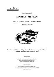
![Darstellungen [pdf]](https://img.yumpu.com/22533086/1/184x260/darstellungen-pdf.jpg?quality=85)