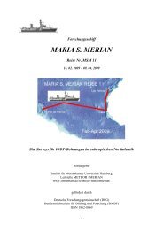
Forschungsschiff / Research Vessel - Institute of Oceanography ...
Forschungsschiff / Research Vessel - Institute of Oceanography ...
Forschungsschiff / Research Vessel - Institute of Oceanography ...

Sie wollen auch ein ePaper? Erhöhen Sie die Reichweite Ihrer Titel.
YUMPU macht aus Druck-PDFs automatisch weboptimierte ePaper, die Google liebt.
<strong>Forschungsschiff</strong><br />
METEOR<br />
Reise Nr. 68<br />
26. April 2006 – 7. August 2006<br />
Ozeanographische und biogeochemische Untersuchungen im<br />
tropischen Atlantik<br />
Bridgetown-Recife-Mindelo-Las Palmas<br />
Herausgeber:<br />
Institut für Meereskunde Universität Hamburg<br />
Leitstelle METEOR<br />
Gefördert durch :<br />
Deutsche Forschungsgemeinschaft (DFG)<br />
Bundesministerium für Bildung und Forschung (BMBF)<br />
ISSN 0935-9974<br />
- 1 -
<strong>Forschungsschiff</strong> / <strong>Research</strong> <strong>Vessel</strong><br />
METEOR<br />
Reise Nr. 68 / Cruise No. 68<br />
26. April 2006 – 7. August 2006<br />
Ozeanographische und biogeochemische Untersuchungen im<br />
tropischen Atlantik<br />
Oceanographic and biogeochemical observations in the Tropical Atlantic<br />
Herausgeber / Editor:<br />
Institut für Meereskunde Universität Hamburg<br />
Leitstelle METEOR<br />
Gefördert durch / Sponsored by:<br />
Deutsche Forschungsgemeinschaft (DFG)<br />
Bundesministerium für Bildung und Forschung (BMBF)<br />
ISSN 0935-9974<br />
- 2 -
Pr<strong>of</strong>. Dr. Andrea Koschinsky<br />
Geosciences and Astrophysics<br />
School <strong>of</strong> Engineering and Science<br />
International University Bremen IUB<br />
Campus Ring 8<br />
D-28759 Bremen/Germany<br />
PD Dr. Peter Brandt<br />
IFM-GEOMAR<br />
Leibniz-Institut für Meereswissenschaften<br />
an der Universität Kiel<br />
Düsternbrooker Weg 20<br />
24105 Kiel/Germany<br />
Pr<strong>of</strong>. Dr. Arne Körtzinger<br />
IFM-GEOMAR<br />
Leibniz-Institut für Meereswissenschaften<br />
an der Universität Kiel<br />
Düsternbrooker Weg 20<br />
24105 Kiel/Germany<br />
Leitstelle F/S Meteor<br />
Institut für Meereskunde<br />
Universität Hamburg<br />
Bundesstraße 53<br />
D-20146 Hamburg/Germany<br />
Reederei F. Laeisz (Bremerhaven) G.m.b.H.<br />
Brückenstrasse 25<br />
D-27668 Bremerhaven/Germany<br />
Senatskommission für Ozeanographie:<br />
der Deutschen Forschungsgemeinschaft<br />
Vorsitzende/Chair: Pr<strong>of</strong>. Dr. Karin Lochte<br />
Leibniz-Institut für Meereswissenschaften<br />
Düsternbrooker Weg 20<br />
D-24105 Kiel/Germany<br />
Anschriften / Adresses<br />
- 3 -<br />
Telefon:<br />
Telefax:<br />
e-mail:<br />
Telefon:<br />
Telefax:<br />
e-mail:<br />
Telefon:<br />
Telefax:<br />
e-mail:<br />
Telefon:<br />
Telefax:<br />
e-mail:<br />
Telefon:<br />
Telefax:<br />
e-mail:<br />
http:<br />
Telefon:<br />
Telefax:<br />
e-mail:<br />
+49 (0)421 200-3567<br />
+49 (0)421 200-3229<br />
a.koschinsky@iu-bremen.de<br />
+49 (0)431 600 – 4102<br />
+49 (0)431 600 – 4105<br />
pbrandt@ifm-geomar.de<br />
+49 (0)431 600 – 4205<br />
+49 (0)431 600 – 4202<br />
akoertzinger@ifm-geomar.de<br />
+49 (0)40-428-38-3974<br />
+49 (0)40-428-38-4644<br />
leitstelle@ifm.uni-hamburg.de<br />
+49 (0)471-94 54 90<br />
+49 (0)471-94 54 913<br />
research@laeisz.de<br />
www.laeisz.de<br />
+49 (0)431-600-4250<br />
+49 (0)431-600-4252<br />
klochte@ifm-geomar.de
<strong>Forschungsschiff</strong> / <strong>Research</strong> <strong>Vessel</strong> METEOR<br />
Rufzeichen: DBBH<br />
Telefon/Fax-Satellitenkennung: alle Satelliten 00870<br />
Telefon-Nr.: 76 165 1726<br />
Telefax-Nr.: 76 165 1728<br />
Telex-Satellitenkennung Atlantik Ost 0581<br />
Atlantik West 0584<br />
Pazifik 0582<br />
Indik 0583<br />
TelexNr.: 421120698<br />
E-Mail: (Schiffsleitung) kapitaen@meteor.laeisz.de<br />
(dienstliche/<strong>of</strong>ficial) name@meteor.laeisz.de<br />
(private/personal) name@meteor-shipmail.laeisz.com<br />
(Fahrtleiter/Chief scientist) fahrtleiter@meteor-shipmail.laeisz.com<br />
Each cruise participant will receive e-mail addresses composed <strong>of</strong> the first letter <strong>of</strong> his first<br />
name and the last name. Hein Mück, e.g., will receive the address:<br />
hmueck@meteor.laeisz.de for <strong>of</strong>ficial correspondence (paid by the Meteor Leitstelle)<br />
hmueck@meteor-shipmail.laeisz.com for personal correspondence (to be paid on bord)<br />
Organisationschema der E-Mail-Verbindung Land - Schiff.<br />
- 4 -
Fahrtabschnitte METEOR Reise Nr. 68<br />
Legs <strong>of</strong> METEOR Cruise No. 68<br />
26. April 2006 – 7. August 2006<br />
Biogeochemie und Physik des tropischen atlantischen Ozeans<br />
Biogeochemistry and physics <strong>of</strong> the Tropical Atlantic Ocean<br />
Fahrtabschnitt / Leg 68/1 27.4.2006 – 2.6.2006<br />
Bridgetown (Barbados) – Recife (Brasilien)<br />
Fahrtleiter / Chief Scientist:<br />
Pr<strong>of</strong>. Dr. A. Koschinsky<br />
Fahrtabschnitt / Leg 68/2 6.6.2006 – 9.7.2006<br />
Recife (Brasilien) –Mindelo (Kapverden)<br />
Fahrtleiter / Chief Scientist: PD Dr. P. Brandt<br />
Fahrtabschnitt / Leg 68/3 12.7.2006 – 6.8.2006<br />
Mindelo (Kapverden) – Las Palmas (Spanien)<br />
Fahrtleiter / Chief Scientist: Pr<strong>of</strong>. Dr. A. Körtzinger<br />
Koordination / Coordination PD Dr. P. Brandt<br />
Kapitän / Master METEOR Martin Kull<br />
- 5 -
Abb. 1: Geplante Fahrtrouten der METEOR Expedition M68<br />
(Abschnitt 1 grün, Abschnitt 2 rot, Abschnitt 3 blau).<br />
Fig. 1: Planned cruise tracks <strong>of</strong> METEOR cruise M68<br />
(leg 1 green, leg 2 red, leg 3 blue).<br />
- 6 -
Übersicht<br />
Wissenschaftliches Programm der METEOR Reise Nr. 68<br />
Scientific Programme <strong>of</strong> METEOR Cruise No. 68<br />
Die METEOR-Expedition 68 dient der Untersuchung<br />
von biogeochemischen und physikalischen<br />
Prozessen im tropischen und<br />
subtropischen Atlantik. Dabei wird in allen<br />
Teilen der Wassersäule, vom Meeresboden<br />
bis zur Grenzschicht Ozean-Atmosphäre und<br />
sogar darüberhinaus, gearbeitet: im Rahmen<br />
des SPP 1144 „Vom Mantel zum Ozean:<br />
Energie-, St<strong>of</strong>f- und Lebenszyklen an Spreizungsachsen“<br />
werden Hydrothermal-felder<br />
am mittelatlantischen Rücken ver-messen<br />
(Fahrtabschnitt M68/1 unter Leitung von<br />
Pr<strong>of</strong>. Dr. A. Koschinsky), im äquatorialen<br />
Atlantik wird anschließend die Rolle der<br />
Ozeanzirkulation für Klima-schwankungen<br />
im atlantischen Raum untersucht (Fahrtabschnitt<br />
M68/2 unter Leitung von PD Dr. P.<br />
Brandt) und im nördlichen tropischen und<br />
subtropischen Ozean stehen schließlich<br />
Prozesse und Wechselwirkungen im Oberflächenozean<br />
und an der Grenzfläche zwischen<br />
Ozean und Atmosphäre einschließlich<br />
des Gasaus-tausches von klimarelevanten<br />
Gasen im Vordergrund (Fahrtabschnitt<br />
M68/3 unter Leitung von Pr<strong>of</strong>. Dr. A. Körtzinger).<br />
Die Reise wird am 26.4.2006 in<br />
Bridgetown/Barbados beginnen und am<br />
7.8.2006 in Las Palmas/Spanien enden.<br />
M68/1<br />
Das übergeordnete Ziel des Fahrtabschnitts<br />
M68/1, der Bestandteil des DFG-<br />
Schwerpunktprogramms SPP 1144 ist, ist<br />
die Untersuchung hydrothermaler Aktivität<br />
am südlichen Mittelatlantischen Rücken<br />
(MAR, 4-10°S). Auf vorangegangene Fahrten<br />
(M62/5, M64/1, CD169) wurden die<br />
ersten Proben von Hydrothermalfeldern südlich<br />
der großen äquatorialen Bruchzonen<br />
(4°48’S und 9°33´S) gewonnen und Signale<br />
anderer vermuteter Systeme am Rücken<br />
gemessen (8°10´S und 8°18´S). Ein Hydrothermalfeld<br />
bei 4°48’S ist von besonderem<br />
Interesse, da es ungewöhnliche Fluid- und<br />
Mineralzusammensetzungen aufweist und<br />
sich scheinbar in einer frühen post-eruptiven<br />
- 7 -<br />
Synopsis<br />
The METEOR expedition 68 is aimed to<br />
study biogeochemical and physical processes<br />
in the tropical/subtropical Atlantic<br />
Ocean. Observations will be carried out in<br />
the whole water column, from the sea floor<br />
to the sea surface and even above: In the<br />
frame <strong>of</strong> the SPP 1144 “From Mantle to<br />
Ocean: Energy-, Material- and Life-cycles<br />
at Spreading Axes” hydrothermal fields at<br />
the Mid-Atlantic Ridge will be investigated<br />
during leg M68/1 with Pr<strong>of</strong>. Dr. A.<br />
Koschinsky as chief scientist. Subsequently,<br />
the role <strong>of</strong> ocean circulation variability in<br />
the equatorial Atlantic for tropical Atlantic<br />
climate variablity will be studied during leg<br />
M68/2 with PD Dr. P. Brandt as chief<br />
scientist, and, finally, during the third leg<br />
M68/3 with Pr<strong>of</strong>. Dr. A. Körtzinger as chief<br />
scientist, near-surface biogeochemical<br />
processes and exchange across the air-sea<br />
interface including the exchange <strong>of</strong> climate<br />
relevant gases are in the focus <strong>of</strong> planned<br />
research. The cruise will start on the 26 th<br />
April 2006 in Bridgetown/Barbados and will<br />
lead to the port in Las Palmas /Spain at 7 th<br />
August 2006.<br />
M68/1<br />
The overall goal <strong>of</strong> cruise M68/1, which is<br />
part <strong>of</strong> the DFG Special Priority Program<br />
1144, is the investigation <strong>of</strong> hydrothermal<br />
activity on the southern Mid-Atlantic Ridge<br />
(MAR, 4-10°S). Previous cruises (M62/5,<br />
M64/1, CD169) yielded the first samples <strong>of</strong><br />
hydrothermal fields (at 4°48’S and 9°33´S)<br />
south <strong>of</strong> the large equatorial fracture zones<br />
as well as picking up signals (at 8°10´S,<br />
8°18´S) <strong>of</strong> other possible systems along the<br />
ridge. One vent site at 4°48’S is <strong>of</strong> special<br />
interest because it shows unusual fluid and<br />
mineral compositions and appears to be in<br />
an early post-eruptive state. Cruise M68/1<br />
builds on the work <strong>of</strong> these previous cruises<br />
in order to (a) provide a quantitative
Phase befindet. Die Fahrt M68/1 baut auf<br />
den Ergebnissen dieser vorangegangen Fahrten<br />
auf, um (a) quantitative Abschätzungen<br />
der regionalen Verteilung hydrothermaler<br />
Aktivität im Bereich 4-10°S zu erzielen, (b)<br />
den vulkanisch-tektonischen Rahmen dieser<br />
Aktivität zu erfassen, (c) die wichtigen Faktoren<br />
für die Zusammensetzung der Fluide<br />
und Mineralien und zeitliche Variationen zu<br />
bestimmen, und (d) die Rolle der großen<br />
äquatorialen Bruchzonen als mögliche biogeographische<br />
Filter für die Faunenverbreitung<br />
zwischen dem nördlichen und südlichen<br />
MAR zu bewerten.<br />
Die Erkundung und Kartierung hydrothermaler<br />
Plumes wird mit dem autonomen Unterwasserfahrzeug<br />
(AUV) “ABE” vom<br />
WHOI durchgeführt. Während der Tauchgänge<br />
mit dem ROV Quest (MARUM) werden<br />
geologische, biologische und chemische<br />
Proben gesammelt. Kombinierte Messungen<br />
von Gasen und Metallen zusammen mit<br />
physikalischen Daten (T, S, Trübung, Strömung)<br />
sollen eine Abschätzung der hydrothermalen<br />
Flüsse ermöglichen. In dem jungen<br />
siedenden Ventfeld bei 4°48’s soll auch<br />
die zeitliche und räumliche Variabilität von<br />
Fluidfluss und Fluidzusammensetzung untersucht<br />
werden.<br />
M68/2<br />
Der Schwerpunkt des zweiten Fahrtabschnitts<br />
liegt auf der Bestimmung der Wassermassentransporte<br />
innerhalb der flachen<br />
tropisch-subtropischen Zelle im äquatorialen<br />
Bereich und insbesondere der Versorgungspfade<br />
zu den Auftriebsgebieten im äquatorialen<br />
und östlichen Atlantik. Der äquatoriale<br />
Auftrieb wird im wesentlichen durch den<br />
Äquatorialen Unterstrom (EUC) versorgt.<br />
Der außeräquatoriale Auftrieb, der innerhalb<br />
der zyklonal umströmten Dome (Angola<br />
Dome, Guinea Dome) stattfindet, scheint<br />
dagegen hauptsächlich durch die Süd- bzw.<br />
Nordäquatorialen Unterströme (SEUC,<br />
NEUC) versorgt zu werden. Die geplante<br />
Erfassung des äquatorialen Stromsystems<br />
wird ergänzt durch Mikrostrukturmessungen<br />
sowie Beobachtungen mit am Äquator bei<br />
35°W, 23°W und 10°W verankerten Strö-<br />
- 8 -<br />
estimate <strong>of</strong> the regional distribution <strong>of</strong><br />
hydrothermal activity between 4°S and 10°S,<br />
(b) establish the volcano-tectonic setting <strong>of</strong><br />
this activity, (c) determine the factors that<br />
influence fluid and mineral compositions<br />
and temporal variability, and (d) evaluate<br />
the role <strong>of</strong> the large equatorial fracture<br />
zones as possible biogeographic filters<br />
between the northern and the southern<br />
MAR.<br />
Hydrothermal prospecting and plume<br />
mapping will be carried out with the<br />
autonomous underwater vehicle (AUV)<br />
‘ABE’ from WHOI. During ROV Quest<br />
(MARUM) dives, chemical, biological and<br />
geological samples will be obtained.<br />
Combined measurements <strong>of</strong> gases and<br />
metals together with physical properties (T,<br />
S, turbidity, currents) will provide an<br />
estimate <strong>of</strong> the fluxes from the hydrothermal<br />
vents. In the 4°48’S area, temporal and<br />
spatial changes in vent activity and<br />
chemistry will be investigated in this young,<br />
hot, boiling system.<br />
M68/2<br />
The second leg focuses on the quantification<br />
<strong>of</strong> warm water transports within the shallow<br />
subtropical cell (STC) in the equatorial Atlantic<br />
and, in particular, on the supply<br />
pathways toward the equatorial and eastern<br />
Atlantic upwelling regions. The Equatorial<br />
Undercurrent (EUC) is the main source <strong>of</strong><br />
the equatorial upwelling. Off equatorial<br />
upwelling that partly occur in the cyclonic<br />
gyres in the eastern tropical Atlantic (Angola<br />
Dome, Guinea Dome) is thought to by<br />
supplied by the South and North Equatorial<br />
Undercurrents (SEUC, NEUC). The planned<br />
observations <strong>of</strong> the major current bands in<br />
the equatorial region are complemented by<br />
microstructure measurements as well as<br />
observations with moored current meters at<br />
35°W, 23°W, and 10°W on the equator.<br />
These observations will be carried out in the
mungsmessern, die im Rahmen eines DFG –<br />
Emmy Noether-Programms bzw. in Zusammenarbeit<br />
mit dem französischen EGEE<br />
und dem internationalen PIRATA Projekt<br />
durchgeführt werden. Als Vorarbeit zu einem<br />
geplanten Projekt innerhalb des BMBF<br />
Verbundvorhabens „Nordatlantik“ wird ein<br />
Verankerungsarray bei 23°W installiert, mit<br />
dem die Variabilität der Wassermassen und<br />
Zirkulation im zentralen äquatorialen Atlantik<br />
auf intrasaisonalen bis mehrjährigen<br />
Zeitskalen bestimmt werden kann. Die physikalischen<br />
Messungen werden von Tracermessungen<br />
(Helium) begleitet, die zusätzliche<br />
Informationen zum äquatorialen Auftrieb<br />
liefern sollen. Weiterhin enthält die<br />
Meteor-Reise M68/2 auch eine SOLAS-<br />
Komponente, die eine Fortführung und Erweiterung<br />
der auf den Meteor-Reisen M55<br />
und M60/5 begonnenen biogeochemischen<br />
Arbeiten zum St<strong>of</strong>faustausch zwischen Ozean<br />
und Atmosphäre darstellt.<br />
M68/3<br />
Der dritte Fahrtabschnitt steht als 2.<br />
Deutsche SOLAS-Expedition unter dem<br />
programma-tischen Rahmen der<br />
internationalen „Surface Ocean Lower<br />
Atmosphere Study“. Sie bündelt ein breites<br />
Spektrum von biologischer, chemischer und<br />
physikalischer Ozeanographie sowie<br />
Atmosphärenchemie und ist regional auf den<br />
Küstenauftrieb vor Mauretanien fokussiert.<br />
Diese Region ist durch wichtige SOLASrelevante<br />
Phänomene und Prozesse<br />
gekennzeichnet, zu denen atmosphärischer<br />
Staubeintrag aber vor allem<br />
Auftriebsphänome gehören, die für viele<br />
Komponenten (Eisen, Nährst<strong>of</strong>fe, CO2,<br />
flüchtige Halogenkohlenwasserst<strong>of</strong>fe) und<br />
Prozesse (Stickst<strong>of</strong>f-Fixierung, Ozean-<br />
Atmosphäre-Gasaustausch) eine zentrale<br />
Rolle spielen. Auftriebsgebiete in Regionen<br />
mit starkem Staubeintrag stellen<br />
gewissermaßen biogeochemische Reaktoren<br />
dar, die gleichzeitig durch vertikale (Makro-<br />
und Mikro-) Nährst<strong>of</strong>feinträge aus der<br />
Atmosphäre und dem Mesopelagial<br />
angetrieben werden. Zugleich stellen sie<br />
Regionen dar, über die eine rasche<br />
Ventilation von unterhalb der Deckschicht<br />
- 9 -<br />
frame <strong>of</strong> a DFG – Emmy Noether-Program<br />
as well as in cooperation with the French<br />
EGEE and the multi-national PIRATA<br />
projects. At 23°W on the equator a mooring<br />
array consisting <strong>of</strong> 4 moorings will be<br />
installed aimed at studying the circulation<br />
variabilty at intraseasonal to interannual<br />
time scales. This mooring array will become<br />
part <strong>of</strong> a subproject within the “BMBF<br />
Verbundvorhaben North Atlantic”.<br />
Hydrographic and current observations will<br />
be accompanied by tracer (helium)<br />
observation that will yield additional<br />
information regarding the strength <strong>of</strong><br />
equatorial upwelling. In addition to the<br />
physical program biogeochemical<br />
measurements will be carried out during<br />
M68/2. These measurements that build up<br />
on previos METEOR cruises will help to<br />
estimate the air-sea material exchange and<br />
are part <strong>of</strong> the international SOLAS (Surface<br />
Ocean Lower Atmosphere) program.<br />
M68/3<br />
The third leg is carried out in the programmatic<br />
frame <strong>of</strong> the international “Surface<br />
Ocean Lower Atmosphere Study” (SOLAS)<br />
and presents the 2 nd German SOLAS Cruise.<br />
It combines a wide spectrum <strong>of</strong> biological,<br />
chemical and physical oceanography as well<br />
as atmospheric chemistry under a regional<br />
focus on the Mauritanian Upwelling. This<br />
region is characterized by important SO-<br />
LAS-relevant phenomena and processes –<br />
most importantly atmospheric dust deposition<br />
and coastal upwelling – which have<br />
major influence on substances (iron, nutrients,<br />
CO2, volatile halocarbons) and processes<br />
(nitrogen fixation, ocean-atmosphere<br />
exchange). Upwelling regions in major dust<br />
deposition areas can be viewed as biogeochemical<br />
reactors which are fuelled simultaneously<br />
by vertical supply <strong>of</strong> macro and<br />
micro nutrients from the mesopelagial below<br />
and the atmosphere above. At the same time,<br />
these regions provide means <strong>of</strong> ventilation <strong>of</strong><br />
radiatively and chemically active trace<br />
gases (e.g., CO2, nitrous oxide, brom<strong>of</strong>orm)<br />
which are produced sub-surface. The resulting<br />
flux densities are sometimes magnitude<br />
larger than in the oligotrophic background
produzierten klimarelevanten Spurengasen<br />
(CO2, Lachgas, Brom<strong>of</strong>orm etc.) erfolgt. Die<br />
zu beobachtenden Ozean-Atmosphäre-<br />
Flussdichten liegen zum Teil um Größenordnungen<br />
über den im <strong>of</strong>fenen oligotrophen<br />
Ozean vorgefundenen Verhältnissen.<br />
- 10 -<br />
waters.
Wissenschaftliches Programm<br />
Die Fortsetzung der Untersuchungen, die im<br />
Rahmen der Fahrten M62/5, CD169 und<br />
M64/1 begonnen wurden, steht für die Fahrt<br />
M68/1 mit interdisziplinären Arbeiten an<br />
den ausgewählten Ventfeldern im Vordergrund.<br />
Dies schließt Kartierungen und die<br />
Exploration weiterer Ventsysteme im regionalen<br />
Maßstab ebenso ein wie die Beprobung<br />
hydrothermaler Fluide, Fauna und Sulfide<br />
und von Gesteinen.<br />
Unsere Ziele sind<br />
(1) Die Lokalisierung und Charakterisierung<br />
der hydrothermalen Quellen, die<br />
für die beobachteten Plumes bei<br />
4°48’S, 8°10´S, 8°18´S und 9°33´S<br />
(Abb. 2) noch nicht gefunden wurden;<br />
(2) Quantifizierung des hydrothermalen<br />
Flusses (Wärme, Gase, Metalle) und<br />
die Rolle von Vermischung für die<br />
Verbreitung der Plume inklusive der<br />
Fluide und Gase;<br />
(3) Bewertung der Herkunft und Verteilung<br />
von Ventfauna und der Variabilität<br />
der Gemeinschaften in Bezug auf<br />
die physiko-geochemische Umgebung;<br />
(4) Bestimmung der Faktoren, die die<br />
Zusammensetzung und zeitliche Variabilität<br />
von hydrothermalen Fluiden<br />
und den assoziierten Mikrobengemeinschaften<br />
bestimmen.<br />
(1) Lokalisierung und Charakterisierung von<br />
Vents<br />
Wir kennen inzwischen die Lokationen<br />
mehrerer neutraler Plumes in der<br />
Wassersäule über der Spreizungsachse. Auf<br />
dieser Fahrt planen wir, die Quellen der<br />
Plumes aufzufinden, die wir noch nicht<br />
entdeckt haben, und ihre räumliche<br />
Ausdehnung, die Massenflussraten, die<br />
assoziierte Fauna und das vulkanische und<br />
tektonische Umfeld zu untersuchen. Für<br />
diese Aufgaben wird das AUV ABE an<br />
Bord sein. Meeresbodenkartierungen werden<br />
Fahrtabschnitt / Leg M68/1<br />
Bridgetown – Recife<br />
- 11 -<br />
Scientific Program<br />
Following the investigations performed during<br />
and subsequent to cruises M62/5,<br />
CD169 and M64/1 it is <strong>of</strong> prime importance<br />
to continue the detailed interdisciplinary<br />
work at the selected vent sites. This includes<br />
mapping and exploration for additional<br />
hydrothermal vent systems on a regional<br />
scale and sampling <strong>of</strong> hydrothermal vent<br />
fluids, associated vent fauna (both macro-<br />
and microbiology), host rock and sulphide<br />
samples.<br />
Our goals are<br />
(1) Locating and characterising the vents for<br />
the 4°48’S, 8°10´S, 8°18´S and 9°33´S<br />
hydrothermal plumes (Fig. 2), where the<br />
hot vent sources have not yet been<br />
found;<br />
(2) Quantifying the hydrothermal fluxes<br />
(heat, gases, metals) and the role <strong>of</strong> mixing<br />
for plume dispersal and distribution<br />
<strong>of</strong> hydrothermal fluids and gases;<br />
(3) Assessing the origin and dispersal <strong>of</strong><br />
vent fauna and variability <strong>of</strong> the communities<br />
linked to the physicogeochemical<br />
environment;<br />
(4) Determining the factors controlling the<br />
composition and temporal variability <strong>of</strong><br />
hydrothermal fluids and the microbial<br />
communities they support.<br />
(1) Locating and characterising vents<br />
We now know the location <strong>of</strong> several neutrally-buoyant<br />
plumes in the water column<br />
above the spreading axis. On this cruise we<br />
aim to locate the sources <strong>of</strong> these plumes<br />
where not already known and determine<br />
their areal extent, their mass venting rate,<br />
their associated fauna and the volcanic and<br />
tectonic environment which hosts them. For<br />
this task, the AUV ABE will be on board.<br />
Seafloor mapping also yields important information<br />
about the volcanological and tectonic<br />
setting <strong>of</strong> the vents, which can be
über die geologischen Gegebenheiten geben,<br />
die durch photographische Übersichtskartierungen<br />
des AUV unterstützt werden sollen.<br />
Hochauflösende bathymetrische Karten und<br />
Photo-Mosaike der Ventgebiete werden<br />
auch eingesetzt werden, um die Verbreitungsmuster<br />
von hydrothermaler Fauna aufzuzeichnen.<br />
(2) Quantifizierung hydrothermaler Flüsse<br />
Daten der Fahrt M62/5 haben gezeigt, dass<br />
die beobachtete Variabilität der Strömungen<br />
bei 8°18’S in hohem Maße durch Gezeiten-<br />
Frequenzen geprägt ist, was einen großen<br />
Einfluss auf die Ausbreitung der<br />
hydrothermalen Wolke hat. Somit sind<br />
Informationen über den Hintergrund-<br />
Volumentransport und kleinskalige<br />
Variabilitäten wichtige Voraussetzungen<br />
zum Abschätzen hydrothermaler Flüsse. Es<br />
werden Anordnungen von Strömungsmesserverankerungen<br />
mit Temperatur-<br />
und Trübungssensoren eingesetzt werden,<br />
um Variationen in Wärmeflüssen und<br />
Fluktuationen der Plume-Signale aufzu-<br />
z eichnen.<br />
Ein anderes wichtiges Werkzeug zur Untersuchung<br />
der Plume-Ausbreitung sind hydrothermale<br />
Tracer und ihre Isotopensignaturen.<br />
Die geplanten kombinierten Messungen<br />
von Gasen und Metallen zusammen mit ozeanographischen<br />
Eigenschaften (Temperatur,<br />
Salinität, Trübung, Geschwindigkeitsfeld)<br />
werden eine Abschätzung der Flüsse aus den<br />
hydrothermalen Vents und der Herkunft der<br />
volatilen Tracer durch Tracer/Tracer-<br />
Korrelationen ermöglichen. Die Fernfeld-<br />
Untersuchungen werden mit dem CTD-<br />
Kranzwasserschöpfersystem und Trübemessern<br />
und mit dem AUV ausgeführt werden.<br />
Die Nahfeldeigenschaften werden mit dem<br />
ROV vermessen.<br />
(3) Charakterisierung der Verbreitung von<br />
Tiergemeinschaften und Bakteriensymbiosen<br />
Die Vent-Systeme bei 4°48’S und 9°33’S<br />
sind die südlichsten bisher bekannten Hydrothermalfelder<br />
am MAR. Die hier beheimatete<br />
Fauna eröffnet die einzigartige Gelegenheit,<br />
zu untersuchen, ob die großen äqua-<br />
- 12 -<br />
backed up by photographic surveys from the<br />
AUV. High-resolution bathymetry maps <strong>of</strong><br />
the seafloor area around the vents and<br />
photo-mosaics <strong>of</strong> the vent area will be used<br />
for geological mapping and to map biological<br />
communities in order to record the distribution<br />
patterns <strong>of</strong> hydrothermal fauna.<br />
(2) Quantifying hydrothermal fluxes<br />
M62/5 data revealed that the observed current<br />
variability at 8°18’S is to a large extent<br />
<strong>of</strong> tidal frequencies. The tidal generated<br />
internal waves will have great impact on the<br />
plume dispersal. To estimate the hydrothermal<br />
fluxes it is vital to have a good knowledge<br />
<strong>of</strong> the background volume transport<br />
and its small-scale variability. The best tool<br />
to observe and quantify such flows is an<br />
array <strong>of</strong> moored current meters equipped<br />
with temperature and turbidity sensors to<br />
record variations <strong>of</strong> heat and fluctuating<br />
plume signals.<br />
Another important tool to study plume<br />
spreading is to analyse the distribution <strong>of</strong><br />
hydrothermal tracers and their isotopic<br />
composition. The planned combined measurements<br />
<strong>of</strong> gases and metals together with<br />
the oceanographic properties (temperature,<br />
salinity, turbidity, velocity field) will give an<br />
estimate <strong>of</strong> the fluxes from the hydrothermal<br />
vents in the region and the origin <strong>of</strong> the<br />
volatiles using tracer/tracer correlations.<br />
The far field sampling will be done with the<br />
CTD/carousel system, turbidity sensors, and<br />
with the AUV. The properties in the near<br />
field will be recorded with the ROV.<br />
(3) Characterizing the dispersal <strong>of</strong> animal<br />
communities and bacterial symbioses<br />
The 4°48’S and 9°33’S sites are the southernmost<br />
hydrothermal vent fields presently<br />
known on the MAR. The fauna that occurs at<br />
these vents <strong>of</strong>fers the unique opportunity to<br />
examine if the large equatorial fracture<br />
zones in the Atlantic form a barrier for the
torialen Bruchzonen im Atlantik eine Barriere<br />
für die Ausbreitung der hydrothermalen<br />
Fauna zwischen nördlich und südlich gelegenen<br />
Feldern bildet. Eine erste Analyse von<br />
auf der M64/1-Fahrt gesammelten Tieren<br />
weist auf eine generelle faunistische Ähnlichkeit<br />
zwischen den nördlichen Systemen<br />
und den neuentdeckten südlichen Systemen<br />
hin. Jedoch sind weitere Beprobungen und<br />
detailliertere Analysen notwendig, um hier<br />
eine klare Antwort zu geben. Auch für<br />
mikrobielle Gemeinschaften ist es möglich,<br />
dass die geographische Trennung von Habitaten<br />
zusätzlich zu Unterschieden in den<br />
hydrochemischen und physikalischen Bedingungen<br />
der Hydrothermalfelder zu unterschiedlichen<br />
Zusammensetzungen führen<br />
kann.<br />
(4) Bestimmung der Faktoren, die die Fluidzusammensetzung<br />
und assoziierte Mikroben-<br />
und Faunengemeinschaften bestimmen<br />
a) Räumliche Variabilität<br />
Unsere bisherigen Daten weisen darauf hin,<br />
dass Temperatur und Tiefe bzw. Druck im<br />
Hydrothermalsystem in Kombination mit<br />
Phasenseparationsprozessen für viele gelöste<br />
Komponenten von größerer Bedeutung sein<br />
können als das Untergrundgestein. Um diese<br />
Hypothese zu testen, sind weitere detaillierte<br />
Studien und ausgewählte Beprobungen notwendig.<br />
Die Tatsache, dass die Felder bei<br />
4°48’S (und vermutlich auch bei 8°18’S)<br />
und bei 9°33’S in verschiedenen Wassertiefen<br />
liegen (3000 m bzw. 1500 m), bieten<br />
außerdem die hervorragende Gelegenheit,<br />
den Einfluß der Wassertiefe (und der damit<br />
zusammenhängenden Wirkung der Phasenseparation)<br />
auf die Fluid- und Biologiezusammensetzungen<br />
zu untersuchen.<br />
Die hydrothermalen Aktivitäten sowohl bei<br />
4°48’S als auch bei 9°33’S treten in Rückensegmenten<br />
mit Anzeichen rezenter vulkanischer<br />
Aktivität auf, und nicht in Bezug<br />
zu tektonischer Aktivität. Folglich scheint<br />
hier ein direkter Zusammenhang zwischen<br />
Magmenproduktion und hydrothermaler<br />
Zirkulation zu bestehen. Dies steht im Gegensatz<br />
zu den Plumes bei 8°S, die neben<br />
der Achse gefunden wurden und somit ver-<br />
- 13 -<br />
spreading <strong>of</strong> hydrothermal fauna between<br />
northern and southern MAR vent fields. A<br />
first analysis <strong>of</strong> the specimens collected during<br />
M64/1 cruise indicated a general faunistic<br />
similarity between the northern vent systems<br />
and the newly discovered ones south <strong>of</strong><br />
the equator. However, more sampling and<br />
detailed analyses are needed to answer this<br />
question conclusively. Also for the microbial<br />
communities it is possible that geographical<br />
separation <strong>of</strong> the habitats, in addition to<br />
differences in hydrochemical conditions and<br />
physical properties, lead to differences in<br />
their compositions.<br />
(4) Determining the factors that control fluid<br />
composition and associated microbial/faunal<br />
communities<br />
a) Spatial variability<br />
Our preliminary data indicate that the temperature-depth<br />
conditions in a hydrothermal<br />
vent system in combination with phase separation<br />
processes may be more important for<br />
many dissolved components in the fluids<br />
than the host rock. In order to test this hypothesis,<br />
more detailed studies and carefully<br />
selected fluid samples are needed. The fact<br />
that the hydrothermal fields at 4°49’S (and<br />
presumably 8°18’S) and at 9°33’S are situated<br />
in different water depths (3000m and<br />
1500m, respectively) <strong>of</strong>fer excellent conditions<br />
to investigate the effect <strong>of</strong> water depth<br />
(and related phase separation) on the<br />
chemical composition <strong>of</strong> the vent fluids and<br />
the biology <strong>of</strong> the vent fields.<br />
Both the 4°48’S and 9°33´S areas <strong>of</strong> hydrothermal<br />
activity occur in ridge segments<br />
with signs <strong>of</strong> recent volcanic activity rather<br />
than in tectonically active regions. Consequently,<br />
there appears to be a direct link at<br />
these areas between magma production and<br />
hydrothermal circulation. This is in apparent<br />
contrast to the plumes found around 8°S<br />
which are both located <strong>of</strong>f-axis and so presumably<br />
more strongly related to tectonic
mutlich eher in Bezug zu tektonischen statt<br />
vulkanischen Prozessen zu setzen sind. Die<br />
Untersuchung der lokalen Geologie dieser<br />
Felder kombiniert mit geochemischen Vergleichen<br />
der Lava, der hydrothermalen Präzipitate,<br />
Sedimente und Fluide wird es uns<br />
ermöglichen, zu bestimmen, welche Gesteine<br />
durch Reaktion mit Meerwasser die verschiedenen<br />
hydrothermalen Fluidtypen produzieren.<br />
Auch der Einfluß von Mikroben und Fauna<br />
auf die Fluidgeochemie beziehungweise<br />
umgekehrt werden betrachtet werden. Molekulare<br />
und ultrastrukturelle Analysen sollen<br />
zeigen, ob die unterschiedlichen Fluidzusammensetzungen<br />
an den Vents durch voneinander<br />
abweichende Symbiontenkonsortien<br />
widergespiegelt werden.<br />
b) Zeitliche Variabilität<br />
Eines der Hauptziele des DFG-SPP 1144 ist<br />
die Bewertung der zeitlichen Variabilität<br />
von hydrothermalen Flüssen. Die kurzzeitige<br />
Entwicklung von Vent-Fluiden und die<br />
damit verbundenen Veränderungen in den<br />
Ökosystemen wird durch wiederholte Beprobungen<br />
(im Zeitraum mehrerer Jahre)<br />
derselben Ventstrukturen bearbeitet, mit<br />
Schwerpunkt auf dem jungen Feld bei<br />
4°48’S (Abb. 3). Die jungen Muschelbesiedlungen<br />
im 9°33’-Feld Liliput (Abb. 4) geben<br />
uns die seltene Gelegenheit, die Periodizität<br />
des Schalenwachstums bezogen auf den<br />
Fluidfluß zu beobachten. Die Untersuchungen<br />
der Mineralogie und Geochemie von<br />
Massivsulfiden und Manganoxidenkrusten<br />
zusammen mit Altersdatierungen der Präzipitate<br />
und Gesteine werden den Langzeitrahmen<br />
der hydrothermalen Aktivität und<br />
seine Beziehung zur vulkanischen Aktivität<br />
darlegen.<br />
- 14 -<br />
rather than volcanic processes. The investigation<br />
<strong>of</strong> the local geology <strong>of</strong> the fields,<br />
combined with geochemical comparisons <strong>of</strong><br />
lava, hydrothermal precipitates and sediments<br />
as well as fluids will allow us to determine<br />
which rocks are reacting with seawater<br />
to produce the hydrothermal fluids in<br />
the different areas.<br />
Also the influence <strong>of</strong> microbes and fauna on<br />
the fluid geochemistry and vice versa will be<br />
considered. Molecular and ultrastructural<br />
studies will show whether different fluid<br />
compositions at the vents are reflected by<br />
diverging symbiont consortia.<br />
b) Temporal variability<br />
One <strong>of</strong> the major goals <strong>of</strong> the DFG SPP<br />
1144 is to assess the temporal variability <strong>of</strong><br />
the hydrothermal flux. The short-term<br />
evolution <strong>of</strong> the vent fluids and related<br />
changes in the vent ecosystems will be<br />
recorded through repeated sampling (in a<br />
frame <strong>of</strong> several years) <strong>of</strong> the same vent<br />
structures, especially in the young 4°48’S<br />
field (Fig. 3). The recently settled mussel<br />
population in the 9°33’ Lilliput Field (Fig. )<br />
<strong>of</strong>fers the rare opportunity to follow the<br />
periodicity <strong>of</strong> shell growth increments and<br />
fluid venting. Investigating the mineralogy<br />
and geochemistry <strong>of</strong> massive sulfides and<br />
manganese oxide crusts in combination with<br />
age dating <strong>of</strong> hydrothermal precipitates and<br />
host rocks will provide a long-term time<br />
frame <strong>of</strong> hydrothermal activity at the various<br />
vent sites and document its relation to the<br />
volcanic activity.
Abb. 2: Arbeitsgebiete und Fahrtroute des Abschnitts M68/1<br />
Fig. 2: Working areas and cruise track <strong>of</strong> leg M68/1<br />
Arbeitsprogramm<br />
Unsere Arbeitsgebiete sind die drei<br />
hydrothermal aktiven Gebiete bei 4°48’S<br />
mit den Feldern Turtle Pits, Red Lion und<br />
Wideawake, die Gebiete bei 8°S mit den<br />
identifizierten Plumes, und das Lilliput-Feld<br />
bei 9°33’S (Abb. 2). Der kombinierte<br />
Einsatz des AUV für die Exploration und<br />
Lokalisierung der aktiven Ventfelder und<br />
ROV-Stationen für gezielte kleinskalige<br />
Kartierungen und Beprobungen dieser Plätze<br />
gewährleisten eine optimale Nutzung der<br />
Schiffszeit. Nachdem das AUV ausgesetzt<br />
ist, werden die anderen schiffsgebunden<br />
Programme (CTD- und ROV-Stationen u.a.)<br />
ausgeführt, während das AUV sein unab-<br />
- 15 -<br />
Work Program<br />
Our working areas are the three hydrothermally<br />
active areas at 4°48’S field with<br />
the Turtle Pits, Red Lion and Wideawake<br />
fields, the hydrothermal plumes area<br />
around 8°S, and the Lilliput Field at 9°33’S<br />
(Fig. 2). The combined use <strong>of</strong> the AUV for<br />
exploration and localization <strong>of</strong> the active<br />
vent sites, followed by ROV stations for<br />
discrete small-scale mapping and sampling<br />
<strong>of</strong> these sites, provides an optimized use <strong>of</strong><br />
ship time. After the AUV has been lowered,<br />
the other program with ship-bound equipment<br />
(including ROV and CTD stations)<br />
can be carried out while the AUV operates<br />
its independent program. AUV deployments
hängiges Programm durchführt. Die AUV-<br />
Einsätze teilen sich in drei Phasen auf: (1)<br />
Kartierung der lateral verdriftenden Plume<br />
ohne Auftrieb, (2) Kartierung des Meeresbodens<br />
und der Schnittstelle der aufsteigenden<br />
Plume, und (3) Meeresbodenphotographie<br />
und Lokalisierung der Austrittsstellen.<br />
Die Hydrothermalfelder bei 4°48’S<br />
Die Smoker, die bei Turtle Pits während<br />
M64/1 beprobt wurden (Abb. 3), werden<br />
wiederum für heiße siedende Fluide und<br />
assoziierte Biologie während eines ROV-<br />
Tauchgangs beprobt werden. Red Lion, welches<br />
etwa 2 km von Turtle Pits entfernt<br />
liegt, ist anders in seiner Fluidzusammensetzung<br />
und Ventbiologie, und alle vier entdeckten<br />
Smoker sind sehr unterschiedlich in<br />
ihrer Erscheinung. Zwei ROV-Tauchgänge<br />
werden notwendig sein, um die Temperaturen<br />
aller Smoker zu messen und alle Fluidaustritte<br />
und Mineralpräzipitate zu beproben.<br />
Ein Tauchgang wird dem diffusen Muschelfeld<br />
Wideawake gewidmet werden. Zur<br />
Abschätzung hydrothermaler Flüsse werden<br />
die Verteilung von Tracern, Trübe und<br />
Strömungsgeschwindigkeit mit CTD/<br />
LADCP-Einsätzen gemessen.<br />
Detaillierte Wassersäulenstudien während<br />
der Fahrt M64/1 hatten eine starke Trübungsquelle<br />
südwestlich von Turtle Pits<br />
angezeigt. Daher vermuten wir in dieser<br />
Richtung ein weiteres heißes Hydrothermalfeld,<br />
welches mit AUV und ROV gefunden<br />
und untersucht werden soll.<br />
Die hydrothermal aktiven Gebiete bei<br />
8°10’S und 8°18’S<br />
Hier wird das Hauptaugenmerk auf der Lokalisierung<br />
der Vents auf Basis der Daten<br />
der Fahrt M62/5 liegen, während der zwei<br />
neutrale Plumes identifiziert wurden. Dieses<br />
Ziel wird durch zwei AUV-Einsätze und die<br />
Messung von Tracern und ozeanographischen<br />
Parametern angestrebt werden. Nach<br />
der Lokalisierung der Vents sollen zwei<br />
ROV-Tauchgänge die ersten Proben und<br />
Daten sammeln. Durch Verankerungen mit<br />
physikalischen Messsensoren sollen Zeitserien<br />
ozeanographischer Parameter und der<br />
- 16 -<br />
will take place in three phases: (1) Nonbuoyant<br />
plume mapping, (2) Seafloor mapping<br />
and buoyant plume interception, and<br />
(3) Seafloor imaging and vent-localization.<br />
The hydrothermal vent sites at 4°48’S<br />
The smokers investigated at Turtle Pits during<br />
M64/1 (Fig. 3) will be sampled for hightemperature<br />
boiling vent fluids and associated<br />
biology during one ROV dive. Red<br />
Lion, which lies about 2 km away from Turtle<br />
Pits, is different in vent fluid chemistry<br />
and vent biology, with all four smokers discovered<br />
being different in their appearance.<br />
Here, two ROV dives are required to measure<br />
the exit temperatures <strong>of</strong> the vent fluids<br />
and to sample all four smokers as well as<br />
host rocks. One ROV dive will be dedicated<br />
to the diffuse Wideawake mussel field. To<br />
quantify the hydrothermal fluxes, the distribution<br />
<strong>of</strong> tracers, turbidity and velocity will<br />
be measured with CTD/LADCP casts<br />
Detailed water column studies during M64/1<br />
had indicated a strong turbidity source SW<br />
<strong>of</strong> the Turtle Pits field. Therefore, we assume<br />
that another hot vent system is located<br />
in SW direction, which we plan to locate by<br />
AUV, and thereafter visit with one ROV<br />
dive.<br />
The hydrothermally active areas at 8°10’S<br />
and 8°18’S<br />
Here, the primary focus will be on locating<br />
hydrothermal vents using the data available<br />
from cruise M62/5, which had identified two<br />
neutrally-bouyant plumes. This will be carried<br />
out by two AUV missions and measurements<br />
<strong>of</strong> the tracer distribution and<br />
oceanographic parameters. After the hot<br />
vents have been located by the AUV, two<br />
ROV dives are planned for the first sampling<br />
and data recording. Moorings with physical<br />
probes will be deployed to obtain time series<br />
<strong>of</strong> the physical environment <strong>of</strong> the plume
hydrothermale Fluss aufgezeichnet werden.<br />
Das hydrothermal aktive Gebiet bei 9°33’S<br />
Das diffuse Liliput-Feld (Abb. 4) wird mit<br />
zwei ROV-Tauchgängen aufgesucht werden,<br />
um die Temperaturvariabilität in den<br />
Muschelbetten zu messen und<br />
unterschiedliche Assoziationen von Fauna,<br />
Präzipitaten und Fluiden zu beproben.<br />
Währenddessen soll das AUV Erkundungsfahrten<br />
entlang der Rückenachse N und S<br />
des Liliput-Feldes durchführen. Auf der<br />
Basis von CTD-Daten der Fahrt M64/1, die<br />
starke Tracer-Anreicherungen sowohl am<br />
Meeresboden in 1500 m (diffuse Quelle) als<br />
auch in 1100 m Tiefe gezeigt hatten,<br />
vermuten wir die Existenz einer heißen<br />
Quelle zusätzlich zu den beobachteten<br />
diffusen Fluidaustritten. Aufbauend auf den<br />
Ergebnissen der AUV-Tauchgänge sollen<br />
während zwei ROV-Einsätzen die neuen<br />
Quellen dann beprobt werden.<br />
CTD/LADCP-Einsätze werden diese<br />
Arbeiten vervollständigen.<br />
- 17 -<br />
and to estimate hydrothermal fluxes.<br />
The hydrothermally active area at 9°33’S<br />
The diffuse Lilliput field (Fig. 4) will be visited<br />
with two ROV dives to measure temperature<br />
variability in the mussel beds, and<br />
sample fauna and fluids with different faunal<br />
associations and hydrothermal precipitates.<br />
While the ROV is operated, the AUV will be<br />
deployed for reconnaissance work along the<br />
ridge axis north and south <strong>of</strong> the Lilliput<br />
field. On the basis <strong>of</strong> the CTD data from<br />
cruise M64/1, which had shown tracer enrichments<br />
both close to the seafloor at 1500<br />
m (diffuse source) and at about 1100 m<br />
depth, we assume that in addition to the diffuse<br />
vents sampled during M64/1, a hot vent<br />
source must be present at Lilliput. Based on<br />
the results <strong>of</strong> the AUV dives, two ROV dives<br />
are planned to sample the located hydrothermal<br />
vents. CTD/LADCP casts will complement<br />
the activities.
Abb. 3: Beprobung der 400°C heißen Ventfluide im Turtle Pits-Feld bei 4°48’S mit dem speziellen<br />
Fluidprobenahmesystem, das mit Hilfe des ROV eingesetzt wird (ROV-Foto<br />
MARUM, M64/1)<br />
Fig. 3: Sampling <strong>of</strong> 400°C hot vent fluids at the Turtle Pits field at 4°48’S with the special<br />
fluid sampling system deployed with the ROV Quest (ROV photo MARUM, M64/1)<br />
- 18 -
Abb. 4: Junge Muschelbesiedlungen im diffusen Niedrig-Temperatur-Hydrothermalfeld Liliput<br />
bei 9°33’S (ROV-Foto MARUM, M64/1)<br />
Fig. 4: Young mussel populations in the diffuse low-temperature hydrothermal field Liliput at<br />
9°33’S (ROV photo MARUM, M64/1)<br />
- 19 -
Gebiete<br />
Areas<br />
Auslaufen Barbados 27.<br />
April 2006, Transit zu<br />
den Arbeitsgebieten<br />
Sailing Barbados 27 April<br />
2006, transit to working<br />
areas<br />
Gebiet/Area 4°48’S,<br />
Turtle Pits, Red Lion,<br />
Wideawake<br />
Zeitplan / Schedule<br />
Fahrtabschnitt / Leg 68/1<br />
Station<br />
Geräte<br />
Station<br />
Gear<br />
ROV<br />
AUV<br />
CTD<br />
additional<br />
Anzahl<br />
Stationen<br />
Number<br />
stations<br />
8<br />
3<br />
10<br />
Zeit (Std.)<br />
pro Einsatz<br />
Time (hrs.)<br />
p. deploym.<br />
12<br />
8<br />
2.5<br />
Transit nach/to 8°S 1<br />
Gebiet/Area 8˚10’S,<br />
8°18’S Nibelungen<br />
AUV<br />
ROV<br />
CTD-tow-yo<br />
CTD<br />
Depl.<br />
Mooring<br />
additional<br />
Transit nach/ to 9°33’S<br />
Transit 9˚S – Recife<br />
Einlaufen Recife 2. Juni<br />
2006<br />
Arrival in Recife 2 June,<br />
0.3<br />
2006<br />
Gebiet/Area 9°33’S,<br />
Lilliput<br />
ABE<br />
ROV<br />
CTD<br />
additional<br />
6<br />
2<br />
3<br />
10<br />
5<br />
3<br />
4<br />
10<br />
8<br />
12<br />
8<br />
2.5<br />
3<br />
8<br />
12<br />
2.5<br />
Gesamte Arbeitstage<br />
Total <strong>of</strong> working days<br />
Gesamte Zeit/Total time 37<br />
- 20 -<br />
Gesamte<br />
Zeit (Tage)<br />
Total time<br />
(days)<br />
11<br />
4<br />
1<br />
1<br />
1<br />
2<br />
1<br />
1<br />
1<br />
0.6<br />
1<br />
6<br />
1.0<br />
2.0<br />
1.0<br />
1<br />
20
Wissenschaftliches Programm<br />
Der Ozean spielt eine wesentliche Rolle für<br />
Klimavariabilität des tropischen Atlantiks,<br />
insbesondere für Variabilität der Intertropischen<br />
Konvergenzzone. Die bedeutendsten<br />
Einflüsse auf das Klima lassen sich in den<br />
Niederschlagsschwankungen über Nordostbrasilien<br />
und den Küstengebieten im Golf<br />
von Guinea, sowie in den südlichen Saharagebieten<br />
erkennen. Diese Klimavariabilität<br />
ist auf mehrjährigen Zeitskalen signifikant<br />
mit Schwankungen der Oberflächentemperatur<br />
im tropischen Atlantik korreliert. Von<br />
besonderer Bedeutung dabei ist die Kaltwasserzunge<br />
im östlichen äquatorialen Atlantik,<br />
die besonders in den Monaten Juni-August<br />
ausgeprägt ist (Abb. 5). Neuere Analysen<br />
haben gezeigt, dass die relevanten Anomalien<br />
der äquatorialen Oberflächentemperatur<br />
erheblich durch ozeanische Prozesse bestimmt<br />
werden. Dazu gehören Advektion,<br />
meridionale und zonale Strömungsdivergenz<br />
und vertikales Vermischung an der Unterseite<br />
der äquatorialen Deckschicht. Intrasaisonale<br />
Schwankungen durch tropische Instabilitätswellen<br />
(TIWs) und die damit verbundenen<br />
Wirbelflüsse spielen ebenfalls eine<br />
Rolle für Schichtung und Zirkulation dieser<br />
Schlüsselregion. Eine genaue Kenntnis der<br />
ozeanischen Prozesse ist nicht nur für das<br />
Verständnis mehrjähriger Schwankungen<br />
der Oberflächentemperatur notwendig, sondern<br />
auch für eine verbesserte Parametrisierungen<br />
in Ozean-Klima-Vorhersagemodellen.<br />
Viele Modelle weisen einen Bias<br />
hin zu erhöhten Oberflächentemperaturen im<br />
östlichen Atlantik auf und sind damit nicht<br />
in der Lage Oberflächentemperaturschwankungen<br />
in der Kaltwasserzunge und damit<br />
verbundene Klimaschwankungen korrekt zu<br />
simulieren.<br />
Ziel der Untersuchungen (wobei der Fahrtabschnitt<br />
M68/2 in Zusammenhang mit<br />
Vorgängerfahrten sowie Modell-Analysen<br />
zu sehen ist) ist ein besseres Verständnis:<br />
• der Versorgungspfade für den Auftrieb<br />
Fahrtabschnitt / Leg M68/2<br />
Recife - Mindelo<br />
- 21 -<br />
Scientific Program<br />
The ocean has a major influence on tropical<br />
Atlantic climate variability mainly through<br />
the influence <strong>of</strong> tropical Atlantic SST on<br />
variations <strong>of</strong> the Atlantic marine ITCZ complex.<br />
The most notable climate impacts involve<br />
the variability <strong>of</strong> rainfall over northeast<br />
Brazil and the coastal regions surrounding<br />
the Gulf <strong>of</strong> Guinea, and the fluctuations<br />
in rainfall and dustiness in sub-<br />
Saharan Africa (Sahel). On interannual time<br />
scales the tropical Atlantic climate variability<br />
is correlated with tropical SST variability<br />
and in particular with SST fluctuations in<br />
the cold tongue region. The cold tongue can<br />
be seen in the eastern equatorial Atlantic<br />
during June-August (Fig. 5) and is marked<br />
by relatively low temperatures compared to<br />
its surroundings. Recent studies have shown<br />
that different oceanic processes play an important<br />
role in the SST variability in the cold<br />
tongue. Among them are zonal advection,<br />
zonal and meridional current divergence,<br />
and diapycnal mixing below the equatorial<br />
mixed layer. In addition, the heat budget <strong>of</strong><br />
the equatorial mixed layer and SST is affected<br />
by eddy fluxes due to tropical instability<br />
waves. However, a better understanding<br />
<strong>of</strong> the different physical processes in the<br />
tropical Atlantic is not only important for<br />
the understanding <strong>of</strong> the SST variability, it is<br />
a necessary condition for the improvement<br />
<strong>of</strong> climate predictions by ocean-atmosphere<br />
models. Up to now, many models show a<br />
bias towards higher temperatures in the<br />
eastern tropical Atlantic and are thus unable<br />
to realistically simulate the equatorial cold<br />
tongue temperatures and associated climate<br />
variability.<br />
By incorporating results <strong>of</strong> previous<br />
research cruises and model simulations, the<br />
second leg <strong>of</strong> M68 is aimed to address the<br />
following topics:<br />
• Supply pathways toward to equatorial
im Bereich des Äquators und in den<br />
zyklonal umströmten Domen nördlich<br />
und südlich des Äquators;<br />
• der Rolle von Instabilitätswellen für den<br />
Austausch zwischen ost- und westwärtigen<br />
Strömungen sowie für diapyknische<br />
Vermischungsprozesse;<br />
• der Rolle von STC Anomalien für tropische<br />
Ozean-Atmosphäre Wechselwirkungen,<br />
insbesondere Rolle von EUC<br />
Anomalien für äquatoriale SST-<br />
Anomalien;<br />
• der Wärmebilanz der äquatorialen Deckschicht<br />
unter Einbeziehung von Mikrostrukturmessungen<br />
zur Charakterisierung<br />
des Entrainments in der Scherschicht<br />
zwischen Deckschicht und EUC sowie<br />
von Heliummessungen zur Abschätzung<br />
des ozeanischen Auftriebs;<br />
• der Einflüsse von Variationen der<br />
beckenweiten meridionalen<br />
Umwälzzelle sowie von ENSO auf die<br />
tropische atlantische Oberflächentemperatur.<br />
Ziele der biogeochemischen Untersuchungen<br />
sind ein besseres Verständnis vom Effekt<br />
steigender CO2 Werte auf marine Ökosysteme<br />
und den Gasaustausch zwischen<br />
Ozean und Atmosphäre und eine bessere<br />
Abschätzung der Produktion und Emission<br />
klimarelevanter und reaktiver Gases im tropischen<br />
Atlantik.<br />
- 22 -<br />
upwelling region and toward the upwelling<br />
within the cyclonic gyres north and<br />
south <strong>of</strong> the equator<br />
• Role <strong>of</strong> tropical instability waves for the<br />
exchange between east- and westward<br />
flowing current as well as for diapycnal<br />
mixing processes<br />
• Role <strong>of</strong> STC variability, and particularly<br />
<strong>of</strong> EUC fluctuations for the SST variability<br />
in the eastern equatorial Atlantic<br />
• Heat budget <strong>of</strong> the equatorial mixed<br />
layer using microstructure measurements<br />
to estimate diapycnal mixing and<br />
tracer (helium) observation to estimate<br />
equatorial upwelling<br />
• Effect <strong>of</strong> changes in the meridional overturning<br />
circulation and ENSO on tropical<br />
Atlantic SST<br />
Goals <strong>of</strong> biogeochemical observations are a<br />
better understanding <strong>of</strong> the effect <strong>of</strong> high<br />
CO2 on marine ecosystems and sea-to-air<br />
gas fluxes and better estimates <strong>of</strong> the production<br />
and emission <strong>of</strong> radiatively and<br />
chemically active gases in the tropical Atlantic.
Abb. 5: Oberflächenströmungen (durchgezogene Pfeile), Thermoklinenströmungen (gestrichelte<br />
Pfeile), Oberflächentemperatur im Juni-August 2004 (Farbtabelle) im tropischen/subtropischen<br />
Atlantik. NBC = North Brazil Current, NBUC = North Brazil<br />
Undercurrent, EUC = Equatorial Undercurrent, SEUC = South Equatorial Undercurrent,<br />
(s/n)SEC = (southern/northern) South Equatorial Current, NECC = North Equatorial<br />
Countercurrent, NEC = North Equatorial Current, GD = Guinea Dome, AD =<br />
Angola Dome. Ebenfalls eingezeichnet ist die Fahrtroute von M68/2 (rote Linie),<br />
Positionen von Verankerungsaufnahmen bzw. –auslegungen (gelbe Rauten) sowie<br />
die Positionen der PIRATA Oberflächenbojen (rote Quadrate).<br />
Fig. 5: Surface currents (solid arrows), thermocline currents (dashed arrows) as well as<br />
sea surface temperature in June-August 2004 (color scale) in the tropical/subtropical<br />
Atlantic. Also included cruise track M68/2 (red line), positions <strong>of</strong><br />
mooring recoveries/deployments (yellow diamonds) and positions <strong>of</strong> PIRATA surface<br />
buoys (red squares).<br />
- 23 -
Arbeitsprogramm<br />
Die geplanten Messungen umfassen Stationsarbeiten<br />
mit hydrographischen Stationen<br />
(CTD/O2-Messungen, Tracer-, Sauerst<strong>of</strong>f-<br />
und Nährst<strong>of</strong>fmessungen). Kontinuierliche<br />
Strömungsmessungen sollen mit beiden<br />
Schiffs-ADCPs (Ocean Surveyor, 38 kHz<br />
und 75 kHz) durchgeführt werden. Neben<br />
der horizontalen Advektion durch die verschiedenen<br />
ostwärtigen Strombänder spielt<br />
die diapyknische Vermischung an der Unterseite<br />
der äquatorialen Deckschicht eine<br />
wichtige Rolle für die Wärmebilanz im oberflächennahen<br />
Ozean. Diese Vermischung<br />
soll insbesondere im Gebiet zwischen 23°W<br />
und 10°W bei Stationsarbeiten mit einer<br />
Mikrostruktursonde und einem hochfrequenten<br />
(1200kHz) LADCP, das mit der<br />
CTD/O2-Rosette gefiert wird, bestimmt<br />
werden.<br />
Ein weiterer Schwerpunkt ist ein umfangreiches<br />
Verankerungsprogramm. Dazu zählt<br />
die Aufnahme der äquatorialen Strömungsmesserverankerungen<br />
bei 35°W und 23°W,<br />
sowie die Aufnahme von zwei Schallquellenverankerungen<br />
bei 5°N, 35°W, und bei<br />
~3°S, 28° W. Bei 23°W soll ein Verankerungsarray<br />
(Abb. 6) installiert werden, mit<br />
dem die Variabilität der äquatorialen Strömungen<br />
auf intrasaisonalen, saisonalen und<br />
mehrjährigen Zeitskalen studiert werden<br />
soll. Hauptzielsetzung dieses Arrays, das aus<br />
4 Strömungsmesserverankerungen besteht,<br />
ist die Quantifizierung der Variabilität des<br />
Warmwasserzustroms zum äquatorialen<br />
Auftrieb in Bereich der Kaltwasserzunge.<br />
Eine weitere äquatoriale Verankerung soll in<br />
Kooperation mit dem internationalen PIRA-<br />
TA Programm bei 10°W ausgelegt werden.<br />
Als Vorarbeit zu einem geplanten Sonderforschungsbereich<br />
soll eine Verankerung mit<br />
einer pr<strong>of</strong>ilierenden CTD/O2-Sonde bei 5°N,<br />
23°W ausgelegt werden. Diese Verankerung<br />
dient der Erfassung des Sauerst<strong>of</strong>fzustroms<br />
zur Sauerst<strong>of</strong>fminimumzone im tropischen<br />
Nordatlantik. Die letzte Verankerung dieses<br />
Fahrtabschnittes wird voraussichtlich am<br />
vorletzten Tag der Reise in der Nähe der<br />
Kapverden ausgelegt.<br />
- 24 -<br />
Work Program<br />
The measurement program <strong>of</strong> M68/2 consists<br />
<strong>of</strong> station hydrographic observations<br />
with a CTD/O2 rosette including water sampling<br />
for tracer, oxygen and nutrient probing.<br />
Of particular importance are underway<br />
current measurements with both shipboard<br />
ADCPs (Ocean Surveyor, 38 kHz und 75<br />
kHz). Besides the horizontal advection by <strong>of</strong><br />
the different zonal current bands, diapycnal<br />
mixing plays an important role for the heat<br />
budget <strong>of</strong> the mixed layer. Particularly in<br />
the region between 23°W and 10°W, diapycnal<br />
mixing processes will be measured on<br />
station using a loosely tethered free-falling<br />
microstructure probe and a high-frequency<br />
(1200kHz) LADCP, which will be lowered<br />
together with the CTD/O2 rosette.<br />
During M68/2 an intensive mooring program<br />
will be carried out. This program consists<br />
<strong>of</strong> the recovery <strong>of</strong> two equatorial current<br />
meter moorings at 35°W and 23°W and<br />
<strong>of</strong> two sound source mooring at 5°N, 35°W<br />
and ~3°S, 28°W. To record changes in the<br />
equatorial currents on intraseasonal to interannual<br />
time scales, a mooring array will<br />
be installed at 23°W (Fig. 5). This array<br />
consisting <strong>of</strong> four current meter moorings is<br />
aimed to quantify the variability <strong>of</strong> the thermocline<br />
water supply toward the equatorial<br />
cold tongue. Another equatorial current<br />
meter mooring will be installed at 10°W in<br />
cooperation with the multi-national PIRATA<br />
program. In preparation <strong>of</strong> a planned new<br />
Sonderforschungsbereich, a pr<strong>of</strong>iling<br />
CTD/O2 will be moored at 5°N, 23°W. The<br />
goal <strong>of</strong> this mooring is to observe the transport<br />
<strong>of</strong> oxygen-rich waters toward the oxygen<br />
minimum zone in the tropical North<br />
Atlantic. The last mooring will be deployed<br />
near Cape Verde shortly before arrival at<br />
the port <strong>of</strong> Mindelo.
Helium-Probennahmen sollen in den oberen<br />
500 m auf den meridionalen Schnitten<br />
hauptsächlich entlang 35°W, 23°W und<br />
10°W mit Schwerpunkt auf den östlichen<br />
Schnitten stattfinden. Angestrebt wird eine<br />
möglichst hohe vertikale und horizontale<br />
Auflösung mit etwa 5-7 Proben pro<br />
CTD/O2-Station in den oberen 500m. Die<br />
biogeochemischen Proben werden während<br />
der regulären CTD/O2-Stationen sowie<br />
kontinuierlich über ein Pumpsystem<br />
gewonnen.<br />
Helium probes will mainly be taken along<br />
the meridional section (35°W, 23°W and<br />
10°W) in the upper 500m <strong>of</strong> the water column.<br />
It is planned to achieve high vertical<br />
and horizontal resolution with about 5-7<br />
probes at each CTD/O2 station. Biogeochemical<br />
water sampling will be carried out<br />
during regular CTD/O2 stations as well as<br />
continuously using a pumping system.<br />
Abb. 6: Mittlere zonale Strömungsgeschwindigkeit bei 26°W (positive Strömungen sind ostwärts,<br />
negative westwärts). Ebenfalls eingezeichnet die geplanten Verankerungen<br />
mit verschiedenen Geräten auf dem 23°W Schnitt.<br />
Fig. 6: Mean zonal velocity at 26°W (positive velocity indicate eastward currents, negative<br />
velocity westward currents). Also included are planned moorings with instrumentation<br />
that will be deployed on the 23°W section.<br />
- 25 -
Zeitplan/Schedule<br />
Fahrtabschnitt / Leg 68/2<br />
Auslaufen von Recife (Brasilien) am 6. Juni 2006<br />
Departure from Recife (Brasil) 6th June 2006<br />
Tage/days<br />
Fahrtstrecke (Recife-Mindelo) 5300 nm 22<br />
mit hydrographischen/ADCP Schnitten auf 35°W, 32°W, 23°W, 0°N, 10°W, 2°N<br />
Cruise track (Recife-Mindelo) 5300 nm<br />
including hydrographic/ADCP sections at 35°W, 32°W, 23°W, 0°N, 10°W, 2°N<br />
CTD/ADCP-Stationen, 120 flache Stationen à 1.3 Stunden 6.5<br />
CTD/ADCP stations, 120 shallow stations à 1.3 hours<br />
Mikrostrukturstationen, 36 Stationen (à 3-4 Pr<strong>of</strong>ile) à 1 Stunde 1.5<br />
Microstructure stations, 36 stations (à 3-4 pr<strong>of</strong>iles) à 1 hour<br />
4 Verankerungsaufnahmen 1<br />
4 mooring recoveries<br />
7 Verankerungsauslegungen 2<br />
7 mooring deployments<br />
Einlaufen in Mindelo (Kapverden) am 9. Juli 2006<br />
Arrival in Mindelo (Cape Verde) 9th July 2006<br />
Gesamte Zeit/Total time 33<br />
- 26 -
Wissenschaftliches Programm<br />
Das wissenschaftliche Programm der<br />
Meteor-Reise 68/3 beinhaltet unter der<br />
thematischen SOLAS-Klammer (Abb. 7) ein<br />
breites Spektrum von Arbeitsgruppen und -<br />
ausrichtungen, die sich um die folgenden<br />
Fragenkomplexe gruppieren:<br />
• Einfluss atmosphärischer Staubeinträge<br />
auf das biogeochemische System<br />
(Makronährst<strong>of</strong>fe, Mikronährst<strong>of</strong>fe, N2-<br />
Fixierung etc.);<br />
• Einfluss von Küstenauftrieb auf das<br />
biogeochemische System (Ozean-<br />
Atmosphäre-Flüsse von Treibhausgasen<br />
sowie atmosphärenchemisch wichtigen<br />
Spurengasen)<br />
• Rolle biologischer Prozesse in der<br />
Bildung von flüchtigen Spurenst<strong>of</strong>fen<br />
und Aerosolen (oxygenierte und<br />
halogenierte Kohlenwasserst<strong>of</strong>fe)<br />
Im Detail sollen die folgenden Themen- und<br />
Fragekomplexe bearbeitet werden:<br />
• Hydrographische und Mikrostrukturmessungen<br />
(hydrographische Vermessung<br />
mit CTD, Turbulenz und vertikale<br />
Durchmischung mit Freifall-<br />
Mikrostruktursonde);<br />
• Kohlenst<strong>of</strong>f-, Sauerst<strong>of</strong>f- und Nährst<strong>of</strong>fdynamik<br />
(Gasaustausch von CO2 und O2<br />
in oligotrophen und Auftriebswässern,<br />
Dynamik der organischen und anorganischen,<br />
partikulären und gelösten Reservoire<br />
von C, O und Nährst<strong>of</strong>fen in frischem<br />
Auftriebswasser);<br />
• Bildung von organischen Spurengasen<br />
mit empirischen und experimentellen Ansätzen<br />
(Einfluss des tiefen Chlorophyllmaximums,<br />
Spezies- und Lichtabhängigkeit,<br />
Rolle von DOM/POM, Produktion<br />
durch Bakterien);<br />
• Bildung von flüchtigen iodorganischen<br />
Verbindungen (organische Precursor,<br />
Rolle von DOM/Enzymen);<br />
• Bildung von Hydroxylamin, Lachgas und<br />
Fahrtabschnitt / Leg M68/3<br />
Mindelo – Las Palmas<br />
- 27 -<br />
Scientific Program<br />
The scientific programme <strong>of</strong> Meteor Cruise<br />
68/3 includes a wide spectrum <strong>of</strong> themes and<br />
working groups which – under the thematic<br />
framework <strong>of</strong> the SOLAS programme (Fig.<br />
7) – are grouped around the following<br />
major questions:<br />
• Importance <strong>of</strong> atmospheric dust<br />
deposition for the biogeochemical<br />
system (macro and micro nutrients,<br />
nitrogen fixation, trace metal speciation<br />
etc.);<br />
• Influence <strong>of</strong> coastal upwelling on the<br />
biogeochemical system (air-sea<br />
exchange <strong>of</strong> greenhouse and chemically<br />
reactive trace gases);<br />
• Role <strong>of</strong> biological processes in the<br />
production <strong>of</strong> volatile trace compounds<br />
and aerosols (oxygenated and<br />
halogenated volatiles)<br />
More specifically the following scientific<br />
themes and questions will be addressed:<br />
• Hydrographic and microstructure measurements<br />
(hydrographic survey with<br />
regular CTD, turbulence and vertical<br />
mixing with free sinking micro-structure<br />
sensor);<br />
• Carbon, oxygen and nutrients dynamics<br />
(air-sea CO2 and O2 fluxes in oligotrophic<br />
ocean vs. upwelling regimes, surface<br />
ocean carbon and nutrient dynamics<br />
in organic and inorganic, particulate<br />
and dissolved pools <strong>of</strong> recently upwelled<br />
waters);<br />
• Production <strong>of</strong> organic trace gases using<br />
empirical and experimental approaches<br />
(role <strong>of</strong> sub-surface chlorophyll maximum,<br />
species- and light-dependence <strong>of</strong><br />
production, role DOM/POM, bacterial<br />
production);<br />
• Production <strong>of</strong> volatile organoiodine<br />
compounds (inorganic precursors, role<br />
<strong>of</strong> DOM/ enzymes);<br />
• Production <strong>of</strong> hydroxylamine, nitrous
Methan (Bildungspfade von Hydroxylamin,<br />
Gasaustausch von Lachgas und Methan);<br />
• Photochemie der marinen Grenzschicht<br />
und Aerosolbildung (Gasaustausch von<br />
Sauerst<strong>of</strong>fverbindungen, chemische/biologische<br />
Precursor/Quellen, Rolle<br />
für Aerosol-bildung);<br />
• Aerosol-Iod-Chemie (Speziation von Iod<br />
in Aerosolen und Regen, Rolle des Auftriebs<br />
vor Mauretanien als Iodquelle);<br />
• Spurenmetalle (Redox-Speziation, Rolle<br />
von Staubeinträgen, Spurenmetall-<br />
Plankton-Wechselwirkungen);<br />
Stickst<strong>of</strong>ffixierung und Nährst<strong>of</strong>f-<br />
Limitationen (Beitrag verschiedener diazotropher<br />
Gruppen für Gesamt-<br />
Stickst<strong>of</strong>ffixierung, limitierender Nährst<strong>of</strong>f<br />
für Stickst<strong>of</strong>f-fixierung; Reaktion verschiedener<br />
Diazotropher auf Nährst<strong>of</strong>f- und<br />
Staubzugabe).<br />
- 28 -<br />
oxide and methane (formation pathways<br />
<strong>of</strong> hydroxylamine, air-sea fluxes <strong>of</strong> nitrous<br />
oxide and methane);<br />
• Marine boundary layer photochemistry<br />
and aerosol formation (air-sea fluxes <strong>of</strong><br />
oxygenated organic species, chemical/biological<br />
precursors/sources, importance<br />
for aerosol formation);<br />
• Aerosol iodine chemistry (speciation <strong>of</strong><br />
iodine in aerosol and rain, source <strong>of</strong> iodine<br />
associated with the Mauritanian<br />
upwelling)<br />
• Trace metals (redox speciation, input via<br />
dust, TM–plankton coupling)<br />
Nitrogen fixation and nutrient limitations<br />
(contribution <strong>of</strong> the different diazotrophic<br />
groups to total community nitrogen fixation,<br />
limiting nutrient for nitrogen fixation, response<br />
<strong>of</strong> various diazotrophic groups to<br />
nutrient and Saharan dust amendments);
Abb. 7: Thematischer Fokus der internationalen “Surface Ocean Lower Atmosphere Study”.<br />
Fig. 7: Scientific focus <strong>of</strong> the international “Surface Ocean Lower Atmosphere Study”.<br />
Arbeitsprogramm<br />
Das Arbeitsprogramm beinhaltet mehrere<br />
Hauptkomponenten:<br />
• Stationsarbeiten: Hydrographische Vermessung<br />
mit CTD, Wasserprobennahme<br />
mit Kranzwasserschöpfer, kontaminationsfreie<br />
Spurenmetall-Probennahme mit<br />
GoFlo-Schöpfern, Lichtmessung, Mikroturbulenzmessung<br />
mit Mikrostruktursonde,<br />
Planktonnetze, etc.;<br />
• „Underway“-Arbeiten: Kontinuierliche<br />
Meerwasserbeprobung mit eigenem<br />
Pumpsystem im hydrographischen<br />
Schacht zur Messung von hydrographischen<br />
und biologischen Parametern, Spurengasen<br />
etc. im Oberflächenwasser;<br />
Schleppfisch-Einsatz für kontaminationsfreie<br />
Probennahme für Spurenmetalle aus<br />
dem Oberflächenwasser;<br />
- 29 -<br />
Work Program<br />
The work program includes the following<br />
major components:<br />
• Station work: hydrographic CTD-survey,<br />
water sampling with rosette sampler,<br />
trace metal clean sampling with GoFlo<br />
samplers, light measurements, micro<br />
structure measurements with free falling<br />
sensor, plankton nets, etc.;<br />
• „Underway“ work: Continuous seawater<br />
sampling from „moon pool“ with submersible<br />
pump system for measurement<br />
<strong>of</strong> hydrographic and biological parameters,<br />
trace gases, etc., tow fish for trace<br />
metal clean sampling from surface waters;<br />
• Drift stations (24h/48h) with repeated<br />
sampling/measurements program (CTDrosette,<br />
GoFlo casts, microstructure,
• Driftstationen mit wiederholtem Einsatz<br />
von CTD/Rosette, GoFlo-Schöpfern, Mikrostruktursonde,<br />
Lichtsensoren etc. an<br />
Oberflächendriftern über 24h/48 h;<br />
• In-situ-Inkubationsexperimente an Driftstationen<br />
sowie Deckinkubationen für biogene/<br />
photochemische Bildung von Spurengasen;<br />
• Atmosphärenchemische Messungen.<br />
Die Beobachtungsstrategie setzt neben<br />
Elementen der klassischen hydrographischen<br />
Vermessung vor allem auf einen neuen Ansatz,<br />
mit dem die zeitliche Entwicklung biologischer<br />
(z.B. Chlorophyll und andere Pigmente),<br />
chemischer (Nährst<strong>of</strong>fe, Sauerst<strong>of</strong>f,<br />
organische und anorganische Kohlenst<strong>of</strong>fgrößen,<br />
Spurengase, Spurenmetalle etc.) und<br />
physikalischer (Temperatur, Salzgehalt, Mikroturbulenz)<br />
Größen in frischem Auftriebswasser<br />
verfolgt werden soll. Hierzu sollen<br />
mit Hilfe von Fernerkundungsdaten/-bildern<br />
zu Beginn der Fahrt geeignete Filamente und<br />
Eddystrukturen identifiziert werden, die dann<br />
angefahren und mit Oberflächendriftern<br />
(Abb. 8) markiert werden. In diesen so markierten<br />
‚patches’ sollen zunächst jeweils<br />
24h/48h-Driftstationen durchgeführt werden,<br />
um die Variabilität auf kurzen Zeitskalen<br />
(Tiden, Tagesgang/Lichtzyklus) zu ermitteln.<br />
Im Rahmen der hydrographischen Vermessung<br />
sollen diese ‚patches’ im Verlauf der<br />
Fahrt dann ein bis zwei Mal wiederbesucht<br />
und intensiv probt werden, um die zeitliche<br />
Entwicklung des biogeochemischen Systems<br />
auf Zeitskalen bis zu ca. 2 Wochen beobachten<br />
zu können. Neben ‚patches’ von frischem<br />
Auftriebswasser sollen 1-2 ‚patches’ in oligotrophen<br />
Subtropenwirbelstrukturen als<br />
Referenz eingesetzt werden. Die satellitenverfolgten<br />
Oberflächendrifter werden im<br />
Rahmen einer Kooperation mit dem Global<br />
Drifter Program (B. Molinari, RSMAS, Miami/FL,<br />
USA) zur Verfügung gestellt werden.<br />
- 30 -<br />
light sensor etc.);<br />
• In-situ incubations at drift stations and<br />
deck incubations for biogenic/photochemical<br />
trace gas production<br />
experiments;<br />
• Atmospheric chemistry measurement<br />
program.<br />
The observational strategy is based among<br />
classical hydrographical elements on a new<br />
approach, to observe the temporal development<br />
<strong>of</strong> biological (Chlorophyll and other<br />
pigments), chemical (nutrients, oxygen, organic<br />
and inorganic carbon parameters,<br />
trace gases and elements), and physical<br />
(temperature, salinity, micro turbulence)<br />
properties in recently upwelled surface waters.<br />
For this, near-real-time satellite imagery<br />
will be used at the beginning <strong>of</strong> the<br />
cruise to identify upwelling filaments and<br />
eddies which will be marked by surface drifters<br />
with satellite tracking (Fig. 8). At these<br />
drifters an initial 24h/48 drift station will be<br />
carried out to observe short-term variability<br />
(tides, diurnal/light cycles). It is planned to<br />
revisit these drifters up to two times during<br />
the course <strong>of</strong> the cruise to gain insight into<br />
the variability patterns on a time scale <strong>of</strong> up<br />
to about 2 weeks. In addition to upwelling<br />
patches 1-2 control patches are planned to<br />
be deployed in oligotrophic (i.e. “background”)<br />
waters. The surface drifter will be<br />
deployed as an <strong>of</strong>ficial component <strong>of</strong> the<br />
Drifter Program (B. Molinari, RSMAS, Miami/FL,<br />
USA).
Abb. 8: Schematische Zeichnung und Photo eines “Global Langrangian Drifter”:<br />
Fig. 8: Schematic drawing and photo <strong>of</strong> a “Global Langrangian Drifter”.<br />
- 31 -
Zeitplan / Schedule<br />
Fahrtabschnitt / Leg 68/3<br />
Auslaufen von Mindelo (Kapverden) am 12. Juli 2006<br />
Departure from Mindelo (Cape Verde) 12 th July 2006<br />
Tage/days<br />
Fahrtstrecke (Mindelo-Las Palmas) via Arbeitsgebiet 1700 nm 6.5<br />
Sailing distance (Mindelo-Las Palmas) via working area 1700 nm<br />
Fahrtstrecke für hydrographische Vermessung im Arbeitsgebeit ca. 1000 nm 4.0<br />
Sailing distance <strong>of</strong> hydrographic survey in working area approx. 1000nm<br />
24h/48h-Driftstationen 7.0<br />
24h/48h drift stations<br />
Hydrographic stations (CTD, GoFlo, Mikrostruktur) at 3 h average duration 6.0<br />
Microstructure stations, 36 stations (à 3-4 pr<strong>of</strong>iles) à 1 hour<br />
Einlaufen in Las Palmas (Gran Canaria) am 6. Aug. 2006<br />
Arrival in Las Palmas (Gran Canaria) 6 th Aug. 2006<br />
Reserve 0.5<br />
Reserve<br />
Gesamte Zeit/Total time 24<br />
- 32 -
Operationelles Programm<br />
Bordwetterwarte / Ship's meteorological Station<br />
METEOR Reise 68 / Cruise 68<br />
Die Bordwetterwarte ist mit einem Wetterfunktechniker<br />
des Deutschen Wetterdienstes<br />
(DWD Hamburg) besetzt.<br />
Aufgaben<br />
1. Beratungen.<br />
Meteorologische Beratung von Fahrt- und<br />
Schiffsleitung sowie der wissenschaftlichen<br />
Gruppen und Fahrtteilnehmer. Auf Anforderung<br />
auch Berichte für andere Fahrzeuge,<br />
insbesondere im Rahmen internationaler<br />
Zusammenarbeit.<br />
2. Meteorologische Beobachtungen und<br />
Messungen.<br />
Kontinuierliche Messung, Aufbereitung und<br />
Archivierung meteorologischer Daten und<br />
Bereitstellung für die Fahrtteilnehmer.<br />
Täglich sechs bis acht Wetterbeobachtungen<br />
zu den synoptischen Terminen und deren<br />
Weitergabe in das internationale Datennetz<br />
der Weltorganisation für Meteorologie<br />
(GTS, Global Telecommunication System).<br />
Weitgehend automatische Durchführung<br />
von Radiosondenaufstiegen zur Bestimmung<br />
der vertikalen Pr<strong>of</strong>ile von Temperatur,<br />
Feuchte und Wind bis zu etwa 25 km Höhe.<br />
Im Rahmen des internationalen Programms<br />
ASAP (Automated Shipborne Aerological<br />
Programme) werden die ausgewerteten Daten<br />
über Satellit in das GTS eingesteuert.<br />
Aufnahme, Auswertung und Archivierung<br />
von Bildern meteorologischer Satelliten.<br />
- 33 -<br />
Operational Program<br />
The ships meteorological station is staffed<br />
by a meteorological radio operator <strong>of</strong> the<br />
Deutscher Wetterdienst (DWD Hamburg).<br />
Duties:<br />
1. Weather consultation.<br />
Issuing daily weather forecasts for scientific<br />
and nautical management and for scientific<br />
groups. On request weather forecasts to<br />
other research craft, especially in the frame<br />
<strong>of</strong> international cooperation.<br />
2. Meteorological observations and measurements.<br />
Continous measuring, processing, and archiving<br />
<strong>of</strong> meteorological data to make them<br />
available to participants <strong>of</strong> the cruise.<br />
Six to eight synoptic weather observations<br />
daily. Feeding these into the GTS (Global<br />
Telecommunicaiion System) <strong>of</strong> the WMO<br />
(World Meteorological Organization) via<br />
satellite or radio.<br />
Largely automated rawinsonde soundings <strong>of</strong><br />
the atmosphere up to about 25 km height.<br />
The processed data are inserted onto the<br />
GTS via satellite in frame <strong>of</strong> the international<br />
programme ASAP (Automated Shipborne<br />
Aerological Programme), which feeds<br />
the data onto the GTS.<br />
Recording, processing, and storing <strong>of</strong> pictures<br />
from meteorological satellites.
Beteiligte Institutionen / Participating Institutions<br />
DWD<br />
Deutscher Wetterdienst<br />
Geschäftsfeld Seeschifffahrt<br />
Bernhard-Nocht-Straße 76<br />
20359 Hamburg / Germany<br />
IFM-GEOMAR<br />
Leibniz-Institut für Meereswissenschaften<br />
an der Christian-Albrechts-Universität zu Kiel<br />
Düsternbrooker Weg 20<br />
24148 Kiel / Germany<br />
UBU<br />
Universität Bremen<br />
Institut für Umweltphysik<br />
Otto-Hahn-Allee, NW1 Postbox 330440<br />
28334 Bremen / Germany<br />
UFPE<br />
Laboratório de Oceanografia Física Estuarina e Costeira - LOFEC<br />
Departamento de Oceanografia da Universidade Federal de Pernambuco - UFPE<br />
Av. Arquitetura, s/n<br />
50740-550 - Cidade Universitária<br />
Recife - PE / Brasil<br />
IUB<br />
International University Bremen<br />
School <strong>of</strong> Engineering and Science<br />
P.O. Box 752561<br />
D-28725 Bremen, Germany<br />
Christian-Albrechts-Universität Kiel<br />
Institut für Geowissenschaften<br />
Ludewig-Meyn-Str. 10<br />
D-24118 Kiel, Germany<br />
Universität Hamburg<br />
Institut für Biogeochemie und Meereschemie<br />
Bundesstr. 55<br />
D-20146 Hamburg, Germany<br />
MPI<br />
Max-Planck Institut für Marine Mikrobiologie<br />
Celsiusstr. 1<br />
D-28359 Bremen, Germany<br />
MARUM<br />
Zentrum für Marine Umweltwissenschaften<br />
Universität Bremen<br />
- 34 -
Leobener Str.<br />
D-28359 Bremen, Germany<br />
Westfälische Wilhelms-Universität Münster<br />
Geologisch-Paläontologisches Institut<br />
Corrensstr. 24<br />
D-48149 Münster, Germany<br />
WHOI<br />
Woods Hole Oceanographic Institution<br />
Woods Hole, MA 02543-1050<br />
USA<br />
SOC<br />
Southampton <strong>Oceanography</strong> Centre<br />
European Way<br />
Southampton SOI 4 3ZH<br />
United Kingdom<br />
University <strong>of</strong> Otago<br />
Department <strong>of</strong> Chemistry<br />
P.O. Box 56<br />
Dunedin, New Zealand<br />
MPI-CH<br />
Max-Planck-Institut für Chemie<br />
Abteilung Luftchemie<br />
J.J.-Becher-Weg 27<br />
55128 Mainz / Germany<br />
UEA<br />
School <strong>of</strong> Environmental Sciences<br />
University <strong>of</strong> East Anglia<br />
Norwich NR4 7TJ / United Kingdom<br />
IBIMET-CNR<br />
Istituto di Biometeorologia<br />
Consiglio Nazionale delle Ricerche<br />
Via Giovanni Caproni 8<br />
50145 Firenze / Italy<br />
LSCE<br />
Laboratoire des Sciences du Climat et de l’Environnement<br />
CNRS/CEA<br />
Orme des Merisiers<br />
91191 Gif-sur-Yvette / France<br />
IMROP<br />
Institut Mauritanie des Recherches Océanographiques et de Pêches<br />
B.P. 22<br />
Nouadhibou / Mauritania<br />
- 35 -
BIU<br />
Faculty <strong>of</strong> Life Sciences<br />
Bar Ilan University<br />
Ramat Gan 52900/ Israel<br />
- 36 -
Teilnehmerliste/ Participants METEOR 68<br />
Fahrtabschnitt / Leg M 68/1<br />
1. Koschinsky, Andrea, Pr<strong>of</strong>. Dr. Fahrtleiter / Chief Scientist IUB<br />
2. Garbe-Schönberg, Dieter, Dr. Fluidprobenahmesysteme Univ. Kiel<br />
3. Sander, Sylvia, Dr. Metall-Speziation IUB/Univ. Otago<br />
4. Marbler, Herwig, Dr. Fluidchemie, Gefahrgut IUB<br />
5. Mawick, Jule Fluidchemie IUB<br />
6. Keir, Robin, Dr. Gase (Methan) IFM-GEOMAR<br />
7. Schmale, Oliver Gase (Methan) IFM-GEOMAR<br />
8. Seifert, Richard, Dr. Gase (Wasserst<strong>of</strong>f) Univ. Hamburg<br />
9. Weber, Stefan Gase (Wasserst<strong>of</strong>f) Univ. Hamburg<br />
10. Walter, Maren Ozeanographie UBU<br />
11. Mertens, Christian Ozeanographie UBU<br />
12. Stöber, Uwe Ozeanographie UBU<br />
13. Peters, Marc Schwefel-Isotope Univ. Münster<br />
14. Giere, Olav, Pr<strong>of</strong>. Dr. Zoologie MPI Bremen<br />
15. Dubilier, Nicole, Dr. Hydrothermale Symbiosen MPI Bremen<br />
16. Zielinski, Frank Hydrothermale Symbiosen MPI Bremen<br />
17. Devey, Colin, Pr<strong>of</strong>. Dr. Petrologie IFM-GEOMAR<br />
18. Lackschewitz, Klas, Dr. Dokumentation ROV IFM-GEOMAR<br />
19. Melchert, Bernd Bathymetrie IFM-GEOMAR<br />
20. German, Chris, Dr. AUV, Photokartierung WHOI<br />
21. Yoerger, Dana AUV Technik WHOI<br />
22. Duester, Alan AUV Technik WHOI<br />
23. Billings, Andrew AUV Technik WHOI<br />
24. Ruhland, Götz ROV MARUM<br />
25. Seiter, Christian ROV MARUM<br />
26. Schmidt, Werner ROV MARUM<br />
27. Zarrouk, Marcel ROV MARUM<br />
28. Anh Mai, Hoang ROV MARUM<br />
29. Edge, David ROV SOC<br />
30. Suck, Inken ROV MARUM/Fielax<br />
31. Ochsenhirt, Wolf-Thilo Wetterfunktechnik DWD<br />
Remark: one scientist’s position has to be cancelled (only 30 participants possible)<br />
- 37 -
Fahrtabschnitt / Leg M 68/2<br />
1 Brandt, Peter, PD Dr. Fahrtleiter / Chief Scientist IFM-GEOMAR<br />
2 Beckmann, Uwe CTD, Technik IFM-GEOMAR<br />
3 Fischer, Jürgen, Dr. LADCP, Verankerungen IFM-GEOMAR<br />
4 Fischer, Natalie Helium UBU<br />
5 Fischer, Tim ADCP, DVS IFM-GEOMAR<br />
6 Funk, Andreas, Dr. ADCP, Radiosonden IFM-GEOMAR<br />
7 Grobe, Susann CO2, Alkalinität IFM-GEOMAR<br />
8 Gülzow, Niels Spurenmetall IFM-GEOMAR<br />
9 Hormann, Verena Salinometrie, Radiosonden IFM-GEOMAR<br />
10 Koy, Uwe Mikrostruktur IFM-GEOMAR<br />
11 Krahmann, Gerd, Dr. CTD, LADCP IFM-GEOMAR<br />
12 Malien, Frank O2, Nährst<strong>of</strong>fe IFM-GEOMAR<br />
13 Müller, Mario LADCP, Computer IFM-GEOMAR<br />
14 Niehus, Gerd Verankerungen, CTD IFM-GEOMAR<br />
15 Ochsenhirt, Wolf-Thilo Funkwettertechniker DWD<br />
16 Papenburg, Uwe Verankerungen, Technik IFM-GEOMAR<br />
17 Rabe, Benjamin, Dr. APEX-Floats, CTD IFM-GEOMAR<br />
18 Schafstall, Jens Mikrostruktur IFM-GEOMAR<br />
19 Schneider, Anke CO2, Alkalinität IFM-GEOMAR<br />
20 Schütt, Martina CFC, SF6 IFM-GEOMAR<br />
21 Stramma, Lothar, Dr. Salinometrie, CTD IFM-GEOMAR<br />
22 Tanhua, Toste, Dr. CFC, SF6 IFM-GEOMAR<br />
23 Veleda, Doris CTD UFPE<br />
24 Wiebe, Peter CFC, SF6 IFM-GEOMAR<br />
25 Winkelmann, Claudia Helium UBU<br />
26 Zantopp, Rainer Verankerungen, CTD IFM-GEOMAR<br />
27 NN Beobachter Brasilien<br />
- 38 -
Fahrtabschnitt / Leg M 68/3<br />
1 Körtzinger, Arne, Pr<strong>of</strong>. Dr. Fahrtleiter / Chief Scientist IFM-GEOMAR<br />
2 Schafstall, Jens CTD, Mikrostuktursonde IFM-GEOMAR<br />
3 Link, Rudolf CTD, Mikrostruktursonde IFM-GEOMAR<br />
4 Aschmann, Jan Helium, CTD UBU<br />
5 Malien, Frank Nährst<strong>of</strong>fe, O2 IFM-GEOMAR<br />
6 Nachtigall, Kerstin Nährst<strong>of</strong>fe, O2 IFM-GEOMAR<br />
7 Steinh<strong>of</strong>f, Tobias DIC, Alkalinität, pCO2, DOC IFM-GEOMAR<br />
8 Grobe, Susann DIC, Alkalinität, pCO2, DOC IFM-GEOMAR<br />
9 Langlois, Rebecca nifH-Gen, Bioassay IFM-GEOMAR<br />
10 Pröbst, Stefanie nifH-Gen, Bioassay IFM-GEOMAR<br />
11 Levitan, Orly nifH-Gen, Bioassay BIU<br />
12 Petrick, Gert Halogen-Kohlenwasserst<strong>of</strong>fe IFM-GEOMAR<br />
13 Blanz, Thomas, Dr. Halogen-Kohlenwasserst<strong>of</strong>fe IFM-GEOMAR<br />
14 Croot, Peter, Dr. Spurenmetalle, H2O2 IFM-GEOMAR<br />
15 Schlosser, Christian Spurenmetalle, H2O2 IFM-GEOMAR<br />
16 Streu, Peter Spurenmetalle, H2O2 IFM-GEOMAR<br />
17 Bange, Hermann, Dr. N2O, NH2OH IFM-GEOMAR<br />
18 Freing, Alina N2O, NH2OH IFM-GEOMAR<br />
19 Peeken, Ilka, Dr. Biogene Spurengase IFM-GEOMAR<br />
20 Zöllner, Eckart, Dr. Biogene Spurengase IFM-GEOMAR<br />
21 Bluhm, Katrin Biogene Spurengase IFM-GEOMAR<br />
22 Custer, Thomas, Dr. Atmosphärenchemie MPI-CH<br />
23 Gebhardt, Sarah Atmosphärenchemie MPI-CH<br />
24 Taddei, Stefano, Dr. Atmosphärenchemie IBIMET-CNR<br />
25 Gros, Valérie, Dr. Atmosphärenchemie LSCE<br />
26 Martino, Manuela, Dr. Iodorganische Verb., Aerosole UEA<br />
27 Franklin, Daniel, Dr. DMS-Produktion, NH3 UEA<br />
28 Lee, Gareth DMS-Produktion, NH3 UEA<br />
29 Abed, Jemal Ould Beobachter Mauretanien IMROP<br />
30 Ochsenhirt, Wolf-Thilo Wetterfunktechnik DWD<br />
- 39 -
Besatzung / Crew METEOR 68<br />
Fahrtabschnitt / Leg M 68/1<br />
Dienstgrad / Rank Name, Vorname / Name, first name<br />
Kapitän / Master Kull, Martin<br />
1. NO / Ch. Mate Baschek, Walter<br />
1. TO / Ch. Engineer Neumann, Peter<br />
2. NO / 2nd Mate Klimeck, Uwe-Klaus<br />
3. NO / 3rd Mate Diecks, Haye<br />
Schiffsarzt / Surgeon Walther, Anke<br />
2.TO / 2nd Engineer Fischer, Thomas<br />
3. TO / 3rd Engineer Heitzer, Ralf<br />
Elektriker / Electrician Haun, Werner<br />
Ltd. Elektroniker / Ch. Electron. Walter, Jörg<br />
Elektroniker / Electron. Eng. Schulz, Harry<br />
System-Manager / Sys.-Man. Pfeiffer, Katja<br />
Decksschlosser / Fitter Sosnowski, Werner<br />
Bootsm. / Boatswain Lohmüller, Karl-Heinz<br />
Matrose / A.B. Bussmann, Piotr<br />
Matrose / A.B. Pauli, Björn<br />
Matrose / A.B. Gudera, Manfred<br />
Matrose / A.B. Neitzsch, Bernd<br />
Matrose / A.B. Ventz, Günter<br />
Matrose / A.B. Stängl, Günter<br />
Motorenwärter / Motorman Rademacher, Hermann<br />
Motorenwärter / Motorman Lange, Gerhard<br />
Motorenwärter / Motorman Sebastian, Frank<br />
Koch / Cook Grün, Franz<br />
Kochsmaat / Cooksmate Braatz, Willy<br />
1. Steward / Ch. Steward Wege, Andreas<br />
2. Steward / 2nd Steward Hischke, Peggy<br />
2. Steward / 2nd Steward Götze, Rainer<br />
2. Steward / 2nd Steward Hoppe, Jan<br />
Wäscher / Laundryman Lee, Nan Sng<br />
Azubi SM / Apprentice SM Möller, Stefan<br />
Azubi SM / Apprentice SM Simmen, Arne<br />
Prakt.N / Naut. Ass. Schreiber, Ulrich<br />
Prakt.T / Tec. Ass. Weber, Thomas<br />
- 40 -
Besatzung / Crew METEOR 68<br />
Fahrtabschnitt / Leg M 68/2<br />
Dienstgrad / Rank Name, Vorname / Name, first name<br />
Kapitän / Master Kull, Martin<br />
1. NO / Ch. Mate Kowitz, Torsten<br />
1. TO / Ch. Engineer Hartig, Volker<br />
2. NO / 2nd Mate Klimeck, Uwe-Klaus<br />
3. NO / 3rd Mate NN<br />
Schiffsarzt / Surgeon Geisler, Stephanie<br />
2.TO / 2nd Engineer Beyer, Helge<br />
3. TO / 3rd Engineer Heitzer, Ralf<br />
Elektriker / Electrician Haun, Werner<br />
Ltd. Elektroniker / Ch. Electron. Wentzel, Heinz<br />
Elektroniker / Electron. Eng. N.N.<br />
System-Manager / Sys.-Man. Wintersteller, Paul<br />
Decksschlosser / Fitter Sosnowski, Werner<br />
Bootsm. / Boatswain Lohmüller, Karl-Heinz<br />
Matrose / A.B. Bussmann, Piotr<br />
Matrose / A.B. Pauli, Björn<br />
Matrose / A.B. Gudera, Manfred<br />
Matrose / A.B. Drakopoulos, Evgenios<br />
Matrose / A.B. NN<br />
Matrose / A.B. Stängl, Günter<br />
Motorenwärter / Motorman NN<br />
Motorenwärter / Motorman Szych, Uwe<br />
Motorenwärter / Motorman Riedler, Heinrich<br />
Koch / Cook Grün, Franz<br />
Kochsmaat / Cooksmate Pytlik, Franciszek<br />
1. Steward / Ch. Steward Wege, Andreas<br />
2. Steward / 2nd Steward Hischke, Peggy<br />
2. Steward / 2nd Steward Götze, Rainer<br />
2. Steward / 2nd Steward NN<br />
Wäscher / Laundryman Lee, Nan Sng<br />
Azubi SM / Apprentice SM Möller, Stefan<br />
Azubi SM / Apprentice SM Simmen, Arne<br />
Prakt.N / Naut. Ass. Schreiber, Ulrich<br />
Prakt.T / Tec. Ass. Kästner, Andre<br />
- 41 -
Besatzung / Crew METEOR 68<br />
Fahrtabschnitt / Leg M 68/3<br />
Dienstgrad / Rank Name, Vorname / Name, first name<br />
Kapitän / Master Kull, Martin<br />
1. NO / Ch. Mate Kowitz, Torsten<br />
1. TO / Ch. Engineer Hartig, Volker<br />
2. NO / 2nd Mate NN<br />
3. NO / 3rd Mate NN<br />
Schiffsarzt / Surgeon Geisler, Stephanie<br />
2.TO / 2nd Engineer Beyer, Helge<br />
3. TO / 3rd Engineer Heitzer, Ralf<br />
Elektriker / Electrician Haun, Werner<br />
Ltd. Elektroniker / Ch. Electron. Wentzel, Heinz<br />
Elektroniker / Electron. Eng. N.N.<br />
System-Manager / Sys.-Man. Wintersteller, Paul<br />
Decksschlosser / Fitter Stenzler, Joachim<br />
Bootsm. / Boatswain Hadamek, Peter<br />
Matrose / A.B. Bussmann, Piotr<br />
Matrose / A.B. Pauli, Björn<br />
Matrose / A.B. Rabenhorst, Kai<br />
Matrose / A.B. Drakopoulos, Evgenios<br />
Matrose / A.B. NN<br />
Matrose / A.B. NN<br />
Motorenwärter / Motorman NN<br />
Motorenwärter / Motorman Szych, Uwe<br />
Motorenwärter / Motorman Riedler, Heinrich<br />
Koch / Cook NN<br />
Kochsmaat / Cooksmate Pytlik, Franciszek<br />
1. Steward / Ch. Steward Wege, Andreas<br />
2. Steward / 2nd Steward Hischke, Peggy<br />
2. Steward / 2nd Steward Eller, Peter<br />
2. Steward / 2nd Steward NN<br />
Wäscher / Laundryman Lee, Nan Sng<br />
Azubi SM / Apprentice SM Möller, Stefan<br />
Azubi SM / Apprentice SM Simmen, Arne<br />
Prakt.N / Naut. Ass. Schreiber, Ulrich<br />
Prakt.T / Tec. Ass. Kästner, Andre<br />
- 42 -
Das <strong>Forschungsschiff</strong> / <strong>Research</strong> <strong>Vessel</strong> METEOR<br />
Das <strong>Forschungsschiff</strong> METEOR dient der<br />
weltweiten grundlagenbezogenen deutschen<br />
Hochsee-Forschung und der Zusammenarbeit<br />
mit anderen Staaten auf diesem Gebiet.<br />
FS METEOR ist Eigentum der Bundesrepublik<br />
Deutschland, vertreten durch das<br />
Bundesministerium für Bildung und Forschung<br />
(BMBF), das auch den Bau des<br />
Schiffes finanziert hat.<br />
Das Schiff wird als 'Hilfseinrichtung der<br />
Forschung' von der Deutschen Forschungsgemeinschaft<br />
(DFG) betrieben. Dabei wird<br />
sie von einem Beirat unterstützt.<br />
Das Schiff wird zu 70% von der DFG und<br />
zu 30% vom BMBF genutzt und finanziert.<br />
Die Durchführung von METEOR-Expeditionen<br />
und deren Auswertung wird von der<br />
DFG in zwei Schwerpunkten gefördert.<br />
Der Senatskommission der DFG für Ozeanographie<br />
obliegt die wissenschaftliche<br />
Fahrtplanung, sie benennt Koordinatoren<br />
und Fahrtleiter von Expeditionen.<br />
Die Leitstelle METEOR der Universität<br />
Hamburg ist für die wissenschaftlichtechnische,<br />
logistische und finanzielle Vorbereitung,<br />
Abwicklung und Betreuung des<br />
Schiffsbetriebes verantwortlich. Sie arbeitet<br />
einerseits mit den Expeditionskoordinatoren<br />
partnerschaftlich zusammen, andererseits ist<br />
sie Partner der Reederei F. Laeisz GmbH.<br />
- 43 -<br />
The research vessel METEOR is used for<br />
German basic ocean research world-wide<br />
and for cooperation with other nations in<br />
this field.<br />
The vessel is owned by the Federal Republic<br />
<strong>of</strong> Germany represented by the Ministry <strong>of</strong><br />
Education and <strong>Research</strong> (BMBF), which<br />
also financed the construction <strong>of</strong> the vessel.<br />
The vessel is operated as an 'Auxiliary <strong>Research</strong><br />
Facility' by the German <strong>Research</strong><br />
Foundation (DFG). For this purpose the<br />
DFG is assisted by an Advisory Board.<br />
The vessel is used and financed to 70% by<br />
the DFG and to 30% by the BMBF. The<br />
execution and evalualion <strong>of</strong> METEOR expeditions<br />
are sponsored by the DFG through<br />
two funding programmes.<br />
The Senate Commission for <strong>Oceanography</strong><br />
<strong>of</strong> the DFG is charged with planning <strong>of</strong> the<br />
expeditions from the scientific perspective.<br />
It appoints coordinators and the chief scientists<br />
for expeditions.<br />
The METEOR Operations Control Office <strong>of</strong><br />
the University <strong>of</strong> Hamburg is responsible for<br />
the scientifie, technical, logistic and financial<br />
preparation, execution and supervision<br />
<strong>of</strong> ship operations. On one hand, it cooperates<br />
with the expedition coordinators on a<br />
partner-like basis and on the other hand it is<br />
the direct partner <strong>of</strong> the managing owners<br />
F. Laeisz GmbH.
<strong>Research</strong> <strong>Vessel</strong><br />
METEOR<br />
Cruise No. 68<br />
26. April 2006 – 7. August 2006<br />
Oceanographic and biogeochemical observations in the Tropical Atlantic<br />
Editor:<br />
Institut für Meereskunde Universität Hamburg<br />
Leitstelle METEOR<br />
Sponsored by:<br />
Deutsche Forschungsgemeinschaft (DFG)<br />
Bundesministerium für Bildung und Forschung (BMBF)<br />
ISSN 0935-9974<br />
- 44 -
![Expeditionsheft Reisen M99-M100 [pdf] - Institute of Oceanography ...](https://img.yumpu.com/22533092/1/184x260/expeditionsheft-reisen-m99-m100-pdf-institute-of-oceanography-.jpg?quality=85)
![Darstellungen [pdf]](https://img.yumpu.com/22533086/1/184x260/darstellungen-pdf.jpg?quality=85)