Archaeological Stabilization Guide - Florida Division of Historical ...
Archaeological Stabilization Guide - Florida Division of Historical ...
Archaeological Stabilization Guide - Florida Division of Historical ...

You also want an ePaper? Increase the reach of your titles
YUMPU automatically turns print PDFs into web optimized ePapers that Google loves.
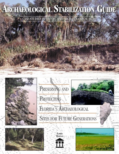
ARCHAEOLOGICAL STABILIZATION GUIDE<br />
CASE STUDIES IN PROTECTING ARCHAEOLOGICAL SITES<br />
PRESERVING AND<br />
PROTECTING<br />
FLORIDA'S ARCHAEOLOGICAL<br />
SITES FOR FUTURE GENERATIONS<br />
FLORIDA<br />
HERITAGE
2<br />
ACKNOWLEDGMENTS<br />
The <strong>Archaeological</strong> <strong>Stabilization</strong> <strong>Guide</strong> was prepared as part <strong>of</strong> a larger<br />
project entitled Cultural Resource Protection in the Coastal Zone. The<br />
purpose <strong>of</strong> the project has been to develop and implement strategies for<br />
protecting sites on private land. The project was made possible by a subgrant<br />
from the <strong>Florida</strong> Department <strong>of</strong> Community Affairs, <strong>Florida</strong> Coastal<br />
Management Program, in cooperation with the U.S. Department <strong>of</strong> Commerce,<br />
National Oceanic and Atmospheric Administration.<br />
The <strong>Guide</strong> was created by: Mary Glowacki, Jim Miller, Brenda Swann and<br />
Louis Tesar, updated in 2004 by Amanda Evans. However, it would not have<br />
been possible without the help <strong>of</strong> many individuals and organizations. From<br />
the <strong>Florida</strong> <strong>Division</strong> <strong>of</strong> <strong>Historical</strong> Resources,we thank the former Directors,<br />
George W. Percy and Dr. Janet Snyder Matthews. Jim Miller, formerly the<br />
Chief <strong>of</strong> the Bureau <strong>of</strong> <strong>Archaeological</strong> Research developed the proposal and<br />
administered the project. Additionally, we thank Henry Baker, Charly<br />
Branham, James Christie, Melissa Memory, Andrew Myers, Christine<br />
Newman, and Ryan Wheeler in the Bureau <strong>of</strong> <strong>Archaeological</strong> Research, and<br />
Susan Harp in the Bureau <strong>of</strong> Historic Preservation.<br />
We also wish to thank the <strong>Florida</strong> Department <strong>of</strong> Environmental Protection<br />
(DEP), Bureau <strong>of</strong> Beaches and Coastal Systems for valuable information on<br />
erosion. Special thanks go to Steve Martin, <strong>Division</strong> <strong>of</strong> Recreation and Parks,<br />
Bureau <strong>of</strong> Natural and Cultural Resources, for recommending case studies<br />
and providing accompanying photos. We also thank Jeanne-Marie Warzeski<br />
<strong>of</strong> that <strong>of</strong>fice for loaning photos.<br />
Robert Thorne <strong>of</strong> the National Clearinghouse for <strong>Archaeological</strong> Site<br />
<strong>Stabilization</strong> provided numerous published sources on site stabilization for<br />
which we are grateful.<br />
Finally, we would like to acknowledge the assistance <strong>of</strong> the many land managers<br />
and other individuals who have provided us with information on specific<br />
case studies, and who have been personally involved in their stabilization.<br />
They include Bill Burger, Charles Dutoit, Sonia Gray, Jeff Mauch, Jeanne<br />
Parks and Benny Woodham. We additionally thank Bill Burger for supplying<br />
us with the front-cover photo <strong>of</strong> the eroded mound (8MA27), which so clearly<br />
shows the effects <strong>of</strong> erosion.<br />
<strong>Archaeological</strong> <strong>Stabilization</strong> <strong>Guide</strong>
ARCHAEOLOGICAL STABILIZATION GUIDE:<br />
Case Studies in Stabilizing <strong>Archaeological</strong> Sites<br />
INTRODUCTION ............................................................................................................................................. 4<br />
CASE STUDIES ................................................................................................................................................ 5<br />
BLOCK-STERNS (LE148) .................................................................................................................. 5<br />
CRYSTAL RIVER STATE ARCHAEOLOGICAL SITE (CI1) ...................................................... 6<br />
EMERSON POINT/SNEAD ISLAND TEMPLE MOUND/PORTAVANT<br />
INDIAN MOUND SITE (MA919) ................................................................................................. 7<br />
FORT SAN MARCOS DE APALACHEE (WA26) ............................................................................ 8<br />
MILL POINT 3 (HI18) ........................................................................................................................ 9<br />
MOUND AVENUE MOUND (VO240) ............................................................................................... 10<br />
MOUND KEY (LL2) ............................................................................................................................ 11<br />
MOUNT ELIZABETH (MT30) .......................................................................................................... 12<br />
MUNYON ISLAND SITE (PB79) ...................................................................................................... 13<br />
NOCOROCO AND MOUNT OSWALD (VO82) ............................................................................... 14<br />
PEACOCK SPRINGS SITE (SU121) ................................................................................................. 15<br />
SHELL BLUFF LANDING (SJ32) ..................................................................................................... 16<br />
VELDA MOUND (LE44) ..................................................................................................................... 18<br />
ORGANIZATIONS AND ASSISTANCE ........................................................................................................ 19<br />
REFERENCES ................................................................................................................................................. 21<br />
<strong>Archaeological</strong> <strong>Stabilization</strong> <strong>Guide</strong> 3
4<br />
INTRODUCTION<br />
The <strong>Archaeological</strong> <strong>Stabilization</strong> <strong>Guide</strong> was created to assist private property<br />
owners to stabilize archaeological sites in their stewardship. The purpose<br />
<strong>of</strong> this guide is to present practical solutions to stabilization problems<br />
through case studies at public and private archaeological sites. The guide is<br />
divided into two parts—case studies and useful resources. The case studies<br />
illustrate some <strong>of</strong> the leading causes <strong>of</strong> site destabilization, corresponding<br />
stabilization solutions, and the effectiveness <strong>of</strong> these solutions in reducing or<br />
eliminating loss <strong>of</strong> sites. There are many factors that contribute to the<br />
destabilization <strong>of</strong> archaeological sites. Some <strong>of</strong> the most common in <strong>Florida</strong><br />
are: shoreline water levels, currents, and surges; torrential rain and wind;<br />
vehicular and pedestrian traffic; invasive or intrusive vegetation; unauthorized<br />
digging; vandalism; and development. The second part <strong>of</strong> the guide provides<br />
a list <strong>of</strong> organizations and references to consult when faced with a particular<br />
stabilization problem.<br />
The <strong>Stabilization</strong> <strong>Guide</strong> is part <strong>of</strong> a series <strong>of</strong> how-to guides for managing<br />
archaeological sites. Although written for private landowners, the principles <strong>of</strong><br />
site protection are similar on public lands. For an overview <strong>of</strong> various threats and<br />
protective measures, see Best Management Practices: An Owner’s <strong>Guide</strong> to<br />
Protecting <strong>Archaeological</strong> Sites also available from the <strong>Florida</strong> <strong>Division</strong> <strong>of</strong><br />
<strong>Historical</strong> Resources. The <strong>Division</strong> and the Department <strong>of</strong> State manage a wide<br />
variety <strong>of</strong> programs to promote <strong>Florida</strong>’s rich cultural heritage. For more<br />
information about archaeology, historic preservation, museums, and folklife, visit<br />
our web page at www.flheritage.com. Thank you for helping protect our unique<br />
and irreplaceable cultural resources.<br />
<strong>Archaeological</strong> <strong>Stabilization</strong> <strong>Guide</strong>
Project: Block-Sterns (LE148)<br />
Destabilization Issue: Unauthorized digging/looting<br />
Location: The Block-Sterns site is located in eastern<br />
Leon County, <strong>Florida</strong>, adjacent to Piney-Z Lake, an<br />
artificially created segment <strong>of</strong> Lake Lafayette.<br />
Site Description: The Block-Sterns site complex<br />
consists <strong>of</strong> four earthen mounds, probably used as burial<br />
mounds, and an extensive associated village area. The<br />
site was occupied from at least the Middle Archaic<br />
through Fort Walton periods (ca., 7000 B.C.-A.D. 1600);<br />
however, it is most noted for its late Deptford through<br />
Weeden Island period occupations. Artifacts representing<br />
the late Paleoindian and Early Archaic (ca. 10,000-7000<br />
B.C.) and later Leon-Jefferson and Territorial periods<br />
have also been found in the general area.<br />
Site Owner/Manager: The City <strong>of</strong> Tallahassee, Leon<br />
County, and private individuals own various portions <strong>of</strong><br />
this site complex. The Tallahassee-Leon County Parks &<br />
Recreation Department manages the publicly accessible<br />
portion <strong>of</strong> the site.<br />
Block-Sterns lithic artifacts. Looting<br />
archaeological sites destroys the<br />
context <strong>of</strong> artifacts and prevents<br />
reconstructing the culture and history<br />
associated with them.<br />
Contributing Organizations:<br />
Tallahassee-Leon County Parks &<br />
Recreation Department; <strong>Florida</strong> <strong>Division</strong> <strong>of</strong><br />
<strong>Historical</strong> Resources, Bureau <strong>of</strong><br />
<strong>Archaeological</strong> Research; <strong>Florida</strong> Fish and<br />
Wildlife Conservation Commission; local<br />
concerned citizens.<br />
Management Problems: Unauthorized digging/looting.<br />
Management Solutions: Warning signs have been<br />
posted at the mounds, and <strong>Florida</strong> Wildlife Officers<br />
patrol the site and have arrested and prosecuted some <strong>of</strong><br />
the looters. Looter holes are backfilled to prevent further<br />
damage to the site, such as erosion and mound collapse.<br />
Removal <strong>of</strong> understory brush and vines that block the<br />
view <strong>of</strong> the mounds is planned. An interpretive trail, part<br />
<strong>of</strong> the Lafayette Heritage Trail, is planned in response to<br />
a growing public interest.<br />
Outcome: Publicity from the arrest and prosecution<br />
<strong>of</strong> site looters has resulted in fewer incidents <strong>of</strong><br />
illegal digging. Site managers expect increased public<br />
visitation to further reduce site looting incidents.<br />
Map <strong>of</strong> eastern Leon County, <strong>Florida</strong>, showing location <strong>of</strong> Block-Sterns site.<br />
<strong>Archaeological</strong> <strong>Stabilization</strong> <strong>Guide</strong> 5
Project: Crystal River State <strong>Archaeological</strong> Site (CI1)<br />
Destabilization Issues: Foot traffic; shoreline erosion<br />
due to currents and boat wakes<br />
Location: The site is situated on the north side <strong>of</strong><br />
Crystal River, two miles west <strong>of</strong> the town <strong>of</strong> Crystal<br />
River, and four miles east <strong>of</strong> the Gulf <strong>of</strong> Mexico, in<br />
Citrus County, <strong>Florida</strong>.<br />
Site Description: Crystal River is a prehistoric<br />
ceremonial complex and burial site consisting <strong>of</strong> ten<br />
temple, burial, shell, and sand mounds. The site was<br />
occupied during the Deptford, Weeden Island, and<br />
Safety Harbor periods (ca. 200 B.C.-A.D. 1000).<br />
Site Owner/Manager: The State <strong>of</strong> <strong>Florida</strong> owns most<br />
<strong>of</strong> the site, and the Department <strong>of</strong> Environmental<br />
Protection, <strong>Division</strong> <strong>of</strong> Recreation and Parks manages<br />
the site.<br />
Contributing Organizations: Department <strong>of</strong> State,<br />
<strong>Division</strong> <strong>of</strong> <strong>Historical</strong> Resources, Bureau <strong>of</strong><br />
<strong>Archaeological</strong> Research; Department <strong>of</strong> Environmental<br />
Protection, <strong>Division</strong> <strong>of</strong> Recreation and Parks; Gulf<br />
Archaeology Research Institute.<br />
Management Problems: (1) Erosion on mound slope<br />
due to uncontrolled pedestrian traffic, and (2) loss <strong>of</strong><br />
archaeological deposits due to seawall collapse and<br />
needed repair. Boat wakes and natural shoreline<br />
erosion contribute to site loss that the seawall is<br />
intended to prevent.<br />
Left: Diagram <strong>of</strong> erosion due<br />
to currents and boat wake.<br />
Right: Diagram <strong>of</strong> seawall<br />
6<br />
Management Solutions: (1)<br />
Construction <strong>of</strong> an access stairway over the<br />
eroding pedestrian access trail; and (2)<br />
repair <strong>of</strong> the collapsed seawall including<br />
removal <strong>of</strong> the fallen portion, recovery <strong>of</strong><br />
eroded cultural deposits (some <strong>of</strong> which were<br />
layered on the submerged seawall, while intact<br />
remains were discovered in the river bottom), the<br />
installation <strong>of</strong> steel support rods, and the excavation and<br />
backfill <strong>of</strong> the area where support rods were placed. The<br />
archaeological deposits are protected by the seawall.<br />
Outcome: (1) The stairway has stabilized the erosion<br />
problem on the mound and enhanced visitor access to it;<br />
and (2) seawall replacement revealed intact cultural<br />
remains and much less site disturbance than expected in<br />
the seawall area. The new seawall will serve to protect<br />
these remains and future researchers and site managers<br />
will know to consider the sensitive nature <strong>of</strong> this<br />
shoreline site area before initiating any resource<br />
management effort. A fence was installed along the river<br />
side <strong>of</strong> Temple Mound “A” to stop visitors from walking<br />
up the side <strong>of</strong> the mound. Additionally, a large tree that<br />
was located on the top <strong>of</strong> the mound was cut <strong>of</strong>f at<br />
ground level to prevent the tree from falling down in a<br />
storm and the root system destroying part <strong>of</strong> the mound.<br />
To the left is the seawall<br />
protecting the back face <strong>of</strong><br />
Crystal River mound. A<br />
seawall is a structure<br />
separating land and water<br />
areas primarily to prevent<br />
erosion and other damage<br />
caused by wave action.<br />
Above: Mound with access ramp, Crystal<br />
River State <strong>Archaeological</strong> Site.<br />
<strong>Archaeological</strong> <strong>Stabilization</strong> <strong>Guide</strong>
Project: Emerson Point/Snead Island Temple Mound/<br />
Portavant Indian Mound site (MA919)<br />
Destabilization Issues: Shoreline erosion; foot traffic;<br />
invasive vegetation; looting/unauthorized digging<br />
Location: The Emerson Point site is located on the<br />
southern shore <strong>of</strong> Snead Island, a Gulf Coast barrier<br />
island in northwestern Manatee County, along <strong>Florida</strong>’s<br />
central Gulf Coast.<br />
Site Description: The Emerson Point site complex<br />
consists <strong>of</strong> a flat-topped temple mound, a low platform<br />
mound, several midden mounds and shell ridges, and a<br />
plaza area. The site dates from the Late Manasota<br />
Period, Safety Harbor Period, and Leon-Jefferson Period<br />
(ca. A.D. 800-1748).<br />
Site Owner/Manager: The State <strong>of</strong> <strong>Florida</strong> owns this<br />
site complex, and Manatee County Public Services<br />
Department manages it.<br />
Contributing Organizations: Tampa Bay National<br />
Estuary Program; Southwest <strong>Florida</strong> Water Management<br />
District; <strong>Florida</strong> Department <strong>of</strong> Environmental Protection;<br />
Manatee County Public Services Department; Greiner<br />
Engineering; Manatee County Prison.<br />
Management Problems: Shoreline erosion is damaging<br />
the Manatee River side <strong>of</strong> the Portavant Mound, and<br />
looting has occurred in erosion-exposed areas. Exotic<br />
vegetation and foot traffic have destabilized the site,<br />
particularly the mound areas.<br />
Management Solutions: Exotic vegetation was manually<br />
removed from archaeologically sensitive areas. A staircase<br />
was constructed on the principal mound to avoid<br />
Aerial photo <strong>of</strong> Emerson Point<br />
destabilization from foot traffic. The<br />
staircase was constructed with four blocks at<br />
the base and laid directly on the side <strong>of</strong> the<br />
mound, causing as little intrusive damage as<br />
possible. Areas adjacent to the staircase that<br />
could have been affected by its installation were<br />
monitored for any possible exposure or<br />
disturbance <strong>of</strong> cultural material. A revetment, including revegetation<br />
<strong>of</strong> mangroves, on the shoreline <strong>of</strong> Portavant<br />
Mound has been proposed to decrease erosion and perhaps<br />
the looting caused by erosion.<br />
Outcome: The exotic vegetation removal is ongoing and<br />
has decreased damage caused by the invasive vegetation.<br />
The staircase has been successful in reducing damage from<br />
pedestrian traffic. The revetment proposal has been<br />
approved by the managing agency, which is currently<br />
applying for grants to build the revetment. Until the<br />
revetment is constructed, erosion and looting will continue.<br />
Shell midden showing<br />
damage due to<br />
foot traffic.<br />
<strong>Archaeological</strong> <strong>Stabilization</strong> <strong>Guide</strong> 7
Project: Fort San Marcos de Apalache (WA26)<br />
Destabilization Issues: Erosion due to water currents<br />
and boat wake; unauthorized digging/looting<br />
Location: Fort San Marcos de Apalache is located at the<br />
confluence <strong>of</strong> the Wakulla and St. Marks Rivers in<br />
Wakulla County, <strong>Florida</strong>.<br />
Site Description: Fort San Marcos has been the site <strong>of</strong><br />
two Spanish forts. The first was constructed <strong>of</strong> wood in<br />
the late 1600s. A sturdier limestone structure was built in<br />
the mid- to late-1700s.<br />
Site Owner/Manager: The State <strong>of</strong> <strong>Florida</strong> owns the<br />
site, and the Department <strong>of</strong> Environmental Protection,<br />
<strong>Division</strong> <strong>of</strong> Recreation and Parks manages the site.<br />
Contributing Organizations: Department <strong>of</strong> State,<br />
<strong>Division</strong> <strong>of</strong> <strong>Historical</strong> Resources, Bureau <strong>of</strong><br />
<strong>Archaeological</strong> Research; Department <strong>of</strong> Environmental<br />
Protection, <strong>Division</strong> <strong>of</strong> Recreation and Parks; City <strong>of</strong><br />
St. Marks.<br />
Management Problems: The site is threatened by<br />
shoreline erosion, structural deterioration, and looting.<br />
<strong>Archaeological</strong> features <strong>of</strong> the fort are being eroded into<br />
the St. Marks and Wakulla Rivers, with erosion<br />
accelerated by oil barge and other boat traffic. Along the<br />
St. Marks River bank, archaeological features include<br />
wooden pilings and other structural members, and<br />
artifacts associated with an early to mid-19th-century<br />
wharf, marine ways, other structures, and possibly an<br />
8<br />
Shoreline erosion <strong>of</strong><br />
fort wall, Fort San<br />
Marcos de Apalache,<br />
before construction <strong>of</strong><br />
a protective bulkhead.<br />
earlier barrel well. Along the Wakulla<br />
River side, a cut limestone fort wall has for<br />
years been eroding and collapsing, thereby<br />
threatening the integrity <strong>of</strong> the site protected<br />
by the wall.<br />
Management Solutions: In addition to<br />
resource documentation, protective measures<br />
need to be planned and implemented along the St. Marks<br />
River. A bulkhead was constructed as a temporary<br />
measure for one portion <strong>of</strong> the cut stone fort wall along<br />
the Wakulla River shoreline.<br />
Outcome: Along the Wakulla River, settling and<br />
washout <strong>of</strong> sand backfill behind the bulkhead are<br />
creating indentations on the surface, requiring routine<br />
filling. Sand is slowly being lost from the revetment, and<br />
it shows signs <strong>of</strong> movement, suggesting the need for<br />
structural design modifications.<br />
A bulkhead is a structure<br />
that retains or prevents land from<br />
sliding into the water or protects it<br />
from wave damage. It functions<br />
much like a seawall (see Crystal<br />
River case study for seawall<br />
illustrations).<br />
These photos show fort<br />
wall bulkhead<br />
construction during<br />
different phases.<br />
<strong>Archaeological</strong> <strong>Stabilization</strong> <strong>Guide</strong>
Project: Mill Point 3 (HI18)<br />
Destabilization Issue: Development causing ground<br />
disturbance<br />
Location: The site <strong>of</strong> Mill Point 3 is located on the north<br />
bank <strong>of</strong> the Alafia River, where the river is crossed by<br />
U.S. 41 in Williams Park, Hillsborough County.<br />
Site Description: Mill Point 3 is a shell mound which is<br />
part <strong>of</strong> a larger archaeological complex <strong>of</strong> shell mounds,<br />
middens, and fields associated with the Weeden Island<br />
culture (ca. A.D. 450-1000).<br />
Site Owner/Manager: Hillsborough County<br />
Contributing Organizations: Hillsborough County<br />
Parks and Recreation Department; Department <strong>of</strong> State,<br />
<strong>Division</strong> <strong>of</strong> <strong>Historical</strong> Resources, Bureau <strong>of</strong><br />
<strong>Archaeological</strong> Research; Dr. Brent Weisman,<br />
Department <strong>of</strong> Anthropology, University <strong>of</strong> South<br />
<strong>Florida</strong>; Cargill Fertilizer plant; Kimmons Contracting<br />
Company.<br />
Management Problems: Road construction and the<br />
development <strong>of</strong> the nearby Cargill fertilizer plant had<br />
disturbed much <strong>of</strong> the site complex. Mill Point 3 itself is<br />
situated in the vicinity <strong>of</strong> a previously abandoned trailer<br />
home with a septic tank, which Cargill Fertilizer used as<br />
a security facility during its ownership <strong>of</strong> the property.<br />
County park managers had been interested in removing<br />
the remains <strong>of</strong> the facility in developing the park. During<br />
the initial phase <strong>of</strong> this work, while removing a chain<br />
link fence surrounding the trailer, a precolumbian human<br />
jawbone was discovered. This prompted the involvement<br />
<strong>of</strong> the Bureau <strong>of</strong> <strong>Archaeological</strong> Research.<br />
Diagram by Ryan J. Wheeler<br />
Management Solutions: Because the<br />
removal process was considered<br />
potentially damaging to the site, a scope<br />
<strong>of</strong> work was drafted with recommendations<br />
from Dr. Ryan Wheeler, Archaeology<br />
Supervisor in the Bureau <strong>of</strong> <strong>Archaeological</strong><br />
Research. Dr. Wheeler visited the Mill Point site<br />
to assess the status <strong>of</strong> unmarked human burial remains.<br />
Recommendations were to dismantle and remove the<br />
trailer, and crush the septic tank and backfill it<br />
within a protective area, so as not to damage the mound.<br />
A safety fence with low impact posts would be erected<br />
to keep demolition activities inside the yard <strong>of</strong> the<br />
trailer. The work would also include removal <strong>of</strong> concrete<br />
pads, located next to the trailer, although leaving them in<br />
place could protect underlying site remains. A certified<br />
archaeological monitor was recommended to be present<br />
during the removal and stabilization processes, should<br />
any ground disturbing activities occur. Capping the site<br />
with a layer <strong>of</strong> organic soil and planting sod could help<br />
protect and stabilize the mound.<br />
Outcome: On June 14, 1999, Kimmons Contracting<br />
Company removed the mobile home, pumped out and<br />
crushed the septic tank, and removed the orange safety<br />
fence surrounding the site. The concrete slab was left in<br />
place. Jill Lehman <strong>of</strong> Hillsborough County Parks and<br />
Recreation supervised the work. The area was mowed<br />
and grass allowed to spread to serve as a protective<br />
cover as well as to conceal the archaeological remains.<br />
The park plans to install posts around the perimeter <strong>of</strong><br />
the area to keep out vehicles.<br />
Location <strong>of</strong> shell mound in relation<br />
to trailer home and septic tank.<br />
<strong>Archaeological</strong> <strong>Stabilization</strong> <strong>Guide</strong> 9
Project: Mound Avenue Mound (VO240)<br />
Destabilization Issues: Unauthorized digging/looting;<br />
residential development<br />
Location: The Mound Avenue Mound is located within<br />
the town <strong>of</strong> Ormond Beach near the western shoreline <strong>of</strong><br />
Indian River in Volusia County, <strong>Florida</strong>.<br />
Site Description: The Mound Avenue Mound is a multicomponent<br />
site dating from St. Johns I through early<br />
historic times (ca. 500 B.C. - A.D. 1600). The mound is<br />
an elevated earthen feature used as a place <strong>of</strong> burial by<br />
generations <strong>of</strong> Native Americans occupying the<br />
surrounding village area. The site has been listed on the<br />
National Register <strong>of</strong> Historic Places and has been a<br />
National Historic Landmark since 1966.<br />
Site Owner/Manager: Town <strong>of</strong> Ormond Beach/Ormond<br />
Beach Parks Department.<br />
Contributing Organizations: Town <strong>of</strong> Ormond Beach;<br />
Volusia Anthropological Society (FAS chapter); Museum<br />
<strong>of</strong> Arts and Sciences, Daytona Beach; Department <strong>of</strong><br />
State, <strong>Division</strong> <strong>of</strong> <strong>Historical</strong> Resources, Bureau <strong>of</strong><br />
<strong>Archaeological</strong> Research.<br />
Management Problems: The mound was subjected to<br />
unauthorized digging/looting. Some damage occured<br />
during initial landscaping and site preparation for<br />
planned residential use in which the owner planned to<br />
level the mound.<br />
10<br />
Management Solutions: Limited<br />
archaeological excavation demonstrated to<br />
the private owners and the public that the<br />
mound contained undisturbed burials. The<br />
Town <strong>of</strong> Ormond Beach owned and managed<br />
shoreline portions <strong>of</strong> the adjacent village<br />
midden as a public park headquarters. The<br />
Volusia Anthropological Society (VAS) spearheaded a<br />
fund raising drive, which resulted in acquisition <strong>of</strong> the<br />
property and its conveyance to the Town <strong>of</strong> Ormond<br />
Beach for park purposes. The Bureau <strong>of</strong> <strong>Archaeological</strong><br />
Research provided a staff archaeologist to work with<br />
Ormond Beach Parks Department and volunteers<br />
including VAS members, local residents, and Boy<br />
Scouts. They reburied previously excavated human<br />
remains in the area from which they had been removed,<br />
and spread a protective covering over the mound surface<br />
to restore its original appearance. Additionally, they<br />
installed irrigation pipe within the recent organic soil cap<br />
and layered squares <strong>of</strong> flower sod to protect the mound<br />
surface from erosion.<br />
Outcome: The mound restoration project brought local<br />
and area residents together and created a better<br />
understanding <strong>of</strong> the cultural importance <strong>of</strong> the Native<br />
American remains, particularly the need to protect<br />
Native American burial locations with the same respect<br />
and dignity shown more modern cemeteries. There is a<br />
nearby parking area from which to view the mound.<br />
Above: Mound Avenue Mound being laid<br />
with sod.<br />
Left: Mound Avenue Mound after the<br />
revegetation process was completed.<br />
Volunteers admire their work after revegetating<br />
the mound.<br />
<strong>Archaeological</strong> <strong>Stabilization</strong> <strong>Guide</strong>
Project: Mound Key (LL2)<br />
Destabilization Issues: Flooding; foot traffic;<br />
vandalism; unauthorized digging/looting<br />
Location: The Mound Key site is located on an island in<br />
Estero Bay, Lee County, <strong>Florida</strong>.<br />
Site Description: Mound Key includes burial mounds,<br />
shell ridges, shell mounds, canals, and water courts,<br />
which cover an area <strong>of</strong> roughly 125 acres. The site was<br />
occupied from at least Caloosahatchee I-V (ca., A.D.<br />
100 to 1750). It was later used from 1750 until 1945 by<br />
Spanish-Cuban, Seminole, and European-American<br />
settlers. Mound Key was listed on the National Register<br />
<strong>of</strong> Historic Places on August 12, 1970.<br />
Site Owner/<br />
Manager: The<br />
majority <strong>of</strong> the<br />
site is owned by<br />
the State <strong>of</strong><br />
<strong>Florida</strong>; a few<br />
outparcels remain<br />
in the<br />
hands <strong>of</strong><br />
individual private<br />
owners. The<br />
Department <strong>of</strong><br />
Environmental<br />
Protection,<br />
<strong>Division</strong> <strong>of</strong><br />
Recreation and<br />
Parks manages the<br />
site.<br />
Contributing Organizations: <strong>Florida</strong> <strong>Division</strong> <strong>of</strong><br />
Recreation and Parks; University <strong>of</strong> <strong>Florida</strong>, Randell<br />
Research Center; Department <strong>of</strong> State, <strong>Division</strong> <strong>of</strong><br />
<strong>Historical</strong> Resources, Bureau <strong>of</strong> <strong>Archaeological</strong><br />
Research; Ft. Myers Beach.<br />
Management Problems: This site is primarily<br />
threatened by flooding during high tide, foot traffic,<br />
vandalism, and looting. Of special concern are erosion<br />
gullies along the trail crossing Mound 1, and looters’<br />
holes on this same mound as well as two others. Portions<br />
<strong>of</strong> the trail, such as along the dredge/borrow pit, are<br />
slumping, as are unfilled looter holes. There is minor<br />
erosion elsewhere including the southeast landing area<br />
and the area surrounding the interpretive kiosk.<br />
Management Solutions: Suggestions have been made<br />
for the placement <strong>of</strong> two or more telephone pole<br />
stairways on top <strong>of</strong> the trail on the slope <strong>of</strong> Mound 1.<br />
Prior to placing the stairway, the trail<br />
furrow (which is a historic trail) would be<br />
filled using a combination <strong>of</strong> sandbags and<br />
other fill material. This method has been<br />
used before by the <strong>Florida</strong> <strong>Division</strong> <strong>of</strong><br />
Recreation and Parks at the Crystal River State<br />
<strong>Archaeological</strong> Site and has been very<br />
successful. Sandbags, backfill, and additional fill<br />
material also are recommended to fill looter’s holes. A<br />
detailed topographic map <strong>of</strong> the site, documenting<br />
looting areas, has been prepared to use in planning<br />
restoration activities and site interpretation.<br />
Outcome: Mound Key park manager, Jeanne Parks, has<br />
received funding from the State, and along with<br />
volunteers, is implementing stabilization efforts. She is<br />
considering employing a cement conveyer to transport<br />
sand directly to areas requiring fill. This would eliminate<br />
the need to walk across the shoreline where the<br />
mangroves, with large protruding roots, are located.<br />
Trail across Mound 1, Mound Key.<br />
<strong>Archaeological</strong> <strong>Stabilization</strong> <strong>Guide</strong> 11
Project: Mount Elizabeth (MT30)<br />
<strong>Stabilization</strong> Issues: Erosion due to currents, boat<br />
wakes, storm surges, and high storm winds and heavy<br />
rain; vandalism<br />
Location: The Mount Elizabeth site is located on the<br />
west bank <strong>of</strong> the Indian River (the Intracoastal<br />
Waterway) in the Indian Riverside Park, Martin County,<br />
<strong>Florida</strong>.<br />
Site Description: The site is a large, estuarine, coastal<br />
midden containing Late Archaic and early St. Johns<br />
prehistoric components (ca., 1000 B.C.-A.D. 1), with<br />
American 19th-and 20th-century occupations.<br />
Site Owner/Manager: Martin County.<br />
Contributing Organizations: Martin County; Southeast<br />
<strong>Florida</strong> <strong>Archaeological</strong> Society (SEFAS).<br />
Management Problems: The site has sustained<br />
substantial damage, particularly due to vandalism, since<br />
it was first cleared in the late 19th century. The Indian<br />
River side <strong>of</strong> the site is eroding as a consequence <strong>of</strong><br />
wave and storm action along the Intracoastal Waterway.<br />
Mount Elizabeth is particularly susceptible to damage<br />
caused by tropical storms and hurricanes, in addition to<br />
northeasters and periods <strong>of</strong> unusually severe weather<br />
patterns associated with El Niño.<br />
Management Solutions: In their 1998 cultural<br />
assessment report on the site, the archaeological contract<br />
The photo above shows deflation on the eastern side <strong>of</strong> Mt. Elizabeth,<br />
a condition where heavy artifacts are left in a thin layer after the soil<br />
matrix has blown or washed away.<br />
12<br />
firm, Janus Research, recommended that<br />
the Mount Elizabeth site be designated as<br />
greenspace within the proposed larger<br />
public Indian Riverside Park. The firm<br />
recommended that the site be stabilized by<br />
revegetating it with select native plant species<br />
and possibly sod.<br />
In 1999 Martin County received matching grant funds<br />
from the <strong>Division</strong> <strong>of</strong> <strong>Historical</strong> Resources to develop a<br />
stabilization plan to preserve the site. The County<br />
indicates that all attempts will be made to avoid or<br />
minimize ground-disturbing activities within both dense<br />
and sparse midden areas. Exotic plants in these areas<br />
will be removed by hand, when possible, and only to<br />
ground level. Stumps and roots will be destroyed using<br />
herbicides. Because erosion <strong>of</strong> the river will become<br />
more severe when the existing exotic vegetation is<br />
removed, replanting these areas with native ground<br />
cover is planned. If this does not provide sufficient<br />
support to reduce erosion, sod or grass matting will be<br />
used instead. Demolition or removal <strong>of</strong> buildings will be<br />
confined to areas that do not contain midden or that<br />
contain only redeposited midden.<br />
Outcome: Martin County has hired contractors, an<br />
archaeologist and a coastal engineer to develop a<br />
specific work plan for site stabilization efforts. The work<br />
is slated for the summer and fall <strong>of</strong> 2000, with a 2001<br />
completion date.<br />
East side <strong>of</strong> Mt. Elizabeth showing erosion <strong>of</strong> mound into the<br />
Indian River Lagoon. Note the exotic Brazilian peppers covering<br />
the mound.<br />
<strong>Archaeological</strong> <strong>Stabilization</strong> <strong>Guide</strong>
Project: Munyon Island Site (PB79)<br />
<strong>Stabilization</strong> Issues: Invasive vegetation; vehicular<br />
traffic; water current and boat wake erosion;<br />
unauthorized digging/looting<br />
Location: The Munyon Island Site, located on Munyon<br />
Island in Lake Worth, is included within the boundaries<br />
<strong>of</strong> the John D. MacArthur Beach State Park in Palm<br />
Beach County, <strong>Florida</strong>.<br />
Site Description: The site consists <strong>of</strong> three modest<br />
prehistoric shell middens and a historic homestead, as<br />
well as other structures dating to the 19th and 20th centuries. The island was visited by early Floridians,<br />
probably on a seasonal basis, for fish, game, and other<br />
resources. From the Third Seminole War onward, there<br />
was a series <strong>of</strong> non-Indian occupations. These included<br />
19th - century homesteading; operation <strong>of</strong> the Hotel<br />
Hygeia, an early 1900s spa; WWII American military<br />
parade grounds; and a mid- to late 20th- century private<br />
residence.<br />
Site Owner/Manager: The State <strong>of</strong> <strong>Florida</strong> owns the<br />
property, and the Department <strong>of</strong> Environmental<br />
Protection, <strong>Division</strong> <strong>of</strong> Recreation and Parks manages<br />
the park.<br />
Contributing Organizations: <strong>Florida</strong> <strong>Division</strong> <strong>of</strong><br />
Recreation and Parks; Palm Beach County; Department<br />
<strong>of</strong> the Army, Corps <strong>of</strong> Engineers; Department <strong>of</strong> State,<br />
<strong>Division</strong> <strong>of</strong> <strong>Historical</strong> Resources, Bureau <strong>of</strong><br />
<strong>Archaeological</strong> Research.<br />
Historic seawall and dock area at Munyon Island.<br />
Management Problems: The spread <strong>of</strong><br />
exotic plants and trees, vehicular traffic,<br />
shoreline erosion, and looting were<br />
destabilizing the site.<br />
Management Solutions: As part <strong>of</strong> an island<br />
restoration project in 1996, exotic plants and<br />
trees were removed by basal bark herbicide<br />
treatment, and manual and mechanized methods.<br />
Herbicide and manual methods were employed in areas<br />
with historic architectural remains to avoid or minimize<br />
damage. To prevent erosion and restore the natural<br />
environmental setting, exposed areas <strong>of</strong> the historic<br />
island ground surface were covered with wood chips,<br />
creating a rich organic topsoil. Selected native<br />
vegetation was also planted in areas that would not<br />
disturb archaeological and historical sites. To counter<br />
shoreline erosion, riprap (rock placed on a streambank to<br />
prevent erosion) was placed along selected areas subject<br />
to wave action. The earthen causeway to the island was<br />
breached to restore tidal circulation and eliminate<br />
vehicular access.<br />
Outcome: As <strong>of</strong> March 1999, Assistant Park Manager,<br />
Patrick Rash, reported that protective measures have<br />
been successful, although removal <strong>of</strong> exotic plants<br />
continues on a regular basis due to the productivity <strong>of</strong><br />
their seedbeds. Riprap is also holding well.<br />
Mulched area showing plant holes from vegetation effort,<br />
Munyon Island Site.<br />
<strong>Archaeological</strong> <strong>Stabilization</strong> <strong>Guide</strong> 13
Project: Nocoroco and Mount Oswald (VO82)<br />
<strong>Stabilization</strong> Issues: Erosion due to water currents and<br />
boat wakes; unauthorized digging/looting; foot traffic<br />
Location: The Nocoroco site and Mount Oswald<br />
Plantation are located on the northern tip <strong>of</strong> the Tomoka<br />
peninsula in the northeastern part <strong>of</strong> Tomoka State Park,<br />
Volusia County, <strong>Florida</strong>.<br />
Site Description: The Nocoroco site is represented by a<br />
black earth and shell midden comprising the remains <strong>of</strong> a<br />
Timucuan village, first reported by the Spanish explorer<br />
Alvaro Mexía in 1605. Ceramic styles from Orange, St.<br />
Johns I & II, and St. Augustine periods indicate that<br />
natives first inhabited the site around 1500 B.C. It was still<br />
occupied at the time <strong>of</strong> Mexía’s visit. The site has been<br />
listed on the National Register <strong>of</strong> Historic Places since<br />
1973. The remains <strong>of</strong> the Mount Oswald site include<br />
various 18th-century artifacts, including wrought iron nails<br />
and pearlware ceramic sherds. The Mount Oswald<br />
Plantation overlaps the site <strong>of</strong> Nocoroco and is named after<br />
Richard Oswald, who received a 20,000-acre land grant<br />
from the British government in 1774. Oswald used his<br />
land to cultivate indigo, for which he brought 34 skilled<br />
craftsman and their families and 100 slaves to the site.<br />
Eventually, the number <strong>of</strong> slaves on Oswald’s indigo<br />
plantation grew to 240.<br />
Map <strong>of</strong> site.<br />
14<br />
Site Owner/Manager: The State <strong>of</strong><br />
<strong>Florida</strong> owns this site, and the Department<br />
<strong>of</strong> Environmental Protection, <strong>Division</strong> <strong>of</strong><br />
Recreation and Parks manages the site.<br />
Contributing Organizations: <strong>Florida</strong><br />
Department <strong>of</strong> Environmental Protection,<br />
<strong>Division</strong> <strong>of</strong> Recreation and Parks.<br />
Management Problems: Shoreline erosion has<br />
threatened much <strong>of</strong> the site. Pedestrian foot traffic also<br />
threatens the site, as does looting/unauthorized digging.<br />
Management Solutions: Installation <strong>of</strong> geo-webbing<br />
(heavy, coarse fabric put down under sand or rock to<br />
prevent washout <strong>of</strong> sand materials) along the shoreline<br />
would help stabilize the shoreline, and recontouring the<br />
riverbank would also facilitate shoreline stabilization to<br />
protect the remaining site area from further loss. American<br />
Preservation Consultants, Inc., while investigating Mount<br />
Oswald, recommended in 1999, as Bruce Piatek and<br />
Associates had in 1992, that fill be added to pedestrian<br />
trails and public access to the sites be limited to prevent<br />
further damage due to foot traffic and looting.<br />
Outcome: In 1995 an archaeological investigation was<br />
performed at the request <strong>of</strong> the <strong>Florida</strong> Department <strong>of</strong><br />
Environmental Protection to determine that no<br />
archaeological remains would be disturbed during the<br />
installation <strong>of</strong> geo-webbing to stop river bank erosion.<br />
After completing the investigation, the contractor, <strong>Florida</strong><br />
<strong>Archaeological</strong> Services, Inc., recommended that the<br />
project proceed, as midden was determined to be overlain<br />
by 80-160 cm <strong>of</strong> dredge fill, effectively protecting it<br />
against adverse impact. The geo-webbing has successfully<br />
reduced river bank erosion. Additionally, park managers<br />
added fill to walkways and have prohibited parking<br />
near the archaeological sites. Both <strong>of</strong> these actions<br />
have dramatically decreased damage from foot traffic<br />
and looting.<br />
Damage from pedestrian traffic at the Nocoroco/Mount Oswald site.<br />
<strong>Archaeological</strong> <strong>Stabilization</strong> <strong>Guide</strong>
Project: Peacock Springs site (SU121)<br />
Destabilization Issue: Unauthorized digging/looting<br />
Location: The Peacock Springs site, one <strong>of</strong> six<br />
archaeological sites identified in the Peacock Springs<br />
State Recreation Area, is located north <strong>of</strong> the Suwannee<br />
River, two miles east <strong>of</strong> Luraville, in Suwannee County,<br />
<strong>Florida</strong>.<br />
Site Description: This site is a prehistoric habitation<br />
site, possibly a village. It covers an area <strong>of</strong><br />
approximately 187,000 square meters and is represented<br />
by at least three cultural periods including Orange<br />
(3500-1500 B.C.), followed by Early Weeden Island<br />
(A.D. 400-750) and Suwannee River (A.D. 750-1500).<br />
Site Owner/Manager: The State <strong>of</strong> <strong>Florida</strong> owns this<br />
site, and the Department <strong>of</strong> Environmental Protection,<br />
<strong>Division</strong> <strong>of</strong> Recreation and Parks manages the site.<br />
Contributing Organizations: Department <strong>of</strong> State,<br />
<strong>Division</strong> <strong>of</strong> <strong>Historical</strong> Resources, Bureau <strong>of</strong><br />
<strong>Archaeological</strong> Research; Department <strong>of</strong><br />
Environmental Protection, <strong>Division</strong> <strong>of</strong><br />
Recreation and Parks; <strong>Florida</strong> Institute <strong>of</strong><br />
Park Personnel (FIPP).<br />
Management Problems: The site was<br />
cultivated, and unauthorized digging left<br />
numerous looter holes prior to state acquisition.<br />
Management Solutions: The looter holes were<br />
backfilled, and a sign was posted identifying the site’s<br />
location and significance, as well as the laws protecting<br />
it. Grass and other vegetation was planted to create a<br />
protective cover, stabilizing the site. Grass was selected<br />
because <strong>of</strong> its minimal root system, affecting only the<br />
already disturbed plow zone.<br />
Outcome: Project managers report that the site remains<br />
stable due to the protective measures, and looting has<br />
also decreased.<br />
Location <strong>of</strong> vandal pits at 8SU121, Peacock Springs Recreation Area. Diagram taken from C.A.R.L. <strong>Archaeological</strong><br />
Survey Report.<br />
<strong>Archaeological</strong> <strong>Stabilization</strong> <strong>Guide</strong> 15
Project: Shell Bluff Landing site (SJ32)<br />
<strong>Stabilization</strong> Issues: Erosion due to tides, waves and<br />
wakes caused by boats<br />
Location: Shell Bluff Landing site is located along the<br />
eastern shoreline <strong>of</strong> the Tolomato River on the west side<br />
<strong>of</strong> the Guana River Peninsula in St. Johns County,<br />
<strong>Florida</strong>.<br />
Site Description: The site is an extensive shell midden,<br />
containing materials dating from the Late Archaic<br />
Orange Period, the <strong>Florida</strong> Transitional Period, the St.<br />
Johns I & II periods, the 17th-century and early 19th- century Spanish occupations, and the American period,<br />
(ca. 2000 B.C. to the present). The site has been listed<br />
on the National Register since 1991.<br />
Site Owner/Manager: The State <strong>of</strong> <strong>Florida</strong> owns the<br />
site, and the Department <strong>of</strong> Environmental Protection,<br />
<strong>Division</strong> <strong>of</strong> Recreation and Parks manages the site.<br />
Contributing Organizations: <strong>Florida</strong> Department <strong>of</strong><br />
State, <strong>Division</strong> <strong>of</strong> <strong>Historical</strong> Resources, Bureau <strong>of</strong><br />
<strong>Archaeological</strong> Research; Department <strong>of</strong> Environmental<br />
Protection, <strong>Division</strong> <strong>of</strong> Recreation and Parks; <strong>Florida</strong><br />
Department <strong>of</strong> Transportation; U.S. Army Corps <strong>of</strong><br />
Engineers Waterways Experiment Station.<br />
Management Problems: This site is threatened by<br />
coastal tidal fluctuation, wave action resulting from boat<br />
traffic and wind, and to some degree, the continuing rise<br />
in sea level.<br />
Management Solutions: From 1984 to 1985 the<br />
Department <strong>of</strong> Environmental Protection (DEP),<br />
<strong>Division</strong> <strong>of</strong> Recreation and Parks, built a wooden<br />
bulkhead as a temporary measure to protect a 19th- century coquina well within the site, located on the river<br />
shore. In 1987, the U.S. Army Corps <strong>of</strong> Engineers<br />
Waterways Experiment Station initiated an erosion-<br />
Storm-damaged bulkhead.<br />
16<br />
monitoring project, in which the rate <strong>of</strong><br />
erosion across the western face <strong>of</strong> the site<br />
was measured. In 1992, the DEP placed<br />
riprap and geo-webbing along the shoreline.<br />
To stabilize the shoreline, park staff are<br />
utilizing boulder riprap, which is occasionally<br />
renewed.<br />
Plan <strong>of</strong> protective bulkhead. Diagram from U.S. Army Corps <strong>of</strong><br />
Engineers Waterways Experiment Station 1990.<br />
<strong>Archaeological</strong> <strong>Stabilization</strong> <strong>Guide</strong>
Project: Shell Bluff Landing site (SJ32) continued...<br />
The results <strong>of</strong> the Corps <strong>of</strong> Engineers study suggested<br />
that a “no wake” zone should be established along the<br />
Intracoastal Waterway from north <strong>of</strong> Shell Bluff to the<br />
confluence <strong>of</strong> the Tolomato and Guana Rivers. The<br />
project concluded that while the percentage <strong>of</strong> damage<br />
directly resulting from boat wakes, especially<br />
Intracoastal Waterway barge traffic, could not be<br />
accurately determined, the reduction <strong>of</strong> wake-related<br />
wave action could only have a beneficial effect in terms<br />
<strong>of</strong> site preservation. Recommendations for the next<br />
phase <strong>of</strong> this work include: 1) continuation <strong>of</strong><br />
monitoring at six month intervals for at least two more<br />
years, fixed camera and photographic monitoring,<br />
Riprap, or layers <strong>of</strong> stone placed along a shoreline to prevent erosion,<br />
and geo-webbing create a revetment for the Shell Bluff site.<br />
A revetment is a structure placed on a bank to absorb the impact <strong>of</strong> incoming waves.<br />
2) completion <strong>of</strong> an accurate topographic<br />
map <strong>of</strong> the site west <strong>of</strong> the baseline, 3) an<br />
interdisciplinary literature search to broaden<br />
the current view <strong>of</strong> erosion at Shell Bluff, and<br />
4) the preparation <strong>of</strong> a long-term plan for site<br />
management addressing salvage and site<br />
testing, as well as other strategies for reducing<br />
the effects <strong>of</strong> erosion.<br />
From 1991 to 1992, the Department <strong>of</strong> Environmental<br />
Protection, <strong>Division</strong> <strong>of</strong> Recreation and Parks, funded by<br />
a grant from the <strong>Division</strong> <strong>of</strong> <strong>Historical</strong> Resources,<br />
carried out stabilization efforts at Guana River State<br />
Park. This consisted <strong>of</strong> placing coquina riprap, filter<br />
cloth, and geo-webbing along the shoreline <strong>of</strong> the Shell<br />
Bluff site to control erosion. Shortly after the completion<br />
<strong>of</strong> this work, a major storm washed out roughly 75% <strong>of</strong><br />
the erosion-protective material. The project would<br />
possibly have been more successful had more time<br />
elapsed between its completion and the storm. However,<br />
had the revetment not been created, erosional damage<br />
would probably have been far worse.<br />
Outcome: Replenishment <strong>of</strong> the boulders will be an<br />
ongoing activity because <strong>of</strong> the relatively high energy<br />
coastline <strong>of</strong> the Tolomato River. How <strong>of</strong>ten this will<br />
have to be done will depend on natural forces and also<br />
on boat traffic along the river.<br />
<strong>Archaeological</strong> <strong>Stabilization</strong> <strong>Guide</strong> 17
Project: Velda Mound (LE44)<br />
<strong>Stabilization</strong> Issues: Unauthorized digging/looting;<br />
vandalism; residential development<br />
Location: Velda Mound is located in the Arbor Hill<br />
neighborhood, north <strong>of</strong> Tallahassee, in Leon County,<br />
<strong>Florida</strong>.<br />
Site Description: During the occupation <strong>of</strong> the Velda<br />
Mound site by the Apalachee (ca.1450A.D. –1625 A.D.),<br />
the mound is believed to have served as the foundation<br />
platform for the residence <strong>of</strong> a village leader. Domestic<br />
residences with garden plots as well as communal fields<br />
would have occupied the area surrounding the mound, and<br />
the mound probably functioned much like a town hall for<br />
people living in the nearby countryside. It was abandoned<br />
around the beginning <strong>of</strong> the Spanish Mission Period (ca.<br />
1565), probably due to the depletion <strong>of</strong> natural resources in<br />
the vicinity, such as trees used for firewood and building<br />
materials, and exhaustion <strong>of</strong> fertile soil for farming. No<br />
archaeological evidence <strong>of</strong> occupation in the area by<br />
colonial Spain or Britain exists, but they may have known<br />
about the mound. By the 1940s, the Velda Mound area<br />
became part <strong>of</strong> the Velda Dairy Farm.<br />
Site Owner/Manager: The State <strong>of</strong> <strong>Florida</strong> owns this site,<br />
and Department <strong>of</strong> State, <strong>Division</strong> <strong>of</strong> <strong>Historical</strong> Resources,<br />
Bureau <strong>of</strong> <strong>Archaeological</strong> Research manages the site.<br />
Contributing Organizations: <strong>Florida</strong> Department <strong>of</strong><br />
State, <strong>Division</strong> <strong>of</strong> <strong>Historical</strong> Resources, Bureau <strong>of</strong><br />
<strong>Archaeological</strong> Research; Panhandle <strong>Archaeological</strong><br />
Society at Tallahassee (P.A.S.T.); Arbor Hill<br />
Neighborhood Association.<br />
The equipment (right) is<br />
filling in the trench to<br />
stabilize the mound. The<br />
mulch trail was laid across<br />
the filled portion <strong>of</strong> the<br />
mound to permit visitor<br />
access.<br />
The photograph above shows damage to Velda<br />
Mound before it was restored to its current<br />
appearance. The trench (left portion <strong>of</strong> photo),<br />
cut through it by a bulldozer, was dug to recover<br />
artifacts, destroying a sizeable area along with<br />
information about the prehistoric occupation <strong>of</strong><br />
the site.<br />
18<br />
Velda Mound Park.<br />
Management Problems: During the<br />
1950s, while the property was a part <strong>of</strong> the<br />
dairy, someone bulldozed a trench across the<br />
mound. Later, pot hunters are reported to have<br />
excavated a large hole near the center <strong>of</strong> the<br />
mound. In 1973, the Velda Dairy property began<br />
to be developed into a housing complex known as<br />
Arbor Hill. Over the next decade, three developers sequentially<br />
owned the property. More recently, the site became<br />
an unauthorized trash dump.<br />
Management Solutions: The trench bulldozed in the<br />
1950s should be filled in to prevent wind and storm erosion<br />
from destroying the mound further. Turning the site into a<br />
publicly owned local neighborhood park will promote<br />
public awareness <strong>of</strong> the site, which will decrease looting<br />
and dumping <strong>of</strong> trash. Establishing a local site monitor<br />
will further decrease the likelihood <strong>of</strong> unauthorized<br />
digging and vandalism.<br />
Outcome: In 1982 developers donated a 1.91-acre parcel<br />
containing the mound to the State for preservation. In<br />
1999 the Bureau <strong>of</strong> <strong>Archaeological</strong> Research filled in the<br />
trench and began work to establish the Velda Mound Park<br />
within the 1.91-acre lot. P.A.S.T. volunteers helped clear<br />
the site <strong>of</strong> trash and debris. A mulch trail was added<br />
around the mound and over the top <strong>of</strong> the mound, directly<br />
above the filled-in trench. Picnic tables were installed,<br />
along with signs to direct visitors to stay on the path, to<br />
identify the park, and to interpret the site. P.A.S.T. and<br />
Arbor Hill Neighborhood Association have agreed to<br />
monitor the site for vandalism and looting activities, and<br />
will contact the Bureau should these activities take place.<br />
The establishment <strong>of</strong> a park and site monitors have increased<br />
local awareness <strong>of</strong> the significance <strong>of</strong> the mound<br />
and greatly decreased the chances <strong>of</strong> future looting and<br />
vandalism to the site.<br />
Map with mulch trail.<br />
<strong>Archaeological</strong> <strong>Stabilization</strong> <strong>Guide</strong>
<strong>Florida</strong> Department <strong>of</strong> State<br />
Please feel free to contact the Department <strong>of</strong> State,<br />
<strong>Division</strong> <strong>of</strong> <strong>Historical</strong> Resources for help in deciding<br />
which <strong>of</strong> these programs or organizations may be<br />
appropriate for your archaeological site.<br />
<strong>Division</strong> <strong>of</strong> <strong>Historical</strong> Resources<br />
ORGANIZATIONS AND ASSISTANCE<br />
There are many programs and organizations that private landowners can<br />
rely on for site preservation and management.<br />
Address: The <strong>Florida</strong> Department <strong>of</strong> State<br />
<strong>Division</strong> <strong>of</strong> <strong>Historical</strong> Resources<br />
Bureau <strong>of</strong> <strong>Archaeological</strong> Research<br />
500 South Bronough Street<br />
Tallahassee, FL 32399-0250<br />
Phone: (850) 245-6444<br />
Internet: www.flheritage.com/archaeology<br />
Funding for Site Preservation<br />
State grants are available on a competitive basis to<br />
government agencies and not-for-pr<strong>of</strong>it organizations for<br />
site preservation including archaeological site<br />
stabilization. An individual property owner can<br />
cooperate with a not-for-pr<strong>of</strong>it organization to apply for<br />
matching funds. For further information, contact:<br />
Historic Preservation Grants Program<br />
Address: The <strong>Florida</strong> Department <strong>of</strong> State<br />
<strong>Division</strong> <strong>of</strong> <strong>Historical</strong> Resources<br />
Bureau <strong>of</strong> Historic Preservation<br />
500 South Bronough Street<br />
Tallahassee, FL 32399-0250<br />
Phone: (850) 245-6333<br />
Internet: www.flheritage.com/grants<br />
Organizations for Public<br />
Support and Education<br />
There is a broad array <strong>of</strong> archaeological expertise<br />
available through various private, state, and federal<br />
archaeological programs and organizations. Public<br />
archaeology programs increase awareness <strong>of</strong> the past,<br />
encourage respect for heritage resources, explain the<br />
importance <strong>of</strong> archaeological research and promote<br />
cultural resources to the public. A few are listed below:<br />
<strong>Archaeological</strong> Resources Management<br />
Training Program (ARM)<br />
Address: The <strong>Florida</strong> Department <strong>of</strong> State<br />
<strong>Division</strong> <strong>of</strong> <strong>Historical</strong> Resources<br />
Bureau <strong>of</strong> <strong>Archaeological</strong> Research<br />
500 South Bronough Street<br />
Tallahassee, FL 32399-0250<br />
Phone: (850) 245-6444<br />
Internet: www.flheritage.com/archaeology/<br />
education/training/<br />
Society for <strong>Historical</strong> Archaeology (SHA)<br />
Address: 15245 Shady Grove Road, Ste. 130<br />
Rockville, MD 20850<br />
Phone: (301) 990-2454<br />
Internet: www.sha.org<br />
Society for American Archaeology (SAA)<br />
Address: 900 Second Street, N.E., Number 12<br />
Washington, D.C. 20002-3557<br />
Phone: (202) 789-8200<br />
Internet: www.saa.org<br />
<strong>Florida</strong> Anthropological Society, Inc. (FAS)<br />
Address: P.O. Box 608<br />
St. Petersburg, FL 33731<br />
Phone: (813) 821-1455<br />
Internet: www.fasweb.org<br />
<strong>Archaeological</strong> <strong>Stabilization</strong> <strong>Guide</strong> 19
Department <strong>of</strong> Agriculture, <strong>Division</strong> <strong>of</strong><br />
Forestry, Bureau <strong>of</strong> Forest Management<br />
20<br />
The following organizations can be contacted to provide reference materials and pr<strong>of</strong>essional assistance<br />
regarding management issues such as erosion control and vegetation removal.<br />
Address: 3125 Conner Boulevard<br />
Tallahassee, FL 32399-1650<br />
Phone: (850) 488-4274<br />
Internet: www.fl-d<strong>of</strong>.com<br />
<strong>Florida</strong> DEP Coastal Management Program<br />
Address: 3900 Commonwealth Blvd, MS.47<br />
Tallahassee, FL 32399<br />
Phone: (850) 245-2161<br />
Internet: www.dep.state.fl.us/cmp<br />
Department <strong>of</strong> Enviromental Protection,<br />
Beaches and Coastal Systems<br />
Address: 3900 Commonwealth Boulevard<br />
Tallahassee, FL 32399-3000<br />
Phone: (850) 487-4495<br />
Internet: www.dep.state.fl.us/beaches<br />
<strong>Florida</strong> Fish and Wildlife Conservation<br />
Commission<br />
Address: 620 S. Meridian Street<br />
Tallahassee, FL 32399-1600<br />
Phone: (850) 488-4676<br />
Internet: www.floridaconservation.org<br />
Register <strong>of</strong> Pr<strong>of</strong>essional<br />
Archaeologists (RPA)<br />
Address: 5024-R Campbell Boulevard<br />
Baltimore, MD 21236<br />
Phone: (410) 933-3486<br />
Internet: www.rpanet.org<br />
The RPA is a good resource, if you are looking for the<br />
assistance <strong>of</strong> an archaeologist. The organization’s web<br />
site includes a membership list. The RPA can also<br />
provide you with a list <strong>of</strong> individuals working in your<br />
particular area <strong>of</strong> <strong>Florida</strong>.<br />
Soil Conservation Service, Plant Material<br />
Center (for <strong>Florida</strong>)<br />
Address: 6335 U.S. 41 N.<br />
Brooksville, FL 33512<br />
Phone: (904) 796-9600<br />
U.S. Army Corps <strong>of</strong> Engineers,<br />
Jacksonville District<br />
Address: Prudential Bldg.<br />
701 SanMarco Blvd.<br />
Jacksonville, FL 32207<br />
Phone: (904) 232-1606<br />
The Jacksonville district <strong>of</strong>fice serves all <strong>of</strong> <strong>Florida</strong> east<br />
<strong>of</strong> the Apalachicola River.<br />
U.S. Army Corps <strong>of</strong> Engineers,<br />
Mobile District<br />
Address: P.O. Box 2288<br />
Mobile, AL 36628-0001<br />
The Mobile district <strong>of</strong>fice serves all <strong>of</strong> <strong>Florida</strong> west <strong>of</strong><br />
the Apalachicola River.<br />
U.S. Army Engineer Waterways Experiment<br />
Station, Environmental Laboratory<br />
Address: P.O. Box 631<br />
<strong>Archaeological</strong> <strong>Stabilization</strong> <strong>Guide</strong>
Vicksburg, MS 39180-0631<br />
Phone: (601) 634-5012<br />
General <strong>Archaeological</strong> Site <strong>Stabilization</strong><br />
Aten, Lawrence E.<br />
1986 “Planning the Preservation <strong>of</strong><br />
<strong>Archaeological</strong> Sites” in Rescue Archeology,<br />
Papers from the First New World Conference<br />
on Rescue Archaeology. Edited by Rex L.<br />
Wilson and Gloria Loyola. National Trust<br />
for Historic Preservation, Organization <strong>of</strong><br />
American States, The Preservation Press,<br />
Washington, D.C.<br />
Fowler, Don D.<br />
1986 Conserving American <strong>Archaeological</strong><br />
Resources in American Archaeology Past<br />
and Future. Edited by David J. Mitzer, Don<br />
D. Fowler, and Jeremy A. Sabl<strong>of</strong>f, pp.<br />
135-162. Society for American Archaeology,<br />
Washington, D.C.<br />
Thorne, Robert M.<br />
1991 Intentional Site Burial. A Technique to<br />
Protect Against Natural or Mechanical Loss.<br />
U.S. Department <strong>of</strong> the Interior, National<br />
Park Service, Washington, D.C.<br />
Internet Resources<br />
Bibliography on Cultural Resource Management<br />
Publications<br />
www.wes.army.mil/el/ccspt/civproj.html<br />
This is a list <strong>of</strong> publications produced by the United<br />
States Army Corps <strong>of</strong> Engineers.<br />
Intentional Site Burial: A Technique to Protect Against<br />
Natural or Mechanical Loss<br />
www.cr.nps.gov/aad/pubs/tch5.htm<br />
REFERENCES<br />
This is the U.S. Army Corps <strong>of</strong> Engineers<br />
publication derived from Thorne (1991) above.<br />
Site <strong>Stabilization</strong> Information Resources<br />
www.cr.nps.gov/aad/pubs/tch12a.htm<br />
This is a list <strong>of</strong> publications on archaeological<br />
site stabilization produced by the United States<br />
Army Corps <strong>of</strong> Engineers.<br />
Soil <strong>Stabilization</strong> Products Company, Inc.<br />
www.sspco.org/<br />
The Soil <strong>Stabilization</strong> Products Company (SSPCo)<br />
supplies earthwork, environmental and<br />
transportation services.<br />
General Shoreline Erosion<br />
Anonymous<br />
1981 Low Cost Shoreline Protection. U.S. Army<br />
Corps <strong>of</strong> Engineers. Rogers, Golden &<br />
Harpern, Inc., Philadelphia, Pennsylvania.<br />
This brochure discusses effective and inexpensive<br />
ways to protect shorelines and archaeological sites<br />
located along them. It includes useful diagrams and<br />
a glossary.<br />
Gilbert, S.<br />
1986 “America Washing Away,” Science Digest<br />
(94)8:29-79.<br />
Hayes, Miles O.<br />
1984 “Beach Erosion.” In Coastal Resource<br />
Management: Development Case Studies,<br />
pp. 67-190, edited by John R. Clark.<br />
National Park Service, U.S. Department <strong>of</strong><br />
the Interior and U. S. Agency for<br />
International Development. Research<br />
Planning Institute, Inc., Columbia, South<br />
Carolina.<br />
<strong>Archaeological</strong> <strong>Stabilization</strong> <strong>Guide</strong> 21
Heede, Burchard H.<br />
1989 “Control <strong>of</strong> Coastal Erosion to Protect<br />
Archeological Resources.” In The<br />
Archeological Sites Protection and<br />
Preservation Notebook, ASPPN III-8,<br />
pp. 1-9. Environmental Impact Research<br />
Program, U.S. Army Corps <strong>of</strong> Engineers,<br />
Waterway Experiment Station,<br />
Vicksburg, Mississippi.<br />
Hemphill, R.W. and M.E. Bramley<br />
1989 Protection <strong>of</strong> River and Canal Banks: A<br />
<strong>Guide</strong> to Selection and Design. Construction<br />
Industry Research and Information<br />
Association, Butterworths, London.<br />
Hemphill and Bramley discuss bank failure,<br />
planning and design, natural bank protection,<br />
vertical bank protection, and revetments.<br />
Keown, Malcolm P.<br />
1983 Streambank Protection <strong>Guide</strong>lines. U.S.<br />
Army Engineer Waterways Experiment<br />
Station, Vicksburg, Mississippi.<br />
This publication is written in non-technical language<br />
to provide general information to the public on<br />
streambank stabilization. The nature <strong>of</strong> streams and<br />
reasons for streambank erosion and failure are<br />
discussed. A variety <strong>of</strong> standard streambank<br />
stabilization techniques are presented.<br />
Pilkey, O. H. Jr., D. C. Sharma, H. R. Wanless, L. J.<br />
Doyle, O. H. Pilkey, Sr., W. J. Neal, and B. L. Gruver<br />
1984 Living with the East <strong>Florida</strong> Shore. Duke<br />
University Press, Durham, North Carolina.<br />
National Research Council<br />
1990 Managing Coastal Erosion. National<br />
Academy Press, Washington, D.C.<br />
Thorne, Robert M.<br />
1988 <strong>Guide</strong>lines for the Organization <strong>of</strong><br />
Archeological Site <strong>Stabilization</strong> Projects: A<br />
Modeled Approach. U.S. Army Corps <strong>of</strong><br />
Engineers, Washington, D.C.<br />
22<br />
REFERENCES (CONTINUED)<br />
This publication has a useful table listing the<br />
advantages and disadvantages <strong>of</strong> different methods<br />
<strong>of</strong> shoreline protection.<br />
Walton, T.D., Jr.<br />
1979 “Coastal Erosion—Some Causes and Some<br />
Consequences: With Special Emphasis on<br />
the State <strong>of</strong> <strong>Florida</strong>,” Shore and Beach<br />
47:7-12.<br />
Internet Resources<br />
International Erosion Control Association<br />
ieca.org/<br />
A non-pr<strong>of</strong>it, member organization that provides<br />
education, resource information and business<br />
opportunities for pr<strong>of</strong>essionals in the erosion and<br />
sediment control industry.<br />
<strong>Florida</strong> Department <strong>of</strong> Environmental Protection, Office<br />
<strong>of</strong> Beaches and Coastal Systems<br />
www.dep.state.fl.us/beach/<br />
Provides information about shoreline erosion and<br />
control in <strong>Florida</strong>.<br />
National Oceanic and Atmospheric Association<br />
state-<strong>of</strong>-coast.noaa.gov/default.html<br />
Provides general information about shoreline erosion<br />
and control in the United States.<br />
U.S. Army Corps <strong>of</strong> Engineers, Jacksonville<br />
District Office<br />
www.saj.usace.army.mil/<br />
For local access to the U.S. Army Corps <strong>of</strong><br />
Engineers, the Jacksonville District Office covers<br />
all <strong>of</strong> <strong>Florida</strong> east <strong>of</strong> the Appalachicola River.<br />
U.S. Army Corps <strong>of</strong> Engineers, Mobile District Office<br />
www.sam.usace.army.mil/<br />
The Mobile District Office covers that part <strong>of</strong><br />
<strong>Florida</strong> west <strong>of</strong> the Appalachicola River.<br />
<strong>Archaeological</strong> <strong>Stabilization</strong> <strong>Guide</strong>
Mechanical Erosion Control<br />
Anonymous<br />
1985 “Erosion Control Mesh Has Environmental<br />
Advantages” in Grounds Maintenance, p.50.<br />
Describes the cost and use <strong>of</strong> Enkamat, a nylon<br />
mesh, as an alternative to concrete riprap and asphalt<br />
for lining ditches and covering embankments.<br />
Federal Emergency Management Agency (FEMA)<br />
1986 Coastal Construction Manual.<br />
FEMA-55/February.<br />
This is a detailed manual on the construction <strong>of</strong><br />
seawalls, revetments, and other forms <strong>of</strong> engineered<br />
coastal protection.<br />
Natural Erosion Control<br />
Bates, A. Leon, Sidney S. Harper, Kenneth R. Kelley,<br />
David H. Webb<br />
1997 Banks and Buffers; A <strong>Guide</strong> to Selecting<br />
Native Plants for Streambanks and<br />
Shorelines. Clean Waters Initiative Program,<br />
Environmental Research Center, Tennessee<br />
Valley Authority, Muscle Shoals, Alabama.<br />
A guide for selecting native plants for stabilization<br />
<strong>of</strong> streambanks and shorelines in Tennessee and<br />
other parts <strong>of</strong> the eastern U.S.<br />
Broome, S. W., E. D. Seneca, and W. W. Woodhouse, Jr.<br />
1982 Building and Stabilizing Coastal Dunes with<br />
Vegetation. UNC Sea Grant College<br />
Publication UNC-SG-82-05, NOAA, U.S.<br />
Department <strong>of</strong> Commerce, Washington, D.C.<br />
Heede, Burchard, H.<br />
1989b “Control <strong>of</strong> Shoreline Erosion by Means <strong>of</strong><br />
Revegetation.” In The Archeological Sites<br />
Protection and Preservation Notebook,<br />
ASPPN V-2, pp. 1-6. Environmental Impact<br />
Research Program, U.S. Army Corps <strong>of</strong><br />
Engineers, Waterways Experiment Station,<br />
Vicksburg, Mississippi.<br />
REFERENCES (CONTINUED)<br />
1990 “Vegetation Management on Archeological<br />
Sites.” In The Archeological Sites Protection<br />
and Preservation Notebook, ASPPN IX-2,<br />
pp. 1-4. Environmental Impact Research<br />
Program, U.S. Army Corps <strong>of</strong> Engineers,<br />
Waterways Experiment Station,<br />
Vicksburg, Mississippi.<br />
Kautz, Harold M.<br />
1969 “Streambank Protection” in Engineering<br />
Field Manual for Conservation Practices.<br />
U.S. Department <strong>of</strong> Agriculture Soil<br />
Conservation Service, Washington, D.C.<br />
(Reprinted 1985).<br />
The author discusses streambank erosion and<br />
protection methods such as channel clearing and<br />
snagging, use <strong>of</strong> vegetation, willow poles, tree<br />
revetment, piling revetment with wire facing,<br />
sacks, brush mats and rock riprap.<br />
1990 Revegetation: The S<strong>of</strong>t Approach to<br />
Archeological Site <strong>Stabilization</strong>. Technical<br />
Brief No. 8, Archeological Assistance<br />
<strong>Division</strong>, National Park Service,<br />
Washington, D.C.<br />
This publication presents methods and benefits <strong>of</strong> revegetation<br />
for shoreline erosion control.<br />
Thorne, Robert M.<br />
1989 Filter Fabric: A Technique for Short-term<br />
Site <strong>Stabilization</strong>. Technical Brief No. 1.<br />
<strong>Archaeological</strong> Assistance Program, U.S.<br />
Department <strong>of</strong> the Interior, National Park<br />
Service, Washington, D.C.<br />
Discusses filter fabrics and their uses in<br />
archaeological site stabilization.<br />
Young, W.C.<br />
1973 “Plants for Shoreline Erosion Control in<br />
Southern Areas <strong>of</strong> the United States.”<br />
Modified by W.C. Ackerman, G.F. White,<br />
and E.B. Worthington in Man-Made Lakes:<br />
Their Problems and Environmental Effects.<br />
Geophysical Monograph Series No. 17,<br />
American Geophysical Union.<br />
Discusses various species <strong>of</strong> plants used for<br />
stabilizing eroding shorelines.<br />
<strong>Archaeological</strong> <strong>Stabilization</strong> <strong>Guide</strong> 23
Internet Resources<br />
Filter Fabric: A Technique for Short-term Site<br />
<strong>Stabilization</strong><br />
www.cr.nps.gov/aad/pubs/tch1.htm<br />
This is the U.S. Army Corps <strong>of</strong> Engineers<br />
publication derived from Thorne (1989) above.<br />
Literature on <strong>Florida</strong> Plants<br />
www.flmnh.ufl.edu/natsci/herbarium/bib/<br />
A bibliography compiled by the University <strong>of</strong><br />
<strong>Florida</strong> Herbarium <strong>of</strong> selected publications, which<br />
may be helpful to the study and use <strong>of</strong> the native,<br />
naturalized, and cultivated vegetation <strong>of</strong> <strong>Florida</strong>.<br />
University <strong>of</strong> <strong>Florida</strong> Aquatic, Wetland and Invasive<br />
Plant Information Retrieval System<br />
aquat1.ifas.ufl.edu/database.html<br />
A computerized bibliographic database <strong>of</strong><br />
freshwater aquatic and wetland plants as well as<br />
terrestrial and aquatic invasive plants. The database<br />
includes citations for more than 51,000 research<br />
articles, books, and reports about aquatic plant<br />
ecology, physiology, utilization and control.<br />
<strong>Florida</strong> Fish and Wildlife Conservation Commission,<br />
Land Cover Map showing vegetation types in <strong>Florida</strong><br />
www.state.fl.us/gfc/viewing/landcovers/lndcov.html<br />
Bioengineering Group, Inc.<br />
www.bioengineering.com/<br />
A firm “with expertise in the use <strong>of</strong> vegetation for<br />
construction projects designed to optimize<br />
environmental benefits.” It provides a full range <strong>of</strong><br />
consulting services in the field <strong>of</strong> bioengineering<br />
for erosion control, water quality, and habitat<br />
restoration. Techniques employed are most<br />
successful in revegetating areas where flowing<br />
water or soil instability causes accelerated erosion.<br />
This firm is located in Salem, Massachusetts, but<br />
works nationwide.<br />
24<br />
REFERENCES (CONTINUED)<br />
Holmburg Technologies, Inc.<br />
www.erosion.com<br />
Patented beach restoration technology that reverses<br />
erosion without the addition <strong>of</strong> artificial fill, and<br />
without causing adverse side effects to adjacent<br />
shorelines. This firm is located in Sarasota, <strong>Florida</strong>.<br />
Foot Traffic<br />
MacDonald, Anne<br />
1990 Surface Erosion and Disturbance at<br />
Archeological Sites: Implications for Site<br />
Preservation. U.S. Army Engineer<br />
Waterways Experimentation Station.<br />
Vicksburg, Mississippi.<br />
This publication discusses surface erosion and other<br />
disturbances to archaeological sites and is available<br />
from National Technical Information Service.<br />
Looting<br />
Ehrenhard, J. E. (editor)<br />
1990 Coping with Site Looting, Southeastern<br />
Perspectives: Essays in Archeological<br />
Resource Protection. National Park Service,<br />
Interagency Archeological Services<br />
<strong>Division</strong>, Atlanta, Georgia.<br />
Nickens, Paul R.<br />
1993 Use <strong>of</strong> Signs as a Protective Measure for<br />
Cultural Resource Sites. Technical Report<br />
EL-93-6, U. S. Army Corps <strong>of</strong> Engineers,<br />
Waterways Experiment Station,<br />
Vicksburg, Mississippi.<br />
Ryan, Jan S.<br />
1991 Preventing Cultural Resources Destruction:<br />
Taking Action Through Interpretation.<br />
United States Department <strong>of</strong> the Interior,<br />
National Park Service, Washington, D.C.<br />
<strong>Archaeological</strong> <strong>Stabilization</strong> <strong>Guide</strong>
Notes<br />
<strong>Archaeological</strong> <strong>Stabilization</strong> <strong>Guide</strong> 25
26<br />
Notes<br />
<strong>Archaeological</strong> <strong>Stabilization</strong> <strong>Guide</strong>
Notes<br />
<strong>Archaeological</strong> <strong>Stabilization</strong> <strong>Guide</strong> 27
Designed by: Gelhardt Graphics, Tallahassee, FL<br />
A publication funded in part by the <strong>Florida</strong> Department <strong>of</strong><br />
Community Affairs, <strong>Florida</strong> Coastal Management Program,<br />
pursuant to National Oceanic and Atmospheric Administration<br />
Award No. NA97OZ0158. The views expressed herein are those<br />
<strong>of</strong> the author(s) and do not necessarily reflect the views <strong>of</strong> the<br />
State <strong>of</strong> <strong>Florida</strong>, NOAA or any <strong>of</strong> its subagencies. November 2004<br />
A Publication <strong>of</strong> The <strong>Florida</strong> Department <strong>of</strong> State<br />
<strong>Division</strong> <strong>of</strong> <strong>Historical</strong> Resources, Bureau <strong>of</strong> <strong>Archaeological</strong> Research<br />
Copyright 2004, <strong>Florida</strong> Department <strong>of</strong> State<br />
R.A. Gray Building • 500 South Bronough Street • Tallahassee, FL 32399-0250<br />
PH: (850) 245-6444 • FX: (850) 245-6436<br />
WEB: http://www.flheritage.com/archaeology