Rising Tree Wind Farm Project Notice of Preparation - County of Kern
Rising Tree Wind Farm Project Notice of Preparation - County of Kern
Rising Tree Wind Farm Project Notice of Preparation - County of Kern

You also want an ePaper? Increase the reach of your titles
YUMPU automatically turns print PDFs into web optimized ePapers that Google loves.
PLANNING AND COMMUNITY<br />
DEVELOPMENT DEPARTMENT<br />
Lorelei H. Oviatt, AICP, Director<br />
2700 "M" STREET, SUITE 100<br />
BAKERSFIELD, CA 93301-2323<br />
Phone: (661) 862-8600<br />
FAX: (661) 862-8601 TTY Relay 1-800-735-2929<br />
E-Mail: planning@co.kern.ca.us<br />
Web Address: www.co.kern.ca.us/planning<br />
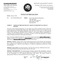
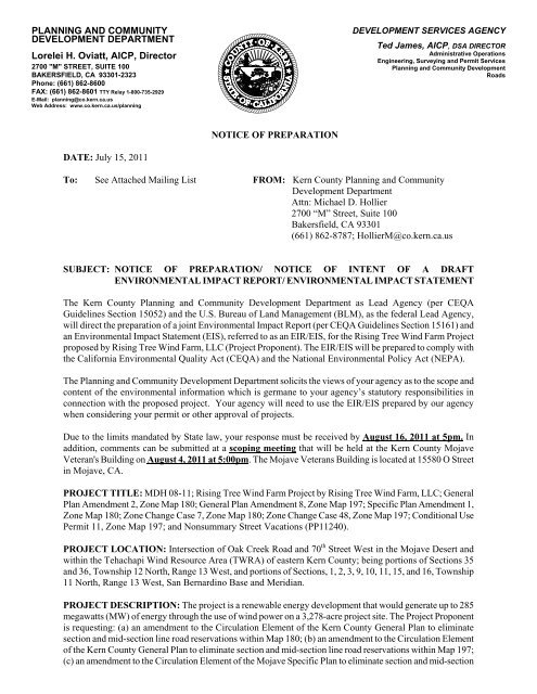
DATE: July 15, 2011<br />
NOTICE OF PREPARATION<br />
DEVELOPMENT SERVICES AGENCY<br />
Ted James, AICP, DSA DIRECTOR<br />
Administrative Operations<br />
Engineering, Surveying and Permit Services<br />
Planning and Community Development<br />
Roads<br />
To: See Attached Mailing List FROM: <strong>Kern</strong> <strong>County</strong> Planning and Community<br />
Development Department<br />
Attn: Michael D. Hollier<br />
2700 “M” Street, Suite 100<br />
Bakersfield, CA 93301<br />
(661) 862-8787; HollierM@co.kern.ca.us<br />
SUBJECT: NOTICE OF PREPARATION/ NOTICE OF INTENT OF A DRAFT<br />
ENVIRONMENTAL IMPACT REPORT/ ENVIRONMENTAL IMPACT STATEMENT<br />
The <strong>Kern</strong> <strong>County</strong> Planning and Community Development Department as Lead Agency (per CEQA<br />
Guidelines Section 15052) and the U.S. Bureau <strong>of</strong> Land Management (BLM), as the federal Lead Agency,<br />
will direct the preparation <strong>of</strong> a joint Environmental Impact Report (per CEQA Guidelines Section 15161) and<br />
an Environmental Impact Statement (EIS), referred to as an EIR/EIS, for the <strong>Rising</strong> <strong>Tree</strong> <strong>Wind</strong> <strong>Farm</strong> <strong>Project</strong><br />
proposed by <strong>Rising</strong> <strong>Tree</strong> <strong>Wind</strong> <strong>Farm</strong>, LLC (<strong>Project</strong> Proponent). The EIR/EIS will be prepared to comply with<br />
the California Environmental Quality Act (CEQA) and the National Environmental Policy Act (NEPA).<br />
The Planning and Community Development Department solicits the views <strong>of</strong> your agency as to the scope and<br />
content <strong>of</strong> the environmental information which is germane to your agency’s statutory responsibilities in<br />
connection with the proposed project. Your agency will need to use the EIR/EIS prepared by our agency<br />
when considering your permit or other approval <strong>of</strong> projects.<br />
Due to the limits mandated by State law, your response must be received by August 16, 2011 at 5pm. In<br />
addition, comments can be submitted at a scoping meeting that will be held at the <strong>Kern</strong> <strong>County</strong> Mojave<br />
Veteran's Building on August 4, 2011 at 5:00pm. The Mojave Veterans Building is located at 15580 O Street<br />
in Mojave, CA.<br />
PROJECT TITLE: MDH 08-11; <strong>Rising</strong> <strong>Tree</strong> <strong>Wind</strong> <strong>Farm</strong> <strong>Project</strong> by <strong>Rising</strong> <strong>Tree</strong> <strong>Wind</strong> <strong>Farm</strong>, LLC; General<br />
Plan Amendment 2, Zone Map 180; General Plan Amendment 8, Zone Map 197; Specific Plan Amendment 1,<br />
Zone Map 180; Zone Change Case 7, Zone Map 180; Zone Change Case 48, Zone Map 197; Conditional Use<br />
Permit 11, Zone Map 197; and Nonsummary Street Vacations (PP11240).<br />
PROJECT LOCATION: Intersection <strong>of</strong> Oak Creek Road and 70 th Street West in the Mojave Desert and<br />
within the Tehachapi <strong>Wind</strong> Resource Area (TWRA) <strong>of</strong> eastern <strong>Kern</strong> <strong>County</strong>; being portions <strong>of</strong> Sections 35<br />
and 36, Township 12 North, Range 13 West, and portions <strong>of</strong> Sections, 1, 2, 3, 9, 10, 11, 15, and 16, Township<br />
11 North, Range 13 West, San Bernardino Base and Meridian.<br />
PROJECT DESCRIPTION: The project is a renewable energy development that would generate up to 285<br />
megawatts (MW) <strong>of</strong> energy through the use <strong>of</strong> wind power on a 3,278-acre project site. The <strong>Project</strong> Proponent<br />
is requesting: (a) an amendment to the Circulation Element <strong>of</strong> the <strong>Kern</strong> <strong>County</strong> General Plan to eliminate<br />
section and mid-section line road reservations within Map 180; (b) an amendment to the Circulation Element<br />
<strong>of</strong> the <strong>Kern</strong> <strong>County</strong> General Plan to eliminate section and mid-section line road reservations within Map 197;<br />
(c) an amendment to the Circulation Element <strong>of</strong> the Mojave Specific Plan to eliminate section and mid-section
line road reservations within Map 180; (d) a change in zone classification from the E (20) (Estate 20 acres)<br />
District to the A (Exclusive Agriculture) District and to the A WE (Exclusive Agriculture - <strong>Wind</strong> Energy<br />
Combining) District in Map 180; (e) a change in zone classification from the A-1 (Limited Agriculture)<br />
District to the A District and to the A WE District in Map 197, (f) a conditional use permit to allow for the use<br />
<strong>of</strong> a temporary concrete batch plant during construction <strong>of</strong> the wind energy facility, and (g) Nonsummary<br />
Street Vacations in Maps 180 and 197. The requested applications would also permit construction <strong>of</strong> wind<br />
ancillary facilities and supporting infrastructure, and a concrete batch plant to provide concrete and materials<br />
for turbine, substation, and building foundations. Permanent facilities would include up to 95 wind turbine<br />
generators, service roads, a power collection system, communication cables, overhead and underground<br />
transmission lines, electrical switchyards, project substations, meteorological towers, and operations &<br />
maintenance facilities.<br />
Signature: _______________/S/_____________________<br />
Title: Planner II
ZCC #48, Map #197; ZCC #7, Map<br />
#180; CUP #11, Map #197<br />
WO #PP11240<br />
I:\WP\LABELS\eir08-11mdh.nop.doc<br />
sc 07/13/11<br />
U.S. Bureau <strong>of</strong> Land Management<br />
Ridgecrest Field Office<br />
300 South Richmond Road<br />
Ridgecrest, CA 93555<br />
Federal Aviation Administration<br />
Western Reg Office/<br />
Airport Div - AWP 600<br />
P.O. Box 92007<br />
Los Angeles, CA 90009<br />
Tehachapi Resource Cons Dist<br />
321 West "C" Street<br />
Tehachapi, CA 93561-2011<br />
U.S. Army Corps <strong>of</strong> Engineers<br />
Attention Planning Division<br />
1325 "J" Street<br />
Sacramento, CA 95814<br />
Caltrans/Dist 6<br />
Planning/Land Bank Bldg.<br />
P.O. Box 12616<br />
Fresno, CA 93778<br />
State Dept <strong>of</strong> Conservation<br />
Director's Office<br />
801 "K" Street, MS 24-01<br />
Sacramento, CA 95814-3528<br />
Sierra Club/<strong>Kern</strong> Kaweah Chapter<br />
Arthur Unger<br />
***PUT IN BUCKET***<br />
State Office <strong>of</strong> Historical Pres<br />
Attention Susan Stratton<br />
P.O. Box 942896<br />
Sacramento, CA 95296-0001<br />
<strong>Kern</strong> <strong>County</strong><br />
Agriculture Department<br />
Jon VanDerZee<br />
Ring <strong>Tree</strong> <strong>Wind</strong> <strong>Farm</strong>, LLC<br />
53 SW Yamhill Street<br />
Portland, OR 97204<br />
China Lake Naval Weapons Center<br />
Tim Fox, RLA - Comm Plans & Liaison<br />
429 E Bowen, Building 979<br />
Mail Stop 4003<br />
China Lake, CA 93555-6108<br />
Federal Communications Comm<br />
18000 Studebaker Road, #550<br />
Cerritos, CA 90701<br />
Environmental Protection Agency<br />
Region IX Office<br />
75 Hawthorn Street<br />
San Francisco, CA 94105<br />
State Air Resources Board<br />
Stationary Resource Division<br />
P.O. Box 2815<br />
Sacramento, CA 95812<br />
Caltrans/Dist 9<br />
Planning Department<br />
500 South Main Street<br />
Bishop, CA 93514<br />
State Dept <strong>of</strong> Conservation<br />
Division <strong>of</strong> Oil & Gas<br />
4800 Stockdale Highway, Ste 417<br />
Bakersfield, CA 93309<br />
State Dept <strong>of</strong> Fish & Game<br />
1234 East Shaw Avenue<br />
Fresno, CA 93710<br />
Public Utilities Comm Energy Div<br />
505 Van Ness Avenue<br />
San Francisco, CA 94102<br />
<strong>Kern</strong> <strong>County</strong> Engineering, Surveying,<br />
& Permit Svs/Floodplain<br />
Los Angeles Co Reg Planning Dept<br />
320 West Temple Street<br />
Los Angeles, CA 90012<br />
Edwards Air Force Base<br />
AFFTC/XRX Bldg 0001, Room 110<br />
#1 South Rosamond Blvd.<br />
Edwards AFB, CA 93524-1936<br />
U.S. Fish & Wildlife Service<br />
2493 Portola Road, Suite B<br />
Ventura, CA 93003<br />
U.S. Dept <strong>of</strong> Agriculture/NRCS<br />
5000 California Avenue, Ste 100<br />
Bakersfield, CA 93309-0711<br />
So. San Joaquin Valley Arch Info Ctr<br />
California State University <strong>of</strong> Bkfd<br />
9001 Stockdale Highway<br />
Bakersfield, CA 93311<br />
State Clearinghouse<br />
Office <strong>of</strong> Planning and Research<br />
P.O. Box 3044<br />
Sacramento, CA 95812-3044<br />
CERTIFIED MAIL<br />
California Energy Commission<br />
James W. Reed, Jr.<br />
1516 Ninth Street<br />
Mail Stop 17<br />
Sacramento, CA 95814<br />
California Highway Patrol<br />
Planning & Analysis Division<br />
P.O. Box 942898<br />
Sacramento, CA 94298-0001<br />
California Regional Water Quality<br />
Control Board/Lahontan Region<br />
14440 Civic Drive, Suite 200<br />
Victorville, CA 92392-2306<br />
<strong>Kern</strong> <strong>County</strong> Engineering, Surveying,<br />
& Permit Svs/Survey
<strong>Kern</strong> <strong>County</strong><br />
Env Health Services Department<br />
<strong>Kern</strong> <strong>County</strong> Library/Beale<br />
Local History Room<br />
<strong>Kern</strong> <strong>County</strong> Sheriff's Dept<br />
Administration<br />
Mojave Unified School Dist<br />
3500 Douglas<br />
Mojave, CA 93501<br />
Mojave Public Utility Dist<br />
15844 "K" Street<br />
Mojave, CA 93501<br />
East <strong>Kern</strong> Air Pollution<br />
Control District<br />
East <strong>Kern</strong> Airport Dist Engineer<br />
3900 Ridgemoor Avenue<br />
Bakersfield, CA 93306<br />
U.S. Air Force<br />
Western Regional Environmental Officer<br />
50 Fremont Street, Suite 2450<br />
San Francisco, CA 94105-2230<br />
U.S. Navy<br />
Steve Chung<br />
1220 Pacific Highway, Bldg 127<br />
San Diego, CA 92132<br />
<strong>Kern</strong> Audubon Society<br />
P.O. Box 3581<br />
Bakersfield, CA 93385<br />
<strong>Kern</strong> <strong>County</strong> Fire Dept<br />
Brian Marshall<br />
<strong>Kern</strong> <strong>County</strong> Library/Beale<br />
Diane Duquette<br />
<strong>Kern</strong> <strong>County</strong> Roads Department<br />
<strong>Kern</strong> <strong>County</strong> Superintendent <strong>of</strong> Schools<br />
Attention Mary Baker<br />
1300 17th Street<br />
Bakersfield, CA 93301<br />
Antelope Valley-East <strong>Kern</strong><br />
Water Agency<br />
6500 West Avenue N<br />
Palmdale, CA 93551<br />
Mojave Airport<br />
1434 Flightline<br />
Mojave, CA 93501<br />
Northcutt and Associates<br />
4220 Poplar Street<br />
Lake Isabella, CA 93240-9536<br />
U.S. Army<br />
Dir <strong>of</strong> Public Works/Master Plan Div<br />
P.O. Box 105097<br />
Fort Irwin, CA 92310-5097<br />
U.S. Marine Corps<br />
Patrick Christman<br />
Building 1164/Box 555246<br />
Camp Pendleton, CA 92055<br />
Los Angeles Audubon<br />
926 Citrus Avenue<br />
Los Angeles, CA 90036-4929<br />
<strong>Kern</strong> <strong>County</strong> Fire Dept<br />
Dave Goodell<br />
<strong>Kern</strong> <strong>County</strong> Parks & Recreation<br />
<strong>Kern</strong> <strong>County</strong><br />
Waste Management Department<br />
<strong>Kern</strong>COG<br />
1401 19th Street - Suite 300<br />
Bakersfield, CA 93301<br />
<strong>Kern</strong> <strong>County</strong> Water Agency<br />
P.O. Box 58<br />
Bakersfield, CA 93302-0058<br />
East <strong>Kern</strong> Airport Dist<br />
Attention Stuart Witt<br />
1434 Flightline<br />
Mojave, CA 93501<br />
Adams, Broadwell, Joseph & Cardozo<br />
Attention: Janet M. Laurain<br />
601 Gateway Boulevard, Suite 1000<br />
South San Francisco, CA 94080<br />
U.S. Army<br />
Peter Rubin<br />
B790 5th Street<br />
Parks RFTA<br />
Dublin, CA 94568<br />
AT & T<br />
5555 E. Olive Avenue, Cubicle 450F<br />
Fresno, CA 93727<br />
Center on Race, Poverty<br />
& the Environmental<br />
47 Kearny Street, Suite 804<br />
San Francisco, CA 94108-5528
Center on Race, Poverty<br />
& the Environmental/<br />
CA Rural Legal Assistance Foundation<br />
1302 Jefferson Street, Suite 2<br />
Delano, CA 93215<br />
Beth Boyst<br />
Pacific Crest Trail Program Manager<br />
1323 Club Drive<br />
Vallejo, CA 94592<br />
Sheppard Mullin<br />
Attn: Kendra Joy Casper<br />
333 South Hope Street<br />
Los Angeles, CA 90071<br />
Chumash Council <strong>of</strong> Bakersfield<br />
P.O. Box 902<br />
Bakersfield, CA 93302<br />
<strong>Kern</strong> Valley Indian Council<br />
Historic Preservation Office<br />
P.O. Box 401<br />
Weldon, CA 93283<br />
Kitanemuk & Yowlumne Tejon Indians<br />
623 Hazel Street<br />
Bakersfield, CA 93307-2523<br />
Cuddy Valley Statistical<br />
11667 Steinh<strong>of</strong>f Road<br />
Frazier Park, CA 93222<br />
URS Corporation<br />
Planning Department<br />
3500 Porsche Drive, Suite 300<br />
Ontario, CA 91764<br />
Recurrent Energy<br />
Seth Israel<br />
300 California Street, 8th Floor<br />
San Francisco, CA 92109<br />
Sempra Generation<br />
Marilyn Burke<br />
101 Ash Street HQ-14A<br />
San Diego, CA 92101<br />
Defenders <strong>of</strong> Wildlife/<br />
Cynthia Wilkerson, M.S.<br />
California Representative<br />
1303 "J" Street, Suite 270<br />
Sacramento, CA 95814<br />
Anitra Kass<br />
Pacific Crest Trail Association<br />
P.O. Box 3398<br />
Idyllwild, CA 92549<br />
Eastern <strong>Kern</strong> Resource Cons Dist<br />
1525 North Norma Street, Ste C<br />
Ridgecrest, CA 93555<br />
David Laughing Horse Robinson<br />
P.O. Box 1547<br />
<strong>Kern</strong>ville, CA 93238<br />
Santa Rosa Rancheria<br />
Clarence Atwell, Chairperson<br />
P.O. Box 8<br />
Lemoore, CA 93245<br />
Tubatulabals <strong>of</strong> <strong>Kern</strong> <strong>County</strong><br />
P.O. Box 226<br />
Lake Isabella, CA 93240<br />
Eight Bar Ranch<br />
Jon and Helen Lantz<br />
11300 Cameron Canyon Road<br />
Mojave, CA 93501<br />
Vestas<br />
Sarah Adams<br />
1881 Southwest Naito Parkway<br />
Portland, OR 97201<br />
Terra-Gen<br />
Steve Yatsko<br />
11512 El Camino Real, Suite 100<br />
San Diego, CA 92130<br />
Element Power Solar Dev, LLC<br />
John Gaglioti<br />
864 Portola Drive<br />
Monterey, CA 93940<br />
Native American Heritage Council<br />
<strong>of</strong> <strong>Kern</strong> <strong>County</strong>/Fay Van Horn<br />
P.O. Box 1507<br />
Bakersfield, CA 93302<br />
Brendan Taylor<br />
Pacific Crest Trail Association<br />
645 East Ridgecrest Blvd, Apt B<br />
Ridgecrest, CA 93555<br />
Southern California Edison<br />
Planning Dept.<br />
421 West "J" Street<br />
Tehachapi, CA 93561<br />
<strong>Kern</strong> Valley Indian Council<br />
Attn: Bob Robinson<br />
P.O. Box 1010<br />
Lake Isabella, CA 93240<br />
Tejon Indian Tribe<br />
Kathy Morgan, Chairperson<br />
2234 4 th Street<br />
Wasco, CA 93280<br />
Tule River Indian Tribe<br />
Neal Peyron, Chairperson<br />
P.O. Box 589<br />
Porterville, CA 93258<br />
Northcutt and Associates<br />
4220 Poplar Street<br />
Lake Isabella, CA 93240-9536<br />
Kelly Group<br />
Kate Kelly<br />
P.O. Box 868<br />
Winters, CA 95694<br />
Renewal Resources Group<br />
Holding Company<br />
Rupal Patel<br />
5700 Wilshire Blvd, Suite 330<br />
Los Angeles, CA 90036<br />
Congentrix Sunshine, LLC<br />
Rick Neff<br />
9405 Arrowpoint Blvd<br />
Charlotte, NC 28273
Fotowatio Renewable Ventures<br />
Sean Kiernan<br />
44 Montgomery Street, Suite 2200<br />
San Francisco, CA 94104<br />
First Solar<br />
Rick Williams<br />
18300 Von Karman Ave, Ste 930<br />
Irvine, CA 92612<br />
Darren Kelly<br />
Sr. Business Manager<br />
Terra-Gen Power, LLC<br />
565 - 5th Avenue, Floor 27<br />
New York, NY 10017<br />
Jeff Ciachurski, CEO<br />
Western <strong>Wind</strong> Energy Corp/<br />
Aero Energy<br />
Box 1041<br />
Vancouver, BC V6C 3E8<br />
Wayne Mayes<br />
Iberdrola Renewables<br />
Dir Tech Serv<br />
1125 NW Couch St, Ste 700, 7th Fl<br />
Portland, OR 97209<br />
Horizon <strong>Wind</strong> Energy<br />
Charlie Turlinksi<br />
1600 Shattuck Avenue, Suite 222<br />
Berkeley, CA 94709<br />
Gary Izing<br />
enXco, Director <strong>of</strong> Land and Title<br />
5000 Executive Parkway, Suite 140<br />
San Ramon, CA 94583<br />
Bill Barnes<br />
Dir <strong>of</strong> Asset Mgmt AES <strong>Wind</strong> Gen<br />
4542 Ruffner Street, Suite 200<br />
San Diego, CA 92111<br />
T. Alana Steele<br />
General Counsel<br />
Western <strong>Wind</strong> Energy Corporation<br />
3500 Glenrose Avenue<br />
Altadena, CA 91001<br />
Michael Strickler<br />
Iberdrola Renewables, Sr Proj Mgr<br />
1125 NW Couch St, Ste 700, 7th Fl<br />
Portland, OR 97209<br />
Nautilus Solar<br />
Paul Steinway<br />
P.O. Box 188<br />
Fort Lupton, CO 80621<br />
<strong>Wind</strong> Stream, LLC<br />
Albert Davies<br />
1275 - 4th Street, No. 107<br />
Santa Rosa, CA 95404<br />
Cash Long<br />
Mogul Energy<br />
7201 Panorama Drive<br />
Bakersfield, CA 93306<br />
PG&E<br />
Steven Ng, Manager<br />
Renewal Dev, T&D Intercon<br />
77 Beal Street, Room 5361<br />
San Francisco, CA 94105
<strong>Notice</strong> <strong>of</strong> Completion & Environmental Document Transmittal<br />
Mail to: State Clearinghouse, P. O. Box 3044, Sacramento, CA 95812-3044 (916) 445-0613<br />
For Hand Delivery/Street Address: 1400 Tenth Street, Sacramento, CA 95814<br />
<strong>Project</strong> Title: MDH 08-11; <strong>Rising</strong> <strong>Tree</strong> <strong>Wind</strong> <strong>Farm</strong>; GPA 2 & ZCC 7, Map 180; GPA 8 & ZCC 48, Map 197; CUP 11, Map 197; Nonsummary Vacations<br />
Lead Agency: <strong>Kern</strong> <strong>County</strong> Planning and Community Development Department Contact Person: Michael D. Hollier<br />
Mailing Address: 2700 ‘M’ ST, STE 100 Phone: (661) 862-8787<br />
City: Bakersfield Zip: 93301 <strong>County</strong>: <strong>Kern</strong><br />
<strong>Project</strong> Location: <strong>County</strong>: KERN City/Nearest Community: Mojave<br />
Cross Streets: Oak Creek Road and 70th Street West Zip Code: 93501<br />
Lat. / Long.: 35° 02′ 28″ N/ 118° 15′ 30″ W Total Acres: 3,278<br />
Assessor's Parcel No.: various Section: Twp.: Range: Base:<br />
Within 2 Miles: State Hwy #: 58 Waterways: Los Angeles Aqueduct<br />
Airports: Mojave Air and Spaceport Railways: Union Pacific Line Schools:<br />
Document Type:<br />
CEQA: NOP Draft EIR NEPA: NOI Other: Joint Document<br />
Early Cons Supplement/Subsequent EIR EA Final Document<br />
Neg Dec (Prior SCH No.) Draft EIS Other<br />
Mit Neg Dec Other FONSI<br />
Local Action Type:<br />
General Plan Update Specific Plan Rezone Annexation<br />
General Plan Amendment Master Plan Prezone Redevelopment<br />
General Plan Element Planned Unit Development Use Permit Coastal Permit<br />
Community Plan Site Plan Land Division (Subdivision, etc.) Other Str. Vacation<br />
Development Type:<br />
Residential: Units Acres Water Facilities: Type MGD<br />
Office: Sq.ft. Acres Employees Transportation: Type<br />
Commercial: Sq.ft. Acres Employees Mining: Mineral<br />
Industrial: Sq.ft. Acres Employees Power: Type <strong>Wind</strong> MW 285<br />
Educational Waste Treatment: Type MGD<br />
Recreational Hazardous Waste: Type<br />
Other:<br />
<strong>Project</strong> Issues Discussed in Document:<br />
Aesthetic/Visual Fiscal Recreation/Parks Vegetation<br />
Agricultural Land Flood Plain/Flooding Schools/Universities Water Quality<br />
Air Quality Forest Land/Fire Hazard Septic Systems Water Supply/Groundwater<br />
Archeological/Historical Geologic/Seismic Sewer Capacity Wetland/Riparian<br />
Biological Resources Minerals Soil Erosion/Compaction/Grading Wildlife<br />
Coastal Zone Noise Solid Waste Growth Inducing<br />
Drainage/Absorption Population/Housing Balance Toxic/Hazardous Land Use<br />
Economic/Jobs Public Services/Facilities Traffic/Circulation Cumulative Effects<br />
Other Greenhouse Gases<br />
Note: The state Clearinghouse will assign identification numbers for all new projects. If a SCH number already exists for a<br />
project (e.g. <strong>Notice</strong> <strong>of</strong> <strong>Preparation</strong> or previous draft document) please fill in.<br />
SCH #<br />
Present Land Use/Zoning/General Plan Designation: Vacant/ A-1 (Limited Agriculture) and E(20) (Estate, 20<br />
acres)/ 1.1 (State or Federal Land), 1.1/2.4 (State or Federal Land/Steep Slope Physical Constraint), 8.3 (Extensive<br />
Agriculture), 8.4 (Mineral and Petroleum); 8.4/2.4 (Mineral and Petroleum/Steep Slope Physical Constraint); 8.5<br />
(Resource Management), 8.5/2.4 (Resource Management/Steep Slope Physical Constraint), 8.5/2.5 (Resource<br />
Management/Flood Hazard Physical Constraint)<br />
January 2008
<strong>Project</strong> Description: The <strong>Kern</strong> <strong>County</strong> Planning and Community Development Department as Lead Agency (per<br />
CEQA Guidelines Section 15052) and the U.S. Bureau <strong>of</strong> Land Management (BLM), as the federal Lead Agency, will<br />
direct the preparation <strong>of</strong> a joint Environmental Impact Report (per CEQA Guidelines Section 15161) and an<br />
Environmental Impact Statement (EIS), referred to as an EIR/EIS, for the <strong>Rising</strong> <strong>Tree</strong> <strong>Wind</strong> <strong>Project</strong> proposed by<br />
<strong>Rising</strong> <strong>Tree</strong> <strong>Wind</strong> <strong>Farm</strong>, LLC (<strong>Project</strong> Proponent). The EIR/EIS will be prepared to comply with the California<br />
Environmental Quality Act (CEQA) and the National Environmental Policy Act (NEPA).<br />
The project is a renewable energy development that would generate up to 285 megawatts (MW) <strong>of</strong> energy through the<br />
use <strong>of</strong> wind power on a 3,278-acre project site. The <strong>Project</strong> Proponent is requesting: (a) an amendment to the<br />
Circulation Element <strong>of</strong> the <strong>Kern</strong> <strong>County</strong> General Plan to eliminate section and mid-section line road reservations<br />
within Map 180; (b) an amendment to the Circulation Element <strong>of</strong> the <strong>Kern</strong> <strong>County</strong> General Plan to eliminate section<br />
and mid-section line road reservations within Map 197; (c) an amendment to the Circulation Element <strong>of</strong> the Mojave<br />
Specific Plan to eliminate section and mid-section line road reservations within Map 180; (d) a change in zone<br />
classification from the E (20) (Estate 20 acres) District to the A (Exclusive Agriculture) District and to the A WE<br />
(Exclusive Agriculture - <strong>Wind</strong> Energy Combining) District in Map 180; (e) a change in zone classification from the A-<br />
1 (Limited Agriculture) District to the A District and to the A WE District in Map 197, (f) a conditional use permit to<br />
allow for the use <strong>of</strong> a temporary concrete batch plant during construction <strong>of</strong> the wind energy facility, and (g)<br />
Nonsummary Street Vacations in Maps 180 and 197. The requested applications would also permit construction <strong>of</strong><br />
wind ancillary facilities and supporting infrastructure, and a concrete batch plant to provide concrete and materials for<br />
turbine, substation, and building foundations. Permanent facilities would include up to 95 wind turbine generators,<br />
service roads, a power collection system, communication cables, overhead and underground transmission lines,<br />
electrical switchyards, project substations, meteorological towers, and operations & maintenance facilities.<br />
Note: The state Clearinghouse will assign identification numbers for all new projects. If a SCH number already exists for a<br />
project (e.g. <strong>Notice</strong> <strong>of</strong> <strong>Preparation</strong> or previous draft document) please fill in.<br />
January 2008
Reviewing Agencies Checklist<br />
Lead Agencies may recommend State Clearinghouse distribution by marking agencies below with and "X".<br />
If you have already sent your document to the agency please denote that with an "S".<br />
X Air Resources Board Office <strong>of</strong> Emergency Services<br />
Boating & Waterways, Department <strong>of</strong> Office <strong>of</strong> Historic Preservation<br />
X California Highway Patrol Office <strong>of</strong> Public School Construction<br />
CalFire Parks & Recreation<br />
S Caltrans District # 9 Pesticide Regulation, Department <strong>of</strong><br />
Caltrans Division <strong>of</strong> Aeronautics X Public Utilities Commission<br />
Caltrans Planning (Headquarters) S Regional WQCB #<br />
Central Valley Flood Protection Board Resources Agency<br />
Coachella Valley Mountains Conservancy S.F. Bay Conservation & Development Commission<br />
Coastal Commission San Gabriel & Lower L.A. Rivers and Mtns Conservancy<br />
Colorado River Board San Joaquin River Conservancy<br />
Conservation, Department <strong>of</strong> Santa Monica Mountains Conservancy<br />
Corrections, Department <strong>of</strong> State Lands Commission<br />
Delta Protection Commission SWRCB: Clean Water Grants<br />
Education, Department <strong>of</strong> SWRCB: Water Quality<br />
X Energy Commission SWRCB: Water Rights<br />
S Fish & Game Region # Tahoe Regional Planning Agency<br />
Food & Agriculture, Department <strong>of</strong> Toxic Substances Control, Department <strong>of</strong><br />
General Services, Department <strong>of</strong> Water Resources, Department <strong>of</strong><br />
Health Services, Department <strong>of</strong><br />
Housing & Community Development Other<br />
X Integrated Waste Management Board Other<br />
S Native American Heritage Commission<br />
Local Public Review Period (to be filled in by lead agency)<br />
Starting Date Ending Date<br />
Lead Agency (Complete if applicable):<br />
Consulting Firm: Applicant:<br />
Address: Address:<br />
City/State/Zip: City/State/Zip:<br />
Contact: Phone:<br />
Phone:<br />
Signature <strong>of</strong> Lead Agency Representative: /S/ Date: 7/14/2011<br />
Authority cited: Section 21083, Public Resources Code. Reference: Section 21161, Public Resources Code.
This page intentionally left blank.
<strong>Notice</strong> <strong>of</strong> <strong>Preparation</strong><br />
Of a Joint Environmental Impact Report/Environmental Impact Statement<br />
And<br />
Request for Scoping Comments<br />
On the <strong>Preparation</strong> <strong>of</strong> an Environmental Impact Report/Environmental Impact Statement<br />
TO: All Interested Parties<br />
Subject<br />
For the<br />
<strong>Rising</strong> <strong>Tree</strong> <strong>Wind</strong> <strong>Farm</strong> <strong>Project</strong><br />
July 15, 2011<br />
<strong>Kern</strong> <strong>County</strong> and the U.S. Bureau <strong>of</strong> Land Management (BLM) will direct the preparation <strong>of</strong> a joint<br />
Environmental Impact Report (EIR) and an Environmental Impact Statement (EIS), referred to as an<br />
EIR/EIS, for the <strong>Rising</strong> <strong>Tree</strong> <strong>Wind</strong> <strong>Farm</strong> <strong>Project</strong> proposed by <strong>Rising</strong> <strong>Tree</strong> <strong>Wind</strong> <strong>Farm</strong>, LLC (<strong>Project</strong><br />
Proponent). <strong>Kern</strong> <strong>County</strong>, as the lead agency under California law, and the BLM, as the federal lead<br />
agency, will jointly prepare a Draft and Final EIR/EIS to comply with the California Environmental<br />
Quality Act (CEQA) and the National Environmental Policy Act (NEPA).<br />
Summary <strong>of</strong> the Proposed <strong>Project</strong><br />
The proposed <strong>Rising</strong> <strong>Tree</strong> <strong>Wind</strong> <strong>Farm</strong> <strong>Project</strong> would generate up to 285 megawatts (MW) <strong>of</strong> electricity<br />
through wind power, installing up to 95 wind turbine generators (WTGs), a substation, transmission<br />
interconnection to the Southern California Edison (SCE) <strong>Wind</strong>hub Substation, access roads, and ancillary<br />
facilities. The proposed project area comprises 3,302 acres, 528 acres <strong>of</strong> which are on public land under<br />
the jurisdiction <strong>of</strong> the BLM. The project site is approximately three miles west <strong>of</strong> the unincorporated town<br />
<strong>of</strong> Mojave in southeastern <strong>Kern</strong> <strong>County</strong>, California. Please refer to the attached Initial Study for a more<br />
detailed description <strong>of</strong> the proposed project and maps <strong>of</strong> the proposed project area.<br />
Because <strong>of</strong> potentially significant impacts on the environment, as identified in the attached Initial Study,<br />
<strong>Kern</strong> <strong>County</strong> and BLM will prepare an EIR/EIS addressing the full range <strong>of</strong> environmental issues. Note<br />
that this <strong>Notice</strong> <strong>of</strong> <strong>Preparation</strong> (NOP), attached Initial Study (IS), and all future project-related documents<br />
are available for review at the following location:
NOP / REQUEST FOR SCOPING COMMENTS<br />
PAGE 2 RISING TREE WIND FARM PROJECT EIR/EIS<br />
The EIR/EIS Process<br />
<strong>Kern</strong> <strong>County</strong> Planning and Community Development Department<br />
2700 M Street, Suite 100<br />
Bakersfield, CA 93301-2370<br />
(661) 862-8600<br />
Hours: 8 a.m. to 5 pm. (Monday through Friday)<br />
http://www.co.kern.ca.us/planning/noticeprep.asp<br />
The proposed project is located on lands administered by <strong>Kern</strong> <strong>County</strong> and the BLM. The <strong>Project</strong> Proponent<br />
requires various authorizations and permits from <strong>Kern</strong> <strong>County</strong> and the BLM to construct and operate<br />
the proposed project. In order to consider issuance <strong>of</strong> these authorizations and permits, and based on the<br />
proposed project’s potential environmental impacts, <strong>Kern</strong> <strong>County</strong> will prepare an EIR pursuant to CEQA<br />
requirements and the BLM will prepare an Draft Plan Amendment (DPA) and EIS pursuant to the<br />
requirements <strong>of</strong> the Federal Land Policy and Management Act (FLPMA) and NEPA. A joint EIR/EIS<br />
will be prepared under the direction <strong>of</strong> both agencies to satisfy the permitting and decision-making<br />
requirements <strong>of</strong> each agency prior to project approval. CEQA and NEPA also require that the EIR/EIS<br />
development process include public notice <strong>of</strong> the proposed project and address concerns that the public<br />
identifies regarding the proposed project during a process referred to as public scoping. The issuance <strong>of</strong><br />
this NOP/IS commences the EIR scoping process pursuant to CEQA requirements. The BLM has issued a<br />
separate <strong>Notice</strong> <strong>of</strong> Intent to prepare an EIS pursuant to NEPA requirements, which was published in the<br />
Federal Register on January 31, 2011 (page 5396).<br />
The analysis <strong>of</strong> the proposed project will result in the publication <strong>of</strong> a Draft EIR/EIS and a Final EIR/EIS. A<br />
comment period <strong>of</strong> a minimum <strong>of</strong> 90 days (per BLM requirements) will be allowed for the review <strong>of</strong> the<br />
Draft EIR/EIS. A notice <strong>of</strong> availability <strong>of</strong> the Draft EIR/EIS will be sent to the State Clearinghouse by<br />
<strong>Kern</strong> <strong>County</strong> and to the Federal Register by the BLM for publication. <strong>Kern</strong> <strong>County</strong> and the BLM will<br />
consider all comments on the Draft EIR/EIS and revise the document, as necessary, before issuing a Final<br />
EIR/EIS. The Final EIR/EIS will include responses to the comments received on the Draft EIR/EIS.<br />
Further, the BLM will prepare and Record <strong>of</strong> Decision (ROD) based on the EIR/EIS as the final federal<br />
decision document.<br />
Proposed Scope <strong>of</strong> the EIR/EIS<br />
The EIR/EIS will present the analysis <strong>of</strong> the environmental impacts <strong>of</strong> the proposed project and project<br />
alternatives, including the No <strong>Project</strong>/No Action Alternative, and will identify mitigation measures for<br />
potentially significant impacts. The EIR/EIS will address all issue areas for which potentially significant<br />
impacts are anticipated. These issue areas are described further in the attached IS, and include:<br />
� Aesthetics. Effects to visual resources from the presence <strong>of</strong> heavy construction equipment as well as<br />
operational impacts from large and highly-visible wind turbines.<br />
� Agricultural Resources. Effects <strong>of</strong> changes to agricultural land use designations.<br />
� Air Quality. Construction and operation emissions and effects, including the effects <strong>of</strong> on-site exhaust<br />
emissions from heavy-duty diesel and gasoline-powered construction equipment and the fugitive particulate<br />
matter from soil disturbing operations and sediment removal activities.<br />
� Biological Resources. Effects on native habitat that supports special-status species; avian and bat<br />
collisions with wind turbines; degradation and fill <strong>of</strong> Waters <strong>of</strong> the State; and effects <strong>of</strong> noise and<br />
disturbance on nesting and foraging wildlife species.
NOP / REQUEST FOR SCOPING COMMENTS<br />
RISING TREE WIND FARM PROJECT EIR/EIS PAGE 3<br />
� Cultural Resources. Effects <strong>of</strong> construction-related ground disturbance on recorded cultural resources<br />
sites and unknown sites as well as paleontological resources that may exist in the project area.<br />
� Cumulative Impacts. Contribution <strong>of</strong> the project to cumulative impacts in all environmental<br />
disciplines.<br />
� Geology and Soils. Direct and indirect soils-and geologic-related impacts resulting from the proposed<br />
project; geological hazards; and erosion due to ground-disturbing activities as well as potential effects<br />
<strong>of</strong> earthquakes on project facilities.<br />
� Greenhouse Gas Emissions. Effects <strong>of</strong> greenhouse gas emissions from use <strong>of</strong> conventional construction<br />
equipment and vehicles during construction and potential GHG emission reductions as result<br />
<strong>of</strong> replacing fossil-fueled electricity generation with renewable wind energy.<br />
� Hazards and Hazardous Materials. Effects <strong>of</strong> construction activities on the mobilization <strong>of</strong> potentially<br />
contaminated soil; migration <strong>of</strong> contaminants via surface water run<strong>of</strong>f; and displacement <strong>of</strong><br />
contaminants; soil contamination from equipment leaks or spills during construction or operation; and<br />
effects <strong>of</strong> disposal activities.<br />
� Hydrology and Water Quality. Impacts from project-related erosion and sedimentation;<br />
hydrological impacts; stormwater run<strong>of</strong>f.<br />
� Land Use and Public Recreation. Construction and operational effects on adjacent land uses and<br />
recreational resources; access disruptions; consistency with the <strong>Kern</strong> <strong>County</strong> General Plan.<br />
� Mineral Resources. Effects from preclusion <strong>of</strong> access for extraction <strong>of</strong> valuable or locally-important<br />
mineral resources if present within the project area.<br />
� Noise. Effects <strong>of</strong> construction and operation activities on sensitive receptors, such as rural residences<br />
and recreational uses.<br />
� Population and Housing. Effects <strong>of</strong> the project on population growth, potential displacement <strong>of</strong><br />
existing housing, and increased demand for construction <strong>of</strong> additional housing.<br />
� Public Services. Effects on fire and police protection, parks, schools, or other public services and<br />
facilities due to population increases related to the project as well as direct project demand for<br />
services public services during construction and/or operation.<br />
� Socioeconomics and Environmental Justice. Impacts on population, employment, and housing<br />
communities in the study area related to non-local project workers, project expenditures, and the<br />
potential impact from project-induced population growth as well as the potential for disproportionate<br />
Environmental Justice impacts to low-income and minority populations related to significant impacts<br />
in other individual issue areas.<br />
� Transportation and Traffic. Effects <strong>of</strong> additional project traffic as well as heavy-duty truck traffic<br />
related to construction activities on travel and traffic lanes, access points, and emergency service<br />
vehicles.<br />
� Utilities and Service Systems. Effects related to project demand for public services and utilities<br />
during construction and operations; and potential for conflicts with collocated utilities, such as<br />
existing electricity distribution.<br />
<strong>Project</strong> Scoping Process and Scoping Meeting<br />
The EIR/EIS for the <strong>Rising</strong> <strong>Tree</strong> <strong>Wind</strong> <strong>Farm</strong> <strong>Project</strong> will focus on significant environmental effects. The<br />
process <strong>of</strong> determining the focus and content <strong>of</strong> the EIR/EIS is known as scoping under both CEQA and<br />
NEPA. Scoping helps to identify the range <strong>of</strong> actions, alternatives, environmental effects, and mitigation<br />
measures to be analyzed in depth in the environmental document. Scoping can also identify those issues<br />
that are not pertinent to the final decision on the proposed project and need not be addressed in detail. Scoping
NOP / REQUEST FOR SCOPING COMMENTS<br />
PAGE 4 RISING TREE WIND FARM PROJECT EIR/EIS<br />
provides a forum to learn and address the concerns <strong>of</strong> the public, affected agencies, and other interested<br />
parties. Significant issues may be identified through public and agency comments.<br />
Scoping is not intended to resolve disagreements concerning the merits <strong>of</strong> the project or to anticipate the<br />
ultimate decision on the project proposal. Rather, the purpose <strong>of</strong> scoping is to help ensure that a comprehensive<br />
and focused EIR/EIS will be prepared that provides a firm legally defensible basis for the<br />
decision-making process. Members <strong>of</strong> the public, affected federal, State, and local agencies, interest<br />
groups, and other interested parties may participate in the scoping process for this project by providing<br />
written and oral comments or recommendations concerning the issues to be analyzed in the EIR/EIS.<br />
Comments can be given orally by attending the scheduled scoping meeting. For the date, time, and location <strong>of</strong><br />
the EIR/EIS scoping meeting, please see the cover letter to this NOP/IS packet or visit the <strong>Kern</strong> <strong>County</strong><br />
project website at: http://www.co.kern.ca.us/planning/noticeprep.asp.<br />
Written comments must be sent by no later than August 15, 2011 to:<br />
Mr. Jeff Childers<br />
Planning & Environmental Coordinator<br />
CDDO - RECO<br />
Bureau <strong>of</strong> Land Management<br />
22835 Calle San Juan De Los Lagos<br />
Moreno Valley, CA 92553<br />
and<br />
Mr. Michael Hollier<br />
Planner III<br />
<strong>Kern</strong> <strong>County</strong> Planning and<br />
Community Development Department<br />
2700 M Street<br />
Bakersfield, CA 93301<br />
By Electronic Mail: E-mail communications are welcome; however, please include your name and return<br />
address in the email message. E-mail messages should be sent to <strong>Rising</strong><strong>Tree</strong>@BLM.gov and Michael<br />
Hollier: HollierM@co.kern.ca.us.<br />
Agency Comments<br />
This NOP has been sent to State responsible and trustee agencies, cooperating federal agencies, the State<br />
Clearinghouse, and the Federal Register. We need to know the views <strong>of</strong> your agency regarding the scope<br />
and content <strong>of</strong> the environmental information to be included in the EIR/EIS, which reflects your agency's<br />
statutory responsibilities in connection with the proposed project. Responses should identify the issues to be<br />
considered in the Draft EIR/EIS, including significant environmental issues, alternatives, mitigation<br />
measures, and whether the responding agency will be a responsible State or cooperating federal agency or a<br />
State trustee agency. Due to the time limits mandated by State and federal Laws, your response must be<br />
sent at the earliest possible date but no later than 30 days (August 15, 2011) after receipt <strong>of</strong> this notice.
INITIAL STUDY/NOTICE OF PREPARATION<br />
<strong>Rising</strong> <strong>Tree</strong> <strong>Wind</strong> Energy <strong>Project</strong><br />
by <strong>Rising</strong> <strong>Tree</strong> <strong>Wind</strong> <strong>Farm</strong>, LLC<br />
General Plan Amendment 2, Map 180;<br />
General Plan Amendment 8, Map 197;<br />
Specific Plan Amendment 1, Map 180;<br />
Zone Change Case 7, Map 180;<br />
Zone Change Case 48, Map 197;<br />
Conditional Use Permit No. 11, Map 197;<br />
Nonsummary Street Vacations<br />
(PP11212)<br />
LEAD AGENCY:<br />
<strong>Kern</strong> <strong>County</strong> Planning and Community<br />
Development Department<br />
2700 M Street, Suite 100<br />
Bakersfield, CA 93301-2370<br />
Contact: Mr. Michael D. Hollier<br />
(661) 862-8787<br />
HollierM@co.kern.ca.us<br />
July 2011
This page intentionally left blank.
KERN COUNTY PLANNING & COMMUNITY DEVELOPMENT DEPARTMENT<br />
RISING TREE WIND ENERGY PROJECT<br />
Table <strong>of</strong> Contents<br />
1. <strong>Project</strong> Description .......................................................................................................................... 1<br />
1.1 <strong>Project</strong> Location .................................................................................................................. 1<br />
1.2 Environmental Setting ........................................................................................................ 1<br />
1.3 <strong>Project</strong> Description ............................................................................................................. 5<br />
1.4 <strong>Project</strong> Facilities and Operations ........................................................................................ 9<br />
1.4.1 <strong>Project</strong> Components Overview .............................................................................. 9<br />
1.4.2 Construction ......................................................................................................... 13<br />
1.5 <strong>Project</strong> Objectives ............................................................................................................. 14<br />
1.6 Proposed Discretionary Actions/Required Approvals ...................................................... 15<br />
2. Environmental Determination <strong>Kern</strong> <strong>County</strong> Environmental Checklist Form ................................ 17<br />
2.1 Environmental Factors Potentially Affected ..................................................................... 17<br />
2.2 Environmental Determination ........................................................................................... 17<br />
3. Evaluation <strong>of</strong> Environmental Impacts: .......................................................................................... 18<br />
Aesthetics ........................................................................................................................... 19<br />
Agriculture Resources ........................................................................................................ 21<br />
Air Quality .......................................................................................................................... 23<br />
Biological Resources. ......................................................................................................... 25<br />
Cultural Resources. ............................................................................................................ 27<br />
Geology and Soils............................................................................................................... 28<br />
Greenhouse Gas Emissions ................................................................................................ 30<br />
Hazards and Hazardous Materials ...................................................................................... 31<br />
Hydrology and Water Quality ............................................................................................ 34<br />
Land Use and Planning ....................................................................................................... 37<br />
Mineral Resources .............................................................................................................. 38<br />
Noise .................................................................................................................................. 39<br />
Population and Housing ..................................................................................................... 41<br />
Public Services ................................................................................................................... 42<br />
Recreation .......................................................................................................................... 44<br />
Transportation/Traffic ........................................................................................................ 45<br />
Utilities and Service Systems ............................................................................................. 48<br />
Mandatory Findings <strong>of</strong> Significance .................................................................................. 50<br />
List <strong>of</strong> Tables<br />
1 <strong>Project</strong> Site and Surrounding Land Uses ......................................................................................... 8<br />
2 Proposed Discretionary Actions/Required Approvals ................................................................... 16<br />
List <strong>of</strong> Figures<br />
1 <strong>Project</strong> Location and Vicinity Map .................................................................................................. 2<br />
2 <strong>Project</strong> Site Boundaries .................................................................................................................... 3<br />
3 Existing General Plan Land Use Designations ................................................................................ 4<br />
4 Existing <strong>Kern</strong> <strong>County</strong> Zoning Designations .................................................................................... 6<br />
5 Proposed Zoning .............................................................................................................................. 7<br />
July 2011 i Initial Study/<strong>Notice</strong> <strong>of</strong> <strong>Preparation</strong>
KERN COUNTY PLANNING & COMMUNITY DEVELOPMENT DEPARTMENT<br />
RISING TREE WIND ENERGY PROJECT<br />
This page intentionally left blank.<br />
July 2011 ii Initial Study/<strong>Notice</strong> <strong>of</strong> <strong>Preparation</strong>
1. <strong>Project</strong> Description<br />
KERN COUNTY PLANNING & COMMUNITY DEVELOPMENT DEPARTMENT<br />
RISING TREE WIND ENERGY PROJECT<br />
The applicant, <strong>Rising</strong> <strong>Tree</strong> <strong>Wind</strong> <strong>Farm</strong> LLC proposes to develop the <strong>Rising</strong> <strong>Tree</strong> <strong>Wind</strong> <strong>Farm</strong> <strong>Project</strong> (the<br />
<strong>Project</strong>) for the commercial production <strong>of</strong> up to 285 megawatts (MW) <strong>of</strong> energy from up to 95 wind<br />
turbine generators (WTGs).<br />
1.1 <strong>Project</strong> Location<br />
The <strong>Project</strong> is located three (3) miles west <strong>of</strong> Mojave, California in the southeast portion <strong>of</strong><br />
unincorporated <strong>Kern</strong> <strong>County</strong> (Figure 1). It is bordered by existing wind energy generation facilities to the<br />
west and north, and Oak Creek Road and the recently approved Alta-Oak Creek Mojave <strong>Wind</strong> <strong>Project</strong> to<br />
the south. Parcels bordering the Los Angeles Aqueduct form the eastern edge <strong>of</strong> the <strong>Project</strong> site. The<br />
primary turbine and equipment delivery route will be along Oak Creek Road and Tehachapi Willow<br />
Springs Road from State Highway 58. Direct site access will be via 70th Street West and 67th Street West<br />
from Oak Creek Road.<br />
The land surrounding the <strong>Project</strong> site consists <strong>of</strong> undeveloped desert scrub, existing wind energy<br />
generation facilities constructed from the 1980s until present, and the Los Angeles Aqueduct. The nearest<br />
multi-dwelling development is a residential development along Douglas Avenue west <strong>of</strong> Mojave, 1.3<br />
miles from the eastern boundary <strong>of</strong> the <strong>Project</strong> site. Individual residences and other structures are also<br />
within the <strong>Project</strong> boundary. The Mojave Air and Spaceport is located four (4) miles east <strong>of</strong> the eastern<br />
boundary <strong>of</strong> the <strong>Project</strong>.<br />
The <strong>Project</strong> is located on the U.S. Geological Service 7.5 minute Mojave and Monolith Topographic<br />
Quadrangles. On the Mojave Quadrangle the <strong>Project</strong> is located In Township 12 North, Range 13 West, in<br />
portions <strong>of</strong> Sections 35 and 36 and in Township 11 North, Range 13 West, on Sections 1 through 3, 10,<br />
11, 14 and 15. On the Monolith Quadrangle, the <strong>Project</strong> is located in Township 11 North, Range 13 West,<br />
on Sections 9, 10, 15 and 16 (Figure 2).<br />
1.2 Environmental Setting<br />
The <strong>Project</strong> site consists <strong>of</strong> 3,278 acres, <strong>of</strong> which 2,750 acres are private land under the jurisdiction <strong>of</strong><br />
<strong>Kern</strong> <strong>County</strong> and 528 acres are public land administered by the Bureau <strong>of</strong> Land Management (BLM). The<br />
applicant currently leases or owns a substantial portion <strong>of</strong> the private lands on the <strong>Project</strong> site. The site<br />
lies within the boundaries <strong>of</strong> the <strong>Kern</strong> <strong>County</strong> General Plan (KCGP) and the Mojave Specific Plan (MSP)<br />
(see Figure 3 for General Plan designations). The <strong>Project</strong> site has the following KCGP designations:<br />
Lands in the area have the following KCGP and MSP designations: 1.1 (State or Federal Land), 4.1<br />
(Accepted <strong>County</strong> Plan Area), 5.6 (Residential Minimum 2.5 Gross Acres/Unit), 5.7 (Residential<br />
Minimum 5 Gross Acres/Unit), 5.7/2.4 (Residential Minimum 5 Gross Acres per Unit/Steep Slope), 8.2<br />
(Resource Agriculture), 8.3 (Extensive Agriculture), 8.3/2.5 (Extensive Agriculture/Flood Hazard),<br />
8.3/2.4 (Extensive Agriculture/Steep Slope), 8.4/2.4 (Mineral and Petroleum/Steep Slope), 8.4/2.5<br />
(Mineral and Petroleum/Flood Hazard), and 8.5 (Resource Management).<br />
Elevations <strong>of</strong> the <strong>Project</strong> site range from 3,150 to 3,651 feet above mean sea level (msl). The <strong>Project</strong><br />
would be situated on the lower slopes <strong>of</strong> Cameron Ridge and the Horned Toad Hills, which have a<br />
maximum elevation <strong>of</strong> over 4,800 feet. The southern portion <strong>of</strong> the <strong>Project</strong> site is relatively flat while the<br />
northern portion is more topographically diverse, with a number <strong>of</strong> ridges oriented northwest-southeast.<br />
There are several small desert washes that traverse the area.<br />
July 2011 1 Initial Study/<strong>Notice</strong> <strong>of</strong> <strong>Preparation</strong>
KERN COUNTY PLANNING & COMMUNITY DEVELOPMENT DEPARTMENT<br />
RISING TREE WIND ENERGY PROJECT<br />
1 <strong>Project</strong> Location and Vicinity Map<br />
July 2011 2 Initial Study/<strong>Notice</strong> <strong>of</strong> <strong>Preparation</strong>
KERN COUNTY PLANNING & COMMUNITY DEVELOPMENT DEPARTMENT<br />
RISING TREE WIND ENERGY PROJECT<br />
2 <strong>Project</strong> Site Boundaries<br />
July 2011 3 Initial Study/<strong>Notice</strong> <strong>of</strong> <strong>Preparation</strong>
KERN COUNTY PLANNING & COMMUNITY DEVELOPMENT DEPARTMENT<br />
RISING TREE WIND ENERGY PROJECT<br />
3 Existing General Plan Land Use Designations<br />
July 2011 4 Initial Study/<strong>Notice</strong> <strong>of</strong> <strong>Preparation</strong>
KERN COUNTY PLANNING & COMMUNITY DEVELOPMENT DEPARTMENT<br />
RISING TREE WIND ENERGY PROJECT<br />
Vegetation on the <strong>Project</strong> site consists primarily <strong>of</strong> creosote bush (Larrea tridentata) scrub, cheesebush<br />
(Hymenoclea salsola) scrub, Mojave mixed woody scrub, and Joshua tree (Yucca brevifolia) open<br />
woodland (Johnston 2006). In addition, there is a significant amount <strong>of</strong> disturbed habitat.<br />
Sections 2 and 10 <strong>of</strong> Township 11 North, Range 13 West were subdivided in conjunction with the Small<br />
Tract Act passed in 1938, with 5-acre tracts being the most common parcel size. Some <strong>of</strong> the 5-acre<br />
privately-owned tracts have small dwellings, collapsed structures, abandoned vehicles, and rubbish.<br />
Approximately 244 miscellaneous structures and assorted debris piles exist on land that the applicant<br />
currently leases or owns. Additionally, on 21 parcels adjacent to the project site, there are approximately<br />
40 miscellaneous structures, 24 trailers, and 9 assorted debris piles. For purposes <strong>of</strong> this CEQA analysis,<br />
assorted debris piles are not considered to be sensitive receptors.<br />
There are few man-made structures outside <strong>of</strong> Sections 2 and 10, although the land is used for other<br />
occasional human activities such as <strong>of</strong>f-road vehicle recreation. Some land in Section 15 <strong>of</strong> Township 11<br />
North Range 13 West is currently being used as a laydown yard and staging area for the construction <strong>of</strong><br />
the Alta-Oak Creek <strong>Wind</strong> <strong>Project</strong>. An existing operations and maintenance building for the neighboring<br />
wind energy generation facility is located in Section 16 <strong>of</strong> Township 11 North Range 13 West.<br />
A number <strong>of</strong> low-voltage (under 100 kilovolts [kV]) overhead electrical distribution lines owned by SCE<br />
exist on site. These distribution lines are generally located along section and quarter-section lines within<br />
the <strong>Project</strong> area. The applicant will coordinate all construction activities with SCE and obtain crossing<br />
agreements where needed pending final site design and engineering.<br />
The <strong>Project</strong> site is not located within an area designated by the California Department <strong>of</strong> Conservation<br />
(CDC) as Prime <strong>Farm</strong>land, <strong>Farm</strong>land <strong>of</strong> Statewide Importance, or Unique <strong>Farm</strong>land based on the 2008<br />
<strong>Farm</strong>land Mapping and Monitoring Program. The CDC designates the <strong>Project</strong> site as grazing land and<br />
non-agricultural. No parcels located within the <strong>Project</strong> site are subject to Williamson Act land use<br />
contracts.<br />
Table 1, <strong>Project</strong> Site and Surrounding Land Uses, shows the zoning and general plan designations for the<br />
<strong>Project</strong> site and for the surrounding properties. The table references the <strong>Kern</strong> <strong>County</strong> General Plan<br />
(KCGP) and the Mojave Specific Plan (MSP).<br />
1.3 <strong>Project</strong> Description<br />
The applicant is requesting a zone change on portions <strong>of</strong> the site (Zone Change Case 48, Zone Map 197<br />
& Zone Change Case 7, Zone Map 180). The existing zoning includes E-20 (Estate Residential—Min. 20<br />
Acres/DU), and A-1 (Exclusive Agriculture District. The applicant is requesting the addition <strong>of</strong> a WE<br />
(<strong>Wind</strong> Energy) Combining District overlay. A certain portion <strong>of</strong> the <strong>Project</strong> site is currently zoned A-WE.<br />
The applicant included this land in the <strong>Project</strong> Description because it is expected to be utilized as part <strong>of</strong><br />
the <strong>Project</strong>. The applicant is requesting a zone change from A-1 and E(20) to A on these parcels. Existing<br />
zoning is shown on Figure 4.<br />
The <strong>Project</strong> site’s proposed base zone districts would require the incorporation <strong>of</strong> the WE Combining<br />
District overlay for development <strong>of</strong> the proposed wind energy generation facility. The purpose <strong>of</strong> the WE<br />
Combining District is to promote the use <strong>of</strong> an alternative to fossil fuel-generated electrical power in areas<br />
<strong>of</strong> the <strong>County</strong> that are identified to have suitable wind resources for production <strong>of</strong> commercial quantities<br />
<strong>of</strong> wind-generated electrical power. The WE Combining District contains specific development standards<br />
that apply to the associated construction and siting <strong>of</strong> WTGs and accessory facilities in the WE<br />
Combining District. Proposed zoning is shown on Figure 5.<br />
July 2011 5 Initial Study/<strong>Notice</strong> <strong>of</strong> <strong>Preparation</strong>
KERN COUNTY PLANNING & COMMUNITY DEVELOPMENT DEPARTMENT<br />
RISING TREE WIND ENERGY PROJECT<br />
4 Existing <strong>Kern</strong> <strong>County</strong> Zoning Designations<br />
July 2011 6 Initial Study/<strong>Notice</strong> <strong>of</strong> <strong>Preparation</strong>
KERN COUNTY PLANNING & COMMUNITY DEVELOPMENT DEPARTMENT<br />
RISING TREE WIND ENERGY PROJECT<br />
5 Proposed Zoning<br />
July 2011 7 Initial Study/<strong>Notice</strong> <strong>of</strong> <strong>Preparation</strong>
Location<br />
<strong>Project</strong><br />
Site<br />
KERN COUNTY PLANNING & COMMUNITY DEVELOPMENT DEPARTMENT<br />
RISING TREE WIND ENERGY PROJECT<br />
Table 1. <strong>Project</strong> Site and Surrounding Land Uses<br />
Existing<br />
Land Use Existing Map Code Designations Existing Zoning Classification<br />
Vacant Land KCGP:<br />
4.1 (Accepted <strong>County</strong> Plan Area); 4.1/2.4<br />
(Steep Slop Physical Constraint); 4.1/2.5<br />
(Flood Hazard Physical Constraint); 5.7<br />
(Residential – Minimum 5 Gross<br />
Acres/Dwelling Unit ); 5.7/2.4; 8.3<br />
(Extensive Agriculture - Minimum 20 Acre<br />
Parcel Size); 8.3/2.4;8.3/2.5; and<br />
8.5 (Resource Management – Minimum 20<br />
Acre Parcel Size)<br />
North Vacant Land,<br />
Scattered<br />
Residential<br />
South <strong>Wind</strong> Energy<br />
Generation<br />
Facilities,<br />
Vacant Land,<br />
Scattered<br />
Residential<br />
East Vacant Land,<br />
Scattered<br />
Residential<br />
West <strong>Wind</strong> Energy<br />
Generation<br />
Facilities,<br />
Vacant Land,<br />
Scattered<br />
Residential<br />
MSP:<br />
8.2 (Resource Reserve); 8.4 (Mineral and<br />
Petroleum); 8.4/2.5 (Flood Hazard Physical<br />
Constraint); and 8.5 (Resource<br />
Management);<br />
KCGP:<br />
1.1 (State and Federal Land); 8.3; 8.5; and<br />
8.5/2.4<br />
KCGP:<br />
1.1; 4.1; 4.1/2.5; 7.3 (Heavy Industrial); 8.3;<br />
8.3/2.5; and 8.5<br />
MSP:<br />
5.4 (Residential – Maximum 4 Units/Net<br />
Acre); 5.4/2.5; 5.6 (Residential – Maximum<br />
2.5 Gross Acres/Unit); 8.2; 8.4; 8.4/2.2<br />
(Landslide Physical Constraint ); 8.4/2.5;<br />
8.5; and 8.5/2.5<br />
KCGP:<br />
4.1; 4.1/2.5; 8.3, and 8.3/2.5<br />
MSP:<br />
8.2; 8.2/2.5; 8.4; 8.4/2.2; 8.5; and 8.5/2.5<br />
KCGP:<br />
1.1; 8.3; 8.3/2.4, and 8.5<br />
� A WE (Exclusive Agriculture –<br />
<strong>Wind</strong> Energy Combining)<br />
� A-1 (Limited Agriculture);<br />
� E (20) (Estate, 20 acre)<br />
� A WE (Exclusive Agriculture –<br />
<strong>Wind</strong> Energy Combining)<br />
� E (20)<br />
� A WE<br />
� A-1<br />
� A-1 WE (Limited Agriculture –<br />
<strong>Wind</strong> Energy Combining)<br />
� E (20)<br />
� PL RS (Platted Land –<br />
Residential Suburban Combining)<br />
� A<br />
� A FPS (Exclusive Agriculture –<br />
Floodplain Secondary<br />
Combining)<br />
� A WE<br />
� A-1<br />
� A WE<br />
� A-1<br />
� E (20)<br />
Several road reservations for arterial (major highway) and collector (secondary highway) routes,<br />
established per the Circulation Element <strong>of</strong> the KCGP and MSP, exist within the <strong>Project</strong> site. Additionally,<br />
numerous public access easements traverse the <strong>Project</strong> site. In order to facilitate micro-siting <strong>of</strong> WTGs,<br />
the applicant is requesting amendments to the KCGP and MSP to remove the road reservations within the<br />
<strong>Project</strong>. Included with the requests are nonsummary street vacations to remove the easements. The<br />
applicant intends to record private access easements to replace the vacated public easements.<br />
July 2011 8 Initial Study/<strong>Notice</strong> <strong>of</strong> <strong>Preparation</strong>
KERN COUNTY PLANNING & COMMUNITY DEVELOPMENT DEPARTMENT<br />
RISING TREE WIND ENERGY PROJECT<br />
The <strong>Project</strong> would also require approval <strong>of</strong> a conditional use permit (Conditional Use Permit 11, Zone<br />
Map 197) to allow the staging and use <strong>of</strong> a temporary concrete batch plant to provide concrete and<br />
materials for wind turbine generator tower, substation, and building foundations. The temporary batch<br />
plant would remain on the site during construction only.<br />
1.4 <strong>Project</strong> Facilities and Operations<br />
1.4.1 <strong>Project</strong> Components Overview<br />
The <strong>Project</strong> includes various components related to the generation and transmission <strong>of</strong> wind-generated<br />
energy. These are listed below and described in the following subsections.<br />
� Up to a maximum <strong>of</strong> 95 WTGs with generating capacity <strong>of</strong> up to 3.4 megawatts (MW) per WTG,<br />
not to exceed 500 feet in total height with associated towers, foundations, pad mounted<br />
transformers, crane pads, and temporary staging areas <strong>of</strong> approximately 0.15 acres <strong>of</strong> permanent<br />
impact and 0.6 acres <strong>of</strong> temporary impact per WTG, for a total generation capacity not to exceed<br />
285 MW <strong>of</strong> energy. Note that although maximum individual turbine nameplate capacity could be<br />
up to 3.4 MW, due to industry standard spacing requirements Applicant does not expect total<br />
project nameplate capacity to exceed 285 MW.<br />
� Up to four (4) permanent meteorological towers and several temporary towers during start-up.<br />
� On-site and <strong>of</strong>f-site <strong>Project</strong> access roads, control cables, power collection cables, and<br />
transmission lines necessary to serve the <strong>Project</strong> and connect to the California Independent<br />
System Operator (CAISO) grid at the SCE <strong>Wind</strong>hub station;<br />
� A <strong>Project</strong> substation to step up the voltage generated by the WTGs to meet the electrical<br />
transmission system voltage;<br />
� One 10,000 square foot operations and maintenance (O&M) building, parking area for 65<br />
vehicles and 3 handicap spaces, and staging area, including septic system and leach field;<br />
� A temporary laydown yard during construction consisting <strong>of</strong> approximately 15 acres; and<br />
� A temporary concrete batch plant during construction occupying up to 8 acres.<br />
<strong>Wind</strong> Turbine Generators (WTGs)<br />
The final selection <strong>of</strong> WTGs would be determined based on economic considerations and design factors<br />
at the time <strong>of</strong> ordering. The layout <strong>of</strong> WTGs will be based on environmental factors addressed in the<br />
EIR/EIS, final engineering, and detailed geotechnical analysis. Due to military air flight restrictions, the<br />
turbines would also need to conform to military building height requirements at the time <strong>of</strong> <strong>Project</strong><br />
permitting, as defined by Section 19.64 and Figure 19.08.160 <strong>of</strong> the <strong>Kern</strong> <strong>County</strong> Zoning Ordinance that<br />
relates to Edwards AFB test airspace.<br />
The size and number <strong>of</strong> wind turbines to be used for the <strong>Project</strong> may vary, depending on a number <strong>of</strong><br />
factors including wind turbine economics and turbine model availability at the time <strong>of</strong> construction. Final<br />
turbine siting and spacing would be established in accordance with environmental constraints identified<br />
through the NEPA and CEQA processes as well as industry standards and safety measures.<br />
The WTG tower is a tubular conical steel structure that is manufactured in multiple sections depending on<br />
the tower height. Towers for the <strong>Project</strong> will be fabricated, delivered and erected in 3 or 4 sections each.<br />
July 2011 9 Initial Study/<strong>Notice</strong> <strong>of</strong> <strong>Preparation</strong>
The nacelle houses the main<br />
mechanical components <strong>of</strong> the WTG.<br />
The nacelle consists <strong>of</strong> a machine<br />
platform that allows it to rotate to keep<br />
the turbine pointed into the wind. A<br />
wind vane and anemometer are<br />
mounted at the rear <strong>of</strong> the nacelle to<br />
provide the controller with wind speed<br />
and direction information. The main<br />
components inside the nacelle are the<br />
drive train, the gearbox, and the<br />
generator.<br />
The nacelle is housed by a fullyenclosed,<br />
steel-reinforced fiberglass or<br />
an all steel shell that protects internal<br />
machinery from the environment and<br />
dampens noise emissions. The shell is<br />
designed to allow for adequate<br />
ventilation to cool internal machinery<br />
such as the gearbox and generator.<br />
The modern WTGs under<br />
consideration for the <strong>Project</strong> have 3bladed<br />
rotors. The rotor blades turn<br />
quite slowly when compared with<br />
earlier models; typically less than 20<br />
RPM. The rotor blades are typically<br />
made from a glass-reinforced polyester<br />
composite similar to that used in the<br />
marine industry. The blades are nonmetallic,<br />
but are still equipped with a<br />
lightning suppression system.<br />
KERN COUNTY PLANNING & COMMUNITY DEVELOPMENT DEPARTMENT<br />
RISING TREE WIND ENERGY PROJECT<br />
TH<br />
Typical WTG Dimensions<br />
July 2011 10 Initial Study/<strong>Notice</strong> <strong>of</strong> <strong>Preparation</strong><br />
HH<br />
TC<br />
MAX MIN<br />
HH: Hub Height 100m (328 ft) 65m (213 ft)<br />
RD: Rotor Diameter 112m (368 ft) 70m (229 ft)<br />
TC: Tip Clearance 65m (213 ft) 30m (98 ft)<br />
TH: Tip Height 152m (500 ft) 100m (328 ft)<br />
A step-up transformer will be used at each WTG to boost voltage to the appropriate distribution level,<br />
usually 34.5 kV. This is because WTGs generate power at a lower voltage (600-1,000 volts) than is<br />
required for electricity distribution. The transformer will be either contained within the turbine itself or<br />
will be mounted next to the base <strong>of</strong> the WTG.<br />
<strong>Wind</strong> turbines would be equipped with a Supervisory Control and Data Acquisition (SCADA) computer<br />
control system which constantly monitor variables such as wind speed and direction, air and machine<br />
temperatures, electrical voltages, currents, vibrations, blade pitch and yaw angles, etc. The control system<br />
is always running and ensures that the machines are operating efficiently and safely. If power to the<br />
control system is lost, the turbines would shut down in fail-safe mode.<br />
Reinforced concrete foundations for the WTGs will be designed to comply with current <strong>Kern</strong> <strong>County</strong><br />
building codes, including seismic design requirements. The foundation used will employ one <strong>of</strong> three<br />
designs: 1) rock anchor type; 2) a modified spread footing or; 3) an alternative foundation approved by an<br />
independent engineer should some <strong>of</strong> the areas require foundations that are outside <strong>of</strong> the scope <strong>of</strong> the<br />
above traditional designs. The rock anchor foundation utilizes steel anchors drilled into rock. The<br />
modified spread footing is <strong>of</strong>ten square or octagon shaped and formed with reinforcing steel and concrete,<br />
RD
KERN COUNTY PLANNING & COMMUNITY DEVELOPMENT DEPARTMENT<br />
RISING TREE WIND ENERGY PROJECT<br />
65 feet by 65 feet by 12 feet deep. Much <strong>of</strong> the anchor foundation is below the ground surface. Permanent<br />
gravel pads will be required at each turbine. Each pad will extend 10 to 15 feet in all directions beyond<br />
the edge <strong>of</strong> the turbine tower and around any pad mount transformer required. This open area will be<br />
maintained free <strong>of</strong> vegetation for safety and fire control.<br />
The <strong>Project</strong> would utilize WTGs designed with several levels <strong>of</strong> built-in safety measures to comply with<br />
Occupational Safety and Health Administration (OSHA) and American National Standards Institute<br />
(ANSI) requirements. The <strong>Project</strong> WTGs would be monitored by personnel located in the O&M facility<br />
and a central SCADA system would be used to remotely control the WTGs via a fiber optic<br />
communications network. The anemometer, wind vane, other sensitive parts in the nacelle, and the<br />
controller will be protected from noise or surge spike caused by lightning by a shielded protection system.<br />
Each <strong>of</strong> the blades would also have lightning shielding. A fire detection system within each WTG will<br />
interface with the main controller and the SCADA System, described in further detail below.<br />
Meteorological Towers<br />
The <strong>Project</strong> will include up to four (4) permanent meteorological (met) towers fitted with multiple sensors<br />
to track and monitor wind speed, direction, and temperatures. The met towers would be connected to the<br />
<strong>Project</strong>’s central SCADA system. These structures would be the same height as the hub height <strong>of</strong> the<br />
turbine model installed. Each met tower would be grounded as are the wind turbines. Permanent met<br />
tower foundations are generally 15-20 feet deep, but could be as deep as 40 feet depending on height, soil<br />
conditions, and geotechnical engineering requirements. Each permanent met tower will be surrounded by<br />
a 45ft x 45ft graveled area.<br />
Temporary guyed met towers are generally required for 5-15 weeks for data calibration during the<br />
beginning <strong>of</strong> operations. The temporary met towers are installed prior to turbine construction in a few<br />
select turbine locations where the turbine foundations are to be placed.<br />
Electrical Collection System<br />
Each WTG will be connected to the others by 34.5-kV collector cables, and these cables will connect the<br />
WTGs to the <strong>Project</strong> substation. The collector cables will generally be buried underground alongside<br />
access roads to a depth <strong>of</strong> 36 inches. Runs <strong>of</strong> overhead collector line may be installed as necessary to<br />
carry power to the substation. Fiber-optic communication wires associated with the SCADA system<br />
would also use the same underground trenching channels or overhead circuit lines to provide turbine<br />
control and data signals.<br />
Substation and Transmission Lines<br />
The <strong>Project</strong> would interconnect into the SCE <strong>Wind</strong>hub substation, which serves as the northern terminus<br />
<strong>of</strong> the Tehachapi Renewable Transmission <strong>Project</strong> (TRTP). The <strong>Project</strong> will require an on-site step-up<br />
substation to increase system voltage to the transmission grid voltage <strong>of</strong> 220 kV. This power will be<br />
delivered to the interconnection switchyard at the <strong>Wind</strong>hub Substation via an overhead transmission<br />
feeder line. The basic elements <strong>of</strong> the substation and interconnection facilities are a control house, a main<br />
transformer, outdoor breakers, relaying equipment, high voltage bus work, steel support structures, and<br />
overhead lightning suppression conductors. Transformers will be non-polychlorinated biphenyl (PCB)<br />
oil-filled types.<br />
The <strong>Project</strong> will require 2.5-mile 220 kV transmission feeder line from the <strong>Project</strong> substation to the Point<br />
<strong>of</strong> Interconnect at the <strong>Wind</strong>hub Substation. The transmission feeder line will utilize wood/steel poles with<br />
associated accessories such as conductors, cross arms, insulators, and other hardware. The potential<br />
July 2011 11 Initial Study/<strong>Notice</strong> <strong>of</strong> <strong>Preparation</strong>
KERN COUNTY PLANNING & COMMUNITY DEVELOPMENT DEPARTMENT<br />
RISING TREE WIND ENERGY PROJECT<br />
transmission feeder line alignment is anticipated to cross Oak Creek Road as well as two (2) underground<br />
natural gas pipelines operated by All American Pipeline Company, and Mojave Pipeline Company and<br />
<strong>Kern</strong> River Gas Transmission Company as tenants in common. Pole height for the transmission feeder<br />
line will vary depending on span, terrain, and electrical sag considerations. The pole design for the<br />
transmission feeder line has not yet been chosen but is expected to be either a wooden H-frame pole or a<br />
steel monopole. Transmission lines will have a minimum ground clearance <strong>of</strong> 30 feet, which takes into<br />
account maximum line sag.<br />
In addition to the overhead transmission line, the applicant would also install an alternate redundant<br />
communication path from the <strong>Project</strong> substation to the Point <strong>of</strong> Interconnect at the <strong>Wind</strong>hub Substation.<br />
This would entail the underground installation <strong>of</strong> fiber optic cables along the same right-<strong>of</strong>-way as the<br />
220 kV transmission feeder line.<br />
Operations and Maintenance Facility<br />
An O&M facility will be located within the <strong>Project</strong> Area, likely in close proximity to the primary access<br />
point along Oak Creek Road, and will include a main building with <strong>of</strong>fices, spare parts storage, restrooms,<br />
a shop area, outdoor parking facilities, a turnaround area for larger vehicles, outdoor lighting and a gated<br />
access with perimeter fencing. The O&M building will consist <strong>of</strong> up to 10,000 square feet and is<br />
expected to be built on private land. The O&M facility is a permitted use in an exclusive agriculture<br />
zoning district (A) and as such the applicant’s ability to construct the O&M facility will depend on <strong>Kern</strong><br />
<strong>County</strong>’s determination <strong>of</strong> zone change request from A-1 to A. The O&M facility is expected to have up<br />
to 65 regular parking spaces and 3 handicap parking spaces.<br />
Site Security and Fencing<br />
Security fencing would be installed in accordance with <strong>Kern</strong> <strong>County</strong> zoning requirements, which allow<br />
either fencing the exterior boundary <strong>of</strong> the entire project property or each wind turbine cluster or row<br />
independently. At this time, it has not been determined which <strong>of</strong> these options would be used<br />
Security fencing consisting <strong>of</strong> new steel “T” posts would be installed at 10- to 15-foot intervals and with<br />
four strands <strong>of</strong> barbed wire a minimum <strong>of</strong> four feet high. The bottom strand <strong>of</strong> wire would be a minimum<br />
<strong>of</strong> 18 inches above ground. Signs warning <strong>of</strong> wind turbine dangers would be installed on all perimeter<br />
fencing at 300-foot intervals and at all points <strong>of</strong> ingress and egress. Fencing would not interfere with<br />
access to existing ROWs crossing the <strong>Project</strong> area (e.g., transmission lines, railroad, gas pipelines, the Los<br />
Angeles Aqueduct, and public highways). Cattle guards may be installed in grazing areas<br />
Two types <strong>of</strong> gates would be installed.<br />
� Main access entrances <strong>of</strong>f county highways would consist <strong>of</strong> two 12-foot-wide swing gates,<br />
providing a 24-foot opening. The gates would be installed a reasonable distance <strong>of</strong>f the highways<br />
to permit trucks delivering turbine components to pull completely <strong>of</strong>f the highway before<br />
stopping to open the gate. The access areas would be graveled to prevent tracking <strong>of</strong> mud onto the<br />
paved highways.<br />
� Interior access gates would provide access between the various fenced areas within the <strong>Project</strong><br />
site and would consist <strong>of</strong> one 10- to 16-foot wide swing gate, wide enough to permit access for<br />
the normal maintenance vehicles and equipment. The post at the free end <strong>of</strong> the gate would be<br />
removable to permit the fence to be temporarily opened to 24 feet to allow access for large<br />
vehicles or cranes<br />
July 2011 12 Initial Study/<strong>Notice</strong> <strong>of</strong> <strong>Preparation</strong>
1.4.2 Construction<br />
KERN COUNTY PLANNING & COMMUNITY DEVELOPMENT DEPARTMENT<br />
RISING TREE WIND ENERGY PROJECT<br />
Construction <strong>of</strong> the <strong>Project</strong> is anticipated to commence in 2012 and require 10 to 12 months to complete.<br />
Approximately 200 to 300 workers would be involved, although numbers would fluctuate depending on<br />
the stage <strong>of</strong> construction.<br />
Roads<br />
There will be two (2) types <strong>of</strong> roads required for the <strong>Project</strong>: temporary roads used during construction to<br />
access areas within the <strong>Project</strong> site, and permanent roads used during operations to access <strong>Project</strong><br />
facilities for maintenance. The <strong>Project</strong> road network will have a larger footprint during construction<br />
because <strong>of</strong> the size <strong>of</strong> the equipment, especially the cranes required to erect the WTGs and the low boy<br />
trailers required to bring the nacelle, blades, tower and transformers to the site. Some <strong>of</strong> these roads may<br />
be removed and restored after initial construction; some will be reduced in size; and others may be<br />
reduced with maintained compacted shoulders equivalent to their construction size for the life <strong>of</strong> the<br />
<strong>Project</strong> to allow for crane usage during operations and maintenance.<br />
Wherever practical, existing roads will be used to minimize new ground disturbance. Road and civil<br />
construction work will comply with a detailed Storm Water Pollution Prevention Plan (SWPPP) and Best<br />
Management Practices (BMPs). Currently, 13 miles <strong>of</strong> existing roads are within the <strong>Project</strong> site, most <strong>of</strong><br />
these being unmaintained dirt roads <strong>of</strong> varying widths. The <strong>Project</strong> will require up to 24 miles <strong>of</strong> access<br />
roads, <strong>of</strong> which 7 miles would be upgrades to existing roads.<br />
The crane travel paths used during construction will be improved to a total width <strong>of</strong> 34 feet in most areas,<br />
with a 22-foot wide graveled surface, and 12-foot compacted shoulders to accommodate the width <strong>of</strong> the<br />
crane required to safely erect the WTGs. In a small number <strong>of</strong> cases (if at all), such as turns or non-flat<br />
surfaces, crane roads may be up to 42 feet wide for safety reasons.<br />
Where access roads are required to cross the California Department <strong>of</strong> Fish and Game (CDFG)<br />
jurisdictional areas, which consist <strong>of</strong> riparian vegetation within blue-line drainages, the applicant will<br />
install appropriate crossings in order to minimize impacts to CDFG jurisdictional areas.<br />
Staging Areas<br />
During construction, staging and temporary storage <strong>of</strong> construction equipment would occur on-site.<br />
Temporary use and lay-down yards are utilized for short-term staging and assembly <strong>of</strong> tower sections,<br />
nacelles, and rotors during the erection <strong>of</strong> the WTGs. Temporarily disturbed land areas will be restored<br />
following construction. Each temporary lay-down yard, including those needed for an on-site batch plant<br />
or rock crusher, may be covered with gravel. The gravel will be removed from temporary lay-down yards<br />
and the area restored after construction has been completed.<br />
Concrete Batch Plant<br />
The <strong>Project</strong> will require concrete foundations as bases for each turbine and pad transformer, substation<br />
equipment, and O&M building. Turbine foundations will require up to 500 cubic yards <strong>of</strong> concrete per<br />
foundation.<br />
A temporary batch plant will require approval <strong>of</strong> CUP#11 in Zone Map 197. The <strong>Project</strong> will use one (1)<br />
temporary on-site concrete batch plant. Typically, an area <strong>of</strong> 5 to 8 acres is needed for an on-site concrete<br />
batch plant. The concrete batch plant is anticipated to operate as needed for up to 12 months during<br />
construction. All remnant materials and debris would be hauled <strong>of</strong>f site and disposed <strong>of</strong> at a certified<br />
July 2011 13 Initial Study/<strong>Notice</strong> <strong>of</strong> <strong>Preparation</strong>
KERN COUNTY PLANNING & COMMUNITY DEVELOPMENT DEPARTMENT<br />
RISING TREE WIND ENERGY PROJECT<br />
location. In the application for CUP, the applicant has specified two (2) alternate potential locations for<br />
the batch plant: the SE¼ <strong>of</strong> the NE¼ <strong>of</strong> Section 16, or the W½ <strong>of</strong> the NW¼ <strong>of</strong> Section 15 <strong>of</strong> Township<br />
11N Range 13W.<br />
Other <strong>Project</strong> components that will utilize concrete include:<br />
� <strong>Project</strong> step-up transformer: 41 cubic yards<br />
� O&M building: 23 cubic yards<br />
� Circuit breaker: 7 cubic yards<br />
� Permanent met tower footings: 15 cubic yards per footing<br />
Utilities<br />
During construction, water will be used for two (2) primary uses: batching concrete and road-watering for<br />
fugitive dust control. Approximately 1.3 million gallons <strong>of</strong> water will be required for each 1 mile <strong>of</strong><br />
access road for dust control. Assuming the <strong>Project</strong> entails 23.4 miles <strong>of</strong> access road, 34.4 million gallons<br />
<strong>of</strong> water may be required during the construction season for dust control. Peak day demand for<br />
construction water usage could reach 250,000 gallons per day. However, the actual amount <strong>of</strong> water<br />
applied daily for road watering is highly dependent on weather and varies between construction phases<br />
(i.e. road building, turbine erection, etc.). The applicant intends to purchase water from a certified <strong>of</strong>f-site<br />
water purveyor.<br />
Very little water would be used during operations and in the O&M building. Water would be needed in<br />
the O&M building for normal domestic use, such as drinking, flushing toilets, and showering. Typical<br />
water usage during operations is generally on the order <strong>of</strong> a couple hundred gallons per day at maximum,<br />
and likely less than 100 gallons per day. There is no existing domestic water delivery system within the<br />
<strong>Project</strong> site. If the applicant is unable to secure access to an existing water source, the <strong>Project</strong> would<br />
include the installation <strong>of</strong> a water well or a cistern at the O&M building to support activities for long-term<br />
maintenance and operations. If a well is installed for operations, the well would be installed consistent<br />
with <strong>County</strong>, State, and BLM standards and be drilled by a licensed water well driller.<br />
The <strong>Project</strong> site is not presently served by a community sewage system. Therefore, the <strong>Project</strong> would<br />
require development <strong>of</strong> a septic system and leach line for the O&M facility. The septic system and leach<br />
field would be constructed to comply with applicable requirements <strong>of</strong> the <strong>Kern</strong> <strong>County</strong> Environmental<br />
Health Department.<br />
1.5 <strong>Project</strong> Objectives<br />
The applicant has identified the following specific objectives for the <strong>Project</strong>:<br />
� Provide up to 285 MW <strong>of</strong> wind energy capacity;<br />
� Utilize properties within the Tehachapi <strong>Wind</strong> Resource Area in <strong>Kern</strong> <strong>County</strong>, California, for the<br />
placement <strong>of</strong> up to 95 WTGs;<br />
� Assist California in meeting its legislated Renewables Portfolio Standard requiring that 20% <strong>of</strong><br />
electricity in California be generated by renewable energy sources by 2010;<br />
� Assist California in satisfying Senate Bill 2(X1) requiring that 33% <strong>of</strong> electricity in California be<br />
generated by renewable energy sources by 2020;<br />
July 2011 14 Initial Study/<strong>Notice</strong> <strong>of</strong> <strong>Preparation</strong>
KERN COUNTY PLANNING & COMMUNITY DEVELOPMENT DEPARTMENT<br />
RISING TREE WIND ENERGY PROJECT<br />
� Offset the need for additional electricity generated from fossil fuels and assist the State in<br />
meeting its air quality goals and reduce greenhouse gases as mandated by Assembly Bill 32;<br />
� Increase the tax base <strong>of</strong> <strong>Kern</strong> <strong>County</strong> and increase local short-term and long-term employment<br />
opportunities in the renewable energy sector;<br />
� Displace 510,000 tons <strong>of</strong> carbon dioxide (a greenhouse gas) emissions per year that would<br />
otherwise be required to generate the same amount <strong>of</strong> electricity as a 285 MW <strong>Project</strong>;<br />
� Displace 194 metric tons <strong>of</strong> sulfur dioxide emissions per year;<br />
� Displace 226 metric tons <strong>of</strong> nitrogen oxide emissions per year;<br />
� Boost business activity for the area during construction and operations and provide economic<br />
benefits for local businesses in Mojave and Tehachapi;<br />
� Use land located near existing wind energy generation facilities to minimize environmental and<br />
visual impact;<br />
� Optimize the use <strong>of</strong> previously disturbed land and develop land for its highest and best use; and<br />
� Use state-<strong>of</strong>-the-art horizontal axis WTG technology to achieve increased performance, lower<br />
cost, higher reliability, and longer service life.<br />
1.6 Proposed Discretionary Actions/Required Approvals<br />
Construction and operation <strong>of</strong> the <strong>Project</strong> may require certain discretionary actions and approvals<br />
including, but not limited to, those presented in Table 2.<br />
The <strong>Project</strong> entails 528 acres <strong>of</strong> land under the jurisdiction <strong>of</strong> the BLM, which must satisfy the<br />
requirements <strong>of</strong> NEPA prior to issuing a Record <strong>of</strong> Decision (ROD) and associated development right-<strong>of</strong>way<br />
grant. The environmental review document being prepared to assess the environmental impacts <strong>of</strong><br />
the <strong>Project</strong> will fulfill the requirements <strong>of</strong> both NEPA and CEQA. Although the environmental review<br />
process will consist <strong>of</strong> a single document, <strong>Kern</strong> <strong>County</strong> and the BLM must independently satisfy their<br />
requirements under CEQA and NEPA, respectively, and will thus be independent lead agencies. While it<br />
is expected that the two (2) review processes will be completed simultaneously, unforeseen circumstances<br />
may result in diverging timelines, and thus diverging <strong>Project</strong> approval dates. Because the majority <strong>of</strong> the<br />
<strong>Project</strong> is on private land that does not require BLM authorization, if The applicant receives approval for<br />
the private portion <strong>of</strong> the <strong>Project</strong> prior to receiving a ROD under NEPA, the applicant may proceed with<br />
construction <strong>of</strong> facilities on private land prior to constructing facilities on or across federal land.<br />
July 2011 15 Initial Study/<strong>Notice</strong> <strong>of</strong> <strong>Preparation</strong>
KERN COUNTY PLANNING & COMMUNITY DEVELOPMENT DEPARTMENT<br />
RISING TREE WIND ENERGY PROJECT<br />
Table 2. Proposed Discretionary Actions/Required Approvals<br />
Agency Permit/Authorization<br />
FEDERAL<br />
Bureau <strong>of</strong> Land Management � ROW Grant pursuant to the Federal Land Policy and Management Act<br />
� California Desert Conservation Area (CDCA) Plan Amendment<br />
Tribal Historic Preservation<br />
Office/State Historic Preservation<br />
Office<br />
� Programmatic Agreement or determination <strong>of</strong> No Adverse Effect under<br />
Section 106 consultation pursuant to the National Historic Preservation Act<br />
� Native American consultation<br />
US Army Corps <strong>of</strong> Engineers � Clean Water Act Section 404 Permit required for projects that discharge<br />
dredge or fill material into waters <strong>of</strong> the U.S. including wetlands<br />
U.S. Fish and Wildlife Service � Biological Opinion or determination <strong>of</strong> No Adverse Effect under Section 7<br />
consultation pursuant to the Endangered Species Act<br />
� Programmatic Take Permit pursuant to the Bald and Golden Eagle<br />
Protection Act (if deemed required and if available)<br />
U.S. Environmental Protection<br />
Agency<br />
� Spill Prevention Control and Countermeasure Plan (SPCC) for projects<br />
having aggregate above ground storage capacity <strong>of</strong> 1,320 gallons or greater<br />
Federal Aviation Administration � <strong>Notice</strong> <strong>of</strong> Proposed Construction or Alteration Application<br />
� Determination <strong>of</strong> No Hazard<br />
STATE<br />
California Department <strong>of</strong> Fish<br />
and Game<br />
Lahontan Regional Water Quality<br />
Control Board (Region 6)<br />
� Streambed Alteration Agreement pursuant to California Fish & Game Code<br />
Section 1602<br />
� California Endangered Species Act Section 2081 Incidental take permit<br />
and/or Section 2080.1 Consistency Determination<br />
� Waste Discharge Requirements<br />
� National Pollutant Discharge Elimination System (NPDES) General Permit<br />
for discharges associated with construction activity<br />
� Stormwater Pollution Prevention Plan<br />
California Office <strong>of</strong> Historic � Consultation related to any project on federal lands<br />
Preservation<br />
LOCAL<br />
<strong>Kern</strong> <strong>County</strong> � Changes in Zone Classification (Discretionary)<br />
� Conditional Use Permit (Discretionary)<br />
� General Plan Amendment (Discretionary)<br />
� Public easement vacations (Discretionary; if deemed required)<br />
� Grading Permit (Ministerial)<br />
� Building, electrical, and well permits (Ministerial)<br />
� Franchise Agreement (Discretionary; if deemed required)<br />
<strong>Kern</strong> <strong>County</strong> Air Pollution Control � Authority to Construct/Permit to Operate<br />
District<br />
Los Angeles Department <strong>of</strong> Water � Los Angeles Aqueduct Encroachment/Crossing Permit<br />
and Power<br />
July 2011 16 Initial Study/<strong>Notice</strong> <strong>of</strong> <strong>Preparation</strong>
KERN COUNTY PLANNING & COMMUNITY DEVELOPMENT DEPARTMENT<br />
RISING TREE WIND ENERGY PROJECT<br />
2. Environmental Determination <strong>Kern</strong> <strong>County</strong><br />
Environmental Checklist Form<br />
2.1 Environmental Factors Potentially Affected<br />
The environmental factors checked below would be potentially affected by this <strong>Project</strong>, involving at least<br />
one impact that is a “Potentially Significant Impact" as indicated by the checklist on the following pages.<br />
Aesthetics Agriculture & Forestry Resources Air Quality<br />
Biological Resources Cultural Resources Geology / Soils<br />
Greenhouse Gas Emissions Hazards & Hazardous Materials Hydrology / Water Quality<br />
Land Use and Planning Mineral Resources Noise<br />
Population and Housing Public Services Recreation<br />
Transportation and Traffic Utilities / Service Systems Mandatory Findings <strong>of</strong><br />
Significance<br />
2.2 Environmental Determination<br />
(To be completed by the Lead Agency)<br />
On the basis <strong>of</strong> this initial evaluation:<br />
I find that the proposed project COULD NOT have a significant effect on the environment, and a<br />
NEGATIVE DECLARATION will be prepared.<br />
I find that although the proposed project could have a significant effect on the environment, there<br />
will not be a significant effect in this case because revisions in the project have been made by or<br />
agreed to by the project proponent. A MITIGATED NEGATIVE DECLARATION will be<br />
prepared.<br />
I find that the proposed project MAY have a significant effect on the environment, and an<br />
ENVIRONMENTAL IMPACT REPORT is required.<br />
I find that the proposed project MAY have a “potentially significant impact” or “potentially<br />
significant unless mitigated” impact on the environment, but at least one effect (a) has been<br />
adequately analyzed in an earlier document pursuant to applicable legal standards, and (b) has<br />
been addressed by mitigation measures based on the earlier analysis as described on attached<br />
sheets. An ENVIRONMENTAL IMPACT REPORT is required, but it must analyze only the<br />
effects that remain to be addressed.<br />
I find that although the proposed project could have a significant effect on the environment,<br />
because all potentially significant effects (a) have been analyzed adequately in an earlier EIR or<br />
NEGATIVE DECLARATION pursuant to applicable standards, and (b) have been avoided or<br />
mitigated pursuant to that earlier EIR or NEGATIVE DECLARATION, including revisions or<br />
mitigation measures that are imposed upon the proposed project, nothing further is required.<br />
/S/ 7/15/2011<br />
Signature Date<br />
Michael D. Hollier<br />
<strong>Kern</strong> <strong>County</strong><br />
Printed Name For<br />
July 2011 17 Initial Study/<strong>Notice</strong> <strong>of</strong> <strong>Preparation</strong>
KERN COUNTY PLANNING & COMMUNITY DEVELOPMENT DEPARTMENT<br />
RISING TREE WIND ENERGY PROJECT<br />
3. Evaluation <strong>of</strong> Environmental Impacts:<br />
(1) A brief explanation is required for all answers except “No Impact” answers that are adequately<br />
supported by the information sources a lead agency cites in the parentheses following each<br />
question. A “No Impact” answer is adequately supported if the referenced information sources show<br />
that the impact simply does not apply to projects like the one involved (e.g., the project falls outside<br />
a fault rupture zone). A “No Impact” answer should be explained where it is based on projectspecific<br />
factors as well as general standards (e.g., the project will not expose sensitive receptors to<br />
pollutants, based on a project-specific screening analysis).<br />
(2) All answers must take account <strong>of</strong> the whole action involved, including <strong>of</strong>f-site as well as on-site,<br />
cumulative as well as project-level, indirect as well as direct, and construction as well as<br />
operational impacts.<br />
(3) Once the lead agency has determined that a particular physical impact may occur, then the<br />
checklist answers must indicate whether the impact is potentially significant, less than significant<br />
with mitigation, or less than significant. “Potentially Significant Impact” is appropriate if there is<br />
substantial evidence that an effect may be significant. If there are one or more “Potentially<br />
Significant Impact” entries when the determination is made, an EIR is required.<br />
(4) “Negative Declaration: Less Than Significant With Mitigation Incorporated” applies where the<br />
incorporation <strong>of</strong> mitigation measures has reduced an effect from “Potentially Significant Impact”<br />
to a “Less Than Significant Impact.” The lead agency must describe the mitigation measure and<br />
briefly explain how they reduce the effect to a less than significant level (mitigation measures<br />
from Section XVII, “Earlier Analyses,” may be cross-referenced).<br />
(5) Earlier analyses may be used where, pursuant to the tiering, program EIR, or other CEQA<br />
process, an effect has been adequately analyzed in an earlier EIR or Negative Declaration,<br />
Section 15063(c)(3)(D). In this case, a brief discussion should identify the following:<br />
(a) Earlier Analysis Used. Identify and state where they are available for review.<br />
(b) Impacts Adequately Addressed. Identify which effects from the above checklist where within<br />
the scope <strong>of</strong> and adequately analyzed in an earlier document pursuant to applicable legal<br />
standards, and state whether such effects were addressed by mitigation measures based on the<br />
earlier analysis.<br />
(c) Mitigation Measures. For effects that are “Less Than Significant With Mitigation Measures<br />
Incorporated,” describe the mitigation measures which were incorporated or refined from the<br />
earlier document and the extent to which they address site-specific conditions for the project.<br />
(6) Lead agencies are encouraged to incorporate into the checklist references to information sources<br />
for potential impacts (e.g., general plans, zoning ordinances). Reference to a previously prepared<br />
or outside document should, where appropriate, include a reference to the page or pages where<br />
the statement is substantiated.<br />
(7) Supporting Information Sources: A source list should be attached, and other sources used or<br />
individuals contacted should be cited in the discussion.<br />
(8) This is only a suggested form, and lead agencies are free to use different formats; however, lead<br />
agencies should normally address the questions from this checklist that are relevant to a project's<br />
environmental effects in whatever format is selected.<br />
(9) The explanation <strong>of</strong> each issue should identify:<br />
(a) The significance criteria or threshold, if any, used to evaluate each question.<br />
(b) The mitigation measure identified, if any, to reduce the impact to less than significance.<br />
July 2011 18 Initial Study/<strong>Notice</strong> <strong>of</strong> <strong>Preparation</strong>
AESTHETICS. Would the project:<br />
a. Have a substantial adverse effect on a scenic<br />
vista?<br />
b. Substantially damage scenic resources,<br />
including, but not limited to, trees, rock<br />
outcroppings and historic buildings within a<br />
state scenic highway?<br />
c. Substantially degrade the existing visual<br />
character or quality <strong>of</strong> the site and its<br />
surroundings?<br />
d. Create a new source <strong>of</strong> substantial light or<br />
glare which would adversely affect day or<br />
nighttime views in the area?<br />
Discussion:<br />
KERN COUNTY PLANNING & COMMUNITY DEVELOPMENT DEPARTMENT<br />
RISING TREE WIND ENERGY PROJECT<br />
Potentially<br />
Significant<br />
Impact<br />
Potentially<br />
Significant<br />
Impact<br />
Unless<br />
Mitigated<br />
Less Than<br />
Significant<br />
Impact<br />
No<br />
Impact<br />
(a) Development <strong>of</strong> the <strong>Project</strong> and all facilities in the foothills <strong>of</strong> the Tehachapi Mountain Range<br />
would alter the views <strong>of</strong> the <strong>Project</strong> area. Persons traveling in vehicles on nearby roads and<br />
hikers/equestrians passing near the <strong>Project</strong> site along the Pacific Crest National Scenic Trail<br />
(PCT) would observe substantial alterations to these existing views. The <strong>Project</strong> would<br />
potentially result in significant alteration to existing scenic vistas; therefore, this potential impact<br />
will be further evaluated in the EIR/EIS.<br />
(b) The <strong>Project</strong> would not be visible from any Officially Designated (OD) State or <strong>County</strong> Scenic Highway,<br />
as none exist in <strong>Kern</strong> <strong>County</strong>. However, both State Route (SR)14 north <strong>of</strong> Mojave and SR<br />
58 east <strong>of</strong> Mojave are designated as Eligible (E) for State Scenic Highway status (California<br />
Department <strong>of</strong> Transportation, 2011). The <strong>Project</strong> would be visible from portions <strong>of</strong> SR 14 north<br />
<strong>of</strong> Mojave and SR 58 east <strong>of</strong> Mojave. As development <strong>of</strong> the <strong>Project</strong> and all facilities would alter<br />
existing views <strong>of</strong> the <strong>Project</strong> area, the <strong>Project</strong> could substantially affect the viewsheds <strong>of</strong> these<br />
Eligible State Scenic Highways. Therefore, this potential impact will be addressed in the EIR/EIS.<br />
(c) Vegetation on the <strong>Project</strong> site consists primarily <strong>of</strong> creosote bush (Larrea tridentata) scrub,<br />
cheesebush (Hymenoclea salsola) scrub, Mojave mixed woody scrub, and Joshua tree (Yucca<br />
brevifolia) open woodland (Johnston 2006). Most <strong>of</strong> the <strong>Project</strong> site supports native desert plant<br />
communities that are partially degraded by past and current grazing activities and by a network <strong>of</strong><br />
paved and dirt roads. Lands managed by BLM interspersed within the <strong>Project</strong>’s private lands are<br />
mostly undeveloped. Existing land uses at and in the immediate vicinity <strong>of</strong> the <strong>Project</strong> site include<br />
scattered residences, existing wind turbine generators (WTGs) to the west, overhead high-voltage<br />
transmission lines, grazing areas with rural fences, paved and unpaved roads, and undeveloped<br />
areas. Off-road vehicle (ORV) or <strong>of</strong>f-highway vehicle (OHV) activities occur in the <strong>Project</strong><br />
vicinity and the Pacific Crest Trail (PCT) passes within a one and a half (1 1/2) miles <strong>of</strong> the<br />
northwestern portion <strong>of</strong> the <strong>Project</strong> site. Development <strong>of</strong> the <strong>Project</strong> and all facilities would<br />
represent a substantial visual change and increase the industrial character <strong>of</strong> the <strong>Project</strong> site and<br />
its surroundings. Therefore, the <strong>Project</strong>’s potential to substantially degrade the existing visual<br />
character or quality <strong>of</strong> the site and its surroundings will be addressed in the EIR/EIS.<br />
July 2011 19 Initial Study/<strong>Notice</strong> <strong>of</strong> <strong>Preparation</strong>
KERN COUNTY PLANNING & COMMUNITY DEVELOPMENT DEPARTMENT<br />
RISING TREE WIND ENERGY PROJECT<br />
(d) The only existing source <strong>of</strong> light on the <strong>Project</strong> site is from WTGs to the west and rural<br />
residential development within the <strong>Project</strong> site. The <strong>Project</strong>’s WTGs would have a non-reflective<br />
finish and are not expected to be a source <strong>of</strong> glare. The <strong>Project</strong> WTGs and meteorological towers<br />
will likely require nighttime lighting per FAA regulations, which could adversely affect nighttime<br />
views in and <strong>of</strong> the area. The type <strong>of</strong> lighting that the FAA would require has not yet been<br />
determined, but is anticipated to be red flashing lights. Additionally, night lighting may be<br />
required for proposed permanent structures (e.g., O&M building and substation) and would be<br />
consistent with the requirements <strong>of</strong> the <strong>Kern</strong> <strong>County</strong> Zoning Ordinance. Given the potential for<br />
the <strong>Project</strong> to create a new source <strong>of</strong> nighttime lighting, this potential impact will be evaluated in<br />
the EIR/EIS.<br />
July 2011 20 Initial Study/<strong>Notice</strong> <strong>of</strong> <strong>Preparation</strong>
KERN COUNTY PLANNING & COMMUNITY DEVELOPMENT DEPARTMENT<br />
RISING TREE WIND ENERGY PROJECT<br />
Potentially<br />
Significant<br />
Impact<br />
Potentially<br />
Significant<br />
Impact<br />
Unless<br />
Mitigated<br />
Less Than<br />
Significant<br />
Impact<br />
No<br />
Impact<br />
AGRICULTURE RESOURCES. In determining whether impacts to agricultural resources are<br />
significant environmental effects, lead agencies may refer to the California Agricultural Land<br />
Evaluation and Site Assessment Model (1997) prepared by the California Dept. <strong>of</strong> Conservation as an<br />
optional model to use in assessing impacts on agriculture and farmland. In determining whether<br />
impacts to forest resources, including timberland, are significant environmental effects, lead agencies<br />
may refer to information compiled by the California Department <strong>of</strong> Forestry and Fire Protection<br />
regarding the state’s inventory <strong>of</strong> forest land, including the Forest and Range Assessment <strong>Project</strong> and<br />
the Forest Legacy Assessment project; and forest carbon measurement methodology provided in Forest<br />
Protocols adopted by the California Air Resources Board. — Would the project:<br />
a. Convert Prime <strong>Farm</strong>land, Unique <strong>Farm</strong>land,<br />
or <strong>Farm</strong>land <strong>of</strong> Statewide Importance<br />
(<strong>Farm</strong>land), as shown on the maps prepared<br />
pursuant to the <strong>Farm</strong>land Mapping and<br />
Monitoring Program <strong>of</strong> the California<br />
Resources Agency, to nonagricultural use?<br />
b. Conflict with existing zoning for agricultural<br />
use, or Williamson Act contract?<br />
c. Conflict with existing zoning for, or cause<br />
rezoning <strong>of</strong>, forest land (as defined in Public<br />
Resources Code section 12220(g)) or<br />
timberland zoned Timberland Productions (as<br />
defined in Public Resources Code section<br />
51104(g))?<br />
d. Result in the loss <strong>of</strong> forest land or conversion<br />
<strong>of</strong> forest land to non-forest use?<br />
e. Involve other changes in the existing<br />
environment which, due to their location or<br />
nature, could result in conversion <strong>of</strong><br />
<strong>Farm</strong>land to non-agricultural use or<br />
conversion <strong>of</strong> forest land to non-forest use?<br />
f. Result in the cancellation <strong>of</strong> an open space<br />
contract made pursuant to the California<br />
Land Conservation Act <strong>of</strong> 1965 or <strong>Farm</strong>land<br />
Security Zone Contract for any parcel <strong>of</strong> 100<br />
or more acres (Section 15206(b)(3) Public<br />
Resources Code?<br />
Discussion:<br />
(a) There is no designated Prime <strong>Farm</strong>land, Unique <strong>Farm</strong>land, or <strong>Farm</strong>land <strong>of</strong> Statewide Importance<br />
within the <strong>Project</strong> area according to the California Division <strong>of</strong> Land Resource Protection <strong>Farm</strong>land<br />
Mapping and Monitoring Program Important <strong>Farm</strong>land maps. The <strong>Project</strong> site has two (2)<br />
land use designations according to the Department <strong>of</strong> Conservation: Grazing Land; and Nonagriculture<br />
and Natural Vegetation. Grazing Land is land on which the existing vegetation is<br />
suited for grazing <strong>of</strong> livestock. Non-agriculture and Natural Vegetation includes heavily wooded,<br />
July 2011 21 Initial Study/<strong>Notice</strong> <strong>of</strong> <strong>Preparation</strong>
KERN COUNTY PLANNING & COMMUNITY DEVELOPMENT DEPARTMENT<br />
RISING TREE WIND ENERGY PROJECT<br />
rocky or barren areas, riparian and wetland areas, small water bodies, and constructed wetlands,<br />
and grassland areas, which do not qualify for grazing. The <strong>Project</strong> would not result in the<br />
conversion <strong>of</strong> designated Prime <strong>Farm</strong>land, Unique <strong>Farm</strong>land, or <strong>Farm</strong>land <strong>of</strong> Statewide<br />
Importance to a nonagricultural use. Nevertheless, the EIR/EIS will discuss the potential<br />
conversion <strong>of</strong> Grazing Land and Nonagricultural and Natural Vegetation land to a nonagricultural<br />
use.<br />
(b) The <strong>Project</strong> site is not located on lands that are under a Williamson Act contract. However, portions<br />
the <strong>Project</strong> include the following agricultural land use designations:<br />
� <strong>Project</strong> Site:<br />
General Plan Designation – Extensive Agriculture;<br />
Zoning Designation: A-1 (Limited Agriculture).<br />
As construction and operation <strong>of</strong> the <strong>Project</strong> would remove some land from agricultural use and<br />
change agricultural land use designations, potential impacts may occur and will be addressed in<br />
the EIR/EIS.<br />
(c-d) Both the <strong>Project</strong> site and transmission line route options (including immediate surrounding properties)<br />
do not contain any land defined as forest land (as defined by Public Resources Code section<br />
12220(g)), timberland (as defined by Public Resources Code section 4526), or land zoned<br />
Timberland Production (as defined by Government Code section 51104(g)). No conversion <strong>of</strong><br />
forestland to non-forest use or loss <strong>of</strong> forestland is expected to occur with the <strong>Project</strong>.<br />
Nevertheless, the EIR/EIS will discuss this issue.<br />
(e) As discussed above in checklist question (b), construction and operation <strong>of</strong> the <strong>Project</strong> would<br />
remove some land from agricultural use. Potential impacts from this change may occur and will<br />
be addressed in the EIR/EIS.<br />
(f) The <strong>Project</strong> site is not located on lands that are under any land preservation contracts such as<br />
Williamson Act contracts. Therefore, the <strong>Project</strong> would not result in the cancellation <strong>of</strong> an open<br />
space contract made pursuant to the California Land Conservation Act <strong>of</strong> 1965 or <strong>Farm</strong>land<br />
Security Zone Contract for any parcel <strong>of</strong> 100 or more acres (Section 15206(b)(3) Public<br />
Resources Code. No impacts are expected to occur; nevertheless, the EIR/EIS will discuss this<br />
issue.<br />
July 2011 22 Initial Study/<strong>Notice</strong> <strong>of</strong> <strong>Preparation</strong>
KERN COUNTY PLANNING & COMMUNITY DEVELOPMENT DEPARTMENT<br />
RISING TREE WIND ENERGY PROJECT<br />
Potentially<br />
Significant<br />
Impact<br />
Potentially<br />
Significant<br />
Impact<br />
Unless<br />
Mitigated<br />
Less Than<br />
Significant<br />
Impact<br />
No<br />
Impact<br />
AIR QUALITY. Where available, the significance criteria established by the applicable air quality<br />
management or air pollution control district may be relied upon to make the following determinations.<br />
Would the project:<br />
a. Conflict with or obstruct implementation <strong>of</strong> the<br />
applicable air quality plan?<br />
b. Violate any air quality standard or contribute<br />
substantially to an existing or projected air quality<br />
violation?<br />
c. Result in a cumulatively considerable net increase <strong>of</strong><br />
any criteria pollutant for which the project region is<br />
non-attainment under an applicable federal or state<br />
ambient air quality standard (including releasing<br />
emissions which exceed quantitative thresholds for<br />
ozone precursors)? Specifically, would implementation<br />
<strong>of</strong> the project exceed any <strong>of</strong> the following adopted<br />
thresholds:<br />
i. San Joaquin Valley Unified Air Pollution<br />
Control District:<br />
Operational and Area Sources:<br />
Reactive Organic Gases (ROG)<br />
10 tons per year.<br />
Oxides <strong>of</strong> Nitrogen (NOx)<br />
10 tons per year.<br />
Particulate Matter (PM10)<br />
15 tons per year.<br />
Stationary Sources determined by District Rules:<br />
Severe Nonattainment<br />
25 tons per year.<br />
Extreme Nonattainment<br />
10 tons per year.<br />
ii. Eastern <strong>Kern</strong> Air Pollution Control District:<br />
Operational and Area Sources:<br />
Reactive Organic Gases (ROG)<br />
25 tons per year.<br />
Oxides <strong>of</strong> nitrogen (NOx)<br />
25 tons per year.<br />
Particulate Matter (PM10)<br />
15 tons per year.<br />
Stationary Sources –determined by District Rules:<br />
25 tons per year.<br />
d. Expose sensitive receptors to substantial pollutant<br />
concentrations?<br />
e. Create objectionable odors affecting a substantial<br />
number <strong>of</strong> people?<br />
July 2011 23 Initial Study/<strong>Notice</strong> <strong>of</strong> <strong>Preparation</strong>
Discussion:<br />
KERN COUNTY PLANNING & COMMUNITY DEVELOPMENT DEPARTMENT<br />
RISING TREE WIND ENERGY PROJECT<br />
(a-b) The <strong>Project</strong> would be located entirely within the jurisdiction <strong>of</strong> the Eastern <strong>Kern</strong> Air Pollution<br />
Control District (APCD) in the Mojave Desert Air Basin (MDAB). The MDAB is designated<br />
non-attainment for both the State and federal ozone standards, and the State particulate matter<br />
standard <strong>of</strong> less than 10 microns in size (PM10) standard. Equipment usage and activities during<br />
construction <strong>of</strong> the <strong>Project</strong> would result in emissions <strong>of</strong> PM10 and ozone precursors, including<br />
nitrogen oxides (NOx) and volatile organic compounds (VOC), which could result in significant<br />
impacts to air quality in the area. The sources <strong>of</strong> emissions include heavy equipment used to<br />
excavate and grade the turbine pads and roads, cranes, and heavy trucks for equipment and<br />
material deliveries and other on-road motor vehicles for workers commuting to the site. Activity<br />
on unpaved roads and lay-down areas and grading would contribute to PM10 (fugitive dust)<br />
emissions. This impact is potentially significant. Further analysis <strong>of</strong> air quality impacts is<br />
warranted to determine whether the <strong>Project</strong> would conflict with or impede implementation <strong>of</strong> the<br />
applicable plans for attainment and if so, to determine the reasonable and feasible mitigation<br />
measures that could be imposed. Short-term construction emissions and temporary facilities could<br />
significantly contribute to an existing or projected air quality violation <strong>of</strong> PM10 or ozone<br />
standards, requiring the consideration <strong>of</strong> mitigation measures. These issues will be evaluated in<br />
the EIR/EIS.<br />
(c) The Eastern <strong>Kern</strong> APCD is a nonattainment area for the State and federal ozone standards, and<br />
the State PM10 standard, and the Eastern <strong>Kern</strong> APCD rules and regulations apply to all <strong>Project</strong><br />
activities. No <strong>Project</strong> activities would occur within the San Joaquin Valley Unified Air Pollution<br />
Control District. Cumulative contributions to the MDAB could be potentially significant. Cumulative<br />
contribution <strong>of</strong> construction and operational emissions will be analyzed in the EIR/EIS.<br />
(d) Land uses determined to be “sensitive” to air quality include residential areas, schools,<br />
convalescent and acute care hospitals, parks and recreational areas, and churches. The nearest<br />
sensitive receptors to the <strong>Project</strong> are residences and areas used occasionally for recreational<br />
purposes within and adjacent to the <strong>Project</strong> boundaries. Construction-related activity and<br />
temporary facilities would result in diesel exhaust emissions and dust that could adversely affect<br />
air quality for the nearest sensitive receptors. Mitigation measures for diesel equipment and dust<br />
control that are recommended by the Eastern <strong>Kern</strong> APCD will be evaluated as part <strong>of</strong> the EIR/EIS<br />
to avoid or reduce the impacts to affected sensitive receptors.<br />
(e) Aside from occasional odors associated with vehicle exhaust and fueling, no other odors would<br />
be expected to result from the <strong>Project</strong>. Due to the limited reach <strong>of</strong> these odor sources and the<br />
distance <strong>of</strong> potential receptors in the vicinity <strong>of</strong> these activities, fueling odors during <strong>Project</strong><br />
construction would not impact a substantial number <strong>of</strong> people. Therefore, the <strong>Project</strong> is not<br />
expected to result in significant impacts to air quality related to objectionable odors; nevertheless,<br />
the EIR/EIS will discuss this issue.<br />
July 2011 24 Initial Study/<strong>Notice</strong> <strong>of</strong> <strong>Preparation</strong>
BIOLOGICAL RESOURCES. Would the project:<br />
a. Have a substantial adverse effect, either<br />
directly or through habitat modifications, on<br />
any species identified as a candidate, sensitive,<br />
or special status species in local or regional<br />
plans, policies or regulations, or by the<br />
California Department <strong>of</strong> Fish and Game or<br />
U.S. Fish and Wildlife Service?<br />
b. Have a substantial adverse effect on any<br />
riparian habitat or other sensitive natural<br />
community identified in local or regional<br />
plans, policies, regulations or by the California<br />
Department <strong>of</strong> Fish and Game or U.S. Fish and<br />
Wildlife Service?<br />
c. Have a substantial adverse effect on federally<br />
protected wetlands as defined by Section 404<br />
<strong>of</strong> the Clean Water Act (including, but not<br />
limited to, marsh, vernal pool, coastal, etc.)<br />
through direct removal, filling, hydrological<br />
interruption, or other means?<br />
d. Interfere substantially with the movement <strong>of</strong><br />
any native resident or migratory fish or wildlife<br />
species or with established native resident or<br />
migratory wildlife corridors, or impede the use<br />
<strong>of</strong> native wildlife nursery sites?<br />
e. Conflict with any local policies or ordinances<br />
protecting biological resources, such as a tree<br />
preservation policy or ordinance?<br />
f. Conflict with the provisions <strong>of</strong> an adopted<br />
Habitat Conservation Plan, Natural Community<br />
Conservation Plan or other approved local,<br />
regional, or state habitat conservation plan?<br />
Discussion:<br />
KERN COUNTY PLANNING & COMMUNITY DEVELOPMENT DEPARTMENT<br />
RISING TREE WIND ENERGY PROJECT<br />
Potentially<br />
Significant<br />
Impact<br />
Potentially<br />
Significant<br />
Impact<br />
Unless<br />
Mitigated<br />
Less Than<br />
Significant<br />
Impact<br />
No<br />
Impact<br />
(a) Field surveys and trustee agencies have identified several special-status species, including<br />
federally and State-listed, within or adjacent to the <strong>Project</strong> area. Such species include burrowing<br />
owl, golden eagle, California condor, and desert tortoise, among others. Construction and<br />
operation <strong>of</strong> the <strong>Project</strong> has the potential to result in significant direct and indirect impacts to<br />
these species and their habitat. Therefore, this potential impact will be addressed in the EIR/EIS.<br />
(b-c) The <strong>Project</strong> site supports numerous desert washes that may be under the jurisdiction <strong>of</strong> California<br />
Department <strong>of</strong> Fish and Game (CDFG) as waters <strong>of</strong> the State and potentially also under the<br />
jurisdiction <strong>of</strong> U.S. Army Corps <strong>of</strong> Engineers. Other sensitive natural communities identified in<br />
local or regional plans, policies, and regulations or by the CDFG or United States Fish and<br />
July 2011 25 Initial Study/<strong>Notice</strong> <strong>of</strong> <strong>Preparation</strong>
KERN COUNTY PLANNING & COMMUNITY DEVELOPMENT DEPARTMENT<br />
RISING TREE WIND ENERGY PROJECT<br />
Wildlife Service (USFWS) may also be present within the <strong>Project</strong> area. A wetland and<br />
jurisdictional waters study is scheduled for the <strong>Project</strong>. The results <strong>of</strong> the study and the potential<br />
for adverse impacts to jurisdictional wetlands, as well as sensitive natural communities, will be<br />
documented and evaluated in the EIR/EIS.<br />
(d) The <strong>Project</strong> site and vicinity may be used for migration or dispersal by wildlife, including bats,<br />
migratory birds, desert tortoise and other reptiles, as well as mammals. Further, the <strong>Project</strong> site<br />
may host, although is not currently known to contain movement corridors essential for population<br />
connectivity. Birds and bats may be subject to mortality during wind turbine operation from<br />
encounters with the towers or turbine blades. Construction <strong>of</strong> the <strong>Project</strong> would potentially<br />
impede migration and/or habitat connectivity. This impact is potentially significant and will be<br />
evaluated in the EIR/EIS.<br />
(e) Goals, policies, and implementation measures from the <strong>Kern</strong> <strong>County</strong> General Plan pertaining to<br />
protection <strong>of</strong> biological resources may apply to the <strong>Project</strong> area. Consistency with this and other<br />
local policies or ordinances will be evaluated in the EIR/EIS.<br />
(f) Portions <strong>of</strong> the <strong>Project</strong> are located within the California Desert Conservation Area Plan and its<br />
amendment, the West Mojave Plan. Consistency with these and any other or approved local,<br />
regional, or State habitat conservation plans will be evaluated in the EIR/EIS.<br />
July 2011 26 Initial Study/<strong>Notice</strong> <strong>of</strong> <strong>Preparation</strong>
CULTURAL RESOURCES. Would the project:<br />
a. Cause a substantial adverse change in the<br />
significance <strong>of</strong> a historical resource as defined<br />
in CEQA Guidelines §15064.5?<br />
b. Cause a substantial adverse change in the<br />
significance <strong>of</strong> an archaeological resource<br />
pursuant to CEQA Guidelines §15064.5?<br />
c. Directly or indirectly destroy a unique<br />
paleontological resource or site or unique<br />
geologic feature?<br />
d. Disturb any human remains, including those<br />
interred outside <strong>of</strong> formal cemeteries?<br />
Discussion:<br />
KERN COUNTY PLANNING & COMMUNITY DEVELOPMENT DEPARTMENT<br />
RISING TREE WIND ENERGY PROJECT<br />
Potentially<br />
Significant<br />
Impact<br />
Potentially<br />
Significant<br />
Impact<br />
Unless<br />
Mitigated<br />
Less Than<br />
Significant<br />
Impact<br />
No<br />
Impact<br />
(a) Cultural resources surveys have been completed for most <strong>of</strong> the <strong>Project</strong> site and will be<br />
completed for the balance <strong>of</strong> the site and the transmission routes. Summaries <strong>of</strong> the results <strong>of</strong> these<br />
surveys will be included within the EIR/EIS. Further evaluation is warranted to identify potential<br />
impacts and formulate avoidance or mitigation measures, if applicable.<br />
(b) Archaeological surveys have been completed for most <strong>of</strong> the site and will be completed for the<br />
balance <strong>of</strong> site and the transmission route options. Summaries <strong>of</strong> the results <strong>of</strong> these surveys will<br />
be included within the EIR/EIS. Further evaluation is warranted to identify potential impacts and<br />
formulate avoidance or mitigation measures, if applicable.<br />
(c) A paleontological records search and survey will be completed for the <strong>Project</strong> site and transmission<br />
line routes. A summary <strong>of</strong> the results <strong>of</strong> the records search and survey will be included<br />
within the EIR/EIS. The Horned Toad Formation, a geological formation with a high sensitivity<br />
for paleontological resources, is located within the <strong>Project</strong> site. Potential impacts to<br />
paleontological resources and mitigation measures will be evaluated in the EIR/EIS.<br />
(d) If human burials are encountered in any part <strong>of</strong> the <strong>Project</strong> area, the <strong>Project</strong> would be<br />
reconfigured to avoid them. Given the sensitivity <strong>of</strong> the <strong>Project</strong> area, the potential for locating<br />
human remains is reasonably foreseeable, and therefore, potentially significant. The EIR/EIS will<br />
evaluate this potential impact and identify measures to be implemented if any are unexpectedly<br />
uncovered during the course <strong>of</strong> development.<br />
July 2011 27 Initial Study/<strong>Notice</strong> <strong>of</strong> <strong>Preparation</strong>
GEOLOGY AND SOILS. Would the project:<br />
a. Expose people or structures to potential<br />
substantial adverse effects, including the risk <strong>of</strong><br />
loss, injury, or death involving:<br />
i) Rupture <strong>of</strong> a known earthquake fault, as<br />
delineated on the most recent Alquist-Priolo<br />
Earthquake Fault Zoning Map issued by<br />
the State Geologist for the area or based on<br />
other substantial evidence <strong>of</strong> a known<br />
fault? Refer to Division <strong>of</strong> Mines and<br />
Geology Special Publication 42.<br />
ii) Strong seismic ground shaking?<br />
iii) Seismic-related ground failure, including<br />
liquefaction?<br />
iv) Landslides?<br />
b. Result in substantial soil erosion or the loss <strong>of</strong><br />
topsoil?<br />
c. Be located on a geologic unit or soil that is<br />
unstable, or that would become unstable as a<br />
result <strong>of</strong> the project, and potentially result in<br />
on-or <strong>of</strong>f-site landslide, lateral spreading,<br />
subsidence, liquefaction or collapse?<br />
d. Be located on expansive soil, as defined in<br />
Table 18-1-B <strong>of</strong> the Uniform Building Code<br />
(1994), creating substantial risks to life or<br />
property?<br />
e. Have soils incapable <strong>of</strong> adequately supporting<br />
the use <strong>of</strong> septic tanks or alternative waste<br />
water disposal systems where sewers are not<br />
available for the disposal <strong>of</strong> waste water?<br />
Discussion:<br />
KERN COUNTY PLANNING & COMMUNITY DEVELOPMENT DEPARTMENT<br />
RISING TREE WIND ENERGY PROJECT<br />
Potentially<br />
Significant<br />
Impact<br />
Potentially<br />
Significant<br />
Impact<br />
Unless<br />
Mitigated<br />
Less Than<br />
Significant<br />
Impact<br />
No<br />
Impact<br />
(a) (i) The entire <strong>County</strong> is located in a seismic Zone 4, a designation previously used in the<br />
Uniform Building Code (UBC) (the predecessor to the International Building Code) to denote<br />
the areas <strong>of</strong> highest risk to earthquake ground motion. An Alquist-Priolo Special Study Zone<br />
does not cross the <strong>Project</strong> site or the transmission line route options. However, the <strong>Project</strong> site<br />
is located near major earthquake faults, including the Garlock Fault and the San Andreas<br />
Fault, and may therefore have the potential to expose people or structures to adverse effects.<br />
Significant seismic activity in the area could adversely affect structures and workers on the<br />
site. This issue will be evaluated in the EIR/EIS.<br />
(ii) As discussed above in checklist question (a)(i), the <strong>Project</strong> is located in a seismically active<br />
area. Strong seismic ground shaking could occur at the <strong>Project</strong> site, resulting in damage to<br />
July 2011 28 Initial Study/<strong>Notice</strong> <strong>of</strong> <strong>Preparation</strong>
KERN COUNTY PLANNING & COMMUNITY DEVELOPMENT DEPARTMENT<br />
RISING TREE WIND ENERGY PROJECT<br />
structures that are not properly designed to withstand strong ground shaking. The <strong>Project</strong><br />
would potentially be subject to moderate to strong ground shaking from local and regional<br />
earthquakes. This potential impact will be evaluated in the EIR/EIS.<br />
(iii) The <strong>Project</strong> site has not been identified by the Safety Element <strong>of</strong> the <strong>Kern</strong> <strong>County</strong> General<br />
Plan as an area that is subject to liquefaction hazards. However, due to the potential for major<br />
seismic activity in the <strong>Project</strong> area, the potential for substantial adverse effects due to<br />
seismic-related ground failure, including liquefaction, will be examined in the EIR/EIS.<br />
(iv) Although the <strong>Project</strong> site is not considered to be at high-risk area for landslides, some<br />
portions <strong>of</strong> the site are within <strong>Kern</strong> <strong>County</strong>’s Steep Slope designation and the potential for<br />
adverse effects due to landslides will be analyzed in the EIR/EIS.<br />
(b) Grading and excavation would be required for foundations for each WTG tower. Grading would<br />
also be required for construction <strong>of</strong> access roads throughout the <strong>Project</strong> site and, possibly, for the<br />
transmission line corridor between the site and the <strong>Wind</strong>hub Substation. Construction activities<br />
could result in substantial soil erosion if the access roads and/or turbine sites are not properly<br />
designed. These issues and the potential for increased erosion will be evaluated in the EIR/EIS.<br />
(c) A limited feasibility level geotechnical report was prepared for the <strong>Project</strong> and addressed the<br />
stability <strong>of</strong> the soils in the <strong>Project</strong> area. Further geologic analyses would occur as part <strong>of</strong> the<br />
<strong>Project</strong> design effort. The <strong>Project</strong> would be designed such that it would not be adversely affected<br />
by the stability <strong>of</strong> the underlying soils. Because <strong>of</strong> this, potential impacts are expected to be less<br />
than significant. However, the findings <strong>of</strong> the geotechnical reports will be presented and<br />
evaluated in the EIR/EIS and mitigation measures will be identified, if necessary, to protect both<br />
structures and people from adverse effects due to landslide, lateral spreading, subsidence,<br />
liquefaction, or collapse.<br />
(d) The soils present at the site and along the transmission line route options are primarily alluvial<br />
sands, gravels and rock that typically would not exhibit shrink and swell characteristics.<br />
Expansive soils generally result from specific clay minerals that expand when saturated and<br />
shrink in volume when dry. Although clays and other fine grained soils are not expected to be<br />
common at the <strong>Project</strong> site, the EIR/EIS will confirm and evaluate the presence or absence <strong>of</strong><br />
expansive soils.<br />
(e) A septic system and leach lines are proposed by the <strong>Project</strong> applicant. Design will be as required<br />
by the <strong>Kern</strong> <strong>County</strong> Environmental Health Services Division. Therefore, the ability <strong>of</strong> the soils on<br />
the <strong>Project</strong> site to support a septic system will be examined in the EIR/EIS.<br />
July 2011 29 Initial Study/<strong>Notice</strong> <strong>of</strong> <strong>Preparation</strong>
KERN COUNTY PLANNING & COMMUNITY DEVELOPMENT DEPARTMENT<br />
RISING TREE WIND ENERGY PROJECT<br />
Potentially<br />
Significant<br />
Impact<br />
GREENHOUSE GAS EMISSIONS. Would the project:<br />
a. Generate greenhouse gas emissions, either<br />
directly or indirectly, that may have a<br />
significant impact on the environment?<br />
b. Conflict with an applicable plan, policy or<br />
regulation adopted for the purpose <strong>of</strong> reducing<br />
the emissions <strong>of</strong> greenhouse gases?<br />
Discussion:<br />
Potentially<br />
Significant<br />
Impact<br />
Unless<br />
Mitigated<br />
Less Than<br />
Significant<br />
Impact<br />
No<br />
Impact<br />
(a-b) Global climate change is an international phenomenon, and the regulatory background and<br />
scientific data are changing rapidly. In 2006, the California State legislature adopted AB 32, the<br />
California Global Warming Solutions Act <strong>of</strong> 2006. Assembly Bill (AB) 32 describes how global<br />
climate change would affect the environment in California including changing sea levels, changes<br />
in snow pack and availability <strong>of</strong> potable water, changes in storm flows and flood inundation<br />
zones, and other impacts.<br />
As required by AB 32, California Air Resources Board (CARB) determined what the statewide<br />
greenhouse gas (GHG) emissions level was in 1990 and then approved a statewide GHG emissions<br />
limit that is equivalent to that level, which is to be achieved by 2020. CARB approved the<br />
2020 limit on December 6, 2007. CARB’s GHG inventory estimated the 1990 emissions level in<br />
California to be 427 million metric tons carbon dioxide equivalent (MMTCO2e). In 2004, the<br />
emissions were estimated to be 480 MMTCO2e.<br />
The primary source <strong>of</strong> GHG emissions from the <strong>Project</strong> during operation would be mobile<br />
sources. GHGs exhibit various capacities to induce climate change; therefore, GHG contributions<br />
are commonly quantified in terms <strong>of</strong> carbon dioxide equivalencies. The carbon dioxide equivalent<br />
(CO2e) portion <strong>of</strong> GHGs from the <strong>Project</strong> will be estimated in the air quality impact analysis<br />
consistent with California Climate Action Registry (CCAR) General Reporting Protocol. These<br />
emissions would be predominantly produced during construction and therefore would be shortterm<br />
in duration and would not have a continual impact on the environment. The <strong>Project</strong>’s<br />
operational emissions are expected to be low.<br />
However, since this <strong>Project</strong> would displace energy generated using other technologies, such as<br />
natural gas fired turbines, <strong>Project</strong> operation may result in a net reduction <strong>of</strong> overall GHG<br />
emissions. GHG emission reductions attributable to the replacement <strong>of</strong> fossil fueled generation<br />
sources by the <strong>Project</strong> will be addressed in the cumulative impacts analysis <strong>of</strong> the EIR/EIS.<br />
Impacts related to GHGs and climate stemming from the <strong>Project</strong> and any potential conflicts with<br />
any applicable plan or policy will also be evaluated in the EIR/EIS.<br />
July 2011 30 Initial Study/<strong>Notice</strong> <strong>of</strong> <strong>Preparation</strong>
KERN COUNTY PLANNING & COMMUNITY DEVELOPMENT DEPARTMENT<br />
RISING TREE WIND ENERGY PROJECT<br />
Potentially<br />
Significant<br />
Impact<br />
HAZARDS AND HAZARDOUS MATERIALS. Would the project:<br />
a. Create a significant hazard to the public or the<br />
environment through the routine transport, use<br />
or disposal <strong>of</strong> hazardous materials?<br />
b. Create a significant hazard to the public or the<br />
environment through reasonably foreseeable<br />
upset and accident conditions involving the<br />
release <strong>of</strong> hazardous materials into the<br />
environment?<br />
c. Emit hazardous emissions or handle hazardous<br />
or acutely hazardous materials, substances, or<br />
waste within one-quarter mile <strong>of</strong> an existing or<br />
proposed school?<br />
d. Be located on a site which is included on a list<br />
<strong>of</strong> hazardous materials sites compiled pursuant<br />
to Government Code Section 65962.5 and, as a<br />
result, would it create a significant hazard to the<br />
public or the environment?<br />
e. For a project located within the adopted <strong>Kern</strong><br />
<strong>County</strong> Airport Land Use Compatibility Plan,<br />
would the project result in a safety hazard for<br />
people residing or working in the project area?<br />
f. For a project within the vicinity <strong>of</strong> a private<br />
airstrip, would the project result in a safety<br />
hazard for people residing or working in the<br />
project area?<br />
g. Impair implementation <strong>of</strong> or physically<br />
interfere with an adopted emergency response<br />
plan or emergency evacuation plan?<br />
h. Expose people or structures to a significant risk<br />
<strong>of</strong> loss, injury or death involving wildland fires,<br />
including where wildlands are adjacent to<br />
urbanized areas or where residences are<br />
intermixed with wildlands?<br />
i. Would implementation <strong>of</strong> the project generate<br />
vectors (flies, mosquitoes, rodents, etc.) or have<br />
a component that includes agricultural waste?<br />
Specifically, would the project exceed the<br />
following qualitative threshold:<br />
i. Occur as immature stages and adults in<br />
numbers considerably in excess <strong>of</strong> those<br />
found in the surrounding environment; and<br />
Potentially<br />
Significant<br />
Impact<br />
Unless<br />
Mitigated<br />
Less Than<br />
Significant<br />
Impact<br />
No<br />
Impact<br />
July 2011 31 Initial Study/<strong>Notice</strong> <strong>of</strong> <strong>Preparation</strong>
KERN COUNTY PLANNING & COMMUNITY DEVELOPMENT DEPARTMENT<br />
RISING TREE WIND ENERGY PROJECT<br />
Potentially<br />
Significant<br />
Impact<br />
HAZARDS AND HAZARDOUS MATERIALS (continued)<br />
ii. Are associated with design, layout, and<br />
management <strong>of</strong> project operations; and<br />
ii. Disseminate widely from the property; and<br />
iv. Cause detrimental effects on the public<br />
health or well being <strong>of</strong> the majority <strong>of</strong> the<br />
surrounding population.<br />
Discussion:<br />
Potentially<br />
Significant<br />
Impact<br />
Unless<br />
Mitigated<br />
Less Than<br />
Significant<br />
Impact<br />
No<br />
Impact<br />
(a) The <strong>Project</strong> is not expected to result in impacts from hazards and hazardous materials with<br />
respect to creating a significant hazard to the public or the environment through the routine<br />
transport, use, or disposal <strong>of</strong> hazardous materials because the <strong>Project</strong> would not involve the<br />
routine transport, use, or disposal <strong>of</strong> hazardous materials. The only hazardous materials expected<br />
to be transported to or from the site include transformer oil (used in electrical transformers),<br />
vehicle fuel, paints and solvents, cleaning agents, and lubrication oils, all <strong>of</strong> which are expected<br />
to be used in small quantities for <strong>Project</strong> construction and daily maintenance during operations.<br />
However, the EIR/EIS will evaluate the transport and use <strong>of</strong> these materials. The closest route<br />
that is designated for the transport <strong>of</strong> hazardous materials is State Route (SR) 58, located seven<br />
(7) miles east <strong>of</strong> the <strong>Project</strong> site. The <strong>Project</strong> may involve blasting to prepare wind turbine<br />
generator (WTG) foundations and roads. Blasting will also be evaluated in the EIR/EIS.<br />
(b) Potential impacts that may result from construction and operation <strong>of</strong> the <strong>Project</strong> include the<br />
accidental release <strong>of</strong> storage materials such as transformer oil, which is used in electrical transformers<br />
for turbines, vehicle fuel, carburetor fluid, and various types and grades <strong>of</strong> lubricants,<br />
solvents, and oils. The toxicity and potential release <strong>of</strong> these materials will depend on the quantity,<br />
the type <strong>of</strong> storage container, safety protocols used on the site, the location and/or proximity to<br />
receptors, the frequency and duration <strong>of</strong> spills or storage leaks, and the reactivity <strong>of</strong> hazardous<br />
substances with other materials. The use <strong>of</strong> all materials used on site, how the materials will be<br />
transported, in what form they will be used, possible environmental contamination or worker<br />
exposure, and identification <strong>of</strong> all regulations and standard protocols to be followed during the<br />
storage, transportation, and usage <strong>of</strong> any hazardous materials will be evaluated in the EIR/EIS.<br />
(c) There are no schools located within one (1) mile <strong>of</strong> the <strong>Project</strong> site or transmission line routes.<br />
The nearest schools include Douglas High School and the Mountain View Continuation School<br />
and Joshua Middle school which are located somewhat more than two (2) miles to the east. The<br />
effects <strong>of</strong> hazardous materials releases would not have the potential to extend beyond the work<br />
areas on-site and would not affect these schools. <strong>Project</strong>-related infrastructure would not emit<br />
hazardous materials. Nevertheless, potential impacts will be discussed in the EIR/EIS.<br />
(d) Both Phase I and Phase II studies to identify “recognized environmental conditions” (RECs) have<br />
been completed for the site. According to that study, all parcels are free <strong>of</strong> RECs. Nevertheless,<br />
potential impacts will be discussed in the EIR/EIS.<br />
(e) The <strong>Project</strong> site is located four (4) miles from the Mojave Air and Space Port, 22 miles from<br />
Edwards Air Force Base, 13 miles from the California City Municipal Airport, 10 miles from the<br />
July 2011 32 Initial Study/<strong>Notice</strong> <strong>of</strong> <strong>Preparation</strong>
KERN COUNTY PLANNING & COMMUNITY DEVELOPMENT DEPARTMENT<br />
RISING TREE WIND ENERGY PROJECT<br />
Mountain Valley Airport and 12 miles from the Tehachapi Municipal Airport. Safety hazards for<br />
people residing or working in the <strong>Project</strong> area with respect to the <strong>Project</strong>’s proximity to a public<br />
or military airports are expected to be less than significant due to the distances from such<br />
facilities. However, the EIR/EIS will evaluate potential impacts related to aviation safety hazards<br />
and compliance with the <strong>Kern</strong> <strong>County</strong> Airport Land Use Compatibility Plan (ALUCP), Federal<br />
Aviation Administration (FAA) 7460, and military airspace requirements.<br />
(f) The <strong>Project</strong> site is not located within 2 miles <strong>of</strong> a private airstrip. No safety hazard for people<br />
residing or working in the <strong>Project</strong> area with respect to the <strong>Project</strong>’s proximity to a private airstrip<br />
is expected to occur due to the distances from such facilities.<br />
(g) Operation <strong>of</strong> the <strong>Project</strong> is not anticipated to physically impede existing emergency response<br />
plans, emergency vehicle access, or personnel access to the site. Therefore, no operational<br />
impacts related to impairment <strong>of</strong> the implementation <strong>of</strong> or physical interference with an adopted<br />
emergency response plan or emergency evacuation plan is anticipated. However, construction <strong>of</strong><br />
the <strong>Project</strong> would generate construction trips and roadway lane closures that could potentially<br />
temporarily obstruct traffic on local roadways and intersections, thereby impeding emergency<br />
access. Therefore, the potential for <strong>Project</strong> construction-related traffic to impair or interfere with<br />
emergency response actions or evacuation plans will be evaluated in the EIR/EIS.<br />
(h) The <strong>Project</strong> site is under the jurisdiction <strong>of</strong> the <strong>Kern</strong> <strong>County</strong> Wildland Fire Management Plan.<br />
This plan documents the wildland fire situation within the county. The <strong>Project</strong> site is within a<br />
State Responsibility Area (SRA), and the California Department <strong>of</strong> Forestry and Fire Protection<br />
(CAL FIRE) implements wildfire planning and protection for the SRA. The <strong>Project</strong> site and<br />
transmission line route options would be located in an area moderately susceptible to wildfires.<br />
Vegetation on the <strong>Project</strong> site consists primarily <strong>of</strong> creosote bush (Larrea tridentata) scrub,<br />
cheesebush (Hymenoclea salsola) scrub, Mojave mixed woody scrub, and Joshua tree (Yucca<br />
brevifolia) open woodland (Johnston 2006). The potential for construction and operation <strong>of</strong> the<br />
<strong>Project</strong> to result in increased risk <strong>of</strong> wildfires in the <strong>Project</strong> area will be evaluated in the EIR/EIS.<br />
The evaluation will include a review <strong>of</strong> the 2004 <strong>Kern</strong> <strong>County</strong> Fire Department Wildland Fire<br />
Management Plan and CAL FIRE’s and <strong>Kern</strong> <strong>County</strong> Fire Department’s prevention measures for<br />
wildland fires.<br />
(i,)(i-iv) The <strong>Project</strong> would result in construction <strong>of</strong> WTGs, a substation, transmission line infrastructure,<br />
and O&M facilities. <strong>Project</strong>-related infrastructure is not expected to result in features or conditions<br />
(such as standing water, agricultural products, agricultural waste, or human waste) that<br />
would attract or harbor vectors such as mosquitoes, flies, cockroaches or rodents. Workers would<br />
generate small quantities <strong>of</strong> solid waste (i.e., trash) that would be appropriately stored and<br />
disposed <strong>of</strong>. Nevertheless, potential impacts will be addressed in the EIR/EIS.<br />
July 2011 33 Initial Study/<strong>Notice</strong> <strong>of</strong> <strong>Preparation</strong>
KERN COUNTY PLANNING & COMMUNITY DEVELOPMENT DEPARTMENT<br />
RISING TREE WIND ENERGY PROJECT<br />
Potentially<br />
Significant<br />
Impact<br />
HYDROLOGY AND WATER QUALITY. Would the project:<br />
a. Violate any water quality standards or waste<br />
discharge requirements?<br />
b. Substantially deplete groundwater supplies or<br />
interfere substantially with groundwater<br />
recharge such that there would be a net deficit<br />
in aquifer volume or a lowering <strong>of</strong> the local<br />
groundwater table level (e.g., the production<br />
rate <strong>of</strong> pre-existing nearby wells would drop to<br />
a level which would not support existing land<br />
uses or planned uses for which permits have<br />
been granted)?<br />
c. Substantially alter the existing drainage pattern<br />
<strong>of</strong> the site or area, including through the<br />
alteration <strong>of</strong> the course <strong>of</strong> a stream or river, in a<br />
manner which would result in substantial<br />
erosion or siltation on-site or <strong>of</strong>f-site?<br />
d. Substantially alter the existing drainage pattern<br />
<strong>of</strong> the site or area, including through the<br />
alteration <strong>of</strong> the course <strong>of</strong> a stream or river, or<br />
substantially increase the rate or amount <strong>of</strong><br />
surface run<strong>of</strong>f in a manner which would result<br />
in flooding on-site or <strong>of</strong>f-site?<br />
e. Create or contribute run<strong>of</strong>f water which would<br />
exceed the capacity <strong>of</strong> existing or planned<br />
stormwater drainage systems or provide<br />
substantial additional sources <strong>of</strong> polluted<br />
run<strong>of</strong>f?<br />
f. Otherwise substantially degrade water quality?<br />
g. Place housing within a 100-year flood hazard<br />
area as mapped on a federal Flood Hazard<br />
Boundary or Flood Insurance Rate Map or<br />
other flood hazard delineation map?<br />
h. Place within a 100-year flood hazard area<br />
structures which would impede or redirect<br />
flood flows?<br />
i. Expose people or structures to a significant risk<br />
<strong>of</strong> loss, injury or death involving flooding,<br />
including flooding as a result <strong>of</strong> the failure <strong>of</strong> a<br />
levee or dam?<br />
j. Inundation by seiche, tsunami, or mudflow?<br />
Potentially<br />
Significant<br />
Impact<br />
Unless<br />
Mitigated<br />
Less Than<br />
Significant<br />
Impact<br />
No<br />
Impact<br />
July 2011 34 Initial Study/<strong>Notice</strong> <strong>of</strong> <strong>Preparation</strong>
Discussion:<br />
KERN COUNTY PLANNING & COMMUNITY DEVELOPMENT DEPARTMENT<br />
RISING TREE WIND ENERGY PROJECT<br />
(a) Construction <strong>of</strong> the <strong>Project</strong> would be subject to <strong>County</strong>, State, and federal water quality regulations.<br />
This includes, but is not limited to, required adherence to the federal Clean Water Act,<br />
National Pollutant Discharge Elimination System requirements, the National Flood Insurance<br />
Act, requirements <strong>of</strong> the California Department <strong>of</strong> Water Resources, adherence to the requirements<br />
<strong>of</strong> the California Fish and Game Code, the California Water Code, the requirements <strong>of</strong> the<br />
<strong>Kern</strong> <strong>County</strong> General Plan and Zoning Ordinance, etc. Development <strong>of</strong> the <strong>Project</strong> would result<br />
in a significant impact to hydrology and water quality if associated construction, maintenance, or<br />
decommissioning activities would result in the violation <strong>of</strong> any water quality or waste discharge<br />
standards. Such violations could occur via erosion, sedimentation, and/or polluted run<strong>of</strong>f, the<br />
accidental release <strong>of</strong> potentially hazardous materials used during construction or operation, or the<br />
discharge <strong>of</strong> contaminated groundwater during dewatering. It is anticipated that appropriate best<br />
management practices and compliance with applicable regulations would reduce potential water<br />
quality impacts to a less than significant level; however, this potential impact will be evaluated<br />
fully in the EIR/EIS.<br />
(b) The <strong>Project</strong> proposes to import water via truck to the site for use in the temporary concrete batch<br />
plant as well as for dust abatement activities. The <strong>Project</strong> may obtain domestic water during<br />
operations from an on-site well or from the local water purveyor (Mojave Public Utilities District<br />
or MPUD). Because the <strong>Project</strong> would not include a substantial increase in impervious surfaces,<br />
the <strong>Project</strong> is not anticipated to interfere substantially with groundwater recharge. However, a<br />
Water Supply Assessment was prepared to analyze groundwater supplies and recharge in the<br />
<strong>Project</strong> area, and the EIR/EIS will address potential hydrology and water quality impacts<br />
associated with this issue.<br />
(c) Grading would be required for access roads throughout the <strong>Project</strong> site. Leveling and excavation<br />
would be required for each WTG installation site. The turbines would require the construction <strong>of</strong><br />
concrete pads. The construction <strong>of</strong> these <strong>Project</strong> features could potentially alter the existing<br />
drainage patterns were they intersect low spots in the terrain. Evaluation <strong>of</strong> impacts to drainage<br />
patterns resulting from <strong>Project</strong> components, as well as the potential for increased erosion and/or<br />
siltation will be evaluated in the EIR/EIS.<br />
(d) An increase in impervious surfaces could increase stormwater run-<strong>of</strong>f. As discussed above in<br />
checklist question (c), <strong>Project</strong> features could potentially alter the existing drainage pattern <strong>of</strong> the<br />
site and new impervious surfaces would be constructed. Evaluation <strong>of</strong> impacts related to the<br />
<strong>Project</strong> potential alteration <strong>of</strong> drainage patterns <strong>of</strong> the site will be evaluated in the EIR/EIS.<br />
(e) The <strong>Project</strong> would create impervious surfaces on-site, which could increase stormwater run<strong>of</strong>f.<br />
The <strong>Project</strong> Proponent would be required to prepare a drainage plan to address potential<br />
stormwater run-<strong>of</strong>f impacts. The <strong>Project</strong>’s potential to exceed the capacity <strong>of</strong> existing or planned<br />
stormwater drainage systems or discharge substantial additional sources <strong>of</strong> polluted run<strong>of</strong>f will be<br />
evaluated in the EIR/EIS.<br />
(f) <strong>Project</strong> construction activities (such as grading <strong>of</strong> access roads) could potentially degrade water<br />
quality through erosion and subsequent sedimentation <strong>of</strong> streams. Additionally, accidental release<br />
<strong>of</strong> potentially harmful materials such as engine oil, diesel fuel, lubricants, or cement slurry, could<br />
degrade water quality <strong>of</strong> nearby streams. This potential impact will be evaluated in the EIR/EIS.<br />
(g) The <strong>Project</strong> does not include housing. Therefore, no impact would occur; and thus, this issue will<br />
not be further discussed in the EIR/EIS.<br />
July 2011 35 Initial Study/<strong>Notice</strong> <strong>of</strong> <strong>Preparation</strong>
KERN COUNTY PLANNING & COMMUNITY DEVELOPMENT DEPARTMENT<br />
RISING TREE WIND ENERGY PROJECT<br />
(h) Portions <strong>of</strong> the project site are located within an A Zone (100-year) Flood Hazard Area as delineated<br />
on the Federal Emergency Management Agency's (FEMA) Digital Flood Insurance Rate<br />
Maps (DFIRM). The project requests the overlay <strong>of</strong> the Floodplain (FP) Combining District over<br />
portions <strong>of</strong> the project located within the A Zone. The purpose <strong>of</strong> the FP Combining District is to<br />
protect public health and safety and minimize property damage by designating areas that are<br />
potentially subject to flooding by establishing reasonable restrictions on land use. While the<br />
project does not include the placement <strong>of</strong> structures within a 100-year flood hazard zone, the<br />
potential for project structures to redirect or impede flood flows within a floodplain zone will be<br />
evaluated in the EIR/EIS.<br />
(i) The project would not be not located within an area that is subject to flooding due to failure <strong>of</strong> a<br />
levee or dam. However, portions <strong>of</strong> the project site are located within an A Zone (100-year) Flood<br />
Hazard Area as delineated on the Federal Emergency Management Agency's (FEMA) Digital<br />
Flood Insurance Rate Maps (DFIRM). Therefore, the potential for project structures to be<br />
impacted by flood flows within this floodplain zone will be evaluated in the EIR/EIS.<br />
(j) The <strong>Project</strong> is not located near an ocean or enclosed body <strong>of</strong> water, and would not be subject to<br />
inundation by seiche or tsunami. Portions <strong>of</strong> the <strong>Project</strong> are within the <strong>County</strong>’s Steep Slope<br />
Physical Constraints Overlay. Mudflows are events where saturated earth and surface materials<br />
are transported downhill under the force <strong>of</strong> gravity. Mudflow events are the result <strong>of</strong> a combination<br />
<strong>of</strong> factors, including soil type, precipitation, and slope. As a result <strong>of</strong> super-saturation, soil and<br />
rock materials may become unstable and slide downslope. The potential for <strong>Project</strong> structures to<br />
be inundated by mudflow will be addressed in the EIR/EIS.<br />
July 2011 36 Initial Study/<strong>Notice</strong> <strong>of</strong> <strong>Preparation</strong>
LAND USE AND PLANNING. Would the project:<br />
a. Physically divide an established community?<br />
b. Conflict with any applicable land use plan,<br />
policy, or regulation <strong>of</strong> an agency with<br />
jurisdiction over the project (including, but not<br />
limited to the general plan, specific plan, local<br />
coastal program, or zoning ordinance) adopted<br />
for the purpose <strong>of</strong> avoiding or mitigating an<br />
environmental effect?<br />
c. Conflict with any applicable habitat<br />
conservation plan or natural community<br />
conservation plan?<br />
KERN COUNTY PLANNING & COMMUNITY DEVELOPMENT DEPARTMENT<br />
RISING TREE WIND ENERGY PROJECT<br />
Potentially<br />
Significant<br />
Impact<br />
Potentially<br />
Significant<br />
Impact<br />
Unless<br />
Mitigated<br />
Less Than<br />
Significant<br />
Impact<br />
No<br />
Impact<br />
Discussion:<br />
(a) The project is located adjacent to and within a small established residential community that is<br />
spread out over the <strong>Project</strong> area. This community has undergone minimal growth and has not<br />
achieved complete build out. The residents <strong>of</strong> this community are linked by, but not limited to,<br />
such concerns as transportation and traffic, climate, geology, flood hazards, biological resources,<br />
safety, and public services. Additionally, changes in traffic circulation designations and public<br />
access would potentially affect the cohesion <strong>of</strong> the community. Therefore, the potential impact <strong>of</strong><br />
such changes will be evaluated in this EIR/EIS.<br />
(b) The <strong>Project</strong> site is within the boundaries <strong>of</strong> the <strong>Kern</strong> <strong>County</strong> General Plan (KCGP) and the<br />
Mojave Specific Plan (MSP). The KCGP and MSP designate the site as: Map Code 4.1 (Special<br />
Treatment Areas--Maximum 10 units/Net Acre), Map Code 5.6 (Residential-Minimum 2.5 gross<br />
acres/DU), Map Code 5.7 (Residential--Minimum 5 gross acres/DU), Map Code 8.2 (Resource<br />
Agriculture), Map Code 8.3 (Extensive Agriculture—Minimum 20 Acre Parcel Size), and Map<br />
Code 8.4 (Mineral and Petroleum-Minimum 5 Acres Parcel Size). The site is also designated with<br />
the following combining hazard overlays: Map Code 2.4 (Steep Slope) and Map Code 2.5 (Flood<br />
Hazard). The <strong>Kern</strong> <strong>County</strong> Zone Districts in the <strong>Project</strong> area are: A (Exclusive Agriculture) and A-1<br />
(Limited Agriculture).<br />
Portions <strong>of</strong> the <strong>Project</strong> site designated for wind turbine generators (WTGs) would be changed<br />
from the existing zone classifications to the A-WE (Exclusive Agriculture, <strong>Wind</strong> Energy<br />
Combining) District. The WE Combining District mandates specific development standards and<br />
conditions that apply to all wind turbine construction and siting in this zone. The proposed<br />
circulation amendments to remove road reservations and nonsummary easement vacations would<br />
change the existing and planned traffic circulation for the <strong>Project</strong> area, as established by the<br />
KCGP and MSP, thus potentially resulting in significant impacts. Consistency <strong>of</strong> the <strong>Project</strong> with<br />
the policies <strong>of</strong> the KCGP, the MSP, and any other applicable land use plan, policy, or regulation<br />
will be evaluated in the EIR/EIS.<br />
(c) The <strong>Project</strong> is not within the boundaries <strong>of</strong> any adopted habitat conservation plan or natural<br />
community conservation plan. However, the <strong>Project</strong> is in an area covered by the California Desert<br />
Conservation Area Plan and its amendment, the West Mojave Plan. Consistency with these and any<br />
other or approved local, regional, or State habitat conservation plans will be evaluated in the<br />
EIR/EIS.<br />
July 2011 37 Initial Study/<strong>Notice</strong> <strong>of</strong> <strong>Preparation</strong>
MINERAL RESOURCES. Would the project:<br />
a. Result in the loss <strong>of</strong> availability <strong>of</strong> a known<br />
mineral resource that would be <strong>of</strong> value to the<br />
region and the residents <strong>of</strong> the state?<br />
b. Result in the loss <strong>of</strong> availability <strong>of</strong> a locallyimportant<br />
mineral resource recovery site<br />
delineated on a local general plan, specific plan<br />
or other land use plan?<br />
Discussion:<br />
KERN COUNTY PLANNING & COMMUNITY DEVELOPMENT DEPARTMENT<br />
RISING TREE WIND ENERGY PROJECT<br />
Potentially<br />
Significant<br />
Impact<br />
Potentially<br />
Significant<br />
Impact<br />
Unless<br />
Mitigated<br />
Less Than<br />
Significant<br />
Impact<br />
No<br />
Impact<br />
(a-b) <strong>Kern</strong> <strong>County</strong> is home to numerous mining operations that extract a variety <strong>of</strong> materials, including<br />
sand and aggregate gravel, stone, dimensional stone, limestone, clay, gold, shale, gypsum, pumice,<br />
decorative rock, silica, and specialty sand. The <strong>Project</strong> is proposed on lands zoned A-1 (Limited<br />
Agriculture) and E(20) (Estate 20 acres) although some portions <strong>of</strong> the site are designated as Map<br />
Code 8.5 (Resource Management). The potential for the <strong>Project</strong> to preclude access for extraction <strong>of</strong><br />
valuable or locally-important mineral resources will be discussed in the EIR/EIS.<br />
July 2011 38 Initial Study/<strong>Notice</strong> <strong>of</strong> <strong>Preparation</strong>
NOISE. Would the project result in:<br />
a. Exposure <strong>of</strong> persons to, or generation <strong>of</strong>, noise<br />
levels in excess <strong>of</strong> standards established in the<br />
local general plan or noise ordinance or<br />
applicable standards <strong>of</strong> other agencies?<br />
b. Exposure <strong>of</strong> persons to, or generation <strong>of</strong>,<br />
excessive ground borne vibration or ground<br />
borne noise levels?<br />
c. A substantial permanent increase in ambient<br />
noise levels in the project vicinity above levels<br />
existing without the project?<br />
d. A substantial temporary or periodic increase in<br />
ambient noise levels in the project vicinity<br />
above levels existing without the project?<br />
e. For a project located within the <strong>Kern</strong> <strong>County</strong><br />
Airport Land Use Compatibility Plan, would<br />
the project expose people residing or working<br />
in the project area to excessive noise levels?<br />
f. For a project within the vicinity <strong>of</strong> a private<br />
airstrip, would the project expose people<br />
residing or working in the project area to<br />
excessive noise levels?<br />
Discussion:<br />
KERN COUNTY PLANNING & COMMUNITY DEVELOPMENT DEPARTMENT<br />
RISING TREE WIND ENERGY PROJECT<br />
Potentially<br />
Significant<br />
Impact<br />
Potentially<br />
Significant<br />
Impact<br />
Unless<br />
Mitigated<br />
Less Than<br />
Significant<br />
Impact<br />
No<br />
Impact<br />
(a) Land uses determined to be “sensitive” to noise as defined by the <strong>Kern</strong> <strong>County</strong> General Plan<br />
(KCGP) include residential areas, schools, convalescent and acute care hospitals, parks and<br />
recreational areas, and churches. The nearest sensitive receptors to the <strong>Project</strong> are residences and<br />
areas used for recreational purposes within and adjacent to the <strong>Project</strong> boundaries.<br />
Implementation <strong>of</strong> the <strong>Project</strong> would result in a change in the zone classification on various<br />
properties on the <strong>Project</strong> site to include the <strong>Wind</strong> Energy (WE) Combining District. This<br />
classification requires that noise levels associated with wind turbine operations do not exceed 45<br />
dBA (A-weighted decibels) for more than five (5) minutes out <strong>of</strong> any one (1) hour time period or<br />
50 dBA for any period <strong>of</strong> time if the turbine is within 50 feet <strong>of</strong> any existing residence, school,<br />
hospital, church, or public library (<strong>Kern</strong> <strong>County</strong> Ordinance 19.64.140 (J)). A noise analysis will<br />
be included in the EIR/EIS to determine the <strong>Project</strong>’s consistency with the applicable noise<br />
regulations and provisions <strong>of</strong> the KCGP and Zoning Ordinance.<br />
(b) Ground-borne vibration is generally associated with pile driving during the construction phase <strong>of</strong><br />
a <strong>Project</strong>. No pile driving is proposed. However, rock drilling may be required for some wind<br />
turbine generator (WTG) foundations. The <strong>Project</strong> would be expected to comply with all<br />
applicable noise regulations and requirements for long-term operation, as well as with measures<br />
to reduce excessive ground-borne vibration and noise to ensure that the <strong>Project</strong> would not expose<br />
persons or structures to excessive ground-borne vibration. Nevertheless, analysis <strong>of</strong> ground-borne<br />
vibration and ground-borne noise will be included in the EIR/EIS.<br />
July 2011 39 Initial Study/<strong>Notice</strong> <strong>of</strong> <strong>Preparation</strong>
KERN COUNTY PLANNING & COMMUNITY DEVELOPMENT DEPARTMENT<br />
RISING TREE WIND ENERGY PROJECT<br />
(c) Turbine operation, maintenance-related traffic, and general maintenance activities associated with<br />
the <strong>Project</strong> would introduce new noise sources to the <strong>Project</strong> area. Construction activity would<br />
also increase ambient noise levels during construction. An analysis <strong>of</strong> ambient noise levels and<br />
the <strong>Project</strong>’s potential impact on those levels will be included in the EIR/EIS.<br />
(d) Heavy equipment use during construction would cause a temporary and periodic increase in<br />
ambient noise levels. <strong>Project</strong> construction activity would increase ambient noise levels in the<br />
immediate area above existing levels for 10 to 12 months. <strong>Project</strong>-related construction noise<br />
levels will be quantified and evaluated in the EIR/EIS.<br />
(e) The <strong>Project</strong> site is located four (4) miles from the Mojave Air and Space Port, 22 miles from<br />
Edwards Air Force Base, 13 miles from the California City Municipal Airport, 10 miles from the<br />
Mountain Valley Airport and 12 miles from the Tehachapi Municipal Airport. Aviation related<br />
noise hazards for people residing or working in the <strong>Project</strong> area are expected to be less than<br />
significant with respect to the <strong>Project</strong>’s proximity to a public or military use airport. However,<br />
because this <strong>Project</strong> is located within the sphere <strong>of</strong> influence <strong>of</strong> an airport identified in the <strong>Kern</strong><br />
<strong>County</strong> Airport Land Use Compatibility Plan, the EIR/EIS will address this issue.<br />
(f) The <strong>Project</strong> is not located within 5 miles <strong>of</strong> a private airstrip; therefore, it is not expected to<br />
expose individuals working in the <strong>Project</strong> area to excessive noise levels generated from private<br />
airstrips. Nevertheless, the EIR/EIS will discuss this issue.<br />
July 2011 40 Initial Study/<strong>Notice</strong> <strong>of</strong> <strong>Preparation</strong>
KERN COUNTY PLANNING & COMMUNITY DEVELOPMENT DEPARTMENT<br />
RISING TREE WIND ENERGY PROJECT<br />
Potentially<br />
Significant<br />
Impact<br />
POPULATION AND HOUSING. Would the project:<br />
a. Induce substantial population growth in an area,<br />
either directly (for example, by proposing new<br />
homes and businesses) or indirectly (for<br />
example, through extension <strong>of</strong> roads or other<br />
infrastructure)?<br />
b. Displace substantial numbers <strong>of</strong> existing<br />
housing, necessitating the construction <strong>of</strong><br />
replacement housing elsewhere?<br />
c. Displace substantial numbers <strong>of</strong> people,<br />
necessitating the construction <strong>of</strong> replacement<br />
housing elsewhere?<br />
Discussion:<br />
Potentially<br />
Significant<br />
Impact<br />
Unless<br />
Mitigated<br />
Less Than<br />
Significant<br />
Impact<br />
No<br />
Impact<br />
(a) Typical established local thresholds <strong>of</strong> significance for housing and population growth pursuant<br />
to the State CEQA Guidelines, Section 15064.7 include effects that would induce substantial<br />
growth or concentration <strong>of</strong> a population beyond <strong>County</strong> projections, alter the location, distribution,<br />
density, or growth rate <strong>of</strong> the population beyond that projected in the Housing Element,<br />
result in a substantial increase in demand for additional housing, or create a development that<br />
significantly reduces the ability <strong>of</strong> the <strong>County</strong> to meet housing objectives set forth in the General<br />
Plan Housing Element.<br />
Construction <strong>of</strong> the <strong>Project</strong> is expected to require 200 to 300 workers whose numbers would vary<br />
depending on the stage <strong>of</strong> construction. Construction would occur over the ten to 12 month<br />
period. Construction workers are expected to travel to the site from various locations throughout<br />
southern California, and the number <strong>of</strong> workers relocating to the surrounding area is not expected<br />
to be substantial. Operation <strong>of</strong> the <strong>Project</strong> would also require eight (8) to 16 full-time or part-time<br />
staff. The EIR/EIS will address the <strong>Project</strong>’s potential to directly or indirectly induce additional<br />
population or the development <strong>of</strong> housing or businesses.<br />
Although the <strong>Project</strong> would produce energy, it is intended to meet the demand for energy that is<br />
already projected based on growth in communities around California. While the <strong>Project</strong>’s energy<br />
would replace energy generated by fossil fuels, thereby contributing to California’s renewable<br />
energy goals, the production <strong>of</strong> additional energy may indirectly be growth inducing. These<br />
issues will be analyzed within the EIR/EIS.<br />
(b-c) Although not anticipated, impacts to identified residential buildings potentially requiring<br />
relocation will be analyzed in the EIR/EIS. Should any occupied buildings need to be relocated,<br />
appropriate mitigation will be identified. Also, the <strong>Project</strong>’s potential for displacement <strong>of</strong> any<br />
persons will be evaluated in the EIR/EIS.<br />
July 2011 41 Initial Study/<strong>Notice</strong> <strong>of</strong> <strong>Preparation</strong>
PUBLIC SERVICES<br />
a. Would the project result in substantial adverse<br />
physical impacts associated with the provision<br />
<strong>of</strong> new or physically altered governmental<br />
facilities, need for new or physically altered<br />
governmental facilities, the construction <strong>of</strong><br />
which could cause significant environmental<br />
impacts, in order to maintain acceptable service<br />
ratios, response times, or to other performance<br />
objectives for any <strong>of</strong> the public services:<br />
i) Fire protection?<br />
ii) Police protection?<br />
iii) Schools?<br />
iv) Parks?<br />
v) Other public facilities?<br />
Discussion:<br />
KERN COUNTY PLANNING & COMMUNITY DEVELOPMENT DEPARTMENT<br />
RISING TREE WIND ENERGY PROJECT<br />
Potentially<br />
Significant<br />
Impact<br />
Potentially<br />
Significant<br />
Impact<br />
Unless<br />
Mitigated<br />
Less Than<br />
Significant<br />
Impact<br />
No<br />
Impact<br />
(a) The <strong>Kern</strong> <strong>County</strong> Fire Department provides fire suppression and emergency medical services to<br />
the <strong>Project</strong> area. The Mojave Station, located three (3) miles east <strong>of</strong> the <strong>Project</strong> site at 1953 SR 58<br />
in Mojave, would be the primary fire station to service the <strong>Project</strong>. The <strong>Project</strong> site is within a<br />
State Responsibility Area (SRA), and CAL FIRE implements wildfire planning and protection for<br />
the SRA. Construction and operation activities may result in increased risk <strong>of</strong> wildfire, which<br />
could impact firefighting capacity in the area. The potential impact on fire services from<br />
construction in an SRA area and operation <strong>of</strong> the <strong>Project</strong> is therefore potentially significant and<br />
will be evaluated in the EIR/EIS.<br />
The <strong>Kern</strong> <strong>County</strong> Sheriff’s Department provides police protection services to the <strong>Project</strong> area.<br />
The Mojave Substation, located three (3) miles east <strong>of</strong> the <strong>Project</strong> site at 1771 SR 58 in Mojave,<br />
would be the primary police substation to service the <strong>Project</strong> area. During construction, on-site<br />
security would be provided. In addition, temporary construction fencing with gated site access<br />
would be installed in accordance with <strong>County</strong> regulations to assure security and personnel safety<br />
during construction. Where appropriate, fencing and would be constructed to meet standards for<br />
permanent installations. While security and fencing would minimize the need for police<br />
surveillance and response, the <strong>Project</strong>’s impacts on sheriff services and existing capacities will be<br />
evaluated in the EIR/EIS.<br />
Construction <strong>of</strong> the <strong>Project</strong> is expected to require 200 to 300 to workers whose numbers will vary<br />
depending on the stage <strong>of</strong> construction. Construction workers are expected to travel to the site<br />
from various locations throughout southern California, and the number <strong>of</strong> workers relocating to<br />
the surrounding area is not expected to be substantial. Operation <strong>of</strong> the <strong>Project</strong> would also require<br />
up to eight (8) to 16 full-time or part-time staff. The EIR/EIS will analyze the potential for<br />
population increase related to the construction and operation <strong>of</strong> the <strong>Project</strong> that could result in<br />
additional demand for school facilities.<br />
July 2011 42 Initial Study/<strong>Notice</strong> <strong>of</strong> <strong>Preparation</strong>
KERN COUNTY PLANNING & COMMUNITY DEVELOPMENT DEPARTMENT<br />
RISING TREE WIND ENERGY PROJECT<br />
The EIR/EIS will address the potential for population increase related to the construction phase<br />
and operation <strong>of</strong> the <strong>Project</strong> that could result in additional demand for recreational facilities. The<br />
<strong>Project</strong> is expected to result in less than significant impacts on public services, such as post <strong>of</strong>fice<br />
and library services. Nevertheless, all impacts on public services will be evaluated in the<br />
EIR/EIS.<br />
July 2011 43 Initial Study/<strong>Notice</strong> <strong>of</strong> <strong>Preparation</strong>
RECREATION<br />
a. Would the project increase the use <strong>of</strong> existing<br />
neighborhood and regional parks or other<br />
recreational facilities such that substantial<br />
physical deterioration <strong>of</strong> the facility would<br />
occur or be accelerated?<br />
b. Does the project include recreational facilities<br />
or require the construction or expansion <strong>of</strong><br />
recreational facilities which might have an<br />
adverse physical effect on the environment?<br />
Discussion:<br />
KERN COUNTY PLANNING & COMMUNITY DEVELOPMENT DEPARTMENT<br />
RISING TREE WIND ENERGY PROJECT<br />
Potentially<br />
Significant<br />
Impact<br />
Potentially<br />
Significant<br />
Impact<br />
Unless<br />
Mitigated<br />
Less Than<br />
Significant<br />
Impact<br />
No<br />
Impact<br />
(a) Construction <strong>of</strong> the <strong>Project</strong> is expected to require 200 to 300 workers with their numbers varying<br />
depending on the stage <strong>of</strong> construction during the 10 to 12 month construction period.<br />
Construction workers are likely to travel to the site from various locations throughout southern<br />
California and the number <strong>of</strong> workers expected to relocate to the surrounding area is not expected<br />
to be substantial. The temporary increase <strong>of</strong> population during construction that might be caused<br />
by an influx <strong>of</strong> workers would not likely result in an increase in the use <strong>of</strong> <strong>County</strong> parks, private<br />
golf courses, the Pacific Crest Trail (PCT), or other recreation facilities that would deteriorate the<br />
subject recreational facilities. Operation <strong>of</strong> the <strong>Project</strong> would also require eight (8) to 16 full-time<br />
or part-time staff which would not likely increase demand for recreational facilities. However,<br />
because a portion <strong>of</strong> the PCT passes within one and one half (1 1/2) mile <strong>of</strong> the northwestern<br />
portion <strong>of</strong> the <strong>Project</strong> site, the potential for the <strong>Project</strong> to affect that recreational experience will<br />
be evaluated. The PCT is an international hiking trail that extends from Mexico to Canada<br />
through California, Oregon and Washington. Impacts to this trail and other recreational facilities<br />
as well as wilderness areas, including potential preclusion <strong>of</strong> access and degradation <strong>of</strong> value, will<br />
be evaluated in the EIR/EIS. The EIR/EIS will also analyze any population increase that would be<br />
experienced during construction and operation <strong>of</strong> the <strong>Project</strong> that could result in additional<br />
demand for recreational facilities.<br />
(b) The <strong>Project</strong> does not include new recreational facilities or require construction or expansion <strong>of</strong><br />
recreational facilities. However, a portion <strong>of</strong> the PCT passes within one and one half (1 1/2) mile<br />
<strong>of</strong> the northwestern portion <strong>of</strong> the project area. The PCT is an international hiking trail that<br />
extends from Mexico to Canada through California, Oregon and Washington. Impacts to this trail<br />
and other recreational facilities as well as wilderness areas, including potential preclusion <strong>of</strong><br />
access and degradation <strong>of</strong> value, will be further evaluated in the EIR/EIS.<br />
July 2011 44 Initial Study/<strong>Notice</strong> <strong>of</strong> <strong>Preparation</strong>
KERN COUNTY PLANNING & COMMUNITY DEVELOPMENT DEPARTMENT<br />
RISING TREE WIND ENERGY PROJECT<br />
Potentially<br />
Significant<br />
Impact<br />
TRANSPORTATION/TRAFFIC. Would the project:<br />
a. Conflict with an applicable plan, ordinance or<br />
policy establishing measures <strong>of</strong> effectiveness<br />
for the performance <strong>of</strong> the circulation system,<br />
taking into account all modes <strong>of</strong> transportation<br />
including mass transit and non-motorized travel<br />
and relevant components <strong>of</strong> the circulation<br />
system, including but not limited to intersections,<br />
streets, highways and freeways, pedestrian and<br />
bicycle paths, and mass transit?<br />
b. Exceed, either individually or cumulatively, a<br />
Level <strong>of</strong> Service standard established by the<br />
county congestion management agency or<br />
adopted <strong>County</strong> threshold for designated roads<br />
or highways? Specifically, would implementation<br />
<strong>of</strong> the project cause the Level <strong>of</strong> Service<br />
(LOS) for roadways and/or intersections to<br />
decline below the following thresholds or<br />
further degrade already degraded segment(s):<br />
i. Metropolitan Bakersfield General Plan<br />
LOS "C"<br />
ii. <strong>Kern</strong> <strong>County</strong> General Plan<br />
LOS "D"<br />
c. Result in a change in air traffic patterns,<br />
including either an increase in traffic levels or a<br />
change in location that results in substantial<br />
safety risks?<br />
d. Substantially increase hazards due to a design<br />
feature (e.g., sharp curves or dangerous<br />
intersections) or incompatible uses (e.g., farm<br />
equipment)?<br />
e. Result in inadequate emergency access?<br />
f. Conflict with adopted policies, plans, or<br />
programs regarding public transit, bicycle, or<br />
pedestrian facilities, or otherwise decrease the<br />
performance or safety <strong>of</strong> such facilities?<br />
Discussion:<br />
Potentially<br />
Significant<br />
Impact<br />
Unless<br />
Mitigated<br />
Less Than<br />
Significant<br />
Impact<br />
No<br />
Impact<br />
(a) Both SR 14 and SR 58 provide regional access to the <strong>Project</strong> area. <strong>Project</strong>-related traffic would<br />
use access roads entering the <strong>Project</strong> from the south or the east. Construction <strong>of</strong> the <strong>Project</strong> will<br />
take 10 to 12 months. Vehicle trips generated by construction workers traveling to the site as well<br />
as equipment and materials deliveries would add vehicle trips to the area roadway system.<br />
Delivery <strong>of</strong> construction materials and turbine components would require oversize vehicle trips<br />
July 2011 45 Initial Study/<strong>Notice</strong> <strong>of</strong> <strong>Preparation</strong>
KERN COUNTY PLANNING & COMMUNITY DEVELOPMENT DEPARTMENT<br />
RISING TREE WIND ENERGY PROJECT<br />
that may travel at slower speeds than existing traffic and, due to their size, may intrude into<br />
adjacent travel lanes. These oversize trips may decrease the existing level <strong>of</strong> service (LOS) on<br />
area freeways, roadways and intersections. Additionally, the total number <strong>of</strong> vehicle trips<br />
associated with all construction-related traffic (including construction workers) could temporarily<br />
increase daily traffic volumes traveling on local roadways and intersections. The proposed<br />
circulation amendments to remove road reservations and nonsummary easement vacations would<br />
change the existing and planned traffic circulation for the <strong>Project</strong> area, thus potentially resulting<br />
in significant impacts. Furthermore, transmission line infrastructure installation adjacent to Oak<br />
Creek Road may require temporary lane closures that may result in traffic delays on affected<br />
roadways. The EIR/EIS will evaluate these potential impacts on the local roadway system from<br />
construction related vehicle trips.<br />
Once constructed, the <strong>Project</strong> is expected to employ eight (8) to 16 staff and generate minimal<br />
daily trips to maintain the <strong>Project</strong>. However, the potential impact <strong>of</strong> <strong>Project</strong> operational traffic on<br />
the area roadway system will be evaluated in the EIR/EIS.<br />
(b) (i) The <strong>Project</strong> site is located 40 miles southeast <strong>of</strong> the metropolitan Bakersfield area.<br />
Construction and operation <strong>of</strong> the <strong>Project</strong> would result in increased vehicle trips on roadways<br />
in the <strong>Project</strong> area; however, these trips are not expected to be focused within or result in a<br />
substantial number <strong>of</strong> trips on roadways in the metropolitan Bakersfield area. However,<br />
potential impacts to Bakersfield metropolitan area roadways will be discussed in the EIR/EIS.<br />
(ii) Construction <strong>of</strong> the <strong>Project</strong> would generate construction trips and may require roadway lane<br />
closures, which could temporarily increase the daily traffic volumes or cause delays on local<br />
roadways and intersections. Operation <strong>of</strong> the <strong>Project</strong> would also generate trips on local roadways.<br />
The proposed circulation amendments to remove road reservations and nonsummary<br />
easement vacations would change the existing and planned traffic circulation for the <strong>Project</strong><br />
area, thus potentially resulting in significant impacts. The potential impacts <strong>of</strong> these<br />
conditions on LOS <strong>of</strong> area roadways will be evaluated in the EIR/EIS.<br />
(c) The <strong>Project</strong> site is located four (4) miles from the Mojave Air and Space Port, 22 miles from<br />
Edwards Air Force Base, 13 miles from the California City Municipal Airport, 10 miles from the<br />
Mountain Valley Airport and 12 miles from the Tehachapi Municipal Airport. Due to the<br />
proximity <strong>of</strong> these airport facilities and the heights <strong>of</strong> <strong>Project</strong> components, the EIR/EIS will<br />
evaluate potential impacts related to aviation safety hazards and compliance with the <strong>Kern</strong><br />
<strong>County</strong> ALUCP, FAA 7460, and military airspace requirements.<br />
(d) A number <strong>of</strong> existing dirt roads within the <strong>Project</strong> site would be graded, widened, and compacted<br />
to provide adequate construction and maintenance access to <strong>Project</strong> facilities. New access roads<br />
would be constructed where required. Because all site access roadways would be private and<br />
gated to restrict public use, all modifications to existing onsite access roads and any new access<br />
roads created are not expected to result in an increase in hazards due to design features or<br />
incompatible use. However, because <strong>Project</strong> access roads may require Access Road Design and<br />
Encroachment Permits from both <strong>Kern</strong> <strong>County</strong> and the California Department <strong>of</strong> Transportation, the<br />
<strong>Project</strong>’s compliance with regulations pertaining to access road modifications and construction<br />
will be evaluated in the EIR/EIS.<br />
(e) Construction <strong>of</strong> the <strong>Project</strong> would generate construction trips and potential roadway lane closures<br />
that could temporarily increase the daily traffic volumes or cause delays on local roadways and<br />
intersections, thereby impeding emergency access. The potential for <strong>Project</strong>-related traffic to<br />
result in inadequate emergency access will be evaluated in the EIR/EIS.<br />
July 2011 46 Initial Study/<strong>Notice</strong> <strong>of</strong> <strong>Preparation</strong>
KERN COUNTY PLANNING & COMMUNITY DEVELOPMENT DEPARTMENT<br />
RISING TREE WIND ENERGY PROJECT<br />
(f) Construction <strong>of</strong> the <strong>Project</strong> would generate construction trips and potential roadway lane closures<br />
that could temporarily disrupt bicycle traffic on local roadways. However, due to the rural nature <strong>of</strong><br />
the <strong>Project</strong> site area, no bus stops or designated bicycle lanes exist on the roadways likely to be<br />
used during <strong>Project</strong> construction and operation. There is sufficient space on the <strong>Project</strong> site to<br />
provide adequate parking. However, to ensure <strong>Project</strong> compliance to the General Plan policies<br />
supporting alternative transportation, the EIR/EIS will discuss how the <strong>Project</strong>’s traffic impacts can<br />
be mitigated through ride sharing and limiting <strong>Project</strong>-generated trips.<br />
July 2011 47 Initial Study/<strong>Notice</strong> <strong>of</strong> <strong>Preparation</strong>
KERN COUNTY PLANNING & COMMUNITY DEVELOPMENT DEPARTMENT<br />
RISING TREE WIND ENERGY PROJECT<br />
Potentially<br />
Significant<br />
Impact<br />
UTILITIES AND SERVICE SYSTEMS. Would the project:<br />
a. Exceed wastewater treatment requirements <strong>of</strong><br />
the applicable Regional Water Quality Control<br />
Board?<br />
b. Require or result in the construction <strong>of</strong> new<br />
water or wastewater treatment facilities or<br />
expansion <strong>of</strong> existing facilities, the construction<br />
<strong>of</strong> which could cause significant environmental<br />
effects?<br />
c. Require or result in the construction <strong>of</strong> new<br />
stormwater drainage facilities or expansion <strong>of</strong><br />
existing facilities, the construction <strong>of</strong> which<br />
could cause significant environmental effects?<br />
d. Have sufficient water supplies available to<br />
serve the project from existing entitlements and<br />
resources, or are new or expanded entitlements<br />
needed?<br />
e. Result in a determination by the wastewater<br />
treatment provider which serves or may serve<br />
the project that it has adequate capacity to serve<br />
the project’s projected demand in addition to the<br />
provider’s existing commitments?<br />
f. Be served by a landfill with sufficient permitted<br />
capacity to accommodate the project’s solid<br />
waste disposal needs?<br />
g. Comply with federal, state, and local statutes<br />
and regulations related to solid waste?<br />
Discussion:<br />
Potentially<br />
Significant<br />
Impact<br />
Unless<br />
Mitigated<br />
Less Than<br />
Significant<br />
Impact<br />
No<br />
Impact<br />
(a) The <strong>Project</strong> would generate a minimal volume <strong>of</strong> wastewater. During construction, wastewater<br />
from the concrete batch plant could result in a violation <strong>of</strong> treatment requirements if not properly<br />
managed. During operation, the <strong>Project</strong> would not generate substantial volumes <strong>of</strong> wastewater<br />
due to the minimal number employees. Impacts exceeding wastewater treatment requirements are<br />
expected to be less than significant; however, the EIR/EIS will consider these issues more<br />
thoroughly.<br />
(b) The <strong>Project</strong> may require the construction <strong>of</strong> septic systems and leach lines for the disposal <strong>of</strong><br />
domestic wastewater. Water for construction (concrete preparation and dust control) is proposed<br />
to be trucked in from the Mojave Public Utility District. An onsite well or bottled drinking water<br />
(to serve potable needs) may be required for operations. The EIR/EIS will evaluate the <strong>Project</strong>’s<br />
compliance with all applicable local, State, and federal water and wastewater requirements and<br />
best management practices incorporated into construction <strong>of</strong> these <strong>Project</strong> features.<br />
July 2011 48 Initial Study/<strong>Notice</strong> <strong>of</strong> <strong>Preparation</strong>
KERN COUNTY PLANNING & COMMUNITY DEVELOPMENT DEPARTMENT<br />
RISING TREE WIND ENERGY PROJECT<br />
(c) Although the <strong>Project</strong> would create a small amount <strong>of</strong> additional impervious surface and consume<br />
water for concrete mixing and dust suppression during construction, these are not expected to<br />
substantially increase the amount <strong>of</strong> stormwater run<strong>of</strong>f. The <strong>Project</strong> site is drained by natural<br />
stream channels. The <strong>Project</strong> would not substantially alter local drainage patterns. As any new<br />
impervious surface and grading <strong>of</strong> access roads have the potential to alter the pattern and<br />
concentration <strong>of</strong> run<strong>of</strong>f; the EIS/EIS will provide further analysis to determine the need for any<br />
appropriate stormwater mitigation/design measures.<br />
(d) Drinking water would be provided by bottled water or onsite well. However, water that is needed<br />
for construction, such as for dust suppression and concrete mixing, would be trucked in from<br />
nearby Mojave Public Utility District facilities. A Water Supply Assessment has been prepared to<br />
analyze water supplies and availability in the <strong>Project</strong> area. Therefore, the potential for new or<br />
expanded entitlements will be evaluated in the EIR/EIS.<br />
(e) The <strong>Project</strong> may include construct septic systems and leach lines to accommodate on-site<br />
operations facilities. There would be no substantial wastewater flows to treatment providers and<br />
no impacts to existing wastewater treatment facilities. Nevertheless, this issue will be evaluated in<br />
the EIR/EIS.<br />
(f) The <strong>Project</strong> is not expected to generate a significant amount <strong>of</strong> waste that would exceed the<br />
capacity <strong>of</strong> local landfills. Materials brought to the <strong>Project</strong> site would be used to construct facilities<br />
and few residual materials are expected. Non-hazardous construction refuse and solid waste<br />
would be disposed <strong>of</strong> at a local landfill, while any hazardous waste generated during <strong>Project</strong><br />
construction would be disposed <strong>of</strong> at an approved location using an authorized waste hauler.<br />
However, as the <strong>Project</strong> would generate some waste during construction, the EIR/EIS will assess<br />
whether the amount <strong>of</strong> solid waste generated by the <strong>Project</strong> site would exceed the capacity <strong>of</strong><br />
local landfills likely to receive the waste.<br />
(g) The <strong>Project</strong> would generate solid waste during construction and operation, thus requiring the<br />
consideration <strong>of</strong> waste reduction and recycling measures. The 1989 California Integrated Waste<br />
Management Act (AB 939) requires <strong>Kern</strong> <strong>County</strong> to attain specific waste diversion goals. In<br />
addition, the California Solid Waste Reuse and Recycling Access Act <strong>of</strong> 1991, as amended,<br />
requires expanded or new development projects to incorporate storage areas for recycling bins<br />
into the <strong>Project</strong> design. The need for measures to ensure that the <strong>Project</strong> will comply with the<br />
1989 California Integrated Waste Management Act and the 1991 California Solid Waste Reuse<br />
and Recycling Access Act <strong>of</strong> 1991, as amended will be evaluated in the EIR/EIS.<br />
July 2011 49 Initial Study/<strong>Notice</strong> <strong>of</strong> <strong>Preparation</strong>
MANDATORY FINDINGS OF SIGNIFICANCE<br />
a. Does the project have the potential to degrade the<br />
quality <strong>of</strong> the environment, substantially reduce the<br />
habitat <strong>of</strong> a fish or wildlife species, cause a fish or<br />
wildlife population to drop below self-sustaining<br />
levels, threaten to eliminate a plant or animal<br />
community, reduce the number or restrict the range<br />
<strong>of</strong> a rare or endangered plant or animal or eliminate<br />
important examples <strong>of</strong> the major periods <strong>of</strong><br />
California history or prehistory?<br />
b. Does the project have impacts that are individually<br />
limited, but cumulatively considerable?<br />
(“Cumulatively considerable” means that the<br />
incremental effects <strong>of</strong> a project are considerable<br />
when viewed in connection with the effects <strong>of</strong> past<br />
projects, the effects <strong>of</strong> other current projects, and<br />
the effects <strong>of</strong> probable future projects)?<br />
c. Does the project have environmental effects which<br />
will cause substantial adverse effects on human<br />
beings, either directly or indirectly?<br />
Discussion:<br />
KERN COUNTY PLANNING & COMMUNITY DEVELOPMENT DEPARTMENT<br />
RISING TREE WIND ENERGY PROJECT<br />
Potentially<br />
Significant<br />
Impact<br />
Potentially<br />
Significant<br />
Impact<br />
Unless<br />
Mitigated<br />
Less Than<br />
Significant<br />
Impact<br />
No<br />
Impact<br />
(a) Biological surveys indicate the presence <strong>of</strong> a number <strong>of</strong> special status species on or near the <strong>Project</strong><br />
site including Desert Tortoise, golden eagle, California condor, and burrowing owl. Therefore, there<br />
is the potential for adverse effects to these and other wildlife species. The EIR/EIS will address<br />
<strong>Project</strong>-specific and cumulative impacts to plants and wildlife including avian species. Cultural<br />
resource surveys also identified a number <strong>of</strong> culturally important site loci indicating a potential for<br />
impacts to important examples <strong>of</strong> California prehistory. The EIR/EIS will address <strong>Project</strong>-specific<br />
and cumulative impacts to cultural, historic, and paleontological resources.<br />
(b) The <strong>Project</strong> is located in an area <strong>of</strong> extensive existing and proposed wind energy development.<br />
Therefore, it has the potential to contribute to cumulative impacts to aesthetics, agricultural<br />
resources, air quality, biological resources, cultural resources, greenhouse gas emission,<br />
hydrology, land use and planning, noise, public services, and transportation and traffic. The<br />
EIR/EIS will evaluate the <strong>Project</strong>’s contribution to cumulative impacts in these and other areas as<br />
further impacts are identified.<br />
(c) Although there may be significant air quality impacts associated with the emissions from<br />
construction equipment and dust disturbed during grading, the <strong>Project</strong> would displace energy<br />
generated by fossil fueled generating facilities. Hence, over the life <strong>of</strong> the <strong>Project</strong>, air quality<br />
impacts could be beneficial to the extent that fossil fuel use is reduced. However, the locations<br />
where emissions would be reduced may be far from the <strong>Project</strong> location or <strong>Kern</strong> <strong>County</strong> since<br />
electricity is generated in many locations and may be transported long distances. The potential<br />
health impacts from <strong>Project</strong>-related and cumulative air quality impacts will be evaluated in the<br />
EIR/EIS.<br />
July 2011 50 Initial Study/<strong>Notice</strong> <strong>of</strong> <strong>Preparation</strong>