ordnance survey style guide for third parties
ordnance survey style guide for third parties
ordnance survey style guide for third parties

Create successful ePaper yourself
Turn your PDF publications into a flip-book with our unique Google optimized e-Paper software.
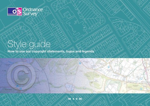
Style <strong>guide</strong><br />
How to use our copyright statements, logos and legends
Introduction 3<br />
Purpose 3<br />
Scope 3<br />
About Ordnance Survey 3<br />
Direct Customers 4<br />
Standard copyright and database right<br />
acknowledgement 4<br />
OS OpenData copyright and database right<br />
acknowledgement 4<br />
Licensed Partners 5<br />
Standard copyright and database right<br />
acknowledgement 5<br />
OS OpenData copyright and database right<br />
acknowledgement 5<br />
Licensed Partner logo 6<br />
Enabled by and Mapping sourced from logos<br />
(product/service logos) 6<br />
Ordnance Survey Mapping and Data Centre Logo 7<br />
How to use the Licensed Partner logos 8<br />
How to use the Enabled by and<br />
Mapping sourced from logos 9<br />
How to use the Mapping and Data Centre Logo 10<br />
Legends 11<br />
1:25 000 Scale Raster Data legend 11<br />
1:50 000 Scale Raster Data legend 13<br />
The colours 15<br />
Ordnance Survey <strong>style</strong> <strong>guide</strong>lines | 2
Introduction<br />
Ordnance Survey’s corporate branding and imaging supports our overall core<br />
message that Ordnance Survey is the national mapping agency <strong>for</strong> Great<br />
Britain. Our aim is to increase the use of Ordnance Survey data by permitting<br />
the exploitation of the intellectual property rights (IPR) in the data. We achieve<br />
this through trading and licensing to a wide customer base whilst ensuring the<br />
protection of our longer term sustainability.<br />
Purpose of the Style Guide<br />
The purpose of the Style Guide is to provide <strong>guide</strong>lines to Direct Customers and<br />
Licensed Partners on the use of Ordnance Survey’s standard Copyright and<br />
Database right acknowledgement, logos and legends.<br />
Scope<br />
These <strong>guide</strong>lines have been designed specifically to ensure that:<br />
1. All of our customers are using the correct copyright and database right<br />
acknowledgement.<br />
2. Our Licensed Partners are using and representing our corporate logos<br />
appropriately in their corporate materials.<br />
3. Legends are used by Licensed Partners producing facsimile mapping from 1:25<br />
000 Raster and 1:50 000 Raster under the Printed Products Contract.<br />
This <strong>guide</strong> is intended <strong>for</strong> customers who have a current contract in place with<br />
Ordnance Survey.<br />
All other Licensed Partner logos not featured in this <strong>guide</strong> are obsolete and<br />
should not be used in any circumstance.<br />
About Ordnance Survey<br />
If you wish to refer to Ordnance Survey in your corporate materials and<br />
websites, please use the following boiler plate text.<br />
Ordnance Survey is the recognised market leader in its field and is relied on <strong>for</strong><br />
its mapping expertise. Together with its partners, it provides a wide range of<br />
internationally renowned products <strong>for</strong> government, business and the individual –<br />
from complex digital in<strong>for</strong>mation to traditional walking maps.<br />
In addition to the above paragraph you may also use the following<br />
optional text.<br />
At the heart of Ordnance Survey is a vision that, together with its partners, it<br />
will be the content provider of choice <strong>for</strong> location-based in<strong>for</strong>mation in the new<br />
in<strong>for</strong>mation economy.<br />
Ordnance Survey <strong>style</strong> <strong>guide</strong>lines | 3
Direct customers<br />
Standard copyright and database right acknowledgement<br />
You must clearly show one of the following copyright and database right<br />
acknowledgements on any display or reproduction of Ordnance Survey data, <strong>for</strong><br />
example, on any print, plot or view:<br />
© Crown copyright and database rights [year of supply or date of publication]<br />
Ordnance Survey [licence number]<br />
© Hawlfraint y Goron a hawliau cronfa ddata [blwyddyn cyflenwi neu ddyddiad<br />
cyhoeddi] Arolwg Ordnans [rhif y drwydded]<br />
The Crown copyright and database right date is the date that you receive the digital<br />
data or the date of publication <strong>for</strong> paper products.<br />
You can find your licence number in the following documents:<br />
• Your copy of your Contract<br />
• Your invoices<br />
The statement ‘© Crown copyright and database rights (insert year) Ordnance<br />
Survey (licence number)’ must be used at a minimum of 6 point size with 7 point<br />
leading. On electronic map extracts Arial ® should be used as the font <strong>for</strong> the<br />
copyright statement. On printed map extracts Helvetica ® should be the font used.<br />
Which licence number?<br />
• If we originally supplied data to you directly, but you now license it from a partner,<br />
you should use the partner’s licence number.<br />
• If you originally licensed data from a partner, but now license it directly from us,<br />
you should use your own licence number.<br />
• If you display or reproduce data supplied directly from Ordnance Survey together<br />
with data licensed from one of our partners, you should use both your own<br />
licence number and the partner’s licence number.<br />
OS OpenData copyright and database right acknowledgement<br />
Whenever OS OpenData is shown, a separate copyright and database right<br />
acknowledgement applies on any display or reproduction of OS OpenData.<br />
A separate Royal Mail acknowledgement applies <strong>for</strong> OS OpenData products<br />
containing Royal Mail Intellectual Property.<br />
A separate Office <strong>for</strong> National Statistics acknowledgement applies <strong>for</strong> OS OpenData<br />
products containing Office <strong>for</strong> National Statistics Intellectual Property.<br />
Please refer to the details of the acknowledgements and the separate terms<br />
and conditions that apply, on the following url: www.<strong>ordnance</strong><strong>survey</strong>.co.uk/<br />
opendata/licence<br />
Third Party acknowledgements<br />
National Land and Property Gazetteer (NLPG)<br />
Whenever data from the NLPG is displayed or reproduced, you must clearly show<br />
one of the following copyright and database right acknowledgements (in addition to<br />
the standard acknowledgement set out above), on any print, plot or view:<br />
© Local Government In<strong>for</strong>mation House Limited copyright and database rights [year<br />
of supply or date of publication] [licence number]<br />
© Hawlfraint a hawliau cronfa ddata cyfyngedig Tŷ Gwybodaeth ar Lywodraeth Leol<br />
[blwyddyn cyflenwi neu ddyddiad cyhoeddi] [rhif y drwydded]<br />
Other <strong>third</strong> party data<br />
Whenever other <strong>third</strong> party data is shown, a separate acknowledgement may apply;<br />
please refer to your Contract <strong>for</strong> further in<strong>for</strong>mation.<br />
The date, licence number, point size and font details are the same as set out in<br />
relation to the standard acknowledgement above.<br />
Ordnance Survey <strong>style</strong> <strong>guide</strong>lines | 4
Licensed Partners<br />
Standard copyright and database right acknowledgement<br />
You must clearly show one of the following copyright and database right<br />
acknowledgements on any display or reproduction of Ordnance Survey data, <strong>for</strong><br />
example, on any print, plot or view:<br />
© Crown copyright and database rights [year of supply or date of publication]<br />
Ordnance Survey [licence number]<br />
© Hawlfraint y Goron a hawliau cronfa ddata [blwyddyn cyflenwi neu ddyddiad<br />
cyhoeddi] Arolwg Ordnans [rhif y drwydded]<br />
The Crown copyright and database right date is the date that you receive the digital<br />
data or the date of publication <strong>for</strong> paper products.<br />
You can find your licence number in the following documents:<br />
• Your copy of your Contract<br />
• Your invoices<br />
The statement ‘© Crown copyright and database rights (insert year) Ordnance<br />
Survey (licence number)’ must be used at a minimum of 6 point size with 7 point<br />
leading. On electronic map extracts Arial ® should be used as the font <strong>for</strong> the<br />
copyright statement. On printed map extracts Helvetica ® should be the font used.<br />
Which licence number?<br />
• Where you supply data directly to a customer they should use your licence<br />
number (regardless of whether the data was originally supplied to them directly<br />
by Ordnance Survey).<br />
• Where your customer displays or reproduces data directly supplied by us in<br />
conjunction with data you license to them, they should use both your partner<br />
licence number and their own licence number.<br />
Notes:<br />
• Where there is insufficient room to show the acknowledgement on each display<br />
of licensed data, <strong>for</strong> example, on a mobile device, partners are permitted to<br />
display the full copyright acknowledgement on the general terms and conditions<br />
screen or opening screen of the device used.<br />
• For the avoidance of doubt where you sub-licence please ensure that your<br />
sub-licensees include the copyright and database right acknowledgement<br />
together with your licence number.<br />
OS OpenData copyright and database right acknowledgement<br />
Whenever OS OpenData is shown, a separate copyright and database right<br />
acknowledgement applies on any display or reproduction of OS OpenData.<br />
A separate Royal Mail acknowledgement applies <strong>for</strong> OS OpenData products<br />
containing Royal Mail IP.<br />
A separate Office <strong>for</strong> National Statistics acknowledgement applies <strong>for</strong> OS OpenData<br />
products containing Office <strong>for</strong> National Statistics IP.<br />
Please refer to the details of the acknowledgements and the separate terms<br />
and conditions that apply, on the following url: www.<strong>ordnance</strong><strong>survey</strong>.co.uk/<br />
opendata/licence<br />
Third Party acknowledgements<br />
National Land and Property Gazetteer (NLPG)<br />
Whenever data from the NLPG is displayed or reproduced, you must clearly show<br />
one of the following copyright and database right acknowledgements (in addition to<br />
the standard acknowledgement set out above), on any print, plot or view:<br />
© Local Government In<strong>for</strong>mation House Limited copyright and database rights [year<br />
of supply or date of publication] [licence number]<br />
© Hawlfraint a hawliau cronfa ddata cyfyngedig Tŷ Gwybodaeth ar Lywodraeth Leol<br />
[blwyddyn cyflenwi neu ddyddiad cyhoeddi] [rhif y drwydded]<br />
Other <strong>third</strong> party data<br />
Whenever other <strong>third</strong> party data is shown, a separate acknowledgement may apply;<br />
please refer to your Contract <strong>for</strong> further in<strong>for</strong>mation.<br />
The date, licence number, point size and font details are the same as set out in<br />
relation to the standard acknowledgement above.<br />
Ordnance Survey <strong>style</strong> <strong>guide</strong>lines | 5
Licensed Partners<br />
Licensed Partner logo<br />
This logo has been created to allow you to describe your status as an<br />
Ordnance Survey Licensed Partner. You have the right to use the logo in association<br />
with products and/or services that utilise Ordnance Survey data in accordance with<br />
the Framework Contract (Partners) and an appropriate Contract. It can be used<br />
whenever you are talking about your organisation, <strong>for</strong> example, on your website,<br />
corporate paperwork, stationery, promotional and display material.<br />
The logo should only be used in a way that makes it clear that it is an accreditation<br />
rather than an endorsement of any products and/or services.<br />
Licensed Partner<br />
The following Licensed Partner logo may be used by all Licensed Partners:<br />
Licensed Partner<br />
If you are using any other Partner logos that we have provided to you in the past,<br />
please contact your Account Manager.<br />
‘Enabled by’ and ‘Mapping sourced from’ logos<br />
You can use one of two logos on products and product packaging – depending on<br />
the product or service you are producing, to signal the inclusion of Ordnance Survey<br />
data.<br />
You may incorporate the ‘Enabled by’ logo <strong>for</strong> products and/or services that include<br />
digital data incorporating or derived from Ordnance Survey data.<br />
You may incorporate the ‘Mapping sourced from’ logo <strong>for</strong> products and/or services<br />
that include paper map publications incorporating or derived from Ordnance Survey<br />
data.<br />
Note: Under the Printed Products Contract, you may not use the ‘Enabled by’ logo<br />
in connection with any Printed Product that is supplied in electronic <strong>for</strong>mat.<br />
Ordnance Survey <strong>style</strong> <strong>guide</strong>lines | 6
Licensed Partners<br />
Ordnance Survey Mapping and Data Centre logo<br />
From 1 October 2011 Partners are granted the right to use the following logo:<br />
This logo has been created to allow you to describe your status as a qualified retail<br />
outlet. It can be used whenever you are talking about your retail outlet, <strong>for</strong> example,<br />
on your website, corporate paperwork, stationery, promotional and display material.<br />
You may use the logo if you comply with the following:<br />
1. You operate a retail outlet and have a relationship with Ordnance Survey as<br />
a Licensed Partner or sub-partner under the Framework Contract (Partners).<br />
Without limitation, use of the logo is not available to use solely by virtue of being<br />
a direct customer under the Framework Contract (Direct Customers) or by being<br />
a party to any Collective Purchase Agreements <strong>for</strong> Ordnance Survey data.<br />
2. The logo may only be used on or within qualifying retail outlets, or on websites<br />
and marketing material in connection with the promotion of such retail outlets.<br />
3. All qualifying retail outlets must be located within business premises and be<br />
easily accessible to the general public and/or business customers during normal<br />
business hours.<br />
4. All qualifying retail outlets must contain clear floor space allocated to mapping<br />
products and must, as a minimum, contain facilities <strong>for</strong> the plotting and printing<br />
of A4 planning extracts in compliance with UK planning and building regulations.<br />
5. All qualifying retail outlets should at all times during opening hours have available<br />
on site at least one member of staff proficient in both of the following:<br />
• the selling and use of Ordnance Survey mapping products; and<br />
• the application process under UK planning and building regulations to the<br />
extent that they are able to provide suitable A4 planning extracts to<br />
customers.<br />
Note: If you comply with the above, and wish to use the Ordnance Survey<br />
Mapping and Data Centre logo, please contact your account manager <strong>for</strong><br />
further details on the requirements and process.<br />
Ordnance Survey may at any time with reasonable notice discontinue use<br />
of the Mapping and Data Centre logo.<br />
Ordnance Survey <strong>style</strong> <strong>guide</strong>lines | 7
Licensed Partners<br />
How to use the Licensed Partner logo<br />
If you use the Licensed Partner logo you must comply with the following guidance.<br />
1. The original logo should always be used as downloaded and never recreated.<br />
2. The logo may be no less than 23 mm in length. There is no upward size<br />
restriction.<br />
3. Do not change the logo’s colours.<br />
4. Do not remove or change the logo’s text.<br />
5. Do not distort the logo.<br />
6. Do not rotate the logo.<br />
7. Allow an exclusion zone around the logo as defined by the proportions shown.<br />
Ordnance Survey <strong>style</strong> <strong>guide</strong>lines | 8
Licensed Partners<br />
How to use the ‘Enabled by’ and ‘Mapping sourced from’ logos<br />
If you use the Enabled by and Mapping sourced from logos you must comply with<br />
the following guidance.<br />
1. The original logo should always be used as downloaded and never recreated.<br />
2. The logo may be no less than 23 mm in length. There is no upward size<br />
restriction.<br />
3. Do not change the logo’s colours.<br />
4. Do not remove or change the logo’s text.<br />
5. Do not distort the logo.<br />
6. Do not rotate the logo.<br />
7. Allow an exclusion zone around the logo as defined by the proportions shown.<br />
Ordnance Survey <strong>style</strong> <strong>guide</strong>lines | 9
Licensed Partners<br />
How to use the Ordnance Survey Mapping and Data Centre Logo<br />
If you use the Mapping and Data Centre logo you must comply with the following<br />
guidance.<br />
1. The original logo should always be used as downloaded and never recreated.<br />
2. The logo may be no less than 23 mm in length. There is no upward size<br />
restriction.<br />
3. Do not change the logo’s colours.<br />
4. Do not remove or change the logo’s text.<br />
5. Do not distort the logo.<br />
6. Do not rotate the logo.<br />
7. Allow an exclusion zone around the logo as defined by the proportions shown.<br />
Ordnance Survey <strong>style</strong> <strong>guide</strong>lines | 10
Legends<br />
1:25 000 Scale Raster Data legend<br />
Where you create facsimile mapping from 1:25 000 Scale Raster Data or 1:50 000 Scale<br />
Raster Data under the Printed Products Contract, or provide access to 1:25 000 Scale<br />
Raster Data or 1:50 000 Scale Raster Data under the Consumer Applications and Websites<br />
Contract, you may use the following legends <strong>for</strong> such datasets.<br />
Portrayal of access land on this map is intended as a <strong>guide</strong> to<br />
land which is normally available <strong>for</strong> access on foot, <strong>for</strong> example<br />
access land created under the Countryside and Rights of Way<br />
Act 2000, and land managed by the National Trust, Forestry<br />
Commission and Woodland Trust. Access <strong>for</strong> other activities<br />
may also exist. Some restrictions will apply; some land will be<br />
excluded from open access rights. The depiction of rights of<br />
access does not imply or express any warranty as to its<br />
accuracy or completeness. Observe local signs and follow the<br />
Countryside Code. Visit www.countrysideaccess.gov.uk <strong>for</strong><br />
up-to-date in<strong>for</strong>mation.<br />
In Scotland, everyone has access rights in law* over most land<br />
and inland water, provided access is exercised responsibly. This<br />
includes walking, cycling, horse-riding and water access,<br />
<strong>for</strong> recreational and educational purposes, and <strong>for</strong> crossing<br />
land or water. Access rights do not apply to motorised<br />
activities, hunting, shooting or �shing, nor if your dog is not<br />
under proper control. The Scottish Outdoor Access Code is<br />
the reference point <strong>for</strong> responsible behaviour, and can be<br />
obtained at www.outdooraccess-scotland.com or by phoning<br />
your local Scottish Natural Heritage of�ce.<br />
* Land Re<strong>for</strong>m (Scotland) Act 2003.<br />
Ordnance Survey <strong>style</strong> <strong>guide</strong>lines | 11
Ordnance Survey <strong>style</strong> <strong>guide</strong>lines | 12
1:50 000 Scale Raster Data legend<br />
CONVERSION<br />
METRES – FEET<br />
Ordnance Survey <strong>style</strong> <strong>guide</strong>lines | 13
LAND FEATURES<br />
WATER FEATURES<br />
BOUNDARIES<br />
ABBREVIATIONS TOURIST INFORMATION<br />
ARCHAEOLOGICAL AND HISTORICAL INFORMATION<br />
HEIGHTS<br />
ROCK FEATURES<br />
Ordnance Survey <strong>style</strong> <strong>guide</strong>lines | 14
The colours<br />
The following are colour designations to be specified when using the Ordnance Survey<br />
logo in colour. Two corporate colours are used in the partner logos, OS Blue and OS Pink.<br />
PANTONE ®<br />
273 C 100%<br />
C100 M100 Y0 K0<br />
R047 G040 B127<br />
HEX 2F287F<br />
PANTONE ®<br />
Process Magenta C 100%<br />
C0 M100 Y0 K0<br />
R196 G000 B121<br />
HEX C40079<br />
OS Blue<br />
Print (specials) Hostmann and Steinberg Alpha Universal OS logo blue ref: 43SM 78*<br />
Paint equivalents NCS 3070-R70B<br />
Vinyl equivalents Arlon VT 774 Royal purple-opaque<br />
OS Pink<br />
Paint equivalents NCS 1070-R20B<br />
Vinyl equivalents Arlon VT 756 Hot pink-opaque<br />
For any enquiries please contact: corporatecommunications@<strong>ordnance</strong><strong>survey</strong>.co.uk<br />
Ordnance Survey<br />
Corporate Communications<br />
Adanac Drive<br />
SOUTHAMPTON<br />
United Kingdom<br />
SO16 0AS<br />
Phone: 023 8005 5061<br />
Ordnance Survey © Crown copyright<br />
The colours on this page and throughout these <strong>guide</strong>lines have not been evaluated by Pantone, Inc. <strong>for</strong> accuracy and may not<br />
match the PANTONE colour standard. Consult current PANTONE Colour Publications <strong>for</strong> accurate colour. PANTONE ® is the<br />
property of Pantone, Inc.<br />
*Available as a special ink from Keane Graphic Products. There is no PANTONE © equivalent.<br />
Ordnance Survey and the OS Symbol are registered trademarks and OS OpenData is a trademark of Ordnance Survey, the national<br />
mapping agency of Great Britain.<br />
Arial is a registered trademark of The Monotype Corporation. Helvetica is a registered trademark of Linotype GmbH.<br />
Hostmann-Steinberg is a registered trademark of Hostmann-Steinberg GmbH. Pantone is a registered trademark of Pantone, Inc.<br />
D03566 0712 Version 4.3 July 2012<br />
Ordnance Survey <strong>style</strong> <strong>guide</strong>lines | 15
www.<strong>ordnance</strong><strong>survey</strong>.co.uk<br />
customerservices@<strong>ordnance</strong><strong>survey</strong>.co.uk<br />
General enquiries: +44 (0)8456 05 05 05<br />
Dedicated Welsh Language HelpLine: 08456 05 05 04<br />
Textphone (deaf and hard of hearing users only please): +44 (0)23 8005 6146<br />
Customer Service Centre, Ordnance Survey, Adanac Drive, SOUTHAMPTON, United Kingdom, SO16 0AS.<br />
This document has been screened in accordance with the requirements set out in Ordnance Survey’s Equality Scheme. If you<br />
have difficulty reading this in<strong>for</strong>mation in its current <strong>for</strong>mat and would like to find out how to access it in a different <strong>for</strong>mat<br />
(Braille, large print, computer disk or in another language), please contact us on: +44 (0)8456 05 05 05.<br />
While every care has been taken in preparing these <strong>guide</strong>lines, to the extent permitted by law, Ordnance Survey will not be liable by reason of breach of contract, negligence or otherwise <strong>for</strong> any<br />
loss or consequential loss arising as a result of you relying on the contents of this leaflet. Ordnance Survey reserves the right to change the products described in this leaflet from time to time.<br />
Ordnance Survey, OS and the OS Symbol are registered trademarks of Ordnance Survey, the national mapping agency of Great Britain.<br />
PANTONE ® is the property of Pantone, Inc. Helvetica is a registered trademark of Linotype GmbH. Investor in People is a registered trademark of Investors in People.<br />
Ordnance Survey © Crown copyright<br />
D00000 0711