1954 - Periodicals - CALIFORNIA HIGHWAYS AND PUBLIC ... - Metro
1954 - Periodicals - CALIFORNIA HIGHWAYS AND PUBLIC ... - Metro
1954 - Periodicals - CALIFORNIA HIGHWAYS AND PUBLIC ... - Metro

Create successful ePaper yourself
Turn your PDF publications into a flip-book with our unique Google optimized e-Paper software.
.~<br />
. ~ :`; r<br />
~<br />
4<br />
~,<br />
~..y<br />
. ~ ~w<br />
3<br />
'~<br />
'° ,`~<br />
F a1~~ ~<br />
9 `~~<br />
~~ n ,f •j ~ y{<br />
~<br />
;_. i<br />
~; `'A<br />
r r..<br />
r ~,<br />
r a<br />
y ` . ~;<br />
~:k~I<br />
• ~ ~ }<br />
`~ f. .^. w.y<br />
.:~ ~<br />
.a'<br />
~:r.<br />
~a .<br />
f..<br />
• .Y«^ ~,.<br />
t ~ \, ~ a vA~~ "<br />
a'' ~<br />
.\'sue ~ ;.', .` ,'.~i t<br />
e r 3`3<br />
t~^<br />
{i x .. ~ ; " ~..<br />
;~.{~:`"<br />
+ 3""+4l ,.<br />
~~~~<br />
::'q`:r ya~<br />
a.<br />
r~~ ~<br />
:,..<br />
+S x~r~ ~Yv .s.:~..<br />
.' ~~.<br />
~. y: .i.e' .fa.<br />
*k .~:<br />
iv~'.~~•Rx~~'s -. .
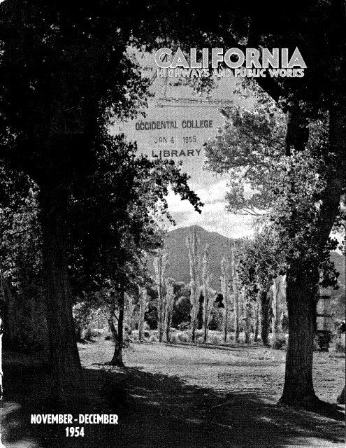
~allfornla ~l hWa s<br />
g ~<br />
aid P~ubIIC ~o~ks<br />
O~ciaf Journal of the Division of Highways,<br />
Department of Public Works, State of California<br />
KENNETH C. ADAMS Editor<br />
HELEN HALSTED, Assistant Editor<br />
MERRITT R. NICKERSON, Chief Photographer<br />
Vo1.33 November-December Nos.11-12<br />
Published in the interest of highway development in Cali-<br />
fornia. Editors of newspapers and others are privileged to<br />
use matter contained herein. Cuts will be gladly loaned<br />
upon request.<br />
Address communications to<br />
<strong>CALIFORNIA</strong> <strong>HIGHWAYS</strong> <strong>AND</strong> <strong>PUBLIC</strong> WORKS<br />
P. O. Box 1499<br />
Sacramento, California<br />
Public Works Building<br />
7welffh and N Streets<br />
Sacramento<br />
View of Owens Valley in Inyo County as seen from US 395 at Olancha. Photo<br />
by Robert A. Munroe, Photographic Section, Department of Public Works,<br />
Page<br />
M. R. Nickerson, Chief--------------------------------------------'----------Cover<br />
Financing of Grade Separations, Illustrated_________ _______________________________ 1<br />
By Jnmes Gallagher, Senior Bridge Engineer, Retired<br />
New Freeway, Illustrated_ _ -~--__-__---__----_-_--____-__------_-_----_- - = 7<br />
By George L. Laird, Bridge ConsTructionEngineer, C. J; McCullough,~Resid~nf Engineer,<br />
District VII, and E. A. Bannister, Resident;Engineer,'DistricT VIII.' -
~ n a n c i n ♦ • By JAMES GALLAGHER, Senior<br />
O Bridge Engineer (Retired)<br />
What Can Be Done to<br />
Obviate Legal Delays<br />
~~ e<br />
e ~<br />
I ~ I O ~ J<br />
What can be done to eliminate or at least minimize the long legal delays which threaten to hold up important highway<br />
construction projects involving railroad grade separations?<br />
The railroads and the road-building public agencies involved are bound to disagree over how much of the cost of .he<br />
project each party should bear. Unfortunately, while. the argument continues, an increasing volume of highway and railroad<br />
traffic is subjected to the delays and dangers of existing grade crossings.<br />
In this article Mr. Gallagher reviews the history of this problem in California and other states and suggests a method of<br />
getting the separation- built first and ironing out the fnancial dispute later.<br />
Mr. Gallagher retired at the compulsory age of 70 on September 30, <strong>1954</strong>, after 33 years of service in the Bridge Department<br />
of the Division of Highways. He is widely recognized as an authority on the complex problems of railroad-highway<br />
grade crossing elimination.—Editor.<br />
WHEN THE RAILROADS WeI'e fiTSt COTlstructed<br />
in California, highways were<br />
few and far between. The railroads,<br />
at their own expense, constructed<br />
crossings at grade or at separated<br />
grades, depending on the topography.<br />
At this time, grade separations were<br />
few and usually occurred only when<br />
made necessary by the topography.<br />
With the development of the motor<br />
vehicle, highways assumed a constantly<br />
increasing importance in the<br />
national economy. California, in particular,<br />
became a "state on rubbertired<br />
wheels," its motor vehicle registration<br />
growing from 36,000 in 1909<br />
to about 6,000,000 in <strong>1954</strong>. Since 1927<br />
highway construction in general has<br />
been financed from various special<br />
taxes paid by these increasing numbers<br />
of highway users, plus some federal<br />
aid. The annual expenditure' for<br />
major highway construction purposes<br />
in California now approximates $200,-<br />
000,000 per year.<br />
Separations Necessary<br />
"Stop, Look and Listen" was the<br />
standard warning in the old days to<br />
the occasional slow-moving highway<br />
vehicles approaching a grade crossing<br />
traversed by fast-moving trains. Nowadays<br />
highway traffic is neither occasional<br />
nor slow-moving, nor is the motoring<br />
public willing to "stop, look<br />
and listen" at every railroad crossing.<br />
The safe and expeditious movement<br />
of both railroad and highway traffic<br />
demands that major points of conflict<br />
be resolved by separation structures.<br />
Such structures are expensive. Who<br />
should bear their cost, and to what<br />
proportionate extent? The importance<br />
of a practical solution to the problem<br />
grows in proportion to the rapidly expanding<br />
population and economy of<br />
this State.<br />
Early Decisions<br />
The problem is by no means new.<br />
The Public Utilities Commission of<br />
the State of California was organized<br />
in 1911 (under the name of the California<br />
Railroad Commission). Its<br />
powers and duties were defined in the<br />
Public Utilities Act of 1915. Among<br />
the powers delegated to the commission<br />
was:<br />
" ~` ~ ~ exclusive power to determine<br />
and prescribe the manner, including<br />
particular point of crossing<br />
and the terms of installation, operation,<br />
maintenance, and use of railroadhighway<br />
crossings."<br />
Thus, even in 1915 the need was<br />
apparent for a body to adjudicate conflicting<br />
interests of railroads and highways<br />
at crossings.<br />
Over the course of the next 18 years<br />
the problem proved not too difficult<br />
of solution. Financial limitations kept<br />
the volume and standards of highway<br />
construction at a relatively low level,<br />
and there were not very many crossings<br />
where highway traffic was heavy<br />
enough to make a separation structure<br />
urgent. Nor, at that time, did the railroads<br />
regard highway transportation<br />
as a seriously competing industry.<br />
During that 18-year period the commission<br />
apportioned to the railroads<br />
a varying proportion of the cost of<br />
highway-railroad separations, depending<br />
on the particular circumstances of<br />
each case. But it did hold consistently<br />
that the railroads do constitute a<br />
barrier to the interchange of traffic,<br />
whether it be a horse-drawn cart or<br />
the speedy horseless carriage of today<br />
and that railroads do have a continuing<br />
obligation to provide, or to participate<br />
in the cost of providing, safe<br />
and convenient means of crossings of<br />
their tracks.<br />
In general, prior to 1933, the commission<br />
apportioned to the railroad<br />
involved 50 percent of the cost of<br />
a highway-railroad grade separation<br />
which eliminated an existing grade<br />
crossing; and 25 percent or less where<br />
an existing separation was reconstructed<br />
or where the new separation<br />
was on new alignment which did not<br />
eliminate an existing grade crossing.<br />
As the volume and speed of veliicular<br />
traffic continued to rise and with<br />
them the standards of highway con-
tion engineering and right of way,<br />
bility under the 1944 Highway Act,<br />
the cost of that portion of an improve-<br />
ment which will accomplish reduc-<br />
grade separation for the purpose of<br />
determining railroad benefit and lia-<br />
California Highways<br />
is specified in C. A. ~~~. i~TO. 325 as<br />
tion or elimination of railroad cross-<br />
railroads have accepted G. A. ~~~L No.<br />
This includes cost of underpass or<br />
ing hazard including cost of construc-<br />
In the case of totally ne~v crossings,<br />
tour and all «~orlc necessary to effect<br />
The total cost of ahighway-railroad<br />
thereto, railroad shoofly, high~,ay de-<br />
~vay approach and rail approaches<br />
overhead structure, necessary high-<br />
ects but also on those financed with<br />
fornia not only on federal aid proj-<br />
eliminate is closed, the railroad benefit<br />
crossing of an existing high«-a~~ is con-<br />
tionment has been followed in Cali-<br />
This memorandum provides in ef-<br />
highway crossing of the railroad as<br />
tribution to the cost of grade separa-<br />
325 as a basis for figuring railroad con-<br />
fore no railroad contribution is re-<br />
of no benefit to the railroad and there-<br />
and railroad contribution is 10 per-<br />
which the separation is designed to<br />
fect that if the existing grade crossing<br />
cent; if this principal grade crossing<br />
the railroads for construction of grade<br />
federal funds; and since 1948, Califor-<br />
In California both the State and the<br />
No. 325 of the U. S. Bureau of Public<br />
contribution; ~~hile a ne~v railroad<br />
and therefore requiring no railroad<br />
Officials and the Association of Amer-<br />
being of no benefit to the railroad<br />
reaching satisfactory agreements with<br />
tions financed in whole or in part with<br />
G. A. M. INTO. 325 considers a new<br />
nia has had very little difficulty in<br />
is not closed, the project is considered<br />
ican Railroads, and was set forth in<br />
General Administrative 1Vlemorandum<br />
by joint committee action of the<br />
struction of grade separations under<br />
benefit was needed. It was provided<br />
the 1944 act. A definition of railroad<br />
separations on federal aid projects.<br />
Roads, dated August 26, 1948.<br />
state or railroad funds alone.<br />
percent by the railroad. This appor-<br />
benefit and should be financed 100<br />
sidered wholly for the railroad's<br />
American Association of High~'ay<br />
quired.<br />
arations on new highway alignment,<br />
a highway-railway grade separation,<br />
way programs throughout the Nation.<br />
passing the 1944 Highway Act, Con-<br />
amount of the railroad benefit but not<br />
lem of establishing railroad benefit,<br />
The Federal Aid Highway Act of<br />
or with federal funds under the 1944<br />
from a grade separation. They com-<br />
the railroad's obligation to 10 percent<br />
crossinb in ,question for claims, legal<br />
For three years after the passage of<br />
Federal Aid Highway Act. A few sep-<br />
trackage, divided by the total num-<br />
crossing maintenance, or on the total<br />
separations as part of accelerated high-<br />
the railroad involved is liable for the<br />
act provided that for construction of<br />
under the 1935 and subsequent acts<br />
were practically all financed with fed-<br />
Other states faced the same prob-<br />
as maximum railroad benefit, possibly<br />
gress recognized that the railroads<br />
1944 introduced a new element. The<br />
State of California and the railroads<br />
grade separations on the state high-<br />
ter basis, one railroad figured its an-<br />
agreement on this point. The railroads<br />
heavy a financial burden incident to<br />
have an obligation to contribute to the<br />
to exceed 10 percent of the cost. In<br />
crossing, were financed wholly with<br />
ber of its grade crossings. On the lat-<br />
to protect the railroads from too<br />
which did not close any existing grade<br />
with .the consequent stoppage of con-<br />
at an average grade crossing at less<br />
nual savings by elimination of hazards<br />
placed a very small valuation on the<br />
annual out-of-pocket costs at the<br />
the 1944 Federal Highway Act, the<br />
the construction of numerous grade<br />
expenses, repair of damage, and grade<br />
amount paid by the railroad because<br />
puted it either on the basis of average<br />
cost of grade separations, but limited<br />
of crossing accidents on its California<br />
were unable to reach a satisfactory<br />
eral grade crossing funds, apportioned<br />
intangible benefit accruing to them<br />
ways constructed during this period<br />
railroad and the public. The railroad<br />
What constitutes railroad benefit?<br />
state funds by agreement.<br />
Benefit Principle<br />
cost of a grade separation between the<br />
other decision which adjudicated the<br />
than $200.<br />
this argument in its 193 3 Decision No.<br />
Garage Underpass in Tulare County.<br />
at railroad-highway grade crossings,<br />
commission decisions in similar cases.<br />
Southern Pacific Company to con-<br />
being forced to contribute to the con-<br />
1935. That act provided Federal<br />
contribute to the cost of a grade sepa-<br />
struction of a roadway for the use of<br />
highways had reached the point where<br />
improvement of major cross-country<br />
tribute $15,000 towards the construc-<br />
The commission took cognizance of<br />
cost of grade separations. Also, the<br />
crease in the number and the over-all<br />
$66,700 exclusive of paving, or about<br />
railroads argued, they were in effect<br />
including construction of grade sepa-<br />
It is to be noted that this decision was<br />
ration in excess of railroad benefit the<br />
financing of the eliminarion of hazards<br />
they were being increasingly used by<br />
railroads began to contend that the<br />
50 percent apportioned by previous<br />
Federal Emergency Relief Act of<br />
on US 99. The decision required the<br />
25551 for construction of the Plaza<br />
long-haul motor trucks. If required to<br />
under 1935 and subsequent federal ap-<br />
eliminated an existing grade crossing<br />
rations as well as installation of auto-<br />
Works Progress funds for complete<br />
of uneasy truce, with the inevitable<br />
depression, when the earning capacity<br />
rendered at the depth of a financial<br />
tion of this grade separation costing<br />
lotted to California for these purposes<br />
showdown deferred as a result of the<br />
This was a grade separation which<br />
22 percent of cost, as compared with<br />
Public Utilities Commission issued an-<br />
the railroads, except that they were<br />
Approximately $17,000,000 was al-<br />
reimbursed on the basis of direct out-<br />
grade separations involved no cost to<br />
101 grade separations were built in<br />
of-pocket costs for work done by rail-<br />
this State `vith federal funds. These<br />
propriations up to 1944 and a total of<br />
The next decade or so was a period<br />
Actually, it was 1949 befare the<br />
road forces, with no allowance for<br />
struction, there came a marked in-<br />
matic crossing protection devices.<br />
overhead and similar items.<br />
Federal Aid Truce<br />
of business was very low.<br />
a competitor.
~,~.d,~,~T.<br />
r<br />
At the Los Feliz Road grade crossing (Glendale-Los Angeles city line) heavy traffic backs up behind fhe gates while one of numerous daily trains passes<br />
the separation. In California we have<br />
used the definition as given in ~. A.<br />
M. No. 325 for the last several years<br />
and have had very little difficulty in<br />
reaching agreements with the railroads<br />
as to what items should be included.<br />
Washington Boulevard Case<br />
The issue regarding apportionment<br />
of cost for improvement or replacement<br />
of existing grade crossings not<br />
involving federal aid, was brought to<br />
life sharply by a Public Utilities Commission<br />
decision in 1949 in the case<br />
of a proposed widening of the Washington<br />
Boulevard underpasses of the<br />
Santa Fe tracks in the City of Los<br />
Angeles.<br />
The case originated in 1932, ~~hen<br />
the commission had apportioned 25<br />
percent of the cost of the widening<br />
to the railroad and 75 percent to the<br />
city, but the project was deferred by<br />
the city, and was revived in 1949.<br />
The commission's 1949 decision apportioned<br />
to the railroad not 25 percent,<br />
but 50 percent of the cost of<br />
widening the underpasses from the<br />
existing 24 feet to 56 feet, the width<br />
of the adjacent street sections. Neither<br />
party was satisfied. The railroad contended<br />
the widening was of no benefit<br />
to the railroad and the city contended<br />
the railroad should pay the total additional<br />
cost due to presence of railroad,<br />
for widening of the underpasses to 96<br />
feet, the planned ultimate width of<br />
that part of Washington Boulevard.<br />
Both sides asked for a rehearing.<br />
In June, 1952, the commission issued<br />
its Decision No. 47344, apportioning<br />
to the Santa Fe 50 percent of<br />
the estimated $569,000 cost due to<br />
presence of railroad of widening the<br />
underpasses to 96 feet.<br />
Commission's Decision<br />
The commission's Decision No.<br />
47344 covering the rehearing, states:<br />
"There is no statutory requirement that<br />
this commission follow any particular<br />
theory of allocation of costs. Under the<br />
theory advanced by the City of Los Angeles<br />
that the railroad should pay the<br />
additional costs of construction resulting<br />
from the presence of the tracks, the railroad's<br />
share ~~ould amount to about 86<br />
percent of the total costs. Under the theory<br />
advanced by the railroad that it<br />
should pay only according to the benefits<br />
it receives, and considering its contention<br />
that it receives no benefits, its contribution<br />
would be nothing.<br />
"The authority of this commission to<br />
allocate costs, as designated in Section<br />
1202 of the Public Utilities Code, supra,<br />
is an exercise of the police power on the<br />
part of the State of California through<br />
the medium of its agency, the Public<br />
Utilities Commission. We hold that the<br />
law is well established that under the exercise<br />
of the police power a state may<br />
regulate the crossings of railroad with its<br />
highways, and may require grade separations<br />
to be erected and maintained, ap-<br />
~ ~!t<br />
z~-:<br />
;w~;<br />
portioning the costs in the exercise of its<br />
sound discretion:'<br />
Los Feliz Case<br />
At about the same time the commission<br />
issued its Decision No. 47420, concerning<br />
the Los Feliz Road crossing<br />
of the tracks of the Southern Pacific.<br />
In this case it apportioned the total<br />
estimated $1,493,200 cost of a grade<br />
separation as follows: 50 percent to be<br />
borne by the Southern Pacific Company,<br />
25 percent by the County of<br />
Los Angeles, 12 %Z percent by the City<br />
of Glendale and 12 %z percent by the<br />
City of Los Angeles.<br />
The railroad's contention was that<br />
its contribution should not exceed<br />
$118,340, computed on the basis of its<br />
net annual monetary savings by the<br />
closing of the grade crossings, capitalized<br />
at 5 percent. The City of ~lendale,<br />
on the other hand, maintained<br />
that the railroad should bear the entire<br />
cost of the separation, since in the absence<br />
of the railroad the present street<br />
would be adequate and no grade separation<br />
necessary. The commission's<br />
decision in this case reaffirmed its position<br />
as outlined in the Washington<br />
Boulevard decision.<br />
Both decisions were appealed by<br />
the respective railroads to the Supreme<br />
Court of California. When the<br />
state court denied the appeals, they<br />
and Public 'Works 3
4 Californda High~,~,ays<br />
offered, the decision continues, "and<br />
properly applied the rule of allocation<br />
sanctioned by this court. There is<br />
no showing on these records of arbitrariness<br />
or unreasonableness in the<br />
commission's orders, and none is<br />
claimed except as the commission refused<br />
to allocate costs on the basis<br />
of benefits received, which `ve hold<br />
it was not required to do.<br />
"Certainly, if the commission has the<br />
right to order these improvements and<br />
has not, in allocating the costs, acted so<br />
arbitrarily as to deprive the railroads of<br />
their property without due process of<br />
la~~, the fact that the improvements may<br />
interfere with interstate commerce is incidental.<br />
The construction and use of<br />
public streets is a matter peculiarly of<br />
local concern and great leeway is allowed<br />
local authorities where there is no conflicting<br />
federal regulation, even though<br />
interstate commerce be subject to material<br />
interference.<br />
,:, R<br />
x -
"When the appellants went on the<br />
streets in question, they assumed the burden<br />
of sharing on a fair and reasonable<br />
basis the costs of any changes for the reason<br />
of public safety and convenience<br />
made necessary by the growth of the<br />
communities.<br />
The orders of the commission are not<br />
arbitrary or unreasonable and do not deprive<br />
the appellants of their property<br />
~~ithout due process of law, nor do they<br />
interfere unreasonably with interstate<br />
commerce:'<br />
Effect of Decisions<br />
While the Supreme Court decisions<br />
represent aclear-cut solution to the<br />
Washington Boulevard and Los Feliz<br />
situations, they may have the result of<br />
requiring the Public Utilities Commission<br />
to apportion costs for all similar<br />
separations proposed for state highways<br />
and other streets and roads in<br />
California unless they are on the federal<br />
aid construction program.<br />
Other States<br />
A report put out by the Association<br />
of American Railroads in 1950<br />
based on questionnaires sent to states<br />
throughout the Union, shows that in<br />
18 states the apportionment of cost<br />
between the railroad and the public is<br />
by a commission, 19 states have legislation<br />
requiring the railroads to contribute<br />
50 percent or more, and six<br />
states require railroads to contribute<br />
10 to 25 percent. In five states, railroad<br />
contribution is based on benefits<br />
not to exceed 10 or 15 percent of the<br />
cost. Six of the states differentiate bet~veen<br />
local highways and through<br />
highways. The laws of several states<br />
require railroads to contribute to the<br />
cost of new grade separations on new<br />
highway alignment.<br />
In 1951 the Tax Research Association<br />
of Houston, Texas, submitted a<br />
questionnaire to all of the states and<br />
the District of Columbia regarding the<br />
financing of grade separations. The<br />
results of this questionnaire `vere published<br />
in a report March 1, 1952. The<br />
Texas report includes tabulations<br />
showing number of grade separations<br />
built from 1939 to 1950 inclusive, in<br />
each of various states, the total cost<br />
of said separations and the source of<br />
funds. Six states are not- included in<br />
the tabulation because they did not<br />
ans~~er the questionnaire or did not<br />
include sufficient information.<br />
~', ~ ,<br />
~ 1<br />
'_ >~<br />
•.''<br />
~,<br />
~.<br />
.. x.w.r~.:.:.. d --~~~...w- ~.~ ~ti ..rn.r~<br />
.,,,.. ~<br />
~,.~<br />
~-<br />
~<br />
- -<br />
... ..r..... f<br />
i y<br />
Four lanes of Washington Boulevard traffic in Los Angeles funnels into this two-lane underpass<br />
Texas Report<br />
The Texas report sho`vs clearly that<br />
in the 1939-1950 period the majority<br />
of states used federal funds for financing<br />
grade separations. Of the five<br />
states which have statutes requiring SO<br />
percent railroad contribution, only<br />
one (Virginia) shoved a railroad contribution<br />
of more than 10 percent.<br />
T~vo other states with statutes requiring<br />
railroads to contribute 15 percent<br />
showed a total of only 10.37 and 7.50<br />
percent railroad contributions.<br />
The New York Grade Crossing<br />
Elimination Act of 1939 provides that<br />
the cost of grade crossing elimination<br />
shall be paid initially by the state, with<br />
the amount of railroad contribution<br />
to be adjudicated later by the Public<br />
Service Commission and the state reimbursed<br />
to that extent.<br />
ti.<br />
~'<br />
s<br />
~^ .<br />
~~x~~'<br />
s`~~ ~<br />
&,<br />
Under this system New York reports<br />
atotal of 196 grade separations<br />
constructed between 1939 and 1950,<br />
inclusive, at a total cost of $60,791,000,<br />
to which the railroads contributed<br />
$8,290,000, or 13.64 percent.<br />
It is apparent from the Texas report<br />
that those state laws requiring<br />
a 50 percent railroad contribution are<br />
largely inoperative. (Also, as indicated<br />
in the Supreme Court decisions, a<br />
fixed percentage may be ruled by the<br />
courts as arbitrary.) Except for Virginia,<br />
the states which have obtained<br />
the largest contributions from the railroads<br />
have been those states with laws<br />
requiring amore moderate railroad<br />
share and those states where the apportionment<br />
of cost is determined by<br />
a commission.<br />
ar~d Public Works 5<br />
-~
California Highways<br />
.Continued on page 63<br />
sential to the national economy. In the<br />
Railroads and highways are both es-<br />
Railroad Contributions<br />
of last resort.<br />
a final judgment is issued by a court<br />
existing grade crossings to wait until<br />
lay and danger is too great at many<br />
separations. The cost in terms of de-<br />
construction of urgently needed grade<br />
must be found to insure the prompt<br />
apportionment goes on, a method<br />
In the meantime, while debate over<br />
ing state highways.<br />
tions at new railroad crossings of exist-<br />
$1,200,000 for constructing separa-<br />
are currently spending approximately<br />
ings. As a matter of fact, the railroads<br />
the elimination of existing grade cross-<br />
a serious drain on railroad finances for<br />
about $450,000. This does not indicate<br />
fornia under federal aid projects totals<br />
the seven elimination projects in Cali-<br />
The total railroad contribution, for<br />
Commission.<br />
commenced with the Public Utilities<br />
apportionment of the cost have been<br />
pass, and proceedings to determine<br />
volves `widening of an existing under-<br />
is not on a federal aid route; it in-<br />
road contribution. The other project<br />
with federal aid with 10 percent rail-<br />
grade crossings and are being financed<br />
separations will eliminate existing<br />
bution. Of the remaining eight, seven<br />
projects) involve no railroad contri-<br />
and nine widenings are on federal aid<br />
new crossings are on new alignment<br />
separation projects, 30 of which (21<br />
includes 38 railroad-highway grade<br />
gram (July, 1953, to January, 1955)<br />
cerned, the current construction pro-<br />
railroads. As far as California is con-<br />
road expense would bankrupt the<br />
quirement to eliminate them all at rail-<br />
the United States, stating that a re-<br />
great number of grade crossings in<br />
The railroads have often cited the<br />
crossing.<br />
rail and vehicular traffic at a grade<br />
for the elimination of conflict between<br />
able on the basis of mutual obligations<br />
in various other states, is not unreason-<br />
Utilities Commission and in legislation<br />
past decisions of the California Public<br />
rails, which is specified in numerous<br />
way and 50 percent to the users of the<br />
of 50 percent to the users of the high-<br />
use of a grossing. The apportionment<br />
superior and inalienable rights to the<br />
sengers and freight certainly have no<br />
ing of the tracks. The railroad's pas-<br />
the use of a safe and convenient cross-<br />
pletely disregards the public's right to<br />
The railroads' interpretation com-<br />
Railroads' InTerprefafion<br />
traffic.<br />
tion of interference from vehicular<br />
accruing to the railroad by elimina-<br />
derpass; nor does it include the benefit<br />
traffic during construction of an un-<br />
porary shoofly or trestle to carry rail<br />
the often substantial cost of a tem-<br />
benefit does not include, for example,<br />
The railroads' interpretation of a<br />
grades.<br />
or 2 percent of the cost of separating<br />
the railroad will amount to only 1<br />
flashing lights the monetary saving to<br />
tected by such devices as automatic<br />
separation; but for a crossing pro-<br />
mate 10 percent of the cost of the<br />
cruing to the railroad might approxi-<br />
capitalized value of annual savings ac-<br />
eliminated by a grade separation, the<br />
ing watchman and manual gates are<br />
books. Thus, where a 24-hour cross-<br />
ble benefits not appearing on their<br />
fic. They omit all costs and intangi-<br />
to be for the benefit of vehicular traf-<br />
ference, they consider anything else<br />
construction of a separation. By in-<br />
accruing to the railroads by reason of<br />
monetary savings or tangible benefits<br />
the capitalized value of the annual<br />
interpretation of benefit to them is<br />
As indicated earlier, the railroads'<br />
clearly define "benefit."<br />
ments with the railroads, it should<br />
fective in expediting negotiated agree-<br />
If a law involving benefits is to be ef-<br />
ments to the railroads.<br />
cate atrend toward higher apportion-<br />
such a law, since these decisions indi-<br />
effort in 1955 to obtain enactment of<br />
sult in a particularly strong concerted<br />
to the railroads, will undoubtedly re-<br />
apportioning 50 percent of the costs<br />
ton Boulevard and Los Feliz decisions,<br />
on the basis of benefits. The Washing-<br />
portion the cost of grade separations<br />
the Public Utilities Commission to ap-<br />
State Legislature of a law directing<br />
deavored to obtain passage by the<br />
the railroads in California have en-<br />
the grade crossing hazard. Since 1944<br />
of the structure and the elimination of<br />
would receive from the construction<br />
amount of monetary benefit they<br />
tion that their proper share is the<br />
The railroads have taken the posi-<br />
Conflict Over Benefits<br />
proper share of the cost of a grade<br />
that the railroads should pay their<br />
lar. This means, among other things,<br />
wayuser gets full value for his tax dol-<br />
nomically as possible so that the high-<br />
rapidly as possible, and also as eco-<br />
quate roadways for vehicular traffic as<br />
builder is to provide safe and ade-<br />
prime responsibility of the highway<br />
ticipated railroad contribution. The<br />
be more than the amount of any an-<br />
tion of a needed grade separation may<br />
caused by the delay in the construc-<br />
Actually, the cost to the public<br />
crossing or reconstruction of an e~st-<br />
volve elimination of a railroad grade<br />
bution to crossing projects which in-<br />
as to the amount of railroad contri-<br />
satisfactory agreement with railroads<br />
except in a few isolated cases, to reach<br />
projects, California has been unable,<br />
with the P. U. C. On nonfederal aid<br />
more after'-the filing of an application<br />
aid must be delayed for a year or<br />
ing separations not involving federal<br />
grade crossings or widening of exist-<br />
Legislature, elimination of existing<br />
the absence of further action by the<br />
required to do. This means that, in<br />
any greater costs than they are legally<br />
that they will not voluntarily assume<br />
The railroads' position apparently is<br />
sion was issued in November, 1953.<br />
1948; the U. S. Supreme Court deci-<br />
the Wcrshisagton BoulevaYd case in<br />
Los Angeles made its application in<br />
apportionments are made. The City of<br />
test the basic principles on which<br />
ticularly slow when the railroads con-<br />
ment of costs. The process is par-<br />
there is disagreement over apportion-<br />
The delay extends into years where<br />
effected at the time they are needed.<br />
badly needed grade separation is not<br />
appeals means that the construction of<br />
ments, hearings, reviews, briefs and<br />
essary time-consuming steps in argu-<br />
now practiced in California. The nec-<br />
ever, in the commission procedure as<br />
There is one serious defect, how-<br />
Delay Problem<br />
separation.<br />
ing separation.
~~\/ v reevva<br />
Pomona,<br />
Ramona-99 Project Through<br />
Claremont, Ontario<br />
And Upland Now Completed<br />
By GEORGE L. LAIRD, Bridge Construction Engineer, Southern Section; C. J. McCULLOUGH, Resident<br />
Orr NovEUrBEx 16, <strong>1954</strong>, that por-<br />
tion of the US 99-Ramona Freeway in<br />
Districts VII and VIII between San<br />
Dimas Avenue in Los Angeles County<br />
and Archibald Avenue in San Bernar-<br />
dino County was opened to public<br />
traffic. This 13.5 miles of freeway<br />
passes through the Cities of Pomona,<br />
Claremont, Upland, and Ontario. It is<br />
the longest single section of full free-<br />
way to be opened at one time in the<br />
State of California. It is rare indeed<br />
that two adjoining major construction<br />
contracts, in this case totaling some<br />
$9,000,000, progress to completion so<br />
that the opening to public traffic can<br />
be on the same day and at the same<br />
time.<br />
This highway is one of the most im-<br />
portant traffic arterials entering the<br />
Los Angeles metropolitan area. It is<br />
the most direct route connecting Los<br />
Angeles with Imperial Valley and<br />
Engineer, District VII, and E. A. BANNISTER, Resident Engineer, District VIII<br />
---- ~~ _ _<br />
~:<br />
I~<br />
r'<br />
roads leading to the eastern section of<br />
the United States. Its importance is<br />
shown by the fact that this state route<br />
was one of the .first in the Los An-<br />
geles area to be declared a freeway by<br />
the State Highway Commission.<br />
Seven Major Contracts<br />
Although we have here the situa-<br />
tion of a 13.5-mile length of freeway<br />
being in effect a single unit, it is inter-<br />
esting to note that there are 6.3 miles<br />
in Los Angeles County within the Dis-<br />
trict VII area and 7.2 miles in San<br />
Bernardino County within the Dis-<br />
trict VIII area and also that it took<br />
seven major construction contracts to<br />
carry this vital freeway link to com-<br />
pletion. The completed construction<br />
provides a four-lane freeway with<br />
provision for ultimate expansion to six<br />
lanes by the addition of two lanes in<br />
the median area. The lanes of the<br />
traveled way consist of portland ce-<br />
ment concrete pavement. Shoulders,<br />
auxiliary lanes and ramps are of plant-<br />
mix surfacing.<br />
Looking southerly along San Antonio Avenue showing dual Ramona Freeway bridges<br />
~~ fhS~[+.vk..' ~`~`f .M.~4.T.~k+FLy~c1lY7.~<br />
r. - -_ .<br />
..<br />
F...r„~<br />
The interchanges in the Pomona-<br />
Claremont area are of several types<br />
with the diamond shape used predom-<br />
inately. These points of ingress and<br />
egress are located at important cross<br />
streets and are, in general, evenly<br />
spaced throughout the area. The<br />
braided connection with the existing<br />
traveled way near the westerly end of<br />
the project not only provides a con-<br />
venient entrance to Pomona but also<br />
becomes the junction of two free-<br />
ways. The westerly one mile of exist-<br />
ing Route 26 becomes Route 77. The<br />
latter route has been declared a free-<br />
way from its junction with the Ra-<br />
mona Freeway to the San Bernardino<br />
county line. The Ramona Freeway<br />
also crosses State Route 19 which is<br />
_. ~-<br />
.'aykvr... Y ~<br />
~+<br />
~ r<br />
~`r,*a;.<br />
t 'w 3x9 ~,<br />
+b2~„',~p; .^'dd5'1.. J'W~"„b n. a_yT~eyn~ It ti~~p'F<br />
' ( ~,``<br />
~<br />
-y 7i~i~<br />
'l~~~<br />
_<br />
and Public Works 7<br />
~7~.
g California- Highways<br />
and was 84-feet long. Cost $8$,700.<br />
consisted of two parallel bridges<br />
7. Alexander Ave. Undercrossing also<br />
bridges, 93 feet long. Cost $109,200.<br />
consisted: of two parallel box girder<br />
6. San Antonio Ave. Undercrossing<br />
long. Cost $167,800.<br />
twin box girder bridge, 158 feet<br />
5. Towne Ave. Undercrossing was a<br />
Cost $471,900.<br />
being approximately 820 feet long.<br />
bridge on this section of 'freeway,<br />
Grove Ave. and was the longest<br />
Ave., McKinley St. and Orange<br />
of parallel bridges over Carey<br />
4. Route 26/19 Separation consisted<br />
92 feet long. Cost $105,700.<br />
sisted of parallel bridges and was<br />
3. Park Ave. Undercrossing also con-<br />
$1 12,540.<br />
girder bridges, 107 feet long. Cost<br />
sisted of two parallel concrete box<br />
2. White Ave.. Undercrossing con-<br />
long. Cost $86,200.<br />
box girder type of bridge, 141 Beet<br />
of a two-span reinforced concrete<br />
1. Dudley Street Overcrossing consisted<br />
contract:<br />
lowing bridges were included in this<br />
the Division of Highways. The fol-<br />
O. A. Johnson as resident engineer for<br />
Price Co. as general contractor and<br />
206,625.30 was carried out by R. NI.<br />
A contract in the amount of $1,-<br />
Traffic Bottleneck<br />
City of Pomona.<br />
on June 4, 1952, for bridges in the<br />
the Los Angeles County was awarded<br />
first contract for seven structures in<br />
road contracts. Toward this end, the<br />
arate structure contracts ahead of the<br />
and Ontario, it was decided to ]et sep-<br />
through Pomona, Claremont, Upland,<br />
this important section of the freeway<br />
terests of speeding up construction of<br />
work at one time. Rather, in the in-<br />
funds were available to do all of the<br />
Commission decided not to wait until<br />
tricts, was started. The Highway<br />
northerly, a~~ay from the business dis-<br />
and design for routing the freeway<br />
way Commission, and the planning<br />
was declared a freeway by the High-<br />
1947, this portion of the state highway<br />
for through traffic. On November 1,<br />
long been one of the chief bottlenecks<br />
sections of Pomona and Ontario, had<br />
where it passed through the business<br />
That portion of US Highway 99,<br />
struction `when warranted by traffic.<br />
necessary land to permit this con-<br />
funds will be used to purchase the<br />
Advance right of way protection<br />
mond-type interchange as constructed.<br />
Looking north along Park Avenue showing freeway bridge structure<br />
,.s. .....~____.. t,_.._... .r. ..., _., ._ .. _<br />
sy ,.. { _. ~"~~,.<br />
~~~ • ~.<br />
for efficient operation with the dia-<br />
south to west will become too heavy<br />
the left turn traffic increase from<br />
loop. It is anticipated that eventually<br />
for the ultimate construction of a<br />
26/192 interchange (Euclid Avenue)<br />
the northeast quadrant of the Route<br />
purchase six acres of vacant land in<br />
Steps are presently being taken to<br />
access from the east to the Ontario<br />
vided, affording safe and convenient<br />
connection to the old highway is pro-<br />
easterly end of the project a direct<br />
struction of cloverleaf loops. At the<br />
costs that are involved in the con-<br />
does not justify the high right of way<br />
turn movements is relatively low and<br />
travel. The anticipated volume of left-<br />
desired direction without circuity of<br />
area will permit traffic to move in the<br />
constructed in the Upland-Ontario<br />
The diamond type interchanges<br />
vard, State Route 9 and the City of<br />
connection between Foothill Boule-<br />
is the most important north and south<br />
approximately 10,000 vehicles per day<br />
Carey Avenue. This route, carrying<br />
;-<br />
Diamond Yype Iroterchanges<br />
r ~~`<br />
~ ` ~'r"<br />
~~'<br />
~~<br />
a ~ s~<br />
_<br />
business section.<br />
Pomona.
~~<br />
1::<br />
c r'~S F<br />
f<br />
~.~::.<br />
_ -<br />
.~.<br />
~ ii li~ rYr-._A v'='~ Sri I F ... 1w<br />
..<br />
~,n~.<br />
~<br />
Y~~~~..-<br />
- .. _<br />
,~ ~ ...<br />
Y {y~ ..}q..<br />
~.~<br />
a~~,~,<br />
~ ~ ,.<br />
r<br />
~. ~<br />
r s .,<br />
'~'"` , ' .*,<br />
•. -<br />
~.<br />
~.<br />
~,, ~,<br />
' _~<br />
,— -<br />
..<br />
~,.,~,<br />
;'~'~<br />
~~<br />
~,~e ~.<br />
.. _~.~ .,,-~-d<br />
,.-<br />
_.<br />
_:.<br />
... _' s<br />
r<br />
k<br />
lid _ ..., -'<br />
-~ ~<br />
r:n ~ .. -<br />
_ ,<br />
~~ -<br />
.." ' - Y~ .<br />
y'_<br />
s~'~~~~<br />
N'<br />
.~_<br />
~ t Ar .F~¢<br />
'L -]<br />
m ;4~ ~~<br />
~ - ~~<br />
UPPER: Looking easterly along Ramona Freeway showing finishing-up operations in progress. CENTER: View along completed Ramona Freeway looking westerly<br />
from Ganesha Avenue Bridge showing Route 77/26 grade separation bridge and Kellogg Hills in background. LOWER: Looking westerly from Dudley Streef Bridge<br />
showing completed Ramona Freeway with Ganesha Avenue Overcrossing in background.<br />
and Public Works 9
w ~°~ ~<br />
z L<br />
.y,;..' {f X.<br />
^~ J3- its<br />
i \ ;. t a<br />
..<br />
~~ ~ :~ ,<br />
~Kt ^ 4<br />
~f ~ v<br />
~N S<br />
S {~<br />
k<br />
~:<br />
~ ~~~[ -<br />
~;<br />
~.,
In San Bernardino County<br />
The second contract was awarded<br />
on June 20, 1952, for construction of<br />
eight US 99 freeway bridges in San<br />
Bernardino County between the Los<br />
Angeles county line and Euclid Ave-<br />
nue, and included the following struc-<br />
tures:<br />
1. Mills Ave. Undercrossing consisted<br />
of two parellel reinforced box girder<br />
bridges, each 77 feef long. Cost<br />
$69,000.<br />
2. San Antonio eA/ash Brir?ce cons~sied<br />
of two parallel concrete slab<br />
bridges, each ~ Q7 feet long. Cost<br />
$116,200.<br />
3. Monte Vista Ave. Undercrossing<br />
consisted of 4wo parallel box girder<br />
bridges, each 65 feet long. Cost<br />
$90,100.<br />
4. Central Ave. Undercrossing con-<br />
sisted of two concrete box girder<br />
bridges, each 106 feet long. Cosfi<br />
$113,700.<br />
5. Benson Ave. Undercrossing con-<br />
sisted of two parallel box girder<br />
structures, each 70 feet long. Cost<br />
$76,000.<br />
6. Mountain Ave. Undercrossing also<br />
consisted of two parallel box girder<br />
bridges, each 70 feet long. Cost<br />
$72,700.<br />
7. San Antonio Ave. Overcrossing was<br />
a two-span box girder bridge, 111<br />
feet long. Cost $48,700.<br />
8. Route 192/26 Separation consisted<br />
of two parallel concrete box girder<br />
bridges, each 111 feet long. Cost<br />
$104, 300.<br />
This contract, in the amount of<br />
$%46,708.20, was perfornhed by Charles<br />
MacClosky Co. Homer J. Scott acted<br />
as resident engineer for the Division<br />
of Highways.<br />
Third Contract<br />
The third contract in the amount of<br />
X724,873.10, was awarded on July 11,<br />
1952, to W. F. Maxwell for the con-<br />
struction between Euclid Avenue and<br />
Archibald Avenue in San Bernardino<br />
County of the following bridges:<br />
1. Sultana Ave. Overcrossing, a rein-<br />
forced concrete box girder bridge,<br />
111 feet long. Cost $50,700.<br />
2. Campus Ave.. Overcrossing, also a<br />
box girder, 115 feet long. Cost<br />
$54,200.<br />
3. Sixth St. Overcrossing, a •two-span<br />
box girder type bridge, 217 reet<br />
long. Cost $110,600.<br />
4. Grove Ave. Undercrossing consisted<br />
of two parallel, single-span box<br />
girder bridges, 86 feet long. Cost<br />
$105,400.<br />
a. San Bernardino Ave. Undercrossing<br />
consisted of 4wo parallel box girder<br />
bridges, 100 feet long. Cost $151,-<br />
800.<br />
6. Vineyard Ave. Overcrossing, a 4avo-<br />
span concrete bridge, 114 •~eet long.<br />
Cost $67,700.<br />
7. Cucamonga Wash Bridges consisted<br />
of two parallel concrete bridges, ~7<br />
feet long. Cost $56,700.<br />
8. A St. OfF-ramp Undercrossing was<br />
a concrete box girder bridge, 94<br />
feet long. Cost $72,400.<br />
Homer J. Scott also acted as resi-<br />
dent engineer on this contract.<br />
Fourth Contract<br />
The fourth contract to be adver-<br />
tised was for the remaining con-<br />
struction to complete the 7.2 miles<br />
of US 99 freeway in District VIII<br />
from the Los Angeles-San Bernardino.<br />
county line to Archibald Avenue east<br />
of Ontario. The contract was awarded<br />
to a joint venture consisting of J. A.<br />
Payton, Clyde W. Wood &Sons, Inc.,<br />
and Geo. Herz & Co. on April 1, 1953.<br />
The ~~contract allotment was $2,465,-<br />
387. The resident engineer on this job<br />
was E. A. Bannister.<br />
The entire length of the project was<br />
constructed on new location as a four-<br />
lane freeway with provision for ulti-<br />
mate expansion to six lanes by the ad-<br />
dition of two lanes in the median area.<br />
Something of the magnitude of the<br />
project can be seen by reviewing a few<br />
of the major items of work. One million<br />
one hundred fifty thousand cubic yards<br />
of roadway excavation were moved, in-<br />
volving 85,000,000 station yards overhaul<br />
to reach its final location. Even this tre-<br />
mendous volume was not enough, and<br />
210,000 cubic yards of imported borrow<br />
were necessary to complete the roadway<br />
embankment. Reinforced concrete pipe,<br />
ranging in diameter from 12 to 48 inches,<br />
was installed for a total length of 17,~J00<br />
feet. Forty-five thousand cubic yards of<br />
portland cement concrete were poured in<br />
the pavement, and 27,000 tons of plant-<br />
Looking easterly along Ramona Freeway showing Ganesha Avenue Overcrossing Bridge and westbound inlet ramp. Ganesha Park in background.<br />
e * [ _ r ~.,<br />
r ~ }~<br />
~.._..`~<br />
r '3 ~ "~ t:'~tT1.'. ~1,, s ~k,~r' ~1y<br />
and. Public Works 11<br />
N'~~wr<br />
ti~
~ 2 California Highways<br />
~~.~. :~<br />
i<br />
...Continued on page 32<br />
most 2,000 feet of 12-foot-wide traffic<br />
was 1,148 cubic yards, representing al-<br />
day. The largest single day's output<br />
starts, averaging 917 cubic yards per<br />
vas 45,000 cubic yards laid in 49<br />
portland cement concrete pavement<br />
The production record for the<br />
concrete was poured.<br />
sawed as early as six lours after the<br />
weather was hot, the joints were<br />
inb to weather conditions. When<br />
for sawing these joints varied accord-<br />
form depth of two inches. The time<br />
cut with apower-driven saw to a uni-<br />
standard 15-foot intervals, and ~~ere<br />
All weakened plane joints were at<br />
plant-mixed surfacing.<br />
ders, auxiliary lanes, and ramps are<br />
inch cement-treated subgrade. Shoul-<br />
portland cement concrete over f our-<br />
Freeway structure viewed from Monte Vista Avenue<br />
are of standard design of eight-inch<br />
The four lanes of the traveled way<br />
Design of Roadway<br />
moved during anine-hour shift.<br />
10,000 cubic yards of material tuere<br />
the excav~~red material. Approximately<br />
bottom-dump Euclid wagons hauled<br />
cubic-yard power shovel. Fourteen<br />
cubic-y-ard dragline and one 2 %Z -<br />
complished by means of one four-<br />
The roadway excavation was ac-<br />
at all times.<br />
that will enable access to the aqueduct<br />
means of reinforced concrete bridges<br />
These crossings were protected by<br />
8-inch inside diameter concrete pipe.<br />
Qntario. The aqueduct is a 12-foot<br />
is in the vicinity of Sixth Street in<br />
mona Street, and the other crossing<br />
the westerly end of the project at Ra-<br />
at two locations. One crossing is near<br />
Colorado River, crosses the freeway<br />
aqueduct, carrying water from the<br />
The <strong>Metro</strong>politan Water District<br />
vals to take care of surface drainage.<br />
to the storm drain at 300-foot inter-<br />
of 15-inch diameter were connected<br />
48-inch diameter. Side drain laterals<br />
pipe ranged in size from 24-inch to<br />
Cucamonga Wash. The storm drain<br />
area, draining by gravity flow into<br />
length, was installed in the median<br />
reinforced concrete pipe, 9,500 feet in<br />
depressed section, a storm drain of<br />
To take care of the drainage in the<br />
pressed section for a distant:: of two<br />
the freeway was constructed as a de-<br />
Through the Upland-Ontario area,<br />
Depressed Section<br />
'q'.r'. +'i;.,<br />
miles.<br />
auxiliary lanes, and ramps.<br />
mixed surfacing were used for shoulders,<br />
,'~<br />
a -,<br />
r, .<br />
;E ,`r<br />
i.;a~' ~,f,.<br />
'L
,'lE<br />
!<br />
~.<br />
i<br />
r'~,<br />
t i<br />
;•,,<br />
UPPER: Looking easferfy along Ramona Freeway showing Ganesha Avenue Bridge in foreground. Ganesha Park and Cify of Pomona in background. LOWER:<br />
Looking wesferly from under the fwo long bridges fhaf span Garey Avenue and Orange Grove Avenue in the City of Pomona.<br />
and Public Works 13
14 California Highways<br />
...Continued on page T6<br />
The plate girder spans are approximately 125 feet in<br />
length with two 8-foot girders spaced 21 feet apart in each<br />
span. The deck slabs are 11'/ inches thick and designed<br />
with t~vo cantilevers varying from five to six feet outside<br />
the girders.<br />
The welded beam spans are composed of four 36-inch<br />
beams spaced eight feet apart. The deck slabs are 6 % inches<br />
thick with 3-foot 10-inch cantilevers outside the beams.<br />
The piers for the 125-foot spans are supported on 52<br />
steel bearing piles SO feet± long driven into the brown<br />
clay strata to refusal with the footings being some 15 feet<br />
N. BRINK, G. D. GILBERT,<br />
Associate Bridge Engineers<br />
Plate Girder Spans<br />
Elvas Major Structure<br />
The major structure in this new three-mile length of<br />
highway is the American River Bridge at Elvas. This river<br />
crossing was constructed under two separate contracts, at<br />
a cost of X1,612,473. This was done principally because of<br />
the structural steel shortage of 1950. The contract for the<br />
substructure was awarded July 26, 1950, to Lord and<br />
Bishop of Sacramento on their bid of $608,569 and the<br />
contract for the superstructure was awarded May 16, 1952,<br />
to Ukropina, Polich and Kral of San Gabriel on their bid<br />
of $1,003,904. Both contracts were delayed due to strikes,<br />
floods, and steel shortages with the result that all work<br />
was not completed until August, <strong>1954</strong>.<br />
The American River Bridge is in reality two parallel<br />
bridges, one for two lanes of eastbound and the other for<br />
two lanes of westbound traffic, with design details being<br />
based on future widening to three lanes in each direction.<br />
These structures are about 1,890 feet long and provide a<br />
clear roadway width of 28 feet between curbs. Each consists<br />
of eight riveted steel plate girder spans 125 feet long<br />
and 17 welded steel beam spans, two at 68 feet and 15<br />
at 50 feet, all ~~~ith reinforced concrete deck slabs, supported<br />
by concrete piers, bents, and abutments, with steel<br />
pile foundations.<br />
ANOTxEx link in the freeway system, which will ultimately<br />
connect the North Sacramento Freeway with the<br />
proposed South Sacramento Freeway will be completed<br />
with the opening of the Elvas Freeway to traffic.<br />
This three-mile freeway will connect 29th and 30th<br />
Streets at the north city limits of Sacramento with the<br />
North Sacramento Freeway at Swanston Road.<br />
The freeway is presently being constructed to provide<br />
a four-lane divided highway with provisions for future<br />
development to a six-lane divided highway.<br />
5 By R<br />
vas reeway<br />
... Continued on page 16<br />
Project Evolved<br />
The project, which evolved from these studies is a fourlane<br />
freeway—with provision. for expansion to six lanes—<br />
traffic Figures<br />
Surprisingly, the sum of the average traffic on the three<br />
crossings is in excess of that on the San Francisco-Oakland<br />
Bay Bridge.<br />
In 1948, the two state highway crossings, the 16th Street<br />
Bridge and the H Street Bridge (Routes 3 and 98) carried<br />
an average daily traffic of about 55,000 vehicles on six lanes<br />
(counting both directions), carrying traffic in and out of<br />
the City of Sacramento on 12th Street, 16th Street and<br />
H Street which totaled 10 narrow lanes on a signalized city<br />
street system. Even at that time, congestion was considered<br />
intolerable. Since 1948, traffic across the American River has<br />
increased about 85 percent without any major traffic facility<br />
relief. There have been several "improvements" which<br />
have afforded some relief. These improvements include:<br />
(1) Widening of the 12th Street Underpass, a city structure.<br />
(Completed in 1949. )<br />
(2) The gradual development of an effective one-way<br />
street operation within the City of Sacramento.<br />
(3) Widening the H Street Subway, the H Street Bridge<br />
and Fair Oaks Boulevard as a cooperative city,<br />
county and state project in 1951.<br />
(4) Construction of the J Street Underpass and Interchange<br />
by the city, financed by local bond issue.<br />
In the meantime, follo`ving the report of the 1947-48<br />
Origin and Destination Survev of the Sacramento <strong>Metro</strong>politan<br />
area, studies had been initiated for another crossing<br />
of the American River as recommended in that report.<br />
105,300 10,050 10<br />
Bridge 7954 ADT Peak hour Lanes<br />
Jibboom St. (County Bridge) 7,800 750 2<br />
16th St. (Route 3) 63,600 6,100 Q<br />
H St. (Route 98)___________- 33,900 3,200 .4<br />
TxAFFic using the new Elvas Freeway, opening of which<br />
has been delayed by wet weather, will be afforded relief<br />
by lessening of the load on the present three crossings of<br />
the American River in the vicinity of Sacramento. At<br />
present, the three crossings—the Jibboom Street Bridge, the<br />
16th Street Bridge, and the H Street Bridge=provide access<br />
from the fast developing area north and east of Sacramento<br />
to the Sacramento city area.<br />
The average daily traffic and the peak hour traffic on<br />
these three river crossings are tabulated below:<br />
Y A. M. NASH,<br />
gy<br />
District Engineer<br />
reewa<br />
ew vas
-..r:<br />
~.,;<br />
=ti<br />
,l `~<br />
.M<br />
~~~<br />
4<br />
~~ a<br />
k >',<br />
'. ~i'<br />
'. ~1:..<br />
~1i1.<br />
Ati<br />
...,e~<br />
.j.<br />
yf<br />
.X<br />
~R ~m<br />
mn,.~;.<br />
I`<br />
~_ ~ ~<br />
This photograph shows the Efvas Freeway swinging off fo left in background. The North Sacramento Freeway swinging toward right Is shown in fhe center of<br />
picture. Arden Way passes under the freeway in center foreground..<br />
and Public Works<br />
_._.<br />
'~:i1<br />
3<br />
~,,,<br />
15
16 California Highways<br />
for expensive cofferdams. Many old<br />
season; thus eliminating the necessity<br />
dry during most of the construction<br />
land or across small streams that are<br />
highway structures are "built on dry<br />
ter level. The majority of our modern<br />
facility to place a footing below wa-<br />
of a finished structure, but merely a<br />
A cofferdam is not an integral part<br />
$4,.689,290<br />
-------<br />
Type of Cofferdams<br />
postponed until June, 1951.<br />
submerged. Cofferdam work ~~as then<br />
pieces, including four cranes were<br />
equipment to high ground and 18<br />
contractor was unable to get his<br />
sudden rise of 30 feet in the river, the<br />
was under way at that time. Due to a<br />
five spans across the main channel;<br />
struction requiring cofferdams for<br />
belo~~v:<br />
a total of six contracts as tabulated<br />
The project will be completed under<br />
trated on these two structures.<br />
large- volumes of traffic now concen-<br />
occasioned during peak periods by the<br />
relief from the congestion and delay<br />
Bridges, thus providing considerable<br />
both the 16th Street and H Street<br />
appreciable volumes of traffic from<br />
ing to traffic will undoubtedly attract<br />
The opening of the Elvas cross-<br />
ties could be cleared.<br />
a considerable time until steel priori-<br />
two river crossings were delayed for<br />
passes and the superstructure of the<br />
ing of the B Street and Elvas Under-<br />
sult of steel shortages. The advertis-<br />
a severe setback in 1951-52 as a re-<br />
crossing bridges. The praject suffered<br />
tract for the substructure of the river<br />
1950 with the beginning of the con-<br />
Work actually began in Nlay of<br />
each move.<br />
signal and switch interlocking system<br />
times and involved adjust~~ents to the<br />
in this locality is recalled. Footing con-<br />
when the flood of November 21, 1950,<br />
tions cannot be overstressed especially<br />
The importance of good founda-<br />
that tracks had to be moved several<br />
involved extensive railroad work, in<br />
Construction of the Elvas Underpass<br />
legs of the wye are double tracked.<br />
les main line on the south. All three<br />
northeast and the Stockton-Los Ange-<br />
Marysville-Red Bluff branch on the<br />
Truckee transcontinental line and the<br />
from the West with the Roseville-<br />
San Francisco-Sacramento main line<br />
every few minutes for it connects the<br />
Wye. This railroad wye carries trains<br />
arations is under the railroad's Elvas<br />
One of the two railroad grade sep-<br />
Grade Separations<br />
men in the field.<br />
tions both by the designer and the<br />
for calculation of layout and eleva-<br />
stream flow, much time was required<br />
river piers were placed parallel to the<br />
sition on the structures. Since the<br />
bridge requiring a superelevation tran-<br />
curve on more than one-third of each<br />
ment resulted in the 1,500-foot radius<br />
south bank of the river. This align-<br />
meet high water requirements at the<br />
foot curve on an ascending grade to<br />
swinging northerly on a long 1,500-<br />
sirable to go under the tracks while<br />
Tota~ construction cost, exclusive of engineering and right of way ________________ _ _______________________________________<br />
tional signs Reliable Elevator Works D. R. Hislop Aug., <strong>1954</strong>-Dec., <strong>1954</strong> 48,800<br />
Grading, structures south of river, paving Ukropina, Polich, Kral and Ukropina D. R. Hislop May, <strong>1954</strong>-Dec., <strong>1954</strong> 874,800<br />
Grading and structures north of river Ukropina, Polich and Kral D. R. Hislop Dec., 1952-Aug., <strong>1954</strong> 713,914<br />
American River Bridge Superstructure Ukropina, Polich and Kral R. N. Brink June, 1952-Aug., <strong>1954</strong> 1,047,570<br />
B St. and Elvas Underpasses J. C. Gist J. C. Nelle June, 1952-Feb., <strong>1954</strong> 1,386,778<br />
American River Bridge Substructure Lord and Bishop T. C. Royce May, 195Q-May, ?452 $b77,428<br />
Description Contractor Resident engineer Construction period Cosf<br />
Swanston Road.<br />
the interchange with Route 3 near<br />
new State Fair site, and structures for<br />
of the freeway to the other for the<br />
head) providing access from one side<br />
grade separation (State Fair Over-<br />
B Street and Elvas Underpasses), a<br />
River, two railroad separations (the<br />
feet in length across the American<br />
mento, parallel two-lane bridges 1,889<br />
the American River. It was found de-<br />
various levees along and adjacent ro<br />
cific Company and the heights of the<br />
Elvas wye tracks of the Southern Pa-<br />
of the bridge was controlled by the<br />
ment for the freeway in the vicinity<br />
The horizontal and vertical align-<br />
Freeway Alignment<br />
well below the anticipated scour line..<br />
steel bearing piles and are founded<br />
proach spans are also supported, on<br />
The two. column bents for the ap-<br />
noses.<br />
of cellular type with elliptical-shaped<br />
piers which are some 50 feet high are<br />
below the present- stream bed. The<br />
Continued from page 14 .<br />
ELVAS FREEWAY BRIDGES<br />
Highway lighting, illuminated direc-<br />
Overcrossing in the City of Sacra-<br />
miles in length, includes the A Street<br />
The Elvas Freeway project, 2.9<br />
north-south full freeway route.<br />
these two freeways into a continuous<br />
from U Street to C Street, linking<br />
opmentbetween 29th and 30th Streets,<br />
planning contemplates freeway devel-<br />
way and the Elvas Freeway. Future<br />
between the South Sacramento Free-<br />
then will become across-town link<br />
U Street and 29th and 30th Streets<br />
minate at 29th and 30th Streets near<br />
way are now being acquired, will ter-<br />
ramento Freeway, for which rights of<br />
south through route, The South Sac-<br />
in Sacramento to provide a north-<br />
Streets (as a one-way street couplet)<br />
traffic will use it and 29th and 30th<br />
With the completion of the freeway,<br />
3 near Swanston Road (Arden Way).<br />
Street in Sacramento to existing Route<br />
between 29th and 30th Streets and C<br />
Continued from page 14 .. .<br />
NEW ELVAS FittEWAY
•u<br />
bt:..<br />
r. _..~ ~.<br />
+~ ,<br />
:~<br />
.. - ,.<br />
j .;,:F<br />
~~<br />
~_<br />
S:. _<br />
-i 3 k Y"°4'-0.'<br />
y,~ J A ,r'i~CT vy, ~~w<br />
~`<br />
Elvos Underpass under Southern Pacific firacks in foreground. This view of the Elvas Freeway is looking south foward Saeramenfo.<br />
and Public Works ~ 7
18 California Highways<br />
Major Items<br />
Fabrication of Girders<br />
lated as follows:<br />
in constructing the bridge are tabu-<br />
Major items and quantities involved<br />
steel required for the superstructure.<br />
placing the 2,200 tons of structural<br />
No difficulties were encountered in<br />
booms.<br />
tons capacity equipped with 60-foot<br />
use of two truck cranes of 20 and 25<br />
each girder (40 tons) was erected by<br />
reamed. After riveting was completed<br />
alignment and all unfair rivet holes<br />
proper camber (two inches) and<br />
assembled girder was checked for<br />
field splices was not started until each<br />
sition in the structure. Riveting of the<br />
convenient for erecting to its final po-<br />
assembled on the ground in a location<br />
composed of three sections, was then<br />
job by rail and by truck. Each girder,<br />
ricated in sections and shipped to the<br />
proximately 125 feet long, were fab-<br />
The eight-foot plate girders, ap-<br />
by use` of a truck crane.<br />
readily erected in their final position<br />
to the . }ob site via trucks and were<br />
five to eight tons each, were shipped<br />
out incident. The beams, weighing<br />
the remaining beams fabricated with-<br />
difficulties were soon remedied and<br />
the cooperation of the fabricators, the<br />
dled. the ..shop inspection and through<br />
rials and Research Department hand-<br />
straighten several- beams. The Mate-<br />
considerable work was necessary to<br />
ing vas not established at once and<br />
straightness. Proper sequence of weld-<br />
countered in attaining the required<br />
steel beams .some difficulties were en-<br />
During the fabrication of the welded<br />
Important Details<br />
line immediately in back of these structures. View is looking south toward Sacramento.<br />
z.><br />
..-<<br />
a i~ ,.<br />
the seal<br />
slump (about 6 inches) was used for<br />
and that concrete having a proper<br />
piles be at or above required grade;<br />
sheet piles; that the top of the bearing<br />
up in the irregular portions of the<br />
any clayey material which might hang<br />
sides of the cofferdam were clean of<br />
driving of the bearing piles; that the<br />
ciently low to permit swell during<br />
tion inside the cofferdam was suffi-<br />
bottom of footing; that the excava-<br />
of the sheet piles were well below the<br />
continually checked: e.g., that the tip<br />
Several very important details were<br />
the crib.<br />
sheet piles and a crane for removing<br />
a steam hammer for extracting the<br />
purpose and was removed by use of<br />
The cofferdam had then served its<br />
pier shaft poured above the river level.<br />
"A" Street Overcrossing and floodgates are shown in center foreground with Southern Pacific Railroad<br />
,,<br />
~,<br />
,~' "<br />
footing was placed thereon and the<br />
protruding through the seal, the main<br />
preparing the tops of the bearing piles<br />
spots from the top of the seal and<br />
bearing piles. After removing high<br />
thus exposing the seal and tops of<br />
the cofferdam and it was dewatered,<br />
five days, pumps were placed in<br />
After the concrete had hardened for<br />
the. tube in fresh concrete at'all times).<br />
manner as to keep the outlet end of<br />
water through a tube operated in such<br />
tremie seal (concrete deposited under<br />
drive the bearing piles and pour a<br />
stream bed. The next process .`vas to<br />
case approximately 15 feet below the<br />
sired elevation was reached, in this<br />
and repeat the process until the de-<br />
feet, then excavate and lower the crib,<br />
pedient to drive -the sheets about five<br />
the cofferdam- excavated. It was ex-<br />
ing steam hammer and the interior of<br />
sheets were` driven with a double act-<br />
After the cofferdam was erected the<br />
Driving Technique<br />
group.<br />
and cause instability of the entire<br />
succeeding sheets to get out of plumb<br />
ted to accumulate, will also permit the<br />
"closing" sheet. This slack, if permit-<br />
space in which to place the last or<br />
often does) result in having too much<br />
signed in each interlock, can (and<br />
since one-fourth inch slack, as de-<br />
in placing the sheets around the crib<br />
erable care and accuracy must be used<br />
thus forming the cofferdam. Consid-<br />
then placed vertically around the crib<br />
sheet piles, 16 inches in width; ~v~re<br />
in exact position. Interlocking steel<br />
spaced seven feet apart was erected<br />
consisting of two horizontal walers<br />
A crib (similar to a box without sides)<br />
eliminate the use of longer sheet piles.<br />
working in the dry as well as to<br />
one foot above water level to permit<br />
"glory hole," and leveled off to about<br />
to an open hole, commonly called a<br />
The footing area was first excavated<br />
as used on this project.<br />
one of the simpler types of cofferdams<br />
interest to point out a few details of<br />
type of work, hence it may be of<br />
others who are inexperienced in this<br />
of .all types; but there are many<br />
ings only, are familiar with cofferdams<br />
structures were built for water cross-<br />
timers in construction work, when
Structure excavation<br />
(Type "A") 4,413 cu. yds.<br />
Structure excavation<br />
(Type "B") 6,268 cu. yds.<br />
Class "A" concrete<br />
(footing) _____ ___________ 1,475 cu. yds.<br />
Class "A" concrete<br />
(structure) _ ____ ___ 9,812 cu. yds.<br />
Structural steeF ' ___ ___ 2,233 tons<br />
Steel piling ______ _ 43,798 lin. ft.<br />
Driving piles ____ ____ ____ 1,280 each<br />
Bar reinforcing steel_________ 617 tons<br />
Steel railing ____ ___________ 7,5441in. ft.<br />
There were eight other structures<br />
required in this three-mile section,<br />
namely:<br />
B Street Underpass: A two-span<br />
steel girder bridge carrying<br />
Southern Pacific Company tracks<br />
over the freeway.<br />
A Street Overcrossing: A two-span<br />
tee-beam bridge carrying future<br />
A Street over freeway.<br />
B Street Underpass<br />
Floodgate: A steel and timber<br />
~~+~►.<br />
x<br />
~.: ;<br />
and Public Works<br />
,.<br />
` rr<br />
=-~i><br />
Y r<br />
x~ .-<br />
Two views (see also below) of completed Elvas Bridge which will be opened to tragic when the Elvas Freeway<br />
is Completed<br />
portable gate system for flood Southern Pacific Company tracks<br />
protection. under the freeway.<br />
Elvas Underpass: A double two- Route 98/3 Separation: A threespan<br />
steel girder bridge carrying span box girder structure carrythe<br />
Elvas Wye tracks of the ing Elvas Freeway traffic over<br />
Southern Pacific Company over Route 3.<br />
the freeway. Swanston Road Undercrossing: A<br />
State Fair Overhead: A single span three-span slab structure carrying<br />
CO11CI'ete slab t0 CaT'I'Y fUtUI'e , , , Continued on page 20<br />
h 1'i'_.<br />
19
20 California Highways<br />
steps. These include:<br />
Frank B. Durkee, to take all necessary<br />
California Toll Bridge Authority, Mr.<br />
Public Works, and Secretary of the<br />
"I am directing my Director of<br />
Authority when it convenes.<br />
taken by the California Toll Bridge<br />
sary. Certain moves will have to be<br />
"Additional legislation is not neces-<br />
struction will be taken immediately.<br />
and the steps necessary to insure con-<br />
proceeding with this lower deck now<br />
tion is adopting the definite policy of<br />
deck of the bridge. My administra-<br />
to help finance the second, or lower<br />
struction program and will be used<br />
have been saved on the current con-<br />
"Already several million dollars<br />
and also increase safety factors.<br />
commodation of much more traffic<br />
going west. This will permit the ac-<br />
east, and three lanes on the other deck<br />
way—three lanes on one deck going<br />
provide for a divided six-lane high-<br />
"The second, or lower deck, will<br />
planned.<br />
eral more years to do it as originally<br />
struction job, rather than wait for sev-<br />
be built as part of the present con-<br />
that the second or lower deck should<br />
Richmond-San Rafael Bridge project<br />
"It is of great importance to the<br />
Richmond-San Rafael Bridge:<br />
completion of the lower deck of the<br />
statement of policy with reference to<br />
The Governor made the following<br />
October, 1956.<br />
scheduled to be open for traffic in<br />
of the Richmond-San Rafael Bridge,<br />
spring. An inspection was also made<br />
ration structure to be started next<br />
and the site of the Alto grade sepa-<br />
divided bridge over Richardson Bay,<br />
Waldo approach job, the new six-lane<br />
Bridge toll plaza, the six-lane divided<br />
southern approach to the Golden mate<br />
cisco Bay area, including San Francisco<br />
freeways, widening of the<br />
ally inspected jobs in the San Fran-<br />
governor Goodwin J. Knight person-<br />
way and bridge construction projects,<br />
Evidencing his great interest in high-<br />
North Bay Span<br />
Full Completion<br />
Governor Wants<br />
and revising signals and wire instal-<br />
mately $343,000 handling rail traffic<br />
Pacific Company expended approxi-<br />
of $914,182. In addition, the Southern<br />
ramento May 12, 1952, on their bid<br />
were awarded to John C. Gist of Sac-<br />
The Elvas and S Street Underpasses<br />
Steve Kral &John R. Ukropina on<br />
<strong>1954</strong>, to B. J. Ukropina, T. P. Polich,<br />
entire length was awarded April 9,<br />
and placing concrete paving over the<br />
Street to south end of river crossing<br />
derpass Flood Gate, grading from C<br />
A Street Overcrossing, B Street Un-<br />
The final contract for constructing<br />
November 13, 1952, on their bid of<br />
To9~~. Chester W...... 12-21-04 25 0 16 Cross, J. Clive........... 1-14-13 25 0 26<br />
Totten, Raymond G.... 2-1 3-02 25 0 26 Lyon, Charles H......... 8-1 3-92 25 0 7<br />
Martin, Melford 5...... 1-24-11 25 0 22 Hicks, Neal D........... 1-24-10 25 0 2<br />
Boulware, Verne A..... 4-25-03 25 0 9 Ba4~eY, Fritz A.......... 4- 5-10 25 0 24<br />
District 1 Bowers, H. Dana ........ 7-27-03 25 0 7<br />
Kane, William........... 2- 7-91 25 0 24<br />
OCTOBER 31, <strong>1954</strong> Hinsdale, Charles C....... 8-18-92 25 0 12<br />
ELIGIBLE ON Beaty, M. E ............. 12-15-97 25 0 12<br />
Katerndahl, EIIa M....... 2-21-92 25 0 27<br />
District %I Welch, William L...... 4 5-02 25 0 2<br />
McCorkle, Nathan C... 4-12-02 25 0 7<br />
Babb, George A....... 1-14-08 25 0 22<br />
Comerford, William L... 3-27-00 25 0 16 McIntyre, William A... 10-10-03 25 0 24<br />
Sanford, Albert H...... 1-31-01 25 0 19<br />
Mohr, William H...... ~7- 4-06 25 0 19 Reith, toe Francis...... 10-30-03 25 0 28<br />
Higley Lawrence $.... 10-25-07 25 0 19 KauFinan, Howard J.... 1- 1-93 25 0 10<br />
McKenzie, Roland H... 5-27-09 45 0 14 Warnick, Benjamin A... 6• 5-97 45 0 1 5<br />
Distric! VI Aisthorpe, C. L........ 7-15-OS 25 0 4<br />
Pusey, R. C........... 4-21-98 25 0 24 Stearns, Philip B....... 8-17-OS 25 0 16<br />
District VI<br />
Dis4rict IV Percival, Robert B...... 11- 6-03 25 0 14<br />
Havey, Joseph C....... 12-43-89 25 0 15 Hysell, Clarence A..... 2-21-02 25 0 29<br />
District V<br />
District 111 Burger, Roy H......... 5-31-96 25 0 3<br />
District 11 Beckwith, George L.... 7- 4-96 25 0 20<br />
Delez, Charles W...... 5-24-06 25 0 15<br />
Yrs. Mos. Yrs. Mos. Days<br />
Total service<br />
their bid of $815,459.<br />
Central Office NOVEMBER 30, <strong>1954</strong><br />
ELIGIBLE ON<br />
—Continued<br />
SEPTEMBER 30, <strong>1954</strong> OCTOBER 31, <strong>1954</strong><br />
Name Birthdate<br />
lation.<br />
$728,139.<br />
Stevens, Arthur L...... 11-22-92 25 0 7 Central Office<br />
Lamb¢rt, Theria D...... 6-24-91 25 0 26 Bridge Department<br />
Greeley, John William 11-28-02 25 0 04 Headquarters Shop<br />
Diskrict VII District VIII<br />
District VII<br />
awarded to Ukropina, Polich &Kral<br />
crossing to Swanston Road were<br />
ing and the grading from the river<br />
Swanston Road Undercrossing and<br />
Swanston Road On-Ramp Undercross-<br />
Overhead, Route 98/3 Separation,<br />
American River, that is, State Fair<br />
The structures to the north of the<br />
Road traffic onto Elvas Free-<br />
structure carrying Swanston<br />
Undercrossing: A three-span slab<br />
Route 3 traffic over Swanston<br />
Stanley, Jerome N..... 10-22-00 25 0 8<br />
Kingman, Harold V... 3- 4-00 25 0 21<br />
Ruplin4er, Paul E....... 6-16-06 25 0 1<br />
Hoy, A. W........... 4-12-06 25 0 14<br />
Grover, Newell A..... 12-12-99 25 0 21<br />
Frink, Lauriston H...... 1-23-98 25 0 18<br />
Burris, Victor S........ 10-23-93 25 0 5<br />
Knight, Kenneth M..... 4-20-01 25 0 22 District IV<br />
ELIGIBLE ON ELIGIBLE ON<br />
Total servic¢<br />
Name Birthdate<br />
service awards prior to September 30, October 31, and November 30, <strong>1954</strong>, are:<br />
Employees of the Division of Highways who became eligible for their 25-year<br />
EMPLOYEES RECEIVE TWENTY- FIVE -YEAR AWARDS<br />
Days<br />
Structures Norfh of River<br />
way.<br />
Swanston Road On-Ramp<br />
Road.<br />
Confinued from page 19 .. .<br />
ELVAS BRIDGES<br />
Headquarters Shop<br />
District X<br />
Districk VIII<br />
District
~r~~r<br />
r: ~`..<br />
r ~ Tx4<br />
~ ~<br />
e<br />
~ ~'_<br />
~.''~_ SFr, ~. i~<br />
~.~<br />
~s<br />
..,.,,<br />
! —<br />
. _<br />
~ s ~<br />
~ > ~~ i<br />
. i ~,,.. 6' ~i<br />
?,x,..n.E7E~<br />
.+mow'-i-f.,Lr r},,:.'s~7..774ra?;F~~.x~ •r~ r✓ r„
22 California Highways<br />
The temporary bridge and approaches<br />
thereto were constructed be-<br />
i<br />
Temporary Structure<br />
condition capable of carrying legal<br />
loads. By 1952, however, this repair<br />
work was no longer enough to keep<br />
up with the incrased demands of traffic,<br />
especially heavy log hauling.<br />
The bridge was posted, therefore,<br />
for weight limits on July 3, 1952, and<br />
plans were expedited for the immediate<br />
construction of a temporary detour<br />
bridge downstream from the old<br />
bridge. The need of this temporary<br />
structure and its approaches was particularly<br />
urgent because the imposed<br />
load limits on the old bridge hampered<br />
the lumbering industry to a certain<br />
extent because of the necessity of<br />
longer haul distances end hauling uneconomical-size<br />
loads.<br />
N„<br />
New Ten Mile River Bridge in Mendocino County<br />
x<br />
,~ .,_„<br />
~:~'<br />
~,<br />
~~<br />
~ ~'N<br />
~~Y<br />
C ~<br />
~w<br />
,~<br />
s ~~.~~<br />
~~, , f<br />
r ~}~i y r t ~<br />
Constant repairs by state forces had<br />
contrived to keep this structure in a<br />
~~<br />
i ~;a , -<br />
yr "' •~~r'.;<br />
Old Bridge Posted<br />
of the structure work. The project<br />
was under the direct supervision of<br />
the Bridge Department with George<br />
Hood and Loren Kreuger in charge as<br />
resident engineers. Robert Brown represented<br />
the district on the road<br />
portions.<br />
Exclusive of rights of way and engineering,<br />
the contract value of the<br />
work was in the vicinity of $700,000.<br />
The original bridge over Ten Mile<br />
River was a high, timber, deck truss<br />
bridge built by Mendocino County in<br />
1915 and had a traveled way width<br />
between rails of 15 feet. It became the<br />
responsibility of the Division of Highways<br />
in 1933 when this portion of the<br />
Shoreline Highway was taken into the<br />
state system.<br />
~~~ ~<br />
- ~_<br />
.. _ ~ F<br />
- r ~r,<br />
The over-all length of the project<br />
is 1.4 miles with most of the road<br />
approach work on new alignment<br />
southerly from the bridge. The 26foot-wide<br />
roadway is surfaced with<br />
cement treated base material and road<br />
mixed surfacing.<br />
Bishop, Younger and Bradley, of<br />
San Francisco, was the contractor on<br />
the project with Al Erickson in charge<br />
On New Alignment<br />
Paced by the official caravan car<br />
which included, in addition to Director<br />
Durkee, Fred W. Panhorst, Assistant<br />
State Highway Engineer, under<br />
whose direction this graceful bridge<br />
was designed and built, the first traffic<br />
moved slowly over the structure and<br />
its roadwa3~ approaches.<br />
Ten Mile River merges with the<br />
Pacific Ocean at a point approximately<br />
7 %z miles north of Fort Bragg.<br />
The Mendocino Coast is spectacular<br />
throughout its entire length, and at<br />
this particular point the new highway<br />
bridge adds its own beauty to the area.<br />
The new structure is 1, 3 S 1 feet long<br />
and provides a 26-foot-wide roadbed.<br />
Of reinforced concrete throughout,<br />
the design is most pleasing and harmonious<br />
with the area.<br />
Official Caravan<br />
Arr OcTOBEx coastal shower, while<br />
wetting the participants and spectators<br />
alike, failed to dampen the enthusiastic<br />
spirits of some 200 Mendocino<br />
Coast highway boosters as they witnessed<br />
the formal dedication of the<br />
new Ten Mile River Bridge and highway<br />
approaches north of Fort Bragg.<br />
A green ribbon, festooned with forest<br />
foliage and suspended between two<br />
Mendocino County conifers which<br />
were lashed to the bridge railing, was<br />
symbolically cut by Frank B. Durkee,<br />
Director of Public Works. His action<br />
culminated a colorful, if somewhat<br />
damp, ceremony officially dedicating<br />
this spectacular bridge to the public<br />
use and opening the roadway to vehicular<br />
passage.<br />
~~` ^ / a ~ Dedication of Ten Mile River<br />
v~ b Cpl Bridge and Approaches Held
Y<br />
,z ~ ~ i<br />
;~, ~ _, ~;<br />
". "._'~,<br />
`~^ ~<br />
~ r..Mr-. ..~~+r4AW^'yy'Iu'.w ^"~avw. «...:..<br />
` i<br />
,t<br />
Y'<br />
~ j<br />
L ~ a~~<br />
i<br />
.~<br />
~'"<br />
O~cials at dedication, left to right: Charles Kasch, Commissioner, Division of Beaches and Parks, Ukiah; Harold Bainbridge, Supervisor, Fort Brogg; Fred W. Panhorst,<br />
Assistant State Highway Engineer, Sacramento; Frank B. Durkee, Director, Departmenf of Public Works, Sacramento; AI Erickson, contractor's representative;<br />
Frank Hyman, program chairman, Chamber of Commerce, Fort Bragg; Joseph Hartley, Supervisor, Hopland; V. M. Moir, State Chamber of Commerce, Santa Rosa;<br />
L. R. Howsley, President, Chamber of Commerce, Forf Bragg; Alan S. Harf, pistrict Highway Engineer, Eureka; Arthur W. Way, Sfafe Senator, Eureka; James<br />
Busch, State Senator-elect, Ukiah; Beri Busch, State Senator, Lakeport.<br />
tween August 4 and September 12,<br />
1952. This bridge was approximately<br />
500 feet long with an 18-foot-vide<br />
roadway.<br />
As soon as the temporary bridge<br />
was completed and placed in service,<br />
plans previously started for the new<br />
permanent bridge were rushed to<br />
completion.<br />
Work started on the permanent<br />
structure on May 12, 1953, culminating<br />
in the dedication one year and five<br />
months later.<br />
The dedicatory ceremonies were<br />
concluded on October 16, <strong>1954</strong>, with<br />
a dinner in Fort Bragg given by the<br />
Fort Bragg Chamber of Commerce<br />
under whose guidance the entire dedication<br />
program was handled. L. R.<br />
Howsley, President of the Fort Bragg<br />
Chamber of Commerce, presided at<br />
the dinner, with Angelo Penitenti as<br />
master of ceremonies. Director Durkee<br />
was the principal speaker at the<br />
dinner.<br />
and Public Works<br />
Frank Hyman, of the Fort Bragg<br />
Chamber of Commerce, was the program<br />
chairman for the event and handled<br />
all of the details which were<br />
involved in bringing about a successful<br />
dedication to public use of a major<br />
unit of the Shoreline Highway.<br />
TRAFF9C FATALITY RATE<br />
The traffic fatality rate for the<br />
United States during 1953 was 7.1 per<br />
100,000,000 vehicle miles, the lowest<br />
traffic fatality rate since records have<br />
been kept, according to the National<br />
Automobile Club.<br />
MOTOR VEHICLES STOLEN<br />
A total of 1,444 vehicles were reported<br />
stolen in California during the<br />
month of September, according to the<br />
National Automobile Club. These vehicles<br />
were valued at more than<br />
v<br />
.~<br />
REQUEST GRANTED<br />
SAN FRANCISCO<br />
K. C. ADn~s, Editor<br />
DEAx Mx. Ann~s: For many years<br />
I have been privileged to be on the<br />
mailing list for your magazine and<br />
have always enjoyed it to the utmost,<br />
keeping up to date on the progress of<br />
the state highways, and now that I<br />
am retired from Standard of California,<br />
Ihope that I may be privileged to<br />
conrinue on the mailing list.<br />
My associations with the Right of<br />
Way Department of Standard brought<br />
me into many pleasant contacts with<br />
Frank Balfour and his crew, and there<br />
is nothing that I should like better in<br />
my present unattached capacity than<br />
to keep in touch with the affairs of<br />
your department, as exemplified by<br />
your magazine, California Highways<br />
and Public Works.<br />
Sincerely yours,<br />
S. W. SELFRIDGE<br />
23
24 California Highways<br />
...Continued on page 63<br />
reduced 67 percent (from 6 to 2);<br />
and the number of persons injured<br />
`vas reduced 22 percent (from 27 to<br />
21). These reductions were made in<br />
the face of a slight increase in average<br />
annual daily traffic. One fatality,<br />
during the after period, was the re-<br />
';~:<br />
been achieved as a result of the guard<br />
railing installation. Comparison of accident<br />
records for cone-year period<br />
after construction with a one-year<br />
period before construction indicates<br />
that the number of single vehicles<br />
striking objects during the after period<br />
was reduced 35 percent (from<br />
26 to 17), the number of fatalities was<br />
These photos show how guard rails prevented auto collisions with trees<br />
} .,.,K,... , ~. ,.<br />
ter._.<br />
t t >,<br />
~~<br />
><br />
.~..<br />
By M. H. WEST, District Traffic Engineer, District XI<br />
GUARD RAILING REDUCES SEVERITY OF ACCIDENTS<br />
Before-and-after accident studies<br />
indicate that significant results have<br />
Guard Railing Reduces Accidents<br />
Accident studies over a period of<br />
several years revealed that 83 percent<br />
of the total number of accidents, in.<br />
which vehicles collided with trees, occurred<br />
in the northbound lanes. This<br />
indicated preferential protection treatment<br />
for northbound traffic. A contract<br />
was completed in September,<br />
1953, for the installation of 10,136<br />
linear feet of metal guard railing along<br />
the right shoulder of the northbound<br />
lanes at tree locations and along both<br />
sides of the median. No guard railing<br />
was installed on the westerly side of<br />
the roadway. The project included<br />
the removal of 215 trees 4 inches to 49<br />
inches in diameter, many of which<br />
were in poor condition and misshapen.<br />
This thinning operation greatly, improved<br />
the appearance of the area and<br />
likewise resulted in a reduction in<br />
guard rail cost. The contract price for<br />
this work was $77,461 of which<br />
$38,011 was for metal plate guard railing.<br />
The work also included construction<br />
of concrete curbs and paving of<br />
median lanes at the several crossovers.<br />
Northbound Vehicles Strike Trees<br />
US 101 in Leucadia in San Diego<br />
County was the scene of numerous<br />
accidents involving single vehicles<br />
striking trees adjacent to the roadway.<br />
Installation of metal plate guard railing<br />
along trees in the median and along<br />
trees on the easterly side of the northbound<br />
lanes has resulted in a marked<br />
reduction in the frequency and severity<br />
of single vehicle accidents.<br />
This portion of US 101 is 2.17 miles<br />
in length. It consists of 0.65 mile of<br />
four-lane undivided highway with<br />
cypress trees flanking the easterly<br />
shoulder, and 1.52 miles of four-lane<br />
divided highway with cypress and<br />
eucalyptus trees in the 20-foot median,<br />
along the easterly shoulder, and behind<br />
the westerly curb line.
a ~c ~ na s<br />
TxE TxnFFic si~rraL is a valuable de-<br />
vice for the control of vehicles and<br />
pedestrians because it assigns right-of-<br />
way to the various movements at in-<br />
tersections. The traffic signal is not<br />
necessarily a safety device and it is<br />
certainly not acure-all. In some in-<br />
stances the accident frequency may<br />
be increased after the installation of<br />
signals at an intersection. This is es-<br />
pecially true of the rear-end type of<br />
accidents. However, if the traffic sig-<br />
nal is justified by traffic and roadway<br />
conditions and is well designed, effec-<br />
tively placed, properly operated, and<br />
well maintained, it will facilitate the<br />
flow of traffic in a safe and orderly<br />
manner.<br />
Two Types of Signals<br />
Traffic signals are of two general<br />
types: (1) the fixed time signal and<br />
(2) the traffic actuated signal.<br />
The fixed time signal is operated by<br />
a synchronous electric motor similar<br />
to your electric clock. This controller<br />
provides a fixed green time on the<br />
highway and a fixed green time on<br />
the cross street. For instance, we<br />
could have 40 seconds of green on the<br />
highway and 20 seconds of green on<br />
the cross street. This cycle would be<br />
repeated and repeated without regard<br />
to changing traffic conditions.<br />
The traffic actuated signal is quite<br />
different in that the length of green<br />
light on the highway and on the side<br />
street depends on the number of cars<br />
approaching the intersection on each<br />
of the two streets. Vehicle detectors<br />
are placed in the pavement on all ap-<br />
proaches to the intersection, and when<br />
a car goes over a detector an impulse<br />
is sent to the controller. The con-<br />
troller is actually an electronic com-<br />
puter which provides the length of<br />
green time on both streets as required<br />
by the number of cars on that par-<br />
ticular street. In general, the more<br />
cars approaching the intersection on<br />
Wd~at the Average Driver Should<br />
Know About Safety Devices<br />
By R. W. MATTHEWS, Assistant Tra~Pfic Engineer<br />
either street the longer will be the<br />
green light for that street.<br />
Two-way Signals<br />
1VIost signals are of the two-way or<br />
two-phase type. This type of signal<br />
provides a green light for first the<br />
main street and then the cross street<br />
and then repeats. In some cases we<br />
have a very heavy left turn movement.<br />
Frequently it is necessary to provide<br />
a separate way or phase for this move-<br />
ment.<br />
Figure 1 illustrates a three-way traf-<br />
fic actuated signal. In the "A" phase,<br />
the through highway traffic has a<br />
green light and the left turn traffic and<br />
cross traffic have red lights.<br />
In the "B" phase, the left turn traffic<br />
has the green light.<br />
In the "C" phase, the cross street<br />
traffic has the green light.<br />
This signal system can also be ar-<br />
ranged to permit through traffic in one<br />
direction to move with left turn traffic<br />
in the same direction.<br />
The traffic actuated signal is used<br />
mostly in isolated locations.<br />
Progressive Signal System<br />
Fixed time signals, because they are<br />
operated by synchronous motors, can<br />
be coordinated to provide a progres-<br />
sive movement through a series of sig-<br />
nals on a major street.<br />
Figure 2 illustrates a time space dia-<br />
gram of a progressive signal system.<br />
The main street is designated by the<br />
horizontal line at the top of the dia-<br />
gram. The various cross streets are<br />
designated by the vertical lines above<br />
the horizontal line.<br />
A traffic signal has been installed at<br />
54th, 56th and 57th Streets but not at<br />
55th Street.<br />
The vertical distance down the sheet<br />
represents time in seconds. The light<br />
vertical bars at the signalized inter-<br />
sections represent green time and the<br />
dark vertical bars represent red time.<br />
Thus, you can see that at the 54th<br />
Street intersection there are 40 sec-<br />
onds of green time and 20 seconds of<br />
red time. Now suppose you are travel-<br />
ing on the Main Street approaching<br />
the ,-.54th Street intersection and the<br />
signal is red. You stop and after wait-<br />
ing abit you get the green light. As<br />
soon as the light turns green, you start<br />
up and travel at the speed of 25 miles<br />
per hour. You will find that by the<br />
time you arrive at 56th Street the sig-<br />
nal will be green and by the time you<br />
arrive at 57th Street the signal will be<br />
green.<br />
However, if when you started up at<br />
the beginning of the green light at<br />
54th Street and had traveled 40 miles<br />
per hour or faster you would find that<br />
the signal at 56th Street would be red<br />
when you arrived there and you<br />
would have to stop.<br />
Perteef Progression Not Possible<br />
Also, if when you started up at the<br />
beginning of the green light at 54th<br />
Street you had traveled only 15 miles<br />
per hour you would find that when<br />
you arrived at 56th Street the signal<br />
would be red and you would have to<br />
stop. In other words, this particular<br />
progressive system has a rated speed<br />
of 25 miles per hour.<br />
It is hardly ever possible to provide<br />
a perfect progression in both direc-<br />
tions through a signal system. For in-<br />
stance, for a perfect progression a<br />
30 miles per hour speed would require<br />
the signalized intersections to be 1,100<br />
feet apart under average conditions.<br />
Any variation from this will reduce<br />
the progressive band width.<br />
In our case, the intersections of<br />
54th, 56th, and 57th had signals but<br />
55th Street did not. You will note that<br />
it took us about 40 seconds to travel<br />
the two blocks from 54th Street to<br />
56th Street, and if we travel in the<br />
other direction in this system it will<br />
take us only half that time or 20 sec-<br />
and Public Works 25
26 California Highways<br />
t"~-<br />
__— i<br />
f4~<br />
,~—r<br />
l~ehic% Detector<br />
— /ndicates<br />
Intersection<br />
Expressway<br />
Typical<br />
tomobile Club.<br />
States, according to the National Au-<br />
motor vehicle drivers in the United<br />
There are an estimated 70,000,000<br />
MOTOR VEHICLE DR9VERS<br />
i C<br />
a, i ,~-<br />
'" ~ ti----<br />
w,<br />
a~ ~<br />
tified.<br />
the installation is not considered jus-<br />
create delay and probable accidents,<br />
study shows that the installation will<br />
stallation is considered justified. If the<br />
orderly movement of traffic, the in-<br />
proposed signals will provide safe and<br />
signals. If such a study shows that the<br />
record and relationship with adjacent<br />
details of physical layout, accident<br />
pedestrian volume, speeds of vehicles,<br />
vehicle volume, turning movements,<br />
study which takes into account the<br />
System only after an engineering<br />
nals are placed on the State Highway<br />
would result in intolerable delay. Sig-<br />
gressive movement of traffic and this<br />
section there would be very little pro-<br />
—~ ' u; PHASE<br />
—~ o~<br />
if we placed a signal at every inter-<br />
You can see from the diagram that<br />
remainder of the progressive system.<br />
We can then continue on through the<br />
are no waiting cars on 56th Street.<br />
light instead of the red light if there<br />
rive at 56th Street we will get a green<br />
hour, we will find that when we ar-<br />
we travel at the speed of 25 miles per<br />
after the beginning of the green and<br />
Street intersection about 30 seconds<br />
on Main Street and arrive at 54th<br />
green. Now if we are again traveling<br />
the side street, the signal will remain<br />
no car has actuated the detector on<br />
up in the normal way but as long as<br />
proach. The progressive band is set<br />
is placed on each cross street ap-<br />
volved. In this case a vehicle detector<br />
time and traffic actuated features is in-<br />
signal systems, a combination of fixed<br />
In some of our newer progressive<br />
i Fes.__<br />
Combination of Features<br />
q ~ B~ 6i<br />
PHASE PHA E ~ PHASE<br />
A<br />
g,+62<br />
PH<br />
CHART 1<br />
~~<br />
57+n<br />
56 fn<br />
JcJr fh<br />
~.<br />
~<br />
54th<br />
s<br />
~ti<br />
~'<br />
~<br />
i<br />
0 0<br />
Seconds<br />
the diagram could be used.<br />
average arrangement such as shown in<br />
bound traffic flow. During the day an<br />
versed for the evening heavy out-<br />
bound traffic. This. system can be re-<br />
ment at the expense of the light out-<br />
giving them a good progressive move-<br />
bound traffic flow in the morning,<br />
systems to facilitate the heavy in-<br />
area. Provisions can be made in signal<br />
may be going out of the downtown<br />
and in the evening most of the traffic<br />
be coming into the downtown area<br />
the morning, most of the traffic may<br />
ous times of the day. For instance, in<br />
traf~'ic volumes are directional at vari-<br />
In many urban areas the heavy<br />
the progressive band.<br />
little and gotten yourself back into<br />
course, you could have speeded up a<br />
light and would have to stop. Of<br />
56th Street you would have a red<br />
miles per hour when you arrived at<br />
though you traveled at the rate of 25<br />
green, you would find that even<br />
30 seconds after the light had turned<br />
Street but arrived at 54th Street about<br />
if you were traveling again on Main<br />
As an example, in our system here<br />
An Example<br />
CHART 2<br />
efficient progressive system.<br />
often make it difficult to provide an<br />
caused by unequal signal spacing that<br />
It is these differences in travel time<br />
block from 57th Street to 56th Street.<br />
onds to travel the distance of one
O ~ o ~ ('+ (~ f f ~ Contra Costa County Makes<br />
PxoG~ss on Contra Costa County's<br />
road bond issue program has moved<br />
ahead another important step with the<br />
completion of the second project<br />
financed with bond and FAS funds.<br />
A 2.6-mile section of the Pleasant Hill<br />
Road connecting with State Highway<br />
Route 106, the Arnold Highway, was<br />
recently finished by the Alves Con-<br />
struction Company of Pittsburg. This<br />
project involved modernization of 1.4<br />
miles of e~sting roadway and 1.2<br />
miles of construction on a new loca-<br />
tion which connects with the Arnold<br />
Highway at the intersection of Al-<br />
hambra Avenue, the main route to<br />
Martinez. The county, under an<br />
earlier contract with Alves, had ex-<br />
tended Alhambra Avenue from the<br />
city limits to the Arnold Highway.<br />
The new intersection area had been<br />
established by joint studies of the<br />
Division of Highways, Contra Costa<br />
County, and the City of A~artinez. Lo-<br />
cation surveys of the county route<br />
were made in the 1930's by George<br />
Berry (now Assistant County Road<br />
Commissioner) to coincide with the<br />
construction of the Arnold Highway.<br />
In spite of the route planning pre-<br />
viously accomplished and the general<br />
state-county-city agreement regarding<br />
an intersection which would conform<br />
with the future development of the<br />
state freeway, public interest in the<br />
project demanded full exploration of<br />
all alternates. The original location<br />
provided a better intersection and a<br />
lower cost than any other proposal,<br />
as well as best serving the present and<br />
future road needs of local and re-<br />
gional traffic.<br />
State-County Cooperation<br />
Continuous state-county coopera-<br />
tion in road matters, and on this road<br />
in particular, resulted in the installa-<br />
tion of traffic signals and channeliza-<br />
tion,of .the new intersection by state<br />
contract. Additional lanes and width,<br />
as well as islands and traffic-actuated<br />
J J U Big Strides With FAS Program<br />
By W. C. DALTON, Construction Engineer, Contra Costa County<br />
McCOY COMMENDS<br />
COUNTY<br />
Commenting on the accompany-<br />
ing article State Highway Engineer<br />
Geo. T. McCoy said:<br />
"A significant feature of the<br />
Pleasant Hill Road project de-<br />
scribed in Mr. Dalton's article is<br />
the limitation of access. on a por-<br />
tion of the relocated section. On<br />
the Kirker Pass improvement, next<br />
in line for construction, Contra<br />
Costa County has not only ac-<br />
quired sufficient rights of way for<br />
ultimate additional lanes but has<br />
also provided for limitation of<br />
access on almost the entire a.4-<br />
mile project.<br />
"The county is to be com-<br />
mended on its foresight in apply-<br />
ing the freeway principle to<br />
important county roads. Access<br />
control has proved of tremendous<br />
value in preserving for future<br />
generations the safe., free-flowing<br />
characteristics built into modern<br />
state highways, and it is bound<br />
to be equally valuable in the<br />
case of county roads where ap-<br />
plicable."<br />
signals, have been completed to coin-<br />
cide with the opening of the new<br />
county route. Contractor for the $45,-<br />
000 state project was Gallagher and<br />
Burk of Oakland, and D. R. Burns was<br />
the Division of Highways' Resident<br />
Engineer.<br />
The county project, which was<br />
started November 24, 1953, provides<br />
two 12-foot traffic lanes flanked by 8-<br />
foot shoulders, but also provides two<br />
additional passing lanes 800 feet long<br />
at the summit. Four channelized inter-<br />
sections, two box culverts, 3,200 lineal<br />
feet of concrete-lined channel, and<br />
extensive underdrains were features of<br />
this project. The structural section<br />
included two and one-half inches: of<br />
plant mixed surfacing on traffic lanes<br />
and one and one-half inches on shoul-<br />
der areas over sup inches of crusher<br />
run base. Imported and selected mate-<br />
rials up to 20 inches in depth were<br />
used under the crusher run base to<br />
attar adequate structural values. Con-<br />
struction costs for this project will<br />
total $440,000.<br />
First of Series<br />
This project is the first in a series<br />
planned for the entire Pleasant Hill<br />
Road, which connects the Martinez<br />
area at State Sign Route 4 with the<br />
Lafayette area at State Sign Route 24.<br />
The total length is eight miles and the<br />
bond estimate has provided $1,300,000<br />
for improvement to modern two- and<br />
four-lane standards.<br />
About a year has passed since the<br />
completion of the first road bond issue<br />
contract, which was also an FAS proj-<br />
ect. The third and largest such proj-<br />
ect, the Ignacio Valley road extension<br />
to Kirker Pass Road, has now been<br />
advertised by the Division of High-<br />
ways. Its 4.4 miles will provide a new<br />
and shorter link between the central<br />
and eastern sections of the county. On<br />
these projects, Contra Costa County<br />
usually does the preliminary engineer-<br />
ing, prepares plans, and submits the<br />
project at this stage to the Division of<br />
Highways for review, preparation of<br />
specifications, .and advertising. In this<br />
particular project, however, a con-<br />
sulting engineer assisted in the prep-<br />
aration of plans and field survey work.<br />
Construction engineering will be han-<br />
dled by county engineers.<br />
Program Gathers Momentum<br />
The county highway bond issue<br />
program is gathering momentum with<br />
the expected construction completion<br />
total reaching $2,000,000 by the end<br />
of <strong>1954</strong>. Another $1,300,000 will be<br />
under contract by the end of this year,<br />
and it is anticipated that bond issue<br />
contracts totaling over $2,300,000 will<br />
be advertised in 1955.<br />
and Public Works 2
28 California Highways<br />
UPPER: Completed 40-foot-wide Pleasant Hill Road. Consfrucfed by Contra Costa County as FAS and bond issue projecf. LOWER: Pleasanf Hi►1 Road in Confra<br />
Costa County following completion. Note four-lane passing seciion over summi}.<br />
~~__.<br />
1:; '~<br />
s~><br />
~<br />
r t ~ I. - } Tit - ~.Z +~~ 1<br />
~ ~ ~`~w<br />
~dl<br />
,~ ~, ~ \<br />
A<br />
° ,:<br />
r r<br />
~<br />
_<br />
~,}: ~<br />
~ _~ ~ ~ ,~<br />
~ j<br />
y_ '<br />
t n;~<br />
~ Y.<br />
-<br />
`<br />
~.,<br />
w~
Among next year's projects will be<br />
additional four-lane construction on<br />
the San Pablo Dam Road near Richmond,<br />
anew Crockett road connecting<br />
US 40 near the Carquinez Bridge<br />
with the Arnold Highway, four-lane<br />
construction on the Lafayette end of<br />
the Pleasant Hill Road, and modernization<br />
of Buchanan and Somersville<br />
Roads in the Pittsburg area, Moraga<br />
Road in Lafayette, and Waterfront<br />
Road near Martinez. Several of the<br />
proposed projects will be of more<br />
than local interest because they will<br />
provide cross-county traffic with new<br />
or improved alternate routes not<br />
closely paralleled by state highways.<br />
Virtually every larger bond project<br />
intersects a state highway and in many<br />
cases, will involve reconstruction of<br />
state facilities such as was necessary<br />
on the Pleasant Hill project. Some of<br />
this work will be on new state freeways<br />
such as the multimillion-dollar<br />
section through Richmond, San Pablo,<br />
and El Sobrante, and some will involve<br />
revision of existing intersections. The<br />
close cooperation, which resulted in<br />
the integrated construction of this<br />
latest project, will be continued.<br />
Early Bond Issue Project<br />
A~any people familiar with highway<br />
problems have exhibited considerable<br />
interest in Contra Costa County's approach<br />
to its traffic problems, and it<br />
might be appropriate to mention here<br />
that this is not the first road improvement<br />
program in this county financed<br />
by a bond issue.<br />
Shortly after World War I, the<br />
need for road improvements in Contra<br />
Costa County was so apparent that<br />
a $2,600,000 road bond issue was<br />
passed by a 20-to-1 margin. Work was<br />
started on the first project the month<br />
after the election in July of 1919, and<br />
the peak of construction came in 1921<br />
when over half of the entire program<br />
was completed. A majority of these<br />
improvements later became state highways,<br />
and some of this mileage has<br />
since reverted back to the county<br />
when freeways on new locations superseded<br />
the old roads.<br />
Seventy-three miles of portland<br />
cement concrete and 37 miles of asphaltic<br />
macadam-surfaced roadways<br />
were completed from 1919 to 1923.<br />
An unusual feature in the design of<br />
r .<br />
_ -<br />
~,. ,-<br />
. z_<br />
y ~. ~<br />
k~;~~<br />
r ,~~ _<br />
~f• ~ ~i ~<br />
~~<br />
At.~^<br />
.~ ~~ ,<br />
r~~_<br />
,~..<br />
T~:,il<br />
~ rk is<br />
•hi; ~'.~<br />
-<br />
,,~,.<br />
titer<br />
x<br />
f<br />
t<br />
,~.~..r:<br />
YF~ ~<br />
. Y<br />
_ Y;,,,<br />
~?<br />
_ _ 7~x..<br />
Two views of federal aid secondary county highway near Martinez. This section was constructed<br />
on a limited access freeway bosis.<br />
concrete pavements was introduced in<br />
the use of the eight-foot concrete traffic<br />
lanes separated by a four-foot divider<br />
strip surfaced with asphaltic<br />
materials. The service given by the<br />
concrete slabs constructed at that time<br />
has been remarkable in that many<br />
..;<br />
~ti<br />
...Continued on page 63<br />
and Public Works 29
30 California Highways<br />
... Continued on page 63<br />
And then it was up to Tommy. In<br />
three lifts he made a total of 959<br />
pounds, bettering Lomakin by 17<br />
pounds and surpassing his own total as<br />
a lightweight at the 1952 Olympics by<br />
161 pounds. He had established a new<br />
world's record for the light heavyweight<br />
class. The feat also won for<br />
him the best lifter award for <strong>1954</strong>.<br />
Queried about the Russian team,<br />
Tommy said that they were quite<br />
friendly this year, in marked contrast<br />
Sets Another Record<br />
that the Russian would be able to better<br />
his 1952 total as well. The question<br />
was, how much.<br />
There was a certain amount of tension<br />
in the air as the Russian performed<br />
his three lifts and it was determined<br />
that he had lifted a total of<br />
942 pounds, 17 pounds better than his<br />
1952 record.<br />
'.<br />
~~~t f ,~.<br />
,~~<br />
~*~' ,<br />
.~<br />
It was also at the 1952 Olympic<br />
games that Tommy began to show his<br />
versatility as ashift-around man. Although<br />
anatural middleweight at the<br />
time, he reduced from 171 to 148<br />
pounds to enter a lighter class and better<br />
the American team's chances.<br />
This year, in Vienna, he performed<br />
the same feat "in reverse," increasing<br />
his weight so that he could participate<br />
as a light heavy against the<br />
Russian champion, Lomakin.<br />
It was a gamble on the American<br />
team's part. During the 1952 Olympics<br />
Lomakin, as a light heavy, had<br />
lifted 127 pounds more than Tommy,<br />
then a lightweight, and although<br />
Tommy had increased his lifting capacity<br />
greatly in the intervening two<br />
years, it was only natural to suppose<br />
..<br />
Defea4s Russian<br />
in this division and establish a ne`v<br />
~~orld's record.<br />
Tommy Kono is shown at his desk in the drafting room of the Division of Highways at Sacramento and<br />
exhibiting the skill which won him his weight-lifting championship<br />
€~ ~„ ~<br />
T`<br />
~-~-<br />
~~~<br />
m I O ~ Tommy Kono Sets New<br />
Record in Weight Lifting<br />
•..<br />
L<br />
~~<br />
Later, while on an exhibition tour in<br />
Lille, France, he also established a new<br />
world's record in the two-hand military<br />
press, lifting 288 %Z pounds to better<br />
the old record by more than seven<br />
pounds..<br />
While in Europe, the American<br />
team, of which Kono is a member,<br />
visited .:Denmark, Sweden, France,<br />
Austria at~d England, giving exhibixions<br />
in many cities and at U. S. Army<br />
camps.<br />
Tommy, a native of Sacramento,<br />
first achieved international prominence<br />
as a weight lifter in 1952 when he was<br />
chosen as a member of the American<br />
Olympic team sent to Finland. At<br />
Helsinki, he won first place in the<br />
148-pound lightweight class, lifting a<br />
total of 798 pounds in three lifts.<br />
Also taking part in the games at<br />
that time was the man who was to be<br />
Tommy's opponent in Vienna this<br />
year, the Russian Lomakin. Lifting in<br />
the light heavy class, Lomakin hefted<br />
a total of 925 pounds to win first place<br />
New World's Reeord<br />
TxE STATE Department of Public<br />
Works can now boast that it has a<br />
world champion among its employees.<br />
He is Tommy Kono, 24, draftsman in<br />
the Highway .Planning Section of the<br />
Division of Highways at Sacramento,<br />
who recently returned from the<br />
World Weightlifting Championships<br />
in Vienna, Austria, where he won first<br />
place in the light heavyweight division.<br />
Tommy defeated the former title<br />
holder, Lomakin, a member of the<br />
Russian team, and established a new<br />
world's record for the light heavy<br />
class.<br />
During the same series of lifts, he<br />
also broke the world's light heavyweight<br />
record for the clean and jerk,<br />
lifting 381 pounds to better a record<br />
of 379 pounds established by himself<br />
a few days before while in training<br />
in Copenhagen.
♦ Santa Cruz County Completes<br />
e I n O n e s Seventh FAS Road Project<br />
Orr nu~usT 23, <strong>1954</strong>, the Director of<br />
Public Works of Santa Cruz County<br />
accepted the work done on Mt. Hermon<br />
Road between Camp Evers and<br />
Mt. Hermon, which officially completed<br />
the seventh step in the county's<br />
advance toward the total improvement<br />
of its Federal Aid Secondary<br />
Highway System.<br />
For the past eight years the county<br />
has been cooperating with the State<br />
Division of Highways and the U. S.<br />
Bureau of Public Works in an effort<br />
to keep the county's FAS system<br />
abreast of the Nation's expanded highway<br />
program. Preliminary and construction<br />
engineering connection with<br />
the federal aid secondary program<br />
is done by county forces in conformity<br />
with the State's Standard<br />
Specifications and the design and actual<br />
construction are accomplished in<br />
close cooperation with representatives<br />
from the state and federal agencies.<br />
Seven Projects Completed<br />
The seven projects in the county's FAS<br />
Road Program, completed in the past<br />
years are as follows:<br />
1. San Andreas Road-2.3 miles.<br />
2. Corralitos Creek Bridge.<br />
3. Soquel Creek Bridge south of the<br />
Town of Soquel.<br />
4. Summit Road-1.2 miles.<br />
5. Watsonville to Freedom Road-1.1<br />
miles.<br />
6. San Lorenzo River Bridge on Bear<br />
Creek Road.<br />
7. Mt. Hermon Road-1.3 miles.<br />
The Mt. Hermon Road improvewent<br />
consisted of widening the present<br />
traveled way from 16 feet to 22<br />
feet, with additional shoulder width<br />
of five feet on each side, and general<br />
realignment to eliminate the many<br />
existing sharp turns and steep grades.<br />
The existing road built in 1925 had<br />
curves with radii as small as 200 feet<br />
and in many cases the sight distance<br />
was reduced to practically zero due to<br />
the winding nature of the road. The<br />
By WALTER I. NILSSON, Resident Engineer<br />
~..<br />
Ei.- 1<br />
.~.~<br />
iwo views of Mt. Herman Road in Sanfa Cruz County after reconstruction under the Federal Aid Secondary<br />
Highway Program. UPPER: Completed Mt. Hermon Road, between 1.8 miles easterly of Sfafe Route 166<br />
and 0.4 mile westerly of Sign Route 77. LOWER: Mfi. Hermon Road, between 1.8 miles easferly of State<br />
Route 716 and 0.4 mile westerly of Sign Route 17.<br />
present alignment has less than half<br />
the number of curves than previously,<br />
and these are flattened out considerably<br />
to insure clear vision. The two<br />
11-foot traffic lanes were paved with<br />
three inches of plant-mixed surfacing<br />
on six inches of untreated rock base.<br />
The five-foot shoulders consist of<br />
nine inches of untreated rock base and<br />
Class "C-Double" seal coat. Plant-<br />
mixed dikes and embankment protectors<br />
were installed to control drainage<br />
of the roadbed.<br />
Sand Excavation<br />
The Granite Construction Company<br />
was the general contractor on<br />
the Mt. Hermon contract. However,<br />
the earthwork and culvert installation<br />
...Continued on page 59<br />
and Public Works 31
32 California Highways<br />
wheel roller pulled by a watering<br />
rolled by tandem rollers and wobble<br />
then spread and cut to grade and<br />
through a Woods mixer. 1Vlaterial was<br />
plied by a metered spreader and mixed<br />
into windrows, the cement then ap-<br />
concrete pavement. Material was sized<br />
subgrade for the portland cement<br />
base material was cement treated for<br />
The top four inches of the imported<br />
Portable Crushers Used<br />
w<br />
tractor.<br />
thickness by spreader attached to<br />
truck. Material was spread to required<br />
vated to bins and hauled to grade by<br />
terial crushed to specified size, ele-<br />
portable crushers were set up and ma-<br />
pit as was used to obtain borrow. Two<br />
ported base material from the same<br />
The contractor processed his im-<br />
ment.<br />
ro~~ material was by standard equip-<br />
day. Rolling and compacting of bor-<br />
ing, running as high as 35,000 tons per<br />
shifts on borrow, excavating and haul-<br />
The contractor worked two 8-hour<br />
large capacity trucking equipment.<br />
telescoping hoist trucks and other<br />
rock cable operated trucks, Gar Wood<br />
terial was hauled to job site in Schon-<br />
80 with four-cubic-yard bucket. Ma-<br />
Also working in pit was a Northwest<br />
using five-cubic-yard drag buckets.<br />
1201 Lima and Bucyrus-Erie shovels<br />
gineers. Material was excavated by<br />
now under construction by Army en-<br />
ing basin for Mt. San Antonio Dam<br />
This map shows fhe 13.5-mile section o~ the Ramona-US 99 Freeway in L<br />
Corps to use the borrow pit as a still-<br />
District and U. S. Army Engineering<br />
Flood Control, the Chino Basin Water<br />
tor and the San Bernardino County<br />
was worked out between the contrac-<br />
east end of the project. An agreement<br />
located in San Antonio Wash at the<br />
ing city streets. Borrow was finally<br />
equipment from the hazard of travel-<br />
source that would keep his hauling<br />
trouble locating an imported borrow<br />
The contractor had considerable<br />
in compacting the roadbed.<br />
get full benefit of hauling equipment<br />
on fill, then placed by dozer, so as to<br />
over fill areas and material dumped<br />
equipment. All equipment was routed<br />
rollers , and 50-ton pneumatic rolling<br />
Fills were compacted by sheepfoot<br />
end-dump "off-the-road" equipment.<br />
by 3'/z -cubic-yard shovel and Euclid<br />
DW-20s, and rock cuts were removed<br />
Kellogg Hills area was moved by<br />
The roadway excavation in the<br />
Kellogg Hills Excavation<br />
Ganesha Boulevard.<br />
way facilities on the west end up to<br />
was allowed to use completed free-<br />
and during <strong>1954</strong>, traffic to the fair<br />
of the main roads into the fairgrounds<br />
the county fair was allowed to use all<br />
County Fair. During 1953, traffic to<br />
three days after the Los Angeles<br />
three days prior to, during, and for<br />
have access to Ganesha Boulevard<br />
tractor was that public traffic should<br />
A requirement to be met by con-<br />
way. Cost $37,700.<br />
College Ave. crossed under the free-<br />
Cleveland St., Mountain Ave. and<br />
5. Three - pedestrian undercrossings at<br />
freeway. Cost $158,700.<br />
and carried the wash under the<br />
culvert type bridge, 510 feet long,<br />
4. San Jose Wash Bridge was a box<br />
long. Cost $100,000.<br />
box girder type bridge, 154 feet<br />
3. Ganesha Blvd. Overcrossing was a<br />
162 feet long. Cost $70,000.<br />
Route 77 over the freeway and -was<br />
2. Route 77/26 Separation carried<br />
117 feet long. Cost $53,600.<br />
inforced concrete box girder bridge,<br />
1. San Dimas Ave. Overcrossing, a re-<br />
work in this contract included the fol-<br />
partment representative. The bridge<br />
vision of L. E. Crayne, Bridge De-<br />
tion of bridges was under the super-<br />
was C. J. McCullough. The construc-<br />
The resident engineer on this project<br />
contract allotment was for $3,588,130.<br />
1953, to Guy F. Atkinson Co. The<br />
contract was awarded on May 21,<br />
dino-Los Angeles county line. The<br />
west of Pomona to the San Bernar-<br />
struction between San Dimas Avenue<br />
be advertised was for freeway con-<br />
The fifth construction contract to<br />
Fif}h Contract<br />
lowing:<br />
cubic yards.<br />
lane. The smallest day's run was 397<br />
Continued from page 12 ...<br />
NEW FREEWAY<br />
4..<br />
Los
UPL<strong>AND</strong><br />
~~<br />
- - L-,<br />
w<br />
w<br />
w<br />
,~(~<br />
><br />
w<br />
Q<br />
o<br />
~ O J<br />
> a - ~ 7~ "<br />
99<br />
~<br />
w<br />
m<br />
z<br />
Los Angeles and San Bernardino Counfies opened on November 16, <strong>1954</strong><br />
truck. Asphaltic seal coat was then<br />
applied.<br />
The pavement operation followed a<br />
day behind cement treatment. Pavement<br />
was placed by a dual drum paver,<br />
followed by Blaw-Knox spreader, finisher<br />
and Johnson float. The contractor<br />
turned out a maximum of 1,200<br />
cubic yards per nine-hour shift. The<br />
joints were sawed by a late model<br />
Felker concrete saw. This saw was<br />
approximately 2,000 pounds lighter<br />
than old model and no trouble was<br />
caused by the machine leaving marks<br />
in new pavement. The 60-foot joints<br />
were cut, then machine dropped back<br />
to cut 15-foot joints. Very few cracks<br />
showed up following saw operation.<br />
Pavement was cured with Hunt process<br />
membrane.<br />
The accommodation of public trafFic<br />
did not present much of a problem as<br />
most of the job was on new alignment.<br />
Adequate flagmen were maintained at<br />
all city street crossings, and at major<br />
streets the contractor installed standard<br />
signal devices operated manually<br />
by off-duty City of Pomona policemen.<br />
No major construction difficulties<br />
were encountered in the work once<br />
full operations were under way, and<br />
all contract work is expected to be<br />
finished shortly after the opening date.<br />
The sixth construction contract on<br />
the freeway was for lights and signs<br />
in the Pomona-Claremont area. This<br />
contract was awarded to Ets-Hokin<br />
~~ Z ~<br />
SAN ~ BERNARDINO ¢ AvE.<br />
J<br />
~ COLTON AVE.<br />
W Q ~n T Co/ton —~<br />
~. z `L _ cirY ci~~rs<br />
a -vii<br />
U GUAST<br />
~~ -<br />
and Galvan, Inc., on July 23, 1953. The<br />
contract allotment was $177,500. The<br />
resident engineer was Ray De~roff.<br />
The seventh and final contract was<br />
awarded to Paul R. Gardner on October<br />
14, 1953, for lights and illuminated<br />
signs through the District VIII portion.<br />
This contract carried an allotment<br />
of $73,317. The resident engineers<br />
were Paul Kirst and Arthur<br />
Nelson.<br />
The total of the allotments for the<br />
seven contracts described above is<br />
close to $9,000,000, of which over<br />
$3,000,000 was for major bridge construction.<br />
Right of way acquisition<br />
cost for this 13.5-mile length totaled<br />
approximately $3,000,000. Thus the<br />
total cost of the freeway was $12,-<br />
000,000, or about $900,000 per mile.<br />
WH5lV IiV TfiE DARK<br />
The habit of failing to replace the<br />
dash light bulb with a new one if the<br />
old bulb has burned out is likely to<br />
result in serious trouble for the driver,<br />
warns the National Automobile Club.<br />
When driving in the dark the operator<br />
is in the dark as to the exact speed he<br />
is traveling. He is likely to outdrive<br />
his headlights without knowing it,<br />
which means that he may be held up<br />
for speeding or caught in an accident.<br />
Besides, the ammeter or the oil pressure<br />
gauge could be registering various<br />
kinds of trouble and he would never<br />
know it until stranded.<br />
L_~<br />
Hal H. Hale of<br />
A.A.S.H.O. Resigns<br />
After more than 10 years of service<br />
to the American Association of State<br />
Highways Officials as its executive<br />
secretary, Hal H. Hale has resigned,<br />
effective December 31st, to accept a<br />
ne`v post with the Association of<br />
American Railroads.<br />
Hale was appointed to the A. A.<br />
S. H. O. secretaryship on January 1,<br />
1944. Since then he has been in the<br />
forefront of the nation-wide movement<br />
to obtain better highways, and<br />
has been active in the promotion of<br />
cooperation between the Federal Government<br />
and the various states.<br />
He has also served as editor of<br />
American Highways, quarterly magazine<br />
of A. A. S. H. O. He has become<br />
intimately acquainted with highway<br />
problems in all states of the Union not<br />
only through his close contact with<br />
their highway officials but also through<br />
frequent personal visits to the states.<br />
Hale is a graduate of the University<br />
of Tennessee. He became city engineer<br />
of Knoxville in 1933, a post he<br />
held for five years. Subsequently he<br />
was associated in engineering capacities<br />
with the Tennessee Valley Authority<br />
and the Portland Cement Association.<br />
In 1941 he joined the Washington<br />
staff of American Society of<br />
Civil Engineers, leaving A. S. C. E. in<br />
1944- for his post with A. A. S. H. O.<br />
and Public Works 33
California Highways<br />
Sparked by the Mendocino County<br />
Chamber of Commerce, the first fourlane<br />
highway in that county was<br />
opened for travel to the motoring<br />
public the afternoon of October 31,<br />
<strong>1954</strong>.<br />
The new section of the Redwood<br />
Highway eliminates some bad grades<br />
and sharp curves that were on the old<br />
alignment. Built many, many years<br />
ago the old alignment did not take<br />
into consideration the marvelous<br />
growth of California nor the immense<br />
increase in the number of automobiles<br />
registered in our State.<br />
The old alignment was 5.28 miles in<br />
length while the new road, between<br />
the same points, is 4.85 miles. This is<br />
a saving in distance of but 0.43 mile.<br />
But the saving in time is something<br />
else. As one speaker stated, the saving<br />
in distance is small but the saving<br />
in time is large.<br />
Starting with a civic luncheon at<br />
the Brook Trails Lodge, in Willits, the<br />
celebration got off to a good start.<br />
Art Schilder of Ukiah was master of<br />
ceremonies. The speeches were short<br />
and to the point. F. Walter Sandelin,<br />
Ukiah, member of the California<br />
Highway Commission, was the principal<br />
speaker at the luncheon. The interest<br />
of Governor Knight was apparent<br />
when Sandelin read a telegram<br />
from the Governor expressing his continued<br />
interest in the highway program<br />
and his regrets at not being able<br />
to be in attendance due to commitments<br />
in the southern part of the<br />
State.<br />
Immediately after the luncheon the<br />
entire assemblage formed a caravan<br />
and proceeded to the new section of<br />
highway, being met there by hundreds<br />
of people from Mendocino<br />
County who were also ,interested in<br />
the opening of this new section of<br />
highway.<br />
Speeches at the dedication ceremonies<br />
were also brief. With the help<br />
of Walter Sandelin and Alan Hart,<br />
Mendocino Opens<br />
First Four-lane<br />
Highway in County<br />
Sincerely yours,<br />
A. S. Fxou~<br />
Advertising Manager<br />
DEnx Mx. AveMS: Many publications<br />
cross my desk and, regretfully,<br />
one does not have the time to give all<br />
of them the attention they deserve.<br />
Yours is an exception.<br />
There is something refreshing about<br />
California HighzUays. The format is<br />
pleasing, the type matter easy to read<br />
and the photographs are excellent.<br />
Congratulations! It's a job well done<br />
in reporting California's wonderful<br />
highway progress.<br />
THE UNION METAL MANUFACTURING CO.<br />
Canton 5, Ohio<br />
MR. KENNETH C. ADAMS Editor<br />
A PLEASING LETTER<br />
Immediately following his remarks,<br />
the governor stepped from the platform<br />
and posed for pictures and then<br />
cut the ribbon and officially led the<br />
caravan of cars over the new freeway<br />
to Long Beach.<br />
Governor cuts ribbon. Front row, left to right: W. S. Grant, Assemblyman-elect, Long Beach; Governor<br />
Goodwin J. Knight; George Vermillion, Mayor of Long Beach; Burton Chace, Supervisor, Los Angeles<br />
County and former mayor of Long Beach. Immediately back of George Vermillion is Herbert Klocksiem,<br />
Assemblyman from the 44th District, and Robert E. McClure, member of California Highway Commission<br />
from Santa Monica.<br />
what had been done and what was<br />
planned for the immediate future. He<br />
also spoke of the tremendous growth<br />
of. California and the vital need for<br />
the freeway program to be continued.<br />
~r<br />
Sponsored by the Long Beach<br />
Chamber of Commerce, the dedication<br />
ceremonies were held on the new<br />
freeway just south of the Atlantic<br />
Avenue separation structure.<br />
Master of ceremonies was Lloyd C.<br />
Leedom, President of the Chamber of<br />
Commerce. George M. Vermillion,<br />
Mayor of Long Beach; George C.<br />
Rockafield, Chairman of the State<br />
and Federal Highway Committee of<br />
the chamber; Burton W. Chace, Supervisor<br />
for Los Angeles County and<br />
former Mayor of Long Beach; Herbert<br />
Klocksiem, State Assemblyman<br />
from the 44th District; Paul O. Harding,<br />
Assistant State Highway Engineer<br />
in charge of District VII; and Robert<br />
E. McClure, Member of the California<br />
Highway Commission from Santa<br />
Monica were the speakers. McClure<br />
had the pleasure of introducing Governor<br />
Knight who made the principal<br />
address of the day.<br />
Governor Knight told of his interest<br />
in the entire highway program, of<br />
_" 4<br />
The second major link of the Long<br />
Beach Freeway in Los Angeles County<br />
was officially opened for travel on<br />
Friday, October 29, <strong>1954</strong>, by Governor<br />
Goodwin J. Knight.<br />
LONG BEACH FREEWAY LINK .OPENED BY GOVERNOR<br />
~'Y<br />
34
[.~<br />
i:,:,<br />
~?'-<br />
District Engineer for the Division of<br />
Highways from Eureka, a "cat skinner"<br />
hauled a log from the highway<br />
and the signal was given for the crowd<br />
to proceed over the. new road.—<br />
R. C. K.<br />
'<br />
.<br />
~,<br />
,`t<br />
~ ~ ~.r<br />
' r~ ~~~ '~<br />
UPPER: The crowd on the highway at the dedication ceremony. LOWER: Lunch at Willits under auspices of<br />
Willits Chamber of Commerce. Back row, left to right: Alan S. Hart, District Engineer from Eureka; Harry<br />
Haehl, Mayor of Willits; Leonard Nix, Mayor of Ukiah; Ray Archibald, Division Engineer, Bureau of Public<br />
Roads; Robert Farrell, President, Willits Chamber of Commerce; State Senator-elect James Busch. Front row,<br />
left to right: George Anderson, Director, Golden Gate Bridge District, Ukiah; T. Fred Bagshaw, Special<br />
Assistant to Director of Public Works; Art Schilder, master of ceremonies, Ukiah; Don Stanwood, President,<br />
Ukiah Chamber of Commerce; F. Walter Sandelin, member, California Highway Commission, Ukiah; State<br />
Senator Bert Busch, Ukiah; E. Safford, Supervisor, Mendocino County, Willits. The 74th man at the head<br />
table took the picture.<br />
and Public Works 35<br />
l
36 California Highways<br />
trict materials engineer, district office<br />
engineer, and district maintenance<br />
engineer.<br />
As assistant district engineer of District<br />
II, Baxter has been in general<br />
charge of construction and maintenance<br />
of state highways in Siskiyou,<br />
Modoc, Lassen, Shasta, Plumas, and<br />
Tehama Counties and the eastern part<br />
of Trinity County.<br />
Nett, in assuming Baxter's post at<br />
Redding, is returning to a district<br />
where he served as district construction<br />
engineer between January, 1952,<br />
and September, 1953. Prior to that,<br />
his career with the division had been<br />
in the Fresno district, starting in 1930.<br />
He served in the Seabees in World<br />
War II.<br />
u~.s. - ~ .-.~<br />
.~<br />
Until April, 1951,_ when he was<br />
transferred to Redding, his highway<br />
work was in the San Joaquin Valley<br />
and adjoining mountain areas. Working<br />
out of the District VI headquarters<br />
at Fresno, Baxter served as dis-<br />
Baxter, the new district engineer of<br />
District IX, is a native of Los Angeles,<br />
an engineering graduate of the University<br />
of California, and an employee<br />
of the Division of Highways since<br />
1930.<br />
Baxter Goes to Bishop<br />
As service and supply engineer prior<br />
to 1953, Harris had full charge of<br />
procedures for procurement, warehousing<br />
and distribution of materials<br />
and supplies used by the Division of<br />
Highways.<br />
his return from World War II military<br />
service with the Army Engineers<br />
and the Allied Military Government<br />
in Italy.<br />
He is a native of Oregon, and received<br />
his degree in civil engineering<br />
from Oregon State College in 1917.<br />
He served in World War I and then<br />
entered engineering work, joining the<br />
Division of Highways staff in 1928 as<br />
an instrument man in the Eureka district.<br />
Subsequently he served in Bishop<br />
and the Sacramento headquarters<br />
office.<br />
Milton Harris, Frank Baxter and<br />
Walter Nett Are Given New Jobs<br />
Harris has been district engineer of<br />
District XI, covering Inyo, Mono, and<br />
the eastern part of Kern Counties,<br />
since February, 1953. Before that he<br />
was service and supply engineer for<br />
the division, a post he assumed after<br />
Graduated From Oregon State<br />
To replace Harris as district engineer<br />
of District IX, with headquarters<br />
in Bishop, McCoy promoted Frank E.<br />
Baxter, who has been assistant district<br />
engineer of District II, with headquarters<br />
in Redding.<br />
Baxter's post in Redding was filled<br />
by Walter M. Nett, who for the past<br />
year has been assistant construction<br />
engineer for the division, working out<br />
of Sacramento headquarters.<br />
FRANK E. BAXTER<br />
~ ~,<br />
~ ', ~ ~<br />
t 4 ~'<br />
PxoNtoTrorr of Milton Harris to the<br />
position of Construction Engineer for<br />
the California Division of Highways<br />
to succeed Don G. Evans, retired, was<br />
announced by State Highway Engineer<br />
G. T. McCoy.<br />
romo ions<br />
,.<br />
s<br />
~:<br />
r
Don G. Evans<br />
Retirement of Don G. Evans, construction<br />
engineer for the California<br />
Division of Highways, marking the<br />
end of 25 years of state service, was<br />
announced on November 6th.<br />
Evans came to work for the division<br />
in 1929 as<br />
location engineer<br />
and later as construction<br />
superin-<br />
~i Y tendent in District<br />
~.<br />
VII at Los Angeles.<br />
-' ~ As construction<br />
~' ~ engineer for the<br />
_ t ~~~ division, a post he<br />
has held for the<br />
DON G. EVANS<br />
Past three and a<br />
half years, Evans' scope of supervision<br />
of highway construction has been<br />
state-wide, covering hundreds of projects,<br />
large and small, along the 14,000mile<br />
State Highway System.<br />
Previously, he had served as assistant<br />
district engineer-operations for District<br />
VI, with headquarters at Fresno,<br />
a post in which he had direct supervision<br />
of all construction and maintenance<br />
work on state highways in<br />
Madera, Fresno, Kings, Tulare, and<br />
Kern Counties.<br />
Born in Indiana<br />
Evans was born in Terre Haute,<br />
Indiana, in 1890, where he attended<br />
public schools and the Rose Polytechnic<br />
Institute, receiving his bachelor of<br />
science degree in engineering in 1911.<br />
He later took a postgraduate engineering<br />
course at the Colorado School of<br />
Mines.<br />
Between 1912 and 1919 he worked<br />
as an engineer on various mining jobs<br />
in Colorado, Arizona and Central<br />
America, including two years as construction<br />
engineer for. the United<br />
Verde Copper Company in Arizona.<br />
In 1920 he was employed by the<br />
U. S. Bureau of Public Roads and for<br />
the next nine years served as resident<br />
engineer, chief locator and finally<br />
chief of forest and park roads in Arizona<br />
and New Melrico.<br />
Evans' pre-World War II experience<br />
with the Division of Highways<br />
includes five years as location engineer<br />
BURNS MEMORIAL FREEWAY REDEDICATED<br />
-,,,,,r<br />
.~';~ "~<br />
At dedication, left to right: Ray Bradbury, Humboldt County Chamber of Commerce; Mrs. O. A. Moore,<br />
daughter of Mrs. Burns; George Cole, Presidenf, Humboldt County Chamber of Commerce; Mrs. Michael J.<br />
Burns; Alan S. Hart, District Engineer, DistrirF 1; Richard Denbo, Secrefary, Humboldt Counfy Chamber of<br />
Commerce; Mrs. Sophie Benson, sister of Mrs. Burns; Cliff Dumm, President, Eureka Chamber of Commerce<br />
At a brief roadside ceremony on<br />
October 18th, the Humboldt County<br />
Chamber of Commerce rededicated<br />
the first unit of the Michael J. Burns<br />
Memorial Freeway to the memory of<br />
the man who was co-sponsor of the<br />
revolutionary highway financing legislation<br />
known as the 1947 Collier-<br />
Burns Highway Act.<br />
Humboldt County's beloved Senator<br />
Mike Burns passed away on May<br />
1, 1949. By House Resolution No. 230<br />
on June 1 S, 1949, the State Legislature<br />
named the proposed freeway, which<br />
for District VI in Fresno and another<br />
five years as resident engineer during<br />
which he supervised the construction<br />
of many highway projects in the Bakersfield<br />
area.<br />
At the outbreak of World War II<br />
Evans joined the U. S. Corps of Engineers.<br />
He held the rank of colonel<br />
when he left active military service in<br />
1946 to resume his career with the<br />
State of California. He is a member of<br />
the American Society of Military Engineers.<br />
Evans and his wife will live in Los<br />
Angeles, from where they plan to<br />
make extensive trips throughout the<br />
United States. During the next two<br />
years they hope to visit every state in<br />
the Union.<br />
~.:..<br />
vas yet to be built, from the north<br />
city limits of Eureka to the north city<br />
limits of Arcata, the Michael Burns<br />
Memorial Freeway.<br />
The first unit of this four-lane divided<br />
freeway was opened to traffic<br />
on July 20, <strong>1954</strong>, which unit extended<br />
from Gannon Slough, south of Arcata,<br />
to a point just north of the north<br />
city limits of Arcata. The second and<br />
last unit of the Burns Freeway extends<br />
from the north city limits of<br />
Eureka to Gannon Slough. The grading<br />
for this unit is complete and the<br />
base and surfacing will be placed during<br />
the summer season of 1955.<br />
To give form and substance to the<br />
Burns Freeway, official signs so designating<br />
this fact were purchased and<br />
installed by the Division of Highways.<br />
The sign facing northbound traffic at<br />
Gannon Slough will be repositioned<br />
to a point near the north city limits<br />
of Eureka and facing northbound traffic<br />
next fall when the last unit of the<br />
Burns Freeway is completed.<br />
The rededication on October 18th<br />
was handled by the Humboldt County<br />
Chamber of Commerce with President<br />
George Cole, of Eureka, in charge.<br />
Mrs. Michael J. Burns, wife of the late<br />
Senator, was introduced to the group<br />
by Cole.<br />
and Public Works 37
38 California Highways<br />
k ~ ~ ~t r~'^~*~<br />
merous curves and steep grades at the<br />
westerly end. The steep grades, narrow<br />
pavement and restricted sight<br />
distance caused considerable inconvenience<br />
to the motoring public because<br />
of the difficulty that trucks and<br />
trailers encountered in negotiating this<br />
portion of the old facility. The average<br />
daily traffic on this road is 11,300<br />
vehicles, 12.5 percent of which are<br />
-'~<br />
~'` ~ ~`<br />
This photo shows typical tragic slow-up on old Altamont Pass-Tracy Highway<br />
Old Two-lane Route<br />
The old two-lane route is approximately<br />
9.5 miles in length, with nu-<br />
Ball, San Ramon Valley Land Co., and<br />
Clements and Co. was approved June<br />
30, <strong>1954</strong>, to provide for completion<br />
of the project by construction of connections<br />
at each end and surfacing<br />
with portland cement concrete pavement.<br />
By FRANCIS O'NEILL, District Planning Engineer<br />
•<br />
~O ~~ Open New Four-lane Divided<br />
Expressway in San Joaquin County<br />
TxE NEw four-lane expressway between<br />
the Altamont Pass Road in<br />
Alameda County and the west city<br />
limits of Tracy was opened to traffic<br />
during November. This road has been<br />
under construction since September,<br />
1952, when the first contract for<br />
rough grading and structures was<br />
awarded to McCammon-Wunderlich<br />
Co. and C. K. Moseman of Palo Alto.<br />
A second contract with Gordon H.<br />
v~<br />
~~
trucks. Week-end and holiday traffic<br />
moved "bumper to bumper" in both<br />
directions. Many accidents occurred<br />
due to attempted passing without<br />
sufficient sight distance.<br />
The new route'is 8.4 miles in length<br />
on smooth alignment and grades and<br />
provides two lanes in each direction<br />
with adequate shoulders for emergency<br />
parking.<br />
Interchange and Separation<br />
An interchange was constructed at<br />
the west end of the project connecting<br />
to the old Altamont Pass Route<br />
and Mountain House. A separation is<br />
provided at Midway Road with no<br />
connections to the freeway at this<br />
location. Channelized intersections at<br />
grade have been constructed at Patterson<br />
Pass Road, Hansen Road, Lammers<br />
Road and Corral Hollow Road.<br />
Adequate rights of way were acquired<br />
for the future construction of interchanges<br />
at these locations so as to<br />
develop this road ultimately to a full<br />
freeway.<br />
The Southern Pacific Railroad<br />
tracks, west of Tracy, are crossed at<br />
grade with automatic crossing gates<br />
provided for traffic safety and protection.<br />
Fabian Road, paralleling the expressway<br />
to the north between Lammers<br />
Road and Corral Hollow Road,<br />
is utilized as a frontage road to provide<br />
traffic circulation for abutting<br />
property owners.<br />
Rapid Paving<br />
One of the outstanding construction<br />
features of the second contract was<br />
the speed at which the portland cement<br />
concrete pavement was placed.<br />
An average of 1,090 cubic yards of<br />
portland cement concrete placed per<br />
day was maintained throughout the<br />
concrete paving of the project. This<br />
rapid paving schedule enabled the<br />
contractor to complete the placing of<br />
plant mixed surfacing on the shoulders<br />
and road connections during favorable<br />
weather. This work would<br />
otherwise have had to be delayed until<br />
next year. The project engineer for<br />
- -<br />
_ y •w ~„<br />
.~~.,..,,,,. ,.,..rar.<br />
J~,~ CT ~ ' S 1 vi '<br />
~'~: 'k r: -,<br />
,:,<br />
~'<br />
'~;~,<br />
,t.<br />
"~._<br />
.;;<br />
._.. -k<br />
New Altamon{-Tracy Expressway. UPPER: Mounfain House interchange looking east. LOWER: Expressway<br />
crosses Delta-Mendota Canal, on right.<br />
and Public-Works 39<br />
:,<br />
~\<br />
a<br />
.'~
40 California Highways<br />
HIGHWAY USERS PAY BIG<br />
TAX BILL.<br />
Highway users in the United States<br />
pay 6 billion dollars per year in special<br />
automotive taxes.<br />
DRIVERS' LICENSES<br />
Californians had a total of 6,144,126<br />
drivers' licenses as of August 31, <strong>1954</strong>.<br />
Of this total, 5,667,488 were operators'<br />
licenses and 476,638 were chauffeurs'<br />
licenses.<br />
~,<br />
~ ~ ~ z .l '~~ ~ ~..0 tK<br />
4}<br />
-- ~ ~~<br />
It takes about 10 seconds to pass another<br />
moving automobile, says the<br />
California State Automobile Association,<br />
which adds that at 60 miles an<br />
hour your car will travel 880 feet in<br />
that time. If another car is approaching<br />
at equal speed, the distance required<br />
for you to pass safely is 1,760<br />
feet, to which a margin should be<br />
added for safety.<br />
TEN SECONDS TO PASS<br />
This aerial of Altamont Pass-7racy Freeway is looking east toward Tracy<br />
~~ ~1<br />
.,,<br />
:5-' i<br />
t<br />
k<br />
The first contract was constructed<br />
under the state supervision of Resident<br />
Engineer E. L. Craun and the<br />
second under Resident Engineer H.<br />
Atherstone.<br />
The old road, which will be reverted<br />
to Alameda and San Joaquin<br />
Counties, has been resurfaced in part<br />
to present a smooth riding pavement.<br />
the paving contractor was J. ` W.<br />
Vickrey, Jr.<br />
]~~~pyy ~k<br />
~r.. ~1/R1C<br />
t vi'3l} a1
~`~ /~ / ~ ~ Highway Commission Allocates Total of<br />
~ v $291,739,600 for 1955-56 Fiscal Year<br />
THE <strong>CALIFORNIA</strong> HIGHWAY COMMISsior~'s<br />
budget providing $198,266,000<br />
for major construction purposes on<br />
state highways for the fiscal year beginning<br />
July 1, 1955, was made public<br />
today by governor Goodwin J.<br />
Knight.<br />
In transmitting the budget to Governor<br />
Knight, the Highway Commission<br />
pointed out that the estimated<br />
revenue from state taxes for the 1955-<br />
56 budget had to be based on the<br />
reduced highway user taxes which<br />
are slated to go into effect on July 1,<br />
1955. The 1953 legislation which made<br />
possible the present accelerated construction<br />
program provides that on<br />
next July 1st the taxes on gasoline and<br />
diesel fuel will be reduced one-half<br />
cent per gallon, with proportionate<br />
decreases in other highway user taxes.<br />
Plans Will Be Ready<br />
The commission said, however, that<br />
plans for other urgently needed construction<br />
projects will be ready in the<br />
event that the present level of highway<br />
revenues is retained by the Legislature<br />
after July 1, 1955. It is<br />
estimated that in that case the additional<br />
amount available for major state<br />
highway improvements next year<br />
would be $25,000,000.<br />
The over-all budget total, including<br />
certain allocations to cities and counties,<br />
is $291,739,600. Of the $198,266,-<br />
000 scheduled for major construction<br />
purposes on state highways, $122,018,-<br />
000 is allocated for construction projects<br />
and $76,248,000 for rights of way<br />
for future highway improvement.<br />
Comparable figures for the <strong>1954</strong>-55<br />
budget adopted in November, 1953,<br />
include: over-all budget, $298,998,830;<br />
major state highway construction purposes,<br />
$205,110,000.<br />
The balance of the 1955-56 budget,<br />
$93,473,600, provides $58,950,000 for<br />
other state highway expenditures, plus<br />
$25,416,000 state funds to cities for<br />
city streets, X6,530,000 federal aid secondary<br />
funds for county roads, $2,-<br />
500,000 state funds to counties to<br />
assist the required matching of federal<br />
aid secondary funds and $77,600 for<br />
outdoor advertising supervision.<br />
Start of Major Projec4s<br />
State Director of Public Works<br />
Frank B. Durkee, ex officio Chairman<br />
of the Highway Commission, pointed<br />
out that this budget signals the start<br />
of many major developments on highway<br />
routes and in areas where deficiencies<br />
have long been recognized.<br />
He said also that the 1955-56 budget<br />
provides for the completion of many<br />
urban freeway projects, extension<br />
of multilane intercity freeways and<br />
expressways, construction of new<br />
bridges and straightening, widening,<br />
and surfacing on many rural routes.<br />
A conception of the highway improvements<br />
which will be accomplished<br />
by the expenditures from this<br />
budget can be gained from these facts:<br />
the major construction projects affect<br />
more than 400 miles of state highways;<br />
the right-of-way allocations affect<br />
many additional miles; a total of 40<br />
bridges. across streams and 13 3 other<br />
structures including highway separations<br />
and railroad separations will be<br />
constructed; 65 miles of the proposed<br />
improvements involve full freeways,<br />
which will bring California's total of<br />
full freeways to a new high of 388<br />
miles. The proposed 64 miles of expressway<br />
construction (with some intersections<br />
at grade) will increase the<br />
mileage of multilane divided highways<br />
to 1,639, atoll-free mileage of that<br />
type far in excess of the total in any<br />
other state.<br />
Budget Items<br />
The fiscal year covered by the new<br />
budget does not begin until next July<br />
but a number of the projects will be<br />
advertised for bids beginning in January,<br />
1955. State law permits the<br />
awarding of contracts on or after<br />
April 1st, three months before the<br />
actual start of the fiscal year, so that<br />
full advantage may be taken of favorable<br />
construction weather.<br />
The state highway items in the<br />
budget are as follows:<br />
Major construction projects, $110,-<br />
018,000; construction engineering,<br />
$12,000,000; rights of way, $76,248,-<br />
000; maintenance $23,000,000; contingencies,<br />
$4,92 5,000; preliminary<br />
engineering, $15,000,000; administration,,<br />
$6,575,000; buildings and plants,<br />
$4,500,000; state-wide highway planning,<br />
$2,000,000; honor camps, $1,-<br />
500,000; maintenance of the San<br />
Francisco-Oakland Bay Bridge, $1,-<br />
200,000; and minor improvement and<br />
betterment, $250,000.<br />
The largest single item in the construction<br />
portion of the budget is<br />
$7,015,000 for an eight-lane section of<br />
the Eastshore Freeway in the City of<br />
Oakland, between 10th Street and the<br />
distribution structure. The next largest<br />
is $4,600,000 for extension of the<br />
Harbor Freeway in Los Angeles from<br />
Gage Avenue to 88th Street.<br />
Rights of Way<br />
Among the budget allocations for<br />
acquisition of rights of way on major<br />
freeway routes are:<br />
In Northern California, $2,000,000<br />
for the Embarcadero Freeway and<br />
$5,100,000 for the US 101 freeway<br />
connection from the Bayshore Freeway<br />
to Turk Street, both in San Francisco;<br />
$1,700,000 for the Bayshore<br />
Freeway between San Carlos and the<br />
Santa Clara county line; $1,250,000<br />
for Sign Route 24 in the Walnut<br />
Creek area of Contra Costa County;<br />
$650,000 for US 101 in Marin County<br />
between Waldo and north of Greenbrae<br />
and $800,000 for the South Sacramento<br />
Freeway on US 50-99. (With<br />
$750,000 additional <strong>1954</strong>-SS funds allocated<br />
October 21st this- brings the<br />
total right of way allocation to more<br />
than $2,500,000 for the South Sacramento<br />
Freeway.)<br />
In Southern California<br />
In the Los Angeles metropolitan<br />
area, $14,650,000 for the Golden State<br />
Freeway (US 6-99); $5,000,000 for<br />
the Ventura Freeway (US 101) and<br />
$3,000,000 for the Hollywood Free-<br />
...Continued on page 45<br />
and Public Works 41
42 California Highways<br />
430,000<br />
1,192,000<br />
108,000<br />
ao,000<br />
526,000<br />
30,000<br />
100,000<br />
80,000<br />
125,000<br />
1,500,000<br />
450,000<br />
200,000<br />
16b,000<br />
60,000<br />
243,000<br />
ia,000<br />
400,000<br />
400,000<br />
96,000<br />
448,000<br />
70,000<br />
520,000<br />
900,000<br />
850,000<br />
*700,000<br />
1,968,000<br />
500,000<br />
256,000<br />
80,000<br />
490,000<br />
100,000<br />
2,2b0,000<br />
135,000<br />
489,000<br />
30,000<br />
3,b80,000<br />
28b,000<br />
1,500,000<br />
3,800,000<br />
300,000<br />
2,192,000<br />
109,200<br />
200,000<br />
118,000<br />
125,000<br />
30,000<br />
100,000<br />
9b,000<br />
750,000<br />
20,000<br />
700,000<br />
7,015,000<br />
2.5<br />
23 t<br />
2.0<br />
8.4<br />
0.3<br />
17.7<br />
4.7<br />
1.3<br />
O.b<br />
0.5<br />
2.2<br />
0.4<br />
4.5<br />
5.0<br />
1 0<br />
1.6<br />
--1.5---<br />
6.2<br />
5.5<br />
2.0<br />
2.8<br />
4.4<br />
1.3<br />
2.6<br />
1.5<br />
6.5<br />
3.3<br />
9~<br />
2.0<br />
1.4<br />
5.6 $4,500,000<br />
mate Estimated<br />
Mileage cost<br />
Garces Circle Interchange; grade, pave and structure_ _______________________________<br />
2.0 miles west of Democrat Hot Springs to Democrat Hot Springs; grade and surface<br />
(widen and some realignment)------------------------------------------------gern-Los<br />
Angeles county line to 8.0 miles south of Mojave; surface___________________<br />
0.5 mile north of Mojave to Boron (portions); grade and surface (some widening over<br />
crests; channelization at junction north of Mojave)_ _______________________________<br />
Rights of way on state highway routes______________ _______________________________<br />
South Fork of gings River; bridge and approaches___ _______________________________<br />
Rights of way on state highway routes______________ _______________________________<br />
Laurel Dell Lake to Tule Lake (portions) ; grade and surface (realignment) _ _ _ _ _ _ _ _ _ _ _ _<br />
Long Valley Creek Bridge and Guenoc Cattlepass; structures_________________________<br />
Rights of way on state highway routes______________ _______________________________<br />
IInion Ave. IInderpass; grade, pave and structure (widen to 6-lane divided) _ _ _ _ _ _ _ _ _ _ _ _<br />
Eastshore Freeway-Beard Rd. to Jackson St. (Route 105) ; grade, pave and structures<br />
for 4-lane freeway--------------- ------------------- --<br />
Eastshore Freeway, 10th St. in Oakland to Distribution Structure; grade, pave and<br />
structures for 8-lane freeway___________ _____ ______________<br />
IIS 50 to 0.2 mile north of Alameda-Contra Costa county line; grade, surface and structure<br />
-some<br />
realignment-----------------------------------------------------------<br />
Mountain Blvd., from IIS 50 to SR 24; (portions) ; grade and surface for 4- and 6-lane<br />
freeway (State's share)__.._________ _____ ________________<br />
Rights of way on state highway routes______________ _______________________________<br />
Rights of way on state highway routes______________ _______________________________<br />
Fagan to vicinity of Biggs Rd. (portions) ; base and surface-widening_ _ _ _ _ _ _ _ _ _ _ _ _ _ _ _ _<br />
4 miles to 9.b miles north of Oroville; three bridges and approaches___________________<br />
Rights of way on state highway routes______________ _______________________________<br />
At Avery; drainage correction_______ ___ ______________________<br />
Angeles Camp to Tuolumne county line; grade and surface (widening) _ __<br />
Rights of way on state highway routes______________ _______________________________<br />
Through Arbuckle; grade, surface and structure for 4-lane expressway___ _ _ _ _ _ _ _ _ _ _ _ _ _ _<br />
Rights of way on state highway routes_______ _________________________<br />
West of Sunnybrook Dr. to west of Pleasant Hill Rd. (portions) ; grade, pave and structuresfor<br />
6- and 8-lane freeway_____________ ___________________<br />
West of Pleasant Hill Rd. to east of Pleasant Hill Rd.; grade, pave and structures for 6and<br />
8-lane<br />
freeway---------------------------------------------------<br />
Near north city limits of Walnut Creek to 0.3 miles north of Monument; grade, pave and<br />
structures for 4-lane freeway_______________ _________________________<br />
Danville to 0.7 mile north of south city limits of Walnut Creek (portions); reconstruct____<br />
IIS 50 to 0.2 mile north of Alameda-Contra Costa county line; grade, surface and structure-some<br />
realignment_________ _______________________________<br />
Rights of way on state highway routes______________ _______________________________<br />
IIS 199 to Smith River Bridge; surface on relocation (grading now under way) _ _ _ _ _ _ _ _ _ _<br />
Winton Corners to Oregon state line; reconstruct_____ _______________________________<br />
Rights of way on state highway routes______________ _______________________________<br />
Through Placerville; surface, lights and signals to complete 4-lane expressway_ _ _ _ _ _ _ _ _ _<br />
Rights of way on state highway routes_____________________ ________________<br />
San Joaquin St. to West Ave. (portions); grade, pave and structures for 6-lane freeway___<br />
O and P Sts. from Stanislaus St. to Ventura Ave., (one way) ;resurface and signals_ _ _ _ _ _ _<br />
Rights of way on state highway routes_______ ____________________________<br />
16th St. in Fortuna to north city limits; surface______ _______________________________<br />
South city limits of Eureka to 0.6 mile north of north city limits; grade, surface and<br />
structure (widening and additional Eureka Slough bridge)__________________________<br />
North city limits of Eureka to Gannon Slough; surface (expressway under construction) _ _<br />
0.9 mile north of Plaza Ave. to Mad River Bridge and IIS 299 intersection (portions) ;<br />
structures and approaches (for interchange) _ _ _ _ _ _ _ _ _ _ _ _ _ _ _ _ _ _ _ _ _ _ _ _ _ _ _<br />
Cummings (Fox) Creek, bridge and approaches______ _______________________________<br />
Rights of way on state highway routes______________ _______________________________<br />
Coyote Wells IInderpass, junction of Rt. 202; grade, pave and structure for widening<br />
highway------------------------------ ------------------------------<br />
Dahlia Canal to IIS 99; grade and pave for 4-lane highway___________________________<br />
Alamo River to 0.3 mile east of Holtville and in City of Holtville; grade, pave and channelize<br />
(widening)_____________________----------------------------------------- Rt. 187 to 0.5 mile north; grade and pave (reconstruct and widen) _ _ _ _ _ _ _ _ _ _ _ _ _ _ _ _ _ _ _ _<br />
Rights of way on state highway routes______________ _______________________________<br />
Rights of way on state highway routes______________ _______________________________<br />
Fort Tejon to 0.5 mile north of Grapevine Station; reconstruct (portions) _ _ _ _ _ _ _ _ _<br />
1.4 miles north of Grapevine to 0.6 mile south of Mcgittrick Rd; grade and surface<br />
,(convert divided highway to expressway with limited access)________ _______<br />
Description<br />
23 (IIS 6)<br />
23, 58 (IIS 6<br />
and 466)<br />
Various<br />
125 (Sit 41)<br />
Various<br />
15 (9R 20)<br />
49 (SR 53)<br />
Various<br />
4 (II5 99 and<br />
399)<br />
4, 142 (IIS 99<br />
and 466)<br />
57 (SR 178)<br />
12 (IIS 80)<br />
27, 187<br />
(IIS 80)<br />
201<br />
Various<br />
Various<br />
4 (IIS 99)<br />
4 (IIS 99)<br />
1 (IIS 101)<br />
1, 20 (IIS 101<br />
and 299)<br />
35 (SR 36)<br />
Various<br />
12 (IIS 80)<br />
Various<br />
1, 71 (II5 101)<br />
71 (IIS 101)<br />
Various<br />
it (IIS 50)<br />
Various<br />
4 (IIS 99)<br />
41 (SR 180)<br />
Various<br />
1 (IIS 101)<br />
1 (IIS 101)<br />
75 (SR 21 and<br />
24)<br />
107 (SR 21)<br />
107 (SR 21)<br />
75 (SR 24)<br />
Various<br />
Various<br />
3 (IIS 99E)<br />
87<br />
Various<br />
24 (SR 4)<br />
65 (SR 49)<br />
Various<br />
7 (IIS 99W)<br />
Various<br />
75 (SR 24)<br />
69<br />
(SR 17)<br />
69<br />
(SR 17)<br />
107<br />
(SR 21)<br />
227<br />
SR -State Sign Route<br />
Lake-------------<br />
Bern-------------gings-------------gings-------------<br />
Lake--------------<br />
Lake--- ------<br />
gern-----------gern------------<br />
Bern---------<br />
Bern---------<br />
Bern--- ------<br />
Inyo---------- ---gern-------<br />
- ---gern-----------<br />
Imperial____________<br />
Imperial_-----------<br />
Imperial____________<br />
Imperial____________<br />
Humboldt___________<br />
Humboldt___________<br />
Imperial____________<br />
Humboldt___________<br />
Humboldt___________<br />
Contra Costa________<br />
Contra Costa,<br />
Alameda<br />
Contra Costa________<br />
Del Norte___________<br />
Del Norte___________<br />
Del Norte___________<br />
E1 Dorado___________<br />
EI Dorado___________<br />
Fresno______________<br />
Fresno______________<br />
Fresno--------------<br />
Humboldt___ _<br />
Humboldt___________<br />
Contra Costa______<br />
Contra Costa_ _ _ _ _ _ _ _<br />
Alameda _<br />
Amador-------------<br />
Butte---------------<br />
Butte______<br />
Butte---------------<br />
Calaveras___________<br />
Calaveras___________<br />
Calaveras___________<br />
Colusa______________<br />
Colusa______________<br />
Contra Costa________<br />
Alameda____________<br />
Alameda, Contra Cos±z<br />
Alameda__ _<br />
Alameda_____________<br />
Construction Projects in State H i ~ hway dud ~ et<br />
Route<br />
County
For 1955-56 Fiscal Year Total $198,266,000<br />
County ~ Route<br />
Lassen______________ Various<br />
Los Angeles_________ 2<br />
Los Angeles_________ 4, 161 (IIS 6-<br />
99)<br />
Los Angeles_________ 4, 161 (IIS 6-<br />
99, SR 134)<br />
Los Angeles 9 (SR 118)<br />
Los Angeles_________<br />
Los Angeles_________<br />
Los Angeles_________<br />
Los Angeles_________<br />
Los Angeles_________<br />
Los Angeles<br />
Los Angeles<br />
Los Angeles<br />
Los Angeles<br />
Los Angeles<br />
Los Angeles_________<br />
Los Angeles, Orange<br />
Los Angeles_________<br />
Los Angeles_________<br />
Madera_____________<br />
Madera_____________<br />
Marin____ ___<br />
Marin--------------<br />
Mendocino__________<br />
Mendocino__________<br />
Mendocino__________<br />
Mendocino__________<br />
Mendocino__________<br />
Merced______<br />
Merced_____________<br />
Merced_____________<br />
Modoc______________<br />
Mono___ ____<br />
Monterey___ _<br />
9 (SR 118)<br />
19 (SR 71)<br />
23 (IIS 6)<br />
61 (SR 2)<br />
156 (SR 27)<br />
165 (IIS 6 and<br />
SR 11)<br />
167 (SI2 15)<br />
167 (SR 15)<br />
167 (SR 15)<br />
170 (SR 35)<br />
173 (SR 26)<br />
174 (IIS 101,<br />
SR 14)<br />
178 (IIS 91<br />
and SR 18)<br />
Various<br />
4 (IIS 99)<br />
Various<br />
1 (IIS 101)<br />
Various<br />
48 (SR 128)<br />
48 (SR 12S)<br />
56 (5R 1)<br />
56 (SR 1)<br />
Various<br />
122 (SR 140)<br />
123<br />
Various<br />
Various<br />
40<br />
2 (IIS 101)<br />
Monterey___________ 117 (SR 1)<br />
Monterey___________ Various<br />
Napa_______________ 6 (SR 37)<br />
Napa_______________ Various<br />
Nevada_____________ 38 (IIS 40)<br />
Nevada_____________ Various<br />
Orange_____________ 62 (SR 39)<br />
Orange, Los Angeles _ 174 (IIS 101<br />
and SR 14)<br />
Orange_ _ _ 174 (IIS 101)<br />
Orange_____________ 174 (IIS 101)<br />
Orange____ Various<br />
Placer______________ 17,37 (IIS 40)<br />
Placer______________ 38 (SR 89)<br />
Placer______________ Various<br />
Plumas_____________ 21 (IIS 40 Alt)<br />
Plumas_____________ 83 (SR 89)<br />
Plumas_____________ 83 (SR 89)<br />
SR -State Sign Route<br />
Description<br />
"y~""°'- Estimated<br />
mate<br />
cost<br />
mileage<br />
Rights of way on state highway routes____________________ __________- _ ------ -------- $30,000<br />
Whittier Blvd.-Painter Ave. to Washington Blvd.; grade, pave and structures (widen) _ _ _ _ 0.6 350,000<br />
Golden State Freeway-Glendale Blvd. to 0.5 mile north of Los Feliz Blvd. (portions) ;<br />
structures for Los Feliz Blvd. interchange___________ --------------------- -------- 1,300,000<br />
Golden State Freeway-0.5 mile north of Los Feliz Blvd. to University Ave., (portions) ;<br />
bridge over Los Angeles River near Victory Blvd.___ ____________________________ _ __ __ _ _ _ _ __ 2,600,000<br />
Foothill Blvd: Tujunga Canyon Blvd. to Alta Canyada Rd.; grade, pave and structures<br />
(widen)---------------------------------------------------------------------- 4.7 600,000<br />
Canada Ave: Montana St. to Lincoln Ave. in Pasadena; reconstruct_ _ _'_ _ _ _ _ _ _ _ _ _ _ _ _ _ _ _ _ 0.6 95,000<br />
Pearl St. in Pomona to IIS 66 (portions) ;grade, pave and structures (widen) _ _ _ _ _ _ _ _ _ _ _ _ 3.1 600,000<br />
Palmdale to Lancaster (portions); grade and shoulders_________________________ _ _ _ _ __ 6.4 30,000<br />
Near Glendale Ave. to Town St.; grade, surface, signals and illumination (widen) _ _ _ _ _ _ _ 0.8 250,000<br />
Topanga Canyon Rd., 0.2 mile north of IIS 101 Alternate to 2.9 miles north of Los Angeles<br />
city limits, (portions); grade and surface (some realignment)________________________ 0.7 110,000<br />
Harbor Freeway-88th St. to Gage Ave.; grade, pave and structures for 8-lane freeway_ __ 1.8t 4,600,000<br />
Los Angeles River (Long Beach) Freeway-0.2 mile south of Rosecrans Ave. to Southern<br />
Ave. (portions) ; grade, pave and structures for 6-lane freeway_ _ _ _ _ _ _ _ _ _ _ _ _ _ _ _ _ _ _ _ _ _ 3.3 1,820,000<br />
Los Angeles River (Long Beach) Freeway-Southern Ave. to north junction Atlantic Blvd.<br />
(portions) ; structures and approaches for 6-lane freeway _ _ _ _ _ _ _ _ _ _ _ _ _ _ _ _ _ _ _ _ _ _ _ _ _ _ _ 3.8 2,868,000<br />
Los Angeles River (Long Beach) Freeway-north junction Atlantic Blvd. to east 26th St.;<br />
grade, pave and structures for 6-lane freeway______ _________________________ _ _ _ _ __ 0.2 1,700,000<br />
Workman Mill Rd.-Pioneer Blvd. to San Jose Creek; grade, surface and structures (some<br />
realignment and drainage improvement)_____ ___________________ _ _ _ _ __ 1.5 82,000<br />
Ninth St. Viaduct (Los Angeles River); bridge railing_ ____________________________ _ __ __ _ _ _ _ __ 50,000<br />
Santa Ana Freeway-Coyote Creek to Orangethorpe Ave.; grade, pave and structures<br />
(incl. Buena Park realignment)_________ ___________ _ _ _ _ __ 2.0 2,100,000<br />
Carson St: San Gabriel River to Orange county line; grade, pave and structures (widen<br />
to 4lanes divided)___ _____________________________ __ __________________- 1.8 300,000<br />
Rights of way on state highway routes______________ _________________________ _ _ _ _ __ __ _ _ _ _ __ 36,992,000<br />
0.5 mile south to 1.5 miles north of Madera (portions) ; irrigation and relocation__ _ _ _ _ _ _ 3.6 30,000<br />
Rights of way on state highway routes______________ _________________________ _ _ _ _ __ __ _ _ _ _ __ 521,000<br />
Waldo to 0.3 mile north of Alto intersection (portions); grade, pave and structure for<br />
6-lane freeway, including Alto interchange____________________ _________---- 2.5 1,730,000<br />
Rights of way on state highway routes_________________ _________---------- -------- 715,000<br />
8.75 miles to 15.25 miles easterly of Boonville (portions) ;reconstruct_ _ _ _ _ _ _ _ _ _ _ _ _ _ _ _ _ _ 6.4 130,000<br />
Flynn Creek; bridge and approaches___________________________ _ ----- -------- 80,000<br />
0.7 mile south to 0.2 mile north of Greenwood Creek; grade, surface and structures<br />
(replace bridge, improve approaches)___________________ ___________ ------ 0.9 475,000<br />
Little River; temporary bridge and approaches_______ _________________________ _ _ _ _ __ 0.1 5b,000<br />
Rights of way on state highway routes______________ _________________________ _ _ _ _ __ __ _ _ _ _ __ 2b6,000<br />
East Side Canal; bridge and approaches__________________ ________--------- -------- 100,000<br />
Sign Rt. 152 to Merced (portions); widen it bridges__ _________________________ _ _ _ _ __ 7t 220,000<br />
Rights of way on state highway routes____________.______ _ ----------- -------- 80,000<br />
Rights of way on state highway routes____________________ __ _______- ___ -__ -- 20,000<br />
Pole Line Rd.-IIS 395 to Nevada state line (portions) ; grade and surface (widen) _ _ _ _ _ _ _ 10 t 200,000<br />
Canal St. (King City) to 1.8 miles north of Salinas River; grade, surface and structure<br />
(4-lane expressway and additional bridge)_________ _________________________ _ _ _ _ __ 2.8 1,366,000<br />
Camino El Estero to Del Monte Junction; grade, surface and structure for 4-lane eapressway--------------------<br />
-------------------------------- ------ 1.2 410,000<br />
Rights of way on state highway routes_ _______________________________ __---- -------- 340,000<br />
East city limits of Napa to 6.5 miles east (portions) ; grade and surface (widen, some<br />
realignment)----------- - --------------------------------------- ------------- 1.2 75,000<br />
Rights of way on state highway routes______________ _________________________ _ _ _ _ __ __ _ _ _ _ __ 210,000<br />
East Truckee to Boca (portions); reconstruct_________ __________________ _______ _ _ _ _ __ 5.5 125,000<br />
Rights of way on state highway routes______________ _________________________ _ _ _ _ __ __ _ _ _ _ __ 210,000<br />
Imperial I~ighway to Whittier Blvd. west of La Habra; grade, surface and structures<br />
(widen)---------------------------------------------------------------<br />
1.6 200,000<br />
Santa Ana Freeway-Coyote Creek to Orangethorpe Ave.; grade, pave and structures<br />
(including Buena Park realignment)_______________ _________________________ _ _ _ _ __ 2.0 2,100,000<br />
Santa Ana Freeway-La Palma Ave: Brookhurst St. interchange ____________________ _ __ __ _ _ _ _ __ 1,070,000<br />
0.2 mile west of Euclid Ave. in Anaheim to 0.2 mile east of South St. and Ball Rd. interchange;<br />
grade, pave and structures (realignment through Anaheim) _____ _ _ _ _ _ _ _ _ _ _ _ __ 1.7 2,332,000<br />
Rights of way on state highway routes______________ _________________________ _ _ _ _ __ __ _ _ _ _ __ 2,430,000<br />
1.0 mile east of Newcastle to Elm 5t. in Auburn; structures for 4-lane freeway_ _ _ _ _ _ _ _ _ _ 2.7 900,000<br />
2.8 miles north of Tahoe City to Truckee River Bridge; reconstruct______________ _ _ _ __ 2.1 70,000<br />
Rights of way on state highway routes______________ _________________________ _ _ _ _ __ __ _ _ _ _ __ 200,000<br />
In Portola; drainage correction_____________________ __________________________ _ _ _ __ __ _ _ _ _ __ 50,000<br />
Middle Fork Feather River Bridge and line change; grade, surface and structure_ _ _ _ _ _ _ _ 1.0 280,000<br />
In Greenville; drainage correction and surfacing______ _________________________ _ _ _ _ __ 0.5 30,000<br />
and Public Works 43
44 California Highways<br />
1.6- 1,600,000<br />
0.8 100,000<br />
2.3 420,000<br />
________ 1,3bb,000<br />
0.5 240,000<br />
________ 16,000<br />
0.4 80,000<br />
________ 1,470,000<br />
12.3 1,000,000<br />
11.9 1,855,000<br />
3.2 2,200,000<br />
3.4 850,000<br />
_ _ _ _ _ _ _ 1,775,000<br />
3.5 2,000,000<br />
_______ 120,000<br />
150,000<br />
s share)<br />
930,000<br />
240,000<br />
300,000<br />
2,600,000<br />
7,1b0,000<br />
1,400,000<br />
400,000<br />
7b0,000<br />
4b,000<br />
835,000<br />
290,000<br />
3,480,000<br />
3,026,800<br />
200,000<br />
70,000<br />
400,000<br />
260,000<br />
823,000<br />
1,100,000<br />
325,000<br />
3,190,000<br />
250,000<br />
130,000<br />
85,000<br />
1,785,000<br />
3,600,000<br />
75,000<br />
1,205,000<br />
80,000<br />
2,100,000<br />
180,000<br />
1,290,000<br />
820,000<br />
1,350,000<br />
$70,000<br />
24,000<br />
1.2<br />
Rights of way on state highway routes_ ____ _______________________________<br />
Los Olivos St. (Santa Barbara) to El Sueno Rd; grade, pave and structures for 4-lane<br />
egpressway---------------------------- 0.5 mile west of Arroyo Hondo to Gaviota; grade and surface for 4-lane expressway ____<br />
1.0 mile north of Los Alamos to 4.0 miles south of Santa Maria; grade and surface for<br />
4-lane expressway<br />
1.7 miles east of Clear Creek to 2.3 miles west of second crossing of Cuyama River;<br />
grade and surface (straighten and widen)__________ _______________________________<br />
Rights of way on state highway routes______________ _______________________________<br />
Llagas Creek to Ford Rd.; grade and surface (widen to 4lanes)_______________________<br />
El Camino Real, 0.1 mile north of IIniversity Ave. to 0.1 mile north of the Santa Clara-<br />
San Mateo county line; grade and surface (widen)_ _______________________________<br />
Saratoga Creek;redeck 2 bridges_ __________<br />
Bayshore Freeway-Santa Clara St. in San Jose to Rosa St.; grade, pave and structures<br />
for 4-lane<br />
freeway-------------------------------------------------<br />
Mathilda Ave: El Camino Real to Beemer Ave.; grade and surface (widen)<br />
San Benito county line to IIS 101; grade and surface (realignment)____________________<br />
Rights of way on state highway routes______________ _______________________________<br />
Bayshore Freeway-0.3 mile north of Butler Rd. to San Francisco county line (portions) ;<br />
grade and structure for 6-lane relocation across Candlestick Cove _ _ _ _ _ _ _ _ _ _ _ _ _ _ _ _ _ _ _<br />
Bayshore Highway in Burlingame and Millbrae (portions) ; drainage_ _ _ _ _ _ _ _ _ _ _ _<br />
Bayshore Freeway-Willow Rd. interchange; structure_ _ _ _ _ _ _ _ _ _ _ _ _ _<br />
College Ave. to Campo Rd.; grade, pave and structures for 4-lane freeway____ _ _ _ _ _ _ _ _ _ _ 2.5<br />
Rights of way on state highway routes______________ _______________________________ ________<br />
Fulton St. to Lake St.; grade and surface (widen to 6-lane expressway) _ _ _ _ _ _ _ _ _ _ _ _ 0.9<br />
Embarcadero Freeway-San Francisco-Oakland Bay Bridge at Fremont St. to Broadway<br />
(portions); grade, pave and structures_____________ _______________________________ 1.2~<br />
Rights of way on state highway routes______________ _______________________________ ________<br />
Lathrop Rd. to Turner Station; grade, surface and structures for 4-lane freeway_ _ _ _ _ _ _ _ 4.8<br />
1.2 miles east of Clements to Calaveras county line; grade and surface (realignment) ___ 4.4<br />
Rights of way on state highway routes______________ _______________________________ ________<br />
Morro Creek;<br />
bridge------------------------------------------------------------- --------<br />
Rights of way on state highway routes___ ___ _________________________ ________<br />
El Camino Real, 0.1 mile north of IIniversity Ave. to 0.1 mile north of the Santa Clara-<br />
San Mateo county line; grade and surface (widen)_ _______________________________ 0.5<br />
El Camino Real, Rosedale Ave. to Victoria Ave.; grade and surface (widen) _ _ _ _ _ _ _ _ _ _ _ _ 0.9<br />
0.3 mile north of Finney Creek to Lake Lucerne (portions) ; grade and surface (widen<br />
and some realignment) (Joint Highway Dist. No. 9)_______________________________ 11.1 I<br />
and channelization)------------------------------------------------------------<br />
Highland Ave. separation and overhead; grade, pave and structures for north-south<br />
freeway----------------- ------ -- - ---------- - ----- - --- ---- 0.4<br />
Riverside Ave. to IIS 66-91-395 in San Bernardino; grade and surface (widen)__________ 3.3<br />
Rights of way on state highway routes______________ _______________________________ ________<br />
Laurel St. to San Diego River; cooperative drainage__ _______________________________ ________<br />
At Cudahy Creek; grade and pave---------------------------------------------------------<br />
Fairmount Ave. to El Cajon Blvd. (portions) ; grade, pave and structures for converting<br />
expressway to full freeway--------------------------- ------------------ 4.5<br />
Jackson St. separation; structure for converting expressway to full freeway_ _ _ _ _ _ _ _ _ _ _ _ _ _ _ _ _ _ _ _<br />
Fulton St. to Aero Dr. (portions) ; grade, pave and structures (separation of intersections) _ _ ------<br />
In Oceanside, Loma Alta Canyon Dr. to Mesa Dr., grade and pave (widen to 4 lanes<br />
divided)----------------------------------------------- ---- 0.5<br />
Main St. in El Cajon to 0.3 mile north of Broadway; grade and pave (widening, signals<br />
Near Verdemont to 0.6 mile north of Devore; grade and surface (widen existing highway) _ a.i<br />
Westwood Rd. to Almanor Dam; grade and surface (realignment)_____________________: 0.7<br />
Rights of way on state highway routes______________ _______________________________ _______<br />
22d St. in Banning to 0.7 mile east of Banning; grade, pave and structures for 4-lane<br />
freeway (some structures under contract) _ _ _ _ _ _ _ _ _ _ _ _ _ _ _ _ _ _ _ _ 3. b<br />
West city limits of Indio to 0.5 mile north of the Indio Overhead; grade, pave and structures<br />
(widen to 4-lanes divided)___________ ____________________________ 2,6<br />
In Riverside, 0.4 mile south of 14th St. to Russell St.; grade, pave and structures for 4lane<br />
freeway------------------- ------------------------------ 2.2<br />
In Palm Springs, Palo Verde Ave. to Ramon Rd.; grade, surface and structure (widen)____ 1.3<br />
Rights of way on state highway routes______________ _______________________________ _______<br />
San Joaquin county line to 1.5 miles south of Cosumnes River; grade, surface and structuresfor<br />
4-lane freeway------- ----- --------------------------- 6.8<br />
Mills to 1.0 mile west of Nimbus; surface___________ _______________________________ 4,9<br />
Rights of way on state highway routes______________ _______________________________ _______<br />
Rights of way on state highway routes______________ _______________________________ _______<br />
Warm Creek to south E St. and Rt. 26 to Santa Ana River; grade, pave and structures<br />
for 4-lane freeway (including Santa Ana River Bridge)_____________________________ 1.3<br />
Santa Barbara_______ Various<br />
Santa Clara__________ 2 (IIS 101)<br />
Santa Clara, San 2 (IIS 101)<br />
Mateo<br />
Santa Clara__________ 42 (SR 9)<br />
Santa Clara__________ 68 (IIS 101<br />
Bypass)<br />
Santa Clara__________ 114 (SR 9)<br />
Santa Clara__________ 119 (SR 2b)<br />
Saata Clara__________ Various<br />
57 (SR 166)<br />
2 (II5 101)<br />
2 (IIS 101)<br />
68 (IIS 101<br />
Bypass)<br />
68 (IIS 101<br />
Bypass)<br />
68 (IIS 101<br />
Bypass)<br />
Various<br />
2 (IIS 101)<br />
2 (IIS 101)<br />
56 (SR 1)<br />
Various<br />
4 (IIS 99)<br />
24 (SR 12)<br />
Various<br />
56 (SR 1)<br />
Various<br />
2 (IIS 101)<br />
200 (SR 94)<br />
Various<br />
56 (SR 1)<br />
224<br />
198 (SR 67)<br />
12 (IIS 80)<br />
77 (IIS 395)<br />
195 (SR 76)<br />
li (IIS 50)<br />
Various<br />
Various<br />
26, 43 (IIS 70-<br />
99)<br />
31 (IIS 66-91-<br />
395)<br />
31,190 (IIS 66-<br />
91-395 and<br />
SR 30)<br />
190 (SR 30)<br />
Various<br />
2 (IIS 101)<br />
2 (IIS 101)<br />
12 (IIS 80)<br />
SR -State Sign Route<br />
Santa Barbara_______<br />
Santa Barbara_______<br />
Santa Barbara_______<br />
San Mateo____._____<br />
Santa Barbara_______<br />
San Mateo__________<br />
San Mateo__________<br />
San Mateo__________<br />
San Francisco _ _ _ _ _ _ _<br />
San Joaquin_________<br />
San Joaquin_________<br />
San Joaquin_________<br />
San Luis Obispo _ _ _ _ _<br />
San Luis Obispo _ _ _ _ _<br />
San Mateo, Santa<br />
Clara<br />
San Mateo__________<br />
San Mateo__________<br />
San Diego___________<br />
San I3iego-----------<br />
San Francisco _ _ _ _ _ _ _<br />
San Francisco________<br />
San Diego___________<br />
Saa Diego___________<br />
San Diego___________<br />
San Diego___________<br />
San Bernardino______<br />
San Bernardino______<br />
San Diego___________<br />
San Diego___________<br />
San Diego___________<br />
San Bernardino______<br />
San Bernardino______<br />
Sacramento__________<br />
Sacramento__________<br />
San Benito__________<br />
San Bernardino______<br />
Plumas_____________ 83 (SR 89)<br />
Plumas_____________ Various<br />
Riverside____________ 26 (IIS 60-70-<br />
99)<br />
Riverside _ _ _ _ _ _ _ _ _ _ _ 26 (IIS 60-70-<br />
99)<br />
Riverside _ _ _ _ _ _ _ _ _ _ _ 43 (US 91-395<br />
and SR 18)<br />
Riverside___________ 187 (SR 111)<br />
Riverside _ _ _ _ _ _ _ _ _ _ _ Various<br />
Sacramento__________ 4 (IIS 50-99)<br />
County Route Description<br />
--`'`'-"°- Estimated<br />
mate<br />
cost<br />
mileage
Approsi-<br />
County<br />
Estimated<br />
Route Description mate<br />
cost<br />
mileage<br />
Santa Cruz__________ 56 (SR 1) Los Gatos Highway (Rt. 5) to Mission St.; grade, pave and structures for 4-lane e%press-<br />
Santa Cruz__________<br />
Shasta______________<br />
Various<br />
3 (IIS 99)<br />
way--------------------------- - ------------ - -------------- --- - --- 1.3<br />
Rights of way on state highway routes____ ______________________ _ ________<br />
Crespo's to Vollmer's; grade, surface and structures for 4-lane expressway (Dog Creek<br />
$1,270,000<br />
325,000<br />
Shasta______________<br />
Shasta--------------<br />
Shasta_ _ _ _ _ _ _ _ _ _ _ _ _ _<br />
Shasta______________<br />
Shasta ____<br />
Sierra_______________<br />
Siskiyou _ _ _ _ _ _ _ _ _ _ _ _<br />
Siskiyou____________<br />
S'olano_ _ _ _ _ _ _ _ _ _ _ _ _ _<br />
Solano______________<br />
Solano______________<br />
Solano______________<br />
Sonoma_ _ _ _ _ _ _ _ _ _ _ _ _<br />
Sonoma_ _ _ _ _ _ _ _ _ _ _ _ _<br />
Sonoma_____________<br />
Stanislaus_ _ _ _ _ _ _ _ _ _ _<br />
Stanislaus___________<br />
Sutter______________<br />
Tehama_____________<br />
20 (SR 44)<br />
28 (IIS 299)<br />
28 (IIS 299)<br />
83 (SR 89)<br />
Various<br />
Various<br />
3 (IIS 99)<br />
Various<br />
7 (IIS 40)<br />
7 (IIS 40)<br />
53 (SR 12)<br />
Various<br />
56 (SR 1)<br />
104<br />
Various<br />
13<br />
Various<br />
15 (SR 20)<br />
3 (IIS 99E)<br />
Bridge under construction)______________________ _______________________________ 2.5<br />
South Cow Creek; bridge and approaches___________ _______________________________ ________<br />
Stillwater Creek; bridge---------------------------------------------------------- --------<br />
Montgomery Creek to 0.2 mile east of Hillcrest; grade and surface (realignment) _ _ _ _ _ _ _ _ 3.5<br />
Doyel Cattlepass; reconstruct_______________________ _ ______ ________<br />
Rights of way on state highway routes_______ ___________________________ ________<br />
Rights of way on state highway routes__________________ _______________ ________<br />
Fisher's to Pine St. in Dunsmuir; grade and surface (some widening and realignment) _ _ _ 1.5<br />
Rights of way on state highway routes_____________________ ________<br />
Carquinez Bridge to Greenfield Ave. (portions) ; interchange structure ~t Manzanita St.__ _ _ _ _ _ _ _ _<br />
Greenfield Ave. to Sign Rt. 48; grade and surface frontage roads______________________ 1.8<br />
Suisun to 5 miles easterly; grade and surface (widening)_____________________________ 5.0<br />
Rights of way on state highway routes_____ ___ ________________ ________<br />
Jenner to Mendocino county line (portions) ; grade and surface (widen) _ _ _ _ _ _ _ _ _ _ _ _ _ _ _ 10 f<br />
Gravenstein Highway-Sebastopol to IIS 101 (portions) ;reconstruct _ _ _ _ _ _ _ _ _ _ _ _ _ 2.7<br />
Rights of way on state highway routes______ _ _______________________________ ________<br />
In Riverbank; grade and surface (widen) (8tate's share) _ _ _ _ _ _ _ _ _ _ _ _ _ _ _ _ _ _ _ _ _ _ _ _ _ _ _ _ _ 0.7<br />
Rights of way on state highway routes_________________________ _____________ ________<br />
Meridian to Sutter Bypass (portions); surface________ _______________________________ 3.0<br />
Butte county line to Los Molinos; grade and surface (widen to match previously widened<br />
1,200,000<br />
165,000<br />
80,000<br />
685,000<br />
30,000<br />
305,000<br />
3,000<br />
60,000<br />
335,000<br />
310,000<br />
120,000<br />
250,000<br />
1,285,000<br />
200,000<br />
140 000<br />
41b,000<br />
50,000<br />
160,000<br />
60,000<br />
Tehama_..___________ Various<br />
Trinity__ _ _ _ _ 20 (IIS 299)<br />
Trinity_ _ _ _ _ _ _ _ _ _ _ _ _ _ 20 (IIS 299)<br />
Trinity______________ Various<br />
Tulare__ ____ 4 (IIS 99)<br />
Tulare______________ 129 (SR 65)<br />
Tulare______________ Various<br />
Tuolumne _ _ _ _ _ _ _ _ _ _ _ 40 (SR 49-120)<br />
Tuolumne___________ 65 (SR 49)<br />
Tuolumne___________ Various<br />
Ventura_____________ 79 (SR 126)<br />
Ventura___ _ _ _ _ _ _ _ _ _ _ 138 (IIS 399)<br />
Ventura_____________ Various<br />
Yolo_ _ _ _ _ _ _ _ _ _ _ _ _ _ _ _ 7 (IIS 99W)<br />
Yolo________________ Various<br />
Yuba_ _ _ _ _ _ _ _ _ _ _ _ _ _ _ 3 (IIS 99E)<br />
Yuba_ _ _ _ _ _ _ _ _ _ _ _ _ _ _ 87 (IIS 40 Alt.)<br />
bridges)-------------------------------------- -- ---------- - 12.0<br />
Rights of way on state highway routes__________ _ _ _______ ________<br />
Vitzhum's to Tom Lang Gulch; grade and surface (realignment) _ _ _ _ _ _ _ _ _ _ _ _ _ _ _ _ _ _ _ _ _ _ 3.5<br />
Humboldt county line to Prairie Creek (portions) ; surface _ _ _ _ _ _ _ _ _ _ _ _ _ _ _ _ _ _ _ _ 11 t<br />
Rights of way on state highway routes______________________________ ------------ --------<br />
0.5 mile north of Earlimart to 0.5 mile north of Pi%ley; grade, pave and structures for<br />
4-lane freeway---------------------------------- --------- --- 6.0<br />
1.5 miles north of Deer Creek to Linda Vista Ave.; grade and pave to complete Porterville<br />
relocation------------------------------- ----------------- 7.6<br />
Rights of way on state highway routes_________________ ____ __ ________<br />
Shawmut Grade ; grade and surface (realignment) _ _ _ _ _ _ _ _ _ _ _ _ _ _ _ _ _ _ _ _ _ _ _ _ _ 2.0<br />
Columbia Wye to Calaveras county line; grade and surface (portions) (widening)________ 7.6<br />
Rights of way on state highway routes____ _______________________________ ___ ________<br />
Near Mound School to 2.4 miles easterly; reconstruct_______________________________ 2.4<br />
IIS 101 to 0.3 mile south of Mill School; grade, pave and structures for 4-lane freeway_ _ _ _ 3.9<br />
Rights of way on state highway routes______________ _______________________________ ________<br />
0.5 mile south of Cache Creek to 0.5 mile north of Yolo; grade, surface and structure<br />
(realignment, including new bridge)__________ ____________ ______ 1.5<br />
Rights of way on state highway routes______________ _______________________________ ________<br />
Olivehurst to Marysville; grade (for 4-lane expressway) (structures under contract) _ _ _ _ _ _ 4.0<br />
Simmerly Slough Bridge and line change; grade, surface and structures (realignment,<br />
railroad underpass and bridge)_______ >__________________ _________ 1.5<br />
850,000<br />
12,000<br />
700 000<br />
76,000<br />
10,000<br />
2,000,000<br />
900,000<br />
500,000<br />
375,000<br />
100,000<br />
25,000<br />
75,000<br />
2,000,000<br />
1,435,000<br />
460,000<br />
21,000<br />
700,000<br />
725,000<br />
SR -State Sign Route.<br />
NEW BUDGET<br />
Continued from page 41 .. .<br />
way Extension (Route 159), both in<br />
the San Fernando Valley; $4,750,000<br />
for the Olympic Freeway; $2,500,000<br />
for the Long Beach (Los Angeles<br />
River) Freeway; $2,820,000 for the<br />
Harbor Freeway; and $2,200,000 for<br />
the Sepulveda Freeway.<br />
The Sepulveda Freeway right-ofway<br />
item includes start of work on<br />
the unit from Ohio Avenue to Waterford<br />
Street through the U. S. Veterans<br />
Home in West Los Angeles.<br />
Under pending right of way agreement<br />
with the Federal Government,<br />
the State, in exchange for land to be<br />
occupied by the new freeway, will<br />
provide a separation structure, and<br />
accomplish county road and utilities<br />
adjustments.<br />
In other Southern California areas,<br />
$1,350,000 for rights of way on the<br />
Santa Ana Freeway in Orange County;<br />
$1,100,000 for anorth-south freeway<br />
in the Riverside area; X2,500,000 for a<br />
north-south freeway in the San Bernardino<br />
area; $1,341,000 for the Sign<br />
Route 94 freeway in San Diego; and<br />
$900,000 for the freeway in the vicinity<br />
of La Mesa, east of San Diego.<br />
HILLS <strong>AND</strong> MOUNTAINS OF<br />
<strong>CALIFORNIA</strong><br />
Three-fourths of the area of California<br />
comprises rolling hills, foothills,<br />
and mountains ranging in elevation<br />
from S00 feet to 14,000 feet.<br />
MAGAZINE DISPLAYED<br />
THE CITY OF TULSA, OKLAHOMA<br />
November 8, <strong>1954</strong><br />
California State Highway Commission<br />
Sacrazvrento, California<br />
DEax Srx: I want to thank you for<br />
putting us on the mailing list for<br />
the California Highways anti Public<br />
Works magazine. It is certainly an<br />
outstanding portrayal of your rapidly<br />
expanding street and highway programs.<br />
The September-October issue arrived<br />
just in time to be displayed at<br />
our municipal open house, which we<br />
held November q-6, <strong>1954</strong>.<br />
Very truly yours,<br />
SID W. PATTERSON, Commissioner<br />
Streets and Public Property<br />
and Public Works 45
46 California Highways<br />
The e~sting four-lane highway with<br />
the signalized intersection presents a<br />
serious bottleneck to commuters. During<br />
the evening peak hour period, traffic<br />
from the bay area approaches the<br />
intersection at the approximate rate of<br />
1,500 vehicles per hour per lane. Since<br />
this volume greatly exceeds the capacity<br />
of the signalized intersection there<br />
results a long back-up of vehicles and<br />
an undesirable delay to the commuters,<br />
particularly in the evening peak period.<br />
Delay of morning traffic is somewhat<br />
less, due to a lighter but longer peak<br />
period. Traffic accidents or slow moving<br />
trucks during the peak periods<br />
cause further traffic backlogs and<br />
added loss of vehicular .time reaching<br />
momentous proportions.<br />
Traffic slowdown is also accentuated<br />
by the commuters taking keen interest<br />
in work progress during their daily<br />
drive through the project.<br />
.;~..a ~~<br />
First Link of Oakland-Walnut<br />
Creek Job for Traffic Relief<br />
,.<br />
^4~<br />
Traffic volume through the Crossroads<br />
increased from approximately<br />
3,500 vehicles per day in 1931 to over<br />
14,000 in 1941. During the war years,<br />
the vehicular count declined to less<br />
than 11,000 per day, effected by both<br />
gasoline rationing and curtailment of<br />
automobile manufacture. Lifting of<br />
these bans caused a rapid and steady<br />
increase in traf~'ic which reached approximately<br />
23,000 vehicles per day in<br />
1947. There was little gain in traffic<br />
volume then until 1949 when the large<br />
building boom of the area projected a<br />
rising increase so that the volume is<br />
now approaching 37,000 vehicles per<br />
day.<br />
~.<br />
Traffic Volume Increases<br />
Walnut Creek and channelization with<br />
signals was introduced at the Orinda<br />
Crossroads.<br />
Orinda Crossroads, then known as Bryant, as it appeared in 1910<br />
~~.~:;;<br />
-~ --~';<br />
By D. M. YOUNG, Resident Engineer<br />
Contra Costa County's first road ordinance,<br />
enacted in 1852, required all<br />
males 18 to 45 years of age to contribute<br />
five days road work per year.<br />
Road work then consisted of building<br />
and maintaining wooden bridges and<br />
filling ruts left indented by wagons and<br />
carriages. The first Broadway Tunnel,<br />
constructed of wooden beams and timber<br />
lining in 1897, remained in service<br />
until completion of the new low level<br />
tunnel in 1937.On April 1, 1931, Mount<br />
Diablo Boulevard, consisting of an 18foot<br />
concrete pavement, became Route<br />
75 (Sign Route 24) of the State Highway<br />
System by act of State Legislature.<br />
In 1936, realignment, new gradients<br />
and widening to three lanes of asphalt<br />
pavement was done. Subsequently during<br />
the 1940's, Highway 24 was widened<br />
to four lanes from Oakland to<br />
First Broadway Tunnel<br />
The Crossroads as part of the "Tunnel<br />
Strip," has been a well-known<br />
junction for numerous years. Formerly<br />
known as Bryant, the Crossroads is<br />
now the center of a community boasting<br />
10,000 population. Protected from<br />
fog by the Eastbay hills, sprawling<br />
among semiwooded slopes, Orinda<br />
provides country living for metropolitan<br />
workers.<br />
This project, scheduled for completion<br />
early next year, will be the first<br />
link of the Oakland-Walnut Creek<br />
freeway, ultimately designed to overcome<br />
acongested traffic situation<br />
brought on by the rapid housing<br />
growth in the southeast section of<br />
Contra Costa County.<br />
Woxx wns started September 21,<br />
1953, by Fredrickson &Watson and<br />
M & K Corporation on construction of<br />
one and two-tenths miles of six-lane<br />
freeway along Mount Diablo Boulevard<br />
together with undercrossing and<br />
interchange ramps at the Orinda Crossroads.<br />
ri n d ro s s ro a S
~~<br />
r<br />
h, .;<br />
< a a<br />
3<br />
Z<br />
G~e ~4~ _<br />
~'{ ~l'~<br />
~.<br />
Kx•-<br />
t V x<br />
~ w „~~<br />
r ~ ' ~i1 ti .y '.. ~ .~2 Wig r .~HV,`_<br />
rsj<br />
..<br />
.<br />
~~-~. s ,<br />
~.4<br />
o'er_• 4'J~ jh<br />
4 ,~;~<br />
h „'r ~' ~ ~ ~ via `~ i ~„ `<br />
{. ~~~` \ 1. ~ ~ 'N~ j 1 U~C4. ~<br />
-. ~Q Pt f ~~,.. if ~ ~yrfi .... ~.:. ~ ~ +~"<br />
~ ''~ ~ t- ''° ~ ~~ y, ' ~ { ~6 ° -<br />
~~ ~<br />
^><br />
.~~~<br />
~~.<br />
~ r ~<br />
- ~ _ :. ~. m w,~ ,~ ~,<br />
.a,'; z, ; ~ - s s<br />
~.<br />
, ~ 'qtr .:<br />
~:°~, ~~y a ~'.:.~<br />
How the Orinda Cloverleaf will look when completed early in 1955. Carleton Moore, scoff artist for the "Oakland Tribune," has, from careful study of consfruc-<br />
Traffic Handling Problem<br />
As the alignment of the new freeway<br />
corresponds in general with that of the<br />
existing highway, routing of the large<br />
volume of traffic during construction<br />
creates quite a problem. Planning of<br />
the project included six stages of traf-<br />
fic patterns. Spot construction is prev-<br />
alent on both sides of the existing<br />
highway with temporary connections<br />
being made so that traffic may use the<br />
completed portions as detours. Placing<br />
of temporary signals is being done to<br />
accommodate cross traffic during con-<br />
struction of the final half of the un-<br />
derpass structure.<br />
The big Orinda slide of December,<br />
1950, which closed State Highway 24<br />
tion plans, superimposed the interchange on an aerial photograph.<br />
for several days was brought to mind<br />
when a deep culvert excavation re-<br />
moved support from an adjacent hill-<br />
side and precipitated its movement to-<br />
wards the highway. Quick action by<br />
the contractor's crew in bulldozing<br />
earth back into the trench succeeded<br />
in containing the movement to neg-<br />
ligible proportions and prevented dis-<br />
astrous consequences to the several<br />
residences.<br />
Orinda Road Undercrossing<br />
A reinforced concrete box girder<br />
bridge composed of two adjacent<br />
structures, each of one span 91 feet in<br />
length, supported by reinforced con-<br />
crete abutments on steel piles, will pro-<br />
vide six lanes divided for east-west<br />
freeway traffic over four-lane north-<br />
south traffic. Right-turn movements<br />
follow basically the diamond pattern<br />
and encompass two cloverleaf quad-<br />
rants for left turning traffic onto the<br />
freeway. Left turning off the freeway<br />
will be accomplished by use of the<br />
right turn off-ramps then making a<br />
left turn to merge with the under-<br />
crossing traffic.<br />
The freeway geometrical section<br />
consists of six 12-foot lanes separated<br />
by a 40-foot division and having 8-foot<br />
outside shoulders. Provision is also<br />
made for a future 8-lane highway with<br />
16-foot division of both freeway and<br />
bridge.<br />
and Public Works 47
California Highways<br />
UPPER: the Orinda Crossroads in September, 1953, prior to construction. CENTER: Morning traffic back-up<br />
one mile east of the Orinda Crossroad signal, May, <strong>1954</strong>. LOWER: Afternoon traffic back-up two miles west<br />
of the Orinda Crossroad signal, May, <strong>1954</strong>, showing east portal of Broadway Tunnel.<br />
~~<br />
~~~ ~ ..y<br />
~. ~ .. - .<br />
e. ~ ~, ~ .: ,<br />
~' s: ~ w "~:xt<br />
-~` ,;<br />
~.<br />
~ ~ ~ _<br />
_. ._. ~_<br />
.~. ~~f<br />
..<br />
~', P<br />
~*"'.;::<br />
.<br />
,. 4<br />
~;,~ ~ ~r<br />
q `Y . Ali<br />
THADDEUS YANG<br />
Having worked for the Illinois State<br />
Highway Division, I have read your<br />
magazines very frequently at my office.<br />
Our bureau chief, Mr. George F.<br />
Hagenauer, has also a copy from you.<br />
I sincerely believe that your publication<br />
is the best among all the highway<br />
magazines throughout this Country.<br />
Therefore, I am very happy to know<br />
that my friend, Mr. Lui, can have such<br />
an excellent opportunity to have a<br />
copy for his office. I believe that he<br />
and his fellow-workers will be greatly<br />
improved through the instructions and<br />
actual experiences that you have carefully<br />
analyzed and collected for your<br />
magazine. This is, of course, one of the<br />
best ways you have helped us directly<br />
in the highway construction in my<br />
native country, China.<br />
DEax Mx. Ann~~s: Please accept my<br />
sincerest thanks for your very kind letter<br />
about a month ago. It is really very<br />
kind and nice of you to promise to send<br />
a free copy of your highway magazine<br />
to my friend in Formosa, Mr. Chen-<br />
Teng Lui of the Taiwan Highway<br />
Bureau.<br />
MR. KENNETH C. ADAMS, EG~ZtOY<br />
CHICAGO ILLINOIS<br />
Very sincerely yours,<br />
FORMOSA WANTS MAGAZINE<br />
. ;<br />
The work is under the general supervision<br />
of Assistant State Highway Engineer<br />
B. W. Booker, with the author<br />
as resident engineer and W. C. Names<br />
as the Bridge Department representative<br />
of the project.<br />
The crossroad and ramps consist of<br />
three inches of plant-mixed surfacing<br />
on six inches of cement treated base all<br />
on eight inches of imported subbase<br />
material.<br />
The freeway structural section consists<br />
of eight inches of portland cement<br />
concrete on 12 inches of imported subbase<br />
of which the top four inches is<br />
cement treated. Shoulders consist of<br />
three inches of plant-mixed surfacing<br />
on six inches of crusher run base all<br />
on 10 inches of imported subbase material.
COME ON OVER<br />
BOURNEMOUTH, EATGL<strong>AND</strong><br />
DEAx Mx. Ana~s: I am delighted<br />
with California High~zvays cxnd Public<br />
Works.<br />
In September, 1953, I went to the<br />
United States for a month in connec-<br />
tion with the fall meeting of the<br />
Acoustical Society of America at<br />
Cleveland, Ohio, followed by a lec-<br />
ture tour including St. Louis and Bos-<br />
ton and places in between traveling<br />
by road but not, alas, to California.<br />
My companion, however, was John<br />
Webster of the Navy Electronics Lab.<br />
in San Diego. When I expressed delight<br />
in such marvels as the Pennsylvania<br />
Turnpike, the Lincoln and Holland<br />
Tunnels and the George Washington<br />
Bridge, he insisted that California had<br />
bigger and better marvels, and he has<br />
since sent me several copies of your<br />
journal.<br />
I read every page with the greatest<br />
of pleasure, especially as I can feel that<br />
it is produced by real enthusiasts, ~~ho<br />
evidently share my delight in the glo-<br />
rious achievements of highway engi-<br />
neering that are so typically American.<br />
I have formed a determination to go<br />
and see it all myself and see how the<br />
Bayshore Freeway is getting on and to<br />
have a look at the Richmond-San Ra-<br />
fael Bridge.<br />
Yours sincerely,<br />
WALTER LAWRENCE<br />
Signal Research and Develop-<br />
ment Establishment, England<br />
WE THANK YOU<br />
THE OIL <strong>AND</strong> GAS JOURNAL<br />
Tulsa, Oklahoma<br />
MR. KENNETH C. ADAMS, EG~ZtOY<br />
DEnx Mx. Avers: We always en-<br />
joy reading your fine magazine, Cali-<br />
fornia High~zvays and Public Works,<br />
and we find the engineering material<br />
in your September-October issue very<br />
impressive.<br />
I wish to express or appreciation to<br />
you and your staff.<br />
Sincerely yours,<br />
KENNETH B. BARNES, EG~ZtOY<br />
BIGGEST KILLER<br />
Motor vehicle accidents are still the<br />
biggest single killer of children from<br />
1 to 14 years of age.<br />
JOINT VENTURE-NEW COLORADO RIVER SPAN<br />
The Division of Highways will<br />
open bids in Los Angeles on December<br />
2d for construction of a bridge across<br />
the Colorado River on US Highway 80<br />
which will connect Winterhaven, Im-<br />
perial County, and Yuma, Arizona, and<br />
for which California and Arizona have<br />
budgeted a total of $1,600,000.<br />
~_~<br />
budgeted $800,000 to cover this State's<br />
share of the construction cost.<br />
Although a new bridge is required<br />
to meet traffic conditions, it is proposed<br />
to keep the existing bridge in service as<br />
"Business Route 80." It also will serve<br />
the Indian School on the California<br />
side of the river.<br />
B<br />
ge nevortment<br />
~ ~~~~ ~°~ ~ ~~ ~ /IVISION OF <strong>HIGHWAYS</strong><br />
~~~ ~ -' _~ ~<br />
'-<
California Highways<br />
3.25<br />
6.23<br />
9.44<br />
14.32<br />
2.19<br />
4.68<br />
Sunday .Monday<br />
3.19<br />
3.41<br />
<strong>1954</strong>-Percent gain or loss<br />
12.81<br />
15.60<br />
0.59<br />
3.76<br />
Gain Loss • 'Gain Loss<br />
The gain or loss of traffic volume<br />
for State Highway Routes<br />
1 to S0, inclusive, which constitute<br />
the basis for the foregoing<br />
summary, is shown in the follow<br />
tabulation:<br />
Recreational routes -{-2.28 -7.02<br />
Laterals. bet. inland<br />
and coast ~--1.13 -}-5.26<br />
Interstate connections<br />
_ - __________ -2.98 -1.35<br />
Main north and<br />
south routes ______ -5.57 +7.40<br />
All routes -}-3.35 -}-6.15<br />
COUNT AS COMPARED WITH 7953<br />
PERCENT GAIN OR LOSS FOR <strong>1954</strong><br />
IOWS:<br />
Minor Changes Necessary<br />
Each year some minor changes<br />
in the census become necessary,<br />
such as the relocation, addition,<br />
or discontinuance of individual<br />
stations; but in every instance<br />
these are excluded in determining<br />
comparison with the previous<br />
year, only those stations that<br />
were identical during the years<br />
1953 and <strong>1954</strong> being taken into<br />
consideration.<br />
These comparisons for the<br />
various route groups are as fol-<br />
mercial units, three-axle units,<br />
four-axle units, five-axle units,<br />
and six-or-more-axle units.<br />
1. Sausalito-Oregon line_______<br />
-----------------<br />
2. Mesicoline-San Francisco______________________ _ _ _ _ __<br />
3. Sacramento-Oregon line_ __________________ _ __<br />
4. Los Angeles-Sacramento _____________ __________ _ _ _ _ __<br />
5. Santa Cruz-Junction Rt. 65 near Mokelumne Hill_ _ _ _ _ _ _<br />
6. Napa-Sacramento via Winters__________________ _ _ _ _ __<br />
Route Termini Sunday Monday<br />
-MARION S. SCHERMERHORN<br />
San Bernardino<br />
Tractors and trailers and foreign jobs,<br />
Tankers and oil-trucks roar by in mobs;<br />
Four-axle, five-axle- big dual tires-<br />
Sigh on the road like singing wires-<br />
As Icount with clickers, chart and code<br />
Sitting alone by the side of the road-<br />
Or Imean by the side of the highway.<br />
A cement truck goes whirling by,<br />
Mixing its contents on the fly,<br />
A flat-bed truck with tail-end flags,<br />
And a "foreign" car that gaily drags<br />
A trailer packed with beds and bags<br />
That like a jointed beetle wags<br />
Itself along the highway.<br />
Big semi's and panels and pickups<br />
A jalopy that seems to have hiccups,<br />
And coming up slowly beside her,<br />
Like a giant tall-legged spider,<br />
A yellow johemi is creeping along,<br />
And where on the chart does it belong?<br />
And where on the crowded highway?<br />
Busses and trucks and passenger cars,<br />
Two-axle, three-axle- oh, my stars-<br />
What are those three-cornered concrete things<br />
Like coffins on edge, in pairs or strings<br />
Of three or more, just what are they?<br />
Some off-breed truck, in cement gray,<br />
Cruising along on the highway?<br />
Equipped with clickers, chart and code,<br />
Here I sit by the side of the roadmean<br />
by the side of the highway,<br />
For once each year, in mid-July<br />
We count the cars as they roll by,<br />
So the State will know where the taxes go<br />
On the heavier traveled highways.<br />
SITTIN` <strong>AND</strong> COUNTIN'<br />
By G. T. McCOY, State Highway Engineer<br />
No change was made from the<br />
regular procedure of previous<br />
years in the manner of taking the<br />
count. Actual recording covers<br />
the 16-hour period from 6 a.m.<br />
to 10 p.m. for both Sunday and<br />
Monday; totals being shown for<br />
each hour. At selected representative<br />
stations, counts are also<br />
continued for the entire 24-hour<br />
period and are extended to record<br />
each of the seven days of<br />
the tiveek. Traffic is segregated<br />
into the following vehicle classifications:<br />
California passenger<br />
cars, out-of-state passenger cars,<br />
busses, pickups, two-axle com-<br />
Covered 76-hour Period<br />
Monthly traffic counts again<br />
show freight vehicles increasing<br />
at a substantially faster rate than<br />
passenger vehicles. Also, for the<br />
third straight year, Sunday traffic<br />
increases are markedly less<br />
than those for weekday traffic.<br />
These factors point to the diminishing<br />
influence of pleasure travel<br />
in the over-all traffic picture.<br />
Increase<br />
Freight i/ehicles Show Greatest<br />
TxE ANATUAL state-wide traffic<br />
count taken on Sunday and<br />
Monday, July 18 and 19, <strong>1954</strong>,<br />
shows an increase of 5.75 percent<br />
over the previous annual<br />
count of July, 1953. This gain<br />
is not general as evidenced by<br />
the fact that interstate travel<br />
showed a .decrease. The count<br />
increase is due primarily to the<br />
high volumes of traffic induced<br />
by the expanding mileage of<br />
freeways, particularly in the Los<br />
Angeles and San Francisco areas<br />
of the State.<br />
Y~ I ~ O' I ~ Shows for <strong>1954</strong> an Increase<br />
U Of 5.75 Percent Over That of 1953<br />
50
<strong>1954</strong>-Percent gain or loss<br />
Route Termini Sunday Monday<br />
Gain Loss Gain Loss<br />
7. Crockett-Red Bluff___ _______________________________ 4.00 2.11<br />
8. Ignacio-Cordelia via Napa ____________________________ 2.22 5.11<br />
9. Rt.2 near Montalvo-San Bernardino___________________ 4.14 2.59<br />
10. Rt. 2 at San Lucas-Sequoia National Park _ _ _ _ _ _ 1.44 2.97<br />
11. Rt. 75 near Antioch-Nevada line via Placerville _ _ _ _ _ _ _ _ _ 1.O1 1.17<br />
12. San Diego-EI Centro__________ __ ____ 7,27 2.94<br />
13. Rt. 4 at Salida-Rt. 23 at Sonora Junction_ _ _ _ _ _ _ _ _ _ _ _ _ _ _ 0.21 6.91<br />
14. Albany-Martinez_____ _______________________________ 1.67 1.41<br />
15. Rt. 1 near Calpella-Rt. 37 near Cisco___________________ 6.77 11.94<br />
16. Hopland-Lakeport___________________________ 4.45 1.84<br />
17. Rt. 3 at Roseville-Rt. 15, Nevada City _ _ _ _ _ _ 3.18 4. S4<br />
18. Rt. 4 at Merced-Yosemite National Park_ _ _ _ _ _ _ _ _ _ _ _ _ _ _ 8.80 8.36<br />
19. Rt. 2 at Fullerton-Rt. 26 at Beaumont___ __ 2.93 0.34<br />
20. Rt. 1 near Arcata-Rt. 83 at Park boundary_ _ _ _ _ _ _ _ _ _ _ _ _ _ 2.74 4.34<br />
21. Rt. 3 near Richvale-Rt. 29 near Chilcoot via Quincy_ _ _ _ _ 7.41 4.36<br />
22. Rt. 56, Castroville-Rt. 32 via Hollister 1.81 6.43<br />
23. Rt. 4 at Tunnel Sta: Rt. 11, Alpine Junction_ _ _ _ _ _ _ _ _ _ _ _ 3.52 9 , 88<br />
24. Rt. 4 near Lodi-Nevada state line _ _ _ _ _ _ _ _ _ _ _ _ _ 5.15 0.99<br />
25. Rt. 37 at Colfax-Rt. 83 near Sattley____________________ 3.42 2.69<br />
26. Los Angeles-Mexico via San Bernardino_______________ 7.73 14.27<br />
27. E1 Centro-Yuma----------------------------- 8.44 11.86<br />
28. Redding-Nevada line via Alturas______________________ 9.20 15.26<br />
29. Peanut-Nevada line near Purdy's_____ 9.10 4.63<br />
31. Colton-Nevada state line _____________________________ 1.93 1.07<br />
32. Rt. 56, Watsonville-Rt. 4 near Califa___________________ 1'.98 0.34<br />
33. Rt. 56 near Cambria-Rt. 4 near Famoso________________ 8.14 1.16<br />
34. Rt. 4 at Galt-Rt. 23 at Pickett's Junction_ _ _ _ _ _ _ _ _ _ _ _ _ _ _ 0.34 4.44<br />
35. Rt. 1 at Alton-Rt. 20 at Douglas City___________________ 5.44 2.04<br />
37. Auburn-Truckee------------------------------------ 7.38 4.77<br />
38. Rt. 11 at Mays-Nevada line via Truckee River_ _ _ _ _ _ _ _ _ _ 7.31 19.34<br />
39. Rt. 38 at Tahoe City-Nevada state line__ _ _ _ _ _ _ _ _ _ _ _ _ _ _ _ 30.53 29.50<br />
40. Rt. 13 near Montezuma-Rt. 76 at Benton___ __ 28.30 26.19<br />
41. Rt. 5 near Tracy-gings River Canyon via Fresno _ _ _ _ _ _ _ _ 7.71 10.01<br />
42. Redwood Park-Los Gatos____________________________ 12.40 0.89<br />
43. Rt. 60 at Newport Beach-Rt. 31 near Victorville _ _ _ _ _ _ _ _ _ 1.68 7.06<br />
44. Boulder Creek-Redwood Park________________________ 2.49 13.98<br />
45. Rt.7, Willows-Rt.3near Biggs_______________________ 0.11 6.73<br />
46. Rt. 1 near Klamath-Rt. 3 near Cray_ _ _ _ _ _ _ _ _ _ _ _ _ _ _ _ _ _ _ 13.75 3.56<br />
47. Rt. 7, Orland-Rt. 29 near Morgan_ _ _ _ _ _ _ _ _ _ _ _ _ _ 5.73 2.74<br />
48. Rt. 1 N. of Cloverdale-Rt. 56 near Albion_ ___ _ _ _ _ _ _ _ _ _ _ 5.08 9.61<br />
49. Napa-Rt. 15 near Sweet Hollow Summit_ _ _ _ _ _ _ _ _ _ _ _ _ _ _ 3.66 7.42<br />
50. Sacramento-Rt. 15 near Wilbur Springs _ _ _ _ _ _ _ _ _ _ _ _ _ _ _ _ 1.27 2.15<br />
51. Rt.BatShellville-Sebastopol_________________________ 9.08 19.93<br />
52. Alto-Tiburon_________ _______________________________ 0.44 16.36<br />
53. Rt. 7 at Fairfield-Rt. 4 near Lodi via Rio Vista_ _ _ _ _ _ _ _ _ _ 4.15 0.07<br />
54. Rt. 11 at Perkins-Rt. 65 at Central House _ _ _ _ _ _ _ _ _ _ _ _ _ _ 1.06 3.86<br />
55. Rt. 5 near Glenwood-San Francisco____________________ g,77 2.19<br />
56. Rt. 2 at Las Cruces-Rt. 1 near Fernbridge_ _ _ _ _ _ _ _ _ _ _ _ _ _ 0.57 6.45<br />
57. Rt. 2 near Santa Maria-Rt. 23 near Freeman via Bakersfield---------------------------------------------<br />
2.83 0.26<br />
58. Rt. 2 near Santa Margarita-Arizona line near Topock via<br />
Mojave and Barstow_______________________________ 3.87 5.06<br />
59. Rt. 4 at Gorman-Rt. 43 at Lake Arrowhead_ _ _ _ _ _ _ _ _ _ _ _ _ 8.76 12.56<br />
60. Rt. 2 at Serra-Rt. 2 at El Rio _ _ _ _ _ _ _ _ _ _ _ _ _ _ 5.26 3.32<br />
61. Rt. 4 S. of Glendale-Rt. 59 near Phelan_ _ _ _ _ _ _ _ _ _ _ _ _ _ _ _ 16.59 5.56<br />
62. Rt. 171 near Buena Park-Rt. 61 near Crystal Lake_______ 23.40 15.28<br />
63. Big Pine-Nevada state line _ _ _ _ _ _ _ _ _ _ _ _ _ _ _ _ _ 35.14 21.91<br />
64. Rt. 2 at San Juan Capistrano-Blythe___________________ 7,gg 7,37<br />
65. Rt.18 near Mariposa-Auburn_________________________ 4.13 8.96<br />
66. Rt. 5 near Mossdale-Rt. 13 near Oakdale_ _ _ _ _ _ _ _ _ _ _ _ _ _ 5.38 1.99<br />
67. Pajaro River-Rt. 2 near San Benito River Bridge__ _ _ _ _ _ _ 7. S4 9.94<br />
68. San Jose-San Francisco_________ ______________ 10.16 13.94<br />
69. Rt. 5 at Warm Springs-Rt. 1, San Rafael_ _ _ _ _ _ _ _ _ _ _ _ _ _ 6.50 6.46<br />
70. IIkiah-Talmage------------------------------------- 6.46 9.26<br />
71. Crescent City-Oregon line ____________________________ 12.71 5.02<br />
72. Weed-Oregon line____ _______________________________ 1.26 3.61<br />
73. Rt. 29 near Johnstonville-Oregon line_ _ _ _ _ _ _ _ _ _ _ _ _ _ _ _ _ 5.60 11.38<br />
74. Napa Wye-Cordelia via Vallejo and Benicia___ _ _ _ _ _ _ _ _ _ _ 1.90 4.00<br />
75. Oakland-Junction Rt. 65 at Altaville _ _ _ _ _ _ _ _ _ _ _ _ 3.00 2.71<br />
76. Rt. 125 at Shaw Ave.-Nevada state line near Benton_____ 8.93 8.02<br />
77. San Diego-Los Angeles via Pomona___________________ 2.07 1.59<br />
78. Rt. 12 near Descanso-Rt. 19 near March Field_ _ _ _ _ _ _ _ _ _ 1.43 6.34<br />
79. Rt. 2, Ventura-Rt. 4 at Castaic ________________ 0.77 1.77<br />
80. Rt. 51, Rincon Creek-Rt. 2 near Zaca__________________ 10.74 9.08<br />
Herbert R. Robinson<br />
Herbert R. "Bert" Robinson of the<br />
Division of Highways will retire at<br />
the end of the year, bringing to an end<br />
34 years of service with the State, all<br />
of it with the District IV office.<br />
Bert came to work for the division<br />
as a member of a survey party in<br />
Marin County on April 15, 1920. For<br />
the past several years he has been assigned<br />
to construction projects in the<br />
Santa Cruz area, where he has done<br />
location and survey work.<br />
Bert was born in Bryson City,<br />
North Carolina, and attended grade<br />
and high school at Conconully, Washington.<br />
From 1911 to 1917 he warked<br />
for various private companies including<br />
two years as rodman and chainman<br />
on the Kittle Valley Railroad<br />
survey in British Columbia.<br />
During World War I he served<br />
with the U. S. Army Artillery, coming<br />
to California in 1920 after he received<br />
his discharge.<br />
After retirement, Bert intends to<br />
live at his home at 222 San Lorenzo<br />
Avenue in Felton.<br />
THIS LETTER IS APPRECIATED<br />
MR. KENNETH C. ADAMS, Editor<br />
DEax Mx. AnaMS: This is to express<br />
the appreciation of the people in this<br />
community interested in highways-for<br />
the fine article on the "Development<br />
of Historic US 50" in the September-<br />
October issue of California Highways<br />
~t7zc~ Public Works. Also I wish to add<br />
my appreciation for the article on<br />
page 22 on the opening of the Monitor<br />
Pass route on Highway 89 in Alpine<br />
and A~ono .Counties. This high-<br />
~vay will ultimately be of great importance<br />
to Amador County and the<br />
Lake Tahoe region of El Dorado<br />
County.<br />
Please accept my congratulations on<br />
the colored cover picture of Strawberry<br />
and Lovers Leap on US High-<br />
~vay 50. It is a fine piece of work.<br />
Very sincerely yours,<br />
SWIFT BERRY<br />
State Senator<br />
and Public Works 51
52 California Highways<br />
...Continued on page 57<br />
Fleeted Officers<br />
Other elected officers of the club<br />
are V. L. Larson, Right of Way Supervisor<br />
of The Pacific Telephone &<br />
Telegraph Company, Vice Chairman,<br />
"The only educational program that<br />
is being carried on in this Nation to<br />
train and assist right-of-way men so<br />
that they can better serve the taxpayers<br />
or the stockholders of the organizations<br />
they represent is by the<br />
American Right-of-Way Association<br />
and this condition exists notwithstanding<br />
the fact that public and quasi-public<br />
right of way and land acquisition<br />
men are confronted during the calendar<br />
year <strong>1954</strong> with a program of<br />
acquiring lands and rights in lands<br />
that will exceed 7 billion dollars in<br />
expenditures.<br />
"A tremendous amount of the taxpayers'<br />
and stockholders' money is<br />
being spent and will continue to be<br />
spent for land acquisition in our State,<br />
and we in the American Right-of-<br />
Way Association cannot and will not,<br />
in fairness to our principals ~vho are<br />
planning these vast improvements, or<br />
to the affected property owners, entrust<br />
the expenditure of this huge sum<br />
of money to inexperienced or untrained<br />
personnel.<br />
"We must realize that inefficiency<br />
or incompetency to the extent of only<br />
10 percent would, in the California<br />
State Highway Right-of-Way Department<br />
alone, represent a loss of 10 million<br />
dollars to our taxpayers during<br />
the current year."<br />
Educational Program<br />
by capable and thoroughly trained<br />
men.<br />
"The very foundation on which the<br />
American Right-of-Way Association<br />
was created and e~sts is education,"<br />
continued Balfour. "Better education<br />
of our land acquisition members to<br />
the end that they are better equipped<br />
to serve their employers, and at the<br />
same time to more efficiently and honestly<br />
protect the property owners<br />
who are affected by our operations.<br />
"As of -this date, there is not a single<br />
university or college in the United<br />
States that gives a full four-year<br />
course to properly educate and train<br />
young men to accept positions in the<br />
right-of-way profession.<br />
"If we desire to maintain professional<br />
status, obviously we must operate<br />
as professional men," said Balfour.<br />
He urged the members to abandon the<br />
time worn practice of "horsetrading"<br />
in negotiations for the purchase of<br />
right of way and to base offers on<br />
sound prenegotiation appraisals made<br />
National Chairman Frank C. Balfour,<br />
Chief Right-of-Way Agent for<br />
the Division of Highways, gave an<br />
address on "The Aims and Policies of<br />
the American Right-of-Way Association."<br />
Left to right: Chapter President Dexter D. MacBride, Club Chairman John C. Webb,<br />
National Chairman Frank C. Balfour<br />
In accepting the charter on behalf<br />
of the club, Webb added that he<br />
"hoped that our experience and the<br />
pattern that has been established will<br />
be helpful toward the formation of<br />
other club affiliates where needed."<br />
Balfour Gives Address<br />
to operate locally through the aid of<br />
the chapter in furnishing speakers and<br />
educational seminars."<br />
In presenting the charter to its newly<br />
elected chairman, John C. Webb, Supervisinb<br />
Right-of-Way Agent of-~ the<br />
Division of Highways in District XI,<br />
President Dexter MacBride, Senior<br />
Right-of-Way Agent for the Division<br />
of Highways in District VII, outlined<br />
the purposes of the club affiliate.<br />
"There are many members," said<br />
MacBride, "who reside too far from<br />
the chapter headquarters to attend<br />
meetings regularly, and enjoy the<br />
benefits of the association's educational<br />
program. The club affiliate,<br />
with relatively few members, is able<br />
The third group of right-of-way<br />
men in California to become affiliated<br />
with the American Right-of-Way Association<br />
was officially recognized in<br />
San Diego when the San Diego Club<br />
Affiliate of Los Angeles Chapter No. I<br />
was granted its charter at an inaugural<br />
dinner meeting attended by members<br />
of the Los Angeles chapter and many<br />
prominent San Diegans before an audience<br />
of 140 men.<br />
NEW RIGHT-OF-WAY GROUP FORMED
os n e~ Downward<br />
Trend Breaks as Highway<br />
Construction Costs on Rise<br />
B; RICHARD Fi. WILSON, Assistant State Highway Engineer; H. C. McCARTY, Office Engineer;<br />
JOHN D. GALLAGHER, Assistant Office Engineer<br />
TxE nvTicirnTEn break of the general<br />
downward trend in highway construction<br />
costs in California, which has been<br />
in progress since the fourth quarter of<br />
1951, was apparently reached during<br />
the third quarter of <strong>1954</strong>.<br />
The upswing is indicated by a rise<br />
of 9.9 percent in the California Highway<br />
Construction Cost Index over the<br />
second quarter. Computation of the<br />
index showed it to be at 207.8 (1940 -<br />
100) for the months of July, August<br />
and September, a rise of 18.8 index<br />
points over the 189.0 for April, May<br />
and June. The third quarter index is<br />
4.2 percent over that of the first quarter<br />
of the year, but is 4.8 percent below<br />
the fourth quarter of 1953. It still is<br />
15.3 percent under the 245.4 for the<br />
fourth quarter of 1951, which was the<br />
highest point in Division of Highways<br />
history. However, it is 29.9 percent<br />
above the first quarter of 1950, which<br />
was the low point prior to the Korean<br />
outbreak.<br />
The accompanying tabulation shows<br />
the California Highway Construction<br />
Cost Index by years from 1940 to 1949<br />
and by quarters from 1950 to <strong>1954</strong>.<br />
THE <strong>CALIFORNIA</strong> HIGHWAY CONSTRUCTIOid<br />
COST INDEX<br />
Cost<br />
Year Index<br />
1940 100.0<br />
1941 125.0<br />
1942--------------------------------- ------ 157.5<br />
1943- ----------------------------------- 156.4<br />
1944---- --- ------ ------------<br />
177.8<br />
1945 179.5<br />
1946 179.7<br />
1947 203.3<br />
1948 216.6<br />
1949 19Q.7<br />
1950 (1st quarter)_. ______________ 160.6<br />
1950 (2d quarter)__________________ 180.0<br />
1950 (3d quarter) 189.2<br />
1950 (4th quarter)_______.___________ 194.8<br />
1951 (1st quarter)__________________________ 215.4<br />
1951 (2d quarter)-------------------------- 238.3<br />
1951 (3d quarter)________________ ______ 221.9<br />
1951 (4th quarter) 245.4<br />
zso<br />
zoo<br />
260<br />
zso<br />
2ao<br />
230<br />
zzo<br />
2io<br />
W goo<br />
0 z 190<br />
W<br />
v I80<br />
■■■■.■<br />
STATE OF <strong>CALIFORNIA</strong><br />
DEPARTMENT OF <strong>PUBLIC</strong> WORKS<br />
DIVISION OF <strong>HIGHWAYS</strong><br />
PRICE INDEX<br />
CONSTRUCTION COSTS<br />
1940 = 100<br />
a 170■■~~.~~<br />
"I■■■■■■■■■<br />
I60<br />
I50<br />
140 .,~■■■. ~ • . ~<br />
130<br />
i2o<br />
iio<br />
■■■■■■■■■■■■■S~■■■■<br />
■■■<br />
I.~~~~~■.'..■<br />
~~■1~.■■~■■■■■<br />
■~~r,~~~~~ ~ ins■~~~■<br />
■■.■I<br />
wo O N M d ~n ~v r aD of O N rn ~ ~/f ~D ~ rD O1<br />
V V V st 7' ~ f .p st V ~ ~n ~ N v1 ~n u~ N ~ Ln<br />
1952 (1st quarter)--------_--_--_-___- 224.8<br />
1952 (2d quarter)_--____--_--____ 224.4<br />
1952 (3d quarter)__________________ 221.2<br />
1952 (4th quarter) 226.2<br />
1953 (1st quarter)_________________ 218.3<br />
1953 (2d quarter)_________________ 217.5<br />
1953 (3d quarter)___________________ 218.0<br />
1953 (4th quarter)___________________ 216.7<br />
FISCAL YEARS<br />
(Ju~r 1 7o JuNe30)<br />
<strong>1954</strong> (1st quarter) 199.4<br />
<strong>1954</strong> (2d quarter)__ 189.0<br />
<strong>1954</strong> (3d quarter)__ 207.8<br />
As previously reported, the decline<br />
in highway construction prices which<br />
has been general since the end of 1951<br />
largely has been the result of keen<br />
competition among bidders and has<br />
and Public Works 53
California Highways<br />
National Automobile Club.<br />
920,000 during 1953, according to the<br />
tomotive manufacturing plants reached<br />
Total employment in American au-<br />
EMPLOVNlENT<br />
next fe~v quarters.<br />
much slower rate of rise during. the<br />
the trend will be to level off with a<br />
ing the third garter it is thought that<br />
in California made a sharp upturn dur-<br />
While highway construction prices<br />
indexes.<br />
it and the two road construction cost<br />
responsible for the differences between<br />
cluded in this latter index is apparently<br />
centage of building construction in-<br />
264.9 (up 3.6 percent). The large per-<br />
the third quarter its rise, from 2>5.8 to<br />
a nation-wide basis, continued during<br />
includes all classes of construction on<br />
neering News-Record Index, which<br />
basis the California Index. The Engi-<br />
was still following closely on a national<br />
at 211.0 for the second quarter of <strong>1954</strong><br />
of Public Roads Composite Mile Index<br />
to the base of 1940 - 100. The Bureau<br />
Construction Cost Index, all reduced<br />
and the Engineering News-Record<br />
Public Roads Composite 1~~Iile Index<br />
Cost Index with the U. S. Bureau of<br />
the California Highway Construction<br />
The accompanying chart compares<br />
cement concrete pavement.<br />
rock and 11.6 percent for portland<br />
11.5 percent for untreated crushed<br />
by approximately the same amount<br />
quantities of rock and both dropped<br />
items which dropped involve large<br />
It is interesting to note that the two<br />
weight in the over-all rise of the index.<br />
quarter was insufficient to carry much<br />
percent the quantity placed during the<br />
asphalt concrete pavement rose 35.1<br />
cent and bar steel 2.2 percent. While<br />
structural concrete increased 5.2 per-<br />
mixed surfacing went up 9.1 percent,<br />
cent during the third quarter,. plant-<br />
Roadway excavation rose 13.2 per-<br />
petition.<br />
counterbalancing the factor of com-<br />
costs have piled up to the point of<br />
increased labor costs, these increased<br />
submitting lower prices in the face of<br />
several quarters contractors have been<br />
structural steel, while during the last<br />
However, aside from the item of<br />
$0.114 per pound in the second quarter.<br />
in the third quarter as compared to<br />
3d quarter•~<strong>1954</strong>_______ 0.43 1.85 4.68 7.00 12.63 49.59 0.095 0.162<br />
2d quarter <strong>1954</strong>_______ 0.35 2.09 4.29 5.18 14.28 47.12 0.093 0.114<br />
1st quarter <strong>1954</strong>_______ 0.45 2.28 4.23 4.78 14.89 47.52 0.092 0.126<br />
4th quarter 1953_______ 0.48 2.11 4.74 4.47 14.77 53.41 0.105 0.139<br />
3d quarter 1953_______ 0.54 2.15 5.30 4.82 13.78 49.23 0.092 0.129<br />
2d quarter 1953_______ 0.50 2.07 5.35 4.59 13.06 52.68 0.091 0.132<br />
1st quarter 1953 0.45 'k2.48 5.27 4.46 12.47 53.19 0.098 0.150<br />
4th quarter 1952_______ 0.66 2.68 4.97 ________ 12.53 48.45 0.094 0.128<br />
3d quarter 1952_______ 0.55 2.61 5.49 4.60 12.80 48.21 0.094 0.132<br />
2d quarter 1952_______ 0.53 3.19 5.29 4.13 14.20 49.12 0.091 0.143<br />
1st quarter 1952 0.56 3.25 4.88 4.77 14.25 47.46 0.094 0.152<br />
4th quarter 1951_______ 0.66 2.91 5.66 4.89 12.71 49.38 0.105 0.169<br />
3d quarter 1951_______ 0.56 2.88 4.59 3.90 12.41 46.14 0.107 0.165<br />
2d quarter 1951_______ 0.63 3.88 4.56 4.63 12.93 51.50 0.105 0.166<br />
1st quarter 1951_______ 0.45 3.07 4.06 5.22 11.71 46.38 0.103 0.206<br />
4th quarter 1950_______ 0.42 2.81 4.64 4.61 12.55 43.18 0.098 0.120<br />
3d quarter 1950_______ 0.41 2.32 4.25 5.50 10.91 44.34 0.093 0.131<br />
2d quarter 1950_______ 0.40 2.13 4.48 3.74 10.86 43.03 0.080 0.105<br />
1st quarter 1950_______ 0.34 2.22 3.65 3.74 ________ 40.15 0.077 0.081<br />
1947_________________ 0.46 2.42 4.32 5.38 12.38 45.44 0.080 0.138<br />
1948_________________ 0.55 2.43 4.30 5.38 13.04 49.86 0.092 0.126<br />
1949_________________ 0.49 2.67 4.67 4.64 12.28 48.67 0.096 0.117<br />
1946_________________ 0.41 2.45 4.00 4.68 9.48 37.35 0.060 0.099<br />
1945_________________ 0.51 2.42 4.20 4.88 10.90 37.20 0.059 0.102<br />
1944_________________ 0.50 2.45 4.10 4.50 10.46 31.99 0.054 0.132<br />
1942_________________ 0.35 2.81 4.02 4.16 9.62 29.48 0.073 0.103<br />
1943_________________ 0.42 2.26 3.71 4.76 11.48 31.76 0.059 0.080<br />
1941_________________ 0.26 2.31 2.84 3.18 7.54 23.31 0.053 0.107<br />
1940_________________ $0.22 $1.54 $2.19 $2.97 $7.68 $18.33 X0.040 $0.083<br />
Ib.<br />
Per<br />
steel,<br />
tural<br />
Struc-<br />
lb.<br />
Per<br />
steel,<br />
forcing<br />
rein-<br />
Bar<br />
cu. yd.<br />
per<br />
tares<br />
struc-<br />
PCC<br />
cu. yd.<br />
Per<br />
went,<br />
pave-<br />
PCC<br />
ton<br />
Per<br />
went,<br />
pave-<br />
concrete<br />
Asphalt<br />
CALIFORiV1A DIVISION OF HIGLiWAYS-AVERAGE CONTRACT PRICES<br />
prices for this item-$0.162 per pound<br />
of the difference in the average unit<br />
ences in volume accounted for much<br />
000 pounds. Undoubtedly these dif~er-<br />
the third quarter it was less than 4,000,-<br />
approximately 15,000,000 pounds. For<br />
during the second quarter of <strong>1954</strong> was<br />
structural steel in contracts awarded<br />
tities of steel. The total quantity of<br />
which involved unusually large quan-<br />
and Los Angeles metropolitan areas<br />
a~~arded for work in the San Francisco<br />
seven state highway contracts were<br />
the fact that during the second quarter<br />
of the high jump may be attributed to<br />
costs catching up with bid prices, much<br />
in some degree the result of rising labor<br />
crease in the price of structural steel is<br />
nearly 5 cents a pound. While this in-<br />
tural steel which jumped 42.1 percent,<br />
The largest increase was in struc-<br />
the other six all showed increases.<br />
cement concrete pavement declined,<br />
of untreated rock base and portland<br />
increases, only the average unit prices<br />
prices for six of the eight items showed<br />
third quarter of <strong>1954</strong> the average unit<br />
"' Untreated sock base substituted for crusher xun base at this point.<br />
ton<br />
Per<br />
ing,<br />
surfac-<br />
mis<br />
Plant<br />
ton<br />
Pe7<br />
base,<br />
run<br />
Crusher<br />
cu. yd.<br />
Per<br />
tion,<br />
eacava-<br />
way ,<br />
Road-<br />
ulation it will be noted that during the<br />
and quarters since 1940. From this tab-<br />
based shows such unit prices by years<br />
Highway Construction Cost Index is<br />
eight items on which the California<br />
average contract unit prices for the<br />
The accompanying tabulation of<br />
in prices.<br />
probably tend toward an upward trend<br />
eral highway building program would<br />
The effect of the proposed large fed-<br />
ical means will hold the rise in check.<br />
ments in production through mechan-<br />
coupled with continuing improve-<br />
lent competition will continue, which<br />
It is believed, however, that excel-<br />
54<br />
labor.<br />
control by increased payments to<br />
swung from control by competition to<br />
of factors which affect bid prices has<br />
the third quarter of <strong>1954</strong>, the balance<br />
the 9.9 percent rise in the index during<br />
highway construction, as indicated by<br />
upturn of bid prices on California<br />
fits. It seems apparent that with the<br />
wage boosts and extended fringe bene-<br />
creases in labor costs resulting from<br />
occurred in spite of continuing in
SAN MATEO <strong>AND</strong> DUMBARTON BRIDGE APPROACH PROBLEM<br />
Upon my reassignment to the Right<br />
of Way Engineering Section in June,<br />
1952, Ed Hovde approached me with<br />
his arms full of maps, documents, instruments,<br />
preliminary reports and<br />
photostats. He laid them on the table,<br />
and said with a<br />
.~ sardonic grin,<br />
` "They're stinkers;<br />
>~~• a-c make record<br />
maps." It did not<br />
~--- take long for me to<br />
find that he was<br />
not fooling.<br />
For the San Mateo<br />
Bridge, some<br />
R. H.BARNWELL 50 deeds, agreements,<br />
documents, indentures, photostatic<br />
prints, microfilm enlargements<br />
of more deeds and so on had to be<br />
matched, rearranged and studied.<br />
Most of them indicated some encumbrance<br />
upon the title to our right of<br />
way. One deed, with the early date<br />
of September 19, X867, had something<br />
to say about levees, on the Alameda<br />
side, part of which is now occupied<br />
by the east approach near the Mt.<br />
Eden Landing Road. Another conveyed<br />
a SO-foot easement to the<br />
Southern Pacific Company for railroad<br />
purposes from the present<br />
Southern Pacific Depot in San Mateo<br />
extending northerly to the Bayshore,<br />
crossing our right of way near the<br />
northeast corner of Shore View Tract<br />
No. 10 in San Mateo. The portion<br />
across the highway is still held by the<br />
company. The portions to the north<br />
and south of our right of way have<br />
been returned to the appropriate<br />
owners, heirs or assigns.<br />
Guano Monument<br />
Nearly all the documents describing<br />
land along the west approach refer<br />
to a U. S. C. and G. S. triangulation<br />
monument on Little Coyote<br />
Point at the Toll Plaza, which monument<br />
is called "Guano." The San Mateo<br />
County Ordinance No. 352, dated<br />
July 11, 1927, granting the franchise<br />
By R. H. "BARNEY" BARNWELL<br />
R. H. 6arnwell, who retired from<br />
his position as Associate Highway<br />
Engineer in District IV on July 1,<br />
<strong>1954</strong>, performed an outstanding<br />
job on his last assignment with the<br />
Division of Highways. This work involved<br />
adetermination of the right<br />
of way which was obtained by the<br />
State through the acquisition of the<br />
San Mateo and Dumbarton Bridges,<br />
together with their approaches.<br />
While work of this type is highly<br />
technical from an engineering and<br />
legal standpoint, the unique re#erences<br />
to many of the sidelights<br />
which Mr. Barnwell encountered<br />
make his article highly interesting<br />
to the. layman as well as to professional<br />
readers.<br />
and authorizing the construction and<br />
operation of the bridges goes so far<br />
as to fix the position of "Guano" by<br />
citing its latitude and longitude to the<br />
nearest 0.001 second of arc. The<br />
Coast Survey has incorporated it into<br />
the California Coordinate System with<br />
published Y and X coordinates to<br />
0.01 of a foot. "guano" is a very valuable<br />
point since it marks the control<br />
for the right of way from both directions<br />
and also marks the center<br />
line of the bridge, as built. It has been<br />
checked by triangulation of recent<br />
years and found to be exactly where<br />
it vas originally placed.<br />
Tide Lands Survey<br />
The ordinance also mentioned the<br />
cost of the seven-mile bridge at the<br />
sum of $7,500,000 and an annual maintenance<br />
and operating expense of exactly<br />
$340,000. Upon these figures the<br />
original toll schedules were based.<br />
The list of items included everything<br />
from motorcycles at 20 cents up<br />
through tricars, autos, stagecoaches,<br />
trucks, and includes a "wagon of a<br />
10-ton capacity" at $1.<br />
In many of the documents, frequent<br />
references are made to Tide Lands<br />
Surveys. An intensive study of this<br />
subject was required which took me<br />
into the archives of the official records<br />
of both counties; into the San<br />
Francisco City Law Library, and to<br />
the Of£ice of the State Land Commission<br />
in Sacramento. The personnel of<br />
each office was very helpful and generous<br />
with photostatic copies of the<br />
30 Tide Lands Surveys Records<br />
needed.<br />
Earliest Document<br />
The earliest document found was<br />
dated 1856 describing as a 40-acre<br />
piece the southeast quarter of the<br />
northeast quarter of Section 23, T.<br />
4 S., R. 4 W.; and naming it the S. &<br />
O. L. (Swamp and Overflow Land)<br />
Survey No. 10. It is recorded in Book<br />
1 of Patents, page 184, San A~Iateo<br />
County Records.<br />
In another deed, one reference<br />
proved to be very entertaining. The<br />
"call" in the description was, "thence<br />
N. 41,908', E., a distance of 5,772.5<br />
feet more or less to the westerly<br />
boundary line of Tide Land Survey<br />
No. 87, Alameda County Surveys."<br />
By virtue of the distance given, that<br />
line, when plotted, showed up just<br />
east of the lift span and along the<br />
easterly edge of the deep water channel<br />
two miles and more into San 1~~Iateo<br />
County. That sent me hotfooting<br />
it to the Alameda County Surveyor's<br />
Office. A search placed T. L/S. No.<br />
87 about two miles north of our right<br />
of way in Alameda County. In the<br />
Land Office in Sacramento, it was<br />
found that the deed "call" was in error.<br />
It should have read, "Tide Land<br />
Location No. 87 (formerly Tide Land<br />
Survey No. 127).<br />
County Line Wanders<br />
About the turn of the century<br />
many of the Tidelan3 Surveys were<br />
changed in name to Tide Land Locations<br />
with a different number assigned.<br />
We also learned that the "peripatetic"<br />
Alameda-San Mateo county<br />
line had wandered back and forth<br />
across the Bay several times during<br />
and Public Works 55
California Highways<br />
plied by the correct distances by<br />
ing and the correct functions multi-<br />
namely, that by using the proper bear-<br />
a profound discovery was made;<br />
During the solving of this problem,<br />
justments rectified these. conditions.<br />
other by several feet; but slight ad-<br />
collide headon—tried to by-pass each<br />
center lines of two parcels refused to<br />
about 12 feet, and in another case the<br />
abutting parcels refused to "abut" by<br />
individual parcels. In one case, two<br />
the original descriptions of any of the<br />
enough, without violating too severely<br />
with a good answer, and, strangely<br />
coop; however, we finally came up<br />
out behind old Mrs. Jones' chicken<br />
right of way. Once we landed clear<br />
project before winding up inside the<br />
were run between the limits of the<br />
distances were used, several traverses<br />
True bearings and adjusted ground<br />
Bearings Selected<br />
tinent deeds.<br />
somewhat from the bearings in per-<br />
was adopted even though it differs<br />
would avoid a bearing equation, so it<br />
and Bayshore seemed logical, as it<br />
Overhead Structure at Third Avenue<br />
the bearing of the State Highway<br />
east end thereof. The decision to use<br />
around the first curve at the north-<br />
Avenue, and seven after getting<br />
ing. Ihad achoice of six along Third<br />
was first necessary to select a bear-<br />
Mateo toward Alameda County, it<br />
To start the arithmetic from San<br />
surveyors might get their feet wet.<br />
running across the line! Some good<br />
water with asix-knot tidal current<br />
chaining out a mile in 7 to 10 feet of<br />
tide to set up a transit—just imagine<br />
only. The water is too deep at high<br />
are purely theoretical, for paper use<br />
of course, that these boundary lines<br />
not yet concluded. It is understood,<br />
The subdivision of this township is<br />
original descriptions.<br />
or fractions thereof as written into the<br />
along E. W. and N. S. lines, full miles<br />
ings and lengths of the various surveys<br />
This would continue the use of bear-<br />
the channel, near the center. This<br />
at those section corners that lie along<br />
able that the adjustments can be made<br />
deep water channel, it seems reason-<br />
land controls on opposite sides of the<br />
Overflow Land Surveys are tied to<br />
Tide Land Locations and Swamp and<br />
Inasmuch as the Tide Land Surveys,<br />
the same amount in the same direc-<br />
corner of T. 4 S., R. 3 W., by about<br />
position with respect to the northeast<br />
San Mateo County. It is also out of<br />
it, southerly of the west approach in<br />
so far as it pertains to the land around<br />
4 S., R. 4 W. This is an excellent point<br />
namely: the SE. corner of Sec. 2 3, T.<br />
tion corner in the next township west,<br />
There is another monumented sec-<br />
Monumented Seetion<br />
dinal bearings, being short by several<br />
are not six miles apart along the car-<br />
land. These two acceptable corners<br />
touch land and none are entirely on<br />
tions in the township, only seven<br />
in San Mateo County. Of the 36 sec-<br />
other corner monumented, the SW.<br />
meda County) which has only one<br />
monument of this township (in Ala-<br />
tem. They also tied' in the NE. corner<br />
data to the California Coordinate Sys-<br />
tying them together and reducing the<br />
two bridges and adjoining highways,<br />
angulation and other surveying on the<br />
have done some excellent transbay tri-<br />
W., M. D. B. & M. Our survey parties<br />
Let's take a look at T. 4 S., R. 3<br />
lands"—maybe I haven't looked in the<br />
found a statutory definition of "tide-<br />
by ordinary tides--." I haven't yet<br />
periodically covered and uncovered<br />
about 1860, the judge said, "Land<br />
In Randall vs. Caleb, 32 Cal. 354,<br />
tide and mean lower low tide."<br />
or a bay between mean higher high<br />
covered by the waters of the ocean<br />
that is periodically covered and un-<br />
"tideland is that portion of a shore line<br />
up with the answer, in general, that<br />
through a maze of lawsuits and wind<br />
from whence you will wander<br />
page 642, to use as a starting point,<br />
Code of California of 1872, annotated,<br />
brary. Get Volume I of the Political<br />
more) in the San Francisco Law I,i-<br />
spend a couple or three days (maybe<br />
Overflow Lands Surveys, plan to<br />
about the Tide Land and Swamp and<br />
If you want more information<br />
References<br />
tion.<br />
hundred feet.<br />
right book.<br />
waters rendered them unfit for food.<br />
years until the pollution of the Bay<br />
ters were also harvested for many<br />
status quo should be maintained. Oys-<br />
factured products; therefore, the<br />
Federal Government from the manu-<br />
from the land and income tax to the<br />
means tax revenue to the counties<br />
from which the cement is made. This<br />
oyster shells in the muds of the Bay<br />
another. There are millions of tons of<br />
by-product, and portland cement is<br />
benefit. Table salt is one very useful<br />
otherwise useless vast area to society's<br />
of industry 'has been converting this<br />
On the other hand, the ingenuity<br />
head al`vays out of water.<br />
to the curve in the bridge with his<br />
Mateo Bridge for five miles westerly<br />
shore line near the east end of the San<br />
wet; in fact he could walk from the<br />
Toll Plaza and not get his shoulders<br />
mile and a half northwest from the<br />
was solid, a man could walk for a<br />
boat. At low tide, if the Bay bottom<br />
draft greater than that of a small tug-<br />
less for navigation for vessels with a<br />
low that thousands of acres are use-<br />
blood pressure. The water is so shal-<br />
ethically should not disturb any one's<br />
lower low water might be owned un-<br />
deal of the Bay bottom below mean<br />
The veiled implication that a great<br />
Low Tide Lands<br />
channel.<br />
Route 107 across the deep water<br />
on Route 105, and the 1,500 feet on<br />
vately owned, except the 1 % miles<br />
Routes 105 and 107 pass, was pri-<br />
lovaer low water through which<br />
Bay bottom, even that below mean<br />
was surprising; practically all of the<br />
were plotted on the chart, the picture<br />
When the Tideland Surveys, etc.,<br />
topography, such as the two bridges.<br />
River, east of Palo Alto; and other<br />
into the mouth of the Guadalupe<br />
ter channel extending southeasterly<br />
mean lower low water; the deep wa-<br />
feet the depth to Bay bottom below<br />
secured. Upon this chart is shown in<br />
lished by the U. S. C. and G. S. was<br />
Francisco Bay—Southern Part—pub-<br />
Surveys, a navigator's chart of San<br />
T. L. L., T. L. S., and S. and O. I.<br />
To get the picture of these various<br />
to rest at its present position. or cement or oyster companies.<br />
the last 80 years or so, finally coming No, I don't own any stock in the salt<br />
56
properly handling the calculator, a<br />
correct answer resulted! ! ! ! Nearly six<br />
months was required to make the record<br />
map• it ~zvas "a stinker," but an<br />
interesting one, comprising 18 plates.<br />
Dumbarton Bridge and Approaches<br />
This is Route SM-Ala-107-B, A, 6%<br />
miles long, from Willow Road at the<br />
Southern Pacific Railroad right of<br />
way, Palo Alto, to Jarvis Road near<br />
\Tewark in Alameda County. It was<br />
purchased by the State in September,<br />
1951, along with the San Mateo<br />
Bridge.<br />
The characteristics of this project<br />
were quite different from the San Mateo<br />
Bridge R/W. The parcels were<br />
described by "leaps and mounds," as<br />
an old prospector friend of mine in<br />
Arizona once said. Most troublesome<br />
was the reduction to the California<br />
Coordinate System.<br />
The franchise was granted under<br />
authority of San Mateo County Ordinance<br />
No. 330, dated 11/20/24, which<br />
also authorized the construction and<br />
the operation of the bridge; it also<br />
fixed the original tolls. There were no<br />
wagons of "10-ton capacity" listed,<br />
but some of the items for which tolls<br />
are collected were as follows: telephone<br />
message, %Z cent; telegraph<br />
messages, 1 cent; each 100 gallons of<br />
water, 1 cent; and 5 cents for each barrel<br />
of 42 gallons of oil. Many other<br />
items included wagons, autos, trucks,<br />
tricycles, motorcycles, etc. Exempt<br />
from paying tolls were "any persons<br />
going to or from a funeral, school, performing<br />
maintenance labor or attending<br />
amilitary parade or court of law<br />
he is required to attend as a witness<br />
in a criminal case."<br />
There were several "gimmicks" in<br />
the right of way. The most puzzling<br />
was the 3,200 feet beginning at the<br />
northern Southern Pacific right-ofway<br />
line at the west end of the private<br />
road. The only document on record<br />
was a "Notice of Pendency of<br />
Action," which means that the land<br />
owners were going to be sued in condemnation<br />
for the right of way. The<br />
parcel desired for the roadway purposes<br />
was accurately described and<br />
was very nearly what the State now<br />
desires, even though it was written<br />
25 years before the State made the<br />
purchase. The suit was never consummated.<br />
There is an unrecorded agreement<br />
between the landowners and the<br />
bridge company, having a very casual<br />
description, such as: " ~ ~` ~` and extending<br />
in a uniform width of 200<br />
feet northeasterly to a connection<br />
with a right of way granted by the<br />
Spring Valley Water Company to the<br />
bridge company, etc." The road was<br />
built clear outside of that one at one<br />
place.<br />
Easement Granted<br />
A~eanwhile the Spring Valley Water<br />
Company had granted an easement<br />
in the shape of a parallelogram across<br />
its 100-foot right of way that is about<br />
0.300 feet to the north of the railroad<br />
and across our right of way.<br />
This easement fitted perfectly into<br />
the description of the "Notice to<br />
Condemn."<br />
A couple of years later, the bridge<br />
company decided that the east half<br />
of this parallelogram was in the wrong<br />
place, so they prevailed upon the water<br />
company to trade it for a similar<br />
shaped and sized piece on the west<br />
side of the road. We found the piece<br />
that was on the east side, but is now<br />
on the west side, belongs to the east<br />
side. An effort is now being made to<br />
trade the piece that was on the east<br />
side and is now on the west side for<br />
a similar piece on the east side.<br />
Condemnation Suit<br />
This all happened in San Mateo<br />
County. The Alameda County side. is<br />
quite different. The bridge company<br />
brought suit condemning the entire<br />
right of way from the east bridge end<br />
to Jarvis Road, describing the entire<br />
strip by metes and bounds. There<br />
were no references in any of the documents<br />
about the position of the center<br />
line of the right of way in relation<br />
to the center line of the roadway, and<br />
considerable difficulty was encountered<br />
along the easterly couple of<br />
thousand feet trying to make our survey<br />
line fit the right-of-way description.<br />
I learned that the Resident Engineer<br />
on the construction of the bridge and<br />
roadway, a Mr. Frank M. Cortelyou,<br />
is now in Kansas City conducting his<br />
own consulting engineering practice.<br />
A letter to him got us some very helpful<br />
information, showing where the<br />
traveled way had been built. Its center<br />
line differed from the right-ofway<br />
center line by as much as 15<br />
feet in places. Very shortly thereafter<br />
the record map had reached the<br />
checking stage-12 plates. It was a<br />
puzzling but interesting study.<br />
In passing I can't help commenting<br />
a little about one deed that played a<br />
small part in this study, namely: the<br />
Spring Valley Water Company's deed<br />
to the City and County of San Francisco<br />
in 1930; this is a neat little book<br />
of 127 pages and averaging some 500<br />
words per page. It covered about 100<br />
parcels of land, easements, water<br />
rights, etc. One parcel contained<br />
19,000 acres, the description of which<br />
contained some 7,000 words and<br />
would probably require 50 right-ofway<br />
traverse sheets to calculate!<br />
R1G1-IT-OF-VOSAY GROUP<br />
Confinued from page 52 .. .<br />
and John ~. McGregor, Vice President<br />
of the Union Title Insurance and<br />
Trust Company, Secretary-Treasurer.<br />
Honored guests attending the meeting<br />
included S. V. Cortelyou, Assistant<br />
State Highway Engineer, retired;<br />
E. E. Wallace, District Engineer, Division<br />
of Highways, District XI, San<br />
Diego; Judge L. N. Turrentine, Presiding<br />
Judge of the Superior Court of<br />
San Diego County; James A. Robbins,<br />
chairman of the Board of Supervisors,<br />
San Diego County; E. W. Blom,<br />
Assistant City Manager, San Diego;<br />
E. D. Sherwin, President, San Diego<br />
Gas &Electric Company; Lawrence<br />
T. Cooper, Assistant Vice President,<br />
The Pacific Telephone and Telegraph<br />
Company, Los Angeles; Commander<br />
E. G. Dobbins, Executive Officer, District<br />
Public Works Office, Eleventh<br />
Naval District; and Dr. Charles Lamden,<br />
Dean of Business Affairs, San<br />
Diego State College.<br />
TRUCK TRANSPORTATION<br />
Truck transportation creates employment<br />
directly for some 6,260,000<br />
people in the United States, according<br />
to the National Automobile Club.<br />
and Public Works 57
58 California Highways<br />
VICTOR PARANICK<br />
President<br />
November 3, <strong>1954</strong><br />
W. S. Davis<br />
Forest Supervisor<br />
Sincerely,<br />
1~R. MILT HARRIS, District Engineer<br />
State Division o f Highways<br />
Bishop, California<br />
DEnx Six: The use of personnel and<br />
equipment from District IX was<br />
greatly appreciated in helping us control<br />
and put out the fire in the Lee<br />
Vining Canyon area.<br />
Chet Squires was in particular of<br />
great assistance to us in operating a<br />
bulldozer at great personal risk to<br />
himself. Roy Dondero also helped us<br />
a great deal; also Fred Wadley, Cliff<br />
Donnelly, and Frank Nolan.<br />
LEE VINING VOLUNTEER FIRE DEPARTMENT<br />
Lee Vining, California<br />
MR. 1VIILTON HARRIS<br />
California Division o f Highways<br />
Bishop, California<br />
DEnx Mx. Hn~is: Please accept our<br />
thanks for the fine job your men from<br />
the Division of Highways did in helping<br />
to control the fire at Lee Vining<br />
on October 23d.<br />
While we were unable to learn the<br />
names of all the men of your organization<br />
who helped out, we did note<br />
Chet Squires, Cliff Donnelly and<br />
Chuck Carter doing fine work.<br />
Such help in time of need goes a<br />
long way to keep many of such fires<br />
from running wild and doing greater<br />
damage.<br />
Very truly yours,<br />
UNITED STATES DEPARTMENT OF AGRICULTURE<br />
FOREST SERVICE<br />
Inyo NaTional Forest<br />
November 1, <strong>1954</strong><br />
TWO LETTERS OF PRAISE<br />
MR. KENNETH C. ADAMS EC~ZtOY<br />
DEnx Mx. Annu~s: I have just had<br />
the opportunity of seeing an issue<br />
of California Highways and Public<br />
Works and have thoroughly enjoyed<br />
reading it. It is one of the most interesting<br />
magazines of this type that has<br />
found its way across my desk.<br />
If it is not inconsistent with your<br />
policies, it would be greatly appreciated<br />
if you could arrange to have<br />
this magazine sent regularly to our<br />
vice president, as I am sure it will<br />
from time to time contain articles of<br />
particular interest to our organization.<br />
Very truly yours,<br />
E. H. Fnx~x, Sales Manager<br />
LVEW BOOSTER<br />
CENTRAL MANUFACTURING DISTRICT, INC.<br />
Los Angeles 58<br />
UN FRIDMAN<br />
MR. KENNETH C. ADAMS, ECIZtOY<br />
DEnx Mx. AvnMS: I have been on<br />
your mailing list to receive the California<br />
Highways magazine since 1953.<br />
I read your publication with great<br />
interest while I was going to school at<br />
the University of California at Berkeley,<br />
and later, while I was a civil<br />
engineer with the Division of Highways,<br />
State of Illinois.<br />
I now return to my home country,<br />
Israel, where I am going to assume a<br />
position with the Division of Highways<br />
there.<br />
I will appreciate it very much if<br />
I could remain on your mailing list,<br />
and continue to receive this wonderful<br />
and interesting publication at my<br />
home address in Israel: 9 Joseph<br />
Haglili St., Ramat-Gau, Israel.<br />
You may be assured that all copies<br />
received will be read with interest and<br />
with a searching eye to all the new<br />
developments in the highways field.<br />
Yours very truly,<br />
GOING TO ISRAEL<br />
W. A. PORTERFIELD<br />
Vice President<br />
In Charge of Sales Promotion<br />
MR. KENNETH C. ADAMS, EGZZtOY<br />
DEnx Mx. Ava~~s: Your fine publication<br />
is read with interest each month<br />
by me and several others in our company<br />
who are familiar with California<br />
highways and are personal friends of<br />
many of those in that organization.<br />
In addition to having a sizable<br />
manufacturing plant at Los Angeles,<br />
several of us are in California each<br />
year and have the pleasure of traveling<br />
over the excellent highways that<br />
you have built. We are anticipating<br />
more pleasure when you are finally<br />
able to catch up with the expressways<br />
needed for the millions of cars that<br />
travel them.<br />
THE UNION METAL MANUFACTURING CO.<br />
Canton 5, Ohio<br />
GRADUALLY CATCHING UP<br />
GEORGE R. VOLKER<br />
Planning Director<br />
San Leandro<br />
MR. KENNETH C. ADAMS, EL~ZtOY<br />
DEAx Six: I have found that California<br />
Highways ttnd Public Woyks<br />
has been highly informative and a<br />
thoroughly enjoyable publication to<br />
read. I look forward to receiving it<br />
every two months.<br />
Let me emphasize the value that this<br />
office places upon your publication.<br />
We find that it provides an excellent<br />
opportunity to keep in touch with the<br />
tremendous growth of our highway<br />
system in California.<br />
SAN LE<strong>AND</strong>RO~ CALIF.<br />
Sincerely yours,<br />
Very truly yours,<br />
FROM A PLANNING DIRECTOR<br />
~ \!<br />
~ ia~,.~<br />
~a~`'~~ ~<br />
`~,y-~ • 1 ~<br />
/,.
McCoy Becomes the President of A.A.S.H.O. ~<br />
At its fortieth annual convention<br />
held in Seattle the American Associa-<br />
tion of State Highway Officials elected<br />
George T. McCoy, California State<br />
Highway Engineer as its president.<br />
McCoy, ~~ho has been first vice presi-<br />
dent of the association during the past<br />
year, succeeds A, E. Johnson of<br />
Arkansas.<br />
McCoy has been Chief of the Divi-<br />
sion of Highways since January 4,<br />
1943. He was named to the post of<br />
State Highway Engineer by the late<br />
Charles H. Purcell when governor<br />
Earl Warren appointed Purcell State<br />
Director of Public Works.<br />
Born in Milton, Oregon, September<br />
12, 1889, McCoy was raised on cattle<br />
ranches in the Northwest and from<br />
early youth herded cattle and horses<br />
on the range. He graduated from<br />
Whitman College in Walla Walla,<br />
Washington, and later went east to<br />
Columbia University, New York City,<br />
where he completed a course in civil<br />
engineering in 1915.<br />
Worked in Northwest<br />
1~~Ieanwhile, in 1908, he joined the<br />
engineering staff of the United States<br />
General Land Office on work in the<br />
Cascade Mountains which included an<br />
irrigation project near the junction of<br />
the Snake and Columbia Rivers.<br />
After his studies at Columbia Uni-<br />
versity, 1VIcCoy was employed as as-<br />
sistant engineer on the great Catskill<br />
Aqueduct, which supplies New York<br />
City with water. His work was in<br />
bridge and dam construction and<br />
highway relocation in connection with<br />
the $300,000,000 project.<br />
Returning to the Northwest, Mc-<br />
Coy turned to highway engineering.<br />
He worked for the U. S. Bureau of<br />
Public Roads and the states of North<br />
Dakota, Idaho and ~1Vashington. Of<br />
the total of 10 years he spent in the<br />
State Highway Department of Wash-<br />
ington, the last six, ending in 1927,<br />
were as Assistant State Highway En-<br />
gineer.<br />
Came to California<br />
A~IcCoy came to California in 1927<br />
as Assistant Office Engineer in the Di-<br />
vision of Highways. In the following<br />
year, when Purcell was appointed<br />
State Highway Engineer, McCoy be-<br />
came his administrative assistant. In<br />
193 3 he was advanced to the position<br />
of Assistant State Highway Engineer,<br />
becoming State Highway Engineer 10<br />
years later.<br />
Through active participation in<br />
the work of the American Asso-<br />
ciation of State Highway Officials,<br />
McCoy achieved a wide reputation in<br />
the highway engineering field and is<br />
frequently consulted on problems of<br />
nation-wide scope. During the past<br />
year he has served as First Vice Presi-<br />
dent of A. A. S. H. O., and also as<br />
a member of its Executive Commit-<br />
tee and Chairman of the subcommit-<br />
tee on Highway Finance.<br />
Commission Honors McCoy<br />
At its meeting in San Francisco on<br />
November 17, the California High-<br />
way Commission adopted the follow-<br />
ing resolution:<br />
WxExEns, Mr. George T. McCoy,<br />
State Highway Engineer, has been<br />
elected and installed as the President<br />
of the American Association of State<br />
Highway Officials; and<br />
WxExEAS, Mr. McCoy, by his long<br />
and effective service to this associa-<br />
tion, and by his elevation to this high<br />
office has brought honor and prestige<br />
not only to himself but also to the<br />
Department of Public Works and the<br />
Division of Highways of the State<br />
of California; now, therefore, be it<br />
Resolved, That we, the members of<br />
the California Highway Commission,<br />
do hereby extend to him our congrat-<br />
ulations and express our pleasure and<br />
appreciation that this association has<br />
recognized his ability and chosen him<br />
as its leaders for the ensuing year; be<br />
it further<br />
Resolved, That this resolution be<br />
spread upon the minutes of this meet-<br />
ing of the California Highway Com-<br />
mission, and that an engrossed copy<br />
thereof be delivered to Mr. McCoy<br />
as a token of our esteem and appre-<br />
ciation of him as an executive, an engi-<br />
neer, aman, and a friend.<br />
STEPPING STONES<br />
Continued from page 31 .. .<br />
necessitated by the change of align-<br />
ment was subcontracted to the Los<br />
Gatos Construction Company. Ap-<br />
proximately 80,000 cubic yards of<br />
clean sand of the type sold commer-<br />
cially as plaster or concrete sand,<br />
were excavated and placed in the em-<br />
bankment. The compaction of this<br />
material was obtained by ponding.<br />
The sandy material was difficult to<br />
restrain within the proposed slope<br />
limits- since it shifted laterally under<br />
the load of the heavy earthmoving<br />
equipment. Stakes set in the embank-<br />
ment after the completion of each<br />
five-foot layer indicated that the fill<br />
was too wide and the succeeding layer<br />
was stepped in to conform to the cor-<br />
rect slope line. As this resulted in a<br />
series of narrow benches which in-<br />
vited erosion of the slopes the sides<br />
of the fills were struck off with a 90-<br />
pound rail about 25 feet long oper-<br />
ated from the top of the fill by a<br />
Hyster crane.<br />
Fill Stabilization<br />
At one location on the project the<br />
new road was paralleled by a small<br />
creek sufficiently close to endanger<br />
the stability of the fill. Since the creek<br />
was confined within a deep gorge a<br />
channel change was unfeasible so a<br />
48-inch reinforced concrete pipe 200<br />
feet long was placed in the creek bed,<br />
and the embankment construction was<br />
extended over the creek and pipe.<br />
At another locarion the pro~mity<br />
of the same creek did not allow suffi-<br />
cient space for a fill to be constructed.<br />
A rubble masonry wall, constructed<br />
from slabs broken from the old con-<br />
crete pavement, was built for a length<br />
of 100 feet paralleling the center line<br />
at a distance of 17 feet. The wall<br />
varied from 8 to 10 feet in height in-<br />
cluding a 1-foot 6-inch parapet.<br />
The eighth project of the county's<br />
FAS highway improvement program<br />
is the replacing of the Hester Creek<br />
Bridge on the old Soquel-San Jose<br />
Road with a box culvert and embank-<br />
ment, involving realignment of 0.303<br />
miles of road. The planning and de-<br />
signing is now complete and the proj-<br />
ect has been submitted for advertising.<br />
and Public Works 59
California Highways<br />
Big Canyon. Apply seal coat to the traveled way and<br />
Sishiyou County-LiS 99-Between Dunsmuix and<br />
Ukropina, $737,020.<br />
J. IIkropina, T. P. Polich, Steve Kial and J. R.<br />
Construct a reinforced concrete bridge. Awarded B.<br />
27.5 miles north of the north city limits of Redding.<br />
Shasta County-US 99-Across Dog Creek, about<br />
Awarded Donald Graves, $9,220.<br />
Hill St. in Redding. Apply Beal coats, 4.2 miles.<br />
Shasta County-IIS 99-Between Clear Creek and<br />
Inc., $353,477.50.<br />
Bridge, 03 mile. Awarded Carl N. Swenson Co.,<br />
Los Gatos Creek Culvert and the Main St. Detou=<br />
bridge, which provides the Main St. Ovexcxossing, the<br />
vert and a combination rimber and s~uctural steel<br />
Construction of a reinforced concrete bridge and cul-<br />
Santa Clara County-At Main St., Los Gatos.<br />
ard Electric, $22,845.50.<br />
lanes and install traffic signal system. Awarded How-<br />
adjacent to the City of San Jose. Construct median<br />
of W. San Carlos St. with Wabash Ave.-Leland Ave.<br />
Santa Clara County-SR 17-At the intersection<br />
Co., $48,717.80.<br />
isting roadway, 26.1 miles. Awarded Granite Constc.<br />
-At various locations-Apply seal coats to the ex-<br />
Santa Clara, Santa Cruz, and Sax Mateo Counties<br />
Service, $88,84415.<br />
more-Harper, Inc., and Contractors Equipment Rental<br />
the eacisting surfacing, 67.2 miles. Awarded Bick-<br />
Counties-At various locarions. Apply seal coat to<br />
Santa Barbara, San Luis Obispo and lYIonterey<br />
O. C. Jones &Sons, $9,291.70.<br />
end walls and widen shoulder embankments. Awarded<br />
reinforced portland cement concrete head walls and<br />
Woodside. Erect plate culvert extensions, construct<br />
San Mateo County-Rt. 107-At Dsy Creek in<br />
$1,2 8 5,816.<br />
alignment, 0.9 mile. Awazded Guy F. Atkinson Co.,<br />
provide a future four-lane divided roadway on new<br />
1l~Iateo County line. Construct a graded roadbed to<br />
1 mile and 1.9 miles south of the San Francisco-San<br />
San Mateo County-Eastshore Freeway-Between<br />
$2,525.<br />
stall highway lighting. Awarded R. Goold &Son,<br />
of Chatter Way with D4axengo Rd. in Stockton. In-<br />
San Joaquin County-SR 4-At the intersection<br />
59.7 miles. Awazded Claude G. Wood Co., $54,198.<br />
locations. Apply seal coat to the existing surfacing,<br />
lano, Tuolumne, and Stanislaus Counties-At various<br />
San Joaquin, Calaveras, Amador, Sacraanento, So-<br />
Co., Inc., $265,531.40.<br />
ovemiossing, 0.5 mile. Awazded The Lo~a~ie Paving<br />
at Lincoln Blvd. underctossing and Marina approach<br />
and widen the two exisring reinforced conczete bridges<br />
with plant-mixed surfacing on existing pavement,<br />
base and portland cement concrete base and surface<br />
SR 56. Widen the roadbed placing untreated rock<br />
approach between the Toll Plaza and junction of<br />
Saga Francisco County-SR 1-Golden Gate Bridge<br />
Lowe &Watson, $19,924.<br />
treatment to the existing roadbed, 7 miles. Awarded<br />
Seeley and Cedar Springs. Apply bituminous surface<br />
San Bernardino County-Rt. 188-Between Camp<br />
Awarded P & F Construction Co., $24,838.50.<br />
nous surface treatment and seal coats, 6.9 miles.<br />
Rd. and 1.3 miles east of Victorville. Apply bitumi-<br />
San Bernardino County-SR 18-Between Central<br />
lighting. Awarded Drury Electric Co., $9,955.<br />
a full traffic-actuated signal system and highway<br />
St. with 'I7iird St. in Colton. Install complete in place<br />
San Bernardino County-At the intersection of I<br />
$36,766.<br />
sign systems. Awarded Reliable Elevator Works,<br />
Furnish and install highway lighting and illuminated<br />
with C St., and at the junction of Rt. 98 with Rt. 3.<br />
Sacramento County-At the intersecrion of At. 98<br />
J. B. Allen, $119,437.<br />
struct a reinforced concrete and steel bridge. Awazded<br />
Branch, about 0.5 mile east of Lake Almanon Con-<br />
Plumas County-FAS 1200-Across Hamilton<br />
B. Allen, $206,828.<br />
with road-mixed surfacing, 0.4 mile. Awarded James<br />
proaches, placing untreated rock base and surfacing<br />
bridge with reinforced concrete deck and grade ap-<br />
about 3 miles northeast of Auburn. Construct a steel<br />
American River, between SR 65 and 0.44 mile east,<br />
Placer County-FAS 767-Across North Fork<br />
Awarded Lester L. Rice &Sons, $8,280.<br />
face a frontage road with plant-mixed surfacing.<br />
Rd., about 0.6 mile north of Auburn. Grade and sur-<br />
Placer County-US 40-In the vicinity of Flood<br />
miles. Awarded Cox Bxos. Const. Co., $231,933.60.<br />
a reinforced concrete bridge over Coyote Creek, 2.9<br />
on untreated rock base, apply seal coats and construct<br />
ported subbase material and plant-mixed surfacinb<br />
perial Hwy. Construct a graded roadbed placing im-<br />
Rd., between Grand Ave. and 0.2 mile south of Im-<br />
Orange and Los Angeles Counties-On La Habra<br />
of the shoulders. Awarded john G. Mehren, $7,-<br />
roadway and apply penetration treatment to portions<br />
plant-mixed surfacing on portions of the earring<br />
and near 1~Tevada Ciry. Place untreated rock base and<br />
Nevada County-SR 20-At three intersections in<br />
2.7 miles. Awarded Arthur B. Sui, Inc., $378,742.90.<br />
a reinforced concrete bridge across Carneros Creek,<br />
existing pavement and apply seal coats, and construct<br />
plant-mixed surfacing on untreated rock base and<br />
Cameros School. Construct a graded roadbed, place<br />
the Sonoma County line and 2.2 miles east of the<br />
Napa County-SR 37-Between 2.1 miles east of<br />
5 miles. Awarded Pyramid ConstLUCtion Co., $97,716.<br />
with road-mixed surfacing on untreated rock base,<br />
Bridgeport. Widen the existing roadbed and surface<br />
dows and juncrion LTS 395, about 17 miles north of<br />
Mono County-SR 108-Between Pickel Mea-<br />
R. E. Maxwell, $2,747.<br />
facing on cement treated base, 0.9 mile. Awarded<br />
graded roadbed and surface with plant-mired sur-<br />
from Mormon Bar to 1 mile easterly. Construct a<br />
Mariposa County-FAS 963-On Bootjack Rd.<br />
$14,495.<br />
existing roadway, 2.7 miles. Awazded Paul E. Woof,<br />
bituminous surface treatment and seal coat to the<br />
between Pan Toll Junction and West Peak. Apply<br />
Morin County-At Mt. Tamalpais State Park,<br />
and Pacific Bridge Co., X3,017,427.<br />
1.0 mile. Awarded The Duncanson-Harrelson Co.<br />
crete bridge at Richardson Bay Bridge and Overhead,<br />
illuminated signs and construct a reinforced con-<br />
plant-mixed surfacing, install highway lighting and<br />
ment and grade and surface a four-lane detour with<br />
about 5 miles north of San Francisco. Place embank-<br />
Maria County-US 101-At Richardson Bay<br />
$71,893.<br />
facing, 53.8 miles. Awarded, Geiser Const. Co.,<br />
vazious locarions. Apply seal coat to the existing sur-<br />
Los Angeles, Veoatzera, and Orange Counties-At<br />
mile. Awarded Griffith & Co., $90,562.<br />
intersection o£ Manchester Blvd. and Prairie Ave., 0.8<br />
and installing an intersecrion lighting system at the<br />
bed; reconsuucrina an existing traffic signal system<br />
surfacing over the e~sting pavement and widen road-<br />
on imported subbase material; placing plant-mixed<br />
widen the existing roadbed with cement treated base<br />
tween Gxevillea Ave., and Prairie Ave., in Inglewood,<br />
Los Angeles County-On Manchester Blvd. be-<br />
Schroeder & Co., $7,302.<br />
and channelization at two intersecrions/ Awazded<br />
the City of Los Angeles; construct median openings<br />
Mayall St. and Tupper St. with Sepulveda Blvd., in<br />
Los Angeles County-At the intersections of<br />
& Watson, $251,166.20.<br />
and install drainage facilities, 6 miles. Awarded Lowe<br />
surfacing; apply seal coats to the surfaced roadbeds;<br />
resurface the inteisecrion at IIS 6 with plant-mixed<br />
apply a bituminous surface treatment; widen and<br />
material, a selected material from roadway excavarion,<br />
struct a graded roadbed and place imported base<br />
east of Neenach School and IIS 6 (portions. Con-<br />
Los Angeles County-SR 138-Between 2 miles<br />
462.50.<br />
~ y<br />
Inyo County-FAS 1184-Across Owens River,<br />
Imperial Caurcty-Li5 99 Between 1 mile west<br />
Humboldt County-US 101-Between 0.3 mile<br />
Humboldt County-LiS 101-On Main St. be-<br />
Fresno, Kings, Tulare and Kern Counties-At<br />
Fresno County-Between Teilman Ave. and<br />
Del Norte County-LIS 101-Between Elk Valley<br />
Alameda, Contra Costa, Morin, Sonoma Caunties-<br />
0.8 mile. Awarded Fredrickson &Watson Const. Co.<br />
construcrion to be performed under a future contract,<br />
spans on reinforced concrete abutments and bents<br />
and construct a reinforced concrete pedestrian under-<br />
struct aportion of a bridge with reinforced concrete<br />
shore Freeway between Mazket St. and 11th St. Con-<br />
Alameda Couxty-Eastshore Fzee~vay-On East-<br />
and place xipxap slope protection, 1.0 miles. Awarded<br />
City of Oakland. Constmct a sand fill embankment<br />
San Francisco-Oakland Bay Bridge Toll Plaza, in the<br />
Alameda County-US 50-In the vicinity of the<br />
treatment on untreated rock base. Awarded. O. C.<br />
storage lane of plant-mixed surfacing and penetxarion<br />
2.0 miles southeast of San Leandro. Conmuct a left<br />
Foothill Blvd. with Cazolyn St., at 159th Ave., about<br />
Alameda Cou~aty-IIS 50-At the intersection of<br />
AUGUST, <strong>1954</strong>, AWARDS<br />
State Hi hwa Contracts Awarded<br />
$66,480.35.<br />
roadside azeas, 0.9 mile. Awarded Stephan L. Vistica,<br />
Walnut Grove Ave. (portions). Prepare and plant<br />
Los Angeles County-Between Fremont Ave. and<br />
Matthews Co., $17,171.62.<br />
and plant roadside areas, 0.4 mile. Awarded Floyd<br />
Hollywood Blvd. in the City of Los Angeles. Prepaze<br />
Los Angeles County-Between Gower St., and<br />
$14,092.<br />
ment to the detour. A~~arded Gene Richards, Inc.,<br />
culvert and grade and apply bituminous surface treat-<br />
Replace a rimber bridge with a reinforced concrete<br />
Rivet Overflow about 6 miles north of Lemoore.<br />
Kings County-SR 41-At the north fork of Kings<br />
$34,629.25.<br />
concrete bridge. Awarded Friant Construction Co.,<br />
about 4 miles north of Bishop. Construct a reinforced<br />
Awazded Fredricksen & Kaslex, $333,333.32.<br />
new shoulders and apply seal coats, 12.9 miles.<br />
plant-mixed surfacing over the e~sting surfacing and<br />
subbase material and imported base material, place<br />
Grade the existing shoulders, backfill ~~ith imported<br />
of Bxawley and Txifolium Canal in Westmorland.<br />
Fraser Co. and Mercer Fraser Gas Co., Inc., $13;642.<br />
existing traveled way, 1.1 miles. Awazded Mercer<br />
treatment and place plant-mixed surfacing on the<br />
shape the e~cisting shoulders and apply penetration<br />
south of south city limits of Arcata and 17th St. Re-<br />
Awarded Paul E. Woof, $6,940.<br />
and surface with plant-mixed surfacing, 0.1 mile.<br />
cement concrete pavement on imported base material<br />
nine inches of material thereunder, place poxtland<br />
structures, remove sections of concrete pavement and<br />
tween 13th St. and Eighth St. Adjust three drainage<br />
Co., $68,042.50.<br />
surfacing, 63.1 miles. Awarded Rand Construction<br />
various locations. Apply seal coats to the existing<br />
Awarded Robinson Electric, $36,010.05.<br />
install highway lighting systems at eight locarions.<br />
Princeton Ave., in the City of Fresno. Furnish and<br />
mile. Awarded Paul E. Woof, $36,249.<br />
construct reinforced concrete dzainage structures, 0.5<br />
place plant-mixed surfacing and apply a seal coat and<br />
imported base material, construct cement treated base,<br />
rions). Scarify and reshape the existing roadbed, place<br />
Rd. and north city Jimits of Crescent City (por-<br />
996.40.<br />
facing, 15.5 miles. Awarded J. Henry Harris, $21;<br />
At various locations-Apply seal coat to existing sur-<br />
and M & K Corp., $1,659,774.50.<br />
siufacing with plant-mixed siufacing, completion of<br />
of graded roadbeds and placement of pavement and<br />
crossing, perform roadwork consisting of construction<br />
Hydraulic Dredging Co., Ltd., $703,361.55.<br />
Jones &Sons, $4,706.
shoulder areas connections, 4.2 miles.<br />
and road<br />
Awazded Morban Constxnction Co., $22239•<br />
Sishiyou Count -FAS 1166- Between SR 3 and<br />
Four Corners, ab ut 7.2 miles east of Grenada. Shape<br />
the existing roadway and place plant-mixed surfacing,<br />
7.8 miles. Awazded Rice Brothers, Inc., $118,505.<br />
Solano County-Between An'oyo Grande and<br />
Pismo Beach-Grade roadbeds, place selected material<br />
and imported base material, construct cement<br />
treated subgrade and base and surface with portland<br />
cement concrete pavement and plant-mixed surfacing<br />
and construct five reinforced concrete bridges; pxoviding<br />
a four-lane divided highway with Brisco Rd.<br />
LTndexcxossing, Oak Pazk Overrtossing, Pismo Oaks<br />
Overcxossing, Pismo Overheads, and the Villa Creek<br />
Bridge, all on new alignment, 3.5 miles. Awarded<br />
Madonna Construction Co., $1,598,111.05.<br />
Stanislaus County-SR 33-At Puerto Creek<br />
Bridge, about 2.7 miles north of Patterson. Remove<br />
the exisring concrete bridge railing, replacing with<br />
corrugated metal bridge railing and construct metal<br />
plate guazd railing along the approaches to the bridge.<br />
Awazded H. Sykes, $2,838.30.<br />
Su#er Caunty-FAS 926-Between Sacramento<br />
county line and 1 mile south of Stiiplin Rd. Construct<br />
cement treated base, place plant-mixed surfacing<br />
on the traveled way, construct shoulders of<br />
imported base material and apply penetration ~eatment,<br />
7.8 miles. Awazded Baldwin Contracting Co.,<br />
Inc., $115,169.90.<br />
Tehama County-SR 36-Between junction Rt. 3<br />
and Paynes Creek Bridge (poxrions~. Place plantmixed<br />
surfacing on cement treated base, 7.2 miles.<br />
Awarded Rice Brothers, Inc., $184,433.10.<br />
Trinity County-FAS 1089-Between Costa<br />
Ranch and 1.9 miles east, about 8 miles northeasterly<br />
of Weaverville. Construct a graded roadbed and<br />
install drainage facilities, 1.9 miles. A~vaided M. W.<br />
Brown, $67,371.<br />
Tulare County-Between west city limits of Tulare<br />
and D St. in Tulare. Apply bituminous surface tteatment<br />
to the existing shoulders. Awarded Irv. Guinn,<br />
$ 3,243.<br />
Yolo County-SR 90-Between 2.7 miles and 6.7<br />
miles north of Madison. Construct a graded roadbed<br />
and place plant-mixed surfacing on cement treated<br />
base and unseated rock base and construct a xeinforced<br />
concrete bridge, 4.1 miles. Awarded Ftedxickson<br />
Bros., $333,110.10.<br />
SEPTEMBER, <strong>1954</strong>, AWARDS<br />
Alameda Couv~ty-On E. 14th St. beeween Durant<br />
Ave. and 46th Ave. in the City of Oakland. Plane<br />
the existing asphalt concrete pavement with a heater<br />
planer device, excavate aad zeplace failed areas and<br />
place plan!-mixed surfacing over the eausring paver_ient,<br />
3.7 miles. Awarded to Independent Constr.<br />
Co., $109,692.<br />
Alameda and San Joaquin Counties-LT3 50-Between<br />
2 miles east of Redmond Overhead and the<br />
west city limits of Tracy ~4 locations). Install highway<br />
lighring systems at one highway interchange,<br />
two road intexsecrions, and at the Southern Pacific<br />
Railroad Grossing. Awarded to Collins Electrical Co.,<br />
$13,258.<br />
Alpine County-FAS 96U-Between Springmeyer<br />
Ranch and SR 24 at Papneville. Construct a graded<br />
roadbed and surface with road-mixed surfacing on<br />
imported base material, 2.7 miles. Awarded to Claude<br />
C. Wood, $80,545.54.<br />
Amador County-SR 88-Between Pine Grove<br />
and Cooks Station (portions. Place plant-mixed suxfacing<br />
on the existinb pavement and apply seal coat,<br />
11.5 miles. Awarded to Granite Construction Co.,<br />
$113,240.<br />
Butte County-SR 45-Between 0.2 mile east of<br />
Cherokee Canal and junction of IIS 99-E. Place impotted<br />
subbase material, plant-mixed surfacing on<br />
cement treated base and apply seal coat on existing<br />
roadway, 2.7 miles. Awarded to Baldwin Contracting<br />
Co., $83,195.70.<br />
Butte County-FAS 1169-Between Oroville-<br />
Quincy Hwy and IIS 40 Alt. fat Acacia Ave.).<br />
Construct goaded roadbed by placing imported subbase<br />
material, untreated rock base, surface with plantmixed<br />
surfacing, apply penetration treatment and seal<br />
coat to shoulders and construct traffic islands and<br />
concrete curbs, 0.7 mile. Awarded to Baldwin Contcacring<br />
Co., $53,445.37.<br />
Colusa County-SR 45-Between 3.2 miles and<br />
1.8 miles south of Gzimes. Widen the exisring roadbed<br />
with imported base material and apply seal coat.<br />
1.4 miles. Awarded to Lester L. Rice &Sons, $8,393.<br />
Del Norte County-US 101-Between 14.3 miles<br />
and 23.8 miles northeast of Crescent City, along the<br />
Smith River (portions). Construct goaded roadbed,<br />
place plant-mixed surfacing on imported base material<br />
and construct grouted imported rock slope protection;<br />
construct a channel of portland cement concrete, 0.5<br />
mile. Awarded to Arthur B. Siri, Inc., $58,354.50.<br />
Fresno County-FAS 815-Across Centzal Canal<br />
and Fowler Switch Canal, between Calwa and Sanger.<br />
Construct two reinforced concrete bridges.<br />
Awarded to Kaweah Construction Co., $30,607.98.<br />
Humboldt County-LIS 101-At 1.5 miles north<br />
of Mivanda. Remove tluee redwood trees and widen<br />
the roadbed, placing imported base material on the<br />
widened area and suzface with plant-mixed siufacing.<br />
Awazded to Paul E. Woof, $9,488.50.<br />
Humboldt County-LTS 101-About 15.3 miles<br />
north of Gaxberville; about 8.5 miles south of Scoria;<br />
and in Rockefeller Grove State Pazk, about 4.1 miles<br />
west of Dyerville. Make minor grade and line changes,<br />
surface the graded azeas with plant-mixed surfacing<br />
of penetration treatment and construct pile bent jetty<br />
and light stone riprap bank protecrion, restoring the<br />
roadway embankments. Awarded to Mercer, Fraser<br />
Co. and Mercer, Fraser Gas Co., Inc., $97,520.<br />
Humboldt County-LIS 101-At Redwood Creek<br />
Bridge in the Town of Oxick. Reinforce an existing<br />
concrete pile bent on the Redwood Creek Bridge.<br />
Awarded to John W. S. Petersen, $2,440.<br />
Humboldt County-FAS 501-At Ryan Slough.<br />
Construct a reinforced concrete and a timber bridge,<br />
and made the approach roadways, placing plant-mixed<br />
surfacing on cement treated base and existing surfacing,<br />
0.5 mile. Awarded to Mercer, Fxase= Co. and<br />
Mercer, Fraser Gas Co., $95,965.75.<br />
Humboldt County-FAS 969-Between 1.4 miles<br />
northweste$y o£ the north city limits of Arcata and<br />
US 101 near Mad River. Construct a graded roadbed<br />
and place plant-mixed surfacing on imported base<br />
material and apply seal coats, 1.3 miles. Awarded to<br />
Mercez, Fraser Co. and Mercer, Fraser Gas Co.,<br />
$67,263.<br />
Imperial and Riverside Counties-LTS 99 and LTS<br />
60, 70-Between Trifolium Canal and 1 mile north<br />
of Oasis, and between 8.4 miles east of junction<br />
LiS 99 and 7.9 miles west of Black Butte. Construct<br />
metal plate guard railing. Awarded to Milleman-<br />
Sooey &Jackson, $32,414.50.<br />
Inyo County-LTS 395-At new State Highway<br />
District Office on S. Main St. Develop and plant stirrounding<br />
areas and construct portland cement concrete<br />
curbs and sidewalks, drives and pazking areas<br />
to be paved with road-mixed surfacing. Awarded to<br />
K. E. C. Company, $23,446.75.<br />
Kern and Mono Counties-SR 58, 23 and 95-At<br />
various locations. Construct guard railing. Awarded<br />
to Fxedericksen & Kaslex, $15,400.<br />
Kern Cownty-SR 212-Between 0.9 mile west<br />
of Naval Ordnance Test Station Gate and 1.4 miles<br />
east of Ridgectest. Widen the existing roadway by<br />
constructing graded roadbeds and placing plant-mixed<br />
surfacing on cement treated base, 4.3 miles. Awarded<br />
to Basich Bros., $110,196.50.<br />
Kern County-SR 178-Between east city limits<br />
of Bakersfield and Horace Mann Ave. Grade the<br />
north gutter and pave with plant-mixed surfacing on<br />
cement treated base, 1.2 miles. Awarded to Griffith<br />
Company, $20,988.75.<br />
Kern County-SR 142-At Isabella Reservoir.<br />
Grade road approaches and parking area and apply<br />
a bituminous surface treatment. Awarded to Phoeniac<br />
Construction Co., Inc., $3,904.<br />
Lahe County-SR 20-About i/z mile east of<br />
LTppex Lake. Grade and surface kith plant-mixed<br />
surfacing the existing roadway and replace existing<br />
bridge by constructing a reinforced concrete Utidge.<br />
Awarded to Walter H. Lindeman, $12,425.<br />
Lake County-FAS 1039-Between SR 49 at<br />
Lower Lake and 1.2 miles westerly. Construct a<br />
graded roadbed, place imported subbase material and<br />
imported base material, and apply seal coat, 1.2 miles.<br />
Awarded to Melvin W. Oldham &Harold P. Hastings,<br />
$34,081.10.<br />
Los Angeles County-On the Rampona Freeway<br />
between Rosemead Blvd. and the San Gabriel River.<br />
Completion of this contract will provide afour-lane<br />
divided highway with sepazation structures all on<br />
new alignment. The road work consists of grading<br />
and surfacing with pottland cement concrete over<br />
imported base material. Reinforced concrete bridge<br />
construction at: Eaton Wash-Frontage Rd.; Eaton<br />
Wash; Eaton Wash-Pacific Electric Railway; Baldwin<br />
Ave. Linderccossing and Underpass; Eaton Wash-<br />
Baldwin Ave. Retaining Walls; Baldwin Ave. IIndexcrossing<br />
and LTndexpass Pump Plant; Gibson Overhead;<br />
Rio Hondo Bridge; Rio Hondo Maintenance<br />
IIndercxossing; Lexington Ave. Undercrossing; Tyler<br />
Ave. IIndercrossing; IItah Ave. Pedestrian Underczossing;<br />
Meeker Rd. Undexczossing; Exline Ave.<br />
On-Ramp Lindexcrossing; Cogswell Rd. LTndercrossing;<br />
Du=fee Rd. IIndeTCrossing; Garvey Ave. Offxamp<br />
Lindexcxossing~ and structural steel bridge construction<br />
at: Peck Rd. Undercrossing; Rt. 26-77<br />
Separation; E. El Monte Overhead, 3.9 miles.<br />
Awarded to Peter Kiewit Sons Co., $5,960,241.90.<br />
Los Angeles County-Alt. LTS 101-Between west<br />
city lunits of Torrance and Hawthorne Ave. Widen<br />
the existing roadbed and surface with plant-mixed<br />
surfacing on cement treated base to provide a fouilane<br />
divided highway, 2.4 miles. Awazded to J. E.<br />
Haddock, $148,388.50.<br />
Los Angeles County-On Sepulveda Freeway-<br />
Between Kiel St. and Ovada Pl. Graded roadways,<br />
frontage roads and ramps, surfaced with plant-mixed<br />
suzfacing on untreated rock base and reinforced concrete<br />
bridges at: Sunset B1vd:Sepulveda Blvd. Sepaxation,<br />
Sunset On-ramp. Awarded to George W.<br />
Peterson &Jack W. Baker, $722,657.60.<br />
Los Angeles County-In and adjacent to the Cities<br />
of Monterey Pazk and Montebello on Pomona Blvd.<br />
between Hillview Ave. and Wilcox Ave. Install and<br />
modify traffic signal systems and highway lighting at<br />
six locarions. Awarded to Electric & Machinery Service,<br />
$32,296.<br />
Mariposa County-SR 140-Between 6.3 miles<br />
and 4.2 miles west of Mariposa. Widen existing cuts,<br />
excavate border trenches, and place plant-mixed stirfacing<br />
on untreated rock base and existing surfacing,<br />
2.1 miles. Awazded to R. E. Maxwell, Jr., $130,-<br />
367.75.<br />
Mendocino County-Access Road-Between Garcia<br />
River and 3.8 miles easterly. Scarify and reshape<br />
existing roadbed, apply seal coat and prime coat, 3.8<br />
miles. Awarded to Arthur B. Siri, Inc., $14,338.<br />
Merced County-FAS Rts. 555 and 1057-On<br />
Plainsburg Rd. between SR 140 and on Le Grand<br />
Rd, between Plainsburg Rd. and LTS 99. Construct<br />
graded roadbed and place plant-mixed surfacing on<br />
untreated rock base and existing pavement, 7.7 miles.<br />
Awarded to M. J. Ruddy &Son, $218,134.45.<br />
Modoc County-FAS 1192-Between N Cana]<br />
and Oregon state line, near Kandxa Railroad Station.<br />
Scarify and reshape the existing roadbed and surface<br />
with plant-mixed surfacing, 12 miles. Awarded to<br />
Donald Graves, $172,092.<br />
Napa County-FAS 607-Between 0.5 mile north<br />
of Soda Canyon Rd. and Oak Knoll Ave., on Silverado<br />
Trail. Construct a graded roadbed, place impoxted<br />
borrow and untreated rock base, and apply<br />
seal coat, 0.7 mile. Awarded to Albert J. Snodgrass,<br />
$30,458.30.<br />
Nevada County-SR 49-Between LTren St. and<br />
near northwest city 1units of Nevada City. Prepare<br />
and plant roadside azea for erosion control. 1 mile.<br />
Awarded to Jusrice-Dunn Co., $6,128.50.<br />
Orange County-Alt. US 101-Between the north<br />
city limits and the south city limits in the City of<br />
Newport Beach, on the Pacific Coast Hwy. Widen the<br />
roadbed and surface with plant-auaced surfacing on<br />
untreated rock base, reconstruct the existing traffic<br />
signal systems and intersection lighting and install a<br />
txa£&c signal interconnect conduit, 1.4 miles. Awarded<br />
to Cox Bros. Constr. Co., $265,535.<br />
Orange County-SR 175-Between Cypress Ave.<br />
and Rt. 43 near the City of Fullerton (portions).<br />
Grading, placing imported subbase material and untxeated<br />
rock base, surfacing with plant-mixed surfacing<br />
and constxucring bridges at Rt. 175/43<br />
separation and at N. Olive IInderpass, to provide a<br />
four-lane divided highway together with interchange<br />
roadways, accelerating and decelerating lanes and<br />
frontage roadway, 4.0 miles. Awarded to Likropina-<br />
Polich-I{ial, $1,061,539.<br />
Placer County-LiS 40-Between 1 mile west of<br />
Applegate and Heather Glen. Grade roadbeds and<br />
and Public Works 61
62 California Highways<br />
road and install metal pipe culverts. Awarded to<br />
Paul E. Woof, $6,417.50.<br />
Kern County-SR 142-Between Beardsley Avenue<br />
about one mile north of the north city limits o£<br />
Bakersfield and 0.6 mile north of China Grade Loop,<br />
2.2 miles. Construct gzaded roadbed, place plantmixed<br />
suzfacing on cement treated base, and existing<br />
pavement and widen "existing reinforced concrete<br />
bridge; install traffic signal systems and highway<br />
lighting. Awarded to Dicco, Inc., $288,682.25.<br />
Lassen County-Between 9.5 miles north of Secret<br />
Valley and Ravendale. To be graded and surfaced with<br />
plant-mixed surfacing on untreated rock Uase, 7.3<br />
miles. Awarded to Haxns Bios., $406,339.68.<br />
Los Angeles County-On Hollywood Freeway between<br />
Barham Boulevard and Cahuenga Boulevard in<br />
the City of Los Angeles. Developing and planting of<br />
roadside and median area. Awarded to K. E. C. Co.,<br />
$73,507.24.<br />
Orange Coaa~zty-At Hunrington Beach State Park<br />
and at Doheny Beach State Park. Parking areas to be<br />
surfaced «>ith plant-mixed surfacing on untreated<br />
rock base. Awarded to Sully-Miller Contracting Co.,<br />
$13,400.43. -<br />
Riverside County-US 60-At Wineville IIndeTpass<br />
about 8 miles southeast of Ontario. Plant-mixed<br />
surfacing, 0.3 mile. Awarded to George Herz & Co.,<br />
$2,208.50.<br />
Riverside Cou~xty-LIS 60, 70, 99-Between 22d<br />
Street in Banning and one-half mile east of Banning.<br />
Four bridges and embankments are to be constructed<br />
and bridge sites to be graded. Awarded to J. A.<br />
Thompson &Son, $258,995.<br />
Riverside and San Bernardino Counties-At various<br />
locations. Plant-mixed surfacing to be placed on existing<br />
roadway, 9.6 miles. Awarded to Hexz Paving Co.,<br />
$53,937.25.<br />
San Bernardino County-Li5 91-Between State<br />
Street and one mile south of Verdemont Underpass.<br />
Biruminous surface treatment to be applied to shouldexs,<br />
3.2 miles. Awarded to Marich Bros., $11,805.<br />
San Diego County-In the City of San Diego, at<br />
the intersecrions of Roseccans Street with Midc~~ay<br />
Drive and with Camino Del Rio-Frontier Street. Modificarion<br />
of txafGc signal system and highway lighting<br />
and installation, construcrion of channelizarion.<br />
A~~azded to California Electric Works, $29,20435.<br />
San Joaquin County-SR 88-Across Mokelumne<br />
Rive=, near Clements. Portions of the existing bridge<br />
to be redecked. Awarded to C. C. Gildersleeve,<br />
$3,580.20.<br />
SaTx Mateo County-On the Bayshoxe Freeway between<br />
South San Francisco and San Francisco. Plantmixed<br />
surfacing to be placed on existing pavement,<br />
23 miles. A~vazded to L. C. Smith Co., Inc., $59,921.<br />
Santa Clara Cmcnty-At the intersection of E1<br />
Camino Real with Page Mill Road in the City of<br />
Palo Alto. Traffic signal systems and highway lightina<br />
to be furnished and installed. Awarded to Ho~vaxd<br />
Electric Co., $8,225.<br />
Shasta County-AS 99-In and near the City of<br />
Redding at Ellis Street and at California Street Grade<br />
and surface ~sith plant-mixed surfacing on untreated<br />
rock base, 0.1 mile. A~n~arded to Fredrickson &<br />
~Uatson Const. Co., $15,444.44.<br />
Sonoma Cou~aty-SR 12-Between Rincon Creek<br />
and Kencvood, SS miles. To be surfaced with plantmixed<br />
surfacing. Ac~~arded to Axthux B. Siri, Inc.,<br />
114,071.20.<br />
Stanislaus County-US 99-Between Faith Road<br />
and Ceres DRain Canal, 13 miles. Frontage road to<br />
be graded and paved ~~c~ith plant-mixed surfacing on<br />
untreated rock Uase. Awarded to Standard 11~Taterials,<br />
Inc., $66,928.65.<br />
Tulare County-LiS 99-Between Kem county line<br />
and one-half mile north of Eaxlimaxt, 8 miles. To be<br />
graded and paved with Portland cement concrete and<br />
plant-mixed surfacing, and five bridges to be constxucted.<br />
A~1~axded to Gordon H. Ball &San Ramon<br />
Valley Land Co., $1,791,25530.<br />
Tulare Coiintg~-At the Visalia Aixpoxt interchanbe.<br />
Construct graded roadbeds, place Portland cement<br />
concrete pavement on cement Heated subgrade, place<br />
plant-mixed surfacing on untreated rock base, apply<br />
seal coat and install highway lighting and illuminated<br />
sign systems, 3.2 miles. Awarded to Guy F. Atkinson,<br />
$610,151.45.<br />
Tuoluni~ze County-Between Sign Route 108 and<br />
Stanislaus county line, Keystone La Grande Road,<br />
Alameda and San Mateo Counties-On six locations<br />
on the Eastshoxe and Bayshoxe Fteeways. Maintznance<br />
buildings to be constructed. Awarded to Bos<br />
Construction Co., X13,089.20.<br />
Alameda Coient7~-In the City of Oakland at the<br />
intersections of Fifth and Sixth Streets between Oak<br />
and Jackson StLeets. Modifying traffic signal systems.<br />
Awarded to Hall Sloat Electric Co., Inc., $3,380.<br />
Alameda County-In the City of Berkeley on<br />
Ashby Avenue between Ninth Street and San Pablo<br />
Avenue. Widening of existing pavement, 0.1 mile.<br />
Awarded to Ransome Co., $8,404.<br />
Glenn Cou~ety-In City of Willows at the intersections<br />
of Tehama Street. Traffic signals and hiahway<br />
lighring. Awarded to L. H. Leonardi Const. Co.,<br />
$17,091.<br />
Humboldt County-At Richardson Grove State<br />
Park. Place imported boxrocv and road-mixed surfacing<br />
and apply a seal coat to portions of the exisring<br />
OC'~OBEit, <strong>1954</strong>, AWARDS<br />
Tulare County-FAS 1130-On Cairns Ave., between<br />
FAS 1134 about 4 miles nest of Strathmore<br />
and junction of SR 134. Construct a graded roadbed<br />
and place imported base material, cement treated base,<br />
and plant-mixed surfacing, 5 miles. A~rarded to<br />
Baldwin Contracting Co., $171,926.13.<br />
Solano County-SR 7, 74 and 90-On State<br />
Highway Rt. 7 at the intersections of Rts. 74 and<br />
90, Tennessee St., Magazine St., Buss St., Georgia<br />
St. and White Sulphur Springs Rd. Install complete<br />
in place highway lighting at two locations, advance<br />
flashing beacons at two locations, semiactuated traffic<br />
signal systems at five intersections with over-all<br />
master control by a traf&c-actuated cycle and offset<br />
selector mechanism and revision of one two-phase<br />
traffio-actuated signal system to a three-phase trafficactuated<br />
signal system. Awarded to Hall Sloat Electric<br />
Co., Inc., $46,484.<br />
Solano, San Joaquin, Stanislaus, Merced and<br />
Mariposa Counties-At various locations. Apply seal<br />
coats to the existing surfacing, 48.7 miles. Awarded<br />
to Granite Construction Co., $48,749.50.<br />
Solano County-SR 48-Across I~Tapa River at<br />
Vallejo. Reconstruct the existing rimber trestle bridge<br />
with netiv stringers and caps and stubbing pile Uents<br />
with new materials. Awarded to Healy-Tibbitts Constxuction<br />
Co., $29,320.<br />
Solano Cawnty-FAS 1109-Between LTS 40 and<br />
west city limits of Ducon. Construct graded roadbed<br />
with imported subbase material and place plantmixed<br />
surfacing on untreated rock base, 1.4 miles.<br />
A~vaxded to Fredrickson Bros., $69,860.20.<br />
Sonoma and Solano Counties-SR 48-Across<br />
Sonoma Creek about 10 miles west of Vallejo. Reconstruct<br />
an existing tunbex trestle bridge. Awarded<br />
to Morison Const. Co. and T. Schwaztz, x^14,960.<br />
Sonoma County-SR 12-Between 0.16 mile north<br />
of Warfield Station and Stuazt Creek. Dlace imported<br />
borrow and untreated rock base, surface with plantmixed<br />
surfacing and apply seal ¢oats and penetrarion<br />
treatment, 0.23 mile. Awarded to Allied Paging,<br />
$15,807.<br />
Sonoma County-FAS 777-On Bay H~vy. between<br />
3.5 and 5.7 miles westerly of Valley Foxd.<br />
Construct graded roadbed, place imported base material<br />
on processed selected material, seal coat and<br />
penetration treatment, partially on new alignment,<br />
2.2 miles. Awarded to Huntington Bros., $170,000.<br />
Stanislaus County-US 99-Between Hatch Rd.<br />
and Modesto. Grade a fourlane divided highway and<br />
surface with plant-mixed surfacing on untreated rock<br />
base and e~cisting pavement and widen the existing<br />
steel bridge, 1.8 miles. Awarded to Granite ConstTUCtion<br />
Co., $635,014.<br />
Stanislaus County-FAS 1209 and 1210-Between<br />
IIS 99 and Geez Rd. on Keyes Rd.; between<br />
north city limits of Turlock and Santa Fe Ave., on<br />
the Turlock-Denair Rd. Widen the existing roadbed<br />
and place plant-mixed surfacing on untreated rock<br />
Uase; seal coat and penetration treatment are to be<br />
applied to the shoulders, 6.6 miles. Awarded to<br />
Standard Materials, Inc., $136,829.25.<br />
Tehania County-SR 36-Across South Fork Cottonwood<br />
Creek about 15 miles ~~est of Red Bluff.<br />
Construct t~~o supplementary steel bents on reinforced<br />
concrete footinbs for the end steel beam spans of an<br />
existing bridge. Awarded to R. E. Hertel, $2,147.50.<br />
Santa Cruz County-SR 1-Between north city<br />
limits of Santa Cruz and the San Mateo County line.<br />
Construct reinforced concrete drainage structures.<br />
Awarded to Granite Construcrion Co., $13,527.20.<br />
Sierra County-FAS 524-Between 2.5 miles and<br />
0.5 mile west of Loyalton. Place plant-minced surfar<br />
ing on existing base, 2 miles. A~n~axded to Munn &<br />
Perkins, $22,455.<br />
Siskiyou County-II S 99-At Four Intersections<br />
in North Dunsmuir. Install complete in place highway<br />
lighting systems. A~+arded to Hall-Sloat Electric<br />
Co., Inc., $7,956.<br />
Santa Barbara County-LTS 101-Between 1 mile<br />
east of Oxella and 1 mile west of Refugio. Place<br />
plant-mixed su=facing on existing pavement and<br />
shoulders, and apply seal coats, 2.8 mffes. A~~axded<br />
to A. J. Diani Constntction Co., $47,223.<br />
San Mateo County-Bayshore Freeway-At Milbrae<br />
Ave. and at San Bruno Rd. Clean and paint<br />
two steel bridges. Awarded to George C. Punton,<br />
$18,190.<br />
Santa Barbara Countg~-IIS 101-Between 1 mile<br />
north of summit and ~/z mile south of Santa Ynez<br />
River. Construct six reinforced concrete bridges and<br />
construct graded roadbeds and pave with portland<br />
cement concrete on cement treated subgrade and<br />
plant-mixed surfacing on cement treated base, to provide<br />
a four-lane divided roadway with frontage roads<br />
and crossovers, 4.1 miles. Awarded to B. J. IIkropina,<br />
T. P. Polich, Steve Kral, John R. Ukropina and<br />
Madonna Construction Co., $1,923,764.<br />
San Luis Obispo County-SR 125-Between Salinas<br />
River near Atascadexo and 3.1 miles easterly.<br />
Apply penetration treatment to the existing surfacing,<br />
3.1 miles. Awarded to Valley Paving and Constructing<br />
Co., $997.50.<br />
San Luis Obispo County-FAS 681-Between 0.6<br />
mile and 3.5 miles east of Arroyo Grande, on Lipper<br />
Arroyo Grande Rd. Constmct a graded roadbed, place<br />
selected material and imported base material and<br />
place plant-mixed surfacing, 2.9 miles. Acmarded to<br />
L. E. Webb Construction Co., Inc., $105,528.10.<br />
place plant-mixed surfacing on cement treated base,<br />
to provide afour-lane divided highway, and grade<br />
and surface detour roads and road connections, 2.7<br />
miles. Awarded to Piombo Construction Co., $623,-<br />
573.25.<br />
Riverside County-US 95-At the D Canal and<br />
at the C Canal. Construct a graded roadbed, place<br />
imported base material and surface with road-mixed<br />
surfacing and construct two reinforced concrete<br />
bridges at C Canal and at D Canal, 0.9 mile.<br />
Awarded to Silberberget Constructors, Inc., & J. B.<br />
Stringfellow, $129,385.15.<br />
San Bernardino and Riverscde Counties-At var<br />
ious locations. Apply seal coats to the exisring surfacing,<br />
54.9 miles. Awarded to Matich Bros., $61,211.<br />
San Bernardino County-US 70, 99-At Archibald<br />
Ave. and Eti~vanda Ave. Construct a graded<br />
roadbed for two tzaffic interchanges and place plantmixed<br />
surfacing on imported base material and eacisting<br />
surfacing and construct two steel bridges at<br />
F,rchibald Ave. Overcrossing and at Etiwanda Ave.<br />
Ovexcxossing and widen the bridge at the Etiwanda<br />
Wash. Awarded to W. F. Maxwell, $497,872.70.<br />
San Diego County-LiS 101-Between Mexican<br />
border and 13th St. in 1Vational City. Install complete<br />
in place highway lighting at seven locations. Av~arded<br />
to Ets-Hokin & Galvan, $28,659.<br />
San Diego County-i75 80-Between 0.4 mile<br />
east of Alpin and Descanso Junction (potrions).<br />
Place plant-mixed surfacing over the existing suxfacing<br />
and apply seal coats, 1.8 miles. Awarded to Daley<br />
Corp., $34,301:25.<br />
San Diego County-SR 67-Between Palm Ave.<br />
and Fourth St. in the City of La Mesa. Place plantmixed<br />
surfacing on the exisring road~~ay, 0.2 mile.<br />
Awarded to Daley Corp., $1,788.<br />
San Francisco and Alameda Counties-On lower<br />
deck of the San Francisco-Oakland Bay Bridge. Construct<br />
colored lamp traffic control system. Awarded to<br />
Chas. A. Langlais Co., $505,570.45.<br />
San Joaquin County-FAS 901-On Elliot Rd.,<br />
across Mokelumne River and Mokelumne Overflow<br />
near Lockeford. Construct a structural steel and xeinfoxced<br />
concrete bridge across the Mokelumne River<br />
and a reinforced concrete slab bridge across the<br />
Mokelumne Overflow, 1.3 miles. Awarded to Brighton<br />
Sand &Gravel and R. M. Skamnes, $174,329.95.
12.6 ~]e$ ~•o<br />
be surfaced with untreated rock base<br />
and<br />
penetration treatment applied thereto. Awarded<br />
to Clyde W<br />
Wood &Sons, Inc., $106,080.<br />
Ventura<br />
Hueneme Road between<br />
County—On<br />
Wood Road and Laguna Road, Z•2 miles. To be surfaced<br />
with plant-muted suzfacing on untreated rock<br />
base. Awarded to Fredrickson &Watson Const. Co.,<br />
$88,444.<br />
Yolo County—Across Cache Creek about five miles<br />
north of Woodland. Reinforced concrete girder bridge.<br />
Awarded to Lord 8c Bishop, Inc., $118,230.<br />
Yuba County—II S 99E—Between Olivenhuxst and<br />
n4arysville. Portion of a four-lane divided highway<br />
to be graded and surfaced ~~ith plant-mixed suxfacing<br />
on cement treated base. Approach ramps to be consnucted<br />
and four bridges to be constructed. A~n~arded<br />
to Granite Constiucrion Co., $583,303.<br />
Roar Bone issuE<br />
Continued from page 29 .. .<br />
miles are still unchanged except for<br />
widening strips or new wearing surfaces.<br />
Approximately 18 of the 78<br />
miles to be improved in the new $10,-<br />
250,000 bond issue will be roadways<br />
constructed by the earlier bond program,<br />
and in several locations, the old<br />
pavement will serve as a partial base<br />
for the new. The fact that the new<br />
roads will cost about five and one-half<br />
times as much per mile as those constructed<br />
30 years ago reflects the<br />
change in character of traffic and its<br />
consequent demand for wider lanes<br />
and shoulders, heavier pavements and<br />
bases, better alignments and sight distances,<br />
as well as the decrease in the<br />
value of the construction dollar.<br />
The fact remains that the first bond<br />
issue road impro~Tement program was<br />
and still is one of the best investments<br />
ever made bar a county, and it is the<br />
goal of Road Commissioner Victor<br />
W. Sauer and his staff to make the<br />
present program give an equal return<br />
in value.<br />
Fred P. Carner of the County Highway<br />
Department Construction Division<br />
staff vas resident engineer, and<br />
O. E. Elliott was superintendent for<br />
the contractor on this latest FAS bond<br />
issue project.<br />
FOLLOW THE LEADER<br />
Drivers ~uho can resist the passion<br />
to pass the car ahead find it a good<br />
policy to follow an intelligent pace<br />
setter. Within limits, they let the<br />
other fellow do their thinking. This<br />
practice requires staying far enough<br />
behind for safety and watching. for<br />
signals.<br />
GUARD RAILING<br />
Continued from page 24 .. .<br />
~~; t<br />
~.. -<br />
~~- -<br />
Y<br />
's S' ti<br />
Y ~,~ 1'~ '<br />
'tt' ~ F ~;<br />
~ a '.<br />
But for this guard rail auto would have struck tree<br />
b F~n1<br />
~,<br />
r ~r ~t ~<br />
tr~~~ ~<br />
suit of a southbound vehicle continu- right of way and struck a tree behind<br />
ing its curved path beyond a 2,400- the guard railing.<br />
foot radius curve and striking a tree It is most gratifying that no fatalion<br />
the west side of the highway where ties have resulted from collision of<br />
no railing was installed. The other fa- vehicles with the guard railing. At lotality,<br />
during the after period, oc- cations where a vehicle would have<br />
curred when a southbound vehicle in struck a tree had not guard railing<br />
the four-lane undivided portion of been in place, it is almost certain that<br />
this highway crossed the northbound the severity of the accident would<br />
lanes, entered the adjacent railroad have been much greater.<br />
GRADE SEPARATIONS<br />
Continued from page 6 .. .<br />
financing of grade separations, their<br />
interests conflict. Responsible highway<br />
officials cannot properly approve<br />
use of highway funds to pay railroad<br />
obligations and the railroad officials<br />
cannot be expected to approve contributions<br />
to the construction of highu~ays<br />
in excess of their legal obligation.<br />
In the nature of the situation therefore,<br />
the necessity for referring apportionment<br />
of cost of a grade separation<br />
to a neutral commission is almost<br />
self-evident. The major problem confronting<br />
the highways with respeci<br />
to construction of grade separations<br />
therefore, is to eliminate the delays<br />
incident to our present procedure.<br />
This can perhaps be accomplished by<br />
a law providing for the advancement<br />
of funds by the State for the initial<br />
cost of construction and then having<br />
the railroad's contribution adjudicated<br />
at a later date.<br />
A CHAMPION<br />
Continued from page 30 .. .<br />
to previous years when they were inclined<br />
to be formal and stiff.<br />
Started Lif4ing in High School<br />
Tommy's interest in weight lifting<br />
began while he was still in high<br />
school. In 1948, the year of his<br />
graduation, and 1949, when he was<br />
attending Sacramento Junior College,<br />
he took part in several local weightlifting<br />
contests. In 1950 and 1951 he<br />
participated in the national weightlifting<br />
competitions, placing second<br />
on both occasions.<br />
In 1951 he came to work for the<br />
Division of Highways, but left shortly<br />
afterward to serve two years with the<br />
Army, including overseas duty in<br />
Germany. He was granted a temporary<br />
leave of absence from the<br />
Army so that he could take part in<br />
the 1952 Olympic games in Finland.<br />
He returned to his job with the State<br />
after his discharge from the armed<br />
forces last year.<br />
and Public Works 63
Safe Driving Day<br />
On December 15<br />
Wednesday, December 15, <strong>1954</strong>,<br />
has been proclaimed as "Safe Driving<br />
Day" by President Eisenhower, when<br />
individuals and organizations all over<br />
the Nation will join in a common<br />
effort to prevent death or injuries on<br />
our roads, streets and highways.<br />
In California, the kick-off for the<br />
campaign among state employees took<br />
place at the November 29th meeting<br />
of the Governor's Council, when the<br />
head of each state agency received a<br />
set of gold-plated license frames bearing<br />
the inscription "Drive Safely."<br />
The presentation was made by Les<br />
Schwimley, a director of the Northern<br />
California Motor Car Dealers<br />
Association, and B. J. Audette, President<br />
of the Benmatt Organization, the<br />
manufacturer of the special frames.<br />
Governor Goodwin J. Knight took<br />
a leading part in the Sacramento ceremony<br />
and, while witnessing the acceptance<br />
of these license holders by<br />
Director of Public Works Frank B.<br />
Durkee and Director of Finance John<br />
M. Peirce, he stated that "S-D Day"<br />
is an opportunity and challenge for all<br />
citizens in every walk of life. He<br />
urged that motorists and pedestrians,<br />
alike, accept personal responsibility<br />
for adherence to basic safety principles<br />
before, during and following the<br />
campaign so that the toll of traffic<br />
accidents could be materially reduced.<br />
Durkee told the Governor that the<br />
Department of Public Worlcs Safety<br />
Committee would immediately take<br />
action to see that the program was<br />
given the widest possible notice and<br />
support among department employees<br />
all over the State.<br />
30,000,000 USED CARS IN WORK<br />
Approximately 30,000,000 people,<br />
or 45 percent of all people employed<br />
in the United States today, make daily<br />
use of their cars in traveling to and<br />
from the job or on the job itself.<br />
HIGHWAY EXPENDITURES<br />
A total of more than 6 billion dollars<br />
will be spent on highway improvement<br />
and highway construction<br />
in the United States during <strong>1954</strong>, predicts<br />
the National Automobile Club.<br />
64<br />
,fin ~l.e~moriam<br />
FIERBERT LEA MOSES<br />
To the many friends of Herbert<br />
Lea Moses throughout She Division<br />
of Highways, we regretfully bring<br />
the announcement of his death. Apparently<br />
in good health on Sunday,<br />
November 7, <strong>1954</strong>, he was stricken<br />
suddenly.<br />
Herbert Moses was born in New<br />
York City, July 12, 1907. Educated<br />
in Southern California, he joined<br />
the Division of Highways late in<br />
January, 1929, as a junior engineering<br />
aid assigned to a location<br />
survey party. He progressed through<br />
the grades in the highway e.ngineering<br />
classification, and, becoming a<br />
registered civil engineer, was appointed<br />
to the associate grade late<br />
in 1952.<br />
While Tex, as he was affectionately<br />
called, served mainly in The<br />
field, in construction as well as correlated<br />
activities, perhaps his most<br />
important assignment was his most<br />
recent. As head of a design section<br />
involved in a wide scope of projects,<br />
most of which required immediate<br />
completion, his. talents in aggressive<br />
approacfi were invaluable.<br />
For 25 years, Herb served the<br />
State in a responsible capacity.<br />
Brief interludes in his career in Disfirict<br />
IV have occurred. In 1932 he<br />
returned to Southern California for<br />
a six months' stay in District IX.<br />
During World War II, he was<br />
loaned for six months to the• Housing<br />
Authority, and completing this<br />
assignment, joined the U. S. Navy.<br />
As a member of a construction. battalion<br />
he served in the South Pacific,<br />
returning to Highways after a<br />
two and one-half year military<br />
leave of absence.<br />
Beyond the limits of his profession,<br />
Herbert Lea Moses dug deeply<br />
into the field of human relations.<br />
In his high concept of our responsibilities<br />
toward each other, he was<br />
ever in search of a means to make<br />
this life a better one for all.<br />
PEDESTRIANS KILLED <strong>AND</strong> INJURED<br />
A total of 8,600 pedestrians were<br />
killed and another 165,000 were in-<br />
jured in traffic accidents in the United<br />
States during 1953.<br />
PRAISE FOR TOMMY<br />
Mx. CxAS. E. WAITE<br />
Assistant State High~zvay<br />
Engineer and<br />
MR. FRANK M. REYNOLDS<br />
PYincipal Highway Engineer<br />
GENTLEMErr: We wish to express<br />
our sincere appreciation for allowing<br />
Tommy Kono a leave of absence from<br />
his duties in your department so he<br />
may have the opportunity to compete<br />
in the <strong>1954</strong> World's Weightlifting<br />
Championships here in Vienna, Austria.<br />
Before and after the championships<br />
we receive many requests for exhibitions<br />
in various European countries.<br />
We take advantage of these opportunities<br />
since they serve as an effective<br />
means of spreading goodwill and<br />
help further cement European-American<br />
relations. In reality Tommy Kono<br />
is a goodwill ambassador as well as an<br />
athlete.<br />
Tommy, this year, has been placed<br />
on the most vital position on our team.<br />
The Russians dominate the light<br />
classes and the Americans in the<br />
heavier ones. The outcome of the<br />
team championships, which we lost to<br />
the Russians for the first- time last<br />
year, depends on the result of the<br />
light heavyweight class. Although<br />
Tommy will be the lightest man in<br />
this class he is the only American who<br />
can compete against the Russians on<br />
equal terms.<br />
He sacrificed a sure first place in<br />
the middleweight class to lift in the<br />
light heavyweight division, to better<br />
our chance of regaining the team title<br />
for the United States.<br />
We are proud to have Tommy as<br />
a member of our team. His conduct<br />
off the weightlifting platform as well<br />
as in competition reflects great credit<br />
to our Country.<br />
Thank you again for your consideration.<br />
Sincerely yours,<br />
CLARENCE H. JOHNSON<br />
President, Weightlifting Comm.<br />
A. A. U. of U. S., Vice Pres.<br />
Int'1 W/L Federation<br />
BOB HOFFMAN<br />
Vice Pres., Weightlifting Comm.<br />
A. A. U. of U. S., Coach<br />
American Olympic Team<br />
California Highways
GOODWIN J. KNIGHT<br />
Governor of California<br />
FRANK B. DURKEE Director of Public Works<br />
<strong>CALIFORNIA</strong> HIGHWAY COMMISSION<br />
FRANK B. DURKEE, Chairman<br />
H. STEPHEN CHASE .<br />
Sacramento<br />
JAMES A. GUTHRIE San Bernardino<br />
CHARLES T. LEIGH San Diego<br />
ROBERT E. McCLURE~ Santa Monica<br />
F. WALTER S<strong>AND</strong>ELIN . Ukiah<br />
CHESTER H. WARLOW, Vice Chairman Fresno<br />
R. C. KENNEDY, Secretary Sacramento<br />
R135SELL 5. MUNRO, Deputy Director of Public Works<br />
DIVISION OF <strong>HIGHWAYS</strong><br />
GEO. T. McCOY<br />
State Highway Engineer, Chief of Division<br />
R. M. GILLIS Deputy State Highway Engineer<br />
CHAS. E. WAITE Assistant State Highway Engineer<br />
EARL WITHYCOMBE Assistant State Highway Engineer<br />
f. W. PANHORST Assistant State Highway Engineer<br />
J. W. VICKREY Assistant State Highway Engineer<br />
R. H. WILSON Assistant State Highway Engineer<br />
F. N. HVEEM Materials and Research Engineer<br />
GEORGE f. HELLESOE . Maintenance EnginEer<br />
J. C. YOUNG Engineer of Design<br />
G. M. WEBB Traffic Engineer<br />
MILTON HARRIS Construction Engineer<br />
N. B. LA FORGE Engineer of Federal Secondary Roads<br />
C. E. BOVEY Engineer of City and Cooperative Projects<br />
EARL E.SORENSON Equipment Engineer<br />
H. C. McCARTY . Office Engineer<br />
1. C. WOMACK Planning Engineer<br />
J. P. MURPHY Principal Highway Engineer<br />
F. M. REYNOLDS . Principal Highway Engineer<br />
E. J. SALDINE Principal Highway Engineer<br />
A. L. ELLIOTT Bridge Engineer—Planning<br />
i. 0. JAHLSTROM Bridge Engineer—Operations<br />
J. E. Mr,MAHON Bridge Engineer—Southern Area<br />
STEWART MITCHELL Bridge Engineer—Special Studies<br />
E. R. HIGGINS<br />
Comptroller<br />
Right of Way Department<br />
FRANK C. BALFOUR . Chief Right of Way Agent<br />
E. F. WAGNER Deputy Chief Right of Way Agent<br />
GEORGE S. PINGRY . Assistant Chief<br />
R. 5.1. PIANEZZI Assistant Chief<br />
E. M. MacDONALD Assistant Chief<br />
District IV<br />
B. W. BOOKER Assistant State Highway Engineer<br />
District VII<br />
P. 0. HARDING Assistant State Highway Engineer<br />
Dis4rict Engineers<br />
ALAN S. HART District I, Eureka<br />
J. W. TRASK District II, Redding<br />
A. M. NASH District III, Marysville<br />
J. P. SINCLAIR District IV, San Francisco<br />
L. A. WEYMOUTH District IV, San Francisco<br />
E. J. L. PETERSON District V, San Luis Obispo<br />
E. T. SCOTT . District VI, Fresno<br />
W. L. FAHEY . District VI I, Los Angeles<br />
E. 1. TELFORD District VI I, Los Angeles<br />
C. V. KANE District VIII, San Bernardino<br />
F. E. BAXTER . District IX, Bishop<br />
JOHN G. MEYER District X, Stockton<br />
E. E. WALLACE . District XI, San Diego<br />
HOWARD C. WOOD Bridge Engineer<br />
State-owned Toll Bridges<br />
~~ ,~~~.,a~. ~ ~u bas_ ~<br />
j 4<br />
r "~~ ~ fi<br />
::<br />
y~' ry<br />
t<br />
—~<br />
DIVISION OF CONTRACTS <strong>AND</strong><br />
RIGHTS OF WAY<br />
Legal<br />
ROBERT E. REED . Chief Counsel<br />
GEORGE C. HADLEY . Assistant Chief<br />
HOLLOWAY JONES . Attorney<br />
DIVISION OF SAN FRANCISCO<br />
BAY TOLL CROSSINGS<br />
NORMAN C. RAAB Chief of Division<br />
DIVISION OF -WATER RESOURCES<br />
A. D. EDMONSTON<br />
State Engineer, Chief of Division<br />
G. H. JONES Assistant State Engineer, Sacramento<br />
River Flood Control Project, Supervision of Safety<br />
of Dams, Sacramento•San Joaquin Water Supervision<br />
T. B. WADDELL<br />
Assistant State Engineer, Water Resources Investigations,<br />
Central Valley Project, Irrigation Districts<br />
HARVEY 0. BANKS Assistant State Engineer,<br />
Water Rights and Water Quality Investigations<br />
MAX BOOKMAN<br />
Principal Hydraulic Engineer, Los Angeles Office<br />
HENRY HOLSINGER . Principal Attorney<br />
T. R. MERRYWEATHER Administrative Officer<br />
DIVISION OF ARCHITECTURE<br />
ANSON BOYD .State Architect, Chief of Divison<br />
H. S. HUNTER Deputy Chief<br />
ROBERT W.FORMHALS<br />
Administrative Assistant to State Architect<br />
~YtntPA )tt CALL FOR NIA STArE ~RINTII~C Oii[CE ~ 69]411-543].800<br />
~.l<br />
:,<br />
~,q -,~.<br />
Administrative Service<br />
W. K. DANIELS .Assistant State Architect, Administrative<br />
WADE 0. HALSTED Principal Estimator<br />
EARL W. HAMPTON .Construction Budgets Administrator<br />
CARLETON PIERSON Supervising Contracts Writer<br />
A. S. MOSS .<br />
Office Manager<br />
Planning and Design Service<br />
P. T. POAGE Assistant State Architect, Design and Planning<br />
A. F. DUDMAN Principal Architectural Designer, Sacramento<br />
JAMES A. GILLEM<br />
Principal Architectural Designer, Los Angeles<br />
CARL A.NENDERLONG<br />
Principal Mechanical and Electrical Engineer<br />
C. L. IVERSON . Chief Architectural Draftsman<br />
JOHN S. MOORE Supervisor of Special Projects<br />
WALTER E. LORD . Supervising Specifications Writer<br />
GUSTAV VENN<br />
Production Manager<br />
Construction Service<br />
C. M. HERD {hief Construction Engineer<br />
CHAS. PETERSON Principal Structural Engineer<br />
NATE W. DOWNES<br />
Supervising Engineer of Maintenance and Operations<br />
Area Construction Supervisors<br />
THOMAS M. CURRAN Area I, Oakland<br />
J. WILLIAM COOK Area II, Sacramento<br />
FRANK R. AUSTGEN . Area III, Los Angeles<br />
Area Structural Engineers,<br />
Schoolleouse Section<br />
M. W. SAHLBERG Area I, San Francisco<br />
M. A. EWING . Area 11, Sacramento<br />
ERNST MAAG Area III, Los Angeles
California Highways and Pu61ic Works<br />
DIVISION OP <strong>HIGHWAYS</strong><br />
P. O. Box 1499<br />
SACRAMENTO, <strong>CALIFORNIA</strong><br />
RETURN POSTAGE GUARANTEED<br />
~`ra"y~ NORTFJ<br />
vreka<br />
1~1~ 4~` S I S K ~<br />
1<br />
E~<br />
/ ~e<br />
1 0 1 ~~ -J 1<br />
~ ~ ~<br />
~ m ~w~ryi11e S H<br />
~ ( Q_~~<br />
L I ~ ~<br />
~ Q'<br />
I MODO<br />
T A ~ L A.,5D,$ N<br />
r i 61<br />
;LASSEN~<br />
SuSanViC<br />
~~1°~ I - ~I RedBu ~~ ~ t~~ I<br />
,~.~ ~~ T E H A .r ~ P U M A S~ ~<br />
~ ~ ~ .t— w~uows t-g - E f) Sir 7,<br />
~ •, ~ 4 ~<br />
Oroyille ~wnie`ille<br />
1 i .z i ~°~"` '—`I J~p ENE DA<br />
~`1 ~ ! ~,COLU ~~~ ° J' rJkee<br />
Ukiah 'q W,i~~iams ~ dy<br />
~~ ~ ~ tak~.:rt ~ yF .1 r. ~ r ~rys~d~~e . P~pG~R<br />
\\~~~$ ~ N Q ~, Y<br />
0 ~~° -~<br />
lacerv~lle<br />
Mar lee<br />
s'II ~a Sa ~ p<br />
~d r ~ ~ ~~ . ea`' S C Nf 1<br />
lLs<br />
n~2 ~ e~ ~~'~~ ~ stackt ~ ~ ~' 0 L U M N E l ~ •.<br />
~ OS ~ ~N ~ Sonore ~vose,~nire<br />
San Francs ~ k~a~d ~ ~ ~ ~ U<br />
,,, ~~.J' P N~ 0 N 0 ~~<br />
.~~Red~tA~ ~~ ~S~P { ec~ ~ p r`/ ~ Bishop<br />
~''<br />
\~ A~~C RA<br />
P ;-v ~'~ `-~ ig Pine ` '<br />
•"l.<br />
to Lr z "3 !~` Matle / r Q ~ '~<br />
\\~~1 oll,ster ~ ~ ~~L KINGS'<br />
.:caN. •<br />
~•> ~'~! -✓ re n S<br />
Independence; OD ~?•<br />
~ ~ ~~~ ~~~ S NNT~~~ ~ _ ~5`"T•~ ~ lnnePine L• ~`'<br />
I~`~( ~ SEQUOIA ;~ I N,:Y O<br />
C' ' ~~~ , I'a _ t '-<br />
coarnga. ~ L A R` E? ~<br />
OngclyE N E Y '~ ~<br />
•~, N 6 $ rterville<br />
~ \ \I $ I. e ~{~e~<br />
LOS ANGELES <strong>AND</strong> VICINITY<br />
~<br />
~~<br />
.B 15 P Ol--<br />
San isObisDO ~L<br />
w`<br />
R N ~<br />
nFernantlo - Lv Taf4<br />
onto Maria<br />
L 0 S A N 6 E L S<br />
Burbank tee. SANTA L Z..~. _.~. ~. —I<br />
z° Sam^a on~ov~a I B A B A j<br />
_ zusa ~ ~~ta~ NTURA\~ L 0 $ ~mda~e<br />
'HO~ywooa A no ~ a~hara<br />
O N G E L E<br />
Pom<br />
_<br />
s •' ~~ '\~<br />
LosAn~ee — Ven~,l~<br />
pot<br />
~<br />
SEC. 34.66 P. L. & Ft.<br />
U. S. POSTAGE<br />
PAID<br />
Sacramento, CaL<br />
Permit No. 152<br />
TATE HIGHWAY SYSTEM<br />
've<br />
SCALE IN MILES<br />
0 50 100<br />
SAN FRANCISCO <strong>AND</strong> VICINITY 1<br />
Z ~~ Vallejo<br />
~ ~~<br />
S ~A N 0<br />
~~ get c\a ~ v<br />
Q ..' '• rtinez S~JC<br />
Q ~ p$\~ OL<br />
~~<br />
Rafael<br />
~ Richmontl C U N T R A<br />
-°~ Walnut LreCk<br />
~i ~-~~ 7<br />
~"LBerkele G~ S T A<br />
~ausalit •~ ~•••<br />
~ `mil c .,hN<br />
San Frenti sc ~<br />
x<br />
~~~~'<br />
I I > ~~ ~SanLexwtro• ~~<br />
~ij ~~~<br />
~'~)I ~~~~~~ , Naywartl<br />
Livermo<br />
~°J ~ `, Ana<br />
IVI<br />
n' r o`<br />
\Mar ~.~<br />
° lialfmoon<br />
Retivrood ~'~ ~'—<br />
~ Bay1I Gity<br />
a `\\\\~ AI;o<br />
o ~1` e sA ~t,ARA<br />
\i ~I Santa gare nJOSe<br />
.~~r~-T"~'~'<br />
AN/~E RNA R DI NO<br />
Santa •. 1 a ernaromo -.~-~~<br />
Monica<br />
hiNier~ r ~.~"~ ---<br />
5 ' ~~~t~ Rive ide ~ ~ ,.<br />
• S~{ r<br />
\\\ ~<br />
p'4 C~<br />
bN .L<br />
~~ '•<br />
u~~e~°<br />
ore e<br />
~ C<br />
9<br />
Indio<br />
~ y,~eP~xa ~ G C~ ` s nor<br />
BI the<br />
C~. ~nP~y~o• 0a ~<br />
,F~<br />
~~ ~~ ~/\~<br />
'-•., SantE<br />
•R„<br />
•e,~<br />
\ O[eansiCt E5[OnOid e<br />
~ A N<br />
~~ D I E G 0 I<br />
I<br />
ea tent<br />
RERIAL e<br />
J<br />
~o~A`-~/~\New<br />
w \ B~a~ h ( San ~ Die ( o, ~ .. ~ ~ •. Calexico<br />
~<br />
Yuma<br />
Oc+. 195?