Aerial Photography Field Office - USDA Farm Service Agency - US ...
Aerial Photography Field Office - USDA Farm Service Agency - US ...
Aerial Photography Field Office - USDA Farm Service Agency - US ...

You also want an ePaper? Increase the reach of your titles
YUMPU automatically turns print PDFs into web optimized ePapers that Google loves.
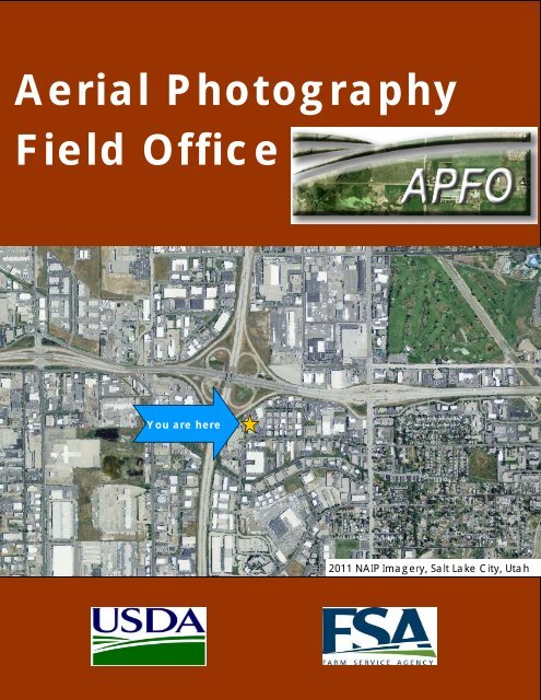
<strong>Aerial</strong> <strong>Photography</strong><br />
<strong>Field</strong> <strong>Office</strong><br />
You are here<br />
2011 NAIP Imagery, Salt Lake City, Utah
Table of Contents<br />
4 APFO 2012 Annual report<br />
The <strong><strong>US</strong>DA</strong> and APFO ……………………………….………….…..……..5<br />
suppor�ng the American <strong>Farm</strong>er and Rancher<br />
<strong>Office</strong> of the Director………………………………...…………..……...6<br />
Opera�ons ……………………………………………….………………….10<br />
Customer <strong>Service</strong> ………………………………………………………….11<br />
Contrac�ng <strong>Service</strong>s …………………………………..………………..13<br />
Quality Assurance ……………………...………………....…………...16<br />
Geospa�al <strong>Service</strong>s …………………...……………….……………….19<br />
Technology <strong>Service</strong>s…………………………………..………...……...25<br />
Produc�on <strong>Service</strong>s …………………….…………………….…………30<br />
Employee Ac�vi�es ……………………….……………….…………...32
UNITED STATES DEPARTMENT OF<br />
AGRICULTURE<br />
Agriculture is a vital sector of the U.S. economy. Every American benefits from a strong U.S. agricultural industry<br />
that provides the abundant food and fiber supply necessary to sustain a stable and prosperous country. The <strong>Farm</strong><br />
<strong>Service</strong> <strong>Agency</strong> (FSA) of the U.S. Department of Agriculture (<strong><strong>US</strong>DA</strong>) plays a cri�cal role in maintain that strength.<br />
The <strong>Aerial</strong> <strong>Photography</strong> <strong>Field</strong> <strong>Office</strong> (APFO) supports the missions of the <strong><strong>US</strong>DA</strong> and the FSA through various aerial<br />
imagery acquisi�ons and analysis programs.<br />
One of the most successful agriculture informa�on tools is the mass applica�on of aerial photography. Pioneered<br />
in 1935 using hot air balloons, the original units combined two synchronized cameras, and each camera had five<br />
6” lenses and took photos from 23,000 feet. Each photo captures 225 square miles. 75 years later APFO is using<br />
various types of cameras on contracted aircra� to image 1/3 of the United States agricultural lands annually and<br />
star�ng in 2013 will make use of cameras on satellites 438 miles above the earth.<br />
Through decades of development, <strong><strong>US</strong>DA</strong> now acquires imagery with ground resolu�on at or below 1 meter. The<br />
uses for this imagery is as diverse as are the formats that APFO collects and produces. The <strong><strong>US</strong>DA</strong>’s authorita�ve<br />
imagery library, which is housed in Salt Lake City Utah, is u�lized by the public as well as several government<br />
agencies at various levels. <strong><strong>US</strong>DA</strong> imagery is used as a base layer for many purposes such as land boundaries, risk<br />
management, disaster area iden�fica�on and many commercial applica�ons. APFO subject ma�er exper�se in<br />
Imagery Produc�on, Quality Assurance and Geospa�al Support <strong>Service</strong>s are sought a�er and used by numerous<br />
agencies both within and outside the <strong><strong>US</strong>DA</strong>. This underscores APFO’s commitment to support the American<br />
<strong>Farm</strong>er and Rancher with relevant and up to date services while it also supports the <strong><strong>US</strong>DA</strong>’s Strategic Goals of<br />
suppor�ng produc�ve farms and ranches, suppor�ng secure and affordable foods and fiber and conserving natural<br />
resources and enhancing the environment.<br />
APFO 2012 Annual report<br />
5
<strong>Office</strong> of the Director<br />
If a picture says a thousand words, imagine the conversa�on going on in the<br />
APFO Film Vault. Housing one of the largest collec�ons of historical aerial<br />
imagery, APFO can research land images da�ng back to 1954. That’s a lot of<br />
research power to support the American farmer and rancher. <strong>Aerial</strong> imagery<br />
programs managed by the APFO provide up-to-date land use informa�on that<br />
can be used to sa�sfy a mul�tude of needs such as allowing for accurate<br />
acreage calcula�ons, boundary measurements and pre-disaster historical data.<br />
Since 1977 APFO has been suppor�ng the <strong><strong>US</strong>DA</strong> Strategic Mission by providing<br />
aerial imagery that tells the story of America’s heartland. But it is not all about<br />
the past, through our current acquisi�ons in the Na�onal Agriculture Imagery<br />
Program (NAIP) we can see what is happening today and use that informa�on<br />
for a variety if purposes such as accurate acreage measurements, and helping<br />
maintain integrity in FSA programs. Imagery acquired by FSA is used by other<br />
federal agencies, state governments, commercial en��es, and the general<br />
public.<br />
APFO products can be used in a variety of ways such as cartography, land-use planning, archaeology, environmental<br />
studies, and community planning projects. APFO partners with various other federal agencies to enhance<br />
their programs and conserve valuable government resources. APFO serves the American People also, through<br />
several different products u�lizing our vast imagery library. We encourage people to go to the APFO homepage<br />
and explore the possibili�es (h�ps://www.apfo.usda.gov) where they can download images or have them printed<br />
in our Produc�on <strong>Service</strong>s Branch and mailed out through the Customer <strong>Service</strong> Center. Through these programs<br />
APFO facilitates the widest applica�on of these wonderful technologies.<br />
6 APFO 2012 Annual report
<strong>Office</strong> of the Director<br />
One of the biggest areas of expansion is the use of FSA imagery in the filed of Emergency Management.<br />
Planners can look at imagery in areas and determine the risk of flooding or damages during weather events.<br />
A�er an incident has occurred post-disaster imagery can be acquired and compared to the most recent<br />
historical images, this assists in iden�fying areas that are hit the hardest and the poten�al future effects the<br />
chain of events may have on farmland.<br />
APFO is organized around our mission of acquiring and providing imagery to FSA. The staff includes experts in<br />
contract administra�on, quality assurance, photo produc�on services, geospa�al analysis and policy, data<br />
management, and data distribu�on. The organiza�on is supported by an opera�ons staff responsible for HR,<br />
facility management, security and purchasing. APFO acquires over 20Tb of new data each “flying season” and<br />
executes over $26M in annual expenditures suppor�ng the FSA Mission.<br />
APFO 2012 Annual report<br />
7
<strong>Office</strong> of the Director<br />
8 APFO 2012 Annual report
<strong>Office</strong> of the Director<br />
Through FY12, APFO has con�nued to provide leadership in acquiring current, high quality imagery for FSA and other <strong><strong>US</strong>DA</strong><br />
agencies. That’s not just talk – with NAIP it’s confirmed by asking our customers every year how we are doing. In FY2012,<br />
81% of FSA users were sa�sfied or very sa�sfied with the quality of NAIP imagery. In FY06, when we began taking surveys,<br />
82% were either sa�sfied or neutral. The widespread acceptance and use of NAIP imagery by other federal agencies is best<br />
perhaps expressed by their funding commitments through cost share agreements. In FY12, other federal agencies contributed<br />
$5.4 million, or 32% of total NAIP acquisi�on costs. APFO also con�nues to support other <strong><strong>US</strong>DA</strong> agencies with requirements<br />
for imagery that cannot be met through NAIP, on a cost reimbursable basis. <strong><strong>US</strong>DA</strong> Forest <strong>Service</strong> requires much higher<br />
resolu�on and informa�on content for some of their Forest specific “resource” needs, and Natural Resources and Conserva�on<br />
<strong>Service</strong> has specialized requirements to support their Na�onal Resource Inventory and Stewardship Lands Ini�a�ve<br />
programs. APFO staff provides exper�se in contrac�ng, QA, technical specifica�ons, product development, and data management.<br />
The efforts benefit mul�ple agencies, with experience and lessons learned from <strong>US</strong>FS and NRCS projects and NRC,<br />
applicable to on-going FSA needs.<br />
In addi�on to FSA user sa�sfac�on with NAIP imagery, we also take a deeper look<br />
at overall FSA requirements for imagery, and the requirements survey in 2012 indicated<br />
several areas for improvement: earlier access, and higher resolu�on. NAIP<br />
vendors have been telling us for several years that both improvements were feasible<br />
within the NAIP contract, and this was also indicated by industry responses to a<br />
related RFI conducted last spring. We see an opportunity in 2013 in terms of improving<br />
access, and will look at pilo�ng an “early access” to the imagery by leveraging<br />
an interim vendor hosted image service and their state of the art digital cameras<br />
which promises to result in access to imagery in less than 5 days a�er acquisi-<br />
�on, with complete, authorita�ve imagery available from APFO image services<br />
available to FSA a�er delivery 30 to 60 days later.<br />
We also see opportuni�es for increased resolu�on, though we feel the expense for<br />
half meter resolu�on, es�mated at an addi�onal 50% of the standard 1 meter<br />
product, does not warrant direct FSA funding as it would decrease the amount of<br />
annual coverage of States. Instead, we are offering half meter NAIP projects as buy<br />
-ups to State governments and other federal agencies, which could leverage NAIP<br />
acquisi�on for high resolu�on imagery at a frac�on of the cost of managing their<br />
own acquisi�on contract.<br />
The NAIP image archive, built up a�er 10 years of acquisi�on, con�nues to provide valuable service. General usage sta�s�cs<br />
from <strong><strong>US</strong>DA</strong> Geospa�al Data Gateway over this period show that while demand peaks for the two most current years aviable,<br />
there is also a steady, consistent demand for historical imagery that averages about 15% of ongoing use. For FSA, use of historical<br />
imagery is be�er defined. In the 2012 FSA requirements survey, 25% indicate a need to use imagery da�ng back 10<br />
years, with a slight increase to 27% feeling access to imagery da�ng as far back as possible. The survey results quite likely<br />
underes�mate what actual demand may be as historical imagery has not been readily accessible to FSA users. That’s beginning<br />
to change as APFO implements web Image <strong>Service</strong>s that enable easy, seamless access for FSA users that require no local<br />
data management or logis�cs. To address these unmet needs, APFO ini�ated a project in FY12 to assess conver�ng the<br />
vast <strong><strong>US</strong>DA</strong> film archive extending back to 1955, to a digital format that is readily accessible to users, and also ensures long<br />
term preserva�on of the imagery. While this is a long term effort, it begins to close the loop between current, state of the<br />
art digital image acquisi�on, and the historical film-based record.<br />
APFO 2012 Annual report<br />
9
Operations<br />
Taking care of the things that make APFO func�on smoothly is no small task. Under the Opera�ons Branch are<br />
two major func�ons; Administra�on and Customer <strong>Service</strong>. The Administra�on <strong>Service</strong>s Sec�on provides<br />
administra�ve func�ons; facility management; maintains and tracks salaries and the expense budget; offers Human<br />
Resources management; supply property/shipping and receiving/warehouse management; various procurement<br />
ac�ons and enforces physical security of the building.<br />
APFO Director Ron Nicholls, FSA Administrator Bruce Nelson and CSS Supervisor David Parry<br />
APFO made huge strides in FY 2012 and showed<br />
that it can be flexible in an ever-changing GIS<br />
world. In March, FSA Administrator Bruce Nelson<br />
paid a visit to the makers of the 10x10 black and<br />
white photos his family farm received each year<br />
when he was growing up. Mr. Nelson made note<br />
of the advances in how farmers use the images<br />
acquired by FSA each year and thanked the<br />
employees for their con�nued support over the<br />
years to those working the land of the American<br />
heartland.<br />
It was a tough year for budgets everywhere and APFO was no excep�on. But with the challenges of providing our<br />
services with less resourcing, came some innova�ve approaches that helped us meet our mission and come in<br />
under budget.<br />
�� Recycled material— by purchasing refillable items and post consumer recycled items we saved on waste as<br />
well as reu�lizing shipping material such as boxes and bubble wrap (this effort alone saves over $1000 annually).<br />
�� Waste Preven�on—employees recycled approximately 50,000 lbs of material in FY 12 diver�ng it from<br />
landfills.<br />
�� Teleworking Program— this ini�a�ve has many benefits for not only APFO employees (reduced transporta-<br />
�on costs) but also for APFO as an organiza�on (reduced energy consump�on, increased produc�vity).<br />
�� Increased Cost Accountability and Streamlining— APFO developed an internal process to be�er capture<br />
costs associated with projects. Each sec�on par�cipa�ng in a given project sees the en�re process described<br />
in the cost es�mate and can help iden�fy duplica�ons and streamlining that could lead to cost and<br />
�me savings.<br />
10 APFO 2012 Annual report
Customer <strong>Service</strong><br />
As a major part of the Opera�ons Branch, the Customer <strong>Service</strong> Sec�on (CSS) is responsible for the receipt, prepara�on,<br />
and releasing of work orders and coverage requests for aerial photography, digital imagery, and common<br />
land unit products and services. CSS is the liaison for the <strong>Aerial</strong> Photograph <strong>Field</strong> <strong>Office</strong> to outside government<br />
agencies and the general public.<br />
Research is preformed u�lizing Geographic Informa�on System (GIS) tools to iden�fy historical imagery and<br />
a�ributes needed for tradi�onal and custom digital photographs. The CSS assists customers with and updates GIS<br />
content for maintaining the Na�onal Agriculture Imagery Program (NAIP) Coverage Viewer, Interac�ve Coverage<br />
Status Map, and downloadable quarter quad and film center shape files on the APFO website.<br />
The most important asset we have at APFO is the employee, CSS Customer <strong>Service</strong> Representa�ves have consistently<br />
ranked well in sa�sfac�on surveys because of the �me they take with the customer and the level of service<br />
they provide. Each CSS representa�ve makes themselves available as the primary source of technical informa�on<br />
concerning <strong><strong>US</strong>DA</strong> related aerial photography, digital imagery, and common land unit data of the United States<br />
and its territories. Addi�onally, CSS accounts for and reconciles funds from all government agencies and the general<br />
public while maintaining and monitoring all fiscal ac�vity as it pertains to aerial photography and digital imagery.<br />
FY 2011 orders processed exceeded $1.2 million with digital products and service outselling film based by<br />
an average of 3 to 1. One highlight of the year came as CSS completed the NAIP Film Center Coverage Map &<br />
Shape file correc�ons which enabled thousands of NAIP images to be accurately iden�fied.<br />
305,148 Total Units<br />
Digital & Film Products by Unit FY12<br />
Public 206,577 68%<br />
0% = Less Than 1%<br />
Other Federal 43,673<br />
14%<br />
State Agencies<br />
19,699 7%<br />
FSA 18,045 6%<br />
FS 5,885 2%<br />
NRCS 6,900 2%<br />
NASS 3,071 1%<br />
<strong>US</strong>GS 1,298 0%<br />
APFO 2012 Annual report<br />
11
Administration<br />
Excellence through Support for Employees and the Environment<br />
Government employees throughout the State of Utah and por�ons of the surrounding states are supported<br />
by APFO for their ID cards. HSPD 12 requires a government-wide standard for secure and reliable forms of ID<br />
issued by the federal government to its employees and the employees of federal contractors for access to<br />
federally controlled facili�es and networks. Based on this direc�ve, <strong><strong>US</strong>DA</strong> developed a HSPD-12 compliant ID<br />
called LincPass, and through a mul�-stepped process is designed to link a persons iden�ty to an ID creden�al<br />
and the creden�al to a person’s ability to physically and logically access federally controlled buildings and informa�on<br />
systems. As the Inter-mountain Region Priority 1 LincPass Ac�va�on and Enrollment Sta�on, APFO<br />
facilitates over 1000 transac�ons annually ranging from security cer�ficate renewal to full scale new authoriza�on<br />
enrollments. An advantage to having these customers here for that service is that they also get to see<br />
what we do and the resource that could be used in their daily business.<br />
Another way for APFO to get the word out is through our<br />
Public Informa�on Campaign. This has several different<br />
ac�vi�es which include informa�onal products sent out to<br />
County Assessors offices, par�cipa�ng in Government GIS<br />
forums and having our products appear on postage<br />
stamps. That’s right, you could see us on your mail. In<br />
2012 the <strong>US</strong> Postage <strong>Service</strong> used several images to commemorate<br />
this wonderful capability.<br />
Geoff Gabbo� and Jacque LaCroix man the Utah State Fair booth<br />
12 APFO 2012 Annual report<br />
2012 saw local area involvement from the APFO staff as it<br />
collaborated with the Utah State Fair to highlight the<br />
changes the fair has gone through over the last 50 years.<br />
A 9-panel display was erected outside the agriculture<br />
building showing the fairgrounds and surrounding acreage.<br />
Local area farmers and ranchers were treated to go<br />
back in �me and be reminded of days gone by when they<br />
were kids running around a much different Utah State<br />
Fair.
Excellence through Support for Employees and the Environment<br />
APFO Contrac�ng is responsible for aerial imagery procurement and coordina�on of cost share agreements<br />
for the <strong>Farm</strong> <strong>Service</strong> <strong>Agency</strong> (FSA) and the U.S. Department of Agriculture (<strong><strong>US</strong>DA</strong>) Agencies. Several na�onal<br />
level programs are procured through the Contrac�ng Branch including the Na�onal Agriculture Imagery Program<br />
(NAIP) for FSA, <strong><strong>US</strong>DA</strong> <strong>Service</strong> Center Agencies, and partnering agencies; the Na�onal Resource Inventory<br />
and Stewardship Lands Programs for the Na�onal Resources Conserva�on <strong>Service</strong> (NRCS); and the Resource<br />
Imagery Program for the U.S. Forest <strong>Service</strong> and other par�cipa�ng agencies.<br />
APFO Contrac�ng <strong>Service</strong>s by the numbers:<br />
$29,385,214.02 – Total amount of imagery & IT contracts awarded<br />
1,595,331 – Total number of square miles of imagery contracted<br />
1,471,543 square miles of NAIP<br />
96,351 square miles (sites) suppor�ng NRCS programs<br />
18,615 square miles of U.S. Forest <strong>Service</strong> lands<br />
8,822 square miles of AgSat satellite imagery<br />
$358,392.30 – Revenue generated through administra�ve fees.<br />
$282,885.72 from NRCS and $75,506.58 from U.S. Forest <strong>Service</strong>.<br />
15% of all contracts awarded went to small businesses.<br />
Contracting<br />
APFO 2012 Annual report<br />
13
Contracting<br />
Na�onal Resource Inventory (NRI) and Stewardship Lands Imagery (SLI)<br />
APFO provided contrac�ng services to NRCS to acquire the Na�onal Resource Inventory (NRI), Stewardship<br />
Lands Imagery (SLI), and the Highly Erodible Lands (HEL) programs aerial photography and related services<br />
for 96,351 sites and easement exposures in the 48 CO-<br />
N<strong>US</strong> states, Hawaii, and Puerto Rico & Virgin Islands.<br />
Resource <strong>Aerial</strong> <strong>Photography</strong><br />
The FY2012 total contract value was $9,429,524.24, with a<br />
combined total administra�ve charge of $282,885.72.<br />
Contracted services included acquisi�on, film products and<br />
scanning services.<br />
Provided contrac�ng services to the Forest <strong>Service</strong> (<strong>US</strong>FS) for a total of 18,615 square miles of digital resource<br />
aerial photography for a total value of $743,059.07. A combined total administra�ve charge of<br />
$75,506.58 was assessed. Contracted 5 digital aerial imagery projects covering the western na�onal forests<br />
of Tonto AZ, Tapash area of Okanogan-Wenatchee WA, GMUG and White River CO, Dixie UT, and Fishlake<br />
UT. The Contrac�ng Branch con�nues to provide support and assistance in developing standard specifica-<br />
�ons for digital imagery and support of other digital acquisi�on requirements and procedures.<br />
14 APFO 2012 Annual report
Na�onal Agriculture Imagery Program (NAIP)<br />
Since 2003, the Na�onal Agriculture Imagery Program (NAIP) has been the primary vehicle for FSA to acquire<br />
aerial imagery. Since NAIP is primarily funded by FSA, imagery is acquired to meet specific FSA needs such as<br />
collec�on of en�re states within a single growing season, and availability within 30 days of flying season end.<br />
Having current imagery saves �me in FSA <strong>Service</strong> Centers, shows change over �me, and helps FSA keep CLU<br />
boundaries and other cri�cal records current.<br />
NAIP is funded through cost share partnerships, with<br />
FSA cost based on the percentage of agricultural land<br />
in the <strong>US</strong> (approximately 67%) while partners in other<br />
federal agencies (NRCS, <strong>US</strong>FS and other DOI agencies)<br />
funding the remaining por�on.<br />
In 2012, funding was at $11.3 million from FSA with an<br />
addi�onal $5.4 million from partners. The total<br />
amount of $16.7 million funded the acquisi�on of 22<br />
states with a result that all states in the con�nental <strong>US</strong><br />
have imagery that is no older than 3 years.<br />
APFO Contrac�ng Branch provided procurement services<br />
to FSA and other contribu�ng partners for one<br />
meter digital orthoimagery covering 1,628 coun�es<br />
(1,471,543 square miles) in 22 states. NAIP contract<br />
task orders were awarded for a total value of<br />
$16,691,303.15. Imagery was acquired using precision<br />
large format digital mapping cameras which resulted in all states being delivered as 4-band products. The 2012<br />
contract task orders were awarded under the first year of a 5 year IDIQ NAIP contract. The NAIP Program is the<br />
largest civilian government contract in the country providing high quality imagery widely used by federal, state,<br />
and local agencies as well as many academic and private users.<br />
AgSat BPA Satellite Imagery<br />
Contracting<br />
Contrac�ng services were provided to FSA to acquire high resolu�on 8-band satellite imagery through the<br />
<strong><strong>US</strong>DA</strong> AgSat Blanket Purchase Agreement (BPA). Five areas of interest were awarded covering por�ons of Alaska,<br />
Arkansas, Hawaii & Pacific Basin, <strong>US</strong> Virgin Islands, and Alabama. 8,822 square miles (22,849 Sq Km) were<br />
ordered amoun�ng to a total of $404,911.30. The AgSat BPA is available to all <strong><strong>US</strong>DA</strong> agencies to order imagery<br />
directly.<br />
APFO 2012 Annual report<br />
15
Quality Assurance<br />
The Quality Assurance Branch has spent this year developing opera�onal plans to exploit both new technology<br />
and processes designed to efficiently support the Department of Agriculture’s mission to provide leadership on<br />
food, agriculture, natural resources, and related issues based on sound public policy, the best available science,<br />
and efficient management, and the <strong>Farm</strong> <strong>Service</strong> <strong>Agency</strong> mission to equitably serving all farmers, ranchers, and<br />
agricultural partners through the delivery of effec�ve, efficient agricultural programs for all Americans by insuring<br />
that quality imagery and geospa�al products are available for its programs.<br />
QAB’s primary mission is to inspect for contractual compliance imagery obtained for the Na�onal Agriculture Imagery<br />
Program (NAIP), Resource <strong>Aerial</strong> <strong>Photography</strong>, Common Land Unit (CLU) updates, Na�onal Resources Inventory<br />
(NRI) and Stewardship Land Inventory (SLI).<br />
Two out of QAB’s three work centers namely Ortho Imagery Inspec�on and Resource Imagery Inspec�on sec-<br />
�ons have developed an employee exchange program that has dras�cally eliminated the �me it takes to inspect<br />
our imagery. In short, we are able to put more people on projects that have either higher priority or larger work<br />
volumes. At the same �me we have redefined our inspec�on criteria to be�er align our tasks with customer requirements,<br />
thus resul�ng in an efficient and �mely workflow as illustrated by our improved 2012 man-hour to<br />
rate of inspec�on ra�o.<br />
Looking forward; QAB is partnering with experts from Geospa�al (GIS), Contrac�ng, and Informa�on Technology,<br />
to develop an all new approach to imagery inspec�on, incorpora�ng advancements in both knowledge and technologies<br />
to enable the inspec�on of any type of imagery data set, then create integrated reports that show both<br />
trends and analysis of specific geographical loca�ons as well as vendor performance as a whole.<br />
Other significant accomplishments of QAB was the development of a flight planning system for Stewardship Land<br />
Inventory (SLI), taking a process that normally took several months, down to just a few. What makes this even<br />
be�er is that QAB was able to u�lize exis�ng so�ware to accomplish this task, thus saving thousands of dollars<br />
on procurement costs of new so�ware packages.<br />
In addi�on to inroads on flight planning, QAB con�nues to<br />
maintain an archive of over 65,000 rolls of historic imagery.<br />
We are currently performing test to determine if there is<br />
any level of deteriora�on of the 1955 to 1965 imagery, this<br />
will help us for planning purposes of our historical imagery<br />
scan project. Addi�onal accomplishments of making available<br />
3 states worth of vault scan indexes were made available<br />
to the public electronically. The sum total of all the QAB<br />
accomplishments in development of new ideas, planning,<br />
and task accomplishment has posi�oned us to achieve<br />
great things in our future endeavors.<br />
16 APFO 2012 Annual report<br />
The APFO Film Vault contains over 65,000 canisters of film
Quality Assurance<br />
The Quality Assurance Branch is divided into two sec�ons to be�er capitalize on the special skill sets of the<br />
members and proper applica�on to the projects they encounter.<br />
The ORTHO IMAGERY INSPECTION SECTION<br />
(OIIS) emphasis is “Directly” responsible for the<br />
oversight and management for inspec�on, monitoring,<br />
and dissemina�on of imagery inspec�on<br />
results related to the Na�onal Agricultural Imagery<br />
Program (NAIP). This accomplished 6 major<br />
project ini�a�ves. OIIS conducted research on<br />
NAIP imagery accuracy which resulted in the development<br />
of an approach with current academic<br />
and na�onal standards to apply Root Mean<br />
Square Error calcula�ons to determine image accuracy<br />
which aligns horizontal accuracy to a na-<br />
�onal standard.<br />
The Ortho Inspec�on team accomplished several<br />
major ini�a�ves designed to improve image inspec�on<br />
workflow and task efficiency. The most important of which was the development of the ArcMap 9.3<br />
to 10.1 migra�on plan. This transi�on represents a major shi� in capabili�es for OIIS, and as applica�ons<br />
are developed over the next few years, it is an�cipated that the imagery inspec�on, along with trend analysis<br />
will be significantly enhanced.<br />
In addi�on to the 10.x migra�on plan, we achieved an improvement in the rate of inspec�on of the 2010/11<br />
NAIP project, achieving a decrease of 10% of our man hours normal required to this project. These �me savings<br />
allowed us to supplement other inspec�on programs important to APFO.<br />
Accomplishment 1: Because project inspec�on cycles split between calendar years, OIIS reports that for the<br />
year 2011/12 over (115,000) imagery units were inspected.<br />
Accomplishment 2: Implemented procedural changes in the current inspec�on system that ne�ed a 10%<br />
decrease in man-days normally used to inspect the annual NAIP project.<br />
Accomplishment 3: Developed NAIP quality assurance inspec�on requirements for integra�on into ArcMap<br />
10.x migra�on. This project will be the template for all other imagery inspec�on systems scheduled for the<br />
foreseeable future.<br />
Accomplishment 4: Developed a process that iden�fied the extent of damage to imagery sets, caused by<br />
errors of horizontal accuracy. This new capability has iden�fied areas of accuracy that would have previously<br />
gone undetected.<br />
Accomplishment 5: Developed proof of concept plan for the quality assurance inspec�on of APFO historical<br />
vault.<br />
Accomplishment 6: Cartographically depicted 4 years of NAIP historical key program indicators, to include<br />
spa�al, physical, and opera�ve condi�ons of the NAIP imagery. Allowed for accurate imagery performance<br />
assessment of the NAIP program<br />
APFO 2012 Annual report<br />
17
Quality Assurance<br />
The RESOURCE IMAGERY INSPECTION SECTION assures customers<br />
needs are met by providing quality assurance inspec�on of acquired<br />
imagery and geospa�al data for the Resource <strong>Aerial</strong> <strong>Photography</strong>,<br />
Na�onal Resources Inventory (NRI) and Stewardship Lands<br />
Imagery (SLI).<br />
Flight Planning<br />
In FY2012 the sec�on provided flight planning for 1,521 sites<br />
(exposures) totaling 21,811 NRCS SLI sites and prepared five digital<br />
imagery based projects that covered 18,605 square miles including<br />
the inspec�on of contractor submi�ed flight plans.<br />
QA Cartographer Dan Oles checks the NAIP Status Map<br />
<strong>Aerial</strong> Film Imagery<br />
The sec�on inspected two film-based resource projects covering 3,834 square miles consis�ng of 3,599 images and<br />
16 rolls of original film to 100% comple�on.<br />
Digital Imagery<br />
Inspec�on of Eight Na�onal Forests, seven of which were 100% completed total of 11,458 square miles consis�ng<br />
of approximately 25 TB of data.<br />
Inspec�on deliverables included Digital Ortho Quads (DOQ), Digital Ortho Quarter-Quads (DOQQ), Digital Ortho<br />
Quarter-Quarter-Quads (DOQQQ), GeoTIFFs, Stereo Imagery and Compressed Project Mosaic (CPM).<br />
Na�onal Resources Inventory (NRI) inspec�on<br />
2012 NRI CON<strong>US</strong> sites/scans inspected: 73,017 sites and 73,017 scans<br />
2011 NRI CON<strong>US</strong> sites/scans inspected: 2,460 sites and 10,614 scans<br />
Stewardship Lands Inventory (SLI) inspec�on<br />
2012 SLI CON<strong>US</strong> sites/scans inspected: 21,810 sites and<br />
21,810 scans<br />
2011 SLI CON<strong>US</strong> sites/scans inspected: 2,808 sites and 7,628<br />
scans<br />
Other Sec�on Accomplishments<br />
Inspec�on of the Vault Index Scans, 462 hours were used to<br />
inspect 23,752 indexes from this project.<br />
RIIS par�cipated on the Resource Imagery Team to improve<br />
the overall management of the Resource Program.<br />
RIIS par�cipated on Technical Evalua�on and Source Selec-<br />
�on Teams for Five Forest <strong>Service</strong> Projects.<br />
Jeane�e Tolliver served as Chairperson on the Equal Employment<br />
Opportunity Advisory Commi�ee during FY12.<br />
18 APFO 2012 Annual report
Geospatial <strong>Service</strong>s<br />
The GEOSPATIAL SERVICES Branch (GSB) is divided into two sec�ons that ensure quality services across the<br />
geospa�al spectrum. GSB ensures Na�onal Agricultural Imagery Program (NAIP) and other <strong><strong>US</strong>DA</strong> imagery<br />
program technical specifica�ons and standards are correct, and will produce products that meet FSA and<br />
<strong><strong>US</strong>DA</strong> customers needs the first �me around, saving countless dollars in both �me and infrastructure resources<br />
by ge�ng accurate, authorita�ve data to the customer as quickly as possible.<br />
GSB researches changes and trends in geospa�al technology, which translates into product enhancements<br />
over �me, ensuring imagery products are leveraging the best available technologies and methodologies<br />
and are relevant to meet the customers’ needs.<br />
GSB also builds historical imagery products based on FSA and other customer requests, ensuring historical<br />
imagery products are spa�ally enabled such that the State and County field offices may track and trend<br />
changes over �me, offering real visual evidence of land use/land cover change in support of various programs.<br />
Ensured web services are func�oning op�mally in support of enterprise applica�ons enabling state and<br />
field office employees to do their jobs efficiently and in a �mely manner, such that changes on the earth’s<br />
surface can be posi�vely detected and that field boundaries and acreages, which are directly �ed to producer<br />
benefits, can be updated quickly and efficiently, providing for end customer sa�sfac�on and more<br />
accurate record keeping.<br />
Through mul� agency partnerships, provided for fast turnaround image acquisi�on, post processing and<br />
web service construc�on and delivery, for FSA disaster response and recovery in MO, MN, and WI.<br />
In a mul�-disciplinary team se�ng, launched the Consolidated Historical Project (CHP). The vision of CHP is<br />
“Modern day access to historical agricultural imagery assets” with a mission to “digitally and/or spa�ally<br />
enable historical imagery assets and provide access to all product lines, leveraging the most appropriate<br />
technology that results in useful viewing, research, analysis, and delivery methods for our customers”<br />
APFO 2012 Annual report<br />
19
Geospatial <strong>Service</strong>s<br />
The <strong>Service</strong> Center Support Sec�on provides technical and programma�c support and assistance on geospa�al<br />
related issues to <strong>Farm</strong> <strong>Service</strong> <strong>Agency</strong> (FSA) <strong>Service</strong> Centers, State <strong>Office</strong>s, and Headquarters offices as well as to<br />
other government agencies and the public. The <strong>Service</strong> Center Support Sec�on supports APFO and FSA in research<br />
and analysis, product enhancement, and in the development of processes and methodologies to improve efficien‐<br />
cy in all aspects of geospa�al business.<br />
Project Work<br />
�� Na�onal Agriculture Imagery Program (NAIP) Support<br />
- Developed, administered, and reported results for the 2011 NAIP Survey.<br />
- Designed, administered and reported on 2012 Imagery Requirements Surveys.<br />
- Absolute Control Projects: 2012 control point acquisi�on and database work for 2012 NAIP States.<br />
Teaming with States and Federal Agencies to obtain points and supplemental data. Administered database updates<br />
and maintenance, and assistance with automa�on of the database inspec�on process. The database is<br />
conserva�vely worth $12M at present with 40,000+ points, developed through partnerships and provided on a<br />
mostly gra�s basis.<br />
- Researched and purchased GPS unit to support internal FSA control point acquisi�on; an investment<br />
that will yield points that will collec�vely be worth many �mes the value of the unit, and will keep the database<br />
up to date with current data, ensuring quality end products for the FSA customer<br />
- Performed quality assurance on NAIP Statewide Seamline Files<br />
- Provided NAIP graphics for FGDC Annual Report<br />
- Provided NAIP graphics for Census Bureau Report<br />
- Part of 2012 NAIP Technical Evalua�on Panel and Source Selec�on Commi�ee<br />
- Reviewed and Updated 2012 NAIP Metadata Templates<br />
- Evaluated Highly Compressed CCM Product for 2012 NAIP<br />
- Evaluated 8-Band Data Samples for NAIP 2012<br />
- Evaluated 2012 NAIP RFI Responses for Web <strong>Service</strong>s Delivery of Imagery<br />
�� Worked closely with Contractor to develop and sustain APFO Image/Web <strong>Service</strong>s for NAIP, NRI, Customer<br />
<strong>Service</strong> Sec�on, QA, the general public, and FSA WDC, State and County <strong>Office</strong> users in support of FSA thin<br />
client and future MIDAS architectures. Constructed NAIP services as well as PR, AK, HI, Pac Basin services.<br />
Acted as MIDAS POC between APFO and the MIDAS Team, helping to ensure services necessary for MIDAS<br />
rollout are available and updated<br />
�� Disaster Recovery and Response: Provided for fast<br />
turnaround image acquisi�on via the North American<br />
Data Buy (NADB) and EagleVision <strong>US</strong>GS managed<br />
mechanisms. Provided back end image post processing<br />
and web service construc�on, for FSA disaster<br />
response and recovery (MO River Flooding and MN/<br />
WI Heavy Rainfall Event)<br />
20 APFO 2012 Annual report
Geospatial 250,000 <strong>Service</strong>s<br />
data points<br />
�� Historical Project Work: Kicked off Consolidated Historical Project (CHP) work, with the vision of “Modern<br />
day access to historical agricultural imagery assets” and a mission to “digitally and/or spa�ally enable historical<br />
imagery assets and provide access to all product lines, leveraging the most appropriate technology<br />
that results in useful viewing, research, analysis, and delivery methods for our customers”<br />
�� Worked closely with other organiza�ons on Satellite Acquisi�on BPA (AgSat). Reviewed AgSat BPA Proposals.<br />
Developed Customer Requirements Ques�ons and Survey. Developed<br />
Specifica�ons and built (based on customer input) AOIs for AK,<br />
HI, Pac Basin, U.S. Virgin Islands, GA, AL, and AR. Provide Pricing Es�mate<br />
per Square Mile for AK Acquisi�on. Developed ArcGIS Online<br />
Tracking System for AgSat Projects<br />
�� FSA Work for Puerto Rico (PR). Obtained and Processed Imagery and<br />
Built PR Image <strong>Service</strong>s. Deployed GPS Unit to PR to Support WDC Assessment Trip. Ini�ated MOU with PR<br />
Government to Obtain CRIM (Land Parcel Data) to Support FSA CLU Digi�zing Work. A�ached to Training<br />
Team to Spend 3 Weeks in PR in FY13, Training on GPS, CLU Maintenance, and <strong>Farm</strong> Records<br />
�� Assisted on digital Resource <strong>Photography</strong> projects at APFO, consis�ng of a complex mix of new customer<br />
requirements and diverse deliverables. Par�cipated in mul�ple contract evalua�ons. Assisted in development<br />
of contract specifica�ons. Designed and/or reviewed several metadata templates. Con�nued to<br />
work through issues with stereo inspec�on<br />
�� Provided Con�nuity Support for QA Branch, to include Training, Map Making, Process Review, Trouble<br />
Shoo�ng, and fielding Control Point Database ques�ons<br />
�� Assisted in upda�ng the Digital Camera Specifica�on a�ached to APFO Contracts<br />
�� Updated process to repair Photo Index Scans in-house<br />
�� 1AP – Finalized Official Policy Document<br />
�� Map Published in the Esri Mapping the Na�on Book<br />
�� Completed 15-18 Custom Cartographic Requests<br />
Customer Support<br />
�� <strong>Field</strong>ed and answered several hundred customer support calls and emails from APFO, FSA, SCA, Federal &<br />
local government, private business, and the general public. Updated the AskFSA website with APFO FAQs<br />
and corrected responses<br />
APFO 2012 Annual report<br />
21
Geospatial <strong>Service</strong>s<br />
Research and Analysis<br />
�� Completed the Horizontal Velocity Study<br />
showing geologic movement of control<br />
points in the control point database<br />
�� Researched and assembled available imagery<br />
for HI and AK in support of FSA thin client<br />
services. Tested and processed HI 4-band<br />
16-bit to 3-band 8-bit NC and CIR �led<br />
products<br />
�� So�ware Tes�ng: ENVI and ENVI Toolbox in<br />
ArcGIS, ArcGIS Online, and several so�ware<br />
packages suppor�ng web services<br />
�� Completed research and paper on linear/non-linear stretches with regard to digital and analog data acquisi-<br />
�on, for best image quality in 8 and 16-bit space<br />
�� Researched Spa�al Tags and updated the <strong><strong>US</strong>DA</strong> Digital File Format Specifica�on<br />
�� Con�nued to evaluate poten�al of Volunteered Geographic Informa�on (VGI) scenarios<br />
�� Con�nued to work through LiDAR Derived Control for Inspec�on Pilot Project<br />
�� Developed and ini�ated a scan resolu�on study, to assess point of diminishing return on scan resolu�on,<br />
where no more detail can be gained from higher scan resolu�on, only file size increase<br />
�� Evaluated Iris Sensor<br />
�� Providing poten�al automated processes for detec�on of CRP viola�ons. Follow-on work and analysis will<br />
determine if the process has value for wider implementa�on<br />
22 APFO 2012 Annual report
Team Representa�on, Presenta�ons, and Training<br />
�� Presenta�ons on various subjects at:<br />
- <strong><strong>US</strong>DA</strong> Planning and NAIP Post Mortem Mee�ngs<br />
- Keynote Speech at the ND State GIS Conference<br />
- Na�onal Digital Orthophoto Program (NDOP)<br />
- FGDC Cadastral Subcommi�ee<br />
- UGIC<br />
Geospatial 250,000 <strong>Service</strong>s<br />
data points<br />
�� Training<br />
- Provided ID/MT FSA State and County <strong>Office</strong>s Imagery Interpreta�on Training<br />
- Presented at UT GIS Day<br />
- A�ended ASPRS<br />
- A�ended GPS Training for GeoXH<br />
- Extend GIS Free Seminar<br />
- GSB Training Plan<br />
- Satellite and Remote Sensing<br />
- Ortho Genera�on<br />
- Esri Training Course on Mosaic Datasets and Image Manipula�on/Analysis<br />
- Ground Control Points<br />
Normalized Difference<br />
Vegetation Index<br />
APFO 2012 Annual report<br />
23
Geospatial <strong>Service</strong>s<br />
The Geospa�al <strong>Service</strong>s Sec�on is responsible for producing accurate and quality checked ortho imagery, from a<br />
variety of sources. Imagery is made available in so� and hardcopy formats to meet the needs of GIS implemen‐<br />
ta�on in support of FSA <strong>Service</strong> Centers. In addi�on, the Geospa�al <strong>Service</strong>s Sec�on flight planned the acquisi‐<br />
�on of imagery for the NAIP 2012 year.<br />
Cartographic features such as scales or legends accompany hardcopy digital products, thus enhancing usability.<br />
Responsibili�es of the Geospa�al <strong>Service</strong>s Sec�on include:<br />
County, State, and Na�onal Status Maps containing geospa�al informa�on<br />
Special projects including historic ortho genera�on, georeferencing, compressed imagery produc�on,<br />
color balancing of county imagery, and reforma�ng<br />
of imagery to meet FSA specifica�ons.<br />
Detailed flight planning status maps by county and<br />
state<br />
Na�onal flight planning status map<br />
Strategic Planning<br />
Equipment, process improvements, and training were goals established<br />
and achieved to include:<br />
Training<br />
In-house training<br />
3D Visualiza�on Techniques Using ArcGIS 10<br />
Displaying Raster Data Using ArcGIS 10<br />
Edi�ng in ArcGIS Desktop 10<br />
Organizing raster Data Using ArcGIS 10<br />
Processing raster Data Using ArcGIS 10<br />
Accomplishments<br />
Produc�on<br />
Historical Digital Ortho Quarter Quads produced - 31<br />
Compressed mosaics produced - 1<br />
Compressed mosaics reprojected - 2<br />
Forest <strong>Service</strong> Digital Indices created – 2 (3 sheets)<br />
NAIP 2012 states flight planned – 22<br />
Status maps Produced - 200<br />
Georeferencing for Custom Requests – 2227 images<br />
Georeferencing for Historic Utah Project – 159 images<br />
Historic Minnesota Ortho Project - Ongoing<br />
24 APFO 2012 Annual report
Technology <strong>Service</strong>s<br />
The TECHNOLOGY SERVICES BRANCH (TSB) acts as the backbone of any APFO opera�on. By providing Informa�on<br />
Technology Security and Support for agency specific applica�ons TSB oversees all Data Management,<br />
Distribu�on and Applica�on Development.<br />
Under the Technology <strong>Service</strong>s Branch are two sec�ons:<br />
Imagery, pictures, and geo data are some of the names and formats for the images that are captured of<br />
America’s farm and ranch lands. APFO has the largest collec�on of these images residing in a digital library<br />
containing over 8 million image files at 2.95 Terabytes, and a physical library of historical images<br />
(affec�onately known as “the Vault”) with 54,533 rolls of film and 83,875 photo indexes all stored in an environmentally<br />
monitored area to avoid excessive curl and bri�leness or cause mold and ferrotyping. APFO’s<br />
film vault exists because aerial photography has been used for over half a century in the service of the<br />
<strong><strong>US</strong>DA</strong> <strong>Farm</strong> Programs, but has also shown its importance stretching through nearly every facet of American<br />
Life.<br />
The Digital Data Management and Distribu�on Sec�on performs data inges�on, archiving, distribu�on and<br />
fills large custom digital product orders while the Applica�on Development Sec�on supplies specific produc�on<br />
applica�on development while providing support and/or development of custom applica�ons including<br />
management and development of databases.<br />
Addi�onal responsibili�es include management of APFO web based applica�ons and services, solu�on and<br />
development research and coordina�on of requirements with a variety of CIO-ITS organiza�ons.<br />
TSB supports both business and GIS applica�ons<br />
in direct support of APFO business<br />
requirements, managing approximately<br />
400TB (terabytes) of data on behalf<br />
of FSA and an addi�onal 200 TB of<br />
data in support of other <strong><strong>US</strong>DA</strong> agencies<br />
(NRCS, FS).<br />
Beginning with FY 2011, APFO TSB entered<br />
into partnership with FSA GISO<br />
<strong>Office</strong>, providing virtualized development<br />
environments, base layer imagery<br />
for the new Citrix services, and suppor�ng<br />
CLU services to and from County<br />
<strong>Office</strong>s.<br />
Marla Jo Porter and Jesse Evans prepare an e‐waste recycling shipment<br />
APFO 2012 Annual report<br />
25
Technology <strong>Service</strong>s<br />
With direc�on and assistance from ITS, TSB designed and planned APFO wide web farm security<br />
stack, wuth implementa�on to be complete by end of year.<br />
� The data management support I provide for the 475TB of archived post inspection imagery on the SL8500 tape library<br />
supports all of APFOs critical business processes and applications. This past year 23 Tera Bytes of post inspection<br />
imagery was placed on APFOs archive library and 23 Tera Bytes of post inspection imagery was written to offsite<br />
recovery tapes that are destined for storage in the vaults at Perpetual Storage, Inc located in Little Cottonwood Canyon.<br />
Post Inspec�on Long Term Archive<br />
NAIP 2010 QQ – 83,900 20.0 TB<br />
NAIP 2010 CCM – 987 1.0 TB<br />
JP2000 – 83,900 2.0 TB<br />
------------- ---------------<br />
168,787 23.0 TB<br />
Post Inspec�on OffSite Archive Copy<br />
Number of Data Size<br />
NAIP 2010 QQ – 83,900 20.0 TB<br />
NAIP 2010 CCM – 987 1.0 TB<br />
JP2000 – 83,900 2.0 TB<br />
----------------- ---------------<br />
168,787 23.0 TB<br />
Resource Data Gateway (FSA CLU shape files submi�ed via �p during FY12) represents < 100GB<br />
DataSet Count File Count<br />
CLU Data Sets: 20,633 165,064<br />
CRP Data Sets: 17,585 17,585<br />
WET Land Data: 17,399 69,569<br />
---------- -----------<br />
55,617 255,218<br />
� TSB provided oversight and coordina�on for the successful migra�on of produc�on servers, with minimal<br />
down�me.<br />
Implemented Business Intelligence purchased and design with focus on the redevelopment of the NAIP<br />
inspec�on applica�ons.<br />
� Ini�ated migra�on of Oracle from 9i to 11g, to include migra�on of legacy forms and reports<br />
� Con�nue to provide support and services to ITSD-GISO in support of Citrix rollout and pilot<br />
26 APFO 2012 Annual report
Technology <strong>Service</strong>s<br />
In the last year, TSB developed and/or implemented several IT related ac�ons to include redesigning NAIP<br />
inspec�on applica�on for FY 2011, based on current business requirements, automa�ng several new processes<br />
before the start of the FY 2011 imagery inspec�on. The 100% automa�on of the seam line inspec�on<br />
process, which was a complex manual process for each county, was engineered to take 30 seconds per<br />
county without any QA Inspector interven�on resul�ng in a savings of both man-hours and resources. Many<br />
of the applica�ons are being evaluated for use in the Resource Imagery area.<br />
The CLU Replica�on process was re-designed to streamline inges�on related processing, and shorten the<br />
overall turnaround �me for dataset availability. Working with the FSA GISO <strong>Office</strong>, the CLU county deliveries<br />
were modified to enable less transac�on based on analysis to occur prior to inges�ng the CLU county datasets<br />
in the GDW. The new received datasets required a re-work of the in place CLU inges�on processes to<br />
enable faster processing of the CLU datasets as they arrive from the county offices.<br />
TSB developed several Python based scripts and ArcMap tools to enable Resource Imagery to be checked<br />
and forma�ed for use in downstream inspec�on workflows.<br />
TSB purchased a new educational booth which will display imagery and aerial imagery information<br />
APFO 2012 Annual report<br />
27
In support of projects that benefit the general public and agencies outside <strong><strong>US</strong>DA</strong> TSB:<br />
�� Developed (and made available) state based<br />
web services.<br />
�� Completed APFO Work Order Entry and Pitney<br />
Bowes SendSuite Shipping Interface,<br />
batch process replaced by new table and 2<br />
database triggers.<br />
�� Completed the reposi�oning of the en�re<br />
suite of GDW hosed NAIP imagery services.<br />
Migrated hardware pla�orm to newer servers<br />
and so�ware pla�orm to latest ESRI release.<br />
Shi�ed delivery paradigm from a UTM<br />
based set of images to state based image<br />
services to be�er meet the needs of FSA users<br />
in the field. Deployed state based services<br />
for all historical and current 1 meter state<br />
acquisi�ons for years 2005-2010, with 2003<br />
and 2004 years currently in progress.<br />
Technology <strong>Service</strong>s<br />
�� Implemented Web based Customer Order Entry System (COES) to allow both public and Federal customers<br />
the ability to order geospa�al data online.<br />
�� Geospa�al Infrastructure Support—TSB con�nues to support and enhance exis�ng websites to enable<br />
Federal and public customers to obtain status on CLU, NAIP, and NRI related projects.<br />
�� CLU Pilot Project— Assisted with the deployment of an integrated suite of CLU web services to enable<br />
na�onal scale CLU data to be accessed by FSA web applica�ons for use in Disaster Planning and related<br />
ac�vi�es.<br />
� Provided on site coordina�on and project management for the successful migra�on from legacy enterprise<br />
servers to more robust systems<br />
In the last year, TSB developed and/or implemented several IT related ac�ons to include redevelopment of<br />
all NAIP inspec�on applica�ons and process for implementa�on in FY13.<br />
TSB developed several Python based scripts and ArcMap tools to enable Resource Imagery to be checked<br />
and forma�ed for use in downstream inspec�on workflows.<br />
Life cycle replacement of Mul�func�on (Leased) Printer and legacy printers, reducing prin�ng footprint<br />
and paper consump�on by more than 50%.<br />
28 APFO 2012 Annual report<br />
Hard drives are staged for imaging and shipment to customers.
Technology <strong>Service</strong>s<br />
Cyber Security<br />
� Cer�fied and Accredita�on for Consolidated Management System (CMS) has been completed for FY 2012<br />
and reviewed quarterly.<br />
� Disaster and Recovery is being reviewed and maintained by APFO.<br />
� All APFO databases are con�nuously reviewed for appropriate security levels and user permissions and<br />
changes made as necessary.<br />
� In collabora�on with FSA ISO, TSB developed account management policy and procedures.<br />
In support of projects that benefit the general public and agencies outside <strong><strong>US</strong>DA</strong> TSB:<br />
� Developed (and made available) state based web services.<br />
� Federal customers the ability to order geospa�al data online.<br />
� Geospa�al Infrastructure Support—TSB con�nues to support and enhance exis�ng websites to enable<br />
Federal and public customers to obtain status on CLU, NAIP, and NRI related projects.<br />
�� Successfully upgraded the APFO Oracle Development and Cer�fica�on databases from Oracle 11gR2 to<br />
Oracle 11gR3 and migrated the databases to new servers.<br />
�� Developed a detailed migra�on plan to assist with future Oracle Database 11gR3 installa�ons and upgrade<br />
of produc�on system.<br />
�� Approximately 90% progress towards comple�ng upgrade and migra�on of Oracle Forms and Reports<br />
10g to Oracle Fusion Middleware Forms and Reports 11g. Comple�on of this upgrade and migra�on<br />
is cri�cal because Oracle Forms and Reports 10g is no longer supported by Oracle.<br />
� Provided data management for 4ooTB of archived imagery on the SL8500 tape library.<br />
�� Customer and NAIP partner orders<br />
#WO Reprints CCMs QQs CDs DVDs #HDs HD size (GB) Enclosure CLU Resource Imagery<br />
276 283 7258 481,853 64 275 223 258,614 150 44,815 487,186<br />
Ingested 46713 NAIP11 QQs, 674 NAIP11 CCMs, 53,218 NAIP12 QQs and 725 NAIP12 CCMs<br />
Resource Projects- Copied and delivered 44TB of data on 46 hard disks<br />
APFO 2012 Annual report<br />
29
Production <strong>Service</strong>s<br />
"...change should be exploited as an opportunity rather than viewed as a threat..." ‐ Peter Drucker<br />
APFO’s Produc�on <strong>Service</strong>s Branch is responsible for genera�ng color and black and white aerial products both<br />
from digital image files and film original source materials for various customers, including the <strong>Farm</strong> <strong>Service</strong> <strong>Agency</strong><br />
(FSA), the Na�onal Resources Conserva�on <strong>Service</strong> (NRCS), and the U.S. Forest <strong>Service</strong> (<strong>US</strong>FS), as well as many other<br />
federal/non-federal agencies and the general public. The Branch is also responsible for photographic chemical<br />
mixing and chemical quality control as well as the electronic and mechanical maintenance of all produc�on related<br />
equipment.<br />
During the last 12 months, our legacy produc�on methods con�nued to shi� away from relying on analog equipment<br />
for producing hardcopy photoproducts. During the second quarter the integrated digital prin�ng/processing<br />
system, discussed in last year’s report, became opera�onal and throughout FY12, was relied on to produce over<br />
13,000 Resource Program prints.<br />
Mark Schneller performs system start-up checks on the integrated digital printing/processing system. APFO photo credit<br />
The photogrammetric film scanning upgrades, also acquired last year, have equally demonstrated shi�ing away<br />
from analog systems simply makes sense. Because of the increased film scanning capabili�es coupled with our integrated<br />
digital prin�ng/processing system APFO will be able to discon�nue 12 analog products and eliminate over<br />
30 analog produc�on equipment systems within the next several months.<br />
Along with the resul�ng changes in equipment and products, changes occurred with our most important produc-<br />
�on component, the employees. Produc�on saw three employees re�re a�er serving over 90 cumula�ve years of<br />
honorable and faithful service. Their departure, although challenging for the organiza�on, brings forth new opportuni�es<br />
for staffing the Branch. One of those opportuni�es will come from hiring a new kind of employee, a Visual<br />
Informa�on Specialist.<br />
30 APFO 2012 Annual report
Production <strong>Service</strong>s<br />
The photographic laboratory skill set required of past employees no longer meets the needs of our business. Today<br />
and in future years, Produc�on’s employees will require skills and competencies that involve correc�ng and enhancing<br />
electronic image files with computer aided so�ware applica�ons and digital prin�ng devices. Gone are the<br />
days of crea�ng photographs with contact printers and enlargers, and correc�ng those photos by using the correct<br />
grade of prin�ng paper, the correct filter pack, or by burning and dodging an image to achieve the highest quality<br />
results. The Visual Informa�on Specialist brings to the workplace a contemporary set of skills and competencies<br />
that will produce high quality photographic products using imagery so�ware, a mouse click, and a digital prin�ng<br />
device in order to be�er support the business.<br />
Another opportunity involved reassigning Photo Sec�on employees to the Scanning Sec�on. It was necessary for<br />
the Branch to adapt and shi� work efforts to be�er support APFO’s evolving business environment. So li�le original<br />
imagery that APFO now acquires is on film, this has had a cascading and far-reaching effect respec�vely on its internal<br />
func�ons as well as it product distribu�ons. The employee reassignments will also allow for be�er support of<br />
work directly involved with large scale, long-term projects such as that of scanning roughly 10,000,000 historic black<br />
and white and color film images hosted in the AFPO film vault.<br />
The produc�on workload balance between tradi�onal and digital produc�on jumped significantly from FY2011.<br />
Tradi�onal (analog) work requests con�nued to trend downward, and are expected to reach near zero levels by the<br />
end of FY13.<br />
*Revised from FY11 estimates<br />
APFO 2012 Annual report<br />
31
APFO Director Ron Nicholls gives an address at the <strong><strong>US</strong>DA</strong> 150th Anniversary celebra�on.<br />
True to his roots as a fron�er farm boy, on May<br />
15, 1862, President Abraham Lincoln signed legisla�on<br />
to create the U.S. Department of Agriculture.<br />
2012 marked 150 years of service to the<br />
American <strong>Farm</strong>er and Rancher and APFO celebrated<br />
at the Benne� Federal Building in downtown<br />
Salt Lake City with other regional <strong><strong>US</strong>DA</strong> organiza�ons<br />
and employees.<br />
”Leading Change Every Day in Every Way” isn’t a phrase but more a commitment to ensuring a more posi�ve<br />
cultural environment at APFO. A mul�–disciplined approach to enhancing our most valuable resource, our<br />
workforce, saw several ac�vi�es and ini�a�ves.<br />
APFO Equal Employment Opportunity programs provide employees with various opportuni�es to par�cipate<br />
in events that promote workforce diversity. One such ac�vity is the diversity educa�on program “Lunch and<br />
Learn” where employees spend their lunch �me learning about topics such as:<br />
Some of the Employee Observance Ac�vi�es included:<br />
32 APFO 2012 Annual report<br />
Employee Activities<br />
� Disability Awareness<br />
� Na�ve American Heritage<br />
� Black History<br />
The Road Home *** Hispanic Heritage Month *** Sub for Santa<br />
Utah Pet Adop�on *** 26th Annual Utah Women’s Conference *** Veteran's Day<br />
Breast Cancer Awareness Month *** Women’s History Month<br />
Asian/Pacific Heritage Month *** Utah Food Bank
Employee Activities<br />
APFO 2012 Annual report<br />
33
"The U.S. Department of Agriculture (<strong><strong>US</strong>DA</strong>) prohibits discrimination in all of its programs and activities on the basis of<br />
race, color, national origin, age, disability, and where applicable, sex, marital status, familial status, parental status, religion,<br />
sexual orientation, political beliefs, genetic information, reprisal, or because all or part of an individual's income is derived<br />
from any public assistance program. (Not all prohibited bases apply to all programs.) Persons with disabilities who<br />
require alternative means for communication of program information (Braille, large print, audiotape, etc.) should contact<br />
<strong><strong>US</strong>DA</strong>'s TARGET Center at (202) 720-2600 (voice and TDD)."<br />
To file a complaint of discrimination, write to <strong><strong>US</strong>DA</strong>, Assistant Secretary for Civil Rights, <strong>Office</strong> of the Assistant Secretary for Civil Rights,<br />
1400 Independence Avenue, S.W., Stop 9410, Washington, DC 20250-9410, or call toll-free at (866) 632-9992 (English) or (800) 877-8339<br />
(TDD) or (866) 377-8642 (English Federal-relay) or (800) 845-6136 (Spanish Federal-relay). <strong><strong>US</strong>DA</strong> is an equal opportunity provider and<br />
employer.<br />
Equal Employment Opportunity Data Posted Pursuant to the No Fear Act -<br />
This is the reporting page for the Notification and Federal Employee Antidiscrimination and Retaliation Act of 2002 (NO FEAR Act), Public Law<br />
107-174.