2011 ANNUA - The Last Green Valley
2011 ANNUA - The Last Green Valley
2011 ANNUA - The Last Green Valley

Create successful ePaper yourself
Turn your PDF publications into a flip-book with our unique Google optimized e-Paper software.
<strong>The</strong> <strong>Last</strong> <strong>Green</strong> <strong>Valley</strong> • 17<br />
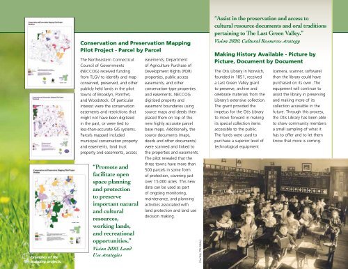
Examples of the<br />
mapping projects.<br />
Conservation and Preservation Mapping<br />
Pilot Project - Parcel by Parcel<br />
<strong>The</strong> Northeastern Connecticut<br />
Council of Governments<br />
(NECCOG) received funding<br />
from TLGV to identify and map<br />
conserved, preserved, and other<br />
publicly held lands in the pilot<br />
towns of Brooklyn, Pomfret,<br />
and Woodstock. Of particular<br />
interest were the conservation<br />
easements and restrictions that<br />
might not have been digitized<br />
in the past, or were tied to<br />
less-than-accurate GIS systems.<br />
Parcels mapped included<br />
municipal conservation property<br />
and easements, land trust<br />
property and easements, access<br />
“Promote and<br />
facilitate open<br />
space planning<br />
and protection<br />
to preserve<br />
important natural<br />
and cultural<br />
resources,<br />
working lands,<br />
and recreational<br />
opportunities.”<br />
Vision 2020, Land<br />
Use strategies<br />
easements, Department<br />
of Agriculture Purchase of<br />
Development Rights (PDR)<br />
properties, public access<br />
easements, and other<br />
conservation-type properties<br />
and easements. NECCOG<br />
digitized property and<br />
easement boundaries using<br />
source maps and deeds then<br />
placed them on top of the<br />
new highly accurate parcel<br />
base maps. Additionally, the<br />
source documents (maps,<br />
deeds and other documents)<br />
were scanned and linked to<br />
the properties and easements.<br />
<strong>The</strong> pilot revealed that the<br />
three towns have more than<br />
500 parcels in some form<br />
of protection, covering just<br />
over 15,000 acres. This new<br />
data can be used as part<br />
of ongoing monitoring,<br />
maintenance, and planning<br />
activities associated with<br />
land protection and land use<br />
decision making.<br />
Courtesy Otis Library<br />
“Assist in the preservation and access to<br />
cultural resource documents and oral traditions<br />
pertaining to <strong>The</strong> <strong>Last</strong> <strong>Green</strong> <strong>Valley</strong>.”<br />
Vision 2020, Cultural Resources strategy<br />
Making History Available - Picture by<br />
Picture, Document by Document<br />
<strong>The</strong> Otis Library in Norwich,<br />
founded in 1851, received<br />
a <strong>Last</strong> <strong>Green</strong> <strong>Valley</strong> grant<br />
to preserve, archive and<br />
celebrate materials from the<br />
Library’s extensive collection.<br />
<strong>The</strong> grant provided the<br />
impetus for the Otis Library<br />
to move forward in making<br />
its special collection items<br />
accessible to the public.<br />
<strong>The</strong> funds were used to<br />
purchase a superior level of<br />
technological equipment<br />
(camera, scanner, software)<br />
than the library could have<br />
purchased on its own. <strong>The</strong><br />
equipment will continue to<br />
assist the library in preserving<br />
and making more of its<br />
collection accessible in the<br />
future. Through this process,<br />
the Otis Library has been able<br />
to show community members<br />
a small sampling of what it<br />
has to offer and to let them<br />
know that more is coming.