

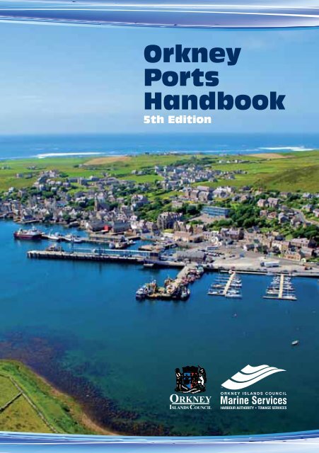
Orkney Ports Handbook - Orkney Islands Council, Marine Services
Orkney Ports Handbook - Orkney Islands Council, Marine Services
Orkney Ports Handbook - Orkney Islands Council, Marine Services

Create successful ePaper yourself
Turn your PDF publications into a flip-book with our unique Google optimized e-Paper software.
<strong>Orkney</strong><br />
<strong>Ports</strong><br />
<strong>Handbook</strong><br />
5th Edition
Contents<br />
General<br />
Contact Details 4<br />
Introduction 5<br />
<strong>Orkney</strong> Harbour Authority Area 6<br />
Pilotage <strong>Services</strong> & Pilotage<br />
Exemption Certificates 7<br />
<strong>Orkney</strong> VTS 8<br />
Port Passage Planning 12<br />
Suggested tracks<br />
Scapa Flow, Kirkwall, Stromness 13<br />
Prior notification requirements 16<br />
Preparations for Port Entry 17<br />
Harbour Craft 18<br />
Port Security - (ISPS code) 19<br />
Port Waste Reception Facilities 20<br />
Traffic Movements in <strong>Orkney</strong> 21<br />
Ferry Routes in & around <strong>Orkney</strong> 22<br />
Fishing Vessel Facilities 23<br />
Diving Support Boats 24<br />
Principal Wreck & Dive Sites<br />
in Scapa Flow 25<br />
Towage & Tugs 26<br />
Ship to Ship Cargo Transhipments 30<br />
Flotta Oil Terminal 32<br />
Guide to good practice for small<br />
vessel bunkering operations 37<br />
Guide to good practice for the<br />
disposal of waste materials 38<br />
Fixed Navigation lights 39<br />
Index to PIERS & HARBOURS 43<br />
Marinas 116<br />
Tidal Atlas 121<br />
Pollution Prevention Guidelines 135<br />
3
4<br />
Address:<br />
<strong>Marine</strong> <strong>Services</strong><br />
Harbour Authority Building<br />
Scapa<br />
<strong>Orkney</strong> KW15 1SD<br />
Scotland<br />
Communications:<br />
Tel: +44 (0) 1856 873636<br />
Fax: +44 (0) 1856 873012<br />
Email: harbours@orkney.gov.uk<br />
Website: www.orkneyharbours.com<br />
Personnel:<br />
Mr Gavin Barr<br />
Executive Director<br />
Development & Infrastructure<br />
Mr Brian Archibald<br />
Head of Transport & Amenities<br />
Mr David Sawkins<br />
Harbour Master<br />
& <strong>Marine</strong> <strong>Services</strong> Senior Manager<br />
Captain Abul Alam<br />
Port Operations Manager
<strong>Ports</strong> <strong>Handbook</strong> – 5th Edition<br />
The <strong>Orkney</strong> County <strong>Council</strong> Act of 1974<br />
authorised the <strong>Orkney</strong> <strong>Islands</strong> <strong>Council</strong><br />
to exercise jurisdiction as a Competent<br />
Harbour Authority and defined the<br />
areas in which the new authority was<br />
empowered. These were Scapa Flow and<br />
its approaches, Wide Firth and Shapinsay<br />
Sound and included Stromness, Kirkwall<br />
and the Flotta Oil Terminal.<br />
The <strong>Orkney</strong> <strong>Islands</strong> <strong>Council</strong> Order<br />
Confirmation Act 1978 and the <strong>Orkney</strong><br />
<strong>Islands</strong> <strong>Council</strong> Harbour Revision Order<br />
1989 extended jurisdiction to include<br />
12 additional piers and harbours in the<br />
northern islands.<br />
In order to administer its responsibility as<br />
a competent harbour authority, <strong>Orkney</strong><br />
<strong>Islands</strong> <strong>Council</strong> formed the Department of<br />
Harbours in 1975.<br />
The <strong>Orkney</strong> <strong>Islands</strong><br />
<strong>Council</strong> <strong>Marine</strong> <strong>Services</strong><br />
offices on the shorefront<br />
overlooking Scapa Flow.<br />
As a harbour authority, the <strong>Council</strong>’s aim,<br />
through <strong>Marine</strong> <strong>Services</strong>, is to ensure that<br />
<strong>Orkney</strong>’s piers and harbours are operated<br />
in a safe and cost effective manner. It<br />
is hoped that this handbook, which is<br />
intended as a quick reference guide for<br />
port users, will help in achieving this aim.<br />
While the information contained in this<br />
handbook is believed to be correct at the<br />
time of printing, the harbour authority<br />
can assume no responsibility for the<br />
accuracy of its contents. For the latest<br />
port information, users should consult the<br />
port’s website www.orkneyharbours.com<br />
or the relevant Admiralty publications.<br />
Revisions of this publication<br />
will be available at:<br />
orkneyharbours.com in the<br />
<strong>Ports</strong> <strong>Handbook</strong> section and<br />
will be downloadable and<br />
printable as separate pages<br />
5
6<br />
Harbour Authority Area<br />
Harbour Limits<br />
<strong>Ports</strong>, Piers & Harbours<br />
STROMNESS<br />
Graemsay<br />
Moaness<br />
Hoy<br />
MAINLAND ORKNEY<br />
Hoy Sound<br />
Lyness<br />
Houton<br />
Longhope<br />
Tingwall<br />
Finstown<br />
Amenity Slip<br />
Scapa Flow<br />
Harbour Area<br />
Flotta<br />
Rousay<br />
Sutherland<br />
& Gibralter<br />
Pierowall<br />
Westray<br />
Westray Firth<br />
Trumland<br />
Wyre<br />
Hatston Pier<br />
& Terminal<br />
Hatston Slip<br />
Hoxa<br />
Sound<br />
Egilsay<br />
KIRKWALL<br />
Scapa<br />
Papa<br />
Westray<br />
Rapness<br />
Mocklett<br />
St Mary’s<br />
St Margaret’s<br />
Hope<br />
Burwick<br />
Shapinsay<br />
Balfour<br />
Burray<br />
Burray<br />
South<br />
Ronaldsay<br />
The North<br />
Sound<br />
Eday<br />
Backaland<br />
Eday Firth<br />
Loth<br />
Stronsay Firth<br />
Deerness<br />
Amenity Slip<br />
Sanday<br />
Kettletoft<br />
Stronsay<br />
West Pier<br />
Whitehall<br />
Stronsay<br />
North<br />
Ronaldsay<br />
Nouster
Pilotage <strong>Services</strong> & Pilotage<br />
Exemption Certificates<br />
<strong>Orkney</strong> <strong>Islands</strong> <strong>Council</strong> <strong>Marine</strong> <strong>Services</strong> are<br />
the Competent Harbour Authority for the<br />
following areas:-<br />
1. The competent Harbour Authority<br />
area for Scapa Flow etc., bounded<br />
as follows: commencing at the Out<br />
Taings point of Hoy; thence in a<br />
straight line to Breckness on Mainland;<br />
thence in a generally eastern<br />
direction following the line of low<br />
water on the southern boundaries<br />
of Mainland to the northern end of<br />
the northernmost Churchill Barrier;<br />
then in a generally southern direction<br />
following the western sides of the<br />
four Churchill Barriers and the lines of<br />
low water on the western boundaries<br />
of the islands of South Ronaldsay<br />
(other than Swona) to Brough<br />
Ness; thence in a generally western<br />
direction by a straight line to the<br />
southernmost part of Swona and a<br />
straight line from that point to Brims<br />
Ness on South Walls on the island of<br />
Hoy; thence following the line of low<br />
water on the western and northern<br />
side of Aith Hope and the seaward<br />
boundaries of South Walls and of Hoy<br />
to the point of commencement.<br />
2. The Competent Harbour Authority<br />
area for Wide Firth/Shapinsay<br />
Sound area, bounded as follows:<br />
commencing at Harpy Taing on<br />
Mainland; thence in a straight line<br />
to Strombery on Shapinsay; thence<br />
following the line of low water on the<br />
southern boundary of Shapinsay to<br />
Hacksness; thence in a straight line to<br />
Rerwick Point on the Mainland; thence<br />
in a generally westerly and northeasterly<br />
direction following the line<br />
of low water on part of the northern<br />
boundary of Mainland to the point of<br />
commencement.<br />
Pilotage is compulsory<br />
within the Competent<br />
Harbour Authority areas<br />
for the following ships:<br />
1. All passenger vessels over 65 metres<br />
overall length;<br />
2. All other vessels over 80 metres<br />
overall length;<br />
3. All vessels under tow where the<br />
combined overall length of the<br />
towing vessel and the vessel being<br />
towed is over 65 meters;<br />
4. All vessels over 300gt carrying<br />
persistent oils in bulk.<br />
Vessels requiring or requesting a pilot<br />
must provide a minimum of 2hrs notice<br />
to <strong>Orkney</strong> VTS.<br />
Pilotage exemption<br />
certificates<br />
A Master or First Officer applying for a<br />
Pilotage Exemption Certificate in respect<br />
of his vessel must on examination satisfy<br />
the CHA or the Examining Body thereof<br />
that they have, in their opinion, sufficient<br />
skill, experience and knowledge of local<br />
navigation to render him capable of<br />
piloting the vessel of which he is at the<br />
time Master or Mate or any other vessel<br />
in respect of which a certificate is desired.<br />
HM Warships are also exempt.<br />
See the <strong>Orkney</strong> Pilotage Direction 1988<br />
as amended 2007 & 2010 for detailed<br />
information on the above.<br />
7
8<br />
<strong>Orkney</strong> VTS<br />
<strong>Orkney</strong> Harbour Authority operates an<br />
approved 24hr VTS information Service<br />
from its marine operations room at Scapa<br />
for vessels navigating in Scapa Flow and<br />
approaches and Kirkwall Bay / Shapinsay<br />
Sound areas.<br />
PROCEDURE:<br />
Compliance, Any vessels of 12m LOA and<br />
over or certified to carry more than 12<br />
passengers when navigating within the<br />
VTS Area.<br />
Inward/outward bound vessels, Pre<br />
arrival/departure reporting requirements<br />
as applicable. The following reports<br />
should be sent at least 24hr before arrival<br />
at the harbour limits or on departure<br />
from previous port if less than 24hrs.<br />
(a) SF-05-001 Prior Arrival Notification,<br />
(b) SF-11-001 Pre-arrival Security<br />
Information<br />
(c) SF-07-007 Pre-arrival Ship’s Waste<br />
Notification.<br />
Vessels must maintain a continuous<br />
listening watch on VHF Ch 11 when<br />
navigating within the VTS Area.<br />
All vessels must report prior to leaving a<br />
berth or anchorage to <strong>Orkney</strong> VTS and<br />
provide<br />
(a) Vessel name<br />
(b) Intentions<br />
(c) Route<br />
Non reporting vessels are encouraged to<br />
participate.<br />
REPORTING:<br />
Vessels reporting at reporting points must<br />
provide <strong>Orkney</strong> VTS with the following:<br />
(a) Vessel name<br />
(b) Intentions<br />
(c) ETA berth<br />
INFORMATION<br />
BROADCASTS:<br />
(1) Weather broadcasts for the <strong>Orkney</strong><br />
Coastal Waters area are broadcasted<br />
daily at 0915hrs and 1715hrs on<br />
VHF Ch 16 & 20.<br />
(2) Traffic information broadcasts are<br />
broadcasted as required on<br />
VHF Ch 16 & 11.<br />
RADAR AND AIS SURVEILLANCE: is<br />
maintained over Scapa Flow, Pentland<br />
Firth, Kirkwall Bay, Wide Firth and<br />
Shapinsay Sound.<br />
<strong>Orkney</strong> VTS
REPORTING POINTS:<br />
Reporting vessels must report when passing or<br />
crossing the following reporting points and lines:<br />
Reporting Point Report to Remarks<br />
<strong>Orkney</strong> Harbours Authority<br />
Limits west of Swona<br />
<strong>Orkney</strong> Harbour Authority<br />
east of Swona<br />
<strong>Orkney</strong> Harbour Authority<br />
Hoy Sound<br />
Hoxa Sound<br />
west of Nevi Skerry<br />
Hoxa Sound<br />
east of Nevi Skerry<br />
<strong>Orkney</strong> Harbour Authority<br />
Limits Shapinsay Sound<br />
<strong>Orkney</strong> Harbour Limits<br />
Wide Firth<br />
<strong>Orkney</strong> VTS VHF Ch 11 Inward and outward bound<br />
<strong>Orkney</strong> VTS VHF Ch 11 Inward and Outward bound<br />
<strong>Orkney</strong> VTS VHF Ch 11 Inward and outward bound<br />
<strong>Orkney</strong> VTS VHF Ch 11 Inward and Outward bound<br />
<strong>Orkney</strong> VTS VHF Ch11 Inward and Outward bound<br />
<strong>Orkney</strong> VTS VHF Ch 11 Inward and Outward bound<br />
<strong>Orkney</strong> VTS VHF Ch 11 Inward and Outward bound<br />
Clestrian Sound Scapa Flow <strong>Orkney</strong> VTS VHF Ch 11 Inward and Outward bound<br />
9
J<br />
10<br />
Radar & AIS Coverage<br />
Provided by <strong>Orkney</strong> Harbour Authority VTS<br />
Radar/AIS Stations (WGS84 datum)<br />
Kirkwall 58° 59.528’N 003° 000.4’W<br />
Scapa 58° 57.670’N 002° 58.215’W<br />
Hill of Midland, Orphir 58° 55.559’N 003° 10.913’W<br />
Sandy Hill, South Ronaldsay 58° 46.158’N 002° 58.062’W<br />
Radar Coverage (minimum area 24nm)<br />
AIS Coverage (minimum area 36nm)<br />
Wave & Tidal Sites<br />
Tidal Sites<br />
Wave Sites<br />
36 Nautical Miles<br />
24 Nautical Miles<br />
Distance in nautical miles:<br />
Scrabster to Stromness 26nm<br />
Scrabster to Lyness 20nm<br />
Gills Bay to Lyness 13nm<br />
Gills Bay to St Margaret’s Hope 15nm<br />
Wick to Lyness 25nm<br />
Wick to Stromness 35nm<br />
Aberdeen to Kirkwall 120nm<br />
Kirkwall to Lerwick 100nm<br />
Thurso<br />
(Scrabster)<br />
SCOTTISH MAINLAND<br />
E<br />
F<br />
D<br />
C<br />
A<br />
Stromness<br />
Lyness<br />
G<br />
Gills Bay<br />
Wick<br />
Kirkwall<br />
Scapa Flow<br />
50sq miles of sheltered,<br />
deep water anchorage<br />
K<br />
St Margaret’s<br />
Hope<br />
I<br />
H<br />
B<br />
Aberdeen<br />
This map illustrates the minimum areas of coverage in worst weather conditions.<br />
Ranges can increase significantly in favourable weather conditions.<br />
There may be small areas, within Radar range, that are not fully covered by the system.<br />
Lerwick
36 Nautical Miles<br />
J<br />
Expected Radar & AIS Coverage<br />
by Spring of 2013<br />
Provided by <strong>Orkney</strong> Harbour Authority VTS<br />
Radar/AIS Stations (WGS84 datum)<br />
Kirkwall 58° 59.528’N 003° 000.4’W<br />
Scapa 58° 57.670’N 002° 58.215’W<br />
Hill of Midland, Orphir 58° 55.559’N 003° 10.913’W<br />
Sandy Hill, South Ronaldsay 58° 46.158’N 002° 58.062’W<br />
Radar Coverage (minimum area 24nm)<br />
AIS Coverage (minimum area 36nm)<br />
Wave & Tidal Sites<br />
Tidal Sites<br />
Wave Sites<br />
24 Nautical Miles<br />
Distance in nautical miles:<br />
Scrabster to Stromness 26nm<br />
Scrabster to Lyness 20nm<br />
Gills Bay to Lyness 13nm<br />
Gills Bay to St Margaret’s Hope 15nm<br />
Wick to Lyness 25nm<br />
Wick to Stromness 35nm<br />
Aberdeen to Kirkwall 120nm<br />
Kirkwall to Lerwick 100nm<br />
Thurso<br />
(Scrabster)<br />
SCOTTISH MAINLAND<br />
E<br />
F<br />
D<br />
C<br />
A<br />
Stromness<br />
Lyness<br />
G<br />
Gills Bay<br />
Wick<br />
Kirkwall<br />
Scapa Flow<br />
50sq miles of sheltered,<br />
deep water anchorage<br />
K<br />
St Margaret’s<br />
Hope<br />
I<br />
H<br />
B<br />
Aberdeen<br />
This map illustrates the minimum areas of coverage in worst weather conditions.<br />
Ranges can increase significantly in favourable weather conditions.<br />
There may be small areas, within Radar range, that are not fully covered by the system.<br />
Lerwick<br />
11
12<br />
Port Passage Planning<br />
Purpose<br />
Port passage planning is carried out to<br />
determine the safest and most efficient<br />
passage for a vessel proceeding between<br />
two points within the harbour area.<br />
Detailed plans are required to ensure<br />
margins of safety. When complete, the<br />
plan becomes the basis for navigation.<br />
Equipment can fail and the unexpected<br />
happen, so monitoring the ship’s progress<br />
and contingency planning are also<br />
essential.<br />
Scope<br />
Port passage planning must be carried out<br />
by all vessels operating within the harbour<br />
authority areas with the exception of<br />
recreational vessels and vessels less than<br />
50 metres in length.<br />
It is the responsibility of the ship’s Master<br />
to ensure that port passage plans are<br />
drawn up and produced, where required,<br />
for inspection. The harbour authority<br />
encourages all vessels, as indicated, to<br />
undertake port passage planning.<br />
Planning Procedure<br />
The ship’s port passage plan should be<br />
produced as an adjunct to the vessel’s<br />
berth to berth voyage plan and should<br />
include, where applicable, the following:<br />
1. The intended track.<br />
2. Course alterations including wheelover<br />
positions.<br />
3. Distances off salient points.<br />
4. Marked areas of danger.<br />
5. Intended speeds in specific areas.<br />
6. Information on weather.<br />
7. Information on tide flows.<br />
8. Information on under-keel clearances.<br />
9. Positions where a change in<br />
machinery status is required.<br />
10. Positions where VTS and port<br />
reporting is required.<br />
11. Intended approach/departure to/from<br />
mooring position.<br />
12. Intended mooring arrangement.<br />
13. Contingency plan in event of an<br />
emergency.<br />
Should a vessel become involved<br />
in an incident (e.g. a grounding,<br />
collision or dangerous occurrence)<br />
within the harbour authority area,<br />
the Master will ensure that all<br />
records with regard to the passage,<br />
including the plan, can be accessed<br />
for investigation purposes.
Scapa Flow - Suggested Tracks<br />
Suggested Tracks - Not to be used for navigation<br />
STROMNESS<br />
‹ 270°/090° ›<br />
Moaness<br />
Hoy<br />
MAINLAND ORKNEY<br />
‹ 333°/153° ›<br />
Lyness<br />
= Pilot Boarding Point<br />
Finstown<br />
Amenity Slip<br />
Houton<br />
‹ 270°/090° ›<br />
Longhope<br />
Tingwall<br />
‹ 310°/130° ›<br />
SPMs in line<br />
Flotta<br />
Trumland<br />
Wyre<br />
Hatston<br />
Pier and<br />
Terminal<br />
‹ 210°/030° ›‹ 200°/020° ›<br />
‹ 008°/188° ›<br />
Egilsay<br />
4c<br />
4.5c<br />
3.5c<br />
KIRKWALL<br />
Thieves<br />
Holm<br />
Iceland<br />
Skerry<br />
Scapa<br />
Balfour<br />
‹ 300°/120° ›<br />
St Mary’s<br />
Burray<br />
St Margaret’s<br />
Hope<br />
South<br />
Ronaldsay<br />
2c<br />
Head of<br />
Work<br />
Burwick<br />
Shapinsay<br />
Heliar<br />
Holm<br />
Disembarkation<br />
‹ 283°/103° ›<br />
13<br />
Hacksness<br />
Rerwick<br />
Head
14<br />
Wyre<br />
Approaches to Kirkwall Bay,<br />
Kirkwall Harbour & Hatston Terminal<br />
Suggested Tracks - Not to be used for navigation<br />
Hatston<br />
Pier and<br />
Terminal<br />
‹ 008°/188° ›<br />
4.5c<br />
3.5c<br />
KIRKWALL<br />
4c<br />
Iceland<br />
Skerry<br />
‹ 300°/120° ›<br />
Thieves<br />
Holm<br />
Scapa<br />
Balfour<br />
2c<br />
Head of<br />
Work<br />
Shapinsay<br />
Heliar<br />
Holm<br />
Disembarkation<br />
‹ 283°/103° ›<br />
Hacksness<br />
Rerwick<br />
Head
Approaches to Stromness Harbour<br />
Suggested Tracks - Not to be used for navigation<br />
‹ 270°/090° ›<br />
STROMNESS<br />
Hoy<br />
Ldg. Lts.<br />
317°<br />
‹ 6c ›<br />
Graemsay<br />
Hoy<br />
‹ 6.5c ›<br />
Hoy<br />
Sound<br />
‹ 333°/153° ›<br />
Houton<br />
Finstow<br />
Amenity<br />
‹ 270°/090° ›<br />
15
16<br />
Prior notification requirements<br />
under the Merchant Shipping (Traffic Monitoring and Reporting<br />
Requirements) (amended) Regulations 2008 - (SI 2008 No 3145).<br />
This reporting procedure applies to all<br />
vessels when bound to a UK port, with the<br />
following exceptions.<br />
• Vessels less than 300 GRT<br />
• Warships, Naval auxiliaries and other<br />
ships owned or operated by the<br />
Government of an EEA state, and used<br />
for non-commercial public service.<br />
• Fishing vessels less than 45 metres<br />
LOA*.<br />
• Traditional ships less than 45 metres<br />
LOA*.<br />
• Recreational craft less than 45 metres<br />
LOA*.<br />
The report must be received at least 24<br />
hours prior to arrival or **departure no<br />
later than the time of departure if the<br />
voyage is less than 24 hours.<br />
* Length Over All<br />
** All vessels carrying dangerous or<br />
polluting goods must notify the port<br />
prior to departure. With the exception of<br />
Warships, naval auxiliaries and other ships<br />
owned or operated by the Government<br />
of an EEA State which are used for non<br />
commercial public services.<br />
To assist Ship’s Masters in making these<br />
reports a pre-formatted Standard Form<br />
has been produced (SF 05-01). This<br />
contains provision to report correctly plus<br />
additional information for the benefit<br />
of the OIC <strong>Marine</strong> <strong>Services</strong>. When a<br />
vessel has an exemption to the above<br />
reporting requirements, evidence of<br />
this must be forwarded to the VTS/<br />
<strong>Ports</strong> Operations Manager at the Harbour<br />
Authority Building. Failure to forward the<br />
completed prior notification report form<br />
may result in a vessel being denied entry<br />
into the Statutory Harbour Area.<br />
Reporting forms are available for<br />
completion online or downloading at<br />
www.orkneyharbours.com or can be<br />
forwarded to <strong>Orkney</strong> VTS by:-<br />
Email: marine.ops@orkney.gov.uk<br />
Fax: +44 (0) 1856 87 3012
Preparations for Port Entry<br />
Before entering the port, Masters should<br />
(where applicable) ensure that:-<br />
A. The vessel’s trim is such that it does<br />
not exceed 3m by the stern (4m for<br />
STS).<br />
B. The propeller is fully immersed.<br />
C. While underway within the harbour<br />
authority areas it is strongly<br />
recommended that anchors are<br />
cleared and ready for immediate use<br />
having due regard to anticipated<br />
sea conditions prior to entering or<br />
departing the harbour authority areas.<br />
D. Hand steering is used.<br />
E. All propulsion systems are ready for<br />
ship manoeuvres.<br />
F. The steering gear is ready for<br />
manoeuvres.<br />
G. Sufficient generators are operating<br />
to negate problems should a failure<br />
occur.<br />
H. The ship’s AIS transponder and all<br />
navigation equipment are in operation<br />
and functioning properly.<br />
I. The bridge team is in place and fully<br />
familiar with the port passage plan<br />
J. Internal communication systems (e.g.<br />
hand-held radios) have been checked.<br />
K. The ship’s manoeuvring information<br />
and pilot card are ready.<br />
L. The pilot ladder (if required) is rigged<br />
in accordance with IMO requirements<br />
and IMPA recommendations on the lee<br />
side and 1m above the water level.<br />
M. Crew can be called at short notice to<br />
attend pilot boarding and secure an<br />
escort tug if necessary.<br />
Masters should contact <strong>Orkney</strong> VTS<br />
immediately they have any doubt as<br />
to their vessel’s preparedness.<br />
17
18<br />
Harbour Craft<br />
<strong>Orkney</strong> Harbour Authority employs<br />
a number of harbour craft to assist<br />
in the operation, maintenance and<br />
administration of the ports. In addition<br />
to pilot transfers, their duties include<br />
conservancy work, acting as transport<br />
for maintenance staff and carrying out<br />
regular patrols in and around the harbour<br />
authority areas.<br />
Normally, Scapa Flow / Stromness is<br />
served by two pilot launches,<br />
the “John Rae” built in 2010<br />
and “Scapa Pioneer” built in 1993.<br />
As its name suggests, the launch “Kirkwall<br />
Bay” normally operates in the Kirkwall Bay/<br />
Shapinsay Sound area. This launch (shown<br />
below) is a multitask vessel capable of<br />
operating as a pilot launch, work-boat<br />
or harbour tug. Commissioned in 1992,<br />
the vessel is of steel construction, is twin<br />
screw and equipped with a 50 hp bow<br />
thruster. Total engine power is 900hp<br />
giving a bollard pull of around 9 tonnes.<br />
Scapa Pioneer<br />
Kirkwall Bay<br />
John Rae
Port Security - (ISPS code)<br />
Security<br />
Under the following legislative<br />
instruments: -<br />
Regulation (EC) No. 725/2004 enhancing<br />
ship and port facility security. IS 2004 No.<br />
1495 The ship and Port Facility (Security)<br />
Regulations 2004. SI 2005 No. 1434 The<br />
ship and Port Facility (Security) (Amended)<br />
Regulations 2004.<br />
OIC <strong>Marine</strong> <strong>Services</strong> has in place a Port<br />
Facility Security Plan. This covers the<br />
following locations: -<br />
1. Stromness Harbour – North Pier for<br />
1-PAX (International and Domestic)<br />
Operations and South Pier for 1-PAX<br />
(International) 2-OBC operations.<br />
2. Kirkwall Harbour (including Hatston<br />
Pier) – 1-PAX (International and Domestic)<br />
and 2-OBC operations.<br />
3. Scapa Flow – Ship-to-ship transfer<br />
operations for 3-COG operations.<br />
(1.) PAX – Passenger vessel operations.<br />
(2.) OBC – other bulk cargo operations.<br />
(3.) COG – chemical, oil and gas Facilities<br />
covered: -<br />
<strong>Marine</strong> <strong>Services</strong> requires the following<br />
vessels that comply with the ISPS code<br />
to submit a pre-arrival information report<br />
form at lease 24 hours prior to arrival: -<br />
1. Cargo vessels arriving from a non-UK<br />
port.<br />
2. Cruise ships arriving from any port.<br />
3. All tankers of over 3000 GT arriving<br />
from any port.<br />
Vessels not affected by the requirements<br />
of the ISPS code and seeking information<br />
on the security arrangements in place at<br />
any of the facilities listed above, should<br />
contact the PFSO via <strong>Orkney</strong> VTS.<br />
Where there are security concerns from<br />
any person at a pier or harbour operated<br />
by <strong>Marine</strong> <strong>Services</strong>, they should contact<br />
the pier master at the location or advise<br />
<strong>Orkney</strong> VTS at the Harbour Authority<br />
Building at Scapa.<br />
Tel: +44 (0) 1856 873636<br />
Fax: +44(0) 1856 873012<br />
Email: harbours@orkney.gov.uk<br />
VHF: Ch 11<br />
The vigilance of the public and users of<br />
the facilities and the reporting of any<br />
suspicious activities or objects is of the<br />
utmost importance.<br />
19
20<br />
Port Waste Reception Facilities<br />
<strong>Marine</strong> <strong>Services</strong>, under the requirements<br />
set out in Statutory Instrument<br />
No.2003/1809, operates a Port Waste<br />
Management Plan. This ensures that all<br />
ship generated waste and cargo residue<br />
is controlled at all authority piers and<br />
harbours. This requirement is applicable<br />
to all vessels, except fishing vessels and<br />
recreational craft authorised to carry,<br />
or designed to carry, no more than 12<br />
passengers. The waste management plan<br />
details the location of all waste collection<br />
facilities at the authority’s piers and<br />
harbours. It also contains a list of the<br />
contractors used for waste disposal.<br />
SI 2003/1809 requires all the identified<br />
vessels intending to enter the harbour<br />
authority area, to provide notification<br />
of the waste they are carrying (unless<br />
they hold a MCA Exemption Certificate).<br />
Information, as required in Annex A of<br />
MGN 253 (M+F) and in schedule 2 of the<br />
Port Waste Reception Facilities Regulations<br />
2003, must be reported prior to arrival.<br />
In order to comply with the following<br />
regulations: - EU Animal By-products<br />
regulation (1774/2002/EC) and The Animal<br />
by-products (Scotland) regulations 2003.<br />
All catering waste must be double bagged<br />
prior to landing. Catering waste includes<br />
all packing materials associated from the<br />
food. Any catering waste from a vessel<br />
that has landed in a non-EU port will have<br />
all food waste treated as CAT 1 food waste<br />
(ICW). This includes all vessels that have<br />
docked/landed in non-EU countries even<br />
if the vessel has been provisioned in the<br />
EU, as there is no reliable method for<br />
establishing that non-EU stores were not<br />
taken on-board.<br />
Ship’s agents are responsible for notify<br />
visiting vessels of these requirements.<br />
The information should be sent to the<br />
harbour authority by fax or e-mail or, if<br />
necessary by VHF radio.<br />
Contact details:<br />
(for <strong>Marine</strong> <strong>Services</strong> piers and harbours)<br />
Fax +44(0)1856 873012<br />
Email marine.ops@orkney.gov.uk<br />
<strong>Orkney</strong> VTS VHF ch. 11<br />
Arrangements have been put in place<br />
to accept waste from all other vessels<br />
that are outside the scope of the<br />
requirements. Piers are provided with<br />
euro bins and some of the larger piers<br />
are provided with skips and waste oil<br />
collection tanks.<br />
For all waste collection requirements<br />
during weekends and public holidays<br />
advanced notice is required by Friday or<br />
last working day at noon.<br />
The cost of waste collection and disposal<br />
is normally covered within the harbour<br />
dues. However, there are additional fees<br />
for large quantities of waste (excess of<br />
16.0m³ or 2.0 tonne). Vessels are made<br />
aware of the fee for waste collection<br />
through details published in the port’s<br />
Schedule of Charges details of which can<br />
be found on www.orkneyharbours.com .<br />
Any vessel, which believes there is an<br />
inadequacy in the waste management<br />
plan, can report this directly to the<br />
Harbour Authority or through the ships<br />
agent. The Harbour Authority is obliged to<br />
deal with complaints promptly.<br />
Sewage may be discharged at sea in<br />
accordance with regulation 11 of Annex<br />
1V of Marpol 73/78.<br />
No sewage reception facilities are<br />
available at any of the <strong>Orkney</strong> Harbours.
Traffic Movements in <strong>Orkney</strong><br />
Ferries<br />
A large proportion of shipping<br />
movements in and around the <strong>Orkney</strong><br />
<strong>Islands</strong> are created by ferry traffic. A<br />
variety of ferries operate daily services<br />
throughout the year between <strong>Orkney</strong><br />
and the Scottish mainland. In addition,<br />
“<strong>Orkney</strong> <strong>Islands</strong> <strong>Council</strong> Ferry <strong>Services</strong>”<br />
operate numerous daily inter-island<br />
services (see chartlet on p.20).<br />
Details of these vessels’ scheduled<br />
movements can be obtained from:<br />
Serco NorthLink Ferries:<br />
Tel. 0845 6000 449<br />
or www.northlinkferries.co.uk<br />
Pentland Ferries:<br />
Tel. +44(0)1856 831226<br />
or www.pentlandferries.com<br />
John O’Groats Ferries:<br />
Tel. +44(0)1955 611353<br />
or www.jogferry.co.uk<br />
<strong>Orkney</strong> <strong>Islands</strong> <strong>Council</strong><br />
Inter <strong>Islands</strong> Ferry <strong>Services</strong>:<br />
Tel. +44(0)1856 872044<br />
or www.orkneyferries.co.uk<br />
Fishing Vessels<br />
Due to changes in the fishing quota<br />
system, offshore fishing vessels are a less<br />
common sight in <strong>Orkney</strong> waters than they<br />
have been in the past. However, there are<br />
numerous smaller inshore fishing vessels<br />
operating in and around the islands, often<br />
seen trawling for scallops or setting creels<br />
for crab or lobster.<br />
<strong>Marine</strong> Renewables<br />
A number of marine renewable test<br />
and development sites are situated in<br />
and around the <strong>Orkney</strong> Harbour Areas.<br />
Vessels involved in installation, support<br />
and servicing are frequently operating.<br />
Attention should be paid to Local Notice<br />
to <strong>Marine</strong>rs in place for information with<br />
regard to deployments etc.<br />
<strong>Marine</strong> Renewable sites:<br />
Billia Croo - West of <strong>Orkney</strong><br />
Falls of Warness - Stronsay Firth<br />
Howequoy Head - Eastside of Scapa Flow<br />
Head of Holland - Shapinsay Sound<br />
There is the possibility of commercial<br />
activity for marine renewable energy<br />
commencing in the next 12-24 months<br />
from 2013.<br />
Other Traffic<br />
Commonly seen vessels in <strong>Orkney</strong> waters<br />
throughout the year include coasters, fish<br />
farm service craft, diving support boats<br />
and general workboats. During the summer<br />
months these are joined by passenger<br />
liners and pleasure craft of all types.<br />
Oil related traffic such as tankers, tugs<br />
and pilot or agent launches operate<br />
continuously in Scapa Flow.<br />
Kirkwall Bay<br />
21
22<br />
Ferry Routes in & around <strong>Orkney</strong><br />
To Scrabster<br />
Harbour Limits<br />
<strong>Ports</strong>, Piers & Harbours<br />
OIC Ferry <strong>Services</strong><br />
Other Ferry Operators<br />
STROMNESS<br />
Graemsay<br />
Moaness<br />
Hoy<br />
MAINLAND ORKNEY<br />
Hoy Sound<br />
Lyness<br />
Houton<br />
Longhope<br />
Tingwall<br />
Finstown<br />
Amenity Slip<br />
Scapa Flow<br />
Harbour Area<br />
Flotta<br />
Rousay<br />
Sutherland<br />
& Gibralter<br />
To Gills Bay<br />
Pierowall<br />
Westray<br />
Westray Firth<br />
Trumland<br />
Wyre<br />
Hatston Pier<br />
& Terminal<br />
Hatston Slip<br />
Hoxa<br />
Sound<br />
Egilsay<br />
KIRKWALL<br />
Scapa<br />
Papa<br />
Westray<br />
Rapness<br />
Mocklett<br />
St Mary’s<br />
St Margaret’s<br />
Hope<br />
Burwick<br />
Shapinsay<br />
Balfour<br />
Burray<br />
Burray<br />
South<br />
Ronaldsay<br />
Summer & Passenger<br />
only service<br />
The North<br />
Sound<br />
Eday<br />
Backaland<br />
Eday Firth<br />
Loth<br />
Stronsay Firth<br />
Deerness<br />
Amenity Slip<br />
Sanday<br />
Kettletoft<br />
Stronsay<br />
West Pier<br />
Whitehall<br />
Stronsay<br />
To Shetland<br />
To Aberdeen<br />
North<br />
Ronaldsay<br />
Nouster
Fishing Vessel Facilities<br />
Kirkwall is the only designated port in<br />
<strong>Orkney</strong> where the landing of commercial<br />
whitefish is permitted. There is ample<br />
room at the fishing vessel berths for<br />
landing large quantities of fish boxes.<br />
With the consent of the local pier master,<br />
there is good pier space for repairing<br />
nets.<br />
Stromness Harbour<br />
Kirkwall Harbour<br />
For further information on available<br />
services, see the section covering the<br />
appropriate port.<br />
Tingwall Pier<br />
Longhope Pier<br />
23
24<br />
Diving Support Boats<br />
The <strong>Orkney</strong> <strong>Islands</strong> are renowned as a<br />
popular venue for recreational diving.<br />
There are many opportunities for diving<br />
all around <strong>Orkney</strong> but particularly in Scapa<br />
Flow where the German naval fleet was<br />
scuttled in 1919.<br />
There are eight German wrecks<br />
remaining, which are preserved for diving<br />
exploration. These are mainly positioned<br />
to the north and east of the island of<br />
Cava. See the associated chartlet on the<br />
opposite page and chart BA 35 for further<br />
details.<br />
There are two wrecks in the harbour<br />
authority areas which are protected as<br />
Dive boats are a common sight in <strong>Orkney</strong> waters, particulary in Stromness<br />
war graves. These are the “Royal Oak” and<br />
“Vanguard”, both marked with navigation<br />
buoys and indicated on chart BA 35.<br />
Unauthorised diving on these wrecks<br />
is prohibited, as is diving on the wreck<br />
“Prudentia” north-west of Flotta.<br />
<strong>Orkney</strong> Emergency<br />
Hyperbaric Chamber can be<br />
found at the Old Academy, Back Road,<br />
Stromness<br />
Contact (at sea) via<br />
Coastguard<br />
(on land): Balfour Hospital<br />
+441856 888000<br />
email: info@suladiving.com
Principal Wreck Finstown & Dive Sites<br />
Amenity Slip<br />
in Scapa Flow<br />
STROMNESS<br />
16<br />
Moaness<br />
Hoy<br />
Hoy Sound<br />
Piers/Harbours<br />
Diving Permitted<br />
Block Ships<br />
Diving Prohibited<br />
Scenic Dive<br />
Drift Dive<br />
Diving Permitted<br />
1 Bremse<br />
2 Koln<br />
3 Brummer<br />
4 Bayern gun turret<br />
5 Karlsrhue<br />
6 Kronprinz &<br />
Markgraf<br />
7 Konig<br />
8 Dresden<br />
9 V83<br />
Lyness<br />
Houton<br />
4<br />
5<br />
9<br />
10<br />
6<br />
Longhope<br />
10 F2 & YC21<br />
11 Rodean<br />
12 UB116<br />
13 Strathgarry<br />
14 S54<br />
15 James Barrie<br />
3<br />
11<br />
7<br />
2<br />
8<br />
20<br />
1<br />
Flotta<br />
27<br />
Hatston Pier<br />
& Terminal<br />
Hatston Slip<br />
KIRKWALL<br />
Scapa Flow<br />
Harbour Area<br />
21<br />
24<br />
26<br />
12<br />
13<br />
14<br />
15<br />
23<br />
Hoxa<br />
Sound<br />
Block Ships<br />
16 Gobenador Bories<br />
Inverlane<br />
Tabarka<br />
Doyle<br />
17 Thames<br />
18 Rosewood<br />
19 Gartshore<br />
Empire Seaman<br />
Martis<br />
25<br />
22<br />
Scapa<br />
St Mary’s<br />
17<br />
19<br />
St Margaret’s<br />
Hope<br />
South<br />
Ronaldsay<br />
Burwick<br />
Balfour<br />
18<br />
Burray<br />
Diving Prohibited<br />
20 Pridentia<br />
21 Vanguard<br />
22 Royal Oak<br />
Scenic Dives<br />
23 Hoxa Head<br />
24 Stanger Head<br />
25 Herston Head<br />
26 Switha<br />
27 Cantick Head<br />
25
26<br />
Towage<br />
Towage <strong>Services</strong><br />
Harbour Authority Building<br />
Scapa<br />
<strong>Orkney</strong> KW15 1SD<br />
Tel: +44(0)1856 873636<br />
Fax: +44(0)1856 873012<br />
Email: harbours@orkney.gov.uk<br />
Web : www.orkneyharbours.com<br />
<strong>Orkney</strong> Towage Co. Ltd operates a 24 hour<br />
towage service in Scapa Flow with 3, 55<br />
tonne bollard pull, azimuth stern drive<br />
tugs; Einar, Erlend and Harald.<br />
The crews serving on board these vessels<br />
are certified to STCW 95 standards. <strong>Orkney</strong><br />
Towage is ISM code compliant.<br />
Tugs perform a wide variety of activities within <strong>Orkney</strong> waters<br />
The tugs each develop a total of 4000hp<br />
through twin stern “aqua-masters”. This<br />
equates to a bollard pull of 55t ahead and<br />
47t astern.<br />
Each tug is equipped with towing<br />
equipment capable of withstanding loads<br />
in excess of 120 tonnes.<br />
Each tug is also equipped with fire<br />
fighting monitors and can also be used<br />
for counter pollution duties. On occasion,<br />
the tugs assist with general port services<br />
such as supplying fresh water or gas oil.
Tug Availability<br />
The following table outlines the number<br />
of tugs available for specific ship<br />
movements in Scapa Flow.<br />
During emergency situations and in<br />
exceptional circumstances, additional<br />
tugs may be called on for assistance.<br />
Harbour tugs are available for assisting<br />
vessels manoeuvring in other areas<br />
around <strong>Orkney</strong> and for salvage work.<br />
Movement Ship Group<br />
Berthing/Unberthing at<br />
LPG Jetty<br />
These services may be subject to<br />
operational requirements in Scapa Flow.<br />
For towage services<br />
contact:<br />
<strong>Orkney</strong> Towage Co. Ltd<br />
Tel: +44 (0) 1856 873636<br />
Fax: +44 (0) 1856 873012<br />
E-mail: harbours@orkney.gov.uk<br />
No. of<br />
Tugs<br />
5,000 tonnes DWT 3<br />
Berthing at LPG Jetty<br />
>5,000 tonnes DWT<br />
(capability class 2 DP vessels or higher)<br />
Unberthing LPG Jetty > 5,000 tonnes DWT 2<br />
Berthing/Unberthing at SPMs All ships 2<br />
Berthing/Unberthing<br />
STS Operations<br />
All ships<br />
(in the event of 2 VLCCs )<br />
2<br />
3<br />
4<br />
27
28<br />
Tug Escorts<br />
<strong>Orkney</strong> Harbour Authority requires that<br />
certain vessels (primarily loaded tankers)<br />
navigating in the Hoxa Sound / Scapa<br />
Flow areas are escorted by tugs. The<br />
requirements are based on the quantity<br />
of pollutants carried and are outlined in<br />
the table below.<br />
Area*<br />
Quantity of<br />
Pollutants<br />
Number<br />
of tugs<br />
Mode<br />
A >5000 tonnes 1 Standby<br />
B >5000 tonnes 1 Passive<br />
B >15000 tonnes 2 Minimum 1 active<br />
B >170000 tonnes 3 Minimum 1 active<br />
C >15000 tonnes 2 Passive<br />
C >170000 tonnes 2 Minimum 1 active<br />
*see map on page 27. (The above table<br />
also applies to LNG vessels)<br />
The Master and Pilot have the authority<br />
to dispense with a tug escort in area “C”<br />
should they consider it appropriate.<br />
It is also recommended that ballasted<br />
tankers are accompanied by a tug escort<br />
as follows:<br />
Area A 1 tug standby<br />
Area B 1 tug on active mode<br />
Area C 1 tug on passive mode<br />
For the purpose of tug escorts, a<br />
pollutant is defined as crude oil or heavy<br />
bunker fuel.
Tug Area<br />
STROMNESS<br />
Moaness<br />
Hoy<br />
MAINLAND ORKNEY<br />
Lyness<br />
Finstown<br />
Amenity Slip<br />
Houton<br />
Longhope<br />
Tingwall<br />
Flotta<br />
Hatston Pier<br />
& Terminal<br />
Hatston Slip<br />
C<br />
A<br />
KIRKWALL<br />
B<br />
Scapa<br />
St Mary’s<br />
St Margaret’s<br />
Hope<br />
South<br />
Ronaldsay<br />
Burwick<br />
Shapinsay<br />
Balfour<br />
Burray<br />
29
30<br />
Ship to Ship Cargo Transhipments<br />
Overview<br />
Scapa Flow is widely seen by oil and gas<br />
exporters as an ideal location to carry out<br />
ship to ship transfers. The harbour affords<br />
excellent shelter in still, deep water and is<br />
situated on the northern shipping route<br />
between northern Europe and the U.S.<br />
east coast and Gulf of Mexico. Quantities<br />
of around 300,000 tonnes of oil are<br />
regularly transferred into single tankers<br />
for export. Any type of liquid can be<br />
transferred. The main benefit to clients<br />
is the facility to tranship cargo from<br />
“shuttle” tankers into standard vessels for<br />
long haul export or combine a number of<br />
parcels of cargo into a larger vessel.<br />
In February 2007 the world’s first<br />
commercial LNG ship to ship transfer<br />
operation took place in Scapa Flow. This<br />
transfer saw the LNG vessels Excalibar and<br />
Excelsior transfer 132,000m3 of LNG.<br />
Fender Care Ltd, Skaugen Petro Trans<br />
(SPT) and Safe STS are all approved for<br />
ship to ship transfers in Scapa Flow.<br />
Procedure<br />
Prior to the STS operation a memo will be<br />
promulgated detailing:<br />
• operational procedures,<br />
• intended sequence of events,<br />
• designated anchor position,<br />
• mooring configuration,<br />
• tug deployment,<br />
• oil spill response and<br />
• liaison requirements.<br />
Vessels must arrive at the port with their<br />
propellers fully immersed and trimmed<br />
no more than 4 metres by the stern.<br />
The berthing and unberthing of ships<br />
is carried out by the <strong>Orkney</strong> Harbour<br />
Authority Pilots and <strong>Orkney</strong> Towage tugs<br />
and with the assistance of the assigned<br />
loading master. The number of tugs<br />
available for berthing and unberthing is<br />
outlined in the section entitled “Towage”.<br />
Tugs’ lines are used during these<br />
operations.<br />
The transfer operation will comply with<br />
the current OCIMF STS Transfer Guide and<br />
any Company procedures approved by<br />
the Harbour Authority. In addition, vessels<br />
should note that during their stay:<br />
A trim must be maintained which allows<br />
the vessel to be manoeuvred at any time<br />
without difficulty,<br />
Ballast water cannot be discharged from<br />
crude oil tankers within Scapa Flow at<br />
any time; however, this policy is under<br />
review and updates to this policy should<br />
be checked via shipping agents and STS<br />
operators.<br />
Please refer to:<br />
www.orkneyharbours.com/ballast_water_management.asp
32<br />
Flotta Oil Terminal<br />
(For details on cargo operations, refer to<br />
Talisman’s Port Information Booklet)<br />
Operator<br />
Talisman Energy (UK) Ltd<br />
Flotta Oil Terminal<br />
Flotta<br />
<strong>Orkney</strong> KW16 3NP<br />
Tel. +44(0)1856 88420<br />
Fax. +44(0)1856 884222<br />
E-mail. flotta.shipping@talisman.co.uk<br />
Special Note<br />
Ballast water from crude oil tankers can<br />
only be discharged ashore. Pumping<br />
ballast water directly into Scapa Flow is<br />
prohibited.<br />
Berthing Operations<br />
Vessels must arrive at the port with their<br />
propellers fully immersed and trimmed no<br />
more than 3 metres by the stern.<br />
The berthing and unberthing of ships at<br />
Flotta oil terminal is carried out by the<br />
harbour’s authorised Pilots and tugs,<br />
and with the assistance of the terminal’s<br />
mooring masters and workboats.<br />
Information on the number of tugs<br />
available for berthing operations can<br />
be found under the section entitled<br />
“Towage.” Tugs’ lines are used during<br />
berthing and unberthing operations.<br />
Information on mooring arrangements<br />
can be found on page 33. Full details of<br />
each berthing or unberthing operation<br />
will be discussed during the Pilot/Master<br />
exchange of information.<br />
LPG/Crude Oil Jetty<br />
A “T” shaped jetty capable of handling<br />
either crude oil or LPG is situated on the<br />
north coast of Flotta (see admiralty charts<br />
35 and 2568).<br />
The minimum depth of water alongside<br />
is 20.12m and vessels of up to 170,000<br />
tonnes DWT can be handled there.<br />
Single Point Moorings<br />
There are two single point moorings<br />
positioned approximately 1½ miles<br />
north of Flotta’s northern coastline (see<br />
admiralty charts 35 and 2568). SPM1 and<br />
SPM2 are not in use at present.
n<br />
270°/090° ›<br />
nghope<br />
Approaches to Flotta Oil Terminal<br />
Suggested Tracks - Not to be used for navigation<br />
SPM 1 SPM 2<br />
Jetty<br />
Flotta<br />
Cantick<br />
Head<br />
‹ 230° ›<br />
Switha<br />
Secure Tugs for Berthing<br />
Hose gang boards<br />
Stanger<br />
Head<br />
‹ 1.0m ›<br />
Recommended Track<br />
Calf of<br />
Flotta<br />
‹ 2.5c ›<br />
‹ 360° ›<br />
Escort Tug(s)<br />
Nevi<br />
Skerry<br />
Reduce Speed<br />
Crew Stand-by<br />
Swona<br />
Hoxa<br />
Head<br />
‹ 0.75m ›<br />
The Grinds<br />
Hunda<br />
Pipeline - No Emergency Anchor<br />
Disembarkation<br />
Recommended Track<br />
St Margaret’s<br />
Hope<br />
St Mary’s<br />
South<br />
Ronaldsay<br />
Burwick<br />
Burra<br />
33
Mooring System at Flotta Terminal Jetty<br />
35
36<br />
Terminal <strong>Services</strong><br />
(Further information available in the<br />
Talisman’s Port Information Booklet)<br />
Bunkers and Fresh Water<br />
There are no facilities for vessels to either<br />
bunker or take on fresh water at the<br />
terminal. However, these services can be<br />
organised while the vessel is anchored in<br />
Scapa Flow. Fresh water and gas oil are<br />
obtainable locally but fuel oil has to be<br />
shipped into the port.<br />
Stores<br />
Stores may be taken on board at the<br />
terminal but not on the ships main cargo<br />
deck during cargo operations and not, in<br />
any case, without the loading master’s<br />
prior consent. There are no restrictions<br />
relating to storage while anchored in<br />
Scapa Flow.<br />
Garbage Disposal<br />
There is a limited service for the disposal<br />
of garbage at the terminal. Again, this<br />
service may be organised while the vessel<br />
is at anchor.<br />
Telephone<br />
A public telephone for outgoing calls is<br />
available to vessels moored at the jetty.<br />
The telephone only accepts “phonecards”<br />
which are available from the ship’s agent.<br />
Medical<br />
There is a medic on site at the<br />
terminal at all times ready to deal with<br />
emergency medical situations.<br />
Flotta Oil Terminal
Guide to good practice for small<br />
vessel bunkering operations<br />
<strong>Orkney</strong> <strong>Islands</strong> <strong>Council</strong> <strong>Marine</strong> <strong>Services</strong><br />
has produced this guide for small vessel<br />
owners and operators.<br />
The aim is to highlight the need for<br />
safe and environmentally friendly<br />
working practices in what is an everyday<br />
occurrence in the many piers and<br />
harbours operated by <strong>Marine</strong> <strong>Services</strong>.<br />
The following is a list of recommended<br />
procedures to follow during bunkering<br />
operations.<br />
• Ensure the vessel is securely moored<br />
in a suitable berth with a safe means<br />
of access between the vessel and the<br />
shore.<br />
• Ensure all suitable safety precautions<br />
are taken e.g. no smoking, no naked<br />
lights and suitable personal protection<br />
• A suitable fire extinguisher should be<br />
to hand in case of emergency.<br />
• If receiving bunkers from a road<br />
tanker, always confirm with the driver<br />
the quantity and type of fuel to be<br />
taken.<br />
• Agree communications between the<br />
driver and yourself.<br />
• Disengage any mechanical bilge<br />
pumps and switch to manual any<br />
automatic electrical bilge pumps.<br />
• Ensure a suitable size of nozzle is used<br />
on the fuel delivery line into the fuel<br />
tank.<br />
• If bunkering using oil drums or other,<br />
ensure a suitable size of funnel is used<br />
for filling the fuel tank.<br />
• Have an adequate quantity of<br />
absorbent material available for use in<br />
the event of any spillage occurring.<br />
• Once refuelling is complete ensure all<br />
tank lids are closed and secured.<br />
• Wipe up any spillage with absorbent<br />
material and clean away any residual<br />
oil with suitable detergent.<br />
• Dispose of any waste material in the<br />
appropriate bins and tanks situated<br />
around the harbour.<br />
37
38<br />
Guide to good practice for the<br />
disposal of waste materials<br />
There are in place number of regulations<br />
where vessels and ports have to provide<br />
information, facilities and methods of<br />
disposal to ensure all waste is disposed<br />
of appropriately. <strong>Marine</strong> <strong>Services</strong> provide<br />
waste reception facilities to meet the<br />
needs of the vessels routinely visiting the<br />
numerous piers and harbours under their<br />
jurisdiction.<br />
<strong>Marine</strong> <strong>Services</strong> have produced this guide<br />
for all vessel owners and operators.<br />
The aim is to highlight the need for<br />
environmentally friendly methods of<br />
disposal in what is an everyday occurrence<br />
in the many piers and harbours operated<br />
by <strong>Marine</strong> <strong>Services</strong>.<br />
Protecting <strong>Orkney</strong>’s marine environment is essential<br />
It is in everybody’s interest that we all<br />
follow these recommended procedures<br />
to ensure a safe and environmentally<br />
friendly method of disposal.<br />
• Dispose of waste oils in the oil storage<br />
tanks provided. If there is no facility<br />
available contact the Piermaster<br />
at the location to arrange for the<br />
disposal or contact 01856 873 636.<br />
• Dispose of all garbage in the waste<br />
reception bins provided. Do not place<br />
heavy metal objects in these bins.<br />
• Double bag all food waste to prevent<br />
leakage.<br />
• If your vessel has been outside of the<br />
European Union ports please contact<br />
the Piermaster or contact 01856 873<br />
636 to arrange for disposal of food<br />
wastes.<br />
• Dispose of larger items, metals, ropes,<br />
nets etc in the waste skips provided. If<br />
there is no facility is available contact<br />
the Piermaster at the location to<br />
arrange for the disposal or contact<br />
01856 873 636.<br />
The cost of disposal of garbage is part of<br />
the harbour dues charged to port users,<br />
when quantities of over 2.0 tonnes or<br />
16.0m 3 is landed an additional charge is<br />
applied. Small quantities of waste oils that<br />
can be disposed of in reception tanks<br />
provided are free of charge but when a<br />
reception tank is required a fee is applied.<br />
All charges for port waste reception are<br />
available in the schedule of charges.<br />
The locations of port waste reception<br />
facilities can be found in the various plans<br />
contained in this port handbook.
Fixed Navigation lights – <strong>Orkney</strong> Mainland, North and South Isles<br />
Location/name<br />
North Ronaldsay<br />
Latitude N Longitude W Character Additional Info<br />
Dennis Head lighthouse 59 23.36 002 22.88 Fl W 10s fl 0.3 racon<br />
Nouster Pier<br />
Papa Westray<br />
59 21.33 002 26.45 Q R<br />
Moclett Pier<br />
Westray<br />
59 19.60 002 53.52 Fl WRG 5s<br />
Noup Head lighthouse 59 19.91 003 04.21 Fl W 30s<br />
Pierowall East Pier 59 19.35 002 58.52 Fl WRG 3s<br />
Pierowall West Pier 59 19.37 002 58.57 2 F R (vert)<br />
Rapness Terminal<br />
Eday<br />
59 14.94 002 51.44 2 F R (vert)<br />
Calf Sound 59 14.21 002 45.82 Fl (3) WRG 10s<br />
Backaland Pier<br />
Sanday<br />
59 09.40 002 44.92 Fl R 3s<br />
Loth Terminal 59 11.51 002 41.92 2 F G (vert)<br />
Kettletoft Pier 59 13.85 002 35.83 Fl WRG 3s<br />
Start Point lighthouse<br />
Stronsay & Papa Stronsay<br />
59 16.64 002 22.56 Fl (2) W 20s<br />
Whitehall Pier 59 08.62 002 35.93 2 F G (vert)<br />
The Ness lighthouse<br />
Shapinsay & Helliar Holm<br />
59 09.35 002 34.90 Fl (4) W 20s<br />
Balfour Pier 59 01.86 002 54.49 Fl (2) WRG 5s<br />
Helliar Holm lighthouse<br />
Egilsay<br />
59 01.14 002 54.60 Fl WRG 10s<br />
Egilsay Pier<br />
Auskerry<br />
59 09.30 002 56.70 Fl G 3s<br />
Lighthouse<br />
Copinsay<br />
59 01.55 002 34.37 Fl W 20s<br />
Lighthouse<br />
Thieves Holm<br />
58 53.79 002 40.40 Fl (5) W 30s<br />
Light tower<br />
Swona<br />
59 01.06 002 56.31 Q R<br />
North Head 58 45.10 003 03.10 Fl (3) W 10s<br />
Selkie Skerry 58 44.25 003 04.22 Fl W 8s<br />
39
40<br />
Location/name Latitude N Longitude W Character Additional Info<br />
South Ronaldsay<br />
Burwick Breakwater 58 44.34 002 58.30 2 F R (vert)<br />
Hoxa Head 58 49.30 003 02.08 Fl WR 3s<br />
Needle Point Reef 58 50.10 002 57.45 Fl G 3s<br />
St Margarets Hope Pier 58 49.90 002 57.66 2 F G (vert)<br />
Leading lights front 58 49.60 002 57.64 F G 174 deg<br />
Leading lights rear<br />
Hoy & South Walls<br />
58 49.50 002 57.67 F G 174 deg<br />
Ruff Reef 58 47.43 003 07.80 Fl W 10s<br />
Cantick Head lighthouse 58 47.20 003 07.88 Fl W 20s<br />
Torness 58 46.72 003 17.81 Fl W 5s<br />
Lyness Golden Wharf 58 50.16 003 11.45 2 F R (vert)<br />
Lyness Wharf 58 50.01 003 11.41 2 F R (vert)<br />
Longhope Pier<br />
Flotta & Calf of Flotta<br />
58 48.10 003 12.20 Fl WRG 3s<br />
Stanger Head 58 49.00 003 04.73 Fl R 5s<br />
Sutherland Pier 58 50.20 003 07.90 Q G<br />
Gibraltar Pier 58 50.30 003 07.80 2 F G (vert)<br />
Roan Head 58 50.72 003 03.95 Fl (2) R 6s<br />
Calf of Flotta<br />
Flotta Oil Terminal<br />
58 51.30 003 03.90 Q R<br />
Flotta Terminal Jetty E 58 50.70 003 06.80 2 F R (vert)<br />
Flotta Terminal Jetty W 58 50.70 003 06.90 2 F R (vert)<br />
Flotta Terminal dolphins E 58 50.70 003 06.80 Q R<br />
Flotta Terminal dolphins W 58 50.70 003 07.20 Q R<br />
Flotta Terminal SPM tower 1 58 52.10 003 07.40 Fl Y 5s<br />
Flotta Terminal SPM tower 2<br />
Cava<br />
58 52.20 003 05.90 Fl (4) Y 15s<br />
Cava lighthouse<br />
Graemsay<br />
58 53.20 003 10.67 Fl WR 3s<br />
Hoy Low lighthouse 58 56.40 003 18.60 Iso W 3s<br />
Hoy High lighthouse 58 56.10 003 16.40 Oc WR 8s<br />
Moaness Pier 58 55.92 003 15.90 2 F R (vert)<br />
Sector Light<br />
Brough of Birsay<br />
58 54.99 003 18.70 Dir WRG 173 deg<br />
Lighthouse 59 08.20 003 20.40 Fl (3) W 25 s
<strong>Orkney</strong> Mainland<br />
Location/name<br />
Kirkwall Harbour<br />
Latitude N Longitude W Character Additional Info<br />
Kirkwall Pier N End 58 59.29 002 57.72 Iso WRG 5s<br />
Kirkwall Pier E End 58 59.32 002 57.52 2 F G (vert)<br />
Kirkwall Inner Basin 58 59.15 002 57.62 2 F R (vert)<br />
Kirkwall West Pier 58 59.13 002 57.61 2 F G (vert)<br />
Kirkwall Marina Breakwater 58 59.29 002 57.54 2 F R (vert)<br />
Hatston Pier 58 59.95 002 58.30 2 F R (vert)<br />
Rose Ness 58 52.35 002 49.92 Fl W 6s<br />
Scapa Pier 58 57.47 002 58.33 Fl G 3s<br />
Houton Terminal 58 55.00 003 11.00 Iso R 4s<br />
Pier Head 58 55.10 003 11.00 2 F R<br />
Leading lights front 58 55.00 003 11.50 Fl G 3s 316 deg<br />
Leading lights rear<br />
Stromness Harbour<br />
58 55.00 003 11.70 F G 316 deg<br />
Skerry of Ness 58 56.96 003 17.83 Fl WG 4s<br />
Pole Star Pier 58 57.50 003 17.90 Iso R 6s<br />
Leading lights front 58 57.60 003 18.00 F R 317 deg<br />
Leading lights rear 58 57.60 003 18.20 F R 317 deg<br />
North Pier 58 57.80 003 17.71 Fl R 3s<br />
South Pier 58 57.74 003 17.83 F R (vert)<br />
Marina breakwater 58 57.85 003 17.61 Fl (2) R 5s<br />
Tingwall Pier 59 05.37 003 02.53 2 F R (vert)<br />
SE Extention 59 05.35 003 00.52 2 FG (vert)<br />
Lit Beacons<br />
Nevi Skerry 58 50.70 003 02.71 Fl (2) W 6s<br />
Barrel of Butter 58 53.40 003 07.57 Fl (2) W10s<br />
Lother Rock 58 43.80 002 58.68 Fl W 2s fl 0.6 racon<br />
41
42<br />
Navigation Buoys<br />
Location/name Latitude N Longitude W Character Additional Info<br />
Scargun Shoal 59 00.70 002 58.50 Q (3) W E cardinal<br />
Linga Skerry 59 02.40 002 57.56 Q (3) W 10s E cardinal<br />
Boray Skerry 59 03.66 002 57.65 Q (6)+LFl W 15s S cardinal<br />
Skertours 59 04.15 002 56.60 Q W N cardinal<br />
Graand 59 06.90 002 54.40 Q (6)+LFl W 15s S cardinal<br />
Galt Skerry 59 05.30 002 54.30 Q W N cardinal<br />
Eday Gruna 59 08.50 002 43.80 Q W N cardinal<br />
Rusk Holm 59 12.70 002 50.60 Fl (2) R 6s<br />
Rapness Sound 59 14.05 002 50.58 Fl (2) R 12s<br />
Wyre Skerry<br />
Stronsay Harbour<br />
59 07.00 003 02.00 Q W 9s W cardinal<br />
Quiabow 59 09.82 002 36.30 Fl (2) G 12s<br />
No 1 buoy 59 09.171 002 36.50 Fl G 5s<br />
No 2 buoy 59 08.90 002 36.614 Fl R 5s<br />
No 4 buoy 59 08.78 002 36.476 Fl (2) R 5s<br />
No 3 buoy<br />
Scapa Flow<br />
59 08.679 002 36.123 Fl (2) G 5s<br />
Grinds 58 50.90 003 08.00 Fl (2) R 10s<br />
Vanguard Wreck 58 51.44 003 06.14 VQ (3) W 5s E cardinal<br />
PrudentiaWreck 58 50.80 003 07.80 Q (3) W 10s E cardinal<br />
Royal Oak Wreck 58 00.70 002 59.30` Fl (3) G 20s<br />
Scapa Skerry 58 56.80 002 59.30 Fl (2) R 12s<br />
Crockness 58 49.25 003 09.80 Fl (2) R 12s<br />
Gutter Sound Wreck 58 50.73 003 11.40 Fl R 6s<br />
Bay of Houton 58 54.81 003 11.15 Fl G<br />
Peter Skerry 58 58.28 003 13.50 Fl G 6s<br />
Riddock Shoal 58 55.89 003 15.00 Fl (2) R 12s<br />
Sand Eel 58 56.42 003 15.35 Q (3) W 10s E cardinal<br />
Barr Rock<br />
Stromness Harbour<br />
58 56.65 003 16.90 Q W N cardinal<br />
Outer Buoy 58 57.25 003 17.60 Fl R<br />
Inner Buoy 58 57.40 003 17.65 Fl G<br />
Coplands Dock<br />
European <strong>Marine</strong> Energy Test Site<br />
58 57.75 003 17.63 Fl G (2) 5s<br />
North buoy 58 59.50 003 23.80 Q W N cardinal<br />
East buoy 58 58.84 003 22.50 Q (3) W 10s E cardinal<br />
South buoy 58 57.45 003 23.10 Q (6)+LFl W 15s S cardinal<br />
West buoy 58 58.50 003 24.70 Q (9) W 15s W cardinal<br />
West buoy (2) 58 59.50 003 25.33 W cardinal (2)
Index to PIERS & HARBOURS<br />
Burray 44/45<br />
Burwick 46/47<br />
Eday - Backaland 48/49<br />
Egilsay 50/51<br />
Flotta – Gibraltar 52/53<br />
Flotta – Sutherland 54/55<br />
Graemsay 56/57<br />
Holm – St Mary’s 58/59<br />
Houton 60/61<br />
Hoy – Longhope 60/61<br />
Hoy – Lyness 62/67<br />
Hoy - Moaness 68/69<br />
Kirkwall 70/73<br />
Kirkwall - Hatston 74/79<br />
Kirkwall - Hatston Slipway 80/81<br />
North Ronaldsay – Nouster 82/83<br />
Papa Westray – Moclett 84/85<br />
Rousay - Trumland 86/87<br />
Sanday – Kettletoft 88/89<br />
Sanday – Loth 90/91<br />
Scapa Pier 92/93<br />
Scapa Flow 94/95<br />
Shapinsay 96/97<br />
Stromness 98/101<br />
Stromness – Pole Star Pier 102/103<br />
Stronsay – West 104/105<br />
Stronsay – Whitehall 106/107<br />
Tingwall 108/109<br />
Westray – Pierowall 110/111<br />
Westray - Rapness 112/113<br />
Wyre 114/115<br />
Marinas 116/120<br />
Tidal Atlas 121/134<br />
Pollution Prevention 135<br />
43
44<br />
Burray Pier
Burray Pier<br />
Tel: 01856 873636<br />
Fax: 01856 873012<br />
For berth availability contact <strong>Orkney</strong> VTS<br />
on VHF Ch16/11.<br />
Cargo handling: Conventional.<br />
The slipway adjacent to the pier is a<br />
private facility and not for public use.<br />
Fresh water is available via 25mm hose.<br />
Pier is of sheet pile and concrete<br />
construction.<br />
Toilet facilities are available at the head of<br />
the pier.<br />
Electricity is available on the pier.<br />
There is a mooring for visiting yachts up<br />
to 18 tonnes in position.<br />
58° 50.55’N<br />
002° 55.08’W<br />
The mooring is only in place between April<br />
and October.<br />
45
46<br />
South Ronaldsay - Burwick
South Ronaldsay - Burwick<br />
Tel: 01856 873636<br />
No cargo handling facilities exist here.<br />
There is a floating link span that has a<br />
barge moored on the end during the<br />
summer months.<br />
Fresh water is available via 25mm hose.<br />
During the summer the berth is used by<br />
the passenger ferry from John O’ Groats.<br />
Buses connect with the ferry for transport<br />
to/from Kirkwall.<br />
For ferry time table see:<br />
www.jogferry.co.uk<br />
or the <strong>Orkney</strong> <strong>Islands</strong> <strong>Council</strong> website:<br />
www.orkney.gov.uk/publications<br />
47
48<br />
Eday - Backaland Pier
Eday - Backaland Pier<br />
Tel: 01856 873636<br />
For berth availability call Eday Pier on<br />
VHF CH 16/12.<br />
Cargo Handling: Ro-Ro and Conventional<br />
Local ferry uses the Ro-Ro berth and has<br />
priority.<br />
For ferry time table see<br />
www.orkneyferries.co.uk.<br />
Fresh water via 25mm hose.<br />
The slipway facility is available for public<br />
use.<br />
There is a waiting room with telephone<br />
and toilets at the top of the pier.<br />
There is a mooring for visiting vessels in<br />
Calf Sound at<br />
59° 08.710’N<br />
002° 45.363’W<br />
The mooring is only in place between April<br />
and October.<br />
49
50<br />
Egilsay Pier
Egilsay Pier<br />
Tel: 01856 873636<br />
Cargo handling: Ro-Ro<br />
Fresh water via 25mm hose.<br />
For berth availability call piermaster by<br />
telephone. Local Ferry uses the pier and<br />
has priority.<br />
For ferry time table see<br />
www.orkneyferries.co.uk.<br />
There is a waiting room with telephone<br />
and toilets at the top of the pier.<br />
51
52<br />
Flotta - Gibraltar Pier
Flotta - Gibraltar Pier<br />
Tel: 01856 873636<br />
For berth availability call <strong>Orkney</strong> VTS on<br />
VHF Ch 16/11.<br />
Cargo Handling: Conventional /Ro-Ro<br />
Fresh water is available via 25mm hose.<br />
Pier is of sheet pile and concrete<br />
construction with limited fendering.<br />
A waiting room and toilets are available at<br />
the head of the pier.<br />
The local ferry uses the Ro-Ro berth. For<br />
ferry time table see<br />
www.orkneyferries.co.uk<br />
53
54<br />
Flotta – Sutherland Pier
Flotta – Sutherland Pier<br />
Tel: 01856 873636<br />
Cargo handling: Conventional.<br />
For berth availability call <strong>Orkney</strong> VTS VHF<br />
Ch 16/11.<br />
Fresh water is available via 25mm hose.<br />
The pier is of sheet pile and concrete<br />
construction with limited fendering<br />
available.<br />
This pier is used mainly by the tugs and<br />
work boats that serve the Flotta Oil<br />
Terminal.<br />
55
56<br />
Gramesay pier
Gramesay pier<br />
Tel: 01856 873636<br />
For berth availability call <strong>Orkney</strong> VTS on<br />
VHF Ch 16/11.<br />
Cargo Handling: conventional<br />
Fresh water is available through a 25mm<br />
hose.<br />
There are toilets and a waiting room at<br />
the head of the pier.<br />
Pier is of sheet pile and concrete<br />
construction with diagonal rubber<br />
fendering.<br />
Local Ferry uses the pier regularly and has<br />
priority for the outermost set of steps.<br />
For ferry time table see<br />
www.orkneyferries.co.uk<br />
57
58<br />
St Mary’s - Holm Pier
St Mary’s - Holm Pier<br />
Tel: 01856 873636<br />
For berth availability call <strong>Orkney</strong> VTS on<br />
VHF Ch 16/11.<br />
Cargo handling: Conventional<br />
Fresh water is available via 25mm hose.<br />
Pier is of concrete construction with very<br />
little fendering.<br />
There is a mooring for visiting vessels up<br />
to 18 tonnes in position.<br />
58°53.56’N<br />
002°54.72’W<br />
The mooring is only in place from April to<br />
October.<br />
59
60<br />
Orphir - Houton Terminal
Orphir - Houton Terminal<br />
Tel: 01856 811397<br />
Cargo Handling: Ro-Ro.<br />
No fresh water available.<br />
Pier is of sheet pile construction with<br />
limited fendering.<br />
Toilets and waiting room are available at<br />
the top of the pier.<br />
This is the ferry terminal that serves<br />
Lyness and Flotta.<br />
For ferry time table see www.<br />
orkneyferries.co.uk<br />
61
62<br />
Hoy - Longhope Pier
Hoy - Longhope Pier<br />
Tel: 01856 873636<br />
For berth availability call <strong>Orkney</strong> VTS on<br />
VHF Ch16/11.<br />
Cargo Handling: Conventional<br />
Fresh water is available via 25mm hose.<br />
Pier is of sheet pile construction with<br />
limited fendering.<br />
Two yacht mooring buoys lie close to the<br />
pier for yachts up to 18 tonnes.<br />
In positions:<br />
58° 48.080’N<br />
003°11.990’W<br />
58° 48.050’N<br />
003° 12.000’W<br />
The moorings are only in place between<br />
April and October.<br />
Toilets and shower facilities are located at<br />
the head of the pier.<br />
Fuel and groceries are available from<br />
the shop at the top of the pier as is the<br />
local post office. Fuel is also available for<br />
members of the <strong>Orkney</strong> <strong>Marine</strong> Fuel Co.,<br />
from a bunded tank located on the pier.<br />
Longhope Lifeboat is stationed at the pier<br />
on its own berthing pontoon. The local<br />
ferry berths at the pier overnight.<br />
63
10.0<br />
64<br />
12.0<br />
9.0<br />
Hoy - Lyness Pier<br />
11.0<br />
10.0<br />
123m<br />
6.0<br />
7.0<br />
8.0<br />
9.0<br />
5.0<br />
4.0<br />
1.0<br />
2.0<br />
3.0<br />
8.0<br />
190m<br />
7.0<br />
Ro Ro Berth<br />
66m<br />
4.0<br />
5.0<br />
6.0<br />
3.0<br />
Bunding<br />
2.0<br />
Waiting Room<br />
& Toilets<br />
58 50’ 12”N 003 11’ 24”W Nth end<br />
58 50’ 00”N 003 11’ 18”W Sth end<br />
FIRE HYDRANT<br />
LIFEBELT<br />
LADDER<br />
ELECTRICITY<br />
N<br />
Bunding<br />
Bunding
Hoy - Lyness Pier<br />
Tel: 01856 873636<br />
For berth availability call Lyness pier on<br />
VHF CH 12 or <strong>Orkney</strong> VTS on VHF<br />
CH 16/11<br />
Cargo handling: Conventional /Ro-Ro<br />
The pier is of large concrete block<br />
construction, and recently refurbished in<br />
2011. Numerous dive boats and the local<br />
fish farm boats use this pier.<br />
Shore side facilities include Yokohama<br />
fendering, quayside hard standing,<br />
lighting, shore power and fresh water.<br />
Fresh water is available via 25mm hose.<br />
A 200 tonne fresh water storage tank is<br />
due to be installed by late 2012 with a<br />
40t/hr pump for delivery to quay edges.<br />
The local ferry uses the Ro-Ro berth.<br />
For ferry time table see<br />
www.orkneyferries.co.uk<br />
There are toilets and waiting room<br />
close to the Ro-Ro berth. During the<br />
summer months a café is available in the<br />
interpretation centre a short walk from<br />
the pier.<br />
65
66<br />
Hoy - Lyness Development Plan<br />
& Enterprise Area<br />
Enterprise Areas denoted in blue<br />
Hatston and Lyness have between them 16.9 hectares of designated Enterprise Area<br />
status by the Scottish Government. The designation is for an initial 5 year period<br />
commencing April 2012 and includes:<br />
• Business Rates Discounts<br />
• Enhanced Capital Allowances for investment in plant and machinery<br />
• A streamlined approach to planning<br />
• High speed broadband connections<br />
Lyness • International Enterprise promotion Area and – Site marketing Perimeter of Enterprise Area Areas<br />
• Skills and training support to fully capitalise on the employment opportunities created<br />
For further information on Enterprise Areas please contact stuart.allison@orkney.gov.uk<br />
This<br />
0<br />
map is based upon Ordnance<br />
0.1598<br />
Survey material<br />
with the permission of Ordnance Survey on behalf<br />
kilometers<br />
of the Controller of Her Majesty’s Stationery<br />
Office © Scale: Crown1:3,999,000 copyright. Unauthorised<br />
reproduction infringes Crown copyright and may<br />
lead to prosecution or civil proceedings.<br />
100021621. 2012<br />
OS Grid Reference<br />
- ND 30975 94894<br />
4.5 ha<br />
1.2 ha<br />
Enterprise Area – 6.9 h
Enterprise Area: 6.9 hectares<br />
Total Area: 22 hectares<br />
OS Grid Ref. - ND 30975 94894<br />
Scale: 1:4,000<br />
67
68<br />
Hoy - Moaness Pier
Hoy - Moaness Pier<br />
Tel: 01856 873636<br />
Cargo handling: Conventional.<br />
For berth availability call <strong>Orkney</strong> VTS on<br />
VHF CH 16/11.<br />
Pier is of concrete consturction with<br />
limited fendering.<br />
There are toilets and waiting room at the<br />
head of the pier.<br />
The local ferry uses the pier regularly and<br />
it has priority on the steps.<br />
For ferry timetable see:<br />
www.orkneyferries.co.uk<br />
69
70<br />
Kirkwall
Kirkwall & Hatston<br />
Pre-arrival<br />
Vessels requiring a pilot should give 12<br />
and 2 hours notice prior to arrival. All<br />
other vessels over 12 metres in length or<br />
certified to carry 12 passenger or more,<br />
should give 2 hours notice prior to arrival<br />
at the harbour limits (see “VTS”).<br />
Approach and Navigation<br />
Reference documents include:<br />
Charts: BA 2584 and 1553.<br />
North coast of Scotland Pilot NP52.<br />
Admiralty Tidal Atlas NP209.<br />
On approaching Kirkwall Bay, vessels over<br />
12 metres in length or certified to carry<br />
more than 12 persons, should contact<br />
“Kirkwall Harbour” on VHF Ch.14. While in<br />
the port, these vessels should also advise<br />
“Kirkwall Harbour” when they are securely<br />
moored and just prior to any movement<br />
they are about to make in the port.<br />
Anchorages<br />
During foul weather, vessels can anchor<br />
in the Bay of Isbister or north Shapinsay<br />
Sound in strong northerlies, or Inganess<br />
Bay or Kirkwall Bay in southerlies. Swept<br />
anchorages in Kirkwall Bay are ½ mile and<br />
1 mile north of Kirkwall pier.<br />
Pilots<br />
Service operates 24hrs.<br />
Pilotage is compulsory for passenger<br />
vessels over 65 metres and all other<br />
vessels over 80 metres in length.<br />
All vessels under tow where the combined<br />
overall length of the towing vessel and<br />
the vessel being towed is over 65 meters;<br />
All vessels over 300gt carrying persistent<br />
oils in bulk.<br />
Vessels requiring or requesting a pilot<br />
must provide a minimum of 2hrs notice<br />
to <strong>Orkney</strong> VTS.<br />
Arrival<br />
A pilot launch is on station, listening on<br />
VHF Ch.11 when a vessel is expected. Call<br />
“Kirkwall Pilots”.<br />
Pilot launch: 12knots.<br />
Boarding speed: as requested by launch<br />
coxswain.<br />
Departure<br />
Vessels requiring a pilot for departure<br />
should give at least 2 hours notice.<br />
Tugs<br />
The pilot launch “Kirkwall Bay” is normally<br />
available for towage duty. See section on<br />
“Harbour Craft”.<br />
Berths<br />
See chartlets on pages 66 and 113 for<br />
details.<br />
Kirkwall <strong>Services</strong><br />
Bunkers<br />
Gas oil is available from road tankers.<br />
There is no local supply of fuel oil.<br />
Fresh Water<br />
Fresh water is available for vessels berthed<br />
alongside.<br />
Stores<br />
There are no restrictions to vessels taking<br />
on stores in the port. There are three<br />
supermarkets and numerous smaller<br />
shops in the town.<br />
Cranes<br />
Cranes are available by arrangement with<br />
local contractors.<br />
Garbage Disposal<br />
Garbage may be landed. Euro bins, a skip<br />
and an oil collection tank is provided.<br />
Charges may apply.<br />
Medical<br />
The town has full medical and dental facilities.<br />
71
74<br />
Kirkwall – Hatston
Hatston Pier Extension under construction,<br />
due for completion in spring 2013.<br />
75
78<br />
Kirkwall - Hatston Development<br />
& Enterprise Area<br />
Enterprise Area: 10 hectares<br />
Total Area: 11 hectares<br />
OS Grid Ref. - HY 43245 13043<br />
Scale: 1:4,000<br />
Enterprise Areas:
Hatston and Lyness have between them 16.9 hectares of designated Enterprise Area<br />
status by the Scottish Government. The designation is for an initial 5 year period<br />
commencing April 2012 and includes:<br />
• Business Rates Discounts<br />
• Enhanced Capital Allowances for investment in plant and machinery<br />
• A streamlined approach to planning<br />
• High speed broadband connections<br />
• International promotion and marketing of Enterprise Areas<br />
• Skills and training support to fully capitalise on the employment opportunities created<br />
For further information on Enterprise Areas please contact stuart.allison@orkney.gov.uk<br />
1:2500@A2<br />
Perspective view<br />
1:2500@A2<br />
79
80<br />
Kirkwall – Hatston Slipway
Kirkwall – Hatston Slipway<br />
Tel: 01856872292/873636<br />
Launching and drying out facilities<br />
available with the permission of the<br />
piermaster.<br />
Contact Piermaster on by telephone or<br />
VHF ch 14.<br />
Crane required for drying out facilities.<br />
81
82<br />
North Ronaldsay - Nouster Pier
North Ronaldsay - Nouster Pier<br />
Tel : 01856 873636<br />
For berth availability call <strong>Orkney</strong> VTS on<br />
VHF CH 16/11.<br />
Cargo Handling: Conventional<br />
Local ferry uses the pier weekly and has<br />
priority for the outermost set of steps.<br />
Fresh water via 25mm hose.<br />
For ferry time table see<br />
www.orkneyferries.co.uk<br />
Waiting room with toilets at the top of<br />
the pier.<br />
There are two moorings for visiting vessels<br />
up to 18 tonnes at positions<br />
59° 21.255’N<br />
002° 26.100’W.<br />
The moorings are in place between April<br />
and October.<br />
83
84<br />
Papa Westray – Moclett Pier
Papa Westray – Moclett Pier<br />
Tel: 01856 873636<br />
For berth availability call <strong>Orkney</strong> VTS on<br />
VHF CH 16/11.<br />
Cargo Handling: Conventional<br />
Fresh water via 25mm hose.<br />
Local ferry uses the pier and has priority<br />
for the outermost set of steps.<br />
For ferry time table see<br />
www.orkneyferries.co.uk<br />
There is a mooring buoy for visiting<br />
vessels up to 18 tonnes in position<br />
59° 21.070’N<br />
002° 52.995’W,<br />
The mooring is in place between April and<br />
October.<br />
85
86<br />
Rousay - Trumland Pier
Rousay - Trumland Pier<br />
Tel: 01856 873636<br />
For berth availability call <strong>Orkney</strong> VTS on<br />
VHF CH 16/11.<br />
Cargo Handling: Ro-Ro and Conventional<br />
Local Ferry uses the hard ramp berth and<br />
has priority.<br />
For ferry time table see<br />
www.orkneyferries.co.uk<br />
There is a waiting room with toilets at the<br />
top of the pier. There is fuel and a shop<br />
next to the pier, a hotel approximately 1<br />
km to the west.<br />
Fresh water via 25mm hose.<br />
There is a mooring for visiting vessels up<br />
to 18 tonnes in position<br />
59° 07.757’N,<br />
002° 59.312’W<br />
The mooring is only in place beween April<br />
and October.<br />
87
88<br />
Sanday – Kettletoft
Sanday – Kettletoft<br />
Tel: 01856 873636<br />
For berth availability call <strong>Orkney</strong> VTS on<br />
VHF ch 16/11.<br />
Cargo Handling: Conventional<br />
Fresh water via 25mm hose.<br />
There are toilets on the pier, with fuel, a<br />
shop and two hotels next to the pier.<br />
89
90<br />
Sanday – Loth
Sanday – Loth<br />
Tel: 01856 873636<br />
For berth availability call <strong>Orkney</strong> VTS on<br />
VHF ch 16/11.<br />
Cargo Handling: Ro-Ro and Conventional<br />
Local ferry uses the pier and has priority.<br />
Fresh water via 25mm hose.<br />
For ferry time table see<br />
www.orkneyferries.co.uk<br />
Waiting room telephone and toilets at the<br />
top of the pier.<br />
For members of the <strong>Orkney</strong> <strong>Marine</strong> Fuel<br />
Co., marine diesel is available from a<br />
bunded tank located on the pier.<br />
91
92<br />
Scapa Pier
Scapa Pier<br />
Tel: 01856 872292/873636<br />
For berthing information call <strong>Orkney</strong> VTS<br />
on VHF CH 16/11.<br />
Cargo handling: Conventional and oil<br />
pipeline<br />
Electricity available.<br />
Fresh water available from a mains<br />
hydrant<br />
Pier recently widened and includes an<br />
area of hard standing and a slipway<br />
providing launching facilities at the<br />
shoreward end of the north side.<br />
Pier is of sheet pile construction.<br />
Pier is the main base for Pilot boats, tugs<br />
and agents’ craft servicing the oil port of<br />
Scapa Flow. It is also the import route for<br />
general fuels into <strong>Orkney</strong>.<br />
No berths on inner south side.<br />
There is a mooring for visiting vessels up<br />
to 18 tonnes in position<br />
58°57.486’N<br />
002°58.322’W<br />
The mooring is only in place between April<br />
and October.<br />
93
94<br />
Scapa Flow<br />
STROMNESS<br />
Moaness<br />
Hoy<br />
MAINLAND ORKNEY<br />
Lyness<br />
Finstown<br />
Amenity Slip<br />
Houton<br />
Longhope<br />
Tingwall<br />
Flotta<br />
Hatston Pier<br />
& Terminal<br />
Hatston Slip<br />
Scapa<br />
Flow<br />
KIRKWALL<br />
Scapa<br />
St Mary’s<br />
St Margaret’s<br />
Hope<br />
South<br />
Ronaldsay<br />
Burwick<br />
Shapinsay<br />
Balfour<br />
Burray
Scapa Flow<br />
Pre – arrival<br />
Tankers visiting Scapa Flow should report<br />
their ETA to <strong>Orkney</strong> VTS 24, 12 and 2<br />
hours prior to arrival at the harbour limits.<br />
Other vessels requiring a pilot to give 12<br />
and 2 hours notice. All vessels over 20<br />
metres should give 2 hours notice.<br />
(See VTS page 8)<br />
Approach & Navigation<br />
Reference documents include:<br />
Charts: BA 2162, 2581 and 35.<br />
North Coast of Scotland Pilot NP52.<br />
Admiralty Tidal Atlas NP209.<br />
Note: - The principle entrance to Scapa<br />
Flow is from the south via the Pentland<br />
Firth. This stretch of water contains<br />
some of the strongest tidal flows in<br />
the world and it is therefore imperative<br />
that mariners study the contents of the<br />
relative documents and charts relating to<br />
navigational recommendations and tidal<br />
flows for this area before approaching the<br />
harbour limits. A detailed voyage plan is<br />
essential.<br />
While in the port, the vessel’s VHF radio<br />
should be set to channel 11 and, where<br />
applicable, to the appropriate channel for<br />
the intended destination (see appendix).<br />
Listen out for traffic information.<br />
Ships navigating in the port should do so<br />
with caution, paying particular attention<br />
to tide flows and the traffic situation.<br />
Recommended tracks should be used for<br />
guidance.<br />
Note:- <strong>Orkney</strong> VTS has radar coverage<br />
over the Pentland Firth/Scapa Flow areas.<br />
Tugs<br />
Certain vessels are required to be<br />
accompanied by a tug escort while<br />
navigating this area. See section entitled<br />
“Towage” for details.<br />
Pilots<br />
Service operates 24hrs.<br />
Pilotage is compulsory for passenger<br />
vessels over 65 metres and all other<br />
vessels over 80 metres in length.<br />
All vessels under tow where the combined<br />
overall length of the towing vessel and<br />
the vessel being towed is over 65 meters;<br />
All vessels over 300gt carrying persistent<br />
oils in bulk.<br />
Vessels requiring or requesting a pilot<br />
must provide a minimum of 2hrs notice<br />
to <strong>Orkney</strong> VTS.<br />
Arrival<br />
The Pentland Firth west pilot station is the<br />
preferred boarding area as it affords more<br />
sea room and has a more predictable tide<br />
flow.<br />
A pilot launch is on station, listening on<br />
VHF Ch.11, when a vessel is expected.<br />
Call: “SCAPA FLOW PILOTS”<br />
Pilot Launch: 13/20 knots.<br />
Boarding Speed: As requested by launch<br />
coxswain.<br />
Departure<br />
Vessels requiring a pilot for departure<br />
should give at least 2 hours notice.<br />
The pilot will normally disembark between<br />
Nevi Skerry and Stanger Head to allow<br />
the vessel to build up to full speed prior<br />
to entering the tidal flow in the Pentland<br />
Firth.<br />
Anchoring<br />
Scapa Flow offers a spacious, secure<br />
anchorage with good shelter from<br />
foul weather. Vessels should anchor as<br />
directed by the harbour authority.<br />
95
96<br />
Shapinsay – Balfour Pier
Shapinsay – Balfour Pier<br />
Tel: 01856 873636<br />
For berth availability call <strong>Orkney</strong> VTS on<br />
VHF CH 16/11.<br />
Cargo Handling: Ro-Ro and Conventional.<br />
Electricity (240v) is available.<br />
Fresh water is available.<br />
Balfour village, with shops, fuel and a<br />
hotel, is close to the pier.<br />
There are two mooring buoys for visiting<br />
vessels up to 18 tonnes in positions<br />
59° 01.912’N,<br />
002° 54.321’W<br />
59° 01.898’N,<br />
02° 54.355’W<br />
The moorings are in place between April<br />
and October.<br />
97
98<br />
Stromness
Stromness<br />
Pre-arrival<br />
Vessels requiring a pilot should give 12<br />
and 2 hours notice prior to arrival. All<br />
other vessels over 12 metres in length<br />
and arriving from outwith <strong>Orkney</strong>, should<br />
give 2 hours notice prior to arrival at the<br />
harbour limits,<br />
(see “VTS”).<br />
Approach and Navigation<br />
Reference documents include:<br />
Charts: BA 2162, 2581, 2568 and 35.<br />
North coast of Scotland Pilot NP52.<br />
Admiralty Tidal Atlas NP209.<br />
Vessels over 12 metres in length and<br />
arriving via the Pentland Firth should<br />
advise <strong>Orkney</strong> VTS when crossing the<br />
harbour limits. VHF radios should be set<br />
to channels 11 and 14. Ships navigating<br />
in the port should do so with caution,<br />
paying particular attention to tide flows<br />
and the traffic situation. See also “Scapa<br />
Flow”.<br />
On approaching Hoy/Clestrain Sound,<br />
vessels over 12 metres in length or<br />
certified to carry more than 12 persons,<br />
should contact “Stromness Harbour”<br />
on VHF Ch.14. While in the port, these<br />
vessels should also advise “Stromness<br />
Harbour” when they are securely moored<br />
and just prior to any movement they are<br />
about to make in the port.<br />
Anchorages<br />
Anchorage close to Stromness and<br />
suitable for vessels up to 6m<br />
draught, can be found at Cairston Road<br />
to the southeast of Outer Holm (see<br />
chart no. BA 2568). Numerous additional<br />
anchorages can be found in Scapa Flow.<br />
See page --.<br />
Pilots<br />
Service operates 24hrs.<br />
Pilotage is compulsory for passenger<br />
vessels over 65 metres and all other<br />
vessels over 80 metres in length.<br />
All vessels under tow where the combined<br />
overall length of the towing vessel and<br />
the vessel being towed is over 65 meters;<br />
All vessels over 300gt carrying persistent<br />
oils in bulk.<br />
Vessels requiring or requesting a pilot<br />
must provide a minimum of 2hrs notice<br />
to <strong>Orkney</strong> VTS.<br />
Arrival<br />
A pilot launch is on station, listening on<br />
VHF Ch.11 when a vessel is expected. Call<br />
“Stromness Pilots”.<br />
Pilot launch: 13/20 knots.<br />
Boarding speed: as requested by launch<br />
coxswain.<br />
Departure<br />
Vessels requiring a pilot for departure<br />
should give at least 2 hours notice.<br />
Tugs<br />
The port tugs based in Scapa Flow may<br />
be available. However, they may be<br />
considered unsuitable for vessels using<br />
Stromness as a port. See section on<br />
Towage<br />
Berths<br />
See chartlet on page 92 for details.<br />
Stromness <strong>Services</strong><br />
Bunkers<br />
Gas oil is available from road tankers.<br />
There is no local supply of fuel oil.<br />
Fresh Water<br />
Fresh water is available for vessels berthed<br />
alongside.<br />
Stores<br />
There are no restrictions to vessels taking<br />
on stores in the port. There is one minimarket<br />
and numerous smaller shops in<br />
the town.<br />
Cranes<br />
Cranes are available by arrangement with<br />
local contractors.<br />
Garbage Disposal<br />
Garbage may be landed. Euro bins, a skip<br />
and an oil collection tank are provided.<br />
Charges may apply.<br />
Medical<br />
There medical and dental facilities.<br />
There is a hospital in Kirkwall, 15 miles east<br />
of Stromness.<br />
99
100
Plans are in place to construct a new pier<br />
at Copland’s Dock, indicated here.<br />
Construction work is expected to<br />
commence in the last quarter of 2012<br />
with the new pier facility due for<br />
completion in the last quarter of 2013.<br />
Quay edge Draft<br />
Outside Berth 100m 5.0 to 6.0m<br />
Inside Berth 75m 3.5 to 5.0m<br />
101
102<br />
Stromness - Pole Star Pier
Stromness - Pole Star Pier<br />
Tel : 01856 873636<br />
or 01856 850744<br />
For berth availability call Stromness<br />
Harbour Radio on VHF ch 14<br />
or VTS on VHF ch 11.<br />
Fresh water and mains shore power<br />
available.<br />
Use primarily by marine renewables by<br />
agreements only with Harbour Authority.<br />
103
104<br />
Stronsay – West Pier
Stronsay – West Pier<br />
Tel : 01856 873636<br />
For berth availability call Stronsay Pier on<br />
VHF CH 16/12. <strong>Orkney</strong> VTS on VHF CH 11.<br />
Cargo Handling: Conventional<br />
Fresh water via 25mm hose.<br />
Electricity (240v) via coin box.<br />
Fuel, groceries and hotel available in<br />
Whitehall village next to the pier.<br />
For members of the <strong>Orkney</strong> <strong>Marine</strong> Fuel<br />
Co. marine diesel is available from a<br />
bunded tank on the pier.<br />
59° 08.34’N,<br />
002° 35.59’W<br />
105
106<br />
Stronsay – Whitehall
Stronsay – Whitehall<br />
Tel: 01856 873636<br />
For berth availability call Stronsay Pier on<br />
VHF CH 16/12 <strong>Orkney</strong> VTS on VHF CH 11.<br />
Cargo Handling: Ro-Ro and Conventional.<br />
Local ferry uses the pier and has priority.<br />
Fresh water via 25mm hose.<br />
Electricity (240v) via coin box.<br />
For ferry time table see<br />
www.orkneyferries.co.uk<br />
Fuel, groceries and hotel available in<br />
Whitehall village next to the pier.<br />
There is a mooring buoy for visiting<br />
vessels up to 18 tonnes in position<br />
59°08.747’N<br />
002°35.716’W<br />
The mooring is in place between April and<br />
October.<br />
107
108<br />
Tingwall Pier
Tingwall Pier<br />
Tel: 01856 872292/873636<br />
Cargo handling: Ro-Ro<br />
For berth availability call <strong>Orkney</strong> VTS on<br />
VHF ch 16/11 or piermaster by telephone.<br />
Fresh water via 25mm hose.<br />
The pier is of sheet pile and concrete<br />
construction with limited fendering<br />
available.<br />
Fuel is available for members of the<br />
<strong>Orkney</strong> <strong>Marine</strong> Fuel Co., from a bunded<br />
tank located on the pier.<br />
The hard ramp is used by the Ro-Ro ferry.<br />
For ferry time table see<br />
www.orkneyferries.co.uk<br />
109
110<br />
Westray – Pierowall Harbour
Westray – Pierowall Harbour<br />
Tel: 01856 873636<br />
For berth availability call Pierowall Harbour<br />
on VHF CH 16/12 <strong>Orkney</strong> VTS on VHF CH<br />
11.<br />
Cargo Handling: Conventional<br />
Local ferry uses the pier and has priority.<br />
Fresh water via 25mm hose.<br />
Electricity (240v) via several coin boxes.<br />
For ferry time table see www.<br />
orkneyferries.co.uk<br />
Waiting room, toilets and showers on the<br />
pier. Fuel, groceries and hotel in Pierowall<br />
village some 0.5 km from the pier. For<br />
members of the <strong>Orkney</strong> <strong>Marine</strong> Fuel Co.<br />
marine diesel is available from a bunded<br />
tank on the pier.<br />
A hard standing area is available for drying<br />
out.<br />
For further details of marina berths see<br />
Westray Marina on page 99.<br />
There is a mooring for visiting vessels up<br />
to 18 tonnes in position.<br />
59° 19.320’N<br />
002° 58.600’W<br />
The mooring is in place between April and<br />
October.<br />
111
112<br />
Westray – Rapness Pier
Westray – Rapness Pier<br />
Tel: 01856 873636<br />
For berth availability call <strong>Orkney</strong> VTS on<br />
VHF CH 16/11.<br />
When a ferry is at the pier call ‘Rapness<br />
Terminal’ on Ch 12.<br />
Cargo Handling: Ro-Ro and Conventional.<br />
Local ferry uses the pier and has priority.<br />
For ferry time table see<br />
www.orkneyferries.co.uk<br />
Waiting room, telephone and toilets next<br />
to the pier.<br />
Fresh water via 25mm hose.<br />
113
114<br />
Wyre Pier
Wyre Pier<br />
Tel: 01856 873636<br />
Cargo handling: Ro-Ro<br />
For berth availability call <strong>Orkney</strong> VTS on<br />
VHF CH 11.<br />
Local Ferry uses the pier and has priority.<br />
For ferry time table see<br />
www.orkneyferries.co.ukS<br />
There is a waiting room with telephone<br />
and toilets at the top of the pier.<br />
115
116<br />
Marinas<br />
<strong>Ports</strong>, Piers & Harbours<br />
STROMNESS<br />
Moaness<br />
Hoy<br />
MAINLAND ORKNEY<br />
Lyness<br />
Houton<br />
Longhope<br />
Tingwall<br />
Finstown<br />
Amenity Slip<br />
Stromness<br />
Flotta<br />
Pierowall<br />
Rousay<br />
Westray<br />
Westray Firth<br />
Trumland<br />
Hatston Pier<br />
& Terminal<br />
Hatston Slip<br />
Scapa<br />
Flow<br />
Wyre<br />
Egilsay<br />
KIRKWALL<br />
Scapa<br />
St Mary’s<br />
St Margaret’s<br />
Hope<br />
Papa<br />
Westray<br />
Westray<br />
Rapness<br />
Mocklett<br />
South<br />
Ronaldsay<br />
Burwick<br />
Shapinsay<br />
Balfour<br />
Burray<br />
The North<br />
Sound<br />
Eday<br />
Backaland<br />
Kirkwall<br />
Eday Firth<br />
Loth<br />
Stronsay Firth<br />
Deerness<br />
Amenity Slip<br />
Sanday<br />
Kettletoft<br />
Stronsay<br />
West Pier<br />
Whitehall<br />
Stronsay<br />
To Shetland<br />
To Aberdeen<br />
North<br />
Ronaldsay<br />
Nouster
Stromness Marina<br />
Marinas<br />
There are three marinas situated at<br />
Kirkwall, Stromness and Westray<br />
(Westray is May to September only).<br />
They all lie within the area covered by<br />
the <strong>Orkney</strong> Harbour Authority but are<br />
operated by <strong>Orkney</strong> Marinas Ltd. The<br />
marinas provide deep water sheltered<br />
berths for visiting craft.<br />
Facilities on site include water and<br />
electricity (240v). Showers and toilets are<br />
available nearby. It is possible to purchase<br />
a “Rover” ticket at any one marina which<br />
is valid for all three marinas.<br />
Vessels intending to enter or depart from<br />
any marina must contact the pier master<br />
on VHF channel 14 prior to entering or<br />
leaving. This is particularly important<br />
for Kirkwall and Stromness where there<br />
are frequent movements of ferries and<br />
commercial craft.<br />
The marina agent can be<br />
contacted by mobile phone.<br />
Full details of berthing and<br />
booking arrangements<br />
can be found at<br />
www.orkneymarinas.co.uk<br />
Telephone:<br />
Kirkwall Marina 07810 465 835<br />
Stromness Marina 07810 465 825<br />
Westray Marina 07810 465 784<br />
Main office tel 01856 871313<br />
Email: info@orkneymarinas.co.uk<br />
Kirkwall Marina<br />
Westray Marina<br />
117
118<br />
Marinas - Stromness
Marinas - Kirkwall<br />
119
120<br />
Marinas - Westray
Tidal Atlas<br />
The following figures are © Crown Copyright. They are derived from the Admiralty Tidal<br />
Stream Atlas NP 209 by permission of the Controller of Her Majesty’s Stationary Office:<br />
UK Hydrographic Office.”<br />
The North Coast of Scotland Pilot (Admiralty Sailing Directions NP 52) includes the<br />
following comments. (For full details, mariners are strongly advised to consult this<br />
publication directly).<br />
For the Pentland Firth<br />
General Information. Tidal streams are highly significant to the mariner navigating in or<br />
through the Pentland Firth and need to be considered at all times. They encounter a<br />
number of obstructions which give rise to eddies and races, which, in several areas of the<br />
firth can be very strong and extremely violent.<br />
Rates. Tidal streams run with great strength, rates up to 16 knots having been<br />
reported close to W of Pentland Skerries.<br />
Eddies. In some parts of the firth the transition between the main stream and an<br />
eddy, and vice versa, can occur so suddenly as to cause even a large vessel to take a<br />
violent sheer. All the islands, headlands and other dangers in the Firth should therefore<br />
be given a wide berth, particularly in poor visibility.<br />
Races. Even in calm conditions there can be heavy turbulence in the races; in<br />
disturbed conditions, particularly when the tidal streams are opposed by strong winds or<br />
a swell, the sea in the races can be extraordinarily violent and confused, and extremely<br />
dangerous to small vessels which may become unmanageable.<br />
Merry Men of Mey. The most extensive and dangerous race in the Pentland<br />
Firth, forms offSt John’s Point during the W-going tidal stream, and, when fully<br />
established, extends NNW the whole way across the firth to Tor Ness. With a W sea or<br />
swell the entire race becomes very violent; large waves form suddenly and from varying<br />
directions.<br />
For the <strong>Orkney</strong> <strong>Islands</strong><br />
General Information. Navigation in the vicinity of the <strong>Orkney</strong> <strong>Islands</strong> presents little<br />
difficulty in clear weather except in the Pentland Firth (see above). In poor visibility<br />
however, caution is required as tidal streams in the firths and sounds among the islands<br />
are generally strong except in Scapa Flow where they are barely perceptible.<br />
© Crown Copyright. From the Admiralty Tidal Stream Atlas NP 209 by permission of the<br />
Controller of Her Majesty’s Stationary Office: UK Hydrographic Office.”<br />
121
122<br />
Tidal Atlas
Tidal Atlas<br />
123
124<br />
Tidal Atlas
Tidal Atlas<br />
125
126<br />
Tidal Atlas
Tidal Atlas<br />
127
128<br />
Tidal Atlas
Tidal Atlas<br />
129
130<br />
Tidal Atlas
Tidal Atlas<br />
131
132<br />
Tidal Atlas
Tidal Atlas<br />
133
134<br />
Tidal Atlas
Pollution Prevention Guidelines<br />
Marinas and Craft: PPG14<br />
These guidelines provide general guidance to all who enjoy the use of waterways,<br />
estuaries and coastal waters, and are particularly relevant to users of powered boats and<br />
operators of boating support facilities. The information given is additional to any specific<br />
bye-laws or licensing conditions that apply to the waterway being used. They are jointly<br />
produced by the Environment Agency, the Scottish Environmental Protection Agency<br />
(SEPA) and the Environment and Heritage Service for Northern Ireland.<br />
Copies of PPG14 are available via the SEPAwebsite (www.SEPA.org.uk) and from the local<br />
SEPA office.<br />
The Guidelines provide guidance on a rang of topics including :-<br />
• Fuels and oil<br />
• Boat hull cleaning, painting and anti-fouling<br />
• Fuel and oil facilities at marinas<br />
• Sewage disposal at marinas<br />
• Marina maintenance<br />
• Fuels and oils on board craft<br />
• Onboard sewage collection and disposal<br />
• Waste from craft<br />
Owners and operators are encouraged to pay heed to all the above but especially that<br />
relating to hull cleaning and painting where this is carried out at open slips or alongside piers.<br />
135
136
137
138<br />
•<br />
•<br />
•<br />
•<br />
•<br />
Streamline<br />
Shipping Group<br />
Looking for the complete solution for all<br />
your <strong>Orkney</strong> logistics needs whilst in port?<br />
You’ve found it!<br />
30 years experience providing a full range of stevedoring facilities, 24 hours per day,<br />
7 days per week, every day of the year<br />
<strong>Orkney</strong>’s largest Mobile crane (200t lifting capacity) & Heavy Duty forklifts (25t lifting<br />
capacity) available for hire, flexible & competitive rates<br />
Ships Agency throughout <strong>Orkney</strong>, Shetland & all ports in Scotland<br />
Own fleet of assorted vehicles & trailers available in <strong>Orkney</strong> for hire by the hour, day, week<br />
Nationwide & International haulage & transport services to move all types of goods<br />
to & from <strong>Orkney</strong><br />
Express freight services for movement of Ships Spares to & from <strong>Orkney</strong>, Shetland<br />
& UK & overseas<br />
Specialists in providing stevedoring & transport services for the Oil & Gas,<br />
<strong>Marine</strong> Energy & Wind Turbine industries<br />
Depots: Glasgow, Aberdeen, Inverness, <strong>Orkney</strong> & Shetland<br />
Competitive Prices from Your One-Stop<br />
Logistics Shop<br />
Call Vanessa Robertson<br />
t: 01856 873658<br />
m: 07846 783818<br />
www.streamlineshippinggroup.com
Harnessing<br />
natural energy<br />
Engineering, technical risk and environmental consultancy<br />
services from Xodus Group actively support the<br />
development of renewable energy sources to meet the<br />
ever-increasing demand for electricity and the need to<br />
reduce greenhouse gas emissions.<br />
www.xodusgroup.com<br />
139
140
Core <strong>Services</strong>:<br />
The premier renewable energy and marine<br />
services company based in the Scottish Highlands<br />
Operations & Maintenance of Assets<br />
Health, Safety & Environmental Management<br />
Project Management & Development Support<br />
Engineering Design<br />
Hot Desk Facilities & Client Representation<br />
<strong>Marine</strong> Vessel Supply Management; including:<br />
tidal & wave resource studies<br />
environmental impact assessment studies<br />
inspection class ROV capability<br />
safety vessel and crew transfer<br />
MCA Cat 3 Coded Workboat for 6 persons - MV Sealg Brigh (WK197)<br />
MV Sealg Brigh (WK197) Specification:<br />
MECAL Coded for 6 passengers/crew<br />
Registered LOA 6.9m; Beam 2.4m; Draft 30cm, Kevlar<br />
lined multihull catamaran<br />
Load carrying capacity 1500kg gross; 500kg equipment,<br />
top speed 25knots, cruising 18knots.<br />
24 hour sailing subject to favourable weather and conditions<br />
from any safe port or haven<br />
Safe, reliable, economical<br />
CONTACT DETAILS:<br />
Richard Hunt—Director<br />
Tigh a’ Bhuiridh<br />
West Mey<br />
Thurso<br />
Caithness, KW14 8XH, UK<br />
Safety & Industry Experience<br />
Having all the necessary ‘tickets’, by way of training and<br />
experience, EnergyHunt staff have qualifications in:<br />
Safety Passport<br />
NEBOSH<br />
IOSH<br />
Working at Heights<br />
Offshore Survival<br />
Offshore Wind Turbine Access<br />
HSE First Aider<br />
Senior Authorised Person (SAP)<br />
Control Person/Network Controller<br />
HV Switching (to 275kV)<br />
CDM Co-ordinator / Supervising Officer<br />
Workboat Skipper<br />
Phone: +44(0) 1847 851419<br />
Mob: +44(0)7771 817683<br />
web: www.energyhunt.com<br />
Email:info@energyhunt.com<br />
www.energyhunt.com<br />
info@energyhunt.com<br />
141
142<br />
• Leask <strong>Marine</strong> Operates Four Teams of Divers<br />
• Four Multi-purpose Vessels<br />
• New Purpose-built 26m x 11m Multicat on order for mid 2011<br />
Working for Renewable Energy including Wave,<br />
•<br />
LEASK<br />
MARINE LTD<br />
Tide and Wind Sector Projects<br />
Commercial Diving <strong>Services</strong><br />
Workboat Charter<br />
<strong>Marine</strong> Renewables<br />
<strong>Marine</strong> Consultancy<br />
<strong>Marine</strong> Construction<br />
• ADCP Deployment and Recovery Specialists<br />
• Cathodic Protection Installation Specialists<br />
Members of<br />
The Association<br />
of Diving Contractors<br />
contact: Douglas Leask t/f: 01856 874725 • m: 07889 651680<br />
e: douglas@leaskmarine.com<br />
www.leaskmarine.com
<strong>Orkney</strong> Aggregates Ltd<br />
Supplier of:<br />
• Quarry Materials<br />
• Precast Products<br />
• Ready-Mix Concrete<br />
• Cabins / Container Hire<br />
• Heavy & Small Plant Hire<br />
• Licenced Scrap Metal Merchants<br />
• Waste Management <strong>Services</strong><br />
• General Haulage including Crane Lorry<br />
• Skip Hire<br />
Enquiries Welcome:<br />
t 01856 871187<br />
e sales@orkagg.co.uk<br />
Main extraction site - Heddle Hill, Finstown.<br />
www.orkagg.co.uk<br />
143
144
Call us, anytime, on our<br />
twenty-four-hour number<br />
01856 872268<br />
(within UK)<br />
00441856 872268<br />
(outside UK)<br />
An old established, independent firm of Shipbrokers & Stevedores<br />
run by the owners on a day-to-day ‘hands-on’ basis, with expertise<br />
in handling:<br />
• Oil and gas tankers at the Flotta Terminal<br />
• Cruise liners in Kirkwall and Stromness<br />
• NorthLink Ferries in Kirkwall,<br />
Stromness and Scrabster (Caithness)<br />
• General cargo ships throughout <strong>Orkney</strong><br />
• Ship-to-ship transfers of oil and gas cargoes<br />
in Scapa Flow<br />
• Lloyd’s Sub-Agency in <strong>Orkney</strong><br />
• Norway’s Consulate in <strong>Orkney</strong><br />
We offer very competitive rates<br />
to regular Principals and provide<br />
only a first class 24 hour service.<br />
145
146<br />
Currie Brothers<br />
Limited<br />
• <strong>Marine</strong> and Civil Construction<br />
• Welding, Steel Fabrication, Piling <strong>Services</strong><br />
• Crane and Plant Hire<br />
• <strong>Marine</strong> Renewable <strong>Services</strong><br />
• 24/7 Operations<br />
Tel: 01856 877770<br />
Mobile: 07702 942951<br />
Email: curriebro@aol.com<br />
Web: www.curriebro.co.uk<br />
6 Crowness Rd, Hatston Industrial Est., Kirkwall, <strong>Orkney</strong>, KW15 1RG<br />
t: 01856 873636<br />
f: 01856 873012<br />
e: harbours@orkney.gov.uk<br />
w: orkneyharbours.com<br />
<strong>Orkney</strong> Towage operates a 24 hour towage<br />
service with three 55t bollard pull azimuth<br />
stern drive tugs –<br />
Einar, Erlend & Harald<br />
Towage operations in <strong>Orkney</strong> have an excellent track<br />
record built over many years of service to the shipping<br />
industry. Our tugs are called on to perform a range of<br />
duties, each requiring a skilled and flexible approach.
A Sustainable Career –<br />
Your Future . . . ?<br />
Who Are We<br />
ICIT, based in Stromness, <strong>Orkney</strong> is part of the<br />
Institute of Petroleum Engineering at Heriot-<br />
Watt University. It provides advanced research,<br />
MSc and PhD training in renewable energy and<br />
marine energy systems.<br />
Providing the Professionals<br />
of Tomorrow<br />
Two MSc courses are run from the <strong>Orkney</strong><br />
Campus - in <strong>Marine</strong> Resource Management and<br />
in Renewable Energy Development, the latter<br />
also being available in Distance Learning format.<br />
Tackling the Barriers<br />
to Renewable<br />
Energy Development ICIT leads the <strong>Marine</strong><br />
Renewable Energy Development in Scotland<br />
(MREDS) programme: a major programme<br />
of research addressing technological,<br />
environmental and socio-economic hurdles to<br />
the development of marine renewable energy.<br />
ICIT, Stromness, <strong>Orkney</strong>, KW16 3AW<br />
Tel. 01856 850605<br />
Email: icit@pet.hw.ac.uk<br />
www.icit.org.uk<br />
147
148<br />
Stromness Business Centre, Stromness, <strong>Orkney</strong>, KW16 3AW<br />
Email: office@aquatera.co.uk Tel: +44 (0) 1856 850 088<br />
Website: www.aquatera.co.uk<br />
Full Life-cycle Project Support<br />
Based upon real experience and<br />
specialist expertise of your operating environment<br />
Concept evaluation<br />
Programme planning<br />
Design verification<br />
Baseline and monitoring surveys<br />
Permitting processes and EIA<br />
Risk management<br />
Contingency Contingen and response<br />
Operational logistics<br />
<strong>Marine</strong> supervision<br />
Shore-side facilities and services<br />
Taking you further<br />
A decade of delivery<br />
2000 - 2010<br />
Thirteen beautiful island destinations<br />
in <strong>Orkney</strong> served by 9 dedicated<br />
Inter-Island Ferries.<br />
Foot passengers are carried on all<br />
routes and vehicles on most.<br />
For further information and timetables<br />
visit our website: orkneyferries.co.uk<br />
t: 01856 872044 f: 01856 872921 e: info@orkneyferries.co.uk w: orkneyferries.co.uk<br />
<strong>Orkney</strong> <strong>Islands</strong> <strong>Council</strong> Ferry <strong>Services</strong> • Shore Street • Kirkwall • <strong>Orkney</strong> • KW15 1LG