Performance Analysis of GNSS Global and Regional Integrity ...
Performance Analysis of GNSS Global and Regional Integrity ...
Performance Analysis of GNSS Global and Regional Integrity ...

Create successful ePaper yourself
Turn your PDF publications into a flip-book with our unique Google optimized e-Paper software.
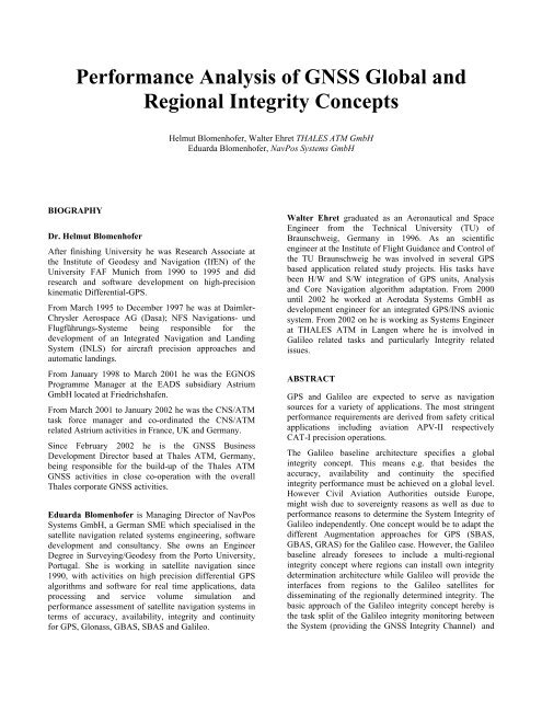
<strong>Performance</strong> <strong>Analysis</strong> <strong>of</strong> <strong>GNSS</strong> <strong>Global</strong> <strong>and</strong><br />
<strong>Regional</strong> <strong>Integrity</strong> Concepts<br />
BIOGRAPHY<br />
Dr. Helmut Blomenh<strong>of</strong>er<br />
After finishing University he was Research Associate at<br />
the Institute <strong>of</strong> Geodesy <strong>and</strong> Navigation (IfEN) <strong>of</strong> the<br />
University FAF Munich from 1990 to 1995 <strong>and</strong> did<br />
research <strong>and</strong> s<strong>of</strong>tware development on high-precision<br />
kinematic Differential-GPS.<br />
From March 1995 to December 1997 he was at Daimler-<br />
Chrysler Aerospace AG (Dasa); NFS Navigations- und<br />
Flugführungs-Systeme being responsible for the<br />
development <strong>of</strong> an Integrated Navigation <strong>and</strong> L<strong>and</strong>ing<br />
System (INLS) for aircraft precision approaches <strong>and</strong><br />
automatic l<strong>and</strong>ings.<br />
From January 1998 to March 2001 he was the EGNOS<br />
Programme Manager at the EADS subsidiary Astrium<br />
GmbH located at Friedrichshafen.<br />
From March 2001 to January 2002 he was the CNS/ATM<br />
task force manager <strong>and</strong> co-ordinated the CNS/ATM<br />
related Astrium activities in France, UK <strong>and</strong> Germany.<br />
Since February 2002 he is the <strong>GNSS</strong> Business<br />
Development Director based at Thales ATM, Germany,<br />
being responsible for the build-up <strong>of</strong> the Thales ATM<br />
<strong>GNSS</strong> activities in close co-operation with the overall<br />
Thales corporate <strong>GNSS</strong> activities.<br />
Eduarda Blomenh<strong>of</strong>er is Managing Director <strong>of</strong> NavPos<br />
Systems GmbH, a German SME which specialised in the<br />
satellite navigation related systems engineering, s<strong>of</strong>tware<br />
development <strong>and</strong> consultancy. She owns an Engineer<br />
Degree in Surveying/Geodesy from the Porto University,<br />
Portugal. She is working in satellite navigation since<br />
1990, with activities on high precision differential GPS<br />
algorithms <strong>and</strong> s<strong>of</strong>tware for real time applications, data<br />
processing <strong>and</strong> service volume simulation <strong>and</strong><br />
performance assessment <strong>of</strong> satellite navigation systems in<br />
terms <strong>of</strong> accuracy, availability, integrity <strong>and</strong> continuity<br />
for GPS, Glonass, GBAS, SBAS <strong>and</strong> Galileo.<br />
Helmut Blomenh<strong>of</strong>er, Walter Ehret THALES ATM GmbH<br />
Eduarda Blomenh<strong>of</strong>er, NavPos Systems GmbH<br />
Walter Ehret graduated as an Aeronautical <strong>and</strong> Space<br />
Engineer from the Technical University (TU) <strong>of</strong><br />
Braunschweig, Germany in 1996. As an scientific<br />
engineer at the Institute <strong>of</strong> Flight Guidance <strong>and</strong> Control <strong>of</strong><br />
the TU Braunschweig he was involved in several GPS<br />
based application related study projects. His tasks have<br />
been H/W <strong>and</strong> S/W integration <strong>of</strong> GPS units, <strong>Analysis</strong><br />
<strong>and</strong> Core Navigation algorithm adaptation. From 2000<br />
until 2002 he worked at Aerodata Systems GmbH as<br />
development engineer for an integrated GPS/INS avionic<br />
system. From 2002 on he is working as Systems Engineer<br />
at THALES ATM in Langen where he is involved in<br />
Galileo related tasks <strong>and</strong> particularly <strong>Integrity</strong> related<br />
issues.<br />
ABSTRACT<br />
GPS <strong>and</strong> Galileo are expected to serve as navigation<br />
sources for a variety <strong>of</strong> applications. The most stringent<br />
performance requirements are derived from safety critical<br />
applications including aviation APV-II respectively<br />
CAT-I precision operations.<br />
The Galileo baseline architecture specifies a global<br />
integrity concept. This means e.g. that besides the<br />
accuracy, availability <strong>and</strong> continuity the specified<br />
integrity performance must be achieved on a global level.<br />
However Civil Aviation Authorities outside Europe,<br />
might wish due to sovereignty reasons as well as due to<br />
performance reasons to determine the System <strong>Integrity</strong> <strong>of</strong><br />
Galileo independently. One concept would be to adapt the<br />
different Augmentation approaches for GPS (SBAS,<br />
GBAS, GRAS) for the Galileo case. However, the Galileo<br />
baseline already foresees to include a multi-regional<br />
integrity concept where regions can install own integrity<br />
determination architecture while Galileo will provide the<br />
interfaces from regions to the Galileo satellites for<br />
disseminating <strong>of</strong> the regionally determined integrity. The<br />
basic approach <strong>of</strong> the Galileo integrity concept hereby is<br />
the task split <strong>of</strong> the Galileo integrity monitoring between<br />
the System (providing the <strong>GNSS</strong> <strong>Integrity</strong> Channel) <strong>and</strong>
the User (providing Receiver Autonomous <strong>Integrity</strong><br />
Monitoring techniques).<br />
The system performance has to be achieved in terms <strong>of</strong><br />
the specified accuracy, availability <strong>and</strong> continuity figures.<br />
In addition the integrity monitoring has to detect<br />
Hazardously Misleading Information (HMI) <strong>of</strong> the<br />
navigation system <strong>and</strong> to alert the users within the<br />
specified Time To Alert (TTA). The Galileo System shall<br />
provide timely warning if the errors caused by satellite,<br />
clock, signal <strong>and</strong> / or navigation message are larger than<br />
predicted via a combination <strong>of</strong> a Signal In Space<br />
Accuracy (SISA) <strong>and</strong> <strong>Integrity</strong> Flag (IF). The SISA is a<br />
quantitative estimation <strong>of</strong> the orbit <strong>and</strong> clock prediction <strong>of</strong><br />
the Galileo Control Centre which is updated with every<br />
clock update - in a fault free case. If an error occurs in the<br />
satellites, clocks, signal, navigation message or in the<br />
processing itself, then it has to be detected by the <strong>Integrity</strong><br />
Processing Facility (IPF) in real-time <strong>and</strong> a warning flag<br />
IF has to be sent to the user within the necessary Time-to-<br />
Alert. As the check in the IPF has to be performed nearly<br />
instantaneous (fraction <strong>of</strong> the Time to Alert), there has to<br />
be a sufficient number <strong>of</strong> Sensor Stations to get a<br />
statistically significant test, which allows even to identify<br />
<strong>and</strong> to exclude Sensor Stations with local disturbances in<br />
the observations.<br />
The main design driver <strong>of</strong> the Galileo architecture is the<br />
IF performance. This paper compares the Galileo global<br />
integrity concepts with a regional approach using<br />
different concepts <strong>and</strong> IF algorithms but also different<br />
ground architectures.<br />
INTRODUCTION<br />
Galileo will be used by a variety <strong>of</strong> user groups. Each <strong>of</strong><br />
them generates requirements or st<strong>and</strong>ards <strong>and</strong> there exist<br />
various definitions. The user groups for safety critical<br />
applications are mostly found in the different modes <strong>of</strong><br />
transportation which are Road, Rail, Marine <strong>and</strong> Air. For<br />
the analysis presented in this paper, the Galileo<br />
requirements are used <strong>and</strong> compared with the ICAO<br />
aviation requirements.<br />
The safety critical application <strong>of</strong> satellite based ‘<strong>Global</strong><br />
Navigation <strong>and</strong> L<strong>and</strong>ing’ systems in civil aviation in<br />
principle allows navigation <strong>and</strong> guidance <strong>of</strong> aircraft<br />
throughout all phases <strong>of</strong> flight <strong>and</strong> weather conditions.<br />
The advantages <strong>of</strong> satellite based navigation systems are<br />
obvious. But for safety critical applications, today’s safety<br />
level <strong>of</strong> navigation <strong>and</strong> l<strong>and</strong>ing systems at least has to be<br />
maintained, <strong>and</strong> if possible, it has to be improved.<br />
The embedded <strong>Integrity</strong> function in the Safety <strong>of</strong> Life<br />
Service <strong>of</strong> the Galileo System is the key for the ability to<br />
serve as navigation means in safety critical applications. It<br />
represents the major difference compared to the existing<br />
US NAVSTAR GPS.<br />
The use <strong>of</strong> RAIM (Receiver Autonomous <strong>Integrity</strong><br />
Monitoring) techniques <strong>and</strong> the development <strong>of</strong><br />
augmentation systems tried to compensate this gap within<br />
GPS. The commonality between these augmentation<br />
systems (Space Based, Ground Based, Aircraft Based) is<br />
that they are independent from the GPS system operator.<br />
Galileo will be different in this respect as it will be<br />
controlled <strong>and</strong> operated by a civil entity which shall<br />
guarantee the services for the various user classes. For<br />
Galileo, the user requirements on a Satellite Navigation<br />
System have been carefully assessed with respect to<br />
technical <strong>and</strong> economical feasibility.<br />
REQUIREMENTS ANALYSIS AND SIMULATION<br />
INPUT PARAMETERS<br />
<strong>Performance</strong> Requirements<br />
The ICAO Annex 10 (SARPS Radionavigation Aids) lists<br />
the definition <strong>of</strong> the requirements in the current version<br />
(Amendment 77) [1] together with the limits for the<br />
different phases <strong>of</strong> flight. Figure 1 compares the<br />
Required Navigation <strong>Performance</strong> (RNP) per phase <strong>of</strong><br />
flight with the existing or expected <strong>GNSS</strong> system<br />
performance.<br />
Figure 1 Aviation Phases <strong>of</strong> Flight versus <strong>GNSS</strong><br />
<strong>Performance</strong><br />
The use <strong>of</strong> GPS together with RAIM fulfills requirements<br />
down to the Non-Precision flight phases. However these<br />
receivers are to be used as supplemental means <strong>of</strong><br />
navigation only with the exception <strong>of</strong> Remote En Route<br />
(Oceanic <strong>and</strong> domestic routes) where primary use is<br />
allowed. This is mainly due to limitations <strong>of</strong> the GPS<br />
RAIM availability.<br />
The introduction <strong>of</strong> Satellite Based Augmentation<br />
Systems (SBAS) like WAAS in US, MSAS in Japan <strong>and</strong><br />
EGNOS in Europe will improve the capability <strong>of</strong> GPS in<br />
terms <strong>of</strong> accuracy but especially in terms <strong>of</strong> System<br />
<strong>Integrity</strong> such that GPS/SBAS devices can fulfill at least<br />
APV-II requirements.
Table 1 shows the Galileo System requirements for the<br />
Galileo Safety Of Life Service as stated in the Mission<br />
Requirements Document [2]. The comparison <strong>of</strong> Table 1<br />
<strong>and</strong> Table 2 yields that the Galileo System aims to be<br />
used as a certified navigation means for the flight phases<br />
Remote/Oceanic En Route down to non precision<br />
approach plus the new defined approach categories with<br />
vertical guidance APV-I <strong>and</strong> APV-II without the need for<br />
local or regional augmentation. The Galileo MRD<br />
requirements for horizontal navigation are even more<br />
stringent than the ICAO <strong>GNSS</strong> SARPS requirements for<br />
APV-II [1].<br />
Accuracy (95%) horizontal: 4m<br />
vertical: 8m<br />
Availability 99.5 % <strong>of</strong> service life time<br />
Continuity Risk < 10 -5 / 15s<br />
<strong>Integrity</strong><br />
HAL: 12m<br />
VAL: 20m<br />
TTA: 6 seconds<br />
<strong>Integrity</strong> Risk: < 3.5x10 -7 / 150s<br />
Table 1: Galileo <strong>Performance</strong> Requirements for the<br />
Safety <strong>of</strong> Life Service<br />
Accuracy (95%) horizontal: 16 m<br />
vertical: 8 m<br />
Availability 99.0% to 99.999%<br />
Continuity Risk < 8x10 -6 / 15s<br />
<strong>Integrity</strong><br />
HAL: 40m<br />
VAL: 20m<br />
TTA: 6 seconds<br />
<strong>Integrity</strong> Risk: < 2x10 -7 / approach<br />
Table 2: ICAO APV-II Requirements<br />
UERE – User Equivalent Range Error<br />
A UERE budget (see Table 3) in dependence <strong>of</strong> the<br />
satellite elevation angle was used, which was defined in<br />
the Galileo B2C study [3]. The simulation duration was<br />
three days to account for the repetition <strong>of</strong> the Galileo<br />
satellite constellation.<br />
Elev. 10 15 20 25 30 40 50 60 90<br />
UERE 1.26 1.13 1.07 1.05 1.03 1.01 1.01 1.00 1.00<br />
Table 3: UERE budgets for E1/E5b Galileo signal for<br />
PL calculations (B2C phase)<br />
Critical Satellites<br />
For the allocation <strong>of</strong> continuity requirements in the LAAS<br />
MASPS [4] the possibility is outlined that the protection<br />
level during a 15 seconds period could jump over the<br />
specified alarm limit due to loss <strong>of</strong> signals to one or more<br />
satellites (PL>AL risk). For the reduction <strong>of</strong> the approach<br />
continuity risk it is reasonable to analyze the available<br />
constellation for the number <strong>of</strong> so called "critical<br />
satellites". These are the satellites which when being<br />
removed from the xPL computations would cause the xPL<br />
to rise above the limit. Acceptance <strong>of</strong> one or more <strong>of</strong> the<br />
critical satellites would have an effect on the continuity<br />
risk in such a way that it will be reduced if more critical<br />
satellites are allowed<br />
The introduction <strong>of</strong> the number <strong>of</strong> critical satellites will<br />
have also an effect on the availability <strong>of</strong> PL< AL. If at the<br />
initiation <strong>of</strong> an approach the decision making will imply<br />
an additional decision criteria the availability will be<br />
degraded. With a low allowed number <strong>of</strong> critical satellites<br />
the availability will be lower but the continuity will be<br />
higher.<br />
The consideration <strong>of</strong> critical satellites is also part <strong>of</strong> the<br />
Galileo baseline. In the frame <strong>of</strong> this paper simulations<br />
have been performed showing the availability <strong>of</strong><br />
protection levels taking into account a number <strong>of</strong><br />
allowable critical satellites.<br />
<strong>GNSS</strong> INTEGRITY CONCEPTS<br />
Basically there are three different concepts to determine<br />
<strong>GNSS</strong> <strong>Integrity</strong>.<br />
• RAIM<br />
• GBAS local <strong>and</strong> SBAS regional augmentation<br />
• Galileo embedded <strong>Integrity</strong> Concept<br />
Each <strong>of</strong> these basic concepts has many derivatives <strong>and</strong><br />
there exist many approaches to realize them.<br />
RAIM - RECEIVER AUTONOMOUS INTEGRITY<br />
MONITORING<br />
The natural redundancy <strong>of</strong> ranging sources in satellite<br />
navigation makes RAIM (Receiver Autonomous <strong>Integrity</strong><br />
Monitoring) an important contributor to the provision <strong>of</strong> a<br />
required integrity level on user side.<br />
One basic method how to use RAIM in a certifiable<br />
airborne receiver is given in RTCA Do-208 MOPS for<br />
Airborne Supplemental Navigation using the GPS [5].<br />
However, since then, RTCA SC-159 proposed an<br />
improved algorithm <strong>and</strong> associated parameters [6]. This is<br />
the reference RAIM algorithm as used in the simulations<br />
shown in this paper. The ability to detect anomalies in a<br />
pseudorange measurement is highly dependent on the<br />
observation geometry. A measure for the sensitivity <strong>of</strong> the<br />
Fault Detection algorithm is the protection level (xPL)<br />
either in the horizontal (HPL) or in the vertical (VPL)<br />
plane.<br />
Figure 2 presents results <strong>of</strong> a RAIM VPL computation for<br />
the snapshot fault-detection algorithm with fixed False<br />
Alarm <strong>and</strong> Missed Detection rates used as input
parameters. The RAIM protection level was computed<br />
according [6] <strong>and</strong> the suggested specification <strong>of</strong> the<br />
UERE for Safety <strong>of</strong> Life applications (see Table 3). The<br />
Pfa <strong>and</strong> Pmd parameters are derived from Precision<br />
Approach requirements.<br />
VPL σ<br />
vert<br />
= Slopemax<br />
⋅ pbias ⋅ UERE<br />
(Eq. 1)<br />
vert<br />
where Slopemax ⋅ is the maximum amplifying coefficient<br />
for pseudorange <strong>of</strong>fsets which would cause increase in<br />
vertical position error, pbias is a threshold computed <strong>of</strong>fline<br />
<strong>and</strong> linked to the number <strong>of</strong> satellites in view. There<br />
is low instantaneous RAIM FD availability for APV-II<br />
mode in the vertical plane apparently, seen from Figure 2,<br />
as many light-blue peaks breach the alert limit plane.<br />
The simulation results presented on Figure 3 show the<br />
potential <strong>of</strong> the Galileo system using RAIM alone to<br />
provide the required level <strong>of</strong> integrity <strong>and</strong> continuity risks<br />
for APV-I. This conclusion is justified by tight values <strong>of</strong><br />
False Alarm <strong>and</strong> Missed detection applied in the<br />
simulation runs.<br />
Figure 2: Galileo Protection Level Simulation based<br />
on FD RAIM without critical satellites<br />
Figure 3 : Galileo APV-I Vertical RAIM Availability<br />
(without critical satellites)<br />
Without the consideration <strong>of</strong> critical satellites, the RAIM<br />
VPL over a constellation repetition interval is in nearly all<br />
grid points (1°x1°) worldwide <strong>and</strong> time steps <strong>of</strong> 5min<br />
better than 99.9 % (see Figure 3). Few small areas exist<br />
along the 56 degree latitudes with availabilities between<br />
99.2% <strong>and</strong> 99.9%. Compared with the specifications in<br />
[1] for APV-I approaches this can be sufficient to meet<br />
the requirements. However, if critical satellites need to be<br />
taken into account for APV-I approaches using Galileo,<br />
then the RAIM Availability is in the order <strong>of</strong> 98% <strong>and</strong><br />
therefore does not fulfil the APV-I Availability<br />
requirement 99.0%. Figure 4 shows the RAIM<br />
Availability with max. 3 critical satellites being<br />
considered.<br />
Figure 4: Galileo APV-I Vertical RAIM Availability<br />
with max. 3 critical satellites<br />
RAIM Using Combined GPS <strong>and</strong> Galileo<br />
For the combined simulations the GPS III UERE error<br />
budget <strong>of</strong> 1.5m was used.<br />
Figure 5 : GPS+Galileo APV-II Vertical RAIM<br />
Availability (without critical satellites)<br />
The RAIM performance <strong>of</strong> combined GPS <strong>and</strong> Galileo<br />
easily fulfils the APV-I requirements. APV-II
equirements seem to be achievable in most regions <strong>of</strong> the<br />
world. However outages can be seen in some areas even<br />
without critical satellites (see Figure 5). The worst RAIM<br />
availability result was in the order <strong>of</strong> 97% (see Figure 6)<br />
considering up to 3 critical satellites.<br />
Figure 6: GPS+Galileo APV-II Vertical RAIM<br />
Availability with max. 3 critical satellites<br />
THE GALILEO SISA/IF GLOBAL CONCEPT<br />
The Galileo system will provide various service levels for<br />
the users. One <strong>of</strong> these services is the Safety <strong>of</strong> Life<br />
service. This service will incorporate the provision <strong>of</strong><br />
integrity information in its message structure. For the<br />
user-xPL (protection level) computation the Galileo<br />
System will provide the Signal In Space quality in terms<br />
<strong>of</strong> a parameter called Signal In Space Accuracy (SISA).<br />
The SISA shall bound the true errors SISE with a certain<br />
confidence to be allocated by the performance allocation<br />
process. Physically the SISA will have the dimension<br />
meters <strong>and</strong> be a statistical parameter comparable to a<br />
st<strong>and</strong>ard deviation. The SISA is an outcome <strong>of</strong> the<br />
OD&TS <strong>and</strong> is as the Ephemeris <strong>and</strong> Clock update<br />
parameters a prediction. These predictions are determined<br />
in a batch process updating the parameters each 10<br />
minutes. However an uplink <strong>of</strong> the most actual set <strong>of</strong><br />
parameters including SISA for broadcasting is foreseen<br />
only each 100 minutes. Studies as [7] seem to show that<br />
this update interval is sufficient regarding the Galileo<br />
Mission Requirements. Since SISA is a prediction <strong>of</strong> the<br />
orbit <strong>and</strong> clock errors at least 100 min in advance, the<br />
dependence <strong>of</strong> it is strongly connected to the modeling<br />
quality. The SISA is expected to bound the errors under<br />
so called "nominal conditions" that means that all on<br />
board <strong>of</strong> the satellites <strong>and</strong> on ground segment will work in<br />
the specified frame for at least the next 100 minutes.<br />
In case <strong>of</strong> a system failure, the user has to be alerted<br />
within a 6 seconds Time To Alert (TTA). Therefore an<br />
independent check <strong>of</strong> the SISA versus the SISE is<br />
foreseen in the Galileo <strong>Integrity</strong> concept each 1 second<br />
epochs. The indicator is the <strong>Integrity</strong> Flag (IF) which<br />
warns the user <strong>of</strong> the alert condition. Additionally the IF<br />
can be flagged preventatively whenever the system<br />
operator detects anomalies in the ground segment or the<br />
space vehicle.<br />
The general overview over the concept is given in Figure<br />
7. Without description <strong>of</strong> the total Galileo architecture the<br />
integrity facilities are shown in brief.<br />
Measurements<br />
every 1 sec<br />
GSS<br />
SIS<br />
IPF<br />
SIS<br />
IF update & uplink<br />
each 1 sec<br />
Measurements<br />
every 30 sec<br />
OSPF<br />
Figure 7: SISA/IF signal loops<br />
6 sec<br />
U/L<br />
Navigation Data <strong>and</strong> SISA<br />
- update each 10 min,<br />
- uplink each 100 min<br />
computed<br />
Position<br />
Protection Level<br />
The Galileo Sensor Stations (GSS) are distributed<br />
globally to cover the worldwide service performance<br />
requirements. The total number <strong>and</strong> site locations are still<br />
in discussion, since the constraining factors are not fixed<br />
yet. The latest baseline foresees 30 GSS sites. The<br />
following variables have to be considered:<br />
• Elevation Masks <strong>of</strong> the GSS<br />
• <strong>Performance</strong> <strong>of</strong> SISA <strong>and</strong> IF determination<br />
• redundancy schemes<br />
• required Depth Of Coverage (DOC, i.e minimum<br />
number <strong>of</strong> GSS seen by each Galileo satellite)<br />
Each GSS is equipped with several Galileo Receivers<br />
which observables are fed into two different<br />
communication channels one leading to the Orbit<br />
Synchronisation Processing Facility (OSPF) <strong>and</strong> the other<br />
to the <strong>Integrity</strong> Processing Facility (IPF). So two<br />
independent chains are installed, the Navigation chain <strong>and</strong><br />
the <strong>Integrity</strong> chain.<br />
The OSPF <strong>and</strong> IPF are part <strong>of</strong> the Galileo Control Center<br />
(GCC). The OSPF receives in 30 second intervals<br />
observables from all the GSS <strong>and</strong> is such computing the<br />
navigation message content with the SISA incorporated.<br />
The IPF receives each second a measurement set <strong>of</strong> each<br />
GSS <strong>and</strong> is estimating for each Galileo satellite its current
SISE which is then compared with the latest transmitted<br />
SISA in the Navigation message.<br />
Regarding the transmission strategy the following<br />
baseline has been chosen so far:<br />
• The Safety Of Life service incorporates the<br />
transmission on two or three frequencies, L1,<br />
E5A <strong>and</strong> E5B<br />
SISA is a bound for the SIS contribution to the User<br />
Equivalent Range Error in the so called "fault free" or<br />
"nominal" case. It will be broadcasted to the users<br />
together with the Ephemeris data. So each Galileo<br />
satellite broadcasts its own SISA. The SIS contribution is<br />
so far the Ephemeris error <strong>and</strong> Satellite Clock error<br />
contribution. SISA, as a scalar value, is computed for the<br />
Worst User Location in a satellite footprint. This is a<br />
conservative approach for the rest <strong>of</strong> the area. SISA is a<br />
prediction <strong>of</strong> the SIS Errors <strong>and</strong> its update rate is the same<br />
as the Ephemeris (together with the clock parameters).<br />
Therefore a much more frequent check has to be<br />
implemented checking whether the SISA represents the<br />
true SIS error situation (e.g due to an Feared Event<br />
leading to an abnormal Signal degradation). This will be<br />
done by an independent online process which compares<br />
the predicted SIS accuracy (SISA) with the actual SIS<br />
error (SISE). If SISA does not represent the true error a<br />
warning flag (IF) is set. Therefore the update rate <strong>of</strong> the<br />
IF (or "Don't Use") flags will be on a second by second<br />
basis. There will be a subset <strong>of</strong> Galileo satellites which<br />
transmit IF for all satellites (IF tables).<br />
SISE/IF/XPL COMPUTATIONAL ALGORITHMS<br />
Though SISA is estimated by the OD&TS loop<br />
independently <strong>of</strong> the integrity determination processes, its<br />
representation <strong>and</strong> statistical characteristics play the basic<br />
role for provision <strong>of</strong> the overall <strong>Integrity</strong>. The SISA<br />
representation impacts directly on the SISE/IF<br />
computational algorithms <strong>and</strong> its statistical characteristics<br />
define a portion <strong>of</strong> integrity risk related with SISA, <strong>and</strong><br />
hence, the sum <strong>of</strong> integrity risks associated with SISE/IF<br />
<strong>and</strong> xPL algorithms. At present several suggestions are<br />
made for the SISA definition:<br />
• An estimation <strong>of</strong> the bound <strong>of</strong> the SISE error<br />
with a certain confidence level [8].<br />
• A prediction <strong>of</strong> the minimum st<strong>and</strong>ard deviation<br />
(1-sigma) <strong>of</strong> the unbiased Gaussian distribution,<br />
which over-bounds the SISE predictable<br />
distribution for all possible locations within the<br />
satellite coverage area [9].<br />
SISE is the satellite-to-user error due to satellite<br />
navigation message clock <strong>and</strong> ephemeris errors, which is<br />
a function <strong>of</strong> time <strong>and</strong> user location [9].<br />
Several SISA representations have been investigated:<br />
a) Four dimensional vector SISA representation uses a<br />
vector ( ΔReph, Δclk)<br />
r<br />
where Δ = ( Δx,<br />
Δy,<br />
Δz)<br />
r<br />
,<br />
R eph<br />
Δclk are ephemeris <strong>and</strong> clock errors respectively. The<br />
ephemeris errors can be presented either in the ECEF<br />
frame or in the orbital frame. In case <strong>of</strong> ECEF frame the<br />
equivalent ranging error along the user-satellite line-<strong>of</strong>sight<br />
(LOS), SISAu includes two terms. One is the<br />
projection <strong>of</strong> Reph r<br />
Δ onto the user-satellite LOS <strong>and</strong> the<br />
other is the clock error Δ clk .<br />
b) Three dimensional vector SISA representation is<br />
described by a vector:<br />
( Δ AlongTrck, ΔCrossTrck,<br />
ΔRad<br />
+ Δclk)<br />
where Δ AlongTrck, ΔCrossTrck,<br />
ΔRad<br />
are<br />
ephemeris errors Δ x, Δy,<br />
Δz<br />
expressed in the orbital<br />
frame.<br />
c) Scalar representation <strong>of</strong> SISA is the maximum <strong>of</strong> the<br />
ranging error SISAu reached at the Worst User Location<br />
(WUL)<br />
d) Matrix representation <strong>of</strong> SISA is described by the<br />
covariance matrix<br />
T<br />
E ( XX ) , with X = ( Δx,<br />
Δy,<br />
Δz,<br />
Δclk)<br />
The following main inputs are used for SISE/IF<br />
computations in IPF:<br />
j<br />
Fast Changing Variables: δ R is preprocessed pseudo-<br />
range residuals for j-th satellite <strong>and</strong> i-th GSS station<br />
assumed to contain ephemeris <strong>and</strong> clock error for j- th 1<br />
satellite, the other kinds <strong>of</strong> errors have to be removed in<br />
preprocessing;<br />
i<br />
j<br />
R r is a ECEF position vector <strong>of</strong> j-th<br />
satellite calculated from the broadcast ephemeris.<br />
Slow Varying Parameters: SISA in one <strong>of</strong> forms<br />
described above.<br />
Configuration Parameters: Ri r is a precisely known ECEF<br />
position vector <strong>of</strong> i-th GSS station.<br />
System <strong>Integrity</strong> Requirements: The required probability<br />
<strong>of</strong> false alarm Pfa <strong>and</strong> the required probability <strong>of</strong> missed<br />
detection Pmd related with IFs.<br />
For simplicity, the satellite index j is omitted hereafter.
SISE ALGORITHMS<br />
At the first step IPF has to evaluate SISE. There have<br />
been considered several algorithms to compute SISE.<br />
They can be split into two groups [10], [11].<br />
SISE EGNOS type algorithms<br />
Based on the assumption that for a certain area <strong>of</strong> earth,<br />
SISE can be a scalar value approximated by the plane<br />
surface that is SISE = A ⋅ x + B ⋅ y + C ⇔<br />
j<br />
δ = A⋅<br />
x + B ⋅ y + C<br />
(Eq. 2)<br />
Ri i i<br />
where x,y are latitude <strong>and</strong> longitude arguments;<br />
A, B, C are unknown coefficients;<br />
( i, i ) y x are coordinates <strong>of</strong> GSS stations tracking j-th<br />
satellite, i = 1,...<br />
n ;<br />
n is the number <strong>of</strong> GSS stations tracking j-th satellite.<br />
SISE Upside-down algorithms<br />
In this case an approach is the same as in the basic<br />
navigation equations used for positioning with exception<br />
j<br />
j<br />
that unknowns ( ΔR , Δclk<br />
)<br />
r<br />
are satellite ephemeris<br />
eph<br />
<strong>and</strong> clock errors expressed in ECEF frame whereas the<br />
role <strong>of</strong> satellites is played by the ground GSS stations.<br />
Accuracy <strong>of</strong> SISE Estimation<br />
Under some simplifying assumptions, the accuracy <strong>of</strong><br />
SISE estimation achieved by these algorithms can be<br />
presented by two scalars:<br />
T −1<br />
2 T −1<br />
2 T −1<br />
2<br />
[( H E H E ) 11 x + ( H E H E ) 22 y + ( H E H E ) 33]<br />
* σ<br />
<strong>and</strong><br />
T T −1<br />
2<br />
( eu<br />
( H H ) eu<br />
) σ<br />
(Eq. 3)<br />
(Eq. 4)<br />
where H E is the design matrix dependent on the user’s<br />
coordinates x, y <strong>and</strong> monitoring stations’ positions. The<br />
matrix H is upside-down navigation matrix <strong>of</strong> the j-th<br />
satellite <strong>and</strong> GSS stations monitoring this satellite, eu is a<br />
unit satellite-user vector, <strong>and</strong> σ is a UERE st<strong>and</strong>ard<br />
deviation <strong>of</strong> GSS station.<br />
Minimum –norm algorithms<br />
This type <strong>of</strong> algorithms h<strong>and</strong>les a case when the number<br />
<strong>of</strong> unknowns in the measurement equations is more than<br />
the number <strong>of</strong> equations that could take place in a<br />
regional integrity case. It could also be beneficial during<br />
the In-Orbit Validation phase, when only a subset <strong>of</strong><br />
monitoring stations is available. Its optimal Least Squares<br />
solution for SISE looks differently as compared to the<br />
above <strong>Global</strong> <strong>Integrity</strong> cases:<br />
T T −1<br />
SISE = H ( HH ) z<br />
(Eq. 5)<br />
IF GENERATION<br />
The goal <strong>of</strong> these algorithms that have to generate the IF<br />
is to satisfy given probabilities <strong>of</strong> Pfa <strong>and</strong> Pmd yet not<br />
jeopardizing the availability <strong>of</strong> integrity for users with<br />
different required levels <strong>of</strong> integrity risk. The solid<br />
ternary IF approach which was adopted as a baseline in<br />
the initial phase <strong>of</strong> the Galileo project tends to be<br />
transforming into a more flexible methods <strong>of</strong> SISA<br />
monitoring. Two such approaches have been suggested:<br />
IF Minimum Detectable Bias (MDB) Approach<br />
Figure 8 illustrated this approach in which two cases are<br />
considered<br />
Figure 8: Minimum Detectable Bias<br />
Fault – free case :<br />
In this case an actual SISE act is assumed to have<br />
2<br />
Gaussian distribution ( 0,<br />
)<br />
N σ with the st<strong>and</strong>ard<br />
SISA<br />
deviation σ SISA being a broadcast parameter. The IPF<br />
estimate <strong>of</strong> SISE act is SISEact + ΔSISEest<br />
, where<br />
Δ SISE is an estimation error <strong>of</strong> the SISE computation<br />
est<br />
algorithm which is calculated at the IPF. It is assumed<br />
that Δ SISEest<br />
follows ( 0,<br />
2<br />
CHECK )<br />
N σ , where the so-
called “sigma-check” σ CHECK characterizes the accuracy<br />
<strong>of</strong> the SISE estimation<br />
Faulty Case<br />
In this case an actual SISE is assumed equal to a bias<br />
value as shown on Figure 8. The IPF SISE algorithm has<br />
to detect this bias when estimating the actual SISE.<br />
MDB K ⋅σ<br />
+ K ⋅σ<br />
est<br />
where<br />
K<br />
= (Eq. 6)<br />
Pmd<br />
Pfa<br />
SISE<br />
Bias − T<br />
=<br />
σ<br />
CHECK<br />
detec<br />
.<br />
Pmd<br />
CHECK<br />
Eventually MDB method generates the ternary IF <strong>and</strong><br />
guarantees some specified Minimum Detectable Bias <strong>and</strong><br />
probabilities <strong>of</strong> missed detection <strong>and</strong> false alarm related<br />
with the IF generated for a given satellite.<br />
IF Sigma Check Approach<br />
In this case the IF is set to a four bit value which is<br />
formed as follows:<br />
• Set to 0 = “Not OK” if the required probability<br />
<strong>of</strong> false alarm Pfa (see Figure 8) is not satisfied.<br />
• If the satellite is monitored <strong>and</strong> the required<br />
probability <strong>of</strong> false alarm Pfa is satisfied then IF<br />
is the integer from 1 to 14 coding<br />
σ obtained by the SISE algorithm.<br />
CHECK<br />
• IF = 15 means “Not monitored” status <strong>of</strong> the IF.<br />
Thus, this approach provides the user with IF satisfying<br />
the required Pfa <strong>and</strong> broadcasting the coded value <strong>of</strong><br />
sigma check σ CHECK . The latter should improve the<br />
integrity availability for different classes <strong>of</strong> users.<br />
COMPUTATION OF PROTECTION LEVEL<br />
Galileo can use the following protection levels:<br />
• SBAS EGNOS/WAAS like xPL<br />
• RAIM xPL<br />
• xPL specific to Galileo <strong>Integrity</strong> Concept<br />
xPL mechanism can be viewed on as a final integrity<br />
barrier performing screening out <strong>of</strong> the failed satellites<br />
from the navigation solution.<br />
Herein after we will consider xPL computation approach<br />
for Galileo Sigma Check <strong>Integrity</strong> concept. Likewise<br />
GBAS system the current Galileo approach considers two<br />
cases:<br />
Case 1: No faulty satellites.<br />
In this case xPL0 is calculated according to EGNOS like<br />
procedure<br />
xPL0 = Func{ User-Sat j geometry,<br />
j<br />
2<br />
2<br />
where σ = σ + σ<br />
.<br />
uere SISA,<br />
j User−<br />
j,<br />
Rx,<br />
MP,<br />
trop...<br />
Case 2: One satellite is faulty<br />
xPL1 = { xPL1 }<br />
j<br />
j<br />
σ , K }<br />
j<br />
uere<br />
User<br />
Pfa<br />
(Eq. 7)<br />
max , (Eq. 8)<br />
where xPL1 j = Func{ User-Sat j geometry,<br />
σ SISA, j , User− j,<br />
Rx,<br />
MP,<br />
trop...<br />
σ , σ CHECK ,<br />
Finally, xPL = max(xPL0, xPL1).<br />
User<br />
K }<br />
Pmd<br />
j<br />
σ uere ,<br />
Note: σ SISA, j , σ CHECK are broadcast in the Galileo<br />
navigation data, <strong>and</strong><br />
K ,<br />
User<br />
Pfa<br />
User<br />
K are scaling<br />
probabilities <strong>of</strong> false alarm <strong>and</strong> missed detection Pfa <strong>and</strong><br />
Pmd provided by the user xPL algorithm.<br />
The xPL also plays the role <strong>of</strong> decision triggers about<br />
availability <strong>of</strong> the service [12], the service is declared<br />
available if:<br />
xPL < XAL, assuming xPL <strong>and</strong> PVT are available. This<br />
condition ensures the specified integrity risk allocated to<br />
xPL computation.<br />
Less than 3 satellites are critical to meet the protection<br />
level condition, this means that there are no more than 3<br />
satellites for which excluding one satellite at a time<br />
causes XPL for (n-1) satellites exceed XAL.<br />
SISA PROTECTION LEVEL SIMULATIONS<br />
USING SBAS LIKE XPL<br />
According to the Protection Level <strong>Integrity</strong> concept the<br />
Safety Of Life user can apply the Galileo Signal-in-Space<br />
when the calculated XPL is less than the corresponding<br />
alert limit XAL. It is assumed that the current value <strong>of</strong><br />
XPL overbounds positioning errors with a considerable<br />
level <strong>of</strong> confidence.<br />
The broadcast SISA is an upper bound for clock <strong>and</strong><br />
ephemeris errors, <strong>and</strong> therefore can be directly utilized in<br />
derivation <strong>of</strong> SBAS protection level as follows<br />
XPL = Kx<br />
N<br />
∑<br />
i=<br />
1<br />
s<br />
2 2<br />
, iσ<br />
UERE , i<br />
Pmd<br />
ν (Eq. 9)
where<br />
2<br />
σ<br />
2<br />
= σ<br />
2<br />
+ σ<br />
2<br />
+ σ<br />
2<br />
+ σ<br />
is<br />
UERE , i SISA,<br />
i iono,<br />
i tropo,<br />
i mp+<br />
noise,<br />
i<br />
the UERE variance <strong>of</strong> i-th satellite;<br />
sν is the entry <strong>of</strong> the weighted projection matrix<br />
2<br />
,i<br />
reflecting satellite-user geometry given, for example in<br />
RTCA DO-229() [13];<br />
Kx is a constant that sets confidence level related<br />
with XPL.<br />
Figure 9: SISA Protection Level Snapshot<br />
The graph on Figure 9 shows the simulation results <strong>of</strong><br />
VPL in accordance with Eq. 9, the light blue surface<br />
presents the computed values over the world grid carried<br />
out for baseline Galileo constellation 27/3/1 with<br />
SISA=0.93m <strong>and</strong> the UERE components as specified in<br />
Table 3. Up to 3 critical satellites were considered in the<br />
simulation.<br />
Figure 10: Galileo SISA PL Availability for APV-II<br />
The dark blue surface lying mainly beneath the VPL<br />
surface shows the user’s vertical positioning errors over<br />
the same world grid. The two planes in Figure 9 are Alert<br />
Limits for APVII <strong>and</strong> APVI modes. It is interesting to<br />
note that there can be seen some apparent cases <strong>of</strong><br />
instantaneous unavailability <strong>of</strong> VPL integrity on the<br />
APVII Alert Limit plane where the light-blue surface<br />
penetrates the plane. This is caused by the exclusion <strong>of</strong><br />
critical satellites in the simulation.<br />
The Figure 10 presents the VPL availability results<br />
averaged over a 3 days simulation period at the time step<br />
<strong>of</strong> 5 Minutes. In most parts <strong>of</strong> the world it fulfils the<br />
Galileo Availability requirement <strong>of</strong> 99.5%. Only near the<br />
equator the availability is between 99.0% <strong>and</strong> 99.5%<br />
which still fulfils the APV-II requirement.<br />
The results presented in Figure 9 <strong>and</strong> Figure 10 are<br />
strongly dependent on the validity <strong>of</strong> the UERE<br />
definition.<br />
Figure 11: SISE Estimation for one Galileo Satellite as<br />
Function <strong>of</strong> Sensor Stations<br />
Figure 12: VPE / VPL Simulation based on SISE<br />
estimation as Function <strong>of</strong> Sensor Stations<br />
For the provision <strong>of</strong> Galileo integrity, the main role is<br />
assigned to the integrity flags which are generated in the<br />
<strong>Integrity</strong> Processing Facility. The generation <strong>of</strong> integrity<br />
flags is based on the determination <strong>of</strong> SISE in real time.<br />
The value <strong>of</strong> SISE depends on the number ground sensor<br />
stations (GSS) <strong>and</strong> the satellite to GSS errors. Figure 11<br />
shows snap-shot SISE values for a single satellite. In<br />
Figure 12 the Vertical Position Error (VPE) <strong>and</strong> the<br />
Vertical Protection Level (VPL) were simulated using<br />
error models instead <strong>of</strong> a static UERE table (see Figure<br />
9). The SISA was approximated by the SISE values<br />
computed at the time <strong>of</strong> simulation. The SISE itself was
processed for all satellites as function <strong>of</strong> the simulated<br />
sensor station observations under consideration <strong>of</strong> error<br />
models for troposphere, ionosphere, multipath, receiver<br />
noise at the Galileo Sensor Stations <strong>and</strong> at the User<br />
Positions (1°x1° grid).<br />
DISCUSSION OF (MULTI-) REGIONAL<br />
INTEGRITY CONCEPTS FOR GALILEO<br />
The above described Galileo <strong>Integrity</strong> concept is a global<br />
concept, i.e. the Ground Segment deployed Galileo<br />
Sensor Stations as a worldwide network. The current<br />
baseline foresees 30 GSS. This network is assumed to<br />
allow to determine SIS errors for each Galileo satellite<br />
with a high enough precision <strong>and</strong> availability to meet the<br />
SoL service requirements as stated in [2].<br />
However, the ICAO regions are structured differently to<br />
the preliminary suggested Galileo regions. The countries<br />
are responsible for the provision <strong>of</strong> a navigation <strong>and</strong> ATS<br />
(Air Traffic Service). Therefore for countries or<br />
associations <strong>of</strong> countries (regions) the Galileo system<br />
baseline foresees a possibility to determine Galileo<br />
<strong>Integrity</strong> autonomously.<br />
Figure 13: SISE estimation for one Galileo satellite<br />
The Galileo Multi-<strong>Regional</strong> <strong>Integrity</strong> Monitoring<br />
Concept<br />
The Galileo Multi-<strong>Regional</strong> <strong>Integrity</strong> Monitoring Concept<br />
suggests to deploy an own <strong>Integrity</strong> Determination<br />
network consistent <strong>of</strong> GSS <strong>and</strong> an regional IPF <strong>and</strong><br />
possibly U/L on its territory. There would be a dedicated<br />
integrity chain, which is independent from the Galileo<br />
System integrity chain. However some dependence on<br />
Galileo still remains in terms <strong>of</strong> availability. The regions<br />
are given the possibility to generate own <strong>Integrity</strong> Flags in<br />
1s intervals <strong>and</strong> such assure warnings if the broadcast<br />
SISA does not bound the regionally determined estimate<br />
<strong>of</strong> the true SIS Error SISE. Such a regionally determined<br />
IF is dependent on a globally determined SISA.<br />
The advantage <strong>of</strong> this concept is that the Galileo satellites<br />
broadcast the regionally determined IF. It is planned that<br />
Galileo will provide a direct satellite U/L access to the<br />
regions to broadcast regional IF sets.<br />
<strong>Regional</strong> SISE Simulations<br />
One question within this concept is whether the regional<br />
sensor stations will only be deployed within the region or<br />
if there are additional sensor stations outside the region.<br />
There is a significant difference in the quality <strong>of</strong> the SISE<br />
estimation which can be seen Figure 14 <strong>and</strong> Figure 15.<br />
Figure 14: SISE with 8 GSS within ECAC (Snapshot)<br />
Figure 15: SISE with 8 GSS within ECAC <strong>and</strong> 6<br />
outside (snapshot)<br />
The SBAS Concept for Galileo<br />
The SBAS concept will be used to augment US<br />
NAVSTAR GPS. Currently there are three SBAS systems<br />
under development, which are the US WAAS, the<br />
Japanese MSAS <strong>and</strong> the European EGNOS to augment<br />
GPS <strong>and</strong> potentially Glonass. The SBAS concept uses<br />
additional geostationary satellites to broadcast the<br />
integrity information <strong>and</strong> the regional ground segment is<br />
setup independent <strong>of</strong> the satellite navigation system.<br />
The SBAS regional augmentation approach is<br />
independent in terms <strong>of</strong> <strong>Integrity</strong> determination <strong>and</strong><br />
dissemination. Similar to the augmentation <strong>of</strong> GPS, the<br />
existing SBAS systems could be modified to add Galileo<br />
integrity information. This would include the deployment<br />
<strong>of</strong> a separate monitor station network. For Galileo, the
egional monitor station network needs not to be as dense<br />
as for today's WAAS or EGNOS networks, because<br />
Galileo SoL receivers are expected to use dual frequency<br />
measurements to correct the ionospheric errors. In<br />
addition to the Galileo global integrity monitoring, the<br />
regional SBAS integrity monitoring based on UDRE<br />
measurements would further improve the reliability in the<br />
use <strong>of</strong> Galileo for safety critical applications.<br />
A disadvantage <strong>of</strong> this concept is that the integrity<br />
information is broadcast through geostationary satellites<br />
only. The GEO SIS can not be received well at high<br />
latitudes.<br />
CONCLUSIONS<br />
The Galileo Safety <strong>of</strong> Life Service is a major advantage <strong>of</strong><br />
Galileo compared to GPS. Therefore the <strong>Integrity</strong><br />
function within Galileo is one <strong>of</strong> the major challenges in<br />
the system development. The layout (number <strong>and</strong><br />
distribution) <strong>of</strong> the Galileo sensor station network <strong>and</strong><br />
also the underlying <strong>Integrity</strong> concept is crucial for<br />
fulfilling the Galileo <strong>Integrity</strong> requirements.<br />
Without a dedicated <strong>Integrity</strong> Function in Galileo, it is<br />
expected that RAIM techniques allow the use <strong>of</strong> Galileo<br />
for the less critical flight phases down to APV-I. The<br />
flight phase APV-II is not expected to be achievable with<br />
Galileo RAIM techniques alone. However, the<br />
combination <strong>of</strong> GPS <strong>and</strong> Galileo is expected to improve<br />
the RAIM performance significantly. The Service<br />
Volume Simulations look promising, but if APV II can<br />
really be achieved is to be verified with the real future<br />
GPS III <strong>and</strong> Galileo constellations.<br />
The flight phase APV II can be expected to be globally<br />
achievable with the SISA Protection Level Concept.<br />
However, it is to be mentioned that all this analysis is<br />
based on the assumption that the Galileo UERE<br />
specification for Safety <strong>of</strong> Life applications is achieved.<br />
Both, the Galileo (Multi-) <strong>Regional</strong> <strong>Integrity</strong> Concept <strong>and</strong><br />
also the independent regional augmentation<br />
(SBAS/EGNOS like) concept can increase the Galileo<br />
technical performance at the user. The major difference<br />
between the two concepts is the level <strong>of</strong> integration. In the<br />
Galileo (Multi-) <strong>Regional</strong> <strong>Integrity</strong> Concept the regional<br />
integrity information is broadcast with the Galileo Signalin-Space.<br />
Also the additional regional sensor stations are<br />
embedded into the overall Galileo ground segment<br />
architecture. The SBAS/EGNOS concept uses additional<br />
geostationary satellites to broadcast the integrity<br />
information <strong>and</strong> the regional ground segment is setup<br />
independent <strong>of</strong> the Galileo system. There are pros <strong>and</strong><br />
cons for both approaches.<br />
The next steps are the sensitivity analysis <strong>of</strong> the Galileo<br />
Site Selection on global <strong>and</strong> regional basis including<br />
operational characteristics <strong>and</strong> also the analysis <strong>and</strong><br />
comparison <strong>of</strong> different <strong>Integrity</strong> Flag algorithms.<br />
REFERENCES<br />
[1] ICAO Annex 10 St<strong>and</strong>ards <strong>and</strong> Recommended<br />
Practices (SARPS), Aeronautical Telecommunications,<br />
Vol I, Amendment 77, December 2002<br />
[2] Galileo Mission High Level Definition, European<br />
Commission, Is 3, 23.September 2002<br />
[3] UERE Budget Result; Iss 6; ESA; Galileo Phase B2C<br />
[4] Minimum Aviation System <strong>Performance</strong> St<strong>and</strong>ards<br />
for the Local Area Augmentation System; RTCA Do-245,<br />
1998<br />
[5] RTCA Do-208; MOPS for Airborne Supplemental<br />
Navigation using the GPS, July 1991<br />
[6] Brown G., GPS RAIM: Calculation <strong>of</strong> Thresholds<br />
<strong>and</strong> Protection Radius using Chi square methods - a<br />
geometric approach; RTCA Paper No. 491-94 / SC159-<br />
584; Nov. 1994<br />
[7] GALETS study, Final presentation OD&TS early<br />
trials, Assessment <strong>of</strong> Positioning <strong>and</strong> Timing <strong>Performance</strong><br />
within the Galileo Mission, GMV, INOV, March 2002<br />
[8] SISA Computation Algorithm; Iss 4.1; ESA; Galileo<br />
Phase B2C<br />
[9] Discussion Paper on the Galileo <strong>Integrity</strong> Concept;<br />
8.7.2003; ESA-APPNG-TN/00391-JH<br />
[10] <strong>Integrity</strong> Flag Computation Algorithm; Iss.3 ; ESA;<br />
Galileo Phase B2C<br />
[11] W. Werner, T. Zink, J. Hahn; GALILEO <strong>Integrity</strong><br />
<strong>Performance</strong> Assessment, Results And Recommendations,<br />
ION GPS 2002<br />
[12] <strong>Performance</strong> Allocation <strong>Analysis</strong> (PERALAN);<br />
Iss.6; ESA; Galileo Phase B2C<br />
[13] RTCA Do-229C; MOPS for GPS/WAAS Airborne<br />
Equipment, November 2001