RIVER VER TRAIL - Ver Valley Society
RIVER VER TRAIL - Ver Valley Society
RIVER VER TRAIL - Ver Valley Society

Create successful ePaper yourself
Turn your PDF publications into a flip-book with our unique Google optimized e-Paper software.
Wildlife<br />
Plants<br />
Many of the wild animals and plants of the <strong>Ver</strong> and its banks are<br />
increasingly scarce in today’s intensively managed countryside and<br />
towns. The white flower drifts of water crowfoot ‘ranunculus’ in the<br />
river in early summer are characteristic of healthy<br />
chalk rivers and their fan-shaped tufts of aerial<br />
leaves and submerged mats of thread-like leaves<br />
provide shelter for young fish and invertebrates<br />
all year. In some reaches submerged green<br />
mats of Water Starwort can be found. It<br />
is in the water margins and water<br />
meadows that we find the<br />
greatest variety of flowers.<br />
In Early spring, flower spikes of Butterbur begin<br />
to appear accompanied by the bright yellow Marsh<br />
Marigold and pale pink Lady’s Smock. As summer<br />
approaches, yellow Flag Iris, white<br />
Common Comfrey, blue Brooklime and Badgers<br />
yellow Celery-leaved Buttercup come<br />
into bloom. Reeds and sedges along<br />
with Watercress growing in the stream<br />
can make water in the river hard to<br />
see later in the summer. Himalayan<br />
Balsam provides a bright pink display<br />
on the banks in the lower reaches but<br />
this invasive species is a real problem<br />
crowding out smaller native plants and<br />
spreading rapidly by firing its seeds<br />
into the stream. Japanese Knotweed, another invasive weed that<br />
can be seen along the river, also smothers native plants and can<br />
cause bank erosion.<br />
Birds<br />
A sight that everyone loves is the brilliant blue<br />
flash of a Kingfisher over the water and there<br />
is a good chance of this on a <strong>Ver</strong> <strong>Valley</strong> Walk.<br />
The Grey Wagtail is often seen with its canary<br />
yellow breast, busily feeding in shallow water.<br />
This is not to be confused with the Yellow<br />
Wagtail which is yellow all over and only an<br />
occasional seasonal visitor. There are numerous<br />
Grey Herons to be seen working the valley from their<br />
large roost on the island in <strong>Ver</strong>ulamium Park lake. Also in the Park<br />
and in Frogmore Pits, Great Crested Grebes are lovely to watch<br />
especially displaying in the spring and there is a wide variety of<br />
ducks, geese and other birds, recently including Cormorants. You<br />
may catch sight of Little Grebes in the quieter stretches of the river<br />
and Reed Buntings and Sedge Warblers do visit reeds at the edges<br />
of the river. Buzzard and Red Kite are a common sight over the<br />
valley and of course most familiar small birds frequent the hedges<br />
and bushes by the river.<br />
Animals and Fish<br />
Bats are often seen in the warmer months feeding over the water at<br />
dusk. There are rich pickings here as insects congregate over<br />
the water. Daubenton Bats are particularly known<br />
for feeding over water, they are distinguishable by<br />
their cream coloured bellies. Other mammals using<br />
the valley are Brown Hares, which can be seen in<br />
the spring chasing each other around the fields.<br />
Moles are often very active near the river and Foxes,<br />
squirrels and above all Rabbits are common with a<br />
few Badgers also about.<br />
Unfortunately Water Voles have<br />
not been sighted for several<br />
years due largely to predation<br />
from the North American Mink,<br />
a recently introduced species which escaped<br />
from fur farms that were set up across the<br />
country in the mid 20th Century. Mink is a<br />
fierce predator but efforts to eradicate it on the<br />
<strong>Ver</strong> seem to have been successful so hopefully<br />
Water Voles will soon return.<br />
Kingfisher<br />
Another foreign invader, the American Signal Crayfish, has had a<br />
devastating effect on the native White-Clawed Crayfish not only<br />
by crowding it out of its territory but also by bringing in disease<br />
to which the native species has no resistance. Grass snakes<br />
can sometimes be spotted swimming across the river.<br />
Quite a variety of fish are found in the <strong>Ver</strong> to indicate it as a<br />
healthy chalk stream. Sticklebacks and minnows are common<br />
as are Brown Trout, Chub and Roach; occasionally Gudgeon and<br />
Bullheads are noted by anglers.<br />
Insects<br />
Many species of insects and other creepy crawlies can be found in<br />
or near the river. Many like dragonflies, Caddisflies and Mayflies live<br />
under water in the larval stage appearing above the water as adults.<br />
Water beetles, water snails and water<br />
boatman spend their whole lives in the<br />
water. Damselfies such as the blue<br />
demoiselle are a spectacular sight in<br />
summer. The males perform elaborate<br />
display flights with their purple-tipped<br />
Orange Tip<br />
wings over the river. Dragonflies such as<br />
Butterfly<br />
the Broad-bodied Chaser and Southern<br />
Hawker can also be seen, patrolling the<br />
margins in search of prey. Damselflies can be distinguished<br />
from dragonflies by generally being much smaller and<br />
resting with wings closed, dragonflies rest with wings<br />
held open.<br />
Of course butterflies often brighten a walk by the<br />
river. Quite early in spring on a sunny day overwintering<br />
Peacocks, Brimstones, Tortoiseshells<br />
and Orange Tips appear, soon to be followed<br />
by Holly Blues, Commas, Painted Ladies<br />
migrating in and Red Admirals usually the<br />
last to appear. Along the paths Meadow<br />
Browns and Speckled Woods often<br />
flit along accompanying<br />
walkers and in the fields<br />
Gatekeepers and<br />
Skippers can<br />
be seen.<br />
Grass Snake<br />
Contains Ordnance Survey data<br />
© Crown copyright and database right 2011<br />
Images: <strong>Ver</strong> <strong>Valley</strong> <strong>Society</strong>, Countryside Management Service, Ernest Leahy<br />
Copyright 2011 Countryside Management Service. All rights reserved<br />
If you would like this leaflet produced in large print, please contact the Countryside<br />
Management Service on southwest.cms@hertscc.gov.uk Tel: 01462 459395<br />
The Countryside Management Service works with communities in Hertfordshire to help them<br />
care for and enjoy the environment. For information on further opportunities to enjoy the<br />
Hertfordshire countryside, including Health Walks, visit www.hertslink.org/cms<br />
There are also a series of 8 circular walks on the River <strong>Ver</strong>. You can also use<br />
the OS Explorer map 182 to find your way around the valley. For lots more<br />
photos, memories, information and copies of the other walks go to<br />
www.riverver.co.uk<br />
Frogmore is on the A5183/Park Street between St Albans and Radlett. There is a public car park<br />
for the Frogmore Pits at Hyde Lane, alternatively the Moor Mill Resturant and Bar, off Smug Oak<br />
Lane, welcomes walkers. Trains from St Albans Abbey and Watford Junction stop at Park Street<br />
Station which is a couple of hundred yards from the Trail as it heads down Park Street before<br />
turning into the Frogmore Pits.<br />
St Albans boasts the Abbey and two museums plus Roman remains at <strong>Ver</strong>ulamium Park are<br />
visible from the Trail. There are plenty of pubs and restaurants. St Albans is close to both the<br />
M1 and M25. Public car parks close to the Trail are at Westminster Lodge Leisure Centre and<br />
<strong>Ver</strong>ulamium Museum, both in <strong>Ver</strong>ulamium Park. Public transport links are good with numerous<br />
buses in addition to the City Rail Station on the Thameslink line to St Pancras and the Abbey<br />
Station with trains from Watford Junction.<br />
Redbourn has a large common and village museum. There are a handful of pubs to choose from<br />
for refreshments. Redbourn is four miles north, west of St Albans on the A5183 or 5 miles east of<br />
Hemel Hempstead. There is a public car park at the cricket pavilion on The Common. Redbourn is<br />
served regularly by buses from St Albans, Dunstable, Watford and Harpenden.<br />
Markyate or Flamstead villages can be found off the A5/Watling Street, between St Albans and<br />
Dunstable. There is a public car park in Hicks Road, Markyate or in Friendless Lane, Flamstead.<br />
The villages are served regularly by buses from St Albans and Dunstable.<br />
You may join the Trail anywhere along its length. For easy access or parking, try joining at one of<br />
the following locations:<br />
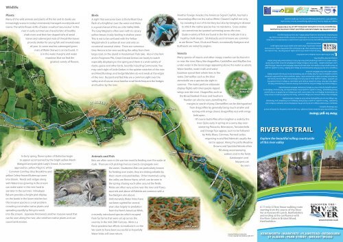
<strong>RI<strong>VER</strong></strong> <strong>VER</strong> <strong>TRAIL</strong><br />
Explore the beautiful rolling countryside<br />
of this river valley<br />
A 17 mile (27km) linear walking route<br />
starting from the source of the River<br />
<strong>Ver</strong> at Kensworth Lynch, Bedfordshire<br />
and ending at the confluence with<br />
the River Colne in Bricket Wood,<br />
Hertfordshire.<br />
Parts of this walk can be muddy or wet underfoot.<br />
How to get there:<br />
www.riverver.co.uk<br />
KENSWORTH • MARKYATE • FLAMSTEAD • REDBOURN<br />
ST ALBANS • PARK STREET • BRICKET WOOD
The River <strong>Ver</strong><br />
The River <strong>Ver</strong> has been flowing through its valley in Hertfordshire for hundreds of thousands of years since the last<br />
Ice Age. The <strong>Ver</strong> <strong>Valley</strong> <strong>Society</strong> (VVS) and Countryside Management Services have devised a series of eight<br />
circular <strong>Ver</strong> <strong>Valley</strong> Walks and a linear River <strong>Ver</strong> Trail to enable the public to<br />
appreciate this fascinating landscape.<br />
In particular, by interpreting the river in its cultural context, it is possible to<br />
understand how the river has changed over time due to human activities.<br />
The River <strong>Ver</strong> is a chalk stream. Chalk streams are globally rare, only<br />
about 200 in the world, and with their pure alkaline waters they support<br />
a very particular mix of flora and fauna. Most of them occur in the<br />
south and east of England and the River <strong>Ver</strong> is one of them. It runs for<br />
17 miles from its sometime source at Kensworth Lynch to Bricket Wood<br />
where it joins the Colne passing through several County Wildlife Sites<br />
Millstones at<br />
and some valuable historical sites notably in St Albans and its surroundings.<br />
Redbournbury Mill<br />
It is joined by two small tributaries, the River Red at Redbourn and the<br />
Hanstead Brook just above the Colne confluence.<br />
Over the centuries man has developed the river and made use of its power, constructing a dozen watermills<br />
and associated mill-channels, which have modified the water course over much of the river’s length.<br />
Many of the mill buildings still exist and some wheels still operate.<br />
Commissioned as part of the Discover<br />
the River <strong>Ver</strong> Project, these benches<br />
interpret the local area on the carved<br />
backrests as well as provide a perfect<br />
resting spot to enjoy the view.<br />
Position of a <strong>Ver</strong> <strong>Valley</strong> Bench.<br />
B<br />
The Upper Reaches<br />
The top of the river above Redbourn up to Kensworth is now<br />
considered to be the winterbourne section, only flowing when<br />
it is being fed from the underlying chalk aquifer in times when<br />
groundwater levels are high, usually at the end of wet winters<br />
when significant recharge has occurred. OS maps put the source at<br />
Kensworth Lynch and others consider it to be Markyate Cell but in<br />
recent years it is usually the outfall from Markyate sewage works, in<br />
Redbourn at the end of summer or even in times of severe drought<br />
south St Albans.<br />
Source of the<br />
River <strong>Ver</strong> at Many springs feed into the <strong>Ver</strong> as it moves down the valley. At Friars<br />
Corner Farm Wash, near junction 9 of the M1, several springs and now dry valleys<br />
meet. This has been found to be a nationally important site of<br />
Roman temples and other finds have indicated it as a site of worship since prehistoric times.<br />
Roman remains have been discovered all down the valley but of course <strong>Ver</strong>ulamium itself<br />
(St Albans) is the most significant historical location.<br />
Trail<br />
www.riverver.co.uk<br />
Influences on the Flow<br />
The chalk aquifer of the <strong>Ver</strong> <strong>Valley</strong> was laid down<br />
over millennia as countless billions of small<br />
prehistoric crustaceans died and sank to the floor<br />
of the prehistoric seas. Chalk is porous and absorbs<br />
rainwater from above, which soaks down through<br />
the rock rising periodically as springs which feed the<br />
river. As it has been filtered through the chalk, the<br />
water is very pure, mineral rich and emerges at a<br />
constant temperature. The flow in the River <strong>Ver</strong> is<br />
dependent on rainfall to recharge this aquifer.<br />
Recharge largely happens in the winter and early spring; any rainfall<br />
during the summer has little effect as surface water evaporates and is<br />
used up by growing vegetation. Although after heavy rains, at any time<br />
of year, the run-off can cause short-term improvement in flow,<br />
it takes many weeks for any effect to be measured in<br />
aquifer levels or to have any long-term<br />
effect on the river.<br />
KEY<br />
Follow these<br />
waymarks<br />
on the<br />
River <strong>Ver</strong> Trail<br />
<strong>RI<strong>VER</strong></strong> <strong>VER</strong> <strong>TRAIL</strong><br />
Route<br />
<strong>Ver</strong>ulamium Park Roman Wall<br />
Nowadays much of the groundwater is pumped<br />
up to supply the needs of the district. Veolia<br />
Water Company is licensed by the Environment<br />
Agency to abstract over 30 million litres<br />
of water per day from the <strong>Ver</strong> aquifer<br />
by pumping water up from deep<br />
underground using several<br />
pumping stations the length of<br />
the valley. Friars Wash Pumping<br />
Redbournbury Mill<br />
Station near Flamstead has<br />
been on stand-by status since<br />
1993 (as a result of pressure by the <strong>Ver</strong> <strong>Valley</strong> <strong>Society</strong>).<br />
However, it is still used everyday to extract one million<br />
litres and was used in the drought summer<br />
of 2006.<br />
Following the Buncefield Oil Depot disaster in December 2005, fears<br />
of pollution from the fire-fighting chemicals, meant that Bow Bridge<br />
Pumping Station was not used for nearly three years. It remained out of<br />
use from 2006 to August 2009 in case the water table was contaminated<br />
and this certainly helped maintain the flow in the <strong>Ver</strong> over those<br />
summers. The aquifer was at or above average for much of 2008 and<br />
into 2009 but fell below average later in 2009 and at the start of 2010.<br />
As a general measure of the aquifer situation the <strong>Ver</strong> <strong>Valley</strong> <strong>Society</strong> uses<br />
groundwater figures measured by Environment Agency at Ballingdon<br />
Farm in the upper part of the valley. These figures and the rainfall figures<br />
from Rothamstead Research Station are published regularly on the <strong>Ver</strong><br />
<strong>Valley</strong> <strong>Society</strong> web site (www.riverver.co.uk).