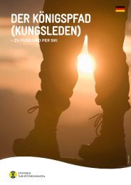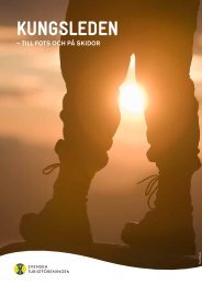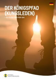
THE KING'S TRAIL (KUNGSLEDEN) - Svenska Turistföreningen
THE KING'S TRAIL (KUNGSLEDEN) - Svenska Turistföreningen
THE KING'S TRAIL (KUNGSLEDEN) - Svenska Turistföreningen

You also want an ePaper? Increase the reach of your titles
YUMPU automatically turns print PDFs into web optimized ePapers that Google loves.
mountain. From here, many mountain<br />
hikers begin their 19 km walk to the<br />
Kebnekaise Mountain Station, which<br />
can be shortened with a boat excursion.<br />
Hikers also find their way up along the<br />
beautifully winding Vista Valley. In the<br />
mountain village, you will find services<br />
such as a restaurant, shop, accommodation,<br />
helicopter station, chapel and<br />
gallery. During the regular season,<br />
there are daily bus connections from<br />
Nikkaluokta to Kiruna. For more<br />
information: www.nikkaluokta.com<br />
SALTOLUOKTA MOUNTAIN STATION<br />
At one end, the outposts of the Sarek<br />
mountains rise in the haze, at the other<br />
end, Langas Lake stretches out. In<br />
between lies Saltoluokta. An oasis of<br />
calm, pleasantness and comfort, where<br />
warmth, an atmosphere and good<br />
food rule. It’s only 3 km to the nearest<br />
road, but rather long to civilisation.<br />
To get here, you have to go by boat or<br />
skis over the lake in the last section.<br />
You will definitely leave your everyday<br />
life behind you.<br />
The World Heritage Site Laponia<br />
with Sarek, Padjelanta and Stora<br />
Sjöfallet National Parks opens up<br />
outside your doors.<br />
Håkan Hjort<br />
A three-course supper with specialities<br />
from Lapland waits for you after your<br />
outing, day tour or hiking week. The<br />
kitchen in ‘Salto’ has made a point<br />
of almost exclusively offering raw<br />
produce from the region. The menu<br />
often has game fish from the lakes,<br />
wild game from the forests and berries<br />
from bogs in the area.<br />
In Saltoluokta, you also get very<br />
close to the Sámi culture. One of the<br />
Sirges Sámi village settlements is right<br />
next to the mountain station, among<br />
others with a beautiful church tent.<br />
After hiking approximately 6 km, you<br />
also arrive at Pietsaure Lake, where<br />
the Kuoljok family welcome you with<br />
their tents. Many guests think that<br />
Saltoluokta realises their dreams of<br />
the mountains.<br />
KVIKKJOKK MOUNTAIN STATION<br />
Kvikkjokk is small mountain village at<br />
the end of the road next to Saggat Lake,<br />
where Kamajåkkå Stream and Tarra<br />
River meet into a large delta. Much of<br />
STF’s oldest history is here, such as<br />
when people thought that Sulitelma<br />
was Sweden’s highest mountain. The<br />
association’s very first trail was cleared<br />
in 1887 on Sjnjierák Peak and Vallespi-<br />
ken Peak and is today an unforgettable<br />
day tour with a view over Sarek.<br />
Kvikkjokk Mountain Station is<br />
privately operated in collaboration with<br />
STF and is very well situated for sum-<br />
mer and winter tours. If you would like<br />
to hike with a light pack and overnight<br />
in the mountain huts, choose the King’s<br />
Trail northward towards Saltoluokta,<br />
Kebnekaise and Abisko. If you want to<br />
carry a tent and provisions, walk south<br />
via Jäkkvik towards Ammarnäs and<br />
Hemavan or westwards into Laponia<br />
and Sarek.<br />
Here, you get the opportunity to<br />
paddle in the Tarra River, an exciting<br />
experience as is looking out for<br />
predatory animals in the Tarra Valley,<br />
one of the mountains richest valleys in<br />
wild game.<br />
It is a few days journey westward<br />
to Padjelanta National Park. At the<br />
mountain station, you can receive a<br />
great amount of expert tips about<br />
hiking trails and much more.<br />
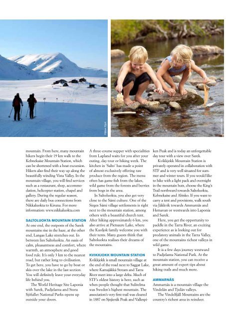
AMMARNÄS<br />
Ammarnäs is a mountain village the<br />
Vindelån and Tjulån valleys.<br />
The Vindelfjäll Mountains are the<br />
country’s richest area in reindeer.<br />
bosselind.com<br />
Ammarnäs is the principal settlement<br />
in the Ran and Gran Sámi villages,<br />
where there is a chapel and Sámi<br />
church town with numerous provision<br />
sheds. The village is also known for<br />
the potato hill, a large moraine hill<br />
where ‘almond potatoes’ have been<br />
farmed for at least 170 years. The<br />
reindeer industry and tourism are the<br />
largest sources of income.<br />
Around Ammarnäs is some of the<br />
Vindelfjäll Mountains best fishing<br />
sites, with char, salmon trout, grayling<br />
and whitefish. Settlers who followed<br />
the trade route towards Norway<br />
previously used the Vindelälv River.<br />
Today, it is an exciting hiking trail that<br />
is slightly off the beaten path from the<br />
more usual stages, offering terrific<br />
experiences.<br />
In waiting for the ice to break up,<br />
huge numbers of birds are gathering<br />
in the Ammarnäs delta, offering easily<br />
accessible bird watching.<br />
The summer attracts many visitors<br />
to the Sámi weekend in June and a<br />
local festival in July.<br />
In Ammarnäs, where the main<br />
road from Sorsele ends, the Vindelfjäll<br />
Mountain Nature Reserve begins.<br />
One of Europe’s largest protected<br />
Makino<br />
nature areas. Naturum in Ammarnäs<br />
has an exhibition about the geology,<br />
flora, fauna, climate and natural<br />
things worth seeing in the Vindelfjäll<br />
Mountains.<br />
HEMAVAN<br />
Hemavan is situated along the valley<br />
of the Ume River, which together with<br />
the Blue Road (E12) winds itself like<br />
a corridor through the Vindelfjäll<br />
Mountain Nature Reserve.<br />
Besides the known winter land scape,<br />
Hemavan offers delightful summer<br />
mountains.<br />
Fishing for mainly char and salmon<br />
trout is naturally big, but even other<br />
activities in and around the water are<br />
increasing. Canoes for nice paddling<br />
tours or a boat for those who simply<br />
want to take easy are here.<br />
In Hemavan, there are also count-<br />
less cycling possibilities. Every thing<br />
from great cycling adventures to quiet<br />
tours presented with a map and tips.<br />
Up in the mountains, you can get<br />
there with the help of the summer<br />
chair lift, where even your bicycle can<br />
follow along.<br />
Aurora Borealis (Northern Lights)<br />
Previously, some thought that Aurora Borealis was<br />
large herring and codfish way out to sea that reflected<br />
in the sky. But it is energy that is converted to<br />
light when the solar wind’s charged particles collide<br />
with atoms and molecules in the earth’s atmosphere.<br />
What should I take?<br />
You need neither extreme nor expensive equipment<br />
to be in the mountains. On our website, you<br />
will find tips about how to dress and what to bring.<br />
Should you be missing anything, most can be<br />
rented at our mountain stations, such as ski<br />
equipment, backpacks, rubber boots, rainwear,<br />
stoves and tents. If you choose to buy provisions in<br />
the mountain huts, your backpack during summer<br />
does not need to weigh more than about 10 kg.<br />
How far should you walk?<br />
This is, of course, entirely dependent on experience<br />
and conditioning, but in particular, how fast you<br />
want to travel. A rule of thumb is about 3 km/hour.<br />
Sweden’s highest mountains<br />
1 Kebnekaise 2104*<br />
2 Sarektjåkkå 2089<br />
3 Kaskasatjåkka 2076<br />
4 Kaskasapakte 2043<br />
5 Akka 2015<br />
6 Pårtetjåkkå 2005<br />
7 Palkattjåkkå 2002<br />
*Measure 2003. The peak is a glacier that varies in<br />
height. The mountain reaches 2,070 m.a.s.l., the<br />
rest is ice.<br />
Trails, bridges, lean-to and boat service<br />
Lapland has over 2,000 km of marked trails. Winter<br />
routes are in terrain marked with red crosses.<br />
Summer routes are clear paths marked with cairns<br />
or colour markings. Rest spots are located here and<br />
there between the mountain huts. STF offers boat<br />
service between Kebnats and Saltoluokta on Langas<br />
Lake, on the lakes Teusajaure and Akkajaure for<br />
tours to Padjelanta. The lakes Alesjaure, Ladjojaure,<br />
Sitojaure, Laitaure, Tjulträsk and Tärnasjön have<br />
private boat service. Rowboats are spreadout at the<br />
lakes Teusajaure, Sitojaure and Laitaure.<br />
How are the mosquitoes?<br />
In wetlands and birch forests, the mosquitoes can<br />
be annoying. Especially in July. Do like the reindeer<br />
and get up to higher ground, where the wind is<br />
cool. But don’t disturb the reindeer. Otherwise,<br />
we can thank the mosquito because there are so<br />
many birds, fish and other animals in the mountains.<br />
How is the weather?<br />
There is a lot to the Swedish saying “There is no<br />
bad weather, just bad clothing.” Rapid changes in<br />
weather and big differences in temperature are<br />
relatively normal in the mountains. It can be<br />
thawing in February and it can snow in June. For<br />
the most part, the weather is rather stable during<br />
those periods when we are open, but always keep<br />
an eye on the weather and equip yourself with<br />
warm clothing in your backpack during the<br />
summer. Read more at www.smhi.se<br />
Snowmobile traffic<br />
Large sections of the King’s Trail are within areas<br />
that ban snowmobile traffic. Moreover, additional<br />
areas can also be included, on certain occasions.<br />
To find out what applies, go to website for the<br />
respective county.<br />
Norrbotten: www.bd.lst.se/terrangkorning<br />
Västerbotten:<br />
www.ac.lst.se/naturochmiljo/terrangkorning