THE KING'S TRAIL (KUNGSLEDEN) - Svenska Turistföreningen
THE KING'S TRAIL (KUNGSLEDEN) - Svenska Turistföreningen
THE KING'S TRAIL (KUNGSLEDEN) - Svenska Turistföreningen

You also want an ePaper? Increase the reach of your titles
YUMPU automatically turns print PDFs into web optimized ePapers that Google loves.
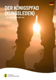
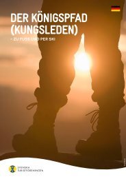
<strong>THE</strong> KING’S <strong>TRAIL</strong><br />
(<strong>KUNGSLEDEN</strong>)<br />
– BY FOOT AND ON SKIS<br />
Peter Rosén
Håkan Hjort<br />
Håkan Hjort<br />
Håkan Hjort<br />
Håkan Hjort<br />
bosselind.com<br />
Håkan Hjort www.matsalmlof.se<br />
Håkan Hjort<br />
The eight faces of paradise<br />
It’s been occasionally referred to as<br />
Europe’s last wilderness, the mountain<br />
range stretching from Lapland down<br />
to Dalarna. If anything deserves to be<br />
called Sweden’s own paradise, it is this<br />
majestic mountain world. New views<br />
and natural experiences are constantly<br />
emerging here. Large areas are protected<br />
and have been designated as nature<br />
reserves, national parks, and even world<br />
heritage sites.<br />
Life in Lapland has many faces.<br />
The Sámi people, who have lived and<br />
worked here for thousands of years,<br />
estimate that there are eight seasons<br />
up here.<br />
Lapland – another country within<br />
Sweden’s borders<br />
Sweden has 11 peaks over 2,000 metres.<br />
And you will find all in Lapland.<br />
There is even a series of the country’s<br />
most spectacular valleys here. Together,<br />
they form an exceptional, varying<br />
nature with everything from lush<br />
mountain forests down in the valleys<br />
to almost barren environments and<br />
glaciers up on the bare mountain<br />
region. In the summer, the mountain<br />
valleys can be pure jungles in spots,<br />
with both alpine blue sow-thistle and<br />
angelica as tall as a person. Trailing<br />
azalea, alpine gentian, moss campion<br />
and mountain avens are happy on the<br />
mountain moors. Higher up on the<br />
bare mountain region, you can be<br />
lucky to see the glacier crowfoot, the<br />
number one survivor of Swedish flora.<br />
The UN organization, UNESCO,<br />
has elevated part of Lapland to the<br />
status of World Heritage Site under<br />
the name Laponia, where the national<br />
parks Stora Sjöfallet, Padjelanta, Sarek<br />
Thanks to STF and the King’s Trail<br />
(Kungsleden) the innermost part of<br />
Lapland has been available to everyone<br />
for over one hundred years.<br />
To make it easier, we have chosen two<br />
periods for you, when summer and<br />
winter along the King’s Trail are the<br />
absolute best: from June to September<br />
and from February to April.<br />
During the summer season, the<br />
mountain nature of colours, scents,<br />
sounds and movement vibrate. It is<br />
essentially daylight all day and north<br />
of the Arctic Circle, the midnight sun<br />
shines brightly for several months. In<br />
September, the autumn colours are a<br />
and Muddus, the nature reserves Sjauna<br />
and Stubba, parts of Kvikkjokk-Kabla,<br />
and Sulitelma and the Rapadalen<br />
Valley delta are included.<br />
<strong>THE</strong> BIG FOUR<br />
Just like the paradise described in<br />
poetry, Lapland is a sanctuary for wild-<br />
life. For those who know what to look<br />
for, you can find tracks from the big<br />
four of Swedish fauna – lynx, wolverine,<br />
bear and possibly wolf. Perhaps<br />
even see one of them up close.<br />
Up here, you also have the chance<br />
to view golden eagle, gyrfalcon,<br />
peregrine falcon, long-tailed skua,<br />
ptarmigan, eurasian golden plover,<br />
bluethroat, snow bunting and many<br />
other birds. Approximately half of<br />
the country’s 400 bird species have<br />
been sighted in Lapland.<br />
Another common sight is the king<br />
of Swedish nature, elk, not the least in<br />
the Tarradalen and Rapadalen Valleys.<br />
blaze. You can travel by foot on well-<br />
worn trails, sometimes with a break<br />
for a boat ride over a mountain lake.<br />
Skis apply if you choose the winter<br />
season. In February and most of March,<br />
the snow temperatures are cold for ski<br />
waxing and the days quickly become<br />
longer and brighter. Late winter –<br />
early spring brings crusty snow and<br />
long, sunny days.<br />
Let us at STF take you to this<br />
paradise. By foot or on skis. We<br />
promise that you’ll take part in many<br />
exciting and inspirational encounters.<br />
Regardless of which season you choose.<br />
Of course, wildlife takes it easy during<br />
the winter, but some species change<br />
over to their white winter colours and<br />
work as usual. Arctic fox, hare and<br />
ptarmigan are some examples. It is not<br />
uncommon for skiers to see wolverine<br />
and lynx tracks.<br />
GET TO KNOW SÁMI LIFE<br />
Reindeer breeding and the Sámi culture<br />
are very much alive along the King’s<br />
Trail. During the summer in particular,<br />
you can meet the Sámi people<br />
and their reindeer in the mountains.<br />
Avoid disturbing grazing reindeer and<br />
please keep dogs leashed. If you<br />
would like to know more about Sámi<br />
history, language, culture and today’s<br />
reindeer breeding, we recommend<br />
that you visit the Swedish mountain<br />
and Sámi museum Ajtte in Jokkmokk.<br />
You can also visit www.samer.se
Doug McKinley<br />
Suggested tours<br />
ABISKO TO NIKKALUOKTA<br />
The train stops right in front of Abisko<br />
Mountain Station and the northern<br />
starting point for the King’s Trail. On<br />
the way to the hut at Abiskojaure Lake<br />
the journey initially goes through a<br />
birch forest in Abisko National Park<br />
that is abundant in game.<br />
Lapporten, one the mountain<br />
world’s most famous silhouettes,<br />
watches over you during your hike.<br />
During certain times of the summer<br />
you can take a boat across the Alesjaure<br />
Lake. From the Alesjaure hut, continue<br />
on the King’s Trail or choose a very<br />
picturesque alternative via the mountain<br />
huts in Vistas and Nallo. Here,<br />
the mountains rise sharply up from<br />
the valley and the tour interchanges<br />
between mountain birch forest and<br />
bare mountain region. The terrain<br />
becomes more barren if you hike the<br />
King’s Trail towards the huts at Tjäktja.<br />
When you reach the Tjäkta Pass,<br />
the highest point along the King’s Trail,<br />
one of the mountain world’s greatest<br />
experiences awaits. Forty kilometres of<br />
magnificent views over the Tjäktavagge<br />
Valley. By all means, stay an extra day<br />
in the Sälka huts and do a day tour in<br />
this unforgettably beautiful surrounding.<br />
The hut custodians along the<br />
King’s Trail will gladly inform you of<br />
their best spots. When you reach the<br />
huts at Singi, continue southwards to<br />
Vakkotavare or turn off towards the<br />
Kebnekaise Mountain Station to then<br />
go to Kiruna via the bus in Nikkaluokta.<br />
Of course, you can choose the<br />
opposite direction and walk from<br />
Nikkaluokta to Abisko.<br />
Facts Abisko – Nikkaluokta<br />
Mountain map BD6<br />
Length 86 km (+19 km till Nikkaluokta)<br />
Days 5–7<br />
Number of huts 5 on the King’s Trail (Kungsleden)<br />
and 7 adjacent<br />
Provisions Abisko, Abiskojaure, Alesjaure,<br />
Kebnekaise, Sälka, Vistas, Unna Allakas<br />
Sauna Abisko, Alesjaure, Kebnekaise, Sälka<br />
NIKKALUOKTA TO SALTOLUOKTA<br />
VIA KEBNEKAISE<br />
This tour begins in Nikkaluokta,<br />
where you can easily get to by bus<br />
after a train or flight to Kiruna. Then,<br />
it’s 19 km up to Kebnekaise Mountain<br />
Station, by foot or on skis. In the<br />
ABISKO TURISTSTATION<br />
Alesjaure<br />
Abiskojaure<br />
Tjäktja<br />
Sälka<br />
KIRUNA<br />
Singi<br />
Nikkaluokta<br />
KEBNEKAISE<br />
Kaitumjaure<br />
FJÄLLSTATION<br />
Teusajaure<br />
Vakkotavare<br />
SALTOLUOKTA<br />
FJÄLLSTATION GÄLLIVARE<br />
Sitojaure<br />
Aktse<br />
Pårte<br />
KVIKKJOKK<br />
FJÄLLSTATION<br />
Tärnasjö<br />
Viterskalet<br />
Serve AMMARNÄS/WÄRDSHUSET<br />
Syter Aigert<br />
HEMAVAN<br />
SORSELE<br />
TÄRNABY/ÅKERLUNDSKA GÅRDEN<br />
20 km<br />
Håkan Hjort<br />
JOKKMOKK<br />
summer, shorten the trip 5 km by<br />
taking the boat over Ladjojaure Lake.<br />
After some good food and a nice<br />
sauna, it’s time to continue in between<br />
the mountains to Singi. There, you<br />
enter into the King’s Trail – with<br />
Abisko to the north or Saltoluokta to<br />
the south. The latter will initially take<br />
you through the beautiful Tjäktjavagge<br />
Valley. The lakes Kaitumjaure<br />
and Teusajaure have nice huts with<br />
good fishing.<br />
As you approach the Vakkotavare<br />
mountain hut, magnificent views south<br />
into Sarek open up. You can relax the<br />
STF Abisko Mountain Station<br />
Address 981 07 Abisko, Sweden.<br />
E-mail abisko@stfturist.se<br />
Website<br />
www.svenskaturistforeningen.se/abisko<br />
Phone +46 (0) 980 402 00.<br />
Fax +46 (0) 980 401 40.<br />
Season MidFebruary to the beginning of May,<br />
midJune to the end of September, and<br />
Christmas and New Year’s celebrations.<br />
Accommodation There are 300 beds, from<br />
which you can choose between different forms<br />
of accommodation. Single and double rooms<br />
with shower and WC. 2 and 4bed rooms with<br />
shower and WC in the corridor. Cottage apart <br />
ments for 2–6 people with shower and WC.<br />
Food KRAV ecolabeled breakfast, lunch and<br />
the evening’s supper with the appropriate wine<br />
package added on. Après Ski in Storstugan<br />
during the winter or a beer in the light of the<br />
midnight sun during the summer.<br />
Service Trip leader, shop, mountain equipment<br />
rental, sauna and selfcatering.<br />
Activities The summertime offers guided tours<br />
to our favourite locations, courses in, among<br />
others, digital photography, watercolour<br />
painting, and mountain birds. Midnight sun<br />
tours with the chairlift on Nuolja. The winter<br />
offers weeklong courses in telemark skiing<br />
and avalanche training, ice climbing, snowmobile<br />
tours, day tours and offpiste skiing<br />
on Nuolja, touring and crosscountry skiing.<br />
Abisko is possibly the world’s best place to<br />
see Aurora Borealis (Northern Lights).<br />
Experience Abisko National Park with us!<br />
Getting there Daily train connections from<br />
Stockholm, Göteborg and Kiruna to our own<br />
train station Abisko Turist. Fly to Kiruna and<br />
then take a bus to Abisko (always verify the<br />
bus times when you book you flight). Road is<br />
the European Route E10.<br />
STF Kebnekaise Mountain Station<br />
Address 981 99 Kiruna, Sweden.<br />
E-mail kebnekaise@stfturist.se<br />
Website<br />
www.svenskaturistforeningen.se/kebnekaise<br />
Phone +46 (0) 980 550 00.<br />
Fax +46 (0) 980 550 48.<br />
Season MidFebruary to the beginning of May,<br />
midJune to midSeptember.<br />
Accommodation 2 or 4bed rooms or an alcove<br />
in the room with extra beds. Shower and WC in<br />
the corridor. Single rooms available. 196 beds.<br />
Food The restaurant Giebme serves breakfast,<br />
lunch, supper and à la carte with Lapland specialties,<br />
Swedish home fare, and newly baked<br />
bread from our own bakery. Fully licensed.<br />
Service Shop, bakery, rental of certain mountain<br />
equipment, trip leader, sauna and selfcatering.<br />
Activities The summertime offers high alpine<br />
courses, climbing instruction, guided tours to<br />
Sweden’s highest peak, glacier walking, floral<br />
tours, and theme weeks. Other things worth<br />
seeing are the giant caves in Ladtjojåkka, the<br />
Silver Falls in the Singi Valley, Kitteldalen Valley<br />
and Tarfala. The wintertime offers courses in<br />
high alpine ski touring, ice climbing, and guided<br />
ski tours in the valley or at altitude. For good<br />
offpiste skiers, many metres of vertical drop<br />
await in Jökelbäcken, on the Storglaciären or<br />
Hydrologrännan. Ski tourers will find trails in<br />
the Tarfala Valley or towards the Singi huts.<br />
Getting there Train/fly to Kiruna. Bus to<br />
Nikkaluokta, then hike/ski 19 km. Possible<br />
boat transport 5 km in the summer or snowmobile/tracked<br />
vehicle in the winter.
legs a little on the bus between huts<br />
in Vakkotavare and Kebnatsbryggan.<br />
Boat or skis over Langas Lake to the<br />
Saltoluokta Mountain Station are all<br />
that remain, where a reward in the form<br />
of a well-earned sauna and exquisite<br />
food await.<br />
Many believe that the route between<br />
Nikkaluokta and Saltoluokta is the<br />
most beautiful of the entire King’s Trail.<br />
You move over vast mountain moors<br />
and down into deep long valleys. The<br />
stages are short and the hut locations<br />
stunningly located.<br />
Facts Kebnekaise – Saltoluokta<br />
Mountain map BD8<br />
Length 52 km (then bus from Vakkotavare<br />
to Kebnatsbryggan/Saltoluokta)<br />
Days 5–7<br />
Number of huts 4<br />
Provisions Kaitumjaure, Kebnekaise,<br />
Saltoluokta, Vakkotavare<br />
Sauna Kebnekaise, Saltoluokta, Teusajaure<br />
KVIKKJOKK TO SALTOLUOKTA<br />
This stage can begin with an over-<br />
night at Kvikkjokk Mountain Station,<br />
followed by walk into an ancient<br />
mountain forest the next morning.<br />
Be on the lookout for the male caper -<br />
caillie! Pårte hut offers access to good<br />
fishing in both streams and lakes. The<br />
journey continues on a traverse along<br />
Rittakdalen Valley. Take a breather a<br />
little higher up on the bare mountain<br />
region and aim your binoculars down<br />
towards the edge of the forest, where<br />
elk and other game can appear out of<br />
nowhere. As you approach Laitaure<br />
Lake, the mountains of Sarek rise in<br />
all their splendour to the west.<br />
The Aktse homestead and STF’s moun-<br />
tain hut are located on the other beach,<br />
known as the centre for trips into Sarek.<br />
Here, meadows still battle scythe. Stay<br />
an extra day and climb Skierfe, the<br />
mountain with its magnificent view over<br />
the delta of the Rapadalen Valley. Far<br />
into Sarek, you can get a feeling for the<br />
place with the breathtaking name<br />
Rovdjurstorget (Predator Square).<br />
From Aktse, take yourself steeply up<br />
onto the bare mountain region and get a<br />
terrific, endless view of the country in all<br />
directions. After a boat tour, you reach<br />
STF’s mountain hut on the northern<br />
beach of Sitojaure Lake. Continue over<br />
the Ultevis moor, where you have the<br />
canine tooth-like mountain Kierkaus<br />
and the sugar-like peak Sluggas in<br />
your sights. Your dream goal gradually<br />
appears – Saltoluokta Mountain Station,<br />
with sauna and very good food.<br />
Facts Kvikkjokk – Saltoluokta<br />
Mountain map BD10<br />
Length 73 km<br />
Days 5–7<br />
Number of huts 3<br />
Provisions Aktse, Kvikkjokk, Saltoluokta<br />
Sauna Kvikkjokk, Saltoluokta<br />
Håkan Hjort<br />
KVIKKJOKK TO AMMARNÄS<br />
This stage is designed for you who want<br />
a true wilderness experience with<br />
grandiose views, exciting places and a<br />
handful of other hikers. With the lack<br />
of an extensive mountain hut system<br />
along the way, you need to take your<br />
own tent. Still, there are simple over-<br />
night huts and other accommodation<br />
alternatives not operated by STF.<br />
The first stage to Jäkkvik is ca. 74 km<br />
STF Saltoluokta Mountain Station<br />
Address 982 99 Gällivare, Sweden.<br />
E-mail saltoluokta@stfturist.se<br />
Website<br />
www.svenskaturistforeningen.se/saltoluokta<br />
Phone +46 (0) 973 410 10.<br />
Fax +46 (0) 973 410 13.<br />
Season March–April, midJune to<br />
midSeptember.<br />
Accommodation Main building and four guest <br />
houses with a total of 100 beds. Double rooms,<br />
4bed rooms and rooms with extra beds.<br />
Some double rooms with shower/WC.<br />
Other rooms have shower and WC in the<br />
corridor/service house.<br />
Food The mountain world’s coziest restaurant<br />
serves breakfast, lunch and supper. Here, you<br />
can eat game fish from Langas Lake, wild<br />
game from the mountains and berries from<br />
Lapland’s pantry. Fully licensed.<br />
Service Shop, mountain equipment rental, trip<br />
leaders, sauna and selfservice accommodation.<br />
Activities Guided wilderness tours, midnight sun<br />
and boat tours along the long valley of the Lule<br />
River, fishing, familyfriendly with several theme<br />
weeks, and ecotourism certified theme weeks,<br />
food and folk music weeks.<br />
Getting there Train/fly to Gällivare. Buses<br />
depart daily Gällivare–Kebnats. Ski the last<br />
3 km on the ice trail or take a 10 min boat trip<br />
during the summer.<br />
STF Kvikkjokk Mountain Station<br />
Address 962 02 Kvikkjokk, Sweden.<br />
E-mail kvikkjokk@stfturist.se<br />
Phone +46 (0) 971 210 22.<br />
Season February–April, midJune to<br />
midOctober.<br />
Accommodation 2 and 4bed rooms, all with<br />
wash basin. Shower, WC, drying room in the<br />
corridor. 60 beds.<br />
Food Breakfast, restaurant and selfservice<br />
accommodation.<br />
Service Small shop and selfservice<br />
accommodation.<br />
long. Stage two from Jäkkvik to<br />
Ammarnäs is ca. 83 km and passes<br />
Pieljekaise National Park.<br />
You can take the bus from<br />
Skellefteå to get to Jäkkvik. For<br />
other information, contact the<br />
Tourist Bureau in Arjeplog by telephone<br />
+46 (0) 961 145 20 or their<br />
website www.arjeplog.se<br />
Facts Kvikkjokk – Ammarnäs<br />
Mountain map BD14, BD16<br />
Length 157 km<br />
Days 7–10<br />
Number of huts 0<br />
Provisions Kvikkjokk, Jäkkvik, Adolfström<br />
and Ammarnäs<br />
Sauna Kvikkjokk, Ammarnäs<br />
AMMARNÄS TO HEMAVAN<br />
For some, their mountain tour begins<br />
in Ammarnäs and ends in Hemavan,<br />
Håkan Hjort<br />
Activities Excellent base and starting point for<br />
shorter and longer tours on your own along the<br />
King’s Trail, Padjelanta Trail, Nordkalott Trail<br />
and into Sarek. Celebrate a mountain wedding.<br />
Getting there Train to Murjek or fly to Gällivare.<br />
Bus via Jokkmokk to Kvikkjokk.<br />
STF Hostel Ammarnäs<br />
Address Box 9, 920 75 Ammarnäs, Sweden.<br />
E-mail ammarnas.fiskecentrum@telia.com<br />
Phone +46 (0) 952 600 45.<br />
Fax +46 (0) 952 602 51.<br />
Season Yearround.<br />
Room types 48 beds. 2–4bed rooms.<br />
Service Breakfast, restaurant and selfcatering.<br />
Getting there Train to Vännäs or flight to<br />
Sorsele or Arvidsjaur and then bus.<br />
STF Hostel Hemavan<br />
Address Renstigen 1, 920 66 Hemavan,<br />
Sweden.<br />
E-mail info@hemavansfjallcenter.se<br />
Phone +46 (0) 954 300 02.<br />
Fax +46 (0) 954 305 10.<br />
Season Yearround.<br />
Room types 48 beds. 2–4bed rooms.<br />
Service Restaurant and selfservice<br />
accommodation.<br />
Getting there Train/fly to Umeå, bus to<br />
Hemavan. Fly/bus directly to Hemavan. Road.<br />
STF Hostel Tärnaby/Åkerlundska gården<br />
Address Östra strandvägen 16, 920 64<br />
Tärnaby, Sweden.<br />
E-mail reception@tarnabyfjallhotell.com<br />
Phone +46 (0) 954 104 20.<br />
Fax +46 (0) 954 106 27.<br />
Season MidJune to midSeptember.<br />
Room types 31 beds. 2–4bed rooms.<br />
Service Breakfast and coffee.<br />
Getting there Train/fly to Umeå, bus to<br />
Tärnaby. Fly/bus directly to Hemavan. Road.
Erik Hjortsberg<br />
Starting and<br />
ending points<br />
but it works just as well in the opposite<br />
direction, or do a shorter tour from<br />
both ends.<br />
The way from Ammarnäs to Aigert<br />
hut begins with a climb through the<br />
birch forest. At the small fish-rich lake<br />
on the bare mountain region lies a hut,<br />
where you can relax by a wood heated<br />
sauna. You will experience fantastic<br />
views from Aigert to the Serve hut. Do<br />
a detour to Stor Aigert – 1,100 metres<br />
above sea level – with a breathtaking<br />
view. In the birch forest down by Serve<br />
hut, see a majestic waterfall near the<br />
bridge over the Vouomentjukke Stream.<br />
An alternative from Ammarnäs<br />
begins with a boat ride on the marsh<br />
Tjulträsket, shortening the trip to Serve<br />
hut. The bare mountain region section<br />
towards Tärnasjö Lake hut ends with<br />
a park-like birch forest, a magnificent<br />
view over Tärnasjö Lake and the<br />
impressive norra Storfjället. Enjoy a<br />
moment in the wood heated sauna<br />
and take a dip directly from the beach<br />
into the crystal clear water.<br />
From Tärnasjö Lake hut, the trail<br />
goes through birch forest between<br />
scented bogs towards Tärnasjö<br />
Lake’s archipelago with seven bridges<br />
– Vindelfjällens own Golden Gate.<br />
You can also choose a boat ride over<br />
Tärnasjö Lake to shorten the trip to<br />
Syter hut.<br />
From Syter hut, you can climb<br />
Syter Peak, which with its 1,768 metres<br />
above sea level is the highest peak in<br />
the county. A marked trail shows the<br />
way down to Viterskal hut. It is most<br />
common to follow the King’s Trail<br />
through the u-shaped Syterskal to<br />
Viterskal hut. Many consider the valley<br />
as the area’s major asset. From Vitskal<br />
hut down to Hemavan, the view seems<br />
endless over Artfjället Mountains and<br />
Okstindarnas glaciers in Norway.<br />
Facts Ammarnäs – Hemavan<br />
Mountain map AC2<br />
Length 78 km<br />
Days 5–7<br />
Number of huts 5<br />
Provisions All huts. Aigert, Serve,<br />
Tärnasjö, Syter, Viterskalet, Ammarnäs<br />
and Hemavan<br />
Sauna Aigert, Ammarnäs, Hemavan, Tärnasjö<br />
ABISKO MOUNTAIN STATION<br />
Abisko Mountain Station is located as<br />
far north as you can go in Sweden. The<br />
northernmost of our mountain stations<br />
has its own train station. Abisko is well<br />
worth it, not the least when it concerns<br />
the magnificent nature.<br />
STFs Bildarkiv<br />
Regardless of the season, you would be<br />
wise to take the chair lift up Mount<br />
Nuolja. Cloud-free summer nights offer<br />
you front row seats to the midnight sun.<br />
The sun shines over white precipices<br />
on cloud-free winter days and Aurora<br />
Borealis (Northern Lights) flashes<br />
during clear winter nights. All of this<br />
happens often, because Abisko is one<br />
of Sweden’s most sun-guaranteed and<br />
cloud-free places.<br />
At 70 km long and stretching out<br />
in the north, Lake Torneträsk is blue<br />
in the summer and white in the winter.<br />
The majestic mountain Lapporten<br />
dreams to the southeast.<br />
The Abisko area has such a unique<br />
flora, fauna and geology that it has been<br />
protected as a national park since 1909.<br />
The wild canyon of the Abiskojokk<br />
River is something that never ceases to<br />
attract onlookers. Otherwise, a pleasant<br />
calm prevails here, only to be broken by<br />
a train loaded with iron ore to Narvik<br />
or snowboarders to Nuolja.<br />
At the Abisko Mountain Station,<br />
you can start or end your tour on the<br />
King’s Trail. Or stay and spoil yourself.<br />
Take wonderful day tours by foot<br />
or on skis, a soothing sauna with a dip<br />
in Lake Torneträsk, followed by a deli-<br />
cious supper in the beautiful dining<br />
room.<br />
A popular day tour is to also take<br />
the train to Narvik in Norway and<br />
breathe in a little Atlantic Ocean air.<br />
KEBNEKAISE MOUNTAIN STATION<br />
The honourable title of Sweden’s<br />
highest mountain will be forever<br />
consecrated to Kebnekaise. For the<br />
moment, the South Peak is highest,<br />
but the peak is covered by a glacier,<br />
meaning the its height varies. Rabots<br />
and Björlings glaciers are reminiscent<br />
of the Frenchman who climbed the<br />
mountain first and the Swede who<br />
thought he was first.<br />
For 100 years, the Kebnekaise<br />
Mountain Station has been the<br />
country’s alpine centre. Knowledge<br />
and tradition are deeply rooted in<br />
both the walls and personnel. Do day<br />
tours to Tarfala’s glaciers, the moon<br />
landscape of the Kitteldalen valley or<br />
Tuolpagorni’s volcano shaped peak.<br />
Climb Kebnekaise’s long route on<br />
your own or the harder route with a<br />
professional guide. With hiking boots<br />
in the summer and perhaps on skis<br />
with climbing skins for unbeatable ski<br />
touring during the winter. Why not<br />
take a course in climbing, glacier<br />
walking or ridge traversing? At the<br />
Kebnekaise Mountain Station, you<br />
decide which adventure you want to<br />
experience. In both summer and<br />
winter, the distances between mountain<br />
nature and a comfortable bed<br />
are short, making it the perfect end<br />
to your journey on the King’s Trail,<br />
or start from Abisko or Saltoluokta<br />
to Nikkaluokta.<br />
NIKKALUOKTA<br />
Nikkaluokta is a small mountain<br />
village located at the end of the road,<br />
ca. 70 km from Kiruna. Sámi settlements<br />
in the area have existed for<br />
several thousands of years. But the<br />
first permanent settlements in Nikkaluokta<br />
were established at the beginning<br />
of the 20th century. One of the<br />
settlers was Nils Olsson Sarri with his<br />
wife Maria. Of their 14 children, many<br />
came to work within the village’s<br />
dominating tourism industry. Today,<br />
third and fourth generation Sarri have<br />
followed in their footsteps.<br />
The mountain village is beautifully<br />
located. Three valleys intersect here,<br />
of which one stretches out towards<br />
Kebnekaise – Sweden’s highest<br />
Seasons on the King’s Trail<br />
Winter: end of February until April.<br />
Summer: Midsummer to midSeptember.<br />
See STF’s website for exact opening periods.<br />
The King’s Trail<br />
STF’s pioneers began planning the trail already<br />
in the 1890s to make the mountain world of<br />
Lapland more accessible for tourists. A series of<br />
mountain huts were built at a day hikedistance<br />
from each other, connected by a marked trail.<br />
In 1926, the trail between AbiskoKvikkjokk<br />
was ready.<br />
Length 425 km from Abisko to<br />
Hemavan.<br />
Accommodation 16 places with STF mountain<br />
huts, 4 mountain stations and<br />
2 hostels close to the<br />
mountains.<br />
Highest point Tjäktja pass 1,150 m.a.s.l.<br />
Lowest point Kvikkjokk 302 m.a.s.l.<br />
Week stages 5 of which 4 with STF<br />
mountain huts.<br />
Staying in a mountain hut<br />
Our mountain huts are located in naturally<br />
beautiful locations along the King’s Trail, a day’s<br />
hike from each other (10 to 20 km). The huts<br />
have selfservice accommodation with simple<br />
and cosy standards. You cook your own food,<br />
get water, clean and chop wood. The kitchens<br />
have LPG (liquid petroleum gas) stoves, cooking<br />
utensils, plates, mugs and cutlery. There is no<br />
electricity, and the huts are heated with wood or<br />
LPG. Of the 16 huts, 11 have shops with<br />
provisions. Hut custodians are onsite all season.<br />
Season MidFebruary to the beginning of May,<br />
Midsummer to midSeptember.<br />
Accommodation Rooms with extra beds (often<br />
4 beds) with wide beds, mattresses, pillows, and<br />
covers. You bring your own sheets/pillow cases.<br />
No prebooking is done, but you are always<br />
welcome to stay. If it’s full, we can arrange a<br />
mattress on the floor.<br />
Fee Cash on site with all types of currency or<br />
with the most common payment and credit cards.<br />
National parks<br />
National parks are as fine a nature area can be.<br />
Sweden has 28 national parks, but plans are<br />
underway to create more. Of these, eight are in<br />
Lapland and cover a surface area of almost<br />
6,000 square kilometres! The most known parks,<br />
Sarek, Padjelanta and Stora Sjöfallet, together<br />
with Muddus National Park and several nature<br />
reserves form what is called Laponia. You can<br />
experience this unique nature on the King’s Trail<br />
and Padjelanta Trail. The trails cross most of the<br />
national parks and there are overnight huts in<br />
many places, with Sarek being exception, where<br />
neither trails nor overnight huts are found.<br />
Sámi words<br />
Terrain words can be spelled in many ways<br />
depending on the dialect.<br />
bákti, pakte steep cliff<br />
cohkka, tjåkkå peak<br />
eatnu, ätno river, stream<br />
gálsi, kaise steep high mountain<br />
jávri, jaure lake<br />
johka, jåkkå stream, creek<br />
luokta bay<br />
vággi, vagge valley, ushaped valley<br />
Midnight sun<br />
Nuolja, Abisko 27/5–18/7<br />
Kebnekaise’s pea 29/5–15/7<br />
Lulep Kierkau, Saltoluokta 2/6–12/7<br />
Vallespiken, Kvikkjokk 4/6–9/7
mountain. From here, many mountain<br />
hikers begin their 19 km walk to the<br />
Kebnekaise Mountain Station, which<br />
can be shortened with a boat excursion.<br />
Hikers also find their way up along the<br />
beautifully winding Vista Valley. In the<br />
mountain village, you will find services<br />
such as a restaurant, shop, accommodation,<br />
helicopter station, chapel and<br />
gallery. During the regular season,<br />
there are daily bus connections from<br />
Nikkaluokta to Kiruna. For more<br />
information: www.nikkaluokta.com<br />
SALTOLUOKTA MOUNTAIN STATION<br />
At one end, the outposts of the Sarek<br />
mountains rise in the haze, at the other<br />
end, Langas Lake stretches out. In<br />
between lies Saltoluokta. An oasis of<br />
calm, pleasantness and comfort, where<br />
warmth, an atmosphere and good<br />
food rule. It’s only 3 km to the nearest<br />
road, but rather long to civilisation.<br />
To get here, you have to go by boat or<br />
skis over the lake in the last section.<br />
You will definitely leave your everyday<br />
life behind you.<br />
The World Heritage Site Laponia<br />
with Sarek, Padjelanta and Stora<br />
Sjöfallet National Parks opens up<br />
outside your doors.<br />
Håkan Hjort<br />
A three-course supper with specialities<br />
from Lapland waits for you after your<br />
outing, day tour or hiking week. The<br />
kitchen in ‘Salto’ has made a point<br />
of almost exclusively offering raw<br />
produce from the region. The menu<br />
often has game fish from the lakes,<br />
wild game from the forests and berries<br />
from bogs in the area.<br />
In Saltoluokta, you also get very<br />
close to the Sámi culture. One of the<br />
Sirges Sámi village settlements is right<br />
next to the mountain station, among<br />
others with a beautiful church tent.<br />
After hiking approximately 6 km, you<br />
also arrive at Pietsaure Lake, where<br />
the Kuoljok family welcome you with<br />
their tents. Many guests think that<br />
Saltoluokta realises their dreams of<br />
the mountains.<br />
KVIKKJOKK MOUNTAIN STATION<br />
Kvikkjokk is small mountain village at<br />
the end of the road next to Saggat Lake,<br />
where Kamajåkkå Stream and Tarra<br />
River meet into a large delta. Much of<br />
STF’s oldest history is here, such as<br />
when people thought that Sulitelma<br />
was Sweden’s highest mountain. The<br />
association’s very first trail was cleared<br />
in 1887 on Sjnjierák Peak and Vallespi-<br />
ken Peak and is today an unforgettable<br />
day tour with a view over Sarek.<br />
Kvikkjokk Mountain Station is<br />
privately operated in collaboration with<br />
STF and is very well situated for sum-<br />
mer and winter tours. If you would like<br />
to hike with a light pack and overnight<br />
in the mountain huts, choose the King’s<br />
Trail northward towards Saltoluokta,<br />
Kebnekaise and Abisko. If you want to<br />
carry a tent and provisions, walk south<br />
via Jäkkvik towards Ammarnäs and<br />
Hemavan or westwards into Laponia<br />
and Sarek.<br />
Here, you get the opportunity to<br />
paddle in the Tarra River, an exciting<br />
experience as is looking out for<br />
predatory animals in the Tarra Valley,<br />
one of the mountains richest valleys in<br />
wild game.<br />
It is a few days journey westward<br />
to Padjelanta National Park. At the<br />
mountain station, you can receive a<br />
great amount of expert tips about<br />
hiking trails and much more.<br />
AMMARNÄS<br />
Ammarnäs is a mountain village the<br />
Vindelån and Tjulån valleys.<br />
The Vindelfjäll Mountains are the<br />
country’s richest area in reindeer.<br />
bosselind.com<br />
Ammarnäs is the principal settlement<br />
in the Ran and Gran Sámi villages,<br />
where there is a chapel and Sámi<br />
church town with numerous provision<br />
sheds. The village is also known for<br />
the potato hill, a large moraine hill<br />
where ‘almond potatoes’ have been<br />
farmed for at least 170 years. The<br />
reindeer industry and tourism are the<br />
largest sources of income.<br />
Around Ammarnäs is some of the<br />
Vindelfjäll Mountains best fishing<br />
sites, with char, salmon trout, grayling<br />
and whitefish. Settlers who followed<br />
the trade route towards Norway<br />
previously used the Vindelälv River.<br />
Today, it is an exciting hiking trail that<br />
is slightly off the beaten path from the<br />
more usual stages, offering terrific<br />
experiences.<br />
In waiting for the ice to break up,<br />
huge numbers of birds are gathering<br />
in the Ammarnäs delta, offering easily<br />
accessible bird watching.<br />
The summer attracts many visitors<br />
to the Sámi weekend in June and a<br />
local festival in July.<br />
In Ammarnäs, where the main<br />
road from Sorsele ends, the Vindelfjäll<br />
Mountain Nature Reserve begins.<br />
One of Europe’s largest protected<br />
Makino<br />
nature areas. Naturum in Ammarnäs<br />
has an exhibition about the geology,<br />
flora, fauna, climate and natural<br />
things worth seeing in the Vindelfjäll<br />
Mountains.<br />
HEMAVAN<br />
Hemavan is situated along the valley<br />
of the Ume River, which together with<br />
the Blue Road (E12) winds itself like<br />
a corridor through the Vindelfjäll<br />
Mountain Nature Reserve.<br />
Besides the known winter land scape,<br />
Hemavan offers delightful summer<br />
mountains.<br />
Fishing for mainly char and salmon<br />
trout is naturally big, but even other<br />
activities in and around the water are<br />
increasing. Canoes for nice paddling<br />
tours or a boat for those who simply<br />
want to take easy are here.<br />
In Hemavan, there are also count-<br />
less cycling possibilities. Every thing<br />
from great cycling adventures to quiet<br />
tours presented with a map and tips.<br />
Up in the mountains, you can get<br />
there with the help of the summer<br />
chair lift, where even your bicycle can<br />
follow along.<br />
Aurora Borealis (Northern Lights)<br />
Previously, some thought that Aurora Borealis was<br />
large herring and codfish way out to sea that reflected<br />
in the sky. But it is energy that is converted to<br />
light when the solar wind’s charged particles collide<br />
with atoms and molecules in the earth’s atmosphere.<br />
What should I take?<br />
You need neither extreme nor expensive equipment<br />
to be in the mountains. On our website, you<br />
will find tips about how to dress and what to bring.<br />
Should you be missing anything, most can be<br />
rented at our mountain stations, such as ski<br />
equipment, backpacks, rubber boots, rainwear,<br />
stoves and tents. If you choose to buy provisions in<br />
the mountain huts, your backpack during summer<br />
does not need to weigh more than about 10 kg.<br />
How far should you walk?<br />
This is, of course, entirely dependent on experience<br />
and conditioning, but in particular, how fast you<br />
want to travel. A rule of thumb is about 3 km/hour.<br />
Sweden’s highest mountains<br />
1 Kebnekaise 2104*<br />
2 Sarektjåkkå 2089<br />
3 Kaskasatjåkka 2076<br />
4 Kaskasapakte 2043<br />
5 Akka 2015<br />
6 Pårtetjåkkå 2005<br />
7 Palkattjåkkå 2002<br />
*Measure 2003. The peak is a glacier that varies in<br />
height. The mountain reaches 2,070 m.a.s.l., the<br />
rest is ice.<br />
Trails, bridges, lean-to and boat service<br />
Lapland has over 2,000 km of marked trails. Winter<br />
routes are in terrain marked with red crosses.<br />
Summer routes are clear paths marked with cairns<br />
or colour markings. Rest spots are located here and<br />
there between the mountain huts. STF offers boat<br />
service between Kebnats and Saltoluokta on Langas<br />
Lake, on the lakes Teusajaure and Akkajaure for<br />
tours to Padjelanta. The lakes Alesjaure, Ladjojaure,<br />
Sitojaure, Laitaure, Tjulträsk and Tärnasjön have<br />
private boat service. Rowboats are spreadout at the<br />
lakes Teusajaure, Sitojaure and Laitaure.<br />
How are the mosquitoes?<br />
In wetlands and birch forests, the mosquitoes can<br />
be annoying. Especially in July. Do like the reindeer<br />
and get up to higher ground, where the wind is<br />
cool. But don’t disturb the reindeer. Otherwise,<br />
we can thank the mosquito because there are so<br />
many birds, fish and other animals in the mountains.<br />
How is the weather?<br />
There is a lot to the Swedish saying “There is no<br />
bad weather, just bad clothing.” Rapid changes in<br />
weather and big differences in temperature are<br />
relatively normal in the mountains. It can be<br />
thawing in February and it can snow in June. For<br />
the most part, the weather is rather stable during<br />
those periods when we are open, but always keep<br />
an eye on the weather and equip yourself with<br />
warm clothing in your backpack during the<br />
summer. Read more at www.smhi.se<br />
Snowmobile traffic<br />
Large sections of the King’s Trail are within areas<br />
that ban snowmobile traffic. Moreover, additional<br />
areas can also be included, on certain occasions.<br />
To find out what applies, go to website for the<br />
respective county.<br />
Norrbotten: www.bd.lst.se/terrangkorning<br />
Västerbotten:<br />
www.ac.lst.se/naturochmiljo/terrangkorning
WE ARE WHERE YOU LEAST EXPECT IT<br />
Have you ever slept in a charcoal-burner hut,<br />
climbed Kebnekaise, or been on an eagle-eyed<br />
swan safari? With the Swedish Tourist Association<br />
(STF), you’re always as close to nature and<br />
wilderness as to culture and the big city.<br />
<strong>THE</strong> KING’S <strong>TRAIL</strong> (<strong>KUNGSLEDEN</strong>)<br />
The first ideas to create a continuous hiking trail<br />
in the mountain world of Swedish Lapland came<br />
at the end of 1800s. As now, the Swedish Tourist<br />
Association was the organiser. This trail would<br />
pass the most beautiful places and thus become<br />
‘the king of trails’ – the King’s Trail.<br />
The stretch Kvikkjokk to Abisko was cleared<br />
during the 1920s and today, the King’s Trail<br />
stretches ca. 430 km from Abisko in the north to<br />
Hemavan in the south. A well-built system of<br />
mountain stations and mountain huts is here,<br />
making hiking both easy and fun regardless if<br />
you come during the summer or winter. Take a<br />
chance and let yourself be inspired, see you in<br />
the mountains.<br />
For more information:<br />
www.stfturist.se/kungsleden<br />
Find your favourite spots around our 400 hostels,<br />
mountain stations and mountain huts.<br />
Our cooperation agreement with Hostelling<br />
International (HI) also offers STF members<br />
access to 4,000 hotels in 80 countries.<br />
www.stfturist.se/kungsleden • www.hihostels.com<br />
<strong>Svenska</strong> <strong>Turistföreningen</strong><br />
Box 172 51<br />
104 62 Stockholm, Sweden www.stfturist.se